Results for "Craters+Moon+|+3+>+99"
4943 results found.
Come discover the island of Madeira with me
Introduction
We arrived on the island of Madeira (Portugal) at the beginning of May 2023 and stayed for 5 weeks.
This island is renowned for its rich cultural heritage, its famous hikes through lush landscapes, and its seaside resorts. It offers an unforgettable experience for nature lovers.
In this travel journal, you’ll find a list of the many activities we did during our stay to explore the different attractions of this magnificent island.
These attractions are categorized to make it easier to search based on your interests, if needed.
Videos are included throughout the summary. Please click on the image to start the video.
To jump to a specific post, here are the appropriate links:
HIKES:
Calheta - PR19 Caminho Real do Paúl do Mar Santana - Ribeiro Frio - PR11 Vereda dos Balcões Sao Vicente - Gingas - PR16 Levada Fajã do Rodrigues Rabaçal - PR6.1 Levada do Risco & PR6 Levada das 25 fontes Rabaçal - PR6.2 Levada do Alecrim & PR6.3 Vereda da Lagoa do Vento Caniçal - PR8 Vereda da Ponta de São Lourenço São Jorge - PR18 Levada do Rei Ponta do Sol - PR7 modified - Levada Nova & Levada do Moinho Machico - PR5 Vereda das Funduras Funchal - PR1 Vereda do Areeiro (Pico do Areeiro to Pico Ruivo) Funchal - PR1 Vereda do Areeiro (Pico Ruivo to Pico do Areeiro) Funchal - PR1.2 Vereda do Pico Ruivo (outbound) Funchal - PR1.2 Vereda do Pico Ruivo (return) Porto Moniz - Fanal Forest Porto Moniz - PR14 Levada dos Cedros Ribeira Brava - PR17 Caminho do Pináculo e Folhadal (Encumeada) Ribeira Brava - PR17 Caminho do Pináculo e Folhadal (Lombo do Mouro) Ribeira Brava - PR17 Caminho do Pináculo e Folhadal (Bica da Cana) Santana - PR9 Levada do Caldeirão Verde Lamaceiros - Levada Ribeira da Janela Ribeiro Frio - PR10 Levada do Furado Tabua - Levada da Nova (Eastern Sector) Tabua - Levada da Nova (Western Sector) Boa Morte - Levada do Norte Verada da Levada do Facho - Levada do Norte (South) Vale Paraiso - Levada da Serra do Faial Porto Moniz - PR13 Vereda do Fanal Referta - Levada do Castelejo Porto da Cruz - Levada do Castelejo Estanquinhos - Pico Ruivo do Paul da Serra Boaventura - Levada de Cima & Levada da Acha Grande
SEASIDE RESORTS & NATURAL POOLS:
Natural pools of Seixal Seixal Naval Club Seaside Resort - Natural pool Natural pools of Porto Moniz Funchal - Lido Seaside Resort Santana - Foz da Ribeira do Faial Seaside Resort Câmara de Lobos - Salinas Seaside Resort Porto Moniz - Aquário/Cachalote Natural Pools Funchal - Doca do Cavacas Seaside Resort Funchal - Ponta Gorda Seaside Resort Caniço - Roca Mar Hotel Seaside Resort Caniço - Lido Galoma Seaside Resort Calhau de São Jorge Seaside Resort Ribeira Brava Seaside Resort
BEACHES:
São Jorge Beach Calheta Beach Seixal - Laje Beach (Jamaica) Porto de Seixal Beach Caniço - Reis Magos Beach Machico - Machico Beach (Banda d'Além) Machico - São Roque Beach Machico - Ribeira Natal Beach Caniçal - Prainha Beach Porto da Cruz - Alagoa Beach
TOWNS:
Stroll through the town of Ponta do Sol Stroll through the town of Câmara de Lobos Stroll through the town of Ribeira Brava Stroll through the town of Funchal Funchal - Wicker toboggan ride Stroll through the town of Machico Stroll through the town of Santana Stroll through the town of São Vicente São Vicente Caves Park
VIEWPOINTS:
Calheta Region Ponta do Sol Region Ribeira Brava Region Câmara de Lobos Region Funchal Region Santa Cruz Region Porto Moniz Region São Vicente Region Santana Region Machico Region On the road in Madeira
WATERFALLS ALONG THE WAY
Ponta do Sol - Anjos Waterfall Sao Vicente - Água d'Alto Waterfall Seixal - Córrego da Furna Waterfall
We arrived on the island of Madeira (Portugal) at the beginning of May 2023 and stayed for 5 weeks.
This island is renowned for its rich cultural heritage, its famous hikes through lush landscapes, and its seaside resorts. It offers an unforgettable experience for nature lovers.
In this travel journal, you’ll find a list of the many activities we did during our stay to explore the different attractions of this magnificent island.
These attractions are categorized to make it easier to search based on your interests, if needed.
Videos are included throughout the summary. Please click on the image to start the video.
To jump to a specific post, here are the appropriate links:
HIKES:
Calheta - PR19 Caminho Real do Paúl do Mar Santana - Ribeiro Frio - PR11 Vereda dos Balcões Sao Vicente - Gingas - PR16 Levada Fajã do Rodrigues Rabaçal - PR6.1 Levada do Risco & PR6 Levada das 25 fontes Rabaçal - PR6.2 Levada do Alecrim & PR6.3 Vereda da Lagoa do Vento Caniçal - PR8 Vereda da Ponta de São Lourenço São Jorge - PR18 Levada do Rei Ponta do Sol - PR7 modified - Levada Nova & Levada do Moinho Machico - PR5 Vereda das Funduras Funchal - PR1 Vereda do Areeiro (Pico do Areeiro to Pico Ruivo) Funchal - PR1 Vereda do Areeiro (Pico Ruivo to Pico do Areeiro) Funchal - PR1.2 Vereda do Pico Ruivo (outbound) Funchal - PR1.2 Vereda do Pico Ruivo (return) Porto Moniz - Fanal Forest Porto Moniz - PR14 Levada dos Cedros Ribeira Brava - PR17 Caminho do Pináculo e Folhadal (Encumeada) Ribeira Brava - PR17 Caminho do Pináculo e Folhadal (Lombo do Mouro) Ribeira Brava - PR17 Caminho do Pináculo e Folhadal (Bica da Cana) Santana - PR9 Levada do Caldeirão Verde Lamaceiros - Levada Ribeira da Janela Ribeiro Frio - PR10 Levada do Furado Tabua - Levada da Nova (Eastern Sector) Tabua - Levada da Nova (Western Sector) Boa Morte - Levada do Norte Verada da Levada do Facho - Levada do Norte (South) Vale Paraiso - Levada da Serra do Faial Porto Moniz - PR13 Vereda do Fanal Referta - Levada do Castelejo Porto da Cruz - Levada do Castelejo Estanquinhos - Pico Ruivo do Paul da Serra Boaventura - Levada de Cima & Levada da Acha Grande
SEASIDE RESORTS & NATURAL POOLS:
Natural pools of Seixal Seixal Naval Club Seaside Resort - Natural pool Natural pools of Porto Moniz Funchal - Lido Seaside Resort Santana - Foz da Ribeira do Faial Seaside Resort Câmara de Lobos - Salinas Seaside Resort Porto Moniz - Aquário/Cachalote Natural Pools Funchal - Doca do Cavacas Seaside Resort Funchal - Ponta Gorda Seaside Resort Caniço - Roca Mar Hotel Seaside Resort Caniço - Lido Galoma Seaside Resort Calhau de São Jorge Seaside Resort Ribeira Brava Seaside Resort
BEACHES:
São Jorge Beach Calheta Beach Seixal - Laje Beach (Jamaica) Porto de Seixal Beach Caniço - Reis Magos Beach Machico - Machico Beach (Banda d'Além) Machico - São Roque Beach Machico - Ribeira Natal Beach Caniçal - Prainha Beach Porto da Cruz - Alagoa Beach
TOWNS:
Stroll through the town of Ponta do Sol Stroll through the town of Câmara de Lobos Stroll through the town of Ribeira Brava Stroll through the town of Funchal Funchal - Wicker toboggan ride Stroll through the town of Machico Stroll through the town of Santana Stroll through the town of São Vicente São Vicente Caves Park
VIEWPOINTS:
Calheta Region Ponta do Sol Region Ribeira Brava Region Câmara de Lobos Region Funchal Region Santa Cruz Region Porto Moniz Region São Vicente Region Santana Region Machico Region On the road in Madeira
WATERFALLS ALONG THE WAY
Ponta do Sol - Anjos Waterfall Sao Vicente - Água d'Alto Waterfall Seixal - Córrego da Furna Waterfall
Trip report and practical tips for the American West Coast
Hi there,
Just back from 25 days in May 2025 in the American West—here are some practical tips that might help you plan your trip.
Flight: 2 tickets for 1270 € with British Airways (Lyon-LA, SF-Lyon) SIM card: 12GB from Sim USA for 39 €. Useful for looking up accommodation every late afternoon. 12GB was enough for us. Car rental: Booked with BSP Autos. 21 days = 538 € for a Jeep Compass SUV picked up at LA airport and dropped off at SF airport. An SUV isn’t essential at all, but since we had one, we did take some easy dirt roads. Driving is straightforward, highways are toll-free. Gas: Averaged $3.80/gallon = 1 €/liter. We drove 6700 km and spent $500 on gas. Big price differences between states, and even between stations in the same state. We checked Google Maps/fuel for the best deals. Water: Not recommended to drink tap water. We refilled two 3L bottles regularly at visitor centers in the parks and froze two 1L bottles overnight to keep water cool during the day. Money: Bring cash for tips and gas—sometimes cheaper when paying in cash. Accommodation: Averaged $100/night. Only the first night in LA was booked in advance. For the rest of the trip, we found places to stay (mostly motels outside the parks) near where we were each late afternoon by checking availability on Booking, among others. No issues finding places in May—the advantage was the freedom to improvise. For example, we’d planned to do the loop counterclockwise: LA, Joshua Tree, Grand Canyon. But seeing the forecast (3 days of snow and freezing temps at GC), we headed straight from JT to Las Vegas, did the loop clockwise, and by the time we got back to GC, the weather was perfect. Weather: Aside from the first 3 mixed days, we had perfect weather—20-30°C, except Death Valley (37°C) and SF (15°C). Food: Depends on your appetite. For us, snacks during the day, a bigger meal in the evening, plus miscellaneous extras—our budget was $40/day. Miscellaneous: The "America the Beautiful" pass is a must—80 $. Website: For us, the best site was roadtrippin’. Our itinerary: LA, Joshua Tree, Las Vegas, Zion, Bryce Canyon, Capitol Reef, Canyonlands, Arches, Colorado National Monument, Black Canyon of the Gunnison, Mesa Verde, Natural Bridges, Gooseneck Point, Canyon de Chelly, Painted Desert Park, Petrified Forest Park, Sedona, Grand Canyon, Route 66, LV, Red Rock Canyon Park, Death Valley, Sequoia Park, Yosemite Park, Big Sur-Monterey, San Francisco. 25 days—we didn’t lounge around, but we didn’t rush either. We took time in each park to drive the scenic routes, visit viewpoints, and do at least one hike (max 2 hours) per park.
Happy travels!
Flight: 2 tickets for 1270 € with British Airways (Lyon-LA, SF-Lyon) SIM card: 12GB from Sim USA for 39 €. Useful for looking up accommodation every late afternoon. 12GB was enough for us. Car rental: Booked with BSP Autos. 21 days = 538 € for a Jeep Compass SUV picked up at LA airport and dropped off at SF airport. An SUV isn’t essential at all, but since we had one, we did take some easy dirt roads. Driving is straightforward, highways are toll-free. Gas: Averaged $3.80/gallon = 1 €/liter. We drove 6700 km and spent $500 on gas. Big price differences between states, and even between stations in the same state. We checked Google Maps/fuel for the best deals. Water: Not recommended to drink tap water. We refilled two 3L bottles regularly at visitor centers in the parks and froze two 1L bottles overnight to keep water cool during the day. Money: Bring cash for tips and gas—sometimes cheaper when paying in cash. Accommodation: Averaged $100/night. Only the first night in LA was booked in advance. For the rest of the trip, we found places to stay (mostly motels outside the parks) near where we were each late afternoon by checking availability on Booking, among others. No issues finding places in May—the advantage was the freedom to improvise. For example, we’d planned to do the loop counterclockwise: LA, Joshua Tree, Grand Canyon. But seeing the forecast (3 days of snow and freezing temps at GC), we headed straight from JT to Las Vegas, did the loop clockwise, and by the time we got back to GC, the weather was perfect. Weather: Aside from the first 3 mixed days, we had perfect weather—20-30°C, except Death Valley (37°C) and SF (15°C). Food: Depends on your appetite. For us, snacks during the day, a bigger meal in the evening, plus miscellaneous extras—our budget was $40/day. Miscellaneous: The "America the Beautiful" pass is a must—80 $. Website: For us, the best site was roadtrippin’. Our itinerary: LA, Joshua Tree, Las Vegas, Zion, Bryce Canyon, Capitol Reef, Canyonlands, Arches, Colorado National Monument, Black Canyon of the Gunnison, Mesa Verde, Natural Bridges, Gooseneck Point, Canyon de Chelly, Painted Desert Park, Petrified Forest Park, Sedona, Grand Canyon, Route 66, LV, Red Rock Canyon Park, Death Valley, Sequoia Park, Yosemite Park, Big Sur-Monterey, San Francisco. 25 days—we didn’t lounge around, but we didn’t rush either. We took time in each park to drive the scenic routes, visit viewpoints, and do at least one hike (max 2 hours) per park.
Happy travels!
Looking for participants for a Tanzania safari in early 2026
Hello.
I’m looking for participants for a safari in Tanzania in the first quarter of 2026. I’m in direct negotiations with a local guide. Below is the description (via a draft service contract). If you’re interested, reply to me. We’ll then communicate via private email.
Between the undersigned:
Ms./Mr. (provide the provider’s name), representing the company (specify), whose registered office is located at (provide the address), Hereinafter referred to as The Provider
And,
Ms./Mr. (provide the client’s name and contact details), Hereinafter referred to as The Client
The following has been agreed:
I. Purpose This service contract covers the organization of a safari in Tanzania by The Provider for the benefit of The Client.
II. Duration This contract is concluded for a duration of (specify). It takes effect from day J1: (specify the date) and will end on (specify the date). Unless otherwise agreed between the two parties, this contract is not subject to any automatic renewal.
III. Execution Terms The Provider undertakes to carry out the tasks assigned by The Client with professionalism and rigor, in accordance with best practices. They also agree to comply with all applicable regulations and standards for their tasks. To fulfill their duties, The Provider will mobilize all necessary resources. The Client, for their part, agrees to collaborate with The Provider and provide all useful information for the smooth execution of the tasks. IV. Payment The Client will pay The Provider the sum of (specify), according to the following terms: (specify). In case of late payment, The Provider reserves the right to claim penalties in the amount of (specify). V. Confidentiality The Provider agrees not to disclose any information or documents provided by The Client. Upon completion of their task, they will destroy all documents in their possession. VI. Service Details Accommodation during the stay (excluding days 1, 2, and 9): participants will sleep in tents, with 2 people per tent. A sleeping bag and an inflatable mattress will be provided. They will have water for washing and access to toilets. Tents will be set up and taken down during each transfer. It will be possible to charge camera batteries. Day 1: ARRIVAL AND TRANSFER Welcome at Kilimanjaro Airport for transfer to Arusha and overnight at Green Mountain Hotel (breakfast included) - https://greenmountainhotel.co.tz/ Day 2: HIKE ON THE TRAILS OF KILIMANJARO. Pick-up from your hotel in Arusha to the village of Moshi Materuni, at the foot of Kilimanjaro. You’ll begin a day of hiking toward the impressive waterfalls in one of the country’s highest regions, where crystal-clear glacial water cascades from 70 meters high. The beautiful trail leads to the Materuni waterfalls, located at 2,500 meters altitude. To reach these falls, you’ll cross valleys and hills covered in tropical forest, coffee, avocado, and banana plantations. On a clear day, you’ll enjoy a breathtaking view of Kibo, the highest peak of Kilimanjaro. You’ll also learn how to prepare and taste coffee. In the evening, you’ll be picked up in Arusha and spend the night at Green Mountain Hotel. Day 3: HIKE IN A MAASAI VILLAGE After breakfast around 8:30 AM, you’ll be picked up from your hotel for a walking hike in the wild nature of the village. You’ll visit local primary schools, meet traditional healers, and discover their techniques. You’ll also visit one of the local livestock markets. Dinner and overnight at the Maasai village house in Boma. Day 4: WILDLIFE IN 4X4 ALONG THE TARANGIRE RIVER Around 8 AM, you’ll be picked up from your hotel in Arusha and drive for 2 hours to Tarangire National Park for a day of wildlife viewing. The park is known for its dense wildlife along the Tarangire River. It’s home to a large number of elephants in the northern circuit and hosts 550 bird species. You’ll also observe herds of impalas, hartebeests, wildebeests, kudus, oryxes, gerenuks, zebras, buffaloes, and giraffes. Predators like lions, leopards, cheetahs, hyenas, and massive African baobabs can also be spotted. Dinner and overnight at Lake Manyara Fig Tree Lodge. Day 5: LAKE MANYARA PARK - WILDLIFE VIEWING IN THE RIFT VALLEY Around 8 AM, departure from your camp to Lake Manyara Park (at the foot of a 600-meter escarpment in the Great Rift Valley) for a day of safaris. You’ll see giraffes, buffaloes, groups of baboons, tree-climbing lions, and many other animals. Dinner and overnight at Lake Manyara Fig Tree Lodge. Day 6: WILDLIFE IN SERENGETI In the morning, you’ll drive for 5 hours to the magnificent Serengeti National Park, passing through the archaeological site of Olduvai Gorge. This park is arguably the world’s most famous wildlife reserve. It’s home to over 3 million large mammals, and you’ll quickly spot the "Big Five": buffaloes, elephants, black rhinos of the Moru Kopjes, lions, and leopards. Over 500 bird species have been recorded here. You’ll also witness the spectacular wildebeest migration in the western Serengeti. Dinner and overnight at Serengeti Nyani campsite. Day 7: MAGNIFICENT WILDLIFE AT SUNRISE IN SERENGETI Stunning sunrise safaris in the golden savanna of the endless plains of Serengeti National Park, all day long, following the animals’ movements. You’ll spend the night at the campsite and share your exceptional experience so far at Serengeti Nyani campsite. Day 8: MAJESTIC EXCURSION IN THE SERENGETI PLAINS Wake-up at 6 AM, coffee at the campsite, then departure for a sunrise safari in the Serengeti. Our guide will take you to the best spots to admire the sunrise and observe predators, as most of them, like lions, are very active at this time of day. You’ll return to the campsite around 10 AM for brunch, then load your belongings into the jeep for a 2-hour safari on the way to the Ngorongoro Conservation Area. Dinner and overnight at Ngorongoro Simba Lodge. Day 9: SPECTACULAR EXCURSION TO NGORONGORO CRATER Shortly after breakfast, you’ll descend into the Ngorongoro Crater for a sunrise safari in the world’s largest uninterrupted caldera, surrounded by steep walls rising 610 meters from the crater floor. This natural wonder measures 19.2 km in diameter and covers 304 km². You’ll go on safaris and discover rare species like black rhinos, wildebeests, giraffes, ostriches, bustards, lions, cheetahs, and flamingos in the Soda Lake. In the afternoon, you’ll return to Arusha, arriving in the evening for your private activities. Accommodation in half-board (dinner, overnight, breakfast) Day 10: TRANSFER TO KILIMANJARO AIRPORT Breakfast and transfer to Kilimanjaro Airport. VII- RATES: The package price is 2030 USD (approximately per person in a double room). VIII- THE PRICE INCLUDES: - Provision of sealed water bottles for participants - Park entry fees. - Transfer from Kilimanjaro Airport. - Accommodation in Arusha (breakfast included). - Village development fees. - Accommodation in camps/lodges (breakfast, lunch, dinner). - Transport in a 4x4 Land Cruiser with a pop-up roof in national parks. - Government taxes. - Activities detailed in the itinerary. - Safari guides. - Transfer from Arusha to Kilimanjaro Airport on day 10.
IX- THE PRICE DOES NOT INCLUDE: - Alcoholic beverages. - International flights. - Personal items such as visas, laundry, etc. - Tips.
Done at Done at
Date: Date: Provider’s Signature: Client’s Signature:
Between the undersigned:
Ms./Mr. (provide the provider’s name), representing the company (specify), whose registered office is located at (provide the address), Hereinafter referred to as The Provider
And,
Ms./Mr. (provide the client’s name and contact details), Hereinafter referred to as The Client
The following has been agreed:
I. Purpose This service contract covers the organization of a safari in Tanzania by The Provider for the benefit of The Client.
II. Duration This contract is concluded for a duration of (specify). It takes effect from day J1: (specify the date) and will end on (specify the date). Unless otherwise agreed between the two parties, this contract is not subject to any automatic renewal.
III. Execution Terms The Provider undertakes to carry out the tasks assigned by The Client with professionalism and rigor, in accordance with best practices. They also agree to comply with all applicable regulations and standards for their tasks. To fulfill their duties, The Provider will mobilize all necessary resources. The Client, for their part, agrees to collaborate with The Provider and provide all useful information for the smooth execution of the tasks. IV. Payment The Client will pay The Provider the sum of (specify), according to the following terms: (specify). In case of late payment, The Provider reserves the right to claim penalties in the amount of (specify). V. Confidentiality The Provider agrees not to disclose any information or documents provided by The Client. Upon completion of their task, they will destroy all documents in their possession. VI. Service Details Accommodation during the stay (excluding days 1, 2, and 9): participants will sleep in tents, with 2 people per tent. A sleeping bag and an inflatable mattress will be provided. They will have water for washing and access to toilets. Tents will be set up and taken down during each transfer. It will be possible to charge camera batteries. Day 1: ARRIVAL AND TRANSFER Welcome at Kilimanjaro Airport for transfer to Arusha and overnight at Green Mountain Hotel (breakfast included) - https://greenmountainhotel.co.tz/ Day 2: HIKE ON THE TRAILS OF KILIMANJARO. Pick-up from your hotel in Arusha to the village of Moshi Materuni, at the foot of Kilimanjaro. You’ll begin a day of hiking toward the impressive waterfalls in one of the country’s highest regions, where crystal-clear glacial water cascades from 70 meters high. The beautiful trail leads to the Materuni waterfalls, located at 2,500 meters altitude. To reach these falls, you’ll cross valleys and hills covered in tropical forest, coffee, avocado, and banana plantations. On a clear day, you’ll enjoy a breathtaking view of Kibo, the highest peak of Kilimanjaro. You’ll also learn how to prepare and taste coffee. In the evening, you’ll be picked up in Arusha and spend the night at Green Mountain Hotel. Day 3: HIKE IN A MAASAI VILLAGE After breakfast around 8:30 AM, you’ll be picked up from your hotel for a walking hike in the wild nature of the village. You’ll visit local primary schools, meet traditional healers, and discover their techniques. You’ll also visit one of the local livestock markets. Dinner and overnight at the Maasai village house in Boma. Day 4: WILDLIFE IN 4X4 ALONG THE TARANGIRE RIVER Around 8 AM, you’ll be picked up from your hotel in Arusha and drive for 2 hours to Tarangire National Park for a day of wildlife viewing. The park is known for its dense wildlife along the Tarangire River. It’s home to a large number of elephants in the northern circuit and hosts 550 bird species. You’ll also observe herds of impalas, hartebeests, wildebeests, kudus, oryxes, gerenuks, zebras, buffaloes, and giraffes. Predators like lions, leopards, cheetahs, hyenas, and massive African baobabs can also be spotted. Dinner and overnight at Lake Manyara Fig Tree Lodge. Day 5: LAKE MANYARA PARK - WILDLIFE VIEWING IN THE RIFT VALLEY Around 8 AM, departure from your camp to Lake Manyara Park (at the foot of a 600-meter escarpment in the Great Rift Valley) for a day of safaris. You’ll see giraffes, buffaloes, groups of baboons, tree-climbing lions, and many other animals. Dinner and overnight at Lake Manyara Fig Tree Lodge. Day 6: WILDLIFE IN SERENGETI In the morning, you’ll drive for 5 hours to the magnificent Serengeti National Park, passing through the archaeological site of Olduvai Gorge. This park is arguably the world’s most famous wildlife reserve. It’s home to over 3 million large mammals, and you’ll quickly spot the "Big Five": buffaloes, elephants, black rhinos of the Moru Kopjes, lions, and leopards. Over 500 bird species have been recorded here. You’ll also witness the spectacular wildebeest migration in the western Serengeti. Dinner and overnight at Serengeti Nyani campsite. Day 7: MAGNIFICENT WILDLIFE AT SUNRISE IN SERENGETI Stunning sunrise safaris in the golden savanna of the endless plains of Serengeti National Park, all day long, following the animals’ movements. You’ll spend the night at the campsite and share your exceptional experience so far at Serengeti Nyani campsite. Day 8: MAJESTIC EXCURSION IN THE SERENGETI PLAINS Wake-up at 6 AM, coffee at the campsite, then departure for a sunrise safari in the Serengeti. Our guide will take you to the best spots to admire the sunrise and observe predators, as most of them, like lions, are very active at this time of day. You’ll return to the campsite around 10 AM for brunch, then load your belongings into the jeep for a 2-hour safari on the way to the Ngorongoro Conservation Area. Dinner and overnight at Ngorongoro Simba Lodge. Day 9: SPECTACULAR EXCURSION TO NGORONGORO CRATER Shortly after breakfast, you’ll descend into the Ngorongoro Crater for a sunrise safari in the world’s largest uninterrupted caldera, surrounded by steep walls rising 610 meters from the crater floor. This natural wonder measures 19.2 km in diameter and covers 304 km². You’ll go on safaris and discover rare species like black rhinos, wildebeests, giraffes, ostriches, bustards, lions, cheetahs, and flamingos in the Soda Lake. In the afternoon, you’ll return to Arusha, arriving in the evening for your private activities. Accommodation in half-board (dinner, overnight, breakfast) Day 10: TRANSFER TO KILIMANJARO AIRPORT Breakfast and transfer to Kilimanjaro Airport. VII- RATES: The package price is 2030 USD (approximately per person in a double room). VIII- THE PRICE INCLUDES: - Provision of sealed water bottles for participants - Park entry fees. - Transfer from Kilimanjaro Airport. - Accommodation in Arusha (breakfast included). - Village development fees. - Accommodation in camps/lodges (breakfast, lunch, dinner). - Transport in a 4x4 Land Cruiser with a pop-up roof in national parks. - Government taxes. - Activities detailed in the itinerary. - Safari guides. - Transfer from Arusha to Kilimanjaro Airport on day 10.
IX- THE PRICE DOES NOT INCLUDE: - Alcoholic beverages. - International flights. - Personal items such as visas, laundry, etc. - Tips.
Done at Done at
Date: Date: Provider’s Signature: Client’s Signature:
West USA Road Trip August 2022
Hello everyone,
I’m starting a travel journal about the amazing round trip I took in August 2022 with a big circuit through the US West.
Here’s what I posted on another travel forum back when VoyageForum hadn’t yet regained its freedom. 😉
Hello!
We got back yesterday in the middle of the afternoon, and here’s a quick first take on the 2022 round trip.
Has America changed? You could say that, yeah. For better? For worse? Who knows. A massive circuit—nearly 8,000 kilometers, actually around 5,000–6,000 miles.
Round-trip flights went smoothly, except for Air France on the way back, which let a rather large dog in the cabin with an owner who let it roam around the plane. Cool, Air France... Outrageous!
The rough itinerary: Salt Lake City. Jackson Hole–Grand Teton. Yellowstone. Cody. Rock Springs. Moab–Arches–Canyonlands. Monument Valley. Grand Canyon. Bryce Canyon. Zion Park. Las Vegas. Death Valley. Mammoth Lakes. Tioga Road. Mariposa. Yosemite Valley. San Francisco.
Tourists on site—a sociological study:
Italians: Always nice but just as loud as ever! Hispanics: Same as the Italians, just a different language. Germans: *Ein, zwei, ach mein Gott!* Order and discipline! Americans: Still no manners whatsoever. Pathetic. I’m only talking about the tourists, not the locals who work there. Quebecers: Pure joy! English-speaking Canadians: Same as the Americans. Asians: For the Japanese, it’s perfect. But the others from the Middle Kingdom... Let’s not start a war over this. There’s already Ukraine going on. And yet... Israelis: Still no manners. The Kibbutz kids are the bane of this country. French: Some excellent, some very good, some good, and some... not much.
Note that tourists in the northern part of the trip were much better behaved than those in the south. "Hello," "Goodbye," offering a hand? Etc. Few Asians in Grand Teton and Yellowstone. Lots of locals. The same goes for hotel staff in the northern part—more attentive. Really cool!
On the other hand, we were pretty surprised not to encounter any African-American locals in Montana, Wyoming, Utah, or even Arizona—whether tourists or employees. It’s quite striking, to be honest.
The Hotels:
Holiday Inn - 206 South West Temple, Salt Lake City, UT 84101, United States. A modern but soulless hotel. Basically, a place to pass through. Minimal breakfast.
Miller Park Lodge - 155 North Jackson Street - Jackson Hole, Wyoming. Not a hotel but a luxury motel. 750 € for two nights!! No breakfast. Huge room where you could hold a tea dance!! Well-located. No staff. Only room of the month-long stay that was fully redone during those two days.
Best Western Weston Inn. 103 Gibbon Avenue, West Yellowstone, MT 59758 Well-located, not far from the park entrance. Minimal breakfast. Friendly staff. Room refreshed every two days.
Best Western Sunset Inn. 1601 8th St, Cody, 82414-4134 Very good. Quiet. Good breakfast. Friendly staff.
Baymont by Wyndham 2717 Dewar Drive, Rock Springs, WY 82901 Very good. Quiet. Good breakfast. Friendly staff. Too many pets that should be "not allowed." Hello, hygiene!
Wingate by Wyndham Moab. 126 South Highway 191, Moab, 84532 End of the "family" hotels. Start of the tourist hotels. Too many pets that should be "not allowed." Hello, hygiene! Minimal breakfast.
Hampton Inn Kayenta. US Highway 160, Kayenta, AZ 86033, United States A stopover hotel run by the Navajos. Friendly staff wearing masks. Lots of people. Too many pets that should be "not allowed." Hello, hygiene! Minimal breakfast.
La Quinta by Wyndham Williams. 1100 Cataract Lake Rd, Williams, AZ 86046, United States Finally, Route 66 for 500 meters! The staff is there. Nothing more. Too many pets that should be "not allowed." Hello, hygiene! Minimal breakfast.
BEST WESTERN PLUS Ruby's Inn. 26 South Main Street, Bryce Canyon City, UT 84764, United States A factory!!! Great Hispanic or Romanian staff! A liquor store in the hotel! Awesome! Very good breakfast, but go early because the crowd—and the jerks—are there! Too many pets that should be "not allowed." Hello, hygiene!
BEST WESTERN Casino Royale - 3411 Las Vegas Boulevard South, Strip, Las Vegas Good hotel at a reasonable price. No breakfast, but Denny’s is next door. Quiet hotel despite the casino. Friendly staff. No memory of seeing any pets!
Shilo Inn Mammoth Lake. 2963 Main Street, Mammoth Lake Disastrous! Ineffective security system. Fire doors propped open with wooden wedges. Tiny breakfast room. No staff in the room. Tables not cleaned. Minimal breakfast. Gross pool. Rooms need work. No, the whole hotel needs to be redone. They say they’re renovating. They’d be better off tearing it down. Too many pets that should be "not allowed." Hello, hygiene! Very bad memory. Apparently, there’s supposed to be staff in this hotel.
Quality Inn Yosemite Valley Gateway. 4994 Bullion Street, Mariposa, CA 95338 Hotel or motel? Booking should clean up its listings! No room refresh! Minimal breakfast. The staff is there. Nothing more.
Comfort Inn by the Bay. 775 Van Ness Avenue, Marina District, San Francisco No room refresh in four days! Minimal breakfast. Friendly and helpful staff. Well-located. Depends on what for, but well-located.
And then there are those who steal apples from the breakfast to put in their bags in the morning, those who fill up their famous US water bottles with orange juice from the breakfast pump, those who don’t clear their tables—I could go on. And also, those who don’t say hello or respond to a greeting!
Met some super nice French people (in the northern parks)! They’ll recognize themselves!
And the magic phrase that opens doors with Americans: "Do you speak French? OK, good!" Laughter guaranteed!
Don’t try that with Asians who run souvenir shops in big cities—they have no sense of humor unless it’s about the color of the green bill.
The park rangers are always available! Great!
And 5,000 photos to sort and organize, plus a few hours of dashcam videos!
See you soon.
Until the next update...
I’m starting a travel journal about the amazing round trip I took in August 2022 with a big circuit through the US West.
Here’s what I posted on another travel forum back when VoyageForum hadn’t yet regained its freedom. 😉
Hello!
We got back yesterday in the middle of the afternoon, and here’s a quick first take on the 2022 round trip.
Has America changed? You could say that, yeah. For better? For worse? Who knows. A massive circuit—nearly 8,000 kilometers, actually around 5,000–6,000 miles.
Round-trip flights went smoothly, except for Air France on the way back, which let a rather large dog in the cabin with an owner who let it roam around the plane. Cool, Air France... Outrageous!
The rough itinerary: Salt Lake City. Jackson Hole–Grand Teton. Yellowstone. Cody. Rock Springs. Moab–Arches–Canyonlands. Monument Valley. Grand Canyon. Bryce Canyon. Zion Park. Las Vegas. Death Valley. Mammoth Lakes. Tioga Road. Mariposa. Yosemite Valley. San Francisco.
Tourists on site—a sociological study:
Italians: Always nice but just as loud as ever! Hispanics: Same as the Italians, just a different language. Germans: *Ein, zwei, ach mein Gott!* Order and discipline! Americans: Still no manners whatsoever. Pathetic. I’m only talking about the tourists, not the locals who work there. Quebecers: Pure joy! English-speaking Canadians: Same as the Americans. Asians: For the Japanese, it’s perfect. But the others from the Middle Kingdom... Let’s not start a war over this. There’s already Ukraine going on. And yet... Israelis: Still no manners. The Kibbutz kids are the bane of this country. French: Some excellent, some very good, some good, and some... not much.
Note that tourists in the northern part of the trip were much better behaved than those in the south. "Hello," "Goodbye," offering a hand? Etc. Few Asians in Grand Teton and Yellowstone. Lots of locals. The same goes for hotel staff in the northern part—more attentive. Really cool!
On the other hand, we were pretty surprised not to encounter any African-American locals in Montana, Wyoming, Utah, or even Arizona—whether tourists or employees. It’s quite striking, to be honest.
The Hotels:
Holiday Inn - 206 South West Temple, Salt Lake City, UT 84101, United States. A modern but soulless hotel. Basically, a place to pass through. Minimal breakfast.
Miller Park Lodge - 155 North Jackson Street - Jackson Hole, Wyoming. Not a hotel but a luxury motel. 750 € for two nights!! No breakfast. Huge room where you could hold a tea dance!! Well-located. No staff. Only room of the month-long stay that was fully redone during those two days.
Best Western Weston Inn. 103 Gibbon Avenue, West Yellowstone, MT 59758 Well-located, not far from the park entrance. Minimal breakfast. Friendly staff. Room refreshed every two days.
Best Western Sunset Inn. 1601 8th St, Cody, 82414-4134 Very good. Quiet. Good breakfast. Friendly staff.
Baymont by Wyndham 2717 Dewar Drive, Rock Springs, WY 82901 Very good. Quiet. Good breakfast. Friendly staff. Too many pets that should be "not allowed." Hello, hygiene!
Wingate by Wyndham Moab. 126 South Highway 191, Moab, 84532 End of the "family" hotels. Start of the tourist hotels. Too many pets that should be "not allowed." Hello, hygiene! Minimal breakfast.
Hampton Inn Kayenta. US Highway 160, Kayenta, AZ 86033, United States A stopover hotel run by the Navajos. Friendly staff wearing masks. Lots of people. Too many pets that should be "not allowed." Hello, hygiene! Minimal breakfast.
La Quinta by Wyndham Williams. 1100 Cataract Lake Rd, Williams, AZ 86046, United States Finally, Route 66 for 500 meters! The staff is there. Nothing more. Too many pets that should be "not allowed." Hello, hygiene! Minimal breakfast.
BEST WESTERN PLUS Ruby's Inn. 26 South Main Street, Bryce Canyon City, UT 84764, United States A factory!!! Great Hispanic or Romanian staff! A liquor store in the hotel! Awesome! Very good breakfast, but go early because the crowd—and the jerks—are there! Too many pets that should be "not allowed." Hello, hygiene!
BEST WESTERN Casino Royale - 3411 Las Vegas Boulevard South, Strip, Las Vegas Good hotel at a reasonable price. No breakfast, but Denny’s is next door. Quiet hotel despite the casino. Friendly staff. No memory of seeing any pets!
Shilo Inn Mammoth Lake. 2963 Main Street, Mammoth Lake Disastrous! Ineffective security system. Fire doors propped open with wooden wedges. Tiny breakfast room. No staff in the room. Tables not cleaned. Minimal breakfast. Gross pool. Rooms need work. No, the whole hotel needs to be redone. They say they’re renovating. They’d be better off tearing it down. Too many pets that should be "not allowed." Hello, hygiene! Very bad memory. Apparently, there’s supposed to be staff in this hotel.
Quality Inn Yosemite Valley Gateway. 4994 Bullion Street, Mariposa, CA 95338 Hotel or motel? Booking should clean up its listings! No room refresh! Minimal breakfast. The staff is there. Nothing more.
Comfort Inn by the Bay. 775 Van Ness Avenue, Marina District, San Francisco No room refresh in four days! Minimal breakfast. Friendly and helpful staff. Well-located. Depends on what for, but well-located.
And then there are those who steal apples from the breakfast to put in their bags in the morning, those who fill up their famous US water bottles with orange juice from the breakfast pump, those who don’t clear their tables—I could go on. And also, those who don’t say hello or respond to a greeting!
Met some super nice French people (in the northern parks)! They’ll recognize themselves!
And the magic phrase that opens doors with Americans: "Do you speak French? OK, good!" Laughter guaranteed!
Don’t try that with Asians who run souvenir shops in big cities—they have no sense of humor unless it’s about the color of the green bill.
The park rangers are always available! Great!
And 5,000 photos to sort and organize, plus a few hours of dashcam videos!
See you soon.
Until the next update...
3 weeks in Colombia (August 2023)
Why Colombia?
It's quite simple. For the past few years, my daughter has been living with a Colombian from Bogotá. The idea was to discover his country, meet his family, and do part of the trip all four of us together.
We’re heading out first as scouts, then they’ll join us to continue the journey.
The itinerary was shared in another post—now it’s time for the impressions.
No photos, as for me, it’s video and nothing more!
Day 1: The big departure What was planned: A flight from Lyon Saint-Exupéry late morning heading to Frankfurt. Two hours of waiting in Frankfurt (just enough time to eat a pretzel!!) and then off to Bogotá for an arrival around 7 PM local time. I hadn’t done the Check-Mig (to be done 72 hours before the flight). I did it on my phone, giving a fake arrival date in Colombia, and the attendant told me there wouldn’t be any issues in Bogotá. Actually, two hours of delay at departure in Lyon because a sick passenger was on the plane—they had to evacuate him, and the ambulance that was supposed to be there didn’t have permission to come near the plane. Ah, French administrative formalities!!!!! Flight to Frankfurt with Lufthansa went smoothly. A sprint through the airport—very well organized. Connection secured, so we boarded the plane, and two hours later than scheduled, we took off for an 11-hour flight! Arrival in Bogotá, and the immigration process took over an hour and a half because of the crowds. However, no issues with the Check-Mig—they barely glanced at it. Our daughter’s father-in-law ended up waiting over 3 hours at the airport because of this!!! Surprise: No luggage. Luckily, we had packed essentials in our carry-ons! Quick administrative paperwork, and Lufthansa informed me our bags would be on the next flight, so no big deal. Off to our hotel in La Candelaria and a good night’s rest.
The plus: We’re in Bogotá! The minus: Flight delays are becoming more and more common.
Day 1: The big departure What was planned: A flight from Lyon Saint-Exupéry late morning heading to Frankfurt. Two hours of waiting in Frankfurt (just enough time to eat a pretzel!!) and then off to Bogotá for an arrival around 7 PM local time. I hadn’t done the Check-Mig (to be done 72 hours before the flight). I did it on my phone, giving a fake arrival date in Colombia, and the attendant told me there wouldn’t be any issues in Bogotá. Actually, two hours of delay at departure in Lyon because a sick passenger was on the plane—they had to evacuate him, and the ambulance that was supposed to be there didn’t have permission to come near the plane. Ah, French administrative formalities!!!!! Flight to Frankfurt with Lufthansa went smoothly. A sprint through the airport—very well organized. Connection secured, so we boarded the plane, and two hours later than scheduled, we took off for an 11-hour flight! Arrival in Bogotá, and the immigration process took over an hour and a half because of the crowds. However, no issues with the Check-Mig—they barely glanced at it. Our daughter’s father-in-law ended up waiting over 3 hours at the airport because of this!!! Surprise: No luggage. Luckily, we had packed essentials in our carry-ons! Quick administrative paperwork, and Lufthansa informed me our bags would be on the next flight, so no big deal. Off to our hotel in La Candelaria and a good night’s rest.
The plus: We’re in Bogotá! The minus: Flight delays are becoming more and more common.
15-Day Namibia Itinerary
Hi there,
I’m finalizing the itinerary for my trip to Namibia in October and would love to get it validated by you, the experts.
I’ll be traveling by 4x4 with a rooftop tent.
Here’s the itinerary:
Day 1: Arrival in Windhoek Night in REHOBOTH or nearby
Day 2: Rehoboth to Stampriet
Day 3: Road to Sesriem
Day 4: Head to Sossusvlei/Sesriem Canyon
Day 5: Road to Walvis Bay
Day 6: Day in Walvis Bay
Day 7: Head to Spitzkoppe
Day 8: Direction Cape Cross then Brandberg
Day 9: Brandberg, Twyfelfontein, Palmwag
Day 10: Palmwag
Day 11: Head to Etosha Day 12: Etosha
Day 13: Head to Waterberg after morning safari
Day 14: Full day at Waterberg
Day 15: Return to Windhoek for flight at 8:30 PM
What do you think? I’m open to all suggestions!
Thanks
Here’s the itinerary:
Day 1: Arrival in Windhoek Night in REHOBOTH or nearby
Day 2: Rehoboth to Stampriet
Day 3: Road to Sesriem
Day 4: Head to Sossusvlei/Sesriem Canyon
Day 5: Road to Walvis Bay
Day 6: Day in Walvis Bay
Day 7: Head to Spitzkoppe
Day 8: Direction Cape Cross then Brandberg
Day 9: Brandberg, Twyfelfontein, Palmwag
Day 10: Palmwag
Day 11: Head to Etosha Day 12: Etosha
Day 13: Head to Waterberg after morning safari
Day 14: Full day at Waterberg
Day 15: Return to Windhoek for flight at 8:30 PM
What do you think? I’m open to all suggestions!
Thanks
Thoughts on 3 Weeks of Travel in Costa Rica
We just got back from a nearly 3-week trip to Costa Rica in March. For the occasion, we used EVANEOS to plan our trip based on our preferences.
After some setbacks with ADOBE RENT-A-CAR—they refused the Visa Premier card and forced us to pay for extra insurance (which is usually covered by the Visa Premier)—we finally set off to explore the country.
Observation: Apart from nature, wildlife, and flora, there isn’t much else to see, but it’s so beautiful! Some people criticize the country as insignificant, with bland food and unwelcoming locals. I think those people didn’t really explore—maybe they stayed in their hotel near the beach (UVITA?) without venturing out. Otherwise, there wouldn’t be so many Europeans living in Costa Rica who don’t even consider going back to their home countries.
For our part, we found Costa Ricans very kind and welcoming. It’s often said they’re thieves, but personally, we left a small suitcase in a restaurant. When we returned after driving 20 km round trip, the staff were trying to find our phone number to contact us. I think it’s like anywhere—even in France, I’d tell tourists not to leave anything in their car to avoid… well, you know.
Food: Traditional dishes, fish plates (tilapia was excellent), and especially ceviche (around 15 € per person)—really good—and lobster (around 30 to 35 € per person), all served with fruit batidos (around 3 € per person).
Car: We had a 2-wheel-drive vehicle, which kept us from visiting some sites that require a 4x4, like Boruca, the town of artisan masks. Some lodges are also only accessible via rough, rocky trails that are tough to navigate in a regular car. Don’t hesitate to insist on a 4x4.
Keep in mind that driving fast in Costa Rica isn’t possible. Some roads are in poor condition, and there are often unmarked speed bumps that are much worse than the ones in France. You’ll average about 50 to 60 km/h on a leg of the trip.
I also recommend bringing a road map to cross-check the routes suggested by Waze or Google Maps. Sometimes, these apps will send you down completely wrecked roads to save time! A paper map will help you verify the road type. It’s better to drive an extra 20 km than to get stuck on a rocky path.
- San José to Barra de Pacuare (much less crowded than Tortuguero). Sea turtles are still rare this time of year. Via the canals, we spotted howler monkeys, sloths, and birds, and on land, we saw venomous spiders, poisonous frogs, and a leatherback turtle conservation site.
Explored a primary tropical forest with its many species of flora and fauna (monkeys, snakes, sloths, toucans, raccoons, etc.).
- Barra de Pacuare to Cahuita: Explored Cahuita National Park (howler monkeys, capuchin monkeys, raccoons, sloths, blue crabs, leaf-cutter ants, etc.) and walked along the trail by Puerto Viejo’s beach.
- Cahuita to Bambú: Visited the Bribri tribe and their customs. This isn’t a tourist trap—it’s a deep immersion into a community living almost self-sufficiently. To get there, you take a motorized canoe for over an hour. But be warned:
1 - The restroom cleanliness leaves a lot to be desired
2 - There’s no hot water
3 - A waterfall hike is offered. The first two-thirds are fine, but the last third is very dangerous, especially if it’s rained, even with sneakers. You need sturdy shoes. Our guide turned back halfway…
- Bambú to Sarapiquí:
- La Fortuna: Explored the Mistico Park tropical forest. A 3+ km trail lets you discover animals and lush vegetation. Sixteen suspension bridges, some up to 45 meters high, offer stunning views of the canopy.
Walked around Arenal Volcano: Big disappointment for seeing lava flows. After 2 km, a viewpoint shows vegetation that’s taken over—only a few volcanic rocks hint at the 1968 eruption.
- La Fortuna to Carara: Spotted crocodiles at the Tarcoles Bridge.
- Carara to Uvita: Relaxed. Uvita is a small tourist town with nothing particularly original, but it’s the place to try CEVICHE, a typical dish of raw fish “cooked” in lime juice. Delicious! We recommend Mestizo for very affordable prices.
- Osa to Corcovado National Park: This park is gorgeous. You’ll see all four monkey species, tapirs, scarlet macaws, etc.
From Drake Bay, it takes about 1 hour 15 to 1 hour 30 to cross to the park. After navigating the mangroves, the boat heads into open sea until reaching the beach, where you’ll wade ashore (water up to your thighs—bring shoes for the slippery rocks).
National Geographic called the park a "jewel of humanity" that must be preserved at all costs due to its incredible biodiversity. The park represents 3% of the world’s biodiversity. You can observe countless monkeys (all four species are present), crocodiles, tapirs, and scarlet macaws.
Our guided hike with a French-speaking guide lasted 4 hours before returning by boat to the lodge.
WARNING: There’s strict control at the park entrance:
- No plastic bottles
- No knives
- No plastic items
- No bare feet. Closed-toe shoes are required (in addition to a pair for the boat)
- Osa to Zona de los Santos: This is the coffee region and home to the quetzal, a stunning but hard-to-spot bird that’s also Guatemala’s symbol. Paraíso Quetzal Lodge has a platform with a spotting scope to try to see the bird in the forest. CAUTION: This beautiful lodge is at 2,650 meters altitude. The rooms have incredible forest views, but it’s VERY VERY cold!
- Zona de los Santos to San José: Detour to Irazú Volcano. WARNING: Buy tickets before arriving. The staff kindly bought them for us via their phone. Small disappointment: The crater lake hasn’t existed for years! The ads are misleading about this.
- San José: A city we found uninteresting.
The Kingdom of Lions...
 Hello everyone!
This trip dates back to late 2021, but since Voyage Forum reopened for writing, I haven’t seen many travel journals about Tanzania, so I decided to repost this one, which I originally shared on another well-known travelers’ site—even though I prefer Voyage Forum’s user experience.
It’s also a chance for me to relive this exhilarating trip... So, if you’re up for it, let me take you on a classic adventure: Tarangire - Ngorongoro - Serengeti, plus a little bonus—the small Arusha Park.
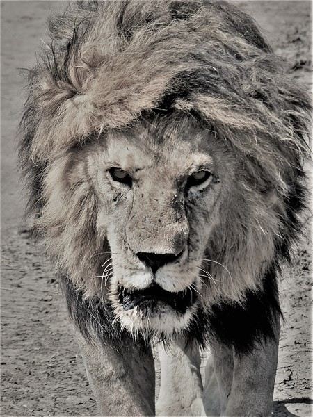
First off, yes, as the title of this journal suggests, we were lucky enough to spot *tons* of lions. The power they exude is incredible, even if most of the time they just look like big cats napping or strolling around. But lock eyes with one, and you’ll be glad you’re in the jeep.
Hello everyone!
This trip dates back to late 2021, but since Voyage Forum reopened for writing, I haven’t seen many travel journals about Tanzania, so I decided to repost this one, which I originally shared on another well-known travelers’ site—even though I prefer Voyage Forum’s user experience.
It’s also a chance for me to relive this exhilarating trip... So, if you’re up for it, let me take you on a classic adventure: Tarangire - Ngorongoro - Serengeti, plus a little bonus—the small Arusha Park.
First off, yes, as the title of this journal suggests, we were lucky enough to spot *tons* of lions. The power they exude is incredible, even if most of the time they just look like big cats napping or strolling around. But lock eyes with one, and you’ll be glad you’re in the jeep.
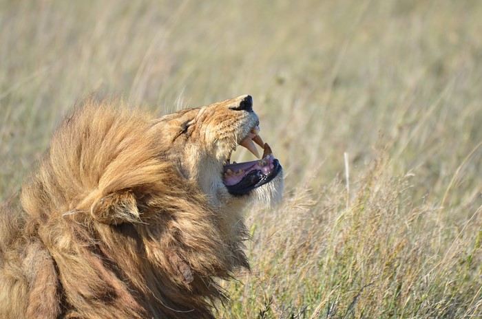
But let’s not forget the rest of the wildlife—and the landscapes, which are absolutely stunning, with those iconic tree silhouettes.
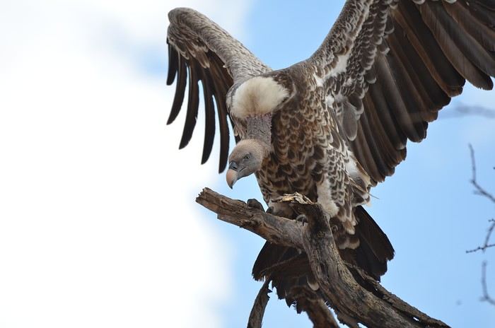
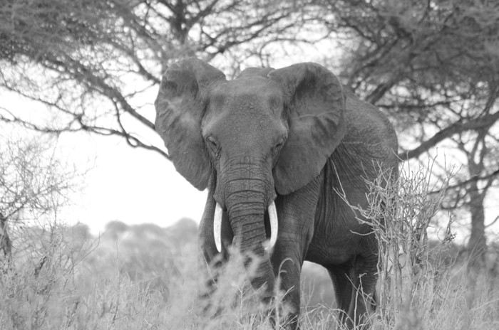
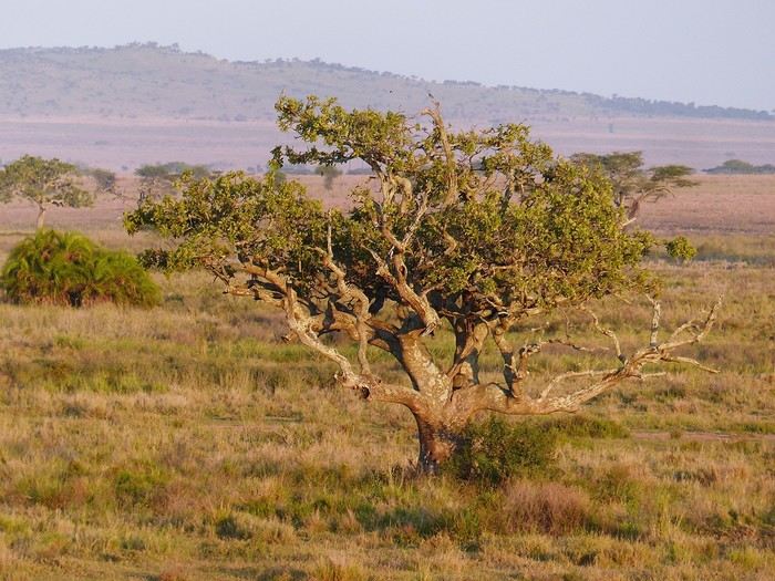
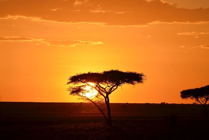
I remember before leaving, I was a little worried I wouldn’t feel that same sense of wonder I’d experienced two years earlier in Botswana (see my travel journal). That fear was unfounded—the magic worked its charm once again! Note: Since we had limited time, we focused our trip entirely on safari, so this journal is 100% animals and landscapes—and 0% Maasai. Next post: TARANGIRE
18 days in Cape Verde in January 2025
Hello,
We’ve just returned (2 senior couples) from 18 days in Cape Verde (21/01 to 7/02) that we really enjoyed. The temperature was great—20° to 27°—admittedly a bit windy at times, but the friendliness of the Cape Verdeans made up for it.
Paris Orly, direct flight with Transavia (cheap if you book in advance). We landed in São Vicente, with a 12 € city transfer. We had a fantastic 2-bedroom apartment in downtown Mindelo—Av. Fernando Ferreira Fortes, "Casa So Morabeza"—for 58 € per night. The owner lives in France and communicates instantly via WhatsApp.
We spent 2 days exploring the (beautiful) city of Mindelo and its port activity, plus a private taxi tour of the island (6000 CVE for the day).
Then we took the Armas ferry (recommended company—1500 CVE) to Santo Antão.
From there, a collectivo (450 CVE per person) took us to Ribeira Grande, a central base for hikes.
We stayed in a brand-new, modern, and well-equipped 2-bedroom apartment—*Apartamentos Modernos*—for 6770 CVE per night, staying 6 nights. I highly recommend it for its location in town and proximity to *aluguers* and *collectivos* for hiking.
The hikes were stunning:
- The coastal trail from Fontainhas to Cruzinha (taxi for 1500 CVE)
- The route from Corda to Coculi (taxi for 2000 CVE + 100 CVE per person for the return)
- The trail from Cova to Cidade de Pombas (taxi for 2000 CVE + 100 CVE per person for the return)
- The hike from Miradouro to Ribeira Grande (taxi for 2000 CVE)
- The coastal road from Ribeira Grande to Ponta do Sol (visit and lunch at *Mini Familiar* in the city center—excellent and affordable) for the round trip.
Ribeira Grande has plenty of restaurants, but avoid *5 de Julho*—it’s loud and slow.
We loved: *Bellcanto*, *Cantinho da Amizade*, and *Boca-Fina Churrasqueria*.
Meals with drinks cost around 800–1000 CVE.
Back to São Vicente by ferry (1500 CVE), then an airport transfer (12 €) and a flight (99 €) to Santiago’s Praia. The airport-to-city transfer was 15 €.
We stayed at *Kelly’s* in Plato, Praia, which was disappointing—not ideal for two couples—but well-located.
One day was spent visiting the massive *Suspicia* market, then a collectivo to Cidade Velha (2 x 200 CVE round trip per person). We hiked up to the fort, explored *Rua Banana*, and had lunch at *Praça do Mar* by the beach.
We rented a car for 6 days (29000 CVE) from *Slimpycar* in Praia.
On Saturday, we visited the huge *Assomada* market—don’t miss it!—then hiked to *Boa Entrada* and *Poilon*, the largest and most impressive tree we’ve ever seen.
We stayed for 2 nights (138 €) in a beautiful valley in *Picos*—a spacious, lovely house with 2 bedrooms, 2 bathrooms, and a large living area, surrounded by nature and animals.
Lina, the charming neighbor, prepared dinner (8.50 €) and breakfast (4.50 €) for us.
Next, we headed to *Tarrafal*, stopping to visit the concentration camp (500 CVE)—a must-see—before arriving.
We spent 3 nights (184 €) in a fantastic house called *"Maison Familiale"*—huge, with 3 bedrooms, 2 bathrooms, 2 kitchens, 5 toilets, and a large terrace with sea views. It was absolutely stunning and very close to the beach and numerous restaurants.
We did a beautiful 3.8 km hike to the *Farol da Ponta Preta* lighthouse.
Tarrafal’s beach is lively and pleasant, with bars, restaurants, and even acrobats!
We also explored *Ribeira da Prata* to see the *Piscina Natural de Cuba* (not easy to find).
We loved discovering isolated villages like *Ponta Furna*, *Ponta Labrão*, and *Fazenda*.
For food, I recommend *Mira Mar* at *Mama’s*.
On the way back to Praia, we took the east coast route via *Calheta de São Miguel*, *Pedra Badejo*, and *Praia Baixo*—nothing extraordinary, just a rugged, wild coastline with beaches that seemed a bit tricky to access.
Our last evening in Praia was nice. The seaside esplanade was lively, and many Cape Verdeans were swimming at *Prainha* beach, which seemed very accessible and safe.
If you’d like more info—addresses, etc.—feel free to message me privately. I’ll respond.
Jacquesler.
Tuscany: Arezzo province and the Siena area
So happy the forum reopened last October!!!
I’ve started reading again (posts, travel journals) and chiming in on a few discussions. Now I’m stepping it up by writing a new travel journal—I’ve already posted a few between 2018 and 2020.
My latest trip was to Italy from August 27 to September 26, 2024. As the title says, it was a wander through Tuscany in parts of the region that aren’t the most visited. No Firenze-Siena-Pisa trilogy, no San Gimignano; there’ll be a quick detour into Siena, but I’ll skip the best-known sights. That choice, plus traveling in September, should help dodge overtourism. It worked out—crowds were light, sometimes very light, the whole way. Here’s the practical rundown: - a long trip outside peak season (ah, retirees!) - solo camping (caravan) - a mix of activities (hiking, mountain biking, sightseeing) in places that aren’t always packed with tourists. Still, I don’t feel like I ended up in some hidden-away spots. Not sure if this will draw any readers.
DAY 1: Tuesday, August 27, 2024 The heat was intense on the drive in across the plain; two big storms—more rain and hail than lightning and thunder—threw the weather off, the first near Imola, the second on the four-lane road up the Savio valley. I left the Cesena-Roma four-lane at the Verghereto exit and climbed up to Balze (1,100 meters). The campsite is even higher (1,200 meters), in the forest near the source of the Tevere (Tiber). Staying up here will cut down on driving for the first part of the trip: a route through the Appennino (Apennines) on the border between Toscana and Emilia-Romagna. The temperature was surprisingly mild for the altitude, the air thick with moisture by late afternoon. I drove back down from the campsite to Balze (2 km on the road) to grab groceries (it’s doable) and scout tomorrow’s hike. .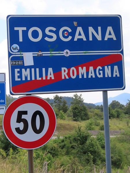
The endpoint of the planned hike is just a few meters from this sign (the trail crosses this road about 3 km from Balze). I realized Balze and the source of the Tevere (Tiber) are actually in Emilia-Romagna, not Toscana. I always thought the Tevere (Tiber), which flows toward Roma (Tyrrhenian side), started in Toscana! I’ll come back to this quirk in Day 3’s write-up.
My latest trip was to Italy from August 27 to September 26, 2024. As the title says, it was a wander through Tuscany in parts of the region that aren’t the most visited. No Firenze-Siena-Pisa trilogy, no San Gimignano; there’ll be a quick detour into Siena, but I’ll skip the best-known sights. That choice, plus traveling in September, should help dodge overtourism. It worked out—crowds were light, sometimes very light, the whole way. Here’s the practical rundown: - a long trip outside peak season (ah, retirees!) - solo camping (caravan) - a mix of activities (hiking, mountain biking, sightseeing) in places that aren’t always packed with tourists. Still, I don’t feel like I ended up in some hidden-away spots. Not sure if this will draw any readers.
DAY 1: Tuesday, August 27, 2024 The heat was intense on the drive in across the plain; two big storms—more rain and hail than lightning and thunder—threw the weather off, the first near Imola, the second on the four-lane road up the Savio valley. I left the Cesena-Roma four-lane at the Verghereto exit and climbed up to Balze (1,100 meters). The campsite is even higher (1,200 meters), in the forest near the source of the Tevere (Tiber). Staying up here will cut down on driving for the first part of the trip: a route through the Appennino (Apennines) on the border between Toscana and Emilia-Romagna. The temperature was surprisingly mild for the altitude, the air thick with moisture by late afternoon. I drove back down from the campsite to Balze (2 km on the road) to grab groceries (it’s doable) and scout tomorrow’s hike. .
The endpoint of the planned hike is just a few meters from this sign (the trail crosses this road about 3 km from Balze). I realized Balze and the source of the Tevere (Tiber) are actually in Emilia-Romagna, not Toscana. I always thought the Tevere (Tiber), which flows toward Roma (Tyrrhenian side), started in Toscana! I’ll come back to this quirk in Day 3’s write-up.
Two weeks in the Cyclades
The Cyclades attract a lot (a LOT) of people in the summer, and it's not always clear how to visit them.
For our first family trip to the Cyclades (in 2016), we took a route that seems great for discovering the islands: - Flight Paris / Santorini (Transavia) - 3 nights in Santorini - Ferry Santorini / Milos - 4 nights in Milos - Ferry Milos / Sifnos - 4 nights in Sifnos - Ferry Sifnos / Athens - 3 nights in Athens - Flight Athens / Paris
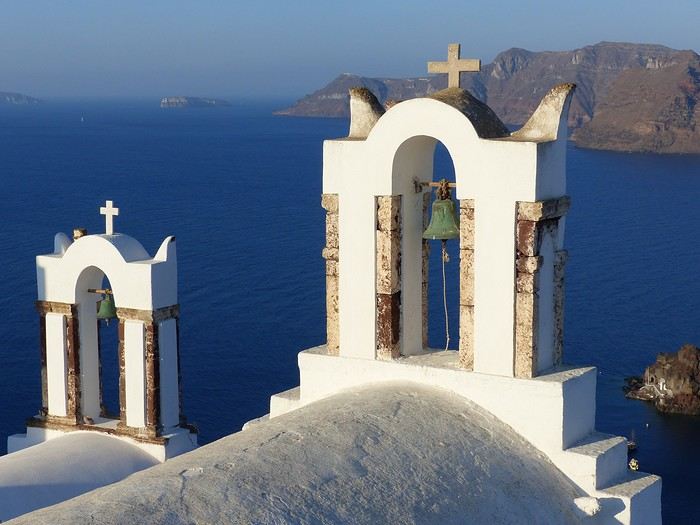
Santorini is the postcard image of the Cyclades... but not really any beaches for kids. My tip: you should stay in Oia because it's really "the spot" on the island. We chose the Pension "The Flower": simple but very well located and with a pool for the kids. Another tip: rent a car as soon as you arrive at the airport because the island is vast.
Our favorite moment: Oia around 6:00 AM, a paradise for photographers. It’s nothing like the daytime, or especially the evening when all the crowds rush in for the famous "sunset." Another favorite, the hike between Fira and Oia, 10 km, 4 hours of walking with extraordinary views (especially around Imerovigli). For the rest, we toured the island—it’s nice but nothing to marvel at.
After a 2.5-hour ferry ride, we arrived in Milos, home of the famous Venus de Milo. This is our favorite island in the Cyclades (though we haven’t seen them all!). In the port of Adamantas, we stayed at the Liogerma Hotel (very well located near the port).
Our favorite experience: the boat tour around the island (and swimming at Kleftiko). Absolutely a must-do, but book it as soon as you arrive because it’s often fully booked for the next two days.
I also recommend renting a car to explore this island. Other favorites: the incredible fishing village of Klima with its colorful boat houses, the rocks of Sarakiniko (best in the morning sun), the beach at Tsigrado (with its ladder access through the rocks), Plaka, the caves of Papafragas, the waters of Firopotamos, and Fyriplaka...
Just a 1-hour ferry ride, and you’re already in Sifnos. A small island with a bus network that means you don’t need to rent a vehicle. We stayed in Kamares (Hotel Afroditi).
Sifnos has charming villages typical of the Cyclades (Kastro, Apollonia), beautiful chapels (Chrisopigi, the Church of the Seven Martyrs...), and lovely beaches (Cherronissos, Platis Galios...). Our favorite: hiking around Faros and the Chrisopigi Monastery.
A 3-hour ferry ride takes you back to the port of Piraeus to visit Athens: the Acropolis, its museums, and the Plaka district. A little favorite of ours: the Archaeological Museum, slightly off the tourist trail... With this route, you’ll see the diversity of the Cyclades and Athens without wasting too much time on ferries.
PS: We also did the loop Mykonos / Paros / Amorgos / Mykonos, but that’s a good idea... for a second trip ;)
For our first family trip to the Cyclades (in 2016), we took a route that seems great for discovering the islands: - Flight Paris / Santorini (Transavia) - 3 nights in Santorini - Ferry Santorini / Milos - 4 nights in Milos - Ferry Milos / Sifnos - 4 nights in Sifnos - Ferry Sifnos / Athens - 3 nights in Athens - Flight Athens / Paris
Santorini is the postcard image of the Cyclades... but not really any beaches for kids. My tip: you should stay in Oia because it's really "the spot" on the island. We chose the Pension "The Flower": simple but very well located and with a pool for the kids. Another tip: rent a car as soon as you arrive at the airport because the island is vast.
Our favorite moment: Oia around 6:00 AM, a paradise for photographers. It’s nothing like the daytime, or especially the evening when all the crowds rush in for the famous "sunset." Another favorite, the hike between Fira and Oia, 10 km, 4 hours of walking with extraordinary views (especially around Imerovigli). For the rest, we toured the island—it’s nice but nothing to marvel at.
After a 2.5-hour ferry ride, we arrived in Milos, home of the famous Venus de Milo. This is our favorite island in the Cyclades (though we haven’t seen them all!). In the port of Adamantas, we stayed at the Liogerma Hotel (very well located near the port).
Our favorite experience: the boat tour around the island (and swimming at Kleftiko). Absolutely a must-do, but book it as soon as you arrive because it’s often fully booked for the next two days.
I also recommend renting a car to explore this island. Other favorites: the incredible fishing village of Klima with its colorful boat houses, the rocks of Sarakiniko (best in the morning sun), the beach at Tsigrado (with its ladder access through the rocks), Plaka, the caves of Papafragas, the waters of Firopotamos, and Fyriplaka...
Just a 1-hour ferry ride, and you’re already in Sifnos. A small island with a bus network that means you don’t need to rent a vehicle. We stayed in Kamares (Hotel Afroditi).
Sifnos has charming villages typical of the Cyclades (Kastro, Apollonia), beautiful chapels (Chrisopigi, the Church of the Seven Martyrs...), and lovely beaches (Cherronissos, Platis Galios...). Our favorite: hiking around Faros and the Chrisopigi Monastery.
A 3-hour ferry ride takes you back to the port of Piraeus to visit Athens: the Acropolis, its museums, and the Plaka district. A little favorite of ours: the Archaeological Museum, slightly off the tourist trail... With this route, you’ll see the diversity of the Cyclades and Athens without wasting too much time on ferries.
PS: We also did the loop Mykonos / Paros / Amorgos / Mykonos, but that’s a good idea... for a second trip ;)
5 weeks in Guatemala in November 2024
A fantastic trip, dominated by the Altiplano, volcanoes, and especially the Mayan people!
Our route: Antigua – San Lucas de Toliman (Lake Atitlán) – Chichicastenango – Sayaxché – El Remate – Flores – Río Dulce – Livingston – Antigua I won’t describe our trip in detail but will highlight a few points that go beyond the usual routes and really won us over. In Antigua, it’s easy to take a chicken bus from the bus station next to the central market in the eastern part of the city to visit nearby villages. We went to Santa María de Jesús on a Sunday without seeing any other Westerners. We got lost in its colorful market, ate at a *comedor* with local dishes we didn’t find anywhere else, and were surrounded by incredibly welcoming Mayans. Several villages around Lake Atitlán are well-covered by travelers and guides like *Routard* and *Lonely Planet*, but if you want to stay somewhere more authentic, I recommend San Lucas de Toliman (we stayed at *Casa Qatzil*—great place!). It’s in the southeast of the lake, with a market on Tuesdays and Fridays, a central square full of locals (more of those super-friendly Mayans!), and the option to visit other villages by *lancha* (boat) for the day. A walk toward the lake lets you pass by the washhouses, and there are hikes accessible by *pick-up* (shared transport), like the twin volcanoes Tolimán and Atitlán or Cerro del Oro (less challenging!). We loved visiting Santa Catarina Palopó—get lost in its maze of steep alleys, admiring the blue facades with their characteristic paintings. There are direct *chicken bus* connections to Chichicastenango in 1.5 hours. Cheap and convenient, though a bit bumpy! Chichicastenango is famous for its market, described as the largest in Central America, on Thursdays and Sundays. A flood of tourists arrives between 10 AM and 1 PM, shuttled in by organized buses from Lake Atitlán and Antigua. But if you have time, stay overnight the day before and enjoy the market before 10 AM or in the afternoon. This little town (more of those welcoming Mayans!) is worth lingering in for a day or two to visit the cemetery, extraordinarily colorful and a site of Mayan rituals. Also take time to go to *Plaza Baktun*, a site considered sacred in Mayan culture where religious ceremonies take place around seven sculptures several meters tall. The ruins of Aguateca are barely excavated (most structures are still covered in vegetation) and are only accessible by boat, traveling up a tributary of the Río de la Pasión to the sound of howler monkeys and birdsong (1.5 hours from Sayaxché). We felt like we got a sense of daily life in the ancient city—not just its religious dimension—with its ravine for sheltering women and children during attacks, its cliff, and defensive walls. Alone with our *lancha* driver, who acted as our guide in the barely cleared jungle, this site doesn’t overlap with Tikal at all—the vibe is completely different. We stayed in El Remate instead of Flores to visit Yaxhá and Tikal, at *Posada Ixchel* (great place!). This quiet little town lets you stroll along the lake and hike in *Cerro Cahui*, a protected biotope leading to a viewpoint. Plus, it’s on the way to the sites, saving 45 minutes per trip.
Feel free to ask me questions about the places, accommodations, etc.—I’d be happy to answer!
Our route: Antigua – San Lucas de Toliman (Lake Atitlán) – Chichicastenango – Sayaxché – El Remate – Flores – Río Dulce – Livingston – Antigua I won’t describe our trip in detail but will highlight a few points that go beyond the usual routes and really won us over. In Antigua, it’s easy to take a chicken bus from the bus station next to the central market in the eastern part of the city to visit nearby villages. We went to Santa María de Jesús on a Sunday without seeing any other Westerners. We got lost in its colorful market, ate at a *comedor* with local dishes we didn’t find anywhere else, and were surrounded by incredibly welcoming Mayans. Several villages around Lake Atitlán are well-covered by travelers and guides like *Routard* and *Lonely Planet*, but if you want to stay somewhere more authentic, I recommend San Lucas de Toliman (we stayed at *Casa Qatzil*—great place!). It’s in the southeast of the lake, with a market on Tuesdays and Fridays, a central square full of locals (more of those super-friendly Mayans!), and the option to visit other villages by *lancha* (boat) for the day. A walk toward the lake lets you pass by the washhouses, and there are hikes accessible by *pick-up* (shared transport), like the twin volcanoes Tolimán and Atitlán or Cerro del Oro (less challenging!). We loved visiting Santa Catarina Palopó—get lost in its maze of steep alleys, admiring the blue facades with their characteristic paintings. There are direct *chicken bus* connections to Chichicastenango in 1.5 hours. Cheap and convenient, though a bit bumpy! Chichicastenango is famous for its market, described as the largest in Central America, on Thursdays and Sundays. A flood of tourists arrives between 10 AM and 1 PM, shuttled in by organized buses from Lake Atitlán and Antigua. But if you have time, stay overnight the day before and enjoy the market before 10 AM or in the afternoon. This little town (more of those welcoming Mayans!) is worth lingering in for a day or two to visit the cemetery, extraordinarily colorful and a site of Mayan rituals. Also take time to go to *Plaza Baktun*, a site considered sacred in Mayan culture where religious ceremonies take place around seven sculptures several meters tall. The ruins of Aguateca are barely excavated (most structures are still covered in vegetation) and are only accessible by boat, traveling up a tributary of the Río de la Pasión to the sound of howler monkeys and birdsong (1.5 hours from Sayaxché). We felt like we got a sense of daily life in the ancient city—not just its religious dimension—with its ravine for sheltering women and children during attacks, its cliff, and defensive walls. Alone with our *lancha* driver, who acted as our guide in the barely cleared jungle, this site doesn’t overlap with Tikal at all—the vibe is completely different. We stayed in El Remate instead of Flores to visit Yaxhá and Tikal, at *Posada Ixchel* (great place!). This quiet little town lets you stroll along the lake and hike in *Cerro Cahui*, a protected biotope leading to a viewpoint. Plus, it’s on the way to the sites, saving 45 minutes per trip.
Feel free to ask me questions about the places, accommodations, etc.—I’d be happy to answer!
Iceland: A Week on the Land of Ice and Fire in April
4 years... it’s been so long!!!
What a pleasure to be back on VF and, most of all, to see all the forum members again 🙂
And what a joy to read the travel journals of those travel addicts who were quicker than their own shadow to share their discoveries. Their keyboards and mice must’ve been itching
I’ll admit I’m feeling a bit of that itch too, but I’m way too lazy to dive into the story of our latest trip—last summer in the northwest USA. I’ll probably get to it later, but it might take a while! So, I’m jumping into the short recap of our *way* too short trip to Iceland at the end of April 2024. And even though it’s not the done thing, I’m going to spoil it and start with the conclusion: it was *amazing*!!!
Back in February, on the eve of leaving for a few days’ holiday in Alsace, we started wondering what we could do for Easter break. Scotland and Iceland were the top contenders. The boys are growing up, but they still travel with us often, and they tipped the scales in favor of Iceland. Since we decided a bit late, before booking the flights, I took a quick look at available accommodations. There wasn’t much left, and some were at crazy prices, but I managed to line up a decent itinerary with places that seemed like good value for money. I read travel journals on VF and blogs I could find, picked up bits of info from Facebook groups, and the route quickly took shape—even if I struggled with the place names, mixing them up and forgetting them. The dream could begin...
Bookings
Flight tickets bought directly from Fly Play’s website: 1520 € for the four of us (adult fare), with just two checked bags and one carry-on each. It was the compromise we found to keep costs down while still fitting all the bulky clothes we’d need. Late April isn’t quite winter anymore, but it’s not quite spring either, so we packed for chilly weather. Fly Play is Icelandair’s low-cost airline. No complaints: check-in was quick, service was efficient, and the flights were on time.
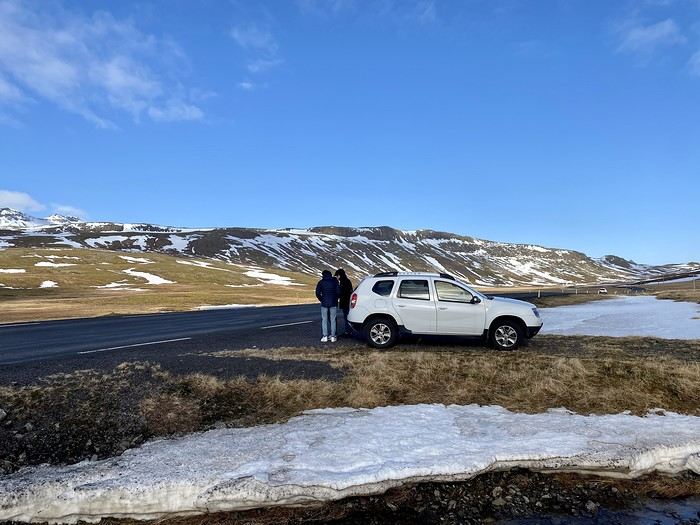
The car. Booked with Golden Circle car rental, a small family-run business with offices just 5 minutes from the airport. I’d read good things about them, and I can confirm everything went smoothly with our Dacia Duster—it wasn’t brand new, but it was reliable and spacious. We paid 463 € for the week, with full insurance included. The manager picked us up at the airport 10 minutes after I messaged him on WhatsApp to say we’d arrived. For the return trip, since our flight was super early and the agency wasn’t open yet, we agreed to leave the car in the airport parking lot and sent him a photo of the spot so he could find it. Super convenient! I read *so* many questions on Facebook groups about insurance: *Should I get the max coverage or not? I’ve got a Visa Premier, I’ve never had an accident, it adds 100 €...* Between sandstorms that can damage the bodywork and skidding off the road due to bad weather (we saw a few cars in ditches!), we decided to go for the rental company’s max insurance to be safe. It was also a requirement for leaving the car in the airport parking lot on our way back, since we couldn’t do the final inspection.
Accommodations were all booked on Booking.com and Hotels.com: - 2 nights in a cottage at Fossatun Country Hotel, near Borgarnes (we rented the sunset cottage—great spot, with a nice view and separate from the other lodgings) - 1 night in an apartment at Bakki Hostel and Apartments, in Eyrarbakki (top-notch) - 1 night in a gorgeous (and pricey!) apartment at Vik Apartments - 2 nights in a family room at Adventure Hof Hotel (perfect location) - 1 night at Blue Viking Studio near the airport (meh, but fine for a few hours’ sleep before an early flight) Total: 1234 €, averaging 176 € per night for 4-person accommodations.
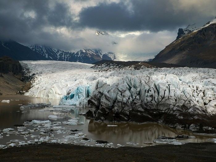
The itinerary Day 1: Arrival around noon at the airport - Hraunfossar / Night at Fossatun Country Hotel Day 2: Snæfellsnes Peninsula / Night at Fossatun Country Hotel Day 3: Bruarfoss - Geysir - Gullfoss - Reykjadalur hot springs / Night in Eyrarbakki Day 4: Seljalandsfoss and Gljúfrafoss - DC-3 wreck (the one near Seljalandsfoss) - Skógafoss - Kvernufoss - Sólheimajökull (hike to the foot of the glacier) - Dyrhólaey - Reynisfjara Beach / Night in Vík Day 5: Fjaðrárgljúfur Canyon - Vatnajökull (3-hour hike to Svartifoss and Skaftafell) / Night in Hof Day 6: Múlagljúfur Canyon (2h45 hike) - Fjallsárlón - Jökulsárlón and Diamond Beach - Svínafellsjökull / Night in Hof Day 7: Drive back - Reykjavik - Sky Lagoon / Night in Keflavík Day 8: Flight back at 6 AM
That’s the practical side covered. I’ll leave you with a photo of our trusty steed.
And what a joy to read the travel journals of those travel addicts who were quicker than their own shadow to share their discoveries. Their keyboards and mice must’ve been itching
I’ll admit I’m feeling a bit of that itch too, but I’m way too lazy to dive into the story of our latest trip—last summer in the northwest USA. I’ll probably get to it later, but it might take a while! So, I’m jumping into the short recap of our *way* too short trip to Iceland at the end of April 2024. And even though it’s not the done thing, I’m going to spoil it and start with the conclusion: it was *amazing*!!!
Back in February, on the eve of leaving for a few days’ holiday in Alsace, we started wondering what we could do for Easter break. Scotland and Iceland were the top contenders. The boys are growing up, but they still travel with us often, and they tipped the scales in favor of Iceland. Since we decided a bit late, before booking the flights, I took a quick look at available accommodations. There wasn’t much left, and some were at crazy prices, but I managed to line up a decent itinerary with places that seemed like good value for money. I read travel journals on VF and blogs I could find, picked up bits of info from Facebook groups, and the route quickly took shape—even if I struggled with the place names, mixing them up and forgetting them. The dream could begin...
Bookings
Flight tickets bought directly from Fly Play’s website: 1520 € for the four of us (adult fare), with just two checked bags and one carry-on each. It was the compromise we found to keep costs down while still fitting all the bulky clothes we’d need. Late April isn’t quite winter anymore, but it’s not quite spring either, so we packed for chilly weather. Fly Play is Icelandair’s low-cost airline. No complaints: check-in was quick, service was efficient, and the flights were on time.
The car. Booked with Golden Circle car rental, a small family-run business with offices just 5 minutes from the airport. I’d read good things about them, and I can confirm everything went smoothly with our Dacia Duster—it wasn’t brand new, but it was reliable and spacious. We paid 463 € for the week, with full insurance included. The manager picked us up at the airport 10 minutes after I messaged him on WhatsApp to say we’d arrived. For the return trip, since our flight was super early and the agency wasn’t open yet, we agreed to leave the car in the airport parking lot and sent him a photo of the spot so he could find it. Super convenient! I read *so* many questions on Facebook groups about insurance: *Should I get the max coverage or not? I’ve got a Visa Premier, I’ve never had an accident, it adds 100 €...* Between sandstorms that can damage the bodywork and skidding off the road due to bad weather (we saw a few cars in ditches!), we decided to go for the rental company’s max insurance to be safe. It was also a requirement for leaving the car in the airport parking lot on our way back, since we couldn’t do the final inspection.
Accommodations were all booked on Booking.com and Hotels.com: - 2 nights in a cottage at Fossatun Country Hotel, near Borgarnes (we rented the sunset cottage—great spot, with a nice view and separate from the other lodgings) - 1 night in an apartment at Bakki Hostel and Apartments, in Eyrarbakki (top-notch) - 1 night in a gorgeous (and pricey!) apartment at Vik Apartments - 2 nights in a family room at Adventure Hof Hotel (perfect location) - 1 night at Blue Viking Studio near the airport (meh, but fine for a few hours’ sleep before an early flight) Total: 1234 €, averaging 176 € per night for 4-person accommodations.
The itinerary Day 1: Arrival around noon at the airport - Hraunfossar / Night at Fossatun Country Hotel Day 2: Snæfellsnes Peninsula / Night at Fossatun Country Hotel Day 3: Bruarfoss - Geysir - Gullfoss - Reykjadalur hot springs / Night in Eyrarbakki Day 4: Seljalandsfoss and Gljúfrafoss - DC-3 wreck (the one near Seljalandsfoss) - Skógafoss - Kvernufoss - Sólheimajökull (hike to the foot of the glacier) - Dyrhólaey - Reynisfjara Beach / Night in Vík Day 5: Fjaðrárgljúfur Canyon - Vatnajökull (3-hour hike to Svartifoss and Skaftafell) / Night in Hof Day 6: Múlagljúfur Canyon (2h45 hike) - Fjallsárlón - Jökulsárlón and Diamond Beach - Svínafellsjökull / Night in Hof Day 7: Drive back - Reykjavik - Sky Lagoon / Night in Keflavík Day 8: Flight back at 6 AM
That’s the practical side covered. I’ll leave you with a photo of our trusty steed.
Three weeks in Norway (July 2022): fantastic memories despite the rain
Our trip to Norway was two years ago already, but I thought it might still be of interest—and it’ll let me relive it a bit by proxy.
Before booking our flight tickets, we debated the route: should we prioritize the north with the Lofoten and Senja islands, or the south with its countless fjords? I was tempted to stay in the south—the country is so vast, and the drive north is long... but my husband really didn’t want to miss the Lofoten. In the end, we figured that since Norway is known for being expensive, we might only visit once (funny how we said the same thing before our first trip to the American West, and look how that turned out 😎), so we didn’t want to skip anything. That meant a 2–3 day drive up north. With 22 days on the ground, it was doable. Especially since, as usual, we skip big cities and gave Oslo a pass.
Practical details: - Flight tickets: 1195 € for 4 with Air France (Paris–Oslo outbound, Tromsø–Bergen–Paris return) - Car rental: 2020 € for 21 days (including the outrageous drop-off fee between Oslo and Tromsø—about 1000 €) - Tolls and ferries: 250 € for the portion billed directly by the rental company. Some ferries required advance booking and payment at the time of reservation—I’ll note their prices as I go through the story. - Hotels: 4135 €, averaging 188 € per night. We blew past our usual budgets from trips to the U.S., but oh well... - Food: 1570 €, averaging 71 € per day for 4 in a country where everything’s expensive... How’d we manage? We rarely ate out, mostly grocery shopped, and even packed half a suitcase with non-perishables: pasta, rice, a few cans, and even some cured sausage! We also stayed 3 nights at Clarion Collection hotels, where an evening buffet was included in the room rate.
Before booking our flight tickets, we debated the route: should we prioritize the north with the Lofoten and Senja islands, or the south with its countless fjords? I was tempted to stay in the south—the country is so vast, and the drive north is long... but my husband really didn’t want to miss the Lofoten. In the end, we figured that since Norway is known for being expensive, we might only visit once (funny how we said the same thing before our first trip to the American West, and look how that turned out 😎), so we didn’t want to skip anything. That meant a 2–3 day drive up north. With 22 days on the ground, it was doable. Especially since, as usual, we skip big cities and gave Oslo a pass.
Practical details: - Flight tickets: 1195 € for 4 with Air France (Paris–Oslo outbound, Tromsø–Bergen–Paris return) - Car rental: 2020 € for 21 days (including the outrageous drop-off fee between Oslo and Tromsø—about 1000 €) - Tolls and ferries: 250 € for the portion billed directly by the rental company. Some ferries required advance booking and payment at the time of reservation—I’ll note their prices as I go through the story. - Hotels: 4135 €, averaging 188 € per night. We blew past our usual budgets from trips to the U.S., but oh well... - Food: 1570 €, averaging 71 € per day for 4 in a country where everything’s expensive... How’d we manage? We rarely ate out, mostly grocery shopped, and even packed half a suitcase with non-perishables: pasta, rice, a few cans, and even some cured sausage! We also stayed 3 nights at Clarion Collection hotels, where an evening buffet was included in the room rate.
21-Day Trip to La Gomera and La Palma
Travel Journal: 21 Days in La Gomera and La Palma
From February 6 to February 26, 2024
Tuesday, February 6 We left around 9 AM with our car, along with Pierre-Paul and Patricia, heading to the Bluepark parking lot in Bartenheim. As expected, we were awaited and left promptly for EuroAirport Basel. Took off at 12:25 PM for a 4-hour-15-minute flight under excellent conditions. Beautiful arrival in Tenerife with Teide in sight under a clear blue sky. Fifteen minutes later, we waited for bus No. 40 to Los Cristianos with quite a few other tourists, but we managed to find four seats. From the bus station, it was a 20-minute walk to our hotel. We checked into a lovely apartment for the four of us, complete with all the comforts. Outside, it was quite warm—at least 25°C! After dropping off our luggage, we went for a stroll. The immediate surroundings of the hotel held no interest for us: a modern, concrete area filled with hotels, bars, tourist agencies, and unappealing restaurants all offering the same bland international cuisine. Pat went to cool off at the pool, unfortunately overrun by loud, drunk English tourists. I took a walk to the paseo maritimo that leads to the port, skirting the seafront. The promenade was pleasant, but it could have been any seaside resort in the world—same old scene: a succession of bars with blaring music where many elderly people sipped cold beers waiting for the sunset, the backdrop a wall of resort-style hotels resembling rabbit hutches! Upon reaching the port, I scouted the route we’d take the next day to the Fred Olsen ferry. Back at the apartment, in the early evening, we looked for a non-touristy restaurant for dinner. Monique stopped a woman to ask her opinion! In this area, she told us, there’s no restaurant that serves Canarian or Spanish cuisine! The only place with decent restaurants is at the port. Off we went to the port, where we sat down at Al Bordo restaurant and ordered a seafood paella for four. Excellent, and at a very reasonable price (36 € for two). We returned to the hotel along the seafront.
Wednesday, February 7
Woke up at 6 AM. Had breakfast in the apartment with what we’d bought the day before at a supermarket. It was still dark when we left on foot toward the port, walking along the calm seafront at this early hour. Forty minutes later, we arrived and waited 10 minutes before the ferry docked. At 9:30 AM, we left the port of Los Cristianos for a 50-minute crossing on a calm sea under a beautiful blue sky. There were quite a few people on this large ferry, but many had no luggage, meaning they were visiting La Gomera for the day and would take the ferry back in the evening. Upon disembarking, we went straight to our rental car agency to pick up the car we’d booked online a few months earlier. It was a nice Peugeot 2008, spacious enough for the four of us and our luggage. We immediately took the beautiful road from San Sebastián that climbs directly into the mountains toward our rental in Vallehermoso. The road was in perfect condition—it seemed brand new, like all the others we’d take on this island later. This side of the island is very arid with little vegetation, and the terrain is particularly rugged, as it is throughout the island. We stopped at our first miradors, which would be followed by many more throughout our Canarian trip. Our first visit was to the small village of Agulo, perched on a promontory above the sea and at the foot of a high cliff. The village features typical Canarian houses with windows flush with the façade and black volcanic stone masonry on white or reddish-brown walls. The first recommended restaurant was already booked for a group, so we settled for the shaded terrace of the excellent El Alameda bar-restaurant. From Agulo, you can access the Abrante viewpoint via a winding road, where the view of Agulo, 600 meters below, is exceptional. A glass ledge over the void lets you test your fear of heights!
We drove to Vallehermoso to do our grocery shopping at the supermarket—a habit that would continue until the end of the trip. Our little house, "Casa rural El Encatadora," is located in a beautiful flower-filled valley a few kilometers west of Vallehermoso. Each of us had a bedroom with an en-suite bathroom, plus a living room, kitchen, and a small terrace overlooking the quiet street at the valley’s end, which didn’t bother us at all.
Thursday, February 8 The good weather seemed to follow us since our arrival in the Canary Islands. This morning, we took the road—still as beautiful and new—toward Arure, high up to the west. The landscape was magnificent, with breathtaking glimpses of the sea far below. In Arure, we parked in front of Conchita’s bar, where a hike (Rother No. 30) starts toward two viewpoints: Alojera, which we reached after 45 minutes on a lovely path. Monique, tired from the first steep climb, stopped at the first viewpoint and hitchhiked back to Arure. Meanwhile, we continued toward the second viewpoint, Los Barranquillos, where the view of the surroundings was partially hidden by misty clouds rising from the sea. The entire mountain is sculpted by ancient, endless terraces climbing until the slope becomes too steep for construction—visible traces of the hard work of past inhabitants trying to survive in a harsh environment. We had a decent lunch at La Conchita bar, then drove to the small seaside town of Puerto la Caleta, sheltered by an immense cliff plunging into the sea. Black sand beach, rough sea—despite our encouragement, Pat didn’t dare to swim! As for the old village of Caleta, it’s perched on the mountainside, and visiting it requires climbing steep, stair-filled alleys to discover a few traditional houses. Back at the casa, dinner in, and card games...
 Vallehermoso
Friday, February 9 This morning, the sky was overcast, and the peaks around us were shrouded in clouds. We took the same road as yesterday to hike Las Creces. Quickly gaining altitude, we entered a thick fog—visibility was very limited. We stopped at the Las Creces parking lot; visibility improved, and the sun wasn’t far off. The hike is entirely within a beautiful laurel forest, with the sun playing hide-and-seek, but it wasn’t cold despite the altitude. After finishing the loop trail, we decided to picnic—not there, as it was too chilly—but on Vallehermoso’s beach, where we found a nice picnic area sheltered by large black rocks. A short digestive walk on the surrounding hill to admire the little beach from above. Back in Vallehermoso, we did some grocery shopping, then tried to return to the casa—only to find ourselves locked out because we’d left the key in the lock inside! After several attempts and with the help of Yéli, a relative of the owner we called for help, we were finally able to get back in!
Saturday, February 10
It rained last night, and the sky remained overcast. Monique decided to rest this morning. PP, Pat, and I set off on the hike that starts from the house toward the Marichal reservoir. The sun wasn’t far off, and by 11 AM, it was fully out. The pleasant hike passed by many flower-filled gardens and orchards—orange, lemon, and mandarin trees in fruit. The path climbed gently toward the reservoir, where the view of the Cano rock dominating the landscape was magnificent. The last part of the climb was a bit tough, overgrown with lush vegetation, and the trail was slippery from last night’s rain. We descended via a different, much more pleasant path and returned to the casa just in time for lunch, prepared by Monique. This valley is rich with its many farmers and market gardeners who’ve cultivated the entire valley, taking advantage of the water flowing down from the mountain, captured upstream and redistributed through countless pipes snaking along the paths. Numerous tanks also store water during dry periods. The houses are scattered across both sides of the valley, and these colorful little homes add a beautiful touch to the landscape. The many palm trees give this valley a distinctly tropical feel—you could almost imagine yourself in the Caribbean. Add to that some salsa music drifting from a hut where farmers were working, and the picture is complete. A well-chilled beer apéro capped off a lovely morning. The afternoon was dedicated to rest, relaxation, reading, and games.
Sunday, February 11 The blue sky returned, though a few clouds still capped the highest peaks. Today, we visited Garajonay National Park, which covers the highest central mountains. Up there, we were above the clouds, and the panoramas from the various viewpoints were stunning: first, Cherelepin, accessible from the Laguna Grande parking lot, then Alto de Garajonay, offering an exceptional view of Teide—over 3,000 meters high—emerging from the clouds on Tenerife, far in the distance. We continued to the Los Roques viewpoints, then stopped for lunch at the Degollada de Peraza restaurant, where the view of the barranco was impressive. We descended toward San Sebastián and checked into our new lodging, La Cabezada, located in the countryside about 3 km above San Sebastián. It’s a small apartment adjacent to the owner’s, with a lovely terrace overlooking the surrounding mountains and surrounded by a beautiful garden. Apéro, then dinner on our beautiful terrace.
Monday, February 12 This morning, we went down to visit San Sebastián de La Gomera: its old tower, main street with some beautiful traditional houses, and the Church of the Assumption. Back at the casa for lunch. In the afternoon, Pat, PP, and I set off on the short hike from San Sebastián beach to La Guancha beach. We drove down and parked on the beach. The path climbs along the hill overlooking San Sebastián, passes by the tall Christ statue dominating the landscape, and roughly follows the coast down to the isolated Guancha beach. A beautiful hike under a hot sun, and a swim was welcome, even if the beach and sea access weren’t very comfortable due to large pebbles and quickly deepening water. Apart from two nudist bathers, there was no one on this beach. We returned the same way.
Tuesday, February 13 Rest day. We went down to town to stroll and do some shopping. I took the opportunity to visit the parador, beautifully situated above the city in a lovely garden overlooking the port and town. Together, we went for a cuba libre at the "Cuba Libre" bar, then had lunch at Breñusca (mediocre paella!). Back at the casa, then we went back down to town to see a carnival parade, a "passacalles," which actually passed an hour earlier than scheduled. Oh well.
Wednesday, February 14 Each to their own program this morning. Pat went swimming at San Sebastián beach, Monique rested at the casa, and PP and I set off on the hike from Playa de Avalos to the Ermita de Guadalupe on Playa del Cangrejo. It wasn’t easy to find the right road or the parking spot, but we managed. The path seemed to have suffered landslides, according to a sign at the trailhead! We decided to check it out, ready to turn back if it seemed too dangerous. In the end, apart from one or two slightly tricky spots where we had to climb a pile of rocks, the trail remained passable, though a bit vertigo-inducing in places. The narrow path clings to very vertical cliffs nearly 300 meters above sea level! But what a magnificent view. At one point, the trail runs alongside a wall of basaltic pipes. We returned via the drivable track that parallels the trail a bit lower. Back at the house for lunch. In the late afternoon, we returned to town to attend the "Entierro de las Sardinas" (Burial of the Sardine), which closes the Canarian carnival festivities. While waiting, we strolled through the parador’s gardens and had mojitos in town. Around 9 PM, we heard the noise and cries of the mourners. The procession advanced, led by a large papier-mâché sardine on a float, surrounded by wailing mourners. The procession headed toward the sea, where the sardine was burned, and a mini fireworks display ended the procession. It was all very good-natured, and everyone had fun. We ended the evening with dinner at a good fish restaurant, El Pajar.
 Entierro de la Sardina in San Sebastián de La Gomera
Thursday, February 15
Woke up at 5:15 AM. The only suitable ferry was at 7 AM, which would get us to La Palma by late morning rather than evening. We packed our bags, had breakfast, then headed to the port, left our rental car, and boarded the ferry to Tenerife, from where we’d continue to La Palma. Calm sea, beautiful sun—by 10:30 AM, we disembarked in La Palma. We picked up our car and immediately headed to our new apartment in Breña Alta. It’s a large apartment with a superb terrace facing the sea, fully equipped and very comfortable. The hosts recommended Casa Goyo restaurant, near the airport and close to us. It’s a restaurant with many small rooms, some of which can be reserved for families. The fish-based cuisine (chipirones, pulpo) was excellent, hearty, and reasonably priced. Since it’s in the airport’s flight path, we occasionally heard planes landing. Quick and efficient service. Afterward, we visited Santa Cruz de La Palma, which reminded us of the historic quarters of La Orotava in Tenerife or the capital of Gran Canaria.
Friday, February 16
Beautiful weather, blue sky. We headed to the San Bartolo viewpoint toward the northeast coast, then to the lovely village of San Andrés, which we explored. From there, we walked along the shore to the natural pools of Charco Azul, where we swam in the cool but "swimmable" sea. Back in San Andrés for lunch at the "San Andrés" restaurant on the beautiful church square. Very good fish-based meal. We got back in the car and continued along the north coast to the port of Espindola and the natural pools of Fajana near the Cumplida lighthouse. A fairly strong wind whipped up beautiful waves crashing onto the rocky coast in bursts of foam. Back in Santa Cruz, we stopped at the Mercadona supermarket to buy fresh shrimp for dinner. San Andrés
Saturday, February 17
Uniform blue sky, even on the heights. We took the beautiful road that winds up to the summit of the Caldera de Taburiente. Several viewpoints offer 360° views of the entire island and beyond: you can make out La Gomera, El Hierro, and, of course, Tenerife with the perfect triangle of Teide. We parked at the Los Andes viewpoint parking lot and started our hike to Pico de la Cruz along a trail following the ridge, offering superb views into the caldera. We got back in the car and passed by the Roque de los Muchachos astronomical complex, composed of numerous observatories, some with very aesthetic mirror telescopes. We hiked from the Roque de los Muchachos parking lot to the various viewpoints, always as impressive. Picnic on site, then back to Santa Cruz. We stopped by our car dealer because the oil warning light came on—better safe than sorry. The representative reassured us but preferred to give us a Fiat Cross SUV instead. The Caldera de Taburiente
Sunday, February 18 The weather was a bit mixed, with cloudy patches. We set off to hike the Barranco de la Cuba de Galga. Unfortunately, the Los Tilos trail had been closed for several months due to a major landslide. The parking lot by the road was already quite full, and indeed, we crossed paths with many hikers along the way—it’s an easy hike with little elevation gain, which is rare here in La Palma! The beautiful path winds through a very narrow, deep gorge covered in lush tropical vegetation—you’d think you were in a Southeast Asian forest, especially with the humidity in the gorge bringing out earthy and floral scents. Halfway through, Monique turned back while the rest of us continued to the Cuba de Galga. A light drizzle accompanied us on the return. For lunch, we went to Chipi Chipi restaurant in the heights of Santa Cruz. The cool air forced us to leave the lovely terrace for the slightly noisy dining room. The meal was very good and hearty. Afternoon spent resting at our house.
 La Cuba de la Galga
Monday, February 19 A few clouds still clung to the nearby mountain peaks. We headed south to Los Canarios. We stopped in front of the small San Antonio Abad church, where a path leads to the viewpoint in 15 minutes. Then we visited the San Antonio Volcano Interpretation Center and climbed to the viewpoint via the trail along the crater’s edge, offering a plunging view into the crater. Then PP, Pat, and I headed toward the Teneguía volcano but turned back given the remaining distance and the intense heat bearing down on us! Plus, the landscape was rather arid and not very interesting. We got back in the car and drove down to the salt flats at the island’s southern tip. The ocean crashes here in large waves, exploding against the volcanic rocks and feeding a "blowhole" carved into the rock. We stopped for drinks at the salt flats restaurant, then headed home. The salt flats in Fuencaliente
Tuesday, February 20 Beautiful weather with a few clouds clinging to the mountains, as usual. A relaxed morning since my parking reservation at La Cumbrecita didn’t start until 1 PM. It takes about 30 minutes from Santa Cruz to reach the valley floor via a beautiful but narrow road toward the end, though there’s very little traffic. Meanwhile, the clouds had disappeared, and the view from the La Cumbrecita viewpoint was superb. We recognized Pico de la Cruz in the distance, where we’d been a few days earlier. We then took the path leading to the Las Chozas viewpoint through a magnificent Canarian pine forest. We picnicked on site, then took the path to the Los Roques viewpoint. We returned the same way since the direct route was closed for construction. Back in Santa Cruz, we visited the Sanctuary of Las Nieves, with its beautiful golden Baroque altar. Hike from La Cumbrecita
Wednesday, February 21 After packing our things and loading the car, we left Santa Cruz under a very blue sky for Los Llanos de Aridane, where we stopped to visit this lovely town. The Church of Nuestra Señora de los Remedios has a beautiful coffered ceiling and an original papier-mâché Christ statue from the 16th century. Around it, colorful old Canarian houses brighten the streets of the town center. We took the opportunity to stroll, do some shopping, and finally sat down at La Pergola restaurant for a mediocre lunch. We got back in the car to check into our new house in Arecida. On the way, we stopped at the Mirador del Time, which once again offered an impressive panorama, allowing us—for the first time—to see the damage caused by the Tajogaite volcano eruption in 2021. You can clearly see the still-smoking crater and the large black lava flow covering the landscape down to the sea. We really liked our new accommodation: a local house that’s been renovated on the heights of Arecida, not far from the Canarian pine forest. From several terraces, we have a 360° view of the sea and mountains. We even have a private pool! There are two beautiful, brand-new bedrooms, each with its own bathroom—the best. Plus, we’re on the GR 131 trail that runs along the Barranco de las Angustias toward the northeast.
 Los Llanos de Aridane
Thursday, February 22 Once again, beautiful weather greeted us when we woke up. We started the GR 131 with the goal of reaching the Torre del Time viewpoint—about 400 meters of elevation gain. The path, quite steep at first, winds through a superb Canarian pine forest. A few viewpoints let you appreciate the sheer drop of the Barranco de las Angustias—watch out for vertigo! At the Torre del Time viewpoint, there’s a nearly 1,000-meter vertical drop. We returned via another path, the PLP1, which meanders first through this beautiful forest, then along lovely flower-filled gardens adjacent to beautiful properties that cascade from the forest down to the road serving these neighborhoods. This afternoon, we tried to get closer to the area devastated by the 2021 lava flows. Several roads are still closed or reserved for residents, while others—brand new—have been rebuilt to open up this densely populated and cultivated region. In some places, the lava flow slightly diverted, sparing some properties that logically should have disappeared. Now, they’re encircled by a massive cooled lava field. In other spots, twisted and charred metal scraps or greenhouse remains protrude from the lava—all that’s left of the former banana plantations. A little higher up, you can see the slightly smoking crater of Tajogaite, responsible for this disaster. Back to Casa Barreros.
 View of Los Llanos and, in the background, the 2021 lava flow
Friday, February 23
Though the sky was still blue, the temperature had dropped due to a chilly wind. By midday, it still rose to 22°C. Today, we headed north, specifically to the town of Tijarafe, where a very narrow road descends to the small port, Porís de Candelaria. The 3.7-kilometer road drops 700 meters in elevation, with gradients up to 30%—it was going to be intense! Indeed, the descent was scary, with the void right next to the very narrow road where passing was impossible except at a few rare spots. Everything went well—there was little traffic at this early hour. From the parking lot at the bottom, a path leads to Porís de Candelaria. It’s surprising to see this small fishing hamlet nestled in the shelter of an immense cave opening onto the sea, which was quite rough today. The sun, at this time of year, would appear late in the cave, which remained in shadow for much of the day. We returned via the same road, strolled through the small town of Puntagorda, and had lunch at El Jardín de los Naranjos restaurant—excellent meal. Fishing hamlet of Candelaria
Saturday, February 24 The air was still cool, but the sun was beautiful. While Monique stayed home to rest, the three of us headed to the village of Las Tricias to hike the Buracas Caves trail. We left the car parked on the LP1 road and took the small paved road down to the sign marking the trail’s start. The signage for all the trails we took here, as in La Gomera, was very well done. The path descended steadily, then more steeply toward the caves where the island’s first inhabitants lived—some petroglyphs are still visible in certain caves. The path then climbed back up, passing magnificent dragon trees and more or less elaborate huts occupied by Germans who’ve lived here for many years. Back at Casa Barreros for some rest.
Sunday, February 25 The weather once again blessed us with a beautiful day. This morning, we visited the local produce market held on weekends in Puntagorda. You’ll find agricultural products, crafts, and food to keep you going. A little further on, there’s a glass viewpoint overlooking the barranco plunging toward the sea, with a view of the thrill-seekers trying the zip line right next to it. Lunch at Naranjos—definitely a good spot—with their shrimp and spice tagliatelle. Back home for an afternoon of relaxation.
Monday, February 26 We left Arecida under a cloudy sky. Driving up from Los Llanos de Aridane toward the east, an enormous cascade of clouds poured from the mountain peaks into the Los Llanos plain—very impressive. Arriving in Santa Cruz, we went for a stroll, did some last-minute shopping, then had a final good-quality paella at La Chalana on the paseo maritimo. We left the car in the parking lot and took the 5 PM Olsen ferry to Tenerife on a slightly choppy sea, but the ferry didn’t rock too much. Arriving at 7:15 PM, we dropped off our things near the port in our reserved apartment and went for dinner at Abordo—rubbery chipirones. A digestive stroll among the ever-increasing number of tourists in Los Cristianos—restaurants were packed to the brim, the season is in full swing here. Gone is the calm of La Gomera and La Palma, and the laid-back tourism of German hikers among whom a few French were hiding!
Tuesday, February 27 To make our homemade breakfast more enjoyable, we went to buy pastries at the local bakery, then took one last walk on the paseo along the beaches, mingling with the many mobility scooters driven by elderly or disabled people, joggers, and tourists. Last apéro near the bus station, then off to the airport. After a smooth 4-hour-30-minute flight, we arrived in Basel-Mulhouse at 10:20 PM.
THE END
Conclusion A fantastic trip to two islands with magnificent and diverse nature, where landscapes range from desert-like to tropical depending on exposure to winds and clouds. Thanks to the many beautiful viewpoints, you can truly appreciate these exceptionally dynamic reliefs. A hiker’s paradise, the trails are all very well marked, though the choice of easy or moderate paths for "casual walkers" is quite limited. Another notable advantage, in our opinion, is that these islands are very lightly developed—you’ll hardly see any of those ugly hotel blocks that spoil the landscapes of some other Canary Islands. It’s true that the beaches on these two islands don’t meet traditional international tourism criteria: they’re small, with black sand, and often difficult to access. Special mention for the quality of the road network (except for a few small local roads), which seems brand new, well-paved, and well-signposted. We also enjoyed exceptional weather for February, with fewer than three days of gray or rainy weather out of 21.
Almost all the accommodations we chose met or exceeded our expectations, often at reasonable prices: an average of 98 € per night for an apartment or house with two bedrooms for four people.
All photos can be viewed by clicking this link: https://photos.app.goo.gl/G44pPk4g9PW1rNzg8
Tuesday, February 6 We left around 9 AM with our car, along with Pierre-Paul and Patricia, heading to the Bluepark parking lot in Bartenheim. As expected, we were awaited and left promptly for EuroAirport Basel. Took off at 12:25 PM for a 4-hour-15-minute flight under excellent conditions. Beautiful arrival in Tenerife with Teide in sight under a clear blue sky. Fifteen minutes later, we waited for bus No. 40 to Los Cristianos with quite a few other tourists, but we managed to find four seats. From the bus station, it was a 20-minute walk to our hotel. We checked into a lovely apartment for the four of us, complete with all the comforts. Outside, it was quite warm—at least 25°C! After dropping off our luggage, we went for a stroll. The immediate surroundings of the hotel held no interest for us: a modern, concrete area filled with hotels, bars, tourist agencies, and unappealing restaurants all offering the same bland international cuisine. Pat went to cool off at the pool, unfortunately overrun by loud, drunk English tourists. I took a walk to the paseo maritimo that leads to the port, skirting the seafront. The promenade was pleasant, but it could have been any seaside resort in the world—same old scene: a succession of bars with blaring music where many elderly people sipped cold beers waiting for the sunset, the backdrop a wall of resort-style hotels resembling rabbit hutches! Upon reaching the port, I scouted the route we’d take the next day to the Fred Olsen ferry. Back at the apartment, in the early evening, we looked for a non-touristy restaurant for dinner. Monique stopped a woman to ask her opinion! In this area, she told us, there’s no restaurant that serves Canarian or Spanish cuisine! The only place with decent restaurants is at the port. Off we went to the port, where we sat down at Al Bordo restaurant and ordered a seafood paella for four. Excellent, and at a very reasonable price (36 € for two). We returned to the hotel along the seafront.
Wednesday, February 7
Woke up at 6 AM. Had breakfast in the apartment with what we’d bought the day before at a supermarket. It was still dark when we left on foot toward the port, walking along the calm seafront at this early hour. Forty minutes later, we arrived and waited 10 minutes before the ferry docked. At 9:30 AM, we left the port of Los Cristianos for a 50-minute crossing on a calm sea under a beautiful blue sky. There were quite a few people on this large ferry, but many had no luggage, meaning they were visiting La Gomera for the day and would take the ferry back in the evening. Upon disembarking, we went straight to our rental car agency to pick up the car we’d booked online a few months earlier. It was a nice Peugeot 2008, spacious enough for the four of us and our luggage. We immediately took the beautiful road from San Sebastián that climbs directly into the mountains toward our rental in Vallehermoso. The road was in perfect condition—it seemed brand new, like all the others we’d take on this island later. This side of the island is very arid with little vegetation, and the terrain is particularly rugged, as it is throughout the island. We stopped at our first miradors, which would be followed by many more throughout our Canarian trip. Our first visit was to the small village of Agulo, perched on a promontory above the sea and at the foot of a high cliff. The village features typical Canarian houses with windows flush with the façade and black volcanic stone masonry on white or reddish-brown walls. The first recommended restaurant was already booked for a group, so we settled for the shaded terrace of the excellent El Alameda bar-restaurant. From Agulo, you can access the Abrante viewpoint via a winding road, where the view of Agulo, 600 meters below, is exceptional. A glass ledge over the void lets you test your fear of heights!
We drove to Vallehermoso to do our grocery shopping at the supermarket—a habit that would continue until the end of the trip. Our little house, "Casa rural El Encatadora," is located in a beautiful flower-filled valley a few kilometers west of Vallehermoso. Each of us had a bedroom with an en-suite bathroom, plus a living room, kitchen, and a small terrace overlooking the quiet street at the valley’s end, which didn’t bother us at all.
Thursday, February 8 The good weather seemed to follow us since our arrival in the Canary Islands. This morning, we took the road—still as beautiful and new—toward Arure, high up to the west. The landscape was magnificent, with breathtaking glimpses of the sea far below. In Arure, we parked in front of Conchita’s bar, where a hike (Rother No. 30) starts toward two viewpoints: Alojera, which we reached after 45 minutes on a lovely path. Monique, tired from the first steep climb, stopped at the first viewpoint and hitchhiked back to Arure. Meanwhile, we continued toward the second viewpoint, Los Barranquillos, where the view of the surroundings was partially hidden by misty clouds rising from the sea. The entire mountain is sculpted by ancient, endless terraces climbing until the slope becomes too steep for construction—visible traces of the hard work of past inhabitants trying to survive in a harsh environment. We had a decent lunch at La Conchita bar, then drove to the small seaside town of Puerto la Caleta, sheltered by an immense cliff plunging into the sea. Black sand beach, rough sea—despite our encouragement, Pat didn’t dare to swim! As for the old village of Caleta, it’s perched on the mountainside, and visiting it requires climbing steep, stair-filled alleys to discover a few traditional houses. Back at the casa, dinner in, and card games...
VallehermosoFriday, February 9 This morning, the sky was overcast, and the peaks around us were shrouded in clouds. We took the same road as yesterday to hike Las Creces. Quickly gaining altitude, we entered a thick fog—visibility was very limited. We stopped at the Las Creces parking lot; visibility improved, and the sun wasn’t far off. The hike is entirely within a beautiful laurel forest, with the sun playing hide-and-seek, but it wasn’t cold despite the altitude. After finishing the loop trail, we decided to picnic—not there, as it was too chilly—but on Vallehermoso’s beach, where we found a nice picnic area sheltered by large black rocks. A short digestive walk on the surrounding hill to admire the little beach from above. Back in Vallehermoso, we did some grocery shopping, then tried to return to the casa—only to find ourselves locked out because we’d left the key in the lock inside! After several attempts and with the help of Yéli, a relative of the owner we called for help, we were finally able to get back in!
Saturday, February 10
It rained last night, and the sky remained overcast. Monique decided to rest this morning. PP, Pat, and I set off on the hike that starts from the house toward the Marichal reservoir. The sun wasn’t far off, and by 11 AM, it was fully out. The pleasant hike passed by many flower-filled gardens and orchards—orange, lemon, and mandarin trees in fruit. The path climbed gently toward the reservoir, where the view of the Cano rock dominating the landscape was magnificent. The last part of the climb was a bit tough, overgrown with lush vegetation, and the trail was slippery from last night’s rain. We descended via a different, much more pleasant path and returned to the casa just in time for lunch, prepared by Monique. This valley is rich with its many farmers and market gardeners who’ve cultivated the entire valley, taking advantage of the water flowing down from the mountain, captured upstream and redistributed through countless pipes snaking along the paths. Numerous tanks also store water during dry periods. The houses are scattered across both sides of the valley, and these colorful little homes add a beautiful touch to the landscape. The many palm trees give this valley a distinctly tropical feel—you could almost imagine yourself in the Caribbean. Add to that some salsa music drifting from a hut where farmers were working, and the picture is complete. A well-chilled beer apéro capped off a lovely morning. The afternoon was dedicated to rest, relaxation, reading, and games.
Sunday, February 11 The blue sky returned, though a few clouds still capped the highest peaks. Today, we visited Garajonay National Park, which covers the highest central mountains. Up there, we were above the clouds, and the panoramas from the various viewpoints were stunning: first, Cherelepin, accessible from the Laguna Grande parking lot, then Alto de Garajonay, offering an exceptional view of Teide—over 3,000 meters high—emerging from the clouds on Tenerife, far in the distance. We continued to the Los Roques viewpoints, then stopped for lunch at the Degollada de Peraza restaurant, where the view of the barranco was impressive. We descended toward San Sebastián and checked into our new lodging, La Cabezada, located in the countryside about 3 km above San Sebastián. It’s a small apartment adjacent to the owner’s, with a lovely terrace overlooking the surrounding mountains and surrounded by a beautiful garden. Apéro, then dinner on our beautiful terrace.
Monday, February 12 This morning, we went down to visit San Sebastián de La Gomera: its old tower, main street with some beautiful traditional houses, and the Church of the Assumption. Back at the casa for lunch. In the afternoon, Pat, PP, and I set off on the short hike from San Sebastián beach to La Guancha beach. We drove down and parked on the beach. The path climbs along the hill overlooking San Sebastián, passes by the tall Christ statue dominating the landscape, and roughly follows the coast down to the isolated Guancha beach. A beautiful hike under a hot sun, and a swim was welcome, even if the beach and sea access weren’t very comfortable due to large pebbles and quickly deepening water. Apart from two nudist bathers, there was no one on this beach. We returned the same way.
Tuesday, February 13 Rest day. We went down to town to stroll and do some shopping. I took the opportunity to visit the parador, beautifully situated above the city in a lovely garden overlooking the port and town. Together, we went for a cuba libre at the "Cuba Libre" bar, then had lunch at Breñusca (mediocre paella!). Back at the casa, then we went back down to town to see a carnival parade, a "passacalles," which actually passed an hour earlier than scheduled. Oh well.
Wednesday, February 14 Each to their own program this morning. Pat went swimming at San Sebastián beach, Monique rested at the casa, and PP and I set off on the hike from Playa de Avalos to the Ermita de Guadalupe on Playa del Cangrejo. It wasn’t easy to find the right road or the parking spot, but we managed. The path seemed to have suffered landslides, according to a sign at the trailhead! We decided to check it out, ready to turn back if it seemed too dangerous. In the end, apart from one or two slightly tricky spots where we had to climb a pile of rocks, the trail remained passable, though a bit vertigo-inducing in places. The narrow path clings to very vertical cliffs nearly 300 meters above sea level! But what a magnificent view. At one point, the trail runs alongside a wall of basaltic pipes. We returned via the drivable track that parallels the trail a bit lower. Back at the house for lunch. In the late afternoon, we returned to town to attend the "Entierro de las Sardinas" (Burial of the Sardine), which closes the Canarian carnival festivities. While waiting, we strolled through the parador’s gardens and had mojitos in town. Around 9 PM, we heard the noise and cries of the mourners. The procession advanced, led by a large papier-mâché sardine on a float, surrounded by wailing mourners. The procession headed toward the sea, where the sardine was burned, and a mini fireworks display ended the procession. It was all very good-natured, and everyone had fun. We ended the evening with dinner at a good fish restaurant, El Pajar.
Entierro de la Sardina in San Sebastián de La GomeraThursday, February 15
Woke up at 5:15 AM. The only suitable ferry was at 7 AM, which would get us to La Palma by late morning rather than evening. We packed our bags, had breakfast, then headed to the port, left our rental car, and boarded the ferry to Tenerife, from where we’d continue to La Palma. Calm sea, beautiful sun—by 10:30 AM, we disembarked in La Palma. We picked up our car and immediately headed to our new apartment in Breña Alta. It’s a large apartment with a superb terrace facing the sea, fully equipped and very comfortable. The hosts recommended Casa Goyo restaurant, near the airport and close to us. It’s a restaurant with many small rooms, some of which can be reserved for families. The fish-based cuisine (chipirones, pulpo) was excellent, hearty, and reasonably priced. Since it’s in the airport’s flight path, we occasionally heard planes landing. Quick and efficient service. Afterward, we visited Santa Cruz de La Palma, which reminded us of the historic quarters of La Orotava in Tenerife or the capital of Gran Canaria.
Friday, February 16
Beautiful weather, blue sky. We headed to the San Bartolo viewpoint toward the northeast coast, then to the lovely village of San Andrés, which we explored. From there, we walked along the shore to the natural pools of Charco Azul, where we swam in the cool but "swimmable" sea. Back in San Andrés for lunch at the "San Andrés" restaurant on the beautiful church square. Very good fish-based meal. We got back in the car and continued along the north coast to the port of Espindola and the natural pools of Fajana near the Cumplida lighthouse. A fairly strong wind whipped up beautiful waves crashing onto the rocky coast in bursts of foam. Back in Santa Cruz, we stopped at the Mercadona supermarket to buy fresh shrimp for dinner.
San AndrésSaturday, February 17
Uniform blue sky, even on the heights. We took the beautiful road that winds up to the summit of the Caldera de Taburiente. Several viewpoints offer 360° views of the entire island and beyond: you can make out La Gomera, El Hierro, and, of course, Tenerife with the perfect triangle of Teide. We parked at the Los Andes viewpoint parking lot and started our hike to Pico de la Cruz along a trail following the ridge, offering superb views into the caldera. We got back in the car and passed by the Roque de los Muchachos astronomical complex, composed of numerous observatories, some with very aesthetic mirror telescopes. We hiked from the Roque de los Muchachos parking lot to the various viewpoints, always as impressive. Picnic on site, then back to Santa Cruz. We stopped by our car dealer because the oil warning light came on—better safe than sorry. The representative reassured us but preferred to give us a Fiat Cross SUV instead.
The Caldera de TaburienteSunday, February 18 The weather was a bit mixed, with cloudy patches. We set off to hike the Barranco de la Cuba de Galga. Unfortunately, the Los Tilos trail had been closed for several months due to a major landslide. The parking lot by the road was already quite full, and indeed, we crossed paths with many hikers along the way—it’s an easy hike with little elevation gain, which is rare here in La Palma! The beautiful path winds through a very narrow, deep gorge covered in lush tropical vegetation—you’d think you were in a Southeast Asian forest, especially with the humidity in the gorge bringing out earthy and floral scents. Halfway through, Monique turned back while the rest of us continued to the Cuba de Galga. A light drizzle accompanied us on the return. For lunch, we went to Chipi Chipi restaurant in the heights of Santa Cruz. The cool air forced us to leave the lovely terrace for the slightly noisy dining room. The meal was very good and hearty. Afternoon spent resting at our house.
La Cuba de la GalgaMonday, February 19 A few clouds still clung to the nearby mountain peaks. We headed south to Los Canarios. We stopped in front of the small San Antonio Abad church, where a path leads to the viewpoint in 15 minutes. Then we visited the San Antonio Volcano Interpretation Center and climbed to the viewpoint via the trail along the crater’s edge, offering a plunging view into the crater. Then PP, Pat, and I headed toward the Teneguía volcano but turned back given the remaining distance and the intense heat bearing down on us! Plus, the landscape was rather arid and not very interesting. We got back in the car and drove down to the salt flats at the island’s southern tip. The ocean crashes here in large waves, exploding against the volcanic rocks and feeding a "blowhole" carved into the rock. We stopped for drinks at the salt flats restaurant, then headed home.
The salt flats in FuencalienteTuesday, February 20 Beautiful weather with a few clouds clinging to the mountains, as usual. A relaxed morning since my parking reservation at La Cumbrecita didn’t start until 1 PM. It takes about 30 minutes from Santa Cruz to reach the valley floor via a beautiful but narrow road toward the end, though there’s very little traffic. Meanwhile, the clouds had disappeared, and the view from the La Cumbrecita viewpoint was superb. We recognized Pico de la Cruz in the distance, where we’d been a few days earlier. We then took the path leading to the Las Chozas viewpoint through a magnificent Canarian pine forest. We picnicked on site, then took the path to the Los Roques viewpoint. We returned the same way since the direct route was closed for construction. Back in Santa Cruz, we visited the Sanctuary of Las Nieves, with its beautiful golden Baroque altar.
Hike from La CumbrecitaWednesday, February 21 After packing our things and loading the car, we left Santa Cruz under a very blue sky for Los Llanos de Aridane, where we stopped to visit this lovely town. The Church of Nuestra Señora de los Remedios has a beautiful coffered ceiling and an original papier-mâché Christ statue from the 16th century. Around it, colorful old Canarian houses brighten the streets of the town center. We took the opportunity to stroll, do some shopping, and finally sat down at La Pergola restaurant for a mediocre lunch. We got back in the car to check into our new house in Arecida. On the way, we stopped at the Mirador del Time, which once again offered an impressive panorama, allowing us—for the first time—to see the damage caused by the Tajogaite volcano eruption in 2021. You can clearly see the still-smoking crater and the large black lava flow covering the landscape down to the sea. We really liked our new accommodation: a local house that’s been renovated on the heights of Arecida, not far from the Canarian pine forest. From several terraces, we have a 360° view of the sea and mountains. We even have a private pool! There are two beautiful, brand-new bedrooms, each with its own bathroom—the best. Plus, we’re on the GR 131 trail that runs along the Barranco de las Angustias toward the northeast.
Los Llanos de AridaneThursday, February 22 Once again, beautiful weather greeted us when we woke up. We started the GR 131 with the goal of reaching the Torre del Time viewpoint—about 400 meters of elevation gain. The path, quite steep at first, winds through a superb Canarian pine forest. A few viewpoints let you appreciate the sheer drop of the Barranco de las Angustias—watch out for vertigo! At the Torre del Time viewpoint, there’s a nearly 1,000-meter vertical drop. We returned via another path, the PLP1, which meanders first through this beautiful forest, then along lovely flower-filled gardens adjacent to beautiful properties that cascade from the forest down to the road serving these neighborhoods. This afternoon, we tried to get closer to the area devastated by the 2021 lava flows. Several roads are still closed or reserved for residents, while others—brand new—have been rebuilt to open up this densely populated and cultivated region. In some places, the lava flow slightly diverted, sparing some properties that logically should have disappeared. Now, they’re encircled by a massive cooled lava field. In other spots, twisted and charred metal scraps or greenhouse remains protrude from the lava—all that’s left of the former banana plantations. A little higher up, you can see the slightly smoking crater of Tajogaite, responsible for this disaster. Back to Casa Barreros.
View of Los Llanos and, in the background, the 2021 lava flowFriday, February 23
Though the sky was still blue, the temperature had dropped due to a chilly wind. By midday, it still rose to 22°C. Today, we headed north, specifically to the town of Tijarafe, where a very narrow road descends to the small port, Porís de Candelaria. The 3.7-kilometer road drops 700 meters in elevation, with gradients up to 30%—it was going to be intense! Indeed, the descent was scary, with the void right next to the very narrow road where passing was impossible except at a few rare spots. Everything went well—there was little traffic at this early hour. From the parking lot at the bottom, a path leads to Porís de Candelaria. It’s surprising to see this small fishing hamlet nestled in the shelter of an immense cave opening onto the sea, which was quite rough today. The sun, at this time of year, would appear late in the cave, which remained in shadow for much of the day. We returned via the same road, strolled through the small town of Puntagorda, and had lunch at El Jardín de los Naranjos restaurant—excellent meal.
Fishing hamlet of CandelariaSaturday, February 24 The air was still cool, but the sun was beautiful. While Monique stayed home to rest, the three of us headed to the village of Las Tricias to hike the Buracas Caves trail. We left the car parked on the LP1 road and took the small paved road down to the sign marking the trail’s start. The signage for all the trails we took here, as in La Gomera, was very well done. The path descended steadily, then more steeply toward the caves where the island’s first inhabitants lived—some petroglyphs are still visible in certain caves. The path then climbed back up, passing magnificent dragon trees and more or less elaborate huts occupied by Germans who’ve lived here for many years. Back at Casa Barreros for some rest.
Sunday, February 25 The weather once again blessed us with a beautiful day. This morning, we visited the local produce market held on weekends in Puntagorda. You’ll find agricultural products, crafts, and food to keep you going. A little further on, there’s a glass viewpoint overlooking the barranco plunging toward the sea, with a view of the thrill-seekers trying the zip line right next to it. Lunch at Naranjos—definitely a good spot—with their shrimp and spice tagliatelle. Back home for an afternoon of relaxation.
Monday, February 26 We left Arecida under a cloudy sky. Driving up from Los Llanos de Aridane toward the east, an enormous cascade of clouds poured from the mountain peaks into the Los Llanos plain—very impressive. Arriving in Santa Cruz, we went for a stroll, did some last-minute shopping, then had a final good-quality paella at La Chalana on the paseo maritimo. We left the car in the parking lot and took the 5 PM Olsen ferry to Tenerife on a slightly choppy sea, but the ferry didn’t rock too much. Arriving at 7:15 PM, we dropped off our things near the port in our reserved apartment and went for dinner at Abordo—rubbery chipirones. A digestive stroll among the ever-increasing number of tourists in Los Cristianos—restaurants were packed to the brim, the season is in full swing here. Gone is the calm of La Gomera and La Palma, and the laid-back tourism of German hikers among whom a few French were hiding!
Tuesday, February 27 To make our homemade breakfast more enjoyable, we went to buy pastries at the local bakery, then took one last walk on the paseo along the beaches, mingling with the many mobility scooters driven by elderly or disabled people, joggers, and tourists. Last apéro near the bus station, then off to the airport. After a smooth 4-hour-30-minute flight, we arrived in Basel-Mulhouse at 10:20 PM.
THE END
Conclusion A fantastic trip to two islands with magnificent and diverse nature, where landscapes range from desert-like to tropical depending on exposure to winds and clouds. Thanks to the many beautiful viewpoints, you can truly appreciate these exceptionally dynamic reliefs. A hiker’s paradise, the trails are all very well marked, though the choice of easy or moderate paths for "casual walkers" is quite limited. Another notable advantage, in our opinion, is that these islands are very lightly developed—you’ll hardly see any of those ugly hotel blocks that spoil the landscapes of some other Canary Islands. It’s true that the beaches on these two islands don’t meet traditional international tourism criteria: they’re small, with black sand, and often difficult to access. Special mention for the quality of the road network (except for a few small local roads), which seems brand new, well-paved, and well-signposted. We also enjoyed exceptional weather for February, with fewer than three days of gray or rainy weather out of 21.
Almost all the accommodations we chose met or exceeded our expectations, often at reasonable prices: an average of 98 € per night for an apartment or house with two bedrooms for four people.
All photos can be viewed by clicking this link: https://photos.app.goo.gl/G44pPk4g9PW1rNzg8
Road trip in Iceland with my daughter from May 6 to 13, 2023
Hello everyone,
I’m happy to be back at my keyboard to share a few adventures. 😉
Right now, two more trips are in the works for 2025, but for the moment, I’d rather share than ask questions.
Like many of you, Iceland has been a longtime love of mine. My first trip there was in February 2016, when we went as a family of five—including our three daughters, who were 1, 6, and 5 at the time. It was a very short stay with just one place to stay, north of the capital. We explored the south, from Vik to Grindavik, and of course, I was left wanting more. We returned in April 2018 during a stopover on our way back from New York. We spent three days near Borgarnes, but fatigue and the weather kept me from doing everything I’d planned. After my mom passed away in January 2023, I decided to go back to Iceland for a full week. Just to clear my head... I thought I’d go alone, but in the end, my 8-year-old daughter (at the time) is a huge horseback riding fan, so I decided to take her along. This road trip came together quickly thanks to another well-known French-speaking forum for Iceland lovers. As usual, I quickly checked availability on Booking and flights with Icelandair. Booked the flight, then the accommodations—with quite a few changes right up until departure. Goals for this trip:
Go where I haven’t been yet. Do a road trip because I love them. Go horseback riding with my daughter.
Icelandair was booked for May 6–13, 2023. Accommodations were reserved on Booking, and once again, I rented a 4x4 from Blue Car Rental, which I really like. Not wanting to deal with boredom while there, I got all the insurance and the option to skip the counter. My English isn’t great…
I’m happy to be back at my keyboard to share a few adventures. 😉
Right now, two more trips are in the works for 2025, but for the moment, I’d rather share than ask questions.
Like many of you, Iceland has been a longtime love of mine. My first trip there was in February 2016, when we went as a family of five—including our three daughters, who were 1, 6, and 5 at the time. It was a very short stay with just one place to stay, north of the capital. We explored the south, from Vik to Grindavik, and of course, I was left wanting more. We returned in April 2018 during a stopover on our way back from New York. We spent three days near Borgarnes, but fatigue and the weather kept me from doing everything I’d planned. After my mom passed away in January 2023, I decided to go back to Iceland for a full week. Just to clear my head... I thought I’d go alone, but in the end, my 8-year-old daughter (at the time) is a huge horseback riding fan, so I decided to take her along. This road trip came together quickly thanks to another well-known French-speaking forum for Iceland lovers. As usual, I quickly checked availability on Booking and flights with Icelandair. Booked the flight, then the accommodations—with quite a few changes right up until departure. Goals for this trip:
Go where I haven’t been yet. Do a road trip because I love them. Go horseback riding with my daughter.
Icelandair was booked for May 6–13, 2023. Accommodations were reserved on Booking, and once again, I rented a 4x4 from Blue Car Rental, which I really like. Not wanting to deal with boredom while there, I got all the insurance and the option to skip the counter. My English isn’t great…
Des voyages après les annulations? English translation pending
Bonjour à tous !
Pour faire suite au message fermé ( nos-experiences-demandes-remboursements-suite-annulation-cause-covid-19 ) car trop 'gonflé' : plus de 1200 réponses ! , j'ouvre un nouveau sujet, qui est la suite logique du précédent !
Après les annulations - demandes de remboursements abouties ou non cette année, suite au Covid, j'aimerais que vous nous racontiez la suite de l'histoire :
- Qu'est - il advenu de vos projets de vacances ? - Avez- vous persévéré et obtenu un remboursement ou un report ? - Faites- vous de nouveaux projets ou avez vous déjà pu tenter, avec réussite, un autre voyage ?
Pour démarrer le sujet, voici ce que nous avons prévu : -- les 2 voyages ( USA et Yucatan ) qui étaient prêts seraient reportés à 1 an, peut-être à 2 : c'est de l'optimisme ... -- le voyage de mai, 3 semaines dans les Pouilles : quasi complètement remboursé ; peut-être reporté au printemps : il est fin prêt aussi ! -- cette année, vacances de 6 nuits à la belge : 3 jours à la Côte et 3 jours dans les Ardennes ; un peu court mais une météo plus qu'agréable ; belle bouffée d'air ... J'espère que vous avez mieux à nous raconter !
Bonne journée à tous .
Après les annulations - demandes de remboursements abouties ou non cette année, suite au Covid, j'aimerais que vous nous racontiez la suite de l'histoire :
- Qu'est - il advenu de vos projets de vacances ? - Avez- vous persévéré et obtenu un remboursement ou un report ? - Faites- vous de nouveaux projets ou avez vous déjà pu tenter, avec réussite, un autre voyage ?
Pour démarrer le sujet, voici ce que nous avons prévu : -- les 2 voyages ( USA et Yucatan ) qui étaient prêts seraient reportés à 1 an, peut-être à 2 : c'est de l'optimisme ... -- le voyage de mai, 3 semaines dans les Pouilles : quasi complètement remboursé ; peut-être reporté au printemps : il est fin prêt aussi ! -- cette année, vacances de 6 nuits à la belge : 3 jours à la Côte et 3 jours dans les Ardennes ; un peu court mais une météo plus qu'agréable ; belle bouffée d'air ... J'espère que vous avez mieux à nous raconter !
Bonne journée à tous .
Discussion parallèle au concours photo d'août: "Noir & Blanc" English translation pending
Je vous donne rendez-vous ici pour vos photos hors concours, pour discuter, échanger, conseiller, apprendre et s'amuser 😛
Le concours se passe par-là: https://voyageforum.com/v.f?post=10330487;a=10330487
Le concours se passe par-là: https://voyageforum.com/v.f?post=10330487;a=10330487
The most beautiful mountain hikes in France?
Hi everyone,
I usually travel abroad in the summer, but given the circumstances, I think this year I’ll be staying in France. I’d love to know which places you’d recommend for the most stunning mountain landscapes and the best hikes.
Thanks in advance for your help!
😉
I usually travel abroad in the summer, but given the circumstances, I think this year I’ll be staying in France. I’d love to know which places you’d recommend for the most stunning mountain landscapes and the best hikes.
Thanks in advance for your help!
😉
La SNCF aime-t-elle le vélo? English translation pending
Bonjour à tous
Cyclo de fraîche date, j'ai pour ambition d'amener mon vélo de Paris à Nice fin août et de démarrer mon voyage là-bas. Je pensais qu'il serait assez simple de trouver une place dans un train (quitte à payer un supplément). Comme j'étais naïf !! Je découvre qu'il n'y a absolument rien. L'alternative serait de démonter mon vélo et de le mettre dans une housse, sauf que la SNCF ne prête pas de housse. Or, sachant que je repartirai de Nice à vélo, je n'ai aucune intention de me trimballer une housse.
Bref, quelle solution voyez-vous ? Enchaîner les TER et mettre 2 jours pour aller de Paris à Nice ? Prendre l'avion, et tant pis pour la planète ?
Je suis à l'écoute de vos idées, mais vraiment je tombe de haut.
Merci !
Cyclo de fraîche date, j'ai pour ambition d'amener mon vélo de Paris à Nice fin août et de démarrer mon voyage là-bas. Je pensais qu'il serait assez simple de trouver une place dans un train (quitte à payer un supplément). Comme j'étais naïf !! Je découvre qu'il n'y a absolument rien. L'alternative serait de démonter mon vélo et de le mettre dans une housse, sauf que la SNCF ne prête pas de housse. Or, sachant que je repartirai de Nice à vélo, je n'ai aucune intention de me trimballer une housse.
Bref, quelle solution voyez-vous ? Enchaîner les TER et mettre 2 jours pour aller de Paris à Nice ? Prendre l'avion, et tant pis pour la planète ?
Je suis à l'écoute de vos idées, mais vraiment je tombe de haut.
Merci !
Wild Camping in Southern Africa
Hey everyone,
I’m sharing a slightly unusual travel journal with three goals. To make it work, this discussion should stay in the travel journal section so we can find it easily and keep adding info to existing posts.
This journal is meant to help "newbies" discover these magical places.
We go to Southern Africa not just for the animals, but also for that soft light, the atmosphere, and those incredible wild campsites where you feel so at home... I’d love for you all to share your favorite spots here—those we miss so much.
The last goal is figuring out how to photograph them. Honestly, I’m not happy with my photos because they don’t capture the feeling I get when I’m there or that unique atmosphere.
I’ll start with one of the first spots that, for me, is one of the most beautiful in Southern Africa: Passarge Valley 2 in the Central Kalahari. There, you’re alone—completely alone. The next campsite is over 25 km away, and that’s a half-day of 4x4 driving. In front of you, there’s nothing but the CKGR plains with herds of springboks... absolutely stunning 😎

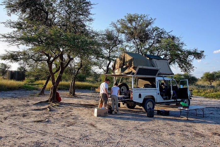
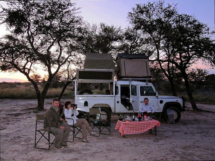
I’m sharing a slightly unusual travel journal with three goals. To make it work, this discussion should stay in the travel journal section so we can find it easily and keep adding info to existing posts.
This journal is meant to help "newbies" discover these magical places.
We go to Southern Africa not just for the animals, but also for that soft light, the atmosphere, and those incredible wild campsites where you feel so at home... I’d love for you all to share your favorite spots here—those we miss so much.
The last goal is figuring out how to photograph them. Honestly, I’m not happy with my photos because they don’t capture the feeling I get when I’m there or that unique atmosphere.
I’ll start with one of the first spots that, for me, is one of the most beautiful in Southern Africa: Passarge Valley 2 in the Central Kalahari. There, you’re alone—completely alone. The next campsite is over 25 km away, and that’s a half-day of 4x4 driving. In front of you, there’s nothing but the CKGR plains with herds of springboks... absolutely stunning 😎
Two Weeks in Dominica
Hi everyone, I’m sharing my travel journal from Dominica (not to be confused with the Dominican Republic) in January 2020. We wanted to escape the rain, gloom, and cold of France—and we got *some* rain and storms, but also warmth!
DOMINICA A small Caribbean island of 754 km², located between Guadeloupe and Martinique, Dominica is part of the Commonwealth. Roseau is its capital. The locals speak English and Creole. The currency is the East Caribbean Dollar (EC$). In October 2019, we decided to visit this little paradise from January 9 to 24, 2020—14 nights on the island. We traveled as two couples. Flight booking with Air Caraïbes: Orly Terminal 4 to Pointe-à-Pitre by plane, then P-à-P to Roseau with L’Express des Îles (boat) for the outbound trip. Marigot to Pointe-à-Pitre to Orly (all by plane on the return). Air Caraïbes: navigAir: plane + shuttle + boat. They handle everything, even delays. A shuttle waits for us at the airport to take us to the boat.
Accommodation bookings: 7 nights on the Caribbean coast in Salisbury (Sunset Bay Club), 4 nights on the Atlantic coast in Taberi La Plaine (Citrus Creek Plantation), and 3 nights in Marigot (Hibiscus Valley Inn). Car rental booked (Courtesy Rental Car).
Thursday, January 9 8:00 AM: Orly Airport, baggage drop-off—we checked in 48 hours earlier. Scheduled takeoff at 11:10 AM. Arrival in P-à-P at 2:30 PM local time after a 7-hour, 50-minute flight. We collect our luggage, and a shuttle is waiting to take us to the dock for L’Express des Îles. We check in, and a big storm hits P-à-P. Scheduled departure at 5:00 PM for a 2-hour, 20-minute crossing. Lots of waves—many passengers got seasick during the trip. Arrival in Roseau at 7:30 PM. We go through customs. Some clementines to declare… which they confiscated! A taxi takes us to the car rental: Courtesy. The ride is covered by the rental company. We get an automatic. You need a special permit to drive in Dominica (12 €, issued by the rental company). And remember—driving is on the left! It’s dark, and we have a good hour’s drive to reach our hotel. First intersection, headlights coming toward us, honking… we’re on the wrong side—driving on the left, remember? Most roads are in poor condition, narrow, with few signs and little to no street lighting. The island was hit by Tropical Storm Erika in 2015 and Hurricane Maria in September 2017, causing major damage. We finally arrive in Coulibistrie at Sunset Bay Club at 9:30 PM. The owner welcomes us, warms up some bread and cheese, and offers us four beers. We have pâté, sausage, and chips—we have a little picnic on the terrace of our bungalow. We have two adjoining rooms. It’s 11:00 PM when we go to bed… and it’s raining.
Friday, January 10 After a hearty breakfast (French toast or pancakes, jams, fresh juice, coffee or tea, eggs-bacon-cheese, bread, fresh fruit), the sun and rain take turns freely. We head north. Colihaut: a short walk through the village—we’re the only tourists. Portsmouth: lunch on Purple Turtle Beach at Sea Bird Bar and Grill (grilled fish, fries, salad, and the local beer: Kubuli). Then we visit Fort Shirley, part of Cabrits National Park. We do the yellow trail and part of the blue one. We buy a week-long pass, useful for some visits (no entry fee). On the way back, we stop at the market to buy some fruit. We arrive at Sunset in time to watch the sunset over the Caribbean Sea. All day, showers and sunshine.
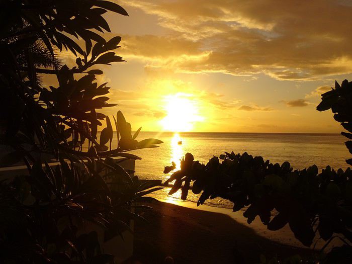 Sunset at Sunset
 Sunset Beach
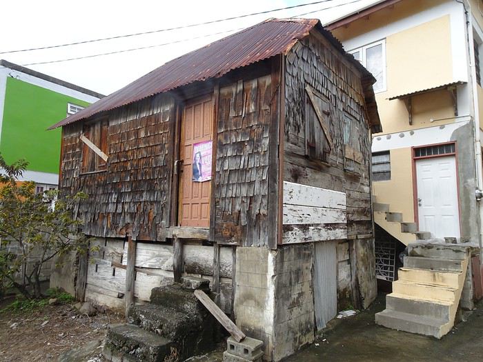 Colihaut
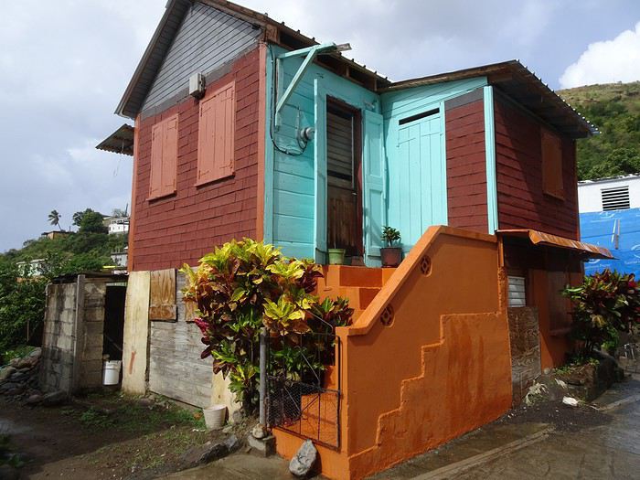 Colihaut


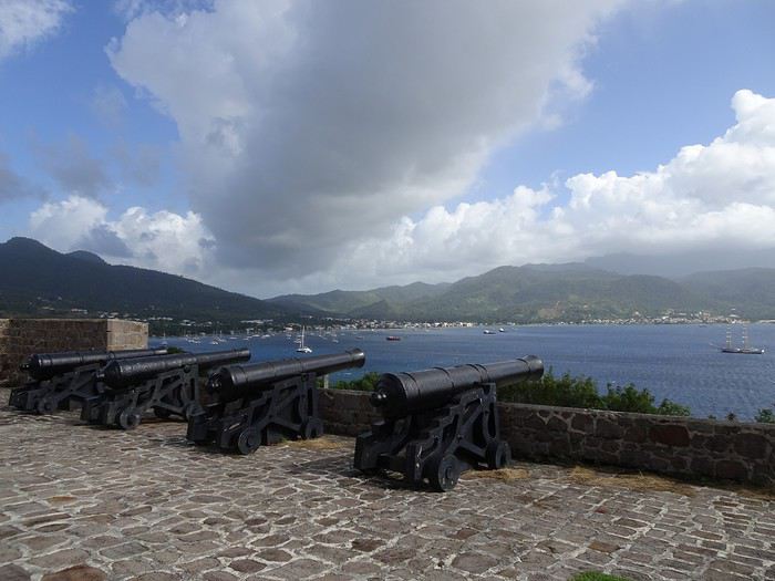
Fort Shirley

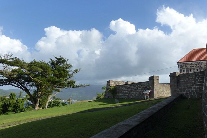
DOMINICA A small Caribbean island of 754 km², located between Guadeloupe and Martinique, Dominica is part of the Commonwealth. Roseau is its capital. The locals speak English and Creole. The currency is the East Caribbean Dollar (EC$). In October 2019, we decided to visit this little paradise from January 9 to 24, 2020—14 nights on the island. We traveled as two couples. Flight booking with Air Caraïbes: Orly Terminal 4 to Pointe-à-Pitre by plane, then P-à-P to Roseau with L’Express des Îles (boat) for the outbound trip. Marigot to Pointe-à-Pitre to Orly (all by plane on the return). Air Caraïbes: navigAir: plane + shuttle + boat. They handle everything, even delays. A shuttle waits for us at the airport to take us to the boat.
Accommodation bookings: 7 nights on the Caribbean coast in Salisbury (Sunset Bay Club), 4 nights on the Atlantic coast in Taberi La Plaine (Citrus Creek Plantation), and 3 nights in Marigot (Hibiscus Valley Inn). Car rental booked (Courtesy Rental Car).
Thursday, January 9 8:00 AM: Orly Airport, baggage drop-off—we checked in 48 hours earlier. Scheduled takeoff at 11:10 AM. Arrival in P-à-P at 2:30 PM local time after a 7-hour, 50-minute flight. We collect our luggage, and a shuttle is waiting to take us to the dock for L’Express des Îles. We check in, and a big storm hits P-à-P. Scheduled departure at 5:00 PM for a 2-hour, 20-minute crossing. Lots of waves—many passengers got seasick during the trip. Arrival in Roseau at 7:30 PM. We go through customs. Some clementines to declare… which they confiscated! A taxi takes us to the car rental: Courtesy. The ride is covered by the rental company. We get an automatic. You need a special permit to drive in Dominica (12 €, issued by the rental company). And remember—driving is on the left! It’s dark, and we have a good hour’s drive to reach our hotel. First intersection, headlights coming toward us, honking… we’re on the wrong side—driving on the left, remember? Most roads are in poor condition, narrow, with few signs and little to no street lighting. The island was hit by Tropical Storm Erika in 2015 and Hurricane Maria in September 2017, causing major damage. We finally arrive in Coulibistrie at Sunset Bay Club at 9:30 PM. The owner welcomes us, warms up some bread and cheese, and offers us four beers. We have pâté, sausage, and chips—we have a little picnic on the terrace of our bungalow. We have two adjoining rooms. It’s 11:00 PM when we go to bed… and it’s raining.
Friday, January 10 After a hearty breakfast (French toast or pancakes, jams, fresh juice, coffee or tea, eggs-bacon-cheese, bread, fresh fruit), the sun and rain take turns freely. We head north. Colihaut: a short walk through the village—we’re the only tourists. Portsmouth: lunch on Purple Turtle Beach at Sea Bird Bar and Grill (grilled fish, fries, salad, and the local beer: Kubuli). Then we visit Fort Shirley, part of Cabrits National Park. We do the yellow trail and part of the blue one. We buy a week-long pass, useful for some visits (no entry fee). On the way back, we stop at the market to buy some fruit. We arrive at Sunset in time to watch the sunset over the Caribbean Sea. All day, showers and sunshine.
Sunset at Sunset
Sunset Beach
Colihaut
Colihaut
Fort Shirley
Touristikis à la crème de solaris English translation pending
Comme j'ai un peu de temps, je vous livre le récit d'un voyage de 2018 qui traînait sur mon ordinateur :
Il était une fois, par delà les pandémies et les crises économiques, un temps où nous pouvions voyager : 2018. En cette année béni(t)e, il n’y eut pour nous point de virée nord-atlantique dans la chaleur estivale au programme, point de douches gratuites rafraîchissantes, point de températures vivifiantes, point de gastronomie douteuse et point de prix déments. En passant, félicitations à l’Islande et ses pizzas caoutchouteuse à 30 euros. En 2018, non, on va dans un vrai pays où l’on sait ce que signifie avoir chaud, manger et glander à une terrasse : la Grèce. Et comme nous ne sommes quand même pas des stakhanovistes du 40° à l’ombre, nous avons choisi le printemps, avril plus précisément. Pour le terrain de jeu, il s'agira d'Athènes et du Péloponnèse sur un peu plus de deux semaines. A nous, les petites églises, les ruines romantiques et les oliviers scintillants !
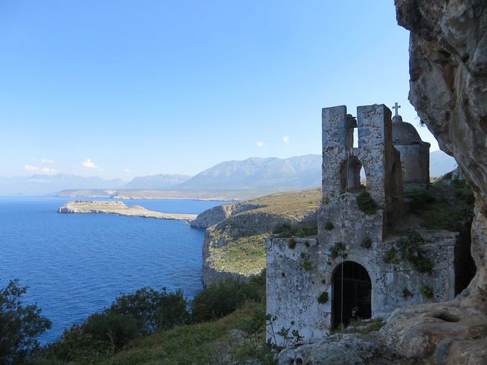 Bien choisir sa photo d'appel pour attirer le chaland. Un bon point et toute mon estime pour celui qui devine où c'est.
Avec la Grèce - pour ceux qui ont lu mes autres carnets qui sont tellement merveilleux qu’il faut les lire immédiatement et que votre vie s’en trouvera changée et éblouie - tout est chamboulé : fini les campings, les dortoirs et les piques-niques miteux de nos voyages dans le nord, place aux hôtels, aux b&b et aux restos. Et en plus, les Grecs ont le bon goût d’être accueillants.
Laissons la parole à du Ballay, parrainé par Alain Deloin et Jean-Michel Apeupré :
Heureux qui comme Ulysse a fait un beau voyage (en Grèce), Ou comme celui-là qui vit le Parthénon, Et puis est retourné, plein d'image et pâmoison, Vivre exubérant le reste de son âge
Et avant d'attaquer le vif du sujet, quelques annonces pour le public innocent : Avertissement : vous lisez ce compte-rendu à vos risques et périls. Toute indignation n’est pas de ma responsabilité. Avertissement bis : non je ne suis pas raciste non je n’ai rien contre les Néerlandais, j’ai d’ailleurs un ami néerlandais non les Grecs ne sont pas des feignants oui les Allemands ont pour passe-temps l’invasion… Ah mince une rechute.
Jour 1
Ayé, c’est parti pour une journée de transport translation Lyon-Athènes via Munich en empruntant la Lufthansa. Le vol est sans encombre, une conversation s’engage avec un voisin grec sympathique autour de la qualité douteuse de la bouffe allemande. J'en profite pour avoir une illumination : la nourriture, voilà ce qui unit les Européens (enfin ceux du sud) ! Eclair de génie, j’ai trouvé comment sauver l’Union européenne « tous unis contre la vie beurk ». Malheureusement, ça risque d’exclure les riches du nord. D’ailleurs c’est peut-être un signe : faut-il mal manger pour être riche ? Faudrait exclure les Japonais de l’équation mais sinon ça marche (pays germaniques, scandinaves et anglo-saxons même combat). Revenons au voisin grec, je tente de donner un tour sportif à la conversation mais malheureusement il n’aime pas le foot « football is shit »… Arrgghh, de quoi vais-je bien pouvoir parler alors ?! Du coup, je parle plus. Alors qu’un petit débat sur le scandale du moment, le président du PAOK Salonique et son flingue, ça, ça aurait été fun .
L’atterrissage se passe sans encombre dans cet aéroport d’Athènes qui a changé de place depuis mon unique passage dans le coin et s’est éloigné du centre-ville. Première prise de contact avec l’alphabet grec, on avait essayé pour le fun de potasser les équivalences mais c’est loin d’être évident ! Combien d'équivalents du O ont-ils dans cet alphabet ?!
Le trajet jusqu’au centre d’Athènes est long, très long et le métro/train se remplit progressivement jusqu’à être bondé à ras bord. Nous sommes tassés, compressés et pour sortir de cette fournaise, c’est la lutte finale, poussons-nous et demain, l’air sera le sauveur du genre humain (note à moi-même : éviter la prochaine fois d’arriver au moment de la sortie du travail)
La chambre chez l’habitant est bien placée, en plein centre sans être très bruyante. On profite de notre premier soir pour une approche de la cuisine grecque et un mauvais choix de commande (que de la friture…). On enchaîne sur une petite balade nocturne pour revenir sur l’impression née du voyage précédent (ie dans les années 90 la voiture reine, une ville bruyante et désagréable). Eh bien en fait, une partie du centre-ville s’est piétonnisé, il y a de la vie, des restos et des cafés avec des terrasses partout, c’est très agréable finalement.
Il était une fois, par delà les pandémies et les crises économiques, un temps où nous pouvions voyager : 2018. En cette année béni(t)e, il n’y eut pour nous point de virée nord-atlantique dans la chaleur estivale au programme, point de douches gratuites rafraîchissantes, point de températures vivifiantes, point de gastronomie douteuse et point de prix déments. En passant, félicitations à l’Islande et ses pizzas caoutchouteuse à 30 euros. En 2018, non, on va dans un vrai pays où l’on sait ce que signifie avoir chaud, manger et glander à une terrasse : la Grèce. Et comme nous ne sommes quand même pas des stakhanovistes du 40° à l’ombre, nous avons choisi le printemps, avril plus précisément. Pour le terrain de jeu, il s'agira d'Athènes et du Péloponnèse sur un peu plus de deux semaines. A nous, les petites églises, les ruines romantiques et les oliviers scintillants !
Bien choisir sa photo d'appel pour attirer le chaland. Un bon point et toute mon estime pour celui qui devine où c'est.Avec la Grèce - pour ceux qui ont lu mes autres carnets qui sont tellement merveilleux qu’il faut les lire immédiatement et que votre vie s’en trouvera changée et éblouie - tout est chamboulé : fini les campings, les dortoirs et les piques-niques miteux de nos voyages dans le nord, place aux hôtels, aux b&b et aux restos. Et en plus, les Grecs ont le bon goût d’être accueillants.
Laissons la parole à du Ballay, parrainé par Alain Deloin et Jean-Michel Apeupré :
Heureux qui comme Ulysse a fait un beau voyage (en Grèce), Ou comme celui-là qui vit le Parthénon, Et puis est retourné, plein d'image et pâmoison, Vivre exubérant le reste de son âge
Et avant d'attaquer le vif du sujet, quelques annonces pour le public innocent : Avertissement : vous lisez ce compte-rendu à vos risques et périls. Toute indignation n’est pas de ma responsabilité. Avertissement bis : non je ne suis pas raciste non je n’ai rien contre les Néerlandais, j’ai d’ailleurs un ami néerlandais non les Grecs ne sont pas des feignants oui les Allemands ont pour passe-temps l’invasion… Ah mince une rechute.
Jour 1
Ayé, c’est parti pour une journée de transport translation Lyon-Athènes via Munich en empruntant la Lufthansa. Le vol est sans encombre, une conversation s’engage avec un voisin grec sympathique autour de la qualité douteuse de la bouffe allemande. J'en profite pour avoir une illumination : la nourriture, voilà ce qui unit les Européens (enfin ceux du sud) ! Eclair de génie, j’ai trouvé comment sauver l’Union européenne « tous unis contre la vie beurk ». Malheureusement, ça risque d’exclure les riches du nord. D’ailleurs c’est peut-être un signe : faut-il mal manger pour être riche ? Faudrait exclure les Japonais de l’équation mais sinon ça marche (pays germaniques, scandinaves et anglo-saxons même combat). Revenons au voisin grec, je tente de donner un tour sportif à la conversation mais malheureusement il n’aime pas le foot « football is shit »… Arrgghh, de quoi vais-je bien pouvoir parler alors ?! Du coup, je parle plus. Alors qu’un petit débat sur le scandale du moment, le président du PAOK Salonique et son flingue, ça, ça aurait été fun .
L’atterrissage se passe sans encombre dans cet aéroport d’Athènes qui a changé de place depuis mon unique passage dans le coin et s’est éloigné du centre-ville. Première prise de contact avec l’alphabet grec, on avait essayé pour le fun de potasser les équivalences mais c’est loin d’être évident ! Combien d'équivalents du O ont-ils dans cet alphabet ?!
Le trajet jusqu’au centre d’Athènes est long, très long et le métro/train se remplit progressivement jusqu’à être bondé à ras bord. Nous sommes tassés, compressés et pour sortir de cette fournaise, c’est la lutte finale, poussons-nous et demain, l’air sera le sauveur du genre humain (note à moi-même : éviter la prochaine fois d’arriver au moment de la sortie du travail)
La chambre chez l’habitant est bien placée, en plein centre sans être très bruyante. On profite de notre premier soir pour une approche de la cuisine grecque et un mauvais choix de commande (que de la friture…). On enchaîne sur une petite balade nocturne pour revenir sur l’impression née du voyage précédent (ie dans les années 90 la voiture reine, une ville bruyante et désagréable). Eh bien en fait, une partie du centre-ville s’est piétonnisé, il y a de la vie, des restos et des cafés avec des terrasses partout, c’est très agréable finalement.
Triptyque gorilles - lions aboricoles - ascension du Nyiragongo English translation pending
Bonjour à tous,
Désolé si mes questions vous semblent assez basiques mais cela ne fait que peu de temps que je parcours la partie du forum relative à cette partie de l'Afrique. Je souhaitais avoir si il était possible de faire un voyage de 2 semaines dans cette région en couplant : - Une rencontre avec les gorilles (j'ai vu que c'était bien moins cher en Ouganda qu'en Rwanda) - Un safari nous permettant de voir des Lions Aboricoles (Queen Elizabeth) - Une ascension du Nyiragongo pour voir ce magnifique lac de lave. C'est cependant en RdC dans le Virunga et j'ai peur que ça soit dangereux.
Pour faire cela j'ai l'impression que le plus simple serait d'atterrir à Kigali qui semble le plus proche des lieux concernés. Si il y a un parc où on peut rencontrer des Chimpanzés dans le coin cela m'intéresserait aussi bien sûr.
Voilà je vais creuser un tel itinéraire mais si ceux qui connaissent bien la région peuvent m'aider ça me serait très utile :) Merci Pierre
Désolé si mes questions vous semblent assez basiques mais cela ne fait que peu de temps que je parcours la partie du forum relative à cette partie de l'Afrique. Je souhaitais avoir si il était possible de faire un voyage de 2 semaines dans cette région en couplant : - Une rencontre avec les gorilles (j'ai vu que c'était bien moins cher en Ouganda qu'en Rwanda) - Un safari nous permettant de voir des Lions Aboricoles (Queen Elizabeth) - Une ascension du Nyiragongo pour voir ce magnifique lac de lave. C'est cependant en RdC dans le Virunga et j'ai peur que ça soit dangereux.
Pour faire cela j'ai l'impression que le plus simple serait d'atterrir à Kigali qui semble le plus proche des lieux concernés. Si il y a un parc où on peut rencontrer des Chimpanzés dans le coin cela m'intéresserait aussi bien sûr.
Voilà je vais creuser un tel itinéraire mais si ceux qui connaissent bien la région peuvent m'aider ça me serait très utile :) Merci Pierre
Sur les terres mayas English translation pending
Bonjour à tous les amoureux de voyage,
Je me propose de vous faire partager notre voyage au Guatemala, pays assez peu renseigné sur VF. Je l’agrémenterai de quelques photos (tablette) sans prétention qui se veulent seulement illustratives et je demande par avance votre indulgence.
Initialement nous avions opté pour un périple au Pérou en février. Les agences contactées ont eu l’honnêteté, et nous les en remercions, de nous indiquer que cela n’était pas une bonne période pour se rendre sur les plateaux andins. Après une longue hésitation nous avons orienté nos recherches vers le Guatemala et le Honduras et avons pris des contacts avec 2 agences francophones à Antigua pour des propositions et des devis. Très vite nous avons retenu « Bon Voyage » plus réactive et nettement moins chère que sa consœur. Après plusieurs itérations avec Arnaud (patron de l’agence) nous avons convergé vers un circuit de 16 j entre le 6/2 et le 21/2/2020.
Jour 1 :
Pour les vols internationaux nous avions le choix entre une escale aux USA ou à Madrid. Pour à peine plus cher (660 €/p) et un temps de vol bien plus court nous avons finalement choisi IBERIA au détriment des compagnies et contraintes (ESTA et douane) américaines. De plus les vols IBERIA sont au départ (et retour) d’Orly plus commode pour nous.
L’horaire de départ étant très matinal nous décidons de dormir à Orly. L’hôtel Ibis Budget « cœur d’Orly » fera l’affaire. Disons le, c’est cher pour un hôtel de ce type (entrée de gamme) mais il a le mérite de servir le PdJ à partir de 4 h. Cet horaire nous permet de garer notre voiture dans un parking de la zone industriel de Senia et une navette nous dépose à l’aéroport vers 6h. Le vol Orly - Madrid part à 7h30 et nous attendrons 3h pour prendre celui qui nous mènera à Guatemala City où nous arrivons vers 17 h (heure locale soit – 7h de décalage. Ces vols seront sans histoire ni retard. A notre arrivée, Luis notre chauffeur, nous attend. Son sourire et sa gentillesse nous séduisent de suite. Il est chargé de nous conduire à Antigua. Mais les routes à cette heure sont saturées et nous mettrons plus de 2h pour parvenir à Antigua pourtant distante de moins de 40 km de la capitale. Il nous dépose à l’hôtel Posada San Pedro dans lequel nous résiderons 5 nuits durant notre séjour. L’hôtel n’a que 8 chambres et ne sert pas de PdJ mais il est bien situé (7ième avenue) et il dispose d’un joli jardin intérieur et d’un solarium. La chambre n’est pas très grande mais offre une vue directe sur le volcan Fuego en activité permanente. Des fumées s’en échappent régulièrement et parfois des rougeurs nous signalent des coulées de lave. Sitôt arrivés nous nous couchons pour être d’attaque le lendemain.
Jour 2 :
Notre première tâche est de trouver le lieu de notre PdJ car l’hôtel ne propose pas ce service. Il s’agit du restaurant « Viejo Café » dans la 6ième avenue. Ce lieu regroupe une boulangerie et un joli patio où sont servis les PdJ. L’offre est excellente et le service souriant. Tant mieux car nous y reviendrons à maintes reprises. Nous avons RDV avec notre agent de voyage dont nous faisons la connaissance. Il nous fourni un roadbook très détaillé de notre périple avec une carte détaillée pour chaque ville étape, une liste de restaurants qu’il recommande, les lieux à visiter, les recommandations (sûreté, banques, …) et un téléphone pour le joindre en cas de nécessité. Nous rejoignons ensuite un guide francophone qui nous fait découvrir cette jolie ville d’Antigua classée par l’UNESCO. Il nous fait un historique de la cité bâtie par les Espagnols et nous indique comment s’orienter le plan des rues, toutes pavées, s’apparente à celui des villes américaines et elles se coupent toutes à angle droit. Comme à New York la 5ième avenue est la principale artère de la ville. Nous visitons successivement l’église Merced, son monastère, son jardin et sa terrasse d’où l’on peut contempler les 3 volcans qui entourent la ville. L’église bâtie en 1548 a été détruite puis restaurée plusieurs fois suite aux nombreux séismes qui ont frappé la ville, le plus récent datant de 1976, sa façade est jaune et ornée de nénuphars. Puis notre visite se poursuit par le monastère dont il ne subsiste que des ruines. Au milieu de la cour centrale, on découvre une fontaine monumentale elle aussi en forme de nénuphar.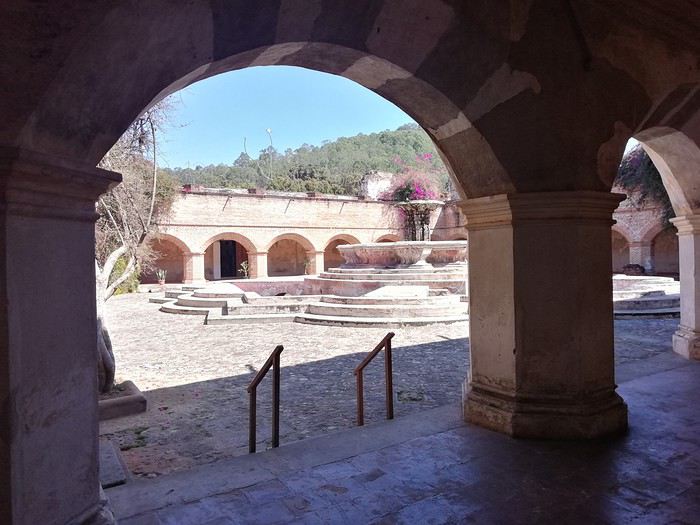
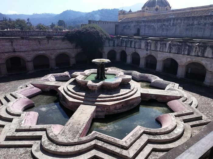
Pour profiter du panorama sur 3 volcans, nous gravissons les marches qui mènent à la terrasse. Puis nous gagnons la « Plaza mayor » cernée par de beaux édifices bâtis par les Espagnols, allant de la mairie à la cathédrale de la ville.
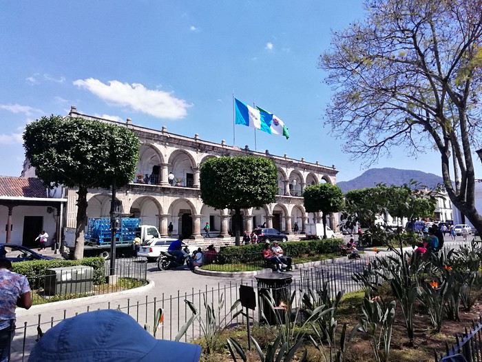 Nous passons devant le musée du chocolat avant de faire une halte pour découvrir le plus beau « Mac Do » du monde logé dans une magnifique hacienda d’époque avec un grand patio fleuri.
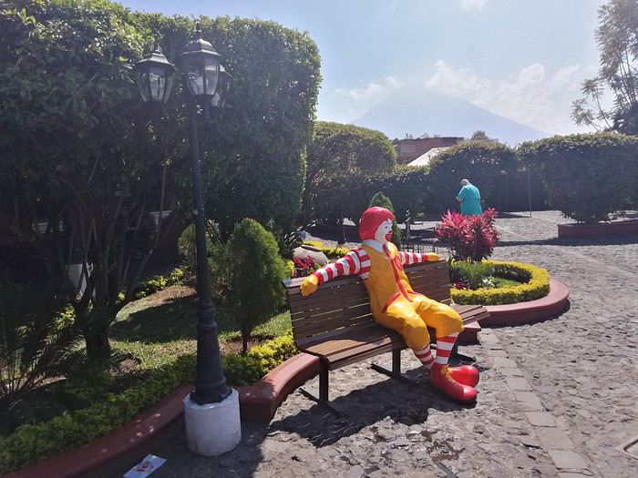
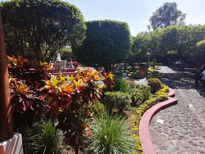
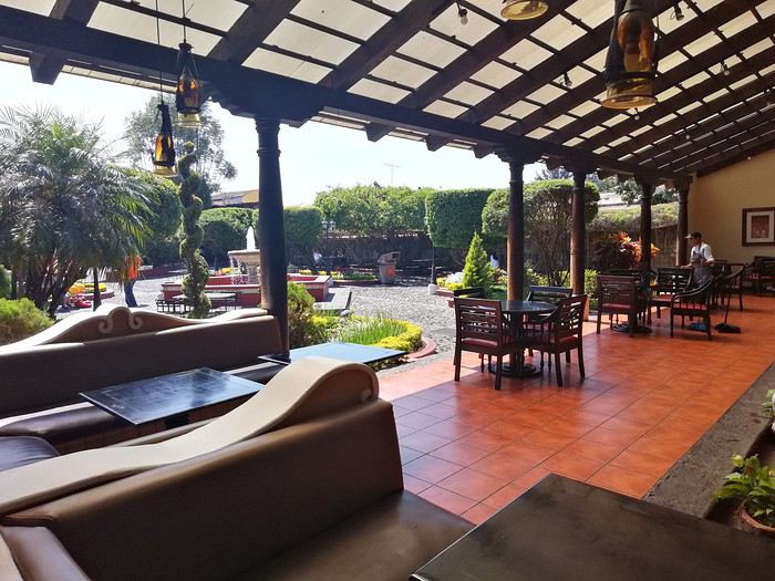 Cela change des établissements habituels de cette marque.
On arpente les rues de la ville, occasion de découvrir des demeures coloniales splendides aux patios intérieurs abondamment fleuris,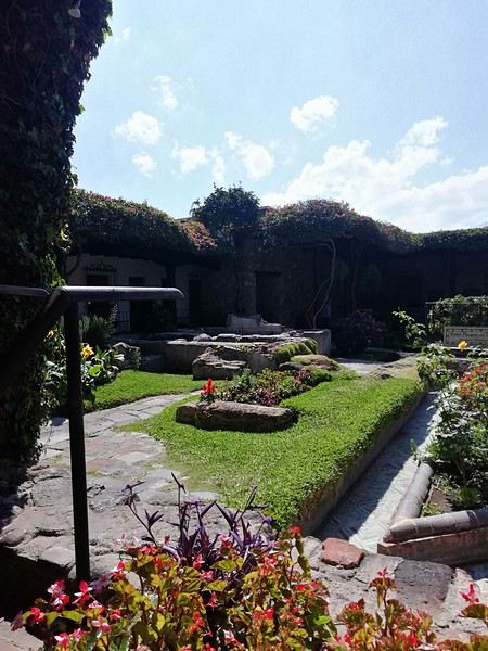
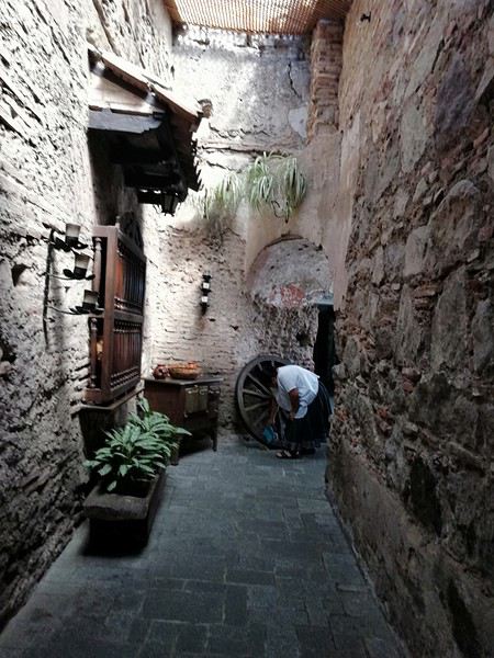
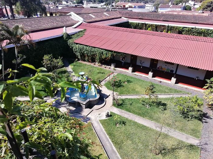
de voir un nombre impressionnant d’églises détruites par les tremblements de terre. Elles ne sont pas reconstruites faute de moyens pour les entretenir mais elles témoignent de l’emprise de la religion catholique sur le pays.
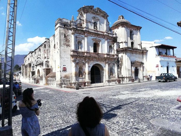
Notons à ce propos que l’on verra par la suite beaucoup de temples protestants de différentes obédiences, tout comme aux USA.
Je me propose de vous faire partager notre voyage au Guatemala, pays assez peu renseigné sur VF. Je l’agrémenterai de quelques photos (tablette) sans prétention qui se veulent seulement illustratives et je demande par avance votre indulgence.
Initialement nous avions opté pour un périple au Pérou en février. Les agences contactées ont eu l’honnêteté, et nous les en remercions, de nous indiquer que cela n’était pas une bonne période pour se rendre sur les plateaux andins. Après une longue hésitation nous avons orienté nos recherches vers le Guatemala et le Honduras et avons pris des contacts avec 2 agences francophones à Antigua pour des propositions et des devis. Très vite nous avons retenu « Bon Voyage » plus réactive et nettement moins chère que sa consœur. Après plusieurs itérations avec Arnaud (patron de l’agence) nous avons convergé vers un circuit de 16 j entre le 6/2 et le 21/2/2020.
Jour 1 :
Pour les vols internationaux nous avions le choix entre une escale aux USA ou à Madrid. Pour à peine plus cher (660 €/p) et un temps de vol bien plus court nous avons finalement choisi IBERIA au détriment des compagnies et contraintes (ESTA et douane) américaines. De plus les vols IBERIA sont au départ (et retour) d’Orly plus commode pour nous.
L’horaire de départ étant très matinal nous décidons de dormir à Orly. L’hôtel Ibis Budget « cœur d’Orly » fera l’affaire. Disons le, c’est cher pour un hôtel de ce type (entrée de gamme) mais il a le mérite de servir le PdJ à partir de 4 h. Cet horaire nous permet de garer notre voiture dans un parking de la zone industriel de Senia et une navette nous dépose à l’aéroport vers 6h. Le vol Orly - Madrid part à 7h30 et nous attendrons 3h pour prendre celui qui nous mènera à Guatemala City où nous arrivons vers 17 h (heure locale soit – 7h de décalage. Ces vols seront sans histoire ni retard. A notre arrivée, Luis notre chauffeur, nous attend. Son sourire et sa gentillesse nous séduisent de suite. Il est chargé de nous conduire à Antigua. Mais les routes à cette heure sont saturées et nous mettrons plus de 2h pour parvenir à Antigua pourtant distante de moins de 40 km de la capitale. Il nous dépose à l’hôtel Posada San Pedro dans lequel nous résiderons 5 nuits durant notre séjour. L’hôtel n’a que 8 chambres et ne sert pas de PdJ mais il est bien situé (7ième avenue) et il dispose d’un joli jardin intérieur et d’un solarium. La chambre n’est pas très grande mais offre une vue directe sur le volcan Fuego en activité permanente. Des fumées s’en échappent régulièrement et parfois des rougeurs nous signalent des coulées de lave. Sitôt arrivés nous nous couchons pour être d’attaque le lendemain.
Jour 2 :
Notre première tâche est de trouver le lieu de notre PdJ car l’hôtel ne propose pas ce service. Il s’agit du restaurant « Viejo Café » dans la 6ième avenue. Ce lieu regroupe une boulangerie et un joli patio où sont servis les PdJ. L’offre est excellente et le service souriant. Tant mieux car nous y reviendrons à maintes reprises. Nous avons RDV avec notre agent de voyage dont nous faisons la connaissance. Il nous fourni un roadbook très détaillé de notre périple avec une carte détaillée pour chaque ville étape, une liste de restaurants qu’il recommande, les lieux à visiter, les recommandations (sûreté, banques, …) et un téléphone pour le joindre en cas de nécessité. Nous rejoignons ensuite un guide francophone qui nous fait découvrir cette jolie ville d’Antigua classée par l’UNESCO. Il nous fait un historique de la cité bâtie par les Espagnols et nous indique comment s’orienter le plan des rues, toutes pavées, s’apparente à celui des villes américaines et elles se coupent toutes à angle droit. Comme à New York la 5ième avenue est la principale artère de la ville. Nous visitons successivement l’église Merced, son monastère, son jardin et sa terrasse d’où l’on peut contempler les 3 volcans qui entourent la ville. L’église bâtie en 1548 a été détruite puis restaurée plusieurs fois suite aux nombreux séismes qui ont frappé la ville, le plus récent datant de 1976, sa façade est jaune et ornée de nénuphars. Puis notre visite se poursuit par le monastère dont il ne subsiste que des ruines. Au milieu de la cour centrale, on découvre une fontaine monumentale elle aussi en forme de nénuphar.
Pour profiter du panorama sur 3 volcans, nous gravissons les marches qui mènent à la terrasse. Puis nous gagnons la « Plaza mayor » cernée par de beaux édifices bâtis par les Espagnols, allant de la mairie à la cathédrale de la ville.
Nous passons devant le musée du chocolat avant de faire une halte pour découvrir le plus beau « Mac Do » du monde logé dans une magnifique hacienda d’époque avec un grand patio fleuri.
Cela change des établissements habituels de cette marque.On arpente les rues de la ville, occasion de découvrir des demeures coloniales splendides aux patios intérieurs abondamment fleuris,
de voir un nombre impressionnant d’églises détruites par les tremblements de terre. Elles ne sont pas reconstruites faute de moyens pour les entretenir mais elles témoignent de l’emprise de la religion catholique sur le pays.
Notons à ce propos que l’on verra par la suite beaucoup de temples protestants de différentes obédiences, tout comme aux USA.
Mais où donc est ce truc là? (5) English translation pending
Bonjour
Où se trouve cette serre ?
En premier chercher le pays et ensuite la ville
Françoise
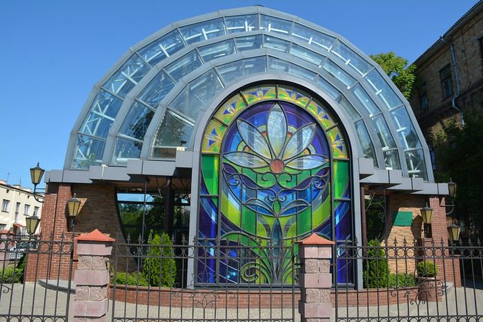
Quinze jours au Soudan en février 2020 English translation pending
Bonjour 😏
Le temps du confinement me permet de me mettre à jour dans mes carnets de voyage.
Une nouvelle aventure. Je pars avec Justine, une ancienne élève qui a 28 ans. Son premier voyage à part des hôtels club..
La location de voiture sans chauffeur est impossible au Soudan. J’ai décidé de louer une voiture avec chauffeur. Je suis donc passé par une agence, 90 euros par jour pour voiture, pétrole, chauffeur (son logement et sa nourriture comprise). Aucune autre prestation.
Je ne voulais pas me contenter du Nord et des sites archéologiques, circuit classique que font les quelques touristes qui vont au Soudan et mais partir vers le sud, dans le Kordofan pour aller dans les nubas mountains. Dans cette partie du soudan, il y a eu pendant des années, une guerre intense avec le gouvernement central. Le mouvement de rébellion existe toujours, le SPLM. L’armée de ce mouvement est toujours en place. Elle réclame un égal développement pour cette partie du territoire dans lequel il n’y a aucun investissement. Dans cette région, le peuple Nuba comprend une mosaïque de tribus. Je voulais aller dans cette région et avait construit un itinéraire que l’agence avait accepté. Hélas, je n’ai pas pu faire tout ce que je voulais car il fallait des autorisations du SPLM que nous n’avons pas eu. 10 jours avant de partir, toujours pas de certitude de pouvoir faire la boucle prévue. Alors que j’avais dit que je ne voulais pas de guide, l’agence m’a parlé d’un gars, dit guide, natif de cette région. Je l’ai contacté directement et nous nous sommes mis d’accord sur sa prestation ! Sur la route, pour les arrêts dans les villages, il n’était pas indispensable, car je n’ai aucun souci pour aller à la rencontre de la population. C’est souvent moi qui disais, on s’arrête là et là… Mais il avait pris des contacts avec les autorités locales. Cela nous a permis de vivre dans un village, impossible sans lui.
1èr partie du voyage : LE KORDOFAN ET LE PAYS NUBAS, au sud de Khartoum
Cela a été le must de notre voyage pour les contacts avec la population. Je voyage beaucoup mais je n’avais pas vécu cela depuis longtemps. Partout l’accueil a été extraordinaire et jamais on ne nous a demandé quoique ce soit.
1er jour KHARTOUN/DILLING
Longue route puisque nous sommes partis à 7 h et arrivés à 17 h 30, mais avec plusieurs arrêts ! En voici quelques uns.
Marché des chameaux "El molih camel market". Le grand marché est le samedi, nous y passons un lundi… Pas beaucoup d’effervescence mais pour notre premier marché de chameaux, on apprécie !
Arrêt dans un village de la tribu Ahamada. Excellent accueil. Nous sommes accueillis dans 3 maisons. Une des familles était très chaleureuse. Nous étions au début du voyage, je ne maîtrisais pas la suite de la journée. Mais à refaire, j’aurais accepté leur invitation de partager un moment ensemble.
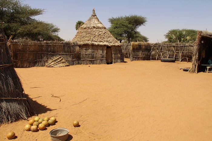
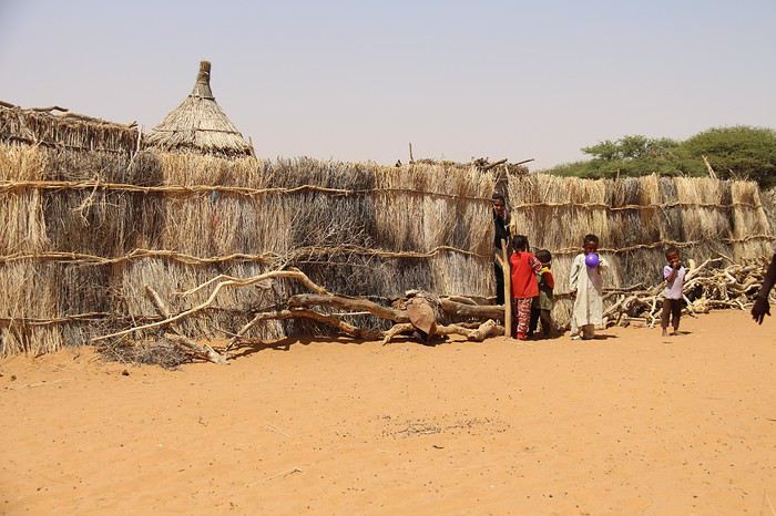
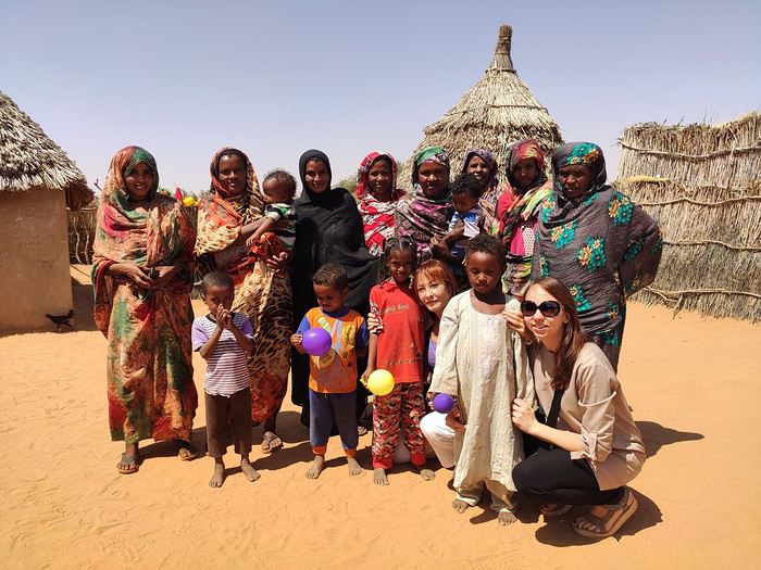
Arrêt à ville de Barra. Nous sommes en début d’après-midi. Notre premier marché. Le souk est animé. Les gens sont étonnés de voir des « blancs » et nous regardaient avec de grands yeux.
Puis arrêt dans un autre village. A nouveau un très bon accueil.
Bien sûr, il faut prendre son temps pour créer le contact
Ce qui m’a passionné sur cette route macadamisée, en très bon état, un peu monotone car les paysages sont plats, pas vraiment jolis, ce sont les camions, avec leur hauteur de marchandises. C’est vraiment très impressionnant. Je vous livre quelques spécimens.
Le temps du confinement me permet de me mettre à jour dans mes carnets de voyage.
Une nouvelle aventure. Je pars avec Justine, une ancienne élève qui a 28 ans. Son premier voyage à part des hôtels club..
La location de voiture sans chauffeur est impossible au Soudan. J’ai décidé de louer une voiture avec chauffeur. Je suis donc passé par une agence, 90 euros par jour pour voiture, pétrole, chauffeur (son logement et sa nourriture comprise). Aucune autre prestation.
Je ne voulais pas me contenter du Nord et des sites archéologiques, circuit classique que font les quelques touristes qui vont au Soudan et mais partir vers le sud, dans le Kordofan pour aller dans les nubas mountains. Dans cette partie du soudan, il y a eu pendant des années, une guerre intense avec le gouvernement central. Le mouvement de rébellion existe toujours, le SPLM. L’armée de ce mouvement est toujours en place. Elle réclame un égal développement pour cette partie du territoire dans lequel il n’y a aucun investissement. Dans cette région, le peuple Nuba comprend une mosaïque de tribus. Je voulais aller dans cette région et avait construit un itinéraire que l’agence avait accepté. Hélas, je n’ai pas pu faire tout ce que je voulais car il fallait des autorisations du SPLM que nous n’avons pas eu. 10 jours avant de partir, toujours pas de certitude de pouvoir faire la boucle prévue. Alors que j’avais dit que je ne voulais pas de guide, l’agence m’a parlé d’un gars, dit guide, natif de cette région. Je l’ai contacté directement et nous nous sommes mis d’accord sur sa prestation ! Sur la route, pour les arrêts dans les villages, il n’était pas indispensable, car je n’ai aucun souci pour aller à la rencontre de la population. C’est souvent moi qui disais, on s’arrête là et là… Mais il avait pris des contacts avec les autorités locales. Cela nous a permis de vivre dans un village, impossible sans lui.
1èr partie du voyage : LE KORDOFAN ET LE PAYS NUBAS, au sud de Khartoum
Cela a été le must de notre voyage pour les contacts avec la population. Je voyage beaucoup mais je n’avais pas vécu cela depuis longtemps. Partout l’accueil a été extraordinaire et jamais on ne nous a demandé quoique ce soit.
1er jour KHARTOUN/DILLING
Longue route puisque nous sommes partis à 7 h et arrivés à 17 h 30, mais avec plusieurs arrêts ! En voici quelques uns.
Marché des chameaux "El molih camel market". Le grand marché est le samedi, nous y passons un lundi… Pas beaucoup d’effervescence mais pour notre premier marché de chameaux, on apprécie !
Arrêt dans un village de la tribu Ahamada. Excellent accueil. Nous sommes accueillis dans 3 maisons. Une des familles était très chaleureuse. Nous étions au début du voyage, je ne maîtrisais pas la suite de la journée. Mais à refaire, j’aurais accepté leur invitation de partager un moment ensemble.
Arrêt à ville de Barra. Nous sommes en début d’après-midi. Notre premier marché. Le souk est animé. Les gens sont étonnés de voir des « blancs » et nous regardaient avec de grands yeux.
Puis arrêt dans un autre village. A nouveau un très bon accueil.
Bien sûr, il faut prendre son temps pour créer le contact
Ce qui m’a passionné sur cette route macadamisée, en très bon état, un peu monotone car les paysages sont plats, pas vraiment jolis, ce sont les camions, avec leur hauteur de marchandises. C’est vraiment très impressionnant. Je vous livre quelques spécimens.
On remonte le temps: Tanzanie - Kenya 1992 English translation pending
Le carnet de Christian alias Eiger m'a donné une idée. Pourquoi ne pas moi aussi vous raconter mon premier grand voyage qui remonte à 1992 ? Mon premier safari et la découverte de l'Afrique de l'est à jamais enraciné dans mon cœur avec l'Afrique Australe.
Bon à l'époque je débutais dans la photographie, donc c'est pas spécialement brillant et mot est faible ! Les photos ont été à l'époque directement scannées et transférées sur CD par Kodak.
Il restera ancré à tout jamais dans ma mémoire comme mon premier grand voyage ! Ma grand mère, ma mère me traitent de fou 🤪 Mon père ancien marin dans la marchande qui a fait plus de deux fois le tour du monde, m'encourage 🙂
N'ayant pas l'esprit aventureux de certain, un niveau d'anglais moyen et pas de temps à perdre en recherche d'information sur place, je passe par une agence de voyage qui a toujours pignon sur rue et qui organise des voyages en groupe.
Le voyage durera 23 jours et sur la fin les relations furent un peux compliquées.
Le voyage sera découpé comme cela :
Kilimandjaro Safari - Ngorongoro et Serengeti Zanzibar Retour par le Kenya
Bon à l'époque je débutais dans la photographie, donc c'est pas spécialement brillant et mot est faible ! Les photos ont été à l'époque directement scannées et transférées sur CD par Kodak.
Il restera ancré à tout jamais dans ma mémoire comme mon premier grand voyage ! Ma grand mère, ma mère me traitent de fou 🤪 Mon père ancien marin dans la marchande qui a fait plus de deux fois le tour du monde, m'encourage 🙂
N'ayant pas l'esprit aventureux de certain, un niveau d'anglais moyen et pas de temps à perdre en recherche d'information sur place, je passe par une agence de voyage qui a toujours pignon sur rue et qui organise des voyages en groupe.
Le voyage durera 23 jours et sur la fin les relations furent un peux compliquées.
Le voyage sera découpé comme cela :
Kilimandjaro Safari - Ngorongoro et Serengeti Zanzibar Retour par le Kenya
Je vous invite à découvrir l'île de Lanzarote English translation pending
INTRODUCTION
Des vidéos sont insérées tout au long du résumé. Veuillez cliquer sur l'image pour démarrer la vidéo.
En février dernier, nous avons séjourné 2 semaines sur l'île de Lanzarote afin d'en découvrir les différents attraits touristiques.
Comme la plupart de nos précédents voyages, plusieurs semaines ont été consacrées à la création de notre itinéraire afin de pouvoir être en mesure d'atteindre parfaitement nos objectifs.
Lors de notre séjour, nous avons utilisé l'application Maps.me, une application mobile qui fournit des cartes hors ligne. Cette application s'avère très précieuse lors de nos déplacements en voiture, en randonnée et même lors de nos circuits à pied dans les grandes villes.
J'avais préalablement téléchargé les coordonnées GPS de toutes les attractions prévues à notre itinéraire dans l'application Maps.me, ce qui a facilité grandement nos déplacements.
La réservation de l'hébergement ainsi que la location d'une voiture ont été effectuées sur le web avant notre départ.
Nous sommes partis de l'aéroport de Québec et avons eu une escale à Montréal ainsi qu'à Bruxelles en Belgique avant d'atteindre Lanzarote.
Lanzarote fait partie des Îles Canaries qui elles-mêmes sont situées dans l'océan Atlantique, à l'ouest du Maroc. Celles-ci font d'ailleurs partie de l'Espagne.
Nous avions déjà visité l'île de Tenerife et nous avions adoré notre séjour à cet endroit.
Nous avons donc décidé de poursuivre la découverte des Îles Canaries en nous rendant à Lanzarote car cette île offre un paysage volcanique spectaculaire, des plages à faire rêver ainsi que de magnifiques villages aux maisons typiques de l'île qui sont majoritairement blanches.
Les sentiers de randonnée sont nombreux et nous permettent de découvrir une grande diversité de paysages.
Les attraits touristiques sont également fort nombreux et facilement accessibles car les routes de Lanzarote se parcourent aisément en voiture car celles-ci sont dans un état impeccable.
D'ailleurs, c'est un pur plaisir que de se déplacer sur ces routes car les paysages qui défilent sous nos yeux sont sensationnels et présentent une perspective différente selon la lumière du jour.
Des vidéos sont insérées tout au long du résumé. Veuillez cliquer sur l'image pour démarrer la vidéo.
En février dernier, nous avons séjourné 2 semaines sur l'île de Lanzarote afin d'en découvrir les différents attraits touristiques.
Comme la plupart de nos précédents voyages, plusieurs semaines ont été consacrées à la création de notre itinéraire afin de pouvoir être en mesure d'atteindre parfaitement nos objectifs.
Lors de notre séjour, nous avons utilisé l'application Maps.me, une application mobile qui fournit des cartes hors ligne. Cette application s'avère très précieuse lors de nos déplacements en voiture, en randonnée et même lors de nos circuits à pied dans les grandes villes.
J'avais préalablement téléchargé les coordonnées GPS de toutes les attractions prévues à notre itinéraire dans l'application Maps.me, ce qui a facilité grandement nos déplacements.
La réservation de l'hébergement ainsi que la location d'une voiture ont été effectuées sur le web avant notre départ.
Nous sommes partis de l'aéroport de Québec et avons eu une escale à Montréal ainsi qu'à Bruxelles en Belgique avant d'atteindre Lanzarote.
Lanzarote fait partie des Îles Canaries qui elles-mêmes sont situées dans l'océan Atlantique, à l'ouest du Maroc. Celles-ci font d'ailleurs partie de l'Espagne.
Nous avions déjà visité l'île de Tenerife et nous avions adoré notre séjour à cet endroit.
Nous avons donc décidé de poursuivre la découverte des Îles Canaries en nous rendant à Lanzarote car cette île offre un paysage volcanique spectaculaire, des plages à faire rêver ainsi que de magnifiques villages aux maisons typiques de l'île qui sont majoritairement blanches.
Les sentiers de randonnée sont nombreux et nous permettent de découvrir une grande diversité de paysages.
Les attraits touristiques sont également fort nombreux et facilement accessibles car les routes de Lanzarote se parcourent aisément en voiture car celles-ci sont dans un état impeccable.
D'ailleurs, c'est un pur plaisir que de se déplacer sur ces routes car les paysages qui défilent sous nos yeux sont sensationnels et présentent une perspective différente selon la lumière du jour.
Adventures of a Bygone Era: The Philippines in 1984
After several discussions on VF about travel journals from the Philippines, I decided to write this curiosity: a trip report from a journey made in 1984, when traveling to the Philippines was still an adventure.
A curiosity because writing a travel journal about a trip 35 years later isn’t common, but also (mostly?) because exploring the Philippines at that time had little in common with traveling there today.
Obviously, I’ve forgotten a number of facts, most of the details, but with the help of a few notes from that time and a stack of slides (yes, there was life before digital 😊), many memories came back and added to the highlights I’d never forgotten. The scanned slides aren’t always great quality, but there are still quite a few to brighten up this chatter. Back then, we didn’t snap photos like we do now—film was too expensive—so I don’t have pictures of every place we visited... too bad, comparing some of those spots to how they look today would’ve been interesting.
Why "Adventures"? Why call it "Adventures" in the Philippines in 1984, a word so often used for a simple exotic trip? - Because the lack of information (no *Guide du Routard*, no *Lonely Planet*, no *Michelin Guide*, nothing, and obviously no internet) gave this trip what’s at the heart of adventure: the unknown. - Because the political situation made the stay sometimes dangerous. - Because transportation conditions were always epic, often perilous. - Because the question of where we’d spend the night came up almost every evening. - And for... quite a few other reasons.
That said, we weren’t exactly explorers!
Why the Philippines? First of all, why go to the Philippines in 1984—a country not exactly set up for tourism and about which we knew very little? How could we get an idea of the beauty of the Philippines and its points of interest when we had no guides or photos?
The idea came to us from Thailand a year earlier, during our first long-haul trip. After touring the north of the country, we met a Frenchman living in Phuket, where there were only a few tourists in Patong, with just a few small hotels and guesthouses. Kata and Karon had no buildings or roads, Rawai only had three palm-thatched bungalows, including ours, and the other islands were unknown to tourists. There was plenty to discover, and we wanted to return to this beautiful country... but the Frenchman made us dream about the Philippines—a country to explore, with wild landscapes.
Long evenings of discussion over multiple Sprite-Mekong cocktails (what memories of those headaches!) finally convinced us we had to go to the Philippines.
Episode 0: Before Departure The decision was made: we’d go to the Philippines in May 1984. Our friends and family were surprised when we announced we were going on vacation to the Philippines (a bit like saying today we were going paddleboarding in the Kerguelen Islands 🤪).
These days, preparing for each of our trips takes long evenings of research, planning, and noting down good addresses... etc. But for the Philippines in 1984, preparation was quick: we had very little information about the country, we were leaving almost at random, and the discovery would only be more exciting.
We still had a few bits of info gathered here and there: the rice terraces in northern Luzon, volcanoes, Negros where we were supposed to visit an acquaintance, Cebu and its marine life (we ended up going elsewhere), and absolutely avoid Mindanao, which was practically at war with the regime. That was about it, but it was already a great itinerary.
Nothing was organized in advance; we’d see day by day. We had no idea about travel times or even the existence of transportation options. The main (and sometimes only) way to connect two islands was by overloaded, rusty ferry. Only the big cities had airports.
Let’s Go: Episode 1: Paris to Manila My travel journals always start after arriving at the airport—the Europe-to-“Other Continent” trip isn’t interesting—but the flight to the Philippines was already an adventure, so I’ll make an exception.
This was the era when only a few Asian airlines were on par with Western ones: Thai, Singapore Airlines, and Philippine Airlines. They had beautiful, brand-new planes, and to attract customers (almost exclusively “businessmen”) from the usual airlines (Air France, Lufthansa, British Airways), there was opulence on board: unlimited champagne, all sorts of cocktails... Compared to today’s long-haul flights, there was still one small difference: no personal screens, just one screen at the front of the cabin with one mandatory movie. And I don’t know why, but we only got James Bond films, both ways... that must’ve been the trend at the time.
The tourism boom to Southeast Asia hadn’t started yet, and the “Asian Tigers” weren’t a thing, so there weren’t many business trips. That meant long-haul flights made stops everywhere to fill the planes. Our Philippine Airlines Boeing 747 left London, picked us up in Paris, then stopped in Frankfurt to take on a few Germans. I don’t know why we then made a stop in Dubai—a totally exotic place at the time. There was nothing to do there... things have changed a lot since. It was a small town lost in the desert. The airport was tiny, with just one or two buildings and a supermarket. During the stopover, everyone had to get off the plane and walk to the supermarket. Photo and electronic equipment were dirt cheap—I guess that was the only reason for the stop. Maybe it was their first commercial move. Emirates didn’t exist yet, as I checked online, but anyway, the idea that such a remote place could have its own airline was unthinkable.
Online, I found this photo of Dubai Airport in 1980. Anyone who’s transited through today’s massive airport with its rows of A380s will appreciate it:
Next stop: New Delhi to drop off some Europeans and pick up a few Indians, and finally, the terminus: Manila. I don’t remember how long the trip took with its five stops—an unimaginable journey today. Despite all those stops to fill the plane, there was still enough space to stretch out on the four center seats of the 747, something that never happens these days despite all the flights in every direction.
So here we are, finally at Manila Airport around midnight.
Episode 1: Manila and Baguio To start, a quick note on the political and economic situation in the Philippines in 1984, which had consequences for us as tourists, as we’d soon realize upon arrival.
After several centuries of Spanish colonization, the Philippines became American at the start of the 20th century, then independent. In 1966, Marcos took power, and little by little, his regime sank into corruption and mismanagement, becoming a dictatorship with martial law, all for the benefit of his family and friends, who enriched themselves endlessly. The peak was the assassination of opposition leader Benigno Aquino in August 1983, which triggered harshly repressed protests. So we arrived a few months later in a very poor country, with omnipresent corruption and an extremely tense political situation, as we’d soon see for ourselves. Major protests took place in the main cities during our trip—I’ll come back to that. Two years later, Marcos fled to Hawaii after being forced out of power following rigged elections. This historical context explains a lot of the situations we found ourselves in over the following weeks.
Arriving in the middle of the night isn’t very cheerful. Manila was already a huge city with many slums, where you could find a few business hotels like the Hilton or Intercontinental—way out of our budget—and plenty of run-down hotels. Luckily, two Indians we’d chatted with on the plane offered to take us to their usual hotel. They came to Manila twice a year for business. We accepted their offer, relieved not to have to look for a place to stay in the middle of the night, figuring the address must be good since they came back every time... we were wrong 🙁
We left the airport and immediately got a taste of the local vibe when we got into the taxi: the police asked for our passports. We thought: what’s more normal than police in a dictatorship?
But that wasn’t it at all. Our two Indian friends explained that the police were noting our names along with the taxi number and time. Crime in Manila was so bad that the taxi driver would be held responsible if anything happened to us... welcome to the Philippines 😎 😎
Historically, the Philippines was a very violent country, where everything was settled with guns or machetes. Previous governments had banned carrying weapons, but Marcos later allowed the free sale and carrying of guns, and disputes were settled with pistols again (or worse, as we’d discover later). Since he’d released most of the criminals from prison to form a paramilitary militia at his service (I’ll talk about our encounter with these “heroes” later), it was pretty dangerous to go into many parts of Manila, where these “tonton macoutes” ruled.
We arrived at our hotel without incident... and then things started badly. The room was infested with big cockroaches—exactly what I hate most in those kinds of countries. No way to find another hotel at that hour. After the long flight, the urge to take a shower was so strong that we squeezed into the bathroom as best we could. After that, I don’t remember—I guess we must’ve fallen asleep exhausted under the sheets in the heat... air conditioning wasn’t widespread yet.
The next day, we just wanted to leave that dump as soon as possible. So we decided to head north right away, stopping in Baguio, and we’d visit Manila a bit on the way back.
When we stepped outside, we discovered a pretty run-down neighborhood with potholed streets. But we also discovered the jeepneys. They were everywhere, flooding the streets.
They had crazy sound systems, each one blasting louder than the last. The interiors were kitschy but fun. There weren’t many private cars—almost all transportation was by jeepney, with buses reserved for intercity trips.
Before heading to the bus terminal for the north, somewhere on the outskirts of the city, we needed to exchange some money. I don’t remember how we ended up in a policeman’s jeep who offered his services: - Exchange money on the black market at a better rate than the banks. - Take us wherever we wanted, in this case, the bus terminal.
We accepted both offers (we’d still checked the official exchange rate from dollars to pesos). So we found ourselves in his jeep. After exchanging money, we left in his vehicle and stopped for gas. Without turning off the engine, he calmly smoked a cigarette while filling up. Since we were in a jeep with no doors or roof, we were ready to jump out if things went south, our travel bag in hand.
But we weren’t done with surprises yet. Once we left the small streets, we ended up in a neighborhood with wide avenues and not much traffic, which didn’t justify his incredible behavior. At every intersection, he made the sign of the cross, closed his eyes, and crossed without looking. I was more stunned than terrified! It wasn’t until we got out of the car later that I told Anne-Marie what had happened. I’d seen everything because the cop had put me in the front seat. Luckily, A-Marie hadn’t noticed anything from the back. Crossing Manila by trusting God rather than the rules of the road was ultimately effective. We were lucky—the trip was off to a good start. 🙂 🙂
We then passed through a neighborhood where slums stretched on for a while, and we left our policeman—friendly but a bit crazy—with relief.
A few hours by bus later, here we are in Baguio, cool in the mountains. My memories of Baguio are pretty fuzzy. I remember a small town. After some research while writing this journal, I found that the population was 120,000 in 1980. Given the population density in each home, that confirms my memory of a smallish town. Outside the “official” district with the president’s summer residence and government buildings, there were two or three paved streets with nice houses. The rest was very dirty and very poor, with lots of slums and dirt roads.
People we met on the street invited us to stay with them. These days, we wouldn’t just show up at strangers’ houses, which we should’ve done in Baguio—it would’ve saved us from an unimaginable and dangerous situation... which I won’t say anything about... !😊
The simple wooden house was on stilts at the edge of a hill with a view of the mountains. Since it was the start of the rainy season in a city that gets a lot of rain, we saw a lot of water. Our outings in town happened between downpours.
View from our lodging:
Episode 2: Baguio to Bontoc Aside from the situation briefly mentioned above, it was on the next leg to Bontoc that the adventure really began: an endless and dangerous road, a bus from another era, breathtaking landscapes, and surprising people.
We didn’t know the distance or how long it would take to get to Bontoc. When we arrived after about ten hours, we learned that Baguio to Bontoc was 140 km.
We got on a bus with wooden seats and settled in, two to a seat meant for two. As the bus filled up, passengers squeezed in three or four per seat, with chickens and baskets full of all sorts of things in the aisle. A little embarrassed, we didn’t know if we should squeeze in three on our seat. The seats were super tight (luckily, Filipinos are small), and I didn’t know where to put my legs given my height. I don’t remember if we stayed alone on our bench or if we ended up sharing with others.
The “road” was a dirt track (or rather, a mud track) with endless turns. We held on as best we could to our slippery wooden seats—it was shaking in every direction. The woman behind us was carsick and throwing up... gross... but what were we doing there? Then we plunged into the Sierra Madre... just the name is dreamy!
Rice terraces started to appear:
they took up more and more space along cliffs where we weren’t always reassured,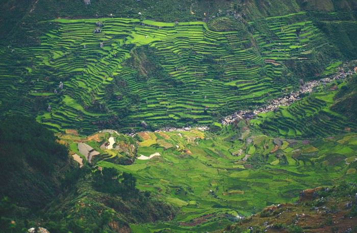
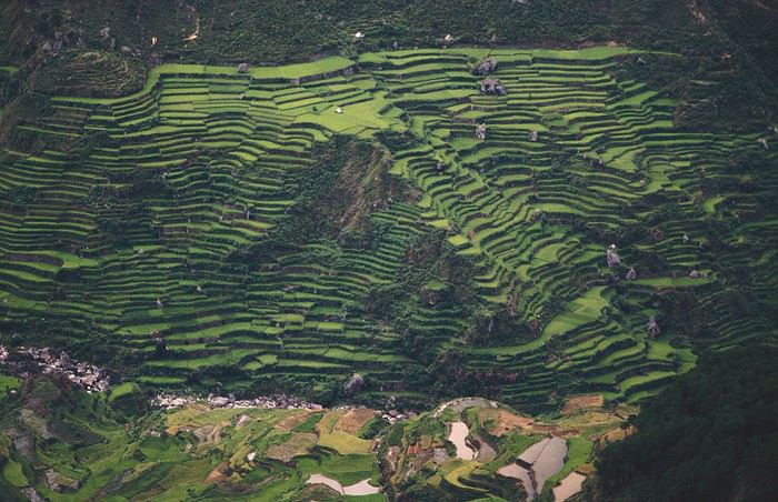
with lots of waterfalls (all that water had to go somewhere).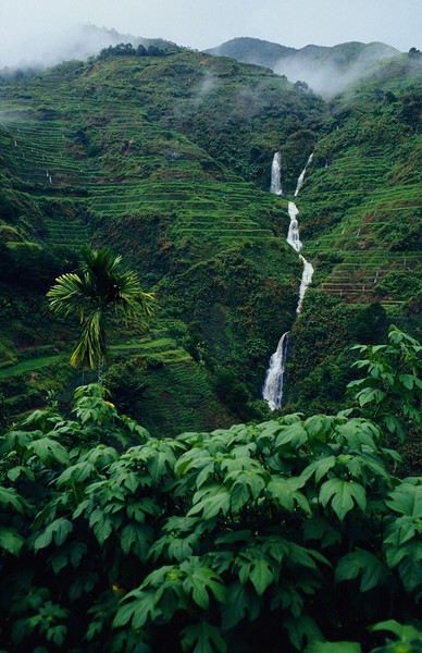
A few miserable villages stretched along the track, most often just a few houses balancing between the road and the drop. The bus stopped in every village—people got on or off and settled inside or on the roof. Street vendors offered their products to the bus passengers—a common sight in Asia, even today.
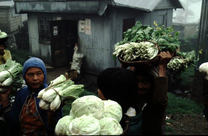
We were in another world—villagers were in loincloths, others had spears. The atmosphere was strange... but all good, we wanted exoticism, and we got it:
This so-called traditional outfit was everyday wear—it wasn’t for tourists since there weren’t any.
A curiosity because writing a travel journal about a trip 35 years later isn’t common, but also (mostly?) because exploring the Philippines at that time had little in common with traveling there today.
Obviously, I’ve forgotten a number of facts, most of the details, but with the help of a few notes from that time and a stack of slides (yes, there was life before digital 😊), many memories came back and added to the highlights I’d never forgotten. The scanned slides aren’t always great quality, but there are still quite a few to brighten up this chatter. Back then, we didn’t snap photos like we do now—film was too expensive—so I don’t have pictures of every place we visited... too bad, comparing some of those spots to how they look today would’ve been interesting.
Why "Adventures"? Why call it "Adventures" in the Philippines in 1984, a word so often used for a simple exotic trip? - Because the lack of information (no *Guide du Routard*, no *Lonely Planet*, no *Michelin Guide*, nothing, and obviously no internet) gave this trip what’s at the heart of adventure: the unknown. - Because the political situation made the stay sometimes dangerous. - Because transportation conditions were always epic, often perilous. - Because the question of where we’d spend the night came up almost every evening. - And for... quite a few other reasons.
That said, we weren’t exactly explorers!
Why the Philippines? First of all, why go to the Philippines in 1984—a country not exactly set up for tourism and about which we knew very little? How could we get an idea of the beauty of the Philippines and its points of interest when we had no guides or photos?
The idea came to us from Thailand a year earlier, during our first long-haul trip. After touring the north of the country, we met a Frenchman living in Phuket, where there were only a few tourists in Patong, with just a few small hotels and guesthouses. Kata and Karon had no buildings or roads, Rawai only had three palm-thatched bungalows, including ours, and the other islands were unknown to tourists. There was plenty to discover, and we wanted to return to this beautiful country... but the Frenchman made us dream about the Philippines—a country to explore, with wild landscapes.
Long evenings of discussion over multiple Sprite-Mekong cocktails (what memories of those headaches!) finally convinced us we had to go to the Philippines.
Episode 0: Before Departure The decision was made: we’d go to the Philippines in May 1984. Our friends and family were surprised when we announced we were going on vacation to the Philippines (a bit like saying today we were going paddleboarding in the Kerguelen Islands 🤪).
These days, preparing for each of our trips takes long evenings of research, planning, and noting down good addresses... etc. But for the Philippines in 1984, preparation was quick: we had very little information about the country, we were leaving almost at random, and the discovery would only be more exciting.
We still had a few bits of info gathered here and there: the rice terraces in northern Luzon, volcanoes, Negros where we were supposed to visit an acquaintance, Cebu and its marine life (we ended up going elsewhere), and absolutely avoid Mindanao, which was practically at war with the regime. That was about it, but it was already a great itinerary.
Nothing was organized in advance; we’d see day by day. We had no idea about travel times or even the existence of transportation options. The main (and sometimes only) way to connect two islands was by overloaded, rusty ferry. Only the big cities had airports.
Let’s Go: Episode 1: Paris to Manila My travel journals always start after arriving at the airport—the Europe-to-“Other Continent” trip isn’t interesting—but the flight to the Philippines was already an adventure, so I’ll make an exception.
This was the era when only a few Asian airlines were on par with Western ones: Thai, Singapore Airlines, and Philippine Airlines. They had beautiful, brand-new planes, and to attract customers (almost exclusively “businessmen”) from the usual airlines (Air France, Lufthansa, British Airways), there was opulence on board: unlimited champagne, all sorts of cocktails... Compared to today’s long-haul flights, there was still one small difference: no personal screens, just one screen at the front of the cabin with one mandatory movie. And I don’t know why, but we only got James Bond films, both ways... that must’ve been the trend at the time.
The tourism boom to Southeast Asia hadn’t started yet, and the “Asian Tigers” weren’t a thing, so there weren’t many business trips. That meant long-haul flights made stops everywhere to fill the planes. Our Philippine Airlines Boeing 747 left London, picked us up in Paris, then stopped in Frankfurt to take on a few Germans. I don’t know why we then made a stop in Dubai—a totally exotic place at the time. There was nothing to do there... things have changed a lot since. It was a small town lost in the desert. The airport was tiny, with just one or two buildings and a supermarket. During the stopover, everyone had to get off the plane and walk to the supermarket. Photo and electronic equipment were dirt cheap—I guess that was the only reason for the stop. Maybe it was their first commercial move. Emirates didn’t exist yet, as I checked online, but anyway, the idea that such a remote place could have its own airline was unthinkable.
Online, I found this photo of Dubai Airport in 1980. Anyone who’s transited through today’s massive airport with its rows of A380s will appreciate it:
Next stop: New Delhi to drop off some Europeans and pick up a few Indians, and finally, the terminus: Manila. I don’t remember how long the trip took with its five stops—an unimaginable journey today. Despite all those stops to fill the plane, there was still enough space to stretch out on the four center seats of the 747, something that never happens these days despite all the flights in every direction.
So here we are, finally at Manila Airport around midnight.
Episode 1: Manila and Baguio To start, a quick note on the political and economic situation in the Philippines in 1984, which had consequences for us as tourists, as we’d soon realize upon arrival.
After several centuries of Spanish colonization, the Philippines became American at the start of the 20th century, then independent. In 1966, Marcos took power, and little by little, his regime sank into corruption and mismanagement, becoming a dictatorship with martial law, all for the benefit of his family and friends, who enriched themselves endlessly. The peak was the assassination of opposition leader Benigno Aquino in August 1983, which triggered harshly repressed protests. So we arrived a few months later in a very poor country, with omnipresent corruption and an extremely tense political situation, as we’d soon see for ourselves. Major protests took place in the main cities during our trip—I’ll come back to that. Two years later, Marcos fled to Hawaii after being forced out of power following rigged elections. This historical context explains a lot of the situations we found ourselves in over the following weeks.
Arriving in the middle of the night isn’t very cheerful. Manila was already a huge city with many slums, where you could find a few business hotels like the Hilton or Intercontinental—way out of our budget—and plenty of run-down hotels. Luckily, two Indians we’d chatted with on the plane offered to take us to their usual hotel. They came to Manila twice a year for business. We accepted their offer, relieved not to have to look for a place to stay in the middle of the night, figuring the address must be good since they came back every time... we were wrong 🙁
We left the airport and immediately got a taste of the local vibe when we got into the taxi: the police asked for our passports. We thought: what’s more normal than police in a dictatorship?
But that wasn’t it at all. Our two Indian friends explained that the police were noting our names along with the taxi number and time. Crime in Manila was so bad that the taxi driver would be held responsible if anything happened to us... welcome to the Philippines 😎 😎
Historically, the Philippines was a very violent country, where everything was settled with guns or machetes. Previous governments had banned carrying weapons, but Marcos later allowed the free sale and carrying of guns, and disputes were settled with pistols again (or worse, as we’d discover later). Since he’d released most of the criminals from prison to form a paramilitary militia at his service (I’ll talk about our encounter with these “heroes” later), it was pretty dangerous to go into many parts of Manila, where these “tonton macoutes” ruled.
We arrived at our hotel without incident... and then things started badly. The room was infested with big cockroaches—exactly what I hate most in those kinds of countries. No way to find another hotel at that hour. After the long flight, the urge to take a shower was so strong that we squeezed into the bathroom as best we could. After that, I don’t remember—I guess we must’ve fallen asleep exhausted under the sheets in the heat... air conditioning wasn’t widespread yet.
The next day, we just wanted to leave that dump as soon as possible. So we decided to head north right away, stopping in Baguio, and we’d visit Manila a bit on the way back.
When we stepped outside, we discovered a pretty run-down neighborhood with potholed streets. But we also discovered the jeepneys. They were everywhere, flooding the streets.
They had crazy sound systems, each one blasting louder than the last. The interiors were kitschy but fun. There weren’t many private cars—almost all transportation was by jeepney, with buses reserved for intercity trips.
Before heading to the bus terminal for the north, somewhere on the outskirts of the city, we needed to exchange some money. I don’t remember how we ended up in a policeman’s jeep who offered his services: - Exchange money on the black market at a better rate than the banks. - Take us wherever we wanted, in this case, the bus terminal.
We accepted both offers (we’d still checked the official exchange rate from dollars to pesos). So we found ourselves in his jeep. After exchanging money, we left in his vehicle and stopped for gas. Without turning off the engine, he calmly smoked a cigarette while filling up. Since we were in a jeep with no doors or roof, we were ready to jump out if things went south, our travel bag in hand.
But we weren’t done with surprises yet. Once we left the small streets, we ended up in a neighborhood with wide avenues and not much traffic, which didn’t justify his incredible behavior. At every intersection, he made the sign of the cross, closed his eyes, and crossed without looking. I was more stunned than terrified! It wasn’t until we got out of the car later that I told Anne-Marie what had happened. I’d seen everything because the cop had put me in the front seat. Luckily, A-Marie hadn’t noticed anything from the back. Crossing Manila by trusting God rather than the rules of the road was ultimately effective. We were lucky—the trip was off to a good start. 🙂 🙂
We then passed through a neighborhood where slums stretched on for a while, and we left our policeman—friendly but a bit crazy—with relief.
A few hours by bus later, here we are in Baguio, cool in the mountains. My memories of Baguio are pretty fuzzy. I remember a small town. After some research while writing this journal, I found that the population was 120,000 in 1980. Given the population density in each home, that confirms my memory of a smallish town. Outside the “official” district with the president’s summer residence and government buildings, there were two or three paved streets with nice houses. The rest was very dirty and very poor, with lots of slums and dirt roads.
People we met on the street invited us to stay with them. These days, we wouldn’t just show up at strangers’ houses, which we should’ve done in Baguio—it would’ve saved us from an unimaginable and dangerous situation... which I won’t say anything about... !😊
The simple wooden house was on stilts at the edge of a hill with a view of the mountains. Since it was the start of the rainy season in a city that gets a lot of rain, we saw a lot of water. Our outings in town happened between downpours.
View from our lodging:
Episode 2: Baguio to Bontoc Aside from the situation briefly mentioned above, it was on the next leg to Bontoc that the adventure really began: an endless and dangerous road, a bus from another era, breathtaking landscapes, and surprising people.
We didn’t know the distance or how long it would take to get to Bontoc. When we arrived after about ten hours, we learned that Baguio to Bontoc was 140 km.
We got on a bus with wooden seats and settled in, two to a seat meant for two. As the bus filled up, passengers squeezed in three or four per seat, with chickens and baskets full of all sorts of things in the aisle. A little embarrassed, we didn’t know if we should squeeze in three on our seat. The seats were super tight (luckily, Filipinos are small), and I didn’t know where to put my legs given my height. I don’t remember if we stayed alone on our bench or if we ended up sharing with others.
The “road” was a dirt track (or rather, a mud track) with endless turns. We held on as best we could to our slippery wooden seats—it was shaking in every direction. The woman behind us was carsick and throwing up... gross... but what were we doing there? Then we plunged into the Sierra Madre... just the name is dreamy!
Rice terraces started to appear:
they took up more and more space along cliffs where we weren’t always reassured,
with lots of waterfalls (all that water had to go somewhere).
A few miserable villages stretched along the track, most often just a few houses balancing between the road and the drop. The bus stopped in every village—people got on or off and settled inside or on the roof. Street vendors offered their products to the bus passengers—a common sight in Asia, even today.
We were in another world—villagers were in loincloths, others had spears. The atmosphere was strange... but all good, we wanted exoticism, and we got it:
This so-called traditional outfit was everyday wear—it wasn’t for tourists since there weren’t any.