Results for "Angers+et+vélo+|+127"
4047 results found.
Effets secondaires des anti palu? English translation pending
Quels sont les effets secondaires des medicaments anti palu,
Que faut ilfaire si on ne les supporte pas ? Faut il arrêter au risque d'attrapper le palud.
Le traitement est il aussi fort pour les enfants ?
merci
Que faut ilfaire si on ne les supporte pas ? Faut il arrêter au risque d'attrapper le palud.
Le traitement est il aussi fort pour les enfants ?
merci
Viva Dominicus Beach English translation pending
Salut à tous,
Est-ce que quelqu'un revient du viva dominicus beach?????
Je pars le 22/06 et j'aimerais connaitre vos impressions par rapport à cet hotel? Est-ce chouette???
L'année passée je suis allée à l'Hacienda dominicus donc je connais très bien Bayahibe à part que dans cet hotel il n'y avait pas beaucoup d'animations c'est mon seul regret donc je suis impatiente de connaitre votre avis sur le viva dominicus beach.
Merci d'avance pour vos réponses.
a+
Steph.
Est-ce que quelqu'un revient du viva dominicus beach?????
Je pars le 22/06 et j'aimerais connaitre vos impressions par rapport à cet hotel? Est-ce chouette???
L'année passée je suis allée à l'Hacienda dominicus donc je connais très bien Bayahibe à part que dans cet hotel il n'y avait pas beaucoup d'animations c'est mon seul regret donc je suis impatiente de connaitre votre avis sur le viva dominicus beach.
Merci d'avance pour vos réponses.
a+
Steph.
Tour du monde en solo English translation pending
Je suis en train de réfléchi à un projet de tour du monde sur 6-7mois en passant surtout du temps en Asie du Sud Est et en Indonésie.
L'une d'entre vous a-t-elle effectué une expérience du même ordre dont elle pourrait me parler car j'hésite encore à me lançer en solo.
Merci d'avance😏
L'une d'entre vous a-t-elle effectué une expérience du même ordre dont elle pourrait me parler car j'hésite encore à me lançer en solo.
Merci d'avance😏
Angoisse supranimale........ English translation pending
.....clac, fais le verre en tombant par terre.....putain, 8H il faut que je me lève pour aller bosser, l'oeil torve et la bouche collante suite aux verres d'absynthe avalés hier soir, j'essaye de sortir ma jambe retenu par ce drap torsadé autour d'elle.....crac, déchiré...vais me faire engueuler tout à l'heure mais pour l'instant enfouie sous ses couettes, ma douce amie dort encore et même Laika ne bouge pas.....
....vite mon écran, pour saisir les dernières news des copains sur VF et savoir si SUNISABEL est déjà parti ou non....ouh ! ce temps de merde qu'il fait, ciel gris, pluie et apparemment fait froid et aie...! le pied contre la chaise...fait mal, la glace qui me renvoie l'image d'un zombie...mais comment j'arrive encore à charmer toutes ces filles.....peut être un coup de bistouri, là sous les yeux...on verra....
Enfin je m'affale sur ma chaise, face au poster de mon idole, Soisfranc cherbou le fondateur de VF, rallume les petites bougies de l'autel qui lui est dévolu et envoie une pitchenette à ma souris pour rallumer l'écran....je clique sur l'îcone VF et......." impossible d'afficher la page "....pfutt ! mal réveillé, dur le démarrage, tiens il reste un fond d'asbynthe...et hop dans le gosier..eh ! eh ! ils ont bien fait de la recommercialiser.....re clique..." impossible d'afficher la page "...quoi, impossible d'afficher la page ! c'est quoi ces conneries, j'ai besoin de ma dose moi, faut pas déconner....une, deux, trois fois...même message, j'y crois pas...je vais essayer comme Jacky Chan au cinéma si ça continue, mais j'y crois pas..qu'est ce qui se passe.....
Vite, un jean.....je déboule dans le couloir, descends les escaliers et fonce chez Mayann, la petite voisine du dessou, sympa...et jolie comme tout, qui est sur le site également...tiens la porte est ouverte....pas un bruit et ce putain d'orage à l'extérieur...la radio est allumée mais je comprends pas de quoi ils parlent..." Mayann "...c'est bizarre, elle dort quand même pas encore, et en plus avec la porte ouverte, j'enfile le couloir dans lequel en rigolant on a peint le nom des membres de VF avec qui on a le plus d'affinités.....tiens elle a mis un coeur à côté du nom de Loopkin...j'y crois pas, quelle fleur bleue celle là......!
Je pousse la porte de la salle de bains...et là, non pas vrai je rêve...elle a pas fait ça....elle git par terre dans une mare de sang, les poignets ouverts..mais c'est pas vrai, putain réveille toi, Mayann qu'est que tu as foutu...mais qu'est ce que je vais faire moi....et cette radio de merde qui n'arrête pas de tchatcher..mais pour raconter quoi......
Eteindre la radio d'abord....vite la cuisine..mais de quoi ils parlent..
" Suite à nos dernières informations, le fondateur de VF, Soisfranc Cherbou aurait pris la fuite, laissant derrière lui une ardoise de plusieurs millions de dollars suite aux nombreuses escroqueries dont il est l'auteur, on cite le cas de nombreux membres se suicidant suite à cette nouvelle, une Simba qui se serait précipité au zoo et jeté dans la gueule des lions, Loopkin qui se serait allongé sous le transsibérien, Afbé75 en voyage en Zambie et qui se serait jeté sous les pattes d'une horde d'éléphants, Trekkerbeub qui aurait avec ses dernières économies loué un jet pour se jeter sur les montagnes de l'Himalaya, Trans qui se serait injecté par dix fois le vaccin de la fièvre jaune, Sandrineinde qui se serait imolé par le feu, Sunisabel qui serait retourné vivre auprés de sa mère ( sic ! ), Kiki qui serait rentré au couvent, Nancy qui visiterait toujours Angkor depuis trois mois.... et la liste est malheureusement trop longue......."
....c'est pas vrai, j'y crois pas, pas lui, pas Soisfranc, il aurait pas fait ça...c'est pas possible, mais comment je vais faire....j'ai besoin de ma dose chaque jour, ouh...je suis pas bien là, une corde peut être, non ça laisse des traces..et tous les copains qui disparaisent......mais c'est le cauchemar.....
DRIIIIIIIIIIIIIIIIIIIIIIG...! fait le réveil...je crois...
" Chéri...t'as encore oublié de faire le café ce matin.....".....ah ! mais.....ce n'était qu'un cauchemar, mais froide la sueur dans le dos là....vite, toujours ce drap.....clique...VF.....ouf....salut les potes, putain j'ai eu peur...et il fait beau...ah ! elle est quand même belle la vie sur VF....
Et si ça arrivait réellement.......
....vite mon écran, pour saisir les dernières news des copains sur VF et savoir si SUNISABEL est déjà parti ou non....ouh ! ce temps de merde qu'il fait, ciel gris, pluie et apparemment fait froid et aie...! le pied contre la chaise...fait mal, la glace qui me renvoie l'image d'un zombie...mais comment j'arrive encore à charmer toutes ces filles.....peut être un coup de bistouri, là sous les yeux...on verra....
Enfin je m'affale sur ma chaise, face au poster de mon idole, Soisfranc cherbou le fondateur de VF, rallume les petites bougies de l'autel qui lui est dévolu et envoie une pitchenette à ma souris pour rallumer l'écran....je clique sur l'îcone VF et......." impossible d'afficher la page "....pfutt ! mal réveillé, dur le démarrage, tiens il reste un fond d'asbynthe...et hop dans le gosier..eh ! eh ! ils ont bien fait de la recommercialiser.....re clique..." impossible d'afficher la page "...quoi, impossible d'afficher la page ! c'est quoi ces conneries, j'ai besoin de ma dose moi, faut pas déconner....une, deux, trois fois...même message, j'y crois pas...je vais essayer comme Jacky Chan au cinéma si ça continue, mais j'y crois pas..qu'est ce qui se passe.....
Vite, un jean.....je déboule dans le couloir, descends les escaliers et fonce chez Mayann, la petite voisine du dessou, sympa...et jolie comme tout, qui est sur le site également...tiens la porte est ouverte....pas un bruit et ce putain d'orage à l'extérieur...la radio est allumée mais je comprends pas de quoi ils parlent..." Mayann "...c'est bizarre, elle dort quand même pas encore, et en plus avec la porte ouverte, j'enfile le couloir dans lequel en rigolant on a peint le nom des membres de VF avec qui on a le plus d'affinités.....tiens elle a mis un coeur à côté du nom de Loopkin...j'y crois pas, quelle fleur bleue celle là......!
Je pousse la porte de la salle de bains...et là, non pas vrai je rêve...elle a pas fait ça....elle git par terre dans une mare de sang, les poignets ouverts..mais c'est pas vrai, putain réveille toi, Mayann qu'est que tu as foutu...mais qu'est ce que je vais faire moi....et cette radio de merde qui n'arrête pas de tchatcher..mais pour raconter quoi......
Eteindre la radio d'abord....vite la cuisine..mais de quoi ils parlent..
" Suite à nos dernières informations, le fondateur de VF, Soisfranc Cherbou aurait pris la fuite, laissant derrière lui une ardoise de plusieurs millions de dollars suite aux nombreuses escroqueries dont il est l'auteur, on cite le cas de nombreux membres se suicidant suite à cette nouvelle, une Simba qui se serait précipité au zoo et jeté dans la gueule des lions, Loopkin qui se serait allongé sous le transsibérien, Afbé75 en voyage en Zambie et qui se serait jeté sous les pattes d'une horde d'éléphants, Trekkerbeub qui aurait avec ses dernières économies loué un jet pour se jeter sur les montagnes de l'Himalaya, Trans qui se serait injecté par dix fois le vaccin de la fièvre jaune, Sandrineinde qui se serait imolé par le feu, Sunisabel qui serait retourné vivre auprés de sa mère ( sic ! ), Kiki qui serait rentré au couvent, Nancy qui visiterait toujours Angkor depuis trois mois.... et la liste est malheureusement trop longue......."
....c'est pas vrai, j'y crois pas, pas lui, pas Soisfranc, il aurait pas fait ça...c'est pas possible, mais comment je vais faire....j'ai besoin de ma dose chaque jour, ouh...je suis pas bien là, une corde peut être, non ça laisse des traces..et tous les copains qui disparaisent......mais c'est le cauchemar.....
DRIIIIIIIIIIIIIIIIIIIIIIG...! fait le réveil...je crois...
" Chéri...t'as encore oublié de faire le café ce matin.....".....ah ! mais.....ce n'était qu'un cauchemar, mais froide la sueur dans le dos là....vite, toujours ce drap.....clique...VF.....ouf....salut les potes, putain j'ai eu peur...et il fait beau...ah ! elle est quand même belle la vie sur VF....
Et si ça arrivait réellement.......
Voyage à Cuba ou à la Riviera Maya? English translation pending
Je désire me rendre avec ma fille de 14 ans à Cuba ou à la Riviera maya pendant les vacances de février 2004 (fin février début mars). J'aimerai connaitre votre opinion sur les hotels suivants: viva maya; bahia principe et arenas doradas qui sont proposés par les tour opérateurs de ma région (Nord de la France).
D'avance merci pour vos tuyaux
D'avance merci pour vos tuyaux
Conseils anti-palu en Asie? English translation pending
Bonjour tout le monde !
Je pars mi-novembre pour le Népal, puis l'Inde (de mi-décembre à mi-février), la Birmanie (jusque mi-mars) et Thailande (jusque mi-avril). Concernant les traitements anti-palu, je n'en aurai vraisemblablement pas besoin au Népal (Trek des Annapurnas), mais pour la suite, certainement...
L'institut des maladies tropicales que j'ai contacté m'a finalement conseillé le médicament "Savarine", à prendre 2 jours avant exposition potentielle à la maladie, puis pendant la durée d'exposition, et finir 4 semaines après exposition... ce qui me fait un total de près de 5 mois de Savarine !!! Ils m'ont dit qu'il n'y avait vraisemblablement pas de problèmes à le prendre sur une telle période, mais ils n'avaient quand même pas l'air trop sûrs d'eux... Quand est-il de vos expériences perso ??? Heeelp !
Merci à tous !
Je pars mi-novembre pour le Népal, puis l'Inde (de mi-décembre à mi-février), la Birmanie (jusque mi-mars) et Thailande (jusque mi-avril). Concernant les traitements anti-palu, je n'en aurai vraisemblablement pas besoin au Népal (Trek des Annapurnas), mais pour la suite, certainement...
L'institut des maladies tropicales que j'ai contacté m'a finalement conseillé le médicament "Savarine", à prendre 2 jours avant exposition potentielle à la maladie, puis pendant la durée d'exposition, et finir 4 semaines après exposition... ce qui me fait un total de près de 5 mois de Savarine !!! Ils m'ont dit qu'il n'y avait vraisemblablement pas de problèmes à le prendre sur une telle période, mais ils n'avaient quand même pas l'air trop sûrs d'eux... Quand est-il de vos expériences perso ??? Heeelp !
Merci à tous !
Traitement palu long séjour Togo English translation pending
Je croyais qu'au moins une personne me repondrai.... tant pis...
mais c vrai que je suis un petit peu trop pressé aussi.....
Bon, bah, à une prochaine !!!!
mais c vrai que je suis un petit peu trop pressé aussi.....
Bon, bah, à une prochaine !!!!
Namibia Travel Journal: May 2025 - Trip Review
NAMIBIA TRIP 2025: April 24 to May 20: Feel free to comment or ask us any questions about this amazing journey.
>> Find all our photos and videos for each day on our website here: www.montagne-aventure.net
**DAY 1: Thursday, April 24, 2025: Outbound Flights from Lyon to Windhoek via Munich - Visit to Munich:**

Off we go on a new adventure. The alarm rings at 6:30 AM, the travel bags are packed, and we head to Lyon Airport. We booked our flight tickets with Lufthansa. The first leg to Munich, Germany, is operated by AirBaltic. Departure at 1:05 PM for a 1-hour and 20-minute flight. We arrive at 2:30 PM.
**We now have a 7-hour layover, so we take the opportunity to get some fresh air and explore Munich.** We quickly exit Terminal 2 of the airport and head towards the subway. We buy a group day ticket "Airport-city Day Zone M-5," valid for 2 to 5 people at a price of 30.50 € (instead of 16.30 € per person). We take the S8 line to **Marienplatz** in 35 minutes. **This is the heart of the city.** The weather is overcast, quite cool, but dry. Perfect for a little city trip between two flights while leaving our large luggage in transit at the airport. **Munich is the third-largest German city after Berlin and Hamburg, in the Bavaria region.** **The center has a lot of charm and brings together several religious buildings, easy to explore on foot.** We are impressed by the number of people enjoying these 100% pedestrian streets, which are very pleasant. After Marienplatz, the most famous square with the town hall, we head to the Cathedral of Our Lady, a Gothic church, then continue to **Karlsplatz** and move on to **the food market offering a wide selection of high-end food products in an atmosphere where a certain art of living prevails.** We also visit St. Peter's Church before grabbing a bite to eat. Two good hours were enough for this 10 km city walk. It's time to take the subway back: by 6:30 PM, we are back at the airport. Now, it's time for a bit of waiting and rest. Our second flight is scheduled for 9:35 PM for a 9-hour and 30-minute journey to our final destination in Namibia: **Windhoek.**
> Round-trip flight tickets with Lufthansa from Lyon: 2029 €, or 1,014.50 € per person.
> Lyon Airport parking: 120 €
> Today's expenses: 7 € for 2 pizzas in France / 14 € for the restaurant in Munich / 30.50 € for the daily subway ticket in Munich.
**DAY 2: Friday, April 25, 2024: Arrival in Windhoek, Visit to the Namibian Capital:**
After a 9-hour and 30-minute overnight flight with Discover Airlines, we finally land on Namibian soil just before 7:30 AM. The day is breaking, and the colors are already stunning. We are eager despite the usual fatigue from the flight. The airline was punctual, with friendly staff and good meals, though a bit light. We are the first flight of the day to land, with no more than 15 flights per day here, from 7 AM to 8 PM. We disembark on the tarmac at this airport located in the middle of nowhere, **I finally set foot on African soil for the first time.** We exit among the first from the aircraft to go through the long formalities at the front of the line, as the wait can quickly become endless. Allow at least 5 minutes per person for e-visas. We still wait 45 minutes despite only about twenty people ahead of us. Phew, it's done. We collect our luggage and then withdraw money from an ATM. We make 4 withdrawals of the maximum amount, 2000 NAD $ per withdrawal, for a total of 380 €, or 95.33 € per withdrawal.
Our driver arrives at the same time, perfect timing, we were quick.
We leave the airport at 8:45 AM. By 9:30 AM, we arrive at the **Gracious Whisp vehicle rental agency**, located at the entrance of Windhoek, small and human-sized with a fleet of recent vehicles. More formalities, then a short wait as our vehicle is not yet ready. Time to decompress, catch our breath, and enjoy the very pleasant morning temperature. Not a cloud in sight. Next, a briefing on the vehicle, always with a bit of apprehension due to our approximate English. Allow 45 minutes of explanations, including setting up the roof tent, camping equipment, technical information in case of a flat tire, driving tips in Namibia, and a tour of the 4x4. We have all the necessary equipment for camping: mattresses, sleeping bags, pillows, table, chairs, gas stove, BBQ grill... as well as 2 spare tires, a compressor, a dual tank, and accessories for removing wheels. Off we go, it's time to muster our courage and get behind the wheel. **Heading to SuperSpar Maerua**, fortunately located less than 10 minutes away. We park with the help of a parking attendant; it's very crowded, the space is narrow, but everything goes well despite the cursed right-hand drive. Today's new mission: stock up on groceries. The store is well-stocked with local and imported products, catering to all tastes. We spend 114 € on groceries, from pasta to meat, BBQ lighters to dishwashing products. Two people load our groceries into two carts and transfer them to our vehicle; we feel compelled to leave a tip, 50 NAD $, as we don't have change yet. Now, we head to the hotel, 15 minutes away. Traffic is difficult at a complicated intersection; this will likely be the only traffic jam in Namibia. **We arrive at Kate's Nest Guesthouse & Backpackers around 1:15 PM, quite tired.** We take some well-deserved rest at this recent establishment, quite calm with secure private parking. After a short nap, we enjoy the quiet by the hotel pool. Night falls between 6:30 PM and 7 PM. We eat quietly in our room tonight before starting this long 4x4 road trip in camping mode in the heart of Namibia.
> Today's grocery expenses: 114 € at Super Spar Marua (2395.21 NAD $).
> Round-trip flight tickets with Lufthansa from Lyon: 2029 €, or 1,014.50 € per person.
> Vehicle rental: 4x4 Toyota with roof tent for 24 days: Gracious Whisp Car Rentals: 2,638 € (N$50,640) or **1,319 €** per person - (https://gwcarrentals.com/)
> Distance driven today: 15 km.
> Accommodation: Kate's Nest Guesthouse & Backpackers - 4 Aristotles Street Academia, 9000 Windhoek - 36 € for two for one night.
> Windhoek International Airport website: (https://www.airports.com.na/)
**DAY 3: Saturday, April 26, 2025: Windhoek to Hardap: Mariental Region - Kalahari Desert:**
After a good, restful night, we wake up leisurely around 7 AM. We enjoy the comfort provided by this first and last hotel before 24 nights under the tent.
**We leave Kate's Nest Guesthouse at 8:30 AM to tackle the Namibian roads.** We quickly leave the capital; in just 30 minutes, we find ourselves almost alone in the world. The landscape is dotted with small domes. We leave the **paved B1** quickly to turn left onto the **C15**. **From there, we won't see more than 10 vehicles all day.** After passing through the few houses of **Lekkerwaterpoort**, we tackle our first gravel road. These road sections are limited to 100 km/h, but even at 70 km/h, I find it already challenging. However, I quickly get used to it and gradually pick up speed to reach my cruising speed of around 80 to 90 km/h. **We are on immense straight lines crossing wild expanses as far as the eye can see.** **We come across two baboons, a few ostriches, and numerous cattle and sheep farms.** We pass through the charming village of **Uhlenhorst** with its typical houses and children with broad smiles waving at us. Life here is already very different from Windhoek. **The thermometer rises quickly from 16°C at 8:30 AM to over 28°C in the early afternoon.**
**We arrive at the Hardap Dam reserve at 2 PM.** We stop at the toll booth at the park entrance to pay the entrance fee: 250 NAD $ for 2 people and 1 vehicle. We continue to the dam and then the camp entrance, located a bit further. We had booked in advance, but this place remains little frequented by foreigners.
We take advantage of the hottest hours to rest by the large pool overlooking the immense lake, a very enjoyable moment. Would this be a bit of a vacation?
Around 4:30 PM, we head to the campsite. We overlook this vast water reserve. We arrive first; we will be only 3 vehicles spending the night here. It's time to get to work and set up our equipment for the first time. It takes us a good 20 minutes to set everything up, with a slight apprehension about unfolding the tent. Once this task is done, which we will have to repeat for almost a month, we will become much more efficient over time. Time for rest and contemplation in total silence. The sun gradually sets, and the heat quickly becomes bearable again. Bliss! **This dam is located 20 km northwest of Mariental in an area dotted with conical hills topped with dolerite buttons (Hardap means "hillock" in Nama). It captures the Fish River, which flows south, creating a large lake in the middle of an arid environment. The contrast is striking.** We enjoy our first sunset facing this 360° otherworldly landscape.
Around 7 PM, we start our first BBQ, or "braai" as it's called here. The temperature is perfect. The sun sets, giving way to a star-filled sky of incredible beauty thanks to the absence of any light pollution. The Milky Way will lull us throughout the evening. After some good sausages and potatoes on the BBQ, we head to our roof tent around 9:30 PM with a complete change of scenery in just 24 hours. France already seems so far away...
This campsite has shared showers and toilets, quite clean and functional, as well as a central area with several BBQs and tables. The sites are arranged in a semicircle, each with an electrical outlet. The sites are close to each other but spacious, some slightly shaded. We are only three vehicles tonight, so it's perfectly comfortable and quiet. Not to mention the large pool near the restaurant. Our trip is off to a great start.
> Today's road itinerary: Windhoek > Head south on the B1 to Rehoboth > Turn left onto the C25 then C15 to Stampriet > C20 to Hardap > Full north on the B1 > Then turn left onto the M93 - 5 hours of driving.
> Distance driven today: 354 km.
> Accommodation: Hardap Recreation Resort - 23.3 € for two - Large pool - GR6W+3M2, Hardap Game Reserve, Mariental, Namibia - (http://www.nwr.com.na/resorts/hardap-resort/)
**DAY 4: Sunday, April 27, 2025: Hardap - Brukkaros Volcano - Keetmanshoop - Quivertree Forest Rest Camp**
Our first night under the tent was very pleasant; the little wind quickly calmed down, giving way to absolute silence. The mattress is decent, more comfortable than some nights in Nepal. The length and width give us enough space for maximum comfort, despite my height (1.91 m). We wake up a little before 7 AM as the sun rises, and the lights dazzle us from the start of the day. We pack up the equipment in 30 minutes, quite easily. Then we enjoy the sun, which warms up quickly while we keep our light fleece on.
At 8:30 AM, **we hit the road again, heading south** to our first stop in **Mariental**. We want to do some shopping at SuperSpar, but once we arrive in the parking lot, a young local is fighting with the supermarket security guards and then threatens to throw stones. We don't want to take any risks right at the start, so despite the baton blows he receives, he doesn't stop. We leave empty-handed but fill up with fuel at the Shell station 1 km further. The price per liter is 21.33 NAD $, we fill our 107-liter tank for 107 €. In Namibia, you get served, and they bring the card machine to the window to pay. It's then customary to leave a tip.
We then take the B1 heading due south on a recently renovated road. Around 11:30 AM, we leave it on our right to take **a wild gravel road, the M98**. Just before **Berseba**, we turn right onto a small track, the **D3904 towards Brukkaros Crater up to a camp at 1588 m altitude**. The track then becomes too bumpy. We stop on the counter-slopes where **a wide panorama unfolds over these immense plains as far as the eye can see**. It's 12:15 PM, time for us to eat a rice and tuna salad facing this landscape.
**We are alone in the world until a vehicle arrives and parks next to us.** A bit of apprehension, 4 men head towards us. It turns out to be 4 shepherds looking for a lost foal. The conversation is pleasant, lost in the middle of nowhere. We find ourselves alone again in this absolute silence. **The heat becomes stifling with a good 30°C**. We get back on the road around 1 PM. Back on the B1, **we continue due south to Keetmanshoop**, which we reach around 3 PM. We stop there to do some shopping for 262 NAD $ (12 eggs, a can of tuna, a can of corn, bread, a soda, and a 5-liter water container), or 12.48 €. Two quite insistent children ask us for money or candy at the store exit, yet we give them a small tip, but they continue to cling to the car. Locals parked next to us tell them to leave us alone. Anyway, we finish the trip to **Quivertree Forest**, 15 km away. We will spend the night in this **pleasant farm run by a German**. Upon arrival, as the day before, and as I suppose in the future, we dive straight into the cool pool to relax after all these kilometers. A bliss. Then we take our 4x4 and choose a spot near these famous trees. After the 33°C this afternoon, once 4 PM passed, the temperature drops again and becomes very pleasant. **We are in the middle of the Kokerboom, one of the most interesting and characteristic plants of hot and arid regions. It's not really a tree but a variant of the aloe plant whose botanical name is Aloe Dichotoma. This Kokerboom has a smooth and thick trunk reaching up to 1 m in thickness and 9 m in height. They bloom for the first time at the age of 20 to 30 years.** The flowers are yellow and reach about thirty centimeters during the season between June and July. **They grow mainly in an environment with a high concentration of black rocks absorbing a large amount of heat (38°C). The rocks also serve to anchor the tree with its tentacle-like roots. It also resists frost. Each is between 200 and 300 years old.**
Around 5 PM, we walk to the farm reception to watch the feeding of **two cheetahs**. Magnificent carnivores taking their time to savor their piece of meat. **Then we return near our campsite to enjoy the sunset among these trees. The colors are sublime, as every evening apparently. A magnificent spectacle with colors evolving from yellow to orange then to pink, before giving way once again to a sky filled with thousands of stars.** Our campsite at Quiver Tree Forest Camp is very comfortable; we have a water supply, a stone table, a small lamp, an electrical outlet, a small tree for shade, and a BBQ that we won't use tonight; we'll cook on gas. The sites are far apart, with some shared facilities scattered around, a very beautiful setting. No reservation possible, no need, just show up directly. **The campsite accommodation for 2 people costs 28 €, including the reserve entrance fee of 5 €**. We finish this second bivouac evening around 9:30 PM, time for some reading and sleep in peaceful silence without wind.
> Today's road itinerary: Mariental > B1 heading south to Brukkaros > At Tses turn right towards Berseba via the M98 > Turn right onto the D3904 > 8 km > Brukkaros Volcano (stop at the lower camp as the track is difficult for 1 hour) > Keetmanshoop > Turn left onto the M29 > Quivertree Forest - 4 hours of driving.
> Distance driven today: 371 km.
> Distance walked today: 6 km.
> Today's expenses: Groceries for 12.48 € (262 NAD $) / Fuel for 107 € (1 liter of diesel for 21.33 NAD $).
> Accommodation: Quivertree Forest Rest Camp, P.O. Box 262, Keetmanshoop, Namibia - BBQ, hot showers, toilets, and electricity - No reservation - Pool - 18 €/Person (N$ 340.00 with park entrance) - (http://www.quivertreeforest.com/)
**DAY 5: Monday, April 28, 2025: Quivertree Forest Rest Camp - Giant's Playground - Keetmanshoop - Fish River Canyon - Canyon Roadhouse:**
After an excellent start to the night, we are woken up by the wind shortly before 6 AM, but the sunrise is not far off. We get up at 6:30 AM to enjoy it. The atmosphere is a bit cooler this morning, but the reward is already here.
The adventure continues. At 7:45 AM, we head towards **Giant's Playground**, 4 km away. We take a 3-kilometer walk through this expanse of blocks and igneous rocks.
We continue south at 8:45 AM, passing through Keetmanshoop again where we do some shopping for 25 €, a big stock-up for a good part of the trip: meats, canned goods, pasta, fruits... At 9:30 AM, we take the B4 to Fish River Canyon.
At 11:30 AM, we arrive at the entrance to the NWR park (350 NAD $ entrance for 2 people and 1 vehicle). The track becomes bumpy immediately upon entering the park. After about ten kilometers, we come upon this landscape carved by nature. In the end, it's well worth the detour. We were at the Grand Canyon in the USA exactly (https://www.montagne-aventure.net/2024/04/29/j21-3-juin-2024-grand-canyon-et-lac-powell/) and can thus confirm that this Fish River Canyon is comparable. We make several stops along the southern flank. **Here, nothing is developed; nature is almost in the wild state.** **With 160 km in length, up to 27 km in width, and a depth of 150 m, it is indeed the second-largest canyon in the world.** The history of the canyon is apparent in its different earth layers and stratification: the antiquity of the place is tangible, and the absence of vegetation is surprising. **It consists of two nested canyons, formed at distinct periods. The first distinct layer of schist, sandstone, and eruptive material surrounding the canyon was formed a few two billion years ago, then transformed due to heat and pressure into more solid rock such as gneiss. The inner canyon, carved more recently by the Fish River, has a depth of 270 m.**
We have a picnic once again alone in the world facing this grand panorama at the **Sulphur Spring View Point**. This is where the hiking trail begins, plunging into this narrow canyon, but it is forbidden to venture there alone without a guide. It's 30°C, but a slight wind makes the atmosphere bearable. At 1 PM, we retrace our steps and continue to the **Main View Point** then to the **Hikers View Point**.
In the south of Namibia, the Fish River Canyon, 160 km long, is a true geological wonder: a canyon nested within another canyon, one of the largest in the world. The first sedimentary layers formed two billion years ago; 500 million years ago, a period of tectonic activity caused these layers to crack and tilt, opening a vast canyon in the Earth's crust. The second canyon, with a depth of 270 m, was carved over time by the passage of the Fish River in this new valley.
At 3 PM, we arrive at our very charming camp for the evening, the **Canyon Road House**. We fill up with fuel right away because tomorrow we have a long day of isolated driving: 55 liters for 1240 NAD $. Then we settle into the campsite we had previously reserved in France. We are assigned site 2, very well set up under a tree with its BBQ and stone table just steps from the pool. We quickly set up the tent and jump straight into the pool for the relaxation moment of the day. As usual, the water is quite cool, but it's a real pleasure. Then we stroll around this Canyon Road House, which recreates the atmosphere of the roadside inns of the 1950s with old car wrecks and vintage gas pumps in a bygone era. **Around 5:45 PM, we start a short walk leading us to the top of a hill overlooking the wide plateau where we are to watch the sunset.**
And finally, to end this beautiful day, it's time for the braai, with grilled sausages and white beans on the evening menu.
> Park entrance: 150 DN/person + 50 DN/vehicle (18 € for two). It is possible to enter at two access points: Hobas in the north and Ai-Ais in the south.
> Today's road itinerary: M29 > Keetmanshoop > B1 > B4 > C12 (track) > After Holoog turn right onto the D601 (C37 track) > Accommodation on our right (stop just to check in before 6 PM) > Continue 30 km (30 minutes of track) to the viewpoints after Hobas where you must pay the entrance fee. Sunset View Point to the left > Return before sunset as the park closes (best lights at sunrise). 3 hours.
> Distance driven today: 228 km.
> Distance walked today: 10 km.
> Today's expenses: 25 € for groceries / 17 € for the Fish River Canyon park entrance / 58 € for fuel.
> Accommodation: Canyon Roadhouse, Gondwana Collection Namibia – 34.4 € for two - Pool - Near Hobas - (http://www.gondwana-collection.com/fr/accommodation/canyon-road-campsite)
**DAY 6: Tuesday, April 29, 2025: Canyon Roadhouse - Orange River - South African Border - Vista Trail - Gondwana Sperrgebiet Park - Aus:**
The night was excellent in this very comfortable campsite. **We wake up to the sound of birds** before the alarm at 6:45 AM. Our little morning routine starts as the sun rises. **A big day of driving awaits us to the South African border. This will be the southernmost point of our journey.** We hit the road at 8 AM via the C37, pass through **Hobas**, then turn onto the D207 to **Aussenkehr.** **We cross a mountainous barrier with some high peaks and perfect cones. The rock varies from orange to pink to black.**
We then cross a lunar desert as far as the eye can see on a giant dome; the track winds through nowhere without meeting anyone for hours. The landscapes are surprising. **We spot several ostriches and a gemsbok.** In the middle of this endless expanse, we come to an improbable intersection and continue right onto the D278.
In the middle of these arid lands, we come across a green zone: a vast vineyard. At 10:30 AM, **we come across a "Road closed" sign, fortunately, a local resident waves us to continue; a bit stressed, we proceed.** We start to follow the beautiful Orange River. On the other side of the bank, just a few meters away, South Africa is there. It is the second-longest river in Southern Africa, after the Zambezi. It flows over 2,000 km to the Atlantic. After passing through narrow gorges, we regain altitude before starting the descent, gently heading back north.
**We now cross and follow the Fish River, which joins the Orange River further south** **along this gorge dating back millennia.** At exactly noon, we take a lunch break by the Fish River, still without meeting a soul in this landscape between greenery and aridity. The temperature here is cooler with a pleasant 23°C on the banks, the perfect spot. **We continue on the track to Rosh Pinah**, where we find a paved road again. **The section along the Orange River and the Fish River was officially closed, but we were able to pass without any issues, avoiding a detour of at least 3 hours.** Phew. We now drive at high speed (limited to 120 km/h) through these vast spaces. We come across many ostriches after the **dozens of monkeys along the Fish River**. Around 3 PM, 3 km after the very small town of **Aus**, we reach **our campsite for the evening at Klein Aus Vista**. A new **small peaceful haven very well set up**. As usual, after checking in at reception, we jump straight into the beautiful pool to get our well-deserved dose of coolness, another good thermal shock that our bodies appreciate. Once this moment of relaxation is over, we take our 4x4 to reach the campsite located a bit higher, set apart at the foot of a hill that overlooks us.
After setting up, **around 5 PM, we head to the Vista Trail to climb to the top of a mountain overlooking the vast plain that surrounds us at 360°**. It takes about 30 minutes to climb. The place is just magical, **the perfect viewpoint to admire the sunset**. **We fully savor the moment. We also spot one of the few wild horses in the world capable of living in the desert.** Their numbers have decreased in recent years due to predation and drought (around 100 to 150). At 7 PM, we return to the camp, time for the braai and preparing the meal in this peaceful little camp.
In the south of Namibia, the Fish River Canyon, 160 km long, is a true geological wonder: a canyon nested within another canyon, one of the largest in the world. The first sedimentary layers formed two billion years ago; 500 million years ago, a period of tectonic activity caused these layers to crack and tilt, opening a vast canyon in the Earth's crust. The second canyon, with a depth of 270 m, was carved over time by the passage of the Fish River in this new valley.
> Today's road itinerary: 5 hours of driving: D324 heading south (track) > turn right onto the C10 (track) > D316 heading south > turn right onto the C13 > In Aus turn left onto the B4 > Campsite via a track on the left.
> Fuel station: Solitaire or Aus.
> Distance driven today: 398 km.
> Distance walked today: 7 km.
> Accommodation: Klein-Aus Vista Desert Horse Campsite - Farm Klein-Aus No 8 on the B4 main road to Luederitz Aus 9000, Aus, Namibia - (http://www.klein-aus-vista.com/accommodation/desert-horse-campsite/) 17908 420 DN - Water + Shared shower (hot water). No electricity.
**DAY 7: Wednesday, April 30, 2025: Aus - Kolmanskop - Diaz Point - Luderitz - Kanaan Desert:**
We wake up around 6:45 AM, with partly cloudy weather for once; we feel the ocean's influence gradually. But the sun isn't far off. At 7 AM, we leave the campsite heading west towards Luderitz via the B4. **First stop of the day: Kolmanskop, the ghost town we reach at 8:30 AM**, entry costs 180 NAD $ per person. We discover this **timeless place** in 1.5 hours, moving from building to building amidst violent sand-laden gusts of wind. There's a lot of charm in these different living spaces. **The sand quickly reclaimed the place after this mining town was abandoned.** This was once the headquarters of Consolidated Diamond Mines. It's hard to believe that this former town, where the diamond industry once flourished, had a hospital, a bowling alley, and a theater. The decline in diamond sales after World War II and the discovery of richer deposits put an end to this golden age. By 1956, the town was already completely deserted, and the sand had reclaimed its rights. **These dilapidated buildings swallowed by shifting dunes have something surreal about them.**
At 10:15 AM, we hit the road again **heading to Luderitz, 22 km away**, and first to **Diaz Point** **facing the Atlantic Ocean**. It's a wind-swept peninsula with its characteristic red and white lighthouse. There's a campsite and a coffee shop on site, but the place doesn't inspire rest without shade or shelter from the wind. We return to the city via the D701 track that runs along the ocean, be careful at low tide. We come across **a few fishermen and a fox as well as flamingos.**
We walk through the few streets of the city, much smaller than I imagined, then climb to the **famous little Lutheran church that overlooks the city, the Felsenkirchr.** **The wind blows very strongly here, and the sand is omnipresent, surrounded by the Namib Desert and the southern Atlantic coast.** **A German colonial relic barely touched by the 21st century, Luderitz seems frozen in the past, giving it both a gloomy and a certain charm. In short, it's certainly one of the most incongruous places in Africa.**
At 1:15 PM, just before leaving Luderitz, we do some shopping for 20.50 € and fill up with fuel: 61.50 €, 1290 NAD $ for 61 liters (21.18 $ per liter).
**We return via the B4 to Aus** (paved), **then via rougher tracks**, the C13 then the D707, magnificent as it runs along a mountain range with multiple colors on our right and an endless flat desert on the other side.
To access our campsite for the evening, we must take a **narrow private track for 7 km** on our right to emerge, in this total vastness, at the **isolated Kanaan Desert Retreat on a small hill**. I don't have time today to jump into the pool near the reception; we arrive at 5 PM at 8 small, isolated, and unique sites with a small kitchen, a shower, and a private toilet under a small tarp shelter. **A crazy charm with a unique view...** **This will be my favorite accommodation of this trip. The photos speak for themselves.** We jump into the outdoor shower while savoring the landscape, then prepare our evening braai while enjoying the colors fading, facing this plateau with bushes turning a vivid orange. **A moment that will remain etched for life.** **Savanna atmosphere under a thin emerging moon. Every minute offers different colors. Facing our meal, we have a natural giant screen.**
We end this day contemplating the stars and admire this thin orange moon setting on the horizon (8:42 PM).
**Ghost town just before Luderitz: Kolmanskop** (open from 8 AM to 3 PM - N$ 180 p.p – 9 €). Once, Kolmanskoppe was organized around diamond mining. After finding new, more prolific spots, the town was abandoned and is now a ghost town. The sand and dunes have reclaimed their rights and buried everything humans had built. Houses, train station, bakery, everything has been covered by sand, which passes through the windows, even though they are 1 meter high.
> Today's road itinerary: 5h30: B4 to Luderitz (paved) > Round trip > Kolmanskop on the left > Return via the previous campsite > Then C13 (track) > Turn left D707 (track) > Then track to the right to the campsite.
> Distance driven today: 438 km.
> Distance walked today: 8 km.
> Today's expenses: Groceries at the Spar in Luderitz for 20.50 € / Fuel fill-up in Luderitz for 61.50 €.
> Official Kolmanskop website: (https://kolmanskuppe.com) (open from 8 AM to 1 PM - N$ 180 p.p – 9 €).
> Accommodation: Night at the south of the Namibrand Nature Reserve: Kanaan Desert Retreat – 26.5 € for two - (http://www.kanaannamibia.com/) - Farm 104 Karas 9000 - Sanitary facilities + BBQ + Water + Pool - No electricity - My favorite accommodation of this trip.
**DAY 8: Thursday, May 1, 2025: Kanaan Desert Retreat - Namib Desert - Crossing the Namibrand Nature Reserve – Sesriem Canyon - Elim Dune - Little Sossus Lodge**
After a cooler night than the previous ones with about 10°C, we wake up around 7 AM. We admire, as usual, the sunrise between the desert and the mountains. **The spot from last night was truly perfect, isolated from the world, in total serenity, with a wake-up call to the sound of birds.**
We hit the road a little after 8 AM, heading north via the D707 to Spes Bona, then the gravel road C27 via Betta to Sesriem. **The landscapes roll by and dazzle us.** **We are right in the heart of the Namibrand reserve**, coming across numerous **zebras**, **impalas**, **ruminants that reproduce in large numbers**, and **gemsboks**. At noon, we stop in the shade of a tree to eat. The spot is so romantic facing orange arid mountains and a vast green plateau. **A landscape full of contrasts, timeless and silent.**
**The Namib Desert is the oldest on the planet; its name means "vast arid plain," and it also gave its name to the entire country: Namibia.** The majority of these arid and semi-arid lands dotted with viewpoints are part of the Namib-Naukluft National Park, which covers 23,000 km².
At 1 PM, we enter the Sossusvlei park. We start with the **Sesriem Canyon**, which is 3 km long and 30 m deep. We enter it with a short 1-hour hike into its depths. **It was carved by the Tsauchab River in an agglomerate of sand and pebbles over 15 million years old.** We retrace our steps back to Sesriem, which means "six belts," referring to the number of leather belts (from ox wagons) needed to draw water from the canyon. This remote locality is mainly the gateway to Sossusvlei but offers a gas station and some accommodations. For our part, we sleep 40 km away tonight.
**We then move on to Elim Dune.** It takes about 45 minutes of walking to reach its summit, and the climb is very breath-taking as we progress in the sand where we almost slide back with each step. **A first grand 360° panorama unfolds. The ochre color of the sand contrasts completely with the yellow plain and the brown and black mountains in the distance.**
At 3:15 PM, we start the descent facing Sesriem. We were completely alone once again on this dune. **These Namib dunes are composed of colored quartzite sand, presenting hues ranging from cream to orange and from red to purple. Unlike the ancient dunes of the Kalahari, these move with the wind and adopt distinct, ever-changing shapes.** Star dunes resemble stars seen from above, while transverse dunes, like those on the coast south of Walvis Bay, stand perpendicular to the prevailing southwest wind. The most stable dunes, which thus have the most vegetation, are parabolic dunes, due to the variability of the winds. Longitudinal (seif) dunes measure up to 100 m in height, while barchan dunes, crescent-shaped and predominant at the extreme north of the Skeleton Coast and south of Luderitz, are the most mobile, created by unidirectional winds.
**We get back on the road for 45 minutes to our campsite for the evening, Little Sossus, which we reach at 5 PM**, via C27 then right onto C19. As often upon our arrival, I jump into the cool pool to relax after all this driving, then we proceed to set up the camp. As the day before, the campsite consists of 10 fairly distant sites, with private sanitary facilities and a small roof. We are delighted with this crazy charm. The hot water for our shower is wood-heated: a Namibian lights it every evening around 5 PM.
For a change, or not, the menu features a small BBQ with pork ribs and pasta, facing another sunset, this time with partial cloud cover giving equally splendid colors. Time for a well-deserved rest after long corrugated tracks covered in our 4x4 today.
> Today's road itinerary: 4h45 of driving: Find the D707 and head north (track) > At Spesbona turn left onto the C27 (track) > At Sesriem after entering the park, turn left following View Point Sesriem > Continue 4.5 km to the Sesriem Canyon Parking > Return then head towards Elim Dune > Exit the park then take the D826 > Turn right onto the C19 heading SE > Turn right facing the D854 to the campsite (campsite closes at 7 PM).
> Distance driven today: 272 km.
> Distance walked today: 8 km.
> Today's expenses: Entry to the Sossusvlei Namib-Naukluft Park: 17 € for two (with one car).
> Accommodation: Little Sossus Lodge – 35 € for two - At the junction of the C19 and D854 roads Maltahohe 9000, Maltahohe, Namibia - (http://www.littlesossus.net/) - Pool + Private bathroom + Hot water + Electricity + BBQ + Grocery store (bread to order the day before).
**DAY 9: Friday, May 2, 2025: Little Sossus Lodge - Namib-Naukluft National Park – Sesriem - Sossusvlei - Big Daddy – Deadvlei - Tsauchab River Camp**
Today we start the day early to tackle **the famous dunes of Sossusvlei at first light**. The alarm goes off at 6 AM to leave the camp at 6:45 AM. The wind is blowing quite strongly in gusts this morning, but it only woke us up a quarter of an hour before sunrise. The park opens at 7:15 AM. We start with a small encounter: a friendly **jackal lounging by the roadside.**
We first have to cover the 40 km of track to Sesriem, pay the entrance fee (350 NAD $), and drive 65 km on a paved road this time to reach the **vast salt pan (a lake whose sediments are made of salts) of Sossusvlei**. **It appears amidst the gigantic red dunes that rise on either side. The wind constantly changes the shape of the dunes, as well as their colors, which vary with the light. The setting is breathtaking, giving an impression of immensity and timeless grandeur.**
The paved road ends; the last 4 kilometers become technical and are reserved for 4x4s. Phew, I pass without any problems, though not without stress, switching to L4 mode. **We start the ascent to Big Daddy at 8:45 AM, 325 m of elevation gain in the sand nonetheless.** We climb at an excellent speed despite the strong wind, in exactly 1 hour. At 9:45 AM, we are at the summit of what will remain etched for a long time. The 360° view is simply unimaginable; you have to experience it to believe it. The wind blows violently up there, **it feels like being in the high mountains, on a snow ridge, with a strong transport of sand. The atmosphere is magical.** We start the descent running barefoot in the steep sand.
**We then move on to its neighbor, Deadvlei.** **Here, petrified trees stand in the "vlei" (basin) with their dried branches casting desolate shadows on the white ground. The juxtaposition of the deep blue sky and the towering dunes is captivating.**
We return to the 4x4 parking at 11 AM, the stress rises again for the sandy track passage. We retrace our steps and stop at **Dune 45**.
At noon, we take the opportunity to picnic at the foot of **the beautiful Dune 40**, where there is already no one left. We enjoy the quiet again, well, almost, as the wind remains omnipresent.
At 1 PM, we return to **Sesriem**, where we fill up with fuel (21.15 NAD $ per liter), totaling 1630 for 77 liters (78 €), and do some shopping for 245 NAD $ (two nice pieces of pork, 2 cans, 2 sandwiches for tomorrow, and 1 soda), which is 12.48 €. It's 27°C. We hit the road again, heading to a new destination at 2 PM. We take the C19 back to Little Sossus where we spent the night, then turn left onto the gravel road D854 for about 40 km to **Tsauchab River camp**. Finally, we won't be sleeping here; we are redirected 7 km downstream to **Naukluft View Camp**, which also belongs to Tsauchab River Camp.
We arrive at 4 PM, and thankfully, the fatigue was starting to set in. **Our campsite is located under a small forest, providing some protection from the wind that blew strongly all day. The calm does us a world of good. Once again, a lot of charm**, with very spaced-out sites without any visibility. We can't wait to take our shower. It will be possible from 5 PM with, as the day before, water heated by a wood fire. Time to prepare the campsite for the night. And on the menu, a braai with two superb pieces of pork bought in Sesriem and fries!!!!
**The Namib Desert**
An impressive coastal desert stretching from the Atlantic to a high plateau inland, the narrow Namib Desert runs along the southwest African coast for about 1,300 km. **Considered one of the oldest deserts in the world**, it is bordered to the north by the Kaokoland Desert, which extends into Angola, and to the south by South Africa's Karoo. The narrow Namib is mostly less than 160 km wide. Despite this, it is considered to consist of three sections: the coastal strip influenced by the Atlantic; the Outer Namib, occupying what remains of the western half; and the Inner Namib, comprising the eastern half of the desert. Generally called the Skeleton Coast, the coastal Namib receives almost no rain and depends on regular marine fogs for moisture. From sea level, the terrain rises to 900 m, where the desert meets the base of the Great Escarpment to the east. In the Inner Namib, average annual rainfall is only about 50 mm.
The dryness is such a characteristic of the Namib that it is thought to have been in this arid state for at least 55 million years. It is all the more surprising to learn that animals such as vipers, geckos, zebras, and elephants live in this desert. Some areas of the Namib are also rich in flora, including Welwitschia mirabilis, which grows near the ground with seemingly exhausted leaves, extracting moisture from marine fogs and can live over 1,000 years. In the southern Namib, some dunes are up to 32 km long and 240 m high.
**The frequent fog of the Skeleton Coast:** Driving north along the coast of Namibia, the cold Benguela Current in the Atlantic cools the moist air above the ocean, which, upon meeting the warm desert air, leads to the formation of thick fog banks that drift up to 100 km into the center of the Namib before evaporating under the sun.
> Today's road itinerary: 4 hours of driving: C19 towards Sesriem (track) > D826 (paved) > Foot of Big Daddy via a technical sandy track > Return via the same route > D854 to Tsauchab.
> Gas station: Sesriem.
> Distance driven today: 254 km.
> Distance walked today: 12 km.
> Today's expenses: Park entry at Sesriem for 2 people: 17 € / Fuel fill-up: 78 € / Groceries at Sesriem gas station: 12 € (245 NAD $).
> Accommodation: Tsauchab River Camp - Naukluft View Camp - D054 & D850 GPS: S24 26' 37" E16 10' 11" Sossusvlei 22007, Maltahohe, Namibia - BBQ + Private sanitary facilities + Water - www.tsauchab.com
**DAY 10: Saturday, May 3, 2025: Tsauchab River Camp - Naukluft National Park - Olive Trail Hike (10 km) - Ababis Guest Farm**
We pack up the camp at 8 AM and continue our road trip north via the D854, a bumpy track with many corrugated sections. It's cool this morning, 12°C.
**We enter the Naukluft massif, discovering landscapes with very different terrain than before.** We first need to check in at the campsite, 13 km from the entrance at the end of the track: 350 NAD $ for 2 people and 1 vehicle, then return 4 km back. **On the agenda is the lovely Olive Trail, a 10 km hiking loop that starts 4 km northwest of the park office**, along the D854 that we follow. At 9:45 AM, the hike begins with a fairly steep ascent (about 45 minutes) among the **wild olive trees** from which the trail gets its name. **At the summit, we enjoy a view that embraces the Naukluft Valley.** We then turn east and gradually descend into a deep valley, passing over sometimes slippery rocks. We have a snack around 11:30 AM in these small gorges. **Further on, to cross the wall of a canyon in front of us, some chains are fixed to the rock to help us pass.** We finish this superb loop clockwise at 1:15 PM, taking 3.5 hours including 30 minutes of breaks. We only crossed a small group of 3 people on this wild adventure far from everything. At 1:45 PM, we exit the park and take the **D854 track north to Bullsport**. From there, we turn left and take the C14, which **runs along the bed of the Tsondab River.**
**We arrive at our campsite for the evening, Ababis Guest Farm, at 3 PM.** Quite early for once, allowing us to rest a bit in this peaceful farm where many sheep wander around us. We also enjoy the pool under a magnificent sun, less hot than the previous days, it's 22°C. The camp has only 4 spaced-out sites around shared sanitary facilities. **We are in the middle of a vast plain facing the Naukluft massif mountains.** We will have another beautiful sunset on these mountains. For the first time on this trip, **we will be completely alone at this campsite.** **We haven't encountered many people today**, just 3 during the hike and fewer than 10 vehicles all day.
> Today's road itinerary: Head north on the D854 (track) > Turn left to enter the Naukfluft National Park > Continue on the track then turn right to the Olive Trail hike parking lot (1 hour for 45 km). Return to the D854 and continue north > At Bullsport turn left onto the C14 to Ababis (still a track) > The camp is located on the left facing the D1261 (1 hour for 60 km from Olive Trail). Total: 2 hours of driving for 100 km.
> Gas station: No gas station on the route, except in Solitaire.
> Distance driven today: 115 km.
> Distance walked today: 13 km.
> Accommodation: Ababis Gaestefarm - Night booked by email – payment on site: (https://www.ababis-gaestefarm.de/) - P.O.Box 1004, Maltahöhe - N$ 300.00 per person
**DAY 11: Sunday, May 4, 2025: Ababis Gaestefarm - Namib-Naukluft National Park – Solitaire - Gaub Pass - Kuiseb Canyon - Moon Landscape - Walvis Bay**
The night was, for the first time since the start of this road trip, quite difficult. A strong wind accompanied us all night, making the tent flap constantly. A racket that drove us crazy. We still managed to sleep a few hours. The morning sun brings back our smiles. We hit the road for this new stage a little before 7:45 AM.
We start the day with a first stop less than 15 km away **on the C14 in Solitaire** at 8:15 AM. **This town is lost in the middle of nowhere with its small gas station with a western atmosphere adorned with rusted and sand-covered car wrecks.** After a quick supply stop: 86 NAD $, or 4 € for 1 water container and a box of cookies, we continue north still on the C14, **crossing the Tropic of Capricorn** then devouring this **magnificent track up to Gaub Pass**. **A succession of narrow gorges, turns, climbs, and descents breaking the monotony of the previous long straight lines.** We are right in the heart of no man's land for 200 km. We then start the descent to the **Kuiseb Canyon. It houses the wide bed of the eponymous river, dry almost all year.** Even when it flows for 2 to 3 weeks during the rainy season, it doesn't go beyond Gobabeb and then seeps into the sand. **The drinking water that supplies Walvis Bay is pumped at Rooibank from this underground water table.** **We now cross the Kuiseb Desert where impressive dunes roll down.** We make a short stop at a **natural rock arch** reminding us of our (https://www.montagne-aventure.net/2024/04/29/j19-1-juin-2024-canyonlands-national-park-et-arches-national-park/). Then we gradually descend towards **Walvis Bay** where we will spend the night. At noon, we enter the **Dorob National Park**. The thermometer drops 10°C in 10 minutes as we get closer to the Atlantic Ocean.
At 12:45 PM, much earlier than initially planned, we arrive at the **Moon Landscape** (View Point 4, free) to have a snack, via a very recent surprising dual carriageway in the middle of nowhere, then via the C28. We are again in the hinterlands, the temperature has soared: 30°C without a bit of shade. Even if the colors and the panorama must be exceptional at sunrise or sunset, the detour for this 360° panorama is still worth it. Extreme aridity as far as the eye can see. The place lives up to its name; it really feels like being on the moon. We get back on the road at 1:30 PM via the D1991, C28, then again the A2, which is very new. The latter runs along the beautiful dunes up to the **Dune 7**, where we make another stop.
Then we head towards our final destination of the day, **Walvis Bay. Its port is sheltered by a sand spit, a natural breakwater that protects the city from the powerful assaults of the ocean. Its port was long a strategic place: claimed by the Cape Colony in 1795, it was officially annexed by the British in 1878 to counter Germany's ambitions in the region. A colony of fur seals, pelicans, flamingos, and whale terns have made it their home.**
We do a big grocery shopping at the Spar located in the center for 66 €; it's very easy to park there. Then we fill up with fuel at an Engen station right across for 1117 NAD $ for 54 liters (20.6 NAD $ per liter), which is 54 €. We then **enjoy the seaside in the Lagoon neighborhood**, where it's also easy to park. After kilometers in the desert, **this cool break is more than welcome. The outside temperature is 22°C. In the distance, we can clearly see the clouds lingering over Swakopmund.**
We take the 4x4 one last time to the **Lagoon Chalets where we will spend the night**. The spot is well set up and surprising in the heart of a residential neighborhood. The sites are quite large, separated by fences around very comfortable shared sanitary facilities. BBQ, electricity, and shaded area. We settle in quietly before going out on foot to watch the **sunset over the Pacific Ocean along Lagoon Promenade Road**. We can still see this impressive persistent mist in the distance. The neighborhood is very peaceful, certainly without much charm, but with a very well-developed seafront that inspires relaxation after kilometers without meeting anyone in inhospitable lands. We end the day with our traditional braai: grilled chicken thighs and sautéed potatoes in the coolness of a starry sky.
> Today's road itinerary: 5h30 of driving (or 3h30 of driving for 250 km without the Moon Landscape): Head north on the C14 > Cross the Tropic of Capricorn > Gaub Pass > Kuiseb Canyon on our left in a round trip > Continue to Green Valley and leave the C14 to the right on the D1984 > Turn right on the C28 > Then left D1991 to Moon Landscape D1991 View Point 4 > Return via the same road and stop at Dune 7 for sunset > Walvis Bay.
> Gas station: Solitaire or Walvis Bay.
> Distance driven today: 372 km.
> Distance walked today: 5 km.
> Today's expenses: Fuel fill-up for 54 € + Groceries for 66 € at Spar.
> Accommodation: Walvis Bay: Lagoon Chalets – 36.6 € for two - (http://www.lagoonchaletswb.com/) - 8th Road West, Meersig Meersig 9000, Walvis Bay, Namibia - BBQ – Electricity – Shared sanitary facilities.

**DAY 12: Monday, May 5, 2025: Walvis Bay - Swakopmund - Round Trip to Cape Cross (seals) - Wreck of the Zeila en route - Henties Bay - Spitzkoppe Tented Camp & Campsite**
After an excellent night, a bit cooler and more humid than usual, we wake up around 7 AM and leave the camp at 7:45 AM to **follow the Atlantic coast heading north**. We thus leave **Walvis Bay**, a very pleasant stopover town, and follow the ocean via the B2. **We enter the mist and Swakopmund** at 8:40 AM, parking **near the lighthouse**. The atmosphere is very quiet, the streets seem dead with large empty parking lots and very little traffic, but the few open shops are filled with expatriates enjoying their breakfasts, French bakeries, cafes, travel agencies... **We are in this Benguela Current, a fast cold ocean current that flows from South Africa, up the coasts of Namibia and Angola, towards the northwest to join a warm equatorial current. Hence the supply of very fish-rich waters and this tenacious mist depending on the seasons. In the northern part of the Namib Desert, fogs are frequent during the southern winter. It's almost the only source of moisture since the city of Swakopmund receives, on average, only 11 liters of water per m² in December and January.**
**Swakopmund is wedged between the dunes and the Atlantic rollers. It is the Namibian capital of adventure activities and has a ghostly colonial remnant. With its German architecture, its seaside promenade, it resembles a seaside town of the North Sea or the Baltic.** It is also a bustling African city. **Nearly two-thirds of Swakopmund's population live in Mondesa, a township created during apartheid, northeast of the city center, a legacy of the South African mandate.** The heart of the city is located in the area of the pier, at the foot of the lighthouse, better known as the Mole. During the South African occupation of Swakopmund, the port took a back seat to Walvis Bay.
Continuing on this C34, sometimes on salt, we come across the famous **wreck of the Zeila, stranded in 2008**, on our left. We can see it through the thick fog, being very close to the beach. It's 10:15 AM. Further on, Henties Bay is a bay that attracts many fishermen; it's teeming with vehicles equipped with fishing rods. Besides its fish-rich waters, it enjoys a relaxed atmosphere and a large beach suitable for walks.
We continue further north, heading to Cape Cross, this time a round trip because we will turn off later here in Henties Bay to reach Spitzkoppe via good gravel roads that are quiet alternatives to the very busy paved B2 further south. **Henties Bay is part of the Dorob National Park, a multi-purpose park protecting coastal ecosystems and hosting the many renowned recreational activities of the region. The part of the coast north of Swakopmund up to the Ugab is particularly popular with fishermen who come in droves to fish for saltwater fish.** The small concrete buildings spaced at regular intervals are actually toilets for fishermen and campers. The coastline is also dotted with world-renowned surf spots.
Even before arriving, we can already smell it before we come across thousands of seals (population in 2021: 1.5 million). **The Cape Cross Seal Reserve, the most renowned on the Namibian coast, is home to the most famous breeding colony of fur seals, which seems to take full advantage of the high concentrations of fish present in the icy waters of the Benguela Current. We are impressed by the sight of these 100,000 pinnipeds lounging on the beach and frolicking in the waves.** We have a picnic a little away from the smells facing the ocean in the sun.
At 12:45 PM, it's time to hit the road again. We retrace our steps back to Henties Bay. We stop there to do another big grocery run before not encountering any big cities for many days. We will only buy fresh items day by day until the end of the trip; we have 23 € worth. **In the space of 30 minutes, we go from 15 to 36°C. The thermal shock with an amplitude of more than 20°C.** At 1:45 PM, we hit the road again via the D1918, then we try a very small track on our left, the D1925. It becomes narrow and rough; I have a bit of apprehension. We arrive at a gate to open in the middle of nowhere, then young children run up to us asking for water or food... We then drive to **Spitzkoppe. The arrival right in front of the mountains is majestic, off the beaten path. This mountain appears in the distance like a mirage above the dusty plains of southern Damaraland.** We come across a second gate held by a guard. We enter the "Community Camp" campsite without realizing it through the west entrance. We are given a small paper, then we go to the reception passing **at the foot of these gigantic, magnificent rocks.** Once at the reception, we are informed that this is not the camp we had booked. Ours is located just a little further, and in the end, it's better because the latter was packed. We were able to cross the park very close to these rocks without paying. We exit through the main entrance; 5 Himba children cling to our doors and trunk asking for bread and food again. We continue despite them staying attached, worried about hurting them. Phew, more fear than harm. We cross the few houses and arrive at the right camp at 4:30 PM, the Spitzkoppe Tented & Campsite. The spot is much quieter and well set up. We have site C12, cozy to perfection with its sink, a private shower and toilet, as well as electricity, under the shade of a tree and facing the mountains. The sunset and sunrise will be perfect. We set up the tent and, without delay, head to the pool for a big dose of coolness. Then it's time to prepare the BBQ and **contemplate the fading lights on the Spitzkoppe massif.**
> Today's road itinerary: 5 hours of driving: Head north on the B2 (paved) along the ocean > Swakopmund > C34 (paved) still heading north > On the left, the wreck of the Zeila before Henties Bay > Cape Cross round trip > Henties Bay > D1916 heading east (track) > Turn left onto D3716 > Turn left to the campsite.
> Gas station: Swakopmund or Henties Bay.
> Distance driven today: 344 km.
> Distance walked today: 6 km.
> Today's expenses: Groceries in Henties Bay: 23 € + Cape Cross park entry: 17 €.
> Accommodation: Spitzkoppe Tented Camp & Campsite - Spitzkoppe River Valley 00000, Spitzkoppe river valley, Namibia - (http://spitzkoppemountaincamp.com/) - 26 € - Pool - BBQ - Shower and toilet.
**DAY 13: Tuesday, May 6, 2025: Spitzkoppe - Rock Pools - Uis**
It's 6:45 AM, **we wake up at the foot of one of the most emblematic landscapes of the country, Spitzkoppe, which towers over the valley at 1,728 m.** **The Spitzkoppe massif, "pointed hat" in Afrikaans, is actually a set of three rock formations: Big Spitzkoppe, the granite domes of the Pontok Mountains that surround it, and Little Spitzkoppe, to the southwest. It was first climbed in 1946 and has never stopped attracting experienced climbers; it remains one of the most challenging ascents in the country. The climate in the region is hot**, so try to visit during the cooler months, as it can quickly reach 36°C in the sun in the afternoon. **Spitzkoppe is particularly striking at dusk, as it was last night, and at dawn this morning when the low light sets the rocks ablaze with red and orange hues. The spectacle is unique.**
We re-enter the park managed by the local community (160 NAD $ per person), then start with the **arch sector**. We quietly enjoy all the viewpoints under perfect orange colors. We leave this magnificent spot, reminding us of (https://www.montagne-aventure.net/2024/04/29/j19-1-juin-2024-canyonlands-national-park-et-arches-national-park/), but with much less crowding here. Around 10 AM, we head closer to these mythical peaks, including the main one nicknamed the Matterhorn of Namibia. Then we finish with the **ascent of the rock above Rock Pool. The 360° view of the park is a must-see. Small natural pools carved into the rock bring a bit of water to this arid and rocky landscape.** The wind blows strongly up there, and during a photo shoot with a tripod, it falls forward right onto the lens glass, cracking it... Frustration and shouts, these will be the last quality photos of this trip, and a new bill to pay when we return to replace it... Disgusted.
We continue to **Bushmans Paradise**, have a lunch break in the shade of a rock before hitting the road again around 12:30 PM after thoroughly exploring the park, feeling weakened and sad about my passion: photography...
We fill up with fuel as soon as we arrive in Uis at the price of 21 NAD $ per liter, a total of 1021 NAD $ for 50 liters (52 € by card). **Uis is a former mining town. Tin mining ceased in the early 1990s, but the high white mountain where the ore was dumped is clearly visible. The region is rich in amethysts, Brandberg crystals, and other semi-precious stones; we come across many vendors on the roadside.**
We then head to our final destination of the day, the **Daureb Isib Restcamp**. We arrive quite early for once at 2:45 PM in the heat, but the camp is just perfectly set up, surely the most upscale we will have during this trip. We are in a fortunately shaded area under palm leaves, with a table, chairs with cushions, a sink, a hot shower, toilets, a beautiful pool, and of course our private BBQ. Perfect for regaining a bit of a smile after the fall of my DSLR camera. **We are facing the Brandberg massif, the "fire mountain" in Afrikaans, dominated by Königstein (2,573 m), the highest peak in Namibia.** **The Brandberg owes its name to the reddish-orange glow that forms on its slopes at dawn and dusk, when the sun's rays awaken its red granite faces studded with crystals. It also hides a real treasure inside, as it contains an exceptional concentration of prehistoric rock art**, mainly paintings and some petroglyphs, including the most famous of them, the **White Lady in the Tsisab Gorge**. There are over 43,000 in total, dating back 2,000 to 4,000 years, scattered in hundreds of crevices around the mountain.
Time for the usual swim, laundry, and evening cooking. On the braai menu, local sausages with cheese pasta and leftovers for a good salad the next day.
> Today's road itinerary: 1h45: Head north on the D3716 > Then D1930 (gravel and sand track) to Uis.
> Gas station: Uis.
> Distance driven today: 113 km.
> Distance walked today: 6 km.
> Today's expenses: Fuel fill-up in Uis for 52 € (1,021 NAD $).

> Accommodation: Daureb Isib Restcamp - Erf 672 C/O 3rd & 4th Avenue Uis 9000, Uis, Namibia - (http://www.daurebisib.com/) – 31 € - Pool. Comfort with private bathroom + electricity + Wi-Fi at the restaurant. Clear sky for a beautiful starry night.
**DAY 14: Wednesday, May 7, 2025: Brandberg (Namibia's Highest Mountain) - Damaraland:**
**The Brandberg massif is an isolated, dome-shaped mountain, an inselberg, that towers over the gravel plains scorched by the sun of the Namib Desert to the northwest. It measures 23 km long and 20 km wide. It is the highest point in Namibia at 2,573 meters.**
This massif formed about 130 million years ago when a gigantic viscous mass of magma from deep within the Earth's crust rose through the surrounding rock layers before solidifying. Later, the granite mass was exposed by the erosion of the surrounding rocks.
**The Brandberg is the highest mountain in Namibia, peaking at an altitude of 2,573 m. The indigenous San people call it the "burning mountain," as it appears to glow with a red light at sunset. With its considerable height and width, this massif influences the local climate, attracting more rain on its slopes than the desert below.** The rain seeps through the springs. Unique animal and plant species thrive in this high-altitude environment, and prehistoric paintings adorn the rock faces hidden in the ravines around the base of the mountain.
The first night was also hot since the start of this trip, the thermometer did not drop below 20°C. We wake up gently around 8 AM, a pleasant sleep-in, the sun is already out. After a quick morning cleanup of the 4x4, we have time today, we hit the road at 9:30 AM, getting lost in the Brandberg massif. We are now in the **Damaraland, which stretches from the majestic rock formations of the Brandberg in the south, where we are today, to the bushy expanses at the foot of the rugged mountains of Sesfontein in the north, where we will be tomorrow. It is the perfect destination for wildlife and flora observation.**
We take the track heading towards the **White Lady**, but we want an alternative to this guided visit only. So, just before arriving, we turn right towards a viewpoint named on Google Maps **Rastplatz**. We come across **small Himba villages, living in extreme poverty with no natural resources; the inhabitants ask for water with every passing vehicle...** A bit further, we encounter about ten **ostriches** in the middle of the track, magnificent, as we get closer to the mountains in the background, and a few meters further, **a herd of Oryx**. Then we approach the **bed of the Ugab River**. We then go back and have a snack in the middle of nowhere, under the shade of our 4x4, facing the mountainous massif. We get back on the road around noon, while the temperature is at its peak in this very hot region, 35°C on the gauge with very dry air. We go up the C35 slightly then turn left onto the small track D2319 until we reach the Ugab bed again. Back to Uis in the mid-afternoon.
We did not book the same campsite as the previous night; today we are at the Brandberg Rest Camp. Unfortunately, the camp is not at the same level as the previous one, which was perfect. But the price is also much lower. The sites are next to each other, separated by small fences behind the main building. But it will do just fine. We have our BBQ and electricity, the shared sanitary facilities are decent. We then lounge in the large pool. We will then buy some water for 10 € at the supermarket located right across.
> Gas station: Uis.
> Distance driven today: 118 km.
> Today's expenses: Groceries in Uis: 10 €.
> Accommodation: Brandberg Rest Camp Uis - No 3 Uis Street Namibia 9000, Damaraland, Namibia - (http://www.brandbergrestcamp.com/) - Large pool – Shower – Electricity
**DAY 15: Thursday, May 8, 2025: Damaraland: Petrified Forest - Ugab Valley - Palmwag**
The night was excellent and slightly cooler than the previous one. We wake up around 7 AM and hit the road just before 7:45 AM heading to a new destination as we continue this Namibian road trip. **We cross Damaraland today from south to north.** First via the C35 to **Khorixas**, then turning left onto the C39. **We come across some villagers walking kilometers under the scorching sun with only a small water container in their hand... What a tough life, light-years away from ours.** About 40 km west of this town, we arrive at the **Petrified Forest National Monument**. It is a vast expanse of veld (open vegetation area), dotted with petrified tree trunks that can reach 34 m in length and 6 m in circumference, estimated to be over 260 million years old. These trees belonged to the Gymnospermae family, conifers among which we find today's cycads and welwitschias. The absence of roots and branches suggests that the trunks were deposited here during a significant flood. The site has about fifty trees, some half-buried in sandstone, others perfectly petrified in silica with their bark and growth rings. A guide is mandatory at the entrance to visit the site.
We then continue on this C39 due west to the junction of the D2612. We make a round trip to the south to **Twyfelfontein, which means "uncertain spring" or "bubbling spring" in Damara**. The site is a UNESCO World Heritage site, located at the entrance of the grassy Aba Huab Valley and houses one of the largest collections of rock art on the continent. More than **2,500 petroglyphs** have been discovered on over 200 stones, as well as some rock paintings. They date back about 6,000 years and others 2,500 years. Many engravings depict species that have since disappeared from the region, such as elephants, rhinoceroses, giraffes, and lions. The presence of a seal attests to the existence of links with the coastline at the time, now over 100 km away. It is here, as well as at Brandberg, that the human history of Namibia began with these testimonies of ritual and economic practices among hunter-gatherer peoples.
We continue a bit further south on the D3214 then D3254 to visit the **Organ Pipes, "organ pipes"**. The entrance is also paid, much to our regret... 500 NAD $ for two. We take a well-marked trail leading to a small gorge containing dolerite (coarse-grained basalt) columns 4 m high and aligned on an astonishing 100 m long wall. We are in a volcanic chain stretching over a dozen kilometers, a pile of scoria that seems to have been exposed to fire, the Burnt Mountain "burnt mountain" stands in a bleak and desolate landscape where almost nothing grows.
We head back north and return to the C39 then the C43 to **Palmwag where we will spend the night**. **This concession, covering an area of 5,500 km², is a region of red hills and plains, remarkable for its rolling landscapes as well as its rich fauna and flora**. The region serves as a **buffer zone between Etosha and the Skeleton Coast**. We have a good chance of encountering black rhinos, desert elephants, and lions, as well as spotted hyenas, giraffes, gemsboks, and other antelopes.
We pass the sanitary control barrier at 4 PM, just before entering Palmwag. In our direction, from south to north, we are simply asked about our future destinations and to present my French driver's license. A few meters further, there is a small gas station, then on our left our final destination of the day: the Palmwag Lodge Campsites. We are happy to arrive after this long journey. The welcome is very pleasant, and the site is very comfortable with a real brick shelter housing our shower and toilet, as well as water and electricity. We always have a BBQ available, but today we unfortunately no longer have meat due to concerns about the sanitary control, but we were not sure if it was rather in the other direction that the transport of fresh meat and dairy products is prohibited. We now cross our fingers to be able to observe some different animals, as the place is renowned for elephants, giraffes, and rhinos. We first take some time to relax in the pool before going for a walk around the reserve, without encountering anything unfortunately this evening, but the wake-up will be up to par... Time for the sunset, which is always one of the highlights of the day.
> Today's road itinerary: 5h30 of driving: C35 heading north > Then turn left onto the C39 > Petrified Forest > Go down on the D3612 in a round trip to Twyfelfontain (rock paintings and Organ Pipes) > Go back up on the C39 then C43 to Palmwag > Round trip on the C40 to Mount Grootberg Pass.
For info on the C43, there is a sanitary control at the entrance and exit (transporting raw meat is prohibited).
Palmwag: black rhinos (guided or free visit? at sunrise or sunset).
> Gas station: Twyfelfontain or Palmwag (07:00 – 19:00) – Tire repair in Palmwag.
> Distance driven today: 349 km.
> Distance walked today: km.
> Accommodation: North of Palmwag Lodge Campsites - GPS Coordinates -19.88556°, 13.93694° - Pool – Water and electricity – 34 € - (https://gondwana-collection.com/accommodation/palmwag-campsite?LodgeName=PALMWAG%20CAMPSITE)
**DAY 16: Friday, May 9, 2025: Palmwag - Sesfontein - Entry into Kaokoland - Opuwo**
This morning, we take our time watching for wildlife. We can finally observe our first **kudus** as the sun begins to illuminate the plain in front of us (see video and time-lapse of the day). A few minutes later, we also spot **a couple of giraffes with their calf**, moving calmly and serenely.
**We leave Palmwag** at 9 AM, heading to the northernmost point of Damaraland via the C43 to Sesfontein.
A few kilometers on the track, and we come across **a herd of zebras**, 11 to be exact, in the middle of green hills. Even further, it's more than twenty that cross right in front of us, a treat for our eyes. Their gait is majestic; they are very sensitive to noise. Some are more curious than others and don't hesitate to stay close if we remain quiet. We then cross numerous rough riverbeds. We must always stay very attentive at the wheel because we can drive at over 80 km/h on straight lines and then suddenly have to brake to cross these small streams, usually already dry at this time of year. Many antelopes are still present by the side of the track; the heat is already rising, and they are often lying on the ground at this hour.
**We arrive in Sesfontein at 11:15 AM**, just as the children are leaving school. Transportation is done by donkey-drawn carts. The villagers spend their time in the shade of the trees and in front of the few small shops. The atmosphere of its streets is dusty with a laid-back pace; this town has the feel of an oasis located **by the Hoanib River**, the town of six springs from which it gets its name. Founded in 1896, it was a military outpost built after a cattle plague epidemic. This page of its history is reflected in Fort Sesfontein, erected in 1905 to fight cattle diseases, arms smuggling, and poaching.
We take a lunch break at the exit of the village around 11:30 AM in the shade of a tree, so peaceful, it's 32°C. We continue further north, away from the usual tourist routes, and **enter the Kunene region, also called Kaokoland**. The track becomes narrower and more winding. **These are now vast solitary spaces largely devoid of roads, simply crossed by sandy tracks opened by the South African army just a few decades ago.** The fauna and flora have managed to adapt to this harsh and dry environment, like the desert elephant, an endangered species whose slender legs are perfectly suited to the long journeys the animal must make to find water, a rare resource. This region is also the territory of the Himba people, emblematic of the country. Its name comes from the Kunene River, which marks a narrow belt of vegetation at the Angolan border.
**We arrive in Opuwo at 3 PM**, **this town is the capital of the Kunene region**. Its name means "the end" in the Herero language, a fitting term for this dusty collection of commercial buildings surrounded by traditional huts with round thatched roofs.
**Opuwo is a strong cultural moment of this trip in Himba territory, this semi-nomadic people traditionally settles in an onganda (small village), moving if necessary to find access to water. Himba women are known for their ochre-colored cream, otjize, a mixture of butterfat and ochre powder, applied to protect and moisturize the skin and hair. Fire and smoke play an important role in their culture.** Smoke, often scented with herbs, is used by women for purification. It can also convey prayers to the supreme being, Muluru. In traditional celebrations, there is always a sacred fire that remains lit between the main hut and the animal enclosure, to maintain ties with the ancestors.
Right upon arrival, we fill up with fuel at the Shell station at the price of 21.48 NAD $ per liter, or 67 liters for 1454 NAD $ (72 €) by card. We then quickly stock up on meat at the Spar **where Himba women with bare breasts mix with us, the only white people shopping in the aisles**. **Since the beginning of this trip, this is where life is most bustling**. There are many people on these dusty streets, after kilometers without seeing anyone, the shock is brutal. There are small markets, poverty but also wealth. The town is quite spread out. There are no white people left, **we finally discover the true, harsh African life.**
We arrive at the **Opuwo Country Lodge at 3:30 PM**, located slightly on the heights. We have site 9 at the end of the property for maximum isolation as we like. Once again, we have private sanitary facilities, a BBQ, and electricity. Once settled, we walk 10 minutes to the reception where the pool is located to cool off. An infinity pool that is just magnificent facing the vast landscape before us. But this contrast between this little comfort and the town below makes us uneasy. The employees walk back down. A guard is present at the entrance of the lodge to ensure security; the park where we are is fenced. We enjoy a good braai, then enjoy the few lights of the town gradually lighting up. The night will be quite noisy for once with very loud music rising from a party below until 2:30 AM... And yet it comes from far away... Maybe a bar? In any case, we rule out what we thought was just a party during our visit here on Friday.
> Today's road itinerary: 4 hours of track: Return via the C43 heading south to Opuwo.
> Gas station: Okangwati or Opuwo
> Distance driven today: 261 km.
> Today's expenses: Fuel fill-up in Opuwo for 72 € + Groceries in Opuwo for 21 €.
> Accommodation: Opuwo Country Hotel - Opuwo Hilltop Opuwo 9000, Opuwo, Namibia - -18.044682 / 13.833861 - (http://www.opuwolodge.com/) - N$600.00 - Pool / Water / Private sanitary facilities / Electricity / BBQ.
**DAY 17: Saturday, May 10, 2025: Opuwo to Epupa Falls:**
We take our time this morning by the **Kunene River**, then we hit the road at 8:45 AM. This is our return trip to Opuwo.
After 4 good hours of driving, **we return to the bustling life of Opuwo**. We refill with fuel at the Shell station (21.48 NAD $ per liter) 820 NAD $ (40 €) for 38 liters and do a quick grocery run at the Spar for 488 NAD $ (24 €). We don't take any meat because we have the **sanitary barrier** to cross tomorrow before entering Etosha Park. We pay for these two expenses in cash for the first time; until now, the credit card was always accepted, so we now have to use the cash we withdrew at the airport. Then we head back to the Opuwo Country Lodge, arriving at the campsite at 2 PM. We are the first to arrive, we rest for a moment before heading to the pool and then end the day around our traditional BBQ with sausages and sautéed potatoes. The full moon accompanies us, perfect for nighttime observations in Etosha starting tomorrow.
The campsite's location should be avoided because we again have infernal music that gets louder from 7 PM to 2:30 AM... And yet it comes from far away... Maybe a bar? In any case, we eliminate what we thought was just a party during our visit here on Friday.
> Today's road itinerary: 4 hours of track: Return via the C43 heading south to Opuwo.
> Gas station: Okangwati or Opuwo
> Distance driven today: 180 km.
> Accommodation: Opuwo Country Hotel - Opuwo Hilltop Opuwo 9000, Opuwo, Namibia - -18.044682 / 13.833861 - (http://www.opuwolodge.com/) - N$600.00 - Pool / Water / Electricity / BBQ
**DAY 18: Sunday, May 11, 2025: Epupa Falls:**
Time for a "vacation" day; we wake up leisurely at 8 AM and take our time this morning. Breakfast and even coffee. The night was good, lulled by the sound of the waterfalls.
In the late morning, we head out on the small path along the banks of the Kunene River, which offers magnificent landscapes. We have a beautiful view of Angola from the opposite bank. The falls extend over about 1.5 km and flow over a series of promontories, the highest of which reaches 37 m.
At noon, we return to our campsite to eat in the shade of the palm trees. On the menu: fried eggs and pasta. We take advantage of this afternoon to rest before the last part of this road trip, with reading, writing, and pool time on the agenda.
In the late afternoon, we return to one of the viewpoints overlooking Epupa Falls to once again enjoy the sunset colors from a different angle. We are over the moon; our thoughts wander in all directions. We discuss future trips, adventures, reminisce about our memories, and think about the world around us... We savor the luck of being here. On the way back, a Himba woman asks if we can give her a ride in our 4x4 to Opuwo tomorrow.
Tonight, we dine on our traditional braai with white beans by the Kunene River. We are lulled by the sound of this powerful river flowing under the song of insects. The coolness sets in, and we fall asleep under the stars.
> Distance driven today: 0 km.
> Distance walked today: 10 km.
> Accommodation: Omarunga Lodge Campsites - 68 € for two nights - Site by the river - (https://gondwana-collection.com/fr/accommodation/omarunga-epupa-falls-campsite?LodgeName=OMARUNGA%20EPUPA-FALLS%20CAMPSITE&hsLang=en)

**DAY 19: Monday, May 12, 2025: Epupa to Opuwo**
We enjoy the morning a bit more by the **Kunene River**, then we hit the road at 8:45 AM. This is our return trip to Opuwo.
After 4 good hours on the road, **we return to the bustling life of Opuwo**. We refill with fuel at the Shell station (21.48 NAD $ per liter) for 820 NAD $ (40 €) for 38 liters and do a quick grocery run at the Spar for 488 NAD $ (24 €). We don't take any meat because we have the **sanitary barrier** to cross tomorrow before entering Etosha Park. We pay in cash for these two expenses for the first time; until now, the credit card was always accepted, so we have to use the cash we withdrew at the airport. Then we head back to the Opuwo Country Lodge, arriving at the campsite at 2:30 PM. We are the first to arrive, rest for a moment before heading to the pool, and then end the day with our traditional BBQ: sausages and sautéed potatoes. The full moon accompanies us, perfect for nighttime observations in Etosha starting tomorrow.
The campsite's location should be avoided, as we again have loud music until 2:30 AM... And it comes from far away... Maybe a bar? In any case, we rule out what we thought was just a party during our visit here on Friday.
> Today's road itinerary: 4 hours of track: Return via the C43 heading south to Opuwo.
> Gas station: Okangwati or Opuwo
> Distance driven today: 180 km.
> Accommodation: Opuwo Country Hotel - Opuwo Hilltop Opuwo 9000, Opuwo, Namibia - -18.044682 / 13.833861 - (http://www.opuwolodge.com/) - N$600.00 - Pool / Water / Private sanitary facilities / Electricity / BBQ
**DAY 20: Tuesday, May 13, 2025: Opuwo – Etosha - Olifantsrus**
We wake up before dawn around 6:30 AM. We pack up the camp at 7:15 AM heading to a first waterhole to watch the sunrise and start our day of observations and discoveries. It's 11°C, and as soon as we leave the campsite, we come across numerous zebras, foxes, and springboks with the sun rising on the horizon. Magnificent images.
**At 8:30 AM, we are still alone**, we witness **one of the most beautiful scenes of this trip: 3 lionesses hunting springboks**. It's thanks to the latter, slowing down, that we manage to spot 4 lionesses' heads barely above the tall grass. They hide, stand up, move slowly... We wait without moving. This is their perfect terrain for camouflage. **We are on the lookout and try to be discreet during this hunting scene**. We leave the area to let them finish their remarkable work and continue the track towards the East. The terrain becomes completely flat. It's now been 3 hours since we left the campsite without noticing the time passing, and especially without meeting anyone. Around 10 AM, near a waterhole, we come across a solitary elephant mixed with zebras, buffaloes, and springboks.
Around 11 AM, we take a lunch break; here, it's us who are enclosed in enclosures. Whether in the campsites or the few small equipped areas, we are fenced in by a gate. The animals are free on their territory. The wind has picked up again, just like the sun. We eat alone in absolute calm in the heart of this incredible, unique park; there are no words to describe what nature offers us here, far from any human activity. We start to see some safari vehicles arriving, but the attendance remains much lower than I had imagined. At most, a total of fifteen throughout the day.
Etosha is also a wonderful reserve of vegetation; you can find multiple mopane groves. But also acacias and other trees appreciated by ruminants. The south and east of the park have the most waterholes, which is where most animals gather. In the West, the vegetation is denser, and the wildlife is harder to spot, but it is well present, especially the black-faced impala and Hartmann's mountain zebra, which are found almost nowhere else. The area being less frequented, the bush feeling is more pronounced.
30 minutes of track after eating, **we come across a solitary male lion. The build compared to the females this morning is noticeable from afar**, even though this one is quite far from us unfortunately, unlike this morning when they were right on top of us.
**Etosha is the preferred habitat of lions in Namibia, with about 330 individuals roaming the park's plains, nearly half of the country's wild lions.** The big cats rest under the trees near waterholes, especially the one at Okaukuejo where we arrive today, but it's also a good spot for elephants and rhinos.
We then enter the territory of buffaloes, which we come across by the dozens now. Wow, the encounters keep coming. Then around 2 PM, we follow this immense **Etosha Pan** for the first time, which we will follow for a good part of tomorrow's day.
We arrive at our campsite at 3:30 PM after more than 8 hours of self-safari filled with discoveries. We sleep tonight at the **Olifantsrus Camp**, which we had previously booked in France. We had to wait and click several times for a spot to open up, as the camp has very few sites, and that's a good thing. It is located in one of the wildest areas of Etosha and has a practical observation tower overlooking a waterhole, offering us great opportunities to spot wildlife after nightfall (see photos). **The sunset is once again memorable.** In the guestbook at the reception, where each visitor can note their observations, 3 lions were seen the day before just a few steps from here (1 male, 1 female, and their cub), on a part of the track we didn't cover today; it will be on tomorrow morning's program. We cross our fingers for these predators.
> Today's road itinerary: 6 hours of driving: Leave Opuwo via the C41 (paved road) > Turn right onto the C35 (paved road) to the Galton Gate > Enter Etosha Park.
> Gas station: Opuwo.
> Distance driven today: 369 km.
> Accommodation: Olifantsrus Camping site - 53.4 € for two – Shared sanitary facilities – Electricity – BBQ – No grocery store - (https://www.etoshanationalpark.org/fr/accommodation/olifantsrus-camp)

**DAY 21: Wednesday, May 14, 2025: Etosha National Park: From Olifantsrus to Okaukuejo:**
We wake up before dawn around 6:30 AM. We pack up the camp at 7:15 AM as the gates open, heading to a first waterhole to watch the sunrise and start our day of observations. It's 11°C, and just outside the campsite, we come across numerous zebras, foxes, and springboks with the sun rising on the horizon. Magnificent scenes.
**At 8:30 AM, we are still alone**, and we witness **one of the most beautiful moments of this trip: three lionesses hunting springboks**. Thanks to the springboks slowing down, we manage to spot four lionesses' heads barely above the tall grass. They hide, stand up, and move slowly... We wait without moving. This is their perfect terrain for camouflage. **We stay alert and try to be discreet during this hunting scene**. We leave the area to let them finish their remarkable work and continue the track towards the east. The terrain becomes completely flat. It's been 3 hours since we left the campsite without noticing the time, and especially without meeting anyone. Around 10 AM, near a waterhole, we come across a solitary elephant mixed with zebras, buffaloes, and springboks.
Around 11 AM, we take a lunch break; here, it's us who are enclosed in enclosures. Whether in the campsites or the few small equipped areas, we are fenced in by a gate. The animals are free on their territory. The wind has picked up again, just like the sun. We eat alone in absolute calm in the heart of this incredible, unique park; there are no words to describe what nature offers us here, far from any human activity. We start to see some safari vehicles arriving, but the attendance remains much lower than I had imagined. At most, a total of fifteen throughout the day.
Etosha is also a wonderful reserve of vegetation; you can find multiple mopane groves. But also acacias and other trees appreciated by ruminants. The south and east of the park have the most waterholes, which is where most animals gather. In the west, the vegetation is denser, and the wildlife is harder to spot, but it is well present, especially the black-faced impala and Hartmann's mountain zebra, which are found almost nowhere else. The area being less frequented, the bush feeling is more pronounced.
Thirty minutes of track after eating, **we come across a solitary male lion. The build compared to the females this morning is noticeable from afar**, even though this one is quite far from us unfortunately, unlike this morning when they were right on top of us.
**Etosha is the preferred habitat of lions in Namibia, with about 330 individuals roaming the park's plains, nearly half of the country's wild lions.** The big cats rest under the trees near waterholes, especially the one at Okaukuejo where we arrive today, but it's also a good spot for elephants and rhinos.
We then enter the territory of buffaloes, which we come across by the dozens now. Wow, the encounters keep coming. Then around 2 PM, we follow this immense **Etosha Pan** for the first time, which we will follow for a good part of tomorrow's day.
We arrive at our campsite at 3:30 PM after more than 8 hours of self-safari filled with discoveries. We sleep tonight at the **Okaukuejo Resort**. Upon arrival, this impression of a small town in the middle of hundreds of kilometers without infrastructure remains shocking. **The atmosphere is quite different from last night in our small wild campsite**. However, even though the attendance is higher, we are lucky to get a site in a corner (number 46). **The lit waterhole will also be a reward**. After checking in, we take advantage of the small grocery store to buy two meats for our next BBQs in the park, 3 pork chops and sausages, as well as a cold drink for 252 NAD $. This locality also offers a gas station, a restaurant, and a nice pool, but our goal during this park stay remains focused on the wildlife, so I won't give in this time. Time to set up, followed by a short rest, then our toilette before heading to the "waterhole" for the sunset around 6 PM. **A new grand spectacle unfolds before us, a hundred zebras come to hydrate right before our eyes at the water reserve facing the sunset in a cloud of dust. Then a couple of lions approach stealthily without managing to fill their stomachs. A third guest arrives, a second male lion also comes to drink. The waterhole now becomes the territory of the lions... We are speechless facing what nature offers us, we savor for over an hour scrutinizing the smallest details. What an intense day, images that will remain forever etched in our minds.** It's our turn to have our meal with three beautiful pork chops on the BBQ accompanied by curry vegetables.
At 9 PM, we decide to return to the waterhole, a wonderful idea because we find **an elephant and two black rhinos courting in the water. The male has a hard time seducing his sweetheart and eventually leaves, but a third rhino appears out of nowhere to join her. The scenes unfold under the spotlights** accompanied by a sky full of stars. We eventually go to bed. Looking forward to the rest of the story tomorrow.
> Today's road itinerary: Camp Olifantsrus > Camp Okaukuejo.
> Gas station: Okaukuejo camp.
> Distance driven today: 229 km. > Today's expenses: Groceries for 12 €.
> Accommodation: Okaukuejo Camping Site - 48.12 € for two - Pool - Gas station - Lit waterhole - Grocery store - (https://www.etoshanationalpark.org/fr/accommodation/okaukuejo)

**DAY 22: Thursday, May 15, 2025: Etosha National Park: From Okaukuejo to Halali:**
We wake up around 5:30 AM to a strange noise getting closer, a few thunderclaps, then heavy rain pours down on us! The first since the start of this trip, we had forgotten its sound and smell. We leave the campsite quickly at 7:13 AM as the gates open, the rain stops just in time!
We are right in the heart of the park today. We arrive at the Etosha Pan, an immense flat salt desert that, a few days a year, transforms into a shallow expanse teeming with flamingos and pelicans. At the end of the dry season, everything, from elephants to grasslands, is covered in the white, chalky dust of Etosha.
Around noon, at the Riedfontein waterhole, we spot two male lions in this picturesque savannah. As we've noticed, the females hunt while the males protect the territory. The males and cubs will benefit first.
The day was less emotional than the previous one. We encounter far fewer animals, often at a greater distance. Is it because of the stormy rain we had at dawn this morning, or is it the area? The tracks were also more exhausting, especially the Rhino Drive without meeting a soul. But the view over the immense salt pan as far as the eye can see is worth seeing. Maybe the waterhole at the campsite will surprise us tonight as it did yesterday?
We arrive at 4 PM at the Halali Resort for our last night in the park. We still have a lit waterhole, more intimate than yesterday's, and we can walk around the park thanks to a hiking trail. The sanitary facilities are shared and quite recent, with each site offering its own BBQ and electrical outlet. After setting up and a quick wash, we head on foot to the Halali waterhole for sunset. Tonight's menu features local sausages (beef and pork) with curry pasta.
> Today's road itinerary: Camp Okaukuejo > Camp Halali.
> Gas station: Halali Camp.
> Distance driven today: 242 km.
> Accommodation: Halali Camping Site - 48.12 € for two - Pool - Gas station - Lit waterhole - Grocery store - (https://www.nwr.com.na/resorts/halali-resort/)

**DAY 23: Friday, May 16, 2025: Etosha National Park: From Halali to Namutoni - Waterberg Park:**
We pack up the camp at 7:15 AM as the gates open. It's 17°C, and the sun is out as usual. **We follow the Etosha Pan, still quite wet at this time of year.** The small track offers different viewpoints under a sun gradually rising higher.
The further east we go, the more we encounter gnus, kudus, and impalas. **We are once again spoiled and delighted by everything we discover this morning.** A majestic **giraffe** appears before our eyes just before arriving at **Namutoni** around 9:45 AM, quickly followed by 4 other companions. From there, we change plans, do the **Fischer's Pan** loop, and then decide to exit through the northern gate, allowing us to cover the entire park. Our last encounters will be with these tallest animals, the giraffes, and what a spectacle to see them spread their legs to hydrate, followed by gnus.
Just before the exit, we take a lunch break at an equipped area at 11:30 AM.
**We leave Etosha National Park with a touch of nostalgia through the King Nehale Iya Mpingana gate** at 12:30 PM. We find the beautiful paved B1 road, which is a great relief. Cows and goats take over; driving at 120 km/h on these single-lane, two-way roads with these animals we brush past requires constant vigilance. We fill up with fuel at 1:30 PM in **Oshivelo** (21.33 $ per liter), 93 liters for 99 € by card. Since we hadn't planned to go so far north out of Etosha, we are surprised to go through a **sanitary check** at the exit of the town, but it turns out to be even quicker than the previous one, a simple glance in the fridge by very smiling women, much more pleasant than the staff at the Etosha entrances and exits.
We pass **near Lake Otjikoto** ("deep hole" in Herero), which is **one of the only two natural lakes in Namibia along with its neighbor Lake Guinas**. In 1851, explorers Charles Andersson and Francis Galton came across this karst lake occupying a limestone cauldron 100 m long, 150 m wide, and 55 m deep. Its steep walls, about 20 m high, are the result of the collapse of the rock roof of the sinkhole under water pressure. This lake is also known for the large quantity of weapons and ammunition found in its depths. Remnants of the region's violent past, they were dumped there in 1915 by the retreating German army, refusing to let South African troops get their hands on them. Unfortunately, it's paid entry, and given the late hour, we continue on our way. To our great surprise, there is a lot of traffic on this B1, including many trucks, the first time we've seen so many people in this country. The landscapes change; we even discover deciduous trees taking on their autumn colors.
We pass through **Tsumeb**, and the road continues to **Otjiwarongo**, which means "pleasant place" in the Herero language, and the town lives up to its name. Prosperous and peaceful, with wide avenues and a relaxed atmosphere, we stop there to do some shopping. We buy some local meat to treat ourselves during these last two remaining camping nights: skewers, pork, and sausages, as well as biscuits, a last water tank, and yogurt for Mimi; 388 NAD $ - 20 €. We get back on the road heading south via the B1 for 15 minutes, then turn left onto the C42, still paved, for 30 minutes and 41 km, then left again onto the D2512, a wavy sandy track for 15 minutes.
**We enter the Waterberg National Park this evening.** The arrival facing this mountainous massif in the middle of the plains under the end-of-day lights of a deep red makes us even more eager to discover it. **Composed of impressive sandstone cliffs, tangles of vines, a canopy teeming with birds, elusive wildlife, and improbable dinosaur footprints. The Waterberg occupies a large sandstone plateau 50 km long and 16 km wide, at an altitude of 150 m above the plain.** It is possible to encounter elands, black wildebeests, roan antelopes, buffaloes, and red hartebeests, and with luck, leopards, as well as 200 identified bird species.
We arrive at the NWR campsite at 6 PM, the first time we arrive so late, just before nightfall. It's from here that various hiking trails start for tomorrow's day, including the **Mountain View Trail** that climbs to the edge of the plateau. We quickly settle into this peaceful camp where calm reigns, no more than 5 vehicles tonight. The place is shaded, with fairly recent shared sanitary facilities, electricity, and a BBQ for each. We savor our second-to-last braai under the stars, hearing our plane that brought us to Frankfurt fly over, every day at the same time over the Waterberg then Etosha. Very rare, as there are very few flights that land or fly over Namibian skies.
> Today's road itinerary: 10 hours of driving: B1 then C42 then D2512.
> Gas station: Exit of Etosha Park, Tsumeb, Otavi, or Waterberg Park.
> Distance driven today: 616 km.
> Accommodation: NWR Waterberg Camping Site - Pool - Water - 45 € for two - (https://www.nwr.com.na/resorts/waterberg-resort/#1577510913112-8f243e49-35a647e7-1997)

**DAY 24: Saturday, May 17, 2025: Waterberg Park - Otjiwa:**
We wake up around 7 AM after a very cool night.
**At sunrise, the cliffs appear even redder, and the cries of baboons echo around us.** We come across about thirty of them. We start the hike around 8:15 AM. **The Mountain View Trail will take us to the Waterberg Plateau.** The temperature is pleasant for walking. **The trail starts in a thick forest where the song of birds resonates.** The path is little frequented, so progress is slow and irregular; we regularly have to duck, step over, and climb rocks. However, in 35 minutes, we reach the top of the plateau. We are once again alone in the world in this Namibian nature. **The 360° panorama extends over a wide plain of green shrubs below, then over these steep red cliffs** giving access to this suspended plateau of the Waterberg. To enter, unfortunately, a special permit is required, and you must be accompanied by a guide. We savor the moment under the already hot sun at 9 AM. After an hour reminiscing about our journey on our rocky promontory, we start the descent at 10 AM, completing a loop back to our starting point. **At 10:30 AM, we pass by the small cemetery of German fighters who died in 1904**, then we hit the road back to the B1. We take a lunch break at noon at one of the tables scattered regularly along the paved roads. We are watched by **baboons** perched in their tree. We then decide to make a **detour through the town of Otjiwarongo**, which we didn't have time to explore properly yesterday. **A quick visit to the train station is a must to see locomotive No. 41, built in 1912 by the German company Henschel. It was transported to Namibia to carry ore between the mines of Tsumeb and the port of Swakopmund before being decommissioned in 1960 when the tracks were modified.**
We return to do some shopping and bring back some souvenirs for 300 NAD $ (14 €). We then take the road south on the B1. I start to feel the end of this immense loop through Namibia. Morale is gradually dropping. But we still have plenty of beautiful things to discover. We arrive at 3 PM at the **Otjiwa Safari Lodge. This will be our last night camping after 22 nights sleeping in the wild to the sound of animals.** The nostalgia is palpable. We enter this high-end private park; we don't really feel at home upon arrival. The reception, the pool, the restaurant, everything is very upscale, unlike anything we've experienced during this road trip. However, the reserve has its charm; we come across our beautiful antelopes again. The 10 sites are very comfortable, spaced apart under some bushes. Each has, of course, its BBQ, electricity, lighting, and sink. Before enjoying our last evening, we need to do a thorough dusting of the 4x4 and a good cleaning and organizing of our belongings. Then it's time for our last perfect braai: chicken and pork skewers, as well as tomato-flavored white beans.
> Today's road itinerary: 1h30 of driving: Waterberg > Otjiwarongo > Okonjima wildlife reserve - D2512 then C22 then B1 then turn right onto a 3 km track.
> Gas station: Waterberg Park.
> Distance driven today: 135 km.
> Distance walked today: 6 km.
> Today's expenses: Souvenirs for 14 €.
> Accommodation: Otjiwa Safari Lodge - B1 main road, west side Otjiwarongo 12001, Otjiwarongo, Namibia - (http://www.otjiwa.com.na/) – 40 € for two – From 3 PM.
**DAY 25: Sunday, May 18, 2025: Otjiwa - Windhoek:**
For this last leg of our Namibian journey, we complete the loop back to our starting point, Windhoek. We leave our last campsite at Otjiwa, later than usual, at 10 AM. We head due south on the B1 in less than 3 hours to the country's capital, not without a touch of nostalgia after all these kilometers traveled through Namibia. The landscapes roll by with a lot of melancholy. We make a stop 60 km north, in Okahandja. We take the opportunity to fill up with fuel (21.10 $ per liter), 500 NAD $ for 23 liters; the card machine wasn't working, so we had to withdraw from an ATM at the next gas station. A local was quite insistent at my window, asking for food or money. Anyway, after 15 minutes, we get back on the road.
From here, we take the new A1, a 2x2 lane highway limited, like the previous roads, to 120 km/h. Then we gradually see some of the country's industries before entering the capital in the blink of an eye. We arrive at 1:45 PM at Chameleon Backpackers. It's a small hostel-style hotel with a central pool, a shared kitchen, secure indoor parking, and a restaurant. They also organize tours (3 Day Express, 3 Day Link, 4 Days Etosha, 7 Day Norbert Adventure), very different from everything we've encountered so far, a kind of atmosphere like in Thailand. There are dormitories, rooms with shared bathrooms, and our little cocoon, the Love Bird, a room located alone on the upper floor with its small balcony, a swing, its bathroom, and its large bed with a thatched roof. A lot of charm while overlooking the pool. We eat before setting off to explore the capital.
Windhoek is a modern and well-maintained city, contrasting completely with the rest of the country. It is heavily influenced by its German colonial heritage, still very present in some streets of the capital. The architecture is colorful and surprising. The skyline is shared between the spires of a neo-baroque cathedral, the unusual silhouette of three castles from the German colonial era, and glass and steel skyscrapers. Office workers head to Zoo Park at lunchtime.
We enjoy the smell of grills at some street corners lined with small single-story houses with zinc roofs.
We first head to Windhoek's emblematic monument, its unofficial symbol: Christuskirche, just a 10-minute walk away. This German Lutheran church rises above the traffic at the center of an intersection. Built in 1907 with local sandstone. The roof and other elements were imported from Europe. The result evokes a gingerbread house.
We then walk along the pedestrian shopping street of **Post Street Mall** to admire African crafts, but on this Sunday, most shops are closed; we'll come back tomorrow. We return via the Wernhil shopping center.
> Today's road itinerary: Return to Windhoek in 3 hours via the B1 then the A1. In the capital, turn left onto Florence Nightingale, then right onto Beethoven Street then C28 then B6, then Bismarck Street. Take Church Street and Trift Street towards Voight Street.
> Gas station: Okahandja or Windhoek.
> Distance driven today: 245 km.
> Accommodation: Chameleon Backpackers & Guesthouse – 49 € for two - 5-7 Voigt St, North Windhoek Central, 9000 Windhoek
**DAY 26: Monday, May 19, 2025: Windhoek, Visit to the Namibian Capital:**
Our last sleep in Namibia... The wake-up is a bit sad; we still enjoy this return to comfort in a real bed. After a hearty breakfast, we check out of our little cocoon at 10 AM. We leave our vehicle in the secure parking lot and return for a walk in the center of Windhoek. On this Monday, the center is immediately livelier while still remaining extremely calm for a capital. The pace of life is slow; employees move slowly without rushing, each task is performed with a slowness that is almost surprising. A few skyscrapers further on, we quickly leave the hyper-center. We retrace our steps to the shopping gallery where we linger for a while. We eat around noon with African music in the background, making us even more nostalgic. Then the trip will gradually come to an end, unfortunately, until the moment when we will have to, not without regret, return our rental vehicle around 3 PM... We stop by the hotel again and then head to the rental agency and then to the airport by shuttle, included in our contract.
At 4:20 PM, we are back at the airport. We see ourselves upon arrival as if it were yesterday... Tears are not far off; we wait, the formalities are much quicker than upon arrival. **We board by walking across the tarmac on foot, escorted by about fifteen Namibians, facing the sunset. It will be there until the end, beautifully drawn on the horizon, to say goodbye to Namibia...**
> Round-trip flight tickets with Lufthansa from Lyon: 2029 €, or **1,014.50 €** per person.
> Vehicle rental: 4x4 Toyota with roof tent for 24 days: Gracious Whisp Car Rentals: 2,638 € (N$50,640) or **1,319 €** per person - (https://gwcarrentals.com/)
**DAY 27: Tuesday, May 20, 2025:** Flight FRA 8:15 AM -> 9:35 AM LYS (Air Dolomite No. 1074)
Total expenses including flight tickets + vehicle rental + visa + Lyon parking + food + fuel:
Cost per person: 3467 € Cost for two: 6935 €
>> All our photos and videos for each day on our website here: (https://www.montagne-aventure.net/voyages-découvertes/namibie-2025/)
>> Find all our photos and videos for each day on our website here: www.montagne-aventure.net
**DAY 1: Thursday, April 24, 2025: Outbound Flights from Lyon to Windhoek via Munich - Visit to Munich:**
Off we go on a new adventure. The alarm rings at 6:30 AM, the travel bags are packed, and we head to Lyon Airport. We booked our flight tickets with Lufthansa. The first leg to Munich, Germany, is operated by AirBaltic. Departure at 1:05 PM for a 1-hour and 20-minute flight. We arrive at 2:30 PM.
**We now have a 7-hour layover, so we take the opportunity to get some fresh air and explore Munich.** We quickly exit Terminal 2 of the airport and head towards the subway. We buy a group day ticket "Airport-city Day Zone M-5," valid for 2 to 5 people at a price of 30.50 € (instead of 16.30 € per person). We take the S8 line to **Marienplatz** in 35 minutes. **This is the heart of the city.** The weather is overcast, quite cool, but dry. Perfect for a little city trip between two flights while leaving our large luggage in transit at the airport. **Munich is the third-largest German city after Berlin and Hamburg, in the Bavaria region.** **The center has a lot of charm and brings together several religious buildings, easy to explore on foot.** We are impressed by the number of people enjoying these 100% pedestrian streets, which are very pleasant. After Marienplatz, the most famous square with the town hall, we head to the Cathedral of Our Lady, a Gothic church, then continue to **Karlsplatz** and move on to **the food market offering a wide selection of high-end food products in an atmosphere where a certain art of living prevails.** We also visit St. Peter's Church before grabbing a bite to eat. Two good hours were enough for this 10 km city walk. It's time to take the subway back: by 6:30 PM, we are back at the airport. Now, it's time for a bit of waiting and rest. Our second flight is scheduled for 9:35 PM for a 9-hour and 30-minute journey to our final destination in Namibia: **Windhoek.**
> Round-trip flight tickets with Lufthansa from Lyon: 2029 €, or 1,014.50 € per person.
> Lyon Airport parking: 120 €
> Today's expenses: 7 € for 2 pizzas in France / 14 € for the restaurant in Munich / 30.50 € for the daily subway ticket in Munich.
**DAY 2: Friday, April 25, 2024: Arrival in Windhoek, Visit to the Namibian Capital:**
After a 9-hour and 30-minute overnight flight with Discover Airlines, we finally land on Namibian soil just before 7:30 AM. The day is breaking, and the colors are already stunning. We are eager despite the usual fatigue from the flight. The airline was punctual, with friendly staff and good meals, though a bit light. We are the first flight of the day to land, with no more than 15 flights per day here, from 7 AM to 8 PM. We disembark on the tarmac at this airport located in the middle of nowhere, **I finally set foot on African soil for the first time.** We exit among the first from the aircraft to go through the long formalities at the front of the line, as the wait can quickly become endless. Allow at least 5 minutes per person for e-visas. We still wait 45 minutes despite only about twenty people ahead of us. Phew, it's done. We collect our luggage and then withdraw money from an ATM. We make 4 withdrawals of the maximum amount, 2000 NAD $ per withdrawal, for a total of 380 €, or 95.33 € per withdrawal.
Our driver arrives at the same time, perfect timing, we were quick.
We leave the airport at 8:45 AM. By 9:30 AM, we arrive at the **Gracious Whisp vehicle rental agency**, located at the entrance of Windhoek, small and human-sized with a fleet of recent vehicles. More formalities, then a short wait as our vehicle is not yet ready. Time to decompress, catch our breath, and enjoy the very pleasant morning temperature. Not a cloud in sight. Next, a briefing on the vehicle, always with a bit of apprehension due to our approximate English. Allow 45 minutes of explanations, including setting up the roof tent, camping equipment, technical information in case of a flat tire, driving tips in Namibia, and a tour of the 4x4. We have all the necessary equipment for camping: mattresses, sleeping bags, pillows, table, chairs, gas stove, BBQ grill... as well as 2 spare tires, a compressor, a dual tank, and accessories for removing wheels. Off we go, it's time to muster our courage and get behind the wheel. **Heading to SuperSpar Maerua**, fortunately located less than 10 minutes away. We park with the help of a parking attendant; it's very crowded, the space is narrow, but everything goes well despite the cursed right-hand drive. Today's new mission: stock up on groceries. The store is well-stocked with local and imported products, catering to all tastes. We spend 114 € on groceries, from pasta to meat, BBQ lighters to dishwashing products. Two people load our groceries into two carts and transfer them to our vehicle; we feel compelled to leave a tip, 50 NAD $, as we don't have change yet. Now, we head to the hotel, 15 minutes away. Traffic is difficult at a complicated intersection; this will likely be the only traffic jam in Namibia. **We arrive at Kate's Nest Guesthouse & Backpackers around 1:15 PM, quite tired.** We take some well-deserved rest at this recent establishment, quite calm with secure private parking. After a short nap, we enjoy the quiet by the hotel pool. Night falls between 6:30 PM and 7 PM. We eat quietly in our room tonight before starting this long 4x4 road trip in camping mode in the heart of Namibia.
> Today's grocery expenses: 114 € at Super Spar Marua (2395.21 NAD $).
> Round-trip flight tickets with Lufthansa from Lyon: 2029 €, or 1,014.50 € per person.
> Vehicle rental: 4x4 Toyota with roof tent for 24 days: Gracious Whisp Car Rentals: 2,638 € (N$50,640) or **1,319 €** per person - (https://gwcarrentals.com/)
> Distance driven today: 15 km.
> Accommodation: Kate's Nest Guesthouse & Backpackers - 4 Aristotles Street Academia, 9000 Windhoek - 36 € for two for one night.
> Windhoek International Airport website: (https://www.airports.com.na/)
**DAY 3: Saturday, April 26, 2025: Windhoek to Hardap: Mariental Region - Kalahari Desert:**
After a good, restful night, we wake up leisurely around 7 AM. We enjoy the comfort provided by this first and last hotel before 24 nights under the tent.
**We leave Kate's Nest Guesthouse at 8:30 AM to tackle the Namibian roads.** We quickly leave the capital; in just 30 minutes, we find ourselves almost alone in the world. The landscape is dotted with small domes. We leave the **paved B1** quickly to turn left onto the **C15**. **From there, we won't see more than 10 vehicles all day.** After passing through the few houses of **Lekkerwaterpoort**, we tackle our first gravel road. These road sections are limited to 100 km/h, but even at 70 km/h, I find it already challenging. However, I quickly get used to it and gradually pick up speed to reach my cruising speed of around 80 to 90 km/h. **We are on immense straight lines crossing wild expanses as far as the eye can see.** **We come across two baboons, a few ostriches, and numerous cattle and sheep farms.** We pass through the charming village of **Uhlenhorst** with its typical houses and children with broad smiles waving at us. Life here is already very different from Windhoek. **The thermometer rises quickly from 16°C at 8:30 AM to over 28°C in the early afternoon.**
**We arrive at the Hardap Dam reserve at 2 PM.** We stop at the toll booth at the park entrance to pay the entrance fee: 250 NAD $ for 2 people and 1 vehicle. We continue to the dam and then the camp entrance, located a bit further. We had booked in advance, but this place remains little frequented by foreigners.
We take advantage of the hottest hours to rest by the large pool overlooking the immense lake, a very enjoyable moment. Would this be a bit of a vacation?
Around 4:30 PM, we head to the campsite. We overlook this vast water reserve. We arrive first; we will be only 3 vehicles spending the night here. It's time to get to work and set up our equipment for the first time. It takes us a good 20 minutes to set everything up, with a slight apprehension about unfolding the tent. Once this task is done, which we will have to repeat for almost a month, we will become much more efficient over time. Time for rest and contemplation in total silence. The sun gradually sets, and the heat quickly becomes bearable again. Bliss! **This dam is located 20 km northwest of Mariental in an area dotted with conical hills topped with dolerite buttons (Hardap means "hillock" in Nama). It captures the Fish River, which flows south, creating a large lake in the middle of an arid environment. The contrast is striking.** We enjoy our first sunset facing this 360° otherworldly landscape.
Around 7 PM, we start our first BBQ, or "braai" as it's called here. The temperature is perfect. The sun sets, giving way to a star-filled sky of incredible beauty thanks to the absence of any light pollution. The Milky Way will lull us throughout the evening. After some good sausages and potatoes on the BBQ, we head to our roof tent around 9:30 PM with a complete change of scenery in just 24 hours. France already seems so far away...
This campsite has shared showers and toilets, quite clean and functional, as well as a central area with several BBQs and tables. The sites are arranged in a semicircle, each with an electrical outlet. The sites are close to each other but spacious, some slightly shaded. We are only three vehicles tonight, so it's perfectly comfortable and quiet. Not to mention the large pool near the restaurant. Our trip is off to a great start.
> Today's road itinerary: Windhoek > Head south on the B1 to Rehoboth > Turn left onto the C25 then C15 to Stampriet > C20 to Hardap > Full north on the B1 > Then turn left onto the M93 - 5 hours of driving.
> Distance driven today: 354 km.
> Accommodation: Hardap Recreation Resort - 23.3 € for two - Large pool - GR6W+3M2, Hardap Game Reserve, Mariental, Namibia - (http://www.nwr.com.na/resorts/hardap-resort/)
**DAY 4: Sunday, April 27, 2025: Hardap - Brukkaros Volcano - Keetmanshoop - Quivertree Forest Rest Camp**
Our first night under the tent was very pleasant; the little wind quickly calmed down, giving way to absolute silence. The mattress is decent, more comfortable than some nights in Nepal. The length and width give us enough space for maximum comfort, despite my height (1.91 m). We wake up a little before 7 AM as the sun rises, and the lights dazzle us from the start of the day. We pack up the equipment in 30 minutes, quite easily. Then we enjoy the sun, which warms up quickly while we keep our light fleece on.
At 8:30 AM, **we hit the road again, heading south** to our first stop in **Mariental**. We want to do some shopping at SuperSpar, but once we arrive in the parking lot, a young local is fighting with the supermarket security guards and then threatens to throw stones. We don't want to take any risks right at the start, so despite the baton blows he receives, he doesn't stop. We leave empty-handed but fill up with fuel at the Shell station 1 km further. The price per liter is 21.33 NAD $, we fill our 107-liter tank for 107 €. In Namibia, you get served, and they bring the card machine to the window to pay. It's then customary to leave a tip.
We then take the B1 heading due south on a recently renovated road. Around 11:30 AM, we leave it on our right to take **a wild gravel road, the M98**. Just before **Berseba**, we turn right onto a small track, the **D3904 towards Brukkaros Crater up to a camp at 1588 m altitude**. The track then becomes too bumpy. We stop on the counter-slopes where **a wide panorama unfolds over these immense plains as far as the eye can see**. It's 12:15 PM, time for us to eat a rice and tuna salad facing this landscape.
**We are alone in the world until a vehicle arrives and parks next to us.** A bit of apprehension, 4 men head towards us. It turns out to be 4 shepherds looking for a lost foal. The conversation is pleasant, lost in the middle of nowhere. We find ourselves alone again in this absolute silence. **The heat becomes stifling with a good 30°C**. We get back on the road around 1 PM. Back on the B1, **we continue due south to Keetmanshoop**, which we reach around 3 PM. We stop there to do some shopping for 262 NAD $ (12 eggs, a can of tuna, a can of corn, bread, a soda, and a 5-liter water container), or 12.48 €. Two quite insistent children ask us for money or candy at the store exit, yet we give them a small tip, but they continue to cling to the car. Locals parked next to us tell them to leave us alone. Anyway, we finish the trip to **Quivertree Forest**, 15 km away. We will spend the night in this **pleasant farm run by a German**. Upon arrival, as the day before, and as I suppose in the future, we dive straight into the cool pool to relax after all these kilometers. A bliss. Then we take our 4x4 and choose a spot near these famous trees. After the 33°C this afternoon, once 4 PM passed, the temperature drops again and becomes very pleasant. **We are in the middle of the Kokerboom, one of the most interesting and characteristic plants of hot and arid regions. It's not really a tree but a variant of the aloe plant whose botanical name is Aloe Dichotoma. This Kokerboom has a smooth and thick trunk reaching up to 1 m in thickness and 9 m in height. They bloom for the first time at the age of 20 to 30 years.** The flowers are yellow and reach about thirty centimeters during the season between June and July. **They grow mainly in an environment with a high concentration of black rocks absorbing a large amount of heat (38°C). The rocks also serve to anchor the tree with its tentacle-like roots. It also resists frost. Each is between 200 and 300 years old.**
Around 5 PM, we walk to the farm reception to watch the feeding of **two cheetahs**. Magnificent carnivores taking their time to savor their piece of meat. **Then we return near our campsite to enjoy the sunset among these trees. The colors are sublime, as every evening apparently. A magnificent spectacle with colors evolving from yellow to orange then to pink, before giving way once again to a sky filled with thousands of stars.** Our campsite at Quiver Tree Forest Camp is very comfortable; we have a water supply, a stone table, a small lamp, an electrical outlet, a small tree for shade, and a BBQ that we won't use tonight; we'll cook on gas. The sites are far apart, with some shared facilities scattered around, a very beautiful setting. No reservation possible, no need, just show up directly. **The campsite accommodation for 2 people costs 28 €, including the reserve entrance fee of 5 €**. We finish this second bivouac evening around 9:30 PM, time for some reading and sleep in peaceful silence without wind.
> Today's road itinerary: Mariental > B1 heading south to Brukkaros > At Tses turn right towards Berseba via the M98 > Turn right onto the D3904 > 8 km > Brukkaros Volcano (stop at the lower camp as the track is difficult for 1 hour) > Keetmanshoop > Turn left onto the M29 > Quivertree Forest - 4 hours of driving.
> Distance driven today: 371 km.
> Distance walked today: 6 km.
> Today's expenses: Groceries for 12.48 € (262 NAD $) / Fuel for 107 € (1 liter of diesel for 21.33 NAD $).
> Accommodation: Quivertree Forest Rest Camp, P.O. Box 262, Keetmanshoop, Namibia - BBQ, hot showers, toilets, and electricity - No reservation - Pool - 18 €/Person (N$ 340.00 with park entrance) - (http://www.quivertreeforest.com/)
**DAY 5: Monday, April 28, 2025: Quivertree Forest Rest Camp - Giant's Playground - Keetmanshoop - Fish River Canyon - Canyon Roadhouse:**
After an excellent start to the night, we are woken up by the wind shortly before 6 AM, but the sunrise is not far off. We get up at 6:30 AM to enjoy it. The atmosphere is a bit cooler this morning, but the reward is already here.
The adventure continues. At 7:45 AM, we head towards **Giant's Playground**, 4 km away. We take a 3-kilometer walk through this expanse of blocks and igneous rocks.
We continue south at 8:45 AM, passing through Keetmanshoop again where we do some shopping for 25 €, a big stock-up for a good part of the trip: meats, canned goods, pasta, fruits... At 9:30 AM, we take the B4 to Fish River Canyon.
At 11:30 AM, we arrive at the entrance to the NWR park (350 NAD $ entrance for 2 people and 1 vehicle). The track becomes bumpy immediately upon entering the park. After about ten kilometers, we come upon this landscape carved by nature. In the end, it's well worth the detour. We were at the Grand Canyon in the USA exactly (https://www.montagne-aventure.net/2024/04/29/j21-3-juin-2024-grand-canyon-et-lac-powell/) and can thus confirm that this Fish River Canyon is comparable. We make several stops along the southern flank. **Here, nothing is developed; nature is almost in the wild state.** **With 160 km in length, up to 27 km in width, and a depth of 150 m, it is indeed the second-largest canyon in the world.** The history of the canyon is apparent in its different earth layers and stratification: the antiquity of the place is tangible, and the absence of vegetation is surprising. **It consists of two nested canyons, formed at distinct periods. The first distinct layer of schist, sandstone, and eruptive material surrounding the canyon was formed a few two billion years ago, then transformed due to heat and pressure into more solid rock such as gneiss. The inner canyon, carved more recently by the Fish River, has a depth of 270 m.**
We have a picnic once again alone in the world facing this grand panorama at the **Sulphur Spring View Point**. This is where the hiking trail begins, plunging into this narrow canyon, but it is forbidden to venture there alone without a guide. It's 30°C, but a slight wind makes the atmosphere bearable. At 1 PM, we retrace our steps and continue to the **Main View Point** then to the **Hikers View Point**.
In the south of Namibia, the Fish River Canyon, 160 km long, is a true geological wonder: a canyon nested within another canyon, one of the largest in the world. The first sedimentary layers formed two billion years ago; 500 million years ago, a period of tectonic activity caused these layers to crack and tilt, opening a vast canyon in the Earth's crust. The second canyon, with a depth of 270 m, was carved over time by the passage of the Fish River in this new valley.
At 3 PM, we arrive at our very charming camp for the evening, the **Canyon Road House**. We fill up with fuel right away because tomorrow we have a long day of isolated driving: 55 liters for 1240 NAD $. Then we settle into the campsite we had previously reserved in France. We are assigned site 2, very well set up under a tree with its BBQ and stone table just steps from the pool. We quickly set up the tent and jump straight into the pool for the relaxation moment of the day. As usual, the water is quite cool, but it's a real pleasure. Then we stroll around this Canyon Road House, which recreates the atmosphere of the roadside inns of the 1950s with old car wrecks and vintage gas pumps in a bygone era. **Around 5:45 PM, we start a short walk leading us to the top of a hill overlooking the wide plateau where we are to watch the sunset.**
And finally, to end this beautiful day, it's time for the braai, with grilled sausages and white beans on the evening menu.
> Park entrance: 150 DN/person + 50 DN/vehicle (18 € for two). It is possible to enter at two access points: Hobas in the north and Ai-Ais in the south.
> Today's road itinerary: M29 > Keetmanshoop > B1 > B4 > C12 (track) > After Holoog turn right onto the D601 (C37 track) > Accommodation on our right (stop just to check in before 6 PM) > Continue 30 km (30 minutes of track) to the viewpoints after Hobas where you must pay the entrance fee. Sunset View Point to the left > Return before sunset as the park closes (best lights at sunrise). 3 hours.
> Distance driven today: 228 km.
> Distance walked today: 10 km.
> Today's expenses: 25 € for groceries / 17 € for the Fish River Canyon park entrance / 58 € for fuel.
> Accommodation: Canyon Roadhouse, Gondwana Collection Namibia – 34.4 € for two - Pool - Near Hobas - (http://www.gondwana-collection.com/fr/accommodation/canyon-road-campsite)
**DAY 6: Tuesday, April 29, 2025: Canyon Roadhouse - Orange River - South African Border - Vista Trail - Gondwana Sperrgebiet Park - Aus:**
The night was excellent in this very comfortable campsite. **We wake up to the sound of birds** before the alarm at 6:45 AM. Our little morning routine starts as the sun rises. **A big day of driving awaits us to the South African border. This will be the southernmost point of our journey.** We hit the road at 8 AM via the C37, pass through **Hobas**, then turn onto the D207 to **Aussenkehr.** **We cross a mountainous barrier with some high peaks and perfect cones. The rock varies from orange to pink to black.**
We then cross a lunar desert as far as the eye can see on a giant dome; the track winds through nowhere without meeting anyone for hours. The landscapes are surprising. **We spot several ostriches and a gemsbok.** In the middle of this endless expanse, we come to an improbable intersection and continue right onto the D278.
In the middle of these arid lands, we come across a green zone: a vast vineyard. At 10:30 AM, **we come across a "Road closed" sign, fortunately, a local resident waves us to continue; a bit stressed, we proceed.** We start to follow the beautiful Orange River. On the other side of the bank, just a few meters away, South Africa is there. It is the second-longest river in Southern Africa, after the Zambezi. It flows over 2,000 km to the Atlantic. After passing through narrow gorges, we regain altitude before starting the descent, gently heading back north.
**We now cross and follow the Fish River, which joins the Orange River further south** **along this gorge dating back millennia.** At exactly noon, we take a lunch break by the Fish River, still without meeting a soul in this landscape between greenery and aridity. The temperature here is cooler with a pleasant 23°C on the banks, the perfect spot. **We continue on the track to Rosh Pinah**, where we find a paved road again. **The section along the Orange River and the Fish River was officially closed, but we were able to pass without any issues, avoiding a detour of at least 3 hours.** Phew. We now drive at high speed (limited to 120 km/h) through these vast spaces. We come across many ostriches after the **dozens of monkeys along the Fish River**. Around 3 PM, 3 km after the very small town of **Aus**, we reach **our campsite for the evening at Klein Aus Vista**. A new **small peaceful haven very well set up**. As usual, after checking in at reception, we jump straight into the beautiful pool to get our well-deserved dose of coolness, another good thermal shock that our bodies appreciate. Once this moment of relaxation is over, we take our 4x4 to reach the campsite located a bit higher, set apart at the foot of a hill that overlooks us.
After setting up, **around 5 PM, we head to the Vista Trail to climb to the top of a mountain overlooking the vast plain that surrounds us at 360°**. It takes about 30 minutes to climb. The place is just magical, **the perfect viewpoint to admire the sunset**. **We fully savor the moment. We also spot one of the few wild horses in the world capable of living in the desert.** Their numbers have decreased in recent years due to predation and drought (around 100 to 150). At 7 PM, we return to the camp, time for the braai and preparing the meal in this peaceful little camp.
In the south of Namibia, the Fish River Canyon, 160 km long, is a true geological wonder: a canyon nested within another canyon, one of the largest in the world. The first sedimentary layers formed two billion years ago; 500 million years ago, a period of tectonic activity caused these layers to crack and tilt, opening a vast canyon in the Earth's crust. The second canyon, with a depth of 270 m, was carved over time by the passage of the Fish River in this new valley.
> Today's road itinerary: 5 hours of driving: D324 heading south (track) > turn right onto the C10 (track) > D316 heading south > turn right onto the C13 > In Aus turn left onto the B4 > Campsite via a track on the left.
> Fuel station: Solitaire or Aus.
> Distance driven today: 398 km.
> Distance walked today: 7 km.
> Accommodation: Klein-Aus Vista Desert Horse Campsite - Farm Klein-Aus No 8 on the B4 main road to Luederitz Aus 9000, Aus, Namibia - (http://www.klein-aus-vista.com/accommodation/desert-horse-campsite/) 17908 420 DN - Water + Shared shower (hot water). No electricity.
**DAY 7: Wednesday, April 30, 2025: Aus - Kolmanskop - Diaz Point - Luderitz - Kanaan Desert:**
We wake up around 6:45 AM, with partly cloudy weather for once; we feel the ocean's influence gradually. But the sun isn't far off. At 7 AM, we leave the campsite heading west towards Luderitz via the B4. **First stop of the day: Kolmanskop, the ghost town we reach at 8:30 AM**, entry costs 180 NAD $ per person. We discover this **timeless place** in 1.5 hours, moving from building to building amidst violent sand-laden gusts of wind. There's a lot of charm in these different living spaces. **The sand quickly reclaimed the place after this mining town was abandoned.** This was once the headquarters of Consolidated Diamond Mines. It's hard to believe that this former town, where the diamond industry once flourished, had a hospital, a bowling alley, and a theater. The decline in diamond sales after World War II and the discovery of richer deposits put an end to this golden age. By 1956, the town was already completely deserted, and the sand had reclaimed its rights. **These dilapidated buildings swallowed by shifting dunes have something surreal about them.**
At 10:15 AM, we hit the road again **heading to Luderitz, 22 km away**, and first to **Diaz Point** **facing the Atlantic Ocean**. It's a wind-swept peninsula with its characteristic red and white lighthouse. There's a campsite and a coffee shop on site, but the place doesn't inspire rest without shade or shelter from the wind. We return to the city via the D701 track that runs along the ocean, be careful at low tide. We come across **a few fishermen and a fox as well as flamingos.**
We walk through the few streets of the city, much smaller than I imagined, then climb to the **famous little Lutheran church that overlooks the city, the Felsenkirchr.** **The wind blows very strongly here, and the sand is omnipresent, surrounded by the Namib Desert and the southern Atlantic coast.** **A German colonial relic barely touched by the 21st century, Luderitz seems frozen in the past, giving it both a gloomy and a certain charm. In short, it's certainly one of the most incongruous places in Africa.**
At 1:15 PM, just before leaving Luderitz, we do some shopping for 20.50 € and fill up with fuel: 61.50 €, 1290 NAD $ for 61 liters (21.18 $ per liter).
**We return via the B4 to Aus** (paved), **then via rougher tracks**, the C13 then the D707, magnificent as it runs along a mountain range with multiple colors on our right and an endless flat desert on the other side.
To access our campsite for the evening, we must take a **narrow private track for 7 km** on our right to emerge, in this total vastness, at the **isolated Kanaan Desert Retreat on a small hill**. I don't have time today to jump into the pool near the reception; we arrive at 5 PM at 8 small, isolated, and unique sites with a small kitchen, a shower, and a private toilet under a small tarp shelter. **A crazy charm with a unique view...** **This will be my favorite accommodation of this trip. The photos speak for themselves.** We jump into the outdoor shower while savoring the landscape, then prepare our evening braai while enjoying the colors fading, facing this plateau with bushes turning a vivid orange. **A moment that will remain etched for life.** **Savanna atmosphere under a thin emerging moon. Every minute offers different colors. Facing our meal, we have a natural giant screen.**
We end this day contemplating the stars and admire this thin orange moon setting on the horizon (8:42 PM).
**Ghost town just before Luderitz: Kolmanskop** (open from 8 AM to 3 PM - N$ 180 p.p – 9 €). Once, Kolmanskoppe was organized around diamond mining. After finding new, more prolific spots, the town was abandoned and is now a ghost town. The sand and dunes have reclaimed their rights and buried everything humans had built. Houses, train station, bakery, everything has been covered by sand, which passes through the windows, even though they are 1 meter high.
> Today's road itinerary: 5h30: B4 to Luderitz (paved) > Round trip > Kolmanskop on the left > Return via the previous campsite > Then C13 (track) > Turn left D707 (track) > Then track to the right to the campsite.
> Distance driven today: 438 km.
> Distance walked today: 8 km.
> Today's expenses: Groceries at the Spar in Luderitz for 20.50 € / Fuel fill-up in Luderitz for 61.50 €.
> Official Kolmanskop website: (https://kolmanskuppe.com) (open from 8 AM to 1 PM - N$ 180 p.p – 9 €).
> Accommodation: Night at the south of the Namibrand Nature Reserve: Kanaan Desert Retreat – 26.5 € for two - (http://www.kanaannamibia.com/) - Farm 104 Karas 9000 - Sanitary facilities + BBQ + Water + Pool - No electricity - My favorite accommodation of this trip.
**DAY 8: Thursday, May 1, 2025: Kanaan Desert Retreat - Namib Desert - Crossing the Namibrand Nature Reserve – Sesriem Canyon - Elim Dune - Little Sossus Lodge**
After a cooler night than the previous ones with about 10°C, we wake up around 7 AM. We admire, as usual, the sunrise between the desert and the mountains. **The spot from last night was truly perfect, isolated from the world, in total serenity, with a wake-up call to the sound of birds.**
We hit the road a little after 8 AM, heading north via the D707 to Spes Bona, then the gravel road C27 via Betta to Sesriem. **The landscapes roll by and dazzle us.** **We are right in the heart of the Namibrand reserve**, coming across numerous **zebras**, **impalas**, **ruminants that reproduce in large numbers**, and **gemsboks**. At noon, we stop in the shade of a tree to eat. The spot is so romantic facing orange arid mountains and a vast green plateau. **A landscape full of contrasts, timeless and silent.**
**The Namib Desert is the oldest on the planet; its name means "vast arid plain," and it also gave its name to the entire country: Namibia.** The majority of these arid and semi-arid lands dotted with viewpoints are part of the Namib-Naukluft National Park, which covers 23,000 km².
At 1 PM, we enter the Sossusvlei park. We start with the **Sesriem Canyon**, which is 3 km long and 30 m deep. We enter it with a short 1-hour hike into its depths. **It was carved by the Tsauchab River in an agglomerate of sand and pebbles over 15 million years old.** We retrace our steps back to Sesriem, which means "six belts," referring to the number of leather belts (from ox wagons) needed to draw water from the canyon. This remote locality is mainly the gateway to Sossusvlei but offers a gas station and some accommodations. For our part, we sleep 40 km away tonight.
**We then move on to Elim Dune.** It takes about 45 minutes of walking to reach its summit, and the climb is very breath-taking as we progress in the sand where we almost slide back with each step. **A first grand 360° panorama unfolds. The ochre color of the sand contrasts completely with the yellow plain and the brown and black mountains in the distance.**
At 3:15 PM, we start the descent facing Sesriem. We were completely alone once again on this dune. **These Namib dunes are composed of colored quartzite sand, presenting hues ranging from cream to orange and from red to purple. Unlike the ancient dunes of the Kalahari, these move with the wind and adopt distinct, ever-changing shapes.** Star dunes resemble stars seen from above, while transverse dunes, like those on the coast south of Walvis Bay, stand perpendicular to the prevailing southwest wind. The most stable dunes, which thus have the most vegetation, are parabolic dunes, due to the variability of the winds. Longitudinal (seif) dunes measure up to 100 m in height, while barchan dunes, crescent-shaped and predominant at the extreme north of the Skeleton Coast and south of Luderitz, are the most mobile, created by unidirectional winds.
**We get back on the road for 45 minutes to our campsite for the evening, Little Sossus, which we reach at 5 PM**, via C27 then right onto C19. As often upon our arrival, I jump into the cool pool to relax after all this driving, then we proceed to set up the camp. As the day before, the campsite consists of 10 fairly distant sites, with private sanitary facilities and a small roof. We are delighted with this crazy charm. The hot water for our shower is wood-heated: a Namibian lights it every evening around 5 PM.
For a change, or not, the menu features a small BBQ with pork ribs and pasta, facing another sunset, this time with partial cloud cover giving equally splendid colors. Time for a well-deserved rest after long corrugated tracks covered in our 4x4 today.
> Today's road itinerary: 4h45 of driving: Find the D707 and head north (track) > At Spesbona turn left onto the C27 (track) > At Sesriem after entering the park, turn left following View Point Sesriem > Continue 4.5 km to the Sesriem Canyon Parking > Return then head towards Elim Dune > Exit the park then take the D826 > Turn right onto the C19 heading SE > Turn right facing the D854 to the campsite (campsite closes at 7 PM).
> Distance driven today: 272 km.
> Distance walked today: 8 km.
> Today's expenses: Entry to the Sossusvlei Namib-Naukluft Park: 17 € for two (with one car).
> Accommodation: Little Sossus Lodge – 35 € for two - At the junction of the C19 and D854 roads Maltahohe 9000, Maltahohe, Namibia - (http://www.littlesossus.net/) - Pool + Private bathroom + Hot water + Electricity + BBQ + Grocery store (bread to order the day before).
**DAY 9: Friday, May 2, 2025: Little Sossus Lodge - Namib-Naukluft National Park – Sesriem - Sossusvlei - Big Daddy – Deadvlei - Tsauchab River Camp**
Today we start the day early to tackle **the famous dunes of Sossusvlei at first light**. The alarm goes off at 6 AM to leave the camp at 6:45 AM. The wind is blowing quite strongly in gusts this morning, but it only woke us up a quarter of an hour before sunrise. The park opens at 7:15 AM. We start with a small encounter: a friendly **jackal lounging by the roadside.**
We first have to cover the 40 km of track to Sesriem, pay the entrance fee (350 NAD $), and drive 65 km on a paved road this time to reach the **vast salt pan (a lake whose sediments are made of salts) of Sossusvlei**. **It appears amidst the gigantic red dunes that rise on either side. The wind constantly changes the shape of the dunes, as well as their colors, which vary with the light. The setting is breathtaking, giving an impression of immensity and timeless grandeur.**
The paved road ends; the last 4 kilometers become technical and are reserved for 4x4s. Phew, I pass without any problems, though not without stress, switching to L4 mode. **We start the ascent to Big Daddy at 8:45 AM, 325 m of elevation gain in the sand nonetheless.** We climb at an excellent speed despite the strong wind, in exactly 1 hour. At 9:45 AM, we are at the summit of what will remain etched for a long time. The 360° view is simply unimaginable; you have to experience it to believe it. The wind blows violently up there, **it feels like being in the high mountains, on a snow ridge, with a strong transport of sand. The atmosphere is magical.** We start the descent running barefoot in the steep sand.
**We then move on to its neighbor, Deadvlei.** **Here, petrified trees stand in the "vlei" (basin) with their dried branches casting desolate shadows on the white ground. The juxtaposition of the deep blue sky and the towering dunes is captivating.**
We return to the 4x4 parking at 11 AM, the stress rises again for the sandy track passage. We retrace our steps and stop at **Dune 45**.
At noon, we take the opportunity to picnic at the foot of **the beautiful Dune 40**, where there is already no one left. We enjoy the quiet again, well, almost, as the wind remains omnipresent.
At 1 PM, we return to **Sesriem**, where we fill up with fuel (21.15 NAD $ per liter), totaling 1630 for 77 liters (78 €), and do some shopping for 245 NAD $ (two nice pieces of pork, 2 cans, 2 sandwiches for tomorrow, and 1 soda), which is 12.48 €. It's 27°C. We hit the road again, heading to a new destination at 2 PM. We take the C19 back to Little Sossus where we spent the night, then turn left onto the gravel road D854 for about 40 km to **Tsauchab River camp**. Finally, we won't be sleeping here; we are redirected 7 km downstream to **Naukluft View Camp**, which also belongs to Tsauchab River Camp.
We arrive at 4 PM, and thankfully, the fatigue was starting to set in. **Our campsite is located under a small forest, providing some protection from the wind that blew strongly all day. The calm does us a world of good. Once again, a lot of charm**, with very spaced-out sites without any visibility. We can't wait to take our shower. It will be possible from 5 PM with, as the day before, water heated by a wood fire. Time to prepare the campsite for the night. And on the menu, a braai with two superb pieces of pork bought in Sesriem and fries!!!!
**The Namib Desert**
An impressive coastal desert stretching from the Atlantic to a high plateau inland, the narrow Namib Desert runs along the southwest African coast for about 1,300 km. **Considered one of the oldest deserts in the world**, it is bordered to the north by the Kaokoland Desert, which extends into Angola, and to the south by South Africa's Karoo. The narrow Namib is mostly less than 160 km wide. Despite this, it is considered to consist of three sections: the coastal strip influenced by the Atlantic; the Outer Namib, occupying what remains of the western half; and the Inner Namib, comprising the eastern half of the desert. Generally called the Skeleton Coast, the coastal Namib receives almost no rain and depends on regular marine fogs for moisture. From sea level, the terrain rises to 900 m, where the desert meets the base of the Great Escarpment to the east. In the Inner Namib, average annual rainfall is only about 50 mm.
The dryness is such a characteristic of the Namib that it is thought to have been in this arid state for at least 55 million years. It is all the more surprising to learn that animals such as vipers, geckos, zebras, and elephants live in this desert. Some areas of the Namib are also rich in flora, including Welwitschia mirabilis, which grows near the ground with seemingly exhausted leaves, extracting moisture from marine fogs and can live over 1,000 years. In the southern Namib, some dunes are up to 32 km long and 240 m high.
**The frequent fog of the Skeleton Coast:** Driving north along the coast of Namibia, the cold Benguela Current in the Atlantic cools the moist air above the ocean, which, upon meeting the warm desert air, leads to the formation of thick fog banks that drift up to 100 km into the center of the Namib before evaporating under the sun.
> Today's road itinerary: 4 hours of driving: C19 towards Sesriem (track) > D826 (paved) > Foot of Big Daddy via a technical sandy track > Return via the same route > D854 to Tsauchab.
> Gas station: Sesriem.
> Distance driven today: 254 km.
> Distance walked today: 12 km.
> Today's expenses: Park entry at Sesriem for 2 people: 17 € / Fuel fill-up: 78 € / Groceries at Sesriem gas station: 12 € (245 NAD $).
> Accommodation: Tsauchab River Camp - Naukluft View Camp - D054 & D850 GPS: S24 26' 37" E16 10' 11" Sossusvlei 22007, Maltahohe, Namibia - BBQ + Private sanitary facilities + Water - www.tsauchab.com
**DAY 10: Saturday, May 3, 2025: Tsauchab River Camp - Naukluft National Park - Olive Trail Hike (10 km) - Ababis Guest Farm**
We pack up the camp at 8 AM and continue our road trip north via the D854, a bumpy track with many corrugated sections. It's cool this morning, 12°C.
**We enter the Naukluft massif, discovering landscapes with very different terrain than before.** We first need to check in at the campsite, 13 km from the entrance at the end of the track: 350 NAD $ for 2 people and 1 vehicle, then return 4 km back. **On the agenda is the lovely Olive Trail, a 10 km hiking loop that starts 4 km northwest of the park office**, along the D854 that we follow. At 9:45 AM, the hike begins with a fairly steep ascent (about 45 minutes) among the **wild olive trees** from which the trail gets its name. **At the summit, we enjoy a view that embraces the Naukluft Valley.** We then turn east and gradually descend into a deep valley, passing over sometimes slippery rocks. We have a snack around 11:30 AM in these small gorges. **Further on, to cross the wall of a canyon in front of us, some chains are fixed to the rock to help us pass.** We finish this superb loop clockwise at 1:15 PM, taking 3.5 hours including 30 minutes of breaks. We only crossed a small group of 3 people on this wild adventure far from everything. At 1:45 PM, we exit the park and take the **D854 track north to Bullsport**. From there, we turn left and take the C14, which **runs along the bed of the Tsondab River.**
**We arrive at our campsite for the evening, Ababis Guest Farm, at 3 PM.** Quite early for once, allowing us to rest a bit in this peaceful farm where many sheep wander around us. We also enjoy the pool under a magnificent sun, less hot than the previous days, it's 22°C. The camp has only 4 spaced-out sites around shared sanitary facilities. **We are in the middle of a vast plain facing the Naukluft massif mountains.** We will have another beautiful sunset on these mountains. For the first time on this trip, **we will be completely alone at this campsite.** **We haven't encountered many people today**, just 3 during the hike and fewer than 10 vehicles all day.
> Today's road itinerary: Head north on the D854 (track) > Turn left to enter the Naukfluft National Park > Continue on the track then turn right to the Olive Trail hike parking lot (1 hour for 45 km). Return to the D854 and continue north > At Bullsport turn left onto the C14 to Ababis (still a track) > The camp is located on the left facing the D1261 (1 hour for 60 km from Olive Trail). Total: 2 hours of driving for 100 km.
> Gas station: No gas station on the route, except in Solitaire.
> Distance driven today: 115 km.
> Distance walked today: 13 km.
> Accommodation: Ababis Gaestefarm - Night booked by email – payment on site: (https://www.ababis-gaestefarm.de/) - P.O.Box 1004, Maltahöhe - N$ 300.00 per person
**DAY 11: Sunday, May 4, 2025: Ababis Gaestefarm - Namib-Naukluft National Park – Solitaire - Gaub Pass - Kuiseb Canyon - Moon Landscape - Walvis Bay**
The night was, for the first time since the start of this road trip, quite difficult. A strong wind accompanied us all night, making the tent flap constantly. A racket that drove us crazy. We still managed to sleep a few hours. The morning sun brings back our smiles. We hit the road for this new stage a little before 7:45 AM.
We start the day with a first stop less than 15 km away **on the C14 in Solitaire** at 8:15 AM. **This town is lost in the middle of nowhere with its small gas station with a western atmosphere adorned with rusted and sand-covered car wrecks.** After a quick supply stop: 86 NAD $, or 4 € for 1 water container and a box of cookies, we continue north still on the C14, **crossing the Tropic of Capricorn** then devouring this **magnificent track up to Gaub Pass**. **A succession of narrow gorges, turns, climbs, and descents breaking the monotony of the previous long straight lines.** We are right in the heart of no man's land for 200 km. We then start the descent to the **Kuiseb Canyon. It houses the wide bed of the eponymous river, dry almost all year.** Even when it flows for 2 to 3 weeks during the rainy season, it doesn't go beyond Gobabeb and then seeps into the sand. **The drinking water that supplies Walvis Bay is pumped at Rooibank from this underground water table.** **We now cross the Kuiseb Desert where impressive dunes roll down.** We make a short stop at a **natural rock arch** reminding us of our (https://www.montagne-aventure.net/2024/04/29/j19-1-juin-2024-canyonlands-national-park-et-arches-national-park/). Then we gradually descend towards **Walvis Bay** where we will spend the night. At noon, we enter the **Dorob National Park**. The thermometer drops 10°C in 10 minutes as we get closer to the Atlantic Ocean.
At 12:45 PM, much earlier than initially planned, we arrive at the **Moon Landscape** (View Point 4, free) to have a snack, via a very recent surprising dual carriageway in the middle of nowhere, then via the C28. We are again in the hinterlands, the temperature has soared: 30°C without a bit of shade. Even if the colors and the panorama must be exceptional at sunrise or sunset, the detour for this 360° panorama is still worth it. Extreme aridity as far as the eye can see. The place lives up to its name; it really feels like being on the moon. We get back on the road at 1:30 PM via the D1991, C28, then again the A2, which is very new. The latter runs along the beautiful dunes up to the **Dune 7**, where we make another stop.
Then we head towards our final destination of the day, **Walvis Bay. Its port is sheltered by a sand spit, a natural breakwater that protects the city from the powerful assaults of the ocean. Its port was long a strategic place: claimed by the Cape Colony in 1795, it was officially annexed by the British in 1878 to counter Germany's ambitions in the region. A colony of fur seals, pelicans, flamingos, and whale terns have made it their home.**
We do a big grocery shopping at the Spar located in the center for 66 €; it's very easy to park there. Then we fill up with fuel at an Engen station right across for 1117 NAD $ for 54 liters (20.6 NAD $ per liter), which is 54 €. We then **enjoy the seaside in the Lagoon neighborhood**, where it's also easy to park. After kilometers in the desert, **this cool break is more than welcome. The outside temperature is 22°C. In the distance, we can clearly see the clouds lingering over Swakopmund.**
We take the 4x4 one last time to the **Lagoon Chalets where we will spend the night**. The spot is well set up and surprising in the heart of a residential neighborhood. The sites are quite large, separated by fences around very comfortable shared sanitary facilities. BBQ, electricity, and shaded area. We settle in quietly before going out on foot to watch the **sunset over the Pacific Ocean along Lagoon Promenade Road**. We can still see this impressive persistent mist in the distance. The neighborhood is very peaceful, certainly without much charm, but with a very well-developed seafront that inspires relaxation after kilometers without meeting anyone in inhospitable lands. We end the day with our traditional braai: grilled chicken thighs and sautéed potatoes in the coolness of a starry sky.
> Today's road itinerary: 5h30 of driving (or 3h30 of driving for 250 km without the Moon Landscape): Head north on the C14 > Cross the Tropic of Capricorn > Gaub Pass > Kuiseb Canyon on our left in a round trip > Continue to Green Valley and leave the C14 to the right on the D1984 > Turn right on the C28 > Then left D1991 to Moon Landscape D1991 View Point 4 > Return via the same road and stop at Dune 7 for sunset > Walvis Bay.
> Gas station: Solitaire or Walvis Bay.
> Distance driven today: 372 km.
> Distance walked today: 5 km.
> Today's expenses: Fuel fill-up for 54 € + Groceries for 66 € at Spar.
> Accommodation: Walvis Bay: Lagoon Chalets – 36.6 € for two - (http://www.lagoonchaletswb.com/) - 8th Road West, Meersig Meersig 9000, Walvis Bay, Namibia - BBQ – Electricity – Shared sanitary facilities.
**DAY 12: Monday, May 5, 2025: Walvis Bay - Swakopmund - Round Trip to Cape Cross (seals) - Wreck of the Zeila en route - Henties Bay - Spitzkoppe Tented Camp & Campsite**
After an excellent night, a bit cooler and more humid than usual, we wake up around 7 AM and leave the camp at 7:45 AM to **follow the Atlantic coast heading north**. We thus leave **Walvis Bay**, a very pleasant stopover town, and follow the ocean via the B2. **We enter the mist and Swakopmund** at 8:40 AM, parking **near the lighthouse**. The atmosphere is very quiet, the streets seem dead with large empty parking lots and very little traffic, but the few open shops are filled with expatriates enjoying their breakfasts, French bakeries, cafes, travel agencies... **We are in this Benguela Current, a fast cold ocean current that flows from South Africa, up the coasts of Namibia and Angola, towards the northwest to join a warm equatorial current. Hence the supply of very fish-rich waters and this tenacious mist depending on the seasons. In the northern part of the Namib Desert, fogs are frequent during the southern winter. It's almost the only source of moisture since the city of Swakopmund receives, on average, only 11 liters of water per m² in December and January.**
**Swakopmund is wedged between the dunes and the Atlantic rollers. It is the Namibian capital of adventure activities and has a ghostly colonial remnant. With its German architecture, its seaside promenade, it resembles a seaside town of the North Sea or the Baltic.** It is also a bustling African city. **Nearly two-thirds of Swakopmund's population live in Mondesa, a township created during apartheid, northeast of the city center, a legacy of the South African mandate.** The heart of the city is located in the area of the pier, at the foot of the lighthouse, better known as the Mole. During the South African occupation of Swakopmund, the port took a back seat to Walvis Bay.
Continuing on this C34, sometimes on salt, we come across the famous **wreck of the Zeila, stranded in 2008**, on our left. We can see it through the thick fog, being very close to the beach. It's 10:15 AM. Further on, Henties Bay is a bay that attracts many fishermen; it's teeming with vehicles equipped with fishing rods. Besides its fish-rich waters, it enjoys a relaxed atmosphere and a large beach suitable for walks.
We continue further north, heading to Cape Cross, this time a round trip because we will turn off later here in Henties Bay to reach Spitzkoppe via good gravel roads that are quiet alternatives to the very busy paved B2 further south. **Henties Bay is part of the Dorob National Park, a multi-purpose park protecting coastal ecosystems and hosting the many renowned recreational activities of the region. The part of the coast north of Swakopmund up to the Ugab is particularly popular with fishermen who come in droves to fish for saltwater fish.** The small concrete buildings spaced at regular intervals are actually toilets for fishermen and campers. The coastline is also dotted with world-renowned surf spots.
Even before arriving, we can already smell it before we come across thousands of seals (population in 2021: 1.5 million). **The Cape Cross Seal Reserve, the most renowned on the Namibian coast, is home to the most famous breeding colony of fur seals, which seems to take full advantage of the high concentrations of fish present in the icy waters of the Benguela Current. We are impressed by the sight of these 100,000 pinnipeds lounging on the beach and frolicking in the waves.** We have a picnic a little away from the smells facing the ocean in the sun.
At 12:45 PM, it's time to hit the road again. We retrace our steps back to Henties Bay. We stop there to do another big grocery run before not encountering any big cities for many days. We will only buy fresh items day by day until the end of the trip; we have 23 € worth. **In the space of 30 minutes, we go from 15 to 36°C. The thermal shock with an amplitude of more than 20°C.** At 1:45 PM, we hit the road again via the D1918, then we try a very small track on our left, the D1925. It becomes narrow and rough; I have a bit of apprehension. We arrive at a gate to open in the middle of nowhere, then young children run up to us asking for water or food... We then drive to **Spitzkoppe. The arrival right in front of the mountains is majestic, off the beaten path. This mountain appears in the distance like a mirage above the dusty plains of southern Damaraland.** We come across a second gate held by a guard. We enter the "Community Camp" campsite without realizing it through the west entrance. We are given a small paper, then we go to the reception passing **at the foot of these gigantic, magnificent rocks.** Once at the reception, we are informed that this is not the camp we had booked. Ours is located just a little further, and in the end, it's better because the latter was packed. We were able to cross the park very close to these rocks without paying. We exit through the main entrance; 5 Himba children cling to our doors and trunk asking for bread and food again. We continue despite them staying attached, worried about hurting them. Phew, more fear than harm. We cross the few houses and arrive at the right camp at 4:30 PM, the Spitzkoppe Tented & Campsite. The spot is much quieter and well set up. We have site C12, cozy to perfection with its sink, a private shower and toilet, as well as electricity, under the shade of a tree and facing the mountains. The sunset and sunrise will be perfect. We set up the tent and, without delay, head to the pool for a big dose of coolness. Then it's time to prepare the BBQ and **contemplate the fading lights on the Spitzkoppe massif.**
> Today's road itinerary: 5 hours of driving: Head north on the B2 (paved) along the ocean > Swakopmund > C34 (paved) still heading north > On the left, the wreck of the Zeila before Henties Bay > Cape Cross round trip > Henties Bay > D1916 heading east (track) > Turn left onto D3716 > Turn left to the campsite.
> Gas station: Swakopmund or Henties Bay.
> Distance driven today: 344 km.
> Distance walked today: 6 km.
> Today's expenses: Groceries in Henties Bay: 23 € + Cape Cross park entry: 17 €.
> Accommodation: Spitzkoppe Tented Camp & Campsite - Spitzkoppe River Valley 00000, Spitzkoppe river valley, Namibia - (http://spitzkoppemountaincamp.com/) - 26 € - Pool - BBQ - Shower and toilet.
**DAY 13: Tuesday, May 6, 2025: Spitzkoppe - Rock Pools - Uis**
It's 6:45 AM, **we wake up at the foot of one of the most emblematic landscapes of the country, Spitzkoppe, which towers over the valley at 1,728 m.** **The Spitzkoppe massif, "pointed hat" in Afrikaans, is actually a set of three rock formations: Big Spitzkoppe, the granite domes of the Pontok Mountains that surround it, and Little Spitzkoppe, to the southwest. It was first climbed in 1946 and has never stopped attracting experienced climbers; it remains one of the most challenging ascents in the country. The climate in the region is hot**, so try to visit during the cooler months, as it can quickly reach 36°C in the sun in the afternoon. **Spitzkoppe is particularly striking at dusk, as it was last night, and at dawn this morning when the low light sets the rocks ablaze with red and orange hues. The spectacle is unique.**
We re-enter the park managed by the local community (160 NAD $ per person), then start with the **arch sector**. We quietly enjoy all the viewpoints under perfect orange colors. We leave this magnificent spot, reminding us of (https://www.montagne-aventure.net/2024/04/29/j19-1-juin-2024-canyonlands-national-park-et-arches-national-park/), but with much less crowding here. Around 10 AM, we head closer to these mythical peaks, including the main one nicknamed the Matterhorn of Namibia. Then we finish with the **ascent of the rock above Rock Pool. The 360° view of the park is a must-see. Small natural pools carved into the rock bring a bit of water to this arid and rocky landscape.** The wind blows strongly up there, and during a photo shoot with a tripod, it falls forward right onto the lens glass, cracking it... Frustration and shouts, these will be the last quality photos of this trip, and a new bill to pay when we return to replace it... Disgusted.
We continue to **Bushmans Paradise**, have a lunch break in the shade of a rock before hitting the road again around 12:30 PM after thoroughly exploring the park, feeling weakened and sad about my passion: photography...
We fill up with fuel as soon as we arrive in Uis at the price of 21 NAD $ per liter, a total of 1021 NAD $ for 50 liters (52 € by card). **Uis is a former mining town. Tin mining ceased in the early 1990s, but the high white mountain where the ore was dumped is clearly visible. The region is rich in amethysts, Brandberg crystals, and other semi-precious stones; we come across many vendors on the roadside.**
We then head to our final destination of the day, the **Daureb Isib Restcamp**. We arrive quite early for once at 2:45 PM in the heat, but the camp is just perfectly set up, surely the most upscale we will have during this trip. We are in a fortunately shaded area under palm leaves, with a table, chairs with cushions, a sink, a hot shower, toilets, a beautiful pool, and of course our private BBQ. Perfect for regaining a bit of a smile after the fall of my DSLR camera. **We are facing the Brandberg massif, the "fire mountain" in Afrikaans, dominated by Königstein (2,573 m), the highest peak in Namibia.** **The Brandberg owes its name to the reddish-orange glow that forms on its slopes at dawn and dusk, when the sun's rays awaken its red granite faces studded with crystals. It also hides a real treasure inside, as it contains an exceptional concentration of prehistoric rock art**, mainly paintings and some petroglyphs, including the most famous of them, the **White Lady in the Tsisab Gorge**. There are over 43,000 in total, dating back 2,000 to 4,000 years, scattered in hundreds of crevices around the mountain.
Time for the usual swim, laundry, and evening cooking. On the braai menu, local sausages with cheese pasta and leftovers for a good salad the next day.
> Today's road itinerary: 1h45: Head north on the D3716 > Then D1930 (gravel and sand track) to Uis.
> Gas station: Uis.
> Distance driven today: 113 km.
> Distance walked today: 6 km.
> Today's expenses: Fuel fill-up in Uis for 52 € (1,021 NAD $).
> Accommodation: Daureb Isib Restcamp - Erf 672 C/O 3rd & 4th Avenue Uis 9000, Uis, Namibia - (http://www.daurebisib.com/) – 31 € - Pool. Comfort with private bathroom + electricity + Wi-Fi at the restaurant. Clear sky for a beautiful starry night.
**DAY 14: Wednesday, May 7, 2025: Brandberg (Namibia's Highest Mountain) - Damaraland:**
**The Brandberg massif is an isolated, dome-shaped mountain, an inselberg, that towers over the gravel plains scorched by the sun of the Namib Desert to the northwest. It measures 23 km long and 20 km wide. It is the highest point in Namibia at 2,573 meters.**
This massif formed about 130 million years ago when a gigantic viscous mass of magma from deep within the Earth's crust rose through the surrounding rock layers before solidifying. Later, the granite mass was exposed by the erosion of the surrounding rocks.
**The Brandberg is the highest mountain in Namibia, peaking at an altitude of 2,573 m. The indigenous San people call it the "burning mountain," as it appears to glow with a red light at sunset. With its considerable height and width, this massif influences the local climate, attracting more rain on its slopes than the desert below.** The rain seeps through the springs. Unique animal and plant species thrive in this high-altitude environment, and prehistoric paintings adorn the rock faces hidden in the ravines around the base of the mountain.
The first night was also hot since the start of this trip, the thermometer did not drop below 20°C. We wake up gently around 8 AM, a pleasant sleep-in, the sun is already out. After a quick morning cleanup of the 4x4, we have time today, we hit the road at 9:30 AM, getting lost in the Brandberg massif. We are now in the **Damaraland, which stretches from the majestic rock formations of the Brandberg in the south, where we are today, to the bushy expanses at the foot of the rugged mountains of Sesfontein in the north, where we will be tomorrow. It is the perfect destination for wildlife and flora observation.**
We take the track heading towards the **White Lady**, but we want an alternative to this guided visit only. So, just before arriving, we turn right towards a viewpoint named on Google Maps **Rastplatz**. We come across **small Himba villages, living in extreme poverty with no natural resources; the inhabitants ask for water with every passing vehicle...** A bit further, we encounter about ten **ostriches** in the middle of the track, magnificent, as we get closer to the mountains in the background, and a few meters further, **a herd of Oryx**. Then we approach the **bed of the Ugab River**. We then go back and have a snack in the middle of nowhere, under the shade of our 4x4, facing the mountainous massif. We get back on the road around noon, while the temperature is at its peak in this very hot region, 35°C on the gauge with very dry air. We go up the C35 slightly then turn left onto the small track D2319 until we reach the Ugab bed again. Back to Uis in the mid-afternoon.
We did not book the same campsite as the previous night; today we are at the Brandberg Rest Camp. Unfortunately, the camp is not at the same level as the previous one, which was perfect. But the price is also much lower. The sites are next to each other, separated by small fences behind the main building. But it will do just fine. We have our BBQ and electricity, the shared sanitary facilities are decent. We then lounge in the large pool. We will then buy some water for 10 € at the supermarket located right across.
> Gas station: Uis.
> Distance driven today: 118 km.
> Today's expenses: Groceries in Uis: 10 €.
> Accommodation: Brandberg Rest Camp Uis - No 3 Uis Street Namibia 9000, Damaraland, Namibia - (http://www.brandbergrestcamp.com/) - Large pool – Shower – Electricity
**DAY 15: Thursday, May 8, 2025: Damaraland: Petrified Forest - Ugab Valley - Palmwag**
The night was excellent and slightly cooler than the previous one. We wake up around 7 AM and hit the road just before 7:45 AM heading to a new destination as we continue this Namibian road trip. **We cross Damaraland today from south to north.** First via the C35 to **Khorixas**, then turning left onto the C39. **We come across some villagers walking kilometers under the scorching sun with only a small water container in their hand... What a tough life, light-years away from ours.** About 40 km west of this town, we arrive at the **Petrified Forest National Monument**. It is a vast expanse of veld (open vegetation area), dotted with petrified tree trunks that can reach 34 m in length and 6 m in circumference, estimated to be over 260 million years old. These trees belonged to the Gymnospermae family, conifers among which we find today's cycads and welwitschias. The absence of roots and branches suggests that the trunks were deposited here during a significant flood. The site has about fifty trees, some half-buried in sandstone, others perfectly petrified in silica with their bark and growth rings. A guide is mandatory at the entrance to visit the site.
We then continue on this C39 due west to the junction of the D2612. We make a round trip to the south to **Twyfelfontein, which means "uncertain spring" or "bubbling spring" in Damara**. The site is a UNESCO World Heritage site, located at the entrance of the grassy Aba Huab Valley and houses one of the largest collections of rock art on the continent. More than **2,500 petroglyphs** have been discovered on over 200 stones, as well as some rock paintings. They date back about 6,000 years and others 2,500 years. Many engravings depict species that have since disappeared from the region, such as elephants, rhinoceroses, giraffes, and lions. The presence of a seal attests to the existence of links with the coastline at the time, now over 100 km away. It is here, as well as at Brandberg, that the human history of Namibia began with these testimonies of ritual and economic practices among hunter-gatherer peoples.
We continue a bit further south on the D3214 then D3254 to visit the **Organ Pipes, "organ pipes"**. The entrance is also paid, much to our regret... 500 NAD $ for two. We take a well-marked trail leading to a small gorge containing dolerite (coarse-grained basalt) columns 4 m high and aligned on an astonishing 100 m long wall. We are in a volcanic chain stretching over a dozen kilometers, a pile of scoria that seems to have been exposed to fire, the Burnt Mountain "burnt mountain" stands in a bleak and desolate landscape where almost nothing grows.
We head back north and return to the C39 then the C43 to **Palmwag where we will spend the night**. **This concession, covering an area of 5,500 km², is a region of red hills and plains, remarkable for its rolling landscapes as well as its rich fauna and flora**. The region serves as a **buffer zone between Etosha and the Skeleton Coast**. We have a good chance of encountering black rhinos, desert elephants, and lions, as well as spotted hyenas, giraffes, gemsboks, and other antelopes.
We pass the sanitary control barrier at 4 PM, just before entering Palmwag. In our direction, from south to north, we are simply asked about our future destinations and to present my French driver's license. A few meters further, there is a small gas station, then on our left our final destination of the day: the Palmwag Lodge Campsites. We are happy to arrive after this long journey. The welcome is very pleasant, and the site is very comfortable with a real brick shelter housing our shower and toilet, as well as water and electricity. We always have a BBQ available, but today we unfortunately no longer have meat due to concerns about the sanitary control, but we were not sure if it was rather in the other direction that the transport of fresh meat and dairy products is prohibited. We now cross our fingers to be able to observe some different animals, as the place is renowned for elephants, giraffes, and rhinos. We first take some time to relax in the pool before going for a walk around the reserve, without encountering anything unfortunately this evening, but the wake-up will be up to par... Time for the sunset, which is always one of the highlights of the day.
> Today's road itinerary: 5h30 of driving: C35 heading north > Then turn left onto the C39 > Petrified Forest > Go down on the D3612 in a round trip to Twyfelfontain (rock paintings and Organ Pipes) > Go back up on the C39 then C43 to Palmwag > Round trip on the C40 to Mount Grootberg Pass.
For info on the C43, there is a sanitary control at the entrance and exit (transporting raw meat is prohibited).
Palmwag: black rhinos (guided or free visit? at sunrise or sunset).
> Gas station: Twyfelfontain or Palmwag (07:00 – 19:00) – Tire repair in Palmwag.
> Distance driven today: 349 km.
> Distance walked today: km.
> Accommodation: North of Palmwag Lodge Campsites - GPS Coordinates -19.88556°, 13.93694° - Pool – Water and electricity – 34 € - (https://gondwana-collection.com/accommodation/palmwag-campsite?LodgeName=PALMWAG%20CAMPSITE)
**DAY 16: Friday, May 9, 2025: Palmwag - Sesfontein - Entry into Kaokoland - Opuwo**
This morning, we take our time watching for wildlife. We can finally observe our first **kudus** as the sun begins to illuminate the plain in front of us (see video and time-lapse of the day). A few minutes later, we also spot **a couple of giraffes with their calf**, moving calmly and serenely.
**We leave Palmwag** at 9 AM, heading to the northernmost point of Damaraland via the C43 to Sesfontein.
A few kilometers on the track, and we come across **a herd of zebras**, 11 to be exact, in the middle of green hills. Even further, it's more than twenty that cross right in front of us, a treat for our eyes. Their gait is majestic; they are very sensitive to noise. Some are more curious than others and don't hesitate to stay close if we remain quiet. We then cross numerous rough riverbeds. We must always stay very attentive at the wheel because we can drive at over 80 km/h on straight lines and then suddenly have to brake to cross these small streams, usually already dry at this time of year. Many antelopes are still present by the side of the track; the heat is already rising, and they are often lying on the ground at this hour.
**We arrive in Sesfontein at 11:15 AM**, just as the children are leaving school. Transportation is done by donkey-drawn carts. The villagers spend their time in the shade of the trees and in front of the few small shops. The atmosphere of its streets is dusty with a laid-back pace; this town has the feel of an oasis located **by the Hoanib River**, the town of six springs from which it gets its name. Founded in 1896, it was a military outpost built after a cattle plague epidemic. This page of its history is reflected in Fort Sesfontein, erected in 1905 to fight cattle diseases, arms smuggling, and poaching.
We take a lunch break at the exit of the village around 11:30 AM in the shade of a tree, so peaceful, it's 32°C. We continue further north, away from the usual tourist routes, and **enter the Kunene region, also called Kaokoland**. The track becomes narrower and more winding. **These are now vast solitary spaces largely devoid of roads, simply crossed by sandy tracks opened by the South African army just a few decades ago.** The fauna and flora have managed to adapt to this harsh and dry environment, like the desert elephant, an endangered species whose slender legs are perfectly suited to the long journeys the animal must make to find water, a rare resource. This region is also the territory of the Himba people, emblematic of the country. Its name comes from the Kunene River, which marks a narrow belt of vegetation at the Angolan border.
**We arrive in Opuwo at 3 PM**, **this town is the capital of the Kunene region**. Its name means "the end" in the Herero language, a fitting term for this dusty collection of commercial buildings surrounded by traditional huts with round thatched roofs.
**Opuwo is a strong cultural moment of this trip in Himba territory, this semi-nomadic people traditionally settles in an onganda (small village), moving if necessary to find access to water. Himba women are known for their ochre-colored cream, otjize, a mixture of butterfat and ochre powder, applied to protect and moisturize the skin and hair. Fire and smoke play an important role in their culture.** Smoke, often scented with herbs, is used by women for purification. It can also convey prayers to the supreme being, Muluru. In traditional celebrations, there is always a sacred fire that remains lit between the main hut and the animal enclosure, to maintain ties with the ancestors.
Right upon arrival, we fill up with fuel at the Shell station at the price of 21.48 NAD $ per liter, or 67 liters for 1454 NAD $ (72 €) by card. We then quickly stock up on meat at the Spar **where Himba women with bare breasts mix with us, the only white people shopping in the aisles**. **Since the beginning of this trip, this is where life is most bustling**. There are many people on these dusty streets, after kilometers without seeing anyone, the shock is brutal. There are small markets, poverty but also wealth. The town is quite spread out. There are no white people left, **we finally discover the true, harsh African life.**
We arrive at the **Opuwo Country Lodge at 3:30 PM**, located slightly on the heights. We have site 9 at the end of the property for maximum isolation as we like. Once again, we have private sanitary facilities, a BBQ, and electricity. Once settled, we walk 10 minutes to the reception where the pool is located to cool off. An infinity pool that is just magnificent facing the vast landscape before us. But this contrast between this little comfort and the town below makes us uneasy. The employees walk back down. A guard is present at the entrance of the lodge to ensure security; the park where we are is fenced. We enjoy a good braai, then enjoy the few lights of the town gradually lighting up. The night will be quite noisy for once with very loud music rising from a party below until 2:30 AM... And yet it comes from far away... Maybe a bar? In any case, we rule out what we thought was just a party during our visit here on Friday.
> Today's road itinerary: 4 hours of track: Return via the C43 heading south to Opuwo.
> Gas station: Okangwati or Opuwo
> Distance driven today: 261 km.
> Today's expenses: Fuel fill-up in Opuwo for 72 € + Groceries in Opuwo for 21 €.
> Accommodation: Opuwo Country Hotel - Opuwo Hilltop Opuwo 9000, Opuwo, Namibia - -18.044682 / 13.833861 - (http://www.opuwolodge.com/) - N$600.00 - Pool / Water / Private sanitary facilities / Electricity / BBQ.
**DAY 17: Saturday, May 10, 2025: Opuwo to Epupa Falls:**
We take our time this morning by the **Kunene River**, then we hit the road at 8:45 AM. This is our return trip to Opuwo.
After 4 good hours of driving, **we return to the bustling life of Opuwo**. We refill with fuel at the Shell station (21.48 NAD $ per liter) 820 NAD $ (40 €) for 38 liters and do a quick grocery run at the Spar for 488 NAD $ (24 €). We don't take any meat because we have the **sanitary barrier** to cross tomorrow before entering Etosha Park. We pay for these two expenses in cash for the first time; until now, the credit card was always accepted, so we now have to use the cash we withdrew at the airport. Then we head back to the Opuwo Country Lodge, arriving at the campsite at 2 PM. We are the first to arrive, we rest for a moment before heading to the pool and then end the day around our traditional BBQ with sausages and sautéed potatoes. The full moon accompanies us, perfect for nighttime observations in Etosha starting tomorrow.
The campsite's location should be avoided because we again have infernal music that gets louder from 7 PM to 2:30 AM... And yet it comes from far away... Maybe a bar? In any case, we eliminate what we thought was just a party during our visit here on Friday.
> Today's road itinerary: 4 hours of track: Return via the C43 heading south to Opuwo.
> Gas station: Okangwati or Opuwo
> Distance driven today: 180 km.
> Accommodation: Opuwo Country Hotel - Opuwo Hilltop Opuwo 9000, Opuwo, Namibia - -18.044682 / 13.833861 - (http://www.opuwolodge.com/) - N$600.00 - Pool / Water / Electricity / BBQ
**DAY 18: Sunday, May 11, 2025: Epupa Falls:**
Time for a "vacation" day; we wake up leisurely at 8 AM and take our time this morning. Breakfast and even coffee. The night was good, lulled by the sound of the waterfalls.
In the late morning, we head out on the small path along the banks of the Kunene River, which offers magnificent landscapes. We have a beautiful view of Angola from the opposite bank. The falls extend over about 1.5 km and flow over a series of promontories, the highest of which reaches 37 m.
At noon, we return to our campsite to eat in the shade of the palm trees. On the menu: fried eggs and pasta. We take advantage of this afternoon to rest before the last part of this road trip, with reading, writing, and pool time on the agenda.
In the late afternoon, we return to one of the viewpoints overlooking Epupa Falls to once again enjoy the sunset colors from a different angle. We are over the moon; our thoughts wander in all directions. We discuss future trips, adventures, reminisce about our memories, and think about the world around us... We savor the luck of being here. On the way back, a Himba woman asks if we can give her a ride in our 4x4 to Opuwo tomorrow.
Tonight, we dine on our traditional braai with white beans by the Kunene River. We are lulled by the sound of this powerful river flowing under the song of insects. The coolness sets in, and we fall asleep under the stars.
> Distance driven today: 0 km.
> Distance walked today: 10 km.
> Accommodation: Omarunga Lodge Campsites - 68 € for two nights - Site by the river - (https://gondwana-collection.com/fr/accommodation/omarunga-epupa-falls-campsite?LodgeName=OMARUNGA%20EPUPA-FALLS%20CAMPSITE&hsLang=en)
**DAY 19: Monday, May 12, 2025: Epupa to Opuwo**
We enjoy the morning a bit more by the **Kunene River**, then we hit the road at 8:45 AM. This is our return trip to Opuwo.
After 4 good hours on the road, **we return to the bustling life of Opuwo**. We refill with fuel at the Shell station (21.48 NAD $ per liter) for 820 NAD $ (40 €) for 38 liters and do a quick grocery run at the Spar for 488 NAD $ (24 €). We don't take any meat because we have the **sanitary barrier** to cross tomorrow before entering Etosha Park. We pay in cash for these two expenses for the first time; until now, the credit card was always accepted, so we have to use the cash we withdrew at the airport. Then we head back to the Opuwo Country Lodge, arriving at the campsite at 2:30 PM. We are the first to arrive, rest for a moment before heading to the pool, and then end the day with our traditional BBQ: sausages and sautéed potatoes. The full moon accompanies us, perfect for nighttime observations in Etosha starting tomorrow.
The campsite's location should be avoided, as we again have loud music until 2:30 AM... And it comes from far away... Maybe a bar? In any case, we rule out what we thought was just a party during our visit here on Friday.
> Today's road itinerary: 4 hours of track: Return via the C43 heading south to Opuwo.
> Gas station: Okangwati or Opuwo
> Distance driven today: 180 km.
> Accommodation: Opuwo Country Hotel - Opuwo Hilltop Opuwo 9000, Opuwo, Namibia - -18.044682 / 13.833861 - (http://www.opuwolodge.com/) - N$600.00 - Pool / Water / Private sanitary facilities / Electricity / BBQ
**DAY 20: Tuesday, May 13, 2025: Opuwo – Etosha - Olifantsrus**
We wake up before dawn around 6:30 AM. We pack up the camp at 7:15 AM heading to a first waterhole to watch the sunrise and start our day of observations and discoveries. It's 11°C, and as soon as we leave the campsite, we come across numerous zebras, foxes, and springboks with the sun rising on the horizon. Magnificent images.
**At 8:30 AM, we are still alone**, we witness **one of the most beautiful scenes of this trip: 3 lionesses hunting springboks**. It's thanks to the latter, slowing down, that we manage to spot 4 lionesses' heads barely above the tall grass. They hide, stand up, move slowly... We wait without moving. This is their perfect terrain for camouflage. **We are on the lookout and try to be discreet during this hunting scene**. We leave the area to let them finish their remarkable work and continue the track towards the East. The terrain becomes completely flat. It's now been 3 hours since we left the campsite without noticing the time passing, and especially without meeting anyone. Around 10 AM, near a waterhole, we come across a solitary elephant mixed with zebras, buffaloes, and springboks.
Around 11 AM, we take a lunch break; here, it's us who are enclosed in enclosures. Whether in the campsites or the few small equipped areas, we are fenced in by a gate. The animals are free on their territory. The wind has picked up again, just like the sun. We eat alone in absolute calm in the heart of this incredible, unique park; there are no words to describe what nature offers us here, far from any human activity. We start to see some safari vehicles arriving, but the attendance remains much lower than I had imagined. At most, a total of fifteen throughout the day.
Etosha is also a wonderful reserve of vegetation; you can find multiple mopane groves. But also acacias and other trees appreciated by ruminants. The south and east of the park have the most waterholes, which is where most animals gather. In the West, the vegetation is denser, and the wildlife is harder to spot, but it is well present, especially the black-faced impala and Hartmann's mountain zebra, which are found almost nowhere else. The area being less frequented, the bush feeling is more pronounced.
30 minutes of track after eating, **we come across a solitary male lion. The build compared to the females this morning is noticeable from afar**, even though this one is quite far from us unfortunately, unlike this morning when they were right on top of us.
**Etosha is the preferred habitat of lions in Namibia, with about 330 individuals roaming the park's plains, nearly half of the country's wild lions.** The big cats rest under the trees near waterholes, especially the one at Okaukuejo where we arrive today, but it's also a good spot for elephants and rhinos.
We then enter the territory of buffaloes, which we come across by the dozens now. Wow, the encounters keep coming. Then around 2 PM, we follow this immense **Etosha Pan** for the first time, which we will follow for a good part of tomorrow's day.
We arrive at our campsite at 3:30 PM after more than 8 hours of self-safari filled with discoveries. We sleep tonight at the **Olifantsrus Camp**, which we had previously booked in France. We had to wait and click several times for a spot to open up, as the camp has very few sites, and that's a good thing. It is located in one of the wildest areas of Etosha and has a practical observation tower overlooking a waterhole, offering us great opportunities to spot wildlife after nightfall (see photos). **The sunset is once again memorable.** In the guestbook at the reception, where each visitor can note their observations, 3 lions were seen the day before just a few steps from here (1 male, 1 female, and their cub), on a part of the track we didn't cover today; it will be on tomorrow morning's program. We cross our fingers for these predators.
> Today's road itinerary: 6 hours of driving: Leave Opuwo via the C41 (paved road) > Turn right onto the C35 (paved road) to the Galton Gate > Enter Etosha Park.
> Gas station: Opuwo.
> Distance driven today: 369 km.
> Accommodation: Olifantsrus Camping site - 53.4 € for two – Shared sanitary facilities – Electricity – BBQ – No grocery store - (https://www.etoshanationalpark.org/fr/accommodation/olifantsrus-camp)
**DAY 21: Wednesday, May 14, 2025: Etosha National Park: From Olifantsrus to Okaukuejo:**
We wake up before dawn around 6:30 AM. We pack up the camp at 7:15 AM as the gates open, heading to a first waterhole to watch the sunrise and start our day of observations. It's 11°C, and just outside the campsite, we come across numerous zebras, foxes, and springboks with the sun rising on the horizon. Magnificent scenes.
**At 8:30 AM, we are still alone**, and we witness **one of the most beautiful moments of this trip: three lionesses hunting springboks**. Thanks to the springboks slowing down, we manage to spot four lionesses' heads barely above the tall grass. They hide, stand up, and move slowly... We wait without moving. This is their perfect terrain for camouflage. **We stay alert and try to be discreet during this hunting scene**. We leave the area to let them finish their remarkable work and continue the track towards the east. The terrain becomes completely flat. It's been 3 hours since we left the campsite without noticing the time, and especially without meeting anyone. Around 10 AM, near a waterhole, we come across a solitary elephant mixed with zebras, buffaloes, and springboks.
Around 11 AM, we take a lunch break; here, it's us who are enclosed in enclosures. Whether in the campsites or the few small equipped areas, we are fenced in by a gate. The animals are free on their territory. The wind has picked up again, just like the sun. We eat alone in absolute calm in the heart of this incredible, unique park; there are no words to describe what nature offers us here, far from any human activity. We start to see some safari vehicles arriving, but the attendance remains much lower than I had imagined. At most, a total of fifteen throughout the day.
Etosha is also a wonderful reserve of vegetation; you can find multiple mopane groves. But also acacias and other trees appreciated by ruminants. The south and east of the park have the most waterholes, which is where most animals gather. In the west, the vegetation is denser, and the wildlife is harder to spot, but it is well present, especially the black-faced impala and Hartmann's mountain zebra, which are found almost nowhere else. The area being less frequented, the bush feeling is more pronounced.
Thirty minutes of track after eating, **we come across a solitary male lion. The build compared to the females this morning is noticeable from afar**, even though this one is quite far from us unfortunately, unlike this morning when they were right on top of us.
**Etosha is the preferred habitat of lions in Namibia, with about 330 individuals roaming the park's plains, nearly half of the country's wild lions.** The big cats rest under the trees near waterholes, especially the one at Okaukuejo where we arrive today, but it's also a good spot for elephants and rhinos.
We then enter the territory of buffaloes, which we come across by the dozens now. Wow, the encounters keep coming. Then around 2 PM, we follow this immense **Etosha Pan** for the first time, which we will follow for a good part of tomorrow's day.
We arrive at our campsite at 3:30 PM after more than 8 hours of self-safari filled with discoveries. We sleep tonight at the **Okaukuejo Resort**. Upon arrival, this impression of a small town in the middle of hundreds of kilometers without infrastructure remains shocking. **The atmosphere is quite different from last night in our small wild campsite**. However, even though the attendance is higher, we are lucky to get a site in a corner (number 46). **The lit waterhole will also be a reward**. After checking in, we take advantage of the small grocery store to buy two meats for our next BBQs in the park, 3 pork chops and sausages, as well as a cold drink for 252 NAD $. This locality also offers a gas station, a restaurant, and a nice pool, but our goal during this park stay remains focused on the wildlife, so I won't give in this time. Time to set up, followed by a short rest, then our toilette before heading to the "waterhole" for the sunset around 6 PM. **A new grand spectacle unfolds before us, a hundred zebras come to hydrate right before our eyes at the water reserve facing the sunset in a cloud of dust. Then a couple of lions approach stealthily without managing to fill their stomachs. A third guest arrives, a second male lion also comes to drink. The waterhole now becomes the territory of the lions... We are speechless facing what nature offers us, we savor for over an hour scrutinizing the smallest details. What an intense day, images that will remain forever etched in our minds.** It's our turn to have our meal with three beautiful pork chops on the BBQ accompanied by curry vegetables.
At 9 PM, we decide to return to the waterhole, a wonderful idea because we find **an elephant and two black rhinos courting in the water. The male has a hard time seducing his sweetheart and eventually leaves, but a third rhino appears out of nowhere to join her. The scenes unfold under the spotlights** accompanied by a sky full of stars. We eventually go to bed. Looking forward to the rest of the story tomorrow.
> Today's road itinerary: Camp Olifantsrus > Camp Okaukuejo.
> Gas station: Okaukuejo camp.
> Distance driven today: 229 km. > Today's expenses: Groceries for 12 €.
> Accommodation: Okaukuejo Camping Site - 48.12 € for two - Pool - Gas station - Lit waterhole - Grocery store - (https://www.etoshanationalpark.org/fr/accommodation/okaukuejo)
**DAY 22: Thursday, May 15, 2025: Etosha National Park: From Okaukuejo to Halali:**
We wake up around 5:30 AM to a strange noise getting closer, a few thunderclaps, then heavy rain pours down on us! The first since the start of this trip, we had forgotten its sound and smell. We leave the campsite quickly at 7:13 AM as the gates open, the rain stops just in time!
We are right in the heart of the park today. We arrive at the Etosha Pan, an immense flat salt desert that, a few days a year, transforms into a shallow expanse teeming with flamingos and pelicans. At the end of the dry season, everything, from elephants to grasslands, is covered in the white, chalky dust of Etosha.
Around noon, at the Riedfontein waterhole, we spot two male lions in this picturesque savannah. As we've noticed, the females hunt while the males protect the territory. The males and cubs will benefit first.
The day was less emotional than the previous one. We encounter far fewer animals, often at a greater distance. Is it because of the stormy rain we had at dawn this morning, or is it the area? The tracks were also more exhausting, especially the Rhino Drive without meeting a soul. But the view over the immense salt pan as far as the eye can see is worth seeing. Maybe the waterhole at the campsite will surprise us tonight as it did yesterday?
We arrive at 4 PM at the Halali Resort for our last night in the park. We still have a lit waterhole, more intimate than yesterday's, and we can walk around the park thanks to a hiking trail. The sanitary facilities are shared and quite recent, with each site offering its own BBQ and electrical outlet. After setting up and a quick wash, we head on foot to the Halali waterhole for sunset. Tonight's menu features local sausages (beef and pork) with curry pasta.
> Today's road itinerary: Camp Okaukuejo > Camp Halali.
> Gas station: Halali Camp.
> Distance driven today: 242 km.
> Accommodation: Halali Camping Site - 48.12 € for two - Pool - Gas station - Lit waterhole - Grocery store - (https://www.nwr.com.na/resorts/halali-resort/)
**DAY 23: Friday, May 16, 2025: Etosha National Park: From Halali to Namutoni - Waterberg Park:**
We pack up the camp at 7:15 AM as the gates open. It's 17°C, and the sun is out as usual. **We follow the Etosha Pan, still quite wet at this time of year.** The small track offers different viewpoints under a sun gradually rising higher.
The further east we go, the more we encounter gnus, kudus, and impalas. **We are once again spoiled and delighted by everything we discover this morning.** A majestic **giraffe** appears before our eyes just before arriving at **Namutoni** around 9:45 AM, quickly followed by 4 other companions. From there, we change plans, do the **Fischer's Pan** loop, and then decide to exit through the northern gate, allowing us to cover the entire park. Our last encounters will be with these tallest animals, the giraffes, and what a spectacle to see them spread their legs to hydrate, followed by gnus.
Just before the exit, we take a lunch break at an equipped area at 11:30 AM.
**We leave Etosha National Park with a touch of nostalgia through the King Nehale Iya Mpingana gate** at 12:30 PM. We find the beautiful paved B1 road, which is a great relief. Cows and goats take over; driving at 120 km/h on these single-lane, two-way roads with these animals we brush past requires constant vigilance. We fill up with fuel at 1:30 PM in **Oshivelo** (21.33 $ per liter), 93 liters for 99 € by card. Since we hadn't planned to go so far north out of Etosha, we are surprised to go through a **sanitary check** at the exit of the town, but it turns out to be even quicker than the previous one, a simple glance in the fridge by very smiling women, much more pleasant than the staff at the Etosha entrances and exits.
We pass **near Lake Otjikoto** ("deep hole" in Herero), which is **one of the only two natural lakes in Namibia along with its neighbor Lake Guinas**. In 1851, explorers Charles Andersson and Francis Galton came across this karst lake occupying a limestone cauldron 100 m long, 150 m wide, and 55 m deep. Its steep walls, about 20 m high, are the result of the collapse of the rock roof of the sinkhole under water pressure. This lake is also known for the large quantity of weapons and ammunition found in its depths. Remnants of the region's violent past, they were dumped there in 1915 by the retreating German army, refusing to let South African troops get their hands on them. Unfortunately, it's paid entry, and given the late hour, we continue on our way. To our great surprise, there is a lot of traffic on this B1, including many trucks, the first time we've seen so many people in this country. The landscapes change; we even discover deciduous trees taking on their autumn colors.
We pass through **Tsumeb**, and the road continues to **Otjiwarongo**, which means "pleasant place" in the Herero language, and the town lives up to its name. Prosperous and peaceful, with wide avenues and a relaxed atmosphere, we stop there to do some shopping. We buy some local meat to treat ourselves during these last two remaining camping nights: skewers, pork, and sausages, as well as biscuits, a last water tank, and yogurt for Mimi; 388 NAD $ - 20 €. We get back on the road heading south via the B1 for 15 minutes, then turn left onto the C42, still paved, for 30 minutes and 41 km, then left again onto the D2512, a wavy sandy track for 15 minutes.
**We enter the Waterberg National Park this evening.** The arrival facing this mountainous massif in the middle of the plains under the end-of-day lights of a deep red makes us even more eager to discover it. **Composed of impressive sandstone cliffs, tangles of vines, a canopy teeming with birds, elusive wildlife, and improbable dinosaur footprints. The Waterberg occupies a large sandstone plateau 50 km long and 16 km wide, at an altitude of 150 m above the plain.** It is possible to encounter elands, black wildebeests, roan antelopes, buffaloes, and red hartebeests, and with luck, leopards, as well as 200 identified bird species.
We arrive at the NWR campsite at 6 PM, the first time we arrive so late, just before nightfall. It's from here that various hiking trails start for tomorrow's day, including the **Mountain View Trail** that climbs to the edge of the plateau. We quickly settle into this peaceful camp where calm reigns, no more than 5 vehicles tonight. The place is shaded, with fairly recent shared sanitary facilities, electricity, and a BBQ for each. We savor our second-to-last braai under the stars, hearing our plane that brought us to Frankfurt fly over, every day at the same time over the Waterberg then Etosha. Very rare, as there are very few flights that land or fly over Namibian skies.
> Today's road itinerary: 10 hours of driving: B1 then C42 then D2512.
> Gas station: Exit of Etosha Park, Tsumeb, Otavi, or Waterberg Park.
> Distance driven today: 616 km.
> Accommodation: NWR Waterberg Camping Site - Pool - Water - 45 € for two - (https://www.nwr.com.na/resorts/waterberg-resort/#1577510913112-8f243e49-35a647e7-1997)
**DAY 24: Saturday, May 17, 2025: Waterberg Park - Otjiwa:**
We wake up around 7 AM after a very cool night.
**At sunrise, the cliffs appear even redder, and the cries of baboons echo around us.** We come across about thirty of them. We start the hike around 8:15 AM. **The Mountain View Trail will take us to the Waterberg Plateau.** The temperature is pleasant for walking. **The trail starts in a thick forest where the song of birds resonates.** The path is little frequented, so progress is slow and irregular; we regularly have to duck, step over, and climb rocks. However, in 35 minutes, we reach the top of the plateau. We are once again alone in the world in this Namibian nature. **The 360° panorama extends over a wide plain of green shrubs below, then over these steep red cliffs** giving access to this suspended plateau of the Waterberg. To enter, unfortunately, a special permit is required, and you must be accompanied by a guide. We savor the moment under the already hot sun at 9 AM. After an hour reminiscing about our journey on our rocky promontory, we start the descent at 10 AM, completing a loop back to our starting point. **At 10:30 AM, we pass by the small cemetery of German fighters who died in 1904**, then we hit the road back to the B1. We take a lunch break at noon at one of the tables scattered regularly along the paved roads. We are watched by **baboons** perched in their tree. We then decide to make a **detour through the town of Otjiwarongo**, which we didn't have time to explore properly yesterday. **A quick visit to the train station is a must to see locomotive No. 41, built in 1912 by the German company Henschel. It was transported to Namibia to carry ore between the mines of Tsumeb and the port of Swakopmund before being decommissioned in 1960 when the tracks were modified.**
We return to do some shopping and bring back some souvenirs for 300 NAD $ (14 €). We then take the road south on the B1. I start to feel the end of this immense loop through Namibia. Morale is gradually dropping. But we still have plenty of beautiful things to discover. We arrive at 3 PM at the **Otjiwa Safari Lodge. This will be our last night camping after 22 nights sleeping in the wild to the sound of animals.** The nostalgia is palpable. We enter this high-end private park; we don't really feel at home upon arrival. The reception, the pool, the restaurant, everything is very upscale, unlike anything we've experienced during this road trip. However, the reserve has its charm; we come across our beautiful antelopes again. The 10 sites are very comfortable, spaced apart under some bushes. Each has, of course, its BBQ, electricity, lighting, and sink. Before enjoying our last evening, we need to do a thorough dusting of the 4x4 and a good cleaning and organizing of our belongings. Then it's time for our last perfect braai: chicken and pork skewers, as well as tomato-flavored white beans.
> Today's road itinerary: 1h30 of driving: Waterberg > Otjiwarongo > Okonjima wildlife reserve - D2512 then C22 then B1 then turn right onto a 3 km track.
> Gas station: Waterberg Park.
> Distance driven today: 135 km.
> Distance walked today: 6 km.
> Today's expenses: Souvenirs for 14 €.
> Accommodation: Otjiwa Safari Lodge - B1 main road, west side Otjiwarongo 12001, Otjiwarongo, Namibia - (http://www.otjiwa.com.na/) – 40 € for two – From 3 PM.
**DAY 25: Sunday, May 18, 2025: Otjiwa - Windhoek:**
For this last leg of our Namibian journey, we complete the loop back to our starting point, Windhoek. We leave our last campsite at Otjiwa, later than usual, at 10 AM. We head due south on the B1 in less than 3 hours to the country's capital, not without a touch of nostalgia after all these kilometers traveled through Namibia. The landscapes roll by with a lot of melancholy. We make a stop 60 km north, in Okahandja. We take the opportunity to fill up with fuel (21.10 $ per liter), 500 NAD $ for 23 liters; the card machine wasn't working, so we had to withdraw from an ATM at the next gas station. A local was quite insistent at my window, asking for food or money. Anyway, after 15 minutes, we get back on the road.
From here, we take the new A1, a 2x2 lane highway limited, like the previous roads, to 120 km/h. Then we gradually see some of the country's industries before entering the capital in the blink of an eye. We arrive at 1:45 PM at Chameleon Backpackers. It's a small hostel-style hotel with a central pool, a shared kitchen, secure indoor parking, and a restaurant. They also organize tours (3 Day Express, 3 Day Link, 4 Days Etosha, 7 Day Norbert Adventure), very different from everything we've encountered so far, a kind of atmosphere like in Thailand. There are dormitories, rooms with shared bathrooms, and our little cocoon, the Love Bird, a room located alone on the upper floor with its small balcony, a swing, its bathroom, and its large bed with a thatched roof. A lot of charm while overlooking the pool. We eat before setting off to explore the capital.
Windhoek is a modern and well-maintained city, contrasting completely with the rest of the country. It is heavily influenced by its German colonial heritage, still very present in some streets of the capital. The architecture is colorful and surprising. The skyline is shared between the spires of a neo-baroque cathedral, the unusual silhouette of three castles from the German colonial era, and glass and steel skyscrapers. Office workers head to Zoo Park at lunchtime.
We enjoy the smell of grills at some street corners lined with small single-story houses with zinc roofs.
We first head to Windhoek's emblematic monument, its unofficial symbol: Christuskirche, just a 10-minute walk away. This German Lutheran church rises above the traffic at the center of an intersection. Built in 1907 with local sandstone. The roof and other elements were imported from Europe. The result evokes a gingerbread house.
We then walk along the pedestrian shopping street of **Post Street Mall** to admire African crafts, but on this Sunday, most shops are closed; we'll come back tomorrow. We return via the Wernhil shopping center.
> Today's road itinerary: Return to Windhoek in 3 hours via the B1 then the A1. In the capital, turn left onto Florence Nightingale, then right onto Beethoven Street then C28 then B6, then Bismarck Street. Take Church Street and Trift Street towards Voight Street.
> Gas station: Okahandja or Windhoek.
> Distance driven today: 245 km.
> Accommodation: Chameleon Backpackers & Guesthouse – 49 € for two - 5-7 Voigt St, North Windhoek Central, 9000 Windhoek
**DAY 26: Monday, May 19, 2025: Windhoek, Visit to the Namibian Capital:**
Our last sleep in Namibia... The wake-up is a bit sad; we still enjoy this return to comfort in a real bed. After a hearty breakfast, we check out of our little cocoon at 10 AM. We leave our vehicle in the secure parking lot and return for a walk in the center of Windhoek. On this Monday, the center is immediately livelier while still remaining extremely calm for a capital. The pace of life is slow; employees move slowly without rushing, each task is performed with a slowness that is almost surprising. A few skyscrapers further on, we quickly leave the hyper-center. We retrace our steps to the shopping gallery where we linger for a while. We eat around noon with African music in the background, making us even more nostalgic. Then the trip will gradually come to an end, unfortunately, until the moment when we will have to, not without regret, return our rental vehicle around 3 PM... We stop by the hotel again and then head to the rental agency and then to the airport by shuttle, included in our contract.
At 4:20 PM, we are back at the airport. We see ourselves upon arrival as if it were yesterday... Tears are not far off; we wait, the formalities are much quicker than upon arrival. **We board by walking across the tarmac on foot, escorted by about fifteen Namibians, facing the sunset. It will be there until the end, beautifully drawn on the horizon, to say goodbye to Namibia...**
> Round-trip flight tickets with Lufthansa from Lyon: 2029 €, or **1,014.50 €** per person.
> Vehicle rental: 4x4 Toyota with roof tent for 24 days: Gracious Whisp Car Rentals: 2,638 € (N$50,640) or **1,319 €** per person - (https://gwcarrentals.com/)
**DAY 27: Tuesday, May 20, 2025:** Flight FRA 8:15 AM -> 9:35 AM LYS (Air Dolomite No. 1074)
Total expenses including flight tickets + vehicle rental + visa + Lyon parking + food + fuel:
Cost per person: 3467 € Cost for two: 6935 €
>> All our photos and videos for each day on our website here: (https://www.montagne-aventure.net/voyages-découvertes/namibie-2025/)
Mixed (even disappointed) review of the NCL Sky Indian Ocean cruise from April 19 to May 3, 2025
Hi everyone,
I’m back from this “mixed” two-week cruise in the Indian Ocean on the Norwegian Sky.
Originally, I had booked a cruise with AIDA (also in the Indian Ocean), but unfortunately, the company decided to cancel it and offered us other options, which we declined because the dates didn’t work for us.
Since my wife really wants to do a cruise in the Indian Ocean, but very few companies offer this destination, it’s a bit complicated—especially when the dates don’t line up. Finding a good compromise between companies and timing is tough. Retirement can’t come soon enough!!!
After some research, I found a really great itinerary with Silversea (a luxury cruise line) for a 19-day cruise from Cape Town to Victoria, stopping in Madagascar (2 days), Praslin, La Digue... But my wife couldn’t get the time off. Not only was the itinerary amazing, but the price was unbeatable (5,200 € per person for a balcony suite, all-inclusive). What a shame—I would’ve loved to try this company, but maybe next time (if we’re lucky enough to have the chance).
My wife tried to take unpaid leave but wasn’t successful... Oh well!
On my end, I have more flexibility with vacation time since I travel a lot for work, so I can accumulate my days off and take them when it suits me.
So, we settled for this cruise (the only one that matched my wife’s vacation dates). Sure, we weren’t thrilled about the ship, but the itinerary wasn’t bad. We figured, why not?
I requested a quote from Logitravel, and after a discount, we paid 2,600 € per person for a balcony cabin (category BA) with the More At Sea package, which includes: 300 minutes of internet, premium drinks, 5 restaurants, and discounts on excursions...
The itinerary:
Day 1 Dubai (UAE) Boarding 11:59 PM Day 2 Abu Dhabi (UAE) 7:00 AM Day 3 Abu Dhabi (UAE) 2:00 PM Day 4 Sea day Day 5 Sea day Day 6 Sea day Day 7 Sea day Day 8 La Digue (Seychelles) 10:00 AM 8:00 PM Day 9 Mahé (Seychelles) 7:00 AM 8:00 PM Day 10 Sea day Day 11 Antsiranana (Madagascar) 7:00 AM 6:00 PM Day 12 Sea day Day 13 Pointe des Galets (Réunion) 8:00 AM 9:00 PM Day 14 Port Louis (Mauritius) 7:00 AM Day 15 Port Louis (Mauritius) 8:00 AM
After booking the cruise, I started looking for flights (Paris/Dubai and Mauritius/Paris). It’s peak Easter vacation time, so tickets are crazy expensive... I ran several simulations on Skyscanner and was shocked by the prices.
A direct flight from Paris to Dubai with Emirates is 1,400 € per person (one way), and the return from Mauritius to Paris (also with Emirates via Dubai) is 1,350 € per person.
Given these outrageous prices, I decided to book a flight with a layover. The best value I found was with Qatar (via Doha) for 650 € per person, with a 2.5-hour layover in Doha, and a direct flight from Mauritius to Paris with Corsair for 750 € per person.
With the More At Sea package, we had a 300 € credit per person for flight tickets (as long as we booked through NCL).
I requested a quote, and they offered: OUTBOUND: April 18, 2025 – Egyptair CDG-CAIRO 10:05 PM-2:30 AM February 19, 2025 – CAIRO-DUBAI 5:30 AM-10:55 AM RETURN: May 3, 2025 – Kenya Airways Port Louis-Nairobi 6:50 PM-10:10 PM, Nairobi-CDG 11:50 PM(+1)-7:30 AM (price: 950 € per person).
Sure, the price was good, but we didn’t want to fly with those airlines, and NCL didn’t have any other options. So, we booked our flights ourselves.
D-Day: Departure from Paris on April 18 with Qatar via Doha:
Two days before leaving, I checked in online and took the opportunity to buy seats near the emergency exits since my wife tends to get swollen legs on long flights. So, she prefers having extra legroom (cost: 132 € per person). It’s a bit pricey, but peace of mind is priceless.
Usually, when I have an early flight from Roissy, I always book a hotel the night before (near the airport) to avoid stress and not miss my flight. But since it was school vacation time and Good Friday, we decided to leave very early from home...
The flight was scheduled for 9:05 AM. We live 70 km from the airport and had to be there by 7:05 AM.
We barely slept... Up at 4:30 AM, and by 5:45 AM, our Uber was outside. We arrived at the airport (Roissy Terminal 1) by 6:50 AM.
Check-in was smooth—less than 10 minutes, and our bags were dropped off with boarding passes in hand.
This was my first time flying out of Roissy Terminal 1 since it was renovated for the Olympics. Wow, it’s a huge improvement—nothing like the old “camembert box” we used to know!
A few photos:
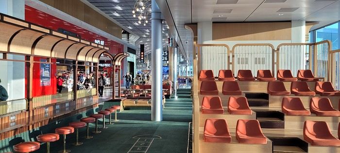
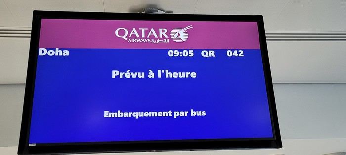
Coming up: Layover in Doha
I’m back from this “mixed” two-week cruise in the Indian Ocean on the Norwegian Sky.
Originally, I had booked a cruise with AIDA (also in the Indian Ocean), but unfortunately, the company decided to cancel it and offered us other options, which we declined because the dates didn’t work for us.
Since my wife really wants to do a cruise in the Indian Ocean, but very few companies offer this destination, it’s a bit complicated—especially when the dates don’t line up. Finding a good compromise between companies and timing is tough. Retirement can’t come soon enough!!!
After some research, I found a really great itinerary with Silversea (a luxury cruise line) for a 19-day cruise from Cape Town to Victoria, stopping in Madagascar (2 days), Praslin, La Digue... But my wife couldn’t get the time off. Not only was the itinerary amazing, but the price was unbeatable (5,200 € per person for a balcony suite, all-inclusive). What a shame—I would’ve loved to try this company, but maybe next time (if we’re lucky enough to have the chance).
My wife tried to take unpaid leave but wasn’t successful... Oh well!
On my end, I have more flexibility with vacation time since I travel a lot for work, so I can accumulate my days off and take them when it suits me.
So, we settled for this cruise (the only one that matched my wife’s vacation dates). Sure, we weren’t thrilled about the ship, but the itinerary wasn’t bad. We figured, why not?
I requested a quote from Logitravel, and after a discount, we paid 2,600 € per person for a balcony cabin (category BA) with the More At Sea package, which includes: 300 minutes of internet, premium drinks, 5 restaurants, and discounts on excursions...
The itinerary:
Day 1 Dubai (UAE) Boarding 11:59 PM Day 2 Abu Dhabi (UAE) 7:00 AM Day 3 Abu Dhabi (UAE) 2:00 PM Day 4 Sea day Day 5 Sea day Day 6 Sea day Day 7 Sea day Day 8 La Digue (Seychelles) 10:00 AM 8:00 PM Day 9 Mahé (Seychelles) 7:00 AM 8:00 PM Day 10 Sea day Day 11 Antsiranana (Madagascar) 7:00 AM 6:00 PM Day 12 Sea day Day 13 Pointe des Galets (Réunion) 8:00 AM 9:00 PM Day 14 Port Louis (Mauritius) 7:00 AM Day 15 Port Louis (Mauritius) 8:00 AM
After booking the cruise, I started looking for flights (Paris/Dubai and Mauritius/Paris). It’s peak Easter vacation time, so tickets are crazy expensive... I ran several simulations on Skyscanner and was shocked by the prices.
A direct flight from Paris to Dubai with Emirates is 1,400 € per person (one way), and the return from Mauritius to Paris (also with Emirates via Dubai) is 1,350 € per person.
Given these outrageous prices, I decided to book a flight with a layover. The best value I found was with Qatar (via Doha) for 650 € per person, with a 2.5-hour layover in Doha, and a direct flight from Mauritius to Paris with Corsair for 750 € per person.
With the More At Sea package, we had a 300 € credit per person for flight tickets (as long as we booked through NCL).
I requested a quote, and they offered: OUTBOUND: April 18, 2025 – Egyptair CDG-CAIRO 10:05 PM-2:30 AM February 19, 2025 – CAIRO-DUBAI 5:30 AM-10:55 AM RETURN: May 3, 2025 – Kenya Airways Port Louis-Nairobi 6:50 PM-10:10 PM, Nairobi-CDG 11:50 PM(+1)-7:30 AM (price: 950 € per person).
Sure, the price was good, but we didn’t want to fly with those airlines, and NCL didn’t have any other options. So, we booked our flights ourselves.
D-Day: Departure from Paris on April 18 with Qatar via Doha:
Two days before leaving, I checked in online and took the opportunity to buy seats near the emergency exits since my wife tends to get swollen legs on long flights. So, she prefers having extra legroom (cost: 132 € per person). It’s a bit pricey, but peace of mind is priceless.
Usually, when I have an early flight from Roissy, I always book a hotel the night before (near the airport) to avoid stress and not miss my flight. But since it was school vacation time and Good Friday, we decided to leave very early from home...
The flight was scheduled for 9:05 AM. We live 70 km from the airport and had to be there by 7:05 AM.
We barely slept... Up at 4:30 AM, and by 5:45 AM, our Uber was outside. We arrived at the airport (Roissy Terminal 1) by 6:50 AM.
Check-in was smooth—less than 10 minutes, and our bags were dropped off with boarding passes in hand.
This was my first time flying out of Roissy Terminal 1 since it was renovated for the Olympics. Wow, it’s a huge improvement—nothing like the old “camembert box” we used to know!
A few photos:
Coming up: Layover in Doha
A Trip to Australia: Tasmania
Sunday, November 26, 2023
Melbourne - Hobart
Flawless journey to Hobart. Our stay in the southernmost land we’ve ever visited. And indeed, everything’s different. The climate—14°C, rain that varies in intensity but never stops, the landscapes… It’s a shock! But, apart from the bad weather, Dom is thrilled.
We’ve also downgraded our accommodations. We’ve got a tiny room, and the bathroom—private, at least—is two hallways away… But the price is reasonable (under 100 €) and the location is central.
We cheered ourselves up by dining at *The Drunken Admiral* (reservations are a must—we barely snagged a table for 8 PM!). The decor is straight out of an old ship, complete with cheeky statues in the style of *Pirates of the Caribbean*… We had fun! The food was decent, but pricey. Dom loved it; I was less impressed.
We bailed on the British series *Emma*, based on Jane Austen. We couldn’t take it anymore. The boredom was so intense that the specter of a collective suicide loomed over us. This show, where the world’s most insufferable bourgeoisie—the English nobility—lives out love stories with such improbable naivety that I wanted to scream, is pure torture. Mercy, I surrender! I’ll tell you anything you want, just make it stop! We got rid of it. We’re safe now!
We’ve also downgraded our accommodations. We’ve got a tiny room, and the bathroom—private, at least—is two hallways away… But the price is reasonable (under 100 €) and the location is central.
We cheered ourselves up by dining at *The Drunken Admiral* (reservations are a must—we barely snagged a table for 8 PM!). The decor is straight out of an old ship, complete with cheeky statues in the style of *Pirates of the Caribbean*… We had fun! The food was decent, but pricey. Dom loved it; I was less impressed.
We bailed on the British series *Emma*, based on Jane Austen. We couldn’t take it anymore. The boredom was so intense that the specter of a collective suicide loomed over us. This show, where the world’s most insufferable bourgeoisie—the English nobility—lives out love stories with such improbable naivety that I wanted to scream, is pure torture. Mercy, I surrender! I’ll tell you anything you want, just make it stop! We got rid of it. We’re safe now!
Wild camping in Morocco?
Hello,
Is it possible to consider wild camping with young children, mainly in the Anti-Atlas? It’s not an option for budget reasons but rather a way of traveling we enjoy.
If we get the landowner’s permission and offer compensation, is it feasible?
Happy New Year to you all
If we get the landowner’s permission and offer compensation, is it feasible?
Happy New Year to you all
Road trip in Iceland with my daughter from May 6 to 13, 2023
Hello everyone,
I’m happy to be back at my keyboard to share a few adventures. 😉
Right now, two more trips are in the works for 2025, but for the moment, I’d rather share than ask questions.
Like many of you, Iceland has been a longtime love of mine. My first trip there was in February 2016, when we went as a family of five—including our three daughters, who were 1, 6, and 5 at the time. It was a very short stay with just one place to stay, north of the capital. We explored the south, from Vik to Grindavik, and of course, I was left wanting more. We returned in April 2018 during a stopover on our way back from New York. We spent three days near Borgarnes, but fatigue and the weather kept me from doing everything I’d planned. After my mom passed away in January 2023, I decided to go back to Iceland for a full week. Just to clear my head... I thought I’d go alone, but in the end, my 8-year-old daughter (at the time) is a huge horseback riding fan, so I decided to take her along. This road trip came together quickly thanks to another well-known French-speaking forum for Iceland lovers. As usual, I quickly checked availability on Booking and flights with Icelandair. Booked the flight, then the accommodations—with quite a few changes right up until departure. Goals for this trip:
Go where I haven’t been yet. Do a road trip because I love them. Go horseback riding with my daughter.
Icelandair was booked for May 6–13, 2023. Accommodations were reserved on Booking, and once again, I rented a 4x4 from Blue Car Rental, which I really like. Not wanting to deal with boredom while there, I got all the insurance and the option to skip the counter. My English isn’t great…
I’m happy to be back at my keyboard to share a few adventures. 😉
Right now, two more trips are in the works for 2025, but for the moment, I’d rather share than ask questions.
Like many of you, Iceland has been a longtime love of mine. My first trip there was in February 2016, when we went as a family of five—including our three daughters, who were 1, 6, and 5 at the time. It was a very short stay with just one place to stay, north of the capital. We explored the south, from Vik to Grindavik, and of course, I was left wanting more. We returned in April 2018 during a stopover on our way back from New York. We spent three days near Borgarnes, but fatigue and the weather kept me from doing everything I’d planned. After my mom passed away in January 2023, I decided to go back to Iceland for a full week. Just to clear my head... I thought I’d go alone, but in the end, my 8-year-old daughter (at the time) is a huge horseback riding fan, so I decided to take her along. This road trip came together quickly thanks to another well-known French-speaking forum for Iceland lovers. As usual, I quickly checked availability on Booking and flights with Icelandair. Booked the flight, then the accommodations—with quite a few changes right up until departure. Goals for this trip:
Go where I haven’t been yet. Do a road trip because I love them. Go horseback riding with my daughter.
Icelandair was booked for May 6–13, 2023. Accommodations were reserved on Booking, and once again, I rented a 4x4 from Blue Car Rental, which I really like. Not wanting to deal with boredom while there, I got all the insurance and the option to skip the counter. My English isn’t great…
Concrete changes in how you travel during the crisis
Hi everyone,
I was wondering how the coronavirus pandemic has impacted the way you travel or plan your trips. I know some of these points have been discussed before, but what I’m interested in here is the concrete, present, and personal—no politics and nothing post-COVID.
Here are a few ideas—do any of these resonate with you?
- Traveling shorter distances / for shorter durations - Favoring rural or less crowded areas over urban or overcrowded ones - Opting for private transportation over public transit - Traveling solo or at least in pairs rather than in groups - Waiting until the crisis is over and saving money in the meantime - Reassessing health risks (and updating your first-aid kit/medications and vaccinations) - ...
I’m sure you’ll have other things to add. The floor is yours!
I was wondering how the coronavirus pandemic has impacted the way you travel or plan your trips. I know some of these points have been discussed before, but what I’m interested in here is the concrete, present, and personal—no politics and nothing post-COVID.
Here are a few ideas—do any of these resonate with you?
- Traveling shorter distances / for shorter durations - Favoring rural or less crowded areas over urban or overcrowded ones - Opting for private transportation over public transit - Traveling solo or at least in pairs rather than in groups - Waiting until the crisis is over and saving money in the meantime - Reassessing health risks (and updating your first-aid kit/medications and vaccinations) - ...
I’m sure you’ll have other things to add. The floor is yours!
Comprendre la Biélorussie actuelle English translation pending
Bonjour
Je vous partage cette belle interview avec Anais Marin, politologue, specialiste du pays. Un bel apercu pour comprendre ce qu'il se passe actuellement en Bielorussie (Belarus)
https://www.youtube.com/watch?v=OtZOUgkfFg4&t
Notre trip en Afrique du Sud, destination Le Cap English translation pending
Vendredi 28 nov, 7h, nous sommes réveillés depuis 1h. En attendant le breakfast de 8h, nous partons sur les hauteurs voir le phare et la côte sauvage, elle est magnifique, les vagues sont toutes argentées par les rayons de soleil. Il n'y a que les cris des oiseaux et le clapotis de l'eau.
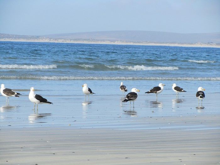 Nous avons découvert échouée sur le sable une famille de phoques , personne n'a su nous dire ce qui a causer leur mort et une énorme méduse au moins 30 cm de diamètre!
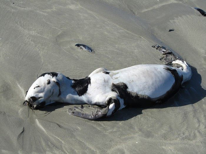


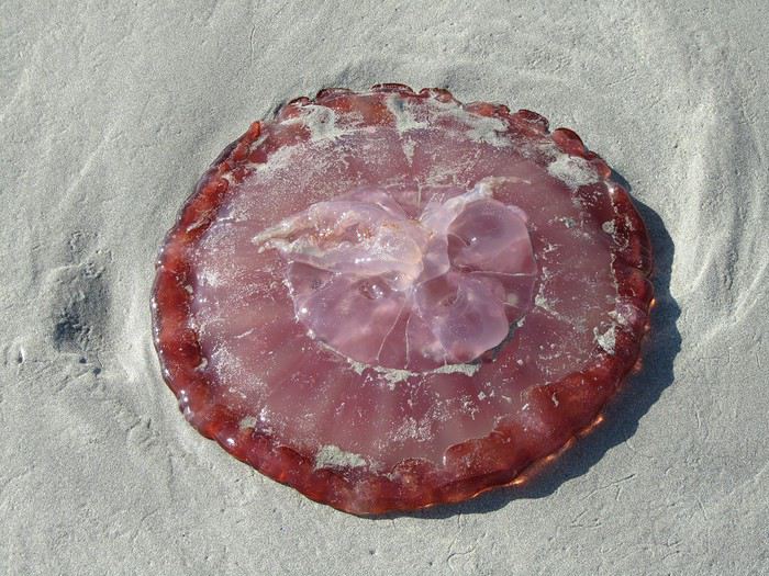
L'air marin a taquiné notre appétit, il fait bon être devant le petit déjeuner. Nous rencontrons un italien qui parle parfaitement le français, c'est un ami de la propriétaire, elle l'a appelé pour qu'il vienne nous faire la causette. Il est en Afrique du Sud depuis 40 ans, il connait bien Toulon, même au bout du monde, nous entendons parler de la France.
Nous les quittons à regrets, nous étions si bien dans ce petit village, mais il nous faut poursuivre notre balade vers Clanwilliam via Velddrif, Eland's Bay, la côte est splendide, pique -nique près de Lambert's Bay, royaume de la langouste, son port de pêche les exporte dans le monde entier; les amateurs de sensations fortes ne seront pas déçus par l'odeur qui y règne!
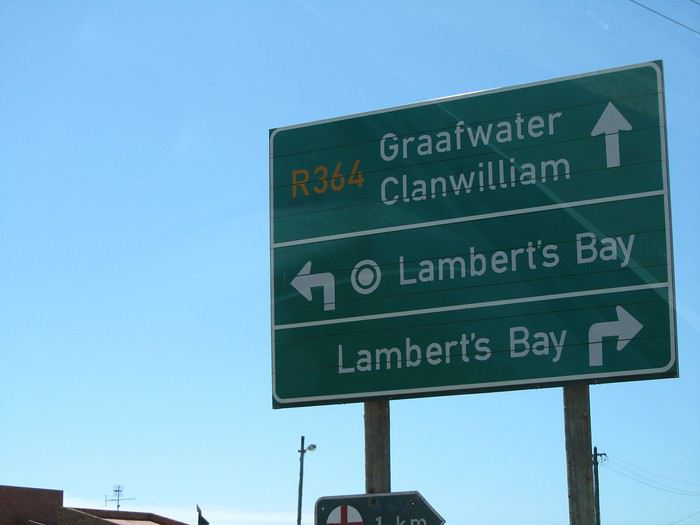
Nous atteignons Clanwillian , typique ambiance de ville d'Afrique. Pôle de la commercialisation du Rooibos, herbe rouge (ça ne se fume pas) le "thé" sud-africain par excellence, une plante locale dont la décoction, pauvre en tanin et exempte de caféine, est supposée avoir des vertus médicinales, est exportée dans le monde.
Tour de ville, recherche d'un B&B. Dans une rue calme et fleurie, bordée d'agréables maisons, nous remarquons "B&B ELEPHANT RIVER", c'est ici qu'il faut dormir!
Mais il n'y a personne pour nous recevoir, le portail est fermé et les chiens dans le fond du jardin aboient à qui mieux mieux. Au bout de 10 mn d'attente, un ouvrier jardinier qui passait nous fait signe de rester et reprend son chemin... Quelques minutes plus tard, la propriétaire arrive à notre grand étonnement, ce monsieur était allé la prévenir! Elle nous fait visiter les trois lodges et choisir celui qui nous convient. Tarif défiant tout concurrence 500 rands la nuit. Nous ne rencontrons que des personnes avenantes et sympathiques. Après un douche qui n'était pas superflue, tour du quartier et du centre ville à pied.
 nous rencontrons une manifestation pour le SIDA
Tout près du lodge, nous avons repéré un resto accueillant et sympathique,
 encore une fois les steaks sont énormes 500gr, nous ne le cherchons pas sous les frites, c'est le contraire qui se produit
 Il est 21h30, le sommeil se fait sentir, il est vrai que nous sommes debout depuis 6h du matin. J'oublie de vous dire que nous avons un lit à baldaquin!!

Demain, une bonne journée nous attend.
Nous avons découvert échouée sur le sable une famille de phoques , personne n'a su nous dire ce qui a causer leur mort et une énorme méduse au moins 30 cm de diamètre!
L'air marin a taquiné notre appétit, il fait bon être devant le petit déjeuner. Nous rencontrons un italien qui parle parfaitement le français, c'est un ami de la propriétaire, elle l'a appelé pour qu'il vienne nous faire la causette. Il est en Afrique du Sud depuis 40 ans, il connait bien Toulon, même au bout du monde, nous entendons parler de la France.
Nous les quittons à regrets, nous étions si bien dans ce petit village, mais il nous faut poursuivre notre balade vers Clanwilliam via Velddrif, Eland's Bay, la côte est splendide, pique -nique près de Lambert's Bay, royaume de la langouste, son port de pêche les exporte dans le monde entier; les amateurs de sensations fortes ne seront pas déçus par l'odeur qui y règne!
Nous atteignons Clanwillian , typique ambiance de ville d'Afrique. Pôle de la commercialisation du Rooibos, herbe rouge (ça ne se fume pas) le "thé" sud-africain par excellence, une plante locale dont la décoction, pauvre en tanin et exempte de caféine, est supposée avoir des vertus médicinales, est exportée dans le monde.
Tour de ville, recherche d'un B&B. Dans une rue calme et fleurie, bordée d'agréables maisons, nous remarquons "B&B ELEPHANT RIVER", c'est ici qu'il faut dormir!
Mais il n'y a personne pour nous recevoir, le portail est fermé et les chiens dans le fond du jardin aboient à qui mieux mieux. Au bout de 10 mn d'attente, un ouvrier jardinier qui passait nous fait signe de rester et reprend son chemin... Quelques minutes plus tard, la propriétaire arrive à notre grand étonnement, ce monsieur était allé la prévenir! Elle nous fait visiter les trois lodges et choisir celui qui nous convient. Tarif défiant tout concurrence 500 rands la nuit. Nous ne rencontrons que des personnes avenantes et sympathiques. Après un douche qui n'était pas superflue, tour du quartier et du centre ville à pied.
nous rencontrons une manifestation pour le SIDA
Tout près du lodge, nous avons repéré un resto accueillant et sympathique,
encore une fois les steaks sont énormes 500gr, nous ne le cherchons pas sous les frites, c'est le contraire qui se produit
Il est 21h30, le sommeil se fait sentir, il est vrai que nous sommes debout depuis 6h du matin. J'oublie de vous dire que nous avons un lit à baldaquin!!
Demain, une bonne journée nous attend.
Existe-t-il un ferry Turquie - Égypte? (avec camping-car) English translation pending
Bonjour,
Avec un ami nous avons comme projet de faire un voyage en camion, France - Sri Lanka. Pour ça nous devions passer par l’Iran pour ensuite prendre un ferry au sud de l’Iran jusqu’à Oman, afin de se rendre en Inde. Seulement, aujourd'hui il est vivement déconseillé de passer par l’Iran...
Ma question est : Existe t-il encore des ferry pour la liaison Turquie - Égypte ?
Merci.
Paulo
Avec un ami nous avons comme projet de faire un voyage en camion, France - Sri Lanka. Pour ça nous devions passer par l’Iran pour ensuite prendre un ferry au sud de l’Iran jusqu’à Oman, afin de se rendre en Inde. Seulement, aujourd'hui il est vivement déconseillé de passer par l’Iran...
Ma question est : Existe t-il encore des ferry pour la liaison Turquie - Égypte ?
Merci.
Paulo
Mon périple au Pérou English translation pending
Fin mars, j’avais décidé de faire un grand voyage. Mais ou ? Plusieurs destinations s’offraient à moi. Il y avait le Costa Rica, le Brésil, et le Pérou. J’avais envie de changer de l’Asie ou je me suis souvent rendue comme Hong Kong, Chine, Thailande ile de khô Samuy, Inde.
Mon choix se porte sur le Pérou ; je me dis que si je ne le fait pas maintenant, je ne le ferai jamais.
Evidemment, je ne m’étais pas préparé physiquement, mais qui ne tente rien à rien !
Et les images du Machu Picchu me donnèrent une envie folle de voir physiquement cette cité perdue et non pas de la regarder sur un poster.
J’ai 6 mois pour me préparer à l’altitude.
Nous sommes le 1er septembre, nous partons très tôt et prenons le RER à Antony. L’aventure commence déjà dans le RER avec nos bagages.Arrivés à Charles de Gaulle rien qu’avec les couloirs nous avions déjà fait 3 km de marche, j’avais l’impression que mes pieds suivaient mes chaussures.
Après avoir pris place dans notre avion, nous avons eu le droit comme il se doit au petit-déjeuner, au déjeuner et beaucoup beaucoup de turbulences !!!!
Nous atterrissons à Miami, et là, galère ! Entre le passage de l’ESTA, la douane, puis à nouveau la douane pour reprendre l’avion pour Lima, Ce sont 3 heures d’attente et de marche dans les couloirs de l’aéroport de Miami. C’est sûr, l’année prochaine si je pars à l’étranger, je ne passe pas par les USA, je prends un vol direct.
Nous voici à LIMA, il est 22H20, nous prenons un taxi (officiel) ou l’on paie deux fois le prix pour rejoindre le quartier de MIRAFLORES. Au retour nous paierons le prix correct.
Notre hôtel est sympa, style auberge de jeunesse, nous dormons très bien, car le matelas est vraiment confortable, du reste tous les hôtels ou nous séjournerons auront tous une très bonne literie.
Nous décidons de déjeuner dans le centre ville ; on nous sert un Pisco avec des grains de maïs grillé et j’en prendrai durant tous le séjour.
Le Céviche que mon mari prend à l’air très bon, moi je prendrai une salade à base
d’ avocat et de poulet.
Puis nous partons l’après-midi vers le quartier de BARRANCO. D’ailleurs, nous y retournerons pour le retour car le quartier est vraiment agréable.
Nous partons avec un bus le lendemain de la compagnie CRUZ DEL SUR, celle-ci est très bien, nous avons beaucoup de places, puisque nous prenons les places extra larges. Durant les 4 heures, on nous servira à boire et nous pourrons facilement nous détendre, car nos sièges s’inclinent à plus de 160 degrés.
Nous arrivons à la gare de HUACACHINA et devons prendre un taxi pour nous amener à l’hôtel.
Nous sommes surpris par ce que nous voyons, c’ést tellement hétéroclite, même si nous l’avions remarqué lorsque nous faisions notre itinéraire, nous n’en sommes pas néanmoins surpris. Nous mitraillons à tout va ces dunes à n’en plus finir, selon l’angle que nous avons ou bien le coucher de soleil qui s’amuse avec nous.
Le lendemain, nous décidons de faire un tour de buggy ! ouille, j’ai la malchance de mettre mes tongs ! le sable est brûlant, je troque mes tongs pour les baskets de HB. et lui se retrouve comme dans le film « la grande vadrouille ».Je laisserai HB très tôt ne pouvant rester sur le buggy, les secousses devenant de plus en plus fortes.
Nous, nous décidons de marcher dans le sable ; nous commençons à deviner ce que va être le reste du voyage, du reste HB est inquiet par l’altitude de Cuzco Nous dormons une 3ème nuit et passons la matinée à faire les petites boutiques.
Pour ceux qui voudraient survoler les lignes ; ne prenez pas de petit-déjeuner, car ça tangue beaucoup et faites en sortes d’y aller le matin (pour cause de météo changeante.) J’ai eu franchement la nausée, en ayant pris qu’un café avec un jus d’orange.
Je dois vous avouer que HB et moi avons été déçus par le survol, car il n’est pas facile de les apercevoir nettement, nous avons pu les photographier, mais je pense que le survol en avion peut-être exclu du voyage ! Peut-être que nous l’attendions avec trop d’impatience ?
Une fois descendus de l’avion ; nous nous rendons au cimetière de CHAUCHILLA ou de récentes momies ont été découvertes et qui sont visibles à l’oeil nu, nous devons quitter rapidement le site car une tempête de sable nous surprend. Puis nous nous rendons chez un chercheur d’or, nous les voyons à l’oeuvre, mais nous ne pourrons prendre de photos, tellement leur travail à l’air épuisant, ils portent tous un foulard, car ce qu’ils respire est
toxique (mercu
Le lendemain, nous découvrons la ville, son marché, sa place d’armes, et sa fête foraine qui me fait bien rire tellement leurs attractions sont toutes petites, comme la roue ; mais je suis fatiguée et préfère rentrer à l’hôtel afin de profiter de ma chambre et du cadre du jardin.
Nous passons donc une 2e nuit à NAZCA et repartons en fin d’après-midi pour AREQUIPA. Le voyage durera 10 heures, là je dois dire, que j’ai un peu moins apprécié la nuit. Pourtant il s’agit de la même compagnie.
Nous arrivons à AREQUIPA, (la ville blanche) deuxième ville du Pérou, HB cherche le taxi qui va pouvoir nous emmener à notre hôtel, apparemment l’adresse leur est inconnue ; mais au bout de 20 minutes, un taxi nous prend en charge croyant connaitre l’endroit ou nous devons nous rendre. Oh malheur ! une heure plus tard, nous sommes toujours dans le taxi et tournons en rond ! le chauffeur demande à tour de rôle aux piétons et même aux agents de police, ou se trouve la rue.
La maison est très belle, une piscine avec des transats sont au Rez-de-chaussée. La propriétaire est bienveillante ; elle nous gâte ; elle nous bichonne, du reste lorsqu’elle m’entend tousser elle m’apporte systématiquement un maté de coca. Nous sommes à 2335 m et j’ai au tout début une sorte de crise de spasmophilie, HB a un peu le souffle court. Le 1er jour, nous nous rendons à la place d’Armes, la ville est nettement plus agréable que les précédentes, elle est plus structurée. Je profite d’une Péruvienne qui se promène avec son petit chevreau pour me faire photographier comme bon nombre de touristes. Nous visitons la cathédrale à l’intérieur et nous montons tout en haut du clocher afin d’immortaliser cette vue incroyable que je regarde tous les jours sur mon téléphone puisque je l’ai choisie comme fond d’écran, le volcan MISTI qui n’est pas complètement blanc mais qui impose par sa hauteur, il culmine à 6300 m. Lors de notre séjour, nous faisons la connaissance durant notre notre petit déjeuner d’un jeune couple de français mais demeurant à Londres, nous échangeons quelques banalités. Mais que ça fait du bien de parler du pays ! Nous nous rendrons au couvent de SANTA CATALINA inscrit au patrimoine de L’UNESCO le plus grand au monde puisqu’il pouvait contenir plus de 500 nones qui n’avaient aucun contact avec le monde extérieur. Actuellement il y a encore 25 religieuses qui y vivent, mais qui peuvent désormais depuis la visite de jean-Paul 2 parler et sortir ; La visite du mardi et Jeudi en fin d’après-midi est à privilégier, car à partir du moment ou la nuit tombe, toutes les rues sont illuminées avec des bougies Nous déambulerons souvent dans les rues afin de bien nous acclimater ; nous aurons notre premier coup de coeur ! mais c’est sans compter notre visite à CUZCO Nous prenons 4 jours plus tard l’avion en direction de CUZCO, le vol durera 1H avec la compagnie LATAM. Nous prenons possession de notre chambre, et avons un coup de coeur pour le cadre qui est assez atypique, puisqu’ils nous faut passer par la cour d’une école et souvent nous voyons les élèves le soir apprendre certaines danses ; un soir nous avons vus les élèves apprendre le charleston ! Les filles essayaient de danser alors que les garçons n’étaient pas très impliqués. Le dimanche les élèves parfois viennent nettoyer leur table de classe. Ils sont tous investis par les tâches ménagères. Lors de notre séjour nous avons assisté à la fête des écoles de CUZCO ; Les élèves représentent l’école avec leur costumes folkloriques ainsi que la danse de l’école. A l’hôtel, j’ai fait la connaissance d’une petite fille qui était trop mignonne, elle accompagnait sa maman qui y travaillait, je regarde souvent sa petite bobine, elle me faisait penser à ma petite fille tellement elle était vive. Durant mon séjour, j’ai pu apprécié, le médecin qui est venu à l’hôtel, elle m’a fait une piqure de cortisone et d’antibiotiques car j’avais une bronchite ; Je dois dire que pour une somme de 40 euros, elle s’est déplacée et restée une heure. Nous avons pris une excursion, je dois dire qu’elle fut à la hauteur, pas moins de 5 sites en une journée, ce fut vraiment trop, nous étions claqués ; n’oublions pas que nous étions à 3400m d’altitude. Cuzco (nombril du monde), il est vrai qu’elle nous a bluffé tellement cette ville est spéciale par rapport à d’autres villes péruvienne. Si vous pouvez y rester plusieurs jours, ce ne sera que plus agréable. Nous y sommes restés 5 jours en tout, en deux fois, puisque nous sommes obligés de revenir sur nos pas, lorsque nous rentrons de Agua Calientes (machu Picchu) pour nous rendre vers d’autres villes Lors de notre excursion, nous étions dans un combi-car, qui pouvait contenir à peu près 20 personnes, la journée commença très tôt, le chauffeur vint nous chercher à 6 h du matin, et durant une heure nous allions chercher les autres touristes à leur hôtel. Mais à partir de 7heures, nous avons enfin commencé notre circuit. Nous nous sommes arrêtés dans le premier village Ollantaytambo, ou nous nous sommes arrêtés afin de faire quelques emplettes. Du reste sachez que pour aller au Machu Picchu, il y a un départ pour le train à partir de cette ville. Puis nous nous sommes rendus à CHINCHERO TOMBOMACHAY SALINAS DE MARAS et PISAC. Nous avons déjeuner à URUBUMBA, le site est vraiment très agréable, parmi les lamas et les perroquets. Cette journée fut vraiment très remplie, nous n’avions pas une minute à perdre, je me souviens que lorsque nous avons visité PISAC, il commençait à faire très froid. A la fin, nous suivions le guide sans plus trop savoir pourquoi nous montions encore et encore ! Après nos 4 jours passés à déambuler dans les ruelles de CUZCO, nous devions partir pour le MACHU PICCHU ! nous l’attendions cette étape, je dois dire que c’est pour elle que j’ai au début choisi ce pays. Puis nous sommes partis en direction de POROY, ou nous avons séjourné une journée entière avec les propriétaires de la maison ou nous avions réservé une nuit, nous avons assisté à l’une de leurs fêtes, et HB en a profité pour manger un CUY (cochon d’onde) pas moi ! rien que de voir sa tête et ses pattes, complètement aplatis comme le poulet portugais le Frango, ça ne me donnait absolument pas envie, aux dires de HB ; il parait que c’est délicieux. En aparté, dés qu’un Péruvien savait que nous étions français, il avait en mémoire la finale de la coupe du Monde de Football ! MERCI LES BLEUS. Nous avions choisi POROY, car nous ne voulions pas rater notre train du lendemain. Nous partions à 6h du matin avec la compagnie PERURAIL ( le train est franchement très onéreux, j’avais pris des places 360 degrés, mais franchement vous pouvez prendre la place normale ; on nous a expliqué par la suite, que PERU RAIL ET INCA RAIL sont des sociétés privées et elles sont ont le monopole pour se rendre au MACHU PICCHU cette excursion ramène à peu près 50 MILLIONS D’EUROS PAR AN. de plus, n’oubliez pas le retour comme moi ! Pour s’y rendre ; OLLAYMTAMTABO – soit vous dormez chez l’habitant, puis vous prenez le train durant 3h ; les prix varient entre 70Euros à 550 Euros pour le BELMOND › on arrive au plus tôt à midi; autant dire que l’on est fatigués puisque l’on s’est réveillés vers 5H du matin, on prend possession de notre chambre, puis une balade dans la ville qui est tout en hauteur ! puis on doit prendre un bus pour monter au machu Picchu pour un coût de 15 euros par personne ; il faudra se présenter une heure avant pour faire la queue, eh oui c’est le prix à payer ; la durée moyenne pour visiter la citadelle varie entre 2h et 4h pour notre part, voici ce que nous avons faits : POROY Chambre avec déjeuner et petit déjeuner 50 EUROS PERURAIL 80 euros X 2. =160 euros X 2 pour le retour 320 EUROS AGUA CALIENTE Chambre au GRINGO BILL’s 70 euros pour une nuit ; nous y sommes resté deux nuits. 140 EUROS visite du sanctuaire des papillons MARIPOSAS 5 euros X2 =10EUROS BUS (acheté sur Internet) 30 euros AR X 2 = 60 EUROS CITADELLE 60 euros X2 = 120 EUROS TOTAL pour cette seule excursion 700 EUROS. Et nous n’étions qu’à mi-séjour de notre voyage Certains prennent des places moins chères pour le train ; les prix vont entre 63 euros à 260 euros l’aller, et si vous ne voulez pas prendre le train ! c’est une grande aventure qui commence, car vous pouvez suivre le chemin en suivant les rails, mais apparemment cela est interdit ; mais la pratique est courante. j’ai découvert un lien, unsacesurledos.com (très bien détaillé) Le trajet du retour fut bien évidemment sensiblement le même que l’aller, retour en train à OLLAYTAMTABO, puis bus pour CUZCO et direction PUNO dans la soirée avec CRUZ DEL SUR Le trajet fut vraiment très mouvementé, par la suite, je changerais de compagnie et ne pris plus les places du Haut, car nous étions trop ballotés. Il s’avère que les sièges du BAS sont pour moi bien plus agréables que celles du hauts ; nous avons essayé d’autres compagnies qui étaient très bien, avec WIFI, toilettes, repas, télé pour ceux qui parlent bien l’espagnol, ce qui n’est pas mon cas. Lorsque nous sommes arrivés au petit-matin après 14h de trajet, il faisait très froid, et étions il faut le reconnaitre complètement décalqués ! Mais nous étions loin d’avoir atteint notre hôtel ! Nous devions prendre un taxi pour COPACCABANA, durée 3 heures, avec le passage de la frontière ; puis prendre un petit bâteau d’1h30 pour atteindre L’ISLA DEL SOL en BOLIVIE, une fois débarqués avec nos valises à roulettes, la vision d’une montagne de marche s’offre à nous ! nous sommes dépités, on est CREVES, on en peu plus ! pendant une minute nous songeons à repartir ; mais au loin ce ne sont pas des anges que nous voyons ce sont des ânes ! Oh merveilles des merveilles ; nous demandons si nous pouvons en louer. Chose faite, ils montent les valises, mais pas NOUS ! il fait chaud, nous avons dans les pâtes plus de 18 heures de bus, bateau et taxi. Mais au bout d’une demi-heure, nous arrivons ; C’est la plus belle des maisons, si , si je n’exagère pas, et surtout un accueil exceptionnel, on est au petit soin. De plus la vue est extraordinaire ! à oublier que nous sommes à 4200 m d’altitude. Nous avons l’impression d’être au bout du monde Nous y restons deux nuits, et nous sommes pendant deux jours face à ce lac immense (15 fois le lac Léman). La famille nous explique que le côté Nord est fermé , et pourquoi je demande – il y des problèmes avec les différentes communautés. A l’heure actuelle nous sommes fin septembre et l’ile est toujours fermé côté NORD. Lorsque nous, nous repartons, nous descendons ce qui n’est pas plus pratique de notre emplacement, et prenons un autre bâteau qui ne fera le trajet en une demi-heure, puis nous attend un taxi qui nous amènera à COPPACABANA, de là, nous prenons un bus, qui nous amène à LA PAZ , nous devrons descendre, car le bus doit monter sur une barge afin de traverser le lac, nous de même mais sur un petit bateau. Nous atteindrons LA PAZ en 4 heures, et là c’est le choc ! cette ville perchée ALTIPLANO à plus de 3600m avec plus d’un million d’habitants ; une circulation intense, et leurs pots d’échappements en hauteur ; évidemment à chaque passage d’une voiture, je tousse, je ne supporte plus cette odeur, j’ai l’impression d’avoir une centaine de personnes fumant sous mon nez ! mais non ; nous somme à la Paz. Au début, je me suis demandé si cela valait la peine d’être vue. OUI, il faut s’y rendre, en prenant le téléphérique, vous avez 3 lignes, vous avez une vue imprenable sur toute la ville. Vous verrez tout un quartier en altitude ou toutes les maisons sont colorées le quartier UNA CHUNA, puis nous irons voir la vallée de la lune qui est à 30 km de la Paz, l’érosion a formé des sortes de cheminées qui nous rappelle étrangement ce que nous avions vu aux USA, Brice Canyon. Nous retournerons d’ailleurs à la Paz pour notre retour sur LIMA pour PARIS. Départ deux jours plus tard pour Le SALAR (désert de sel) prés de la frontière CHILIENNE, après réflexion alors que nous ne sommes qu’à Agua Calientes, nous décidons de ne prendre qu’une journée et heureusement, nous partons de notre hôtel ou nous logeons dans des wagons, trop amusant, nous sommes avec deux chiliens, deux péruviens, et une colombienne, dont nous ferons leur connaissance par la suite, et resterons en contact même à notre retour en France. Nous roulons durant une centaine de kilomètres, nous nous arrêtons afin d’avoir des explications comme le geyser que nous voyons, l’eau n’est pas chaude, elle est glacée mais elle boue ! c’est étrange, l’explication nous sera donn
Nous voici à POTOSI, la ville me plait vraiment bien, elle est agréable, tous les soirs on assiste aux touristes revenant de leur excursion, et le matin c’est un balai de 4X4 qui défile sous nos yeux Le lac fait à peu près 11000 km carré et il est à une altitude de 3600 m, la profondeur du gisement peut atteindre plus de 100 m, il y a des cactus géants, c’est un paysage surréaliste ; la quantité du lithium représente la moitié des réserves du monde entierla réverbération est intense, heureusement nous ne quittons pas nos lunettes, mais l’air est frais, et nos bouches sont asséchées, nous buvons beaucoup d’eau, au retour, nous aurons une surprise lors du coucher de soleil, on a l’impression de regarder un miroir géant, on ne sait plus lorsque l’on fait une photo, si le ciel est en bas ou en haut. Après deux nuits, nous partons en direction de SUCRE qui est une altitude de 2800m une merveille, nous logeons dans l’ancienne ambassade du Brésil qui a été racheté par un particulier. Le cadre est tellement beau, que je n’ai pas envie de partir ; j’ai l’impression de me trouver en Andalousie. Le patio qu’il y a devant notre chambre est vraiment très reposant Les deux seules visites se porteront sur le site ou a été retrouvées des fossiles de dinosaures, et sur le palais et nous irons aussi nous reposer dans un parc ou il y a une petite Tour Eiffel (parc Simon Bolivar) nous resterons souvent sur la Plaza 25 de Mayo, puis la casa de la liberté. J’ai passé un moment très agréable à Sucre, et à part le Machu Picchu que j’ai adoré voir, je dois dire que la Bolivie reste un régal pour moi. Meme si LA PAZ est assez spéciale, LE LAC TITICACA (Copacabana) TOPOZI, LE DESERT DU SALAR, SUCRE valent vraiment le détour. Mon itinéraire durant un mois avec les prix des hôtels PEROU LIMA 2nuits KOKOPELLI HOSTEL (MIRAFLORES) 80 euros HUACACHINA 2 nuits DESERT NIGHTS HOSTEL 40 euros NAZCA 2 nuits LA MAISON DE LYDIA ( Très très bien) 60 euros AREQUIPA 3 nuits LA CASA DE MONI (Très jolie maison et propriétaire très bienveillante) 80 euros CUZCO 3 nuits CASA HOSPEDAJE (Site très agréable) 120 euros POROY 1 nuit LA OLLA PERUANA (Litterie excellente et propriétaires adorables) 50 euros avec le déjeuner et diner AGUA CALIENTE 2 nuits GRINGO BILL’S 140 euros BUS POUR PUNO 1 nuit BOLIVIE ISLA DEL SOL 2 nuits 100 euros CABANAS ECOLOGICAS SANTO CAMPO 80 euros UYUNI 1 nuit SLEEPBOX UYUNI (Très sympathique wagon) 50 euros TOPOSI 1 nuit THE KOALA DEN (Bof, sauf la situation) 50 euros SUCRE 2 nuits HOTEL MI PUEBLO SAMARY 140 euros Bus pour PUNO 1 nuit PUNO 1 nuit SOL PLAZA HOTEL 40 euros (sans intérêt) LIMA 1 nuit dans le quartier de Barranco, sans intérêt et très cher 80 euros TOTAL DE 1030 euros pour l’hébergement Total avion 1400 euros Américain Airline Paris via Miami via Lima avion par Latam Aréquipa Cuzco 150 euros avion par Latam Puno Lima 240 euros Total avion 1790 euros TRAJET BUS LIMA HUACACHINA 25 euros 4h 307,3km HUACACHINA NAZCA 30 euros 2 h25. 145,8 km AREQUIPA CUZCO 60 euros 10 h 513 km CUZCO PUNO 30 euros 7 h 386 km PUNO COPACABANA 80 euros 6 h 142 km COPACABANA LA PAZ 40 euros 4 h 154 km LA PAZ UYUNI 70 euros 11 h 541 km UYUNI POTOSI 20 euros 4 h 205 km POTOSI SUCRE 10 euros 3 h 155 km SUCRE LA PAZ 50 euros 12 h 692 km LA PAZ PUNO 50 euros 5 h 30 263 km TOTAL EUROS TRAJETS EN BUS 465 euros TOTAL HEURES 69, 55 heures 3504,10 kilomètres TAXI (estimation 300 euros) EXCURSION DESERT UYUNI 100 euros LA PAZ 20 euros CUZCO 120 euros Machu Picchu 500 euros Huacachina 20 euros Arequipa 20 euros NAZCA 160 euros TOTAL 940 EUROS Je n’ai pas compté les repas, mais vous pouvez très bien déjeuner pour 5 euros par personne. Comme d’habitude, lors de nos voyages, nous prenons un bon petit déjeuner vers 10h puis déjeunons vers 16 h. Nous ne dinions pas, mais vers 19 h ou 20h ; c’était une collation Je me suis souvent rendue sur les sites de voyages comme Voyageforum qui m’a beaucoup aidé pour préparer mon circuit. Bonnes vacances Toutes les photos et vidéos se trouvent sur mon site lesindiscretionsdefaustine.com
La maison est très belle, une piscine avec des transats sont au Rez-de-chaussée. La propriétaire est bienveillante ; elle nous gâte ; elle nous bichonne, du reste lorsqu’elle m’entend tousser elle m’apporte systématiquement un maté de coca. Nous sommes à 2335 m et j’ai au tout début une sorte de crise de spasmophilie, HB a un peu le souffle court. Le 1er jour, nous nous rendons à la place d’Armes, la ville est nettement plus agréable que les précédentes, elle est plus structurée. Je profite d’une Péruvienne qui se promène avec son petit chevreau pour me faire photographier comme bon nombre de touristes. Nous visitons la cathédrale à l’intérieur et nous montons tout en haut du clocher afin d’immortaliser cette vue incroyable que je regarde tous les jours sur mon téléphone puisque je l’ai choisie comme fond d’écran, le volcan MISTI qui n’est pas complètement blanc mais qui impose par sa hauteur, il culmine à 6300 m. Lors de notre séjour, nous faisons la connaissance durant notre notre petit déjeuner d’un jeune couple de français mais demeurant à Londres, nous échangeons quelques banalités. Mais que ça fait du bien de parler du pays ! Nous nous rendrons au couvent de SANTA CATALINA inscrit au patrimoine de L’UNESCO le plus grand au monde puisqu’il pouvait contenir plus de 500 nones qui n’avaient aucun contact avec le monde extérieur. Actuellement il y a encore 25 religieuses qui y vivent, mais qui peuvent désormais depuis la visite de jean-Paul 2 parler et sortir ; La visite du mardi et Jeudi en fin d’après-midi est à privilégier, car à partir du moment ou la nuit tombe, toutes les rues sont illuminées avec des bougies Nous déambulerons souvent dans les rues afin de bien nous acclimater ; nous aurons notre premier coup de coeur ! mais c’est sans compter notre visite à CUZCO Nous prenons 4 jours plus tard l’avion en direction de CUZCO, le vol durera 1H avec la compagnie LATAM. Nous prenons possession de notre chambre, et avons un coup de coeur pour le cadre qui est assez atypique, puisqu’ils nous faut passer par la cour d’une école et souvent nous voyons les élèves le soir apprendre certaines danses ; un soir nous avons vus les élèves apprendre le charleston ! Les filles essayaient de danser alors que les garçons n’étaient pas très impliqués. Le dimanche les élèves parfois viennent nettoyer leur table de classe. Ils sont tous investis par les tâches ménagères. Lors de notre séjour nous avons assisté à la fête des écoles de CUZCO ; Les élèves représentent l’école avec leur costumes folkloriques ainsi que la danse de l’école. A l’hôtel, j’ai fait la connaissance d’une petite fille qui était trop mignonne, elle accompagnait sa maman qui y travaillait, je regarde souvent sa petite bobine, elle me faisait penser à ma petite fille tellement elle était vive. Durant mon séjour, j’ai pu apprécié, le médecin qui est venu à l’hôtel, elle m’a fait une piqure de cortisone et d’antibiotiques car j’avais une bronchite ; Je dois dire que pour une somme de 40 euros, elle s’est déplacée et restée une heure. Nous avons pris une excursion, je dois dire qu’elle fut à la hauteur, pas moins de 5 sites en une journée, ce fut vraiment trop, nous étions claqués ; n’oublions pas que nous étions à 3400m d’altitude. Cuzco (nombril du monde), il est vrai qu’elle nous a bluffé tellement cette ville est spéciale par rapport à d’autres villes péruvienne. Si vous pouvez y rester plusieurs jours, ce ne sera que plus agréable. Nous y sommes restés 5 jours en tout, en deux fois, puisque nous sommes obligés de revenir sur nos pas, lorsque nous rentrons de Agua Calientes (machu Picchu) pour nous rendre vers d’autres villes Lors de notre excursion, nous étions dans un combi-car, qui pouvait contenir à peu près 20 personnes, la journée commença très tôt, le chauffeur vint nous chercher à 6 h du matin, et durant une heure nous allions chercher les autres touristes à leur hôtel. Mais à partir de 7heures, nous avons enfin commencé notre circuit. Nous nous sommes arrêtés dans le premier village Ollantaytambo, ou nous nous sommes arrêtés afin de faire quelques emplettes. Du reste sachez que pour aller au Machu Picchu, il y a un départ pour le train à partir de cette ville. Puis nous nous sommes rendus à CHINCHERO TOMBOMACHAY SALINAS DE MARAS et PISAC. Nous avons déjeuner à URUBUMBA, le site est vraiment très agréable, parmi les lamas et les perroquets. Cette journée fut vraiment très remplie, nous n’avions pas une minute à perdre, je me souviens que lorsque nous avons visité PISAC, il commençait à faire très froid. A la fin, nous suivions le guide sans plus trop savoir pourquoi nous montions encore et encore ! Après nos 4 jours passés à déambuler dans les ruelles de CUZCO, nous devions partir pour le MACHU PICCHU ! nous l’attendions cette étape, je dois dire que c’est pour elle que j’ai au début choisi ce pays. Puis nous sommes partis en direction de POROY, ou nous avons séjourné une journée entière avec les propriétaires de la maison ou nous avions réservé une nuit, nous avons assisté à l’une de leurs fêtes, et HB en a profité pour manger un CUY (cochon d’onde) pas moi ! rien que de voir sa tête et ses pattes, complètement aplatis comme le poulet portugais le Frango, ça ne me donnait absolument pas envie, aux dires de HB ; il parait que c’est délicieux. En aparté, dés qu’un Péruvien savait que nous étions français, il avait en mémoire la finale de la coupe du Monde de Football ! MERCI LES BLEUS. Nous avions choisi POROY, car nous ne voulions pas rater notre train du lendemain. Nous partions à 6h du matin avec la compagnie PERURAIL ( le train est franchement très onéreux, j’avais pris des places 360 degrés, mais franchement vous pouvez prendre la place normale ; on nous a expliqué par la suite, que PERU RAIL ET INCA RAIL sont des sociétés privées et elles sont ont le monopole pour se rendre au MACHU PICCHU cette excursion ramène à peu près 50 MILLIONS D’EUROS PAR AN. de plus, n’oubliez pas le retour comme moi ! Pour s’y rendre ; OLLAYMTAMTABO – soit vous dormez chez l’habitant, puis vous prenez le train durant 3h ; les prix varient entre 70Euros à 550 Euros pour le BELMOND › on arrive au plus tôt à midi; autant dire que l’on est fatigués puisque l’on s’est réveillés vers 5H du matin, on prend possession de notre chambre, puis une balade dans la ville qui est tout en hauteur ! puis on doit prendre un bus pour monter au machu Picchu pour un coût de 15 euros par personne ; il faudra se présenter une heure avant pour faire la queue, eh oui c’est le prix à payer ; la durée moyenne pour visiter la citadelle varie entre 2h et 4h pour notre part, voici ce que nous avons faits : POROY Chambre avec déjeuner et petit déjeuner 50 EUROS PERURAIL 80 euros X 2. =160 euros X 2 pour le retour 320 EUROS AGUA CALIENTE Chambre au GRINGO BILL’s 70 euros pour une nuit ; nous y sommes resté deux nuits. 140 EUROS visite du sanctuaire des papillons MARIPOSAS 5 euros X2 =10EUROS BUS (acheté sur Internet) 30 euros AR X 2 = 60 EUROS CITADELLE 60 euros X2 = 120 EUROS TOTAL pour cette seule excursion 700 EUROS. Et nous n’étions qu’à mi-séjour de notre voyage Certains prennent des places moins chères pour le train ; les prix vont entre 63 euros à 260 euros l’aller, et si vous ne voulez pas prendre le train ! c’est une grande aventure qui commence, car vous pouvez suivre le chemin en suivant les rails, mais apparemment cela est interdit ; mais la pratique est courante. j’ai découvert un lien, unsacesurledos.com (très bien détaillé) Le trajet du retour fut bien évidemment sensiblement le même que l’aller, retour en train à OLLAYTAMTABO, puis bus pour CUZCO et direction PUNO dans la soirée avec CRUZ DEL SUR Le trajet fut vraiment très mouvementé, par la suite, je changerais de compagnie et ne pris plus les places du Haut, car nous étions trop ballotés. Il s’avère que les sièges du BAS sont pour moi bien plus agréables que celles du hauts ; nous avons essayé d’autres compagnies qui étaient très bien, avec WIFI, toilettes, repas, télé pour ceux qui parlent bien l’espagnol, ce qui n’est pas mon cas. Lorsque nous sommes arrivés au petit-matin après 14h de trajet, il faisait très froid, et étions il faut le reconnaitre complètement décalqués ! Mais nous étions loin d’avoir atteint notre hôtel ! Nous devions prendre un taxi pour COPACCABANA, durée 3 heures, avec le passage de la frontière ; puis prendre un petit bâteau d’1h30 pour atteindre L’ISLA DEL SOL en BOLIVIE, une fois débarqués avec nos valises à roulettes, la vision d’une montagne de marche s’offre à nous ! nous sommes dépités, on est CREVES, on en peu plus ! pendant une minute nous songeons à repartir ; mais au loin ce ne sont pas des anges que nous voyons ce sont des ânes ! Oh merveilles des merveilles ; nous demandons si nous pouvons en louer. Chose faite, ils montent les valises, mais pas NOUS ! il fait chaud, nous avons dans les pâtes plus de 18 heures de bus, bateau et taxi. Mais au bout d’une demi-heure, nous arrivons ; C’est la plus belle des maisons, si , si je n’exagère pas, et surtout un accueil exceptionnel, on est au petit soin. De plus la vue est extraordinaire ! à oublier que nous sommes à 4200 m d’altitude. Nous avons l’impression d’être au bout du monde Nous y restons deux nuits, et nous sommes pendant deux jours face à ce lac immense (15 fois le lac Léman). La famille nous explique que le côté Nord est fermé , et pourquoi je demande – il y des problèmes avec les différentes communautés. A l’heure actuelle nous sommes fin septembre et l’ile est toujours fermé côté NORD. Lorsque nous, nous repartons, nous descendons ce qui n’est pas plus pratique de notre emplacement, et prenons un autre bâteau qui ne fera le trajet en une demi-heure, puis nous attend un taxi qui nous amènera à COPPACABANA, de là, nous prenons un bus, qui nous amène à LA PAZ , nous devrons descendre, car le bus doit monter sur une barge afin de traverser le lac, nous de même mais sur un petit bateau. Nous atteindrons LA PAZ en 4 heures, et là c’est le choc ! cette ville perchée ALTIPLANO à plus de 3600m avec plus d’un million d’habitants ; une circulation intense, et leurs pots d’échappements en hauteur ; évidemment à chaque passage d’une voiture, je tousse, je ne supporte plus cette odeur, j’ai l’impression d’avoir une centaine de personnes fumant sous mon nez ! mais non ; nous somme à la Paz. Au début, je me suis demandé si cela valait la peine d’être vue. OUI, il faut s’y rendre, en prenant le téléphérique, vous avez 3 lignes, vous avez une vue imprenable sur toute la ville. Vous verrez tout un quartier en altitude ou toutes les maisons sont colorées le quartier UNA CHUNA, puis nous irons voir la vallée de la lune qui est à 30 km de la Paz, l’érosion a formé des sortes de cheminées qui nous rappelle étrangement ce que nous avions vu aux USA, Brice Canyon. Nous retournerons d’ailleurs à la Paz pour notre retour sur LIMA pour PARIS. Départ deux jours plus tard pour Le SALAR (désert de sel) prés de la frontière CHILIENNE, après réflexion alors que nous ne sommes qu’à Agua Calientes, nous décidons de ne prendre qu’une journée et heureusement, nous partons de notre hôtel ou nous logeons dans des wagons, trop amusant, nous sommes avec deux chiliens, deux péruviens, et une colombienne, dont nous ferons leur connaissance par la suite, et resterons en contact même à notre retour en France. Nous roulons durant une centaine de kilomètres, nous nous arrêtons afin d’avoir des explications comme le geyser que nous voyons, l’eau n’est pas chaude, elle est glacée mais elle boue ! c’est étrange, l’explication nous sera donn
Nous voici à POTOSI, la ville me plait vraiment bien, elle est agréable, tous les soirs on assiste aux touristes revenant de leur excursion, et le matin c’est un balai de 4X4 qui défile sous nos yeux Le lac fait à peu près 11000 km carré et il est à une altitude de 3600 m, la profondeur du gisement peut atteindre plus de 100 m, il y a des cactus géants, c’est un paysage surréaliste ; la quantité du lithium représente la moitié des réserves du monde entierla réverbération est intense, heureusement nous ne quittons pas nos lunettes, mais l’air est frais, et nos bouches sont asséchées, nous buvons beaucoup d’eau, au retour, nous aurons une surprise lors du coucher de soleil, on a l’impression de regarder un miroir géant, on ne sait plus lorsque l’on fait une photo, si le ciel est en bas ou en haut. Après deux nuits, nous partons en direction de SUCRE qui est une altitude de 2800m une merveille, nous logeons dans l’ancienne ambassade du Brésil qui a été racheté par un particulier. Le cadre est tellement beau, que je n’ai pas envie de partir ; j’ai l’impression de me trouver en Andalousie. Le patio qu’il y a devant notre chambre est vraiment très reposant Les deux seules visites se porteront sur le site ou a été retrouvées des fossiles de dinosaures, et sur le palais et nous irons aussi nous reposer dans un parc ou il y a une petite Tour Eiffel (parc Simon Bolivar) nous resterons souvent sur la Plaza 25 de Mayo, puis la casa de la liberté. J’ai passé un moment très agréable à Sucre, et à part le Machu Picchu que j’ai adoré voir, je dois dire que la Bolivie reste un régal pour moi. Meme si LA PAZ est assez spéciale, LE LAC TITICACA (Copacabana) TOPOZI, LE DESERT DU SALAR, SUCRE valent vraiment le détour. Mon itinéraire durant un mois avec les prix des hôtels PEROU LIMA 2nuits KOKOPELLI HOSTEL (MIRAFLORES) 80 euros HUACACHINA 2 nuits DESERT NIGHTS HOSTEL 40 euros NAZCA 2 nuits LA MAISON DE LYDIA ( Très très bien) 60 euros AREQUIPA 3 nuits LA CASA DE MONI (Très jolie maison et propriétaire très bienveillante) 80 euros CUZCO 3 nuits CASA HOSPEDAJE (Site très agréable) 120 euros POROY 1 nuit LA OLLA PERUANA (Litterie excellente et propriétaires adorables) 50 euros avec le déjeuner et diner AGUA CALIENTE 2 nuits GRINGO BILL’S 140 euros BUS POUR PUNO 1 nuit BOLIVIE ISLA DEL SOL 2 nuits 100 euros CABANAS ECOLOGICAS SANTO CAMPO 80 euros UYUNI 1 nuit SLEEPBOX UYUNI (Très sympathique wagon) 50 euros TOPOSI 1 nuit THE KOALA DEN (Bof, sauf la situation) 50 euros SUCRE 2 nuits HOTEL MI PUEBLO SAMARY 140 euros Bus pour PUNO 1 nuit PUNO 1 nuit SOL PLAZA HOTEL 40 euros (sans intérêt) LIMA 1 nuit dans le quartier de Barranco, sans intérêt et très cher 80 euros TOTAL DE 1030 euros pour l’hébergement Total avion 1400 euros Américain Airline Paris via Miami via Lima avion par Latam Aréquipa Cuzco 150 euros avion par Latam Puno Lima 240 euros Total avion 1790 euros TRAJET BUS LIMA HUACACHINA 25 euros 4h 307,3km HUACACHINA NAZCA 30 euros 2 h25. 145,8 km AREQUIPA CUZCO 60 euros 10 h 513 km CUZCO PUNO 30 euros 7 h 386 km PUNO COPACABANA 80 euros 6 h 142 km COPACABANA LA PAZ 40 euros 4 h 154 km LA PAZ UYUNI 70 euros 11 h 541 km UYUNI POTOSI 20 euros 4 h 205 km POTOSI SUCRE 10 euros 3 h 155 km SUCRE LA PAZ 50 euros 12 h 692 km LA PAZ PUNO 50 euros 5 h 30 263 km TOTAL EUROS TRAJETS EN BUS 465 euros TOTAL HEURES 69, 55 heures 3504,10 kilomètres TAXI (estimation 300 euros) EXCURSION DESERT UYUNI 100 euros LA PAZ 20 euros CUZCO 120 euros Machu Picchu 500 euros Huacachina 20 euros Arequipa 20 euros NAZCA 160 euros TOTAL 940 EUROS Je n’ai pas compté les repas, mais vous pouvez très bien déjeuner pour 5 euros par personne. Comme d’habitude, lors de nos voyages, nous prenons un bon petit déjeuner vers 10h puis déjeunons vers 16 h. Nous ne dinions pas, mais vers 19 h ou 20h ; c’était une collation Je me suis souvent rendue sur les sites de voyages comme Voyageforum qui m’a beaucoup aidé pour préparer mon circuit. Bonnes vacances Toutes les photos et vidéos se trouvent sur mon site lesindiscretionsdefaustine.com
Périple en Asie du Sud-est English translation pending
Bonjour à tous,
J'avoue avoir pas mal tergiversé avant de me décider à publier ce carnet. Car l'Asie du Sud-Est, à commencer par la Thaïlande, est une zone sur laquelle beaucoup de carnets ont déjà été publiés, notamment par des voyageurs qui sont devenus de vrais spécialistes du secteur.
Et puis finalement, ce voyage en famille fut un tel régal qu'il me semble normal de faire un retour sur VF. J'y prends régulièrement des infos pour préparer mes voyages (merci notamment à Anne alias Xeta pour son carnet et ses infos pratiques), alors ce carnet sera un juste retour des choses.
Tout aurait dû bien commencer pour ce voyage car, contrairement à nos avions pour l'Indonésie en 2015 et pour le Nicaragua en 2017, qui avaient tous les deux été annulés au dernier moment alors que nous étions quelques centaines à poireauter en salle d'embarquement, notre avion pour Bangkok a bien décollé, lui, en temps et en heure. Mais sans nous quand même !
En effet, quelques jours plus tôt, le brevet des collèges que passait notre fils aîné avait été décalé de quelques jours par le ministre pour cause de... canicule ! Les école maternelles n'ont pas été fermées mais les collèges qui accueillaient le brevet, si ! Allez comprendre. Toujours est-il que notre avion s'est trouvé à décoller quelques minutes seulement après la fin de la dernière épreuve du brevet, nous étions donc un poil trop courts pour l'attraper. Nous avons ainsi dû décaler notre vol de 24 heures. Nous attendons d'ailleurs toujours le remboursement partiel auquel nous avons droit mais peu importe, c'est une autre histoire...
Si je cite cette anecdote qui n'a apparemment rien à voir avec la Thaïlande, c'est parce qu'une fois arrivés à Bangkok, le monsieur à l'accueil de notre hôtel nous annonce qu'il a annulé par erreur les 3 nuitées que nous y avions réservées. J'avais pourtant envoyé 2 mails de confirmation de notre réservation en précisant que nous manquerions juste la première nuit et j'avais reçu une réponse positive, mais il a fait la boulette quand même ! Bref, après le coup de l'avion, quand ça veut pas, ben ça veut pas 🤪
Nous prenons donc la nouvelle avec le sourire (quoi de plus normal dans ce pays !), alors que notre interlocuteur de l'hôtel, lui, n'esquisse pas le moindre rictus. Il paraît que quand on va au pays du sourire, il y en a toujours un qui fait exception à la règle. Pour nous, ce sera donc celui-là ! Mais ce n'est pas bien grave, tous les autres rattraperont le coup après lui, au fil de notre séjour...
Enfin bon, après une demi-journée perdue bêtement pour chercher un autre hôtel, puis pour le rejoindre au milieu de l'intense circulation de Bangkok, notre voyage peut enfin commencer. Sauf que c'est l'heure de manger puis de se coucher. Le voyage commencera donc enfin demain.
BANGKOK
Selon le dernier classement des villes les plus visitées du monde, Bangkok se situe à... la première place ! Devant Londres (2e) et Paris (3e), excusez du peu. Et si certains quartiers ne sont pas spécialement sexy, certains sites en revanche constituent de pures merveilles et justifient un tel classement.
Après tous les problèmes que nous avons rencontrés d'emblée dans ce voyage, il ne nous reste plus qu'un jour pour visiter Bangkok, au lieu de deux et demi comme initialement prévu, sachant que nous y reviendrons une demi-journée au milieu du séjour.
Nous allons donc manquer de temps pour visiter la ville mais bon il faut faire avec et nous allons essayer de voir le maximum de choses pour cette première journée que nous n'avons pas volée !
Nous commençons donc par traverser, rapidement hélas, le marché aux fleurs.
Il paraît qu'il est ouvert 24 heures sur 24. En tout cas lors de notre venue, il n'y a pas foule mais l'endroit, où il y a également pas mal de fruits et légumes, est vraiment agréable.
Nous enchaînons par l'un des fameux temples de Bangkok : le Wat Pho.
Son architecture nous dépayse totalement et je dois dire qu'avec le stress énorme que nous a causé pendant une semaine le report de notre départ, ce lieu sacré nous fait un bien fou. C'est pour vivre ce genre de moments que nous aimons tant voyager.
Alors bien sûr, le temps n'est pas très beau (pas étonnant, on est en juillet mais ça au moins, c'était prévu), contrairement au site !
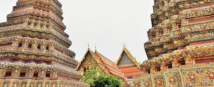
Là, ça y est, notre voyage est enfin bel et bien lancé.
A l'intérieur de ces bâtiments multicolores, les bouddhas sont omniprésents et rivalisent de sérénité.
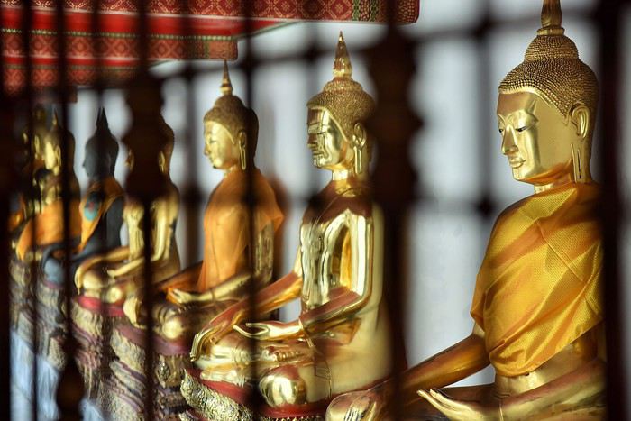
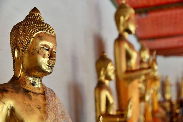
Le plus grand et le plus impressionnant d'entre eux, c'est Bouddha couché, représenté sur son lit de mort juste avant d'atteindre le Parinirvāṇa (la fin de l'existence physique pour qui a atteint l'éveil).
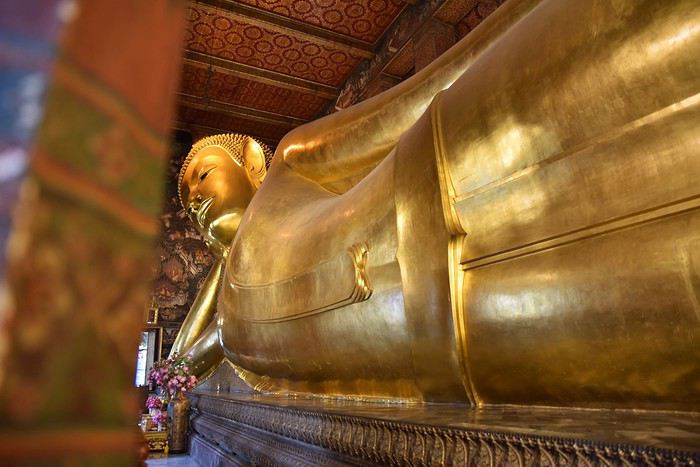
Ce magnifique bouddha est entièrement recouvert de feuilles d'or. Il nous impressionne.
La salle qui l'accueille, bien que très grande, semble trop exiguë pour cette statue qui en impose : 46 mètres de long sur 15 de haut.
Et que dire de ses pieds, qui sont au moins aussi beaux que tout le reste : incrustés de nacre, ils représentent les 108 actions qui ont permis à Bouddha d'atteindre la perfection.
Ci-dessus : la plante du pied de Bouddha
Un peu plus loin se trouve le sanctuaire principal : l'Ubosot. A l'intérieur, on retrouve Bouddha, mais assis cette fois. C'est en dessous de cette statue toute en or et en cristal que sont conservées les cendres du célèbre roi Rama Ier (1737-1809).
A noter enfin que dans l'enceinte du Wat Pho, on trouve également une école de médecine et de massages traditionnels, qui fut créée pour assurer la transmission des savoirs ancestraux.
Aujourd'hui, elle assure la formation des étudiants venus du monde entier. Les visiteurs peuvent d'ailleurs se faire masser dans les règles de l'art, même si l'attente peut parfois être un peu longue...
Bon, finalement, il commence bien ce voyage en Thaïlande. Nous enchaînons avec un autre temple, le Wat Arun.
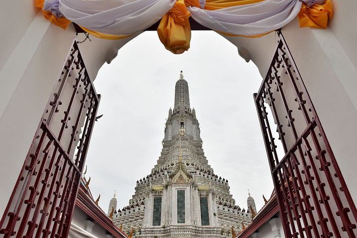
Contrairement au Wat Pho qui est très coloré, la Wat Arun apparaît plutôt blanc de loin. Mais de près, on constate que c'est une infinité de petites mosaïques colorées qui constituent ce gigantesque ensemble.
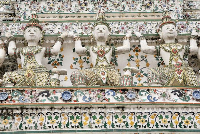
Une partie seulement des escaliers du prang central (72 mètres de haut) est ouverte au public, ce qui est suffisant pour avoir une jolie vue sur Bangkok quand le temps s'y prête... ce qui n'était pas le cas le jour de notre visite !
Si les deux temples que nous avons visités nous ont impressionnés, que dire de celui que nous allons voir dans la foulée : le Wat Phra Kaeo. Mais je posterai la suite dans un prochain message, ayant déjà presque atteint mon quota de photos...
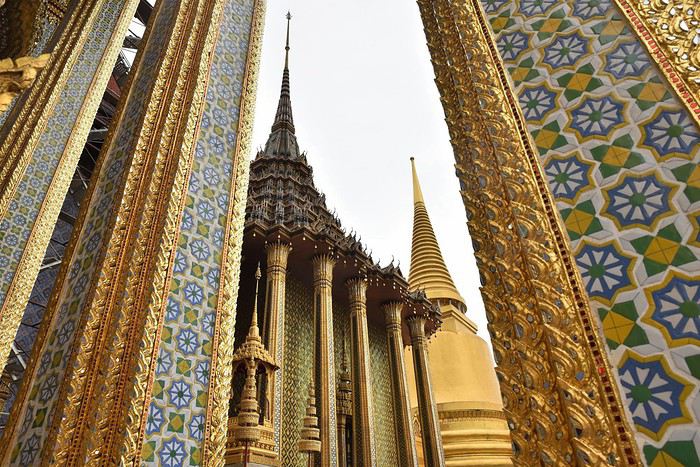
In the Land of the Tswana (Botswana)
We’ve been back for a month now, so it’s high time I posted the story of our adventures! 😉 I’d also like to thank everyone who shared their own experiences on this forum (or elsewhere) and gave us tips—it really helped us plan our trip.
14/09/2019: Johannesburg - Vryburg After months of waiting and reading other travelers’ journals, it’s finally our turn! We arrived in Johannesburg from Nantes and Paris in the morning. We looked for the Bushlore rep—we’d rented our 4x4 from them—but there was no sign with our name! « Bushlore? She’s a woman, I saw her a few minutes ago, » someone told us. A minute later, the Bushlore employee showed up: a man! 🤪 He sped onto the highway, and just 30 minutes later, we arrived at the rental place. It’s a big operation with good organization and lots of vehicles—pretty reassuring. Our 4x4 was there, a classic Toyota Hilux fully equipped for safari: rooftop tent, dual diesel tanks, 60-liter water reserve, two batteries, two spare tires, all the camping gear, plus everything needed for *désensablement* (getting unstuck from sand). Speaking of which, is it "désensablage" or "désensablement"? Best to just avoid getting stuck in the first place! 😏 Good news… or not: the vehicle was brand new, with barely 100 kilometers on the odometer. On one hand, we figured we wouldn’t have mechanical issues or a fridge breakdown, but on the other, we knew it wouldn’t be easy to return it without a single scratch. Either way, it was our first time renting a 4x4, and we were impressed.
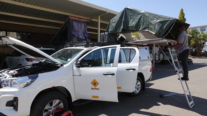
We set off toward Kgalagadi Transfrontier Park—it’s not exactly around the corner! In 1994 (when Mandela had just become President) and 2007, during our two previous trips to South Africa, we loved this park, so we couldn’t imagine going to Botswana without returning. The road was pretty monotonous, with not much to see except a few ostriches.
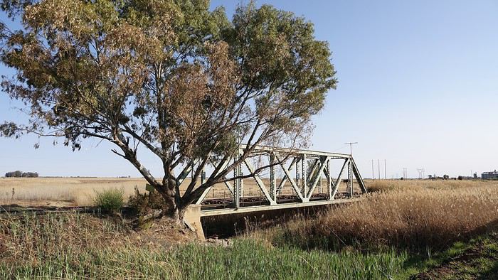
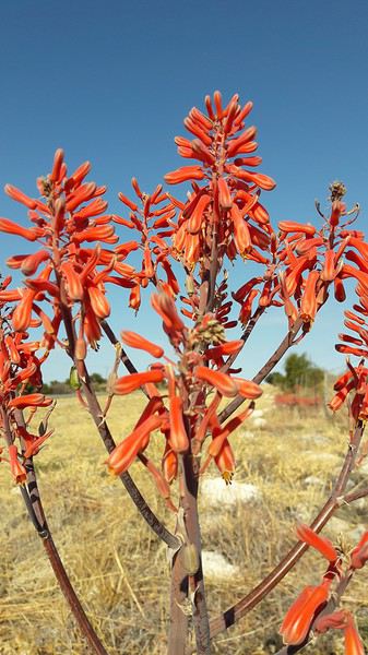
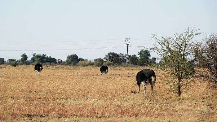
We stopped for the night in Vryburg at the Kameelboom Lodge campsite. It was a bit noisy since it’s close to the road, and the facilities weren’t great, but it was fine for one night.
14/09/2019: Johannesburg - Vryburg After months of waiting and reading other travelers’ journals, it’s finally our turn! We arrived in Johannesburg from Nantes and Paris in the morning. We looked for the Bushlore rep—we’d rented our 4x4 from them—but there was no sign with our name! « Bushlore? She’s a woman, I saw her a few minutes ago, » someone told us. A minute later, the Bushlore employee showed up: a man! 🤪 He sped onto the highway, and just 30 minutes later, we arrived at the rental place. It’s a big operation with good organization and lots of vehicles—pretty reassuring. Our 4x4 was there, a classic Toyota Hilux fully equipped for safari: rooftop tent, dual diesel tanks, 60-liter water reserve, two batteries, two spare tires, all the camping gear, plus everything needed for *désensablement* (getting unstuck from sand). Speaking of which, is it "désensablage" or "désensablement"? Best to just avoid getting stuck in the first place! 😏 Good news… or not: the vehicle was brand new, with barely 100 kilometers on the odometer. On one hand, we figured we wouldn’t have mechanical issues or a fridge breakdown, but on the other, we knew it wouldn’t be easy to return it without a single scratch. Either way, it was our first time renting a 4x4, and we were impressed.
We set off toward Kgalagadi Transfrontier Park—it’s not exactly around the corner! In 1994 (when Mandela had just become President) and 2007, during our two previous trips to South Africa, we loved this park, so we couldn’t imagine going to Botswana without returning. The road was pretty monotonous, with not much to see except a few ostriches.
We stopped for the night in Vryburg at the Kameelboom Lodge campsite. It was a bit noisy since it’s close to the road, and the facilities weren’t great, but it was fine for one night.
De Tijuana à Los Cabos, road trip de 16 jours en Basse Californie English translation pending
Bonjour,
Ce carnet de voyage est le compte rendu d’un séjour de 16 jours effectué du 29 avril au 14 mai 2019.
Participants: 2 adultes (63 et 65 ans) Organisation : nous-mêmes en nous basant sur des carnets de voyage, des programmes d’agence, le Lonely Planet en anglais (Baja California et Los Cabos, seul guide un peu complet). Réservation d’hôtels par internet ou par mail. Déplacements : voiture de location. Climat : frais et venteux dans le nord et le long du Pacifique, chaud et sec dans le sud et le long de la mer de Cortes. Formalités / santé :
- Pas de visa nécessaire. - Pas de vaccin à prévoir. Divers :
- Electricité : les prises sont les mêmes qu’aux Etats-Unis (deux fiches plates). Voltage : 110/140 volts. - Décalage horaire avec la France : 9h en Baja California nord - 8h en Baja California sud. - La saison pour l’observation des baleines, parmi les meilleures du monde, s’étend de janvier à avril. Conseils :
- L'eau du robinet est dite potable mais mieux vaut ne pas la boire. - Avoir deux permis de conduire internationaux (gratuits). - Avoir une bonne carte routière et télécharger les cartes sur openstreetmap. - Un 4/4 est inutile pour ce circuit. Nous avons opté pour un SUV, un peu plus haut que les berlines. Il est clair que si on veut sortir complètement des sentiers battus pour aller découvrir des sites uniquement accessibles par pistes, un 4/4 est indispensable.
 - Faire le plein d’essence dès qu’il y a une station car il peut ne pas y en avoir sur plus de 200 kilomètres.
- Se méfier des nids de poule, des topes (ralentisseurs) mal ou pas signalés et des troupeaux en liberté le long des routes.
- Faire le plein d’essence dès qu’il y a une station car il peut ne pas y en avoir sur plus de 200 kilomètres.
- Se méfier des nids de poule, des topes (ralentisseurs) mal ou pas signalés et des troupeaux en liberté le long des routes.
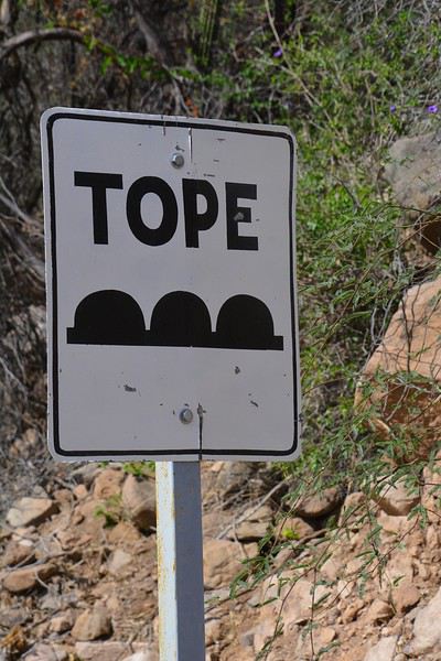
- Se laisser dépasser par les camions qui roulent très vite plutôt que de les avoir dans le dos. - De manière générale, il est préférable de ne pas circuler la nuit. Comme partout dans le monde, il vaut mieux ne rien laisser dans la voiture le soir et se garer dans des endroits éclairés et dans les parkings des hôtels. - Avoir toujours un stock d’eau dans la voiture et quelques provisions (éventuellement dans une petite glacière dont on renouvelle la glace régulièrement dans les supermarchés comme Oxxo). On peut ne pas trouver de restaurant pendant des heures (hors saison en tout cas).
- Avoir suffisamment d’argent liquide, les cartes de crédit ne fonctionnant pas partout. - Prévoir des pourboires de 10 à 15% dans les hôtels et les restaurants.
Nos coups de cœur : - en général, la géologie de la région - la vallée de los Cirios - Bahia de los Angeles - les salines de Guerrero Negro - San Ignacio, son oasis et sa mission - les plages de Bahia Concepcion (Santispac, El Coyote et El Requeson) - la Sierra Giganta et la mission San Javier (Loreto) - l’excursion en bateau à l’île Espiritu Santo (La Paz) - la vieille ville de San Jose del Cabo
Nos bonnes surprises - l’état des routes bien meilleur qu’espéré - la sécurité, en tout cas hors saison. Aucune agressivité, les Mexicains sont très aimables et toujours prêts à aider. - la nourriture tout à fait correcte et n’entraînant pas de troubles digestifs majeurs
Nos regrets ou déceptions : - ne pas avoir pu faire d’excursion pour voir les peintures rupestres - ne pas avoir pu faire de snorkeling à Cabo Pulmo - le manque de jolies villes (les villes traversées sont très laides et n’ont aucune âme) - les promenades sur les malecons n’ont jamais été à la hauteur de nos attentes, surtout à La Paz dont on dit que c’est le plus beau de Basse Californie - La Paz, grande ville peu séduisante - Cabo San Lucas : à fuir
Bilan - Très beau voyage hors des sentiers battus, avec des paysages assez époustouflants. Un petit bémol en ce qui me concerne est le manque de variété (alternance de désert et de plage, peu de jolis villages et manque de visites culturelles), peut-être dû en partie au fait que nous n’avons pas pu faire de visites de grottes de peintures rupestres et que nous n’étions pas à la saison de l’observation des baleines (choix délibéré). - Le fait d’être hors-saison était très agréable et nous a permis de très bien profiter des sites mais il avait aussi ses inconvénients, comme la difficulté d’organiser des excursions accompagnées.
Jour 1 : Bruxelles – Paris – Mexico - Tijuana a.m. : - train pour Paris CDG p.m. : - vol Paris – Mexico - vol Mexico – Tijuana
Train pour Paris CDG. Vol de 11h30 entre Paris et Mexico (Air France – A380). L’aéroport de Mexico est vieux et délabré. Quand on est en transit, il faut récupérer ses bagages et les déposer au fond de la zone de réception des bagages sur un tapis roulant réservé aux correspondances. Douane très rapide. Il ne faut surtout pas se précipiter sur le premier bureau de change dans la zone des bagages où le taux est beaucoup moins intéressant qu’ailleurs. On marche des kilomètres et on prend un train pour accéder à la zone 2 des vols domestiques. Complètement épuisés, on se dit qu’on aurait peut-être mieux fait de loger à côté de l’aéroport de Mexico et de prendre le vol de Tijuana le lendemain. Vol de +/- 3h30 pour Tijuana (Aeromexico) qui nous semble interminable et inconfortable. L’aéroport de Tijuana, par contre, est très moderne et propre. On a rapidement nos bagages. Pas de navette pour aller à l’hôtel. On prend donc un taxi (200 pesos). On se couche à 11 p.m. (heure locale), soit 8 a.m. pour nous ! Nuit à Tijuana (aéroport) Hôtel Hampton Inn, grand hôtel moderne, très confortable, excellente literie, très bonne douche. On ne retiendra pas la vue (entrepôt et chantier) mais bien les superbes photos noir et blanc de Basse Californie.
Jour 2 : Tijuana – San Quintin (6h45) a.m. : - prise de possession de la voiture de location à l’aéroport - route vers Ensenada p.m. : - arrêt à la Bufadora et déjeuner. - route vers San Quintin - nuit à San Quintin
Petit déjeuner à l’hôtel, correct sauf le pain. A 9h, la navette de l’hôtel nous conduit à l’aéroport pour prendre possession de la voiture de location. Service horriblement lent mais personnel très aimable et souriant ne parlant quasiment que l’espagnol. Départ à 10h30 et route vers Ensenada. Les quartiers de Tijuana que nous traversons ne donnent vraiment pas envie de s’attarder. Au niveau de la frontière, on se croirait à Calais avec les files interminables de camions. On longe l’impressionnant mur de fer séparant le Mexique et les USA. Il est constitué d’une énorme grille à laquelle on est en train d’accoler des panneaux métalliques. Tout cela est doublé quelques mètres plus loin par un grillage surmonté de fils de fer barbelés. Clochards ou migrants y vivent sous les ponts dans un état souvent très avancé.
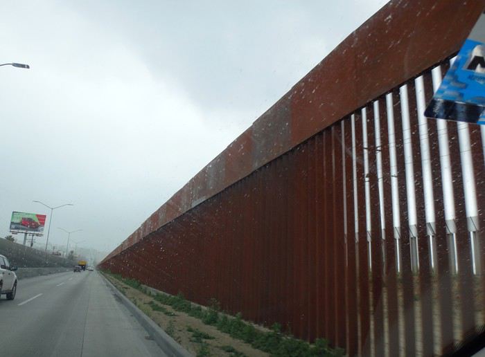
Comme il pleut, on regrette encore moins de ne pas s’attarder ici. La scenic road longe la côte … mais quelle déception ! C’est très construit et mal, beaucoup de bâtiments sont en ruines ou abandonnés. Ce n’est qu’à proximité d’Ensenada que la côte devient plus belle. On fait d’ailleurs un petit arrêt à un point de vue sur une côte sauvage avec falaises et iles au loin. Il fait meilleur et le soleil apparaît.
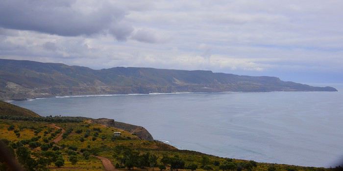
Vers 13h15, après avoir fait un petit détour, on s’arrête à la Buffadora, un site très touristique au sud d’Ensenada, au bout d’une péninsule. L’endroit est complétement paumé.
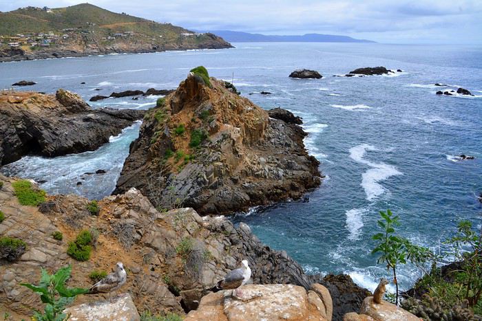
On n’avait encore vu quasi aucun touriste, mais là, c’est la foule, dans une rue interminable bordée de boutiques et de petits restos. Et on est hors saison ! Cela s’explique par le fait qu’Ensenada accueille de gros bateaux de croisière.
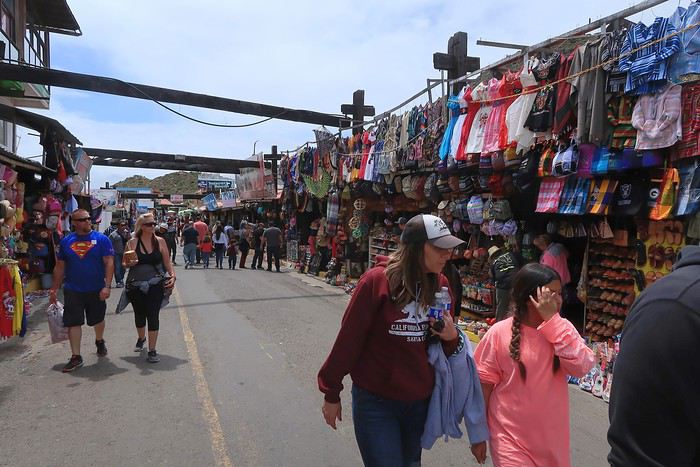
On arrive enfin à la bufadora, sorte de geyser où l’eau de mer s’engouffre dans une bouche et jaillit de manière inégale.
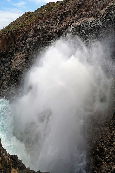
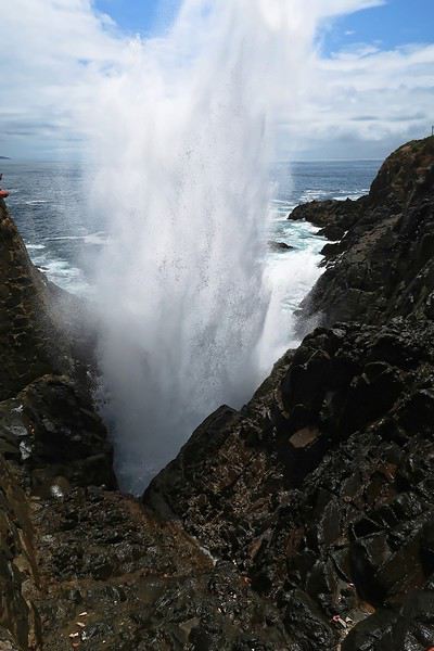
Les gens se font photographier devant les grandes lettres colorées de ENSENADA. Il semble y en avoir de pareilles dans toutes les villes.
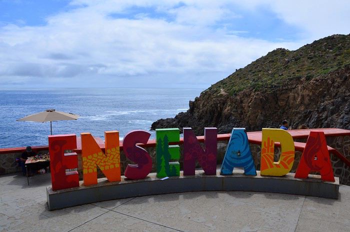
Ça ne vaut peut-être pas le détour mais ça fait un divertissement amusant pour couper la route. C’est tout de même le 2ème plus grand geyser marin du monde. On renonce à un chic resto conseillé dans le Lonely Planet pour manger dans un petit établissement, chez Dona Chuy, où tout est étalé sur un comptoir ouvert sur la rue. Très animé et bon. On y mange des grands coquillages remplis de grosses crevettes chauds et gratinés et des tacos de poisson, tout ça assez bon. Service agréable.
On se laisse déjà tenter par des hamacs/fauteuils très sympas (20 $ pièce après avoir marchandé). On nous en proposera plus tard des moins chers évidemment (10 $) mais notre vendeur était très sympa et parlait français. On reprend la route à 14h35 après s’être bien amusés. Encore une fois, on se dit qu’il ne faut pas se précipiter sur les premières choses qu’on nous propose, comme ici le parking qui est beaucoup plus cher à l’entrée que plus loin.
Enormément de fleurs le long de la route. Après Ensenada, il y a aussi beaucoup de serres avec des légumes mais aussi des fleurs. La route est pleine de trous dont il faut se méfier. Ce n’est pas pour rien qu’il y a tant de vendeurs de pneus le long de la route.
Les camions roulent très vite et il vaut mieux les laisser passer que de les avoir dans le dos. On suit la route des vins et on commence à voir des vignes.
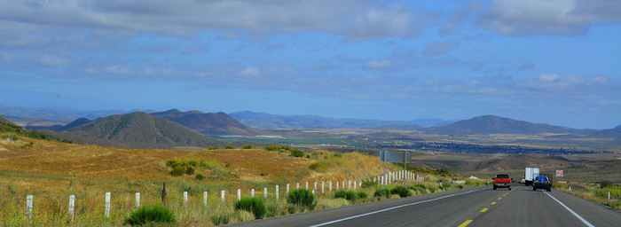
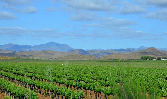
Le relief change et la route passe entre de raides collines bien vertes. Des travaux sur la route nous font perdre beaucoup de temps, heureusement dans un bel endroit. Beaucoup d’oliviers dont on fait la récolte et aussi des cultures de cactus. Sur les collines, on aperçoit parfois de curieux agaves. La route devient vraiment très belle jusqu’à San Antonio del Mar où le paysage redevient plus plat. Enormément de cultures. Mais où va-t-on chercher l’eau, les rivières sont à sec déjà fin avril ? Arrivée à San Quintin vers 18h30. L’hôtel Jardines Baja n’est pas facile à trouver. Il faut prendre la direction de l’hôtel Old Mill, puis la 1ère route non macadamisée à gauche. Comme on s’est trompé, on est allé jusqu’au bout, à un assez bel endroit de bras de mer sur fond de petits volcans aux cratères bien marqués. Etonnant.
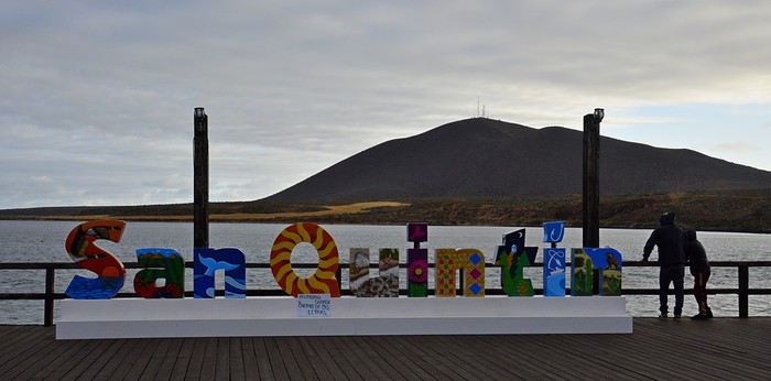
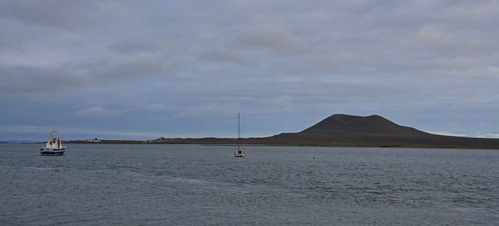
Dîner au restaurant de l’hôtel, assez bon. Beaucoup d’Américains ici. Nuit à San Quintin. Hôtel Jardines Baja, superbes jardins sophistiqués et fleuris, jolis patios et terrasses très conviviaux. Grande chambre malheureusement très sombre, normalement équipée. Salle de bain vieillotte mais correcte. Calme absolu.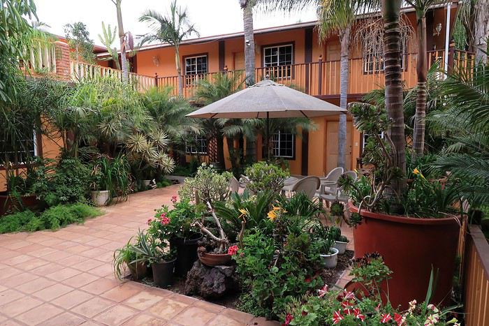
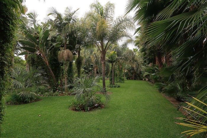
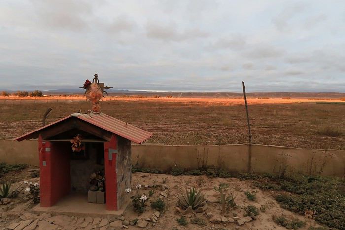
Ce carnet de voyage est le compte rendu d’un séjour de 16 jours effectué du 29 avril au 14 mai 2019.
Participants: 2 adultes (63 et 65 ans) Organisation : nous-mêmes en nous basant sur des carnets de voyage, des programmes d’agence, le Lonely Planet en anglais (Baja California et Los Cabos, seul guide un peu complet). Réservation d’hôtels par internet ou par mail. Déplacements : voiture de location. Climat : frais et venteux dans le nord et le long du Pacifique, chaud et sec dans le sud et le long de la mer de Cortes. Formalités / santé :
- Pas de visa nécessaire. - Pas de vaccin à prévoir. Divers :
- Electricité : les prises sont les mêmes qu’aux Etats-Unis (deux fiches plates). Voltage : 110/140 volts. - Décalage horaire avec la France : 9h en Baja California nord - 8h en Baja California sud. - La saison pour l’observation des baleines, parmi les meilleures du monde, s’étend de janvier à avril. Conseils :
- L'eau du robinet est dite potable mais mieux vaut ne pas la boire. - Avoir deux permis de conduire internationaux (gratuits). - Avoir une bonne carte routière et télécharger les cartes sur openstreetmap. - Un 4/4 est inutile pour ce circuit. Nous avons opté pour un SUV, un peu plus haut que les berlines. Il est clair que si on veut sortir complètement des sentiers battus pour aller découvrir des sites uniquement accessibles par pistes, un 4/4 est indispensable.
- Faire le plein d’essence dès qu’il y a une station car il peut ne pas y en avoir sur plus de 200 kilomètres.
- Se méfier des nids de poule, des topes (ralentisseurs) mal ou pas signalés et des troupeaux en liberté le long des routes.- Se laisser dépasser par les camions qui roulent très vite plutôt que de les avoir dans le dos. - De manière générale, il est préférable de ne pas circuler la nuit. Comme partout dans le monde, il vaut mieux ne rien laisser dans la voiture le soir et se garer dans des endroits éclairés et dans les parkings des hôtels. - Avoir toujours un stock d’eau dans la voiture et quelques provisions (éventuellement dans une petite glacière dont on renouvelle la glace régulièrement dans les supermarchés comme Oxxo). On peut ne pas trouver de restaurant pendant des heures (hors saison en tout cas).
- Avoir suffisamment d’argent liquide, les cartes de crédit ne fonctionnant pas partout. - Prévoir des pourboires de 10 à 15% dans les hôtels et les restaurants.
Nos coups de cœur : - en général, la géologie de la région - la vallée de los Cirios - Bahia de los Angeles - les salines de Guerrero Negro - San Ignacio, son oasis et sa mission - les plages de Bahia Concepcion (Santispac, El Coyote et El Requeson) - la Sierra Giganta et la mission San Javier (Loreto) - l’excursion en bateau à l’île Espiritu Santo (La Paz) - la vieille ville de San Jose del Cabo
Nos bonnes surprises - l’état des routes bien meilleur qu’espéré - la sécurité, en tout cas hors saison. Aucune agressivité, les Mexicains sont très aimables et toujours prêts à aider. - la nourriture tout à fait correcte et n’entraînant pas de troubles digestifs majeurs
Nos regrets ou déceptions : - ne pas avoir pu faire d’excursion pour voir les peintures rupestres - ne pas avoir pu faire de snorkeling à Cabo Pulmo - le manque de jolies villes (les villes traversées sont très laides et n’ont aucune âme) - les promenades sur les malecons n’ont jamais été à la hauteur de nos attentes, surtout à La Paz dont on dit que c’est le plus beau de Basse Californie - La Paz, grande ville peu séduisante - Cabo San Lucas : à fuir
Bilan - Très beau voyage hors des sentiers battus, avec des paysages assez époustouflants. Un petit bémol en ce qui me concerne est le manque de variété (alternance de désert et de plage, peu de jolis villages et manque de visites culturelles), peut-être dû en partie au fait que nous n’avons pas pu faire de visites de grottes de peintures rupestres et que nous n’étions pas à la saison de l’observation des baleines (choix délibéré). - Le fait d’être hors-saison était très agréable et nous a permis de très bien profiter des sites mais il avait aussi ses inconvénients, comme la difficulté d’organiser des excursions accompagnées.
Jour 1 : Bruxelles – Paris – Mexico - Tijuana a.m. : - train pour Paris CDG p.m. : - vol Paris – Mexico - vol Mexico – Tijuana
Train pour Paris CDG. Vol de 11h30 entre Paris et Mexico (Air France – A380). L’aéroport de Mexico est vieux et délabré. Quand on est en transit, il faut récupérer ses bagages et les déposer au fond de la zone de réception des bagages sur un tapis roulant réservé aux correspondances. Douane très rapide. Il ne faut surtout pas se précipiter sur le premier bureau de change dans la zone des bagages où le taux est beaucoup moins intéressant qu’ailleurs. On marche des kilomètres et on prend un train pour accéder à la zone 2 des vols domestiques. Complètement épuisés, on se dit qu’on aurait peut-être mieux fait de loger à côté de l’aéroport de Mexico et de prendre le vol de Tijuana le lendemain. Vol de +/- 3h30 pour Tijuana (Aeromexico) qui nous semble interminable et inconfortable. L’aéroport de Tijuana, par contre, est très moderne et propre. On a rapidement nos bagages. Pas de navette pour aller à l’hôtel. On prend donc un taxi (200 pesos). On se couche à 11 p.m. (heure locale), soit 8 a.m. pour nous ! Nuit à Tijuana (aéroport) Hôtel Hampton Inn, grand hôtel moderne, très confortable, excellente literie, très bonne douche. On ne retiendra pas la vue (entrepôt et chantier) mais bien les superbes photos noir et blanc de Basse Californie.
Jour 2 : Tijuana – San Quintin (6h45) a.m. : - prise de possession de la voiture de location à l’aéroport - route vers Ensenada p.m. : - arrêt à la Bufadora et déjeuner. - route vers San Quintin - nuit à San Quintin
Petit déjeuner à l’hôtel, correct sauf le pain. A 9h, la navette de l’hôtel nous conduit à l’aéroport pour prendre possession de la voiture de location. Service horriblement lent mais personnel très aimable et souriant ne parlant quasiment que l’espagnol. Départ à 10h30 et route vers Ensenada. Les quartiers de Tijuana que nous traversons ne donnent vraiment pas envie de s’attarder. Au niveau de la frontière, on se croirait à Calais avec les files interminables de camions. On longe l’impressionnant mur de fer séparant le Mexique et les USA. Il est constitué d’une énorme grille à laquelle on est en train d’accoler des panneaux métalliques. Tout cela est doublé quelques mètres plus loin par un grillage surmonté de fils de fer barbelés. Clochards ou migrants y vivent sous les ponts dans un état souvent très avancé.
Comme il pleut, on regrette encore moins de ne pas s’attarder ici. La scenic road longe la côte … mais quelle déception ! C’est très construit et mal, beaucoup de bâtiments sont en ruines ou abandonnés. Ce n’est qu’à proximité d’Ensenada que la côte devient plus belle. On fait d’ailleurs un petit arrêt à un point de vue sur une côte sauvage avec falaises et iles au loin. Il fait meilleur et le soleil apparaît.
Vers 13h15, après avoir fait un petit détour, on s’arrête à la Buffadora, un site très touristique au sud d’Ensenada, au bout d’une péninsule. L’endroit est complétement paumé.
On n’avait encore vu quasi aucun touriste, mais là, c’est la foule, dans une rue interminable bordée de boutiques et de petits restos. Et on est hors saison ! Cela s’explique par le fait qu’Ensenada accueille de gros bateaux de croisière.
On arrive enfin à la bufadora, sorte de geyser où l’eau de mer s’engouffre dans une bouche et jaillit de manière inégale.
Les gens se font photographier devant les grandes lettres colorées de ENSENADA. Il semble y en avoir de pareilles dans toutes les villes.
Ça ne vaut peut-être pas le détour mais ça fait un divertissement amusant pour couper la route. C’est tout de même le 2ème plus grand geyser marin du monde. On renonce à un chic resto conseillé dans le Lonely Planet pour manger dans un petit établissement, chez Dona Chuy, où tout est étalé sur un comptoir ouvert sur la rue. Très animé et bon. On y mange des grands coquillages remplis de grosses crevettes chauds et gratinés et des tacos de poisson, tout ça assez bon. Service agréable.
On se laisse déjà tenter par des hamacs/fauteuils très sympas (20 $ pièce après avoir marchandé). On nous en proposera plus tard des moins chers évidemment (10 $) mais notre vendeur était très sympa et parlait français. On reprend la route à 14h35 après s’être bien amusés. Encore une fois, on se dit qu’il ne faut pas se précipiter sur les premières choses qu’on nous propose, comme ici le parking qui est beaucoup plus cher à l’entrée que plus loin.
Enormément de fleurs le long de la route. Après Ensenada, il y a aussi beaucoup de serres avec des légumes mais aussi des fleurs. La route est pleine de trous dont il faut se méfier. Ce n’est pas pour rien qu’il y a tant de vendeurs de pneus le long de la route.
Les camions roulent très vite et il vaut mieux les laisser passer que de les avoir dans le dos. On suit la route des vins et on commence à voir des vignes.
Le relief change et la route passe entre de raides collines bien vertes. Des travaux sur la route nous font perdre beaucoup de temps, heureusement dans un bel endroit. Beaucoup d’oliviers dont on fait la récolte et aussi des cultures de cactus. Sur les collines, on aperçoit parfois de curieux agaves. La route devient vraiment très belle jusqu’à San Antonio del Mar où le paysage redevient plus plat. Enormément de cultures. Mais où va-t-on chercher l’eau, les rivières sont à sec déjà fin avril ? Arrivée à San Quintin vers 18h30. L’hôtel Jardines Baja n’est pas facile à trouver. Il faut prendre la direction de l’hôtel Old Mill, puis la 1ère route non macadamisée à gauche. Comme on s’est trompé, on est allé jusqu’au bout, à un assez bel endroit de bras de mer sur fond de petits volcans aux cratères bien marqués. Etonnant.
Dîner au restaurant de l’hôtel, assez bon. Beaucoup d’Américains ici. Nuit à San Quintin. Hôtel Jardines Baja, superbes jardins sophistiqués et fleuris, jolis patios et terrasses très conviviaux. Grande chambre malheureusement très sombre, normalement équipée. Salle de bain vieillotte mais correcte. Calme absolu.
Qui sera à bord du MSC Fantasia au départ de Gênes le 26 octobre 2019 English translation pending
Bonjour
Nous partons en transfert de Nice le 26 octobre avec pour une 1ere fois une Suite Aurea 9009 qui sera a bord en même temps et qui connaît la suite aurea ? merci
Nous partons en transfert de Nice le 26 octobre avec pour une 1ere fois une Suite Aurea 9009 qui sera a bord en même temps et qui connaît la suite aurea ? merci
Partage conteneur vers l'Amérique du Sud en février 2020 English translation pending
Bonjour, je cherche à partager un conteneur 40 pieds HC de France ou Belgique vers l'Amérique du Sud, Buenos Aires ou autre port en fonction de l'arrangement. Pour un Toyota HZJ avec cellule Azalaï, hauteur 250 cm. Bien à Vous
Péripéties d'une famille en terres namibiennes English translation pending
Il règne une atmosphère un peu étrange ce weekend à la maison… Alors que d’habitude, à la veille d’un grand départ la tension et l’agitation dominent ; cette année c’est le calme. Tellement calme que le weekend nous paraît long. Tellement long que l’impatience nous ronge intérieurement ; comme une boule au ventre prête à exploser d’émerveillement au fil des surprises et rencontres qui nous attendent au cours des 4 prochaines semaines.
La Namibie c’est une grande première pour toute la tribu. Si avec nos 3 enfants nous avons coutume de poser nos valises sur le sol américain, cette année cap au Sud ! Autre façon de voyager aussi, puisque notre habituel combo SUV+motels laisse place à l’inévitable 4x4 avec le motel – euh la tente – sur le toit… A nous la zenitude des ciels étoilés au milieu du désert ! Nous sommes adeptes des randos dans le wilderness des US ; cette année nous plongeons dans une autre dimension de la notion des grands espaces. Et pourquoi fait-il si calme à la maison alors ?? Parce que nous sommes fin prêts. Tous les sacs sont bouclés depuis vendredi soir ; alors qu’on ne décolle que ce dimanche à 17h… Nous sommes confiants. Parce que tout est réservé sur place via Madiza Tours à Windhoek. Parce que le forum nous a procuré les excellents conseils indispensables à l’établissement et la réussite d’un tel itinéraire que nous voulons « plein la vue sans trop se presser ». Merci encore à tous ceux qui l’alimentent quotidiennement !
J’ai pris l’habitude de rédiger mes carnets de voyage au-jour-le-jour ; seule façon selon moi d’immortaliser des souvenirs tellement forts et nombreux que je crains que les détails ne soient trop éphémères. Même si cela demande un certain investissement en temps, quel bonheur quand ces souvenirs se ravivent à la relecture des semaines, des mois, des années plus tard ! Quand je voyage aux Etats-Unis, je prends plaisir aussi à partager mes notes et photos journalières en live (ou presque) sur le forum. Notes qui servent ensuite à la rédaction plus formelle de mon blog - http://photoolivier.com/wp/decouverte-usa/. Ici en Namibie, je sais que le défi sera de taille, étant donné l’absence quasi complète de connexion internet tout au long de notre périple, et le manque d’électricité pour recharger l’ordi ; le traditionnel « live » risque d’accuser rapidement un sacré différé ; mais qu’importe ! C’est un ressenti « à chaud » que nous voulons partager.
Aussi, nous vous invitons par le biais de ce carnet à prendre place sur le toit de notre 4x4, et à en prendre plein la vue autant que nous alors que nous dévalons les pistes namibiennes. Nombre de places illimitées 😊
Olivier
La Namibie c’est une grande première pour toute la tribu. Si avec nos 3 enfants nous avons coutume de poser nos valises sur le sol américain, cette année cap au Sud ! Autre façon de voyager aussi, puisque notre habituel combo SUV+motels laisse place à l’inévitable 4x4 avec le motel – euh la tente – sur le toit… A nous la zenitude des ciels étoilés au milieu du désert ! Nous sommes adeptes des randos dans le wilderness des US ; cette année nous plongeons dans une autre dimension de la notion des grands espaces. Et pourquoi fait-il si calme à la maison alors ?? Parce que nous sommes fin prêts. Tous les sacs sont bouclés depuis vendredi soir ; alors qu’on ne décolle que ce dimanche à 17h… Nous sommes confiants. Parce que tout est réservé sur place via Madiza Tours à Windhoek. Parce que le forum nous a procuré les excellents conseils indispensables à l’établissement et la réussite d’un tel itinéraire que nous voulons « plein la vue sans trop se presser ». Merci encore à tous ceux qui l’alimentent quotidiennement !
J’ai pris l’habitude de rédiger mes carnets de voyage au-jour-le-jour ; seule façon selon moi d’immortaliser des souvenirs tellement forts et nombreux que je crains que les détails ne soient trop éphémères. Même si cela demande un certain investissement en temps, quel bonheur quand ces souvenirs se ravivent à la relecture des semaines, des mois, des années plus tard ! Quand je voyage aux Etats-Unis, je prends plaisir aussi à partager mes notes et photos journalières en live (ou presque) sur le forum. Notes qui servent ensuite à la rédaction plus formelle de mon blog - http://photoolivier.com/wp/decouverte-usa/. Ici en Namibie, je sais que le défi sera de taille, étant donné l’absence quasi complète de connexion internet tout au long de notre périple, et le manque d’électricité pour recharger l’ordi ; le traditionnel « live » risque d’accuser rapidement un sacré différé ; mais qu’importe ! C’est un ressenti « à chaud » que nous voulons partager.
Aussi, nous vous invitons par le biais de ce carnet à prendre place sur le toit de notre 4x4, et à en prendre plein la vue autant que nous alors que nous dévalons les pistes namibiennes. Nombre de places illimitées 😊
Olivier
Le Masai Mara dans toute sa splendeur English translation pending
Pour une fois je délaisse le self drive Sud Africain pour un safari photo organisé dans le Masai Mara.
Ça faisait quelque temps que j'échangeais via email avec Tony Crocetta pour pouvoir partir dans son camp que l'on m'avait chaudement recommandé, mais la vitesse de remplissage et les impératifs du boulot et des vacances avec ma fille font qu'à chaque fois je reportais à l'année suivante le départ.
Un voyage se libérant en janvier 2019, pour juillet de la même année. Ma fille ayant décidé de faire un voyage linguistique, tous les signaux étaient au vert pour enfin découvrir le Masai Mara.
La prise en charge du safari commence à la descente de l'aéroport, direction Roussel Housse. Guest housse tenue par des sœurs. C'est très courant en Afrique de l'est. Le confort est correct et la nourriture est bonne voire très bonne.
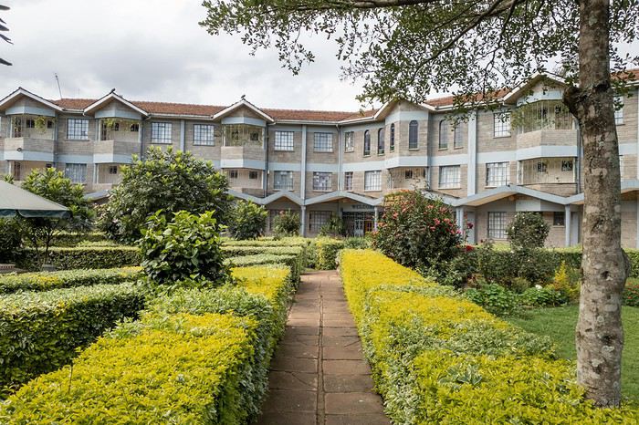
Le lendemain départ de bonne heure pour le Masai Mara, les derniers 90 km se font sur une piste défoncée et vous mettent directement dans l'ambiance.
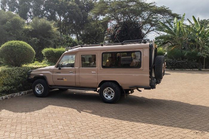
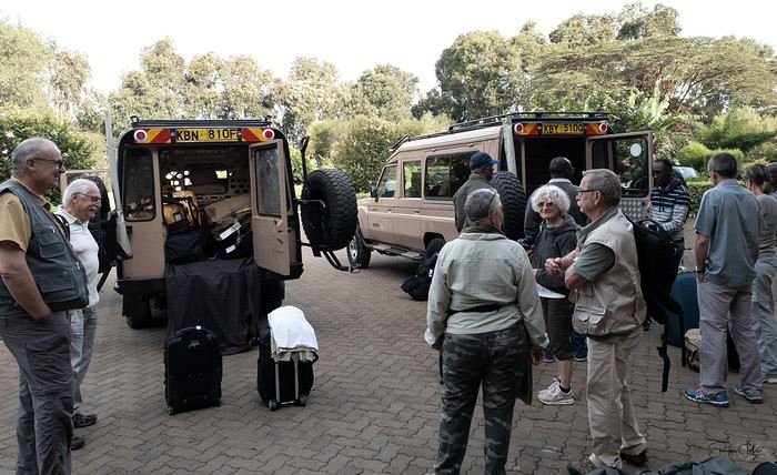
Le camp est idéalement situé au bord de la rivière Mara, avec les hippos pour bercer nos nuits.
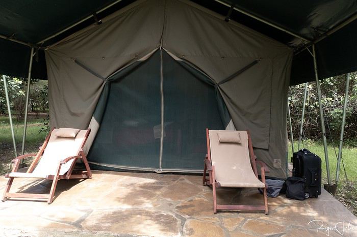
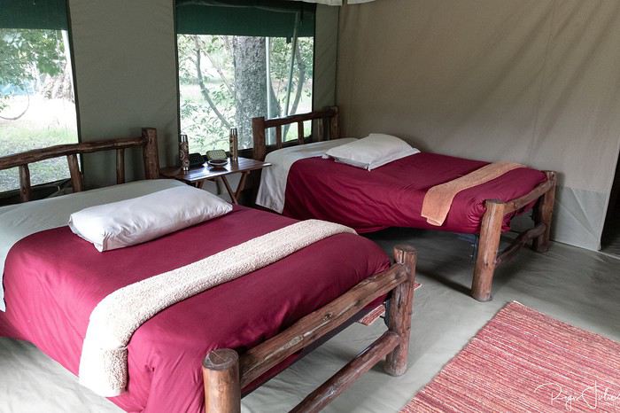
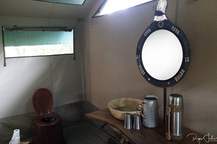
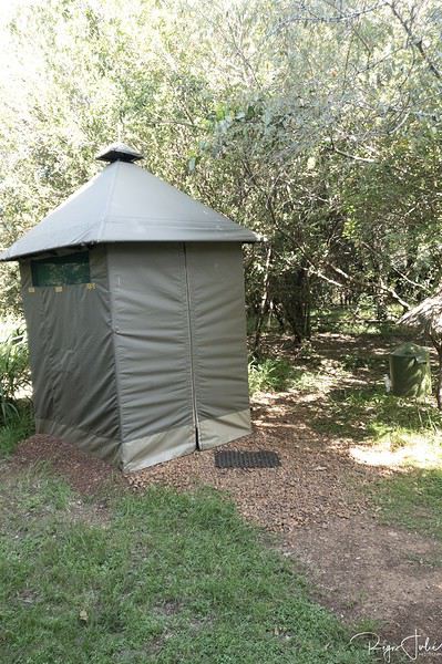
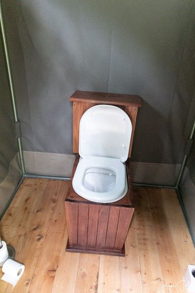
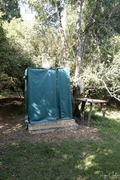
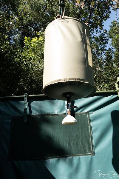
Les repas sont pris autour d'une même table et seront très bon.
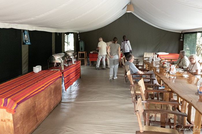
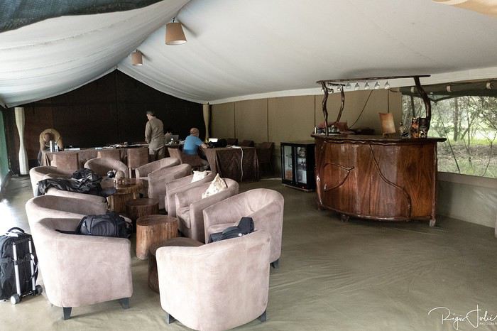
Ça faisait quelque temps que j'échangeais via email avec Tony Crocetta pour pouvoir partir dans son camp que l'on m'avait chaudement recommandé, mais la vitesse de remplissage et les impératifs du boulot et des vacances avec ma fille font qu'à chaque fois je reportais à l'année suivante le départ.
Un voyage se libérant en janvier 2019, pour juillet de la même année. Ma fille ayant décidé de faire un voyage linguistique, tous les signaux étaient au vert pour enfin découvrir le Masai Mara.
La prise en charge du safari commence à la descente de l'aéroport, direction Roussel Housse. Guest housse tenue par des sœurs. C'est très courant en Afrique de l'est. Le confort est correct et la nourriture est bonne voire très bonne.
Le lendemain départ de bonne heure pour le Masai Mara, les derniers 90 km se font sur une piste défoncée et vous mettent directement dans l'ambiance.
Le camp est idéalement situé au bord de la rivière Mara, avec les hippos pour bercer nos nuits.
Les repas sont pris autour d'une même table et seront très bon.
Je vous invite à découvrir le Portugal English translation pending
INTRODUCTION
Des vidéos sont insérées tout au long du résumé. Veuillez cliquer sur l'image pour démarrer la vidéo.
Nous avons séjourné 16 jours au Portugal fin mai - début juin de cette année et avons parcouru près de 2300 km pour découvrir différents attraits de ce magnifique pays.
Comme la plupart de nos précédents voyages, plusieurs semaines ont été consacrées à la création de notre itinéraire afin de pouvoir être en mesure d'atteindre parfaitement nos objectifs.
Lors de notre séjour, nous avons utilisé l'application Maps.me, une application mobile qui fournit des cartes hors ligne. Cette application s'avère très précieuse lors de nos déplacements en voiture, en randonnée et même lors de nos circuits à pied dans les grandes villes.
J'avais préalablement téléchargé les coordonnées GPS de toutes les attractions prévues à notre itinéraire dans l'application Maps.me, ce qui a facilité grandement nos déplacements.
La réservation de tous les hôtels ainsi que la location d'une voiture ont été effectuées sur internet avant notre départ.
Durant ce voyage, je n'ai pris aucune photo des établissements dans lesquels nous avons séjourné.
Si vous désirez obtenir des informations supplémentaires sur ces établissements, la majorité d'entre eux possèdent déjà leur propre site web.
Les attraits touristiques que nous avons visité sont les suivants:
Sintra Azenhas do Mar Obidos Nazaré Alcobaça Batalha Alvados: Grutas de San Antonio Grutas de Mira de Aire Fatima: Grutas da Moeda Fatima - Sanctuaire Tomar Coimbra Aveiro Porto Braga et son sanctuaire Bom Jesus do Monte Sanctuaire de Sameiro Guimaraes Lamego et son sanctuaire Nossa Senhora dos Remédios Serra da Estrela: Poço da Broca Falls Serra da Estrela: Praia Fluvial de Loriga Serra da Estrela: Torre Serra da Estrela: Covão do Boi Monsanto Penha Garcia Marvao Evora Mertola Cacela Velha Tavira Santo Estevao: Pego do Inferno Loulé Faro Albufeira: Praia da Falesia Carvoeiro: Praia de Albandeira Lagoa: Sentier des septs vallées suspendues Grottes de Carvoeiro (Aurora Boat Trips) Alvor: Praia Três Irmãos Lagos: Ponta da Piedade Grottes de Lagos (Blue Fleet Boat Trips) Carrapateira: Praia da Bordeira Aljezur: Praia de Monte Clérigo Aljezur: Praia da Amoreira Praia de Odeceixe
Voici un aperçu de l'itinéraire que nous avons parcouru. Il ne reflète pas exactement tous les arrêts que nous avons fait. Cependant, cela vous permet de visualiser l'étendue du trajet.
Veuillez cliquer sur chaque image afin d'obtenir une vue agrandie.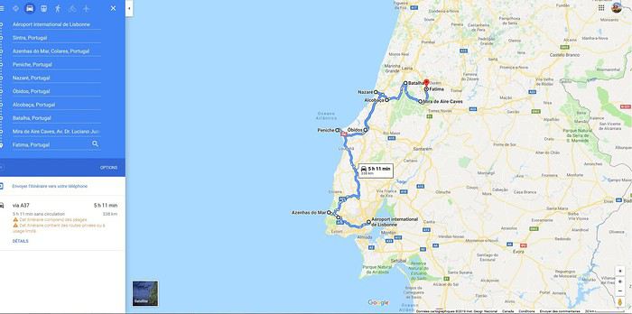

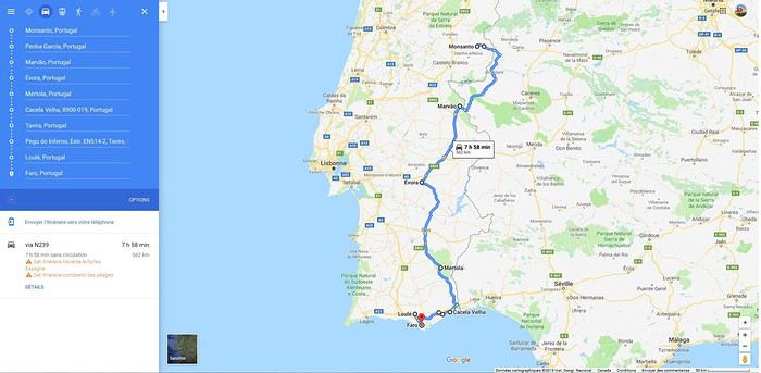
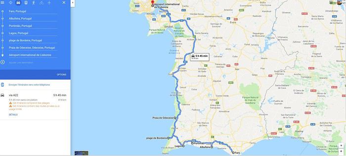
Au début de chaque journée, j'indique la distance parcourue, le temps passé sur la route et le temps des activités.
Toutes ces informations sont données à titre indicatif seulement, puisque les valeurs indiquées peuvent varier pour différentes raisons.
Sans plus attendre, je vous invite à venir découvrir par le biais de nos vidéos les différents attraits que nous avons visités lors de notre séjour au Portugal.
POUR VOUS RENDRE À UNE JOURNÉE SPÉCIFIQUE, VOICI LES LIENS APPROPRIÉS:
Jour 1: Sintra Jour 2: Sintra (suite), Azenhas do Mar, Obidos et Peniche Jour 3: Nazaré et Alcobaça Jour 4: Monastère de Batalha, Fatima et les grottes Mira de Aire, Moeda et San Antonio Jour 5: Tomar, Coimbra et Aveiro Jour 6: Porto Jour 7: Braga, Sanctuaire Bom Jesus do Monte, Sanctuaire de Sameiro et Guimarães Jour 8: Guimarães, Lamego et le Sanctuaire Dos Remedios Jour 9: Serra da Estrela (Plage fluviale Poço da Broca, Plage fluviale de Loriga, Torre, Senhora da Boa Estrela) et Idanha-a-Nova Jour 10: Monsanto, Penha Garcia, Marvao Jour 11: Évora et Mertola Jour 12: Cacela Velha, Tavira, Cascade du Pego do Inferno, Loulé, Faro et sa Chapelle des Os, Praia da Falesia (Albufeira)
Des vidéos sont insérées tout au long du résumé. Veuillez cliquer sur l'image pour démarrer la vidéo.
Nous avons séjourné 16 jours au Portugal fin mai - début juin de cette année et avons parcouru près de 2300 km pour découvrir différents attraits de ce magnifique pays.
Comme la plupart de nos précédents voyages, plusieurs semaines ont été consacrées à la création de notre itinéraire afin de pouvoir être en mesure d'atteindre parfaitement nos objectifs.
Lors de notre séjour, nous avons utilisé l'application Maps.me, une application mobile qui fournit des cartes hors ligne. Cette application s'avère très précieuse lors de nos déplacements en voiture, en randonnée et même lors de nos circuits à pied dans les grandes villes.
J'avais préalablement téléchargé les coordonnées GPS de toutes les attractions prévues à notre itinéraire dans l'application Maps.me, ce qui a facilité grandement nos déplacements.
La réservation de tous les hôtels ainsi que la location d'une voiture ont été effectuées sur internet avant notre départ.
Durant ce voyage, je n'ai pris aucune photo des établissements dans lesquels nous avons séjourné.
Si vous désirez obtenir des informations supplémentaires sur ces établissements, la majorité d'entre eux possèdent déjà leur propre site web.
Les attraits touristiques que nous avons visité sont les suivants:
Sintra Azenhas do Mar Obidos Nazaré Alcobaça Batalha Alvados: Grutas de San Antonio Grutas de Mira de Aire Fatima: Grutas da Moeda Fatima - Sanctuaire Tomar Coimbra Aveiro Porto Braga et son sanctuaire Bom Jesus do Monte Sanctuaire de Sameiro Guimaraes Lamego et son sanctuaire Nossa Senhora dos Remédios Serra da Estrela: Poço da Broca Falls Serra da Estrela: Praia Fluvial de Loriga Serra da Estrela: Torre Serra da Estrela: Covão do Boi Monsanto Penha Garcia Marvao Evora Mertola Cacela Velha Tavira Santo Estevao: Pego do Inferno Loulé Faro Albufeira: Praia da Falesia Carvoeiro: Praia de Albandeira Lagoa: Sentier des septs vallées suspendues Grottes de Carvoeiro (Aurora Boat Trips) Alvor: Praia Três Irmãos Lagos: Ponta da Piedade Grottes de Lagos (Blue Fleet Boat Trips) Carrapateira: Praia da Bordeira Aljezur: Praia de Monte Clérigo Aljezur: Praia da Amoreira Praia de Odeceixe
Voici un aperçu de l'itinéraire que nous avons parcouru. Il ne reflète pas exactement tous les arrêts que nous avons fait. Cependant, cela vous permet de visualiser l'étendue du trajet.
Veuillez cliquer sur chaque image afin d'obtenir une vue agrandie.
Au début de chaque journée, j'indique la distance parcourue, le temps passé sur la route et le temps des activités.
Toutes ces informations sont données à titre indicatif seulement, puisque les valeurs indiquées peuvent varier pour différentes raisons.
Sans plus attendre, je vous invite à venir découvrir par le biais de nos vidéos les différents attraits que nous avons visités lors de notre séjour au Portugal.
POUR VOUS RENDRE À UNE JOURNÉE SPÉCIFIQUE, VOICI LES LIENS APPROPRIÉS:
Jour 1: Sintra Jour 2: Sintra (suite), Azenhas do Mar, Obidos et Peniche Jour 3: Nazaré et Alcobaça Jour 4: Monastère de Batalha, Fatima et les grottes Mira de Aire, Moeda et San Antonio Jour 5: Tomar, Coimbra et Aveiro Jour 6: Porto Jour 7: Braga, Sanctuaire Bom Jesus do Monte, Sanctuaire de Sameiro et Guimarães Jour 8: Guimarães, Lamego et le Sanctuaire Dos Remedios Jour 9: Serra da Estrela (Plage fluviale Poço da Broca, Plage fluviale de Loriga, Torre, Senhora da Boa Estrela) et Idanha-a-Nova Jour 10: Monsanto, Penha Garcia, Marvao Jour 11: Évora et Mertola Jour 12: Cacela Velha, Tavira, Cascade du Pego do Inferno, Loulé, Faro et sa Chapelle des Os, Praia da Falesia (Albufeira)
Un nouveau tête à tête mère-fils magnifique! Avril 2019 English translation pending
Après un road-trip multigénérationnel en juillet 2015, nous sommes retournés avec mon fils, surnommé T., dans l’ouest américain en avril 2017 pour un magnifique voyage en tête à tête ! Nous avions adoré partir en avril, températures plus clémentes, coup de cœur pour Death Valley… Donc, comme à chaque retour, une seule idée en tête, renouveler cette incroyable expérience !
Et cette année encore, grâce aux conseils puisés sur VF (une nouvelle fois merci à tous), le voyage fut merveilleux ! Tous les jours son lot de découvertes et d’émerveillements !
Nous avons été particulièrement touchés par le foisonnement de fleurs tout au long du voyage, par des milliers de papillons nous faisant tourner la tête à Death Valley et par l’impression d’être seuls au monde dans ces merveilleux paysages (très faible fréquentation à cette période) 😎! Comme à chaque fois, nous avons apprécié les rencontres et la gentillesse des américains !
Par contre nous avons été surpris par la chaleur 🤪: très heureux d’avoir beau temps, mais étonnés par les températures élevées (31° C dès midi toute la 1ere semaine) ! Aussi le programme a un peu évolué par rapport à celui d’origine en fonction de la météo essentiellement mais aussi en fonction de problèmes techniques rencontrés ou de notre état de fatigue.
Programme effectué avec 3212km au compteur :
JOUR 1 : France – LAS VEGAS. Nuit Las Vegas
JOUR 2 : Seven Magic Mountains - Amboy ROY'S café - JOSHUA TREE (Arch Rock trail, Cholla Cactus, Skull Rock, Hidden Valley et Keys View). Nuit Twentynine Palms voyageforum.com/...st=9647375;a=9647375
JOUR 3 : AMBOY Crater - Kelso Depot - Baker (plus grand thermomètre – Boutique Alien) - SOSHONE (Museum, Dublin Gulch) - DEATH VALLEY par badwater road (avec découverte pédestre de Badwater, Artists Palette et Mars Hill). Nuit1 Furnace Creek voyageforum.com/...st=9648823;a=9648823
JOUR 4 : DEATH VALLEY : lever de soleil à Zabriskie + trail pour Meanly Beacon - Piscine - Devil' s golf Course, Artist Drive, Mushroom Rock, coucher de soleil à Zabriskie. Nuit2 Furnace Creek voyageforum.com/...st=9649703;a=9649703
JOUR 5 : DEATH VALLEY ( Gnome's Workshop, Salt creek et Mustard Canyon). PARHUMP (museum + boulangerie O HAPPY BREAD) - RED ROCK CANYON (avec Calico Hills- Lost Creek). Nuit Las Vegas voyageforum.com/...st=9651800;a=9651800
JOUR 6 : SNOW CANYON (avec Sand Dunes, Hidden Pinyon - Petrified dunes trail et Lava Flow). Nuit ST GEORGE voyageforum.com/...st=9658216;a=9658216
JOUR 7 : ZION : avec Scout's Overlook - rim trail, Riverside Walk, Weeping Rock. Nuit Kanab. voyageforum.com/...st=9664493;a=9664493
JOUR 8 : Johnson Canyon - The Chains - MONUMENT VALLEY : Wildcat trail. Nuit cabin Monument Valley voyageforum.com/...st=9669060;a=9669060
JOUR 9 : MONUMENT VALLEY (Mesa rim trail + Lee Cly trail) - CANYON DE CHELLY : South rim avec White House trail. Nuit Chinle voyageforum.com/...st=9673898;a=9673898
JOUR 10 : PAINTED DESERT - PETRIFIED FOREST : avec Blue Mesa trail, Crystal Forest, Giant Logs, Long Logs et Agate house trail. HOLBROOK (Museum – Wigwam Hotel )- Nuit Flagstaff voyageforum.com/...st=9676578;a=9676578
JOUR 11 : Route 66 : SELIGMAN, HACKBERRY, KINGMAN. Nuit LAS VEGAS voyageforum.com/...st=9678172;a=9678172
JOUR 12 : LAS VEGAS avec Count's Kustom's, Old Las Vegas Mormon fort, Gold & Silver Pawn shop... voyageforum.com/...st=9678610;a=9678610
JOUR 13 : LAS VEGAS avec VOID Star Wars, spectacle LOVE (the Beatles)… voyageforum.com/...st=9678639;a=9678639
JOUR 14 : Retour FRANCEhttps://voyageforum.com/v.f?post=9678644;a=9678644
Voilà, un programme à notre image, nous sommes plutôt des contemplatifs, nous aimons nous perdre dans des lieux magnifiques, s'isoler pour s'imprégner des lieux, marcher pour découvrir des petites merveilles... mais pas des sportifs expérimentés comme on peut le voir sur d'autres carnets😉! Les photos, j'en fait beaucoup... trop d'après T😉! Mais pour moi, ça fait parti du plaisir, pouvoir s'imprégner de la beauté des lieux, partager des sensations et fixer à jamais des souvenirs😎!Les préparatifs :BUDGET TOTAL : 1500€/pers tout compris (souvenirs, loisirs, nourriture, avions, voiture, essence, parkings, hôtels…)Billets d’avions : 500€/pers, achetés sur Air Canada + 50€ bagage en soute! Alors nous ne sommes pas fidèles à une compagnie ! On change à chaque fois car on prend en fonction des meilleurs prix ! Mais Air Canada ne restera pas dans nos favoris 😕!
La voiture : 340€ pour 12 jours avec Alamo. Voiture Hyundai, super confortable, caméra de recul, écran avec affichage de la pression de chaque pneu (cela s’avérera utile😉) … ! Réservé sur Alamo.fr comme à chaque voyage, mais première fois que l’on rencontre un problème à la prise de voiture malgré Skip the Counter😠! Côté essence = 137$ !
Les hôtels : réservés majoritairement sur hotels.com… ce qui permet à chaque voyage d’utiliser des nuits gratuites! Et via Igraal et Poulpeo pour le cashback… Cette année j’ai beaucoup utilisé l’annulation gratuite et est modifié mes réservations à nombreuses reprises ce qui nous a permis de faire des économies conséquentes (plus de 200€) !
Les frais bancaires : Depuis notre voyage en avril 2017, j’ai conservé mon compte Boursorama, avec carte 1er gratuite (donc réservations d'avion faites avec pour l'assurance associée) et niveau frais pour les paiements aux USA, nettement plus intéressant qu’avec LCL! Pour tout achat important sur internet ou tout 1er achat à l'étranger, on reçoit un sms pour nous prévenir... rien à faire si c'est nous... et sinon, on peut de suite intervenir en cas de fraude! Essayé, c’est l’adopter !
GPS : Points préparés à l’avance… mais malheureusement pour rien, le GPS nous a lâché dès le 1er jour 😠 !
Forfait téléphonique : FREE avec USA et Canada! Grâce au bon plan de Gilles😉
La suite bientôt avec le voyage!
Programme effectué avec 3212km au compteur :
JOUR 1 : France – LAS VEGAS. Nuit Las Vegas
JOUR 2 : Seven Magic Mountains - Amboy ROY'S café - JOSHUA TREE (Arch Rock trail, Cholla Cactus, Skull Rock, Hidden Valley et Keys View). Nuit Twentynine Palms voyageforum.com/...st=9647375;a=9647375
JOUR 3 : AMBOY Crater - Kelso Depot - Baker (plus grand thermomètre – Boutique Alien) - SOSHONE (Museum, Dublin Gulch) - DEATH VALLEY par badwater road (avec découverte pédestre de Badwater, Artists Palette et Mars Hill). Nuit1 Furnace Creek voyageforum.com/...st=9648823;a=9648823
JOUR 4 : DEATH VALLEY : lever de soleil à Zabriskie + trail pour Meanly Beacon - Piscine - Devil' s golf Course, Artist Drive, Mushroom Rock, coucher de soleil à Zabriskie. Nuit2 Furnace Creek voyageforum.com/...st=9649703;a=9649703
JOUR 5 : DEATH VALLEY ( Gnome's Workshop, Salt creek et Mustard Canyon). PARHUMP (museum + boulangerie O HAPPY BREAD) - RED ROCK CANYON (avec Calico Hills- Lost Creek). Nuit Las Vegas voyageforum.com/...st=9651800;a=9651800
JOUR 6 : SNOW CANYON (avec Sand Dunes, Hidden Pinyon - Petrified dunes trail et Lava Flow). Nuit ST GEORGE voyageforum.com/...st=9658216;a=9658216
JOUR 7 : ZION : avec Scout's Overlook - rim trail, Riverside Walk, Weeping Rock. Nuit Kanab. voyageforum.com/...st=9664493;a=9664493
JOUR 8 : Johnson Canyon - The Chains - MONUMENT VALLEY : Wildcat trail. Nuit cabin Monument Valley voyageforum.com/...st=9669060;a=9669060
JOUR 9 : MONUMENT VALLEY (Mesa rim trail + Lee Cly trail) - CANYON DE CHELLY : South rim avec White House trail. Nuit Chinle voyageforum.com/...st=9673898;a=9673898
JOUR 10 : PAINTED DESERT - PETRIFIED FOREST : avec Blue Mesa trail, Crystal Forest, Giant Logs, Long Logs et Agate house trail. HOLBROOK (Museum – Wigwam Hotel )- Nuit Flagstaff voyageforum.com/...st=9676578;a=9676578
JOUR 11 : Route 66 : SELIGMAN, HACKBERRY, KINGMAN. Nuit LAS VEGAS voyageforum.com/...st=9678172;a=9678172
JOUR 12 : LAS VEGAS avec Count's Kustom's, Old Las Vegas Mormon fort, Gold & Silver Pawn shop... voyageforum.com/...st=9678610;a=9678610
JOUR 13 : LAS VEGAS avec VOID Star Wars, spectacle LOVE (the Beatles)… voyageforum.com/...st=9678639;a=9678639
JOUR 14 : Retour FRANCEhttps://voyageforum.com/v.f?post=9678644;a=9678644
Voilà, un programme à notre image, nous sommes plutôt des contemplatifs, nous aimons nous perdre dans des lieux magnifiques, s'isoler pour s'imprégner des lieux, marcher pour découvrir des petites merveilles... mais pas des sportifs expérimentés comme on peut le voir sur d'autres carnets😉! Les photos, j'en fait beaucoup... trop d'après T😉! Mais pour moi, ça fait parti du plaisir, pouvoir s'imprégner de la beauté des lieux, partager des sensations et fixer à jamais des souvenirs😎!Les préparatifs :BUDGET TOTAL : 1500€/pers tout compris (souvenirs, loisirs, nourriture, avions, voiture, essence, parkings, hôtels…)Billets d’avions : 500€/pers, achetés sur Air Canada + 50€ bagage en soute! Alors nous ne sommes pas fidèles à une compagnie ! On change à chaque fois car on prend en fonction des meilleurs prix ! Mais Air Canada ne restera pas dans nos favoris 😕!
La voiture : 340€ pour 12 jours avec Alamo. Voiture Hyundai, super confortable, caméra de recul, écran avec affichage de la pression de chaque pneu (cela s’avérera utile😉) … ! Réservé sur Alamo.fr comme à chaque voyage, mais première fois que l’on rencontre un problème à la prise de voiture malgré Skip the Counter😠! Côté essence = 137$ !
Les hôtels : réservés majoritairement sur hotels.com… ce qui permet à chaque voyage d’utiliser des nuits gratuites! Et via Igraal et Poulpeo pour le cashback… Cette année j’ai beaucoup utilisé l’annulation gratuite et est modifié mes réservations à nombreuses reprises ce qui nous a permis de faire des économies conséquentes (plus de 200€) !
Les frais bancaires : Depuis notre voyage en avril 2017, j’ai conservé mon compte Boursorama, avec carte 1er gratuite (donc réservations d'avion faites avec pour l'assurance associée) et niveau frais pour les paiements aux USA, nettement plus intéressant qu’avec LCL! Pour tout achat important sur internet ou tout 1er achat à l'étranger, on reçoit un sms pour nous prévenir... rien à faire si c'est nous... et sinon, on peut de suite intervenir en cas de fraude! Essayé, c’est l’adopter !
GPS : Points préparés à l’avance… mais malheureusement pour rien, le GPS nous a lâché dès le 1er jour 😠 !
Forfait téléphonique : FREE avec USA et Canada! Grâce au bon plan de Gilles😉
La suite bientôt avec le voyage!
À propos de l'expression: "j'ai fait... tel ou tel pays" English translation pending
bonjour
il est fréquent de voir cette expression :"j'ai fais " en parlant d'un pays existant depuis des siècles ? est ce vraiment le terme approprié ? certes le terme est devenu banal , et presque personne ne le trouve inapproprié , cependant ne serait il pas plus correct de dire par exemple : j'ai VISITE , j'ai DECOUVERT , même j'ai exploré tel , où tel pays ? le fameux j'ai FAIS" il me semble à une connotation d'appropriation , alors que le pays cité existait bien avant que vous ne l'ayez "fait " et existera bien après que vous l'ayez quitté ! cette remarque faite , juste pour que notre si belle langue , tellement martyrisée , perdure ! bons voyages à tous , le plus longtemps , longtemps, possible , que le monde continue à vous émerveiller afin de mieux le respecter cordialement Jacques
il est fréquent de voir cette expression :"j'ai fais " en parlant d'un pays existant depuis des siècles ? est ce vraiment le terme approprié ? certes le terme est devenu banal , et presque personne ne le trouve inapproprié , cependant ne serait il pas plus correct de dire par exemple : j'ai VISITE , j'ai DECOUVERT , même j'ai exploré tel , où tel pays ? le fameux j'ai FAIS" il me semble à une connotation d'appropriation , alors que le pays cité existait bien avant que vous ne l'ayez "fait " et existera bien après que vous l'ayez quitté ! cette remarque faite , juste pour que notre si belle langue , tellement martyrisée , perdure ! bons voyages à tous , le plus longtemps , longtemps, possible , que le monde continue à vous émerveiller afin de mieux le respecter cordialement Jacques
Ce qui m'a marqué pour mon premier voyage en Turquie English translation pending
Salut à toi qui lira ce carnet anarchique,
Si tu cherches des infos approximatives... bah continue Si tu veux avoir un truc bien ficelé et organisé, bah.... c'est pas ici.
Si t'es juste curieux de savoir ce qui m'a intéressé dans la toute petite partie de Turquie ( Istanbul et la Cappadoce) que j'ai vue, et bien attache ta ceinture et prend une profonde respiration. Ça va secouer un peu!!
Bien, t'es prêt.... hop!
A Pâques, nous avons passé une dizaine de jours entre Istanbul et la Cappadocce, après l'ouverture du nouvel aéroport IST d'Istanbul. Et pour que tu ne sois pas complètement perdu, nous avons dormi la première nuit à Istanbul, puis nous sommes repartis le lendemain après midi, vers le sabiha Gokcen airport pour prendre l'avion pour Kayseri sur Pegasus (low cost, à éviter dorénavant par nous), nous sommes restés en Cappadocce 6 jours, puis nous sommes retournés toujours sur Pegasus à Istanbul pour 3 nuits avant de rentrer en France pour 4 nuits, avant de rentrer en Martinique (ç'aurait du être 3 nuits, mais j'ai raté mon vol retour sur FDF!! Du coup .......!!) Bon, c'est pas grave si t'as pas tout suivi.
Aujourd'hui tu sauras ce qui tout d'abord m'a marqué à Istanbul.
La première chose qui m'a frappée (non, non rassure-toi, c'est seulement au figuré, je vais bien, même si t'as l'impression du contraire!!!) c'est l'immensité de l'aéroport: entre la porte de sortie de l'avion, et le tapis des bagages, nous avons emprunté au moins une quinzaine de tapis roulants successifs entrecoupés de longs trajets carrelés. Autant dire que t'es pas encore sorti de l'aéroport que tu commences déjà ta première randonnée, rien qu'à l'intérieur de l'aéroport.😮
Dans d'autres aéroports gigantesques, il y a des trams qui te font économiser de l'énergie, mais là, mon gars, va falloir en baver!!! Le ton est donné dès l'aéroport.... qu'on se le dise!!!😏
De gigantesques néons diffusent une lumière tamisée, le lieu est ultra sécurisé, car toutes les personnes passent par un portique où les bagages sont scannés. Orly et Roissy devraient prendre exemple en matière de sécurité.🤪
Une autre chose marquante à l'entrée de l'aéroport, et ça tu t'en rends compte en repartant évidemment, ce sont les grands drapeaux rouges qui tombent devant chaque entrée: en 3 parties, le drapeau turc, comme ça tu ne risques pas de l'oublier, (un peu comme aux states, donc pas tellement surprenant pour moi) ensuite une photo d'Ataturk, (c'est celui qui a permis à la Turquie d'être indépendante en repoussant les grecs, les italiens, les australiens, les britanniques... et, qui a imposé une séparation de l'état et de la religion, il a accordé le droit de vote aux femmes, ... un peu l'équivalent de Washington aux States, il a botté les anglais hors de son pays, c'est un héros quoi) puis une photo d'Erdogan!!!!!!!!!!!!!!!🤪 (c'est l'actuel président en Turquie, celui dénommé le dictateur!)!!!
Et après coup, tu te rendras compte que ce triptyque, tu le retrouveras partout, sur tous les bâtiments administratifs importants. Je ne sais pas ce qu'en pense le peuple turc, mais je me demande si Jupiter en France venait à avoir une idée similaire, genre triptyque drapeau français, photo de Robespierre, puis Photo de M.....Quelle serait la durée de vie de ces triptyques???? Ou bien, drapeau des états-unis, puis photo de Washington puis ....T.... 🤪 !!!!!!!!!!!
Une fois les bagages récupérés, il est temps de trouver un comptoir de change, qui évidement est sur votre passage, et propose un taux évidement très inférieur à ceux proposés en ville.
Heureusement grâce à Vf (merci aux membres Tatra, Dniorte et Intothetrees qui donnent énormément d'infos sur la Turquie et qui ont répondu à mes questions), j'étais avertie de la chose et je ne change que le strict minimum pour prendre un taxi.
C'était mon premier vol avec Turkish airlines: pas mal du tout. Nous avons eu un vol très ponctuel, et il est près de 20h quand nous sortons de l'aéroport: le temps de faire la randonnée initiatique quoi!!! Bah ouais, nous sommes arrivés au tapis de bagages après nos bagages c'est dire!!! je ne me souviens même pas de la police des frontières, c'est dire si ça a été vite expédié!
Là aussi, les choses sont très bien organisées, d'abord les taxis mini van, dont j'ai cru comprendre qu'ils étaient plus chers, puis un employé dispatche les voyageurs éreintés au fur et à mesure de l'arrivée des taxis ordinaires en jaune et noir comme les taxis new-yorkais, mais qui prennent un nombre limité de personnes et de bagages. Nous ne sommes que 2 donc tout va bien.
1H plus tard et 120 turkish lyra en moins, nous sommes rendus à bon port à notre Georges hotel galata, qui manifestement n'est pas du tout connu de notre chauffeur de taxi. Notre chauffeur m'a demandé le numéro de l'hôtel pour pouvoir appeler et malgré ça, il a pas mal tourné en rond!!
Ce n'est apparemment pas une exception, car à notre retour à Istanbul, l'autre chauffeur ne connaissait pas non plus le best western plus président. Systématiquement, ils m'ont demandé le numéro de téléphone de l'hôtel quand ce n'était pas l'adresse pour qu'il puisse la rentrer dans leur GPS, pour le plus moderne d'entre eux.
Ceci dit, vu l'immensité de la ville et la multitude d'hôtels en tout genre, ça peut se comprendre mais bon...
Il est une chose que nous n'avons évidement pas raté c'est la tour galata, galata kulesi en turc, complètement illuminée quand nous sommes passés à côté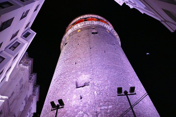
Pas terrible comme photo hein? Bah ouais, quand t'es vraiment à ses pieds, vu la grande taille de la bâtisse, ça donne ça comme rendu!!! Voilà!😄
Bon étant donné qu'il est tard, presque 21H, le check in est vite expédié, nous sommes royalement accueillis à l'hôtel avec un thé ... turc, corsé hein le thé, très corsé. La manager celle qui nous reçoit, parle très bien l'anglais, ce qui nous change un peu, c'est sympa. Elle nous donne des conseils quant à la gastronomie turque, et les différentes entrées qu'il convient de goûter au restaurant panoramique de l'hôtel, et pendant ce temps, l'homme de service effectue les formalités avec nos passeports qu'il photocopie et enregistre. Puis, ils descend nos bagages dans notre chambre, nous fait un rapide tour d'horizon de la chambre et de ses fonctionnalités, puis nous recommande de ne pas trop trainer pour aller dîner.
Nous reprenons l'ascenseur prévu pour 4, mais qu'à 2 nous remplissons complètement, et montons en haut profiter de la vue nocturne panoramique et d'un délicieux dîner, dont la photo ci dessous ne présente qu'un des plats. Je pense que même Gargantua aurait eu du mal à finir!!!🤪
Le lendemain matin, nous profitons de la lumière pour découvrir le paysage. Mais il y a plein de brumes et ce n'est pas terrible.
Comme à la fin de notre séjour nous sommes retournés loger près de galata, je vais plutôt vous mettre des photos que nous avons prises quand nous sommes allés dormir àl'anémone galata. Leur terrasse est vraiment hyper bien placée et ne serait-ce que pour ça, cet hôtel de charme vaut vraiment la peine. Voici à quoi ressemble le restaurant.
Et voici un exemple de ce qu'on peut y manger: j'ai pris un manti et je ne sais plus quelle viande mais c'était exquis.
Quand on vous dit que la cuisine turque vaut le déplacement, et bien c'est vrai! C'est à l'opposé du Ladakh!! Et c'est peu dire!!!
Voici ce qu'on voit d'Istanbul depuis leur restaurant en terrasse.
Comme tu peux t'en rendre compte, il y a des pleins de minarets, donc pleins de mosquées, beaucoup de mosquées, vraiment beaucoup de mosquées!!! Et la particularité de ces édifices religieux est d'avoir chacun son muezzin, tu sais l'appel à la prière, qui passe par un haut parleur à très grande portée. Et bien à 12H30, il y en a un qui démarre, puis un 2ème, puis un 3ème...... Bon, je ne vais pas tous les énumérer, mais à l'arrivée, le résultat est une superposition d'appels qui parfois se répondent, d'autres fois se mêlent, tout ça dans la cacophonie en sol turc!!! Et, quand tu penses qu'il y en 5 dans la journée, et que la première série commence à l'aurore, du coup, tu comprendras que j'ai fait attention à l'insonorisation des chambres d'hôtel que j'ai choisies!!!
D'ici aussi, tu peux voir la quantité de bateaux sur l'eau. Très honnêtement, je ne saurais dire s'il s'agit du Bosphore ou de la corne d'or, mais de nombreux bateaux proposent des croisières. Hélas, nous étions en très haute saison touristique et vu les queues qu'il fallait faire, nous avons zappé pas mal de visites (toutes les mosquées ont été vues de l'extérieur, mas nous n'y sommes pas entrés!!😊)
Cette fois-ci, du restaurant il y a un plafond en verre qui permet de voir le haut de la tour galata mais pas le bas!!!😏
Oui, oui je sais.... tu voudrais l'avoir en entier... C'est ça hein!!!! Jamais content, hein? Allez, souris va, la voilà ta galata kulesi.
Et puis si t'es musicien, il y'a une rue que tu ne dois sous aucun prétexte raté: c'est la Galip DEDE caddesi, dans le quartier de Beyoglu.
C'est LA rue des magasins de musique. C'est notre havre de bonheur, qui finit par te conduire vers la istiklal caddesi (t'as compris que caddesi ça veut dire rue, hein?).
Tu peux y trouver tous les instruments orientaux, de magnifiques qanuns,
toutes sortes de guitares turques, des baglamas, des ouds, tous plus beaux les uns que les autres. Je ne savais plus où donner de la tête lors de notre passage: il a fallu lutter pour ne pas en ramener....
Des percussions en tout genre comme les darboukas, des sortes de flutes des andes les sikkus, très surprenant de trouver des instruments des andes ici, des guitares classiques, des mandolines.... bref un vrai paradis!!
Nous avons passé plus de 2 heures dans cette rue avant de rejoindre istiklal caddesi. Et là notre bonheur a continué puisque de petits groupes de musiciens se produisaient. Une joueuse de zenco a apaisé les passants.
Un trio jouait du New Orleans pour notre plus grand bonheur. Comme c'était étrange d'entendre ce genre de musique aussi loin du continent américain, avec le son inimitable du banjo auquel venait se superposer cette trompette bouchée au son nasillard sous la rythmique vigoureuse de la contrebasse pizzicato!
Un indien en costume jouait de la musique des andes!!!
Bref, ce premier post sur la partie Istanbul est un peu en décalage par rapport aux carnets que j'ai eu l'occasion de lire, mais il est à notre image, nous nous étonnons et nous émerveillons de plein de choses qui n'intéressent pas forcément les guides touristiques!!! Nous sommes comme ça!!! Va falloir t'en contenter!! Parce que ça va pas s'arranger après!!
A bientôt si t'as le courage de t'accrocher... mais sinon, il y en a plein qui te montrent les sites à visiter à Istanbul... t'as le choix....😉 Bye ou adieu
Si tu cherches des infos approximatives... bah continue Si tu veux avoir un truc bien ficelé et organisé, bah.... c'est pas ici.
Si t'es juste curieux de savoir ce qui m'a intéressé dans la toute petite partie de Turquie ( Istanbul et la Cappadoce) que j'ai vue, et bien attache ta ceinture et prend une profonde respiration. Ça va secouer un peu!!
Bien, t'es prêt.... hop!
A Pâques, nous avons passé une dizaine de jours entre Istanbul et la Cappadocce, après l'ouverture du nouvel aéroport IST d'Istanbul. Et pour que tu ne sois pas complètement perdu, nous avons dormi la première nuit à Istanbul, puis nous sommes repartis le lendemain après midi, vers le sabiha Gokcen airport pour prendre l'avion pour Kayseri sur Pegasus (low cost, à éviter dorénavant par nous), nous sommes restés en Cappadocce 6 jours, puis nous sommes retournés toujours sur Pegasus à Istanbul pour 3 nuits avant de rentrer en France pour 4 nuits, avant de rentrer en Martinique (ç'aurait du être 3 nuits, mais j'ai raté mon vol retour sur FDF!! Du coup .......!!) Bon, c'est pas grave si t'as pas tout suivi.
Aujourd'hui tu sauras ce qui tout d'abord m'a marqué à Istanbul.
La première chose qui m'a frappée (non, non rassure-toi, c'est seulement au figuré, je vais bien, même si t'as l'impression du contraire!!!) c'est l'immensité de l'aéroport: entre la porte de sortie de l'avion, et le tapis des bagages, nous avons emprunté au moins une quinzaine de tapis roulants successifs entrecoupés de longs trajets carrelés. Autant dire que t'es pas encore sorti de l'aéroport que tu commences déjà ta première randonnée, rien qu'à l'intérieur de l'aéroport.😮
Dans d'autres aéroports gigantesques, il y a des trams qui te font économiser de l'énergie, mais là, mon gars, va falloir en baver!!! Le ton est donné dès l'aéroport.... qu'on se le dise!!!😏
De gigantesques néons diffusent une lumière tamisée, le lieu est ultra sécurisé, car toutes les personnes passent par un portique où les bagages sont scannés. Orly et Roissy devraient prendre exemple en matière de sécurité.🤪
Une autre chose marquante à l'entrée de l'aéroport, et ça tu t'en rends compte en repartant évidemment, ce sont les grands drapeaux rouges qui tombent devant chaque entrée: en 3 parties, le drapeau turc, comme ça tu ne risques pas de l'oublier, (un peu comme aux states, donc pas tellement surprenant pour moi) ensuite une photo d'Ataturk, (c'est celui qui a permis à la Turquie d'être indépendante en repoussant les grecs, les italiens, les australiens, les britanniques... et, qui a imposé une séparation de l'état et de la religion, il a accordé le droit de vote aux femmes, ... un peu l'équivalent de Washington aux States, il a botté les anglais hors de son pays, c'est un héros quoi) puis une photo d'Erdogan!!!!!!!!!!!!!!!🤪 (c'est l'actuel président en Turquie, celui dénommé le dictateur!)!!!
Et après coup, tu te rendras compte que ce triptyque, tu le retrouveras partout, sur tous les bâtiments administratifs importants. Je ne sais pas ce qu'en pense le peuple turc, mais je me demande si Jupiter en France venait à avoir une idée similaire, genre triptyque drapeau français, photo de Robespierre, puis Photo de M.....Quelle serait la durée de vie de ces triptyques???? Ou bien, drapeau des états-unis, puis photo de Washington puis ....T.... 🤪 !!!!!!!!!!!
Une fois les bagages récupérés, il est temps de trouver un comptoir de change, qui évidement est sur votre passage, et propose un taux évidement très inférieur à ceux proposés en ville.
Heureusement grâce à Vf (merci aux membres Tatra, Dniorte et Intothetrees qui donnent énormément d'infos sur la Turquie et qui ont répondu à mes questions), j'étais avertie de la chose et je ne change que le strict minimum pour prendre un taxi.
C'était mon premier vol avec Turkish airlines: pas mal du tout. Nous avons eu un vol très ponctuel, et il est près de 20h quand nous sortons de l'aéroport: le temps de faire la randonnée initiatique quoi!!! Bah ouais, nous sommes arrivés au tapis de bagages après nos bagages c'est dire!!! je ne me souviens même pas de la police des frontières, c'est dire si ça a été vite expédié!
Là aussi, les choses sont très bien organisées, d'abord les taxis mini van, dont j'ai cru comprendre qu'ils étaient plus chers, puis un employé dispatche les voyageurs éreintés au fur et à mesure de l'arrivée des taxis ordinaires en jaune et noir comme les taxis new-yorkais, mais qui prennent un nombre limité de personnes et de bagages. Nous ne sommes que 2 donc tout va bien.
1H plus tard et 120 turkish lyra en moins, nous sommes rendus à bon port à notre Georges hotel galata, qui manifestement n'est pas du tout connu de notre chauffeur de taxi. Notre chauffeur m'a demandé le numéro de l'hôtel pour pouvoir appeler et malgré ça, il a pas mal tourné en rond!!
Ce n'est apparemment pas une exception, car à notre retour à Istanbul, l'autre chauffeur ne connaissait pas non plus le best western plus président. Systématiquement, ils m'ont demandé le numéro de téléphone de l'hôtel quand ce n'était pas l'adresse pour qu'il puisse la rentrer dans leur GPS, pour le plus moderne d'entre eux.
Ceci dit, vu l'immensité de la ville et la multitude d'hôtels en tout genre, ça peut se comprendre mais bon...
Il est une chose que nous n'avons évidement pas raté c'est la tour galata, galata kulesi en turc, complètement illuminée quand nous sommes passés à côté
Pas terrible comme photo hein? Bah ouais, quand t'es vraiment à ses pieds, vu la grande taille de la bâtisse, ça donne ça comme rendu!!! Voilà!😄
Bon étant donné qu'il est tard, presque 21H, le check in est vite expédié, nous sommes royalement accueillis à l'hôtel avec un thé ... turc, corsé hein le thé, très corsé. La manager celle qui nous reçoit, parle très bien l'anglais, ce qui nous change un peu, c'est sympa. Elle nous donne des conseils quant à la gastronomie turque, et les différentes entrées qu'il convient de goûter au restaurant panoramique de l'hôtel, et pendant ce temps, l'homme de service effectue les formalités avec nos passeports qu'il photocopie et enregistre. Puis, ils descend nos bagages dans notre chambre, nous fait un rapide tour d'horizon de la chambre et de ses fonctionnalités, puis nous recommande de ne pas trop trainer pour aller dîner.
Nous reprenons l'ascenseur prévu pour 4, mais qu'à 2 nous remplissons complètement, et montons en haut profiter de la vue nocturne panoramique et d'un délicieux dîner, dont la photo ci dessous ne présente qu'un des plats. Je pense que même Gargantua aurait eu du mal à finir!!!🤪
Le lendemain matin, nous profitons de la lumière pour découvrir le paysage. Mais il y a plein de brumes et ce n'est pas terrible.
Comme à la fin de notre séjour nous sommes retournés loger près de galata, je vais plutôt vous mettre des photos que nous avons prises quand nous sommes allés dormir àl'anémone galata. Leur terrasse est vraiment hyper bien placée et ne serait-ce que pour ça, cet hôtel de charme vaut vraiment la peine. Voici à quoi ressemble le restaurant.
Et voici un exemple de ce qu'on peut y manger: j'ai pris un manti et je ne sais plus quelle viande mais c'était exquis.
Quand on vous dit que la cuisine turque vaut le déplacement, et bien c'est vrai! C'est à l'opposé du Ladakh!! Et c'est peu dire!!!
Voici ce qu'on voit d'Istanbul depuis leur restaurant en terrasse.
Comme tu peux t'en rendre compte, il y a des pleins de minarets, donc pleins de mosquées, beaucoup de mosquées, vraiment beaucoup de mosquées!!! Et la particularité de ces édifices religieux est d'avoir chacun son muezzin, tu sais l'appel à la prière, qui passe par un haut parleur à très grande portée. Et bien à 12H30, il y en a un qui démarre, puis un 2ème, puis un 3ème...... Bon, je ne vais pas tous les énumérer, mais à l'arrivée, le résultat est une superposition d'appels qui parfois se répondent, d'autres fois se mêlent, tout ça dans la cacophonie en sol turc!!! Et, quand tu penses qu'il y en 5 dans la journée, et que la première série commence à l'aurore, du coup, tu comprendras que j'ai fait attention à l'insonorisation des chambres d'hôtel que j'ai choisies!!!
D'ici aussi, tu peux voir la quantité de bateaux sur l'eau. Très honnêtement, je ne saurais dire s'il s'agit du Bosphore ou de la corne d'or, mais de nombreux bateaux proposent des croisières. Hélas, nous étions en très haute saison touristique et vu les queues qu'il fallait faire, nous avons zappé pas mal de visites (toutes les mosquées ont été vues de l'extérieur, mas nous n'y sommes pas entrés!!😊)
Cette fois-ci, du restaurant il y a un plafond en verre qui permet de voir le haut de la tour galata mais pas le bas!!!😏
Oui, oui je sais.... tu voudrais l'avoir en entier... C'est ça hein!!!! Jamais content, hein? Allez, souris va, la voilà ta galata kulesi.
Et puis si t'es musicien, il y'a une rue que tu ne dois sous aucun prétexte raté: c'est la Galip DEDE caddesi, dans le quartier de Beyoglu.
C'est LA rue des magasins de musique. C'est notre havre de bonheur, qui finit par te conduire vers la istiklal caddesi (t'as compris que caddesi ça veut dire rue, hein?).
Tu peux y trouver tous les instruments orientaux, de magnifiques qanuns,
toutes sortes de guitares turques, des baglamas, des ouds, tous plus beaux les uns que les autres. Je ne savais plus où donner de la tête lors de notre passage: il a fallu lutter pour ne pas en ramener....
Des percussions en tout genre comme les darboukas, des sortes de flutes des andes les sikkus, très surprenant de trouver des instruments des andes ici, des guitares classiques, des mandolines.... bref un vrai paradis!!
Nous avons passé plus de 2 heures dans cette rue avant de rejoindre istiklal caddesi. Et là notre bonheur a continué puisque de petits groupes de musiciens se produisaient. Une joueuse de zenco a apaisé les passants.
Un trio jouait du New Orleans pour notre plus grand bonheur. Comme c'était étrange d'entendre ce genre de musique aussi loin du continent américain, avec le son inimitable du banjo auquel venait se superposer cette trompette bouchée au son nasillard sous la rythmique vigoureuse de la contrebasse pizzicato!
Un indien en costume jouait de la musique des andes!!!
Bref, ce premier post sur la partie Istanbul est un peu en décalage par rapport aux carnets que j'ai eu l'occasion de lire, mais il est à notre image, nous nous étonnons et nous émerveillons de plein de choses qui n'intéressent pas forcément les guides touristiques!!! Nous sommes comme ça!!! Va falloir t'en contenter!! Parce que ça va pas s'arranger après!!
A bientôt si t'as le courage de t'accrocher... mais sinon, il y en a plein qui te montrent les sites à visiter à Istanbul... t'as le choix....😉 Bye ou adieu
Road trip vieux sud des États-Unis en juillet - août English translation pending
Bonjour à tous :-)
Nous sommes en train de planifier un circuit en voiture de 4 semaines l'été 2019 dans le sud des USA. Ci dessous le détail des étapes prévues :
1 16/07/2019 Paris -> Orlando 2 17/07/2019 Orlando -> Nouvelle-Orleans ( vol intérieur) 3 18/07/2019 Nouvelle-Orleans 4 19/07/2019 Nouvelle-Orleans 5 20/07/2019 Nouvelle-Orleans -> Thibodaux 6 21/07/2019 Thibodaux 7 22/07/2019 Thibodaux 8 23/07/2019 Thibodaux 9 24/07/2019 Thibodaux -> New Iberia 10 25/07/2019 New Iberia -> Jennings/Lake Charles 11 26/07/2019 Jennings/Lake Charles -> Lafayette 12 27/07/2019 Lafayette 13 28/07/2019 Lafayette -> Baton Rouge/Natchez 14 29/07/2019 Natchez 15 30/07/2019 Natchez -> Memphis 16 31/07/2019 Memphis 17 01/08/2019 Memphis 18 02/08/2019 Memphis -> Nashville 19 03/08/2019 Nashville -> Atlanta 20 04/08/2019 Atlanta -> Savannah 21 05/08/2019 Savannah -> Charleston 22 06/08/2019 Charleston 23 07/08/2019 Charleston -> Jacksonville / St Augustine 24 08/08/2019 Jacksonville / St Augustine -> Orlando 25 09/08/2019 Orlando 26 10/08/2019 Orlando 27 11/08/2019 Orlando 28 12/08/2019 Orlando -> Paris
Je suis preneur de conseils sur cet itinéraire, notamment sur la région Jennings/Laje Charles où j'ai repéré une boucle à faire en voiture qui me semble intéressante via Holly Beach - Cameron -Creole ? Quelqu'un connait ?
Et tout conseil ou critique par rapport à ce voyage.
Merci d'avance :-)
1 16/07/2019 Paris -> Orlando 2 17/07/2019 Orlando -> Nouvelle-Orleans ( vol intérieur) 3 18/07/2019 Nouvelle-Orleans 4 19/07/2019 Nouvelle-Orleans 5 20/07/2019 Nouvelle-Orleans -> Thibodaux 6 21/07/2019 Thibodaux 7 22/07/2019 Thibodaux 8 23/07/2019 Thibodaux 9 24/07/2019 Thibodaux -> New Iberia 10 25/07/2019 New Iberia -> Jennings/Lake Charles 11 26/07/2019 Jennings/Lake Charles -> Lafayette 12 27/07/2019 Lafayette 13 28/07/2019 Lafayette -> Baton Rouge/Natchez 14 29/07/2019 Natchez 15 30/07/2019 Natchez -> Memphis 16 31/07/2019 Memphis 17 01/08/2019 Memphis 18 02/08/2019 Memphis -> Nashville 19 03/08/2019 Nashville -> Atlanta 20 04/08/2019 Atlanta -> Savannah 21 05/08/2019 Savannah -> Charleston 22 06/08/2019 Charleston 23 07/08/2019 Charleston -> Jacksonville / St Augustine 24 08/08/2019 Jacksonville / St Augustine -> Orlando 25 09/08/2019 Orlando 26 10/08/2019 Orlando 27 11/08/2019 Orlando 28 12/08/2019 Orlando -> Paris
Je suis preneur de conseils sur cet itinéraire, notamment sur la région Jennings/Laje Charles où j'ai repéré une boucle à faire en voiture qui me semble intéressante via Holly Beach - Cameron -Creole ? Quelqu'un connait ?
Et tout conseil ou critique par rapport à ce voyage.
Merci d'avance :-)
Discussion autour du thème du mois de mars 2019: "Le ciel dans tous ses états" English translation pending
Pour toutes discussions etc, c'est bien ici
Pour poster les photos participant au concours, c'est là:
https://voyageforum.com/v.f?post=9342735;live=1;