Results for "Baume+les+Dames+|+127"
4891 results found.
Bons plans au Togo English translation pending
Depuis que j'étais au Kenya je ne pense qu'à une seule chose, c'est de retourner en Afrique. J'aimerais aller au Togo au mois d'aout. Quelqu'un pourrait-il me conseiller des sites? N'y a t-il vraiment pas de faune (les big five) dans les parcs naturels comme le précisent les guides?? La saison est-elle bonne pour visiter ce pays??
Merci
Merci
Retour du Riu Lupita English translation pending
Nous sommes partis 15 jours au riu lupita au Mexique avec nos enfants 7 et 10 ans. Voici mes premières impression "à chaud".
L'hotel est vraiment super. Les chambres sont propres, pas très grandes, mais cela nous a paru bien, animaux fait en serviette presque tous les jours.
Les repas sont très variés et les serveurs très prévenants. Les animateurs sont vraiment géniaux et ne vous emmerdent pas si vous ne voulez pas faire leurs activités. Tous les soirs il y a une remise de diplome et des cadeaux pour les vainqueurs des activités de la journée. Mini disco le soir pour les enfants et là aussi cadeaux pour tous les petits bouts (nous en avons ramenez une pleine valise !!!). Nous avons été faire un tour dans le riu yucatan et le playacar et là ça n'a rien à voir c'est une fourmilière, aussi nous rentrions manger à lupita pour le calme et l'aspect familiale de l'hotel.
Le seul point noir pour nous a été la plage. Elle est petite et les transats sont alignés les uns à côté des autres jusqu'au moment où il n'y a pas assez de transat pour tous . C'est un labyrinte pour accéder à la mer et encore nous ne sommes pas en pleine saison. Nous n'y avons été que 2 fois (nous sommes habitués à mettre notre serviette par terre et au plage plus déserte).
Nous avons fait avec l'hotel l'excurtion de Chitchen itza car c'était loin et pour comprendre ce que nous voyons. Autrement nous avons visité grâce aux collectivos, pas cher et très typique. Nous avons été à xel ha, magnifique parc, tulum 2 fois pour la mer, puerto adventa, paamul plage sauvage, akumal, à éviter pour les non plongeurs le grand cénoté : beau mais entrée trop chère pour le peu de temps que l'on reste. Mais pour tous cela il faut aimer la marche à pied😛
Pour ceux qui partent au lupita, un petit conseil si vous partez avec des dollars, payer les excursions de l'hotel en dollars plutôt qu'en pesos, ils font leurs propres taux de conversion et on y perd. Pour le reste l'hotel échange les euros en pesos à un taux interessant : 14.10 et ne prennent pas de commission. Ils nous restaient des dollars et nous les avons dépensé à l'aréoport car tous les prix sont indiqués en dollars pas besoin de faire de conversion !
Pour le mot de la fin, je dirai superbe voyage même si nous avons été un peu déçu en comparaison de la Martinique. Mais l'accueil des mexicains est génial et surtout n'oubliez pas de dire que vous êtes français de la France (paris) ils adorent les français.
Voilà, si vous avez des questions, je suis prête à vous répondre sans problème.
L'hotel est vraiment super. Les chambres sont propres, pas très grandes, mais cela nous a paru bien, animaux fait en serviette presque tous les jours.
Les repas sont très variés et les serveurs très prévenants. Les animateurs sont vraiment géniaux et ne vous emmerdent pas si vous ne voulez pas faire leurs activités. Tous les soirs il y a une remise de diplome et des cadeaux pour les vainqueurs des activités de la journée. Mini disco le soir pour les enfants et là aussi cadeaux pour tous les petits bouts (nous en avons ramenez une pleine valise !!!). Nous avons été faire un tour dans le riu yucatan et le playacar et là ça n'a rien à voir c'est une fourmilière, aussi nous rentrions manger à lupita pour le calme et l'aspect familiale de l'hotel.
Le seul point noir pour nous a été la plage. Elle est petite et les transats sont alignés les uns à côté des autres jusqu'au moment où il n'y a pas assez de transat pour tous . C'est un labyrinte pour accéder à la mer et encore nous ne sommes pas en pleine saison. Nous n'y avons été que 2 fois (nous sommes habitués à mettre notre serviette par terre et au plage plus déserte).
Nous avons fait avec l'hotel l'excurtion de Chitchen itza car c'était loin et pour comprendre ce que nous voyons. Autrement nous avons visité grâce aux collectivos, pas cher et très typique. Nous avons été à xel ha, magnifique parc, tulum 2 fois pour la mer, puerto adventa, paamul plage sauvage, akumal, à éviter pour les non plongeurs le grand cénoté : beau mais entrée trop chère pour le peu de temps que l'on reste. Mais pour tous cela il faut aimer la marche à pied😛
Pour ceux qui partent au lupita, un petit conseil si vous partez avec des dollars, payer les excursions de l'hotel en dollars plutôt qu'en pesos, ils font leurs propres taux de conversion et on y perd. Pour le reste l'hotel échange les euros en pesos à un taux interessant : 14.10 et ne prennent pas de commission. Ils nous restaient des dollars et nous les avons dépensé à l'aréoport car tous les prix sont indiqués en dollars pas besoin de faire de conversion !
Pour le mot de la fin, je dirai superbe voyage même si nous avons été un peu déçu en comparaison de la Martinique. Mais l'accueil des mexicains est génial et surtout n'oubliez pas de dire que vous êtes français de la France (paris) ils adorent les français.
Voilà, si vous avez des questions, je suis prête à vous répondre sans problème.
Club Marmara Hurghada English translation pending
Bonjour,
De retour de Hurghada Club Marmara cette nuit que vous en dire ? Eh bien que le séjour c'est très bien déroulé. Compagnie Lotus Air, pas de problèmes (les Parisiens ne vous dirons certainement pas la même chose 4 heures de retard, voir plus, cette nuit il me semble !), mais bon à chacun sa peine... Nous somme partis du 25/11 arrivée 9h30 heure locale à l'hôtel, retour le 2/12, départ 19 h30 de l'hôtel (arrivée 3h45 le 3/12 à Lyon avec 45 mn de retard + 45 mn de voyage en plus), c'est top. Pour nous c'est vrai rien à dire.
Je tiens à souligner qu'avec le sourire tout ce passe généralement bien mieux. Pourquoi cette remarque, parce que quand je vois la tête d'enterrement de certaine (nombreuses) personne en vacances, eh bien je crois qu'ils feraient mieux de rester chez eux. C'est vrai tout n'à pas été parfait mais enfin ouvrez les yeux et regarder un peu autour de vous et penser à la chance que vous avez de pouvoir partir.
Nous étions 4 dont 2 enfants (de 7 et 15 ans). Peut-être avons nous eus beaucoup de chance c'est vrai mais je n'ai pas un caractère à me lamenter s'en cesse. Voir dans quelles conditions vivent la majorité de ces gens vous ouvre les yeux sur l'indécence de certain à toujours se plaindre.
Pas de variété dans les menus qu'est ce que ça veut dire !? Mangez vous chez vous 10 entrées différentes chaque midi ? Oui bien sur à base de crudités souvent identiques ou bien de pâtes diverssement accomodées.
Enfin parfois je suis agacée et en colère par la bêtise et la suffisance de certain, je parle en connaissance de cause après avoir vu les foudres de certains clients s'abattre sur les employés de l'hôtel.
Je sais que moi-même je suis en train de donner le batôn pour me faire battre, mais j'aimerais que le débât s'ouvre sur le sujet du mécontentement chronique de certains quand la presque misère s'étale autour de vous. Je ne nie pas, par la même, les problèmes rencontrer par certain mais enfin arrêtons de vouloir toujours comparer avec ce que nous vivons ici.
Enfin si des personnes souhaitent des renseignements sur ce que nous, nous avons aimés, pas de problèmes. Sans rancunes.
De retour de Hurghada Club Marmara cette nuit que vous en dire ? Eh bien que le séjour c'est très bien déroulé. Compagnie Lotus Air, pas de problèmes (les Parisiens ne vous dirons certainement pas la même chose 4 heures de retard, voir plus, cette nuit il me semble !), mais bon à chacun sa peine... Nous somme partis du 25/11 arrivée 9h30 heure locale à l'hôtel, retour le 2/12, départ 19 h30 de l'hôtel (arrivée 3h45 le 3/12 à Lyon avec 45 mn de retard + 45 mn de voyage en plus), c'est top. Pour nous c'est vrai rien à dire.
Je tiens à souligner qu'avec le sourire tout ce passe généralement bien mieux. Pourquoi cette remarque, parce que quand je vois la tête d'enterrement de certaine (nombreuses) personne en vacances, eh bien je crois qu'ils feraient mieux de rester chez eux. C'est vrai tout n'à pas été parfait mais enfin ouvrez les yeux et regarder un peu autour de vous et penser à la chance que vous avez de pouvoir partir.
Nous étions 4 dont 2 enfants (de 7 et 15 ans). Peut-être avons nous eus beaucoup de chance c'est vrai mais je n'ai pas un caractère à me lamenter s'en cesse. Voir dans quelles conditions vivent la majorité de ces gens vous ouvre les yeux sur l'indécence de certain à toujours se plaindre.
Pas de variété dans les menus qu'est ce que ça veut dire !? Mangez vous chez vous 10 entrées différentes chaque midi ? Oui bien sur à base de crudités souvent identiques ou bien de pâtes diverssement accomodées.
Enfin parfois je suis agacée et en colère par la bêtise et la suffisance de certain, je parle en connaissance de cause après avoir vu les foudres de certains clients s'abattre sur les employés de l'hôtel.
Je sais que moi-même je suis en train de donner le batôn pour me faire battre, mais j'aimerais que le débât s'ouvre sur le sujet du mécontentement chronique de certains quand la presque misère s'étale autour de vous. Je ne nie pas, par la même, les problèmes rencontrer par certain mais enfin arrêtons de vouloir toujours comparer avec ce que nous vivons ici.
Enfin si des personnes souhaitent des renseignements sur ce que nous, nous avons aimés, pas de problèmes. Sans rancunes.
Bons plans à Koh Lanta (Thaïlande) English translation pending
Nous projetons d'aller une dizaine de jours à Koh Lanta en février prochain (on restera d'abord 3 jours à Bangkok et plus je crois qu'on prendra l'avion pour Krabi). Avez-vous des bons plans et des conseils à nous donner, y a-t-il des chouettes trucs à voir ou à faire, des adresses de bons restos, ... ? (nous, ce qu'on aime, c'est faire du snorkeling) Curieusement, les guides ne donnent pas tellement d'infos sur Koh Lanta. Alors, si vous pouviez m'aider ... D'avance, merci à tous 😉 Sabaïdee.
Visite du site Choquequirao au Pérou fin août possible? English translation pending
Salut,
étant donnée que le site du Machu Pichu a l'air très difficile à visiter sans y mettre le prix et réserver 5 jours à l'avance, savez-vous si le site de Choquequirao est "visitable"?
J'ai lu dans le magazine sciences et avenir que le site serait fermé pour qu'une équipe française d'archéologues puisse faire les fouilles, est-ce que c'est vrai?
Avec Vincouille nous seront dans le coins (et si ça vaut le coup) vers le 28 Août et nous aimons bien marcher (on vient de GRENOBLE) sans être des randonneurs de haute montagne et de haute voltige.Savez vous aussi combien de jour il faudrait et s'il y a des moyens de se ravitailler.
Sinon on sera en Bolivie du 25/08 au 22/09
Nicopop
étant donnée que le site du Machu Pichu a l'air très difficile à visiter sans y mettre le prix et réserver 5 jours à l'avance, savez-vous si le site de Choquequirao est "visitable"?
J'ai lu dans le magazine sciences et avenir que le site serait fermé pour qu'une équipe française d'archéologues puisse faire les fouilles, est-ce que c'est vrai?
Avec Vincouille nous seront dans le coins (et si ça vaut le coup) vers le 28 Août et nous aimons bien marcher (on vient de GRENOBLE) sans être des randonneurs de haute montagne et de haute voltige.Savez vous aussi combien de jour il faudrait et s'il y a des moyens de se ravitailler.
Sinon on sera en Bolivie du 25/08 au 22/09
Nicopop
Travailler à Leon - Nicaragua English translation pending
Bonjour à tous,
Je pars dans 2 semaines travailler au Nicaragua, à l'Alliance Française de Leon. Je vais y rester 4-5 mois. J'aimerais connaître les endroits sympas en ville et aux environs. Quelqu'un a-t-il des adresses / bons plans pour les sorties, visites, excursions, lieux où faire des rencontres? Je serai payée tarif local donc mon budget sera plutôt limité.
Toute suggestion et info sur la vie au Nica est bienvenue
Merci 🙂
mary
Je pars dans 2 semaines travailler au Nicaragua, à l'Alliance Française de Leon. Je vais y rester 4-5 mois. J'aimerais connaître les endroits sympas en ville et aux environs. Quelqu'un a-t-il des adresses / bons plans pour les sorties, visites, excursions, lieux où faire des rencontres? Je serai payée tarif local donc mon budget sera plutôt limité.
Toute suggestion et info sur la vie au Nica est bienvenue
Merci 🙂
mary
Tout savoir sur l'Amérique du sud English translation pending
Allo!!
Je reviens de l'Amérique Central et je suis tombée en amour avec ce continent et j'ai maintenant le goût de découvrir l'Amérique du Sud. Je voulais y aller l'été prochain en 2005, est-ce une bonne saison ou est-ce la saision des pluies?? De plus je disposerai de 3 mois probablement et je ne sais pas quel pays vaut le plus la peine. Je veux aller au Brésil et au Pérou pour sûr! D'ailleurs je ne sais pas si quelqu'un pourrait m'aider à ce sujet, mais j'ai entendu dire que les Machus Pichus seraient désormais fermés aux touristes à compté de 2006?? Ensuite j'ai le goût de plages d'eau turquoise, de trek en jungle et de découvrir des cultures étonanntes!! Bref voici un peu mon profil voyage alors...merci a tous!
Je reviens de l'Amérique Central et je suis tombée en amour avec ce continent et j'ai maintenant le goût de découvrir l'Amérique du Sud. Je voulais y aller l'été prochain en 2005, est-ce une bonne saison ou est-ce la saision des pluies?? De plus je disposerai de 3 mois probablement et je ne sais pas quel pays vaut le plus la peine. Je veux aller au Brésil et au Pérou pour sûr! D'ailleurs je ne sais pas si quelqu'un pourrait m'aider à ce sujet, mais j'ai entendu dire que les Machus Pichus seraient désormais fermés aux touristes à compté de 2006?? Ensuite j'ai le goût de plages d'eau turquoise, de trek en jungle et de découvrir des cultures étonanntes!! Bref voici un peu mon profil voyage alors...merci a tous!
Agadir au mois de juillet (Maroc) English translation pending
je voudrais partir à Agadir en juillet mais j'ai entendu parler d'un "nuage" qui rend la météo incertaine pendant l'été... vous êtes au courant de quelque chose ? Merci pour vos réponses
Conseils sur Sapa en Vietnam du Nord English translation pending
Nous comptons nous rendre au Vietnam en avril 2004...voyage pélerinage.
nous pensions faire une petite excursion randonnée-Maichau;mais chantier construction, nous nous tournons donc vers Sapa.
Avez-vous une expérience de cette région ? des photos ?
Nous ne désirons pas faire un trek de plusieurs jours, notre but n'est pas celui-là, mais nous aimons la montagne et la nature. Dur, dur de devoir faire des choix! Nous ne disposons que de 14 jours et nous limiterons notre circuit au Vietnam du nord
Quels sont vos coups de coeur ?
Nous partons à trois avec notre fille de 14 ans .
Merci de votre réponse.
nous pensions faire une petite excursion randonnée-Maichau;mais chantier construction, nous nous tournons donc vers Sapa.
Avez-vous une expérience de cette région ? des photos ?
Nous ne désirons pas faire un trek de plusieurs jours, notre but n'est pas celui-là, mais nous aimons la montagne et la nature. Dur, dur de devoir faire des choix! Nous ne disposons que de 14 jours et nous limiterons notre circuit au Vietnam du nord
Quels sont vos coups de coeur ?
Nous partons à trois avec notre fille de 14 ans .
Merci de votre réponse.
Voyage organisé au Mexique English translation pending
En 2004 nous souhaitons aller au MEXIQUE. Est il préférable de partir en MARS ou en NOVEMBRE? Avez vous de bons plans pour un voyage organisé de 13 à 15 jours ? MERCI
Sri Lanka - Avril 2003 English translation pending
Je rentre d'un voyage de 2 semaines au Sri Lanka. Un vrai régal 🙂 !! Voici quelques infos pratiques qui vous aideront peut-être à préparer ce magnifique voyage sans faire les mêmes erreurs que nous ... Je répondrai avec plaisir à toutes vos questions complémentaires.
NOTRE PERIPLE EN 2 SEMAINES :
Nous avons privilégié les sites culturels aux dépens des plages du Sud.
Ven 28/03 Paris --> Colombo (en avion - 790 Euros) + Colombo --> Anuradhapura (bus - 118 Rs) Sam Anuradhapura (en vélo) Dim Anuradhapura (en vélo) Lun Mihintale (en tuk tuk - 550 Rs) Mar Avukana - Sasseruwa - Ritigala (en voiture - 3000 Rs) Mer Polonnaruwa (en vélo) Jeu Medirigiriya (en voiture - 3000 Rs) Ven Sigiriya - Dambulla - Nalanda Gedige - Alu Vihara - Jardin d'épices (en voiture - 3000 Rs) Sam Kandy (à pied) // Jardin botanique - Temples de l'Ouest - Orphelinat d'éléphants (en voiture - 1700 Rs) Dim Kandy (à pied) Lun Kandy --> Haputale (en train - 79 Rs) Mar Liptons's Seat (bus - 10 Rs + rando 14km) Mer Horton Plains (voiture - 2250 Rs + rando 9km) // Diyaluma Falls - Buduruwagala - Ravana Falls - Ella Gap - Dowa Temple (en voiture - 3250 Rs) Jeu Haputale --> Colombo (en train - 294 Rs) + Colombo --> Negombo (en tuk tuk - 600 Rs) Ven Negombo (à pied et en tuk tuk) Sam Negombo (à pied et en tuk tuk) Dim Colombo --> Paris (en avion)
Cet itinéraire, fait de nombreux choix (impasse sur Colombo, Adam's Peak et la Côte Sud), nous a permis d'avoir un rythme agréable. Nous n'avons jamais eu l'impression de bâcler la visite d'un site. Nous étions généralement de retour à l'hôtel au plus tard vers 17h pour profiter d'une bonne douche "fraîche" réparatrice avant la soirée. La nuit tombe vers 19h. BUDGET :
100 Roupies Sri lankaises = 1 Euro en Avril 2003 Les Euros sont changés partout. Plusieurs banques à l'aéroport ouvertes dans la nuit. Taux intéressant. Paiement par CB peu répandu (uniquement les hôtels de prix moyens et certaines boutiques d'artisanat). Change possible dans certains hôtels à un taux moins intéressant (mais ça peut dépanner ...) Niveau de vie très peu élevé.
TRANSPORTS :1 - Vols Nous avons fait le choix de Sri Lankan Airlines qui proposent des vols directs pour éviter, en ces temps troublés, une escale à Amman, Koweit City ou Dubaï ... L'avion, à l'aller comme au retour, était d'ailleurs à moitié vide ... Billets achetés auprès de Voyageurs du Monde (Jagmohan SHARMA) : www.vdm.com/vdm/index.asp 2 mois à l'avance. 11 heures de vol direct. Bonnes prestations en vol. Horaires respectés. Inconvénient : arrivée et départ de Colombo en pleine nuit. Avantage : départ et arrivée à Paris en mi-jounée ... Prix : 790 Euros l'AR Taxe d'aéroport au retour = 1000 Rs (payable en Rs uniquement)2 - Sur place Je déconseille la location de voiture sans chauffeur, peu répandue (mais on en a vu ...). Plus encore en raison du manque d'indication qu'en raison de la conduite des locaux.
Nous avons panaché les moyens de transport ...Transferts aéroport en taxi (pas de bus à nos heures d'arrivée et de départ) : Taxi Aéroport --> Bus Station à Colombo : 1200 Rs (en prepaid) - 45 minutes - Taxi Negombo --> Aéroport : 1000 Rs - 20 minutes - A ces heures-là, les rues sont désertes (c'est bien le seul avantage !) Bus Colombo --> Anuradhapura : 118 Rs (pas AC) - 4 heures d'une conduite à toute allure - Préférez le train si vous le pouvez !... On a enchainé le bus de nuit dès la sortie de l'avion. C'est un peu fatigant mais ça nous a évité de dormir à Colombo et à 8h du matin, on était à pied d'oeuvre ! Et de nuit, il y a beaucoup moins de circulation ... ce qui nous a rassurés quand on a vu a quelle allure le bus roulait ! Train Kandy --> Haputale en 2nde classe : 79 Rs - 7 heures - Attention, beaucoup de monde - Nous avons eu la chance de voyager assis ... Il n'y avait plus de places dans le wagon panoramique quand on a voulu réserver (2 jours avant). Paysages magnifiques.Train Haputale --> Colombo en 1ère, wagon panoramique : 294 Rs - 8 heures - Place réservée - Paysages magnifiques tout le long du voyage ... On ne range pas l'appareil photos : pour 3 Euros, 8 heures de spectacle 🙂 !! Dans ce sens, plus facile d'avoir de la place dans le wagon panoramique ... Pour ceux qui manquent de temps : il existe aussi un train de nuit. Mais il faut réserver les couchettes longtemps à l'avance. Cela dit, on peut toujours le prendre en acceptant de voyager debout ... mais c'est tout de même 8 à 10 heures ... 🤪Voiture avec chauffeur : 3 jours (non continus) - Liaison inter villes en passant par quelques sites : d'Anuradhapura à Polonnaruwa de Polonnaruwa à Sigiriya de Sigiriya à Kandy 3000 Rs / jour (+ 1000 Rs de pourboire bien mérité au final) Bonnes prestations de Sisira, notre chauffeur, qui a répondu à nos attentes (on est resté totalement maître du parcours, il a respecté toutes nos demandes sans jamais chercher s'y soustraire, sans jamais nous imposer quelque durée de visite), il était fiable et ponctuel, de bons conseils, intéressant sans être envahissant, voire ... un peu timide. Nous avons trouvé ce chauffeur sans aucune difficulté à Anuradhapura : on a demandé à l'hôtel qui nous a mis en contact avec Sisira avec qui on s'est mis d'accord très rapidement pour le transfert du lendemain. Au départ, il devait juste nous emmener à Polonnaruwa en passant par 3 sites. Nous nous sommes ensuite mis d'accord pour 2 jours supplémentaires (après notre visite de Polonna, où nous n'avions pas besoin de lui). Ses coordonnées : Sisira JAYALATH à Anuradhapura tel : 025 25638. L'organisation sur place au jour le jour laisse plus de champ libre qu'une réservation à l'avance pour une durée convenue. Voiture Environs de Kandy (1 apm) : 1700 Rs - trouvée, sans chercher, près de la gare ferroviaire.Voiture Haputale --> Horton Plains et retour (1 matinée) : 2250 Rs (il parait que c'est plus cher ici parce que ce sont des routes de montagnes ..... hmmmm ....)Voiture Environs d'Haputale (1 apm) : 3250 Rs (trop cher pour les km parcourus. Négociez mieux que nous !) A mon sens (et après coup) on a payé trop cher 😕 ces 2 dernières prestations qui nous ont été vendues par Mohamed, responsable de la GuestHouse d'Haputale. Ah, il est gentil Mohamed .... et bon vendeur !... Bus Haputale --> Dembetana Tea Estate : 10 Rs (à 9h30 - Attention, se renseigner sur les horaires, il n'y en pas énormément ; ce sont des petits micro bus). Mohamed proposait de nous y emmener en taxi pour 300 Rs ...Vélo mis à disposition dans les hôtels d'Anuradhapura et Polonnaruwa pour visiter les sites. On n'a rien payé.
HEBERGEMENT :
Hôtellerie pour tous les budgets. Globalemement assez simple sur Haputale. Voici ceux qu'on a faits. Tous disposaient de sanitaires privés, ventilo et/ou AC (sauf Haputale où ce n'est pas nécessaire). L'eau chaude est un luxe totalement inutile (sauf à Haputale). Après coup, le seul qu'on conseille vraiment (bon rapport qualité/prix et bcp de charme), c'est celui d'Anuradhapura. Tous les prix indiqués sont pour une formule B&B.Anuradhapura : Tissawewa Rest House (29 US$) Tout près du site. Prête des vélos. Un peu vieillot ...Cadre très agréable, dans un grand jardin peuplé de nombreux singes. Chambre (ventilo et moustiquaire) assez sombre mais spacieuse au charme suranné, colonial. Balcons et vérandas très agréables. Pas de piscine.Excellent Rice&Curry au restaurant. Notre coup de coeur 🙂.Polonnaruwa : Sudu Araliya (48 US$) N'a pas le charme du précédent. C'est plus un hotel traditionnel de groupes mais il a quelques avantages. Bien situé, au sud du site. Prête des vélos. Cadre là aussi très agréable dans un jardin face au lac. Attention aux moustiques le soir. Chambre spacieuse, confortable (AC) et propre mais sans charme particulier. Petit déj sous forme buffet s'il y a du monde. Propose des messages ayurvédiques chers (body massage -45 min- 2000 Rs) mais agréablesSigiriya : Hotel Sigiriya (70 US$) Belle vue sur le rocher de Sigiriya que l'on rejoint à pied en 20 minutes. Piscine. Chambre AC très spacieuse avec beaucoup de charme (décorée de batiks ...). On a pris notre petit déjeuner (superbe buffet) et notre douche après avoir visité Sigiriya. Hôtel agréable mais encore bcp de groupes. Massage ayurvédique plus professionel (prise de tension ...) mais moins agréable .... (body massage -60 min- 1980 Rs) Kandy : Hotel Thilanka (50 US$) Permet de rejoindre le Temple de la Dent à pied. Piscine très agréable sur une terrasse donnant sur le lac. La baignade à 19h après une journée de visite, seuls dans la piscine survolée par les chauves-souris au crépuscule, restera un excellent souvenir ! Hôtel agréable. Très grande chambre AC avec un petit balcon. Petit déj buffet. Massage ayurvédique encore moins cher que les précédents - Pas testé - Je ne me souviens plus du prix ... Haputale : Sri Lak View Holiday Inn (1750 Rs) Sans e à Lak ... Sans doute le meilleur du village ... Plus une pension qu'un hôtel. Magnifique vue sur la vallée (quand il n'y a pas de brouillard !) Chambre (moustiquaire) et sanitaires (eau chaude) très très simples : il faut réclamer draps et serviettes ou venir avec son sac à viande. Propre sans être irréprochable ... Accueil familial, ambiance attentive. Peu de chambres, 6 je crois, (nous avions réservé depuis Kandy). Préférez celles donnant sur la vallée. Pas de groupes, des routards. Mohamed vient nous chercher à la gare. Bon Rice & Curry (peu de choix en ville). Petit déj très simple. Mohamed est charmant et de bons conseils. Attention, rien n'est gratuit .... même les cashew nuts fraîchement grillées qu'il propose avec la bière ... mais à ce prix-là, ça se comprend ! Negombo : Royal Oceanic Hotel (90 US$ et il a fallu bagarrer pour que ce prix exhorbitant comprenne le petit dej !) Hors de prix. D'autant plus qu'il n'avait plus qu'une chambre dans la partie ancienne. Il était tard ... on venait de se taper 8 heures de train ... il pleuvait ... et c'était la veille du Nouvel An donc beaucoup d'hôtels pleins. Evidemment, on ne le conseille pas 🙁... Vraiment trop cher pour la qualité de la chambre. Cela dit : excellent petit déj buffet (heureusement !), très belle piscine à l'ombre (et là, c'est appréciable !), belle plage bien propre. Et contrairement à ce qu'on craignait, les extras (bière, glace, coca, jus de fruit ...) n'y étaient pas chers. On n'y a pas mangé, Negombo offrant des tas de petits restaurants sympas.
Sauf à Haputale, on a toujours payé par carte Visa.
REPAS :
Rice & Curry : un énorme plat de riz accompagné de 4, 5 ..., 10 pour les plus copieux, bols de légumes (éventuellement de viande) cuisinés, épicés, plus ou moins pimentés. Jamais les mêmes : noix de coco rapée, aubergine, fruit du jacquier, citrouille, fleur de bananier, haricot vert ... Pas cher : entre 150 et 200 Rs Par manque d'appétit, nous n'avons pratiquement jamais déjeuné : on se contentait d'un bon petit déj et d'un bon diner.La grosse chaleur ambiante coupe la faim. Dans la rue : 1 bouteille d'eau (1, 5 l) = 60 Rs si elle sort du frigo, 40 sinon. 1 coca en bouteille = 20 Rs, en cannette = 50 Rs 1 bière (notre locale préférée : Lion - 620 ml ! - 4, 8°) = 150 à 200 Rs (elle est douce et toujours servie très fraiche dans les restaurants) 1 banane = 2 Rs 1 hopper à l'oeuf = 13 Rs (sorte de pancake en forme de bol à l'intérieur duquel ils cuisent un oeuf au plat - c'est délicieux !) 1 patisserie = 7 Rs (genre croissant) SITES :
Le forfait du Triangle Culturel (3120 Rs) donne accès aux sites de Anuradhapura, Polonnaruwa, Sigiriya, Kandy (hors Temple de la Dent), Nalanda, Medirigiriya, Ritigala. Hormis celui de Kandy (musée fermé), on les a tous utilisés. C'est donc vraiment rentable. Nous l'avons acheté à Anuradhapura, à l'entrée du Musée. Ce forfait est valable 14 jours. Chaque ticket n'est généralement valable que pour une seule journée. Pour Anuradhapura et Polonnaruwa, ça peut être un problème ... il faut se lever tôt (il fait bien meilleur, d'ailleurs !). Cela dit, à Anuradhapura, nous avons commencé la visite le samedi à 16h00. Le gardien l'a indiqué sur le billet et nous avons pu continuer le lendemain jusqu'à 16h00 ... Ici, tout a toujours une solution ...
Anuradhapura : compter une bonne journée de visite (à vélo). Au début on se perd un peu sur le site qui est très étendu ... mais on finit par s'y retrouver !
Polonnaruwa : là encore, une bonne journée, en vélo. Sous la chaleur accablante, le vélo a un effet rafraichissant. C'est extrêmement agréable et pas fatigant. Pour ceux qui manquent de temps : si vous devez faire un choix entre ces 2 grands sites, je conseillerai Polonnaruwa, plus mignon, plus soigné, plus varié.
Sur la route entre Anuradha et Polonna, quelques petits sites mineurs (il faut être motorisé) : Avukana, Sasseruwa, Ritigala. Sympas.
Mihintale (hors forfait - 250 Rs) : Site et panoramas superbes. Guide inutile - Compter 1 matinée. Partir tôt, il y a des marches ...
Medirigiriya : Magnifique reste d'un vatadage. 1 bonne heure. La route qui y mène depuis Polonnaruwa est splendide (petit canal enjambé de nombreux petits ponts de bois). Sigiriya : le site ouvre à 6h30. A cette heure là, il n'y a personne et il ne fait pas encore trop chaud : 2 conditions importantes pour gravir le rocher et voir les Demoiselles en toute tranquilité. De retour à l'hôtel vers 8h30, vous pourrez alors prendre douche et petit déjeuner.Dambulla (hors forfait - 500 Rs). C'est cher mais ça les vaut largement. Notre site préféré 🙂. Compter 2 heures de visite. Abris sous roche transformés en temples et couverts de peintures rupestres. Magnifique - Peu de touristes.
Sur la route entre Dambulla et Kandy, sites mineurs : Nalanda Gedige, Alu Vihara (il faut être motorisé). Vraiment de moindre importance.Kandy : Temple de la Dent. Compter 2 heures. 200 Rs + 100 Rs pour l'appareil photos (seul site où on paie pour l'appareil photos)
A l'Ouest de Kandy, quelques temples mineurs Kataragama, Lankatilaka, Gadaladeniya.
Buduruwagala : site mineur à l'est d'Haputale que j'ai beaucoup aimé : 7 grandes statues rupestres taillées finement dans la falaise. 20 minutes suffisent.
L'entrée de tous ces sites mineurs se situe généralement entre 100 et 150 Rs (par billet prix fixe ou par donation). Ils sont intéressants sans être incontournables ... Buduruwegala est le plus impressionnant.
Conseils :
Les sites se visitent pieds nus. Or, le sol est parfois brûlant. Pensez à apporter une vieille paire de chaussettes. Pensez également à avoir une paire de chaussures sans lacets (à la longue, ça lasse ...). Pour les petits sites, l'idéal ce sont des tongs (sans oublier dans ce cas, les chaussettes ...)
Compte tenu de la chaleur, on boit beaucoup (on trouve de l'eau fraîche capsulée partout). Nous avions emporté un porte-bouteille isolant qui nous a été très très utile ...
On a raté le spectacle de danse de Kandy (on a vu la dernière danse) au Kandy Lake Club (à côté de l'hôtel Thilanka). C'est bien dommage 😕, le peu qu'on en a vu nous a paru de très bonne qualité. Vérifiez les horaires !... NATURE :
Au coeur de l'ile, en altitude. Il y fait plus frais. C'est le seul moment de notre voyage où on a mis un gilet en soirée. Nous avions opté pour Haputale, faisant confiance à nos guides (Neos et Guide du Routard). Haputale est un petit bourg, magnifiquement situé face à des vallées profondes couvertes de plantations de thé. Néanmoins, le village en lui-même nous a déçus. Certes, c'est un village authentique et typique mais sans grand charme. Nous avons voulu éviter Nuwara Eliya ... peut-être avons nous eu tort 😕 ?... Nous avons passé 3 nuits à Haputale (2 jours pleins). 1 jour consacré à Lipton's Seat : on rejoint par bus la factory (Dembetana Tea Estate) où un vieux contremaître nous explique toute la fabrication du thé. C'est passionnant ! 100 Rs + pourboire. Ensuite, on peut faire une longue balade pour monter à un point de vue (Lipton's Seat). Ca grimpe gentiment sur 7 km à travers les plantations où les cueilleuses acceptent volontiers (quand elles ne le réclament pas !) de se faire prendre en photo. A notre arrivée, le panorama était totalement bouché par les nuages et la brume mais qu'importe, la balade se suffit à elle seule. Retour sur Haputale en empruntant de nouveau le bus des ouvriers. Une superbe balade 🙂 (14 km au total) quasi gratuite. Pas de difficulté majeure. Le lendemain, nous sommes partis à 5h du matin pour rejoindre Horton Plains. L'entrée de ce parc naturel est très très chère : 1550 Rs ! Bien sûr la balade en boucle de 9km à l'intérieur du parc est splendide mais ... ne vaut pas ce prix là. A ne faire donc que s'il fait très beau (pour les points de vue) et partir tôt pour avoir une chance de voir les animaux. Nous avons vu des sortes de daims à fourrure épaisse, des bear monkeys (désolée, je n'ai pas le nom en français), des lézards, ... mais pas de panthères (il y en une quinzaine dans ce pars). La végétation est très belle, le sentier sans ambiguité (9km faciles, à plat) et nous y étions seuls. Compter 2h30 à 3h de balade (en incluant le petit déj picnic en cours de route). L'après-midi, nous avons fait une grande boucle (en voiture) à l'est d'Haputale. Diyaluma Falls, le site de Buduruwagala (vraiment chouette - compter 20 minutes), Ravanna Falls (ces 2 chutes d'eau n'ont rien d'extraordinaires), Ella Gap (magnifique faille, paysages grandioses très impressionnants), Dowa Temple (sympa).
Mon conseil : ne pas manquer Lipton's Seat ni Ella Gap.
Nous avons passé les 2 derniers jours à Negombo qui présente l'avantage d'être tout proche de l'aéroport. Petite ville balnéaire assez sympathique. Beaucoup de petites boutiques d'artisanat pour les derniers achats (batik, sculptures sur bois, bijouterie, ...) Ne ratez pas les 2 marchés aux poissons (dans la péninsule de Duwa -pour le gros- et près du Fort) ! Haut en couleurs et en odeurs ! Plage propre, mer agréable, pas trop chaude (évidemment pas froide ! l'eau devait être à 28 ou 29 ° !). Agréable pour passer la dernière journée.
Nous n'avons pas fait les côtes. On a beaucoup aimé : 🙂
Le tiercé gagnant : nature, culture, accueil ! Pas de sollicitation agressive, ni des vendeurs, ni des faux-guides, ni des tuk-tuk ... Toute conclusion se fait par un sourire ! Portraits toujours faciles et gratuits (certains remercient même qu'on les ait pris en photos !) Le sourire des locaux. Ils le savent d'ailleurs et se font un point d'honneur à ne pas trahir leur réputation. Les fruits : ananas, petites bananes, mangoustans, petites mandarines ... Le Rice & Curry : c'est bon et sain. Pas de problème de tourista. Le guide NEOS (éditions Michelin) très complet.On a moins aimé : 😕
La chaleur moite ; les douches froides encore trop chaudes ! La conduite des chauffeurs de bus et de certains tuk-tuk L'orphelinat des éléphants de Pinnewala. Nous sommes arrivés pour le repas des éléphanteaux. Les gardiens proposent aux quelques touristes de tenir le biberon pour ensuite leur réclamer un pourboire. C'est sans intérêt (on pose la main sur le biberon ! tu parles !) mais surtout, ça fait très envie aux petits gamins locaux qui sont là et à qui bien sûr ils ne le proposent pas ! Ca m'a vraiment mise en colère 😠. Seule fois ....En conclusion, c'est un très très beau voyage, facile à organiser, facile à vivre grâce à la convivialité des gens, riche tant sur le plan culturel que naturel, qui ne revient pas cher. 2 semaines me paraissent être un minimum ... mais c'est toujours pareil : on a toujours le sentiment d'avoir trop peu de temps ...
NOTRE PERIPLE EN 2 SEMAINES :
Nous avons privilégié les sites culturels aux dépens des plages du Sud.
Ven 28/03 Paris --> Colombo (en avion - 790 Euros) + Colombo --> Anuradhapura (bus - 118 Rs) Sam Anuradhapura (en vélo) Dim Anuradhapura (en vélo) Lun Mihintale (en tuk tuk - 550 Rs) Mar Avukana - Sasseruwa - Ritigala (en voiture - 3000 Rs) Mer Polonnaruwa (en vélo) Jeu Medirigiriya (en voiture - 3000 Rs) Ven Sigiriya - Dambulla - Nalanda Gedige - Alu Vihara - Jardin d'épices (en voiture - 3000 Rs) Sam Kandy (à pied) // Jardin botanique - Temples de l'Ouest - Orphelinat d'éléphants (en voiture - 1700 Rs) Dim Kandy (à pied) Lun Kandy --> Haputale (en train - 79 Rs) Mar Liptons's Seat (bus - 10 Rs + rando 14km) Mer Horton Plains (voiture - 2250 Rs + rando 9km) // Diyaluma Falls - Buduruwagala - Ravana Falls - Ella Gap - Dowa Temple (en voiture - 3250 Rs) Jeu Haputale --> Colombo (en train - 294 Rs) + Colombo --> Negombo (en tuk tuk - 600 Rs) Ven Negombo (à pied et en tuk tuk) Sam Negombo (à pied et en tuk tuk) Dim Colombo --> Paris (en avion)
Cet itinéraire, fait de nombreux choix (impasse sur Colombo, Adam's Peak et la Côte Sud), nous a permis d'avoir un rythme agréable. Nous n'avons jamais eu l'impression de bâcler la visite d'un site. Nous étions généralement de retour à l'hôtel au plus tard vers 17h pour profiter d'une bonne douche "fraîche" réparatrice avant la soirée. La nuit tombe vers 19h. BUDGET :
100 Roupies Sri lankaises = 1 Euro en Avril 2003 Les Euros sont changés partout. Plusieurs banques à l'aéroport ouvertes dans la nuit. Taux intéressant. Paiement par CB peu répandu (uniquement les hôtels de prix moyens et certaines boutiques d'artisanat). Change possible dans certains hôtels à un taux moins intéressant (mais ça peut dépanner ...) Niveau de vie très peu élevé.
TRANSPORTS :1 - Vols Nous avons fait le choix de Sri Lankan Airlines qui proposent des vols directs pour éviter, en ces temps troublés, une escale à Amman, Koweit City ou Dubaï ... L'avion, à l'aller comme au retour, était d'ailleurs à moitié vide ... Billets achetés auprès de Voyageurs du Monde (Jagmohan SHARMA) : www.vdm.com/vdm/index.asp 2 mois à l'avance. 11 heures de vol direct. Bonnes prestations en vol. Horaires respectés. Inconvénient : arrivée et départ de Colombo en pleine nuit. Avantage : départ et arrivée à Paris en mi-jounée ... Prix : 790 Euros l'AR Taxe d'aéroport au retour = 1000 Rs (payable en Rs uniquement)2 - Sur place Je déconseille la location de voiture sans chauffeur, peu répandue (mais on en a vu ...). Plus encore en raison du manque d'indication qu'en raison de la conduite des locaux.
Nous avons panaché les moyens de transport ...Transferts aéroport en taxi (pas de bus à nos heures d'arrivée et de départ) : Taxi Aéroport --> Bus Station à Colombo : 1200 Rs (en prepaid) - 45 minutes - Taxi Negombo --> Aéroport : 1000 Rs - 20 minutes - A ces heures-là, les rues sont désertes (c'est bien le seul avantage !) Bus Colombo --> Anuradhapura : 118 Rs (pas AC) - 4 heures d'une conduite à toute allure - Préférez le train si vous le pouvez !... On a enchainé le bus de nuit dès la sortie de l'avion. C'est un peu fatigant mais ça nous a évité de dormir à Colombo et à 8h du matin, on était à pied d'oeuvre ! Et de nuit, il y a beaucoup moins de circulation ... ce qui nous a rassurés quand on a vu a quelle allure le bus roulait ! Train Kandy --> Haputale en 2nde classe : 79 Rs - 7 heures - Attention, beaucoup de monde - Nous avons eu la chance de voyager assis ... Il n'y avait plus de places dans le wagon panoramique quand on a voulu réserver (2 jours avant). Paysages magnifiques.Train Haputale --> Colombo en 1ère, wagon panoramique : 294 Rs - 8 heures - Place réservée - Paysages magnifiques tout le long du voyage ... On ne range pas l'appareil photos : pour 3 Euros, 8 heures de spectacle 🙂 !! Dans ce sens, plus facile d'avoir de la place dans le wagon panoramique ... Pour ceux qui manquent de temps : il existe aussi un train de nuit. Mais il faut réserver les couchettes longtemps à l'avance. Cela dit, on peut toujours le prendre en acceptant de voyager debout ... mais c'est tout de même 8 à 10 heures ... 🤪Voiture avec chauffeur : 3 jours (non continus) - Liaison inter villes en passant par quelques sites : d'Anuradhapura à Polonnaruwa de Polonnaruwa à Sigiriya de Sigiriya à Kandy 3000 Rs / jour (+ 1000 Rs de pourboire bien mérité au final) Bonnes prestations de Sisira, notre chauffeur, qui a répondu à nos attentes (on est resté totalement maître du parcours, il a respecté toutes nos demandes sans jamais chercher s'y soustraire, sans jamais nous imposer quelque durée de visite), il était fiable et ponctuel, de bons conseils, intéressant sans être envahissant, voire ... un peu timide. Nous avons trouvé ce chauffeur sans aucune difficulté à Anuradhapura : on a demandé à l'hôtel qui nous a mis en contact avec Sisira avec qui on s'est mis d'accord très rapidement pour le transfert du lendemain. Au départ, il devait juste nous emmener à Polonnaruwa en passant par 3 sites. Nous nous sommes ensuite mis d'accord pour 2 jours supplémentaires (après notre visite de Polonna, où nous n'avions pas besoin de lui). Ses coordonnées : Sisira JAYALATH à Anuradhapura tel : 025 25638. L'organisation sur place au jour le jour laisse plus de champ libre qu'une réservation à l'avance pour une durée convenue. Voiture Environs de Kandy (1 apm) : 1700 Rs - trouvée, sans chercher, près de la gare ferroviaire.Voiture Haputale --> Horton Plains et retour (1 matinée) : 2250 Rs (il parait que c'est plus cher ici parce que ce sont des routes de montagnes ..... hmmmm ....)Voiture Environs d'Haputale (1 apm) : 3250 Rs (trop cher pour les km parcourus. Négociez mieux que nous !) A mon sens (et après coup) on a payé trop cher 😕 ces 2 dernières prestations qui nous ont été vendues par Mohamed, responsable de la GuestHouse d'Haputale. Ah, il est gentil Mohamed .... et bon vendeur !... Bus Haputale --> Dembetana Tea Estate : 10 Rs (à 9h30 - Attention, se renseigner sur les horaires, il n'y en pas énormément ; ce sont des petits micro bus). Mohamed proposait de nous y emmener en taxi pour 300 Rs ...Vélo mis à disposition dans les hôtels d'Anuradhapura et Polonnaruwa pour visiter les sites. On n'a rien payé.
HEBERGEMENT :
Hôtellerie pour tous les budgets. Globalemement assez simple sur Haputale. Voici ceux qu'on a faits. Tous disposaient de sanitaires privés, ventilo et/ou AC (sauf Haputale où ce n'est pas nécessaire). L'eau chaude est un luxe totalement inutile (sauf à Haputale). Après coup, le seul qu'on conseille vraiment (bon rapport qualité/prix et bcp de charme), c'est celui d'Anuradhapura. Tous les prix indiqués sont pour une formule B&B.Anuradhapura : Tissawewa Rest House (29 US$) Tout près du site. Prête des vélos. Un peu vieillot ...Cadre très agréable, dans un grand jardin peuplé de nombreux singes. Chambre (ventilo et moustiquaire) assez sombre mais spacieuse au charme suranné, colonial. Balcons et vérandas très agréables. Pas de piscine.Excellent Rice&Curry au restaurant. Notre coup de coeur 🙂.Polonnaruwa : Sudu Araliya (48 US$) N'a pas le charme du précédent. C'est plus un hotel traditionnel de groupes mais il a quelques avantages. Bien situé, au sud du site. Prête des vélos. Cadre là aussi très agréable dans un jardin face au lac. Attention aux moustiques le soir. Chambre spacieuse, confortable (AC) et propre mais sans charme particulier. Petit déj sous forme buffet s'il y a du monde. Propose des messages ayurvédiques chers (body massage -45 min- 2000 Rs) mais agréablesSigiriya : Hotel Sigiriya (70 US$) Belle vue sur le rocher de Sigiriya que l'on rejoint à pied en 20 minutes. Piscine. Chambre AC très spacieuse avec beaucoup de charme (décorée de batiks ...). On a pris notre petit déjeuner (superbe buffet) et notre douche après avoir visité Sigiriya. Hôtel agréable mais encore bcp de groupes. Massage ayurvédique plus professionel (prise de tension ...) mais moins agréable .... (body massage -60 min- 1980 Rs) Kandy : Hotel Thilanka (50 US$) Permet de rejoindre le Temple de la Dent à pied. Piscine très agréable sur une terrasse donnant sur le lac. La baignade à 19h après une journée de visite, seuls dans la piscine survolée par les chauves-souris au crépuscule, restera un excellent souvenir ! Hôtel agréable. Très grande chambre AC avec un petit balcon. Petit déj buffet. Massage ayurvédique encore moins cher que les précédents - Pas testé - Je ne me souviens plus du prix ... Haputale : Sri Lak View Holiday Inn (1750 Rs) Sans e à Lak ... Sans doute le meilleur du village ... Plus une pension qu'un hôtel. Magnifique vue sur la vallée (quand il n'y a pas de brouillard !) Chambre (moustiquaire) et sanitaires (eau chaude) très très simples : il faut réclamer draps et serviettes ou venir avec son sac à viande. Propre sans être irréprochable ... Accueil familial, ambiance attentive. Peu de chambres, 6 je crois, (nous avions réservé depuis Kandy). Préférez celles donnant sur la vallée. Pas de groupes, des routards. Mohamed vient nous chercher à la gare. Bon Rice & Curry (peu de choix en ville). Petit déj très simple. Mohamed est charmant et de bons conseils. Attention, rien n'est gratuit .... même les cashew nuts fraîchement grillées qu'il propose avec la bière ... mais à ce prix-là, ça se comprend ! Negombo : Royal Oceanic Hotel (90 US$ et il a fallu bagarrer pour que ce prix exhorbitant comprenne le petit dej !) Hors de prix. D'autant plus qu'il n'avait plus qu'une chambre dans la partie ancienne. Il était tard ... on venait de se taper 8 heures de train ... il pleuvait ... et c'était la veille du Nouvel An donc beaucoup d'hôtels pleins. Evidemment, on ne le conseille pas 🙁... Vraiment trop cher pour la qualité de la chambre. Cela dit : excellent petit déj buffet (heureusement !), très belle piscine à l'ombre (et là, c'est appréciable !), belle plage bien propre. Et contrairement à ce qu'on craignait, les extras (bière, glace, coca, jus de fruit ...) n'y étaient pas chers. On n'y a pas mangé, Negombo offrant des tas de petits restaurants sympas.
Sauf à Haputale, on a toujours payé par carte Visa.
REPAS :
Rice & Curry : un énorme plat de riz accompagné de 4, 5 ..., 10 pour les plus copieux, bols de légumes (éventuellement de viande) cuisinés, épicés, plus ou moins pimentés. Jamais les mêmes : noix de coco rapée, aubergine, fruit du jacquier, citrouille, fleur de bananier, haricot vert ... Pas cher : entre 150 et 200 Rs Par manque d'appétit, nous n'avons pratiquement jamais déjeuné : on se contentait d'un bon petit déj et d'un bon diner.La grosse chaleur ambiante coupe la faim. Dans la rue : 1 bouteille d'eau (1, 5 l) = 60 Rs si elle sort du frigo, 40 sinon. 1 coca en bouteille = 20 Rs, en cannette = 50 Rs 1 bière (notre locale préférée : Lion - 620 ml ! - 4, 8°) = 150 à 200 Rs (elle est douce et toujours servie très fraiche dans les restaurants) 1 banane = 2 Rs 1 hopper à l'oeuf = 13 Rs (sorte de pancake en forme de bol à l'intérieur duquel ils cuisent un oeuf au plat - c'est délicieux !) 1 patisserie = 7 Rs (genre croissant) SITES :
Le forfait du Triangle Culturel (3120 Rs) donne accès aux sites de Anuradhapura, Polonnaruwa, Sigiriya, Kandy (hors Temple de la Dent), Nalanda, Medirigiriya, Ritigala. Hormis celui de Kandy (musée fermé), on les a tous utilisés. C'est donc vraiment rentable. Nous l'avons acheté à Anuradhapura, à l'entrée du Musée. Ce forfait est valable 14 jours. Chaque ticket n'est généralement valable que pour une seule journée. Pour Anuradhapura et Polonnaruwa, ça peut être un problème ... il faut se lever tôt (il fait bien meilleur, d'ailleurs !). Cela dit, à Anuradhapura, nous avons commencé la visite le samedi à 16h00. Le gardien l'a indiqué sur le billet et nous avons pu continuer le lendemain jusqu'à 16h00 ... Ici, tout a toujours une solution ...
Anuradhapura : compter une bonne journée de visite (à vélo). Au début on se perd un peu sur le site qui est très étendu ... mais on finit par s'y retrouver !
Polonnaruwa : là encore, une bonne journée, en vélo. Sous la chaleur accablante, le vélo a un effet rafraichissant. C'est extrêmement agréable et pas fatigant. Pour ceux qui manquent de temps : si vous devez faire un choix entre ces 2 grands sites, je conseillerai Polonnaruwa, plus mignon, plus soigné, plus varié.
Sur la route entre Anuradha et Polonna, quelques petits sites mineurs (il faut être motorisé) : Avukana, Sasseruwa, Ritigala. Sympas.
Mihintale (hors forfait - 250 Rs) : Site et panoramas superbes. Guide inutile - Compter 1 matinée. Partir tôt, il y a des marches ...
Medirigiriya : Magnifique reste d'un vatadage. 1 bonne heure. La route qui y mène depuis Polonnaruwa est splendide (petit canal enjambé de nombreux petits ponts de bois). Sigiriya : le site ouvre à 6h30. A cette heure là, il n'y a personne et il ne fait pas encore trop chaud : 2 conditions importantes pour gravir le rocher et voir les Demoiselles en toute tranquilité. De retour à l'hôtel vers 8h30, vous pourrez alors prendre douche et petit déjeuner.Dambulla (hors forfait - 500 Rs). C'est cher mais ça les vaut largement. Notre site préféré 🙂. Compter 2 heures de visite. Abris sous roche transformés en temples et couverts de peintures rupestres. Magnifique - Peu de touristes.
Sur la route entre Dambulla et Kandy, sites mineurs : Nalanda Gedige, Alu Vihara (il faut être motorisé). Vraiment de moindre importance.Kandy : Temple de la Dent. Compter 2 heures. 200 Rs + 100 Rs pour l'appareil photos (seul site où on paie pour l'appareil photos)
A l'Ouest de Kandy, quelques temples mineurs Kataragama, Lankatilaka, Gadaladeniya.
Buduruwagala : site mineur à l'est d'Haputale que j'ai beaucoup aimé : 7 grandes statues rupestres taillées finement dans la falaise. 20 minutes suffisent.
L'entrée de tous ces sites mineurs se situe généralement entre 100 et 150 Rs (par billet prix fixe ou par donation). Ils sont intéressants sans être incontournables ... Buduruwegala est le plus impressionnant.
Conseils :
Les sites se visitent pieds nus. Or, le sol est parfois brûlant. Pensez à apporter une vieille paire de chaussettes. Pensez également à avoir une paire de chaussures sans lacets (à la longue, ça lasse ...). Pour les petits sites, l'idéal ce sont des tongs (sans oublier dans ce cas, les chaussettes ...)
Compte tenu de la chaleur, on boit beaucoup (on trouve de l'eau fraîche capsulée partout). Nous avions emporté un porte-bouteille isolant qui nous a été très très utile ...
On a raté le spectacle de danse de Kandy (on a vu la dernière danse) au Kandy Lake Club (à côté de l'hôtel Thilanka). C'est bien dommage 😕, le peu qu'on en a vu nous a paru de très bonne qualité. Vérifiez les horaires !... NATURE :
Au coeur de l'ile, en altitude. Il y fait plus frais. C'est le seul moment de notre voyage où on a mis un gilet en soirée. Nous avions opté pour Haputale, faisant confiance à nos guides (Neos et Guide du Routard). Haputale est un petit bourg, magnifiquement situé face à des vallées profondes couvertes de plantations de thé. Néanmoins, le village en lui-même nous a déçus. Certes, c'est un village authentique et typique mais sans grand charme. Nous avons voulu éviter Nuwara Eliya ... peut-être avons nous eu tort 😕 ?... Nous avons passé 3 nuits à Haputale (2 jours pleins). 1 jour consacré à Lipton's Seat : on rejoint par bus la factory (Dembetana Tea Estate) où un vieux contremaître nous explique toute la fabrication du thé. C'est passionnant ! 100 Rs + pourboire. Ensuite, on peut faire une longue balade pour monter à un point de vue (Lipton's Seat). Ca grimpe gentiment sur 7 km à travers les plantations où les cueilleuses acceptent volontiers (quand elles ne le réclament pas !) de se faire prendre en photo. A notre arrivée, le panorama était totalement bouché par les nuages et la brume mais qu'importe, la balade se suffit à elle seule. Retour sur Haputale en empruntant de nouveau le bus des ouvriers. Une superbe balade 🙂 (14 km au total) quasi gratuite. Pas de difficulté majeure. Le lendemain, nous sommes partis à 5h du matin pour rejoindre Horton Plains. L'entrée de ce parc naturel est très très chère : 1550 Rs ! Bien sûr la balade en boucle de 9km à l'intérieur du parc est splendide mais ... ne vaut pas ce prix là. A ne faire donc que s'il fait très beau (pour les points de vue) et partir tôt pour avoir une chance de voir les animaux. Nous avons vu des sortes de daims à fourrure épaisse, des bear monkeys (désolée, je n'ai pas le nom en français), des lézards, ... mais pas de panthères (il y en une quinzaine dans ce pars). La végétation est très belle, le sentier sans ambiguité (9km faciles, à plat) et nous y étions seuls. Compter 2h30 à 3h de balade (en incluant le petit déj picnic en cours de route). L'après-midi, nous avons fait une grande boucle (en voiture) à l'est d'Haputale. Diyaluma Falls, le site de Buduruwagala (vraiment chouette - compter 20 minutes), Ravanna Falls (ces 2 chutes d'eau n'ont rien d'extraordinaires), Ella Gap (magnifique faille, paysages grandioses très impressionnants), Dowa Temple (sympa).
Mon conseil : ne pas manquer Lipton's Seat ni Ella Gap.
Nous avons passé les 2 derniers jours à Negombo qui présente l'avantage d'être tout proche de l'aéroport. Petite ville balnéaire assez sympathique. Beaucoup de petites boutiques d'artisanat pour les derniers achats (batik, sculptures sur bois, bijouterie, ...) Ne ratez pas les 2 marchés aux poissons (dans la péninsule de Duwa -pour le gros- et près du Fort) ! Haut en couleurs et en odeurs ! Plage propre, mer agréable, pas trop chaude (évidemment pas froide ! l'eau devait être à 28 ou 29 ° !). Agréable pour passer la dernière journée.
Nous n'avons pas fait les côtes. On a beaucoup aimé : 🙂
Le tiercé gagnant : nature, culture, accueil ! Pas de sollicitation agressive, ni des vendeurs, ni des faux-guides, ni des tuk-tuk ... Toute conclusion se fait par un sourire ! Portraits toujours faciles et gratuits (certains remercient même qu'on les ait pris en photos !) Le sourire des locaux. Ils le savent d'ailleurs et se font un point d'honneur à ne pas trahir leur réputation. Les fruits : ananas, petites bananes, mangoustans, petites mandarines ... Le Rice & Curry : c'est bon et sain. Pas de problème de tourista. Le guide NEOS (éditions Michelin) très complet.On a moins aimé : 😕
La chaleur moite ; les douches froides encore trop chaudes ! La conduite des chauffeurs de bus et de certains tuk-tuk L'orphelinat des éléphants de Pinnewala. Nous sommes arrivés pour le repas des éléphanteaux. Les gardiens proposent aux quelques touristes de tenir le biberon pour ensuite leur réclamer un pourboire. C'est sans intérêt (on pose la main sur le biberon ! tu parles !) mais surtout, ça fait très envie aux petits gamins locaux qui sont là et à qui bien sûr ils ne le proposent pas ! Ca m'a vraiment mise en colère 😠. Seule fois ....En conclusion, c'est un très très beau voyage, facile à organiser, facile à vivre grâce à la convivialité des gens, riche tant sur le plan culturel que naturel, qui ne revient pas cher. 2 semaines me paraissent être un minimum ... mais c'est toujours pareil : on a toujours le sentiment d'avoir trop peu de temps ...
Guatemala et Belize English translation pending
Hello, nous serons 5 pour un voyage de trois semaines entre le Guatemala et le Belize. On décrit souvent le Guatemala comme une région à risque. Qu'en est-il exactement?
Nous sommes également à la recherche de la zone balnéaire idéale pour passer quelques jours de repos au Belize...nous n'avons pas encore trouvé notre bonheur. Une suggestion?
Nous sommes également à la recherche de la zone balnéaire idéale pour passer quelques jours de repos au Belize...nous n'avons pas encore trouvé notre bonheur. Une suggestion?
Hikes in Santo Antão
Hello,
In mid-November, we’ll be in Mindelo and Santo Antão.
We’ve booked transportation with Kapverden Tours.
One trip is from Porto Novo to Ponta do Sol, including the hike from Corda to Coculi.
What’s the trail like?
Then we’ll be staying in Ponta do Sol,
Here’s what we’re planning: A hike to Fontainhas—what’s the best direction, considering we’re not great with climbs? No problem with flat terrain or descents. Take an aluguer to Ribeira Grande and continue along the coastal road.
With the agency: An excursion to Cruzinha with a short walk. Return to Porto Novo via the path from Cova to… I’m not sure where yet, to pick up the car for Porto Novo, since we’ll be taking the ferry that evening. We’ll have a guide for this hike.
We’d love to spend a day in Tarrafal, but getting back requires a boat or taxi, and it’s really expensive!
We’re a couple, 78 and 76 years old. What do you think of this itinerary?
Here’s what we’re planning: A hike to Fontainhas—what’s the best direction, considering we’re not great with climbs? No problem with flat terrain or descents. Take an aluguer to Ribeira Grande and continue along the coastal road.
With the agency: An excursion to Cruzinha with a short walk. Return to Porto Novo via the path from Cova to… I’m not sure where yet, to pick up the car for Porto Novo, since we’ll be taking the ferry that evening. We’ll have a guide for this hike.
We’d love to spend a day in Tarrafal, but getting back requires a boat or taxi, and it’s really expensive!
We’re a couple, 78 and 76 years old. What do you think of this itinerary?
Wildlife, Nature, and Culture in Zambia and Malawi
Off to Southern Africa again! This time, the trip wasn’t just about wildlife—it was also about the local cultures and the breathtaking landscapes Mother Nature has to offer. It was an emotional rollercoaster in every way, as you’ll see.
We visited two countries: Zambia, known for its reserves, and Malawi, which is less well-known but absolutely worth a visit. Our flight landed in Lilongwe, Malawi’s capital, where our vehicle was waiting—though with a 3-hour delay. It was a 4x4 without the rooftop tent this time, since we stayed in lodges (prices are very reasonable in Malawi). Just a heads-up: don’t exchange money at the airport or banks—the official rate was 1,750 Malawian kwacha to $1. On the black market, the rate was between 3,000 and 3,500 kwacha, making the cost of living much cheaper.
With that out of the way, our first stop was South Luangwa National Park in Zambia. The first hiccup came at the Malawi-Zambia border: we were missing a document the rental company had forgotten. After some back-and-forth, they sent it via WhatsApp ($20 to get it validated by the police). But things got worse—the car’s chassis number was off by one digit from the registered one. I thought our trip was over before it even started! After what felt like forever, we got through with a "tip" of $200. Total border crossing time: 3 hours, costing nearly $400. We arrived in South Luangwa after dark.
Thankfully, the next day made up for it with an incredible day in the park (check out the photos).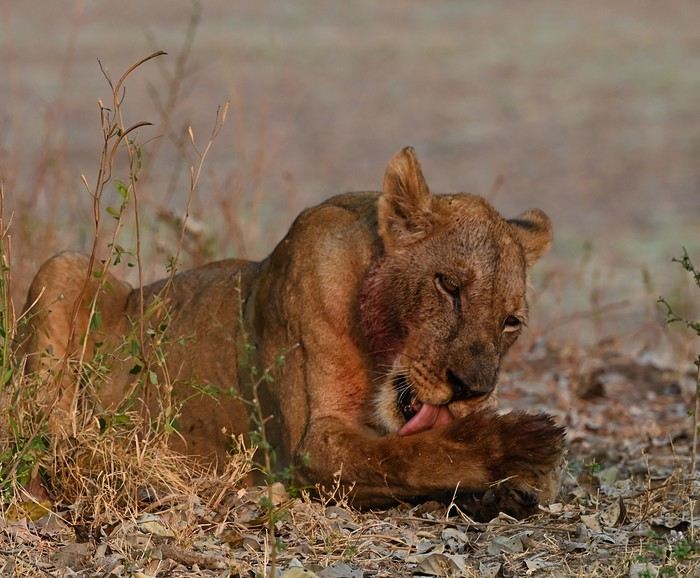

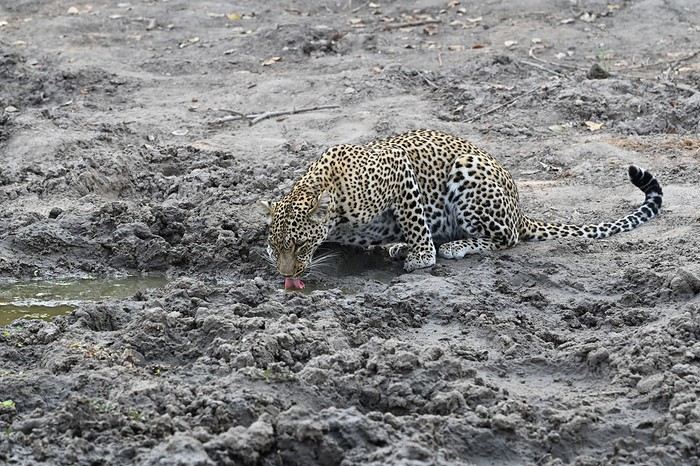
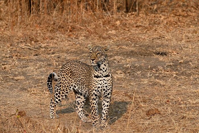
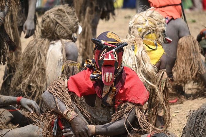
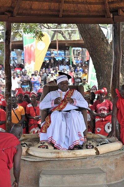
We spent two full days in South Luangwa before heading to Katete for the Kulamba ceremony. Kulamba is an annual event held at the end of August, celebrating the Chewa people, who live across Zambia, Malawi, and Mozambique. The Chewa king attends, and representatives from neighboring nations bring offerings. Thousands gather for dances, speeches, and a massive market. There are few tourists, making it a truly authentic experience.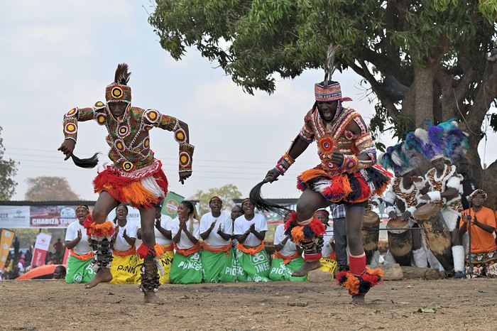
After a few days in Zambia, we returned to Malawi (the border crossing this time was smooth—just 45 minutes). Next stop: Lake Malawi. Lake Malawi covers over 20% of the country and stretches 580 km. It’s home to a family of fish called cichlids, some of which are endemic to the lake. I recommend taking a day trip from Cape Maclear for snorkeling and to watch the fishing eagles swoop down to catch fish.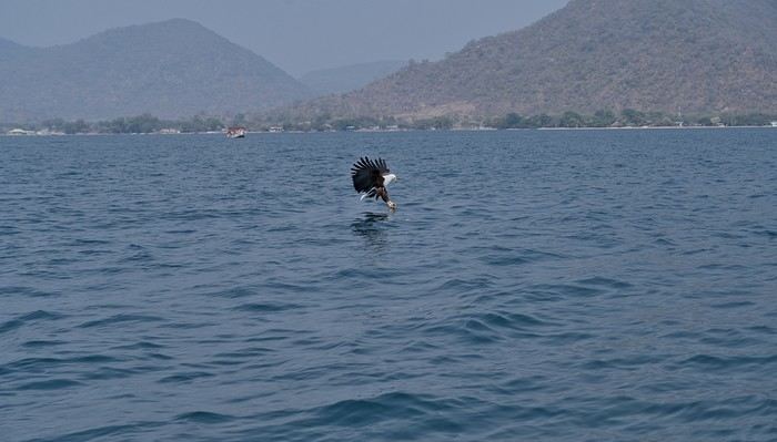
We hit the road again to visit Liwonde Reserve, where we had a few surprises. The lodge was on the other side of the river that borders the park, and the elephants didn’t seem to care. On the way from reception to our rooms, elephants blocked our path, and one even charged just before the stairs leading to our treehouse-style rooms.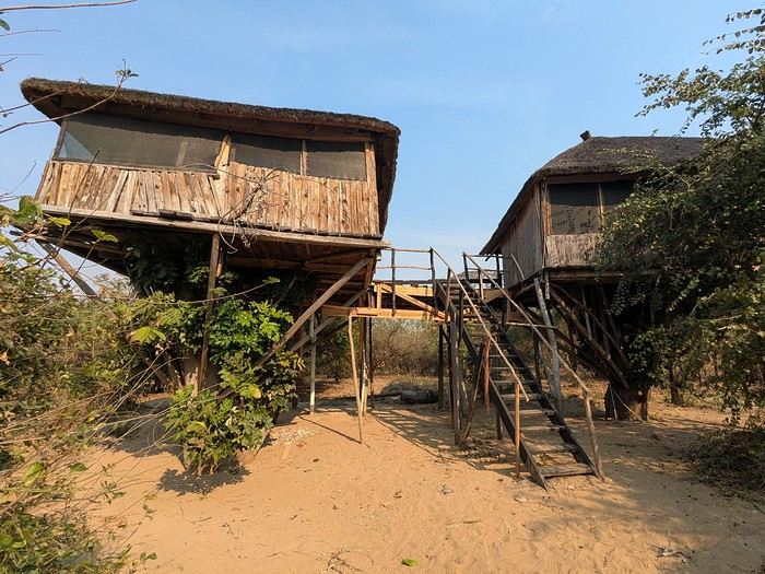
To top it off, monkeys ransacked our rooms, tearing through plastic bags for food. A mixed experience, but no real harm done. Next up: the mountains, specifically the Mulanje Massif. This is where Malawi’s tea is grown, and it’s also a great spot for day hikes or multi-day treks. The scenery is stunning, though sometimes the mist rolls in and hides it. After the mountains, we visited another reserve: Majete. The park is growing and now has more wildlife. We saw lions and even caught a fleeting glimpse of a leopard. And of course, the elephants got involved again—this time giving us a real scare. During the morning game drive with a guide, we stopped to watch a herd of elephants feeding. Everything was fine until, for some reason, a female got spooked—probably for her calf—and positioned herself in front of us on the track. After a few minutes, we thought the elephants would move on, but then a young one started provoking us. The problem? We had females and calves in front of us, but also two large adult males—one behind us and one to the side.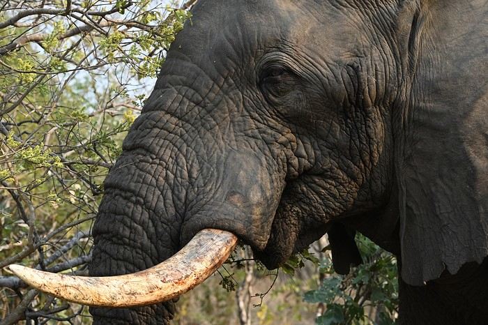 We were trapped, and even our guide looked nervous. After what felt like an eternity (though it was only a few minutes), the herd finally moved on, freeing the track. That afternoon, we did a self-drive safari and—you guessed it—we had zero interest in running into elephants again.
The next day, we headed back to Lilongwe for our flight home. It was a fantastic, varied trip with some intense moments (sometimes *too* intense). Malawi offers amazing opportunities for those who want more than just wildlife reserves.
We were trapped, and even our guide looked nervous. After what felt like an eternity (though it was only a few minutes), the herd finally moved on, freeing the track. That afternoon, we did a self-drive safari and—you guessed it—we had zero interest in running into elephants again.
The next day, we headed back to Lilongwe for our flight home. It was a fantastic, varied trip with some intense moments (sometimes *too* intense). Malawi offers amazing opportunities for those who want more than just wildlife reserves.
We visited two countries: Zambia, known for its reserves, and Malawi, which is less well-known but absolutely worth a visit. Our flight landed in Lilongwe, Malawi’s capital, where our vehicle was waiting—though with a 3-hour delay. It was a 4x4 without the rooftop tent this time, since we stayed in lodges (prices are very reasonable in Malawi). Just a heads-up: don’t exchange money at the airport or banks—the official rate was 1,750 Malawian kwacha to $1. On the black market, the rate was between 3,000 and 3,500 kwacha, making the cost of living much cheaper.
With that out of the way, our first stop was South Luangwa National Park in Zambia. The first hiccup came at the Malawi-Zambia border: we were missing a document the rental company had forgotten. After some back-and-forth, they sent it via WhatsApp ($20 to get it validated by the police). But things got worse—the car’s chassis number was off by one digit from the registered one. I thought our trip was over before it even started! After what felt like forever, we got through with a "tip" of $200. Total border crossing time: 3 hours, costing nearly $400. We arrived in South Luangwa after dark.
Thankfully, the next day made up for it with an incredible day in the park (check out the photos).
We spent two full days in South Luangwa before heading to Katete for the Kulamba ceremony. Kulamba is an annual event held at the end of August, celebrating the Chewa people, who live across Zambia, Malawi, and Mozambique. The Chewa king attends, and representatives from neighboring nations bring offerings. Thousands gather for dances, speeches, and a massive market. There are few tourists, making it a truly authentic experience.
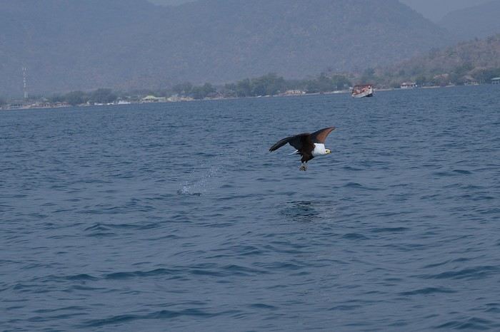
After a few days in Zambia, we returned to Malawi (the border crossing this time was smooth—just 45 minutes). Next stop: Lake Malawi. Lake Malawi covers over 20% of the country and stretches 580 km. It’s home to a family of fish called cichlids, some of which are endemic to the lake. I recommend taking a day trip from Cape Maclear for snorkeling and to watch the fishing eagles swoop down to catch fish.
We hit the road again to visit Liwonde Reserve, where we had a few surprises. The lodge was on the other side of the river that borders the park, and the elephants didn’t seem to care. On the way from reception to our rooms, elephants blocked our path, and one even charged just before the stairs leading to our treehouse-style rooms.
To top it off, monkeys ransacked our rooms, tearing through plastic bags for food. A mixed experience, but no real harm done. Next up: the mountains, specifically the Mulanje Massif. This is where Malawi’s tea is grown, and it’s also a great spot for day hikes or multi-day treks. The scenery is stunning, though sometimes the mist rolls in and hides it. After the mountains, we visited another reserve: Majete. The park is growing and now has more wildlife. We saw lions and even caught a fleeting glimpse of a leopard. And of course, the elephants got involved again—this time giving us a real scare. During the morning game drive with a guide, we stopped to watch a herd of elephants feeding. Everything was fine until, for some reason, a female got spooked—probably for her calf—and positioned herself in front of us on the track. After a few minutes, we thought the elephants would move on, but then a young one started provoking us. The problem? We had females and calves in front of us, but also two large adult males—one behind us and one to the side.
We were trapped, and even our guide looked nervous. After what felt like an eternity (though it was only a few minutes), the herd finally moved on, freeing the track. That afternoon, we did a self-drive safari and—you guessed it—we had zero interest in running into elephants again.
The next day, we headed back to Lilongwe for our flight home. It was a fantastic, varied trip with some intense moments (sometimes *too* intense). Malawi offers amazing opportunities for those who want more than just wildlife reserves.Trip Report: Silk Road Journey in China
Hi everyone,
This trip report covers a journey along the Silk Road in China (see detailed description below) undertaken in October 2025. The goal isn’t to recount the trip but to provide information that might help those who want to take a similar journey. Much of the information is valid for any trip to China.
Who we are: a retired couple, aged 63 and 65 (age gives discounts on entry to various sites and museums in China, which is why I won’t list prices here—I don’t know them, but you can easily find them online). We’re used to traveling independently. We speak English, which is the only foreign language spoken in China, though by very few people. I speak and read a little Chinese, which helped, but you can easily get by without it (without any English at all, I think it would be more difficult).
Period: We arrived just after "Golden Week," when all of China is on vacation, and after the summer, when schools are out, so we encountered very few tourists (99.99% of whom were Chinese). Our experience with booking visits in advance (which we didn’t need to do) isn’t representative for those who want to travel in the summer! The October-November period was perfect for our trip—it wasn’t too hot or too cold (one day of snow on the Tibetan Plateau), though it was only a few degrees on the Tibetan part, with altitudes between 2,000 and 3,000 meters. The trees were beautifully colored.
General remarks: Everyone we dealt with was very kind and perfectly honest. If you order a meal without really understanding what to do and the person modifies your order, trust them—the result is what you need. If a taxi driver signals that they’ll wait for you to finish your visit and pick you up afterward, trust them. It means there aren’t many taxis where you are, and it’ll be more convenient. For prices at street vendors, we always found the right ballpark, and sometimes they even added a little extra to please us. A taxi driver treated us to lunch, and an employee drove us back to the hotel after a visit because there were no taxis. If you struggle to buy a ticket online because there’s no counter, someone will come to help. People even spontaneously ask if everything’s okay and if you need anything.
Everywhere we went was very clean, including restrooms (trains, stations, hotels, museums, tourist sites) and streets. The old stereotypes about this no longer apply.
The trip can be challenging for those who have difficulty walking. The distances to cover on foot in stations, to access sites, and within the sites themselves can sometimes be really long.
We used the Lonely Planet guide in English (published at the end of August 2025) a little for preparation, but mostly relied on the internet.
Before leaving: No visa is needed for French citizens for stays under 30 days. You get a stamp on your passport upon arrival and departure, and the formalities themselves are very quick in both directions (excluding any potential queues). Just a photo and fingerprints upon arrival, and welcome to China’s facial recognition system.
Money: All your payments (see below) will go through your Visa card—there will be hundreds, including many payments of 20 cents to a few euros. So, you need an international option that allows unlimited card transactions. Since cash is rarely needed, the allowed number of ATM withdrawals can be low. We made 3 withdrawals totaling 800 € for a month and could have managed with just 2. The exchange rate charged on our Visa card was 12 € for 100 RMB (yuan).
Install the following apps on your smartphone before leaving (otherwise, you’ll only have access to the Chinese versions, if available): - Alipay, which is used to pay everywhere in China (details below). You need to link it to your credit card, then provide proof of identity by uploading a passport photo and completing a facial recognition session. Alipay gives access to Didi (China’s Uber), public transport (metro/bus), and can also translate phrases. - WeChat (Weixin in Chinese, pronounced *weishin*), which is also used for payments but also replaces WhatsApp. Unfortunately, to activate your account, you need someone who already has WeChat to sponsor you (preferably a Chinese person). We asked someone at our first accommodations to do this—no problem. By sharing your WeChat number with accommodations, they can send you messages that are automatically translated, and you can communicate with people thanks to the translation (translation to French is very poor; it’s much better in English, but unfortunately, WeChat detects your phone’s language). Alipay and WeChat are accepted almost everywhere, but some places only accept WeChat. - Amap, the international version of Baidu Maps, which replaces Google Maps (not at all up-to-date in China). The English names of hotels often have little to do with the Chinese names except for a phonetic resemblance. To find them on Amap, it’s best to copy the Chinese name found on your Trip reservation under "show address in Chinese." - A VPN. We had CyberGhost, which didn’t work, but according to other travelers, NordVPN and Windscribe do. Without a VPN, you can’t access Google services, on WhatsApp you can send and receive text but not photos, and you can’t send or receive emails on Gmail addresses. We managed without a VPN by using Firefox as a browser and Bing as a search engine. - Trip, for booking trains and accommodations, and buying some tickets. It’s the equivalent of Booking for accommodations, but Booking has very few listings in China, while Trip has hundreds in every city. Most hotels and trains are exchangeable and refundable until the day before, with no or minimal fees.
You don’t need contactless (NFC) payment on your phone. Either you scan a barcode and enter the amount to pay, or you display a barcode, and they scan it with a scanner, and the amount is deducted directly.
Upon arrival: - Buy a Chinese SIM card: 100 RMB for 300 GB of data and several hours of talk time (we didn’t use it). Set the Chinese number as a reference on Alipay, WeChat, and Amap. - Find someone to sponsor you on WeChat.
Transportation: - **Plane**: China Eastern, Paris-Canton then Canton-Urumqi on the way out, and Xian-Canton then Canton-Paris on the way back. International flights were smooth, but the schedules for the two domestic flights were changed. It was fine on the way out because we had some leeway, but on the way back, we were notified the morning of that our flight was canceled and replaced with one that didn’t allow for the connection. We called and changed to an earlier flight (I think we were lucky to find available seats). - **Train**: Most long distances were covered by high-speed trains (called D or G in China) at 240 or 300 km/h. Second class is perfect—just as comfortable and clean as our TGVs. The only advantage of first class is the wider seats for larger people, but the downside is that seats are often booked in advance and thus less available. You can book trains long in advance on Trip, but they only go on sale in China 15 days before departure, so that’s when you’ll know if you have a ticket. Initially, we booked first class, but there were no seats available on the day, so we ended up booking everything in second class, which was perfect. There’s no paper ticket—if you’ve bought one, you go to the station, show your passport, and enter. You do the same to access the platform 15 minutes before the train, and that’s it. Our train was canceled twice, but no problem—we went to the ticket counter, got a refund, and were offered a replacement. It didn’t delay us by more than an hour (maybe it would be harder in peak season). For prices, check Trip.com, but it’s significantly cheaper than in France. - **Bus**: We took the bus between Xining and Tongren, Tongren to Xiahe, and Hezuo to Lanzhou—about 3 hours each time for 200 km, 6 € per person, and departures were right on time. - **Taxi**: For trips between the station and hotel, or hotel and visits. If you take a Didi via the Alipay app, you activate your location, enter your destination, and it offers several taxis. You accept, and you get the car’s license plate and its real-time position on the map. When you get in, the driver often asks for the last four digits of your phone number to confirm. Otherwise, you go to the taxi stand outside the station. The price per kilometer is around 20 cents, so for a 30 km trip from the station to the hotel, you’ll pay about 6 €. We never tried to save more by taking local buses, but since the metro in Xian costs 25 cents per trip, it’s probably in the same ballpark. Amap provides public transport routes like Google Maps. - **Driver**: We hired a taxi/driver for the day several times for sightseeing. Prices ranged from 350 to 1,000 RMB (the most expensive was arranged through the Sofitel Xining concierge) for trips ranging from a few hours to a full day, sometimes covering over 300 km (see the detailed trip description).
Accommodations: All booked in advance on Trip, but several were changed during the trip. Off-season, there were no issues. We mostly stayed in upscale places, but in China, that means 50 to 60 € per night in the most central or convenient neighborhood. Note: Almost all hotels have a 5/5 rating on Trip, but it seems the Chinese avoid giving lower ratings to be polite. So, you have to read the comments to realize that in France, we might have given a 2 or 3!
Food: At the table, you’re served hot water or a hot infusion, presumably made with purified water. We never got sick from drinking it, but don’t drink tap water. Purified or mineral water is easy to find.
In restaurants, you can manage by pointing to the dish you want from another diner, on the wall where there are photos, or on the menu with pictures. The food in the region isn’t often spicy, and people usually ask or signal before adding the red spicy sauce, so you should be able to handle it if you don’t like chili at all.
The "fake old quarters" in several cities are great places to find all kinds of restaurants (see detailed trip below).
Like Google Maps, Amap can show you nearby restaurants.
Shopping: For dried fruits, buy them in Turfan—you won’t find the same variety and quality even in Xian. Generally, if you like something, buy it. If you wait, you might not find it outside the region where you are.
In Xian, there’s a "Tea City" where you can find all kinds of tea (from cheap to very expensive).
The trip in more detail: I won’t dwell on the beauty or interest of the sites here since that’s a matter of personal taste. However, I will do so for lesser-known places to give an idea to those who might be interested.
For many sites, there are shuttles (sometimes not included in the ticket price but costing around 1 €) that take you to the interesting spots. We always took them—it saves you from walking past countless shops or along uninteresting paths.
- **Urumqi**: We spent only one night there, arriving in the middle of the afternoon and leaving the next morning. We stayed at the Dana Hotel in the bazaar. Given the size of the city, it’s a good option because I don’t think there are many other interesting places. The bazaar is brand new and not at all "typical" (Turfan’s bazaar is infinitely more interesting), but the dining area is very nice.
- **Turfan**: Stayed at the New Dap Hostel, which was great. The neighborhood is nice, not far from the city, and easy to find food. The museum is closed until 2026 (Amap provides museum hours and closures). We took a day trip (for the two of us) with a driver to the Bezeklik Caves, Flaming Mountains, the abandoned city of Gaochang, the Tuyuk Village Museum, and the Emin Minaret for 500 RMB from 9 AM to 8 PM (arranged by the hostel). The landscape during the excursion was quite fabulous. We also visited the Karez Museum and the abandoned city of Jiaohe on our own the next day. At this time of year, the sun sets around 6 PM, and there’s often haze after 5 PM, so for Jiaohe, for example, which takes about 3 hours to visit, it’s best to be there by 1 or 2 PM at the latest.
The Dahua Market area is perfect for dried fruits (including the famous grapes), and you can eat there among locals in their traditional costumes. Next to it, there are buildings full of shops selling made-in-China items—it kept us busy for a good half-day, if not more.
- **Dunhuang**: Stayed in a guesthouse near the dunes—the city center isn’t far but seems quite artificial. Visited the dunes, with a ticket valid for 3 days. Lots of Chinese tourists—very typical and interesting from an ethnological perspective 😊. We got up early one morning to climb the highest dune, just beyond the one everyone goes to. It’s a bit long and tiring, but the view is worth it. Visited the Mogao Caves, buying the ticket on-site (no chance in season without booking in advance). We met two other French people and got a French-speaking guide (by pretending not to understand English). It was really worth it—a group of 4 instead of 20, and they took their time (2 hours) for the visit. We took a day trip to the Yulin Caves (2.5 hours by road and 160 km one way) with a driver for 350 RMB. We liked it a lot, but if the Mogao Caves are enough for you, it’s not very different.
- **Jiayuguan**: Stayed in a city-center hotel. Visited the Wei and Jin tombs (actually just one)—that’s where we were told the taxi should wait to take us back to the city. We went down into a crypt with lots of decorated bricks from the 3rd century. We really liked it, but it’s not as spectacular as the fort if you’re not a fan. Visited the Jiayuguan Fort and, with the same ticket, climbed a small section of the Great Wall 10 km away. Plan at least 3 good hours for all this—there’s plenty to see.
- **Zhangye**: Stayed at The Silk Road Travelers Hostel, rustic but very nice and organizes excursions. Visited the Danxia (colored mountains)—just as spectacular as the photos. You can easily spend 3 hours there, so plan to finish before sunset to avoid the haze (you can always stay longer for the sunset if the weather’s nice). The next day, visited the Mati Si Temple in the cliff. The 10,000 Buddha Caves are under renovation, but the setting and the main temple are well worth the visit (the paths through the cliff tunnels must be hellish in peak season). You can probably organize these two excursions yourself by asking any taxi driver. Also visited the Giant Buddha Temple in the city center—really worth it.
- **Xining**: Stayed in a city-center hotel. Visited the Tibetan Medicine Museum to see the world’s largest thangka (1 km long), made over 40 years by renowned artists. It’s absolutely magnificent, on par with the virtuosity (but over 1 km) of the thangkas painted by famous artists in Xiahe (see below). Hired a female taxi driver for the day to visit Kumbum Monastery (Ta’er Si in Chinese) and the Danxia area in Guide, 50 km beyond the monastery. It’s less spectacular than Zhangye’s Danxia, but we really liked it (including the journey’s landscape). The next day, visited the old Ming-era Qutan Monastery—no visitors, with beautiful murals (half under renovation). Accessible by train to Haidong or Ledu, then a taxi. Xining’s mosque is of no interest, but there’s a pedestrian street with food stalls nearby that’s very nice.
- **Tongren**: Stayed near the main monastery. Visited Longwu Monastery (several hours), with lots of nice shops along the street leading to it. Then visited Wutun Monastery, which is less lively but beautiful and close to thangka workshops. You can go in and watch the painters at work. For a thangka made by a renowned artist, count about a year of work for 1 m² and around 10,000 €.
- **Xiahe**: Stayed in a city-center hotel. Visited Labrang Monastery—very nice but not as much as Tongren’s because many halls were closed. I think it’s better to go in season and take an English-guided tour (but it’s still worth the trip, even off-season).
- **Langmusi**: Took a taxi, but you can also take a bus (though very early in the morning and longer). Particularly beautiful for us because we woke up to bright sunshine and 5 cm of snow everywhere. Visited the two temples (really nice) and did the classic hike in the gorges starting at the Fairy Cave. For those interested, we continued along the canyon path, and after the meadow where marmots are clearly visible in summer, we climbed toward a pass on the left at 3,800 meters. The view of Langmusi and, above all, the vast grasslands and distant mountains was fabulous (3 hours round trip from the temple). You could probably reach the 4,000-meter summit by continuing up the valley instead of turning left, but according to guides, it’s better to count 7 hours round trip (no technical difficulty). You can leave Langmusi by bus, but off-season, you first have to take a taxi to a stop outside the city and wait for the bus. We didn’t try and took a taxi to Hezuo instead.
Note on this region: A high-speed train is under construction from Xining to Langmusi and beyond (never seen such an impressive construction site!). When it’s operational (in one or two years, I think), access to the area will be revolutionized, and perhaps some of the charm will be lost.
- **Hezuo**: Stopped on the way from Langmusi to Lanzhou. Visited the Milarepa Pagoda, entirely destroyed during the Cultural Revolution and since rebuilt. We liked it since we were passing through, but it doesn’t necessarily justify a long detour.
- **Lanzhou**: Reached by one of the many buses from Hezuo. Stayed in the "fake old quarter," which is extremely pleasant, especially in the evening with restaurants, groups of Chinese women dancing to loud music, etc. Visited Bingling Si with a driver, 120 km away—the landscape and site are absolutely magnificent, with no one around at our time of year. Visited the Gansu Museum (where the famous Flying Horse is, but it’s a replica). We bought the ticket on entry, but in season, you probably need to book in advance.
- **Yinchuan**: Stayed in the city center. A city we discovered by chance in the Lonely Planet—worth it if you have time. On the way, we stopped for a few hours in Zhongwei, where there’s an incredible Taoist temple (I’ll let you be surprised). Visited the Western Xia tombs—we took the short option, which visits Tomb 3. We think the others are similar but less impressive. The surrounding landscape and site are quite spectacular. Visited the film sets (really fun if you like Chinese movies), the short but interesting Ningxia Museum, and finally the modern art museum. The architecture is avant-garde, and there are some beautiful works (we like it, but it’s far from the center—hire a driver who waits, or you might have to wait for an employee to offer a ride back).
- **Tianshui**: Stayed in the suburbs, but you should find a hotel near the "fake old quarter" between the Fu Xi Temples and the Taoist temple—it’s a very nice area, and the two temples (especially the Taoist one) are within walking distance. Visited the Maijishan Caves—the ticket includes the shuttle to get there. Took a taxi from Lanzhou for about 10 € in 45 minutes. We found these caves fabulous.
- **Xi’an**: Stayed 500 meters from the Bell Tower at Hantang Inn—very convenient. We’d been before, so we didn’t revisit the Terracotta Army. The calligraphy district is worth it, as is the Muslim Quarter, though it’s very touristy. The area indicated on the Lonely Planet’s walking tour near the old fruit and vegetable market isn’t very interesting. To buy tea, you can go to the Northwest International Tea City, with dozens of shops. We chose one at random, tasted, and bought various teas. There’s everything from cheap to extremely expensive, but you can find reasonable prices even in seemingly luxurious shops. Along the street north of this area, there are large stores with tons of Chinese goods selling dishes, wedding items, etc. We spent hours there. In the city center, there are only malls with more or less international brands.
- **Longmen Grottoes**: Visited as a round trip by high-speed train from Xian—1 hour 15 minutes to Longmen’s high-speed train station, and the site entrance is 15 minutes by taxi.
We didn’t go to Mount Hua Shan, but there’s a high-speed train station nearby, and there were people on the train who were clearly going there. So, you can probably do this excursion in a day from Xian as well.
Conclusion: We hope this report makes you want to go or helps you if you’re already planning to. If you have questions that you can’t find the answer to by searching properly online and we can answer, don’t hesitate.
This trip report covers a journey along the Silk Road in China (see detailed description below) undertaken in October 2025. The goal isn’t to recount the trip but to provide information that might help those who want to take a similar journey. Much of the information is valid for any trip to China.
Who we are: a retired couple, aged 63 and 65 (age gives discounts on entry to various sites and museums in China, which is why I won’t list prices here—I don’t know them, but you can easily find them online). We’re used to traveling independently. We speak English, which is the only foreign language spoken in China, though by very few people. I speak and read a little Chinese, which helped, but you can easily get by without it (without any English at all, I think it would be more difficult).
Period: We arrived just after "Golden Week," when all of China is on vacation, and after the summer, when schools are out, so we encountered very few tourists (99.99% of whom were Chinese). Our experience with booking visits in advance (which we didn’t need to do) isn’t representative for those who want to travel in the summer! The October-November period was perfect for our trip—it wasn’t too hot or too cold (one day of snow on the Tibetan Plateau), though it was only a few degrees on the Tibetan part, with altitudes between 2,000 and 3,000 meters. The trees were beautifully colored.
General remarks: Everyone we dealt with was very kind and perfectly honest. If you order a meal without really understanding what to do and the person modifies your order, trust them—the result is what you need. If a taxi driver signals that they’ll wait for you to finish your visit and pick you up afterward, trust them. It means there aren’t many taxis where you are, and it’ll be more convenient. For prices at street vendors, we always found the right ballpark, and sometimes they even added a little extra to please us. A taxi driver treated us to lunch, and an employee drove us back to the hotel after a visit because there were no taxis. If you struggle to buy a ticket online because there’s no counter, someone will come to help. People even spontaneously ask if everything’s okay and if you need anything.
Everywhere we went was very clean, including restrooms (trains, stations, hotels, museums, tourist sites) and streets. The old stereotypes about this no longer apply.
The trip can be challenging for those who have difficulty walking. The distances to cover on foot in stations, to access sites, and within the sites themselves can sometimes be really long.
We used the Lonely Planet guide in English (published at the end of August 2025) a little for preparation, but mostly relied on the internet.
Before leaving: No visa is needed for French citizens for stays under 30 days. You get a stamp on your passport upon arrival and departure, and the formalities themselves are very quick in both directions (excluding any potential queues). Just a photo and fingerprints upon arrival, and welcome to China’s facial recognition system.
Money: All your payments (see below) will go through your Visa card—there will be hundreds, including many payments of 20 cents to a few euros. So, you need an international option that allows unlimited card transactions. Since cash is rarely needed, the allowed number of ATM withdrawals can be low. We made 3 withdrawals totaling 800 € for a month and could have managed with just 2. The exchange rate charged on our Visa card was 12 € for 100 RMB (yuan).
Install the following apps on your smartphone before leaving (otherwise, you’ll only have access to the Chinese versions, if available): - Alipay, which is used to pay everywhere in China (details below). You need to link it to your credit card, then provide proof of identity by uploading a passport photo and completing a facial recognition session. Alipay gives access to Didi (China’s Uber), public transport (metro/bus), and can also translate phrases. - WeChat (Weixin in Chinese, pronounced *weishin*), which is also used for payments but also replaces WhatsApp. Unfortunately, to activate your account, you need someone who already has WeChat to sponsor you (preferably a Chinese person). We asked someone at our first accommodations to do this—no problem. By sharing your WeChat number with accommodations, they can send you messages that are automatically translated, and you can communicate with people thanks to the translation (translation to French is very poor; it’s much better in English, but unfortunately, WeChat detects your phone’s language). Alipay and WeChat are accepted almost everywhere, but some places only accept WeChat. - Amap, the international version of Baidu Maps, which replaces Google Maps (not at all up-to-date in China). The English names of hotels often have little to do with the Chinese names except for a phonetic resemblance. To find them on Amap, it’s best to copy the Chinese name found on your Trip reservation under "show address in Chinese." - A VPN. We had CyberGhost, which didn’t work, but according to other travelers, NordVPN and Windscribe do. Without a VPN, you can’t access Google services, on WhatsApp you can send and receive text but not photos, and you can’t send or receive emails on Gmail addresses. We managed without a VPN by using Firefox as a browser and Bing as a search engine. - Trip, for booking trains and accommodations, and buying some tickets. It’s the equivalent of Booking for accommodations, but Booking has very few listings in China, while Trip has hundreds in every city. Most hotels and trains are exchangeable and refundable until the day before, with no or minimal fees.
You don’t need contactless (NFC) payment on your phone. Either you scan a barcode and enter the amount to pay, or you display a barcode, and they scan it with a scanner, and the amount is deducted directly.
Upon arrival: - Buy a Chinese SIM card: 100 RMB for 300 GB of data and several hours of talk time (we didn’t use it). Set the Chinese number as a reference on Alipay, WeChat, and Amap. - Find someone to sponsor you on WeChat.
Transportation: - **Plane**: China Eastern, Paris-Canton then Canton-Urumqi on the way out, and Xian-Canton then Canton-Paris on the way back. International flights were smooth, but the schedules for the two domestic flights were changed. It was fine on the way out because we had some leeway, but on the way back, we were notified the morning of that our flight was canceled and replaced with one that didn’t allow for the connection. We called and changed to an earlier flight (I think we were lucky to find available seats). - **Train**: Most long distances were covered by high-speed trains (called D or G in China) at 240 or 300 km/h. Second class is perfect—just as comfortable and clean as our TGVs. The only advantage of first class is the wider seats for larger people, but the downside is that seats are often booked in advance and thus less available. You can book trains long in advance on Trip, but they only go on sale in China 15 days before departure, so that’s when you’ll know if you have a ticket. Initially, we booked first class, but there were no seats available on the day, so we ended up booking everything in second class, which was perfect. There’s no paper ticket—if you’ve bought one, you go to the station, show your passport, and enter. You do the same to access the platform 15 minutes before the train, and that’s it. Our train was canceled twice, but no problem—we went to the ticket counter, got a refund, and were offered a replacement. It didn’t delay us by more than an hour (maybe it would be harder in peak season). For prices, check Trip.com, but it’s significantly cheaper than in France. - **Bus**: We took the bus between Xining and Tongren, Tongren to Xiahe, and Hezuo to Lanzhou—about 3 hours each time for 200 km, 6 € per person, and departures were right on time. - **Taxi**: For trips between the station and hotel, or hotel and visits. If you take a Didi via the Alipay app, you activate your location, enter your destination, and it offers several taxis. You accept, and you get the car’s license plate and its real-time position on the map. When you get in, the driver often asks for the last four digits of your phone number to confirm. Otherwise, you go to the taxi stand outside the station. The price per kilometer is around 20 cents, so for a 30 km trip from the station to the hotel, you’ll pay about 6 €. We never tried to save more by taking local buses, but since the metro in Xian costs 25 cents per trip, it’s probably in the same ballpark. Amap provides public transport routes like Google Maps. - **Driver**: We hired a taxi/driver for the day several times for sightseeing. Prices ranged from 350 to 1,000 RMB (the most expensive was arranged through the Sofitel Xining concierge) for trips ranging from a few hours to a full day, sometimes covering over 300 km (see the detailed trip description).
Accommodations: All booked in advance on Trip, but several were changed during the trip. Off-season, there were no issues. We mostly stayed in upscale places, but in China, that means 50 to 60 € per night in the most central or convenient neighborhood. Note: Almost all hotels have a 5/5 rating on Trip, but it seems the Chinese avoid giving lower ratings to be polite. So, you have to read the comments to realize that in France, we might have given a 2 or 3!
Food: At the table, you’re served hot water or a hot infusion, presumably made with purified water. We never got sick from drinking it, but don’t drink tap water. Purified or mineral water is easy to find.
In restaurants, you can manage by pointing to the dish you want from another diner, on the wall where there are photos, or on the menu with pictures. The food in the region isn’t often spicy, and people usually ask or signal before adding the red spicy sauce, so you should be able to handle it if you don’t like chili at all.
The "fake old quarters" in several cities are great places to find all kinds of restaurants (see detailed trip below).
Like Google Maps, Amap can show you nearby restaurants.
Shopping: For dried fruits, buy them in Turfan—you won’t find the same variety and quality even in Xian. Generally, if you like something, buy it. If you wait, you might not find it outside the region where you are.
In Xian, there’s a "Tea City" where you can find all kinds of tea (from cheap to very expensive).
The trip in more detail: I won’t dwell on the beauty or interest of the sites here since that’s a matter of personal taste. However, I will do so for lesser-known places to give an idea to those who might be interested.
For many sites, there are shuttles (sometimes not included in the ticket price but costing around 1 €) that take you to the interesting spots. We always took them—it saves you from walking past countless shops or along uninteresting paths.
- **Urumqi**: We spent only one night there, arriving in the middle of the afternoon and leaving the next morning. We stayed at the Dana Hotel in the bazaar. Given the size of the city, it’s a good option because I don’t think there are many other interesting places. The bazaar is brand new and not at all "typical" (Turfan’s bazaar is infinitely more interesting), but the dining area is very nice.
- **Turfan**: Stayed at the New Dap Hostel, which was great. The neighborhood is nice, not far from the city, and easy to find food. The museum is closed until 2026 (Amap provides museum hours and closures). We took a day trip (for the two of us) with a driver to the Bezeklik Caves, Flaming Mountains, the abandoned city of Gaochang, the Tuyuk Village Museum, and the Emin Minaret for 500 RMB from 9 AM to 8 PM (arranged by the hostel). The landscape during the excursion was quite fabulous. We also visited the Karez Museum and the abandoned city of Jiaohe on our own the next day. At this time of year, the sun sets around 6 PM, and there’s often haze after 5 PM, so for Jiaohe, for example, which takes about 3 hours to visit, it’s best to be there by 1 or 2 PM at the latest.
The Dahua Market area is perfect for dried fruits (including the famous grapes), and you can eat there among locals in their traditional costumes. Next to it, there are buildings full of shops selling made-in-China items—it kept us busy for a good half-day, if not more.
- **Dunhuang**: Stayed in a guesthouse near the dunes—the city center isn’t far but seems quite artificial. Visited the dunes, with a ticket valid for 3 days. Lots of Chinese tourists—very typical and interesting from an ethnological perspective 😊. We got up early one morning to climb the highest dune, just beyond the one everyone goes to. It’s a bit long and tiring, but the view is worth it. Visited the Mogao Caves, buying the ticket on-site (no chance in season without booking in advance). We met two other French people and got a French-speaking guide (by pretending not to understand English). It was really worth it—a group of 4 instead of 20, and they took their time (2 hours) for the visit. We took a day trip to the Yulin Caves (2.5 hours by road and 160 km one way) with a driver for 350 RMB. We liked it a lot, but if the Mogao Caves are enough for you, it’s not very different.
- **Jiayuguan**: Stayed in a city-center hotel. Visited the Wei and Jin tombs (actually just one)—that’s where we were told the taxi should wait to take us back to the city. We went down into a crypt with lots of decorated bricks from the 3rd century. We really liked it, but it’s not as spectacular as the fort if you’re not a fan. Visited the Jiayuguan Fort and, with the same ticket, climbed a small section of the Great Wall 10 km away. Plan at least 3 good hours for all this—there’s plenty to see.
- **Zhangye**: Stayed at The Silk Road Travelers Hostel, rustic but very nice and organizes excursions. Visited the Danxia (colored mountains)—just as spectacular as the photos. You can easily spend 3 hours there, so plan to finish before sunset to avoid the haze (you can always stay longer for the sunset if the weather’s nice). The next day, visited the Mati Si Temple in the cliff. The 10,000 Buddha Caves are under renovation, but the setting and the main temple are well worth the visit (the paths through the cliff tunnels must be hellish in peak season). You can probably organize these two excursions yourself by asking any taxi driver. Also visited the Giant Buddha Temple in the city center—really worth it.
- **Xining**: Stayed in a city-center hotel. Visited the Tibetan Medicine Museum to see the world’s largest thangka (1 km long), made over 40 years by renowned artists. It’s absolutely magnificent, on par with the virtuosity (but over 1 km) of the thangkas painted by famous artists in Xiahe (see below). Hired a female taxi driver for the day to visit Kumbum Monastery (Ta’er Si in Chinese) and the Danxia area in Guide, 50 km beyond the monastery. It’s less spectacular than Zhangye’s Danxia, but we really liked it (including the journey’s landscape). The next day, visited the old Ming-era Qutan Monastery—no visitors, with beautiful murals (half under renovation). Accessible by train to Haidong or Ledu, then a taxi. Xining’s mosque is of no interest, but there’s a pedestrian street with food stalls nearby that’s very nice.
- **Tongren**: Stayed near the main monastery. Visited Longwu Monastery (several hours), with lots of nice shops along the street leading to it. Then visited Wutun Monastery, which is less lively but beautiful and close to thangka workshops. You can go in and watch the painters at work. For a thangka made by a renowned artist, count about a year of work for 1 m² and around 10,000 €.
- **Xiahe**: Stayed in a city-center hotel. Visited Labrang Monastery—very nice but not as much as Tongren’s because many halls were closed. I think it’s better to go in season and take an English-guided tour (but it’s still worth the trip, even off-season).
- **Langmusi**: Took a taxi, but you can also take a bus (though very early in the morning and longer). Particularly beautiful for us because we woke up to bright sunshine and 5 cm of snow everywhere. Visited the two temples (really nice) and did the classic hike in the gorges starting at the Fairy Cave. For those interested, we continued along the canyon path, and after the meadow where marmots are clearly visible in summer, we climbed toward a pass on the left at 3,800 meters. The view of Langmusi and, above all, the vast grasslands and distant mountains was fabulous (3 hours round trip from the temple). You could probably reach the 4,000-meter summit by continuing up the valley instead of turning left, but according to guides, it’s better to count 7 hours round trip (no technical difficulty). You can leave Langmusi by bus, but off-season, you first have to take a taxi to a stop outside the city and wait for the bus. We didn’t try and took a taxi to Hezuo instead.
Note on this region: A high-speed train is under construction from Xining to Langmusi and beyond (never seen such an impressive construction site!). When it’s operational (in one or two years, I think), access to the area will be revolutionized, and perhaps some of the charm will be lost.
- **Hezuo**: Stopped on the way from Langmusi to Lanzhou. Visited the Milarepa Pagoda, entirely destroyed during the Cultural Revolution and since rebuilt. We liked it since we were passing through, but it doesn’t necessarily justify a long detour.
- **Lanzhou**: Reached by one of the many buses from Hezuo. Stayed in the "fake old quarter," which is extremely pleasant, especially in the evening with restaurants, groups of Chinese women dancing to loud music, etc. Visited Bingling Si with a driver, 120 km away—the landscape and site are absolutely magnificent, with no one around at our time of year. Visited the Gansu Museum (where the famous Flying Horse is, but it’s a replica). We bought the ticket on entry, but in season, you probably need to book in advance.
- **Yinchuan**: Stayed in the city center. A city we discovered by chance in the Lonely Planet—worth it if you have time. On the way, we stopped for a few hours in Zhongwei, where there’s an incredible Taoist temple (I’ll let you be surprised). Visited the Western Xia tombs—we took the short option, which visits Tomb 3. We think the others are similar but less impressive. The surrounding landscape and site are quite spectacular. Visited the film sets (really fun if you like Chinese movies), the short but interesting Ningxia Museum, and finally the modern art museum. The architecture is avant-garde, and there are some beautiful works (we like it, but it’s far from the center—hire a driver who waits, or you might have to wait for an employee to offer a ride back).
- **Tianshui**: Stayed in the suburbs, but you should find a hotel near the "fake old quarter" between the Fu Xi Temples and the Taoist temple—it’s a very nice area, and the two temples (especially the Taoist one) are within walking distance. Visited the Maijishan Caves—the ticket includes the shuttle to get there. Took a taxi from Lanzhou for about 10 € in 45 minutes. We found these caves fabulous.
- **Xi’an**: Stayed 500 meters from the Bell Tower at Hantang Inn—very convenient. We’d been before, so we didn’t revisit the Terracotta Army. The calligraphy district is worth it, as is the Muslim Quarter, though it’s very touristy. The area indicated on the Lonely Planet’s walking tour near the old fruit and vegetable market isn’t very interesting. To buy tea, you can go to the Northwest International Tea City, with dozens of shops. We chose one at random, tasted, and bought various teas. There’s everything from cheap to extremely expensive, but you can find reasonable prices even in seemingly luxurious shops. Along the street north of this area, there are large stores with tons of Chinese goods selling dishes, wedding items, etc. We spent hours there. In the city center, there are only malls with more or less international brands.
- **Longmen Grottoes**: Visited as a round trip by high-speed train from Xian—1 hour 15 minutes to Longmen’s high-speed train station, and the site entrance is 15 minutes by taxi.
We didn’t go to Mount Hua Shan, but there’s a high-speed train station nearby, and there were people on the train who were clearly going there. So, you can probably do this excursion in a day from Xian as well.
Conclusion: We hope this report makes you want to go or helps you if you’re already planning to. If you have questions that you can’t find the answer to by searching properly online and we can answer, don’t hesitate.
A summer in the sun in... Iceland!!
Ah, Iceland and us—it’s quite the story, or rather, a long wait... The first time we considered going was already 7-8 years ago, after reading travel journals describing breathtaking landscapes, countless active and dormant volcanoes, glaciers, and waterfalls with extraordinary flows. In short, this island, made of fire and ice, right at Europe’s doorstep with its own unique culture, had nothing but advantages, and it was urgent to visit without delay 😇
My *Routard* guidebook is actually from 2016. So why did Iceland make us wait so long before we finally gave in to its charms? Yes, why indeed?
Simply because reading other travel journals revealed the cost of living there—and especially the harsh climate, even in the middle of July 🤪! Some journals described entire weeks of rain and foggy weather, making it tricky to explore the island. The budget wasn’t spared either, because in the most touristy areas, especially in the south and around Myvatn, accommodation prices are downright indecent—even outright robbery. 😕
Plus, in the Highlands, there’s literally no permanent lodging, and the only way to spend several nights there is to camp. And camping in winter conditions wasn’t exactly part of our plans... 😄
So, year after year, this trip kept getting postponed...
until August 2023, when prices for Southern Africa, North or South America, or even Asia were all way too high for summer 2024!
That’s when I turned my attention back to the Land of Fire and Ice and scoured all the comparison sites for the best accommodation deals across the country. Planning for 20 nights, I found 13 nights in "proper" lodging for 5 people at an average cost of under 200 €! A miracle, considering that in the southern glacier region, around Vik or Myvatn, prices range from 300 to 1000 € per night 😮 😮!
Still, that means we’ll have to camp for 7 nights, mostly in the Highlands, near Askja or Landmannalaugar. 😎
For once, I built the daily itinerary entirely around the decently priced lodgings I found 11 months in advance! The shortage of places to stay in some areas forced me to plan a few long transition days and make some tough choices. No big deal, though—there’s so much to do on this island 🙂!
Once the main itinerary was set, everyone agreed to the plan: 2/3 in proper lodging and 1/3 camping, even the most camping-averse among us! *Follow my gaze...*
By the time we bought the flight tickets, I had to tweak the itinerary a bit because one or two places were already booked! Plus, it was impossible to wait for a more refined plan to adjust reservations, since almost all bookings are non-refundable!! The harsh law of supply and demand...
For the car rental, we booked a Hyundai Tucson, approved for the Highlands, from Lava Car Rental—a company I’d read good reviews about in a Facebook group—for a cool 2500 € with full insurance. A real 4x4, like a Defender, would’ve been more than double...! Welcome to Iceland 😕...
Activities and excursions also required some tough choices. We had two must-dos: whale watching in Húsavík (60 € pp on Getyourguide) and a Glacier and Summer Treasure Glacier Walk with BlueIceland (165 € pp with discount codes on Getyourguide).
For the baths, we skipped the Blue Lagoon—too expensive—in favor of the Secret Lagoon and the Myvatn Baths, the Blue Lagoon’s equivalent but half the price.
Two baths for the price of one... and even more, since I spotted several free hot-water swimming spots.
Itinerary: Day 1: Arrival in Reykjavik - Hraunfossar Waterfall - Surtshellir Cave Day 2: Grábrók Crater - Snæfellsnes Peninsula Day 3: Stykkishólmur - Sturlungalaug Hot Springs Day 4: Northwest Coast - Akureyri - Goðafoss Day 5: Myvatn Day 6: Myvatn - Dettifoss - Selfoss - Rauðhólar Day 7: Húsavík Whale Watching - Dettifoss - Selfoss Day 8: Stuðlagil Canyon - Seyðisfjörður Day 9: Puffin colony - Störurð Hike Day 10: Hengifoss - East Fjords, Mjóifjörður Day 11: Viking Village - Jökulsárlón - Fjallsárlón Day 12: Glacier Excursion - Svartifoss Day 13: Fjaðrárgljúfur Canyon - Vík Day 14: Þakgil - Lava Show Vík Day 15: Southern Waterfalls Day Day 16: Landmannalaugar - Skalli Hike Day 17: Landmannalaugar - Bláhnjúkur - Brennisteinsalda Day 18: Secret Lagoon, Kerlingarfjöll, and Gullfoss Day 19: Geysir - Reykjavik Day 20: Bruarfoss - Þingvellir - Kerid Crater - Krýsuvík Geothermal Area Day 21: Reykjanes Peninsula
Friday, July 5, 2024, is our last workday before driving up to Alsace overnight to leave the cockers at Grandpa’s for boarding. Then, at 1:30 AM, we’ll head to Frankfurt, where a direct flight to Iceland awaits.
We arrive at 4 AM. Since we leave at 7 AM, the "night" will only last the equivalent of a 30-minute nap 🤪... just enough to get us in the road-trip mood 😏!!
My *Routard* guidebook is actually from 2016. So why did Iceland make us wait so long before we finally gave in to its charms? Yes, why indeed?
Simply because reading other travel journals revealed the cost of living there—and especially the harsh climate, even in the middle of July 🤪! Some journals described entire weeks of rain and foggy weather, making it tricky to explore the island. The budget wasn’t spared either, because in the most touristy areas, especially in the south and around Myvatn, accommodation prices are downright indecent—even outright robbery. 😕
Plus, in the Highlands, there’s literally no permanent lodging, and the only way to spend several nights there is to camp. And camping in winter conditions wasn’t exactly part of our plans... 😄
So, year after year, this trip kept getting postponed...
until August 2023, when prices for Southern Africa, North or South America, or even Asia were all way too high for summer 2024!
That’s when I turned my attention back to the Land of Fire and Ice and scoured all the comparison sites for the best accommodation deals across the country. Planning for 20 nights, I found 13 nights in "proper" lodging for 5 people at an average cost of under 200 €! A miracle, considering that in the southern glacier region, around Vik or Myvatn, prices range from 300 to 1000 € per night 😮 😮!
Still, that means we’ll have to camp for 7 nights, mostly in the Highlands, near Askja or Landmannalaugar. 😎
For once, I built the daily itinerary entirely around the decently priced lodgings I found 11 months in advance! The shortage of places to stay in some areas forced me to plan a few long transition days and make some tough choices. No big deal, though—there’s so much to do on this island 🙂!
Once the main itinerary was set, everyone agreed to the plan: 2/3 in proper lodging and 1/3 camping, even the most camping-averse among us! *Follow my gaze...*
By the time we bought the flight tickets, I had to tweak the itinerary a bit because one or two places were already booked! Plus, it was impossible to wait for a more refined plan to adjust reservations, since almost all bookings are non-refundable!! The harsh law of supply and demand...
For the car rental, we booked a Hyundai Tucson, approved for the Highlands, from Lava Car Rental—a company I’d read good reviews about in a Facebook group—for a cool 2500 € with full insurance. A real 4x4, like a Defender, would’ve been more than double...! Welcome to Iceland 😕...
Activities and excursions also required some tough choices. We had two must-dos: whale watching in Húsavík (60 € pp on Getyourguide) and a Glacier and Summer Treasure Glacier Walk with BlueIceland (165 € pp with discount codes on Getyourguide).
For the baths, we skipped the Blue Lagoon—too expensive—in favor of the Secret Lagoon and the Myvatn Baths, the Blue Lagoon’s equivalent but half the price.
Two baths for the price of one... and even more, since I spotted several free hot-water swimming spots.
Itinerary: Day 1: Arrival in Reykjavik - Hraunfossar Waterfall - Surtshellir Cave Day 2: Grábrók Crater - Snæfellsnes Peninsula Day 3: Stykkishólmur - Sturlungalaug Hot Springs Day 4: Northwest Coast - Akureyri - Goðafoss Day 5: Myvatn Day 6: Myvatn - Dettifoss - Selfoss - Rauðhólar Day 7: Húsavík Whale Watching - Dettifoss - Selfoss Day 8: Stuðlagil Canyon - Seyðisfjörður Day 9: Puffin colony - Störurð Hike Day 10: Hengifoss - East Fjords, Mjóifjörður Day 11: Viking Village - Jökulsárlón - Fjallsárlón Day 12: Glacier Excursion - Svartifoss Day 13: Fjaðrárgljúfur Canyon - Vík Day 14: Þakgil - Lava Show Vík Day 15: Southern Waterfalls Day Day 16: Landmannalaugar - Skalli Hike Day 17: Landmannalaugar - Bláhnjúkur - Brennisteinsalda Day 18: Secret Lagoon, Kerlingarfjöll, and Gullfoss Day 19: Geysir - Reykjavik Day 20: Bruarfoss - Þingvellir - Kerid Crater - Krýsuvík Geothermal Area Day 21: Reykjanes Peninsula
Friday, July 5, 2024, is our last workday before driving up to Alsace overnight to leave the cockers at Grandpa’s for boarding. Then, at 1:30 AM, we’ll head to Frankfurt, where a direct flight to Iceland awaits.
We arrive at 4 AM. Since we leave at 7 AM, the "night" will only last the equivalent of a 30-minute nap 🤪... just enough to get us in the road-trip mood 😏!!
Discussion for June 2025's theme: a series
Here we can chat, have fun, ask questions, post off-topic photos...
Hope you'll like this theme 🙂
The contest is here
Trip report and practical tips for the American West Coast
Hi there,
Just back from 25 days in May 2025 in the American West—here are some practical tips that might help you plan your trip.
Flight: 2 tickets for 1270 € with British Airways (Lyon-LA, SF-Lyon) SIM card: 12GB from Sim USA for 39 €. Useful for looking up accommodation every late afternoon. 12GB was enough for us. Car rental: Booked with BSP Autos. 21 days = 538 € for a Jeep Compass SUV picked up at LA airport and dropped off at SF airport. An SUV isn’t essential at all, but since we had one, we did take some easy dirt roads. Driving is straightforward, highways are toll-free. Gas: Averaged $3.80/gallon = 1 €/liter. We drove 6700 km and spent $500 on gas. Big price differences between states, and even between stations in the same state. We checked Google Maps/fuel for the best deals. Water: Not recommended to drink tap water. We refilled two 3L bottles regularly at visitor centers in the parks and froze two 1L bottles overnight to keep water cool during the day. Money: Bring cash for tips and gas—sometimes cheaper when paying in cash. Accommodation: Averaged $100/night. Only the first night in LA was booked in advance. For the rest of the trip, we found places to stay (mostly motels outside the parks) near where we were each late afternoon by checking availability on Booking, among others. No issues finding places in May—the advantage was the freedom to improvise. For example, we’d planned to do the loop counterclockwise: LA, Joshua Tree, Grand Canyon. But seeing the forecast (3 days of snow and freezing temps at GC), we headed straight from JT to Las Vegas, did the loop clockwise, and by the time we got back to GC, the weather was perfect. Weather: Aside from the first 3 mixed days, we had perfect weather—20-30°C, except Death Valley (37°C) and SF (15°C). Food: Depends on your appetite. For us, snacks during the day, a bigger meal in the evening, plus miscellaneous extras—our budget was $40/day. Miscellaneous: The "America the Beautiful" pass is a must—80 $. Website: For us, the best site was roadtrippin’. Our itinerary: LA, Joshua Tree, Las Vegas, Zion, Bryce Canyon, Capitol Reef, Canyonlands, Arches, Colorado National Monument, Black Canyon of the Gunnison, Mesa Verde, Natural Bridges, Gooseneck Point, Canyon de Chelly, Painted Desert Park, Petrified Forest Park, Sedona, Grand Canyon, Route 66, LV, Red Rock Canyon Park, Death Valley, Sequoia Park, Yosemite Park, Big Sur-Monterey, San Francisco. 25 days—we didn’t lounge around, but we didn’t rush either. We took time in each park to drive the scenic routes, visit viewpoints, and do at least one hike (max 2 hours) per park.
Happy travels!
Flight: 2 tickets for 1270 € with British Airways (Lyon-LA, SF-Lyon) SIM card: 12GB from Sim USA for 39 €. Useful for looking up accommodation every late afternoon. 12GB was enough for us. Car rental: Booked with BSP Autos. 21 days = 538 € for a Jeep Compass SUV picked up at LA airport and dropped off at SF airport. An SUV isn’t essential at all, but since we had one, we did take some easy dirt roads. Driving is straightforward, highways are toll-free. Gas: Averaged $3.80/gallon = 1 €/liter. We drove 6700 km and spent $500 on gas. Big price differences between states, and even between stations in the same state. We checked Google Maps/fuel for the best deals. Water: Not recommended to drink tap water. We refilled two 3L bottles regularly at visitor centers in the parks and froze two 1L bottles overnight to keep water cool during the day. Money: Bring cash for tips and gas—sometimes cheaper when paying in cash. Accommodation: Averaged $100/night. Only the first night in LA was booked in advance. For the rest of the trip, we found places to stay (mostly motels outside the parks) near where we were each late afternoon by checking availability on Booking, among others. No issues finding places in May—the advantage was the freedom to improvise. For example, we’d planned to do the loop counterclockwise: LA, Joshua Tree, Grand Canyon. But seeing the forecast (3 days of snow and freezing temps at GC), we headed straight from JT to Las Vegas, did the loop clockwise, and by the time we got back to GC, the weather was perfect. Weather: Aside from the first 3 mixed days, we had perfect weather—20-30°C, except Death Valley (37°C) and SF (15°C). Food: Depends on your appetite. For us, snacks during the day, a bigger meal in the evening, plus miscellaneous extras—our budget was $40/day. Miscellaneous: The "America the Beautiful" pass is a must—80 $. Website: For us, the best site was roadtrippin’. Our itinerary: LA, Joshua Tree, Las Vegas, Zion, Bryce Canyon, Capitol Reef, Canyonlands, Arches, Colorado National Monument, Black Canyon of the Gunnison, Mesa Verde, Natural Bridges, Gooseneck Point, Canyon de Chelly, Painted Desert Park, Petrified Forest Park, Sedona, Grand Canyon, Route 66, LV, Red Rock Canyon Park, Death Valley, Sequoia Park, Yosemite Park, Big Sur-Monterey, San Francisco. 25 days—we didn’t lounge around, but we didn’t rush either. We took time in each park to drive the scenic routes, visit viewpoints, and do at least one hike (max 2 hours) per park.
Happy travels!
21-Day Trip to La Gomera and La Palma
Travel Journal: 21 Days in La Gomera and La Palma
From February 6 to February 26, 2024
Tuesday, February 6 We left around 9 AM with our car, along with Pierre-Paul and Patricia, heading to the Bluepark parking lot in Bartenheim. As expected, we were awaited and left promptly for EuroAirport Basel. Took off at 12:25 PM for a 4-hour-15-minute flight under excellent conditions. Beautiful arrival in Tenerife with Teide in sight under a clear blue sky. Fifteen minutes later, we waited for bus No. 40 to Los Cristianos with quite a few other tourists, but we managed to find four seats. From the bus station, it was a 20-minute walk to our hotel. We checked into a lovely apartment for the four of us, complete with all the comforts. Outside, it was quite warm—at least 25°C! After dropping off our luggage, we went for a stroll. The immediate surroundings of the hotel held no interest for us: a modern, concrete area filled with hotels, bars, tourist agencies, and unappealing restaurants all offering the same bland international cuisine. Pat went to cool off at the pool, unfortunately overrun by loud, drunk English tourists. I took a walk to the paseo maritimo that leads to the port, skirting the seafront. The promenade was pleasant, but it could have been any seaside resort in the world—same old scene: a succession of bars with blaring music where many elderly people sipped cold beers waiting for the sunset, the backdrop a wall of resort-style hotels resembling rabbit hutches! Upon reaching the port, I scouted the route we’d take the next day to the Fred Olsen ferry. Back at the apartment, in the early evening, we looked for a non-touristy restaurant for dinner. Monique stopped a woman to ask her opinion! In this area, she told us, there’s no restaurant that serves Canarian or Spanish cuisine! The only place with decent restaurants is at the port. Off we went to the port, where we sat down at Al Bordo restaurant and ordered a seafood paella for four. Excellent, and at a very reasonable price (36 € for two). We returned to the hotel along the seafront.
Wednesday, February 7
Woke up at 6 AM. Had breakfast in the apartment with what we’d bought the day before at a supermarket. It was still dark when we left on foot toward the port, walking along the calm seafront at this early hour. Forty minutes later, we arrived and waited 10 minutes before the ferry docked. At 9:30 AM, we left the port of Los Cristianos for a 50-minute crossing on a calm sea under a beautiful blue sky. There were quite a few people on this large ferry, but many had no luggage, meaning they were visiting La Gomera for the day and would take the ferry back in the evening. Upon disembarking, we went straight to our rental car agency to pick up the car we’d booked online a few months earlier. It was a nice Peugeot 2008, spacious enough for the four of us and our luggage. We immediately took the beautiful road from San Sebastián that climbs directly into the mountains toward our rental in Vallehermoso. The road was in perfect condition—it seemed brand new, like all the others we’d take on this island later. This side of the island is very arid with little vegetation, and the terrain is particularly rugged, as it is throughout the island. We stopped at our first miradors, which would be followed by many more throughout our Canarian trip. Our first visit was to the small village of Agulo, perched on a promontory above the sea and at the foot of a high cliff. The village features typical Canarian houses with windows flush with the façade and black volcanic stone masonry on white or reddish-brown walls. The first recommended restaurant was already booked for a group, so we settled for the shaded terrace of the excellent El Alameda bar-restaurant. From Agulo, you can access the Abrante viewpoint via a winding road, where the view of Agulo, 600 meters below, is exceptional. A glass ledge over the void lets you test your fear of heights!
We drove to Vallehermoso to do our grocery shopping at the supermarket—a habit that would continue until the end of the trip. Our little house, "Casa rural El Encatadora," is located in a beautiful flower-filled valley a few kilometers west of Vallehermoso. Each of us had a bedroom with an en-suite bathroom, plus a living room, kitchen, and a small terrace overlooking the quiet street at the valley’s end, which didn’t bother us at all.
Thursday, February 8 The good weather seemed to follow us since our arrival in the Canary Islands. This morning, we took the road—still as beautiful and new—toward Arure, high up to the west. The landscape was magnificent, with breathtaking glimpses of the sea far below. In Arure, we parked in front of Conchita’s bar, where a hike (Rother No. 30) starts toward two viewpoints: Alojera, which we reached after 45 minutes on a lovely path. Monique, tired from the first steep climb, stopped at the first viewpoint and hitchhiked back to Arure. Meanwhile, we continued toward the second viewpoint, Los Barranquillos, where the view of the surroundings was partially hidden by misty clouds rising from the sea. The entire mountain is sculpted by ancient, endless terraces climbing until the slope becomes too steep for construction—visible traces of the hard work of past inhabitants trying to survive in a harsh environment. We had a decent lunch at La Conchita bar, then drove to the small seaside town of Puerto la Caleta, sheltered by an immense cliff plunging into the sea. Black sand beach, rough sea—despite our encouragement, Pat didn’t dare to swim! As for the old village of Caleta, it’s perched on the mountainside, and visiting it requires climbing steep, stair-filled alleys to discover a few traditional houses. Back at the casa, dinner in, and card games...
 Vallehermoso
Friday, February 9 This morning, the sky was overcast, and the peaks around us were shrouded in clouds. We took the same road as yesterday to hike Las Creces. Quickly gaining altitude, we entered a thick fog—visibility was very limited. We stopped at the Las Creces parking lot; visibility improved, and the sun wasn’t far off. The hike is entirely within a beautiful laurel forest, with the sun playing hide-and-seek, but it wasn’t cold despite the altitude. After finishing the loop trail, we decided to picnic—not there, as it was too chilly—but on Vallehermoso’s beach, where we found a nice picnic area sheltered by large black rocks. A short digestive walk on the surrounding hill to admire the little beach from above. Back in Vallehermoso, we did some grocery shopping, then tried to return to the casa—only to find ourselves locked out because we’d left the key in the lock inside! After several attempts and with the help of Yéli, a relative of the owner we called for help, we were finally able to get back in!
Saturday, February 10
It rained last night, and the sky remained overcast. Monique decided to rest this morning. PP, Pat, and I set off on the hike that starts from the house toward the Marichal reservoir. The sun wasn’t far off, and by 11 AM, it was fully out. The pleasant hike passed by many flower-filled gardens and orchards—orange, lemon, and mandarin trees in fruit. The path climbed gently toward the reservoir, where the view of the Cano rock dominating the landscape was magnificent. The last part of the climb was a bit tough, overgrown with lush vegetation, and the trail was slippery from last night’s rain. We descended via a different, much more pleasant path and returned to the casa just in time for lunch, prepared by Monique. This valley is rich with its many farmers and market gardeners who’ve cultivated the entire valley, taking advantage of the water flowing down from the mountain, captured upstream and redistributed through countless pipes snaking along the paths. Numerous tanks also store water during dry periods. The houses are scattered across both sides of the valley, and these colorful little homes add a beautiful touch to the landscape. The many palm trees give this valley a distinctly tropical feel—you could almost imagine yourself in the Caribbean. Add to that some salsa music drifting from a hut where farmers were working, and the picture is complete. A well-chilled beer apéro capped off a lovely morning. The afternoon was dedicated to rest, relaxation, reading, and games.
Sunday, February 11 The blue sky returned, though a few clouds still capped the highest peaks. Today, we visited Garajonay National Park, which covers the highest central mountains. Up there, we were above the clouds, and the panoramas from the various viewpoints were stunning: first, Cherelepin, accessible from the Laguna Grande parking lot, then Alto de Garajonay, offering an exceptional view of Teide—over 3,000 meters high—emerging from the clouds on Tenerife, far in the distance. We continued to the Los Roques viewpoints, then stopped for lunch at the Degollada de Peraza restaurant, where the view of the barranco was impressive. We descended toward San Sebastián and checked into our new lodging, La Cabezada, located in the countryside about 3 km above San Sebastián. It’s a small apartment adjacent to the owner’s, with a lovely terrace overlooking the surrounding mountains and surrounded by a beautiful garden. Apéro, then dinner on our beautiful terrace.
Monday, February 12 This morning, we went down to visit San Sebastián de La Gomera: its old tower, main street with some beautiful traditional houses, and the Church of the Assumption. Back at the casa for lunch. In the afternoon, Pat, PP, and I set off on the short hike from San Sebastián beach to La Guancha beach. We drove down and parked on the beach. The path climbs along the hill overlooking San Sebastián, passes by the tall Christ statue dominating the landscape, and roughly follows the coast down to the isolated Guancha beach. A beautiful hike under a hot sun, and a swim was welcome, even if the beach and sea access weren’t very comfortable due to large pebbles and quickly deepening water. Apart from two nudist bathers, there was no one on this beach. We returned the same way.
Tuesday, February 13 Rest day. We went down to town to stroll and do some shopping. I took the opportunity to visit the parador, beautifully situated above the city in a lovely garden overlooking the port and town. Together, we went for a cuba libre at the "Cuba Libre" bar, then had lunch at Breñusca (mediocre paella!). Back at the casa, then we went back down to town to see a carnival parade, a "passacalles," which actually passed an hour earlier than scheduled. Oh well.
Wednesday, February 14 Each to their own program this morning. Pat went swimming at San Sebastián beach, Monique rested at the casa, and PP and I set off on the hike from Playa de Avalos to the Ermita de Guadalupe on Playa del Cangrejo. It wasn’t easy to find the right road or the parking spot, but we managed. The path seemed to have suffered landslides, according to a sign at the trailhead! We decided to check it out, ready to turn back if it seemed too dangerous. In the end, apart from one or two slightly tricky spots where we had to climb a pile of rocks, the trail remained passable, though a bit vertigo-inducing in places. The narrow path clings to very vertical cliffs nearly 300 meters above sea level! But what a magnificent view. At one point, the trail runs alongside a wall of basaltic pipes. We returned via the drivable track that parallels the trail a bit lower. Back at the house for lunch. In the late afternoon, we returned to town to attend the "Entierro de las Sardinas" (Burial of the Sardine), which closes the Canarian carnival festivities. While waiting, we strolled through the parador’s gardens and had mojitos in town. Around 9 PM, we heard the noise and cries of the mourners. The procession advanced, led by a large papier-mâché sardine on a float, surrounded by wailing mourners. The procession headed toward the sea, where the sardine was burned, and a mini fireworks display ended the procession. It was all very good-natured, and everyone had fun. We ended the evening with dinner at a good fish restaurant, El Pajar.
 Entierro de la Sardina in San Sebastián de La Gomera
Thursday, February 15
Woke up at 5:15 AM. The only suitable ferry was at 7 AM, which would get us to La Palma by late morning rather than evening. We packed our bags, had breakfast, then headed to the port, left our rental car, and boarded the ferry to Tenerife, from where we’d continue to La Palma. Calm sea, beautiful sun—by 10:30 AM, we disembarked in La Palma. We picked up our car and immediately headed to our new apartment in Breña Alta. It’s a large apartment with a superb terrace facing the sea, fully equipped and very comfortable. The hosts recommended Casa Goyo restaurant, near the airport and close to us. It’s a restaurant with many small rooms, some of which can be reserved for families. The fish-based cuisine (chipirones, pulpo) was excellent, hearty, and reasonably priced. Since it’s in the airport’s flight path, we occasionally heard planes landing. Quick and efficient service. Afterward, we visited Santa Cruz de La Palma, which reminded us of the historic quarters of La Orotava in Tenerife or the capital of Gran Canaria.
Friday, February 16
Beautiful weather, blue sky. We headed to the San Bartolo viewpoint toward the northeast coast, then to the lovely village of San Andrés, which we explored. From there, we walked along the shore to the natural pools of Charco Azul, where we swam in the cool but "swimmable" sea. Back in San Andrés for lunch at the "San Andrés" restaurant on the beautiful church square. Very good fish-based meal. We got back in the car and continued along the north coast to the port of Espindola and the natural pools of Fajana near the Cumplida lighthouse. A fairly strong wind whipped up beautiful waves crashing onto the rocky coast in bursts of foam. Back in Santa Cruz, we stopped at the Mercadona supermarket to buy fresh shrimp for dinner. San Andrés
Saturday, February 17
Uniform blue sky, even on the heights. We took the beautiful road that winds up to the summit of the Caldera de Taburiente. Several viewpoints offer 360° views of the entire island and beyond: you can make out La Gomera, El Hierro, and, of course, Tenerife with the perfect triangle of Teide. We parked at the Los Andes viewpoint parking lot and started our hike to Pico de la Cruz along a trail following the ridge, offering superb views into the caldera. We got back in the car and passed by the Roque de los Muchachos astronomical complex, composed of numerous observatories, some with very aesthetic mirror telescopes. We hiked from the Roque de los Muchachos parking lot to the various viewpoints, always as impressive. Picnic on site, then back to Santa Cruz. We stopped by our car dealer because the oil warning light came on—better safe than sorry. The representative reassured us but preferred to give us a Fiat Cross SUV instead. The Caldera de Taburiente
Sunday, February 18 The weather was a bit mixed, with cloudy patches. We set off to hike the Barranco de la Cuba de Galga. Unfortunately, the Los Tilos trail had been closed for several months due to a major landslide. The parking lot by the road was already quite full, and indeed, we crossed paths with many hikers along the way—it’s an easy hike with little elevation gain, which is rare here in La Palma! The beautiful path winds through a very narrow, deep gorge covered in lush tropical vegetation—you’d think you were in a Southeast Asian forest, especially with the humidity in the gorge bringing out earthy and floral scents. Halfway through, Monique turned back while the rest of us continued to the Cuba de Galga. A light drizzle accompanied us on the return. For lunch, we went to Chipi Chipi restaurant in the heights of Santa Cruz. The cool air forced us to leave the lovely terrace for the slightly noisy dining room. The meal was very good and hearty. Afternoon spent resting at our house.
 La Cuba de la Galga
Monday, February 19 A few clouds still clung to the nearby mountain peaks. We headed south to Los Canarios. We stopped in front of the small San Antonio Abad church, where a path leads to the viewpoint in 15 minutes. Then we visited the San Antonio Volcano Interpretation Center and climbed to the viewpoint via the trail along the crater’s edge, offering a plunging view into the crater. Then PP, Pat, and I headed toward the Teneguía volcano but turned back given the remaining distance and the intense heat bearing down on us! Plus, the landscape was rather arid and not very interesting. We got back in the car and drove down to the salt flats at the island’s southern tip. The ocean crashes here in large waves, exploding against the volcanic rocks and feeding a "blowhole" carved into the rock. We stopped for drinks at the salt flats restaurant, then headed home. The salt flats in Fuencaliente
Tuesday, February 20 Beautiful weather with a few clouds clinging to the mountains, as usual. A relaxed morning since my parking reservation at La Cumbrecita didn’t start until 1 PM. It takes about 30 minutes from Santa Cruz to reach the valley floor via a beautiful but narrow road toward the end, though there’s very little traffic. Meanwhile, the clouds had disappeared, and the view from the La Cumbrecita viewpoint was superb. We recognized Pico de la Cruz in the distance, where we’d been a few days earlier. We then took the path leading to the Las Chozas viewpoint through a magnificent Canarian pine forest. We picnicked on site, then took the path to the Los Roques viewpoint. We returned the same way since the direct route was closed for construction. Back in Santa Cruz, we visited the Sanctuary of Las Nieves, with its beautiful golden Baroque altar. Hike from La Cumbrecita
Wednesday, February 21 After packing our things and loading the car, we left Santa Cruz under a very blue sky for Los Llanos de Aridane, where we stopped to visit this lovely town. The Church of Nuestra Señora de los Remedios has a beautiful coffered ceiling and an original papier-mâché Christ statue from the 16th century. Around it, colorful old Canarian houses brighten the streets of the town center. We took the opportunity to stroll, do some shopping, and finally sat down at La Pergola restaurant for a mediocre lunch. We got back in the car to check into our new house in Arecida. On the way, we stopped at the Mirador del Time, which once again offered an impressive panorama, allowing us—for the first time—to see the damage caused by the Tajogaite volcano eruption in 2021. You can clearly see the still-smoking crater and the large black lava flow covering the landscape down to the sea. We really liked our new accommodation: a local house that’s been renovated on the heights of Arecida, not far from the Canarian pine forest. From several terraces, we have a 360° view of the sea and mountains. We even have a private pool! There are two beautiful, brand-new bedrooms, each with its own bathroom—the best. Plus, we’re on the GR 131 trail that runs along the Barranco de las Angustias toward the northeast.
 Los Llanos de Aridane
Thursday, February 22 Once again, beautiful weather greeted us when we woke up. We started the GR 131 with the goal of reaching the Torre del Time viewpoint—about 400 meters of elevation gain. The path, quite steep at first, winds through a superb Canarian pine forest. A few viewpoints let you appreciate the sheer drop of the Barranco de las Angustias—watch out for vertigo! At the Torre del Time viewpoint, there’s a nearly 1,000-meter vertical drop. We returned via another path, the PLP1, which meanders first through this beautiful forest, then along lovely flower-filled gardens adjacent to beautiful properties that cascade from the forest down to the road serving these neighborhoods. This afternoon, we tried to get closer to the area devastated by the 2021 lava flows. Several roads are still closed or reserved for residents, while others—brand new—have been rebuilt to open up this densely populated and cultivated region. In some places, the lava flow slightly diverted, sparing some properties that logically should have disappeared. Now, they’re encircled by a massive cooled lava field. In other spots, twisted and charred metal scraps or greenhouse remains protrude from the lava—all that’s left of the former banana plantations. A little higher up, you can see the slightly smoking crater of Tajogaite, responsible for this disaster. Back to Casa Barreros.
 View of Los Llanos and, in the background, the 2021 lava flow
Friday, February 23
Though the sky was still blue, the temperature had dropped due to a chilly wind. By midday, it still rose to 22°C. Today, we headed north, specifically to the town of Tijarafe, where a very narrow road descends to the small port, Porís de Candelaria. The 3.7-kilometer road drops 700 meters in elevation, with gradients up to 30%—it was going to be intense! Indeed, the descent was scary, with the void right next to the very narrow road where passing was impossible except at a few rare spots. Everything went well—there was little traffic at this early hour. From the parking lot at the bottom, a path leads to Porís de Candelaria. It’s surprising to see this small fishing hamlet nestled in the shelter of an immense cave opening onto the sea, which was quite rough today. The sun, at this time of year, would appear late in the cave, which remained in shadow for much of the day. We returned via the same road, strolled through the small town of Puntagorda, and had lunch at El Jardín de los Naranjos restaurant—excellent meal. Fishing hamlet of Candelaria
Saturday, February 24 The air was still cool, but the sun was beautiful. While Monique stayed home to rest, the three of us headed to the village of Las Tricias to hike the Buracas Caves trail. We left the car parked on the LP1 road and took the small paved road down to the sign marking the trail’s start. The signage for all the trails we took here, as in La Gomera, was very well done. The path descended steadily, then more steeply toward the caves where the island’s first inhabitants lived—some petroglyphs are still visible in certain caves. The path then climbed back up, passing magnificent dragon trees and more or less elaborate huts occupied by Germans who’ve lived here for many years. Back at Casa Barreros for some rest.
Sunday, February 25 The weather once again blessed us with a beautiful day. This morning, we visited the local produce market held on weekends in Puntagorda. You’ll find agricultural products, crafts, and food to keep you going. A little further on, there’s a glass viewpoint overlooking the barranco plunging toward the sea, with a view of the thrill-seekers trying the zip line right next to it. Lunch at Naranjos—definitely a good spot—with their shrimp and spice tagliatelle. Back home for an afternoon of relaxation.
Monday, February 26 We left Arecida under a cloudy sky. Driving up from Los Llanos de Aridane toward the east, an enormous cascade of clouds poured from the mountain peaks into the Los Llanos plain—very impressive. Arriving in Santa Cruz, we went for a stroll, did some last-minute shopping, then had a final good-quality paella at La Chalana on the paseo maritimo. We left the car in the parking lot and took the 5 PM Olsen ferry to Tenerife on a slightly choppy sea, but the ferry didn’t rock too much. Arriving at 7:15 PM, we dropped off our things near the port in our reserved apartment and went for dinner at Abordo—rubbery chipirones. A digestive stroll among the ever-increasing number of tourists in Los Cristianos—restaurants were packed to the brim, the season is in full swing here. Gone is the calm of La Gomera and La Palma, and the laid-back tourism of German hikers among whom a few French were hiding!
Tuesday, February 27 To make our homemade breakfast more enjoyable, we went to buy pastries at the local bakery, then took one last walk on the paseo along the beaches, mingling with the many mobility scooters driven by elderly or disabled people, joggers, and tourists. Last apéro near the bus station, then off to the airport. After a smooth 4-hour-30-minute flight, we arrived in Basel-Mulhouse at 10:20 PM.
THE END
Conclusion A fantastic trip to two islands with magnificent and diverse nature, where landscapes range from desert-like to tropical depending on exposure to winds and clouds. Thanks to the many beautiful viewpoints, you can truly appreciate these exceptionally dynamic reliefs. A hiker’s paradise, the trails are all very well marked, though the choice of easy or moderate paths for "casual walkers" is quite limited. Another notable advantage, in our opinion, is that these islands are very lightly developed—you’ll hardly see any of those ugly hotel blocks that spoil the landscapes of some other Canary Islands. It’s true that the beaches on these two islands don’t meet traditional international tourism criteria: they’re small, with black sand, and often difficult to access. Special mention for the quality of the road network (except for a few small local roads), which seems brand new, well-paved, and well-signposted. We also enjoyed exceptional weather for February, with fewer than three days of gray or rainy weather out of 21.
Almost all the accommodations we chose met or exceeded our expectations, often at reasonable prices: an average of 98 € per night for an apartment or house with two bedrooms for four people.
All photos can be viewed by clicking this link: https://photos.app.goo.gl/G44pPk4g9PW1rNzg8
Tuesday, February 6 We left around 9 AM with our car, along with Pierre-Paul and Patricia, heading to the Bluepark parking lot in Bartenheim. As expected, we were awaited and left promptly for EuroAirport Basel. Took off at 12:25 PM for a 4-hour-15-minute flight under excellent conditions. Beautiful arrival in Tenerife with Teide in sight under a clear blue sky. Fifteen minutes later, we waited for bus No. 40 to Los Cristianos with quite a few other tourists, but we managed to find four seats. From the bus station, it was a 20-minute walk to our hotel. We checked into a lovely apartment for the four of us, complete with all the comforts. Outside, it was quite warm—at least 25°C! After dropping off our luggage, we went for a stroll. The immediate surroundings of the hotel held no interest for us: a modern, concrete area filled with hotels, bars, tourist agencies, and unappealing restaurants all offering the same bland international cuisine. Pat went to cool off at the pool, unfortunately overrun by loud, drunk English tourists. I took a walk to the paseo maritimo that leads to the port, skirting the seafront. The promenade was pleasant, but it could have been any seaside resort in the world—same old scene: a succession of bars with blaring music where many elderly people sipped cold beers waiting for the sunset, the backdrop a wall of resort-style hotels resembling rabbit hutches! Upon reaching the port, I scouted the route we’d take the next day to the Fred Olsen ferry. Back at the apartment, in the early evening, we looked for a non-touristy restaurant for dinner. Monique stopped a woman to ask her opinion! In this area, she told us, there’s no restaurant that serves Canarian or Spanish cuisine! The only place with decent restaurants is at the port. Off we went to the port, where we sat down at Al Bordo restaurant and ordered a seafood paella for four. Excellent, and at a very reasonable price (36 € for two). We returned to the hotel along the seafront.
Wednesday, February 7
Woke up at 6 AM. Had breakfast in the apartment with what we’d bought the day before at a supermarket. It was still dark when we left on foot toward the port, walking along the calm seafront at this early hour. Forty minutes later, we arrived and waited 10 minutes before the ferry docked. At 9:30 AM, we left the port of Los Cristianos for a 50-minute crossing on a calm sea under a beautiful blue sky. There were quite a few people on this large ferry, but many had no luggage, meaning they were visiting La Gomera for the day and would take the ferry back in the evening. Upon disembarking, we went straight to our rental car agency to pick up the car we’d booked online a few months earlier. It was a nice Peugeot 2008, spacious enough for the four of us and our luggage. We immediately took the beautiful road from San Sebastián that climbs directly into the mountains toward our rental in Vallehermoso. The road was in perfect condition—it seemed brand new, like all the others we’d take on this island later. This side of the island is very arid with little vegetation, and the terrain is particularly rugged, as it is throughout the island. We stopped at our first miradors, which would be followed by many more throughout our Canarian trip. Our first visit was to the small village of Agulo, perched on a promontory above the sea and at the foot of a high cliff. The village features typical Canarian houses with windows flush with the façade and black volcanic stone masonry on white or reddish-brown walls. The first recommended restaurant was already booked for a group, so we settled for the shaded terrace of the excellent El Alameda bar-restaurant. From Agulo, you can access the Abrante viewpoint via a winding road, where the view of Agulo, 600 meters below, is exceptional. A glass ledge over the void lets you test your fear of heights!
We drove to Vallehermoso to do our grocery shopping at the supermarket—a habit that would continue until the end of the trip. Our little house, "Casa rural El Encatadora," is located in a beautiful flower-filled valley a few kilometers west of Vallehermoso. Each of us had a bedroom with an en-suite bathroom, plus a living room, kitchen, and a small terrace overlooking the quiet street at the valley’s end, which didn’t bother us at all.
Thursday, February 8 The good weather seemed to follow us since our arrival in the Canary Islands. This morning, we took the road—still as beautiful and new—toward Arure, high up to the west. The landscape was magnificent, with breathtaking glimpses of the sea far below. In Arure, we parked in front of Conchita’s bar, where a hike (Rother No. 30) starts toward two viewpoints: Alojera, which we reached after 45 minutes on a lovely path. Monique, tired from the first steep climb, stopped at the first viewpoint and hitchhiked back to Arure. Meanwhile, we continued toward the second viewpoint, Los Barranquillos, where the view of the surroundings was partially hidden by misty clouds rising from the sea. The entire mountain is sculpted by ancient, endless terraces climbing until the slope becomes too steep for construction—visible traces of the hard work of past inhabitants trying to survive in a harsh environment. We had a decent lunch at La Conchita bar, then drove to the small seaside town of Puerto la Caleta, sheltered by an immense cliff plunging into the sea. Black sand beach, rough sea—despite our encouragement, Pat didn’t dare to swim! As for the old village of Caleta, it’s perched on the mountainside, and visiting it requires climbing steep, stair-filled alleys to discover a few traditional houses. Back at the casa, dinner in, and card games...
VallehermosoFriday, February 9 This morning, the sky was overcast, and the peaks around us were shrouded in clouds. We took the same road as yesterday to hike Las Creces. Quickly gaining altitude, we entered a thick fog—visibility was very limited. We stopped at the Las Creces parking lot; visibility improved, and the sun wasn’t far off. The hike is entirely within a beautiful laurel forest, with the sun playing hide-and-seek, but it wasn’t cold despite the altitude. After finishing the loop trail, we decided to picnic—not there, as it was too chilly—but on Vallehermoso’s beach, where we found a nice picnic area sheltered by large black rocks. A short digestive walk on the surrounding hill to admire the little beach from above. Back in Vallehermoso, we did some grocery shopping, then tried to return to the casa—only to find ourselves locked out because we’d left the key in the lock inside! After several attempts and with the help of Yéli, a relative of the owner we called for help, we were finally able to get back in!
Saturday, February 10
It rained last night, and the sky remained overcast. Monique decided to rest this morning. PP, Pat, and I set off on the hike that starts from the house toward the Marichal reservoir. The sun wasn’t far off, and by 11 AM, it was fully out. The pleasant hike passed by many flower-filled gardens and orchards—orange, lemon, and mandarin trees in fruit. The path climbed gently toward the reservoir, where the view of the Cano rock dominating the landscape was magnificent. The last part of the climb was a bit tough, overgrown with lush vegetation, and the trail was slippery from last night’s rain. We descended via a different, much more pleasant path and returned to the casa just in time for lunch, prepared by Monique. This valley is rich with its many farmers and market gardeners who’ve cultivated the entire valley, taking advantage of the water flowing down from the mountain, captured upstream and redistributed through countless pipes snaking along the paths. Numerous tanks also store water during dry periods. The houses are scattered across both sides of the valley, and these colorful little homes add a beautiful touch to the landscape. The many palm trees give this valley a distinctly tropical feel—you could almost imagine yourself in the Caribbean. Add to that some salsa music drifting from a hut where farmers were working, and the picture is complete. A well-chilled beer apéro capped off a lovely morning. The afternoon was dedicated to rest, relaxation, reading, and games.
Sunday, February 11 The blue sky returned, though a few clouds still capped the highest peaks. Today, we visited Garajonay National Park, which covers the highest central mountains. Up there, we were above the clouds, and the panoramas from the various viewpoints were stunning: first, Cherelepin, accessible from the Laguna Grande parking lot, then Alto de Garajonay, offering an exceptional view of Teide—over 3,000 meters high—emerging from the clouds on Tenerife, far in the distance. We continued to the Los Roques viewpoints, then stopped for lunch at the Degollada de Peraza restaurant, where the view of the barranco was impressive. We descended toward San Sebastián and checked into our new lodging, La Cabezada, located in the countryside about 3 km above San Sebastián. It’s a small apartment adjacent to the owner’s, with a lovely terrace overlooking the surrounding mountains and surrounded by a beautiful garden. Apéro, then dinner on our beautiful terrace.
Monday, February 12 This morning, we went down to visit San Sebastián de La Gomera: its old tower, main street with some beautiful traditional houses, and the Church of the Assumption. Back at the casa for lunch. In the afternoon, Pat, PP, and I set off on the short hike from San Sebastián beach to La Guancha beach. We drove down and parked on the beach. The path climbs along the hill overlooking San Sebastián, passes by the tall Christ statue dominating the landscape, and roughly follows the coast down to the isolated Guancha beach. A beautiful hike under a hot sun, and a swim was welcome, even if the beach and sea access weren’t very comfortable due to large pebbles and quickly deepening water. Apart from two nudist bathers, there was no one on this beach. We returned the same way.
Tuesday, February 13 Rest day. We went down to town to stroll and do some shopping. I took the opportunity to visit the parador, beautifully situated above the city in a lovely garden overlooking the port and town. Together, we went for a cuba libre at the "Cuba Libre" bar, then had lunch at Breñusca (mediocre paella!). Back at the casa, then we went back down to town to see a carnival parade, a "passacalles," which actually passed an hour earlier than scheduled. Oh well.
Wednesday, February 14 Each to their own program this morning. Pat went swimming at San Sebastián beach, Monique rested at the casa, and PP and I set off on the hike from Playa de Avalos to the Ermita de Guadalupe on Playa del Cangrejo. It wasn’t easy to find the right road or the parking spot, but we managed. The path seemed to have suffered landslides, according to a sign at the trailhead! We decided to check it out, ready to turn back if it seemed too dangerous. In the end, apart from one or two slightly tricky spots where we had to climb a pile of rocks, the trail remained passable, though a bit vertigo-inducing in places. The narrow path clings to very vertical cliffs nearly 300 meters above sea level! But what a magnificent view. At one point, the trail runs alongside a wall of basaltic pipes. We returned via the drivable track that parallels the trail a bit lower. Back at the house for lunch. In the late afternoon, we returned to town to attend the "Entierro de las Sardinas" (Burial of the Sardine), which closes the Canarian carnival festivities. While waiting, we strolled through the parador’s gardens and had mojitos in town. Around 9 PM, we heard the noise and cries of the mourners. The procession advanced, led by a large papier-mâché sardine on a float, surrounded by wailing mourners. The procession headed toward the sea, where the sardine was burned, and a mini fireworks display ended the procession. It was all very good-natured, and everyone had fun. We ended the evening with dinner at a good fish restaurant, El Pajar.
Entierro de la Sardina in San Sebastián de La GomeraThursday, February 15
Woke up at 5:15 AM. The only suitable ferry was at 7 AM, which would get us to La Palma by late morning rather than evening. We packed our bags, had breakfast, then headed to the port, left our rental car, and boarded the ferry to Tenerife, from where we’d continue to La Palma. Calm sea, beautiful sun—by 10:30 AM, we disembarked in La Palma. We picked up our car and immediately headed to our new apartment in Breña Alta. It’s a large apartment with a superb terrace facing the sea, fully equipped and very comfortable. The hosts recommended Casa Goyo restaurant, near the airport and close to us. It’s a restaurant with many small rooms, some of which can be reserved for families. The fish-based cuisine (chipirones, pulpo) was excellent, hearty, and reasonably priced. Since it’s in the airport’s flight path, we occasionally heard planes landing. Quick and efficient service. Afterward, we visited Santa Cruz de La Palma, which reminded us of the historic quarters of La Orotava in Tenerife or the capital of Gran Canaria.
Friday, February 16
Beautiful weather, blue sky. We headed to the San Bartolo viewpoint toward the northeast coast, then to the lovely village of San Andrés, which we explored. From there, we walked along the shore to the natural pools of Charco Azul, where we swam in the cool but "swimmable" sea. Back in San Andrés for lunch at the "San Andrés" restaurant on the beautiful church square. Very good fish-based meal. We got back in the car and continued along the north coast to the port of Espindola and the natural pools of Fajana near the Cumplida lighthouse. A fairly strong wind whipped up beautiful waves crashing onto the rocky coast in bursts of foam. Back in Santa Cruz, we stopped at the Mercadona supermarket to buy fresh shrimp for dinner.
San AndrésSaturday, February 17
Uniform blue sky, even on the heights. We took the beautiful road that winds up to the summit of the Caldera de Taburiente. Several viewpoints offer 360° views of the entire island and beyond: you can make out La Gomera, El Hierro, and, of course, Tenerife with the perfect triangle of Teide. We parked at the Los Andes viewpoint parking lot and started our hike to Pico de la Cruz along a trail following the ridge, offering superb views into the caldera. We got back in the car and passed by the Roque de los Muchachos astronomical complex, composed of numerous observatories, some with very aesthetic mirror telescopes. We hiked from the Roque de los Muchachos parking lot to the various viewpoints, always as impressive. Picnic on site, then back to Santa Cruz. We stopped by our car dealer because the oil warning light came on—better safe than sorry. The representative reassured us but preferred to give us a Fiat Cross SUV instead.
The Caldera de TaburienteSunday, February 18 The weather was a bit mixed, with cloudy patches. We set off to hike the Barranco de la Cuba de Galga. Unfortunately, the Los Tilos trail had been closed for several months due to a major landslide. The parking lot by the road was already quite full, and indeed, we crossed paths with many hikers along the way—it’s an easy hike with little elevation gain, which is rare here in La Palma! The beautiful path winds through a very narrow, deep gorge covered in lush tropical vegetation—you’d think you were in a Southeast Asian forest, especially with the humidity in the gorge bringing out earthy and floral scents. Halfway through, Monique turned back while the rest of us continued to the Cuba de Galga. A light drizzle accompanied us on the return. For lunch, we went to Chipi Chipi restaurant in the heights of Santa Cruz. The cool air forced us to leave the lovely terrace for the slightly noisy dining room. The meal was very good and hearty. Afternoon spent resting at our house.
La Cuba de la GalgaMonday, February 19 A few clouds still clung to the nearby mountain peaks. We headed south to Los Canarios. We stopped in front of the small San Antonio Abad church, where a path leads to the viewpoint in 15 minutes. Then we visited the San Antonio Volcano Interpretation Center and climbed to the viewpoint via the trail along the crater’s edge, offering a plunging view into the crater. Then PP, Pat, and I headed toward the Teneguía volcano but turned back given the remaining distance and the intense heat bearing down on us! Plus, the landscape was rather arid and not very interesting. We got back in the car and drove down to the salt flats at the island’s southern tip. The ocean crashes here in large waves, exploding against the volcanic rocks and feeding a "blowhole" carved into the rock. We stopped for drinks at the salt flats restaurant, then headed home.
The salt flats in FuencalienteTuesday, February 20 Beautiful weather with a few clouds clinging to the mountains, as usual. A relaxed morning since my parking reservation at La Cumbrecita didn’t start until 1 PM. It takes about 30 minutes from Santa Cruz to reach the valley floor via a beautiful but narrow road toward the end, though there’s very little traffic. Meanwhile, the clouds had disappeared, and the view from the La Cumbrecita viewpoint was superb. We recognized Pico de la Cruz in the distance, where we’d been a few days earlier. We then took the path leading to the Las Chozas viewpoint through a magnificent Canarian pine forest. We picnicked on site, then took the path to the Los Roques viewpoint. We returned the same way since the direct route was closed for construction. Back in Santa Cruz, we visited the Sanctuary of Las Nieves, with its beautiful golden Baroque altar.
Hike from La CumbrecitaWednesday, February 21 After packing our things and loading the car, we left Santa Cruz under a very blue sky for Los Llanos de Aridane, where we stopped to visit this lovely town. The Church of Nuestra Señora de los Remedios has a beautiful coffered ceiling and an original papier-mâché Christ statue from the 16th century. Around it, colorful old Canarian houses brighten the streets of the town center. We took the opportunity to stroll, do some shopping, and finally sat down at La Pergola restaurant for a mediocre lunch. We got back in the car to check into our new house in Arecida. On the way, we stopped at the Mirador del Time, which once again offered an impressive panorama, allowing us—for the first time—to see the damage caused by the Tajogaite volcano eruption in 2021. You can clearly see the still-smoking crater and the large black lava flow covering the landscape down to the sea. We really liked our new accommodation: a local house that’s been renovated on the heights of Arecida, not far from the Canarian pine forest. From several terraces, we have a 360° view of the sea and mountains. We even have a private pool! There are two beautiful, brand-new bedrooms, each with its own bathroom—the best. Plus, we’re on the GR 131 trail that runs along the Barranco de las Angustias toward the northeast.
Los Llanos de AridaneThursday, February 22 Once again, beautiful weather greeted us when we woke up. We started the GR 131 with the goal of reaching the Torre del Time viewpoint—about 400 meters of elevation gain. The path, quite steep at first, winds through a superb Canarian pine forest. A few viewpoints let you appreciate the sheer drop of the Barranco de las Angustias—watch out for vertigo! At the Torre del Time viewpoint, there’s a nearly 1,000-meter vertical drop. We returned via another path, the PLP1, which meanders first through this beautiful forest, then along lovely flower-filled gardens adjacent to beautiful properties that cascade from the forest down to the road serving these neighborhoods. This afternoon, we tried to get closer to the area devastated by the 2021 lava flows. Several roads are still closed or reserved for residents, while others—brand new—have been rebuilt to open up this densely populated and cultivated region. In some places, the lava flow slightly diverted, sparing some properties that logically should have disappeared. Now, they’re encircled by a massive cooled lava field. In other spots, twisted and charred metal scraps or greenhouse remains protrude from the lava—all that’s left of the former banana plantations. A little higher up, you can see the slightly smoking crater of Tajogaite, responsible for this disaster. Back to Casa Barreros.
View of Los Llanos and, in the background, the 2021 lava flowFriday, February 23
Though the sky was still blue, the temperature had dropped due to a chilly wind. By midday, it still rose to 22°C. Today, we headed north, specifically to the town of Tijarafe, where a very narrow road descends to the small port, Porís de Candelaria. The 3.7-kilometer road drops 700 meters in elevation, with gradients up to 30%—it was going to be intense! Indeed, the descent was scary, with the void right next to the very narrow road where passing was impossible except at a few rare spots. Everything went well—there was little traffic at this early hour. From the parking lot at the bottom, a path leads to Porís de Candelaria. It’s surprising to see this small fishing hamlet nestled in the shelter of an immense cave opening onto the sea, which was quite rough today. The sun, at this time of year, would appear late in the cave, which remained in shadow for much of the day. We returned via the same road, strolled through the small town of Puntagorda, and had lunch at El Jardín de los Naranjos restaurant—excellent meal.
Fishing hamlet of CandelariaSaturday, February 24 The air was still cool, but the sun was beautiful. While Monique stayed home to rest, the three of us headed to the village of Las Tricias to hike the Buracas Caves trail. We left the car parked on the LP1 road and took the small paved road down to the sign marking the trail’s start. The signage for all the trails we took here, as in La Gomera, was very well done. The path descended steadily, then more steeply toward the caves where the island’s first inhabitants lived—some petroglyphs are still visible in certain caves. The path then climbed back up, passing magnificent dragon trees and more or less elaborate huts occupied by Germans who’ve lived here for many years. Back at Casa Barreros for some rest.
Sunday, February 25 The weather once again blessed us with a beautiful day. This morning, we visited the local produce market held on weekends in Puntagorda. You’ll find agricultural products, crafts, and food to keep you going. A little further on, there’s a glass viewpoint overlooking the barranco plunging toward the sea, with a view of the thrill-seekers trying the zip line right next to it. Lunch at Naranjos—definitely a good spot—with their shrimp and spice tagliatelle. Back home for an afternoon of relaxation.
Monday, February 26 We left Arecida under a cloudy sky. Driving up from Los Llanos de Aridane toward the east, an enormous cascade of clouds poured from the mountain peaks into the Los Llanos plain—very impressive. Arriving in Santa Cruz, we went for a stroll, did some last-minute shopping, then had a final good-quality paella at La Chalana on the paseo maritimo. We left the car in the parking lot and took the 5 PM Olsen ferry to Tenerife on a slightly choppy sea, but the ferry didn’t rock too much. Arriving at 7:15 PM, we dropped off our things near the port in our reserved apartment and went for dinner at Abordo—rubbery chipirones. A digestive stroll among the ever-increasing number of tourists in Los Cristianos—restaurants were packed to the brim, the season is in full swing here. Gone is the calm of La Gomera and La Palma, and the laid-back tourism of German hikers among whom a few French were hiding!
Tuesday, February 27 To make our homemade breakfast more enjoyable, we went to buy pastries at the local bakery, then took one last walk on the paseo along the beaches, mingling with the many mobility scooters driven by elderly or disabled people, joggers, and tourists. Last apéro near the bus station, then off to the airport. After a smooth 4-hour-30-minute flight, we arrived in Basel-Mulhouse at 10:20 PM.
THE END
Conclusion A fantastic trip to two islands with magnificent and diverse nature, where landscapes range from desert-like to tropical depending on exposure to winds and clouds. Thanks to the many beautiful viewpoints, you can truly appreciate these exceptionally dynamic reliefs. A hiker’s paradise, the trails are all very well marked, though the choice of easy or moderate paths for "casual walkers" is quite limited. Another notable advantage, in our opinion, is that these islands are very lightly developed—you’ll hardly see any of those ugly hotel blocks that spoil the landscapes of some other Canary Islands. It’s true that the beaches on these two islands don’t meet traditional international tourism criteria: they’re small, with black sand, and often difficult to access. Special mention for the quality of the road network (except for a few small local roads), which seems brand new, well-paved, and well-signposted. We also enjoyed exceptional weather for February, with fewer than three days of gray or rainy weather out of 21.
Almost all the accommodations we chose met or exceeded our expectations, often at reasonable prices: an average of 98 € per night for an apartment or house with two bedrooms for four people.
All photos can be viewed by clicking this link: https://photos.app.goo.gl/G44pPk4g9PW1rNzg8
15-day itinerary from Bangkok to the southern classics
Hi there,
The round trip to Bangkok is almost booked.
Here’s the itinerary I’ve planned for this new trip to Thailand:
Arrival – 2 nights in Bangkok (any hotel recommendations? Very quiet, near Chinatown or by the river)
Train or taxi (which app should I use for Thailand?) to Phetchaburi – 2 nights (any hotel recommendations?)
Daytime train to Surat Thani – 1 night there (any hotel recommendations?)
Pick up the rental car and head to Khao Sok – 1 night there (any hotel recommendations?)
Drive to Ko Kho Khao – 3 nights – relaxation (any hotel recommendations?)
Drive to Phang Nga Bay – 1 night (any base recommendations?)
Excursion in the bay, then drive to Krabi – 2 nights (any hotel recommendations) or any other spot with beautiful, quiet beaches that you might know?
Return to Surat Thani – overnight train to Bangkok, then Ayutthaya (any hotel recommendations?)
Visit the site and transfer to the airport – sniff, time to head back!
If you have other suggestions, keeping in mind the trip’s vibe: beach time without crowds or entertainment, a bit of nature, a bit of culture, no stress... No domestic flights and charming accommodations (not at 150 € per night, even though the budget is reasonable!)
Not sure I’ll follow them all, but all your ideas are welcome! 😉
Thanks. 🙂
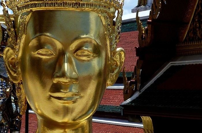
The round trip to Bangkok is almost booked.
Here’s the itinerary I’ve planned for this new trip to Thailand:
Arrival – 2 nights in Bangkok (any hotel recommendations? Very quiet, near Chinatown or by the river)
Train or taxi (which app should I use for Thailand?) to Phetchaburi – 2 nights (any hotel recommendations?)
Daytime train to Surat Thani – 1 night there (any hotel recommendations?)
Pick up the rental car and head to Khao Sok – 1 night there (any hotel recommendations?)
Drive to Ko Kho Khao – 3 nights – relaxation (any hotel recommendations?)
Drive to Phang Nga Bay – 1 night (any base recommendations?)
Excursion in the bay, then drive to Krabi – 2 nights (any hotel recommendations) or any other spot with beautiful, quiet beaches that you might know?
Return to Surat Thani – overnight train to Bangkok, then Ayutthaya (any hotel recommendations?)
Visit the site and transfer to the airport – sniff, time to head back!
If you have other suggestions, keeping in mind the trip’s vibe: beach time without crowds or entertainment, a bit of nature, a bit of culture, no stress... No domestic flights and charming accommodations (not at 150 € per night, even though the budget is reasonable!)
Not sure I’ll follow them all, but all your ideas are welcome! 😉
Thanks. 🙂
Hébergement ou bivouac sur l'EuroVelo 6 Mulhouse-Nevers English translation pending
Cette année, avec l'acquisition d'un nouveau vélo et pas trop l'envie de prendre l'avion, j'ai envie de découvrir la Franche-Comté-Bourgogne à vélo, destination que j'ai souvent traversé en voiture mais que j'aimerais découvrir plus. Ca serait mon 1er voyage en vélo. Je serais seule a priori et j'envisage de partir fin août/début septembre. Je partirais de Strasbourg (en train ou à vélo). Je suis allée sur le site francevelotourisme qui explique vraiment bien chaque étape. J'irais à mon rythme et comme j'ai l'habitude en voyage, me poser quand j'aime un endroit.
Je m'interrogeais sur où dormir. Je n'ai pas forcément envie d'aller dans un hôtel. Je ne veux pas prévoir trop à l'avance un hébergement car je ne sais pas combien de kilomètres je vais faire, si je vais m'arrêter pour profiter d'un endroit...
Pour l'instant, je n'ai aucun matériel de camping. Alors voilà, est-ce qu'il est facile de trouver une chambre d'hôte où tout logement un peu à l'improviste sur ce tronçon ? Est-ce que le camping serait plus facile ? Et est-ce que bivouaquer serait une bonne idée et faisable ?
La solution avec tente me demanderait un investissement de départ (tente et bon matelas !) . Toutefois, l'idée de bivouaquer me séduit bien, car pas besoin de trop réfléchir où dormir ou réserver. Et me réveiller en pleine nature, ça serait top !
Avez-vous de conseils ? Avez-vous déjà fait ce parcours ? Avez-vous de bonnes adresses ?
L'Indre-et-Loire à vélo avec bivouac en 2019 English translation pending
Nous revoici. Cette fois, c’est le département de l'Indre-et-Loire qui est à l’honneur. La même joyeuse équipe, le même état d’esprit. J’ai de nouvelles sacoches sur ma monture. Tout un ensemble orange "Globtrotter". Du coup, j’ai même pu laissé ma sacoche de selle. Mathieu me l’avait offerte il y a quelques années, mais avec mes précédentes sacoches, ça ne passait pas.
Comme vous pouvez le remarquer, si vous me suivez, nous avons sauté une année. Rien de grave, mais un empêchement nous y a contraints. C’est donc avec fébrilité que nous attendions ce moment de retrouvailles joyeuses.
Je suis arrivé à Paris samedi, dimanche nous avons préparé les vélos et les bagages et nous sommes partis lundi, après avoir fait quelques courses. Comme c’est ma première utilisation de mes sacoches, nous avons dû opérer les réglages des attaches, puis répartir le chargement entre elles. Nouvelle organisation.
Voici notre voyage en quelques chiffres.
Durée : 5 jours
Distance : ~ 470 km
Dénivelé : ~ 2800 m D+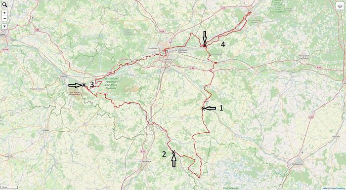
Comme vous pouvez le remarquer, si vous me suivez, nous avons sauté une année. Rien de grave, mais un empêchement nous y a contraints. C’est donc avec fébrilité que nous attendions ce moment de retrouvailles joyeuses.
Je suis arrivé à Paris samedi, dimanche nous avons préparé les vélos et les bagages et nous sommes partis lundi, après avoir fait quelques courses. Comme c’est ma première utilisation de mes sacoches, nous avons dû opérer les réglages des attaches, puis répartir le chargement entre elles. Nouvelle organisation.
Voici notre voyage en quelques chiffres.
Durée : 5 jours
Distance : ~ 470 km
Dénivelé : ~ 2800 m D+
1984: mes premiers treks au Pérou, y compris le Camino Inca English translation pending
J'ai déjà écrit un carnet sur mon premier trek au Népal, en janvier 1983: https://voyageforum.com/discussion/janvier-1983-premier-trek-nepal-d10111100/
En mai 1984, je poursuis mon périple, je n'ai fait aucune longue randonnée depuis le Népal et je voyage maintenant en Amérique latine depuis le Mexique, l'Amerique centrale, la Colombie et l'Equateur. Me voici au Pérou. J'utilise 2 guides de voyage, le South American Handbook de plus de 1000 pages, la 'Bible' pour ce continent et la première édition du Lonely Planet 'South America on a Shoestring', qui inclut des cartes systématiques et une courte description de 2 treks dans la Cordillera Blanca.
LLANGANUCO - SANTA CRUZ
L'actuel trek de Santa Cruz commençait aux lacs de Llanganuco. 6/5 Beau temps, on voit les sommets de 6000 mètres depuis Huaraz. Je transporte toujours ma tente et mon sac de couchage. Je prends le bus pour Yungay, je trouve un collectivo jusqu'aux derniers hameaux en hauteur, et je commence à monter sur la piste. Après 6 kilomètres, coup de chance. Un diplomate hongrois et sa famille en vacances me prennent en 4x4 jusqu'au 2ème lac de Llanganuco à 3860 mètres, avec son eau très verte, la piste devient trop hasardeuse pour continuer en 4x4. Beaucoup de nuages ici. J'établis mon camp 20 minutes plus loin entre 2 torrents. Je fais une ballade un peu plus loin dans la vallée, solitude totale dans le coin. Le soir, la vue s'ouvre sur les sommets blancs. J'ai loué un rechaud à gaz (plus one casserole) à une agence de Huaraz, il est un peu défectueux et je laisse échapper pas mal de gaz en vissant la cartouche, ce qui me met un peu en colère. Je prépare du riz avec un paquet de soupe. Avec le froid et l'altitude, je dors assez mal. 7/5 Je me lève à 6 heures 10, pain et Nescafe. Ma tente est humide, avec une fine couche de glace. A 7 heures 20, je pars, je coupe à travers tout pour rejoindre le grand chemin muletier pour une longue montée, pas trop raide, au col de Portachuelo à 4760 mètres, que j'atteins à 10 heures 10, avec une belle vue sur la face rocheuse Sud du Huandoy et le Huascaran blanc. La toute nouvelle piste fait de nombreux lacets, je vois un camion passer au loin avec les passagers dans la benne. Je cuisine de la soupe à un petit lac en contrebas du col. Je commence une longue descente, sur la piste et les raccourcis par l'ancien chemin, dans la vallée dénudée, avec une pente modérée. La je rattrape 2 autres randonneurs, Sue une Sud Africaine dans la trentaine et son compagnon Jose, un étudiant de Lima, nous allons tous trois bien profiter de cette rencontre fortuite ! Jose souffre du mal de l'altitude, il n'a jamais fait de randonnée et ne pratique même pas de sport, il n'a pas d'argent, il a emprunte des chaussures qui ne lui vont pas, et un sac à dos bricolé et cousu maison. Sue a rencontré Jose à Lima, l'a emmené ici mais le regrette maintenant ! Ma présence va alléger les tensions. Quant à moi, je profiterai du repas et de la soirée dans leur plus grande tente ou on peut s'asseoir à 3. Donc, nous restons ensemble, nous descendons dans l'environnement subit tropical de Huanpampa, passons des fermes et des moutons, évitons Colcabamba pour camper à l'écart. Sue prépare un bon spaghetti le soir, il tombe des greles, ici il ne fait pas très froid. 8/5 Une journée plus reposante après la longue marche d'hier. Nous ne partons qu'a 8 heures, nous marchons sur un faux plat pendant 1 heure 45, puis nous arrêtons pour un excellent porridge. Le ciel change continuellement, soleil, grêle, ... Ensuite cela monte, je prends beaucoup d'avance et je dois attendre les 2 autres. A 3 heures, nous nous arrêtons 300 mètres sous le col, dans un cirque avec une bonne vue sur les sommets enneigés. Le diner est plutôt raté, le riz n'est pas assez cuit. Je me couche tôt, je n'ai pas froid. 9/5 Comme Sue et Jose ne sont pas encore prêts, je pars seul et je monte facilement en une heure au sommet du col de Punta Union, ou je les attends. Des condors planent pas trop loin de moi, et je vois aussi un renard. Du cote Ouest, la vue embrasse le lac bleu Jatuncocha et plusieurs sommets. Nous descendons dans la vallée, le temps est redevenu variable, froid, nous mangeons du porridge comme déjeuner. Je trouve que Jose fait franchement preuve de courage avec son équipement inadapté. Nous parcourons encore quelques kilomètres dans la végétation fleurie, nous pataugeons un peu dans les marais et à 3 heures nous établissons le camp à l'abri dans des arbustes, avant le lac. Après un bon diner de nouilles au thon en boite, il pleut toute la nuit. 10/5 Le temps se dégage le matin. Il nous reste une longue descente de 17 kilomètres dans une vallée luxuriante avec des fleurs et des cascades, même des oiseaux mouches . Aujourd'hui Sue ne se sent pas trop bien et traine loin derrière. La fin est raide, caillouteuse et pénible, le sentier est coupé par des glissements de terrain, je dois contourner l'un d'entre eux en montant 50 mètres au dessus sur des pentes glissantes. A Cashapampa, je prépare de la soupe et j'attends les autres. Nous avons de la chance, un collectivo part encore à 15 heures 45, sur la piste vertigineuse à flanc de coteau. Nous devons descendre et franchir à pied un tronçon trop dangereux. A Carraz, nous changeons de suite pour un bus pullman à destination Lima jusque Huaraz, il s'arrête partout pour charger des passagers. Nous arrivons à 20 heures 15 à Huaraz, épuisés. Nous allons quand même encore diner ensemble au restaurant.
A suivre: le trek Olleros Chavin, le Chemin des Incas
LLANGANUCO - SANTA CRUZ
L'actuel trek de Santa Cruz commençait aux lacs de Llanganuco. 6/5 Beau temps, on voit les sommets de 6000 mètres depuis Huaraz. Je transporte toujours ma tente et mon sac de couchage. Je prends le bus pour Yungay, je trouve un collectivo jusqu'aux derniers hameaux en hauteur, et je commence à monter sur la piste. Après 6 kilomètres, coup de chance. Un diplomate hongrois et sa famille en vacances me prennent en 4x4 jusqu'au 2ème lac de Llanganuco à 3860 mètres, avec son eau très verte, la piste devient trop hasardeuse pour continuer en 4x4. Beaucoup de nuages ici. J'établis mon camp 20 minutes plus loin entre 2 torrents. Je fais une ballade un peu plus loin dans la vallée, solitude totale dans le coin. Le soir, la vue s'ouvre sur les sommets blancs. J'ai loué un rechaud à gaz (plus one casserole) à une agence de Huaraz, il est un peu défectueux et je laisse échapper pas mal de gaz en vissant la cartouche, ce qui me met un peu en colère. Je prépare du riz avec un paquet de soupe. Avec le froid et l'altitude, je dors assez mal. 7/5 Je me lève à 6 heures 10, pain et Nescafe. Ma tente est humide, avec une fine couche de glace. A 7 heures 20, je pars, je coupe à travers tout pour rejoindre le grand chemin muletier pour une longue montée, pas trop raide, au col de Portachuelo à 4760 mètres, que j'atteins à 10 heures 10, avec une belle vue sur la face rocheuse Sud du Huandoy et le Huascaran blanc. La toute nouvelle piste fait de nombreux lacets, je vois un camion passer au loin avec les passagers dans la benne. Je cuisine de la soupe à un petit lac en contrebas du col. Je commence une longue descente, sur la piste et les raccourcis par l'ancien chemin, dans la vallée dénudée, avec une pente modérée. La je rattrape 2 autres randonneurs, Sue une Sud Africaine dans la trentaine et son compagnon Jose, un étudiant de Lima, nous allons tous trois bien profiter de cette rencontre fortuite ! Jose souffre du mal de l'altitude, il n'a jamais fait de randonnée et ne pratique même pas de sport, il n'a pas d'argent, il a emprunte des chaussures qui ne lui vont pas, et un sac à dos bricolé et cousu maison. Sue a rencontré Jose à Lima, l'a emmené ici mais le regrette maintenant ! Ma présence va alléger les tensions. Quant à moi, je profiterai du repas et de la soirée dans leur plus grande tente ou on peut s'asseoir à 3. Donc, nous restons ensemble, nous descendons dans l'environnement subit tropical de Huanpampa, passons des fermes et des moutons, évitons Colcabamba pour camper à l'écart. Sue prépare un bon spaghetti le soir, il tombe des greles, ici il ne fait pas très froid. 8/5 Une journée plus reposante après la longue marche d'hier. Nous ne partons qu'a 8 heures, nous marchons sur un faux plat pendant 1 heure 45, puis nous arrêtons pour un excellent porridge. Le ciel change continuellement, soleil, grêle, ... Ensuite cela monte, je prends beaucoup d'avance et je dois attendre les 2 autres. A 3 heures, nous nous arrêtons 300 mètres sous le col, dans un cirque avec une bonne vue sur les sommets enneigés. Le diner est plutôt raté, le riz n'est pas assez cuit. Je me couche tôt, je n'ai pas froid. 9/5 Comme Sue et Jose ne sont pas encore prêts, je pars seul et je monte facilement en une heure au sommet du col de Punta Union, ou je les attends. Des condors planent pas trop loin de moi, et je vois aussi un renard. Du cote Ouest, la vue embrasse le lac bleu Jatuncocha et plusieurs sommets. Nous descendons dans la vallée, le temps est redevenu variable, froid, nous mangeons du porridge comme déjeuner. Je trouve que Jose fait franchement preuve de courage avec son équipement inadapté. Nous parcourons encore quelques kilomètres dans la végétation fleurie, nous pataugeons un peu dans les marais et à 3 heures nous établissons le camp à l'abri dans des arbustes, avant le lac. Après un bon diner de nouilles au thon en boite, il pleut toute la nuit. 10/5 Le temps se dégage le matin. Il nous reste une longue descente de 17 kilomètres dans une vallée luxuriante avec des fleurs et des cascades, même des oiseaux mouches . Aujourd'hui Sue ne se sent pas trop bien et traine loin derrière. La fin est raide, caillouteuse et pénible, le sentier est coupé par des glissements de terrain, je dois contourner l'un d'entre eux en montant 50 mètres au dessus sur des pentes glissantes. A Cashapampa, je prépare de la soupe et j'attends les autres. Nous avons de la chance, un collectivo part encore à 15 heures 45, sur la piste vertigineuse à flanc de coteau. Nous devons descendre et franchir à pied un tronçon trop dangereux. A Carraz, nous changeons de suite pour un bus pullman à destination Lima jusque Huaraz, il s'arrête partout pour charger des passagers. Nous arrivons à 20 heures 15 à Huaraz, épuisés. Nous allons quand même encore diner ensemble au restaurant.
A suivre: le trek Olleros Chavin, le Chemin des Incas
On remonte le temps: Népal 2000, Camp de base de l'Everest English translation pending
Allez on se retrouve en Asie cette fois pour tutoyer le toit du monde 😛 Là internet commençait à pointer le bout de son nez, VF en 1999 je sais pas si ça existait, en tout cas je ne connaissait pas 🙂. Il y avait la possibilité de partir tout seul et de trouver un guide, des porteurs sur place ..... J'ai préféré passer par un agence spécialisée dans le trekking pour réaliser se voyage !
C'est un voyage de 22 jours que je vais vous conter !
Le groupe est constitué de 15 personnes, dont l'age va de 23 à 62 ans. Mise à part un couple particulièrement pénible tout le monde à fait les efforts nécessaires pour que le voyage se passe bien. Des parties acharnées de Uno tous les soirs ont grandement contribué à la bonne humeur du groupe et des porteurs qui ne comprenaient pas pourquoi un jeu de carte pouvait nous faire autant rire.
Le guide un accompagnateur en haute montagne, c'est en grande partie grâce à lui si le voyage c'est aussi bien passé il a toujours était disponible pour tout le monde et il a su désamorcer tous les petits conflits, inhérent à ce type de voyage, dans l’œuf.
Vendredi 21/04/2000 : Paris Katmandou
Le rendez vous est fixé 20 heures à l'aéroport Charles de Gaulle, pour un décollage à 23h30 la compagnie que nous allons prendre est Pakistan Airlines ce qui est loin d'être le top. Nous partons finalement avec 1 heure de retard. J'adore les consignes qui sont ponctués avec un à la grâce de dieu 🤪, J'ai dormi tout le long du vol, dors du sommeil du juste jusqu'à notre première escale Islamabad, capitale du Pakistan. Maintenant j'ai plus de mal à dormir en avion pas parce que j'en ai peur, mais avec l'age j'ai besoin d'un peux plus de confort 😇
Nous allons prendre notre deuxième avion à destination de Katmandou terminus de notre voyage, bonjour les formalités dans l'aéroport 4 contrôles de passeport et des bagages de soute, alors que nous sommes toujours dans la zone franche. Nous atterrissons à l'aéroport de Katmandou, un court transfert en car nous fait découvrir la ville, les premières impressions sont la pauvreté et la pollution qui entourent la ville, nous finissons par arriver dans un magnifique Hotel, dans le centre de la ville, vers 17 h 50. Le temps de déposer nos affaires, nous descendons manger et direction le lit.
Là vous vous dites quelle mémoire, ben non faut pas croire, j'ai pris des notes pour ce voyage et je les ai encore 🙂
Pour le moment mon record d'altitude ( 5 895 m) va-t-il être battu ? Vous le saurez en me suivant
A demain
C'est un voyage de 22 jours que je vais vous conter !
Le groupe est constitué de 15 personnes, dont l'age va de 23 à 62 ans. Mise à part un couple particulièrement pénible tout le monde à fait les efforts nécessaires pour que le voyage se passe bien. Des parties acharnées de Uno tous les soirs ont grandement contribué à la bonne humeur du groupe et des porteurs qui ne comprenaient pas pourquoi un jeu de carte pouvait nous faire autant rire.
Le guide un accompagnateur en haute montagne, c'est en grande partie grâce à lui si le voyage c'est aussi bien passé il a toujours était disponible pour tout le monde et il a su désamorcer tous les petits conflits, inhérent à ce type de voyage, dans l’œuf.
Vendredi 21/04/2000 : Paris Katmandou
Le rendez vous est fixé 20 heures à l'aéroport Charles de Gaulle, pour un décollage à 23h30 la compagnie que nous allons prendre est Pakistan Airlines ce qui est loin d'être le top. Nous partons finalement avec 1 heure de retard. J'adore les consignes qui sont ponctués avec un à la grâce de dieu 🤪, J'ai dormi tout le long du vol, dors du sommeil du juste jusqu'à notre première escale Islamabad, capitale du Pakistan. Maintenant j'ai plus de mal à dormir en avion pas parce que j'en ai peur, mais avec l'age j'ai besoin d'un peux plus de confort 😇
Nous allons prendre notre deuxième avion à destination de Katmandou terminus de notre voyage, bonjour les formalités dans l'aéroport 4 contrôles de passeport et des bagages de soute, alors que nous sommes toujours dans la zone franche. Nous atterrissons à l'aéroport de Katmandou, un court transfert en car nous fait découvrir la ville, les premières impressions sont la pauvreté et la pollution qui entourent la ville, nous finissons par arriver dans un magnifique Hotel, dans le centre de la ville, vers 17 h 50. Le temps de déposer nos affaires, nous descendons manger et direction le lit.
Là vous vous dites quelle mémoire, ben non faut pas croire, j'ai pris des notes pour ce voyage et je les ai encore 🙂
Pour le moment mon record d'altitude ( 5 895 m) va-t-il être battu ? Vous le saurez en me suivant
A demain
Votre avis sur futur road trip dans l'Ouest américain en famille avec ado English translation pending
Bonjour à tous,
Tout d'abord merci à ceux qui prendront le temps de lire ce long message (désolée) et pourront m'apporter leurs conseils avisés.
Je prépare "the" voyage de ma vie auquel je rêve depuis un certain temps maintenant et qui commence à se préciser : circuit dans l'ouest américain. Voyage que nous souhaitons partager avec nos enfants qui auront alors 22, 18 et 15 ans. Juillet 2021 ou 2022. J'essaye donc de concilier nos envies (surtout les miennes 😉) en tenant compte que certains de mes enfants ne voudront probablement pas passer trop de temps sur la route ou dans les parcs nationaux et que je souhaite voir néanmoins un maximum de choses et endroits différents. Pour information, nous n'avons jamais fait de grand voyage, juste un petit voyage avec mon mari il y a quelques années à new york. Nous ne sommes pas très sportifs et aventuriers mais j'ai envie de me lancer et j'emmènerai toute ma tribu avec moi.
Voilà le programme envisagé, merci de votre avis en fonction de vos connaissances sur le sujet, vos conseils sur des lieux que je pourrai supprimer pour en voir d'autres plus intéressants ou en intégrer d'autres... des endroits atypiques pour y dormir que je n'ai pas forcément trouvé près de nos lieux de passage ... merci par avance.
J 1 et 2 : LOS ANGELES (2 nuits) - récupération voiture de location (suv) à l'aéroport - 2 nuits sur sunset boulevard (sunset trip) - visites : panneau hollywood, griffIth parc et l'observatoire, hollywood boulevard, walf of fame, chinese theater - le reste (en fin de séjour) J 3 : LOS ANGELES -> KINGMAN via la route 66 550 km (6 heures de route) - arrêt à calico ghost town pour déjeuner au calico house restaurant si possible - passage bagdad cafe - Oatman en milieu d'après-midi avec gouter ou un verre à oatman hotel - cool spring station - sitgreaves pass - arrivée pour la soirée et nuit à kingman J 4 : KINGMAN -> GRAND CANYON 300 kms 3h30 de route - hackberry - seligman - Williams pour le déjeuner - Tusayan pour vol helicoptere du grand canyon en fin d'après-midi - nuit à grand canyon village J5 : grand canyon -> monument valley 280 kms - 3h30 de route - le matin : balade et pique nique le midi au grand canyon (south rim trail) - départ l'après-midi :vers monument valleyr via la desert view drive - nuit à monument valley J6 : monument valley -> page (2 nuits) 200 kms - 2h30 de route - matin : piste monument valley en voiture - puis départ vers page J7 : PAGE pas de route - visite antelope canyon le matin (upper vers 11h) : votre avis sur lower et upper car j'ai vraiment un doute (lower est-il plus beau que upper ? néanmoins, les commentaires et la foule sur lower ne m'attire pas mais je voudrais visiter le plus beau des 2 ?) - après-midi repos au lac powell avec location bateau - soirée : horseshoe bend (peut-on y pique niquer ?) J8 : Page -> Bryce canyon 240 kms - 2h35 de route - the wave : pas possible pour nous car nous ne sommes pas sportifs ? votre avis (+ tirage au sort) - visite de kanab - bryce canyon l'après-midi (queen garden trail) - nuit à bryce canyon city avec spectacle en soirée de rodéo J9 : Bryce canyon -> Las vegas (2 nuits) 400 kms - 4h30 de route - passage via zion park, je n'ai pas prévu d'arrêt long car je pense que les jeunes en auront marre et seront pressés d'arriver à las vegas, par ailleurs, une fois encore, nous ne sommes pas de grands aventuriers et sportifs dans la famille ??? votre avis - nuit à las vegas sur le strip J10 : visite las vegas (pas de route) - las vegas sign - boutique M et M's - shopping à the venitian - stratosphere tower - pawn star soirées : fontaines du bellagio, mirage volcano, fremont street et éventuelleent mini golf kiss by monster au rio hotel J 11 : las vegas -> los angeles (santa monica) pour 3 ou 4 nuits 480 kms 4h30 ou 6h30 de route - nelson ghost town pour photos (mais rallonge la route de 2h, votre avis ???) - arrêt à Baker pour le déjeuner avec passage au alien fresh jerky - barstow outlet : pour les jeunes 😕 - arrivée et nuit à santa monica en soirée pour repos fin de séjour J12 à 15 : santa monica LOS ANGELES - rodeo drive et beverly hills si non fait au départ du séjour - studios universal - mulholland drive - venice canals et beach bordwalk (en journée) - balade highway 1 jusqu'à malibu (el matador state beach) - soirées à santa monica
merci à vous
Tout d'abord merci à ceux qui prendront le temps de lire ce long message (désolée) et pourront m'apporter leurs conseils avisés.
Je prépare "the" voyage de ma vie auquel je rêve depuis un certain temps maintenant et qui commence à se préciser : circuit dans l'ouest américain. Voyage que nous souhaitons partager avec nos enfants qui auront alors 22, 18 et 15 ans. Juillet 2021 ou 2022. J'essaye donc de concilier nos envies (surtout les miennes 😉) en tenant compte que certains de mes enfants ne voudront probablement pas passer trop de temps sur la route ou dans les parcs nationaux et que je souhaite voir néanmoins un maximum de choses et endroits différents. Pour information, nous n'avons jamais fait de grand voyage, juste un petit voyage avec mon mari il y a quelques années à new york. Nous ne sommes pas très sportifs et aventuriers mais j'ai envie de me lancer et j'emmènerai toute ma tribu avec moi.
Voilà le programme envisagé, merci de votre avis en fonction de vos connaissances sur le sujet, vos conseils sur des lieux que je pourrai supprimer pour en voir d'autres plus intéressants ou en intégrer d'autres... des endroits atypiques pour y dormir que je n'ai pas forcément trouvé près de nos lieux de passage ... merci par avance.
J 1 et 2 : LOS ANGELES (2 nuits) - récupération voiture de location (suv) à l'aéroport - 2 nuits sur sunset boulevard (sunset trip) - visites : panneau hollywood, griffIth parc et l'observatoire, hollywood boulevard, walf of fame, chinese theater - le reste (en fin de séjour) J 3 : LOS ANGELES -> KINGMAN via la route 66 550 km (6 heures de route) - arrêt à calico ghost town pour déjeuner au calico house restaurant si possible - passage bagdad cafe - Oatman en milieu d'après-midi avec gouter ou un verre à oatman hotel - cool spring station - sitgreaves pass - arrivée pour la soirée et nuit à kingman J 4 : KINGMAN -> GRAND CANYON 300 kms 3h30 de route - hackberry - seligman - Williams pour le déjeuner - Tusayan pour vol helicoptere du grand canyon en fin d'après-midi - nuit à grand canyon village J5 : grand canyon -> monument valley 280 kms - 3h30 de route - le matin : balade et pique nique le midi au grand canyon (south rim trail) - départ l'après-midi :vers monument valleyr via la desert view drive - nuit à monument valley J6 : monument valley -> page (2 nuits) 200 kms - 2h30 de route - matin : piste monument valley en voiture - puis départ vers page J7 : PAGE pas de route - visite antelope canyon le matin (upper vers 11h) : votre avis sur lower et upper car j'ai vraiment un doute (lower est-il plus beau que upper ? néanmoins, les commentaires et la foule sur lower ne m'attire pas mais je voudrais visiter le plus beau des 2 ?) - après-midi repos au lac powell avec location bateau - soirée : horseshoe bend (peut-on y pique niquer ?) J8 : Page -> Bryce canyon 240 kms - 2h35 de route - the wave : pas possible pour nous car nous ne sommes pas sportifs ? votre avis (+ tirage au sort) - visite de kanab - bryce canyon l'après-midi (queen garden trail) - nuit à bryce canyon city avec spectacle en soirée de rodéo J9 : Bryce canyon -> Las vegas (2 nuits) 400 kms - 4h30 de route - passage via zion park, je n'ai pas prévu d'arrêt long car je pense que les jeunes en auront marre et seront pressés d'arriver à las vegas, par ailleurs, une fois encore, nous ne sommes pas de grands aventuriers et sportifs dans la famille ??? votre avis - nuit à las vegas sur le strip J10 : visite las vegas (pas de route) - las vegas sign - boutique M et M's - shopping à the venitian - stratosphere tower - pawn star soirées : fontaines du bellagio, mirage volcano, fremont street et éventuelleent mini golf kiss by monster au rio hotel J 11 : las vegas -> los angeles (santa monica) pour 3 ou 4 nuits 480 kms 4h30 ou 6h30 de route - nelson ghost town pour photos (mais rallonge la route de 2h, votre avis ???) - arrêt à Baker pour le déjeuner avec passage au alien fresh jerky - barstow outlet : pour les jeunes 😕 - arrivée et nuit à santa monica en soirée pour repos fin de séjour J12 à 15 : santa monica LOS ANGELES - rodeo drive et beverly hills si non fait au départ du séjour - studios universal - mulholland drive - venice canals et beach bordwalk (en journée) - balade highway 1 jusqu'à malibu (el matador state beach) - soirées à santa monica
merci à vous
Conseils itinéraire pour l'île du Sud en avril (Nouvelle-Zélande) English translation pending
Bonjour,
Nous partons en famille en avril en Nouvelle Zélande, nous avons 18j sur place. Nous aimerions faire un mélange voiture + hotel et camping car. Je sollicite votre aide et vos avis de connaisseurs 🙂 j'ai fait 2 itinéraires. Ma question est de savoir si c'est une erreur de faire l'impasse sur la côte ouest (cap foulwding, pancake rock, hokitika, Franz joseph, Thunder creek)
1ere idée : en voiture 6j île nord puis traversée => 2 j Abel tasman => 1j Kaikoura => 1j prise camping car à Chrischurch => 1j lac Tekapo => 2j mont Cook, Hooker valley track, Pukaki => 1j Dunedin peninsule Otago => 1 J wanaka => 1 j Milford sound => 1j queenstown retour camping car vol vers auckland
2ème idée (avec plus de route) : en voiture 6j île nord puis traversée => 2 j Abel tasman => 1j Kaikoura => 1j prise camping car à Chrischurch =>Hokitika => 1j Franz joseph glacier (avec plusieurs arrêts sur la route entre queenstown et le glacier : Blue pools , thunder creek fall, lac matheson ) => 1j wanaka = =>1j Queenstown puis route vers milford sound =>1j Milford Sound => 1 J peninsule d’otago mourraki boulders, Katiki point (manchot à œil jaune) =>1J Mount cook Hooker valley track, Pukaki lake, Tekapo =>1j Akaroa , retour camping car Chrischurch vol vers Auckland puis retour.
Q Qu'en pensez vous merci de votre aide.
Nous partons en famille en avril en Nouvelle Zélande, nous avons 18j sur place. Nous aimerions faire un mélange voiture + hotel et camping car. Je sollicite votre aide et vos avis de connaisseurs 🙂 j'ai fait 2 itinéraires. Ma question est de savoir si c'est une erreur de faire l'impasse sur la côte ouest (cap foulwding, pancake rock, hokitika, Franz joseph, Thunder creek)
1ere idée : en voiture 6j île nord puis traversée => 2 j Abel tasman => 1j Kaikoura => 1j prise camping car à Chrischurch => 1j lac Tekapo => 2j mont Cook, Hooker valley track, Pukaki => 1j Dunedin peninsule Otago => 1 J wanaka => 1 j Milford sound => 1j queenstown retour camping car vol vers auckland
2ème idée (avec plus de route) : en voiture 6j île nord puis traversée => 2 j Abel tasman => 1j Kaikoura => 1j prise camping car à Chrischurch =>Hokitika => 1j Franz joseph glacier (avec plusieurs arrêts sur la route entre queenstown et le glacier : Blue pools , thunder creek fall, lac matheson ) => 1j wanaka = =>1j Queenstown puis route vers milford sound =>1j Milford Sound => 1 J peninsule d’otago mourraki boulders, Katiki point (manchot à œil jaune) =>1J Mount cook Hooker valley track, Pukaki lake, Tekapo =>1j Akaroa , retour camping car Chrischurch vol vers Auckland puis retour.
Q Qu'en pensez vous merci de votre aide.
Retour d'un voyage à vélo autour du Sri Lanka English translation pending
Je viens de rentrer d'un voyage à vélo de 26 jours au Sri Lanka, entre mi-janvier et mi-février 2020. Je résume ci-dessous quelques détails pratiques de cette randonnée.
1. Quand partir ? Arrivée - le climat - Avant de partir, il faut demander un visa électronique (ETA, Electronic Travel Authorization) sur le site https://www.eta.gov.lk/slvisa/visainfo/center.jsp (attention, il y a d'autres sites répertoriés de type phishing sur Google). Le visa était gratuit pour les Suisses, au moins jusqu'à fin février 2020 (point à vérifier, cette mesure étant provisoire pour encourager le tourisme au Sri Lanka après les attentats de 2019); il est délivré à l'aéroport pour un mois. - A l'arrivée à l'aéroport de Colombo, il n'y a aucun problème pour faire passer à la douane le vélo dans son carton. Il y a plusieurs guichets de change après la porte des arrivées; il y a aussi un seul distributeur de billets, et une queue d'une quarantaine de mètres de touristes pour retirer des roupies (il est beaucoup plus rapide de changer des francs suisses ou des euros à un des guichets, quitte à s'approvisionner plus tard à un des distributeurs en ville). Il y a aussi un guichet de la compagnie de téléphone Dialog (qui a une excellente couverture réseau du pays), où on peut acheter pour moins de 10 francs suisses une carte SIM locale valable un mois, prépayée avec 10 GB de données et un crédit (rechargeable) pour les conversations locales (crédit initial que je n'ai pas consommé entièrement pendant mon séjour).- J'ai pris un hôtel à Negombo, hôtelqui avait accepté par avance de me garder le carton du vélo pour le retour (hôtel Blue Bird). il est utile de noter que le quartier où se trouve les hôtels en bord de mer à Negombo est à 3 km du centre de la ville, qui est plus à l'intérieur des terres (prendre la route qui démarre au carrefour où il y a une statue de dauphin, éventuellement demander où se trouve le Burger King : les restaurants sont nettement plus authentiques dans le centre de la ville; par ailleurs on y trouve un assortiment de thés au supermarché Arpico à des prix sri lankais). - En janvier-février la mousson est localisée sur la côte Est (bien qu'en début 2020 celle-ci était plutôt faible), où c'est alors la basse saison touristique : j'ai donc fait l'impasse sur cette région. Sur mon trajet au centre de l'île et sur les côtes sud et ouest, je n'ai eu qu'une demi-journée d'averses en arrivant à Kandy. L'inverse serait vrai à partir d'avril, avec un climat plus favorable sur la côte Est. D'une façon générale le climat est plus contrasté dans les montagnes du centre vers les plantations de thé, avec des pluies plus fréquentes. Il a fait très chaud pendant presque tout le trajet, à l'exception de la partie autour des plantations de thé vers Nuwara Eliya et Ella. Sur le vélo, la température dépasse 35 degrés entre midi et 16h; les étapes ont donc été raccourcies avec une durée de pédalage d'environ 4-5h, pour arriver à l'étape autour de midi (après un départ avec le lever du soleil vers 7h).
2. Les conditions de circulation à vélo - l'hébergement Le revêtement des routes principales est en général en excellent état. Il n'y a aucun espace dédié aux vélos, et il faut partager, quand il existe, un petit espace réservé pour les piétons et marqué par une bande blanche. Le revêtement des routes secondaires est moins prévisible, mais plutôt mauvais. Celles-ci ont moins de trafic, mais sont plus étroites (le résultat final est que la densité de trafic ne change pas beaucoup, même s'il y a des exceptions). Mon trajet a suivi dans sa presque totalité les routes principales. Les conditions de circulation sont chaotiques, et on doit pédaler avec le principe de l'évitement continu. Il est remarquable que, malgré la densité du trafic et la façon de conduire des locaux, il y a peu de carrosseries cabossées. Le plus simple, pour comprendre la façon de circuler, c'est de prendre un tuk-tuk en ville, et d'observer la façon dont le chauffeur se faufile en klaxonnant dans le trafic : il occupe la place libre qu'il a devant lui s'il peut le faire sans abîmer son véhicule, et sans égard à ce qui se passe autour de lui. Les sorties des écoles peuvent être très embouteillées. Le danger principal vient des autobus, qu'ils soient gouvernementaux (couleur rouge), ou privés (couleur plutôt dans le bleu). Dans les deux cas, les chauffeurs récupèrent une partie variable des excédents de recettes une fois la cible quotidienne de ventes atteinte; ils mâchent souvent de la noix de bétel, pour résister à la fatigue (on voit ainsi des bus doubler d'autres bus à 80 km/h, en passant la ligne continue en plein centre d'un village). Ils s'arrêteront n'importe où à chaque fois qu'un piéton fait signe, sauf si celui-ci a des bagages (par exemple un vélo) qui feront perdre du temps au chauffeur pour le chargement en route. On peut négocier pour charger son vélo à la station de départ du bus en ville; le coût se fait à la tête du client (j'ai fait le retour de Jaffna à Kandy en bus, cela m'a coûté 3'000 roupies, soit 17 francs suisses; j'ai probablement payé 4 à 5 fois plus que les locaux). A part l'étape Anuradhampura- Thirumurikandy, la seule où le ravitaillement en boisson et en nourriture peut s'avérer délicat (la population étant clairsemée dans cette région), il n'y a aucun problème pour se ravitailler tout au long du pays. On trouve des lieux d'hébergement sans problèmes, sauf pour la section Anuradhampura- Thirumurikandy comme on vient de le voir. A noter que le mot Hotel, au bord des routes, veut principalement dire Restaurant, un peu du genre des haltes-restaurants pour routiers en Europe : il y a rarement des possibilités d'hébergement dans ces établissements. Je n'ai pas vu de camping sur le chemin; le pays étant densément peuplé, le camping sauvage me semble limité. J'ai pris un sac de couchage léger que je n'ai finalement jamais utilisé, et que je n'aurai pas pu utiliser si le besoin s'était avéré : il fait trop chaud (25 degrés la nuit, sauf dans les montagnes centrales). Un liner ("sac à viande") suffit largement. A noter qu'il y a des moustiques à-peu-près partout (moins à Nuwara Eliya et Ella), que les lois darwiniennes les ont sélectionné pour repérer la plus petite déchirure dans la moustiquaire.
3. Le trajet
Après une petite exploration de la côte au nord et au sud de Negombo, la décision a été d'éviter la route vers Puttalam et d'aller directement à l'Est sur Kandy. Puis direction nord pour voir Dambulla, le rocher de Sigiriya et les temples d'Anuradhampura. L'arrivée sur Kandy est une montée, au cours de laquelle on passe presque du niveau de la mer à environ 600 m d'altitude. L'étape Anuradhampura - Jaffna est à-peu-près plate, et a été effectuée en deux jours, avec le plus long trajet du voyage, soit 130 kms pour la première partie, jusqu'au village de Thirumurikandy (premier motel après Vavuniya). Il n'y a pas d'abri et peu d'arbres pour s'abriter de la chaleur dans cette étape, elle-même parfaitement monotone. Le retour sur Kandy a été fait en bus, avec un départ à 5h30 et une arrivée à 14h. A la lecture des informations sur Internet, il m'a semblé qu'il fallait suivre grosso modo la ligne de chemin de fer qui monte de Kandy vers Nuwara Eliya, en passant par Nawalapitiya et Hatton. Cette route s'est avérée vraiment magnifique, même si je n'ai pas d'élément de comparaison avec la route directe de Kandy à Nuwara Eliya. La montée se fait par paliers sur 74 kms, avec des passages à moins de 10% jusqu'au village de Talawakalle. Là les choses se corsent, avec des passages à 15% sur plusieurs centaines de mètres jusqu'à l'arrivée à Nuwara Eliya (l'hôtel était à 1'950 m d'altitude). C'est l'étape la plus physique de tout le circuit, avec un dénivelé positif de 2'562 m (mais elle valait largement le coup). Nuwara Eliya et l'étape suivante, Ella, sont des petites villes qui ont partiellement artificiellement grandi à cause du tourisme : il y a du monde, et les prix s'en ressentent. J'ai fait le trajet jusqu'à Haputale, puis Lipton's Seat, en train puis en tuktuk (le premier train du matin à 6h permet de voir la montagne sortir de la brume, et d'arriver avant les bus de touristes). Il pourrait se faire à vélo, mais avec avec un gros dénivelé entre Haputale et Lipton's Seat, sur une route défoncée. La descente sur Hambantota et la côte sud est assez monotone après Wellawaya. Puis depuis Hambantota jusqu'à Merissa, puis jusqu'à Colombo, la route est presque parfaitement plate (il y a bien un col à 40 m d'altitude sur le chemin). On ne voit la mer de façon intermittente qu'entre Merissa et Indurawa. La côte est entièrement construite entre Bentota et Colombo, puis Negombo. Il faut noter qu'il y a peu de plages "baignables" à l'époque où j'ai visité ces côtes sud et ouest : la mer y est souvent grosse, avec beaucoup de vent, en particulier l'après-midi. Merissa est une baie plus protégée (d'où son succès et la densité de touristes...et d'hôtels). Les plages sont souvent sales près des villes. Finalement la traversée de Colombo en vélo n'est pas triste.
3. En conclusion : La partie du trajet au nord de Dambulla a été pour moi de peu d'intérêt. Les temples dispersés autour de Anuradhampura, ainsi que les vagues ruines ici et là, n'ont que peu d'intérêt pour moi, et je les aurai évité si c'était à refaire. La même chose pour Jaffna et sa région, dont une partie de la côte est restée zone militaire interdite d'accès. Si c'était à refaire, je choisirai d'atterrir pour les premiers jours à Induruwa, qui est une belle plage tranquille à une dizaine de kilomètres au sud de Bentota, et certainement plus attirante que Negombo. Les hôtels locaux organisent les transferts depuis l'aéroport de Colombo pour 10'000 roupies (environ 60 francs suisses).
Le Sri Lanka est le pays du sourire : j'ai partout été gratifié de visages qui s'illuminait quand on les salue. En dehors évidemment des routes, je ne me suis jamais senti en insécurité. La partie hébergements-nourriture-accès aux sites touristiques m'est revenu à 30 francs suisses en moyenne par jour, pour 26 jours et 18 étapes pour un total de 1'196 km. Une visite de 15 jours - 3 semaines vaut la peine, à moduler en fonction du climat prévalent pendant la période de l'année où se fera la visite.
1. Quand partir ? Arrivée - le climat - Avant de partir, il faut demander un visa électronique (ETA, Electronic Travel Authorization) sur le site https://www.eta.gov.lk/slvisa/visainfo/center.jsp (attention, il y a d'autres sites répertoriés de type phishing sur Google). Le visa était gratuit pour les Suisses, au moins jusqu'à fin février 2020 (point à vérifier, cette mesure étant provisoire pour encourager le tourisme au Sri Lanka après les attentats de 2019); il est délivré à l'aéroport pour un mois. - A l'arrivée à l'aéroport de Colombo, il n'y a aucun problème pour faire passer à la douane le vélo dans son carton. Il y a plusieurs guichets de change après la porte des arrivées; il y a aussi un seul distributeur de billets, et une queue d'une quarantaine de mètres de touristes pour retirer des roupies (il est beaucoup plus rapide de changer des francs suisses ou des euros à un des guichets, quitte à s'approvisionner plus tard à un des distributeurs en ville). Il y a aussi un guichet de la compagnie de téléphone Dialog (qui a une excellente couverture réseau du pays), où on peut acheter pour moins de 10 francs suisses une carte SIM locale valable un mois, prépayée avec 10 GB de données et un crédit (rechargeable) pour les conversations locales (crédit initial que je n'ai pas consommé entièrement pendant mon séjour).- J'ai pris un hôtel à Negombo, hôtelqui avait accepté par avance de me garder le carton du vélo pour le retour (hôtel Blue Bird). il est utile de noter que le quartier où se trouve les hôtels en bord de mer à Negombo est à 3 km du centre de la ville, qui est plus à l'intérieur des terres (prendre la route qui démarre au carrefour où il y a une statue de dauphin, éventuellement demander où se trouve le Burger King : les restaurants sont nettement plus authentiques dans le centre de la ville; par ailleurs on y trouve un assortiment de thés au supermarché Arpico à des prix sri lankais). - En janvier-février la mousson est localisée sur la côte Est (bien qu'en début 2020 celle-ci était plutôt faible), où c'est alors la basse saison touristique : j'ai donc fait l'impasse sur cette région. Sur mon trajet au centre de l'île et sur les côtes sud et ouest, je n'ai eu qu'une demi-journée d'averses en arrivant à Kandy. L'inverse serait vrai à partir d'avril, avec un climat plus favorable sur la côte Est. D'une façon générale le climat est plus contrasté dans les montagnes du centre vers les plantations de thé, avec des pluies plus fréquentes. Il a fait très chaud pendant presque tout le trajet, à l'exception de la partie autour des plantations de thé vers Nuwara Eliya et Ella. Sur le vélo, la température dépasse 35 degrés entre midi et 16h; les étapes ont donc été raccourcies avec une durée de pédalage d'environ 4-5h, pour arriver à l'étape autour de midi (après un départ avec le lever du soleil vers 7h).
2. Les conditions de circulation à vélo - l'hébergement Le revêtement des routes principales est en général en excellent état. Il n'y a aucun espace dédié aux vélos, et il faut partager, quand il existe, un petit espace réservé pour les piétons et marqué par une bande blanche. Le revêtement des routes secondaires est moins prévisible, mais plutôt mauvais. Celles-ci ont moins de trafic, mais sont plus étroites (le résultat final est que la densité de trafic ne change pas beaucoup, même s'il y a des exceptions). Mon trajet a suivi dans sa presque totalité les routes principales. Les conditions de circulation sont chaotiques, et on doit pédaler avec le principe de l'évitement continu. Il est remarquable que, malgré la densité du trafic et la façon de conduire des locaux, il y a peu de carrosseries cabossées. Le plus simple, pour comprendre la façon de circuler, c'est de prendre un tuk-tuk en ville, et d'observer la façon dont le chauffeur se faufile en klaxonnant dans le trafic : il occupe la place libre qu'il a devant lui s'il peut le faire sans abîmer son véhicule, et sans égard à ce qui se passe autour de lui. Les sorties des écoles peuvent être très embouteillées. Le danger principal vient des autobus, qu'ils soient gouvernementaux (couleur rouge), ou privés (couleur plutôt dans le bleu). Dans les deux cas, les chauffeurs récupèrent une partie variable des excédents de recettes une fois la cible quotidienne de ventes atteinte; ils mâchent souvent de la noix de bétel, pour résister à la fatigue (on voit ainsi des bus doubler d'autres bus à 80 km/h, en passant la ligne continue en plein centre d'un village). Ils s'arrêteront n'importe où à chaque fois qu'un piéton fait signe, sauf si celui-ci a des bagages (par exemple un vélo) qui feront perdre du temps au chauffeur pour le chargement en route. On peut négocier pour charger son vélo à la station de départ du bus en ville; le coût se fait à la tête du client (j'ai fait le retour de Jaffna à Kandy en bus, cela m'a coûté 3'000 roupies, soit 17 francs suisses; j'ai probablement payé 4 à 5 fois plus que les locaux). A part l'étape Anuradhampura- Thirumurikandy, la seule où le ravitaillement en boisson et en nourriture peut s'avérer délicat (la population étant clairsemée dans cette région), il n'y a aucun problème pour se ravitailler tout au long du pays. On trouve des lieux d'hébergement sans problèmes, sauf pour la section Anuradhampura- Thirumurikandy comme on vient de le voir. A noter que le mot Hotel, au bord des routes, veut principalement dire Restaurant, un peu du genre des haltes-restaurants pour routiers en Europe : il y a rarement des possibilités d'hébergement dans ces établissements. Je n'ai pas vu de camping sur le chemin; le pays étant densément peuplé, le camping sauvage me semble limité. J'ai pris un sac de couchage léger que je n'ai finalement jamais utilisé, et que je n'aurai pas pu utiliser si le besoin s'était avéré : il fait trop chaud (25 degrés la nuit, sauf dans les montagnes centrales). Un liner ("sac à viande") suffit largement. A noter qu'il y a des moustiques à-peu-près partout (moins à Nuwara Eliya et Ella), que les lois darwiniennes les ont sélectionné pour repérer la plus petite déchirure dans la moustiquaire.
3. Le trajet
Après une petite exploration de la côte au nord et au sud de Negombo, la décision a été d'éviter la route vers Puttalam et d'aller directement à l'Est sur Kandy. Puis direction nord pour voir Dambulla, le rocher de Sigiriya et les temples d'Anuradhampura. L'arrivée sur Kandy est une montée, au cours de laquelle on passe presque du niveau de la mer à environ 600 m d'altitude. L'étape Anuradhampura - Jaffna est à-peu-près plate, et a été effectuée en deux jours, avec le plus long trajet du voyage, soit 130 kms pour la première partie, jusqu'au village de Thirumurikandy (premier motel après Vavuniya). Il n'y a pas d'abri et peu d'arbres pour s'abriter de la chaleur dans cette étape, elle-même parfaitement monotone. Le retour sur Kandy a été fait en bus, avec un départ à 5h30 et une arrivée à 14h. A la lecture des informations sur Internet, il m'a semblé qu'il fallait suivre grosso modo la ligne de chemin de fer qui monte de Kandy vers Nuwara Eliya, en passant par Nawalapitiya et Hatton. Cette route s'est avérée vraiment magnifique, même si je n'ai pas d'élément de comparaison avec la route directe de Kandy à Nuwara Eliya. La montée se fait par paliers sur 74 kms, avec des passages à moins de 10% jusqu'au village de Talawakalle. Là les choses se corsent, avec des passages à 15% sur plusieurs centaines de mètres jusqu'à l'arrivée à Nuwara Eliya (l'hôtel était à 1'950 m d'altitude). C'est l'étape la plus physique de tout le circuit, avec un dénivelé positif de 2'562 m (mais elle valait largement le coup). Nuwara Eliya et l'étape suivante, Ella, sont des petites villes qui ont partiellement artificiellement grandi à cause du tourisme : il y a du monde, et les prix s'en ressentent. J'ai fait le trajet jusqu'à Haputale, puis Lipton's Seat, en train puis en tuktuk (le premier train du matin à 6h permet de voir la montagne sortir de la brume, et d'arriver avant les bus de touristes). Il pourrait se faire à vélo, mais avec avec un gros dénivelé entre Haputale et Lipton's Seat, sur une route défoncée. La descente sur Hambantota et la côte sud est assez monotone après Wellawaya. Puis depuis Hambantota jusqu'à Merissa, puis jusqu'à Colombo, la route est presque parfaitement plate (il y a bien un col à 40 m d'altitude sur le chemin). On ne voit la mer de façon intermittente qu'entre Merissa et Indurawa. La côte est entièrement construite entre Bentota et Colombo, puis Negombo. Il faut noter qu'il y a peu de plages "baignables" à l'époque où j'ai visité ces côtes sud et ouest : la mer y est souvent grosse, avec beaucoup de vent, en particulier l'après-midi. Merissa est une baie plus protégée (d'où son succès et la densité de touristes...et d'hôtels). Les plages sont souvent sales près des villes. Finalement la traversée de Colombo en vélo n'est pas triste.
3. En conclusion : La partie du trajet au nord de Dambulla a été pour moi de peu d'intérêt. Les temples dispersés autour de Anuradhampura, ainsi que les vagues ruines ici et là, n'ont que peu d'intérêt pour moi, et je les aurai évité si c'était à refaire. La même chose pour Jaffna et sa région, dont une partie de la côte est restée zone militaire interdite d'accès. Si c'était à refaire, je choisirai d'atterrir pour les premiers jours à Induruwa, qui est une belle plage tranquille à une dizaine de kilomètres au sud de Bentota, et certainement plus attirante que Negombo. Les hôtels locaux organisent les transferts depuis l'aéroport de Colombo pour 10'000 roupies (environ 60 francs suisses).
Le Sri Lanka est le pays du sourire : j'ai partout été gratifié de visages qui s'illuminait quand on les salue. En dehors évidemment des routes, je ne me suis jamais senti en insécurité. La partie hébergements-nourriture-accès aux sites touristiques m'est revenu à 30 francs suisses en moyenne par jour, pour 26 jours et 18 étapes pour un total de 1'196 km. Une visite de 15 jours - 3 semaines vaut la peine, à moduler en fonction du climat prévalent pendant la période de l'année où se fera la visite.
Discussion du concours photo du mois de janvier 2020: Allons à la pêche! English translation pending
Voici le lieu idéal et recommandé pour parler de photo, de pêche, de photos de pêche !
🙂
🙂
Concours photo du mois de janvier 2020: Allons à la pêche! English translation pending
Meilleurs vœux à tous pour cette nouvelle année !
Je vous propose de commencer 2020 par un concours dont le thème est la pêche. Ainsi, vos photos pourront faire apparaitre des scènes de pêche en mer, en rivière, en lac, industrielle ou non, des hameçons, des pêcheurs à pied, en bateau, avec canne, filet, carrelets... Bref, tout l'univers de la pêche pourra être représenté sans pour autant tomber dans la poissonnerie (à savoir des étals de poissons). C'est davantage l'activité même qui nous intéresse ici.
Dépôt des photos jusqu’au mercredi 22 janvier minuit. Vous pouvez poster jusqu’à 3 photos, numérotées et postées dans des messages différents, accompagnées d’un petit descriptif (lieu, anecdote...)
Vote du jeudi 23 janvier au jeudi 30 janvier minuit. Merci d’indiquer le numéro de la photo, le pseudo et le nombre de points attribués. Photo n°1 = 3 pts Photo n°2 = 2 pts Photo n°3 = 1 pt Tous les membres de VF peuvent voter (même ceux qui n’ont pas déposé de photos).
En cas d’égalité de points pour la première position, la photo gagnante sera celle ayant obtenu le plus grand nombre de 1ères places, puis de secondes places ! L’heureux (se) gagnant(e) devra organiser le concours photo de février 2020.
La discussion, c'est par là
3,2,1 Partez !
Je vous propose de commencer 2020 par un concours dont le thème est la pêche. Ainsi, vos photos pourront faire apparaitre des scènes de pêche en mer, en rivière, en lac, industrielle ou non, des hameçons, des pêcheurs à pied, en bateau, avec canne, filet, carrelets... Bref, tout l'univers de la pêche pourra être représenté sans pour autant tomber dans la poissonnerie (à savoir des étals de poissons). C'est davantage l'activité même qui nous intéresse ici.
Dépôt des photos jusqu’au mercredi 22 janvier minuit. Vous pouvez poster jusqu’à 3 photos, numérotées et postées dans des messages différents, accompagnées d’un petit descriptif (lieu, anecdote...)
Vote du jeudi 23 janvier au jeudi 30 janvier minuit. Merci d’indiquer le numéro de la photo, le pseudo et le nombre de points attribués. Photo n°1 = 3 pts Photo n°2 = 2 pts Photo n°3 = 1 pt Tous les membres de VF peuvent voter (même ceux qui n’ont pas déposé de photos).
En cas d’égalité de points pour la première position, la photo gagnante sera celle ayant obtenu le plus grand nombre de 1ères places, puis de secondes places ! L’heureux (se) gagnant(e) devra organiser le concours photo de février 2020.
La discussion, c'est par là
3,2,1 Partez !
Chine: au pays des pandas English translation pending
Un carnet de voyage en Chine … vous vous attendez probablement à un récit évoquant soit une randonnée sur l'impressionnante Grande Muraille ou un parcours parmi l'immense Cité interdite pékinoise. Ou bien encore une visite à Xi'an, à la découverte de l'incroyable armée de terre cuite … Non, rien de ces incontournables sites dans le récit qui suit.
J'ai choisi de vous raconter ici ma visite dans la Province du Sichuan à la rencontre des sympathiques pandas géants. Ces gros nounours sont devenus un emblème de l'empire du Milieu, les Chinois se sont fait un devoir de protéger cette espèce un temps menacée et ils en sont très fiers.

Dans les environs de la ville de Chengdu se trouve un de leur sanctuaire. Là, au Centre de Recherche et de reproduction des pandas géants, ils y sont particulièrement choyés. Sur place, un espace naturel est dédié à l'observation de ces drôles de grosses peluches. Nous y voici.
--
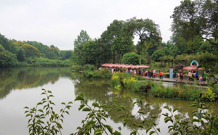
Un petit lac, une grande forêt touffue à flanc de collines, des bambous à foison … cet environnement paraît idéal pour séduire nos amis pandas et plaire aux visiteurs qui s'y pressent dans un dédale d'allées serpentant parmi les bosquets.
L'animal a la réputation d'être solitaire et plutôt discret … et même si l'on compte plus d'une centaine de pandas géants dans cette réserve, on croise les doigts pour avoir la chance de bien les observer. En apercevoir plusieurs est en principe assuré mais la forêt de bambous est dense, sombre et l'enchevêtrement de troncs, de branches et de feuilles gêne quelque peu la vue. Il va donc falloir être particulièrement attentif.

Tiens, voilà un premier panda, bien allongé sur une branche avec sa fourrure en noir et blanc toute auréolée de tâches vertes : l'effet de cette broussailleuse et abondante végétation. Pour la mise au point photo sur l'animal, toutes ces feuilles ne facilitent pas l'affaire. Je comprends très vite qu'une bonne netteté d'image impose de désactiver l'autofocus et donc de réaliser les prises avec une mise au point manuelle. Soit !
Les pandas, on les imagine à priori très câlins, leur épaisse et douce fourrure donnerait l'envie de la caresser. Cependant, à l'image de cet adulte, on s'aperçoit vite qu'un panda montre facilement les crocs et de plus en grognant. C'est un des traits de caractère de l'espèce, en fait les pandas adultes ne sont pas doux comme des agneaux mais plutôt grincheux ! On ne peut les approcher que jeunes (environ jusqu'à leur deuxième année), ensuite c'est plus compliqué. Il paraît que les soigneurs dans les réserves ont trouvé un subterfuge pour les aborder : se déguiser en panda en portant une panoplie blanche et noire, astucieux !

On s'en est aperçu, les pandas sont bien dotés côté dentition, leur mâchoire est puissante et armée de solides dents, des « outils » qui leur sont finalement indispensables. Pour se nourrir, les pandas consomment essentiellement des bambous. Mâchouiller les tendres feuilles c'est facile, mais les tiges sont plus coriaces, dures et fibreuses parfois comme du bois. Un adulte, en grosse bête de 100 kg pour 1 m 65 (en moyenne) peut engloutir environ 20 à 30 kg de bambous dans la journée ! Grignoter, croquer, mastiquer … constitue la principale occupation d'une journée de panda, soit environ 14 heures par jour passées à se goinfrer. Ainsi, prendre des photos de pandas se résume le plus souvent à obtenir des portraits de pandas croquants la vie à pleines dents. Voilà un bon titre pour cette série de photos.

De telles quantités de bambous ingurgitées nécessitent un bon approvisionnement. La forêt locale n'y suffit pas. Aussi, pour bien dorloter nos chers pandas de la réserve de Chengdu, des kilos de tiges et de feuilles de bambous leur sont livrés chaque matin. Car ici, on prend soin avec beaucoup d'attention de cette colonie de gentils pandas géants. L'espèce s'avère menacée, il ne resterait plus qu'environ 2000 pandas géants sauvages vivants dans les montagnes du Sichuan et des territoires alentour. Sur ces versants élevés (entre 1000 et 2000 mètres d'altitude) les pandas s'y plaisent, la fraîcheur des températures et la végétation locale leur convenant parfaitement… Cependant, au fil des années, les spécialistes de la faune n'ont fait que constater la diminution des populations de pandas chinois. Il fallait donc réagir, c'est ce qu'on fait les autorités chinoises. D'abord en protégeant les pandas des braconniers et surtout en créant des réserves dans le but d'obtenir des naissances en captivité. Avec un espoir, la r��introduction de pandas géants dans leur milieu naturel. Pour réussir cet objectif, il fallait aussi mieux connaître ces mystérieux pandas : étudier leur comportement et mieux comprendre leur mode de reproduction sont au programme des travaux de ce Centre de Recherche de Chengdu.
Par exemple, en ce qui concerne la digestion des pandas, les études ont montré que les intestins de ces animaux ne digèrent pas la cellulose des bambous ingurgités tout au long de la journée. Le résultat ? Un panda adulte de bonne corpulence peut rejeter une dizaine de kilos de crottes verdâtres par jour ! Des déjections « truffées » de fibres végétales … d'où l'idée de les traiter pour fabriquer de la pâte à papier. Décidément rien ne se perd, tout se transforme. Mais le papier obtenu n'a certes pas la qualité du fameux papier de riz chinois, on pouvait s'en douter.

On l'a vu, les pandas sont de gros mangeurs occupés à presque boulotter du bambou du matin au soir … et le reste du temps que font-ils ? Ils dorment. Celui-ci tout avachi, semble vraiment imperturbable. Ainsi une vie de panda se partage entre manger et dormir, quel emploi du temps !

En Chinois, le panda géant est nommé « Daxiongmao » ce que l'on peut traduire par : grand chat-ours. Une appellation qui fait débat. Le panda est-il plus proche du chat que de l'ours ? Le pelage est soyeux comme celui d'un chat mais je ne sais si l'animal ronronne lorsqu'on parvient à le caresser, en revanche, son caractère paraît bien moins docile que celui d'un chat, le panda reste un animal sauvage ! Pour les arguments en faveur de sa parenté avec l'ours : il en a la taille et la corpulence (centaine de kilos à l'âge adulte) et puis le panda est classé dans la famille des ursidés.
Mais quand on voit un panda juché sur une haute branche comme celui-là, on viendrait à pencher vers le comportement d'un chat … un chat perché, bien sûr !
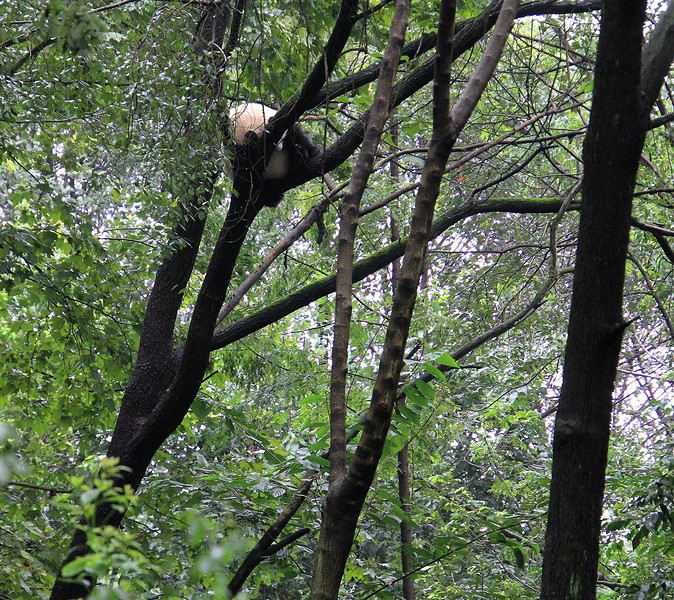
En tout cas ils sont mignons tout plein avec leur belle fourrure noire et blanche. Au fait, ne devrait-on pas plutôt dire : une fourrure blanche et noire ? On le constate sur ces deux photos, c'est bien le blanc qui domine avec seulement quelques tâches noires.
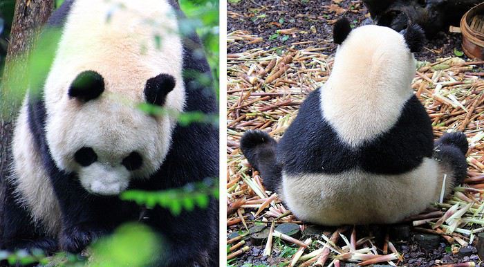
Ils sont marrants avec ces « lunettes » noires autour des yeux et ces deux petites oreilles, toute noire.
Quant à celui ci-dessous, je ne sais si vous avez la même impression que moi en le regardant, il me paraît presque attristé. Pour un peu on lui devinerait un semblant de larmes à l’œil …

On dit (et ce n'est là pas du tout scientifique !) que cet aspect tristounet pourrait être la traduction d'une grosse déception des pandas, ils auraient un rêve inassouvi : mais qu'enfin un des nombreux photographes qui les mitraillent parvienne à réaliser leur portrait mais en … couleurs ! En auraient-ils assez de cet éternel noir & blanc ?
J'ai tout de même une photo de panda en couleurs … prise à l'entrée du centre de recherche. Le rose bonbon lui va bien mais cette œuvre à facettes est moins lisse que le doux pelage d'un panda bien vivant.
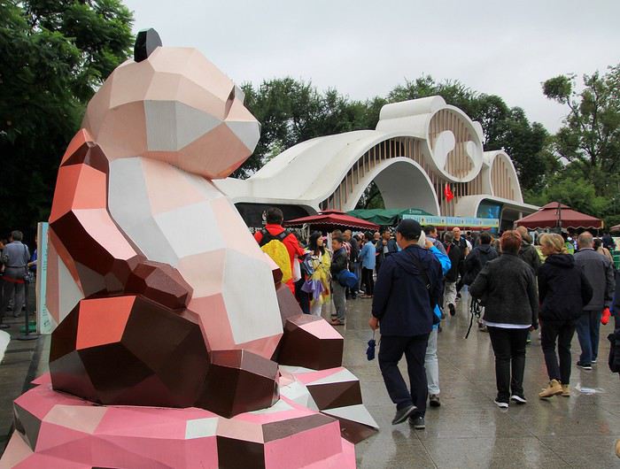
Poursuivons la visite en arrivant maintenant près d'un attroupement. Une foule qui semble attentive et captivée. De ce point de vue, je ne vois pas grand-chose avec ce « rideau » de personnes, des adultes, des enfants et une multitude de smartphones levés en l'air. C'est certain, il y a sûrement par ici des pandas à voir !
De toute la réserve, c'est sans doute là que l'on peut voir le plus facilement ces fameux pandas … encore faut-il se faufiler et jouer des coudes pour parvenir en première ligne, près de la barrière. Ça y est, me voici en bonne position pour l'observation. Trois pandas sont parqués dans cet enclos. Sans se soucier de tous ces spectateurs ravis, ils vaquent à leur occupation favorite … manger ! L'un d'entre eux, tige de bambou à la patte et à la bouche, est assis sur un tapis de morceaux de bambous.
Et dire que les pandas aiment paraît-il la solitude. Là, ils sont servis : ils sont trois presque côte à côte sans compter ces dizaines de spectateurs ! Bon, cela n'a pas l'air de déranger celui-ci, qui continue sans relâche de croquer du bambou.
C'est marrant d'observer ces grosses peluches, ils ont souvent des attitudes qui prêtent à sourire. Zieutez par exemple ce gentil panda avec cette façon de tenir son bambou. Ne vous fait-il pas penser à un musicien ? On a l'impression qu'il joue de la flûte traversière … mais non, il grignote. Un détail de leur anatomie est assez original et très pratique pour bien tenir, par exemple, les tiges de bambous. Les pandas sont dotés d'un sixième doigt, comme un faux pouce.

Et que dire de celui-là, bien repu, il est en pleine sieste. Sa corpulence avec son gros ventre m'évoque un bouddha … avec tous le respect que l'on doit aux bouddhas, c'est juste un ironique clin d’œil !
Dans les environs de la ville de Chengdu se trouve un de leur sanctuaire. Là, au Centre de Recherche et de reproduction des pandas géants, ils y sont particulièrement choyés. Sur place, un espace naturel est dédié à l'observation de ces drôles de grosses peluches. Nous y voici.
--
Un petit lac, une grande forêt touffue à flanc de collines, des bambous à foison … cet environnement paraît idéal pour séduire nos amis pandas et plaire aux visiteurs qui s'y pressent dans un dédale d'allées serpentant parmi les bosquets.
L'animal a la réputation d'être solitaire et plutôt discret … et même si l'on compte plus d'une centaine de pandas géants dans cette réserve, on croise les doigts pour avoir la chance de bien les observer. En apercevoir plusieurs est en principe assuré mais la forêt de bambous est dense, sombre et l'enchevêtrement de troncs, de branches et de feuilles gêne quelque peu la vue. Il va donc falloir être particulièrement attentif.
Tiens, voilà un premier panda, bien allongé sur une branche avec sa fourrure en noir et blanc toute auréolée de tâches vertes : l'effet de cette broussailleuse et abondante végétation. Pour la mise au point photo sur l'animal, toutes ces feuilles ne facilitent pas l'affaire. Je comprends très vite qu'une bonne netteté d'image impose de désactiver l'autofocus et donc de réaliser les prises avec une mise au point manuelle. Soit !
Les pandas, on les imagine à priori très câlins, leur épaisse et douce fourrure donnerait l'envie de la caresser. Cependant, à l'image de cet adulte, on s'aperçoit vite qu'un panda montre facilement les crocs et de plus en grognant. C'est un des traits de caractère de l'espèce, en fait les pandas adultes ne sont pas doux comme des agneaux mais plutôt grincheux ! On ne peut les approcher que jeunes (environ jusqu'à leur deuxième année), ensuite c'est plus compliqué. Il paraît que les soigneurs dans les réserves ont trouvé un subterfuge pour les aborder : se déguiser en panda en portant une panoplie blanche et noire, astucieux !
On s'en est aperçu, les pandas sont bien dotés côté dentition, leur mâchoire est puissante et armée de solides dents, des « outils » qui leur sont finalement indispensables. Pour se nourrir, les pandas consomment essentiellement des bambous. Mâchouiller les tendres feuilles c'est facile, mais les tiges sont plus coriaces, dures et fibreuses parfois comme du bois. Un adulte, en grosse bête de 100 kg pour 1 m 65 (en moyenne) peut engloutir environ 20 à 30 kg de bambous dans la journée ! Grignoter, croquer, mastiquer … constitue la principale occupation d'une journée de panda, soit environ 14 heures par jour passées à se goinfrer. Ainsi, prendre des photos de pandas se résume le plus souvent à obtenir des portraits de pandas croquants la vie à pleines dents. Voilà un bon titre pour cette série de photos.
De telles quantités de bambous ingurgitées nécessitent un bon approvisionnement. La forêt locale n'y suffit pas. Aussi, pour bien dorloter nos chers pandas de la réserve de Chengdu, des kilos de tiges et de feuilles de bambous leur sont livrés chaque matin. Car ici, on prend soin avec beaucoup d'attention de cette colonie de gentils pandas géants. L'espèce s'avère menacée, il ne resterait plus qu'environ 2000 pandas géants sauvages vivants dans les montagnes du Sichuan et des territoires alentour. Sur ces versants élevés (entre 1000 et 2000 mètres d'altitude) les pandas s'y plaisent, la fraîcheur des températures et la végétation locale leur convenant parfaitement… Cependant, au fil des années, les spécialistes de la faune n'ont fait que constater la diminution des populations de pandas chinois. Il fallait donc réagir, c'est ce qu'on fait les autorités chinoises. D'abord en protégeant les pandas des braconniers et surtout en créant des réserves dans le but d'obtenir des naissances en captivité. Avec un espoir, la r��introduction de pandas géants dans leur milieu naturel. Pour réussir cet objectif, il fallait aussi mieux connaître ces mystérieux pandas : étudier leur comportement et mieux comprendre leur mode de reproduction sont au programme des travaux de ce Centre de Recherche de Chengdu.
Par exemple, en ce qui concerne la digestion des pandas, les études ont montré que les intestins de ces animaux ne digèrent pas la cellulose des bambous ingurgités tout au long de la journée. Le résultat ? Un panda adulte de bonne corpulence peut rejeter une dizaine de kilos de crottes verdâtres par jour ! Des déjections « truffées » de fibres végétales … d'où l'idée de les traiter pour fabriquer de la pâte à papier. Décidément rien ne se perd, tout se transforme. Mais le papier obtenu n'a certes pas la qualité du fameux papier de riz chinois, on pouvait s'en douter.
On l'a vu, les pandas sont de gros mangeurs occupés à presque boulotter du bambou du matin au soir … et le reste du temps que font-ils ? Ils dorment. Celui-ci tout avachi, semble vraiment imperturbable. Ainsi une vie de panda se partage entre manger et dormir, quel emploi du temps !
En Chinois, le panda géant est nommé « Daxiongmao » ce que l'on peut traduire par : grand chat-ours. Une appellation qui fait débat. Le panda est-il plus proche du chat que de l'ours ? Le pelage est soyeux comme celui d'un chat mais je ne sais si l'animal ronronne lorsqu'on parvient à le caresser, en revanche, son caractère paraît bien moins docile que celui d'un chat, le panda reste un animal sauvage ! Pour les arguments en faveur de sa parenté avec l'ours : il en a la taille et la corpulence (centaine de kilos à l'âge adulte) et puis le panda est classé dans la famille des ursidés.
Mais quand on voit un panda juché sur une haute branche comme celui-là, on viendrait à pencher vers le comportement d'un chat … un chat perché, bien sûr !
En tout cas ils sont mignons tout plein avec leur belle fourrure noire et blanche. Au fait, ne devrait-on pas plutôt dire : une fourrure blanche et noire ? On le constate sur ces deux photos, c'est bien le blanc qui domine avec seulement quelques tâches noires.
Ils sont marrants avec ces « lunettes » noires autour des yeux et ces deux petites oreilles, toute noire.
Quant à celui ci-dessous, je ne sais si vous avez la même impression que moi en le regardant, il me paraît presque attristé. Pour un peu on lui devinerait un semblant de larmes à l’œil …
On dit (et ce n'est là pas du tout scientifique !) que cet aspect tristounet pourrait être la traduction d'une grosse déception des pandas, ils auraient un rêve inassouvi : mais qu'enfin un des nombreux photographes qui les mitraillent parvienne à réaliser leur portrait mais en … couleurs ! En auraient-ils assez de cet éternel noir & blanc ?
J'ai tout de même une photo de panda en couleurs … prise à l'entrée du centre de recherche. Le rose bonbon lui va bien mais cette œuvre à facettes est moins lisse que le doux pelage d'un panda bien vivant.
Poursuivons la visite en arrivant maintenant près d'un attroupement. Une foule qui semble attentive et captivée. De ce point de vue, je ne vois pas grand-chose avec ce « rideau » de personnes, des adultes, des enfants et une multitude de smartphones levés en l'air. C'est certain, il y a sûrement par ici des pandas à voir !
De toute la réserve, c'est sans doute là que l'on peut voir le plus facilement ces fameux pandas … encore faut-il se faufiler et jouer des coudes pour parvenir en première ligne, près de la barrière. Ça y est, me voici en bonne position pour l'observation. Trois pandas sont parqués dans cet enclos. Sans se soucier de tous ces spectateurs ravis, ils vaquent à leur occupation favorite … manger ! L'un d'entre eux, tige de bambou à la patte et à la bouche, est assis sur un tapis de morceaux de bambous.
Et dire que les pandas aiment paraît-il la solitude. Là, ils sont servis : ils sont trois presque côte à côte sans compter ces dizaines de spectateurs ! Bon, cela n'a pas l'air de déranger celui-ci, qui continue sans relâche de croquer du bambou.
C'est marrant d'observer ces grosses peluches, ils ont souvent des attitudes qui prêtent à sourire. Zieutez par exemple ce gentil panda avec cette façon de tenir son bambou. Ne vous fait-il pas penser à un musicien ? On a l'impression qu'il joue de la flûte traversière … mais non, il grignote. Un détail de leur anatomie est assez original et très pratique pour bien tenir, par exemple, les tiges de bambous. Les pandas sont dotés d'un sixième doigt, comme un faux pouce.
Et que dire de celui-là, bien repu, il est en pleine sieste. Sa corpulence avec son gros ventre m'évoque un bouddha … avec tous le respect que l'on doit aux bouddhas, c'est juste un ironique clin d’œil !