Results for "Mar+Menor+|+9+>+206"
5640 results found.
Que visiter à Trinitad? (Cuba) English translation pending
Bonsoir
Je cherche de l'info sur cette destination, je m'y rend en Janvier...
Donc, si vous avez de l'information sur ce que l'ont peut y faire, visiter ect....
serait les bienvenue.
Merci
Je cherche de l'info sur cette destination, je m'y rend en Janvier...
Donc, si vous avez de l'information sur ce que l'ont peut y faire, visiter ect....
serait les bienvenue.
Merci
Recommended itinerary for Colombia's Caribbean coast
Hi everyone,
We're heading to Colombia soon for two weeks as a family with our two 10-year-old boys. I'm a bit behind on planning our itinerary and could really use your advice!
We arrive in Cartagena, where we'll spend 3 nights.
Next, we're heading to the Tayrona area for 3 nights. Could you recommend a nice hotel with a pool, ideally family-friendly? Unfortunately, Senda Watapuy and Senda Koguiwa are already fully booked for our dates.
After that, we were thinking of spending a few days in Minca. Is that a good idea in late July/early August? How many nights would you recommend?
Finally, we're looking for a last stop before returning to France. We've heard about Mompox, but we're hesitant because it seems like a big detour. We love nature, animals, beautiful landscapes, beaches, and authentic places. Do you think Mompox is worth the detour with two kids, or would you recommend another destination (Palomino, Barú, La Guajira...) instead?
We don’t want to take any domestic flights.
Thanks in advance for all your tips and experiences!
Hikes in Santo Antão
Hello,
In mid-November, we’ll be in Mindelo and Santo Antão.
We’ve booked transportation with Kapverden Tours.
One trip is from Porto Novo to Ponta do Sol, including the hike from Corda to Coculi.
What’s the trail like?
Then we’ll be staying in Ponta do Sol,
Here’s what we’re planning: A hike to Fontainhas—what’s the best direction, considering we’re not great with climbs? No problem with flat terrain or descents. Take an aluguer to Ribeira Grande and continue along the coastal road.
With the agency: An excursion to Cruzinha with a short walk. Return to Porto Novo via the path from Cova to… I’m not sure where yet, to pick up the car for Porto Novo, since we’ll be taking the ferry that evening. We’ll have a guide for this hike.
We’d love to spend a day in Tarrafal, but getting back requires a boat or taxi, and it’s really expensive!
We’re a couple, 78 and 76 years old. What do you think of this itinerary?
Here’s what we’re planning: A hike to Fontainhas—what’s the best direction, considering we’re not great with climbs? No problem with flat terrain or descents. Take an aluguer to Ribeira Grande and continue along the coastal road.
With the agency: An excursion to Cruzinha with a short walk. Return to Porto Novo via the path from Cova to… I’m not sure where yet, to pick up the car for Porto Novo, since we’ll be taking the ferry that evening. We’ll have a guide for this hike.
We’d love to spend a day in Tarrafal, but getting back requires a boat or taxi, and it’s really expensive!
We’re a couple, 78 and 76 years old. What do you think of this itinerary?
Guatemala-Belize itinerary: too packed or missing something?
Hi everyone,
I’m in the middle of planning my trip for February 2027 with my family (4 adults). We’re thinking of a Guatemala-Belize combo. Could you let me know what you think of my itinerary? Should I add or remove anything? Is it too minimalist? Do you recommend renting a car or hiring a driver and guide? For the islands in Belize, is 5 days too much? The volcano hike isn’t included on purpose.
· 02/21 (Day 1) — Arrival in Guatemala Night: Antigua · 02/21 (Day 2) — Antigua, the colonial gem Half-day guided walking tour of convents, churches, and Spanish ruins. Volcanoes as a photo backdrop. Coffee plantation visit. Night: Antigua · 02/22 (Day 3) — Chichicastenango Market → Lake Atitlán Early morning drive to the big indigenous market. Guide to explain Mayan rituals in Santo Tomás Church. Afternoon transfer to Lake Atitlán. Night: Lake Atitlán · 02/23 (Day 4) — The Mayan Villages of Lake Atitlán Lake crossing. Visit the villages of San Juan La Laguna (weaving cooperatives) and Santiago Atitlán. Night: Lake Atitlán · 02/24 (Day 5) — Sololá Market → Return to Antigua Leave the lake in the morning. Visit the authentic high-altitude market of Sololá with a local guide, then drive back to spend the evening in Antigua. Night: Antigua · 02/25 (Day 6) — Flight to Flores → Transfer to Tikal Domestic flight directly to Tikal National Park. Night: Tikal (in the heart of the jungle) · 02/26 (Day 7) — Exploring the City of Tikal Explore the giant Mayan city of Tikal in the middle of the jungle with your French-speaking guide. Enjoy the lodge’s pool to the sound of howler monkeys. Night: Tikal
02/27 (Day 8) — Belize Border → Xunantunich Site → San Ignacio Visit the large Mayan site of Xunantunich right after crossing the border.
Night: San Ignacio
02/28 (Day 9) — Mountain Pine Ridge Reserve Full-day 4x4 tour with the lodge’s guide to explore Big Rock Falls (swimming in natural pools) and caves in the forest reserve.
Night: San Ignacio
03/01 (Days 10 to 15) — San Ignacio → Boat to Ambergris Caye
But I’m still not sure whether to go to Ambergris or Caye Caulker (what do you recommend?)
03/06 (Day 15) — Domestic Flight → International Return Flight (feasible or not?)
Thanks so much for your feedback!
I’m in the middle of planning my trip for February 2027 with my family (4 adults). We’re thinking of a Guatemala-Belize combo. Could you let me know what you think of my itinerary? Should I add or remove anything? Is it too minimalist? Do you recommend renting a car or hiring a driver and guide? For the islands in Belize, is 5 days too much? The volcano hike isn’t included on purpose.
· 02/21 (Day 1) — Arrival in Guatemala Night: Antigua · 02/21 (Day 2) — Antigua, the colonial gem Half-day guided walking tour of convents, churches, and Spanish ruins. Volcanoes as a photo backdrop. Coffee plantation visit. Night: Antigua · 02/22 (Day 3) — Chichicastenango Market → Lake Atitlán Early morning drive to the big indigenous market. Guide to explain Mayan rituals in Santo Tomás Church. Afternoon transfer to Lake Atitlán. Night: Lake Atitlán · 02/23 (Day 4) — The Mayan Villages of Lake Atitlán Lake crossing. Visit the villages of San Juan La Laguna (weaving cooperatives) and Santiago Atitlán. Night: Lake Atitlán · 02/24 (Day 5) — Sololá Market → Return to Antigua Leave the lake in the morning. Visit the authentic high-altitude market of Sololá with a local guide, then drive back to spend the evening in Antigua. Night: Antigua · 02/25 (Day 6) — Flight to Flores → Transfer to Tikal Domestic flight directly to Tikal National Park. Night: Tikal (in the heart of the jungle) · 02/26 (Day 7) — Exploring the City of Tikal Explore the giant Mayan city of Tikal in the middle of the jungle with your French-speaking guide. Enjoy the lodge’s pool to the sound of howler monkeys. Night: Tikal
02/27 (Day 8) — Belize Border → Xunantunich Site → San Ignacio Visit the large Mayan site of Xunantunich right after crossing the border.
Night: San Ignacio
02/28 (Day 9) — Mountain Pine Ridge Reserve Full-day 4x4 tour with the lodge’s guide to explore Big Rock Falls (swimming in natural pools) and caves in the forest reserve.
Night: San Ignacio
03/01 (Days 10 to 15) — San Ignacio → Boat to Ambergris Caye
But I’m still not sure whether to go to Ambergris or Caye Caulker (what do you recommend?)
03/06 (Day 15) — Domestic Flight → International Return Flight (feasible or not?)
Thanks so much for your feedback!
Which country to visit in February with sunshine, hiking, and beautiful sights?
hi,
I’m looking for a country to visit for 10 days in February.
What do you recommend for a trip with some sunshine, hiking, and sightseeing?
Thanks for your help
Thanks for your help
Cape Verde island duo: which to choose based on my criteria?
Hi there,
I’ve been looking for a destination for a 2-week trip early next spring, and Cape Verde has been growing on me. (The flight isn’t too long, the temperatures are more than pleasant, and it’s an unknown country for me.)
The thing is, Cape Verde is pretty complicated when it comes to inter-island transfers, and I don’t want to spend my time in airports or on ferries—especially since those transfers aren’t exactly known for their reliability...
So, I’d like to limit internal flights to just 2, meaning the island I arrive on plus one other.
I’ve ruled out the all-inclusive islands: Sal and Boa Vista.
I’m torn between combining Santo Antão + São Vicente or Fogo + Santiago.
The goal of the trip is to see beautiful landscapes, go on day hikes (nothing multi-day), swim a little—though I prefer quiet spots—and enjoy 1 or 2 days in a city, but not much more than that!
In your opinion, which option would be the best, and why?
Thanks! :)
I’ve been looking for a destination for a 2-week trip early next spring, and Cape Verde has been growing on me. (The flight isn’t too long, the temperatures are more than pleasant, and it’s an unknown country for me.)
The thing is, Cape Verde is pretty complicated when it comes to inter-island transfers, and I don’t want to spend my time in airports or on ferries—especially since those transfers aren’t exactly known for their reliability...
So, I’d like to limit internal flights to just 2, meaning the island I arrive on plus one other.
I’ve ruled out the all-inclusive islands: Sal and Boa Vista.
I’m torn between combining Santo Antão + São Vicente or Fogo + Santiago.
The goal of the trip is to see beautiful landscapes, go on day hikes (nothing multi-day), swim a little—though I prefer quiet spots—and enjoy 1 or 2 days in a city, but not much more than that!
In your opinion, which option would be the best, and why?
Thanks! :)
From Mexico to the Wonderful Chiapas
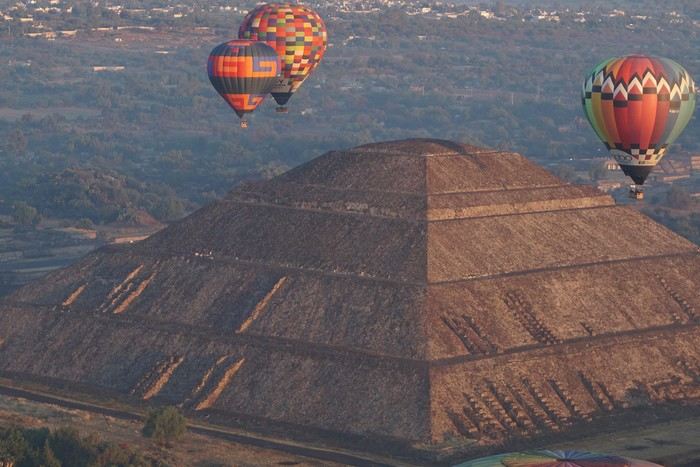
This one-month trip, from January 18 to February 17, 2026, allowed us to visit Mexico City and travel through the states of Puebla, Oaxaca, and Chiapas. We mainly used buses (ADO company) for medium and long distances and colectivos or taxis (or Uber) for shorter trips. Before leaving, I had contacted several people on the ground: Harry, a Vendéan settled in Oaxaca offering, among other things, discoveries of artisan villages or the Monte Albán site, and Oscar in Comitán de Domínguez. I’ll come back to our meeting with Oscar, who runs a local agency (CVL Travel Turismo Alternativo & Corre la voz) and owns a very pleasant hostel, a real highlight of our trip. Our journey took place in 8 stages on a loop starting from Mexico City. The connections between each were made by day or night buses depending on the trip duration. I had booked our seats in advance, either directly on the ADO company’s website or through booking platforms depending on the rates offered. Note that by planning ahead, I was able to benefit from very interesting "Early Booking" rates. There are several comfort classes. For all our trips, I had booked seats in Primera class buses, except for two in GL (Grand Luxe) class. The rates are very reasonable, and the buses turned out to be comfortable or even very comfortable (only the basic seat recline might surprise you).
Our itinerary and number of days per stage: Stage 1 – Mexico City: 4 days Stage 2 – Puebla: 2 days Stage 3 – Oaxaca: 4 days Stage 4 – San Agustinillo: 4 days Stage 5 – San Cristóbal de las Casas: 3 days Stage 6 – Comitán de Domínguez: 6 days Stage 7 – Palenque: 4 days Stage 8 – Mexico City: 2 days If I were to do it again, I’d remove one day from Palenque and add it either to Puebla or San Cristóbal to visit nearby sites or villages, or to San Agustinillo to enjoy one more day by the Pacific Ocean.
Stage 1: Mexico City (2,200 m / 9.2 million inhabitants) We arrived in the Mexican capital around 10:00 PM. The simplified customs process was very quick. After exchanging some money at the airport, we took a taxi to our youth hostel. We got around the capital on foot, of course, but also by metro. Signs are very rare, and we took the train in the wrong direction several times. After a few mistakes, we systematically asked on the platform if we were going the right way. The metro is very affordable. You need to get a rechargeable card (the Tarjeta de Movilidad Integrada) and top it up as needed. This card (less than 1 €) isn’t personal, so there’s no need to get one per person.
Mexico City: Day 1.
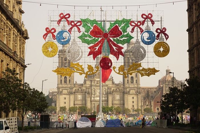
Visits and walks of the day (note: many museums are closed on Mondays): The Zócalo or Constitution Square: it’s one of the most beautiful, largest (195m x 240m), and oldest squares in the world. This is where Cortés decided to build the center of the new Spanish city on the site of the former Tenochtitlan market. Stones from the pyramids were used to pave the esplanade and build the surrounding colonial churches and buildings. During our visit, the huge square was covered with (resin) cacti, the theme of the temporary exhibition at the time. Indeed, temporary events or exhibitions take place here throughout the year. It’s also the endpoint for many protest marches.
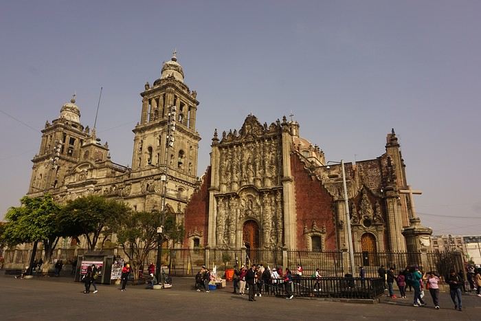
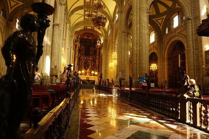


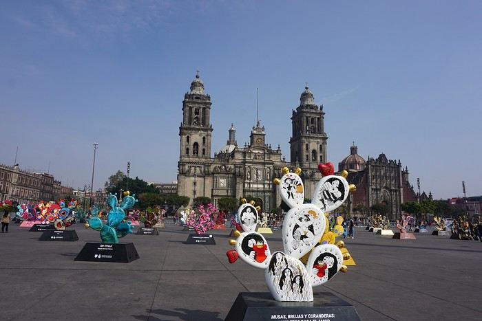
The cathedral: it’s sinking by one centimeter per year despite massive stabilization work (the collapse of many Mexican buildings—30 cm/year—is due to groundwater pumping). It was built starting in 1571 and completed in... 1813. The modest remains of the Templo Mayor (exterior view): they have high symbolic value, as this monument was the most important in the Mexica Empire.
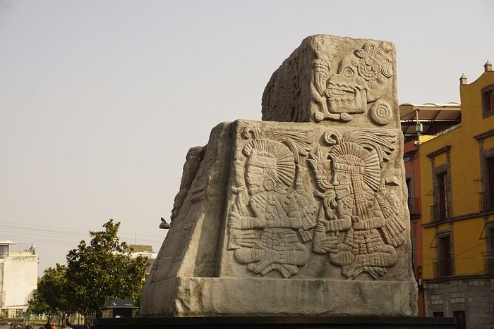 We then walked through the streets of the historic center to the Santísima Church, unfortunately closed for renovation work.
Next, we took the metro to visit one of Mexico’s most important pilgrimage sites: the Insigne y Nacional Basílicas de Santa María de Guadalupe, as well as the Capilla del Cerrito on the hill.
The first, dating from the colonial era, is really leaning a lot.
We then walked through the streets of the historic center to the Santísima Church, unfortunately closed for renovation work.
Next, we took the metro to visit one of Mexico’s most important pilgrimage sites: the Insigne y Nacional Basílicas de Santa María de Guadalupe, as well as the Capilla del Cerrito on the hill.
The first, dating from the colonial era, is really leaning a lot.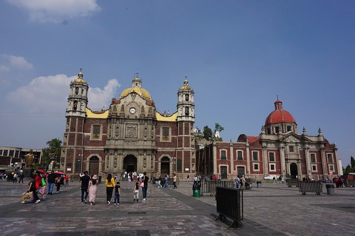
The second, shaped like a rotunda, is very impressive from the inside.
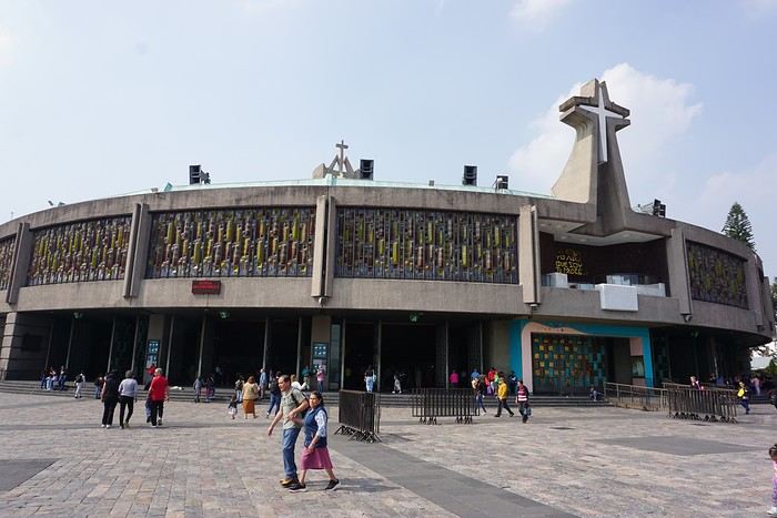
In the basement, there’s a sacred tunic where, in 1531, an image of the Virgin Mary is said to have appeared. A real mystery for scientists, the garment has never deteriorated since that date. Slow-moving conveyor belts allow pilgrims to admire it, preventing crowds from gathering in front of the image for hours. Well thought out!
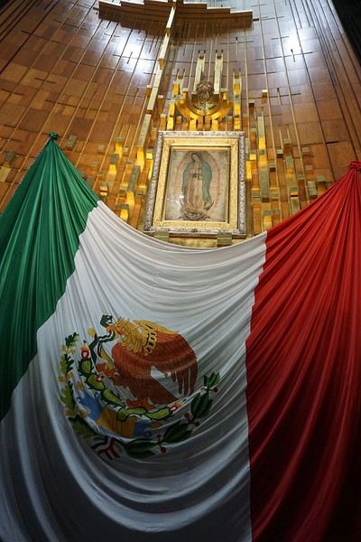 From the top of the Capilla del Cerrito, you get beautiful views of huge Mexico City.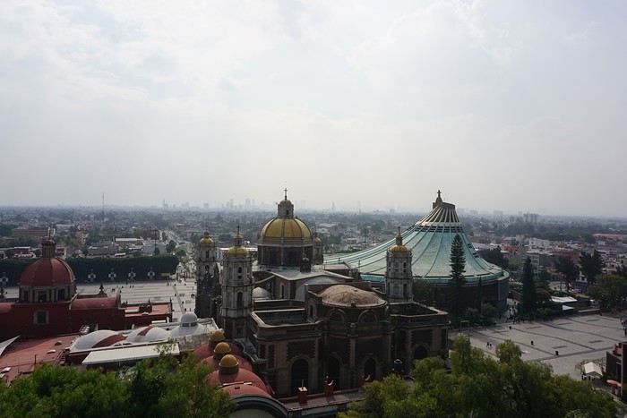
Costa Rica: The dry season isn't what it used to be!
Introduction:
For years, I’ve heard about Costa Rica, which seems like a country "made for me"—nature, not cities.
I almost went in 2019, but a family issue made me cancel.
Initially, I wanted to spend at least three weeks there, planning to go in our summer despite it being the rainy season. Then I realized what I wanted to do could fit into two weeks, so I ended up going in February.
Plus, January’s weather was so awful that some sunshine should do me good.
I found a flight at a decent price, but with two downsides.
The first is that it leaves from Paris CDG, and the second is that it’s with Air France—a airline I’d sworn off after my misadventures with them back in 2008. We’ll see how it goes!
Accommodation, hiking, and solo travel questions for Santo Antão
Hi there, for those who’ve been recently—is it possible to find other solo travelers in March on the island to share transport or room costs? It doesn’t seem easy to travel on a budget.
If you have any recommendations for simple lodgings or places with dorms, I’d love to hear them.
For those who’ve done multi-day treks while moving around: do you need to bring your own sleeping bag? I’d love to hear about itineraries you’ve done without a guide, just with a map and GPS.
Thanks, and have a great day!
Havana, Cuba / January 2026
I got into music with the will
To light up many hearths like Che could do,
To circulate ideas, to advance utopia
Alternating barricades, sharp thought, and poetry.
Mc Solaar, Guérilla
Subscribing without a fight to the slightest line of my itinerary sometimes feels like an illusion. Because there are countries where, despite the fever and enthusiasm, despite the triumphant revolution, certain elements block my path. And if I had planned, for F. and me, a beautiful ascent up Tabouret Hill (Loma del Taburete, 453m), it was without accounting for vegetation as dense as it was thorny, which barred our way after just a few quarters of an hour of walking. Exhausted, I had to face the facts: we wouldn’t go any further. I needed to come up with some kind of Plan B.
But what is this country, an unwitting laboratory of the worst that white civilization has done during its reign? What is this magnificent place—yet another—entrusted to the care of oblivion, just 150 km from the land of freedom? According to Donald Trump, a country supporting terrorism; according to the locals, the vast battlefield of 20th-century ideologies; according to the average tourist, a hot country, a beautiful country, a country where the last illusions of a lost paradise are dying.
On the other side of Havana Bay, we love that statue of Christ blessing the city. There’s something gentle, soothing, in that patriarchal gesture. You’d almost be tempted to forget that at the dawn of the 16th century, those who claimed to represent the Church had no scruples about eradicating the Ciboney and Taíno populations. Worse, you’ll find magnificent this cathedral dedicated to the Virgin Mary, right in the heart of the old city. Under the guise of a civilizing necessity, Havana became, like so many other places, the gilded seat of European pretensions, at the expense of local populations doomed to extermination, then enslaved populations—more or less indigenous—who, you can imagine, didn’t often set foot in this holy place.
Lost in my thoughts, I try to push through this tangled vegetation. Nature reclaims its rights; nature abhors a vacuum. Yes, the well-trodden path of revolution couldn’t stay free of weeds! The road is buried. We give up and turn back, until that fork I’d noted before leaving, which would let us reach the top of the hill by skirting its northern slope.
So the white man arrives, settles, and gets rid of everything that bothers him. He has two unstoppable forces at his disposal: gunpowder and the spiritual certainty of being on the side of an all-powerful god. While the first gives him an unmatched material advantage over his new enemy, the second lets him use the first without feeling too guilty. That’s the magic of this supreme Church: it condemns all forms of pleasure—calling them impurity—while promoting plunder and crime under the cover of evangelization.
Walking through the city, you find a bit of Algiers, except that here, the decay is almost irreversible. You feel the splendor of the past, a disconcerting image of all vanity, from an era when men knew how to build beauty—especially if they didn’t have to share it. We’ll debate the benefits of colonialism for a long time, while glossing over the fact that those benefits often stopped at the city limits, limits all too obvious to the indigenous people. Havana isn’t just one or a few buildings; it’s an impressive collection of works of art built one after another, in what I think was a spirit of healthy competition. Yes, you find Algiers in this exuberance. As if these distant cities were the receptacle of everything that was best in the lands of origin. Atlantes and lintels, golds, blues, ogives, and monumental windows—exceptional architecture in an exceptional place.
Some streets are clean, swept with care; others are not, scattered here and there with potholes filled with water. A rather persistent smell of urine invades us regularly. We move on. And we look up: Havana is visited with your nose in the air. Because the beauty is truly up there, on those magnificent balconies and terracotta arches. Also because it’s not impossible that a piece of that balcony might suddenly detach, hurling our ends into an overseas tragedy we’d rather avoid. On the ground, here and there, rubble. Inexorably, this city is returning to dust.
My Plan B turns out to be no more successful than the first attempt. After a cheerful progression of a few hundred meters, same outcome, same struggle—the vegetation opposes any revolution: impossible to go around the hill! Once again, we have to turn back. We’ll try Plan C. I reassure myself by convincing myself to stay in the logic of this country: Cuba has been searching for itself for five centuries.
Coffee, tobacco, and sugarcane—the green gold of the colonies—so that money could flow and Europe could enjoy itself. Cuba’s history isn’t original. In reality, all the hot lands at these latitudes suffer the same fate: to serve the white man. While waiting for the awakening of consciences, UN Resolution 1514 and more or less affirmed revolutionary desires. Except that—and this reflection is just my own—if the awakening of consciences and the revolutionary will don’t play into what Resolution 1514 hides, there’s a good chance the said state will become a pariah. Those who don’t follow the American doctrine risk a lot; those who decide to follow Moscow risk everything. Independence was only the barely discreet instrument of American views. Patrice Lumumba will gladly enlighten us on the subject.
Turning back is good. Setting up Plan C is better. I won’t deviate from my goal: we will reach the top of Tabouret, whatever the cost! Near a small country road, I hesitate to change the program. Time is ticking—is it really reasonable to attempt the ascent? Then a tricycle taxi appears, a kind of tuk-tuk powered by an electric moped. I take it as a sign from fate, and we board for the starting point of Plan C.
In Cuba, even before Resolution 1514, independence was assured by a pawn of the United States, Fulgencio Batista. There’s no need to go over the whole history here; we’ll just remember that if you know how to give without counting to your former masters, you can enjoy a facade of freedom. Fidel Castro, on the other hand, didn’t know how to give. It never even occurred to him. That’s why the United States harbors such terrible hatred for this rebellious state, opposed to capitalist values and political prostitution. From there to slowly killing its people for nearly seventy years, one can legitimately cry injustice. But there are other priorities. Oh yes! Greenland...
Do Cubans eat their fill? Does seeing overweight people mean opulence? Food grows, no doubt about it. The soil is fertile, the climate favorable. No, what shocks here is the absolute precarity, the feeling of a people living in survival mode, and the decay of both goods and hope. Where to go? What’s the point? The stubbornness of the United States in wanting to impose its views on the Cuban government is felt much more by an overwhelmed people than by those few elites—caricatures of communism—who instill their vision of happiness with a crowbar. The embargo imposed in 1960; the false-flag attacks—American planes flying the colors of the Cuban revolution during the Bay of Pigs invasion in 1961—the exasperation of placing Cuba on the list of countries supporting terrorism. More recently, Donald Trump decided to heavily tax countries supplying Cuba with fuel. The last time I saw such long lines near gas stations was during my first trip to Romania... in 1991. It’s not for me to judge whether Raúl and his clique are playing fair by thumbing their noses at the West. I don’t hold the ins and outs of this war of egos that keeps the world’s great powers awake. I only caught a glimpse of the poverty of an island in 2026, while we in Europe are buried under an avalanche of the useless and superficial.
At the start of the San Juan baths, we find the trailhead. It climbs steeply. But the weather is relatively mild, thanks to a cold wave hitting higher up in the United States. Dallas is under snow; we’re walking in 16°C, a stroke of luck. We climb over rocks, under fairly decent vegetation, sometimes low but passable. And we succeed in the ascent in an hour. Up there, the top of the hill is somewhat maintained, at a minimum, but maintained, as if to honor Che through an awful monument erected in his glory—a stubborn specimen from those years when good taste was inversely proportional to the delusional ideas of those being honored. Birds of prey (raptors?) circle overhead; the monument is dying, crumbling, falling into ruin. *Hasta siempre*—forever—will be for the words. Nature, erosion, life itself will have the last word over all revolutions.
Back at the foot of the hill, just before a memorable swim, we talk with a family living there in miserable shacks whose stability wasn’t unlike that of the Leaning Tower of Pisa. The grandmother holds an animal, a rodent, by its feet. The grandfather has just killed it; she’s plucking its fur. A few steps away, water boils in a pot. She plunges the beast into the container. Tonight, the family will eat ragondin stew. Further on, another shack where, in a disorder rivaling the filth, a mother breastfeeds while sitting on the edge of a bed. Then, on the way down, we’ll meet a middle-aged man carrying a large jerrycan of water on his shoulder. Are these people happy here, far from the cities and their stakes? Is it too much to ask that they at least have access to electricity, running water, and decent, safe housing?
Outside the old city, Havana reveals wide avenues serving imposing institutions here and there. But whether in the colorful alleys of the old town or on the majestic and austere Plaza de la Revolución, the same feeling moves me: sadness. Seeing that only chaos has come from ideas crushes me. We praise, we sing the revolution—above all, we impose it in people’s minds as a necessity, when it’s nothing of the sort. Revolution is just the fruit of a few tortured minds who, once in power, do nothing better than all those before them. Enjoy power. Impose their views. It’s just a matter of color. Fidel saw red and knew how to persuade—or silence forever—his many detractors. The West sees everything in white, through the prism of human rights, and also knows how to persuade and silence its slightest detractors forever.
Paradoxically, Cuba survives largely thanks to tourism, a key element—let’s not be afraid to say it—of capitalism. And when a few players pick up the crumbs from transactions, the lion’s share and the foreign currency go to the government. So we won’t go to Varadero, the high place of relaxation overrun by Canadians. Instead, we’ll limit ourselves to crossing the ocean 30 minutes from the capital, at Santa María del Mar, to get an idea of cheaper tourism and to splash around for a few minutes in turquoise water invaded by sargassum. At the heart of the tourist season, we’ll meet few people. Like Havana, and according to its inhabitants, the high season is rather dead. But we won’t have come for nothing: we particularly love this return where, feverish, the taxi driver pushes his Moskvitch 2140 to the max on the highway, singing karaoke versions of hits at the top of his lungs from an onboard DVD player. East/West, the culture clash with a hint of Latino.
It’s time to leave this country of resourcefulness where extremes are very present. We’re leaving a 5-star hotel in front of yet another crumbling building. We’ve known restaurants at 40,000 pesos while in the street people eat for 400. We’ve seen those countless cars from another era and another culture—Pontiac, Lada, Chevrolet, Moskvitch—being overtaken by gleaming Mercedes and other Porsche Cayennes, the prerogative—if it still needed to be demonstrated—of the newly rich in search of recognition. Boarding the plane, we also understand that we’re not just traveling with tourists: there’s undoubtedly a rich and prosperous diaspora, just as there are relatively wealthy Cubans—well, wealthy enough to travel comfortably in the front of the aircraft. Meanwhile, on all the country’s roads, other Cubans try hitchhiking, their wives and children perched on a suitcase by the roadside. The father holds out his arm and holds a few bills in his hand like a card game. Where are they going? Who will pick them up?
Behind me, the gold of the Capitol. I’m told this gold comes from Russia. Like Marx and Lenin’s smoky theories? Like Stalin’s subtle and delicate paternalism? Let’s bet that, like the other buildings crumbling around it, the Capitol will also collapse one day, to avenge the Indians who perished from the diseases and guns of the whites, to avenge the Africans who obliterated their lives so Europeans could enjoy themselves, finally, to avenge all this abandoned people, left to the arbitrariness of democratic or non-democratic elections.
A sign in the street: We understand history. This is the revolution! We understand history. That’s the revolution.
No comment.
Subscribing without a fight to the slightest line of my itinerary sometimes feels like an illusion. Because there are countries where, despite the fever and enthusiasm, despite the triumphant revolution, certain elements block my path. And if I had planned, for F. and me, a beautiful ascent up Tabouret Hill (Loma del Taburete, 453m), it was without accounting for vegetation as dense as it was thorny, which barred our way after just a few quarters of an hour of walking. Exhausted, I had to face the facts: we wouldn’t go any further. I needed to come up with some kind of Plan B.
But what is this country, an unwitting laboratory of the worst that white civilization has done during its reign? What is this magnificent place—yet another—entrusted to the care of oblivion, just 150 km from the land of freedom? According to Donald Trump, a country supporting terrorism; according to the locals, the vast battlefield of 20th-century ideologies; according to the average tourist, a hot country, a beautiful country, a country where the last illusions of a lost paradise are dying.
On the other side of Havana Bay, we love that statue of Christ blessing the city. There’s something gentle, soothing, in that patriarchal gesture. You’d almost be tempted to forget that at the dawn of the 16th century, those who claimed to represent the Church had no scruples about eradicating the Ciboney and Taíno populations. Worse, you’ll find magnificent this cathedral dedicated to the Virgin Mary, right in the heart of the old city. Under the guise of a civilizing necessity, Havana became, like so many other places, the gilded seat of European pretensions, at the expense of local populations doomed to extermination, then enslaved populations—more or less indigenous—who, you can imagine, didn’t often set foot in this holy place.
Lost in my thoughts, I try to push through this tangled vegetation. Nature reclaims its rights; nature abhors a vacuum. Yes, the well-trodden path of revolution couldn’t stay free of weeds! The road is buried. We give up and turn back, until that fork I’d noted before leaving, which would let us reach the top of the hill by skirting its northern slope.
So the white man arrives, settles, and gets rid of everything that bothers him. He has two unstoppable forces at his disposal: gunpowder and the spiritual certainty of being on the side of an all-powerful god. While the first gives him an unmatched material advantage over his new enemy, the second lets him use the first without feeling too guilty. That’s the magic of this supreme Church: it condemns all forms of pleasure—calling them impurity—while promoting plunder and crime under the cover of evangelization.
Walking through the city, you find a bit of Algiers, except that here, the decay is almost irreversible. You feel the splendor of the past, a disconcerting image of all vanity, from an era when men knew how to build beauty—especially if they didn’t have to share it. We’ll debate the benefits of colonialism for a long time, while glossing over the fact that those benefits often stopped at the city limits, limits all too obvious to the indigenous people. Havana isn’t just one or a few buildings; it’s an impressive collection of works of art built one after another, in what I think was a spirit of healthy competition. Yes, you find Algiers in this exuberance. As if these distant cities were the receptacle of everything that was best in the lands of origin. Atlantes and lintels, golds, blues, ogives, and monumental windows—exceptional architecture in an exceptional place.
Some streets are clean, swept with care; others are not, scattered here and there with potholes filled with water. A rather persistent smell of urine invades us regularly. We move on. And we look up: Havana is visited with your nose in the air. Because the beauty is truly up there, on those magnificent balconies and terracotta arches. Also because it’s not impossible that a piece of that balcony might suddenly detach, hurling our ends into an overseas tragedy we’d rather avoid. On the ground, here and there, rubble. Inexorably, this city is returning to dust.
My Plan B turns out to be no more successful than the first attempt. After a cheerful progression of a few hundred meters, same outcome, same struggle—the vegetation opposes any revolution: impossible to go around the hill! Once again, we have to turn back. We’ll try Plan C. I reassure myself by convincing myself to stay in the logic of this country: Cuba has been searching for itself for five centuries.
Coffee, tobacco, and sugarcane—the green gold of the colonies—so that money could flow and Europe could enjoy itself. Cuba’s history isn’t original. In reality, all the hot lands at these latitudes suffer the same fate: to serve the white man. While waiting for the awakening of consciences, UN Resolution 1514 and more or less affirmed revolutionary desires. Except that—and this reflection is just my own—if the awakening of consciences and the revolutionary will don’t play into what Resolution 1514 hides, there’s a good chance the said state will become a pariah. Those who don’t follow the American doctrine risk a lot; those who decide to follow Moscow risk everything. Independence was only the barely discreet instrument of American views. Patrice Lumumba will gladly enlighten us on the subject.
Turning back is good. Setting up Plan C is better. I won’t deviate from my goal: we will reach the top of Tabouret, whatever the cost! Near a small country road, I hesitate to change the program. Time is ticking—is it really reasonable to attempt the ascent? Then a tricycle taxi appears, a kind of tuk-tuk powered by an electric moped. I take it as a sign from fate, and we board for the starting point of Plan C.
In Cuba, even before Resolution 1514, independence was assured by a pawn of the United States, Fulgencio Batista. There’s no need to go over the whole history here; we’ll just remember that if you know how to give without counting to your former masters, you can enjoy a facade of freedom. Fidel Castro, on the other hand, didn’t know how to give. It never even occurred to him. That’s why the United States harbors such terrible hatred for this rebellious state, opposed to capitalist values and political prostitution. From there to slowly killing its people for nearly seventy years, one can legitimately cry injustice. But there are other priorities. Oh yes! Greenland...
Do Cubans eat their fill? Does seeing overweight people mean opulence? Food grows, no doubt about it. The soil is fertile, the climate favorable. No, what shocks here is the absolute precarity, the feeling of a people living in survival mode, and the decay of both goods and hope. Where to go? What’s the point? The stubbornness of the United States in wanting to impose its views on the Cuban government is felt much more by an overwhelmed people than by those few elites—caricatures of communism—who instill their vision of happiness with a crowbar. The embargo imposed in 1960; the false-flag attacks—American planes flying the colors of the Cuban revolution during the Bay of Pigs invasion in 1961—the exasperation of placing Cuba on the list of countries supporting terrorism. More recently, Donald Trump decided to heavily tax countries supplying Cuba with fuel. The last time I saw such long lines near gas stations was during my first trip to Romania... in 1991. It’s not for me to judge whether Raúl and his clique are playing fair by thumbing their noses at the West. I don’t hold the ins and outs of this war of egos that keeps the world’s great powers awake. I only caught a glimpse of the poverty of an island in 2026, while we in Europe are buried under an avalanche of the useless and superficial.
At the start of the San Juan baths, we find the trailhead. It climbs steeply. But the weather is relatively mild, thanks to a cold wave hitting higher up in the United States. Dallas is under snow; we’re walking in 16°C, a stroke of luck. We climb over rocks, under fairly decent vegetation, sometimes low but passable. And we succeed in the ascent in an hour. Up there, the top of the hill is somewhat maintained, at a minimum, but maintained, as if to honor Che through an awful monument erected in his glory—a stubborn specimen from those years when good taste was inversely proportional to the delusional ideas of those being honored. Birds of prey (raptors?) circle overhead; the monument is dying, crumbling, falling into ruin. *Hasta siempre*—forever—will be for the words. Nature, erosion, life itself will have the last word over all revolutions.
Back at the foot of the hill, just before a memorable swim, we talk with a family living there in miserable shacks whose stability wasn’t unlike that of the Leaning Tower of Pisa. The grandmother holds an animal, a rodent, by its feet. The grandfather has just killed it; she’s plucking its fur. A few steps away, water boils in a pot. She plunges the beast into the container. Tonight, the family will eat ragondin stew. Further on, another shack where, in a disorder rivaling the filth, a mother breastfeeds while sitting on the edge of a bed. Then, on the way down, we’ll meet a middle-aged man carrying a large jerrycan of water on his shoulder. Are these people happy here, far from the cities and their stakes? Is it too much to ask that they at least have access to electricity, running water, and decent, safe housing?
Outside the old city, Havana reveals wide avenues serving imposing institutions here and there. But whether in the colorful alleys of the old town or on the majestic and austere Plaza de la Revolución, the same feeling moves me: sadness. Seeing that only chaos has come from ideas crushes me. We praise, we sing the revolution—above all, we impose it in people’s minds as a necessity, when it’s nothing of the sort. Revolution is just the fruit of a few tortured minds who, once in power, do nothing better than all those before them. Enjoy power. Impose their views. It’s just a matter of color. Fidel saw red and knew how to persuade—or silence forever—his many detractors. The West sees everything in white, through the prism of human rights, and also knows how to persuade and silence its slightest detractors forever.
Paradoxically, Cuba survives largely thanks to tourism, a key element—let’s not be afraid to say it—of capitalism. And when a few players pick up the crumbs from transactions, the lion’s share and the foreign currency go to the government. So we won’t go to Varadero, the high place of relaxation overrun by Canadians. Instead, we’ll limit ourselves to crossing the ocean 30 minutes from the capital, at Santa María del Mar, to get an idea of cheaper tourism and to splash around for a few minutes in turquoise water invaded by sargassum. At the heart of the tourist season, we’ll meet few people. Like Havana, and according to its inhabitants, the high season is rather dead. But we won’t have come for nothing: we particularly love this return where, feverish, the taxi driver pushes his Moskvitch 2140 to the max on the highway, singing karaoke versions of hits at the top of his lungs from an onboard DVD player. East/West, the culture clash with a hint of Latino.
It’s time to leave this country of resourcefulness where extremes are very present. We’re leaving a 5-star hotel in front of yet another crumbling building. We’ve known restaurants at 40,000 pesos while in the street people eat for 400. We’ve seen those countless cars from another era and another culture—Pontiac, Lada, Chevrolet, Moskvitch—being overtaken by gleaming Mercedes and other Porsche Cayennes, the prerogative—if it still needed to be demonstrated—of the newly rich in search of recognition. Boarding the plane, we also understand that we’re not just traveling with tourists: there’s undoubtedly a rich and prosperous diaspora, just as there are relatively wealthy Cubans—well, wealthy enough to travel comfortably in the front of the aircraft. Meanwhile, on all the country’s roads, other Cubans try hitchhiking, their wives and children perched on a suitcase by the roadside. The father holds out his arm and holds a few bills in his hand like a card game. Where are they going? Who will pick them up?
Behind me, the gold of the Capitol. I’m told this gold comes from Russia. Like Marx and Lenin’s smoky theories? Like Stalin’s subtle and delicate paternalism? Let’s bet that, like the other buildings crumbling around it, the Capitol will also collapse one day, to avenge the Indians who perished from the diseases and guns of the whites, to avenge the Africans who obliterated their lives so Europeans could enjoy themselves, finally, to avenge all this abandoned people, left to the arbitrariness of democratic or non-democratic elections.
A sign in the street: We understand history. This is the revolution! We understand history. That’s the revolution.
No comment.
Need help organizing a trip to Cape Verde during Carnival
Hi everyone,
After a year where I’ve worked way too much and with a house under renovation, it’s become essential to take a breather. My contract ends on 01/30, and I’ll try to find a new client for early March, so overall, let’s go somewhere in February!
I thought Réunion with the full trek around the Mafate cirque for reconnecting with Nature would be perfect, but since it’s cyclone season, it wasn’t such a great idea. Then came the idea that Southeast Asia could fulfill the peace-and-beach vibe, especially Cambodia with its cultural past, but the flight ticket price and a chat with a friend made me change my mind—and boom, Cape Verde popped up, with Santo Antão for hiking and São Vicente for culture and the beach.
So I bought a ticket a week ago, and oh, what a coincidence—it’s during Carnival!
Except now, I don’t know if it’s reality or just exhaustion talking, but I feel like I’m making a mess of things.
I’ve traveled a lot without even booking the first night, but this time, I pre-booked 2 nights in Mindelo (though one of them ended up canceling itself).
But the main issue is that I arrive on Monday, 02/09 at 6 PM and leave on Sunday, 02/22 at 11 AM, and there’s a little hiccup in the logical organization—actually, several hiccups—since I don’t really have any organization right now, and that’s where I need help
Because Carnival is in full swing from 02/15 to 02/17, right in the middle of my trip, so the logic of my visit to Santo Antão isn’t clicking for me. Plus, I just checked, and there’s zero accommodation available in Mindelo from 02/15 to 02/18 😕
So I don’t know: should I skip Carnival, should I forget about planning and just wing it once I’m there, should I stay on São Vicente after Carnival (because I read Montaganrd’s trip report, and he made São Vicente sound like a rock !), or should I keep in mind the option of heading to Santiago afterward and buying a return flight to Paris from Praia?
I need help 🏴☠️
Exchanging Euros in Cape Verde
Hi,
We’re heading to Cape Verde in January. We’re scheduled to arrive in Praia on a Saturday around 11 AM.
I read somewhere that the exchange rate for Euros to Escudos is the same everywhere—110 escudos for 1 euro. Can anyone confirm this? If that’s the case, I assume there’s a currency exchange desk at the airport, and the rate isn’t too bad? So, it’s better to exchange at the airport, right? What do you think? I don’t want to use ATMs.
Otherwise, are banks in town open on Saturdays? I read they close by 3 PM?
Road Trip USA 2023 - Part 2
HIGHWAY 1
Highway 1 runs along the Pacific coast of California from Leggett in the north to Dana Point in the south. It's the longest state route in California, stretching 1,050 km.
It's famous for its breathtaking ocean views. That’s actually why it’s become such a popular route for road trips, with tons of attractions and points of interest all along the way.
After crossing the U.S. interior on our way out (see Road Trip USA 2023 - Part 1), we’re starting our return trip along this route from Leggett.
Videos are embedded throughout the summary. Please click on the image to start the video. To jump to a specific post, here are the appropriate links:
CALIFORNIA:
Scenic Overlooks on Route 1 Between Leggett and Fort Bragg The Pudding Creek Trestle Bridge in Fort Bragg Glass Beach - Fort Bragg Jenner Lookout Point - Highway 1 Goat Rock Beach - Sonoma Coast State Park - Jenner Point Reyes National Seashore - White House Pool Trail Point Reyes National Seashore - Limantour Beach Point Reyes National Seashore - Point Reyes Shipwreck Point Reyes National Seashore - Kehoe Beach Trail Point Reyes National Seashore - McClures Beach Trail Point Reyes National Seashore - Cypress Tree Tunnel Point Reyes National Seashore - Point Reyes Beach North Point Reyes National Seashore - Elephant Seals on Drakes Beach Point Reyes National Seashore - Point Reyes Beach South Point Reyes National Seashore – Elephant Seals Overlooks Point Reyes National Seashore - Chimney Rock Trail Point Reyes National Seashore - Point Reyes Lighthouse Trail Point Reyes National Seashore – Tule Elk Observation Point Bonita Lighthouse Trail - Sausalito Hawk Hill - Sausalito Battery Spencer Trail - Sausalito Rodeo Beach - Sausalito Point Cavallo - Golden Gate View - Sausalito Exploring Downtown Sausalito Visiting Sausalito’s Houseboats Crossing the Golden Gate Bridge - San Francisco Golden Gate Bridge Viewpoints - San Francisco Cruise to Alcatraz Island - San Francisco Visiting Alcatraz Island - San Francisco Civic Center - Downtown San Francisco Market Street & Yerba Buena Gardens - Downtown San Francisco Union Square & Financial District - Downtown San Francisco Fisherman's Wharf, Pier 39 & Embarcadero - San Francisco Sea Lion Observation - Pier 39 - San Francisco Lombard Street & Cable Car - Russian Hill - San Francisco Macondray Lane Historic District - Russian Hill - San Francisco Grace Cathedral & Huntington Park - Nob Hill - San Francisco Telegraph Hill - San Francisco Chinatown - San Francisco Alamo Square & Painted Ladies - Western Addition - San Francisco Palace of Fine Arts - Marina District - San Francisco Presidio of San Francisco California Coastal Trail - Lincoln Park - San Francisco California Palace of the Legion of Honor - Lincoln Park - San Francisco Sutro Baths - Lincoln Park - San Francisco Queen Wilhelmina Garden - Golden Gate Park - San Francisco Bison Paddock - Golden Gate Park - San Francisco Portals of the Past - Golden Gate Park - San Francisco Strawberry Hill - Golden Gate Park – San Francisco Prayerbook Cross & Robin Williams Meadow - Golden Gate Park - San Francisco Hidden Garden Steps & 16th Avenue Tiled Steps - San Francisco Grandview Park - San Francisco Hike - Twin Peaks Three Summits - San Francisco Longboarding Down Twin Peaks Blvd in San Francisco Haight-Ashbury - San Francisco Corona Heights Park - San Francisco Mission Dolores - San Francisco Mural Frescoes (Part 1) - Mission District - San Francisco Mural Frescoes (Part 2) - Mission District - San Francisco Devil's Slide Bunker - Pacifica Mavericks Beach - Half Moon Bay Martins Beach - Half Moon Bay Pigeon Point Lighthouse State Historic Park - Pescadero What to See in Santa Cruz Visiting Capitola What to See in Monterey Carmel-by-the-Sea Lovers Point Park - Pacific Grove Castle Rock, Hurricane Point & Little Sur River Viewpoints Pfeiffer Falls Trail Julia Pfeiffer Burns State Park Vista Point & McWay Falls Highway 1 - Big Sur Viewpoints Salmon Creek Falls San Carpoforo Creek Trail Elephant Seal Vista Point - San Simeon San Simeon Pier Moonstone Beach Boardwalk Shipwreck - Estero Bluffs State Park Surfing Competition in Morro Bay Port San Luis Pier - San Luis Obispo Pismo Beach Monarch Butterfly Grove - Pismo State Beach Nojoqui Falls Park - Solvang Arroyo Hondo Vista Point Solvang, a Charming Danish Town in California Chumash Painted Cave - Santa Barbara Goleta San Marcos Rd & Cachuma Lake Vista Points - Santa Barbara Old Santa Barbara Mission Walking Tour of Santa Barbara’s Historic Downtown West Beach - Santa Barbara What to See in Ventura Paradise Falls - Wildwood Regional Park - Thousand Oaks Sandy Dune & El Matador State Beach - Malibu Point Dume Nature Reserve - Malibu Malibu Pier Road Trip in the Malibu Mountains Los Liones Trail - Santa Monica Santa Monica Pier Rodeo Drive - Beverly Hills Greystone Mansion - Beverly Hills Hollywood Walk of Fame - Los Angeles Griffith Observatory - Los Angeles Hollywood Forever Cemetery - Los Angeles What to See in Venice Beach Venice Beach Skatepark ShoreLine Aquatic Park - Long Beach Alamitos Beach - Long Beach Naples Island - Long Beach Crescent Bay Point Park & Helser Park Kiosk - Laguna Beach Shell Beach at Twin Points - Laguna Beach Prairie Dogs at Agra Vista Point Top Gun House & Oceanside Pier Annie's Canyon Trail - Solana Beach (Via North Rios Trailhead Loop) Old Town San Diego La Jolla Coastal Trail - San Diego Balboa Park - San Diego Pacific Beach - San Diego Mission Beach - San Diego Ocean Beach Tide Pools - San Diego Sunset Cliffs Natural Park - San Diego Tuna Harbor Park - San Diego Seaport Village & Embarcadero Marina Park - San Diego Gaslamp Quarter - Downtown San Diego Coronado Island - San Diego Dead Dolly Lane - Alpine Galleta Meadows Metal Sculptures - Borrego Springs What to See in Palm Springs Robolights - Palm Springs Andreas Canyon Trail - Indian Canyons - Palm Springs Palm Canyon Trail - Indian Canyons - Palm Springs West Fork Falls Trail - Indian Canyons - Palm Springs Tahquitz Canyon Loop Trail - Indian Canyons - Palm Springs Desert Christ Park - Yucca Valley Pioneertown Salvation Mountain - Niland Slab City - Niland
Highway 1 runs along the Pacific coast of California from Leggett in the north to Dana Point in the south. It's the longest state route in California, stretching 1,050 km.
It's famous for its breathtaking ocean views. That’s actually why it’s become such a popular route for road trips, with tons of attractions and points of interest all along the way.
After crossing the U.S. interior on our way out (see Road Trip USA 2023 - Part 1), we’re starting our return trip along this route from Leggett.
Videos are embedded throughout the summary. Please click on the image to start the video. To jump to a specific post, here are the appropriate links:
CALIFORNIA:
Scenic Overlooks on Route 1 Between Leggett and Fort Bragg The Pudding Creek Trestle Bridge in Fort Bragg Glass Beach - Fort Bragg Jenner Lookout Point - Highway 1 Goat Rock Beach - Sonoma Coast State Park - Jenner Point Reyes National Seashore - White House Pool Trail Point Reyes National Seashore - Limantour Beach Point Reyes National Seashore - Point Reyes Shipwreck Point Reyes National Seashore - Kehoe Beach Trail Point Reyes National Seashore - McClures Beach Trail Point Reyes National Seashore - Cypress Tree Tunnel Point Reyes National Seashore - Point Reyes Beach North Point Reyes National Seashore - Elephant Seals on Drakes Beach Point Reyes National Seashore - Point Reyes Beach South Point Reyes National Seashore – Elephant Seals Overlooks Point Reyes National Seashore - Chimney Rock Trail Point Reyes National Seashore - Point Reyes Lighthouse Trail Point Reyes National Seashore – Tule Elk Observation Point Bonita Lighthouse Trail - Sausalito Hawk Hill - Sausalito Battery Spencer Trail - Sausalito Rodeo Beach - Sausalito Point Cavallo - Golden Gate View - Sausalito Exploring Downtown Sausalito Visiting Sausalito’s Houseboats Crossing the Golden Gate Bridge - San Francisco Golden Gate Bridge Viewpoints - San Francisco Cruise to Alcatraz Island - San Francisco Visiting Alcatraz Island - San Francisco Civic Center - Downtown San Francisco Market Street & Yerba Buena Gardens - Downtown San Francisco Union Square & Financial District - Downtown San Francisco Fisherman's Wharf, Pier 39 & Embarcadero - San Francisco Sea Lion Observation - Pier 39 - San Francisco Lombard Street & Cable Car - Russian Hill - San Francisco Macondray Lane Historic District - Russian Hill - San Francisco Grace Cathedral & Huntington Park - Nob Hill - San Francisco Telegraph Hill - San Francisco Chinatown - San Francisco Alamo Square & Painted Ladies - Western Addition - San Francisco Palace of Fine Arts - Marina District - San Francisco Presidio of San Francisco California Coastal Trail - Lincoln Park - San Francisco California Palace of the Legion of Honor - Lincoln Park - San Francisco Sutro Baths - Lincoln Park - San Francisco Queen Wilhelmina Garden - Golden Gate Park - San Francisco Bison Paddock - Golden Gate Park - San Francisco Portals of the Past - Golden Gate Park - San Francisco Strawberry Hill - Golden Gate Park – San Francisco Prayerbook Cross & Robin Williams Meadow - Golden Gate Park - San Francisco Hidden Garden Steps & 16th Avenue Tiled Steps - San Francisco Grandview Park - San Francisco Hike - Twin Peaks Three Summits - San Francisco Longboarding Down Twin Peaks Blvd in San Francisco Haight-Ashbury - San Francisco Corona Heights Park - San Francisco Mission Dolores - San Francisco Mural Frescoes (Part 1) - Mission District - San Francisco Mural Frescoes (Part 2) - Mission District - San Francisco Devil's Slide Bunker - Pacifica Mavericks Beach - Half Moon Bay Martins Beach - Half Moon Bay Pigeon Point Lighthouse State Historic Park - Pescadero What to See in Santa Cruz Visiting Capitola What to See in Monterey Carmel-by-the-Sea Lovers Point Park - Pacific Grove Castle Rock, Hurricane Point & Little Sur River Viewpoints Pfeiffer Falls Trail Julia Pfeiffer Burns State Park Vista Point & McWay Falls Highway 1 - Big Sur Viewpoints Salmon Creek Falls San Carpoforo Creek Trail Elephant Seal Vista Point - San Simeon San Simeon Pier Moonstone Beach Boardwalk Shipwreck - Estero Bluffs State Park Surfing Competition in Morro Bay Port San Luis Pier - San Luis Obispo Pismo Beach Monarch Butterfly Grove - Pismo State Beach Nojoqui Falls Park - Solvang Arroyo Hondo Vista Point Solvang, a Charming Danish Town in California Chumash Painted Cave - Santa Barbara Goleta San Marcos Rd & Cachuma Lake Vista Points - Santa Barbara Old Santa Barbara Mission Walking Tour of Santa Barbara’s Historic Downtown West Beach - Santa Barbara What to See in Ventura Paradise Falls - Wildwood Regional Park - Thousand Oaks Sandy Dune & El Matador State Beach - Malibu Point Dume Nature Reserve - Malibu Malibu Pier Road Trip in the Malibu Mountains Los Liones Trail - Santa Monica Santa Monica Pier Rodeo Drive - Beverly Hills Greystone Mansion - Beverly Hills Hollywood Walk of Fame - Los Angeles Griffith Observatory - Los Angeles Hollywood Forever Cemetery - Los Angeles What to See in Venice Beach Venice Beach Skatepark ShoreLine Aquatic Park - Long Beach Alamitos Beach - Long Beach Naples Island - Long Beach Crescent Bay Point Park & Helser Park Kiosk - Laguna Beach Shell Beach at Twin Points - Laguna Beach Prairie Dogs at Agra Vista Point Top Gun House & Oceanside Pier Annie's Canyon Trail - Solana Beach (Via North Rios Trailhead Loop) Old Town San Diego La Jolla Coastal Trail - San Diego Balboa Park - San Diego Pacific Beach - San Diego Mission Beach - San Diego Ocean Beach Tide Pools - San Diego Sunset Cliffs Natural Park - San Diego Tuna Harbor Park - San Diego Seaport Village & Embarcadero Marina Park - San Diego Gaslamp Quarter - Downtown San Diego Coronado Island - San Diego Dead Dolly Lane - Alpine Galleta Meadows Metal Sculptures - Borrego Springs What to See in Palm Springs Robolights - Palm Springs Andreas Canyon Trail - Indian Canyons - Palm Springs Palm Canyon Trail - Indian Canyons - Palm Springs West Fork Falls Trail - Indian Canyons - Palm Springs Tahquitz Canyon Loop Trail - Indian Canyons - Palm Springs Desert Christ Park - Yucca Valley Pioneertown Salvation Mountain - Niland Slab City - Niland
Backpacking itinerary in Tunisia
Hi there,
I'm urgently planning a trip to Tunisia in November, backpacker-style (no agency, no guide or taxi, public transport, youth hostels or small hotels, local restaurants). I'm not interested in the beach, and I like to take my time at archaeological sites and museums (twice as long as the average visitor). I'm aiming for about two weeks, give or take.
First, I'm trying to roughly outline a route/schedule so I can book my flight as soon as possible (no desert in the south this time—I went there years ago and want to stay independent). I’ve sketched out the following itinerary, knowing that apparently, there are quite a few towns without budget-friendly hotels (even on Airbnb), which means I’ll be staying longer where they’re available. Three questions: 1. Does this seem reasonable overall (time spent in each city)? 2. Should I add other cities, maybe in the northwest? 3. For hotels, in November, is it better to scout options on booking sites first, then book on the spot for cheaper rates (no site commission + possible negotiation)? Also, are hotels not listed online and found randomly on-site much cheaper?
ROUGH ITINERARY (order to be confirmed)
TUNIS 5 days (cheap accommodations: 13 or 19 €) 2 days: Medina, souks, Bardo Museum, Royal Mausoleum of Tourbet El Bey, Zitouna Mosque (exterior) 1 day: Sidi Bou Said 1 day: Carthage 1 day: A-R Dougga (bus to Tebersouk 2h + taxi) – pack a picnic + option: hike to Zaghouan (750m+, 10km round trip) – worth it? Doable alone?
KAIROUAN 2 days (very expensive room: 40-50 €!) Great Mosque, Medina, Three Doors Mosque, medieval cemetery, Sidi Sahbi Mosque...
SOUSSE 3 days (room 15 €) 2 days: Medina, archaeological museum, Port El Kantaoui, the Ribat (fortress), Contemporary Art Museum Dar Am Taïeb, Dar Essid (17th-century traditional house) 1 day: A-R El Jem (60km away) + option: 1 day A-R Monastir? Worth it? + option: 1 day A-R Mahdia (or 2 days sleeping there)?
OPTIONS -> Gabes to mix things up? But is it easy to find cheap lodging and get around/visit alone? -> Other sights or stops to sleep: Sfax, El Kef, others? -> Kerkenna Islands (easy accommodation?)
Thanks for your thoughts and opinions on these options. Once I’ve adjusted the duration, I’ll book my tickets for early November! (By the way, do you think I should arrive and depart from two different airports?)
I'm urgently planning a trip to Tunisia in November, backpacker-style (no agency, no guide or taxi, public transport, youth hostels or small hotels, local restaurants). I'm not interested in the beach, and I like to take my time at archaeological sites and museums (twice as long as the average visitor). I'm aiming for about two weeks, give or take.
First, I'm trying to roughly outline a route/schedule so I can book my flight as soon as possible (no desert in the south this time—I went there years ago and want to stay independent). I’ve sketched out the following itinerary, knowing that apparently, there are quite a few towns without budget-friendly hotels (even on Airbnb), which means I’ll be staying longer where they’re available. Three questions: 1. Does this seem reasonable overall (time spent in each city)? 2. Should I add other cities, maybe in the northwest? 3. For hotels, in November, is it better to scout options on booking sites first, then book on the spot for cheaper rates (no site commission + possible negotiation)? Also, are hotels not listed online and found randomly on-site much cheaper?
ROUGH ITINERARY (order to be confirmed)
TUNIS 5 days (cheap accommodations: 13 or 19 €) 2 days: Medina, souks, Bardo Museum, Royal Mausoleum of Tourbet El Bey, Zitouna Mosque (exterior) 1 day: Sidi Bou Said 1 day: Carthage 1 day: A-R Dougga (bus to Tebersouk 2h + taxi) – pack a picnic + option: hike to Zaghouan (750m+, 10km round trip) – worth it? Doable alone?
KAIROUAN 2 days (very expensive room: 40-50 €!) Great Mosque, Medina, Three Doors Mosque, medieval cemetery, Sidi Sahbi Mosque...
SOUSSE 3 days (room 15 €) 2 days: Medina, archaeological museum, Port El Kantaoui, the Ribat (fortress), Contemporary Art Museum Dar Am Taïeb, Dar Essid (17th-century traditional house) 1 day: A-R El Jem (60km away) + option: 1 day A-R Monastir? Worth it? + option: 1 day A-R Mahdia (or 2 days sleeping there)?
OPTIONS -> Gabes to mix things up? But is it easy to find cheap lodging and get around/visit alone? -> Other sights or stops to sleep: Sfax, El Kef, others? -> Kerkenna Islands (easy accommodation?)
Thanks for your thoughts and opinions on these options. Once I’ve adjusted the duration, I’ll book my tickets for early November! (By the way, do you think I should arrive and depart from two different airports?)
Tips for solo travel in Senegal
Hi everyone,
I’m 66 and just discovered solo travel in Uzbekistan—I loved it! So I’ve decided to explore Africa, starting with Senegal. I’m just beginning my research, but if anyone can give me advice on which month to go, what to see, and whether this destination is safe—or maybe suggest another African country—I’d really appreciate your tips!
Two-week family trip to Colombia in August with 8-year-olds
Hi everyone,
I’d like to share my family trip to Colombia with kids aged 8. After spending hours browsing the forum and only having two weeks there, we decided to focus on two regions: the Coffee Zone for one week and the Caribbean coast for another. We traveled from August 8 to 23.
Day 1 – First stop: Bogotá
We arrived in Bogotá in the evening on an Air France flight—nothing to complain about, decent service, comfortable, and on time. However, the first night was a miss. We’d booked a hotel near the airport (Abitel Prime) for convenience, but the soundproofing was almost nonexistent; we heard planes as if we were on the runway. Luckily, exhaustion helped us sleep well anyway.
Day 2 – Off to the Coffee Zone and Salento
The next morning, we headed to the airport for a domestic flight to Pereira with LATAM. No issues: punctual and efficient, and in 30 minutes, we landed in Pereira. The landing already set a different mood: lush valleys, endless plantations, and humid air. We picked up our rental car from Localiza. Unfortunately, the experience wasn’t smooth—the paperwork took forever, and the wait tested our patience. Finally free, we hit the road to Salento, one of Quindío’s gems. We arrived in the late afternoon and discovered a colorful village bustling with artisan shops and cafés. Our first stroll helped us soak in the atmosphere before dinner at Bambú restaurant—a great surprise with careful cooking and local flavors. We spent the night at Casa Serafín, a charming little hotel, nicely decorated and well-located… but unfortunately very noisy.
Day 3 – The magic of Cocora Valley
This was one of the trip’s highlights. We set off early for Cocora Valley, famous for its giant wax palms, Colombia’s emblem. We chose the 12 km loop recommended by the *Routard*. The landscapes were spectacular: towering palms, rivers, suspension bridges. It felt like walking through a postcard. The weather was perfect. That evening, we dined at Barnabé restaurant—pleasant setting, decent food, but the bill was a bit steep for what it was. Back to Casa Serafín.
Day 4 – Coffee and panoramic views
The plan was a visit to Finca El Ocaso. For 1.5 hours, we followed a passionate guide who explained the entire coffee process, from harvest to cup. Very educational, accessible for both kids and adults, all in a stunning setting. The tour was in English for us, and we translated for our kids, who aren’t bilingual yet. In the afternoon, we climbed to Salento’s viewpoint. The valley view was superb. That evening, we ate at Veggie Garden, a simple and pleasant spot that was a nice change from the heavier meals of previous days.
Day 5 – Horseback ride to Santa Rita Waterfall
We booked a horseback ride with Cocora Magic. It was a real success: calm horses, a beautiful trail, mountain and meadow landscapes, and finally the refreshing and wild Santa Rita Waterfall. Without a doubt, one of the best moments of our time in the region. We even got a bonus ride up a 300-meter hill. We then headed to Filandia, less known than Salento but just as charming. We spent the late afternoon enjoying the pool at MuchoSur Filandia. The hotel is beautiful, in an idyllic setting. However, we also had soundproofing issues and could hear our neighbors.
Day 6 – Rainy detour through Filandia and Manizales
Rain caught up with us in the early morning: torrents of water made it impossible to go out. We stayed at the hotel, reading quietly. By noon, the rain let up: a quick walk in Filandia, a quick lunch, then off to Manizales. We chose to stay at El Otoño hot springs. Great choice: as soon as we arrived, we plunged into the hot pools, perfect after hours on the road.
Day 7 – Hiking and hot springs
In the morning, we hiked the Camino de Super Coco (found somewhat randomly on Google). A pleasant trail with mountain views and a peaceful atmosphere. The afternoon was spent in the hotel’s thermal pools, with a short marked hike down to the river. Dinner on-site at the hot springs’ restaurant. A simple but very relaxing day.
Day 8 – Rain, jacuzzi, and games
We continued to Finca Los Alpes. The rain greeted us again, but this time it turned into an asset: nothing like a steaming jacuzzi with a view of the misty mountains. The kids enjoyed the facilities too: mini-golf, ping-pong, billiards. Dinner and night at the hotel, cozy vibes.
Day 9 – Off to the Caribbean coast
Back to the airport to return the car (still a bit long). Flight to Cartagena with Avianca: punctual and comfortable. Upon arrival, we picked up another car and headed straight to the Hyatt Regency, a modern hotel with a pool. That evening, we dined at the hotel—practical after a travel day.
Day 10 – Colonial Cartagena
We set off to explore Cartagena’s old town. It was enchanting: colorful facades, flowered balconies, colonial charm—just magical. However, the heat was stifling and very humid. Afternoon relaxation by the pool. Dinner at Gestlani, a good restaurant in town.
Day 11 – Road to Barú
A hearty breakfast, then one last swim in the pool before heading to Barú. We checked into Las Islas Hotel. The setting was enchanting: wooden cabins nestled in the vegetation, a private beach, turquoise sea, impeccable service. Dinner at the hotel’s restaurant.
Day 12 – Beach and relaxation
A full beach day in Barú. Warm water, white sand, coconut trees, peace and quiet. A real postcard scene with iguanas and birds.
Day 13 – On to Santa Marta
Another morning at the beach before hitting the road to Santa Marta. The drive was a bit long (6 hours), especially with traffic jams in Barranquilla. It was the longest car ride of the trip. We spent the night at Villa María Tayrona, a beautiful place near the park.
Day 14 – Tayrona Park
We left early for Tayrona Park. We entered through **El Zaino**, parked the car, and set off on a hike to La Piscina (about 2 hours). We stopped along the way at Playa Arenilla, a stunning little beach, to rest. Lunch on-site, a swim, then back by 4 PM. The hike was a bit tiring, but the nature was spectacular: dense jungle, the sound of waves, and even a monkey encounter along the way. Evening and dinner at the hotel.
Day 15 – Last swim and return flight to Bogotá
Our last morning was split between the pool and the beach (the hotel has direct access via a 7-minute trail through vegetation and flowers)—hard to leave this paradise. We drove to Santa Marta’s airport to return the car, then flew back to Bogotá. We spent the night at Casa Dann Carlton, a comfortable hotel. We simply ordered room service, arriving too late to go out.
Day 16 – Bogotá and the end of the trip
Our last day in Colombia. After a good breakfast, we explored La Candelaria. Its cobbled streets and colorful houses were worth the visit. We visited the Botero Museum (free) and the Gold Museum, both fascinating. Back to the airport for our 11:55 PM Air France flight.
That’s a wrap on a varied trip—lush mountains, colorful villages, dream beaches, and tropical jungle. The pace was pretty relaxed, well-suited for our kids. They absolutely loved the trip to Colombia. Driving in Colombia was very easy, and we didn’t regret renting a car at all—it gave us more freedom to get around.
If I were to do it again, here’s what I’d change: - I’d spend less time in the Coffee Zone to stay a bit longer on the Caribbean coast, which was more relaxing for the kids. Or I’d head to Medellín, but I didn’t think the city was very kid-friendly. - Bogotá is a city that deserves a day’s visit, but it’s not a must-see. Maybe I’d have taken the KLM flight from Cartagena to Amsterdam instead.
If you have any questions, don’t hesitate!
Antoine
I’d like to share my family trip to Colombia with kids aged 8. After spending hours browsing the forum and only having two weeks there, we decided to focus on two regions: the Coffee Zone for one week and the Caribbean coast for another. We traveled from August 8 to 23.
Day 1 – First stop: Bogotá
We arrived in Bogotá in the evening on an Air France flight—nothing to complain about, decent service, comfortable, and on time. However, the first night was a miss. We’d booked a hotel near the airport (Abitel Prime) for convenience, but the soundproofing was almost nonexistent; we heard planes as if we were on the runway. Luckily, exhaustion helped us sleep well anyway.
Day 2 – Off to the Coffee Zone and Salento
The next morning, we headed to the airport for a domestic flight to Pereira with LATAM. No issues: punctual and efficient, and in 30 minutes, we landed in Pereira. The landing already set a different mood: lush valleys, endless plantations, and humid air. We picked up our rental car from Localiza. Unfortunately, the experience wasn’t smooth—the paperwork took forever, and the wait tested our patience. Finally free, we hit the road to Salento, one of Quindío’s gems. We arrived in the late afternoon and discovered a colorful village bustling with artisan shops and cafés. Our first stroll helped us soak in the atmosphere before dinner at Bambú restaurant—a great surprise with careful cooking and local flavors. We spent the night at Casa Serafín, a charming little hotel, nicely decorated and well-located… but unfortunately very noisy.
Day 3 – The magic of Cocora Valley
This was one of the trip’s highlights. We set off early for Cocora Valley, famous for its giant wax palms, Colombia’s emblem. We chose the 12 km loop recommended by the *Routard*. The landscapes were spectacular: towering palms, rivers, suspension bridges. It felt like walking through a postcard. The weather was perfect. That evening, we dined at Barnabé restaurant—pleasant setting, decent food, but the bill was a bit steep for what it was. Back to Casa Serafín.
Day 4 – Coffee and panoramic views
The plan was a visit to Finca El Ocaso. For 1.5 hours, we followed a passionate guide who explained the entire coffee process, from harvest to cup. Very educational, accessible for both kids and adults, all in a stunning setting. The tour was in English for us, and we translated for our kids, who aren’t bilingual yet. In the afternoon, we climbed to Salento’s viewpoint. The valley view was superb. That evening, we ate at Veggie Garden, a simple and pleasant spot that was a nice change from the heavier meals of previous days.
Day 5 – Horseback ride to Santa Rita Waterfall
We booked a horseback ride with Cocora Magic. It was a real success: calm horses, a beautiful trail, mountain and meadow landscapes, and finally the refreshing and wild Santa Rita Waterfall. Without a doubt, one of the best moments of our time in the region. We even got a bonus ride up a 300-meter hill. We then headed to Filandia, less known than Salento but just as charming. We spent the late afternoon enjoying the pool at MuchoSur Filandia. The hotel is beautiful, in an idyllic setting. However, we also had soundproofing issues and could hear our neighbors.
Day 6 – Rainy detour through Filandia and Manizales
Rain caught up with us in the early morning: torrents of water made it impossible to go out. We stayed at the hotel, reading quietly. By noon, the rain let up: a quick walk in Filandia, a quick lunch, then off to Manizales. We chose to stay at El Otoño hot springs. Great choice: as soon as we arrived, we plunged into the hot pools, perfect after hours on the road.
Day 7 – Hiking and hot springs
In the morning, we hiked the Camino de Super Coco (found somewhat randomly on Google). A pleasant trail with mountain views and a peaceful atmosphere. The afternoon was spent in the hotel’s thermal pools, with a short marked hike down to the river. Dinner on-site at the hot springs’ restaurant. A simple but very relaxing day.
Day 8 – Rain, jacuzzi, and games
We continued to Finca Los Alpes. The rain greeted us again, but this time it turned into an asset: nothing like a steaming jacuzzi with a view of the misty mountains. The kids enjoyed the facilities too: mini-golf, ping-pong, billiards. Dinner and night at the hotel, cozy vibes.
Day 9 – Off to the Caribbean coast
Back to the airport to return the car (still a bit long). Flight to Cartagena with Avianca: punctual and comfortable. Upon arrival, we picked up another car and headed straight to the Hyatt Regency, a modern hotel with a pool. That evening, we dined at the hotel—practical after a travel day.
Day 10 – Colonial Cartagena
We set off to explore Cartagena’s old town. It was enchanting: colorful facades, flowered balconies, colonial charm—just magical. However, the heat was stifling and very humid. Afternoon relaxation by the pool. Dinner at Gestlani, a good restaurant in town.
Day 11 – Road to Barú
A hearty breakfast, then one last swim in the pool before heading to Barú. We checked into Las Islas Hotel. The setting was enchanting: wooden cabins nestled in the vegetation, a private beach, turquoise sea, impeccable service. Dinner at the hotel’s restaurant.
Day 12 – Beach and relaxation
A full beach day in Barú. Warm water, white sand, coconut trees, peace and quiet. A real postcard scene with iguanas and birds.
Day 13 – On to Santa Marta
Another morning at the beach before hitting the road to Santa Marta. The drive was a bit long (6 hours), especially with traffic jams in Barranquilla. It was the longest car ride of the trip. We spent the night at Villa María Tayrona, a beautiful place near the park.
Day 14 – Tayrona Park
We left early for Tayrona Park. We entered through **El Zaino**, parked the car, and set off on a hike to La Piscina (about 2 hours). We stopped along the way at Playa Arenilla, a stunning little beach, to rest. Lunch on-site, a swim, then back by 4 PM. The hike was a bit tiring, but the nature was spectacular: dense jungle, the sound of waves, and even a monkey encounter along the way. Evening and dinner at the hotel.
Day 15 – Last swim and return flight to Bogotá
Our last morning was split between the pool and the beach (the hotel has direct access via a 7-minute trail through vegetation and flowers)—hard to leave this paradise. We drove to Santa Marta’s airport to return the car, then flew back to Bogotá. We spent the night at Casa Dann Carlton, a comfortable hotel. We simply ordered room service, arriving too late to go out.
Day 16 – Bogotá and the end of the trip
Our last day in Colombia. After a good breakfast, we explored La Candelaria. Its cobbled streets and colorful houses were worth the visit. We visited the Botero Museum (free) and the Gold Museum, both fascinating. Back to the airport for our 11:55 PM Air France flight.
That’s a wrap on a varied trip—lush mountains, colorful villages, dream beaches, and tropical jungle. The pace was pretty relaxed, well-suited for our kids. They absolutely loved the trip to Colombia. Driving in Colombia was very easy, and we didn’t regret renting a car at all—it gave us more freedom to get around.
If I were to do it again, here’s what I’d change: - I’d spend less time in the Coffee Zone to stay a bit longer on the Caribbean coast, which was more relaxing for the kids. Or I’d head to Medellín, but I didn’t think the city was very kid-friendly. - Bogotá is a city that deserves a day’s visit, but it’s not a must-see. Maybe I’d have taken the KLM flight from Cartagena to Amsterdam instead.
If you have any questions, don’t hesitate!
Antoine
Join me in discovering Gran Canaria
Introduction
We stayed on the island of Gran Canaria during the first three months of 2024. It’s the third Canary Island we’ve visited, after Tenerife and Lanzarote.
We rented an apartment in Temisas. By staying in the same place for such a long period, the total price dropped by 50%.
We also rented a vehicle to make getting around the island easier.
Why the Canary Islands, and Gran Canaria in particular? For its pleasant climate, the nature and diversity of its landscapes, the charming villages, and especially the beauty of its many beaches.
In this travel journal, you’ll find a list of the many activities we did during our stay to explore the different attractions of this island.
These attractions are categorized to make it easier to find what interests you.
Videos are included throughout the summary. Click on the image to start the video.
To jump to a specific post, here are the relevant links:
HIKES:
Roque Nublo Maspalomas Dunes - Part 1 Maspalomas Dunes - Part 2 Los Azulejos de Veneguera Barranco de Las Vacas Ventana del Bentayga (Arco del Aserrador) Caves of the King Ventana de Morro (Ventana de la Ganifa) The Dog of Bentayga Cave of the Four Doors Ventana del Nublo Artenera - Caves of Acusa Seca Temisas - El Gigante Cave Fortress of Ansite Puerto de Las Nieves - Roque de Las Nieves Temisas - Cuevas de la Audiencia Roque Bentayga Guayadeque Ravine (Guayadeque Hermitage) Guayadeque Ravine (Cueva de Bartalo) El Zumacal - Barranco Tauco Casablanca Dam (Los Dolores Dam) Ayagaures - La Angostura Dam & Gambuesa Dam Santa Brígida - Alonso Ravine & Centennial Dragon Tree Pino Santo Hike in the Azuaje Ravine Gáldar - Red Lands of Samarrita Tejeda - Charco de La Paloma Bandama Boiler (Camino Borde de Caldera Bandama) Teror - Alamo Ravine Trail – SL-4 Telde - Calasio Caves Special Natural Reserve of Los Tilos de Moya Los Azulejos - Charco de Las Aneas Fataga Ravine Arinaga Military Battery Trail Maspalomas - Las Fuentes and del Canizo Ravines Mogán - Tauro Mountain Trail Tamabada - Llanos de La Mimbre & Sobre la Cueva Viewpoints Trail Hike to the Coronadero Arch via Barranco Hondo Barranco de Silva - Hike to the Jerez Caves Gáldar - Samson Cave - La Atalaya Peak Agaete - Roque Guayedra and Guayedra Ravine Artenara - Caballero Caves Arucas - Bufadero Salt Flats Barranco de Pino Gordo - Natural Pools Telde - Los Cernícalos Ravine Las Cruces - Toba Caves & Picón Puerto de Las Nieves - Moro Cave Agüimes - Morros de Ávila Caves Juncalillo del Sur - Laguna & Salinas de Abajo Caves of Camino de San Felipe Cruz de Tejeda, Cruz Chico and Degollada Viewpoint Hike on the Patalavaca Circuit Motor Grande - Puerto Rico Arch El Montañón - Los Hornos Dam Seafront Walk - Amadores Beach – Puerto Rico Beach Las Niñas Dam El Hornillo - Omega & Omicron Caves Arteara Necropolis Mogán - El Mulato Dam Las Garzas - El Regante Dam La Plata Route - Cho Flores Dam & El Charco Hondo Vega de Acusa - La Candelaria Dam Candelaria Hermitage – Acusa Seca Viewpoint Valsequillo de Gran Canaria – Roque La Vela Ayagaures Dam – GC-602 Lomo del Palo - Monte Pavón Trail Lugar La Laguna - Levada Fataga Dam & Ravine
BEACHES:
Mogán Beach Taurito Beach Tauro Beach Amadores Beach Puerto Rico Beach Anfi del Mar Beach Patalavaca Beach Meloneras Beach Maspalomas Beach English Beach (Playa del Inglés) Las Burras Beach San Agustin Beach Las Alcaravaneras Beach Las Canteras Beach (La Cicer) Las Canteras Beach (La Puntilla) Las Canteras Beach (Santa Catalina) Aquamarina Beach El Agujero - Bocabarranco Beach Hoya Del Pozo Beach Hoya Del Pozo Beach - Lizard with amputated tail El Cabron Beach Ojos de Garza Beach El Burrero Beach
NATURAL POOLS:
Charco Azul - El Risco Agaete Salt Flats Charco de Los Espejos - Sardina del Norte Natural Pools of Punta de Gáldar Snorkeling in the natural pool of Punta de Gáldar Natural Pool La Furnia o El Clavo - Gáldar Natural Pool of Los Dos Roques Emiliano Natural Pool - El Agujero Natural Pool of El Agujero Natural Pools of Roque Prieto Natural Pool El Altillo Los Charcones de Bañaderos – Arucas Natural Pools of El Charco de Las Palomas – Arucas Natural Pools of La Laja - Las Palmas de Gran Canaria Cueva de la Reina Mora - La Garita Natural Pools of Castillo del Romeral
TOWNS:
Center
Santa Brigida Vega de San Mateo Tejeda Artenara Vallesco Teror
Southwest
Santa Lucia de Tirajana Fataga San Bartolomé de Tirajana Puerto de Mogán La Aldea de San Nicolas
North
Arucas Firgas Moya Santa Maria de Guia Gáldar Agaete Puerto de Las Nieves
East
Vegueta - Las Palmas de Gran Canaria Triana - Las Palmas de Gran Canaria Ciudad Jardin - Las Palmas de Gran Canaria Canteras - Las Palmas de Gran Canaria Telde Valsequillo de Gran Canaria Ingenio Agüimes Temisas
VIEWPOINTS:
GC-60 Route (or nearby) GC-210 Route (or nearby) GC-210 Route between the tunnel and La Aldea de San Nicolás GC-215 & GC-65 Routes (or nearby) GC-200 Route (or nearby) GC-130 Route (or nearby) & GC-605 GC-70 Route (or nearby) & GC-21 Sheep herd on GC-70 Route GC-150, GC-240, GC-305, GC-350 & GC-301 Routes GC-606, GC-295, GC-231 and GC-41 Routes (or nearby) Viewpoints – GC-1 Route (or nearby) Viewpoints - Las Palmas de Gran Canaria Viewpoints - GC-2, GC-21, GC-15, GC-216 and GC-132 Routes (or nearby) Viewpoints - GC-503 & GC-217 Routes Viewpoints - GC-604, GC-505, GC-132, GC-42 and GC-802 Routes
MISCELLANEOUS:
San Rafael Aqueduct - Telde Abandoned San Rafael Estate - La Higuera Cenobio de Valerón La Cesta - Tejeda Puerto de la Aldea Scenic Route GC-671 to El Espinillo Scenic Route GC-607 to El Chorrillo The Galdar Cube (Santiago Quarry) Scenic Route GC-504 to Ayagaures Abandoned seaside resort in the Azuaje Ravine El Bufadero de La Garita – Telde GC-505 Route Abandoned Finca Las Haciendas (Los Mocanes) – Las Vegas de Valsequillo Ruins of San Juan Battery - Las Palmas de Gran Canaria Viera y Clavijo Canarian Botanical Garden - Las Palmas de Gran Canaria Tenefé Salt Flats Los Pérez, Lugarejos & Las Hoyas Dams Monte Pavón, Gran Canaria’s little Ireland Valleseco Lagoon Recreational Area Climbing - Fataga Ravine Surfing – El Agujero El Cairete Restaurant - Carrizal de Tejeda Paragliding flight observation - Los Giles La Cuevita Ayagaures Restaurant Statues and Murals - Cruce de Arinaga Aviation Monument (Las Majoreras) & Murals – Carrizal Artistic recycling by Antonio Peñita - Ojos de Garza Rainbows
We stayed on the island of Gran Canaria during the first three months of 2024. It’s the third Canary Island we’ve visited, after Tenerife and Lanzarote.
We rented an apartment in Temisas. By staying in the same place for such a long period, the total price dropped by 50%.
We also rented a vehicle to make getting around the island easier.
Why the Canary Islands, and Gran Canaria in particular? For its pleasant climate, the nature and diversity of its landscapes, the charming villages, and especially the beauty of its many beaches.
In this travel journal, you’ll find a list of the many activities we did during our stay to explore the different attractions of this island.
These attractions are categorized to make it easier to find what interests you.
Videos are included throughout the summary. Click on the image to start the video.
To jump to a specific post, here are the relevant links:
HIKES:
Roque Nublo Maspalomas Dunes - Part 1 Maspalomas Dunes - Part 2 Los Azulejos de Veneguera Barranco de Las Vacas Ventana del Bentayga (Arco del Aserrador) Caves of the King Ventana de Morro (Ventana de la Ganifa) The Dog of Bentayga Cave of the Four Doors Ventana del Nublo Artenera - Caves of Acusa Seca Temisas - El Gigante Cave Fortress of Ansite Puerto de Las Nieves - Roque de Las Nieves Temisas - Cuevas de la Audiencia Roque Bentayga Guayadeque Ravine (Guayadeque Hermitage) Guayadeque Ravine (Cueva de Bartalo) El Zumacal - Barranco Tauco Casablanca Dam (Los Dolores Dam) Ayagaures - La Angostura Dam & Gambuesa Dam Santa Brígida - Alonso Ravine & Centennial Dragon Tree Pino Santo Hike in the Azuaje Ravine Gáldar - Red Lands of Samarrita Tejeda - Charco de La Paloma Bandama Boiler (Camino Borde de Caldera Bandama) Teror - Alamo Ravine Trail – SL-4 Telde - Calasio Caves Special Natural Reserve of Los Tilos de Moya Los Azulejos - Charco de Las Aneas Fataga Ravine Arinaga Military Battery Trail Maspalomas - Las Fuentes and del Canizo Ravines Mogán - Tauro Mountain Trail Tamabada - Llanos de La Mimbre & Sobre la Cueva Viewpoints Trail Hike to the Coronadero Arch via Barranco Hondo Barranco de Silva - Hike to the Jerez Caves Gáldar - Samson Cave - La Atalaya Peak Agaete - Roque Guayedra and Guayedra Ravine Artenara - Caballero Caves Arucas - Bufadero Salt Flats Barranco de Pino Gordo - Natural Pools Telde - Los Cernícalos Ravine Las Cruces - Toba Caves & Picón Puerto de Las Nieves - Moro Cave Agüimes - Morros de Ávila Caves Juncalillo del Sur - Laguna & Salinas de Abajo Caves of Camino de San Felipe Cruz de Tejeda, Cruz Chico and Degollada Viewpoint Hike on the Patalavaca Circuit Motor Grande - Puerto Rico Arch El Montañón - Los Hornos Dam Seafront Walk - Amadores Beach – Puerto Rico Beach Las Niñas Dam El Hornillo - Omega & Omicron Caves Arteara Necropolis Mogán - El Mulato Dam Las Garzas - El Regante Dam La Plata Route - Cho Flores Dam & El Charco Hondo Vega de Acusa - La Candelaria Dam Candelaria Hermitage – Acusa Seca Viewpoint Valsequillo de Gran Canaria – Roque La Vela Ayagaures Dam – GC-602 Lomo del Palo - Monte Pavón Trail Lugar La Laguna - Levada Fataga Dam & Ravine
BEACHES:
Mogán Beach Taurito Beach Tauro Beach Amadores Beach Puerto Rico Beach Anfi del Mar Beach Patalavaca Beach Meloneras Beach Maspalomas Beach English Beach (Playa del Inglés) Las Burras Beach San Agustin Beach Las Alcaravaneras Beach Las Canteras Beach (La Cicer) Las Canteras Beach (La Puntilla) Las Canteras Beach (Santa Catalina) Aquamarina Beach El Agujero - Bocabarranco Beach Hoya Del Pozo Beach Hoya Del Pozo Beach - Lizard with amputated tail El Cabron Beach Ojos de Garza Beach El Burrero Beach
NATURAL POOLS:
Charco Azul - El Risco Agaete Salt Flats Charco de Los Espejos - Sardina del Norte Natural Pools of Punta de Gáldar Snorkeling in the natural pool of Punta de Gáldar Natural Pool La Furnia o El Clavo - Gáldar Natural Pool of Los Dos Roques Emiliano Natural Pool - El Agujero Natural Pool of El Agujero Natural Pools of Roque Prieto Natural Pool El Altillo Los Charcones de Bañaderos – Arucas Natural Pools of El Charco de Las Palomas – Arucas Natural Pools of La Laja - Las Palmas de Gran Canaria Cueva de la Reina Mora - La Garita Natural Pools of Castillo del Romeral
TOWNS:
Center
Santa Brigida Vega de San Mateo Tejeda Artenara Vallesco Teror
Southwest
Santa Lucia de Tirajana Fataga San Bartolomé de Tirajana Puerto de Mogán La Aldea de San Nicolas
North
Arucas Firgas Moya Santa Maria de Guia Gáldar Agaete Puerto de Las Nieves
East
Vegueta - Las Palmas de Gran Canaria Triana - Las Palmas de Gran Canaria Ciudad Jardin - Las Palmas de Gran Canaria Canteras - Las Palmas de Gran Canaria Telde Valsequillo de Gran Canaria Ingenio Agüimes Temisas
VIEWPOINTS:
GC-60 Route (or nearby) GC-210 Route (or nearby) GC-210 Route between the tunnel and La Aldea de San Nicolás GC-215 & GC-65 Routes (or nearby) GC-200 Route (or nearby) GC-130 Route (or nearby) & GC-605 GC-70 Route (or nearby) & GC-21 Sheep herd on GC-70 Route GC-150, GC-240, GC-305, GC-350 & GC-301 Routes GC-606, GC-295, GC-231 and GC-41 Routes (or nearby) Viewpoints – GC-1 Route (or nearby) Viewpoints - Las Palmas de Gran Canaria Viewpoints - GC-2, GC-21, GC-15, GC-216 and GC-132 Routes (or nearby) Viewpoints - GC-503 & GC-217 Routes Viewpoints - GC-604, GC-505, GC-132, GC-42 and GC-802 Routes
MISCELLANEOUS:
San Rafael Aqueduct - Telde Abandoned San Rafael Estate - La Higuera Cenobio de Valerón La Cesta - Tejeda Puerto de la Aldea Scenic Route GC-671 to El Espinillo Scenic Route GC-607 to El Chorrillo The Galdar Cube (Santiago Quarry) Scenic Route GC-504 to Ayagaures Abandoned seaside resort in the Azuaje Ravine El Bufadero de La Garita – Telde GC-505 Route Abandoned Finca Las Haciendas (Los Mocanes) – Las Vegas de Valsequillo Ruins of San Juan Battery - Las Palmas de Gran Canaria Viera y Clavijo Canarian Botanical Garden - Las Palmas de Gran Canaria Tenefé Salt Flats Los Pérez, Lugarejos & Las Hoyas Dams Monte Pavón, Gran Canaria’s little Ireland Valleseco Lagoon Recreational Area Climbing - Fataga Ravine Surfing – El Agujero El Cairete Restaurant - Carrizal de Tejeda Paragliding flight observation - Los Giles La Cuevita Ayagaures Restaurant Statues and Murals - Cruce de Arinaga Aviation Monument (Las Majoreras) & Murals – Carrizal Artistic recycling by Antonio Peñita - Ojos de Garza Rainbows
Middle East Conflict and Flights to the USA
Hi,
My friend is supposed to leave on June 26th for Philadelphia. American Airlines called him last night to ask him to cancel or postpone his flight because they’re canceling around a hundred flights from Europe, mainly due to fears of retaliatory attacks after the bombings in Iran. Their offer is either to postpone with compensation (the amount would be known once he accepts) or to cancel completely with a refund and the standard compensation for flights departing from Europe. The airline gave him until 24 hours before departure to decide. Otherwise, he can still go to the airport for now with no obligation to board since he’s traveling alone—they’re prioritizing families in case of overbooking due to some flight cancellations. The same goes for the return flight. In short, it’s total chaos. We’re waiting until tonight or tomorrow to decide whether to cancel outright.
My friend is supposed to leave on June 26th for Philadelphia. American Airlines called him last night to ask him to cancel or postpone his flight because they’re canceling around a hundred flights from Europe, mainly due to fears of retaliatory attacks after the bombings in Iran. Their offer is either to postpone with compensation (the amount would be known once he accepts) or to cancel completely with a refund and the standard compensation for flights departing from Europe. The airline gave him until 24 hours before departure to decide. Otherwise, he can still go to the airport for now with no obligation to board since he’s traveling alone—they’re prioritizing families in case of overbooking due to some flight cancellations. The same goes for the return flight. In short, it’s total chaos. We’re waiting until tonight or tomorrow to decide whether to cancel outright.
Madeira Between Lockdowns - July-August 2021
Hi there,
I'm starting a new travel journal with my itinerary and memories in mind, and maybe a few photos if I can find some.
The context:
April 2020, I was supposed to go to Uzbekistan, and October 2020 to Texas: both canceled due to COVID. Summer vacations in 2020 weren’t gonna be fun. Optimistic, I’d rescheduled both trips for roughly the same dates in 2021: the first was canceled again because of COVID, the second due to U.S. entry conditions (still COVID-related!). Summer vacations in 2021 *had* to be more fun, or I was gonna lose it!!! Plus, our parents are dealing with health issues, which is weighing us down—we really need to get away!
So I looked into where we could go, somewhere we could live almost normally. I saw that Madeira had implemented strict COVID measures but that life on the island was pretty chill afterward. For me, Madeira = sun + hiking + landscapes. BINGO.
Day 1: The flight and arrival on the island
Flight with TAP via Lisbon, departing around noon. We wore our masks properly on the plane. (My last flight was to Portugal, and I told myself I’d break the jinx and leave COVID behind us.) Layover in Lisbon, then an afternoon flight to Madeira. The landing went smoothly, no wind. Cristiano Ronaldo Airport in Funchal is known for being one of the trickiest in the world due to crosswinds. The checks were standard, except COVID added an extra step. Before the trip, I had to fill out a questionnaire (Madeira Safe). Once there, a group of young people—probably students—greeted us, each with a tablet. The health questionnaire and vaccine check were super quick. Then we saw a doctor, and just like that, we were wished a great stay. Honestly, it was so well organized that it only took 10 minutes. We wouldn’t put our masks back on until we returned!
A taxi took us to our hotel in the hills above Funchal—a pretty upscale place, which isn’t our usual style, but we needed it this time! Dinner on the hotel terrace with the city at our feet. Amazing!
HOTEL: Quinta da Bela Vista
The +: We’re traveling!!! The -: Nothing.
The context:
April 2020, I was supposed to go to Uzbekistan, and October 2020 to Texas: both canceled due to COVID. Summer vacations in 2020 weren’t gonna be fun. Optimistic, I’d rescheduled both trips for roughly the same dates in 2021: the first was canceled again because of COVID, the second due to U.S. entry conditions (still COVID-related!). Summer vacations in 2021 *had* to be more fun, or I was gonna lose it!!! Plus, our parents are dealing with health issues, which is weighing us down—we really need to get away!
So I looked into where we could go, somewhere we could live almost normally. I saw that Madeira had implemented strict COVID measures but that life on the island was pretty chill afterward. For me, Madeira = sun + hiking + landscapes. BINGO.
Day 1: The flight and arrival on the island
Flight with TAP via Lisbon, departing around noon. We wore our masks properly on the plane. (My last flight was to Portugal, and I told myself I’d break the jinx and leave COVID behind us.) Layover in Lisbon, then an afternoon flight to Madeira. The landing went smoothly, no wind. Cristiano Ronaldo Airport in Funchal is known for being one of the trickiest in the world due to crosswinds. The checks were standard, except COVID added an extra step. Before the trip, I had to fill out a questionnaire (Madeira Safe). Once there, a group of young people—probably students—greeted us, each with a tablet. The health questionnaire and vaccine check were super quick. Then we saw a doctor, and just like that, we were wished a great stay. Honestly, it was so well organized that it only took 10 minutes. We wouldn’t put our masks back on until we returned!
A taxi took us to our hotel in the hills above Funchal—a pretty upscale place, which isn’t our usual style, but we needed it this time! Dinner on the hotel terrace with the city at our feet. Amazing!
HOTEL: Quinta da Bela Vista
The +: We’re traveling!!! The -: Nothing.
Recap of 17 days between São Paulo, Rio de Janeiro, and Iguaçu/Puerto Iguazu
I’ll repost here the comments I gave in reply to Camidav – see their post https://voyageforum.com/forum/partir-10-jours-bresil-en-autonomie-d10702249/.
As we’ve said several times, 10 days is short for Brazil! But it’s still enough for a “little introduction.” My very recent experience (April 2025) with a 2½-week itinerary might give you some ideas. To start, here’s the route:
- - Saturday, March 29: departure from Lisbon and arrival in São Paulo with LATAM
- - 2 nights in São Paulo
- - Monday, March 31: bus from São Paulo to Paraty
- - Monday 31, Tuesday 1st, and Wednesday, April 2: 3 nights in Paraty
- - Thursday, April 3: bus from Paraty to Angra dos Reis, then ferry > Ilha Grande
- - Thursday 3, Friday 4, and Saturday, April 5: 3 nights in Abraão, on Ilha Grande
- - Sunday, April 6: speedboat > Conceição de Jacareí, then bus > Rio de Janeiro
- - Sunday 6, Monday 7, Tuesday 8, and Wednesday, April 9: 4 nights in Rio
- - Thursday, April 10: flight with LATAM from Rio to Foz do Iguaçu
- - Thursday, April 10: one night in Foz do Iguaçu
- - Friday, April 11: visit to Iguaçu Falls on the Brazilian side, then crossing the border to Puerto Iguazu
- - Friday 11 and Saturday, April 12: 2 nights in Puerto Iguazu
- - Saturday, April 12: visit to the falls on the Argentine side
- - Sunday, April 13: return to Brazil, LATAM flight > São Paulo
- - Sunday 13 and Monday, April 14: 2 nights in São Paulo
- - Tuesday, April 15: flight from São Paulo > Lisbon with LATAM, arriving Wednesday the 16th.
So, it’s clear I’m writing this now from Puerto Iguazu (Argentina), and the end of the trip is near: back to São Paulo and then the flight to Lisbon. I’ll of course share more about all this in the following messages.
Trek de la Rota Vicentina en solo, des conseils? (Portugal) English translation pending
Bonjour,
Ca y est c'est décidé. Je vais faire la Rota Vincentina en solo en Août. Je prendrais le sentier des pêcheurs. La côte au bord de l'Océan me tente plus. Ca sera mon 1er trek. Je me pose quelques questions:
- J'ai vu que nous pouvions trouver des hébergements sur la route mais je ne souhaite pas être dans un parcours trop "cadré". Est-ce qu'il faut réserver en avance? Est-ce que certains d'entre vous ont tenté "chez l'habitant" en demandant aux gens dans les petits villages de pêcheurs ou est-ce que je me fais une idée idyllique que les gens peuvent nous accueillir chez eux en leur demandant simplement? - Je n'ai jamais fais de trek, est-ce que c'est un niveau "intense" pour un débutant? - Mon appréhension est de ne pas arriver à un village quand la nuit tombe ou si je suis épuisée. Comment prévoir que je ferais assez de kilomètres pour trouver un hébergement entre chaque étape? - Enfin, quels matériels essentiels et basique faut-il apporter avec soi?
Merci beaucoup pour vos conseils!!
Leïla
Ca y est c'est décidé. Je vais faire la Rota Vincentina en solo en Août. Je prendrais le sentier des pêcheurs. La côte au bord de l'Océan me tente plus. Ca sera mon 1er trek. Je me pose quelques questions:
- J'ai vu que nous pouvions trouver des hébergements sur la route mais je ne souhaite pas être dans un parcours trop "cadré". Est-ce qu'il faut réserver en avance? Est-ce que certains d'entre vous ont tenté "chez l'habitant" en demandant aux gens dans les petits villages de pêcheurs ou est-ce que je me fais une idée idyllique que les gens peuvent nous accueillir chez eux en leur demandant simplement? - Je n'ai jamais fais de trek, est-ce que c'est un niveau "intense" pour un débutant? - Mon appréhension est de ne pas arriver à un village quand la nuit tombe ou si je suis épuisée. Comment prévoir que je ferais assez de kilomètres pour trouver un hébergement entre chaque étape? - Enfin, quels matériels essentiels et basique faut-il apporter avec soi?
Merci beaucoup pour vos conseils!!
Leïla
Cuba, Cuba, si... English translation pending
Confinement aidant, la décantation est opérée, comme disent mes voisins vignerons, notre récent voyage à Cuba en début d’année peut désormais être dégusté : Le cru de ce voyage 2020 est excellent !!!
Une volonté de changer de cap pour renouer avec une zone régionale, une culture latino et une histoire politique et sociale, négligées depuis plus de 3 décennies me titillait depuis quelques temps….
Alors, direction les Caraïbes, le pays de Cespedes et Marti pour 24 jours entre janvier et février.
Comme d’habitude, pas mal de lectures, sur VF notamment (grands mercis à Jeeaan, https://voyageforum.com/v.f?post=7694939;#7694939, à Ming2 pour ses 2 carnets en particulier https://voyageforum.com/v.f?post=6977052;#6977052et https://voyageforum.com/v.f?post=7425832;#7425832; à Anne42 https://voyageforum.com/discussion/trois-semaines-havane-baracoa-d8719358/ ainsi quà Stbeat), de blogs, d’articles divers, et de guides avaient permis de fixer un planning très général, avec pour commencer après une courte découverte de La Havane, direction l'Oriente et Baracoa par un vol intérieur pour une petite semaine.
Seules les 2 premières nuits à La Havane en "casa particular", avec vue sur le mythique Malecon, étaient réservées, ainsi que les 6 jours suivants chez Roberto et Manuel à Baracoa.
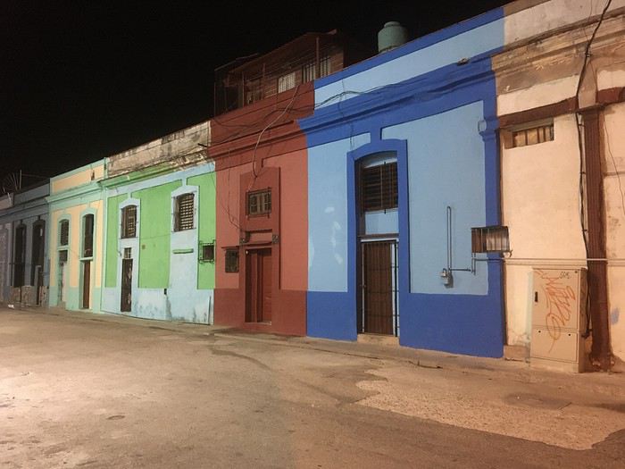
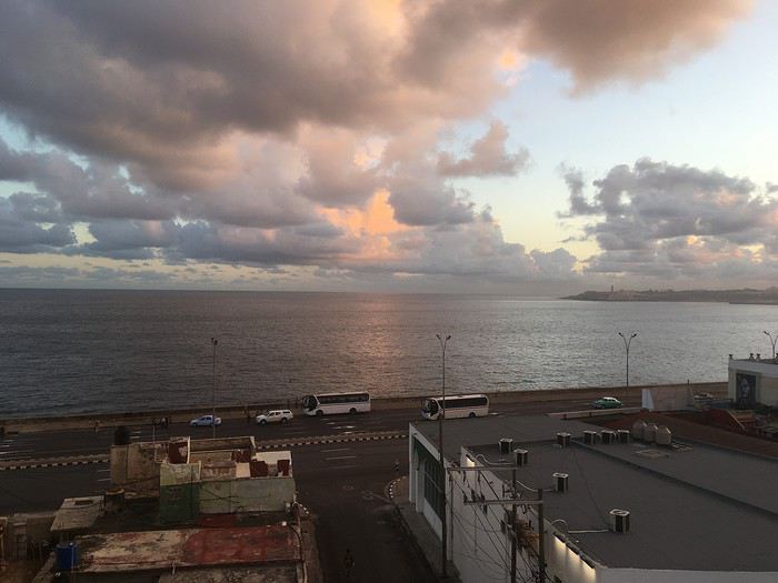
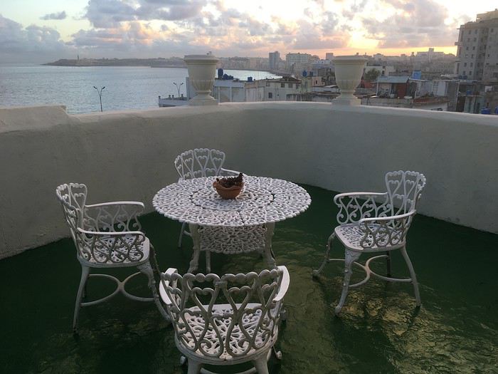
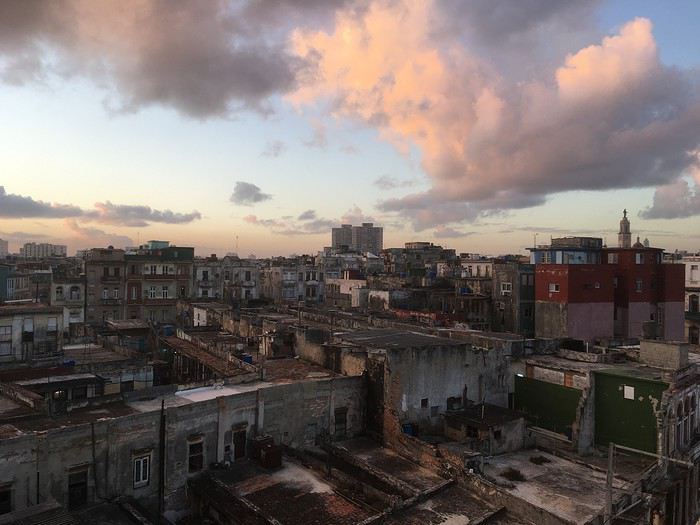
Premier réveil (dur, dur) cubain depuis la terrasse de la casa, après une très courte nuit (et jetlag) , dont la première partie fut passée à la Fabrica del Arte (http://www.fac.cu/) où le festival de jazz attirait une foule très éclectique !
Une volonté de changer de cap pour renouer avec une zone régionale, une culture latino et une histoire politique et sociale, négligées depuis plus de 3 décennies me titillait depuis quelques temps….
Alors, direction les Caraïbes, le pays de Cespedes et Marti pour 24 jours entre janvier et février.
Comme d’habitude, pas mal de lectures, sur VF notamment (grands mercis à Jeeaan, https://voyageforum.com/v.f?post=7694939;#7694939, à Ming2 pour ses 2 carnets en particulier https://voyageforum.com/v.f?post=6977052;#6977052et https://voyageforum.com/v.f?post=7425832;#7425832; à Anne42 https://voyageforum.com/discussion/trois-semaines-havane-baracoa-d8719358/ ainsi quà Stbeat), de blogs, d’articles divers, et de guides avaient permis de fixer un planning très général, avec pour commencer après une courte découverte de La Havane, direction l'Oriente et Baracoa par un vol intérieur pour une petite semaine.
Seules les 2 premières nuits à La Havane en "casa particular", avec vue sur le mythique Malecon, étaient réservées, ainsi que les 6 jours suivants chez Roberto et Manuel à Baracoa.
Premier réveil (dur, dur) cubain depuis la terrasse de la casa, après une très courte nuit (et jetlag) , dont la première partie fut passée à la Fabrica del Arte (http://www.fac.cu/) où le festival de jazz attirait une foule très éclectique !
Compte rendu Cuba 2020 English translation pending
🙂
En ces temps difficiles, rien que une bonne lecture évasive à la maison CUBA 2020
>>>14 jours >>>5 villes coloniale >>>1500 kms en Ford 195 >>>4 sites UNESCO >>>8 casas particulares utilisées >>>beaucoup de langoustes
Références : Application MAPS.ME Page FB : Je pars à Cuba Page FB : Les français à Cuba Page FB : Cuba : conseils pour bien préparer son voyage www.cubanoscope.com www.jeparsacuba.com Carte Cuba 1.1000000 BORCH plastifiée Guide du Routard CUBA 2019
JOUR 1 : PARIS>>>LA HAVANE 10h de vol 25° (samedi 18/01/2020) Voilà c’est le départ tant attendu, direction l’aéroport d’Orly pour un vol direct à destination de la Havane, capitale de CUBA. Nous sommes à l’aéroport vers 08h00 pour un décollage à 10h00 sur la compagnie Air Caraïbes que nous testons pour la première fois. Nous sommes dans une boutique DutyFree, pour quelques achats, lorsqu’une annonce retentit et nous concerne. Notre vol est retardé de 2h30 ! Bon bin, il va falloir attendre, on finit nos achats, qui seront gardés à Orly, jusqu’à notre retour (pratique). Nous sommes en salle d’embarquement F21, on nous remet une attestation de retard de la part de la compagnie, et on nous sert un petit piquenique. La raison invoquée par Air Caraïbes, est qu’ils ont dû changer d’appareil, alors que depuis 08h00 que nous sommes là, en porte F21, il y a un avion Air Caraïbes qui est au stationnement, il y restera jusqu’à notre décollage qui sera effectif à 13h20, soit 3h20 de retard au décollage (ce changement d’appareil a-t-il eu lieu>>>mystère….).
J’ai eu le temps de prévenir 2 personnes à La Havane, de notre retard, une qui doit nous donner des réservations faites en ligne, et notre chauffeur Pavel, qui nous attend à l’aéroport. Les 10h30 de vol se passent très bien, on a trouvé les services à bord d’un bon niveau, équipage agréable et divertissements très variés. On se pose donc à 17h30 heure locale au lieu de 14h40. Il y a pas mal de monde aux guichets immigration, mais nous passons assez rapidement la douane munis de notre carte de tourisme (visa) en main, un tampon de plus dans le passeport et nous passons (notre assurance rapatriement ne nous a pas été demandée, mais elle est obligatoire). Nous n’avons pas de bagages en soute, alors nous nous dirigeons vers la sortie, tout en constatant qu’il faudrait un papier bleu rempli, que nous n’avons pas. Une personne récupère ce papier, un papier pour une famille, un peu perdus, on suit un peu tout le monde, la personne est un peu submergée, et nous passons avec d’autres personnes.
Un fois sortis, nous repérons facilement Pavel (notre chauffeur privé pour 2 semaines) avec la pancarte à nos noms. Nous allons directement échanger en espagnol, et cela pour toute la durée du voyage. Voulant faire du change, je lui demande où cela est possible, et il y a un guichet à droite en sortant. Mais, il me propose de le faire avec lui, et au même taux, c’est parfait. Il m’expliquera que cela l’intéresse d’avoir des euros ou des dollars pour acheter des pièces de voitures au cas où, et qu’il paie cela dans une de ces deux monnaies.
FOCUS MONNAIE A CUBA : Bon à savoir, à Cuba il existe 2 monnaies en vigueur, un peso national (CUP) pour les cubains et un peso convertible (CUC) pour les touristes, ces 2 monnaies ne sont pas récupérables en dehors du territoire cubain, donc il faut arriver avec des espèces, attention une commission supplémentaire est prise en cas de change avec des dollars américains. Et avoir sa CB pour des retraits possibles en ville.
Et un des moments tant attendus arrive, nous découvrons notre voiture, une FORD 1953 Customline Sedan bleu, Pavel la tient de son père, et elle a été entièrement refaite. Et nous voici partis vers la ville, on voit déjà énormément de voitures américaines des années 50 et 60, il y en a partout en fait. La nuit tombe maintenant, puisque nous sommes arrivés en retard, et Pavel gentiment nous propose un tour de ville vers les spots illuminés de La Havane, on est vraiment dans le bain, le Capitolio, le théâtre national, nous remontons le Paseo del Prado, on en avait rêvé, on y est !!!
Pavel nous dépose ensuite à notre hébergement, nous sommes chez l’habitant (et cela durera 2 semaines). Nous sommes à la Casa Esperanza, chez Henri, français et Esperanza, cubaine sa femme. Il s’agit d’une maison de 1910 entièrement rénovée en 11 mois !
FOCUS HEBERGEMENT A CUBA : Cuba étant pendant longtemps un pays assez fermé, l’offre en hébergement touristique est restée faible et d’état, l’hôtellerie n’est pas dans le meilleur des états et n’est pas bien rénovée faute d’argent. Ainsi, face à la demande touristique grandissante, dès 1997, Fidel Castro a ainsi autorisé les particuliers à louer deux chambres maximum à des étrangers. En 2011, le régime a dû libéraliser cette location. Il est désormais légal de louer plus de deux chambres par logement voire même une maison entière. (Tarifs moyens 15 à 40 CUC par nuit, environ 13,50 à 36€). Il y a environ aujourd’hui à La Havane plus de 800 casa particular.
Nous laissons Pavel pour ce soir et nous le retrouverons lundi matin. Henri nous indique un petit itinéraire pour aller se restaurer. Notre hébergement est dans le quartier de la vieille Havane, pratique où tout peut se faire à pied. Nous allons donc partir à pied, il fait nuit, les cubains sont très souvent dehors et dans la rue, ce que nous remarquons de suite, c’est l’état déplorable, ou en ruine, de pas mal de maisons coloniales ou début XXème. A pied, on peut vraiment avoir l’impression d’être en insécurité, il fait nuit, on voit de tout, ruines, animaux et cubains, et en fait il n’en est rien du tout, c’est très sécuritaire malgré la vision que nous percevons. A 5mn, nous rejoignons la Plaza Vieja, superbe place coloniale rénovée aux façades authentiques, plusieurs restaurants, et surtout ce que nous rêvions aussi, on est samedi soir, la musique cubaine est là, dans les maisons ou dans la rue, on y est !!! On trouve un petit resto et notre premier mojito ! Retour à l’hébergement, il est 21h30, on commence à absorber le jetlag, bonne nuit.
>>>14 jours >>>5 villes coloniale >>>1500 kms en Ford 195 >>>4 sites UNESCO >>>8 casas particulares utilisées >>>beaucoup de langoustes
Références : Application MAPS.ME Page FB : Je pars à Cuba Page FB : Les français à Cuba Page FB : Cuba : conseils pour bien préparer son voyage www.cubanoscope.com www.jeparsacuba.com Carte Cuba 1.1000000 BORCH plastifiée Guide du Routard CUBA 2019
JOUR 1 : PARIS>>>LA HAVANE 10h de vol 25° (samedi 18/01/2020) Voilà c’est le départ tant attendu, direction l’aéroport d’Orly pour un vol direct à destination de la Havane, capitale de CUBA. Nous sommes à l’aéroport vers 08h00 pour un décollage à 10h00 sur la compagnie Air Caraïbes que nous testons pour la première fois. Nous sommes dans une boutique DutyFree, pour quelques achats, lorsqu’une annonce retentit et nous concerne. Notre vol est retardé de 2h30 ! Bon bin, il va falloir attendre, on finit nos achats, qui seront gardés à Orly, jusqu’à notre retour (pratique). Nous sommes en salle d’embarquement F21, on nous remet une attestation de retard de la part de la compagnie, et on nous sert un petit piquenique. La raison invoquée par Air Caraïbes, est qu’ils ont dû changer d’appareil, alors que depuis 08h00 que nous sommes là, en porte F21, il y a un avion Air Caraïbes qui est au stationnement, il y restera jusqu’à notre décollage qui sera effectif à 13h20, soit 3h20 de retard au décollage (ce changement d’appareil a-t-il eu lieu>>>mystère….).
J’ai eu le temps de prévenir 2 personnes à La Havane, de notre retard, une qui doit nous donner des réservations faites en ligne, et notre chauffeur Pavel, qui nous attend à l’aéroport. Les 10h30 de vol se passent très bien, on a trouvé les services à bord d’un bon niveau, équipage agréable et divertissements très variés. On se pose donc à 17h30 heure locale au lieu de 14h40. Il y a pas mal de monde aux guichets immigration, mais nous passons assez rapidement la douane munis de notre carte de tourisme (visa) en main, un tampon de plus dans le passeport et nous passons (notre assurance rapatriement ne nous a pas été demandée, mais elle est obligatoire). Nous n’avons pas de bagages en soute, alors nous nous dirigeons vers la sortie, tout en constatant qu’il faudrait un papier bleu rempli, que nous n’avons pas. Une personne récupère ce papier, un papier pour une famille, un peu perdus, on suit un peu tout le monde, la personne est un peu submergée, et nous passons avec d’autres personnes.
Un fois sortis, nous repérons facilement Pavel (notre chauffeur privé pour 2 semaines) avec la pancarte à nos noms. Nous allons directement échanger en espagnol, et cela pour toute la durée du voyage. Voulant faire du change, je lui demande où cela est possible, et il y a un guichet à droite en sortant. Mais, il me propose de le faire avec lui, et au même taux, c’est parfait. Il m’expliquera que cela l’intéresse d’avoir des euros ou des dollars pour acheter des pièces de voitures au cas où, et qu’il paie cela dans une de ces deux monnaies.
FOCUS MONNAIE A CUBA : Bon à savoir, à Cuba il existe 2 monnaies en vigueur, un peso national (CUP) pour les cubains et un peso convertible (CUC) pour les touristes, ces 2 monnaies ne sont pas récupérables en dehors du territoire cubain, donc il faut arriver avec des espèces, attention une commission supplémentaire est prise en cas de change avec des dollars américains. Et avoir sa CB pour des retraits possibles en ville.
Et un des moments tant attendus arrive, nous découvrons notre voiture, une FORD 1953 Customline Sedan bleu, Pavel la tient de son père, et elle a été entièrement refaite. Et nous voici partis vers la ville, on voit déjà énormément de voitures américaines des années 50 et 60, il y en a partout en fait. La nuit tombe maintenant, puisque nous sommes arrivés en retard, et Pavel gentiment nous propose un tour de ville vers les spots illuminés de La Havane, on est vraiment dans le bain, le Capitolio, le théâtre national, nous remontons le Paseo del Prado, on en avait rêvé, on y est !!!
Pavel nous dépose ensuite à notre hébergement, nous sommes chez l’habitant (et cela durera 2 semaines). Nous sommes à la Casa Esperanza, chez Henri, français et Esperanza, cubaine sa femme. Il s’agit d’une maison de 1910 entièrement rénovée en 11 mois !
FOCUS HEBERGEMENT A CUBA : Cuba étant pendant longtemps un pays assez fermé, l’offre en hébergement touristique est restée faible et d’état, l’hôtellerie n’est pas dans le meilleur des états et n’est pas bien rénovée faute d’argent. Ainsi, face à la demande touristique grandissante, dès 1997, Fidel Castro a ainsi autorisé les particuliers à louer deux chambres maximum à des étrangers. En 2011, le régime a dû libéraliser cette location. Il est désormais légal de louer plus de deux chambres par logement voire même une maison entière. (Tarifs moyens 15 à 40 CUC par nuit, environ 13,50 à 36€). Il y a environ aujourd’hui à La Havane plus de 800 casa particular.
Nous laissons Pavel pour ce soir et nous le retrouverons lundi matin. Henri nous indique un petit itinéraire pour aller se restaurer. Notre hébergement est dans le quartier de la vieille Havane, pratique où tout peut se faire à pied. Nous allons donc partir à pied, il fait nuit, les cubains sont très souvent dehors et dans la rue, ce que nous remarquons de suite, c’est l’état déplorable, ou en ruine, de pas mal de maisons coloniales ou début XXème. A pied, on peut vraiment avoir l’impression d’être en insécurité, il fait nuit, on voit de tout, ruines, animaux et cubains, et en fait il n’en est rien du tout, c’est très sécuritaire malgré la vision que nous percevons. A 5mn, nous rejoignons la Plaza Vieja, superbe place coloniale rénovée aux façades authentiques, plusieurs restaurants, et surtout ce que nous rêvions aussi, on est samedi soir, la musique cubaine est là, dans les maisons ou dans la rue, on y est !!! On trouve un petit resto et notre premier mojito ! Retour à l’hébergement, il est 21h30, on commence à absorber le jetlag, bonne nuit.
Visas pour l'Inde suspendus pour les ressortissants de France, Espagne et Allemagne English translation pending
Tout est dans le titre...Je suis 🏴☠️ !
la mauvaise nouvelle ici
Discussion autour du concours du mois de mars 2020: Seul(e) au monde ou la solitude English translation pending
Bonjour 😉
C'est ici - et uniquement ici - qu'on discute à propos de la thématique du mois : Seul(e) au monde - concours photo du mois de Mars 2020
C'est ici - et uniquement ici - qu'on discute à propos de la thématique du mois : Seul(e) au monde - concours photo du mois de Mars 2020
Voyage au Caire - Janvier 2020 English translation pending
Bonjour à tous.
Voilà un « petit » carnet de voyage (mon premier sur le forum) de mon voyage au Caire. Si jamais ça peut aider certains a organiser leur séjour là bas.
Pour les infos générales, j'ai voyage du 26/01 au 06/02 2020 J'ai logé les dix jours et dix nuits sur place dans un airbnb dans le quartier d'Héliopolis. Il a fait beau tout le séjour, pas une goutte d'eau, et des températures en journée allant de 18 à 22 degrés. J'ai voyagé seul.
Jour 1
Départ vers 14h de l'Aisne (en voiture) pour un départ en avion prévu à 18h10. L'avion part à l'heure et le vol ce passe sans problèmes. Arrivé au Caire à 23h30 heure locale, pas mal de monde au passage de la frontière, je suis sorti de l'aéroport à 1h, j'ai retiré de l'argent sur un ATM et pris un taxi pour mon airbnb. Arrivé à ma chambre à 2h.
Info : Visa pris sur place pour 25USD. Le taxi m'a coûté 200egp (je sais c'est un peu cher, mais j'ai eu ma flegme de négocier vu l'heure).
Jour 2
Après avoir fait la grasse mat', j'ai pris le métro (ligne 1) jusqu'à la station Al-Shohadaa et de la j'ai marché jusqu'à la place Tahrir. Pour ce qui est de marcher au Caire, contrairement à ce que j'ai pu lire, ça reste possible tant qu'il n'y a pas de gros axes routiers a traverser, ce qui était le cas ici.
Ensuite visite à pied de l’île de Gezira qui ce trouve juste à coté, ensuite je suis rentré par le métro (ligne 2 puis 3) de la station Opéra (Gezira).
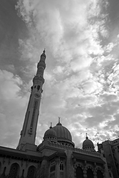
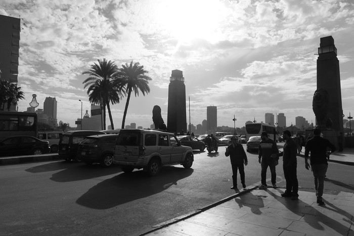
Info : Le métro coûte entre 3 et 7 egp selon la distance, pour le ticket il suffit d'aller au guichet et de demander un ticket pour la station on l'on souhaite se rendre, attention toutefois à la prononciation des stations !!
Jour 3
Aujourd'hui je visite le musée Égyptien, pas beaucoup de file d'attente, je rentre assez rapidement. Le musée est vraiment incroyable, j'y passe environ 4h. On regrettera quand même un manque d'éclairages et surtout de cartels avec des informations sur les objets présentés, et de bancs aussi ! Malgré tout la visite est agréable.
Info : L'entrée m'a coûté 200egp, attention il faut payer 50egp de plus pour utiliser son appareil photo. Pour y aller en métro descendre à Sadat et sortir par la sortie rue El Tahrir qui vous conduit en face du musée et vous évite de traverser la route !
Jour 4
En recherchant un endroit où faire de la randonné j'ai trouvé ce lieu sur Instagram, à 20km du centre du Caire seulement. Il s'agit d'un endroit assez désertique, un peu montagneux (un wadi quoi ...) , le paysage est magnifique, c'est très bien balisé, passage de la police de temps à autre, et les personnes à l'accueil parle bien anglais. J'ai fait une très belle rando !
Pour m'y rendre, j'ai pris le métro (ligne 1) jusqu'à la station Tora El-Balad et ensuite j'ai pris un taxi jusqu'à l'entrée du site, et au retour un taxi jusqu'à mon logement. Par contre j'ai du marcher un peu (environ 1km) pour retrouver un taxi pour le retour.
Info : L'entrée du site coûte 10 egp (oui seulement!), le taxi m'a coûté en tout 200egp (sachant que le trajet retour était long, en temps et en distance).
Jour 5
Aujourd'hui je faire un tour dans le vieux Caire, j'ai pris le métro jusqu'à la station Bab El Shaariya (ligne 3), puis à pied jusqu'à Khan el Khalili en passant pas la Bab al-Futuh, quartier très sympa, pas mal de touriste, beaucoup de belles boutiques. J'ai rien acheté mais j'y repasserais plus tard pendant mon séjour. Après avoir fait des tours et des détours, m'être perdu aussi, je prends un taxi pour place Tahrir, et ensuite je repars sur l’île de Gezira pour manger un morceau avant de retourner en soirée à mon logement.
Info : Le taxi de Khan el Khalili à Tahrir m'a coûté 90egp (avec un pourboire). En ce qui concerne les vendeurs du souk, j'ai eu aucun soucis (contrairement à ce que j'ai pu lire parfois), un non merci (en arabe c'est mieux) suffit pour qu'ils vous laisse tranquille.
Jour 6
Pour cette journée j'ai eu envie de découvrir la ville d'Helwan à une trentaine de km au sud du Caire, Relié par le métro (ligne 1) j'y suis en 1h de temps depuis Héliopolis. Je visite le centre ville et le jardin Japonais, qui a probablement était très joli, mais qui aujourd'hui ne l'ai plus du tout (déchets, statues brisées, mal entretenu en général et plus d'eau dans les bassins), dommage. En dehors de ça la ville est plaisante je trouve. J'y reste tout l’après midi. Retour en soirée à Héliopolis pour manger et retourner au logement.
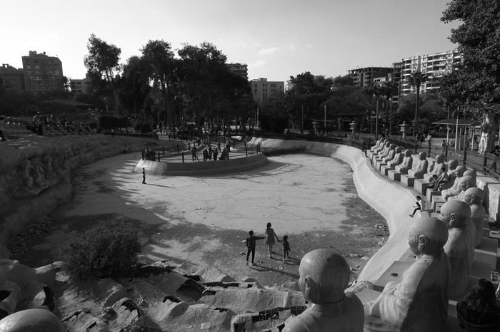
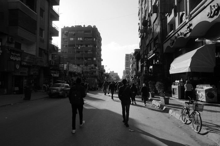
Info : Le métro est un peu long pour y aller mais passé la station Opéra le métro se vide beaucoup ce qui permet de passer la plus longue partie du trajet assis. Le jardin Japonais m'a coûté 10egp pour rentrer.
Jour 7
Après 5 jours sur place, je me décide enfin a aller voir les pyramides, les fameuses ! Pour cela j'ai pris le métro (oui j'adore les déplacements en métro) jusqu’à la station Giza et de la j'ai pris un taxi jusqu'au pyramides. Enfin pas vraiment jusqu'au pyramides, arrivé à 2km de l'entrée des mecs qui essaye de me vendre des tours en dromadaires arrête le taxi pour dire que c'est pas possible que je dois continuer en dromadaires etc, je dis non, le taxi me dépose un peu plus loin car d'autres vendeurs refuse de laisser passer le taxi plus loin, je fais le reste du chemin à pied jusqu'à l'entrée du site. Pas de longue file d'attente coté « foreigner » je rentre rapidement sur le site. Beaucoup de vendeurs et de monde à l'entrée du site, mais dès que l'on s'éloigne un peu on peut enfin admirer les pyramides tranquillement et sans personnes au alentours. Magnifique. Après y avoir passer quelques heures je reprends le taxi pour la station Giza (plus dur de négocier un tarif correcte dans ce sens là) et ensuite je pars faire un tour dans le centre avant de rentrer le soir.
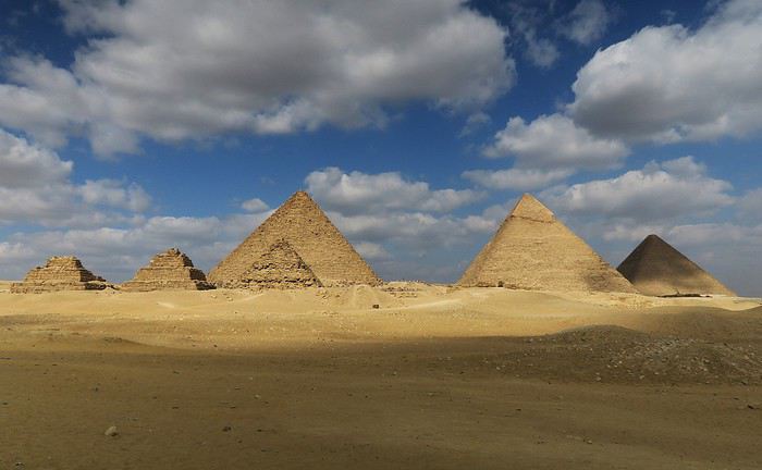
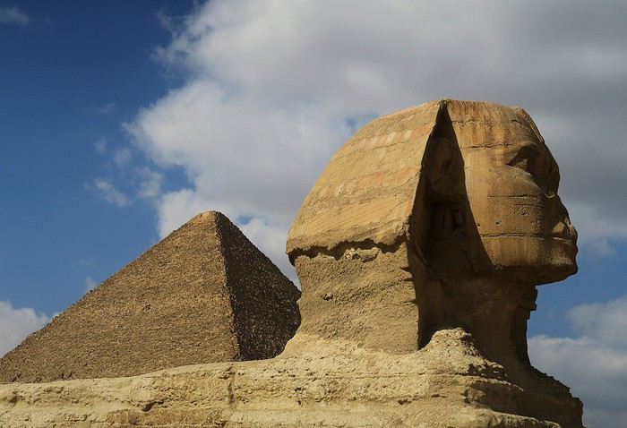
Info : L'entrée pour le plateau m'a coûté 200egp, et le taxi aller-retour 130egp.
Jour 8
Ce jour ci je décide de retourner au souk pour y faire quelques achats, notamment une très jolie chevalière en argent, pour le reste j'en ai déjà parlé plus haut alors je vais pas m'éterniser sur cette journée !
Jour 9
Et c'est reparti pour voir des pyramides !! Cette fois ci à Saqqarah, à 30-35 km du Caire. Pour y aller j'essaye de trouver un taxi pour plusieurs heures (qui m'y conduise, m'attende sur le site et me reconduise « chez moi ») pas facile beaucoup ne veulent pas, je fini par en trouver un après en avoir arrêté une dizaine. Le chauffeur est super sympa, je visite le site avec lui car avec le billet d'entrée j'ai eu (sans payer en plus) un ticket pour le chauffeur. Moment très sympa, le chauffeur semble découvrir le site en même temps que moi (il ne parle pas anglais mais on communique comme on peut avec mes micro connaissances de la langue arabe). Le site est bien plus agréable que Gizeh je trouve, moins de sollicitations, moins de monde, et le paysage autours est beaucoup plus impressionnant. Au retour le taxi passe par la Citadelle et la cité des morts, il ralenti et m’ouvre la vitre pour que je puisse prendre des photos, cool !
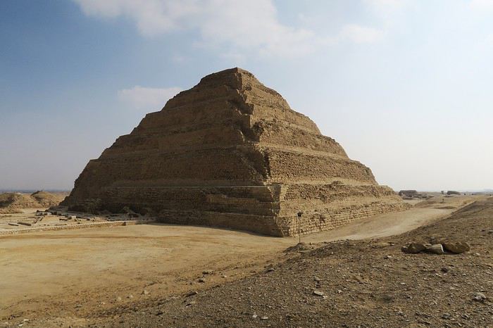
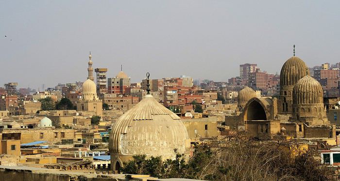
Info : Le taxi m'a coûté 600egp pour environ 5h de temps et 70/80 km (pourboires compris) et l'entrée pour le site et le musée 180egp.
Jour 10
De nouveau des pyramides, à une dizaine de km au sud de Saqqarah, j'ai pas pu y aller la journée d'avant car le temps de trouver un taxi, et les bouchons sur la route m’ont fait arriver assez tard à Saqqarah et j'aurais pas eu le temps de visiter Dahchour, donc j'y vais aujourd'hui. Cette fois ci je prends le métro jusqu'à El Mounib pour sortir plus facilement de la ville en taxi. Je trouve plus facilement un taxi, qui comme la journée d'avant me dépose, m'attend, et me redépose à El Mounib. Le site est magnifique, le paysage superbe, et de plus il n'y presque personnes sur le site, passé une demi heure sur place je fini même par me retrouver tout seul, je me sens comme un explorateur découvrant les pyramides dans le désert, c'est génial. Après avoir fait le tour du site et pris pas mal de photos je retourne en taxi puis en métro à mon logement.
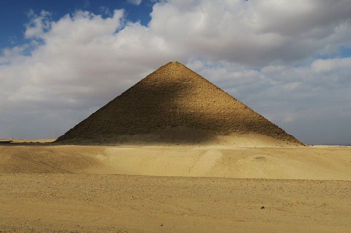
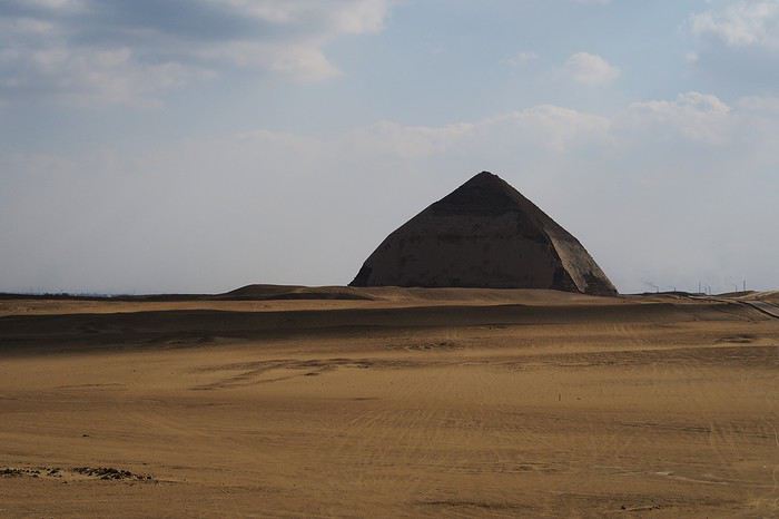
Info : Le taxi m'a coûté 500egp (pourboire compris) et l'entrée du site 60egp.
Jour 11
Dernier jour sur place, je pars en métro jusqu'à la station Mar Girgis (ligne 1) qui me dépose pile poil en face du vieux Caire et de ses églises. Je suis arrivé assez tard alors je ne pourrais faire que la visite des églises et du petit bazar un peu plus loin.
En toute fin d'après midi je prends la direction de l’île de Gezira ou je mange une dernière fois en ville, sur les bords du Nil. Je profite une dernière fois de la nuit au Caire avant de repartir à mon logement pour récupérer ma valise et prendre un taxi pour l'aéroport où j'arrive à 21h30 pour un départ à 1h50 du matin. (j'ai prévu un peu trop large au final).
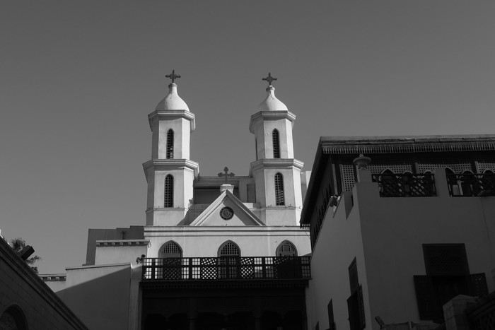
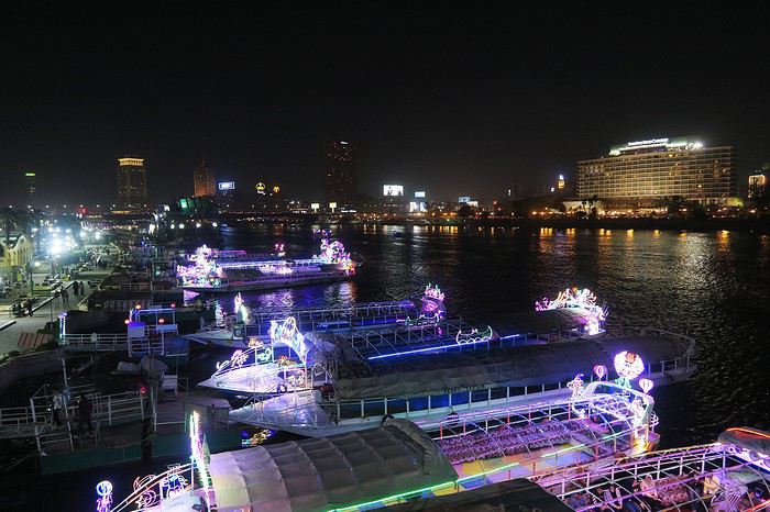
Info : Le taxi pour l’aéroport me coûte 150egp.
Jour 12
Arrivé à Paris CDG à 5h30 du matin après un vol mouvementé. Le passage de la PAF est assez long, beaucoup de monde et surtout la moitié des PARAFE sont hors service. Après avoir récupéré mon bagage et passé la douane, direction la gare RER (facile a trouver) pour partir gare du Nord pour ensuite prendre un TER pour rentrer chez moi.
Info : Le ticket RER coûte 10,30€ (deux fois plus cher qu'un RER A pour 5 zones …).
Résumé :
Je crois que la première chose que je souhaite dire c'est que j'ai adoré mon séjour au Caire. Les gens sont d'une gentillesse incroyable, et la ville (bien qu'assez chaotique) est très enthousiasmante.
Pour ce qui concerne la sécurité (sujet sensible pour cette destination) je me suis jamais senti en insécurité, le métro est sous bonne garde, de même que les hauts lieux touristiques, et même dans les quartiers non touristiques je me suis jamais senti en insécurité.
Je voudrais faire le points également sur les taxis et les vendeurs, j'en ai lu beaucoup de mal, et franchement je comprends pas du tout pourquoi (en dehors de ce sur le site de Gizeh qui effectivement sont très agaçant), j'ai jamais eu de problèmes, et les taxis on tous étaient très gentil.
Bonne journée à tous. Gaëtan.
Voilà un « petit » carnet de voyage (mon premier sur le forum) de mon voyage au Caire. Si jamais ça peut aider certains a organiser leur séjour là bas.
Pour les infos générales, j'ai voyage du 26/01 au 06/02 2020 J'ai logé les dix jours et dix nuits sur place dans un airbnb dans le quartier d'Héliopolis. Il a fait beau tout le séjour, pas une goutte d'eau, et des températures en journée allant de 18 à 22 degrés. J'ai voyagé seul.
Jour 1
Départ vers 14h de l'Aisne (en voiture) pour un départ en avion prévu à 18h10. L'avion part à l'heure et le vol ce passe sans problèmes. Arrivé au Caire à 23h30 heure locale, pas mal de monde au passage de la frontière, je suis sorti de l'aéroport à 1h, j'ai retiré de l'argent sur un ATM et pris un taxi pour mon airbnb. Arrivé à ma chambre à 2h.
Info : Visa pris sur place pour 25USD. Le taxi m'a coûté 200egp (je sais c'est un peu cher, mais j'ai eu ma flegme de négocier vu l'heure).
Jour 2
Après avoir fait la grasse mat', j'ai pris le métro (ligne 1) jusqu'à la station Al-Shohadaa et de la j'ai marché jusqu'à la place Tahrir. Pour ce qui est de marcher au Caire, contrairement à ce que j'ai pu lire, ça reste possible tant qu'il n'y a pas de gros axes routiers a traverser, ce qui était le cas ici.
Ensuite visite à pied de l’île de Gezira qui ce trouve juste à coté, ensuite je suis rentré par le métro (ligne 2 puis 3) de la station Opéra (Gezira).
Info : Le métro coûte entre 3 et 7 egp selon la distance, pour le ticket il suffit d'aller au guichet et de demander un ticket pour la station on l'on souhaite se rendre, attention toutefois à la prononciation des stations !!
Jour 3
Aujourd'hui je visite le musée Égyptien, pas beaucoup de file d'attente, je rentre assez rapidement. Le musée est vraiment incroyable, j'y passe environ 4h. On regrettera quand même un manque d'éclairages et surtout de cartels avec des informations sur les objets présentés, et de bancs aussi ! Malgré tout la visite est agréable.
Info : L'entrée m'a coûté 200egp, attention il faut payer 50egp de plus pour utiliser son appareil photo. Pour y aller en métro descendre à Sadat et sortir par la sortie rue El Tahrir qui vous conduit en face du musée et vous évite de traverser la route !
Jour 4
En recherchant un endroit où faire de la randonné j'ai trouvé ce lieu sur Instagram, à 20km du centre du Caire seulement. Il s'agit d'un endroit assez désertique, un peu montagneux (un wadi quoi ...) , le paysage est magnifique, c'est très bien balisé, passage de la police de temps à autre, et les personnes à l'accueil parle bien anglais. J'ai fait une très belle rando !
Pour m'y rendre, j'ai pris le métro (ligne 1) jusqu'à la station Tora El-Balad et ensuite j'ai pris un taxi jusqu'à l'entrée du site, et au retour un taxi jusqu'à mon logement. Par contre j'ai du marcher un peu (environ 1km) pour retrouver un taxi pour le retour.
Info : L'entrée du site coûte 10 egp (oui seulement!), le taxi m'a coûté en tout 200egp (sachant que le trajet retour était long, en temps et en distance).
Jour 5
Aujourd'hui je faire un tour dans le vieux Caire, j'ai pris le métro jusqu'à la station Bab El Shaariya (ligne 3), puis à pied jusqu'à Khan el Khalili en passant pas la Bab al-Futuh, quartier très sympa, pas mal de touriste, beaucoup de belles boutiques. J'ai rien acheté mais j'y repasserais plus tard pendant mon séjour. Après avoir fait des tours et des détours, m'être perdu aussi, je prends un taxi pour place Tahrir, et ensuite je repars sur l’île de Gezira pour manger un morceau avant de retourner en soirée à mon logement.
Info : Le taxi de Khan el Khalili à Tahrir m'a coûté 90egp (avec un pourboire). En ce qui concerne les vendeurs du souk, j'ai eu aucun soucis (contrairement à ce que j'ai pu lire parfois), un non merci (en arabe c'est mieux) suffit pour qu'ils vous laisse tranquille.
Jour 6
Pour cette journée j'ai eu envie de découvrir la ville d'Helwan à une trentaine de km au sud du Caire, Relié par le métro (ligne 1) j'y suis en 1h de temps depuis Héliopolis. Je visite le centre ville et le jardin Japonais, qui a probablement était très joli, mais qui aujourd'hui ne l'ai plus du tout (déchets, statues brisées, mal entretenu en général et plus d'eau dans les bassins), dommage. En dehors de ça la ville est plaisante je trouve. J'y reste tout l’après midi. Retour en soirée à Héliopolis pour manger et retourner au logement.
Info : Le métro est un peu long pour y aller mais passé la station Opéra le métro se vide beaucoup ce qui permet de passer la plus longue partie du trajet assis. Le jardin Japonais m'a coûté 10egp pour rentrer.
Jour 7
Après 5 jours sur place, je me décide enfin a aller voir les pyramides, les fameuses ! Pour cela j'ai pris le métro (oui j'adore les déplacements en métro) jusqu’à la station Giza et de la j'ai pris un taxi jusqu'au pyramides. Enfin pas vraiment jusqu'au pyramides, arrivé à 2km de l'entrée des mecs qui essaye de me vendre des tours en dromadaires arrête le taxi pour dire que c'est pas possible que je dois continuer en dromadaires etc, je dis non, le taxi me dépose un peu plus loin car d'autres vendeurs refuse de laisser passer le taxi plus loin, je fais le reste du chemin à pied jusqu'à l'entrée du site. Pas de longue file d'attente coté « foreigner » je rentre rapidement sur le site. Beaucoup de vendeurs et de monde à l'entrée du site, mais dès que l'on s'éloigne un peu on peut enfin admirer les pyramides tranquillement et sans personnes au alentours. Magnifique. Après y avoir passer quelques heures je reprends le taxi pour la station Giza (plus dur de négocier un tarif correcte dans ce sens là) et ensuite je pars faire un tour dans le centre avant de rentrer le soir.
Info : L'entrée pour le plateau m'a coûté 200egp, et le taxi aller-retour 130egp.
Jour 8
Ce jour ci je décide de retourner au souk pour y faire quelques achats, notamment une très jolie chevalière en argent, pour le reste j'en ai déjà parlé plus haut alors je vais pas m'éterniser sur cette journée !
Jour 9
Et c'est reparti pour voir des pyramides !! Cette fois ci à Saqqarah, à 30-35 km du Caire. Pour y aller j'essaye de trouver un taxi pour plusieurs heures (qui m'y conduise, m'attende sur le site et me reconduise « chez moi ») pas facile beaucoup ne veulent pas, je fini par en trouver un après en avoir arrêté une dizaine. Le chauffeur est super sympa, je visite le site avec lui car avec le billet d'entrée j'ai eu (sans payer en plus) un ticket pour le chauffeur. Moment très sympa, le chauffeur semble découvrir le site en même temps que moi (il ne parle pas anglais mais on communique comme on peut avec mes micro connaissances de la langue arabe). Le site est bien plus agréable que Gizeh je trouve, moins de sollicitations, moins de monde, et le paysage autours est beaucoup plus impressionnant. Au retour le taxi passe par la Citadelle et la cité des morts, il ralenti et m’ouvre la vitre pour que je puisse prendre des photos, cool !
Info : Le taxi m'a coûté 600egp pour environ 5h de temps et 70/80 km (pourboires compris) et l'entrée pour le site et le musée 180egp.
Jour 10
De nouveau des pyramides, à une dizaine de km au sud de Saqqarah, j'ai pas pu y aller la journée d'avant car le temps de trouver un taxi, et les bouchons sur la route m’ont fait arriver assez tard à Saqqarah et j'aurais pas eu le temps de visiter Dahchour, donc j'y vais aujourd'hui. Cette fois ci je prends le métro jusqu'à El Mounib pour sortir plus facilement de la ville en taxi. Je trouve plus facilement un taxi, qui comme la journée d'avant me dépose, m'attend, et me redépose à El Mounib. Le site est magnifique, le paysage superbe, et de plus il n'y presque personnes sur le site, passé une demi heure sur place je fini même par me retrouver tout seul, je me sens comme un explorateur découvrant les pyramides dans le désert, c'est génial. Après avoir fait le tour du site et pris pas mal de photos je retourne en taxi puis en métro à mon logement.
Info : Le taxi m'a coûté 500egp (pourboire compris) et l'entrée du site 60egp.
Jour 11
Dernier jour sur place, je pars en métro jusqu'à la station Mar Girgis (ligne 1) qui me dépose pile poil en face du vieux Caire et de ses églises. Je suis arrivé assez tard alors je ne pourrais faire que la visite des églises et du petit bazar un peu plus loin.
En toute fin d'après midi je prends la direction de l’île de Gezira ou je mange une dernière fois en ville, sur les bords du Nil. Je profite une dernière fois de la nuit au Caire avant de repartir à mon logement pour récupérer ma valise et prendre un taxi pour l'aéroport où j'arrive à 21h30 pour un départ à 1h50 du matin. (j'ai prévu un peu trop large au final).
Info : Le taxi pour l’aéroport me coûte 150egp.
Jour 12
Arrivé à Paris CDG à 5h30 du matin après un vol mouvementé. Le passage de la PAF est assez long, beaucoup de monde et surtout la moitié des PARAFE sont hors service. Après avoir récupéré mon bagage et passé la douane, direction la gare RER (facile a trouver) pour partir gare du Nord pour ensuite prendre un TER pour rentrer chez moi.
Info : Le ticket RER coûte 10,30€ (deux fois plus cher qu'un RER A pour 5 zones …).
Résumé :
Je crois que la première chose que je souhaite dire c'est que j'ai adoré mon séjour au Caire. Les gens sont d'une gentillesse incroyable, et la ville (bien qu'assez chaotique) est très enthousiasmante.
Pour ce qui concerne la sécurité (sujet sensible pour cette destination) je me suis jamais senti en insécurité, le métro est sous bonne garde, de même que les hauts lieux touristiques, et même dans les quartiers non touristiques je me suis jamais senti en insécurité.
Je voudrais faire le points également sur les taxis et les vendeurs, j'en ai lu beaucoup de mal, et franchement je comprends pas du tout pourquoi (en dehors de ce sur le site de Gizeh qui effectivement sont très agaçant), j'ai jamais eu de problèmes, et les taxis on tous étaient très gentil.
Bonne journée à tous. Gaëtan.
Sécurité des touristes en Jordanie et au Moyen-Orient English translation pending
J'ai planifié un voyage en Jordanie en mai 2020 pour 7 jours. Je suis inquiète de la sécurité des touristes en Jordanie et au moyen-orient et la couverture journalistique au Québec est très mauvaise pour ce coin du monde. Il est conseillé sur le site officiel du gouvernement canadien, de ne pas ce rendre en Jordanie si cela n'est pas nécessaire étant donné qu'il y a des risques d'attentats terroristes et d'enlèvements d'étrangers.
Est ce qu'il y a quelqu'un qui revient dernièrement d'un voyage en Jordanie ou qui habite dans ce pays peut m'éclairer quant au climat actuel et la sécurité des touristes en Jordanie?
Merci pour vos informations.
Sylvie
Est ce qu'il y a quelqu'un qui revient dernièrement d'un voyage en Jordanie ou qui habite dans ce pays peut m'éclairer quant au climat actuel et la sécurité des touristes en Jordanie?
Merci pour vos informations.
Sylvie
Où aller après Punta Cana? English translation pending
je pars pour 15 jours en RD, arrivée a punta cana , je vais y rester 7 jours...j'aimerais quelques pistes pour rejoindre un ou deux points différents, volontiers avec une plage mais quand même un endroit avec une petite ville, las terenas, samana, puerto plata. Il faut que je puisse les rejoindre en bus.
je repartirais par saint domingue ou je resterais au moins une nuit (faut il davantage étant donné le peu de jours dont je dispose ?) pour visiter le quartier colonial
en même temps que vos indications, si vous pouvez me conseiller un hotel sympa, plutot confortable, mais pas un tout inclus...si je peux trouver autre chose.
je vous remercie par avance, jeanne
je vous remercie par avance, jeanne
De Tijuana à Los Cabos, road trip de 16 jours en Basse Californie English translation pending
Bonjour,
Ce carnet de voyage est le compte rendu d’un séjour de 16 jours effectué du 29 avril au 14 mai 2019.
Participants: 2 adultes (63 et 65 ans) Organisation : nous-mêmes en nous basant sur des carnets de voyage, des programmes d’agence, le Lonely Planet en anglais (Baja California et Los Cabos, seul guide un peu complet). Réservation d’hôtels par internet ou par mail. Déplacements : voiture de location. Climat : frais et venteux dans le nord et le long du Pacifique, chaud et sec dans le sud et le long de la mer de Cortes. Formalités / santé :
- Pas de visa nécessaire. - Pas de vaccin à prévoir. Divers :
- Electricité : les prises sont les mêmes qu’aux Etats-Unis (deux fiches plates). Voltage : 110/140 volts. - Décalage horaire avec la France : 9h en Baja California nord - 8h en Baja California sud. - La saison pour l’observation des baleines, parmi les meilleures du monde, s’étend de janvier à avril. Conseils :
- L'eau du robinet est dite potable mais mieux vaut ne pas la boire. - Avoir deux permis de conduire internationaux (gratuits). - Avoir une bonne carte routière et télécharger les cartes sur openstreetmap. - Un 4/4 est inutile pour ce circuit. Nous avons opté pour un SUV, un peu plus haut que les berlines. Il est clair que si on veut sortir complètement des sentiers battus pour aller découvrir des sites uniquement accessibles par pistes, un 4/4 est indispensable.
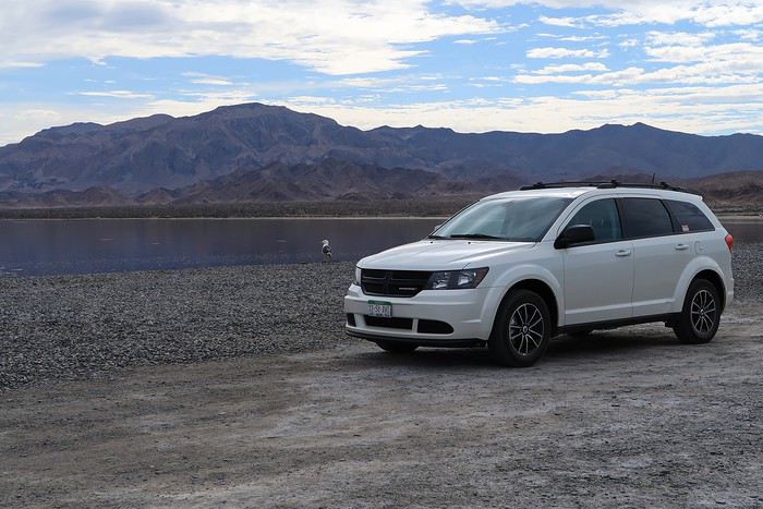 - Faire le plein d’essence dès qu’il y a une station car il peut ne pas y en avoir sur plus de 200 kilomètres.
- Se méfier des nids de poule, des topes (ralentisseurs) mal ou pas signalés et des troupeaux en liberté le long des routes.
- Faire le plein d’essence dès qu’il y a une station car il peut ne pas y en avoir sur plus de 200 kilomètres.
- Se méfier des nids de poule, des topes (ralentisseurs) mal ou pas signalés et des troupeaux en liberté le long des routes.
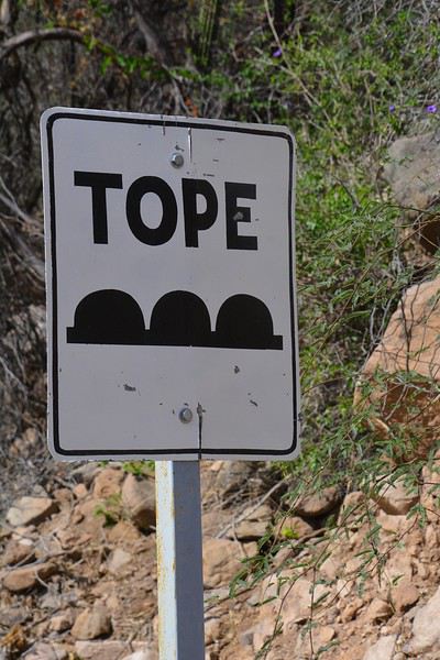
- Se laisser dépasser par les camions qui roulent très vite plutôt que de les avoir dans le dos. - De manière générale, il est préférable de ne pas circuler la nuit. Comme partout dans le monde, il vaut mieux ne rien laisser dans la voiture le soir et se garer dans des endroits éclairés et dans les parkings des hôtels. - Avoir toujours un stock d’eau dans la voiture et quelques provisions (éventuellement dans une petite glacière dont on renouvelle la glace régulièrement dans les supermarchés comme Oxxo). On peut ne pas trouver de restaurant pendant des heures (hors saison en tout cas).
- Avoir suffisamment d’argent liquide, les cartes de crédit ne fonctionnant pas partout. - Prévoir des pourboires de 10 à 15% dans les hôtels et les restaurants.
Nos coups de cœur : - en général, la géologie de la région - la vallée de los Cirios - Bahia de los Angeles - les salines de Guerrero Negro - San Ignacio, son oasis et sa mission - les plages de Bahia Concepcion (Santispac, El Coyote et El Requeson) - la Sierra Giganta et la mission San Javier (Loreto) - l’excursion en bateau à l’île Espiritu Santo (La Paz) - la vieille ville de San Jose del Cabo
Nos bonnes surprises - l’état des routes bien meilleur qu’espéré - la sécurité, en tout cas hors saison. Aucune agressivité, les Mexicains sont très aimables et toujours prêts à aider. - la nourriture tout à fait correcte et n’entraînant pas de troubles digestifs majeurs
Nos regrets ou déceptions : - ne pas avoir pu faire d’excursion pour voir les peintures rupestres - ne pas avoir pu faire de snorkeling à Cabo Pulmo - le manque de jolies villes (les villes traversées sont très laides et n’ont aucune âme) - les promenades sur les malecons n’ont jamais été à la hauteur de nos attentes, surtout à La Paz dont on dit que c’est le plus beau de Basse Californie - La Paz, grande ville peu séduisante - Cabo San Lucas : à fuir
Bilan - Très beau voyage hors des sentiers battus, avec des paysages assez époustouflants. Un petit bémol en ce qui me concerne est le manque de variété (alternance de désert et de plage, peu de jolis villages et manque de visites culturelles), peut-être dû en partie au fait que nous n’avons pas pu faire de visites de grottes de peintures rupestres et que nous n’étions pas à la saison de l’observation des baleines (choix délibéré). - Le fait d’être hors-saison était très agréable et nous a permis de très bien profiter des sites mais il avait aussi ses inconvénients, comme la difficulté d’organiser des excursions accompagnées.
Jour 1 : Bruxelles – Paris – Mexico - Tijuana a.m. : - train pour Paris CDG p.m. : - vol Paris – Mexico - vol Mexico – Tijuana
Train pour Paris CDG. Vol de 11h30 entre Paris et Mexico (Air France – A380). L’aéroport de Mexico est vieux et délabré. Quand on est en transit, il faut récupérer ses bagages et les déposer au fond de la zone de réception des bagages sur un tapis roulant réservé aux correspondances. Douane très rapide. Il ne faut surtout pas se précipiter sur le premier bureau de change dans la zone des bagages où le taux est beaucoup moins intéressant qu’ailleurs. On marche des kilomètres et on prend un train pour accéder à la zone 2 des vols domestiques. Complètement épuisés, on se dit qu’on aurait peut-être mieux fait de loger à côté de l’aéroport de Mexico et de prendre le vol de Tijuana le lendemain. Vol de +/- 3h30 pour Tijuana (Aeromexico) qui nous semble interminable et inconfortable. L’aéroport de Tijuana, par contre, est très moderne et propre. On a rapidement nos bagages. Pas de navette pour aller à l’hôtel. On prend donc un taxi (200 pesos). On se couche à 11 p.m. (heure locale), soit 8 a.m. pour nous ! Nuit à Tijuana (aéroport) Hôtel Hampton Inn, grand hôtel moderne, très confortable, excellente literie, très bonne douche. On ne retiendra pas la vue (entrepôt et chantier) mais bien les superbes photos noir et blanc de Basse Californie.
Jour 2 : Tijuana – San Quintin (6h45) a.m. : - prise de possession de la voiture de location à l’aéroport - route vers Ensenada p.m. : - arrêt à la Bufadora et déjeuner. - route vers San Quintin - nuit à San Quintin
Petit déjeuner à l’hôtel, correct sauf le pain. A 9h, la navette de l’hôtel nous conduit à l’aéroport pour prendre possession de la voiture de location. Service horriblement lent mais personnel très aimable et souriant ne parlant quasiment que l’espagnol. Départ à 10h30 et route vers Ensenada. Les quartiers de Tijuana que nous traversons ne donnent vraiment pas envie de s’attarder. Au niveau de la frontière, on se croirait à Calais avec les files interminables de camions. On longe l’impressionnant mur de fer séparant le Mexique et les USA. Il est constitué d’une énorme grille à laquelle on est en train d’accoler des panneaux métalliques. Tout cela est doublé quelques mètres plus loin par un grillage surmonté de fils de fer barbelés. Clochards ou migrants y vivent sous les ponts dans un état souvent très avancé.
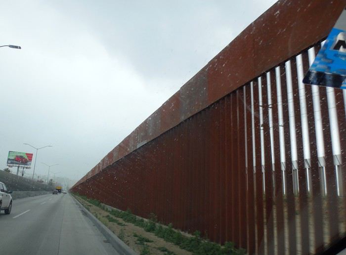
Comme il pleut, on regrette encore moins de ne pas s’attarder ici. La scenic road longe la côte … mais quelle déception ! C’est très construit et mal, beaucoup de bâtiments sont en ruines ou abandonnés. Ce n’est qu’à proximité d’Ensenada que la côte devient plus belle. On fait d’ailleurs un petit arrêt à un point de vue sur une côte sauvage avec falaises et iles au loin. Il fait meilleur et le soleil apparaît.
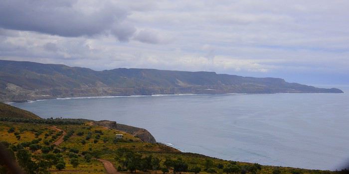
Vers 13h15, après avoir fait un petit détour, on s’arrête à la Buffadora, un site très touristique au sud d’Ensenada, au bout d’une péninsule. L’endroit est complétement paumé.
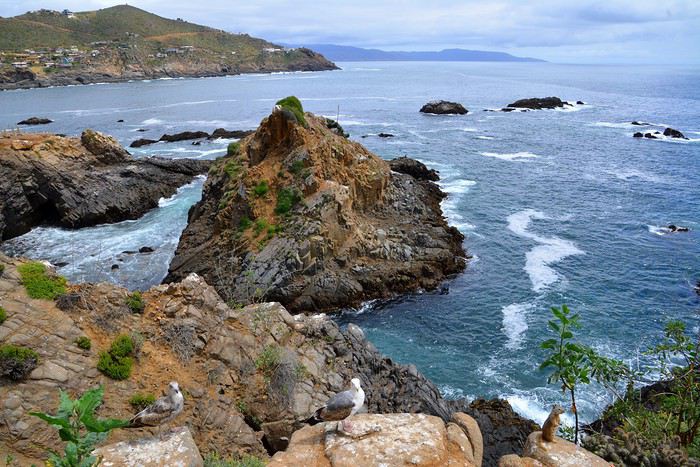
On n’avait encore vu quasi aucun touriste, mais là, c’est la foule, dans une rue interminable bordée de boutiques et de petits restos. Et on est hors saison ! Cela s’explique par le fait qu’Ensenada accueille de gros bateaux de croisière.
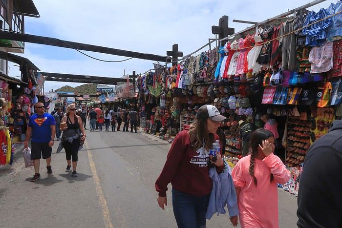
On arrive enfin à la bufadora, sorte de geyser où l’eau de mer s’engouffre dans une bouche et jaillit de manière inégale.
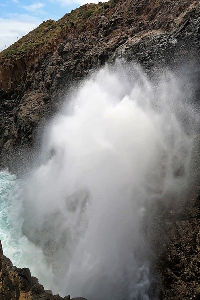
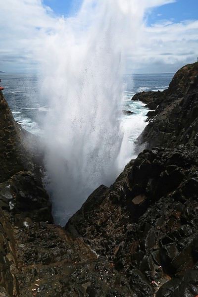
Les gens se font photographier devant les grandes lettres colorées de ENSENADA. Il semble y en avoir de pareilles dans toutes les villes.
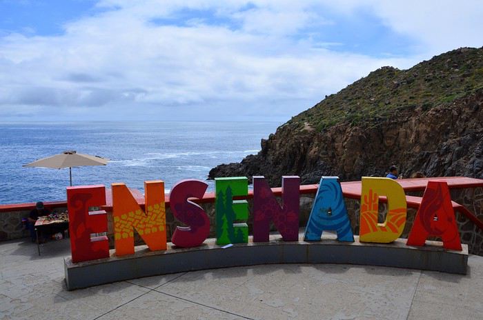
Ça ne vaut peut-être pas le détour mais ça fait un divertissement amusant pour couper la route. C’est tout de même le 2ème plus grand geyser marin du monde. On renonce à un chic resto conseillé dans le Lonely Planet pour manger dans un petit établissement, chez Dona Chuy, où tout est étalé sur un comptoir ouvert sur la rue. Très animé et bon. On y mange des grands coquillages remplis de grosses crevettes chauds et gratinés et des tacos de poisson, tout ça assez bon. Service agréable.
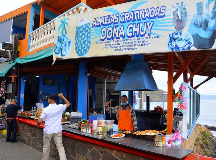
On se laisse déjà tenter par des hamacs/fauteuils très sympas (20 $ pièce après avoir marchandé). On nous en proposera plus tard des moins chers évidemment (10 $) mais notre vendeur était très sympa et parlait français. On reprend la route à 14h35 après s’être bien amusés. Encore une fois, on se dit qu’il ne faut pas se précipiter sur les premières choses qu’on nous propose, comme ici le parking qui est beaucoup plus cher à l’entrée que plus loin.
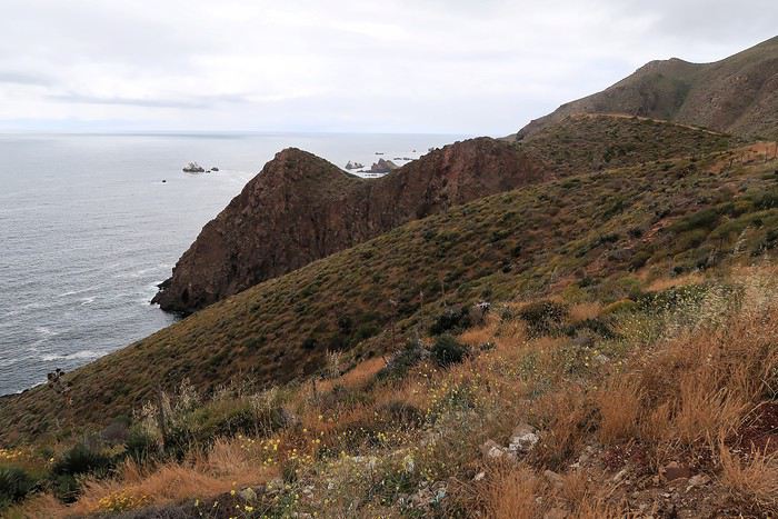
Enormément de fleurs le long de la route. Après Ensenada, il y a aussi beaucoup de serres avec des légumes mais aussi des fleurs. La route est pleine de trous dont il faut se méfier. Ce n’est pas pour rien qu’il y a tant de vendeurs de pneus le long de la route.
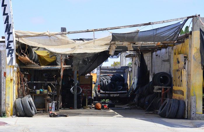
Les camions roulent très vite et il vaut mieux les laisser passer que de les avoir dans le dos. On suit la route des vins et on commence à voir des vignes.
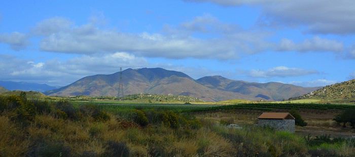
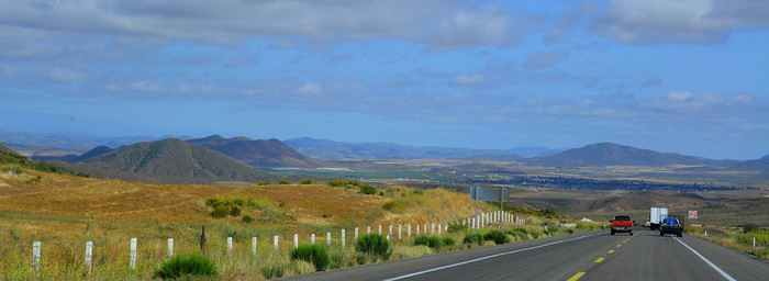
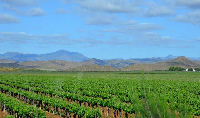
Le relief change et la route passe entre de raides collines bien vertes. Des travaux sur la route nous font perdre beaucoup de temps, heureusement dans un bel endroit. Beaucoup d’oliviers dont on fait la récolte et aussi des cultures de cactus. Sur les collines, on aperçoit parfois de curieux agaves. La route devient vraiment très belle jusqu’à San Antonio del Mar où le paysage redevient plus plat. Enormément de cultures. Mais où va-t-on chercher l’eau, les rivières sont à sec déjà fin avril ? Arrivée à San Quintin vers 18h30. L’hôtel Jardines Baja n’est pas facile à trouver. Il faut prendre la direction de l’hôtel Old Mill, puis la 1ère route non macadamisée à gauche. Comme on s’est trompé, on est allé jusqu’au bout, à un assez bel endroit de bras de mer sur fond de petits volcans aux cratères bien marqués. Etonnant.
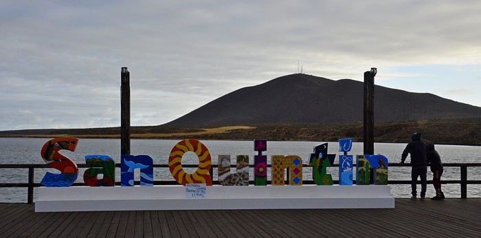
Dîner au restaurant de l’hôtel, assez bon. Beaucoup d’Américains ici. Nuit à San Quintin. Hôtel Jardines Baja, superbes jardins sophistiqués et fleuris, jolis patios et terrasses très conviviaux. Grande chambre malheureusement très sombre, normalement équipée. Salle de bain vieillotte mais correcte. Calme absolu.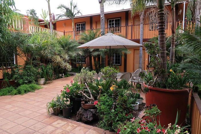
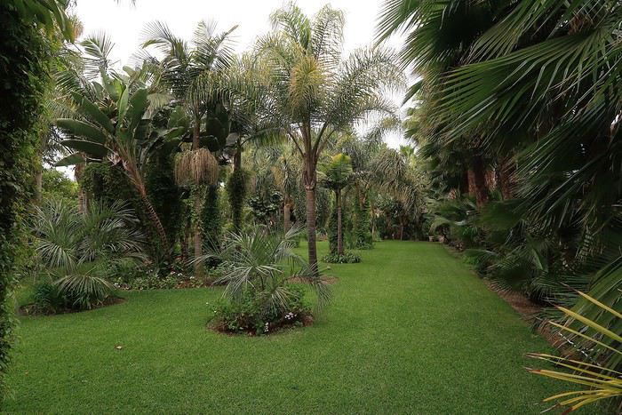
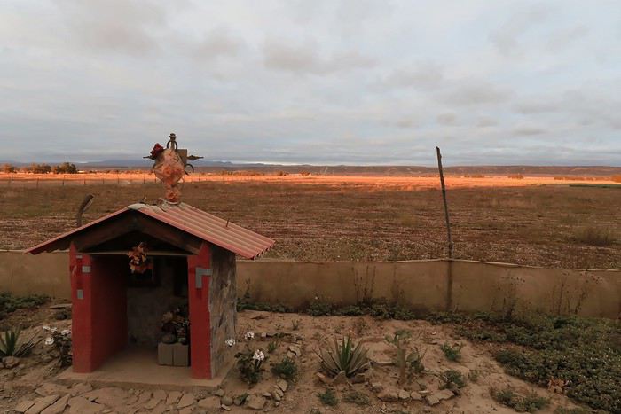
Ce carnet de voyage est le compte rendu d’un séjour de 16 jours effectué du 29 avril au 14 mai 2019.
Participants: 2 adultes (63 et 65 ans) Organisation : nous-mêmes en nous basant sur des carnets de voyage, des programmes d’agence, le Lonely Planet en anglais (Baja California et Los Cabos, seul guide un peu complet). Réservation d’hôtels par internet ou par mail. Déplacements : voiture de location. Climat : frais et venteux dans le nord et le long du Pacifique, chaud et sec dans le sud et le long de la mer de Cortes. Formalités / santé :
- Pas de visa nécessaire. - Pas de vaccin à prévoir. Divers :
- Electricité : les prises sont les mêmes qu’aux Etats-Unis (deux fiches plates). Voltage : 110/140 volts. - Décalage horaire avec la France : 9h en Baja California nord - 8h en Baja California sud. - La saison pour l’observation des baleines, parmi les meilleures du monde, s’étend de janvier à avril. Conseils :
- L'eau du robinet est dite potable mais mieux vaut ne pas la boire. - Avoir deux permis de conduire internationaux (gratuits). - Avoir une bonne carte routière et télécharger les cartes sur openstreetmap. - Un 4/4 est inutile pour ce circuit. Nous avons opté pour un SUV, un peu plus haut que les berlines. Il est clair que si on veut sortir complètement des sentiers battus pour aller découvrir des sites uniquement accessibles par pistes, un 4/4 est indispensable.
- Faire le plein d’essence dès qu’il y a une station car il peut ne pas y en avoir sur plus de 200 kilomètres.
- Se méfier des nids de poule, des topes (ralentisseurs) mal ou pas signalés et des troupeaux en liberté le long des routes.- Se laisser dépasser par les camions qui roulent très vite plutôt que de les avoir dans le dos. - De manière générale, il est préférable de ne pas circuler la nuit. Comme partout dans le monde, il vaut mieux ne rien laisser dans la voiture le soir et se garer dans des endroits éclairés et dans les parkings des hôtels. - Avoir toujours un stock d’eau dans la voiture et quelques provisions (éventuellement dans une petite glacière dont on renouvelle la glace régulièrement dans les supermarchés comme Oxxo). On peut ne pas trouver de restaurant pendant des heures (hors saison en tout cas).
- Avoir suffisamment d’argent liquide, les cartes de crédit ne fonctionnant pas partout. - Prévoir des pourboires de 10 à 15% dans les hôtels et les restaurants.
Nos coups de cœur : - en général, la géologie de la région - la vallée de los Cirios - Bahia de los Angeles - les salines de Guerrero Negro - San Ignacio, son oasis et sa mission - les plages de Bahia Concepcion (Santispac, El Coyote et El Requeson) - la Sierra Giganta et la mission San Javier (Loreto) - l’excursion en bateau à l’île Espiritu Santo (La Paz) - la vieille ville de San Jose del Cabo
Nos bonnes surprises - l’état des routes bien meilleur qu’espéré - la sécurité, en tout cas hors saison. Aucune agressivité, les Mexicains sont très aimables et toujours prêts à aider. - la nourriture tout à fait correcte et n’entraînant pas de troubles digestifs majeurs
Nos regrets ou déceptions : - ne pas avoir pu faire d’excursion pour voir les peintures rupestres - ne pas avoir pu faire de snorkeling à Cabo Pulmo - le manque de jolies villes (les villes traversées sont très laides et n’ont aucune âme) - les promenades sur les malecons n’ont jamais été à la hauteur de nos attentes, surtout à La Paz dont on dit que c’est le plus beau de Basse Californie - La Paz, grande ville peu séduisante - Cabo San Lucas : à fuir
Bilan - Très beau voyage hors des sentiers battus, avec des paysages assez époustouflants. Un petit bémol en ce qui me concerne est le manque de variété (alternance de désert et de plage, peu de jolis villages et manque de visites culturelles), peut-être dû en partie au fait que nous n’avons pas pu faire de visites de grottes de peintures rupestres et que nous n’étions pas à la saison de l’observation des baleines (choix délibéré). - Le fait d’être hors-saison était très agréable et nous a permis de très bien profiter des sites mais il avait aussi ses inconvénients, comme la difficulté d’organiser des excursions accompagnées.
Jour 1 : Bruxelles – Paris – Mexico - Tijuana a.m. : - train pour Paris CDG p.m. : - vol Paris – Mexico - vol Mexico – Tijuana
Train pour Paris CDG. Vol de 11h30 entre Paris et Mexico (Air France – A380). L’aéroport de Mexico est vieux et délabré. Quand on est en transit, il faut récupérer ses bagages et les déposer au fond de la zone de réception des bagages sur un tapis roulant réservé aux correspondances. Douane très rapide. Il ne faut surtout pas se précipiter sur le premier bureau de change dans la zone des bagages où le taux est beaucoup moins intéressant qu’ailleurs. On marche des kilomètres et on prend un train pour accéder à la zone 2 des vols domestiques. Complètement épuisés, on se dit qu’on aurait peut-être mieux fait de loger à côté de l’aéroport de Mexico et de prendre le vol de Tijuana le lendemain. Vol de +/- 3h30 pour Tijuana (Aeromexico) qui nous semble interminable et inconfortable. L’aéroport de Tijuana, par contre, est très moderne et propre. On a rapidement nos bagages. Pas de navette pour aller à l’hôtel. On prend donc un taxi (200 pesos). On se couche à 11 p.m. (heure locale), soit 8 a.m. pour nous ! Nuit à Tijuana (aéroport) Hôtel Hampton Inn, grand hôtel moderne, très confortable, excellente literie, très bonne douche. On ne retiendra pas la vue (entrepôt et chantier) mais bien les superbes photos noir et blanc de Basse Californie.
Jour 2 : Tijuana – San Quintin (6h45) a.m. : - prise de possession de la voiture de location à l’aéroport - route vers Ensenada p.m. : - arrêt à la Bufadora et déjeuner. - route vers San Quintin - nuit à San Quintin
Petit déjeuner à l’hôtel, correct sauf le pain. A 9h, la navette de l’hôtel nous conduit à l’aéroport pour prendre possession de la voiture de location. Service horriblement lent mais personnel très aimable et souriant ne parlant quasiment que l’espagnol. Départ à 10h30 et route vers Ensenada. Les quartiers de Tijuana que nous traversons ne donnent vraiment pas envie de s’attarder. Au niveau de la frontière, on se croirait à Calais avec les files interminables de camions. On longe l’impressionnant mur de fer séparant le Mexique et les USA. Il est constitué d’une énorme grille à laquelle on est en train d’accoler des panneaux métalliques. Tout cela est doublé quelques mètres plus loin par un grillage surmonté de fils de fer barbelés. Clochards ou migrants y vivent sous les ponts dans un état souvent très avancé.
Comme il pleut, on regrette encore moins de ne pas s’attarder ici. La scenic road longe la côte … mais quelle déception ! C’est très construit et mal, beaucoup de bâtiments sont en ruines ou abandonnés. Ce n’est qu’à proximité d’Ensenada que la côte devient plus belle. On fait d’ailleurs un petit arrêt à un point de vue sur une côte sauvage avec falaises et iles au loin. Il fait meilleur et le soleil apparaît.
Vers 13h15, après avoir fait un petit détour, on s’arrête à la Buffadora, un site très touristique au sud d’Ensenada, au bout d’une péninsule. L’endroit est complétement paumé.
On n’avait encore vu quasi aucun touriste, mais là, c’est la foule, dans une rue interminable bordée de boutiques et de petits restos. Et on est hors saison ! Cela s’explique par le fait qu’Ensenada accueille de gros bateaux de croisière.
On arrive enfin à la bufadora, sorte de geyser où l’eau de mer s’engouffre dans une bouche et jaillit de manière inégale.
Les gens se font photographier devant les grandes lettres colorées de ENSENADA. Il semble y en avoir de pareilles dans toutes les villes.
Ça ne vaut peut-être pas le détour mais ça fait un divertissement amusant pour couper la route. C’est tout de même le 2ème plus grand geyser marin du monde. On renonce à un chic resto conseillé dans le Lonely Planet pour manger dans un petit établissement, chez Dona Chuy, où tout est étalé sur un comptoir ouvert sur la rue. Très animé et bon. On y mange des grands coquillages remplis de grosses crevettes chauds et gratinés et des tacos de poisson, tout ça assez bon. Service agréable.
On se laisse déjà tenter par des hamacs/fauteuils très sympas (20 $ pièce après avoir marchandé). On nous en proposera plus tard des moins chers évidemment (10 $) mais notre vendeur était très sympa et parlait français. On reprend la route à 14h35 après s’être bien amusés. Encore une fois, on se dit qu’il ne faut pas se précipiter sur les premières choses qu’on nous propose, comme ici le parking qui est beaucoup plus cher à l’entrée que plus loin.
Enormément de fleurs le long de la route. Après Ensenada, il y a aussi beaucoup de serres avec des légumes mais aussi des fleurs. La route est pleine de trous dont il faut se méfier. Ce n’est pas pour rien qu’il y a tant de vendeurs de pneus le long de la route.
Les camions roulent très vite et il vaut mieux les laisser passer que de les avoir dans le dos. On suit la route des vins et on commence à voir des vignes.
Le relief change et la route passe entre de raides collines bien vertes. Des travaux sur la route nous font perdre beaucoup de temps, heureusement dans un bel endroit. Beaucoup d’oliviers dont on fait la récolte et aussi des cultures de cactus. Sur les collines, on aperçoit parfois de curieux agaves. La route devient vraiment très belle jusqu’à San Antonio del Mar où le paysage redevient plus plat. Enormément de cultures. Mais où va-t-on chercher l’eau, les rivières sont à sec déjà fin avril ? Arrivée à San Quintin vers 18h30. L’hôtel Jardines Baja n’est pas facile à trouver. Il faut prendre la direction de l’hôtel Old Mill, puis la 1ère route non macadamisée à gauche. Comme on s’est trompé, on est allé jusqu’au bout, à un assez bel endroit de bras de mer sur fond de petits volcans aux cratères bien marqués. Etonnant.
Dîner au restaurant de l’hôtel, assez bon. Beaucoup d’Américains ici. Nuit à San Quintin. Hôtel Jardines Baja, superbes jardins sophistiqués et fleuris, jolis patios et terrasses très conviviaux. Grande chambre malheureusement très sombre, normalement équipée. Salle de bain vieillotte mais correcte. Calme absolu.
Tour of Sardinia by camper van
We’re wrapping up our Sardinia tour by camper van. We stayed for 5 weeks, covered 2,150 km on this island, and will leave with mixed feelings!!
While the island is beautiful—especially for those who love beaches and all kinds of water sports—it’s also appealing for history buffs and archaeology enthusiasts. The mountains, scenic roads, and small villages are really lovely too.
That said, driving here can be pretty hazardous. Locals don’t respect speed limits or road rules, they roll through stops, zoom out of side streets, and often overtake without proper visibility. On top of that, the quality of roads and highways is really disappointing!! And service areas, whether paid or free, are few and far between and often poorly maintained.
One last thing: we’d heard Sardinians were welcoming... I don’t know if it’s because they’ve "endured" waves of tourists from all over during the summer months, but unfortunately, we didn’t find that to be true. Most seemed rather gloomy or even unwelcoming, with just a few exceptions saving Sardinia’s reputation!!
It’s a real shame for an island with so much potential. I think a serious review of how tourism is managed would be worth considering. That aside, we did notice some efforts and goodwill that were nice to see.