Results for "Samar+|+8+>+191"
5842 results found.
Patagonie: court récit et photos English translation pending
¡Hola!
Comme je trouve pas mal d'info sur ce groupe de discussions, je vous envoie l'adresse de notre website avec notre recit et qq photos sur la Patagonie.
Nous sommes partis pour 8 mois de découvertes en Amerique Latine, et nous avons quittes la Patagonie hier. 😕
On va se poser a El Bolson, puis remonter lentement vers Mendoza. Aujourd'hui, nous sommes à Bariloche, ville de consommation par contraste avec le reste de la Patagonie. a+
Comme je trouve pas mal d'info sur ce groupe de discussions, je vous envoie l'adresse de notre website avec notre recit et qq photos sur la Patagonie.
Nous sommes partis pour 8 mois de découvertes en Amerique Latine, et nous avons quittes la Patagonie hier. 😕
On va se poser a El Bolson, puis remonter lentement vers Mendoza. Aujourd'hui, nous sommes à Bariloche, ville de consommation par contraste avec le reste de la Patagonie. a+
Bons plans au Pérou English translation pending
Bonjour!
Je souhaite passer environ 5 semaines au Pérou cet été avec une amie. Nous partirions en juillet-août. Je sais qu'il y a beaucoup de choses à voir et à faire... J'aimerais connaître vos coup de coeur: endroits pas trop touristiques, auberge agréable, etc... Je me pose aussi quelques questions à savoir commment il est préférable de voyager entre les villes (bus, train, voiture?), est-il préférable d'emporter une tente pour les treks, combien peut coûter un billet d'avion Mtl-Lima à cette période de l'année? Bref, dites-moi tout ce que vous pouvez sur ce fascinant pays!
Merci à l'avance!
Je souhaite passer environ 5 semaines au Pérou cet été avec une amie. Nous partirions en juillet-août. Je sais qu'il y a beaucoup de choses à voir et à faire... J'aimerais connaître vos coup de coeur: endroits pas trop touristiques, auberge agréable, etc... Je me pose aussi quelques questions à savoir commment il est préférable de voyager entre les villes (bus, train, voiture?), est-il préférable d'emporter une tente pour les treks, combien peut coûter un billet d'avion Mtl-Lima à cette période de l'année? Bref, dites-moi tout ce que vous pouvez sur ce fascinant pays!
Merci à l'avance!
Bons plans pour le Pérou et Chili English translation pending
Salut!
Je suis actuellement sur Montréal ou je compte encore profiter de la vie jusqu'en janvier 2004. Apres, je pars en direction du Pérou puis du Chili. Je n'ai que peu d'idées de ce que je veux voir (à trop programmer, je trouve qu'on devient esclave de son programme) si ce n'est 2 incontournables à mes yeux: Le Huascaran et donc la région de la Cordillière Blanche au Pérou et la Parc Tores Del Pene en Patagonie, 5000km plus au sud.
Je part accompagné de mon sac à dos, sans connaitre un mot d'espagnol et mon budget m'impose, une fois sur place, le bus et les auberges les moins chères...
Donc voila j'aurais aimé avoir quelques idées de lieux "incontournables" ainsi que quelques conseils pratiques, spécifiques à ces 2 pays ainsi que sur la spécifisité du voyage en solo. J'ai l'expérience de ce genre de voyage mais d'habitude j'ai d'autres compagnons que mon seul sac alors...quelques trucs et astuces me seraient bien utiles.
Un grand merci par avances pour l'aide que vous pouvez m'apporter
Jean
Je suis actuellement sur Montréal ou je compte encore profiter de la vie jusqu'en janvier 2004. Apres, je pars en direction du Pérou puis du Chili. Je n'ai que peu d'idées de ce que je veux voir (à trop programmer, je trouve qu'on devient esclave de son programme) si ce n'est 2 incontournables à mes yeux: Le Huascaran et donc la région de la Cordillière Blanche au Pérou et la Parc Tores Del Pene en Patagonie, 5000km plus au sud.
Je part accompagné de mon sac à dos, sans connaitre un mot d'espagnol et mon budget m'impose, une fois sur place, le bus et les auberges les moins chères...
Donc voila j'aurais aimé avoir quelques idées de lieux "incontournables" ainsi que quelques conseils pratiques, spécifiques à ces 2 pays ainsi que sur la spécifisité du voyage en solo. J'ai l'expérience de ce genre de voyage mais d'habitude j'ai d'autres compagnons que mon seul sac alors...quelques trucs et astuces me seraient bien utiles.
Un grand merci par avances pour l'aide que vous pouvez m'apporter
Jean
Infos sur le tour du Manaslu au Népal? English translation pending
Je souhaitais avoir des infos sur le tour du MANASULU:
Durée, lieu de départ arrivée, et surtout le permis de trek (prix, y a t il besoin d'un officier de liaison ?)
Par avance merci
Durée, lieu de départ arrivée, et surtout le permis de trek (prix, y a t il besoin d'un officier de liaison ?)
Par avance merci
Prix des vols Marseille/Bombay? English translation pending
🤪 salut!
Qui connais les meilleurs tarifs marseille/bombay pour octobre-novembre ?
merci!
Qui connais les meilleurs tarifs marseille/bombay pour octobre-novembre ?
merci!
Bons plans en Bolivie English translation pending
Hello à tous et à toutes !
Voilà nous avions envie de partir à l'aventure avec mon ami et c'est la Bolivie que nous avons retenu avec un petit séjour de 15 jours en 4*4.
Mais même si une part de risque est toujours au programme si nous pouvions avoir qq infos supplémentaires ce n'est pas de refus.
Ainsi si quelqu'un a déjà tenter ce voyage en 4*4 a-t-il eu des problèmes particuliers concernant la voiture, mécanique, réserve d'essence...
Quel type de vétements est-il recommandé (séjour partie altiplano et sucre)
Des conseils pour les "souvenirs"?
Arrivant à La Paz mieux vaut-il réserver un hotel à l'avance (à partir de France)?
Dernière question est-il aisé de prendre un billet d'avion pour un vom intérieur LaPaz Sucre ou faut-il là encore s'y prendre à l'avance?
1000 merci si vous pouviez éclairer un peu plus nos lanternes ;o)
Voilà nous avions envie de partir à l'aventure avec mon ami et c'est la Bolivie que nous avons retenu avec un petit séjour de 15 jours en 4*4.
Mais même si une part de risque est toujours au programme si nous pouvions avoir qq infos supplémentaires ce n'est pas de refus.
Ainsi si quelqu'un a déjà tenter ce voyage en 4*4 a-t-il eu des problèmes particuliers concernant la voiture, mécanique, réserve d'essence...
Quel type de vétements est-il recommandé (séjour partie altiplano et sucre)
Des conseils pour les "souvenirs"?
Arrivant à La Paz mieux vaut-il réserver un hotel à l'avance (à partir de France)?
Dernière question est-il aisé de prendre un billet d'avion pour un vom intérieur LaPaz Sucre ou faut-il là encore s'y prendre à l'avance?
1000 merci si vous pouviez éclairer un peu plus nos lanternes ;o)
Bons plans en Bolivie English translation pending
😉salut a ttes et a tous!
je pars en bolivie du 7 au 30 novembre je commence a potasser les bouquins mais rien ne vaut l'experience du terrain
si vous avez de bons plans, des sites a ne pas manquer merci de me repondre cela me permettrait de cibler un peu plus mon parcours
a bientot😎
je pars en bolivie du 7 au 30 novembre je commence a potasser les bouquins mais rien ne vaut l'experience du terrain
si vous avez de bons plans, des sites a ne pas manquer merci de me repondre cela me permettrait de cibler un peu plus mon parcours
a bientot😎
Climat au Népal fin Décembre English translation pending
Bonjour,
Je prevoi de partir au Népal de mi-décembre à mi-janvier 2003. Est-ce-qu'il fait vraiment froid ? Devrais-je me contenter de petits treks (c'est à dire faire les treks partiellement, puis faire demi-tour ! ) ? Ou dois-je me contenter des parcs nationaux de basse altitude ?
Qu'en pensez-vous ? J'ai besoin de savoir si je dois renoncer par exemple au trek de Jonhsom. Ou quel trek me conseillez-vous pour cette période ?
Ou encore, dois-je abandonner l'idée de partir au Népal à cette période ?!!!
Merci beaucoup pour votre aide.
Gilles
Je prevoi de partir au Népal de mi-décembre à mi-janvier 2003. Est-ce-qu'il fait vraiment froid ? Devrais-je me contenter de petits treks (c'est à dire faire les treks partiellement, puis faire demi-tour ! ) ? Ou dois-je me contenter des parcs nationaux de basse altitude ?
Qu'en pensez-vous ? J'ai besoin de savoir si je dois renoncer par exemple au trek de Jonhsom. Ou quel trek me conseillez-vous pour cette période ?
Ou encore, dois-je abandonner l'idée de partir au Népal à cette période ?!!!
Merci beaucoup pour votre aide.
Gilles
Marrakech et Agadir cet été English translation pending
bonjour tout le monde,
je suis un marocain de 17 ans qui vit à casablanca & qui voyagent toutes l'année un peu partout au MAROC !
si quelqun est interessé par des rencontres ( en tout bien tout honneur ) je suis là
@ bon entendeur salut 😏
je suis un marocain de 17 ans qui vit à casablanca & qui voyagent toutes l'année un peu partout au MAROC !
si quelqun est interessé par des rencontres ( en tout bien tout honneur ) je suis là
@ bon entendeur salut 😏
Africa: A Heartfelt Love for a Continent
“When the Whites came to Africa, we had the land and they had the Bible. They taught us to pray with our eyes closed: when we opened them, the Whites had the land and we had the Bible.” Jomo Kenyatta (p.7)
The Maggi cube, an unchallenged hegemony, and so much more
“The hopeless continent,” headlined The Economist, a British magazine, in July 2000 about Africa. Eleven years later, the same magazine headlined “Africa rising” instead. Images of Africa in the prosperous North constantly oscillate between apocalyptic scenarios and enthusiastic projections. A key issue with such images lies in the generalization they entail. If you look at the continent, considerable contrasts emerge depending on space and time. It’s no surprise that a region of the world encompassing such diverse ecological zones, maintaining such varied ties with other continents, comprising nearly fifty nation-states in sub-Saharan Africa alone, and characterized by a great diversity of languages, belief systems, and historical paths, doesn’t share a single destiny.
And yet, for many people outside Africa, as well as for many Africans, the continent constitutes a single entity, defined by criteria such as skin color, a colonial past, poverty, and the art of survival. Until now, these perspectives were generally accompanied by the idea that Africa had to—or should have—followed a single path together, sometimes called development, sometimes modernization, sometimes liberation, then a market economy. None of these paths delivered on their promises.
The two writers Alain Mabanckou and Abdourahman Waberi—one from Congo, the other raised in Djibouti, both long settled in France and now professors at renowned North American universities (Los Angeles, Washington)—have had enough of pessimistic scenarios: “We are aware that Africa is in the world and the world is in Africa. The same goes for all other continents, as our destinies are inextricably linked for better or worse. We refuse to see Africa as a reservoir of misfortunes or a continent cursed by atavistic misfortune and characterized by ethnic conflicts. [...] It’s this passionate flame we wanted to capture in a book [...] a kind of stroll through African cultures, without any demands, each letter of the alphabet leading us to a notion, a practice, a concept, a moment in history, literature, painting, politics, economics, cuisine, etc.” (p.10-11). Africa, they write, is on the verge of “imposing a signature, a style, a way of being in the world and in relation to the rest of the world.” (p.11) To put words to the continent’s diversity and dynamism, the two authors created a “rambling ABC,” a kind of portrait—or more precisely, a mythography—that lets you see and feel the pulse of a vast continent whose cultural power is unfolding before our eyes. Once marginalized or even mocked, the voice and importance of the Continent in global affairs are now undeniable” (p.11), containing over a hundred entries, mostly concise, written in a relaxed and casual style. The optimistic, even exuberant tone is set from the brief introduction. The duo of authors wants to “sing a love song to the cultures of our continent, to its inhabitants past and present, to its exceptional resources and its spectacular globalization despite a certain pollution that still clouds our skies due to the unmatched duration of dictatorships in some of our regions.” (p.12) In doing so, they don’t want to be too distracted by today’s Afewerki-Biya-Bongo-Déby & Co. ...
Of course, you’ll find tributes to great precursors like Frantz Fanon (“[...] it was a love story and admiration that wasn’t dimmed by the four decades separating his birth from ours. Let’s add that we were born while the native of Fort-de-France had left the world’s stage four years earlier, in the prime of life” p.141), Mongo Beti (“You must read and reread Mongo Beti, a genius who used his fame to support often just causes in Africa, like defending oppressed groups. His place is already in History. His oppressors, like the dictators Ahmadou Ahidjo and Paul Biya, can’t compete in the same category” p.64), the Malian Amadou Hampâté Bâ
(“Posterity remembers him mainly as an tireless defender of African cultures. His plea for the collection and preservation of traditional African knowledge remains a major event for all men and women of good will. One day in 1960, at the UNESCO podium, the native of Bandiagara sounded the alarm: ‘[...] Since we’ve admitted that the humanity of each people is the heritage of all humanity, if African traditions aren’t collected in time and written down, they’ll one day be missing from the universal archives of humanity.’” p.51),
Kwame Nkrumah, “one of the founders of Pan-Africanism, father of Ghana’s independence” (p.239), as well as the historian Cheikh Anta Diop, the writer, poet, and politician Aimé Césaire, and the economist and thinker Samir Amin, but also very warm tributes to certain contemporary African intellectuals like Souleymane Bachir Diagne and Achille Mbembe
(“A few years ago, in dominant economic circles, a rumor often resurfaced, usually disguised as a cold and scientifically proven analysis: Africa is useless. It’s a burden for the rest of the human community. With its 2% share in world trade, it would disappear from stock market radars without anyone noticing. So? Maybe it’ll be pulled up by other continents. Wanting to surpass itself is a crazy bet for Africans, they concluded. Arrogant or clueless, President Nicolas Sarkozy declared before an audience of students and teachers at Cheikh Anta Diop University in Dakar: ‘The African man hasn’t entered history enough [...] He only knows the eternal repetition of time marked by the endless repetition of the same gestures and words.’ That was in 2007. For decades, armed only with reason, an intellectual often steps up to debunk prejudices, lazy readings, and dishonest frameworks used as false fronts by those who, like Nicolas Sarkozy or former journalist Stephen Smith, out of ignorance, contempt, or condescension, distort African reality. This intellectual is none other than the historian and political scientist Achille Mbembe. This heir of Frantz Fanon, Amílcar Cabral, Jean-Marc Ela, and Fabien Eboussi-Boulaga was born in 1957 in Cameroon, in the Bassa region. Marked early by the upheavals of a fratricidal war, Achille Mbembe became the guardian of the memory of martyrs. After brilliant studies in Paris, he went on to teach at the best American universities, but the call of the Continent was stronger than anything else. In Dakar, he once directed CODESRIA (Council for the Development of Social Science Research in Africa) before joining the University of the Witwatersrand in Johannesburg, South Africa. Even though the author of *Critique of Black Reason* (Éditions La Découverte, 2015) spends a few months at Duke University in North Carolina, his observation post remains South Africa. From Johannesburg, Achille Mbembe scrutinizes Africa and the whole world. A lucid observer with an elegant and generous pen, Achille Mbembe knows how to blend big and small history: ‘I was born one day in July, as the month was drawing to a close. It was 1957, in that part of Africa recently named ‘Cameroon,’ a memory of the wonder that seized Portuguese sailors in the 15th century when, sailing up the river near Douala, they couldn’t help but note the presence of a multitude of crustaceans, and named it *Rio dos Camarões*, meaning ‘River of Shrimp.’ I grew up in the shadow of this nameless land, since, in a way, the name it bears is only the product of someone else’s astonishment: a lexical mistake, if you will.’ From this mistake or wound, he made leaven, a springboard to compose a rich work, recognized worldwide. To denounce barriers and barbarians too. But that’s not enough. Among his peers in circles of thought and action, Achille Mbembe passionately and consistently defends human dignity and the beauty of the world. In doing so, he fulfills the mission Frantz Fanon entrusted to him.” (p.227-229),
as well as entries dedicated to lesser-known artists and intellectuals, like the French journalist and activist Rokhaya Diallo, daughter of Senegalese and Gambian parents, or the Ethiopian filmmaker Haile Gerima, who has long lived in the United States. Other names from politics, sports, music, art, and literature: Kofi Annan, p.36; Barack Obama, p.243; Thomas Sankara, p.277; Ousmane Sow, p.285; Yambo Ouologuem, p.250; Léopold Sédar Senghor, p.282; Muhammad Ali, p.30; Nuruddin Farah, p.146; Salif Keita, p.203; Ahmadou Kourouma, p.206; Ngũgĩ wa Thiong’o, p.236; Winnie Mandela, p.224; Kylian Mbappé, p.226 ...
The authors, who resolutely commit to a “mythography” (p.11) of Africa, also pay special attention to local social movements, cultural events, and aspects of daily life. *Y’en a marre*, “which also meant ‘we’re fed up with sitting on our hands’” (p.320-321), emerged about a decade ago in Senegal as a citizen movement of peaceful resistance and symbolizes, the authors emphasize, the fact that African youth are increasingly fed up “with the political circus deployed in Africa since independence, as our parents would say, ‘since the White man left’...” (p.321). A full entry is dedicated to the Maggi bouillon cube, which has flooded African markets for about forty years and enjoys immense popularity (“It’s everywhere in Africa, from Dakar to Djibouti, and from Tangier to Cape Town. It’s in every pot, every stew. Little hands put it in every sauce, every local or adapted dish. An unchallenged hegemony! You’ll find it in diasporas too. The culinary strolls in Paris, in the [...] neighborhood” p.90). Critics blame it not only for impoverishing the aromatic diversity of local dishes but also for being harmful to health. And yet, “he poorest Africans, those who eat only once a day, a few spoonfuls of white beans and a ball of *foufou*, for example, are the most fervent users of the magic cube.” (p.92-93)
For *fonio*, “the new trendy cereal. [...] From the millet family, fonio is probably the oldest cereal cultivated in West Africa, and mainly in its sub-Saharan part, for millennia. [...] Easy to grow, water-efficient, fonio grows everywhere except on clay soils. Long neglected because it was considered the poor man’s crop, fonio is now a source of pride for the farmers who cultivate it and cherish it like the apple of their eye” (p.156-157), the authors immediately offer a detailed recipe, letting the reader know that “e can’t resist sharing this fonio with chicken recipe from Mali with you:
Ingredients: 1 chicken 3 large ripe red tomatoes 4 tbsp tomato paste 4 large onions 1 garlic clove 1/2 cup oil 2 Maggi cubes or salt 2 large carrots 1 turnip 1 large cabbage 2 large potatoes 1 celery stalk 1 packet pre-cooked fonio 4 okra (or okra powder) salt, pepper
Preparation: 1. Prepare the sauce: wash and cut the chicken. Peel the onions, garlic, and vegetables. 2. In a pot, fry the chicken pieces. 3. Dice the onions, tomatoes, carrots, and turnip very small and add them to the pot. 4. Add the tomato paste, salt, and pepper. 5. Simmer for 15 min, then add 2 L of water and the cooked chicken pieces. 6. Simmer for 30 min, then add the crushed garlic and celery, plus the cabbage cut into 4 and the potatoes cut in half. 7. Prepare the fonio: cover it with warm water, let it rest for 15 min, and cook it over low heat. 8. In a small pot, boil the okra and crush them. 9. Mix the crushed okra with the cooked fonio, then salt. Serve hot.” (p.158-159)
The comedy *Black Mic Mac*, released in French theaters in 1986 and addressing France’s increasingly restrictive immigration policy at the time, also gets an entry, as do *Tintin in the Congo*, the popular comic, and *Jip’s Café* (“[...] a little Africa in the heart of Paris, with passersby stopping to admire the ‘ambianceurs’ on the dance floor or attend the cultural events offered by the place” (p.194), an African establishment in Paris that Alain Mabanckou already immortalized in one of his novels.
The duo of authors also tackles thorny subjects like jihadism (p.119), the Rwandan genocide (p.272), the CFA franc (p.82), and dictatorship (p.110). While the two strike the right tone here, many entries leave a slightly bitter taste. Two examples: why doesn’t the text on Barack Obama mention the great disappointment of many people in Africa, who expected more from the African policy of the first U.S. president with African roots than just occasional warm words? Why do the comments on Winnie Mandela gloss over the fact that she was a highly controversial icon of the anti-apartheid movement due to her involvement in kidnappings, acts of torture, and murders of alleged apartheid collaborators? Instead, there’s a compassion that brings tears to the eyes: “She was often reduced to a secondary role, the wife of a great man” or “When victory came, she didn’t taste its fruits. Divorced, isolated. She would never be a ‘first lady’ in an evening gown, posing before a bed of chrysanthemums. They’d keep her far from the circles of power” (p.224-225). At this point, I would’ve liked the authors to take a slightly more critical stance...
That said, these “weaknesses” (if you can call them that) shouldn’t overshadow the book as a whole. It remains an informative, sometimes very entertaining, and often even original work in its own way.
Book information (the original French and the German translation):
Alain Mabanckou/Abdourahman Waberi. Dictionnaire enjoué des cultures africaines. Fayard, 2019. Alain Mabanckou/Abdourahman Waberi. Der Puls Afrikas. Eine Liebeserklärung von A bis Z. Reclam, 2022.
Hery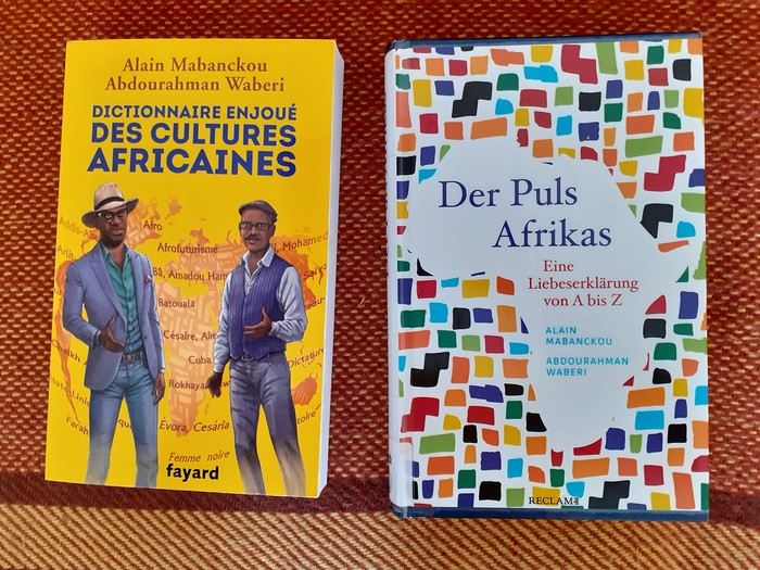
The Maggi cube, an unchallenged hegemony, and so much more
“The hopeless continent,” headlined The Economist, a British magazine, in July 2000 about Africa. Eleven years later, the same magazine headlined “Africa rising” instead. Images of Africa in the prosperous North constantly oscillate between apocalyptic scenarios and enthusiastic projections. A key issue with such images lies in the generalization they entail. If you look at the continent, considerable contrasts emerge depending on space and time. It’s no surprise that a region of the world encompassing such diverse ecological zones, maintaining such varied ties with other continents, comprising nearly fifty nation-states in sub-Saharan Africa alone, and characterized by a great diversity of languages, belief systems, and historical paths, doesn’t share a single destiny.
And yet, for many people outside Africa, as well as for many Africans, the continent constitutes a single entity, defined by criteria such as skin color, a colonial past, poverty, and the art of survival. Until now, these perspectives were generally accompanied by the idea that Africa had to—or should have—followed a single path together, sometimes called development, sometimes modernization, sometimes liberation, then a market economy. None of these paths delivered on their promises.
The two writers Alain Mabanckou and Abdourahman Waberi—one from Congo, the other raised in Djibouti, both long settled in France and now professors at renowned North American universities (Los Angeles, Washington)—have had enough of pessimistic scenarios: “We are aware that Africa is in the world and the world is in Africa. The same goes for all other continents, as our destinies are inextricably linked for better or worse. We refuse to see Africa as a reservoir of misfortunes or a continent cursed by atavistic misfortune and characterized by ethnic conflicts. [...] It’s this passionate flame we wanted to capture in a book [...] a kind of stroll through African cultures, without any demands, each letter of the alphabet leading us to a notion, a practice, a concept, a moment in history, literature, painting, politics, economics, cuisine, etc.” (p.10-11). Africa, they write, is on the verge of “imposing a signature, a style, a way of being in the world and in relation to the rest of the world.” (p.11) To put words to the continent’s diversity and dynamism, the two authors created a “rambling ABC,” a kind of portrait—or more precisely, a mythography—that lets you see and feel the pulse of a vast continent whose cultural power is unfolding before our eyes. Once marginalized or even mocked, the voice and importance of the Continent in global affairs are now undeniable” (p.11), containing over a hundred entries, mostly concise, written in a relaxed and casual style. The optimistic, even exuberant tone is set from the brief introduction. The duo of authors wants to “sing a love song to the cultures of our continent, to its inhabitants past and present, to its exceptional resources and its spectacular globalization despite a certain pollution that still clouds our skies due to the unmatched duration of dictatorships in some of our regions.” (p.12) In doing so, they don’t want to be too distracted by today’s Afewerki-Biya-Bongo-Déby & Co. ...
Of course, you’ll find tributes to great precursors like Frantz Fanon (“[...] it was a love story and admiration that wasn’t dimmed by the four decades separating his birth from ours. Let’s add that we were born while the native of Fort-de-France had left the world’s stage four years earlier, in the prime of life” p.141), Mongo Beti (“You must read and reread Mongo Beti, a genius who used his fame to support often just causes in Africa, like defending oppressed groups. His place is already in History. His oppressors, like the dictators Ahmadou Ahidjo and Paul Biya, can’t compete in the same category” p.64), the Malian Amadou Hampâté Bâ
(“Posterity remembers him mainly as an tireless defender of African cultures. His plea for the collection and preservation of traditional African knowledge remains a major event for all men and women of good will. One day in 1960, at the UNESCO podium, the native of Bandiagara sounded the alarm: ‘[...] Since we’ve admitted that the humanity of each people is the heritage of all humanity, if African traditions aren’t collected in time and written down, they’ll one day be missing from the universal archives of humanity.’” p.51),
Kwame Nkrumah, “one of the founders of Pan-Africanism, father of Ghana’s independence” (p.239), as well as the historian Cheikh Anta Diop, the writer, poet, and politician Aimé Césaire, and the economist and thinker Samir Amin, but also very warm tributes to certain contemporary African intellectuals like Souleymane Bachir Diagne and Achille Mbembe
(“A few years ago, in dominant economic circles, a rumor often resurfaced, usually disguised as a cold and scientifically proven analysis: Africa is useless. It’s a burden for the rest of the human community. With its 2% share in world trade, it would disappear from stock market radars without anyone noticing. So? Maybe it’ll be pulled up by other continents. Wanting to surpass itself is a crazy bet for Africans, they concluded. Arrogant or clueless, President Nicolas Sarkozy declared before an audience of students and teachers at Cheikh Anta Diop University in Dakar: ‘The African man hasn’t entered history enough [...] He only knows the eternal repetition of time marked by the endless repetition of the same gestures and words.’ That was in 2007. For decades, armed only with reason, an intellectual often steps up to debunk prejudices, lazy readings, and dishonest frameworks used as false fronts by those who, like Nicolas Sarkozy or former journalist Stephen Smith, out of ignorance, contempt, or condescension, distort African reality. This intellectual is none other than the historian and political scientist Achille Mbembe. This heir of Frantz Fanon, Amílcar Cabral, Jean-Marc Ela, and Fabien Eboussi-Boulaga was born in 1957 in Cameroon, in the Bassa region. Marked early by the upheavals of a fratricidal war, Achille Mbembe became the guardian of the memory of martyrs. After brilliant studies in Paris, he went on to teach at the best American universities, but the call of the Continent was stronger than anything else. In Dakar, he once directed CODESRIA (Council for the Development of Social Science Research in Africa) before joining the University of the Witwatersrand in Johannesburg, South Africa. Even though the author of *Critique of Black Reason* (Éditions La Découverte, 2015) spends a few months at Duke University in North Carolina, his observation post remains South Africa. From Johannesburg, Achille Mbembe scrutinizes Africa and the whole world. A lucid observer with an elegant and generous pen, Achille Mbembe knows how to blend big and small history: ‘I was born one day in July, as the month was drawing to a close. It was 1957, in that part of Africa recently named ‘Cameroon,’ a memory of the wonder that seized Portuguese sailors in the 15th century when, sailing up the river near Douala, they couldn’t help but note the presence of a multitude of crustaceans, and named it *Rio dos Camarões*, meaning ‘River of Shrimp.’ I grew up in the shadow of this nameless land, since, in a way, the name it bears is only the product of someone else’s astonishment: a lexical mistake, if you will.’ From this mistake or wound, he made leaven, a springboard to compose a rich work, recognized worldwide. To denounce barriers and barbarians too. But that’s not enough. Among his peers in circles of thought and action, Achille Mbembe passionately and consistently defends human dignity and the beauty of the world. In doing so, he fulfills the mission Frantz Fanon entrusted to him.” (p.227-229),
as well as entries dedicated to lesser-known artists and intellectuals, like the French journalist and activist Rokhaya Diallo, daughter of Senegalese and Gambian parents, or the Ethiopian filmmaker Haile Gerima, who has long lived in the United States. Other names from politics, sports, music, art, and literature: Kofi Annan, p.36; Barack Obama, p.243; Thomas Sankara, p.277; Ousmane Sow, p.285; Yambo Ouologuem, p.250; Léopold Sédar Senghor, p.282; Muhammad Ali, p.30; Nuruddin Farah, p.146; Salif Keita, p.203; Ahmadou Kourouma, p.206; Ngũgĩ wa Thiong’o, p.236; Winnie Mandela, p.224; Kylian Mbappé, p.226 ...
The authors, who resolutely commit to a “mythography” (p.11) of Africa, also pay special attention to local social movements, cultural events, and aspects of daily life. *Y’en a marre*, “which also meant ‘we’re fed up with sitting on our hands’” (p.320-321), emerged about a decade ago in Senegal as a citizen movement of peaceful resistance and symbolizes, the authors emphasize, the fact that African youth are increasingly fed up “with the political circus deployed in Africa since independence, as our parents would say, ‘since the White man left’...” (p.321). A full entry is dedicated to the Maggi bouillon cube, which has flooded African markets for about forty years and enjoys immense popularity (“It’s everywhere in Africa, from Dakar to Djibouti, and from Tangier to Cape Town. It’s in every pot, every stew. Little hands put it in every sauce, every local or adapted dish. An unchallenged hegemony! You’ll find it in diasporas too. The culinary strolls in Paris, in the [...] neighborhood” p.90). Critics blame it not only for impoverishing the aromatic diversity of local dishes but also for being harmful to health. And yet, “he poorest Africans, those who eat only once a day, a few spoonfuls of white beans and a ball of *foufou*, for example, are the most fervent users of the magic cube.” (p.92-93)
For *fonio*, “the new trendy cereal. [...] From the millet family, fonio is probably the oldest cereal cultivated in West Africa, and mainly in its sub-Saharan part, for millennia. [...] Easy to grow, water-efficient, fonio grows everywhere except on clay soils. Long neglected because it was considered the poor man’s crop, fonio is now a source of pride for the farmers who cultivate it and cherish it like the apple of their eye” (p.156-157), the authors immediately offer a detailed recipe, letting the reader know that “e can’t resist sharing this fonio with chicken recipe from Mali with you:
Ingredients: 1 chicken 3 large ripe red tomatoes 4 tbsp tomato paste 4 large onions 1 garlic clove 1/2 cup oil 2 Maggi cubes or salt 2 large carrots 1 turnip 1 large cabbage 2 large potatoes 1 celery stalk 1 packet pre-cooked fonio 4 okra (or okra powder) salt, pepper
Preparation: 1. Prepare the sauce: wash and cut the chicken. Peel the onions, garlic, and vegetables. 2. In a pot, fry the chicken pieces. 3. Dice the onions, tomatoes, carrots, and turnip very small and add them to the pot. 4. Add the tomato paste, salt, and pepper. 5. Simmer for 15 min, then add 2 L of water and the cooked chicken pieces. 6. Simmer for 30 min, then add the crushed garlic and celery, plus the cabbage cut into 4 and the potatoes cut in half. 7. Prepare the fonio: cover it with warm water, let it rest for 15 min, and cook it over low heat. 8. In a small pot, boil the okra and crush them. 9. Mix the crushed okra with the cooked fonio, then salt. Serve hot.” (p.158-159)
The comedy *Black Mic Mac*, released in French theaters in 1986 and addressing France’s increasingly restrictive immigration policy at the time, also gets an entry, as do *Tintin in the Congo*, the popular comic, and *Jip’s Café* (“[...] a little Africa in the heart of Paris, with passersby stopping to admire the ‘ambianceurs’ on the dance floor or attend the cultural events offered by the place” (p.194), an African establishment in Paris that Alain Mabanckou already immortalized in one of his novels.
The duo of authors also tackles thorny subjects like jihadism (p.119), the Rwandan genocide (p.272), the CFA franc (p.82), and dictatorship (p.110). While the two strike the right tone here, many entries leave a slightly bitter taste. Two examples: why doesn’t the text on Barack Obama mention the great disappointment of many people in Africa, who expected more from the African policy of the first U.S. president with African roots than just occasional warm words? Why do the comments on Winnie Mandela gloss over the fact that she was a highly controversial icon of the anti-apartheid movement due to her involvement in kidnappings, acts of torture, and murders of alleged apartheid collaborators? Instead, there’s a compassion that brings tears to the eyes: “She was often reduced to a secondary role, the wife of a great man” or “When victory came, she didn’t taste its fruits. Divorced, isolated. She would never be a ‘first lady’ in an evening gown, posing before a bed of chrysanthemums. They’d keep her far from the circles of power” (p.224-225). At this point, I would’ve liked the authors to take a slightly more critical stance...
That said, these “weaknesses” (if you can call them that) shouldn’t overshadow the book as a whole. It remains an informative, sometimes very entertaining, and often even original work in its own way.
Book information (the original French and the German translation):
Alain Mabanckou/Abdourahman Waberi. Dictionnaire enjoué des cultures africaines. Fayard, 2019. Alain Mabanckou/Abdourahman Waberi. Der Puls Afrikas. Eine Liebeserklärung von A bis Z. Reclam, 2022.
Hery
Off on an adventure in Sri Lanka
Day 1 – December 6
Our decision is our decision. And it’s firm and final. Next winter, our plane will spread its great wings toward the island of Ceylon! "Wait a minute... Ceylon... Ceylon... that name rings a bell, but I can’t quite place it on the globe Grandma gave me for Christmas! Ceylon... Oh right, I’ve got it: Ceylon is the name of my tea!" Exactly. But the name on your pretty tea box is also the one used until 1972 for this island nation, a speck on the Indian Ocean at the southern tip of the Indian subcontinent: Sri Lanka!
For this new adventure, I’m exceptionally leaving my Flo behind, cowardly replaced by a double dose of testosterone. To write the book of this journey with me, I’m bringing along my brother, who’s used to this kind of thing, and... a guest star: My model of resilience. My dad! All aboard! Or rather, all aboard our tuk-tuk! Yes, you read that right: A real tuk-tuk, a little colorful rolling box that putters along at two miles an hour. The idea? Well, Sri Lanka and its winding roads overlooking the vastness of lush nature are tailor-made for this kind of vehicle. And since it’s one of only two countries in the world that allow foreigners to rent and drive these mini speedsters, we’ll be crisscrossing the island in our two-square-meter rolling box. Plus, adopting this mode of transport is a surefire way to connect directly with the locals, who’ll surely be curious to see a foreigner driving their iconic vehicle. Not to mention the... let’s say... spicy anecdotes it might generate. I mean, heading into a subtropical zone with my jet-black dad and his unpredictable digestive flora while deliberately choosing the tuk-tuk as our *only* means of transport? That’s the winning combo for an unforgettable adventure! "More seriously, Dad, Sullivan, I’m already loving the idea of living this adventure together, the three of us—brothers and father..."
So, does the intro to this new adventure get your salivary glands going? Yes? Too bad. Because unfortunately, the program handed out by the lady at the entrance has been slightly... let’s say *crumpled*. Some might even say "scrunched up and nearly tossed in the trash." First, six days ago, as the countdown echoed in us like a call to adventure, Cyclone Ditwah grabbed Sri Lanka, played with it like a rag doll, and left it battered on the ground. The toll is devastating: over a thousand dead, thousands of homes wiped out by relentless rains, roads and railways swallowed by massive mudslides. A country wounded once again, after the civil war, the 2004 tsunami, and the post-Covid economic crisis.
But as if this weather disaster wasn’t enough to shake our unbreakable adventurer spirit, fate decided to mess with us further by cutting our trio down to two. The victim? My brother, violently turned away because of a simple date on his passport that didn’t match the border officials’ expectations. Return to sender!
So now it’s just the two of us allowed to board the Qatar Airways Airbus A380 for this trip. If he were here, Denis Brognart would say, "And in the end, only one remains!" Except I know you’ll be with us, following our adventures! Right?
Our decision is our decision. And it’s firm and final. Next winter, our plane will spread its great wings toward the island of Ceylon! "Wait a minute... Ceylon... Ceylon... that name rings a bell, but I can’t quite place it on the globe Grandma gave me for Christmas! Ceylon... Oh right, I’ve got it: Ceylon is the name of my tea!" Exactly. But the name on your pretty tea box is also the one used until 1972 for this island nation, a speck on the Indian Ocean at the southern tip of the Indian subcontinent: Sri Lanka!
For this new adventure, I’m exceptionally leaving my Flo behind, cowardly replaced by a double dose of testosterone. To write the book of this journey with me, I’m bringing along my brother, who’s used to this kind of thing, and... a guest star: My model of resilience. My dad! All aboard! Or rather, all aboard our tuk-tuk! Yes, you read that right: A real tuk-tuk, a little colorful rolling box that putters along at two miles an hour. The idea? Well, Sri Lanka and its winding roads overlooking the vastness of lush nature are tailor-made for this kind of vehicle. And since it’s one of only two countries in the world that allow foreigners to rent and drive these mini speedsters, we’ll be crisscrossing the island in our two-square-meter rolling box. Plus, adopting this mode of transport is a surefire way to connect directly with the locals, who’ll surely be curious to see a foreigner driving their iconic vehicle. Not to mention the... let’s say... spicy anecdotes it might generate. I mean, heading into a subtropical zone with my jet-black dad and his unpredictable digestive flora while deliberately choosing the tuk-tuk as our *only* means of transport? That’s the winning combo for an unforgettable adventure! "More seriously, Dad, Sullivan, I’m already loving the idea of living this adventure together, the three of us—brothers and father..."
So, does the intro to this new adventure get your salivary glands going? Yes? Too bad. Because unfortunately, the program handed out by the lady at the entrance has been slightly... let’s say *crumpled*. Some might even say "scrunched up and nearly tossed in the trash." First, six days ago, as the countdown echoed in us like a call to adventure, Cyclone Ditwah grabbed Sri Lanka, played with it like a rag doll, and left it battered on the ground. The toll is devastating: over a thousand dead, thousands of homes wiped out by relentless rains, roads and railways swallowed by massive mudslides. A country wounded once again, after the civil war, the 2004 tsunami, and the post-Covid economic crisis.
But as if this weather disaster wasn’t enough to shake our unbreakable adventurer spirit, fate decided to mess with us further by cutting our trio down to two. The victim? My brother, violently turned away because of a simple date on his passport that didn’t match the border officials’ expectations. Return to sender!
So now it’s just the two of us allowed to board the Qatar Airways Airbus A380 for this trip. If he were here, Denis Brognart would say, "And in the end, only one remains!" Except I know you’ll be with us, following our adventures! Right?
Costa Rica: The dry season isn't what it used to be!
Introduction:
For years, I’ve heard about Costa Rica, which seems like a country "made for me"—nature, not cities.
I almost went in 2019, but a family issue made me cancel.
Initially, I wanted to spend at least three weeks there, planning to go in our summer despite it being the rainy season. Then I realized what I wanted to do could fit into two weeks, so I ended up going in February.
Plus, January’s weather was so awful that some sunshine should do me good.
I found a flight at a decent price, but with two downsides.
The first is that it leaves from Paris CDG, and the second is that it’s with Air France—a airline I’d sworn off after my misadventures with them back in 2008. We’ll see how it goes!
Discussion around March 2026's Theme: Metal, Metallic
This is where we share stories (or post extra photos) around March’s theme Metal, Metallic.
Back to the March 2026 contest: HERE
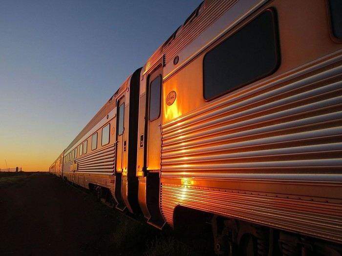
The Ghan (train connecting Adelaide to Darwin), at dawn.
Back to the March 2026 contest: HERE
The Ghan (train connecting Adelaide to Darwin), at dawn.
Some trips are born twice - Peru April - May 2025
Some trips are born twice.
Ours was supposed to happen in 2020. Everything was ready: the itinerary, the flight tickets, hotel reservations and Machu Picchu, the rental car, dreams of high altitudes and wide-open spaces. And then the world stopped.
Like so many other plans, our trip to Peru was put on hold. Disappointment was followed by a more concrete reality: paperwork, endless back-and-forth, and battles to recover some of the costs we’d already paid.
The years went by. Life moved on, with its shifting priorities and unexpected twists. Rescheduling this trip wasn’t possible until 2025.
The itinerary stayed mostly true to what we’d imagined five years earlier. One major difference, though—in 2020, we’d planned to rent a car and explore the roads completely independently. Most importantly, we hadn’t included the three-day Ausangate trek, due to lack of time.
For 2025, our plans evolved. 4x4 rental prices had skyrocketed, and when we looked at our schedule more closely, we realized quite a few days didn’t actually need a vehicle. So we made a different choice and opted for private drivers instead. A decision we never regretted. Always punctual, thoughtful, and available... they were so much more than just drivers.
All our reservations were made in January, except for the trek, which we booked in February.
Finding reliable drivers on our own was tough, so we asked Laurent from Tout Pérou to handle it for us. Going through Tout Pérou also gave us a discount on the train ride to Aguas Calientes, so Laurent booked those tickets too. He also bought our Machu Picchu entrance tickets at the same price we would’ve paid on the official website. When comparing domestic flight prices, we found it was cheaper to book from Peru, so Laurent took care of those as well.
This time, nothing was going to stop us. Peru was waiting. And we were ready. 🙂
Ours was supposed to happen in 2020. Everything was ready: the itinerary, the flight tickets, hotel reservations and Machu Picchu, the rental car, dreams of high altitudes and wide-open spaces. And then the world stopped.
Like so many other plans, our trip to Peru was put on hold. Disappointment was followed by a more concrete reality: paperwork, endless back-and-forth, and battles to recover some of the costs we’d already paid.
The years went by. Life moved on, with its shifting priorities and unexpected twists. Rescheduling this trip wasn’t possible until 2025.
The itinerary stayed mostly true to what we’d imagined five years earlier. One major difference, though—in 2020, we’d planned to rent a car and explore the roads completely independently. Most importantly, we hadn’t included the three-day Ausangate trek, due to lack of time.
For 2025, our plans evolved. 4x4 rental prices had skyrocketed, and when we looked at our schedule more closely, we realized quite a few days didn’t actually need a vehicle. So we made a different choice and opted for private drivers instead. A decision we never regretted. Always punctual, thoughtful, and available... they were so much more than just drivers.
All our reservations were made in January, except for the trek, which we booked in February.
Finding reliable drivers on our own was tough, so we asked Laurent from Tout Pérou to handle it for us. Going through Tout Pérou also gave us a discount on the train ride to Aguas Calientes, so Laurent booked those tickets too. He also bought our Machu Picchu entrance tickets at the same price we would’ve paid on the official website. When comparing domestic flight prices, we found it was cheaper to book from Peru, so Laurent took care of those as well.
This time, nothing was going to stop us. Peru was waiting. And we were ready. 🙂
February contest theme: lakes and ponds around the world
Let’s stick with the water theme—it’s definitely the season (maybe a bit *too* much for some of those dealing with floods 😕).
After the flowing waters (with varying energy levels), let’s take it easy with still waters:
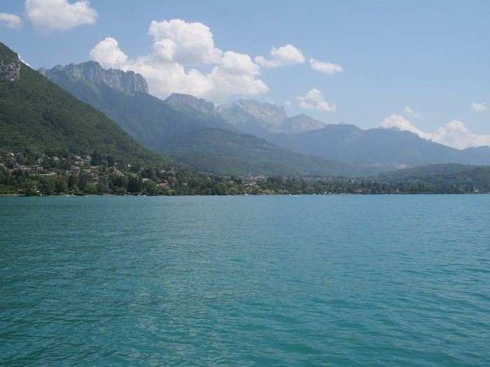 Lakes (Annecy)
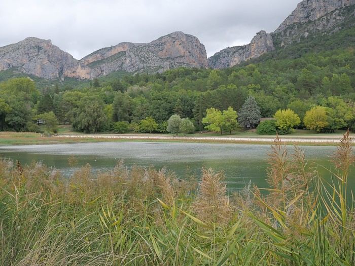 Ponds (near Moustiers Saint Marie)
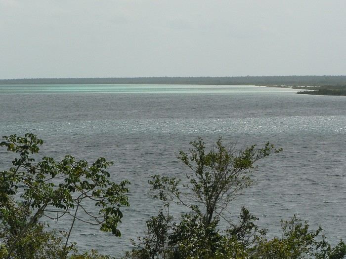 Lagoons (Bacalar)
If you’ve got nice photos of a pond—or even a puddle—why not? Natural bodies of water only: no pools or fountains (reservoir lakes are accepted… because they often look like natural lakes ).
The contest rules are the same as always 😉: Up to 3 photos per member, one photo per post (a little explanation is better), and past winning photos from other VF contests aren’t allowed. You have until Sunday, February 22nd at 11:59 PM (Paris time) to post your photos. Voting starts Monday the 23rd at midnight—rank your top 3 photos in order (3, 2, and 1 points). Voting ends Saturday, February 28th at 11:59 PM. Results will be announced on March 1st. The winning photo is the one with the most points (in case of a tie, the photo ranked first the most times wins). The lucky winner gets to organize March’s contest 😎.
Dig into your archives…
Lakes (Annecy)
Ponds (near Moustiers Saint Marie)
Lagoons (Bacalar)If you’ve got nice photos of a pond—or even a puddle—why not? Natural bodies of water only: no pools or fountains (reservoir lakes are accepted… because they often look like natural lakes ).
The contest rules are the same as always 😉: Up to 3 photos per member, one photo per post (a little explanation is better), and past winning photos from other VF contests aren’t allowed. You have until Sunday, February 22nd at 11:59 PM (Paris time) to post your photos. Voting starts Monday the 23rd at midnight—rank your top 3 photos in order (3, 2, and 1 points). Voting ends Saturday, February 28th at 11:59 PM. Results will be announced on March 1st. The winning photo is the one with the most points (in case of a tie, the photo ranked first the most times wins). The lucky winner gets to organize March’s contest 😎.
Dig into your archives…
Three beautiful weeks during the Japanese autumn
I’m sharing our three-week trip to Japan from late October to mid-November 2025. There were four of us—my partner and a couple of friends.
I’ve traveled often with my friend Christian (Bolivia, Argentina, Costa Rica, Namibia, Laos), but this time our partners joined us.
The rough itinerary:
Arrival in Tokyo. Visiting Shinjuku/Shibuya districts + day trip to Kamakura
5 days in the Japanese Alps, from Matsumoto to Kanazawa (via Kamikochi, Hirayu Onsen, and Takayama)
5 days in Kyoto
Nara, Osaka, Koyasan
Return to Tokyo (Asakusa district), with a day trip to Nikko
We booked our flights well in advance (9 months ahead): the flight cost 1086 € per person. Compared to over 2000 € if we’d booked for the same dates just 3 months prior.
For accommodations, we mostly used Booking.com. The onsen was booked via Japanican, and in Kyoto, we stayed in an Airbnb.
We also made 5 train reservations a month in advance on Klook or directly on the train’s website.
Day 1: Departure from Brussels (October 24, 2025) Early morning takeoff at 6 AM to Munich (1.5-hour layover) with Lufthansa, then a 12-hour flight with ANA, arriving the next morning at 7 AM at Tokyo Haneda.
Day 2: Arrival in Tokyo Airport formalities were quick. The eSIM we bought before leaving activated as soon as we landed (10 GB plan with Saily—more than enough for our mobile internet needs, mainly Google Maps and Google Translate). We’d received 4 ICOCA cards from our neighbors, which we loaded with 15000 ¥ each. We took the Keihin train, then the Yamanote Line. It’s easy to navigate since everything is in English, and each station is announced on scrolling displays in English too.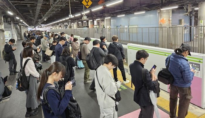
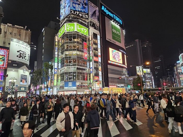
We got off the Yamanote Line at the station just after Shinjuku because it’s easier to exit that massive station with our luggage. So we ended up in Shin-Okubo, right in the Korean district. A 10-minute walk took us to Villa Fontaine Hotel. A great hotel, well-located north of the Kabukichō district. The room even seemed bigger than we’d expected.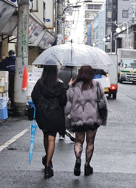
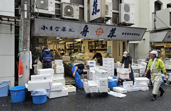 It was 15°C, but it rained—and kept raining on and off all day. Belgian weather, basically.
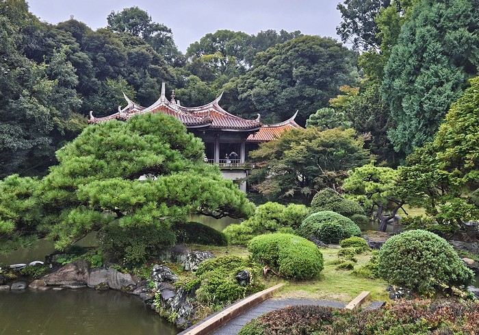
We went for a walk in Shinjuku Gyoen Park. Not as pretty in the rain, but the big greenhouse was interesting.
It was 15°C, but it rained—and kept raining on and off all day. Belgian weather, basically.
We went for a walk in Shinjuku Gyoen Park. Not as pretty in the rain, but the big greenhouse was interesting.
Then our first ramen (hearty and for 1000 ¥—pretty much the price of all our ramen during the trip). We headed back to the hotel since check-in was after 3 PM. Shower and relax before going out for dinner. Dinner was barbecue at Shichirin Yakiniku Anan (1700 ¥ each—good and cheap). Ordering via tablet wasn’t easy, but luckily it was in English.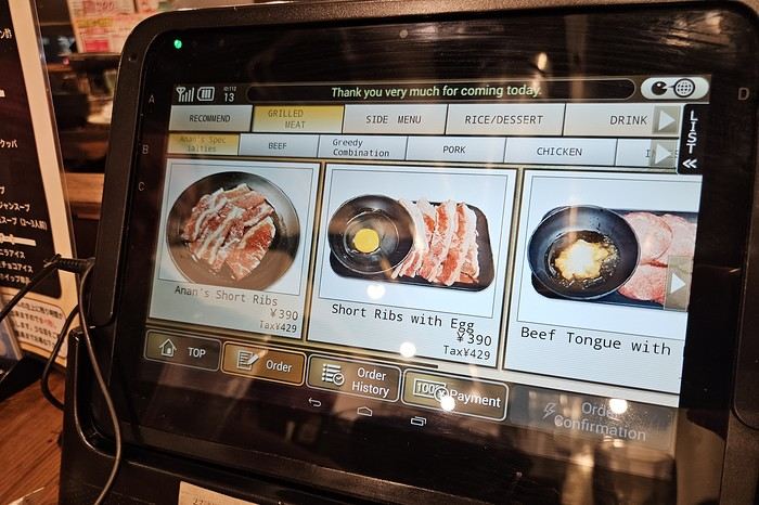
We ended the evening with a stroll through Kabukichō before a well-deserved sleep.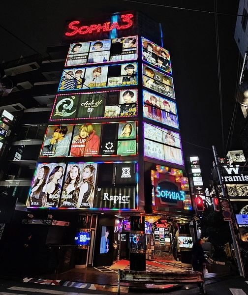
Day 1: Departure from Brussels (October 24, 2025) Early morning takeoff at 6 AM to Munich (1.5-hour layover) with Lufthansa, then a 12-hour flight with ANA, arriving the next morning at 7 AM at Tokyo Haneda.
Day 2: Arrival in Tokyo Airport formalities were quick. The eSIM we bought before leaving activated as soon as we landed (10 GB plan with Saily—more than enough for our mobile internet needs, mainly Google Maps and Google Translate). We’d received 4 ICOCA cards from our neighbors, which we loaded with 15000 ¥ each. We took the Keihin train, then the Yamanote Line. It’s easy to navigate since everything is in English, and each station is announced on scrolling displays in English too.
We got off the Yamanote Line at the station just after Shinjuku because it’s easier to exit that massive station with our luggage. So we ended up in Shin-Okubo, right in the Korean district. A 10-minute walk took us to Villa Fontaine Hotel. A great hotel, well-located north of the Kabukichō district. The room even seemed bigger than we’d expected.
It was 15°C, but it rained—and kept raining on and off all day. Belgian weather, basically.
We went for a walk in Shinjuku Gyoen Park. Not as pretty in the rain, but the big greenhouse was interesting.
Then our first ramen (hearty and for 1000 ¥—pretty much the price of all our ramen during the trip). We headed back to the hotel since check-in was after 3 PM. Shower and relax before going out for dinner. Dinner was barbecue at Shichirin Yakiniku Anan (1700 ¥ each—good and cheap). Ordering via tablet wasn’t easy, but luckily it was in English.
We ended the evening with a stroll through Kabukichō before a well-deserved sleep.
7-week trip feedback: Rajasthan and Varanasi, October-November-December 2025
We traveled as a couple from October 20 to December 11, 2025, for our second trip to India and our first time in Rajasthan, plus Mathura and Agra, which are in Uttar Pradesh but right on the border, and a 4-day flight hop to Varanasi.
Here’s a non-detailed trip report—just to share some info we found useful for other travelers, along with a few places and addresses we particularly enjoyed.
First off, a big thank you to (I’m using usernames) Aleph240758, Solene40, Montagnard74, and Pagaljavab, who took the time to reply to me. Some of them even take the time to create detailed and illustrated travel stories. Since I only started planning the trip in mid-August, I didn’t have much time and used the trip reports on VoyageForum to build our itinerary.
One more note: everyone travels differently and has their own preferences... so I’ll just share our personal feelings, which are obviously subjective.
We bought a physical SIM card upon arriving at the airport. The Airtel stand only offers one package for 500 rupees (just under 5 €) for 28 days, with 1.5 GB of data, unlimited national SMS, and calls—more than enough. Contrary to what we’d read, we asked for activation at the counter, and it was active within 10 minutes. The SIM worked well everywhere. Watch out—like in all airports, there’s a tendency to take advantage of tourists. The Airtel counter offers to exchange money directly, and we saw people paying 20 € for the SIM.
Since we arrived at night, the metro wasn’t running anymore. Plus, if you don’t know the city, we’d recommend taking a prepaid taxi—the price is fixed, and the driver knows the destination. Be careful: the prepaid taxi counter is on the right as you exit the hall, with large fixed signs above. Many counters put out a card on the desk saying "prepaid taxi," and even the Airtel stand tries to offer supposedly prepaid taxis, which is completely false. The price they ask for could be double or triple.
Here’s an app that was super useful for us In most big cities, we used "Rapido," an Indian app like Uber, to book auto-rickshaws (you can also book motorbikes or cars). You need a local phone number for this. The big advantage? The price is fixed, though you can still leave a tip. It tracks your ride, and most importantly, the destination is entered—way more practical than hailing an auto-rickshaw on the street, where the driver says "yes, yes," gives a price, and then doesn’t know where to go once you’re on the way. No need to enter a credit card. There’s also OlaCabs, which is similar, but we couldn’t get it to work.
For transportation between stops, we used government buses (RSRTC, blue buses), sometimes taxis via apps or by asking the guesthouse for visits and hard-to-reach places. This choice was really personal and made on the spot. - **Pros:** Buses leave almost every 30 minutes everywhere, giving you a lot of freedom. Every time we left from the bus station (bus stand), we had seats. Several times, we even got to sit in the driver’s cabin! The trip takes longer than a taxi, but not *that* much longer. The price is ridiculously low—1.30 € for 100 km for men, 70 cents for women. The bus stations are in the city centers, unlike many private bus companies. We met some great people. - **Cons:** It’s not exactly clean, and you’re obviously not in the comfort of a taxi. It’s not door-to-door service, so you need to travel light. You can’t stop along the way. If you need to catch the bus mid-route, it’s usually full, and you’ll have to elbow your way in without hesitation. For a short trip, I think hiring a taxi for the whole stay makes sense. Like I said, there’s no one-size-fits-all choice, but there’s no need to be apprehensive about taking public buses.
Here’s our route map, showing the number of nights spent at each stop. Compared to our initial plan, we slept one night in Barmer instead of two because we had time to visit the market in the afternoon, saw the Kiradu site the next morning, and didn’t see the point in staying longer.
We cut two of the six nights in Shekhawati. After our flight to Varanasi was canceled, we had to stay in Delhi, which actually turned out well—it let us arrive in Varanasi earlier and more rested.
The timing worked well for us, with longer stops in Bundi and Udaipur.
Compared to our initial plan, we slept one night in Barmer instead of two because we had time to visit the market in the afternoon, saw the Kiradu site the next morning, and didn’t see the point in staying longer.
We cut two of the six nights in Shekhawati. After our flight to Varanasi was canceled, we had to stay in Delhi, which actually turned out well—it let us arrive in Varanasi earlier and more rested.
The timing worked well for us, with longer stops in Bundi and Udaipur.
I won’t go into detail about each stop here, but I’d be happy to answer any questions. The accommodations and restaurants mentioned are the ones that had that little something extra, and the hearts (❤️❤️❤️) mark the sites we particularly loved.
Tijana Fort Palace - Accommodation and recovery from the trip
Alwar - Palace with museum - Moosi Maharani Ki Chhatri - Large reservoir
Bharatpur Accommodation: Iora Guesthouse, 14 €/night without breakfast—great value, cheap, good meals, close to the reserve Morning at Keoladeo Reserve by bike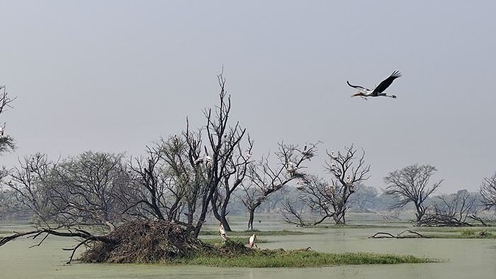
Mathura - Ghats (Yamuna Ghats, Vishram Ghat) to visit in the evening - Market (Chattu Bazar) - Hindu temple Shri Dwarkadheesh dedicated to Krishna - Vrindavan temple Banke Bihari, ❤️❤️❤️ a very important temple with incredible religious fervor - Vrindavan Hindu temple Balaram ISKCON
Agra Accommodation: Shivalayaa - The Divine Abode, 16 €/night with breakfast on Booking—welcoming, clean, close to the Taj Mahal - Mausoleum of Akbar the Great (in Sikandra) ❤️❤️❤️ - Mausoleum of Itimad-ud-Daulah (mini Taj) ❤️❤️❤️ - Visit the Taj early in the morning (closed on Fridays) ❤️❤️❤️ - Agra Fort ❤️❤️❤️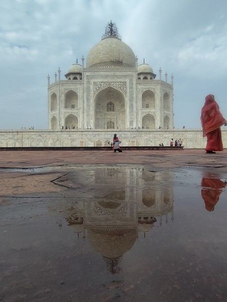
Dholpur - Machkund Temple with its water body - Clock Tower Ghanta Ghar - Royal stepwell Dhaulpur Bavdi
Karauli - City Palace, private visit with a guard ❤️❤️❤️ - Shri Madan Mohan Temple for the puja starting at 5:30 PM ❤️❤️❤️ - Wandering the streets We loved this stop, which is off the main tourist trail, for its pleasant atmosphere
Bhandarej This is a stop as a starting point to visit the Chand Baori stepwell in Abhaneri ❤️❤️❤️ Accommodation: Bhadrawati Palace, 53 €/night with breakfast in Bhandarej—nice, an old palace, warm welcome, booked via Hotels.com We were the only guests and had dinner with the current manager, the grandson of the Maharaja. There’s a pretty stepwell in the village, and we visited a tiny neighborhood temple where we were invited to join in the singing and dancing. Walking through the market was really enjoyable because of the kindness of the locals, who aren’t used to tourism ❤️❤️❤️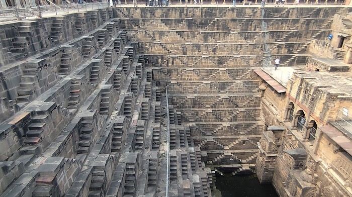
Jaipur - Hawa Mahal (Palace of Winds) - Jal Mahal - Gaitore Ki Chhatriyan ❤️❤️❤️ - Amber Fort ❤️❤️❤️ - Panna Meena Ka Kund stepwell - Galta Ji Temple (Monkey Temple) ❤️❤️❤️ - Bagru, 33 km away: visit to a fabric printing workshop with block prints (I’d noted some addresses on Google Maps). The first workshop wasn’t very welcoming and had no workers because of the humid weather. We were lucky to find another, more welcoming workshop. When the sun came out, the three female workers arrived and started their work—it was a great visit ❤️❤️❤️.
Bundi Accommodation: Hotel Bundi Inn, 25 €/night with breakfast—lovely room in a haveli, good meals with a rooftop view of the fort - Garh Palace Don’t miss: at the exit of the palace, to the left, you can access a beautiful garden with a pool and, at the back, a large hall called Chitrashala ❤️❤️❤️ - Raniji Ki Baori ❤️❤️❤️ - Nahar Dhunk Ki Baori - Chaurasi Khambun Ki Chhatri (cenotaph with 84 pillars) - Ksar Bagh, an interesting set of royal cenotaphs at the end of Jait Sagar Lake. On the other hand, we could’ve skipped Sukh Mahal and its museum. Bundi is still pleasant but is no longer a secret spot.
We bought a physical SIM card upon arriving at the airport. The Airtel stand only offers one package for 500 rupees (just under 5 €) for 28 days, with 1.5 GB of data, unlimited national SMS, and calls—more than enough. Contrary to what we’d read, we asked for activation at the counter, and it was active within 10 minutes. The SIM worked well everywhere. Watch out—like in all airports, there’s a tendency to take advantage of tourists. The Airtel counter offers to exchange money directly, and we saw people paying 20 € for the SIM.
Since we arrived at night, the metro wasn’t running anymore. Plus, if you don’t know the city, we’d recommend taking a prepaid taxi—the price is fixed, and the driver knows the destination. Be careful: the prepaid taxi counter is on the right as you exit the hall, with large fixed signs above. Many counters put out a card on the desk saying "prepaid taxi," and even the Airtel stand tries to offer supposedly prepaid taxis, which is completely false. The price they ask for could be double or triple.
Here’s an app that was super useful for us In most big cities, we used "Rapido," an Indian app like Uber, to book auto-rickshaws (you can also book motorbikes or cars). You need a local phone number for this. The big advantage? The price is fixed, though you can still leave a tip. It tracks your ride, and most importantly, the destination is entered—way more practical than hailing an auto-rickshaw on the street, where the driver says "yes, yes," gives a price, and then doesn’t know where to go once you’re on the way. No need to enter a credit card. There’s also OlaCabs, which is similar, but we couldn’t get it to work.
For transportation between stops, we used government buses (RSRTC, blue buses), sometimes taxis via apps or by asking the guesthouse for visits and hard-to-reach places. This choice was really personal and made on the spot. - **Pros:** Buses leave almost every 30 minutes everywhere, giving you a lot of freedom. Every time we left from the bus station (bus stand), we had seats. Several times, we even got to sit in the driver’s cabin! The trip takes longer than a taxi, but not *that* much longer. The price is ridiculously low—1.30 € for 100 km for men, 70 cents for women. The bus stations are in the city centers, unlike many private bus companies. We met some great people. - **Cons:** It’s not exactly clean, and you’re obviously not in the comfort of a taxi. It’s not door-to-door service, so you need to travel light. You can’t stop along the way. If you need to catch the bus mid-route, it’s usually full, and you’ll have to elbow your way in without hesitation. For a short trip, I think hiring a taxi for the whole stay makes sense. Like I said, there’s no one-size-fits-all choice, but there’s no need to be apprehensive about taking public buses.
Here’s our route map, showing the number of nights spent at each stop.
Compared to our initial plan, we slept one night in Barmer instead of two because we had time to visit the market in the afternoon, saw the Kiradu site the next morning, and didn’t see the point in staying longer.
We cut two of the six nights in Shekhawati. After our flight to Varanasi was canceled, we had to stay in Delhi, which actually turned out well—it let us arrive in Varanasi earlier and more rested.
The timing worked well for us, with longer stops in Bundi and Udaipur.I won’t go into detail about each stop here, but I’d be happy to answer any questions. The accommodations and restaurants mentioned are the ones that had that little something extra, and the hearts (❤️❤️❤️) mark the sites we particularly loved.
Tijana Fort Palace - Accommodation and recovery from the trip
Alwar - Palace with museum - Moosi Maharani Ki Chhatri - Large reservoir
Bharatpur Accommodation: Iora Guesthouse, 14 €/night without breakfast—great value, cheap, good meals, close to the reserve Morning at Keoladeo Reserve by bike
Mathura - Ghats (Yamuna Ghats, Vishram Ghat) to visit in the evening - Market (Chattu Bazar) - Hindu temple Shri Dwarkadheesh dedicated to Krishna - Vrindavan temple Banke Bihari, ❤️❤️❤️ a very important temple with incredible religious fervor - Vrindavan Hindu temple Balaram ISKCON
Agra Accommodation: Shivalayaa - The Divine Abode, 16 €/night with breakfast on Booking—welcoming, clean, close to the Taj Mahal - Mausoleum of Akbar the Great (in Sikandra) ❤️❤️❤️ - Mausoleum of Itimad-ud-Daulah (mini Taj) ❤️❤️❤️ - Visit the Taj early in the morning (closed on Fridays) ❤️❤️❤️ - Agra Fort ❤️❤️❤️
Dholpur - Machkund Temple with its water body - Clock Tower Ghanta Ghar - Royal stepwell Dhaulpur Bavdi
Karauli - City Palace, private visit with a guard ❤️❤️❤️ - Shri Madan Mohan Temple for the puja starting at 5:30 PM ❤️❤️❤️ - Wandering the streets We loved this stop, which is off the main tourist trail, for its pleasant atmosphere
Bhandarej This is a stop as a starting point to visit the Chand Baori stepwell in Abhaneri ❤️❤️❤️ Accommodation: Bhadrawati Palace, 53 €/night with breakfast in Bhandarej—nice, an old palace, warm welcome, booked via Hotels.com We were the only guests and had dinner with the current manager, the grandson of the Maharaja. There’s a pretty stepwell in the village, and we visited a tiny neighborhood temple where we were invited to join in the singing and dancing. Walking through the market was really enjoyable because of the kindness of the locals, who aren’t used to tourism ❤️❤️❤️
Jaipur - Hawa Mahal (Palace of Winds) - Jal Mahal - Gaitore Ki Chhatriyan ❤️❤️❤️ - Amber Fort ❤️❤️❤️ - Panna Meena Ka Kund stepwell - Galta Ji Temple (Monkey Temple) ❤️❤️❤️ - Bagru, 33 km away: visit to a fabric printing workshop with block prints (I’d noted some addresses on Google Maps). The first workshop wasn’t very welcoming and had no workers because of the humid weather. We were lucky to find another, more welcoming workshop. When the sun came out, the three female workers arrived and started their work—it was a great visit ❤️❤️❤️.
Bundi Accommodation: Hotel Bundi Inn, 25 €/night with breakfast—lovely room in a haveli, good meals with a rooftop view of the fort - Garh Palace Don’t miss: at the exit of the palace, to the left, you can access a beautiful garden with a pool and, at the back, a large hall called Chitrashala ❤️❤️❤️ - Raniji Ki Baori ❤️❤️❤️ - Nahar Dhunk Ki Baori - Chaurasi Khambun Ki Chhatri (cenotaph with 84 pillars) - Ksar Bagh, an interesting set of royal cenotaphs at the end of Jait Sagar Lake. On the other hand, we could’ve skipped Sukh Mahal and its museum. Bundi is still pleasant but is no longer a secret spot.
Mauritian Ti' Punch
The recipe for the cocktail: endless beaches, a dazzling palette of colors, some breathtaking hikes, and excellent cuisine...
For the tasting, follow along in the pages of this travel journal! 😉
Don’t forget your hiking shoes, a swimsuit, sunscreen, but also a sweater, your driver’s license, and your credit card...
Just over 11 hours of flight, and we’ll be setting foot on Mauritian soil!
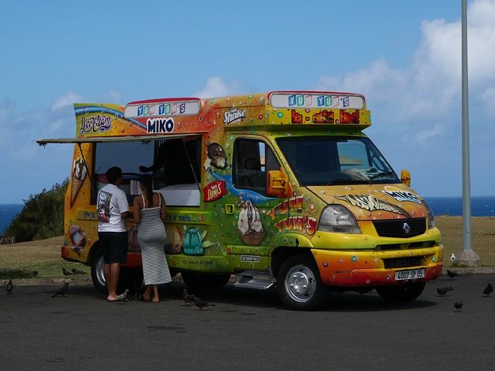
For the tasting, follow along in the pages of this travel journal! 😉
Don’t forget your hiking shoes, a swimsuit, sunscreen, but also a sweater, your driver’s license, and your credit card...
Just over 11 hours of flight, and we’ll be setting foot on Mauritian soil!
Langtang – Trekking in the Rain
We did the Langtang trek (hike) from September 10th to 17th, with the first and last days being the trip from Kathmandu and back—so 6 days of actual walking. It’s a fairly well-known trek but certainly not as famous or crowded as those in the Annapurna or Everest regions, which is why we chose it.
In theory, it’s mandatory to have a guide for this trek. In reality, it seems there are ways to bypass the regulations: we met at least two people hiking without a guide—a South Korean, a New Zealander, and possibly also a couple of English women and an American couple, though we’re not sure if they had a guide.
The agency we booked with had told us it was an affordable trek for relatively older people in good shape—which is our case (I’m 72 myself). I have to say upfront that we found it quite challenging, maybe because we didn’t have good weather—it was the end of the monsoon season. To be clear, no matter your fitness level, I’d say doing this trek in the middle of the monsoon season would be suicidal.
Day 1 – Journey from Kathmandu to Syapru Besi
On Monday, September 8th, there had been violent protests in Kathmandu against the government, which had, among other things, blocked access to social media and been accused of nepotism and corruption. There were 19 deaths. The situation was very tense on the day of our departure, Wednesday the 10th. The agency warned us that public transport was very unreliable. So, we decided to take a jeep, at an additional cost of $100 ($160 minus what was already budgeted for the bus).
We left a little before 7 a.m. and it took us a good hour just to reach the outskirts of Kathmandu. Along the way, we saw several houses and vehicles set on fire by protesters.
The road to Syapru Besi is only 120 km, but it’s frankly awful. It’s always narrow, winds through endless mountains, and the shoulders range from bad to confusing to nonexistent. Several sections are just dirt tracks. We didn’t regret opting for the jeep, as we could stop several times at our convenience—if only to let Y (my Thai partner) throw up everything she had. She’d taken her usual motion sickness medication, but the constant turns, accelerations, and braking eventually made her terribly carsick.
In Nuwakot, we stopped for breakfast at a nice little restaurant, Jimbu. It was around 8:30 a.m., and we’d barely covered 60 km. The restaurant has a lovely garden overlooking the Trishuli Ganga, the river flowing down from Syapru Besi. First photo: the river in the bottom right corner, mist and clouds over the mountain on the other side.
An hour later, my second photo: the hills along the Trishuli Ganga. You can see the different crops—lush green rice paddies in the lower right and corn, already yellowed and likely harvested, in the foreground on the left. And of course, the mist and clouds through which you can glimpse the mountain on the other side of the river.
In theory, it’s mandatory to have a guide for this trek. In reality, it seems there are ways to bypass the regulations: we met at least two people hiking without a guide—a South Korean, a New Zealander, and possibly also a couple of English women and an American couple, though we’re not sure if they had a guide.
The agency we booked with had told us it was an affordable trek for relatively older people in good shape—which is our case (I’m 72 myself). I have to say upfront that we found it quite challenging, maybe because we didn’t have good weather—it was the end of the monsoon season. To be clear, no matter your fitness level, I’d say doing this trek in the middle of the monsoon season would be suicidal.
Day 1 – Journey from Kathmandu to Syapru Besi
On Monday, September 8th, there had been violent protests in Kathmandu against the government, which had, among other things, blocked access to social media and been accused of nepotism and corruption. There were 19 deaths. The situation was very tense on the day of our departure, Wednesday the 10th. The agency warned us that public transport was very unreliable. So, we decided to take a jeep, at an additional cost of $100 ($160 minus what was already budgeted for the bus).
We left a little before 7 a.m. and it took us a good hour just to reach the outskirts of Kathmandu. Along the way, we saw several houses and vehicles set on fire by protesters.
The road to Syapru Besi is only 120 km, but it’s frankly awful. It’s always narrow, winds through endless mountains, and the shoulders range from bad to confusing to nonexistent. Several sections are just dirt tracks. We didn’t regret opting for the jeep, as we could stop several times at our convenience—if only to let Y (my Thai partner) throw up everything she had. She’d taken her usual motion sickness medication, but the constant turns, accelerations, and braking eventually made her terribly carsick.
In Nuwakot, we stopped for breakfast at a nice little restaurant, Jimbu. It was around 8:30 a.m., and we’d barely covered 60 km. The restaurant has a lovely garden overlooking the Trishuli Ganga, the river flowing down from Syapru Besi. First photo: the river in the bottom right corner, mist and clouds over the mountain on the other side.
An hour later, my second photo: the hills along the Trishuli Ganga. You can see the different crops—lush green rice paddies in the lower right and corn, already yellowed and likely harvested, in the foreground on the left. And of course, the mist and clouds through which you can glimpse the mountain on the other side of the river.
Dubai on a budget
Four days of beach relaxation in this truly curious place let me unwind 15 years ago after trekking through Asia or Africa: swimming in clear, clean water and easing jet lag was my goal; seeing that mirage in the middle of the desert also piqued my curiosity... And then Dubai developed, and now I go there once a year for 15 days without ever getting bored!! My backpacker budget doesn’t stop me from enjoying what I love about travel: discovering cultures, architecture, and beaches with turquoise waters.
I’m sharing my favorite spots here for those who love simplicity and the thrill of being amazed! Dubai stretches over 50 km long. I stay in the historic Bur Dubai neighborhood, which is very "Indian" and separated from Deira (the more "Arab/African" district) by a creek.
You cross from one side to the other on abras, small traditional wooden boats that run all day. My hotel is 4 minutes from the Al Ghubaiba bus station, 5 minutes from the Al Ghubaiba metro, and 6 minutes from the Al Ghubaiba boat station!!! It’s easy to get around from here, and at night, it’s lively—safe to go out, with few tourists but mostly the local middle class who built (and are still building) Dubai. It’s simple and very international.
- **Transport:** ...**Getting there:** I fly with Emirates from Paris. Taking the 9:30 PM flight, I sleep on the plane, land at 6:35 AM, exchange 200 euros once I’ve picked up my luggage, change in the restroom, grab a taxi to the hotel, drop off my suitcase, and head straight to the beach! ...**On the ground:** I buy a silver NOL card, which works for buses, metro, and boats. I top it up as needed—it’s valid for 2 years. ...**Taxis:** They have reliable meters. Pink ones are driven by women. Airport-to-hotel fare: 12 €. You’ll find them everywhere, and they don’t complain about short trips. Between 3 PM and 4 PM, it’s trickier because of shift changes.
- **Best times to visit:** For me, it’s April-May and October-November: not too hot for walking but warm enough to swim! Watch out for air conditioning—your worst enemy. It’s everywhere, even at bus stops. Bring a big scarf or sarong to cover your throat and head—going from 32°C to 16°C when you enter a mall, bus, or taxi is pretty harsh!
- **Hotel:** I stay at the Grand Astoria (Fahidi Street) because the value for price and location is great. It’s very clean, and I skip breakfast because near the bus station, there’s a big Carrefour hypermarket where I buy breakfast supplies, water, camel milk, and picnic snacks. There are two nightclubs downstairs—bring earplugs if you want to sleep before 2 AM. Wi-Fi is spotty; you have to change the password every two days. The staff is lovely. Rooms have a TV (4 Indian channels + BBC), a kettle with tea/coffee sachets, and a mini-fridge you fill yourself.
- **Bur Dubai: "My neighborhood"** In the morning, you can see kids in uniforms waiting for the school bus with their parents—second-generation migrants who’ve settled here. They speak English, Arabic, and their mother tongue, have great education, and are in high demand (I see job ads in the local newspapers in the hotel lobby). From the U.S. to the Middle East, Singapore to South Africa, they have bright futures. In the evenings, families stroll along the creek, and it’s common for bench neighbors to ask where you’re from. The whole world crosses paths here. Even with basic English, it’s friendly and warm—the "take care" as people go their separate ways is a nice touch.
Bur Dubai has plenty to explore if you don’t feel like going far: along the creek, there’s a cluster of reconstructed houses forming the Al Shindagha Museum. One ticket lets you visit all the houses, each with a theme tied to the history of the seven emirates (Dubai is one). It takes a full day, but if you stop for lunch, there are tons of restaurants for all budgets, some right by the water.
Walking in the opposite direction, you reach Al Seef, a reconstruction of old Dubai as a small pearl-fishing port. The architecture is lovely, with souvenir shops. My favorite is the Iranian grocery store, where you’ll find camel milk chocolate, black lemon, and sweets with rose, pistachio, and candied apricot. It’s peaceful to walk around here, even as a solo woman. There are free restrooms everywhere, wooden or stone benches, and a nice breeze in the evening. Plenty of waterfront restaurants or places to grab a drink, plus a few towers across the way—nothing spectacular, but they’re prettily lit. There’s a souk with souvenir shops for those who like that!
- **Restaurants:** Bur Dubai has restaurants representing regions of India and the Indian subcontinent. My favorites: Across from the hotel, Paklyari—a Pakistani spot with excellent mutton biryani for 5 €. At Al Seef, Nablus has a great setting by the water. Across in Deira, the Italian restaurant on the 18th floor of the Rotana—go half an hour before sunset for an amazing view of the creek and skyline. The truffle pizza is 24 €. You can take a taxi from Bur, and after dinner, get dropped off at Al Seef to walk back along the creek. For a great thali, Kathhiyawadi is a 10-minute walk from Burjuman metro. My latest discovery: Bordomavi (near the Rashid Al Hadees Masjid 1 bus stop). One of the servers is Algerian and speaks French. You can swim at the small beach with showers/toilets, then have lunch at the restaurant (57 € for two, with starter, main, dessert, and drinks). The setting is peaceful, in a little fishing port with a cool photo op—traditional boats with the modern skyline in the background!
- **Sunset drinks:** The terrace at Concorde Creek View (Bur Dubai) has a creek view, and Canopy by Hilton (Al Seef) overlooks the creek and skyline. You can get a day pass for the pool, including meals and drinks.
- **Lassi:** Near the hotel, SreeRaj Lassi Bar has great ice cream and lassi. *Tip: Everything is takeout-friendly, including leftovers—great for a picnic the next day.
- **Market:** Don’t miss the Waterfront Market—a huge hall where locals buy fish, meat, fruits, and vegetables from all over the world. I love buying fish, shrimp, and cuttlefish, then having it prepared at Yahya’s waterfront restaurant (grilled, in sauce, fried, etc.) with salad, hummus, tabbouleh, and rice. It’s on the way between "my" beach and the hotel, so I stop by easily. I stock up on fruit, and at the Lulu supermarket upstairs, I grab yogurt, water, etc. No need to carry everything—a taxi (available at the main exit) will drop me right at the hotel!
- **Beach:** My favorite: Al Mamzar Park (15-minute taxi ride, 9 €). It has four lifeguarded beaches with showers and restrooms. Opens at 8 AM, but note: Mondays and Wednesdays are for women and young children only! Entry is 1.50 €. On Beach #2, you can rent sun loungers and umbrellas. Beach #3 (the prettiest) has stone tables with benches under big umbrellas—free! I arrive at 8 AM, set up, and walk for an hour along the water, spotting starfish, colorful fish, birds, and occasionally small jellyfish. From bikinis to burkinis, everyone swims as they like! Dubai is judgment-free—no side-eye, just smiles and greetings. I love seeing joyful, full-figured women on women-only days, playing darbuka and singing. Indian women do yoga (even headstands!), Chinese women practice tai chi... I read a lot and swim far out to the buoy limits. Lifeguards keep watch. It’s safe on land too. Once, a 4x4 driver gave me a dirty look for "serving whisky" to my mom from a plastic bottle—until I made him smell it. It was mint tea! Embarrassed, he immediately called his brother, a gym teacher in Poitiers, to apologize in French! People in Dubai are smiley, polite, and very respectful of elders. On weekends, the park is packed with groups and families barbecuing—joyful chaos in every language!
By 1:30 PM, depending on my mood, I’ll get dropped off at the Waterfront Market for fish or a thali restaurant. Sometimes I take the bus—it stops near the abras on the Deira side. Just cross by boat, then it’s a 3-minute walk to the hotel. Takes 45 minutes (vs. 15 by taxi).
For a treat, try Kite Beach (Abu Manara Masjid bus stop). The SoleMio section offers comfy sun loungers, fluffy towels, and umbrellas for 80 € for two in the front row. Go early—you’ll feel like you have the place to yourself, with the Burj Al Arab in the background. It gets busy on weekends.
From there, you can take a taxi to Dubai Mall (not far) to check out the dancing fountains at sunset, for example.
You can also buy day passes at some hotels with sun loungers, towels, pool access, and lunch credit. I tried the Ritz-Carlton—decent (170 € for two, including meals). Lunch was fine, and the view of the lit-up towers at sunset, with the giant wheel, was stunning. I took the metro back in the evening.
There are plenty of free beaches too, like La Mer—worth seeing more for the decor than the beach itself.
- **Even though my main "sightseeing" involves walking around with my head up, admiring the towers in DIFC (amazing), visiting the stunning Mohammed bin Rashid Library (near Creek metro), wandering the souks (including Little India in Bur and the Iranian mosque), or the spice souks in Deira (go early when it’s quiet),** A day trip to Abu Dhabi is worth it. Take the Bur Dubai-Abu Dhabi bus (pay with your NOL card). If you leave early, you’ll see the sunrise over the desert. At the station, buy a bus ticket to the Louvre, cross the footbridge over the highway, and wait for the bus. After the museum, take a taxi to the Grand Mosque, then another taxi back to the bus station. A full but doable day—no need to stay overnight!
In the evening, I love taking the metro (mostly above ground) and passing between the towering, lit-up skyscrapers—it feels like a sci-fi movie. Just missing flying taxis (they’re in the works!)
Sharjah, the closest emirate, has a fantastic Orientalist museum. From Bur Dubai’s maritime station, boats go to Sharjah in 30 minutes, near the aquarium and maritime museum.
- **Shopping:** I buy Indian chai tea spices, incense, camel milk chocolate, Iranian sweets, and fabric from Indian shops selling saris and fabric by the meter. I have a tailor make shirts, tunics, etc. Some shops sell buttons and trimmings to jazz things up.
- **Malls:** To attract customers, mall owners come up with wild ideas: a ski slope at Dubai Mall (worth seeing once), pretty wooden souks at Madinat, and a giant aquarium at Dubai Mall. At sunset, you can watch the dancing fountains to popular global tunes at the foot of the world’s tallest tower. At its base, there’s an excellent Iraqi restaurant, Samad Al Iraki, where the tea server is Tunisian and speaks French! The Ibn Battuta Mall is unique—you can go there straight from Abu Dhabi by bus, for example. Malls have plenty of dining options and are a place to (finally) see locals... though they’re not that interesting. Malls are served by the metro, while buses run along the coast. In Burjuman Mall, there’s a cybercafé on the ground floor where you can print.
A few helpful sites: Visit Dubai - Official Tourism Site RTA (Roads and Transport Authority) - RTA Services
"But what do *you* do in Dubai?" my friends ask, surprised... Yes, I love traveling to countries where I ride on bumpy roads in buses that break down, sleep in places with mosquitoes and cockroaches, and swelter in heat and humidity. But even far from that kind of travel, Dubai has an exotic charm. There’s something for every taste and budget—once you get past the flight ticket (around 680 €, probably cheaper with a layover). Dubai is about relaxing, swimming, being amazed, chatting, and tasting... A safe, clean vacation with no rudeness, and as a woman, it’s a relief to let your guard down. You come back refreshed and at peace!
Hope my experience helps... Next trip: March 2026, with plans to visit the Guggenheim in Abu Dhabi and whatever other curiosities pop up like magic...
Feel free to add to my experience with your own! Happy travels, Laurence
I’m sharing my favorite spots here for those who love simplicity and the thrill of being amazed! Dubai stretches over 50 km long. I stay in the historic Bur Dubai neighborhood, which is very "Indian" and separated from Deira (the more "Arab/African" district) by a creek.
You cross from one side to the other on abras, small traditional wooden boats that run all day. My hotel is 4 minutes from the Al Ghubaiba bus station, 5 minutes from the Al Ghubaiba metro, and 6 minutes from the Al Ghubaiba boat station!!! It’s easy to get around from here, and at night, it’s lively—safe to go out, with few tourists but mostly the local middle class who built (and are still building) Dubai. It’s simple and very international.
- **Transport:** ...**Getting there:** I fly with Emirates from Paris. Taking the 9:30 PM flight, I sleep on the plane, land at 6:35 AM, exchange 200 euros once I’ve picked up my luggage, change in the restroom, grab a taxi to the hotel, drop off my suitcase, and head straight to the beach! ...**On the ground:** I buy a silver NOL card, which works for buses, metro, and boats. I top it up as needed—it’s valid for 2 years. ...**Taxis:** They have reliable meters. Pink ones are driven by women. Airport-to-hotel fare: 12 €. You’ll find them everywhere, and they don’t complain about short trips. Between 3 PM and 4 PM, it’s trickier because of shift changes.
- **Best times to visit:** For me, it’s April-May and October-November: not too hot for walking but warm enough to swim! Watch out for air conditioning—your worst enemy. It’s everywhere, even at bus stops. Bring a big scarf or sarong to cover your throat and head—going from 32°C to 16°C when you enter a mall, bus, or taxi is pretty harsh!
- **Hotel:** I stay at the Grand Astoria (Fahidi Street) because the value for price and location is great. It’s very clean, and I skip breakfast because near the bus station, there’s a big Carrefour hypermarket where I buy breakfast supplies, water, camel milk, and picnic snacks. There are two nightclubs downstairs—bring earplugs if you want to sleep before 2 AM. Wi-Fi is spotty; you have to change the password every two days. The staff is lovely. Rooms have a TV (4 Indian channels + BBC), a kettle with tea/coffee sachets, and a mini-fridge you fill yourself.
- **Bur Dubai: "My neighborhood"** In the morning, you can see kids in uniforms waiting for the school bus with their parents—second-generation migrants who’ve settled here. They speak English, Arabic, and their mother tongue, have great education, and are in high demand (I see job ads in the local newspapers in the hotel lobby). From the U.S. to the Middle East, Singapore to South Africa, they have bright futures. In the evenings, families stroll along the creek, and it’s common for bench neighbors to ask where you’re from. The whole world crosses paths here. Even with basic English, it’s friendly and warm—the "take care" as people go their separate ways is a nice touch.
Bur Dubai has plenty to explore if you don’t feel like going far: along the creek, there’s a cluster of reconstructed houses forming the Al Shindagha Museum. One ticket lets you visit all the houses, each with a theme tied to the history of the seven emirates (Dubai is one). It takes a full day, but if you stop for lunch, there are tons of restaurants for all budgets, some right by the water.
Walking in the opposite direction, you reach Al Seef, a reconstruction of old Dubai as a small pearl-fishing port. The architecture is lovely, with souvenir shops. My favorite is the Iranian grocery store, where you’ll find camel milk chocolate, black lemon, and sweets with rose, pistachio, and candied apricot. It’s peaceful to walk around here, even as a solo woman. There are free restrooms everywhere, wooden or stone benches, and a nice breeze in the evening. Plenty of waterfront restaurants or places to grab a drink, plus a few towers across the way—nothing spectacular, but they’re prettily lit. There’s a souk with souvenir shops for those who like that!
- **Restaurants:** Bur Dubai has restaurants representing regions of India and the Indian subcontinent. My favorites: Across from the hotel, Paklyari—a Pakistani spot with excellent mutton biryani for 5 €. At Al Seef, Nablus has a great setting by the water. Across in Deira, the Italian restaurant on the 18th floor of the Rotana—go half an hour before sunset for an amazing view of the creek and skyline. The truffle pizza is 24 €. You can take a taxi from Bur, and after dinner, get dropped off at Al Seef to walk back along the creek. For a great thali, Kathhiyawadi is a 10-minute walk from Burjuman metro. My latest discovery: Bordomavi (near the Rashid Al Hadees Masjid 1 bus stop). One of the servers is Algerian and speaks French. You can swim at the small beach with showers/toilets, then have lunch at the restaurant (57 € for two, with starter, main, dessert, and drinks). The setting is peaceful, in a little fishing port with a cool photo op—traditional boats with the modern skyline in the background!
- **Sunset drinks:** The terrace at Concorde Creek View (Bur Dubai) has a creek view, and Canopy by Hilton (Al Seef) overlooks the creek and skyline. You can get a day pass for the pool, including meals and drinks.
- **Lassi:** Near the hotel, SreeRaj Lassi Bar has great ice cream and lassi. *Tip: Everything is takeout-friendly, including leftovers—great for a picnic the next day.
- **Market:** Don’t miss the Waterfront Market—a huge hall where locals buy fish, meat, fruits, and vegetables from all over the world. I love buying fish, shrimp, and cuttlefish, then having it prepared at Yahya’s waterfront restaurant (grilled, in sauce, fried, etc.) with salad, hummus, tabbouleh, and rice. It’s on the way between "my" beach and the hotel, so I stop by easily. I stock up on fruit, and at the Lulu supermarket upstairs, I grab yogurt, water, etc. No need to carry everything—a taxi (available at the main exit) will drop me right at the hotel!
- **Beach:** My favorite: Al Mamzar Park (15-minute taxi ride, 9 €). It has four lifeguarded beaches with showers and restrooms. Opens at 8 AM, but note: Mondays and Wednesdays are for women and young children only! Entry is 1.50 €. On Beach #2, you can rent sun loungers and umbrellas. Beach #3 (the prettiest) has stone tables with benches under big umbrellas—free! I arrive at 8 AM, set up, and walk for an hour along the water, spotting starfish, colorful fish, birds, and occasionally small jellyfish. From bikinis to burkinis, everyone swims as they like! Dubai is judgment-free—no side-eye, just smiles and greetings. I love seeing joyful, full-figured women on women-only days, playing darbuka and singing. Indian women do yoga (even headstands!), Chinese women practice tai chi... I read a lot and swim far out to the buoy limits. Lifeguards keep watch. It’s safe on land too. Once, a 4x4 driver gave me a dirty look for "serving whisky" to my mom from a plastic bottle—until I made him smell it. It was mint tea! Embarrassed, he immediately called his brother, a gym teacher in Poitiers, to apologize in French! People in Dubai are smiley, polite, and very respectful of elders. On weekends, the park is packed with groups and families barbecuing—joyful chaos in every language!
By 1:30 PM, depending on my mood, I’ll get dropped off at the Waterfront Market for fish or a thali restaurant. Sometimes I take the bus—it stops near the abras on the Deira side. Just cross by boat, then it’s a 3-minute walk to the hotel. Takes 45 minutes (vs. 15 by taxi).
For a treat, try Kite Beach (Abu Manara Masjid bus stop). The SoleMio section offers comfy sun loungers, fluffy towels, and umbrellas for 80 € for two in the front row. Go early—you’ll feel like you have the place to yourself, with the Burj Al Arab in the background. It gets busy on weekends.
From there, you can take a taxi to Dubai Mall (not far) to check out the dancing fountains at sunset, for example.
You can also buy day passes at some hotels with sun loungers, towels, pool access, and lunch credit. I tried the Ritz-Carlton—decent (170 € for two, including meals). Lunch was fine, and the view of the lit-up towers at sunset, with the giant wheel, was stunning. I took the metro back in the evening.
There are plenty of free beaches too, like La Mer—worth seeing more for the decor than the beach itself.
- **Even though my main "sightseeing" involves walking around with my head up, admiring the towers in DIFC (amazing), visiting the stunning Mohammed bin Rashid Library (near Creek metro), wandering the souks (including Little India in Bur and the Iranian mosque), or the spice souks in Deira (go early when it’s quiet),** A day trip to Abu Dhabi is worth it. Take the Bur Dubai-Abu Dhabi bus (pay with your NOL card). If you leave early, you’ll see the sunrise over the desert. At the station, buy a bus ticket to the Louvre, cross the footbridge over the highway, and wait for the bus. After the museum, take a taxi to the Grand Mosque, then another taxi back to the bus station. A full but doable day—no need to stay overnight!
In the evening, I love taking the metro (mostly above ground) and passing between the towering, lit-up skyscrapers—it feels like a sci-fi movie. Just missing flying taxis (they’re in the works!)
Sharjah, the closest emirate, has a fantastic Orientalist museum. From Bur Dubai’s maritime station, boats go to Sharjah in 30 minutes, near the aquarium and maritime museum.
- **Shopping:** I buy Indian chai tea spices, incense, camel milk chocolate, Iranian sweets, and fabric from Indian shops selling saris and fabric by the meter. I have a tailor make shirts, tunics, etc. Some shops sell buttons and trimmings to jazz things up.
- **Malls:** To attract customers, mall owners come up with wild ideas: a ski slope at Dubai Mall (worth seeing once), pretty wooden souks at Madinat, and a giant aquarium at Dubai Mall. At sunset, you can watch the dancing fountains to popular global tunes at the foot of the world’s tallest tower. At its base, there’s an excellent Iraqi restaurant, Samad Al Iraki, where the tea server is Tunisian and speaks French! The Ibn Battuta Mall is unique—you can go there straight from Abu Dhabi by bus, for example. Malls have plenty of dining options and are a place to (finally) see locals... though they’re not that interesting. Malls are served by the metro, while buses run along the coast. In Burjuman Mall, there’s a cybercafé on the ground floor where you can print.
A few helpful sites: Visit Dubai - Official Tourism Site RTA (Roads and Transport Authority) - RTA Services
"But what do *you* do in Dubai?" my friends ask, surprised... Yes, I love traveling to countries where I ride on bumpy roads in buses that break down, sleep in places with mosquitoes and cockroaches, and swelter in heat and humidity. But even far from that kind of travel, Dubai has an exotic charm. There’s something for every taste and budget—once you get past the flight ticket (around 680 €, probably cheaper with a layover). Dubai is about relaxing, swimming, being amazed, chatting, and tasting... A safe, clean vacation with no rudeness, and as a woman, it’s a relief to let your guard down. You come back refreshed and at peace!
Hope my experience helps... Next trip: March 2026, with plans to visit the Guggenheim in Abu Dhabi and whatever other curiosities pop up like magic...
Feel free to add to my experience with your own! Happy travels, Laurence
My TOP 3 countries visited
Hi everyone,
I feel like I’ve been lucky enough over the past few years to travel—a lot of that’s thanks to retirement... (see my profile!)
So, aside from my beautiful country, France, here’s my totally subjective top 3:
1 – Antarctica
2 – Greenland
3 – Yellowstone Park
Of course, this is just my opinion—human, architectural, cultural, and gastronomic treasures are everywhere on our unique planet, Earth. Have a great day, everyone!
Of course, this is just my opinion—human, architectural, cultural, and gastronomic treasures are everywhere on our unique planet, Earth. Have a great day, everyone!
Namibia Travel Journal: May 2025 - Trip Review
NAMIBIA TRIP 2025: April 24 to May 20: Feel free to comment or ask us any questions about this amazing journey.
>> Find all our photos and videos for each day on our website here: www.montagne-aventure.net
**DAY 1: Thursday, April 24, 2025: Outbound Flights from Lyon to Windhoek via Munich - Visit to Munich:**

Off we go on a new adventure. The alarm rings at 6:30 AM, the travel bags are packed, and we head to Lyon Airport. We booked our flight tickets with Lufthansa. The first leg to Munich, Germany, is operated by AirBaltic. Departure at 1:05 PM for a 1-hour and 20-minute flight. We arrive at 2:30 PM.
**We now have a 7-hour layover, so we take the opportunity to get some fresh air and explore Munich.** We quickly exit Terminal 2 of the airport and head towards the subway. We buy a group day ticket "Airport-city Day Zone M-5," valid for 2 to 5 people at a price of 30.50 € (instead of 16.30 € per person). We take the S8 line to **Marienplatz** in 35 minutes. **This is the heart of the city.** The weather is overcast, quite cool, but dry. Perfect for a little city trip between two flights while leaving our large luggage in transit at the airport. **Munich is the third-largest German city after Berlin and Hamburg, in the Bavaria region.** **The center has a lot of charm and brings together several religious buildings, easy to explore on foot.** We are impressed by the number of people enjoying these 100% pedestrian streets, which are very pleasant. After Marienplatz, the most famous square with the town hall, we head to the Cathedral of Our Lady, a Gothic church, then continue to **Karlsplatz** and move on to **the food market offering a wide selection of high-end food products in an atmosphere where a certain art of living prevails.** We also visit St. Peter's Church before grabbing a bite to eat. Two good hours were enough for this 10 km city walk. It's time to take the subway back: by 6:30 PM, we are back at the airport. Now, it's time for a bit of waiting and rest. Our second flight is scheduled for 9:35 PM for a 9-hour and 30-minute journey to our final destination in Namibia: **Windhoek.**
> Round-trip flight tickets with Lufthansa from Lyon: 2029 €, or 1,014.50 € per person.
> Lyon Airport parking: 120 €
> Today's expenses: 7 € for 2 pizzas in France / 14 € for the restaurant in Munich / 30.50 € for the daily subway ticket in Munich.
**DAY 2: Friday, April 25, 2024: Arrival in Windhoek, Visit to the Namibian Capital:**
After a 9-hour and 30-minute overnight flight with Discover Airlines, we finally land on Namibian soil just before 7:30 AM. The day is breaking, and the colors are already stunning. We are eager despite the usual fatigue from the flight. The airline was punctual, with friendly staff and good meals, though a bit light. We are the first flight of the day to land, with no more than 15 flights per day here, from 7 AM to 8 PM. We disembark on the tarmac at this airport located in the middle of nowhere, **I finally set foot on African soil for the first time.** We exit among the first from the aircraft to go through the long formalities at the front of the line, as the wait can quickly become endless. Allow at least 5 minutes per person for e-visas. We still wait 45 minutes despite only about twenty people ahead of us. Phew, it's done. We collect our luggage and then withdraw money from an ATM. We make 4 withdrawals of the maximum amount, 2000 NAD $ per withdrawal, for a total of 380 €, or 95.33 € per withdrawal.
Our driver arrives at the same time, perfect timing, we were quick.
We leave the airport at 8:45 AM. By 9:30 AM, we arrive at the **Gracious Whisp vehicle rental agency**, located at the entrance of Windhoek, small and human-sized with a fleet of recent vehicles. More formalities, then a short wait as our vehicle is not yet ready. Time to decompress, catch our breath, and enjoy the very pleasant morning temperature. Not a cloud in sight. Next, a briefing on the vehicle, always with a bit of apprehension due to our approximate English. Allow 45 minutes of explanations, including setting up the roof tent, camping equipment, technical information in case of a flat tire, driving tips in Namibia, and a tour of the 4x4. We have all the necessary equipment for camping: mattresses, sleeping bags, pillows, table, chairs, gas stove, BBQ grill... as well as 2 spare tires, a compressor, a dual tank, and accessories for removing wheels. Off we go, it's time to muster our courage and get behind the wheel. **Heading to SuperSpar Maerua**, fortunately located less than 10 minutes away. We park with the help of a parking attendant; it's very crowded, the space is narrow, but everything goes well despite the cursed right-hand drive. Today's new mission: stock up on groceries. The store is well-stocked with local and imported products, catering to all tastes. We spend 114 € on groceries, from pasta to meat, BBQ lighters to dishwashing products. Two people load our groceries into two carts and transfer them to our vehicle; we feel compelled to leave a tip, 50 NAD $, as we don't have change yet. Now, we head to the hotel, 15 minutes away. Traffic is difficult at a complicated intersection; this will likely be the only traffic jam in Namibia. **We arrive at Kate's Nest Guesthouse & Backpackers around 1:15 PM, quite tired.** We take some well-deserved rest at this recent establishment, quite calm with secure private parking. After a short nap, we enjoy the quiet by the hotel pool. Night falls between 6:30 PM and 7 PM. We eat quietly in our room tonight before starting this long 4x4 road trip in camping mode in the heart of Namibia.
> Today's grocery expenses: 114 € at Super Spar Marua (2395.21 NAD $).
> Round-trip flight tickets with Lufthansa from Lyon: 2029 €, or 1,014.50 € per person.
> Vehicle rental: 4x4 Toyota with roof tent for 24 days: Gracious Whisp Car Rentals: 2,638 € (N$50,640) or **1,319 €** per person - (https://gwcarrentals.com/)
> Distance driven today: 15 km.
> Accommodation: Kate's Nest Guesthouse & Backpackers - 4 Aristotles Street Academia, 9000 Windhoek - 36 € for two for one night.
> Windhoek International Airport website: (https://www.airports.com.na/)
**DAY 3: Saturday, April 26, 2025: Windhoek to Hardap: Mariental Region - Kalahari Desert:**
After a good, restful night, we wake up leisurely around 7 AM. We enjoy the comfort provided by this first and last hotel before 24 nights under the tent.
**We leave Kate's Nest Guesthouse at 8:30 AM to tackle the Namibian roads.** We quickly leave the capital; in just 30 minutes, we find ourselves almost alone in the world. The landscape is dotted with small domes. We leave the **paved B1** quickly to turn left onto the **C15**. **From there, we won't see more than 10 vehicles all day.** After passing through the few houses of **Lekkerwaterpoort**, we tackle our first gravel road. These road sections are limited to 100 km/h, but even at 70 km/h, I find it already challenging. However, I quickly get used to it and gradually pick up speed to reach my cruising speed of around 80 to 90 km/h. **We are on immense straight lines crossing wild expanses as far as the eye can see.** **We come across two baboons, a few ostriches, and numerous cattle and sheep farms.** We pass through the charming village of **Uhlenhorst** with its typical houses and children with broad smiles waving at us. Life here is already very different from Windhoek. **The thermometer rises quickly from 16°C at 8:30 AM to over 28°C in the early afternoon.**
**We arrive at the Hardap Dam reserve at 2 PM.** We stop at the toll booth at the park entrance to pay the entrance fee: 250 NAD $ for 2 people and 1 vehicle. We continue to the dam and then the camp entrance, located a bit further. We had booked in advance, but this place remains little frequented by foreigners.
We take advantage of the hottest hours to rest by the large pool overlooking the immense lake, a very enjoyable moment. Would this be a bit of a vacation?
Around 4:30 PM, we head to the campsite. We overlook this vast water reserve. We arrive first; we will be only 3 vehicles spending the night here. It's time to get to work and set up our equipment for the first time. It takes us a good 20 minutes to set everything up, with a slight apprehension about unfolding the tent. Once this task is done, which we will have to repeat for almost a month, we will become much more efficient over time. Time for rest and contemplation in total silence. The sun gradually sets, and the heat quickly becomes bearable again. Bliss! **This dam is located 20 km northwest of Mariental in an area dotted with conical hills topped with dolerite buttons (Hardap means "hillock" in Nama). It captures the Fish River, which flows south, creating a large lake in the middle of an arid environment. The contrast is striking.** We enjoy our first sunset facing this 360° otherworldly landscape.
Around 7 PM, we start our first BBQ, or "braai" as it's called here. The temperature is perfect. The sun sets, giving way to a star-filled sky of incredible beauty thanks to the absence of any light pollution. The Milky Way will lull us throughout the evening. After some good sausages and potatoes on the BBQ, we head to our roof tent around 9:30 PM with a complete change of scenery in just 24 hours. France already seems so far away...
This campsite has shared showers and toilets, quite clean and functional, as well as a central area with several BBQs and tables. The sites are arranged in a semicircle, each with an electrical outlet. The sites are close to each other but spacious, some slightly shaded. We are only three vehicles tonight, so it's perfectly comfortable and quiet. Not to mention the large pool near the restaurant. Our trip is off to a great start.
> Today's road itinerary: Windhoek > Head south on the B1 to Rehoboth > Turn left onto the C25 then C15 to Stampriet > C20 to Hardap > Full north on the B1 > Then turn left onto the M93 - 5 hours of driving.
> Distance driven today: 354 km.
> Accommodation: Hardap Recreation Resort - 23.3 € for two - Large pool - GR6W+3M2, Hardap Game Reserve, Mariental, Namibia - (http://www.nwr.com.na/resorts/hardap-resort/)
**DAY 4: Sunday, April 27, 2025: Hardap - Brukkaros Volcano - Keetmanshoop - Quivertree Forest Rest Camp**
Our first night under the tent was very pleasant; the little wind quickly calmed down, giving way to absolute silence. The mattress is decent, more comfortable than some nights in Nepal. The length and width give us enough space for maximum comfort, despite my height (1.91 m). We wake up a little before 7 AM as the sun rises, and the lights dazzle us from the start of the day. We pack up the equipment in 30 minutes, quite easily. Then we enjoy the sun, which warms up quickly while we keep our light fleece on.
At 8:30 AM, **we hit the road again, heading south** to our first stop in **Mariental**. We want to do some shopping at SuperSpar, but once we arrive in the parking lot, a young local is fighting with the supermarket security guards and then threatens to throw stones. We don't want to take any risks right at the start, so despite the baton blows he receives, he doesn't stop. We leave empty-handed but fill up with fuel at the Shell station 1 km further. The price per liter is 21.33 NAD $, we fill our 107-liter tank for 107 €. In Namibia, you get served, and they bring the card machine to the window to pay. It's then customary to leave a tip.
We then take the B1 heading due south on a recently renovated road. Around 11:30 AM, we leave it on our right to take **a wild gravel road, the M98**. Just before **Berseba**, we turn right onto a small track, the **D3904 towards Brukkaros Crater up to a camp at 1588 m altitude**. The track then becomes too bumpy. We stop on the counter-slopes where **a wide panorama unfolds over these immense plains as far as the eye can see**. It's 12:15 PM, time for us to eat a rice and tuna salad facing this landscape.
**We are alone in the world until a vehicle arrives and parks next to us.** A bit of apprehension, 4 men head towards us. It turns out to be 4 shepherds looking for a lost foal. The conversation is pleasant, lost in the middle of nowhere. We find ourselves alone again in this absolute silence. **The heat becomes stifling with a good 30°C**. We get back on the road around 1 PM. Back on the B1, **we continue due south to Keetmanshoop**, which we reach around 3 PM. We stop there to do some shopping for 262 NAD $ (12 eggs, a can of tuna, a can of corn, bread, a soda, and a 5-liter water container), or 12.48 €. Two quite insistent children ask us for money or candy at the store exit, yet we give them a small tip, but they continue to cling to the car. Locals parked next to us tell them to leave us alone. Anyway, we finish the trip to **Quivertree Forest**, 15 km away. We will spend the night in this **pleasant farm run by a German**. Upon arrival, as the day before, and as I suppose in the future, we dive straight into the cool pool to relax after all these kilometers. A bliss. Then we take our 4x4 and choose a spot near these famous trees. After the 33°C this afternoon, once 4 PM passed, the temperature drops again and becomes very pleasant. **We are in the middle of the Kokerboom, one of the most interesting and characteristic plants of hot and arid regions. It's not really a tree but a variant of the aloe plant whose botanical name is Aloe Dichotoma. This Kokerboom has a smooth and thick trunk reaching up to 1 m in thickness and 9 m in height. They bloom for the first time at the age of 20 to 30 years.** The flowers are yellow and reach about thirty centimeters during the season between June and July. **They grow mainly in an environment with a high concentration of black rocks absorbing a large amount of heat (38°C). The rocks also serve to anchor the tree with its tentacle-like roots. It also resists frost. Each is between 200 and 300 years old.**
Around 5 PM, we walk to the farm reception to watch the feeding of **two cheetahs**. Magnificent carnivores taking their time to savor their piece of meat. **Then we return near our campsite to enjoy the sunset among these trees. The colors are sublime, as every evening apparently. A magnificent spectacle with colors evolving from yellow to orange then to pink, before giving way once again to a sky filled with thousands of stars.** Our campsite at Quiver Tree Forest Camp is very comfortable; we have a water supply, a stone table, a small lamp, an electrical outlet, a small tree for shade, and a BBQ that we won't use tonight; we'll cook on gas. The sites are far apart, with some shared facilities scattered around, a very beautiful setting. No reservation possible, no need, just show up directly. **The campsite accommodation for 2 people costs 28 €, including the reserve entrance fee of 5 €**. We finish this second bivouac evening around 9:30 PM, time for some reading and sleep in peaceful silence without wind.
> Today's road itinerary: Mariental > B1 heading south to Brukkaros > At Tses turn right towards Berseba via the M98 > Turn right onto the D3904 > 8 km > Brukkaros Volcano (stop at the lower camp as the track is difficult for 1 hour) > Keetmanshoop > Turn left onto the M29 > Quivertree Forest - 4 hours of driving.
> Distance driven today: 371 km.
> Distance walked today: 6 km.
> Today's expenses: Groceries for 12.48 € (262 NAD $) / Fuel for 107 € (1 liter of diesel for 21.33 NAD $).
> Accommodation: Quivertree Forest Rest Camp, P.O. Box 262, Keetmanshoop, Namibia - BBQ, hot showers, toilets, and electricity - No reservation - Pool - 18 €/Person (N$ 340.00 with park entrance) - (http://www.quivertreeforest.com/)
**DAY 5: Monday, April 28, 2025: Quivertree Forest Rest Camp - Giant's Playground - Keetmanshoop - Fish River Canyon - Canyon Roadhouse:**
After an excellent start to the night, we are woken up by the wind shortly before 6 AM, but the sunrise is not far off. We get up at 6:30 AM to enjoy it. The atmosphere is a bit cooler this morning, but the reward is already here.
The adventure continues. At 7:45 AM, we head towards **Giant's Playground**, 4 km away. We take a 3-kilometer walk through this expanse of blocks and igneous rocks.
We continue south at 8:45 AM, passing through Keetmanshoop again where we do some shopping for 25 €, a big stock-up for a good part of the trip: meats, canned goods, pasta, fruits... At 9:30 AM, we take the B4 to Fish River Canyon.
At 11:30 AM, we arrive at the entrance to the NWR park (350 NAD $ entrance for 2 people and 1 vehicle). The track becomes bumpy immediately upon entering the park. After about ten kilometers, we come upon this landscape carved by nature. In the end, it's well worth the detour. We were at the Grand Canyon in the USA exactly (https://www.montagne-aventure.net/2024/04/29/j21-3-juin-2024-grand-canyon-et-lac-powell/) and can thus confirm that this Fish River Canyon is comparable. We make several stops along the southern flank. **Here, nothing is developed; nature is almost in the wild state.** **With 160 km in length, up to 27 km in width, and a depth of 150 m, it is indeed the second-largest canyon in the world.** The history of the canyon is apparent in its different earth layers and stratification: the antiquity of the place is tangible, and the absence of vegetation is surprising. **It consists of two nested canyons, formed at distinct periods. The first distinct layer of schist, sandstone, and eruptive material surrounding the canyon was formed a few two billion years ago, then transformed due to heat and pressure into more solid rock such as gneiss. The inner canyon, carved more recently by the Fish River, has a depth of 270 m.**
We have a picnic once again alone in the world facing this grand panorama at the **Sulphur Spring View Point**. This is where the hiking trail begins, plunging into this narrow canyon, but it is forbidden to venture there alone without a guide. It's 30°C, but a slight wind makes the atmosphere bearable. At 1 PM, we retrace our steps and continue to the **Main View Point** then to the **Hikers View Point**.
In the south of Namibia, the Fish River Canyon, 160 km long, is a true geological wonder: a canyon nested within another canyon, one of the largest in the world. The first sedimentary layers formed two billion years ago; 500 million years ago, a period of tectonic activity caused these layers to crack and tilt, opening a vast canyon in the Earth's crust. The second canyon, with a depth of 270 m, was carved over time by the passage of the Fish River in this new valley.
At 3 PM, we arrive at our very charming camp for the evening, the **Canyon Road House**. We fill up with fuel right away because tomorrow we have a long day of isolated driving: 55 liters for 1240 NAD $. Then we settle into the campsite we had previously reserved in France. We are assigned site 2, very well set up under a tree with its BBQ and stone table just steps from the pool. We quickly set up the tent and jump straight into the pool for the relaxation moment of the day. As usual, the water is quite cool, but it's a real pleasure. Then we stroll around this Canyon Road House, which recreates the atmosphere of the roadside inns of the 1950s with old car wrecks and vintage gas pumps in a bygone era. **Around 5:45 PM, we start a short walk leading us to the top of a hill overlooking the wide plateau where we are to watch the sunset.**
And finally, to end this beautiful day, it's time for the braai, with grilled sausages and white beans on the evening menu.
> Park entrance: 150 DN/person + 50 DN/vehicle (18 € for two). It is possible to enter at two access points: Hobas in the north and Ai-Ais in the south.
> Today's road itinerary: M29 > Keetmanshoop > B1 > B4 > C12 (track) > After Holoog turn right onto the D601 (C37 track) > Accommodation on our right (stop just to check in before 6 PM) > Continue 30 km (30 minutes of track) to the viewpoints after Hobas where you must pay the entrance fee. Sunset View Point to the left > Return before sunset as the park closes (best lights at sunrise). 3 hours.
> Distance driven today: 228 km.
> Distance walked today: 10 km.
> Today's expenses: 25 € for groceries / 17 € for the Fish River Canyon park entrance / 58 € for fuel.
> Accommodation: Canyon Roadhouse, Gondwana Collection Namibia – 34.4 € for two - Pool - Near Hobas - (http://www.gondwana-collection.com/fr/accommodation/canyon-road-campsite)
**DAY 6: Tuesday, April 29, 2025: Canyon Roadhouse - Orange River - South African Border - Vista Trail - Gondwana Sperrgebiet Park - Aus:**
The night was excellent in this very comfortable campsite. **We wake up to the sound of birds** before the alarm at 6:45 AM. Our little morning routine starts as the sun rises. **A big day of driving awaits us to the South African border. This will be the southernmost point of our journey.** We hit the road at 8 AM via the C37, pass through **Hobas**, then turn onto the D207 to **Aussenkehr.** **We cross a mountainous barrier with some high peaks and perfect cones. The rock varies from orange to pink to black.**
We then cross a lunar desert as far as the eye can see on a giant dome; the track winds through nowhere without meeting anyone for hours. The landscapes are surprising. **We spot several ostriches and a gemsbok.** In the middle of this endless expanse, we come to an improbable intersection and continue right onto the D278.
In the middle of these arid lands, we come across a green zone: a vast vineyard. At 10:30 AM, **we come across a "Road closed" sign, fortunately, a local resident waves us to continue; a bit stressed, we proceed.** We start to follow the beautiful Orange River. On the other side of the bank, just a few meters away, South Africa is there. It is the second-longest river in Southern Africa, after the Zambezi. It flows over 2,000 km to the Atlantic. After passing through narrow gorges, we regain altitude before starting the descent, gently heading back north.
**We now cross and follow the Fish River, which joins the Orange River further south** **along this gorge dating back millennia.** At exactly noon, we take a lunch break by the Fish River, still without meeting a soul in this landscape between greenery and aridity. The temperature here is cooler with a pleasant 23°C on the banks, the perfect spot. **We continue on the track to Rosh Pinah**, where we find a paved road again. **The section along the Orange River and the Fish River was officially closed, but we were able to pass without any issues, avoiding a detour of at least 3 hours.** Phew. We now drive at high speed (limited to 120 km/h) through these vast spaces. We come across many ostriches after the **dozens of monkeys along the Fish River**. Around 3 PM, 3 km after the very small town of **Aus**, we reach **our campsite for the evening at Klein Aus Vista**. A new **small peaceful haven very well set up**. As usual, after checking in at reception, we jump straight into the beautiful pool to get our well-deserved dose of coolness, another good thermal shock that our bodies appreciate. Once this moment of relaxation is over, we take our 4x4 to reach the campsite located a bit higher, set apart at the foot of a hill that overlooks us.
After setting up, **around 5 PM, we head to the Vista Trail to climb to the top of a mountain overlooking the vast plain that surrounds us at 360°**. It takes about 30 minutes to climb. The place is just magical, **the perfect viewpoint to admire the sunset**. **We fully savor the moment. We also spot one of the few wild horses in the world capable of living in the desert.** Their numbers have decreased in recent years due to predation and drought (around 100 to 150). At 7 PM, we return to the camp, time for the braai and preparing the meal in this peaceful little camp.
In the south of Namibia, the Fish River Canyon, 160 km long, is a true geological wonder: a canyon nested within another canyon, one of the largest in the world. The first sedimentary layers formed two billion years ago; 500 million years ago, a period of tectonic activity caused these layers to crack and tilt, opening a vast canyon in the Earth's crust. The second canyon, with a depth of 270 m, was carved over time by the passage of the Fish River in this new valley.
> Today's road itinerary: 5 hours of driving: D324 heading south (track) > turn right onto the C10 (track) > D316 heading south > turn right onto the C13 > In Aus turn left onto the B4 > Campsite via a track on the left.
> Fuel station: Solitaire or Aus.
> Distance driven today: 398 km.
> Distance walked today: 7 km.
> Accommodation: Klein-Aus Vista Desert Horse Campsite - Farm Klein-Aus No 8 on the B4 main road to Luederitz Aus 9000, Aus, Namibia - (http://www.klein-aus-vista.com/accommodation/desert-horse-campsite/) 17908 420 DN - Water + Shared shower (hot water). No electricity.
**DAY 7: Wednesday, April 30, 2025: Aus - Kolmanskop - Diaz Point - Luderitz - Kanaan Desert:**
We wake up around 6:45 AM, with partly cloudy weather for once; we feel the ocean's influence gradually. But the sun isn't far off. At 7 AM, we leave the campsite heading west towards Luderitz via the B4. **First stop of the day: Kolmanskop, the ghost town we reach at 8:30 AM**, entry costs 180 NAD $ per person. We discover this **timeless place** in 1.5 hours, moving from building to building amidst violent sand-laden gusts of wind. There's a lot of charm in these different living spaces. **The sand quickly reclaimed the place after this mining town was abandoned.** This was once the headquarters of Consolidated Diamond Mines. It's hard to believe that this former town, where the diamond industry once flourished, had a hospital, a bowling alley, and a theater. The decline in diamond sales after World War II and the discovery of richer deposits put an end to this golden age. By 1956, the town was already completely deserted, and the sand had reclaimed its rights. **These dilapidated buildings swallowed by shifting dunes have something surreal about them.**
At 10:15 AM, we hit the road again **heading to Luderitz, 22 km away**, and first to **Diaz Point** **facing the Atlantic Ocean**. It's a wind-swept peninsula with its characteristic red and white lighthouse. There's a campsite and a coffee shop on site, but the place doesn't inspire rest without shade or shelter from the wind. We return to the city via the D701 track that runs along the ocean, be careful at low tide. We come across **a few fishermen and a fox as well as flamingos.**
We walk through the few streets of the city, much smaller than I imagined, then climb to the **famous little Lutheran church that overlooks the city, the Felsenkirchr.** **The wind blows very strongly here, and the sand is omnipresent, surrounded by the Namib Desert and the southern Atlantic coast.** **A German colonial relic barely touched by the 21st century, Luderitz seems frozen in the past, giving it both a gloomy and a certain charm. In short, it's certainly one of the most incongruous places in Africa.**
At 1:15 PM, just before leaving Luderitz, we do some shopping for 20.50 € and fill up with fuel: 61.50 €, 1290 NAD $ for 61 liters (21.18 $ per liter).
**We return via the B4 to Aus** (paved), **then via rougher tracks**, the C13 then the D707, magnificent as it runs along a mountain range with multiple colors on our right and an endless flat desert on the other side.
To access our campsite for the evening, we must take a **narrow private track for 7 km** on our right to emerge, in this total vastness, at the **isolated Kanaan Desert Retreat on a small hill**. I don't have time today to jump into the pool near the reception; we arrive at 5 PM at 8 small, isolated, and unique sites with a small kitchen, a shower, and a private toilet under a small tarp shelter. **A crazy charm with a unique view...** **This will be my favorite accommodation of this trip. The photos speak for themselves.** We jump into the outdoor shower while savoring the landscape, then prepare our evening braai while enjoying the colors fading, facing this plateau with bushes turning a vivid orange. **A moment that will remain etched for life.** **Savanna atmosphere under a thin emerging moon. Every minute offers different colors. Facing our meal, we have a natural giant screen.**
We end this day contemplating the stars and admire this thin orange moon setting on the horizon (8:42 PM).
**Ghost town just before Luderitz: Kolmanskop** (open from 8 AM to 3 PM - N$ 180 p.p – 9 €). Once, Kolmanskoppe was organized around diamond mining. After finding new, more prolific spots, the town was abandoned and is now a ghost town. The sand and dunes have reclaimed their rights and buried everything humans had built. Houses, train station, bakery, everything has been covered by sand, which passes through the windows, even though they are 1 meter high.
> Today's road itinerary: 5h30: B4 to Luderitz (paved) > Round trip > Kolmanskop on the left > Return via the previous campsite > Then C13 (track) > Turn left D707 (track) > Then track to the right to the campsite.
> Distance driven today: 438 km.
> Distance walked today: 8 km.
> Today's expenses: Groceries at the Spar in Luderitz for 20.50 € / Fuel fill-up in Luderitz for 61.50 €.
> Official Kolmanskop website: (https://kolmanskuppe.com) (open from 8 AM to 1 PM - N$ 180 p.p – 9 €).
> Accommodation: Night at the south of the Namibrand Nature Reserve: Kanaan Desert Retreat – 26.5 € for two - (http://www.kanaannamibia.com/) - Farm 104 Karas 9000 - Sanitary facilities + BBQ + Water + Pool - No electricity - My favorite accommodation of this trip.
**DAY 8: Thursday, May 1, 2025: Kanaan Desert Retreat - Namib Desert - Crossing the Namibrand Nature Reserve – Sesriem Canyon - Elim Dune - Little Sossus Lodge**
After a cooler night than the previous ones with about 10°C, we wake up around 7 AM. We admire, as usual, the sunrise between the desert and the mountains. **The spot from last night was truly perfect, isolated from the world, in total serenity, with a wake-up call to the sound of birds.**
We hit the road a little after 8 AM, heading north via the D707 to Spes Bona, then the gravel road C27 via Betta to Sesriem. **The landscapes roll by and dazzle us.** **We are right in the heart of the Namibrand reserve**, coming across numerous **zebras**, **impalas**, **ruminants that reproduce in large numbers**, and **gemsboks**. At noon, we stop in the shade of a tree to eat. The spot is so romantic facing orange arid mountains and a vast green plateau. **A landscape full of contrasts, timeless and silent.**
**The Namib Desert is the oldest on the planet; its name means "vast arid plain," and it also gave its name to the entire country: Namibia.** The majority of these arid and semi-arid lands dotted with viewpoints are part of the Namib-Naukluft National Park, which covers 23,000 km².
At 1 PM, we enter the Sossusvlei park. We start with the **Sesriem Canyon**, which is 3 km long and 30 m deep. We enter it with a short 1-hour hike into its depths. **It was carved by the Tsauchab River in an agglomerate of sand and pebbles over 15 million years old.** We retrace our steps back to Sesriem, which means "six belts," referring to the number of leather belts (from ox wagons) needed to draw water from the canyon. This remote locality is mainly the gateway to Sossusvlei but offers a gas station and some accommodations. For our part, we sleep 40 km away tonight.
**We then move on to Elim Dune.** It takes about 45 minutes of walking to reach its summit, and the climb is very breath-taking as we progress in the sand where we almost slide back with each step. **A first grand 360° panorama unfolds. The ochre color of the sand contrasts completely with the yellow plain and the brown and black mountains in the distance.**
At 3:15 PM, we start the descent facing Sesriem. We were completely alone once again on this dune. **These Namib dunes are composed of colored quartzite sand, presenting hues ranging from cream to orange and from red to purple. Unlike the ancient dunes of the Kalahari, these move with the wind and adopt distinct, ever-changing shapes.** Star dunes resemble stars seen from above, while transverse dunes, like those on the coast south of Walvis Bay, stand perpendicular to the prevailing southwest wind. The most stable dunes, which thus have the most vegetation, are parabolic dunes, due to the variability of the winds. Longitudinal (seif) dunes measure up to 100 m in height, while barchan dunes, crescent-shaped and predominant at the extreme north of the Skeleton Coast and south of Luderitz, are the most mobile, created by unidirectional winds.
**We get back on the road for 45 minutes to our campsite for the evening, Little Sossus, which we reach at 5 PM**, via C27 then right onto C19. As often upon our arrival, I jump into the cool pool to relax after all this driving, then we proceed to set up the camp. As the day before, the campsite consists of 10 fairly distant sites, with private sanitary facilities and a small roof. We are delighted with this crazy charm. The hot water for our shower is wood-heated: a Namibian lights it every evening around 5 PM.
For a change, or not, the menu features a small BBQ with pork ribs and pasta, facing another sunset, this time with partial cloud cover giving equally splendid colors. Time for a well-deserved rest after long corrugated tracks covered in our 4x4 today.
> Today's road itinerary: 4h45 of driving: Find the D707 and head north (track) > At Spesbona turn left onto the C27 (track) > At Sesriem after entering the park, turn left following View Point Sesriem > Continue 4.5 km to the Sesriem Canyon Parking > Return then head towards Elim Dune > Exit the park then take the D826 > Turn right onto the C19 heading SE > Turn right facing the D854 to the campsite (campsite closes at 7 PM).
> Distance driven today: 272 km.
> Distance walked today: 8 km.
> Today's expenses: Entry to the Sossusvlei Namib-Naukluft Park: 17 € for two (with one car).
> Accommodation: Little Sossus Lodge – 35 € for two - At the junction of the C19 and D854 roads Maltahohe 9000, Maltahohe, Namibia - (http://www.littlesossus.net/) - Pool + Private bathroom + Hot water + Electricity + BBQ + Grocery store (bread to order the day before).
**DAY 9: Friday, May 2, 2025: Little Sossus Lodge - Namib-Naukluft National Park – Sesriem - Sossusvlei - Big Daddy – Deadvlei - Tsauchab River Camp**
Today we start the day early to tackle **the famous dunes of Sossusvlei at first light**. The alarm goes off at 6 AM to leave the camp at 6:45 AM. The wind is blowing quite strongly in gusts this morning, but it only woke us up a quarter of an hour before sunrise. The park opens at 7:15 AM. We start with a small encounter: a friendly **jackal lounging by the roadside.**
We first have to cover the 40 km of track to Sesriem, pay the entrance fee (350 NAD $), and drive 65 km on a paved road this time to reach the **vast salt pan (a lake whose sediments are made of salts) of Sossusvlei**. **It appears amidst the gigantic red dunes that rise on either side. The wind constantly changes the shape of the dunes, as well as their colors, which vary with the light. The setting is breathtaking, giving an impression of immensity and timeless grandeur.**
The paved road ends; the last 4 kilometers become technical and are reserved for 4x4s. Phew, I pass without any problems, though not without stress, switching to L4 mode. **We start the ascent to Big Daddy at 8:45 AM, 325 m of elevation gain in the sand nonetheless.** We climb at an excellent speed despite the strong wind, in exactly 1 hour. At 9:45 AM, we are at the summit of what will remain etched for a long time. The 360° view is simply unimaginable; you have to experience it to believe it. The wind blows violently up there, **it feels like being in the high mountains, on a snow ridge, with a strong transport of sand. The atmosphere is magical.** We start the descent running barefoot in the steep sand.
**We then move on to its neighbor, Deadvlei.** **Here, petrified trees stand in the "vlei" (basin) with their dried branches casting desolate shadows on the white ground. The juxtaposition of the deep blue sky and the towering dunes is captivating.**
We return to the 4x4 parking at 11 AM, the stress rises again for the sandy track passage. We retrace our steps and stop at **Dune 45**.
At noon, we take the opportunity to picnic at the foot of **the beautiful Dune 40**, where there is already no one left. We enjoy the quiet again, well, almost, as the wind remains omnipresent.
At 1 PM, we return to **Sesriem**, where we fill up with fuel (21.15 NAD $ per liter), totaling 1630 for 77 liters (78 €), and do some shopping for 245 NAD $ (two nice pieces of pork, 2 cans, 2 sandwiches for tomorrow, and 1 soda), which is 12.48 €. It's 27°C. We hit the road again, heading to a new destination at 2 PM. We take the C19 back to Little Sossus where we spent the night, then turn left onto the gravel road D854 for about 40 km to **Tsauchab River camp**. Finally, we won't be sleeping here; we are redirected 7 km downstream to **Naukluft View Camp**, which also belongs to Tsauchab River Camp.
We arrive at 4 PM, and thankfully, the fatigue was starting to set in. **Our campsite is located under a small forest, providing some protection from the wind that blew strongly all day. The calm does us a world of good. Once again, a lot of charm**, with very spaced-out sites without any visibility. We can't wait to take our shower. It will be possible from 5 PM with, as the day before, water heated by a wood fire. Time to prepare the campsite for the night. And on the menu, a braai with two superb pieces of pork bought in Sesriem and fries!!!!
**The Namib Desert**
An impressive coastal desert stretching from the Atlantic to a high plateau inland, the narrow Namib Desert runs along the southwest African coast for about 1,300 km. **Considered one of the oldest deserts in the world**, it is bordered to the north by the Kaokoland Desert, which extends into Angola, and to the south by South Africa's Karoo. The narrow Namib is mostly less than 160 km wide. Despite this, it is considered to consist of three sections: the coastal strip influenced by the Atlantic; the Outer Namib, occupying what remains of the western half; and the Inner Namib, comprising the eastern half of the desert. Generally called the Skeleton Coast, the coastal Namib receives almost no rain and depends on regular marine fogs for moisture. From sea level, the terrain rises to 900 m, where the desert meets the base of the Great Escarpment to the east. In the Inner Namib, average annual rainfall is only about 50 mm.
The dryness is such a characteristic of the Namib that it is thought to have been in this arid state for at least 55 million years. It is all the more surprising to learn that animals such as vipers, geckos, zebras, and elephants live in this desert. Some areas of the Namib are also rich in flora, including Welwitschia mirabilis, which grows near the ground with seemingly exhausted leaves, extracting moisture from marine fogs and can live over 1,000 years. In the southern Namib, some dunes are up to 32 km long and 240 m high.
**The frequent fog of the Skeleton Coast:** Driving north along the coast of Namibia, the cold Benguela Current in the Atlantic cools the moist air above the ocean, which, upon meeting the warm desert air, leads to the formation of thick fog banks that drift up to 100 km into the center of the Namib before evaporating under the sun.
> Today's road itinerary: 4 hours of driving: C19 towards Sesriem (track) > D826 (paved) > Foot of Big Daddy via a technical sandy track > Return via the same route > D854 to Tsauchab.
> Gas station: Sesriem.
> Distance driven today: 254 km.
> Distance walked today: 12 km.
> Today's expenses: Park entry at Sesriem for 2 people: 17 € / Fuel fill-up: 78 € / Groceries at Sesriem gas station: 12 € (245 NAD $).
> Accommodation: Tsauchab River Camp - Naukluft View Camp - D054 & D850 GPS: S24 26' 37" E16 10' 11" Sossusvlei 22007, Maltahohe, Namibia - BBQ + Private sanitary facilities + Water - www.tsauchab.com
**DAY 10: Saturday, May 3, 2025: Tsauchab River Camp - Naukluft National Park - Olive Trail Hike (10 km) - Ababis Guest Farm**
We pack up the camp at 8 AM and continue our road trip north via the D854, a bumpy track with many corrugated sections. It's cool this morning, 12°C.
**We enter the Naukluft massif, discovering landscapes with very different terrain than before.** We first need to check in at the campsite, 13 km from the entrance at the end of the track: 350 NAD $ for 2 people and 1 vehicle, then return 4 km back. **On the agenda is the lovely Olive Trail, a 10 km hiking loop that starts 4 km northwest of the park office**, along the D854 that we follow. At 9:45 AM, the hike begins with a fairly steep ascent (about 45 minutes) among the **wild olive trees** from which the trail gets its name. **At the summit, we enjoy a view that embraces the Naukluft Valley.** We then turn east and gradually descend into a deep valley, passing over sometimes slippery rocks. We have a snack around 11:30 AM in these small gorges. **Further on, to cross the wall of a canyon in front of us, some chains are fixed to the rock to help us pass.** We finish this superb loop clockwise at 1:15 PM, taking 3.5 hours including 30 minutes of breaks. We only crossed a small group of 3 people on this wild adventure far from everything. At 1:45 PM, we exit the park and take the **D854 track north to Bullsport**. From there, we turn left and take the C14, which **runs along the bed of the Tsondab River.**
**We arrive at our campsite for the evening, Ababis Guest Farm, at 3 PM.** Quite early for once, allowing us to rest a bit in this peaceful farm where many sheep wander around us. We also enjoy the pool under a magnificent sun, less hot than the previous days, it's 22°C. The camp has only 4 spaced-out sites around shared sanitary facilities. **We are in the middle of a vast plain facing the Naukluft massif mountains.** We will have another beautiful sunset on these mountains. For the first time on this trip, **we will be completely alone at this campsite.** **We haven't encountered many people today**, just 3 during the hike and fewer than 10 vehicles all day.
> Today's road itinerary: Head north on the D854 (track) > Turn left to enter the Naukfluft National Park > Continue on the track then turn right to the Olive Trail hike parking lot (1 hour for 45 km). Return to the D854 and continue north > At Bullsport turn left onto the C14 to Ababis (still a track) > The camp is located on the left facing the D1261 (1 hour for 60 km from Olive Trail). Total: 2 hours of driving for 100 km.
> Gas station: No gas station on the route, except in Solitaire.
> Distance driven today: 115 km.
> Distance walked today: 13 km.
> Accommodation: Ababis Gaestefarm - Night booked by email – payment on site: (https://www.ababis-gaestefarm.de/) - P.O.Box 1004, Maltahöhe - N$ 300.00 per person
**DAY 11: Sunday, May 4, 2025: Ababis Gaestefarm - Namib-Naukluft National Park – Solitaire - Gaub Pass - Kuiseb Canyon - Moon Landscape - Walvis Bay**
The night was, for the first time since the start of this road trip, quite difficult. A strong wind accompanied us all night, making the tent flap constantly. A racket that drove us crazy. We still managed to sleep a few hours. The morning sun brings back our smiles. We hit the road for this new stage a little before 7:45 AM.
We start the day with a first stop less than 15 km away **on the C14 in Solitaire** at 8:15 AM. **This town is lost in the middle of nowhere with its small gas station with a western atmosphere adorned with rusted and sand-covered car wrecks.** After a quick supply stop: 86 NAD $, or 4 € for 1 water container and a box of cookies, we continue north still on the C14, **crossing the Tropic of Capricorn** then devouring this **magnificent track up to Gaub Pass**. **A succession of narrow gorges, turns, climbs, and descents breaking the monotony of the previous long straight lines.** We are right in the heart of no man's land for 200 km. We then start the descent to the **Kuiseb Canyon. It houses the wide bed of the eponymous river, dry almost all year.** Even when it flows for 2 to 3 weeks during the rainy season, it doesn't go beyond Gobabeb and then seeps into the sand. **The drinking water that supplies Walvis Bay is pumped at Rooibank from this underground water table.** **We now cross the Kuiseb Desert where impressive dunes roll down.** We make a short stop at a **natural rock arch** reminding us of our (https://www.montagne-aventure.net/2024/04/29/j19-1-juin-2024-canyonlands-national-park-et-arches-national-park/). Then we gradually descend towards **Walvis Bay** where we will spend the night. At noon, we enter the **Dorob National Park**. The thermometer drops 10°C in 10 minutes as we get closer to the Atlantic Ocean.
At 12:45 PM, much earlier than initially planned, we arrive at the **Moon Landscape** (View Point 4, free) to have a snack, via a very recent surprising dual carriageway in the middle of nowhere, then via the C28. We are again in the hinterlands, the temperature has soared: 30°C without a bit of shade. Even if the colors and the panorama must be exceptional at sunrise or sunset, the detour for this 360° panorama is still worth it. Extreme aridity as far as the eye can see. The place lives up to its name; it really feels like being on the moon. We get back on the road at 1:30 PM via the D1991, C28, then again the A2, which is very new. The latter runs along the beautiful dunes up to the **Dune 7**, where we make another stop.
Then we head towards our final destination of the day, **Walvis Bay. Its port is sheltered by a sand spit, a natural breakwater that protects the city from the powerful assaults of the ocean. Its port was long a strategic place: claimed by the Cape Colony in 1795, it was officially annexed by the British in 1878 to counter Germany's ambitions in the region. A colony of fur seals, pelicans, flamingos, and whale terns have made it their home.**
We do a big grocery shopping at the Spar located in the center for 66 €; it's very easy to park there. Then we fill up with fuel at an Engen station right across for 1117 NAD $ for 54 liters (20.6 NAD $ per liter), which is 54 €. We then **enjoy the seaside in the Lagoon neighborhood**, where it's also easy to park. After kilometers in the desert, **this cool break is more than welcome. The outside temperature is 22°C. In the distance, we can clearly see the clouds lingering over Swakopmund.**
We take the 4x4 one last time to the **Lagoon Chalets where we will spend the night**. The spot is well set up and surprising in the heart of a residential neighborhood. The sites are quite large, separated by fences around very comfortable shared sanitary facilities. BBQ, electricity, and shaded area. We settle in quietly before going out on foot to watch the **sunset over the Pacific Ocean along Lagoon Promenade Road**. We can still see this impressive persistent mist in the distance. The neighborhood is very peaceful, certainly without much charm, but with a very well-developed seafront that inspires relaxation after kilometers without meeting anyone in inhospitable lands. We end the day with our traditional braai: grilled chicken thighs and sautéed potatoes in the coolness of a starry sky.
> Today's road itinerary: 5h30 of driving (or 3h30 of driving for 250 km without the Moon Landscape): Head north on the C14 > Cross the Tropic of Capricorn > Gaub Pass > Kuiseb Canyon on our left in a round trip > Continue to Green Valley and leave the C14 to the right on the D1984 > Turn right on the C28 > Then left D1991 to Moon Landscape D1991 View Point 4 > Return via the same road and stop at Dune 7 for sunset > Walvis Bay.
> Gas station: Solitaire or Walvis Bay.
> Distance driven today: 372 km.
> Distance walked today: 5 km.
> Today's expenses: Fuel fill-up for 54 € + Groceries for 66 € at Spar.
> Accommodation: Walvis Bay: Lagoon Chalets – 36.6 € for two - (http://www.lagoonchaletswb.com/) - 8th Road West, Meersig Meersig 9000, Walvis Bay, Namibia - BBQ – Electricity – Shared sanitary facilities.

**DAY 12: Monday, May 5, 2025: Walvis Bay - Swakopmund - Round Trip to Cape Cross (seals) - Wreck of the Zeila en route - Henties Bay - Spitzkoppe Tented Camp & Campsite**
After an excellent night, a bit cooler and more humid than usual, we wake up around 7 AM and leave the camp at 7:45 AM to **follow the Atlantic coast heading north**. We thus leave **Walvis Bay**, a very pleasant stopover town, and follow the ocean via the B2. **We enter the mist and Swakopmund** at 8:40 AM, parking **near the lighthouse**. The atmosphere is very quiet, the streets seem dead with large empty parking lots and very little traffic, but the few open shops are filled with expatriates enjoying their breakfasts, French bakeries, cafes, travel agencies... **We are in this Benguela Current, a fast cold ocean current that flows from South Africa, up the coasts of Namibia and Angola, towards the northwest to join a warm equatorial current. Hence the supply of very fish-rich waters and this tenacious mist depending on the seasons. In the northern part of the Namib Desert, fogs are frequent during the southern winter. It's almost the only source of moisture since the city of Swakopmund receives, on average, only 11 liters of water per m² in December and January.**
**Swakopmund is wedged between the dunes and the Atlantic rollers. It is the Namibian capital of adventure activities and has a ghostly colonial remnant. With its German architecture, its seaside promenade, it resembles a seaside town of the North Sea or the Baltic.** It is also a bustling African city. **Nearly two-thirds of Swakopmund's population live in Mondesa, a township created during apartheid, northeast of the city center, a legacy of the South African mandate.** The heart of the city is located in the area of the pier, at the foot of the lighthouse, better known as the Mole. During the South African occupation of Swakopmund, the port took a back seat to Walvis Bay.
Continuing on this C34, sometimes on salt, we come across the famous **wreck of the Zeila, stranded in 2008**, on our left. We can see it through the thick fog, being very close to the beach. It's 10:15 AM. Further on, Henties Bay is a bay that attracts many fishermen; it's teeming with vehicles equipped with fishing rods. Besides its fish-rich waters, it enjoys a relaxed atmosphere and a large beach suitable for walks.
We continue further north, heading to Cape Cross, this time a round trip because we will turn off later here in Henties Bay to reach Spitzkoppe via good gravel roads that are quiet alternatives to the very busy paved B2 further south. **Henties Bay is part of the Dorob National Park, a multi-purpose park protecting coastal ecosystems and hosting the many renowned recreational activities of the region. The part of the coast north of Swakopmund up to the Ugab is particularly popular with fishermen who come in droves to fish for saltwater fish.** The small concrete buildings spaced at regular intervals are actually toilets for fishermen and campers. The coastline is also dotted with world-renowned surf spots.
Even before arriving, we can already smell it before we come across thousands of seals (population in 2021: 1.5 million). **The Cape Cross Seal Reserve, the most renowned on the Namibian coast, is home to the most famous breeding colony of fur seals, which seems to take full advantage of the high concentrations of fish present in the icy waters of the Benguela Current. We are impressed by the sight of these 100,000 pinnipeds lounging on the beach and frolicking in the waves.** We have a picnic a little away from the smells facing the ocean in the sun.
At 12:45 PM, it's time to hit the road again. We retrace our steps back to Henties Bay. We stop there to do another big grocery run before not encountering any big cities for many days. We will only buy fresh items day by day until the end of the trip; we have 23 € worth. **In the space of 30 minutes, we go from 15 to 36°C. The thermal shock with an amplitude of more than 20°C.** At 1:45 PM, we hit the road again via the D1918, then we try a very small track on our left, the D1925. It becomes narrow and rough; I have a bit of apprehension. We arrive at a gate to open in the middle of nowhere, then young children run up to us asking for water or food... We then drive to **Spitzkoppe. The arrival right in front of the mountains is majestic, off the beaten path. This mountain appears in the distance like a mirage above the dusty plains of southern Damaraland.** We come across a second gate held by a guard. We enter the "Community Camp" campsite without realizing it through the west entrance. We are given a small paper, then we go to the reception passing **at the foot of these gigantic, magnificent rocks.** Once at the reception, we are informed that this is not the camp we had booked. Ours is located just a little further, and in the end, it's better because the latter was packed. We were able to cross the park very close to these rocks without paying. We exit through the main entrance; 5 Himba children cling to our doors and trunk asking for bread and food again. We continue despite them staying attached, worried about hurting them. Phew, more fear than harm. We cross the few houses and arrive at the right camp at 4:30 PM, the Spitzkoppe Tented & Campsite. The spot is much quieter and well set up. We have site C12, cozy to perfection with its sink, a private shower and toilet, as well as electricity, under the shade of a tree and facing the mountains. The sunset and sunrise will be perfect. We set up the tent and, without delay, head to the pool for a big dose of coolness. Then it's time to prepare the BBQ and **contemplate the fading lights on the Spitzkoppe massif.**
> Today's road itinerary: 5 hours of driving: Head north on the B2 (paved) along the ocean > Swakopmund > C34 (paved) still heading north > On the left, the wreck of the Zeila before Henties Bay > Cape Cross round trip > Henties Bay > D1916 heading east (track) > Turn left onto D3716 > Turn left to the campsite.
> Gas station: Swakopmund or Henties Bay.
> Distance driven today: 344 km.
> Distance walked today: 6 km.
> Today's expenses: Groceries in Henties Bay: 23 € + Cape Cross park entry: 17 €.
> Accommodation: Spitzkoppe Tented Camp & Campsite - Spitzkoppe River Valley 00000, Spitzkoppe river valley, Namibia - (http://spitzkoppemountaincamp.com/) - 26 € - Pool - BBQ - Shower and toilet.
**DAY 13: Tuesday, May 6, 2025: Spitzkoppe - Rock Pools - Uis**
It's 6:45 AM, **we wake up at the foot of one of the most emblematic landscapes of the country, Spitzkoppe, which towers over the valley at 1,728 m.** **The Spitzkoppe massif, "pointed hat" in Afrikaans, is actually a set of three rock formations: Big Spitzkoppe, the granite domes of the Pontok Mountains that surround it, and Little Spitzkoppe, to the southwest. It was first climbed in 1946 and has never stopped attracting experienced climbers; it remains one of the most challenging ascents in the country. The climate in the region is hot**, so try to visit during the cooler months, as it can quickly reach 36°C in the sun in the afternoon. **Spitzkoppe is particularly striking at dusk, as it was last night, and at dawn this morning when the low light sets the rocks ablaze with red and orange hues. The spectacle is unique.**
We re-enter the park managed by the local community (160 NAD $ per person), then start with the **arch sector**. We quietly enjoy all the viewpoints under perfect orange colors. We leave this magnificent spot, reminding us of (https://www.montagne-aventure.net/2024/04/29/j19-1-juin-2024-canyonlands-national-park-et-arches-national-park/), but with much less crowding here. Around 10 AM, we head closer to these mythical peaks, including the main one nicknamed the Matterhorn of Namibia. Then we finish with the **ascent of the rock above Rock Pool. The 360° view of the park is a must-see. Small natural pools carved into the rock bring a bit of water to this arid and rocky landscape.** The wind blows strongly up there, and during a photo shoot with a tripod, it falls forward right onto the lens glass, cracking it... Frustration and shouts, these will be the last quality photos of this trip, and a new bill to pay when we return to replace it... Disgusted.
We continue to **Bushmans Paradise**, have a lunch break in the shade of a rock before hitting the road again around 12:30 PM after thoroughly exploring the park, feeling weakened and sad about my passion: photography...
We fill up with fuel as soon as we arrive in Uis at the price of 21 NAD $ per liter, a total of 1021 NAD $ for 50 liters (52 € by card). **Uis is a former mining town. Tin mining ceased in the early 1990s, but the high white mountain where the ore was dumped is clearly visible. The region is rich in amethysts, Brandberg crystals, and other semi-precious stones; we come across many vendors on the roadside.**
We then head to our final destination of the day, the **Daureb Isib Restcamp**. We arrive quite early for once at 2:45 PM in the heat, but the camp is just perfectly set up, surely the most upscale we will have during this trip. We are in a fortunately shaded area under palm leaves, with a table, chairs with cushions, a sink, a hot shower, toilets, a beautiful pool, and of course our private BBQ. Perfect for regaining a bit of a smile after the fall of my DSLR camera. **We are facing the Brandberg massif, the "fire mountain" in Afrikaans, dominated by Königstein (2,573 m), the highest peak in Namibia.** **The Brandberg owes its name to the reddish-orange glow that forms on its slopes at dawn and dusk, when the sun's rays awaken its red granite faces studded with crystals. It also hides a real treasure inside, as it contains an exceptional concentration of prehistoric rock art**, mainly paintings and some petroglyphs, including the most famous of them, the **White Lady in the Tsisab Gorge**. There are over 43,000 in total, dating back 2,000 to 4,000 years, scattered in hundreds of crevices around the mountain.
Time for the usual swim, laundry, and evening cooking. On the braai menu, local sausages with cheese pasta and leftovers for a good salad the next day.
> Today's road itinerary: 1h45: Head north on the D3716 > Then D1930 (gravel and sand track) to Uis.
> Gas station: Uis.
> Distance driven today: 113 km.
> Distance walked today: 6 km.
> Today's expenses: Fuel fill-up in Uis for 52 € (1,021 NAD $).

> Accommodation: Daureb Isib Restcamp - Erf 672 C/O 3rd & 4th Avenue Uis 9000, Uis, Namibia - (http://www.daurebisib.com/) – 31 € - Pool. Comfort with private bathroom + electricity + Wi-Fi at the restaurant. Clear sky for a beautiful starry night.
**DAY 14: Wednesday, May 7, 2025: Brandberg (Namibia's Highest Mountain) - Damaraland:**
**The Brandberg massif is an isolated, dome-shaped mountain, an inselberg, that towers over the gravel plains scorched by the sun of the Namib Desert to the northwest. It measures 23 km long and 20 km wide. It is the highest point in Namibia at 2,573 meters.**
This massif formed about 130 million years ago when a gigantic viscous mass of magma from deep within the Earth's crust rose through the surrounding rock layers before solidifying. Later, the granite mass was exposed by the erosion of the surrounding rocks.
**The Brandberg is the highest mountain in Namibia, peaking at an altitude of 2,573 m. The indigenous San people call it the "burning mountain," as it appears to glow with a red light at sunset. With its considerable height and width, this massif influences the local climate, attracting more rain on its slopes than the desert below.** The rain seeps through the springs. Unique animal and plant species thrive in this high-altitude environment, and prehistoric paintings adorn the rock faces hidden in the ravines around the base of the mountain.
The first night was also hot since the start of this trip, the thermometer did not drop below 20°C. We wake up gently around 8 AM, a pleasant sleep-in, the sun is already out. After a quick morning cleanup of the 4x4, we have time today, we hit the road at 9:30 AM, getting lost in the Brandberg massif. We are now in the **Damaraland, which stretches from the majestic rock formations of the Brandberg in the south, where we are today, to the bushy expanses at the foot of the rugged mountains of Sesfontein in the north, where we will be tomorrow. It is the perfect destination for wildlife and flora observation.**
We take the track heading towards the **White Lady**, but we want an alternative to this guided visit only. So, just before arriving, we turn right towards a viewpoint named on Google Maps **Rastplatz**. We come across **small Himba villages, living in extreme poverty with no natural resources; the inhabitants ask for water with every passing vehicle...** A bit further, we encounter about ten **ostriches** in the middle of the track, magnificent, as we get closer to the mountains in the background, and a few meters further, **a herd of Oryx**. Then we approach the **bed of the Ugab River**. We then go back and have a snack in the middle of nowhere, under the shade of our 4x4, facing the mountainous massif. We get back on the road around noon, while the temperature is at its peak in this very hot region, 35°C on the gauge with very dry air. We go up the C35 slightly then turn left onto the small track D2319 until we reach the Ugab bed again. Back to Uis in the mid-afternoon.
We did not book the same campsite as the previous night; today we are at the Brandberg Rest Camp. Unfortunately, the camp is not at the same level as the previous one, which was perfect. But the price is also much lower. The sites are next to each other, separated by small fences behind the main building. But it will do just fine. We have our BBQ and electricity, the shared sanitary facilities are decent. We then lounge in the large pool. We will then buy some water for 10 € at the supermarket located right across.
> Gas station: Uis.
> Distance driven today: 118 km.
> Today's expenses: Groceries in Uis: 10 €.
> Accommodation: Brandberg Rest Camp Uis - No 3 Uis Street Namibia 9000, Damaraland, Namibia - (http://www.brandbergrestcamp.com/) - Large pool – Shower – Electricity
**DAY 15: Thursday, May 8, 2025: Damaraland: Petrified Forest - Ugab Valley - Palmwag**
The night was excellent and slightly cooler than the previous one. We wake up around 7 AM and hit the road just before 7:45 AM heading to a new destination as we continue this Namibian road trip. **We cross Damaraland today from south to north.** First via the C35 to **Khorixas**, then turning left onto the C39. **We come across some villagers walking kilometers under the scorching sun with only a small water container in their hand... What a tough life, light-years away from ours.** About 40 km west of this town, we arrive at the **Petrified Forest National Monument**. It is a vast expanse of veld (open vegetation area), dotted with petrified tree trunks that can reach 34 m in length and 6 m in circumference, estimated to be over 260 million years old. These trees belonged to the Gymnospermae family, conifers among which we find today's cycads and welwitschias. The absence of roots and branches suggests that the trunks were deposited here during a significant flood. The site has about fifty trees, some half-buried in sandstone, others perfectly petrified in silica with their bark and growth rings. A guide is mandatory at the entrance to visit the site.
We then continue on this C39 due west to the junction of the D2612. We make a round trip to the south to **Twyfelfontein, which means "uncertain spring" or "bubbling spring" in Damara**. The site is a UNESCO World Heritage site, located at the entrance of the grassy Aba Huab Valley and houses one of the largest collections of rock art on the continent. More than **2,500 petroglyphs** have been discovered on over 200 stones, as well as some rock paintings. They date back about 6,000 years and others 2,500 years. Many engravings depict species that have since disappeared from the region, such as elephants, rhinoceroses, giraffes, and lions. The presence of a seal attests to the existence of links with the coastline at the time, now over 100 km away. It is here, as well as at Brandberg, that the human history of Namibia began with these testimonies of ritual and economic practices among hunter-gatherer peoples.
We continue a bit further south on the D3214 then D3254 to visit the **Organ Pipes, "organ pipes"**. The entrance is also paid, much to our regret... 500 NAD $ for two. We take a well-marked trail leading to a small gorge containing dolerite (coarse-grained basalt) columns 4 m high and aligned on an astonishing 100 m long wall. We are in a volcanic chain stretching over a dozen kilometers, a pile of scoria that seems to have been exposed to fire, the Burnt Mountain "burnt mountain" stands in a bleak and desolate landscape where almost nothing grows.
We head back north and return to the C39 then the C43 to **Palmwag where we will spend the night**. **This concession, covering an area of 5,500 km², is a region of red hills and plains, remarkable for its rolling landscapes as well as its rich fauna and flora**. The region serves as a **buffer zone between Etosha and the Skeleton Coast**. We have a good chance of encountering black rhinos, desert elephants, and lions, as well as spotted hyenas, giraffes, gemsboks, and other antelopes.
We pass the sanitary control barrier at 4 PM, just before entering Palmwag. In our direction, from south to north, we are simply asked about our future destinations and to present my French driver's license. A few meters further, there is a small gas station, then on our left our final destination of the day: the Palmwag Lodge Campsites. We are happy to arrive after this long journey. The welcome is very pleasant, and the site is very comfortable with a real brick shelter housing our shower and toilet, as well as water and electricity. We always have a BBQ available, but today we unfortunately no longer have meat due to concerns about the sanitary control, but we were not sure if it was rather in the other direction that the transport of fresh meat and dairy products is prohibited. We now cross our fingers to be able to observe some different animals, as the place is renowned for elephants, giraffes, and rhinos. We first take some time to relax in the pool before going for a walk around the reserve, without encountering anything unfortunately this evening, but the wake-up will be up to par... Time for the sunset, which is always one of the highlights of the day.
> Today's road itinerary: 5h30 of driving: C35 heading north > Then turn left onto the C39 > Petrified Forest > Go down on the D3612 in a round trip to Twyfelfontain (rock paintings and Organ Pipes) > Go back up on the C39 then C43 to Palmwag > Round trip on the C40 to Mount Grootberg Pass.
For info on the C43, there is a sanitary control at the entrance and exit (transporting raw meat is prohibited).
Palmwag: black rhinos (guided or free visit? at sunrise or sunset).
> Gas station: Twyfelfontain or Palmwag (07:00 – 19:00) – Tire repair in Palmwag.
> Distance driven today: 349 km.
> Distance walked today: km.
> Accommodation: North of Palmwag Lodge Campsites - GPS Coordinates -19.88556°, 13.93694° - Pool – Water and electricity – 34 € - (https://gondwana-collection.com/accommodation/palmwag-campsite?LodgeName=PALMWAG%20CAMPSITE)
**DAY 16: Friday, May 9, 2025: Palmwag - Sesfontein - Entry into Kaokoland - Opuwo**
This morning, we take our time watching for wildlife. We can finally observe our first **kudus** as the sun begins to illuminate the plain in front of us (see video and time-lapse of the day). A few minutes later, we also spot **a couple of giraffes with their calf**, moving calmly and serenely.
**We leave Palmwag** at 9 AM, heading to the northernmost point of Damaraland via the C43 to Sesfontein.
A few kilometers on the track, and we come across **a herd of zebras**, 11 to be exact, in the middle of green hills. Even further, it's more than twenty that cross right in front of us, a treat for our eyes. Their gait is majestic; they are very sensitive to noise. Some are more curious than others and don't hesitate to stay close if we remain quiet. We then cross numerous rough riverbeds. We must always stay very attentive at the wheel because we can drive at over 80 km/h on straight lines and then suddenly have to brake to cross these small streams, usually already dry at this time of year. Many antelopes are still present by the side of the track; the heat is already rising, and they are often lying on the ground at this hour.
**We arrive in Sesfontein at 11:15 AM**, just as the children are leaving school. Transportation is done by donkey-drawn carts. The villagers spend their time in the shade of the trees and in front of the few small shops. The atmosphere of its streets is dusty with a laid-back pace; this town has the feel of an oasis located **by the Hoanib River**, the town of six springs from which it gets its name. Founded in 1896, it was a military outpost built after a cattle plague epidemic. This page of its history is reflected in Fort Sesfontein, erected in 1905 to fight cattle diseases, arms smuggling, and poaching.
We take a lunch break at the exit of the village around 11:30 AM in the shade of a tree, so peaceful, it's 32°C. We continue further north, away from the usual tourist routes, and **enter the Kunene region, also called Kaokoland**. The track becomes narrower and more winding. **These are now vast solitary spaces largely devoid of roads, simply crossed by sandy tracks opened by the South African army just a few decades ago.** The fauna and flora have managed to adapt to this harsh and dry environment, like the desert elephant, an endangered species whose slender legs are perfectly suited to the long journeys the animal must make to find water, a rare resource. This region is also the territory of the Himba people, emblematic of the country. Its name comes from the Kunene River, which marks a narrow belt of vegetation at the Angolan border.
**We arrive in Opuwo at 3 PM**, **this town is the capital of the Kunene region**. Its name means "the end" in the Herero language, a fitting term for this dusty collection of commercial buildings surrounded by traditional huts with round thatched roofs.
**Opuwo is a strong cultural moment of this trip in Himba territory, this semi-nomadic people traditionally settles in an onganda (small village), moving if necessary to find access to water. Himba women are known for their ochre-colored cream, otjize, a mixture of butterfat and ochre powder, applied to protect and moisturize the skin and hair. Fire and smoke play an important role in their culture.** Smoke, often scented with herbs, is used by women for purification. It can also convey prayers to the supreme being, Muluru. In traditional celebrations, there is always a sacred fire that remains lit between the main hut and the animal enclosure, to maintain ties with the ancestors.
Right upon arrival, we fill up with fuel at the Shell station at the price of 21.48 NAD $ per liter, or 67 liters for 1454 NAD $ (72 €) by card. We then quickly stock up on meat at the Spar **where Himba women with bare breasts mix with us, the only white people shopping in the aisles**. **Since the beginning of this trip, this is where life is most bustling**. There are many people on these dusty streets, after kilometers without seeing anyone, the shock is brutal. There are small markets, poverty but also wealth. The town is quite spread out. There are no white people left, **we finally discover the true, harsh African life.**
We arrive at the **Opuwo Country Lodge at 3:30 PM**, located slightly on the heights. We have site 9 at the end of the property for maximum isolation as we like. Once again, we have private sanitary facilities, a BBQ, and electricity. Once settled, we walk 10 minutes to the reception where the pool is located to cool off. An infinity pool that is just magnificent facing the vast landscape before us. But this contrast between this little comfort and the town below makes us uneasy. The employees walk back down. A guard is present at the entrance of the lodge to ensure security; the park where we are is fenced. We enjoy a good braai, then enjoy the few lights of the town gradually lighting up. The night will be quite noisy for once with very loud music rising from a party below until 2:30 AM... And yet it comes from far away... Maybe a bar? In any case, we rule out what we thought was just a party during our visit here on Friday.
> Today's road itinerary: 4 hours of track: Return via the C43 heading south to Opuwo.
> Gas station: Okangwati or Opuwo
> Distance driven today: 261 km.
> Today's expenses: Fuel fill-up in Opuwo for 72 € + Groceries in Opuwo for 21 €.
> Accommodation: Opuwo Country Hotel - Opuwo Hilltop Opuwo 9000, Opuwo, Namibia - -18.044682 / 13.833861 - (http://www.opuwolodge.com/) - N$600.00 - Pool / Water / Private sanitary facilities / Electricity / BBQ.
**DAY 17: Saturday, May 10, 2025: Opuwo to Epupa Falls:**
We take our time this morning by the **Kunene River**, then we hit the road at 8:45 AM. This is our return trip to Opuwo.
After 4 good hours of driving, **we return to the bustling life of Opuwo**. We refill with fuel at the Shell station (21.48 NAD $ per liter) 820 NAD $ (40 €) for 38 liters and do a quick grocery run at the Spar for 488 NAD $ (24 €). We don't take any meat because we have the **sanitary barrier** to cross tomorrow before entering Etosha Park. We pay for these two expenses in cash for the first time; until now, the credit card was always accepted, so we now have to use the cash we withdrew at the airport. Then we head back to the Opuwo Country Lodge, arriving at the campsite at 2 PM. We are the first to arrive, we rest for a moment before heading to the pool and then end the day around our traditional BBQ with sausages and sautéed potatoes. The full moon accompanies us, perfect for nighttime observations in Etosha starting tomorrow.
The campsite's location should be avoided because we again have infernal music that gets louder from 7 PM to 2:30 AM... And yet it comes from far away... Maybe a bar? In any case, we eliminate what we thought was just a party during our visit here on Friday.
> Today's road itinerary: 4 hours of track: Return via the C43 heading south to Opuwo.
> Gas station: Okangwati or Opuwo
> Distance driven today: 180 km.
> Accommodation: Opuwo Country Hotel - Opuwo Hilltop Opuwo 9000, Opuwo, Namibia - -18.044682 / 13.833861 - (http://www.opuwolodge.com/) - N$600.00 - Pool / Water / Electricity / BBQ
**DAY 18: Sunday, May 11, 2025: Epupa Falls:**
Time for a "vacation" day; we wake up leisurely at 8 AM and take our time this morning. Breakfast and even coffee. The night was good, lulled by the sound of the waterfalls.
In the late morning, we head out on the small path along the banks of the Kunene River, which offers magnificent landscapes. We have a beautiful view of Angola from the opposite bank. The falls extend over about 1.5 km and flow over a series of promontories, the highest of which reaches 37 m.
At noon, we return to our campsite to eat in the shade of the palm trees. On the menu: fried eggs and pasta. We take advantage of this afternoon to rest before the last part of this road trip, with reading, writing, and pool time on the agenda.
In the late afternoon, we return to one of the viewpoints overlooking Epupa Falls to once again enjoy the sunset colors from a different angle. We are over the moon; our thoughts wander in all directions. We discuss future trips, adventures, reminisce about our memories, and think about the world around us... We savor the luck of being here. On the way back, a Himba woman asks if we can give her a ride in our 4x4 to Opuwo tomorrow.
Tonight, we dine on our traditional braai with white beans by the Kunene River. We are lulled by the sound of this powerful river flowing under the song of insects. The coolness sets in, and we fall asleep under the stars.
> Distance driven today: 0 km.
> Distance walked today: 10 km.
> Accommodation: Omarunga Lodge Campsites - 68 € for two nights - Site by the river - (https://gondwana-collection.com/fr/accommodation/omarunga-epupa-falls-campsite?LodgeName=OMARUNGA%20EPUPA-FALLS%20CAMPSITE&hsLang=en)

**DAY 19: Monday, May 12, 2025: Epupa to Opuwo**
We enjoy the morning a bit more by the **Kunene River**, then we hit the road at 8:45 AM. This is our return trip to Opuwo.
After 4 good hours on the road, **we return to the bustling life of Opuwo**. We refill with fuel at the Shell station (21.48 NAD $ per liter) for 820 NAD $ (40 €) for 38 liters and do a quick grocery run at the Spar for 488 NAD $ (24 €). We don't take any meat because we have the **sanitary barrier** to cross tomorrow before entering Etosha Park. We pay in cash for these two expenses for the first time; until now, the credit card was always accepted, so we have to use the cash we withdrew at the airport. Then we head back to the Opuwo Country Lodge, arriving at the campsite at 2:30 PM. We are the first to arrive, rest for a moment before heading to the pool, and then end the day with our traditional BBQ: sausages and sautéed potatoes. The full moon accompanies us, perfect for nighttime observations in Etosha starting tomorrow.
The campsite's location should be avoided, as we again have loud music until 2:30 AM... And it comes from far away... Maybe a bar? In any case, we rule out what we thought was just a party during our visit here on Friday.
> Today's road itinerary: 4 hours of track: Return via the C43 heading south to Opuwo.
> Gas station: Okangwati or Opuwo
> Distance driven today: 180 km.
> Accommodation: Opuwo Country Hotel - Opuwo Hilltop Opuwo 9000, Opuwo, Namibia - -18.044682 / 13.833861 - (http://www.opuwolodge.com/) - N$600.00 - Pool / Water / Private sanitary facilities / Electricity / BBQ
**DAY 20: Tuesday, May 13, 2025: Opuwo – Etosha - Olifantsrus**
We wake up before dawn around 6:30 AM. We pack up the camp at 7:15 AM heading to a first waterhole to watch the sunrise and start our day of observations and discoveries. It's 11°C, and as soon as we leave the campsite, we come across numerous zebras, foxes, and springboks with the sun rising on the horizon. Magnificent images.
**At 8:30 AM, we are still alone**, we witness **one of the most beautiful scenes of this trip: 3 lionesses hunting springboks**. It's thanks to the latter, slowing down, that we manage to spot 4 lionesses' heads barely above the tall grass. They hide, stand up, move slowly... We wait without moving. This is their perfect terrain for camouflage. **We are on the lookout and try to be discreet during this hunting scene**. We leave the area to let them finish their remarkable work and continue the track towards the East. The terrain becomes completely flat. It's now been 3 hours since we left the campsite without noticing the time passing, and especially without meeting anyone. Around 10 AM, near a waterhole, we come across a solitary elephant mixed with zebras, buffaloes, and springboks.
Around 11 AM, we take a lunch break; here, it's us who are enclosed in enclosures. Whether in the campsites or the few small equipped areas, we are fenced in by a gate. The animals are free on their territory. The wind has picked up again, just like the sun. We eat alone in absolute calm in the heart of this incredible, unique park; there are no words to describe what nature offers us here, far from any human activity. We start to see some safari vehicles arriving, but the attendance remains much lower than I had imagined. At most, a total of fifteen throughout the day.
Etosha is also a wonderful reserve of vegetation; you can find multiple mopane groves. But also acacias and other trees appreciated by ruminants. The south and east of the park have the most waterholes, which is where most animals gather. In the West, the vegetation is denser, and the wildlife is harder to spot, but it is well present, especially the black-faced impala and Hartmann's mountain zebra, which are found almost nowhere else. The area being less frequented, the bush feeling is more pronounced.
30 minutes of track after eating, **we come across a solitary male lion. The build compared to the females this morning is noticeable from afar**, even though this one is quite far from us unfortunately, unlike this morning when they were right on top of us.
**Etosha is the preferred habitat of lions in Namibia, with about 330 individuals roaming the park's plains, nearly half of the country's wild lions.** The big cats rest under the trees near waterholes, especially the one at Okaukuejo where we arrive today, but it's also a good spot for elephants and rhinos.
We then enter the territory of buffaloes, which we come across by the dozens now. Wow, the encounters keep coming. Then around 2 PM, we follow this immense **Etosha Pan** for the first time, which we will follow for a good part of tomorrow's day.
We arrive at our campsite at 3:30 PM after more than 8 hours of self-safari filled with discoveries. We sleep tonight at the **Olifantsrus Camp**, which we had previously booked in France. We had to wait and click several times for a spot to open up, as the camp has very few sites, and that's a good thing. It is located in one of the wildest areas of Etosha and has a practical observation tower overlooking a waterhole, offering us great opportunities to spot wildlife after nightfall (see photos). **The sunset is once again memorable.** In the guestbook at the reception, where each visitor can note their observations, 3 lions were seen the day before just a few steps from here (1 male, 1 female, and their cub), on a part of the track we didn't cover today; it will be on tomorrow morning's program. We cross our fingers for these predators.
> Today's road itinerary: 6 hours of driving: Leave Opuwo via the C41 (paved road) > Turn right onto the C35 (paved road) to the Galton Gate > Enter Etosha Park.
> Gas station: Opuwo.
> Distance driven today: 369 km.
> Accommodation: Olifantsrus Camping site - 53.4 € for two – Shared sanitary facilities – Electricity – BBQ – No grocery store - (https://www.etoshanationalpark.org/fr/accommodation/olifantsrus-camp)

**DAY 21: Wednesday, May 14, 2025: Etosha National Park: From Olifantsrus to Okaukuejo:**
We wake up before dawn around 6:30 AM. We pack up the camp at 7:15 AM as the gates open, heading to a first waterhole to watch the sunrise and start our day of observations. It's 11°C, and just outside the campsite, we come across numerous zebras, foxes, and springboks with the sun rising on the horizon. Magnificent scenes.
**At 8:30 AM, we are still alone**, and we witness **one of the most beautiful moments of this trip: three lionesses hunting springboks**. Thanks to the springboks slowing down, we manage to spot four lionesses' heads barely above the tall grass. They hide, stand up, and move slowly... We wait without moving. This is their perfect terrain for camouflage. **We stay alert and try to be discreet during this hunting scene**. We leave the area to let them finish their remarkable work and continue the track towards the east. The terrain becomes completely flat. It's been 3 hours since we left the campsite without noticing the time, and especially without meeting anyone. Around 10 AM, near a waterhole, we come across a solitary elephant mixed with zebras, buffaloes, and springboks.
Around 11 AM, we take a lunch break; here, it's us who are enclosed in enclosures. Whether in the campsites or the few small equipped areas, we are fenced in by a gate. The animals are free on their territory. The wind has picked up again, just like the sun. We eat alone in absolute calm in the heart of this incredible, unique park; there are no words to describe what nature offers us here, far from any human activity. We start to see some safari vehicles arriving, but the attendance remains much lower than I had imagined. At most, a total of fifteen throughout the day.
Etosha is also a wonderful reserve of vegetation; you can find multiple mopane groves. But also acacias and other trees appreciated by ruminants. The south and east of the park have the most waterholes, which is where most animals gather. In the west, the vegetation is denser, and the wildlife is harder to spot, but it is well present, especially the black-faced impala and Hartmann's mountain zebra, which are found almost nowhere else. The area being less frequented, the bush feeling is more pronounced.
Thirty minutes of track after eating, **we come across a solitary male lion. The build compared to the females this morning is noticeable from afar**, even though this one is quite far from us unfortunately, unlike this morning when they were right on top of us.
**Etosha is the preferred habitat of lions in Namibia, with about 330 individuals roaming the park's plains, nearly half of the country's wild lions.** The big cats rest under the trees near waterholes, especially the one at Okaukuejo where we arrive today, but it's also a good spot for elephants and rhinos.
We then enter the territory of buffaloes, which we come across by the dozens now. Wow, the encounters keep coming. Then around 2 PM, we follow this immense **Etosha Pan** for the first time, which we will follow for a good part of tomorrow's day.
We arrive at our campsite at 3:30 PM after more than 8 hours of self-safari filled with discoveries. We sleep tonight at the **Okaukuejo Resort**. Upon arrival, this impression of a small town in the middle of hundreds of kilometers without infrastructure remains shocking. **The atmosphere is quite different from last night in our small wild campsite**. However, even though the attendance is higher, we are lucky to get a site in a corner (number 46). **The lit waterhole will also be a reward**. After checking in, we take advantage of the small grocery store to buy two meats for our next BBQs in the park, 3 pork chops and sausages, as well as a cold drink for 252 NAD $. This locality also offers a gas station, a restaurant, and a nice pool, but our goal during this park stay remains focused on the wildlife, so I won't give in this time. Time to set up, followed by a short rest, then our toilette before heading to the "waterhole" for the sunset around 6 PM. **A new grand spectacle unfolds before us, a hundred zebras come to hydrate right before our eyes at the water reserve facing the sunset in a cloud of dust. Then a couple of lions approach stealthily without managing to fill their stomachs. A third guest arrives, a second male lion also comes to drink. The waterhole now becomes the territory of the lions... We are speechless facing what nature offers us, we savor for over an hour scrutinizing the smallest details. What an intense day, images that will remain forever etched in our minds.** It's our turn to have our meal with three beautiful pork chops on the BBQ accompanied by curry vegetables.
At 9 PM, we decide to return to the waterhole, a wonderful idea because we find **an elephant and two black rhinos courting in the water. The male has a hard time seducing his sweetheart and eventually leaves, but a third rhino appears out of nowhere to join her. The scenes unfold under the spotlights** accompanied by a sky full of stars. We eventually go to bed. Looking forward to the rest of the story tomorrow.
> Today's road itinerary: Camp Olifantsrus > Camp Okaukuejo.
> Gas station: Okaukuejo camp.
> Distance driven today: 229 km. > Today's expenses: Groceries for 12 €.
> Accommodation: Okaukuejo Camping Site - 48.12 € for two - Pool - Gas station - Lit waterhole - Grocery store - (https://www.etoshanationalpark.org/fr/accommodation/okaukuejo)

**DAY 22: Thursday, May 15, 2025: Etosha National Park: From Okaukuejo to Halali:**
We wake up around 5:30 AM to a strange noise getting closer, a few thunderclaps, then heavy rain pours down on us! The first since the start of this trip, we had forgotten its sound and smell. We leave the campsite quickly at 7:13 AM as the gates open, the rain stops just in time!
We are right in the heart of the park today. We arrive at the Etosha Pan, an immense flat salt desert that, a few days a year, transforms into a shallow expanse teeming with flamingos and pelicans. At the end of the dry season, everything, from elephants to grasslands, is covered in the white, chalky dust of Etosha.
Around noon, at the Riedfontein waterhole, we spot two male lions in this picturesque savannah. As we've noticed, the females hunt while the males protect the territory. The males and cubs will benefit first.
The day was less emotional than the previous one. We encounter far fewer animals, often at a greater distance. Is it because of the stormy rain we had at dawn this morning, or is it the area? The tracks were also more exhausting, especially the Rhino Drive without meeting a soul. But the view over the immense salt pan as far as the eye can see is worth seeing. Maybe the waterhole at the campsite will surprise us tonight as it did yesterday?
We arrive at 4 PM at the Halali Resort for our last night in the park. We still have a lit waterhole, more intimate than yesterday's, and we can walk around the park thanks to a hiking trail. The sanitary facilities are shared and quite recent, with each site offering its own BBQ and electrical outlet. After setting up and a quick wash, we head on foot to the Halali waterhole for sunset. Tonight's menu features local sausages (beef and pork) with curry pasta.
> Today's road itinerary: Camp Okaukuejo > Camp Halali.
> Gas station: Halali Camp.
> Distance driven today: 242 km.
> Accommodation: Halali Camping Site - 48.12 € for two - Pool - Gas station - Lit waterhole - Grocery store - (https://www.nwr.com.na/resorts/halali-resort/)

**DAY 23: Friday, May 16, 2025: Etosha National Park: From Halali to Namutoni - Waterberg Park:**
We pack up the camp at 7:15 AM as the gates open. It's 17°C, and the sun is out as usual. **We follow the Etosha Pan, still quite wet at this time of year.** The small track offers different viewpoints under a sun gradually rising higher.
The further east we go, the more we encounter gnus, kudus, and impalas. **We are once again spoiled and delighted by everything we discover this morning.** A majestic **giraffe** appears before our eyes just before arriving at **Namutoni** around 9:45 AM, quickly followed by 4 other companions. From there, we change plans, do the **Fischer's Pan** loop, and then decide to exit through the northern gate, allowing us to cover the entire park. Our last encounters will be with these tallest animals, the giraffes, and what a spectacle to see them spread their legs to hydrate, followed by gnus.
Just before the exit, we take a lunch break at an equipped area at 11:30 AM.
**We leave Etosha National Park with a touch of nostalgia through the King Nehale Iya Mpingana gate** at 12:30 PM. We find the beautiful paved B1 road, which is a great relief. Cows and goats take over; driving at 120 km/h on these single-lane, two-way roads with these animals we brush past requires constant vigilance. We fill up with fuel at 1:30 PM in **Oshivelo** (21.33 $ per liter), 93 liters for 99 € by card. Since we hadn't planned to go so far north out of Etosha, we are surprised to go through a **sanitary check** at the exit of the town, but it turns out to be even quicker than the previous one, a simple glance in the fridge by very smiling women, much more pleasant than the staff at the Etosha entrances and exits.
We pass **near Lake Otjikoto** ("deep hole" in Herero), which is **one of the only two natural lakes in Namibia along with its neighbor Lake Guinas**. In 1851, explorers Charles Andersson and Francis Galton came across this karst lake occupying a limestone cauldron 100 m long, 150 m wide, and 55 m deep. Its steep walls, about 20 m high, are the result of the collapse of the rock roof of the sinkhole under water pressure. This lake is also known for the large quantity of weapons and ammunition found in its depths. Remnants of the region's violent past, they were dumped there in 1915 by the retreating German army, refusing to let South African troops get their hands on them. Unfortunately, it's paid entry, and given the late hour, we continue on our way. To our great surprise, there is a lot of traffic on this B1, including many trucks, the first time we've seen so many people in this country. The landscapes change; we even discover deciduous trees taking on their autumn colors.
We pass through **Tsumeb**, and the road continues to **Otjiwarongo**, which means "pleasant place" in the Herero language, and the town lives up to its name. Prosperous and peaceful, with wide avenues and a relaxed atmosphere, we stop there to do some shopping. We buy some local meat to treat ourselves during these last two remaining camping nights: skewers, pork, and sausages, as well as biscuits, a last water tank, and yogurt for Mimi; 388 NAD $ - 20 €. We get back on the road heading south via the B1 for 15 minutes, then turn left onto the C42, still paved, for 30 minutes and 41 km, then left again onto the D2512, a wavy sandy track for 15 minutes.
**We enter the Waterberg National Park this evening.** The arrival facing this mountainous massif in the middle of the plains under the end-of-day lights of a deep red makes us even more eager to discover it. **Composed of impressive sandstone cliffs, tangles of vines, a canopy teeming with birds, elusive wildlife, and improbable dinosaur footprints. The Waterberg occupies a large sandstone plateau 50 km long and 16 km wide, at an altitude of 150 m above the plain.** It is possible to encounter elands, black wildebeests, roan antelopes, buffaloes, and red hartebeests, and with luck, leopards, as well as 200 identified bird species.
We arrive at the NWR campsite at 6 PM, the first time we arrive so late, just before nightfall. It's from here that various hiking trails start for tomorrow's day, including the **Mountain View Trail** that climbs to the edge of the plateau. We quickly settle into this peaceful camp where calm reigns, no more than 5 vehicles tonight. The place is shaded, with fairly recent shared sanitary facilities, electricity, and a BBQ for each. We savor our second-to-last braai under the stars, hearing our plane that brought us to Frankfurt fly over, every day at the same time over the Waterberg then Etosha. Very rare, as there are very few flights that land or fly over Namibian skies.
> Today's road itinerary: 10 hours of driving: B1 then C42 then D2512.
> Gas station: Exit of Etosha Park, Tsumeb, Otavi, or Waterberg Park.
> Distance driven today: 616 km.
> Accommodation: NWR Waterberg Camping Site - Pool - Water - 45 € for two - (https://www.nwr.com.na/resorts/waterberg-resort/#1577510913112-8f243e49-35a647e7-1997)

**DAY 24: Saturday, May 17, 2025: Waterberg Park - Otjiwa:**
We wake up around 7 AM after a very cool night.
**At sunrise, the cliffs appear even redder, and the cries of baboons echo around us.** We come across about thirty of them. We start the hike around 8:15 AM. **The Mountain View Trail will take us to the Waterberg Plateau.** The temperature is pleasant for walking. **The trail starts in a thick forest where the song of birds resonates.** The path is little frequented, so progress is slow and irregular; we regularly have to duck, step over, and climb rocks. However, in 35 minutes, we reach the top of the plateau. We are once again alone in the world in this Namibian nature. **The 360° panorama extends over a wide plain of green shrubs below, then over these steep red cliffs** giving access to this suspended plateau of the Waterberg. To enter, unfortunately, a special permit is required, and you must be accompanied by a guide. We savor the moment under the already hot sun at 9 AM. After an hour reminiscing about our journey on our rocky promontory, we start the descent at 10 AM, completing a loop back to our starting point. **At 10:30 AM, we pass by the small cemetery of German fighters who died in 1904**, then we hit the road back to the B1. We take a lunch break at noon at one of the tables scattered regularly along the paved roads. We are watched by **baboons** perched in their tree. We then decide to make a **detour through the town of Otjiwarongo**, which we didn't have time to explore properly yesterday. **A quick visit to the train station is a must to see locomotive No. 41, built in 1912 by the German company Henschel. It was transported to Namibia to carry ore between the mines of Tsumeb and the port of Swakopmund before being decommissioned in 1960 when the tracks were modified.**
We return to do some shopping and bring back some souvenirs for 300 NAD $ (14 €). We then take the road south on the B1. I start to feel the end of this immense loop through Namibia. Morale is gradually dropping. But we still have plenty of beautiful things to discover. We arrive at 3 PM at the **Otjiwa Safari Lodge. This will be our last night camping after 22 nights sleeping in the wild to the sound of animals.** The nostalgia is palpable. We enter this high-end private park; we don't really feel at home upon arrival. The reception, the pool, the restaurant, everything is very upscale, unlike anything we've experienced during this road trip. However, the reserve has its charm; we come across our beautiful antelopes again. The 10 sites are very comfortable, spaced apart under some bushes. Each has, of course, its BBQ, electricity, lighting, and sink. Before enjoying our last evening, we need to do a thorough dusting of the 4x4 and a good cleaning and organizing of our belongings. Then it's time for our last perfect braai: chicken and pork skewers, as well as tomato-flavored white beans.
> Today's road itinerary: 1h30 of driving: Waterberg > Otjiwarongo > Okonjima wildlife reserve - D2512 then C22 then B1 then turn right onto a 3 km track.
> Gas station: Waterberg Park.
> Distance driven today: 135 km.
> Distance walked today: 6 km.
> Today's expenses: Souvenirs for 14 €.
> Accommodation: Otjiwa Safari Lodge - B1 main road, west side Otjiwarongo 12001, Otjiwarongo, Namibia - (http://www.otjiwa.com.na/) – 40 € for two – From 3 PM.
**DAY 25: Sunday, May 18, 2025: Otjiwa - Windhoek:**
For this last leg of our Namibian journey, we complete the loop back to our starting point, Windhoek. We leave our last campsite at Otjiwa, later than usual, at 10 AM. We head due south on the B1 in less than 3 hours to the country's capital, not without a touch of nostalgia after all these kilometers traveled through Namibia. The landscapes roll by with a lot of melancholy. We make a stop 60 km north, in Okahandja. We take the opportunity to fill up with fuel (21.10 $ per liter), 500 NAD $ for 23 liters; the card machine wasn't working, so we had to withdraw from an ATM at the next gas station. A local was quite insistent at my window, asking for food or money. Anyway, after 15 minutes, we get back on the road.
From here, we take the new A1, a 2x2 lane highway limited, like the previous roads, to 120 km/h. Then we gradually see some of the country's industries before entering the capital in the blink of an eye. We arrive at 1:45 PM at Chameleon Backpackers. It's a small hostel-style hotel with a central pool, a shared kitchen, secure indoor parking, and a restaurant. They also organize tours (3 Day Express, 3 Day Link, 4 Days Etosha, 7 Day Norbert Adventure), very different from everything we've encountered so far, a kind of atmosphere like in Thailand. There are dormitories, rooms with shared bathrooms, and our little cocoon, the Love Bird, a room located alone on the upper floor with its small balcony, a swing, its bathroom, and its large bed with a thatched roof. A lot of charm while overlooking the pool. We eat before setting off to explore the capital.
Windhoek is a modern and well-maintained city, contrasting completely with the rest of the country. It is heavily influenced by its German colonial heritage, still very present in some streets of the capital. The architecture is colorful and surprising. The skyline is shared between the spires of a neo-baroque cathedral, the unusual silhouette of three castles from the German colonial era, and glass and steel skyscrapers. Office workers head to Zoo Park at lunchtime.
We enjoy the smell of grills at some street corners lined with small single-story houses with zinc roofs.
We first head to Windhoek's emblematic monument, its unofficial symbol: Christuskirche, just a 10-minute walk away. This German Lutheran church rises above the traffic at the center of an intersection. Built in 1907 with local sandstone. The roof and other elements were imported from Europe. The result evokes a gingerbread house.
We then walk along the pedestrian shopping street of **Post Street Mall** to admire African crafts, but on this Sunday, most shops are closed; we'll come back tomorrow. We return via the Wernhil shopping center.
> Today's road itinerary: Return to Windhoek in 3 hours via the B1 then the A1. In the capital, turn left onto Florence Nightingale, then right onto Beethoven Street then C28 then B6, then Bismarck Street. Take Church Street and Trift Street towards Voight Street.
> Gas station: Okahandja or Windhoek.
> Distance driven today: 245 km.
> Accommodation: Chameleon Backpackers & Guesthouse – 49 € for two - 5-7 Voigt St, North Windhoek Central, 9000 Windhoek
**DAY 26: Monday, May 19, 2025: Windhoek, Visit to the Namibian Capital:**
Our last sleep in Namibia... The wake-up is a bit sad; we still enjoy this return to comfort in a real bed. After a hearty breakfast, we check out of our little cocoon at 10 AM. We leave our vehicle in the secure parking lot and return for a walk in the center of Windhoek. On this Monday, the center is immediately livelier while still remaining extremely calm for a capital. The pace of life is slow; employees move slowly without rushing, each task is performed with a slowness that is almost surprising. A few skyscrapers further on, we quickly leave the hyper-center. We retrace our steps to the shopping gallery where we linger for a while. We eat around noon with African music in the background, making us even more nostalgic. Then the trip will gradually come to an end, unfortunately, until the moment when we will have to, not without regret, return our rental vehicle around 3 PM... We stop by the hotel again and then head to the rental agency and then to the airport by shuttle, included in our contract.
At 4:20 PM, we are back at the airport. We see ourselves upon arrival as if it were yesterday... Tears are not far off; we wait, the formalities are much quicker than upon arrival. **We board by walking across the tarmac on foot, escorted by about fifteen Namibians, facing the sunset. It will be there until the end, beautifully drawn on the horizon, to say goodbye to Namibia...**
> Round-trip flight tickets with Lufthansa from Lyon: 2029 €, or **1,014.50 €** per person.
> Vehicle rental: 4x4 Toyota with roof tent for 24 days: Gracious Whisp Car Rentals: 2,638 € (N$50,640) or **1,319 €** per person - (https://gwcarrentals.com/)
**DAY 27: Tuesday, May 20, 2025:** Flight FRA 8:15 AM -> 9:35 AM LYS (Air Dolomite No. 1074)
Total expenses including flight tickets + vehicle rental + visa + Lyon parking + food + fuel:
Cost per person: 3467 € Cost for two: 6935 €
>> All our photos and videos for each day on our website here: (https://www.montagne-aventure.net/voyages-découvertes/namibie-2025/)
>> Find all our photos and videos for each day on our website here: www.montagne-aventure.net
**DAY 1: Thursday, April 24, 2025: Outbound Flights from Lyon to Windhoek via Munich - Visit to Munich:**
Off we go on a new adventure. The alarm rings at 6:30 AM, the travel bags are packed, and we head to Lyon Airport. We booked our flight tickets with Lufthansa. The first leg to Munich, Germany, is operated by AirBaltic. Departure at 1:05 PM for a 1-hour and 20-minute flight. We arrive at 2:30 PM.
**We now have a 7-hour layover, so we take the opportunity to get some fresh air and explore Munich.** We quickly exit Terminal 2 of the airport and head towards the subway. We buy a group day ticket "Airport-city Day Zone M-5," valid for 2 to 5 people at a price of 30.50 € (instead of 16.30 € per person). We take the S8 line to **Marienplatz** in 35 minutes. **This is the heart of the city.** The weather is overcast, quite cool, but dry. Perfect for a little city trip between two flights while leaving our large luggage in transit at the airport. **Munich is the third-largest German city after Berlin and Hamburg, in the Bavaria region.** **The center has a lot of charm and brings together several religious buildings, easy to explore on foot.** We are impressed by the number of people enjoying these 100% pedestrian streets, which are very pleasant. After Marienplatz, the most famous square with the town hall, we head to the Cathedral of Our Lady, a Gothic church, then continue to **Karlsplatz** and move on to **the food market offering a wide selection of high-end food products in an atmosphere where a certain art of living prevails.** We also visit St. Peter's Church before grabbing a bite to eat. Two good hours were enough for this 10 km city walk. It's time to take the subway back: by 6:30 PM, we are back at the airport. Now, it's time for a bit of waiting and rest. Our second flight is scheduled for 9:35 PM for a 9-hour and 30-minute journey to our final destination in Namibia: **Windhoek.**
> Round-trip flight tickets with Lufthansa from Lyon: 2029 €, or 1,014.50 € per person.
> Lyon Airport parking: 120 €
> Today's expenses: 7 € for 2 pizzas in France / 14 € for the restaurant in Munich / 30.50 € for the daily subway ticket in Munich.
**DAY 2: Friday, April 25, 2024: Arrival in Windhoek, Visit to the Namibian Capital:**
After a 9-hour and 30-minute overnight flight with Discover Airlines, we finally land on Namibian soil just before 7:30 AM. The day is breaking, and the colors are already stunning. We are eager despite the usual fatigue from the flight. The airline was punctual, with friendly staff and good meals, though a bit light. We are the first flight of the day to land, with no more than 15 flights per day here, from 7 AM to 8 PM. We disembark on the tarmac at this airport located in the middle of nowhere, **I finally set foot on African soil for the first time.** We exit among the first from the aircraft to go through the long formalities at the front of the line, as the wait can quickly become endless. Allow at least 5 minutes per person for e-visas. We still wait 45 minutes despite only about twenty people ahead of us. Phew, it's done. We collect our luggage and then withdraw money from an ATM. We make 4 withdrawals of the maximum amount, 2000 NAD $ per withdrawal, for a total of 380 €, or 95.33 € per withdrawal.
Our driver arrives at the same time, perfect timing, we were quick.
We leave the airport at 8:45 AM. By 9:30 AM, we arrive at the **Gracious Whisp vehicle rental agency**, located at the entrance of Windhoek, small and human-sized with a fleet of recent vehicles. More formalities, then a short wait as our vehicle is not yet ready. Time to decompress, catch our breath, and enjoy the very pleasant morning temperature. Not a cloud in sight. Next, a briefing on the vehicle, always with a bit of apprehension due to our approximate English. Allow 45 minutes of explanations, including setting up the roof tent, camping equipment, technical information in case of a flat tire, driving tips in Namibia, and a tour of the 4x4. We have all the necessary equipment for camping: mattresses, sleeping bags, pillows, table, chairs, gas stove, BBQ grill... as well as 2 spare tires, a compressor, a dual tank, and accessories for removing wheels. Off we go, it's time to muster our courage and get behind the wheel. **Heading to SuperSpar Maerua**, fortunately located less than 10 minutes away. We park with the help of a parking attendant; it's very crowded, the space is narrow, but everything goes well despite the cursed right-hand drive. Today's new mission: stock up on groceries. The store is well-stocked with local and imported products, catering to all tastes. We spend 114 € on groceries, from pasta to meat, BBQ lighters to dishwashing products. Two people load our groceries into two carts and transfer them to our vehicle; we feel compelled to leave a tip, 50 NAD $, as we don't have change yet. Now, we head to the hotel, 15 minutes away. Traffic is difficult at a complicated intersection; this will likely be the only traffic jam in Namibia. **We arrive at Kate's Nest Guesthouse & Backpackers around 1:15 PM, quite tired.** We take some well-deserved rest at this recent establishment, quite calm with secure private parking. After a short nap, we enjoy the quiet by the hotel pool. Night falls between 6:30 PM and 7 PM. We eat quietly in our room tonight before starting this long 4x4 road trip in camping mode in the heart of Namibia.
> Today's grocery expenses: 114 € at Super Spar Marua (2395.21 NAD $).
> Round-trip flight tickets with Lufthansa from Lyon: 2029 €, or 1,014.50 € per person.
> Vehicle rental: 4x4 Toyota with roof tent for 24 days: Gracious Whisp Car Rentals: 2,638 € (N$50,640) or **1,319 €** per person - (https://gwcarrentals.com/)
> Distance driven today: 15 km.
> Accommodation: Kate's Nest Guesthouse & Backpackers - 4 Aristotles Street Academia, 9000 Windhoek - 36 € for two for one night.
> Windhoek International Airport website: (https://www.airports.com.na/)
**DAY 3: Saturday, April 26, 2025: Windhoek to Hardap: Mariental Region - Kalahari Desert:**
After a good, restful night, we wake up leisurely around 7 AM. We enjoy the comfort provided by this first and last hotel before 24 nights under the tent.
**We leave Kate's Nest Guesthouse at 8:30 AM to tackle the Namibian roads.** We quickly leave the capital; in just 30 minutes, we find ourselves almost alone in the world. The landscape is dotted with small domes. We leave the **paved B1** quickly to turn left onto the **C15**. **From there, we won't see more than 10 vehicles all day.** After passing through the few houses of **Lekkerwaterpoort**, we tackle our first gravel road. These road sections are limited to 100 km/h, but even at 70 km/h, I find it already challenging. However, I quickly get used to it and gradually pick up speed to reach my cruising speed of around 80 to 90 km/h. **We are on immense straight lines crossing wild expanses as far as the eye can see.** **We come across two baboons, a few ostriches, and numerous cattle and sheep farms.** We pass through the charming village of **Uhlenhorst** with its typical houses and children with broad smiles waving at us. Life here is already very different from Windhoek. **The thermometer rises quickly from 16°C at 8:30 AM to over 28°C in the early afternoon.**
**We arrive at the Hardap Dam reserve at 2 PM.** We stop at the toll booth at the park entrance to pay the entrance fee: 250 NAD $ for 2 people and 1 vehicle. We continue to the dam and then the camp entrance, located a bit further. We had booked in advance, but this place remains little frequented by foreigners.
We take advantage of the hottest hours to rest by the large pool overlooking the immense lake, a very enjoyable moment. Would this be a bit of a vacation?
Around 4:30 PM, we head to the campsite. We overlook this vast water reserve. We arrive first; we will be only 3 vehicles spending the night here. It's time to get to work and set up our equipment for the first time. It takes us a good 20 minutes to set everything up, with a slight apprehension about unfolding the tent. Once this task is done, which we will have to repeat for almost a month, we will become much more efficient over time. Time for rest and contemplation in total silence. The sun gradually sets, and the heat quickly becomes bearable again. Bliss! **This dam is located 20 km northwest of Mariental in an area dotted with conical hills topped with dolerite buttons (Hardap means "hillock" in Nama). It captures the Fish River, which flows south, creating a large lake in the middle of an arid environment. The contrast is striking.** We enjoy our first sunset facing this 360° otherworldly landscape.
Around 7 PM, we start our first BBQ, or "braai" as it's called here. The temperature is perfect. The sun sets, giving way to a star-filled sky of incredible beauty thanks to the absence of any light pollution. The Milky Way will lull us throughout the evening. After some good sausages and potatoes on the BBQ, we head to our roof tent around 9:30 PM with a complete change of scenery in just 24 hours. France already seems so far away...
This campsite has shared showers and toilets, quite clean and functional, as well as a central area with several BBQs and tables. The sites are arranged in a semicircle, each with an electrical outlet. The sites are close to each other but spacious, some slightly shaded. We are only three vehicles tonight, so it's perfectly comfortable and quiet. Not to mention the large pool near the restaurant. Our trip is off to a great start.
> Today's road itinerary: Windhoek > Head south on the B1 to Rehoboth > Turn left onto the C25 then C15 to Stampriet > C20 to Hardap > Full north on the B1 > Then turn left onto the M93 - 5 hours of driving.
> Distance driven today: 354 km.
> Accommodation: Hardap Recreation Resort - 23.3 € for two - Large pool - GR6W+3M2, Hardap Game Reserve, Mariental, Namibia - (http://www.nwr.com.na/resorts/hardap-resort/)
**DAY 4: Sunday, April 27, 2025: Hardap - Brukkaros Volcano - Keetmanshoop - Quivertree Forest Rest Camp**
Our first night under the tent was very pleasant; the little wind quickly calmed down, giving way to absolute silence. The mattress is decent, more comfortable than some nights in Nepal. The length and width give us enough space for maximum comfort, despite my height (1.91 m). We wake up a little before 7 AM as the sun rises, and the lights dazzle us from the start of the day. We pack up the equipment in 30 minutes, quite easily. Then we enjoy the sun, which warms up quickly while we keep our light fleece on.
At 8:30 AM, **we hit the road again, heading south** to our first stop in **Mariental**. We want to do some shopping at SuperSpar, but once we arrive in the parking lot, a young local is fighting with the supermarket security guards and then threatens to throw stones. We don't want to take any risks right at the start, so despite the baton blows he receives, he doesn't stop. We leave empty-handed but fill up with fuel at the Shell station 1 km further. The price per liter is 21.33 NAD $, we fill our 107-liter tank for 107 €. In Namibia, you get served, and they bring the card machine to the window to pay. It's then customary to leave a tip.
We then take the B1 heading due south on a recently renovated road. Around 11:30 AM, we leave it on our right to take **a wild gravel road, the M98**. Just before **Berseba**, we turn right onto a small track, the **D3904 towards Brukkaros Crater up to a camp at 1588 m altitude**. The track then becomes too bumpy. We stop on the counter-slopes where **a wide panorama unfolds over these immense plains as far as the eye can see**. It's 12:15 PM, time for us to eat a rice and tuna salad facing this landscape.
**We are alone in the world until a vehicle arrives and parks next to us.** A bit of apprehension, 4 men head towards us. It turns out to be 4 shepherds looking for a lost foal. The conversation is pleasant, lost in the middle of nowhere. We find ourselves alone again in this absolute silence. **The heat becomes stifling with a good 30°C**. We get back on the road around 1 PM. Back on the B1, **we continue due south to Keetmanshoop**, which we reach around 3 PM. We stop there to do some shopping for 262 NAD $ (12 eggs, a can of tuna, a can of corn, bread, a soda, and a 5-liter water container), or 12.48 €. Two quite insistent children ask us for money or candy at the store exit, yet we give them a small tip, but they continue to cling to the car. Locals parked next to us tell them to leave us alone. Anyway, we finish the trip to **Quivertree Forest**, 15 km away. We will spend the night in this **pleasant farm run by a German**. Upon arrival, as the day before, and as I suppose in the future, we dive straight into the cool pool to relax after all these kilometers. A bliss. Then we take our 4x4 and choose a spot near these famous trees. After the 33°C this afternoon, once 4 PM passed, the temperature drops again and becomes very pleasant. **We are in the middle of the Kokerboom, one of the most interesting and characteristic plants of hot and arid regions. It's not really a tree but a variant of the aloe plant whose botanical name is Aloe Dichotoma. This Kokerboom has a smooth and thick trunk reaching up to 1 m in thickness and 9 m in height. They bloom for the first time at the age of 20 to 30 years.** The flowers are yellow and reach about thirty centimeters during the season between June and July. **They grow mainly in an environment with a high concentration of black rocks absorbing a large amount of heat (38°C). The rocks also serve to anchor the tree with its tentacle-like roots. It also resists frost. Each is between 200 and 300 years old.**
Around 5 PM, we walk to the farm reception to watch the feeding of **two cheetahs**. Magnificent carnivores taking their time to savor their piece of meat. **Then we return near our campsite to enjoy the sunset among these trees. The colors are sublime, as every evening apparently. A magnificent spectacle with colors evolving from yellow to orange then to pink, before giving way once again to a sky filled with thousands of stars.** Our campsite at Quiver Tree Forest Camp is very comfortable; we have a water supply, a stone table, a small lamp, an electrical outlet, a small tree for shade, and a BBQ that we won't use tonight; we'll cook on gas. The sites are far apart, with some shared facilities scattered around, a very beautiful setting. No reservation possible, no need, just show up directly. **The campsite accommodation for 2 people costs 28 €, including the reserve entrance fee of 5 €**. We finish this second bivouac evening around 9:30 PM, time for some reading and sleep in peaceful silence without wind.
> Today's road itinerary: Mariental > B1 heading south to Brukkaros > At Tses turn right towards Berseba via the M98 > Turn right onto the D3904 > 8 km > Brukkaros Volcano (stop at the lower camp as the track is difficult for 1 hour) > Keetmanshoop > Turn left onto the M29 > Quivertree Forest - 4 hours of driving.
> Distance driven today: 371 km.
> Distance walked today: 6 km.
> Today's expenses: Groceries for 12.48 € (262 NAD $) / Fuel for 107 € (1 liter of diesel for 21.33 NAD $).
> Accommodation: Quivertree Forest Rest Camp, P.O. Box 262, Keetmanshoop, Namibia - BBQ, hot showers, toilets, and electricity - No reservation - Pool - 18 €/Person (N$ 340.00 with park entrance) - (http://www.quivertreeforest.com/)
**DAY 5: Monday, April 28, 2025: Quivertree Forest Rest Camp - Giant's Playground - Keetmanshoop - Fish River Canyon - Canyon Roadhouse:**
After an excellent start to the night, we are woken up by the wind shortly before 6 AM, but the sunrise is not far off. We get up at 6:30 AM to enjoy it. The atmosphere is a bit cooler this morning, but the reward is already here.
The adventure continues. At 7:45 AM, we head towards **Giant's Playground**, 4 km away. We take a 3-kilometer walk through this expanse of blocks and igneous rocks.
We continue south at 8:45 AM, passing through Keetmanshoop again where we do some shopping for 25 €, a big stock-up for a good part of the trip: meats, canned goods, pasta, fruits... At 9:30 AM, we take the B4 to Fish River Canyon.
At 11:30 AM, we arrive at the entrance to the NWR park (350 NAD $ entrance for 2 people and 1 vehicle). The track becomes bumpy immediately upon entering the park. After about ten kilometers, we come upon this landscape carved by nature. In the end, it's well worth the detour. We were at the Grand Canyon in the USA exactly (https://www.montagne-aventure.net/2024/04/29/j21-3-juin-2024-grand-canyon-et-lac-powell/) and can thus confirm that this Fish River Canyon is comparable. We make several stops along the southern flank. **Here, nothing is developed; nature is almost in the wild state.** **With 160 km in length, up to 27 km in width, and a depth of 150 m, it is indeed the second-largest canyon in the world.** The history of the canyon is apparent in its different earth layers and stratification: the antiquity of the place is tangible, and the absence of vegetation is surprising. **It consists of two nested canyons, formed at distinct periods. The first distinct layer of schist, sandstone, and eruptive material surrounding the canyon was formed a few two billion years ago, then transformed due to heat and pressure into more solid rock such as gneiss. The inner canyon, carved more recently by the Fish River, has a depth of 270 m.**
We have a picnic once again alone in the world facing this grand panorama at the **Sulphur Spring View Point**. This is where the hiking trail begins, plunging into this narrow canyon, but it is forbidden to venture there alone without a guide. It's 30°C, but a slight wind makes the atmosphere bearable. At 1 PM, we retrace our steps and continue to the **Main View Point** then to the **Hikers View Point**.
In the south of Namibia, the Fish River Canyon, 160 km long, is a true geological wonder: a canyon nested within another canyon, one of the largest in the world. The first sedimentary layers formed two billion years ago; 500 million years ago, a period of tectonic activity caused these layers to crack and tilt, opening a vast canyon in the Earth's crust. The second canyon, with a depth of 270 m, was carved over time by the passage of the Fish River in this new valley.
At 3 PM, we arrive at our very charming camp for the evening, the **Canyon Road House**. We fill up with fuel right away because tomorrow we have a long day of isolated driving: 55 liters for 1240 NAD $. Then we settle into the campsite we had previously reserved in France. We are assigned site 2, very well set up under a tree with its BBQ and stone table just steps from the pool. We quickly set up the tent and jump straight into the pool for the relaxation moment of the day. As usual, the water is quite cool, but it's a real pleasure. Then we stroll around this Canyon Road House, which recreates the atmosphere of the roadside inns of the 1950s with old car wrecks and vintage gas pumps in a bygone era. **Around 5:45 PM, we start a short walk leading us to the top of a hill overlooking the wide plateau where we are to watch the sunset.**
And finally, to end this beautiful day, it's time for the braai, with grilled sausages and white beans on the evening menu.
> Park entrance: 150 DN/person + 50 DN/vehicle (18 € for two). It is possible to enter at two access points: Hobas in the north and Ai-Ais in the south.
> Today's road itinerary: M29 > Keetmanshoop > B1 > B4 > C12 (track) > After Holoog turn right onto the D601 (C37 track) > Accommodation on our right (stop just to check in before 6 PM) > Continue 30 km (30 minutes of track) to the viewpoints after Hobas where you must pay the entrance fee. Sunset View Point to the left > Return before sunset as the park closes (best lights at sunrise). 3 hours.
> Distance driven today: 228 km.
> Distance walked today: 10 km.
> Today's expenses: 25 € for groceries / 17 € for the Fish River Canyon park entrance / 58 € for fuel.
> Accommodation: Canyon Roadhouse, Gondwana Collection Namibia – 34.4 € for two - Pool - Near Hobas - (http://www.gondwana-collection.com/fr/accommodation/canyon-road-campsite)
**DAY 6: Tuesday, April 29, 2025: Canyon Roadhouse - Orange River - South African Border - Vista Trail - Gondwana Sperrgebiet Park - Aus:**
The night was excellent in this very comfortable campsite. **We wake up to the sound of birds** before the alarm at 6:45 AM. Our little morning routine starts as the sun rises. **A big day of driving awaits us to the South African border. This will be the southernmost point of our journey.** We hit the road at 8 AM via the C37, pass through **Hobas**, then turn onto the D207 to **Aussenkehr.** **We cross a mountainous barrier with some high peaks and perfect cones. The rock varies from orange to pink to black.**
We then cross a lunar desert as far as the eye can see on a giant dome; the track winds through nowhere without meeting anyone for hours. The landscapes are surprising. **We spot several ostriches and a gemsbok.** In the middle of this endless expanse, we come to an improbable intersection and continue right onto the D278.
In the middle of these arid lands, we come across a green zone: a vast vineyard. At 10:30 AM, **we come across a "Road closed" sign, fortunately, a local resident waves us to continue; a bit stressed, we proceed.** We start to follow the beautiful Orange River. On the other side of the bank, just a few meters away, South Africa is there. It is the second-longest river in Southern Africa, after the Zambezi. It flows over 2,000 km to the Atlantic. After passing through narrow gorges, we regain altitude before starting the descent, gently heading back north.
**We now cross and follow the Fish River, which joins the Orange River further south** **along this gorge dating back millennia.** At exactly noon, we take a lunch break by the Fish River, still without meeting a soul in this landscape between greenery and aridity. The temperature here is cooler with a pleasant 23°C on the banks, the perfect spot. **We continue on the track to Rosh Pinah**, where we find a paved road again. **The section along the Orange River and the Fish River was officially closed, but we were able to pass without any issues, avoiding a detour of at least 3 hours.** Phew. We now drive at high speed (limited to 120 km/h) through these vast spaces. We come across many ostriches after the **dozens of monkeys along the Fish River**. Around 3 PM, 3 km after the very small town of **Aus**, we reach **our campsite for the evening at Klein Aus Vista**. A new **small peaceful haven very well set up**. As usual, after checking in at reception, we jump straight into the beautiful pool to get our well-deserved dose of coolness, another good thermal shock that our bodies appreciate. Once this moment of relaxation is over, we take our 4x4 to reach the campsite located a bit higher, set apart at the foot of a hill that overlooks us.
After setting up, **around 5 PM, we head to the Vista Trail to climb to the top of a mountain overlooking the vast plain that surrounds us at 360°**. It takes about 30 minutes to climb. The place is just magical, **the perfect viewpoint to admire the sunset**. **We fully savor the moment. We also spot one of the few wild horses in the world capable of living in the desert.** Their numbers have decreased in recent years due to predation and drought (around 100 to 150). At 7 PM, we return to the camp, time for the braai and preparing the meal in this peaceful little camp.
In the south of Namibia, the Fish River Canyon, 160 km long, is a true geological wonder: a canyon nested within another canyon, one of the largest in the world. The first sedimentary layers formed two billion years ago; 500 million years ago, a period of tectonic activity caused these layers to crack and tilt, opening a vast canyon in the Earth's crust. The second canyon, with a depth of 270 m, was carved over time by the passage of the Fish River in this new valley.
> Today's road itinerary: 5 hours of driving: D324 heading south (track) > turn right onto the C10 (track) > D316 heading south > turn right onto the C13 > In Aus turn left onto the B4 > Campsite via a track on the left.
> Fuel station: Solitaire or Aus.
> Distance driven today: 398 km.
> Distance walked today: 7 km.
> Accommodation: Klein-Aus Vista Desert Horse Campsite - Farm Klein-Aus No 8 on the B4 main road to Luederitz Aus 9000, Aus, Namibia - (http://www.klein-aus-vista.com/accommodation/desert-horse-campsite/) 17908 420 DN - Water + Shared shower (hot water). No electricity.
**DAY 7: Wednesday, April 30, 2025: Aus - Kolmanskop - Diaz Point - Luderitz - Kanaan Desert:**
We wake up around 6:45 AM, with partly cloudy weather for once; we feel the ocean's influence gradually. But the sun isn't far off. At 7 AM, we leave the campsite heading west towards Luderitz via the B4. **First stop of the day: Kolmanskop, the ghost town we reach at 8:30 AM**, entry costs 180 NAD $ per person. We discover this **timeless place** in 1.5 hours, moving from building to building amidst violent sand-laden gusts of wind. There's a lot of charm in these different living spaces. **The sand quickly reclaimed the place after this mining town was abandoned.** This was once the headquarters of Consolidated Diamond Mines. It's hard to believe that this former town, where the diamond industry once flourished, had a hospital, a bowling alley, and a theater. The decline in diamond sales after World War II and the discovery of richer deposits put an end to this golden age. By 1956, the town was already completely deserted, and the sand had reclaimed its rights. **These dilapidated buildings swallowed by shifting dunes have something surreal about them.**
At 10:15 AM, we hit the road again **heading to Luderitz, 22 km away**, and first to **Diaz Point** **facing the Atlantic Ocean**. It's a wind-swept peninsula with its characteristic red and white lighthouse. There's a campsite and a coffee shop on site, but the place doesn't inspire rest without shade or shelter from the wind. We return to the city via the D701 track that runs along the ocean, be careful at low tide. We come across **a few fishermen and a fox as well as flamingos.**
We walk through the few streets of the city, much smaller than I imagined, then climb to the **famous little Lutheran church that overlooks the city, the Felsenkirchr.** **The wind blows very strongly here, and the sand is omnipresent, surrounded by the Namib Desert and the southern Atlantic coast.** **A German colonial relic barely touched by the 21st century, Luderitz seems frozen in the past, giving it both a gloomy and a certain charm. In short, it's certainly one of the most incongruous places in Africa.**
At 1:15 PM, just before leaving Luderitz, we do some shopping for 20.50 € and fill up with fuel: 61.50 €, 1290 NAD $ for 61 liters (21.18 $ per liter).
**We return via the B4 to Aus** (paved), **then via rougher tracks**, the C13 then the D707, magnificent as it runs along a mountain range with multiple colors on our right and an endless flat desert on the other side.
To access our campsite for the evening, we must take a **narrow private track for 7 km** on our right to emerge, in this total vastness, at the **isolated Kanaan Desert Retreat on a small hill**. I don't have time today to jump into the pool near the reception; we arrive at 5 PM at 8 small, isolated, and unique sites with a small kitchen, a shower, and a private toilet under a small tarp shelter. **A crazy charm with a unique view...** **This will be my favorite accommodation of this trip. The photos speak for themselves.** We jump into the outdoor shower while savoring the landscape, then prepare our evening braai while enjoying the colors fading, facing this plateau with bushes turning a vivid orange. **A moment that will remain etched for life.** **Savanna atmosphere under a thin emerging moon. Every minute offers different colors. Facing our meal, we have a natural giant screen.**
We end this day contemplating the stars and admire this thin orange moon setting on the horizon (8:42 PM).
**Ghost town just before Luderitz: Kolmanskop** (open from 8 AM to 3 PM - N$ 180 p.p – 9 €). Once, Kolmanskoppe was organized around diamond mining. After finding new, more prolific spots, the town was abandoned and is now a ghost town. The sand and dunes have reclaimed their rights and buried everything humans had built. Houses, train station, bakery, everything has been covered by sand, which passes through the windows, even though they are 1 meter high.
> Today's road itinerary: 5h30: B4 to Luderitz (paved) > Round trip > Kolmanskop on the left > Return via the previous campsite > Then C13 (track) > Turn left D707 (track) > Then track to the right to the campsite.
> Distance driven today: 438 km.
> Distance walked today: 8 km.
> Today's expenses: Groceries at the Spar in Luderitz for 20.50 € / Fuel fill-up in Luderitz for 61.50 €.
> Official Kolmanskop website: (https://kolmanskuppe.com) (open from 8 AM to 1 PM - N$ 180 p.p – 9 €).
> Accommodation: Night at the south of the Namibrand Nature Reserve: Kanaan Desert Retreat – 26.5 € for two - (http://www.kanaannamibia.com/) - Farm 104 Karas 9000 - Sanitary facilities + BBQ + Water + Pool - No electricity - My favorite accommodation of this trip.
**DAY 8: Thursday, May 1, 2025: Kanaan Desert Retreat - Namib Desert - Crossing the Namibrand Nature Reserve – Sesriem Canyon - Elim Dune - Little Sossus Lodge**
After a cooler night than the previous ones with about 10°C, we wake up around 7 AM. We admire, as usual, the sunrise between the desert and the mountains. **The spot from last night was truly perfect, isolated from the world, in total serenity, with a wake-up call to the sound of birds.**
We hit the road a little after 8 AM, heading north via the D707 to Spes Bona, then the gravel road C27 via Betta to Sesriem. **The landscapes roll by and dazzle us.** **We are right in the heart of the Namibrand reserve**, coming across numerous **zebras**, **impalas**, **ruminants that reproduce in large numbers**, and **gemsboks**. At noon, we stop in the shade of a tree to eat. The spot is so romantic facing orange arid mountains and a vast green plateau. **A landscape full of contrasts, timeless and silent.**
**The Namib Desert is the oldest on the planet; its name means "vast arid plain," and it also gave its name to the entire country: Namibia.** The majority of these arid and semi-arid lands dotted with viewpoints are part of the Namib-Naukluft National Park, which covers 23,000 km².
At 1 PM, we enter the Sossusvlei park. We start with the **Sesriem Canyon**, which is 3 km long and 30 m deep. We enter it with a short 1-hour hike into its depths. **It was carved by the Tsauchab River in an agglomerate of sand and pebbles over 15 million years old.** We retrace our steps back to Sesriem, which means "six belts," referring to the number of leather belts (from ox wagons) needed to draw water from the canyon. This remote locality is mainly the gateway to Sossusvlei but offers a gas station and some accommodations. For our part, we sleep 40 km away tonight.
**We then move on to Elim Dune.** It takes about 45 minutes of walking to reach its summit, and the climb is very breath-taking as we progress in the sand where we almost slide back with each step. **A first grand 360° panorama unfolds. The ochre color of the sand contrasts completely with the yellow plain and the brown and black mountains in the distance.**
At 3:15 PM, we start the descent facing Sesriem. We were completely alone once again on this dune. **These Namib dunes are composed of colored quartzite sand, presenting hues ranging from cream to orange and from red to purple. Unlike the ancient dunes of the Kalahari, these move with the wind and adopt distinct, ever-changing shapes.** Star dunes resemble stars seen from above, while transverse dunes, like those on the coast south of Walvis Bay, stand perpendicular to the prevailing southwest wind. The most stable dunes, which thus have the most vegetation, are parabolic dunes, due to the variability of the winds. Longitudinal (seif) dunes measure up to 100 m in height, while barchan dunes, crescent-shaped and predominant at the extreme north of the Skeleton Coast and south of Luderitz, are the most mobile, created by unidirectional winds.
**We get back on the road for 45 minutes to our campsite for the evening, Little Sossus, which we reach at 5 PM**, via C27 then right onto C19. As often upon our arrival, I jump into the cool pool to relax after all this driving, then we proceed to set up the camp. As the day before, the campsite consists of 10 fairly distant sites, with private sanitary facilities and a small roof. We are delighted with this crazy charm. The hot water for our shower is wood-heated: a Namibian lights it every evening around 5 PM.
For a change, or not, the menu features a small BBQ with pork ribs and pasta, facing another sunset, this time with partial cloud cover giving equally splendid colors. Time for a well-deserved rest after long corrugated tracks covered in our 4x4 today.
> Today's road itinerary: 4h45 of driving: Find the D707 and head north (track) > At Spesbona turn left onto the C27 (track) > At Sesriem after entering the park, turn left following View Point Sesriem > Continue 4.5 km to the Sesriem Canyon Parking > Return then head towards Elim Dune > Exit the park then take the D826 > Turn right onto the C19 heading SE > Turn right facing the D854 to the campsite (campsite closes at 7 PM).
> Distance driven today: 272 km.
> Distance walked today: 8 km.
> Today's expenses: Entry to the Sossusvlei Namib-Naukluft Park: 17 € for two (with one car).
> Accommodation: Little Sossus Lodge – 35 € for two - At the junction of the C19 and D854 roads Maltahohe 9000, Maltahohe, Namibia - (http://www.littlesossus.net/) - Pool + Private bathroom + Hot water + Electricity + BBQ + Grocery store (bread to order the day before).
**DAY 9: Friday, May 2, 2025: Little Sossus Lodge - Namib-Naukluft National Park – Sesriem - Sossusvlei - Big Daddy – Deadvlei - Tsauchab River Camp**
Today we start the day early to tackle **the famous dunes of Sossusvlei at first light**. The alarm goes off at 6 AM to leave the camp at 6:45 AM. The wind is blowing quite strongly in gusts this morning, but it only woke us up a quarter of an hour before sunrise. The park opens at 7:15 AM. We start with a small encounter: a friendly **jackal lounging by the roadside.**
We first have to cover the 40 km of track to Sesriem, pay the entrance fee (350 NAD $), and drive 65 km on a paved road this time to reach the **vast salt pan (a lake whose sediments are made of salts) of Sossusvlei**. **It appears amidst the gigantic red dunes that rise on either side. The wind constantly changes the shape of the dunes, as well as their colors, which vary with the light. The setting is breathtaking, giving an impression of immensity and timeless grandeur.**
The paved road ends; the last 4 kilometers become technical and are reserved for 4x4s. Phew, I pass without any problems, though not without stress, switching to L4 mode. **We start the ascent to Big Daddy at 8:45 AM, 325 m of elevation gain in the sand nonetheless.** We climb at an excellent speed despite the strong wind, in exactly 1 hour. At 9:45 AM, we are at the summit of what will remain etched for a long time. The 360° view is simply unimaginable; you have to experience it to believe it. The wind blows violently up there, **it feels like being in the high mountains, on a snow ridge, with a strong transport of sand. The atmosphere is magical.** We start the descent running barefoot in the steep sand.
**We then move on to its neighbor, Deadvlei.** **Here, petrified trees stand in the "vlei" (basin) with their dried branches casting desolate shadows on the white ground. The juxtaposition of the deep blue sky and the towering dunes is captivating.**
We return to the 4x4 parking at 11 AM, the stress rises again for the sandy track passage. We retrace our steps and stop at **Dune 45**.
At noon, we take the opportunity to picnic at the foot of **the beautiful Dune 40**, where there is already no one left. We enjoy the quiet again, well, almost, as the wind remains omnipresent.
At 1 PM, we return to **Sesriem**, where we fill up with fuel (21.15 NAD $ per liter), totaling 1630 for 77 liters (78 €), and do some shopping for 245 NAD $ (two nice pieces of pork, 2 cans, 2 sandwiches for tomorrow, and 1 soda), which is 12.48 €. It's 27°C. We hit the road again, heading to a new destination at 2 PM. We take the C19 back to Little Sossus where we spent the night, then turn left onto the gravel road D854 for about 40 km to **Tsauchab River camp**. Finally, we won't be sleeping here; we are redirected 7 km downstream to **Naukluft View Camp**, which also belongs to Tsauchab River Camp.
We arrive at 4 PM, and thankfully, the fatigue was starting to set in. **Our campsite is located under a small forest, providing some protection from the wind that blew strongly all day. The calm does us a world of good. Once again, a lot of charm**, with very spaced-out sites without any visibility. We can't wait to take our shower. It will be possible from 5 PM with, as the day before, water heated by a wood fire. Time to prepare the campsite for the night. And on the menu, a braai with two superb pieces of pork bought in Sesriem and fries!!!!
**The Namib Desert**
An impressive coastal desert stretching from the Atlantic to a high plateau inland, the narrow Namib Desert runs along the southwest African coast for about 1,300 km. **Considered one of the oldest deserts in the world**, it is bordered to the north by the Kaokoland Desert, which extends into Angola, and to the south by South Africa's Karoo. The narrow Namib is mostly less than 160 km wide. Despite this, it is considered to consist of three sections: the coastal strip influenced by the Atlantic; the Outer Namib, occupying what remains of the western half; and the Inner Namib, comprising the eastern half of the desert. Generally called the Skeleton Coast, the coastal Namib receives almost no rain and depends on regular marine fogs for moisture. From sea level, the terrain rises to 900 m, where the desert meets the base of the Great Escarpment to the east. In the Inner Namib, average annual rainfall is only about 50 mm.
The dryness is such a characteristic of the Namib that it is thought to have been in this arid state for at least 55 million years. It is all the more surprising to learn that animals such as vipers, geckos, zebras, and elephants live in this desert. Some areas of the Namib are also rich in flora, including Welwitschia mirabilis, which grows near the ground with seemingly exhausted leaves, extracting moisture from marine fogs and can live over 1,000 years. In the southern Namib, some dunes are up to 32 km long and 240 m high.
**The frequent fog of the Skeleton Coast:** Driving north along the coast of Namibia, the cold Benguela Current in the Atlantic cools the moist air above the ocean, which, upon meeting the warm desert air, leads to the formation of thick fog banks that drift up to 100 km into the center of the Namib before evaporating under the sun.
> Today's road itinerary: 4 hours of driving: C19 towards Sesriem (track) > D826 (paved) > Foot of Big Daddy via a technical sandy track > Return via the same route > D854 to Tsauchab.
> Gas station: Sesriem.
> Distance driven today: 254 km.
> Distance walked today: 12 km.
> Today's expenses: Park entry at Sesriem for 2 people: 17 € / Fuel fill-up: 78 € / Groceries at Sesriem gas station: 12 € (245 NAD $).
> Accommodation: Tsauchab River Camp - Naukluft View Camp - D054 & D850 GPS: S24 26' 37" E16 10' 11" Sossusvlei 22007, Maltahohe, Namibia - BBQ + Private sanitary facilities + Water - www.tsauchab.com
**DAY 10: Saturday, May 3, 2025: Tsauchab River Camp - Naukluft National Park - Olive Trail Hike (10 km) - Ababis Guest Farm**
We pack up the camp at 8 AM and continue our road trip north via the D854, a bumpy track with many corrugated sections. It's cool this morning, 12°C.
**We enter the Naukluft massif, discovering landscapes with very different terrain than before.** We first need to check in at the campsite, 13 km from the entrance at the end of the track: 350 NAD $ for 2 people and 1 vehicle, then return 4 km back. **On the agenda is the lovely Olive Trail, a 10 km hiking loop that starts 4 km northwest of the park office**, along the D854 that we follow. At 9:45 AM, the hike begins with a fairly steep ascent (about 45 minutes) among the **wild olive trees** from which the trail gets its name. **At the summit, we enjoy a view that embraces the Naukluft Valley.** We then turn east and gradually descend into a deep valley, passing over sometimes slippery rocks. We have a snack around 11:30 AM in these small gorges. **Further on, to cross the wall of a canyon in front of us, some chains are fixed to the rock to help us pass.** We finish this superb loop clockwise at 1:15 PM, taking 3.5 hours including 30 minutes of breaks. We only crossed a small group of 3 people on this wild adventure far from everything. At 1:45 PM, we exit the park and take the **D854 track north to Bullsport**. From there, we turn left and take the C14, which **runs along the bed of the Tsondab River.**
**We arrive at our campsite for the evening, Ababis Guest Farm, at 3 PM.** Quite early for once, allowing us to rest a bit in this peaceful farm where many sheep wander around us. We also enjoy the pool under a magnificent sun, less hot than the previous days, it's 22°C. The camp has only 4 spaced-out sites around shared sanitary facilities. **We are in the middle of a vast plain facing the Naukluft massif mountains.** We will have another beautiful sunset on these mountains. For the first time on this trip, **we will be completely alone at this campsite.** **We haven't encountered many people today**, just 3 during the hike and fewer than 10 vehicles all day.
> Today's road itinerary: Head north on the D854 (track) > Turn left to enter the Naukfluft National Park > Continue on the track then turn right to the Olive Trail hike parking lot (1 hour for 45 km). Return to the D854 and continue north > At Bullsport turn left onto the C14 to Ababis (still a track) > The camp is located on the left facing the D1261 (1 hour for 60 km from Olive Trail). Total: 2 hours of driving for 100 km.
> Gas station: No gas station on the route, except in Solitaire.
> Distance driven today: 115 km.
> Distance walked today: 13 km.
> Accommodation: Ababis Gaestefarm - Night booked by email – payment on site: (https://www.ababis-gaestefarm.de/) - P.O.Box 1004, Maltahöhe - N$ 300.00 per person
**DAY 11: Sunday, May 4, 2025: Ababis Gaestefarm - Namib-Naukluft National Park – Solitaire - Gaub Pass - Kuiseb Canyon - Moon Landscape - Walvis Bay**
The night was, for the first time since the start of this road trip, quite difficult. A strong wind accompanied us all night, making the tent flap constantly. A racket that drove us crazy. We still managed to sleep a few hours. The morning sun brings back our smiles. We hit the road for this new stage a little before 7:45 AM.
We start the day with a first stop less than 15 km away **on the C14 in Solitaire** at 8:15 AM. **This town is lost in the middle of nowhere with its small gas station with a western atmosphere adorned with rusted and sand-covered car wrecks.** After a quick supply stop: 86 NAD $, or 4 € for 1 water container and a box of cookies, we continue north still on the C14, **crossing the Tropic of Capricorn** then devouring this **magnificent track up to Gaub Pass**. **A succession of narrow gorges, turns, climbs, and descents breaking the monotony of the previous long straight lines.** We are right in the heart of no man's land for 200 km. We then start the descent to the **Kuiseb Canyon. It houses the wide bed of the eponymous river, dry almost all year.** Even when it flows for 2 to 3 weeks during the rainy season, it doesn't go beyond Gobabeb and then seeps into the sand. **The drinking water that supplies Walvis Bay is pumped at Rooibank from this underground water table.** **We now cross the Kuiseb Desert where impressive dunes roll down.** We make a short stop at a **natural rock arch** reminding us of our (https://www.montagne-aventure.net/2024/04/29/j19-1-juin-2024-canyonlands-national-park-et-arches-national-park/). Then we gradually descend towards **Walvis Bay** where we will spend the night. At noon, we enter the **Dorob National Park**. The thermometer drops 10°C in 10 minutes as we get closer to the Atlantic Ocean.
At 12:45 PM, much earlier than initially planned, we arrive at the **Moon Landscape** (View Point 4, free) to have a snack, via a very recent surprising dual carriageway in the middle of nowhere, then via the C28. We are again in the hinterlands, the temperature has soared: 30°C without a bit of shade. Even if the colors and the panorama must be exceptional at sunrise or sunset, the detour for this 360° panorama is still worth it. Extreme aridity as far as the eye can see. The place lives up to its name; it really feels like being on the moon. We get back on the road at 1:30 PM via the D1991, C28, then again the A2, which is very new. The latter runs along the beautiful dunes up to the **Dune 7**, where we make another stop.
Then we head towards our final destination of the day, **Walvis Bay. Its port is sheltered by a sand spit, a natural breakwater that protects the city from the powerful assaults of the ocean. Its port was long a strategic place: claimed by the Cape Colony in 1795, it was officially annexed by the British in 1878 to counter Germany's ambitions in the region. A colony of fur seals, pelicans, flamingos, and whale terns have made it their home.**
We do a big grocery shopping at the Spar located in the center for 66 €; it's very easy to park there. Then we fill up with fuel at an Engen station right across for 1117 NAD $ for 54 liters (20.6 NAD $ per liter), which is 54 €. We then **enjoy the seaside in the Lagoon neighborhood**, where it's also easy to park. After kilometers in the desert, **this cool break is more than welcome. The outside temperature is 22°C. In the distance, we can clearly see the clouds lingering over Swakopmund.**
We take the 4x4 one last time to the **Lagoon Chalets where we will spend the night**. The spot is well set up and surprising in the heart of a residential neighborhood. The sites are quite large, separated by fences around very comfortable shared sanitary facilities. BBQ, electricity, and shaded area. We settle in quietly before going out on foot to watch the **sunset over the Pacific Ocean along Lagoon Promenade Road**. We can still see this impressive persistent mist in the distance. The neighborhood is very peaceful, certainly without much charm, but with a very well-developed seafront that inspires relaxation after kilometers without meeting anyone in inhospitable lands. We end the day with our traditional braai: grilled chicken thighs and sautéed potatoes in the coolness of a starry sky.
> Today's road itinerary: 5h30 of driving (or 3h30 of driving for 250 km without the Moon Landscape): Head north on the C14 > Cross the Tropic of Capricorn > Gaub Pass > Kuiseb Canyon on our left in a round trip > Continue to Green Valley and leave the C14 to the right on the D1984 > Turn right on the C28 > Then left D1991 to Moon Landscape D1991 View Point 4 > Return via the same road and stop at Dune 7 for sunset > Walvis Bay.
> Gas station: Solitaire or Walvis Bay.
> Distance driven today: 372 km.
> Distance walked today: 5 km.
> Today's expenses: Fuel fill-up for 54 € + Groceries for 66 € at Spar.
> Accommodation: Walvis Bay: Lagoon Chalets – 36.6 € for two - (http://www.lagoonchaletswb.com/) - 8th Road West, Meersig Meersig 9000, Walvis Bay, Namibia - BBQ – Electricity – Shared sanitary facilities.
**DAY 12: Monday, May 5, 2025: Walvis Bay - Swakopmund - Round Trip to Cape Cross (seals) - Wreck of the Zeila en route - Henties Bay - Spitzkoppe Tented Camp & Campsite**
After an excellent night, a bit cooler and more humid than usual, we wake up around 7 AM and leave the camp at 7:45 AM to **follow the Atlantic coast heading north**. We thus leave **Walvis Bay**, a very pleasant stopover town, and follow the ocean via the B2. **We enter the mist and Swakopmund** at 8:40 AM, parking **near the lighthouse**. The atmosphere is very quiet, the streets seem dead with large empty parking lots and very little traffic, but the few open shops are filled with expatriates enjoying their breakfasts, French bakeries, cafes, travel agencies... **We are in this Benguela Current, a fast cold ocean current that flows from South Africa, up the coasts of Namibia and Angola, towards the northwest to join a warm equatorial current. Hence the supply of very fish-rich waters and this tenacious mist depending on the seasons. In the northern part of the Namib Desert, fogs are frequent during the southern winter. It's almost the only source of moisture since the city of Swakopmund receives, on average, only 11 liters of water per m² in December and January.**
**Swakopmund is wedged between the dunes and the Atlantic rollers. It is the Namibian capital of adventure activities and has a ghostly colonial remnant. With its German architecture, its seaside promenade, it resembles a seaside town of the North Sea or the Baltic.** It is also a bustling African city. **Nearly two-thirds of Swakopmund's population live in Mondesa, a township created during apartheid, northeast of the city center, a legacy of the South African mandate.** The heart of the city is located in the area of the pier, at the foot of the lighthouse, better known as the Mole. During the South African occupation of Swakopmund, the port took a back seat to Walvis Bay.
Continuing on this C34, sometimes on salt, we come across the famous **wreck of the Zeila, stranded in 2008**, on our left. We can see it through the thick fog, being very close to the beach. It's 10:15 AM. Further on, Henties Bay is a bay that attracts many fishermen; it's teeming with vehicles equipped with fishing rods. Besides its fish-rich waters, it enjoys a relaxed atmosphere and a large beach suitable for walks.
We continue further north, heading to Cape Cross, this time a round trip because we will turn off later here in Henties Bay to reach Spitzkoppe via good gravel roads that are quiet alternatives to the very busy paved B2 further south. **Henties Bay is part of the Dorob National Park, a multi-purpose park protecting coastal ecosystems and hosting the many renowned recreational activities of the region. The part of the coast north of Swakopmund up to the Ugab is particularly popular with fishermen who come in droves to fish for saltwater fish.** The small concrete buildings spaced at regular intervals are actually toilets for fishermen and campers. The coastline is also dotted with world-renowned surf spots.
Even before arriving, we can already smell it before we come across thousands of seals (population in 2021: 1.5 million). **The Cape Cross Seal Reserve, the most renowned on the Namibian coast, is home to the most famous breeding colony of fur seals, which seems to take full advantage of the high concentrations of fish present in the icy waters of the Benguela Current. We are impressed by the sight of these 100,000 pinnipeds lounging on the beach and frolicking in the waves.** We have a picnic a little away from the smells facing the ocean in the sun.
At 12:45 PM, it's time to hit the road again. We retrace our steps back to Henties Bay. We stop there to do another big grocery run before not encountering any big cities for many days. We will only buy fresh items day by day until the end of the trip; we have 23 € worth. **In the space of 30 minutes, we go from 15 to 36°C. The thermal shock with an amplitude of more than 20°C.** At 1:45 PM, we hit the road again via the D1918, then we try a very small track on our left, the D1925. It becomes narrow and rough; I have a bit of apprehension. We arrive at a gate to open in the middle of nowhere, then young children run up to us asking for water or food... We then drive to **Spitzkoppe. The arrival right in front of the mountains is majestic, off the beaten path. This mountain appears in the distance like a mirage above the dusty plains of southern Damaraland.** We come across a second gate held by a guard. We enter the "Community Camp" campsite without realizing it through the west entrance. We are given a small paper, then we go to the reception passing **at the foot of these gigantic, magnificent rocks.** Once at the reception, we are informed that this is not the camp we had booked. Ours is located just a little further, and in the end, it's better because the latter was packed. We were able to cross the park very close to these rocks without paying. We exit through the main entrance; 5 Himba children cling to our doors and trunk asking for bread and food again. We continue despite them staying attached, worried about hurting them. Phew, more fear than harm. We cross the few houses and arrive at the right camp at 4:30 PM, the Spitzkoppe Tented & Campsite. The spot is much quieter and well set up. We have site C12, cozy to perfection with its sink, a private shower and toilet, as well as electricity, under the shade of a tree and facing the mountains. The sunset and sunrise will be perfect. We set up the tent and, without delay, head to the pool for a big dose of coolness. Then it's time to prepare the BBQ and **contemplate the fading lights on the Spitzkoppe massif.**
> Today's road itinerary: 5 hours of driving: Head north on the B2 (paved) along the ocean > Swakopmund > C34 (paved) still heading north > On the left, the wreck of the Zeila before Henties Bay > Cape Cross round trip > Henties Bay > D1916 heading east (track) > Turn left onto D3716 > Turn left to the campsite.
> Gas station: Swakopmund or Henties Bay.
> Distance driven today: 344 km.
> Distance walked today: 6 km.
> Today's expenses: Groceries in Henties Bay: 23 € + Cape Cross park entry: 17 €.
> Accommodation: Spitzkoppe Tented Camp & Campsite - Spitzkoppe River Valley 00000, Spitzkoppe river valley, Namibia - (http://spitzkoppemountaincamp.com/) - 26 € - Pool - BBQ - Shower and toilet.
**DAY 13: Tuesday, May 6, 2025: Spitzkoppe - Rock Pools - Uis**
It's 6:45 AM, **we wake up at the foot of one of the most emblematic landscapes of the country, Spitzkoppe, which towers over the valley at 1,728 m.** **The Spitzkoppe massif, "pointed hat" in Afrikaans, is actually a set of three rock formations: Big Spitzkoppe, the granite domes of the Pontok Mountains that surround it, and Little Spitzkoppe, to the southwest. It was first climbed in 1946 and has never stopped attracting experienced climbers; it remains one of the most challenging ascents in the country. The climate in the region is hot**, so try to visit during the cooler months, as it can quickly reach 36°C in the sun in the afternoon. **Spitzkoppe is particularly striking at dusk, as it was last night, and at dawn this morning when the low light sets the rocks ablaze with red and orange hues. The spectacle is unique.**
We re-enter the park managed by the local community (160 NAD $ per person), then start with the **arch sector**. We quietly enjoy all the viewpoints under perfect orange colors. We leave this magnificent spot, reminding us of (https://www.montagne-aventure.net/2024/04/29/j19-1-juin-2024-canyonlands-national-park-et-arches-national-park/), but with much less crowding here. Around 10 AM, we head closer to these mythical peaks, including the main one nicknamed the Matterhorn of Namibia. Then we finish with the **ascent of the rock above Rock Pool. The 360° view of the park is a must-see. Small natural pools carved into the rock bring a bit of water to this arid and rocky landscape.** The wind blows strongly up there, and during a photo shoot with a tripod, it falls forward right onto the lens glass, cracking it... Frustration and shouts, these will be the last quality photos of this trip, and a new bill to pay when we return to replace it... Disgusted.
We continue to **Bushmans Paradise**, have a lunch break in the shade of a rock before hitting the road again around 12:30 PM after thoroughly exploring the park, feeling weakened and sad about my passion: photography...
We fill up with fuel as soon as we arrive in Uis at the price of 21 NAD $ per liter, a total of 1021 NAD $ for 50 liters (52 € by card). **Uis is a former mining town. Tin mining ceased in the early 1990s, but the high white mountain where the ore was dumped is clearly visible. The region is rich in amethysts, Brandberg crystals, and other semi-precious stones; we come across many vendors on the roadside.**
We then head to our final destination of the day, the **Daureb Isib Restcamp**. We arrive quite early for once at 2:45 PM in the heat, but the camp is just perfectly set up, surely the most upscale we will have during this trip. We are in a fortunately shaded area under palm leaves, with a table, chairs with cushions, a sink, a hot shower, toilets, a beautiful pool, and of course our private BBQ. Perfect for regaining a bit of a smile after the fall of my DSLR camera. **We are facing the Brandberg massif, the "fire mountain" in Afrikaans, dominated by Königstein (2,573 m), the highest peak in Namibia.** **The Brandberg owes its name to the reddish-orange glow that forms on its slopes at dawn and dusk, when the sun's rays awaken its red granite faces studded with crystals. It also hides a real treasure inside, as it contains an exceptional concentration of prehistoric rock art**, mainly paintings and some petroglyphs, including the most famous of them, the **White Lady in the Tsisab Gorge**. There are over 43,000 in total, dating back 2,000 to 4,000 years, scattered in hundreds of crevices around the mountain.
Time for the usual swim, laundry, and evening cooking. On the braai menu, local sausages with cheese pasta and leftovers for a good salad the next day.
> Today's road itinerary: 1h45: Head north on the D3716 > Then D1930 (gravel and sand track) to Uis.
> Gas station: Uis.
> Distance driven today: 113 km.
> Distance walked today: 6 km.
> Today's expenses: Fuel fill-up in Uis for 52 € (1,021 NAD $).
> Accommodation: Daureb Isib Restcamp - Erf 672 C/O 3rd & 4th Avenue Uis 9000, Uis, Namibia - (http://www.daurebisib.com/) – 31 € - Pool. Comfort with private bathroom + electricity + Wi-Fi at the restaurant. Clear sky for a beautiful starry night.
**DAY 14: Wednesday, May 7, 2025: Brandberg (Namibia's Highest Mountain) - Damaraland:**
**The Brandberg massif is an isolated, dome-shaped mountain, an inselberg, that towers over the gravel plains scorched by the sun of the Namib Desert to the northwest. It measures 23 km long and 20 km wide. It is the highest point in Namibia at 2,573 meters.**
This massif formed about 130 million years ago when a gigantic viscous mass of magma from deep within the Earth's crust rose through the surrounding rock layers before solidifying. Later, the granite mass was exposed by the erosion of the surrounding rocks.
**The Brandberg is the highest mountain in Namibia, peaking at an altitude of 2,573 m. The indigenous San people call it the "burning mountain," as it appears to glow with a red light at sunset. With its considerable height and width, this massif influences the local climate, attracting more rain on its slopes than the desert below.** The rain seeps through the springs. Unique animal and plant species thrive in this high-altitude environment, and prehistoric paintings adorn the rock faces hidden in the ravines around the base of the mountain.
The first night was also hot since the start of this trip, the thermometer did not drop below 20°C. We wake up gently around 8 AM, a pleasant sleep-in, the sun is already out. After a quick morning cleanup of the 4x4, we have time today, we hit the road at 9:30 AM, getting lost in the Brandberg massif. We are now in the **Damaraland, which stretches from the majestic rock formations of the Brandberg in the south, where we are today, to the bushy expanses at the foot of the rugged mountains of Sesfontein in the north, where we will be tomorrow. It is the perfect destination for wildlife and flora observation.**
We take the track heading towards the **White Lady**, but we want an alternative to this guided visit only. So, just before arriving, we turn right towards a viewpoint named on Google Maps **Rastplatz**. We come across **small Himba villages, living in extreme poverty with no natural resources; the inhabitants ask for water with every passing vehicle...** A bit further, we encounter about ten **ostriches** in the middle of the track, magnificent, as we get closer to the mountains in the background, and a few meters further, **a herd of Oryx**. Then we approach the **bed of the Ugab River**. We then go back and have a snack in the middle of nowhere, under the shade of our 4x4, facing the mountainous massif. We get back on the road around noon, while the temperature is at its peak in this very hot region, 35°C on the gauge with very dry air. We go up the C35 slightly then turn left onto the small track D2319 until we reach the Ugab bed again. Back to Uis in the mid-afternoon.
We did not book the same campsite as the previous night; today we are at the Brandberg Rest Camp. Unfortunately, the camp is not at the same level as the previous one, which was perfect. But the price is also much lower. The sites are next to each other, separated by small fences behind the main building. But it will do just fine. We have our BBQ and electricity, the shared sanitary facilities are decent. We then lounge in the large pool. We will then buy some water for 10 € at the supermarket located right across.
> Gas station: Uis.
> Distance driven today: 118 km.
> Today's expenses: Groceries in Uis: 10 €.
> Accommodation: Brandberg Rest Camp Uis - No 3 Uis Street Namibia 9000, Damaraland, Namibia - (http://www.brandbergrestcamp.com/) - Large pool – Shower – Electricity
**DAY 15: Thursday, May 8, 2025: Damaraland: Petrified Forest - Ugab Valley - Palmwag**
The night was excellent and slightly cooler than the previous one. We wake up around 7 AM and hit the road just before 7:45 AM heading to a new destination as we continue this Namibian road trip. **We cross Damaraland today from south to north.** First via the C35 to **Khorixas**, then turning left onto the C39. **We come across some villagers walking kilometers under the scorching sun with only a small water container in their hand... What a tough life, light-years away from ours.** About 40 km west of this town, we arrive at the **Petrified Forest National Monument**. It is a vast expanse of veld (open vegetation area), dotted with petrified tree trunks that can reach 34 m in length and 6 m in circumference, estimated to be over 260 million years old. These trees belonged to the Gymnospermae family, conifers among which we find today's cycads and welwitschias. The absence of roots and branches suggests that the trunks were deposited here during a significant flood. The site has about fifty trees, some half-buried in sandstone, others perfectly petrified in silica with their bark and growth rings. A guide is mandatory at the entrance to visit the site.
We then continue on this C39 due west to the junction of the D2612. We make a round trip to the south to **Twyfelfontein, which means "uncertain spring" or "bubbling spring" in Damara**. The site is a UNESCO World Heritage site, located at the entrance of the grassy Aba Huab Valley and houses one of the largest collections of rock art on the continent. More than **2,500 petroglyphs** have been discovered on over 200 stones, as well as some rock paintings. They date back about 6,000 years and others 2,500 years. Many engravings depict species that have since disappeared from the region, such as elephants, rhinoceroses, giraffes, and lions. The presence of a seal attests to the existence of links with the coastline at the time, now over 100 km away. It is here, as well as at Brandberg, that the human history of Namibia began with these testimonies of ritual and economic practices among hunter-gatherer peoples.
We continue a bit further south on the D3214 then D3254 to visit the **Organ Pipes, "organ pipes"**. The entrance is also paid, much to our regret... 500 NAD $ for two. We take a well-marked trail leading to a small gorge containing dolerite (coarse-grained basalt) columns 4 m high and aligned on an astonishing 100 m long wall. We are in a volcanic chain stretching over a dozen kilometers, a pile of scoria that seems to have been exposed to fire, the Burnt Mountain "burnt mountain" stands in a bleak and desolate landscape where almost nothing grows.
We head back north and return to the C39 then the C43 to **Palmwag where we will spend the night**. **This concession, covering an area of 5,500 km², is a region of red hills and plains, remarkable for its rolling landscapes as well as its rich fauna and flora**. The region serves as a **buffer zone between Etosha and the Skeleton Coast**. We have a good chance of encountering black rhinos, desert elephants, and lions, as well as spotted hyenas, giraffes, gemsboks, and other antelopes.
We pass the sanitary control barrier at 4 PM, just before entering Palmwag. In our direction, from south to north, we are simply asked about our future destinations and to present my French driver's license. A few meters further, there is a small gas station, then on our left our final destination of the day: the Palmwag Lodge Campsites. We are happy to arrive after this long journey. The welcome is very pleasant, and the site is very comfortable with a real brick shelter housing our shower and toilet, as well as water and electricity. We always have a BBQ available, but today we unfortunately no longer have meat due to concerns about the sanitary control, but we were not sure if it was rather in the other direction that the transport of fresh meat and dairy products is prohibited. We now cross our fingers to be able to observe some different animals, as the place is renowned for elephants, giraffes, and rhinos. We first take some time to relax in the pool before going for a walk around the reserve, without encountering anything unfortunately this evening, but the wake-up will be up to par... Time for the sunset, which is always one of the highlights of the day.
> Today's road itinerary: 5h30 of driving: C35 heading north > Then turn left onto the C39 > Petrified Forest > Go down on the D3612 in a round trip to Twyfelfontain (rock paintings and Organ Pipes) > Go back up on the C39 then C43 to Palmwag > Round trip on the C40 to Mount Grootberg Pass.
For info on the C43, there is a sanitary control at the entrance and exit (transporting raw meat is prohibited).
Palmwag: black rhinos (guided or free visit? at sunrise or sunset).
> Gas station: Twyfelfontain or Palmwag (07:00 – 19:00) – Tire repair in Palmwag.
> Distance driven today: 349 km.
> Distance walked today: km.
> Accommodation: North of Palmwag Lodge Campsites - GPS Coordinates -19.88556°, 13.93694° - Pool – Water and electricity – 34 € - (https://gondwana-collection.com/accommodation/palmwag-campsite?LodgeName=PALMWAG%20CAMPSITE)
**DAY 16: Friday, May 9, 2025: Palmwag - Sesfontein - Entry into Kaokoland - Opuwo**
This morning, we take our time watching for wildlife. We can finally observe our first **kudus** as the sun begins to illuminate the plain in front of us (see video and time-lapse of the day). A few minutes later, we also spot **a couple of giraffes with their calf**, moving calmly and serenely.
**We leave Palmwag** at 9 AM, heading to the northernmost point of Damaraland via the C43 to Sesfontein.
A few kilometers on the track, and we come across **a herd of zebras**, 11 to be exact, in the middle of green hills. Even further, it's more than twenty that cross right in front of us, a treat for our eyes. Their gait is majestic; they are very sensitive to noise. Some are more curious than others and don't hesitate to stay close if we remain quiet. We then cross numerous rough riverbeds. We must always stay very attentive at the wheel because we can drive at over 80 km/h on straight lines and then suddenly have to brake to cross these small streams, usually already dry at this time of year. Many antelopes are still present by the side of the track; the heat is already rising, and they are often lying on the ground at this hour.
**We arrive in Sesfontein at 11:15 AM**, just as the children are leaving school. Transportation is done by donkey-drawn carts. The villagers spend their time in the shade of the trees and in front of the few small shops. The atmosphere of its streets is dusty with a laid-back pace; this town has the feel of an oasis located **by the Hoanib River**, the town of six springs from which it gets its name. Founded in 1896, it was a military outpost built after a cattle plague epidemic. This page of its history is reflected in Fort Sesfontein, erected in 1905 to fight cattle diseases, arms smuggling, and poaching.
We take a lunch break at the exit of the village around 11:30 AM in the shade of a tree, so peaceful, it's 32°C. We continue further north, away from the usual tourist routes, and **enter the Kunene region, also called Kaokoland**. The track becomes narrower and more winding. **These are now vast solitary spaces largely devoid of roads, simply crossed by sandy tracks opened by the South African army just a few decades ago.** The fauna and flora have managed to adapt to this harsh and dry environment, like the desert elephant, an endangered species whose slender legs are perfectly suited to the long journeys the animal must make to find water, a rare resource. This region is also the territory of the Himba people, emblematic of the country. Its name comes from the Kunene River, which marks a narrow belt of vegetation at the Angolan border.
**We arrive in Opuwo at 3 PM**, **this town is the capital of the Kunene region**. Its name means "the end" in the Herero language, a fitting term for this dusty collection of commercial buildings surrounded by traditional huts with round thatched roofs.
**Opuwo is a strong cultural moment of this trip in Himba territory, this semi-nomadic people traditionally settles in an onganda (small village), moving if necessary to find access to water. Himba women are known for their ochre-colored cream, otjize, a mixture of butterfat and ochre powder, applied to protect and moisturize the skin and hair. Fire and smoke play an important role in their culture.** Smoke, often scented with herbs, is used by women for purification. It can also convey prayers to the supreme being, Muluru. In traditional celebrations, there is always a sacred fire that remains lit between the main hut and the animal enclosure, to maintain ties with the ancestors.
Right upon arrival, we fill up with fuel at the Shell station at the price of 21.48 NAD $ per liter, or 67 liters for 1454 NAD $ (72 €) by card. We then quickly stock up on meat at the Spar **where Himba women with bare breasts mix with us, the only white people shopping in the aisles**. **Since the beginning of this trip, this is where life is most bustling**. There are many people on these dusty streets, after kilometers without seeing anyone, the shock is brutal. There are small markets, poverty but also wealth. The town is quite spread out. There are no white people left, **we finally discover the true, harsh African life.**
We arrive at the **Opuwo Country Lodge at 3:30 PM**, located slightly on the heights. We have site 9 at the end of the property for maximum isolation as we like. Once again, we have private sanitary facilities, a BBQ, and electricity. Once settled, we walk 10 minutes to the reception where the pool is located to cool off. An infinity pool that is just magnificent facing the vast landscape before us. But this contrast between this little comfort and the town below makes us uneasy. The employees walk back down. A guard is present at the entrance of the lodge to ensure security; the park where we are is fenced. We enjoy a good braai, then enjoy the few lights of the town gradually lighting up. The night will be quite noisy for once with very loud music rising from a party below until 2:30 AM... And yet it comes from far away... Maybe a bar? In any case, we rule out what we thought was just a party during our visit here on Friday.
> Today's road itinerary: 4 hours of track: Return via the C43 heading south to Opuwo.
> Gas station: Okangwati or Opuwo
> Distance driven today: 261 km.
> Today's expenses: Fuel fill-up in Opuwo for 72 € + Groceries in Opuwo for 21 €.
> Accommodation: Opuwo Country Hotel - Opuwo Hilltop Opuwo 9000, Opuwo, Namibia - -18.044682 / 13.833861 - (http://www.opuwolodge.com/) - N$600.00 - Pool / Water / Private sanitary facilities / Electricity / BBQ.
**DAY 17: Saturday, May 10, 2025: Opuwo to Epupa Falls:**
We take our time this morning by the **Kunene River**, then we hit the road at 8:45 AM. This is our return trip to Opuwo.
After 4 good hours of driving, **we return to the bustling life of Opuwo**. We refill with fuel at the Shell station (21.48 NAD $ per liter) 820 NAD $ (40 €) for 38 liters and do a quick grocery run at the Spar for 488 NAD $ (24 €). We don't take any meat because we have the **sanitary barrier** to cross tomorrow before entering Etosha Park. We pay for these two expenses in cash for the first time; until now, the credit card was always accepted, so we now have to use the cash we withdrew at the airport. Then we head back to the Opuwo Country Lodge, arriving at the campsite at 2 PM. We are the first to arrive, we rest for a moment before heading to the pool and then end the day around our traditional BBQ with sausages and sautéed potatoes. The full moon accompanies us, perfect for nighttime observations in Etosha starting tomorrow.
The campsite's location should be avoided because we again have infernal music that gets louder from 7 PM to 2:30 AM... And yet it comes from far away... Maybe a bar? In any case, we eliminate what we thought was just a party during our visit here on Friday.
> Today's road itinerary: 4 hours of track: Return via the C43 heading south to Opuwo.
> Gas station: Okangwati or Opuwo
> Distance driven today: 180 km.
> Accommodation: Opuwo Country Hotel - Opuwo Hilltop Opuwo 9000, Opuwo, Namibia - -18.044682 / 13.833861 - (http://www.opuwolodge.com/) - N$600.00 - Pool / Water / Electricity / BBQ
**DAY 18: Sunday, May 11, 2025: Epupa Falls:**
Time for a "vacation" day; we wake up leisurely at 8 AM and take our time this morning. Breakfast and even coffee. The night was good, lulled by the sound of the waterfalls.
In the late morning, we head out on the small path along the banks of the Kunene River, which offers magnificent landscapes. We have a beautiful view of Angola from the opposite bank. The falls extend over about 1.5 km and flow over a series of promontories, the highest of which reaches 37 m.
At noon, we return to our campsite to eat in the shade of the palm trees. On the menu: fried eggs and pasta. We take advantage of this afternoon to rest before the last part of this road trip, with reading, writing, and pool time on the agenda.
In the late afternoon, we return to one of the viewpoints overlooking Epupa Falls to once again enjoy the sunset colors from a different angle. We are over the moon; our thoughts wander in all directions. We discuss future trips, adventures, reminisce about our memories, and think about the world around us... We savor the luck of being here. On the way back, a Himba woman asks if we can give her a ride in our 4x4 to Opuwo tomorrow.
Tonight, we dine on our traditional braai with white beans by the Kunene River. We are lulled by the sound of this powerful river flowing under the song of insects. The coolness sets in, and we fall asleep under the stars.
> Distance driven today: 0 km.
> Distance walked today: 10 km.
> Accommodation: Omarunga Lodge Campsites - 68 € for two nights - Site by the river - (https://gondwana-collection.com/fr/accommodation/omarunga-epupa-falls-campsite?LodgeName=OMARUNGA%20EPUPA-FALLS%20CAMPSITE&hsLang=en)
**DAY 19: Monday, May 12, 2025: Epupa to Opuwo**
We enjoy the morning a bit more by the **Kunene River**, then we hit the road at 8:45 AM. This is our return trip to Opuwo.
After 4 good hours on the road, **we return to the bustling life of Opuwo**. We refill with fuel at the Shell station (21.48 NAD $ per liter) for 820 NAD $ (40 €) for 38 liters and do a quick grocery run at the Spar for 488 NAD $ (24 €). We don't take any meat because we have the **sanitary barrier** to cross tomorrow before entering Etosha Park. We pay in cash for these two expenses for the first time; until now, the credit card was always accepted, so we have to use the cash we withdrew at the airport. Then we head back to the Opuwo Country Lodge, arriving at the campsite at 2:30 PM. We are the first to arrive, rest for a moment before heading to the pool, and then end the day with our traditional BBQ: sausages and sautéed potatoes. The full moon accompanies us, perfect for nighttime observations in Etosha starting tomorrow.
The campsite's location should be avoided, as we again have loud music until 2:30 AM... And it comes from far away... Maybe a bar? In any case, we rule out what we thought was just a party during our visit here on Friday.
> Today's road itinerary: 4 hours of track: Return via the C43 heading south to Opuwo.
> Gas station: Okangwati or Opuwo
> Distance driven today: 180 km.
> Accommodation: Opuwo Country Hotel - Opuwo Hilltop Opuwo 9000, Opuwo, Namibia - -18.044682 / 13.833861 - (http://www.opuwolodge.com/) - N$600.00 - Pool / Water / Private sanitary facilities / Electricity / BBQ
**DAY 20: Tuesday, May 13, 2025: Opuwo – Etosha - Olifantsrus**
We wake up before dawn around 6:30 AM. We pack up the camp at 7:15 AM heading to a first waterhole to watch the sunrise and start our day of observations and discoveries. It's 11°C, and as soon as we leave the campsite, we come across numerous zebras, foxes, and springboks with the sun rising on the horizon. Magnificent images.
**At 8:30 AM, we are still alone**, we witness **one of the most beautiful scenes of this trip: 3 lionesses hunting springboks**. It's thanks to the latter, slowing down, that we manage to spot 4 lionesses' heads barely above the tall grass. They hide, stand up, move slowly... We wait without moving. This is their perfect terrain for camouflage. **We are on the lookout and try to be discreet during this hunting scene**. We leave the area to let them finish their remarkable work and continue the track towards the East. The terrain becomes completely flat. It's now been 3 hours since we left the campsite without noticing the time passing, and especially without meeting anyone. Around 10 AM, near a waterhole, we come across a solitary elephant mixed with zebras, buffaloes, and springboks.
Around 11 AM, we take a lunch break; here, it's us who are enclosed in enclosures. Whether in the campsites or the few small equipped areas, we are fenced in by a gate. The animals are free on their territory. The wind has picked up again, just like the sun. We eat alone in absolute calm in the heart of this incredible, unique park; there are no words to describe what nature offers us here, far from any human activity. We start to see some safari vehicles arriving, but the attendance remains much lower than I had imagined. At most, a total of fifteen throughout the day.
Etosha is also a wonderful reserve of vegetation; you can find multiple mopane groves. But also acacias and other trees appreciated by ruminants. The south and east of the park have the most waterholes, which is where most animals gather. In the West, the vegetation is denser, and the wildlife is harder to spot, but it is well present, especially the black-faced impala and Hartmann's mountain zebra, which are found almost nowhere else. The area being less frequented, the bush feeling is more pronounced.
30 minutes of track after eating, **we come across a solitary male lion. The build compared to the females this morning is noticeable from afar**, even though this one is quite far from us unfortunately, unlike this morning when they were right on top of us.
**Etosha is the preferred habitat of lions in Namibia, with about 330 individuals roaming the park's plains, nearly half of the country's wild lions.** The big cats rest under the trees near waterholes, especially the one at Okaukuejo where we arrive today, but it's also a good spot for elephants and rhinos.
We then enter the territory of buffaloes, which we come across by the dozens now. Wow, the encounters keep coming. Then around 2 PM, we follow this immense **Etosha Pan** for the first time, which we will follow for a good part of tomorrow's day.
We arrive at our campsite at 3:30 PM after more than 8 hours of self-safari filled with discoveries. We sleep tonight at the **Olifantsrus Camp**, which we had previously booked in France. We had to wait and click several times for a spot to open up, as the camp has very few sites, and that's a good thing. It is located in one of the wildest areas of Etosha and has a practical observation tower overlooking a waterhole, offering us great opportunities to spot wildlife after nightfall (see photos). **The sunset is once again memorable.** In the guestbook at the reception, where each visitor can note their observations, 3 lions were seen the day before just a few steps from here (1 male, 1 female, and their cub), on a part of the track we didn't cover today; it will be on tomorrow morning's program. We cross our fingers for these predators.
> Today's road itinerary: 6 hours of driving: Leave Opuwo via the C41 (paved road) > Turn right onto the C35 (paved road) to the Galton Gate > Enter Etosha Park.
> Gas station: Opuwo.
> Distance driven today: 369 km.
> Accommodation: Olifantsrus Camping site - 53.4 € for two – Shared sanitary facilities – Electricity – BBQ – No grocery store - (https://www.etoshanationalpark.org/fr/accommodation/olifantsrus-camp)
**DAY 21: Wednesday, May 14, 2025: Etosha National Park: From Olifantsrus to Okaukuejo:**
We wake up before dawn around 6:30 AM. We pack up the camp at 7:15 AM as the gates open, heading to a first waterhole to watch the sunrise and start our day of observations. It's 11°C, and just outside the campsite, we come across numerous zebras, foxes, and springboks with the sun rising on the horizon. Magnificent scenes.
**At 8:30 AM, we are still alone**, and we witness **one of the most beautiful moments of this trip: three lionesses hunting springboks**. Thanks to the springboks slowing down, we manage to spot four lionesses' heads barely above the tall grass. They hide, stand up, and move slowly... We wait without moving. This is their perfect terrain for camouflage. **We stay alert and try to be discreet during this hunting scene**. We leave the area to let them finish their remarkable work and continue the track towards the east. The terrain becomes completely flat. It's been 3 hours since we left the campsite without noticing the time, and especially without meeting anyone. Around 10 AM, near a waterhole, we come across a solitary elephant mixed with zebras, buffaloes, and springboks.
Around 11 AM, we take a lunch break; here, it's us who are enclosed in enclosures. Whether in the campsites or the few small equipped areas, we are fenced in by a gate. The animals are free on their territory. The wind has picked up again, just like the sun. We eat alone in absolute calm in the heart of this incredible, unique park; there are no words to describe what nature offers us here, far from any human activity. We start to see some safari vehicles arriving, but the attendance remains much lower than I had imagined. At most, a total of fifteen throughout the day.
Etosha is also a wonderful reserve of vegetation; you can find multiple mopane groves. But also acacias and other trees appreciated by ruminants. The south and east of the park have the most waterholes, which is where most animals gather. In the west, the vegetation is denser, and the wildlife is harder to spot, but it is well present, especially the black-faced impala and Hartmann's mountain zebra, which are found almost nowhere else. The area being less frequented, the bush feeling is more pronounced.
Thirty minutes of track after eating, **we come across a solitary male lion. The build compared to the females this morning is noticeable from afar**, even though this one is quite far from us unfortunately, unlike this morning when they were right on top of us.
**Etosha is the preferred habitat of lions in Namibia, with about 330 individuals roaming the park's plains, nearly half of the country's wild lions.** The big cats rest under the trees near waterholes, especially the one at Okaukuejo where we arrive today, but it's also a good spot for elephants and rhinos.
We then enter the territory of buffaloes, which we come across by the dozens now. Wow, the encounters keep coming. Then around 2 PM, we follow this immense **Etosha Pan** for the first time, which we will follow for a good part of tomorrow's day.
We arrive at our campsite at 3:30 PM after more than 8 hours of self-safari filled with discoveries. We sleep tonight at the **Okaukuejo Resort**. Upon arrival, this impression of a small town in the middle of hundreds of kilometers without infrastructure remains shocking. **The atmosphere is quite different from last night in our small wild campsite**. However, even though the attendance is higher, we are lucky to get a site in a corner (number 46). **The lit waterhole will also be a reward**. After checking in, we take advantage of the small grocery store to buy two meats for our next BBQs in the park, 3 pork chops and sausages, as well as a cold drink for 252 NAD $. This locality also offers a gas station, a restaurant, and a nice pool, but our goal during this park stay remains focused on the wildlife, so I won't give in this time. Time to set up, followed by a short rest, then our toilette before heading to the "waterhole" for the sunset around 6 PM. **A new grand spectacle unfolds before us, a hundred zebras come to hydrate right before our eyes at the water reserve facing the sunset in a cloud of dust. Then a couple of lions approach stealthily without managing to fill their stomachs. A third guest arrives, a second male lion also comes to drink. The waterhole now becomes the territory of the lions... We are speechless facing what nature offers us, we savor for over an hour scrutinizing the smallest details. What an intense day, images that will remain forever etched in our minds.** It's our turn to have our meal with three beautiful pork chops on the BBQ accompanied by curry vegetables.
At 9 PM, we decide to return to the waterhole, a wonderful idea because we find **an elephant and two black rhinos courting in the water. The male has a hard time seducing his sweetheart and eventually leaves, but a third rhino appears out of nowhere to join her. The scenes unfold under the spotlights** accompanied by a sky full of stars. We eventually go to bed. Looking forward to the rest of the story tomorrow.
> Today's road itinerary: Camp Olifantsrus > Camp Okaukuejo.
> Gas station: Okaukuejo camp.
> Distance driven today: 229 km. > Today's expenses: Groceries for 12 €.
> Accommodation: Okaukuejo Camping Site - 48.12 € for two - Pool - Gas station - Lit waterhole - Grocery store - (https://www.etoshanationalpark.org/fr/accommodation/okaukuejo)
**DAY 22: Thursday, May 15, 2025: Etosha National Park: From Okaukuejo to Halali:**
We wake up around 5:30 AM to a strange noise getting closer, a few thunderclaps, then heavy rain pours down on us! The first since the start of this trip, we had forgotten its sound and smell. We leave the campsite quickly at 7:13 AM as the gates open, the rain stops just in time!
We are right in the heart of the park today. We arrive at the Etosha Pan, an immense flat salt desert that, a few days a year, transforms into a shallow expanse teeming with flamingos and pelicans. At the end of the dry season, everything, from elephants to grasslands, is covered in the white, chalky dust of Etosha.
Around noon, at the Riedfontein waterhole, we spot two male lions in this picturesque savannah. As we've noticed, the females hunt while the males protect the territory. The males and cubs will benefit first.
The day was less emotional than the previous one. We encounter far fewer animals, often at a greater distance. Is it because of the stormy rain we had at dawn this morning, or is it the area? The tracks were also more exhausting, especially the Rhino Drive without meeting a soul. But the view over the immense salt pan as far as the eye can see is worth seeing. Maybe the waterhole at the campsite will surprise us tonight as it did yesterday?
We arrive at 4 PM at the Halali Resort for our last night in the park. We still have a lit waterhole, more intimate than yesterday's, and we can walk around the park thanks to a hiking trail. The sanitary facilities are shared and quite recent, with each site offering its own BBQ and electrical outlet. After setting up and a quick wash, we head on foot to the Halali waterhole for sunset. Tonight's menu features local sausages (beef and pork) with curry pasta.
> Today's road itinerary: Camp Okaukuejo > Camp Halali.
> Gas station: Halali Camp.
> Distance driven today: 242 km.
> Accommodation: Halali Camping Site - 48.12 € for two - Pool - Gas station - Lit waterhole - Grocery store - (https://www.nwr.com.na/resorts/halali-resort/)
**DAY 23: Friday, May 16, 2025: Etosha National Park: From Halali to Namutoni - Waterberg Park:**
We pack up the camp at 7:15 AM as the gates open. It's 17°C, and the sun is out as usual. **We follow the Etosha Pan, still quite wet at this time of year.** The small track offers different viewpoints under a sun gradually rising higher.
The further east we go, the more we encounter gnus, kudus, and impalas. **We are once again spoiled and delighted by everything we discover this morning.** A majestic **giraffe** appears before our eyes just before arriving at **Namutoni** around 9:45 AM, quickly followed by 4 other companions. From there, we change plans, do the **Fischer's Pan** loop, and then decide to exit through the northern gate, allowing us to cover the entire park. Our last encounters will be with these tallest animals, the giraffes, and what a spectacle to see them spread their legs to hydrate, followed by gnus.
Just before the exit, we take a lunch break at an equipped area at 11:30 AM.
**We leave Etosha National Park with a touch of nostalgia through the King Nehale Iya Mpingana gate** at 12:30 PM. We find the beautiful paved B1 road, which is a great relief. Cows and goats take over; driving at 120 km/h on these single-lane, two-way roads with these animals we brush past requires constant vigilance. We fill up with fuel at 1:30 PM in **Oshivelo** (21.33 $ per liter), 93 liters for 99 € by card. Since we hadn't planned to go so far north out of Etosha, we are surprised to go through a **sanitary check** at the exit of the town, but it turns out to be even quicker than the previous one, a simple glance in the fridge by very smiling women, much more pleasant than the staff at the Etosha entrances and exits.
We pass **near Lake Otjikoto** ("deep hole" in Herero), which is **one of the only two natural lakes in Namibia along with its neighbor Lake Guinas**. In 1851, explorers Charles Andersson and Francis Galton came across this karst lake occupying a limestone cauldron 100 m long, 150 m wide, and 55 m deep. Its steep walls, about 20 m high, are the result of the collapse of the rock roof of the sinkhole under water pressure. This lake is also known for the large quantity of weapons and ammunition found in its depths. Remnants of the region's violent past, they were dumped there in 1915 by the retreating German army, refusing to let South African troops get their hands on them. Unfortunately, it's paid entry, and given the late hour, we continue on our way. To our great surprise, there is a lot of traffic on this B1, including many trucks, the first time we've seen so many people in this country. The landscapes change; we even discover deciduous trees taking on their autumn colors.
We pass through **Tsumeb**, and the road continues to **Otjiwarongo**, which means "pleasant place" in the Herero language, and the town lives up to its name. Prosperous and peaceful, with wide avenues and a relaxed atmosphere, we stop there to do some shopping. We buy some local meat to treat ourselves during these last two remaining camping nights: skewers, pork, and sausages, as well as biscuits, a last water tank, and yogurt for Mimi; 388 NAD $ - 20 €. We get back on the road heading south via the B1 for 15 minutes, then turn left onto the C42, still paved, for 30 minutes and 41 km, then left again onto the D2512, a wavy sandy track for 15 minutes.
**We enter the Waterberg National Park this evening.** The arrival facing this mountainous massif in the middle of the plains under the end-of-day lights of a deep red makes us even more eager to discover it. **Composed of impressive sandstone cliffs, tangles of vines, a canopy teeming with birds, elusive wildlife, and improbable dinosaur footprints. The Waterberg occupies a large sandstone plateau 50 km long and 16 km wide, at an altitude of 150 m above the plain.** It is possible to encounter elands, black wildebeests, roan antelopes, buffaloes, and red hartebeests, and with luck, leopards, as well as 200 identified bird species.
We arrive at the NWR campsite at 6 PM, the first time we arrive so late, just before nightfall. It's from here that various hiking trails start for tomorrow's day, including the **Mountain View Trail** that climbs to the edge of the plateau. We quickly settle into this peaceful camp where calm reigns, no more than 5 vehicles tonight. The place is shaded, with fairly recent shared sanitary facilities, electricity, and a BBQ for each. We savor our second-to-last braai under the stars, hearing our plane that brought us to Frankfurt fly over, every day at the same time over the Waterberg then Etosha. Very rare, as there are very few flights that land or fly over Namibian skies.
> Today's road itinerary: 10 hours of driving: B1 then C42 then D2512.
> Gas station: Exit of Etosha Park, Tsumeb, Otavi, or Waterberg Park.
> Distance driven today: 616 km.
> Accommodation: NWR Waterberg Camping Site - Pool - Water - 45 € for two - (https://www.nwr.com.na/resorts/waterberg-resort/#1577510913112-8f243e49-35a647e7-1997)
**DAY 24: Saturday, May 17, 2025: Waterberg Park - Otjiwa:**
We wake up around 7 AM after a very cool night.
**At sunrise, the cliffs appear even redder, and the cries of baboons echo around us.** We come across about thirty of them. We start the hike around 8:15 AM. **The Mountain View Trail will take us to the Waterberg Plateau.** The temperature is pleasant for walking. **The trail starts in a thick forest where the song of birds resonates.** The path is little frequented, so progress is slow and irregular; we regularly have to duck, step over, and climb rocks. However, in 35 minutes, we reach the top of the plateau. We are once again alone in the world in this Namibian nature. **The 360° panorama extends over a wide plain of green shrubs below, then over these steep red cliffs** giving access to this suspended plateau of the Waterberg. To enter, unfortunately, a special permit is required, and you must be accompanied by a guide. We savor the moment under the already hot sun at 9 AM. After an hour reminiscing about our journey on our rocky promontory, we start the descent at 10 AM, completing a loop back to our starting point. **At 10:30 AM, we pass by the small cemetery of German fighters who died in 1904**, then we hit the road back to the B1. We take a lunch break at noon at one of the tables scattered regularly along the paved roads. We are watched by **baboons** perched in their tree. We then decide to make a **detour through the town of Otjiwarongo**, which we didn't have time to explore properly yesterday. **A quick visit to the train station is a must to see locomotive No. 41, built in 1912 by the German company Henschel. It was transported to Namibia to carry ore between the mines of Tsumeb and the port of Swakopmund before being decommissioned in 1960 when the tracks were modified.**
We return to do some shopping and bring back some souvenirs for 300 NAD $ (14 €). We then take the road south on the B1. I start to feel the end of this immense loop through Namibia. Morale is gradually dropping. But we still have plenty of beautiful things to discover. We arrive at 3 PM at the **Otjiwa Safari Lodge. This will be our last night camping after 22 nights sleeping in the wild to the sound of animals.** The nostalgia is palpable. We enter this high-end private park; we don't really feel at home upon arrival. The reception, the pool, the restaurant, everything is very upscale, unlike anything we've experienced during this road trip. However, the reserve has its charm; we come across our beautiful antelopes again. The 10 sites are very comfortable, spaced apart under some bushes. Each has, of course, its BBQ, electricity, lighting, and sink. Before enjoying our last evening, we need to do a thorough dusting of the 4x4 and a good cleaning and organizing of our belongings. Then it's time for our last perfect braai: chicken and pork skewers, as well as tomato-flavored white beans.
> Today's road itinerary: 1h30 of driving: Waterberg > Otjiwarongo > Okonjima wildlife reserve - D2512 then C22 then B1 then turn right onto a 3 km track.
> Gas station: Waterberg Park.
> Distance driven today: 135 km.
> Distance walked today: 6 km.
> Today's expenses: Souvenirs for 14 €.
> Accommodation: Otjiwa Safari Lodge - B1 main road, west side Otjiwarongo 12001, Otjiwarongo, Namibia - (http://www.otjiwa.com.na/) – 40 € for two – From 3 PM.
**DAY 25: Sunday, May 18, 2025: Otjiwa - Windhoek:**
For this last leg of our Namibian journey, we complete the loop back to our starting point, Windhoek. We leave our last campsite at Otjiwa, later than usual, at 10 AM. We head due south on the B1 in less than 3 hours to the country's capital, not without a touch of nostalgia after all these kilometers traveled through Namibia. The landscapes roll by with a lot of melancholy. We make a stop 60 km north, in Okahandja. We take the opportunity to fill up with fuel (21.10 $ per liter), 500 NAD $ for 23 liters; the card machine wasn't working, so we had to withdraw from an ATM at the next gas station. A local was quite insistent at my window, asking for food or money. Anyway, after 15 minutes, we get back on the road.
From here, we take the new A1, a 2x2 lane highway limited, like the previous roads, to 120 km/h. Then we gradually see some of the country's industries before entering the capital in the blink of an eye. We arrive at 1:45 PM at Chameleon Backpackers. It's a small hostel-style hotel with a central pool, a shared kitchen, secure indoor parking, and a restaurant. They also organize tours (3 Day Express, 3 Day Link, 4 Days Etosha, 7 Day Norbert Adventure), very different from everything we've encountered so far, a kind of atmosphere like in Thailand. There are dormitories, rooms with shared bathrooms, and our little cocoon, the Love Bird, a room located alone on the upper floor with its small balcony, a swing, its bathroom, and its large bed with a thatched roof. A lot of charm while overlooking the pool. We eat before setting off to explore the capital.
Windhoek is a modern and well-maintained city, contrasting completely with the rest of the country. It is heavily influenced by its German colonial heritage, still very present in some streets of the capital. The architecture is colorful and surprising. The skyline is shared between the spires of a neo-baroque cathedral, the unusual silhouette of three castles from the German colonial era, and glass and steel skyscrapers. Office workers head to Zoo Park at lunchtime.
We enjoy the smell of grills at some street corners lined with small single-story houses with zinc roofs.
We first head to Windhoek's emblematic monument, its unofficial symbol: Christuskirche, just a 10-minute walk away. This German Lutheran church rises above the traffic at the center of an intersection. Built in 1907 with local sandstone. The roof and other elements were imported from Europe. The result evokes a gingerbread house.
We then walk along the pedestrian shopping street of **Post Street Mall** to admire African crafts, but on this Sunday, most shops are closed; we'll come back tomorrow. We return via the Wernhil shopping center.
> Today's road itinerary: Return to Windhoek in 3 hours via the B1 then the A1. In the capital, turn left onto Florence Nightingale, then right onto Beethoven Street then C28 then B6, then Bismarck Street. Take Church Street and Trift Street towards Voight Street.
> Gas station: Okahandja or Windhoek.
> Distance driven today: 245 km.
> Accommodation: Chameleon Backpackers & Guesthouse – 49 € for two - 5-7 Voigt St, North Windhoek Central, 9000 Windhoek
**DAY 26: Monday, May 19, 2025: Windhoek, Visit to the Namibian Capital:**
Our last sleep in Namibia... The wake-up is a bit sad; we still enjoy this return to comfort in a real bed. After a hearty breakfast, we check out of our little cocoon at 10 AM. We leave our vehicle in the secure parking lot and return for a walk in the center of Windhoek. On this Monday, the center is immediately livelier while still remaining extremely calm for a capital. The pace of life is slow; employees move slowly without rushing, each task is performed with a slowness that is almost surprising. A few skyscrapers further on, we quickly leave the hyper-center. We retrace our steps to the shopping gallery where we linger for a while. We eat around noon with African music in the background, making us even more nostalgic. Then the trip will gradually come to an end, unfortunately, until the moment when we will have to, not without regret, return our rental vehicle around 3 PM... We stop by the hotel again and then head to the rental agency and then to the airport by shuttle, included in our contract.
At 4:20 PM, we are back at the airport. We see ourselves upon arrival as if it were yesterday... Tears are not far off; we wait, the formalities are much quicker than upon arrival. **We board by walking across the tarmac on foot, escorted by about fifteen Namibians, facing the sunset. It will be there until the end, beautifully drawn on the horizon, to say goodbye to Namibia...**
> Round-trip flight tickets with Lufthansa from Lyon: 2029 €, or **1,014.50 €** per person.
> Vehicle rental: 4x4 Toyota with roof tent for 24 days: Gracious Whisp Car Rentals: 2,638 € (N$50,640) or **1,319 €** per person - (https://gwcarrentals.com/)
**DAY 27: Tuesday, May 20, 2025:** Flight FRA 8:15 AM -> 9:35 AM LYS (Air Dolomite No. 1074)
Total expenses including flight tickets + vehicle rental + visa + Lyon parking + food + fuel:
Cost per person: 3467 € Cost for two: 6935 €
>> All our photos and videos for each day on our website here: (https://www.montagne-aventure.net/voyages-découvertes/namibie-2025/)
Dubai en routard, quelques adresses English translation pending
4 jours de balnéaire dans cet endroit vraiment curieux me permettaient de souffler il y a 15 ans après avoir crapahuté en Asie ou en Afrique : me baigner dans une eau clair et propre et amoindrir le jet lag était mon but ; voir aussi un peu ce mirage au milieu du désert attisait ma curiosité...Et puis Dubai s'est développé et depuis j'y vais une fois par an 15 jours sans m'ennuyer !! Mon budget routard ne m'empêche pas de profiter de ce qui me plait dans un voyage : découvrir des cultures, de l'architecture, des plages aux eaux turquoises.
Je partage ici mes adresses pour ceux qui aiment la simplicité et l'envie d'être étonné !
Dubai s'étale sur 50km de long. Je reste dans le quartier historique de Bur qui est très "indien" et qui est séparé par un bras de mer de Deira le quartier plus "arabe/africain". On passe d'une rive à l'autre avec des abras, petits bateaux en bois typique qui circule toute la journée. Mon hôtel se trouve à 4 minutes de la station de bus Al Ghubaiba, 5 mn du métro Al Ghubaiba et 6 mn de la station de bateau Al Ghubaiba !!! On se déplace facilement depuis ce point et le soir c'est animé on sort en toute sécurité, peu de touristes mais surtout la classe moyenne composée de ceux qui ont fait et font Dubai.
- transports : ...pour y aller : je pars avec Emirates car en prenant le vol de 21h30, dans l'avion je dors avec une musique douce dans le casque , j'atterris à 6h35, je change 200 euros quand j'ai récupéré ma valise, je vais me changer dans les toilettes, je prend un taxi direction l'hotel , j'y dépose ma valise et je file à la plage ! ...sur place : j'achète une NOL carte, l'argentée, qui sert à prendre bus, métro et bateau, selon mes besoins et ma consommation, je la recharge au fur et à mesure, valable 2 ans. ... taxis : équipés de compteur fiable, quand ils sont roses ce sont des femmes au volant, prix aéroport/hotel : 12 euros ...On en trouve partout, ils ne râlent pas quand on fait des trajets courts , entre 15h et 16h plus compliqué car c'est la relève.
- meilleures périodes : pour moi c'est avril-mai et octobre -novembre : pas trop chaud pour se promener mais assez pour se baigner ! Attention à la climatisation votre pire ennemi...elle est partout y compris les arrêts de bus...Un grand foulard ou un paréo pour se couvrir gorge et tête car passer de 32° à 16° quand on rentre dans un mall , un bus ou un taxi c'est assez violent !
- hôtel : je vais au Grand Astoria (Fahidi Street) car le rapport qualité/ prix /emplacement est bien. Très propre je prend sans petit déjeuner car près de la station de bus il y a un grand hypermarché Carrefour où j'achète de quoi petit déjeuner+eaux+lait de chamelle+pique nique... Il y a 2 discothèques en bas prévoir des boule quiés pour s'endormir avant 2 heures du matin..Wifi médiocre il faut changer le mot de passe tous les 2 jours...personnel adorable. Chambre avec télévision (4 chaines indiennes+BBC) un set bouilloire tasses avec sachet thé café et un mini bar.
- Bur Dubai : "mon quartier" Le matin on peut voir des enfants en uniforme qui attendent le bus pour l'école accompagnés par leur mère ou père issus de la 2e génération de migrants et bien installés ici... Ils parlent anglais, arabe et leur langue maternelle, ils ont une éducation poussée et sont trés recherchés d'après les annonces que je vois dans les journaux locaux mis à disposition dans le hall de l'hôtel. Des Etats Unis au Moyen Orient en passant par Singapour et l'Afrique du sud ils ont un bel avenir et sont le soir accompagnés pour une balade en famille par leurs parents et grands parents qui ont permis à Dubai de se développer. Le long du creek quand je prend un thé ou m'assoie il est fréquent que les voisins de banc vous demandent d'où vous êtes...Ici le monde entier se croise, on discute même avec un anglais basique, c'est sympa et convivial, le "take care" ponctue le bavardage quand l'un ou l'autre reprend son chemin... Bur est un quartier avec des visites possibles , super quand on n'a pas envie de bouger: le long du creek (le bras de mer) se trouve un ensemble de maisons reconstituées qui forme un musée "al shindagha museum". On achète un ticket qui permet de visiter l'ensemble des maisons qui ont chacune une thématique liée à l'histoire des 7 émirats dont Dubai est l'un d'eux. Cela prend une journée mais si à l'heure du déjeuner vous stoppez les visites il y a plein de restaurants pour toutes les bourses dans le quartier dont certain au bord de l'eau. En partant à l'opposé on arrive dans le quartier "al seef" qui est la reconstruction à l'ancienne de ce qu'était Dubai au départ : un petit port de pêcheur de perle. Jolie architecture avec des boutiques de souvenirs , ma préférée c'est l'épicerie iranienne où l'on trouve du chocolat au lait de chamelle, du citron noir et des friandises à la rose, pistache, abricot confits, etc... On se promène dans ce quartier tranquille même en temps que femme seule, des toilettes gratuites un peu partout, des bancs de bois ou de pierre ! Le soir un petit vent on peut y manger ou prendre un verre, quelques tours en face, pas les plus belles...
- restaurants : Dans Bur il y a tous ces restaurants qui représentent les régions de l'Inde mais aussi le sous continent indien...mes adresses : en face de l 'hôtel le Paklyari , un pakistanais : excellent mutton byriani à 5 euros , sur le creek (vers les musées)un restaurant népalais : tout y est bon, au bord de l eau à al seef le Nablus, super cadre... En face à Deira le restaurant italien du Rotana au 18e étage...y aller 1/2 avant le coucher du soleil vue super sur le creek et la skyline : la pizza à la truffe est à 24 euros ! On peut y aller en taxi depuis Bur et après diner se faire déposer en taxi à al seef et rentrer à pied le long du creek pour un trés bon thali le Kathhiyawadi à 10mn à pied du métro Burjuman et ma dernière découverte : le Bordomavi (arrêt de bus rashid al hadees masjid1)...un des serveurs est algérien francophone...on peut se baigner sur la petite plage avec douche/toilettes et partir déjeuner dans ce restaurant (57 euros à 2 avec entrée plat dessert boisson) cadre tranquille dans un petit port de pêche. Photo sympa avec port typique et loin derrière toutes les tours modernes !
- boire un verre au coucher du soleil : la terrasse du Concorde Creek View (Bur) (vue creek)et le Canopy by Hilton (al seef) (vue creek et skyline) où l'on peut avoir un forfait piscine à la journée incluant repas et boisson - lassi : à coté de l'hôtel bonnes glaces et lassi au SreeRaj Lassi bar * à noter : partout tout est emportable y compris les restes, pratique pour faire un pique nique le lendemain.
- marché : un endroit à ne pas manquer le waterfront market : c'est une halle immense où les locaux viennent acheter poissons, viandes, fruits légumes : ça vient du monde entier. J'adore y acheter du poisson , crevettes et seiches et dans le restaurant au bord de l 'eau Yahya on vous prépare le tout comme vous voulez (grillé, en sauce, frit etc...) avec salade, houmous, taboulé, riz etc... Je m'y arrête facilement car c'est sur le trajet entre "ma" plage et l'hôtel. Je fais mes provisions de fruits (miam les mangues !!)et dans le supermarché Lulu à l'étage du dessus j'achète yaourt, eau, etc...Je peux me charger puisque un taxi (que l on trouve à la sortie de la porte principale) me déposera devant l'hotel !
- plage : ma favorite : Al Mamzar Park (15mn de trajet/9euros) un ensemble de 4 plages surveillées avec douches, toilettes on paie 1.50 euros à l'entrée. Sur la plage n° 2 transats et parasols à louer et sur la plage n° 3 il y a des tables avec bancs en pierre surmontées de grands parasols et c'est gratuit. Lundi et mercredi réservés aux femmes ! J'arrive à 8h à l'ouverture, je m'installe et vais marcher 1h le long de l'eau où je vois étoile de mer, poissons colorés, oiseaux, plus rarement petite méduse...Du 2 pièces au burkini on se baigne comme on veut !! Il y a toutes les tailles toutes les formes toutes les langues...Comme partout à Dubai pas de regards de travers, pas de jugement, on se sourie, on se salue j'aime voir les femmes joyeuses et bien en chair les jours pour femme, elles jouent du darbouka et chantent, les indiennes font leur yoga et restent sur la tête, quelques chinoises font du tai chi...Moi je lis pas mal et nage assez loin jusqu'aux limites des bouées. Des maitres nageurs veillent ...C'est surveillé à terre aussi et quand un conducteur de 4x4 est venu me faire les gros yeux parce que je servais du whisky dans une bouteille en plastique à ma mère, je l'ai obligé à sentir : c'était du thé à la menthe... Confus il a aussitôt appelé en what s app son frère prof de sport à Poitiers pour que celui ci fasse des excuses en français ! Le week end le parc est plein de groupe qui viennent faire des barbecue dans le parc c'est joyeux ça piaille et chante dans toutes les langues ! Quand je rentre vers 13h30 selon mes envies je me fais déposer au waterfront market pour déjeuner du poisson ou au restaurant de thali. Pour se faire plaisir on peut aussi aller sur la plage de Kite beach (arrêt bus abu manara masjid) et la partie de plage SoleMio propose transat confortable, serviette moelleuse et parasol pour 80 euros à 2 en 1ere ligne...En y allant le matin tot vous avez l'impression d'être seul au monde avec en fond à gauche la fameuse tour de l hôtel burj el Arab...Le week end très fréquenté... On peut aussi prendre des forfaits journées dans certains hotels avec des chaises transats serviettes accès piscine et crédit pour un déjeuner. J'ai tenté le Ritz Carlton pas mal, (170 euros à 2 la journée). Déjeuner correct, on est au milieu des grandes tours qui s'éclairent, superbe vue sur la roue au coucher du soleil. Plein de plage gratuites bien sûr comme dans le quartier de La Mer qui est à voir plus pour sa déco que pour la plage .
- même si les visites principales consistent pour moi à marcher le nez en l'air à observer les tours à DIFC (super) rentrer dans la magnifique bibliothèque Mohamed bin Rashid (à la sortie du métro Creek), déambuler dans les souks en passant par le little India à Bur et la mosquée iranienne ou les souks aux épices ( côté Deira) tôt quand il y a peu de monde, une visite à Abu Dhabi vaut la peine...Prendre le bus Bur-Abu Dhabi (payable avec la nol card en le prenant tôt on voit le soleil se lever dans le désert), à l'arrivée acheter ticket de bus pour le Louvre, traverser en passant par la passerelle qui enjambe l'autoroute et attendre le bus... Après la visite du musée prendre un taxi pour la grande mosquée, visite puis de là reprendre un taxi pour la gare routière et retour. Journée entière bien remplie ! Le soir j'aime prendre le métro, qui est essentiellement aérien, et passer entre les tours immenses éclairées me donnent l'impression d'être dans un film de science fiction...manquent les taxis volants (c'est en projet !) Sharjah l'émirat le plus proche, a aussi un magnifique musée orientaliste et depuis la gare maritime de Bur plusieurs bateau vont en 1/2 heure à Sarjah à proximité de l'aquarium et du musée maritime.
- achat : J'achète des épices à thé indien (chaï), de l'encens, du chocolat au lait de chamelle, des friandises iraniennes et du tissus dans les boutiques indiennes qui vendent les saris et le tissu au mètre puis je demande à un tailleur de me faire des chemises, tunique, etc... Quelques boutiques vendent des boutons et autres passementeries pour agrémenter.
- mall : pour attirer les clients , les propriétaires de mall (grands centres commerciaux) imaginent des choses folles (piste de ski au Dubai Emirates à voir une fois) de jolis souks en bois (Madinat) des aquariums géants au Dubai mall, où l'on peut dès le coucher du soleil aller voir le balai des fontaines aux eaux dansantes sur des airs populaires du monde entier au pied de la plus haute tour du monde...En bas de celle ci un excellent restaurant irakien : Samad Al Iraki où le serveur de thé est tunisien francophone ! Le mall ibn battuta est original on peut y aller directement au retour d'abu dhabi en bus par exemple. Dans les mall on trouve de quoi se restaurer et s'y promener pour (enfin) voir des autochtones ....sans intérêt réel...Les mall sont desservis par le métro alors que les bus longent le bord de mer. Dans le mall Burjuman au rez de chaussée on trouve un cyber café avec possibilité d'imprimer.
Pour aider à la préparation quelques sites :Visit Dubai - Site Officiel de l'Office de Tourisme de Dubai Autorité des routes et des transports (RTA) - RTA Services
"mais qu'est ce que tu fais toi à Dubai ?" mon entourage s'étonne... oui j'aime les voyages dans des pays où je passe sur des routes défoncées dans des bus qui tombent en panne, je dors dans des lieux avec moustiques et cafards où on crève de chaud et d'humidité mais finalement même loin de cette manière de voyager il y a un parfum d'exotisme à Dubai. Il y en a pour tous les goûts et toutes les bourses si on passe la barrière de l'achat du billet qui est autour de 680 euros (surement moins cher avec escale). Dubai c'est se reposer, se baigner, s'étonner, bavarder, goûter... Des vacances en toute sécurité dans un lieu propre sans incivilité et en tant que femme ça fait du bien de relâcher son attention, du coup on revient en pleine forme et apaisé ! En espérant que mon retour d'expérience serve ... j'y retourne en avril 2025 si mon témoignage est lu je ferais un complément d'information car j'envisage de visiter le quartier des galeries, d'aller au marché aux puces...J'ai repéré une nouvelle plage...Ah....tant de choses à voir encore !! Bonne découverte, Laurence ps : n'hésitez pas à enrichir mon témoignage sur la même tonalité...je prend vos précieux conseils et suggestions !
Dubai s'étale sur 50km de long. Je reste dans le quartier historique de Bur qui est très "indien" et qui est séparé par un bras de mer de Deira le quartier plus "arabe/africain". On passe d'une rive à l'autre avec des abras, petits bateaux en bois typique qui circule toute la journée. Mon hôtel se trouve à 4 minutes de la station de bus Al Ghubaiba, 5 mn du métro Al Ghubaiba et 6 mn de la station de bateau Al Ghubaiba !!! On se déplace facilement depuis ce point et le soir c'est animé on sort en toute sécurité, peu de touristes mais surtout la classe moyenne composée de ceux qui ont fait et font Dubai.
- transports : ...pour y aller : je pars avec Emirates car en prenant le vol de 21h30, dans l'avion je dors avec une musique douce dans le casque , j'atterris à 6h35, je change 200 euros quand j'ai récupéré ma valise, je vais me changer dans les toilettes, je prend un taxi direction l'hotel , j'y dépose ma valise et je file à la plage ! ...sur place : j'achète une NOL carte, l'argentée, qui sert à prendre bus, métro et bateau, selon mes besoins et ma consommation, je la recharge au fur et à mesure, valable 2 ans. ... taxis : équipés de compteur fiable, quand ils sont roses ce sont des femmes au volant, prix aéroport/hotel : 12 euros ...On en trouve partout, ils ne râlent pas quand on fait des trajets courts , entre 15h et 16h plus compliqué car c'est la relève.
- meilleures périodes : pour moi c'est avril-mai et octobre -novembre : pas trop chaud pour se promener mais assez pour se baigner ! Attention à la climatisation votre pire ennemi...elle est partout y compris les arrêts de bus...Un grand foulard ou un paréo pour se couvrir gorge et tête car passer de 32° à 16° quand on rentre dans un mall , un bus ou un taxi c'est assez violent !
- hôtel : je vais au Grand Astoria (Fahidi Street) car le rapport qualité/ prix /emplacement est bien. Très propre je prend sans petit déjeuner car près de la station de bus il y a un grand hypermarché Carrefour où j'achète de quoi petit déjeuner+eaux+lait de chamelle+pique nique... Il y a 2 discothèques en bas prévoir des boule quiés pour s'endormir avant 2 heures du matin..Wifi médiocre il faut changer le mot de passe tous les 2 jours...personnel adorable. Chambre avec télévision (4 chaines indiennes+BBC) un set bouilloire tasses avec sachet thé café et un mini bar.
- Bur Dubai : "mon quartier" Le matin on peut voir des enfants en uniforme qui attendent le bus pour l'école accompagnés par leur mère ou père issus de la 2e génération de migrants et bien installés ici... Ils parlent anglais, arabe et leur langue maternelle, ils ont une éducation poussée et sont trés recherchés d'après les annonces que je vois dans les journaux locaux mis à disposition dans le hall de l'hôtel. Des Etats Unis au Moyen Orient en passant par Singapour et l'Afrique du sud ils ont un bel avenir et sont le soir accompagnés pour une balade en famille par leurs parents et grands parents qui ont permis à Dubai de se développer. Le long du creek quand je prend un thé ou m'assoie il est fréquent que les voisins de banc vous demandent d'où vous êtes...Ici le monde entier se croise, on discute même avec un anglais basique, c'est sympa et convivial, le "take care" ponctue le bavardage quand l'un ou l'autre reprend son chemin... Bur est un quartier avec des visites possibles , super quand on n'a pas envie de bouger: le long du creek (le bras de mer) se trouve un ensemble de maisons reconstituées qui forme un musée "al shindagha museum". On achète un ticket qui permet de visiter l'ensemble des maisons qui ont chacune une thématique liée à l'histoire des 7 émirats dont Dubai est l'un d'eux. Cela prend une journée mais si à l'heure du déjeuner vous stoppez les visites il y a plein de restaurants pour toutes les bourses dans le quartier dont certain au bord de l'eau. En partant à l'opposé on arrive dans le quartier "al seef" qui est la reconstruction à l'ancienne de ce qu'était Dubai au départ : un petit port de pêcheur de perle. Jolie architecture avec des boutiques de souvenirs , ma préférée c'est l'épicerie iranienne où l'on trouve du chocolat au lait de chamelle, du citron noir et des friandises à la rose, pistache, abricot confits, etc... On se promène dans ce quartier tranquille même en temps que femme seule, des toilettes gratuites un peu partout, des bancs de bois ou de pierre ! Le soir un petit vent on peut y manger ou prendre un verre, quelques tours en face, pas les plus belles...
- restaurants : Dans Bur il y a tous ces restaurants qui représentent les régions de l'Inde mais aussi le sous continent indien...mes adresses : en face de l 'hôtel le Paklyari , un pakistanais : excellent mutton byriani à 5 euros , sur le creek (vers les musées)un restaurant népalais : tout y est bon, au bord de l eau à al seef le Nablus, super cadre... En face à Deira le restaurant italien du Rotana au 18e étage...y aller 1/2 avant le coucher du soleil vue super sur le creek et la skyline : la pizza à la truffe est à 24 euros ! On peut y aller en taxi depuis Bur et après diner se faire déposer en taxi à al seef et rentrer à pied le long du creek pour un trés bon thali le Kathhiyawadi à 10mn à pied du métro Burjuman et ma dernière découverte : le Bordomavi (arrêt de bus rashid al hadees masjid1)...un des serveurs est algérien francophone...on peut se baigner sur la petite plage avec douche/toilettes et partir déjeuner dans ce restaurant (57 euros à 2 avec entrée plat dessert boisson) cadre tranquille dans un petit port de pêche. Photo sympa avec port typique et loin derrière toutes les tours modernes !
- boire un verre au coucher du soleil : la terrasse du Concorde Creek View (Bur) (vue creek)et le Canopy by Hilton (al seef) (vue creek et skyline) où l'on peut avoir un forfait piscine à la journée incluant repas et boisson - lassi : à coté de l'hôtel bonnes glaces et lassi au SreeRaj Lassi bar * à noter : partout tout est emportable y compris les restes, pratique pour faire un pique nique le lendemain.
- marché : un endroit à ne pas manquer le waterfront market : c'est une halle immense où les locaux viennent acheter poissons, viandes, fruits légumes : ça vient du monde entier. J'adore y acheter du poisson , crevettes et seiches et dans le restaurant au bord de l 'eau Yahya on vous prépare le tout comme vous voulez (grillé, en sauce, frit etc...) avec salade, houmous, taboulé, riz etc... Je m'y arrête facilement car c'est sur le trajet entre "ma" plage et l'hôtel. Je fais mes provisions de fruits (miam les mangues !!)et dans le supermarché Lulu à l'étage du dessus j'achète yaourt, eau, etc...Je peux me charger puisque un taxi (que l on trouve à la sortie de la porte principale) me déposera devant l'hotel !
- plage : ma favorite : Al Mamzar Park (15mn de trajet/9euros) un ensemble de 4 plages surveillées avec douches, toilettes on paie 1.50 euros à l'entrée. Sur la plage n° 2 transats et parasols à louer et sur la plage n° 3 il y a des tables avec bancs en pierre surmontées de grands parasols et c'est gratuit. Lundi et mercredi réservés aux femmes ! J'arrive à 8h à l'ouverture, je m'installe et vais marcher 1h le long de l'eau où je vois étoile de mer, poissons colorés, oiseaux, plus rarement petite méduse...Du 2 pièces au burkini on se baigne comme on veut !! Il y a toutes les tailles toutes les formes toutes les langues...Comme partout à Dubai pas de regards de travers, pas de jugement, on se sourie, on se salue j'aime voir les femmes joyeuses et bien en chair les jours pour femme, elles jouent du darbouka et chantent, les indiennes font leur yoga et restent sur la tête, quelques chinoises font du tai chi...Moi je lis pas mal et nage assez loin jusqu'aux limites des bouées. Des maitres nageurs veillent ...C'est surveillé à terre aussi et quand un conducteur de 4x4 est venu me faire les gros yeux parce que je servais du whisky dans une bouteille en plastique à ma mère, je l'ai obligé à sentir : c'était du thé à la menthe... Confus il a aussitôt appelé en what s app son frère prof de sport à Poitiers pour que celui ci fasse des excuses en français ! Le week end le parc est plein de groupe qui viennent faire des barbecue dans le parc c'est joyeux ça piaille et chante dans toutes les langues ! Quand je rentre vers 13h30 selon mes envies je me fais déposer au waterfront market pour déjeuner du poisson ou au restaurant de thali. Pour se faire plaisir on peut aussi aller sur la plage de Kite beach (arrêt bus abu manara masjid) et la partie de plage SoleMio propose transat confortable, serviette moelleuse et parasol pour 80 euros à 2 en 1ere ligne...En y allant le matin tot vous avez l'impression d'être seul au monde avec en fond à gauche la fameuse tour de l hôtel burj el Arab...Le week end très fréquenté... On peut aussi prendre des forfaits journées dans certains hotels avec des chaises transats serviettes accès piscine et crédit pour un déjeuner. J'ai tenté le Ritz Carlton pas mal, (170 euros à 2 la journée). Déjeuner correct, on est au milieu des grandes tours qui s'éclairent, superbe vue sur la roue au coucher du soleil. Plein de plage gratuites bien sûr comme dans le quartier de La Mer qui est à voir plus pour sa déco que pour la plage .
- même si les visites principales consistent pour moi à marcher le nez en l'air à observer les tours à DIFC (super) rentrer dans la magnifique bibliothèque Mohamed bin Rashid (à la sortie du métro Creek), déambuler dans les souks en passant par le little India à Bur et la mosquée iranienne ou les souks aux épices ( côté Deira) tôt quand il y a peu de monde, une visite à Abu Dhabi vaut la peine...Prendre le bus Bur-Abu Dhabi (payable avec la nol card en le prenant tôt on voit le soleil se lever dans le désert), à l'arrivée acheter ticket de bus pour le Louvre, traverser en passant par la passerelle qui enjambe l'autoroute et attendre le bus... Après la visite du musée prendre un taxi pour la grande mosquée, visite puis de là reprendre un taxi pour la gare routière et retour. Journée entière bien remplie ! Le soir j'aime prendre le métro, qui est essentiellement aérien, et passer entre les tours immenses éclairées me donnent l'impression d'être dans un film de science fiction...manquent les taxis volants (c'est en projet !) Sharjah l'émirat le plus proche, a aussi un magnifique musée orientaliste et depuis la gare maritime de Bur plusieurs bateau vont en 1/2 heure à Sarjah à proximité de l'aquarium et du musée maritime.
- achat : J'achète des épices à thé indien (chaï), de l'encens, du chocolat au lait de chamelle, des friandises iraniennes et du tissus dans les boutiques indiennes qui vendent les saris et le tissu au mètre puis je demande à un tailleur de me faire des chemises, tunique, etc... Quelques boutiques vendent des boutons et autres passementeries pour agrémenter.
- mall : pour attirer les clients , les propriétaires de mall (grands centres commerciaux) imaginent des choses folles (piste de ski au Dubai Emirates à voir une fois) de jolis souks en bois (Madinat) des aquariums géants au Dubai mall, où l'on peut dès le coucher du soleil aller voir le balai des fontaines aux eaux dansantes sur des airs populaires du monde entier au pied de la plus haute tour du monde...En bas de celle ci un excellent restaurant irakien : Samad Al Iraki où le serveur de thé est tunisien francophone ! Le mall ibn battuta est original on peut y aller directement au retour d'abu dhabi en bus par exemple. Dans les mall on trouve de quoi se restaurer et s'y promener pour (enfin) voir des autochtones ....sans intérêt réel...Les mall sont desservis par le métro alors que les bus longent le bord de mer. Dans le mall Burjuman au rez de chaussée on trouve un cyber café avec possibilité d'imprimer.
Pour aider à la préparation quelques sites :Visit Dubai - Site Officiel de l'Office de Tourisme de Dubai Autorité des routes et des transports (RTA) - RTA Services
"mais qu'est ce que tu fais toi à Dubai ?" mon entourage s'étonne... oui j'aime les voyages dans des pays où je passe sur des routes défoncées dans des bus qui tombent en panne, je dors dans des lieux avec moustiques et cafards où on crève de chaud et d'humidité mais finalement même loin de cette manière de voyager il y a un parfum d'exotisme à Dubai. Il y en a pour tous les goûts et toutes les bourses si on passe la barrière de l'achat du billet qui est autour de 680 euros (surement moins cher avec escale). Dubai c'est se reposer, se baigner, s'étonner, bavarder, goûter... Des vacances en toute sécurité dans un lieu propre sans incivilité et en tant que femme ça fait du bien de relâcher son attention, du coup on revient en pleine forme et apaisé ! En espérant que mon retour d'expérience serve ... j'y retourne en avril 2025 si mon témoignage est lu je ferais un complément d'information car j'envisage de visiter le quartier des galeries, d'aller au marché aux puces...J'ai repéré une nouvelle plage...Ah....tant de choses à voir encore !! Bonne découverte, Laurence ps : n'hésitez pas à enrichir mon témoignage sur la même tonalité...je prend vos précieux conseils et suggestions !
Unusual trip to Rajasthan November 2022
Friday, November 4
My flight Barcelona - Abu Dhabi - Delhi went smoothly, it’s on time, and here I am back in India after 3 long years.
As I step off the plane, we head toward customs. It’s 3 AM, I’m tired but happy. The huge customs hall is below ground level and buzzing with people who’ve just arrived. In the end, they’re well organized—Indians to the left, foreigners to the right, and all along the hall, the customs officers’ posts, who remain very zen despite the crowd. It took me less than 2 hours to get out of the airport, which was pretty quick.
For this return trip, I got in touch with a driver from the "Lovers of India" group who was supposed to take me from the airport to Udaipur, passing through non-touristy villages like I love. This French-speaking driver had convinced me to travel by car, which was supposed to make moving from village to village easier. Two or three days before departure, I receive a message from the driver saying he was sick with a cold and sending another driver, his very kind brother who knows Rajasthan well but doesn’t speak French. I’m a bit disappointed by this message and doubtful about the driver’s sincerity, but I don’t have time to find another driver, so I stick to my plans, though I’m not at ease.
At the exit, the driver hasn’t arrived, and I wait half an hour before seeing him show up with a big smile, "Namaste." We don’t waste time and head to the car, which is clean and new.
We get to know each other in the car and hit the road toward Alwar. Along the way, we stop for lunch and to taste my first masala chai, which wakes up my taste buds.
I doze off during the drive, and we arrive at the Atlantic Hotel in Alwar at 10:30 AM. My room is on the ground floor, and I settle in quickly. The Wi-Fi isn’t working, but the staff do everything they can to fix it. At noon, Gajender, the driver, suggests visiting the Qila Fort, which is on the heights of Alwar. The fort is closed for restoration, but safari tours are offered—jeep, guide, driver, and visit for 1600 Rs.
We follow the great wall, which is impressive—the second largest in India and the third in the world.
We spot peacocks and monkeys.
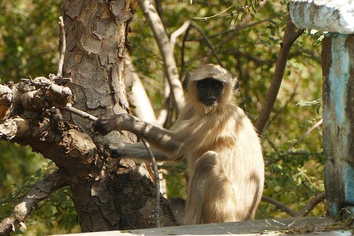
The guide shows me an old stepwell lost in nature. It’s always my thing to check out these baoris, which can be stunning, but this one isn’t anything special. We arrive at the palace overlooking the city.
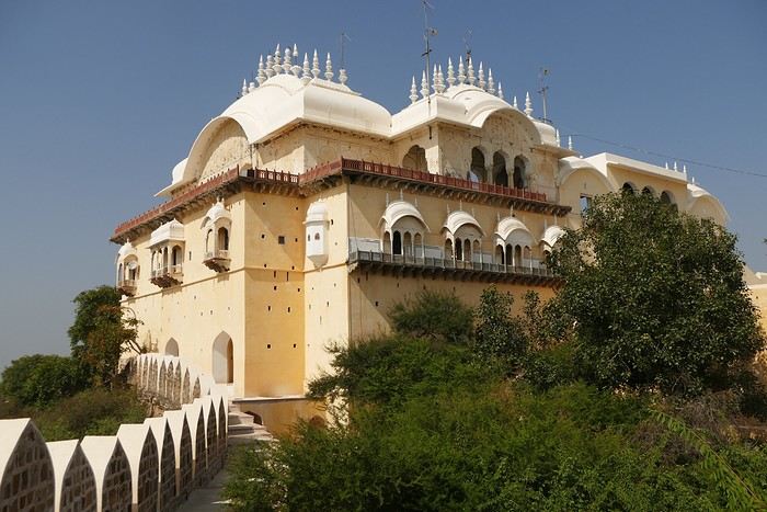
We walk around the palace, and I discover another stepwell that’s not worth lingering over.
The tour is over, and I had a great time despite the fatigue. We head back down to Alwar, near the City Palace, which has been turned into administrative offices. Gaju (the driver’s nickname) finds a parking spot near a dhaba where we have lunch (paneer masala, chapatis, chai)—it’s delicious. With my energy restored, we head to the palace. On the top floor is a museum that I visit.
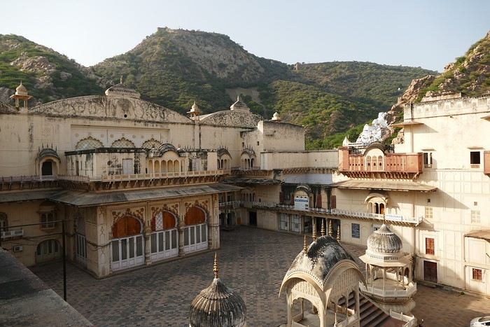
At the exit of the museum, we have to go back down and walk around the palace to get to the Moosi Maharani Chhatri. I’ve been here once before and really liked it, and the place is still the same—calm and relaxing.
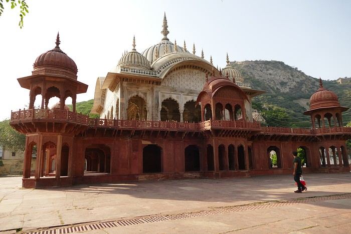
"This monument is the most artistic in Alwar and also the most royal, filled with fascinating history. Maharaja Vinay Singh of Alwar built this two-story cenotaph in 1815 in memory of his father, Maharaja Bakhtawar Singh. It’s also known as Moosi Maharani ki Chhatri, named after the king’s mistress, who performed sati upon his death. After the sati, she was accepted as the king’s wife. It’s an elegant monument, shaped like a flower and built with a mix of brown sandstone and white marble. The first floor is made of sandstone, while the upper floor and the chhatris (cenotaphs) are in white marble. Its sculpted pavilion has dome-shaped arches with intricate lace-like and exquisite floral patterns. There are complex motifs that shine brightly in the sunlight. The colorful circular ceiling is an important part of Moosi Maharani Ki Chhatri and is adorned with faded gold-leaf paintings of mythological figures and scenes. The footprints of Maharaja and Moosi Rani are engraved in marble inside the cenotaph, and locals pay their respects to them."
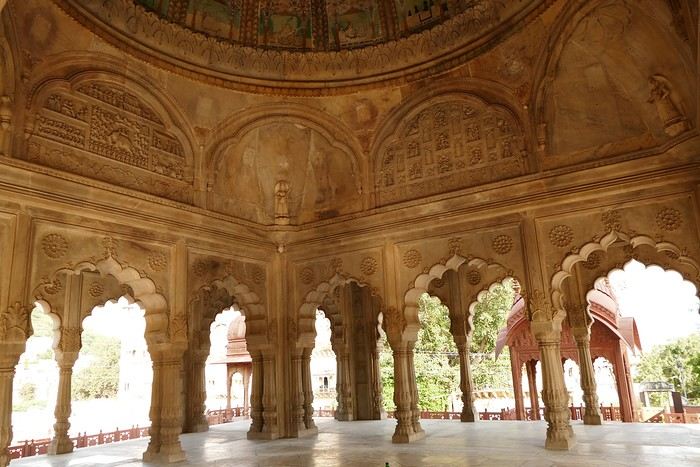
Near the chhatri, there’s a large water reservoir with a magnificent view. The place is peaceful and relaxing, and I stay here for a while, contemplating and daydreaming before heading back to the hotel for some well-deserved rest. The Wi-Fi is working now. I’m the only foreign guest, and since my room is near the entrance, I’ll be well taken care of throughout my stay.
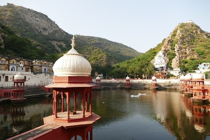
I doze off during the drive, and we arrive at the Atlantic Hotel in Alwar at 10:30 AM. My room is on the ground floor, and I settle in quickly. The Wi-Fi isn’t working, but the staff do everything they can to fix it. At noon, Gajender, the driver, suggests visiting the Qila Fort, which is on the heights of Alwar. The fort is closed for restoration, but safari tours are offered—jeep, guide, driver, and visit for 1600 Rs.
We follow the great wall, which is impressive—the second largest in India and the third in the world.
We spot peacocks and monkeys.
The guide shows me an old stepwell lost in nature. It’s always my thing to check out these baoris, which can be stunning, but this one isn’t anything special. We arrive at the palace overlooking the city.
We walk around the palace, and I discover another stepwell that’s not worth lingering over.
The tour is over, and I had a great time despite the fatigue. We head back down to Alwar, near the City Palace, which has been turned into administrative offices. Gaju (the driver’s nickname) finds a parking spot near a dhaba where we have lunch (paneer masala, chapatis, chai)—it’s delicious. With my energy restored, we head to the palace. On the top floor is a museum that I visit.
At the exit of the museum, we have to go back down and walk around the palace to get to the Moosi Maharani Chhatri. I’ve been here once before and really liked it, and the place is still the same—calm and relaxing.
"This monument is the most artistic in Alwar and also the most royal, filled with fascinating history. Maharaja Vinay Singh of Alwar built this two-story cenotaph in 1815 in memory of his father, Maharaja Bakhtawar Singh. It’s also known as Moosi Maharani ki Chhatri, named after the king’s mistress, who performed sati upon his death. After the sati, she was accepted as the king’s wife. It’s an elegant monument, shaped like a flower and built with a mix of brown sandstone and white marble. The first floor is made of sandstone, while the upper floor and the chhatris (cenotaphs) are in white marble. Its sculpted pavilion has dome-shaped arches with intricate lace-like and exquisite floral patterns. There are complex motifs that shine brightly in the sunlight. The colorful circular ceiling is an important part of Moosi Maharani Ki Chhatri and is adorned with faded gold-leaf paintings of mythological figures and scenes. The footprints of Maharaja and Moosi Rani are engraved in marble inside the cenotaph, and locals pay their respects to them."
Near the chhatri, there’s a large water reservoir with a magnificent view. The place is peaceful and relaxing, and I stay here for a while, contemplating and daydreaming before heading back to the hotel for some well-deserved rest. The Wi-Fi is working now. I’m the only foreign guest, and since my room is near the entrance, I’ll be well taken care of throughout my stay.
White as snow, let's chat here!
And nowhere else...😉
A lovely wander at the mercy of the wind in this amazing Rajasthan
Hey there, forum friends 😉
Some of you have mentioned missing the activity on this Indian "page," so let’s try to liven things up a bit—with joy and good vibes (mandatory with me 😜). Plus, it’ll make Jojoone happy 😊.
As big lovers of India—we’ve been six times—my co-traveler husband and I decided to explore Rajasthan this time around. The reason we waited so long to come here? We were dreading the tourist crowds in this state. But thanks to the timing (late March to early April 2024, which is starting to get pretty hot) and Aleph’s great tips, we were *very* far from mass tourism.
We spent three weeks getting around on our own for transport: mostly taxis and trains.
And I’ll admit, we had a rather "Arabian Nights" experience, far from the "real" India (Marien, if you’re reading this 😉). So this travel journal makes no claims other than to share what we saw, experienced, and felt—with all our ignorance about this country (which I’m fully aware of).
But fair warning: I go overboard with emojis, and this journal is super casual because it’s the one I share, almost in "live" mode, with our loved ones.
So, if you’re here, consider yourself almost part of the family 😄.
See you soon and....
Some of you have mentioned missing the activity on this Indian "page," so let’s try to liven things up a bit—with joy and good vibes (mandatory with me 😜). Plus, it’ll make Jojoone happy 😊.
As big lovers of India—we’ve been six times—my co-traveler husband and I decided to explore Rajasthan this time around. The reason we waited so long to come here? We were dreading the tourist crowds in this state. But thanks to the timing (late March to early April 2024, which is starting to get pretty hot) and Aleph’s great tips, we were *very* far from mass tourism.
We spent three weeks getting around on our own for transport: mostly taxis and trains.
And I’ll admit, we had a rather "Arabian Nights" experience, far from the "real" India (Marien, if you’re reading this 😉). So this travel journal makes no claims other than to share what we saw, experienced, and felt—with all our ignorance about this country (which I’m fully aware of).
But fair warning: I go overboard with emojis, and this journal is super casual because it’s the one I share, almost in "live" mode, with our loved ones.
So, if you’re here, consider yourself almost part of the family 😄.
See you soon and....
Kyushu between Fukuoka and Nagasaki in autumn 2024 (Japan)
Fellow travelers,
Don’t they say "never two without three"? It seems so. Here I am again on the forum to share—and let’s be honest, indulge a bit of selfish pleasure—by recounting the story of this third installment in the Land of the Rising Sun.
Where? It’s all in the title. On the island of Kyushu in southern Japan, more precisely in the northwest between Fukuoka and Nagasaki. I hope to take you along with me for 19 nights and 18 full days this autumn of 2024. On the itinerary: gastronomy, crafts, festivals, waterfalls, encounters, and leisurely strolls in all simplicity.
A last-minute flight booked just 7 days before departure, and the route evolved regularly based on whims and accommodation availability, eventually settling on this:
- 5 nights in Fukuoka: Fukuoka city, Ukiha, Itoshima, Dazaifu, Yanagawa - 4 nights in Hasami, Nagasaki Prefecture: Okawachiyama, Arita, Takeo, Kashima, Yobuko, Karatsu, Kabeshima - 6 nights in Nagasaki: Ureshino, Higashi-Sonogi, Nagasaki city, Unzen, Sotome - 4 nights in Fukuoka: Karatsu, Fukuoka city
Most of the trip was done by car for practical reasons—easier access to certain places and freedom of movement—but also for the sheer joy of it. Despite slow traffic at times, driving in rural Japan is a delight.
If the program interests you, see you soon for the start of the journey.
Don’t they say "never two without three"? It seems so. Here I am again on the forum to share—and let’s be honest, indulge a bit of selfish pleasure—by recounting the story of this third installment in the Land of the Rising Sun.
Where? It’s all in the title. On the island of Kyushu in southern Japan, more precisely in the northwest between Fukuoka and Nagasaki. I hope to take you along with me for 19 nights and 18 full days this autumn of 2024. On the itinerary: gastronomy, crafts, festivals, waterfalls, encounters, and leisurely strolls in all simplicity.
A last-minute flight booked just 7 days before departure, and the route evolved regularly based on whims and accommodation availability, eventually settling on this:
- 5 nights in Fukuoka: Fukuoka city, Ukiha, Itoshima, Dazaifu, Yanagawa - 4 nights in Hasami, Nagasaki Prefecture: Okawachiyama, Arita, Takeo, Kashima, Yobuko, Karatsu, Kabeshima - 6 nights in Nagasaki: Ureshino, Higashi-Sonogi, Nagasaki city, Unzen, Sotome - 4 nights in Fukuoka: Karatsu, Fukuoka city
Most of the trip was done by car for practical reasons—easier access to certain places and freedom of movement—but also for the sheer joy of it. Despite slow traffic at times, driving in rural Japan is a delight.
If the program interests you, see you soon for the start of the journey.
The "Must-Sees" of the American West
This adventure began during Covid... Yep, Covid turned a lot of things upside down, but most of all, it kept us cooped up for a few months and stopped us from traveling for a while—even longer for a die-hard fan of the American West like me.
While borders were closed, I started imagining what an ideal itinerary might look like—one that would string together all the Southwest must-sees in just two weeks, during the best time of year: September and October. When the U.S. announced in September 2021 that borders would reopen in the coming weeks, I regained hope and began scouting flight tickets for a departure in September 2022.
But here’s the thing: tackling solo hikes, each one tougher than the last, right in the heart of the Wilderness, could be a risky—even reckless—endeavor for a father of three. After a quick chat with some virtual friends who are just as passionate about the Southwest as I am, with good physical condition and nearly the same list of must-visit spots, Franck and his brother Sullivan were in! 🙂
In November, we snagged flight tickets from Nice to San Francisco for the modest sum of 400 €, and a few days later, I booked a Toyota Tacoma pickup for 840 € !
It’s not cheap for just 15 days, and a pickup isn’t exactly ideal for luggage, but the prices for full-size 4x4s have become totally outrageous! Due to border closures, rental companies had to offload a lot of these big 4x4s, which tourists love. Then, supply and demand did the rest !
Franck and I spent the winter and spring trying to cram the equivalent of three weeks of hikes into two. But even with physical limits, we had to stay reasonable! Three to four months before departure, we entered the lotteries for different must-see spots: The Subway, Coyote Buttes North (home to the famous Wave), and Coyote Buttes South (CBS).
The Wave is the holy grail for any Southwest enthusiast. Since 2015, we’ve tried our luck with the online and on-site lotteries about ten times, but the spots are unfortunately limited: just 20 per day. A glimmer of hope, though—since early 2022, that number has increased to 64 people allowed per day, with 48 spots awarded via the online lottery.
After all three of us tried our luck for The Wave, on June 1st at exactly 5 PM, I got an email that started with, "Congratulations! You were successful in the Coyote Buttes North (The Wave) September 2022 Permit Lottery at Coyote Buttes North (The Wave)...". At 5:01 PM, I called Franck, whose dream it’s been for over 20 years—ever since the first photos were published in a travel magazine! He didn’t believe me when I told him, and I had to forward the email for him to finally accept the unbelievable: we were going to The Wave and all the incredible spots scattered across the protected area of Coyote Buttes North.
I’ve already been to Coyote Buttes South twice, but there are areas I couldn’t explore in the middle of summer because they were too remote. So, I had no trouble letting my buddies convince me to go back for a third time. Plus, given how hard it is to access, we had no trouble securing a permit online as long as we logged in at exactly 8 PM on the dot!
For The Subway, all three of us struck out. No big deal—we won at CBN and CBS!
Among the sites to visit, there are two that I’m particularly attached to because I know my chances of wanting to see them again are slim. The first is Angel Arch, one of the most legendary arches in the Southwest, due to its remoteness from any trace of civilization. To get there, the recommended hike is Upper Salt Creek, and you’re looking at a 50 km round-trip in an area with no water (in September) and populated by bears.
The second site is the Hopi Salt Trail, in Navajo land, which, after a very tough hike, lets you marvel at the turquoise-blue waters of the Little Colorado before it meets the Colorado River. The Hopi Salt Trail is, like The Wave, the holy grail for any Southwest enthusiast, and the windows of opportunity to see the water in that magical color are very short each year. For this, you have to monitor the Little Colorado’s gauges downstream from Cameron: if the level stays at its lowest for 10 consecutive days—meaning no rain—you can hope for turquoise water. The ideal period rarely exceeds 30 days a year, and it’s usually in June that all the stars align.
But unfortunately, one month before departure, while the flow rate at Cameron looked promising, several storms in September dashed our hopes of doing the Hopi Salt Trail, even at the end of the road trip.
We still had two consolation prizes, though:
After a last-minute cancellation, while keeping an eye out for available spots for The Subway, it turned out that three spots opened up exactly on the day we’d planned to go—so we rushed to grab them!! Regarding the 4x4 rental, the prices for full-size models dropped by several hundred dollars, and we ended up finding a Chevrolet Tahoe for less than $1000. A steal and a serious boost in comfort, so we could store all our gear and food without worry!
Here’s the initial plan in a perfect world: D1 The White Domes - Camping D2 Sunrise at The White Domes - The Subway D3 Coyote Buttes North D4 Coyote Buttes South - White Pocket D5 Wahweap Hoodoos - Sidestep Canyon - Colourful Canyon - White Rocks - Sunset at Yellow Rock D6 Broken Bow Arch - Reflection Canyon D7 Coyote Gulch D8 The Volcano (or The Oasis - Zebra Slot Canyon if the weather’s good) - North Caineville Mesa D9 The Needles: Squaw Canyon - Lost Canyon combo - Druid Arch - Chesler Park D10 Upper Salt Creek Day 1 - Camping D11 Upper Salt Creek Day 2 D12 Hopi-Navajo Territory: Ha Ho No Geh Canyon, Coal Mine Canyon, Bends of the Little Colorado D13 Grand Canyon: South Kaibab Trail and Bright Angel Trail D14 Upper East Zion: East Temple Loop, Jughandle Arch, Center of the Universe, and Checkerboard Mesa Summit And several backup options in case of bad weather, including Spencer Trail, West Cove, and Buffington Pockets.
Enough talking—time for action!
While borders were closed, I started imagining what an ideal itinerary might look like—one that would string together all the Southwest must-sees in just two weeks, during the best time of year: September and October. When the U.S. announced in September 2021 that borders would reopen in the coming weeks, I regained hope and began scouting flight tickets for a departure in September 2022.
But here’s the thing: tackling solo hikes, each one tougher than the last, right in the heart of the Wilderness, could be a risky—even reckless—endeavor for a father of three. After a quick chat with some virtual friends who are just as passionate about the Southwest as I am, with good physical condition and nearly the same list of must-visit spots, Franck and his brother Sullivan were in! 🙂
In November, we snagged flight tickets from Nice to San Francisco for the modest sum of 400 €, and a few days later, I booked a Toyota Tacoma pickup for 840 € !
It’s not cheap for just 15 days, and a pickup isn’t exactly ideal for luggage, but the prices for full-size 4x4s have become totally outrageous! Due to border closures, rental companies had to offload a lot of these big 4x4s, which tourists love. Then, supply and demand did the rest !
Franck and I spent the winter and spring trying to cram the equivalent of three weeks of hikes into two. But even with physical limits, we had to stay reasonable! Three to four months before departure, we entered the lotteries for different must-see spots: The Subway, Coyote Buttes North (home to the famous Wave), and Coyote Buttes South (CBS).
The Wave is the holy grail for any Southwest enthusiast. Since 2015, we’ve tried our luck with the online and on-site lotteries about ten times, but the spots are unfortunately limited: just 20 per day. A glimmer of hope, though—since early 2022, that number has increased to 64 people allowed per day, with 48 spots awarded via the online lottery.
After all three of us tried our luck for The Wave, on June 1st at exactly 5 PM, I got an email that started with, "Congratulations! You were successful in the Coyote Buttes North (The Wave) September 2022 Permit Lottery at Coyote Buttes North (The Wave)...". At 5:01 PM, I called Franck, whose dream it’s been for over 20 years—ever since the first photos were published in a travel magazine! He didn’t believe me when I told him, and I had to forward the email for him to finally accept the unbelievable: we were going to The Wave and all the incredible spots scattered across the protected area of Coyote Buttes North.
I’ve already been to Coyote Buttes South twice, but there are areas I couldn’t explore in the middle of summer because they were too remote. So, I had no trouble letting my buddies convince me to go back for a third time. Plus, given how hard it is to access, we had no trouble securing a permit online as long as we logged in at exactly 8 PM on the dot!
For The Subway, all three of us struck out. No big deal—we won at CBN and CBS!
Among the sites to visit, there are two that I’m particularly attached to because I know my chances of wanting to see them again are slim. The first is Angel Arch, one of the most legendary arches in the Southwest, due to its remoteness from any trace of civilization. To get there, the recommended hike is Upper Salt Creek, and you’re looking at a 50 km round-trip in an area with no water (in September) and populated by bears.
The second site is the Hopi Salt Trail, in Navajo land, which, after a very tough hike, lets you marvel at the turquoise-blue waters of the Little Colorado before it meets the Colorado River. The Hopi Salt Trail is, like The Wave, the holy grail for any Southwest enthusiast, and the windows of opportunity to see the water in that magical color are very short each year. For this, you have to monitor the Little Colorado’s gauges downstream from Cameron: if the level stays at its lowest for 10 consecutive days—meaning no rain—you can hope for turquoise water. The ideal period rarely exceeds 30 days a year, and it’s usually in June that all the stars align.
But unfortunately, one month before departure, while the flow rate at Cameron looked promising, several storms in September dashed our hopes of doing the Hopi Salt Trail, even at the end of the road trip.
We still had two consolation prizes, though:
After a last-minute cancellation, while keeping an eye out for available spots for The Subway, it turned out that three spots opened up exactly on the day we’d planned to go—so we rushed to grab them!! Regarding the 4x4 rental, the prices for full-size models dropped by several hundred dollars, and we ended up finding a Chevrolet Tahoe for less than $1000. A steal and a serious boost in comfort, so we could store all our gear and food without worry!
Here’s the initial plan in a perfect world: D1 The White Domes - Camping D2 Sunrise at The White Domes - The Subway D3 Coyote Buttes North D4 Coyote Buttes South - White Pocket D5 Wahweap Hoodoos - Sidestep Canyon - Colourful Canyon - White Rocks - Sunset at Yellow Rock D6 Broken Bow Arch - Reflection Canyon D7 Coyote Gulch D8 The Volcano (or The Oasis - Zebra Slot Canyon if the weather’s good) - North Caineville Mesa D9 The Needles: Squaw Canyon - Lost Canyon combo - Druid Arch - Chesler Park D10 Upper Salt Creek Day 1 - Camping D11 Upper Salt Creek Day 2 D12 Hopi-Navajo Territory: Ha Ho No Geh Canyon, Coal Mine Canyon, Bends of the Little Colorado D13 Grand Canyon: South Kaibab Trail and Bright Angel Trail D14 Upper East Zion: East Temple Loop, Jughandle Arch, Center of the Universe, and Checkerboard Mesa Summit And several backup options in case of bad weather, including Spencer Trail, West Cove, and Buffington Pockets.
Enough talking—time for action!
Discussion sur le thème (concours septembre 2020): lieux, scènes de départ ou d'arrivée English translation pending
Rebonjour, 🙂
C'est ici que l'on discute , échange, sur le thème: lieux, scènes de départ ou d'arrivée.
Pour revenir au concours, c'est ici
Il est grand temps de rallumer les étoiles! English translation pending
Bonjour à tous
Le Vietnam pays magique multiculturel aux paysages diversifiés et époustouflants. Voilà ce que je vous invite à partager sans aborder s'il vous plaît ce qui aujourd'hui empêche la planète de vivre... Essayons d'être constructifs et positivons! Il est grand temps de rallumer les étoiles!
Pour commencer avec légèreté: La médecine des Dao, le bain aux herbes. C'est un moment délicieux après une journée de marche et de visites rien de tel pour vous requinquer! Ce bain est très souvent proposé aux touristes dans le nord, spécialité de l'ethnie Dao il est "accommodé" dans plusieurs maisons d'hôtes et hôtels aux besoins des touristes.
Traditionnellement les recettes sont destinées à chaque cas et en fonction de la pathologie: femmes enceintes ou qui viennent d'accoucher, nouveau-nés, malades, vieillards…les herbes seront donc choisies en fonction des besoins et du type de médication (orale, en bain, en emplâtre...). C'est dès l'aube que les femmes, les hommes, les chamanes iront cueillir ces plantes, racines et écorces dans la forêt, le tout sera combiné à un régime adapté (on ne mange pas de tout..) et souvent suivi d'un massage spécifique.
Nous en avons testé plusieurs à plusieurs endroits mais celui de la chamane Dao d'un petit village au nord de Muong Lay restera sans doute le plus authentique et le plus insolite.. On nous prend en main dès notre arrivée dans la maison de la chamane. Elle y vit avec sa fille et son gendre... Maison, je devrai plus dire assemblage de planches et de tôles et quand on connaît les rigueurs de l'hivers on peut rêver mieux. La pièce principale est bourrée de pots en tout genre remplis de décoctions plus ou moins troubles...ces sont les médications à avaler, beurk.. Il y a aussi de gros sacs (plastique) d'herbes, de racines, d'écorces, un vrai magasin d'herboriste (l'ordre et la propreté en moins) sans oublier bien sur l'hôtel des ancêtres. Derrière des rideaux, les couches des habitants, nous ne dormirons pas là, ouf.. Puis attenantes, les deux salles des bains avec 2 baquets chacune et entre les deux sous une pergola un énorme foyer construit en ciment surmonté d'une aussi énorme bassine où l'eau et les herbes "cuisent" jusqu'à parfois 12 heures...c'est là que l'on fait aussi cuire la soupe des cochons... Le feu est alimenté de poupée de maïs et de bois. C'est dans ces baquets que nous tromperont plus ou moins longtemps...le temps de "cuisson" est décidé par la chamane en fonction de chacun, jamais plus de 30 mm...et les herbes qui seront rajoutée dans les baquets seront aussi choisies en fonction de chaque "malade". C'est très très chaud, il faut vraiment se faire violence pour entrer là dedans et c'est sans compter qu'une fois immergés la dame ajoute de l'eau chaude bien sur...ouille. Une fois "les touristes bien cuits" on nous sort de là, inutile de préciser que nous ressemblons plus à des homards qu'à des visages pâles... Après cuisson, nous serons conduits ensuite vers le silo à grains, où une pièce spéciale massage à été aménagée à son top, on l'atteint via une échelle de bois...au sol deux couches. Ici commence le moment le plus douloureux de tous les massages faits au Vietnam par le gendre et la fille de la maison.. Pas de douces caresses, non, non, mais un pétrissage et un battage en bonne et due forme suivis de torsion, j'ai cru ma dernière heure arrivée... Pour clore la séance nous dînerons chez la chamane d'un souper spécial, la couleur des mets est importante, nous ne mangerons que du blanc et du vert....des légumes et des herbes inconnues de nous et un peu de poulet bouilli, élastique à souhait, sans doute celui que nous avons croisé sur le chemin en arrivant et des petits poissons frits (très bons). C'est sans conteste le meilleur soin reçu au Vietnam si l'on fait abstraction de la propreté des lieux, des serviettes (surtout apporter les siennes) et des moments douloureux.
Le Vietnam pays magique multiculturel aux paysages diversifiés et époustouflants. Voilà ce que je vous invite à partager sans aborder s'il vous plaît ce qui aujourd'hui empêche la planète de vivre... Essayons d'être constructifs et positivons! Il est grand temps de rallumer les étoiles!
Pour commencer avec légèreté: La médecine des Dao, le bain aux herbes. C'est un moment délicieux après une journée de marche et de visites rien de tel pour vous requinquer! Ce bain est très souvent proposé aux touristes dans le nord, spécialité de l'ethnie Dao il est "accommodé" dans plusieurs maisons d'hôtes et hôtels aux besoins des touristes.
Traditionnellement les recettes sont destinées à chaque cas et en fonction de la pathologie: femmes enceintes ou qui viennent d'accoucher, nouveau-nés, malades, vieillards…les herbes seront donc choisies en fonction des besoins et du type de médication (orale, en bain, en emplâtre...). C'est dès l'aube que les femmes, les hommes, les chamanes iront cueillir ces plantes, racines et écorces dans la forêt, le tout sera combiné à un régime adapté (on ne mange pas de tout..) et souvent suivi d'un massage spécifique.
Nous en avons testé plusieurs à plusieurs endroits mais celui de la chamane Dao d'un petit village au nord de Muong Lay restera sans doute le plus authentique et le plus insolite.. On nous prend en main dès notre arrivée dans la maison de la chamane. Elle y vit avec sa fille et son gendre... Maison, je devrai plus dire assemblage de planches et de tôles et quand on connaît les rigueurs de l'hivers on peut rêver mieux. La pièce principale est bourrée de pots en tout genre remplis de décoctions plus ou moins troubles...ces sont les médications à avaler, beurk.. Il y a aussi de gros sacs (plastique) d'herbes, de racines, d'écorces, un vrai magasin d'herboriste (l'ordre et la propreté en moins) sans oublier bien sur l'hôtel des ancêtres. Derrière des rideaux, les couches des habitants, nous ne dormirons pas là, ouf.. Puis attenantes, les deux salles des bains avec 2 baquets chacune et entre les deux sous une pergola un énorme foyer construit en ciment surmonté d'une aussi énorme bassine où l'eau et les herbes "cuisent" jusqu'à parfois 12 heures...c'est là que l'on fait aussi cuire la soupe des cochons... Le feu est alimenté de poupée de maïs et de bois. C'est dans ces baquets que nous tromperont plus ou moins longtemps...le temps de "cuisson" est décidé par la chamane en fonction de chacun, jamais plus de 30 mm...et les herbes qui seront rajoutée dans les baquets seront aussi choisies en fonction de chaque "malade". C'est très très chaud, il faut vraiment se faire violence pour entrer là dedans et c'est sans compter qu'une fois immergés la dame ajoute de l'eau chaude bien sur...ouille. Une fois "les touristes bien cuits" on nous sort de là, inutile de préciser que nous ressemblons plus à des homards qu'à des visages pâles... Après cuisson, nous serons conduits ensuite vers le silo à grains, où une pièce spéciale massage à été aménagée à son top, on l'atteint via une échelle de bois...au sol deux couches. Ici commence le moment le plus douloureux de tous les massages faits au Vietnam par le gendre et la fille de la maison.. Pas de douces caresses, non, non, mais un pétrissage et un battage en bonne et due forme suivis de torsion, j'ai cru ma dernière heure arrivée... Pour clore la séance nous dînerons chez la chamane d'un souper spécial, la couleur des mets est importante, nous ne mangerons que du blanc et du vert....des légumes et des herbes inconnues de nous et un peu de poulet bouilli, élastique à souhait, sans doute celui que nous avons croisé sur le chemin en arrivant et des petits poissons frits (très bons). C'est sans conteste le meilleur soin reçu au Vietnam si l'on fait abstraction de la propreté des lieux, des serviettes (surtout apporter les siennes) et des moments douloureux.