Results for "(Dresde+ou+Dresden)+|+9+>+196"
1987 results found.
Saut à l'élastique au Népal, la folie des grandeurs English translation pending
C'est l'heure des retrouvailles,
Le moment de fourrer la dinde de marrons chauds,
Le temps des rêves où la fée serait devenue un vieux monsieur barbu et ventru qui hurle à qui veut l'entendre qu'il voyage avec des rennes qui volent et qu'il est le meilleur ami des lutins.
Non mais des fois, j'vous jure...
Joyeux Noël à tous, dans vos têtes, dans vos corps et dans vos coeurs.
J'me permets même de glisser un petit article par la cheminée, en espérant que pour vous tous, ces fêtes soient l'occasion de vivre de réjouissances.
Je pense bien à vous depuis Kathmandou où je célébre le réveillon au pieds d'un ficus de Noël.
Il faut dire que Noël au Népal c'est plus ou moins Haloween au Congo, ça leur passe par dessus la tête.
Et oui parce que maintenant je suis au Népal. L'Asie se dresse comme une fière tentatrice. J'ai déjà plein d'images en tête, pleins de couleurs, de paysages, d'odeurs. Et la porte d'entrée de tout ça, c'est Kathmandou, et question odeurs, on peut dire qu'ils pourraient aérer de temps en temps. C'est la seule chose dont je peux parler pour l'instant, je suis arrivé de nuit, en toute fin d'après-midi pour être précis. Il y a bien eu le siège près du hublot gauche (c'est important) dans l'avion pour permettre une vue du ciel sur une "petite" moitié de l'Himalaya, mais dès la sortie, il fait nuit et on grimpe dans un taxi. En quittant l'aéroport, on est déjà en ville et partout il fait nuit. Trois lumières qui se battent dans un champs de maisonnettes. Tout est éclairé à la lumière des phares des voitures qui parcourent la ville en klaxonnant en permanence pour éviter tout le cortège de véhicules avec ou sans phares, piétons, vendeurs, animaux qu'on croise sur la route. Sur le bas-côté, les habitants brulent leurs déchets ce qui a le mérite de les réchauffer mais donne à l'air ce petit je ne sais quoi de difficilement respirable. D'ailleurs le faiceau des phares de voiture souligne bien que la particule poussièreuse est ici chez elle. Pour en finir là-dessus, c'est tout l'inverse du Caire. Autant là-bas, on n'y traverse que des autoroutes bordés de grands immeubles, autant ici, on ne circule que dans des rues à une voie mais à deux voies et sans trottoir, c'est tassé, plein de détails, ça promet!
Le fait est aussi qu'il fait noir partout car tout le pays y compris Kathmandou est sujet à des coupures de courant qui interviennent plusieurs fois par jour et parfois pendant plusieurs heures. Le pays ne produit pas assez d'électricité pour contenter tout le monde tout le temps alors ils tournent. Le vendeur de bougies n'a pas de soucis à se faire!
Ma soirée est vite enfilée, je reste sur le souvenir de l'épopée francilienne, et ça met du temps à digérer . Rien à voir avec la gueule de bois, pas grand chose en tout cas.
Première journée, je déambule comme je sais si bien faire. Les gens croisés sont amicaux, souriants, pas insistants, c'est que du bonheur! Cela dit, je ne déambule pas longtemps car j'ai un peu pioncer jusqu'à pas d'heure et s'il fait nuit et que je suis encore dans ce bazar, je me considère comme définitivement perdu. Sans doute que j'ai dû écrire encore...
Le lendemain, j'ai soif, soif d'aventures. J'ai bien aussi déjà envie d'aller faire un tour au vert sans forcément partir pour quinze jours. Et bien, il y a un truc qui colle parfaitement, ça s'appelle le Lost Resort, c'est un endroit où on s'arrange pour que vous n'oubliez jamais votre passage en ses murs. Ses murs, ce sont des montagnes qui tombent quasi à pic jusqu'à se rejoindre en formant un torrent tonitruand, endroit parfait pour se jeter, et c'est pas une image!
Je choisis d'y passer 3 jours de tranquillité et d'extrème.
La tranquilité c'est de l'exxxcellente nourriture, des hamacs, de grandes tentes perdues dans la foret en guise de hutte, et aussi une fois de plus, décidemment, j'arrive la 1ère semaine de la basse saison, y'a pas grand monde et l'ambiance n'en est que meilleure.
L'extrème, ça commence dès que tu quittes le bus qui t'a amené de Kathmandou. A ce moment, tu es sur un flanc de montagne. L'hotel, lui, est de l'autre côté, sur la montagne d'en face, normal. Donc, si tu ne veux pas passer ta journée dans un bus à regarder les autres s'amuser de l'autre côté d'une vallée, il faut que tu traverses sur un pont solide mais qui bouge beaucoup avec le torrent qui déferle 160 mètres plus bas. C'est d'après ce bon vieux LP, le pont le plus haut du monde dévolu à la pratique du saut à l'élastique, même pas peur.
Euh... Si quand même...
Mais pour l'instant, un autre programme m'attend en guise d'apéritif, la matinée est consacrée au canyoning. Ca a l'air de rien mais c'est déjà beaucoup!! Le but est de descendre le plus souvent en rappel la montagne en suivant un ruisseau qui s'écoule de cascade en cascades. La plus longue cascade fait 45 mètres. Déjà se donner de quoi s'inquiéter un peu. Mais on s'inquiète pas longtemps car ça s'apprend vite, et on est souvent aussi concerné par les cris des gens qui déjà sautent du pont ne faisant pas la descente en rappel. Parfois on en voit un se jeter et on ne peux pas se détacher le regard de voir ces cris qui chutent. On sait qu'on est sur la liste et personne n'arrive à faire comme si de rien n'était. Le canyoning se termine par la remontée de la montagne en suivant un chemin qui remonte la pente perpendiculairement. Ils sont fous ces népalais et moi je suis crevé!
Un déjeuner plus tard, il est temps de se préparer, psychologiquement j'entends.
Au Lost Resort, on a le choix entre 2 façons de sauter, la première est la façon classique attaché par les pieds a un élastique qui tient grace à un velcro (vaile-kro? velleqro?) épais comme une cuisse. La seconde s'appelle la balançoire, on est attaché grace à un harnais au niveau de la taille et relié à un point qui se trouve plusieurs dizaines de mètres devant. La chute n'en est que plus longue et on a le mérite de ne pas rester la tête en bas. Comme en plus, je pétoche un peu de me jeter la tête la première, c'est l'option que je choisis pour mon 1er saut depuis le pont.
Sur le pont, l'attente est interminable. C'est surtout dû au fait que ça n'a rien de naturel de se trouver suspendu au dessus d'un gouffre. On a beau vouloir s'acclimater de la distance avec le sol, c'est mission impossible. Lorsque mon tour vient, on m'installe le harnais, on me prodigue les derniers conseils et je dois avancer jusqu'à la mini-passerelle qui n'est fermée par aucune barrière. C'est le temps des dernières prières, le temps où on oublie de penser à quoi que ce soit pour mieux accepter cette minute paranormale. J'avance sur la plateforme, chacun de mes pas n'est pas plus grand qu'un orteil. Un membre du staff me retient en arrière car le lien qui file devant moi me tire vers le gouffre. Il tente de me rassurer sur l'inrassurable, entame un compte à rebours. 3, 2, 1...
Géronimo!!!!!!!!
Un saut de quelques millimètres suffit à me mettre sur orbite. Au début, je tombe immobile. Puis, mes jambes détectants l'absence de sol pour les porter commencent à entamer un ballet incontrolable à la recherche, vaine, d'une surface plane. C'est peine perdue. Whaouuuuuuu (je pourrais multiplier les "u" sur des dizaines de pages mais je m'abstiens même si ça les vaut).
Comme c'est noël, et comme une vidéo vaut mieux que tous les discours du monde, je laisse en bonus exceptionnel le film qu'un type a fait de mon premier saut. Si a la fin de la vidéo, on ne me voit plus, c'est normal, j'ai changé de dimension, et suis entré dans la twilight zone.
http://www.wat.tv/video/lost-resort-1st-swing-jump-15q5m_zifu_.html
Je crie tout ce que je peux pendant la chute et encore après. C'est un petit pas pour l'homme mais un clash géant pour tous mes neurones qui en redemandent. L'expérience ultime s'achève par la même remontée de la montagne que celle empruntée le matin même après le canyoning. Au final, je suis plus éprouvé par la montée que par la descente. Qu'est ce que ça va bien pouvoir donner lorsque je serais en montagne en portant mon paquetage et en affrontant des pentes identiques autrement que pendant 30 minutes à vide?
Pour ce jour, un saut est bien suffisant. Je suis le seul parmi tous les gens transportés depuis Kathmandou à rester sur place. Il sera temps de remettre le couvert 2 jours plus tard lorsque un nouveau convoi sera organisé. En attendant, je profite des lieux en m'essayant au tilleul local. Je passe également un long moment sur le pont qui n'est pour l'occasion rien qu'à moi et aux népalais qui l'empruntent pour rentrer chez eux. Je suis sûr qu'ils sont ravis que le pont soit là car gravir la montagne est un défi d'autant plus quand tu reviens de faire les courses et que tu portes ton poids sur ton dos. Cerise sur le gateau, je découvre que les flancs de la montagne, couverts de végétation dense, sont habités par des dizaines de singes craintifs mais bien présents. On est plus dans Indiana Jones mais dans le Livre de la Jungle. Du bonheur à tous les étages avec du vide en dessous.
Je retrouve le vide le lendemain (10 décembre) alors que de nouveaux sauteurs se présentent. Aujourd'hui le défi est de faire deux nouveaux sauts. Le premier à l'élastique, le second pour une nouvelle balançoire.
Ca fait 2 jours que je me prépare à sauter la tête la première et je n'arrive toujours pas à m'y faire. Mais il faut bien se rendre à l'évidence, c'est ton tour coco. Cette fois-ci, pas de harnais, rien qu'un scratch qui m'enserre les chevilles. J'ai la sensation de n'être tenu par rien et pourtant il faut y aller et faire confiance. Je reprends le chemin de la plateforme comme un condamné à mort sur un bateau de pirates à qui on piquerait le dos pour qu'il se jète dans une mer infestée de requins. La chorégraphie est on ne peut plus simple, il suffit d'écarter les bras tel un oisillon qui se prépare pour son 1er vol et sauter la tête la première dans l'inconnu en espérant que ça tienne ou qu'on est pas la victime d'un poisson d'avril du genre : "Surprise!! On t'a mis du fil de pêche à la place de l'élastique!!"
J'ai beau pétocher à mort, il faut y aller. Une micro-impulsion s'enlève du pont. J'ai pas l'impression de voler mais plutôt celle que je vais m'écraser comme une vieille crotte. Et pourtant, non, l'élastique se tend, je repars vers le haut et hurle comme deux jours plus tôt à cracher mes cordes vocales à l'extérieur. Je sens le sang me descendre à la tête et hurle de re-chef. Heureusement on ne reste pas longtemps la tête en bas, on descend l'élastique jusqu'à ce que je rejoignes les bords du torrent. Pendant ce temps, je continue de hurler à tue-tête. On note d'ailleurs deux catégories de sauteurs, ceux qui gardent tout à l'intérieur et ceux qui extériorisent à s'en faire péter les veines des tempes. Moi, j'ai beau essayer de faire gaffe, j'y arrive pas, il faut que ça sorte et que le singe à deux vallées de là soit aussi au courant. Du coup, il faut que je récupère au niveau des cordes vocales, à croire que la remontée crevante sert à ça... Quelques secondes pour descendre, 30 minutes pour remonter, on a déjà vu meilleur équilibre... Mais peu importe, je suis surexcité, ce manège est ennivrant et à l'issue, on en redemande!
Ca tombe bien, la balançoire cloturera l'après-midi. De plus, j'ai réfléchi à mon coup depuis la veille et ai bricolé un système pour filmer ma trombine durant la chute (à venir dans "le tour du Braïce"). Je suis maintenant en confiance, c'est plus que du plaisir matiné de hurlements. Vous en serez témoins.
Cerise sur le gateau, lorsqu'on effectue trois sauts, le quatrième est gratuit, et comme il est trop tard pour l'effectuer ce jour, en voilà déjà une excellllente raison de revenir au Népal.
Je quitte le Lost resort en étant quasiment sur de revenir. Dans le bus vers Kathmandou, je me repasse en boucle les vidéos du délit de plaisir. Pour retrouver quelque chose d'aussi puissant il va vraiment falloir faire très fort!!!! Peut-être un trek fera-t-il l'affaire, c'est tout ce que je me souhaite. Joyeux Noël à tous. (En retard...)
Et oui parce que maintenant je suis au Népal. L'Asie se dresse comme une fière tentatrice. J'ai déjà plein d'images en tête, pleins de couleurs, de paysages, d'odeurs. Et la porte d'entrée de tout ça, c'est Kathmandou, et question odeurs, on peut dire qu'ils pourraient aérer de temps en temps. C'est la seule chose dont je peux parler pour l'instant, je suis arrivé de nuit, en toute fin d'après-midi pour être précis. Il y a bien eu le siège près du hublot gauche (c'est important) dans l'avion pour permettre une vue du ciel sur une "petite" moitié de l'Himalaya, mais dès la sortie, il fait nuit et on grimpe dans un taxi. En quittant l'aéroport, on est déjà en ville et partout il fait nuit. Trois lumières qui se battent dans un champs de maisonnettes. Tout est éclairé à la lumière des phares des voitures qui parcourent la ville en klaxonnant en permanence pour éviter tout le cortège de véhicules avec ou sans phares, piétons, vendeurs, animaux qu'on croise sur la route. Sur le bas-côté, les habitants brulent leurs déchets ce qui a le mérite de les réchauffer mais donne à l'air ce petit je ne sais quoi de difficilement respirable. D'ailleurs le faiceau des phares de voiture souligne bien que la particule poussièreuse est ici chez elle. Pour en finir là-dessus, c'est tout l'inverse du Caire. Autant là-bas, on n'y traverse que des autoroutes bordés de grands immeubles, autant ici, on ne circule que dans des rues à une voie mais à deux voies et sans trottoir, c'est tassé, plein de détails, ça promet!
Le fait est aussi qu'il fait noir partout car tout le pays y compris Kathmandou est sujet à des coupures de courant qui interviennent plusieurs fois par jour et parfois pendant plusieurs heures. Le pays ne produit pas assez d'électricité pour contenter tout le monde tout le temps alors ils tournent. Le vendeur de bougies n'a pas de soucis à se faire!
Ma soirée est vite enfilée, je reste sur le souvenir de l'épopée francilienne, et ça met du temps à digérer . Rien à voir avec la gueule de bois, pas grand chose en tout cas.
Première journée, je déambule comme je sais si bien faire. Les gens croisés sont amicaux, souriants, pas insistants, c'est que du bonheur! Cela dit, je ne déambule pas longtemps car j'ai un peu pioncer jusqu'à pas d'heure et s'il fait nuit et que je suis encore dans ce bazar, je me considère comme définitivement perdu. Sans doute que j'ai dû écrire encore...
Le lendemain, j'ai soif, soif d'aventures. J'ai bien aussi déjà envie d'aller faire un tour au vert sans forcément partir pour quinze jours. Et bien, il y a un truc qui colle parfaitement, ça s'appelle le Lost Resort, c'est un endroit où on s'arrange pour que vous n'oubliez jamais votre passage en ses murs. Ses murs, ce sont des montagnes qui tombent quasi à pic jusqu'à se rejoindre en formant un torrent tonitruand, endroit parfait pour se jeter, et c'est pas une image!
Je choisis d'y passer 3 jours de tranquillité et d'extrème.
La tranquilité c'est de l'exxxcellente nourriture, des hamacs, de grandes tentes perdues dans la foret en guise de hutte, et aussi une fois de plus, décidemment, j'arrive la 1ère semaine de la basse saison, y'a pas grand monde et l'ambiance n'en est que meilleure.
L'extrème, ça commence dès que tu quittes le bus qui t'a amené de Kathmandou. A ce moment, tu es sur un flanc de montagne. L'hotel, lui, est de l'autre côté, sur la montagne d'en face, normal. Donc, si tu ne veux pas passer ta journée dans un bus à regarder les autres s'amuser de l'autre côté d'une vallée, il faut que tu traverses sur un pont solide mais qui bouge beaucoup avec le torrent qui déferle 160 mètres plus bas. C'est d'après ce bon vieux LP, le pont le plus haut du monde dévolu à la pratique du saut à l'élastique, même pas peur.
Euh... Si quand même...
Mais pour l'instant, un autre programme m'attend en guise d'apéritif, la matinée est consacrée au canyoning. Ca a l'air de rien mais c'est déjà beaucoup!! Le but est de descendre le plus souvent en rappel la montagne en suivant un ruisseau qui s'écoule de cascade en cascades. La plus longue cascade fait 45 mètres. Déjà se donner de quoi s'inquiéter un peu. Mais on s'inquiète pas longtemps car ça s'apprend vite, et on est souvent aussi concerné par les cris des gens qui déjà sautent du pont ne faisant pas la descente en rappel. Parfois on en voit un se jeter et on ne peux pas se détacher le regard de voir ces cris qui chutent. On sait qu'on est sur la liste et personne n'arrive à faire comme si de rien n'était. Le canyoning se termine par la remontée de la montagne en suivant un chemin qui remonte la pente perpendiculairement. Ils sont fous ces népalais et moi je suis crevé!
Un déjeuner plus tard, il est temps de se préparer, psychologiquement j'entends.
Au Lost Resort, on a le choix entre 2 façons de sauter, la première est la façon classique attaché par les pieds a un élastique qui tient grace à un velcro (vaile-kro? velleqro?) épais comme une cuisse. La seconde s'appelle la balançoire, on est attaché grace à un harnais au niveau de la taille et relié à un point qui se trouve plusieurs dizaines de mètres devant. La chute n'en est que plus longue et on a le mérite de ne pas rester la tête en bas. Comme en plus, je pétoche un peu de me jeter la tête la première, c'est l'option que je choisis pour mon 1er saut depuis le pont.
Sur le pont, l'attente est interminable. C'est surtout dû au fait que ça n'a rien de naturel de se trouver suspendu au dessus d'un gouffre. On a beau vouloir s'acclimater de la distance avec le sol, c'est mission impossible. Lorsque mon tour vient, on m'installe le harnais, on me prodigue les derniers conseils et je dois avancer jusqu'à la mini-passerelle qui n'est fermée par aucune barrière. C'est le temps des dernières prières, le temps où on oublie de penser à quoi que ce soit pour mieux accepter cette minute paranormale. J'avance sur la plateforme, chacun de mes pas n'est pas plus grand qu'un orteil. Un membre du staff me retient en arrière car le lien qui file devant moi me tire vers le gouffre. Il tente de me rassurer sur l'inrassurable, entame un compte à rebours. 3, 2, 1...
Géronimo!!!!!!!!
Un saut de quelques millimètres suffit à me mettre sur orbite. Au début, je tombe immobile. Puis, mes jambes détectants l'absence de sol pour les porter commencent à entamer un ballet incontrolable à la recherche, vaine, d'une surface plane. C'est peine perdue. Whaouuuuuuu (je pourrais multiplier les "u" sur des dizaines de pages mais je m'abstiens même si ça les vaut).
Comme c'est noël, et comme une vidéo vaut mieux que tous les discours du monde, je laisse en bonus exceptionnel le film qu'un type a fait de mon premier saut. Si a la fin de la vidéo, on ne me voit plus, c'est normal, j'ai changé de dimension, et suis entré dans la twilight zone.
http://www.wat.tv/video/lost-resort-1st-swing-jump-15q5m_zifu_.html
Je crie tout ce que je peux pendant la chute et encore après. C'est un petit pas pour l'homme mais un clash géant pour tous mes neurones qui en redemandent. L'expérience ultime s'achève par la même remontée de la montagne que celle empruntée le matin même après le canyoning. Au final, je suis plus éprouvé par la montée que par la descente. Qu'est ce que ça va bien pouvoir donner lorsque je serais en montagne en portant mon paquetage et en affrontant des pentes identiques autrement que pendant 30 minutes à vide?
Pour ce jour, un saut est bien suffisant. Je suis le seul parmi tous les gens transportés depuis Kathmandou à rester sur place. Il sera temps de remettre le couvert 2 jours plus tard lorsque un nouveau convoi sera organisé. En attendant, je profite des lieux en m'essayant au tilleul local. Je passe également un long moment sur le pont qui n'est pour l'occasion rien qu'à moi et aux népalais qui l'empruntent pour rentrer chez eux. Je suis sûr qu'ils sont ravis que le pont soit là car gravir la montagne est un défi d'autant plus quand tu reviens de faire les courses et que tu portes ton poids sur ton dos. Cerise sur le gateau, je découvre que les flancs de la montagne, couverts de végétation dense, sont habités par des dizaines de singes craintifs mais bien présents. On est plus dans Indiana Jones mais dans le Livre de la Jungle. Du bonheur à tous les étages avec du vide en dessous.
Je retrouve le vide le lendemain (10 décembre) alors que de nouveaux sauteurs se présentent. Aujourd'hui le défi est de faire deux nouveaux sauts. Le premier à l'élastique, le second pour une nouvelle balançoire.
Ca fait 2 jours que je me prépare à sauter la tête la première et je n'arrive toujours pas à m'y faire. Mais il faut bien se rendre à l'évidence, c'est ton tour coco. Cette fois-ci, pas de harnais, rien qu'un scratch qui m'enserre les chevilles. J'ai la sensation de n'être tenu par rien et pourtant il faut y aller et faire confiance. Je reprends le chemin de la plateforme comme un condamné à mort sur un bateau de pirates à qui on piquerait le dos pour qu'il se jète dans une mer infestée de requins. La chorégraphie est on ne peut plus simple, il suffit d'écarter les bras tel un oisillon qui se prépare pour son 1er vol et sauter la tête la première dans l'inconnu en espérant que ça tienne ou qu'on est pas la victime d'un poisson d'avril du genre : "Surprise!! On t'a mis du fil de pêche à la place de l'élastique!!"
J'ai beau pétocher à mort, il faut y aller. Une micro-impulsion s'enlève du pont. J'ai pas l'impression de voler mais plutôt celle que je vais m'écraser comme une vieille crotte. Et pourtant, non, l'élastique se tend, je repars vers le haut et hurle comme deux jours plus tôt à cracher mes cordes vocales à l'extérieur. Je sens le sang me descendre à la tête et hurle de re-chef. Heureusement on ne reste pas longtemps la tête en bas, on descend l'élastique jusqu'à ce que je rejoignes les bords du torrent. Pendant ce temps, je continue de hurler à tue-tête. On note d'ailleurs deux catégories de sauteurs, ceux qui gardent tout à l'intérieur et ceux qui extériorisent à s'en faire péter les veines des tempes. Moi, j'ai beau essayer de faire gaffe, j'y arrive pas, il faut que ça sorte et que le singe à deux vallées de là soit aussi au courant. Du coup, il faut que je récupère au niveau des cordes vocales, à croire que la remontée crevante sert à ça... Quelques secondes pour descendre, 30 minutes pour remonter, on a déjà vu meilleur équilibre... Mais peu importe, je suis surexcité, ce manège est ennivrant et à l'issue, on en redemande!
Ca tombe bien, la balançoire cloturera l'après-midi. De plus, j'ai réfléchi à mon coup depuis la veille et ai bricolé un système pour filmer ma trombine durant la chute (à venir dans "le tour du Braïce"). Je suis maintenant en confiance, c'est plus que du plaisir matiné de hurlements. Vous en serez témoins.
Cerise sur le gateau, lorsqu'on effectue trois sauts, le quatrième est gratuit, et comme il est trop tard pour l'effectuer ce jour, en voilà déjà une excellllente raison de revenir au Népal.
Je quitte le Lost resort en étant quasiment sur de revenir. Dans le bus vers Kathmandou, je me repasse en boucle les vidéos du délit de plaisir. Pour retrouver quelque chose d'aussi puissant il va vraiment falloir faire très fort!!!! Peut-être un trek fera-t-il l'affaire, c'est tout ce que je me souhaite. Joyeux Noël à tous. (En retard...)
Attention: contrôles de police à Chiang Mai English translation pending
Un petit conseil.
Si vous roulez en mobylette ou en moto a Chiang Mai. De temps en temps, la police est de sortie et controle les permis de conduire et arrete tous ceux qui ne portent pas de casque!....Et ca coute 200 baths! Il faut aller payer tout de suite au bureau central de la police. Ils ne sont pas si mechants que ca....je n'avais pas mon permis de conduire international sur moi, .....en Thailande: 1er controle.....mais je n'ai paye que pour le casque!!!............C'etait tellement bien de rouler sans casque, cheveux aux vent quand il fait chaud!......Un de nos grands plaisirs asiatiques!...........
Dur dur pour les thais...200 baths!......
Acheter un cheval au Brésil English translation pending
bonsoir,
je recherche des élevages de chevaux de race Mangalarga au Brésil ou des passeurs en proposant à la vente.
Si vous avez des informations concernant le commerce de ses chevaux: n'hésitez pas!!!
merci d'avance
merci d'avance
Faire mes bagages pour cinq mois en Asie du Sud-Est English translation pending
J'aimerais recevoir des suggestions à propos du nécessaire pour un voyage de 5 mois en Asie du Sud-Est. Je me suis déjà dressé une liste de base mais j'oublie certainement des trucs utiles.
Changements pour l'espace Première (Air France) en fin d'année? English translation pending
Bonjour à tous,
Etes-vous au courant si des modifications (ou, encore mieux, des améliorations !) sont prévues d'ici à décembre dans l'espace Première de notre belle compagnie nationale ?
Prise en charge au sol, cabine, service, catering, sièges... en particulier sur la ligne CDG-JFK en 772.
Je suis également preneur de toutes vos expériences passées dans cette cabine. Voyageant habituellement en J, j'ai échangé quelques "kilomiles" pour tester la P que je ne connais qu'à travers le site AF (nouvellement rafraîchi d'ailleurs), la traversée de la cabine pour rejoindre mon siège, et quelques posts sur VF dans lesquels les avis semblent divergeant...
D'avance merci !
Je suis également preneur de toutes vos expériences passées dans cette cabine. Voyageant habituellement en J, j'ai échangé quelques "kilomiles" pour tester la P que je ne connais qu'à travers le site AF (nouvellement rafraîchi d'ailleurs), la traversée de la cabine pour rejoindre mon siège, et quelques posts sur VF dans lesquels les avis semblent divergeant...
D'avance merci !
Un petit poème sur l'Himalaya English translation pending
Voici un petit texte que j'ai écrit il y a un an, je voulais le partager avec vous.
A chacun son Himalaya
Je rêve de sommets culminant l’extase Un Everest au paroxysme du rêve Là où l’horizon peut-être s’achève : L’Himalaya se dresse avec emphase.
A chacun sa montagne, son Himalaya Je sens le mien hanter mes pensées. Par ici la déesse Parvati est passée, Son empreinte vallonne l’Himalaya.
L’écho de ses amours avec Krishna A engendré Gange le fleuve des prières Et fait naître l’onde de la musique sur Terre Entends-tu battre le cœur de l’Himalaya ?
Hauteur céleste que mon regard savoure, Déesse Indienne, Montagne de l’amour, Tant d’hommes ont voulu te conquérir Tellement… Amoureux à en mourir…
Et je suis là, si loin, rêvant d’Himalaya Les parfums d’encens sont des vestiges Que mes souvenirs dansant toujours fustigent Un jour, je le jure, je te rejoindrai là-haut sur l’Himalaya…
Je goûterai la mangue à la saveur de ta langue, Embrasserai ta peau saupoudrée d’épices Escaladerai tes flancs jusqu’au précipice Oserai m’endormir sur tes sommets exsangues.
A chacun sa montagne, son Himalaya… Le mien palpite au rythme du coeur Alors que je bois ton thé épicé de saveur Tu es l’Inde colorée de mon Himalaya...
Shanti 04 février 2007
A chacun son Himalaya
Je rêve de sommets culminant l’extase Un Everest au paroxysme du rêve Là où l’horizon peut-être s’achève : L’Himalaya se dresse avec emphase.
A chacun sa montagne, son Himalaya Je sens le mien hanter mes pensées. Par ici la déesse Parvati est passée, Son empreinte vallonne l’Himalaya.
L’écho de ses amours avec Krishna A engendré Gange le fleuve des prières Et fait naître l’onde de la musique sur Terre Entends-tu battre le cœur de l’Himalaya ?
Hauteur céleste que mon regard savoure, Déesse Indienne, Montagne de l’amour, Tant d’hommes ont voulu te conquérir Tellement… Amoureux à en mourir…
Et je suis là, si loin, rêvant d’Himalaya Les parfums d’encens sont des vestiges Que mes souvenirs dansant toujours fustigent Un jour, je le jure, je te rejoindrai là-haut sur l’Himalaya…
Je goûterai la mangue à la saveur de ta langue, Embrasserai ta peau saupoudrée d’épices Escaladerai tes flancs jusqu’au précipice Oserai m’endormir sur tes sommets exsangues.
A chacun sa montagne, son Himalaya… Le mien palpite au rythme du coeur Alors que je bois ton thé épicé de saveur Tu es l’Inde colorée de mon Himalaya...
Shanti 04 février 2007
Récit de trois semaines au Brésil English translation pending
En préparant mon voyage au Bresil, j'étais vraiment à la recherchede multiples informations ou conseils ou encore d'impressions......c'est pourquoi aujourd'hui je livre à mon tour mes impressions de ce beau voyage que j'ai effectué avec mon mari l'été dernier....
Les étapes : - Rio - Petite virée à Paraty - Salvador - Les chutes d’Iguazu - Le pantanal et Bonito - Retour à Rio.
RIO
Ancienne capitale (aujourd’hui c’est Brasilia), c’est une énorme ville : c’est la deuxième plus grande ville du pays derrière São Paulo.
Nous logions dans un petit hôtel face à la plage d’Ipanema (l’Hôtel Sol Ipanema : très bien !) : avec le recul, je pense que nous étions idéalement situés car le quartier d’Ipanema est vraiment un des quartiers les plus sécurisés de Rio où il fait bon se balader le soir, et à 1 heure ou 2 heures du matin sans craindre d’être agressé par un habitant des favelas……c’est en effet un quartier plutôt chicos et dont les favelas sont retranchés derrière un très grand lac !!!!! Certains diront que ce n’est pas authentique mais compte tenu du nombre d’agression à Rio, je pense quant à moi, que c’est parfait surtout que cela ne prive aucunement du côté authentique que l’on peut parfaitement visiter dans la journée ou en fin de soirée : c’est le cas du centre ville par exemple qui doit absolument être fait car il y a non seulement beaucoup de choses à voir mais en plus, c’est là que sont concentrés en pleine journée les habitants de Rio…..c’est là où ils travaillent…..toutefois, si vous lisez dans le routard qu’il est préférable de ne pas s’y balader le soir, croyez-les : ce n’est pas des blagues !!!! Quant à Copacabana, le quartier est génial : c’est très vivant et la plage est magnifique (tout comme celle d’Ipanema d’ailleurs) mais j’avoue qu’il existe un certain risque à s’y balader le soit tard…les favelas sont en effet très proches et les brésiliens eux-mêmes admettent le coté dangereux de Copacabana ! Les allées qui bordent la plage de Copacabana par contre nous ont semblé moins inquiétantes côté sécurité car ça grouille de resto et de monde…..il est du coup très agréable de s’y promener le soir ! En tout cas, nous n’avons eu aucun problème particulier à Rio….si l’on respecte les consignes de sécurité, on ne se fait pas forcément agresser : je pense que c’est bien de le dire car on peut lire beaucoup de choses très inquiétantes parfois sur la sécurité à Rio !
Que voir et que faire à Rio : aahhh làlà……tant de choses :
- Le célèbre christ de Corcovado qui se dresse sur le pic du Corcovado d'une hauteur de 710 mètres ….le Christ quant à lui mesure 38 mètres de haut…..et est l’œuvre de l’architecte brésilien Silav Costa mais aussi d’un français : le sculpteur Paul Landowski. Ne faites pas comme nous : faites le absolument un jour de ciel dégagé car sinon, on n’a pas le plaisir d’admirer la vue…..
- Le pain de sucre, ce pic rocheux de 395 mètres qui est avec le Christ de Corcovado le symbole de Rio. De son sommet, on a une vue magnifique sur Rio….. C’est de là également que l’on peut prendre l’hélicoptère, ce que nous avons fait, car c’est beaucoup moins cher qu’en France ou en Europe : 60 euros pour 10 minutes d’hélicoptère !! Et c’est …….vraiment génial !
- Le quartier de lapa…dangereux également le soir…
- Le quartier et la plage de Copacabana De la plage de Copacabana, on a une vue sur le pain de sucre….et le quartier de Copacaban est très vivant, pleins de boutiques.....
- Le centre : à ne pas louper car l’ambiance y est totalement différente des quartiers de bord de plage que sont Ipanema ou Copacabana : c’est là toutes les populations de Rio sont réunies, qu’ils se côtoient : en clair, c’est là où les gens travaillent ! Ne pas le faire, il me semble que c’est n’avoir qu’une vision partielle de la ville de Rio…..
A y voir notamment :
- Le Palácio Tiradentes : l'actuelle Assemblée Législative de Rio de Janeiro, ancienne prison où fut enfermé le Tiradentes, le héros de l'indépendance nationale.
- Le couvent Santo Antonio et de Sao Francisco : impressionnant ……architecture coloniale et intérieur bordé d’or…..
- Le théâtre municipal de Rio de Janeiro
- Les puces
Et tout simplement……s’y promener au gré des ruelles….. C’est vrai que certaines rues sont parfois en mauvais état ….et certains immeubles mériteraient totalement d’être rénovés mais je crois que ça ne doit pas vous décourager de faire cette visite….
- Le quartier de Santa Teresa Il s’agit du quartier que l’on voit souvent dans les reportages à travers le célèbre « bondinho » (tramways), brinquebalant ses passagers sur son viaduc et le long des pentes raides du quartier, p Passagers parmi lesquels les plus aventureux ou les moins fortunés voyagent accrochés à l'extérieur de la rame, sans débourser un sou. On peut y voir de très belles perspectives sur la ville de Rio. A faire plutot en début d’après midi car là également, ce quartier est entouré de favelas ! Nous y sommes arrivé en fin de soirée et nous n’avons malheureusement pas du coup osé sortir du périmètre protégé par des policiers……
- LA PLAGE et la mer !!!!! Aaaaahhhh……en voilà une belle plage ……et la mer est belle et j’avoue que contrairement à ce qu’on peut parfois lire, nous ne l’avons pas trouvé polluée…..donc, à faire absolument : prendre un petit bain de mer à Ipanema ou Copacabana……m’enfin, « bain de mer », c’est tout de même très raccourci car en pratique, la mer est plutôt dangereuse et on se retrouve souvent face à des rouleaux d'environ 2 ou 3 mètres….Arnaud en a d’ailleurs fait les frais hé hé avec une bonne petite claque dans le bas du dos…..
- Le jardin botanique Très beau jardin à visiter pour ses immenses palmiers…et ses superbes nénuphars….et surprise de la visite : le jardin botanique étant à la frontière de la forêt de Tijuca, on peut y découvrir une multiplicité de petits singes sur le chemin…..
PARATY Que dire de Paraty…..en étant le plus franc possible : nous avons été déçus tous les deux….Paraty, c’est très mignon à voir car c’est un petit village colonial mais qui ressemble aussi à un petit village de pêcheur et surtout, une fois effectuée la visite de ce petit centre qui je le répète vaut tout de même le détour pour ses rues pavées et ses petites maisons colorées très typiques, il n’y a rien à voir….néanmoins, il parait que l’excursion en bateau qui vous emmène dans les criques des environs est à ne pas manquer !!!! En ce qui nous concerne, il ne faisait pas très beau et c’est vrai que du coup, nous n’avons pas été très tenté et avons préféré rejoindre Rio plus tôt que prévu…
SALVADOR Mon impression de Salvador : plus typique de Rio dans son architecture beaucoup plus marqué par le colonialisme portugais……tout au moins au centre historique, dans la ville haute ….c’est plein de petites maisons colorées, d’églises baroques et joli come tout ! Nous logions dans le quartier du Pelourinho, quartier principal dans le centre historique ….à l’hôtel Casa do Amarelindo tenu par un français (http://www.casadoamarelindo.com/fr/index.htm) : très bel hôtel, assez luxueux en fait…. Ce qui est dommage c’est que malgré un travail de restauration qui a été entrepris, lorsque l’on se ballade, on constate que beaucoup de maisons ou d’églises n’ont pas été restaurées et ne sont finalement pas mises en valeur…. Côté sécurité, bizarrement, nous nous sommes sentis moins à l’aise à Salvador qu’a Rio….le quartier historique est balisé à chaque coin de rue par des policiers qui quadrillent ainsi tous le centre….et au-delà, force est de constater que on se fait vite aborder par des mecs pas très rassurants comme on dit….du coup, je vous avoue que nous n’avons pas insisté beaucoup…. De même, nous avons été quelque peu froussards lorsque nous avons voulu descendre à la ville basse : nous avons pris « l’elevador » (ou funiculaire !) à partir de la ville haute….et arrivé en bas : surprise : maisons et quartiers totalement désert et en ruine….par terre, sur les trottoirs, des mecs étalés pas très en forme dont à notre avis certains drogués….du coup….nous avons fait chemin arrière et repris ce beau funiculaire qui n’attendais que nous !!!! Courageux hein ? Salvador est connu pour sa vie nocturne, son ambiance de fête…et c’est vrai que l’ambiance y est particulièrement musicale car il n’y a pas eu un soir où on n’a pas entendu le son du tambour…. On a également assisté à un spectacle typique : au programme : danse afro-bresilienne et capoeira notamment : c’était un spectacle touristique par excellence pas vraiment doté d’authenticité mais malgré tout, on en est ressorti contents ! On a également passé une journée sur une plage de Salvador : Itapua….. à une bonne demi-heure du centre de Salvador…..inévitable !!!!! mais là, plus du tout la même ambiance qu’a Rio : mer calme sans vague…..des cocotiers partout….et des plages remplies de familles ou groupe d’amis qui se réunissent sur de petites tables de bar disposées sur les bords de plage en sirotant….une bonne bière fraiche….la bière a finalement l’air d’être la boisson la plus prisée !!! On a donc voulu vivre au rythme des habitants et avons-nous-mêmes finis sur une de ces petites tables en dégustant un bon petit plat….aaahhh c’est vraiment dur la vie….
LES CHUTES D’IGUAZU Certains disent que c’est les plus belles chutes du monde….en ce qui me concerne, elles le sont même si je n’ai pas eu la chance de pouvoir comparer avec les chutes Victoria ou les chutes du Niagara…. Entouré d’une foret tropicale, pas moins de 200 chutes se succèdent sur 2, 5 kilomètres….tantôt de petites chutes, tantôt d’énormes chutes dont la célèbre et impressionnante « Gorge du diable » ! A chaque coin de buvette, vous pourrez apercevoir de nombreux coatis : il s’agit de petits mammifères ressemblant au raton laveur, mais avec un corps plus mince, une queue plus longue et un museau allongé et souple….et attention hé hé : ils sont très gourmands et on a pu assister à une scène où un coati, d’un bond surprenant, a surgi sur la table d’un touriste japonais pour lui voler son sandwich…..ce qui n’a pas beaucoup plu au japonais en question qui en plus n’était pas très rassuré…mais qui nous a beaucoup fait rire! Nous sommes resté 2 jours sur place : il est difficile de dire avec le recul si c’était trop…il est tout à fait possible de faire les chutes du côté brésilien et les chutes du coté argentin en une journée en partant tôt le matin car la visite coté brésilien est rapide mais le fait de rester 2 jours nous a permis de faire le parc aux oiseaux que l’on a tous les 2 particulièrement apprécié…et pourtant Arnaud il faut le dire n’était pas franchement partant au départ !!!! C’est pourtant à faire car vous n’aurez pas toujours l’occasion d’être à l’intérieur les volières parmi des perroquets en masse ou des toucans que vous pouvez presque toucher…… Nous en avons aussi profiter pour aller faire un tour du côté du Paraguay qui est tout proche…à la « Ciudad Del este » : la Ciudad Del este, c’est en fait une ville dont la particularité repose la vente de produits détaxés et notamment d'électronique à bas prix…ce serait aussi était la plaque tournante de tous les trafics d'Amérique Latine... et même selon certains une base secrète d'Al Quaida ! Pas très rassurant me direz vous….et bien non….là vraiment, vous êtes dans une autre dimension : la vraie Amérique latine comme on peut voir dans certains films hé hé…. Des mecs avec des têtes de vrais tueurs, des mecs se tenant sur des 4/4, armés jusqu’aux dents…..bref….après avoir fait un TRES rapide tour, on a immédiatement pris un bus pour rejoindre la ville très calme de Foz de Iguazu…ouf !!! Mais tout de même….pour ceux qui ont pour perspective l’achat d’un appareil photo, d’une camera ou autre…..je crois que ça peut vraiment valoir le coup ! Pour information, ça ferme très tôt : 17 h30 ou 17 H !
LE PANTANAL Le Pantanal est une région qui, la moitié de l'année, forme un immense marais qui représenterait la plus grande zone humide de ce type. Pendant la saison des pluies, d'octobre à mars, les eaux des hautes terres environnantes s'écoulent vers le Pantanal. L'"inondation" commence en décembre. Quand les eaux sont hautes (en mars dans le Nord, en juin dans le Sud), 70 % des terres sont submergées, soit une superficie de près de 200 000 kms² dans le bassin du Rio Paraguay. La faune du Pantanal est extrêmement riche : on y trouverait plus d'un tiers des 1 580 espèces d'oiseau cataloguées dans tout le Brésil dont les plus célèbres sont l'arara-azul et le tuyuyu (ou jabirus d'Amérique, oiseau symbole du Pantanal). On y compte aussi plus de 80 espèces de mammifères, dont les principaux sont le jaguar et le puma (mais ne comptez pas en apercevoir un….c’est très difficle de les surprendre !), le capivara, le loup à crinière (le « guara »), le capucin, le cerf, le singe hurleur, le tamanoir, le tapir, le paresseux, des loutres, le coati…. Surtout, c’est la région des caïmans yacaré (jacara) que l’on trouve en quantité impressionnante…..
La région regorge également de poissons dont le féroce Piranha…..que l’on a eu le plaisir de pêcher !!!!!!!! et ouaaaiiii, on est aventurier ou on l’est pas que voulez vous….y’a des tempéraments comme ça !!!! Pour la petite histoire, notre guide, pour les pêcher plus facilement, se plongeait dans un bon mètre d’eau dans cette vaste zone bourrée de piranha…..en réalité, les eaux sont tellement abondantes de nourritures que les piranha ne sont pas franchement affamés et vous pouvez donc en principe tranquillement y tremper votre doigt de pied….malgré tout, les petits bouts de viande qui nous servaient d’appât ont dans les 20 mn qui ont suivi le départ de notre belle activité de pêche pourtant été dévoré férocement et je peux vous dire que l’on sentais bien les petites quenottes attaquer le bout de viande !!!!
Ce petit panorama étant fait, il me semble ici utile de livrer nos impressions sur la faisabilité du Pantanal par ses propres moyens, je veux dire par là sans réserver de la France un mini-circuit, ce que très bêtement nous avons fait !!!!! Avant toute chose, je vous déconseille vivement l’agence Terra Brazil (http://www.tourisme-bresil.com/circuits-bresil/voyage_bresil.html) : on a tout bonnement eu l’impression de se faire avoir royalement mais vraiment royalement : concrètement, ces derniers vous facturent un prix qui tout en étant très cher vous semble sur le départ raisonnable compte tenu des prix pratiqués par d’autres agences mais une fois sur place, et bien vous avez le plaisir de vous trouvez dans une fazenda tout ce qu’il y a de plus simple (ce qui ne nous dérangeait pas sur le principe….si on n’avait pas payé tant !) et surtout avec des gens qui eux avaient réservé le même séjour et les mêmes circuit que nous dans une petite agence de Campo Grande et cela pour un prix de misère ! La fazenda était la « fazenda Santa Clara » (www.pousadasantaclara.com.br) située à 40 minutes de l’entrée de l’Estrada do Parque : concrètement, vous pouvez vraiment réserver et faire vous-même les choses puisqu’en fait la prestation de Terra Brazil consiste à venir vous chercher à l’aéroport de Campo Grande et à vous escorter au car qui vous emmène à l’Estarda Do parque, ce dont ont bénéficié de la même façon les personnes avec qui nous étions et qui avaient réservé dans une agence brésilienne à Campo Grande. Surtout, on a été déçue des excursions….le mec de la Fazenda était fort sympathique mais pas très investi dans son rôle de guide…..du coup, et bien, on a passé plus de temps dans la fazenda qu’en excursion….par obligation puisque les excursions étaient très limités dans le temps ! Bref, un peu déçue en ce qui me concerne même si j’étais ravie de faire le Pantanal….quant à Arnaud, il s’est carrément ennuyé si on doit être franc !
BONITO Bonito est située dans le sud-ouest du Mato Grosso do Sul, à un peu moins de 300 km de Campo Grande. Pour ceux qui projettent d’y aller, je n’ai pas trouvé le site si exceptionnel que ça : la grotte de lago azul est toute petite et vraiment pas très belle, l’estancia mimosa, et bien, c’est sympa : il s’agit en fait d’une forêt où on peut trouver quelques cascades mais à mes yeux, rien Le seul vrai site digne d’intérêt à mes yeux, c’est le Rio da Prata.
LE TEMPS Nous sommes partis fin août, début septembre (du 17 août au 7 septembre exactement) : c’était donc l’hiver mais la fin de l’hiver (qui va de juin à septembre)….à Rio, il a fait très beau et chaud la plupart du temps : le 1er jour était couvert et j’ai donc cru pouvoir me passer de crème solaire : le soir, j’étais couverte de coups de soleil hé hé…. et Arnaud aussi! Un pull est bien nécessaire le soir car il y a quand même un bon petit vent… A Salvador, plus au nord : très humide et très chaud, beaucoup plus qu’a Rio Dans le Pantanal : encore plus chaud ! Et à Iguaçu : frisquet puisque nous avions tous les 2 besoin de nos pulls et vestes ! En fait, plus on monte vers le nord et plus il fait chaud et plus on est dans le sud, plus il peut faire frisquet !
LA NOURRITURE 10/10 : c’était copieux et …..bon….. Un must à tester, c’est les restaurants dit à volonté (« rodizio ») où vous avez un accès illimité au entrées et ensuite, viande en boche également à volonté avec accompagnements à commander au choix (frites, oignons frits, manioc fris, bananes frites…..). C’est vraiment surprenant : les serveurs s'empressent autour des tables, chacun proposant son type de viande : boeuf, agneau, porc, poulet, saucisses, abs parfois ... des fins morceaux de viande de choix croyez-moi…..difficile de résister......
Côté plat, j’ai beaucoup aimé la moqueca de poisson, plat traditionnel : plat cuisiné à base de poissons qui est fait revenir avec des oignons, de l’ail et de la coriandre, dans du lait de coco et de l’huile de palme, le tout servi avec du riz et de la farine de manioc……un peu lourd mais…..délicieux !
Côté alcool, il faut signaler la « cachaça », la boisson traditionnelle brésilienne : il s’agit d’une eau de vie de canne à sucre qui se boit plutôt comme un digestif. La caipirinha est une émanation de la cachaça : c’est un petit apéritif très frais à base de cachaça et auquel on ajoute du citron vert, du sucre et de la glace pilée : c’est très désaltérant et pas mauvais du tout cette petite boisson !!! Et …..la bière…..les brésiliens en consomment beaucoup et plus que tout le reste en fait…..
Pour ceux qui préfèrent les boissons non alcoolisées, j’ai beaucoup apprécié les jus de fruits naturels…..y’en a pour tous les gouts : à base de fraise, papaye, guarana….mais mon préféré reste celui à la mangue…hhhmmmm…..et pour information : ces préparations sont bien sur à base d’eau dont on ne sait pas vraiment s’il s’agit d’eau en bouteille ou non (plutôt non d’ailleurs !) mais je n’ai jamais été malade….vraiment…et j’en ai pourtant abusé de ces petits jus de fruits !!!!
MES REGRETS, CE QUE J’AURAIS PREFERE FAIRE….. - A Rio : ne pas avoir fait une ballade dans la magnifique forêt de Tijuca autour du Corcovado - A Salvador : ne pas avoir assister à un « candomblé » : le candomblé est une des religions afro-brésiliennes pratiquées au Brésil mais également dans les pays voisins tels que l'Uruguay, le Paraguay, l'Argentine ou encore le Vénézuéla. Mélange subtil de catholicisme, de rites indigènes et de croyances africaines, cette religion consiste en un culte des "orixas" (prononcé "oricha"), les dieux du candomblé d'origine totémique et familiale, associés chacun d'entre eux à un élément naturel (eau, forêt, feu, éclair, etc.). Se basant sur la croyance de l'existence d'une âme propre à la nature, le candomblé a été introduit au Brésil par les multiples croyances africaines des esclaves issus de la Traite des Noirs entre 1549 et 1888. - Ne pas avoir fait le Mina Gerais et ses villes célèbres (Ouro Preto notamment) : avec le recul j’aurais préféré ne pas programmer Paraty et plutôt visiter quelques villes du Mina Gerais ! Mais ça dépend des goûts et de la période à laquelle vous vous rendez au Brésil car en été, il est probable que Paraty prenne toute sa dimension…et ça reste une petite ville qui a beaucoup de charme! - Je regrette de ne pas avoir faits l’Amazonie plutôt que le Pantanal : je m’étais torturée l’esprit avant de partir pour savoir s’il était mieux de faire le Pantanal ou l’Amazonie et comme j’avais lu très souvent qu’il était plus facile de voir les animaux au Pantanal, j’avais après maintes hésitations, opté pour le Pantanal. Or, avec le recul, je pense qu’il est largement préférable de faire l’Amazonie pour plusieurs raisons : si vous choisissez l’Amazonie, vous pourrez assister au spectacle fabuleux de la rencontre des eaux, c'est-à-dire à la rencontre entre le fleuve du Rio negro, aux eaux noires, et le Solimoes, jaune et limoneux qui fissionnent pour former l’Amazone, vous pourrez également visiter la ville de Manaus avec son théâtre somptueux ainsi que son port typique. Dans la foret, s’il est vrai qu’il est difficile de voir des bêbêtes, vous n’en voyez pas tant que ça non plus au Pantanal ou parfois de très loin….en Amazonie, vous aurez aussi la possibilité de côtoyer les habitants de la foret amazonienne…. - Bonito : il est difficile de dire s’il s’agit d’un réel regret mais à mon sens, seul le site de Rio da Prata vaut vraiment le détour…or, il y a tout de même 5 heures de route entre le Pantanal et Bonito, ce qui vous mange tout de même une journée….dans le cas d’un programme serré, je ne suis pas sure que cela vaille le coup….
Les étapes : - Rio - Petite virée à Paraty - Salvador - Les chutes d’Iguazu - Le pantanal et Bonito - Retour à Rio.
RIO
Ancienne capitale (aujourd’hui c’est Brasilia), c’est une énorme ville : c’est la deuxième plus grande ville du pays derrière São Paulo.
Nous logions dans un petit hôtel face à la plage d’Ipanema (l’Hôtel Sol Ipanema : très bien !) : avec le recul, je pense que nous étions idéalement situés car le quartier d’Ipanema est vraiment un des quartiers les plus sécurisés de Rio où il fait bon se balader le soir, et à 1 heure ou 2 heures du matin sans craindre d’être agressé par un habitant des favelas……c’est en effet un quartier plutôt chicos et dont les favelas sont retranchés derrière un très grand lac !!!!! Certains diront que ce n’est pas authentique mais compte tenu du nombre d’agression à Rio, je pense quant à moi, que c’est parfait surtout que cela ne prive aucunement du côté authentique que l’on peut parfaitement visiter dans la journée ou en fin de soirée : c’est le cas du centre ville par exemple qui doit absolument être fait car il y a non seulement beaucoup de choses à voir mais en plus, c’est là que sont concentrés en pleine journée les habitants de Rio…..c’est là où ils travaillent…..toutefois, si vous lisez dans le routard qu’il est préférable de ne pas s’y balader le soir, croyez-les : ce n’est pas des blagues !!!! Quant à Copacabana, le quartier est génial : c’est très vivant et la plage est magnifique (tout comme celle d’Ipanema d’ailleurs) mais j’avoue qu’il existe un certain risque à s’y balader le soit tard…les favelas sont en effet très proches et les brésiliens eux-mêmes admettent le coté dangereux de Copacabana ! Les allées qui bordent la plage de Copacabana par contre nous ont semblé moins inquiétantes côté sécurité car ça grouille de resto et de monde…..il est du coup très agréable de s’y promener le soir ! En tout cas, nous n’avons eu aucun problème particulier à Rio….si l’on respecte les consignes de sécurité, on ne se fait pas forcément agresser : je pense que c’est bien de le dire car on peut lire beaucoup de choses très inquiétantes parfois sur la sécurité à Rio !
Que voir et que faire à Rio : aahhh làlà……tant de choses :
- Le célèbre christ de Corcovado qui se dresse sur le pic du Corcovado d'une hauteur de 710 mètres ….le Christ quant à lui mesure 38 mètres de haut…..et est l’œuvre de l’architecte brésilien Silav Costa mais aussi d’un français : le sculpteur Paul Landowski. Ne faites pas comme nous : faites le absolument un jour de ciel dégagé car sinon, on n’a pas le plaisir d’admirer la vue…..
- Le pain de sucre, ce pic rocheux de 395 mètres qui est avec le Christ de Corcovado le symbole de Rio. De son sommet, on a une vue magnifique sur Rio….. C’est de là également que l’on peut prendre l’hélicoptère, ce que nous avons fait, car c’est beaucoup moins cher qu’en France ou en Europe : 60 euros pour 10 minutes d’hélicoptère !! Et c’est …….vraiment génial !
- Le quartier de lapa…dangereux également le soir…
- Le quartier et la plage de Copacabana De la plage de Copacabana, on a une vue sur le pain de sucre….et le quartier de Copacaban est très vivant, pleins de boutiques.....
- Le centre : à ne pas louper car l’ambiance y est totalement différente des quartiers de bord de plage que sont Ipanema ou Copacabana : c’est là toutes les populations de Rio sont réunies, qu’ils se côtoient : en clair, c’est là où les gens travaillent ! Ne pas le faire, il me semble que c’est n’avoir qu’une vision partielle de la ville de Rio…..
A y voir notamment :
- Le Palácio Tiradentes : l'actuelle Assemblée Législative de Rio de Janeiro, ancienne prison où fut enfermé le Tiradentes, le héros de l'indépendance nationale.
- Le couvent Santo Antonio et de Sao Francisco : impressionnant ……architecture coloniale et intérieur bordé d’or…..
- Le théâtre municipal de Rio de Janeiro
- Les puces
Et tout simplement……s’y promener au gré des ruelles….. C’est vrai que certaines rues sont parfois en mauvais état ….et certains immeubles mériteraient totalement d’être rénovés mais je crois que ça ne doit pas vous décourager de faire cette visite….
- Le quartier de Santa Teresa Il s’agit du quartier que l’on voit souvent dans les reportages à travers le célèbre « bondinho » (tramways), brinquebalant ses passagers sur son viaduc et le long des pentes raides du quartier, p Passagers parmi lesquels les plus aventureux ou les moins fortunés voyagent accrochés à l'extérieur de la rame, sans débourser un sou. On peut y voir de très belles perspectives sur la ville de Rio. A faire plutot en début d’après midi car là également, ce quartier est entouré de favelas ! Nous y sommes arrivé en fin de soirée et nous n’avons malheureusement pas du coup osé sortir du périmètre protégé par des policiers……
- LA PLAGE et la mer !!!!! Aaaaahhhh……en voilà une belle plage ……et la mer est belle et j’avoue que contrairement à ce qu’on peut parfois lire, nous ne l’avons pas trouvé polluée…..donc, à faire absolument : prendre un petit bain de mer à Ipanema ou Copacabana……m’enfin, « bain de mer », c’est tout de même très raccourci car en pratique, la mer est plutôt dangereuse et on se retrouve souvent face à des rouleaux d'environ 2 ou 3 mètres….Arnaud en a d’ailleurs fait les frais hé hé avec une bonne petite claque dans le bas du dos…..
- Le jardin botanique Très beau jardin à visiter pour ses immenses palmiers…et ses superbes nénuphars….et surprise de la visite : le jardin botanique étant à la frontière de la forêt de Tijuca, on peut y découvrir une multiplicité de petits singes sur le chemin…..
PARATY Que dire de Paraty…..en étant le plus franc possible : nous avons été déçus tous les deux….Paraty, c’est très mignon à voir car c’est un petit village colonial mais qui ressemble aussi à un petit village de pêcheur et surtout, une fois effectuée la visite de ce petit centre qui je le répète vaut tout de même le détour pour ses rues pavées et ses petites maisons colorées très typiques, il n’y a rien à voir….néanmoins, il parait que l’excursion en bateau qui vous emmène dans les criques des environs est à ne pas manquer !!!! En ce qui nous concerne, il ne faisait pas très beau et c’est vrai que du coup, nous n’avons pas été très tenté et avons préféré rejoindre Rio plus tôt que prévu…
SALVADOR Mon impression de Salvador : plus typique de Rio dans son architecture beaucoup plus marqué par le colonialisme portugais……tout au moins au centre historique, dans la ville haute ….c’est plein de petites maisons colorées, d’églises baroques et joli come tout ! Nous logions dans le quartier du Pelourinho, quartier principal dans le centre historique ….à l’hôtel Casa do Amarelindo tenu par un français (http://www.casadoamarelindo.com/fr/index.htm) : très bel hôtel, assez luxueux en fait…. Ce qui est dommage c’est que malgré un travail de restauration qui a été entrepris, lorsque l’on se ballade, on constate que beaucoup de maisons ou d’églises n’ont pas été restaurées et ne sont finalement pas mises en valeur…. Côté sécurité, bizarrement, nous nous sommes sentis moins à l’aise à Salvador qu’a Rio….le quartier historique est balisé à chaque coin de rue par des policiers qui quadrillent ainsi tous le centre….et au-delà, force est de constater que on se fait vite aborder par des mecs pas très rassurants comme on dit….du coup, je vous avoue que nous n’avons pas insisté beaucoup…. De même, nous avons été quelque peu froussards lorsque nous avons voulu descendre à la ville basse : nous avons pris « l’elevador » (ou funiculaire !) à partir de la ville haute….et arrivé en bas : surprise : maisons et quartiers totalement désert et en ruine….par terre, sur les trottoirs, des mecs étalés pas très en forme dont à notre avis certains drogués….du coup….nous avons fait chemin arrière et repris ce beau funiculaire qui n’attendais que nous !!!! Courageux hein ? Salvador est connu pour sa vie nocturne, son ambiance de fête…et c’est vrai que l’ambiance y est particulièrement musicale car il n’y a pas eu un soir où on n’a pas entendu le son du tambour…. On a également assisté à un spectacle typique : au programme : danse afro-bresilienne et capoeira notamment : c’était un spectacle touristique par excellence pas vraiment doté d’authenticité mais malgré tout, on en est ressorti contents ! On a également passé une journée sur une plage de Salvador : Itapua….. à une bonne demi-heure du centre de Salvador…..inévitable !!!!! mais là, plus du tout la même ambiance qu’a Rio : mer calme sans vague…..des cocotiers partout….et des plages remplies de familles ou groupe d’amis qui se réunissent sur de petites tables de bar disposées sur les bords de plage en sirotant….une bonne bière fraiche….la bière a finalement l’air d’être la boisson la plus prisée !!! On a donc voulu vivre au rythme des habitants et avons-nous-mêmes finis sur une de ces petites tables en dégustant un bon petit plat….aaahhh c’est vraiment dur la vie….
LES CHUTES D’IGUAZU Certains disent que c’est les plus belles chutes du monde….en ce qui me concerne, elles le sont même si je n’ai pas eu la chance de pouvoir comparer avec les chutes Victoria ou les chutes du Niagara…. Entouré d’une foret tropicale, pas moins de 200 chutes se succèdent sur 2, 5 kilomètres….tantôt de petites chutes, tantôt d’énormes chutes dont la célèbre et impressionnante « Gorge du diable » ! A chaque coin de buvette, vous pourrez apercevoir de nombreux coatis : il s’agit de petits mammifères ressemblant au raton laveur, mais avec un corps plus mince, une queue plus longue et un museau allongé et souple….et attention hé hé : ils sont très gourmands et on a pu assister à une scène où un coati, d’un bond surprenant, a surgi sur la table d’un touriste japonais pour lui voler son sandwich…..ce qui n’a pas beaucoup plu au japonais en question qui en plus n’était pas très rassuré…mais qui nous a beaucoup fait rire! Nous sommes resté 2 jours sur place : il est difficile de dire avec le recul si c’était trop…il est tout à fait possible de faire les chutes du côté brésilien et les chutes du coté argentin en une journée en partant tôt le matin car la visite coté brésilien est rapide mais le fait de rester 2 jours nous a permis de faire le parc aux oiseaux que l’on a tous les 2 particulièrement apprécié…et pourtant Arnaud il faut le dire n’était pas franchement partant au départ !!!! C’est pourtant à faire car vous n’aurez pas toujours l’occasion d’être à l’intérieur les volières parmi des perroquets en masse ou des toucans que vous pouvez presque toucher…… Nous en avons aussi profiter pour aller faire un tour du côté du Paraguay qui est tout proche…à la « Ciudad Del este » : la Ciudad Del este, c’est en fait une ville dont la particularité repose la vente de produits détaxés et notamment d'électronique à bas prix…ce serait aussi était la plaque tournante de tous les trafics d'Amérique Latine... et même selon certains une base secrète d'Al Quaida ! Pas très rassurant me direz vous….et bien non….là vraiment, vous êtes dans une autre dimension : la vraie Amérique latine comme on peut voir dans certains films hé hé…. Des mecs avec des têtes de vrais tueurs, des mecs se tenant sur des 4/4, armés jusqu’aux dents…..bref….après avoir fait un TRES rapide tour, on a immédiatement pris un bus pour rejoindre la ville très calme de Foz de Iguazu…ouf !!! Mais tout de même….pour ceux qui ont pour perspective l’achat d’un appareil photo, d’une camera ou autre…..je crois que ça peut vraiment valoir le coup ! Pour information, ça ferme très tôt : 17 h30 ou 17 H !
LE PANTANAL Le Pantanal est une région qui, la moitié de l'année, forme un immense marais qui représenterait la plus grande zone humide de ce type. Pendant la saison des pluies, d'octobre à mars, les eaux des hautes terres environnantes s'écoulent vers le Pantanal. L'"inondation" commence en décembre. Quand les eaux sont hautes (en mars dans le Nord, en juin dans le Sud), 70 % des terres sont submergées, soit une superficie de près de 200 000 kms² dans le bassin du Rio Paraguay. La faune du Pantanal est extrêmement riche : on y trouverait plus d'un tiers des 1 580 espèces d'oiseau cataloguées dans tout le Brésil dont les plus célèbres sont l'arara-azul et le tuyuyu (ou jabirus d'Amérique, oiseau symbole du Pantanal). On y compte aussi plus de 80 espèces de mammifères, dont les principaux sont le jaguar et le puma (mais ne comptez pas en apercevoir un….c’est très difficle de les surprendre !), le capivara, le loup à crinière (le « guara »), le capucin, le cerf, le singe hurleur, le tamanoir, le tapir, le paresseux, des loutres, le coati…. Surtout, c’est la région des caïmans yacaré (jacara) que l’on trouve en quantité impressionnante…..
La région regorge également de poissons dont le féroce Piranha…..que l’on a eu le plaisir de pêcher !!!!!!!! et ouaaaiiii, on est aventurier ou on l’est pas que voulez vous….y’a des tempéraments comme ça !!!! Pour la petite histoire, notre guide, pour les pêcher plus facilement, se plongeait dans un bon mètre d’eau dans cette vaste zone bourrée de piranha…..en réalité, les eaux sont tellement abondantes de nourritures que les piranha ne sont pas franchement affamés et vous pouvez donc en principe tranquillement y tremper votre doigt de pied….malgré tout, les petits bouts de viande qui nous servaient d’appât ont dans les 20 mn qui ont suivi le départ de notre belle activité de pêche pourtant été dévoré férocement et je peux vous dire que l’on sentais bien les petites quenottes attaquer le bout de viande !!!!
Ce petit panorama étant fait, il me semble ici utile de livrer nos impressions sur la faisabilité du Pantanal par ses propres moyens, je veux dire par là sans réserver de la France un mini-circuit, ce que très bêtement nous avons fait !!!!! Avant toute chose, je vous déconseille vivement l’agence Terra Brazil (http://www.tourisme-bresil.com/circuits-bresil/voyage_bresil.html) : on a tout bonnement eu l’impression de se faire avoir royalement mais vraiment royalement : concrètement, ces derniers vous facturent un prix qui tout en étant très cher vous semble sur le départ raisonnable compte tenu des prix pratiqués par d’autres agences mais une fois sur place, et bien vous avez le plaisir de vous trouvez dans une fazenda tout ce qu’il y a de plus simple (ce qui ne nous dérangeait pas sur le principe….si on n’avait pas payé tant !) et surtout avec des gens qui eux avaient réservé le même séjour et les mêmes circuit que nous dans une petite agence de Campo Grande et cela pour un prix de misère ! La fazenda était la « fazenda Santa Clara » (www.pousadasantaclara.com.br) située à 40 minutes de l’entrée de l’Estrada do Parque : concrètement, vous pouvez vraiment réserver et faire vous-même les choses puisqu’en fait la prestation de Terra Brazil consiste à venir vous chercher à l’aéroport de Campo Grande et à vous escorter au car qui vous emmène à l’Estarda Do parque, ce dont ont bénéficié de la même façon les personnes avec qui nous étions et qui avaient réservé dans une agence brésilienne à Campo Grande. Surtout, on a été déçue des excursions….le mec de la Fazenda était fort sympathique mais pas très investi dans son rôle de guide…..du coup, et bien, on a passé plus de temps dans la fazenda qu’en excursion….par obligation puisque les excursions étaient très limités dans le temps ! Bref, un peu déçue en ce qui me concerne même si j’étais ravie de faire le Pantanal….quant à Arnaud, il s’est carrément ennuyé si on doit être franc !
BONITO Bonito est située dans le sud-ouest du Mato Grosso do Sul, à un peu moins de 300 km de Campo Grande. Pour ceux qui projettent d’y aller, je n’ai pas trouvé le site si exceptionnel que ça : la grotte de lago azul est toute petite et vraiment pas très belle, l’estancia mimosa, et bien, c’est sympa : il s’agit en fait d’une forêt où on peut trouver quelques cascades mais à mes yeux, rien Le seul vrai site digne d’intérêt à mes yeux, c’est le Rio da Prata.
LE TEMPS Nous sommes partis fin août, début septembre (du 17 août au 7 septembre exactement) : c’était donc l’hiver mais la fin de l’hiver (qui va de juin à septembre)….à Rio, il a fait très beau et chaud la plupart du temps : le 1er jour était couvert et j’ai donc cru pouvoir me passer de crème solaire : le soir, j’étais couverte de coups de soleil hé hé…. et Arnaud aussi! Un pull est bien nécessaire le soir car il y a quand même un bon petit vent… A Salvador, plus au nord : très humide et très chaud, beaucoup plus qu’a Rio Dans le Pantanal : encore plus chaud ! Et à Iguaçu : frisquet puisque nous avions tous les 2 besoin de nos pulls et vestes ! En fait, plus on monte vers le nord et plus il fait chaud et plus on est dans le sud, plus il peut faire frisquet !
LA NOURRITURE 10/10 : c’était copieux et …..bon….. Un must à tester, c’est les restaurants dit à volonté (« rodizio ») où vous avez un accès illimité au entrées et ensuite, viande en boche également à volonté avec accompagnements à commander au choix (frites, oignons frits, manioc fris, bananes frites…..). C’est vraiment surprenant : les serveurs s'empressent autour des tables, chacun proposant son type de viande : boeuf, agneau, porc, poulet, saucisses, abs parfois ... des fins morceaux de viande de choix croyez-moi…..difficile de résister......
Côté plat, j’ai beaucoup aimé la moqueca de poisson, plat traditionnel : plat cuisiné à base de poissons qui est fait revenir avec des oignons, de l’ail et de la coriandre, dans du lait de coco et de l’huile de palme, le tout servi avec du riz et de la farine de manioc……un peu lourd mais…..délicieux !
Côté alcool, il faut signaler la « cachaça », la boisson traditionnelle brésilienne : il s’agit d’une eau de vie de canne à sucre qui se boit plutôt comme un digestif. La caipirinha est une émanation de la cachaça : c’est un petit apéritif très frais à base de cachaça et auquel on ajoute du citron vert, du sucre et de la glace pilée : c’est très désaltérant et pas mauvais du tout cette petite boisson !!! Et …..la bière…..les brésiliens en consomment beaucoup et plus que tout le reste en fait…..
Pour ceux qui préfèrent les boissons non alcoolisées, j’ai beaucoup apprécié les jus de fruits naturels…..y’en a pour tous les gouts : à base de fraise, papaye, guarana….mais mon préféré reste celui à la mangue…hhhmmmm…..et pour information : ces préparations sont bien sur à base d’eau dont on ne sait pas vraiment s’il s’agit d’eau en bouteille ou non (plutôt non d’ailleurs !) mais je n’ai jamais été malade….vraiment…et j’en ai pourtant abusé de ces petits jus de fruits !!!!
MES REGRETS, CE QUE J’AURAIS PREFERE FAIRE….. - A Rio : ne pas avoir fait une ballade dans la magnifique forêt de Tijuca autour du Corcovado - A Salvador : ne pas avoir assister à un « candomblé » : le candomblé est une des religions afro-brésiliennes pratiquées au Brésil mais également dans les pays voisins tels que l'Uruguay, le Paraguay, l'Argentine ou encore le Vénézuéla. Mélange subtil de catholicisme, de rites indigènes et de croyances africaines, cette religion consiste en un culte des "orixas" (prononcé "oricha"), les dieux du candomblé d'origine totémique et familiale, associés chacun d'entre eux à un élément naturel (eau, forêt, feu, éclair, etc.). Se basant sur la croyance de l'existence d'une âme propre à la nature, le candomblé a été introduit au Brésil par les multiples croyances africaines des esclaves issus de la Traite des Noirs entre 1549 et 1888. - Ne pas avoir fait le Mina Gerais et ses villes célèbres (Ouro Preto notamment) : avec le recul j’aurais préféré ne pas programmer Paraty et plutôt visiter quelques villes du Mina Gerais ! Mais ça dépend des goûts et de la période à laquelle vous vous rendez au Brésil car en été, il est probable que Paraty prenne toute sa dimension…et ça reste une petite ville qui a beaucoup de charme! - Je regrette de ne pas avoir faits l’Amazonie plutôt que le Pantanal : je m’étais torturée l’esprit avant de partir pour savoir s’il était mieux de faire le Pantanal ou l’Amazonie et comme j’avais lu très souvent qu’il était plus facile de voir les animaux au Pantanal, j’avais après maintes hésitations, opté pour le Pantanal. Or, avec le recul, je pense qu’il est largement préférable de faire l’Amazonie pour plusieurs raisons : si vous choisissez l’Amazonie, vous pourrez assister au spectacle fabuleux de la rencontre des eaux, c'est-à-dire à la rencontre entre le fleuve du Rio negro, aux eaux noires, et le Solimoes, jaune et limoneux qui fissionnent pour former l’Amazone, vous pourrez également visiter la ville de Manaus avec son théâtre somptueux ainsi que son port typique. Dans la foret, s’il est vrai qu’il est difficile de voir des bêbêtes, vous n’en voyez pas tant que ça non plus au Pantanal ou parfois de très loin….en Amazonie, vous aurez aussi la possibilité de côtoyer les habitants de la foret amazonienne…. - Bonito : il est difficile de dire s’il s’agit d’un réel regret mais à mon sens, seul le site de Rio da Prata vaut vraiment le détour…or, il y a tout de même 5 heures de route entre le Pantanal et Bonito, ce qui vous mange tout de même une journée….dans le cas d’un programme serré, je ne suis pas sure que cela vaille le coup….
La Chine, pot-pourri English translation pending
Mon premier est:
Le permis tibétain: mythe, réalité ou...arnaque?
Au départ étaient, sur le Net, les sites officiels qui terrorisent : le permis tibétain est obligatoire, sous peine d’emprisonnement, d’acquittement d’une amende corsée et d’une expulsion automatique. Bigre ! En arrivant à Xining, la ville chinoise où l’aventure tibétaine commence sur les rails, je prends sagement le chemin d’un bureau intitulé sans complexe "Bureau du Permis Tibétain" et curieusement situé dans une chambre d’hôtel d’un chic établissement de la ville. Une jeune femme maigre, lunetteuse et revêche me reçoit, me confirme le châtiment qui m’est promis si je franchis les frontières du Tibet sans autorisation et me fait remplir une fiche, avant de me réclamer 500 yuans, l’équivalent de 50 euros, une coquette somme pour le chinois ordinaire. En contrepartie, j’ai quatre jours à patienter pour obtenir le précieux sésame.
Je passe les quatre jours sur les hauteurs de la splendide ville montagnarde de Xiahe, un sérénissime Moines-Bouddhistes-Land, et je redescends à Xining pour chercher mon papier. La même maigrichonne me tend mon permis officiel pour voyager au Tibet, que je parcours des yeux. Mais certains détails m’intriguent au plus haut point. Je la rappelle.
Primo, qui a signé et qui a tamponné le document ? La réponse fuse : une agence de voyages. Ah ! Et l’Etat chinois alors ? Le gouvernement, les autorités, la flicaille en gros, ça ne tamponne ni ne paraphe ni ne valide rien ? Ben non ! Sans sourciller mais le ton se faisant plus doux (plus aguicheur ?), la demoiselle m’explique que l’agence de voyages qui l’emploie rend un service aux routards en leur fournissant ce papier qui est accepté par la police du Tibet. Un papier valable 4 jours seulement ??? Réponse : au-delà, il faut solliciter sur place une autorisation supplémentaire. Elle me tend alors le plus naturellement du monde la carte de visite de ses collègues de Lhassa.
Deuxio, il est inscrit en bas du document, en anglais et de façon on ne peut plus explicite, « No fee and no commission ». Comme je n’ai pas Alzheimer, je signale à ma pédagogue que j’ai versé au préalable une petite brochette de billets de 100 yuans. Cette dernière se lance alors dans un inimaginable discours, un charivari verbal interminable, vaseux, inintelligible, mêlant allègrement le mandarin et l’anglais. Dieux immortels! Quel incroyable charabia ! A un moment, je me surprends à ne plus l’entendre du tout. Je plane, observant ses mimiques de guenon et le mouvement de ses lèvres qui ont l’épaisseur d’un sachet en plastique.
Tertio, qui est donc ce coéquipier que je me découvre? Sur le second volet de "mon permis", j’apprends que je voyage avec un japonais. Voyagerais-je avec un compagnon à l’insu de mon plein gré ? Suis-je le héros ignorant d’un épisode de la série "Mon ami le fantôme" ? En lui posant la question, j’éclate de rire. Un japonais ! Me v’là bien ! Est-ce au moins un gros bras chargé de la protection du VIP que je suis ? Je la préviens, l’index tendu: c’est la seule réponse que j’accepte ! Au lieu de quoi, elle m’explique sans rire que les routards en solo ne sont pas admis au Tibet. Il faut faire partie d’un groupe. Me voilà donc casé, intégré à une multitude.
Trêve de plaisanteries ! Je pose brusquement le permis sur le bureau et exige sur le champ le remboursement des frais. Chose surprenante, l’employée me les restitue immédiatement, sans ajouter un mot, le temps d’ouvrir un tiroir, et dans leur intégralité. Mon terrifiant regard a opéré. En battant le pavé à la sortie de l’hôtel, je me lance dans quelques réflexions. Les menaces webiennes de l’Ambassade Chinoise me reviennent. Qui, de sensé, souscrirait à un petit séjour dans les geôles chinoises ? Que faire ? Je suis dans un cas de figure inédit. J’ai la certitude qu’il y a grugeage derrière ce pseudo-permis mensonger, raturé et rédigé de façon scolaire. En même temps, il constituerait la preuve de ma bonne foi à un éventuel contrôle à Lhassa. Je reprends donc le chemin du Bureau et le récupère en marmonnant dans ma barbe (imaginaire).
Durant les 25 heures de trajet entre Xining et Lhassa, dans un train bondé mais neuf, propre et confortable, aucun contrôleur ne montre le bout de sa casquette. Des employés font bien de temps en temps une apparition, qui pour effectuer un brin de nettoyage dans le wagon, qui pour sermonner un voyageur indélicat. Mais sans plus. A l’arrivée à Lhassa, quelques agents de police sont en faction ici et là, observant et bavardant mais nullement préoccupés par les quelques occidentaux en mouvement vers la sortie de la gare.
Les deux premiers jours à Lhassa, ma certitude est acquise : les pandores se soucient comme de leur dernière chaussette de contrôler les étrangers. Dans une Lhassa vidée de son ancestrale spiritualité et livrée à un mercantilisme effréné (la densité d’échoppes et de magasins au m2 donne le tournis), les visiteurs sont accueillis dans la liesse et il n’est pas question de les détourner de leur vocation consumériste par de vulgaires tracas administratifs. Voulant en avoir le cœur net, je repère, situé à une poignée de mètres du Potala, le Bureau du Tourisme Tibétain, m’y engouffre et demande audience à un responsable. C’est une Dame de Fer version chinoise qui me reçoit. L’anglais impeccable, le verbe poli, le regard scrutateur, le sourire mesuré, elle m’écoute, s’empare du fameux "permis" que je finis par lui tendre, le parcourt et fronce les sourcils aussitôt. Ça sent le roussi, pronostique-je. Elle décroche son combiné et convoque illico l’attaché de l’agence à Lhassa. Ce dernier débarque en trombe et manque de s’étrangler en apprenant de quoi il retourne. Face à des questions et des remarques formulées précisément et sur un ton péremptoire, notre voyagiste se fait blême, perd son latin, bredouillant une succession de mots inintelligibles et offrant l’image rêvée au cinéma d’un truand démasqué. Je le vois soudain reprendre contenance et me faire un geste de repli. La "Procureur" me fait signe de le suivre pour régler le problème. Je m’exécute, non sans quelques réticences intérieures. Et avec raison ! Sitôt dehors, l’homme donne libre cours à sa colère, pestant et vociférant dans un langage auquel je ne comprends goutte évidemment. Descendus du taxi, que je lui laisse le soin de régler, nous faisons notre entrée dans une agence de voyages située au fond d’une cour circulaire entourée par les fenêtres d’un hôtel. Ce type, si j’ai bien compris, accueille des grappes de touristes occidentaux en tout-inclus auxquels, en plus des classiques de Lhassa et de ses environs, il refourgue au prix fort un chiffon intitulé "Permis tibétain". Jolie combine ! C’est de l’argent gagné à ne rien faire ! Et j’ai eu l’outrecuidance d’en dévoiler les ressorts au Bureau du Tourisme tibétain.
Je passe sur la rage du voyagiste (à vous vacciner contre les Agences de voyages !), ses trépignements et ses hurlements au téléphone à sa collègue de Xining, ses tentatives d’intimidation (en pure perte) et ses vaines concertations avec ses conseillers pour imaginer un prétexte valable pour ne pas rembourser.
Morale de l’histoire : le permis tibétain est aujourd’hui une arnaque, une juteuse affaire pour les agences de voyages qui jouent sur la peur et l’ignorance des voyageurs. J’ai circulé plusieurs semaines au Tibet, y compris dans des coins reculés et à toutes heures de la nuit, où j’étais seul et identifiable de loin. Je ne compte pas les estafettes de police en patrouille que j’ai croisées. Je n’ai pas été une seule fois inquiété.
Khaldoun
Le permis tibétain: mythe, réalité ou...arnaque?
Au départ étaient, sur le Net, les sites officiels qui terrorisent : le permis tibétain est obligatoire, sous peine d’emprisonnement, d’acquittement d’une amende corsée et d’une expulsion automatique. Bigre ! En arrivant à Xining, la ville chinoise où l’aventure tibétaine commence sur les rails, je prends sagement le chemin d’un bureau intitulé sans complexe "Bureau du Permis Tibétain" et curieusement situé dans une chambre d’hôtel d’un chic établissement de la ville. Une jeune femme maigre, lunetteuse et revêche me reçoit, me confirme le châtiment qui m’est promis si je franchis les frontières du Tibet sans autorisation et me fait remplir une fiche, avant de me réclamer 500 yuans, l’équivalent de 50 euros, une coquette somme pour le chinois ordinaire. En contrepartie, j’ai quatre jours à patienter pour obtenir le précieux sésame.
Je passe les quatre jours sur les hauteurs de la splendide ville montagnarde de Xiahe, un sérénissime Moines-Bouddhistes-Land, et je redescends à Xining pour chercher mon papier. La même maigrichonne me tend mon permis officiel pour voyager au Tibet, que je parcours des yeux. Mais certains détails m’intriguent au plus haut point. Je la rappelle.
Primo, qui a signé et qui a tamponné le document ? La réponse fuse : une agence de voyages. Ah ! Et l’Etat chinois alors ? Le gouvernement, les autorités, la flicaille en gros, ça ne tamponne ni ne paraphe ni ne valide rien ? Ben non ! Sans sourciller mais le ton se faisant plus doux (plus aguicheur ?), la demoiselle m’explique que l’agence de voyages qui l’emploie rend un service aux routards en leur fournissant ce papier qui est accepté par la police du Tibet. Un papier valable 4 jours seulement ??? Réponse : au-delà, il faut solliciter sur place une autorisation supplémentaire. Elle me tend alors le plus naturellement du monde la carte de visite de ses collègues de Lhassa.
Deuxio, il est inscrit en bas du document, en anglais et de façon on ne peut plus explicite, « No fee and no commission ». Comme je n’ai pas Alzheimer, je signale à ma pédagogue que j’ai versé au préalable une petite brochette de billets de 100 yuans. Cette dernière se lance alors dans un inimaginable discours, un charivari verbal interminable, vaseux, inintelligible, mêlant allègrement le mandarin et l’anglais. Dieux immortels! Quel incroyable charabia ! A un moment, je me surprends à ne plus l’entendre du tout. Je plane, observant ses mimiques de guenon et le mouvement de ses lèvres qui ont l’épaisseur d’un sachet en plastique.
Tertio, qui est donc ce coéquipier que je me découvre? Sur le second volet de "mon permis", j’apprends que je voyage avec un japonais. Voyagerais-je avec un compagnon à l’insu de mon plein gré ? Suis-je le héros ignorant d’un épisode de la série "Mon ami le fantôme" ? En lui posant la question, j’éclate de rire. Un japonais ! Me v’là bien ! Est-ce au moins un gros bras chargé de la protection du VIP que je suis ? Je la préviens, l’index tendu: c’est la seule réponse que j’accepte ! Au lieu de quoi, elle m’explique sans rire que les routards en solo ne sont pas admis au Tibet. Il faut faire partie d’un groupe. Me voilà donc casé, intégré à une multitude.
Trêve de plaisanteries ! Je pose brusquement le permis sur le bureau et exige sur le champ le remboursement des frais. Chose surprenante, l’employée me les restitue immédiatement, sans ajouter un mot, le temps d’ouvrir un tiroir, et dans leur intégralité. Mon terrifiant regard a opéré. En battant le pavé à la sortie de l’hôtel, je me lance dans quelques réflexions. Les menaces webiennes de l’Ambassade Chinoise me reviennent. Qui, de sensé, souscrirait à un petit séjour dans les geôles chinoises ? Que faire ? Je suis dans un cas de figure inédit. J’ai la certitude qu’il y a grugeage derrière ce pseudo-permis mensonger, raturé et rédigé de façon scolaire. En même temps, il constituerait la preuve de ma bonne foi à un éventuel contrôle à Lhassa. Je reprends donc le chemin du Bureau et le récupère en marmonnant dans ma barbe (imaginaire).
Durant les 25 heures de trajet entre Xining et Lhassa, dans un train bondé mais neuf, propre et confortable, aucun contrôleur ne montre le bout de sa casquette. Des employés font bien de temps en temps une apparition, qui pour effectuer un brin de nettoyage dans le wagon, qui pour sermonner un voyageur indélicat. Mais sans plus. A l’arrivée à Lhassa, quelques agents de police sont en faction ici et là, observant et bavardant mais nullement préoccupés par les quelques occidentaux en mouvement vers la sortie de la gare.
Les deux premiers jours à Lhassa, ma certitude est acquise : les pandores se soucient comme de leur dernière chaussette de contrôler les étrangers. Dans une Lhassa vidée de son ancestrale spiritualité et livrée à un mercantilisme effréné (la densité d’échoppes et de magasins au m2 donne le tournis), les visiteurs sont accueillis dans la liesse et il n’est pas question de les détourner de leur vocation consumériste par de vulgaires tracas administratifs. Voulant en avoir le cœur net, je repère, situé à une poignée de mètres du Potala, le Bureau du Tourisme Tibétain, m’y engouffre et demande audience à un responsable. C’est une Dame de Fer version chinoise qui me reçoit. L’anglais impeccable, le verbe poli, le regard scrutateur, le sourire mesuré, elle m’écoute, s’empare du fameux "permis" que je finis par lui tendre, le parcourt et fronce les sourcils aussitôt. Ça sent le roussi, pronostique-je. Elle décroche son combiné et convoque illico l’attaché de l’agence à Lhassa. Ce dernier débarque en trombe et manque de s’étrangler en apprenant de quoi il retourne. Face à des questions et des remarques formulées précisément et sur un ton péremptoire, notre voyagiste se fait blême, perd son latin, bredouillant une succession de mots inintelligibles et offrant l’image rêvée au cinéma d’un truand démasqué. Je le vois soudain reprendre contenance et me faire un geste de repli. La "Procureur" me fait signe de le suivre pour régler le problème. Je m’exécute, non sans quelques réticences intérieures. Et avec raison ! Sitôt dehors, l’homme donne libre cours à sa colère, pestant et vociférant dans un langage auquel je ne comprends goutte évidemment. Descendus du taxi, que je lui laisse le soin de régler, nous faisons notre entrée dans une agence de voyages située au fond d’une cour circulaire entourée par les fenêtres d’un hôtel. Ce type, si j’ai bien compris, accueille des grappes de touristes occidentaux en tout-inclus auxquels, en plus des classiques de Lhassa et de ses environs, il refourgue au prix fort un chiffon intitulé "Permis tibétain". Jolie combine ! C’est de l’argent gagné à ne rien faire ! Et j’ai eu l’outrecuidance d’en dévoiler les ressorts au Bureau du Tourisme tibétain.
Je passe sur la rage du voyagiste (à vous vacciner contre les Agences de voyages !), ses trépignements et ses hurlements au téléphone à sa collègue de Xining, ses tentatives d’intimidation (en pure perte) et ses vaines concertations avec ses conseillers pour imaginer un prétexte valable pour ne pas rembourser.
Morale de l’histoire : le permis tibétain est aujourd’hui une arnaque, une juteuse affaire pour les agences de voyages qui jouent sur la peur et l’ignorance des voyageurs. J’ai circulé plusieurs semaines au Tibet, y compris dans des coins reculés et à toutes heures de la nuit, où j’étais seul et identifiable de loin. Je ne compte pas les estafettes de police en patrouille que j’ai croisées. Je n’ai pas été une seule fois inquiété.
Khaldoun
Espace Affaires et Espace Première sur Air France English translation pending
De nombreux forums sur VF traitent des salons, des sièges, des repas ou de l'accueil à bord sur Air France, mais aucun ne regroupe les quatre sur un même forum. Je propose cette page -sur le modèle de Skytrax- pour traiter des expériences, heureuses ou malheureuses en cabine l'Espace Affaires ou l'Espace Première sur Air France. En voilà quelques unes pour commencer.
Merci à tous pour vos contributions ! 🙂
Merci à tous pour vos contributions ! 🙂
Tomber en amour avec les filles à Phuket English translation pending
Bonjour à tous,
Nous revennons de passer 15 jours en Thailande, ou nous avons passé un séjour de reve, nous sommes rentré la tete pleine d'images et de couleurs avec des souvenirs exceptionnels.
Nous savions que ce pays aller nous plaire, mais pas a ce point la. De plus nous avions été mis en garde sur les Love story Thai, un homme avertis en valant deux, sur quatres gars 2 sont tombés " amoureux "( je suis l'un d'entre eux comme par hazar ).
Voila le but de ce post: savoir qu'elle sont les risques et les piéges s'il y en a, à entretenir une relation amoureuse avec une jeune fille Thai ? sachant que nous sommes residents Français, mais que nous avons le projet de revenir 2 fois par an la bas ?
Je ne dois pas etre le premier à poser ce genre de question, mais je n'ai pas trouvé de post à ce sujet sur le forum.
Merci à tous pour vos avis, vos onseils et peut etre meme vos experiences perso. 😇
Combiné Guatemala-Costa Rica English translation pending
Savez-vous s'il est facile de se rendre du Gyatemala au Costa Rica en avion : les prix sont-ils fixes ou augmentent au fur et à mesure qu'on s'approche de la date ? On a vu 300 € pour la mi mars. Peut-on avoir facilement un billet au dernier moment ?
Quelqu'un a-t-il fait les 2 pays, Le combiné vaut-il le coup ? On a 3 semaines et on craint un peu de passer tput ce temps au Guatemala.
Louer une vieille américaine à Cuba English translation pending
hello nous sommes 2 couples qui nous nous rendons à Cuba et nous aimerions louer une vieille américaine
avez vous des adresses ou simplement comment faire
merci d'avance
avez vous des adresses ou simplement comment faire
merci d'avance
Hôtel à Santiago et vols intérieurs au Chili English translation pending
bonjour, quelqu'un aurait-il une bonne adresse a SANTIAGO ( j' ai ça RIO ou BUENOS-AIRES .....)un petit hotel sympa ? qui as deja pris des vols interieurs avec LAN CHILE achetes au CHILI (histoire de savoir s' ils sont moins cher qu' en France )en vous remerçiant.HUGUETTER
France: randonnée en Bretagne: le Bilan! English translation pending
Me voilà de retour après mon périple en Bretagne Nord. Je vous dresse un petit bilan :
Je suis parti le samedi de Hédé ( à 35 km au nord de Rennes ) avec pour première étape Dinard. Je commence par me tromper de route 10 km plus loin et dois rebrousser chemin. Puis je me perds dans la forêt après St-Domineuc. Après 20 minutes à tourner en rond sans aucun panneau indicateur, je trouve enfin une âme charitable pour demander mon chemin : manque de pot c'est un anglais qui se balade et qui ne connaît pas la région ( et m**** !!). Je finis par retrouver la bonne route et arrive à bon port à Dinard enfin. Mes premières impressions : c'est dur et je suis trop chargé. Je suis parti avec environ 30 kg de bagages, y compris une grosse radio à pile et un bon gros duvet d'1, 5 kg. Par contre je m'accoutume très vite à la tenue de route. Les premiers km sont les plus durs, surtout les montées. Il faut dire que mon entraînement n'a pas été des plus sérieux, et de plus j'ai été alité une semaine avec une infection carabinée des bronches quelques jours avant de partir.
Je reprend la route pour enfin camper à St-Briac. Aucun problème pour trouver un emplacement : il n'y a que trois emplacements occupés en cette période ( début juin ).
Le lendemain je repars à 7h30 après un solide petit déjeuner et passe Lancieux, St-Jacut de la Mer puis Erquy et arrive à St-Brieuc où je plante ma tente chez un particulier (Pour l'anecdote cette personne donnant une soirée Zouk, j'ai pu en profiter tout en lisant sous ma tente ).
Je longe ensuite toute la côte ( Binic, Ploubazlannec, Perros guirrec, Trébeurden ). Je trouve cette fois les montées moins rebutantes ( les premières je devais souvent les monter à pied ), et je les grimpe plus facilement. Du côté de St Quai Portrieux je suis la route des falaises : la vue est extraordinaire ! A conseiller à tous.
Je change aussi la gestion de mon parcours. Pour les deux premiers jours j'enchaînais les km pour être sûr d'arriver à l'étape du soir, mais sans vraiment profiter du paysage ou visiter les sites que je croisais. Je décide de ne plus me fixer d'objectif et pédale à mon rythme en visitant fréquement à pied de vieilles chapelles, des points de vue où simplement en admirant le paysage. J'arrête de pédaler en général vers 17-18 heures ( ce qui me fait environ 7-8heures de route, soit 80km ).
Mes deux derniers jours sont les meilleurs et je goûte vraiment au plaisir du cyclocamping : aller au gré de ses envies, trouver un chemin vicinal passant en sous bois et laissant entrevoir parfois un rayon de soleil, descendre en roue libre après une montée difficile, s'arrêter le temps d'une bière et d'un sandwich, et puis une bonne sieste sur la plage.
J'arrive à Morlaix via Locquirec et Plougannou et termine mon parcours et ma randonnée. Autotal j'ai parcouru 380 km sur 5 jours. Je ne descends pas sur Quimper faute de temps et puis je ne me sens pas suffisament entraîné pour affronter les Monts d'Arrée. Ce sera pour une prochaine édition.
Par contre j'ai trouvé l'attitude des automobilistes très respectables : pas une fois je ne me suis fait klaxonné, les conducteurs attendant derrière moi avant de pouvoir me doubler.
Voilà, en bref cela a été une super expérience, que jespère bien retenter très rapidement ( probablement en faisant la côte finistérienne passant par Brest ).
Merci à vous tous pour vos précieux consils qui m'ont bien aidé pour préparer ce voyage.
A une prochaine peut-être sur la route, et à très bientôt sur le forum!😉
Je suis parti le samedi de Hédé ( à 35 km au nord de Rennes ) avec pour première étape Dinard. Je commence par me tromper de route 10 km plus loin et dois rebrousser chemin. Puis je me perds dans la forêt après St-Domineuc. Après 20 minutes à tourner en rond sans aucun panneau indicateur, je trouve enfin une âme charitable pour demander mon chemin : manque de pot c'est un anglais qui se balade et qui ne connaît pas la région ( et m**** !!). Je finis par retrouver la bonne route et arrive à bon port à Dinard enfin. Mes premières impressions : c'est dur et je suis trop chargé. Je suis parti avec environ 30 kg de bagages, y compris une grosse radio à pile et un bon gros duvet d'1, 5 kg. Par contre je m'accoutume très vite à la tenue de route. Les premiers km sont les plus durs, surtout les montées. Il faut dire que mon entraînement n'a pas été des plus sérieux, et de plus j'ai été alité une semaine avec une infection carabinée des bronches quelques jours avant de partir.
Je reprend la route pour enfin camper à St-Briac. Aucun problème pour trouver un emplacement : il n'y a que trois emplacements occupés en cette période ( début juin ).
Le lendemain je repars à 7h30 après un solide petit déjeuner et passe Lancieux, St-Jacut de la Mer puis Erquy et arrive à St-Brieuc où je plante ma tente chez un particulier (Pour l'anecdote cette personne donnant une soirée Zouk, j'ai pu en profiter tout en lisant sous ma tente ).
Je longe ensuite toute la côte ( Binic, Ploubazlannec, Perros guirrec, Trébeurden ). Je trouve cette fois les montées moins rebutantes ( les premières je devais souvent les monter à pied ), et je les grimpe plus facilement. Du côté de St Quai Portrieux je suis la route des falaises : la vue est extraordinaire ! A conseiller à tous.
Je change aussi la gestion de mon parcours. Pour les deux premiers jours j'enchaînais les km pour être sûr d'arriver à l'étape du soir, mais sans vraiment profiter du paysage ou visiter les sites que je croisais. Je décide de ne plus me fixer d'objectif et pédale à mon rythme en visitant fréquement à pied de vieilles chapelles, des points de vue où simplement en admirant le paysage. J'arrête de pédaler en général vers 17-18 heures ( ce qui me fait environ 7-8heures de route, soit 80km ).
Mes deux derniers jours sont les meilleurs et je goûte vraiment au plaisir du cyclocamping : aller au gré de ses envies, trouver un chemin vicinal passant en sous bois et laissant entrevoir parfois un rayon de soleil, descendre en roue libre après une montée difficile, s'arrêter le temps d'une bière et d'un sandwich, et puis une bonne sieste sur la plage.
J'arrive à Morlaix via Locquirec et Plougannou et termine mon parcours et ma randonnée. Autotal j'ai parcouru 380 km sur 5 jours. Je ne descends pas sur Quimper faute de temps et puis je ne me sens pas suffisament entraîné pour affronter les Monts d'Arrée. Ce sera pour une prochaine édition.
Par contre j'ai trouvé l'attitude des automobilistes très respectables : pas une fois je ne me suis fait klaxonné, les conducteurs attendant derrière moi avant de pouvoir me doubler.
Voilà, en bref cela a été une super expérience, que jespère bien retenter très rapidement ( probablement en faisant la côte finistérienne passant par Brest ).
Merci à vous tous pour vos précieux consils qui m'ont bien aidé pour préparer ce voyage.
A une prochaine peut-être sur la route, et à très bientôt sur le forum!😉
Spectacle en haute montagne (Corse)... English translation pending
La buse de mon brûleur siffle, l’eau frémit. Je remplis ma tasse où le café soluble et les 10 morceaux de sucre attendent de fondre, de se confondre dans le tourbillon de ma cuillère. Je m’adosse à ce rocher qui m'invité à me reposer à ses pieds. J’éteins mon réchaud, le silence absolu s’installe, le spectacle peut alors commencer…
Me voilà en plein coeur de ces montagnes Anthracite, dont les sommets élancés, couverts de neige, laissent paraître d’immenses parois lisses ou tourmentées, mais toujours vertigineusement abruptes. En dessous de moi, un lac gelé. Plus bas encore un autre lac nargue fièrement de ses reflets turquoise, la monotonie minérale des ses berges. Encore plus bas, un diadème émeraude d’alpages à l’herbe grasse couronne une forêt dense de pins, (ou de cèdres). Enfin tout là bas, à l’embouchure de cette immense vallée, un précieux bijou rose pastel. Un tout petit village vit, perdu dans cette immensité deserte. Tant de majesté, tant de beauté si pure et intacte me font oublier le froid et mon café. Je prends enfin mon petit déjeuner, spectateur béat de ce paysage grandiose. Il me faut recharger les batteries après cette éprouvante ascension dans cette neige à la surface glacée. Je dois encore suivre ces rares traces de pas, traçant un sillon dans cette neige durcie par le froid, sur cette arête sommitale pour rejoindre le col situé plus haut à 3 km de là … Tout y est, tout y ressemble … le Karakoram, ce massif Himalayen qui me fait tant rêver … mais c’était il y a 3 ans … Aujourd’hui, 28 mai 2004, je suis en Corse sur le GR 20 après avoir franchi la brèche de Capitello pour rejoindre le col de la haute route …
Dieu que la Corse est belle en cette saison !!!
Beub
Me voilà en plein coeur de ces montagnes Anthracite, dont les sommets élancés, couverts de neige, laissent paraître d’immenses parois lisses ou tourmentées, mais toujours vertigineusement abruptes. En dessous de moi, un lac gelé. Plus bas encore un autre lac nargue fièrement de ses reflets turquoise, la monotonie minérale des ses berges. Encore plus bas, un diadème émeraude d’alpages à l’herbe grasse couronne une forêt dense de pins, (ou de cèdres). Enfin tout là bas, à l’embouchure de cette immense vallée, un précieux bijou rose pastel. Un tout petit village vit, perdu dans cette immensité deserte. Tant de majesté, tant de beauté si pure et intacte me font oublier le froid et mon café. Je prends enfin mon petit déjeuner, spectateur béat de ce paysage grandiose. Il me faut recharger les batteries après cette éprouvante ascension dans cette neige à la surface glacée. Je dois encore suivre ces rares traces de pas, traçant un sillon dans cette neige durcie par le froid, sur cette arête sommitale pour rejoindre le col situé plus haut à 3 km de là … Tout y est, tout y ressemble … le Karakoram, ce massif Himalayen qui me fait tant rêver … mais c’était il y a 3 ans … Aujourd’hui, 28 mai 2004, je suis en Corse sur le GR 20 après avoir franchi la brèche de Capitello pour rejoindre le col de la haute route …
Dieu que la Corse est belle en cette saison !!!
Beub
Padaung, les femmes au long cou (Thaïlande) English translation pending
Bonjour
Ceux qui voyagent en Thaïlande ont certainement entendu parler ou vu les fameuses "femmes-girafes", membres de l'ethnie Padaung de Birmanie. Elles sont devenues l'une des "carte postale" classique de la Thaïlande. Les tours-operators organisent depuis une quinzaine d'année des visites dans les camps de réfugiés de la région de Mae Hong Song. Ci-joint, un article sur l'envers du décor.
Pour information, il existe (en 2002) un village à Inle, en Birmanie où une vingtaine de ces femmes sont parquées par la junte militaire et des opérateurs locaux véreux pour le plus grand bonheur des touristes.
Survivants sans statut dans l'exil thaïlandais Source: Le Monde diplomatique, juin 1994
La visite du village de Huang-Haen, dans l'extrême nord-ouest de la Thaïlande, est au programme de la plupart des agences touristiques du pays.
Il s'agit, ni plus ni moins, d'un zoo humain. On peut y voir vingt et une femmes, appelées " femmes-girafes ". Leur cou est allongé, cerné d'une spirale de cuivre plus haute chaque année, comme le veut une coutume ancestrale. Flairant la bonne affaire, M. Su Pot, un entrepreneur thaïlandais, a parqué ces femmes dans un village de bambou reconstitué. Il a installé une guérite à l'entrée, où un guide accueille les visiteurs. Le prix d'entrée est de 100 francs. A qui s'��tonne, il répond : " Nous reversons 1 000 baths (1 bath = 0, 25 franc) à chacune des femmes, et nous veillons à leur santé. " Une centaine de touristes visitent quotidiennement ce zoo humain, ce qui représente un chiffre d'affaires de 300 000 F par mois. Même en déduisant les 5 250 F " généreusement " reversés aux "femmes-girafes ", Huang-Haen reste une affaire rentable. Les femmes peuvent circuler dans le village. Elles portent leur prison sur elles, une prison de cuivre qui leur enserre la gorge. Comment pourraient-elles s'enfuir ?
En ville, elles seraient immédiatement repérées et ramenées au camp. Et qu'y feraient-elles ? Elles n'ont connu que la forêt. Eloignées de leurs époux, elles ne pourraient y survivre seules. Originaires de Birmanie, elles ont grandi dans la forêt jusqu'à ce qu'en 1988 la guerre civile les chasse de leur territoire.
" Si tu parles trop... "
Par milliers, les Birmans ont fui la répression du régime de Rangoun. Ce dernier n'a jamais pardonné l'appui apporté aux séparatistes et autres aspirants à la démocratie qui ont menacé le régime en 1988. Viols, tortures, exécutions sommaires, villages incendiés, rien n'a été épargné aux populations soupçonnées d'avoir prêté main-forte aux rebelles et aux opposants. Les exilés n'ont aucun statut.
Officiellement, ils ne sont rien. Ni Birmans, ni Thaïlandais, ni réfugiés politiques, ils s'appellent eux-mêmes des " personnes déplacées ". Démunis de papiers, sans recours, ils sont la proie de toutes les tracasseries. Les " femmes-girafes " faisaient partie de ce flot. Pour les milliers d'autres qui n'ont pas de long cou, la réalité est tout aussi dramatique. Certains ont choisi de tenter leur chance en ville. Ainsi, cette serveuse, âgée de dix-neuf ans, dans un restaurant huppé de Mae-Hong-Son. Pour 800 baths mensuels (" C'est un salaire correct pour une Birmane ", précise-t-elle), elle travaille au minimum dix heures par jour. Parfois dix-neuf. Elle dort dans la cuisine sur une natte. " Au début, j'étais employée sur un chantier de construction routière, à manier des pelletées de goudron. Je n'ai jamais été payée. J'avais droit à deux soupes par jour. C'était trop dur, j'ai craqué ", dit-elle. Les revendications sociales sont systématiquement rejetées. " Si tu parles trop, je te dénonce ", s'entend répondre le plaignant. Etre dénoncé, pour un Birman, c'est être emmené au poste de police pour défaut de papiers. Le séjour peut se prolonger longtemps, derrière les barreaux, dans l'indifférence générale.
Than Htay, un étudiant qui a fui la Birmanie au lendemain de la répression de 1988, raconte : " En 1991, j'ai été arrêté pour défaut de présentation de papiers d'immigration. J'ai passé treize jours au poste de police principal de Mae-Hong-Son. Dans le même temps, six Birmanes ont été arrêtées en compagnie de leurs époux. A 1 heure du matin, une nuit, la lumière s'est éteinte. J'ai entendu des policiers s'approcher. Ils ont pénétré dans la cellule d'à côté, et ont menacé les femmes de leurs armes. Puis ils les ont violées. Je ne pouvais rien faire. J'ai envoyé ce témoignage à Amnesty International. Un officier de la Thaï Intelligence Agency a été contacté. Il m'a clairement fait comprendre que, pour faire avancer l'enquête, il fallait organiser une confrontation et que, dans ce cas, je n'avais aucune chance. C'était la parole des policiers contre la mienne, avec toutes les représailles que je risquais. J'ai abandonné, mais je n'oublierai jamais cette nuit. " Tous les six mois, il part avec un commando d'étudiants, pénétrant loin à l'intérieur de son pays pour y tendre des embuscades, pour harceler le régime, tenter de provoquer un soulèvement général. Il ajoute : " En Birmanie, la situation est dramatique, plus dure encore pour nous qu'ici en Thaïlande. Les travailleurs sont réquisitionnés sous le contrôle de l'armée. Beaucoup meurent, car la tâche est trop dure. Par exemple, les Birmans construisent une voie ferrée entre Aung-Ban et Loikaw. Tous les hommes valides qui habitent à proximité doivent abandonner leurs cultures et travailler gratuitement à l'édification de la ligne. Pendant ce temps, les récoltes de paddy pourrissent sur pied. Ou encore, l'armée débarque un beau jour dans un village et dévalise les greniers, ou ordonne qu'on lui fournisse des porteurs qui devront marcher avec des charges d'un poids inhumain sur le dos, en tête des troupes anti-guérilla, pour faire exploser les mines. Et si vous refusez, c'est l'exécution immédiate, pour l'exemple. " Fuyant l'horreur, beaucoup n'ont trouvé au bout de leur route qu'un autre drame, ainsi ces nombreuses prostituées séquestrées dans les bordels de Bangkok ou d'ailleurs, sans espoir d'en sortir. Tous les réfugiés n'ont pas choisi de vivre en ville. Beaucoup s'entassent dans des camps, au milieu de la forêt tropicale. Sur des terrains prêtés par la Thaïlande, ils ont bâti des constructions rustiques mais solides. Des organisations non gouvernementales (ONG) ont ensuite apporté leur concours. L'une d'elles, la Commission internationale pour les droits des ethnies minoritaires et des peuples aborigènes, leur a fourni les protéines dont ils manquaient cruellement.
Sous la houlette de M. Jean-Philippe Vandroux, un jeune Français installé à Mae-Hong-Son, des élevages de poules, de canards, de poissons, de grenouilles, de porcs et de dindes commencent à se multiplier dans les camps. Une organisation américaine a permis l'adduction d'eau. Tous ces progrès sont menacés par le bon vouloir des Thaïlandais, qui peuvent à tout moment ordonner le déplacement des camps afin d'interdire aux Birmans de s'implanter durablement. Les Thaïlandais sont déchirés entre deux attitudes: d'un côté, il leur faut ménager leurs bons rapports avec Rangoun ; de l'autre, venir en aide aux réfugiés pour ne pas s'exposer aux foudres des enquêteurs internationaux. D'où cette solution intermédiaire : les réfugiés sont aidés mais modérément. Sombre tableau sanitaire La situation sanitaire est mauvaise. Le docteur Richard est médecin-chef birman du camp de Mae-Sarin qui accueille plus d'un millier de réfugiés. Formé par des volontaires de Médecins sans frontières pendant quatre années, il se déclare prêt à soigner la plupart des patients. Il dresse néanmoins un sombre tableau de la situation : " La malaria fait des ravages, suivie de près par la dysentrie et les diarrhées. Pour la malaria cérébrale, on m'apporte en général les malades quand il est trop tard. Nous manquons de quinine, n'avons pas de produits antimoustiques autres que le DDT, dont nous aspergeons régulièrement chaque maison. Mais c'est insuffisant. Les moustiquaires sont en mauvais état, nous n'avons pas de produit pour protéger nos enfants. Le camp est mal placé, très humide, peu aéré, car encerclé de montagnes. Il fait trop chaud en été, trop froid en hiver. Nous faisons des campagnes d'information, pour que les gens fassent bouillir l'eau, mais quand le bois est mouillé, les gens oublient ces recommandations. " Le général Aung Than a été élu en 1992 premier ministre de la nation karenni, ethnie en lutte depuis 1948 contre le régime de Rangoun, qui a toujours refusé l'indépendance à son peuple. Il vit dans le camp forestier de Mae-Sarin. A première vue, rien ne le distingue de ses compatriotes réfugiés, si ce n'est le talkie-walkie qu'il porte en permanence, pour se tenir informé de la situation " à l'intérieur ". " Nous ne contrôlons plus qu'une mince bande de notre territoire. L'armée birmane a quasiment gagné sa guerre contre nous. Sans appui international, nous sommes oubliés du monde ", commente-t-il avec rancoeur. Il ajoute : " Nous ne pouvons rien faire. Nous sommes les invités de la Thaïlande. Nous ne pouvons que l'en remercier, car sans elle nous serions tous morts. Mais la contrepartie, c'est que nous ne pouvons rien lui refuser. S'il y a des abus, nous ne pouvons que les accepter. Car si on nous chasse, nous n'avons nulle part où aller. "
Philippe Tarnier, journaliste
Ceux qui voyagent en Thaïlande ont certainement entendu parler ou vu les fameuses "femmes-girafes", membres de l'ethnie Padaung de Birmanie. Elles sont devenues l'une des "carte postale" classique de la Thaïlande. Les tours-operators organisent depuis une quinzaine d'année des visites dans les camps de réfugiés de la région de Mae Hong Song. Ci-joint, un article sur l'envers du décor.
Pour information, il existe (en 2002) un village à Inle, en Birmanie où une vingtaine de ces femmes sont parquées par la junte militaire et des opérateurs locaux véreux pour le plus grand bonheur des touristes.
Survivants sans statut dans l'exil thaïlandais Source: Le Monde diplomatique, juin 1994
La visite du village de Huang-Haen, dans l'extrême nord-ouest de la Thaïlande, est au programme de la plupart des agences touristiques du pays.
Il s'agit, ni plus ni moins, d'un zoo humain. On peut y voir vingt et une femmes, appelées " femmes-girafes ". Leur cou est allongé, cerné d'une spirale de cuivre plus haute chaque année, comme le veut une coutume ancestrale. Flairant la bonne affaire, M. Su Pot, un entrepreneur thaïlandais, a parqué ces femmes dans un village de bambou reconstitué. Il a installé une guérite à l'entrée, où un guide accueille les visiteurs. Le prix d'entrée est de 100 francs. A qui s'��tonne, il répond : " Nous reversons 1 000 baths (1 bath = 0, 25 franc) à chacune des femmes, et nous veillons à leur santé. " Une centaine de touristes visitent quotidiennement ce zoo humain, ce qui représente un chiffre d'affaires de 300 000 F par mois. Même en déduisant les 5 250 F " généreusement " reversés aux "femmes-girafes ", Huang-Haen reste une affaire rentable. Les femmes peuvent circuler dans le village. Elles portent leur prison sur elles, une prison de cuivre qui leur enserre la gorge. Comment pourraient-elles s'enfuir ?
En ville, elles seraient immédiatement repérées et ramenées au camp. Et qu'y feraient-elles ? Elles n'ont connu que la forêt. Eloignées de leurs époux, elles ne pourraient y survivre seules. Originaires de Birmanie, elles ont grandi dans la forêt jusqu'à ce qu'en 1988 la guerre civile les chasse de leur territoire.
" Si tu parles trop... "
Par milliers, les Birmans ont fui la répression du régime de Rangoun. Ce dernier n'a jamais pardonné l'appui apporté aux séparatistes et autres aspirants à la démocratie qui ont menacé le régime en 1988. Viols, tortures, exécutions sommaires, villages incendiés, rien n'a été épargné aux populations soupçonnées d'avoir prêté main-forte aux rebelles et aux opposants. Les exilés n'ont aucun statut.
Officiellement, ils ne sont rien. Ni Birmans, ni Thaïlandais, ni réfugiés politiques, ils s'appellent eux-mêmes des " personnes déplacées ". Démunis de papiers, sans recours, ils sont la proie de toutes les tracasseries. Les " femmes-girafes " faisaient partie de ce flot. Pour les milliers d'autres qui n'ont pas de long cou, la réalité est tout aussi dramatique. Certains ont choisi de tenter leur chance en ville. Ainsi, cette serveuse, âgée de dix-neuf ans, dans un restaurant huppé de Mae-Hong-Son. Pour 800 baths mensuels (" C'est un salaire correct pour une Birmane ", précise-t-elle), elle travaille au minimum dix heures par jour. Parfois dix-neuf. Elle dort dans la cuisine sur une natte. " Au début, j'étais employée sur un chantier de construction routière, à manier des pelletées de goudron. Je n'ai jamais été payée. J'avais droit à deux soupes par jour. C'était trop dur, j'ai craqué ", dit-elle. Les revendications sociales sont systématiquement rejetées. " Si tu parles trop, je te dénonce ", s'entend répondre le plaignant. Etre dénoncé, pour un Birman, c'est être emmené au poste de police pour défaut de papiers. Le séjour peut se prolonger longtemps, derrière les barreaux, dans l'indifférence générale.
Than Htay, un étudiant qui a fui la Birmanie au lendemain de la répression de 1988, raconte : " En 1991, j'ai été arrêté pour défaut de présentation de papiers d'immigration. J'ai passé treize jours au poste de police principal de Mae-Hong-Son. Dans le même temps, six Birmanes ont été arrêtées en compagnie de leurs époux. A 1 heure du matin, une nuit, la lumière s'est éteinte. J'ai entendu des policiers s'approcher. Ils ont pénétré dans la cellule d'à côté, et ont menacé les femmes de leurs armes. Puis ils les ont violées. Je ne pouvais rien faire. J'ai envoyé ce témoignage à Amnesty International. Un officier de la Thaï Intelligence Agency a été contacté. Il m'a clairement fait comprendre que, pour faire avancer l'enquête, il fallait organiser une confrontation et que, dans ce cas, je n'avais aucune chance. C'était la parole des policiers contre la mienne, avec toutes les représailles que je risquais. J'ai abandonné, mais je n'oublierai jamais cette nuit. " Tous les six mois, il part avec un commando d'étudiants, pénétrant loin à l'intérieur de son pays pour y tendre des embuscades, pour harceler le régime, tenter de provoquer un soulèvement général. Il ajoute : " En Birmanie, la situation est dramatique, plus dure encore pour nous qu'ici en Thaïlande. Les travailleurs sont réquisitionnés sous le contrôle de l'armée. Beaucoup meurent, car la tâche est trop dure. Par exemple, les Birmans construisent une voie ferrée entre Aung-Ban et Loikaw. Tous les hommes valides qui habitent à proximité doivent abandonner leurs cultures et travailler gratuitement à l'édification de la ligne. Pendant ce temps, les récoltes de paddy pourrissent sur pied. Ou encore, l'armée débarque un beau jour dans un village et dévalise les greniers, ou ordonne qu'on lui fournisse des porteurs qui devront marcher avec des charges d'un poids inhumain sur le dos, en tête des troupes anti-guérilla, pour faire exploser les mines. Et si vous refusez, c'est l'exécution immédiate, pour l'exemple. " Fuyant l'horreur, beaucoup n'ont trouvé au bout de leur route qu'un autre drame, ainsi ces nombreuses prostituées séquestrées dans les bordels de Bangkok ou d'ailleurs, sans espoir d'en sortir. Tous les réfugiés n'ont pas choisi de vivre en ville. Beaucoup s'entassent dans des camps, au milieu de la forêt tropicale. Sur des terrains prêtés par la Thaïlande, ils ont bâti des constructions rustiques mais solides. Des organisations non gouvernementales (ONG) ont ensuite apporté leur concours. L'une d'elles, la Commission internationale pour les droits des ethnies minoritaires et des peuples aborigènes, leur a fourni les protéines dont ils manquaient cruellement.
Sous la houlette de M. Jean-Philippe Vandroux, un jeune Français installé à Mae-Hong-Son, des élevages de poules, de canards, de poissons, de grenouilles, de porcs et de dindes commencent à se multiplier dans les camps. Une organisation américaine a permis l'adduction d'eau. Tous ces progrès sont menacés par le bon vouloir des Thaïlandais, qui peuvent à tout moment ordonner le déplacement des camps afin d'interdire aux Birmans de s'implanter durablement. Les Thaïlandais sont déchirés entre deux attitudes: d'un côté, il leur faut ménager leurs bons rapports avec Rangoun ; de l'autre, venir en aide aux réfugiés pour ne pas s'exposer aux foudres des enquêteurs internationaux. D'où cette solution intermédiaire : les réfugiés sont aidés mais modérément. Sombre tableau sanitaire La situation sanitaire est mauvaise. Le docteur Richard est médecin-chef birman du camp de Mae-Sarin qui accueille plus d'un millier de réfugiés. Formé par des volontaires de Médecins sans frontières pendant quatre années, il se déclare prêt à soigner la plupart des patients. Il dresse néanmoins un sombre tableau de la situation : " La malaria fait des ravages, suivie de près par la dysentrie et les diarrhées. Pour la malaria cérébrale, on m'apporte en général les malades quand il est trop tard. Nous manquons de quinine, n'avons pas de produits antimoustiques autres que le DDT, dont nous aspergeons régulièrement chaque maison. Mais c'est insuffisant. Les moustiquaires sont en mauvais état, nous n'avons pas de produit pour protéger nos enfants. Le camp est mal placé, très humide, peu aéré, car encerclé de montagnes. Il fait trop chaud en été, trop froid en hiver. Nous faisons des campagnes d'information, pour que les gens fassent bouillir l'eau, mais quand le bois est mouillé, les gens oublient ces recommandations. " Le général Aung Than a été élu en 1992 premier ministre de la nation karenni, ethnie en lutte depuis 1948 contre le régime de Rangoun, qui a toujours refusé l'indépendance à son peuple. Il vit dans le camp forestier de Mae-Sarin. A première vue, rien ne le distingue de ses compatriotes réfugiés, si ce n'est le talkie-walkie qu'il porte en permanence, pour se tenir informé de la situation " à l'intérieur ". " Nous ne contrôlons plus qu'une mince bande de notre territoire. L'armée birmane a quasiment gagné sa guerre contre nous. Sans appui international, nous sommes oubliés du monde ", commente-t-il avec rancoeur. Il ajoute : " Nous ne pouvons rien faire. Nous sommes les invités de la Thaïlande. Nous ne pouvons que l'en remercier, car sans elle nous serions tous morts. Mais la contrepartie, c'est que nous ne pouvons rien lui refuser. S'il y a des abus, nous ne pouvons que les accepter. Car si on nous chasse, nous n'avons nulle part où aller. "
Philippe Tarnier, journaliste
Le sud du Costa Rica English translation pending
Qui es allé dans le sud du costa rica la ou il ny a plus delectricité . Ques ce quil y a la?
Jy vais le 21 janvier et je cherche une maison a loué en passant
Jy vais le 21 janvier et je cherche une maison a loué en passant
Travel companions for July-August 2026 – destination to be decided
Hello fellow travelers,
I live in Ille-et-Vilaine in Brittany. I’m looking for one or more travel companions for summer 2026. I’m off work from July 11th to August 23rd. I’d like to spend a month or more abroad, backpacking and getting as close as possible to the local way of life to really soak up the culture.
Looking forward to figuring out the destination and planning the trip together! Nolwenn
I live in Ille-et-Vilaine in Brittany. I’m looking for one or more travel companions for summer 2026. I’m off work from July 11th to August 23rd. I’d like to spend a month or more abroad, backpacking and getting as close as possible to the local way of life to really soak up the culture.
Looking forward to figuring out the destination and planning the trip together! Nolwenn
Visiting Japan in the summer for O-Bon festival
Hi everyone,
Next summer, we (2 adults and a 12-year-old child) have decided to visit Japan.
Admittedly, it’s still early to plan everything, but my wife will soon need to request her vacation time—either in August or July... and we’re hesitating.
I know summer isn’t the ideal time to visit Japan, but we don’t really have a choice... It’s either July or August. On one hand, I’d love to experience the O-Bon festivities from August 14th to 16th, and I’ve drafted an initial itinerary that would let us experience the Gujo Hachiman Bon Odori, possibly visit the Okunoin Cemetery in Koyasan, and be in Kyoto on the 16th for the Gozan Okuribi fires. But on the other hand, I’m worried it’ll be *packed*, especially in Kyoto, and less enjoyable than in July. So, have any of you experienced these celebrations? Are they worth it? Too crowded? Do you know of other celebrations or festivals in July? Thanks for your input!
Next summer, we (2 adults and a 12-year-old child) have decided to visit Japan.
Admittedly, it’s still early to plan everything, but my wife will soon need to request her vacation time—either in August or July... and we’re hesitating.
I know summer isn’t the ideal time to visit Japan, but we don’t really have a choice... It’s either July or August. On one hand, I’d love to experience the O-Bon festivities from August 14th to 16th, and I’ve drafted an initial itinerary that would let us experience the Gujo Hachiman Bon Odori, possibly visit the Okunoin Cemetery in Koyasan, and be in Kyoto on the 16th for the Gozan Okuribi fires. But on the other hand, I’m worried it’ll be *packed*, especially in Kyoto, and less enjoyable than in July. So, have any of you experienced these celebrations? Are they worth it? Too crowded? Do you know of other celebrations or festivals in July? Thanks for your input!
Namibia Travel Journal: May 2025 - Trip Review
NAMIBIA TRIP 2025: April 24 to May 20: Feel free to comment or ask us any questions about this amazing journey.
>> Find all our photos and videos for each day on our website here: www.montagne-aventure.net
**DAY 1: Thursday, April 24, 2025: Outbound Flights from Lyon to Windhoek via Munich - Visit to Munich:**

Off we go on a new adventure. The alarm rings at 6:30 AM, the travel bags are packed, and we head to Lyon Airport. We booked our flight tickets with Lufthansa. The first leg to Munich, Germany, is operated by AirBaltic. Departure at 1:05 PM for a 1-hour and 20-minute flight. We arrive at 2:30 PM.
**We now have a 7-hour layover, so we take the opportunity to get some fresh air and explore Munich.** We quickly exit Terminal 2 of the airport and head towards the subway. We buy a group day ticket "Airport-city Day Zone M-5," valid for 2 to 5 people at a price of 30.50 € (instead of 16.30 € per person). We take the S8 line to **Marienplatz** in 35 minutes. **This is the heart of the city.** The weather is overcast, quite cool, but dry. Perfect for a little city trip between two flights while leaving our large luggage in transit at the airport. **Munich is the third-largest German city after Berlin and Hamburg, in the Bavaria region.** **The center has a lot of charm and brings together several religious buildings, easy to explore on foot.** We are impressed by the number of people enjoying these 100% pedestrian streets, which are very pleasant. After Marienplatz, the most famous square with the town hall, we head to the Cathedral of Our Lady, a Gothic church, then continue to **Karlsplatz** and move on to **the food market offering a wide selection of high-end food products in an atmosphere where a certain art of living prevails.** We also visit St. Peter's Church before grabbing a bite to eat. Two good hours were enough for this 10 km city walk. It's time to take the subway back: by 6:30 PM, we are back at the airport. Now, it's time for a bit of waiting and rest. Our second flight is scheduled for 9:35 PM for a 9-hour and 30-minute journey to our final destination in Namibia: **Windhoek.**
> Round-trip flight tickets with Lufthansa from Lyon: 2029 €, or 1,014.50 € per person.
> Lyon Airport parking: 120 €
> Today's expenses: 7 € for 2 pizzas in France / 14 € for the restaurant in Munich / 30.50 € for the daily subway ticket in Munich.
**DAY 2: Friday, April 25, 2024: Arrival in Windhoek, Visit to the Namibian Capital:**
After a 9-hour and 30-minute overnight flight with Discover Airlines, we finally land on Namibian soil just before 7:30 AM. The day is breaking, and the colors are already stunning. We are eager despite the usual fatigue from the flight. The airline was punctual, with friendly staff and good meals, though a bit light. We are the first flight of the day to land, with no more than 15 flights per day here, from 7 AM to 8 PM. We disembark on the tarmac at this airport located in the middle of nowhere, **I finally set foot on African soil for the first time.** We exit among the first from the aircraft to go through the long formalities at the front of the line, as the wait can quickly become endless. Allow at least 5 minutes per person for e-visas. We still wait 45 minutes despite only about twenty people ahead of us. Phew, it's done. We collect our luggage and then withdraw money from an ATM. We make 4 withdrawals of the maximum amount, 2000 NAD $ per withdrawal, for a total of 380 €, or 95.33 € per withdrawal.
Our driver arrives at the same time, perfect timing, we were quick.
We leave the airport at 8:45 AM. By 9:30 AM, we arrive at the **Gracious Whisp vehicle rental agency**, located at the entrance of Windhoek, small and human-sized with a fleet of recent vehicles. More formalities, then a short wait as our vehicle is not yet ready. Time to decompress, catch our breath, and enjoy the very pleasant morning temperature. Not a cloud in sight. Next, a briefing on the vehicle, always with a bit of apprehension due to our approximate English. Allow 45 minutes of explanations, including setting up the roof tent, camping equipment, technical information in case of a flat tire, driving tips in Namibia, and a tour of the 4x4. We have all the necessary equipment for camping: mattresses, sleeping bags, pillows, table, chairs, gas stove, BBQ grill... as well as 2 spare tires, a compressor, a dual tank, and accessories for removing wheels. Off we go, it's time to muster our courage and get behind the wheel. **Heading to SuperSpar Maerua**, fortunately located less than 10 minutes away. We park with the help of a parking attendant; it's very crowded, the space is narrow, but everything goes well despite the cursed right-hand drive. Today's new mission: stock up on groceries. The store is well-stocked with local and imported products, catering to all tastes. We spend 114 € on groceries, from pasta to meat, BBQ lighters to dishwashing products. Two people load our groceries into two carts and transfer them to our vehicle; we feel compelled to leave a tip, 50 NAD $, as we don't have change yet. Now, we head to the hotel, 15 minutes away. Traffic is difficult at a complicated intersection; this will likely be the only traffic jam in Namibia. **We arrive at Kate's Nest Guesthouse & Backpackers around 1:15 PM, quite tired.** We take some well-deserved rest at this recent establishment, quite calm with secure private parking. After a short nap, we enjoy the quiet by the hotel pool. Night falls between 6:30 PM and 7 PM. We eat quietly in our room tonight before starting this long 4x4 road trip in camping mode in the heart of Namibia.
> Today's grocery expenses: 114 € at Super Spar Marua (2395.21 NAD $).
> Round-trip flight tickets with Lufthansa from Lyon: 2029 €, or 1,014.50 € per person.
> Vehicle rental: 4x4 Toyota with roof tent for 24 days: Gracious Whisp Car Rentals: 2,638 € (N$50,640) or **1,319 €** per person - (https://gwcarrentals.com/)
> Distance driven today: 15 km.
> Accommodation: Kate's Nest Guesthouse & Backpackers - 4 Aristotles Street Academia, 9000 Windhoek - 36 € for two for one night.
> Windhoek International Airport website: (https://www.airports.com.na/)
**DAY 3: Saturday, April 26, 2025: Windhoek to Hardap: Mariental Region - Kalahari Desert:**
After a good, restful night, we wake up leisurely around 7 AM. We enjoy the comfort provided by this first and last hotel before 24 nights under the tent.
**We leave Kate's Nest Guesthouse at 8:30 AM to tackle the Namibian roads.** We quickly leave the capital; in just 30 minutes, we find ourselves almost alone in the world. The landscape is dotted with small domes. We leave the **paved B1** quickly to turn left onto the **C15**. **From there, we won't see more than 10 vehicles all day.** After passing through the few houses of **Lekkerwaterpoort**, we tackle our first gravel road. These road sections are limited to 100 km/h, but even at 70 km/h, I find it already challenging. However, I quickly get used to it and gradually pick up speed to reach my cruising speed of around 80 to 90 km/h. **We are on immense straight lines crossing wild expanses as far as the eye can see.** **We come across two baboons, a few ostriches, and numerous cattle and sheep farms.** We pass through the charming village of **Uhlenhorst** with its typical houses and children with broad smiles waving at us. Life here is already very different from Windhoek. **The thermometer rises quickly from 16°C at 8:30 AM to over 28°C in the early afternoon.**
**We arrive at the Hardap Dam reserve at 2 PM.** We stop at the toll booth at the park entrance to pay the entrance fee: 250 NAD $ for 2 people and 1 vehicle. We continue to the dam and then the camp entrance, located a bit further. We had booked in advance, but this place remains little frequented by foreigners.
We take advantage of the hottest hours to rest by the large pool overlooking the immense lake, a very enjoyable moment. Would this be a bit of a vacation?
Around 4:30 PM, we head to the campsite. We overlook this vast water reserve. We arrive first; we will be only 3 vehicles spending the night here. It's time to get to work and set up our equipment for the first time. It takes us a good 20 minutes to set everything up, with a slight apprehension about unfolding the tent. Once this task is done, which we will have to repeat for almost a month, we will become much more efficient over time. Time for rest and contemplation in total silence. The sun gradually sets, and the heat quickly becomes bearable again. Bliss! **This dam is located 20 km northwest of Mariental in an area dotted with conical hills topped with dolerite buttons (Hardap means "hillock" in Nama). It captures the Fish River, which flows south, creating a large lake in the middle of an arid environment. The contrast is striking.** We enjoy our first sunset facing this 360° otherworldly landscape.
Around 7 PM, we start our first BBQ, or "braai" as it's called here. The temperature is perfect. The sun sets, giving way to a star-filled sky of incredible beauty thanks to the absence of any light pollution. The Milky Way will lull us throughout the evening. After some good sausages and potatoes on the BBQ, we head to our roof tent around 9:30 PM with a complete change of scenery in just 24 hours. France already seems so far away...
This campsite has shared showers and toilets, quite clean and functional, as well as a central area with several BBQs and tables. The sites are arranged in a semicircle, each with an electrical outlet. The sites are close to each other but spacious, some slightly shaded. We are only three vehicles tonight, so it's perfectly comfortable and quiet. Not to mention the large pool near the restaurant. Our trip is off to a great start.
> Today's road itinerary: Windhoek > Head south on the B1 to Rehoboth > Turn left onto the C25 then C15 to Stampriet > C20 to Hardap > Full north on the B1 > Then turn left onto the M93 - 5 hours of driving.
> Distance driven today: 354 km.
> Accommodation: Hardap Recreation Resort - 23.3 € for two - Large pool - GR6W+3M2, Hardap Game Reserve, Mariental, Namibia - (http://www.nwr.com.na/resorts/hardap-resort/)
**DAY 4: Sunday, April 27, 2025: Hardap - Brukkaros Volcano - Keetmanshoop - Quivertree Forest Rest Camp**
Our first night under the tent was very pleasant; the little wind quickly calmed down, giving way to absolute silence. The mattress is decent, more comfortable than some nights in Nepal. The length and width give us enough space for maximum comfort, despite my height (1.91 m). We wake up a little before 7 AM as the sun rises, and the lights dazzle us from the start of the day. We pack up the equipment in 30 minutes, quite easily. Then we enjoy the sun, which warms up quickly while we keep our light fleece on.
At 8:30 AM, **we hit the road again, heading south** to our first stop in **Mariental**. We want to do some shopping at SuperSpar, but once we arrive in the parking lot, a young local is fighting with the supermarket security guards and then threatens to throw stones. We don't want to take any risks right at the start, so despite the baton blows he receives, he doesn't stop. We leave empty-handed but fill up with fuel at the Shell station 1 km further. The price per liter is 21.33 NAD $, we fill our 107-liter tank for 107 €. In Namibia, you get served, and they bring the card machine to the window to pay. It's then customary to leave a tip.
We then take the B1 heading due south on a recently renovated road. Around 11:30 AM, we leave it on our right to take **a wild gravel road, the M98**. Just before **Berseba**, we turn right onto a small track, the **D3904 towards Brukkaros Crater up to a camp at 1588 m altitude**. The track then becomes too bumpy. We stop on the counter-slopes where **a wide panorama unfolds over these immense plains as far as the eye can see**. It's 12:15 PM, time for us to eat a rice and tuna salad facing this landscape.
**We are alone in the world until a vehicle arrives and parks next to us.** A bit of apprehension, 4 men head towards us. It turns out to be 4 shepherds looking for a lost foal. The conversation is pleasant, lost in the middle of nowhere. We find ourselves alone again in this absolute silence. **The heat becomes stifling with a good 30°C**. We get back on the road around 1 PM. Back on the B1, **we continue due south to Keetmanshoop**, which we reach around 3 PM. We stop there to do some shopping for 262 NAD $ (12 eggs, a can of tuna, a can of corn, bread, a soda, and a 5-liter water container), or 12.48 €. Two quite insistent children ask us for money or candy at the store exit, yet we give them a small tip, but they continue to cling to the car. Locals parked next to us tell them to leave us alone. Anyway, we finish the trip to **Quivertree Forest**, 15 km away. We will spend the night in this **pleasant farm run by a German**. Upon arrival, as the day before, and as I suppose in the future, we dive straight into the cool pool to relax after all these kilometers. A bliss. Then we take our 4x4 and choose a spot near these famous trees. After the 33°C this afternoon, once 4 PM passed, the temperature drops again and becomes very pleasant. **We are in the middle of the Kokerboom, one of the most interesting and characteristic plants of hot and arid regions. It's not really a tree but a variant of the aloe plant whose botanical name is Aloe Dichotoma. This Kokerboom has a smooth and thick trunk reaching up to 1 m in thickness and 9 m in height. They bloom for the first time at the age of 20 to 30 years.** The flowers are yellow and reach about thirty centimeters during the season between June and July. **They grow mainly in an environment with a high concentration of black rocks absorbing a large amount of heat (38°C). The rocks also serve to anchor the tree with its tentacle-like roots. It also resists frost. Each is between 200 and 300 years old.**
Around 5 PM, we walk to the farm reception to watch the feeding of **two cheetahs**. Magnificent carnivores taking their time to savor their piece of meat. **Then we return near our campsite to enjoy the sunset among these trees. The colors are sublime, as every evening apparently. A magnificent spectacle with colors evolving from yellow to orange then to pink, before giving way once again to a sky filled with thousands of stars.** Our campsite at Quiver Tree Forest Camp is very comfortable; we have a water supply, a stone table, a small lamp, an electrical outlet, a small tree for shade, and a BBQ that we won't use tonight; we'll cook on gas. The sites are far apart, with some shared facilities scattered around, a very beautiful setting. No reservation possible, no need, just show up directly. **The campsite accommodation for 2 people costs 28 €, including the reserve entrance fee of 5 €**. We finish this second bivouac evening around 9:30 PM, time for some reading and sleep in peaceful silence without wind.
> Today's road itinerary: Mariental > B1 heading south to Brukkaros > At Tses turn right towards Berseba via the M98 > Turn right onto the D3904 > 8 km > Brukkaros Volcano (stop at the lower camp as the track is difficult for 1 hour) > Keetmanshoop > Turn left onto the M29 > Quivertree Forest - 4 hours of driving.
> Distance driven today: 371 km.
> Distance walked today: 6 km.
> Today's expenses: Groceries for 12.48 € (262 NAD $) / Fuel for 107 € (1 liter of diesel for 21.33 NAD $).
> Accommodation: Quivertree Forest Rest Camp, P.O. Box 262, Keetmanshoop, Namibia - BBQ, hot showers, toilets, and electricity - No reservation - Pool - 18 €/Person (N$ 340.00 with park entrance) - (http://www.quivertreeforest.com/)
**DAY 5: Monday, April 28, 2025: Quivertree Forest Rest Camp - Giant's Playground - Keetmanshoop - Fish River Canyon - Canyon Roadhouse:**
After an excellent start to the night, we are woken up by the wind shortly before 6 AM, but the sunrise is not far off. We get up at 6:30 AM to enjoy it. The atmosphere is a bit cooler this morning, but the reward is already here.
The adventure continues. At 7:45 AM, we head towards **Giant's Playground**, 4 km away. We take a 3-kilometer walk through this expanse of blocks and igneous rocks.
We continue south at 8:45 AM, passing through Keetmanshoop again where we do some shopping for 25 €, a big stock-up for a good part of the trip: meats, canned goods, pasta, fruits... At 9:30 AM, we take the B4 to Fish River Canyon.
At 11:30 AM, we arrive at the entrance to the NWR park (350 NAD $ entrance for 2 people and 1 vehicle). The track becomes bumpy immediately upon entering the park. After about ten kilometers, we come upon this landscape carved by nature. In the end, it's well worth the detour. We were at the Grand Canyon in the USA exactly (https://www.montagne-aventure.net/2024/04/29/j21-3-juin-2024-grand-canyon-et-lac-powell/) and can thus confirm that this Fish River Canyon is comparable. We make several stops along the southern flank. **Here, nothing is developed; nature is almost in the wild state.** **With 160 km in length, up to 27 km in width, and a depth of 150 m, it is indeed the second-largest canyon in the world.** The history of the canyon is apparent in its different earth layers and stratification: the antiquity of the place is tangible, and the absence of vegetation is surprising. **It consists of two nested canyons, formed at distinct periods. The first distinct layer of schist, sandstone, and eruptive material surrounding the canyon was formed a few two billion years ago, then transformed due to heat and pressure into more solid rock such as gneiss. The inner canyon, carved more recently by the Fish River, has a depth of 270 m.**
We have a picnic once again alone in the world facing this grand panorama at the **Sulphur Spring View Point**. This is where the hiking trail begins, plunging into this narrow canyon, but it is forbidden to venture there alone without a guide. It's 30°C, but a slight wind makes the atmosphere bearable. At 1 PM, we retrace our steps and continue to the **Main View Point** then to the **Hikers View Point**.
In the south of Namibia, the Fish River Canyon, 160 km long, is a true geological wonder: a canyon nested within another canyon, one of the largest in the world. The first sedimentary layers formed two billion years ago; 500 million years ago, a period of tectonic activity caused these layers to crack and tilt, opening a vast canyon in the Earth's crust. The second canyon, with a depth of 270 m, was carved over time by the passage of the Fish River in this new valley.
At 3 PM, we arrive at our very charming camp for the evening, the **Canyon Road House**. We fill up with fuel right away because tomorrow we have a long day of isolated driving: 55 liters for 1240 NAD $. Then we settle into the campsite we had previously reserved in France. We are assigned site 2, very well set up under a tree with its BBQ and stone table just steps from the pool. We quickly set up the tent and jump straight into the pool for the relaxation moment of the day. As usual, the water is quite cool, but it's a real pleasure. Then we stroll around this Canyon Road House, which recreates the atmosphere of the roadside inns of the 1950s with old car wrecks and vintage gas pumps in a bygone era. **Around 5:45 PM, we start a short walk leading us to the top of a hill overlooking the wide plateau where we are to watch the sunset.**
And finally, to end this beautiful day, it's time for the braai, with grilled sausages and white beans on the evening menu.
> Park entrance: 150 DN/person + 50 DN/vehicle (18 € for two). It is possible to enter at two access points: Hobas in the north and Ai-Ais in the south.
> Today's road itinerary: M29 > Keetmanshoop > B1 > B4 > C12 (track) > After Holoog turn right onto the D601 (C37 track) > Accommodation on our right (stop just to check in before 6 PM) > Continue 30 km (30 minutes of track) to the viewpoints after Hobas where you must pay the entrance fee. Sunset View Point to the left > Return before sunset as the park closes (best lights at sunrise). 3 hours.
> Distance driven today: 228 km.
> Distance walked today: 10 km.
> Today's expenses: 25 € for groceries / 17 € for the Fish River Canyon park entrance / 58 € for fuel.
> Accommodation: Canyon Roadhouse, Gondwana Collection Namibia – 34.4 € for two - Pool - Near Hobas - (http://www.gondwana-collection.com/fr/accommodation/canyon-road-campsite)
**DAY 6: Tuesday, April 29, 2025: Canyon Roadhouse - Orange River - South African Border - Vista Trail - Gondwana Sperrgebiet Park - Aus:**
The night was excellent in this very comfortable campsite. **We wake up to the sound of birds** before the alarm at 6:45 AM. Our little morning routine starts as the sun rises. **A big day of driving awaits us to the South African border. This will be the southernmost point of our journey.** We hit the road at 8 AM via the C37, pass through **Hobas**, then turn onto the D207 to **Aussenkehr.** **We cross a mountainous barrier with some high peaks and perfect cones. The rock varies from orange to pink to black.**
We then cross a lunar desert as far as the eye can see on a giant dome; the track winds through nowhere without meeting anyone for hours. The landscapes are surprising. **We spot several ostriches and a gemsbok.** In the middle of this endless expanse, we come to an improbable intersection and continue right onto the D278.
In the middle of these arid lands, we come across a green zone: a vast vineyard. At 10:30 AM, **we come across a "Road closed" sign, fortunately, a local resident waves us to continue; a bit stressed, we proceed.** We start to follow the beautiful Orange River. On the other side of the bank, just a few meters away, South Africa is there. It is the second-longest river in Southern Africa, after the Zambezi. It flows over 2,000 km to the Atlantic. After passing through narrow gorges, we regain altitude before starting the descent, gently heading back north.
**We now cross and follow the Fish River, which joins the Orange River further south** **along this gorge dating back millennia.** At exactly noon, we take a lunch break by the Fish River, still without meeting a soul in this landscape between greenery and aridity. The temperature here is cooler with a pleasant 23°C on the banks, the perfect spot. **We continue on the track to Rosh Pinah**, where we find a paved road again. **The section along the Orange River and the Fish River was officially closed, but we were able to pass without any issues, avoiding a detour of at least 3 hours.** Phew. We now drive at high speed (limited to 120 km/h) through these vast spaces. We come across many ostriches after the **dozens of monkeys along the Fish River**. Around 3 PM, 3 km after the very small town of **Aus**, we reach **our campsite for the evening at Klein Aus Vista**. A new **small peaceful haven very well set up**. As usual, after checking in at reception, we jump straight into the beautiful pool to get our well-deserved dose of coolness, another good thermal shock that our bodies appreciate. Once this moment of relaxation is over, we take our 4x4 to reach the campsite located a bit higher, set apart at the foot of a hill that overlooks us.
After setting up, **around 5 PM, we head to the Vista Trail to climb to the top of a mountain overlooking the vast plain that surrounds us at 360°**. It takes about 30 minutes to climb. The place is just magical, **the perfect viewpoint to admire the sunset**. **We fully savor the moment. We also spot one of the few wild horses in the world capable of living in the desert.** Their numbers have decreased in recent years due to predation and drought (around 100 to 150). At 7 PM, we return to the camp, time for the braai and preparing the meal in this peaceful little camp.
In the south of Namibia, the Fish River Canyon, 160 km long, is a true geological wonder: a canyon nested within another canyon, one of the largest in the world. The first sedimentary layers formed two billion years ago; 500 million years ago, a period of tectonic activity caused these layers to crack and tilt, opening a vast canyon in the Earth's crust. The second canyon, with a depth of 270 m, was carved over time by the passage of the Fish River in this new valley.
> Today's road itinerary: 5 hours of driving: D324 heading south (track) > turn right onto the C10 (track) > D316 heading south > turn right onto the C13 > In Aus turn left onto the B4 > Campsite via a track on the left.
> Fuel station: Solitaire or Aus.
> Distance driven today: 398 km.
> Distance walked today: 7 km.
> Accommodation: Klein-Aus Vista Desert Horse Campsite - Farm Klein-Aus No 8 on the B4 main road to Luederitz Aus 9000, Aus, Namibia - (http://www.klein-aus-vista.com/accommodation/desert-horse-campsite/) 17908 420 DN - Water + Shared shower (hot water). No electricity.
**DAY 7: Wednesday, April 30, 2025: Aus - Kolmanskop - Diaz Point - Luderitz - Kanaan Desert:**
We wake up around 6:45 AM, with partly cloudy weather for once; we feel the ocean's influence gradually. But the sun isn't far off. At 7 AM, we leave the campsite heading west towards Luderitz via the B4. **First stop of the day: Kolmanskop, the ghost town we reach at 8:30 AM**, entry costs 180 NAD $ per person. We discover this **timeless place** in 1.5 hours, moving from building to building amidst violent sand-laden gusts of wind. There's a lot of charm in these different living spaces. **The sand quickly reclaimed the place after this mining town was abandoned.** This was once the headquarters of Consolidated Diamond Mines. It's hard to believe that this former town, where the diamond industry once flourished, had a hospital, a bowling alley, and a theater. The decline in diamond sales after World War II and the discovery of richer deposits put an end to this golden age. By 1956, the town was already completely deserted, and the sand had reclaimed its rights. **These dilapidated buildings swallowed by shifting dunes have something surreal about them.**
At 10:15 AM, we hit the road again **heading to Luderitz, 22 km away**, and first to **Diaz Point** **facing the Atlantic Ocean**. It's a wind-swept peninsula with its characteristic red and white lighthouse. There's a campsite and a coffee shop on site, but the place doesn't inspire rest without shade or shelter from the wind. We return to the city via the D701 track that runs along the ocean, be careful at low tide. We come across **a few fishermen and a fox as well as flamingos.**
We walk through the few streets of the city, much smaller than I imagined, then climb to the **famous little Lutheran church that overlooks the city, the Felsenkirchr.** **The wind blows very strongly here, and the sand is omnipresent, surrounded by the Namib Desert and the southern Atlantic coast.** **A German colonial relic barely touched by the 21st century, Luderitz seems frozen in the past, giving it both a gloomy and a certain charm. In short, it's certainly one of the most incongruous places in Africa.**
At 1:15 PM, just before leaving Luderitz, we do some shopping for 20.50 € and fill up with fuel: 61.50 €, 1290 NAD $ for 61 liters (21.18 $ per liter).
**We return via the B4 to Aus** (paved), **then via rougher tracks**, the C13 then the D707, magnificent as it runs along a mountain range with multiple colors on our right and an endless flat desert on the other side.
To access our campsite for the evening, we must take a **narrow private track for 7 km** on our right to emerge, in this total vastness, at the **isolated Kanaan Desert Retreat on a small hill**. I don't have time today to jump into the pool near the reception; we arrive at 5 PM at 8 small, isolated, and unique sites with a small kitchen, a shower, and a private toilet under a small tarp shelter. **A crazy charm with a unique view...** **This will be my favorite accommodation of this trip. The photos speak for themselves.** We jump into the outdoor shower while savoring the landscape, then prepare our evening braai while enjoying the colors fading, facing this plateau with bushes turning a vivid orange. **A moment that will remain etched for life.** **Savanna atmosphere under a thin emerging moon. Every minute offers different colors. Facing our meal, we have a natural giant screen.**
We end this day contemplating the stars and admire this thin orange moon setting on the horizon (8:42 PM).
**Ghost town just before Luderitz: Kolmanskop** (open from 8 AM to 3 PM - N$ 180 p.p – 9 €). Once, Kolmanskoppe was organized around diamond mining. After finding new, more prolific spots, the town was abandoned and is now a ghost town. The sand and dunes have reclaimed their rights and buried everything humans had built. Houses, train station, bakery, everything has been covered by sand, which passes through the windows, even though they are 1 meter high.
> Today's road itinerary: 5h30: B4 to Luderitz (paved) > Round trip > Kolmanskop on the left > Return via the previous campsite > Then C13 (track) > Turn left D707 (track) > Then track to the right to the campsite.
> Distance driven today: 438 km.
> Distance walked today: 8 km.
> Today's expenses: Groceries at the Spar in Luderitz for 20.50 € / Fuel fill-up in Luderitz for 61.50 €.
> Official Kolmanskop website: (https://kolmanskuppe.com) (open from 8 AM to 1 PM - N$ 180 p.p – 9 €).
> Accommodation: Night at the south of the Namibrand Nature Reserve: Kanaan Desert Retreat – 26.5 € for two - (http://www.kanaannamibia.com/) - Farm 104 Karas 9000 - Sanitary facilities + BBQ + Water + Pool - No electricity - My favorite accommodation of this trip.
**DAY 8: Thursday, May 1, 2025: Kanaan Desert Retreat - Namib Desert - Crossing the Namibrand Nature Reserve – Sesriem Canyon - Elim Dune - Little Sossus Lodge**
After a cooler night than the previous ones with about 10°C, we wake up around 7 AM. We admire, as usual, the sunrise between the desert and the mountains. **The spot from last night was truly perfect, isolated from the world, in total serenity, with a wake-up call to the sound of birds.**
We hit the road a little after 8 AM, heading north via the D707 to Spes Bona, then the gravel road C27 via Betta to Sesriem. **The landscapes roll by and dazzle us.** **We are right in the heart of the Namibrand reserve**, coming across numerous **zebras**, **impalas**, **ruminants that reproduce in large numbers**, and **gemsboks**. At noon, we stop in the shade of a tree to eat. The spot is so romantic facing orange arid mountains and a vast green plateau. **A landscape full of contrasts, timeless and silent.**
**The Namib Desert is the oldest on the planet; its name means "vast arid plain," and it also gave its name to the entire country: Namibia.** The majority of these arid and semi-arid lands dotted with viewpoints are part of the Namib-Naukluft National Park, which covers 23,000 km².
At 1 PM, we enter the Sossusvlei park. We start with the **Sesriem Canyon**, which is 3 km long and 30 m deep. We enter it with a short 1-hour hike into its depths. **It was carved by the Tsauchab River in an agglomerate of sand and pebbles over 15 million years old.** We retrace our steps back to Sesriem, which means "six belts," referring to the number of leather belts (from ox wagons) needed to draw water from the canyon. This remote locality is mainly the gateway to Sossusvlei but offers a gas station and some accommodations. For our part, we sleep 40 km away tonight.
**We then move on to Elim Dune.** It takes about 45 minutes of walking to reach its summit, and the climb is very breath-taking as we progress in the sand where we almost slide back with each step. **A first grand 360° panorama unfolds. The ochre color of the sand contrasts completely with the yellow plain and the brown and black mountains in the distance.**
At 3:15 PM, we start the descent facing Sesriem. We were completely alone once again on this dune. **These Namib dunes are composed of colored quartzite sand, presenting hues ranging from cream to orange and from red to purple. Unlike the ancient dunes of the Kalahari, these move with the wind and adopt distinct, ever-changing shapes.** Star dunes resemble stars seen from above, while transverse dunes, like those on the coast south of Walvis Bay, stand perpendicular to the prevailing southwest wind. The most stable dunes, which thus have the most vegetation, are parabolic dunes, due to the variability of the winds. Longitudinal (seif) dunes measure up to 100 m in height, while barchan dunes, crescent-shaped and predominant at the extreme north of the Skeleton Coast and south of Luderitz, are the most mobile, created by unidirectional winds.
**We get back on the road for 45 minutes to our campsite for the evening, Little Sossus, which we reach at 5 PM**, via C27 then right onto C19. As often upon our arrival, I jump into the cool pool to relax after all this driving, then we proceed to set up the camp. As the day before, the campsite consists of 10 fairly distant sites, with private sanitary facilities and a small roof. We are delighted with this crazy charm. The hot water for our shower is wood-heated: a Namibian lights it every evening around 5 PM.
For a change, or not, the menu features a small BBQ with pork ribs and pasta, facing another sunset, this time with partial cloud cover giving equally splendid colors. Time for a well-deserved rest after long corrugated tracks covered in our 4x4 today.
> Today's road itinerary: 4h45 of driving: Find the D707 and head north (track) > At Spesbona turn left onto the C27 (track) > At Sesriem after entering the park, turn left following View Point Sesriem > Continue 4.5 km to the Sesriem Canyon Parking > Return then head towards Elim Dune > Exit the park then take the D826 > Turn right onto the C19 heading SE > Turn right facing the D854 to the campsite (campsite closes at 7 PM).
> Distance driven today: 272 km.
> Distance walked today: 8 km.
> Today's expenses: Entry to the Sossusvlei Namib-Naukluft Park: 17 € for two (with one car).
> Accommodation: Little Sossus Lodge – 35 € for two - At the junction of the C19 and D854 roads Maltahohe 9000, Maltahohe, Namibia - (http://www.littlesossus.net/) - Pool + Private bathroom + Hot water + Electricity + BBQ + Grocery store (bread to order the day before).
**DAY 9: Friday, May 2, 2025: Little Sossus Lodge - Namib-Naukluft National Park – Sesriem - Sossusvlei - Big Daddy – Deadvlei - Tsauchab River Camp**
Today we start the day early to tackle **the famous dunes of Sossusvlei at first light**. The alarm goes off at 6 AM to leave the camp at 6:45 AM. The wind is blowing quite strongly in gusts this morning, but it only woke us up a quarter of an hour before sunrise. The park opens at 7:15 AM. We start with a small encounter: a friendly **jackal lounging by the roadside.**
We first have to cover the 40 km of track to Sesriem, pay the entrance fee (350 NAD $), and drive 65 km on a paved road this time to reach the **vast salt pan (a lake whose sediments are made of salts) of Sossusvlei**. **It appears amidst the gigantic red dunes that rise on either side. The wind constantly changes the shape of the dunes, as well as their colors, which vary with the light. The setting is breathtaking, giving an impression of immensity and timeless grandeur.**
The paved road ends; the last 4 kilometers become technical and are reserved for 4x4s. Phew, I pass without any problems, though not without stress, switching to L4 mode. **We start the ascent to Big Daddy at 8:45 AM, 325 m of elevation gain in the sand nonetheless.** We climb at an excellent speed despite the strong wind, in exactly 1 hour. At 9:45 AM, we are at the summit of what will remain etched for a long time. The 360° view is simply unimaginable; you have to experience it to believe it. The wind blows violently up there, **it feels like being in the high mountains, on a snow ridge, with a strong transport of sand. The atmosphere is magical.** We start the descent running barefoot in the steep sand.
**We then move on to its neighbor, Deadvlei.** **Here, petrified trees stand in the "vlei" (basin) with their dried branches casting desolate shadows on the white ground. The juxtaposition of the deep blue sky and the towering dunes is captivating.**
We return to the 4x4 parking at 11 AM, the stress rises again for the sandy track passage. We retrace our steps and stop at **Dune 45**.
At noon, we take the opportunity to picnic at the foot of **the beautiful Dune 40**, where there is already no one left. We enjoy the quiet again, well, almost, as the wind remains omnipresent.
At 1 PM, we return to **Sesriem**, where we fill up with fuel (21.15 NAD $ per liter), totaling 1630 for 77 liters (78 €), and do some shopping for 245 NAD $ (two nice pieces of pork, 2 cans, 2 sandwiches for tomorrow, and 1 soda), which is 12.48 €. It's 27°C. We hit the road again, heading to a new destination at 2 PM. We take the C19 back to Little Sossus where we spent the night, then turn left onto the gravel road D854 for about 40 km to **Tsauchab River camp**. Finally, we won't be sleeping here; we are redirected 7 km downstream to **Naukluft View Camp**, which also belongs to Tsauchab River Camp.
We arrive at 4 PM, and thankfully, the fatigue was starting to set in. **Our campsite is located under a small forest, providing some protection from the wind that blew strongly all day. The calm does us a world of good. Once again, a lot of charm**, with very spaced-out sites without any visibility. We can't wait to take our shower. It will be possible from 5 PM with, as the day before, water heated by a wood fire. Time to prepare the campsite for the night. And on the menu, a braai with two superb pieces of pork bought in Sesriem and fries!!!!
**The Namib Desert**
An impressive coastal desert stretching from the Atlantic to a high plateau inland, the narrow Namib Desert runs along the southwest African coast for about 1,300 km. **Considered one of the oldest deserts in the world**, it is bordered to the north by the Kaokoland Desert, which extends into Angola, and to the south by South Africa's Karoo. The narrow Namib is mostly less than 160 km wide. Despite this, it is considered to consist of three sections: the coastal strip influenced by the Atlantic; the Outer Namib, occupying what remains of the western half; and the Inner Namib, comprising the eastern half of the desert. Generally called the Skeleton Coast, the coastal Namib receives almost no rain and depends on regular marine fogs for moisture. From sea level, the terrain rises to 900 m, where the desert meets the base of the Great Escarpment to the east. In the Inner Namib, average annual rainfall is only about 50 mm.
The dryness is such a characteristic of the Namib that it is thought to have been in this arid state for at least 55 million years. It is all the more surprising to learn that animals such as vipers, geckos, zebras, and elephants live in this desert. Some areas of the Namib are also rich in flora, including Welwitschia mirabilis, which grows near the ground with seemingly exhausted leaves, extracting moisture from marine fogs and can live over 1,000 years. In the southern Namib, some dunes are up to 32 km long and 240 m high.
**The frequent fog of the Skeleton Coast:** Driving north along the coast of Namibia, the cold Benguela Current in the Atlantic cools the moist air above the ocean, which, upon meeting the warm desert air, leads to the formation of thick fog banks that drift up to 100 km into the center of the Namib before evaporating under the sun.
> Today's road itinerary: 4 hours of driving: C19 towards Sesriem (track) > D826 (paved) > Foot of Big Daddy via a technical sandy track > Return via the same route > D854 to Tsauchab.
> Gas station: Sesriem.
> Distance driven today: 254 km.
> Distance walked today: 12 km.
> Today's expenses: Park entry at Sesriem for 2 people: 17 € / Fuel fill-up: 78 € / Groceries at Sesriem gas station: 12 € (245 NAD $).
> Accommodation: Tsauchab River Camp - Naukluft View Camp - D054 & D850 GPS: S24 26' 37" E16 10' 11" Sossusvlei 22007, Maltahohe, Namibia - BBQ + Private sanitary facilities + Water - www.tsauchab.com
**DAY 10: Saturday, May 3, 2025: Tsauchab River Camp - Naukluft National Park - Olive Trail Hike (10 km) - Ababis Guest Farm**
We pack up the camp at 8 AM and continue our road trip north via the D854, a bumpy track with many corrugated sections. It's cool this morning, 12°C.
**We enter the Naukluft massif, discovering landscapes with very different terrain than before.** We first need to check in at the campsite, 13 km from the entrance at the end of the track: 350 NAD $ for 2 people and 1 vehicle, then return 4 km back. **On the agenda is the lovely Olive Trail, a 10 km hiking loop that starts 4 km northwest of the park office**, along the D854 that we follow. At 9:45 AM, the hike begins with a fairly steep ascent (about 45 minutes) among the **wild olive trees** from which the trail gets its name. **At the summit, we enjoy a view that embraces the Naukluft Valley.** We then turn east and gradually descend into a deep valley, passing over sometimes slippery rocks. We have a snack around 11:30 AM in these small gorges. **Further on, to cross the wall of a canyon in front of us, some chains are fixed to the rock to help us pass.** We finish this superb loop clockwise at 1:15 PM, taking 3.5 hours including 30 minutes of breaks. We only crossed a small group of 3 people on this wild adventure far from everything. At 1:45 PM, we exit the park and take the **D854 track north to Bullsport**. From there, we turn left and take the C14, which **runs along the bed of the Tsondab River.**
**We arrive at our campsite for the evening, Ababis Guest Farm, at 3 PM.** Quite early for once, allowing us to rest a bit in this peaceful farm where many sheep wander around us. We also enjoy the pool under a magnificent sun, less hot than the previous days, it's 22°C. The camp has only 4 spaced-out sites around shared sanitary facilities. **We are in the middle of a vast plain facing the Naukluft massif mountains.** We will have another beautiful sunset on these mountains. For the first time on this trip, **we will be completely alone at this campsite.** **We haven't encountered many people today**, just 3 during the hike and fewer than 10 vehicles all day.
> Today's road itinerary: Head north on the D854 (track) > Turn left to enter the Naukfluft National Park > Continue on the track then turn right to the Olive Trail hike parking lot (1 hour for 45 km). Return to the D854 and continue north > At Bullsport turn left onto the C14 to Ababis (still a track) > The camp is located on the left facing the D1261 (1 hour for 60 km from Olive Trail). Total: 2 hours of driving for 100 km.
> Gas station: No gas station on the route, except in Solitaire.
> Distance driven today: 115 km.
> Distance walked today: 13 km.
> Accommodation: Ababis Gaestefarm - Night booked by email – payment on site: (https://www.ababis-gaestefarm.de/) - P.O.Box 1004, Maltahöhe - N$ 300.00 per person
**DAY 11: Sunday, May 4, 2025: Ababis Gaestefarm - Namib-Naukluft National Park – Solitaire - Gaub Pass - Kuiseb Canyon - Moon Landscape - Walvis Bay**
The night was, for the first time since the start of this road trip, quite difficult. A strong wind accompanied us all night, making the tent flap constantly. A racket that drove us crazy. We still managed to sleep a few hours. The morning sun brings back our smiles. We hit the road for this new stage a little before 7:45 AM.
We start the day with a first stop less than 15 km away **on the C14 in Solitaire** at 8:15 AM. **This town is lost in the middle of nowhere with its small gas station with a western atmosphere adorned with rusted and sand-covered car wrecks.** After a quick supply stop: 86 NAD $, or 4 € for 1 water container and a box of cookies, we continue north still on the C14, **crossing the Tropic of Capricorn** then devouring this **magnificent track up to Gaub Pass**. **A succession of narrow gorges, turns, climbs, and descents breaking the monotony of the previous long straight lines.** We are right in the heart of no man's land for 200 km. We then start the descent to the **Kuiseb Canyon. It houses the wide bed of the eponymous river, dry almost all year.** Even when it flows for 2 to 3 weeks during the rainy season, it doesn't go beyond Gobabeb and then seeps into the sand. **The drinking water that supplies Walvis Bay is pumped at Rooibank from this underground water table.** **We now cross the Kuiseb Desert where impressive dunes roll down.** We make a short stop at a **natural rock arch** reminding us of our (https://www.montagne-aventure.net/2024/04/29/j19-1-juin-2024-canyonlands-national-park-et-arches-national-park/). Then we gradually descend towards **Walvis Bay** where we will spend the night. At noon, we enter the **Dorob National Park**. The thermometer drops 10°C in 10 minutes as we get closer to the Atlantic Ocean.
At 12:45 PM, much earlier than initially planned, we arrive at the **Moon Landscape** (View Point 4, free) to have a snack, via a very recent surprising dual carriageway in the middle of nowhere, then via the C28. We are again in the hinterlands, the temperature has soared: 30°C without a bit of shade. Even if the colors and the panorama must be exceptional at sunrise or sunset, the detour for this 360° panorama is still worth it. Extreme aridity as far as the eye can see. The place lives up to its name; it really feels like being on the moon. We get back on the road at 1:30 PM via the D1991, C28, then again the A2, which is very new. The latter runs along the beautiful dunes up to the **Dune 7**, where we make another stop.
Then we head towards our final destination of the day, **Walvis Bay. Its port is sheltered by a sand spit, a natural breakwater that protects the city from the powerful assaults of the ocean. Its port was long a strategic place: claimed by the Cape Colony in 1795, it was officially annexed by the British in 1878 to counter Germany's ambitions in the region. A colony of fur seals, pelicans, flamingos, and whale terns have made it their home.**
We do a big grocery shopping at the Spar located in the center for 66 €; it's very easy to park there. Then we fill up with fuel at an Engen station right across for 1117 NAD $ for 54 liters (20.6 NAD $ per liter), which is 54 €. We then **enjoy the seaside in the Lagoon neighborhood**, where it's also easy to park. After kilometers in the desert, **this cool break is more than welcome. The outside temperature is 22°C. In the distance, we can clearly see the clouds lingering over Swakopmund.**
We take the 4x4 one last time to the **Lagoon Chalets where we will spend the night**. The spot is well set up and surprising in the heart of a residential neighborhood. The sites are quite large, separated by fences around very comfortable shared sanitary facilities. BBQ, electricity, and shaded area. We settle in quietly before going out on foot to watch the **sunset over the Pacific Ocean along Lagoon Promenade Road**. We can still see this impressive persistent mist in the distance. The neighborhood is very peaceful, certainly without much charm, but with a very well-developed seafront that inspires relaxation after kilometers without meeting anyone in inhospitable lands. We end the day with our traditional braai: grilled chicken thighs and sautéed potatoes in the coolness of a starry sky.
> Today's road itinerary: 5h30 of driving (or 3h30 of driving for 250 km without the Moon Landscape): Head north on the C14 > Cross the Tropic of Capricorn > Gaub Pass > Kuiseb Canyon on our left in a round trip > Continue to Green Valley and leave the C14 to the right on the D1984 > Turn right on the C28 > Then left D1991 to Moon Landscape D1991 View Point 4 > Return via the same road and stop at Dune 7 for sunset > Walvis Bay.
> Gas station: Solitaire or Walvis Bay.
> Distance driven today: 372 km.
> Distance walked today: 5 km.
> Today's expenses: Fuel fill-up for 54 € + Groceries for 66 € at Spar.
> Accommodation: Walvis Bay: Lagoon Chalets – 36.6 € for two - (http://www.lagoonchaletswb.com/) - 8th Road West, Meersig Meersig 9000, Walvis Bay, Namibia - BBQ – Electricity – Shared sanitary facilities.

**DAY 12: Monday, May 5, 2025: Walvis Bay - Swakopmund - Round Trip to Cape Cross (seals) - Wreck of the Zeila en route - Henties Bay - Spitzkoppe Tented Camp & Campsite**
After an excellent night, a bit cooler and more humid than usual, we wake up around 7 AM and leave the camp at 7:45 AM to **follow the Atlantic coast heading north**. We thus leave **Walvis Bay**, a very pleasant stopover town, and follow the ocean via the B2. **We enter the mist and Swakopmund** at 8:40 AM, parking **near the lighthouse**. The atmosphere is very quiet, the streets seem dead with large empty parking lots and very little traffic, but the few open shops are filled with expatriates enjoying their breakfasts, French bakeries, cafes, travel agencies... **We are in this Benguela Current, a fast cold ocean current that flows from South Africa, up the coasts of Namibia and Angola, towards the northwest to join a warm equatorial current. Hence the supply of very fish-rich waters and this tenacious mist depending on the seasons. In the northern part of the Namib Desert, fogs are frequent during the southern winter. It's almost the only source of moisture since the city of Swakopmund receives, on average, only 11 liters of water per m² in December and January.**
**Swakopmund is wedged between the dunes and the Atlantic rollers. It is the Namibian capital of adventure activities and has a ghostly colonial remnant. With its German architecture, its seaside promenade, it resembles a seaside town of the North Sea or the Baltic.** It is also a bustling African city. **Nearly two-thirds of Swakopmund's population live in Mondesa, a township created during apartheid, northeast of the city center, a legacy of the South African mandate.** The heart of the city is located in the area of the pier, at the foot of the lighthouse, better known as the Mole. During the South African occupation of Swakopmund, the port took a back seat to Walvis Bay.
Continuing on this C34, sometimes on salt, we come across the famous **wreck of the Zeila, stranded in 2008**, on our left. We can see it through the thick fog, being very close to the beach. It's 10:15 AM. Further on, Henties Bay is a bay that attracts many fishermen; it's teeming with vehicles equipped with fishing rods. Besides its fish-rich waters, it enjoys a relaxed atmosphere and a large beach suitable for walks.
We continue further north, heading to Cape Cross, this time a round trip because we will turn off later here in Henties Bay to reach Spitzkoppe via good gravel roads that are quiet alternatives to the very busy paved B2 further south. **Henties Bay is part of the Dorob National Park, a multi-purpose park protecting coastal ecosystems and hosting the many renowned recreational activities of the region. The part of the coast north of Swakopmund up to the Ugab is particularly popular with fishermen who come in droves to fish for saltwater fish.** The small concrete buildings spaced at regular intervals are actually toilets for fishermen and campers. The coastline is also dotted with world-renowned surf spots.
Even before arriving, we can already smell it before we come across thousands of seals (population in 2021: 1.5 million). **The Cape Cross Seal Reserve, the most renowned on the Namibian coast, is home to the most famous breeding colony of fur seals, which seems to take full advantage of the high concentrations of fish present in the icy waters of the Benguela Current. We are impressed by the sight of these 100,000 pinnipeds lounging on the beach and frolicking in the waves.** We have a picnic a little away from the smells facing the ocean in the sun.
At 12:45 PM, it's time to hit the road again. We retrace our steps back to Henties Bay. We stop there to do another big grocery run before not encountering any big cities for many days. We will only buy fresh items day by day until the end of the trip; we have 23 € worth. **In the space of 30 minutes, we go from 15 to 36°C. The thermal shock with an amplitude of more than 20°C.** At 1:45 PM, we hit the road again via the D1918, then we try a very small track on our left, the D1925. It becomes narrow and rough; I have a bit of apprehension. We arrive at a gate to open in the middle of nowhere, then young children run up to us asking for water or food... We then drive to **Spitzkoppe. The arrival right in front of the mountains is majestic, off the beaten path. This mountain appears in the distance like a mirage above the dusty plains of southern Damaraland.** We come across a second gate held by a guard. We enter the "Community Camp" campsite without realizing it through the west entrance. We are given a small paper, then we go to the reception passing **at the foot of these gigantic, magnificent rocks.** Once at the reception, we are informed that this is not the camp we had booked. Ours is located just a little further, and in the end, it's better because the latter was packed. We were able to cross the park very close to these rocks without paying. We exit through the main entrance; 5 Himba children cling to our doors and trunk asking for bread and food again. We continue despite them staying attached, worried about hurting them. Phew, more fear than harm. We cross the few houses and arrive at the right camp at 4:30 PM, the Spitzkoppe Tented & Campsite. The spot is much quieter and well set up. We have site C12, cozy to perfection with its sink, a private shower and toilet, as well as electricity, under the shade of a tree and facing the mountains. The sunset and sunrise will be perfect. We set up the tent and, without delay, head to the pool for a big dose of coolness. Then it's time to prepare the BBQ and **contemplate the fading lights on the Spitzkoppe massif.**
> Today's road itinerary: 5 hours of driving: Head north on the B2 (paved) along the ocean > Swakopmund > C34 (paved) still heading north > On the left, the wreck of the Zeila before Henties Bay > Cape Cross round trip > Henties Bay > D1916 heading east (track) > Turn left onto D3716 > Turn left to the campsite.
> Gas station: Swakopmund or Henties Bay.
> Distance driven today: 344 km.
> Distance walked today: 6 km.
> Today's expenses: Groceries in Henties Bay: 23 € + Cape Cross park entry: 17 €.
> Accommodation: Spitzkoppe Tented Camp & Campsite - Spitzkoppe River Valley 00000, Spitzkoppe river valley, Namibia - (http://spitzkoppemountaincamp.com/) - 26 € - Pool - BBQ - Shower and toilet.
**DAY 13: Tuesday, May 6, 2025: Spitzkoppe - Rock Pools - Uis**
It's 6:45 AM, **we wake up at the foot of one of the most emblematic landscapes of the country, Spitzkoppe, which towers over the valley at 1,728 m.** **The Spitzkoppe massif, "pointed hat" in Afrikaans, is actually a set of three rock formations: Big Spitzkoppe, the granite domes of the Pontok Mountains that surround it, and Little Spitzkoppe, to the southwest. It was first climbed in 1946 and has never stopped attracting experienced climbers; it remains one of the most challenging ascents in the country. The climate in the region is hot**, so try to visit during the cooler months, as it can quickly reach 36°C in the sun in the afternoon. **Spitzkoppe is particularly striking at dusk, as it was last night, and at dawn this morning when the low light sets the rocks ablaze with red and orange hues. The spectacle is unique.**
We re-enter the park managed by the local community (160 NAD $ per person), then start with the **arch sector**. We quietly enjoy all the viewpoints under perfect orange colors. We leave this magnificent spot, reminding us of (https://www.montagne-aventure.net/2024/04/29/j19-1-juin-2024-canyonlands-national-park-et-arches-national-park/), but with much less crowding here. Around 10 AM, we head closer to these mythical peaks, including the main one nicknamed the Matterhorn of Namibia. Then we finish with the **ascent of the rock above Rock Pool. The 360° view of the park is a must-see. Small natural pools carved into the rock bring a bit of water to this arid and rocky landscape.** The wind blows strongly up there, and during a photo shoot with a tripod, it falls forward right onto the lens glass, cracking it... Frustration and shouts, these will be the last quality photos of this trip, and a new bill to pay when we return to replace it... Disgusted.
We continue to **Bushmans Paradise**, have a lunch break in the shade of a rock before hitting the road again around 12:30 PM after thoroughly exploring the park, feeling weakened and sad about my passion: photography...
We fill up with fuel as soon as we arrive in Uis at the price of 21 NAD $ per liter, a total of 1021 NAD $ for 50 liters (52 € by card). **Uis is a former mining town. Tin mining ceased in the early 1990s, but the high white mountain where the ore was dumped is clearly visible. The region is rich in amethysts, Brandberg crystals, and other semi-precious stones; we come across many vendors on the roadside.**
We then head to our final destination of the day, the **Daureb Isib Restcamp**. We arrive quite early for once at 2:45 PM in the heat, but the camp is just perfectly set up, surely the most upscale we will have during this trip. We are in a fortunately shaded area under palm leaves, with a table, chairs with cushions, a sink, a hot shower, toilets, a beautiful pool, and of course our private BBQ. Perfect for regaining a bit of a smile after the fall of my DSLR camera. **We are facing the Brandberg massif, the "fire mountain" in Afrikaans, dominated by Königstein (2,573 m), the highest peak in Namibia.** **The Brandberg owes its name to the reddish-orange glow that forms on its slopes at dawn and dusk, when the sun's rays awaken its red granite faces studded with crystals. It also hides a real treasure inside, as it contains an exceptional concentration of prehistoric rock art**, mainly paintings and some petroglyphs, including the most famous of them, the **White Lady in the Tsisab Gorge**. There are over 43,000 in total, dating back 2,000 to 4,000 years, scattered in hundreds of crevices around the mountain.
Time for the usual swim, laundry, and evening cooking. On the braai menu, local sausages with cheese pasta and leftovers for a good salad the next day.
> Today's road itinerary: 1h45: Head north on the D3716 > Then D1930 (gravel and sand track) to Uis.
> Gas station: Uis.
> Distance driven today: 113 km.
> Distance walked today: 6 km.
> Today's expenses: Fuel fill-up in Uis for 52 € (1,021 NAD $).

> Accommodation: Daureb Isib Restcamp - Erf 672 C/O 3rd & 4th Avenue Uis 9000, Uis, Namibia - (http://www.daurebisib.com/) – 31 € - Pool. Comfort with private bathroom + electricity + Wi-Fi at the restaurant. Clear sky for a beautiful starry night.
**DAY 14: Wednesday, May 7, 2025: Brandberg (Namibia's Highest Mountain) - Damaraland:**
**The Brandberg massif is an isolated, dome-shaped mountain, an inselberg, that towers over the gravel plains scorched by the sun of the Namib Desert to the northwest. It measures 23 km long and 20 km wide. It is the highest point in Namibia at 2,573 meters.**
This massif formed about 130 million years ago when a gigantic viscous mass of magma from deep within the Earth's crust rose through the surrounding rock layers before solidifying. Later, the granite mass was exposed by the erosion of the surrounding rocks.
**The Brandberg is the highest mountain in Namibia, peaking at an altitude of 2,573 m. The indigenous San people call it the "burning mountain," as it appears to glow with a red light at sunset. With its considerable height and width, this massif influences the local climate, attracting more rain on its slopes than the desert below.** The rain seeps through the springs. Unique animal and plant species thrive in this high-altitude environment, and prehistoric paintings adorn the rock faces hidden in the ravines around the base of the mountain.
The first night was also hot since the start of this trip, the thermometer did not drop below 20°C. We wake up gently around 8 AM, a pleasant sleep-in, the sun is already out. After a quick morning cleanup of the 4x4, we have time today, we hit the road at 9:30 AM, getting lost in the Brandberg massif. We are now in the **Damaraland, which stretches from the majestic rock formations of the Brandberg in the south, where we are today, to the bushy expanses at the foot of the rugged mountains of Sesfontein in the north, where we will be tomorrow. It is the perfect destination for wildlife and flora observation.**
We take the track heading towards the **White Lady**, but we want an alternative to this guided visit only. So, just before arriving, we turn right towards a viewpoint named on Google Maps **Rastplatz**. We come across **small Himba villages, living in extreme poverty with no natural resources; the inhabitants ask for water with every passing vehicle...** A bit further, we encounter about ten **ostriches** in the middle of the track, magnificent, as we get closer to the mountains in the background, and a few meters further, **a herd of Oryx**. Then we approach the **bed of the Ugab River**. We then go back and have a snack in the middle of nowhere, under the shade of our 4x4, facing the mountainous massif. We get back on the road around noon, while the temperature is at its peak in this very hot region, 35°C on the gauge with very dry air. We go up the C35 slightly then turn left onto the small track D2319 until we reach the Ugab bed again. Back to Uis in the mid-afternoon.
We did not book the same campsite as the previous night; today we are at the Brandberg Rest Camp. Unfortunately, the camp is not at the same level as the previous one, which was perfect. But the price is also much lower. The sites are next to each other, separated by small fences behind the main building. But it will do just fine. We have our BBQ and electricity, the shared sanitary facilities are decent. We then lounge in the large pool. We will then buy some water for 10 € at the supermarket located right across.
> Gas station: Uis.
> Distance driven today: 118 km.
> Today's expenses: Groceries in Uis: 10 €.
> Accommodation: Brandberg Rest Camp Uis - No 3 Uis Street Namibia 9000, Damaraland, Namibia - (http://www.brandbergrestcamp.com/) - Large pool – Shower – Electricity
**DAY 15: Thursday, May 8, 2025: Damaraland: Petrified Forest - Ugab Valley - Palmwag**
The night was excellent and slightly cooler than the previous one. We wake up around 7 AM and hit the road just before 7:45 AM heading to a new destination as we continue this Namibian road trip. **We cross Damaraland today from south to north.** First via the C35 to **Khorixas**, then turning left onto the C39. **We come across some villagers walking kilometers under the scorching sun with only a small water container in their hand... What a tough life, light-years away from ours.** About 40 km west of this town, we arrive at the **Petrified Forest National Monument**. It is a vast expanse of veld (open vegetation area), dotted with petrified tree trunks that can reach 34 m in length and 6 m in circumference, estimated to be over 260 million years old. These trees belonged to the Gymnospermae family, conifers among which we find today's cycads and welwitschias. The absence of roots and branches suggests that the trunks were deposited here during a significant flood. The site has about fifty trees, some half-buried in sandstone, others perfectly petrified in silica with their bark and growth rings. A guide is mandatory at the entrance to visit the site.
We then continue on this C39 due west to the junction of the D2612. We make a round trip to the south to **Twyfelfontein, which means "uncertain spring" or "bubbling spring" in Damara**. The site is a UNESCO World Heritage site, located at the entrance of the grassy Aba Huab Valley and houses one of the largest collections of rock art on the continent. More than **2,500 petroglyphs** have been discovered on over 200 stones, as well as some rock paintings. They date back about 6,000 years and others 2,500 years. Many engravings depict species that have since disappeared from the region, such as elephants, rhinoceroses, giraffes, and lions. The presence of a seal attests to the existence of links with the coastline at the time, now over 100 km away. It is here, as well as at Brandberg, that the human history of Namibia began with these testimonies of ritual and economic practices among hunter-gatherer peoples.
We continue a bit further south on the D3214 then D3254 to visit the **Organ Pipes, "organ pipes"**. The entrance is also paid, much to our regret... 500 NAD $ for two. We take a well-marked trail leading to a small gorge containing dolerite (coarse-grained basalt) columns 4 m high and aligned on an astonishing 100 m long wall. We are in a volcanic chain stretching over a dozen kilometers, a pile of scoria that seems to have been exposed to fire, the Burnt Mountain "burnt mountain" stands in a bleak and desolate landscape where almost nothing grows.
We head back north and return to the C39 then the C43 to **Palmwag where we will spend the night**. **This concession, covering an area of 5,500 km², is a region of red hills and plains, remarkable for its rolling landscapes as well as its rich fauna and flora**. The region serves as a **buffer zone between Etosha and the Skeleton Coast**. We have a good chance of encountering black rhinos, desert elephants, and lions, as well as spotted hyenas, giraffes, gemsboks, and other antelopes.
We pass the sanitary control barrier at 4 PM, just before entering Palmwag. In our direction, from south to north, we are simply asked about our future destinations and to present my French driver's license. A few meters further, there is a small gas station, then on our left our final destination of the day: the Palmwag Lodge Campsites. We are happy to arrive after this long journey. The welcome is very pleasant, and the site is very comfortable with a real brick shelter housing our shower and toilet, as well as water and electricity. We always have a BBQ available, but today we unfortunately no longer have meat due to concerns about the sanitary control, but we were not sure if it was rather in the other direction that the transport of fresh meat and dairy products is prohibited. We now cross our fingers to be able to observe some different animals, as the place is renowned for elephants, giraffes, and rhinos. We first take some time to relax in the pool before going for a walk around the reserve, without encountering anything unfortunately this evening, but the wake-up will be up to par... Time for the sunset, which is always one of the highlights of the day.
> Today's road itinerary: 5h30 of driving: C35 heading north > Then turn left onto the C39 > Petrified Forest > Go down on the D3612 in a round trip to Twyfelfontain (rock paintings and Organ Pipes) > Go back up on the C39 then C43 to Palmwag > Round trip on the C40 to Mount Grootberg Pass.
For info on the C43, there is a sanitary control at the entrance and exit (transporting raw meat is prohibited).
Palmwag: black rhinos (guided or free visit? at sunrise or sunset).
> Gas station: Twyfelfontain or Palmwag (07:00 – 19:00) – Tire repair in Palmwag.
> Distance driven today: 349 km.
> Distance walked today: km.
> Accommodation: North of Palmwag Lodge Campsites - GPS Coordinates -19.88556°, 13.93694° - Pool – Water and electricity – 34 € - (https://gondwana-collection.com/accommodation/palmwag-campsite?LodgeName=PALMWAG%20CAMPSITE)
**DAY 16: Friday, May 9, 2025: Palmwag - Sesfontein - Entry into Kaokoland - Opuwo**
This morning, we take our time watching for wildlife. We can finally observe our first **kudus** as the sun begins to illuminate the plain in front of us (see video and time-lapse of the day). A few minutes later, we also spot **a couple of giraffes with their calf**, moving calmly and serenely.
**We leave Palmwag** at 9 AM, heading to the northernmost point of Damaraland via the C43 to Sesfontein.
A few kilometers on the track, and we come across **a herd of zebras**, 11 to be exact, in the middle of green hills. Even further, it's more than twenty that cross right in front of us, a treat for our eyes. Their gait is majestic; they are very sensitive to noise. Some are more curious than others and don't hesitate to stay close if we remain quiet. We then cross numerous rough riverbeds. We must always stay very attentive at the wheel because we can drive at over 80 km/h on straight lines and then suddenly have to brake to cross these small streams, usually already dry at this time of year. Many antelopes are still present by the side of the track; the heat is already rising, and they are often lying on the ground at this hour.
**We arrive in Sesfontein at 11:15 AM**, just as the children are leaving school. Transportation is done by donkey-drawn carts. The villagers spend their time in the shade of the trees and in front of the few small shops. The atmosphere of its streets is dusty with a laid-back pace; this town has the feel of an oasis located **by the Hoanib River**, the town of six springs from which it gets its name. Founded in 1896, it was a military outpost built after a cattle plague epidemic. This page of its history is reflected in Fort Sesfontein, erected in 1905 to fight cattle diseases, arms smuggling, and poaching.
We take a lunch break at the exit of the village around 11:30 AM in the shade of a tree, so peaceful, it's 32°C. We continue further north, away from the usual tourist routes, and **enter the Kunene region, also called Kaokoland**. The track becomes narrower and more winding. **These are now vast solitary spaces largely devoid of roads, simply crossed by sandy tracks opened by the South African army just a few decades ago.** The fauna and flora have managed to adapt to this harsh and dry environment, like the desert elephant, an endangered species whose slender legs are perfectly suited to the long journeys the animal must make to find water, a rare resource. This region is also the territory of the Himba people, emblematic of the country. Its name comes from the Kunene River, which marks a narrow belt of vegetation at the Angolan border.
**We arrive in Opuwo at 3 PM**, **this town is the capital of the Kunene region**. Its name means "the end" in the Herero language, a fitting term for this dusty collection of commercial buildings surrounded by traditional huts with round thatched roofs.
**Opuwo is a strong cultural moment of this trip in Himba territory, this semi-nomadic people traditionally settles in an onganda (small village), moving if necessary to find access to water. Himba women are known for their ochre-colored cream, otjize, a mixture of butterfat and ochre powder, applied to protect and moisturize the skin and hair. Fire and smoke play an important role in their culture.** Smoke, often scented with herbs, is used by women for purification. It can also convey prayers to the supreme being, Muluru. In traditional celebrations, there is always a sacred fire that remains lit between the main hut and the animal enclosure, to maintain ties with the ancestors.
Right upon arrival, we fill up with fuel at the Shell station at the price of 21.48 NAD $ per liter, or 67 liters for 1454 NAD $ (72 €) by card. We then quickly stock up on meat at the Spar **where Himba women with bare breasts mix with us, the only white people shopping in the aisles**. **Since the beginning of this trip, this is where life is most bustling**. There are many people on these dusty streets, after kilometers without seeing anyone, the shock is brutal. There are small markets, poverty but also wealth. The town is quite spread out. There are no white people left, **we finally discover the true, harsh African life.**
We arrive at the **Opuwo Country Lodge at 3:30 PM**, located slightly on the heights. We have site 9 at the end of the property for maximum isolation as we like. Once again, we have private sanitary facilities, a BBQ, and electricity. Once settled, we walk 10 minutes to the reception where the pool is located to cool off. An infinity pool that is just magnificent facing the vast landscape before us. But this contrast between this little comfort and the town below makes us uneasy. The employees walk back down. A guard is present at the entrance of the lodge to ensure security; the park where we are is fenced. We enjoy a good braai, then enjoy the few lights of the town gradually lighting up. The night will be quite noisy for once with very loud music rising from a party below until 2:30 AM... And yet it comes from far away... Maybe a bar? In any case, we rule out what we thought was just a party during our visit here on Friday.
> Today's road itinerary: 4 hours of track: Return via the C43 heading south to Opuwo.
> Gas station: Okangwati or Opuwo
> Distance driven today: 261 km.
> Today's expenses: Fuel fill-up in Opuwo for 72 € + Groceries in Opuwo for 21 €.
> Accommodation: Opuwo Country Hotel - Opuwo Hilltop Opuwo 9000, Opuwo, Namibia - -18.044682 / 13.833861 - (http://www.opuwolodge.com/) - N$600.00 - Pool / Water / Private sanitary facilities / Electricity / BBQ.
**DAY 17: Saturday, May 10, 2025: Opuwo to Epupa Falls:**
We take our time this morning by the **Kunene River**, then we hit the road at 8:45 AM. This is our return trip to Opuwo.
After 4 good hours of driving, **we return to the bustling life of Opuwo**. We refill with fuel at the Shell station (21.48 NAD $ per liter) 820 NAD $ (40 €) for 38 liters and do a quick grocery run at the Spar for 488 NAD $ (24 €). We don't take any meat because we have the **sanitary barrier** to cross tomorrow before entering Etosha Park. We pay for these two expenses in cash for the first time; until now, the credit card was always accepted, so we now have to use the cash we withdrew at the airport. Then we head back to the Opuwo Country Lodge, arriving at the campsite at 2 PM. We are the first to arrive, we rest for a moment before heading to the pool and then end the day around our traditional BBQ with sausages and sautéed potatoes. The full moon accompanies us, perfect for nighttime observations in Etosha starting tomorrow.
The campsite's location should be avoided because we again have infernal music that gets louder from 7 PM to 2:30 AM... And yet it comes from far away... Maybe a bar? In any case, we eliminate what we thought was just a party during our visit here on Friday.
> Today's road itinerary: 4 hours of track: Return via the C43 heading south to Opuwo.
> Gas station: Okangwati or Opuwo
> Distance driven today: 180 km.
> Accommodation: Opuwo Country Hotel - Opuwo Hilltop Opuwo 9000, Opuwo, Namibia - -18.044682 / 13.833861 - (http://www.opuwolodge.com/) - N$600.00 - Pool / Water / Electricity / BBQ
**DAY 18: Sunday, May 11, 2025: Epupa Falls:**
Time for a "vacation" day; we wake up leisurely at 8 AM and take our time this morning. Breakfast and even coffee. The night was good, lulled by the sound of the waterfalls.
In the late morning, we head out on the small path along the banks of the Kunene River, which offers magnificent landscapes. We have a beautiful view of Angola from the opposite bank. The falls extend over about 1.5 km and flow over a series of promontories, the highest of which reaches 37 m.
At noon, we return to our campsite to eat in the shade of the palm trees. On the menu: fried eggs and pasta. We take advantage of this afternoon to rest before the last part of this road trip, with reading, writing, and pool time on the agenda.
In the late afternoon, we return to one of the viewpoints overlooking Epupa Falls to once again enjoy the sunset colors from a different angle. We are over the moon; our thoughts wander in all directions. We discuss future trips, adventures, reminisce about our memories, and think about the world around us... We savor the luck of being here. On the way back, a Himba woman asks if we can give her a ride in our 4x4 to Opuwo tomorrow.
Tonight, we dine on our traditional braai with white beans by the Kunene River. We are lulled by the sound of this powerful river flowing under the song of insects. The coolness sets in, and we fall asleep under the stars.
> Distance driven today: 0 km.
> Distance walked today: 10 km.
> Accommodation: Omarunga Lodge Campsites - 68 € for two nights - Site by the river - (https://gondwana-collection.com/fr/accommodation/omarunga-epupa-falls-campsite?LodgeName=OMARUNGA%20EPUPA-FALLS%20CAMPSITE&hsLang=en)

**DAY 19: Monday, May 12, 2025: Epupa to Opuwo**
We enjoy the morning a bit more by the **Kunene River**, then we hit the road at 8:45 AM. This is our return trip to Opuwo.
After 4 good hours on the road, **we return to the bustling life of Opuwo**. We refill with fuel at the Shell station (21.48 NAD $ per liter) for 820 NAD $ (40 €) for 38 liters and do a quick grocery run at the Spar for 488 NAD $ (24 €). We don't take any meat because we have the **sanitary barrier** to cross tomorrow before entering Etosha Park. We pay in cash for these two expenses for the first time; until now, the credit card was always accepted, so we have to use the cash we withdrew at the airport. Then we head back to the Opuwo Country Lodge, arriving at the campsite at 2:30 PM. We are the first to arrive, rest for a moment before heading to the pool, and then end the day with our traditional BBQ: sausages and sautéed potatoes. The full moon accompanies us, perfect for nighttime observations in Etosha starting tomorrow.
The campsite's location should be avoided, as we again have loud music until 2:30 AM... And it comes from far away... Maybe a bar? In any case, we rule out what we thought was just a party during our visit here on Friday.
> Today's road itinerary: 4 hours of track: Return via the C43 heading south to Opuwo.
> Gas station: Okangwati or Opuwo
> Distance driven today: 180 km.
> Accommodation: Opuwo Country Hotel - Opuwo Hilltop Opuwo 9000, Opuwo, Namibia - -18.044682 / 13.833861 - (http://www.opuwolodge.com/) - N$600.00 - Pool / Water / Private sanitary facilities / Electricity / BBQ
**DAY 20: Tuesday, May 13, 2025: Opuwo – Etosha - Olifantsrus**
We wake up before dawn around 6:30 AM. We pack up the camp at 7:15 AM heading to a first waterhole to watch the sunrise and start our day of observations and discoveries. It's 11°C, and as soon as we leave the campsite, we come across numerous zebras, foxes, and springboks with the sun rising on the horizon. Magnificent images.
**At 8:30 AM, we are still alone**, we witness **one of the most beautiful scenes of this trip: 3 lionesses hunting springboks**. It's thanks to the latter, slowing down, that we manage to spot 4 lionesses' heads barely above the tall grass. They hide, stand up, move slowly... We wait without moving. This is their perfect terrain for camouflage. **We are on the lookout and try to be discreet during this hunting scene**. We leave the area to let them finish their remarkable work and continue the track towards the East. The terrain becomes completely flat. It's now been 3 hours since we left the campsite without noticing the time passing, and especially without meeting anyone. Around 10 AM, near a waterhole, we come across a solitary elephant mixed with zebras, buffaloes, and springboks.
Around 11 AM, we take a lunch break; here, it's us who are enclosed in enclosures. Whether in the campsites or the few small equipped areas, we are fenced in by a gate. The animals are free on their territory. The wind has picked up again, just like the sun. We eat alone in absolute calm in the heart of this incredible, unique park; there are no words to describe what nature offers us here, far from any human activity. We start to see some safari vehicles arriving, but the attendance remains much lower than I had imagined. At most, a total of fifteen throughout the day.
Etosha is also a wonderful reserve of vegetation; you can find multiple mopane groves. But also acacias and other trees appreciated by ruminants. The south and east of the park have the most waterholes, which is where most animals gather. In the West, the vegetation is denser, and the wildlife is harder to spot, but it is well present, especially the black-faced impala and Hartmann's mountain zebra, which are found almost nowhere else. The area being less frequented, the bush feeling is more pronounced.
30 minutes of track after eating, **we come across a solitary male lion. The build compared to the females this morning is noticeable from afar**, even though this one is quite far from us unfortunately, unlike this morning when they were right on top of us.
**Etosha is the preferred habitat of lions in Namibia, with about 330 individuals roaming the park's plains, nearly half of the country's wild lions.** The big cats rest under the trees near waterholes, especially the one at Okaukuejo where we arrive today, but it's also a good spot for elephants and rhinos.
We then enter the territory of buffaloes, which we come across by the dozens now. Wow, the encounters keep coming. Then around 2 PM, we follow this immense **Etosha Pan** for the first time, which we will follow for a good part of tomorrow's day.
We arrive at our campsite at 3:30 PM after more than 8 hours of self-safari filled with discoveries. We sleep tonight at the **Olifantsrus Camp**, which we had previously booked in France. We had to wait and click several times for a spot to open up, as the camp has very few sites, and that's a good thing. It is located in one of the wildest areas of Etosha and has a practical observation tower overlooking a waterhole, offering us great opportunities to spot wildlife after nightfall (see photos). **The sunset is once again memorable.** In the guestbook at the reception, where each visitor can note their observations, 3 lions were seen the day before just a few steps from here (1 male, 1 female, and their cub), on a part of the track we didn't cover today; it will be on tomorrow morning's program. We cross our fingers for these predators.
> Today's road itinerary: 6 hours of driving: Leave Opuwo via the C41 (paved road) > Turn right onto the C35 (paved road) to the Galton Gate > Enter Etosha Park.
> Gas station: Opuwo.
> Distance driven today: 369 km.
> Accommodation: Olifantsrus Camping site - 53.4 € for two – Shared sanitary facilities – Electricity – BBQ – No grocery store - (https://www.etoshanationalpark.org/fr/accommodation/olifantsrus-camp)

**DAY 21: Wednesday, May 14, 2025: Etosha National Park: From Olifantsrus to Okaukuejo:**
We wake up before dawn around 6:30 AM. We pack up the camp at 7:15 AM as the gates open, heading to a first waterhole to watch the sunrise and start our day of observations. It's 11°C, and just outside the campsite, we come across numerous zebras, foxes, and springboks with the sun rising on the horizon. Magnificent scenes.
**At 8:30 AM, we are still alone**, and we witness **one of the most beautiful moments of this trip: three lionesses hunting springboks**. Thanks to the springboks slowing down, we manage to spot four lionesses' heads barely above the tall grass. They hide, stand up, and move slowly... We wait without moving. This is their perfect terrain for camouflage. **We stay alert and try to be discreet during this hunting scene**. We leave the area to let them finish their remarkable work and continue the track towards the east. The terrain becomes completely flat. It's been 3 hours since we left the campsite without noticing the time, and especially without meeting anyone. Around 10 AM, near a waterhole, we come across a solitary elephant mixed with zebras, buffaloes, and springboks.
Around 11 AM, we take a lunch break; here, it's us who are enclosed in enclosures. Whether in the campsites or the few small equipped areas, we are fenced in by a gate. The animals are free on their territory. The wind has picked up again, just like the sun. We eat alone in absolute calm in the heart of this incredible, unique park; there are no words to describe what nature offers us here, far from any human activity. We start to see some safari vehicles arriving, but the attendance remains much lower than I had imagined. At most, a total of fifteen throughout the day.
Etosha is also a wonderful reserve of vegetation; you can find multiple mopane groves. But also acacias and other trees appreciated by ruminants. The south and east of the park have the most waterholes, which is where most animals gather. In the west, the vegetation is denser, and the wildlife is harder to spot, but it is well present, especially the black-faced impala and Hartmann's mountain zebra, which are found almost nowhere else. The area being less frequented, the bush feeling is more pronounced.
Thirty minutes of track after eating, **we come across a solitary male lion. The build compared to the females this morning is noticeable from afar**, even though this one is quite far from us unfortunately, unlike this morning when they were right on top of us.
**Etosha is the preferred habitat of lions in Namibia, with about 330 individuals roaming the park's plains, nearly half of the country's wild lions.** The big cats rest under the trees near waterholes, especially the one at Okaukuejo where we arrive today, but it's also a good spot for elephants and rhinos.
We then enter the territory of buffaloes, which we come across by the dozens now. Wow, the encounters keep coming. Then around 2 PM, we follow this immense **Etosha Pan** for the first time, which we will follow for a good part of tomorrow's day.
We arrive at our campsite at 3:30 PM after more than 8 hours of self-safari filled with discoveries. We sleep tonight at the **Okaukuejo Resort**. Upon arrival, this impression of a small town in the middle of hundreds of kilometers without infrastructure remains shocking. **The atmosphere is quite different from last night in our small wild campsite**. However, even though the attendance is higher, we are lucky to get a site in a corner (number 46). **The lit waterhole will also be a reward**. After checking in, we take advantage of the small grocery store to buy two meats for our next BBQs in the park, 3 pork chops and sausages, as well as a cold drink for 252 NAD $. This locality also offers a gas station, a restaurant, and a nice pool, but our goal during this park stay remains focused on the wildlife, so I won't give in this time. Time to set up, followed by a short rest, then our toilette before heading to the "waterhole" for the sunset around 6 PM. **A new grand spectacle unfolds before us, a hundred zebras come to hydrate right before our eyes at the water reserve facing the sunset in a cloud of dust. Then a couple of lions approach stealthily without managing to fill their stomachs. A third guest arrives, a second male lion also comes to drink. The waterhole now becomes the territory of the lions... We are speechless facing what nature offers us, we savor for over an hour scrutinizing the smallest details. What an intense day, images that will remain forever etched in our minds.** It's our turn to have our meal with three beautiful pork chops on the BBQ accompanied by curry vegetables.
At 9 PM, we decide to return to the waterhole, a wonderful idea because we find **an elephant and two black rhinos courting in the water. The male has a hard time seducing his sweetheart and eventually leaves, but a third rhino appears out of nowhere to join her. The scenes unfold under the spotlights** accompanied by a sky full of stars. We eventually go to bed. Looking forward to the rest of the story tomorrow.
> Today's road itinerary: Camp Olifantsrus > Camp Okaukuejo.
> Gas station: Okaukuejo camp.
> Distance driven today: 229 km. > Today's expenses: Groceries for 12 €.
> Accommodation: Okaukuejo Camping Site - 48.12 € for two - Pool - Gas station - Lit waterhole - Grocery store - (https://www.etoshanationalpark.org/fr/accommodation/okaukuejo)

**DAY 22: Thursday, May 15, 2025: Etosha National Park: From Okaukuejo to Halali:**
We wake up around 5:30 AM to a strange noise getting closer, a few thunderclaps, then heavy rain pours down on us! The first since the start of this trip, we had forgotten its sound and smell. We leave the campsite quickly at 7:13 AM as the gates open, the rain stops just in time!
We are right in the heart of the park today. We arrive at the Etosha Pan, an immense flat salt desert that, a few days a year, transforms into a shallow expanse teeming with flamingos and pelicans. At the end of the dry season, everything, from elephants to grasslands, is covered in the white, chalky dust of Etosha.
Around noon, at the Riedfontein waterhole, we spot two male lions in this picturesque savannah. As we've noticed, the females hunt while the males protect the territory. The males and cubs will benefit first.
The day was less emotional than the previous one. We encounter far fewer animals, often at a greater distance. Is it because of the stormy rain we had at dawn this morning, or is it the area? The tracks were also more exhausting, especially the Rhino Drive without meeting a soul. But the view over the immense salt pan as far as the eye can see is worth seeing. Maybe the waterhole at the campsite will surprise us tonight as it did yesterday?
We arrive at 4 PM at the Halali Resort for our last night in the park. We still have a lit waterhole, more intimate than yesterday's, and we can walk around the park thanks to a hiking trail. The sanitary facilities are shared and quite recent, with each site offering its own BBQ and electrical outlet. After setting up and a quick wash, we head on foot to the Halali waterhole for sunset. Tonight's menu features local sausages (beef and pork) with curry pasta.
> Today's road itinerary: Camp Okaukuejo > Camp Halali.
> Gas station: Halali Camp.
> Distance driven today: 242 km.
> Accommodation: Halali Camping Site - 48.12 € for two - Pool - Gas station - Lit waterhole - Grocery store - (https://www.nwr.com.na/resorts/halali-resort/)

**DAY 23: Friday, May 16, 2025: Etosha National Park: From Halali to Namutoni - Waterberg Park:**
We pack up the camp at 7:15 AM as the gates open. It's 17°C, and the sun is out as usual. **We follow the Etosha Pan, still quite wet at this time of year.** The small track offers different viewpoints under a sun gradually rising higher.
The further east we go, the more we encounter gnus, kudus, and impalas. **We are once again spoiled and delighted by everything we discover this morning.** A majestic **giraffe** appears before our eyes just before arriving at **Namutoni** around 9:45 AM, quickly followed by 4 other companions. From there, we change plans, do the **Fischer's Pan** loop, and then decide to exit through the northern gate, allowing us to cover the entire park. Our last encounters will be with these tallest animals, the giraffes, and what a spectacle to see them spread their legs to hydrate, followed by gnus.
Just before the exit, we take a lunch break at an equipped area at 11:30 AM.
**We leave Etosha National Park with a touch of nostalgia through the King Nehale Iya Mpingana gate** at 12:30 PM. We find the beautiful paved B1 road, which is a great relief. Cows and goats take over; driving at 120 km/h on these single-lane, two-way roads with these animals we brush past requires constant vigilance. We fill up with fuel at 1:30 PM in **Oshivelo** (21.33 $ per liter), 93 liters for 99 € by card. Since we hadn't planned to go so far north out of Etosha, we are surprised to go through a **sanitary check** at the exit of the town, but it turns out to be even quicker than the previous one, a simple glance in the fridge by very smiling women, much more pleasant than the staff at the Etosha entrances and exits.
We pass **near Lake Otjikoto** ("deep hole" in Herero), which is **one of the only two natural lakes in Namibia along with its neighbor Lake Guinas**. In 1851, explorers Charles Andersson and Francis Galton came across this karst lake occupying a limestone cauldron 100 m long, 150 m wide, and 55 m deep. Its steep walls, about 20 m high, are the result of the collapse of the rock roof of the sinkhole under water pressure. This lake is also known for the large quantity of weapons and ammunition found in its depths. Remnants of the region's violent past, they were dumped there in 1915 by the retreating German army, refusing to let South African troops get their hands on them. Unfortunately, it's paid entry, and given the late hour, we continue on our way. To our great surprise, there is a lot of traffic on this B1, including many trucks, the first time we've seen so many people in this country. The landscapes change; we even discover deciduous trees taking on their autumn colors.
We pass through **Tsumeb**, and the road continues to **Otjiwarongo**, which means "pleasant place" in the Herero language, and the town lives up to its name. Prosperous and peaceful, with wide avenues and a relaxed atmosphere, we stop there to do some shopping. We buy some local meat to treat ourselves during these last two remaining camping nights: skewers, pork, and sausages, as well as biscuits, a last water tank, and yogurt for Mimi; 388 NAD $ - 20 €. We get back on the road heading south via the B1 for 15 minutes, then turn left onto the C42, still paved, for 30 minutes and 41 km, then left again onto the D2512, a wavy sandy track for 15 minutes.
**We enter the Waterberg National Park this evening.** The arrival facing this mountainous massif in the middle of the plains under the end-of-day lights of a deep red makes us even more eager to discover it. **Composed of impressive sandstone cliffs, tangles of vines, a canopy teeming with birds, elusive wildlife, and improbable dinosaur footprints. The Waterberg occupies a large sandstone plateau 50 km long and 16 km wide, at an altitude of 150 m above the plain.** It is possible to encounter elands, black wildebeests, roan antelopes, buffaloes, and red hartebeests, and with luck, leopards, as well as 200 identified bird species.
We arrive at the NWR campsite at 6 PM, the first time we arrive so late, just before nightfall. It's from here that various hiking trails start for tomorrow's day, including the **Mountain View Trail** that climbs to the edge of the plateau. We quickly settle into this peaceful camp where calm reigns, no more than 5 vehicles tonight. The place is shaded, with fairly recent shared sanitary facilities, electricity, and a BBQ for each. We savor our second-to-last braai under the stars, hearing our plane that brought us to Frankfurt fly over, every day at the same time over the Waterberg then Etosha. Very rare, as there are very few flights that land or fly over Namibian skies.
> Today's road itinerary: 10 hours of driving: B1 then C42 then D2512.
> Gas station: Exit of Etosha Park, Tsumeb, Otavi, or Waterberg Park.
> Distance driven today: 616 km.
> Accommodation: NWR Waterberg Camping Site - Pool - Water - 45 € for two - (https://www.nwr.com.na/resorts/waterberg-resort/#1577510913112-8f243e49-35a647e7-1997)

**DAY 24: Saturday, May 17, 2025: Waterberg Park - Otjiwa:**
We wake up around 7 AM after a very cool night.
**At sunrise, the cliffs appear even redder, and the cries of baboons echo around us.** We come across about thirty of them. We start the hike around 8:15 AM. **The Mountain View Trail will take us to the Waterberg Plateau.** The temperature is pleasant for walking. **The trail starts in a thick forest where the song of birds resonates.** The path is little frequented, so progress is slow and irregular; we regularly have to duck, step over, and climb rocks. However, in 35 minutes, we reach the top of the plateau. We are once again alone in the world in this Namibian nature. **The 360° panorama extends over a wide plain of green shrubs below, then over these steep red cliffs** giving access to this suspended plateau of the Waterberg. To enter, unfortunately, a special permit is required, and you must be accompanied by a guide. We savor the moment under the already hot sun at 9 AM. After an hour reminiscing about our journey on our rocky promontory, we start the descent at 10 AM, completing a loop back to our starting point. **At 10:30 AM, we pass by the small cemetery of German fighters who died in 1904**, then we hit the road back to the B1. We take a lunch break at noon at one of the tables scattered regularly along the paved roads. We are watched by **baboons** perched in their tree. We then decide to make a **detour through the town of Otjiwarongo**, which we didn't have time to explore properly yesterday. **A quick visit to the train station is a must to see locomotive No. 41, built in 1912 by the German company Henschel. It was transported to Namibia to carry ore between the mines of Tsumeb and the port of Swakopmund before being decommissioned in 1960 when the tracks were modified.**
We return to do some shopping and bring back some souvenirs for 300 NAD $ (14 €). We then take the road south on the B1. I start to feel the end of this immense loop through Namibia. Morale is gradually dropping. But we still have plenty of beautiful things to discover. We arrive at 3 PM at the **Otjiwa Safari Lodge. This will be our last night camping after 22 nights sleeping in the wild to the sound of animals.** The nostalgia is palpable. We enter this high-end private park; we don't really feel at home upon arrival. The reception, the pool, the restaurant, everything is very upscale, unlike anything we've experienced during this road trip. However, the reserve has its charm; we come across our beautiful antelopes again. The 10 sites are very comfortable, spaced apart under some bushes. Each has, of course, its BBQ, electricity, lighting, and sink. Before enjoying our last evening, we need to do a thorough dusting of the 4x4 and a good cleaning and organizing of our belongings. Then it's time for our last perfect braai: chicken and pork skewers, as well as tomato-flavored white beans.
> Today's road itinerary: 1h30 of driving: Waterberg > Otjiwarongo > Okonjima wildlife reserve - D2512 then C22 then B1 then turn right onto a 3 km track.
> Gas station: Waterberg Park.
> Distance driven today: 135 km.
> Distance walked today: 6 km.
> Today's expenses: Souvenirs for 14 €.
> Accommodation: Otjiwa Safari Lodge - B1 main road, west side Otjiwarongo 12001, Otjiwarongo, Namibia - (http://www.otjiwa.com.na/) – 40 € for two – From 3 PM.
**DAY 25: Sunday, May 18, 2025: Otjiwa - Windhoek:**
For this last leg of our Namibian journey, we complete the loop back to our starting point, Windhoek. We leave our last campsite at Otjiwa, later than usual, at 10 AM. We head due south on the B1 in less than 3 hours to the country's capital, not without a touch of nostalgia after all these kilometers traveled through Namibia. The landscapes roll by with a lot of melancholy. We make a stop 60 km north, in Okahandja. We take the opportunity to fill up with fuel (21.10 $ per liter), 500 NAD $ for 23 liters; the card machine wasn't working, so we had to withdraw from an ATM at the next gas station. A local was quite insistent at my window, asking for food or money. Anyway, after 15 minutes, we get back on the road.
From here, we take the new A1, a 2x2 lane highway limited, like the previous roads, to 120 km/h. Then we gradually see some of the country's industries before entering the capital in the blink of an eye. We arrive at 1:45 PM at Chameleon Backpackers. It's a small hostel-style hotel with a central pool, a shared kitchen, secure indoor parking, and a restaurant. They also organize tours (3 Day Express, 3 Day Link, 4 Days Etosha, 7 Day Norbert Adventure), very different from everything we've encountered so far, a kind of atmosphere like in Thailand. There are dormitories, rooms with shared bathrooms, and our little cocoon, the Love Bird, a room located alone on the upper floor with its small balcony, a swing, its bathroom, and its large bed with a thatched roof. A lot of charm while overlooking the pool. We eat before setting off to explore the capital.
Windhoek is a modern and well-maintained city, contrasting completely with the rest of the country. It is heavily influenced by its German colonial heritage, still very present in some streets of the capital. The architecture is colorful and surprising. The skyline is shared between the spires of a neo-baroque cathedral, the unusual silhouette of three castles from the German colonial era, and glass and steel skyscrapers. Office workers head to Zoo Park at lunchtime.
We enjoy the smell of grills at some street corners lined with small single-story houses with zinc roofs.
We first head to Windhoek's emblematic monument, its unofficial symbol: Christuskirche, just a 10-minute walk away. This German Lutheran church rises above the traffic at the center of an intersection. Built in 1907 with local sandstone. The roof and other elements were imported from Europe. The result evokes a gingerbread house.
We then walk along the pedestrian shopping street of **Post Street Mall** to admire African crafts, but on this Sunday, most shops are closed; we'll come back tomorrow. We return via the Wernhil shopping center.
> Today's road itinerary: Return to Windhoek in 3 hours via the B1 then the A1. In the capital, turn left onto Florence Nightingale, then right onto Beethoven Street then C28 then B6, then Bismarck Street. Take Church Street and Trift Street towards Voight Street.
> Gas station: Okahandja or Windhoek.
> Distance driven today: 245 km.
> Accommodation: Chameleon Backpackers & Guesthouse – 49 € for two - 5-7 Voigt St, North Windhoek Central, 9000 Windhoek
**DAY 26: Monday, May 19, 2025: Windhoek, Visit to the Namibian Capital:**
Our last sleep in Namibia... The wake-up is a bit sad; we still enjoy this return to comfort in a real bed. After a hearty breakfast, we check out of our little cocoon at 10 AM. We leave our vehicle in the secure parking lot and return for a walk in the center of Windhoek. On this Monday, the center is immediately livelier while still remaining extremely calm for a capital. The pace of life is slow; employees move slowly without rushing, each task is performed with a slowness that is almost surprising. A few skyscrapers further on, we quickly leave the hyper-center. We retrace our steps to the shopping gallery where we linger for a while. We eat around noon with African music in the background, making us even more nostalgic. Then the trip will gradually come to an end, unfortunately, until the moment when we will have to, not without regret, return our rental vehicle around 3 PM... We stop by the hotel again and then head to the rental agency and then to the airport by shuttle, included in our contract.
At 4:20 PM, we are back at the airport. We see ourselves upon arrival as if it were yesterday... Tears are not far off; we wait, the formalities are much quicker than upon arrival. **We board by walking across the tarmac on foot, escorted by about fifteen Namibians, facing the sunset. It will be there until the end, beautifully drawn on the horizon, to say goodbye to Namibia...**
> Round-trip flight tickets with Lufthansa from Lyon: 2029 €, or **1,014.50 €** per person.
> Vehicle rental: 4x4 Toyota with roof tent for 24 days: Gracious Whisp Car Rentals: 2,638 € (N$50,640) or **1,319 €** per person - (https://gwcarrentals.com/)
**DAY 27: Tuesday, May 20, 2025:** Flight FRA 8:15 AM -> 9:35 AM LYS (Air Dolomite No. 1074)
Total expenses including flight tickets + vehicle rental + visa + Lyon parking + food + fuel:
Cost per person: 3467 € Cost for two: 6935 €
>> All our photos and videos for each day on our website here: (https://www.montagne-aventure.net/voyages-découvertes/namibie-2025/)
>> Find all our photos and videos for each day on our website here: www.montagne-aventure.net
**DAY 1: Thursday, April 24, 2025: Outbound Flights from Lyon to Windhoek via Munich - Visit to Munich:**
Off we go on a new adventure. The alarm rings at 6:30 AM, the travel bags are packed, and we head to Lyon Airport. We booked our flight tickets with Lufthansa. The first leg to Munich, Germany, is operated by AirBaltic. Departure at 1:05 PM for a 1-hour and 20-minute flight. We arrive at 2:30 PM.
**We now have a 7-hour layover, so we take the opportunity to get some fresh air and explore Munich.** We quickly exit Terminal 2 of the airport and head towards the subway. We buy a group day ticket "Airport-city Day Zone M-5," valid for 2 to 5 people at a price of 30.50 € (instead of 16.30 € per person). We take the S8 line to **Marienplatz** in 35 minutes. **This is the heart of the city.** The weather is overcast, quite cool, but dry. Perfect for a little city trip between two flights while leaving our large luggage in transit at the airport. **Munich is the third-largest German city after Berlin and Hamburg, in the Bavaria region.** **The center has a lot of charm and brings together several religious buildings, easy to explore on foot.** We are impressed by the number of people enjoying these 100% pedestrian streets, which are very pleasant. After Marienplatz, the most famous square with the town hall, we head to the Cathedral of Our Lady, a Gothic church, then continue to **Karlsplatz** and move on to **the food market offering a wide selection of high-end food products in an atmosphere where a certain art of living prevails.** We also visit St. Peter's Church before grabbing a bite to eat. Two good hours were enough for this 10 km city walk. It's time to take the subway back: by 6:30 PM, we are back at the airport. Now, it's time for a bit of waiting and rest. Our second flight is scheduled for 9:35 PM for a 9-hour and 30-minute journey to our final destination in Namibia: **Windhoek.**
> Round-trip flight tickets with Lufthansa from Lyon: 2029 €, or 1,014.50 € per person.
> Lyon Airport parking: 120 €
> Today's expenses: 7 € for 2 pizzas in France / 14 € for the restaurant in Munich / 30.50 € for the daily subway ticket in Munich.
**DAY 2: Friday, April 25, 2024: Arrival in Windhoek, Visit to the Namibian Capital:**
After a 9-hour and 30-minute overnight flight with Discover Airlines, we finally land on Namibian soil just before 7:30 AM. The day is breaking, and the colors are already stunning. We are eager despite the usual fatigue from the flight. The airline was punctual, with friendly staff and good meals, though a bit light. We are the first flight of the day to land, with no more than 15 flights per day here, from 7 AM to 8 PM. We disembark on the tarmac at this airport located in the middle of nowhere, **I finally set foot on African soil for the first time.** We exit among the first from the aircraft to go through the long formalities at the front of the line, as the wait can quickly become endless. Allow at least 5 minutes per person for e-visas. We still wait 45 minutes despite only about twenty people ahead of us. Phew, it's done. We collect our luggage and then withdraw money from an ATM. We make 4 withdrawals of the maximum amount, 2000 NAD $ per withdrawal, for a total of 380 €, or 95.33 € per withdrawal.
Our driver arrives at the same time, perfect timing, we were quick.
We leave the airport at 8:45 AM. By 9:30 AM, we arrive at the **Gracious Whisp vehicle rental agency**, located at the entrance of Windhoek, small and human-sized with a fleet of recent vehicles. More formalities, then a short wait as our vehicle is not yet ready. Time to decompress, catch our breath, and enjoy the very pleasant morning temperature. Not a cloud in sight. Next, a briefing on the vehicle, always with a bit of apprehension due to our approximate English. Allow 45 minutes of explanations, including setting up the roof tent, camping equipment, technical information in case of a flat tire, driving tips in Namibia, and a tour of the 4x4. We have all the necessary equipment for camping: mattresses, sleeping bags, pillows, table, chairs, gas stove, BBQ grill... as well as 2 spare tires, a compressor, a dual tank, and accessories for removing wheels. Off we go, it's time to muster our courage and get behind the wheel. **Heading to SuperSpar Maerua**, fortunately located less than 10 minutes away. We park with the help of a parking attendant; it's very crowded, the space is narrow, but everything goes well despite the cursed right-hand drive. Today's new mission: stock up on groceries. The store is well-stocked with local and imported products, catering to all tastes. We spend 114 € on groceries, from pasta to meat, BBQ lighters to dishwashing products. Two people load our groceries into two carts and transfer them to our vehicle; we feel compelled to leave a tip, 50 NAD $, as we don't have change yet. Now, we head to the hotel, 15 minutes away. Traffic is difficult at a complicated intersection; this will likely be the only traffic jam in Namibia. **We arrive at Kate's Nest Guesthouse & Backpackers around 1:15 PM, quite tired.** We take some well-deserved rest at this recent establishment, quite calm with secure private parking. After a short nap, we enjoy the quiet by the hotel pool. Night falls between 6:30 PM and 7 PM. We eat quietly in our room tonight before starting this long 4x4 road trip in camping mode in the heart of Namibia.
> Today's grocery expenses: 114 € at Super Spar Marua (2395.21 NAD $).
> Round-trip flight tickets with Lufthansa from Lyon: 2029 €, or 1,014.50 € per person.
> Vehicle rental: 4x4 Toyota with roof tent for 24 days: Gracious Whisp Car Rentals: 2,638 € (N$50,640) or **1,319 €** per person - (https://gwcarrentals.com/)
> Distance driven today: 15 km.
> Accommodation: Kate's Nest Guesthouse & Backpackers - 4 Aristotles Street Academia, 9000 Windhoek - 36 € for two for one night.
> Windhoek International Airport website: (https://www.airports.com.na/)
**DAY 3: Saturday, April 26, 2025: Windhoek to Hardap: Mariental Region - Kalahari Desert:**
After a good, restful night, we wake up leisurely around 7 AM. We enjoy the comfort provided by this first and last hotel before 24 nights under the tent.
**We leave Kate's Nest Guesthouse at 8:30 AM to tackle the Namibian roads.** We quickly leave the capital; in just 30 minutes, we find ourselves almost alone in the world. The landscape is dotted with small domes. We leave the **paved B1** quickly to turn left onto the **C15**. **From there, we won't see more than 10 vehicles all day.** After passing through the few houses of **Lekkerwaterpoort**, we tackle our first gravel road. These road sections are limited to 100 km/h, but even at 70 km/h, I find it already challenging. However, I quickly get used to it and gradually pick up speed to reach my cruising speed of around 80 to 90 km/h. **We are on immense straight lines crossing wild expanses as far as the eye can see.** **We come across two baboons, a few ostriches, and numerous cattle and sheep farms.** We pass through the charming village of **Uhlenhorst** with its typical houses and children with broad smiles waving at us. Life here is already very different from Windhoek. **The thermometer rises quickly from 16°C at 8:30 AM to over 28°C in the early afternoon.**
**We arrive at the Hardap Dam reserve at 2 PM.** We stop at the toll booth at the park entrance to pay the entrance fee: 250 NAD $ for 2 people and 1 vehicle. We continue to the dam and then the camp entrance, located a bit further. We had booked in advance, but this place remains little frequented by foreigners.
We take advantage of the hottest hours to rest by the large pool overlooking the immense lake, a very enjoyable moment. Would this be a bit of a vacation?
Around 4:30 PM, we head to the campsite. We overlook this vast water reserve. We arrive first; we will be only 3 vehicles spending the night here. It's time to get to work and set up our equipment for the first time. It takes us a good 20 minutes to set everything up, with a slight apprehension about unfolding the tent. Once this task is done, which we will have to repeat for almost a month, we will become much more efficient over time. Time for rest and contemplation in total silence. The sun gradually sets, and the heat quickly becomes bearable again. Bliss! **This dam is located 20 km northwest of Mariental in an area dotted with conical hills topped with dolerite buttons (Hardap means "hillock" in Nama). It captures the Fish River, which flows south, creating a large lake in the middle of an arid environment. The contrast is striking.** We enjoy our first sunset facing this 360° otherworldly landscape.
Around 7 PM, we start our first BBQ, or "braai" as it's called here. The temperature is perfect. The sun sets, giving way to a star-filled sky of incredible beauty thanks to the absence of any light pollution. The Milky Way will lull us throughout the evening. After some good sausages and potatoes on the BBQ, we head to our roof tent around 9:30 PM with a complete change of scenery in just 24 hours. France already seems so far away...
This campsite has shared showers and toilets, quite clean and functional, as well as a central area with several BBQs and tables. The sites are arranged in a semicircle, each with an electrical outlet. The sites are close to each other but spacious, some slightly shaded. We are only three vehicles tonight, so it's perfectly comfortable and quiet. Not to mention the large pool near the restaurant. Our trip is off to a great start.
> Today's road itinerary: Windhoek > Head south on the B1 to Rehoboth > Turn left onto the C25 then C15 to Stampriet > C20 to Hardap > Full north on the B1 > Then turn left onto the M93 - 5 hours of driving.
> Distance driven today: 354 km.
> Accommodation: Hardap Recreation Resort - 23.3 € for two - Large pool - GR6W+3M2, Hardap Game Reserve, Mariental, Namibia - (http://www.nwr.com.na/resorts/hardap-resort/)
**DAY 4: Sunday, April 27, 2025: Hardap - Brukkaros Volcano - Keetmanshoop - Quivertree Forest Rest Camp**
Our first night under the tent was very pleasant; the little wind quickly calmed down, giving way to absolute silence. The mattress is decent, more comfortable than some nights in Nepal. The length and width give us enough space for maximum comfort, despite my height (1.91 m). We wake up a little before 7 AM as the sun rises, and the lights dazzle us from the start of the day. We pack up the equipment in 30 minutes, quite easily. Then we enjoy the sun, which warms up quickly while we keep our light fleece on.
At 8:30 AM, **we hit the road again, heading south** to our first stop in **Mariental**. We want to do some shopping at SuperSpar, but once we arrive in the parking lot, a young local is fighting with the supermarket security guards and then threatens to throw stones. We don't want to take any risks right at the start, so despite the baton blows he receives, he doesn't stop. We leave empty-handed but fill up with fuel at the Shell station 1 km further. The price per liter is 21.33 NAD $, we fill our 107-liter tank for 107 €. In Namibia, you get served, and they bring the card machine to the window to pay. It's then customary to leave a tip.
We then take the B1 heading due south on a recently renovated road. Around 11:30 AM, we leave it on our right to take **a wild gravel road, the M98**. Just before **Berseba**, we turn right onto a small track, the **D3904 towards Brukkaros Crater up to a camp at 1588 m altitude**. The track then becomes too bumpy. We stop on the counter-slopes where **a wide panorama unfolds over these immense plains as far as the eye can see**. It's 12:15 PM, time for us to eat a rice and tuna salad facing this landscape.
**We are alone in the world until a vehicle arrives and parks next to us.** A bit of apprehension, 4 men head towards us. It turns out to be 4 shepherds looking for a lost foal. The conversation is pleasant, lost in the middle of nowhere. We find ourselves alone again in this absolute silence. **The heat becomes stifling with a good 30°C**. We get back on the road around 1 PM. Back on the B1, **we continue due south to Keetmanshoop**, which we reach around 3 PM. We stop there to do some shopping for 262 NAD $ (12 eggs, a can of tuna, a can of corn, bread, a soda, and a 5-liter water container), or 12.48 €. Two quite insistent children ask us for money or candy at the store exit, yet we give them a small tip, but they continue to cling to the car. Locals parked next to us tell them to leave us alone. Anyway, we finish the trip to **Quivertree Forest**, 15 km away. We will spend the night in this **pleasant farm run by a German**. Upon arrival, as the day before, and as I suppose in the future, we dive straight into the cool pool to relax after all these kilometers. A bliss. Then we take our 4x4 and choose a spot near these famous trees. After the 33°C this afternoon, once 4 PM passed, the temperature drops again and becomes very pleasant. **We are in the middle of the Kokerboom, one of the most interesting and characteristic plants of hot and arid regions. It's not really a tree but a variant of the aloe plant whose botanical name is Aloe Dichotoma. This Kokerboom has a smooth and thick trunk reaching up to 1 m in thickness and 9 m in height. They bloom for the first time at the age of 20 to 30 years.** The flowers are yellow and reach about thirty centimeters during the season between June and July. **They grow mainly in an environment with a high concentration of black rocks absorbing a large amount of heat (38°C). The rocks also serve to anchor the tree with its tentacle-like roots. It also resists frost. Each is between 200 and 300 years old.**
Around 5 PM, we walk to the farm reception to watch the feeding of **two cheetahs**. Magnificent carnivores taking their time to savor their piece of meat. **Then we return near our campsite to enjoy the sunset among these trees. The colors are sublime, as every evening apparently. A magnificent spectacle with colors evolving from yellow to orange then to pink, before giving way once again to a sky filled with thousands of stars.** Our campsite at Quiver Tree Forest Camp is very comfortable; we have a water supply, a stone table, a small lamp, an electrical outlet, a small tree for shade, and a BBQ that we won't use tonight; we'll cook on gas. The sites are far apart, with some shared facilities scattered around, a very beautiful setting. No reservation possible, no need, just show up directly. **The campsite accommodation for 2 people costs 28 €, including the reserve entrance fee of 5 €**. We finish this second bivouac evening around 9:30 PM, time for some reading and sleep in peaceful silence without wind.
> Today's road itinerary: Mariental > B1 heading south to Brukkaros > At Tses turn right towards Berseba via the M98 > Turn right onto the D3904 > 8 km > Brukkaros Volcano (stop at the lower camp as the track is difficult for 1 hour) > Keetmanshoop > Turn left onto the M29 > Quivertree Forest - 4 hours of driving.
> Distance driven today: 371 km.
> Distance walked today: 6 km.
> Today's expenses: Groceries for 12.48 € (262 NAD $) / Fuel for 107 € (1 liter of diesel for 21.33 NAD $).
> Accommodation: Quivertree Forest Rest Camp, P.O. Box 262, Keetmanshoop, Namibia - BBQ, hot showers, toilets, and electricity - No reservation - Pool - 18 €/Person (N$ 340.00 with park entrance) - (http://www.quivertreeforest.com/)
**DAY 5: Monday, April 28, 2025: Quivertree Forest Rest Camp - Giant's Playground - Keetmanshoop - Fish River Canyon - Canyon Roadhouse:**
After an excellent start to the night, we are woken up by the wind shortly before 6 AM, but the sunrise is not far off. We get up at 6:30 AM to enjoy it. The atmosphere is a bit cooler this morning, but the reward is already here.
The adventure continues. At 7:45 AM, we head towards **Giant's Playground**, 4 km away. We take a 3-kilometer walk through this expanse of blocks and igneous rocks.
We continue south at 8:45 AM, passing through Keetmanshoop again where we do some shopping for 25 €, a big stock-up for a good part of the trip: meats, canned goods, pasta, fruits... At 9:30 AM, we take the B4 to Fish River Canyon.
At 11:30 AM, we arrive at the entrance to the NWR park (350 NAD $ entrance for 2 people and 1 vehicle). The track becomes bumpy immediately upon entering the park. After about ten kilometers, we come upon this landscape carved by nature. In the end, it's well worth the detour. We were at the Grand Canyon in the USA exactly (https://www.montagne-aventure.net/2024/04/29/j21-3-juin-2024-grand-canyon-et-lac-powell/) and can thus confirm that this Fish River Canyon is comparable. We make several stops along the southern flank. **Here, nothing is developed; nature is almost in the wild state.** **With 160 km in length, up to 27 km in width, and a depth of 150 m, it is indeed the second-largest canyon in the world.** The history of the canyon is apparent in its different earth layers and stratification: the antiquity of the place is tangible, and the absence of vegetation is surprising. **It consists of two nested canyons, formed at distinct periods. The first distinct layer of schist, sandstone, and eruptive material surrounding the canyon was formed a few two billion years ago, then transformed due to heat and pressure into more solid rock such as gneiss. The inner canyon, carved more recently by the Fish River, has a depth of 270 m.**
We have a picnic once again alone in the world facing this grand panorama at the **Sulphur Spring View Point**. This is where the hiking trail begins, plunging into this narrow canyon, but it is forbidden to venture there alone without a guide. It's 30°C, but a slight wind makes the atmosphere bearable. At 1 PM, we retrace our steps and continue to the **Main View Point** then to the **Hikers View Point**.
In the south of Namibia, the Fish River Canyon, 160 km long, is a true geological wonder: a canyon nested within another canyon, one of the largest in the world. The first sedimentary layers formed two billion years ago; 500 million years ago, a period of tectonic activity caused these layers to crack and tilt, opening a vast canyon in the Earth's crust. The second canyon, with a depth of 270 m, was carved over time by the passage of the Fish River in this new valley.
At 3 PM, we arrive at our very charming camp for the evening, the **Canyon Road House**. We fill up with fuel right away because tomorrow we have a long day of isolated driving: 55 liters for 1240 NAD $. Then we settle into the campsite we had previously reserved in France. We are assigned site 2, very well set up under a tree with its BBQ and stone table just steps from the pool. We quickly set up the tent and jump straight into the pool for the relaxation moment of the day. As usual, the water is quite cool, but it's a real pleasure. Then we stroll around this Canyon Road House, which recreates the atmosphere of the roadside inns of the 1950s with old car wrecks and vintage gas pumps in a bygone era. **Around 5:45 PM, we start a short walk leading us to the top of a hill overlooking the wide plateau where we are to watch the sunset.**
And finally, to end this beautiful day, it's time for the braai, with grilled sausages and white beans on the evening menu.
> Park entrance: 150 DN/person + 50 DN/vehicle (18 € for two). It is possible to enter at two access points: Hobas in the north and Ai-Ais in the south.
> Today's road itinerary: M29 > Keetmanshoop > B1 > B4 > C12 (track) > After Holoog turn right onto the D601 (C37 track) > Accommodation on our right (stop just to check in before 6 PM) > Continue 30 km (30 minutes of track) to the viewpoints after Hobas where you must pay the entrance fee. Sunset View Point to the left > Return before sunset as the park closes (best lights at sunrise). 3 hours.
> Distance driven today: 228 km.
> Distance walked today: 10 km.
> Today's expenses: 25 € for groceries / 17 € for the Fish River Canyon park entrance / 58 € for fuel.
> Accommodation: Canyon Roadhouse, Gondwana Collection Namibia – 34.4 € for two - Pool - Near Hobas - (http://www.gondwana-collection.com/fr/accommodation/canyon-road-campsite)
**DAY 6: Tuesday, April 29, 2025: Canyon Roadhouse - Orange River - South African Border - Vista Trail - Gondwana Sperrgebiet Park - Aus:**
The night was excellent in this very comfortable campsite. **We wake up to the sound of birds** before the alarm at 6:45 AM. Our little morning routine starts as the sun rises. **A big day of driving awaits us to the South African border. This will be the southernmost point of our journey.** We hit the road at 8 AM via the C37, pass through **Hobas**, then turn onto the D207 to **Aussenkehr.** **We cross a mountainous barrier with some high peaks and perfect cones. The rock varies from orange to pink to black.**
We then cross a lunar desert as far as the eye can see on a giant dome; the track winds through nowhere without meeting anyone for hours. The landscapes are surprising. **We spot several ostriches and a gemsbok.** In the middle of this endless expanse, we come to an improbable intersection and continue right onto the D278.
In the middle of these arid lands, we come across a green zone: a vast vineyard. At 10:30 AM, **we come across a "Road closed" sign, fortunately, a local resident waves us to continue; a bit stressed, we proceed.** We start to follow the beautiful Orange River. On the other side of the bank, just a few meters away, South Africa is there. It is the second-longest river in Southern Africa, after the Zambezi. It flows over 2,000 km to the Atlantic. After passing through narrow gorges, we regain altitude before starting the descent, gently heading back north.
**We now cross and follow the Fish River, which joins the Orange River further south** **along this gorge dating back millennia.** At exactly noon, we take a lunch break by the Fish River, still without meeting a soul in this landscape between greenery and aridity. The temperature here is cooler with a pleasant 23°C on the banks, the perfect spot. **We continue on the track to Rosh Pinah**, where we find a paved road again. **The section along the Orange River and the Fish River was officially closed, but we were able to pass without any issues, avoiding a detour of at least 3 hours.** Phew. We now drive at high speed (limited to 120 km/h) through these vast spaces. We come across many ostriches after the **dozens of monkeys along the Fish River**. Around 3 PM, 3 km after the very small town of **Aus**, we reach **our campsite for the evening at Klein Aus Vista**. A new **small peaceful haven very well set up**. As usual, after checking in at reception, we jump straight into the beautiful pool to get our well-deserved dose of coolness, another good thermal shock that our bodies appreciate. Once this moment of relaxation is over, we take our 4x4 to reach the campsite located a bit higher, set apart at the foot of a hill that overlooks us.
After setting up, **around 5 PM, we head to the Vista Trail to climb to the top of a mountain overlooking the vast plain that surrounds us at 360°**. It takes about 30 minutes to climb. The place is just magical, **the perfect viewpoint to admire the sunset**. **We fully savor the moment. We also spot one of the few wild horses in the world capable of living in the desert.** Their numbers have decreased in recent years due to predation and drought (around 100 to 150). At 7 PM, we return to the camp, time for the braai and preparing the meal in this peaceful little camp.
In the south of Namibia, the Fish River Canyon, 160 km long, is a true geological wonder: a canyon nested within another canyon, one of the largest in the world. The first sedimentary layers formed two billion years ago; 500 million years ago, a period of tectonic activity caused these layers to crack and tilt, opening a vast canyon in the Earth's crust. The second canyon, with a depth of 270 m, was carved over time by the passage of the Fish River in this new valley.
> Today's road itinerary: 5 hours of driving: D324 heading south (track) > turn right onto the C10 (track) > D316 heading south > turn right onto the C13 > In Aus turn left onto the B4 > Campsite via a track on the left.
> Fuel station: Solitaire or Aus.
> Distance driven today: 398 km.
> Distance walked today: 7 km.
> Accommodation: Klein-Aus Vista Desert Horse Campsite - Farm Klein-Aus No 8 on the B4 main road to Luederitz Aus 9000, Aus, Namibia - (http://www.klein-aus-vista.com/accommodation/desert-horse-campsite/) 17908 420 DN - Water + Shared shower (hot water). No electricity.
**DAY 7: Wednesday, April 30, 2025: Aus - Kolmanskop - Diaz Point - Luderitz - Kanaan Desert:**
We wake up around 6:45 AM, with partly cloudy weather for once; we feel the ocean's influence gradually. But the sun isn't far off. At 7 AM, we leave the campsite heading west towards Luderitz via the B4. **First stop of the day: Kolmanskop, the ghost town we reach at 8:30 AM**, entry costs 180 NAD $ per person. We discover this **timeless place** in 1.5 hours, moving from building to building amidst violent sand-laden gusts of wind. There's a lot of charm in these different living spaces. **The sand quickly reclaimed the place after this mining town was abandoned.** This was once the headquarters of Consolidated Diamond Mines. It's hard to believe that this former town, where the diamond industry once flourished, had a hospital, a bowling alley, and a theater. The decline in diamond sales after World War II and the discovery of richer deposits put an end to this golden age. By 1956, the town was already completely deserted, and the sand had reclaimed its rights. **These dilapidated buildings swallowed by shifting dunes have something surreal about them.**
At 10:15 AM, we hit the road again **heading to Luderitz, 22 km away**, and first to **Diaz Point** **facing the Atlantic Ocean**. It's a wind-swept peninsula with its characteristic red and white lighthouse. There's a campsite and a coffee shop on site, but the place doesn't inspire rest without shade or shelter from the wind. We return to the city via the D701 track that runs along the ocean, be careful at low tide. We come across **a few fishermen and a fox as well as flamingos.**
We walk through the few streets of the city, much smaller than I imagined, then climb to the **famous little Lutheran church that overlooks the city, the Felsenkirchr.** **The wind blows very strongly here, and the sand is omnipresent, surrounded by the Namib Desert and the southern Atlantic coast.** **A German colonial relic barely touched by the 21st century, Luderitz seems frozen in the past, giving it both a gloomy and a certain charm. In short, it's certainly one of the most incongruous places in Africa.**
At 1:15 PM, just before leaving Luderitz, we do some shopping for 20.50 € and fill up with fuel: 61.50 €, 1290 NAD $ for 61 liters (21.18 $ per liter).
**We return via the B4 to Aus** (paved), **then via rougher tracks**, the C13 then the D707, magnificent as it runs along a mountain range with multiple colors on our right and an endless flat desert on the other side.
To access our campsite for the evening, we must take a **narrow private track for 7 km** on our right to emerge, in this total vastness, at the **isolated Kanaan Desert Retreat on a small hill**. I don't have time today to jump into the pool near the reception; we arrive at 5 PM at 8 small, isolated, and unique sites with a small kitchen, a shower, and a private toilet under a small tarp shelter. **A crazy charm with a unique view...** **This will be my favorite accommodation of this trip. The photos speak for themselves.** We jump into the outdoor shower while savoring the landscape, then prepare our evening braai while enjoying the colors fading, facing this plateau with bushes turning a vivid orange. **A moment that will remain etched for life.** **Savanna atmosphere under a thin emerging moon. Every minute offers different colors. Facing our meal, we have a natural giant screen.**
We end this day contemplating the stars and admire this thin orange moon setting on the horizon (8:42 PM).
**Ghost town just before Luderitz: Kolmanskop** (open from 8 AM to 3 PM - N$ 180 p.p – 9 €). Once, Kolmanskoppe was organized around diamond mining. After finding new, more prolific spots, the town was abandoned and is now a ghost town. The sand and dunes have reclaimed their rights and buried everything humans had built. Houses, train station, bakery, everything has been covered by sand, which passes through the windows, even though they are 1 meter high.
> Today's road itinerary: 5h30: B4 to Luderitz (paved) > Round trip > Kolmanskop on the left > Return via the previous campsite > Then C13 (track) > Turn left D707 (track) > Then track to the right to the campsite.
> Distance driven today: 438 km.
> Distance walked today: 8 km.
> Today's expenses: Groceries at the Spar in Luderitz for 20.50 € / Fuel fill-up in Luderitz for 61.50 €.
> Official Kolmanskop website: (https://kolmanskuppe.com) (open from 8 AM to 1 PM - N$ 180 p.p – 9 €).
> Accommodation: Night at the south of the Namibrand Nature Reserve: Kanaan Desert Retreat – 26.5 € for two - (http://www.kanaannamibia.com/) - Farm 104 Karas 9000 - Sanitary facilities + BBQ + Water + Pool - No electricity - My favorite accommodation of this trip.
**DAY 8: Thursday, May 1, 2025: Kanaan Desert Retreat - Namib Desert - Crossing the Namibrand Nature Reserve – Sesriem Canyon - Elim Dune - Little Sossus Lodge**
After a cooler night than the previous ones with about 10°C, we wake up around 7 AM. We admire, as usual, the sunrise between the desert and the mountains. **The spot from last night was truly perfect, isolated from the world, in total serenity, with a wake-up call to the sound of birds.**
We hit the road a little after 8 AM, heading north via the D707 to Spes Bona, then the gravel road C27 via Betta to Sesriem. **The landscapes roll by and dazzle us.** **We are right in the heart of the Namibrand reserve**, coming across numerous **zebras**, **impalas**, **ruminants that reproduce in large numbers**, and **gemsboks**. At noon, we stop in the shade of a tree to eat. The spot is so romantic facing orange arid mountains and a vast green plateau. **A landscape full of contrasts, timeless and silent.**
**The Namib Desert is the oldest on the planet; its name means "vast arid plain," and it also gave its name to the entire country: Namibia.** The majority of these arid and semi-arid lands dotted with viewpoints are part of the Namib-Naukluft National Park, which covers 23,000 km².
At 1 PM, we enter the Sossusvlei park. We start with the **Sesriem Canyon**, which is 3 km long and 30 m deep. We enter it with a short 1-hour hike into its depths. **It was carved by the Tsauchab River in an agglomerate of sand and pebbles over 15 million years old.** We retrace our steps back to Sesriem, which means "six belts," referring to the number of leather belts (from ox wagons) needed to draw water from the canyon. This remote locality is mainly the gateway to Sossusvlei but offers a gas station and some accommodations. For our part, we sleep 40 km away tonight.
**We then move on to Elim Dune.** It takes about 45 minutes of walking to reach its summit, and the climb is very breath-taking as we progress in the sand where we almost slide back with each step. **A first grand 360° panorama unfolds. The ochre color of the sand contrasts completely with the yellow plain and the brown and black mountains in the distance.**
At 3:15 PM, we start the descent facing Sesriem. We were completely alone once again on this dune. **These Namib dunes are composed of colored quartzite sand, presenting hues ranging from cream to orange and from red to purple. Unlike the ancient dunes of the Kalahari, these move with the wind and adopt distinct, ever-changing shapes.** Star dunes resemble stars seen from above, while transverse dunes, like those on the coast south of Walvis Bay, stand perpendicular to the prevailing southwest wind. The most stable dunes, which thus have the most vegetation, are parabolic dunes, due to the variability of the winds. Longitudinal (seif) dunes measure up to 100 m in height, while barchan dunes, crescent-shaped and predominant at the extreme north of the Skeleton Coast and south of Luderitz, are the most mobile, created by unidirectional winds.
**We get back on the road for 45 minutes to our campsite for the evening, Little Sossus, which we reach at 5 PM**, via C27 then right onto C19. As often upon our arrival, I jump into the cool pool to relax after all this driving, then we proceed to set up the camp. As the day before, the campsite consists of 10 fairly distant sites, with private sanitary facilities and a small roof. We are delighted with this crazy charm. The hot water for our shower is wood-heated: a Namibian lights it every evening around 5 PM.
For a change, or not, the menu features a small BBQ with pork ribs and pasta, facing another sunset, this time with partial cloud cover giving equally splendid colors. Time for a well-deserved rest after long corrugated tracks covered in our 4x4 today.
> Today's road itinerary: 4h45 of driving: Find the D707 and head north (track) > At Spesbona turn left onto the C27 (track) > At Sesriem after entering the park, turn left following View Point Sesriem > Continue 4.5 km to the Sesriem Canyon Parking > Return then head towards Elim Dune > Exit the park then take the D826 > Turn right onto the C19 heading SE > Turn right facing the D854 to the campsite (campsite closes at 7 PM).
> Distance driven today: 272 km.
> Distance walked today: 8 km.
> Today's expenses: Entry to the Sossusvlei Namib-Naukluft Park: 17 € for two (with one car).
> Accommodation: Little Sossus Lodge – 35 € for two - At the junction of the C19 and D854 roads Maltahohe 9000, Maltahohe, Namibia - (http://www.littlesossus.net/) - Pool + Private bathroom + Hot water + Electricity + BBQ + Grocery store (bread to order the day before).
**DAY 9: Friday, May 2, 2025: Little Sossus Lodge - Namib-Naukluft National Park – Sesriem - Sossusvlei - Big Daddy – Deadvlei - Tsauchab River Camp**
Today we start the day early to tackle **the famous dunes of Sossusvlei at first light**. The alarm goes off at 6 AM to leave the camp at 6:45 AM. The wind is blowing quite strongly in gusts this morning, but it only woke us up a quarter of an hour before sunrise. The park opens at 7:15 AM. We start with a small encounter: a friendly **jackal lounging by the roadside.**
We first have to cover the 40 km of track to Sesriem, pay the entrance fee (350 NAD $), and drive 65 km on a paved road this time to reach the **vast salt pan (a lake whose sediments are made of salts) of Sossusvlei**. **It appears amidst the gigantic red dunes that rise on either side. The wind constantly changes the shape of the dunes, as well as their colors, which vary with the light. The setting is breathtaking, giving an impression of immensity and timeless grandeur.**
The paved road ends; the last 4 kilometers become technical and are reserved for 4x4s. Phew, I pass without any problems, though not without stress, switching to L4 mode. **We start the ascent to Big Daddy at 8:45 AM, 325 m of elevation gain in the sand nonetheless.** We climb at an excellent speed despite the strong wind, in exactly 1 hour. At 9:45 AM, we are at the summit of what will remain etched for a long time. The 360° view is simply unimaginable; you have to experience it to believe it. The wind blows violently up there, **it feels like being in the high mountains, on a snow ridge, with a strong transport of sand. The atmosphere is magical.** We start the descent running barefoot in the steep sand.
**We then move on to its neighbor, Deadvlei.** **Here, petrified trees stand in the "vlei" (basin) with their dried branches casting desolate shadows on the white ground. The juxtaposition of the deep blue sky and the towering dunes is captivating.**
We return to the 4x4 parking at 11 AM, the stress rises again for the sandy track passage. We retrace our steps and stop at **Dune 45**.
At noon, we take the opportunity to picnic at the foot of **the beautiful Dune 40**, where there is already no one left. We enjoy the quiet again, well, almost, as the wind remains omnipresent.
At 1 PM, we return to **Sesriem**, where we fill up with fuel (21.15 NAD $ per liter), totaling 1630 for 77 liters (78 €), and do some shopping for 245 NAD $ (two nice pieces of pork, 2 cans, 2 sandwiches for tomorrow, and 1 soda), which is 12.48 €. It's 27°C. We hit the road again, heading to a new destination at 2 PM. We take the C19 back to Little Sossus where we spent the night, then turn left onto the gravel road D854 for about 40 km to **Tsauchab River camp**. Finally, we won't be sleeping here; we are redirected 7 km downstream to **Naukluft View Camp**, which also belongs to Tsauchab River Camp.
We arrive at 4 PM, and thankfully, the fatigue was starting to set in. **Our campsite is located under a small forest, providing some protection from the wind that blew strongly all day. The calm does us a world of good. Once again, a lot of charm**, with very spaced-out sites without any visibility. We can't wait to take our shower. It will be possible from 5 PM with, as the day before, water heated by a wood fire. Time to prepare the campsite for the night. And on the menu, a braai with two superb pieces of pork bought in Sesriem and fries!!!!
**The Namib Desert**
An impressive coastal desert stretching from the Atlantic to a high plateau inland, the narrow Namib Desert runs along the southwest African coast for about 1,300 km. **Considered one of the oldest deserts in the world**, it is bordered to the north by the Kaokoland Desert, which extends into Angola, and to the south by South Africa's Karoo. The narrow Namib is mostly less than 160 km wide. Despite this, it is considered to consist of three sections: the coastal strip influenced by the Atlantic; the Outer Namib, occupying what remains of the western half; and the Inner Namib, comprising the eastern half of the desert. Generally called the Skeleton Coast, the coastal Namib receives almost no rain and depends on regular marine fogs for moisture. From sea level, the terrain rises to 900 m, where the desert meets the base of the Great Escarpment to the east. In the Inner Namib, average annual rainfall is only about 50 mm.
The dryness is such a characteristic of the Namib that it is thought to have been in this arid state for at least 55 million years. It is all the more surprising to learn that animals such as vipers, geckos, zebras, and elephants live in this desert. Some areas of the Namib are also rich in flora, including Welwitschia mirabilis, which grows near the ground with seemingly exhausted leaves, extracting moisture from marine fogs and can live over 1,000 years. In the southern Namib, some dunes are up to 32 km long and 240 m high.
**The frequent fog of the Skeleton Coast:** Driving north along the coast of Namibia, the cold Benguela Current in the Atlantic cools the moist air above the ocean, which, upon meeting the warm desert air, leads to the formation of thick fog banks that drift up to 100 km into the center of the Namib before evaporating under the sun.
> Today's road itinerary: 4 hours of driving: C19 towards Sesriem (track) > D826 (paved) > Foot of Big Daddy via a technical sandy track > Return via the same route > D854 to Tsauchab.
> Gas station: Sesriem.
> Distance driven today: 254 km.
> Distance walked today: 12 km.
> Today's expenses: Park entry at Sesriem for 2 people: 17 € / Fuel fill-up: 78 € / Groceries at Sesriem gas station: 12 € (245 NAD $).
> Accommodation: Tsauchab River Camp - Naukluft View Camp - D054 & D850 GPS: S24 26' 37" E16 10' 11" Sossusvlei 22007, Maltahohe, Namibia - BBQ + Private sanitary facilities + Water - www.tsauchab.com
**DAY 10: Saturday, May 3, 2025: Tsauchab River Camp - Naukluft National Park - Olive Trail Hike (10 km) - Ababis Guest Farm**
We pack up the camp at 8 AM and continue our road trip north via the D854, a bumpy track with many corrugated sections. It's cool this morning, 12°C.
**We enter the Naukluft massif, discovering landscapes with very different terrain than before.** We first need to check in at the campsite, 13 km from the entrance at the end of the track: 350 NAD $ for 2 people and 1 vehicle, then return 4 km back. **On the agenda is the lovely Olive Trail, a 10 km hiking loop that starts 4 km northwest of the park office**, along the D854 that we follow. At 9:45 AM, the hike begins with a fairly steep ascent (about 45 minutes) among the **wild olive trees** from which the trail gets its name. **At the summit, we enjoy a view that embraces the Naukluft Valley.** We then turn east and gradually descend into a deep valley, passing over sometimes slippery rocks. We have a snack around 11:30 AM in these small gorges. **Further on, to cross the wall of a canyon in front of us, some chains are fixed to the rock to help us pass.** We finish this superb loop clockwise at 1:15 PM, taking 3.5 hours including 30 minutes of breaks. We only crossed a small group of 3 people on this wild adventure far from everything. At 1:45 PM, we exit the park and take the **D854 track north to Bullsport**. From there, we turn left and take the C14, which **runs along the bed of the Tsondab River.**
**We arrive at our campsite for the evening, Ababis Guest Farm, at 3 PM.** Quite early for once, allowing us to rest a bit in this peaceful farm where many sheep wander around us. We also enjoy the pool under a magnificent sun, less hot than the previous days, it's 22°C. The camp has only 4 spaced-out sites around shared sanitary facilities. **We are in the middle of a vast plain facing the Naukluft massif mountains.** We will have another beautiful sunset on these mountains. For the first time on this trip, **we will be completely alone at this campsite.** **We haven't encountered many people today**, just 3 during the hike and fewer than 10 vehicles all day.
> Today's road itinerary: Head north on the D854 (track) > Turn left to enter the Naukfluft National Park > Continue on the track then turn right to the Olive Trail hike parking lot (1 hour for 45 km). Return to the D854 and continue north > At Bullsport turn left onto the C14 to Ababis (still a track) > The camp is located on the left facing the D1261 (1 hour for 60 km from Olive Trail). Total: 2 hours of driving for 100 km.
> Gas station: No gas station on the route, except in Solitaire.
> Distance driven today: 115 km.
> Distance walked today: 13 km.
> Accommodation: Ababis Gaestefarm - Night booked by email – payment on site: (https://www.ababis-gaestefarm.de/) - P.O.Box 1004, Maltahöhe - N$ 300.00 per person
**DAY 11: Sunday, May 4, 2025: Ababis Gaestefarm - Namib-Naukluft National Park – Solitaire - Gaub Pass - Kuiseb Canyon - Moon Landscape - Walvis Bay**
The night was, for the first time since the start of this road trip, quite difficult. A strong wind accompanied us all night, making the tent flap constantly. A racket that drove us crazy. We still managed to sleep a few hours. The morning sun brings back our smiles. We hit the road for this new stage a little before 7:45 AM.
We start the day with a first stop less than 15 km away **on the C14 in Solitaire** at 8:15 AM. **This town is lost in the middle of nowhere with its small gas station with a western atmosphere adorned with rusted and sand-covered car wrecks.** After a quick supply stop: 86 NAD $, or 4 € for 1 water container and a box of cookies, we continue north still on the C14, **crossing the Tropic of Capricorn** then devouring this **magnificent track up to Gaub Pass**. **A succession of narrow gorges, turns, climbs, and descents breaking the monotony of the previous long straight lines.** We are right in the heart of no man's land for 200 km. We then start the descent to the **Kuiseb Canyon. It houses the wide bed of the eponymous river, dry almost all year.** Even when it flows for 2 to 3 weeks during the rainy season, it doesn't go beyond Gobabeb and then seeps into the sand. **The drinking water that supplies Walvis Bay is pumped at Rooibank from this underground water table.** **We now cross the Kuiseb Desert where impressive dunes roll down.** We make a short stop at a **natural rock arch** reminding us of our (https://www.montagne-aventure.net/2024/04/29/j19-1-juin-2024-canyonlands-national-park-et-arches-national-park/). Then we gradually descend towards **Walvis Bay** where we will spend the night. At noon, we enter the **Dorob National Park**. The thermometer drops 10°C in 10 minutes as we get closer to the Atlantic Ocean.
At 12:45 PM, much earlier than initially planned, we arrive at the **Moon Landscape** (View Point 4, free) to have a snack, via a very recent surprising dual carriageway in the middle of nowhere, then via the C28. We are again in the hinterlands, the temperature has soared: 30°C without a bit of shade. Even if the colors and the panorama must be exceptional at sunrise or sunset, the detour for this 360° panorama is still worth it. Extreme aridity as far as the eye can see. The place lives up to its name; it really feels like being on the moon. We get back on the road at 1:30 PM via the D1991, C28, then again the A2, which is very new. The latter runs along the beautiful dunes up to the **Dune 7**, where we make another stop.
Then we head towards our final destination of the day, **Walvis Bay. Its port is sheltered by a sand spit, a natural breakwater that protects the city from the powerful assaults of the ocean. Its port was long a strategic place: claimed by the Cape Colony in 1795, it was officially annexed by the British in 1878 to counter Germany's ambitions in the region. A colony of fur seals, pelicans, flamingos, and whale terns have made it their home.**
We do a big grocery shopping at the Spar located in the center for 66 €; it's very easy to park there. Then we fill up with fuel at an Engen station right across for 1117 NAD $ for 54 liters (20.6 NAD $ per liter), which is 54 €. We then **enjoy the seaside in the Lagoon neighborhood**, where it's also easy to park. After kilometers in the desert, **this cool break is more than welcome. The outside temperature is 22°C. In the distance, we can clearly see the clouds lingering over Swakopmund.**
We take the 4x4 one last time to the **Lagoon Chalets where we will spend the night**. The spot is well set up and surprising in the heart of a residential neighborhood. The sites are quite large, separated by fences around very comfortable shared sanitary facilities. BBQ, electricity, and shaded area. We settle in quietly before going out on foot to watch the **sunset over the Pacific Ocean along Lagoon Promenade Road**. We can still see this impressive persistent mist in the distance. The neighborhood is very peaceful, certainly without much charm, but with a very well-developed seafront that inspires relaxation after kilometers without meeting anyone in inhospitable lands. We end the day with our traditional braai: grilled chicken thighs and sautéed potatoes in the coolness of a starry sky.
> Today's road itinerary: 5h30 of driving (or 3h30 of driving for 250 km without the Moon Landscape): Head north on the C14 > Cross the Tropic of Capricorn > Gaub Pass > Kuiseb Canyon on our left in a round trip > Continue to Green Valley and leave the C14 to the right on the D1984 > Turn right on the C28 > Then left D1991 to Moon Landscape D1991 View Point 4 > Return via the same road and stop at Dune 7 for sunset > Walvis Bay.
> Gas station: Solitaire or Walvis Bay.
> Distance driven today: 372 km.
> Distance walked today: 5 km.
> Today's expenses: Fuel fill-up for 54 € + Groceries for 66 € at Spar.
> Accommodation: Walvis Bay: Lagoon Chalets – 36.6 € for two - (http://www.lagoonchaletswb.com/) - 8th Road West, Meersig Meersig 9000, Walvis Bay, Namibia - BBQ – Electricity – Shared sanitary facilities.
**DAY 12: Monday, May 5, 2025: Walvis Bay - Swakopmund - Round Trip to Cape Cross (seals) - Wreck of the Zeila en route - Henties Bay - Spitzkoppe Tented Camp & Campsite**
After an excellent night, a bit cooler and more humid than usual, we wake up around 7 AM and leave the camp at 7:45 AM to **follow the Atlantic coast heading north**. We thus leave **Walvis Bay**, a very pleasant stopover town, and follow the ocean via the B2. **We enter the mist and Swakopmund** at 8:40 AM, parking **near the lighthouse**. The atmosphere is very quiet, the streets seem dead with large empty parking lots and very little traffic, but the few open shops are filled with expatriates enjoying their breakfasts, French bakeries, cafes, travel agencies... **We are in this Benguela Current, a fast cold ocean current that flows from South Africa, up the coasts of Namibia and Angola, towards the northwest to join a warm equatorial current. Hence the supply of very fish-rich waters and this tenacious mist depending on the seasons. In the northern part of the Namib Desert, fogs are frequent during the southern winter. It's almost the only source of moisture since the city of Swakopmund receives, on average, only 11 liters of water per m² in December and January.**
**Swakopmund is wedged between the dunes and the Atlantic rollers. It is the Namibian capital of adventure activities and has a ghostly colonial remnant. With its German architecture, its seaside promenade, it resembles a seaside town of the North Sea or the Baltic.** It is also a bustling African city. **Nearly two-thirds of Swakopmund's population live in Mondesa, a township created during apartheid, northeast of the city center, a legacy of the South African mandate.** The heart of the city is located in the area of the pier, at the foot of the lighthouse, better known as the Mole. During the South African occupation of Swakopmund, the port took a back seat to Walvis Bay.
Continuing on this C34, sometimes on salt, we come across the famous **wreck of the Zeila, stranded in 2008**, on our left. We can see it through the thick fog, being very close to the beach. It's 10:15 AM. Further on, Henties Bay is a bay that attracts many fishermen; it's teeming with vehicles equipped with fishing rods. Besides its fish-rich waters, it enjoys a relaxed atmosphere and a large beach suitable for walks.
We continue further north, heading to Cape Cross, this time a round trip because we will turn off later here in Henties Bay to reach Spitzkoppe via good gravel roads that are quiet alternatives to the very busy paved B2 further south. **Henties Bay is part of the Dorob National Park, a multi-purpose park protecting coastal ecosystems and hosting the many renowned recreational activities of the region. The part of the coast north of Swakopmund up to the Ugab is particularly popular with fishermen who come in droves to fish for saltwater fish.** The small concrete buildings spaced at regular intervals are actually toilets for fishermen and campers. The coastline is also dotted with world-renowned surf spots.
Even before arriving, we can already smell it before we come across thousands of seals (population in 2021: 1.5 million). **The Cape Cross Seal Reserve, the most renowned on the Namibian coast, is home to the most famous breeding colony of fur seals, which seems to take full advantage of the high concentrations of fish present in the icy waters of the Benguela Current. We are impressed by the sight of these 100,000 pinnipeds lounging on the beach and frolicking in the waves.** We have a picnic a little away from the smells facing the ocean in the sun.
At 12:45 PM, it's time to hit the road again. We retrace our steps back to Henties Bay. We stop there to do another big grocery run before not encountering any big cities for many days. We will only buy fresh items day by day until the end of the trip; we have 23 € worth. **In the space of 30 minutes, we go from 15 to 36°C. The thermal shock with an amplitude of more than 20°C.** At 1:45 PM, we hit the road again via the D1918, then we try a very small track on our left, the D1925. It becomes narrow and rough; I have a bit of apprehension. We arrive at a gate to open in the middle of nowhere, then young children run up to us asking for water or food... We then drive to **Spitzkoppe. The arrival right in front of the mountains is majestic, off the beaten path. This mountain appears in the distance like a mirage above the dusty plains of southern Damaraland.** We come across a second gate held by a guard. We enter the "Community Camp" campsite without realizing it through the west entrance. We are given a small paper, then we go to the reception passing **at the foot of these gigantic, magnificent rocks.** Once at the reception, we are informed that this is not the camp we had booked. Ours is located just a little further, and in the end, it's better because the latter was packed. We were able to cross the park very close to these rocks without paying. We exit through the main entrance; 5 Himba children cling to our doors and trunk asking for bread and food again. We continue despite them staying attached, worried about hurting them. Phew, more fear than harm. We cross the few houses and arrive at the right camp at 4:30 PM, the Spitzkoppe Tented & Campsite. The spot is much quieter and well set up. We have site C12, cozy to perfection with its sink, a private shower and toilet, as well as electricity, under the shade of a tree and facing the mountains. The sunset and sunrise will be perfect. We set up the tent and, without delay, head to the pool for a big dose of coolness. Then it's time to prepare the BBQ and **contemplate the fading lights on the Spitzkoppe massif.**
> Today's road itinerary: 5 hours of driving: Head north on the B2 (paved) along the ocean > Swakopmund > C34 (paved) still heading north > On the left, the wreck of the Zeila before Henties Bay > Cape Cross round trip > Henties Bay > D1916 heading east (track) > Turn left onto D3716 > Turn left to the campsite.
> Gas station: Swakopmund or Henties Bay.
> Distance driven today: 344 km.
> Distance walked today: 6 km.
> Today's expenses: Groceries in Henties Bay: 23 € + Cape Cross park entry: 17 €.
> Accommodation: Spitzkoppe Tented Camp & Campsite - Spitzkoppe River Valley 00000, Spitzkoppe river valley, Namibia - (http://spitzkoppemountaincamp.com/) - 26 € - Pool - BBQ - Shower and toilet.
**DAY 13: Tuesday, May 6, 2025: Spitzkoppe - Rock Pools - Uis**
It's 6:45 AM, **we wake up at the foot of one of the most emblematic landscapes of the country, Spitzkoppe, which towers over the valley at 1,728 m.** **The Spitzkoppe massif, "pointed hat" in Afrikaans, is actually a set of three rock formations: Big Spitzkoppe, the granite domes of the Pontok Mountains that surround it, and Little Spitzkoppe, to the southwest. It was first climbed in 1946 and has never stopped attracting experienced climbers; it remains one of the most challenging ascents in the country. The climate in the region is hot**, so try to visit during the cooler months, as it can quickly reach 36°C in the sun in the afternoon. **Spitzkoppe is particularly striking at dusk, as it was last night, and at dawn this morning when the low light sets the rocks ablaze with red and orange hues. The spectacle is unique.**
We re-enter the park managed by the local community (160 NAD $ per person), then start with the **arch sector**. We quietly enjoy all the viewpoints under perfect orange colors. We leave this magnificent spot, reminding us of (https://www.montagne-aventure.net/2024/04/29/j19-1-juin-2024-canyonlands-national-park-et-arches-national-park/), but with much less crowding here. Around 10 AM, we head closer to these mythical peaks, including the main one nicknamed the Matterhorn of Namibia. Then we finish with the **ascent of the rock above Rock Pool. The 360° view of the park is a must-see. Small natural pools carved into the rock bring a bit of water to this arid and rocky landscape.** The wind blows strongly up there, and during a photo shoot with a tripod, it falls forward right onto the lens glass, cracking it... Frustration and shouts, these will be the last quality photos of this trip, and a new bill to pay when we return to replace it... Disgusted.
We continue to **Bushmans Paradise**, have a lunch break in the shade of a rock before hitting the road again around 12:30 PM after thoroughly exploring the park, feeling weakened and sad about my passion: photography...
We fill up with fuel as soon as we arrive in Uis at the price of 21 NAD $ per liter, a total of 1021 NAD $ for 50 liters (52 € by card). **Uis is a former mining town. Tin mining ceased in the early 1990s, but the high white mountain where the ore was dumped is clearly visible. The region is rich in amethysts, Brandberg crystals, and other semi-precious stones; we come across many vendors on the roadside.**
We then head to our final destination of the day, the **Daureb Isib Restcamp**. We arrive quite early for once at 2:45 PM in the heat, but the camp is just perfectly set up, surely the most upscale we will have during this trip. We are in a fortunately shaded area under palm leaves, with a table, chairs with cushions, a sink, a hot shower, toilets, a beautiful pool, and of course our private BBQ. Perfect for regaining a bit of a smile after the fall of my DSLR camera. **We are facing the Brandberg massif, the "fire mountain" in Afrikaans, dominated by Königstein (2,573 m), the highest peak in Namibia.** **The Brandberg owes its name to the reddish-orange glow that forms on its slopes at dawn and dusk, when the sun's rays awaken its red granite faces studded with crystals. It also hides a real treasure inside, as it contains an exceptional concentration of prehistoric rock art**, mainly paintings and some petroglyphs, including the most famous of them, the **White Lady in the Tsisab Gorge**. There are over 43,000 in total, dating back 2,000 to 4,000 years, scattered in hundreds of crevices around the mountain.
Time for the usual swim, laundry, and evening cooking. On the braai menu, local sausages with cheese pasta and leftovers for a good salad the next day.
> Today's road itinerary: 1h45: Head north on the D3716 > Then D1930 (gravel and sand track) to Uis.
> Gas station: Uis.
> Distance driven today: 113 km.
> Distance walked today: 6 km.
> Today's expenses: Fuel fill-up in Uis for 52 € (1,021 NAD $).
> Accommodation: Daureb Isib Restcamp - Erf 672 C/O 3rd & 4th Avenue Uis 9000, Uis, Namibia - (http://www.daurebisib.com/) – 31 € - Pool. Comfort with private bathroom + electricity + Wi-Fi at the restaurant. Clear sky for a beautiful starry night.
**DAY 14: Wednesday, May 7, 2025: Brandberg (Namibia's Highest Mountain) - Damaraland:**
**The Brandberg massif is an isolated, dome-shaped mountain, an inselberg, that towers over the gravel plains scorched by the sun of the Namib Desert to the northwest. It measures 23 km long and 20 km wide. It is the highest point in Namibia at 2,573 meters.**
This massif formed about 130 million years ago when a gigantic viscous mass of magma from deep within the Earth's crust rose through the surrounding rock layers before solidifying. Later, the granite mass was exposed by the erosion of the surrounding rocks.
**The Brandberg is the highest mountain in Namibia, peaking at an altitude of 2,573 m. The indigenous San people call it the "burning mountain," as it appears to glow with a red light at sunset. With its considerable height and width, this massif influences the local climate, attracting more rain on its slopes than the desert below.** The rain seeps through the springs. Unique animal and plant species thrive in this high-altitude environment, and prehistoric paintings adorn the rock faces hidden in the ravines around the base of the mountain.
The first night was also hot since the start of this trip, the thermometer did not drop below 20°C. We wake up gently around 8 AM, a pleasant sleep-in, the sun is already out. After a quick morning cleanup of the 4x4, we have time today, we hit the road at 9:30 AM, getting lost in the Brandberg massif. We are now in the **Damaraland, which stretches from the majestic rock formations of the Brandberg in the south, where we are today, to the bushy expanses at the foot of the rugged mountains of Sesfontein in the north, where we will be tomorrow. It is the perfect destination for wildlife and flora observation.**
We take the track heading towards the **White Lady**, but we want an alternative to this guided visit only. So, just before arriving, we turn right towards a viewpoint named on Google Maps **Rastplatz**. We come across **small Himba villages, living in extreme poverty with no natural resources; the inhabitants ask for water with every passing vehicle...** A bit further, we encounter about ten **ostriches** in the middle of the track, magnificent, as we get closer to the mountains in the background, and a few meters further, **a herd of Oryx**. Then we approach the **bed of the Ugab River**. We then go back and have a snack in the middle of nowhere, under the shade of our 4x4, facing the mountainous massif. We get back on the road around noon, while the temperature is at its peak in this very hot region, 35°C on the gauge with very dry air. We go up the C35 slightly then turn left onto the small track D2319 until we reach the Ugab bed again. Back to Uis in the mid-afternoon.
We did not book the same campsite as the previous night; today we are at the Brandberg Rest Camp. Unfortunately, the camp is not at the same level as the previous one, which was perfect. But the price is also much lower. The sites are next to each other, separated by small fences behind the main building. But it will do just fine. We have our BBQ and electricity, the shared sanitary facilities are decent. We then lounge in the large pool. We will then buy some water for 10 € at the supermarket located right across.
> Gas station: Uis.
> Distance driven today: 118 km.
> Today's expenses: Groceries in Uis: 10 €.
> Accommodation: Brandberg Rest Camp Uis - No 3 Uis Street Namibia 9000, Damaraland, Namibia - (http://www.brandbergrestcamp.com/) - Large pool – Shower – Electricity
**DAY 15: Thursday, May 8, 2025: Damaraland: Petrified Forest - Ugab Valley - Palmwag**
The night was excellent and slightly cooler than the previous one. We wake up around 7 AM and hit the road just before 7:45 AM heading to a new destination as we continue this Namibian road trip. **We cross Damaraland today from south to north.** First via the C35 to **Khorixas**, then turning left onto the C39. **We come across some villagers walking kilometers under the scorching sun with only a small water container in their hand... What a tough life, light-years away from ours.** About 40 km west of this town, we arrive at the **Petrified Forest National Monument**. It is a vast expanse of veld (open vegetation area), dotted with petrified tree trunks that can reach 34 m in length and 6 m in circumference, estimated to be over 260 million years old. These trees belonged to the Gymnospermae family, conifers among which we find today's cycads and welwitschias. The absence of roots and branches suggests that the trunks were deposited here during a significant flood. The site has about fifty trees, some half-buried in sandstone, others perfectly petrified in silica with their bark and growth rings. A guide is mandatory at the entrance to visit the site.
We then continue on this C39 due west to the junction of the D2612. We make a round trip to the south to **Twyfelfontein, which means "uncertain spring" or "bubbling spring" in Damara**. The site is a UNESCO World Heritage site, located at the entrance of the grassy Aba Huab Valley and houses one of the largest collections of rock art on the continent. More than **2,500 petroglyphs** have been discovered on over 200 stones, as well as some rock paintings. They date back about 6,000 years and others 2,500 years. Many engravings depict species that have since disappeared from the region, such as elephants, rhinoceroses, giraffes, and lions. The presence of a seal attests to the existence of links with the coastline at the time, now over 100 km away. It is here, as well as at Brandberg, that the human history of Namibia began with these testimonies of ritual and economic practices among hunter-gatherer peoples.
We continue a bit further south on the D3214 then D3254 to visit the **Organ Pipes, "organ pipes"**. The entrance is also paid, much to our regret... 500 NAD $ for two. We take a well-marked trail leading to a small gorge containing dolerite (coarse-grained basalt) columns 4 m high and aligned on an astonishing 100 m long wall. We are in a volcanic chain stretching over a dozen kilometers, a pile of scoria that seems to have been exposed to fire, the Burnt Mountain "burnt mountain" stands in a bleak and desolate landscape where almost nothing grows.
We head back north and return to the C39 then the C43 to **Palmwag where we will spend the night**. **This concession, covering an area of 5,500 km², is a region of red hills and plains, remarkable for its rolling landscapes as well as its rich fauna and flora**. The region serves as a **buffer zone between Etosha and the Skeleton Coast**. We have a good chance of encountering black rhinos, desert elephants, and lions, as well as spotted hyenas, giraffes, gemsboks, and other antelopes.
We pass the sanitary control barrier at 4 PM, just before entering Palmwag. In our direction, from south to north, we are simply asked about our future destinations and to present my French driver's license. A few meters further, there is a small gas station, then on our left our final destination of the day: the Palmwag Lodge Campsites. We are happy to arrive after this long journey. The welcome is very pleasant, and the site is very comfortable with a real brick shelter housing our shower and toilet, as well as water and electricity. We always have a BBQ available, but today we unfortunately no longer have meat due to concerns about the sanitary control, but we were not sure if it was rather in the other direction that the transport of fresh meat and dairy products is prohibited. We now cross our fingers to be able to observe some different animals, as the place is renowned for elephants, giraffes, and rhinos. We first take some time to relax in the pool before going for a walk around the reserve, without encountering anything unfortunately this evening, but the wake-up will be up to par... Time for the sunset, which is always one of the highlights of the day.
> Today's road itinerary: 5h30 of driving: C35 heading north > Then turn left onto the C39 > Petrified Forest > Go down on the D3612 in a round trip to Twyfelfontain (rock paintings and Organ Pipes) > Go back up on the C39 then C43 to Palmwag > Round trip on the C40 to Mount Grootberg Pass.
For info on the C43, there is a sanitary control at the entrance and exit (transporting raw meat is prohibited).
Palmwag: black rhinos (guided or free visit? at sunrise or sunset).
> Gas station: Twyfelfontain or Palmwag (07:00 – 19:00) – Tire repair in Palmwag.
> Distance driven today: 349 km.
> Distance walked today: km.
> Accommodation: North of Palmwag Lodge Campsites - GPS Coordinates -19.88556°, 13.93694° - Pool – Water and electricity – 34 € - (https://gondwana-collection.com/accommodation/palmwag-campsite?LodgeName=PALMWAG%20CAMPSITE)
**DAY 16: Friday, May 9, 2025: Palmwag - Sesfontein - Entry into Kaokoland - Opuwo**
This morning, we take our time watching for wildlife. We can finally observe our first **kudus** as the sun begins to illuminate the plain in front of us (see video and time-lapse of the day). A few minutes later, we also spot **a couple of giraffes with their calf**, moving calmly and serenely.
**We leave Palmwag** at 9 AM, heading to the northernmost point of Damaraland via the C43 to Sesfontein.
A few kilometers on the track, and we come across **a herd of zebras**, 11 to be exact, in the middle of green hills. Even further, it's more than twenty that cross right in front of us, a treat for our eyes. Their gait is majestic; they are very sensitive to noise. Some are more curious than others and don't hesitate to stay close if we remain quiet. We then cross numerous rough riverbeds. We must always stay very attentive at the wheel because we can drive at over 80 km/h on straight lines and then suddenly have to brake to cross these small streams, usually already dry at this time of year. Many antelopes are still present by the side of the track; the heat is already rising, and they are often lying on the ground at this hour.
**We arrive in Sesfontein at 11:15 AM**, just as the children are leaving school. Transportation is done by donkey-drawn carts. The villagers spend their time in the shade of the trees and in front of the few small shops. The atmosphere of its streets is dusty with a laid-back pace; this town has the feel of an oasis located **by the Hoanib River**, the town of six springs from which it gets its name. Founded in 1896, it was a military outpost built after a cattle plague epidemic. This page of its history is reflected in Fort Sesfontein, erected in 1905 to fight cattle diseases, arms smuggling, and poaching.
We take a lunch break at the exit of the village around 11:30 AM in the shade of a tree, so peaceful, it's 32°C. We continue further north, away from the usual tourist routes, and **enter the Kunene region, also called Kaokoland**. The track becomes narrower and more winding. **These are now vast solitary spaces largely devoid of roads, simply crossed by sandy tracks opened by the South African army just a few decades ago.** The fauna and flora have managed to adapt to this harsh and dry environment, like the desert elephant, an endangered species whose slender legs are perfectly suited to the long journeys the animal must make to find water, a rare resource. This region is also the territory of the Himba people, emblematic of the country. Its name comes from the Kunene River, which marks a narrow belt of vegetation at the Angolan border.
**We arrive in Opuwo at 3 PM**, **this town is the capital of the Kunene region**. Its name means "the end" in the Herero language, a fitting term for this dusty collection of commercial buildings surrounded by traditional huts with round thatched roofs.
**Opuwo is a strong cultural moment of this trip in Himba territory, this semi-nomadic people traditionally settles in an onganda (small village), moving if necessary to find access to water. Himba women are known for their ochre-colored cream, otjize, a mixture of butterfat and ochre powder, applied to protect and moisturize the skin and hair. Fire and smoke play an important role in their culture.** Smoke, often scented with herbs, is used by women for purification. It can also convey prayers to the supreme being, Muluru. In traditional celebrations, there is always a sacred fire that remains lit between the main hut and the animal enclosure, to maintain ties with the ancestors.
Right upon arrival, we fill up with fuel at the Shell station at the price of 21.48 NAD $ per liter, or 67 liters for 1454 NAD $ (72 €) by card. We then quickly stock up on meat at the Spar **where Himba women with bare breasts mix with us, the only white people shopping in the aisles**. **Since the beginning of this trip, this is where life is most bustling**. There are many people on these dusty streets, after kilometers without seeing anyone, the shock is brutal. There are small markets, poverty but also wealth. The town is quite spread out. There are no white people left, **we finally discover the true, harsh African life.**
We arrive at the **Opuwo Country Lodge at 3:30 PM**, located slightly on the heights. We have site 9 at the end of the property for maximum isolation as we like. Once again, we have private sanitary facilities, a BBQ, and electricity. Once settled, we walk 10 minutes to the reception where the pool is located to cool off. An infinity pool that is just magnificent facing the vast landscape before us. But this contrast between this little comfort and the town below makes us uneasy. The employees walk back down. A guard is present at the entrance of the lodge to ensure security; the park where we are is fenced. We enjoy a good braai, then enjoy the few lights of the town gradually lighting up. The night will be quite noisy for once with very loud music rising from a party below until 2:30 AM... And yet it comes from far away... Maybe a bar? In any case, we rule out what we thought was just a party during our visit here on Friday.
> Today's road itinerary: 4 hours of track: Return via the C43 heading south to Opuwo.
> Gas station: Okangwati or Opuwo
> Distance driven today: 261 km.
> Today's expenses: Fuel fill-up in Opuwo for 72 € + Groceries in Opuwo for 21 €.
> Accommodation: Opuwo Country Hotel - Opuwo Hilltop Opuwo 9000, Opuwo, Namibia - -18.044682 / 13.833861 - (http://www.opuwolodge.com/) - N$600.00 - Pool / Water / Private sanitary facilities / Electricity / BBQ.
**DAY 17: Saturday, May 10, 2025: Opuwo to Epupa Falls:**
We take our time this morning by the **Kunene River**, then we hit the road at 8:45 AM. This is our return trip to Opuwo.
After 4 good hours of driving, **we return to the bustling life of Opuwo**. We refill with fuel at the Shell station (21.48 NAD $ per liter) 820 NAD $ (40 €) for 38 liters and do a quick grocery run at the Spar for 488 NAD $ (24 €). We don't take any meat because we have the **sanitary barrier** to cross tomorrow before entering Etosha Park. We pay for these two expenses in cash for the first time; until now, the credit card was always accepted, so we now have to use the cash we withdrew at the airport. Then we head back to the Opuwo Country Lodge, arriving at the campsite at 2 PM. We are the first to arrive, we rest for a moment before heading to the pool and then end the day around our traditional BBQ with sausages and sautéed potatoes. The full moon accompanies us, perfect for nighttime observations in Etosha starting tomorrow.
The campsite's location should be avoided because we again have infernal music that gets louder from 7 PM to 2:30 AM... And yet it comes from far away... Maybe a bar? In any case, we eliminate what we thought was just a party during our visit here on Friday.
> Today's road itinerary: 4 hours of track: Return via the C43 heading south to Opuwo.
> Gas station: Okangwati or Opuwo
> Distance driven today: 180 km.
> Accommodation: Opuwo Country Hotel - Opuwo Hilltop Opuwo 9000, Opuwo, Namibia - -18.044682 / 13.833861 - (http://www.opuwolodge.com/) - N$600.00 - Pool / Water / Electricity / BBQ
**DAY 18: Sunday, May 11, 2025: Epupa Falls:**
Time for a "vacation" day; we wake up leisurely at 8 AM and take our time this morning. Breakfast and even coffee. The night was good, lulled by the sound of the waterfalls.
In the late morning, we head out on the small path along the banks of the Kunene River, which offers magnificent landscapes. We have a beautiful view of Angola from the opposite bank. The falls extend over about 1.5 km and flow over a series of promontories, the highest of which reaches 37 m.
At noon, we return to our campsite to eat in the shade of the palm trees. On the menu: fried eggs and pasta. We take advantage of this afternoon to rest before the last part of this road trip, with reading, writing, and pool time on the agenda.
In the late afternoon, we return to one of the viewpoints overlooking Epupa Falls to once again enjoy the sunset colors from a different angle. We are over the moon; our thoughts wander in all directions. We discuss future trips, adventures, reminisce about our memories, and think about the world around us... We savor the luck of being here. On the way back, a Himba woman asks if we can give her a ride in our 4x4 to Opuwo tomorrow.
Tonight, we dine on our traditional braai with white beans by the Kunene River. We are lulled by the sound of this powerful river flowing under the song of insects. The coolness sets in, and we fall asleep under the stars.
> Distance driven today: 0 km.
> Distance walked today: 10 km.
> Accommodation: Omarunga Lodge Campsites - 68 € for two nights - Site by the river - (https://gondwana-collection.com/fr/accommodation/omarunga-epupa-falls-campsite?LodgeName=OMARUNGA%20EPUPA-FALLS%20CAMPSITE&hsLang=en)
**DAY 19: Monday, May 12, 2025: Epupa to Opuwo**
We enjoy the morning a bit more by the **Kunene River**, then we hit the road at 8:45 AM. This is our return trip to Opuwo.
After 4 good hours on the road, **we return to the bustling life of Opuwo**. We refill with fuel at the Shell station (21.48 NAD $ per liter) for 820 NAD $ (40 €) for 38 liters and do a quick grocery run at the Spar for 488 NAD $ (24 €). We don't take any meat because we have the **sanitary barrier** to cross tomorrow before entering Etosha Park. We pay in cash for these two expenses for the first time; until now, the credit card was always accepted, so we have to use the cash we withdrew at the airport. Then we head back to the Opuwo Country Lodge, arriving at the campsite at 2:30 PM. We are the first to arrive, rest for a moment before heading to the pool, and then end the day with our traditional BBQ: sausages and sautéed potatoes. The full moon accompanies us, perfect for nighttime observations in Etosha starting tomorrow.
The campsite's location should be avoided, as we again have loud music until 2:30 AM... And it comes from far away... Maybe a bar? In any case, we rule out what we thought was just a party during our visit here on Friday.
> Today's road itinerary: 4 hours of track: Return via the C43 heading south to Opuwo.
> Gas station: Okangwati or Opuwo
> Distance driven today: 180 km.
> Accommodation: Opuwo Country Hotel - Opuwo Hilltop Opuwo 9000, Opuwo, Namibia - -18.044682 / 13.833861 - (http://www.opuwolodge.com/) - N$600.00 - Pool / Water / Private sanitary facilities / Electricity / BBQ
**DAY 20: Tuesday, May 13, 2025: Opuwo – Etosha - Olifantsrus**
We wake up before dawn around 6:30 AM. We pack up the camp at 7:15 AM heading to a first waterhole to watch the sunrise and start our day of observations and discoveries. It's 11°C, and as soon as we leave the campsite, we come across numerous zebras, foxes, and springboks with the sun rising on the horizon. Magnificent images.
**At 8:30 AM, we are still alone**, we witness **one of the most beautiful scenes of this trip: 3 lionesses hunting springboks**. It's thanks to the latter, slowing down, that we manage to spot 4 lionesses' heads barely above the tall grass. They hide, stand up, move slowly... We wait without moving. This is their perfect terrain for camouflage. **We are on the lookout and try to be discreet during this hunting scene**. We leave the area to let them finish their remarkable work and continue the track towards the East. The terrain becomes completely flat. It's now been 3 hours since we left the campsite without noticing the time passing, and especially without meeting anyone. Around 10 AM, near a waterhole, we come across a solitary elephant mixed with zebras, buffaloes, and springboks.
Around 11 AM, we take a lunch break; here, it's us who are enclosed in enclosures. Whether in the campsites or the few small equipped areas, we are fenced in by a gate. The animals are free on their territory. The wind has picked up again, just like the sun. We eat alone in absolute calm in the heart of this incredible, unique park; there are no words to describe what nature offers us here, far from any human activity. We start to see some safari vehicles arriving, but the attendance remains much lower than I had imagined. At most, a total of fifteen throughout the day.
Etosha is also a wonderful reserve of vegetation; you can find multiple mopane groves. But also acacias and other trees appreciated by ruminants. The south and east of the park have the most waterholes, which is where most animals gather. In the West, the vegetation is denser, and the wildlife is harder to spot, but it is well present, especially the black-faced impala and Hartmann's mountain zebra, which are found almost nowhere else. The area being less frequented, the bush feeling is more pronounced.
30 minutes of track after eating, **we come across a solitary male lion. The build compared to the females this morning is noticeable from afar**, even though this one is quite far from us unfortunately, unlike this morning when they were right on top of us.
**Etosha is the preferred habitat of lions in Namibia, with about 330 individuals roaming the park's plains, nearly half of the country's wild lions.** The big cats rest under the trees near waterholes, especially the one at Okaukuejo where we arrive today, but it's also a good spot for elephants and rhinos.
We then enter the territory of buffaloes, which we come across by the dozens now. Wow, the encounters keep coming. Then around 2 PM, we follow this immense **Etosha Pan** for the first time, which we will follow for a good part of tomorrow's day.
We arrive at our campsite at 3:30 PM after more than 8 hours of self-safari filled with discoveries. We sleep tonight at the **Olifantsrus Camp**, which we had previously booked in France. We had to wait and click several times for a spot to open up, as the camp has very few sites, and that's a good thing. It is located in one of the wildest areas of Etosha and has a practical observation tower overlooking a waterhole, offering us great opportunities to spot wildlife after nightfall (see photos). **The sunset is once again memorable.** In the guestbook at the reception, where each visitor can note their observations, 3 lions were seen the day before just a few steps from here (1 male, 1 female, and their cub), on a part of the track we didn't cover today; it will be on tomorrow morning's program. We cross our fingers for these predators.
> Today's road itinerary: 6 hours of driving: Leave Opuwo via the C41 (paved road) > Turn right onto the C35 (paved road) to the Galton Gate > Enter Etosha Park.
> Gas station: Opuwo.
> Distance driven today: 369 km.
> Accommodation: Olifantsrus Camping site - 53.4 € for two – Shared sanitary facilities – Electricity – BBQ – No grocery store - (https://www.etoshanationalpark.org/fr/accommodation/olifantsrus-camp)
**DAY 21: Wednesday, May 14, 2025: Etosha National Park: From Olifantsrus to Okaukuejo:**
We wake up before dawn around 6:30 AM. We pack up the camp at 7:15 AM as the gates open, heading to a first waterhole to watch the sunrise and start our day of observations. It's 11°C, and just outside the campsite, we come across numerous zebras, foxes, and springboks with the sun rising on the horizon. Magnificent scenes.
**At 8:30 AM, we are still alone**, and we witness **one of the most beautiful moments of this trip: three lionesses hunting springboks**. Thanks to the springboks slowing down, we manage to spot four lionesses' heads barely above the tall grass. They hide, stand up, and move slowly... We wait without moving. This is their perfect terrain for camouflage. **We stay alert and try to be discreet during this hunting scene**. We leave the area to let them finish their remarkable work and continue the track towards the east. The terrain becomes completely flat. It's been 3 hours since we left the campsite without noticing the time, and especially without meeting anyone. Around 10 AM, near a waterhole, we come across a solitary elephant mixed with zebras, buffaloes, and springboks.
Around 11 AM, we take a lunch break; here, it's us who are enclosed in enclosures. Whether in the campsites or the few small equipped areas, we are fenced in by a gate. The animals are free on their territory. The wind has picked up again, just like the sun. We eat alone in absolute calm in the heart of this incredible, unique park; there are no words to describe what nature offers us here, far from any human activity. We start to see some safari vehicles arriving, but the attendance remains much lower than I had imagined. At most, a total of fifteen throughout the day.
Etosha is also a wonderful reserve of vegetation; you can find multiple mopane groves. But also acacias and other trees appreciated by ruminants. The south and east of the park have the most waterholes, which is where most animals gather. In the west, the vegetation is denser, and the wildlife is harder to spot, but it is well present, especially the black-faced impala and Hartmann's mountain zebra, which are found almost nowhere else. The area being less frequented, the bush feeling is more pronounced.
Thirty minutes of track after eating, **we come across a solitary male lion. The build compared to the females this morning is noticeable from afar**, even though this one is quite far from us unfortunately, unlike this morning when they were right on top of us.
**Etosha is the preferred habitat of lions in Namibia, with about 330 individuals roaming the park's plains, nearly half of the country's wild lions.** The big cats rest under the trees near waterholes, especially the one at Okaukuejo where we arrive today, but it's also a good spot for elephants and rhinos.
We then enter the territory of buffaloes, which we come across by the dozens now. Wow, the encounters keep coming. Then around 2 PM, we follow this immense **Etosha Pan** for the first time, which we will follow for a good part of tomorrow's day.
We arrive at our campsite at 3:30 PM after more than 8 hours of self-safari filled with discoveries. We sleep tonight at the **Okaukuejo Resort**. Upon arrival, this impression of a small town in the middle of hundreds of kilometers without infrastructure remains shocking. **The atmosphere is quite different from last night in our small wild campsite**. However, even though the attendance is higher, we are lucky to get a site in a corner (number 46). **The lit waterhole will also be a reward**. After checking in, we take advantage of the small grocery store to buy two meats for our next BBQs in the park, 3 pork chops and sausages, as well as a cold drink for 252 NAD $. This locality also offers a gas station, a restaurant, and a nice pool, but our goal during this park stay remains focused on the wildlife, so I won't give in this time. Time to set up, followed by a short rest, then our toilette before heading to the "waterhole" for the sunset around 6 PM. **A new grand spectacle unfolds before us, a hundred zebras come to hydrate right before our eyes at the water reserve facing the sunset in a cloud of dust. Then a couple of lions approach stealthily without managing to fill their stomachs. A third guest arrives, a second male lion also comes to drink. The waterhole now becomes the territory of the lions... We are speechless facing what nature offers us, we savor for over an hour scrutinizing the smallest details. What an intense day, images that will remain forever etched in our minds.** It's our turn to have our meal with three beautiful pork chops on the BBQ accompanied by curry vegetables.
At 9 PM, we decide to return to the waterhole, a wonderful idea because we find **an elephant and two black rhinos courting in the water. The male has a hard time seducing his sweetheart and eventually leaves, but a third rhino appears out of nowhere to join her. The scenes unfold under the spotlights** accompanied by a sky full of stars. We eventually go to bed. Looking forward to the rest of the story tomorrow.
> Today's road itinerary: Camp Olifantsrus > Camp Okaukuejo.
> Gas station: Okaukuejo camp.
> Distance driven today: 229 km. > Today's expenses: Groceries for 12 €.
> Accommodation: Okaukuejo Camping Site - 48.12 € for two - Pool - Gas station - Lit waterhole - Grocery store - (https://www.etoshanationalpark.org/fr/accommodation/okaukuejo)
**DAY 22: Thursday, May 15, 2025: Etosha National Park: From Okaukuejo to Halali:**
We wake up around 5:30 AM to a strange noise getting closer, a few thunderclaps, then heavy rain pours down on us! The first since the start of this trip, we had forgotten its sound and smell. We leave the campsite quickly at 7:13 AM as the gates open, the rain stops just in time!
We are right in the heart of the park today. We arrive at the Etosha Pan, an immense flat salt desert that, a few days a year, transforms into a shallow expanse teeming with flamingos and pelicans. At the end of the dry season, everything, from elephants to grasslands, is covered in the white, chalky dust of Etosha.
Around noon, at the Riedfontein waterhole, we spot two male lions in this picturesque savannah. As we've noticed, the females hunt while the males protect the territory. The males and cubs will benefit first.
The day was less emotional than the previous one. We encounter far fewer animals, often at a greater distance. Is it because of the stormy rain we had at dawn this morning, or is it the area? The tracks were also more exhausting, especially the Rhino Drive without meeting a soul. But the view over the immense salt pan as far as the eye can see is worth seeing. Maybe the waterhole at the campsite will surprise us tonight as it did yesterday?
We arrive at 4 PM at the Halali Resort for our last night in the park. We still have a lit waterhole, more intimate than yesterday's, and we can walk around the park thanks to a hiking trail. The sanitary facilities are shared and quite recent, with each site offering its own BBQ and electrical outlet. After setting up and a quick wash, we head on foot to the Halali waterhole for sunset. Tonight's menu features local sausages (beef and pork) with curry pasta.
> Today's road itinerary: Camp Okaukuejo > Camp Halali.
> Gas station: Halali Camp.
> Distance driven today: 242 km.
> Accommodation: Halali Camping Site - 48.12 € for two - Pool - Gas station - Lit waterhole - Grocery store - (https://www.nwr.com.na/resorts/halali-resort/)
**DAY 23: Friday, May 16, 2025: Etosha National Park: From Halali to Namutoni - Waterberg Park:**
We pack up the camp at 7:15 AM as the gates open. It's 17°C, and the sun is out as usual. **We follow the Etosha Pan, still quite wet at this time of year.** The small track offers different viewpoints under a sun gradually rising higher.
The further east we go, the more we encounter gnus, kudus, and impalas. **We are once again spoiled and delighted by everything we discover this morning.** A majestic **giraffe** appears before our eyes just before arriving at **Namutoni** around 9:45 AM, quickly followed by 4 other companions. From there, we change plans, do the **Fischer's Pan** loop, and then decide to exit through the northern gate, allowing us to cover the entire park. Our last encounters will be with these tallest animals, the giraffes, and what a spectacle to see them spread their legs to hydrate, followed by gnus.
Just before the exit, we take a lunch break at an equipped area at 11:30 AM.
**We leave Etosha National Park with a touch of nostalgia through the King Nehale Iya Mpingana gate** at 12:30 PM. We find the beautiful paved B1 road, which is a great relief. Cows and goats take over; driving at 120 km/h on these single-lane, two-way roads with these animals we brush past requires constant vigilance. We fill up with fuel at 1:30 PM in **Oshivelo** (21.33 $ per liter), 93 liters for 99 € by card. Since we hadn't planned to go so far north out of Etosha, we are surprised to go through a **sanitary check** at the exit of the town, but it turns out to be even quicker than the previous one, a simple glance in the fridge by very smiling women, much more pleasant than the staff at the Etosha entrances and exits.
We pass **near Lake Otjikoto** ("deep hole" in Herero), which is **one of the only two natural lakes in Namibia along with its neighbor Lake Guinas**. In 1851, explorers Charles Andersson and Francis Galton came across this karst lake occupying a limestone cauldron 100 m long, 150 m wide, and 55 m deep. Its steep walls, about 20 m high, are the result of the collapse of the rock roof of the sinkhole under water pressure. This lake is also known for the large quantity of weapons and ammunition found in its depths. Remnants of the region's violent past, they were dumped there in 1915 by the retreating German army, refusing to let South African troops get their hands on them. Unfortunately, it's paid entry, and given the late hour, we continue on our way. To our great surprise, there is a lot of traffic on this B1, including many trucks, the first time we've seen so many people in this country. The landscapes change; we even discover deciduous trees taking on their autumn colors.
We pass through **Tsumeb**, and the road continues to **Otjiwarongo**, which means "pleasant place" in the Herero language, and the town lives up to its name. Prosperous and peaceful, with wide avenues and a relaxed atmosphere, we stop there to do some shopping. We buy some local meat to treat ourselves during these last two remaining camping nights: skewers, pork, and sausages, as well as biscuits, a last water tank, and yogurt for Mimi; 388 NAD $ - 20 €. We get back on the road heading south via the B1 for 15 minutes, then turn left onto the C42, still paved, for 30 minutes and 41 km, then left again onto the D2512, a wavy sandy track for 15 minutes.
**We enter the Waterberg National Park this evening.** The arrival facing this mountainous massif in the middle of the plains under the end-of-day lights of a deep red makes us even more eager to discover it. **Composed of impressive sandstone cliffs, tangles of vines, a canopy teeming with birds, elusive wildlife, and improbable dinosaur footprints. The Waterberg occupies a large sandstone plateau 50 km long and 16 km wide, at an altitude of 150 m above the plain.** It is possible to encounter elands, black wildebeests, roan antelopes, buffaloes, and red hartebeests, and with luck, leopards, as well as 200 identified bird species.
We arrive at the NWR campsite at 6 PM, the first time we arrive so late, just before nightfall. It's from here that various hiking trails start for tomorrow's day, including the **Mountain View Trail** that climbs to the edge of the plateau. We quickly settle into this peaceful camp where calm reigns, no more than 5 vehicles tonight. The place is shaded, with fairly recent shared sanitary facilities, electricity, and a BBQ for each. We savor our second-to-last braai under the stars, hearing our plane that brought us to Frankfurt fly over, every day at the same time over the Waterberg then Etosha. Very rare, as there are very few flights that land or fly over Namibian skies.
> Today's road itinerary: 10 hours of driving: B1 then C42 then D2512.
> Gas station: Exit of Etosha Park, Tsumeb, Otavi, or Waterberg Park.
> Distance driven today: 616 km.
> Accommodation: NWR Waterberg Camping Site - Pool - Water - 45 € for two - (https://www.nwr.com.na/resorts/waterberg-resort/#1577510913112-8f243e49-35a647e7-1997)
**DAY 24: Saturday, May 17, 2025: Waterberg Park - Otjiwa:**
We wake up around 7 AM after a very cool night.
**At sunrise, the cliffs appear even redder, and the cries of baboons echo around us.** We come across about thirty of them. We start the hike around 8:15 AM. **The Mountain View Trail will take us to the Waterberg Plateau.** The temperature is pleasant for walking. **The trail starts in a thick forest where the song of birds resonates.** The path is little frequented, so progress is slow and irregular; we regularly have to duck, step over, and climb rocks. However, in 35 minutes, we reach the top of the plateau. We are once again alone in the world in this Namibian nature. **The 360° panorama extends over a wide plain of green shrubs below, then over these steep red cliffs** giving access to this suspended plateau of the Waterberg. To enter, unfortunately, a special permit is required, and you must be accompanied by a guide. We savor the moment under the already hot sun at 9 AM. After an hour reminiscing about our journey on our rocky promontory, we start the descent at 10 AM, completing a loop back to our starting point. **At 10:30 AM, we pass by the small cemetery of German fighters who died in 1904**, then we hit the road back to the B1. We take a lunch break at noon at one of the tables scattered regularly along the paved roads. We are watched by **baboons** perched in their tree. We then decide to make a **detour through the town of Otjiwarongo**, which we didn't have time to explore properly yesterday. **A quick visit to the train station is a must to see locomotive No. 41, built in 1912 by the German company Henschel. It was transported to Namibia to carry ore between the mines of Tsumeb and the port of Swakopmund before being decommissioned in 1960 when the tracks were modified.**
We return to do some shopping and bring back some souvenirs for 300 NAD $ (14 €). We then take the road south on the B1. I start to feel the end of this immense loop through Namibia. Morale is gradually dropping. But we still have plenty of beautiful things to discover. We arrive at 3 PM at the **Otjiwa Safari Lodge. This will be our last night camping after 22 nights sleeping in the wild to the sound of animals.** The nostalgia is palpable. We enter this high-end private park; we don't really feel at home upon arrival. The reception, the pool, the restaurant, everything is very upscale, unlike anything we've experienced during this road trip. However, the reserve has its charm; we come across our beautiful antelopes again. The 10 sites are very comfortable, spaced apart under some bushes. Each has, of course, its BBQ, electricity, lighting, and sink. Before enjoying our last evening, we need to do a thorough dusting of the 4x4 and a good cleaning and organizing of our belongings. Then it's time for our last perfect braai: chicken and pork skewers, as well as tomato-flavored white beans.
> Today's road itinerary: 1h30 of driving: Waterberg > Otjiwarongo > Okonjima wildlife reserve - D2512 then C22 then B1 then turn right onto a 3 km track.
> Gas station: Waterberg Park.
> Distance driven today: 135 km.
> Distance walked today: 6 km.
> Today's expenses: Souvenirs for 14 €.
> Accommodation: Otjiwa Safari Lodge - B1 main road, west side Otjiwarongo 12001, Otjiwarongo, Namibia - (http://www.otjiwa.com.na/) – 40 € for two – From 3 PM.
**DAY 25: Sunday, May 18, 2025: Otjiwa - Windhoek:**
For this last leg of our Namibian journey, we complete the loop back to our starting point, Windhoek. We leave our last campsite at Otjiwa, later than usual, at 10 AM. We head due south on the B1 in less than 3 hours to the country's capital, not without a touch of nostalgia after all these kilometers traveled through Namibia. The landscapes roll by with a lot of melancholy. We make a stop 60 km north, in Okahandja. We take the opportunity to fill up with fuel (21.10 $ per liter), 500 NAD $ for 23 liters; the card machine wasn't working, so we had to withdraw from an ATM at the next gas station. A local was quite insistent at my window, asking for food or money. Anyway, after 15 minutes, we get back on the road.
From here, we take the new A1, a 2x2 lane highway limited, like the previous roads, to 120 km/h. Then we gradually see some of the country's industries before entering the capital in the blink of an eye. We arrive at 1:45 PM at Chameleon Backpackers. It's a small hostel-style hotel with a central pool, a shared kitchen, secure indoor parking, and a restaurant. They also organize tours (3 Day Express, 3 Day Link, 4 Days Etosha, 7 Day Norbert Adventure), very different from everything we've encountered so far, a kind of atmosphere like in Thailand. There are dormitories, rooms with shared bathrooms, and our little cocoon, the Love Bird, a room located alone on the upper floor with its small balcony, a swing, its bathroom, and its large bed with a thatched roof. A lot of charm while overlooking the pool. We eat before setting off to explore the capital.
Windhoek is a modern and well-maintained city, contrasting completely with the rest of the country. It is heavily influenced by its German colonial heritage, still very present in some streets of the capital. The architecture is colorful and surprising. The skyline is shared between the spires of a neo-baroque cathedral, the unusual silhouette of three castles from the German colonial era, and glass and steel skyscrapers. Office workers head to Zoo Park at lunchtime.
We enjoy the smell of grills at some street corners lined with small single-story houses with zinc roofs.
We first head to Windhoek's emblematic monument, its unofficial symbol: Christuskirche, just a 10-minute walk away. This German Lutheran church rises above the traffic at the center of an intersection. Built in 1907 with local sandstone. The roof and other elements were imported from Europe. The result evokes a gingerbread house.
We then walk along the pedestrian shopping street of **Post Street Mall** to admire African crafts, but on this Sunday, most shops are closed; we'll come back tomorrow. We return via the Wernhil shopping center.
> Today's road itinerary: Return to Windhoek in 3 hours via the B1 then the A1. In the capital, turn left onto Florence Nightingale, then right onto Beethoven Street then C28 then B6, then Bismarck Street. Take Church Street and Trift Street towards Voight Street.
> Gas station: Okahandja or Windhoek.
> Distance driven today: 245 km.
> Accommodation: Chameleon Backpackers & Guesthouse – 49 € for two - 5-7 Voigt St, North Windhoek Central, 9000 Windhoek
**DAY 26: Monday, May 19, 2025: Windhoek, Visit to the Namibian Capital:**
Our last sleep in Namibia... The wake-up is a bit sad; we still enjoy this return to comfort in a real bed. After a hearty breakfast, we check out of our little cocoon at 10 AM. We leave our vehicle in the secure parking lot and return for a walk in the center of Windhoek. On this Monday, the center is immediately livelier while still remaining extremely calm for a capital. The pace of life is slow; employees move slowly without rushing, each task is performed with a slowness that is almost surprising. A few skyscrapers further on, we quickly leave the hyper-center. We retrace our steps to the shopping gallery where we linger for a while. We eat around noon with African music in the background, making us even more nostalgic. Then the trip will gradually come to an end, unfortunately, until the moment when we will have to, not without regret, return our rental vehicle around 3 PM... We stop by the hotel again and then head to the rental agency and then to the airport by shuttle, included in our contract.
At 4:20 PM, we are back at the airport. We see ourselves upon arrival as if it were yesterday... Tears are not far off; we wait, the formalities are much quicker than upon arrival. **We board by walking across the tarmac on foot, escorted by about fifteen Namibians, facing the sunset. It will be there until the end, beautifully drawn on the horizon, to say goodbye to Namibia...**
> Round-trip flight tickets with Lufthansa from Lyon: 2029 €, or **1,014.50 €** per person.
> Vehicle rental: 4x4 Toyota with roof tent for 24 days: Gracious Whisp Car Rentals: 2,638 € (N$50,640) or **1,319 €** per person - (https://gwcarrentals.com/)
**DAY 27: Tuesday, May 20, 2025:** Flight FRA 8:15 AM -> 9:35 AM LYS (Air Dolomite No. 1074)
Total expenses including flight tickets + vehicle rental + visa + Lyon parking + food + fuel:
Cost per person: 3467 € Cost for two: 6935 €
>> All our photos and videos for each day on our website here: (https://www.montagne-aventure.net/voyages-découvertes/namibie-2025/)
Quelles destinations sans maltraitance animale? English translation pending
Bonjour,
Nouvellement retraitée, j’aimerais pouvoir profiter de mon temps libre à voyager en France ou à l’étranger.
Je souhaite à tout prix éviter les endroit où l’animal est maltraité ( ex: marchés d’animaux vivants, exploitation touristique d’animaux, maltraitance diverse et coutumière, traditions impliquant tortures ect.... )
J’ai déjà été confrontée à des visions horrifiantes lors de quelques rares voyages que j’ai effectués par le passé : chiens martyrisés (entre autres) dans les îles, chevaux et ânes sur exploités et n’étant plus que l’ombre d’eux même tellement usés et maltraités, volailles pendues et agonisantes en plein soleil, bœufs assoiffés et blessés, chameaux avec pattes pliées et attachées jusqu’au sang , singes enchaînés .....et j’en passe et j’en passe.
Je ne comprends pas que les touristes peuvent continuer à s’amuser et à jouir de leur voyage tout en étant confrontés à ce genre de spectacle. Les coulisses de certaines cartes postales idylliques sont un enfer, pour les animaux comme pour les hommes.
Ma question est la suivante: Quelle destination vaut le détour sans être confronté à cela car pour ma part je ne peux faire abstraction de la misère qui m’entoure lorsque je voyage.Ce n’est pas compatible.
Merci
Mon premier Yacht Club MSC Fantasia (20 octobre 2019) English translation pending
Bonjour à tous
Depuis longtemps je voulais essayer le YACHT club, ici beaucoup apprécient. Au mois de juillet, suite une vente flash, nous nous sommes décidés.
Il s’agit d’une croisière de repositionnement avec un jour de moins, d’où le tarif intéressant.
J’ai choisi avec l’aide de Azur ma cabine, la 16023, aucunes n’étaient dispo au pont 15.
Dimanche 20 octobre, nous sommes arrivés au terminal vers 11h20, nous repérons aussitôt le petit accueil du YACHT club, on vient nous récupérer les valises assez rapidement, on nous demande d’attendre un peu, ensuite nous montons ou un petit buffet est dressé, un verre nous est offert, l’hôtesse nous demande ensuite nos passeports et documents d’embarquement, chouette, tout est fait à notre place 😄
Nous patientons avec 3 autres familles, à midi pile, l’embarquement commence, nous suivons l’hôtesse, nous voilà enfin sur le bateau, prise de photos, nous traversons une bonne partie du pont et montons au pont 15 ou se trouve la conciergerie.
Elle nous explique le fonctionnement, quel journal nous souhaitons, puis nous demande à quelle heure nous souhaitons dîner, en disant qu’ils doivent s’organiser, nous optons pour 21h avec l’intention de moduler ...
La famille à côté de nous souhaite dîner à 20h, on lui dit que ce n’est pas possible qu’il y a du monde à cet horaire, mais plutôt à 20h15, la 2 eme famille voulait 19h, on leur dit non aussi, je croyais que c’était horaires libres ...
On nous emmène ensuite à nôtre « suite » qui comme l’a dit Sylvianne est plus une belle cabine balcon.
Une corbeille de fruits et une bouteille de PROSECO nous attendent.
Nous partons déjeuner à la ONE pool ou un petit buffet est dressé, quelques crudités, un poisson et une ou viande ou deux, des légumes, et de la salade de fruits, c’est suffisant et bon, le service est rapide et c’est bien abrité du vent, c’était inespéré de déjeuner dehors 😏
Ensuite rangement des affaires dans les placards, pas énormément de place, mais tout rentre.
Nous partons ensuite explorer le bateau, pas trop de monde pour le moment, nous le trouvons agréable, la décoration de bon ton, ça nous fait bizarre, nous qui avons davantage l’habitude des compagnies us, d’entendre parler français partout 😉, nous essayons de trouver nôtre restaurant attitré, ce sera chose faite 😄
Nous enchaînons avec l’exercice, vite fait, remontons boire notre coupe de mousseux pas terrible du tout, et admirons le départ de Marseille de notre balcon, c’est enfin parti 😀😀
Notre majordome se présente et nous redemande notre heure de repas, décidément ils insistent, ce n’est pas du vrai ANYTIME DINING ... Il nous dit aussi que c’est soirée élégante, heureusement car sur le programme je trouve que ce n’est pas mis en valeur
Premier apéro au TOP SAIL LOUNGE, en effet ce lieu est très agréable, très calme avec ses baies vitrées d’où on peut admirer la mer, on se sert au petit buffet 2 ou 3 bricoles, nous demandons ensuite à la conciergerie si traverser le pont 7 est le plus court pour aller au restaurant, elle nous confirme que oui et nous propose d’y être accompagnés, mais souhaitant aller au théâtre et ne pas remonter, nous lui disons que nous irons nous mêmes.
Spectacle pas mal, mais musique trop forte
Notre premier repas n’est pas une réussite, le serveur nous propose seulement 2 vins blancs italiens, nous en choisissons un, pas terrible du tout, il a fallu réclamer le pain, nous prenons tout les deux : médaillon de lotte, vraiment pas bon car enrobé d’une friture qui gâche tout le goût.
Beaucoup d’ambiance dans les salons, ou tout le monde danse.
Au lit, demain Palma
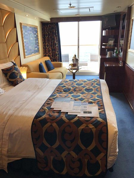
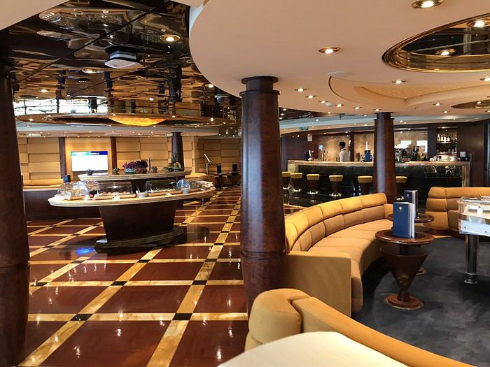
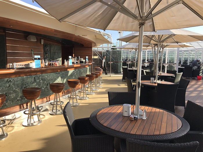
Depuis longtemps je voulais essayer le YACHT club, ici beaucoup apprécient. Au mois de juillet, suite une vente flash, nous nous sommes décidés.
Il s’agit d’une croisière de repositionnement avec un jour de moins, d’où le tarif intéressant.
J’ai choisi avec l’aide de Azur ma cabine, la 16023, aucunes n’étaient dispo au pont 15.
Dimanche 20 octobre, nous sommes arrivés au terminal vers 11h20, nous repérons aussitôt le petit accueil du YACHT club, on vient nous récupérer les valises assez rapidement, on nous demande d’attendre un peu, ensuite nous montons ou un petit buffet est dressé, un verre nous est offert, l’hôtesse nous demande ensuite nos passeports et documents d’embarquement, chouette, tout est fait à notre place 😄
Nous patientons avec 3 autres familles, à midi pile, l’embarquement commence, nous suivons l’hôtesse, nous voilà enfin sur le bateau, prise de photos, nous traversons une bonne partie du pont et montons au pont 15 ou se trouve la conciergerie.
Elle nous explique le fonctionnement, quel journal nous souhaitons, puis nous demande à quelle heure nous souhaitons dîner, en disant qu’ils doivent s’organiser, nous optons pour 21h avec l’intention de moduler ...
La famille à côté de nous souhaite dîner à 20h, on lui dit que ce n’est pas possible qu’il y a du monde à cet horaire, mais plutôt à 20h15, la 2 eme famille voulait 19h, on leur dit non aussi, je croyais que c’était horaires libres ...
On nous emmène ensuite à nôtre « suite » qui comme l’a dit Sylvianne est plus une belle cabine balcon.
Une corbeille de fruits et une bouteille de PROSECO nous attendent.
Nous partons déjeuner à la ONE pool ou un petit buffet est dressé, quelques crudités, un poisson et une ou viande ou deux, des légumes, et de la salade de fruits, c’est suffisant et bon, le service est rapide et c’est bien abrité du vent, c’était inespéré de déjeuner dehors 😏
Ensuite rangement des affaires dans les placards, pas énormément de place, mais tout rentre.
Nous partons ensuite explorer le bateau, pas trop de monde pour le moment, nous le trouvons agréable, la décoration de bon ton, ça nous fait bizarre, nous qui avons davantage l’habitude des compagnies us, d’entendre parler français partout 😉, nous essayons de trouver nôtre restaurant attitré, ce sera chose faite 😄
Nous enchaînons avec l’exercice, vite fait, remontons boire notre coupe de mousseux pas terrible du tout, et admirons le départ de Marseille de notre balcon, c’est enfin parti 😀😀
Notre majordome se présente et nous redemande notre heure de repas, décidément ils insistent, ce n’est pas du vrai ANYTIME DINING ... Il nous dit aussi que c’est soirée élégante, heureusement car sur le programme je trouve que ce n’est pas mis en valeur
Premier apéro au TOP SAIL LOUNGE, en effet ce lieu est très agréable, très calme avec ses baies vitrées d’où on peut admirer la mer, on se sert au petit buffet 2 ou 3 bricoles, nous demandons ensuite à la conciergerie si traverser le pont 7 est le plus court pour aller au restaurant, elle nous confirme que oui et nous propose d’y être accompagnés, mais souhaitant aller au théâtre et ne pas remonter, nous lui disons que nous irons nous mêmes.
Spectacle pas mal, mais musique trop forte
Notre premier repas n’est pas une réussite, le serveur nous propose seulement 2 vins blancs italiens, nous en choisissons un, pas terrible du tout, il a fallu réclamer le pain, nous prenons tout les deux : médaillon de lotte, vraiment pas bon car enrobé d’une friture qui gâche tout le goût.
Beaucoup d’ambiance dans les salons, ou tout le monde danse.
Au lit, demain Palma
Saint-Malo et la côte d'Emeraude English translation pending
Je poursuis ma visite de la Bretagne par une semaine sur la côte d'Emeraude avec Saint-Malo comme point de chute, du 22 au 29 juin 2019.
Arrivé par le train je découvre progressivement la ville historique ceinturée d'impressionnants remparts d'où émerge une forêt de toits ardoisés.
Mon logement en plein cœur de la ville de Chateaubriand me laissera le loisir de flâner dans les rues qui ont conservé le pittoresque du Moyen-Âge.
C'est pendant cette période contemporaine de la découverte des Amériques que la cité prend son essor : Jacques Cartier est natif d'ici.
Les armateurs de la compagnie des Indes apporteront la prospérité encore visible aujourd'hui à travers les nombreux hôtels particuliers où ils négociaient leurs affaires.
Saint-Malo intra-muros.
Erigés au fil des siècles, les remparts de Saint-Malo constituent une ceinture de fortifications parfaitement hermétique en vue de conjurer l'invasion de celui qui a longtemps été l'ennemi héréditaire : l'Anglais. La porte Saint-Vincent constitue l'entrée principale dans la cité. Deux écussons apparaissent sur la façade de la porte : à gauche, une herse surmontée de l’hermine des ducs de Bretagne qui représente les armoiries de la ville et à droite les hermines surmontées d’une couronne symbolisant le Duché de Bretagne.
Le château dresse fièrement ses tours et donjon à l'entrée de la cité. Il abrite la mairie et le musée d'histoire.
Un peu plus loin, un escalier taillé dans les remparts permet d'accéder au chemin de ronde, offrant une vue panoramique sur l'océan et sur l'agglomération. Il suffit de se pencher entre deux créneaux pour apercevoir la plage du Sillon dont la largeur est réglée par le rythme des marées.
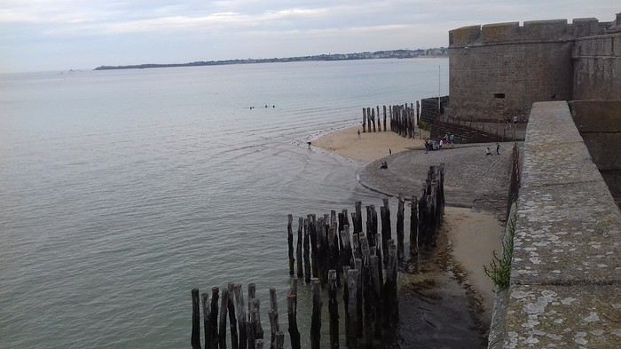
Les remparts, restés intacts après les bombardements de 1944 ceinturent la ville et permettent d'en faire le tour avec en permanence un double paysage intra et extra-muros. Dés le départ le fort de la Reine s'impose par sa masse est ses formes arrondies. Construit par Vauban après le bombardement de la ville par les Ango-Hollandais.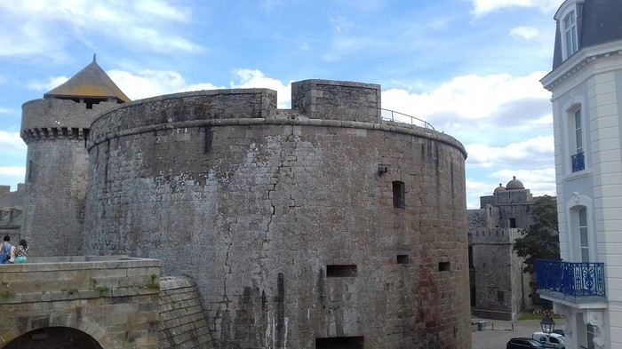
Vis-à-vis du fort de la reine, le fort national est un ouvrage impressionnant, œuvre de vauban, uniquement accessible à marée basse.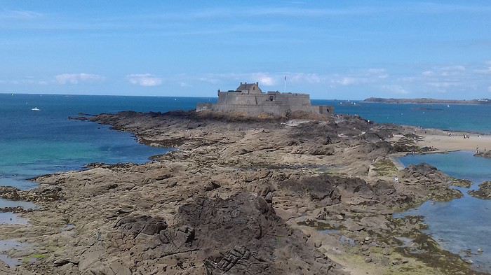
Il devient une île à marée haute.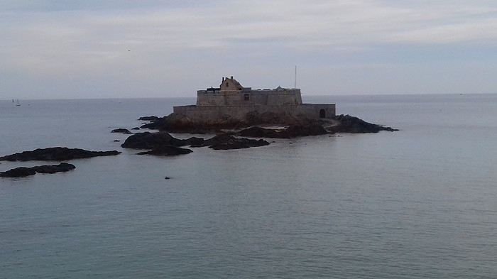
Autre élément des fortifications, le fort du Petit Bé. Sur l'ilot du Grand Bé, se trouve la tombe de Chateaubriand, natif de Saint-malo. Ils forment un archipel à marée haute.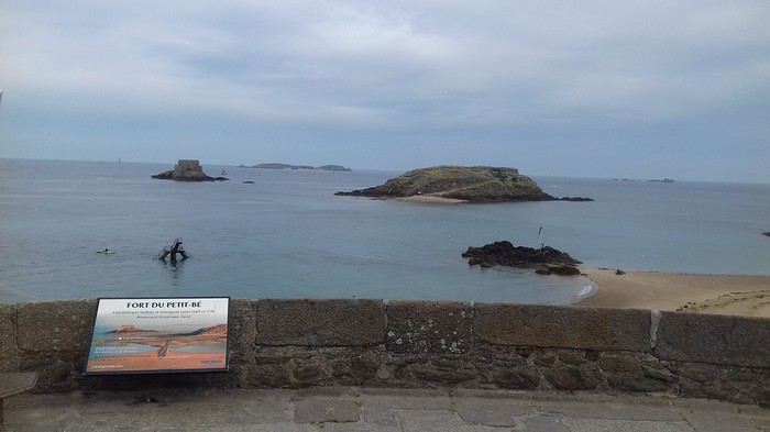
La baie de Saint-Malo offre les grandes marées d'Europe avec 14 mètres d'amplitude. La tour Bidouane, située près de la maison du Québec offre un beau paysage sur les îles.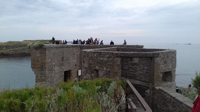
Juste en face, sur un terre plein, siège la statue de Surcouf pointant son doigt vers l'Angleterre.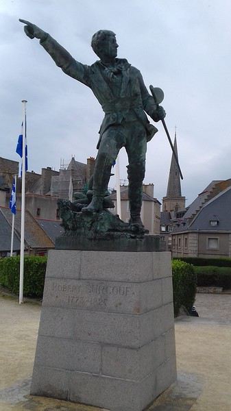
Symétrique de la tour Bidouane, le bastion de Hollande offre une belle terrasse surplombant la plage de Bon Secours et sa piscine d'eau de mer. La statue de jacques Cartier en assure la garde aujourd'hui alors qu'autrefois, 24 chiens affamés interdisaient l'approche de ce bastion stratégique.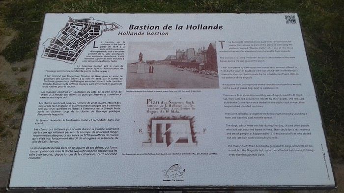
La façade ouest des remparts débouche sur le port où cohabitent ferries et voiliers. Le tourisme a remplacé le commerce.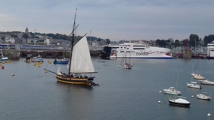
Rue d'Orléans, les remparts voisinent avec les riches hôtels particuliers des armateurs qui y menaient leurs affaires. Largement détruits en 1944, ils furent reconstruits à l'identique.
Au rond point de l'île Maurice, trône la statue de Mahé de Bourdonnais, gouverneur de îles Mascareignes (aujourd'hui : la Réunion, Maurice et Rodrigues).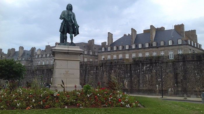
Du haut des remparts, son contemporain Duguay-Trouin semble le saluer.
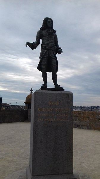
La frégate, l'Etoile du Roy (autrefois commandée par Robert Surcouf) semble parée pour la course dans le bassin qui porte son nom.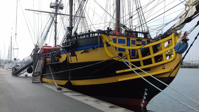
Le bassin Vauban accueille un port de plaisance.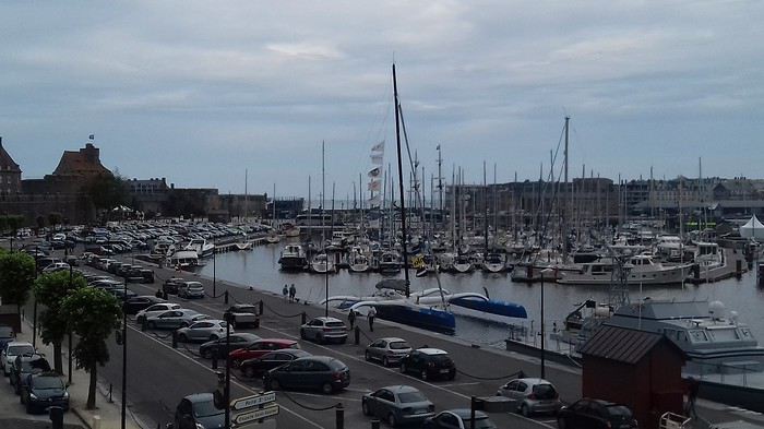
La cathédrale Saint-Vincent, héritée du XIIéme siècle s'illumine de ses magnifiques vitraux.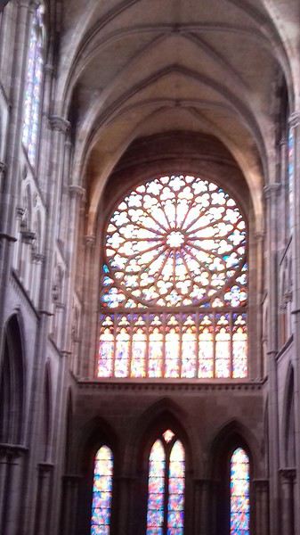
Saint-Malo intra-muros.
Erigés au fil des siècles, les remparts de Saint-Malo constituent une ceinture de fortifications parfaitement hermétique en vue de conjurer l'invasion de celui qui a longtemps été l'ennemi héréditaire : l'Anglais. La porte Saint-Vincent constitue l'entrée principale dans la cité. Deux écussons apparaissent sur la façade de la porte : à gauche, une herse surmontée de l’hermine des ducs de Bretagne qui représente les armoiries de la ville et à droite les hermines surmontées d’une couronne symbolisant le Duché de Bretagne.
Le château dresse fièrement ses tours et donjon à l'entrée de la cité. Il abrite la mairie et le musée d'histoire.
Un peu plus loin, un escalier taillé dans les remparts permet d'accéder au chemin de ronde, offrant une vue panoramique sur l'océan et sur l'agglomération. Il suffit de se pencher entre deux créneaux pour apercevoir la plage du Sillon dont la largeur est réglée par le rythme des marées.
Les remparts, restés intacts après les bombardements de 1944 ceinturent la ville et permettent d'en faire le tour avec en permanence un double paysage intra et extra-muros. Dés le départ le fort de la Reine s'impose par sa masse est ses formes arrondies. Construit par Vauban après le bombardement de la ville par les Ango-Hollandais.
Vis-à-vis du fort de la reine, le fort national est un ouvrage impressionnant, œuvre de vauban, uniquement accessible à marée basse.
Il devient une île à marée haute.
Autre élément des fortifications, le fort du Petit Bé. Sur l'ilot du Grand Bé, se trouve la tombe de Chateaubriand, natif de Saint-malo. Ils forment un archipel à marée haute.
La baie de Saint-Malo offre les grandes marées d'Europe avec 14 mètres d'amplitude. La tour Bidouane, située près de la maison du Québec offre un beau paysage sur les îles.
Juste en face, sur un terre plein, siège la statue de Surcouf pointant son doigt vers l'Angleterre.
Symétrique de la tour Bidouane, le bastion de Hollande offre une belle terrasse surplombant la plage de Bon Secours et sa piscine d'eau de mer. La statue de jacques Cartier en assure la garde aujourd'hui alors qu'autrefois, 24 chiens affamés interdisaient l'approche de ce bastion stratégique.
La façade ouest des remparts débouche sur le port où cohabitent ferries et voiliers. Le tourisme a remplacé le commerce.
Rue d'Orléans, les remparts voisinent avec les riches hôtels particuliers des armateurs qui y menaient leurs affaires. Largement détruits en 1944, ils furent reconstruits à l'identique.
Au rond point de l'île Maurice, trône la statue de Mahé de Bourdonnais, gouverneur de îles Mascareignes (aujourd'hui : la Réunion, Maurice et Rodrigues).
Du haut des remparts, son contemporain Duguay-Trouin semble le saluer.
La frégate, l'Etoile du Roy (autrefois commandée par Robert Surcouf) semble parée pour la course dans le bassin qui porte son nom.
Le bassin Vauban accueille un port de plaisance.
La cathédrale Saint-Vincent, héritée du XIIéme siècle s'illumine de ses magnifiques vitraux.
Remboursement taxe d'aéroport English translation pending
bonjour
nous devions prendre un vol singapour - Jakarta AR cet été mais pour des raisons de commodités et de temps, nous n allons pas prendre ce vol
Il faut que je m a dresse à qui pour l annulation ( à perte, ca j ai bien suivi ) et surtout pour le remboursement des taxes d aeroport svp
Billet pris sur go voyage pour la compagnie Lion Thai
j ai parcouru le forum , mais je n ai pas bien compris si c etait go voyage ou Lion Thai à qui il fallait que je m adresse
Surtout que comme par hasard, qd on va sur go voyage, on ne trouve rien pour nous renseigner dans leur centre d aide
merci d avance
Vallée du Rio Grande en motorisé (Texas) English translation pending
Bonjour
Nous allons nous rendre au Texas pour la première fois avec le motorisé. Quelqu'un pourrait nous indiquer des Resorts là-bas où sont bon nombre de québécois?
Merci
Est-il possible de dormir dans l'aéroport de Lima sans danger? English translation pending
Bonjour,
Je m'appelle Camille, je suis nouvelle sur Voyage Forum et dans le monde du voyage en général. Je m’apprête à faire un voyage de 1 mois au Pérou. J'arrive à l'aéroport de Lima à 1H50 du matin et je n'arrive pas à savoir si je peux me rendre directement dans une auberges de jeunesse où la réception est ouverte 24h/24 mais ou le check-in se fait de 14H à 23H (dans le doute j'ai déjà réservé) ou si je peux/dois dormir à l'aéroport sans danger. Je ne connais pas non plus les compagnies de Taxi au Pérou, je sais qu'il faut faire attention, pouvez-vous m’aiguiller?
Merci et bonne année à tous Ps : au fait je pars le 15 janvier, je sais je m'y prends un peu tard...
Je m'appelle Camille, je suis nouvelle sur Voyage Forum et dans le monde du voyage en général. Je m’apprête à faire un voyage de 1 mois au Pérou. J'arrive à l'aéroport de Lima à 1H50 du matin et je n'arrive pas à savoir si je peux me rendre directement dans une auberges de jeunesse où la réception est ouverte 24h/24 mais ou le check-in se fait de 14H à 23H (dans le doute j'ai déjà réservé) ou si je peux/dois dormir à l'aéroport sans danger. Je ne connais pas non plus les compagnies de Taxi au Pérou, je sais qu'il faut faire attention, pouvez-vous m’aiguiller?
Merci et bonne année à tous Ps : au fait je pars le 15 janvier, je sais je m'y prends un peu tard...
Escale de croisière Vigo et Saint-Jacques-de-Compostelle English translation pending
Bonjour,
Nous serons le 3 mai à Vigo avec la Costa Magica. Nous souhaitons visiter St Jacques de Compostelle. Nous voudrions éviter l'excursion Costa parce qu'elle est très chère et que nous n'aimons pas les groupes nombreux. Savez-vous si on peut louer une voiture au port ou s'il y a des taxis collectifs (minibus) ?Avez-vous d'autres suggestions? Merci d'avance!
Loterie pour The Wave: un bilan... English translation pending
Je viens de participer à la loterie pour le mois de Mai et n'est (bien sûr) pas été retenu. j'ai pris le temps de suivre un peu le déroulement des inscriptions et vous en dresse un bilan.
On rappelle que pour participer vous disposez d'un mois, 4 mois avant la période souhaitée. Dans ce cas, janvier 2018 pour des dates en mai 2018. Vous ne pouvez faire qu'une demande pour 3 dates maximum et un nombre de participant fixe (le même pour chaque date) et inférieur ou égal à 6.
La BLM donne des statistiques sur les candidats qui se présentent à la loterie sur place et il ressort que Mai est le mois le plus demandé. Il n'en fait pas sur la loterie en ligne et on comprend pourquoi...il a quand même l’honnêteté de dire que les chances sont très limitées.
Le bilan chiffré :
Un nombre de dossiers de 6965 (du moins à une minute de la clôture des inscriptions) et comme presque tout le monde demande 3 dates il y a eu 20485 demandes de dates.
Un grande nombre se font au départ (ceux qui piaffent d’impatience sans doute), et puis comme on peut s'en douter (ceux qui vont essayer de s'inscrire sur jours les moins demandés) énormément sur la fin, presque 2000 (demandes de dates) le dernier jour. Bilan des courses ces dernières inscriptions massives "lissent" les différences d'un jour à l'autre en très grande partie. Les dix jours les "moins" demandés se situent entre 618 et 621 demandes! Bref attendre le dernier moment ne sert pas à grand chose.
En fait il y a deux groupes, les samedis dans les 800 demandes et les autres jours.
J'ai bien conscience que je n'apprends rien à personne, surtout aux accrocs au site, mais c'était juste pour faire un point. Je ne pensais pas que l'on en était là..
J'ai bien conscience que je n'apprends rien à personne, surtout aux accrocs au site, mais c'était juste pour faire un point. Je ne pensais pas que l'on en était là..
Listes équipements à vélo et bidons sur le long cours? English translation pending
Bonjour,
Je continue à m’equiper petit à petit pour la grande et longue randonnée à vélo. Où trouver une ou des listes toutes prêtes et testées ? Enfin quid des bidons? Inox ou plastique ?
Renouvellement du visa touristique pour l'Argentine English translation pending
Bonjour à tous,
Je suis franco-brésilien et j'aimerais avoir quelques informations concernant l'argentine.
J'aimerais renouveler mon visa touristique de 3 mois accordé par les autorités argentine, es-que si je repars depuis la province de Corrientes ou la province de Misiones en Argentine direction le Brésil, (je reste dans ma ville natale à Porto Alegre 1 semaine), je peut obtenir un renouvellement de visa touristiques de 3 mois supplémentaire en revenant en Argentine ?
Je serais vraiment reconnaissant si des personnes accepte de m'aider.
Raymond
Je suis franco-brésilien et j'aimerais avoir quelques informations concernant l'argentine.
J'aimerais renouveler mon visa touristique de 3 mois accordé par les autorités argentine, es-que si je repars depuis la province de Corrientes ou la province de Misiones en Argentine direction le Brésil, (je reste dans ma ville natale à Porto Alegre 1 semaine), je peut obtenir un renouvellement de visa touristiques de 3 mois supplémentaire en revenant en Argentine ?
Je serais vraiment reconnaissant si des personnes accepte de m'aider.
Raymond