Results for "Gorges+Aveyron+|+127"
15636 results found.
Pékin, Chengdu, Lhassa que visiter? English translation pending
Bonjour à tous,
j'ai l'intention de quitter Pékin en train pour Chengdu, province du Sichuan le mois prochain, est ce une région où il est nécessaire de s'arrêter? Ensuite, j'aimerai rejoindre Lhassa!! Quel est le moyen de transport le plus pratique? L'avion?
Est-il facile d'avoir un billet aller-simple pour Lhassa, depuis Chengdu pour un indépendant?
Est-il possible de rejoindre directement Lhassa depuis Pékin?
Est-il possible d'avoir un permis pour le tibet à l'ambassade chinoise à Paris?
Xav
j'ai l'intention de quitter Pékin en train pour Chengdu, province du Sichuan le mois prochain, est ce une région où il est nécessaire de s'arrêter? Ensuite, j'aimerai rejoindre Lhassa!! Quel est le moyen de transport le plus pratique? L'avion?
Est-il facile d'avoir un billet aller-simple pour Lhassa, depuis Chengdu pour un indépendant?
Est-il possible de rejoindre directement Lhassa depuis Pékin?
Est-il possible d'avoir un permis pour le tibet à l'ambassade chinoise à Paris?
Xav
Protection de l'environnement au Gabon English translation pending
Hommage au président Omar Bongo,
Oui, grand coup de chapeau à un homme qui vient de signer les décrets d'application pour l'ouverture de 13 parcs nationaux au Gabon, qui vont permettre de protéger 11 % du territoire de ce pays et surtout de protéger une faune unique en son genre, singes mandrills, gorilles de forêts, éléphants de forêts, antilopes sittatungas et j'en oublie....
Tout celà également grâce à la ténacité de Michael Fays qui a traversé les forêts du Gabon à pied et a recensé une grande partie de la faune de ce pays ainsi que les régions à protéger, et qui a permis de faire prendre conscience aux autorités de l'importance de la protection de l'environnement.
Mais encore fallait il trouver un interlocuteur capable de prendre les bonnes décisions, ce qui a été fait grâce au président....
Dieu lui rende grâce et puisse t il donner des idées à d'autres hommes politiques....
Soyons optimistes...
Avez vous déjà vu un hippopotame se laisser porter par les vagues de l'Atlantique....ce sera bientôt une chose possible.
A bientôt,
Oui, grand coup de chapeau à un homme qui vient de signer les décrets d'application pour l'ouverture de 13 parcs nationaux au Gabon, qui vont permettre de protéger 11 % du territoire de ce pays et surtout de protéger une faune unique en son genre, singes mandrills, gorilles de forêts, éléphants de forêts, antilopes sittatungas et j'en oublie....
Tout celà également grâce à la ténacité de Michael Fays qui a traversé les forêts du Gabon à pied et a recensé une grande partie de la faune de ce pays ainsi que les régions à protéger, et qui a permis de faire prendre conscience aux autorités de l'importance de la protection de l'environnement.
Mais encore fallait il trouver un interlocuteur capable de prendre les bonnes décisions, ce qui a été fait grâce au président....
Dieu lui rende grâce et puisse t il donner des idées à d'autres hommes politiques....
Soyons optimistes...
Avez vous déjà vu un hippopotame se laisser porter par les vagues de l'Atlantique....ce sera bientôt une chose possible.
A bientôt,
Maroc: Premières traces atlastiques English translation pending
Extrait de mon premier ... et dernier essai d'écriture de voyage.
C'était lors de mes premiers pas dans l'Atlas marocain ... il y a fort longtemps.
Entre ces lignes à la syntaxe hésitante et leur parution ici, je suis retourné une vingtaine de fois dans l'Atlas. C'est dire la sympathie que j'éprouve pour ce milieu ...
Ne me demandez pas pourquoi je ne me lasse pas de ce milieu au point d'y retourner régulièrement et parfois sur de longs mois. Il y a autre chose en plus de la diversité et la beautée de ces paysages (tout n'est pas cailloux et poussière comme le secteur parcouru ces jours là) et de l'extrème sympathie et gentillesse de la population berbère de l'Atlas, une vibration interne, dès que je foule ces sentiers, que je ne saurais décrire .
Si d'aucuns veulent sortir des sentiers atlastiques trop fréquentés par les "treks-Opérators" et guides locaux, faites moi signe. Je me ferai un plaisir de vous donner des infos sur une vallée très attachante.
- --
( ... ) ANERGUI- Ayt Khoya
Maison de la famille Fouzal.
La nuit est douce, sans lune. Si j’en crois les ronflements qui s’élèvent jusqu’à la terrasse, mes hôtes sont déjà dans les bras de Morphée. Du petit lait, du pain, du thé, des amandes offerts avant leur coucher, une lanterne pour éclairer la suite des traces écrites de ce périple atlastique, le décor est planté.
Anergui, un endroit où l'on va... et non un endroit où l'on passe ! Depuis Ouaouizerth, la vallée est uniquement accessible à pied ou à dos de mulet. Un isolement qui préserve ce petit havre de quiétude et de fraîcheur, tapi au pied d’une falaise en forme parfaite de fer à cheval, dominée par les 3243 mètres du djebel Mourik. On y vit à l’écart des grandes voies de passage, dans la terre, de la terre, adaptant ses besoins à ses maigres richesses, et laissant couler lentement les jours gais ou tristes que verse la volonté divine.
Quelques très rares passes dans des éboulis en pans inclinés, boisés sommairement de chênes verts, permettent de franchir ce rempart continu, formé par un colossal mouvement orogénique. L’itinéraire d’accès le plus court passe par Tillouguitte, Tamga et Tizi n’Ouanergui. C’est celui que nous avons emprunté avant hier avec Mohammed. Une belle dizaine d’heures de marche étaient prévues au départ de Tillouguitte. En nous faisant déposer par un camion avant le pont de Tamga nous avons évité la piste poussiéreuse, gagné trois heures et entamé une marche d’approche du col bien agréable le long de la rivière Ahensal, à l’ombre des pins d’Alep.
Cinq petits hameaux, quelques maisons individuelles éparses et igherman, les “greniers fortifiés familiaux “, toujours construit sur les pentes pour une protection indispensable contre les crues, mais aussi par besoin vital de réserver à la culture la plus petite parcelle disponible, forment l'habitat des Ayt Anergui.
Tout au fond du creuset une manne permanente en provenance d'Imilchil et du plateau des lacs arrose par séguias interposées les cultures de la vallée. L’Assif Melloul, la “rivière blanche”, serpente dans le relief, trouve la faille à l’ouest et évite l’obstacle Mourik. Nous sommes à 1500 mètres. L’altitude n’autorise pas les palmiers, mais une agriculture de subsistance et, les bonnes années, le minimum alimentaire: blé, orge, maïs et aussi des noyers, des amandiers, pêchers, pommiers et quelques légumes.
Le final en beauté de mon errance atlastique était vaguement prévu dans les gorges du Dades ou du Thodra. Depuis Thinerir ou Boulmane n’Dades, la fascinante place Djmâa el Fna et les souks de Marrakech, à peine entrevus lors de mon arrivée, ne sont plus qu’à une journée de bus ! Mais il me faut d’abord atteindre le versant sud du massif. Depuis Anergui il y a de nombreux itinéraires pour rejoindre Boulmane. Toutefois, pour un étranger à ce milieu, le plus sûr et plus court chemin pour atteindre les versants sud – 3 jours au rythme d’un roumi porteur de sac à dos – est la grande piste muletière foulée régulièrement par les commerçants qui se rendent du souk es Sebt deM’semrirau souk el Khemis d’Anergui, et inversement. J’y trouverais toujours du monde et de l’aide en cas de besoin.
C’était l’option retenue à mon arrivée dans cette vallée. Mais au « thé-apéritif » de midi, j’ai vite deviné que le roumi, moi en l’occurrence, devenait sujet de délibération entre Mohammed, son père et son oncle.
Pendant le tagine la discussion a marqué une pause. C’est qu’ici on parle peu en mangeant. Le plat étant commun à tous les convives, celui qui parle trop … mange moins.
Au « thé-digestif », entre deux claquements de langue marquant son approbation sur la qualité du breuvage, Mohammed m’a proposé de m’accompagner sur une partie du trajet. Le mulet de son cousin porterait les bagages. J’ai bien sûr accepté. On ne fait pas la fine bouche devant une proposition qui dispense du portage de dix sept kilos de sac à dos. Et puis, après réflexion, vu qu’en plus du mulet je pouvais bénéficier aussi des services d’un fonctionnaire près à se dégourdir les jambes dans les montagnes de son enfance, pourquoi ne pas se lancer sur des sentiers moins "battus" ?
La description de Kousser et des conditions de vie des éleveurs sur ces terres ingrates rapportées hier par Mohammed, m’avait déjà mis l’eau à la bouche … et la carte sous les yeux. J’ai ainsi pu observer que la traversée de ce plateau pouvait, en deux jours, mener à Zawiat Ahensal. De là il est encore possible, par un petit crochet de deux jours suplémentaires, de rejoindre M’semrir. Rien d’insurmontable somme toute car je me sens en jambes. Cependant mon manque de connaissance du milieu, et cette grande (! ! !) sagesse qui m’habite m’interdisaient de me lancer seul sur cet itinéraire incertain. Mais après la proposition de Mohammed, la donne était différente. S’il voulait bien m’accompagner jusqu’à Zawiat Ahensal au lieu de la vallée d’Imdrhas, l’occasion était à saisir !
Au « thé-apéritif » du soir, je leur ai fait ma nouvelle proposition d'itinéraire. Pendant que nos doigts prenaient peu à peu la délicate teinte rouge safranée de la sauce tagine la discussion a cessé, comme il se doit, mais quatre verres de « thé-digestif » doivent aider à la réflexion car au dernier la décision était prise .
« Mohammed t’accompagnera jusqu’à Zawia, et au-delà si tu veux ».
Le père avait parlé, l’oncle approuvait et Mohammed traduisait. La sécurité d’un étranger sur les terres de la tribu est aussi affaire de son hôte.
Ce qui était dit devait être fait.
Il est plus de minuit, nous partons tout à l'heure à six heures...
Est-ce bien raisonnable ?
TAGHIA
Mon intention de passer ce hameauet de poser bivouac dans Bou Ighaln après avoir franchi le Jbel Timghazine, était-elle trop matinale ? En tous cas elle n’a pas su résister à l’appel de la petite plate-forme herbeuse qui domine la rivière à l’entrée des gorges. Me voilà à l’abri d’une éventuelle crue. Ce serait con de me retrouver à l’entrée de Zawia à trois heures du matin flottant sur mon karimat.
C’était le dernier conseil de Mohammed avant de nous séparer ce matin. Ne pas se fier à une météo, aussi clémente soit-elle au moment d’installer un bivouac. Un orage arrive vite, et la crue qui s’en suit peut-être dévastatrice, surtout à la sortie de telles gorges.
Mohammed a rebroussé chemin ce matin après que nous ayons passé la nuit à Zawia Ahensal chez un ami de son père. Il compte refaire en une journée la montée à Kousser et sa traversée. Un trajet qui nous a demandé deux belles journées de marche à l’aller. Il faut dire que lui montera sur le mulet sur la quasi totalité de l’itinéraire, ce qu’il n’a sans doute pas osé faire quand nous étions ensemble et que je tenais absolument à marcher.
C’est donc la reprise de mon aventure solitaire dans ces montagnes. Avec des provisions pour trois jours, un ravitaillement possible à Oussikis, des semelles en bon état et un moral à toute épreuve, c’est plus qu’il n’en faut pour atteindre Boulmane n’Dades.
J’ai bien aimé la ballade de ce matin depuis la Zawia . Trois heures de promenade bucolique le long de la petite rivière qui se jette plus bas dans l’assif Ahensal à travers vergers et parcelles cultivées d’orge ou peut-être de blé, je ne sais pas comment les différencier, ont suffit pour rejoindre les maisons de terre rouge de Taghia. Et puis il y a eu les falaises vertigineuses qui font face au village, et dans lesquelles je me vois déjà accroché avec mes potes grimpeurs, la transparence de l’eau, la proximité des vergers le vert profond des petites terrasses étagées sur les pentes soulignées de coquelicots et puis cette petite place herbeuse, là entre le village et les gorges, et loin la-bas le col que je devais franchir. Cela vaut bien l’octroi d’une demi-journée de contemplation.
Sieste, promenade dans les gorges et toilette complète dans la rivière, ont donc remplacé avantageusement la programmation du départ. La rivière charrie beaucoup de bois et le plaisir de la veillée autour du feu de bivouac, non encore éprouvé dans ces montagnes, est si grand que je laisse filer sereinement les heures habituellement dédiées au sommeil réparateur.
Qu’il est doux de pouvoir gérer son temps et son rythme ! On en a si peu l’occasion dans notre vie "speedée" de citadin européen qu’il ne faut pas négliger l’opportunité. Je ne m’accorderai cependant de fantaisies qu’avec l’emploi du temps. L’itinéraire conseillé par mon hôte de la veille sera suivi à la lettre. Du moins en ai-je l’intention au moment où j’écris. Sans guide ni topo, les points de passage principaux que m’a indiqué notre hôte d’hier soir ne seront peut-être pas si évidents à trouver. Surtout si comme cela semble être le cas, au-delà du col je retrouve un terrain similaire à Kousser, sans points de repères et des traces multiples de déplacements de troupeaux qui partent dans tous les sens. Quel contraste entre les vallées comme Anergui et Zawia Ahensal où les dépôts alluvionnaires et la volonté des hommes à travailler la terre en font de fertiles oasis de montagne, et la désolation minérale de Kousser !
Ce plateau d’altitude présente des signes inquiétants de déboisement. Vaincue par le climat et les pasteurs acharnés à sa perte pour la survie de leurs troupeaux, la végétation est poussée dans ses derniers retranchements.
Au milieu des pierres, des buissons épineux et des squelettes difformes de leurs congénères, il ne résiste plus que quelques genévriers thuryfères centenaires. Pas d’eau autre que celle un peu croupie de deux sources misérables. Si elles m’ont inquiété au point d’y diluer quelques cachets d’hydroclonazone, elles doivent pourtant faire le bonheur des hommes et du bétail habitant cette austère contrée,
Pour un Franc-comtois, même d’adoption, qui n’a connu que les forêts vosgiennes et les verts pâturages alpins, le premier contact physique avec cette désolation minérale est impressionnant. Néanmoins ce milieu a pour moi quelque chose d’attirant. Je sais déjà que j’y reviendrai.
D’ici là il me reste à rejoindre Oussikis et Boulmane. Il est donc temps de trouver le sommeil.
Jbel Timghazine
Le soleil avait déjà franchi la crête quand j’ai ouvert la tente. La surprise n’est apparue que lorsque mes yeux se sont habituées à la belle luminosité matinale. Posés sur une pierre à coté du foyer, deux œufs frais et une petite galette d’orge attendaient patiemment mon réveil. Je doute que beaucoup de ²sans-abri² aient souvent fait la même trouvaille, en sortant de leurs cartons après une nuit sous les ponts de la Seine.
Après un petit déjeuner copieux, la cuisson des œufs pour la route et une toilette vivifiante dans l’eau glacée, j’ai entamé le sentier raide et sinueux dans les pentes du Jbel Timghazine sans avoir pu remercier mon mystérieux et généreux donateur.
Trois heures plus tard, dépouillé d’une grande partie de ma bonne forme matinale, je pose mon sac au pied d’un genévrier squelettique et centenaire. La vue quasi aérienne sur le village de Taghia explique les deux litres de sueur que je viens de laisser dans la pente. Plus au loin, en suivant les méandres de la rivière et les cultures en terrasses, apparaissent les silhouettes des magnifiques ksours des chorfas de Zawiat Ahensal déjà prisonnières de la brume de chaleur. De l’autre coté … premier aperçu sur les grandes pentes délavées des contreforts sud de cet Atlas oriental. La traversée de Kousser n’aurait-elle été qu’une misérable mise en jambes avant l’exil de pierres, terre et poussière qui se présente en contrebas ?
J’ai vidé une gourde mais l’autre est presque pleine. C’est suffisant pour une petite soupe ce soir et un café demain matin, mais tiendra-t-elle jusqu’au bivouac si je ne trouve rien d’autre à boire cet après-midi ? Par mesure de précaution, je commence à mettre en pratique la technique du moissonneur en période de ramadan : le petit cailloux dans la bouche qui aide à saliver. Tant qu’il reste de la salive !
J’ai admiré une dernière fois l’imposant massif du Jbel Aroudane qui domine Zawiat Ahensal, en me promettant d’en faire le tour lors d’une prochaine virée. Après avoir bien ajusté le sac à dos sur les épaules et serré la ceinture ventrale, je me suis lancé dans la pente en courant. Bien imprudent quand j’y pense maintenant !
En perpétuelle recherche de l’équilibre perdu sur les pierres qui roulaient sous les semelles, j’ai dévalé, les quatre cents mètres de dénivelé. Quand j’ai repris pied sur la terre ferme j’ai eu l’impression d’être encore poussé par mon élan. Pendant longtemps encore la foulée est restée longue et alerte. Curieusement, la petite angoisse que j’avais eue en voyant ce qui m’attendait depuis le col avait totalement disparue. J’éprouvais au contraire une très agréable sensation de liberté qui semblait stimuler mes capacités physiques mises à mal dans la sévère ascension matinale. Pourtant Oussikis était encore bien loin, quelque part là-bas vers le sud-est, au bout de cette trace qui semblait ne mener nulle part ailleurs que dans les cailloux et la poussière,
Rappel que la demi-douzaine de figues sèches et la barre énergétique avalées au col manquent de sucres lents, le rythme a faibli vers le milieu de l’après-midi. Dans le même temps mes épaules me faisaient savoir qu’elles auraient plaisir à être soulagées quelques minutes. Il était temps d’alléger mon sac à dos d’une boite de sardines et une ou deux tartines de « Vache qui rit », le seul fromage -mais est-ce bien du fromage ?- trouvé au souk d’Anergui.
J’étais plongé dans ces pensées sans grande teneur philosophique, quand j’ai eu la frousse de la décennie !
Ils couraient dans ma direction et m’ont cloué sur place. Le palpitant à cent quarante, les poils au garde à vous et la sueur gelée sur le front, j’ai ramassé deux parpaings pour le premier qui dépasserait le périmètre de sécurité … si j’en avais le temps !
Les deux chiens galeux se sont arrêtés à quatre ou cinq mètres de moi en grognant et aboyant tous crocs dehors. En une fraction de seconde j’ai revu toute cette scène du film ²La guerre du feu², quand les trois héros pourchassés par des lions passent la nuit sur un arbre avec les fauves à leurs pieds.
Certes je n’avais pas à faire à des lions, mais je n’avais pas non plus de genévrier sous la main. Le dernier tronc contre lequel je m’étais appuyé était là-haut sur le col !
Il m’a semblé un peu puéril d’essayer de les amadouer en leur racontant cette histoire drôle, et j’ai opté pour la fermeté. Je m’apprêtais à casser les dents du premier quand …
Zorro est arrivé éhéééé ! ! ! ! ! !
Non, je délire. C’est l’émotion du souvenir ! Ou le soleil et l’altitude. Je ne sais pas.
D’abord sur ma gauche, deux claquements coup sur coup, secs et très brefs ont retenti. Puis il y a eu les sifflements et la poussière soulevée par les impacts entre moi et les chiens. La hausse était ajustée. Deux autres cailloux sont tombés. L’un entre les deux horreurs, l’autre a atteint sa cible. Kaïkaïkaï, faisait celle qui courait en boitant, tandis que l’autre reculait, mais toujours en aboyant.
Mes mollets devaient leur salut à la descendance berbère de Thierry La Fronde !
Deux jeunes garçons m’ont rejoint. Ils m’ont dévisagé avec la curiosité que je pourrai montrer le jour de ma rencontre avec un petit homme vert.
- Salamaleikoum.
- Salamaleikoum ... (Silence) Mani abrid n’Oussikis ?
Tilla taghbalout ? »
Comme j’ai longuement travaillé la prononciation de cette formule -la première que j’ai apprise dans ces montagnes pour éviter que l’on retrouve un jour un petit tas d’os de roumi à coté de son sac à dos- ils ont compris tout de suite.
Oui, c’était bien le chemin d’Oussikis mais au geste de la main, j’ai compris que je n’étais pas encore rendu ! Oui, il y avait bien une source dans les parages et ils se proposaient de m’y emmener. Le plus âgé m’a fait signe de le suivre tandis que son petit compère s’en allait retrouver le troupeau, accompagné par les chiens qui ne semblaient pas très rancuniers.
Etonnant ! A cinq minutes de l’endroit de notre rencontre, derrière un monticule sur lequel quelques petites chèvres noires et trois dromadaires broutaient des cailloux, deux tentes et une belle combe verdoyante signalaient la présence de l’eau. Me voilà prévenu, inutile de sucer des petits cailloux avant de m’être assuré qu’il n’y a pas de crottes de biques dans un rayon de cinq kilomètres. Qui dit biquette, dit forcément taghbalout.
Mon jeune sauveur m’a prié de m’asseoir sous la première tente. Il a allumé les branches sèches d’un buisson, et posé dans les flammes une bouilloire noire de suie. Pendant que l’eau chauffait, il est allé jusqu’à l’autre tente. Quelques instants plus tard, il en revenait avec une fille portant baluchon sur le dos. Un baluchon braillard dérangé dans sa sieste par la visite d’un fâcheux.
Une fois de plus, j’ai pu mesurer le sacré de l’hospitalité de ces montagnards. Un roumi passe, comme passe un commerçant, un nomade ou un fquih. Leurs ventres sont peut-être vides et ils ont besoin de forces et de repos pour continuer leur chemin ; alors on se doit de partager sa pitance, fusse-t-elle maigre, et son toit.
Mon ventre était vide, en effet, mais pas mon sac à dos !
Je me serais contenté d’une petite halte à la source, le temps d’avaler mes deux œufs durs et une boite de sardines à la tomate, mais dehors, la fille s’activait déjà. Quand j’ai réalisé, il était trop tard. L’eau tiède coulait dans le puits de farine. Une pierre plate avait remplacé la bouilloire sur les braises et attendait la pâte que malaxaient déjà des mains expertes.
Le garçon a fini la préparation du thé et a servi un verre de thé. Un seul.
Soudain je me suis rappelé. Que faire ? Que dire ? Envahi d’une gêne terrible je regardais le verre posé devant moi. Je n’y avais encore pas touché que déjà la fille tendait la galette brûlante au garçon.
Eux qui n’avaient pas mangé depuis l’aube et suceraient leur soif jusqu’au soleil disparu, m’offraient du thé et me cuisaient du pain alors que c’était le ramadan !
Il a coupé la galette en quatre. Il a posé les morceaux à coté du verre sur le papier bleu qui ici emballe les pains de sucre et m’a invité à manger. Bismillah, baraka Allah illik. Dans ces circonstances je ne sais rien dire d’autre. J’ai bu et j’ai mangé pendant qu’ils me regardaient en souriant.
Qu’Allah, puisque vous y croyez, vous le rende au centuple.
Au moment de les quitter, il m’a encore prié de prendre le pain qui restait. J’ai sorti un des deux œufs, une boite de sardines, une poignée d’amandes et deux portions de ²Vache qui rit². J’ai laissé le tout sur une pierre à coté du foyer et je suis parti.
Je n’avais pas encore rejoint la trace où nous nous étions rencontrés, quand le garçon m’a rattrapé. De son propos je n’ai compris que ²Taghbalout², mais c’était suffisantje partais sans refaire le plein de ma gourde ! Nous sommes revenus vers le campement. A ma surprise, au lieu d’aller à la source nous nous sommes dirigés vers l’autre tente où il m’a une fois encore, invité à m’asseoir.
La fille et le bébé emmailloté étaient là. Elle, un beau sein à l’air, mais qui ne m’était pas destiné, lui visiblement affamé s’y accrochait avidement. Devant ma réticence à m’asseoir de nouveau, mon sauveur à la fronde me montre quelque chose à l’extrémité de la dépression. Une silhouette féminine en amazone sur un baudet s’éloignait dans les reliefs du terrain. J’ai compris qu’il avait envoyé une autre femme chercher de l’eau à la source et … qu’il était inutile d’insister ! Je n’avais plus qu’à partager leur natte en attendant qu’elle revienne, et à laisser filer mes pensées en direction de cette jolie et souriante jeune mère qui, sans aucune gêne devant moi, allaitait son enfant.
Qui prétend que les femmes berbères sont farouches face aux étrangers ?
L’heure tournait et j’attendais avec impatience le retour de ma chercheuse d’eau pour reprendre la route. J’ai prétexté une cigarette que je ne voulais pas fumer en leur présence et je suis sorti de la tente pour regarder dans la direction où je l’avais vu s’éloigner. Il n’y avait personne sur le chemin. Avisant que la source était peut-être plus éloignée que je ne croyais, je me suis avancé un peu sur la trace.
J’ai repensé à ce marchand de Marrakech qui me disait il y a quelques jours : « Roumi, quand tu arrives au Maroc jette ta magana. ». Un fonctionnaire d’Anergui m’a bien reconfirmé plus tard que, dans ce milieu, il est bon de « savoir se patienter », mais que voulez vous, il est des vieux démons dont on a du mal à se débarrasser !
Le jeune m’a rejoint et entraîné à l’écart du chemin. Je ne comprenais plus rien car il insistait pour monter sur un petit promontoire à l’écart du chemin. Depuis le sommet de la bosse, j’avais une belle vue rétrospective sur le chemin parcouru depuis le col et surtout, après que le garçon m’ait montré au loin, très loin, la petite chaîne que je devais encore franchir, j’ai mieux apprécié le chemin qu’il me restait à couvrir ! C’est pour cela qu’il m’a entraîné là-haut. Gestes et petits dessins dans la terre à l’appui, j’ai fini par comprendre que les bergers de ce secteur atteignent Oussikis en une journée et que, chargé comme j’étais, ce serait une grosse bavante. Alors il m’invitait à passer la nuit chez lui.
Derrière le petit massif, après le Tizi n’Idikel, il y a selon le garçon des sources et d’autres campements. Mais d’ici là …
Voilà pourquoi je vais passer ma première nuit sous une tente de nomades et que j’ai eu largement le temps de faire ce résumé de la journée.
AQQA N’WAROUGHOULT
Hier, comme pour m’aider à soigner mon impatience, la femme, l’âne et les bidons ne sont revenus qu’en fin d’après midi. Trois heures pour le plein d’eau et l’aller-retour.
Et quel plein ! Un jerrican de 25 litres dans un panier du chouari, cinq anciens bidons d’huile Lesieur dans l’autre panier pour équilibrer, quatre autres bidons, plus petits pendus de chaque coté et, trois dans un drap savamment enroulé sur les épaules de la p’tite dame ! Soit quelques soixante dix litres d’eau. Visiblement elle ne doit pas avoir envie d’y retourner tous les jours...
Quatre heures de l’après-midi. Le corps est enfin au repos.
Ce matin, avant de prendre congé de mes hôtes, j’ai mis ma montre hors de portée dans une boite au fond du sac. Promis madame, je ne la ressortirai que la veille du départ. J’ai bien retenu la leçon, mais comprenez moi aussi… j’ai un avion à prendre !
Au-delà des difficultés gastriques de la nuit passée, je réalise finalement la chance que j’ai eu hier en croisant deux molosses galeux intéressés par mes dodus mollets. Il m’eût fallu sucer beaucoup de petits cailloux pour parvenir à préserver l’eau nécessaire au bivouac du soir. Certes ils sont légion dans les parages, mais pour la soif, j’avoue préférer quelque chose de moins solide !
Au départ de ce matin, mes jambes étaient plus lourdes à traîner que le sac à dos. Il m’a fallu les ménager en adoptant le rythme lent d’un arthrosé de la hanche (avec tout le respect que je porte pour les malheureux qui souffrent de ce mal). Malgré le manque de point d’ombre pour une petite sieste réparatrice, j’ai atteint sans trop de dommage les campements de l’aqqa n’ waroughoult.
Heureusement, je n’ai pas eu de difficultés de ²navigation². La trace à suivre était simple : Trois heures plein sud jusqu’au pied de la petite barrière repérée la veille avec Mustapha et qui paraissait ne jamais se rapprocher, une heure et demi de montée sur un chemin inconfortable et heureusement pas trop abrupt, autant de descente pour franchir l’obstacle et laisser définitivement derrière moi, du moins je l’espère, cet immense champ de cailloux.
J’ai installé ma tente à distance respectable du campement, rencontré les femmes à la source, et refusé poliment aux maris alertés du passage d’un étranger, l’invitation à manger et dormir sous leur khaïmas. Il faut dire que je ne tiens pas plus que cela à repartager une nuit de ramadan dans les mêmes conditions que la précédente !
Malgré les chants et les rythmes des taadlount, j’ai trouvé un peu longue la moitié de la nuit passée à manger de la bouillie d’orge au beurre rance, à tremper du pain dans l’huile d’olive et à boire des litres de thé sucré à en achever un diabétique. Interminable aussi l’autre moitié de la nuit dédiée à renvoyer, par différents orifices opposés, ce que mon organisme refusait obstinément de garder ; c’est à dire la totalité de ce que j’avais avalé.
A qui la faute ? La fatigue ? Non. Hier, j’étais très loin d’un tel épuisement. Un coup de soleil ? Je n’en ai jamais attrapé de ma vie et j’ai connu des expositions plus dures que ce printemps berbère. L’huile d’olive ? J’ai déjà eu souvent l’occasion les jours précédents d’y tremper le pain et les doigts et j’aime bien. L’eau ? Ah …peut-être. Que reste-t-il ? Le beurre rance !
Le beurre … l’eau ? L’eau ou ce putain de beurre rance ? Je ne pose pas longtemps la question et désigne coupable ce dernier. En total accord avec moi même, je vote unanimement sa suppression de mon régime des jours à venir. Il doit certainement être délicieux pour un palais averti et assimilable par un organisme entraîné à ce type d’agression, mais cela ne m’ emballe plus que ça. Surtout, je pourrai m’en passer plus facilement que d’une eau, même croupie, dans laquelle il est toujours possible de tremper quelques cachets d’hydroclonazone en cas de doute.
Voilà pourquoi, sans pouvoir l’expliquer, j’ai tout à l’heure refusé, avec le sourire, l’hospitalité berbère. Ils ont dû me prendre pour un sauvage ingrat.
OUSSIKIS
Le dos bien calé contre un tronc de peuplier au bord de la rivière, le verre de thé à porté de main, la gamelle sur le feu et les doigts de pied en bouquet de violettes, je me demande finalement si ce que j’aime dans la randonnée ce n’est pas surtout l’après randonnée…
Je repense à ma divine surprise au réveil après la longue nuit réparatrice dans les pâturages de l’aqqa n’ waroughoult.
Deux petits sourires timides ont accueilli la tête hirsute qui venait de quitter les bras de Morphée. Assises sagement non loin de ma tente, deux gamines attendaient patiemment mon réveil pour m’offrir l’éternelle et excellente galette d’orge cuite à la pierre. Les parents visiblement ne m’ont pas tenu rigueur du refus de leur hospitalité hier après-midi.
La forme retrouvée, du pain encore tiède pour mon petit déjeuner, et la perspective d’être à M’semrir ce soir, la journée commençait mieux que la veille. Les deux barres de céréales énergétiques que je leur ai tendues et ma dernière orange ont prestement disparu dans le fichu en laine que l’une d’elles portait sur son dos. A voir leurs mines réjouies, les mômes n’ont pas semblé mécontentes de l’échange. Les petits cabris malingres dont elles ont la garde non plus tant ils mordaient à belles dents les derniers morceaux du premier des trois pains que je porte depuis la Zawia.
Les fillettes sont restées là jusqu’à mon départ. Redevenues espiègles, ne ratant pas un de mes gestes, elles les commentaient en sourdine comme si elles craignaient que je comprenne leurs propos. Elles m’ont ensuite suivi pendant un moment, poussant les cabris devant elles en leur jetant des cailloux et force petits cris, certainement du langage caprin que je serais bien incapable d’imiter
Comme la plupart des traces utilisées par les bergers dans ces montagnes, celle qui à usé les semelles de mes chaussures aujourd’hui n’est pas indiquée sur la carte ; aussi, après un rapide coup d’œil pour estimer le temps et le chemin qu’il restait à parcourir, n’ai-je pas jugé utile ce matin de la garder à portée de main. Devant mon quart en fer blanc, l’itinéraire était évident : suivre la déclinaison de l’aqqa n’ waroughoult jusqu’à son ouverture sur le plateau d’Oussikis.
Le pas était allègre ; et délectable la sensation d’être beaucoup plus gaillard que la veille. Une bonne nuit sans beurre rance, du pain frais, quelques tapis herbeux, une belle source suivie d’un petit, mais bien sympathique ru, et les sourires féminins croisés dans cet agréable vallon ont suffi à rendre débordante l’énergie nécessaire à ce début de journée : je serais à Oussikis au pire dans le milieu de l’après-midi.
De l’optimisme il en faut, bien sûr, mais point trop. Avec lui s’installe l’insouciance. La suite m’a démontré que je péchais par excès.
Il était plus de midi et, au rythme suivi, le paysage aurait déjà du changer. Or je naviguais encore dans de grands méandres, entre des bosses caillouteuses piquées ça et là de tirlist, et zébrées de centaines de traces. Mais de troupeau oualouet de bergers non plus, qui pouvaient m’en dire un peu plus sur ma situation géographique. En pensant à ce petit filet d’eau qui disparaissait de temps en temps dans les accidents du terrain pour ressurgir plusieurs centaines de mètres plus loin, j’ai gravi un de ces promontoires pour avoir une vue plus dominante et réconfortante, du moins je l’espérais, de la suite des événements. J’aurais du m’inquiéter quand il n’a plus refait surface. La disparition des marques de fer à mulet, dans les dizaines de traces de nos amis caprins aurait du m’alarmer également. J’aurais pu aussi me soucier des petites variations observées sur la nature du terrain, mais que j’avais mises sur le compte d’une lecture matinale et (trop ?) rapide de la carte.
Si j’avais …
Mais avec des "si" il paraît qu’on peut mettre Lutèce en amphore. Je me suis dit que j’essaierais une autre fois. Ce n’était pas mon souci du moment. J’ai remplacé les lamentations par une boite de sardines à la tomate et au piment, les deux dernières portions de « vache qui rit », une barre énergétique et deux belles gorgées d’eau presque fraîche.
Les pensées sont plus claires quand on a le ventre plein et la vue s’améliore, c’est chose bien connue ! Oussikis était là. Je devrais dire là-bas. Il n’y avait pas d’erreur, M’semrir était derrière. Le seul problème étant que ma boussole me faisait gentiment remarquer que je regardais vers l’Ouest.
Je l’ai cru sur parole, elle n’a jamais menti. Cela voulait dire que j’avais largement dérivé vers l’Est ! Il ne restait plus alors à répondre à une question. Allais-je faire demi-tour jusqu’à retomber sur l’endroit où j’avais quitté le vallon principal, ou rectifier le cap depuis ma salle à manger et filer droit par monts et par vaux ? L’expression prenant là tout son sens.
Toujours prêt pour de nouvelles aventures, j’ai été tenté par les vaux et les monts. Mais combien de ces derniers aurais-je eu à franchir jusqu’à retrouver la piste muletière invisible au fond des premiers? J’ai donc opté pour une "retraite positive" et à l’heure où j’écris je me félicite de la sagesse du choix.
Une heure plus tard, je retrouvais des traces de mulet et mon filet d’eau cabotin. Au loin, deux formes vagues fréquentaient la même trace que j’avais suivie le matin. Dans sa progression, l’une d’elles s’est dédoublé, un peu comme la très fameuse histoire des petits pains il y a une vingtaine de siècles. Rapidement les trois formes prenaient l’apparence d’un tri pattes et deux quadrupèdes. C’était finalement deux baudets menés au bâton, et sans ménagement, par un monsieur sans âge ... et sans dents ; du moins sur le devant. Je n’ai pas eu l’occasion d’approfondir l’inspection. L’état du burnous témoignait de la difficulté des conditions de vie du propriétaire. La peau de son visage était plus tannée et craquelée que celle qui dépassait du chouari d’un des petits ânes et il était aussi sec qu’un Justin Bridou. Pardon, la comparaison pouvant paraître mal placée pour un musulman, sec comme son bâton de berger, me semble une comparaison plus appropriée. Il était chaussé de deux morceaux de pneu, Good Year peut-être, mais je le jurerais pas. Entre les lanières de cuir qui maintenaient cette originale, mais certainement très efficace protection, débordaient de robustes appendices, noirs, tordus et crevassés. Ils devaient, à une autre époque, ressembler à des orteils.
A en juger par la vitesse à laquelle je me suis fait rejoindre, la forme physique de l’ensemble ne semble toutefois pas souffrir des apparences !
« B’jou M’ssiou ». Il ne s’est pas mis au garde à vous, mais la main portée rapidement à hauteur de son turban révélait la récente "pacification" effectuée dans ces montagnes par les militaires français. De la phrase qui a suivi son salut, je n’ai compris que barda et arioul. Mais ce fut suffisant pour que j’accepte l’invitationà soulager mes frêles épaules. Sans demander aux baudets, déjà passablement chargés, lequel acceptait de porter le sac à dos, mon énergique papy a chargé le plus petit, certainement le plus robuste. En matière de baudet j’ai pensé que je pouvais lui faire confiance et ne me suis pas opposé au choix. Comme quoi, encore une fois, il ne faut jamais se fier aux apparences !
Finalement, même si je traînais encore sur les sentiers à l’heure où je devais faire la sieste au bord de la rivière, je ne m’en suis pas trop mal sorti sur ce coup là. Trois heures, malheureusement sans beaucoup d’échanges possibles, ont suffit pour rejoindre Oussikis.
( .... )
C'était lors de mes premiers pas dans l'Atlas marocain ... il y a fort longtemps.
Entre ces lignes à la syntaxe hésitante et leur parution ici, je suis retourné une vingtaine de fois dans l'Atlas. C'est dire la sympathie que j'éprouve pour ce milieu ...
Ne me demandez pas pourquoi je ne me lasse pas de ce milieu au point d'y retourner régulièrement et parfois sur de longs mois. Il y a autre chose en plus de la diversité et la beautée de ces paysages (tout n'est pas cailloux et poussière comme le secteur parcouru ces jours là) et de l'extrème sympathie et gentillesse de la population berbère de l'Atlas, une vibration interne, dès que je foule ces sentiers, que je ne saurais décrire .
Si d'aucuns veulent sortir des sentiers atlastiques trop fréquentés par les "treks-Opérators" et guides locaux, faites moi signe. Je me ferai un plaisir de vous donner des infos sur une vallée très attachante.
- --
( ... ) ANERGUI- Ayt Khoya
Maison de la famille Fouzal.
La nuit est douce, sans lune. Si j’en crois les ronflements qui s’élèvent jusqu’à la terrasse, mes hôtes sont déjà dans les bras de Morphée. Du petit lait, du pain, du thé, des amandes offerts avant leur coucher, une lanterne pour éclairer la suite des traces écrites de ce périple atlastique, le décor est planté.
Anergui, un endroit où l'on va... et non un endroit où l'on passe ! Depuis Ouaouizerth, la vallée est uniquement accessible à pied ou à dos de mulet. Un isolement qui préserve ce petit havre de quiétude et de fraîcheur, tapi au pied d’une falaise en forme parfaite de fer à cheval, dominée par les 3243 mètres du djebel Mourik. On y vit à l’écart des grandes voies de passage, dans la terre, de la terre, adaptant ses besoins à ses maigres richesses, et laissant couler lentement les jours gais ou tristes que verse la volonté divine.
Quelques très rares passes dans des éboulis en pans inclinés, boisés sommairement de chênes verts, permettent de franchir ce rempart continu, formé par un colossal mouvement orogénique. L’itinéraire d’accès le plus court passe par Tillouguitte, Tamga et Tizi n’Ouanergui. C’est celui que nous avons emprunté avant hier avec Mohammed. Une belle dizaine d’heures de marche étaient prévues au départ de Tillouguitte. En nous faisant déposer par un camion avant le pont de Tamga nous avons évité la piste poussiéreuse, gagné trois heures et entamé une marche d’approche du col bien agréable le long de la rivière Ahensal, à l’ombre des pins d’Alep.
Cinq petits hameaux, quelques maisons individuelles éparses et igherman, les “greniers fortifiés familiaux “, toujours construit sur les pentes pour une protection indispensable contre les crues, mais aussi par besoin vital de réserver à la culture la plus petite parcelle disponible, forment l'habitat des Ayt Anergui.
Tout au fond du creuset une manne permanente en provenance d'Imilchil et du plateau des lacs arrose par séguias interposées les cultures de la vallée. L’Assif Melloul, la “rivière blanche”, serpente dans le relief, trouve la faille à l’ouest et évite l’obstacle Mourik. Nous sommes à 1500 mètres. L’altitude n’autorise pas les palmiers, mais une agriculture de subsistance et, les bonnes années, le minimum alimentaire: blé, orge, maïs et aussi des noyers, des amandiers, pêchers, pommiers et quelques légumes.
Le final en beauté de mon errance atlastique était vaguement prévu dans les gorges du Dades ou du Thodra. Depuis Thinerir ou Boulmane n’Dades, la fascinante place Djmâa el Fna et les souks de Marrakech, à peine entrevus lors de mon arrivée, ne sont plus qu’à une journée de bus ! Mais il me faut d’abord atteindre le versant sud du massif. Depuis Anergui il y a de nombreux itinéraires pour rejoindre Boulmane. Toutefois, pour un étranger à ce milieu, le plus sûr et plus court chemin pour atteindre les versants sud – 3 jours au rythme d’un roumi porteur de sac à dos – est la grande piste muletière foulée régulièrement par les commerçants qui se rendent du souk es Sebt deM’semrirau souk el Khemis d’Anergui, et inversement. J’y trouverais toujours du monde et de l’aide en cas de besoin.
C’était l’option retenue à mon arrivée dans cette vallée. Mais au « thé-apéritif » de midi, j’ai vite deviné que le roumi, moi en l’occurrence, devenait sujet de délibération entre Mohammed, son père et son oncle.
Pendant le tagine la discussion a marqué une pause. C’est qu’ici on parle peu en mangeant. Le plat étant commun à tous les convives, celui qui parle trop … mange moins.
Au « thé-digestif », entre deux claquements de langue marquant son approbation sur la qualité du breuvage, Mohammed m’a proposé de m’accompagner sur une partie du trajet. Le mulet de son cousin porterait les bagages. J’ai bien sûr accepté. On ne fait pas la fine bouche devant une proposition qui dispense du portage de dix sept kilos de sac à dos. Et puis, après réflexion, vu qu’en plus du mulet je pouvais bénéficier aussi des services d’un fonctionnaire près à se dégourdir les jambes dans les montagnes de son enfance, pourquoi ne pas se lancer sur des sentiers moins "battus" ?
La description de Kousser et des conditions de vie des éleveurs sur ces terres ingrates rapportées hier par Mohammed, m’avait déjà mis l’eau à la bouche … et la carte sous les yeux. J’ai ainsi pu observer que la traversée de ce plateau pouvait, en deux jours, mener à Zawiat Ahensal. De là il est encore possible, par un petit crochet de deux jours suplémentaires, de rejoindre M’semrir. Rien d’insurmontable somme toute car je me sens en jambes. Cependant mon manque de connaissance du milieu, et cette grande (! ! !) sagesse qui m’habite m’interdisaient de me lancer seul sur cet itinéraire incertain. Mais après la proposition de Mohammed, la donne était différente. S’il voulait bien m’accompagner jusqu’à Zawiat Ahensal au lieu de la vallée d’Imdrhas, l’occasion était à saisir !
Au « thé-apéritif » du soir, je leur ai fait ma nouvelle proposition d'itinéraire. Pendant que nos doigts prenaient peu à peu la délicate teinte rouge safranée de la sauce tagine la discussion a cessé, comme il se doit, mais quatre verres de « thé-digestif » doivent aider à la réflexion car au dernier la décision était prise .
« Mohammed t’accompagnera jusqu’à Zawia, et au-delà si tu veux ».
Le père avait parlé, l’oncle approuvait et Mohammed traduisait. La sécurité d’un étranger sur les terres de la tribu est aussi affaire de son hôte.
Ce qui était dit devait être fait.
Il est plus de minuit, nous partons tout à l'heure à six heures...
Est-ce bien raisonnable ?
TAGHIA
Mon intention de passer ce hameauet de poser bivouac dans Bou Ighaln après avoir franchi le Jbel Timghazine, était-elle trop matinale ? En tous cas elle n’a pas su résister à l’appel de la petite plate-forme herbeuse qui domine la rivière à l’entrée des gorges. Me voilà à l’abri d’une éventuelle crue. Ce serait con de me retrouver à l’entrée de Zawia à trois heures du matin flottant sur mon karimat.
C’était le dernier conseil de Mohammed avant de nous séparer ce matin. Ne pas se fier à une météo, aussi clémente soit-elle au moment d’installer un bivouac. Un orage arrive vite, et la crue qui s’en suit peut-être dévastatrice, surtout à la sortie de telles gorges.
Mohammed a rebroussé chemin ce matin après que nous ayons passé la nuit à Zawia Ahensal chez un ami de son père. Il compte refaire en une journée la montée à Kousser et sa traversée. Un trajet qui nous a demandé deux belles journées de marche à l’aller. Il faut dire que lui montera sur le mulet sur la quasi totalité de l’itinéraire, ce qu’il n’a sans doute pas osé faire quand nous étions ensemble et que je tenais absolument à marcher.
C’est donc la reprise de mon aventure solitaire dans ces montagnes. Avec des provisions pour trois jours, un ravitaillement possible à Oussikis, des semelles en bon état et un moral à toute épreuve, c’est plus qu’il n’en faut pour atteindre Boulmane n’Dades.
J’ai bien aimé la ballade de ce matin depuis la Zawia . Trois heures de promenade bucolique le long de la petite rivière qui se jette plus bas dans l’assif Ahensal à travers vergers et parcelles cultivées d’orge ou peut-être de blé, je ne sais pas comment les différencier, ont suffit pour rejoindre les maisons de terre rouge de Taghia. Et puis il y a eu les falaises vertigineuses qui font face au village, et dans lesquelles je me vois déjà accroché avec mes potes grimpeurs, la transparence de l’eau, la proximité des vergers le vert profond des petites terrasses étagées sur les pentes soulignées de coquelicots et puis cette petite place herbeuse, là entre le village et les gorges, et loin la-bas le col que je devais franchir. Cela vaut bien l’octroi d’une demi-journée de contemplation.
Sieste, promenade dans les gorges et toilette complète dans la rivière, ont donc remplacé avantageusement la programmation du départ. La rivière charrie beaucoup de bois et le plaisir de la veillée autour du feu de bivouac, non encore éprouvé dans ces montagnes, est si grand que je laisse filer sereinement les heures habituellement dédiées au sommeil réparateur.
Qu’il est doux de pouvoir gérer son temps et son rythme ! On en a si peu l’occasion dans notre vie "speedée" de citadin européen qu’il ne faut pas négliger l’opportunité. Je ne m’accorderai cependant de fantaisies qu’avec l’emploi du temps. L’itinéraire conseillé par mon hôte de la veille sera suivi à la lettre. Du moins en ai-je l’intention au moment où j’écris. Sans guide ni topo, les points de passage principaux que m’a indiqué notre hôte d’hier soir ne seront peut-être pas si évidents à trouver. Surtout si comme cela semble être le cas, au-delà du col je retrouve un terrain similaire à Kousser, sans points de repères et des traces multiples de déplacements de troupeaux qui partent dans tous les sens. Quel contraste entre les vallées comme Anergui et Zawia Ahensal où les dépôts alluvionnaires et la volonté des hommes à travailler la terre en font de fertiles oasis de montagne, et la désolation minérale de Kousser !
Ce plateau d’altitude présente des signes inquiétants de déboisement. Vaincue par le climat et les pasteurs acharnés à sa perte pour la survie de leurs troupeaux, la végétation est poussée dans ses derniers retranchements.
Au milieu des pierres, des buissons épineux et des squelettes difformes de leurs congénères, il ne résiste plus que quelques genévriers thuryfères centenaires. Pas d’eau autre que celle un peu croupie de deux sources misérables. Si elles m’ont inquiété au point d’y diluer quelques cachets d’hydroclonazone, elles doivent pourtant faire le bonheur des hommes et du bétail habitant cette austère contrée,
Pour un Franc-comtois, même d’adoption, qui n’a connu que les forêts vosgiennes et les verts pâturages alpins, le premier contact physique avec cette désolation minérale est impressionnant. Néanmoins ce milieu a pour moi quelque chose d’attirant. Je sais déjà que j’y reviendrai.
D’ici là il me reste à rejoindre Oussikis et Boulmane. Il est donc temps de trouver le sommeil.
Jbel Timghazine
Le soleil avait déjà franchi la crête quand j’ai ouvert la tente. La surprise n’est apparue que lorsque mes yeux se sont habituées à la belle luminosité matinale. Posés sur une pierre à coté du foyer, deux œufs frais et une petite galette d’orge attendaient patiemment mon réveil. Je doute que beaucoup de ²sans-abri² aient souvent fait la même trouvaille, en sortant de leurs cartons après une nuit sous les ponts de la Seine.
Après un petit déjeuner copieux, la cuisson des œufs pour la route et une toilette vivifiante dans l’eau glacée, j’ai entamé le sentier raide et sinueux dans les pentes du Jbel Timghazine sans avoir pu remercier mon mystérieux et généreux donateur.
Trois heures plus tard, dépouillé d’une grande partie de ma bonne forme matinale, je pose mon sac au pied d’un genévrier squelettique et centenaire. La vue quasi aérienne sur le village de Taghia explique les deux litres de sueur que je viens de laisser dans la pente. Plus au loin, en suivant les méandres de la rivière et les cultures en terrasses, apparaissent les silhouettes des magnifiques ksours des chorfas de Zawiat Ahensal déjà prisonnières de la brume de chaleur. De l’autre coté … premier aperçu sur les grandes pentes délavées des contreforts sud de cet Atlas oriental. La traversée de Kousser n’aurait-elle été qu’une misérable mise en jambes avant l’exil de pierres, terre et poussière qui se présente en contrebas ?
J’ai vidé une gourde mais l’autre est presque pleine. C’est suffisant pour une petite soupe ce soir et un café demain matin, mais tiendra-t-elle jusqu’au bivouac si je ne trouve rien d’autre à boire cet après-midi ? Par mesure de précaution, je commence à mettre en pratique la technique du moissonneur en période de ramadan : le petit cailloux dans la bouche qui aide à saliver. Tant qu’il reste de la salive !
J’ai admiré une dernière fois l’imposant massif du Jbel Aroudane qui domine Zawiat Ahensal, en me promettant d’en faire le tour lors d’une prochaine virée. Après avoir bien ajusté le sac à dos sur les épaules et serré la ceinture ventrale, je me suis lancé dans la pente en courant. Bien imprudent quand j’y pense maintenant !
En perpétuelle recherche de l’équilibre perdu sur les pierres qui roulaient sous les semelles, j’ai dévalé, les quatre cents mètres de dénivelé. Quand j’ai repris pied sur la terre ferme j’ai eu l’impression d’être encore poussé par mon élan. Pendant longtemps encore la foulée est restée longue et alerte. Curieusement, la petite angoisse que j’avais eue en voyant ce qui m’attendait depuis le col avait totalement disparue. J’éprouvais au contraire une très agréable sensation de liberté qui semblait stimuler mes capacités physiques mises à mal dans la sévère ascension matinale. Pourtant Oussikis était encore bien loin, quelque part là-bas vers le sud-est, au bout de cette trace qui semblait ne mener nulle part ailleurs que dans les cailloux et la poussière,
Rappel que la demi-douzaine de figues sèches et la barre énergétique avalées au col manquent de sucres lents, le rythme a faibli vers le milieu de l’après-midi. Dans le même temps mes épaules me faisaient savoir qu’elles auraient plaisir à être soulagées quelques minutes. Il était temps d’alléger mon sac à dos d’une boite de sardines et une ou deux tartines de « Vache qui rit », le seul fromage -mais est-ce bien du fromage ?- trouvé au souk d’Anergui.
J’étais plongé dans ces pensées sans grande teneur philosophique, quand j’ai eu la frousse de la décennie !
Ils couraient dans ma direction et m’ont cloué sur place. Le palpitant à cent quarante, les poils au garde à vous et la sueur gelée sur le front, j’ai ramassé deux parpaings pour le premier qui dépasserait le périmètre de sécurité … si j’en avais le temps !
Les deux chiens galeux se sont arrêtés à quatre ou cinq mètres de moi en grognant et aboyant tous crocs dehors. En une fraction de seconde j’ai revu toute cette scène du film ²La guerre du feu², quand les trois héros pourchassés par des lions passent la nuit sur un arbre avec les fauves à leurs pieds.
Certes je n’avais pas à faire à des lions, mais je n’avais pas non plus de genévrier sous la main. Le dernier tronc contre lequel je m’étais appuyé était là-haut sur le col !
Il m’a semblé un peu puéril d’essayer de les amadouer en leur racontant cette histoire drôle, et j’ai opté pour la fermeté. Je m’apprêtais à casser les dents du premier quand …
Zorro est arrivé éhéééé ! ! ! ! ! !
Non, je délire. C’est l’émotion du souvenir ! Ou le soleil et l’altitude. Je ne sais pas.
D’abord sur ma gauche, deux claquements coup sur coup, secs et très brefs ont retenti. Puis il y a eu les sifflements et la poussière soulevée par les impacts entre moi et les chiens. La hausse était ajustée. Deux autres cailloux sont tombés. L’un entre les deux horreurs, l’autre a atteint sa cible. Kaïkaïkaï, faisait celle qui courait en boitant, tandis que l’autre reculait, mais toujours en aboyant.
Mes mollets devaient leur salut à la descendance berbère de Thierry La Fronde !
Deux jeunes garçons m’ont rejoint. Ils m’ont dévisagé avec la curiosité que je pourrai montrer le jour de ma rencontre avec un petit homme vert.
- Salamaleikoum.
- Salamaleikoum ... (Silence) Mani abrid n’Oussikis ?
Tilla taghbalout ? »
Comme j’ai longuement travaillé la prononciation de cette formule -la première que j’ai apprise dans ces montagnes pour éviter que l’on retrouve un jour un petit tas d’os de roumi à coté de son sac à dos- ils ont compris tout de suite.
Oui, c’était bien le chemin d’Oussikis mais au geste de la main, j’ai compris que je n’étais pas encore rendu ! Oui, il y avait bien une source dans les parages et ils se proposaient de m’y emmener. Le plus âgé m’a fait signe de le suivre tandis que son petit compère s’en allait retrouver le troupeau, accompagné par les chiens qui ne semblaient pas très rancuniers.
Etonnant ! A cinq minutes de l’endroit de notre rencontre, derrière un monticule sur lequel quelques petites chèvres noires et trois dromadaires broutaient des cailloux, deux tentes et une belle combe verdoyante signalaient la présence de l’eau. Me voilà prévenu, inutile de sucer des petits cailloux avant de m’être assuré qu’il n’y a pas de crottes de biques dans un rayon de cinq kilomètres. Qui dit biquette, dit forcément taghbalout.
Mon jeune sauveur m’a prié de m’asseoir sous la première tente. Il a allumé les branches sèches d’un buisson, et posé dans les flammes une bouilloire noire de suie. Pendant que l’eau chauffait, il est allé jusqu’à l’autre tente. Quelques instants plus tard, il en revenait avec une fille portant baluchon sur le dos. Un baluchon braillard dérangé dans sa sieste par la visite d’un fâcheux.
Une fois de plus, j’ai pu mesurer le sacré de l’hospitalité de ces montagnards. Un roumi passe, comme passe un commerçant, un nomade ou un fquih. Leurs ventres sont peut-être vides et ils ont besoin de forces et de repos pour continuer leur chemin ; alors on se doit de partager sa pitance, fusse-t-elle maigre, et son toit.
Mon ventre était vide, en effet, mais pas mon sac à dos !
Je me serais contenté d’une petite halte à la source, le temps d’avaler mes deux œufs durs et une boite de sardines à la tomate, mais dehors, la fille s’activait déjà. Quand j’ai réalisé, il était trop tard. L’eau tiède coulait dans le puits de farine. Une pierre plate avait remplacé la bouilloire sur les braises et attendait la pâte que malaxaient déjà des mains expertes.
Le garçon a fini la préparation du thé et a servi un verre de thé. Un seul.
Soudain je me suis rappelé. Que faire ? Que dire ? Envahi d’une gêne terrible je regardais le verre posé devant moi. Je n’y avais encore pas touché que déjà la fille tendait la galette brûlante au garçon.
Eux qui n’avaient pas mangé depuis l’aube et suceraient leur soif jusqu’au soleil disparu, m’offraient du thé et me cuisaient du pain alors que c’était le ramadan !
Il a coupé la galette en quatre. Il a posé les morceaux à coté du verre sur le papier bleu qui ici emballe les pains de sucre et m’a invité à manger. Bismillah, baraka Allah illik. Dans ces circonstances je ne sais rien dire d’autre. J’ai bu et j’ai mangé pendant qu’ils me regardaient en souriant.
Qu’Allah, puisque vous y croyez, vous le rende au centuple.
Au moment de les quitter, il m’a encore prié de prendre le pain qui restait. J’ai sorti un des deux œufs, une boite de sardines, une poignée d’amandes et deux portions de ²Vache qui rit². J’ai laissé le tout sur une pierre à coté du foyer et je suis parti.
Je n’avais pas encore rejoint la trace où nous nous étions rencontrés, quand le garçon m’a rattrapé. De son propos je n’ai compris que ²Taghbalout², mais c’était suffisantje partais sans refaire le plein de ma gourde ! Nous sommes revenus vers le campement. A ma surprise, au lieu d’aller à la source nous nous sommes dirigés vers l’autre tente où il m’a une fois encore, invité à m’asseoir.
La fille et le bébé emmailloté étaient là. Elle, un beau sein à l’air, mais qui ne m’était pas destiné, lui visiblement affamé s’y accrochait avidement. Devant ma réticence à m’asseoir de nouveau, mon sauveur à la fronde me montre quelque chose à l’extrémité de la dépression. Une silhouette féminine en amazone sur un baudet s’éloignait dans les reliefs du terrain. J’ai compris qu’il avait envoyé une autre femme chercher de l’eau à la source et … qu’il était inutile d’insister ! Je n’avais plus qu’à partager leur natte en attendant qu’elle revienne, et à laisser filer mes pensées en direction de cette jolie et souriante jeune mère qui, sans aucune gêne devant moi, allaitait son enfant.
Qui prétend que les femmes berbères sont farouches face aux étrangers ?
L’heure tournait et j’attendais avec impatience le retour de ma chercheuse d’eau pour reprendre la route. J’ai prétexté une cigarette que je ne voulais pas fumer en leur présence et je suis sorti de la tente pour regarder dans la direction où je l’avais vu s’éloigner. Il n’y avait personne sur le chemin. Avisant que la source était peut-être plus éloignée que je ne croyais, je me suis avancé un peu sur la trace.
J’ai repensé à ce marchand de Marrakech qui me disait il y a quelques jours : « Roumi, quand tu arrives au Maroc jette ta magana. ». Un fonctionnaire d’Anergui m’a bien reconfirmé plus tard que, dans ce milieu, il est bon de « savoir se patienter », mais que voulez vous, il est des vieux démons dont on a du mal à se débarrasser !
Le jeune m’a rejoint et entraîné à l’écart du chemin. Je ne comprenais plus rien car il insistait pour monter sur un petit promontoire à l’écart du chemin. Depuis le sommet de la bosse, j’avais une belle vue rétrospective sur le chemin parcouru depuis le col et surtout, après que le garçon m’ait montré au loin, très loin, la petite chaîne que je devais encore franchir, j’ai mieux apprécié le chemin qu’il me restait à couvrir ! C’est pour cela qu’il m’a entraîné là-haut. Gestes et petits dessins dans la terre à l’appui, j’ai fini par comprendre que les bergers de ce secteur atteignent Oussikis en une journée et que, chargé comme j’étais, ce serait une grosse bavante. Alors il m’invitait à passer la nuit chez lui.
Derrière le petit massif, après le Tizi n’Idikel, il y a selon le garçon des sources et d’autres campements. Mais d’ici là …
Voilà pourquoi je vais passer ma première nuit sous une tente de nomades et que j’ai eu largement le temps de faire ce résumé de la journée.
AQQA N’WAROUGHOULT
Hier, comme pour m’aider à soigner mon impatience, la femme, l’âne et les bidons ne sont revenus qu’en fin d’après midi. Trois heures pour le plein d’eau et l’aller-retour.
Et quel plein ! Un jerrican de 25 litres dans un panier du chouari, cinq anciens bidons d’huile Lesieur dans l’autre panier pour équilibrer, quatre autres bidons, plus petits pendus de chaque coté et, trois dans un drap savamment enroulé sur les épaules de la p’tite dame ! Soit quelques soixante dix litres d’eau. Visiblement elle ne doit pas avoir envie d’y retourner tous les jours...
Quatre heures de l’après-midi. Le corps est enfin au repos.
Ce matin, avant de prendre congé de mes hôtes, j’ai mis ma montre hors de portée dans une boite au fond du sac. Promis madame, je ne la ressortirai que la veille du départ. J’ai bien retenu la leçon, mais comprenez moi aussi… j’ai un avion à prendre !
Au-delà des difficultés gastriques de la nuit passée, je réalise finalement la chance que j’ai eu hier en croisant deux molosses galeux intéressés par mes dodus mollets. Il m’eût fallu sucer beaucoup de petits cailloux pour parvenir à préserver l’eau nécessaire au bivouac du soir. Certes ils sont légion dans les parages, mais pour la soif, j’avoue préférer quelque chose de moins solide !
Au départ de ce matin, mes jambes étaient plus lourdes à traîner que le sac à dos. Il m’a fallu les ménager en adoptant le rythme lent d’un arthrosé de la hanche (avec tout le respect que je porte pour les malheureux qui souffrent de ce mal). Malgré le manque de point d’ombre pour une petite sieste réparatrice, j’ai atteint sans trop de dommage les campements de l’aqqa n’ waroughoult.
Heureusement, je n’ai pas eu de difficultés de ²navigation². La trace à suivre était simple : Trois heures plein sud jusqu’au pied de la petite barrière repérée la veille avec Mustapha et qui paraissait ne jamais se rapprocher, une heure et demi de montée sur un chemin inconfortable et heureusement pas trop abrupt, autant de descente pour franchir l’obstacle et laisser définitivement derrière moi, du moins je l’espère, cet immense champ de cailloux.
J’ai installé ma tente à distance respectable du campement, rencontré les femmes à la source, et refusé poliment aux maris alertés du passage d’un étranger, l’invitation à manger et dormir sous leur khaïmas. Il faut dire que je ne tiens pas plus que cela à repartager une nuit de ramadan dans les mêmes conditions que la précédente !
Malgré les chants et les rythmes des taadlount, j’ai trouvé un peu longue la moitié de la nuit passée à manger de la bouillie d’orge au beurre rance, à tremper du pain dans l’huile d’olive et à boire des litres de thé sucré à en achever un diabétique. Interminable aussi l’autre moitié de la nuit dédiée à renvoyer, par différents orifices opposés, ce que mon organisme refusait obstinément de garder ; c’est à dire la totalité de ce que j’avais avalé.
A qui la faute ? La fatigue ? Non. Hier, j’étais très loin d’un tel épuisement. Un coup de soleil ? Je n’en ai jamais attrapé de ma vie et j’ai connu des expositions plus dures que ce printemps berbère. L’huile d’olive ? J’ai déjà eu souvent l’occasion les jours précédents d’y tremper le pain et les doigts et j’aime bien. L’eau ? Ah …peut-être. Que reste-t-il ? Le beurre rance !
Le beurre … l’eau ? L’eau ou ce putain de beurre rance ? Je ne pose pas longtemps la question et désigne coupable ce dernier. En total accord avec moi même, je vote unanimement sa suppression de mon régime des jours à venir. Il doit certainement être délicieux pour un palais averti et assimilable par un organisme entraîné à ce type d’agression, mais cela ne m’ emballe plus que ça. Surtout, je pourrai m’en passer plus facilement que d’une eau, même croupie, dans laquelle il est toujours possible de tremper quelques cachets d’hydroclonazone en cas de doute.
Voilà pourquoi, sans pouvoir l’expliquer, j’ai tout à l’heure refusé, avec le sourire, l’hospitalité berbère. Ils ont dû me prendre pour un sauvage ingrat.
OUSSIKIS
Le dos bien calé contre un tronc de peuplier au bord de la rivière, le verre de thé à porté de main, la gamelle sur le feu et les doigts de pied en bouquet de violettes, je me demande finalement si ce que j’aime dans la randonnée ce n’est pas surtout l’après randonnée…
Je repense à ma divine surprise au réveil après la longue nuit réparatrice dans les pâturages de l’aqqa n’ waroughoult.
Deux petits sourires timides ont accueilli la tête hirsute qui venait de quitter les bras de Morphée. Assises sagement non loin de ma tente, deux gamines attendaient patiemment mon réveil pour m’offrir l’éternelle et excellente galette d’orge cuite à la pierre. Les parents visiblement ne m’ont pas tenu rigueur du refus de leur hospitalité hier après-midi.
La forme retrouvée, du pain encore tiède pour mon petit déjeuner, et la perspective d’être à M’semrir ce soir, la journée commençait mieux que la veille. Les deux barres de céréales énergétiques que je leur ai tendues et ma dernière orange ont prestement disparu dans le fichu en laine que l’une d’elles portait sur son dos. A voir leurs mines réjouies, les mômes n’ont pas semblé mécontentes de l’échange. Les petits cabris malingres dont elles ont la garde non plus tant ils mordaient à belles dents les derniers morceaux du premier des trois pains que je porte depuis la Zawia.
Les fillettes sont restées là jusqu’à mon départ. Redevenues espiègles, ne ratant pas un de mes gestes, elles les commentaient en sourdine comme si elles craignaient que je comprenne leurs propos. Elles m’ont ensuite suivi pendant un moment, poussant les cabris devant elles en leur jetant des cailloux et force petits cris, certainement du langage caprin que je serais bien incapable d’imiter
Comme la plupart des traces utilisées par les bergers dans ces montagnes, celle qui à usé les semelles de mes chaussures aujourd’hui n’est pas indiquée sur la carte ; aussi, après un rapide coup d’œil pour estimer le temps et le chemin qu’il restait à parcourir, n’ai-je pas jugé utile ce matin de la garder à portée de main. Devant mon quart en fer blanc, l’itinéraire était évident : suivre la déclinaison de l’aqqa n’ waroughoult jusqu’à son ouverture sur le plateau d’Oussikis.
Le pas était allègre ; et délectable la sensation d’être beaucoup plus gaillard que la veille. Une bonne nuit sans beurre rance, du pain frais, quelques tapis herbeux, une belle source suivie d’un petit, mais bien sympathique ru, et les sourires féminins croisés dans cet agréable vallon ont suffi à rendre débordante l’énergie nécessaire à ce début de journée : je serais à Oussikis au pire dans le milieu de l’après-midi.
De l’optimisme il en faut, bien sûr, mais point trop. Avec lui s’installe l’insouciance. La suite m’a démontré que je péchais par excès.
Il était plus de midi et, au rythme suivi, le paysage aurait déjà du changer. Or je naviguais encore dans de grands méandres, entre des bosses caillouteuses piquées ça et là de tirlist, et zébrées de centaines de traces. Mais de troupeau oualouet de bergers non plus, qui pouvaient m’en dire un peu plus sur ma situation géographique. En pensant à ce petit filet d’eau qui disparaissait de temps en temps dans les accidents du terrain pour ressurgir plusieurs centaines de mètres plus loin, j’ai gravi un de ces promontoires pour avoir une vue plus dominante et réconfortante, du moins je l’espérais, de la suite des événements. J’aurais du m’inquiéter quand il n’a plus refait surface. La disparition des marques de fer à mulet, dans les dizaines de traces de nos amis caprins aurait du m’alarmer également. J’aurais pu aussi me soucier des petites variations observées sur la nature du terrain, mais que j’avais mises sur le compte d’une lecture matinale et (trop ?) rapide de la carte.
Si j’avais …
Mais avec des "si" il paraît qu’on peut mettre Lutèce en amphore. Je me suis dit que j’essaierais une autre fois. Ce n’était pas mon souci du moment. J’ai remplacé les lamentations par une boite de sardines à la tomate et au piment, les deux dernières portions de « vache qui rit », une barre énergétique et deux belles gorgées d’eau presque fraîche.
Les pensées sont plus claires quand on a le ventre plein et la vue s’améliore, c’est chose bien connue ! Oussikis était là. Je devrais dire là-bas. Il n’y avait pas d’erreur, M’semrir était derrière. Le seul problème étant que ma boussole me faisait gentiment remarquer que je regardais vers l’Ouest.
Je l’ai cru sur parole, elle n’a jamais menti. Cela voulait dire que j’avais largement dérivé vers l’Est ! Il ne restait plus alors à répondre à une question. Allais-je faire demi-tour jusqu’à retomber sur l’endroit où j’avais quitté le vallon principal, ou rectifier le cap depuis ma salle à manger et filer droit par monts et par vaux ? L’expression prenant là tout son sens.
Toujours prêt pour de nouvelles aventures, j’ai été tenté par les vaux et les monts. Mais combien de ces derniers aurais-je eu à franchir jusqu’à retrouver la piste muletière invisible au fond des premiers? J’ai donc opté pour une "retraite positive" et à l’heure où j’écris je me félicite de la sagesse du choix.
Une heure plus tard, je retrouvais des traces de mulet et mon filet d’eau cabotin. Au loin, deux formes vagues fréquentaient la même trace que j’avais suivie le matin. Dans sa progression, l’une d’elles s’est dédoublé, un peu comme la très fameuse histoire des petits pains il y a une vingtaine de siècles. Rapidement les trois formes prenaient l’apparence d’un tri pattes et deux quadrupèdes. C’était finalement deux baudets menés au bâton, et sans ménagement, par un monsieur sans âge ... et sans dents ; du moins sur le devant. Je n’ai pas eu l’occasion d’approfondir l’inspection. L’état du burnous témoignait de la difficulté des conditions de vie du propriétaire. La peau de son visage était plus tannée et craquelée que celle qui dépassait du chouari d’un des petits ânes et il était aussi sec qu’un Justin Bridou. Pardon, la comparaison pouvant paraître mal placée pour un musulman, sec comme son bâton de berger, me semble une comparaison plus appropriée. Il était chaussé de deux morceaux de pneu, Good Year peut-être, mais je le jurerais pas. Entre les lanières de cuir qui maintenaient cette originale, mais certainement très efficace protection, débordaient de robustes appendices, noirs, tordus et crevassés. Ils devaient, à une autre époque, ressembler à des orteils.
A en juger par la vitesse à laquelle je me suis fait rejoindre, la forme physique de l’ensemble ne semble toutefois pas souffrir des apparences !
« B’jou M’ssiou ». Il ne s’est pas mis au garde à vous, mais la main portée rapidement à hauteur de son turban révélait la récente "pacification" effectuée dans ces montagnes par les militaires français. De la phrase qui a suivi son salut, je n’ai compris que barda et arioul. Mais ce fut suffisant pour que j’accepte l’invitationà soulager mes frêles épaules. Sans demander aux baudets, déjà passablement chargés, lequel acceptait de porter le sac à dos, mon énergique papy a chargé le plus petit, certainement le plus robuste. En matière de baudet j’ai pensé que je pouvais lui faire confiance et ne me suis pas opposé au choix. Comme quoi, encore une fois, il ne faut jamais se fier aux apparences !
Finalement, même si je traînais encore sur les sentiers à l’heure où je devais faire la sieste au bord de la rivière, je ne m’en suis pas trop mal sorti sur ce coup là. Trois heures, malheureusement sans beaucoup d’échanges possibles, ont suffit pour rejoindre Oussikis.
( .... )
Le Maroc en octobre English translation pending
Intéressé par une découverte du Maroc sac à dos en octobre, je suis à la recherche de bons plan afin de rester le + longtemps sur place.
Je pense prendre le ferry Sète-Tanger, est-ce la meilleur solution?
Pour une immersion totale, je compte voyager seul durant la majeur partie du voyage, mais je serai heureux de partager quelques jours dans ce magnifique pays (c'est mon premier trip au Maroc).
De plus, si vous avez un super plan pour découvrir les portes du desert pendant 3 à 4 jours, j'en serai ravie, merci...
La France en octobre: température et itinéaire English translation pending
Bonjour tout le monde,
J'ai la chance de prendre mes vacances en France cette année 😎. J'arriverai sur Paris le 11 octobre prochain et je serai au pays pour 2 semaines. Je n'ai pas encore prévu d'itinéraire sauf les quelques endroits assez connus à Paris. Je vais habiter chez un ami à Paris et je ne prévoit pas la location d'une voiture sauf si elle m'est fortement conseillée pour parcourir le reste du pays.
Je m'intéroge sur la température qu'il fait au mois d'octobre à Paris et dans le sud de la France. Dois-je prévilégier les Alpes ou les Pyrhénées pour le paysage et les attraits typiques de ces lieux. Je suis ouvert aux suggestions.
P.S. : Y-a t'il des festivals pendant cette période de l'année?
Merci et au plaisir
J'ai la chance de prendre mes vacances en France cette année 😎. J'arriverai sur Paris le 11 octobre prochain et je serai au pays pour 2 semaines. Je n'ai pas encore prévu d'itinéraire sauf les quelques endroits assez connus à Paris. Je vais habiter chez un ami à Paris et je ne prévoit pas la location d'une voiture sauf si elle m'est fortement conseillée pour parcourir le reste du pays.
Je m'intéroge sur la température qu'il fait au mois d'octobre à Paris et dans le sud de la France. Dois-je prévilégier les Alpes ou les Pyrhénées pour le paysage et les attraits typiques de ces lieux. Je suis ouvert aux suggestions.
P.S. : Y-a t'il des festivals pendant cette période de l'année?
Merci et au plaisir
Beaux sites pour faire du camping au Québec English translation pending
Bonjour,
Je viens à peine de m'inscrire au site et je constate qu'il n'y a pas beaucoup de discussion sur le Québec.
Je demeure en banlieu de Montréal et j'aimerais échanger avec des gens qui font du camping au Québec car c'est ma 2e été à faire du camping...j'ai découvert des coins extraordinaires et d'autres un peu moins.
En plus si vous voulez des informations sur le nouveau-Brunswick j'y suis allée visiter ce beau coin de pays alors je pourrais vous aider à trouver des beaux endroits et des choses à visiter...
Alors j'attend de vos nouvelles et surtout......Bon été 😎
Je viens à peine de m'inscrire au site et je constate qu'il n'y a pas beaucoup de discussion sur le Québec.
Je demeure en banlieu de Montréal et j'aimerais échanger avec des gens qui font du camping au Québec car c'est ma 2e été à faire du camping...j'ai découvert des coins extraordinaires et d'autres un peu moins.
En plus si vous voulez des informations sur le nouveau-Brunswick j'y suis allée visiter ce beau coin de pays alors je pourrais vous aider à trouver des beaux endroits et des choses à visiter...
Alors j'attend de vos nouvelles et surtout......Bon été 😎
Voyage en France, pouvez-vous me conseiller? English translation pending
Salut tout le monde!
C'est officiel, je serai en France du 26 juin au 13 juillet. J'aurais besoin de quelques informations, si quelqu'un ici pouvait m'aider, ce serait très apprécié!
Nous arriverons sur Paris le 27 juin et nous cherchons (mon copain et moi), un hotel a prix modique dans un quartier intéressant. Auberge internationale des jeunes est-ce que quelqu'un connait? C'est celui qu'on s'est fait conseiller (proche de Notre-Dame).
Nous passerons 3 jours a Paris et nous désirons ensuite prendre le TGV pour Nice. Est qu'il y a un site internet où je pourrais obtenir les horaires de TGV et les prix?
À Nice, nous avons loué un petit studio pour 1 semaine. Nous pensons donc visiter ce qui se fait en une journée l'aller-retour. Avez-vous des suggestions d'endroits à ne pas manquer?? Quel est le meilleur moyen de voyager de Nice à Monaco, Nice a Cannes? Est-ce que ces 2 endroits vallent la peine? On m'a aussi parlé d'un canyon dans l'arrière-pays de Nice.
Après Nice, nous voulons aller à Carcassonne. Combien de temps me suggérez-vous pour visiter cette ville? Ça semble vraiment génial! Outre le HI, avez-vous des suggestions d'hotels modiques?
Après Carcassonne, nous pensons aller dans le Midi pour voir les paysages de Montagnes, mais nous ne savons pas où exactement. Encore une fois, des suggestions?? Hotels, villes, choses a voir, etc.
Finalement, est-ce que vous croyez que la FranceRail Pass serait avantageuse pour nous? C'est relativement cher, mais je ne sais pas combien coûte un billet de train (pour moins de 25 ans). Connaissez-vous un site où on peut avoir les horaires des trains, quelles liaisons ils font? Je suis allée sur le site de la sncf et je ne vois pas de train qui relie Nice a Carcassonne...
Je sais que je pose beaucoup de questions!!! C'est que c'est une décision de dernière minute, je ne connais a peu près pas la France et nous voulons réserver les premiers hotels d'avance.
Est-ce qu'il y aura des québécois (ou d'autres gens francophones) dans ces coins là en meme temps??
Je vous remercie beaucoup!!! J'AI HATE D'Y ETRE!!!!!
Véro 😎
C'est officiel, je serai en France du 26 juin au 13 juillet. J'aurais besoin de quelques informations, si quelqu'un ici pouvait m'aider, ce serait très apprécié!
Nous arriverons sur Paris le 27 juin et nous cherchons (mon copain et moi), un hotel a prix modique dans un quartier intéressant. Auberge internationale des jeunes est-ce que quelqu'un connait? C'est celui qu'on s'est fait conseiller (proche de Notre-Dame).
Nous passerons 3 jours a Paris et nous désirons ensuite prendre le TGV pour Nice. Est qu'il y a un site internet où je pourrais obtenir les horaires de TGV et les prix?
À Nice, nous avons loué un petit studio pour 1 semaine. Nous pensons donc visiter ce qui se fait en une journée l'aller-retour. Avez-vous des suggestions d'endroits à ne pas manquer?? Quel est le meilleur moyen de voyager de Nice à Monaco, Nice a Cannes? Est-ce que ces 2 endroits vallent la peine? On m'a aussi parlé d'un canyon dans l'arrière-pays de Nice.
Après Nice, nous voulons aller à Carcassonne. Combien de temps me suggérez-vous pour visiter cette ville? Ça semble vraiment génial! Outre le HI, avez-vous des suggestions d'hotels modiques?
Après Carcassonne, nous pensons aller dans le Midi pour voir les paysages de Montagnes, mais nous ne savons pas où exactement. Encore une fois, des suggestions?? Hotels, villes, choses a voir, etc.
Finalement, est-ce que vous croyez que la FranceRail Pass serait avantageuse pour nous? C'est relativement cher, mais je ne sais pas combien coûte un billet de train (pour moins de 25 ans). Connaissez-vous un site où on peut avoir les horaires des trains, quelles liaisons ils font? Je suis allée sur le site de la sncf et je ne vois pas de train qui relie Nice a Carcassonne...
Je sais que je pose beaucoup de questions!!! C'est que c'est une décision de dernière minute, je ne connais a peu près pas la France et nous voulons réserver les premiers hotels d'avance.
Est-ce qu'il y aura des québécois (ou d'autres gens francophones) dans ces coins là en meme temps??
Je vous remercie beaucoup!!! J'AI HATE D'Y ETRE!!!!!
Véro 😎
Renseignements trek région du Zanskar English translation pending
Bonjour
Je serai interressée pour faire la région du Zanskar en trekking en août 2003, j'ai fait des recherches avec différents organismes il dure 30 jours, les prix varie de 2220 € à 3200 €. pouvez vous me donner des organismes aventures au prix résonable et des renseignements sur la région
merci
Je serai interressée pour faire la région du Zanskar en trekking en août 2003, j'ai fait des recherches avec différents organismes il dure 30 jours, les prix varie de 2220 € à 3200 €. pouvez vous me donner des organismes aventures au prix résonable et des renseignements sur la région
merci
Some information following our trip to Kashmir and Ladakh in spring-summer 2026
Hello everyone,
we got back from our trip to Kashmir and Ladakh three weeks ago.
We spent 4 weeks there, including one in Kashmir.
We’re really happy with our stay in Srinagar and Sonamarg. The Kashmiris gave us a very warm welcome and seemed pleased to see tourists who weren’t Indian. In fact, over the 4 days we spent in Srinagar, we only saw 4 people who looked European... Srinagar is stunning with its lakes and the lively Mughal gardens. No trouble getting around, whether by shikara, rickshaw, taxi, or on foot. The houseboats are gorgeous, unfortunately controlled by consortiums. We took a taxi to Sonamarg (20 €).
Sonamarg (two nights) and its glacier are easy to explore, either on horseback or on foot, but it’s becoming a leisure spot for Indians. To get to Ladakh afterward, we opted for a private taxi (quite expensive at 100 €, but the road is long). Since we’re a couple, it allowed us to stop whenever we wanted... and the route is beautiful all the way to Lamayuru, with our first snow-covered pass under snow when we crossed around May 21st. Then we stopped in Mulbek and Kargil before arriving in Lamayuru (three nights). We took another taxi to Alchi (26 €), spent one night there, and took the local bus at around 8 AM to Leh (3 €, a comfortable one-hour ride). We arrived in Leh around 9:30 AM, and Gyatsel from Tsarap Guesthouse came to pick us up with our backpacks. His guesthouse is located 500 meters from the market square in Leh, in a quiet little alley with no traffic. We highly recommend it because Gyatsel is invaluable for arranging taxis and organizing off-agency circuits...
His accommodation is super comfortable, and he cooks with vegetables from his garden. His wife also helps out... It’s Gyatsel’s mother who tends the garden. Through him, we arranged permits for the Nubra Valley up to Turtuk, then the Pangong and Tso Moriri lakes (we didn’t do the latter due to snow overnight!). We also crossed the Changtang (magnificent) to reach Thiksey, Stakna, Hemis, and returned to Leh. Six days in a private taxi (400 €). Since the roads were clear, we headed to Zanskar for 5 days in a shared taxi (28 € round trip for both of us). The route from Leh to Zangla follows the Zanskar gorges (impressive!).
We discovered Padum, Pibiting, Karsha, and Puktal, which you can reach via a small 7 km road and a 45-minute walk to finish, plus the sacred summit on the way to Manali.
Back in Leh, we extended our permit to visit the Aryan Valley by taxi (round trip, two days, 90 €). We spent our last two days resting in Leh—the altitude is really tiring...
I’m sharing these taxi prices as a guide for a couple. Accommodation ranged from 12 € in Leh to 30 € at Pangong Lake (the most expensive), but averaged around 15-17 € per night.
We’re not trekkers, but we love walks, discovery, and meeting people along the way. It was an amazing trip, and we even discovered a very old monastery a few kilometers before Lamayuru, where a monk took us—timeless...
I’m sharing these details because it’s hard to find precise information about Kashmir.
Sonamarg (two nights) and its glacier are easy to explore, either on horseback or on foot, but it’s becoming a leisure spot for Indians. To get to Ladakh afterward, we opted for a private taxi (quite expensive at 100 €, but the road is long). Since we’re a couple, it allowed us to stop whenever we wanted... and the route is beautiful all the way to Lamayuru, with our first snow-covered pass under snow when we crossed around May 21st. Then we stopped in Mulbek and Kargil before arriving in Lamayuru (three nights). We took another taxi to Alchi (26 €), spent one night there, and took the local bus at around 8 AM to Leh (3 €, a comfortable one-hour ride). We arrived in Leh around 9:30 AM, and Gyatsel from Tsarap Guesthouse came to pick us up with our backpacks. His guesthouse is located 500 meters from the market square in Leh, in a quiet little alley with no traffic. We highly recommend it because Gyatsel is invaluable for arranging taxis and organizing off-agency circuits...
His accommodation is super comfortable, and he cooks with vegetables from his garden. His wife also helps out... It’s Gyatsel’s mother who tends the garden. Through him, we arranged permits for the Nubra Valley up to Turtuk, then the Pangong and Tso Moriri lakes (we didn’t do the latter due to snow overnight!). We also crossed the Changtang (magnificent) to reach Thiksey, Stakna, Hemis, and returned to Leh. Six days in a private taxi (400 €). Since the roads were clear, we headed to Zanskar for 5 days in a shared taxi (28 € round trip for both of us). The route from Leh to Zangla follows the Zanskar gorges (impressive!).
We discovered Padum, Pibiting, Karsha, and Puktal, which you can reach via a small 7 km road and a 45-minute walk to finish, plus the sacred summit on the way to Manali.
Back in Leh, we extended our permit to visit the Aryan Valley by taxi (round trip, two days, 90 €). We spent our last two days resting in Leh—the altitude is really tiring...
I’m sharing these taxi prices as a guide for a couple. Accommodation ranged from 12 € in Leh to 30 € at Pangong Lake (the most expensive), but averaged around 15-17 € per night.
We’re not trekkers, but we love walks, discovery, and meeting people along the way. It was an amazing trip, and we even discovered a very old monastery a few kilometers before Lamayuru, where a monk took us—timeless...
I’m sharing these details because it’s hard to find precise information about Kashmir.
Bad Experience in Dali
Hi,
July 2026: I’m writing to you from Dali.
First, I got scammed on Booking—AI-retouched photos. No tourists at this hotel (Yishanju Designer Hotel), and the reality was horrible: dirty, with a disgusting breakfast. It’s better to use Trip.com here.
Next, the old town was an infernal cacophony, packed with tourists who shoved past without a care. Some vendors harassed you to buy things. All the stalls sold the same cheap plastic junk or other uninteresting stuff. The beautiful scenery was ruined by vendors lining 100% of the alleys. Impossible to walk, crushing heat, nothing good to eat except fresh fruit. Horrible experience.
Day 2: We went to Cangshan Mountain by cable car—the ride was short and nothing spectacular. We were at 2,600 m.
My plan was to see Erhai Lake. Unfortunately, I followed the advice of an AI chatbot: take the boat at Langkan Dock. The Didi dropped us off in the nearest area, which was full of charming little alleys but packed with Chinese tourists. The three-wheeled yellow cabs zoomed through the narrow streets, forcing you to hug the walls, on top of the scooters and other pedestrians to deal with. Crossing the neighborhood was hellish and suffocating. Once out, we hit the "corniche," which was also packed with Chinese tourists. The lake’s edge was all pebbles, and everyone was standing around taking photos. I was with my 5-year-old son. I would’ve liked to sit down and let him play with stones by the water, but it was clear we didn’t belong. They were even shoving each other for a shot! There were no boats in sight. In short, we’d had enough, and there was nothing interesting there either.
On the way back, we had to cross that maze again under the scorching sun. My son was braver than me—I even had a little dizzy spell from all the chaos. Add to that Dali’s altitude (2,200 m), so altitude insomnia, fatigue, and vulnerability during the day...
The restaurants weren’t inviting—the staff served sticky rice in a little bucket. The dishes were wrapped, and you had to figure it out yourself. After that, they ignored you completely, even if you were the only tourist.
On the 3rd day, it was time to leave for Shaxi. I hope to see beautiful villages. But honestly, I’m exhausted by this atmosphere where everything is complicated, communication is never smooth, noise is everywhere, and the behavior of some Chinese people is abusive...
Silver lining: not a drop of rain in 4 days and blue skies.
I couldn’t visit the villages in southern Yunnan because of rain and storms there... But I was expecting to see a few more tourists.
I couldn’t visit the villages in southern Yunnan because of rain and storms there... But I was expecting to see a few more tourists.
Peloponnese Itinerary
Hi there!
I’m sharing our itinerary for May/June 2027—23 days. This is our first time in Greece, so we’re starting with the must-see spots. We’re planning another trip later to explore the north, Thessaloniki, Macedonia, and some islands.
- Athens, 4 nights - Corinth area, 2 nights (Heraion of Perachora, Canal, Acrocorinth) - Nafplio, 3 nights (Mycenae, Epidaurus, Methana peninsula) - Gefira, 2 nights (Monemvasia) - Areopoli, 2 nights (Mani). Maybe add an extra night and stay on the peninsula??? Based on my calculations, the Mani loop is about 100 km—doable in a day, but it’d be a quick trip. - Sparta or Pikoulianika, 2 nights (Mystras) - Dimitsana, 2 nights (Lousios Gorge, monasteries) - Olympia, 2 nights (via Lagkadia?) - Delphi or Arachova, 3 nights (via the west coast, Galaxidi bridge) (Delphi, Hosios Loukas Monastery) - And back to Athens.
This is just a rough draft for now. We’re planning to stay in hotels or book through Booking.com. What do you think? Thanks for your feedback and suggestions!
- Athens, 4 nights - Corinth area, 2 nights (Heraion of Perachora, Canal, Acrocorinth) - Nafplio, 3 nights (Mycenae, Epidaurus, Methana peninsula) - Gefira, 2 nights (Monemvasia) - Areopoli, 2 nights (Mani). Maybe add an extra night and stay on the peninsula??? Based on my calculations, the Mani loop is about 100 km—doable in a day, but it’d be a quick trip. - Sparta or Pikoulianika, 2 nights (Mystras) - Dimitsana, 2 nights (Lousios Gorge, monasteries) - Olympia, 2 nights (via Lagkadia?) - Delphi or Arachova, 3 nights (via the west coast, Galaxidi bridge) (Delphi, Hosios Loukas Monastery) - And back to Athens.
This is just a rough draft for now. We’re planning to stay in hotels or book through Booking.com. What do you think? Thanks for your feedback and suggestions!
9-Day Trek in the Balkans
Hi there,
Here’s a recap of a trek through the Balkans covering three countries: Albania, Montenegro, and Kosovo. I was with a friend, and we didn’t do the full route (only one day in Kosovo).
It was a wonderful trek through snow-capped mountains and vast flower-filled meadows, meeting incredibly welcoming people.
At the end of the travel journal, I’ll share what I loved and what I liked less.
Day 1: Flight from Paris-Beauvais to Tirana with Wizz Air. Since Albania isn’t part of Europe when it comes to phone service (at least not yet! :-)), we had to buy a physical SIM card—otherwise, the bill would’ve been sky-high if we’d used our French plan! We got one from Vodafone AL at the airport. You can buy online before leaving with a virtual SIM (e-SIM) for compatible phones, so you don’t have to swap cards. But given the uncertainty about choosing a plan online, we preferred buying one directly at Tirana Airport. Cost: 31 € for 100 GB. That’s way too much—100 GB is overkill. For 40 GB, it’s 27 €, and the plan lasts 21 days. The price difference isn’t huge, and it was cheaper than online. This plan covers all the countries along the Balkan range.
Money tip: All guesthouses and accommodations accept euros. The local currency in Albania is the LEK. In Montenegro, it’s the euro. Bank fees for withdrawing money from an ATM in Albania are pretty steep: 8 € for a withdrawal of 600–700 LEK (about 200 €)! So it’s better to withdraw cash (euros) in France. Oh, and we booked all our accommodations before leaving, but payment is always in cash. Budget around 400–500 € for 9 days of trekking.
Since Albania isn’t part of Europe when it comes to phone service (at least not yet! :-)), we had to buy a physical SIM card—otherwise, the bill would’ve been sky-high if we’d used our French plan! We got one from Vodafone AL at the airport. You can buy online before leaving with a virtual SIM (e-SIM) for compatible phones, so you don’t have to swap cards. But given the uncertainty about choosing a plan online, we preferred buying one directly at Tirana Airport. Cost: 31 € for 100 GB. That’s way too much—100 GB is overkill. For 40 GB, it’s 27 €, and the plan lasts 21 days. The price difference isn’t huge, and it was cheaper than online. This plan covers all the countries along the Balkan range.
Money tip: All guesthouses and accommodations accept euros. The local currency in Albania is the LEK. In Montenegro, it’s the euro. Bank fees for withdrawing money from an ATM in Albania are pretty steep: 8 € for a withdrawal of 600–700 LEK (about 200 €)! So it’s better to withdraw cash (euros) in France. Oh, and we booked all our accommodations before leaving, but payment is always in cash. Budget around 400–500 € for 9 days of trekking.
Then, a transfer the same day to Shköder, about a 2-hour bus ride. Cost: 10 € per person. Tickets bought directly on the bus. We spent the night in Shköder at a very clean guesthouse, Open Doors B&B. It had a small balcony overlooking the city. I really liked Shköder, especially its pedestrian street lined with restaurants and lit up at night. It’s a great place to stroll and eat. The food isn’t expensive—two big salads and two beers: 14 € :-) . Fruit prices are also very reasonable: 3 € for a kilo of cherries, compared to 9–10 € in France.
Religions coexist peacefully in these countries—Catholics and Muslims. From our balcony, my friend heard the call to prayer for the first time, coming from one of the city’s mosques.
I really liked Shköder, especially its pedestrian street lined with restaurants and lit up at night. It’s a great place to stroll and eat. The food isn’t expensive—two big salads and two beers: 14 € :-) . Fruit prices are also very reasonable: 3 € for a kilo of cherries, compared to 9–10 € in France.
Religions coexist peacefully in these countries—Catholics and Muslims. From our balcony, my friend heard the call to prayer for the first time, coming from one of the city’s mosques.
Day 2: Bus ride to Theth, about 1,100 meters in elevation gain, the starting point for our hike the next day.
The trip took 2 hours and 40 minutes with a break in the middle. The bus was affordable, but taxis also make the trip—though they’re very expensive.
 We slept in the heights of Theth at a new guesthouse, "Mountain Vista Shkafi," with an amazing view.
The family was adorable. The husband is a handyman and built almost everything himself. Their baby is named "Sky"—such a cute name, right? :-) Throughout the trek, I found the guesthouses very clean, and the hosts think of everything—no need to bring soap or shampoo; they provide it. Lunch in Theth at a traditional restaurant on the main road. We tried "Tave Dheu," an Albanian dish with beef, cabbage (very common), and cottage cheese. Delicious but not quite filling enough. For dessert, a honey cake that was perfectly moist—such a treat! Desserts like this are rare; sometimes they serve watermelon instead. We took a small private bus for 5 € to the "Blue Eye" parking lot, then walked for about 45 minutes to reach a stunning natural site—a kind of lagoon with incredibly blue water. The bravest can swim, but the water’s freezing!
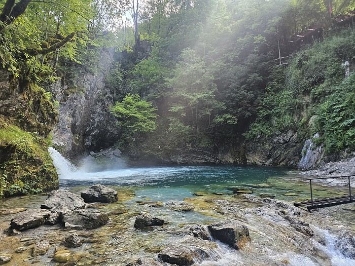
That evening, we dined at "La Montagne Blanche"—excellent! A delightful mix of grilled meats with potatoes and grilled peppers. Some watermelon slices (which I’m not a fan of) and the famous Raki, a brandy served in Turkey and the Balkans! It was my first time drinking brandy "bottoms up." 😉
To be continued... 😉
Day 1: Flight from Paris-Beauvais to Tirana with Wizz Air.
Since Albania isn’t part of Europe when it comes to phone service (at least not yet! :-)), we had to buy a physical SIM card—otherwise, the bill would’ve been sky-high if we’d used our French plan! We got one from Vodafone AL at the airport. You can buy online before leaving with a virtual SIM (e-SIM) for compatible phones, so you don’t have to swap cards. But given the uncertainty about choosing a plan online, we preferred buying one directly at Tirana Airport. Cost: 31 € for 100 GB. That’s way too much—100 GB is overkill. For 40 GB, it’s 27 €, and the plan lasts 21 days. The price difference isn’t huge, and it was cheaper than online. This plan covers all the countries along the Balkan range.
Money tip: All guesthouses and accommodations accept euros. The local currency in Albania is the LEK. In Montenegro, it’s the euro. Bank fees for withdrawing money from an ATM in Albania are pretty steep: 8 € for a withdrawal of 600–700 LEK (about 200 €)! So it’s better to withdraw cash (euros) in France. Oh, and we booked all our accommodations before leaving, but payment is always in cash. Budget around 400–500 € for 9 days of trekking.Then, a transfer the same day to Shköder, about a 2-hour bus ride. Cost: 10 € per person. Tickets bought directly on the bus. We spent the night in Shköder at a very clean guesthouse, Open Doors B&B. It had a small balcony overlooking the city.
I really liked Shköder, especially its pedestrian street lined with restaurants and lit up at night. It’s a great place to stroll and eat. The food isn’t expensive—two big salads and two beers: 14 € :-) . Fruit prices are also very reasonable: 3 € for a kilo of cherries, compared to 9–10 € in France.
Religions coexist peacefully in these countries—Catholics and Muslims. From our balcony, my friend heard the call to prayer for the first time, coming from one of the city’s mosques.
Day 2: Bus ride to Theth, about 1,100 meters in elevation gain, the starting point for our hike the next day.
The trip took 2 hours and 40 minutes with a break in the middle. The bus was affordable, but taxis also make the trip—though they’re very expensive.
We slept in the heights of Theth at a new guesthouse, "Mountain Vista Shkafi," with an amazing view.
The family was adorable. The husband is a handyman and built almost everything himself. Their baby is named "Sky"—such a cute name, right? :-) Throughout the trek, I found the guesthouses very clean, and the hosts think of everything—no need to bring soap or shampoo; they provide it. Lunch in Theth at a traditional restaurant on the main road. We tried "Tave Dheu," an Albanian dish with beef, cabbage (very common), and cottage cheese. Delicious but not quite filling enough. For dessert, a honey cake that was perfectly moist—such a treat! Desserts like this are rare; sometimes they serve watermelon instead. We took a small private bus for 5 € to the "Blue Eye" parking lot, then walked for about 45 minutes to reach a stunning natural site—a kind of lagoon with incredibly blue water. The bravest can swim, but the water’s freezing!
That evening, we dined at "La Montagne Blanche"—excellent! A delightful mix of grilled meats with potatoes and grilled peppers. Some watermelon slices (which I’m not a fan of) and the famous Raki, a brandy served in Turkey and the Balkans! It was my first time drinking brandy "bottoms up." 😉
To be continued... 😉
The Cathar Castles Road
I’ve had the chance to visit friends in the Aude region—Cathar country—several times and explore this area between Leucate and Carcassonne, including the famous Corbières Road 20 and the Cathar Castles Road.
Check out my article for a list of the castles and abbeys to visit along this route. Read the full post soon, and I look forward to hearing from you! Post
Check out my article for a list of the castles and abbeys to visit along this route. Read the full post soon, and I look forward to hearing from you! Post
Visit ideas around Ajaccio and Porto-Vecchio
Hi everyone,
I’m heading to Corsica for 12 days:
- One week in Ajaccio
- One week in Porto-Vecchio
I’m renting a car at Ajaccio airport.
Any special visit ideas?
Thanks
Back to Swedish Lapland: Trekking the Kungsleden and Crossing Sarek
Summer 2022 left me with a sense of unfinished business, so here I am back in Swedish Lapland for summer 2024, ready to attempt the Sarek crossing again—and this time, tackle part of the Kungsleden too.
After much hesitation, my partner Jean Marie and I decided to start with the Kungsleden, which is, from what we’ve read, stunning but very busy (and it really is!!), and finish with the wilder option: SAREK! This park is known as Europe’s last true wilderness—sounds like a dream, right?! The downside of this plan is that there’s no way to resupply in Sarek, and the Kungsleden isn’t exactly set up for long-distance trekking either, so we’ll have to carry a lot of food for the first part of the trip with Sarek in mind. Oh well, we’re motivated!
Our plan is to start in Abisko (the classic route), head to Vakkotavare (also classic, but with some variations to avoid the official trail and the crowds), then continue the Kungsleden from Saltoluokta. Before reaching Aktse, we’ll set off on an east-to-west crossing of Sarek (weather-dependent, since aside from the Skarja hut in the center of the park, there’s no shelter if conditions turn bad). At least we’ll be on the right side of the park to climb Skierfe and enjoy the jaw-dropping view of Rappaladen if we have to bail on Sarek.
All in all, that’s 17 days of trekking, including 1 rest day and 1 buffer day for weather delays.
So if you’re interested, I invite you to follow our fully packed backpacks!
08/03 - Abisko – 5km before Abiskojaure Some info (guides we used for prep, SFT map, sending food to Saltoluokta) 08/04 – 5km before Abiskojaure - on the east shore of Lake Alisjavri 08/05 – East shore of Lake Alisjavri – just before Tjaktja 08/06 – Just before Tjaktja – above the Salka hut via Nallo 08/07 - Salka – just past Singi + side trip to Djalson Lake 08/08 - Singi – Teusajaure 08/09 - Teusajaure - Vakkotavare (end of the first section of the Kungsleden) 08/10 – rest day in Saltoluokta + round trip to the Sámi village of Pietjaure 08/11 – Saltoluokta – Sitojaure 08/12 - Sitojaure - Skierfe - Sarek or no Sarek? 08/13 – Skierfe – somewhere above Rapadalen 08/14 – Somewhere above Rapadalen – above the Skarki hut 08/15 – Above the Skarki hut - Skarja 08/16 – Camping at Skarja 08/17 – Ruohtesvagge 08/18 – Ruohtesvagge - Padjelantaleden 08/19 – Padjelantaleden - Ritsem – End of the trek 08/20–24 - End of the trip (Lullea - Stockholm) And of course, the recap
After much hesitation, my partner Jean Marie and I decided to start with the Kungsleden, which is, from what we’ve read, stunning but very busy (and it really is!!), and finish with the wilder option: SAREK! This park is known as Europe’s last true wilderness—sounds like a dream, right?! The downside of this plan is that there’s no way to resupply in Sarek, and the Kungsleden isn’t exactly set up for long-distance trekking either, so we’ll have to carry a lot of food for the first part of the trip with Sarek in mind. Oh well, we’re motivated!
Our plan is to start in Abisko (the classic route), head to Vakkotavare (also classic, but with some variations to avoid the official trail and the crowds), then continue the Kungsleden from Saltoluokta. Before reaching Aktse, we’ll set off on an east-to-west crossing of Sarek (weather-dependent, since aside from the Skarja hut in the center of the park, there’s no shelter if conditions turn bad). At least we’ll be on the right side of the park to climb Skierfe and enjoy the jaw-dropping view of Rappaladen if we have to bail on Sarek.
All in all, that’s 17 days of trekking, including 1 rest day and 1 buffer day for weather delays.
So if you’re interested, I invite you to follow our fully packed backpacks!
08/03 - Abisko – 5km before Abiskojaure Some info (guides we used for prep, SFT map, sending food to Saltoluokta) 08/04 – 5km before Abiskojaure - on the east shore of Lake Alisjavri 08/05 – East shore of Lake Alisjavri – just before Tjaktja 08/06 – Just before Tjaktja – above the Salka hut via Nallo 08/07 - Salka – just past Singi + side trip to Djalson Lake 08/08 - Singi – Teusajaure 08/09 - Teusajaure - Vakkotavare (end of the first section of the Kungsleden) 08/10 – rest day in Saltoluokta + round trip to the Sámi village of Pietjaure 08/11 – Saltoluokta – Sitojaure 08/12 - Sitojaure - Skierfe - Sarek or no Sarek? 08/13 – Skierfe – somewhere above Rapadalen 08/14 – Somewhere above Rapadalen – above the Skarki hut 08/15 – Above the Skarki hut - Skarja 08/16 – Camping at Skarja 08/17 – Ruohtesvagge 08/18 – Ruohtesvagge - Padjelantaleden 08/19 – Padjelantaleden - Ritsem – End of the trek 08/20–24 - End of the trip (Lullea - Stockholm) And of course, the recap
June 2026 Theme Thread: Such a Beautiful Landscape
This is where we chat.
Love at First Sight in Kenya
Hello,
After several years, I’ve finally decided to repost a travel journal on the forum. We returned a few weeks ago from an incredible trip to Kenya, and it’s reignited my desire to share our emotions in the face of these animals.
Kenya wasn’t originally a priority for us in terms of safari—we had the impression it was too touristy. So, we started with other destinations: Namibia, Tanzania, Botswana, and South Africa. But as I did more research, especially on the forum (thanks in part to Sylvie’s many trips), I eventually convinced myself that Kenya could be magnificent, as long as we chose our itinerary carefully and avoided peak seasons.
We ended up going in January, from the 17th to the 31st. We worked with a travel agency (TP) that crafted a custom itinerary for us: Samburu-Ol Pejeta-Naivasha-Maji Moto-Maasai Mara-Diani. They partnered with a local French-speaking agency, and everything was perfectly organized. Our trip exceeded all our expectations, and none of it would’ve been as amazing without our guide, Alfred. He accompanied us for 10 days and was a fantastic travel companion—professional, respectful of the animals, and always in good spirits. We formed a great bond with him in such a short time.
- **January 17th** After meeting up with Juliette and Charlotte in Rennes the night before, we left at 4 AM for Roissy Charles de Gaulle Airport. The thick fog made the drive pretty rough, but we arrived safely around 7:45 AM. A Blue Valet driver was waiting to take our car. Check-in went smoothly, and we waited patiently for our 10:40 AM flight. Unfortunately, despite boarding on time, a passenger was missing, and we had to find a replacement last minute. Then, another passenger who had checked in and dropped off their luggage wasn’t on the plane, so they had to unload their bags. After a long period of uncertainty and spotty communication from the crew, we finally took off over an hour late.
We arrived in Nairobi in the late afternoon, 45 minutes behind schedule. The administrative formalities were endless—it took nearly 1.5 hours from landing to leaving the airport with our luggage. When we stepped out, Alfred, our guide, was waiting with a big smile and drove us to the Eka Hotel, not far from the airport. Exhausted from the long journey, we fell asleep quickly.
- **January 18th** Alfred met us at 7 AM for a long drive to Samburu Reserve. We had a peaceful night, unlike the girls, who barely slept because their neighbors were talking loudly all night. Things even escalated when Charlotte started shouting insults to get them to quiet down, but it didn’t work.
It was Sunday, so traffic around Nairobi and along the route was light. Aside from a quick "technical stop," we drove straight through and arrived in Samburu after just under 6 hours. Because of the lower altitude (around 1,000m on average), it was hot—over 30°C in mid-January.
As soon as we entered the reserve, we spotted some impalas and quickly came across one of the region’s endemic species: the reticulated giraffe, which is absolutely stunning.
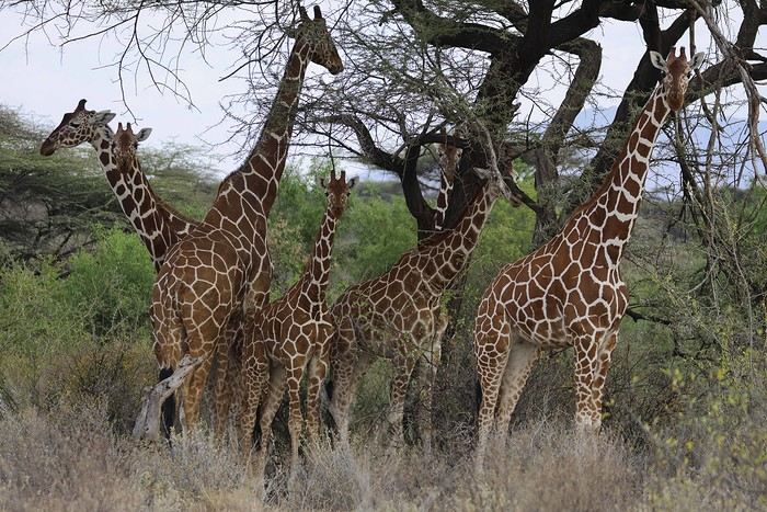
While heading to our camp for lunch, Alfred crossed paths with another vehicle and learned that a leopard was nearby. We started searching, and a few minutes later, Anny spotted a shape in a tree—it was our leopard!
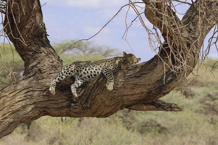
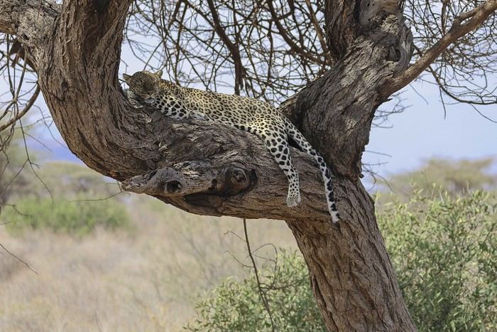
There were actually two of them—a mother and her adolescent. The young one was perched high in the tree, in the shade. We got to observe them for a good half-hour in excellent conditions, with just one other vehicle nearby.
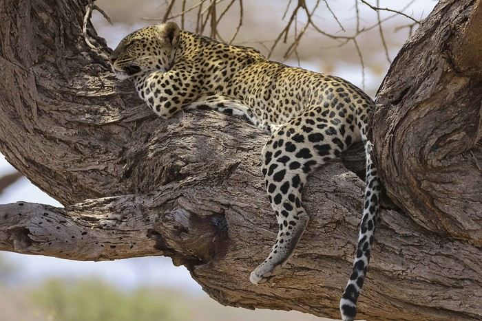
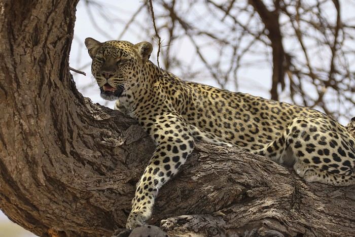
Alfred also noticed that the mother had hidden prey (a gerenuk gazelle) in the vegetation, away from prying eyes.
It was time to head to our camp, the Ashnil Samburu Camp, located in the Buffalo Springs area, by the river, in an idyllic setting surrounded by the region’s typical vegetation.
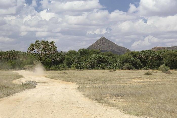
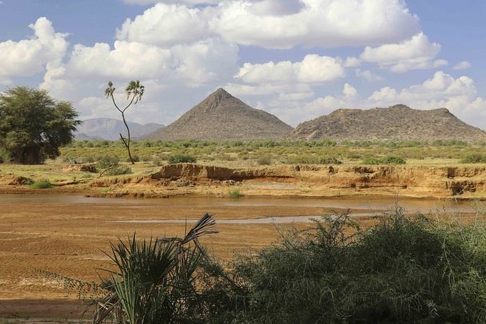
The welcome was fantastic—we immediately felt at home, and that feeling lasted throughout our 3-day stay in the reserve. It was 2 PM, but no one rushed us to the table. Our waitress, Sheila, who took care of us the whole time, was as lovely as the rest of the team. Barely seated, we were invited to watch an elephant passing right by the camp, in front of the restaurant. This trip was off to a great start!
After lunch, we relaxed by the pool. Monkeys, especially vervets, were everywhere, and a camp employee was assigned to keep an eye on them and shoo them away if needed (especially the baboons).
A little before 4 PM, we met up with Alfred for our first game drive. Just outside the camp, a few elephants were in the valley near the river.
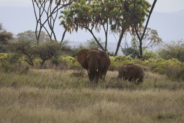
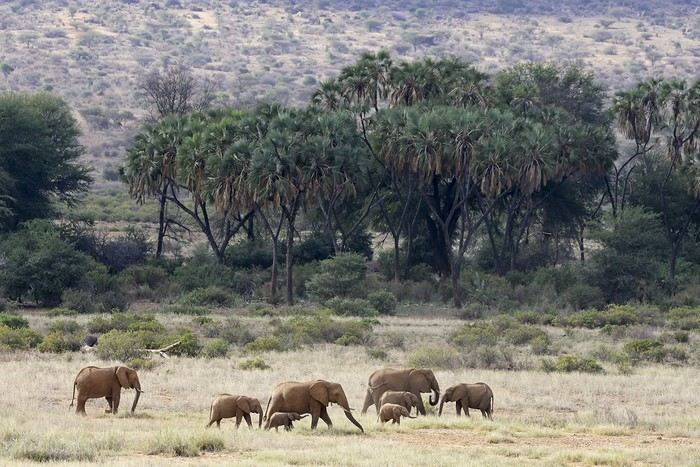
We’d see them in the same area almost every day. We also spotted some gazelles.
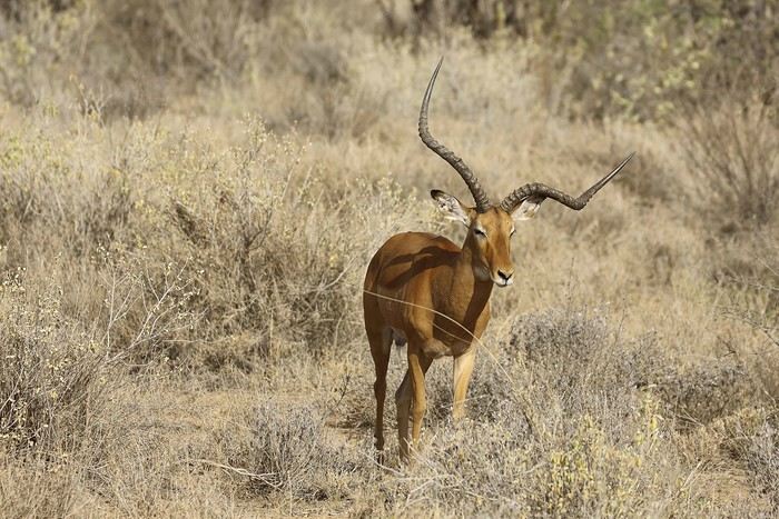
After several years, I’ve finally decided to repost a travel journal on the forum. We returned a few weeks ago from an incredible trip to Kenya, and it’s reignited my desire to share our emotions in the face of these animals.
Kenya wasn’t originally a priority for us in terms of safari—we had the impression it was too touristy. So, we started with other destinations: Namibia, Tanzania, Botswana, and South Africa. But as I did more research, especially on the forum (thanks in part to Sylvie’s many trips), I eventually convinced myself that Kenya could be magnificent, as long as we chose our itinerary carefully and avoided peak seasons.
We ended up going in January, from the 17th to the 31st. We worked with a travel agency (TP) that crafted a custom itinerary for us: Samburu-Ol Pejeta-Naivasha-Maji Moto-Maasai Mara-Diani. They partnered with a local French-speaking agency, and everything was perfectly organized. Our trip exceeded all our expectations, and none of it would’ve been as amazing without our guide, Alfred. He accompanied us for 10 days and was a fantastic travel companion—professional, respectful of the animals, and always in good spirits. We formed a great bond with him in such a short time.
- **January 17th** After meeting up with Juliette and Charlotte in Rennes the night before, we left at 4 AM for Roissy Charles de Gaulle Airport. The thick fog made the drive pretty rough, but we arrived safely around 7:45 AM. A Blue Valet driver was waiting to take our car. Check-in went smoothly, and we waited patiently for our 10:40 AM flight. Unfortunately, despite boarding on time, a passenger was missing, and we had to find a replacement last minute. Then, another passenger who had checked in and dropped off their luggage wasn’t on the plane, so they had to unload their bags. After a long period of uncertainty and spotty communication from the crew, we finally took off over an hour late.
We arrived in Nairobi in the late afternoon, 45 minutes behind schedule. The administrative formalities were endless—it took nearly 1.5 hours from landing to leaving the airport with our luggage. When we stepped out, Alfred, our guide, was waiting with a big smile and drove us to the Eka Hotel, not far from the airport. Exhausted from the long journey, we fell asleep quickly.
- **January 18th** Alfred met us at 7 AM for a long drive to Samburu Reserve. We had a peaceful night, unlike the girls, who barely slept because their neighbors were talking loudly all night. Things even escalated when Charlotte started shouting insults to get them to quiet down, but it didn’t work.
It was Sunday, so traffic around Nairobi and along the route was light. Aside from a quick "technical stop," we drove straight through and arrived in Samburu after just under 6 hours. Because of the lower altitude (around 1,000m on average), it was hot—over 30°C in mid-January.
As soon as we entered the reserve, we spotted some impalas and quickly came across one of the region’s endemic species: the reticulated giraffe, which is absolutely stunning.
While heading to our camp for lunch, Alfred crossed paths with another vehicle and learned that a leopard was nearby. We started searching, and a few minutes later, Anny spotted a shape in a tree—it was our leopard!
There were actually two of them—a mother and her adolescent. The young one was perched high in the tree, in the shade. We got to observe them for a good half-hour in excellent conditions, with just one other vehicle nearby.
Alfred also noticed that the mother had hidden prey (a gerenuk gazelle) in the vegetation, away from prying eyes.
It was time to head to our camp, the Ashnil Samburu Camp, located in the Buffalo Springs area, by the river, in an idyllic setting surrounded by the region’s typical vegetation.
The welcome was fantastic—we immediately felt at home, and that feeling lasted throughout our 3-day stay in the reserve. It was 2 PM, but no one rushed us to the table. Our waitress, Sheila, who took care of us the whole time, was as lovely as the rest of the team. Barely seated, we were invited to watch an elephant passing right by the camp, in front of the restaurant. This trip was off to a great start!
After lunch, we relaxed by the pool. Monkeys, especially vervets, were everywhere, and a camp employee was assigned to keep an eye on them and shoo them away if needed (especially the baboons).
A little before 4 PM, we met up with Alfred for our first game drive. Just outside the camp, a few elephants were in the valley near the river.
We’d see them in the same area almost every day. We also spotted some gazelles.
What circuit to do from Monastir?
Hi there,
I’m leaving for Tunisia in five weeks for a full 15-day trip. I’ll be arriving in Monastir and departing from there as well.
I’d like to do a route that’s a bit different from my first stay, which was more focused on cities and culture (Tunis, Sousse, Kairouan, El Jem).
I’ll be getting around by public transport.
I’d like to head south toward Tozeur, and I saw that you can take a *louage* from Monastir to Sbeitla (2h30). I imagine it’s not too complicated to get to Tozeur from there afterward? The issue is the return trip to Monastir and safety in Sbeitla.
If this route seems too complicated, I might opt for Djerba instead, which looks simpler.
Thanks in advance.
I’m leaving for Tunisia in five weeks for a full 15-day trip. I’ll be arriving in Monastir and departing from there as well.
I’d like to do a route that’s a bit different from my first stay, which was more focused on cities and culture (Tunis, Sousse, Kairouan, El Jem).
I’ll be getting around by public transport.
I’d like to head south toward Tozeur, and I saw that you can take a *louage* from Monastir to Sbeitla (2h30). I imagine it’s not too complicated to get to Tozeur from there afterward? The issue is the return trip to Monastir and safety in Sbeitla.
If this route seems too complicated, I might opt for Djerba instead, which looks simpler.
Thanks in advance.
From the Awakening to Travel to Morocco in the 90s
As I’ve mentioned elsewhere, I inherited my love of travel from my parents and some of my grandparents. A strong passion, but one that was unfortunately limited by our family’s modest resources. Back then, living in northern Alsace, a simple trip to the southern part of the region—with the Wine Route as our destination—felt like an extraordinary journey to a land of plenty for the little boy I was in the late 60s and early 70s.
Everything seemed so huge when you were still just a kid.
Back then, I was overwhelmed by countless sensations—I was already highly sensitive, with a keen mind and a nose and taste buds that were developing like a pro’s. Which, as I’d later realize, wasn’t always an advantage.
Those magical days always began with a gentle late-spring or midsummer morning. The interior of the white Peugeot 404, license plate 210 LZ 67, had already soaked up the sun before the engine purred to life, and the cabin gave off a scent I could still recognize today—a fragrance I found so pleasant. Back then, I had no idea it was just the smell of warm plastic from the car’s interior. Yes, the scents of the 404 on sunny days became my madeleine de Proust... What’s more, the whole family was unusually cheerful because those moments of relaxation and leisure were rare. Everyone worked, and no one had an easy job or was well paid. Without the *Trente Glorieuses*, these experiences might never have happened.
Once we crossed the canton’s borders, I felt like I was light-years away from my everyday surroundings, and every kilometer plunged me deeper into *terra incognita*. It was thrilling. Far from my so-called "medium-sized" town, wheat fields, cornfields, and cabbage patches stretched out, punctuated by tall poles connected by long wires and topped with vegetation—like giant clotheslines without laundry, where magical beanstalks might grow to touch the sky. Back then, I was still far from tasting their product, which was simply beer. At the time, there was still a significant local hop production. Fun fact: it wasn’t until 2002 that Anglo-Saxon scientists proved hops and cannabis belong to the same biological family.
After the fields, the landscape took another step up as it rolled past the little boy’s eyes, often glued to the windows. First came modest hills, then a succession of rolling slopes that soon formed an unbroken chain. Their 700 meters in altitude felt like Himalayan peaks to me—impressive, inert giants, a whole new world. Gazing at them, an intense emotion welled up somewhere between my stomach and lungs, nearly taking my breath away. What mysteries, what treasures did these heights hold? And then there were the cherries on top—the crowning touch that made the scene even more magical: proud, majestic castles perched on the summits like impassive sentinels. Monuments from the past, yet firmly rooted in the present on their rocky spurs. The little boy’s eyes sparkled—he’d been given a castle for Christmas, complete with battlements, towers, a drawbridge, and fully armed knights. He’d watched and lived *Ivanhoe* on the only French TV channel that existed back then.
Only once did my paternal grandfather join us on one of these trips. A tall, intelligent man with a face that could shift from stern to mischievous, clearly full of humor and charisma. Sadly, his relationship with alcohol had taken a toll on his life and, by extension, those of his loved ones. He had a strong personality—if his boss crossed the line, he wouldn’t hesitate to punch him, which meant he went through a lot of different jobs. Back then, you could quit one job and easily find another. It was quite something to see him in his final stages, hallucinating pink elephants and even drinking perfume when he had nothing else left. The last time I saw him, he’d slipped away from the doctors and nurses while hospitalized in pretty bad shape—at least, I assume his liver was the issue. We were sitting down for a family lunch when the door burst open, and there he stood in his pajamas, eyes twinkling with mischief, clearly pleased with the dramatic entrance. That theatrical moment didn’t spare us from burying him a few months later at the age of 71. One day, my mother told me the family doctor had quietly remarked that it was a shame—with his robust constitution, he could’ve lived to be a hundred. Yes, the family doctor—this was the man who’d come treat you any day, at almost any hour, just for a phone call. It really existed, it’s not a myth!
That day, his wife—my paternal grandmother—was also along for the ride. Everyone agreed that Jeannette was a good woman. She worked as a waitress at *Le Tigre*, the biggest brasserie in town, right in the center. Most customers preferred to be served by her, including local dignitaries and even the mayor. As a kid, I didn’t find her very fun, open, or warm—she seemed a bit stern. Back then, women in their fifties already had the face and build of grandmothers. Same went for men, don’t get me wrong. I had no idea about the struggles she faced because of her husband. I didn’t know that 30 years earlier, she’d had to flee Alsace while pregnant, under threat from Nazi fighter-bombers. I didn’t know she’d had several miscarriages, and that my father—her only surviving child, born prematurely in March 1940 at the other end of France—weighed less than a kilo at birth and was so tiny he could fit in a shoebox. Hard to imagine he’d grow into a strapping man nearly 1.80 meters tall, tipping the scales at 100 kilos. When you come back from summer camp in early August and ask why she didn’t pick you up with your parents, and they gently tell you she’s "in heaven," you don’t realize she passed away at 54 after suffering greatly from stomach cancer that had spread.
Back to that family outing, that enchanted parenthesis. I even remembered where we’d had lunch when I passed through Dambach-la-Ville decades later. One of those charming, flower-filled towns Alsace produces in abundance—and preserves so well. This one sits high on a hill, and I was a bit stunned on the parking lot because the view stretched far, revealing the Alsace plain below—its fields, villages, hills, and forests. The world seemed so vast and enticing that day, even though I was only glimpsing a tiny fraction of it.
The region was already very touristy, but I wouldn’t notice the downsides until much later. That Sunday noon, I discovered a large restaurant filled with diners. I can still see the enormous piece of meat they served me, decorated with a little wooden skewer topped with a flag. I kept that one for a long time. Those were the golden days of rich, flowing, thick sauces—so flavorful—and the era of the world’s best fries, made on the spot with the best potatoes. To top it off, I was *exceptionally* allowed a small bottle of apple juice, Orangina, or—even better if possible—Sinalco. Yes, Sinalco—like Orangina, but better. A brand that must’ve disappeared in the 70s, but why, and what a shame! Since then, Orangina’s little bubbles have taken the brand to the other side of the planet—it’s now Japanese.
Year after year, I’d eagerly await that ecstatic moment when the most beautiful castle in Alsace, the Haut-Koenigsbourg, appeared in my field of vision. The perfect model, the archetype that blended into the landscape at the height of a child’s dreams. The trip home always felt like a reality check—less jarring than an alarm clock, but more diffuse and melancholic. From then on, there was only one wish: *When do we leave again?*
Those magical days always began with a gentle late-spring or midsummer morning. The interior of the white Peugeot 404, license plate 210 LZ 67, had already soaked up the sun before the engine purred to life, and the cabin gave off a scent I could still recognize today—a fragrance I found so pleasant. Back then, I had no idea it was just the smell of warm plastic from the car’s interior. Yes, the scents of the 404 on sunny days became my madeleine de Proust... What’s more, the whole family was unusually cheerful because those moments of relaxation and leisure were rare. Everyone worked, and no one had an easy job or was well paid. Without the *Trente Glorieuses*, these experiences might never have happened.
Once we crossed the canton’s borders, I felt like I was light-years away from my everyday surroundings, and every kilometer plunged me deeper into *terra incognita*. It was thrilling. Far from my so-called "medium-sized" town, wheat fields, cornfields, and cabbage patches stretched out, punctuated by tall poles connected by long wires and topped with vegetation—like giant clotheslines without laundry, where magical beanstalks might grow to touch the sky. Back then, I was still far from tasting their product, which was simply beer. At the time, there was still a significant local hop production. Fun fact: it wasn’t until 2002 that Anglo-Saxon scientists proved hops and cannabis belong to the same biological family.
After the fields, the landscape took another step up as it rolled past the little boy’s eyes, often glued to the windows. First came modest hills, then a succession of rolling slopes that soon formed an unbroken chain. Their 700 meters in altitude felt like Himalayan peaks to me—impressive, inert giants, a whole new world. Gazing at them, an intense emotion welled up somewhere between my stomach and lungs, nearly taking my breath away. What mysteries, what treasures did these heights hold? And then there were the cherries on top—the crowning touch that made the scene even more magical: proud, majestic castles perched on the summits like impassive sentinels. Monuments from the past, yet firmly rooted in the present on their rocky spurs. The little boy’s eyes sparkled—he’d been given a castle for Christmas, complete with battlements, towers, a drawbridge, and fully armed knights. He’d watched and lived *Ivanhoe* on the only French TV channel that existed back then.
Only once did my paternal grandfather join us on one of these trips. A tall, intelligent man with a face that could shift from stern to mischievous, clearly full of humor and charisma. Sadly, his relationship with alcohol had taken a toll on his life and, by extension, those of his loved ones. He had a strong personality—if his boss crossed the line, he wouldn’t hesitate to punch him, which meant he went through a lot of different jobs. Back then, you could quit one job and easily find another. It was quite something to see him in his final stages, hallucinating pink elephants and even drinking perfume when he had nothing else left. The last time I saw him, he’d slipped away from the doctors and nurses while hospitalized in pretty bad shape—at least, I assume his liver was the issue. We were sitting down for a family lunch when the door burst open, and there he stood in his pajamas, eyes twinkling with mischief, clearly pleased with the dramatic entrance. That theatrical moment didn’t spare us from burying him a few months later at the age of 71. One day, my mother told me the family doctor had quietly remarked that it was a shame—with his robust constitution, he could’ve lived to be a hundred. Yes, the family doctor—this was the man who’d come treat you any day, at almost any hour, just for a phone call. It really existed, it’s not a myth!
That day, his wife—my paternal grandmother—was also along for the ride. Everyone agreed that Jeannette was a good woman. She worked as a waitress at *Le Tigre*, the biggest brasserie in town, right in the center. Most customers preferred to be served by her, including local dignitaries and even the mayor. As a kid, I didn’t find her very fun, open, or warm—she seemed a bit stern. Back then, women in their fifties already had the face and build of grandmothers. Same went for men, don’t get me wrong. I had no idea about the struggles she faced because of her husband. I didn’t know that 30 years earlier, she’d had to flee Alsace while pregnant, under threat from Nazi fighter-bombers. I didn’t know she’d had several miscarriages, and that my father—her only surviving child, born prematurely in March 1940 at the other end of France—weighed less than a kilo at birth and was so tiny he could fit in a shoebox. Hard to imagine he’d grow into a strapping man nearly 1.80 meters tall, tipping the scales at 100 kilos. When you come back from summer camp in early August and ask why she didn’t pick you up with your parents, and they gently tell you she’s "in heaven," you don’t realize she passed away at 54 after suffering greatly from stomach cancer that had spread.
Back to that family outing, that enchanted parenthesis. I even remembered where we’d had lunch when I passed through Dambach-la-Ville decades later. One of those charming, flower-filled towns Alsace produces in abundance—and preserves so well. This one sits high on a hill, and I was a bit stunned on the parking lot because the view stretched far, revealing the Alsace plain below—its fields, villages, hills, and forests. The world seemed so vast and enticing that day, even though I was only glimpsing a tiny fraction of it.
The region was already very touristy, but I wouldn’t notice the downsides until much later. That Sunday noon, I discovered a large restaurant filled with diners. I can still see the enormous piece of meat they served me, decorated with a little wooden skewer topped with a flag. I kept that one for a long time. Those were the golden days of rich, flowing, thick sauces—so flavorful—and the era of the world’s best fries, made on the spot with the best potatoes. To top it off, I was *exceptionally* allowed a small bottle of apple juice, Orangina, or—even better if possible—Sinalco. Yes, Sinalco—like Orangina, but better. A brand that must’ve disappeared in the 70s, but why, and what a shame! Since then, Orangina’s little bubbles have taken the brand to the other side of the planet—it’s now Japanese.
Year after year, I’d eagerly await that ecstatic moment when the most beautiful castle in Alsace, the Haut-Koenigsbourg, appeared in my field of vision. The perfect model, the archetype that blended into the landscape at the height of a child’s dreams. The trip home always felt like a reality check—less jarring than an alarm clock, but more diffuse and melancholic. From then on, there was only one wish: *When do we leave again?*
Uttarakhand Trip Report
Hi everyone,
I’d like to share some photos from my trip to Uttarakhand in June 2025.
It’s a destination that isn’t too crowded, which I chose at the last minute last year due to the skirmishes between India and Pakistan. I had planned to go to Ladakh and Zanskar, but as a precaution, I changed my plans...
Here’s a quick rundown of my itinerary: Delhi - Rishikesh - Uttarkashi - Gangotri - Haridwar - Devprayag - Ranikhet - Delhi.
Throughout my trip, I only came across a few Western tourists, and only in Rishikesh...
I was really surprised in Rishikesh, where I saw unbelievable traffic jams just to get in and out of the city! It was my first real glimpse of domestic tourism in India—when all the city-dwellers escape the summer heat for the cooler mountains...
The crowds of pilgrims in Haridwar, coming to purify themselves in the Ganges on the ghats, were just as intense as what you see in Varanasi. Fascinating and... colorful!
The small town of Devprayag is interesting because it’s located at the confluence of the Bhagirathi and Alaknanda rivers, which form the Ganges. The spot is popular with pilgrims who come to purify themselves there.
I made sure to visit the remote village of Gangotri, located on the Bhagirathi River. Just a few kilometers away, the river’s source flows from the glacier at Gaumukh (only accessible on foot after an 18 km trek). It’s an important pilgrimage site in India, as one of the sources of the Ganges.
All in all, Uttarakhand was a wonderful discovery and gave me a chance to see new sides of India.
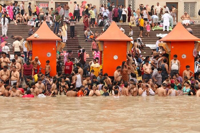
Chatting by the water
For those who want to chat quietly by the riverbanks, this is the place!
Veneto: Dolomites and Opera
I'm starting a new travel journal in Italy.
It's about a month-long trip (from September 3, 2025, to October 4, 2025), or rather a part of it. This section matches the title: an opera festival in Verona (one evening) and the Dolomites in the Veneto region.
I'm posting the part of the trip I think will interest French-speaking readers the most (since this is where I saw the most French travelers).
Here’s a quick summary:
- Trip in September 2025
- Solo travel with camping (caravan)
- Small geographic area: besides Verona, the surroundings of the Marmolada massif and Cortina d'Ampezzo.
- Main but not exclusive activity: hiking.
Since I have limited internet access where I am now, I’ll be writing slowly. Here we go!
Day 1: Thursday, September 4, 2025
I arrived in Veneto under the sun and with warm weather. I drove to Verona and tried to find a spot at the campsite (Verona Village) located south of the city. Unfortunately, it was full. Booking on the website was mandatory, but when I tried to reserve a few days ago, the site never moved from the "reservation" step to the "payment" step (I don’t know why—it’s always like that in these cases). I found another solution over the phone; the drive from southern Verona to the northeast was a bit long, but I finally settled at the "Oro Verde" campsite. It’s an "agricampeggio" (farm camping or rural campsite) on the outskirts of the city, and its name (green gold) suggests they produce olives there. Since it wasn’t late, I biked to the Adige River, following the recommended route into the city.
Since I have limited internet access where I am now, I’ll be writing slowly. Here we go!
Day 1: Thursday, September 4, 2025
I arrived in Veneto under the sun and with warm weather. I drove to Verona and tried to find a spot at the campsite (Verona Village) located south of the city. Unfortunately, it was full. Booking on the website was mandatory, but when I tried to reserve a few days ago, the site never moved from the "reservation" step to the "payment" step (I don’t know why—it’s always like that in these cases). I found another solution over the phone; the drive from southern Verona to the northeast was a bit long, but I finally settled at the "Oro Verde" campsite. It’s an "agricampeggio" (farm camping or rural campsite) on the outskirts of the city, and its name (green gold) suggests they produce olives there. Since it wasn’t late, I biked to the Adige River, following the recommended route into the city.
7 weeks and 150 years between us on a southern Morocco road trip
We arrive in the evening in Marrakesh, and a taxi arranged by our friendly Riad is waiting for us. The driver takes us to the door, where we’re briefly greeted by our hosts. The room is heated—phew—because it’s really cold on this January 17th for our arrival. Riad Alisma, where we’re staying for 2 nights. The next morning, it’s pouring rain when we wake up, but after a good breakfast, the rain has calmed down. Off we go to the medersa, which allows for a relatively sheltered visit. We’d visited this palace 15 years ago—it’s been renovated since then.
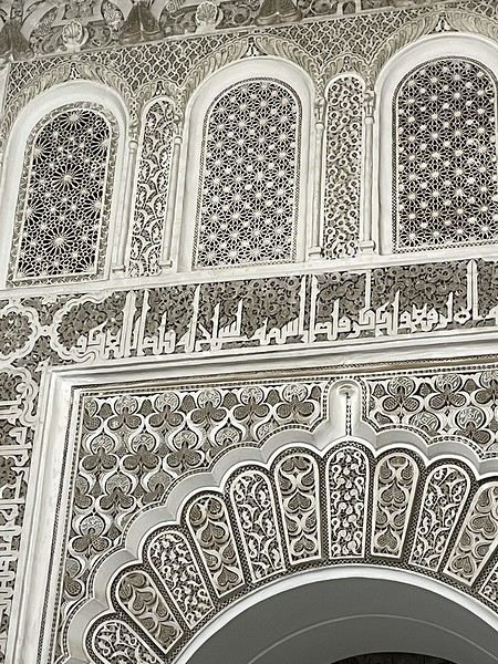
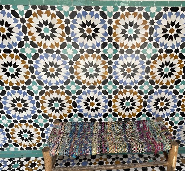
From there, without the rain, we wander aimlessly and eventually end up near the tanneries, but it’s Sunday, and there’s very little activity. Of course, we get hassled by a tout.
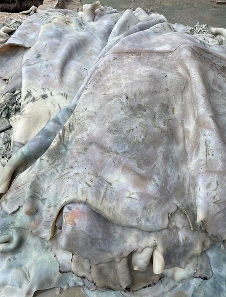
Here, the hides after being treated with lime—I love the colors.
We part ways a bit annoyed. He gets a little revenge by giving us bad directions, and we end up outside the city walls. We decide to take a taxi to the new modern art museum—60 dirhams for the 5 km, which is nothing when you think about it. That tout, who we didn’t ask for anything and made it clear we weren’t buying anything, dragged us into a shop supposedly only open that day and demanded 50 dirhams for his "services"! Let’s forget that bad moment and enjoy the exhibition at the MACAL.
The taxi on the way back drops us off at Place des Ferblantiers, not far from our Riad. We’re a little peckish—it’s worth mentioning that at lunchtime, we only ate a plate of beans from a street vendor. So, we buy a bunch of little sweets, each more delicious than the last, at Ajar. We snack while sipping mint tea and watching life go by around us. A final visit to the Museum of Moroccan Cuisine on our way back helps us dodge a few more showers. Then it’s back to the Riad. The atmosphere in the city is heating up—it’s the AFCON final tonight. The temperatures, though? Not so much. We ordered a meal at the Riad, and it was a good call—not only was it really tasty, but the rain also picked up again. Our day in Marrakesh ends under the covers with a good book and some photo sorting. Still, we managed 10,750 steps. View of our Riad
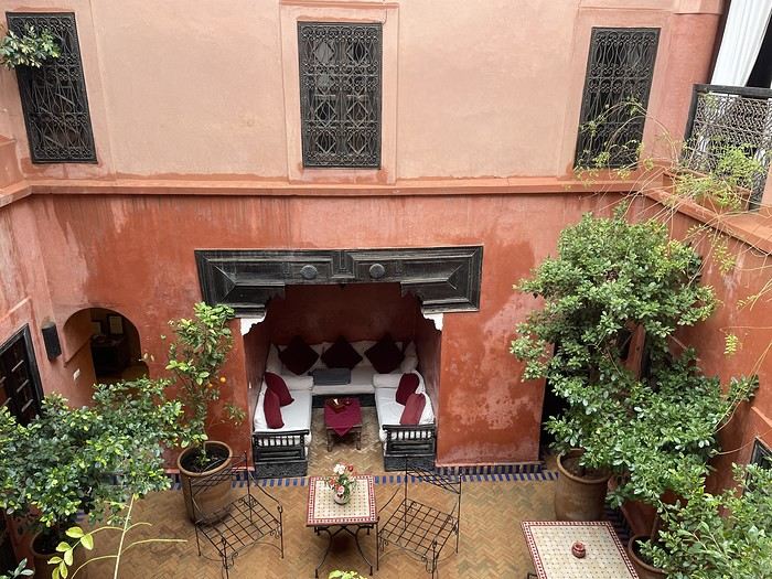
Tomorrow, we’ll pick up our rental car from Medloc and head to Essaouira.
From there, without the rain, we wander aimlessly and eventually end up near the tanneries, but it’s Sunday, and there’s very little activity. Of course, we get hassled by a tout.
Here, the hides after being treated with lime—I love the colors.
We part ways a bit annoyed. He gets a little revenge by giving us bad directions, and we end up outside the city walls. We decide to take a taxi to the new modern art museum—60 dirhams for the 5 km, which is nothing when you think about it. That tout, who we didn’t ask for anything and made it clear we weren’t buying anything, dragged us into a shop supposedly only open that day and demanded 50 dirhams for his "services"! Let’s forget that bad moment and enjoy the exhibition at the MACAL.
The taxi on the way back drops us off at Place des Ferblantiers, not far from our Riad. We’re a little peckish—it’s worth mentioning that at lunchtime, we only ate a plate of beans from a street vendor. So, we buy a bunch of little sweets, each more delicious than the last, at Ajar. We snack while sipping mint tea and watching life go by around us. A final visit to the Museum of Moroccan Cuisine on our way back helps us dodge a few more showers. Then it’s back to the Riad. The atmosphere in the city is heating up—it’s the AFCON final tonight. The temperatures, though? Not so much. We ordered a meal at the Riad, and it was a good call—not only was it really tasty, but the rain also picked up again. Our day in Marrakesh ends under the covers with a good book and some photo sorting. Still, we managed 10,750 steps. View of our Riad
Tomorrow, we’ll pick up our rental car from Medloc and head to Essaouira.
Trip to Morocco in September-October 2025, in our camper van
Hi everyone,
We’re just back from a month-long trip to Morocco in our camper van.
After crossing France (we left from the Nantes area) and Spain, we arrived in Algeciras where we bought our boat tickets to Tangier. When we got to Tangier, as we were going through customs, you can imagine our surprise when the customs officer took our road map of Morocco and pointed out the label "Western Sahara" (just like in the forum’s destination section, by the way!).
He wanted it to say "Moroccan Sahara" instead!!! But there was nothing we could do—it was an old map... He wouldn’t listen, and after long discussions with the other (younger) customs officers, he finally gave it back and let us through... Unbelievable! Later, we heard that other travelers had their maps confiscated outright.
So, hide it well if you want to keep yours!!!
Anyway, we skirted around Tangier’s suburbs—pretty grim—and finally arrived in Asilah.
Following the coast and the long promenade along the beach, we reached the campsite. It was a bit crowded, not much shade, but it wasn’t far from the medina or the beach, and it wasn’t expensive. There’s some life here: Moroccan families seem to live on-site, in tents or basic bungalows. A woman was cooking tagine on a brazier—we were right in the atmosphere! The night was quiet, and we slept well. We set off on foot, walking along the seafront to the medina... We’d already been here in 2009. It was less touristy back then! Still, at this early hour, the little streets inside were very quiet. The walls had been freshly whitewashed, and there were even more murals than before. Around 11:30 AM, we strolled along the ramparts by the sea. There was a nice breeze! And a lot more people around. We enjoyed a milkshake on the terrace of a café overlooking the beach that stretches out at the foot of the medina. Some young guys were having fun diving off the rocks—and even off the top of the wall!
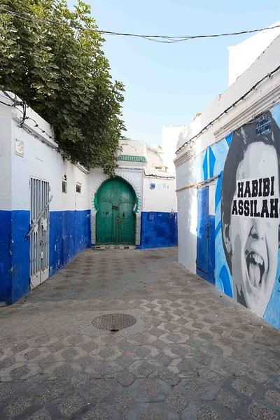
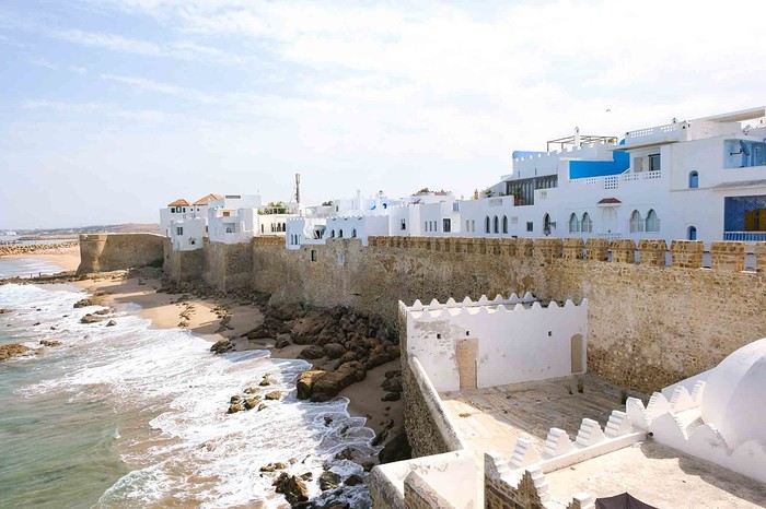
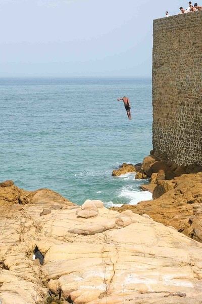
Anyway, we skirted around Tangier’s suburbs—pretty grim—and finally arrived in Asilah.
Following the coast and the long promenade along the beach, we reached the campsite. It was a bit crowded, not much shade, but it wasn’t far from the medina or the beach, and it wasn’t expensive. There’s some life here: Moroccan families seem to live on-site, in tents or basic bungalows. A woman was cooking tagine on a brazier—we were right in the atmosphere! The night was quiet, and we slept well. We set off on foot, walking along the seafront to the medina... We’d already been here in 2009. It was less touristy back then! Still, at this early hour, the little streets inside were very quiet. The walls had been freshly whitewashed, and there were even more murals than before. Around 11:30 AM, we strolled along the ramparts by the sea. There was a nice breeze! And a lot more people around. We enjoyed a milkshake on the terrace of a café overlooking the beach that stretches out at the foot of the medina. Some young guys were having fun diving off the rocks—and even off the top of the wall!
Trip Report: Silk Road Journey in China
Hi everyone,
This trip report covers a journey along the Silk Road in China (see detailed description below) undertaken in October 2025. The goal isn’t to recount the trip but to provide information that might help those who want to take a similar journey. Much of the information is valid for any trip to China.
Who we are: a retired couple, aged 63 and 65 (age gives discounts on entry to various sites and museums in China, which is why I won’t list prices here—I don’t know them, but you can easily find them online). We’re used to traveling independently. We speak English, which is the only foreign language spoken in China, though by very few people. I speak and read a little Chinese, which helped, but you can easily get by without it (without any English at all, I think it would be more difficult).
Period: We arrived just after "Golden Week," when all of China is on vacation, and after the summer, when schools are out, so we encountered very few tourists (99.99% of whom were Chinese). Our experience with booking visits in advance (which we didn’t need to do) isn’t representative for those who want to travel in the summer! The October-November period was perfect for our trip—it wasn’t too hot or too cold (one day of snow on the Tibetan Plateau), though it was only a few degrees on the Tibetan part, with altitudes between 2,000 and 3,000 meters. The trees were beautifully colored.
General remarks: Everyone we dealt with was very kind and perfectly honest. If you order a meal without really understanding what to do and the person modifies your order, trust them—the result is what you need. If a taxi driver signals that they’ll wait for you to finish your visit and pick you up afterward, trust them. It means there aren’t many taxis where you are, and it’ll be more convenient. For prices at street vendors, we always found the right ballpark, and sometimes they even added a little extra to please us. A taxi driver treated us to lunch, and an employee drove us back to the hotel after a visit because there were no taxis. If you struggle to buy a ticket online because there’s no counter, someone will come to help. People even spontaneously ask if everything’s okay and if you need anything.
Everywhere we went was very clean, including restrooms (trains, stations, hotels, museums, tourist sites) and streets. The old stereotypes about this no longer apply.
The trip can be challenging for those who have difficulty walking. The distances to cover on foot in stations, to access sites, and within the sites themselves can sometimes be really long.
We used the Lonely Planet guide in English (published at the end of August 2025) a little for preparation, but mostly relied on the internet.
Before leaving: No visa is needed for French citizens for stays under 30 days. You get a stamp on your passport upon arrival and departure, and the formalities themselves are very quick in both directions (excluding any potential queues). Just a photo and fingerprints upon arrival, and welcome to China’s facial recognition system.
Money: All your payments (see below) will go through your Visa card—there will be hundreds, including many payments of 20 cents to a few euros. So, you need an international option that allows unlimited card transactions. Since cash is rarely needed, the allowed number of ATM withdrawals can be low. We made 3 withdrawals totaling 800 € for a month and could have managed with just 2. The exchange rate charged on our Visa card was 12 € for 100 RMB (yuan).
Install the following apps on your smartphone before leaving (otherwise, you’ll only have access to the Chinese versions, if available): - Alipay, which is used to pay everywhere in China (details below). You need to link it to your credit card, then provide proof of identity by uploading a passport photo and completing a facial recognition session. Alipay gives access to Didi (China’s Uber), public transport (metro/bus), and can also translate phrases. - WeChat (Weixin in Chinese, pronounced *weishin*), which is also used for payments but also replaces WhatsApp. Unfortunately, to activate your account, you need someone who already has WeChat to sponsor you (preferably a Chinese person). We asked someone at our first accommodations to do this—no problem. By sharing your WeChat number with accommodations, they can send you messages that are automatically translated, and you can communicate with people thanks to the translation (translation to French is very poor; it’s much better in English, but unfortunately, WeChat detects your phone’s language). Alipay and WeChat are accepted almost everywhere, but some places only accept WeChat. - Amap, the international version of Baidu Maps, which replaces Google Maps (not at all up-to-date in China). The English names of hotels often have little to do with the Chinese names except for a phonetic resemblance. To find them on Amap, it’s best to copy the Chinese name found on your Trip reservation under "show address in Chinese." - A VPN. We had CyberGhost, which didn’t work, but according to other travelers, NordVPN and Windscribe do. Without a VPN, you can’t access Google services, on WhatsApp you can send and receive text but not photos, and you can’t send or receive emails on Gmail addresses. We managed without a VPN by using Firefox as a browser and Bing as a search engine. - Trip, for booking trains and accommodations, and buying some tickets. It’s the equivalent of Booking for accommodations, but Booking has very few listings in China, while Trip has hundreds in every city. Most hotels and trains are exchangeable and refundable until the day before, with no or minimal fees.
You don’t need contactless (NFC) payment on your phone. Either you scan a barcode and enter the amount to pay, or you display a barcode, and they scan it with a scanner, and the amount is deducted directly.
Upon arrival: - Buy a Chinese SIM card: 100 RMB for 300 GB of data and several hours of talk time (we didn’t use it). Set the Chinese number as a reference on Alipay, WeChat, and Amap. - Find someone to sponsor you on WeChat.
Transportation: - **Plane**: China Eastern, Paris-Canton then Canton-Urumqi on the way out, and Xian-Canton then Canton-Paris on the way back. International flights were smooth, but the schedules for the two domestic flights were changed. It was fine on the way out because we had some leeway, but on the way back, we were notified the morning of that our flight was canceled and replaced with one that didn’t allow for the connection. We called and changed to an earlier flight (I think we were lucky to find available seats). - **Train**: Most long distances were covered by high-speed trains (called D or G in China) at 240 or 300 km/h. Second class is perfect—just as comfortable and clean as our TGVs. The only advantage of first class is the wider seats for larger people, but the downside is that seats are often booked in advance and thus less available. You can book trains long in advance on Trip, but they only go on sale in China 15 days before departure, so that’s when you’ll know if you have a ticket. Initially, we booked first class, but there were no seats available on the day, so we ended up booking everything in second class, which was perfect. There’s no paper ticket—if you’ve bought one, you go to the station, show your passport, and enter. You do the same to access the platform 15 minutes before the train, and that’s it. Our train was canceled twice, but no problem—we went to the ticket counter, got a refund, and were offered a replacement. It didn’t delay us by more than an hour (maybe it would be harder in peak season). For prices, check Trip.com, but it’s significantly cheaper than in France. - **Bus**: We took the bus between Xining and Tongren, Tongren to Xiahe, and Hezuo to Lanzhou—about 3 hours each time for 200 km, 6 € per person, and departures were right on time. - **Taxi**: For trips between the station and hotel, or hotel and visits. If you take a Didi via the Alipay app, you activate your location, enter your destination, and it offers several taxis. You accept, and you get the car’s license plate and its real-time position on the map. When you get in, the driver often asks for the last four digits of your phone number to confirm. Otherwise, you go to the taxi stand outside the station. The price per kilometer is around 20 cents, so for a 30 km trip from the station to the hotel, you’ll pay about 6 €. We never tried to save more by taking local buses, but since the metro in Xian costs 25 cents per trip, it’s probably in the same ballpark. Amap provides public transport routes like Google Maps. - **Driver**: We hired a taxi/driver for the day several times for sightseeing. Prices ranged from 350 to 1,000 RMB (the most expensive was arranged through the Sofitel Xining concierge) for trips ranging from a few hours to a full day, sometimes covering over 300 km (see the detailed trip description).
Accommodations: All booked in advance on Trip, but several were changed during the trip. Off-season, there were no issues. We mostly stayed in upscale places, but in China, that means 50 to 60 € per night in the most central or convenient neighborhood. Note: Almost all hotels have a 5/5 rating on Trip, but it seems the Chinese avoid giving lower ratings to be polite. So, you have to read the comments to realize that in France, we might have given a 2 or 3!
Food: At the table, you’re served hot water or a hot infusion, presumably made with purified water. We never got sick from drinking it, but don’t drink tap water. Purified or mineral water is easy to find.
In restaurants, you can manage by pointing to the dish you want from another diner, on the wall where there are photos, or on the menu with pictures. The food in the region isn’t often spicy, and people usually ask or signal before adding the red spicy sauce, so you should be able to handle it if you don’t like chili at all.
The "fake old quarters" in several cities are great places to find all kinds of restaurants (see detailed trip below).
Like Google Maps, Amap can show you nearby restaurants.
Shopping: For dried fruits, buy them in Turfan—you won’t find the same variety and quality even in Xian. Generally, if you like something, buy it. If you wait, you might not find it outside the region where you are.
In Xian, there’s a "Tea City" where you can find all kinds of tea (from cheap to very expensive).
The trip in more detail: I won’t dwell on the beauty or interest of the sites here since that’s a matter of personal taste. However, I will do so for lesser-known places to give an idea to those who might be interested.
For many sites, there are shuttles (sometimes not included in the ticket price but costing around 1 €) that take you to the interesting spots. We always took them—it saves you from walking past countless shops or along uninteresting paths.
- **Urumqi**: We spent only one night there, arriving in the middle of the afternoon and leaving the next morning. We stayed at the Dana Hotel in the bazaar. Given the size of the city, it’s a good option because I don’t think there are many other interesting places. The bazaar is brand new and not at all "typical" (Turfan’s bazaar is infinitely more interesting), but the dining area is very nice.
- **Turfan**: Stayed at the New Dap Hostel, which was great. The neighborhood is nice, not far from the city, and easy to find food. The museum is closed until 2026 (Amap provides museum hours and closures). We took a day trip (for the two of us) with a driver to the Bezeklik Caves, Flaming Mountains, the abandoned city of Gaochang, the Tuyuk Village Museum, and the Emin Minaret for 500 RMB from 9 AM to 8 PM (arranged by the hostel). The landscape during the excursion was quite fabulous. We also visited the Karez Museum and the abandoned city of Jiaohe on our own the next day. At this time of year, the sun sets around 6 PM, and there’s often haze after 5 PM, so for Jiaohe, for example, which takes about 3 hours to visit, it’s best to be there by 1 or 2 PM at the latest.
The Dahua Market area is perfect for dried fruits (including the famous grapes), and you can eat there among locals in their traditional costumes. Next to it, there are buildings full of shops selling made-in-China items—it kept us busy for a good half-day, if not more.
- **Dunhuang**: Stayed in a guesthouse near the dunes—the city center isn’t far but seems quite artificial. Visited the dunes, with a ticket valid for 3 days. Lots of Chinese tourists—very typical and interesting from an ethnological perspective 😊. We got up early one morning to climb the highest dune, just beyond the one everyone goes to. It’s a bit long and tiring, but the view is worth it. Visited the Mogao Caves, buying the ticket on-site (no chance in season without booking in advance). We met two other French people and got a French-speaking guide (by pretending not to understand English). It was really worth it—a group of 4 instead of 20, and they took their time (2 hours) for the visit. We took a day trip to the Yulin Caves (2.5 hours by road and 160 km one way) with a driver for 350 RMB. We liked it a lot, but if the Mogao Caves are enough for you, it’s not very different.
- **Jiayuguan**: Stayed in a city-center hotel. Visited the Wei and Jin tombs (actually just one)—that’s where we were told the taxi should wait to take us back to the city. We went down into a crypt with lots of decorated bricks from the 3rd century. We really liked it, but it’s not as spectacular as the fort if you’re not a fan. Visited the Jiayuguan Fort and, with the same ticket, climbed a small section of the Great Wall 10 km away. Plan at least 3 good hours for all this—there’s plenty to see.
- **Zhangye**: Stayed at The Silk Road Travelers Hostel, rustic but very nice and organizes excursions. Visited the Danxia (colored mountains)—just as spectacular as the photos. You can easily spend 3 hours there, so plan to finish before sunset to avoid the haze (you can always stay longer for the sunset if the weather’s nice). The next day, visited the Mati Si Temple in the cliff. The 10,000 Buddha Caves are under renovation, but the setting and the main temple are well worth the visit (the paths through the cliff tunnels must be hellish in peak season). You can probably organize these two excursions yourself by asking any taxi driver. Also visited the Giant Buddha Temple in the city center—really worth it.
- **Xining**: Stayed in a city-center hotel. Visited the Tibetan Medicine Museum to see the world’s largest thangka (1 km long), made over 40 years by renowned artists. It’s absolutely magnificent, on par with the virtuosity (but over 1 km) of the thangkas painted by famous artists in Xiahe (see below). Hired a female taxi driver for the day to visit Kumbum Monastery (Ta’er Si in Chinese) and the Danxia area in Guide, 50 km beyond the monastery. It’s less spectacular than Zhangye’s Danxia, but we really liked it (including the journey’s landscape). The next day, visited the old Ming-era Qutan Monastery—no visitors, with beautiful murals (half under renovation). Accessible by train to Haidong or Ledu, then a taxi. Xining’s mosque is of no interest, but there’s a pedestrian street with food stalls nearby that’s very nice.
- **Tongren**: Stayed near the main monastery. Visited Longwu Monastery (several hours), with lots of nice shops along the street leading to it. Then visited Wutun Monastery, which is less lively but beautiful and close to thangka workshops. You can go in and watch the painters at work. For a thangka made by a renowned artist, count about a year of work for 1 m² and around 10,000 €.
- **Xiahe**: Stayed in a city-center hotel. Visited Labrang Monastery—very nice but not as much as Tongren’s because many halls were closed. I think it’s better to go in season and take an English-guided tour (but it’s still worth the trip, even off-season).
- **Langmusi**: Took a taxi, but you can also take a bus (though very early in the morning and longer). Particularly beautiful for us because we woke up to bright sunshine and 5 cm of snow everywhere. Visited the two temples (really nice) and did the classic hike in the gorges starting at the Fairy Cave. For those interested, we continued along the canyon path, and after the meadow where marmots are clearly visible in summer, we climbed toward a pass on the left at 3,800 meters. The view of Langmusi and, above all, the vast grasslands and distant mountains was fabulous (3 hours round trip from the temple). You could probably reach the 4,000-meter summit by continuing up the valley instead of turning left, but according to guides, it’s better to count 7 hours round trip (no technical difficulty). You can leave Langmusi by bus, but off-season, you first have to take a taxi to a stop outside the city and wait for the bus. We didn’t try and took a taxi to Hezuo instead.
Note on this region: A high-speed train is under construction from Xining to Langmusi and beyond (never seen such an impressive construction site!). When it’s operational (in one or two years, I think), access to the area will be revolutionized, and perhaps some of the charm will be lost.
- **Hezuo**: Stopped on the way from Langmusi to Lanzhou. Visited the Milarepa Pagoda, entirely destroyed during the Cultural Revolution and since rebuilt. We liked it since we were passing through, but it doesn’t necessarily justify a long detour.
- **Lanzhou**: Reached by one of the many buses from Hezuo. Stayed in the "fake old quarter," which is extremely pleasant, especially in the evening with restaurants, groups of Chinese women dancing to loud music, etc. Visited Bingling Si with a driver, 120 km away—the landscape and site are absolutely magnificent, with no one around at our time of year. Visited the Gansu Museum (where the famous Flying Horse is, but it’s a replica). We bought the ticket on entry, but in season, you probably need to book in advance.
- **Yinchuan**: Stayed in the city center. A city we discovered by chance in the Lonely Planet—worth it if you have time. On the way, we stopped for a few hours in Zhongwei, where there’s an incredible Taoist temple (I’ll let you be surprised). Visited the Western Xia tombs—we took the short option, which visits Tomb 3. We think the others are similar but less impressive. The surrounding landscape and site are quite spectacular. Visited the film sets (really fun if you like Chinese movies), the short but interesting Ningxia Museum, and finally the modern art museum. The architecture is avant-garde, and there are some beautiful works (we like it, but it’s far from the center—hire a driver who waits, or you might have to wait for an employee to offer a ride back).
- **Tianshui**: Stayed in the suburbs, but you should find a hotel near the "fake old quarter" between the Fu Xi Temples and the Taoist temple—it’s a very nice area, and the two temples (especially the Taoist one) are within walking distance. Visited the Maijishan Caves—the ticket includes the shuttle to get there. Took a taxi from Lanzhou for about 10 € in 45 minutes. We found these caves fabulous.
- **Xi’an**: Stayed 500 meters from the Bell Tower at Hantang Inn—very convenient. We’d been before, so we didn’t revisit the Terracotta Army. The calligraphy district is worth it, as is the Muslim Quarter, though it’s very touristy. The area indicated on the Lonely Planet’s walking tour near the old fruit and vegetable market isn’t very interesting. To buy tea, you can go to the Northwest International Tea City, with dozens of shops. We chose one at random, tasted, and bought various teas. There’s everything from cheap to extremely expensive, but you can find reasonable prices even in seemingly luxurious shops. Along the street north of this area, there are large stores with tons of Chinese goods selling dishes, wedding items, etc. We spent hours there. In the city center, there are only malls with more or less international brands.
- **Longmen Grottoes**: Visited as a round trip by high-speed train from Xian—1 hour 15 minutes to Longmen’s high-speed train station, and the site entrance is 15 minutes by taxi.
We didn’t go to Mount Hua Shan, but there’s a high-speed train station nearby, and there were people on the train who were clearly going there. So, you can probably do this excursion in a day from Xian as well.
Conclusion: We hope this report makes you want to go or helps you if you’re already planning to. If you have questions that you can’t find the answer to by searching properly online and we can answer, don’t hesitate.
This trip report covers a journey along the Silk Road in China (see detailed description below) undertaken in October 2025. The goal isn’t to recount the trip but to provide information that might help those who want to take a similar journey. Much of the information is valid for any trip to China.
Who we are: a retired couple, aged 63 and 65 (age gives discounts on entry to various sites and museums in China, which is why I won’t list prices here—I don’t know them, but you can easily find them online). We’re used to traveling independently. We speak English, which is the only foreign language spoken in China, though by very few people. I speak and read a little Chinese, which helped, but you can easily get by without it (without any English at all, I think it would be more difficult).
Period: We arrived just after "Golden Week," when all of China is on vacation, and after the summer, when schools are out, so we encountered very few tourists (99.99% of whom were Chinese). Our experience with booking visits in advance (which we didn’t need to do) isn’t representative for those who want to travel in the summer! The October-November period was perfect for our trip—it wasn’t too hot or too cold (one day of snow on the Tibetan Plateau), though it was only a few degrees on the Tibetan part, with altitudes between 2,000 and 3,000 meters. The trees were beautifully colored.
General remarks: Everyone we dealt with was very kind and perfectly honest. If you order a meal without really understanding what to do and the person modifies your order, trust them—the result is what you need. If a taxi driver signals that they’ll wait for you to finish your visit and pick you up afterward, trust them. It means there aren’t many taxis where you are, and it’ll be more convenient. For prices at street vendors, we always found the right ballpark, and sometimes they even added a little extra to please us. A taxi driver treated us to lunch, and an employee drove us back to the hotel after a visit because there were no taxis. If you struggle to buy a ticket online because there’s no counter, someone will come to help. People even spontaneously ask if everything’s okay and if you need anything.
Everywhere we went was very clean, including restrooms (trains, stations, hotels, museums, tourist sites) and streets. The old stereotypes about this no longer apply.
The trip can be challenging for those who have difficulty walking. The distances to cover on foot in stations, to access sites, and within the sites themselves can sometimes be really long.
We used the Lonely Planet guide in English (published at the end of August 2025) a little for preparation, but mostly relied on the internet.
Before leaving: No visa is needed for French citizens for stays under 30 days. You get a stamp on your passport upon arrival and departure, and the formalities themselves are very quick in both directions (excluding any potential queues). Just a photo and fingerprints upon arrival, and welcome to China’s facial recognition system.
Money: All your payments (see below) will go through your Visa card—there will be hundreds, including many payments of 20 cents to a few euros. So, you need an international option that allows unlimited card transactions. Since cash is rarely needed, the allowed number of ATM withdrawals can be low. We made 3 withdrawals totaling 800 € for a month and could have managed with just 2. The exchange rate charged on our Visa card was 12 € for 100 RMB (yuan).
Install the following apps on your smartphone before leaving (otherwise, you’ll only have access to the Chinese versions, if available): - Alipay, which is used to pay everywhere in China (details below). You need to link it to your credit card, then provide proof of identity by uploading a passport photo and completing a facial recognition session. Alipay gives access to Didi (China’s Uber), public transport (metro/bus), and can also translate phrases. - WeChat (Weixin in Chinese, pronounced *weishin*), which is also used for payments but also replaces WhatsApp. Unfortunately, to activate your account, you need someone who already has WeChat to sponsor you (preferably a Chinese person). We asked someone at our first accommodations to do this—no problem. By sharing your WeChat number with accommodations, they can send you messages that are automatically translated, and you can communicate with people thanks to the translation (translation to French is very poor; it’s much better in English, but unfortunately, WeChat detects your phone’s language). Alipay and WeChat are accepted almost everywhere, but some places only accept WeChat. - Amap, the international version of Baidu Maps, which replaces Google Maps (not at all up-to-date in China). The English names of hotels often have little to do with the Chinese names except for a phonetic resemblance. To find them on Amap, it’s best to copy the Chinese name found on your Trip reservation under "show address in Chinese." - A VPN. We had CyberGhost, which didn’t work, but according to other travelers, NordVPN and Windscribe do. Without a VPN, you can’t access Google services, on WhatsApp you can send and receive text but not photos, and you can’t send or receive emails on Gmail addresses. We managed without a VPN by using Firefox as a browser and Bing as a search engine. - Trip, for booking trains and accommodations, and buying some tickets. It’s the equivalent of Booking for accommodations, but Booking has very few listings in China, while Trip has hundreds in every city. Most hotels and trains are exchangeable and refundable until the day before, with no or minimal fees.
You don’t need contactless (NFC) payment on your phone. Either you scan a barcode and enter the amount to pay, or you display a barcode, and they scan it with a scanner, and the amount is deducted directly.
Upon arrival: - Buy a Chinese SIM card: 100 RMB for 300 GB of data and several hours of talk time (we didn’t use it). Set the Chinese number as a reference on Alipay, WeChat, and Amap. - Find someone to sponsor you on WeChat.
Transportation: - **Plane**: China Eastern, Paris-Canton then Canton-Urumqi on the way out, and Xian-Canton then Canton-Paris on the way back. International flights were smooth, but the schedules for the two domestic flights were changed. It was fine on the way out because we had some leeway, but on the way back, we were notified the morning of that our flight was canceled and replaced with one that didn’t allow for the connection. We called and changed to an earlier flight (I think we were lucky to find available seats). - **Train**: Most long distances were covered by high-speed trains (called D or G in China) at 240 or 300 km/h. Second class is perfect—just as comfortable and clean as our TGVs. The only advantage of first class is the wider seats for larger people, but the downside is that seats are often booked in advance and thus less available. You can book trains long in advance on Trip, but they only go on sale in China 15 days before departure, so that’s when you’ll know if you have a ticket. Initially, we booked first class, but there were no seats available on the day, so we ended up booking everything in second class, which was perfect. There’s no paper ticket—if you’ve bought one, you go to the station, show your passport, and enter. You do the same to access the platform 15 minutes before the train, and that’s it. Our train was canceled twice, but no problem—we went to the ticket counter, got a refund, and were offered a replacement. It didn’t delay us by more than an hour (maybe it would be harder in peak season). For prices, check Trip.com, but it’s significantly cheaper than in France. - **Bus**: We took the bus between Xining and Tongren, Tongren to Xiahe, and Hezuo to Lanzhou—about 3 hours each time for 200 km, 6 € per person, and departures were right on time. - **Taxi**: For trips between the station and hotel, or hotel and visits. If you take a Didi via the Alipay app, you activate your location, enter your destination, and it offers several taxis. You accept, and you get the car’s license plate and its real-time position on the map. When you get in, the driver often asks for the last four digits of your phone number to confirm. Otherwise, you go to the taxi stand outside the station. The price per kilometer is around 20 cents, so for a 30 km trip from the station to the hotel, you’ll pay about 6 €. We never tried to save more by taking local buses, but since the metro in Xian costs 25 cents per trip, it’s probably in the same ballpark. Amap provides public transport routes like Google Maps. - **Driver**: We hired a taxi/driver for the day several times for sightseeing. Prices ranged from 350 to 1,000 RMB (the most expensive was arranged through the Sofitel Xining concierge) for trips ranging from a few hours to a full day, sometimes covering over 300 km (see the detailed trip description).
Accommodations: All booked in advance on Trip, but several were changed during the trip. Off-season, there were no issues. We mostly stayed in upscale places, but in China, that means 50 to 60 € per night in the most central or convenient neighborhood. Note: Almost all hotels have a 5/5 rating on Trip, but it seems the Chinese avoid giving lower ratings to be polite. So, you have to read the comments to realize that in France, we might have given a 2 or 3!
Food: At the table, you’re served hot water or a hot infusion, presumably made with purified water. We never got sick from drinking it, but don’t drink tap water. Purified or mineral water is easy to find.
In restaurants, you can manage by pointing to the dish you want from another diner, on the wall where there are photos, or on the menu with pictures. The food in the region isn’t often spicy, and people usually ask or signal before adding the red spicy sauce, so you should be able to handle it if you don’t like chili at all.
The "fake old quarters" in several cities are great places to find all kinds of restaurants (see detailed trip below).
Like Google Maps, Amap can show you nearby restaurants.
Shopping: For dried fruits, buy them in Turfan—you won’t find the same variety and quality even in Xian. Generally, if you like something, buy it. If you wait, you might not find it outside the region where you are.
In Xian, there’s a "Tea City" where you can find all kinds of tea (from cheap to very expensive).
The trip in more detail: I won’t dwell on the beauty or interest of the sites here since that’s a matter of personal taste. However, I will do so for lesser-known places to give an idea to those who might be interested.
For many sites, there are shuttles (sometimes not included in the ticket price but costing around 1 €) that take you to the interesting spots. We always took them—it saves you from walking past countless shops or along uninteresting paths.
- **Urumqi**: We spent only one night there, arriving in the middle of the afternoon and leaving the next morning. We stayed at the Dana Hotel in the bazaar. Given the size of the city, it’s a good option because I don’t think there are many other interesting places. The bazaar is brand new and not at all "typical" (Turfan’s bazaar is infinitely more interesting), but the dining area is very nice.
- **Turfan**: Stayed at the New Dap Hostel, which was great. The neighborhood is nice, not far from the city, and easy to find food. The museum is closed until 2026 (Amap provides museum hours and closures). We took a day trip (for the two of us) with a driver to the Bezeklik Caves, Flaming Mountains, the abandoned city of Gaochang, the Tuyuk Village Museum, and the Emin Minaret for 500 RMB from 9 AM to 8 PM (arranged by the hostel). The landscape during the excursion was quite fabulous. We also visited the Karez Museum and the abandoned city of Jiaohe on our own the next day. At this time of year, the sun sets around 6 PM, and there’s often haze after 5 PM, so for Jiaohe, for example, which takes about 3 hours to visit, it’s best to be there by 1 or 2 PM at the latest.
The Dahua Market area is perfect for dried fruits (including the famous grapes), and you can eat there among locals in their traditional costumes. Next to it, there are buildings full of shops selling made-in-China items—it kept us busy for a good half-day, if not more.
- **Dunhuang**: Stayed in a guesthouse near the dunes—the city center isn’t far but seems quite artificial. Visited the dunes, with a ticket valid for 3 days. Lots of Chinese tourists—very typical and interesting from an ethnological perspective 😊. We got up early one morning to climb the highest dune, just beyond the one everyone goes to. It’s a bit long and tiring, but the view is worth it. Visited the Mogao Caves, buying the ticket on-site (no chance in season without booking in advance). We met two other French people and got a French-speaking guide (by pretending not to understand English). It was really worth it—a group of 4 instead of 20, and they took their time (2 hours) for the visit. We took a day trip to the Yulin Caves (2.5 hours by road and 160 km one way) with a driver for 350 RMB. We liked it a lot, but if the Mogao Caves are enough for you, it’s not very different.
- **Jiayuguan**: Stayed in a city-center hotel. Visited the Wei and Jin tombs (actually just one)—that’s where we were told the taxi should wait to take us back to the city. We went down into a crypt with lots of decorated bricks from the 3rd century. We really liked it, but it’s not as spectacular as the fort if you’re not a fan. Visited the Jiayuguan Fort and, with the same ticket, climbed a small section of the Great Wall 10 km away. Plan at least 3 good hours for all this—there’s plenty to see.
- **Zhangye**: Stayed at The Silk Road Travelers Hostel, rustic but very nice and organizes excursions. Visited the Danxia (colored mountains)—just as spectacular as the photos. You can easily spend 3 hours there, so plan to finish before sunset to avoid the haze (you can always stay longer for the sunset if the weather’s nice). The next day, visited the Mati Si Temple in the cliff. The 10,000 Buddha Caves are under renovation, but the setting and the main temple are well worth the visit (the paths through the cliff tunnels must be hellish in peak season). You can probably organize these two excursions yourself by asking any taxi driver. Also visited the Giant Buddha Temple in the city center—really worth it.
- **Xining**: Stayed in a city-center hotel. Visited the Tibetan Medicine Museum to see the world’s largest thangka (1 km long), made over 40 years by renowned artists. It’s absolutely magnificent, on par with the virtuosity (but over 1 km) of the thangkas painted by famous artists in Xiahe (see below). Hired a female taxi driver for the day to visit Kumbum Monastery (Ta’er Si in Chinese) and the Danxia area in Guide, 50 km beyond the monastery. It’s less spectacular than Zhangye’s Danxia, but we really liked it (including the journey’s landscape). The next day, visited the old Ming-era Qutan Monastery—no visitors, with beautiful murals (half under renovation). Accessible by train to Haidong or Ledu, then a taxi. Xining’s mosque is of no interest, but there’s a pedestrian street with food stalls nearby that’s very nice.
- **Tongren**: Stayed near the main monastery. Visited Longwu Monastery (several hours), with lots of nice shops along the street leading to it. Then visited Wutun Monastery, which is less lively but beautiful and close to thangka workshops. You can go in and watch the painters at work. For a thangka made by a renowned artist, count about a year of work for 1 m² and around 10,000 €.
- **Xiahe**: Stayed in a city-center hotel. Visited Labrang Monastery—very nice but not as much as Tongren’s because many halls were closed. I think it’s better to go in season and take an English-guided tour (but it’s still worth the trip, even off-season).
- **Langmusi**: Took a taxi, but you can also take a bus (though very early in the morning and longer). Particularly beautiful for us because we woke up to bright sunshine and 5 cm of snow everywhere. Visited the two temples (really nice) and did the classic hike in the gorges starting at the Fairy Cave. For those interested, we continued along the canyon path, and after the meadow where marmots are clearly visible in summer, we climbed toward a pass on the left at 3,800 meters. The view of Langmusi and, above all, the vast grasslands and distant mountains was fabulous (3 hours round trip from the temple). You could probably reach the 4,000-meter summit by continuing up the valley instead of turning left, but according to guides, it’s better to count 7 hours round trip (no technical difficulty). You can leave Langmusi by bus, but off-season, you first have to take a taxi to a stop outside the city and wait for the bus. We didn’t try and took a taxi to Hezuo instead.
Note on this region: A high-speed train is under construction from Xining to Langmusi and beyond (never seen such an impressive construction site!). When it’s operational (in one or two years, I think), access to the area will be revolutionized, and perhaps some of the charm will be lost.
- **Hezuo**: Stopped on the way from Langmusi to Lanzhou. Visited the Milarepa Pagoda, entirely destroyed during the Cultural Revolution and since rebuilt. We liked it since we were passing through, but it doesn’t necessarily justify a long detour.
- **Lanzhou**: Reached by one of the many buses from Hezuo. Stayed in the "fake old quarter," which is extremely pleasant, especially in the evening with restaurants, groups of Chinese women dancing to loud music, etc. Visited Bingling Si with a driver, 120 km away—the landscape and site are absolutely magnificent, with no one around at our time of year. Visited the Gansu Museum (where the famous Flying Horse is, but it’s a replica). We bought the ticket on entry, but in season, you probably need to book in advance.
- **Yinchuan**: Stayed in the city center. A city we discovered by chance in the Lonely Planet—worth it if you have time. On the way, we stopped for a few hours in Zhongwei, where there’s an incredible Taoist temple (I’ll let you be surprised). Visited the Western Xia tombs—we took the short option, which visits Tomb 3. We think the others are similar but less impressive. The surrounding landscape and site are quite spectacular. Visited the film sets (really fun if you like Chinese movies), the short but interesting Ningxia Museum, and finally the modern art museum. The architecture is avant-garde, and there are some beautiful works (we like it, but it’s far from the center—hire a driver who waits, or you might have to wait for an employee to offer a ride back).
- **Tianshui**: Stayed in the suburbs, but you should find a hotel near the "fake old quarter" between the Fu Xi Temples and the Taoist temple—it’s a very nice area, and the two temples (especially the Taoist one) are within walking distance. Visited the Maijishan Caves—the ticket includes the shuttle to get there. Took a taxi from Lanzhou for about 10 € in 45 minutes. We found these caves fabulous.
- **Xi’an**: Stayed 500 meters from the Bell Tower at Hantang Inn—very convenient. We’d been before, so we didn’t revisit the Terracotta Army. The calligraphy district is worth it, as is the Muslim Quarter, though it’s very touristy. The area indicated on the Lonely Planet’s walking tour near the old fruit and vegetable market isn’t very interesting. To buy tea, you can go to the Northwest International Tea City, with dozens of shops. We chose one at random, tasted, and bought various teas. There’s everything from cheap to extremely expensive, but you can find reasonable prices even in seemingly luxurious shops. Along the street north of this area, there are large stores with tons of Chinese goods selling dishes, wedding items, etc. We spent hours there. In the city center, there are only malls with more or less international brands.
- **Longmen Grottoes**: Visited as a round trip by high-speed train from Xian—1 hour 15 minutes to Longmen’s high-speed train station, and the site entrance is 15 minutes by taxi.
We didn’t go to Mount Hua Shan, but there’s a high-speed train station nearby, and there were people on the train who were clearly going there. So, you can probably do this excursion in a day from Xian as well.
Conclusion: We hope this report makes you want to go or helps you if you’re already planning to. If you have questions that you can’t find the answer to by searching properly online and we can answer, don’t hesitate.
Three weeks in Yunnan in October 2025
We just spent three weeks in Yunnan.
I’ve started writing up a travel journal about the trip.
A summer in the sun in... Iceland!!
Ah, Iceland and us—it’s quite the story, or rather, a long wait... The first time we considered going was already 7-8 years ago, after reading travel journals describing breathtaking landscapes, countless active and dormant volcanoes, glaciers, and waterfalls with extraordinary flows. In short, this island, made of fire and ice, right at Europe’s doorstep with its own unique culture, had nothing but advantages, and it was urgent to visit without delay 😇
My *Routard* guidebook is actually from 2016. So why did Iceland make us wait so long before we finally gave in to its charms? Yes, why indeed?
Simply because reading other travel journals revealed the cost of living there—and especially the harsh climate, even in the middle of July 🤪! Some journals described entire weeks of rain and foggy weather, making it tricky to explore the island. The budget wasn’t spared either, because in the most touristy areas, especially in the south and around Myvatn, accommodation prices are downright indecent—even outright robbery. 😕
Plus, in the Highlands, there’s literally no permanent lodging, and the only way to spend several nights there is to camp. And camping in winter conditions wasn’t exactly part of our plans... 😄
So, year after year, this trip kept getting postponed...
until August 2023, when prices for Southern Africa, North or South America, or even Asia were all way too high for summer 2024!
That’s when I turned my attention back to the Land of Fire and Ice and scoured all the comparison sites for the best accommodation deals across the country. Planning for 20 nights, I found 13 nights in "proper" lodging for 5 people at an average cost of under 200 €! A miracle, considering that in the southern glacier region, around Vik or Myvatn, prices range from 300 to 1000 € per night 😮 😮!
Still, that means we’ll have to camp for 7 nights, mostly in the Highlands, near Askja or Landmannalaugar. 😎
For once, I built the daily itinerary entirely around the decently priced lodgings I found 11 months in advance! The shortage of places to stay in some areas forced me to plan a few long transition days and make some tough choices. No big deal, though—there’s so much to do on this island 🙂!
Once the main itinerary was set, everyone agreed to the plan: 2/3 in proper lodging and 1/3 camping, even the most camping-averse among us! *Follow my gaze...*
By the time we bought the flight tickets, I had to tweak the itinerary a bit because one or two places were already booked! Plus, it was impossible to wait for a more refined plan to adjust reservations, since almost all bookings are non-refundable!! The harsh law of supply and demand...
For the car rental, we booked a Hyundai Tucson, approved for the Highlands, from Lava Car Rental—a company I’d read good reviews about in a Facebook group—for a cool 2500 € with full insurance. A real 4x4, like a Defender, would’ve been more than double...! Welcome to Iceland 😕...
Activities and excursions also required some tough choices. We had two must-dos: whale watching in Húsavík (60 € pp on Getyourguide) and a Glacier and Summer Treasure Glacier Walk with BlueIceland (165 € pp with discount codes on Getyourguide).
For the baths, we skipped the Blue Lagoon—too expensive—in favor of the Secret Lagoon and the Myvatn Baths, the Blue Lagoon’s equivalent but half the price.
Two baths for the price of one... and even more, since I spotted several free hot-water swimming spots.
Itinerary: Day 1: Arrival in Reykjavik - Hraunfossar Waterfall - Surtshellir Cave Day 2: Grábrók Crater - Snæfellsnes Peninsula Day 3: Stykkishólmur - Sturlungalaug Hot Springs Day 4: Northwest Coast - Akureyri - Goðafoss Day 5: Myvatn Day 6: Myvatn - Dettifoss - Selfoss - Rauðhólar Day 7: Húsavík Whale Watching - Dettifoss - Selfoss Day 8: Stuðlagil Canyon - Seyðisfjörður Day 9: Puffin colony - Störurð Hike Day 10: Hengifoss - East Fjords, Mjóifjörður Day 11: Viking Village - Jökulsárlón - Fjallsárlón Day 12: Glacier Excursion - Svartifoss Day 13: Fjaðrárgljúfur Canyon - Vík Day 14: Þakgil - Lava Show Vík Day 15: Southern Waterfalls Day Day 16: Landmannalaugar - Skalli Hike Day 17: Landmannalaugar - Bláhnjúkur - Brennisteinsalda Day 18: Secret Lagoon, Kerlingarfjöll, and Gullfoss Day 19: Geysir - Reykjavik Day 20: Bruarfoss - Þingvellir - Kerid Crater - Krýsuvík Geothermal Area Day 21: Reykjanes Peninsula
Friday, July 5, 2024, is our last workday before driving up to Alsace overnight to leave the cockers at Grandpa’s for boarding. Then, at 1:30 AM, we’ll head to Frankfurt, where a direct flight to Iceland awaits.
We arrive at 4 AM. Since we leave at 7 AM, the "night" will only last the equivalent of a 30-minute nap 🤪... just enough to get us in the road-trip mood 😏!!
My *Routard* guidebook is actually from 2016. So why did Iceland make us wait so long before we finally gave in to its charms? Yes, why indeed?
Simply because reading other travel journals revealed the cost of living there—and especially the harsh climate, even in the middle of July 🤪! Some journals described entire weeks of rain and foggy weather, making it tricky to explore the island. The budget wasn’t spared either, because in the most touristy areas, especially in the south and around Myvatn, accommodation prices are downright indecent—even outright robbery. 😕
Plus, in the Highlands, there’s literally no permanent lodging, and the only way to spend several nights there is to camp. And camping in winter conditions wasn’t exactly part of our plans... 😄
So, year after year, this trip kept getting postponed...
until August 2023, when prices for Southern Africa, North or South America, or even Asia were all way too high for summer 2024!
That’s when I turned my attention back to the Land of Fire and Ice and scoured all the comparison sites for the best accommodation deals across the country. Planning for 20 nights, I found 13 nights in "proper" lodging for 5 people at an average cost of under 200 €! A miracle, considering that in the southern glacier region, around Vik or Myvatn, prices range from 300 to 1000 € per night 😮 😮!
Still, that means we’ll have to camp for 7 nights, mostly in the Highlands, near Askja or Landmannalaugar. 😎
For once, I built the daily itinerary entirely around the decently priced lodgings I found 11 months in advance! The shortage of places to stay in some areas forced me to plan a few long transition days and make some tough choices. No big deal, though—there’s so much to do on this island 🙂!
Once the main itinerary was set, everyone agreed to the plan: 2/3 in proper lodging and 1/3 camping, even the most camping-averse among us! *Follow my gaze...*
By the time we bought the flight tickets, I had to tweak the itinerary a bit because one or two places were already booked! Plus, it was impossible to wait for a more refined plan to adjust reservations, since almost all bookings are non-refundable!! The harsh law of supply and demand...
For the car rental, we booked a Hyundai Tucson, approved for the Highlands, from Lava Car Rental—a company I’d read good reviews about in a Facebook group—for a cool 2500 € with full insurance. A real 4x4, like a Defender, would’ve been more than double...! Welcome to Iceland 😕...
Activities and excursions also required some tough choices. We had two must-dos: whale watching in Húsavík (60 € pp on Getyourguide) and a Glacier and Summer Treasure Glacier Walk with BlueIceland (165 € pp with discount codes on Getyourguide).
For the baths, we skipped the Blue Lagoon—too expensive—in favor of the Secret Lagoon and the Myvatn Baths, the Blue Lagoon’s equivalent but half the price.
Two baths for the price of one... and even more, since I spotted several free hot-water swimming spots.
Itinerary: Day 1: Arrival in Reykjavik - Hraunfossar Waterfall - Surtshellir Cave Day 2: Grábrók Crater - Snæfellsnes Peninsula Day 3: Stykkishólmur - Sturlungalaug Hot Springs Day 4: Northwest Coast - Akureyri - Goðafoss Day 5: Myvatn Day 6: Myvatn - Dettifoss - Selfoss - Rauðhólar Day 7: Húsavík Whale Watching - Dettifoss - Selfoss Day 8: Stuðlagil Canyon - Seyðisfjörður Day 9: Puffin colony - Störurð Hike Day 10: Hengifoss - East Fjords, Mjóifjörður Day 11: Viking Village - Jökulsárlón - Fjallsárlón Day 12: Glacier Excursion - Svartifoss Day 13: Fjaðrárgljúfur Canyon - Vík Day 14: Þakgil - Lava Show Vík Day 15: Southern Waterfalls Day Day 16: Landmannalaugar - Skalli Hike Day 17: Landmannalaugar - Bláhnjúkur - Brennisteinsalda Day 18: Secret Lagoon, Kerlingarfjöll, and Gullfoss Day 19: Geysir - Reykjavik Day 20: Bruarfoss - Þingvellir - Kerid Crater - Krýsuvík Geothermal Area Day 21: Reykjanes Peninsula
Friday, July 5, 2024, is our last workday before driving up to Alsace overnight to leave the cockers at Grandpa’s for boarding. Then, at 1:30 AM, we’ll head to Frankfurt, where a direct flight to Iceland awaits.
We arrive at 4 AM. Since we leave at 7 AM, the "night" will only last the equivalent of a 30-minute nap 🤪... just enough to get us in the road-trip mood 😏!!
Backpacking itinerary in Tunisia
Hi there,
I'm urgently planning a trip to Tunisia in November, backpacker-style (no agency, no guide or taxi, public transport, youth hostels or small hotels, local restaurants). I'm not interested in the beach, and I like to take my time at archaeological sites and museums (twice as long as the average visitor). I'm aiming for about two weeks, give or take.
First, I'm trying to roughly outline a route/schedule so I can book my flight as soon as possible (no desert in the south this time—I went there years ago and want to stay independent). I’ve sketched out the following itinerary, knowing that apparently, there are quite a few towns without budget-friendly hotels (even on Airbnb), which means I’ll be staying longer where they’re available. Three questions: 1. Does this seem reasonable overall (time spent in each city)? 2. Should I add other cities, maybe in the northwest? 3. For hotels, in November, is it better to scout options on booking sites first, then book on the spot for cheaper rates (no site commission + possible negotiation)? Also, are hotels not listed online and found randomly on-site much cheaper?
ROUGH ITINERARY (order to be confirmed)
TUNIS 5 days (cheap accommodations: 13 or 19 €) 2 days: Medina, souks, Bardo Museum, Royal Mausoleum of Tourbet El Bey, Zitouna Mosque (exterior) 1 day: Sidi Bou Said 1 day: Carthage 1 day: A-R Dougga (bus to Tebersouk 2h + taxi) – pack a picnic + option: hike to Zaghouan (750m+, 10km round trip) – worth it? Doable alone?
KAIROUAN 2 days (very expensive room: 40-50 €!) Great Mosque, Medina, Three Doors Mosque, medieval cemetery, Sidi Sahbi Mosque...
SOUSSE 3 days (room 15 €) 2 days: Medina, archaeological museum, Port El Kantaoui, the Ribat (fortress), Contemporary Art Museum Dar Am Taïeb, Dar Essid (17th-century traditional house) 1 day: A-R El Jem (60km away) + option: 1 day A-R Monastir? Worth it? + option: 1 day A-R Mahdia (or 2 days sleeping there)?
OPTIONS -> Gabes to mix things up? But is it easy to find cheap lodging and get around/visit alone? -> Other sights or stops to sleep: Sfax, El Kef, others? -> Kerkenna Islands (easy accommodation?)
Thanks for your thoughts and opinions on these options. Once I’ve adjusted the duration, I’ll book my tickets for early November! (By the way, do you think I should arrive and depart from two different airports?)
I'm urgently planning a trip to Tunisia in November, backpacker-style (no agency, no guide or taxi, public transport, youth hostels or small hotels, local restaurants). I'm not interested in the beach, and I like to take my time at archaeological sites and museums (twice as long as the average visitor). I'm aiming for about two weeks, give or take.
First, I'm trying to roughly outline a route/schedule so I can book my flight as soon as possible (no desert in the south this time—I went there years ago and want to stay independent). I’ve sketched out the following itinerary, knowing that apparently, there are quite a few towns without budget-friendly hotels (even on Airbnb), which means I’ll be staying longer where they’re available. Three questions: 1. Does this seem reasonable overall (time spent in each city)? 2. Should I add other cities, maybe in the northwest? 3. For hotels, in November, is it better to scout options on booking sites first, then book on the spot for cheaper rates (no site commission + possible negotiation)? Also, are hotels not listed online and found randomly on-site much cheaper?
ROUGH ITINERARY (order to be confirmed)
TUNIS 5 days (cheap accommodations: 13 or 19 €) 2 days: Medina, souks, Bardo Museum, Royal Mausoleum of Tourbet El Bey, Zitouna Mosque (exterior) 1 day: Sidi Bou Said 1 day: Carthage 1 day: A-R Dougga (bus to Tebersouk 2h + taxi) – pack a picnic + option: hike to Zaghouan (750m+, 10km round trip) – worth it? Doable alone?
KAIROUAN 2 days (very expensive room: 40-50 €!) Great Mosque, Medina, Three Doors Mosque, medieval cemetery, Sidi Sahbi Mosque...
SOUSSE 3 days (room 15 €) 2 days: Medina, archaeological museum, Port El Kantaoui, the Ribat (fortress), Contemporary Art Museum Dar Am Taïeb, Dar Essid (17th-century traditional house) 1 day: A-R El Jem (60km away) + option: 1 day A-R Monastir? Worth it? + option: 1 day A-R Mahdia (or 2 days sleeping there)?
OPTIONS -> Gabes to mix things up? But is it easy to find cheap lodging and get around/visit alone? -> Other sights or stops to sleep: Sfax, El Kef, others? -> Kerkenna Islands (easy accommodation?)
Thanks for your thoughts and opinions on these options. Once I’ve adjusted the duration, I’ll book my tickets for early November! (By the way, do you think I should arrive and depart from two different airports?)
Mauritian Ti' Punch
The recipe for the cocktail: endless beaches, a dazzling palette of colors, some breathtaking hikes, and excellent cuisine...
For the tasting, follow along in the pages of this travel journal! 😉
Don’t forget your hiking shoes, a swimsuit, sunscreen, but also a sweater, your driver’s license, and your credit card...
Just over 11 hours of flight, and we’ll be setting foot on Mauritian soil!
For the tasting, follow along in the pages of this travel journal! 😉
Don’t forget your hiking shoes, a swimsuit, sunscreen, but also a sweater, your driver’s license, and your credit card...
Just over 11 hours of flight, and we’ll be setting foot on Mauritian soil!
Travel Journal - 28 Days in China in August 2025
Hi everyone! I’m sharing a modest travel journal from my trip to China in August 2025.
There wasn’t much room for improvisation on this trip—everything was planned in advance. Since August is peak season, I decided to book train tickets early, and once that was set, I reserved all the accommodations too. I got everything on Trip.com.
I bought the flight tickets back in March from Hainan Airlines. They were super expensive, but with these travel dates, I couldn’t exactly dream of a bargain!
I picked up e-SIMs valid for a month from Free just before departure: 10 € for the e-SIM + 19.90 € for a one-month plan with 35 GB of data abroad.
No need for a VPN with these e-SIMs, but D. still got one—a multi-device plan for 5 € with a discount from Let’s VPN, valid for a month. It was for evenings at the hotel on Wi-Fi to avoid burning through the 35 GB with video.
I downloaded Alipay, WeChat, Amap (Baidu Maps), and Trip.com. We also have Google Translate and Maps.me—absolute must-haves.
We’re ready to go!
I’ve been waiting for this day for nearly 15 years!! I travel a lot, but this one—this is MY TRIP 🙂 It’s been postponed so many times: because I wanted to do it with the right person, because I have a Turkish stamp in my passport and heard they don’t issue visas with that, because of COVID... and then China introduced a 30-day visa exemption, and that was the green light! Ugh, they forced us to take our vacation in August this year—far from ideal—but no more delays. Saturday, August 2, 2025: it’s finally the big day!
Days 1 and 2: We got dropped off at Charles de Gaulle at 9:30 AM. I supposedly checked in online, but only for the first flight and without getting the boarding pass... Might as well scrap online check-in in that case. So, we spent over an hour in line at the counter to get them. We didn’t have any checked luggage—just our backpacks as carry-ons—so this was a step we’d never had to deal with before, but whatever, it’s done. No wait at passport control, 5 minutes through security, a quick walk around the terminal, 10 minutes in the boarding area, and it was already time to board. Departure around 12:45 PM, arrival in Chongqing at 4:50 AM. We had a few hours of layover before our next flight. Went through immigration, connecting flight control, and security. Pro tip: check your next flight’s boarding gate right after immigration. We never saw it displayed again anywhere in the terminal.
The Free e-SIMs work—phew!
Took off at 9:30 AM, arrived in Guangzhou (Canton) at 11:20 AM in the rain. I love how Chongqing is translated as "Tchoung King" on the screens in the plane—very French!
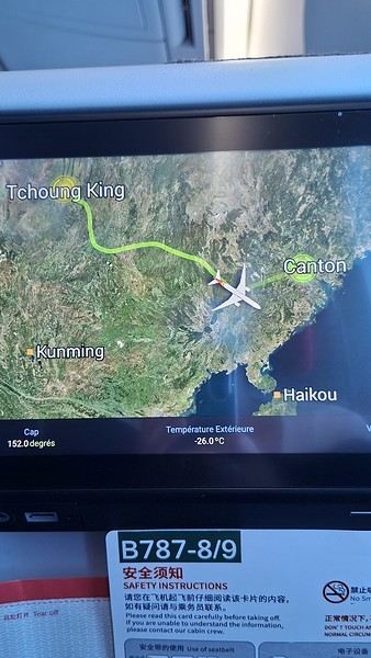
During my first two trips to China, we paid for everything in cash, but this time, we’re going all-in on Alipay and WeChat. I still brought the leftover change from previous trips—it might come in handy. At the metro station, they showed us a QR code to buy tickets via WeChat. There were probably machines and even a ticket counter, but we didn’t see them, and buying via WeChat was pretty simple. 8 yuan to Changshu Lu, which is 22 stops. So far, so good. Then, we had to find the hotel, which wasn’t on Google Maps, Maps.me, or Amap... Easy 😎! We found it without too much hassle, though. Dropped off our stuff and went out to eat. 55 yuan for two claypots with fish/eel, rice, cabbage, and purple eggplant. When we left, it was pouring. We grabbed our umbrellas and set off to explore the neighborhood: Enning Road (we’ll come back later to check out a specific spot), Shangxiajiu (the pedestrian shopping street), Baohua Road... The area is pretty diverse—one street to the next, it’s like stepping into a different world.

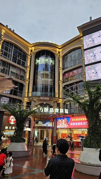
There weren’t many people around, probably because of the rain. We grabbed a quick street food dinner and went to bed—we were exhausted. We struggled to stay awake until 11 PM to adjust to the time change as quickly as possible. There’s a 6-hour time difference.
There wasn’t much room for improvisation on this trip—everything was planned in advance. Since August is peak season, I decided to book train tickets early, and once that was set, I reserved all the accommodations too. I got everything on Trip.com.
I bought the flight tickets back in March from Hainan Airlines. They were super expensive, but with these travel dates, I couldn’t exactly dream of a bargain!
I picked up e-SIMs valid for a month from Free just before departure: 10 € for the e-SIM + 19.90 € for a one-month plan with 35 GB of data abroad.
No need for a VPN with these e-SIMs, but D. still got one—a multi-device plan for 5 € with a discount from Let’s VPN, valid for a month. It was for evenings at the hotel on Wi-Fi to avoid burning through the 35 GB with video.
I downloaded Alipay, WeChat, Amap (Baidu Maps), and Trip.com. We also have Google Translate and Maps.me—absolute must-haves.
We’re ready to go!
I’ve been waiting for this day for nearly 15 years!! I travel a lot, but this one—this is MY TRIP 🙂 It’s been postponed so many times: because I wanted to do it with the right person, because I have a Turkish stamp in my passport and heard they don’t issue visas with that, because of COVID... and then China introduced a 30-day visa exemption, and that was the green light! Ugh, they forced us to take our vacation in August this year—far from ideal—but no more delays. Saturday, August 2, 2025: it’s finally the big day!
Days 1 and 2: We got dropped off at Charles de Gaulle at 9:30 AM. I supposedly checked in online, but only for the first flight and without getting the boarding pass... Might as well scrap online check-in in that case. So, we spent over an hour in line at the counter to get them. We didn’t have any checked luggage—just our backpacks as carry-ons—so this was a step we’d never had to deal with before, but whatever, it’s done. No wait at passport control, 5 minutes through security, a quick walk around the terminal, 10 minutes in the boarding area, and it was already time to board. Departure around 12:45 PM, arrival in Chongqing at 4:50 AM. We had a few hours of layover before our next flight. Went through immigration, connecting flight control, and security. Pro tip: check your next flight’s boarding gate right after immigration. We never saw it displayed again anywhere in the terminal.
The Free e-SIMs work—phew!
Took off at 9:30 AM, arrived in Guangzhou (Canton) at 11:20 AM in the rain. I love how Chongqing is translated as "Tchoung King" on the screens in the plane—very French!
During my first two trips to China, we paid for everything in cash, but this time, we’re going all-in on Alipay and WeChat. I still brought the leftover change from previous trips—it might come in handy. At the metro station, they showed us a QR code to buy tickets via WeChat. There were probably machines and even a ticket counter, but we didn’t see them, and buying via WeChat was pretty simple. 8 yuan to Changshu Lu, which is 22 stops. So far, so good. Then, we had to find the hotel, which wasn’t on Google Maps, Maps.me, or Amap... Easy 😎! We found it without too much hassle, though. Dropped off our stuff and went out to eat. 55 yuan for two claypots with fish/eel, rice, cabbage, and purple eggplant. When we left, it was pouring. We grabbed our umbrellas and set off to explore the neighborhood: Enning Road (we’ll come back later to check out a specific spot), Shangxiajiu (the pedestrian shopping street), Baohua Road... The area is pretty diverse—one street to the next, it’s like stepping into a different world.
There weren’t many people around, probably because of the rain. We grabbed a quick street food dinner and went to bed—we were exhausted. We struggled to stay awake until 11 PM to adjust to the time change as quickly as possible. There’s a 6-hour time difference.