Results for "Chambon+|+127"
1372 results found.
Dernière minute: quoi apporter? English translation pending
Bonjour à vous tous!
Moi et un copine partons pour Varadero le 1er janvier. Nous ne sommes jamais allées dans le sud (en fait, je suis allée à Walt Disney cet été, mais c'est pas la même chose) et j'aimerais bien avoir des conseils de pros comme vous!😉
Je ne sais pas quoi apporter (au niveau vestimentaire) ni comment les gens sont dans les formules tout-inclus! Bref, je suis dans une ignorance totale et j'aimerais que vous puissiez me donner un coup de main! 🙂
Merci beaucoup à tous!
Édith
Moi et un copine partons pour Varadero le 1er janvier. Nous ne sommes jamais allées dans le sud (en fait, je suis allée à Walt Disney cet été, mais c'est pas la même chose) et j'aimerais bien avoir des conseils de pros comme vous!😉
Je ne sais pas quoi apporter (au niveau vestimentaire) ni comment les gens sont dans les formules tout-inclus! Bref, je suis dans une ignorance totale et j'aimerais que vous puissiez me donner un coup de main! 🙂
Merci beaucoup à tous!
Édith
Item #1 ds votre sac au Sahara English translation pending
Bonjour a tous,
Je trouvais intéressant de partager nos préférences sur quel est l'item #1 que vous pensez le plus important d'Apporter dans votre sac a dos pour un voyage au travers le sahara... disons dans un optique voyage léger! (Vous ne partiriez pas sans ...... )
On va surement rigoler et Ca permettra peut etre a certains voyageur de mieux organiser leur voyage?!
Je trouvais intéressant de partager nos préférences sur quel est l'item #1 que vous pensez le plus important d'Apporter dans votre sac a dos pour un voyage au travers le sahara... disons dans un optique voyage léger! (Vous ne partiriez pas sans ...... )
On va surement rigoler et Ca permettra peut etre a certains voyageur de mieux organiser leur voyage?!
Argentine: Parlez vous rioplatense? English translation pending
Etes vous en mesure de comprendre le rio platense ? Dans tout guide ou livre ou dictionnaire a la page Argentine figure : langue officielle : espagnol ! Pourtant pour ceux qui sont deja venus trainer leur guetres dans le coin, vous avez sans doute du tendre l'oreille si quelques notions d espagnol ( reel ) hantaient votre cerveau . En effet, si la langue espagnole est bien officielement la langue que doivent parler les argentins, des que vous achetez un journal, une revue ou simplement lisez les panneaux dans les rues de Buenos Aires, vous devez admettre que l espagnol tels que vous l avez appris en France ou ailleurs et a mettre au porte-manteau. A vous de dechiffrer peu peu le nouveau vocabulaire, les constructions grammaticales ou pire les conjugaisons qui ont eu tendance a faire au fil des decennies depuis l independance du pays des ecarts de plus en plus grand par rapport a l'espagnol de Madrid. Le 3eme congres de la langue espagnole a lieu pour le moment pour qq jours a Bsas ( sous la presidence du roi d Espagne ...justement qui doit y perdre son ...espagnol ). Et toutes les delegations hispanophones justement etudient et classifient les apports locaux et les specificités nationales ( de quoi faire ! ). Un petit exemple en rio-platense ( uniquement parlé le long du Rio de la Plata--Buenos Aires, Rosiario et en Uruguay a Montevideo ...mais la deja avec qq transformations ) . Bref la langue de tous les jours de plus de 20 millions d'habitant ( quand meme plus que le hollandais, le catalan ou le danois ! ). Si vous arrivez a dechiffrer le texte suivant, c'est que vous etes pret a debarquer a Buenos Aires, sinon armez vous de patience car le rioplatense est peut etre deja une langue a part entiere ! Texte d'Ana María Shua
Entro al bar a tomar un feca y qué veo: un jovato que se pide un submarino. Este chabón está de la nuca, pensé, el submarino ya fue, loco. Pero no, va el mozo y se lo trae: un vaso con leche caliente y una barra de chocolate. "Buen día, che", le digo al mozo. "¿Puede ser una birra?" Me dice: "Querés chop, balón, lata..." "Traete un porroncito, macho", le pido yo. El jovato comenta: "Cuando yo tenía tu edad, cerveza se tomaba sólo en verano y en los munich." En eso entra al boliche una mina rebuena, medio fifí. Le dice al mozo: "Señor, ¿me trae una lágrima sin espuma?" "¿En jarrito?", pregunta. "No, chiquita, nomás." Yo le sonrío, pero la mina me corta el rostro. Se toma su cortadito con poco café y mucha leche y chau pichu, se las toma. A bientot ! Herge !
Entro al bar a tomar un feca y qué veo: un jovato que se pide un submarino. Este chabón está de la nuca, pensé, el submarino ya fue, loco. Pero no, va el mozo y se lo trae: un vaso con leche caliente y una barra de chocolate. "Buen día, che", le digo al mozo. "¿Puede ser una birra?" Me dice: "Querés chop, balón, lata..." "Traete un porroncito, macho", le pido yo. El jovato comenta: "Cuando yo tenía tu edad, cerveza se tomaba sólo en verano y en los munich." En eso entra al boliche una mina rebuena, medio fifí. Le dice al mozo: "Señor, ¿me trae una lágrima sin espuma?" "¿En jarrito?", pregunta. "No, chiquita, nomás." Yo le sonrío, pero la mina me corta el rostro. Se toma su cortadito con poco café y mucha leche y chau pichu, se las toma. A bientot ! Herge !
Barbecue dans la banquise English translation pending
18 juillet 2004 - Nous sommes au Spitzberg, par 80° de latitude Nord. Un archipel perdu à la marge du monde, au Nord-Est du Groenland, la dernière terre avant le pôle.
Après un voyage d’approche en avion depuis la Norvège, nous avons embarqué il y a quelques jours à bord du Grigoriy Mikheev, un navire scientifique russe de l’institut de recherche polaire de Mourmansk.
Le Grigoriy Mikheev est conçu pour naviguer dans la glace, mais ce soir, tout espoir de passer le détroit d’Hinlopen est définitivement abandonné. La progression dans la banquise est devenue extrêmement lente. Trop lente … Trop de glace … Trop épaisse ...
Le réchauffement de la planète est une réalité, mais le phénomène semble avoir des ratées … Il paraît qu’il n’y a pas eu autant de banquise ici en juillet depuis quinze ans !
Youriy Gorodnik, le capitaine, sait d'ores et déjà que nous allons être bloqués par les glaces flottantes qui couvrent maintenant les 9/10èmes de la surface de la mer. En effet, un quart d'heure plus tard, nous voici carrément coincés. Tout autour de nous, ce n'est pratiquement que de la glace. Devant l’étrave, quelques plaques cassées et basculées par notre dernière avancée montrent leur tranche qui fait plus d'un mètre d'épaisseur ...
Quand on parle de Youriy Gorodnik, n’imaginez pas un « capitaine » en tenue bleu marine et galons dorés ! Youriy c’est un grand gars simple et cordial, toujours en T-shirt à son poste de pilotage ou en gros pull de camionneur s’il doit faire un tour dehors.
Le jour où nous avons embarqué, Youriy nous a dit que nous serions toujours les bienvenus à la passerelle de commande du navire, à n'importe quelle heure du jour ou de la nuit. La seule exception peut-être, avait-il ajouté, ce serait au moment de manoeuvres un peu délicates ou dans certaines circonstances exceptionnelles, lorsque l'équipe de quart aurait besoin de toute sa concentration pour faire son travail, par exemple, avait-il dit, « s'il y avait vraiment trop de glace ... »
Depuis que nous sommes partis, nous sommes montés maintes fois à la passerelle, toujours accueillis cordialement. Sommes-nous aujourd'hui dans le genre de circonstances dont parlait Youriy ... ? Vaudrait-il mieux s'abstenir ? Ça se pourrait bien en effet, mais en même temps la tentation est vraiment énorme d'aller voir là-haut comment ça se passe !
Nous montons donc en nous promettant de ne pas déranger, de nous faire aussi petits que possible, mais avec l'espoir de partager avec les deux marins de quart ces moments exceptionnels.
A la porte de la passerelle, nous entrons sur la pointe des pieds ... façon « panthère rose » ! Andreï est debout à la barre et Youriy aux commandes moteur. Andreï nous a vus mais il ne se retourne pas. Nous refermons vite la porte pour ne pas laisser entrer le froid, mais nous restons sur le seuil comme des gamins qui savent confusément qu'ils abusent.
Youriy tourne la tête et nous voit près de la porte. Il nous fait un grand sourire et d'un signe de la main il nous dit d'approcher !
On s'avance à ses côtés, jusqu'au pupitre de commande. Le radar, tout en jaune et noir, montre la côte, les îles du détroit, et la mer saturée de glaces flottantes qui ressemblent à un puzzle anarchique. D’ici, à travers les vitres de la passerelle, à quelques mètres de hauteur, le paysage prend une nouvelle dimension. On reste fascinés, les yeux rivés sur le décor blanc dont les lointains s'évanouissent dans une vapeur glacée. La marge du monde ! C’est ici …
Après avoir tenté à deux reprises de reculer pour reprendre de l'élan et essayer de repartir de toute la puissance des deux moteurs, Youriy renonce, il abaisse les manettes et arrête tout ! On entend le régime des moteurs qui chute et s’évanouit … Le navire s'immobilise dans le grand blanc, en vue de la petite île de Nyströmøya. L'écran du GPS indique 79°40’ Nord.
Aucune inquiétude cependant : ce sont les courants de marée qui ont provoqué cette densité de glace flottante. Les grandes plaques de banquise (les "floes", comme on dit entre initiés), parfois de la taille d'un terrain de foot, se sont accumulés les uns contre les autres jusqu'à tout recouvrir. Youriy est serein : il nous explique qu'on va devoir attendre quelques heures que la marée s'inverse pour nous dégager. En effet, avec l'inversion de la marée, les courants vont "détendre" tout ce pack, les "floes" vont s'écarter, et nous pourrons alors repartir, remonter vers le Nord, vers les eaux libres de l’entrée du détroit où nous avons prévu, demain, de débarquer en zodiac sur l'île de Lågøya, à la rencontre d'une colonie de morses.
Ce blocage était prévisible depuis un moment, et puisque le navire va être à l'arrêt forcé, Youriy a demandé à Clare et Beverley, les deux jeunes cuisinières du Grigoriy Mikheev, de prévoir un barbecue sur le pont à l'avant du bateau, pour le repas du soir !
Clare et Beverley ne sont pas russes, vous l’auriez deviné, non ? Elles sont respectivement anglaise et néo-zélandaise. Quant au maître de la cambuse du bord, le très sympathique Phil, il est australien. C’est très international, l’arctique !
Tout le monde est invité à 20 heures sur le pont avant. Beverley a mis une affichette dans la coursive : « Tonight at 20, special arctic BBQ on foredeck. Don’t forget your party dress and dancing shoes ! »
Soirée surréaliste ! A 20 heures, navire arrêté en pleine banquise et sous un soleil superbe, nous nous retrouvons tous sur le pont, non pas en "party dress" ni en "dancing shoes", mais en anoraks et chaussures tout-terrains. Les trois marins ont empilé les zodiacs pour faire de la place. Ils ont installé des tréteaux et allumé un grand barbecue qui commence à faire rougir ses braises de charbon de bois.
Ce soir, les apéritifs sont offerts : Kir, Whisky ou … Pastis ! (je rassure la ligue anti-alcoolique : il y a aussi des jus de fruits !). Pour les glaçons, on n’est pas allé les chercher bien loin !
En guise d’apéro, certains préfèrent goûter un verre de vin. Phil en épate plus d’un : il a sorti de sa cambuse une caisse de vin rouge du Gers, proche cousin du Madiran ! Excellent, mais à ne pas laisser trop longtemps rafraîchir (la température n’est que de 4 degrés !). Du vin français à bord d’un navire russe au Spitzberg norvégien, servi par un sommelier australien, ce n’est pas vraiment commun ! Ambiance de fête : Tchin-Tchin ! On trinque à la banquise, aux phoques, aux morses, aux ours blancs et à la passion de l’arctique qui nous réunit ici !
Sur les tréteaux, un sympathique buffet d’entrées (froides !) nous attend. Juste à côté, près du bastingage tribord, Beverley armée d’une grande fourchette officie au barbecue : cuisses et ailes de poulet marinées aux épices, saucisses norvégiennes et côtelettes grillées apportent une note olfactive insolite dans l’air pur de l’arctique ! Les ours polaires doivent en être tout émoustillés dans un rayon de 15 km ! (il paraît que c’est à cette distance qu’ils sont capables de sentir la nourriture … )
Nataliya et Olga, les serveuses russes, ne sont pas en reste ! Ce soir pour elles, c’est relâche car tout est en self avec assiettes en carton et gobelets. Et relâche n’est pas un vain mot : la blonde Nataliya, en super forme, entonne son répertoire de chansons russes ! Ce ne sont pas les chœurs de l’Armée Rouge mais bien celui des mordus de l’arctique qui ne tarde pas à lui répondre en reprenant avec un bel ensemble les standards éternels du folklore : « Dans les plaines d’Ukraine », « Kalinka », « Le temps du muguet » … tout y passe, dans une ambiance de fous-rires auxquels les premiers verres de Madiran ne sont peut-être pas totalement étrangers !
Si de là-haut des extra-terrestres nous observent, ils doivent se poser bien des questions en voyant ce navire hérissé d’antennes et de radars, petit point perdu dans la banquise, si loin de toute vie humaine, avec sur le pont des hommes et des femmes de tous âges et de toutes origines qui se marrent en dévorant des cuisses de poulet, en picolant du vin rouge et en chantant des chansons russes !
Chanter, c’est bien, mais Beverley avait dit : « Don’t forget your dancing shoes ! » … Les marins ont apporté leur « sound machine » portatif et, avec l’arrivée des gâteaux et du « champagne », le pont avant se transforme en piste de danse !
En fait de « dancing shoes », c'est une joyeuse troupe en Pataugas, Tecnica ou Aigle qui improvise un « kazatchok » endiablé sous la conduite d’une Nataliya déchaînée !
Au beau milieu de la banquise, c'est une scène incroyable et bon enfant où tout le monde s'amuse, où farandoles et chorégraphies improvisées provoquent des fous rires à se tenir les côtes, le tout ponctué de puissants « Hhaï! Hhaï ! Hhaï ! Ka-zat-chok ! » scandés par le « choeur arctique » complètement déjanté !
Qui a dit qu’il faisait froid dans l’arctique ? C'est à une heure avancée de la nuit et toujours sous un beau soleil doré que s'achève la «boum polaire» ! Une scène inoubliable, vécue au premier degré (et même au degré zéro … !) par des gens simples et vrais.
C’était un dimanche soir dans la banquise, en juillet 2004, à la marge du monde.
Si ça vous dit de repartir dans le détroit d'Hinlopen (Spitzberg) ... mais cette fois-ci en zodiac et avec nos petits amis les pingouins guillemots qui sont au rendez-vous, par milliers ! C'est au pied des falaises d'Alkefjellet et c'est ici http://voyageforum.com/v.f?post=94799#94799
Après un voyage d’approche en avion depuis la Norvège, nous avons embarqué il y a quelques jours à bord du Grigoriy Mikheev, un navire scientifique russe de l’institut de recherche polaire de Mourmansk.
Le Grigoriy Mikheev est conçu pour naviguer dans la glace, mais ce soir, tout espoir de passer le détroit d’Hinlopen est définitivement abandonné. La progression dans la banquise est devenue extrêmement lente. Trop lente … Trop de glace … Trop épaisse ...
Le réchauffement de la planète est une réalité, mais le phénomène semble avoir des ratées … Il paraît qu’il n’y a pas eu autant de banquise ici en juillet depuis quinze ans !
Youriy Gorodnik, le capitaine, sait d'ores et déjà que nous allons être bloqués par les glaces flottantes qui couvrent maintenant les 9/10èmes de la surface de la mer. En effet, un quart d'heure plus tard, nous voici carrément coincés. Tout autour de nous, ce n'est pratiquement que de la glace. Devant l’étrave, quelques plaques cassées et basculées par notre dernière avancée montrent leur tranche qui fait plus d'un mètre d'épaisseur ...
Quand on parle de Youriy Gorodnik, n’imaginez pas un « capitaine » en tenue bleu marine et galons dorés ! Youriy c’est un grand gars simple et cordial, toujours en T-shirt à son poste de pilotage ou en gros pull de camionneur s’il doit faire un tour dehors.
Le jour où nous avons embarqué, Youriy nous a dit que nous serions toujours les bienvenus à la passerelle de commande du navire, à n'importe quelle heure du jour ou de la nuit. La seule exception peut-être, avait-il ajouté, ce serait au moment de manoeuvres un peu délicates ou dans certaines circonstances exceptionnelles, lorsque l'équipe de quart aurait besoin de toute sa concentration pour faire son travail, par exemple, avait-il dit, « s'il y avait vraiment trop de glace ... »
Depuis que nous sommes partis, nous sommes montés maintes fois à la passerelle, toujours accueillis cordialement. Sommes-nous aujourd'hui dans le genre de circonstances dont parlait Youriy ... ? Vaudrait-il mieux s'abstenir ? Ça se pourrait bien en effet, mais en même temps la tentation est vraiment énorme d'aller voir là-haut comment ça se passe !
Nous montons donc en nous promettant de ne pas déranger, de nous faire aussi petits que possible, mais avec l'espoir de partager avec les deux marins de quart ces moments exceptionnels.
A la porte de la passerelle, nous entrons sur la pointe des pieds ... façon « panthère rose » ! Andreï est debout à la barre et Youriy aux commandes moteur. Andreï nous a vus mais il ne se retourne pas. Nous refermons vite la porte pour ne pas laisser entrer le froid, mais nous restons sur le seuil comme des gamins qui savent confusément qu'ils abusent.
Youriy tourne la tête et nous voit près de la porte. Il nous fait un grand sourire et d'un signe de la main il nous dit d'approcher !
On s'avance à ses côtés, jusqu'au pupitre de commande. Le radar, tout en jaune et noir, montre la côte, les îles du détroit, et la mer saturée de glaces flottantes qui ressemblent à un puzzle anarchique. D’ici, à travers les vitres de la passerelle, à quelques mètres de hauteur, le paysage prend une nouvelle dimension. On reste fascinés, les yeux rivés sur le décor blanc dont les lointains s'évanouissent dans une vapeur glacée. La marge du monde ! C’est ici …
Après avoir tenté à deux reprises de reculer pour reprendre de l'élan et essayer de repartir de toute la puissance des deux moteurs, Youriy renonce, il abaisse les manettes et arrête tout ! On entend le régime des moteurs qui chute et s’évanouit … Le navire s'immobilise dans le grand blanc, en vue de la petite île de Nyströmøya. L'écran du GPS indique 79°40’ Nord.
Aucune inquiétude cependant : ce sont les courants de marée qui ont provoqué cette densité de glace flottante. Les grandes plaques de banquise (les "floes", comme on dit entre initiés), parfois de la taille d'un terrain de foot, se sont accumulés les uns contre les autres jusqu'à tout recouvrir. Youriy est serein : il nous explique qu'on va devoir attendre quelques heures que la marée s'inverse pour nous dégager. En effet, avec l'inversion de la marée, les courants vont "détendre" tout ce pack, les "floes" vont s'écarter, et nous pourrons alors repartir, remonter vers le Nord, vers les eaux libres de l’entrée du détroit où nous avons prévu, demain, de débarquer en zodiac sur l'île de Lågøya, à la rencontre d'une colonie de morses.
Ce blocage était prévisible depuis un moment, et puisque le navire va être à l'arrêt forcé, Youriy a demandé à Clare et Beverley, les deux jeunes cuisinières du Grigoriy Mikheev, de prévoir un barbecue sur le pont à l'avant du bateau, pour le repas du soir !
Clare et Beverley ne sont pas russes, vous l’auriez deviné, non ? Elles sont respectivement anglaise et néo-zélandaise. Quant au maître de la cambuse du bord, le très sympathique Phil, il est australien. C’est très international, l’arctique !
Tout le monde est invité à 20 heures sur le pont avant. Beverley a mis une affichette dans la coursive : « Tonight at 20, special arctic BBQ on foredeck. Don’t forget your party dress and dancing shoes ! »
Soirée surréaliste ! A 20 heures, navire arrêté en pleine banquise et sous un soleil superbe, nous nous retrouvons tous sur le pont, non pas en "party dress" ni en "dancing shoes", mais en anoraks et chaussures tout-terrains. Les trois marins ont empilé les zodiacs pour faire de la place. Ils ont installé des tréteaux et allumé un grand barbecue qui commence à faire rougir ses braises de charbon de bois.
Ce soir, les apéritifs sont offerts : Kir, Whisky ou … Pastis ! (je rassure la ligue anti-alcoolique : il y a aussi des jus de fruits !). Pour les glaçons, on n’est pas allé les chercher bien loin !
En guise d’apéro, certains préfèrent goûter un verre de vin. Phil en épate plus d’un : il a sorti de sa cambuse une caisse de vin rouge du Gers, proche cousin du Madiran ! Excellent, mais à ne pas laisser trop longtemps rafraîchir (la température n’est que de 4 degrés !). Du vin français à bord d’un navire russe au Spitzberg norvégien, servi par un sommelier australien, ce n’est pas vraiment commun ! Ambiance de fête : Tchin-Tchin ! On trinque à la banquise, aux phoques, aux morses, aux ours blancs et à la passion de l’arctique qui nous réunit ici !
Sur les tréteaux, un sympathique buffet d’entrées (froides !) nous attend. Juste à côté, près du bastingage tribord, Beverley armée d’une grande fourchette officie au barbecue : cuisses et ailes de poulet marinées aux épices, saucisses norvégiennes et côtelettes grillées apportent une note olfactive insolite dans l’air pur de l’arctique ! Les ours polaires doivent en être tout émoustillés dans un rayon de 15 km ! (il paraît que c’est à cette distance qu’ils sont capables de sentir la nourriture … )
Nataliya et Olga, les serveuses russes, ne sont pas en reste ! Ce soir pour elles, c’est relâche car tout est en self avec assiettes en carton et gobelets. Et relâche n’est pas un vain mot : la blonde Nataliya, en super forme, entonne son répertoire de chansons russes ! Ce ne sont pas les chœurs de l’Armée Rouge mais bien celui des mordus de l’arctique qui ne tarde pas à lui répondre en reprenant avec un bel ensemble les standards éternels du folklore : « Dans les plaines d’Ukraine », « Kalinka », « Le temps du muguet » … tout y passe, dans une ambiance de fous-rires auxquels les premiers verres de Madiran ne sont peut-être pas totalement étrangers !
Si de là-haut des extra-terrestres nous observent, ils doivent se poser bien des questions en voyant ce navire hérissé d’antennes et de radars, petit point perdu dans la banquise, si loin de toute vie humaine, avec sur le pont des hommes et des femmes de tous âges et de toutes origines qui se marrent en dévorant des cuisses de poulet, en picolant du vin rouge et en chantant des chansons russes !
Chanter, c’est bien, mais Beverley avait dit : « Don’t forget your dancing shoes ! » … Les marins ont apporté leur « sound machine » portatif et, avec l’arrivée des gâteaux et du « champagne », le pont avant se transforme en piste de danse !
En fait de « dancing shoes », c'est une joyeuse troupe en Pataugas, Tecnica ou Aigle qui improvise un « kazatchok » endiablé sous la conduite d’une Nataliya déchaînée !
Au beau milieu de la banquise, c'est une scène incroyable et bon enfant où tout le monde s'amuse, où farandoles et chorégraphies improvisées provoquent des fous rires à se tenir les côtes, le tout ponctué de puissants « Hhaï! Hhaï ! Hhaï ! Ka-zat-chok ! » scandés par le « choeur arctique » complètement déjanté !
Qui a dit qu’il faisait froid dans l’arctique ? C'est à une heure avancée de la nuit et toujours sous un beau soleil doré que s'achève la «boum polaire» ! Une scène inoubliable, vécue au premier degré (et même au degré zéro … !) par des gens simples et vrais.
C’était un dimanche soir dans la banquise, en juillet 2004, à la marge du monde.
Si ça vous dit de repartir dans le détroit d'Hinlopen (Spitzberg) ... mais cette fois-ci en zodiac et avec nos petits amis les pingouins guillemots qui sont au rendez-vous, par milliers ! C'est au pied des falaises d'Alkefjellet et c'est ici http://voyageforum.com/v.f?post=94799#94799
Purifier l'eau: hydrochlonazone ou micropur MT1? English translation pending
bonjour
lequel est le plus efficace des 2 pour purifier l"eau/tuer les bacteries ?
et pour le gout ?
merci
lequel est le plus efficace des 2 pour purifier l"eau/tuer les bacteries ?
et pour le gout ?
merci
Climat en Mongolie en octobre English translation pending
Avez-vous déjà été en Mongolie au mois d'octobre ? Fait-il trop froid pour faire un séjour d'un mois à la découverte de l'Altai, de l'Arkhangai et du désert de Gobi ?
Merci de vos réponses
Merci de vos réponses
Un réchaud à Calama (Chili) English translation pending
Salut,
Quelqu'un pourrait-il me dire s'il est possible d'acheter des cartouches de gaz (pour réchaud) à Calama (Chili), ou même d'y acheter un réchaud. Connaissant un tout petit peu cette ville je me doute que oui, mais je n'aimerai pas me retrouver "planté" pour la suite de mon séjour à cause d'un si petit détail.
Merci !
Quelqu'un pourrait-il me dire s'il est possible d'acheter des cartouches de gaz (pour réchaud) à Calama (Chili), ou même d'y acheter un réchaud. Connaissant un tout petit peu cette ville je me doute que oui, mais je n'aimerai pas me retrouver "planté" pour la suite de mon séjour à cause d'un si petit détail.
Merci !
Retour du Grand Playa Turquesa English translation pending
Bonjour à tous 😉
De retour du Grand Playa Turquesa 11 avril dernier. Plein de chose à vous raconter.
Si vous avez des questions je suis là pour vous répondre.
J'attend de vos nouvelles. 🙂
Tidoux (Bronzé)
ps: Je vous reviens avec plus de détails sur mon séjour
De retour du Grand Playa Turquesa 11 avril dernier. Plein de chose à vous raconter.
Si vous avez des questions je suis là pour vous répondre.
J'attend de vos nouvelles. 🙂
Tidoux (Bronzé)
ps: Je vous reviens avec plus de détails sur mon séjour
Les Survivants English translation pending
😄 Message personnel à tous ceux nés avant le 3éme millénaire. Les autres ne pourront pas comprendre ! 😄
L'enfance des années 50, 60, voire 70.
En regardant en arriére, c'est dur de croire qu'on ait réussi à survivre si longtemps. Lorsque nous étions enfants, nous nous promenions en voiture sans ceinture de sécurité ou d'airbags pour nous protéger. Nos chambres étaient peintes de couleurs vibrantes au plomb et nos maisons étaient isolées à l'amiante. Il n'y avait pas de couvercles de sécurité sur les bouteilles de médicaments et de produits toxiques ni de serrures sécuritaires sur les armoires. Et lorsque nous partions faire un tour de vélo, on le faisait sans casque.
On allait seul en ville chercher le pain, le lait dans un broc en aluminium à peine fermé et on le buvait comme cela. On buvait même de l'eau directement des tuyaux d'arrosage. Quelle horreur !
On se faisait des petites voitures(caisse à savon) avec des vieux patins à roulettes et des planches en bois pleines d'échardes et on se laissait aller dans les descentes, sur le trottoir bordant la nationale, pour s'apercevoir trop tard qu'on avait oublié de mettre des freins. Aprés être rentrés dans les buissons ou les clôtures à quelques reprises, on solutionait le probléme. On quittait seul la maison tot le matin pour aller à pied à l'école et on revenait souvent au moment où les lampadaires des rues s'allumaient. Imaginez donc, pas de téléphones portables, personne ne pouvait nous joindre de la journée.
On mangeait des gâteaux secs, du pain et du beurre et nous n'étions pas obéses........., il faut dire que nous jouions presque toujours à l'extérieur. On buvait souvent à quete ou cinq dans la même bouteille et il n'y a jamais eu de décés à cause de cela.
On jouait à des jeux dangereux et souvent, on se faisait mal. On grimpait dans les arbres, on enjambait les murs des voisins. Parfois, il y avait des chutes, avec des coupures et des os cassés mais personne n'était blamé. C'était l'apprentissage de la vie. Parfois, on se battait entre nous, on avait des bleus mais on apprenait à passer par-dessus. On n'avait pas de Nintendo 64, de Playstation 2 ou de X Box, sans compter les jeux video ou même les 99 canaux de la télévision, les magnetoscopes, les ordinateurs personnels, etc, etc .....
Mais nous avions des amis et si nous voulions les voir, tout ce qu'on avait à faire, c'était de sortir et se rendre chez eux, sonner et entrer pour pouvoir leur parler. Imaginez ça, sans même demander la permission à nos parents !!!
Comment faisait- on tout ça, sans gardien, dans ce monde cruel ? On inventait des jeux, avec des bâtons et des balles de tennis, on mangeait toutes sortes de choses mais contrairement à ce qu'on nous disait, rarement quelqu'un perdait un oeil ou était infecté d'un virus. Certains écoliers n'étaient pas aussi futés que les autres. Parfois, ils manquaient leur année et devaient redoubler. Les classes et les examens n'étaient pas ajustés pour compenser ces différences qu'elle qu'en soit la raison.
Nos actions étaient les nôtres. Nous en supportions personnellement les conséquences. Personne pour nous cacher. L'idée de se faire protéger par nos parents si nous commettions une infraction était impensable. D'ailleurs, nos parents étaient du coté de l'autorité, c'est t'y pas effrayant ?
Mais cette génération a produit les meilleurs preneurs de risque, solutionneurs et inventeurs. Les derniéres 50 années ont été une explosion d'innovations et d'idées nouvelles. On avait la liberté, la responsabilité de nos succés, ainsi que celle de nos défaites.
Le plus important, c'est qu'on a appris à vivre avec tout ça. Et on a eu la chance de grandir avant que les avocats et les gouvernements se mettent à réglementer nos vies.......pour notre bien "
L'enfance des années 50, 60, voire 70.
En regardant en arriére, c'est dur de croire qu'on ait réussi à survivre si longtemps. Lorsque nous étions enfants, nous nous promenions en voiture sans ceinture de sécurité ou d'airbags pour nous protéger. Nos chambres étaient peintes de couleurs vibrantes au plomb et nos maisons étaient isolées à l'amiante. Il n'y avait pas de couvercles de sécurité sur les bouteilles de médicaments et de produits toxiques ni de serrures sécuritaires sur les armoires. Et lorsque nous partions faire un tour de vélo, on le faisait sans casque.
On allait seul en ville chercher le pain, le lait dans un broc en aluminium à peine fermé et on le buvait comme cela. On buvait même de l'eau directement des tuyaux d'arrosage. Quelle horreur !
On se faisait des petites voitures(caisse à savon) avec des vieux patins à roulettes et des planches en bois pleines d'échardes et on se laissait aller dans les descentes, sur le trottoir bordant la nationale, pour s'apercevoir trop tard qu'on avait oublié de mettre des freins. Aprés être rentrés dans les buissons ou les clôtures à quelques reprises, on solutionait le probléme. On quittait seul la maison tot le matin pour aller à pied à l'école et on revenait souvent au moment où les lampadaires des rues s'allumaient. Imaginez donc, pas de téléphones portables, personne ne pouvait nous joindre de la journée.
On mangeait des gâteaux secs, du pain et du beurre et nous n'étions pas obéses........., il faut dire que nous jouions presque toujours à l'extérieur. On buvait souvent à quete ou cinq dans la même bouteille et il n'y a jamais eu de décés à cause de cela.
On jouait à des jeux dangereux et souvent, on se faisait mal. On grimpait dans les arbres, on enjambait les murs des voisins. Parfois, il y avait des chutes, avec des coupures et des os cassés mais personne n'était blamé. C'était l'apprentissage de la vie. Parfois, on se battait entre nous, on avait des bleus mais on apprenait à passer par-dessus. On n'avait pas de Nintendo 64, de Playstation 2 ou de X Box, sans compter les jeux video ou même les 99 canaux de la télévision, les magnetoscopes, les ordinateurs personnels, etc, etc .....
Mais nous avions des amis et si nous voulions les voir, tout ce qu'on avait à faire, c'était de sortir et se rendre chez eux, sonner et entrer pour pouvoir leur parler. Imaginez ça, sans même demander la permission à nos parents !!!
Comment faisait- on tout ça, sans gardien, dans ce monde cruel ? On inventait des jeux, avec des bâtons et des balles de tennis, on mangeait toutes sortes de choses mais contrairement à ce qu'on nous disait, rarement quelqu'un perdait un oeil ou était infecté d'un virus. Certains écoliers n'étaient pas aussi futés que les autres. Parfois, ils manquaient leur année et devaient redoubler. Les classes et les examens n'étaient pas ajustés pour compenser ces différences qu'elle qu'en soit la raison.
Nos actions étaient les nôtres. Nous en supportions personnellement les conséquences. Personne pour nous cacher. L'idée de se faire protéger par nos parents si nous commettions une infraction était impensable. D'ailleurs, nos parents étaient du coté de l'autorité, c'est t'y pas effrayant ?
Mais cette génération a produit les meilleurs preneurs de risque, solutionneurs et inventeurs. Les derniéres 50 années ont été une explosion d'innovations et d'idées nouvelles. On avait la liberté, la responsabilité de nos succés, ainsi que celle de nos défaites.
Le plus important, c'est qu'on a appris à vivre avec tout ça. Et on a eu la chance de grandir avant que les avocats et les gouvernements se mettent à réglementer nos vies.......pour notre bien "
Cherche boutique de narghilé English translation pending
Hello à tous ...
Je sait que le narguilé n'est pas vriament un plat gastronomique, mais sela fait partie des plaisirs de la vie (et dans certain pays un objet centrale de la vie), je suis à la recherche de boutique en france, principalement sur paris, grenoble ou genèves qui vendent pas mal de melasse différente, pas seulement les bateaux que sont la pomme et autres ...
Merci d'avance a tous ceux qui pourront m'aidé ...
Ciao et bon evnt à tous ...
Philo
Je sait que le narguilé n'est pas vriament un plat gastronomique, mais sela fait partie des plaisirs de la vie (et dans certain pays un objet centrale de la vie), je suis à la recherche de boutique en france, principalement sur paris, grenoble ou genèves qui vendent pas mal de melasse différente, pas seulement les bateaux que sont la pomme et autres ...
Merci d'avance a tous ceux qui pourront m'aidé ...
Ciao et bon evnt à tous ...
Philo
Se chauffer au bois: mode d'emploi English translation pending
Je désirerai avoir votre expérience sur la possibilité de se chauffer avec un poêle à bois dans un camping car : quel modèle choisir, comment l'installer et évacuer les fumées, etc. Grandement merci
Densha Otaku - Lesser-Known Regions
Autumn 2025 marks my 11th trip to Japan. I’ve neglected the south for too long, so like last year, it’s my main destination again.
We’ll revisit some familiar spots, but of course, we’ll also try plenty of new things. This trip feels a bit strange—no more of that initial magic, but on the other hand, we’ve really explored some off-the-beaten-path and private locations. The variety of regions, landscapes, and vehicles I’ve photographed is pretty remarkable. In search of vintage trains and threatened lines, I think my future trips will follow the same vibe.
After the 2017 and 2024 travel journals, it’s time to dive into Japan’s lesser-known side—all by public transport, of course. Day 1, arrival in Tokyo
The timing won’t be like other years since we arrive at Narita in the mid-afternoon after a layover in Hong Kong.
The only real mission for this afternoon is picking up tickets for the next day. And already, the first travel stress: I’ll have to rewrite the entire day because the Revaty Kinu 109 to Kinugawaonsen is fully booked, just like all the morning trains. So instead of a relaxed start exploring Ueno, I’m back to scrutinizing schedules. I manage to snag something last-minute after struggling for hours. Then, I wait for a message from Seiichi to meet up for dinner. Meeting friends on the first day and staying up late with jet lag—like I said, this trip isn’t like the others.
A great evening at a place I love.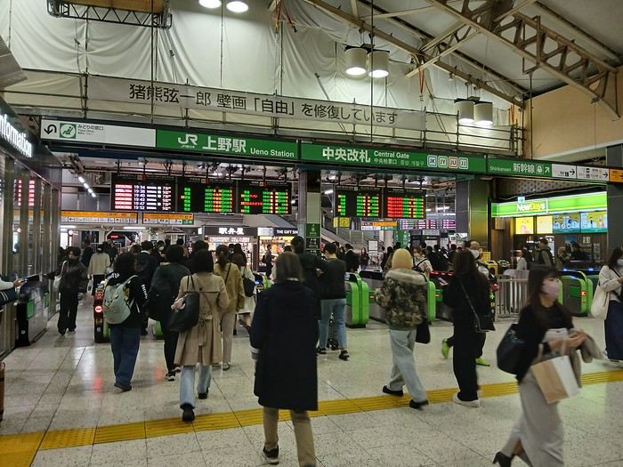
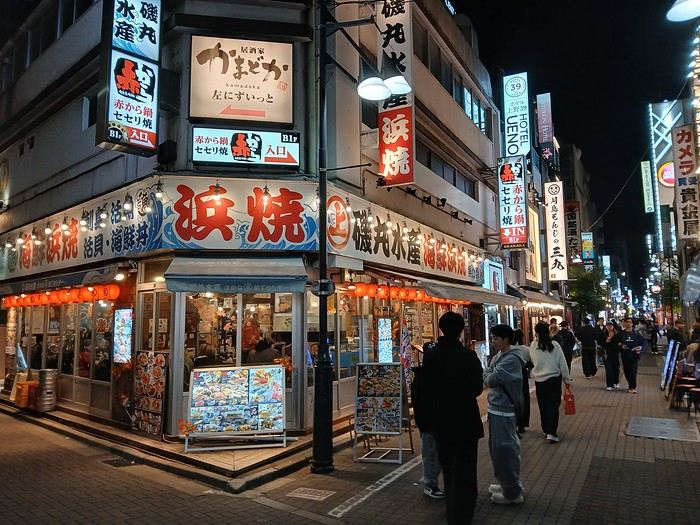
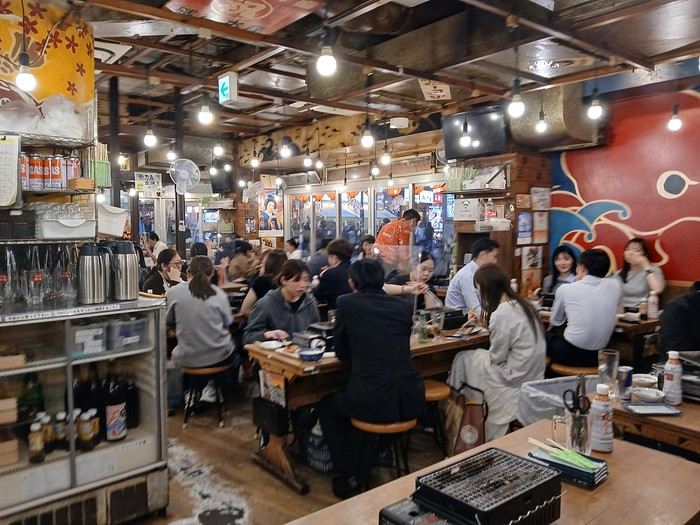
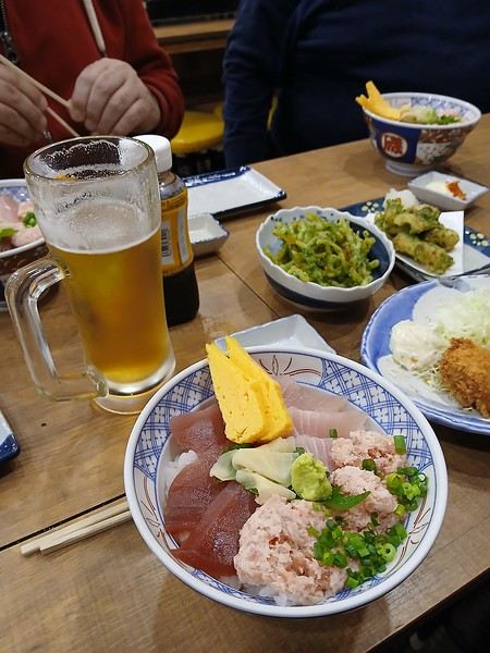
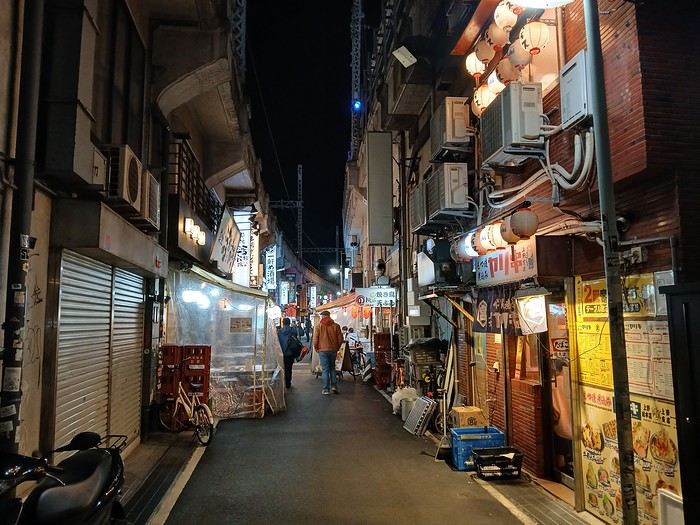
We’ll revisit some familiar spots, but of course, we’ll also try plenty of new things. This trip feels a bit strange—no more of that initial magic, but on the other hand, we’ve really explored some off-the-beaten-path and private locations. The variety of regions, landscapes, and vehicles I’ve photographed is pretty remarkable. In search of vintage trains and threatened lines, I think my future trips will follow the same vibe.
After the 2017 and 2024 travel journals, it’s time to dive into Japan’s lesser-known side—all by public transport, of course. Day 1, arrival in Tokyo
The timing won’t be like other years since we arrive at Narita in the mid-afternoon after a layover in Hong Kong.
The only real mission for this afternoon is picking up tickets for the next day. And already, the first travel stress: I’ll have to rewrite the entire day because the Revaty Kinu 109 to Kinugawaonsen is fully booked, just like all the morning trains. So instead of a relaxed start exploring Ueno, I’m back to scrutinizing schedules. I manage to snag something last-minute after struggling for hours. Then, I wait for a message from Seiichi to meet up for dinner. Meeting friends on the first day and staying up late with jet lag—like I said, this trip isn’t like the others.
A great evening at a place I love.
Martine from DD in Arizona and New Mexico
Good evening everyone! 🙂
We’re back from our September 2025 road trip, this time to explore Arizona and New Mexico, and it’s time for me to start my travel journal—especially since everything’s already booked for another trip in September 2026 (to California), and I need to get started on the planning.
I was a little worried this new visit to Uncle Sam’s country might not be as "wow" as the others, but we still discovered some incredible places.
For those who don’t know us, we’re a couple in our seventies who speak very little English, but that didn’t stop us from fully enjoying our stay.
For this 6th road trip in the U.S., we spent 21 nights there, drove 4,160 km by car, and walked nearly 160 km in a loop starting from Phoenix.
We’d been to Arizona before (but not this side) and never to New Mexico. This whole road trip was a huge discovery for us.
In the prices mentioned (some in euros, others in dollars), bank fees and exchange charges are included. The flights, car rental, and parking were all paid for in December 2024 when we booked.
We’d downloaded the MPC (Mobile Passport Control) app, but there wasn’t a dedicated line at Phoenix Airport. Still, we got through quickly with friendly, smiling agents.
I don’t drive at all (I hate it), so the stops were chosen based on activities but also, for some, to limit daily mileage for the sole driver. The kilometers listed in the itinerary are the daily distances.
We traveled from September 9th to 22nd, unfortunately once again without our dear friends Mimi and Maumau.
The itinerary
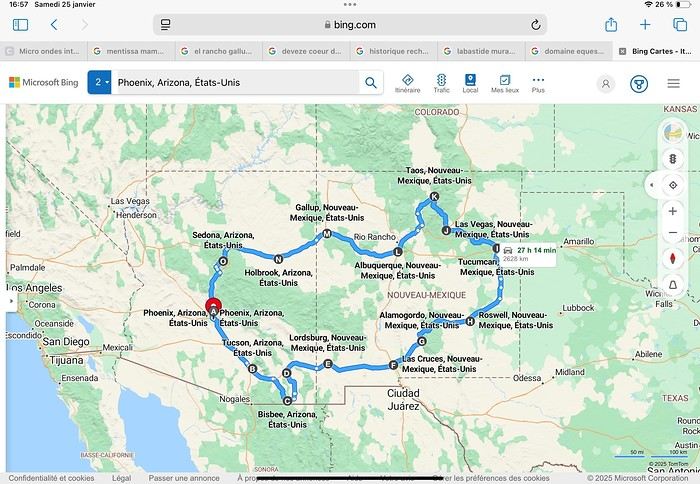
Day 1: Flight Marseille-Paris-Phoenix, then Gold Canyon (133 km) Day 2: Tucson (271 km) Lost Dutchman State Park Day 3: Tucson (155 km) Day 4: Tucson (34 km) Day 5: Bisbee (182 km) Day 6: Lordsburg (345 km) Day 7: Las Cruces (253 km) Day 8: Alamogordo (162 km) Day 9: Roswell (264 km) Day 10: Tucumcari (369 km) Day 11: Las Vegas (281 km) – the one in New Mexico Day 12: Taos (213 km) Day 13: Santa Fe (224 km) Day 14: Albuquerque (123 km) Day 15: Gallup (246 km) Day 16: Holbrook (224 km) Day 17: Flagstaff (179 km) Day 18: Sedona (118 km) Day 19: Sedona (48 km) Day 20: Sedona (41 km) Day 21: Phoenix (256 km) Day 22: Phoenix Airport (35 km)
📊 **Budget**: A little over 7,500 € for both of us, all included. The exchange rate was in our favor (1.17 dollars to 1 €). 📊 **Flights**: Marseille-Paris Charles de Gaulle-Phoenix: 1,787 € for two, with one checked bag each (Air France) 📊 **ESTA**: $42 📊 **America the Beautiful Pass**: $80 📊 **Parking**: 134 € (super eco at Marseille) 📊 **Car rental (Hertz)**: 865 €. Since there were no SUVs left in the reserved category (Nissan Rogue), we got an upgrade (4x4 Ford Explorer). We booked through Air France (15% discount). We’d originally reserved it in December for 1,140 €, but since prices dropped in March, we canceled and rebooked for 865 €. Hertz offers a free Hertz Gold Plus Rewards program, which gives you priority counter service when picking up the car. 📊 **Accommodation**: 2,400 € We stayed in hotels and motels of varying standards (from 60 to 203 € per night, depending on the city), all booked through Booking.com or Hotels.com. Out of 21 nights, only two didn’t include breakfast in the price. Booking.com sometimes offers slightly cheaper rates if you book by phone using the mobile app, and our Genius 3 status on the site also got us some preferential rates. 📊 **Supplementary insurance**: AVA 200 € for medical care if needed 📊 **Cash**: $2,078. We left with 1,000 € exchanged before departure and made two withdrawals of $500. This cash covered: - Evening restaurants and tips - Midday picnics - Gas: $298 for 4,160 km - Museum and private park entries (per person): - Lost Dutchman: $10 - Arizona-Sonora Desert Museum: $28 - Bird Cage Theater: $16 - Tombstone Shootout: $8 - New Mexico Farm & Ranch Museum: $12 - Roswell International UFO Museum: $5 - Billy the Kid Museum: $7 - Rancho de Taos: $22 - West Fork Oak Creek Trail entry: $15 We got a few discounts thanks to our senior age (+65). - Souvenirs and little treats
Like on our previous road trips, we didn’t rent a GPS. We got around using offline GPS apps Here WeGo and Organic Maps, with maps of the states we visited downloaded before we left (on our phones).
❤️❤️❤️ **Highlights** (there are so many!) 📍 Goldfield Ghost Town (even if it’s a reconstruction) 📍 The standing army of Saguaro cacti at Saguaro National Park West 📍 Diving into the cowboy universe of Tombstone 📍 The welcome from Rick and Henry at our guesthouse in Bisbee (Garden at Mile High Ranch) 📍 The tangled rocks of Chiricahua National Monument 📍 The flavored pistachios from Dwayne’s Fresh Jerky and Mac Ginnis Pistachioland 📍 Restaurants: La Posta (Las Cruces), Diner 66 (Albuquerque), and the Haunted Hamburger (Jerome) 📍 The old plazas of New Mexico 📍 The solitude and beauty of the white dunes at White Sands National Park 📍 Stepping back in time at the Billy the Kid Museum (Fort Stanton) 📍 Sections of historic Route 66 and the old motels of Tucumcari, especially at night when all the neon lights are on 📍 Taos Pueblo and diving into Native American culture 📍 After the Rio Grande Bridge, the descent via NM 567 to the very bottom of the Rio Grande Gorge, then the road along the riverbanks to Taos 📍 The tranquility of the Chimayo Sanctuary 📍 Discovering the ingenious native dwellings at Bandelier National Monument and Walnut Canyon National Park 📍 The small towns along the Turquoise Trail 📍 The red rocks of Red Rock Park and the Painted Desert 📍 The extraordinary colors of the petrified trees at Petrified Forest National Park 📍 Sedona, its red rocks, and the reward of the viewpoints at the end of hikes (Devil’s Bridge, The Subway, and West Fork Oak Creek) 📍 The immersion in Mexico when visiting Tlaquepaque 📍 The almost-ghost town of Jerome and its terraced streets 📍 The incredible kindness of Americans, always ready to help and up for a chat ❤️
☹️☹️☹️ **Flops** (there are very few) 📍 Several museums and churches being closed, so we couldn’t visit them 📍 Some museums and visitor centers opening late (10 AM) and closing early (4 PM) 📍 A 64 € phone roaming charge because we got near the Mexican border and picked up their cell tower 📍 The outrageous price ($5.99) for a gallon of gas at the Shell near Phoenix Airport
I hope this helps! Anyway, thanks for reading my long post. Don’t hesitate to reach out, even via PM, if you see I haven’t replied and you’d like more details. Have a great evening, everyone! 🙂
We’re back from our September 2025 road trip, this time to explore Arizona and New Mexico, and it’s time for me to start my travel journal—especially since everything’s already booked for another trip in September 2026 (to California), and I need to get started on the planning.
I was a little worried this new visit to Uncle Sam’s country might not be as "wow" as the others, but we still discovered some incredible places.
For those who don’t know us, we’re a couple in our seventies who speak very little English, but that didn’t stop us from fully enjoying our stay.
For this 6th road trip in the U.S., we spent 21 nights there, drove 4,160 km by car, and walked nearly 160 km in a loop starting from Phoenix.
We’d been to Arizona before (but not this side) and never to New Mexico. This whole road trip was a huge discovery for us.
In the prices mentioned (some in euros, others in dollars), bank fees and exchange charges are included. The flights, car rental, and parking were all paid for in December 2024 when we booked.
We’d downloaded the MPC (Mobile Passport Control) app, but there wasn’t a dedicated line at Phoenix Airport. Still, we got through quickly with friendly, smiling agents.
I don’t drive at all (I hate it), so the stops were chosen based on activities but also, for some, to limit daily mileage for the sole driver. The kilometers listed in the itinerary are the daily distances.
We traveled from September 9th to 22nd, unfortunately once again without our dear friends Mimi and Maumau.
The itinerary
Day 1: Flight Marseille-Paris-Phoenix, then Gold Canyon (133 km) Day 2: Tucson (271 km) Lost Dutchman State Park Day 3: Tucson (155 km) Day 4: Tucson (34 km) Day 5: Bisbee (182 km) Day 6: Lordsburg (345 km) Day 7: Las Cruces (253 km) Day 8: Alamogordo (162 km) Day 9: Roswell (264 km) Day 10: Tucumcari (369 km) Day 11: Las Vegas (281 km) – the one in New Mexico Day 12: Taos (213 km) Day 13: Santa Fe (224 km) Day 14: Albuquerque (123 km) Day 15: Gallup (246 km) Day 16: Holbrook (224 km) Day 17: Flagstaff (179 km) Day 18: Sedona (118 km) Day 19: Sedona (48 km) Day 20: Sedona (41 km) Day 21: Phoenix (256 km) Day 22: Phoenix Airport (35 km)
📊 **Budget**: A little over 7,500 € for both of us, all included. The exchange rate was in our favor (1.17 dollars to 1 €). 📊 **Flights**: Marseille-Paris Charles de Gaulle-Phoenix: 1,787 € for two, with one checked bag each (Air France) 📊 **ESTA**: $42 📊 **America the Beautiful Pass**: $80 📊 **Parking**: 134 € (super eco at Marseille) 📊 **Car rental (Hertz)**: 865 €. Since there were no SUVs left in the reserved category (Nissan Rogue), we got an upgrade (4x4 Ford Explorer). We booked through Air France (15% discount). We’d originally reserved it in December for 1,140 €, but since prices dropped in March, we canceled and rebooked for 865 €. Hertz offers a free Hertz Gold Plus Rewards program, which gives you priority counter service when picking up the car. 📊 **Accommodation**: 2,400 € We stayed in hotels and motels of varying standards (from 60 to 203 € per night, depending on the city), all booked through Booking.com or Hotels.com. Out of 21 nights, only two didn’t include breakfast in the price. Booking.com sometimes offers slightly cheaper rates if you book by phone using the mobile app, and our Genius 3 status on the site also got us some preferential rates. 📊 **Supplementary insurance**: AVA 200 € for medical care if needed 📊 **Cash**: $2,078. We left with 1,000 € exchanged before departure and made two withdrawals of $500. This cash covered: - Evening restaurants and tips - Midday picnics - Gas: $298 for 4,160 km - Museum and private park entries (per person): - Lost Dutchman: $10 - Arizona-Sonora Desert Museum: $28 - Bird Cage Theater: $16 - Tombstone Shootout: $8 - New Mexico Farm & Ranch Museum: $12 - Roswell International UFO Museum: $5 - Billy the Kid Museum: $7 - Rancho de Taos: $22 - West Fork Oak Creek Trail entry: $15 We got a few discounts thanks to our senior age (+65). - Souvenirs and little treats
Like on our previous road trips, we didn’t rent a GPS. We got around using offline GPS apps Here WeGo and Organic Maps, with maps of the states we visited downloaded before we left (on our phones).
❤️❤️❤️ **Highlights** (there are so many!) 📍 Goldfield Ghost Town (even if it’s a reconstruction) 📍 The standing army of Saguaro cacti at Saguaro National Park West 📍 Diving into the cowboy universe of Tombstone 📍 The welcome from Rick and Henry at our guesthouse in Bisbee (Garden at Mile High Ranch) 📍 The tangled rocks of Chiricahua National Monument 📍 The flavored pistachios from Dwayne’s Fresh Jerky and Mac Ginnis Pistachioland 📍 Restaurants: La Posta (Las Cruces), Diner 66 (Albuquerque), and the Haunted Hamburger (Jerome) 📍 The old plazas of New Mexico 📍 The solitude and beauty of the white dunes at White Sands National Park 📍 Stepping back in time at the Billy the Kid Museum (Fort Stanton) 📍 Sections of historic Route 66 and the old motels of Tucumcari, especially at night when all the neon lights are on 📍 Taos Pueblo and diving into Native American culture 📍 After the Rio Grande Bridge, the descent via NM 567 to the very bottom of the Rio Grande Gorge, then the road along the riverbanks to Taos 📍 The tranquility of the Chimayo Sanctuary 📍 Discovering the ingenious native dwellings at Bandelier National Monument and Walnut Canyon National Park 📍 The small towns along the Turquoise Trail 📍 The red rocks of Red Rock Park and the Painted Desert 📍 The extraordinary colors of the petrified trees at Petrified Forest National Park 📍 Sedona, its red rocks, and the reward of the viewpoints at the end of hikes (Devil’s Bridge, The Subway, and West Fork Oak Creek) 📍 The immersion in Mexico when visiting Tlaquepaque 📍 The almost-ghost town of Jerome and its terraced streets 📍 The incredible kindness of Americans, always ready to help and up for a chat ❤️
☹️☹️☹️ **Flops** (there are very few) 📍 Several museums and churches being closed, so we couldn’t visit them 📍 Some museums and visitor centers opening late (10 AM) and closing early (4 PM) 📍 A 64 € phone roaming charge because we got near the Mexican border and picked up their cell tower 📍 The outrageous price ($5.99) for a gallon of gas at the Shell near Phoenix Airport
I hope this helps! Anyway, thanks for reading my long post. Don’t hesitate to reach out, even via PM, if you see I haven’t replied and you’d like more details. Have a great evening, everyone! 🙂
Road Trip USA 2023 - Part 2
HIGHWAY 1
Highway 1 runs along the Pacific coast of California from Leggett in the north to Dana Point in the south. It's the longest state route in California, stretching 1,050 km.
It's famous for its breathtaking ocean views. That’s actually why it’s become such a popular route for road trips, with tons of attractions and points of interest all along the way.
After crossing the U.S. interior on our way out (see Road Trip USA 2023 - Part 1), we’re starting our return trip along this route from Leggett.
Videos are embedded throughout the summary. Please click on the image to start the video. To jump to a specific post, here are the appropriate links:
CALIFORNIA:
Scenic Overlooks on Route 1 Between Leggett and Fort Bragg The Pudding Creek Trestle Bridge in Fort Bragg Glass Beach - Fort Bragg Jenner Lookout Point - Highway 1 Goat Rock Beach - Sonoma Coast State Park - Jenner Point Reyes National Seashore - White House Pool Trail Point Reyes National Seashore - Limantour Beach Point Reyes National Seashore - Point Reyes Shipwreck Point Reyes National Seashore - Kehoe Beach Trail Point Reyes National Seashore - McClures Beach Trail Point Reyes National Seashore - Cypress Tree Tunnel Point Reyes National Seashore - Point Reyes Beach North Point Reyes National Seashore - Elephant Seals on Drakes Beach Point Reyes National Seashore - Point Reyes Beach South Point Reyes National Seashore – Elephant Seals Overlooks Point Reyes National Seashore - Chimney Rock Trail Point Reyes National Seashore - Point Reyes Lighthouse Trail Point Reyes National Seashore – Tule Elk Observation Point Bonita Lighthouse Trail - Sausalito Hawk Hill - Sausalito Battery Spencer Trail - Sausalito Rodeo Beach - Sausalito Point Cavallo - Golden Gate View - Sausalito Exploring Downtown Sausalito Visiting Sausalito’s Houseboats Crossing the Golden Gate Bridge - San Francisco Golden Gate Bridge Viewpoints - San Francisco Cruise to Alcatraz Island - San Francisco Visiting Alcatraz Island - San Francisco Civic Center - Downtown San Francisco Market Street & Yerba Buena Gardens - Downtown San Francisco Union Square & Financial District - Downtown San Francisco Fisherman's Wharf, Pier 39 & Embarcadero - San Francisco Sea Lion Observation - Pier 39 - San Francisco Lombard Street & Cable Car - Russian Hill - San Francisco Macondray Lane Historic District - Russian Hill - San Francisco Grace Cathedral & Huntington Park - Nob Hill - San Francisco Telegraph Hill - San Francisco Chinatown - San Francisco Alamo Square & Painted Ladies - Western Addition - San Francisco Palace of Fine Arts - Marina District - San Francisco Presidio of San Francisco California Coastal Trail - Lincoln Park - San Francisco California Palace of the Legion of Honor - Lincoln Park - San Francisco Sutro Baths - Lincoln Park - San Francisco Queen Wilhelmina Garden - Golden Gate Park - San Francisco Bison Paddock - Golden Gate Park - San Francisco Portals of the Past - Golden Gate Park - San Francisco Strawberry Hill - Golden Gate Park – San Francisco Prayerbook Cross & Robin Williams Meadow - Golden Gate Park - San Francisco Hidden Garden Steps & 16th Avenue Tiled Steps - San Francisco Grandview Park - San Francisco Hike - Twin Peaks Three Summits - San Francisco Longboarding Down Twin Peaks Blvd in San Francisco Haight-Ashbury - San Francisco Corona Heights Park - San Francisco Mission Dolores - San Francisco Mural Frescoes (Part 1) - Mission District - San Francisco Mural Frescoes (Part 2) - Mission District - San Francisco Devil's Slide Bunker - Pacifica Mavericks Beach - Half Moon Bay Martins Beach - Half Moon Bay Pigeon Point Lighthouse State Historic Park - Pescadero What to See in Santa Cruz Visiting Capitola What to See in Monterey Carmel-by-the-Sea Lovers Point Park - Pacific Grove Castle Rock, Hurricane Point & Little Sur River Viewpoints Pfeiffer Falls Trail Julia Pfeiffer Burns State Park Vista Point & McWay Falls Highway 1 - Big Sur Viewpoints Salmon Creek Falls San Carpoforo Creek Trail Elephant Seal Vista Point - San Simeon San Simeon Pier Moonstone Beach Boardwalk Shipwreck - Estero Bluffs State Park Surfing Competition in Morro Bay Port San Luis Pier - San Luis Obispo Pismo Beach Monarch Butterfly Grove - Pismo State Beach Nojoqui Falls Park - Solvang Arroyo Hondo Vista Point Solvang, a Charming Danish Town in California Chumash Painted Cave - Santa Barbara Goleta San Marcos Rd & Cachuma Lake Vista Points - Santa Barbara Old Santa Barbara Mission Walking Tour of Santa Barbara’s Historic Downtown West Beach - Santa Barbara What to See in Ventura Paradise Falls - Wildwood Regional Park - Thousand Oaks Sandy Dune & El Matador State Beach - Malibu Point Dume Nature Reserve - Malibu Malibu Pier Road Trip in the Malibu Mountains Los Liones Trail - Santa Monica Santa Monica Pier Rodeo Drive - Beverly Hills Greystone Mansion - Beverly Hills Hollywood Walk of Fame - Los Angeles Griffith Observatory - Los Angeles Hollywood Forever Cemetery - Los Angeles What to See in Venice Beach Venice Beach Skatepark ShoreLine Aquatic Park - Long Beach Alamitos Beach - Long Beach Naples Island - Long Beach Crescent Bay Point Park & Helser Park Kiosk - Laguna Beach Shell Beach at Twin Points - Laguna Beach Prairie Dogs at Agra Vista Point Top Gun House & Oceanside Pier Annie's Canyon Trail - Solana Beach (Via North Rios Trailhead Loop) Old Town San Diego La Jolla Coastal Trail - San Diego Balboa Park - San Diego Pacific Beach - San Diego Mission Beach - San Diego Ocean Beach Tide Pools - San Diego Sunset Cliffs Natural Park - San Diego Tuna Harbor Park - San Diego Seaport Village & Embarcadero Marina Park - San Diego Gaslamp Quarter - Downtown San Diego Coronado Island - San Diego Dead Dolly Lane - Alpine Galleta Meadows Metal Sculptures - Borrego Springs What to See in Palm Springs Robolights - Palm Springs Andreas Canyon Trail - Indian Canyons - Palm Springs Palm Canyon Trail - Indian Canyons - Palm Springs West Fork Falls Trail - Indian Canyons - Palm Springs Tahquitz Canyon Loop Trail - Indian Canyons - Palm Springs Desert Christ Park - Yucca Valley Pioneertown Salvation Mountain - Niland Slab City - Niland
Highway 1 runs along the Pacific coast of California from Leggett in the north to Dana Point in the south. It's the longest state route in California, stretching 1,050 km.
It's famous for its breathtaking ocean views. That’s actually why it’s become such a popular route for road trips, with tons of attractions and points of interest all along the way.
After crossing the U.S. interior on our way out (see Road Trip USA 2023 - Part 1), we’re starting our return trip along this route from Leggett.
Videos are embedded throughout the summary. Please click on the image to start the video. To jump to a specific post, here are the appropriate links:
CALIFORNIA:
Scenic Overlooks on Route 1 Between Leggett and Fort Bragg The Pudding Creek Trestle Bridge in Fort Bragg Glass Beach - Fort Bragg Jenner Lookout Point - Highway 1 Goat Rock Beach - Sonoma Coast State Park - Jenner Point Reyes National Seashore - White House Pool Trail Point Reyes National Seashore - Limantour Beach Point Reyes National Seashore - Point Reyes Shipwreck Point Reyes National Seashore - Kehoe Beach Trail Point Reyes National Seashore - McClures Beach Trail Point Reyes National Seashore - Cypress Tree Tunnel Point Reyes National Seashore - Point Reyes Beach North Point Reyes National Seashore - Elephant Seals on Drakes Beach Point Reyes National Seashore - Point Reyes Beach South Point Reyes National Seashore – Elephant Seals Overlooks Point Reyes National Seashore - Chimney Rock Trail Point Reyes National Seashore - Point Reyes Lighthouse Trail Point Reyes National Seashore – Tule Elk Observation Point Bonita Lighthouse Trail - Sausalito Hawk Hill - Sausalito Battery Spencer Trail - Sausalito Rodeo Beach - Sausalito Point Cavallo - Golden Gate View - Sausalito Exploring Downtown Sausalito Visiting Sausalito’s Houseboats Crossing the Golden Gate Bridge - San Francisco Golden Gate Bridge Viewpoints - San Francisco Cruise to Alcatraz Island - San Francisco Visiting Alcatraz Island - San Francisco Civic Center - Downtown San Francisco Market Street & Yerba Buena Gardens - Downtown San Francisco Union Square & Financial District - Downtown San Francisco Fisherman's Wharf, Pier 39 & Embarcadero - San Francisco Sea Lion Observation - Pier 39 - San Francisco Lombard Street & Cable Car - Russian Hill - San Francisco Macondray Lane Historic District - Russian Hill - San Francisco Grace Cathedral & Huntington Park - Nob Hill - San Francisco Telegraph Hill - San Francisco Chinatown - San Francisco Alamo Square & Painted Ladies - Western Addition - San Francisco Palace of Fine Arts - Marina District - San Francisco Presidio of San Francisco California Coastal Trail - Lincoln Park - San Francisco California Palace of the Legion of Honor - Lincoln Park - San Francisco Sutro Baths - Lincoln Park - San Francisco Queen Wilhelmina Garden - Golden Gate Park - San Francisco Bison Paddock - Golden Gate Park - San Francisco Portals of the Past - Golden Gate Park - San Francisco Strawberry Hill - Golden Gate Park – San Francisco Prayerbook Cross & Robin Williams Meadow - Golden Gate Park - San Francisco Hidden Garden Steps & 16th Avenue Tiled Steps - San Francisco Grandview Park - San Francisco Hike - Twin Peaks Three Summits - San Francisco Longboarding Down Twin Peaks Blvd in San Francisco Haight-Ashbury - San Francisco Corona Heights Park - San Francisco Mission Dolores - San Francisco Mural Frescoes (Part 1) - Mission District - San Francisco Mural Frescoes (Part 2) - Mission District - San Francisco Devil's Slide Bunker - Pacifica Mavericks Beach - Half Moon Bay Martins Beach - Half Moon Bay Pigeon Point Lighthouse State Historic Park - Pescadero What to See in Santa Cruz Visiting Capitola What to See in Monterey Carmel-by-the-Sea Lovers Point Park - Pacific Grove Castle Rock, Hurricane Point & Little Sur River Viewpoints Pfeiffer Falls Trail Julia Pfeiffer Burns State Park Vista Point & McWay Falls Highway 1 - Big Sur Viewpoints Salmon Creek Falls San Carpoforo Creek Trail Elephant Seal Vista Point - San Simeon San Simeon Pier Moonstone Beach Boardwalk Shipwreck - Estero Bluffs State Park Surfing Competition in Morro Bay Port San Luis Pier - San Luis Obispo Pismo Beach Monarch Butterfly Grove - Pismo State Beach Nojoqui Falls Park - Solvang Arroyo Hondo Vista Point Solvang, a Charming Danish Town in California Chumash Painted Cave - Santa Barbara Goleta San Marcos Rd & Cachuma Lake Vista Points - Santa Barbara Old Santa Barbara Mission Walking Tour of Santa Barbara’s Historic Downtown West Beach - Santa Barbara What to See in Ventura Paradise Falls - Wildwood Regional Park - Thousand Oaks Sandy Dune & El Matador State Beach - Malibu Point Dume Nature Reserve - Malibu Malibu Pier Road Trip in the Malibu Mountains Los Liones Trail - Santa Monica Santa Monica Pier Rodeo Drive - Beverly Hills Greystone Mansion - Beverly Hills Hollywood Walk of Fame - Los Angeles Griffith Observatory - Los Angeles Hollywood Forever Cemetery - Los Angeles What to See in Venice Beach Venice Beach Skatepark ShoreLine Aquatic Park - Long Beach Alamitos Beach - Long Beach Naples Island - Long Beach Crescent Bay Point Park & Helser Park Kiosk - Laguna Beach Shell Beach at Twin Points - Laguna Beach Prairie Dogs at Agra Vista Point Top Gun House & Oceanside Pier Annie's Canyon Trail - Solana Beach (Via North Rios Trailhead Loop) Old Town San Diego La Jolla Coastal Trail - San Diego Balboa Park - San Diego Pacific Beach - San Diego Mission Beach - San Diego Ocean Beach Tide Pools - San Diego Sunset Cliffs Natural Park - San Diego Tuna Harbor Park - San Diego Seaport Village & Embarcadero Marina Park - San Diego Gaslamp Quarter - Downtown San Diego Coronado Island - San Diego Dead Dolly Lane - Alpine Galleta Meadows Metal Sculptures - Borrego Springs What to See in Palm Springs Robolights - Palm Springs Andreas Canyon Trail - Indian Canyons - Palm Springs Palm Canyon Trail - Indian Canyons - Palm Springs West Fork Falls Trail - Indian Canyons - Palm Springs Tahquitz Canyon Loop Trail - Indian Canyons - Palm Springs Desert Christ Park - Yucca Valley Pioneertown Salvation Mountain - Niland Slab City - Niland
4-Week Itinerary in South Africa
Hello,
We’re a group of four seventy-something retirees and we’re planning a 4-week trip to South Africa. We’re seasoned "adventurers" used to multi-week stays (we’ve been to India seven times, Mexico, Thailand, Laos, Myanmar, Australia, etc.).
For South Africa, we’re thinking of covering most of the trip in a private vehicle and taking flights for inter-state transfers. We’re interested in meeting people, learning about the country’s evolution, exploring major cities, visiting traditional villages, and seeing wildlife.
Here’s the itinerary we’re considering: Johannesburg – 2 days (we’ll pass through again later) Pretoria – 2 days Blyde River Canyon and Graskop – 1 day Acornhoek – 1 day Letaba – 2 days Lobamba – 2 days Johannesburg – 1 day
Flight to Cape Town
Cape Town – 3 days Cape of Good Hope – 1 day Stellenbosch – 1 day Hermanus – 1 day Mossel Bay – 2 days Oudtshoorn Wilderness – 2 days Knysna Port Elizabeth – 2 days Addo Elephant Park
Flight back to Johannesburg
Johannesburg – 1 day
Return to Paris
Could you share your thoughts on this itinerary? We’ll be renting a vehicle to explore both regions. We can easily add 4–5 more days to the trip if needed.
We’re looking at traveling either between April and May 2026 or in October/November 2026.
I’ll follow up later to discuss the best safari options and get a rough budget estimate.
Thanks to everyone who takes the time to read this and share their thoughts!
For South Africa, we’re thinking of covering most of the trip in a private vehicle and taking flights for inter-state transfers. We’re interested in meeting people, learning about the country’s evolution, exploring major cities, visiting traditional villages, and seeing wildlife.
Here’s the itinerary we’re considering: Johannesburg – 2 days (we’ll pass through again later) Pretoria – 2 days Blyde River Canyon and Graskop – 1 day Acornhoek – 1 day Letaba – 2 days Lobamba – 2 days Johannesburg – 1 day
Flight to Cape Town
Cape Town – 3 days Cape of Good Hope – 1 day Stellenbosch – 1 day Hermanus – 1 day Mossel Bay – 2 days Oudtshoorn Wilderness – 2 days Knysna Port Elizabeth – 2 days Addo Elephant Park
Flight back to Johannesburg
Johannesburg – 1 day
Return to Paris
Could you share your thoughts on this itinerary? We’ll be renting a vehicle to explore both regions. We can easily add 4–5 more days to the trip if needed.
We’re looking at traveling either between April and May 2026 or in October/November 2026.
I’ll follow up later to discuss the best safari options and get a rough budget estimate.
Thanks to everyone who takes the time to read this and share their thoughts!
From Southern Shikoku, between land and sea, to the blue waters of Miyakojima and finally the Tokyo metropolis
From Southern Shikoku, between land and sea, to the blue waters of Miyakojima and finally Tokyo’s megacity
Hi everyone,
I have to admit, I really hesitated before deciding to write this travel journal... Writing one takes a lot of time and energy, and since this is my 4th trip, I wondered if it would even interest anyone other than myself (both for the discovery and the writing). But after a few people asked, "Are you going to write a journal?" and especially after rediscovering the joy of reading other travelers’ journals about Japan or elsewhere on this forum, I’ve decided to share my 4th installment in the Land of the Rising Sun here.
The itinerary: 27 full days, from late May to late June 2025, right in the middle of the rainy season, including:
-->13 days in Shikoku, from Kochi (Kochi Prefecture) to Matsuyama (Ehime Prefecture)

-->7 days in Miyakojima (Okinawa Prefecture)

-->7 days in Tokyo

The trip was decided on fairly last-minute again this year.
Since I regularly check flight prices to track fluctuations for this destination even without concrete plans, stumbling upon a slightly cheaper direct flight (900 €) than what I’d seen in previous months (around 1,200–1,400 € on average) for a Paris-Tokyo route with Japanese airline ANA was too tempting to resist the urge to return to this enchanting country. After much hesitation between exploring the San’in region (Matsue, Tottori, Yamaguchi) and Southern Shikoku, the decision was made—I took the plunge! The ticket is booked: Paris to Kochi with a layover in Tokyo, all with ANA, the airline I’d been dreaming of... for 1,120 € per person. Okay, it’s not cheap, but it’s better than in 2023.
Departure in 2 weeks! Now I just have to get everything ready!
Intense prep work over these next 2 weeks to:
finalize a more precise itinerary and reach an agreement—yep, because even though we both love Japan, our preferences differ slightly, and we have to choose between exploring new places or revisiting beloved spots... decide how much time to spend in each area without rushing while still exploring research places that might interest us and watch videos about Japan book accommodations: yes, it’s possible to do this on the spot, but last year, we realized that last-minute options were pretty expensive, so we’re booking ahead—though we’ll keep a few options open in case better deals pop up later reserve rental cars order yen check the weather regularly and wonder if choosing the *tsuyu* (rainy season) was really a good idea—are we going to be drenched the whole time???
"What hard work," you might say! Going to Japan for a month—what a tough life! Despite this being my 4th trip, the excitement is just as intense as the first time.
The only small downside is that when we booked the flight, there weren’t many seats left, so we’re only sitting together on the international return flight. Plus, on the way there, we have middle seats. Another lingering question: what French-language films will be available? According to the internet, the selection seems limited. Oh well, these are just minor details—it’s already time to fly! PS: I’ll be posting slowly and irregularly... so for those interested, be patient, and maybe set an alert...
Hi everyone,
I have to admit, I really hesitated before deciding to write this travel journal... Writing one takes a lot of time and energy, and since this is my 4th trip, I wondered if it would even interest anyone other than myself (both for the discovery and the writing). But after a few people asked, "Are you going to write a journal?" and especially after rediscovering the joy of reading other travelers’ journals about Japan or elsewhere on this forum, I’ve decided to share my 4th installment in the Land of the Rising Sun here.
The itinerary: 27 full days, from late May to late June 2025, right in the middle of the rainy season, including:
-->13 days in Shikoku, from Kochi (Kochi Prefecture) to Matsuyama (Ehime Prefecture)
-->7 days in Miyakojima (Okinawa Prefecture)
-->7 days in Tokyo
The trip was decided on fairly last-minute again this year.
Since I regularly check flight prices to track fluctuations for this destination even without concrete plans, stumbling upon a slightly cheaper direct flight (900 €) than what I’d seen in previous months (around 1,200–1,400 € on average) for a Paris-Tokyo route with Japanese airline ANA was too tempting to resist the urge to return to this enchanting country. After much hesitation between exploring the San’in region (Matsue, Tottori, Yamaguchi) and Southern Shikoku, the decision was made—I took the plunge! The ticket is booked: Paris to Kochi with a layover in Tokyo, all with ANA, the airline I’d been dreaming of... for 1,120 € per person. Okay, it’s not cheap, but it’s better than in 2023.
Departure in 2 weeks! Now I just have to get everything ready!
Intense prep work over these next 2 weeks to:
finalize a more precise itinerary and reach an agreement—yep, because even though we both love Japan, our preferences differ slightly, and we have to choose between exploring new places or revisiting beloved spots... decide how much time to spend in each area without rushing while still exploring research places that might interest us and watch videos about Japan book accommodations: yes, it’s possible to do this on the spot, but last year, we realized that last-minute options were pretty expensive, so we’re booking ahead—though we’ll keep a few options open in case better deals pop up later reserve rental cars order yen check the weather regularly and wonder if choosing the *tsuyu* (rainy season) was really a good idea—are we going to be drenched the whole time???
"What hard work," you might say! Going to Japan for a month—what a tough life! Despite this being my 4th trip, the excitement is just as intense as the first time.
The only small downside is that when we booked the flight, there weren’t many seats left, so we’re only sitting together on the international return flight. Plus, on the way there, we have middle seats. Another lingering question: what French-language films will be available? According to the internet, the selection seems limited. Oh well, these are just minor details—it’s already time to fly! PS: I’ll be posting slowly and irregularly... so for those interested, be patient, and maybe set an alert...
USA Road Trip 2023 - Part 1
In January 2023, we started our second road trip across the United States. We stayed from January to mid-March, which gave us plenty of time to visit several cities, attractions, and parks in multiple states.
This travel journal will be split into two parts due to the considerable number of places we visited.
This first journal covers the following states: Ohio, Indiana, Missouri, Oklahoma, Texas, New Mexico, Arizona, Nevada, and California, and takes you through the outbound leg of our road trip.
The second journal will showcase the attractions we visited on the return trip, which mainly follows the famous Highway 1 along the Pacific coast.
So, I invite you to keep reading this first journal, which serves as a long recap to help you discover the various attractions we explored throughout this road trip.
Videos are included throughout the recap. Please click on the image to start the video.
Here are the links to jump to a specific post:
OHIO:
WinterLand - Christmas Lights at Cleveland Public Square Lake View Cemetery - Cleveland - Part 1 Lake View Cemetery - Cleveland - Part 2 Stroll through Columbus Upper Falls to Lower Falls via Buckeye Trail - Hocking Hills State Park – Logan Cedar Falls & Whispering Falls Hiking Trail - Hocking Hills State Park – Logan Ash Cave Hiking Trail - Hocking Hills State Park – Logan Exploring Cincinnati
INDIANA:
Visiting Indianapolis
MISSOURI:
Exploring St. Louis
OKLAHOMA:
Catoosa Blue Whale Discovering Tulsa Exploring Oklahoma City
TEXAS:
Exploring Shamrock Discovering McLean Exploring Amarillo
NEW MEXICO:
Ancestral Sites Trail - Pecos National Historical Park Discovering Santa Fe The Santuario de Chimayó Stroll through Los Cerrillos Walk through the village of Madrid San Francisco de Asis Catholic Church & The Bottle House - Golden Albuquerque Murals 66 Diner - Albuquerque Stroll through Old Town (Albuquerque) Rinconada Canyon Trail - Petroglyph National Monument Mesa Point Trail - Boca Negra Canyon - Petroglyph National Monument Macaw Trail - Boca Negra Canyon - Petroglyph National Monument Cliff Base Trail - Boca Negra Canyon - Petroglyph National Monument Piedras Marcadas Canyon - Petroglyph National Monument Sandstone Bluffs & Ventana Natural Arch - El Malpais National Monument
ARIZONA:
Stewart's Petrified Wood Shop – Holbrook Stroll through Holbrook Discovering Joseph City Exploring Winslow Grand Falls (The "Chocolate Falls") – Leupp Island Trail - Walnut Canyon National Monument Rim Trail - Walnut Canyon National Monument Wukoki Pueblo Trail – Wupatki National Monument Wupatki Pueblo Trail – Wupatki National Monument Doney Mountain Trail – Wupatki National Monument Citadel & Nalakihu Pueblos Trail – Wupatki National Monument Lomaki & Box Canyon Pueblos Trail – Wupatki National Monument Discovering Flagstaff On the way to Sedona Slide Rock State Park – Sedona Midgley Bridge Trail – Wilson Canyon – Sedona Tlaquepaque Arts & Shopping Village Walking Tour - Sedona Chapel of the Holy Cross - Sedona Hiking at Cathedral Rock - Sedona Hiking the Bell Rock Trail - Sedona Hiking the Airport Loop Trail - Sedona Amitabha Stupa and Peace Park - Sedona Hiking the Boynton Canyon Vortex Trail - Sedona Hiking the Devil's Bridge Trail - Sedona Hiking the Birthing Cave Trail - Sedona Bell Rock Inn - Sedona On the roads of Sedona - Part 1 On the roads of Sedona - Part 2 Keyhole Sink Hiking Trail - Kaibab National Forest Discovering Williams Exploring Ash Fork Discovering Kingman Ramada by Wyndham Kingman Davis Camp Park - Bullhead City Discovering Yucca Lake Havasu Boardwalk Tour A duck catches a lobster – Lake Havasu Boardwalk
CALIFORNIA:
Exploring Needles Discovering Goffs Discovering Amboy Visiting the famous Bagdad Cafe - Newberry Springs Exploring Barstow Vehicles from Hell (Mad Max Cars) - Barstow Peggy Sue's 50's Diner - Yermo Liberty Sculpture Park - Yermo Lake Dolores Water Park - Newberry Springs ZZYZX Road - Mojave National Preserve Alien Fresh Jerky - Baker Kelso Dunes Trail - Mojave National Preserve Hole-in-the-Wall Rings Trail - Mojave National Preserve Visiting Mitchell Caverns - Mojave National Preserve Dante's View - Death Valley National Park Zabriskie Point - Death Valley National Park Golden Canyon - Death Valley National Park Artists Drive & Artists Palette - Death Valley National Park Devil's Golf Course - Death Valley National Park Natural Bridge Trail - Death Valley National Park Badwater Basin - Death Valley National Park Harmony Borax Works - Death Valley National Park Devil's Cornfield - Death Valley National Park Mesquite Flat Sand Dunes - Death Valley National Park Mosaic Canyon Trail - Death Valley National Park On the road - Death Valley National Park
NEVADA:
Cleveland Clinic Lou Ruvo Center for Brain Health - Las Vegas Exploring Downtown Las Vegas SlotZilla Zipline - Fremont Street Experience – Downtown Las Vegas Viva Vision Light Show 1 - Fremont Street Experience - Downtown Las Vegas Viva Vision Light Show 2 - Fremont Street Experience - Downtown Las Vegas Viva Vision Light Show 3 - Fremont Street Experience - Downtown Las Vegas Viva Vision Light Show 4 - Fremont Street Experience - Downtown Las Vegas Free Live Music – Fremont Street Experience - Downtown Las Vegas Chucky – Fremont Street Experience - Downtown Las Vegas Las Vegas Strip - Part 1 Las Vegas Strip - Part 2 Las Vegas Strip - Part 3 Las Vegas Strip - Part 4 Las Vegas Strip - Part 5 Tom Devlin's Monster Museum - Boulder City Hoover Dam Lake Mead - Lakeview Overlook - Boulder City Nelson Ghost Town - Searchlight
CALIFORNIA:
Scenic Route through Joshua Tree National Park via the North Entrance Hidden Valley Trail - Joshua Tree National Park Barker Dam Trail - Joshua Tree National Park Cap Rock Trail - Joshua Tree National Park Keys View Trail - Joshua Tree National Park Hall of Horrors Trail - Joshua Tree National Park Skull Rock Trail - Joshua Tree National Park Arch Rock Trail - Joshua Tree National Park Cholla Cactus Garden Trail - Joshua Tree National Park Lone Pine - Owens Valley Miss Alabama & Shark Fin - Alabama Hills - Owens Valley Lone Ranger Canyon - Alabama Hills - Owens Valley Mobius Arch Loop Trail (Heart Arch & Lathe Arch) - Alabama Hills - Owens Valley Eye of the Alabama Hills Arch - Alabama Hills - Owens Valley Boot & Cyclops Arches - Alabama Hills - Owens Valley One Mile Arch, Bowling Ball and Pins & Gunga Din Area - Alabama Hills - Owens Valley Whitney Portal Arch Trailhead - Alabama Hills - Owens Valley Fish Rocks & Trona Pinnacles - Mojave Desert Red Cliffs Trail - Red Rock Canyon State Park Hagen Canyon Nature Trail - Red Rock Canyon State Park Tour of Historic Downtown Tehachapi View of the Tehachapi Loop – Monolith César E. Chávez National Monument – Keene Discovering Bakersfield Kern County Museum – Bakersfield Bravo Farms, Tree House & Petting Zoo - Traver Walking Tour of Kingsburg Exploring Fresno Simonian Farms & Soul Consoling Japanese Internment Tower - Fresno Duncan Ceramic Products (iLoveToCreate) - Fresno Walking Tour of Modesto Wat Dhammararam Buddhist Temple - Stockton Walking Tour of Stockton Discovering Stockton University of the Pacific - Stockton Visiting Lodi Sutter's Fort State Historic Park - Sacramento California State Capitol - Sacramento Walking Tour - Sacramento Walking Tour - Winters Walking Tour - Napa The Chandelier Tree In Drive-Thru Tree Park - Leggett One Log House - Garberville Grandfather Tree - Piercy The Living Chimney Tree - Avenue of the Giants Stephens Grove Loop Trail - Avenue of the Giants Gould Grove Nature Loop Trail - Avenue of the Giants Fleishmann Grove Trail - Avenue of the Giants Mahan Plaque Trail - Avenue of the Giants Founders Grove Nature Loop Trail - Avenue of the Giants Eternal Tree House & Immortal Tree - Avenue of the Giants Drury-Chaney Loop Trail - Avenue of the Giants Walking Tour - Redcrest
COMING UP NEXT:
USA Road Trip 2023 - Part 2
This travel journal will be split into two parts due to the considerable number of places we visited.
This first journal covers the following states: Ohio, Indiana, Missouri, Oklahoma, Texas, New Mexico, Arizona, Nevada, and California, and takes you through the outbound leg of our road trip.
The second journal will showcase the attractions we visited on the return trip, which mainly follows the famous Highway 1 along the Pacific coast.
So, I invite you to keep reading this first journal, which serves as a long recap to help you discover the various attractions we explored throughout this road trip.
Videos are included throughout the recap. Please click on the image to start the video.
Here are the links to jump to a specific post:
OHIO:
WinterLand - Christmas Lights at Cleveland Public Square Lake View Cemetery - Cleveland - Part 1 Lake View Cemetery - Cleveland - Part 2 Stroll through Columbus Upper Falls to Lower Falls via Buckeye Trail - Hocking Hills State Park – Logan Cedar Falls & Whispering Falls Hiking Trail - Hocking Hills State Park – Logan Ash Cave Hiking Trail - Hocking Hills State Park – Logan Exploring Cincinnati
INDIANA:
Visiting Indianapolis
MISSOURI:
Exploring St. Louis
OKLAHOMA:
Catoosa Blue Whale Discovering Tulsa Exploring Oklahoma City
TEXAS:
Exploring Shamrock Discovering McLean Exploring Amarillo
NEW MEXICO:
Ancestral Sites Trail - Pecos National Historical Park Discovering Santa Fe The Santuario de Chimayó Stroll through Los Cerrillos Walk through the village of Madrid San Francisco de Asis Catholic Church & The Bottle House - Golden Albuquerque Murals 66 Diner - Albuquerque Stroll through Old Town (Albuquerque) Rinconada Canyon Trail - Petroglyph National Monument Mesa Point Trail - Boca Negra Canyon - Petroglyph National Monument Macaw Trail - Boca Negra Canyon - Petroglyph National Monument Cliff Base Trail - Boca Negra Canyon - Petroglyph National Monument Piedras Marcadas Canyon - Petroglyph National Monument Sandstone Bluffs & Ventana Natural Arch - El Malpais National Monument
ARIZONA:
Stewart's Petrified Wood Shop – Holbrook Stroll through Holbrook Discovering Joseph City Exploring Winslow Grand Falls (The "Chocolate Falls") – Leupp Island Trail - Walnut Canyon National Monument Rim Trail - Walnut Canyon National Monument Wukoki Pueblo Trail – Wupatki National Monument Wupatki Pueblo Trail – Wupatki National Monument Doney Mountain Trail – Wupatki National Monument Citadel & Nalakihu Pueblos Trail – Wupatki National Monument Lomaki & Box Canyon Pueblos Trail – Wupatki National Monument Discovering Flagstaff On the way to Sedona Slide Rock State Park – Sedona Midgley Bridge Trail – Wilson Canyon – Sedona Tlaquepaque Arts & Shopping Village Walking Tour - Sedona Chapel of the Holy Cross - Sedona Hiking at Cathedral Rock - Sedona Hiking the Bell Rock Trail - Sedona Hiking the Airport Loop Trail - Sedona Amitabha Stupa and Peace Park - Sedona Hiking the Boynton Canyon Vortex Trail - Sedona Hiking the Devil's Bridge Trail - Sedona Hiking the Birthing Cave Trail - Sedona Bell Rock Inn - Sedona On the roads of Sedona - Part 1 On the roads of Sedona - Part 2 Keyhole Sink Hiking Trail - Kaibab National Forest Discovering Williams Exploring Ash Fork Discovering Kingman Ramada by Wyndham Kingman Davis Camp Park - Bullhead City Discovering Yucca Lake Havasu Boardwalk Tour A duck catches a lobster – Lake Havasu Boardwalk
CALIFORNIA:
Exploring Needles Discovering Goffs Discovering Amboy Visiting the famous Bagdad Cafe - Newberry Springs Exploring Barstow Vehicles from Hell (Mad Max Cars) - Barstow Peggy Sue's 50's Diner - Yermo Liberty Sculpture Park - Yermo Lake Dolores Water Park - Newberry Springs ZZYZX Road - Mojave National Preserve Alien Fresh Jerky - Baker Kelso Dunes Trail - Mojave National Preserve Hole-in-the-Wall Rings Trail - Mojave National Preserve Visiting Mitchell Caverns - Mojave National Preserve Dante's View - Death Valley National Park Zabriskie Point - Death Valley National Park Golden Canyon - Death Valley National Park Artists Drive & Artists Palette - Death Valley National Park Devil's Golf Course - Death Valley National Park Natural Bridge Trail - Death Valley National Park Badwater Basin - Death Valley National Park Harmony Borax Works - Death Valley National Park Devil's Cornfield - Death Valley National Park Mesquite Flat Sand Dunes - Death Valley National Park Mosaic Canyon Trail - Death Valley National Park On the road - Death Valley National Park
NEVADA:
Cleveland Clinic Lou Ruvo Center for Brain Health - Las Vegas Exploring Downtown Las Vegas SlotZilla Zipline - Fremont Street Experience – Downtown Las Vegas Viva Vision Light Show 1 - Fremont Street Experience - Downtown Las Vegas Viva Vision Light Show 2 - Fremont Street Experience - Downtown Las Vegas Viva Vision Light Show 3 - Fremont Street Experience - Downtown Las Vegas Viva Vision Light Show 4 - Fremont Street Experience - Downtown Las Vegas Free Live Music – Fremont Street Experience - Downtown Las Vegas Chucky – Fremont Street Experience - Downtown Las Vegas Las Vegas Strip - Part 1 Las Vegas Strip - Part 2 Las Vegas Strip - Part 3 Las Vegas Strip - Part 4 Las Vegas Strip - Part 5 Tom Devlin's Monster Museum - Boulder City Hoover Dam Lake Mead - Lakeview Overlook - Boulder City Nelson Ghost Town - Searchlight
CALIFORNIA:
Scenic Route through Joshua Tree National Park via the North Entrance Hidden Valley Trail - Joshua Tree National Park Barker Dam Trail - Joshua Tree National Park Cap Rock Trail - Joshua Tree National Park Keys View Trail - Joshua Tree National Park Hall of Horrors Trail - Joshua Tree National Park Skull Rock Trail - Joshua Tree National Park Arch Rock Trail - Joshua Tree National Park Cholla Cactus Garden Trail - Joshua Tree National Park Lone Pine - Owens Valley Miss Alabama & Shark Fin - Alabama Hills - Owens Valley Lone Ranger Canyon - Alabama Hills - Owens Valley Mobius Arch Loop Trail (Heart Arch & Lathe Arch) - Alabama Hills - Owens Valley Eye of the Alabama Hills Arch - Alabama Hills - Owens Valley Boot & Cyclops Arches - Alabama Hills - Owens Valley One Mile Arch, Bowling Ball and Pins & Gunga Din Area - Alabama Hills - Owens Valley Whitney Portal Arch Trailhead - Alabama Hills - Owens Valley Fish Rocks & Trona Pinnacles - Mojave Desert Red Cliffs Trail - Red Rock Canyon State Park Hagen Canyon Nature Trail - Red Rock Canyon State Park Tour of Historic Downtown Tehachapi View of the Tehachapi Loop – Monolith César E. Chávez National Monument – Keene Discovering Bakersfield Kern County Museum – Bakersfield Bravo Farms, Tree House & Petting Zoo - Traver Walking Tour of Kingsburg Exploring Fresno Simonian Farms & Soul Consoling Japanese Internment Tower - Fresno Duncan Ceramic Products (iLoveToCreate) - Fresno Walking Tour of Modesto Wat Dhammararam Buddhist Temple - Stockton Walking Tour of Stockton Discovering Stockton University of the Pacific - Stockton Visiting Lodi Sutter's Fort State Historic Park - Sacramento California State Capitol - Sacramento Walking Tour - Sacramento Walking Tour - Winters Walking Tour - Napa The Chandelier Tree In Drive-Thru Tree Park - Leggett One Log House - Garberville Grandfather Tree - Piercy The Living Chimney Tree - Avenue of the Giants Stephens Grove Loop Trail - Avenue of the Giants Gould Grove Nature Loop Trail - Avenue of the Giants Fleishmann Grove Trail - Avenue of the Giants Mahan Plaque Trail - Avenue of the Giants Founders Grove Nature Loop Trail - Avenue of the Giants Eternal Tree House & Immortal Tree - Avenue of the Giants Drury-Chaney Loop Trail - Avenue of the Giants Walking Tour - Redcrest
COMING UP NEXT:
USA Road Trip 2023 - Part 2
Skyscrapers, Markets, Ice Cubes, Tourism, and Waterfalls... Thailand's Excesses
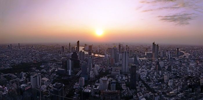
A somewhat lengthy title... I could have simply written: from Bangkok to Chiang Rai, via Chiang Mai, since that was my route. But when poets embellish our travel journals with their verbal flourishes, you’ve got to try not to be too ordinary.
Skyscrapers of excess? You’ll have gathered that from the photo illustrating this journal—though it might change as the trip goes on.
The excess of markets—not so much in their size, though... Chatuchak... But in their sheer number. Day markets, night markets, floating markets, fresh produce markets, fish markets, meat markets, spice markets, fabric markets... and even... amulet markets... For luck, good fortune, protection. Not to mention, sadly, the market for girls—and boys, incidentally. I’ve even heard they’re displayed in windows. I’ve heard about that one, like you have, but I didn’t set foot in it, so I can’t say anything about it. Some even claim there’s a black-market trade in children. Disgusting! It reminded me of the book *The Parcel* by Anosh Irani, which I recommended in another journal. The story is set in India, but I’ve been told it exists in Thailand too. So, the "famous Thai markets" we’re bombarded with in paper and online guides—sure, they amazed me in the first few days, and I don’t regret visiting them. But no matter how big they were, I quickly got my fill since you saw the same things at every stall...
I had a market overdose.
Excess of tourism? I should say *tourists*, since I saw them literally swarming in the streets and those famous markets. I’d forgotten about them. I’d lost the habit, living in an Indian city for so long...
Waterfalls are a bit like markets. At this time of year, they’re not particularly spectacular, but they’re everywhere. There are the ones everyone goes to see. For example, Erawan, which I decided to skip even though it was in my original itinerary—I guessed it’d be a nightmare with the selfie circus. On the other hand, you come across them all over the place, hidden in the mountains and forests, not listed in any guide. Not to mention the ones you can find in temples or even private homes... Yes, really! Thais love waterfalls, so they install them in their gardens—and I even saw one in the middle of the city, right on the street! Sometimes they’re tiny, but very photogenic.
But what do ice cubes have to do with this? Why the excess of ice cubes? Not only are they everywhere by the ton, but they put them in *everything* you drink. You’d think they’d even put them in soup! And it’s not just one or two ice cubes—no! They fill the container to the brim, whatever it is, then pour the liquid on top to fill the gaps. They’ll make you an excellent coffee right in front of you, piping hot, then—bam! An avalanche of ice cubes in the glass. Okay, I’m exaggerating a little. They *do* sometimes ask if you prefer your coffee—or tea—hot. Everything edible, and especially everything drinkable, is refrigerated: vegetables, fruit, hot drinks (I mean, drinks that are *usually* hot), but meat and fish are left out in the open. They just wave a little whisk to shoo away the flies when they get too eager. Mind you, I never put fruit, cheese, eggs, or water in the fridge in France, but I do in India. And I refrigerate meat and fish too... Though sometimes one of those little flies sneaks into the fridge...
You won’t find practical or technical details in this journal, like addresses or prices. Others do that better than me. You also won’t find the names of obscure or unknown places I discovered, or directions to get there.
I don’t really feel like recounting what I saw day by day, following my schedule and route. There might be flashbacks, projections into the future. It’ll depend on my memories, what I felt, what I hated, what comes back to me—and maybe your questions and our exchanges. And for those who’ve never read me before, you’ll have to get used to my parentheses and digressions, maybe on a completely different subject, as my thoughts wander. Stories within stories. There’ll also be long, endless sentences—but still punctuated, so you can follow along. Though I used to curse Proust and his sentences that started on one page and ended on the next, sometimes even further. I’d have to reread them twenty times to follow and understand what he was saying. I hated Proust. But hey, I was 20. Maybe I’d like him now?
See? The digressions are starting already. Forgive me.
You’ll find few photos here. First, the number is limited, and second, photos aren’t the main purpose of either VF or a travel journal. They’re too often used to mask the poverty of the text. And, sorry to say it, but so many of them are just plain ugly! If you really want to see photos, I’ll share some links where you can browse them at your leisure
Uzbek notes
The Afrosiyob races through a premature twilight, lashed by a blizzard of thick snow. In the endless gray, a monumental industrial complex occasionally emerges, ghostly. Here and there, in the middle of nowhere, a human silhouette appears (a soldier?), standing motionless by the tracks. On the screen mounted in the middle of the ceiling, a dashing Bollywood cat in vibrant colors writhes in all directions, throwing smoldering glances at a dancer on the verge of fainting. A server moves down the central aisle, offering crepes for sale—ones I suspect are stuffed with ground beef. I’m in Central Asia, in Uzbekistan, somewhere between Bukhara and Samarkand.
I chose the title "notes"—scattered thoughts, rough drafts. I’m not sure what I’ll write, but one thing’s certain: this won’t be a linear travel journal.
And a photo... there must be a photo, so here:
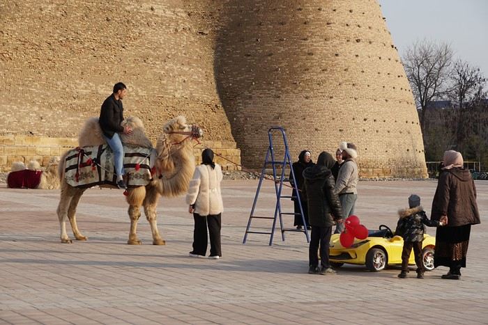
Local tourists between a Bactrian camel and an electric car, in front of ancient walls—it’ll do.
I chose the title "notes"—scattered thoughts, rough drafts. I’m not sure what I’ll write, but one thing’s certain: this won’t be a linear travel journal.
And a photo... there must be a photo, so here:
Local tourists between a Bactrian camel and an electric car, in front of ancient walls—it’ll do.
So where are they and what are they doing?
This catchy and somewhat mysterious title comes from several questions I’ve been asking myself.
VF has been back open for a reasonable number of weeks and months now. The number of visitors overall matches past averages, but the number of members online in the last 24 hours seems relatively lower than what we used to see.
Yet, to my surprise, I’m seeing fewer travel journals, way fewer messages, and way fewer questions. I don’t see many new registered users online, and I notice a number of members who are logged in but either aren’t participating or have stopped participating.
Something’s not adding up for me because, in my opinion, VF is still appealing, and I don’t see which other sites could really compete.
Was there a real break between pre- and post-Covid? Does it just take more time for some people to discover the site or learn that it’s active again? Do people now prefer quick consumption on sites like FB or others I’m not familiar with? Where have the site’s old-timers gone, and what are they doing with their time now? What’s really going on here?
VF has been back open for a reasonable number of weeks and months now. The number of visitors overall matches past averages, but the number of members online in the last 24 hours seems relatively lower than what we used to see.
Yet, to my surprise, I’m seeing fewer travel journals, way fewer messages, and way fewer questions. I don’t see many new registered users online, and I notice a number of members who are logged in but either aren’t participating or have stopped participating.
Something’s not adding up for me because, in my opinion, VF is still appealing, and I don’t see which other sites could really compete.
Was there a real break between pre- and post-Covid? Does it just take more time for some people to discover the site or learn that it’s active again? Do people now prefer quick consumption on sites like FB or others I’m not familiar with? Where have the site’s old-timers gone, and what are they doing with their time now? What’s really going on here?
Biking and Beer in Belgium
"The Most Refreshing Way to Travel Around Belgium"
This is the title of the guide published by Pierre Pauquay at Éditions HELVETIQ Sàrl, Lausanne, Switzerland, 2023.
I set off for Belgium with my camper van and my electric-assist bike, eager to deepen both my theoretical and practical knowledge of this country’s emblematic beverage while exploring the land. This guide became my trusted companion throughout the journey, which took place from June 4 to July 4, 2024.
Out of the 40 routes presented, I chose 21, covering a broad swath of Belgium—both Wallonia (14 routes) and Flanders (6 routes), plus one route around the Brussels-Capital region with a visit to the famous Grimbergen brewery.
Every route included a stop at a brewery, whether lesser-known or famous, artisanal or industrial, family-run or Trappist.
In total, I logged 1,111.2 km of biking over 58 hours and 42 minutes of pedaling, averaging 3 hours of cycling per ride of 55.6 km. I visited 21 breweries, toured a few, and had just one flat tire (I didn’t count the number of beers, but I tasted them all...).
I wasn’t always able to park my camper van near the brewery planned for that day’s route, but I made sure to enjoy the famous nectar only after completing the physical exercise required by the loops.
Traveling by camper van, I needed routes that formed a loop, starting and ending in the same place. Except in Brussels, I never had to rely on campsites for a safe night’s stay. I always found a welcoming public or private parking spot, secure enough to prepare for the next day’s ride.
I discovered Belgium from top to bottom, through hills (not very high) and valleys (very flat and often windy), at my own pace. I stopped whenever a photo caught my eye, grabbed a bite or a drink in the villages I passed through, and often felt like I was truly part of the landscape, in sync with the country’s rhythm and curious to see how people lived...
More to come, with photos in a future post...
Thanks for reading...
All Over Thailand
You can post your personal photos in the following thread: https://voyageforum.com/forum/quelque-part-en-thailande-d10655574/
This travel journal is therefore intended solely for my photos, to present a consistent style. All the shots were taken with a simple Samsung Galaxy smartphone and with whatever was at hand.
All stays combined, I’ve spent the equivalent of a year at most in Thailand, and I’m no great expert. However, after many trips, lots of reading on VoyageForum and other sites, and conversations with many locals as well as expats, my view of the country is becoming clearer, though it’s constantly evolving. You never stop discovering and learning.
I guess I wanted to deliver a puzzle, mainly for those who want to get an idea of the country here and for those who feel nostalgic about it. I don’t know if this minimalist sharing will interest anyone, but it’ll do me good to put it together. After so many months without traveling and then these other long months with VF closed, there’s plenty of material available.
There’ll be a mix of places, periods, and subjects, but it might well be intentional.

I suspect many Thais have dogs because they make excellent guardians for the home. Nothing better to deter burglars or to signal the presence of a snake. You’ll often see Thais tapping the top of their dog’s head, but don’t be fooled: it’s a sign of affection from them. Judging by the dogs’ reactions, they’re used to it.
Thailand is one of the countries on the planet where rabies is still present, so keep that in mind. It’s not just bites that can be dangerous, so don’t let just any dog lick you. Especially on a wound, of course. Even though dogs often fear humans—this dangerous and unpredictable predator—we still need to stay cautious. Be careful when walking into alleys because the dog will defend its master’s big yard. Be careful at night, and be careful when they’re in packs. It sometimes crosses our minds that Thailand isn’t all that made for walking around, and dogs are one of the reasons. That said, it’s not uncommon to see them chasing bikes or scooters. Cars, though? Much rarer—they’re too big.
It seems Thais prefer to give their dogs freedom by not locking them behind gates. Though sometimes the gate is closed, the little side door is wide open. Oh, and sometimes there’s no gate in front of the property, or it’s been full of holes for years.
You’ll often see dogs sleeping on the roadside, sometimes right on the road. When you approach, they move aside nonchalantly—or not at all. It’s less funny when they suddenly appear from thick vegetation, reminding visitors not to drive too fast. As a result, you’ll notice that dogs with injuries or missing legs aren’t that rare.
Since they believe in reincarnation and respect for all forms of life, they don’t chase dog packs away too much, and they don’t sterilize them enough. When you see a small pack roaming freely in the countryside, you think twice about running into them at the edge of a field. A darker side of this is that euthanasia isn’t often practiced. Twice, we saw dogs at death’s door in temples, enduring terrible suffering with no one to help. The image (and the smell) of one of them, agonizing and exuding the stench of death, still comes back to me sometimes.
Some of you may have seen the YouTube vlog of a French woman living in Phuket who was given a little pig by her Thai friends. The animal, well-fed, quickly became a happy and enormous beast with its own garden. Yet it didn’t take long for it to fall seriously ill and become incurable. In her video, the French woman described how difficult it was to find a vet willing to perform euthanasia.
You’ll often see bowls by the side of the road. Thais leave food and water there for stray cats and dogs. Overall, they have a big heart for animals.
If you ever pop into a shopping mall, you might see people pushing their small dogs in strollers. It’s not just for fun—these strollers are provided for customers to put their pets in, otherwise you can’t bring them inside. It looks a bit odd when you expect to see a baby.
This travel journal is therefore intended solely for my photos, to present a consistent style. All the shots were taken with a simple Samsung Galaxy smartphone and with whatever was at hand.
All stays combined, I’ve spent the equivalent of a year at most in Thailand, and I’m no great expert. However, after many trips, lots of reading on VoyageForum and other sites, and conversations with many locals as well as expats, my view of the country is becoming clearer, though it’s constantly evolving. You never stop discovering and learning.
I guess I wanted to deliver a puzzle, mainly for those who want to get an idea of the country here and for those who feel nostalgic about it. I don’t know if this minimalist sharing will interest anyone, but it’ll do me good to put it together. After so many months without traveling and then these other long months with VF closed, there’s plenty of material available.
There’ll be a mix of places, periods, and subjects, but it might well be intentional.
I suspect many Thais have dogs because they make excellent guardians for the home. Nothing better to deter burglars or to signal the presence of a snake. You’ll often see Thais tapping the top of their dog’s head, but don’t be fooled: it’s a sign of affection from them. Judging by the dogs’ reactions, they’re used to it.
Thailand is one of the countries on the planet where rabies is still present, so keep that in mind. It’s not just bites that can be dangerous, so don’t let just any dog lick you. Especially on a wound, of course. Even though dogs often fear humans—this dangerous and unpredictable predator—we still need to stay cautious. Be careful when walking into alleys because the dog will defend its master’s big yard. Be careful at night, and be careful when they’re in packs. It sometimes crosses our minds that Thailand isn’t all that made for walking around, and dogs are one of the reasons. That said, it’s not uncommon to see them chasing bikes or scooters. Cars, though? Much rarer—they’re too big.
It seems Thais prefer to give their dogs freedom by not locking them behind gates. Though sometimes the gate is closed, the little side door is wide open. Oh, and sometimes there’s no gate in front of the property, or it’s been full of holes for years.
You’ll often see dogs sleeping on the roadside, sometimes right on the road. When you approach, they move aside nonchalantly—or not at all. It’s less funny when they suddenly appear from thick vegetation, reminding visitors not to drive too fast. As a result, you’ll notice that dogs with injuries or missing legs aren’t that rare.
Since they believe in reincarnation and respect for all forms of life, they don’t chase dog packs away too much, and they don’t sterilize them enough. When you see a small pack roaming freely in the countryside, you think twice about running into them at the edge of a field. A darker side of this is that euthanasia isn’t often practiced. Twice, we saw dogs at death’s door in temples, enduring terrible suffering with no one to help. The image (and the smell) of one of them, agonizing and exuding the stench of death, still comes back to me sometimes.
Some of you may have seen the YouTube vlog of a French woman living in Phuket who was given a little pig by her Thai friends. The animal, well-fed, quickly became a happy and enormous beast with its own garden. Yet it didn’t take long for it to fall seriously ill and become incurable. In her video, the French woman described how difficult it was to find a vet willing to perform euthanasia.
You’ll often see bowls by the side of the road. Thais leave food and water there for stray cats and dogs. Overall, they have a big heart for animals.
If you ever pop into a shopping mall, you might see people pushing their small dogs in strollers. It’s not just for fun—these strollers are provided for customers to put their pets in, otherwise you can’t bring them inside. It looks a bit odd when you expect to see a baby.
Nothing’s stopping you from going to Ampefy (Madagascar)
During these three big weeks in Madagascar, one week in Sainte Marie, a few days for a little loop in the west/south, and the rest in Tana.
This loop I’m talking about covers an area I’d never taken the time to visit before. A recent road in good condition, the chance to pass through beautiful highland landscapes, and a few free days made it the perfect opportunity. Destination: Ampefy, west of Tana via the RN1, then a turn south onto the recently rehabilitated RN43 to reach Antsirabe before heading back to Tana. Four days planned—perfect, since an extra day wouldn’t have been a problem given all the activities in Ampefy.
First day: a relaxed and fairly late departure for Ampefy. We weren’t in a rush and took our time. Traffic leaving Tana to get back on the RN1 cost us the head start we had on our original schedule. An hour and a half bumper-to-bumper with the *buxis*, inching painfully toward the roundabout and then the bridge that acts as a bottleneck—we dove in like all our fellow sufferers. It’s not our everyday reality, and we were early, so no big deal, but man, it’s long and slow. Once past that obstacle, traffic flowed smoothly, and the road was good (all the way to Ampefy). We moved through highland landscapes, bustling villages full of activity, and countless agricultural supply shops—clear proof, if any were needed, that we were crossing a prime farming region. Around Arivonimamo, we passed through a forest with a Mediterranean vibe: a single-species forest of stout little trees with glossy, elongated light-green leaves—these are *tapia*. An endemic tree in Madagascar, and a pretty unique forest as a result (you can see them elsewhere, like between Antsirabe and Ambositra). There are efforts to protect it from illegal logging because the wood is fire-resistant, which helps shield the forest from wildfires. Beyond its biodiversity value, the *tapia* hosts silkworms, giving it economic and cultural importance.
As we kept going, we started spotting a lake and mountains with the rounded shapes typical of extinct volcanoes worn down by time and the elements. We were approaching Lake Itasy and, by extension, Ampefy. We stopped at a *hotely* for a plate of *tongon’kisoa*—pig’s trotters caramelized by cooking, with thick, flavorful skin—along with the obligatory portion of rice, which we took the time to drizzle with cooking juices to make it a bit more appetizing. Full, we turned left to reach Ampefy and our hotel. The landscape was dotted with collapsed, dormant volcanic cones, and suddenly, the view opened up onto the lake. Shallow and expansive, we followed it, losing sight of it now and then before finding it again in Ampefy itself, which we entered after crossing the Lily, a beautiful river that drains the lake. Lots of hotels and restaurants, with plenty of options at all price points. We chose the *Farihy*, about 5 km past Ampefy. A gorgeous spot by the lake, with a pool and lovely bungalows—some with picture windows overlooking the lake. Really nice. In the evening, a drink and some *sak sak* for aperitif on the terrace. It wasn’t warm, there was a lot of wind, and a storm was brewing. Off to bed quickly to start the next day’s visits.
After buying some lychees—we hadn’t seen many this year, and these were fresh from the field, picked in Ampefy—we headed to the Lily Falls. Well signposted, with a paved road in great condition, we stopped at the kiosk for the entrance fee and parking (1 euro for one *vahiny* and 10 cents for one Malagasy). We set off down the path and quickly reached the first waterfall, then continued for maybe 1 km on a well-marked trail to the second. A guide led us to the third, which is harder to spot and isn’t actually on the Lily itself. Beautiful countryside scenery: fishermen straight out of *Tom Sawyer*, straw hats on their heads, lying down with one foot hooked to a fragile bamboo rod, their line dipping into the calm river. Men preparing rice paddies with their *angady*, women transplanting rice, bent over the water. At some points, we walked along the dikes between paddies almost ready for harvest. It’s peaceful and beautiful when you’re strolling or fishing, but working the paddies is grueling, especially under that beating sun. A really nice walk—2 hours and a bit, going at a leisurely pace. A guide isn’t mandatory; only the entrance fee is. We took one because it provides a bit of work and puts money in the hands of locals, giving them more incentive to protect the site. But you can easily skip it, like most people do. Lots of visitors since it was the weekend—Tananarivians with family or groups of young people, scout groups organized under their chaperones’ direction. Very few foreign tourists, though—that’s a general observation. It’s great to see this growth in domestic tourism, giving Malagasy people the chance to discover their own country and allowing those in the sector to rely less on foreign visitors, who’ve been scarce for years.
Next, we headed to the "geysers" (which aren’t actually geysers, but whatever). We had to go back to the RN1, head toward Tsiroanomandidy, and a few kilometers later, a well-marked sign and a newly paved track led us to a pretty site. Again, lots of people, another kiosk, more fees to pay, and guides available. This time, we skipped the guide. A downpour caught us in front of the "geysers," so we took shelter under a little shop, grabbing an ice cream and some drinks. We didn’t stay long—we weren’t interested in a massage or a dip in the thermal water. The countryside and barren mountain landscapes were stunning on the way back to the hotel. We noticed you could go paragliding right in front of the bungalow, so we booked a session for the next morning. After eating at the *Auberge* in the town center (it was good), we headed back to the hotel to turn in early. Once again, a storm rolled in during the afternoon, and the temperature dropped significantly.
The next morning, around 8 a.m., we walked to the takeoff zone near the hotel. Towed by a small boat, we took off for a flight over the lake and the volcanic domes before landing back at the same spot. Two companies handle this. I’m no expert, but it seemed safe and well-organized.
To be continued...
First day: a relaxed and fairly late departure for Ampefy. We weren’t in a rush and took our time. Traffic leaving Tana to get back on the RN1 cost us the head start we had on our original schedule. An hour and a half bumper-to-bumper with the *buxis*, inching painfully toward the roundabout and then the bridge that acts as a bottleneck—we dove in like all our fellow sufferers. It’s not our everyday reality, and we were early, so no big deal, but man, it’s long and slow. Once past that obstacle, traffic flowed smoothly, and the road was good (all the way to Ampefy). We moved through highland landscapes, bustling villages full of activity, and countless agricultural supply shops—clear proof, if any were needed, that we were crossing a prime farming region. Around Arivonimamo, we passed through a forest with a Mediterranean vibe: a single-species forest of stout little trees with glossy, elongated light-green leaves—these are *tapia*. An endemic tree in Madagascar, and a pretty unique forest as a result (you can see them elsewhere, like between Antsirabe and Ambositra). There are efforts to protect it from illegal logging because the wood is fire-resistant, which helps shield the forest from wildfires. Beyond its biodiversity value, the *tapia* hosts silkworms, giving it economic and cultural importance.
As we kept going, we started spotting a lake and mountains with the rounded shapes typical of extinct volcanoes worn down by time and the elements. We were approaching Lake Itasy and, by extension, Ampefy. We stopped at a *hotely* for a plate of *tongon’kisoa*—pig’s trotters caramelized by cooking, with thick, flavorful skin—along with the obligatory portion of rice, which we took the time to drizzle with cooking juices to make it a bit more appetizing. Full, we turned left to reach Ampefy and our hotel. The landscape was dotted with collapsed, dormant volcanic cones, and suddenly, the view opened up onto the lake. Shallow and expansive, we followed it, losing sight of it now and then before finding it again in Ampefy itself, which we entered after crossing the Lily, a beautiful river that drains the lake. Lots of hotels and restaurants, with plenty of options at all price points. We chose the *Farihy*, about 5 km past Ampefy. A gorgeous spot by the lake, with a pool and lovely bungalows—some with picture windows overlooking the lake. Really nice. In the evening, a drink and some *sak sak* for aperitif on the terrace. It wasn’t warm, there was a lot of wind, and a storm was brewing. Off to bed quickly to start the next day’s visits.
After buying some lychees—we hadn’t seen many this year, and these were fresh from the field, picked in Ampefy—we headed to the Lily Falls. Well signposted, with a paved road in great condition, we stopped at the kiosk for the entrance fee and parking (1 euro for one *vahiny* and 10 cents for one Malagasy). We set off down the path and quickly reached the first waterfall, then continued for maybe 1 km on a well-marked trail to the second. A guide led us to the third, which is harder to spot and isn’t actually on the Lily itself. Beautiful countryside scenery: fishermen straight out of *Tom Sawyer*, straw hats on their heads, lying down with one foot hooked to a fragile bamboo rod, their line dipping into the calm river. Men preparing rice paddies with their *angady*, women transplanting rice, bent over the water. At some points, we walked along the dikes between paddies almost ready for harvest. It’s peaceful and beautiful when you’re strolling or fishing, but working the paddies is grueling, especially under that beating sun. A really nice walk—2 hours and a bit, going at a leisurely pace. A guide isn’t mandatory; only the entrance fee is. We took one because it provides a bit of work and puts money in the hands of locals, giving them more incentive to protect the site. But you can easily skip it, like most people do. Lots of visitors since it was the weekend—Tananarivians with family or groups of young people, scout groups organized under their chaperones’ direction. Very few foreign tourists, though—that’s a general observation. It’s great to see this growth in domestic tourism, giving Malagasy people the chance to discover their own country and allowing those in the sector to rely less on foreign visitors, who’ve been scarce for years.
Next, we headed to the "geysers" (which aren’t actually geysers, but whatever). We had to go back to the RN1, head toward Tsiroanomandidy, and a few kilometers later, a well-marked sign and a newly paved track led us to a pretty site. Again, lots of people, another kiosk, more fees to pay, and guides available. This time, we skipped the guide. A downpour caught us in front of the "geysers," so we took shelter under a little shop, grabbing an ice cream and some drinks. We didn’t stay long—we weren’t interested in a massage or a dip in the thermal water. The countryside and barren mountain landscapes were stunning on the way back to the hotel. We noticed you could go paragliding right in front of the bungalow, so we booked a session for the next morning. After eating at the *Auberge* in the town center (it was good), we headed back to the hotel to turn in early. Once again, a storm rolled in during the afternoon, and the temperature dropped significantly.
The next morning, around 8 a.m., we walked to the takeoff zone near the hotel. Towed by a small boat, we took off for a flight over the lake and the volcanic domes before landing back at the same spot. Two companies handle this. I’m no expert, but it seemed safe and well-organized.
To be continued...
From Caño Cristales to Tayrona Park
After about 12 hours of flying from Toulouse (via Paris), we landed in Bogotá six years after our first trip to Colombia. This time, our journey will be very different, with only this stop in the Colombian capital in common.
Our travel itinerary
Bogotá / La Macarena (Caño Cristales) / Villa de Leyva / Barichara / San Gil / Girón / Mompox / Ciénaga and the Santa Marta lagoon / Minca / Los Naranjos (Tayrona Park) / Bogotá.
Step 1: Bogotá (and Nemecon)
Bogotá (1/3)
This morning, we had a meet-up with Flora from Aventure Colombia, who helped me organize one of our stops, a few transfers, and tomorrow’s day trip, the program of which I changed at the last minute after deciding to skip the visit to the Salt Cathedral of Zipaquirá. Flora is a kind and lovely person, always available, and she did everything to answer my questions and give me advice.
She’s a local contact I highly recommend. Flora can help you plan your trip, whether you want a fully organized tour or, like us, just need assistance with a specific stop or one or more transfers between cities.
We left Flora after setting a meet-up for our return to Bogotá in a month. As we walked out of her agency, we headed to the wonderful Gold Museum, located just a hundred meters away. I was excited to revisit this amazing museum.
Note: Free entry for those over 60, regardless of nationality. Just show your passport.
Like six years ago, I was amazed by its museography, the beauty of the pieces on display, and that breathtaking shamanic room.
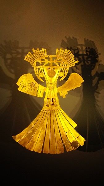
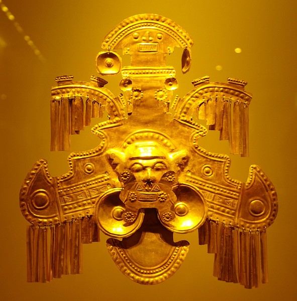
About two hours later, we decided to walk (careful, it’s a climb!) to the Monserrate cable car (3152m). Long wait to buy tickets and board the cable car! Once we arrived, a few raindrops, an impressive panoramic view of Bogotá’s vastness, a quick visit to the basilica (a pilgrimage site for Colombians), a walk through the tourist market, and at the top, plenty of small restaurants where we had our first Colombian meal. After our hearty lunch, we were lucky to see the sun return! No line for the descent. We then headed back to the hotel because Justine wanted to rest and recover from the trip. As for me, I continued my walk. I discovered a really nice craft market recommended by Flora, Pasaje Rivas, returned to Bolívar Square, and wandered through different streets, including the main pedestrian avenue (Calle 7), where there’s always something to see.
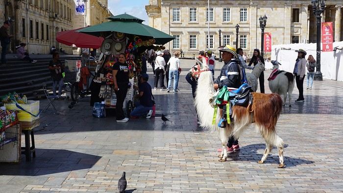
Tomorrow, a change of scenery as we head out for a hike in a small desert (Desierto de Chueca), located about 2 hours from Bogotá in the village of Nemecon. For this outing from Bogotá, with Flora’s help, we booked a car with a driver for the day. Flora also took care of booking the guide (since the site can only be visited with one). Nemecon (2/3) Today, we went to Nemecon to hike about 7.5 km in the ‘Desert of Checua.’ It’s nothing like sandy deserts! Instead, it’s geological formations sculpted by time, wind, and water. After two hours on the road—almost one of them spent navigating traffic jams with cars, trucks, buses, and a continuous flow of motorcycles on either side of our taxi—we reached Nemecon! The village center is really (too?) quiet. We met up with Deisy and headed toward the ‘desert,’ about twenty minutes away on a bumpy dirt road. Once there, a quick briefing, and off we went! Deisy didn’t stop talking (in Spanish) for over 3 hours!!! She told us so much about her region (flower farming, water management, traditions, songs, etc.), the origin of the site, and even mentioned Antonio Banderas, who filmed *The 33* in the village’s salt mine (the story of the survival of 33 Chilean miners after a collapse in their copper and gold mine). One hour of walking to reach the site, one hour to explore it, and one hour to return.
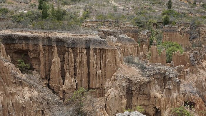
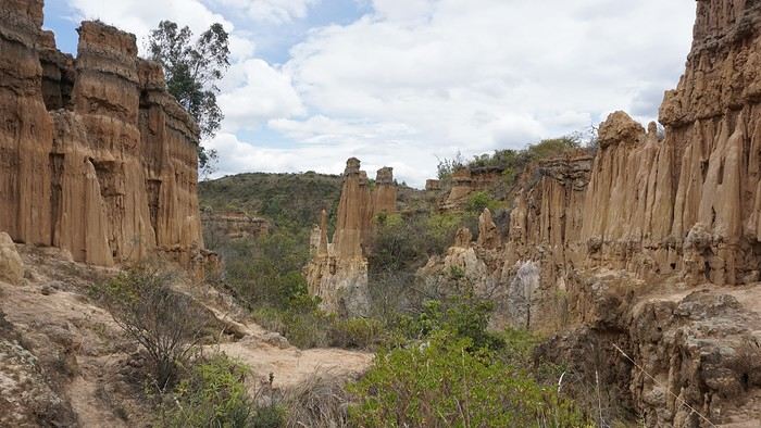
The advantage of this non-stop chatter was that it forced us to brush up on our Spanish at lightning speed. I even wondered if the effort to concentrate wasn’t more exhausting than the physical effort! Especially since on the way back, I got an oral quiz. Deisy wanted to make sure I remembered some of the information she’d given me during the visit: why is this rock white, that one red, and that one black? Back in the village, we had lunch at a restaurant recommended by Deisy before visiting the Nemecon salt mine. Before entering, a guide spent a good half-hour explaining the origin of the salt and the presence of many fossils in the area. Again, concentrating was tough because all the comments were exclusively in Spanish! An hour and a half wandering through the tunnels with a ‘lovely miner’s helmet’ on our heads!
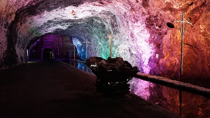
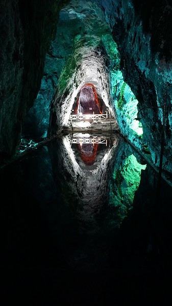
We met our driver at the mine entrance. The return to Bogotá was a bit faster, but traffic in the city center was still heavy! We arrived in front of our hotel between 8:00 and 8:30 PM. It’s been a pretty intense start to the trip! Tonight, our legs are tired. Hopefully, tomorrow will be a bit more relaxed! Bogotá (3/3) We started the day by visiting the Santa Clara Church Museum, located next to the presidential palace. Alejandra (from the local agency ‘Gaia Tours Colombia,’ which organized our stay in Caño Cristales (La Macarena)) had recommended this visit for its rich mural paintings.
A few hundred meters further, after crossing the Plaza Mayor again, we visited the cultural complex housing the Botero Museum, the Mint Museum, and the Bank of the Republic Art Museum. Note that entry is free for all three museums. Botero Museum: There are fewer works by Botero here than in the Medellín museum, but more paintings and sculptures by other artists, all from Botero’s private collection (donated to Colombia). Mint Museum: We limited ourselves to visiting one room (on Flora’s advice) where three gold and gemstone monstrances and a Christ with a crown of emerald thorns are displayed. Photos are not allowed. Art Museum: We visited two temporary exhibitions. Lunchtime came quickly. We had a good meal at a reasonably priced small restaurant in the La Candelaria micro-district, near the Chorro de Quevedo square. We decided to spend the afternoon wandering the streets and alleys of the historic center to discover local street art.
We also passed through very lively pedestrian streets. I also decided to revisit Pasaje Rivas to show Justine all the shops selling more or less artisanal products. Tomorrow morning, we fly to La Macarena at 10:30 AM. Not to dance (you’d be surprised if I told you we were going to take a South American dance class, right?!), but to visit the fabulous Caño Cristales, a river naturally colored by aquatic plants. The planned program includes hiking, horseback riding, canoeing, and swimming among these plants. This site was long inaccessible because the area was controlled by the FARC. Access and tourism development became possible after agreements and amnesty measures between the Colombian government and paramilitary groups. As in other regions, former FARC members have been able to transition into various tourism-related activities.
About two hours later, we decided to walk (careful, it’s a climb!) to the Monserrate cable car (3152m). Long wait to buy tickets and board the cable car! Once we arrived, a few raindrops, an impressive panoramic view of Bogotá’s vastness, a quick visit to the basilica (a pilgrimage site for Colombians), a walk through the tourist market, and at the top, plenty of small restaurants where we had our first Colombian meal. After our hearty lunch, we were lucky to see the sun return! No line for the descent. We then headed back to the hotel because Justine wanted to rest and recover from the trip. As for me, I continued my walk. I discovered a really nice craft market recommended by Flora, Pasaje Rivas, returned to Bolívar Square, and wandered through different streets, including the main pedestrian avenue (Calle 7), where there’s always something to see.
Tomorrow, a change of scenery as we head out for a hike in a small desert (Desierto de Chueca), located about 2 hours from Bogotá in the village of Nemecon. For this outing from Bogotá, with Flora’s help, we booked a car with a driver for the day. Flora also took care of booking the guide (since the site can only be visited with one). Nemecon (2/3) Today, we went to Nemecon to hike about 7.5 km in the ‘Desert of Checua.’ It’s nothing like sandy deserts! Instead, it’s geological formations sculpted by time, wind, and water. After two hours on the road—almost one of them spent navigating traffic jams with cars, trucks, buses, and a continuous flow of motorcycles on either side of our taxi—we reached Nemecon! The village center is really (too?) quiet. We met up with Deisy and headed toward the ‘desert,’ about twenty minutes away on a bumpy dirt road. Once there, a quick briefing, and off we went! Deisy didn’t stop talking (in Spanish) for over 3 hours!!! She told us so much about her region (flower farming, water management, traditions, songs, etc.), the origin of the site, and even mentioned Antonio Banderas, who filmed *The 33* in the village’s salt mine (the story of the survival of 33 Chilean miners after a collapse in their copper and gold mine). One hour of walking to reach the site, one hour to explore it, and one hour to return.
The advantage of this non-stop chatter was that it forced us to brush up on our Spanish at lightning speed. I even wondered if the effort to concentrate wasn’t more exhausting than the physical effort! Especially since on the way back, I got an oral quiz. Deisy wanted to make sure I remembered some of the information she’d given me during the visit: why is this rock white, that one red, and that one black? Back in the village, we had lunch at a restaurant recommended by Deisy before visiting the Nemecon salt mine. Before entering, a guide spent a good half-hour explaining the origin of the salt and the presence of many fossils in the area. Again, concentrating was tough because all the comments were exclusively in Spanish! An hour and a half wandering through the tunnels with a ‘lovely miner’s helmet’ on our heads!
We met our driver at the mine entrance. The return to Bogotá was a bit faster, but traffic in the city center was still heavy! We arrived in front of our hotel between 8:00 and 8:30 PM. It’s been a pretty intense start to the trip! Tonight, our legs are tired. Hopefully, tomorrow will be a bit more relaxed! Bogotá (3/3) We started the day by visiting the Santa Clara Church Museum, located next to the presidential palace. Alejandra (from the local agency ‘Gaia Tours Colombia,’ which organized our stay in Caño Cristales (La Macarena)) had recommended this visit for its rich mural paintings.
A few hundred meters further, after crossing the Plaza Mayor again, we visited the cultural complex housing the Botero Museum, the Mint Museum, and the Bank of the Republic Art Museum. Note that entry is free for all three museums. Botero Museum: There are fewer works by Botero here than in the Medellín museum, but more paintings and sculptures by other artists, all from Botero’s private collection (donated to Colombia). Mint Museum: We limited ourselves to visiting one room (on Flora’s advice) where three gold and gemstone monstrances and a Christ with a crown of emerald thorns are displayed. Photos are not allowed. Art Museum: We visited two temporary exhibitions. Lunchtime came quickly. We had a good meal at a reasonably priced small restaurant in the La Candelaria micro-district, near the Chorro de Quevedo square. We decided to spend the afternoon wandering the streets and alleys of the historic center to discover local street art.
We also passed through very lively pedestrian streets. I also decided to revisit Pasaje Rivas to show Justine all the shops selling more or less artisanal products. Tomorrow morning, we fly to La Macarena at 10:30 AM. Not to dance (you’d be surprised if I told you we were going to take a South American dance class, right?!), but to visit the fabulous Caño Cristales, a river naturally colored by aquatic plants. The planned program includes hiking, horseback riding, canoeing, and swimming among these plants. This site was long inaccessible because the area was controlled by the FARC. Access and tourism development became possible after agreements and amnesty measures between the Colombian government and paramilitary groups. As in other regions, former FARC members have been able to transition into various tourism-related activities.
Sugar overload in the American West
After a first trip with her teens to the West during Easter 2019 and then to New York at All Saints' Day that same year, Cécile has only one idea in 2022: to go back!!!! So, we’re planning a loop from SF to SF, passing through the sequoias, LV, Death Valley, and Yellowstone.
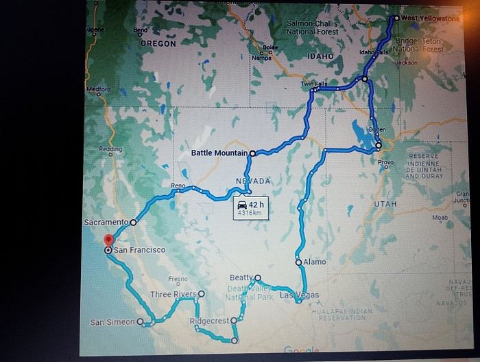
Off we go, full of joy and good spirits, heading to San Francisco. To make the flight more comfortable, I’d booked a seat with extra legroom.
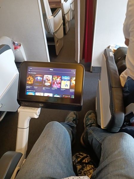
Really nice!
Anyway, everything went smoothly until we arrived—1h30 of waiting at customs!!!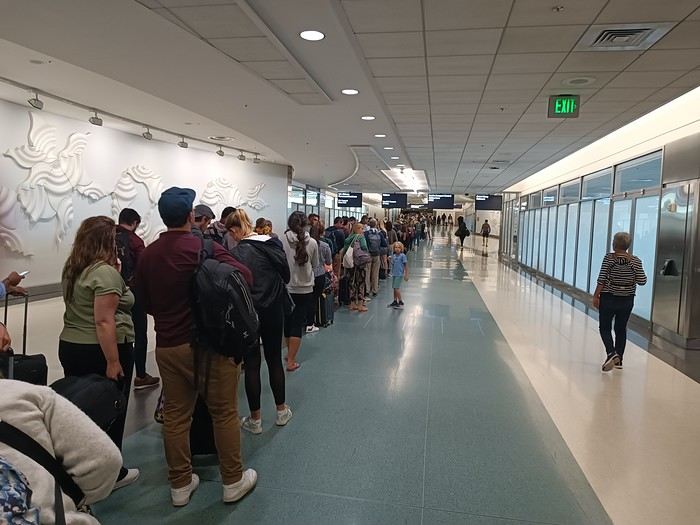
But no matter, around 11 PM, we took the shuttle to a hotel, tired but happy
Off we go, full of joy and good spirits, heading to San Francisco. To make the flight more comfortable, I’d booked a seat with extra legroom.
Really nice!
Anyway, everything went smoothly until we arrived—1h30 of waiting at customs!!!
But no matter, around 11 PM, we took the shuttle to a hotel, tired but happy
Martine and DD in Colorado and Utah
Hello everyone! 🙂
So many silent months, and now Voyage Forum is accessible again. That’s cool because we can pick up our discussions for our mutual enjoyment.
I hope everyone is doing well and that you’ve been able to take some great trips, whether to the USA or elsewhere.
In September 2020, we had planned a round trip to explore Colorado, but unfortunately, a nasty virus messed up our plans, closing borders and keeping us stuck at home. Luckily for us, canceling the car, flights, and accommodations didn’t cost us a thing—everything was refunded.
In 2023, a loop from Las Vegas let us revisit places we’d seen in 2017 and discover new ones, this time spending more time at each stop with some lovely hikes.
In 2024, we finally revisited the 2020 plan, and I’ll start with that.
However, unforeseen circumstances mean I have much less time than before, so I’ll keep my trip reports shorter (ha ha ha—you’ll have less of my prose to endure).
Another change: for those who remember the "Gang of Four crazy sixty-somethings," it was just DD and me this time. Our dear Mimi and Maumau left the Var to focus on raising horses and can’t leave their little green paradise to join us anymore. We were unfortunately much tamer without them.
We traveled from September 11 to October 3.
The itinerary
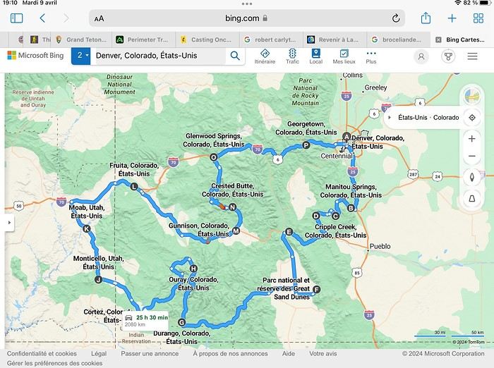
Day 1: Flight Marseille-Paris-Denver, then Manitou Springs (133 km) Day 2: Manitou Springs (49 km) Day 3: Cripple Creek (104 km) Day 4: Salida (254 km) Day 5: Great Sand Dunes (231 km) Day 6: Durango (283 km) Day 7: Durango (Durango-Silverton train) Day 8: Ouray (121 km) Day 9: Ouray (Perimeter Trail hike) Day 10: Cortez (213 km) Day 11: Cortez (Mesa Verde National Park, 134 km) Day 12: Monticello (268 km, detour to Chesler Park) Day 13: Moab (171 km, Delicate Arch) Day 14: Moab (98 km, Fisher Towers) Day 15: Moab (171 km, Canyonlands) Day 16: Fruita (210 km, Colorado National Monument) Day 17: Crested Butte (224 km via Kebler Pass) Day 18: Crested Butte (57 km) Day 19: Glenwood Springs (150 km) Day 20: Glenwood Springs (118 km, Rifle State Park) Day 21: Georgetown (258 km via Independence Pass) Day 22: Denver (123 km), then return flight
We speak very little English. We spent 21 nights there and covered a 3,400 km loop by car and 160 km on foot (we’re still trying to hike while we’re in shape) from Denver in September 2024. We wanted this road trip to help us explore Colorado a bit more—we’d only spent 6 nights there in 2019—and to see it during the fall foliage season. We also wanted to return to Utah (we love Moab) to enjoy its red rocks, which we adore.
In the prices you see (some in euros, others in dollars), I’ve included bank fees and exchange charges. The flights, car, and parking were paid by credit card when we booked in February. Usually, we book around November, but some obligations kept us from doing it earlier. We downloaded the MPC (Mobile Passport Control) app on our phone, which saved us time at immigration.
📊 **Budget: just under 8,500 € for both of us, all included**
📊 **Flights** Marseille-Paris (CDG)-Denver: 2,152 € for both of us, with one checked bag each
📊 **ESTA and America the Beautiful Pass** The ones from our 2023 road trip were still valid
📊 **Parking at Marseille airport: 122 €**
📊 **Car: Nissan Rogue (the French X-Trail) from Hertz: 1,165 €** By booking through Air France (and earning miles), we got a 15% discount. Hertz offers a free Hertz Gold Plus Rewards program, which gives us priority counter service.
📊 **Accommodation: 3,050 €** We stayed in motels and hotels of various ranges (from 100 € to 270 € per night, depending on the city), all booked through Hotels.com or Booking. Booking sometimes offers cheaper rates if you book via the "Booking mobile" app. We also got some preferential rates thanks to our Genius 2 status. Out of 21 nights, only one place didn’t include breakfast.
📊 **Other expenses (activities booked by credit card before leaving)** Durango-Silverton train: 210 € (we booked the enclosed vintage coach in March) Mesa Verde: Balcony House: 15.15 € (booked 14 days before the visit) Timed-entry passes for Arches National Park: 6 € for 3 days (booked June 1 for September entries via http://récreation.gov/). We booked three different days to play with the weather.
📊 **Supplementary insurance with AVA: 204 €** (due to our age 😅 and the high cost of medical consultations in the USA)
📊 **Cash: 1,540 €** We left with 1,000 € exchanged before departure and made two withdrawals (500 $ and 200 $). This cash was used to pay for: - Evening restaurants and tips (between 70 $ and 95 $ for two meals and two drinks) - Two state parks: Dead Horse State Park (20 $) and Rifle State Park (10 $) - The Monarch Pass gondola (24 $) - Midday picnics - Gas (slightly cheaper with cash): 204 $ for 3,400 km - Personal souvenirs and little treats.
Like in our previous road trips, we didn’t rent a GPS. We used the offline GPS app Here We Go, for which we’d downloaded maps of Colorado and Utah from France, as well as a new offline app called Organic Maps as a backup—though we didn’t end up needing it.
❤️❤️❤️ **Highlights (there are so many!)** 📍 The stunning landscapes of Colorado, especially with the fall colors 📍 A step back in time at the old farm in Florissant Fossil Beds National Monument 📍 The prairies of Cripple Creek and the mining remnants of the Vindicator Trail 📍 The cheeky chipmunks in the ghost town of St. Elmo 📍 Great Sand Dunes and its soft sand 📍 The steam train between Durango and Silverton: we’re glad we chose the round-trip because it rained heavily on the way there, but we got to enjoy the scenery on the way back when the sun came out 📍 The unexpected meet-up with Michèle from the group outside a restaurant in Durango 📍 The hot springs in Ouray 📍 Mesa Verde and its still-vibrant past 📍 The red rocks of Moab and Delicate Arch at sunset 📍 The lace-like Fisher Towers and the view from the end of the trail 📍 The gorgeous Route 128 leading to Colorado National Monument—small, easy to visit, and so beautiful 📍 The colors of the fabulous Kebler Pass, Crested Butte, and especially the hike through the golden aspens (Lower and Upper Loop) 📍 The waterfalls at Rifle State Park 📍 The tundra of Independence Pass 📍 The Halloween decorations in Georgetown and Idaho Springs
😞😞 **Flops (there are very few!)** 📍 The viewpoints we missed because they weren’t well-marked or we didn’t see the signs 📍 The closure of some hiking trails (Hanging Lake and parts of Canyonlands) and the Sal Mountain Loop road, which kept us from accessing it 📍😢 The Chesler Park hike we had to cut short due to poor time management—180 km between our stop in Cortez meant we didn’t arrive until 10:30 AM, way too late for a 17 km hike.
Hope this helps! Have a great evening, everyone, and see you soon! 😊
The itinerary
Day 1: Flight Marseille-Paris-Denver, then Manitou Springs (133 km) Day 2: Manitou Springs (49 km) Day 3: Cripple Creek (104 km) Day 4: Salida (254 km) Day 5: Great Sand Dunes (231 km) Day 6: Durango (283 km) Day 7: Durango (Durango-Silverton train) Day 8: Ouray (121 km) Day 9: Ouray (Perimeter Trail hike) Day 10: Cortez (213 km) Day 11: Cortez (Mesa Verde National Park, 134 km) Day 12: Monticello (268 km, detour to Chesler Park) Day 13: Moab (171 km, Delicate Arch) Day 14: Moab (98 km, Fisher Towers) Day 15: Moab (171 km, Canyonlands) Day 16: Fruita (210 km, Colorado National Monument) Day 17: Crested Butte (224 km via Kebler Pass) Day 18: Crested Butte (57 km) Day 19: Glenwood Springs (150 km) Day 20: Glenwood Springs (118 km, Rifle State Park) Day 21: Georgetown (258 km via Independence Pass) Day 22: Denver (123 km), then return flight
We speak very little English. We spent 21 nights there and covered a 3,400 km loop by car and 160 km on foot (we’re still trying to hike while we’re in shape) from Denver in September 2024. We wanted this road trip to help us explore Colorado a bit more—we’d only spent 6 nights there in 2019—and to see it during the fall foliage season. We also wanted to return to Utah (we love Moab) to enjoy its red rocks, which we adore.
In the prices you see (some in euros, others in dollars), I’ve included bank fees and exchange charges. The flights, car, and parking were paid by credit card when we booked in February. Usually, we book around November, but some obligations kept us from doing it earlier. We downloaded the MPC (Mobile Passport Control) app on our phone, which saved us time at immigration.
📊 **Budget: just under 8,500 € for both of us, all included**
📊 **Flights** Marseille-Paris (CDG)-Denver: 2,152 € for both of us, with one checked bag each
📊 **ESTA and America the Beautiful Pass** The ones from our 2023 road trip were still valid
📊 **Parking at Marseille airport: 122 €**
📊 **Car: Nissan Rogue (the French X-Trail) from Hertz: 1,165 €** By booking through Air France (and earning miles), we got a 15% discount. Hertz offers a free Hertz Gold Plus Rewards program, which gives us priority counter service.
📊 **Accommodation: 3,050 €** We stayed in motels and hotels of various ranges (from 100 € to 270 € per night, depending on the city), all booked through Hotels.com or Booking. Booking sometimes offers cheaper rates if you book via the "Booking mobile" app. We also got some preferential rates thanks to our Genius 2 status. Out of 21 nights, only one place didn’t include breakfast.
📊 **Other expenses (activities booked by credit card before leaving)** Durango-Silverton train: 210 € (we booked the enclosed vintage coach in March) Mesa Verde: Balcony House: 15.15 € (booked 14 days before the visit) Timed-entry passes for Arches National Park: 6 € for 3 days (booked June 1 for September entries via http://récreation.gov/). We booked three different days to play with the weather.
📊 **Supplementary insurance with AVA: 204 €** (due to our age 😅 and the high cost of medical consultations in the USA)
📊 **Cash: 1,540 €** We left with 1,000 € exchanged before departure and made two withdrawals (500 $ and 200 $). This cash was used to pay for: - Evening restaurants and tips (between 70 $ and 95 $ for two meals and two drinks) - Two state parks: Dead Horse State Park (20 $) and Rifle State Park (10 $) - The Monarch Pass gondola (24 $) - Midday picnics - Gas (slightly cheaper with cash): 204 $ for 3,400 km - Personal souvenirs and little treats.
Like in our previous road trips, we didn’t rent a GPS. We used the offline GPS app Here We Go, for which we’d downloaded maps of Colorado and Utah from France, as well as a new offline app called Organic Maps as a backup—though we didn’t end up needing it.
❤️❤️❤️ **Highlights (there are so many!)** 📍 The stunning landscapes of Colorado, especially with the fall colors 📍 A step back in time at the old farm in Florissant Fossil Beds National Monument 📍 The prairies of Cripple Creek and the mining remnants of the Vindicator Trail 📍 The cheeky chipmunks in the ghost town of St. Elmo 📍 Great Sand Dunes and its soft sand 📍 The steam train between Durango and Silverton: we’re glad we chose the round-trip because it rained heavily on the way there, but we got to enjoy the scenery on the way back when the sun came out 📍 The unexpected meet-up with Michèle from the group outside a restaurant in Durango 📍 The hot springs in Ouray 📍 Mesa Verde and its still-vibrant past 📍 The red rocks of Moab and Delicate Arch at sunset 📍 The lace-like Fisher Towers and the view from the end of the trail 📍 The gorgeous Route 128 leading to Colorado National Monument—small, easy to visit, and so beautiful 📍 The colors of the fabulous Kebler Pass, Crested Butte, and especially the hike through the golden aspens (Lower and Upper Loop) 📍 The waterfalls at Rifle State Park 📍 The tundra of Independence Pass 📍 The Halloween decorations in Georgetown and Idaho Springs
😞😞 **Flops (there are very few!)** 📍 The viewpoints we missed because they weren’t well-marked or we didn’t see the signs 📍 The closure of some hiking trails (Hanging Lake and parts of Canyonlands) and the Sal Mountain Loop road, which kept us from accessing it 📍😢 The Chesler Park hike we had to cut short due to poor time management—180 km between our stop in Cortez meant we didn’t arrive until 10:30 AM, way too late for a 17 km hike.
Hope this helps! Have a great evening, everyone, and see you soon! 😊
Southwest Part 2: 55 Days in Colorado, New Mexico, Arizona, Nevada, and Utah
This travel journal is the second part of the trip whose first part you can find here: 1st part...
Sunday, August 7: the day we discover a magical place... Edmaier's Secret...
We got up at 8:00 AM, had breakfast on the terrace of our tiny house, and then set off again toward yesterday’s trail. This time, we stopped after 4.5 miles on House Rock Valley Road at the Buckskin Gulch Trail parking lot. We weren’t interested in that trail today—the slot canyon is muddy anyway after the recent storms...
Instead, we explored a lesser-known area that became our playground. And what a playground it was, folks—an out-of-this-world spot, THE highlight of our trip!!! 😏
Just imagine being in the middle of these landscapes, and the cherry on top... no one else around!!!!! Well, we did meet a couple who were coming back—it was 9:30 AM 😮. Did they camp there? Did they turn back? 🙁
After paying the entry permit online, we set off with plenty of water (6L for the four of us) plus a gallon we hid along the way for the return trip. 😉 After a one-hour approach hike along a wash, we reached the sea of sand.
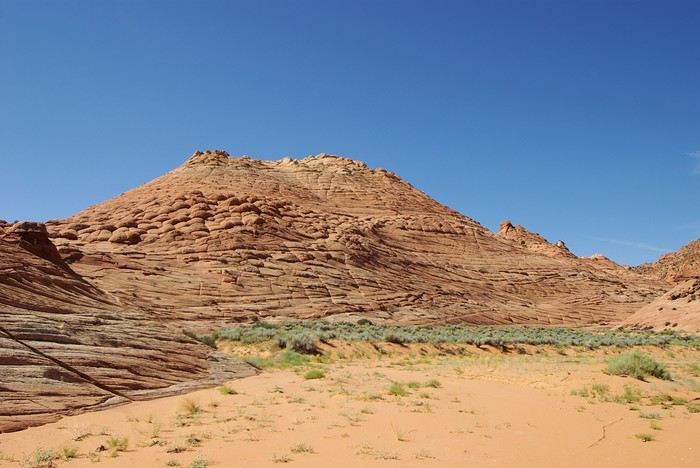
We had to cross it to reach our goal: a strip about 2 km long and 1 km wide that you can explore freely since there’s no marked trail... We entered a few GPS points into our Garmin Etrex, and off we went!!! 😎 It was... magical, enchanting, a true love-at-first-sight moment!
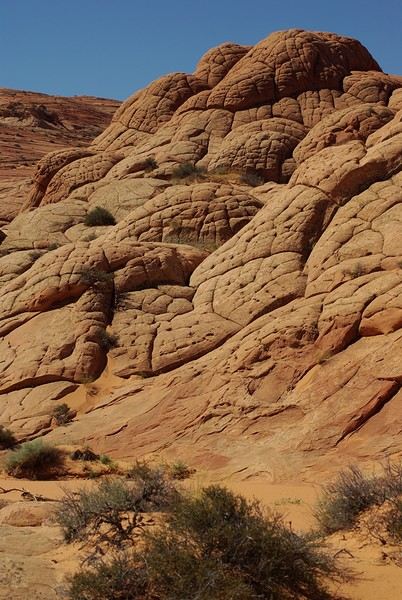
Brain Rock, waves, fine and brittle rock, colors—it goes up, it goes down.
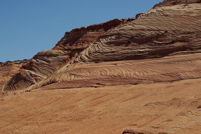
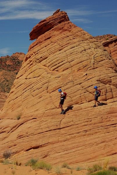
Just thinking about it gives me chills... I remember sitting still for two minutes, taking in these wonders with such emotion that I teared up...
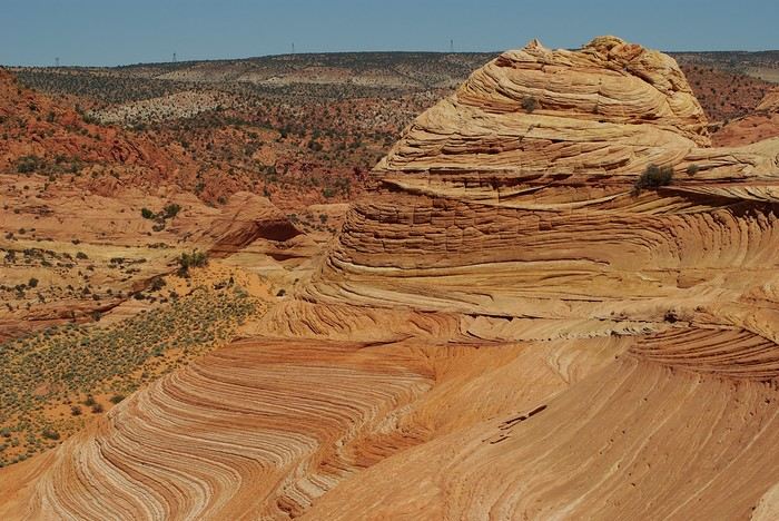
Sunday, August 7: the day we discover a magical place... Edmaier's Secret...
We got up at 8:00 AM, had breakfast on the terrace of our tiny house, and then set off again toward yesterday’s trail. This time, we stopped after 4.5 miles on House Rock Valley Road at the Buckskin Gulch Trail parking lot. We weren’t interested in that trail today—the slot canyon is muddy anyway after the recent storms...
Instead, we explored a lesser-known area that became our playground. And what a playground it was, folks—an out-of-this-world spot, THE highlight of our trip!!! 😏
Just imagine being in the middle of these landscapes, and the cherry on top... no one else around!!!!! Well, we did meet a couple who were coming back—it was 9:30 AM 😮. Did they camp there? Did they turn back? 🙁
After paying the entry permit online, we set off with plenty of water (6L for the four of us) plus a gallon we hid along the way for the return trip. 😉 After a one-hour approach hike along a wash, we reached the sea of sand.
We had to cross it to reach our goal: a strip about 2 km long and 1 km wide that you can explore freely since there’s no marked trail... We entered a few GPS points into our Garmin Etrex, and off we went!!! 😎 It was... magical, enchanting, a true love-at-first-sight moment!
Brain Rock, waves, fine and brittle rock, colors—it goes up, it goes down.
Just thinking about it gives me chills... I remember sitting still for two minutes, taking in these wonders with such emotion that I teared up...
Kyushu between Fukuoka and Nagasaki in autumn 2024 (Japan)
Fellow travelers,
Don’t they say "never two without three"? It seems so. Here I am again on the forum to share—and let’s be honest, indulge a bit of selfish pleasure—by recounting the story of this third installment in the Land of the Rising Sun.
Where? It’s all in the title. On the island of Kyushu in southern Japan, more precisely in the northwest between Fukuoka and Nagasaki. I hope to take you along with me for 19 nights and 18 full days this autumn of 2024. On the itinerary: gastronomy, crafts, festivals, waterfalls, encounters, and leisurely strolls in all simplicity.
A last-minute flight booked just 7 days before departure, and the route evolved regularly based on whims and accommodation availability, eventually settling on this:
- 5 nights in Fukuoka: Fukuoka city, Ukiha, Itoshima, Dazaifu, Yanagawa - 4 nights in Hasami, Nagasaki Prefecture: Okawachiyama, Arita, Takeo, Kashima, Yobuko, Karatsu, Kabeshima - 6 nights in Nagasaki: Ureshino, Higashi-Sonogi, Nagasaki city, Unzen, Sotome - 4 nights in Fukuoka: Karatsu, Fukuoka city
Most of the trip was done by car for practical reasons—easier access to certain places and freedom of movement—but also for the sheer joy of it. Despite slow traffic at times, driving in rural Japan is a delight.
If the program interests you, see you soon for the start of the journey.
Don’t they say "never two without three"? It seems so. Here I am again on the forum to share—and let’s be honest, indulge a bit of selfish pleasure—by recounting the story of this third installment in the Land of the Rising Sun.
Where? It’s all in the title. On the island of Kyushu in southern Japan, more precisely in the northwest between Fukuoka and Nagasaki. I hope to take you along with me for 19 nights and 18 full days this autumn of 2024. On the itinerary: gastronomy, crafts, festivals, waterfalls, encounters, and leisurely strolls in all simplicity.
A last-minute flight booked just 7 days before departure, and the route evolved regularly based on whims and accommodation availability, eventually settling on this:
- 5 nights in Fukuoka: Fukuoka city, Ukiha, Itoshima, Dazaifu, Yanagawa - 4 nights in Hasami, Nagasaki Prefecture: Okawachiyama, Arita, Takeo, Kashima, Yobuko, Karatsu, Kabeshima - 6 nights in Nagasaki: Ureshino, Higashi-Sonogi, Nagasaki city, Unzen, Sotome - 4 nights in Fukuoka: Karatsu, Fukuoka city
Most of the trip was done by car for practical reasons—easier access to certain places and freedom of movement—but also for the sheer joy of it. Despite slow traffic at times, driving in rural Japan is a delight.
If the program interests you, see you soon for the start of the journey.
Morocco, an encounter...
Hello everyone,
I’ve been to Morocco about fifteen times, but I’ve never posted a travel journal here on Voyage Forum. Why? I have no idea… Maybe because this section was so active, with lots of stories and photos. I thought sharing my adventures in *al Maghrib* wouldn’t be very original. Today, this space feels quieter, so what if I tried to give it a little life back, modestly? With some help…
This trip will be different. From the start of my relationship with Richard, I was determined to introduce him to *my* Morocco. But he was a bit reluctant… He’ll tell you about our 2022 meeting, and I’ll illustrate it with my photos, just like we did with our India travel journal.
I’ve been to Morocco about fifteen times, but I’ve never posted a travel journal here on Voyage Forum. Why? I have no idea… Maybe because this section was so active, with lots of stories and photos. I thought sharing my adventures in *al Maghrib* wouldn’t be very original. Today, this space feels quieter, so what if I tried to give it a little life back, modestly? With some help…
This trip will be different. From the start of my relationship with Richard, I was determined to introduce him to *my* Morocco. But he was a bit reluctant… He’ll tell you about our 2022 meeting, and I’ll illustrate it with my photos, just like we did with our India travel journal.
Solo trip to Mongolia in winter
Hello, so happy to be back on the forum! I’m heading off alone in mid-January for 5 weeks in Mongolia. I’d love all your tips—transport, accommodation, you name it…
For the cold, I think I’m used to it since I used to travel in Siberia, but that’s over now.
Looking forward to hearing from you! M
For the cold, I think I’m used to it since I used to travel in Siberia, but that’s over now.
Looking forward to hearing from you! M