Results for "Mans+|+127"
1210 results found.
Itinéraire Thaïlande vers Laos ou Cambodge English translation pending
chers amis
apres Thailand, je me demande d'aller directment en Laos et apres descendre vers le Sud et traverser la frontiere pour Cambodge our retourner en Thailande et apres en Cambodge
merci
apres Thailand, je me demande d'aller directment en Laos et apres descendre vers le Sud et traverser la frontiere pour Cambodge our retourner en Thailande et apres en Cambodge
merci
Etat des routes Mauritanie - nord Mali English translation pending
Bonjour à tous,
Après multiples conseils glanés sur ce forum, voilà le départ qui approche et je viens donc aux infos un peu plus fraiches sur l'état des routes entre Dakhla et Bamako...via Nouakhchot, puis Ayoun et peut-être Nema suivant les conséquences de la saison des pluies... Nous partons avec un break d'ici une dizaine de jours, sud maroc fin du mois, puis Bamako dés que possible
Si il y a parmi vous des personnes qui ont pris la route récemment, peut-être pourront-ils me dire ou en est le goudron entre Nouadhibou et Nouakchot, et quelle est la route la plus clean au nord Mali sachant qu'on y sera entre le 5 et le 15... On cherche aussi des amis de route pour traverser en convoi la Mauritanie, avis aux interéssés qui seraient dans les parages à la même période!!! MERCI A TOUS!!!
A plus tard sur les routes...
Après multiples conseils glanés sur ce forum, voilà le départ qui approche et je viens donc aux infos un peu plus fraiches sur l'état des routes entre Dakhla et Bamako...via Nouakhchot, puis Ayoun et peut-être Nema suivant les conséquences de la saison des pluies... Nous partons avec un break d'ici une dizaine de jours, sud maroc fin du mois, puis Bamako dés que possible
Si il y a parmi vous des personnes qui ont pris la route récemment, peut-être pourront-ils me dire ou en est le goudron entre Nouadhibou et Nouakchot, et quelle est la route la plus clean au nord Mali sachant qu'on y sera entre le 5 et le 15... On cherche aussi des amis de route pour traverser en convoi la Mauritanie, avis aux interéssés qui seraient dans les parages à la même période!!! MERCI A TOUS!!!
A plus tard sur les routes...
Conséquences du cyclone aux Etats-Unis? English translation pending
😠bonjour
suite aux information dramatique pour les gens touché par le cyclone dans le sud des etats unis, nos pensées vont vers eux. j'ai pour ma part prévu un séjour départ dans 10 jours de PARIS pour MIAMI et ensuite les BAHAMAS, comment est la région ?est elle touché? qui à des infos ....
A bientot
CLAUDE
suite aux information dramatique pour les gens touché par le cyclone dans le sud des etats unis, nos pensées vont vers eux. j'ai pour ma part prévu un séjour départ dans 10 jours de PARIS pour MIAMI et ensuite les BAHAMAS, comment est la région ?est elle touché? qui à des infos ....
A bientot
CLAUDE
Assurance auto pour se rendre en Mauritanie English translation pending
A tous, Bonjour
Je pars prochainement en Mauritanie, offrir un véhicule à un ami Mauritanien.
Concernant l'assurance auto pour descendre, comment fait-on ????
Mon assureur m'informe ce jour, qu'il n'assure seulement les tiers personnes accidentées, sauf les personnes dans mon véhicule, l'auto n'est pas assuré, et pas de possibilité de conduire à 2 chauffeurs!!!!!!!!
Peut-on me renseigner svp, Merci
Je pars prochainement en Mauritanie, offrir un véhicule à un ami Mauritanien.
Concernant l'assurance auto pour descendre, comment fait-on ????
Mon assureur m'informe ce jour, qu'il n'assure seulement les tiers personnes accidentées, sauf les personnes dans mon véhicule, l'auto n'est pas assuré, et pas de possibilité de conduire à 2 chauffeurs!!!!!!!!
Peut-on me renseigner svp, Merci
Emmerdes à Bangkok English translation pending
Ça passe ou ça casse. (ou l’art de se mettre les pieds dans les plats)
En Thaïlande, comme partout ailleurs, on ne badine pas avec les visas. En janvier 1999 je l’ai appris à mes dépends. Après avoir traversé la frontière Cambodge-Thaïlande (voir De Kompong Som à Klong Hay en ti-batô) mes neuf premiers jours au pays le furent sans visa. Quatre entre la frontière et Bangkok, cinq dans la mégapole à poireauter pour l’obtenir, non sans une certaine inquiétude.
J’aime le brouhaha des passages frontaliers, la recherche de combines légales et honnêtes, le négoce pour la conversion des monnaies, d’où mon butinage de quatre jours avant de rejoindre Bangkok, histoire de prendre le pouls du pays qui m’accueille. Donc pas de tampon-visa à la frontière? Ni de bureau d’immigration à Trat? No problemo me dis-je! Je vais remonter molo jusqu’à Bangkok et régulariser ma situation sur place. Ils vont me recevoir avec une tape dans le dos et ce sourire tellement imprimé dans le Lonely Planet. Ce fut d’une naïveté et d’une insouciance sans bornes de ma part! Fallait le faire! Et je l’ai fait.
Bangkok, 9 heures 30 le matin, direction Bureau des visas. Dans la file je remarque que par osmose tous nous avons la même attitude; cœur allègre, légère, très légère impatience d’attendre son tour et sourire d’une ou d’un ‘’tamponé’’ quittant le guichet, le passeport collé sur le cœur et la Thaïlande devant soi.
- SUIVANT!
Justement le suivant c’est moi (et pas Jacques Brel!). Je tends le passeport. Miss Sourire feuillette et recherche je ne sais quoi. Page après page son sourire se fane. Elle tente une explication.
- Ils ont oubliés le tampon à l’aéroport?
Moi le con au lieu de sauter sur l’occasion je réponds doublement con.
- Euh! Pas du tout!
Je lui explique le no man’s land juridique que j’ai traversé. Là je n’aime pas mais alors pas du tout ce regard soupçonneux qu’elle pose sur moi. J’aggrave la situation.
- Ya un problème?
La ‘’Demoiselle sourire perdu’’ me scanne du premier cheveux gris jusqu’à l’ongle du petit orteil puis disparaît dans les dédales de l’arrière guichet, mon passeport à la main. Le temps de me retourner pour faire la moue interrogative en guise d’excuse à la file, elle revient précédée de deux gardes en uniforme brun chocolat et casquettes astiquées. Elle ajoute :
- Vous allez devoir suivre les policiers au 9e étage dans l’édifice derrière.
- SUIVANT!
Dans l’ascenseur vers le 7e ciel du 9e étage commence à trottiner un spaghetti de points d’interrogations entre mes neurones. Long corridor avec bancs de bois près de chaque porte close d’un coté et de l’autre, fenêtres entre ouvertes à mi-hauteur d’où parviennent de grands pans des rumeurs de Bangkok. Un des policiers me désigne poliment un des bancs: You here! Attente d’une quinzaine de minutes. Ça me donne le temps d’observer que toutes les femmes cèdent le passage en saluant celui ou ceux qu’elles croisent dans le corridor. Plus haut est le gradé plus haut se fait le salut Thaï! Nous les occidentaux devrions adapter cette politesse élémentaire; serrer la main au niveau du genoux pour un subalterne et au niveau des épaules pour le patron! Le niveau de la taille étant réservé aux confrères de même rang.
À deux portes du banc où je converse avec ma maman sort un civil au regard sévère. Chemise blanche immaculée, manches courtes, cheveux noir jais coupés courts, pantalon gris bleu et souliers vernis schuischuitant sur les carreaux céramiques. Monsieur Sévère m’ordonne de demeurer assis avant même d’avoir le temps de le saluer. Mon petit doigt me dit d’écouter sans interrompre.
- You illegal in Thailand. Maybe you go in jail!
Puis il déboule question sur question; où je crèche à Bangkok, la durée de mon séjour en Thaïlande, si j’ai un billet de retour, combien d’argent j’ai en poche et surtout, surtout, pourquoi j’ai franchi la frontière thaïlandaise dans une zone de conflits armés potentiels.
Bon écoutes Chose! Pour l’instant je n’ai pas d’hôtel attitrée, je veux visiter votre beau pays environ un mois ou deux, je n’ai pas de billet de retour en avion because je voyage par les routes, j’ai une carte de crédit Visa, une carte débit de ma banque, près de quatre cent dollars au porteur émis par l’oncle Sam, mille deux cent dollars en chèques de voyage Thomas Cook à l’effigie de Georges Washington… et un petit grain de beauté en haut de la fesse gauche. Quand à la Province de Trat je n’ai pas vu l’ombre d’un canon de fusil ni de panneaux indiquant ‘’No trepassing’’ ou ‘’Stay away. War in progress’’. Alors? Tu me le fais le visa?
Ma dernière question fut suffisante pour ouvrir un dossier à mon nom au 9e étage de l’édifice, derrière le guichet de Miss Sourire. Cinq jours plus tard ce dossier avait deux centimètres d’épaisseur; résultat des rendez-vous de l’avant midi et de l’après midi de chaque jour où je devais me présenter à Monsieur Sévère.
Entre-temps j’allais quotidiennement à l’ambassade canadienne où une employée Thaïe, d’une gentillesse exemplaire et d’un français impeccable, s’inquiéta de mon sort en me suppliant de l’informer régulièrement de l’évolution du dossier.
Au cinquième jour dans l’après-midi Monsieur Sévère me remit mon passeport estampillé d’un joli visa à la page 11, suivi d’une note signée et rédigée en Thaï sur la moitié de la page 12. Je le remerciai d’un salut Thaï à la hauteur du front qu’il ne m’a pas retourné. Dans le corridor vers l’ascenseur je me disais ‘’Mamounet tu peux retourner prendre le thé avec St Pierre. Je te fais signe si j’ai besoin de toi à nouveau’’
Dernière visite à l’ambassade canadienne pour remercier Mademoiselle Gentille et lui annoncer que j’avais récupéré mon passeport. Une question, que je n’ai pas osé lui demander, me rongeait l’esprit : ‘’Vous ne seriez pas ma maman réincarnée à Bangkok par hasard?’’
Bangkok, 15 heures 20, direction gare de Hualamphong pour le train de nuit de Surat Thani. J’ai mon passeport collé sur le cœur et la Thaïlande devant moi! Ne bouge pas Ko Samui! J’arrive!
Épilogue : De Ko Samui j’ai du faire un voyage-visa vers la Malaisie, un aller retour éclair de dernière minute. Ne lisant pas le Thaï j’ignorais ne posséder que 21 jours de visa dans mon passeport (30-9 jours illégaux. Merci au policier du poste de Na Thon!) Je suis d’une nonchalance!...En même temps je me dis que j’ai sûrement les ailes diaphanes d’un ange gardien greffées dans le dos…Incorrigible Marcel!
DeCléricy
Notes de voyage en Thaïlande, cahier no. 3, janvier 1999.
En Thaïlande, comme partout ailleurs, on ne badine pas avec les visas. En janvier 1999 je l’ai appris à mes dépends. Après avoir traversé la frontière Cambodge-Thaïlande (voir De Kompong Som à Klong Hay en ti-batô) mes neuf premiers jours au pays le furent sans visa. Quatre entre la frontière et Bangkok, cinq dans la mégapole à poireauter pour l’obtenir, non sans une certaine inquiétude.
J’aime le brouhaha des passages frontaliers, la recherche de combines légales et honnêtes, le négoce pour la conversion des monnaies, d’où mon butinage de quatre jours avant de rejoindre Bangkok, histoire de prendre le pouls du pays qui m’accueille. Donc pas de tampon-visa à la frontière? Ni de bureau d’immigration à Trat? No problemo me dis-je! Je vais remonter molo jusqu’à Bangkok et régulariser ma situation sur place. Ils vont me recevoir avec une tape dans le dos et ce sourire tellement imprimé dans le Lonely Planet. Ce fut d’une naïveté et d’une insouciance sans bornes de ma part! Fallait le faire! Et je l’ai fait.
Bangkok, 9 heures 30 le matin, direction Bureau des visas. Dans la file je remarque que par osmose tous nous avons la même attitude; cœur allègre, légère, très légère impatience d’attendre son tour et sourire d’une ou d’un ‘’tamponé’’ quittant le guichet, le passeport collé sur le cœur et la Thaïlande devant soi.
- SUIVANT!
Justement le suivant c’est moi (et pas Jacques Brel!). Je tends le passeport. Miss Sourire feuillette et recherche je ne sais quoi. Page après page son sourire se fane. Elle tente une explication.
- Ils ont oubliés le tampon à l’aéroport?
Moi le con au lieu de sauter sur l’occasion je réponds doublement con.
- Euh! Pas du tout!
Je lui explique le no man’s land juridique que j’ai traversé. Là je n’aime pas mais alors pas du tout ce regard soupçonneux qu’elle pose sur moi. J’aggrave la situation.
- Ya un problème?
La ‘’Demoiselle sourire perdu’’ me scanne du premier cheveux gris jusqu’à l’ongle du petit orteil puis disparaît dans les dédales de l’arrière guichet, mon passeport à la main. Le temps de me retourner pour faire la moue interrogative en guise d’excuse à la file, elle revient précédée de deux gardes en uniforme brun chocolat et casquettes astiquées. Elle ajoute :
- Vous allez devoir suivre les policiers au 9e étage dans l’édifice derrière.
- SUIVANT!
Dans l’ascenseur vers le 7e ciel du 9e étage commence à trottiner un spaghetti de points d’interrogations entre mes neurones. Long corridor avec bancs de bois près de chaque porte close d’un coté et de l’autre, fenêtres entre ouvertes à mi-hauteur d’où parviennent de grands pans des rumeurs de Bangkok. Un des policiers me désigne poliment un des bancs: You here! Attente d’une quinzaine de minutes. Ça me donne le temps d’observer que toutes les femmes cèdent le passage en saluant celui ou ceux qu’elles croisent dans le corridor. Plus haut est le gradé plus haut se fait le salut Thaï! Nous les occidentaux devrions adapter cette politesse élémentaire; serrer la main au niveau du genoux pour un subalterne et au niveau des épaules pour le patron! Le niveau de la taille étant réservé aux confrères de même rang.
À deux portes du banc où je converse avec ma maman sort un civil au regard sévère. Chemise blanche immaculée, manches courtes, cheveux noir jais coupés courts, pantalon gris bleu et souliers vernis schuischuitant sur les carreaux céramiques. Monsieur Sévère m’ordonne de demeurer assis avant même d’avoir le temps de le saluer. Mon petit doigt me dit d’écouter sans interrompre.
- You illegal in Thailand. Maybe you go in jail!
Puis il déboule question sur question; où je crèche à Bangkok, la durée de mon séjour en Thaïlande, si j’ai un billet de retour, combien d’argent j’ai en poche et surtout, surtout, pourquoi j’ai franchi la frontière thaïlandaise dans une zone de conflits armés potentiels.
Bon écoutes Chose! Pour l’instant je n’ai pas d’hôtel attitrée, je veux visiter votre beau pays environ un mois ou deux, je n’ai pas de billet de retour en avion because je voyage par les routes, j’ai une carte de crédit Visa, une carte débit de ma banque, près de quatre cent dollars au porteur émis par l’oncle Sam, mille deux cent dollars en chèques de voyage Thomas Cook à l’effigie de Georges Washington… et un petit grain de beauté en haut de la fesse gauche. Quand à la Province de Trat je n’ai pas vu l’ombre d’un canon de fusil ni de panneaux indiquant ‘’No trepassing’’ ou ‘’Stay away. War in progress’’. Alors? Tu me le fais le visa?
Ma dernière question fut suffisante pour ouvrir un dossier à mon nom au 9e étage de l’édifice, derrière le guichet de Miss Sourire. Cinq jours plus tard ce dossier avait deux centimètres d’épaisseur; résultat des rendez-vous de l’avant midi et de l’après midi de chaque jour où je devais me présenter à Monsieur Sévère.
Entre-temps j’allais quotidiennement à l’ambassade canadienne où une employée Thaïe, d’une gentillesse exemplaire et d’un français impeccable, s’inquiéta de mon sort en me suppliant de l’informer régulièrement de l’évolution du dossier.
Au cinquième jour dans l’après-midi Monsieur Sévère me remit mon passeport estampillé d’un joli visa à la page 11, suivi d’une note signée et rédigée en Thaï sur la moitié de la page 12. Je le remerciai d’un salut Thaï à la hauteur du front qu’il ne m’a pas retourné. Dans le corridor vers l’ascenseur je me disais ‘’Mamounet tu peux retourner prendre le thé avec St Pierre. Je te fais signe si j’ai besoin de toi à nouveau’’
Dernière visite à l’ambassade canadienne pour remercier Mademoiselle Gentille et lui annoncer que j’avais récupéré mon passeport. Une question, que je n’ai pas osé lui demander, me rongeait l’esprit : ‘’Vous ne seriez pas ma maman réincarnée à Bangkok par hasard?’’
Bangkok, 15 heures 20, direction gare de Hualamphong pour le train de nuit de Surat Thani. J’ai mon passeport collé sur le cœur et la Thaïlande devant moi! Ne bouge pas Ko Samui! J’arrive!
Épilogue : De Ko Samui j’ai du faire un voyage-visa vers la Malaisie, un aller retour éclair de dernière minute. Ne lisant pas le Thaï j’ignorais ne posséder que 21 jours de visa dans mon passeport (30-9 jours illégaux. Merci au policier du poste de Na Thon!) Je suis d’une nonchalance!...En même temps je me dis que j’ai sûrement les ailes diaphanes d’un ange gardien greffées dans le dos…Incorrigible Marcel!
DeCléricy
Notes de voyage en Thaïlande, cahier no. 3, janvier 1999.
Frontière Mongolie - Kazakhstan via l'Altai English translation pending
bonjour,
quelqu'un a-t-il des infos sur le passage de la frontière entre la mongolie et le kazaghstan via l'Altai. j'ai entendu dire que c'était pas facile, voire préférable de remonter sur la Russie.
merci de m'éclairer @+
quelqu'un a-t-il des infos sur le passage de la frontière entre la mongolie et le kazaghstan via l'Altai. j'ai entendu dire que c'était pas facile, voire préférable de remonter sur la Russie.
merci de m'éclairer @+
Formalité de pasage en douane mauritanienne? English translation pending
salut
quelles formalités pour le passage en douane mauritanienne en voiture?
Matériel pour l'Islande à pied English translation pending
Alor voila je sui nouveau sur ce site et je voudrai avoir quelque p'tites info....
en fait je par en islande pendant 3 semaines au mois d'aout en famille😕....c'est la premiere foi ke j'y vai mais mes parents y sont déja allé 2 fois....il y a 20 ans, on va pa mal marcher mais en ptite étapes (pa plus de 2/3 jour de marche d'afilé, on y va cool). Il se pose plusieur problemes: 1: on a pa trouvé de tente... il en fo 2 qui résiste bien a la pluie et au vent, >3000 pour la pluie dc on penche plus pour une tente tube avec un abside mais on a pa trouvé qqch de bien pour l'instant (le vendeur de décathlon n'a jamai fai que du camping en corèze et voulai nou refiler une 4 place de 9, 5 kg🤪 et celui du vieux campeur voulai nous refiler d sarcophages de survie pour affronter l'anapurna!!) donc si vous aviez des adresse de fabricant de tente pas cher, légère en tube et avec un abside.... (histoire de pouvoir se réfugier d longues journées de pluie...) bon je sai que j'idéalise un peu mais bon .... 2: on cherche a connaitre lé tarif de bus, surtout ceux des pass ( on est 4 alor le stop ca va etre hard!) y parai ke c cher!?! 3: étant donné que ca fai 20 an k'ils y on pa foutu lé pieds, j'apréhende un peu, 'y m'on raconté leur voyage et a l'époque y avai que le ring de goudronné.... est-ce qu'on va tombé sur des belles routes d'asphalte bondées de car de touristes en pleine excursion guidée avec rambarde au bord de la piste et magasin de souvenir a chaque carrefour?????? l'islande nature et no man's land existe elle encore ou est ce que seule les cartes postales les vantent encore?
merci du coup de main!!!😉
en fait je par en islande pendant 3 semaines au mois d'aout en famille😕....c'est la premiere foi ke j'y vai mais mes parents y sont déja allé 2 fois....il y a 20 ans, on va pa mal marcher mais en ptite étapes (pa plus de 2/3 jour de marche d'afilé, on y va cool). Il se pose plusieur problemes: 1: on a pa trouvé de tente... il en fo 2 qui résiste bien a la pluie et au vent, >3000 pour la pluie dc on penche plus pour une tente tube avec un abside mais on a pa trouvé qqch de bien pour l'instant (le vendeur de décathlon n'a jamai fai que du camping en corèze et voulai nou refiler une 4 place de 9, 5 kg🤪 et celui du vieux campeur voulai nous refiler d sarcophages de survie pour affronter l'anapurna!!) donc si vous aviez des adresse de fabricant de tente pas cher, légère en tube et avec un abside.... (histoire de pouvoir se réfugier d longues journées de pluie...) bon je sai que j'idéalise un peu mais bon .... 2: on cherche a connaitre lé tarif de bus, surtout ceux des pass ( on est 4 alor le stop ca va etre hard!) y parai ke c cher!?! 3: étant donné que ca fai 20 an k'ils y on pa foutu lé pieds, j'apréhende un peu, 'y m'on raconté leur voyage et a l'époque y avai que le ring de goudronné.... est-ce qu'on va tombé sur des belles routes d'asphalte bondées de car de touristes en pleine excursion guidée avec rambarde au bord de la piste et magasin de souvenir a chaque carrefour?????? l'islande nature et no man's land existe elle encore ou est ce que seule les cartes postales les vantent encore?
merci du coup de main!!!😉
Paris-Nouakchott en voiture aller simple English translation pending
Salut aux habitués des voyages,
Je prévois de partir début Juin de Paris et de descendre en voiture jusque Nouakchott, je la donnerai sur place pour retourner en avion. (la voiture n'a aucune valeur marchande (1980))
Mes questions concernent les démarches administratives sur place et en France :
As ton besoin d'un carnet de douane ? comment ca marche ?
Doit on payer des frais de douane au retour à l'aéroport ?
Comment annuler son assurance une fois rentré en France ?
Merci pour vos lumières !!
PCam
Je prévois de partir début Juin de Paris et de descendre en voiture jusque Nouakchott, je la donnerai sur place pour retourner en avion. (la voiture n'a aucune valeur marchande (1980))
Mes questions concernent les démarches administratives sur place et en France :
As ton besoin d'un carnet de douane ? comment ca marche ?
Doit on payer des frais de douane au retour à l'aéroport ?
Comment annuler son assurance une fois rentré en France ?
Merci pour vos lumières !!
PCam
l'Afrique avec un S45 English translation pending
bonjours, j'ai pour projet de partir pour un long voyage en Afrique avec un S45. seulement est-ce bien raisonnable niveau état des routes sachant que les S45 sont des adeptes de la route bien lisse et goudronnée!!? nous comptons descendre jusqu'au moins le Sénégal, et continuer si ça l'fait un peu plus bas. Mise à part l'état des routes j'imagine que ya des coins à éviter?
enfin, on compte enmener des vivres humanitaires (livres scolaires, fournitures...) et dans l'idéal on aimerait bien partir à plusieurs véhicules si ça peut intéresser des adeptent de l'aventure avec un grand A qui n'ont pas les deux pieds dans le même sabot et qui ne sont pas des accrots du petit confort de la vie quotidienne... le voyage n'est prévu que dans 7-8 mois le temps de bien le préparer...avis aux amateurs!
enfin, on compte enmener des vivres humanitaires (livres scolaires, fournitures...) et dans l'idéal on aimerait bien partir à plusieurs véhicules si ça peut intéresser des adeptent de l'aventure avec un grand A qui n'ont pas les deux pieds dans le même sabot et qui ne sont pas des accrots du petit confort de la vie quotidienne... le voyage n'est prévu que dans 7-8 mois le temps de bien le préparer...avis aux amateurs!
Nouvelle route goudronée en Mauritanie à partir de la frontière Marocaine English translation pending
Bonjour à Tous
je compte faire cet été Paris-Dakar, je sais que la route est nikel jusqu'à la fin du Maroc. Et j'attends dire qu'il existait maintemant une nouvelle route goudronée qui traverse toute la Mauritanie depuis la frontiere marocaine et ceci jusqu'à la frontiere du sénégal.
Quelqu'un pourrai-il me renseigner ?
Une 4x4 est-elle nessecaire pour la traversée ?
Merci à tous d'avance
En voiture vers l'Afrique noire English translation pending
Bon, je n'ai qu'une 205 (gsoil)... et je me demande un peu ce que je fais ici, au milieu des gros calibres que je vois sur ces photos!
Mais j'envisage de partir au Mali (et plus loin si possible) en passant par la Mauritanie à l'automne 2005. Je partirai pour 6 à 8 mois.
Donc je serai reconnaissante à tous pour les tuyaux que vous pourrez donner pour la 'petite', tant au niveau des 'soins mécaniques', des modifications (pas trop grosses quand même, j'espère) à envisager, qu'aux trajets qui lui conviendraient.
Je souhaiterais poursuivre si possible au Niger, Burkina Faso, et pourquoi pas le Bénin.
Il est vrai que je pars seule en principe, mais je trouverai bien des voyageurs qui seront heureux de profiter de mes 4 roues!
De toute façon, ne vous gênez surtout pas pour me dire que c'est un projet fou si c'est ce que vous pensez...
Ce n'est pas la première fois que je fais quelque choses de pas classique. Dans ces cas là je sais très bien que je ne peux pas tout voir, et je me limite à des trajets et visites pour lesquels les riques sont calculés. Je ne suis pas une tête brûlée, mais je ne veux pas limiter mes explorations parce que je suis seule!
Quant à trouver quelqu'un pour partager tout ce voyage, c'est beaucoup trop complexe car je vais essayer d'aider ici ou là des associations sur place.
Merci d'avance Maryvonne
Mais j'envisage de partir au Mali (et plus loin si possible) en passant par la Mauritanie à l'automne 2005. Je partirai pour 6 à 8 mois.
Donc je serai reconnaissante à tous pour les tuyaux que vous pourrez donner pour la 'petite', tant au niveau des 'soins mécaniques', des modifications (pas trop grosses quand même, j'espère) à envisager, qu'aux trajets qui lui conviendraient.
Je souhaiterais poursuivre si possible au Niger, Burkina Faso, et pourquoi pas le Bénin.
Il est vrai que je pars seule en principe, mais je trouverai bien des voyageurs qui seront heureux de profiter de mes 4 roues!
De toute façon, ne vous gênez surtout pas pour me dire que c'est un projet fou si c'est ce que vous pensez...
Ce n'est pas la première fois que je fais quelque choses de pas classique. Dans ces cas là je sais très bien que je ne peux pas tout voir, et je me limite à des trajets et visites pour lesquels les riques sont calculés. Je ne suis pas une tête brûlée, mais je ne veux pas limiter mes explorations parce que je suis seule!
Quant à trouver quelqu'un pour partager tout ce voyage, c'est beaucoup trop complexe car je vais essayer d'aider ici ou là des associations sur place.
Merci d'avance Maryvonne
Passage du Touregart (Chine/Kirghizistan) English translation pending
Je viens de passer il y a deux semaine environ le touregart.
Le route cote chinoise est bonne.... et un peu moins bonne du cote Kirgiz...
Par contre les transport en commun n'ont pas l'air de fonctionner en hiver, mieux vaut prendre un chauffeur pour le passer.
Malgre la neige, les camions circulent... beaucoup moins de voiture par contre...
J'ai pour ma part prit une voiture en chine et un 4X4 m'attendait cote kirgiz... enfin pas directement a la frontiere, mais 3 km plus bas, car des camions enlises barraient la route....
A part cela pas de problemes particuliers..
a+ pour plus de renseignements
Le route cote chinoise est bonne.... et un peu moins bonne du cote Kirgiz...
Par contre les transport en commun n'ont pas l'air de fonctionner en hiver, mieux vaut prendre un chauffeur pour le passer.
Malgre la neige, les camions circulent... beaucoup moins de voiture par contre...
J'ai pour ma part prit une voiture en chine et un 4X4 m'attendait cote kirgiz... enfin pas directement a la frontiere, mais 3 km plus bas, car des camions enlises barraient la route....
A part cela pas de problemes particuliers..
a+ pour plus de renseignements
Route Maroc/Mauritanie English translation pending
😇Bonjour!
Quelle nouvelle infos sur la liaison Maroc et Mauritanie ?
Cordialement Sénégaulois.😏
Quelle nouvelle infos sur la liaison Maroc et Mauritanie ?
Cordialement Sénégaulois.😏
Voyage aux origines du monde... Là où tout a commencé! English translation pending
Il y a de nombreuses années déjà, je me faufilais au travers de la minuscule lucarne de paix qu’entrouvrait un pays mystérieux et inaccessible. Mystérieux il le restera longtemps encore, inaccessible malheureusement aussi … Je vous compte ici cette formidable épopée au royaume de Gilgamesh et des temps immémoriaux qui ont précédé son règne …
Beub
Beub
L'Afrique en bus? English translation pending
salam halekum! la ves?🙂
Nous avons passer deux mois l'an dernier a traver le maroc dans un 508 aménagé... Aujourd'hui, nous nous sommes agrandi..... et nous vivons dans un bus!! (S53)
Nous avons croisé sur notre route, nombre de voyageur qui remonter du Burkina Sénégal, Mali et Mauritanie... Et nous sommens repartie avec le projet (déjà!) de repartir pour plus longtemps et plus au sud....! Forcement ca donne envie....😐
Donc ma question : As tous ceux qui sont descendu en afrique noir, que pensez vous de partir en bus? La traversé de la Mauritanie est -elle possible? la garde au sol étant assez basse.... Qu'en est-il des routes au delà? est-ce jouable ou totalement irresponsable? Evidement je ne veux pas laisser le bus là-bas! Il faudrait qu'il remonte aprés!!
Et plus d'infos si vous avez et si le coeur vous en dit!!!!
Merci d'avance! (attention au bronzage de tete!!)
Xavier et céline!
Nous avons passer deux mois l'an dernier a traver le maroc dans un 508 aménagé... Aujourd'hui, nous nous sommes agrandi..... et nous vivons dans un bus!! (S53)
Nous avons croisé sur notre route, nombre de voyageur qui remonter du Burkina Sénégal, Mali et Mauritanie... Et nous sommens repartie avec le projet (déjà!) de repartir pour plus longtemps et plus au sud....! Forcement ca donne envie....😐
Donc ma question : As tous ceux qui sont descendu en afrique noir, que pensez vous de partir en bus? La traversé de la Mauritanie est -elle possible? la garde au sol étant assez basse.... Qu'en est-il des routes au delà? est-ce jouable ou totalement irresponsable? Evidement je ne veux pas laisser le bus là-bas! Il faudrait qu'il remonte aprés!!
Et plus d'infos si vous avez et si le coeur vous en dit!!!!
Merci d'avance! (attention au bronzage de tete!!)
Xavier et céline!
Route de la Soie 2005 en VW Passat English translation pending
Salut à tous, je part le 1er janvier 2005 avec un vieux break VW Passat diesel pour arriver au Kyrgysistan vers le mois de mai. Question budget, le diesel est-il moin cher que l'essence dans ces pays?
Merci pour toutes infos concernant cette route.
1er janvier 2005 : Suisse - Italie - Grèce - Turquie - Iran - Turkmenistan - Ouzbéquistan - Kyrgysistan (En voiture). Puis Chine (Kashgar) - Pakistan (Karakorum) - Inde (Laddak - Cachemir) - Chine - Tajékistan (à pied, bus, taxi ect...). - Ascenssion du Pic Lénine (7000m) en août - (Retrouvaille avec ma vielle Passat au Kyrgysistan) Ferroutage jusqu'a Moscou Puis, Estonie - Letonie - Lituanie - Pologne - Allemagne et Suisse (octobre 2005).
LeK
Merci pour toutes infos concernant cette route.
1er janvier 2005 : Suisse - Italie - Grèce - Turquie - Iran - Turkmenistan - Ouzbéquistan - Kyrgysistan (En voiture). Puis Chine (Kashgar) - Pakistan (Karakorum) - Inde (Laddak - Cachemir) - Chine - Tajékistan (à pied, bus, taxi ect...). - Ascenssion du Pic Lénine (7000m) en août - (Retrouvaille avec ma vielle Passat au Kyrgysistan) Ferroutage jusqu'a Moscou Puis, Estonie - Letonie - Lituanie - Pologne - Allemagne et Suisse (octobre 2005).
LeK
Y'a pas de honte à aimer ça... English translation pending
Oui, je sais, c'est moins exotique que la flûte de pan andine ou que les fanfares du Rajasthan, mais je suis sûr que, comme moi, la plupart d'entre vous écoute le plus souvent de la musique anglo-saxonne. Je serais curieux de savoir quelles seraient 10 des chansons qui comptent le plus à vos yeux (ou plutôt à vos oreilles) dans ce registre...
En ce qui me concerne ça donne à peu près ça (sans ordre particulier) : Lou Reed Perfect day Aimee Mann Wise up Grandaddy He's simple, he's dumb, he's the pilot Björk Unravel Prince Sometimes it snows in april The Velvet Underground Ride into the sun Elton John Funeral for a friend (love lies bleeding) K's Choice Not an addict Radiohead Fake plastic trees Pixies Where is my mind
Je ne pensais pas que ça serait aussi dur de n'en retenir que 10... A vous de jouer !
En ce qui me concerne ça donne à peu près ça (sans ordre particulier) : Lou Reed Perfect day Aimee Mann Wise up Grandaddy He's simple, he's dumb, he's the pilot Björk Unravel Prince Sometimes it snows in april The Velvet Underground Ride into the sun Elton John Funeral for a friend (love lies bleeding) K's Choice Not an addict Radiohead Fake plastic trees Pixies Where is my mind
Je ne pensais pas que ça serait aussi dur de n'en retenir que 10... A vous de jouer !
Off on a winter adventure in the American West!
Day 1 – February 14
We all have two lives. And the second one kicks off the day you realize you only have one, with the determination to spend the time you have left on what truly adds sparkle to your life, Kevin! I like to elegantly introduce a trip with a philosophical quote. First, it gives you the illusion that I’m some kind of deep thinker, and second, it lets me fill up the first few lines of my blank page when I don’t know how to tell you I’m diving back into what really lights up my life: another adventure beyond the horizon! And nearly every other year, like a toxic relationship, my horizon tends to take shape in Uncle Sam’s backyard. And this, despite his cousin Donald calling the shots. Speaking of which, it was partly that impulsive guy who pushed us to be just as impulsive and snag our four flight tickets at a ridiculously low price—a direct result of foreign tourism taking a hit from BetaMax’s repeated antics... Four tickets? Who are the other lucky ones? In this case, our lucky ones are actually lucky ladies: My Flo, always up for exploring the world with me on foot, camelback, or scooter, is obviously in on the fun. The other two seats went to our daughters, Sasha and Luna, both thrilled to be part of this new American adventure...
But what’s the American West like in February?... A gamble. Let’s call it Russian roulette since we’re not landing during peak weather season. That’s why we encouraged our transportation and accommodation to get cozy and produce a little camper van, so we can stay ultra-flexible in the face of any weather tantrums. We’ll be roaming in Kara the van with the motto "Follow the sun!" Bad weather? We bolt. Snow? We speed up. Sunny? We act like it was the plan all along and soak it up.
"Okay, but why keep coming back to the same corner of the globe? After ten American adventures, you must be tired of seeing the same things, right?" But I’m not crazy, you know!... The American West is like making love to your gorgeous wife over and over, always enjoying it just as much. And contrary to what you might think, the American West isn’t just the Grand Canyon, Monument Valley, Las Vegas, and Bryce Canyon. Proof is, after ten trips to the U.S., my retinas are still untouched by three-quarters of the places I scribbled on a napkin for this adventure... Oh, and add to that my wife, who I’ve easily converted to my religion, and boom... relapse is even easier! Because yes, we’ve landed in Los Angeles after a sunny flight over Greenland, still under Danish flag for now. And we’re already heading east through the XXL traffic of L.A.’s eight-lane highways, eager to dive into our first discoveries. But first, night is taking over the sky, and second, we’ve been officially awake for 24 hours, so I suggest wrapping up this intro. I’ll tell you more tomorrow morning. Sound good?


We all have two lives. And the second one kicks off the day you realize you only have one, with the determination to spend the time you have left on what truly adds sparkle to your life, Kevin! I like to elegantly introduce a trip with a philosophical quote. First, it gives you the illusion that I’m some kind of deep thinker, and second, it lets me fill up the first few lines of my blank page when I don’t know how to tell you I’m diving back into what really lights up my life: another adventure beyond the horizon! And nearly every other year, like a toxic relationship, my horizon tends to take shape in Uncle Sam’s backyard. And this, despite his cousin Donald calling the shots. Speaking of which, it was partly that impulsive guy who pushed us to be just as impulsive and snag our four flight tickets at a ridiculously low price—a direct result of foreign tourism taking a hit from BetaMax’s repeated antics... Four tickets? Who are the other lucky ones? In this case, our lucky ones are actually lucky ladies: My Flo, always up for exploring the world with me on foot, camelback, or scooter, is obviously in on the fun. The other two seats went to our daughters, Sasha and Luna, both thrilled to be part of this new American adventure...
But what’s the American West like in February?... A gamble. Let’s call it Russian roulette since we’re not landing during peak weather season. That’s why we encouraged our transportation and accommodation to get cozy and produce a little camper van, so we can stay ultra-flexible in the face of any weather tantrums. We’ll be roaming in Kara the van with the motto "Follow the sun!" Bad weather? We bolt. Snow? We speed up. Sunny? We act like it was the plan all along and soak it up.
"Okay, but why keep coming back to the same corner of the globe? After ten American adventures, you must be tired of seeing the same things, right?" But I’m not crazy, you know!... The American West is like making love to your gorgeous wife over and over, always enjoying it just as much. And contrary to what you might think, the American West isn’t just the Grand Canyon, Monument Valley, Las Vegas, and Bryce Canyon. Proof is, after ten trips to the U.S., my retinas are still untouched by three-quarters of the places I scribbled on a napkin for this adventure... Oh, and add to that my wife, who I’ve easily converted to my religion, and boom... relapse is even easier! Because yes, we’ve landed in Los Angeles after a sunny flight over Greenland, still under Danish flag for now. And we’re already heading east through the XXL traffic of L.A.’s eight-lane highways, eager to dive into our first discoveries. But first, night is taking over the sky, and second, we’ve been officially awake for 24 hours, so I suggest wrapping up this intro. I’ll tell you more tomorrow morning. Sound good?
Martine from DD in Arizona and New Mexico
Good evening everyone! 🙂
We’re back from our September 2025 road trip, this time to explore Arizona and New Mexico, and it’s time for me to start my travel journal—especially since everything’s already booked for another trip in September 2026 (to California), and I need to get started on the planning.
I was a little worried this new visit to Uncle Sam’s country might not be as "wow" as the others, but we still discovered some incredible places.
For those who don’t know us, we’re a couple in our seventies who speak very little English, but that didn’t stop us from fully enjoying our stay.
For this 6th road trip in the U.S., we spent 21 nights there, drove 4,160 km by car, and walked nearly 160 km in a loop starting from Phoenix.
We’d been to Arizona before (but not this side) and never to New Mexico. This whole road trip was a huge discovery for us.
In the prices mentioned (some in euros, others in dollars), bank fees and exchange charges are included. The flights, car rental, and parking were all paid for in December 2024 when we booked.
We’d downloaded the MPC (Mobile Passport Control) app, but there wasn’t a dedicated line at Phoenix Airport. Still, we got through quickly with friendly, smiling agents.
I don’t drive at all (I hate it), so the stops were chosen based on activities but also, for some, to limit daily mileage for the sole driver. The kilometers listed in the itinerary are the daily distances.
We traveled from September 9th to 22nd, unfortunately once again without our dear friends Mimi and Maumau.
The itinerary
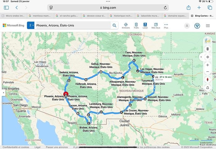
Day 1: Flight Marseille-Paris-Phoenix, then Gold Canyon (133 km) Day 2: Tucson (271 km) Lost Dutchman State Park Day 3: Tucson (155 km) Day 4: Tucson (34 km) Day 5: Bisbee (182 km) Day 6: Lordsburg (345 km) Day 7: Las Cruces (253 km) Day 8: Alamogordo (162 km) Day 9: Roswell (264 km) Day 10: Tucumcari (369 km) Day 11: Las Vegas (281 km) – the one in New Mexico Day 12: Taos (213 km) Day 13: Santa Fe (224 km) Day 14: Albuquerque (123 km) Day 15: Gallup (246 km) Day 16: Holbrook (224 km) Day 17: Flagstaff (179 km) Day 18: Sedona (118 km) Day 19: Sedona (48 km) Day 20: Sedona (41 km) Day 21: Phoenix (256 km) Day 22: Phoenix Airport (35 km)
📊 **Budget**: A little over 7,500 € for both of us, all included. The exchange rate was in our favor (1.17 dollars to 1 €). 📊 **Flights**: Marseille-Paris Charles de Gaulle-Phoenix: 1,787 € for two, with one checked bag each (Air France) 📊 **ESTA**: $42 📊 **America the Beautiful Pass**: $80 📊 **Parking**: 134 € (super eco at Marseille) 📊 **Car rental (Hertz)**: 865 €. Since there were no SUVs left in the reserved category (Nissan Rogue), we got an upgrade (4x4 Ford Explorer). We booked through Air France (15% discount). We’d originally reserved it in December for 1,140 €, but since prices dropped in March, we canceled and rebooked for 865 €. Hertz offers a free Hertz Gold Plus Rewards program, which gives you priority counter service when picking up the car. 📊 **Accommodation**: 2,400 € We stayed in hotels and motels of varying standards (from 60 to 203 € per night, depending on the city), all booked through Booking.com or Hotels.com. Out of 21 nights, only two didn’t include breakfast in the price. Booking.com sometimes offers slightly cheaper rates if you book by phone using the mobile app, and our Genius 3 status on the site also got us some preferential rates. 📊 **Supplementary insurance**: AVA 200 € for medical care if needed 📊 **Cash**: $2,078. We left with 1,000 € exchanged before departure and made two withdrawals of $500. This cash covered: - Evening restaurants and tips - Midday picnics - Gas: $298 for 4,160 km - Museum and private park entries (per person): - Lost Dutchman: $10 - Arizona-Sonora Desert Museum: $28 - Bird Cage Theater: $16 - Tombstone Shootout: $8 - New Mexico Farm & Ranch Museum: $12 - Roswell International UFO Museum: $5 - Billy the Kid Museum: $7 - Rancho de Taos: $22 - West Fork Oak Creek Trail entry: $15 We got a few discounts thanks to our senior age (+65). - Souvenirs and little treats
Like on our previous road trips, we didn’t rent a GPS. We got around using offline GPS apps Here WeGo and Organic Maps, with maps of the states we visited downloaded before we left (on our phones).
❤️❤️❤️ **Highlights** (there are so many!) 📍 Goldfield Ghost Town (even if it’s a reconstruction) 📍 The standing army of Saguaro cacti at Saguaro National Park West 📍 Diving into the cowboy universe of Tombstone 📍 The welcome from Rick and Henry at our guesthouse in Bisbee (Garden at Mile High Ranch) 📍 The tangled rocks of Chiricahua National Monument 📍 The flavored pistachios from Dwayne’s Fresh Jerky and Mac Ginnis Pistachioland 📍 Restaurants: La Posta (Las Cruces), Diner 66 (Albuquerque), and the Haunted Hamburger (Jerome) 📍 The old plazas of New Mexico 📍 The solitude and beauty of the white dunes at White Sands National Park 📍 Stepping back in time at the Billy the Kid Museum (Fort Stanton) 📍 Sections of historic Route 66 and the old motels of Tucumcari, especially at night when all the neon lights are on 📍 Taos Pueblo and diving into Native American culture 📍 After the Rio Grande Bridge, the descent via NM 567 to the very bottom of the Rio Grande Gorge, then the road along the riverbanks to Taos 📍 The tranquility of the Chimayo Sanctuary 📍 Discovering the ingenious native dwellings at Bandelier National Monument and Walnut Canyon National Park 📍 The small towns along the Turquoise Trail 📍 The red rocks of Red Rock Park and the Painted Desert 📍 The extraordinary colors of the petrified trees at Petrified Forest National Park 📍 Sedona, its red rocks, and the reward of the viewpoints at the end of hikes (Devil’s Bridge, The Subway, and West Fork Oak Creek) 📍 The immersion in Mexico when visiting Tlaquepaque 📍 The almost-ghost town of Jerome and its terraced streets 📍 The incredible kindness of Americans, always ready to help and up for a chat ❤️
☹️☹️☹️ **Flops** (there are very few) 📍 Several museums and churches being closed, so we couldn’t visit them 📍 Some museums and visitor centers opening late (10 AM) and closing early (4 PM) 📍 A 64 € phone roaming charge because we got near the Mexican border and picked up their cell tower 📍 The outrageous price ($5.99) for a gallon of gas at the Shell near Phoenix Airport
I hope this helps! Anyway, thanks for reading my long post. Don’t hesitate to reach out, even via PM, if you see I haven’t replied and you’d like more details. Have a great evening, everyone! 🙂
We’re back from our September 2025 road trip, this time to explore Arizona and New Mexico, and it’s time for me to start my travel journal—especially since everything’s already booked for another trip in September 2026 (to California), and I need to get started on the planning.
I was a little worried this new visit to Uncle Sam’s country might not be as "wow" as the others, but we still discovered some incredible places.
For those who don’t know us, we’re a couple in our seventies who speak very little English, but that didn’t stop us from fully enjoying our stay.
For this 6th road trip in the U.S., we spent 21 nights there, drove 4,160 km by car, and walked nearly 160 km in a loop starting from Phoenix.
We’d been to Arizona before (but not this side) and never to New Mexico. This whole road trip was a huge discovery for us.
In the prices mentioned (some in euros, others in dollars), bank fees and exchange charges are included. The flights, car rental, and parking were all paid for in December 2024 when we booked.
We’d downloaded the MPC (Mobile Passport Control) app, but there wasn’t a dedicated line at Phoenix Airport. Still, we got through quickly with friendly, smiling agents.
I don’t drive at all (I hate it), so the stops were chosen based on activities but also, for some, to limit daily mileage for the sole driver. The kilometers listed in the itinerary are the daily distances.
We traveled from September 9th to 22nd, unfortunately once again without our dear friends Mimi and Maumau.
The itinerary
Day 1: Flight Marseille-Paris-Phoenix, then Gold Canyon (133 km) Day 2: Tucson (271 km) Lost Dutchman State Park Day 3: Tucson (155 km) Day 4: Tucson (34 km) Day 5: Bisbee (182 km) Day 6: Lordsburg (345 km) Day 7: Las Cruces (253 km) Day 8: Alamogordo (162 km) Day 9: Roswell (264 km) Day 10: Tucumcari (369 km) Day 11: Las Vegas (281 km) – the one in New Mexico Day 12: Taos (213 km) Day 13: Santa Fe (224 km) Day 14: Albuquerque (123 km) Day 15: Gallup (246 km) Day 16: Holbrook (224 km) Day 17: Flagstaff (179 km) Day 18: Sedona (118 km) Day 19: Sedona (48 km) Day 20: Sedona (41 km) Day 21: Phoenix (256 km) Day 22: Phoenix Airport (35 km)
📊 **Budget**: A little over 7,500 € for both of us, all included. The exchange rate was in our favor (1.17 dollars to 1 €). 📊 **Flights**: Marseille-Paris Charles de Gaulle-Phoenix: 1,787 € for two, with one checked bag each (Air France) 📊 **ESTA**: $42 📊 **America the Beautiful Pass**: $80 📊 **Parking**: 134 € (super eco at Marseille) 📊 **Car rental (Hertz)**: 865 €. Since there were no SUVs left in the reserved category (Nissan Rogue), we got an upgrade (4x4 Ford Explorer). We booked through Air France (15% discount). We’d originally reserved it in December for 1,140 €, but since prices dropped in March, we canceled and rebooked for 865 €. Hertz offers a free Hertz Gold Plus Rewards program, which gives you priority counter service when picking up the car. 📊 **Accommodation**: 2,400 € We stayed in hotels and motels of varying standards (from 60 to 203 € per night, depending on the city), all booked through Booking.com or Hotels.com. Out of 21 nights, only two didn’t include breakfast in the price. Booking.com sometimes offers slightly cheaper rates if you book by phone using the mobile app, and our Genius 3 status on the site also got us some preferential rates. 📊 **Supplementary insurance**: AVA 200 € for medical care if needed 📊 **Cash**: $2,078. We left with 1,000 € exchanged before departure and made two withdrawals of $500. This cash covered: - Evening restaurants and tips - Midday picnics - Gas: $298 for 4,160 km - Museum and private park entries (per person): - Lost Dutchman: $10 - Arizona-Sonora Desert Museum: $28 - Bird Cage Theater: $16 - Tombstone Shootout: $8 - New Mexico Farm & Ranch Museum: $12 - Roswell International UFO Museum: $5 - Billy the Kid Museum: $7 - Rancho de Taos: $22 - West Fork Oak Creek Trail entry: $15 We got a few discounts thanks to our senior age (+65). - Souvenirs and little treats
Like on our previous road trips, we didn’t rent a GPS. We got around using offline GPS apps Here WeGo and Organic Maps, with maps of the states we visited downloaded before we left (on our phones).
❤️❤️❤️ **Highlights** (there are so many!) 📍 Goldfield Ghost Town (even if it’s a reconstruction) 📍 The standing army of Saguaro cacti at Saguaro National Park West 📍 Diving into the cowboy universe of Tombstone 📍 The welcome from Rick and Henry at our guesthouse in Bisbee (Garden at Mile High Ranch) 📍 The tangled rocks of Chiricahua National Monument 📍 The flavored pistachios from Dwayne’s Fresh Jerky and Mac Ginnis Pistachioland 📍 Restaurants: La Posta (Las Cruces), Diner 66 (Albuquerque), and the Haunted Hamburger (Jerome) 📍 The old plazas of New Mexico 📍 The solitude and beauty of the white dunes at White Sands National Park 📍 Stepping back in time at the Billy the Kid Museum (Fort Stanton) 📍 Sections of historic Route 66 and the old motels of Tucumcari, especially at night when all the neon lights are on 📍 Taos Pueblo and diving into Native American culture 📍 After the Rio Grande Bridge, the descent via NM 567 to the very bottom of the Rio Grande Gorge, then the road along the riverbanks to Taos 📍 The tranquility of the Chimayo Sanctuary 📍 Discovering the ingenious native dwellings at Bandelier National Monument and Walnut Canyon National Park 📍 The small towns along the Turquoise Trail 📍 The red rocks of Red Rock Park and the Painted Desert 📍 The extraordinary colors of the petrified trees at Petrified Forest National Park 📍 Sedona, its red rocks, and the reward of the viewpoints at the end of hikes (Devil’s Bridge, The Subway, and West Fork Oak Creek) 📍 The immersion in Mexico when visiting Tlaquepaque 📍 The almost-ghost town of Jerome and its terraced streets 📍 The incredible kindness of Americans, always ready to help and up for a chat ❤️
☹️☹️☹️ **Flops** (there are very few) 📍 Several museums and churches being closed, so we couldn’t visit them 📍 Some museums and visitor centers opening late (10 AM) and closing early (4 PM) 📍 A 64 € phone roaming charge because we got near the Mexican border and picked up their cell tower 📍 The outrageous price ($5.99) for a gallon of gas at the Shell near Phoenix Airport
I hope this helps! Anyway, thanks for reading my long post. Don’t hesitate to reach out, even via PM, if you see I haven’t replied and you’d like more details. Have a great evening, everyone! 🙂
Hitchhiking in the 70s-80s
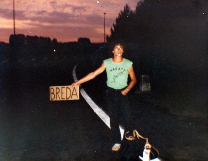
“Hey, your Marker... - My Marker? - The one you used to make hitchhiking signs.”
The marker in question is sitting proudly on the kitchen table. Marielle found it at the bottom of a moving box.
I’ve been meaning to tell the long story of my love affair with hitchhiking for years. Here we go.
To be honest, I’m not quite sure when it started. My earliest memory goes back to a fair with a bike race in my maternal grandparents’ village. I was with my cousin, my little sister, and three girl cousins. There were six of us, ages ranging from six or seven to thirteen or fourteen. Our parents stayed at the fair, and we’d had enough. So we decided to walk home. Only it was four kilometers away. So we hitchhiked. A guy driving an old car picked us all up and dropped us off at the farm. He probably found it amusing to see us thumbing a ride by the side of the road, but maybe it also worried him a bit. With everything you read in the papers...
Around fifteen or sixteen, I started hitchhiking regularly, alone or with a friend, to go to the nearby town. But it was especially when I started boarding school in Orléans that it became more regular. The first year, I’d leave Monday morning and come back Saturday noon by bus. It was an old, uncomfortable bus where we froze in winter. To make matters worse, I often got motion sickness if, as was too often the case, I ended up sitting in the back. In the spring, a high school friend suggested I hitchhike back. It meant a slight detour, but the advantage was taking only national roads.
So that’s how, from the end of tenth grade to twelfth grade, I’d thumb a ride every Saturday on the Pont de Bourgogne. Drivers were used to seeing young people hitchhiking, and it worked pretty well. Our biggest fear? Soldiers! At that time, military service was still mandatory, and on weekends, it wasn’t rare to see them competing with us. They’d keep their uniforms on to go home. That gave people confidence—with everything you read in the papers—and they’d rarely wait more than five minutes. We, with our long hair, were definitely less popular. From time to time, three big red-faced guys in a van coming back from a construction site would flip us off, yelling things like “go get a haircut, you bums!” Those were the good old days.
We still had a good laugh, though. Patrice, the friend I’d hitchhike back from school with on Saturdays, is a musician—I’d later discover he’s an excellent composer. A die-hard Beatles fan, he knows their repertoire by heart and spends his time singing at the top of his lungs while we thumb a ride. One Saturday late morning, we’d been waiting for a while at the exit of Châteauneuf-sur-Loire when a little lady came up to him and asked if he could please sing a little quieter: a baby was sleeping in the house. He put on the most sorry face: “Oh, sorry ma’am, we didn’t realize.” No sooner had the lady gone back inside than he started again. Luckily, a car stopped just then, sparing me the embarrassment of seeing the lady come back out.
Saturday was also the day when the cigarette pack was dangerously low. So before leaving, we’d go buy some “Parisiennes,” the “P4s” as we called them back then. They were slightly thinner cigarettes with a mix of tobacco scraps. Sometimes they tasted like light tobacco, sometimes like dark. Not great, but by the end of the week, our pocket money was gone. They were sold in small packs of four, hence the name P4. We’d only pay 20 centimes. On Saturdays, it was rare for the two of us to manage to scrape together 1.50 F to buy a whole pack of Gauloises...
The last twenty kilometers, I’d usually do alone, Patrice having reached his destination. From time to time, luck would smile on me: an acquaintance would just happen to pass by and stop. One January Saturday, at the exit of Gien, I ran into another guy from Argenton whom I knew a little. That day, the weather was nice, but the temperature was well below zero. It was around noon, and it was the off-peak hour. We were shivering, stamping our feet by the side of the road, when a Citroën “Tube” arrived: it was his father’s boss’s, a mason. They were both sitting in the front, but since they were obese, they had us climb onto the open back. Even though we huddled against the cab to shelter from the wind, the twenty kilometers felt very long, especially since we were only going sixty kilometers an hour. Our hands and cheeks were blue when we finally arrived.
The year I took my baccalaureate, a friend with a 2CV would take me Monday mornings with one or two others we’d pick up in nearby villages. We’d share the gas costs, but it was still cheaper than the bus. And in winter, the bus was my nightmare. You had to get up at five to catch it at six. Not enough sleep, and outside it was freezing or raining—or both. The 2CV was luxury. Plus, Philippe would pick me up at home. On the other hand, since I didn’t have class Saturday mornings—well, I did, but we only had PE the first two hours and nothing after—I’d skip class and slip out right after breakfast to thumb a ride at the Pont de Bourgogne.
Those three high school years were formative in this optional subject that was hitchhiking. Little by little, I learned the rules of the game. First, you shouldn’t walk along the road while thumbing. Cars go too fast and can’t stop easily. Accepting a ride that’s too short is also a no-go. The guy who offers to take you a little way but drops you off at some vague crossroads in the middle of nowhere? No thanks. You need to get dropped off in a town. If it’s a fairly big city, you often have to cross it from one end to the other, but it’s better. At the exit, you have to choose your spot well. Actually, you have to put yourself in the driver’s shoes: they need to see you early enough, not be going too fast, and be able to stop easily without risking an accident. So when leaving a city, it’s better not to go too far. It’s wiser to find a spot where cars go slowly and can stop easily. And preferably near a café. The café is for when you still have a few coins for a coffee and need to warm up. From time to time, you’d run into someone nice who’d make a detour to drop you off at a better spot to start again. Finally, if possible, avoid hitchhiking on Sundays. Cars are packed with whole families who, most of the time, aren’t going far. And then there’s the little worry of those people who rarely leave home: with everything you read in the papers...
During those high school years, it was only short trips, rarely exceeding a hundred kilometers. Later, I aimed bigger, and things were a bit different. In 1973-74, I crossed part of France for the first time on two or three occasions, coming back from the German border or returning to Bordeaux, where we lived briefly. Since there weren’t many highways back then, we took national roads. It was during these trips that I realized it was better to leave in the evening. As I said earlier, Sunday is to be avoided, but on weekdays, there’s another problem: if you leave in the morning, you only make short hops. First, it often takes longer to get going because drivers are people going to work nearby. Which brings us back to those who drop you off in a bad spot, far from everything. There, you have to know how to refuse. You thank the driver for stopping—oh, if only everyone could be like you—while explaining why you’d rather stay put. People don’t take offense, by the way. Those who pick up hitchhikers often hitchhiked themselves when they were in the military or before they had a car. In the late afternoon, you’d often run into salespeople or truckers, in other words, people who drive a lot. At that time, salespeople no longer had appointments and were more relaxed. They wanted to talk about something other than the merits of their products. On the radio, it was time for *Les Grosses Têtes*. You’d also quite often run into small business owners, professionals, or even hippies. The conversations were pleasant and often enriching. A little later in the evening, truckers would take over. They’d already driven a few hundred kilometers, and the depot or customs was still far away. So they’d gladly take a hitchhiker to stay awake at the wheel and chat. The radio with Max Ménier’s show *Les routiers sont sympas*, you’d eventually get tired of it. So a hitchhiker was a change. Others, who’d hit the road at midnight to be at their destination by morning, were nice and offered to let you lie down on the bunk while they drove. When you’d been hitchhiking since six in the evening, freezing in the wind between two vehicles, you weren’t unhappy to take a little nap.
Speaking of Max Ménier, he’d often make announcements for hitchhikers. One evening, I called him. It was getting late, and I still had quite a way to go. No luck: the show had ended for good the day before!
In short, it’s better not to rush, sleep in, and leave after lunch, or better yet, in the late afternoon. Obviously, I’m talking about when you have several hundred kilometers to cover. That’s when you have to play it pro.
First thing, especially at night, but it also applies in the middle of summer when the light is blinding: dress to be seen from far away. I’ll admit I have an advantage over most other hitchhikers: I’m small and don’t scare people. To balance that out, racist drivers often take me for an Arab and are less likely to pick me up, but overall, the balance tips in my favor. Back to the need to be seen: at night, I wear light-colored clothes. In headlights, you can see me from far away.
Second thing: travel light. Forget the big backpack with a frame. Drivers don’t always have room in the trunk or on the back seat, especially if it’s rained and the ground is wet. Plus, it forces them to get out of the car. If they’re nice enough to pick up a hitchhiker, you shouldn’t ask for too much either.
Third thing: bring a cardboard sign and a big marker—like the ones in the photo at the start of this post—to write the name of your destination. In the early 80s, I ran a tourist house in the Cher, but I lived in the Netherlands. In the off-season, it was only open on weekends. On Fridays, I’d leave Holland and return on Mondays. 1200 km round trip. On the way there, in Paris, I’d stand at Porte de la Chapelle. At that spot, the road is very wide, and drivers could stop easily. Obviously, on the sign, I didn’t write Eindhoven, which not everyone knows, and even less Amsterdam because of its seedy reputation. In that case, you’d expect to see a police car stop and two officers in kepis ask for your papers. So as a first destination, I’d write Compiègne. We were well out of Paris, and since it wasn’t too far, a trucker or salesperson was less reluctant to stop. Once past Compiègne, I’d take out my Lille sign. Once in Belgium, it wasn’t really necessary to use a sign anymore, since everyone was going in the same direction. Usually, the guy who picked me up at Porte de la Chapelle would say he wasn’t going far but could take me a little way. Before that, I’d still ask if there was a gas station on the highway where he could drop me off before exiting. While talking, the guy would realize he wasn’t dealing with a dangerous criminal. He’d pretend to check his watch, think for a moment, then say that actually, he was going to Belgium and could take me to the border or a little beyond. To leave Paris on the way back, I’d take the train to Melun, where it was easier to hitchhike than at Porte d’Italie.
Over all those years, I think I was pretty lucky. Or maybe philosophical enough not to imagine a car would stop after a few minutes. An hour’s wait was average. Sure, I sometimes waited three, four, or five hours. Most often at odd hours and in terrible weather. When it doesn’t work, it doesn’t work. But there’s always a moment when things pick up. Sure, when you’re soaked in freezing rain in the early morning after a sleepless night, you’re less philosophical than when I’m writing these lines comfortably at my computer, but it still holds true.
Earlier, I mentioned clothing and the importance of being well-rested before leaving. When you’ve eaten well and just gotten out of the shower, shaved, you’re in a better mood. And somehow, drivers sense it. Or at least, that’s the impression I’ve always had. It’s better to look in shape than disgusted at standing there, half-heartedly thumbing a ride. In short, when I’d start to get fed up with waiting, I’d go into the first café I saw for a coffee. Coming back out, I’d be refreshed, and most of the time, a car would stop within minutes. I’ve often said that when I stood by the side of the road thumbing a ride, I felt a bit like a gambler in front of a slot machine. It was a matter of giving luck a chance. And well, it worked out pretty well.
Then, there are countries where hitchhiking works really well and others where it’s harder. In the 70s-80s, it worked best in Germany and England. In the late afternoon, it wasn’t rare to be invited for tea. Well, that was in England. Tea meant being offered room and board. In Germany, they’d offer you coffee. Once there, they’d first show you the guest room and point out the bathroom before sitting you down in front of a big plate of cold cuts. In the evening, they’d go out in town, and the next morning, they’d usually drop you off at a good spot for hitchhiking. On the other hand, in Mediterranean and Scandinavian countries, you’d better be patient. In Spain or Italy, it’s better to take the train, which was dirt cheap back then. However, if you’re a couple traveling light, it’s already easier in most countries.
In 1982, I went on a trip around Turkey with my girlfriend. We only had two small bags, which was plenty. It was November-December, and we wore our warm, bulky clothes. Leaving Eindhoven at nine in the morning, we arrived in Graz, near the Yugoslav border, at eleven at night. 1300 km in a day! In just four or five vehicles. One to the German border, about fifty kilometers from Eindhoven, the second to Hagen in the Ruhr, the third to Salzburg, and the last to Graz at the Yugoslav border. Record broken. During the night crossing of Yugoslavia, we ran into a trucker close to retirement who lent us the truck’s bunk. So we arrived fresh and rested near Skopje the next morning. We continued to Thessaloniki in northern Greece before taking the train to Istanbul. In Turkey, we traveled a good part of the country by hitchhiking too. With truckers in old, overloaded, slow trucks that climbed hills at fifteen kilometers an hour, but also in cars where five or six people were already crammed in. And every time, we were invited for tea. Once, we were even picked up by a big shot in his Mercedes with a chauffeur. Until then, the average speed was around fifty kilometers an hour. There, we were going two hundred. On a national road, not a nice European highway.
I’ve also hitchhiked in Nepal, from Lumbini, Buddha’s birthplace, to a village on the way to Pokhara. It must have been midday. No bus until the next day. I gave it a try. A small truck overloaded with rice sacks, with two or three young people already perched on top, stopped. I rode on the roof of the cab. At fifty kilometers an hour when it was going well, with a breathtaking view. Coming back from India, I also crossed part of Iran by hitchhiking, from Tehran to the Turkish border. I did this trip with an Austrian I met at the hotel who, like me, had to watch his pennies. We gave it a shot. There was almost no traffic, but to our great surprise, the first car that passed in the area would always stop. They’d just ask for a modest contribution for gas, and it cost next to nothing.
Sometimes, you get scared too. After leaving Turkey in early December 82, we spent about two weeks in the southern Peloponnese harvesting olives. A few days before Christmas, we hitchhiked back to Holland. A girl picked us up in her little Fiat 500. We were driving on a mountain road, and that morning there was a bit of black ice. After crossing a pass, we saw the old Ford Taunus ahead of us at fifty meters start to skid. The driver let out a “heeee!” while grabbing my knees. I reflexively grabbed the wheel. Finally, the Taunus got back on track. And we didn’t swerve. But those few seconds felt very long.
In January 77, while I’d been living in Germany for a few months, I decided to spend a few days in Italy. By hitchhiking, of course. I left in the early afternoon, and by ten at night, I wasn’t far from Frankfurt. I saw a big Mercedes stop. The four or five young people crammed inside were listening to Schlager at full volume. Beer cans littered the floor. They didn’t have a precise destination, and as long as they were going south, that was fine with me. They’d finished their military service that very day and had clearly already celebrated their discharge. The driver was going 160, zigzagging dangerously from one side of the highway to the other. I should have realized he wasn’t entirely sober either. Luckily, there was almost no traffic. Finally, I managed to get dropped off at a gas station just before Frankfurt, relieved. I hope their trip didn’t end tragically.
Another time, coming back from Holland with my wife, we were picked up early in the morning near Senlis by two guys from Lille. They were going to work near Tours and could drop us off at Porte d’Italie. Apparently, they were coworkers but barely knew each other. The driver offered us a beer—at six in the morning, sure!—before opening another can for himself. He was clearly having trouble staying in the right lane. We politely declined, the passenger too. Everyone was tense. Luckily, it was rush hour on the ring road, and we were going slowly. When we got out of the car, the passenger said goodbye with the look of a guy being offered the condemned man’s rum and cigarette.
Finally, there are the annoying remarks from drivers who are either gay when you’re alone or turned on by the sight of your girlfriend when you’re a couple. In those cases, I’d get in the back so the guy wouldn’t feel too confident. And if the conversation got a little too suggestive, we’d deflect until we got dropped off.
And luckily, there are the times, not so rare after all, when you run into really nice people who invite you to eat and sleep at their place and drive you to a good spot the next morning. In Germany and England, that was common. And then there are the big strokes of luck, like during our trip to Turkey when we crossed most of Germany in one car, or that other time when some Germans drove me from the exit of Geneva all the way to the Costa Brava.
Going back to “with everything you read in the papers” and its variant “with everything you see on TV”—and now on the internet—it’s always left me perplexed. Personally, I’ve never heard of hitchhikers assaulting drivers, even if it may have happened. On the other hand, what was most common were hitchhikers being assaulted, especially girls. Anyway, even armed, it seems a bit stupid to assault the driver—wouldn’t that risk causing an accident?
Finally, since that time, I’ve occasionally wanted to hitchhike somewhere far away in France. Most often, too busy with work, it never happened, but the nostalgia hasn’t completely disappeared.
* * *
Other Hitchhikers
And then one day, I... settled down to become a driver myself. Ten years had passed, and you saw fewer and fewer hitchhikers. Or maybe I saw fewer because I had a regular job and wasn’t traveling the same way. And then I understood a few things.
Several times, I was tempted to pick up a hitchhiker, but they didn’t meet the required conditions. They were walking along the road instead of staying at the exit of the previous town. Hard to stop without risking an accident. Or the guy looked really scruffy. Or he was sulking, if not both. Then you think of that famous “with everything you read in the papers.” Not that I was scared, but unfortunately, the few hitchhikers I did pick up later were rarely interesting.
A few years ago, we picked up a young guy at the exit of a small town in Sologne. Not an easy spot for hitchhiking. Bad luck, he was a pretentious little jerk. He was barely 20 or 25 and talked like a bitter old man. He was a waiter in a restaurant. According to him, it was lucky he was there, otherwise the boss would have closed up shop long ago. You’d think he had thirty or forty years of professional experience behind him. As we approached Blois, he started ranting about Arabs, blaming them for all evils. And he laid it on thick. That morning, we were going to a teenager’s funeral who had just committed suicide, so he really got on our nerves, Mr. Know-It-All. Out of anger, I dropped him off next to a shopping center a few kilometers from downtown. Not nice, but it felt good.
Some time ago, we were driving around the Limousin on a Sunday to try out the used Twingo we’d just bought. We picked up a guy in his forties. A German who spoke French well. He started talking about the environment. He was a green Khmer. He got worked up all by himself with his pseudo-eco rant and, after a few kilometers, was almost yelling at us. As we were about to leave the main road for a small one, I dropped him off at a crossroads in the middle of nowhere. Normally, I would have made a little detour to take him to a better spot, but this time, I didn’t feel like doing the... eco-warrior a favor.
On the other hand, I’ve still done my good deed a few times. One June morning, coming back from Orléans, I saw a man in his sixties hitchhiking. The poor guy had had a rough time. He was from Montpellier and was coming back from Caen, where he’d been promised a job. Once there, they bluntly told him the position was already taken, and he had to go back. Except he didn’t have enough money left for the train. He’d spent the night hitchhiking without success. I could only take him as far as Lamotte-Beuvron, where I dropped him off near the fire station. Apparently, there was some vague shelter there or something, but it only opened a few hours later. In the meantime, he settled on the grass in a corner to sleep a little. While he was doing that, I quickly went to the train station to check the price of a ticket to Montpellier. It was within my means. Since he was sound asleep, I slipped the train ticket and 100 francs into his pocket. I couldn’t imagine him continuing to hitchhike all the way to Montpellier. And I bet he didn’t even have a piece of cardboard and a marker!
When we go to Brazil, we usually rent a small car. One day, we were coming back from Paracuru to Fortaleza when we saw a whole family hitchhiking. Two adults and two or three small children. Here near the equator, the sun sets very quickly, and it would soon be night. There was little traffic, and trucks wouldn’t stop because there was no room in the cab. As for the rich people driving big 4x4s, they wouldn’t stoop to picking up the lower classes. The only hope for this kind of family was usually a farmer or artisan who’d let them ride in the back of his pickup. Obviously, they were a bit surprised to see us. Everyone crammed in as best they could in the back of our little car. When we dropped them off, we got a whole string of “Deus lhes abençõe”—God bless you.
Still in Brazil, we were on the road from Barreirinhas to São Luís do Maranhão. About 150 km of deserted road with an isolated mud house here and there. A young woman flagged us down. She was very pregnant and had to get to the clinic twenty or thirty kilometers away to give birth. Someone was supposed to drive her, but the first signs of labor started earlier than expected, and the driver was unavailable. Even driving fast, we weren’t feeling great: it would be just our luck if she gave birth in the car!
Today, we’re in the age of smartphones and carpooling apps. Safety. With everything you see on TV... Three or four years ago, we signed up on a platform. Our first, and only, “client” was a little jerk who didn’t say a word the whole trip. No hello, no goodbye, and certainly no thank you. The next day, we found his Ray-Bans in the car. We didn’t run after him to give them back. Ha!
Namibia Travel Journal: May 2025 - Trip Review
NAMIBIA TRIP 2025: April 24 to May 20: Feel free to comment or ask us any questions about this amazing journey.
>> Find all our photos and videos for each day on our website here: www.montagne-aventure.net
**DAY 1: Thursday, April 24, 2025: Outbound Flights from Lyon to Windhoek via Munich - Visit to Munich:**

Off we go on a new adventure. The alarm rings at 6:30 AM, the travel bags are packed, and we head to Lyon Airport. We booked our flight tickets with Lufthansa. The first leg to Munich, Germany, is operated by AirBaltic. Departure at 1:05 PM for a 1-hour and 20-minute flight. We arrive at 2:30 PM.
**We now have a 7-hour layover, so we take the opportunity to get some fresh air and explore Munich.** We quickly exit Terminal 2 of the airport and head towards the subway. We buy a group day ticket "Airport-city Day Zone M-5," valid for 2 to 5 people at a price of 30.50 € (instead of 16.30 € per person). We take the S8 line to **Marienplatz** in 35 minutes. **This is the heart of the city.** The weather is overcast, quite cool, but dry. Perfect for a little city trip between two flights while leaving our large luggage in transit at the airport. **Munich is the third-largest German city after Berlin and Hamburg, in the Bavaria region.** **The center has a lot of charm and brings together several religious buildings, easy to explore on foot.** We are impressed by the number of people enjoying these 100% pedestrian streets, which are very pleasant. After Marienplatz, the most famous square with the town hall, we head to the Cathedral of Our Lady, a Gothic church, then continue to **Karlsplatz** and move on to **the food market offering a wide selection of high-end food products in an atmosphere where a certain art of living prevails.** We also visit St. Peter's Church before grabbing a bite to eat. Two good hours were enough for this 10 km city walk. It's time to take the subway back: by 6:30 PM, we are back at the airport. Now, it's time for a bit of waiting and rest. Our second flight is scheduled for 9:35 PM for a 9-hour and 30-minute journey to our final destination in Namibia: **Windhoek.**
> Round-trip flight tickets with Lufthansa from Lyon: 2029 €, or 1,014.50 € per person.
> Lyon Airport parking: 120 €
> Today's expenses: 7 € for 2 pizzas in France / 14 € for the restaurant in Munich / 30.50 € for the daily subway ticket in Munich.
**DAY 2: Friday, April 25, 2024: Arrival in Windhoek, Visit to the Namibian Capital:**
After a 9-hour and 30-minute overnight flight with Discover Airlines, we finally land on Namibian soil just before 7:30 AM. The day is breaking, and the colors are already stunning. We are eager despite the usual fatigue from the flight. The airline was punctual, with friendly staff and good meals, though a bit light. We are the first flight of the day to land, with no more than 15 flights per day here, from 7 AM to 8 PM. We disembark on the tarmac at this airport located in the middle of nowhere, **I finally set foot on African soil for the first time.** We exit among the first from the aircraft to go through the long formalities at the front of the line, as the wait can quickly become endless. Allow at least 5 minutes per person for e-visas. We still wait 45 minutes despite only about twenty people ahead of us. Phew, it's done. We collect our luggage and then withdraw money from an ATM. We make 4 withdrawals of the maximum amount, 2000 NAD $ per withdrawal, for a total of 380 €, or 95.33 € per withdrawal.
Our driver arrives at the same time, perfect timing, we were quick.
We leave the airport at 8:45 AM. By 9:30 AM, we arrive at the **Gracious Whisp vehicle rental agency**, located at the entrance of Windhoek, small and human-sized with a fleet of recent vehicles. More formalities, then a short wait as our vehicle is not yet ready. Time to decompress, catch our breath, and enjoy the very pleasant morning temperature. Not a cloud in sight. Next, a briefing on the vehicle, always with a bit of apprehension due to our approximate English. Allow 45 minutes of explanations, including setting up the roof tent, camping equipment, technical information in case of a flat tire, driving tips in Namibia, and a tour of the 4x4. We have all the necessary equipment for camping: mattresses, sleeping bags, pillows, table, chairs, gas stove, BBQ grill... as well as 2 spare tires, a compressor, a dual tank, and accessories for removing wheels. Off we go, it's time to muster our courage and get behind the wheel. **Heading to SuperSpar Maerua**, fortunately located less than 10 minutes away. We park with the help of a parking attendant; it's very crowded, the space is narrow, but everything goes well despite the cursed right-hand drive. Today's new mission: stock up on groceries. The store is well-stocked with local and imported products, catering to all tastes. We spend 114 € on groceries, from pasta to meat, BBQ lighters to dishwashing products. Two people load our groceries into two carts and transfer them to our vehicle; we feel compelled to leave a tip, 50 NAD $, as we don't have change yet. Now, we head to the hotel, 15 minutes away. Traffic is difficult at a complicated intersection; this will likely be the only traffic jam in Namibia. **We arrive at Kate's Nest Guesthouse & Backpackers around 1:15 PM, quite tired.** We take some well-deserved rest at this recent establishment, quite calm with secure private parking. After a short nap, we enjoy the quiet by the hotel pool. Night falls between 6:30 PM and 7 PM. We eat quietly in our room tonight before starting this long 4x4 road trip in camping mode in the heart of Namibia.
> Today's grocery expenses: 114 € at Super Spar Marua (2395.21 NAD $).
> Round-trip flight tickets with Lufthansa from Lyon: 2029 €, or 1,014.50 € per person.
> Vehicle rental: 4x4 Toyota with roof tent for 24 days: Gracious Whisp Car Rentals: 2,638 € (N$50,640) or **1,319 €** per person - (https://gwcarrentals.com/)
> Distance driven today: 15 km.
> Accommodation: Kate's Nest Guesthouse & Backpackers - 4 Aristotles Street Academia, 9000 Windhoek - 36 € for two for one night.
> Windhoek International Airport website: (https://www.airports.com.na/)
**DAY 3: Saturday, April 26, 2025: Windhoek to Hardap: Mariental Region - Kalahari Desert:**
After a good, restful night, we wake up leisurely around 7 AM. We enjoy the comfort provided by this first and last hotel before 24 nights under the tent.
**We leave Kate's Nest Guesthouse at 8:30 AM to tackle the Namibian roads.** We quickly leave the capital; in just 30 minutes, we find ourselves almost alone in the world. The landscape is dotted with small domes. We leave the **paved B1** quickly to turn left onto the **C15**. **From there, we won't see more than 10 vehicles all day.** After passing through the few houses of **Lekkerwaterpoort**, we tackle our first gravel road. These road sections are limited to 100 km/h, but even at 70 km/h, I find it already challenging. However, I quickly get used to it and gradually pick up speed to reach my cruising speed of around 80 to 90 km/h. **We are on immense straight lines crossing wild expanses as far as the eye can see.** **We come across two baboons, a few ostriches, and numerous cattle and sheep farms.** We pass through the charming village of **Uhlenhorst** with its typical houses and children with broad smiles waving at us. Life here is already very different from Windhoek. **The thermometer rises quickly from 16°C at 8:30 AM to over 28°C in the early afternoon.**
**We arrive at the Hardap Dam reserve at 2 PM.** We stop at the toll booth at the park entrance to pay the entrance fee: 250 NAD $ for 2 people and 1 vehicle. We continue to the dam and then the camp entrance, located a bit further. We had booked in advance, but this place remains little frequented by foreigners.
We take advantage of the hottest hours to rest by the large pool overlooking the immense lake, a very enjoyable moment. Would this be a bit of a vacation?
Around 4:30 PM, we head to the campsite. We overlook this vast water reserve. We arrive first; we will be only 3 vehicles spending the night here. It's time to get to work and set up our equipment for the first time. It takes us a good 20 minutes to set everything up, with a slight apprehension about unfolding the tent. Once this task is done, which we will have to repeat for almost a month, we will become much more efficient over time. Time for rest and contemplation in total silence. The sun gradually sets, and the heat quickly becomes bearable again. Bliss! **This dam is located 20 km northwest of Mariental in an area dotted with conical hills topped with dolerite buttons (Hardap means "hillock" in Nama). It captures the Fish River, which flows south, creating a large lake in the middle of an arid environment. The contrast is striking.** We enjoy our first sunset facing this 360° otherworldly landscape.
Around 7 PM, we start our first BBQ, or "braai" as it's called here. The temperature is perfect. The sun sets, giving way to a star-filled sky of incredible beauty thanks to the absence of any light pollution. The Milky Way will lull us throughout the evening. After some good sausages and potatoes on the BBQ, we head to our roof tent around 9:30 PM with a complete change of scenery in just 24 hours. France already seems so far away...
This campsite has shared showers and toilets, quite clean and functional, as well as a central area with several BBQs and tables. The sites are arranged in a semicircle, each with an electrical outlet. The sites are close to each other but spacious, some slightly shaded. We are only three vehicles tonight, so it's perfectly comfortable and quiet. Not to mention the large pool near the restaurant. Our trip is off to a great start.
> Today's road itinerary: Windhoek > Head south on the B1 to Rehoboth > Turn left onto the C25 then C15 to Stampriet > C20 to Hardap > Full north on the B1 > Then turn left onto the M93 - 5 hours of driving.
> Distance driven today: 354 km.
> Accommodation: Hardap Recreation Resort - 23.3 € for two - Large pool - GR6W+3M2, Hardap Game Reserve, Mariental, Namibia - (http://www.nwr.com.na/resorts/hardap-resort/)
**DAY 4: Sunday, April 27, 2025: Hardap - Brukkaros Volcano - Keetmanshoop - Quivertree Forest Rest Camp**
Our first night under the tent was very pleasant; the little wind quickly calmed down, giving way to absolute silence. The mattress is decent, more comfortable than some nights in Nepal. The length and width give us enough space for maximum comfort, despite my height (1.91 m). We wake up a little before 7 AM as the sun rises, and the lights dazzle us from the start of the day. We pack up the equipment in 30 minutes, quite easily. Then we enjoy the sun, which warms up quickly while we keep our light fleece on.
At 8:30 AM, **we hit the road again, heading south** to our first stop in **Mariental**. We want to do some shopping at SuperSpar, but once we arrive in the parking lot, a young local is fighting with the supermarket security guards and then threatens to throw stones. We don't want to take any risks right at the start, so despite the baton blows he receives, he doesn't stop. We leave empty-handed but fill up with fuel at the Shell station 1 km further. The price per liter is 21.33 NAD $, we fill our 107-liter tank for 107 €. In Namibia, you get served, and they bring the card machine to the window to pay. It's then customary to leave a tip.
We then take the B1 heading due south on a recently renovated road. Around 11:30 AM, we leave it on our right to take **a wild gravel road, the M98**. Just before **Berseba**, we turn right onto a small track, the **D3904 towards Brukkaros Crater up to a camp at 1588 m altitude**. The track then becomes too bumpy. We stop on the counter-slopes where **a wide panorama unfolds over these immense plains as far as the eye can see**. It's 12:15 PM, time for us to eat a rice and tuna salad facing this landscape.
**We are alone in the world until a vehicle arrives and parks next to us.** A bit of apprehension, 4 men head towards us. It turns out to be 4 shepherds looking for a lost foal. The conversation is pleasant, lost in the middle of nowhere. We find ourselves alone again in this absolute silence. **The heat becomes stifling with a good 30°C**. We get back on the road around 1 PM. Back on the B1, **we continue due south to Keetmanshoop**, which we reach around 3 PM. We stop there to do some shopping for 262 NAD $ (12 eggs, a can of tuna, a can of corn, bread, a soda, and a 5-liter water container), or 12.48 €. Two quite insistent children ask us for money or candy at the store exit, yet we give them a small tip, but they continue to cling to the car. Locals parked next to us tell them to leave us alone. Anyway, we finish the trip to **Quivertree Forest**, 15 km away. We will spend the night in this **pleasant farm run by a German**. Upon arrival, as the day before, and as I suppose in the future, we dive straight into the cool pool to relax after all these kilometers. A bliss. Then we take our 4x4 and choose a spot near these famous trees. After the 33°C this afternoon, once 4 PM passed, the temperature drops again and becomes very pleasant. **We are in the middle of the Kokerboom, one of the most interesting and characteristic plants of hot and arid regions. It's not really a tree but a variant of the aloe plant whose botanical name is Aloe Dichotoma. This Kokerboom has a smooth and thick trunk reaching up to 1 m in thickness and 9 m in height. They bloom for the first time at the age of 20 to 30 years.** The flowers are yellow and reach about thirty centimeters during the season between June and July. **They grow mainly in an environment with a high concentration of black rocks absorbing a large amount of heat (38°C). The rocks also serve to anchor the tree with its tentacle-like roots. It also resists frost. Each is between 200 and 300 years old.**
Around 5 PM, we walk to the farm reception to watch the feeding of **two cheetahs**. Magnificent carnivores taking their time to savor their piece of meat. **Then we return near our campsite to enjoy the sunset among these trees. The colors are sublime, as every evening apparently. A magnificent spectacle with colors evolving from yellow to orange then to pink, before giving way once again to a sky filled with thousands of stars.** Our campsite at Quiver Tree Forest Camp is very comfortable; we have a water supply, a stone table, a small lamp, an electrical outlet, a small tree for shade, and a BBQ that we won't use tonight; we'll cook on gas. The sites are far apart, with some shared facilities scattered around, a very beautiful setting. No reservation possible, no need, just show up directly. **The campsite accommodation for 2 people costs 28 €, including the reserve entrance fee of 5 €**. We finish this second bivouac evening around 9:30 PM, time for some reading and sleep in peaceful silence without wind.
> Today's road itinerary: Mariental > B1 heading south to Brukkaros > At Tses turn right towards Berseba via the M98 > Turn right onto the D3904 > 8 km > Brukkaros Volcano (stop at the lower camp as the track is difficult for 1 hour) > Keetmanshoop > Turn left onto the M29 > Quivertree Forest - 4 hours of driving.
> Distance driven today: 371 km.
> Distance walked today: 6 km.
> Today's expenses: Groceries for 12.48 € (262 NAD $) / Fuel for 107 € (1 liter of diesel for 21.33 NAD $).
> Accommodation: Quivertree Forest Rest Camp, P.O. Box 262, Keetmanshoop, Namibia - BBQ, hot showers, toilets, and electricity - No reservation - Pool - 18 €/Person (N$ 340.00 with park entrance) - (http://www.quivertreeforest.com/)
**DAY 5: Monday, April 28, 2025: Quivertree Forest Rest Camp - Giant's Playground - Keetmanshoop - Fish River Canyon - Canyon Roadhouse:**
After an excellent start to the night, we are woken up by the wind shortly before 6 AM, but the sunrise is not far off. We get up at 6:30 AM to enjoy it. The atmosphere is a bit cooler this morning, but the reward is already here.
The adventure continues. At 7:45 AM, we head towards **Giant's Playground**, 4 km away. We take a 3-kilometer walk through this expanse of blocks and igneous rocks.
We continue south at 8:45 AM, passing through Keetmanshoop again where we do some shopping for 25 €, a big stock-up for a good part of the trip: meats, canned goods, pasta, fruits... At 9:30 AM, we take the B4 to Fish River Canyon.
At 11:30 AM, we arrive at the entrance to the NWR park (350 NAD $ entrance for 2 people and 1 vehicle). The track becomes bumpy immediately upon entering the park. After about ten kilometers, we come upon this landscape carved by nature. In the end, it's well worth the detour. We were at the Grand Canyon in the USA exactly (https://www.montagne-aventure.net/2024/04/29/j21-3-juin-2024-grand-canyon-et-lac-powell/) and can thus confirm that this Fish River Canyon is comparable. We make several stops along the southern flank. **Here, nothing is developed; nature is almost in the wild state.** **With 160 km in length, up to 27 km in width, and a depth of 150 m, it is indeed the second-largest canyon in the world.** The history of the canyon is apparent in its different earth layers and stratification: the antiquity of the place is tangible, and the absence of vegetation is surprising. **It consists of two nested canyons, formed at distinct periods. The first distinct layer of schist, sandstone, and eruptive material surrounding the canyon was formed a few two billion years ago, then transformed due to heat and pressure into more solid rock such as gneiss. The inner canyon, carved more recently by the Fish River, has a depth of 270 m.**
We have a picnic once again alone in the world facing this grand panorama at the **Sulphur Spring View Point**. This is where the hiking trail begins, plunging into this narrow canyon, but it is forbidden to venture there alone without a guide. It's 30°C, but a slight wind makes the atmosphere bearable. At 1 PM, we retrace our steps and continue to the **Main View Point** then to the **Hikers View Point**.
In the south of Namibia, the Fish River Canyon, 160 km long, is a true geological wonder: a canyon nested within another canyon, one of the largest in the world. The first sedimentary layers formed two billion years ago; 500 million years ago, a period of tectonic activity caused these layers to crack and tilt, opening a vast canyon in the Earth's crust. The second canyon, with a depth of 270 m, was carved over time by the passage of the Fish River in this new valley.
At 3 PM, we arrive at our very charming camp for the evening, the **Canyon Road House**. We fill up with fuel right away because tomorrow we have a long day of isolated driving: 55 liters for 1240 NAD $. Then we settle into the campsite we had previously reserved in France. We are assigned site 2, very well set up under a tree with its BBQ and stone table just steps from the pool. We quickly set up the tent and jump straight into the pool for the relaxation moment of the day. As usual, the water is quite cool, but it's a real pleasure. Then we stroll around this Canyon Road House, which recreates the atmosphere of the roadside inns of the 1950s with old car wrecks and vintage gas pumps in a bygone era. **Around 5:45 PM, we start a short walk leading us to the top of a hill overlooking the wide plateau where we are to watch the sunset.**
And finally, to end this beautiful day, it's time for the braai, with grilled sausages and white beans on the evening menu.
> Park entrance: 150 DN/person + 50 DN/vehicle (18 € for two). It is possible to enter at two access points: Hobas in the north and Ai-Ais in the south.
> Today's road itinerary: M29 > Keetmanshoop > B1 > B4 > C12 (track) > After Holoog turn right onto the D601 (C37 track) > Accommodation on our right (stop just to check in before 6 PM) > Continue 30 km (30 minutes of track) to the viewpoints after Hobas where you must pay the entrance fee. Sunset View Point to the left > Return before sunset as the park closes (best lights at sunrise). 3 hours.
> Distance driven today: 228 km.
> Distance walked today: 10 km.
> Today's expenses: 25 € for groceries / 17 € for the Fish River Canyon park entrance / 58 € for fuel.
> Accommodation: Canyon Roadhouse, Gondwana Collection Namibia – 34.4 € for two - Pool - Near Hobas - (http://www.gondwana-collection.com/fr/accommodation/canyon-road-campsite)
**DAY 6: Tuesday, April 29, 2025: Canyon Roadhouse - Orange River - South African Border - Vista Trail - Gondwana Sperrgebiet Park - Aus:**
The night was excellent in this very comfortable campsite. **We wake up to the sound of birds** before the alarm at 6:45 AM. Our little morning routine starts as the sun rises. **A big day of driving awaits us to the South African border. This will be the southernmost point of our journey.** We hit the road at 8 AM via the C37, pass through **Hobas**, then turn onto the D207 to **Aussenkehr.** **We cross a mountainous barrier with some high peaks and perfect cones. The rock varies from orange to pink to black.**
We then cross a lunar desert as far as the eye can see on a giant dome; the track winds through nowhere without meeting anyone for hours. The landscapes are surprising. **We spot several ostriches and a gemsbok.** In the middle of this endless expanse, we come to an improbable intersection and continue right onto the D278.
In the middle of these arid lands, we come across a green zone: a vast vineyard. At 10:30 AM, **we come across a "Road closed" sign, fortunately, a local resident waves us to continue; a bit stressed, we proceed.** We start to follow the beautiful Orange River. On the other side of the bank, just a few meters away, South Africa is there. It is the second-longest river in Southern Africa, after the Zambezi. It flows over 2,000 km to the Atlantic. After passing through narrow gorges, we regain altitude before starting the descent, gently heading back north.
**We now cross and follow the Fish River, which joins the Orange River further south** **along this gorge dating back millennia.** At exactly noon, we take a lunch break by the Fish River, still without meeting a soul in this landscape between greenery and aridity. The temperature here is cooler with a pleasant 23°C on the banks, the perfect spot. **We continue on the track to Rosh Pinah**, where we find a paved road again. **The section along the Orange River and the Fish River was officially closed, but we were able to pass without any issues, avoiding a detour of at least 3 hours.** Phew. We now drive at high speed (limited to 120 km/h) through these vast spaces. We come across many ostriches after the **dozens of monkeys along the Fish River**. Around 3 PM, 3 km after the very small town of **Aus**, we reach **our campsite for the evening at Klein Aus Vista**. A new **small peaceful haven very well set up**. As usual, after checking in at reception, we jump straight into the beautiful pool to get our well-deserved dose of coolness, another good thermal shock that our bodies appreciate. Once this moment of relaxation is over, we take our 4x4 to reach the campsite located a bit higher, set apart at the foot of a hill that overlooks us.
After setting up, **around 5 PM, we head to the Vista Trail to climb to the top of a mountain overlooking the vast plain that surrounds us at 360°**. It takes about 30 minutes to climb. The place is just magical, **the perfect viewpoint to admire the sunset**. **We fully savor the moment. We also spot one of the few wild horses in the world capable of living in the desert.** Their numbers have decreased in recent years due to predation and drought (around 100 to 150). At 7 PM, we return to the camp, time for the braai and preparing the meal in this peaceful little camp.
In the south of Namibia, the Fish River Canyon, 160 km long, is a true geological wonder: a canyon nested within another canyon, one of the largest in the world. The first sedimentary layers formed two billion years ago; 500 million years ago, a period of tectonic activity caused these layers to crack and tilt, opening a vast canyon in the Earth's crust. The second canyon, with a depth of 270 m, was carved over time by the passage of the Fish River in this new valley.
> Today's road itinerary: 5 hours of driving: D324 heading south (track) > turn right onto the C10 (track) > D316 heading south > turn right onto the C13 > In Aus turn left onto the B4 > Campsite via a track on the left.
> Fuel station: Solitaire or Aus.
> Distance driven today: 398 km.
> Distance walked today: 7 km.
> Accommodation: Klein-Aus Vista Desert Horse Campsite - Farm Klein-Aus No 8 on the B4 main road to Luederitz Aus 9000, Aus, Namibia - (http://www.klein-aus-vista.com/accommodation/desert-horse-campsite/) 17908 420 DN - Water + Shared shower (hot water). No electricity.
**DAY 7: Wednesday, April 30, 2025: Aus - Kolmanskop - Diaz Point - Luderitz - Kanaan Desert:**
We wake up around 6:45 AM, with partly cloudy weather for once; we feel the ocean's influence gradually. But the sun isn't far off. At 7 AM, we leave the campsite heading west towards Luderitz via the B4. **First stop of the day: Kolmanskop, the ghost town we reach at 8:30 AM**, entry costs 180 NAD $ per person. We discover this **timeless place** in 1.5 hours, moving from building to building amidst violent sand-laden gusts of wind. There's a lot of charm in these different living spaces. **The sand quickly reclaimed the place after this mining town was abandoned.** This was once the headquarters of Consolidated Diamond Mines. It's hard to believe that this former town, where the diamond industry once flourished, had a hospital, a bowling alley, and a theater. The decline in diamond sales after World War II and the discovery of richer deposits put an end to this golden age. By 1956, the town was already completely deserted, and the sand had reclaimed its rights. **These dilapidated buildings swallowed by shifting dunes have something surreal about them.**
At 10:15 AM, we hit the road again **heading to Luderitz, 22 km away**, and first to **Diaz Point** **facing the Atlantic Ocean**. It's a wind-swept peninsula with its characteristic red and white lighthouse. There's a campsite and a coffee shop on site, but the place doesn't inspire rest without shade or shelter from the wind. We return to the city via the D701 track that runs along the ocean, be careful at low tide. We come across **a few fishermen and a fox as well as flamingos.**
We walk through the few streets of the city, much smaller than I imagined, then climb to the **famous little Lutheran church that overlooks the city, the Felsenkirchr.** **The wind blows very strongly here, and the sand is omnipresent, surrounded by the Namib Desert and the southern Atlantic coast.** **A German colonial relic barely touched by the 21st century, Luderitz seems frozen in the past, giving it both a gloomy and a certain charm. In short, it's certainly one of the most incongruous places in Africa.**
At 1:15 PM, just before leaving Luderitz, we do some shopping for 20.50 € and fill up with fuel: 61.50 €, 1290 NAD $ for 61 liters (21.18 $ per liter).
**We return via the B4 to Aus** (paved), **then via rougher tracks**, the C13 then the D707, magnificent as it runs along a mountain range with multiple colors on our right and an endless flat desert on the other side.
To access our campsite for the evening, we must take a **narrow private track for 7 km** on our right to emerge, in this total vastness, at the **isolated Kanaan Desert Retreat on a small hill**. I don't have time today to jump into the pool near the reception; we arrive at 5 PM at 8 small, isolated, and unique sites with a small kitchen, a shower, and a private toilet under a small tarp shelter. **A crazy charm with a unique view...** **This will be my favorite accommodation of this trip. The photos speak for themselves.** We jump into the outdoor shower while savoring the landscape, then prepare our evening braai while enjoying the colors fading, facing this plateau with bushes turning a vivid orange. **A moment that will remain etched for life.** **Savanna atmosphere under a thin emerging moon. Every minute offers different colors. Facing our meal, we have a natural giant screen.**
We end this day contemplating the stars and admire this thin orange moon setting on the horizon (8:42 PM).
**Ghost town just before Luderitz: Kolmanskop** (open from 8 AM to 3 PM - N$ 180 p.p – 9 €). Once, Kolmanskoppe was organized around diamond mining. After finding new, more prolific spots, the town was abandoned and is now a ghost town. The sand and dunes have reclaimed their rights and buried everything humans had built. Houses, train station, bakery, everything has been covered by sand, which passes through the windows, even though they are 1 meter high.
> Today's road itinerary: 5h30: B4 to Luderitz (paved) > Round trip > Kolmanskop on the left > Return via the previous campsite > Then C13 (track) > Turn left D707 (track) > Then track to the right to the campsite.
> Distance driven today: 438 km.
> Distance walked today: 8 km.
> Today's expenses: Groceries at the Spar in Luderitz for 20.50 € / Fuel fill-up in Luderitz for 61.50 €.
> Official Kolmanskop website: (https://kolmanskuppe.com) (open from 8 AM to 1 PM - N$ 180 p.p – 9 €).
> Accommodation: Night at the south of the Namibrand Nature Reserve: Kanaan Desert Retreat – 26.5 € for two - (http://www.kanaannamibia.com/) - Farm 104 Karas 9000 - Sanitary facilities + BBQ + Water + Pool - No electricity - My favorite accommodation of this trip.
**DAY 8: Thursday, May 1, 2025: Kanaan Desert Retreat - Namib Desert - Crossing the Namibrand Nature Reserve – Sesriem Canyon - Elim Dune - Little Sossus Lodge**
After a cooler night than the previous ones with about 10°C, we wake up around 7 AM. We admire, as usual, the sunrise between the desert and the mountains. **The spot from last night was truly perfect, isolated from the world, in total serenity, with a wake-up call to the sound of birds.**
We hit the road a little after 8 AM, heading north via the D707 to Spes Bona, then the gravel road C27 via Betta to Sesriem. **The landscapes roll by and dazzle us.** **We are right in the heart of the Namibrand reserve**, coming across numerous **zebras**, **impalas**, **ruminants that reproduce in large numbers**, and **gemsboks**. At noon, we stop in the shade of a tree to eat. The spot is so romantic facing orange arid mountains and a vast green plateau. **A landscape full of contrasts, timeless and silent.**
**The Namib Desert is the oldest on the planet; its name means "vast arid plain," and it also gave its name to the entire country: Namibia.** The majority of these arid and semi-arid lands dotted with viewpoints are part of the Namib-Naukluft National Park, which covers 23,000 km².
At 1 PM, we enter the Sossusvlei park. We start with the **Sesriem Canyon**, which is 3 km long and 30 m deep. We enter it with a short 1-hour hike into its depths. **It was carved by the Tsauchab River in an agglomerate of sand and pebbles over 15 million years old.** We retrace our steps back to Sesriem, which means "six belts," referring to the number of leather belts (from ox wagons) needed to draw water from the canyon. This remote locality is mainly the gateway to Sossusvlei but offers a gas station and some accommodations. For our part, we sleep 40 km away tonight.
**We then move on to Elim Dune.** It takes about 45 minutes of walking to reach its summit, and the climb is very breath-taking as we progress in the sand where we almost slide back with each step. **A first grand 360° panorama unfolds. The ochre color of the sand contrasts completely with the yellow plain and the brown and black mountains in the distance.**
At 3:15 PM, we start the descent facing Sesriem. We were completely alone once again on this dune. **These Namib dunes are composed of colored quartzite sand, presenting hues ranging from cream to orange and from red to purple. Unlike the ancient dunes of the Kalahari, these move with the wind and adopt distinct, ever-changing shapes.** Star dunes resemble stars seen from above, while transverse dunes, like those on the coast south of Walvis Bay, stand perpendicular to the prevailing southwest wind. The most stable dunes, which thus have the most vegetation, are parabolic dunes, due to the variability of the winds. Longitudinal (seif) dunes measure up to 100 m in height, while barchan dunes, crescent-shaped and predominant at the extreme north of the Skeleton Coast and south of Luderitz, are the most mobile, created by unidirectional winds.
**We get back on the road for 45 minutes to our campsite for the evening, Little Sossus, which we reach at 5 PM**, via C27 then right onto C19. As often upon our arrival, I jump into the cool pool to relax after all this driving, then we proceed to set up the camp. As the day before, the campsite consists of 10 fairly distant sites, with private sanitary facilities and a small roof. We are delighted with this crazy charm. The hot water for our shower is wood-heated: a Namibian lights it every evening around 5 PM.
For a change, or not, the menu features a small BBQ with pork ribs and pasta, facing another sunset, this time with partial cloud cover giving equally splendid colors. Time for a well-deserved rest after long corrugated tracks covered in our 4x4 today.
> Today's road itinerary: 4h45 of driving: Find the D707 and head north (track) > At Spesbona turn left onto the C27 (track) > At Sesriem after entering the park, turn left following View Point Sesriem > Continue 4.5 km to the Sesriem Canyon Parking > Return then head towards Elim Dune > Exit the park then take the D826 > Turn right onto the C19 heading SE > Turn right facing the D854 to the campsite (campsite closes at 7 PM).
> Distance driven today: 272 km.
> Distance walked today: 8 km.
> Today's expenses: Entry to the Sossusvlei Namib-Naukluft Park: 17 € for two (with one car).
> Accommodation: Little Sossus Lodge – 35 € for two - At the junction of the C19 and D854 roads Maltahohe 9000, Maltahohe, Namibia - (http://www.littlesossus.net/) - Pool + Private bathroom + Hot water + Electricity + BBQ + Grocery store (bread to order the day before).
**DAY 9: Friday, May 2, 2025: Little Sossus Lodge - Namib-Naukluft National Park – Sesriem - Sossusvlei - Big Daddy – Deadvlei - Tsauchab River Camp**
Today we start the day early to tackle **the famous dunes of Sossusvlei at first light**. The alarm goes off at 6 AM to leave the camp at 6:45 AM. The wind is blowing quite strongly in gusts this morning, but it only woke us up a quarter of an hour before sunrise. The park opens at 7:15 AM. We start with a small encounter: a friendly **jackal lounging by the roadside.**
We first have to cover the 40 km of track to Sesriem, pay the entrance fee (350 NAD $), and drive 65 km on a paved road this time to reach the **vast salt pan (a lake whose sediments are made of salts) of Sossusvlei**. **It appears amidst the gigantic red dunes that rise on either side. The wind constantly changes the shape of the dunes, as well as their colors, which vary with the light. The setting is breathtaking, giving an impression of immensity and timeless grandeur.**
The paved road ends; the last 4 kilometers become technical and are reserved for 4x4s. Phew, I pass without any problems, though not without stress, switching to L4 mode. **We start the ascent to Big Daddy at 8:45 AM, 325 m of elevation gain in the sand nonetheless.** We climb at an excellent speed despite the strong wind, in exactly 1 hour. At 9:45 AM, we are at the summit of what will remain etched for a long time. The 360° view is simply unimaginable; you have to experience it to believe it. The wind blows violently up there, **it feels like being in the high mountains, on a snow ridge, with a strong transport of sand. The atmosphere is magical.** We start the descent running barefoot in the steep sand.
**We then move on to its neighbor, Deadvlei.** **Here, petrified trees stand in the "vlei" (basin) with their dried branches casting desolate shadows on the white ground. The juxtaposition of the deep blue sky and the towering dunes is captivating.**
We return to the 4x4 parking at 11 AM, the stress rises again for the sandy track passage. We retrace our steps and stop at **Dune 45**.
At noon, we take the opportunity to picnic at the foot of **the beautiful Dune 40**, where there is already no one left. We enjoy the quiet again, well, almost, as the wind remains omnipresent.
At 1 PM, we return to **Sesriem**, where we fill up with fuel (21.15 NAD $ per liter), totaling 1630 for 77 liters (78 €), and do some shopping for 245 NAD $ (two nice pieces of pork, 2 cans, 2 sandwiches for tomorrow, and 1 soda), which is 12.48 €. It's 27°C. We hit the road again, heading to a new destination at 2 PM. We take the C19 back to Little Sossus where we spent the night, then turn left onto the gravel road D854 for about 40 km to **Tsauchab River camp**. Finally, we won't be sleeping here; we are redirected 7 km downstream to **Naukluft View Camp**, which also belongs to Tsauchab River Camp.
We arrive at 4 PM, and thankfully, the fatigue was starting to set in. **Our campsite is located under a small forest, providing some protection from the wind that blew strongly all day. The calm does us a world of good. Once again, a lot of charm**, with very spaced-out sites without any visibility. We can't wait to take our shower. It will be possible from 5 PM with, as the day before, water heated by a wood fire. Time to prepare the campsite for the night. And on the menu, a braai with two superb pieces of pork bought in Sesriem and fries!!!!
**The Namib Desert**
An impressive coastal desert stretching from the Atlantic to a high plateau inland, the narrow Namib Desert runs along the southwest African coast for about 1,300 km. **Considered one of the oldest deserts in the world**, it is bordered to the north by the Kaokoland Desert, which extends into Angola, and to the south by South Africa's Karoo. The narrow Namib is mostly less than 160 km wide. Despite this, it is considered to consist of three sections: the coastal strip influenced by the Atlantic; the Outer Namib, occupying what remains of the western half; and the Inner Namib, comprising the eastern half of the desert. Generally called the Skeleton Coast, the coastal Namib receives almost no rain and depends on regular marine fogs for moisture. From sea level, the terrain rises to 900 m, where the desert meets the base of the Great Escarpment to the east. In the Inner Namib, average annual rainfall is only about 50 mm.
The dryness is such a characteristic of the Namib that it is thought to have been in this arid state for at least 55 million years. It is all the more surprising to learn that animals such as vipers, geckos, zebras, and elephants live in this desert. Some areas of the Namib are also rich in flora, including Welwitschia mirabilis, which grows near the ground with seemingly exhausted leaves, extracting moisture from marine fogs and can live over 1,000 years. In the southern Namib, some dunes are up to 32 km long and 240 m high.
**The frequent fog of the Skeleton Coast:** Driving north along the coast of Namibia, the cold Benguela Current in the Atlantic cools the moist air above the ocean, which, upon meeting the warm desert air, leads to the formation of thick fog banks that drift up to 100 km into the center of the Namib before evaporating under the sun.
> Today's road itinerary: 4 hours of driving: C19 towards Sesriem (track) > D826 (paved) > Foot of Big Daddy via a technical sandy track > Return via the same route > D854 to Tsauchab.
> Gas station: Sesriem.
> Distance driven today: 254 km.
> Distance walked today: 12 km.
> Today's expenses: Park entry at Sesriem for 2 people: 17 € / Fuel fill-up: 78 € / Groceries at Sesriem gas station: 12 € (245 NAD $).
> Accommodation: Tsauchab River Camp - Naukluft View Camp - D054 & D850 GPS: S24 26' 37" E16 10' 11" Sossusvlei 22007, Maltahohe, Namibia - BBQ + Private sanitary facilities + Water - www.tsauchab.com
**DAY 10: Saturday, May 3, 2025: Tsauchab River Camp - Naukluft National Park - Olive Trail Hike (10 km) - Ababis Guest Farm**
We pack up the camp at 8 AM and continue our road trip north via the D854, a bumpy track with many corrugated sections. It's cool this morning, 12°C.
**We enter the Naukluft massif, discovering landscapes with very different terrain than before.** We first need to check in at the campsite, 13 km from the entrance at the end of the track: 350 NAD $ for 2 people and 1 vehicle, then return 4 km back. **On the agenda is the lovely Olive Trail, a 10 km hiking loop that starts 4 km northwest of the park office**, along the D854 that we follow. At 9:45 AM, the hike begins with a fairly steep ascent (about 45 minutes) among the **wild olive trees** from which the trail gets its name. **At the summit, we enjoy a view that embraces the Naukluft Valley.** We then turn east and gradually descend into a deep valley, passing over sometimes slippery rocks. We have a snack around 11:30 AM in these small gorges. **Further on, to cross the wall of a canyon in front of us, some chains are fixed to the rock to help us pass.** We finish this superb loop clockwise at 1:15 PM, taking 3.5 hours including 30 minutes of breaks. We only crossed a small group of 3 people on this wild adventure far from everything. At 1:45 PM, we exit the park and take the **D854 track north to Bullsport**. From there, we turn left and take the C14, which **runs along the bed of the Tsondab River.**
**We arrive at our campsite for the evening, Ababis Guest Farm, at 3 PM.** Quite early for once, allowing us to rest a bit in this peaceful farm where many sheep wander around us. We also enjoy the pool under a magnificent sun, less hot than the previous days, it's 22°C. The camp has only 4 spaced-out sites around shared sanitary facilities. **We are in the middle of a vast plain facing the Naukluft massif mountains.** We will have another beautiful sunset on these mountains. For the first time on this trip, **we will be completely alone at this campsite.** **We haven't encountered many people today**, just 3 during the hike and fewer than 10 vehicles all day.
> Today's road itinerary: Head north on the D854 (track) > Turn left to enter the Naukfluft National Park > Continue on the track then turn right to the Olive Trail hike parking lot (1 hour for 45 km). Return to the D854 and continue north > At Bullsport turn left onto the C14 to Ababis (still a track) > The camp is located on the left facing the D1261 (1 hour for 60 km from Olive Trail). Total: 2 hours of driving for 100 km.
> Gas station: No gas station on the route, except in Solitaire.
> Distance driven today: 115 km.
> Distance walked today: 13 km.
> Accommodation: Ababis Gaestefarm - Night booked by email – payment on site: (https://www.ababis-gaestefarm.de/) - P.O.Box 1004, Maltahöhe - N$ 300.00 per person
**DAY 11: Sunday, May 4, 2025: Ababis Gaestefarm - Namib-Naukluft National Park – Solitaire - Gaub Pass - Kuiseb Canyon - Moon Landscape - Walvis Bay**
The night was, for the first time since the start of this road trip, quite difficult. A strong wind accompanied us all night, making the tent flap constantly. A racket that drove us crazy. We still managed to sleep a few hours. The morning sun brings back our smiles. We hit the road for this new stage a little before 7:45 AM.
We start the day with a first stop less than 15 km away **on the C14 in Solitaire** at 8:15 AM. **This town is lost in the middle of nowhere with its small gas station with a western atmosphere adorned with rusted and sand-covered car wrecks.** After a quick supply stop: 86 NAD $, or 4 € for 1 water container and a box of cookies, we continue north still on the C14, **crossing the Tropic of Capricorn** then devouring this **magnificent track up to Gaub Pass**. **A succession of narrow gorges, turns, climbs, and descents breaking the monotony of the previous long straight lines.** We are right in the heart of no man's land for 200 km. We then start the descent to the **Kuiseb Canyon. It houses the wide bed of the eponymous river, dry almost all year.** Even when it flows for 2 to 3 weeks during the rainy season, it doesn't go beyond Gobabeb and then seeps into the sand. **The drinking water that supplies Walvis Bay is pumped at Rooibank from this underground water table.** **We now cross the Kuiseb Desert where impressive dunes roll down.** We make a short stop at a **natural rock arch** reminding us of our (https://www.montagne-aventure.net/2024/04/29/j19-1-juin-2024-canyonlands-national-park-et-arches-national-park/). Then we gradually descend towards **Walvis Bay** where we will spend the night. At noon, we enter the **Dorob National Park**. The thermometer drops 10°C in 10 minutes as we get closer to the Atlantic Ocean.
At 12:45 PM, much earlier than initially planned, we arrive at the **Moon Landscape** (View Point 4, free) to have a snack, via a very recent surprising dual carriageway in the middle of nowhere, then via the C28. We are again in the hinterlands, the temperature has soared: 30°C without a bit of shade. Even if the colors and the panorama must be exceptional at sunrise or sunset, the detour for this 360° panorama is still worth it. Extreme aridity as far as the eye can see. The place lives up to its name; it really feels like being on the moon. We get back on the road at 1:30 PM via the D1991, C28, then again the A2, which is very new. The latter runs along the beautiful dunes up to the **Dune 7**, where we make another stop.
Then we head towards our final destination of the day, **Walvis Bay. Its port is sheltered by a sand spit, a natural breakwater that protects the city from the powerful assaults of the ocean. Its port was long a strategic place: claimed by the Cape Colony in 1795, it was officially annexed by the British in 1878 to counter Germany's ambitions in the region. A colony of fur seals, pelicans, flamingos, and whale terns have made it their home.**
We do a big grocery shopping at the Spar located in the center for 66 €; it's very easy to park there. Then we fill up with fuel at an Engen station right across for 1117 NAD $ for 54 liters (20.6 NAD $ per liter), which is 54 €. We then **enjoy the seaside in the Lagoon neighborhood**, where it's also easy to park. After kilometers in the desert, **this cool break is more than welcome. The outside temperature is 22°C. In the distance, we can clearly see the clouds lingering over Swakopmund.**
We take the 4x4 one last time to the **Lagoon Chalets where we will spend the night**. The spot is well set up and surprising in the heart of a residential neighborhood. The sites are quite large, separated by fences around very comfortable shared sanitary facilities. BBQ, electricity, and shaded area. We settle in quietly before going out on foot to watch the **sunset over the Pacific Ocean along Lagoon Promenade Road**. We can still see this impressive persistent mist in the distance. The neighborhood is very peaceful, certainly without much charm, but with a very well-developed seafront that inspires relaxation after kilometers without meeting anyone in inhospitable lands. We end the day with our traditional braai: grilled chicken thighs and sautéed potatoes in the coolness of a starry sky.
> Today's road itinerary: 5h30 of driving (or 3h30 of driving for 250 km without the Moon Landscape): Head north on the C14 > Cross the Tropic of Capricorn > Gaub Pass > Kuiseb Canyon on our left in a round trip > Continue to Green Valley and leave the C14 to the right on the D1984 > Turn right on the C28 > Then left D1991 to Moon Landscape D1991 View Point 4 > Return via the same road and stop at Dune 7 for sunset > Walvis Bay.
> Gas station: Solitaire or Walvis Bay.
> Distance driven today: 372 km.
> Distance walked today: 5 km.
> Today's expenses: Fuel fill-up for 54 € + Groceries for 66 € at Spar.
> Accommodation: Walvis Bay: Lagoon Chalets – 36.6 € for two - (http://www.lagoonchaletswb.com/) - 8th Road West, Meersig Meersig 9000, Walvis Bay, Namibia - BBQ – Electricity – Shared sanitary facilities.

**DAY 12: Monday, May 5, 2025: Walvis Bay - Swakopmund - Round Trip to Cape Cross (seals) - Wreck of the Zeila en route - Henties Bay - Spitzkoppe Tented Camp & Campsite**
After an excellent night, a bit cooler and more humid than usual, we wake up around 7 AM and leave the camp at 7:45 AM to **follow the Atlantic coast heading north**. We thus leave **Walvis Bay**, a very pleasant stopover town, and follow the ocean via the B2. **We enter the mist and Swakopmund** at 8:40 AM, parking **near the lighthouse**. The atmosphere is very quiet, the streets seem dead with large empty parking lots and very little traffic, but the few open shops are filled with expatriates enjoying their breakfasts, French bakeries, cafes, travel agencies... **We are in this Benguela Current, a fast cold ocean current that flows from South Africa, up the coasts of Namibia and Angola, towards the northwest to join a warm equatorial current. Hence the supply of very fish-rich waters and this tenacious mist depending on the seasons. In the northern part of the Namib Desert, fogs are frequent during the southern winter. It's almost the only source of moisture since the city of Swakopmund receives, on average, only 11 liters of water per m² in December and January.**
**Swakopmund is wedged between the dunes and the Atlantic rollers. It is the Namibian capital of adventure activities and has a ghostly colonial remnant. With its German architecture, its seaside promenade, it resembles a seaside town of the North Sea or the Baltic.** It is also a bustling African city. **Nearly two-thirds of Swakopmund's population live in Mondesa, a township created during apartheid, northeast of the city center, a legacy of the South African mandate.** The heart of the city is located in the area of the pier, at the foot of the lighthouse, better known as the Mole. During the South African occupation of Swakopmund, the port took a back seat to Walvis Bay.
Continuing on this C34, sometimes on salt, we come across the famous **wreck of the Zeila, stranded in 2008**, on our left. We can see it through the thick fog, being very close to the beach. It's 10:15 AM. Further on, Henties Bay is a bay that attracts many fishermen; it's teeming with vehicles equipped with fishing rods. Besides its fish-rich waters, it enjoys a relaxed atmosphere and a large beach suitable for walks.
We continue further north, heading to Cape Cross, this time a round trip because we will turn off later here in Henties Bay to reach Spitzkoppe via good gravel roads that are quiet alternatives to the very busy paved B2 further south. **Henties Bay is part of the Dorob National Park, a multi-purpose park protecting coastal ecosystems and hosting the many renowned recreational activities of the region. The part of the coast north of Swakopmund up to the Ugab is particularly popular with fishermen who come in droves to fish for saltwater fish.** The small concrete buildings spaced at regular intervals are actually toilets for fishermen and campers. The coastline is also dotted with world-renowned surf spots.
Even before arriving, we can already smell it before we come across thousands of seals (population in 2021: 1.5 million). **The Cape Cross Seal Reserve, the most renowned on the Namibian coast, is home to the most famous breeding colony of fur seals, which seems to take full advantage of the high concentrations of fish present in the icy waters of the Benguela Current. We are impressed by the sight of these 100,000 pinnipeds lounging on the beach and frolicking in the waves.** We have a picnic a little away from the smells facing the ocean in the sun.
At 12:45 PM, it's time to hit the road again. We retrace our steps back to Henties Bay. We stop there to do another big grocery run before not encountering any big cities for many days. We will only buy fresh items day by day until the end of the trip; we have 23 € worth. **In the space of 30 minutes, we go from 15 to 36°C. The thermal shock with an amplitude of more than 20°C.** At 1:45 PM, we hit the road again via the D1918, then we try a very small track on our left, the D1925. It becomes narrow and rough; I have a bit of apprehension. We arrive at a gate to open in the middle of nowhere, then young children run up to us asking for water or food... We then drive to **Spitzkoppe. The arrival right in front of the mountains is majestic, off the beaten path. This mountain appears in the distance like a mirage above the dusty plains of southern Damaraland.** We come across a second gate held by a guard. We enter the "Community Camp" campsite without realizing it through the west entrance. We are given a small paper, then we go to the reception passing **at the foot of these gigantic, magnificent rocks.** Once at the reception, we are informed that this is not the camp we had booked. Ours is located just a little further, and in the end, it's better because the latter was packed. We were able to cross the park very close to these rocks without paying. We exit through the main entrance; 5 Himba children cling to our doors and trunk asking for bread and food again. We continue despite them staying attached, worried about hurting them. Phew, more fear than harm. We cross the few houses and arrive at the right camp at 4:30 PM, the Spitzkoppe Tented & Campsite. The spot is much quieter and well set up. We have site C12, cozy to perfection with its sink, a private shower and toilet, as well as electricity, under the shade of a tree and facing the mountains. The sunset and sunrise will be perfect. We set up the tent and, without delay, head to the pool for a big dose of coolness. Then it's time to prepare the BBQ and **contemplate the fading lights on the Spitzkoppe massif.**
> Today's road itinerary: 5 hours of driving: Head north on the B2 (paved) along the ocean > Swakopmund > C34 (paved) still heading north > On the left, the wreck of the Zeila before Henties Bay > Cape Cross round trip > Henties Bay > D1916 heading east (track) > Turn left onto D3716 > Turn left to the campsite.
> Gas station: Swakopmund or Henties Bay.
> Distance driven today: 344 km.
> Distance walked today: 6 km.
> Today's expenses: Groceries in Henties Bay: 23 € + Cape Cross park entry: 17 €.
> Accommodation: Spitzkoppe Tented Camp & Campsite - Spitzkoppe River Valley 00000, Spitzkoppe river valley, Namibia - (http://spitzkoppemountaincamp.com/) - 26 € - Pool - BBQ - Shower and toilet.
**DAY 13: Tuesday, May 6, 2025: Spitzkoppe - Rock Pools - Uis**
It's 6:45 AM, **we wake up at the foot of one of the most emblematic landscapes of the country, Spitzkoppe, which towers over the valley at 1,728 m.** **The Spitzkoppe massif, "pointed hat" in Afrikaans, is actually a set of three rock formations: Big Spitzkoppe, the granite domes of the Pontok Mountains that surround it, and Little Spitzkoppe, to the southwest. It was first climbed in 1946 and has never stopped attracting experienced climbers; it remains one of the most challenging ascents in the country. The climate in the region is hot**, so try to visit during the cooler months, as it can quickly reach 36°C in the sun in the afternoon. **Spitzkoppe is particularly striking at dusk, as it was last night, and at dawn this morning when the low light sets the rocks ablaze with red and orange hues. The spectacle is unique.**
We re-enter the park managed by the local community (160 NAD $ per person), then start with the **arch sector**. We quietly enjoy all the viewpoints under perfect orange colors. We leave this magnificent spot, reminding us of (https://www.montagne-aventure.net/2024/04/29/j19-1-juin-2024-canyonlands-national-park-et-arches-national-park/), but with much less crowding here. Around 10 AM, we head closer to these mythical peaks, including the main one nicknamed the Matterhorn of Namibia. Then we finish with the **ascent of the rock above Rock Pool. The 360° view of the park is a must-see. Small natural pools carved into the rock bring a bit of water to this arid and rocky landscape.** The wind blows strongly up there, and during a photo shoot with a tripod, it falls forward right onto the lens glass, cracking it... Frustration and shouts, these will be the last quality photos of this trip, and a new bill to pay when we return to replace it... Disgusted.
We continue to **Bushmans Paradise**, have a lunch break in the shade of a rock before hitting the road again around 12:30 PM after thoroughly exploring the park, feeling weakened and sad about my passion: photography...
We fill up with fuel as soon as we arrive in Uis at the price of 21 NAD $ per liter, a total of 1021 NAD $ for 50 liters (52 € by card). **Uis is a former mining town. Tin mining ceased in the early 1990s, but the high white mountain where the ore was dumped is clearly visible. The region is rich in amethysts, Brandberg crystals, and other semi-precious stones; we come across many vendors on the roadside.**
We then head to our final destination of the day, the **Daureb Isib Restcamp**. We arrive quite early for once at 2:45 PM in the heat, but the camp is just perfectly set up, surely the most upscale we will have during this trip. We are in a fortunately shaded area under palm leaves, with a table, chairs with cushions, a sink, a hot shower, toilets, a beautiful pool, and of course our private BBQ. Perfect for regaining a bit of a smile after the fall of my DSLR camera. **We are facing the Brandberg massif, the "fire mountain" in Afrikaans, dominated by Königstein (2,573 m), the highest peak in Namibia.** **The Brandberg owes its name to the reddish-orange glow that forms on its slopes at dawn and dusk, when the sun's rays awaken its red granite faces studded with crystals. It also hides a real treasure inside, as it contains an exceptional concentration of prehistoric rock art**, mainly paintings and some petroglyphs, including the most famous of them, the **White Lady in the Tsisab Gorge**. There are over 43,000 in total, dating back 2,000 to 4,000 years, scattered in hundreds of crevices around the mountain.
Time for the usual swim, laundry, and evening cooking. On the braai menu, local sausages with cheese pasta and leftovers for a good salad the next day.
> Today's road itinerary: 1h45: Head north on the D3716 > Then D1930 (gravel and sand track) to Uis.
> Gas station: Uis.
> Distance driven today: 113 km.
> Distance walked today: 6 km.
> Today's expenses: Fuel fill-up in Uis for 52 € (1,021 NAD $).

> Accommodation: Daureb Isib Restcamp - Erf 672 C/O 3rd & 4th Avenue Uis 9000, Uis, Namibia - (http://www.daurebisib.com/) – 31 € - Pool. Comfort with private bathroom + electricity + Wi-Fi at the restaurant. Clear sky for a beautiful starry night.
**DAY 14: Wednesday, May 7, 2025: Brandberg (Namibia's Highest Mountain) - Damaraland:**
**The Brandberg massif is an isolated, dome-shaped mountain, an inselberg, that towers over the gravel plains scorched by the sun of the Namib Desert to the northwest. It measures 23 km long and 20 km wide. It is the highest point in Namibia at 2,573 meters.**
This massif formed about 130 million years ago when a gigantic viscous mass of magma from deep within the Earth's crust rose through the surrounding rock layers before solidifying. Later, the granite mass was exposed by the erosion of the surrounding rocks.
**The Brandberg is the highest mountain in Namibia, peaking at an altitude of 2,573 m. The indigenous San people call it the "burning mountain," as it appears to glow with a red light at sunset. With its considerable height and width, this massif influences the local climate, attracting more rain on its slopes than the desert below.** The rain seeps through the springs. Unique animal and plant species thrive in this high-altitude environment, and prehistoric paintings adorn the rock faces hidden in the ravines around the base of the mountain.
The first night was also hot since the start of this trip, the thermometer did not drop below 20°C. We wake up gently around 8 AM, a pleasant sleep-in, the sun is already out. After a quick morning cleanup of the 4x4, we have time today, we hit the road at 9:30 AM, getting lost in the Brandberg massif. We are now in the **Damaraland, which stretches from the majestic rock formations of the Brandberg in the south, where we are today, to the bushy expanses at the foot of the rugged mountains of Sesfontein in the north, where we will be tomorrow. It is the perfect destination for wildlife and flora observation.**
We take the track heading towards the **White Lady**, but we want an alternative to this guided visit only. So, just before arriving, we turn right towards a viewpoint named on Google Maps **Rastplatz**. We come across **small Himba villages, living in extreme poverty with no natural resources; the inhabitants ask for water with every passing vehicle...** A bit further, we encounter about ten **ostriches** in the middle of the track, magnificent, as we get closer to the mountains in the background, and a few meters further, **a herd of Oryx**. Then we approach the **bed of the Ugab River**. We then go back and have a snack in the middle of nowhere, under the shade of our 4x4, facing the mountainous massif. We get back on the road around noon, while the temperature is at its peak in this very hot region, 35°C on the gauge with very dry air. We go up the C35 slightly then turn left onto the small track D2319 until we reach the Ugab bed again. Back to Uis in the mid-afternoon.
We did not book the same campsite as the previous night; today we are at the Brandberg Rest Camp. Unfortunately, the camp is not at the same level as the previous one, which was perfect. But the price is also much lower. The sites are next to each other, separated by small fences behind the main building. But it will do just fine. We have our BBQ and electricity, the shared sanitary facilities are decent. We then lounge in the large pool. We will then buy some water for 10 € at the supermarket located right across.
> Gas station: Uis.
> Distance driven today: 118 km.
> Today's expenses: Groceries in Uis: 10 €.
> Accommodation: Brandberg Rest Camp Uis - No 3 Uis Street Namibia 9000, Damaraland, Namibia - (http://www.brandbergrestcamp.com/) - Large pool – Shower – Electricity
**DAY 15: Thursday, May 8, 2025: Damaraland: Petrified Forest - Ugab Valley - Palmwag**
The night was excellent and slightly cooler than the previous one. We wake up around 7 AM and hit the road just before 7:45 AM heading to a new destination as we continue this Namibian road trip. **We cross Damaraland today from south to north.** First via the C35 to **Khorixas**, then turning left onto the C39. **We come across some villagers walking kilometers under the scorching sun with only a small water container in their hand... What a tough life, light-years away from ours.** About 40 km west of this town, we arrive at the **Petrified Forest National Monument**. It is a vast expanse of veld (open vegetation area), dotted with petrified tree trunks that can reach 34 m in length and 6 m in circumference, estimated to be over 260 million years old. These trees belonged to the Gymnospermae family, conifers among which we find today's cycads and welwitschias. The absence of roots and branches suggests that the trunks were deposited here during a significant flood. The site has about fifty trees, some half-buried in sandstone, others perfectly petrified in silica with their bark and growth rings. A guide is mandatory at the entrance to visit the site.
We then continue on this C39 due west to the junction of the D2612. We make a round trip to the south to **Twyfelfontein, which means "uncertain spring" or "bubbling spring" in Damara**. The site is a UNESCO World Heritage site, located at the entrance of the grassy Aba Huab Valley and houses one of the largest collections of rock art on the continent. More than **2,500 petroglyphs** have been discovered on over 200 stones, as well as some rock paintings. They date back about 6,000 years and others 2,500 years. Many engravings depict species that have since disappeared from the region, such as elephants, rhinoceroses, giraffes, and lions. The presence of a seal attests to the existence of links with the coastline at the time, now over 100 km away. It is here, as well as at Brandberg, that the human history of Namibia began with these testimonies of ritual and economic practices among hunter-gatherer peoples.
We continue a bit further south on the D3214 then D3254 to visit the **Organ Pipes, "organ pipes"**. The entrance is also paid, much to our regret... 500 NAD $ for two. We take a well-marked trail leading to a small gorge containing dolerite (coarse-grained basalt) columns 4 m high and aligned on an astonishing 100 m long wall. We are in a volcanic chain stretching over a dozen kilometers, a pile of scoria that seems to have been exposed to fire, the Burnt Mountain "burnt mountain" stands in a bleak and desolate landscape where almost nothing grows.
We head back north and return to the C39 then the C43 to **Palmwag where we will spend the night**. **This concession, covering an area of 5,500 km², is a region of red hills and plains, remarkable for its rolling landscapes as well as its rich fauna and flora**. The region serves as a **buffer zone between Etosha and the Skeleton Coast**. We have a good chance of encountering black rhinos, desert elephants, and lions, as well as spotted hyenas, giraffes, gemsboks, and other antelopes.
We pass the sanitary control barrier at 4 PM, just before entering Palmwag. In our direction, from south to north, we are simply asked about our future destinations and to present my French driver's license. A few meters further, there is a small gas station, then on our left our final destination of the day: the Palmwag Lodge Campsites. We are happy to arrive after this long journey. The welcome is very pleasant, and the site is very comfortable with a real brick shelter housing our shower and toilet, as well as water and electricity. We always have a BBQ available, but today we unfortunately no longer have meat due to concerns about the sanitary control, but we were not sure if it was rather in the other direction that the transport of fresh meat and dairy products is prohibited. We now cross our fingers to be able to observe some different animals, as the place is renowned for elephants, giraffes, and rhinos. We first take some time to relax in the pool before going for a walk around the reserve, without encountering anything unfortunately this evening, but the wake-up will be up to par... Time for the sunset, which is always one of the highlights of the day.
> Today's road itinerary: 5h30 of driving: C35 heading north > Then turn left onto the C39 > Petrified Forest > Go down on the D3612 in a round trip to Twyfelfontain (rock paintings and Organ Pipes) > Go back up on the C39 then C43 to Palmwag > Round trip on the C40 to Mount Grootberg Pass.
For info on the C43, there is a sanitary control at the entrance and exit (transporting raw meat is prohibited).
Palmwag: black rhinos (guided or free visit? at sunrise or sunset).
> Gas station: Twyfelfontain or Palmwag (07:00 – 19:00) – Tire repair in Palmwag.
> Distance driven today: 349 km.
> Distance walked today: km.
> Accommodation: North of Palmwag Lodge Campsites - GPS Coordinates -19.88556°, 13.93694° - Pool – Water and electricity – 34 € - (https://gondwana-collection.com/accommodation/palmwag-campsite?LodgeName=PALMWAG%20CAMPSITE)
**DAY 16: Friday, May 9, 2025: Palmwag - Sesfontein - Entry into Kaokoland - Opuwo**
This morning, we take our time watching for wildlife. We can finally observe our first **kudus** as the sun begins to illuminate the plain in front of us (see video and time-lapse of the day). A few minutes later, we also spot **a couple of giraffes with their calf**, moving calmly and serenely.
**We leave Palmwag** at 9 AM, heading to the northernmost point of Damaraland via the C43 to Sesfontein.
A few kilometers on the track, and we come across **a herd of zebras**, 11 to be exact, in the middle of green hills. Even further, it's more than twenty that cross right in front of us, a treat for our eyes. Their gait is majestic; they are very sensitive to noise. Some are more curious than others and don't hesitate to stay close if we remain quiet. We then cross numerous rough riverbeds. We must always stay very attentive at the wheel because we can drive at over 80 km/h on straight lines and then suddenly have to brake to cross these small streams, usually already dry at this time of year. Many antelopes are still present by the side of the track; the heat is already rising, and they are often lying on the ground at this hour.
**We arrive in Sesfontein at 11:15 AM**, just as the children are leaving school. Transportation is done by donkey-drawn carts. The villagers spend their time in the shade of the trees and in front of the few small shops. The atmosphere of its streets is dusty with a laid-back pace; this town has the feel of an oasis located **by the Hoanib River**, the town of six springs from which it gets its name. Founded in 1896, it was a military outpost built after a cattle plague epidemic. This page of its history is reflected in Fort Sesfontein, erected in 1905 to fight cattle diseases, arms smuggling, and poaching.
We take a lunch break at the exit of the village around 11:30 AM in the shade of a tree, so peaceful, it's 32°C. We continue further north, away from the usual tourist routes, and **enter the Kunene region, also called Kaokoland**. The track becomes narrower and more winding. **These are now vast solitary spaces largely devoid of roads, simply crossed by sandy tracks opened by the South African army just a few decades ago.** The fauna and flora have managed to adapt to this harsh and dry environment, like the desert elephant, an endangered species whose slender legs are perfectly suited to the long journeys the animal must make to find water, a rare resource. This region is also the territory of the Himba people, emblematic of the country. Its name comes from the Kunene River, which marks a narrow belt of vegetation at the Angolan border.
**We arrive in Opuwo at 3 PM**, **this town is the capital of the Kunene region**. Its name means "the end" in the Herero language, a fitting term for this dusty collection of commercial buildings surrounded by traditional huts with round thatched roofs.
**Opuwo is a strong cultural moment of this trip in Himba territory, this semi-nomadic people traditionally settles in an onganda (small village), moving if necessary to find access to water. Himba women are known for their ochre-colored cream, otjize, a mixture of butterfat and ochre powder, applied to protect and moisturize the skin and hair. Fire and smoke play an important role in their culture.** Smoke, often scented with herbs, is used by women for purification. It can also convey prayers to the supreme being, Muluru. In traditional celebrations, there is always a sacred fire that remains lit between the main hut and the animal enclosure, to maintain ties with the ancestors.
Right upon arrival, we fill up with fuel at the Shell station at the price of 21.48 NAD $ per liter, or 67 liters for 1454 NAD $ (72 €) by card. We then quickly stock up on meat at the Spar **where Himba women with bare breasts mix with us, the only white people shopping in the aisles**. **Since the beginning of this trip, this is where life is most bustling**. There are many people on these dusty streets, after kilometers without seeing anyone, the shock is brutal. There are small markets, poverty but also wealth. The town is quite spread out. There are no white people left, **we finally discover the true, harsh African life.**
We arrive at the **Opuwo Country Lodge at 3:30 PM**, located slightly on the heights. We have site 9 at the end of the property for maximum isolation as we like. Once again, we have private sanitary facilities, a BBQ, and electricity. Once settled, we walk 10 minutes to the reception where the pool is located to cool off. An infinity pool that is just magnificent facing the vast landscape before us. But this contrast between this little comfort and the town below makes us uneasy. The employees walk back down. A guard is present at the entrance of the lodge to ensure security; the park where we are is fenced. We enjoy a good braai, then enjoy the few lights of the town gradually lighting up. The night will be quite noisy for once with very loud music rising from a party below until 2:30 AM... And yet it comes from far away... Maybe a bar? In any case, we rule out what we thought was just a party during our visit here on Friday.
> Today's road itinerary: 4 hours of track: Return via the C43 heading south to Opuwo.
> Gas station: Okangwati or Opuwo
> Distance driven today: 261 km.
> Today's expenses: Fuel fill-up in Opuwo for 72 € + Groceries in Opuwo for 21 €.
> Accommodation: Opuwo Country Hotel - Opuwo Hilltop Opuwo 9000, Opuwo, Namibia - -18.044682 / 13.833861 - (http://www.opuwolodge.com/) - N$600.00 - Pool / Water / Private sanitary facilities / Electricity / BBQ.
**DAY 17: Saturday, May 10, 2025: Opuwo to Epupa Falls:**
We take our time this morning by the **Kunene River**, then we hit the road at 8:45 AM. This is our return trip to Opuwo.
After 4 good hours of driving, **we return to the bustling life of Opuwo**. We refill with fuel at the Shell station (21.48 NAD $ per liter) 820 NAD $ (40 €) for 38 liters and do a quick grocery run at the Spar for 488 NAD $ (24 €). We don't take any meat because we have the **sanitary barrier** to cross tomorrow before entering Etosha Park. We pay for these two expenses in cash for the first time; until now, the credit card was always accepted, so we now have to use the cash we withdrew at the airport. Then we head back to the Opuwo Country Lodge, arriving at the campsite at 2 PM. We are the first to arrive, we rest for a moment before heading to the pool and then end the day around our traditional BBQ with sausages and sautéed potatoes. The full moon accompanies us, perfect for nighttime observations in Etosha starting tomorrow.
The campsite's location should be avoided because we again have infernal music that gets louder from 7 PM to 2:30 AM... And yet it comes from far away... Maybe a bar? In any case, we eliminate what we thought was just a party during our visit here on Friday.
> Today's road itinerary: 4 hours of track: Return via the C43 heading south to Opuwo.
> Gas station: Okangwati or Opuwo
> Distance driven today: 180 km.
> Accommodation: Opuwo Country Hotel - Opuwo Hilltop Opuwo 9000, Opuwo, Namibia - -18.044682 / 13.833861 - (http://www.opuwolodge.com/) - N$600.00 - Pool / Water / Electricity / BBQ
**DAY 18: Sunday, May 11, 2025: Epupa Falls:**
Time for a "vacation" day; we wake up leisurely at 8 AM and take our time this morning. Breakfast and even coffee. The night was good, lulled by the sound of the waterfalls.
In the late morning, we head out on the small path along the banks of the Kunene River, which offers magnificent landscapes. We have a beautiful view of Angola from the opposite bank. The falls extend over about 1.5 km and flow over a series of promontories, the highest of which reaches 37 m.
At noon, we return to our campsite to eat in the shade of the palm trees. On the menu: fried eggs and pasta. We take advantage of this afternoon to rest before the last part of this road trip, with reading, writing, and pool time on the agenda.
In the late afternoon, we return to one of the viewpoints overlooking Epupa Falls to once again enjoy the sunset colors from a different angle. We are over the moon; our thoughts wander in all directions. We discuss future trips, adventures, reminisce about our memories, and think about the world around us... We savor the luck of being here. On the way back, a Himba woman asks if we can give her a ride in our 4x4 to Opuwo tomorrow.
Tonight, we dine on our traditional braai with white beans by the Kunene River. We are lulled by the sound of this powerful river flowing under the song of insects. The coolness sets in, and we fall asleep under the stars.
> Distance driven today: 0 km.
> Distance walked today: 10 km.
> Accommodation: Omarunga Lodge Campsites - 68 € for two nights - Site by the river - (https://gondwana-collection.com/fr/accommodation/omarunga-epupa-falls-campsite?LodgeName=OMARUNGA%20EPUPA-FALLS%20CAMPSITE&hsLang=en)

**DAY 19: Monday, May 12, 2025: Epupa to Opuwo**
We enjoy the morning a bit more by the **Kunene River**, then we hit the road at 8:45 AM. This is our return trip to Opuwo.
After 4 good hours on the road, **we return to the bustling life of Opuwo**. We refill with fuel at the Shell station (21.48 NAD $ per liter) for 820 NAD $ (40 €) for 38 liters and do a quick grocery run at the Spar for 488 NAD $ (24 €). We don't take any meat because we have the **sanitary barrier** to cross tomorrow before entering Etosha Park. We pay in cash for these two expenses for the first time; until now, the credit card was always accepted, so we have to use the cash we withdrew at the airport. Then we head back to the Opuwo Country Lodge, arriving at the campsite at 2:30 PM. We are the first to arrive, rest for a moment before heading to the pool, and then end the day with our traditional BBQ: sausages and sautéed potatoes. The full moon accompanies us, perfect for nighttime observations in Etosha starting tomorrow.
The campsite's location should be avoided, as we again have loud music until 2:30 AM... And it comes from far away... Maybe a bar? In any case, we rule out what we thought was just a party during our visit here on Friday.
> Today's road itinerary: 4 hours of track: Return via the C43 heading south to Opuwo.
> Gas station: Okangwati or Opuwo
> Distance driven today: 180 km.
> Accommodation: Opuwo Country Hotel - Opuwo Hilltop Opuwo 9000, Opuwo, Namibia - -18.044682 / 13.833861 - (http://www.opuwolodge.com/) - N$600.00 - Pool / Water / Private sanitary facilities / Electricity / BBQ
**DAY 20: Tuesday, May 13, 2025: Opuwo – Etosha - Olifantsrus**
We wake up before dawn around 6:30 AM. We pack up the camp at 7:15 AM heading to a first waterhole to watch the sunrise and start our day of observations and discoveries. It's 11°C, and as soon as we leave the campsite, we come across numerous zebras, foxes, and springboks with the sun rising on the horizon. Magnificent images.
**At 8:30 AM, we are still alone**, we witness **one of the most beautiful scenes of this trip: 3 lionesses hunting springboks**. It's thanks to the latter, slowing down, that we manage to spot 4 lionesses' heads barely above the tall grass. They hide, stand up, move slowly... We wait without moving. This is their perfect terrain for camouflage. **We are on the lookout and try to be discreet during this hunting scene**. We leave the area to let them finish their remarkable work and continue the track towards the East. The terrain becomes completely flat. It's now been 3 hours since we left the campsite without noticing the time passing, and especially without meeting anyone. Around 10 AM, near a waterhole, we come across a solitary elephant mixed with zebras, buffaloes, and springboks.
Around 11 AM, we take a lunch break; here, it's us who are enclosed in enclosures. Whether in the campsites or the few small equipped areas, we are fenced in by a gate. The animals are free on their territory. The wind has picked up again, just like the sun. We eat alone in absolute calm in the heart of this incredible, unique park; there are no words to describe what nature offers us here, far from any human activity. We start to see some safari vehicles arriving, but the attendance remains much lower than I had imagined. At most, a total of fifteen throughout the day.
Etosha is also a wonderful reserve of vegetation; you can find multiple mopane groves. But also acacias and other trees appreciated by ruminants. The south and east of the park have the most waterholes, which is where most animals gather. In the West, the vegetation is denser, and the wildlife is harder to spot, but it is well present, especially the black-faced impala and Hartmann's mountain zebra, which are found almost nowhere else. The area being less frequented, the bush feeling is more pronounced.
30 minutes of track after eating, **we come across a solitary male lion. The build compared to the females this morning is noticeable from afar**, even though this one is quite far from us unfortunately, unlike this morning when they were right on top of us.
**Etosha is the preferred habitat of lions in Namibia, with about 330 individuals roaming the park's plains, nearly half of the country's wild lions.** The big cats rest under the trees near waterholes, especially the one at Okaukuejo where we arrive today, but it's also a good spot for elephants and rhinos.
We then enter the territory of buffaloes, which we come across by the dozens now. Wow, the encounters keep coming. Then around 2 PM, we follow this immense **Etosha Pan** for the first time, which we will follow for a good part of tomorrow's day.
We arrive at our campsite at 3:30 PM after more than 8 hours of self-safari filled with discoveries. We sleep tonight at the **Olifantsrus Camp**, which we had previously booked in France. We had to wait and click several times for a spot to open up, as the camp has very few sites, and that's a good thing. It is located in one of the wildest areas of Etosha and has a practical observation tower overlooking a waterhole, offering us great opportunities to spot wildlife after nightfall (see photos). **The sunset is once again memorable.** In the guestbook at the reception, where each visitor can note their observations, 3 lions were seen the day before just a few steps from here (1 male, 1 female, and their cub), on a part of the track we didn't cover today; it will be on tomorrow morning's program. We cross our fingers for these predators.
> Today's road itinerary: 6 hours of driving: Leave Opuwo via the C41 (paved road) > Turn right onto the C35 (paved road) to the Galton Gate > Enter Etosha Park.
> Gas station: Opuwo.
> Distance driven today: 369 km.
> Accommodation: Olifantsrus Camping site - 53.4 € for two – Shared sanitary facilities – Electricity – BBQ – No grocery store - (https://www.etoshanationalpark.org/fr/accommodation/olifantsrus-camp)

**DAY 21: Wednesday, May 14, 2025: Etosha National Park: From Olifantsrus to Okaukuejo:**
We wake up before dawn around 6:30 AM. We pack up the camp at 7:15 AM as the gates open, heading to a first waterhole to watch the sunrise and start our day of observations. It's 11°C, and just outside the campsite, we come across numerous zebras, foxes, and springboks with the sun rising on the horizon. Magnificent scenes.
**At 8:30 AM, we are still alone**, and we witness **one of the most beautiful moments of this trip: three lionesses hunting springboks**. Thanks to the springboks slowing down, we manage to spot four lionesses' heads barely above the tall grass. They hide, stand up, and move slowly... We wait without moving. This is their perfect terrain for camouflage. **We stay alert and try to be discreet during this hunting scene**. We leave the area to let them finish their remarkable work and continue the track towards the east. The terrain becomes completely flat. It's been 3 hours since we left the campsite without noticing the time, and especially without meeting anyone. Around 10 AM, near a waterhole, we come across a solitary elephant mixed with zebras, buffaloes, and springboks.
Around 11 AM, we take a lunch break; here, it's us who are enclosed in enclosures. Whether in the campsites or the few small equipped areas, we are fenced in by a gate. The animals are free on their territory. The wind has picked up again, just like the sun. We eat alone in absolute calm in the heart of this incredible, unique park; there are no words to describe what nature offers us here, far from any human activity. We start to see some safari vehicles arriving, but the attendance remains much lower than I had imagined. At most, a total of fifteen throughout the day.
Etosha is also a wonderful reserve of vegetation; you can find multiple mopane groves. But also acacias and other trees appreciated by ruminants. The south and east of the park have the most waterholes, which is where most animals gather. In the west, the vegetation is denser, and the wildlife is harder to spot, but it is well present, especially the black-faced impala and Hartmann's mountain zebra, which are found almost nowhere else. The area being less frequented, the bush feeling is more pronounced.
Thirty minutes of track after eating, **we come across a solitary male lion. The build compared to the females this morning is noticeable from afar**, even though this one is quite far from us unfortunately, unlike this morning when they were right on top of us.
**Etosha is the preferred habitat of lions in Namibia, with about 330 individuals roaming the park's plains, nearly half of the country's wild lions.** The big cats rest under the trees near waterholes, especially the one at Okaukuejo where we arrive today, but it's also a good spot for elephants and rhinos.
We then enter the territory of buffaloes, which we come across by the dozens now. Wow, the encounters keep coming. Then around 2 PM, we follow this immense **Etosha Pan** for the first time, which we will follow for a good part of tomorrow's day.
We arrive at our campsite at 3:30 PM after more than 8 hours of self-safari filled with discoveries. We sleep tonight at the **Okaukuejo Resort**. Upon arrival, this impression of a small town in the middle of hundreds of kilometers without infrastructure remains shocking. **The atmosphere is quite different from last night in our small wild campsite**. However, even though the attendance is higher, we are lucky to get a site in a corner (number 46). **The lit waterhole will also be a reward**. After checking in, we take advantage of the small grocery store to buy two meats for our next BBQs in the park, 3 pork chops and sausages, as well as a cold drink for 252 NAD $. This locality also offers a gas station, a restaurant, and a nice pool, but our goal during this park stay remains focused on the wildlife, so I won't give in this time. Time to set up, followed by a short rest, then our toilette before heading to the "waterhole" for the sunset around 6 PM. **A new grand spectacle unfolds before us, a hundred zebras come to hydrate right before our eyes at the water reserve facing the sunset in a cloud of dust. Then a couple of lions approach stealthily without managing to fill their stomachs. A third guest arrives, a second male lion also comes to drink. The waterhole now becomes the territory of the lions... We are speechless facing what nature offers us, we savor for over an hour scrutinizing the smallest details. What an intense day, images that will remain forever etched in our minds.** It's our turn to have our meal with three beautiful pork chops on the BBQ accompanied by curry vegetables.
At 9 PM, we decide to return to the waterhole, a wonderful idea because we find **an elephant and two black rhinos courting in the water. The male has a hard time seducing his sweetheart and eventually leaves, but a third rhino appears out of nowhere to join her. The scenes unfold under the spotlights** accompanied by a sky full of stars. We eventually go to bed. Looking forward to the rest of the story tomorrow.
> Today's road itinerary: Camp Olifantsrus > Camp Okaukuejo.
> Gas station: Okaukuejo camp.
> Distance driven today: 229 km. > Today's expenses: Groceries for 12 €.
> Accommodation: Okaukuejo Camping Site - 48.12 € for two - Pool - Gas station - Lit waterhole - Grocery store - (https://www.etoshanationalpark.org/fr/accommodation/okaukuejo)

**DAY 22: Thursday, May 15, 2025: Etosha National Park: From Okaukuejo to Halali:**
We wake up around 5:30 AM to a strange noise getting closer, a few thunderclaps, then heavy rain pours down on us! The first since the start of this trip, we had forgotten its sound and smell. We leave the campsite quickly at 7:13 AM as the gates open, the rain stops just in time!
We are right in the heart of the park today. We arrive at the Etosha Pan, an immense flat salt desert that, a few days a year, transforms into a shallow expanse teeming with flamingos and pelicans. At the end of the dry season, everything, from elephants to grasslands, is covered in the white, chalky dust of Etosha.
Around noon, at the Riedfontein waterhole, we spot two male lions in this picturesque savannah. As we've noticed, the females hunt while the males protect the territory. The males and cubs will benefit first.
The day was less emotional than the previous one. We encounter far fewer animals, often at a greater distance. Is it because of the stormy rain we had at dawn this morning, or is it the area? The tracks were also more exhausting, especially the Rhino Drive without meeting a soul. But the view over the immense salt pan as far as the eye can see is worth seeing. Maybe the waterhole at the campsite will surprise us tonight as it did yesterday?
We arrive at 4 PM at the Halali Resort for our last night in the park. We still have a lit waterhole, more intimate than yesterday's, and we can walk around the park thanks to a hiking trail. The sanitary facilities are shared and quite recent, with each site offering its own BBQ and electrical outlet. After setting up and a quick wash, we head on foot to the Halali waterhole for sunset. Tonight's menu features local sausages (beef and pork) with curry pasta.
> Today's road itinerary: Camp Okaukuejo > Camp Halali.
> Gas station: Halali Camp.
> Distance driven today: 242 km.
> Accommodation: Halali Camping Site - 48.12 € for two - Pool - Gas station - Lit waterhole - Grocery store - (https://www.nwr.com.na/resorts/halali-resort/)

**DAY 23: Friday, May 16, 2025: Etosha National Park: From Halali to Namutoni - Waterberg Park:**
We pack up the camp at 7:15 AM as the gates open. It's 17°C, and the sun is out as usual. **We follow the Etosha Pan, still quite wet at this time of year.** The small track offers different viewpoints under a sun gradually rising higher.
The further east we go, the more we encounter gnus, kudus, and impalas. **We are once again spoiled and delighted by everything we discover this morning.** A majestic **giraffe** appears before our eyes just before arriving at **Namutoni** around 9:45 AM, quickly followed by 4 other companions. From there, we change plans, do the **Fischer's Pan** loop, and then decide to exit through the northern gate, allowing us to cover the entire park. Our last encounters will be with these tallest animals, the giraffes, and what a spectacle to see them spread their legs to hydrate, followed by gnus.
Just before the exit, we take a lunch break at an equipped area at 11:30 AM.
**We leave Etosha National Park with a touch of nostalgia through the King Nehale Iya Mpingana gate** at 12:30 PM. We find the beautiful paved B1 road, which is a great relief. Cows and goats take over; driving at 120 km/h on these single-lane, two-way roads with these animals we brush past requires constant vigilance. We fill up with fuel at 1:30 PM in **Oshivelo** (21.33 $ per liter), 93 liters for 99 € by card. Since we hadn't planned to go so far north out of Etosha, we are surprised to go through a **sanitary check** at the exit of the town, but it turns out to be even quicker than the previous one, a simple glance in the fridge by very smiling women, much more pleasant than the staff at the Etosha entrances and exits.
We pass **near Lake Otjikoto** ("deep hole" in Herero), which is **one of the only two natural lakes in Namibia along with its neighbor Lake Guinas**. In 1851, explorers Charles Andersson and Francis Galton came across this karst lake occupying a limestone cauldron 100 m long, 150 m wide, and 55 m deep. Its steep walls, about 20 m high, are the result of the collapse of the rock roof of the sinkhole under water pressure. This lake is also known for the large quantity of weapons and ammunition found in its depths. Remnants of the region's violent past, they were dumped there in 1915 by the retreating German army, refusing to let South African troops get their hands on them. Unfortunately, it's paid entry, and given the late hour, we continue on our way. To our great surprise, there is a lot of traffic on this B1, including many trucks, the first time we've seen so many people in this country. The landscapes change; we even discover deciduous trees taking on their autumn colors.
We pass through **Tsumeb**, and the road continues to **Otjiwarongo**, which means "pleasant place" in the Herero language, and the town lives up to its name. Prosperous and peaceful, with wide avenues and a relaxed atmosphere, we stop there to do some shopping. We buy some local meat to treat ourselves during these last two remaining camping nights: skewers, pork, and sausages, as well as biscuits, a last water tank, and yogurt for Mimi; 388 NAD $ - 20 €. We get back on the road heading south via the B1 for 15 minutes, then turn left onto the C42, still paved, for 30 minutes and 41 km, then left again onto the D2512, a wavy sandy track for 15 minutes.
**We enter the Waterberg National Park this evening.** The arrival facing this mountainous massif in the middle of the plains under the end-of-day lights of a deep red makes us even more eager to discover it. **Composed of impressive sandstone cliffs, tangles of vines, a canopy teeming with birds, elusive wildlife, and improbable dinosaur footprints. The Waterberg occupies a large sandstone plateau 50 km long and 16 km wide, at an altitude of 150 m above the plain.** It is possible to encounter elands, black wildebeests, roan antelopes, buffaloes, and red hartebeests, and with luck, leopards, as well as 200 identified bird species.
We arrive at the NWR campsite at 6 PM, the first time we arrive so late, just before nightfall. It's from here that various hiking trails start for tomorrow's day, including the **Mountain View Trail** that climbs to the edge of the plateau. We quickly settle into this peaceful camp where calm reigns, no more than 5 vehicles tonight. The place is shaded, with fairly recent shared sanitary facilities, electricity, and a BBQ for each. We savor our second-to-last braai under the stars, hearing our plane that brought us to Frankfurt fly over, every day at the same time over the Waterberg then Etosha. Very rare, as there are very few flights that land or fly over Namibian skies.
> Today's road itinerary: 10 hours of driving: B1 then C42 then D2512.
> Gas station: Exit of Etosha Park, Tsumeb, Otavi, or Waterberg Park.
> Distance driven today: 616 km.
> Accommodation: NWR Waterberg Camping Site - Pool - Water - 45 € for two - (https://www.nwr.com.na/resorts/waterberg-resort/#1577510913112-8f243e49-35a647e7-1997)

**DAY 24: Saturday, May 17, 2025: Waterberg Park - Otjiwa:**
We wake up around 7 AM after a very cool night.
**At sunrise, the cliffs appear even redder, and the cries of baboons echo around us.** We come across about thirty of them. We start the hike around 8:15 AM. **The Mountain View Trail will take us to the Waterberg Plateau.** The temperature is pleasant for walking. **The trail starts in a thick forest where the song of birds resonates.** The path is little frequented, so progress is slow and irregular; we regularly have to duck, step over, and climb rocks. However, in 35 minutes, we reach the top of the plateau. We are once again alone in the world in this Namibian nature. **The 360° panorama extends over a wide plain of green shrubs below, then over these steep red cliffs** giving access to this suspended plateau of the Waterberg. To enter, unfortunately, a special permit is required, and you must be accompanied by a guide. We savor the moment under the already hot sun at 9 AM. After an hour reminiscing about our journey on our rocky promontory, we start the descent at 10 AM, completing a loop back to our starting point. **At 10:30 AM, we pass by the small cemetery of German fighters who died in 1904**, then we hit the road back to the B1. We take a lunch break at noon at one of the tables scattered regularly along the paved roads. We are watched by **baboons** perched in their tree. We then decide to make a **detour through the town of Otjiwarongo**, which we didn't have time to explore properly yesterday. **A quick visit to the train station is a must to see locomotive No. 41, built in 1912 by the German company Henschel. It was transported to Namibia to carry ore between the mines of Tsumeb and the port of Swakopmund before being decommissioned in 1960 when the tracks were modified.**
We return to do some shopping and bring back some souvenirs for 300 NAD $ (14 €). We then take the road south on the B1. I start to feel the end of this immense loop through Namibia. Morale is gradually dropping. But we still have plenty of beautiful things to discover. We arrive at 3 PM at the **Otjiwa Safari Lodge. This will be our last night camping after 22 nights sleeping in the wild to the sound of animals.** The nostalgia is palpable. We enter this high-end private park; we don't really feel at home upon arrival. The reception, the pool, the restaurant, everything is very upscale, unlike anything we've experienced during this road trip. However, the reserve has its charm; we come across our beautiful antelopes again. The 10 sites are very comfortable, spaced apart under some bushes. Each has, of course, its BBQ, electricity, lighting, and sink. Before enjoying our last evening, we need to do a thorough dusting of the 4x4 and a good cleaning and organizing of our belongings. Then it's time for our last perfect braai: chicken and pork skewers, as well as tomato-flavored white beans.
> Today's road itinerary: 1h30 of driving: Waterberg > Otjiwarongo > Okonjima wildlife reserve - D2512 then C22 then B1 then turn right onto a 3 km track.
> Gas station: Waterberg Park.
> Distance driven today: 135 km.
> Distance walked today: 6 km.
> Today's expenses: Souvenirs for 14 €.
> Accommodation: Otjiwa Safari Lodge - B1 main road, west side Otjiwarongo 12001, Otjiwarongo, Namibia - (http://www.otjiwa.com.na/) – 40 € for two – From 3 PM.
**DAY 25: Sunday, May 18, 2025: Otjiwa - Windhoek:**
For this last leg of our Namibian journey, we complete the loop back to our starting point, Windhoek. We leave our last campsite at Otjiwa, later than usual, at 10 AM. We head due south on the B1 in less than 3 hours to the country's capital, not without a touch of nostalgia after all these kilometers traveled through Namibia. The landscapes roll by with a lot of melancholy. We make a stop 60 km north, in Okahandja. We take the opportunity to fill up with fuel (21.10 $ per liter), 500 NAD $ for 23 liters; the card machine wasn't working, so we had to withdraw from an ATM at the next gas station. A local was quite insistent at my window, asking for food or money. Anyway, after 15 minutes, we get back on the road.
From here, we take the new A1, a 2x2 lane highway limited, like the previous roads, to 120 km/h. Then we gradually see some of the country's industries before entering the capital in the blink of an eye. We arrive at 1:45 PM at Chameleon Backpackers. It's a small hostel-style hotel with a central pool, a shared kitchen, secure indoor parking, and a restaurant. They also organize tours (3 Day Express, 3 Day Link, 4 Days Etosha, 7 Day Norbert Adventure), very different from everything we've encountered so far, a kind of atmosphere like in Thailand. There are dormitories, rooms with shared bathrooms, and our little cocoon, the Love Bird, a room located alone on the upper floor with its small balcony, a swing, its bathroom, and its large bed with a thatched roof. A lot of charm while overlooking the pool. We eat before setting off to explore the capital.
Windhoek is a modern and well-maintained city, contrasting completely with the rest of the country. It is heavily influenced by its German colonial heritage, still very present in some streets of the capital. The architecture is colorful and surprising. The skyline is shared between the spires of a neo-baroque cathedral, the unusual silhouette of three castles from the German colonial era, and glass and steel skyscrapers. Office workers head to Zoo Park at lunchtime.
We enjoy the smell of grills at some street corners lined with small single-story houses with zinc roofs.
We first head to Windhoek's emblematic monument, its unofficial symbol: Christuskirche, just a 10-minute walk away. This German Lutheran church rises above the traffic at the center of an intersection. Built in 1907 with local sandstone. The roof and other elements were imported from Europe. The result evokes a gingerbread house.
We then walk along the pedestrian shopping street of **Post Street Mall** to admire African crafts, but on this Sunday, most shops are closed; we'll come back tomorrow. We return via the Wernhil shopping center.
> Today's road itinerary: Return to Windhoek in 3 hours via the B1 then the A1. In the capital, turn left onto Florence Nightingale, then right onto Beethoven Street then C28 then B6, then Bismarck Street. Take Church Street and Trift Street towards Voight Street.
> Gas station: Okahandja or Windhoek.
> Distance driven today: 245 km.
> Accommodation: Chameleon Backpackers & Guesthouse – 49 € for two - 5-7 Voigt St, North Windhoek Central, 9000 Windhoek
**DAY 26: Monday, May 19, 2025: Windhoek, Visit to the Namibian Capital:**
Our last sleep in Namibia... The wake-up is a bit sad; we still enjoy this return to comfort in a real bed. After a hearty breakfast, we check out of our little cocoon at 10 AM. We leave our vehicle in the secure parking lot and return for a walk in the center of Windhoek. On this Monday, the center is immediately livelier while still remaining extremely calm for a capital. The pace of life is slow; employees move slowly without rushing, each task is performed with a slowness that is almost surprising. A few skyscrapers further on, we quickly leave the hyper-center. We retrace our steps to the shopping gallery where we linger for a while. We eat around noon with African music in the background, making us even more nostalgic. Then the trip will gradually come to an end, unfortunately, until the moment when we will have to, not without regret, return our rental vehicle around 3 PM... We stop by the hotel again and then head to the rental agency and then to the airport by shuttle, included in our contract.
At 4:20 PM, we are back at the airport. We see ourselves upon arrival as if it were yesterday... Tears are not far off; we wait, the formalities are much quicker than upon arrival. **We board by walking across the tarmac on foot, escorted by about fifteen Namibians, facing the sunset. It will be there until the end, beautifully drawn on the horizon, to say goodbye to Namibia...**
> Round-trip flight tickets with Lufthansa from Lyon: 2029 €, or **1,014.50 €** per person.
> Vehicle rental: 4x4 Toyota with roof tent for 24 days: Gracious Whisp Car Rentals: 2,638 € (N$50,640) or **1,319 €** per person - (https://gwcarrentals.com/)
**DAY 27: Tuesday, May 20, 2025:** Flight FRA 8:15 AM -> 9:35 AM LYS (Air Dolomite No. 1074)
Total expenses including flight tickets + vehicle rental + visa + Lyon parking + food + fuel:
Cost per person: 3467 € Cost for two: 6935 €
>> All our photos and videos for each day on our website here: (https://www.montagne-aventure.net/voyages-découvertes/namibie-2025/)
>> Find all our photos and videos for each day on our website here: www.montagne-aventure.net
**DAY 1: Thursday, April 24, 2025: Outbound Flights from Lyon to Windhoek via Munich - Visit to Munich:**
Off we go on a new adventure. The alarm rings at 6:30 AM, the travel bags are packed, and we head to Lyon Airport. We booked our flight tickets with Lufthansa. The first leg to Munich, Germany, is operated by AirBaltic. Departure at 1:05 PM for a 1-hour and 20-minute flight. We arrive at 2:30 PM.
**We now have a 7-hour layover, so we take the opportunity to get some fresh air and explore Munich.** We quickly exit Terminal 2 of the airport and head towards the subway. We buy a group day ticket "Airport-city Day Zone M-5," valid for 2 to 5 people at a price of 30.50 € (instead of 16.30 € per person). We take the S8 line to **Marienplatz** in 35 minutes. **This is the heart of the city.** The weather is overcast, quite cool, but dry. Perfect for a little city trip between two flights while leaving our large luggage in transit at the airport. **Munich is the third-largest German city after Berlin and Hamburg, in the Bavaria region.** **The center has a lot of charm and brings together several religious buildings, easy to explore on foot.** We are impressed by the number of people enjoying these 100% pedestrian streets, which are very pleasant. After Marienplatz, the most famous square with the town hall, we head to the Cathedral of Our Lady, a Gothic church, then continue to **Karlsplatz** and move on to **the food market offering a wide selection of high-end food products in an atmosphere where a certain art of living prevails.** We also visit St. Peter's Church before grabbing a bite to eat. Two good hours were enough for this 10 km city walk. It's time to take the subway back: by 6:30 PM, we are back at the airport. Now, it's time for a bit of waiting and rest. Our second flight is scheduled for 9:35 PM for a 9-hour and 30-minute journey to our final destination in Namibia: **Windhoek.**
> Round-trip flight tickets with Lufthansa from Lyon: 2029 €, or 1,014.50 € per person.
> Lyon Airport parking: 120 €
> Today's expenses: 7 € for 2 pizzas in France / 14 € for the restaurant in Munich / 30.50 € for the daily subway ticket in Munich.
**DAY 2: Friday, April 25, 2024: Arrival in Windhoek, Visit to the Namibian Capital:**
After a 9-hour and 30-minute overnight flight with Discover Airlines, we finally land on Namibian soil just before 7:30 AM. The day is breaking, and the colors are already stunning. We are eager despite the usual fatigue from the flight. The airline was punctual, with friendly staff and good meals, though a bit light. We are the first flight of the day to land, with no more than 15 flights per day here, from 7 AM to 8 PM. We disembark on the tarmac at this airport located in the middle of nowhere, **I finally set foot on African soil for the first time.** We exit among the first from the aircraft to go through the long formalities at the front of the line, as the wait can quickly become endless. Allow at least 5 minutes per person for e-visas. We still wait 45 minutes despite only about twenty people ahead of us. Phew, it's done. We collect our luggage and then withdraw money from an ATM. We make 4 withdrawals of the maximum amount, 2000 NAD $ per withdrawal, for a total of 380 €, or 95.33 € per withdrawal.
Our driver arrives at the same time, perfect timing, we were quick.
We leave the airport at 8:45 AM. By 9:30 AM, we arrive at the **Gracious Whisp vehicle rental agency**, located at the entrance of Windhoek, small and human-sized with a fleet of recent vehicles. More formalities, then a short wait as our vehicle is not yet ready. Time to decompress, catch our breath, and enjoy the very pleasant morning temperature. Not a cloud in sight. Next, a briefing on the vehicle, always with a bit of apprehension due to our approximate English. Allow 45 minutes of explanations, including setting up the roof tent, camping equipment, technical information in case of a flat tire, driving tips in Namibia, and a tour of the 4x4. We have all the necessary equipment for camping: mattresses, sleeping bags, pillows, table, chairs, gas stove, BBQ grill... as well as 2 spare tires, a compressor, a dual tank, and accessories for removing wheels. Off we go, it's time to muster our courage and get behind the wheel. **Heading to SuperSpar Maerua**, fortunately located less than 10 minutes away. We park with the help of a parking attendant; it's very crowded, the space is narrow, but everything goes well despite the cursed right-hand drive. Today's new mission: stock up on groceries. The store is well-stocked with local and imported products, catering to all tastes. We spend 114 € on groceries, from pasta to meat, BBQ lighters to dishwashing products. Two people load our groceries into two carts and transfer them to our vehicle; we feel compelled to leave a tip, 50 NAD $, as we don't have change yet. Now, we head to the hotel, 15 minutes away. Traffic is difficult at a complicated intersection; this will likely be the only traffic jam in Namibia. **We arrive at Kate's Nest Guesthouse & Backpackers around 1:15 PM, quite tired.** We take some well-deserved rest at this recent establishment, quite calm with secure private parking. After a short nap, we enjoy the quiet by the hotel pool. Night falls between 6:30 PM and 7 PM. We eat quietly in our room tonight before starting this long 4x4 road trip in camping mode in the heart of Namibia.
> Today's grocery expenses: 114 € at Super Spar Marua (2395.21 NAD $).
> Round-trip flight tickets with Lufthansa from Lyon: 2029 €, or 1,014.50 € per person.
> Vehicle rental: 4x4 Toyota with roof tent for 24 days: Gracious Whisp Car Rentals: 2,638 € (N$50,640) or **1,319 €** per person - (https://gwcarrentals.com/)
> Distance driven today: 15 km.
> Accommodation: Kate's Nest Guesthouse & Backpackers - 4 Aristotles Street Academia, 9000 Windhoek - 36 € for two for one night.
> Windhoek International Airport website: (https://www.airports.com.na/)
**DAY 3: Saturday, April 26, 2025: Windhoek to Hardap: Mariental Region - Kalahari Desert:**
After a good, restful night, we wake up leisurely around 7 AM. We enjoy the comfort provided by this first and last hotel before 24 nights under the tent.
**We leave Kate's Nest Guesthouse at 8:30 AM to tackle the Namibian roads.** We quickly leave the capital; in just 30 minutes, we find ourselves almost alone in the world. The landscape is dotted with small domes. We leave the **paved B1** quickly to turn left onto the **C15**. **From there, we won't see more than 10 vehicles all day.** After passing through the few houses of **Lekkerwaterpoort**, we tackle our first gravel road. These road sections are limited to 100 km/h, but even at 70 km/h, I find it already challenging. However, I quickly get used to it and gradually pick up speed to reach my cruising speed of around 80 to 90 km/h. **We are on immense straight lines crossing wild expanses as far as the eye can see.** **We come across two baboons, a few ostriches, and numerous cattle and sheep farms.** We pass through the charming village of **Uhlenhorst** with its typical houses and children with broad smiles waving at us. Life here is already very different from Windhoek. **The thermometer rises quickly from 16°C at 8:30 AM to over 28°C in the early afternoon.**
**We arrive at the Hardap Dam reserve at 2 PM.** We stop at the toll booth at the park entrance to pay the entrance fee: 250 NAD $ for 2 people and 1 vehicle. We continue to the dam and then the camp entrance, located a bit further. We had booked in advance, but this place remains little frequented by foreigners.
We take advantage of the hottest hours to rest by the large pool overlooking the immense lake, a very enjoyable moment. Would this be a bit of a vacation?
Around 4:30 PM, we head to the campsite. We overlook this vast water reserve. We arrive first; we will be only 3 vehicles spending the night here. It's time to get to work and set up our equipment for the first time. It takes us a good 20 minutes to set everything up, with a slight apprehension about unfolding the tent. Once this task is done, which we will have to repeat for almost a month, we will become much more efficient over time. Time for rest and contemplation in total silence. The sun gradually sets, and the heat quickly becomes bearable again. Bliss! **This dam is located 20 km northwest of Mariental in an area dotted with conical hills topped with dolerite buttons (Hardap means "hillock" in Nama). It captures the Fish River, which flows south, creating a large lake in the middle of an arid environment. The contrast is striking.** We enjoy our first sunset facing this 360° otherworldly landscape.
Around 7 PM, we start our first BBQ, or "braai" as it's called here. The temperature is perfect. The sun sets, giving way to a star-filled sky of incredible beauty thanks to the absence of any light pollution. The Milky Way will lull us throughout the evening. After some good sausages and potatoes on the BBQ, we head to our roof tent around 9:30 PM with a complete change of scenery in just 24 hours. France already seems so far away...
This campsite has shared showers and toilets, quite clean and functional, as well as a central area with several BBQs and tables. The sites are arranged in a semicircle, each with an electrical outlet. The sites are close to each other but spacious, some slightly shaded. We are only three vehicles tonight, so it's perfectly comfortable and quiet. Not to mention the large pool near the restaurant. Our trip is off to a great start.
> Today's road itinerary: Windhoek > Head south on the B1 to Rehoboth > Turn left onto the C25 then C15 to Stampriet > C20 to Hardap > Full north on the B1 > Then turn left onto the M93 - 5 hours of driving.
> Distance driven today: 354 km.
> Accommodation: Hardap Recreation Resort - 23.3 € for two - Large pool - GR6W+3M2, Hardap Game Reserve, Mariental, Namibia - (http://www.nwr.com.na/resorts/hardap-resort/)
**DAY 4: Sunday, April 27, 2025: Hardap - Brukkaros Volcano - Keetmanshoop - Quivertree Forest Rest Camp**
Our first night under the tent was very pleasant; the little wind quickly calmed down, giving way to absolute silence. The mattress is decent, more comfortable than some nights in Nepal. The length and width give us enough space for maximum comfort, despite my height (1.91 m). We wake up a little before 7 AM as the sun rises, and the lights dazzle us from the start of the day. We pack up the equipment in 30 minutes, quite easily. Then we enjoy the sun, which warms up quickly while we keep our light fleece on.
At 8:30 AM, **we hit the road again, heading south** to our first stop in **Mariental**. We want to do some shopping at SuperSpar, but once we arrive in the parking lot, a young local is fighting with the supermarket security guards and then threatens to throw stones. We don't want to take any risks right at the start, so despite the baton blows he receives, he doesn't stop. We leave empty-handed but fill up with fuel at the Shell station 1 km further. The price per liter is 21.33 NAD $, we fill our 107-liter tank for 107 €. In Namibia, you get served, and they bring the card machine to the window to pay. It's then customary to leave a tip.
We then take the B1 heading due south on a recently renovated road. Around 11:30 AM, we leave it on our right to take **a wild gravel road, the M98**. Just before **Berseba**, we turn right onto a small track, the **D3904 towards Brukkaros Crater up to a camp at 1588 m altitude**. The track then becomes too bumpy. We stop on the counter-slopes where **a wide panorama unfolds over these immense plains as far as the eye can see**. It's 12:15 PM, time for us to eat a rice and tuna salad facing this landscape.
**We are alone in the world until a vehicle arrives and parks next to us.** A bit of apprehension, 4 men head towards us. It turns out to be 4 shepherds looking for a lost foal. The conversation is pleasant, lost in the middle of nowhere. We find ourselves alone again in this absolute silence. **The heat becomes stifling with a good 30°C**. We get back on the road around 1 PM. Back on the B1, **we continue due south to Keetmanshoop**, which we reach around 3 PM. We stop there to do some shopping for 262 NAD $ (12 eggs, a can of tuna, a can of corn, bread, a soda, and a 5-liter water container), or 12.48 €. Two quite insistent children ask us for money or candy at the store exit, yet we give them a small tip, but they continue to cling to the car. Locals parked next to us tell them to leave us alone. Anyway, we finish the trip to **Quivertree Forest**, 15 km away. We will spend the night in this **pleasant farm run by a German**. Upon arrival, as the day before, and as I suppose in the future, we dive straight into the cool pool to relax after all these kilometers. A bliss. Then we take our 4x4 and choose a spot near these famous trees. After the 33°C this afternoon, once 4 PM passed, the temperature drops again and becomes very pleasant. **We are in the middle of the Kokerboom, one of the most interesting and characteristic plants of hot and arid regions. It's not really a tree but a variant of the aloe plant whose botanical name is Aloe Dichotoma. This Kokerboom has a smooth and thick trunk reaching up to 1 m in thickness and 9 m in height. They bloom for the first time at the age of 20 to 30 years.** The flowers are yellow and reach about thirty centimeters during the season between June and July. **They grow mainly in an environment with a high concentration of black rocks absorbing a large amount of heat (38°C). The rocks also serve to anchor the tree with its tentacle-like roots. It also resists frost. Each is between 200 and 300 years old.**
Around 5 PM, we walk to the farm reception to watch the feeding of **two cheetahs**. Magnificent carnivores taking their time to savor their piece of meat. **Then we return near our campsite to enjoy the sunset among these trees. The colors are sublime, as every evening apparently. A magnificent spectacle with colors evolving from yellow to orange then to pink, before giving way once again to a sky filled with thousands of stars.** Our campsite at Quiver Tree Forest Camp is very comfortable; we have a water supply, a stone table, a small lamp, an electrical outlet, a small tree for shade, and a BBQ that we won't use tonight; we'll cook on gas. The sites are far apart, with some shared facilities scattered around, a very beautiful setting. No reservation possible, no need, just show up directly. **The campsite accommodation for 2 people costs 28 €, including the reserve entrance fee of 5 €**. We finish this second bivouac evening around 9:30 PM, time for some reading and sleep in peaceful silence without wind.
> Today's road itinerary: Mariental > B1 heading south to Brukkaros > At Tses turn right towards Berseba via the M98 > Turn right onto the D3904 > 8 km > Brukkaros Volcano (stop at the lower camp as the track is difficult for 1 hour) > Keetmanshoop > Turn left onto the M29 > Quivertree Forest - 4 hours of driving.
> Distance driven today: 371 km.
> Distance walked today: 6 km.
> Today's expenses: Groceries for 12.48 € (262 NAD $) / Fuel for 107 € (1 liter of diesel for 21.33 NAD $).
> Accommodation: Quivertree Forest Rest Camp, P.O. Box 262, Keetmanshoop, Namibia - BBQ, hot showers, toilets, and electricity - No reservation - Pool - 18 €/Person (N$ 340.00 with park entrance) - (http://www.quivertreeforest.com/)
**DAY 5: Monday, April 28, 2025: Quivertree Forest Rest Camp - Giant's Playground - Keetmanshoop - Fish River Canyon - Canyon Roadhouse:**
After an excellent start to the night, we are woken up by the wind shortly before 6 AM, but the sunrise is not far off. We get up at 6:30 AM to enjoy it. The atmosphere is a bit cooler this morning, but the reward is already here.
The adventure continues. At 7:45 AM, we head towards **Giant's Playground**, 4 km away. We take a 3-kilometer walk through this expanse of blocks and igneous rocks.
We continue south at 8:45 AM, passing through Keetmanshoop again where we do some shopping for 25 €, a big stock-up for a good part of the trip: meats, canned goods, pasta, fruits... At 9:30 AM, we take the B4 to Fish River Canyon.
At 11:30 AM, we arrive at the entrance to the NWR park (350 NAD $ entrance for 2 people and 1 vehicle). The track becomes bumpy immediately upon entering the park. After about ten kilometers, we come upon this landscape carved by nature. In the end, it's well worth the detour. We were at the Grand Canyon in the USA exactly (https://www.montagne-aventure.net/2024/04/29/j21-3-juin-2024-grand-canyon-et-lac-powell/) and can thus confirm that this Fish River Canyon is comparable. We make several stops along the southern flank. **Here, nothing is developed; nature is almost in the wild state.** **With 160 km in length, up to 27 km in width, and a depth of 150 m, it is indeed the second-largest canyon in the world.** The history of the canyon is apparent in its different earth layers and stratification: the antiquity of the place is tangible, and the absence of vegetation is surprising. **It consists of two nested canyons, formed at distinct periods. The first distinct layer of schist, sandstone, and eruptive material surrounding the canyon was formed a few two billion years ago, then transformed due to heat and pressure into more solid rock such as gneiss. The inner canyon, carved more recently by the Fish River, has a depth of 270 m.**
We have a picnic once again alone in the world facing this grand panorama at the **Sulphur Spring View Point**. This is where the hiking trail begins, plunging into this narrow canyon, but it is forbidden to venture there alone without a guide. It's 30°C, but a slight wind makes the atmosphere bearable. At 1 PM, we retrace our steps and continue to the **Main View Point** then to the **Hikers View Point**.
In the south of Namibia, the Fish River Canyon, 160 km long, is a true geological wonder: a canyon nested within another canyon, one of the largest in the world. The first sedimentary layers formed two billion years ago; 500 million years ago, a period of tectonic activity caused these layers to crack and tilt, opening a vast canyon in the Earth's crust. The second canyon, with a depth of 270 m, was carved over time by the passage of the Fish River in this new valley.
At 3 PM, we arrive at our very charming camp for the evening, the **Canyon Road House**. We fill up with fuel right away because tomorrow we have a long day of isolated driving: 55 liters for 1240 NAD $. Then we settle into the campsite we had previously reserved in France. We are assigned site 2, very well set up under a tree with its BBQ and stone table just steps from the pool. We quickly set up the tent and jump straight into the pool for the relaxation moment of the day. As usual, the water is quite cool, but it's a real pleasure. Then we stroll around this Canyon Road House, which recreates the atmosphere of the roadside inns of the 1950s with old car wrecks and vintage gas pumps in a bygone era. **Around 5:45 PM, we start a short walk leading us to the top of a hill overlooking the wide plateau where we are to watch the sunset.**
And finally, to end this beautiful day, it's time for the braai, with grilled sausages and white beans on the evening menu.
> Park entrance: 150 DN/person + 50 DN/vehicle (18 € for two). It is possible to enter at two access points: Hobas in the north and Ai-Ais in the south.
> Today's road itinerary: M29 > Keetmanshoop > B1 > B4 > C12 (track) > After Holoog turn right onto the D601 (C37 track) > Accommodation on our right (stop just to check in before 6 PM) > Continue 30 km (30 minutes of track) to the viewpoints after Hobas where you must pay the entrance fee. Sunset View Point to the left > Return before sunset as the park closes (best lights at sunrise). 3 hours.
> Distance driven today: 228 km.
> Distance walked today: 10 km.
> Today's expenses: 25 € for groceries / 17 € for the Fish River Canyon park entrance / 58 € for fuel.
> Accommodation: Canyon Roadhouse, Gondwana Collection Namibia – 34.4 € for two - Pool - Near Hobas - (http://www.gondwana-collection.com/fr/accommodation/canyon-road-campsite)
**DAY 6: Tuesday, April 29, 2025: Canyon Roadhouse - Orange River - South African Border - Vista Trail - Gondwana Sperrgebiet Park - Aus:**
The night was excellent in this very comfortable campsite. **We wake up to the sound of birds** before the alarm at 6:45 AM. Our little morning routine starts as the sun rises. **A big day of driving awaits us to the South African border. This will be the southernmost point of our journey.** We hit the road at 8 AM via the C37, pass through **Hobas**, then turn onto the D207 to **Aussenkehr.** **We cross a mountainous barrier with some high peaks and perfect cones. The rock varies from orange to pink to black.**
We then cross a lunar desert as far as the eye can see on a giant dome; the track winds through nowhere without meeting anyone for hours. The landscapes are surprising. **We spot several ostriches and a gemsbok.** In the middle of this endless expanse, we come to an improbable intersection and continue right onto the D278.
In the middle of these arid lands, we come across a green zone: a vast vineyard. At 10:30 AM, **we come across a "Road closed" sign, fortunately, a local resident waves us to continue; a bit stressed, we proceed.** We start to follow the beautiful Orange River. On the other side of the bank, just a few meters away, South Africa is there. It is the second-longest river in Southern Africa, after the Zambezi. It flows over 2,000 km to the Atlantic. After passing through narrow gorges, we regain altitude before starting the descent, gently heading back north.
**We now cross and follow the Fish River, which joins the Orange River further south** **along this gorge dating back millennia.** At exactly noon, we take a lunch break by the Fish River, still without meeting a soul in this landscape between greenery and aridity. The temperature here is cooler with a pleasant 23°C on the banks, the perfect spot. **We continue on the track to Rosh Pinah**, where we find a paved road again. **The section along the Orange River and the Fish River was officially closed, but we were able to pass without any issues, avoiding a detour of at least 3 hours.** Phew. We now drive at high speed (limited to 120 km/h) through these vast spaces. We come across many ostriches after the **dozens of monkeys along the Fish River**. Around 3 PM, 3 km after the very small town of **Aus**, we reach **our campsite for the evening at Klein Aus Vista**. A new **small peaceful haven very well set up**. As usual, after checking in at reception, we jump straight into the beautiful pool to get our well-deserved dose of coolness, another good thermal shock that our bodies appreciate. Once this moment of relaxation is over, we take our 4x4 to reach the campsite located a bit higher, set apart at the foot of a hill that overlooks us.
After setting up, **around 5 PM, we head to the Vista Trail to climb to the top of a mountain overlooking the vast plain that surrounds us at 360°**. It takes about 30 minutes to climb. The place is just magical, **the perfect viewpoint to admire the sunset**. **We fully savor the moment. We also spot one of the few wild horses in the world capable of living in the desert.** Their numbers have decreased in recent years due to predation and drought (around 100 to 150). At 7 PM, we return to the camp, time for the braai and preparing the meal in this peaceful little camp.
In the south of Namibia, the Fish River Canyon, 160 km long, is a true geological wonder: a canyon nested within another canyon, one of the largest in the world. The first sedimentary layers formed two billion years ago; 500 million years ago, a period of tectonic activity caused these layers to crack and tilt, opening a vast canyon in the Earth's crust. The second canyon, with a depth of 270 m, was carved over time by the passage of the Fish River in this new valley.
> Today's road itinerary: 5 hours of driving: D324 heading south (track) > turn right onto the C10 (track) > D316 heading south > turn right onto the C13 > In Aus turn left onto the B4 > Campsite via a track on the left.
> Fuel station: Solitaire or Aus.
> Distance driven today: 398 km.
> Distance walked today: 7 km.
> Accommodation: Klein-Aus Vista Desert Horse Campsite - Farm Klein-Aus No 8 on the B4 main road to Luederitz Aus 9000, Aus, Namibia - (http://www.klein-aus-vista.com/accommodation/desert-horse-campsite/) 17908 420 DN - Water + Shared shower (hot water). No electricity.
**DAY 7: Wednesday, April 30, 2025: Aus - Kolmanskop - Diaz Point - Luderitz - Kanaan Desert:**
We wake up around 6:45 AM, with partly cloudy weather for once; we feel the ocean's influence gradually. But the sun isn't far off. At 7 AM, we leave the campsite heading west towards Luderitz via the B4. **First stop of the day: Kolmanskop, the ghost town we reach at 8:30 AM**, entry costs 180 NAD $ per person. We discover this **timeless place** in 1.5 hours, moving from building to building amidst violent sand-laden gusts of wind. There's a lot of charm in these different living spaces. **The sand quickly reclaimed the place after this mining town was abandoned.** This was once the headquarters of Consolidated Diamond Mines. It's hard to believe that this former town, where the diamond industry once flourished, had a hospital, a bowling alley, and a theater. The decline in diamond sales after World War II and the discovery of richer deposits put an end to this golden age. By 1956, the town was already completely deserted, and the sand had reclaimed its rights. **These dilapidated buildings swallowed by shifting dunes have something surreal about them.**
At 10:15 AM, we hit the road again **heading to Luderitz, 22 km away**, and first to **Diaz Point** **facing the Atlantic Ocean**. It's a wind-swept peninsula with its characteristic red and white lighthouse. There's a campsite and a coffee shop on site, but the place doesn't inspire rest without shade or shelter from the wind. We return to the city via the D701 track that runs along the ocean, be careful at low tide. We come across **a few fishermen and a fox as well as flamingos.**
We walk through the few streets of the city, much smaller than I imagined, then climb to the **famous little Lutheran church that overlooks the city, the Felsenkirchr.** **The wind blows very strongly here, and the sand is omnipresent, surrounded by the Namib Desert and the southern Atlantic coast.** **A German colonial relic barely touched by the 21st century, Luderitz seems frozen in the past, giving it both a gloomy and a certain charm. In short, it's certainly one of the most incongruous places in Africa.**
At 1:15 PM, just before leaving Luderitz, we do some shopping for 20.50 € and fill up with fuel: 61.50 €, 1290 NAD $ for 61 liters (21.18 $ per liter).
**We return via the B4 to Aus** (paved), **then via rougher tracks**, the C13 then the D707, magnificent as it runs along a mountain range with multiple colors on our right and an endless flat desert on the other side.
To access our campsite for the evening, we must take a **narrow private track for 7 km** on our right to emerge, in this total vastness, at the **isolated Kanaan Desert Retreat on a small hill**. I don't have time today to jump into the pool near the reception; we arrive at 5 PM at 8 small, isolated, and unique sites with a small kitchen, a shower, and a private toilet under a small tarp shelter. **A crazy charm with a unique view...** **This will be my favorite accommodation of this trip. The photos speak for themselves.** We jump into the outdoor shower while savoring the landscape, then prepare our evening braai while enjoying the colors fading, facing this plateau with bushes turning a vivid orange. **A moment that will remain etched for life.** **Savanna atmosphere under a thin emerging moon. Every minute offers different colors. Facing our meal, we have a natural giant screen.**
We end this day contemplating the stars and admire this thin orange moon setting on the horizon (8:42 PM).
**Ghost town just before Luderitz: Kolmanskop** (open from 8 AM to 3 PM - N$ 180 p.p – 9 €). Once, Kolmanskoppe was organized around diamond mining. After finding new, more prolific spots, the town was abandoned and is now a ghost town. The sand and dunes have reclaimed their rights and buried everything humans had built. Houses, train station, bakery, everything has been covered by sand, which passes through the windows, even though they are 1 meter high.
> Today's road itinerary: 5h30: B4 to Luderitz (paved) > Round trip > Kolmanskop on the left > Return via the previous campsite > Then C13 (track) > Turn left D707 (track) > Then track to the right to the campsite.
> Distance driven today: 438 km.
> Distance walked today: 8 km.
> Today's expenses: Groceries at the Spar in Luderitz for 20.50 € / Fuel fill-up in Luderitz for 61.50 €.
> Official Kolmanskop website: (https://kolmanskuppe.com) (open from 8 AM to 1 PM - N$ 180 p.p – 9 €).
> Accommodation: Night at the south of the Namibrand Nature Reserve: Kanaan Desert Retreat – 26.5 € for two - (http://www.kanaannamibia.com/) - Farm 104 Karas 9000 - Sanitary facilities + BBQ + Water + Pool - No electricity - My favorite accommodation of this trip.
**DAY 8: Thursday, May 1, 2025: Kanaan Desert Retreat - Namib Desert - Crossing the Namibrand Nature Reserve – Sesriem Canyon - Elim Dune - Little Sossus Lodge**
After a cooler night than the previous ones with about 10°C, we wake up around 7 AM. We admire, as usual, the sunrise between the desert and the mountains. **The spot from last night was truly perfect, isolated from the world, in total serenity, with a wake-up call to the sound of birds.**
We hit the road a little after 8 AM, heading north via the D707 to Spes Bona, then the gravel road C27 via Betta to Sesriem. **The landscapes roll by and dazzle us.** **We are right in the heart of the Namibrand reserve**, coming across numerous **zebras**, **impalas**, **ruminants that reproduce in large numbers**, and **gemsboks**. At noon, we stop in the shade of a tree to eat. The spot is so romantic facing orange arid mountains and a vast green plateau. **A landscape full of contrasts, timeless and silent.**
**The Namib Desert is the oldest on the planet; its name means "vast arid plain," and it also gave its name to the entire country: Namibia.** The majority of these arid and semi-arid lands dotted with viewpoints are part of the Namib-Naukluft National Park, which covers 23,000 km².
At 1 PM, we enter the Sossusvlei park. We start with the **Sesriem Canyon**, which is 3 km long and 30 m deep. We enter it with a short 1-hour hike into its depths. **It was carved by the Tsauchab River in an agglomerate of sand and pebbles over 15 million years old.** We retrace our steps back to Sesriem, which means "six belts," referring to the number of leather belts (from ox wagons) needed to draw water from the canyon. This remote locality is mainly the gateway to Sossusvlei but offers a gas station and some accommodations. For our part, we sleep 40 km away tonight.
**We then move on to Elim Dune.** It takes about 45 minutes of walking to reach its summit, and the climb is very breath-taking as we progress in the sand where we almost slide back with each step. **A first grand 360° panorama unfolds. The ochre color of the sand contrasts completely with the yellow plain and the brown and black mountains in the distance.**
At 3:15 PM, we start the descent facing Sesriem. We were completely alone once again on this dune. **These Namib dunes are composed of colored quartzite sand, presenting hues ranging from cream to orange and from red to purple. Unlike the ancient dunes of the Kalahari, these move with the wind and adopt distinct, ever-changing shapes.** Star dunes resemble stars seen from above, while transverse dunes, like those on the coast south of Walvis Bay, stand perpendicular to the prevailing southwest wind. The most stable dunes, which thus have the most vegetation, are parabolic dunes, due to the variability of the winds. Longitudinal (seif) dunes measure up to 100 m in height, while barchan dunes, crescent-shaped and predominant at the extreme north of the Skeleton Coast and south of Luderitz, are the most mobile, created by unidirectional winds.
**We get back on the road for 45 minutes to our campsite for the evening, Little Sossus, which we reach at 5 PM**, via C27 then right onto C19. As often upon our arrival, I jump into the cool pool to relax after all this driving, then we proceed to set up the camp. As the day before, the campsite consists of 10 fairly distant sites, with private sanitary facilities and a small roof. We are delighted with this crazy charm. The hot water for our shower is wood-heated: a Namibian lights it every evening around 5 PM.
For a change, or not, the menu features a small BBQ with pork ribs and pasta, facing another sunset, this time with partial cloud cover giving equally splendid colors. Time for a well-deserved rest after long corrugated tracks covered in our 4x4 today.
> Today's road itinerary: 4h45 of driving: Find the D707 and head north (track) > At Spesbona turn left onto the C27 (track) > At Sesriem after entering the park, turn left following View Point Sesriem > Continue 4.5 km to the Sesriem Canyon Parking > Return then head towards Elim Dune > Exit the park then take the D826 > Turn right onto the C19 heading SE > Turn right facing the D854 to the campsite (campsite closes at 7 PM).
> Distance driven today: 272 km.
> Distance walked today: 8 km.
> Today's expenses: Entry to the Sossusvlei Namib-Naukluft Park: 17 € for two (with one car).
> Accommodation: Little Sossus Lodge – 35 € for two - At the junction of the C19 and D854 roads Maltahohe 9000, Maltahohe, Namibia - (http://www.littlesossus.net/) - Pool + Private bathroom + Hot water + Electricity + BBQ + Grocery store (bread to order the day before).
**DAY 9: Friday, May 2, 2025: Little Sossus Lodge - Namib-Naukluft National Park – Sesriem - Sossusvlei - Big Daddy – Deadvlei - Tsauchab River Camp**
Today we start the day early to tackle **the famous dunes of Sossusvlei at first light**. The alarm goes off at 6 AM to leave the camp at 6:45 AM. The wind is blowing quite strongly in gusts this morning, but it only woke us up a quarter of an hour before sunrise. The park opens at 7:15 AM. We start with a small encounter: a friendly **jackal lounging by the roadside.**
We first have to cover the 40 km of track to Sesriem, pay the entrance fee (350 NAD $), and drive 65 km on a paved road this time to reach the **vast salt pan (a lake whose sediments are made of salts) of Sossusvlei**. **It appears amidst the gigantic red dunes that rise on either side. The wind constantly changes the shape of the dunes, as well as their colors, which vary with the light. The setting is breathtaking, giving an impression of immensity and timeless grandeur.**
The paved road ends; the last 4 kilometers become technical and are reserved for 4x4s. Phew, I pass without any problems, though not without stress, switching to L4 mode. **We start the ascent to Big Daddy at 8:45 AM, 325 m of elevation gain in the sand nonetheless.** We climb at an excellent speed despite the strong wind, in exactly 1 hour. At 9:45 AM, we are at the summit of what will remain etched for a long time. The 360° view is simply unimaginable; you have to experience it to believe it. The wind blows violently up there, **it feels like being in the high mountains, on a snow ridge, with a strong transport of sand. The atmosphere is magical.** We start the descent running barefoot in the steep sand.
**We then move on to its neighbor, Deadvlei.** **Here, petrified trees stand in the "vlei" (basin) with their dried branches casting desolate shadows on the white ground. The juxtaposition of the deep blue sky and the towering dunes is captivating.**
We return to the 4x4 parking at 11 AM, the stress rises again for the sandy track passage. We retrace our steps and stop at **Dune 45**.
At noon, we take the opportunity to picnic at the foot of **the beautiful Dune 40**, where there is already no one left. We enjoy the quiet again, well, almost, as the wind remains omnipresent.
At 1 PM, we return to **Sesriem**, where we fill up with fuel (21.15 NAD $ per liter), totaling 1630 for 77 liters (78 €), and do some shopping for 245 NAD $ (two nice pieces of pork, 2 cans, 2 sandwiches for tomorrow, and 1 soda), which is 12.48 €. It's 27°C. We hit the road again, heading to a new destination at 2 PM. We take the C19 back to Little Sossus where we spent the night, then turn left onto the gravel road D854 for about 40 km to **Tsauchab River camp**. Finally, we won't be sleeping here; we are redirected 7 km downstream to **Naukluft View Camp**, which also belongs to Tsauchab River Camp.
We arrive at 4 PM, and thankfully, the fatigue was starting to set in. **Our campsite is located under a small forest, providing some protection from the wind that blew strongly all day. The calm does us a world of good. Once again, a lot of charm**, with very spaced-out sites without any visibility. We can't wait to take our shower. It will be possible from 5 PM with, as the day before, water heated by a wood fire. Time to prepare the campsite for the night. And on the menu, a braai with two superb pieces of pork bought in Sesriem and fries!!!!
**The Namib Desert**
An impressive coastal desert stretching from the Atlantic to a high plateau inland, the narrow Namib Desert runs along the southwest African coast for about 1,300 km. **Considered one of the oldest deserts in the world**, it is bordered to the north by the Kaokoland Desert, which extends into Angola, and to the south by South Africa's Karoo. The narrow Namib is mostly less than 160 km wide. Despite this, it is considered to consist of three sections: the coastal strip influenced by the Atlantic; the Outer Namib, occupying what remains of the western half; and the Inner Namib, comprising the eastern half of the desert. Generally called the Skeleton Coast, the coastal Namib receives almost no rain and depends on regular marine fogs for moisture. From sea level, the terrain rises to 900 m, where the desert meets the base of the Great Escarpment to the east. In the Inner Namib, average annual rainfall is only about 50 mm.
The dryness is such a characteristic of the Namib that it is thought to have been in this arid state for at least 55 million years. It is all the more surprising to learn that animals such as vipers, geckos, zebras, and elephants live in this desert. Some areas of the Namib are also rich in flora, including Welwitschia mirabilis, which grows near the ground with seemingly exhausted leaves, extracting moisture from marine fogs and can live over 1,000 years. In the southern Namib, some dunes are up to 32 km long and 240 m high.
**The frequent fog of the Skeleton Coast:** Driving north along the coast of Namibia, the cold Benguela Current in the Atlantic cools the moist air above the ocean, which, upon meeting the warm desert air, leads to the formation of thick fog banks that drift up to 100 km into the center of the Namib before evaporating under the sun.
> Today's road itinerary: 4 hours of driving: C19 towards Sesriem (track) > D826 (paved) > Foot of Big Daddy via a technical sandy track > Return via the same route > D854 to Tsauchab.
> Gas station: Sesriem.
> Distance driven today: 254 km.
> Distance walked today: 12 km.
> Today's expenses: Park entry at Sesriem for 2 people: 17 € / Fuel fill-up: 78 € / Groceries at Sesriem gas station: 12 € (245 NAD $).
> Accommodation: Tsauchab River Camp - Naukluft View Camp - D054 & D850 GPS: S24 26' 37" E16 10' 11" Sossusvlei 22007, Maltahohe, Namibia - BBQ + Private sanitary facilities + Water - www.tsauchab.com
**DAY 10: Saturday, May 3, 2025: Tsauchab River Camp - Naukluft National Park - Olive Trail Hike (10 km) - Ababis Guest Farm**
We pack up the camp at 8 AM and continue our road trip north via the D854, a bumpy track with many corrugated sections. It's cool this morning, 12°C.
**We enter the Naukluft massif, discovering landscapes with very different terrain than before.** We first need to check in at the campsite, 13 km from the entrance at the end of the track: 350 NAD $ for 2 people and 1 vehicle, then return 4 km back. **On the agenda is the lovely Olive Trail, a 10 km hiking loop that starts 4 km northwest of the park office**, along the D854 that we follow. At 9:45 AM, the hike begins with a fairly steep ascent (about 45 minutes) among the **wild olive trees** from which the trail gets its name. **At the summit, we enjoy a view that embraces the Naukluft Valley.** We then turn east and gradually descend into a deep valley, passing over sometimes slippery rocks. We have a snack around 11:30 AM in these small gorges. **Further on, to cross the wall of a canyon in front of us, some chains are fixed to the rock to help us pass.** We finish this superb loop clockwise at 1:15 PM, taking 3.5 hours including 30 minutes of breaks. We only crossed a small group of 3 people on this wild adventure far from everything. At 1:45 PM, we exit the park and take the **D854 track north to Bullsport**. From there, we turn left and take the C14, which **runs along the bed of the Tsondab River.**
**We arrive at our campsite for the evening, Ababis Guest Farm, at 3 PM.** Quite early for once, allowing us to rest a bit in this peaceful farm where many sheep wander around us. We also enjoy the pool under a magnificent sun, less hot than the previous days, it's 22°C. The camp has only 4 spaced-out sites around shared sanitary facilities. **We are in the middle of a vast plain facing the Naukluft massif mountains.** We will have another beautiful sunset on these mountains. For the first time on this trip, **we will be completely alone at this campsite.** **We haven't encountered many people today**, just 3 during the hike and fewer than 10 vehicles all day.
> Today's road itinerary: Head north on the D854 (track) > Turn left to enter the Naukfluft National Park > Continue on the track then turn right to the Olive Trail hike parking lot (1 hour for 45 km). Return to the D854 and continue north > At Bullsport turn left onto the C14 to Ababis (still a track) > The camp is located on the left facing the D1261 (1 hour for 60 km from Olive Trail). Total: 2 hours of driving for 100 km.
> Gas station: No gas station on the route, except in Solitaire.
> Distance driven today: 115 km.
> Distance walked today: 13 km.
> Accommodation: Ababis Gaestefarm - Night booked by email – payment on site: (https://www.ababis-gaestefarm.de/) - P.O.Box 1004, Maltahöhe - N$ 300.00 per person
**DAY 11: Sunday, May 4, 2025: Ababis Gaestefarm - Namib-Naukluft National Park – Solitaire - Gaub Pass - Kuiseb Canyon - Moon Landscape - Walvis Bay**
The night was, for the first time since the start of this road trip, quite difficult. A strong wind accompanied us all night, making the tent flap constantly. A racket that drove us crazy. We still managed to sleep a few hours. The morning sun brings back our smiles. We hit the road for this new stage a little before 7:45 AM.
We start the day with a first stop less than 15 km away **on the C14 in Solitaire** at 8:15 AM. **This town is lost in the middle of nowhere with its small gas station with a western atmosphere adorned with rusted and sand-covered car wrecks.** After a quick supply stop: 86 NAD $, or 4 € for 1 water container and a box of cookies, we continue north still on the C14, **crossing the Tropic of Capricorn** then devouring this **magnificent track up to Gaub Pass**. **A succession of narrow gorges, turns, climbs, and descents breaking the monotony of the previous long straight lines.** We are right in the heart of no man's land for 200 km. We then start the descent to the **Kuiseb Canyon. It houses the wide bed of the eponymous river, dry almost all year.** Even when it flows for 2 to 3 weeks during the rainy season, it doesn't go beyond Gobabeb and then seeps into the sand. **The drinking water that supplies Walvis Bay is pumped at Rooibank from this underground water table.** **We now cross the Kuiseb Desert where impressive dunes roll down.** We make a short stop at a **natural rock arch** reminding us of our (https://www.montagne-aventure.net/2024/04/29/j19-1-juin-2024-canyonlands-national-park-et-arches-national-park/). Then we gradually descend towards **Walvis Bay** where we will spend the night. At noon, we enter the **Dorob National Park**. The thermometer drops 10°C in 10 minutes as we get closer to the Atlantic Ocean.
At 12:45 PM, much earlier than initially planned, we arrive at the **Moon Landscape** (View Point 4, free) to have a snack, via a very recent surprising dual carriageway in the middle of nowhere, then via the C28. We are again in the hinterlands, the temperature has soared: 30°C without a bit of shade. Even if the colors and the panorama must be exceptional at sunrise or sunset, the detour for this 360° panorama is still worth it. Extreme aridity as far as the eye can see. The place lives up to its name; it really feels like being on the moon. We get back on the road at 1:30 PM via the D1991, C28, then again the A2, which is very new. The latter runs along the beautiful dunes up to the **Dune 7**, where we make another stop.
Then we head towards our final destination of the day, **Walvis Bay. Its port is sheltered by a sand spit, a natural breakwater that protects the city from the powerful assaults of the ocean. Its port was long a strategic place: claimed by the Cape Colony in 1795, it was officially annexed by the British in 1878 to counter Germany's ambitions in the region. A colony of fur seals, pelicans, flamingos, and whale terns have made it their home.**
We do a big grocery shopping at the Spar located in the center for 66 €; it's very easy to park there. Then we fill up with fuel at an Engen station right across for 1117 NAD $ for 54 liters (20.6 NAD $ per liter), which is 54 €. We then **enjoy the seaside in the Lagoon neighborhood**, where it's also easy to park. After kilometers in the desert, **this cool break is more than welcome. The outside temperature is 22°C. In the distance, we can clearly see the clouds lingering over Swakopmund.**
We take the 4x4 one last time to the **Lagoon Chalets where we will spend the night**. The spot is well set up and surprising in the heart of a residential neighborhood. The sites are quite large, separated by fences around very comfortable shared sanitary facilities. BBQ, electricity, and shaded area. We settle in quietly before going out on foot to watch the **sunset over the Pacific Ocean along Lagoon Promenade Road**. We can still see this impressive persistent mist in the distance. The neighborhood is very peaceful, certainly without much charm, but with a very well-developed seafront that inspires relaxation after kilometers without meeting anyone in inhospitable lands. We end the day with our traditional braai: grilled chicken thighs and sautéed potatoes in the coolness of a starry sky.
> Today's road itinerary: 5h30 of driving (or 3h30 of driving for 250 km without the Moon Landscape): Head north on the C14 > Cross the Tropic of Capricorn > Gaub Pass > Kuiseb Canyon on our left in a round trip > Continue to Green Valley and leave the C14 to the right on the D1984 > Turn right on the C28 > Then left D1991 to Moon Landscape D1991 View Point 4 > Return via the same road and stop at Dune 7 for sunset > Walvis Bay.
> Gas station: Solitaire or Walvis Bay.
> Distance driven today: 372 km.
> Distance walked today: 5 km.
> Today's expenses: Fuel fill-up for 54 € + Groceries for 66 € at Spar.
> Accommodation: Walvis Bay: Lagoon Chalets – 36.6 € for two - (http://www.lagoonchaletswb.com/) - 8th Road West, Meersig Meersig 9000, Walvis Bay, Namibia - BBQ – Electricity – Shared sanitary facilities.
**DAY 12: Monday, May 5, 2025: Walvis Bay - Swakopmund - Round Trip to Cape Cross (seals) - Wreck of the Zeila en route - Henties Bay - Spitzkoppe Tented Camp & Campsite**
After an excellent night, a bit cooler and more humid than usual, we wake up around 7 AM and leave the camp at 7:45 AM to **follow the Atlantic coast heading north**. We thus leave **Walvis Bay**, a very pleasant stopover town, and follow the ocean via the B2. **We enter the mist and Swakopmund** at 8:40 AM, parking **near the lighthouse**. The atmosphere is very quiet, the streets seem dead with large empty parking lots and very little traffic, but the few open shops are filled with expatriates enjoying their breakfasts, French bakeries, cafes, travel agencies... **We are in this Benguela Current, a fast cold ocean current that flows from South Africa, up the coasts of Namibia and Angola, towards the northwest to join a warm equatorial current. Hence the supply of very fish-rich waters and this tenacious mist depending on the seasons. In the northern part of the Namib Desert, fogs are frequent during the southern winter. It's almost the only source of moisture since the city of Swakopmund receives, on average, only 11 liters of water per m² in December and January.**
**Swakopmund is wedged between the dunes and the Atlantic rollers. It is the Namibian capital of adventure activities and has a ghostly colonial remnant. With its German architecture, its seaside promenade, it resembles a seaside town of the North Sea or the Baltic.** It is also a bustling African city. **Nearly two-thirds of Swakopmund's population live in Mondesa, a township created during apartheid, northeast of the city center, a legacy of the South African mandate.** The heart of the city is located in the area of the pier, at the foot of the lighthouse, better known as the Mole. During the South African occupation of Swakopmund, the port took a back seat to Walvis Bay.
Continuing on this C34, sometimes on salt, we come across the famous **wreck of the Zeila, stranded in 2008**, on our left. We can see it through the thick fog, being very close to the beach. It's 10:15 AM. Further on, Henties Bay is a bay that attracts many fishermen; it's teeming with vehicles equipped with fishing rods. Besides its fish-rich waters, it enjoys a relaxed atmosphere and a large beach suitable for walks.
We continue further north, heading to Cape Cross, this time a round trip because we will turn off later here in Henties Bay to reach Spitzkoppe via good gravel roads that are quiet alternatives to the very busy paved B2 further south. **Henties Bay is part of the Dorob National Park, a multi-purpose park protecting coastal ecosystems and hosting the many renowned recreational activities of the region. The part of the coast north of Swakopmund up to the Ugab is particularly popular with fishermen who come in droves to fish for saltwater fish.** The small concrete buildings spaced at regular intervals are actually toilets for fishermen and campers. The coastline is also dotted with world-renowned surf spots.
Even before arriving, we can already smell it before we come across thousands of seals (population in 2021: 1.5 million). **The Cape Cross Seal Reserve, the most renowned on the Namibian coast, is home to the most famous breeding colony of fur seals, which seems to take full advantage of the high concentrations of fish present in the icy waters of the Benguela Current. We are impressed by the sight of these 100,000 pinnipeds lounging on the beach and frolicking in the waves.** We have a picnic a little away from the smells facing the ocean in the sun.
At 12:45 PM, it's time to hit the road again. We retrace our steps back to Henties Bay. We stop there to do another big grocery run before not encountering any big cities for many days. We will only buy fresh items day by day until the end of the trip; we have 23 € worth. **In the space of 30 minutes, we go from 15 to 36°C. The thermal shock with an amplitude of more than 20°C.** At 1:45 PM, we hit the road again via the D1918, then we try a very small track on our left, the D1925. It becomes narrow and rough; I have a bit of apprehension. We arrive at a gate to open in the middle of nowhere, then young children run up to us asking for water or food... We then drive to **Spitzkoppe. The arrival right in front of the mountains is majestic, off the beaten path. This mountain appears in the distance like a mirage above the dusty plains of southern Damaraland.** We come across a second gate held by a guard. We enter the "Community Camp" campsite without realizing it through the west entrance. We are given a small paper, then we go to the reception passing **at the foot of these gigantic, magnificent rocks.** Once at the reception, we are informed that this is not the camp we had booked. Ours is located just a little further, and in the end, it's better because the latter was packed. We were able to cross the park very close to these rocks without paying. We exit through the main entrance; 5 Himba children cling to our doors and trunk asking for bread and food again. We continue despite them staying attached, worried about hurting them. Phew, more fear than harm. We cross the few houses and arrive at the right camp at 4:30 PM, the Spitzkoppe Tented & Campsite. The spot is much quieter and well set up. We have site C12, cozy to perfection with its sink, a private shower and toilet, as well as electricity, under the shade of a tree and facing the mountains. The sunset and sunrise will be perfect. We set up the tent and, without delay, head to the pool for a big dose of coolness. Then it's time to prepare the BBQ and **contemplate the fading lights on the Spitzkoppe massif.**
> Today's road itinerary: 5 hours of driving: Head north on the B2 (paved) along the ocean > Swakopmund > C34 (paved) still heading north > On the left, the wreck of the Zeila before Henties Bay > Cape Cross round trip > Henties Bay > D1916 heading east (track) > Turn left onto D3716 > Turn left to the campsite.
> Gas station: Swakopmund or Henties Bay.
> Distance driven today: 344 km.
> Distance walked today: 6 km.
> Today's expenses: Groceries in Henties Bay: 23 € + Cape Cross park entry: 17 €.
> Accommodation: Spitzkoppe Tented Camp & Campsite - Spitzkoppe River Valley 00000, Spitzkoppe river valley, Namibia - (http://spitzkoppemountaincamp.com/) - 26 € - Pool - BBQ - Shower and toilet.
**DAY 13: Tuesday, May 6, 2025: Spitzkoppe - Rock Pools - Uis**
It's 6:45 AM, **we wake up at the foot of one of the most emblematic landscapes of the country, Spitzkoppe, which towers over the valley at 1,728 m.** **The Spitzkoppe massif, "pointed hat" in Afrikaans, is actually a set of three rock formations: Big Spitzkoppe, the granite domes of the Pontok Mountains that surround it, and Little Spitzkoppe, to the southwest. It was first climbed in 1946 and has never stopped attracting experienced climbers; it remains one of the most challenging ascents in the country. The climate in the region is hot**, so try to visit during the cooler months, as it can quickly reach 36°C in the sun in the afternoon. **Spitzkoppe is particularly striking at dusk, as it was last night, and at dawn this morning when the low light sets the rocks ablaze with red and orange hues. The spectacle is unique.**
We re-enter the park managed by the local community (160 NAD $ per person), then start with the **arch sector**. We quietly enjoy all the viewpoints under perfect orange colors. We leave this magnificent spot, reminding us of (https://www.montagne-aventure.net/2024/04/29/j19-1-juin-2024-canyonlands-national-park-et-arches-national-park/), but with much less crowding here. Around 10 AM, we head closer to these mythical peaks, including the main one nicknamed the Matterhorn of Namibia. Then we finish with the **ascent of the rock above Rock Pool. The 360° view of the park is a must-see. Small natural pools carved into the rock bring a bit of water to this arid and rocky landscape.** The wind blows strongly up there, and during a photo shoot with a tripod, it falls forward right onto the lens glass, cracking it... Frustration and shouts, these will be the last quality photos of this trip, and a new bill to pay when we return to replace it... Disgusted.
We continue to **Bushmans Paradise**, have a lunch break in the shade of a rock before hitting the road again around 12:30 PM after thoroughly exploring the park, feeling weakened and sad about my passion: photography...
We fill up with fuel as soon as we arrive in Uis at the price of 21 NAD $ per liter, a total of 1021 NAD $ for 50 liters (52 € by card). **Uis is a former mining town. Tin mining ceased in the early 1990s, but the high white mountain where the ore was dumped is clearly visible. The region is rich in amethysts, Brandberg crystals, and other semi-precious stones; we come across many vendors on the roadside.**
We then head to our final destination of the day, the **Daureb Isib Restcamp**. We arrive quite early for once at 2:45 PM in the heat, but the camp is just perfectly set up, surely the most upscale we will have during this trip. We are in a fortunately shaded area under palm leaves, with a table, chairs with cushions, a sink, a hot shower, toilets, a beautiful pool, and of course our private BBQ. Perfect for regaining a bit of a smile after the fall of my DSLR camera. **We are facing the Brandberg massif, the "fire mountain" in Afrikaans, dominated by Königstein (2,573 m), the highest peak in Namibia.** **The Brandberg owes its name to the reddish-orange glow that forms on its slopes at dawn and dusk, when the sun's rays awaken its red granite faces studded with crystals. It also hides a real treasure inside, as it contains an exceptional concentration of prehistoric rock art**, mainly paintings and some petroglyphs, including the most famous of them, the **White Lady in the Tsisab Gorge**. There are over 43,000 in total, dating back 2,000 to 4,000 years, scattered in hundreds of crevices around the mountain.
Time for the usual swim, laundry, and evening cooking. On the braai menu, local sausages with cheese pasta and leftovers for a good salad the next day.
> Today's road itinerary: 1h45: Head north on the D3716 > Then D1930 (gravel and sand track) to Uis.
> Gas station: Uis.
> Distance driven today: 113 km.
> Distance walked today: 6 km.
> Today's expenses: Fuel fill-up in Uis for 52 € (1,021 NAD $).
> Accommodation: Daureb Isib Restcamp - Erf 672 C/O 3rd & 4th Avenue Uis 9000, Uis, Namibia - (http://www.daurebisib.com/) – 31 € - Pool. Comfort with private bathroom + electricity + Wi-Fi at the restaurant. Clear sky for a beautiful starry night.
**DAY 14: Wednesday, May 7, 2025: Brandberg (Namibia's Highest Mountain) - Damaraland:**
**The Brandberg massif is an isolated, dome-shaped mountain, an inselberg, that towers over the gravel plains scorched by the sun of the Namib Desert to the northwest. It measures 23 km long and 20 km wide. It is the highest point in Namibia at 2,573 meters.**
This massif formed about 130 million years ago when a gigantic viscous mass of magma from deep within the Earth's crust rose through the surrounding rock layers before solidifying. Later, the granite mass was exposed by the erosion of the surrounding rocks.
**The Brandberg is the highest mountain in Namibia, peaking at an altitude of 2,573 m. The indigenous San people call it the "burning mountain," as it appears to glow with a red light at sunset. With its considerable height and width, this massif influences the local climate, attracting more rain on its slopes than the desert below.** The rain seeps through the springs. Unique animal and plant species thrive in this high-altitude environment, and prehistoric paintings adorn the rock faces hidden in the ravines around the base of the mountain.
The first night was also hot since the start of this trip, the thermometer did not drop below 20°C. We wake up gently around 8 AM, a pleasant sleep-in, the sun is already out. After a quick morning cleanup of the 4x4, we have time today, we hit the road at 9:30 AM, getting lost in the Brandberg massif. We are now in the **Damaraland, which stretches from the majestic rock formations of the Brandberg in the south, where we are today, to the bushy expanses at the foot of the rugged mountains of Sesfontein in the north, where we will be tomorrow. It is the perfect destination for wildlife and flora observation.**
We take the track heading towards the **White Lady**, but we want an alternative to this guided visit only. So, just before arriving, we turn right towards a viewpoint named on Google Maps **Rastplatz**. We come across **small Himba villages, living in extreme poverty with no natural resources; the inhabitants ask for water with every passing vehicle...** A bit further, we encounter about ten **ostriches** in the middle of the track, magnificent, as we get closer to the mountains in the background, and a few meters further, **a herd of Oryx**. Then we approach the **bed of the Ugab River**. We then go back and have a snack in the middle of nowhere, under the shade of our 4x4, facing the mountainous massif. We get back on the road around noon, while the temperature is at its peak in this very hot region, 35°C on the gauge with very dry air. We go up the C35 slightly then turn left onto the small track D2319 until we reach the Ugab bed again. Back to Uis in the mid-afternoon.
We did not book the same campsite as the previous night; today we are at the Brandberg Rest Camp. Unfortunately, the camp is not at the same level as the previous one, which was perfect. But the price is also much lower. The sites are next to each other, separated by small fences behind the main building. But it will do just fine. We have our BBQ and electricity, the shared sanitary facilities are decent. We then lounge in the large pool. We will then buy some water for 10 € at the supermarket located right across.
> Gas station: Uis.
> Distance driven today: 118 km.
> Today's expenses: Groceries in Uis: 10 €.
> Accommodation: Brandberg Rest Camp Uis - No 3 Uis Street Namibia 9000, Damaraland, Namibia - (http://www.brandbergrestcamp.com/) - Large pool – Shower – Electricity
**DAY 15: Thursday, May 8, 2025: Damaraland: Petrified Forest - Ugab Valley - Palmwag**
The night was excellent and slightly cooler than the previous one. We wake up around 7 AM and hit the road just before 7:45 AM heading to a new destination as we continue this Namibian road trip. **We cross Damaraland today from south to north.** First via the C35 to **Khorixas**, then turning left onto the C39. **We come across some villagers walking kilometers under the scorching sun with only a small water container in their hand... What a tough life, light-years away from ours.** About 40 km west of this town, we arrive at the **Petrified Forest National Monument**. It is a vast expanse of veld (open vegetation area), dotted with petrified tree trunks that can reach 34 m in length and 6 m in circumference, estimated to be over 260 million years old. These trees belonged to the Gymnospermae family, conifers among which we find today's cycads and welwitschias. The absence of roots and branches suggests that the trunks were deposited here during a significant flood. The site has about fifty trees, some half-buried in sandstone, others perfectly petrified in silica with their bark and growth rings. A guide is mandatory at the entrance to visit the site.
We then continue on this C39 due west to the junction of the D2612. We make a round trip to the south to **Twyfelfontein, which means "uncertain spring" or "bubbling spring" in Damara**. The site is a UNESCO World Heritage site, located at the entrance of the grassy Aba Huab Valley and houses one of the largest collections of rock art on the continent. More than **2,500 petroglyphs** have been discovered on over 200 stones, as well as some rock paintings. They date back about 6,000 years and others 2,500 years. Many engravings depict species that have since disappeared from the region, such as elephants, rhinoceroses, giraffes, and lions. The presence of a seal attests to the existence of links with the coastline at the time, now over 100 km away. It is here, as well as at Brandberg, that the human history of Namibia began with these testimonies of ritual and economic practices among hunter-gatherer peoples.
We continue a bit further south on the D3214 then D3254 to visit the **Organ Pipes, "organ pipes"**. The entrance is also paid, much to our regret... 500 NAD $ for two. We take a well-marked trail leading to a small gorge containing dolerite (coarse-grained basalt) columns 4 m high and aligned on an astonishing 100 m long wall. We are in a volcanic chain stretching over a dozen kilometers, a pile of scoria that seems to have been exposed to fire, the Burnt Mountain "burnt mountain" stands in a bleak and desolate landscape where almost nothing grows.
We head back north and return to the C39 then the C43 to **Palmwag where we will spend the night**. **This concession, covering an area of 5,500 km², is a region of red hills and plains, remarkable for its rolling landscapes as well as its rich fauna and flora**. The region serves as a **buffer zone between Etosha and the Skeleton Coast**. We have a good chance of encountering black rhinos, desert elephants, and lions, as well as spotted hyenas, giraffes, gemsboks, and other antelopes.
We pass the sanitary control barrier at 4 PM, just before entering Palmwag. In our direction, from south to north, we are simply asked about our future destinations and to present my French driver's license. A few meters further, there is a small gas station, then on our left our final destination of the day: the Palmwag Lodge Campsites. We are happy to arrive after this long journey. The welcome is very pleasant, and the site is very comfortable with a real brick shelter housing our shower and toilet, as well as water and electricity. We always have a BBQ available, but today we unfortunately no longer have meat due to concerns about the sanitary control, but we were not sure if it was rather in the other direction that the transport of fresh meat and dairy products is prohibited. We now cross our fingers to be able to observe some different animals, as the place is renowned for elephants, giraffes, and rhinos. We first take some time to relax in the pool before going for a walk around the reserve, without encountering anything unfortunately this evening, but the wake-up will be up to par... Time for the sunset, which is always one of the highlights of the day.
> Today's road itinerary: 5h30 of driving: C35 heading north > Then turn left onto the C39 > Petrified Forest > Go down on the D3612 in a round trip to Twyfelfontain (rock paintings and Organ Pipes) > Go back up on the C39 then C43 to Palmwag > Round trip on the C40 to Mount Grootberg Pass.
For info on the C43, there is a sanitary control at the entrance and exit (transporting raw meat is prohibited).
Palmwag: black rhinos (guided or free visit? at sunrise or sunset).
> Gas station: Twyfelfontain or Palmwag (07:00 – 19:00) – Tire repair in Palmwag.
> Distance driven today: 349 km.
> Distance walked today: km.
> Accommodation: North of Palmwag Lodge Campsites - GPS Coordinates -19.88556°, 13.93694° - Pool – Water and electricity – 34 € - (https://gondwana-collection.com/accommodation/palmwag-campsite?LodgeName=PALMWAG%20CAMPSITE)
**DAY 16: Friday, May 9, 2025: Palmwag - Sesfontein - Entry into Kaokoland - Opuwo**
This morning, we take our time watching for wildlife. We can finally observe our first **kudus** as the sun begins to illuminate the plain in front of us (see video and time-lapse of the day). A few minutes later, we also spot **a couple of giraffes with their calf**, moving calmly and serenely.
**We leave Palmwag** at 9 AM, heading to the northernmost point of Damaraland via the C43 to Sesfontein.
A few kilometers on the track, and we come across **a herd of zebras**, 11 to be exact, in the middle of green hills. Even further, it's more than twenty that cross right in front of us, a treat for our eyes. Their gait is majestic; they are very sensitive to noise. Some are more curious than others and don't hesitate to stay close if we remain quiet. We then cross numerous rough riverbeds. We must always stay very attentive at the wheel because we can drive at over 80 km/h on straight lines and then suddenly have to brake to cross these small streams, usually already dry at this time of year. Many antelopes are still present by the side of the track; the heat is already rising, and they are often lying on the ground at this hour.
**We arrive in Sesfontein at 11:15 AM**, just as the children are leaving school. Transportation is done by donkey-drawn carts. The villagers spend their time in the shade of the trees and in front of the few small shops. The atmosphere of its streets is dusty with a laid-back pace; this town has the feel of an oasis located **by the Hoanib River**, the town of six springs from which it gets its name. Founded in 1896, it was a military outpost built after a cattle plague epidemic. This page of its history is reflected in Fort Sesfontein, erected in 1905 to fight cattle diseases, arms smuggling, and poaching.
We take a lunch break at the exit of the village around 11:30 AM in the shade of a tree, so peaceful, it's 32°C. We continue further north, away from the usual tourist routes, and **enter the Kunene region, also called Kaokoland**. The track becomes narrower and more winding. **These are now vast solitary spaces largely devoid of roads, simply crossed by sandy tracks opened by the South African army just a few decades ago.** The fauna and flora have managed to adapt to this harsh and dry environment, like the desert elephant, an endangered species whose slender legs are perfectly suited to the long journeys the animal must make to find water, a rare resource. This region is also the territory of the Himba people, emblematic of the country. Its name comes from the Kunene River, which marks a narrow belt of vegetation at the Angolan border.
**We arrive in Opuwo at 3 PM**, **this town is the capital of the Kunene region**. Its name means "the end" in the Herero language, a fitting term for this dusty collection of commercial buildings surrounded by traditional huts with round thatched roofs.
**Opuwo is a strong cultural moment of this trip in Himba territory, this semi-nomadic people traditionally settles in an onganda (small village), moving if necessary to find access to water. Himba women are known for their ochre-colored cream, otjize, a mixture of butterfat and ochre powder, applied to protect and moisturize the skin and hair. Fire and smoke play an important role in their culture.** Smoke, often scented with herbs, is used by women for purification. It can also convey prayers to the supreme being, Muluru. In traditional celebrations, there is always a sacred fire that remains lit between the main hut and the animal enclosure, to maintain ties with the ancestors.
Right upon arrival, we fill up with fuel at the Shell station at the price of 21.48 NAD $ per liter, or 67 liters for 1454 NAD $ (72 €) by card. We then quickly stock up on meat at the Spar **where Himba women with bare breasts mix with us, the only white people shopping in the aisles**. **Since the beginning of this trip, this is where life is most bustling**. There are many people on these dusty streets, after kilometers without seeing anyone, the shock is brutal. There are small markets, poverty but also wealth. The town is quite spread out. There are no white people left, **we finally discover the true, harsh African life.**
We arrive at the **Opuwo Country Lodge at 3:30 PM**, located slightly on the heights. We have site 9 at the end of the property for maximum isolation as we like. Once again, we have private sanitary facilities, a BBQ, and electricity. Once settled, we walk 10 minutes to the reception where the pool is located to cool off. An infinity pool that is just magnificent facing the vast landscape before us. But this contrast between this little comfort and the town below makes us uneasy. The employees walk back down. A guard is present at the entrance of the lodge to ensure security; the park where we are is fenced. We enjoy a good braai, then enjoy the few lights of the town gradually lighting up. The night will be quite noisy for once with very loud music rising from a party below until 2:30 AM... And yet it comes from far away... Maybe a bar? In any case, we rule out what we thought was just a party during our visit here on Friday.
> Today's road itinerary: 4 hours of track: Return via the C43 heading south to Opuwo.
> Gas station: Okangwati or Opuwo
> Distance driven today: 261 km.
> Today's expenses: Fuel fill-up in Opuwo for 72 € + Groceries in Opuwo for 21 €.
> Accommodation: Opuwo Country Hotel - Opuwo Hilltop Opuwo 9000, Opuwo, Namibia - -18.044682 / 13.833861 - (http://www.opuwolodge.com/) - N$600.00 - Pool / Water / Private sanitary facilities / Electricity / BBQ.
**DAY 17: Saturday, May 10, 2025: Opuwo to Epupa Falls:**
We take our time this morning by the **Kunene River**, then we hit the road at 8:45 AM. This is our return trip to Opuwo.
After 4 good hours of driving, **we return to the bustling life of Opuwo**. We refill with fuel at the Shell station (21.48 NAD $ per liter) 820 NAD $ (40 €) for 38 liters and do a quick grocery run at the Spar for 488 NAD $ (24 €). We don't take any meat because we have the **sanitary barrier** to cross tomorrow before entering Etosha Park. We pay for these two expenses in cash for the first time; until now, the credit card was always accepted, so we now have to use the cash we withdrew at the airport. Then we head back to the Opuwo Country Lodge, arriving at the campsite at 2 PM. We are the first to arrive, we rest for a moment before heading to the pool and then end the day around our traditional BBQ with sausages and sautéed potatoes. The full moon accompanies us, perfect for nighttime observations in Etosha starting tomorrow.
The campsite's location should be avoided because we again have infernal music that gets louder from 7 PM to 2:30 AM... And yet it comes from far away... Maybe a bar? In any case, we eliminate what we thought was just a party during our visit here on Friday.
> Today's road itinerary: 4 hours of track: Return via the C43 heading south to Opuwo.
> Gas station: Okangwati or Opuwo
> Distance driven today: 180 km.
> Accommodation: Opuwo Country Hotel - Opuwo Hilltop Opuwo 9000, Opuwo, Namibia - -18.044682 / 13.833861 - (http://www.opuwolodge.com/) - N$600.00 - Pool / Water / Electricity / BBQ
**DAY 18: Sunday, May 11, 2025: Epupa Falls:**
Time for a "vacation" day; we wake up leisurely at 8 AM and take our time this morning. Breakfast and even coffee. The night was good, lulled by the sound of the waterfalls.
In the late morning, we head out on the small path along the banks of the Kunene River, which offers magnificent landscapes. We have a beautiful view of Angola from the opposite bank. The falls extend over about 1.5 km and flow over a series of promontories, the highest of which reaches 37 m.
At noon, we return to our campsite to eat in the shade of the palm trees. On the menu: fried eggs and pasta. We take advantage of this afternoon to rest before the last part of this road trip, with reading, writing, and pool time on the agenda.
In the late afternoon, we return to one of the viewpoints overlooking Epupa Falls to once again enjoy the sunset colors from a different angle. We are over the moon; our thoughts wander in all directions. We discuss future trips, adventures, reminisce about our memories, and think about the world around us... We savor the luck of being here. On the way back, a Himba woman asks if we can give her a ride in our 4x4 to Opuwo tomorrow.
Tonight, we dine on our traditional braai with white beans by the Kunene River. We are lulled by the sound of this powerful river flowing under the song of insects. The coolness sets in, and we fall asleep under the stars.
> Distance driven today: 0 km.
> Distance walked today: 10 km.
> Accommodation: Omarunga Lodge Campsites - 68 € for two nights - Site by the river - (https://gondwana-collection.com/fr/accommodation/omarunga-epupa-falls-campsite?LodgeName=OMARUNGA%20EPUPA-FALLS%20CAMPSITE&hsLang=en)
**DAY 19: Monday, May 12, 2025: Epupa to Opuwo**
We enjoy the morning a bit more by the **Kunene River**, then we hit the road at 8:45 AM. This is our return trip to Opuwo.
After 4 good hours on the road, **we return to the bustling life of Opuwo**. We refill with fuel at the Shell station (21.48 NAD $ per liter) for 820 NAD $ (40 €) for 38 liters and do a quick grocery run at the Spar for 488 NAD $ (24 €). We don't take any meat because we have the **sanitary barrier** to cross tomorrow before entering Etosha Park. We pay in cash for these two expenses for the first time; until now, the credit card was always accepted, so we have to use the cash we withdrew at the airport. Then we head back to the Opuwo Country Lodge, arriving at the campsite at 2:30 PM. We are the first to arrive, rest for a moment before heading to the pool, and then end the day with our traditional BBQ: sausages and sautéed potatoes. The full moon accompanies us, perfect for nighttime observations in Etosha starting tomorrow.
The campsite's location should be avoided, as we again have loud music until 2:30 AM... And it comes from far away... Maybe a bar? In any case, we rule out what we thought was just a party during our visit here on Friday.
> Today's road itinerary: 4 hours of track: Return via the C43 heading south to Opuwo.
> Gas station: Okangwati or Opuwo
> Distance driven today: 180 km.
> Accommodation: Opuwo Country Hotel - Opuwo Hilltop Opuwo 9000, Opuwo, Namibia - -18.044682 / 13.833861 - (http://www.opuwolodge.com/) - N$600.00 - Pool / Water / Private sanitary facilities / Electricity / BBQ
**DAY 20: Tuesday, May 13, 2025: Opuwo – Etosha - Olifantsrus**
We wake up before dawn around 6:30 AM. We pack up the camp at 7:15 AM heading to a first waterhole to watch the sunrise and start our day of observations and discoveries. It's 11°C, and as soon as we leave the campsite, we come across numerous zebras, foxes, and springboks with the sun rising on the horizon. Magnificent images.
**At 8:30 AM, we are still alone**, we witness **one of the most beautiful scenes of this trip: 3 lionesses hunting springboks**. It's thanks to the latter, slowing down, that we manage to spot 4 lionesses' heads barely above the tall grass. They hide, stand up, move slowly... We wait without moving. This is their perfect terrain for camouflage. **We are on the lookout and try to be discreet during this hunting scene**. We leave the area to let them finish their remarkable work and continue the track towards the East. The terrain becomes completely flat. It's now been 3 hours since we left the campsite without noticing the time passing, and especially without meeting anyone. Around 10 AM, near a waterhole, we come across a solitary elephant mixed with zebras, buffaloes, and springboks.
Around 11 AM, we take a lunch break; here, it's us who are enclosed in enclosures. Whether in the campsites or the few small equipped areas, we are fenced in by a gate. The animals are free on their territory. The wind has picked up again, just like the sun. We eat alone in absolute calm in the heart of this incredible, unique park; there are no words to describe what nature offers us here, far from any human activity. We start to see some safari vehicles arriving, but the attendance remains much lower than I had imagined. At most, a total of fifteen throughout the day.
Etosha is also a wonderful reserve of vegetation; you can find multiple mopane groves. But also acacias and other trees appreciated by ruminants. The south and east of the park have the most waterholes, which is where most animals gather. In the West, the vegetation is denser, and the wildlife is harder to spot, but it is well present, especially the black-faced impala and Hartmann's mountain zebra, which are found almost nowhere else. The area being less frequented, the bush feeling is more pronounced.
30 minutes of track after eating, **we come across a solitary male lion. The build compared to the females this morning is noticeable from afar**, even though this one is quite far from us unfortunately, unlike this morning when they were right on top of us.
**Etosha is the preferred habitat of lions in Namibia, with about 330 individuals roaming the park's plains, nearly half of the country's wild lions.** The big cats rest under the trees near waterholes, especially the one at Okaukuejo where we arrive today, but it's also a good spot for elephants and rhinos.
We then enter the territory of buffaloes, which we come across by the dozens now. Wow, the encounters keep coming. Then around 2 PM, we follow this immense **Etosha Pan** for the first time, which we will follow for a good part of tomorrow's day.
We arrive at our campsite at 3:30 PM after more than 8 hours of self-safari filled with discoveries. We sleep tonight at the **Olifantsrus Camp**, which we had previously booked in France. We had to wait and click several times for a spot to open up, as the camp has very few sites, and that's a good thing. It is located in one of the wildest areas of Etosha and has a practical observation tower overlooking a waterhole, offering us great opportunities to spot wildlife after nightfall (see photos). **The sunset is once again memorable.** In the guestbook at the reception, where each visitor can note their observations, 3 lions were seen the day before just a few steps from here (1 male, 1 female, and their cub), on a part of the track we didn't cover today; it will be on tomorrow morning's program. We cross our fingers for these predators.
> Today's road itinerary: 6 hours of driving: Leave Opuwo via the C41 (paved road) > Turn right onto the C35 (paved road) to the Galton Gate > Enter Etosha Park.
> Gas station: Opuwo.
> Distance driven today: 369 km.
> Accommodation: Olifantsrus Camping site - 53.4 € for two – Shared sanitary facilities – Electricity – BBQ – No grocery store - (https://www.etoshanationalpark.org/fr/accommodation/olifantsrus-camp)
**DAY 21: Wednesday, May 14, 2025: Etosha National Park: From Olifantsrus to Okaukuejo:**
We wake up before dawn around 6:30 AM. We pack up the camp at 7:15 AM as the gates open, heading to a first waterhole to watch the sunrise and start our day of observations. It's 11°C, and just outside the campsite, we come across numerous zebras, foxes, and springboks with the sun rising on the horizon. Magnificent scenes.
**At 8:30 AM, we are still alone**, and we witness **one of the most beautiful moments of this trip: three lionesses hunting springboks**. Thanks to the springboks slowing down, we manage to spot four lionesses' heads barely above the tall grass. They hide, stand up, and move slowly... We wait without moving. This is their perfect terrain for camouflage. **We stay alert and try to be discreet during this hunting scene**. We leave the area to let them finish their remarkable work and continue the track towards the east. The terrain becomes completely flat. It's been 3 hours since we left the campsite without noticing the time, and especially without meeting anyone. Around 10 AM, near a waterhole, we come across a solitary elephant mixed with zebras, buffaloes, and springboks.
Around 11 AM, we take a lunch break; here, it's us who are enclosed in enclosures. Whether in the campsites or the few small equipped areas, we are fenced in by a gate. The animals are free on their territory. The wind has picked up again, just like the sun. We eat alone in absolute calm in the heart of this incredible, unique park; there are no words to describe what nature offers us here, far from any human activity. We start to see some safari vehicles arriving, but the attendance remains much lower than I had imagined. At most, a total of fifteen throughout the day.
Etosha is also a wonderful reserve of vegetation; you can find multiple mopane groves. But also acacias and other trees appreciated by ruminants. The south and east of the park have the most waterholes, which is where most animals gather. In the west, the vegetation is denser, and the wildlife is harder to spot, but it is well present, especially the black-faced impala and Hartmann's mountain zebra, which are found almost nowhere else. The area being less frequented, the bush feeling is more pronounced.
Thirty minutes of track after eating, **we come across a solitary male lion. The build compared to the females this morning is noticeable from afar**, even though this one is quite far from us unfortunately, unlike this morning when they were right on top of us.
**Etosha is the preferred habitat of lions in Namibia, with about 330 individuals roaming the park's plains, nearly half of the country's wild lions.** The big cats rest under the trees near waterholes, especially the one at Okaukuejo where we arrive today, but it's also a good spot for elephants and rhinos.
We then enter the territory of buffaloes, which we come across by the dozens now. Wow, the encounters keep coming. Then around 2 PM, we follow this immense **Etosha Pan** for the first time, which we will follow for a good part of tomorrow's day.
We arrive at our campsite at 3:30 PM after more than 8 hours of self-safari filled with discoveries. We sleep tonight at the **Okaukuejo Resort**. Upon arrival, this impression of a small town in the middle of hundreds of kilometers without infrastructure remains shocking. **The atmosphere is quite different from last night in our small wild campsite**. However, even though the attendance is higher, we are lucky to get a site in a corner (number 46). **The lit waterhole will also be a reward**. After checking in, we take advantage of the small grocery store to buy two meats for our next BBQs in the park, 3 pork chops and sausages, as well as a cold drink for 252 NAD $. This locality also offers a gas station, a restaurant, and a nice pool, but our goal during this park stay remains focused on the wildlife, so I won't give in this time. Time to set up, followed by a short rest, then our toilette before heading to the "waterhole" for the sunset around 6 PM. **A new grand spectacle unfolds before us, a hundred zebras come to hydrate right before our eyes at the water reserve facing the sunset in a cloud of dust. Then a couple of lions approach stealthily without managing to fill their stomachs. A third guest arrives, a second male lion also comes to drink. The waterhole now becomes the territory of the lions... We are speechless facing what nature offers us, we savor for over an hour scrutinizing the smallest details. What an intense day, images that will remain forever etched in our minds.** It's our turn to have our meal with three beautiful pork chops on the BBQ accompanied by curry vegetables.
At 9 PM, we decide to return to the waterhole, a wonderful idea because we find **an elephant and two black rhinos courting in the water. The male has a hard time seducing his sweetheart and eventually leaves, but a third rhino appears out of nowhere to join her. The scenes unfold under the spotlights** accompanied by a sky full of stars. We eventually go to bed. Looking forward to the rest of the story tomorrow.
> Today's road itinerary: Camp Olifantsrus > Camp Okaukuejo.
> Gas station: Okaukuejo camp.
> Distance driven today: 229 km. > Today's expenses: Groceries for 12 €.
> Accommodation: Okaukuejo Camping Site - 48.12 € for two - Pool - Gas station - Lit waterhole - Grocery store - (https://www.etoshanationalpark.org/fr/accommodation/okaukuejo)
**DAY 22: Thursday, May 15, 2025: Etosha National Park: From Okaukuejo to Halali:**
We wake up around 5:30 AM to a strange noise getting closer, a few thunderclaps, then heavy rain pours down on us! The first since the start of this trip, we had forgotten its sound and smell. We leave the campsite quickly at 7:13 AM as the gates open, the rain stops just in time!
We are right in the heart of the park today. We arrive at the Etosha Pan, an immense flat salt desert that, a few days a year, transforms into a shallow expanse teeming with flamingos and pelicans. At the end of the dry season, everything, from elephants to grasslands, is covered in the white, chalky dust of Etosha.
Around noon, at the Riedfontein waterhole, we spot two male lions in this picturesque savannah. As we've noticed, the females hunt while the males protect the territory. The males and cubs will benefit first.
The day was less emotional than the previous one. We encounter far fewer animals, often at a greater distance. Is it because of the stormy rain we had at dawn this morning, or is it the area? The tracks were also more exhausting, especially the Rhino Drive without meeting a soul. But the view over the immense salt pan as far as the eye can see is worth seeing. Maybe the waterhole at the campsite will surprise us tonight as it did yesterday?
We arrive at 4 PM at the Halali Resort for our last night in the park. We still have a lit waterhole, more intimate than yesterday's, and we can walk around the park thanks to a hiking trail. The sanitary facilities are shared and quite recent, with each site offering its own BBQ and electrical outlet. After setting up and a quick wash, we head on foot to the Halali waterhole for sunset. Tonight's menu features local sausages (beef and pork) with curry pasta.
> Today's road itinerary: Camp Okaukuejo > Camp Halali.
> Gas station: Halali Camp.
> Distance driven today: 242 km.
> Accommodation: Halali Camping Site - 48.12 € for two - Pool - Gas station - Lit waterhole - Grocery store - (https://www.nwr.com.na/resorts/halali-resort/)
**DAY 23: Friday, May 16, 2025: Etosha National Park: From Halali to Namutoni - Waterberg Park:**
We pack up the camp at 7:15 AM as the gates open. It's 17°C, and the sun is out as usual. **We follow the Etosha Pan, still quite wet at this time of year.** The small track offers different viewpoints under a sun gradually rising higher.
The further east we go, the more we encounter gnus, kudus, and impalas. **We are once again spoiled and delighted by everything we discover this morning.** A majestic **giraffe** appears before our eyes just before arriving at **Namutoni** around 9:45 AM, quickly followed by 4 other companions. From there, we change plans, do the **Fischer's Pan** loop, and then decide to exit through the northern gate, allowing us to cover the entire park. Our last encounters will be with these tallest animals, the giraffes, and what a spectacle to see them spread their legs to hydrate, followed by gnus.
Just before the exit, we take a lunch break at an equipped area at 11:30 AM.
**We leave Etosha National Park with a touch of nostalgia through the King Nehale Iya Mpingana gate** at 12:30 PM. We find the beautiful paved B1 road, which is a great relief. Cows and goats take over; driving at 120 km/h on these single-lane, two-way roads with these animals we brush past requires constant vigilance. We fill up with fuel at 1:30 PM in **Oshivelo** (21.33 $ per liter), 93 liters for 99 € by card. Since we hadn't planned to go so far north out of Etosha, we are surprised to go through a **sanitary check** at the exit of the town, but it turns out to be even quicker than the previous one, a simple glance in the fridge by very smiling women, much more pleasant than the staff at the Etosha entrances and exits.
We pass **near Lake Otjikoto** ("deep hole" in Herero), which is **one of the only two natural lakes in Namibia along with its neighbor Lake Guinas**. In 1851, explorers Charles Andersson and Francis Galton came across this karst lake occupying a limestone cauldron 100 m long, 150 m wide, and 55 m deep. Its steep walls, about 20 m high, are the result of the collapse of the rock roof of the sinkhole under water pressure. This lake is also known for the large quantity of weapons and ammunition found in its depths. Remnants of the region's violent past, they were dumped there in 1915 by the retreating German army, refusing to let South African troops get their hands on them. Unfortunately, it's paid entry, and given the late hour, we continue on our way. To our great surprise, there is a lot of traffic on this B1, including many trucks, the first time we've seen so many people in this country. The landscapes change; we even discover deciduous trees taking on their autumn colors.
We pass through **Tsumeb**, and the road continues to **Otjiwarongo**, which means "pleasant place" in the Herero language, and the town lives up to its name. Prosperous and peaceful, with wide avenues and a relaxed atmosphere, we stop there to do some shopping. We buy some local meat to treat ourselves during these last two remaining camping nights: skewers, pork, and sausages, as well as biscuits, a last water tank, and yogurt for Mimi; 388 NAD $ - 20 €. We get back on the road heading south via the B1 for 15 minutes, then turn left onto the C42, still paved, for 30 minutes and 41 km, then left again onto the D2512, a wavy sandy track for 15 minutes.
**We enter the Waterberg National Park this evening.** The arrival facing this mountainous massif in the middle of the plains under the end-of-day lights of a deep red makes us even more eager to discover it. **Composed of impressive sandstone cliffs, tangles of vines, a canopy teeming with birds, elusive wildlife, and improbable dinosaur footprints. The Waterberg occupies a large sandstone plateau 50 km long and 16 km wide, at an altitude of 150 m above the plain.** It is possible to encounter elands, black wildebeests, roan antelopes, buffaloes, and red hartebeests, and with luck, leopards, as well as 200 identified bird species.
We arrive at the NWR campsite at 6 PM, the first time we arrive so late, just before nightfall. It's from here that various hiking trails start for tomorrow's day, including the **Mountain View Trail** that climbs to the edge of the plateau. We quickly settle into this peaceful camp where calm reigns, no more than 5 vehicles tonight. The place is shaded, with fairly recent shared sanitary facilities, electricity, and a BBQ for each. We savor our second-to-last braai under the stars, hearing our plane that brought us to Frankfurt fly over, every day at the same time over the Waterberg then Etosha. Very rare, as there are very few flights that land or fly over Namibian skies.
> Today's road itinerary: 10 hours of driving: B1 then C42 then D2512.
> Gas station: Exit of Etosha Park, Tsumeb, Otavi, or Waterberg Park.
> Distance driven today: 616 km.
> Accommodation: NWR Waterberg Camping Site - Pool - Water - 45 € for two - (https://www.nwr.com.na/resorts/waterberg-resort/#1577510913112-8f243e49-35a647e7-1997)
**DAY 24: Saturday, May 17, 2025: Waterberg Park - Otjiwa:**
We wake up around 7 AM after a very cool night.
**At sunrise, the cliffs appear even redder, and the cries of baboons echo around us.** We come across about thirty of them. We start the hike around 8:15 AM. **The Mountain View Trail will take us to the Waterberg Plateau.** The temperature is pleasant for walking. **The trail starts in a thick forest where the song of birds resonates.** The path is little frequented, so progress is slow and irregular; we regularly have to duck, step over, and climb rocks. However, in 35 minutes, we reach the top of the plateau. We are once again alone in the world in this Namibian nature. **The 360° panorama extends over a wide plain of green shrubs below, then over these steep red cliffs** giving access to this suspended plateau of the Waterberg. To enter, unfortunately, a special permit is required, and you must be accompanied by a guide. We savor the moment under the already hot sun at 9 AM. After an hour reminiscing about our journey on our rocky promontory, we start the descent at 10 AM, completing a loop back to our starting point. **At 10:30 AM, we pass by the small cemetery of German fighters who died in 1904**, then we hit the road back to the B1. We take a lunch break at noon at one of the tables scattered regularly along the paved roads. We are watched by **baboons** perched in their tree. We then decide to make a **detour through the town of Otjiwarongo**, which we didn't have time to explore properly yesterday. **A quick visit to the train station is a must to see locomotive No. 41, built in 1912 by the German company Henschel. It was transported to Namibia to carry ore between the mines of Tsumeb and the port of Swakopmund before being decommissioned in 1960 when the tracks were modified.**
We return to do some shopping and bring back some souvenirs for 300 NAD $ (14 €). We then take the road south on the B1. I start to feel the end of this immense loop through Namibia. Morale is gradually dropping. But we still have plenty of beautiful things to discover. We arrive at 3 PM at the **Otjiwa Safari Lodge. This will be our last night camping after 22 nights sleeping in the wild to the sound of animals.** The nostalgia is palpable. We enter this high-end private park; we don't really feel at home upon arrival. The reception, the pool, the restaurant, everything is very upscale, unlike anything we've experienced during this road trip. However, the reserve has its charm; we come across our beautiful antelopes again. The 10 sites are very comfortable, spaced apart under some bushes. Each has, of course, its BBQ, electricity, lighting, and sink. Before enjoying our last evening, we need to do a thorough dusting of the 4x4 and a good cleaning and organizing of our belongings. Then it's time for our last perfect braai: chicken and pork skewers, as well as tomato-flavored white beans.
> Today's road itinerary: 1h30 of driving: Waterberg > Otjiwarongo > Okonjima wildlife reserve - D2512 then C22 then B1 then turn right onto a 3 km track.
> Gas station: Waterberg Park.
> Distance driven today: 135 km.
> Distance walked today: 6 km.
> Today's expenses: Souvenirs for 14 €.
> Accommodation: Otjiwa Safari Lodge - B1 main road, west side Otjiwarongo 12001, Otjiwarongo, Namibia - (http://www.otjiwa.com.na/) – 40 € for two – From 3 PM.
**DAY 25: Sunday, May 18, 2025: Otjiwa - Windhoek:**
For this last leg of our Namibian journey, we complete the loop back to our starting point, Windhoek. We leave our last campsite at Otjiwa, later than usual, at 10 AM. We head due south on the B1 in less than 3 hours to the country's capital, not without a touch of nostalgia after all these kilometers traveled through Namibia. The landscapes roll by with a lot of melancholy. We make a stop 60 km north, in Okahandja. We take the opportunity to fill up with fuel (21.10 $ per liter), 500 NAD $ for 23 liters; the card machine wasn't working, so we had to withdraw from an ATM at the next gas station. A local was quite insistent at my window, asking for food or money. Anyway, after 15 minutes, we get back on the road.
From here, we take the new A1, a 2x2 lane highway limited, like the previous roads, to 120 km/h. Then we gradually see some of the country's industries before entering the capital in the blink of an eye. We arrive at 1:45 PM at Chameleon Backpackers. It's a small hostel-style hotel with a central pool, a shared kitchen, secure indoor parking, and a restaurant. They also organize tours (3 Day Express, 3 Day Link, 4 Days Etosha, 7 Day Norbert Adventure), very different from everything we've encountered so far, a kind of atmosphere like in Thailand. There are dormitories, rooms with shared bathrooms, and our little cocoon, the Love Bird, a room located alone on the upper floor with its small balcony, a swing, its bathroom, and its large bed with a thatched roof. A lot of charm while overlooking the pool. We eat before setting off to explore the capital.
Windhoek is a modern and well-maintained city, contrasting completely with the rest of the country. It is heavily influenced by its German colonial heritage, still very present in some streets of the capital. The architecture is colorful and surprising. The skyline is shared between the spires of a neo-baroque cathedral, the unusual silhouette of three castles from the German colonial era, and glass and steel skyscrapers. Office workers head to Zoo Park at lunchtime.
We enjoy the smell of grills at some street corners lined with small single-story houses with zinc roofs.
We first head to Windhoek's emblematic monument, its unofficial symbol: Christuskirche, just a 10-minute walk away. This German Lutheran church rises above the traffic at the center of an intersection. Built in 1907 with local sandstone. The roof and other elements were imported from Europe. The result evokes a gingerbread house.
We then walk along the pedestrian shopping street of **Post Street Mall** to admire African crafts, but on this Sunday, most shops are closed; we'll come back tomorrow. We return via the Wernhil shopping center.
> Today's road itinerary: Return to Windhoek in 3 hours via the B1 then the A1. In the capital, turn left onto Florence Nightingale, then right onto Beethoven Street then C28 then B6, then Bismarck Street. Take Church Street and Trift Street towards Voight Street.
> Gas station: Okahandja or Windhoek.
> Distance driven today: 245 km.
> Accommodation: Chameleon Backpackers & Guesthouse – 49 € for two - 5-7 Voigt St, North Windhoek Central, 9000 Windhoek
**DAY 26: Monday, May 19, 2025: Windhoek, Visit to the Namibian Capital:**
Our last sleep in Namibia... The wake-up is a bit sad; we still enjoy this return to comfort in a real bed. After a hearty breakfast, we check out of our little cocoon at 10 AM. We leave our vehicle in the secure parking lot and return for a walk in the center of Windhoek. On this Monday, the center is immediately livelier while still remaining extremely calm for a capital. The pace of life is slow; employees move slowly without rushing, each task is performed with a slowness that is almost surprising. A few skyscrapers further on, we quickly leave the hyper-center. We retrace our steps to the shopping gallery where we linger for a while. We eat around noon with African music in the background, making us even more nostalgic. Then the trip will gradually come to an end, unfortunately, until the moment when we will have to, not without regret, return our rental vehicle around 3 PM... We stop by the hotel again and then head to the rental agency and then to the airport by shuttle, included in our contract.
At 4:20 PM, we are back at the airport. We see ourselves upon arrival as if it were yesterday... Tears are not far off; we wait, the formalities are much quicker than upon arrival. **We board by walking across the tarmac on foot, escorted by about fifteen Namibians, facing the sunset. It will be there until the end, beautifully drawn on the horizon, to say goodbye to Namibia...**
> Round-trip flight tickets with Lufthansa from Lyon: 2029 €, or **1,014.50 €** per person.
> Vehicle rental: 4x4 Toyota with roof tent for 24 days: Gracious Whisp Car Rentals: 2,638 € (N$50,640) or **1,319 €** per person - (https://gwcarrentals.com/)
**DAY 27: Tuesday, May 20, 2025:** Flight FRA 8:15 AM -> 9:35 AM LYS (Air Dolomite No. 1074)
Total expenses including flight tickets + vehicle rental + visa + Lyon parking + food + fuel:
Cost per person: 3467 € Cost for two: 6935 €
>> All our photos and videos for each day on our website here: (https://www.montagne-aventure.net/voyages-découvertes/namibie-2025/)
Skyscrapers, Markets, Ice Cubes, Tourism, and Waterfalls... Thailand's Excesses
A somewhat lengthy title... I could have simply written: from Bangkok to Chiang Rai, via Chiang Mai, since that was my route. But when poets embellish our travel journals with their verbal flourishes, you’ve got to try not to be too ordinary.
Skyscrapers of excess? You’ll have gathered that from the photo illustrating this journal—though it might change as the trip goes on.
The excess of markets—not so much in their size, though... Chatuchak... But in their sheer number. Day markets, night markets, floating markets, fresh produce markets, fish markets, meat markets, spice markets, fabric markets... and even... amulet markets... For luck, good fortune, protection. Not to mention, sadly, the market for girls—and boys, incidentally. I’ve even heard they’re displayed in windows. I’ve heard about that one, like you have, but I didn’t set foot in it, so I can’t say anything about it. Some even claim there’s a black-market trade in children. Disgusting! It reminded me of the book *The Parcel* by Anosh Irani, which I recommended in another journal. The story is set in India, but I’ve been told it exists in Thailand too. So, the "famous Thai markets" we’re bombarded with in paper and online guides—sure, they amazed me in the first few days, and I don’t regret visiting them. But no matter how big they were, I quickly got my fill since you saw the same things at every stall...
I had a market overdose.
Excess of tourism? I should say *tourists*, since I saw them literally swarming in the streets and those famous markets. I’d forgotten about them. I’d lost the habit, living in an Indian city for so long...
Waterfalls are a bit like markets. At this time of year, they’re not particularly spectacular, but they’re everywhere. There are the ones everyone goes to see. For example, Erawan, which I decided to skip even though it was in my original itinerary—I guessed it’d be a nightmare with the selfie circus. On the other hand, you come across them all over the place, hidden in the mountains and forests, not listed in any guide. Not to mention the ones you can find in temples or even private homes... Yes, really! Thais love waterfalls, so they install them in their gardens—and I even saw one in the middle of the city, right on the street! Sometimes they’re tiny, but very photogenic.
But what do ice cubes have to do with this? Why the excess of ice cubes? Not only are they everywhere by the ton, but they put them in *everything* you drink. You’d think they’d even put them in soup! And it’s not just one or two ice cubes—no! They fill the container to the brim, whatever it is, then pour the liquid on top to fill the gaps. They’ll make you an excellent coffee right in front of you, piping hot, then—bam! An avalanche of ice cubes in the glass. Okay, I’m exaggerating a little. They *do* sometimes ask if you prefer your coffee—or tea—hot. Everything edible, and especially everything drinkable, is refrigerated: vegetables, fruit, hot drinks (I mean, drinks that are *usually* hot), but meat and fish are left out in the open. They just wave a little whisk to shoo away the flies when they get too eager. Mind you, I never put fruit, cheese, eggs, or water in the fridge in France, but I do in India. And I refrigerate meat and fish too... Though sometimes one of those little flies sneaks into the fridge...
You won’t find practical or technical details in this journal, like addresses or prices. Others do that better than me. You also won’t find the names of obscure or unknown places I discovered, or directions to get there.
I don’t really feel like recounting what I saw day by day, following my schedule and route. There might be flashbacks, projections into the future. It’ll depend on my memories, what I felt, what I hated, what comes back to me—and maybe your questions and our exchanges. And for those who’ve never read me before, you’ll have to get used to my parentheses and digressions, maybe on a completely different subject, as my thoughts wander. Stories within stories. There’ll also be long, endless sentences—but still punctuated, so you can follow along. Though I used to curse Proust and his sentences that started on one page and ended on the next, sometimes even further. I’d have to reread them twenty times to follow and understand what he was saying. I hated Proust. But hey, I was 20. Maybe I’d like him now?
See? The digressions are starting already. Forgive me.
You’ll find few photos here. First, the number is limited, and second, photos aren’t the main purpose of either VF or a travel journal. They’re too often used to mask the poverty of the text. And, sorry to say it, but so many of them are just plain ugly! If you really want to see photos, I’ll share some links where you can browse them at your leisure
From France to Mecca by Bike
Assalamu 'alaykum,
Hi everyone,
This thread is to echo some posts I’ve read on this forum while researching a potential bike trip from Annecy to Mecca. I came across several discussions where members mentioned being very interested in cycling to the holy city.
So, God willing, I plan to attempt this journey from January to June next year. The idea is to head to Turkey first, then assess the most reasonable routes based on the geopolitical situation around Palestine and as far as Iraq. Since the Turkish-Syrian border is closed, the only remaining (and I mean *only* remaining) overland option would be to go through Iraqi Kurdistan, Iraq, then Jordan, and finally Saudi Arabia.
That’s the first major challenge of this project. The second is timing. Due to the schedule, I’ll be starting in the middle of winter across Europe and finishing in the peak of summer in Saudi Arabia. If I’d had a choice, I’d have waited a good dozen years—but well, twelve years...
I won’t go into too much detail about the planned route in this post, but here are the broad strokes already set: Annecy to Istanbul. The rest is a bit too far ahead to map out properly. Crossing the Italian border via the Montgenèvre Pass. Straight through northern Italy as quickly as possible (not necessarily very pleasant) to reach Ljubljana. The fastest route through Croatia to spend as much time as possible in Bosnia-Herzegovina. Serbia via the Sandžak region. It crosses the Pešter plateau, which intimidates me at this time of year—its nickname, the "Siberia of the Balkans," says it all... Then Kosovo, North Macedonia, Greece, and Turkey.
I’m open to any advice on this itinerary. The choice was made to pass through as many Muslim-majority regions as possible. In the middle of winter in the Balkans, I don’t feel mentally up to bivouacking alone in that climate. So, I’ll try to find accommodations in mosques or even with locals as much as possible.
That’s the project in a nutshell. The big catch—some of you may have already noticed—is that I’m doing this solo. Yet, this is strongly discouraged by our Prophet—peace and blessings of Allah be upon him. So, I invite anyone interested in joining this project, whether closely or from afar, to reach out and contact me. Any contribution is welcome, whether it’s company for the whole journey (one can always hope!) or just part of it. Advice, contact suggestions, places to stay, and information about Hajj or Umrah are also appreciated.
Thanks for reading this far. I’ll try to check my VoyageForum account from time to time to see if anyone has responded to this thread and will happily reply to your messages and questions.
Take care, Assalamu'alaykum.
Sam
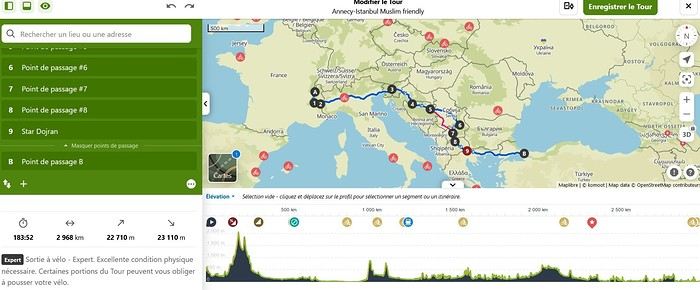
This thread is to echo some posts I’ve read on this forum while researching a potential bike trip from Annecy to Mecca. I came across several discussions where members mentioned being very interested in cycling to the holy city.
So, God willing, I plan to attempt this journey from January to June next year. The idea is to head to Turkey first, then assess the most reasonable routes based on the geopolitical situation around Palestine and as far as Iraq. Since the Turkish-Syrian border is closed, the only remaining (and I mean *only* remaining) overland option would be to go through Iraqi Kurdistan, Iraq, then Jordan, and finally Saudi Arabia.
That’s the first major challenge of this project. The second is timing. Due to the schedule, I’ll be starting in the middle of winter across Europe and finishing in the peak of summer in Saudi Arabia. If I’d had a choice, I’d have waited a good dozen years—but well, twelve years...
I won’t go into too much detail about the planned route in this post, but here are the broad strokes already set: Annecy to Istanbul. The rest is a bit too far ahead to map out properly. Crossing the Italian border via the Montgenèvre Pass. Straight through northern Italy as quickly as possible (not necessarily very pleasant) to reach Ljubljana. The fastest route through Croatia to spend as much time as possible in Bosnia-Herzegovina. Serbia via the Sandžak region. It crosses the Pešter plateau, which intimidates me at this time of year—its nickname, the "Siberia of the Balkans," says it all... Then Kosovo, North Macedonia, Greece, and Turkey.
I’m open to any advice on this itinerary. The choice was made to pass through as many Muslim-majority regions as possible. In the middle of winter in the Balkans, I don’t feel mentally up to bivouacking alone in that climate. So, I’ll try to find accommodations in mosques or even with locals as much as possible.
That’s the project in a nutshell. The big catch—some of you may have already noticed—is that I’m doing this solo. Yet, this is strongly discouraged by our Prophet—peace and blessings of Allah be upon him. So, I invite anyone interested in joining this project, whether closely or from afar, to reach out and contact me. Any contribution is welcome, whether it’s company for the whole journey (one can always hope!) or just part of it. Advice, contact suggestions, places to stay, and information about Hajj or Umrah are also appreciated.
Thanks for reading this far. I’ll try to check my VoyageForum account from time to time to see if anyone has responded to this thread and will happily reply to your messages and questions.
Take care, Assalamu'alaykum.
Sam
Une semaine en Mauritanie depuis Dakhla: budget et temps English translation pending
Bonsoir à tous,
Profitant de la liaison Orly - Dakhla opérée par Transavia, j'ai pris mes billets, pour un aller le 28 décembre et un retour le 4 janvier prochain, sous réserve que les frontières soient réouvertes. Je pars seul.
De l'aéroport de Dakhla, il me faudra partir en bus ou en taxi collectif pour Nouadhibou, passer la frontière avec la Mauritanie, soit environ 4-5 heures de route jusqu'à Nouadhibou, voire plus.
L'avion arrive à 11h50, le temps de récupérer mon sac de la soute, de passer les contrôles, de trouver un transport, je compte une bonne heure minimum.
Pensez-vous qu'il soit réalisable d'envisager un départ le soir même de Nouadhibou vers Choum par le train de minéralier ? Où peut-on trouver les horaires dudit train ?
Ayant un budget assez serré et peu de temps, je pense me concentrer sur la région de l'Adrar. Il s'agit là d'un premier voyage, je n'exclus pas d'en faire d'autres si le premier me plaît.
J'ai commencé à prendre quelques renseignements auprès des agences locales d'Atar, mais j'ai l'impression que bien souvent elles proposent des circuits sur 6 jours, ce qui risque d'être compliqué eu égard à la date de mon vol retour, et du temps nécessaire pour rallier Atar depuis Dakhla.
J'hésite entre deux options : soit me baser à Atar et prendre plusieurs excursions à la journée, soit prendre un tour sur plusieurs jours (4 ou 5).
Mon budget prévisionnel étant de 800-1 000 € , quelle option vous paraît la plus raisonnable svp ?
Je n'ai pas d'appétence pour le confort, je peux dormir en tente et manger comme les locaux, je ne suis pas difficile là-dessus, bien au contraire. Mon budget vous semble-t-il approprié eu égard à la durée de mon séjour ?
Je ne suis pas contre faire du dromadaire plutôt que de la voiture, mais je ne me rends pas compte de la différence au niveau du prix.
Concernant mon problème de temps, il se pose aussi au retour. Mon avion décolle à 11h55 de Dakhla. Ayant un bagage à enregistrer, il faudrait que j'y sois vers 10 heures.
Il me faudrait donc prendre le train de Choum vers Nouadhibou la veille (combien dure le trajet environ ?) puis trouver un chauffeur dans la nuit à Nouadhibou pour être sûr d'arriver à Dakhla. La question des horaires de passage du train à Choum se pose donc. Ce timing pour le retour vous paraît-il réaliste ?
Ultime question : l'argent. Comment cela se passe-t-il ? J'imagine que les distributeurs n'y sont guère monnaie courante, aussi on paye tout en liquide ?
Merci d'avance pour vos réponses, j'ai pas mal voyagé, mais très peu en Afrique, et c'est mon premier voyage que j'organise vraiment seul, aussi, je serais très reconnaissant pour tout conseil qui me sera prodigué.
Profitant de la liaison Orly - Dakhla opérée par Transavia, j'ai pris mes billets, pour un aller le 28 décembre et un retour le 4 janvier prochain, sous réserve que les frontières soient réouvertes. Je pars seul.
De l'aéroport de Dakhla, il me faudra partir en bus ou en taxi collectif pour Nouadhibou, passer la frontière avec la Mauritanie, soit environ 4-5 heures de route jusqu'à Nouadhibou, voire plus.
L'avion arrive à 11h50, le temps de récupérer mon sac de la soute, de passer les contrôles, de trouver un transport, je compte une bonne heure minimum.
Pensez-vous qu'il soit réalisable d'envisager un départ le soir même de Nouadhibou vers Choum par le train de minéralier ? Où peut-on trouver les horaires dudit train ?
Ayant un budget assez serré et peu de temps, je pense me concentrer sur la région de l'Adrar. Il s'agit là d'un premier voyage, je n'exclus pas d'en faire d'autres si le premier me plaît.
J'ai commencé à prendre quelques renseignements auprès des agences locales d'Atar, mais j'ai l'impression que bien souvent elles proposent des circuits sur 6 jours, ce qui risque d'être compliqué eu égard à la date de mon vol retour, et du temps nécessaire pour rallier Atar depuis Dakhla.
J'hésite entre deux options : soit me baser à Atar et prendre plusieurs excursions à la journée, soit prendre un tour sur plusieurs jours (4 ou 5).
Mon budget prévisionnel étant de 800-1 000 € , quelle option vous paraît la plus raisonnable svp ?
Je n'ai pas d'appétence pour le confort, je peux dormir en tente et manger comme les locaux, je ne suis pas difficile là-dessus, bien au contraire. Mon budget vous semble-t-il approprié eu égard à la durée de mon séjour ?
Je ne suis pas contre faire du dromadaire plutôt que de la voiture, mais je ne me rends pas compte de la différence au niveau du prix.
Concernant mon problème de temps, il se pose aussi au retour. Mon avion décolle à 11h55 de Dakhla. Ayant un bagage à enregistrer, il faudrait que j'y sois vers 10 heures.
Il me faudrait donc prendre le train de Choum vers Nouadhibou la veille (combien dure le trajet environ ?) puis trouver un chauffeur dans la nuit à Nouadhibou pour être sûr d'arriver à Dakhla. La question des horaires de passage du train à Choum se pose donc. Ce timing pour le retour vous paraît-il réaliste ?
Ultime question : l'argent. Comment cela se passe-t-il ? J'imagine que les distributeurs n'y sont guère monnaie courante, aussi on paye tout en liquide ?
Merci d'avance pour vos réponses, j'ai pas mal voyagé, mais très peu en Afrique, et c'est mon premier voyage que j'organise vraiment seul, aussi, je serais très reconnaissant pour tout conseil qui me sera prodigué.
Happiness Settles in the Heart of the Maasai Mara
(October 2018).
This account of a short stay in Kenya was originally meant for our friends and family, but to pass the time—for both us and you—and to add some content to the increasingly quiet columns of Voyage Forum during these weeks of confinement, when travelers can only journey in their minds, we decided to share the 25 pages of my ramblings, illustrated with Yolande’s photos, from an extraordinary stay in the Maasai Mara National Reserve. We waited until the two previous discussions on this same topic, filled with stunning photos and started by Régis and then Claire—sometimes in agreement, sometimes differing but always full of insights—had quieted down a bit before jumping in. Well, we’ll give it a try.
Let’s clarify: one of us claims to be a beginner photographer, and the other is just an unrepentant dreamer and modest writer. We often pursued our passions separately—Yolande with her mentor and me with an incomparable tracker—so sometimes the photos don’t quite match the text, or vice versa.
We hope you enjoy reading this lengthy post, which is longer than usual in VF’s sections (except, of course, for Mr. Voyajou). A thousand apologies for straying off the beaten path.
Alright, here we go!
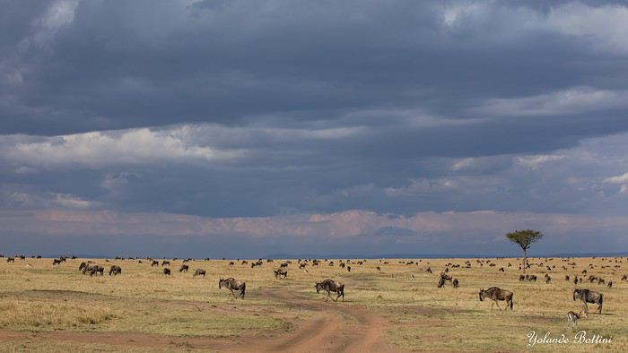
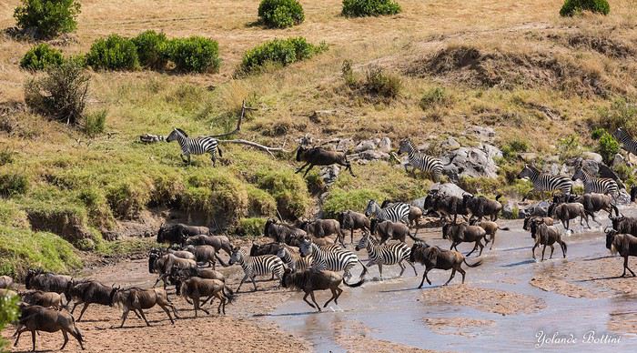
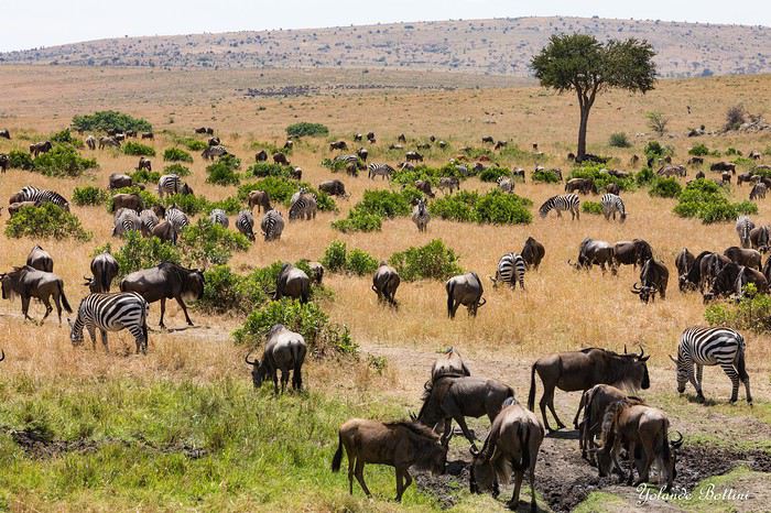
This account of a short stay in Kenya was originally meant for our friends and family, but to pass the time—for both us and you—and to add some content to the increasingly quiet columns of Voyage Forum during these weeks of confinement, when travelers can only journey in their minds, we decided to share the 25 pages of my ramblings, illustrated with Yolande’s photos, from an extraordinary stay in the Maasai Mara National Reserve. We waited until the two previous discussions on this same topic, filled with stunning photos and started by Régis and then Claire—sometimes in agreement, sometimes differing but always full of insights—had quieted down a bit before jumping in. Well, we’ll give it a try.
Let’s clarify: one of us claims to be a beginner photographer, and the other is just an unrepentant dreamer and modest writer. We often pursued our passions separately—Yolande with her mentor and me with an incomparable tracker—so sometimes the photos don’t quite match the text, or vice versa.
We hope you enjoy reading this lengthy post, which is longer than usual in VF’s sections (except, of course, for Mr. Voyajou). A thousand apologies for straying off the beaten path.
Alright, here we go!
On part en vadrouille dans l'ouest américain! Oui, encore... English translation pending
En ces temps difficiles qui nous obligent à trouver des occupations, je vous soumets ici un carnet que j'avais rédigé il y a quelques années et que je n'ai jamais publié ici... Bonne lecture (pour ceux que ça intéresse...)...
24 juillet - Itinéraire d’une famille gâtée
Envie de t’évader ? Envie de rêver ? Envie de t’amuser ? Oui ? Alors tu as frappé à la bonne adresse... Plus précisément à l’adresse de celui qui a attrapé un virus… En l’occurrence, moi… Et ce virus, pas question de m’en débarrasser en me bourrant d’antibiotiques. Non seulement, les antibiotiques, ce n’est pas automatique, mais ce virus-là, j’en prends grand soin. Je l’entretiens, même… Ce virus, c’est l’étasunite ! Je l’ai contracté le jour où j’ai posé mes arpions chez l’oncle Sam pour la première fois, il y a une décennie de cela. Tout ça ne me rajeunit pas mais depuis ce fameux jour, lui et moi, nous ne nous sommes plus jamais quittés. Un proverbe dit à ce sujet que si tu vas aux Etats-Unis une fois, tu y reviendras un jour… Ben moi, depuis, j’y suis même retourné deux autres fois ! Et figure-toi que si tu lis ces quelques lignes, c’est que je m’apprête à y retourner pour une quatrième vadrouille !... Pour cette fois-ci, je vais accomplir un de mes rêves ! Me faire la route 66 sur mon Harley avec une belle brune accrochée à ma taille... Manque de bol, ma femme est blonde, je n'ai pas le permis moto et nous avons deux louloutes de quatre et sept ans… Va donc falloir que je revoie mes plans...
Bon, si tu es un lecteur assidu de nos précédentes vadrouilles, nous n’avons plus de secret pour toi, si bien que tu sais déjà que nous sommes quatre, juste un an de plus par rapport à la dernière fois… Il y a bien évidemment Sandrine, ma femme alias le portefeuille ; Sasha, notre petite globetrotteuse de quatre ans ; et Anna notre routarde de sept ans et plus toutes ses dents... Ah, et je m’oubliais ! Moi, Franck, la trentaine bien tassée, alias le conducteur, le tour opérateur, le narrateur, le cuisinier, le… Oui, je sais, moi aussi, j’aimerais bien déléguer… Ah, mais j’oublie encore quelqu’un !… Toi… Mais bon, sauf le respect que je te dois, tu ne seras une nouvelle fois que le spectateur du film que nous allons tourner et interpréter… D’ailleurs, quel en sera le titre ?... Et bien après réflexion, on a le choix entre « Voyage entre geysers et déserts », ou alors « Sous le soleil de Beverly Hills »… Pour ce coup-là, en espérant ne pas les vexer, on décide de poser un lapin à Brandon et Brenda… Car oui, c’est décidé, cette nouvelle édition sera composée d'indiens, de geysers, de trappeurs, de pionniers, de bisons, de chercheurs d'or, de hors-la-loi, de ranchs et de cowboys ! A nous les grands espaces… et les gros hamburgers !!! A nous l’ouest américain et ses films qui donnent tant envie : Délivrance, la colline a des yeux, Shining, The Descent, ...
Mais un voyage comme celui-là, ça se prépare un ‘tiot peu. Premièrement, il faut du blé, du flouze, du fric, du pognon, des pépettes, de la caillasse… Ben oui, ça coûte cher tout ça, donc à moins de faire comme le PSG et te faire subventionner par un investisseur qatari, il va falloir que tu en mettes de côté. Deuxièmement, il faut un minimum de travail de préparation. Et je commencerai mon histoire par un retour dans le passé, un bond dans le temps pour revenir pile poil au moment où Sandrine a enfin craqué sous mes coups de butoir et m’a donné son ô combien précieuse approbation… « Allez, ok, c’est bon, fais-toi plaisir ! » Sans avoir réellement conscience de la portée de ces quelques mots, elle venait de me signer un contrat de travail d’un an ! Car moi, ni une, ni deux, j'ai employé toute une équipe de lutins pour m'aider à préparer mon itinéraire. Lecture de carnets de voyage, questions sur des forums, épluchage de guides, visionnage de films, essorage d’internet, … Au final, je dois dire que je suis plus que satisfait de leur boulot ! Ce qui me permet non pas de faire un bilan puisqu'heureusement, le voyage n'est pas commencé, mais plutôt un petit compte-rendu chiffré de ce qui nous attend. Huit états à traverser ou à effleurer, plus de cinq mille kilomètres à parcourir, vingt jours pleins sur place, deux hôtels, quatorze campings différents, huit heures de décalage... Mes trois blondes vont-elles le supporter ? Optimiste que je suis, je mise sur un grand « Oui » ! D’ailleurs, pour les préparer, j’ai mis en place un programme intensif trois mois avant le départ : Marche autour de notre immense propriété, westerns tous les soirs, Coca et hamburgers à volonté à tous les repas !... Et oui, qui ménage sa monture voyage plus souvent !
Avant de tailler la route, je profite de cette intro pour publier une petite annonce à destination des cambrioleurs amateurs de textes de voyage : passez votre route, ma maison est équipée d’une alarme biométrique avec double varifocale et matrice de commutation. De plus, j’ai loué à un pote du neuf trois son gros pitbull pour l’occasion. Sans compter que pendant nos vacances, ma maison va être occupée par mes parents qui sont tous les deux experts en arts martiaux !... D’ailleurs, pourquoi je te raconte ces bobards alors que tu ne connais même pas mon adresse… C'est le 25, avenue des canaris à Triffouillis-sur-Retourne... Euh, merci de ne pas m’envoyer de carte postale à l'adresse ci-dessus... c'est une fausse !
Bon, chut, ça y est, c’est l’heure de l’évaluation… On va savoir si toute la famille est prête pour le grand départ : « Sandrine, donne-moi les huit états dans lesquels nous allons poser les pieds... - Colorado, Wyoming, Nebraska, Dakota du sud, Montana, Idaho, Utah et... euh... mince, oh, je l’ai sur le bout de la langue… Ah oui, l’Arizona !!!… - Mouais… C’était moins une… Encore un peu et tu n’partais pas avec nous ! Et toi, Anna, cite-moi les quatre présidents sculptés sur le Mont Rushmore ? - Abram Licol, Tomasse Washington, George Jeffessonne et Theodore Rousevelle... - Ok, on va dire que c’est bon… Et toi, Sasha, dans quel pays allons-nous cet été ? - Les Jétajuniiiiis de l’Amérique de Mickey ! » Ok, c’est bon, elles sont fin prêtes ! Attention, départ imminent !
24 juillet - Itinéraire d’une famille gâtée
Envie de t’évader ? Envie de rêver ? Envie de t’amuser ? Oui ? Alors tu as frappé à la bonne adresse... Plus précisément à l’adresse de celui qui a attrapé un virus… En l’occurrence, moi… Et ce virus, pas question de m’en débarrasser en me bourrant d’antibiotiques. Non seulement, les antibiotiques, ce n’est pas automatique, mais ce virus-là, j’en prends grand soin. Je l’entretiens, même… Ce virus, c’est l’étasunite ! Je l’ai contracté le jour où j’ai posé mes arpions chez l’oncle Sam pour la première fois, il y a une décennie de cela. Tout ça ne me rajeunit pas mais depuis ce fameux jour, lui et moi, nous ne nous sommes plus jamais quittés. Un proverbe dit à ce sujet que si tu vas aux Etats-Unis une fois, tu y reviendras un jour… Ben moi, depuis, j’y suis même retourné deux autres fois ! Et figure-toi que si tu lis ces quelques lignes, c’est que je m’apprête à y retourner pour une quatrième vadrouille !... Pour cette fois-ci, je vais accomplir un de mes rêves ! Me faire la route 66 sur mon Harley avec une belle brune accrochée à ma taille... Manque de bol, ma femme est blonde, je n'ai pas le permis moto et nous avons deux louloutes de quatre et sept ans… Va donc falloir que je revoie mes plans...
Bon, si tu es un lecteur assidu de nos précédentes vadrouilles, nous n’avons plus de secret pour toi, si bien que tu sais déjà que nous sommes quatre, juste un an de plus par rapport à la dernière fois… Il y a bien évidemment Sandrine, ma femme alias le portefeuille ; Sasha, notre petite globetrotteuse de quatre ans ; et Anna notre routarde de sept ans et plus toutes ses dents... Ah, et je m’oubliais ! Moi, Franck, la trentaine bien tassée, alias le conducteur, le tour opérateur, le narrateur, le cuisinier, le… Oui, je sais, moi aussi, j’aimerais bien déléguer… Ah, mais j’oublie encore quelqu’un !… Toi… Mais bon, sauf le respect que je te dois, tu ne seras une nouvelle fois que le spectateur du film que nous allons tourner et interpréter… D’ailleurs, quel en sera le titre ?... Et bien après réflexion, on a le choix entre « Voyage entre geysers et déserts », ou alors « Sous le soleil de Beverly Hills »… Pour ce coup-là, en espérant ne pas les vexer, on décide de poser un lapin à Brandon et Brenda… Car oui, c’est décidé, cette nouvelle édition sera composée d'indiens, de geysers, de trappeurs, de pionniers, de bisons, de chercheurs d'or, de hors-la-loi, de ranchs et de cowboys ! A nous les grands espaces… et les gros hamburgers !!! A nous l’ouest américain et ses films qui donnent tant envie : Délivrance, la colline a des yeux, Shining, The Descent, ...
Mais un voyage comme celui-là, ça se prépare un ‘tiot peu. Premièrement, il faut du blé, du flouze, du fric, du pognon, des pépettes, de la caillasse… Ben oui, ça coûte cher tout ça, donc à moins de faire comme le PSG et te faire subventionner par un investisseur qatari, il va falloir que tu en mettes de côté. Deuxièmement, il faut un minimum de travail de préparation. Et je commencerai mon histoire par un retour dans le passé, un bond dans le temps pour revenir pile poil au moment où Sandrine a enfin craqué sous mes coups de butoir et m’a donné son ô combien précieuse approbation… « Allez, ok, c’est bon, fais-toi plaisir ! » Sans avoir réellement conscience de la portée de ces quelques mots, elle venait de me signer un contrat de travail d’un an ! Car moi, ni une, ni deux, j'ai employé toute une équipe de lutins pour m'aider à préparer mon itinéraire. Lecture de carnets de voyage, questions sur des forums, épluchage de guides, visionnage de films, essorage d’internet, … Au final, je dois dire que je suis plus que satisfait de leur boulot ! Ce qui me permet non pas de faire un bilan puisqu'heureusement, le voyage n'est pas commencé, mais plutôt un petit compte-rendu chiffré de ce qui nous attend. Huit états à traverser ou à effleurer, plus de cinq mille kilomètres à parcourir, vingt jours pleins sur place, deux hôtels, quatorze campings différents, huit heures de décalage... Mes trois blondes vont-elles le supporter ? Optimiste que je suis, je mise sur un grand « Oui » ! D’ailleurs, pour les préparer, j’ai mis en place un programme intensif trois mois avant le départ : Marche autour de notre immense propriété, westerns tous les soirs, Coca et hamburgers à volonté à tous les repas !... Et oui, qui ménage sa monture voyage plus souvent !
Avant de tailler la route, je profite de cette intro pour publier une petite annonce à destination des cambrioleurs amateurs de textes de voyage : passez votre route, ma maison est équipée d’une alarme biométrique avec double varifocale et matrice de commutation. De plus, j’ai loué à un pote du neuf trois son gros pitbull pour l’occasion. Sans compter que pendant nos vacances, ma maison va être occupée par mes parents qui sont tous les deux experts en arts martiaux !... D’ailleurs, pourquoi je te raconte ces bobards alors que tu ne connais même pas mon adresse… C'est le 25, avenue des canaris à Triffouillis-sur-Retourne... Euh, merci de ne pas m’envoyer de carte postale à l'adresse ci-dessus... c'est une fausse !
Bon, chut, ça y est, c’est l’heure de l’évaluation… On va savoir si toute la famille est prête pour le grand départ : « Sandrine, donne-moi les huit états dans lesquels nous allons poser les pieds... - Colorado, Wyoming, Nebraska, Dakota du sud, Montana, Idaho, Utah et... euh... mince, oh, je l’ai sur le bout de la langue… Ah oui, l’Arizona !!!… - Mouais… C’était moins une… Encore un peu et tu n’partais pas avec nous ! Et toi, Anna, cite-moi les quatre présidents sculptés sur le Mont Rushmore ? - Abram Licol, Tomasse Washington, George Jeffessonne et Theodore Rousevelle... - Ok, on va dire que c’est bon… Et toi, Sasha, dans quel pays allons-nous cet été ? - Les Jétajuniiiiis de l’Amérique de Mickey ! » Ok, c’est bon, elles sont fin prêtes ! Attention, départ imminent !
De retour du Ladakh, 3 semaines de Leh à Delhi English translation pending
De retour d’un premier séjour au Ladakh…je me décide enfin à écrire quelques lignes.
En effet le voyage date déjà de quelques mois, l’été 2019. Mieux vaut tard que jamais…
Beaucoup de montagnards chevronnés sur cette destination (il y a peut être une certaine logique à cela), je dois avouer que je n’entre pas dans cette catégorie… ce qui ne m’empêche pas d’apprécier de grandioses paysages de montagne !! Mes motivations premières pour cette destination étaient donc : la découverte de la région et des ses habitants, bien entendu ; l’Himalaya bien sûr, mais sans forcément penser à faire de grandes marches / de grands escalades ; les monastères bouddhistes, cela va sans dire ; et les routes mythiques, en particulier la route ralliant Leh à Manali qui est bien haut dans ma wish-list depuis un certain nombre d’années…
Avant de rentrer dans le vif du sujet, un grand merci à tous ceux qui ont répondu à mes messages et m’ont aidé à dans ma préparation. Et des very special thanks au grand spécialiste de la destination, Djullé84, qui, m’a grandement aidé dans mon itinéraire, et qui a aussi influé sur le contenu de mon voyage. On en reparlera !
Donc, les grandes lignes de ce voyage ont été : - Leh (inévitablement) et les monastères de la vallée de l’Indus - Le festival de Lamayuru - Le trek de la Markha - Une virée dans la vallée de la Nubra - Le trajet de retour en bus de Leh à Delhi. Pour les déplacements, les transports publics sont privilégiés, autant que possible.
Durée / période : ~3 semaines, fin juin / mi-juillet
Le voyage jusqu'à Leh : vol jusqu’à Delhi sur Lufthansa via Munich (Lufthansa est très concurrentiel vers les destinations asiatiques depuis ma province). Arrivée Delhi peu avant minuit, passage à l’immigration sans problème pour valider mon visa à entrées multiples sur un an obtenu sur internet. Je traîne quelques heures dans l’aéroport puis je m’aperçois qu’il me faut changer de terminal pour prendre mon vol SpiceJet du petit matin. Le terminal 1D est loin, la navette en bus est gratuite en montrant sa carte d’embarquement du vol précédent et sa réservation du vol suivant (à prendre près du pilier 10 accessible par la sortie 4, le monsieur dans la cabane donne le ticket). Heureusement, j’avais été attentif lors de ma réservation et je n’avais pas acheté mon billet avec une CB virtuelle : il faut effectivement montrer la CB avec laquelle on a fait l’achat pour obtenir sa boarding card…(Spicejet) Vol sans histoire, mais… le ciel très couvert ne permet aucun spectacle, c’est une déception car ça aurait pu être pire : le vol n’a pas été annulé… Avion jusqu'à Leh, donc : d'une part en juin, c'est encore tôt dans la saison pour prendre la route ; et d'autre part, la route Delhi-Manali-Leh me paraît très haute pour l'emprunter sans aucune acclimatation, je la réserve pour le retour... Et l'autre possibilité par Amritsar et Srinagar était très tentante, mais d'une part elle exigeait beaucoup de temps, et d'autre part cet itinéraire fait emprunter des trajets qui se situent dans la zone rouge du ministère des affaires étrangères...
Depuis l'aéroport, le taxi pour le centre de Leh coûte 450 Rs (flat price), installation à la GH, réservée sur booking, dans le vieux Leh, entre le terrain de polo et la rue principale.
La 1ère journée se passe au ralenti, sous un ciel couvert, il me faut récupérer du voyage et de la nuit dans l’aéroport de Delhi, et m’acclimater à l’altitude. Premières découvertes de Leh qui au premier abord et sous le ciel gris, n’est pas vraiment enthousiasmante (ça me rassure un peu d’avoir lu quelque part (n’est ce pas, Djullé84) que « chaque journée passée à Leh est une journée de moins passée au Ladakh »…). Ah tous ces toutous en train de roupiller… La première nuit est un peu difficile, mal de tête avec l’altitude… Et les chiens donnent un concert dès le coucher du soleil. Je comprends pourquoi les chiens dormaient dans la journée : à Leh, le chien est un animal nocturne, qui dort le jour et qui passe ses nuits à aboyer… Ah, il y a le chant du muezzin aussi…
Temps pluvieux le matin (et j’apprends qu’il n’y a aucun vol depuis/vers Leh aujourd’hui…), il me faut récupérer des infos pratiques pour organiser la suite du voyage (les jours et heures des bus, en particulier …). Le temps s’arrange, location de scooter l’après midi, je parviens à en obtenir un bien que je n’aie pas pu avoir mon permis de conduire international en temps et en heure. Je vais aller jusqu’à Phyang. Une fois sorti des embouteillages et du bazar de Leh, la ballade permet les premières vues spectaculaires sur les montagnes himalayennes et sur l’Indus. Et les premiers convois militaires à croiser aussi, ils seront omniprésents sur les routes…Et la possibilité de voir de près le 1er monastère ! (mais pas de le visiter à l’heure de mon arrivée) Côté organisation, j’ai pu planifier les choses : dans les prochains jours, ce sera une virée Alchi – Likir – Lamayuru et retour sur Leh : le lendemain je prendrai un premier bus pour Alchi ; mon périple continuera en prenant le bus qui repart pour Leh ; en descendant à la bifurcation pour Likir, je pourrai ensuite monter à pied pour la fin d’après-midi et la nuit à Likir. Le jour suivant je redescendrai à pied à la highway prendre le bus pour Lamayuru, où je resterai deux jours et demi (dont une pleine journée de festival) avant de rentrer en bus pour Leh. J’en repartirai le lendemain pour la vallée de la Markha. Leh sera donc ma plaque tournante, ce qui me permet de m’alléger en demandant à la GH de garder une partie de mes affaires lors de chacune de mes escapades.
(à suivre)
En effet le voyage date déjà de quelques mois, l’été 2019. Mieux vaut tard que jamais…
Beaucoup de montagnards chevronnés sur cette destination (il y a peut être une certaine logique à cela), je dois avouer que je n’entre pas dans cette catégorie… ce qui ne m’empêche pas d’apprécier de grandioses paysages de montagne !! Mes motivations premières pour cette destination étaient donc : la découverte de la région et des ses habitants, bien entendu ; l’Himalaya bien sûr, mais sans forcément penser à faire de grandes marches / de grands escalades ; les monastères bouddhistes, cela va sans dire ; et les routes mythiques, en particulier la route ralliant Leh à Manali qui est bien haut dans ma wish-list depuis un certain nombre d’années…
Avant de rentrer dans le vif du sujet, un grand merci à tous ceux qui ont répondu à mes messages et m’ont aidé à dans ma préparation. Et des very special thanks au grand spécialiste de la destination, Djullé84, qui, m’a grandement aidé dans mon itinéraire, et qui a aussi influé sur le contenu de mon voyage. On en reparlera !
Donc, les grandes lignes de ce voyage ont été : - Leh (inévitablement) et les monastères de la vallée de l’Indus - Le festival de Lamayuru - Le trek de la Markha - Une virée dans la vallée de la Nubra - Le trajet de retour en bus de Leh à Delhi. Pour les déplacements, les transports publics sont privilégiés, autant que possible.
Durée / période : ~3 semaines, fin juin / mi-juillet
Le voyage jusqu'à Leh : vol jusqu’à Delhi sur Lufthansa via Munich (Lufthansa est très concurrentiel vers les destinations asiatiques depuis ma province). Arrivée Delhi peu avant minuit, passage à l’immigration sans problème pour valider mon visa à entrées multiples sur un an obtenu sur internet. Je traîne quelques heures dans l’aéroport puis je m’aperçois qu’il me faut changer de terminal pour prendre mon vol SpiceJet du petit matin. Le terminal 1D est loin, la navette en bus est gratuite en montrant sa carte d’embarquement du vol précédent et sa réservation du vol suivant (à prendre près du pilier 10 accessible par la sortie 4, le monsieur dans la cabane donne le ticket). Heureusement, j’avais été attentif lors de ma réservation et je n’avais pas acheté mon billet avec une CB virtuelle : il faut effectivement montrer la CB avec laquelle on a fait l’achat pour obtenir sa boarding card…(Spicejet) Vol sans histoire, mais… le ciel très couvert ne permet aucun spectacle, c’est une déception car ça aurait pu être pire : le vol n’a pas été annulé… Avion jusqu'à Leh, donc : d'une part en juin, c'est encore tôt dans la saison pour prendre la route ; et d'autre part, la route Delhi-Manali-Leh me paraît très haute pour l'emprunter sans aucune acclimatation, je la réserve pour le retour... Et l'autre possibilité par Amritsar et Srinagar était très tentante, mais d'une part elle exigeait beaucoup de temps, et d'autre part cet itinéraire fait emprunter des trajets qui se situent dans la zone rouge du ministère des affaires étrangères...
Depuis l'aéroport, le taxi pour le centre de Leh coûte 450 Rs (flat price), installation à la GH, réservée sur booking, dans le vieux Leh, entre le terrain de polo et la rue principale.
La 1ère journée se passe au ralenti, sous un ciel couvert, il me faut récupérer du voyage et de la nuit dans l’aéroport de Delhi, et m’acclimater à l’altitude. Premières découvertes de Leh qui au premier abord et sous le ciel gris, n’est pas vraiment enthousiasmante (ça me rassure un peu d’avoir lu quelque part (n’est ce pas, Djullé84) que « chaque journée passée à Leh est une journée de moins passée au Ladakh »…). Ah tous ces toutous en train de roupiller… La première nuit est un peu difficile, mal de tête avec l’altitude… Et les chiens donnent un concert dès le coucher du soleil. Je comprends pourquoi les chiens dormaient dans la journée : à Leh, le chien est un animal nocturne, qui dort le jour et qui passe ses nuits à aboyer… Ah, il y a le chant du muezzin aussi…
Temps pluvieux le matin (et j’apprends qu’il n’y a aucun vol depuis/vers Leh aujourd’hui…), il me faut récupérer des infos pratiques pour organiser la suite du voyage (les jours et heures des bus, en particulier …). Le temps s’arrange, location de scooter l’après midi, je parviens à en obtenir un bien que je n’aie pas pu avoir mon permis de conduire international en temps et en heure. Je vais aller jusqu’à Phyang. Une fois sorti des embouteillages et du bazar de Leh, la ballade permet les premières vues spectaculaires sur les montagnes himalayennes et sur l’Indus. Et les premiers convois militaires à croiser aussi, ils seront omniprésents sur les routes…Et la possibilité de voir de près le 1er monastère ! (mais pas de le visiter à l’heure de mon arrivée) Côté organisation, j’ai pu planifier les choses : dans les prochains jours, ce sera une virée Alchi – Likir – Lamayuru et retour sur Leh : le lendemain je prendrai un premier bus pour Alchi ; mon périple continuera en prenant le bus qui repart pour Leh ; en descendant à la bifurcation pour Likir, je pourrai ensuite monter à pied pour la fin d’après-midi et la nuit à Likir. Le jour suivant je redescendrai à pied à la highway prendre le bus pour Lamayuru, où je resterai deux jours et demi (dont une pleine journée de festival) avant de rentrer en bus pour Leh. J’en repartirai le lendemain pour la vallée de la Markha. Leh sera donc ma plaque tournante, ce qui me permet de m’alléger en demandant à la GH de garder une partie de mes affaires lors de chacune de mes escapades.
(à suivre)
On the Silk Road: Chronicles of a Sixty-Something Traveling Completely Independently
From Beijing to Khiva: China, Kyrgyzstan, Tajikistan, Uzbekistan
Chronicle of anecdotes, highlights, and other adventures that marked this eight-week journey in 2018.
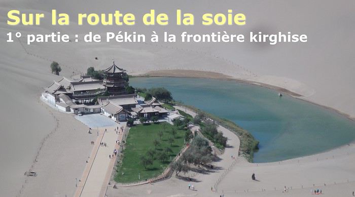
The Chinese Far West More than 30 years after my first trip to eastern China, I finally fulfilled an old dream: traveling solo from Beijing to the far west, discovering Xinjiang, the Uyghur people and the oppression they endure, the oases of Turpan and Kashgar, the Taklamakan Desert, the end of the Great Wall... The route was covered by train.
MENU PART 1: CHINA
1- Beijing (Jiankou) : the authentic Great Wall, without tourists 2- Cycling in Beijing, the best way to get around 3- Beijing : departure for the far west 4- Jiayuguan : getting by without English 5- Jiayuguan : scams and heritage 6- Dunhuang : abundance in the middle of the desert 7- Turpan : the Uyghurs under heavy surveillance 8- Kashgar : love at first sight for the old city 9- Kashgar : China’s recipe for controlling the populace 10- Tashkurgan : what on earth was I thinking going there! Kyrgyz border: a surreal epic Photo album from the 80s, contributions from other travelers (page 2)
1- JIANKOU Finding the authentic Great Wall, without tourists or a guide Friday, August 24, 2018 Thirty years later, I didn’t feel like revisiting the Great Wall at Badaling or any other overcrowded site. I chose to explore it at Jiankou, in its wildest, most authentic, and unrestored section, starting from a lost village deep in a valley—though it wasn’t *that* lost, since it had everything for communication.
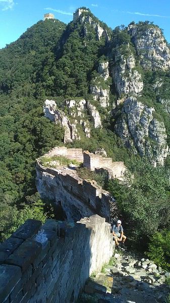
No need to pay for a taxi to get there—by timing it right, you can take the bus for just a few yuan. You have to get off at Xizhazi, the bus terminus. Be careful, there are only two buses a day in each direction. At the Xizhazi bus stop, I met a young couple who’d arrived with zero information about what to expect. We hiked the three of us toward the restored section of Mutianyu.
Still, be cautious With GPS and a topographic map (OpenTopoMap), you can set off without a problem or guide. The trail up to Jiankou is easy and well-marked. The trails down are too. But be careful—once you’re on the Wall, it’s real mountain hiking, with easy but dangerous climbing sections (over sheer drops). Not for amateurs or those afraid of heights! But what a reward. The Wall all to yourself, where it’s at its most daring. Truly mesmerizing.
More photos...
2- BEIJING The best way to get around the capital Sunday, August 26 The best way to explore the city is still by bike. Most are in a bike-share system, but you need to use an app—WeChat, the app that does everything, like monitoring your every move. No way I was installing that.
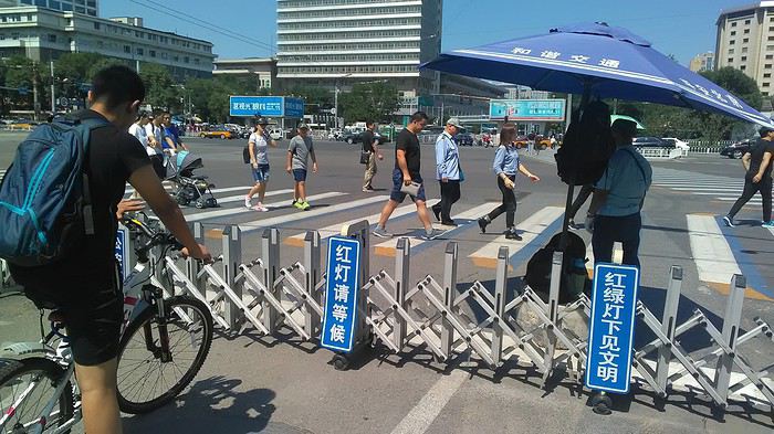
I found one at a rental shop near the hostel. The key is to quickly learn local traffic customs to minimize risks. Bike lanes are wide along the avenues.
But you still have to: - Watch out for anything parked on the bike paths—the most annoying are people napping or talking on the phone in their cars - Keep an eye on everything coming the wrong way—the list is long - The worst is right turns on red, which in Chinese traffic rules seem to have priority Once you get the hang of it, it’s fine. The city is huge but flat, so you can just wing it.
3- BEIJING By train to the far west Sunday, August 26 Beijing West Station is the size and operates like an airport. With your e-ticket from the agency, you first have to pick up your ticket at the special "English" counter, after passing through security. With your ticket in hand, you have to exit and enter through the boarding waiting area—not the platform—after a second security check.
 Then you find the right hall and wait for the sign to finally access the platform. In the end, it works pretty well given the incredible number of passengers to manage. Everywhere in Beijing, I saw that the Chinese have mastered crowd flow management.
Nice surprise: second-class carriages are clean, air-conditioned, and bright. Perfect, since I was in for 20 hours. One uniformed attendant per carriage, mobile meal service—luxury! Small downside: no luggage space. Hauling your suitcase up to the top bunk is quite a workout. I was in the middle, so it wasn’t too bad. The landscape, though, whether rural or urban, is pretty bleak. That should change once we leave the eastern plains.
Of course, I got my first police visit, with a thorough passport check and bag search. I was warned—going to the Chinese far west exposes you to this kind of hassle. But they were polite and respectful.
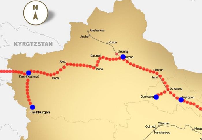 The Chinese Far West
4- JIAYUGUAN Getting by without English Monday, August 27 At the gates of two deserts (Gobi and Taklamakan) and at the foot of the Tibetan highlands, the Great Wall ends at Jiayuguan. Here, I found the deeper China I’d somewhat rediscovered during my bike ride, even if now everyone gets around on electric bikes and I’m no longer stared at like an alien.
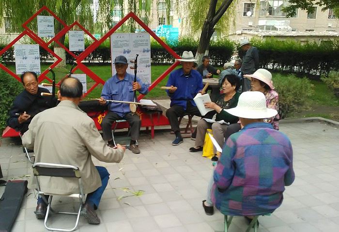
Prices are nothing like Beijing: you can find a full meal for 2 €, and my bike cost 7 € for two days. Plus, few people speak English—neither the owner of the HI hostel where I stayed, nor the ticket sellers at the sites, let alone the servers at the small eateries where I ate. Everything is written in Chinese. So I had to use the little Chinese I know to communicate about essentials. It makes the locals laugh to see a European trying to speak their language, but it earns respect. With Google Translate’s help, I managed.
Rant: With their avenues blocked for construction for kilometers without warning, and new roads not yet on maps, I must’ve taken 15 km of detours. More photos...
5- JIAYUGUAN Scams and heritage Tuesday, August 28 The Great Wall doesn’t exactly end at the fort I visited yesterday but 10 km further, at the entrance to a river gorge at the foot of the mountains. All that’s left is a badly damaged tower (more like a mound of earth) and a section of clay wall, similar to the one I biked yesterday.
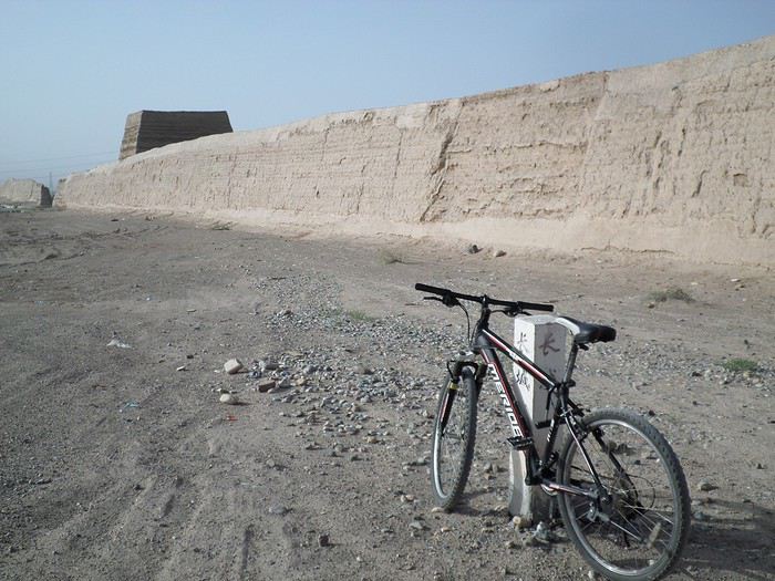
This morning, I hopped on my bike, determined to venture into the desert to see this highly symbolic site. First, you access it via a wide, brand-new road with not a soul in sight. Just before the site, I came across a grand welcome gate, very period-style, but it’s actually the inevitable toll booth.
Behind the gate, the road continues straight to the site, which you can see in the distance—at least 2 km away—the remains of the tower and wall. I had to leave my bike here. Fine. I went to the ticket counter and asked the price: 120 yuan! I couldn’t believe it—over 15 € for a simple mound of earth.
I showed my displeasure to the attendant, who couldn’t care less, and immediately turned back. 120 yuan—that’s the price for a new road, a fancy gate planted 2 km before the site just to force you to take a shuttle, and employees with nothing to do all day... Now I understand why I didn’t meet anyone!
Heritage China is a bit pricey Generally, sites are expensive for the country’s standard of living, but travelers are supposed to have money, so why hold back? I even gave up on the Forbidden City—reservations required days in advance (or on the black market at an impossible price). I prefer to keep the memory of my first visit, when entry must’ve cost a few dozen cents, and there were only a handful of visitors.
This morning, I took a taxi to see remarkable tombs of common people from the 3rd to 6th centuries. They’re small vaulted caves made of painted bricks, depicting scenes of daily life. Very pretty and moving. But even here, though the price was more reasonable, I was left wanting—only one of the 16 tombs is open to visitors, and it’s apparently not the most beautiful.
The authentic China—at least what’s left of it... Wandering the impersonal avenues of the city, you stumble upon a market. There, you still find traditional China—small shops with questionable hygiene, Go players, musicians, and even a dental prosthetist. The last refuge for those untouched by modernity. More photos...
6- DUNHUANG Abundance in the middle of the desert Wednesday, August 29 Well, I thought the landscape would be less bleak as I headed west. Nope. The only distraction in this expanse of dark, clayey sand is the forests of pylons and wind turbines, plus wild camels racing each other.
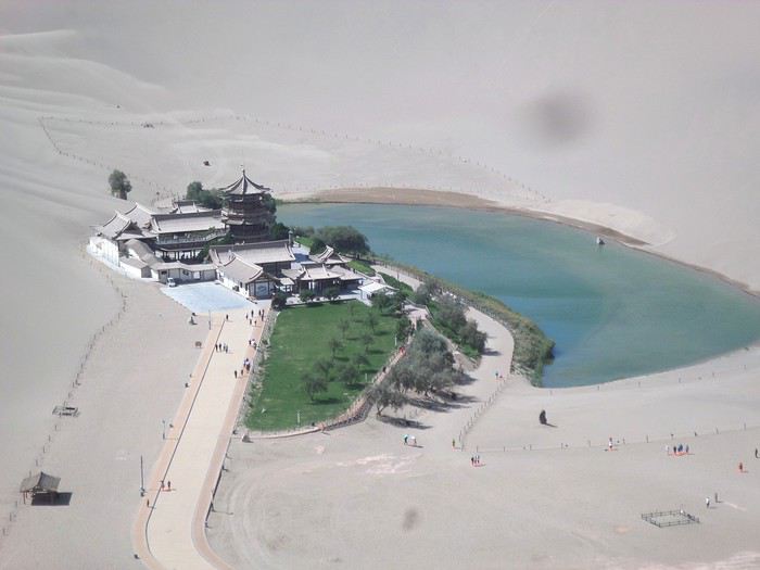 However, Dunhuang, the gateway to the Taklamakan, is by far the most pleasant Chinese city I know. There’s a real city center you can explore on foot. It’s hot but not unbearable, with a light, dry breeze. Much nicer than Beijing. The Han Chinese are still the majority, but the Muslim Uyghurs are more numerous, and the muezzin’s call to prayer echoes around the mosque.
The most surprising thing is the abundance and diversity of fruits and vegetables. You wonder how it all grows here. Well-irrigated, the desert sands are very fertile. Here, raisins have subtle, mysterious flavors, and the lamb really tastes like lamb.
Today, I visited the must-see Mingshashan, a dune complex next to which Pila is a molehill. The Basque Country, but covered in sand... More photos...
7- TURPAN The Uyghurs under heavy surveillance Friday, August 31 Surveillance cameras everywhere in the city, armed police stationed at intersections, in front of public buildings, at the entrance and inside tourist sites, police stations on every corner, patrols on foot or by car, khaki uniforms even for middle schoolers... here, the Han Chinese are in the minority, and you can feel it. Turpan feels like a city under siege.
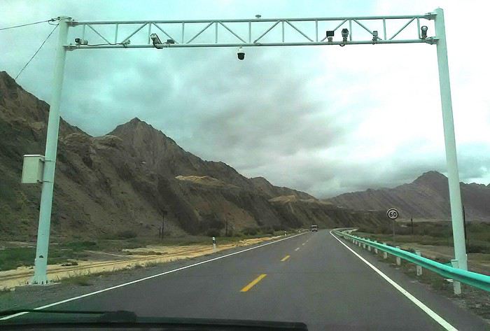
To enter the youth hostel where I stayed, there’s even a security gate, and the receptionist (a Han, like everyone in tourism) wears a bulletproof vest! Reassuring. Still, you don’t feel particularly threatened here, especially as a European. The troublemakers are the Chinese, not the Uyghurs. Generally, China is a very safe country for visitors.
Smile, you’re on camera! I was biking on an avenue when the car in front of me got flashed for driving slowly. I quickly understood why when I got flashed too.
Here, the official time is Beijing time, but it gets dark two hours later. It’ll be even worse in Kashgar. Trickier to manage: everything is displayed in Chinese and Arabic. Nothing in English. Choosing a menu is a shot in the dark. Apart from a few young Chinese, no one here speaks English, and my Chinese doesn’t seem very understandable...
Mogao, the end of the road for the Han Yesterday, near Dunhuang, I went to Mogao, a complex of decorated caves with Buddha sculptures and paintings. Stunning, but so crowded! Luckily, here in Turpan, Chinese tourists barely venture out. So I visited a Silk Road ghost town with only a handful of other visitors and under a howling wind.
The modern Chinese city is swallowing up the old Uyghur neighborhoods—only a museum-like district remains in the center, and pockets of resistance on the outskirts are doomed to disappear soon. More photos...
8- KASHGAR A (relative) love at first sight for the old city Sunday, September 2 After three overnight trains, here I am in the far west of China, nearly 4,000 km from the capital. Despite the omnipresent police and an old city preserved UNESCO-style, Kashgar is my Chinese love at first sight.
Finally, Chinese... well, sort of, because we’re in Uyghur territory here—a Turkic people with nothing culturally in common with the Han, the eastern Chinese. It started badly yesterday at Turfan station, where after three security gate passes, at least five passport checks, and a bag search, three adorable policewomen confiscated my antibacterial lotion because it had a flammable logo...
Then came the welcoming committee of armed cops at Kashgar station. Once all that was over, they left me alone—except you still have to go through security checks like everyone else to enter the old city, the bazaar, the livestock market... The further west you go, the more the siege mentality is evident. Luckily, the border isn’t far...
Despite the inevitable destruction-reconstruction, the city center has been well preserved. Thankfully, because it’s a very original style, a mix of local and colonial. I love it, even if it’s a bit too artificial, sanitized, and watered-down, and rather empty of residents. On the Silk Road, the city was famous for its great food. And it still is—rarely have I seen such richness and abundance of food! And not just scorpions or snakes. More photos...
9- KASHGAR China’s recipe for controlling the populace Saturday, September 1 Xinjiang, along with Tibet, is a "sensitive" area of rebellion in the eyes of Chinese authorities. As a result, the state has these regions and their populations under total control. Tourists also feel the consequences, even if they’re not at risk of re-education camps.
 - Putting barbed wire and anti-ramming barriers around sensitive sites (schools, big hotels, government buildings...)
- Installing traffic surveillance gates with cameras and photo flashes (for all vehicles passing, including bikes) throughout the city and even in the countryside
- Posting uniformed guards with tasers, batons, or huge baseball bats every 100 meters
- Training the Han population (ethnic Chinese) in self-defense with sticks, preferably in the morning on the street. Men and women of all ages
- Starting school with the national anthem, doing military exercises, and receiving political indoctrination, all neatly lined up in the courtyard. (The dream school for any teacher)
- Placing a snitch in uniform (a pseudo-guard) in public gathering places, like youth hostels. Mine spends the day loafing around the courtyard
- Putting Chinese flags everywhere on the streets to remind everyone who’s in charge
- Installing security gates at every entrance to areas frequented by tourists (thanks for that) but not just there
- Never photographing cops, or else! I tried, but it’s not easy...
- Putting barbed wire and anti-ramming barriers around sensitive sites (schools, big hotels, government buildings...)
- Installing traffic surveillance gates with cameras and photo flashes (for all vehicles passing, including bikes) throughout the city and even in the countryside
- Posting uniformed guards with tasers, batons, or huge baseball bats every 100 meters
- Training the Han population (ethnic Chinese) in self-defense with sticks, preferably in the morning on the street. Men and women of all ages
- Starting school with the national anthem, doing military exercises, and receiving political indoctrination, all neatly lined up in the courtyard. (The dream school for any teacher)
- Placing a snitch in uniform (a pseudo-guard) in public gathering places, like youth hostels. Mine spends the day loafing around the courtyard
- Putting Chinese flags everywhere on the streets to remind everyone who’s in charge
- Installing security gates at every entrance to areas frequented by tourists (thanks for that) but not just there
- Never photographing cops, or else! I tried, but it’s not easy...
With all that, you can stroll around safely Not much crime! As for the amount the Chinese state spends to maintain such a system, it’s staggering! A third of the Han living in Xinjiang work in security. Today, I wandered freely around old Kashgar, which is quite large after all. More photos...
10- TASHKURGAN What on earth was I thinking going there! Wednesday, September 5 First, there’s the taxi—pretty crappy, with a driver who doesn’t speak a word of English and won’t stop smoking. Over six hours in that... shared with a completely out-of-it American.
Then there are all the checkpoints along the way. I won’t go on—you know the drill by now.
After that, there’s Tashkurgan—a town with nothing to see, nothing to do. Deserted as soon as night falls. There’s this huge youth hostel and a few lost Chinese tapping away on their smartphones, chain-smoking. This lost American-European crowd, swapping tips on how to enter Pakistan or Tajikistan.
Luckily, there’s the Chinese Pamir Highway, lined with peaks over 7,000m. There’s the feeling of no longer being in China, with a population whose features are Middle Eastern. And these Tajik women with their stunning hairstyles and vibrant costumes. There’s the fact of having reached the westernmost Chinese city, far from crowds and tourist sites. A sort of end of the world. More photos...
11- KYRGYZ BORDER A surreal epic Thursday, September 6 The road from Kashgar to the Kyrgyzstan border is a little over 200 km and passes through beautiful landscapes of colorful, desert-like mountains with acrobatic folds. That’s the bucolic part of the trip.
 Yesterday, I managed to gather four people to rent a minibus to reach the border more easily: a Spaniard and an Argentine I’d already met in Turpan, and two New Zealanders who responded to the ad left at the hostel.
Absurdity and paranoia of Chinese authorities The highlight was crossing the town of Wuqia, 50 km past Kashgar. After tallying up with my fellow sufferers, we must’ve passed about ten checkpoints with: - Passport checks: 14 times, sometimes by two cops side by side - Bag checks: 4 times - Smartphone checks: 2 times, with deletion of "non-compliant" photos, and registration of your IMEI in the exit log!... Absurd and surreal at the same time, since my camera stayed in my bag, my apps are in French, and my photos have been online for ages...
With all that, we arrived just as the last checkpoint before the no man’s land marking the border between the two countries was on lunch break. And bam! Another 1.5-hour wait, alongside truckers who were much more used to this than we were.
What to think? The cops themselves aren’t fooled. They play the role they’re asked to, but sometimes you can coax a smile out of them—they realize how ridiculous the situation is.
What’s the point? That’s the big question my companions and I were tempted to answer with "to piss people off." To show you your place isn’t here, but with the other tourists, over there in the east, in Shanghai, Xi’an, or Guangzhou.
As for you, a traveler from a democratic country, you really experience this as aggression, humiliation, a violation of your private space. And yet, I’m respected, they speak to me properly. Today, I better understand what a Palestinian or a citizen of an occupied country might feel daily. A unique experience! Thanks, China.
And to top it off, the cherry on the cake! It’s still this glowing button you press to rate your passage after clearing the last obstacle before the exit stamp. I was so surprised it turned off before I could react. The Spaniard, with great humor and irony, had time to vote "excellent." In the end, he wasn’t wrong—you can hardly do better!
PS: I ditched my buddies at the border. They didn’t want to pay for a taxi to continue. So I took a direct taxi to Osh. The first 100 km are fabulous. I couldn’t take many photos, but I’ll be back on Monday to go to Tajikistan.
More photos...
The rest of the Silk Road, Part 2, in these travel journals: Kyrgyzstan, Tajikistan, Uzbekistan.
The Chinese Far West More than 30 years after my first trip to eastern China, I finally fulfilled an old dream: traveling solo from Beijing to the far west, discovering Xinjiang, the Uyghur people and the oppression they endure, the oases of Turpan and Kashgar, the Taklamakan Desert, the end of the Great Wall... The route was covered by train.
MENU PART 1: CHINA
1- Beijing (Jiankou) : the authentic Great Wall, without tourists 2- Cycling in Beijing, the best way to get around 3- Beijing : departure for the far west 4- Jiayuguan : getting by without English 5- Jiayuguan : scams and heritage 6- Dunhuang : abundance in the middle of the desert 7- Turpan : the Uyghurs under heavy surveillance 8- Kashgar : love at first sight for the old city 9- Kashgar : China’s recipe for controlling the populace 10- Tashkurgan : what on earth was I thinking going there! Kyrgyz border: a surreal epic Photo album from the 80s, contributions from other travelers (page 2)
1- JIANKOU Finding the authentic Great Wall, without tourists or a guide Friday, August 24, 2018 Thirty years later, I didn’t feel like revisiting the Great Wall at Badaling or any other overcrowded site. I chose to explore it at Jiankou, in its wildest, most authentic, and unrestored section, starting from a lost village deep in a valley—though it wasn’t *that* lost, since it had everything for communication.
No need to pay for a taxi to get there—by timing it right, you can take the bus for just a few yuan. You have to get off at Xizhazi, the bus terminus. Be careful, there are only two buses a day in each direction. At the Xizhazi bus stop, I met a young couple who’d arrived with zero information about what to expect. We hiked the three of us toward the restored section of Mutianyu.
Still, be cautious With GPS and a topographic map (OpenTopoMap), you can set off without a problem or guide. The trail up to Jiankou is easy and well-marked. The trails down are too. But be careful—once you’re on the Wall, it’s real mountain hiking, with easy but dangerous climbing sections (over sheer drops). Not for amateurs or those afraid of heights! But what a reward. The Wall all to yourself, where it’s at its most daring. Truly mesmerizing.
More photos...
2- BEIJING The best way to get around the capital Sunday, August 26 The best way to explore the city is still by bike. Most are in a bike-share system, but you need to use an app—WeChat, the app that does everything, like monitoring your every move. No way I was installing that.
I found one at a rental shop near the hostel. The key is to quickly learn local traffic customs to minimize risks. Bike lanes are wide along the avenues.
But you still have to: - Watch out for anything parked on the bike paths—the most annoying are people napping or talking on the phone in their cars - Keep an eye on everything coming the wrong way—the list is long - The worst is right turns on red, which in Chinese traffic rules seem to have priority Once you get the hang of it, it’s fine. The city is huge but flat, so you can just wing it.
3- BEIJING By train to the far west Sunday, August 26 Beijing West Station is the size and operates like an airport. With your e-ticket from the agency, you first have to pick up your ticket at the special "English" counter, after passing through security. With your ticket in hand, you have to exit and enter through the boarding waiting area—not the platform—after a second security check.
Then you find the right hall and wait for the sign to finally access the platform. In the end, it works pretty well given the incredible number of passengers to manage. Everywhere in Beijing, I saw that the Chinese have mastered crowd flow management.Nice surprise: second-class carriages are clean, air-conditioned, and bright. Perfect, since I was in for 20 hours. One uniformed attendant per carriage, mobile meal service—luxury! Small downside: no luggage space. Hauling your suitcase up to the top bunk is quite a workout. I was in the middle, so it wasn’t too bad. The landscape, though, whether rural or urban, is pretty bleak. That should change once we leave the eastern plains.
Of course, I got my first police visit, with a thorough passport check and bag search. I was warned—going to the Chinese far west exposes you to this kind of hassle. But they were polite and respectful.
The Chinese Far West4- JIAYUGUAN Getting by without English Monday, August 27 At the gates of two deserts (Gobi and Taklamakan) and at the foot of the Tibetan highlands, the Great Wall ends at Jiayuguan. Here, I found the deeper China I’d somewhat rediscovered during my bike ride, even if now everyone gets around on electric bikes and I’m no longer stared at like an alien.
Prices are nothing like Beijing: you can find a full meal for 2 €, and my bike cost 7 € for two days. Plus, few people speak English—neither the owner of the HI hostel where I stayed, nor the ticket sellers at the sites, let alone the servers at the small eateries where I ate. Everything is written in Chinese. So I had to use the little Chinese I know to communicate about essentials. It makes the locals laugh to see a European trying to speak their language, but it earns respect. With Google Translate’s help, I managed.
Rant: With their avenues blocked for construction for kilometers without warning, and new roads not yet on maps, I must’ve taken 15 km of detours. More photos...
5- JIAYUGUAN Scams and heritage Tuesday, August 28 The Great Wall doesn’t exactly end at the fort I visited yesterday but 10 km further, at the entrance to a river gorge at the foot of the mountains. All that’s left is a badly damaged tower (more like a mound of earth) and a section of clay wall, similar to the one I biked yesterday.
This morning, I hopped on my bike, determined to venture into the desert to see this highly symbolic site. First, you access it via a wide, brand-new road with not a soul in sight. Just before the site, I came across a grand welcome gate, very period-style, but it’s actually the inevitable toll booth.
Behind the gate, the road continues straight to the site, which you can see in the distance—at least 2 km away—the remains of the tower and wall. I had to leave my bike here. Fine. I went to the ticket counter and asked the price: 120 yuan! I couldn’t believe it—over 15 € for a simple mound of earth.
I showed my displeasure to the attendant, who couldn’t care less, and immediately turned back. 120 yuan—that’s the price for a new road, a fancy gate planted 2 km before the site just to force you to take a shuttle, and employees with nothing to do all day... Now I understand why I didn’t meet anyone!
Heritage China is a bit pricey Generally, sites are expensive for the country’s standard of living, but travelers are supposed to have money, so why hold back? I even gave up on the Forbidden City—reservations required days in advance (or on the black market at an impossible price). I prefer to keep the memory of my first visit, when entry must’ve cost a few dozen cents, and there were only a handful of visitors.
This morning, I took a taxi to see remarkable tombs of common people from the 3rd to 6th centuries. They’re small vaulted caves made of painted bricks, depicting scenes of daily life. Very pretty and moving. But even here, though the price was more reasonable, I was left wanting—only one of the 16 tombs is open to visitors, and it’s apparently not the most beautiful.
The authentic China—at least what’s left of it... Wandering the impersonal avenues of the city, you stumble upon a market. There, you still find traditional China—small shops with questionable hygiene, Go players, musicians, and even a dental prosthetist. The last refuge for those untouched by modernity. More photos...
6- DUNHUANG Abundance in the middle of the desert Wednesday, August 29 Well, I thought the landscape would be less bleak as I headed west. Nope. The only distraction in this expanse of dark, clayey sand is the forests of pylons and wind turbines, plus wild camels racing each other.
However, Dunhuang, the gateway to the Taklamakan, is by far the most pleasant Chinese city I know. There’s a real city center you can explore on foot. It’s hot but not unbearable, with a light, dry breeze. Much nicer than Beijing. The Han Chinese are still the majority, but the Muslim Uyghurs are more numerous, and the muezzin’s call to prayer echoes around the mosque.The most surprising thing is the abundance and diversity of fruits and vegetables. You wonder how it all grows here. Well-irrigated, the desert sands are very fertile. Here, raisins have subtle, mysterious flavors, and the lamb really tastes like lamb.
Today, I visited the must-see Mingshashan, a dune complex next to which Pila is a molehill. The Basque Country, but covered in sand... More photos...
7- TURPAN The Uyghurs under heavy surveillance Friday, August 31 Surveillance cameras everywhere in the city, armed police stationed at intersections, in front of public buildings, at the entrance and inside tourist sites, police stations on every corner, patrols on foot or by car, khaki uniforms even for middle schoolers... here, the Han Chinese are in the minority, and you can feel it. Turpan feels like a city under siege.
To enter the youth hostel where I stayed, there’s even a security gate, and the receptionist (a Han, like everyone in tourism) wears a bulletproof vest! Reassuring. Still, you don’t feel particularly threatened here, especially as a European. The troublemakers are the Chinese, not the Uyghurs. Generally, China is a very safe country for visitors.
Smile, you’re on camera! I was biking on an avenue when the car in front of me got flashed for driving slowly. I quickly understood why when I got flashed too.
Here, the official time is Beijing time, but it gets dark two hours later. It’ll be even worse in Kashgar. Trickier to manage: everything is displayed in Chinese and Arabic. Nothing in English. Choosing a menu is a shot in the dark. Apart from a few young Chinese, no one here speaks English, and my Chinese doesn’t seem very understandable...
Mogao, the end of the road for the Han Yesterday, near Dunhuang, I went to Mogao, a complex of decorated caves with Buddha sculptures and paintings. Stunning, but so crowded! Luckily, here in Turpan, Chinese tourists barely venture out. So I visited a Silk Road ghost town with only a handful of other visitors and under a howling wind.
The modern Chinese city is swallowing up the old Uyghur neighborhoods—only a museum-like district remains in the center, and pockets of resistance on the outskirts are doomed to disappear soon. More photos...
8- KASHGAR A (relative) love at first sight for the old city Sunday, September 2 After three overnight trains, here I am in the far west of China, nearly 4,000 km from the capital. Despite the omnipresent police and an old city preserved UNESCO-style, Kashgar is my Chinese love at first sight.
Finally, Chinese... well, sort of, because we’re in Uyghur territory here—a Turkic people with nothing culturally in common with the Han, the eastern Chinese. It started badly yesterday at Turfan station, where after three security gate passes, at least five passport checks, and a bag search, three adorable policewomen confiscated my antibacterial lotion because it had a flammable logo...
Then came the welcoming committee of armed cops at Kashgar station. Once all that was over, they left me alone—except you still have to go through security checks like everyone else to enter the old city, the bazaar, the livestock market... The further west you go, the more the siege mentality is evident. Luckily, the border isn’t far...
Despite the inevitable destruction-reconstruction, the city center has been well preserved. Thankfully, because it’s a very original style, a mix of local and colonial. I love it, even if it’s a bit too artificial, sanitized, and watered-down, and rather empty of residents. On the Silk Road, the city was famous for its great food. And it still is—rarely have I seen such richness and abundance of food! And not just scorpions or snakes. More photos...
9- KASHGAR China’s recipe for controlling the populace Saturday, September 1 Xinjiang, along with Tibet, is a "sensitive" area of rebellion in the eyes of Chinese authorities. As a result, the state has these regions and their populations under total control. Tourists also feel the consequences, even if they’re not at risk of re-education camps.
- Putting barbed wire and anti-ramming barriers around sensitive sites (schools, big hotels, government buildings...)
- Installing traffic surveillance gates with cameras and photo flashes (for all vehicles passing, including bikes) throughout the city and even in the countryside
- Posting uniformed guards with tasers, batons, or huge baseball bats every 100 meters
- Training the Han population (ethnic Chinese) in self-defense with sticks, preferably in the morning on the street. Men and women of all ages
- Starting school with the national anthem, doing military exercises, and receiving political indoctrination, all neatly lined up in the courtyard. (The dream school for any teacher)
- Placing a snitch in uniform (a pseudo-guard) in public gathering places, like youth hostels. Mine spends the day loafing around the courtyard
- Putting Chinese flags everywhere on the streets to remind everyone who’s in charge
- Installing security gates at every entrance to areas frequented by tourists (thanks for that) but not just there
- Never photographing cops, or else! I tried, but it’s not easy...With all that, you can stroll around safely Not much crime! As for the amount the Chinese state spends to maintain such a system, it’s staggering! A third of the Han living in Xinjiang work in security. Today, I wandered freely around old Kashgar, which is quite large after all. More photos...
10- TASHKURGAN What on earth was I thinking going there! Wednesday, September 5 First, there’s the taxi—pretty crappy, with a driver who doesn’t speak a word of English and won’t stop smoking. Over six hours in that... shared with a completely out-of-it American.
Then there are all the checkpoints along the way. I won’t go on—you know the drill by now.
After that, there’s Tashkurgan—a town with nothing to see, nothing to do. Deserted as soon as night falls. There’s this huge youth hostel and a few lost Chinese tapping away on their smartphones, chain-smoking. This lost American-European crowd, swapping tips on how to enter Pakistan or Tajikistan.
Luckily, there’s the Chinese Pamir Highway, lined with peaks over 7,000m. There’s the feeling of no longer being in China, with a population whose features are Middle Eastern. And these Tajik women with their stunning hairstyles and vibrant costumes. There’s the fact of having reached the westernmost Chinese city, far from crowds and tourist sites. A sort of end of the world. More photos...
11- KYRGYZ BORDER A surreal epic Thursday, September 6 The road from Kashgar to the Kyrgyzstan border is a little over 200 km and passes through beautiful landscapes of colorful, desert-like mountains with acrobatic folds. That’s the bucolic part of the trip.
Yesterday, I managed to gather four people to rent a minibus to reach the border more easily: a Spaniard and an Argentine I’d already met in Turpan, and two New Zealanders who responded to the ad left at the hostel.Absurdity and paranoia of Chinese authorities The highlight was crossing the town of Wuqia, 50 km past Kashgar. After tallying up with my fellow sufferers, we must’ve passed about ten checkpoints with: - Passport checks: 14 times, sometimes by two cops side by side - Bag checks: 4 times - Smartphone checks: 2 times, with deletion of "non-compliant" photos, and registration of your IMEI in the exit log!... Absurd and surreal at the same time, since my camera stayed in my bag, my apps are in French, and my photos have been online for ages...
With all that, we arrived just as the last checkpoint before the no man’s land marking the border between the two countries was on lunch break. And bam! Another 1.5-hour wait, alongside truckers who were much more used to this than we were.
What to think? The cops themselves aren’t fooled. They play the role they’re asked to, but sometimes you can coax a smile out of them—they realize how ridiculous the situation is.
What’s the point? That’s the big question my companions and I were tempted to answer with "to piss people off." To show you your place isn’t here, but with the other tourists, over there in the east, in Shanghai, Xi’an, or Guangzhou.
As for you, a traveler from a democratic country, you really experience this as aggression, humiliation, a violation of your private space. And yet, I’m respected, they speak to me properly. Today, I better understand what a Palestinian or a citizen of an occupied country might feel daily. A unique experience! Thanks, China.
And to top it off, the cherry on the cake! It’s still this glowing button you press to rate your passage after clearing the last obstacle before the exit stamp. I was so surprised it turned off before I could react. The Spaniard, with great humor and irony, had time to vote "excellent." In the end, he wasn’t wrong—you can hardly do better!
PS: I ditched my buddies at the border. They didn’t want to pay for a taxi to continue. So I took a direct taxi to Osh. The first 100 km are fabulous. I couldn’t take many photos, but I’ll be back on Monday to go to Tajikistan.
More photos...
The rest of the Silk Road, Part 2, in these travel journals: Kyrgyzstan, Tajikistan, Uzbekistan.
Kirghizistan juillet 2019 English translation pending
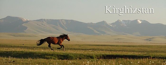
C'est à mon tour, enfin, mais il n'est jamais trop tard, de vous narrer notre voyage au Kirghizstan, à l'été 2019. Trois semaines à deux, en autonomie. Le texte n'est à l'origine pas fait pour lire seul, mais pour étoffer les photos. Vous trouverez la version originale ici: https://sites.google.com/site/kirghizstan2019/
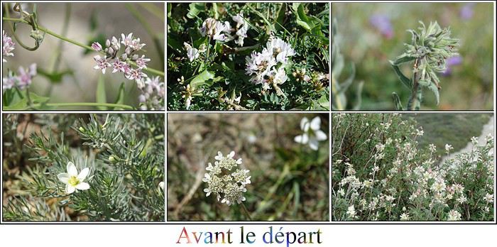
Préambule par Gilles “Le kirzistan vous connaissez ? » ai-je demandé à mes compagnons de plongée lors d’un W.E ensoleillé de septembre suite au coup de fil de Grisemote. «J’ai l’impression que ce sera ma future destination de vacances dont je ne connais même pas le nom ni où ça se trouve ». « Le Kurdistan ? Ce doit être près de la Turquie ». Une petite visite de Maps m’en apprend plus, à commencer par son orthographe alambiquée. Coincé entre la Chine, le Tadjikistan et le Kazakhstan, c’est la destination idéale pour être loin de tout, en pleine montagne, à des hauteurs impressionnantes … Mes craintes se sont révélées exactes dès le lendemain, sur un autre appel téléphonique codé « Les billets sont pris, je répète, les billets sont pris ». Au moins, comme cela, il n’y aura pas débat sur la destination. Mais que diable vais-je donc faire dans cette galère …? Qu'est-ce qui a bien pu nous donner l'envie? Et bien tout d'abord le carnet de voyage de Marie (mlefevre sur Voyage Forum) et ses superbes photos: https://sites.google.com/site/kirghistan201801/home puis aidée par les intervenants de Voyage Forum, je cite entre autre (mlefevre, Perju, Max68, laurence49b , Changgulu, Squeed38 ) merci à eux, le blog "voyager au Kirghizstan sur facebook, le superbe livre de Cécile et Laurent, véritable bible du Off Road, une carte, indispensable pour la préparation des étapes
et puis après avoir téléchargé multiples applications diverses et variées, nous avons utilisé Off Line Maps + qui nous a permis de télécharger les cartes au préalable et de pouvoir les utiliser sans connexion. Nous avions aussi les cartes vendues par Cécile et Laurent, très pratique et tout prémâché. Maps-me pour les stations services, banques etc.... Mais pas toujours à jour et "ioverlander" pour d'éventuels points de bivouac. Bref, une sacré préparation quand même. Comme toujours, pour que ça se passe au mieux sur place, le travail en amont est colossal. Nous partons à l'aventure certes, mais l'aventure ça se prépare!!!!
Le Kirghizstan est donc un pays d'Asie Centrale, qui faisait partie autrefois de l'URSS, et qui en garde quelques attaches, et dont la religion majoritaire est l'Islam, mais souple et entachée de chamanisme, chez les nomades et dans les villages de campagne. Pas de voile pour les femmes, et la vodka est la boisson dominante dans les supermarchés. On y parle russe (et vraiment peu ou pas anglais). Les Kirghizes sont un peuple nomade qui transportent leur campement, les yourtes, pendant les mois d'été, de juin à août, car ensuite les routes sont impraticables, et le climat extrêmement froid. Les nomades sont particulièrement accueillants. Il n'est pas rare, voire très fréquent, qu'ils établissent leur campement à plus de 3000 mètres.
Au Kirghizstan, il y a tellement, mais tellement de fleurs , que j'ai choisi de commencer chaque chapitre par une présentation florale.
 Début juillet, c’est le départ. Nous partons de la capitale des Gaules, Lyon et son terminal d’aéroport flambant neuf, en plein rodage (un espace gigantesque et un goulet d’étranglement incompréhensible au niveau de la douane qui bloque tous les passagers au pied d’un ascenseur – le bordel quoi !).
Vu le poids des bagages avec la tente et de quoi s’habiller chaud et froid, nous avons à nouveau opté pour Turkish airlines et ses 30 kgs par passager. L’avion à Lyon a pris du retard au décollage, du coup, c’est au pas de course que nous traversons de part en part le tout nouvel aéroport de Istanbul.
Début juillet, c’est le départ. Nous partons de la capitale des Gaules, Lyon et son terminal d’aéroport flambant neuf, en plein rodage (un espace gigantesque et un goulet d’étranglement incompréhensible au niveau de la douane qui bloque tous les passagers au pied d’un ascenseur – le bordel quoi !).
Vu le poids des bagages avec la tente et de quoi s’habiller chaud et froid, nous avons à nouveau opté pour Turkish airlines et ses 30 kgs par passager. L’avion à Lyon a pris du retard au décollage, du coup, c’est au pas de course que nous traversons de part en part le tout nouvel aéroport de Istanbul.Encore un peu plus de cinq heures de vol et nous atterrissons à Bishkek, capitale du Kirghizstan. Avant de rejoindre notre loueur de voiture, nous récupérons nos bagages, et là surprise, un de nos sacs a disparu, remplacé par un autre qui lui ressemble fort, mais qui n’est pas le nôtre. Inédit comme contrariété ! C’est le sac avec notre tente et nous avons prévu de bivouaquer la presque totalité du voyage. Nous cherchons désespérément celui qui a subtilisé notre sac par erreur, mais rien n’y fait! Gilles part faire une déclaration de perte, pendant que l’employé de la location de voiture patiente avec les bagages et que je vais au comptoir de Megacom, nous acheter deux cartes SIM, téléphone et accès internet pour 2,50€ par semaine. Inutile de s’en priver, et très utile pour google maps (quand il y a du service, car la majeure partie des lieux où nous avons évolué sont en pleine nature, et sans réseau). Alors que je patiente au comptoir, je vois un papa et ses trois enfants avec un sac qui ressemble beaucoup au nôtre. Après vérification, c’est bien lui, et l’homme ne s’était pas rendu compte de sa méprise. Quelle chance de retrouver notre bagage, c’est inespéré ! Il faut ensuite monter au second annuler la déclaration, et récupérer enfin la voiture. Beaucoup de temps perdu! Notre loueur c’est TRAVELAND, trouvé sur internet avec des voitures qui semblent tenir la route, pour un prix dans la norme de ce que l’on peut trouver. Nous lui avons loué aussi table, chaises et réchaud. La fatigue, peut-être un excès de confiance, nous notons quelques points, et ne prenons pas de photos du véhicule. Grosse erreur ! Presque un mois après notre retour, nous recevons une facture de toutes les rayures ou craquelures ou je ne sais quoi qui nous sont imputées, et seront prélevées sur la caution laissée. Autant dire qu’ils vont refaire la carrosserie à nos frais et sans possibilité de recours. TRAVELAND SURTOUT PAS, à éviter absolument! Bref, nous ne savons pas encore que ce sont des voleurs, mais j’avais quelques méfiances quand même, dues au fait que Marie Lefèvre était passée par eux également, et sans avoir autant d’ennuis , ils n’avaient pas été très fair play. Nous avions réservé un NISSAN Patrol, et c’est en fait un MITSUBISHI Pajero. Les pneus, comme pour Marie, sont des pneus de SUV et non de 4X4. Ils feront l’affaire ainsi que la voiture maniable et suffisamment puissante à la fois car nous n’avons pas rencontré de terrain mou ou boueux. Par contre, pas très grande, nous devons replier les sièges arrières pour y caser la table pliante de grande taille, ainsi que notre malle que nous emportons dans tous nos voyages en camping, pratique mais encombrante. Nous rejoignons l’Aurum hotel où j’ai réservé la nuit de l’arrivée et celle du départ. Rien d'extraordinaire, mais a fait le job. Organisation du coffre, courses, repos et nous voilà partis pour une petite visite dans le centre ville. Pas trop de charme, architecture type années soviétiques, pas de temps à perdre dans l’esthétisme y compris pour les statues, comme nous le verrons maintes fois au cours du voyage.
Petit tour au bazar de Osh qui est gigantesque. Nous sommes d'ailleurs pris dans des embouteillages inextricables. Petite mise en bouche de conduite pour Gilles!
Nous dînons dans un restaurant pour l’équivalent de 7 euros à deux, et dodo.
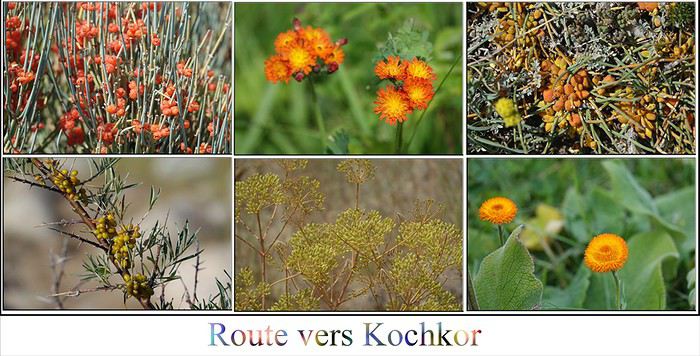 Nous devons rejoindre aujourd'hui Kochkor où nous avons réservé deux jours de randonnée à cheval, pour monter au lac de Kol Ukok, par l’intermédiaire de JAILOO TOURISM. C’est un gros challenge, Gilles ne connait pas trop le cheval, quant à moi, je ne suis pas remontée depuis ma jeunesse, mais c’est un rêve. Alors, quoi de mieux qu’au Kirghizstan, pays du cheval par excellence, pour le réaliser.
Nous nous arrêtons à la Tour Burana, vestiges d'un minaret du 9ème siècle. L'environnement est beau, sous un ciel plombé, nous prenons nos premiers clichés avec délectation.
A côté de la tour, nous déambulons dans un champ de balbals, statues monolithiques de guerriers, datés semble-t-il, du 6ème au 10ème siècle. Ils ornaient les tombes des nomades turcs.
Nous reprenons donc la route pour atteindre Kochkor, but de la journée. L'arrivée sur le réservoir de Orto-Tokoy par une route qui le domine est sublime.
Kochkor est une petite ville assez sympathique au regard de celles, rares cela dit, que nous avons croisées. Nous arpentons notre premier cimetière niché au coeur des montagnes qui entourent la bourgade. Nous le trouvons plutôt attrayant, mais c'est notre premier jour, et nous découvrirons au fil du temps, l'importance des cimetières omniprésents, parfois presque des cités.
Par l’intermédiaire de Jailoo Tourism, nous passons la nuit dans une chambre «royale», dans la Guesthouse de Saïkal. Elle nous concocte un fort bon dîner et petit déjeuner . Nous goûtons nos premiers boortsoghs, des beignets que l’on nous offrira souvent lorsque nous serons reçus. Ce qui est amusant aussi, c’est le sucre candy qui est proposé sous forme de gros blocs, comme d’énormes minéraux de gypse ou de cristal de roche.
 Nous partons dès le matin rejoindre nos chevaux, avec Kalys, notre guide anglophone pendant deux jours. Le reste du temps, il est étudiant en chirurgie dentaire à Bishkek. Nous avons prévu pour l’occasion des pantalons de cheval à prix modique, trouvés chez Décath, et des guêtres pour les mollets. Ça ne prend pas beaucoup de place dans les bagages et nous ne l’avons pas regretté. (ça soulage quand même pas les courbatures, faut pas rêver)!
Les selles sont sommaires et mes rênes sont en sisal, mais le chemin est superbe. Pour conduire un cheval Kirghize il faut juste connaître les trois mots magiques : « tchou » (en avant), « drrrrrrr », (doucement) et « tak » (stop). Les chevaux sont quand même très à l’écoute et nous avons l’impression de conduire une Rolls Royce (même si le mien semble être un papy et me fait quand même mal au cœur).
Nous nous arrêtons dans un premier jailoo pour déjeuner. (Les jailoos, ce sont les campements des nomades pendant l’été, qui installent leurs yourtes et leurs troupeaux dans les pâturages parfois même à 3000 mètres ou plus.) Une hôtesse nous attend et nous propose un repas très copieux. Toutes les tables des hôtes que nous avons rencontrés sont toujours garnies de gâteaux secs, bonbons, souvent de crème et de confiture. D’ailleurs dans les épiceries une partie très conséquente est dédiée à la vodka et à la bière, une autre ENORME aux gâteaux et aux bonbons, le reste étant de moindre importance semble-t-il.
Nous goûtons, une boisson kirghize, sorte de bière au goût de levure et remplie de céréales fermentées. C’est très nourrissant et nous avons bien aimé, c’est le jarma.
Nous reprenons nos montures pour rejoindre notre jailoo du soir au lac de Kol Ukok. Le temps se gâte, les Kways sont de sortie et les doigts commencent à être glacés. Le jailoo se trouve à 3100 mètres d’altitude. Toute la partie qui longe le lac est très abrupte, et le chemin étroit et caillouteux, il faut être vigilant pour essayer de guider son cheval au mieux.
Le coin est superbe, mais le temps peu propice et nous sommes gelés. Un bon tchaï (thé) de notre hôtesse, dans la yourte « restauration » et une bonne dose d’arnica en ce qui me concerne et nous entamons une sieste car il fait très mauvais, et la rando équestre de la journée complète nous a quand même éprouvés. Ce sera notre première expérience sous la yourte (que nous partageons avec notre guide Kalys). Il y a des matelas chauds et moelleux et de grosses couvertures, mais malgré tout cela, j’ai du mal à me réchauffer tant j’ai eu froid. Notre hôtesse vient alimenter le poêle qui se trouve dans la yourte, et dont le tuyau traverse le haut pour évacuer la fumée dehors. Dans les alpages, pas de bois, on utilise donc le carburant que l’on trouve à profusion, la bouse de vache séchée.
Au bout d’un certain temps, Gilles se lève pour alerter nos hôtes, de la fumée a envahi la yourte. C’est vrai que j’avais mal à la tête, mais n’y avait pas prêté attention. Le poêle est mal conçu. Kalys et moi rejoignons Gilles dehors, pendant qu’on répare la tuyauterie du foyer. Notre hôtesse s’excuse auprès de nous, nous avons quand même été à la limite de l’intoxication.
Le temps est vraiment pourri, froid et dans un brouillard total nous rejoignons tous les membres du jailoo dans leurs imperméables qui s’amusent beaucoup à faire des photos avec nous.
Repas du soir, poisson du lac pour Gilles qui a adoré et « plov » pour moi qui ne mange pas de poisson, espèce de riz (qui pourrait ressembler à des lentilles corail trop cuites), avec des morceaux de mouton. Ce n’est pas mon plat Kirghize préféré, un peu trop sec. Pain, crème, gâteaux, bonbons, thé à profusion.
On se couche avec les poules même s’il n’y en a pas, mais après la chevauchée de la journée nous sombrons rapidement dans les bras de morphée.
Kalys est très en retard au petit déjeuner. Il n’a pas attaché nos trois chevaux et ceux-ci ont ressenti un besoin de liberté, qui les a emmenés bien loin de nos yourtes. Et chouette, le soleil est là!
Ce matin nous devons aller jusqu’à un lac plus haut (le lac Testor ) avant d’entamer le chemin du retour. Une fois nos montures récupérées, Kalys nous propose d’aller jusqu’au lac à pied si nous le voulons bien, car il a plu toute la nuit et le chemin est dangereux pour les chevaux, nous dit-il. Nous voilà donc partis. Kalys avait juste omis de nous dire que la balade était loin d’être de tout repos, et le lac pas tout près. Nous débutons à 3100 mètres, mais sommes beaucoup moins alertes que lui, enfant du pays qui sautille de rocher en rocher.
Très rapidement, je suis « au bout de ma vie ». De surcroît, nous sommes partis sans eau, Kalys n’y ayant pas pensé, et on ne nous en a pas fourni. Suante, haletante, je progresse difficilement dans le terrain accidenté et Gilles est à peine plus à l’aise. Au bout d’une heure et demi peut-être de crapahutage pas aisé, notre cabri de Kalys, fait une chute dans les blocs de rochers et se tord de douleur. Nous craignons qu’il ne se soit cassé le bras. Nous le soignons avec notre trousse de secours, et lui mettons le bras en écharpe. Nous ne pouvons pas le laisser là, seul et souffrant visiblement le martyre, donc demi-tour, nous ne verrons pas le fameux lac malgré tous nos efforts pour y parvenir ! GRRRRRRR !!!!!! Je pense que Kalys, dans la jeunesse de l’âge (19 ans) a surestimé et le temps et la difficulté de la rando .
Nous partons dès le matin rejoindre nos chevaux, avec Kalys, notre guide anglophone pendant deux jours. Le reste du temps, il est étudiant en chirurgie dentaire à Bishkek. Nous avons prévu pour l’occasion des pantalons de cheval à prix modique, trouvés chez Décath, et des guêtres pour les mollets. Ça ne prend pas beaucoup de place dans les bagages et nous ne l’avons pas regretté. (ça soulage quand même pas les courbatures, faut pas rêver)!
Les selles sont sommaires et mes rênes sont en sisal, mais le chemin est superbe. Pour conduire un cheval Kirghize il faut juste connaître les trois mots magiques : « tchou » (en avant), « drrrrrrr », (doucement) et « tak » (stop). Les chevaux sont quand même très à l’écoute et nous avons l’impression de conduire une Rolls Royce (même si le mien semble être un papy et me fait quand même mal au cœur).
Nous nous arrêtons dans un premier jailoo pour déjeuner. (Les jailoos, ce sont les campements des nomades pendant l’été, qui installent leurs yourtes et leurs troupeaux dans les pâturages parfois même à 3000 mètres ou plus.) Une hôtesse nous attend et nous propose un repas très copieux. Toutes les tables des hôtes que nous avons rencontrés sont toujours garnies de gâteaux secs, bonbons, souvent de crème et de confiture. D’ailleurs dans les épiceries une partie très conséquente est dédiée à la vodka et à la bière, une autre ENORME aux gâteaux et aux bonbons, le reste étant de moindre importance semble-t-il.
Nous goûtons, une boisson kirghize, sorte de bière au goût de levure et remplie de céréales fermentées. C’est très nourrissant et nous avons bien aimé, c’est le jarma.
Nous reprenons nos montures pour rejoindre notre jailoo du soir au lac de Kol Ukok. Le temps se gâte, les Kways sont de sortie et les doigts commencent à être glacés. Le jailoo se trouve à 3100 mètres d’altitude. Toute la partie qui longe le lac est très abrupte, et le chemin étroit et caillouteux, il faut être vigilant pour essayer de guider son cheval au mieux.
Le coin est superbe, mais le temps peu propice et nous sommes gelés. Un bon tchaï (thé) de notre hôtesse, dans la yourte « restauration » et une bonne dose d’arnica en ce qui me concerne et nous entamons une sieste car il fait très mauvais, et la rando équestre de la journée complète nous a quand même éprouvés. Ce sera notre première expérience sous la yourte (que nous partageons avec notre guide Kalys). Il y a des matelas chauds et moelleux et de grosses couvertures, mais malgré tout cela, j’ai du mal à me réchauffer tant j’ai eu froid. Notre hôtesse vient alimenter le poêle qui se trouve dans la yourte, et dont le tuyau traverse le haut pour évacuer la fumée dehors. Dans les alpages, pas de bois, on utilise donc le carburant que l’on trouve à profusion, la bouse de vache séchée.
Au bout d’un certain temps, Gilles se lève pour alerter nos hôtes, de la fumée a envahi la yourte. C’est vrai que j’avais mal à la tête, mais n’y avait pas prêté attention. Le poêle est mal conçu. Kalys et moi rejoignons Gilles dehors, pendant qu’on répare la tuyauterie du foyer. Notre hôtesse s’excuse auprès de nous, nous avons quand même été à la limite de l’intoxication.
Le temps est vraiment pourri, froid et dans un brouillard total nous rejoignons tous les membres du jailoo dans leurs imperméables qui s’amusent beaucoup à faire des photos avec nous.
Repas du soir, poisson du lac pour Gilles qui a adoré et « plov » pour moi qui ne mange pas de poisson, espèce de riz (qui pourrait ressembler à des lentilles corail trop cuites), avec des morceaux de mouton. Ce n’est pas mon plat Kirghize préféré, un peu trop sec. Pain, crème, gâteaux, bonbons, thé à profusion.
On se couche avec les poules même s’il n’y en a pas, mais après la chevauchée de la journée nous sombrons rapidement dans les bras de morphée.
Kalys est très en retard au petit déjeuner. Il n’a pas attaché nos trois chevaux et ceux-ci ont ressenti un besoin de liberté, qui les a emmenés bien loin de nos yourtes. Et chouette, le soleil est là!
Ce matin nous devons aller jusqu’à un lac plus haut (le lac Testor ) avant d’entamer le chemin du retour. Une fois nos montures récupérées, Kalys nous propose d’aller jusqu’au lac à pied si nous le voulons bien, car il a plu toute la nuit et le chemin est dangereux pour les chevaux, nous dit-il. Nous voilà donc partis. Kalys avait juste omis de nous dire que la balade était loin d’être de tout repos, et le lac pas tout près. Nous débutons à 3100 mètres, mais sommes beaucoup moins alertes que lui, enfant du pays qui sautille de rocher en rocher.
Très rapidement, je suis « au bout de ma vie ». De surcroît, nous sommes partis sans eau, Kalys n’y ayant pas pensé, et on ne nous en a pas fourni. Suante, haletante, je progresse difficilement dans le terrain accidenté et Gilles est à peine plus à l’aise. Au bout d’une heure et demi peut-être de crapahutage pas aisé, notre cabri de Kalys, fait une chute dans les blocs de rochers et se tord de douleur. Nous craignons qu’il ne se soit cassé le bras. Nous le soignons avec notre trousse de secours, et lui mettons le bras en écharpe. Nous ne pouvons pas le laisser là, seul et souffrant visiblement le martyre, donc demi-tour, nous ne verrons pas le fameux lac malgré tous nos efforts pour y parvenir ! GRRRRRRR !!!!!! Je pense que Kalys, dans la jeunesse de l’âge (19 ans) a surestimé et le temps et la difficulté de la rando .Nous sommes un peu inquiets tout de même car la route est longue pour retourner vers Kochkor, et nous ne voyons pas comment il va pouvoir repartir à cheval. (Parvenir jusque-là n’est possible qu’à pied ou à cheval). Mais arrivés près des yourtes, Kalys retire son bras en écharpe, par fierté, et nous rentrons donc, comme si de rien n’était ! La descente à cheval est plus fatigante que la montée, et nous sommes contents d’arriver enfin au bercail que nous regagnons du coup assez tard après toutes ces péripéties. Nous récupérons notre voiture laissée à la guesthouse, faisons le plein d’essence et les courses à Kochkor et nous avançons sur le chemin qui mène au lac Issyk Kul, vers le Fairytale canyon que nous devons aller voir le lendemain. Le coucher du soleil nous force à nous arrêter avant, et nous choisissons un point de bivouac sur le lac, repéré grâce à l’application « IOVERLANDER ». Nous campons tout près de l’eau, c’est notre première nuit sous les étoiles et le coin est calme et splendide. Seule une nuée de moustiques nous accompagne, gâchant le plaisir des lieux. Beaucoup d’aventures à la clé, pour ce trip à cheval, mais qu’est-ce que c’était bien!!!!!!
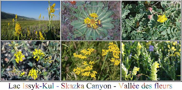 C’est près du lac Issyk-Kul, d'un bleu profond et entouré de hauts sommets de part et d’autre, que avons posé notre premier campement. Il est gigantesque et sa profondeur est de 280 mètres!
C’est le lac alpin (1600 mètres d’altitude) le plus grand au monde après Titicaca. Il a la particularité d’être salé, et de ne jamais geler malgré les températures extrêmes en hiver.
Sur l'autre rive, à l'opposé, après une bande de Kirghizstan, nous pouvons apercevoir le Kazakhstan.
C’est près du lac Issyk-Kul, d'un bleu profond et entouré de hauts sommets de part et d’autre, que avons posé notre premier campement. Il est gigantesque et sa profondeur est de 280 mètres!
C’est le lac alpin (1600 mètres d’altitude) le plus grand au monde après Titicaca. Il a la particularité d’être salé, et de ne jamais geler malgré les températures extrêmes en hiver.
Sur l'autre rive, à l'opposé, après une bande de Kirghizstan, nous pouvons apercevoir le Kazakhstan.Nous mettons un peu de temps à décoller pour nous organiser, et nous n’arrivons au canyon de Skazka (appelé aussi fairytale canyon) que vers midi. Il est tout près de la route, et nulle marche pour y accéder, donc très fréquenté (enfin, relativisons, comme cela peut l'être au Kirghizstan!). Cela étant dit, nous arrivons quand même à nous éloigner des quelques personnes présentes qui elles ne s’éloignent guère du chemin. C’est une palette de couleurs vraiment chouette.
Nous parcourons environ 80 kilomètres jusqu’à l’intersection de la route qui va nous mener à Jeti-Öguz (les sept taureaux), très populaire ici. Nous passons devant le lieu-dit « le cœur brisé ». La lumière est bien orientée, ce qui n’est pas le cas pour les splendides roches rouges. Nous repasserons aux sept taureaux le jour suivant puisque nous devons camper plus loin et que le chemin est un cul-de-sac.
Nous nous dirigeons vers le canyon en face des structures, les gorges du dragon. Elles sont aussi dans l’ombre. Nous nous enfonçons peu dans le goulet sans soleil et entamons la suite du périple jusqu’à la vallée des fleurs.
L’endroit est très fréquenté et de nombreux camps de yourtes jalonnent le chemin. Sûrement un haut lieu de villégiature pour les Kirghizes. Nous poussons jusqu’au bout du bout de la piste. Là, il n’y a plus personne hormis quelques yourtes et bien entendu des troupeaux, des chevaux. Il y a vingt kilomètres de piste, mais comme son nom l'indique, c'est de la piste, et le chemin est long.....Nous trouvons un très joli coin de bivouac, proche du torrent, un vrai petit jardin japonais. Oui, mais le soir tombe, nous sommes à 2200 mètres d'altitude, et le soleil est caché par les montagnes environnantes, ça caille sévère. Nous profitons du cours d’eau glaciale pour nous mettre deux bières au frais. Doudoune, bonnet et vite dans le duvet 0° après le dîner. La nuit est claire, et le ciel constellé d'étoiles.
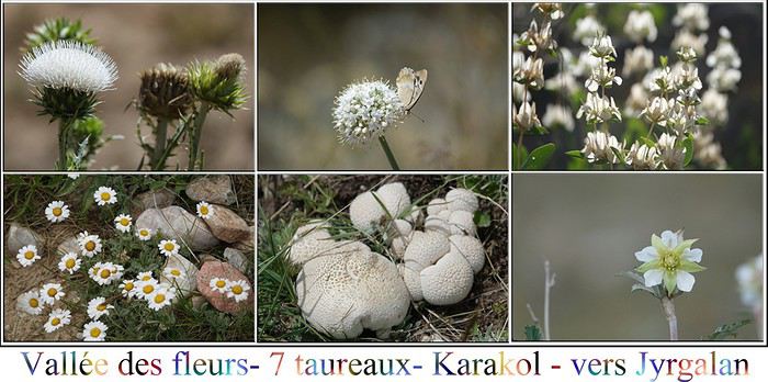 Nous profitons de l’endroit sous le soleil. C’est très beau, et de nombreuses fleurs telles que nous aimerions en avoir dans notre jardin (lupins, pieds d’alouettes etc...) nous entourent.
Nous avons d’abord la visite de chevaux curieux, puis plus tard d’un jeune garçon qui vient nous saluer (en russe naturellement). Peu de personnes parlent anglais, y compris les jeunes. Par contre, à chaque bivouac nous aurons des visites qu’elles soient de natures animales diverses, ou humaines. Il se passe toujours quelque chose.
Le garçon est sympathique et s’installe à côté de nous. Je lui offre alors un « truc pour faire des bulles » (pas très élégant, mais je ne sais pas comment le dire autrement...), que j’ai amené de France, et nous regardons les bulles s’élever dans le soleil avec des reflets iridescents. Il est super heureux et repart ravi avec son cheval. J’avais prévu d’en amener plusieurs pour les offrir aux enfants, mais j’ai eu peur que cela ne finisse en déchet dans la nature, du coup seuls deux exemplaires ont voyagé avec nous. Par contre, nous avons amené des gâteaux français de toutes sortes, et nous les avons offerts à droite à gauche, au fil des rencontres, et cela a toujours été très apprécié. Les Kirghizes sont gourmands….
Nous reprenons tranquillement la route de retour, sur les traces de la veille. On ne va pas se mentir, le jeu n’en valait pas la chandelle. Beaucoup de temps de route de piste, et la vallée même si elle est belle n’a rien de plus que tant d’autres parcourues, y compris les fleurs que nous trouvons à foison partout, partout.
Par contre, très fortuitement nous tombons sur un groupe de personnes en costume. C’est une mise en scène de photographies pour un guide touristique. Nous passons un petit moment à profiter de l’aubaine, et retournons ensuite aux formations rocheuses de Jeti-Öguz .
Nous grimpons sur les falaises qui leurs font face de l’autre côté de la route et entamons une rando en longeant les gorges du dragon, mais cette-fois-ci en les surplombant. Ça aurait été un superbe coin de bivouac.
De nombreuses ruches jalonnent les bords des routes, nous achetons plusieurs pots de miel à une vendeuse. Miel qui fut très apprécié de nos enfants, connaisseurs en la matière.
Nous avions ensuite décidé d’aller dans la vallée de Altyn Arashan, point de départ pour le trek « Alakul ». Pas de trek pour nous, cependant on disait la vallée très belle, mais difficilement accessible. En fait, le loueur nous interdit trois endroits: celui-ci, le lac Kel Suu après le jailoo où nous devons aller, et la vallée près de Enilchek où nous devions aller également avant un changement de programme.(mais aussi les passages de rivière, donc quand on fait de la piste, difficile de les éviter la plupart du temps). Comme dit précédemment, nous nous méfions du loueur (et pour cause), donc nous décidons d’abandonner cette vallée et de nous diriger pour vagabonder vers Karakol et sa région, puisque notre prochaine étape sera Jyrgalan, plus au nord.
Nous faisons un nouveau plein d’essence et de victuailles à Karakol, ville plus attractive que celles traversées précédemment sans toutefois nous laisser un souvenir impérissable. En fait, il y a un effort de couleur sur les maisons. Nous visitons la mosquée chinoise, rigolote, mais en travaux et c’est vendredi, donc on ne peut pas visiter l’intérieur et l’église orthodoxe, dont tout le charme à mon sens est dans l’architecture extérieure, l’intérieur étant très bling bling (jugement personnel).
Nous profitons de l’endroit sous le soleil. C’est très beau, et de nombreuses fleurs telles que nous aimerions en avoir dans notre jardin (lupins, pieds d’alouettes etc...) nous entourent.
Nous avons d’abord la visite de chevaux curieux, puis plus tard d’un jeune garçon qui vient nous saluer (en russe naturellement). Peu de personnes parlent anglais, y compris les jeunes. Par contre, à chaque bivouac nous aurons des visites qu’elles soient de natures animales diverses, ou humaines. Il se passe toujours quelque chose.
Le garçon est sympathique et s’installe à côté de nous. Je lui offre alors un « truc pour faire des bulles » (pas très élégant, mais je ne sais pas comment le dire autrement...), que j’ai amené de France, et nous regardons les bulles s’élever dans le soleil avec des reflets iridescents. Il est super heureux et repart ravi avec son cheval. J’avais prévu d’en amener plusieurs pour les offrir aux enfants, mais j’ai eu peur que cela ne finisse en déchet dans la nature, du coup seuls deux exemplaires ont voyagé avec nous. Par contre, nous avons amené des gâteaux français de toutes sortes, et nous les avons offerts à droite à gauche, au fil des rencontres, et cela a toujours été très apprécié. Les Kirghizes sont gourmands….
Nous reprenons tranquillement la route de retour, sur les traces de la veille. On ne va pas se mentir, le jeu n’en valait pas la chandelle. Beaucoup de temps de route de piste, et la vallée même si elle est belle n’a rien de plus que tant d’autres parcourues, y compris les fleurs que nous trouvons à foison partout, partout.
Par contre, très fortuitement nous tombons sur un groupe de personnes en costume. C’est une mise en scène de photographies pour un guide touristique. Nous passons un petit moment à profiter de l’aubaine, et retournons ensuite aux formations rocheuses de Jeti-Öguz .
Nous grimpons sur les falaises qui leurs font face de l’autre côté de la route et entamons une rando en longeant les gorges du dragon, mais cette-fois-ci en les surplombant. Ça aurait été un superbe coin de bivouac.
De nombreuses ruches jalonnent les bords des routes, nous achetons plusieurs pots de miel à une vendeuse. Miel qui fut très apprécié de nos enfants, connaisseurs en la matière.
Nous avions ensuite décidé d’aller dans la vallée de Altyn Arashan, point de départ pour le trek « Alakul ». Pas de trek pour nous, cependant on disait la vallée très belle, mais difficilement accessible. En fait, le loueur nous interdit trois endroits: celui-ci, le lac Kel Suu après le jailoo où nous devons aller, et la vallée près de Enilchek où nous devions aller également avant un changement de programme.(mais aussi les passages de rivière, donc quand on fait de la piste, difficile de les éviter la plupart du temps). Comme dit précédemment, nous nous méfions du loueur (et pour cause), donc nous décidons d’abandonner cette vallée et de nous diriger pour vagabonder vers Karakol et sa région, puisque notre prochaine étape sera Jyrgalan, plus au nord.
Nous faisons un nouveau plein d’essence et de victuailles à Karakol, ville plus attractive que celles traversées précédemment sans toutefois nous laisser un souvenir impérissable. En fait, il y a un effort de couleur sur les maisons. Nous visitons la mosquée chinoise, rigolote, mais en travaux et c’est vendredi, donc on ne peut pas visiter l’intérieur et l’église orthodoxe, dont tout le charme à mon sens est dans l’architecture extérieure, l’intérieur étant très bling bling (jugement personnel).Puis nous décidons d’arpenter les pistes jusqu’à la vallée de Karkara, où nous devrons rebrousser chemin au check point, faute d’avoir un permis. La balade n’est pas désagréable et nous permet de croiser chevaux, vaches, moutons, en pleine liberté et assister à certains instants de vie que nous prenons plaisir à observer. Ici, il n'y a pas de touristes, et nous sommes vraiment en tête à tête avec la nature. C'est vendredi, et dans un des villages que nous traversons, ils pratiquent un des hobbys nationaux, des joutes équestres. Ce sont ces jeux là entre autre auxquels nous assisterons en fin de voyage, lors des jeux nationaux au lac Son Kul. Deux équipes se disputent une carcasse de chèvre et doivent aller la mettre dans le but adverse. Des ruches, partout des ruches, des fleurs, partout des fleurs...Très alpin, très champêtre, très cultivé, pas désagréable à arpenter. Le soleil baisse et nous devons trouver un coin de bivouac. Pas toujours facile. Celui-ci nous prend du temps, nous faisons gare aux moustiques potentiels et une fois tous les critères validés nous trouvons enfin, un endroit sous un arbre, assez loin de la route. Nous ne sommes pas à une altitude trop élevée, 2000 mètres et la chaleur est douce. Au matin, ce sont les vaches qui traversent notre campement, entre la table, la voiture et la tente, de multiples cornes et sabots passent tranquillement pour rejoindre leurs pâturages. Puis, peu de temps après un homme à moto (assez rare pour le souligner) vient nous saluer. Il nous fait comprendre qu’il possède tous les pâturages alentours y compris celui sur lequel nous campons, mais pas de souci. Puis ce sont les abeilles ! Pourtant pas de ruches dans les environs proches ! Nous avons craint les moustiques et bien ce sont les abeilles qui nous importunent jusqu’à nous faire fuir très rapidement à l’issue du petit déj pris sur le pouce. On colle tout dans la voiture vite fait bien fait, pour le restructurer ailleurs. Entre-temps nous avons aussi eu la visite de cette petite famille, à trois sur le cheval. La femme parle parfaitement anglais, et nous explique qu’ici c’est la maison des abeilles. C’était donc ça !!!!! Une restructuration plus tard, nous rejoignons Jyrgalan, où nous avons réservé notre deuxième trip à cheval. Journée tranquille dans la guesthouse Alakol, siège de « destination Jyrgalan » . C’est avec eux que nous avons réservé notre trek de deux jours à cheval avec nuit en yourte à Eki Chat. La description qu’ils en donnent sur leur site est fameuse, nuit sous la yourte avec accueil d’hôtes extrêmement sympathiques, Danik et Yryskul qui vont nous concocter un repas traditionnel digne de ce nom. C’est la première prestation que nous réservons, et l’offre est alléchante. Nous payons une somme considérable 300$ pour la totalité, pour deux, énorme pour ce pays, mais on se dit que le jeu en vaut la chandelle! La journée de détente à la guesthouse est très plaisante. Repos pour certain, crapahutage pour d'autre, notamment dans le cimetière tout blanc, qui de loin semble entouré de neige! Des marguerites, ce sont des marguerites.... Nous profitons de l’endroit pour faire une lessive et Gilles, pour une somme modique, décide de tester une prestation proposée : des massages . Le masseur ne parle que russe, mais grâce à leurs téléphones qui traduisent tout avec reconnaissance vocale, ils arrivent à échanger. C’est ainsi que Gilles apprend, que la spécialité de son masseur, pourtant très doué, ce ne sont pas les massages mais l’api thérapie. Happy thérapie ? comprend Gilles. Non, non, «api thérapie», je peux vous faire essayer… C'est ainsi, que Gilles se voit appliquer une abeille à l'aide d'une pince à épiler sur la peau, qui la malheureuse finira écrasée, mais aura le temps de se défendre dans un virulent coup de dard. C'est bon pour les articulations, lui dit-il! Mais comme nous devons faire beaucoup de route, il ne conseille pas d'utiliser tout l'essaim, ouf!!!! Bon, pour une prochaine "apithérapie", on se contentera d'utiliser les produits de la ruche, efficaces sans porter préjudice à quiconque. A mon tour, je teste les bienfaits des massages, mais uniquement avec les mains ! Si vous passez par là, à essayer, je les recommande.... Force est de constater, ça aura été la journée des abeilles! Le repas du soir à la guesthouse est très bien. L'ambiance y est familiale. Puis nous plongeons dans un sommeil réparateur, dans notre chambre sommaire mais confortable, dans l'attente de notre périple équestre.
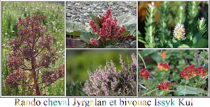 Après un bon petit déjeuner à la guesthouse, nous rencontrons notre guide et son comparse qui lui, nous rejoindra plus tard pour apporter nos bagages directement aux alentours de la yourte où nous devons dormir le soir.
Les selles sont confortables, les chevaux semblent être en bonne santé, mais celui de Gilles a quand même une vilaine blessure à la patte, et au fil de la rando, il traîne de plus en plus, et ne veut pas poser le sabot par terre.
Notre guide, Ourmat, parle un peu anglais, légèrement, mais semble plus à l’écoute de son téléphone sur lequel il passe le plus clair de son temps. Heureusement, nous sommes deux et pouvons échanger ensemble. La rando nous mène à un petit lac, pas terrible, où nous pique-niquons, puis à Tulpar Tash, rocher célèbre du coin. La balade est belle, dans des alpages remplis de fleurs sauvages que les chevaux prennent plaisir à grignoter dès qu’ils en ont l’occasion.Le second guide nous rejoint à cet endroit, avec un cheval qui porte tous les sacs, et nous continuons notre chemin à quatre, jusqu’à Eki Chat, où nous devons rencontrer nos hôtes sous la yourte. J’avais préparé Gilles, cette rencontre devait être un des moments forts du voyage.
Quelle ne fut pas notre surprise, ou plutôt notre désappointement : la yourte n’est pas habitée, c’est une tente fermée par un cadenas, et il se trouve que nos guides en ont oublié la clé ! Il faut donc retourner la chercher à Jyrgalan, et cela prendra deux heures et demi. Pendant ce temps, notre guide monte rapidement une petite tente d’appoint où nous nous réfugions illico, car il pleut à seaux. A trois là-dedans c’est vraiment pas confortable, et la discussion est plus que limitée.
Après un bon petit déjeuner à la guesthouse, nous rencontrons notre guide et son comparse qui lui, nous rejoindra plus tard pour apporter nos bagages directement aux alentours de la yourte où nous devons dormir le soir.
Les selles sont confortables, les chevaux semblent être en bonne santé, mais celui de Gilles a quand même une vilaine blessure à la patte, et au fil de la rando, il traîne de plus en plus, et ne veut pas poser le sabot par terre.
Notre guide, Ourmat, parle un peu anglais, légèrement, mais semble plus à l’écoute de son téléphone sur lequel il passe le plus clair de son temps. Heureusement, nous sommes deux et pouvons échanger ensemble. La rando nous mène à un petit lac, pas terrible, où nous pique-niquons, puis à Tulpar Tash, rocher célèbre du coin. La balade est belle, dans des alpages remplis de fleurs sauvages que les chevaux prennent plaisir à grignoter dès qu’ils en ont l’occasion.Le second guide nous rejoint à cet endroit, avec un cheval qui porte tous les sacs, et nous continuons notre chemin à quatre, jusqu’à Eki Chat, où nous devons rencontrer nos hôtes sous la yourte. J’avais préparé Gilles, cette rencontre devait être un des moments forts du voyage.
Quelle ne fut pas notre surprise, ou plutôt notre désappointement : la yourte n’est pas habitée, c’est une tente fermée par un cadenas, et il se trouve que nos guides en ont oublié la clé ! Il faut donc retourner la chercher à Jyrgalan, et cela prendra deux heures et demi. Pendant ce temps, notre guide monte rapidement une petite tente d’appoint où nous nous réfugions illico, car il pleut à seaux. A trois là-dedans c’est vraiment pas confortable, et la discussion est plus que limitée.La clé enfin arrivée avec mon cheval qui du coup le pauvre a fait trois fois le chemin, nous prenons nos quartiers. La yourte possède des matelas, mais pas de couvertures confortables, nous avons dû prendre nos duvets, et pas de poêle, donc pas de chauffage. Nous sommes encore à plus de 3000 mètres. Nous profitons d’une éclaircie pour nous promener dans le coin, peuplé de troupeaux. Nous assistons au retour des moutons, remise en place des vaches qui s’éloignent par les chiens de berger, véritables terreurs, la traite des vaches etc… Le soir, c’est intéressant d’assister à toute cette vie. Une yourte côtoie la nôtre, mais nous n’arrivons pas à lier connaissance avec les habitants qui répondent tout juste à notre bonjour. Dans ce coin, ils sont plus préoccupés par leurs troupeaux de moutons, très conséquents d’ailleurs, et n’ont pas de temps à perdre avec des touristes, c'est ce qui m'a été expliqué à Jyrgalan. Ourmat, peu loquace, nous a concocté un petit repas sur son réchaud, bien loin des plats traditionnels kirghizes, ça ne nous change pas du camping… Les deux guides se couchent avec les poules (même s’il n’y en a pas), et après le coucher du soleil, nous les rejoignons, car il n’y a pas grand-chose à faire d’autre. C’est alors, que nous croyant endormis certainement, ils se relèvent pour partir dans la yourte voisine, partager une soirée vodka très certainement. Sympa !!!! Vous l’aurez compris la déception est immense et la moutarde nous monte au nez petit à petit. D’autant plus que nous avons un point de comparaison avec notre précédente virée à cheval. Ce matin, ce sont les moutons qui traversent le camp, à grands coups de bêlements. Nuit correcte, petit dej succinct comme tout le reste, et nous reprenons nos montures pour monter plus haut dans la montagne. Ah oui, mais visiblement notre guide n’est pas au courant du programme prévu par Gulmira, responsable de la prestation, et compte nous redescendre directement à Jyrgalan. Ah non, nous avons une deuxième journée de cheval de prévue ! Alors, il fait un effort et on monte doucement. Au bout de vingt minutes il nous demande si cela suffit ! Et bien non ! Dix minutes plus tard, même question! Nous montons encore, et là heureusement, nous allons rencontrer l’événement qui va nous faire retrouver le sourire et sauver la prestation, bien que ce ne fut en rien prévu. Ourmat, soupirant visiblement intérieurement, continue à monter, la mort dans l’âme. Bien entendu, il n’avait pas prévu non plus le pique nique de midi, puisqu’il n’avait pas prévu de faire une seconde journée de cheval. Cela-dit, il nous conduit à un jailoo. Il se trouve que c’est sa famille qui y habite, à peut-être 3500 mètres. Et là, nous allons faire une des plus belles rencontres de notre voyage, non grâce à Ourmat que visiblement on fait suer, non grâce à Gulmira de «Destination Jyrgalan» qui ne sait pas gérer son personnel et tout cela pour une somme exorbitante, mais grâce à cette famille qui nous a accueillis les bras ouverts. Farida, la grand-mère nous offre des boortsoghs, ces fameux beignets cités précédemment, et notre premier koumis. C’est du lait de jument fermenté, donc un peu alcoolisé que les nomades kirghizes affectionnent. Très aigre et très riche en lactose il est peu supporté par nos estomacs. C’est un honneur que l’on nous fait, et nous y répondons en buvant tout le bol. Le lait est recueilli pendant la période d’été, saison des poulains et stocké dans une outre ou une baratte, il est battu au fil de la journée. Nazdanat, est une petite fille très conviviale, voire délurée. Elle s’empare du téléphone de Gilles et très à l’aise multiplie les selfies et portraits. C’est très amusant, et nous repartons donc avec une collection inestimable de souvenirs de la famille. La maman, qui est la tante de notre guide, nous conduit auprès des poulains, c’est l’heure de la traite des juments. Comme pour les veaux, il faut tenir le petit à côté de sa mère qui du coup se laisse faire. Le petit peut ensuite téter à son tour. S’ensuit une partie endiablée de foot transgénérationnelle. Nous sommes bien tristes de repartir pour regagner Jyrgalan. Nous n’aurons bien sûr pas fait le trajet prévu, mais cette rencontre nous a comblés, et nous revenons malgré tout assez fourbus. A l’arrivée, Ourmat, nous fournit un sac pique-nique. Nous ne sommes pas dupes, il est improvisé et ne contient même pas un sandwich, mais des barres chocolatées. Nous en parlons quand même à Gulmira, mais elle n’arrive pas à mesurer ce qui s’est réellement passé derrière son dos. Je lui enverrai de nouveau un mail à notre retour, trouvant la prestation très chère, et la publicité somme toute mensongère. A savoir qu’elle figure toujours sur leur site https://jyrgalan.com/where-to-stay/eki-chat-yurt-camp/ Mais bien entendu, aucun gain de cause, dommage ! Nous reprenons notre route pour rejoindre de nouveau le lac Issyk Kul, pour le bivouac du soir. Arrêt eau, essence et courses à Karakol, nous achetons un seau d'abricots aux petits vendeurs le long de la route, et nous trouvons encore un endroit sympathique pour dormir, bien qu’assez proche de la route.
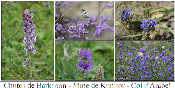 Nous avons dormi tout près de l’embranchement qui mène aux chutes de Barksoon. La route qui nous attend va être longue, sans croiser de stations services, donc par sécurité nous refaisons le plein d’essence et d’eau à la ville de Barksoon.
Nous devons rejoindre en deux jours les environs de Naryn. Plusieurs routes s’offrent à nous et notre choix s’est porté sur le col d’Arabel. Piste qui peut s’avérer difficile par temps de pluie, avec deux gués qui pourraient poser problème. Heureusement, le temps est sec, et nous constaterons qu’effectivement ça peut devenir impraticable quand c’est boueux. Il y a parfois des ornières énormes, une pente raide et peu d’espace sur certains tronçons.
Bref, en ce qui nous concerne, ce n’est pas là que nous allons trouver le problème, mais nous découvrirons cela un peu plus tard.....
Nous passons rapidement aux chutes, sans grand intérêt, mais qui sont accessibles rapidement de la route, alors pourquoi s’en priver. Par contre, c’est bête, mais nous sommes heureux de voir le buste de Youri Gagarine, héros de notre enfance. Pendant l’ère soviétique, les cosmonautes venaient souvent dans la région pour se détendre, notamment dans les bains chauds (dont nous n’avons pas profité), fierté Kirghize.
Nous décidons, avant d’entamer le col d’Arabel, de faire le gros détour par la mine de Kumtor, car nous avons pris de la marge pour ces deux jours.C’est une mine d’or, dont l’accès est très bien entretenu pour faciliter le passage des camions. D’ailleurs, lorsque nous arrivons à l’entrée de la zone, un convoi, assez impressionnant est en train de gravir la montagne. Les camions sont obligés de faire des pauses régulières, par contre ils grimpent très vite, et lorsque nous faisons des photos, c’est au pas de course, car les doubler est quand même fastidieux.
Nous passons notre premier col de la journée, Barksoon Ashuu à 3819 mètres!
La région est un haut plateau désertique, à plus de 3000 mètres une fois de plus, et où à part les camions, nous sommes les seuls. Malgré tout, nous croisons là encore des troupeaux et leurs bergers, ainsi qu’un ou deux jailoos au milieu de rien. C’est ainsi qu’en passant devant une famille près d’une yourte, un homme s’est mis à courir derrière notre voiture, en nous faisant de grands signes. Nous stoppons, et il nous fait comprendre qu’il a besoin de médicaments pour les yeux. Ça m’embête d’ouvrir tout le coffre, là, au milieu de rien, mais je le fais quand même et lui dégote des doses de sérum physiologique. C’est peu, mais l’homme repart en courant et en criant vers sa famille, et visiblement tout particulièrement ses enfants. Ça fait de la peine, et je crains que nous n’ayons pas été fort utiles.
Nous atteignons ensuite les abords de la mine (située à 4000 mètres), et bifurquons pour terminer la boucle avant de passer le col d’Arabel. La belle route goudronnée laisse place à la piste.Une erreur de suivi de traces GPS, et nous voilà au milieu d’un gué plus que conséquent, sur la rivière Taragay que nous longeons un bon moment. Nous devons du coup le traverser deux fois, pas fiers du tout, ni l’un, ni l’autre. Nous serons plus vigilants quant au GPS!
Nous avons dormi tout près de l’embranchement qui mène aux chutes de Barksoon. La route qui nous attend va être longue, sans croiser de stations services, donc par sécurité nous refaisons le plein d’essence et d’eau à la ville de Barksoon.
Nous devons rejoindre en deux jours les environs de Naryn. Plusieurs routes s’offrent à nous et notre choix s’est porté sur le col d’Arabel. Piste qui peut s’avérer difficile par temps de pluie, avec deux gués qui pourraient poser problème. Heureusement, le temps est sec, et nous constaterons qu’effectivement ça peut devenir impraticable quand c’est boueux. Il y a parfois des ornières énormes, une pente raide et peu d’espace sur certains tronçons.
Bref, en ce qui nous concerne, ce n’est pas là que nous allons trouver le problème, mais nous découvrirons cela un peu plus tard.....
Nous passons rapidement aux chutes, sans grand intérêt, mais qui sont accessibles rapidement de la route, alors pourquoi s’en priver. Par contre, c’est bête, mais nous sommes heureux de voir le buste de Youri Gagarine, héros de notre enfance. Pendant l’ère soviétique, les cosmonautes venaient souvent dans la région pour se détendre, notamment dans les bains chauds (dont nous n’avons pas profité), fierté Kirghize.
Nous décidons, avant d’entamer le col d’Arabel, de faire le gros détour par la mine de Kumtor, car nous avons pris de la marge pour ces deux jours.C’est une mine d’or, dont l’accès est très bien entretenu pour faciliter le passage des camions. D’ailleurs, lorsque nous arrivons à l’entrée de la zone, un convoi, assez impressionnant est en train de gravir la montagne. Les camions sont obligés de faire des pauses régulières, par contre ils grimpent très vite, et lorsque nous faisons des photos, c’est au pas de course, car les doubler est quand même fastidieux.
Nous passons notre premier col de la journée, Barksoon Ashuu à 3819 mètres!
La région est un haut plateau désertique, à plus de 3000 mètres une fois de plus, et où à part les camions, nous sommes les seuls. Malgré tout, nous croisons là encore des troupeaux et leurs bergers, ainsi qu’un ou deux jailoos au milieu de rien. C’est ainsi qu’en passant devant une famille près d’une yourte, un homme s’est mis à courir derrière notre voiture, en nous faisant de grands signes. Nous stoppons, et il nous fait comprendre qu’il a besoin de médicaments pour les yeux. Ça m’embête d’ouvrir tout le coffre, là, au milieu de rien, mais je le fais quand même et lui dégote des doses de sérum physiologique. C’est peu, mais l’homme repart en courant et en criant vers sa famille, et visiblement tout particulièrement ses enfants. Ça fait de la peine, et je crains que nous n’ayons pas été fort utiles.
Nous atteignons ensuite les abords de la mine (située à 4000 mètres), et bifurquons pour terminer la boucle avant de passer le col d’Arabel. La belle route goudronnée laisse place à la piste.Une erreur de suivi de traces GPS, et nous voilà au milieu d’un gué plus que conséquent, sur la rivière Taragay que nous longeons un bon moment. Nous devons du coup le traverser deux fois, pas fiers du tout, ni l’un, ni l’autre. Nous serons plus vigilants quant au GPS!Nous atteignons notre deuxième col, Söök Ashuu, à 4025 mètres cette fois-ci! Ça caille, mais l'endroit est superbe.Et puis nous bifurquons tout de suite après vers le col d’Arabel, qui lui est à 3840 mètres!!!! On n’avait jamais franchi des hauteurs pareilles auparavant et voilà que nous passons trois cols fabuleux dans la même journée! Whaouh!!! D’ailleurs à ce propos, je me rends compte assez rapidement que quand je descends faire une photo, il faut que j’évite de le faire en courant.
Revenons à nos moutons, que nous croisons d’ailleurs. Nous sommes arrêtés sur un pont étroit par une voiture qui fait le plein d’eau potable. Ils sont trois et remplissent des citernes entières. Du coup ça prend un peu de temps. C’est alors qu’arrive un berger et son troupeau gigantesque, sur fond de montagnes somptueuses, c’est magnifique. Je lui offre quelques gâteaux, et il semble me demander un couteau. Je lui abandonne un petit opinel, qui j’espère lui sera utile. Quelques clichés et nous continuons notre piste, au milieu des nombreux lacs, spécialité du coin. Nous croiserons dans la journée une unique voiture, une sorte d’estafette, qui mettra beaucoup de temps à monter, mais tout comme la tortue, finira par nous doubler quand nous poserons notre tente. La piste est superbe, minérale, mais fastidieuse et cassante. Cela prend beaucoup de temps, nous avançons difficilement ( peut-être 10 kilomètres en 1 heure de temps) et nous savons que deux gués qui peuvent se révéler périlleux nous attendent, il faut absolument que nous les traversions avant la nuit. Lorsqu’enfin ils se présentent, notre inquiétude tombe, après une étude du terrain, la traversée ne s’avère pas si compliquée, ouf! Ici, vous allez avoir deux narrations, la mienne et celle de Gilles, vous allez découvrir pourquoi!
Version Gilles Après un repas bercé par le gazouillis proche du torrent et une petit vodka réparatrice histoire de réchauffer nos os en vrac suite à l’état de la piste, nous admirons le ciel étoilé qui peine à s’exprimer avec la lueur blanchâtre de la pleine lune. Du coup, nous distinguons les grandes lignes cassées des monts alentours. C’est beau, mais il caille sévèrement et ce dès que le soleil quitte l’horizon. Nous devons tangenter le 0 °C. Ici, difficile de discuter avec nos voisins de tente vu que nous sommes seuls au monde. Donc rapidement, nous filons dans nos duvets sans demander notre reste. Endormis profondément, nous sommes tirés de notre sommeil par des bruits de pas et des voix d’homme autour de la tente, qui nous appellent. Minuit ! Une coutume locale ? Vu qu’ils parlent russe, nous ne pipons pas un traitre mot de ce qui se passe. Bandits de grand chemin, locaux à la recherche de vodka, voyageurs ??? Ça tourne vite dans nos cerveaux encore embrumés. « Bon, je vais sortir, mais je vais peut-être me faire attaquer … » Gloups ! Au premier regard, ils n’ont pas l’air patibulaire, mais bien costauds quand même. Ils m’expliquent en russe qu’ils sont plantés dans la rivière au niveau du gué et que ce serait un geste apprécié de les aider à en sortir, avec notre 4X4. Je parle russe maintenant ? Certaines scènes ont été mimées avec réalisme, ça aide. Je démarre le 4x4 avec mes deux nouveaux potes kirghizes et j’essaie de rejoindre la piste, ce qui n’est pas si simple en terrain « miné ». Constat au torrent. Oui, ils sont bien plantés, avec une sorte de J9 . On sent ces gens bien préparés à cette piste. Bref, on sort la sangle du loueur et j’essaie de les tracter. Rien à faire. Après quatre ou cinq essais, ils coupent la sangle (bien joué !) et m’expliquent que ce serait vraiment sympa de les amener chez eux à dix km de là en aval. Le 4x4 de nuit, jamais fait encore mais ça se tente. Par contre, nous sommes super justes en essence. Dix kilomètres fois deux pour le retour sur piste, c’est risqué. Ils m’annoncent que ce n’est pas un problème, ils pourront me donner dix litres d’essence là-bas. Un petit détour pour prévenir Grisemote et me voilà parti sur une piste défoncée, à la lueur des phares avec mes deux acolytes. Cinq puis dix kilomètres et déjà plus d’une heure de route. « Alors, elle est où cette maison (en langage des signes) ? Tout droit, pas de problème ». Mouai, je commence à trouver ça louche, d’autant que je pressens qu’il n’y a quasiment aucune activité humaine ici, mais pas facile à jauger dans le noir. Quinze kilomètres. Je m’arrête. « M’enfin, elle est où cette maison » (le « m’enfin » est compliqué à mimer) ? Tout droit , pas de problème ». Gros dilemme. Le réservoir descend et je pense qu’ils me mènent en bateau. Il n’y a rien ici, je ne vais pas avoir l’essence qu’ils m’ont promis. Il devient impossible de continuer sans me mettre aussi en difficulté, ce que je parviens à leur faire comprendre. Ils me font un grand sourire, me remercient chaleureusement, me proposent de me payer la sangle et l’essence, un coup de pogne et les voilà partis en pleine nuit sur la piste à pied. Prochain croisement avec une autre piste trente à quarante kilomètres (ce qui nous prendra le lendemain une demi-journée bien tassée). Je me fiche d’avoir des billets à la place de l’essence, d’autant qu’ici ce n’est pas cher. Ils ont tout simplement profité de la situation ou au mieux on ne s’est pas bien compris mais … une heure et demi plus tard, j’arrive à nouveau à la tente après avoir galéré pour la retrouver hors-piste (et pourtant j’avais un point GPS). Il est 3h30 Grrrrr ! (petit regret quand même : à posteriori, je me suis dit que j’aurais dû essayer de les tracter avec mon 4x4 non pas pour les faire avancer, car ils étaient plantés, mais pour les faire reculer …) Version Sylvie Nous décidons de bivouaquer juste après, dans les hauteurs qui dominent la superbe rivière Burkhan que nous allons suivre pendant une bonne partie de notre chemin. Le coin est encore couvert de fleurs multicolores. La pleine lune nous accompagne pendant le repas du soir. Bonnet, doudoune etc... sont de sortie. J’ai attrapé une sorte de bronchite et à cette altitude, c’est beaucoup plus compliqué. Cette nuit, à plus de 3000 mètres, il fait vraiment très froid et pas question de sortir ne serait-ce que le bout du nez du duvet! Et pourtant...... Aux alentours de minuit deux voix d’hommes appellent de façon virulente, en russe bien sûr à côté de la tente. Nous sommes loin d’être rassurés, car seuls au monde, et on ne sait pas ce qu’ils veulent. Gilles doit s’habiller et sortir dans le froid de canard. Ils lui demandent de les accompagner, il ne les sent pas vindicatifs. Je reste seule, hyper anxieuse. Une heure après, ils sont de retour, et Gilles me rassure. Ce sont des Kirghizes, de la capitale peut-être, car si nous nous avons pris bien des précautions pour les gués, ce ne fut pas leur cas, et ces couillons là (oui, on peut le dire), ont planté, non pas leur 4X4, mais leur camionnette, dans le gué, et cela en pleine nuit. Comme hélas, c’est la pleine lune, c’est à notre tente, toute proche, et surtout la seule qu’ils sont venus demander de l’aide. Nous avons une sangle, mais elle a cassé, bref, Gilles débarque notre barda du véhicule, pour, à leur demande les emmener vers une habitation, à dix kilomètres selon leurs dires, où ils pourront trouver de l’aide. Il fait tellement froid, et il n’y a personne d’autre, on ne peut pas les laisser. Je me rendors rassurée. C’est alors que j’ouvre de nouveau l’oeil, et je m’aperçois qu’il est 3H 1/2 du matin et toujours pas de Gilles! Alors là, inquiétude maximum, que lui est-il arrivé, et puis je suis seule, sans véhicule et sans réseau. Vers quatre heures, j’apprends le fin mot de l’histoire. Gilles revient. En fait leur maison n’était pas à dix kilomètres, mais toujours un peu plus loin, toujours un peu plus loin. Piste de nuit en plus, et nous savions que nous serions juste en essence pour finir le trajet jusqu’à Naryn. Nous étions en train de nous mettre nous même dans une sale situation, et à force de s’inquiéter pour le carburant, Gilles, pour éviter le suraccident a décidé de les laisser quand même sur le bord de la route. La lune est pleine, et il y a une bonne lumière. La mort dans l’âme il a refait la piste en sens inverse. Il a certainement fait plus de trente kilomètres pour les emmener, et voilà comment il est désormais quatre heures du matin! On reprend le fil Nous décidons que le lendemain (ou plutôt tout à l'heure!), lorsque nous croiserons la bifurcation du col de Tosor que nous avions laissé de côté pour celui d’Arabel, et qui plus est, qui nous ramènerait du mauvais côté de la montagne, nous prendrons la décision, suivant la jauge de carburant, de continuer notre route comme nous l’avions prévu ou alors de shunter vers Tosor, route encore très difficile, mais plus courte, et qui permettrait de trouver de l’essence plus rapidement. Dodo sous la couette, un peu inquiets pour ce qui va suivre, mais paradoxalement rassurés.
 Gilles essaye d’expliquer (pour rappel ils ne parlent que russe et nous pas!) qu’il a déposé les deux autres au plus loin possible, que nous devons poursuivre notre chemin et que nous avons un vrai souci d’essence. C’est déchirant et nous savons, comme eux, que vraiment peu de monde passe ici, mais on ne peut plus faire grand chose si ce n’est prévenir quelqu’un. Là où nous sommes, il n'y a ni village, ni poste à essence, ni quoique ce soit avant notre point final.De nuit, il ne s’était pas rendu compte que c’était une famille entière, et certains, dont des femmes, dorment comme ils peuvent couchés par terre. Les deux gars ne sont pas revenus. Ils nous donnent une compensation pour pouvoir garder la sangle du loueur qu’il faudra que nous retrouvions.
Gilles essaye d’expliquer (pour rappel ils ne parlent que russe et nous pas!) qu’il a déposé les deux autres au plus loin possible et que nous devons poursuivre notre chemin, et que nous avons un souci d’essence. C’est déchirant, ils nous supplient, ils savent que vraiment peu de monde passe ici, mais là, on ne peut plus si ce n’est prévenir quelqu’un. Il faut savoir que là où nous sommes, il n'y ni village, ni poste à essence, ni quoique ce soit avant notre point final.
Nous reprenons donc la piste, que Gilles emprunte lui pour la troisième fois, mais de jour, c’est différent. Nous suivons la rivière pendant une soixantaine de kilomètres. Elle est superbe. De multiples marmottes ont transformé la montagne en gruyère. Par contre, elles sont beaucoup plus farouches que celles de chez nous. Elles commencent à courir dès qu’elles nous voient à cent mètres, elles attendent courageuses au bord du trou, et plongent avant que nous puissions les apercevoir autrement qu’au téléobjectif. Bref, un exploit d’en prendre une correcte en photo. Par contre, c’est assez amusant de les voir courir de partout. Nous ne recroisons pas les deux gars, et personne d’autre d’ailleurs. Un orage se profile dans le rétroviseur. Il nous poursuit pendant un long moment, sans nous rattraper avant la bifurcation de Tosor. La décision collégiale est prise, il faut changer les plans initialement prévus, la jauge d'essence ne nous encourage pas à continuer, il faut prendre la route du col de Tosor. C'est ici, à l'embranchement, que nous croisons le plus de monde, cette route est nettement plus fréquentée que celle d'où nous venons (où les deux hommes sont-ils allés?)
Petite «discussion» avec un berger très très amateur de sablés français, et son chien en apprentissage, et en route pour le col de Tosor. C’est noir derrière, sur les côtés, nous allons vers l’unique petit coin de ciel bleu. Au moins, c’est le côté positif de l’affaire
Nous avons quitté la rivière Burkhan pour celle de Jiluu Suu, plutôt tumultueuse. Cette piste est très différente de celle du col d’Arabel, mais tout aussi compliquée, voire plus.
Nous enchaînons les gués dont les ponts ont été détruits, et parfois nous devons franchir des marches de près d’un mètre. Notre arrivée tardive sur la piste ne joue pas en notre faveur. Au fil de la journée, les glaciers fondent, et le débit de l’eau, donc des gués augmente.
Le mauvais temps a fini par nous rattraper, la température est descendue à 6°C, et la grêle s’annonce de la partie. C’est alors que nous nous retrouvons face à un gué «de la mort qui tue».
Déjà, il faut être courageux pour descendre l’étudier ce gué, Gilles l’est, moi pas. J’ai juste les choquottes, mais au chaud. Ensuite malgré l’étude du terrain, c’est un torrent qu’il faut traverser, et bien que Gilles semble savoir où passer, se lancer est une autre paire de manches. C’est là, que la chance nous sourit. Deux 4X4 de tours operators se présentent sur l’autre rive. Les conducteurs descendent eux aussi. Discussion inter-rives entre les pilotes, et les gars du coin se lancent. Nous pouvons donc étudier le passage de manière plus efficace. On leur demande d’attendre notre tour pour partir, c’est ainsi que nous l’avons passé!
Au fur et à mesure que nous continuons à monter vers le col de Tosor à 3893 mètres, le temps devient de plus en plus compliqué, tout comme la route et notre moral au vu de la jauge qui descend, qui descend. Gilles prend beaucoup de plaisir sur cette piste, moi beaucoup moins, car nous ne pouvons pas traîner. A ce propos, c’est en haut du col que l'indicateur de fuel s’allume. Ouf, nous n’avons plus qu’à descendre. Mais arriverons-nous à atteindre la station service?
Tout en haut, les glaciers lèchent la route, mais la lumière descend à vive allure, et le froid est très présent. Si nous ne voulons pas finir de nuit, nous ne pouvons guère nous attarder. Du coup, on n’a pas trop le temps de profiter de cette route exceptionnelle. Les paysages sur l’autre versant sont superbes, bien que la lumière ne soit plus présente. Nous arrivons à atteindre Issyk-Kul et faire encore dix kilomètres pour atteindre la station (je ne vous raconte pas l'ambiance dans la voiture!). Nous avons fait grosso modo 180 kilomètres depuis le gué. Nous rejoignons Tosor pour la nuit, mais un vent terrible souffle et où que porte le regard, le ciel est terriblement noir. La journée nous a quand même bien fatigués, et le temps peu engageant nous oriente vers un camping de yourtes, Tonia yurt camp. Nous dormons confortablement pour l’équivalent de 20 euros avec petit déjeuner, peut-être un peu cher pour le pays, mais peu importe, on l’a bien mérité. Nous arrivons hélas trop tard pour le repas du soir, mais nous pouvons utiliser la salle de restauration pour notre repas. C’est là que nous rencontrons cette famille suisse de cinq personnes qui eux ont grimpé notre col, mais en vélo! Et bien chapeau la petite famille!!!!!
En tous cas, c’était bien sympa ce petit camping coquet, je le recommande.
Gilles essaye d’expliquer (pour rappel ils ne parlent que russe et nous pas!) qu’il a déposé les deux autres au plus loin possible, que nous devons poursuivre notre chemin et que nous avons un vrai souci d’essence. C’est déchirant et nous savons, comme eux, que vraiment peu de monde passe ici, mais on ne peut plus faire grand chose si ce n’est prévenir quelqu’un. Là où nous sommes, il n'y a ni village, ni poste à essence, ni quoique ce soit avant notre point final.De nuit, il ne s’était pas rendu compte que c’était une famille entière, et certains, dont des femmes, dorment comme ils peuvent couchés par terre. Les deux gars ne sont pas revenus. Ils nous donnent une compensation pour pouvoir garder la sangle du loueur qu’il faudra que nous retrouvions.
Gilles essaye d’expliquer (pour rappel ils ne parlent que russe et nous pas!) qu’il a déposé les deux autres au plus loin possible et que nous devons poursuivre notre chemin, et que nous avons un souci d’essence. C’est déchirant, ils nous supplient, ils savent que vraiment peu de monde passe ici, mais là, on ne peut plus si ce n’est prévenir quelqu’un. Il faut savoir que là où nous sommes, il n'y ni village, ni poste à essence, ni quoique ce soit avant notre point final.
Nous reprenons donc la piste, que Gilles emprunte lui pour la troisième fois, mais de jour, c’est différent. Nous suivons la rivière pendant une soixantaine de kilomètres. Elle est superbe. De multiples marmottes ont transformé la montagne en gruyère. Par contre, elles sont beaucoup plus farouches que celles de chez nous. Elles commencent à courir dès qu’elles nous voient à cent mètres, elles attendent courageuses au bord du trou, et plongent avant que nous puissions les apercevoir autrement qu’au téléobjectif. Bref, un exploit d’en prendre une correcte en photo. Par contre, c’est assez amusant de les voir courir de partout. Nous ne recroisons pas les deux gars, et personne d’autre d’ailleurs. Un orage se profile dans le rétroviseur. Il nous poursuit pendant un long moment, sans nous rattraper avant la bifurcation de Tosor. La décision collégiale est prise, il faut changer les plans initialement prévus, la jauge d'essence ne nous encourage pas à continuer, il faut prendre la route du col de Tosor. C'est ici, à l'embranchement, que nous croisons le plus de monde, cette route est nettement plus fréquentée que celle d'où nous venons (où les deux hommes sont-ils allés?)
Petite «discussion» avec un berger très très amateur de sablés français, et son chien en apprentissage, et en route pour le col de Tosor. C’est noir derrière, sur les côtés, nous allons vers l’unique petit coin de ciel bleu. Au moins, c’est le côté positif de l’affaire
Nous avons quitté la rivière Burkhan pour celle de Jiluu Suu, plutôt tumultueuse. Cette piste est très différente de celle du col d’Arabel, mais tout aussi compliquée, voire plus.
Nous enchaînons les gués dont les ponts ont été détruits, et parfois nous devons franchir des marches de près d’un mètre. Notre arrivée tardive sur la piste ne joue pas en notre faveur. Au fil de la journée, les glaciers fondent, et le débit de l’eau, donc des gués augmente.
Le mauvais temps a fini par nous rattraper, la température est descendue à 6°C, et la grêle s’annonce de la partie. C’est alors que nous nous retrouvons face à un gué «de la mort qui tue».
Déjà, il faut être courageux pour descendre l’étudier ce gué, Gilles l’est, moi pas. J’ai juste les choquottes, mais au chaud. Ensuite malgré l’étude du terrain, c’est un torrent qu’il faut traverser, et bien que Gilles semble savoir où passer, se lancer est une autre paire de manches. C’est là, que la chance nous sourit. Deux 4X4 de tours operators se présentent sur l’autre rive. Les conducteurs descendent eux aussi. Discussion inter-rives entre les pilotes, et les gars du coin se lancent. Nous pouvons donc étudier le passage de manière plus efficace. On leur demande d’attendre notre tour pour partir, c’est ainsi que nous l’avons passé!
Au fur et à mesure que nous continuons à monter vers le col de Tosor à 3893 mètres, le temps devient de plus en plus compliqué, tout comme la route et notre moral au vu de la jauge qui descend, qui descend. Gilles prend beaucoup de plaisir sur cette piste, moi beaucoup moins, car nous ne pouvons pas traîner. A ce propos, c’est en haut du col que l'indicateur de fuel s’allume. Ouf, nous n’avons plus qu’à descendre. Mais arriverons-nous à atteindre la station service?
Tout en haut, les glaciers lèchent la route, mais la lumière descend à vive allure, et le froid est très présent. Si nous ne voulons pas finir de nuit, nous ne pouvons guère nous attarder. Du coup, on n’a pas trop le temps de profiter de cette route exceptionnelle. Les paysages sur l’autre versant sont superbes, bien que la lumière ne soit plus présente. Nous arrivons à atteindre Issyk-Kul et faire encore dix kilomètres pour atteindre la station (je ne vous raconte pas l'ambiance dans la voiture!). Nous avons fait grosso modo 180 kilomètres depuis le gué. Nous rejoignons Tosor pour la nuit, mais un vent terrible souffle et où que porte le regard, le ciel est terriblement noir. La journée nous a quand même bien fatigués, et le temps peu engageant nous oriente vers un camping de yourtes, Tonia yurt camp. Nous dormons confortablement pour l’équivalent de 20 euros avec petit déjeuner, peut-être un peu cher pour le pays, mais peu importe, on l’a bien mérité. Nous arrivons hélas trop tard pour le repas du soir, mais nous pouvons utiliser la salle de restauration pour notre repas. C’est là que nous rencontrons cette famille suisse de cinq personnes qui eux ont grimpé notre col, mais en vélo! Et bien chapeau la petite famille!!!!!
En tous cas, c’était bien sympa ce petit camping coquet, je le recommande. Du coup, nous devons rejoindre les environs de Naryn comme prévu, mais refranchir les montagnes, et pour cela, repasser par Kochkor, et son réservoir que nous avons déjà découvert à deux reprises. C’est une grosse route, sans beaucoup de charme mais un ciel plombé l’agrémente de façon superbe, et chose imprévue, nous prenons plaisir au trajet. Les événements précédents nous obligent à changer notre programme, et nous décidons d’emprunter le col de Ulan Ashuu pour rejoindre Baetov en passant par Uchkun. Imprévu, mais un vrai bonheur! La piste est correcte, mais n'avance pas plus que les autres pistes: ornières, dévers, mais ça n'est pas boueux heureusement. C’est magnifique, il nous manque malheureusement une demi-heure de plus pour profiter pleinement de la vue au sommet, car l'ombre progresse et la lumière n'est plus là! Il nous faut trouver un coin de bivouac, mais le col est encore a plus de 3000 mètres et on n'est pas très chauds, c'est le cas de le dire pour dormir à cette altitude, on aimerait bien prendre quelques degrés en descendant un poil. Nous trouvons notre bonheur quelques centaines de mètres plus bas, avec une très belle vue dont nous profiterons au réveil....
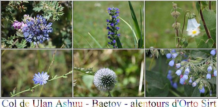 Nous profitons de l'endroit, et décidons de remonter un peu pour la vue que nous n'avons pas eue hier.
Nous croisons sur le chemin notre petit gars de la veille, avec qui nous avions partagé quelques gâteaux, celui qui emmenait ses frères et soeurs faire de la luge. Il conduit des "yacks" au pâturage. Ce sont en fait des dzos qui sont un croisement entre le yack et la vache.
Ils sont un peu loin, mais nous aurons l'occasion d'en rencontrer de plus près.
Il nous reconnaît et nous fait signe de le suivre. Il descend de son cheval, et accompagné de son chien, nous conduit à un espèce de trou, de grotte, bien caché, que nous atteignons après une petite marche d'approche. Pas exceptionnel, mais alors quelle vue! Notre petit gars est très fier de nous montrer la cachette secrète. Il ne parle pas du tout, est-il muet???? Alors que nous rejoignons notre véhicule, lui, court après son cheval qu'il n'avait pas attaché, et celui-ci a pris la poudre d'escampette. Le pauvre a vraiment du mal à le récupérer, car l'animal n'a pas décidé de se faire attraper. Nous attendons pour ne pas le laisser dans l'embarras, mais il finit par avoir raison de la bête.
En poursuivant notre chemin, nous passons près d'une yourte, et on nous interpelle. Nous sommes conviés à l'intérieur. Pourquoi pas! Nous sommes donc accueillis par cette famille qui pour l'été se retrouve à 3000 mètres, avec leurs chevaux. C'est une grande famille. Autour du grand-père et de la grand-mère, les enfants, petits-enfants tous réunis. Ceux qui nous ont invité parlent très bien anglais, et pour cause, elle est juriste, et lui avocat. Ils ont également leurs frères et soeurs et toute une ribambelle d'enfants. Nous sommes dans une yourte, qui ne reçoit pas de touristes, telle qu'ils peuvent l'habiter en famille. On nous offre tout d'abord le traditionnel koumis, le lait de jument fermenté, un gros bol chacun! Accompagné des boorsoghs (beignets) et pour finir, on nous apporte un sac de friandise énorme, pour emporter avec nous. C'est comme du chocolat nous dit-on! En fait, ce sont des kourous, des petits fromages fermentés, très durs. C'est une recette ancestrale du temps de la route de Chine, où il fallait pouvoir conserver les aliments longtemps. Les kirghizes en sont friands, et dans les lieux touristiques, on en voit vendus le long des routes par paquets entiers. Il y a une certaine acidité à ces fromages. En ce qui me concerne, j'aime bien avec une tomate, un ou deux par ci par là, c'est pas désagréable.
Du coup, le sac nous a accompagné pendant tout le voyage. Quelle belle rencontre cette famille....
Nous leur offrons pour les remercier des biscuits de Reims, que les enfants n'ont pas mis longtemps à apprécier. Echange de nos adresses mail, et nous poursuivons notre route.
La route est superbe où que l'on regarde. Nous croisons pas mal de tombeaux.
Nous profitons de l'endroit, et décidons de remonter un peu pour la vue que nous n'avons pas eue hier.
Nous croisons sur le chemin notre petit gars de la veille, avec qui nous avions partagé quelques gâteaux, celui qui emmenait ses frères et soeurs faire de la luge. Il conduit des "yacks" au pâturage. Ce sont en fait des dzos qui sont un croisement entre le yack et la vache.
Ils sont un peu loin, mais nous aurons l'occasion d'en rencontrer de plus près.
Il nous reconnaît et nous fait signe de le suivre. Il descend de son cheval, et accompagné de son chien, nous conduit à un espèce de trou, de grotte, bien caché, que nous atteignons après une petite marche d'approche. Pas exceptionnel, mais alors quelle vue! Notre petit gars est très fier de nous montrer la cachette secrète. Il ne parle pas du tout, est-il muet???? Alors que nous rejoignons notre véhicule, lui, court après son cheval qu'il n'avait pas attaché, et celui-ci a pris la poudre d'escampette. Le pauvre a vraiment du mal à le récupérer, car l'animal n'a pas décidé de se faire attraper. Nous attendons pour ne pas le laisser dans l'embarras, mais il finit par avoir raison de la bête.
En poursuivant notre chemin, nous passons près d'une yourte, et on nous interpelle. Nous sommes conviés à l'intérieur. Pourquoi pas! Nous sommes donc accueillis par cette famille qui pour l'été se retrouve à 3000 mètres, avec leurs chevaux. C'est une grande famille. Autour du grand-père et de la grand-mère, les enfants, petits-enfants tous réunis. Ceux qui nous ont invité parlent très bien anglais, et pour cause, elle est juriste, et lui avocat. Ils ont également leurs frères et soeurs et toute une ribambelle d'enfants. Nous sommes dans une yourte, qui ne reçoit pas de touristes, telle qu'ils peuvent l'habiter en famille. On nous offre tout d'abord le traditionnel koumis, le lait de jument fermenté, un gros bol chacun! Accompagné des boorsoghs (beignets) et pour finir, on nous apporte un sac de friandise énorme, pour emporter avec nous. C'est comme du chocolat nous dit-on! En fait, ce sont des kourous, des petits fromages fermentés, très durs. C'est une recette ancestrale du temps de la route de Chine, où il fallait pouvoir conserver les aliments longtemps. Les kirghizes en sont friands, et dans les lieux touristiques, on en voit vendus le long des routes par paquets entiers. Il y a une certaine acidité à ces fromages. En ce qui me concerne, j'aime bien avec une tomate, un ou deux par ci par là, c'est pas désagréable.
Du coup, le sac nous a accompagné pendant tout le voyage. Quelle belle rencontre cette famille....
Nous leur offrons pour les remercier des biscuits de Reims, que les enfants n'ont pas mis longtemps à apprécier. Echange de nos adresses mail, et nous poursuivons notre route.
La route est superbe où que l'on regarde. Nous croisons pas mal de tombeaux.Et nous rejoignons la route principale qui va nous emmener vers Baetov. Nous cheminons au milieu des badlands.Une fois de plus, nous ne savons plus où donner de la tête. Nous grimpons vers le col de Börülü Ashuu, plus communément appelé dans le coin MELS Ashuu (c'est à dire col de "Marx - Engels - Lénine - Staline ). Alors là, c'est un feu d'artifice de paysages de toute beauté. Il est difficile de ne pas s'arrêter à chaque virage. Là encore, il y a des fleurs à foison. Nous croisons à maintes reprises une voiture, une lada, avec quatre occupants à bord. Ils n'ont pas la chance d'avoir un 4X4, et ça grimpe sec! Ils doivent rejoindre un jailoo juste après le col. Nous leur proposons de l'aide, mais ils ont adopté une technique bien propre à eux: ils montent et quand le voiture chauffe, on ouvre le capot, on la laisse reposer, de l'eau et en route pour deux virages plus loin où on recommence la même opération. D'ailleurs, c'est très kirghize, la voiture sur le bas-côté avec le capot ouvert! Entre la voiture qui refroidit, et nous qui prenons des photos à presque chaque virage, nous cheminons ensemble jusqu'au sommet....
Ils sont tellement contents de venir nous faire un coucou. Leur peau est brûlée par le soleil, nous sommes à plus de 3000 mètres, et la protection solaire n'a pas l'air une priorité, semble-t-il. Quelques gâteaux partagés nous ont valu un beau sourire. La descente sur l'autre versant du Börülü est tout aussi attrayante que la montée, bien que très différente. Nous atteignons la vallée de la Terek, et progressons d'un côté, puis de l'autre de la rivière. L'heure qui commence à être tardive donne une couleur mordorée à ce paysage bucolique. Ici, une unique mais énorme ferme, vaches et moutons en quantité. C'est d'ailleurs l'heure pour eux de rentrer. Nous avions dans l'idée d'aller crapahuter dans une petite gorge découverte par Marie. Mais ce n'est pas du tout la bonne lumière et elle est plus que sombre, nous n'en verrons que l'entrée. De toutes façons, il est temps de se mettre en quête d'un campement pour être en place avant la nuit. Nous faisons le plein d'eau à la source captée juste aux abords de la grotte et décidons, malgré le froid qui commence à tomber, d'établir notre bivouac dans les hauteurs. Nous craignons toujours un peu les moustiques en campant près de l'eau. Nous n'avons pas regretté notre choix, la vue est belle, et nous assistons à un spectacle de galopades de chevaux sauvages. Comme nous sommes encore à plus de 3000 mètres, il ne fait pas bien chaud. D'ailleurs, le temps est à l'orage, et pour cette nuit, nous allons en subir un sévère.
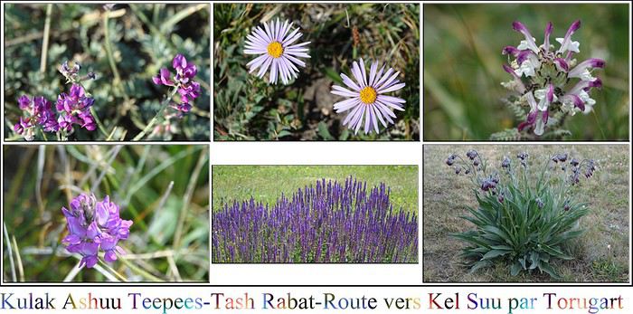 La tente est trempée ce matin, et nous prenons notre petit-déjeûner sur fond d'arc-en-ciel. Le séchage est malgré tout relativement rapide et nous pouvons donc prendre la route vers notre destination, les kulak teepees, pour y faire une rando. Hier, en fait, nous aurions du rejoindre Laurence49b et sa covoyageuse, Stéphanie. Et oui, cela fait un bon moment avec Laurence que nous nous connaissons virtuellement, par l'intermédiaire de VF, où nous avons fréquenté un peu les mêmes discussions. Et l'occasion faisant le larron, nous nous retrouvons sous les mêmes latitudes, et nous réussissons à nous goupiller trois jours en commun pour aller jusqu'au lac Kel Suu. Mais notre nuit très aventureuse du col d'Arabel, et l'obligation de changer notre itinéraire nous a fait perdre une journée, et nous avons donc été dans l'impossibilité de retrouver les filles. Nous avons toutes les coordonnées pour pouvoir se joindre, mais faute de réseau la majorité du temps, pas moyen de les prévenir. Nous espérons donc les retrouver à Tash Rabat, après la rando, d'où nous devions partir ensemble pour le lac.
Nous approchons les teepees. Là encore, pour la rando, nous avons suivi les traces de Marie, trouvées sur Wikiloc.
C'est amusant de voir les troupeaux de chevaux sauvages, en tous cas qui ne sont pas entravés, et qui se promènent, vadrouillent, parfois se baignent. Il y a toujours un chef, qui observe, en avant-coureur, et là, s'il estime que la tribu peut y aller, là et seulement là, le reste de la troupe ose avancer. C'est toujours le même rituel!
Je ne vais pas accompagner Gilles jusqu'au bout, car mon ventre se tord dans tous les sens de façon douloureuse, et le coeur n'y est pas. Début de troubles qui s'annoncent.
Je me pose un peu pour patienter, en regardant les fleurs, et là, oh joie, voilà que s'avance une de ces fameuses tribus évoquées juste avant, avec son chef. On doit se croiser, alors de multiples précautions sont prises des deux côtés. Eux aussi ont pour objectif de faire la même rando, le but étant peut-être différent. Est-ce que cela a un rapport avec le névé tout au bout, au fond du canyon? Ce sont-ils dit "Tiens si on allait se faire une petite glace aujourd'hui?" Beau moment pour moi en tous cas, qui les trouve si majestueux.
La tente est trempée ce matin, et nous prenons notre petit-déjeûner sur fond d'arc-en-ciel. Le séchage est malgré tout relativement rapide et nous pouvons donc prendre la route vers notre destination, les kulak teepees, pour y faire une rando. Hier, en fait, nous aurions du rejoindre Laurence49b et sa covoyageuse, Stéphanie. Et oui, cela fait un bon moment avec Laurence que nous nous connaissons virtuellement, par l'intermédiaire de VF, où nous avons fréquenté un peu les mêmes discussions. Et l'occasion faisant le larron, nous nous retrouvons sous les mêmes latitudes, et nous réussissons à nous goupiller trois jours en commun pour aller jusqu'au lac Kel Suu. Mais notre nuit très aventureuse du col d'Arabel, et l'obligation de changer notre itinéraire nous a fait perdre une journée, et nous avons donc été dans l'impossibilité de retrouver les filles. Nous avons toutes les coordonnées pour pouvoir se joindre, mais faute de réseau la majorité du temps, pas moyen de les prévenir. Nous espérons donc les retrouver à Tash Rabat, après la rando, d'où nous devions partir ensemble pour le lac.
Nous approchons les teepees. Là encore, pour la rando, nous avons suivi les traces de Marie, trouvées sur Wikiloc.
C'est amusant de voir les troupeaux de chevaux sauvages, en tous cas qui ne sont pas entravés, et qui se promènent, vadrouillent, parfois se baignent. Il y a toujours un chef, qui observe, en avant-coureur, et là, s'il estime que la tribu peut y aller, là et seulement là, le reste de la troupe ose avancer. C'est toujours le même rituel!
Je ne vais pas accompagner Gilles jusqu'au bout, car mon ventre se tord dans tous les sens de façon douloureuse, et le coeur n'y est pas. Début de troubles qui s'annoncent.
Je me pose un peu pour patienter, en regardant les fleurs, et là, oh joie, voilà que s'avance une de ces fameuses tribus évoquées juste avant, avec son chef. On doit se croiser, alors de multiples précautions sont prises des deux côtés. Eux aussi ont pour objectif de faire la même rando, le but étant peut-être différent. Est-ce que cela a un rapport avec le névé tout au bout, au fond du canyon? Ce sont-ils dit "Tiens si on allait se faire une petite glace aujourd'hui?" Beau moment pour moi en tous cas, qui les trouve si majestueux.Encore un petit col, le Kulak Ashuu à 3390 mètres et nous rejoignons ensuite l'embranchement pour aller à Tash Rabat. C'est un caravansérail, c'est à dire une espèce d'hôtel, de lieu d'accueil pour les marchands, à l'époque de la route de la Soie. Très bien conservé, il est un des hauts lieux touristiques du Kirghizstan. Donc, il y a peut-être une vingtaine de personnes. Nous en faisons la visite, dedans, dessus, autour, tout en guettant deux voyageuses françaises. Echec, elles ne sont pas là. Nous décidons alors d'aller chercher de l'essence en direction de Naryn, donc de refaire la piste en sens inverse. Il doit y avoir une nouvelle station service à la frontière avec la Chine, mais si jamais elle était fermée, nous ne pourrions pas faire la route jusqu'à Kel Suu. Alors par mesure de précaution, nous faisons une presque cinquantaine de kilomètres dans le sens inverse de notre itinéraire, jusqu'à une station que j'avais rentrée sur Maps-Me. Hélas, trois fois hélas, elle est désaffectée. Nous interrogeons quelques habitants, mais si nous ne voulons pas faire cent kilomètres (aller), il va falloir s'adresser à un gars du crû et son essence avec moins d'octanes que celle que nous prenons habituellement. Un homme, plus que gentil, va jusqu'à prendre sa voiture pour nous guider chez quelqu'un qui va faire office de pompiste avec un bidon. Nous osons même lui demander où nous pouvons nous débarrasser de nos poubelles que nous trimbalons depuis trois jours et qui commencent vraiment à être un problème. Et oui, hormis dans les grandes villes, il n'y a rien pour les détritus, c'est quelque chose à prendre en compte, au même titre que refaire le plein, ou remplir les bidons d'eau! Notre gentil pompiste, va les prendre chez lui, décidément, ils sont bien sympathiques.
Nous reprenons la piste pour Tash Rabat, pour être vers 15 heures là-bas, heure prévue pour notre départ vers Kel Suu avec Laurence. J'espère qu'elles auront eu la même idée! C'est la troisième fois que nous reprenons cette piste! En chemin, ous croisons un haut lieu d'école de vol pour les vautours, que nous prenons plaisir à regarder prendre leurs ascendances. Les filles ne sont pas là! Nous montons un peu pour avoir une vue d'ensemble mais rien! On va prendre la route, car il est déjà tard et nous espérons pouvoir planter le bivouac juste avant un gué qui peut s'avérer périlleux, et qu'il vaut mieux franchir le matin, avant la fonte des glaces. Le but du jeu serait de dormir juste à côté pour l'attaquer au plus tôt le lendemain. Piste quatrième! Finalement nous n'avons pas regretté ce second pélerinage au caravansérail, beaucoup de kilomètres inutiles, certes, mais la rencontre avec les vautours et le retour sous un ciel plombé en valaient la chandelle. Nous rejoignons la route principale, que nous suivons plein sud. Elle est goudronnée et parfaitement entretenue, car elle mène au col de Torugart (3752 mètres) , passage frontière avec la Chine. Comme nous la longeons pour aller à Kel Suu, il faut demander un permis spécial à l'avance qui nous permettra de passer les checkpoints. Il y a quelques endroits au Kirghizistan qui nécessitent ce permis, pour la même raison. J'avais un peu poussé Laurence à suivre cette route à l'aller, pour ne pas faire la même route aller- retour pour le lac. Cet itinéraire longe la vallée de l'Ak Say, jusqu'à l'embranchement pour Kel Suu. Nous passons pas loin du lac Chatyr Kul, sans nous en approcher car c'est très marécageux, la route que nous devons parcourir est longue et il faut s'avancer au plus loin avant la nuit. Le passage du checkpoint est un peu tendu, ils épluchent tout, mais nous le franchissons sans heurts. Une file de camions gigantesque est à l'arrêt, certainement en lice pour franchir la frontière dès l'aube. La station service, clinquante, est bien opérationnelle et ravitaillée. Nous refaisons donc le plein, et c'est parti pour environ 60 kilomètres de piste jusqu'au gué. Nous suivons le no man's land qui longe la frontière chinoise. Pour être tout à fait honnête, si ce n'est le ciel d'orage superbe et les quelques miradors qui nous distraient, les kilomètres se suivent de manière ennuyeuse. C'est plat, c'est droit, et le paysage n'a rien d'exceptionnel. Nous n'atteindrons pas le gué avant la nuit. Il nous faut trouver un emplacement plat, non caillouteux, et ce n'est pas si simple. Ici ce sont les mottes d'herbe qui dominent. Nous finissons par trouver l'ENDROIT! Pas terrible, mais on désespérait de dormir sous la tente ce soir. D'ailleurs nous inaugurons le dîner sous l'avancée, car l'orage qui nous tombe dessus est sans pitié.
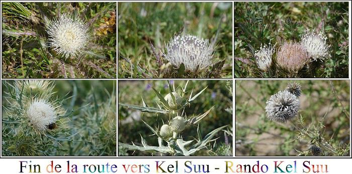 Il fait beau au réveil. Par contre on s'est sacrément caillés cette nuit, malgré nos duvets 0°C!
La montée sur la petite colline voisine à notre bivouac nous offre une jolie vue sur la vallée.
Nous n'étions pas très loin du gué. Pas de filles en vue, et le gué que Marie et Fred ont eu beaucoup de mal à franchir au mois de mai est quasi à sec! Il est vrai que les ramifications de l'Ak Say sont gigantesques. Il faut trouver le bon passage à chaque fois, et trouver ensuite la bonne sortie, car les rives ont une allure de falaises. Comme avons peu d'eau, ça ne sera pas difficile, mais effectivement avec de l'eau ça doit être une autre paire de manches.
Il fait beau au réveil. Par contre on s'est sacrément caillés cette nuit, malgré nos duvets 0°C!
La montée sur la petite colline voisine à notre bivouac nous offre une jolie vue sur la vallée.
Nous n'étions pas très loin du gué. Pas de filles en vue, et le gué que Marie et Fred ont eu beaucoup de mal à franchir au mois de mai est quasi à sec! Il est vrai que les ramifications de l'Ak Say sont gigantesques. Il faut trouver le bon passage à chaque fois, et trouver ensuite la bonne sortie, car les rives ont une allure de falaises. Comme avons peu d'eau, ça ne sera pas difficile, mais effectivement avec de l'eau ça doit être une autre paire de manches.Nous croisons un papa et son fils qui vont chercher de l'eau, mais il n'y a quand même pas beaucoup de jailoos dans ce coin là. La partie de la route après le gué est plus attractive, nous longeons toujours l'Ak Say, ça doit être très beau quand la rivière est tumultueuse. 80 kilomètres plus loin, nous trouvons la bifurcation pour Kel Suu. C'est verdoyant, et le paysage pour y parvenir très beau, mais le temps est gris et sous un ciel blanc, les couleurs ne sont pas au rendez-vous.
Nous arrivons au jailoo de Kel Suu. Nous cherchons à droite, à gauche, toujours pas de trace des filles. Et puis finalement c'est grand ici, avec plein de campements aménagés, moi qui pensait être au bout du monde dans un endroit confidentiel! Ça ne l'est visiblement pas tant que ça pour les tours operators. Il se met à pleuvoir des cordes. Nous pique niquons dans la voiture et faute de beau temps y faisons un petit somme. Une chienne adorable, que je surnommerai Fidèle, nous adopte et se couche près de notre roue. Un 4X4 s' avance sur la route pas loin. Il est midi, et il n'y a pas grand monde. Il y a deux filles dedans, et ce sont les bonnes! Ouhais!!!! Je monte dans le véhicule (Gilles roupille toujours) et nous échangeons avec bonheur le récit de nos aventures.
Quand le soleil daigne enfin pointer son nez, c'est magnifique! Alors Kel Suu, quel est ce joyau qui nous prend quasi 2 jours aller, idem pour le retour. Ce Kel Suu qui a généré tant de conversations sur certains posts de Voyage Forum? Tout d'abord, c'est un lac d'un exceptionnel bleu, cerné de montagnes, il a juste l'inconvénient de se vider d'un coup de manière impromptue, sans que l'on sache vraiment trop pourquoi! Alors imaginez, le trajet pour y accéder, le permis etc... et il se trouve que le lac s'est vidé avant notre venue, au mois de mai me semble-t-il, BINGO! Il n'y a plus qu'à croiser les doigts pour qu'il se remplisse entre temps, car il est un peu "magique", on ne sait jamais.... SUSPENSE! Autre chose, les débats sont vifs sur la façon d'y parvenir, depuis le jailoo où nous sommes actuellement, qui est à au moins 1H30 du lac proprement dit, à pied. Déjà, dans nos conditions imposées par le loueur de voiture, on n'a pas le droit d'aller au-delà du jailoo. Il y a une piste, mais alors plus que périlleuse. D'ailleurs ont y a vu un 4X4 de russes, embourbé dans un dévers monumental, en fin d'après-midi, et nous ne les avons revus que le lendemain matin! Et puis il y a ceux, tous les tours operators qui traversent direct, par l'herbe marécageuse. Si cela ne me semblait pas une hérésie, de faire une trace, force a été de constater que c'était l'horreur! Ils ne passent pas dans UNE trace, mais ils ont complètement ravagé l'écosystème de partout. VRAIMENT A NE PAS FAIRE, c'est un massacre. Nous avions l'idée de dormir au bord du lac car nous avions vu avec Laurence de très jolies photos. Mais la difficulté de transporter le matériel, fait qu'au final nous choisissons le bivouac aux alentours du jailoo.
Les filles finissent leur pique nique et nous entamons la rando, guidés par notre chienne d'adoption. Incroyable, quand elle n'allait pas chasser la marmotte (je crois qu'elle croit encore au Père Noël!), elle nous indiquait les passages quand nous ne savions pas lesquels choisir. Le début de la balade est très plaisant. Pendant que nous nous évertuons à passer plusieurs gués, les nuages s'amoncellent. Le lac Kel Suu est à 3500 mètres d'altitude, et chaque fois que nous traversons l'eau nous avons de plus en plus froid. C'est alors que nous subissons une déferlante de pluie et de grêle. Ma gore tex était tout à fait obsolète, trempée jusqu'aux os et avec le mal de ventre qui continue à me tordre les boyaux, personnellement j'ai vécu un enfer. Nous arrivons enfin (il y a le retour tout de même), mais je n'apprécie pas le paysage, hélas, transie de froid. Par contre, vous l'aurez constaté l'eau est au rendez-vous même si le mauvais temps lui enlève sa jolie couleur bleue. Il y a des scientifiques sur place qui campent. Et bien moi, je suis contente au final de ne pas dormir ici, il fait un froid de canard, bien plus que de canard d'ailleurs!
Il nous faut ensuite repartir. Et là, deux écoles s'affrontent. Les trois filles ne souhaitent pas prendre le même chemin qu'à l'aller, car il y avait des passages difficiles, et avec le mauvais temps, la fatigue, nous ne nous sentons pas. Nous préférons prendre la rive droite, marécageuse, et franchir devant le village le gué important de cette rivière à ramifications impressionnantes, en espérant pouvoir trouver de l'aide si besoin. Quant à lui, Gilles, estime que nous aurons de l'eau jusqu'à la taille, et préfère franchir la rivière avant, pour rejoindre l'autre rive. Il ne pleut plus, mais le retour est long et fastidieux, dans un milieu bourbeux, spongieux, où nous progressons à force de plocs, plocs. Notre chienne gambade à nos côtés. Nous arrivons à hauteur de jailoo où deux garçons nous guettaient. Ils savaient qu'il y avait deux 4X4 dont les occupants n'étaient pas rentrés. Nous sommes rapatriés à cheval, derrière eux. Les montures ont de l'eau jusqu'au flanc. Notre petite chienne, hésite longuement avant de traverser, et a du mal à lutter dans le courant. Mais tout le monde regagne la rive sain et sauf. Il n'a pas fallut longtemps, pour nous mettre d'accord: ce soir nous dormirons dans une yourte, chauffée, avec un bon repas pour nous remettre. C'est dans la famille d'un des deux garçons que nous partageons tous les quatre notre nuit autour du poêle, à 3300 mètres, après un dîner plus que royal.
 Nous nous réveillons avec le soleil, chouette! Nous avions décidé avec Laurence de consacrer deux jours à Kel Suu pour en profiter à fond. Décision est prise, nous y retournons à cheval. Notre jeune sauveur de la veille, Ursun, doit regrouper les chevaux nécessaires à notre expédition et nous prenons la route en milieu de matinée, accompagnés par notre chienne Fidèle et un de ses deux compagnons canins du jailoo.
C'est fabuleux, nous chevauchons dans les plaines marécageuses. Nous avons un sentiment de liberté, d'immensité extraordinaire. Stéphanie qui voyage avec Laurence est courageuse, elle a très peur de monter à cheval, son guide lui tient le sien. Nous atteignons, après une petite chute de Gilles, sans bobos, notre destination. Nous nous attendons les uns, les autres, pour découvrir ensemble le lac sous le soleil. Et là, c'est grandiose!
Nous nous contenterons de la vue de cette rive, les abords étant inaccessibles, sauf en bateau, mais que nous n'avons pas fait l'effort de prendre sur notre dos! Celui des scientifiques lui est toujours là.
Nous nous réveillons avec le soleil, chouette! Nous avions décidé avec Laurence de consacrer deux jours à Kel Suu pour en profiter à fond. Décision est prise, nous y retournons à cheval. Notre jeune sauveur de la veille, Ursun, doit regrouper les chevaux nécessaires à notre expédition et nous prenons la route en milieu de matinée, accompagnés par notre chienne Fidèle et un de ses deux compagnons canins du jailoo.
C'est fabuleux, nous chevauchons dans les plaines marécageuses. Nous avons un sentiment de liberté, d'immensité extraordinaire. Stéphanie qui voyage avec Laurence est courageuse, elle a très peur de monter à cheval, son guide lui tient le sien. Nous atteignons, après une petite chute de Gilles, sans bobos, notre destination. Nous nous attendons les uns, les autres, pour découvrir ensemble le lac sous le soleil. Et là, c'est grandiose!
Nous nous contenterons de la vue de cette rive, les abords étant inaccessibles, sauf en bateau, mais que nous n'avons pas fait l'effort de prendre sur notre dos! Celui des scientifiques lui est toujours là.Après avoir bien profité de notre rayon de soleil sur notre fameux lac, nous reprenons la route. La pluie se mêle de la partie, mais nous avons tous pris des dispositions à cet effet, et c'est beaucoup plus acceptable. J'ose demander à Ursun, si je peux galoper un peu. J'avais décidé de ne pas monter à cheval j'avais fait une croix dessus, en rapport avec les séquelles de mon cancer, et mon bras qui ne doit subir aucun traumatisme. C'est râté! Du coup, je m'étais interdit le galop. Encore râté! J'en rêvais!!!! Me voilà à galoper d'abord légèrement, puis à sabots déployés au milieu des grandes étendues sauvages, rapidement suivie par Gilles et Laurence. Notre guide, prend plaisir à voir notre joie. Nous n'avons pas eu les mêmes rapports avec lui que lors de nos randonnées équestres précédentes. Lui, c'est simple, bon enfant, génial. Quel bonheur, mais quel bonheur! Et c'est la fin! Nous rejoignons notre petite famille d'accueil.
Avec Gilles nous décidons de prendre la route plus tôt que prévu, pour nous avancer sur le trajet énorme qui nous attend le lendemain. Nous abandonnons donc les filles à leur "triste sort" pour parcourir autant de kilomètres que nous pourrons avant la nuit, sur la route devant nous conduire à la perle du Kirghizstan, le lac Son Kul, en passant par Naryn. Nous passons sans encombre le col de Kindi et son checkpoint, à 3400 mètres. Si le début du trajet était plutôt morne et ennuyeux, la fin est de toute beauté. Nous longeons la rivière At-Bashi. Ne réussissant pas à atteindre Naryn, nous trouvons un bivouac au milieu de champs de fleurs, dominant la vallée peuplée de nombreux jailoos.