Results for "Sainte-Baume+|+127"
56114 results found.
Costa Rica: Eden de la Pura Vida English translation pending
Le Costa Rica : un paradis surréaliste avec ses volcans en activité entourés de paysages lunaires au fond desquels des lacs d’un vert émeraude dégagent une forte odeur de souffre. Le Costa Rica : un paradis naturel avec sa jungle épaisse, ses forêts primaires immenses à couper le souffle et ses deux océans aux vagues impressionnantes qui déferlent sur des plages de rêves. Certainement le pays d’Amérique latine dont la faune et la flore sont les plus riches et les plus variées. Pas de monuments, ni de vieilles pierres, pas de temples, ni de ruines.
Difficile pour nous de choisir un itinéraire pour profiter de ce superbe pays, petit en taille et tellement diversifié.
« Pura Vida », c’est l’expression qui décrit le mieux ce pays qui déborde de vie sous toutes ses formes. La gentillesse et la chaleur des Ticos n’a d’égale que l’extraordinaire richesse de la nature. Un pays de rencontre, des habitants ouverts, accueillants, sans armée depuis 1947, faisant de l’éducation et de la santé une priorité nationale. C’est un pays riche et développé souvent appelé « La Suisse de l’Amérique centrale ». Costa Rica = la côte riche ! Pour nous, voyageurs accoutumés de cette région du globe, c’est le comble du bonheur. Nous sommes malgré tout un peu frustrés de ne pas pouvoir toujours communiquer, notre espagnol est beaucoup trop approximatif. Grande décision : on se met à apprendre l’espagnol dès notre retour !
Comme beaucoup, et par facilité, nous avons choisi de commencer notre périple costaricain par un séjour à Alajuela, plus tranquille que San José, près de l’aéroport et au milieu des fincas de café. Notre point de chute pour visiter la Vallée centrale et découvrir le cœur et le visage authentique du Costa Rica.
Notre première matinée va nous familiariser avec les différents aspects du pays. Ici on vit avec le soleil, on se lève tôt, très tôt. La vie commence à s’agiter dès 6h du matin. Les conditions climatiques varient à une vitesse incroyable, nous sommes à la saison sèche, donc l’été, mais dans la même journée nous pouvons passer d’un soleil magnifique et chaud à un temps brumeux et humide. Polaires alternent avec K-ways et lunette de soleil !
Et nous partons avec notre 4/4 loué à partir de l’hôtel sur les routes. Etroites, sinueuses mais en assez bon état, pour l’instant. Nous avons fait beaucoup de kilomètres les 3 premiers jours, souvent en tournant en rond car il est rare de trouver le nom d’une rue ou des panneaux de signalisation et, encore plus rare de trouver un Tico pour nous indiquer la bonne direction ! Lorsqu’une bonne âme nous renseigne, pleine de bonne volonté, ce n’est pas nécessairement plus facile. Les gens ici, se repèrent par rapport à la route principale (mais on ne sait jamais laquelle) ou un bâtiment, un objet, ou un feu qu’eux seuls connaissent. Mais, perdu pour perdu, nous visitons ! Et nous nous disputons… non c’est à gauche, non ce n’est pas par là ! Je te dis que nous sommes déjà passés par là ! Au Costa Rica les trajets ne se comptent pas en distance mais en temps.
Par un soleil radieux qui ne le restera pas longtemps, nous partons à la découverte du Parc Braulio Carrillo qui nous apporte notre premier dépaysement. Des collines enveloppées d’une épaisse forêt de nuages (il pleut vraiment !) aux plaines verdoyantes et humides. Ce jour-là, par un ciel bas, une barrière de brouillard et beaucoup d’eau, nous nous contentons de faire une grande boucle en voiture (150kms).
Les jardins de La Paz, et les cascades formées par sa rivière se trouvent sur le flanc du Volcan Poas. Les jardins de papillons et d’ornithologie, le jardin d’orchidées et les sentiers faciles qui longent les chutes nous permettent d’approcher de très près la faune et la flore que nous verrons plus tard à l’état sauvage.
Comme tous les guides le conseillent, il faut voir les cratères des volcans très tôt le matin. Nous nous trouvons au Parc national Poas dès l’ouverture. La route pour y arriver est magnifique et ensoleillée, sinueuse et pittoresque. En arrivant une épaisse couche de nuages s’accumule autour de la montagne et les gardiens nous déconseillent l’entrée du parc. Ce ne sera pas pour aujourd’hui. Nous offrons l’abri et la chaleur de la voiture à deux suissesses qui attendent à pied l’entrée, frigorifiées et épuisées. Elles ont pris un taxi de San José à 6 heures du matin qui les a déposé aux grilles du parc. Mais il y a encore un long chemin à parcourir jusqu’à l’entrée du parc. Avis à ceux qui viennent en bus ou taxi de San José ! Le lendemain matin nous profiterons d’un beau ciel bleu et dégagé pour admirer le cratère principale et le lac de soufre d’un vert turquoise, et l’autre cratère couvert d’un lac tranquille et acide et bordé par une végétation exubérante.
Le volcan Irazu qui culmine à 3432m d’altitude est le volcan le plus élevé du pays. Et on l’a bien senti ! Nos oreilles bourdonnent, le souffle est plus court et il fait froid ! Un paysage lunaire de sable volcanique (on prendra du sable chaud pour la collection d’Ilan), une végétation rase et aride et un lac sulfureux. Au sommet quatre cratères, et une vue magnifique. Nous prenons en stop Rebecca, une Israélienne qui peine beaucoup pour descendre et nous passerons le reste de la journée avec elle. Elle veut connaître les noms de nos amis et familles en Israël. Qui sait… elle les connaît peut être !
En descendant du volcan nous visitons les jardins Lankester, connus pour leurs collections d’orchidées, 800 différentes espèces avec des nombreux panneaux explicatifs. Dommage, nous sommes au début de la saison de floraison, donc très peu de fleurs.
Le sol et le climat des hauts plateaux de la Vallée centrale se prêtent parfaitement à la culture du café. Pour ceux qui aiment le café, et pour les autres aussi, par curiosité (dont moi !) la visite d’une entreprise de torréfaction nous fait découvrir l’histoire et tout le cheminement de la graine. Nous arrivons trop tard pour la visite guidée mais en nous promenant sur les lieux, Daniel sympathise avec Omar qui accueille les visiteurs. Normalement il ne doit pas nous servir de guide, mais comme il veut parfaire son anglais il nous accompagne et nous explique les différentes étapes de la production du café, la plantation, le centre de traitement et la différence entre le café ordinaire et biologique. Des senteurs de café nous enveloppent et la dégustation est appréciée. Merci Omar et bonne chance.
Après la vallée centrale direction sud le long de la côte caraïbe : Cahuita. L’âme de la communauté afro-caraïbe qui vit aux rythmes des îles, de la musique reggae. Atmosphère décontractée et cuisine aux saveurs de la noix de coco. Un petit paradis, bordé par Playa Negra, une longue plage de sable noir, balayée par de belle vagues puis nous entrons dans le Parc national de Cahuita, avec, d’un côté la plage et de l’autre un sentier à travers la jungle. Plus loin, une avancée dans la mer entre deux plages de sable fin nous oblige de nous déchausser : un rafraîchissement qui est le bienvenu ! Le sentier côtier, facile à suivre nous mène à travers la jungle, où vivent différents mammifères prédateurs (le raton laveur, le singe capucin, le paresseux, les singes hurleurs aux cris terrifiants) et une flore très riche. Dans ce parc, l’environnement est respecté. Les ponts sont construits uniquement avec un matériel recyclable et aucun bois n’est utilisé. 10 kilomètres à pied…ça use ! En partant très tôt le matin on évite la foule de promeneurs et cyclistes que nous croisons sur notre chemin de retour vers 11h. Grand regret : après notre déjeuner nous n’avons pas le courage de retourner dans le parc, au bord de l’eau, pour se baigner. Sieste dans notre bungalow et on se contentera d’un bain de mer sur la Playa Negra au magnifique sable fin et noir. Pas si mal….
Tortuguero est une zone de forêt tropicale humide, une des régions les plus arrosées du pays. Nous avons eu beaucoup de chance de pouvoir profiter tout de même de quelques moments d’un beau ciel bleu, du soleil et de la chaleur. Notre trajet en bus jusqu’au port d’embarcations pour les canaux, au milieu des plantations de bananes et de la jungle nous a ravis, malgré le temps de parcours un peu long. Nous admirons le travail des trains de bananes que tirent avec peine les ouvriers. Le commerce de la banane naquit grâce au commerce du café et l’implantation du chemin de fer. A l’époque, l’intérieur des terres n’était que jungle dense et marécageuse infestée et le paludisme obligeait souvent de renouveler la main d’œuvre locale avec des chinois, des prisonniers nord américains et des esclaves affranchis. Pour fournir une alimentation bon marché aux ouvriers, des bananiers sont plantés le long du chemin de fer. Dans l’espoir de démarrer une nouvelle entreprise, la banane fut exportée et le Costa Rica devint, au début du 20e siècle, le premier exportateur mondial, bien avant le café. Intéressante histoire que celle de la banane. Le bananier n’est pas un arbre, il vit et produit une seule récolte. En revanche, chaque arbuste « père » est coupé après la récolte et la sève est transmise à l’arbuste fils… ainsi de suite. Les bananes sont récoltées au bout de 10 semaines pour l’envoi vers les pays lointains (l’Europe et l’Asie) ; elle mûrit pendant le transport et arrivent à destination, prêtes à la consommation. Pour l’Amérique, la récolte se fait au bout de 12 semaines. Aujourd’hui la banane génère moins de ressources pour le Costa Rica à cause des divers insecticides utilisés depuis trop longtemps. La terre n’est plus cultivable et pour protéger l’environnement, il est interdit d’abattre les arbres des forêts. Mais la banane offre aujourd’hui, malgré tout, un travail à beaucoup de Costaricains. Dans des conditions dures et pénibles, certains travaillent de très longues heures sous le soleil et parcourent des kilomètres pour emmener les bananes du lieu de la cueillette jusqu’aux usines de sélection. Avec un harnais autour de la taille, ils tirent des charrettes remplies de bananes accrochées sur des trolleys, souvent dans la boue, sur des chemins cahoteux et pour un salaire mensuel de 400$.
Les célèbres canaux de Tortuguero qui relient des lagunes et des rivières, nous font découvrir la mangrove et sa faune tellement diversifiée. Les plages où viennent pondre les tortues (en juillet et août) sont de toute beauté et les pistes envahies par la jungle nous transportent dans un monde mystérieux. Un grand coup de cœur pour cette étape, parmi tous les oiseaux aquatiques, les iguanes, les singes, les caïmans etc. Nous partons très tôt sur l’eau, un petit crachin qui nous mouille bien nous accompagne à la découverte de ce lieu privilégié et magique. Notre guide et le pilote ont la vue fine. Ils nous montrent une quantité d’animaux que nous n’aurions jamais trouvés sans leur aide. Nous n’avons pas fière allure avec nos cirés jaunes prêtés par le resort, il faut bien se protéger, de bon matin. Retour à 8h au lodge, un petit déjeuner copieux, nous échangeons nos cirés contre des grosses bottes en caoutchouc, le soleil fait son apparition et nous partons pour une magnifique ballade dans la jungle, à la rencontre d’autres d’animaux. Le guide nous demande de ramasser au retour de la promenade les déchets, (capsules, plastique, canettes etc.) amenés par les marées et les rivières qui se déversent dans la mer. Ecologie toujours !
Pour une petite montée d’adrénaline, nous avons cédé à la tentation, accroché nos harnais et sommes partis pour le grand frisson, agrippés sur des câbles des tyroliennes. Toi, Tarzan, moi Jane ! Daniel surmonte sa peur des hauteurs et participe à l’aventure. Un point de vue unique sur la forêt tropicale même si c’est un peu difficile, et quelquefois impossible d’observer quoi que ça soit dans cette végétation si luxuriante ! Excitante impressions par la hauteur, la vitesse et les sensations fortes ! J’ai adoré, Daniel un peu moins, et quand je propose de le refaire à Monteverde, berceau des tyroliennes, j’ai un NON catégorique. Nous opterons plutôt pour une ballade sur le réseau des ponts suspendus.
La Fortuna, célèbre pour son volcan en activité, sa forme conique et ses éruptions régulières : un spectacle permanent. Dès notre arrivée, nous décidons de passer plus de temps ici, séduits par cette paisible bourgade et ses environs. La ville en elle même manque de charme et nous trouverons hébergement dans une des 6 cabinas da la villa Jospiek dans le petit village de Chachagua (j’adore le nom !) Un peu rustique certes, mais donnant sur le volcan, dans un joli jardin avec une belle piscine, calme et si bien accueillis par nos hôtes. Grâce au très beau temps que nous avons pendant notre séjour à La Fortuna, nous avons la chance (si l’on en croit les dires des nombreux voyageurs que nous avons rencontré) de profiter de vues splendides du volcan El Arenal, avec des jets de fumées, des explosions et de terrible grondement : une immense casserole en train de bouillir ! Du côté de Chachagua la végétation a pris le dessus sur la civilisation. La vue de El Castillo, minuscule village bien placé sur le versant nord de la montagne, nous permet d’admirer les belles coulées de lave rouges sur le volcan. Malheureusement pour nous, nos 3 nuits nuageuses ne nous permettrons pas de jouir de ce spectacle nocturne paraît-il féerique. Les gros nuages arrivent tous les fins d’après midi vers 16 heures et cachent le volcan. De belles randonnées sur les sentiers qui longent le volcan et croisent la coulée de lave de 1993. Le sentier, sur 2 kilomètres est facile, plat et couvert de sable qui a été expulsé par le volcan depuis 1968. La végétation est pauvre, principalement des fougères. Au bout du sentier une montée sur la coulée de lave, un peu plus sportive que le reste de la randonnée mais nos efforts sont récompensés par la vue splendide : d’un côté le lac Arenal, à gauche la forêt tropicale et droit devant nous, le volcan. De temps en temps, différentes manifestations, des grondements et des explosions de fumée nous rappelle que le volcan est encore bien actif. L’une des plus grandes curiosités de cette région volcanique en dehors du cratère lui même sont les sources chaudes. L’eau chaude géothermale coule dans les piscines et les cascades naturelles dont la température varie entre 17° et 40°. Le complexe thermal de Eco-Termales (portail sans indication et sur RDV uniquement, fréquenté par beaucoup de Ticos) est d’une grande élégance mais discrète. Assis dans les bassins ou des torrents à l’air libre, c’est un vrai moment de bonheur, de tranquillité et de plaisir. Les singes hurleurs ne nous empêcheront pas de savourer pleinement ces quelques heures. N’oubliez pas gommages, masques et crèmes (visage et corps) pour parfaire l’extraordinaire bien être ressenti. Un pur régal !
La Catarata de la Fortuna est un autre trésor naturel de la Fortuna. Une chute d’eau de 70m qui se déverse dans un canyon à pic bordé de roches volcaniques dans un décor de fleurs et de verdures. Le chemin abrupte vaut le détour pour sa vue spectaculaire, la jungle et la fraîcheur de la baignade dans une eau bleu-vert. Cette formidable cascade dégringole dans un goulet étroit que nous rejoignons très vite. Mais ensuite il faut parcourir le chemin en montée et ça c’est très dur !!! De la route principale pour atteindre l’entrée des chutes sur 7 kilomètres l’état de la route (ou plutôt du chemin) reflète bien certaines routes du Costa Rica en dehors du réseau principal.
Si quelques routes sont goudronnées, d’autres (autour de Monteverde par exemple) sont réservées aux cœurs et corps bien accrochés ! Des chemins de terre escarpés et sinueux remplis de nids-de-poule et de grosses pierres, qui transforment les trajets courts en heures interminables. Nous avons bien apprécié le « confort » de notre 4/4 ! Et c’est sans compter avec les énormes camions qui empruntent la trans-américaine, cet axe routier qui débute au Canada et se dirige droit vers la Patagonie !
El Castillo butterfly conservatory est bien autre chose qu’un jardin aux papillons. Plusieurs petits enclos correspondant à chaque habitat, un jardin botanique, un jardin d’herbes médicinales et une équipe de biologistes passionnées par les cycles de la vie et les schémas d’éclosion de différentes espèces rendent la visite de ce lieu magique particulièrement passionnante. Des papillons magnifiques de plusieurs espèces, des amphibiens minuscules, de couleurs étonnantes, et un moment serein dans un très beau cadre. Je n’oublierai pas cette grenouille minuscule de moins d’un centimètre dont le corps est d’un rouge éclatant et que les pattes arrière toutes bleues lui ont fait attribué le nom de grenouille blue-jean ! Et de là aussi, encore une très belle vue sur le volcan.
Coincé entre deux forêts de nuages, le village Ticos de Santa Elena et le village quaker de Monteverde, destination privilégiée des amoureux de la nature. Les habitants quakers de cette région se battent contre la menace du surdéveloppement et le respect du parc écologique. L’écotourisme est certainement le poumon économique de ce lieu. L’histoire remonte aux années 1930, lorsque quelques familles ticos s’installent dans la montagne pour vivre de l’exploitation du bois et de l’agriculture. Les premiers quakers en 1949 choisissent Monteverde pour 2 raisons : la suppression de l’armée au Costa Rica et le climat plus frais des montagnes idéal pour l’élevage du bétail. La religion des quakers les oblige à être pacifiste et 4 quakers refusant de participer à la guerre de Corée décident par réaction de quitter les Etats Unis avec 11 autres familles et de s’y installer pour une vie simple basée sur la production laitière et la fabrication du fromage. Pour contribuer à la sauvegarde de ce lieu, ligne de partage des eaux (Atlantique – Pacifique), la communauté quaker s’engage à protéger les forêts tropicales qui couvrent les flancs de la montagne. Avec l’arrivée des écologistes des années plus tard, ils découvrent deux écosystèmes différents. A Monteverde les vents alizés chauds et humides venus des Caraïbes balayent les montagnes, se refroidissent et se condensent pour former les nuages qui passent au dessus de la Réserve Santa Elena où les forêts sont plus chaudes de quelques degrés. C’est pourquoi deux espèces propres à chaque écosystème se côtoient suivant le côté de la montagne où nous nous trouvons. Ce paysage unique au monde, attire des quantités de touristes et provoque un choc énorme pour la tranquillité des habitants. Les communautés locales empêchent alors les promoteurs de construire des routes d’accès en dur, et entretiennent soigneusement nids de poule et les énormes pierres qui les couvrent dans le seul but de décourager les touristes et de protéger la région. Surtout n’oubliez pas vos chaussures de marche, vos cirés et vos chapeaux de brousse. Il y a quantités de façons de visiter les forêts : randonnées à cheval ou à pied, parcours dans la canopée accrochés aux câbles des tyroliennes ou promenade sur les ponts suspendus. La forêt de nuage, milieu très humide présente des chemins qui peuvent être très boueux et pour faciliter la marche, les sentiers ont été stabilisés par des blocs de pierre et des planches de bois. Accompagné par un guide, nous parcourons la réserve Biologica Bosque Nuboso de nuit, lampes de poche à la main pour découvrir cette réserve naturelle, où les animaux ont leur place. Nous ne sommes pas au zoo, il ne faut pas s’attendre à voir une quantité d’animaux et pour préserver l’environnement le nombre de visiteurs est limité. Mais nous sommes comblés par cette première expérience nocturne, parmi quelques araignées, grenouilles, scarabées, oiseaux endormis. Un peu stressant mais une belle aventure ! Le bruit court que le matin à l’entrée du parc il y a des quetzals perchés sur un avocatier, dont ils sont très friands. Nous tenterons notre chance le lendemain matin à 6h. Ah, il était bien là mais nous avons eu juste le temps de le voir s’envoler, et bien sûr pas assez de temps pour le prendre en photo ! Le quetzal, cet oiseau mythique, symbole du Guatemala et dont le plumage harmonise magnifiquement le rouge grenat et le vert pomme.
Ce matin une brume nous accompagne et une bruine tombe sur la forêt. Nous allons emprunter un circuit de ponts suspendus dans une forêt primaire et vivre pleinement la beauté et la vue imprenable sur les canopées. Une expérience magnifique et paisible.
Belle randonnée dans le Bosque Eterno de los Ninos sur un sentier long de 3, 5 kilomètres avec une vue très dégagé au cœur d’une forêt pré-montagneuse. Peu de monde, de beaux oiseaux et un moment délicieux.
Après plus de 2 semaines nous ressentons tout de même une certaine overdose de paysages de volcans, de forets et de randonnées. C’est pourquoi nous changeons de cap, quittons Monteverde pour nous diriger vers la côte pacifique toute proche. Après une courte traversée en bac, quelques jours de mer, soleil, sable et farniente à Montezuma, un petit village charmant avec une ambiance très zen, des plages de sable blanc qui s’étendent à perte de vue. Véritable carte postale, nous avons passé quelques jours dans un petit paradis, au Ylang-Ylang Beach resort qui se trouve au nord de la ville et dont l’accès ne peut se faire qu’avec la jeep de l’hôtel. Les bungalows (style tente luxueuse) sont disséminés dans un jardin fleuri juste devant la plage Une magnifique piscine à cascade surplombe la mer. Quelle superbe façon de clore notre périple costaricain.
Des paysages éblouissants, un accueil chaleureux, un littoral pacifique époustouflant et les fameuses forets de nuages ! Le paradis de nombreuses espèces animales et végétales et enfin, cette « vie pure » : La Pura Vida qui symbolise complètement notre séjour au Costa Rica et qui nous amènera certainement à y retourner.
Notre parcours :
Le coût de ce voyage n’est pas compris dans le budget CR car nous avons utilisé des miles pour le vol AR Paris/Miami. Ensuite nous avons passé 12 jours pour plonger à Roatan.
Paris/Miami/San José San José/ Roatan (Honduras) Roatan /Miami/Paris
Vols de Miami/San José//Roatan/Miami : 1174€ (2 personnes)
Location d’une 4/4 au Costa Rica 15 jours : dépôt et pick-up à l’hôtel à Alajuela : 916€ (toutes assurances comprises)
Logement : - Alajeula : Hotel Buena Vista 4 nuits + 1 nuit à la fin de notre voyage - Cahuita : 2 nuits sur Playa Negra - Tortuguero : Pachira Lodge 2 nuits - La Fortuna : Villa Jospiek 3 nuits - Monteverde : Cabinas Don Taco 2 nuits - Montezuma : Ylang-Ylang Beach Resort 3 nuits
Notre budget pour 2 personnes pour 18 jours : qui n’est pas une référence. - Hôtels : 1819$ - Transport : location voiture, essence, ferry (sans l’avion) 1637$ - Excursions : entrées aux parcs, canopée, ponts suspendus, guides, sources thermales etc. 567$ - Nourriture : 979$ - Divers : 189$
Total : 5191$ soit 3320€ (environ)
Nous avons vécu largement, confortablement sans regarder de très près le budget. Ce voyage est faisable bien sûr avec un budget de beaucoup moindre coût.
« Pura Vida », c’est l’expression qui décrit le mieux ce pays qui déborde de vie sous toutes ses formes. La gentillesse et la chaleur des Ticos n’a d’égale que l’extraordinaire richesse de la nature. Un pays de rencontre, des habitants ouverts, accueillants, sans armée depuis 1947, faisant de l’éducation et de la santé une priorité nationale. C’est un pays riche et développé souvent appelé « La Suisse de l’Amérique centrale ». Costa Rica = la côte riche ! Pour nous, voyageurs accoutumés de cette région du globe, c’est le comble du bonheur. Nous sommes malgré tout un peu frustrés de ne pas pouvoir toujours communiquer, notre espagnol est beaucoup trop approximatif. Grande décision : on se met à apprendre l’espagnol dès notre retour !
Comme beaucoup, et par facilité, nous avons choisi de commencer notre périple costaricain par un séjour à Alajuela, plus tranquille que San José, près de l’aéroport et au milieu des fincas de café. Notre point de chute pour visiter la Vallée centrale et découvrir le cœur et le visage authentique du Costa Rica.
Notre première matinée va nous familiariser avec les différents aspects du pays. Ici on vit avec le soleil, on se lève tôt, très tôt. La vie commence à s’agiter dès 6h du matin. Les conditions climatiques varient à une vitesse incroyable, nous sommes à la saison sèche, donc l’été, mais dans la même journée nous pouvons passer d’un soleil magnifique et chaud à un temps brumeux et humide. Polaires alternent avec K-ways et lunette de soleil !
Et nous partons avec notre 4/4 loué à partir de l’hôtel sur les routes. Etroites, sinueuses mais en assez bon état, pour l’instant. Nous avons fait beaucoup de kilomètres les 3 premiers jours, souvent en tournant en rond car il est rare de trouver le nom d’une rue ou des panneaux de signalisation et, encore plus rare de trouver un Tico pour nous indiquer la bonne direction ! Lorsqu’une bonne âme nous renseigne, pleine de bonne volonté, ce n’est pas nécessairement plus facile. Les gens ici, se repèrent par rapport à la route principale (mais on ne sait jamais laquelle) ou un bâtiment, un objet, ou un feu qu’eux seuls connaissent. Mais, perdu pour perdu, nous visitons ! Et nous nous disputons… non c’est à gauche, non ce n’est pas par là ! Je te dis que nous sommes déjà passés par là ! Au Costa Rica les trajets ne se comptent pas en distance mais en temps.
Par un soleil radieux qui ne le restera pas longtemps, nous partons à la découverte du Parc Braulio Carrillo qui nous apporte notre premier dépaysement. Des collines enveloppées d’une épaisse forêt de nuages (il pleut vraiment !) aux plaines verdoyantes et humides. Ce jour-là, par un ciel bas, une barrière de brouillard et beaucoup d’eau, nous nous contentons de faire une grande boucle en voiture (150kms).
Les jardins de La Paz, et les cascades formées par sa rivière se trouvent sur le flanc du Volcan Poas. Les jardins de papillons et d’ornithologie, le jardin d’orchidées et les sentiers faciles qui longent les chutes nous permettent d’approcher de très près la faune et la flore que nous verrons plus tard à l’état sauvage.
Comme tous les guides le conseillent, il faut voir les cratères des volcans très tôt le matin. Nous nous trouvons au Parc national Poas dès l’ouverture. La route pour y arriver est magnifique et ensoleillée, sinueuse et pittoresque. En arrivant une épaisse couche de nuages s’accumule autour de la montagne et les gardiens nous déconseillent l’entrée du parc. Ce ne sera pas pour aujourd’hui. Nous offrons l’abri et la chaleur de la voiture à deux suissesses qui attendent à pied l’entrée, frigorifiées et épuisées. Elles ont pris un taxi de San José à 6 heures du matin qui les a déposé aux grilles du parc. Mais il y a encore un long chemin à parcourir jusqu’à l’entrée du parc. Avis à ceux qui viennent en bus ou taxi de San José ! Le lendemain matin nous profiterons d’un beau ciel bleu et dégagé pour admirer le cratère principale et le lac de soufre d’un vert turquoise, et l’autre cratère couvert d’un lac tranquille et acide et bordé par une végétation exubérante.
Le volcan Irazu qui culmine à 3432m d’altitude est le volcan le plus élevé du pays. Et on l’a bien senti ! Nos oreilles bourdonnent, le souffle est plus court et il fait froid ! Un paysage lunaire de sable volcanique (on prendra du sable chaud pour la collection d’Ilan), une végétation rase et aride et un lac sulfureux. Au sommet quatre cratères, et une vue magnifique. Nous prenons en stop Rebecca, une Israélienne qui peine beaucoup pour descendre et nous passerons le reste de la journée avec elle. Elle veut connaître les noms de nos amis et familles en Israël. Qui sait… elle les connaît peut être !
En descendant du volcan nous visitons les jardins Lankester, connus pour leurs collections d’orchidées, 800 différentes espèces avec des nombreux panneaux explicatifs. Dommage, nous sommes au début de la saison de floraison, donc très peu de fleurs.
Le sol et le climat des hauts plateaux de la Vallée centrale se prêtent parfaitement à la culture du café. Pour ceux qui aiment le café, et pour les autres aussi, par curiosité (dont moi !) la visite d’une entreprise de torréfaction nous fait découvrir l’histoire et tout le cheminement de la graine. Nous arrivons trop tard pour la visite guidée mais en nous promenant sur les lieux, Daniel sympathise avec Omar qui accueille les visiteurs. Normalement il ne doit pas nous servir de guide, mais comme il veut parfaire son anglais il nous accompagne et nous explique les différentes étapes de la production du café, la plantation, le centre de traitement et la différence entre le café ordinaire et biologique. Des senteurs de café nous enveloppent et la dégustation est appréciée. Merci Omar et bonne chance.
Après la vallée centrale direction sud le long de la côte caraïbe : Cahuita. L’âme de la communauté afro-caraïbe qui vit aux rythmes des îles, de la musique reggae. Atmosphère décontractée et cuisine aux saveurs de la noix de coco. Un petit paradis, bordé par Playa Negra, une longue plage de sable noir, balayée par de belle vagues puis nous entrons dans le Parc national de Cahuita, avec, d’un côté la plage et de l’autre un sentier à travers la jungle. Plus loin, une avancée dans la mer entre deux plages de sable fin nous oblige de nous déchausser : un rafraîchissement qui est le bienvenu ! Le sentier côtier, facile à suivre nous mène à travers la jungle, où vivent différents mammifères prédateurs (le raton laveur, le singe capucin, le paresseux, les singes hurleurs aux cris terrifiants) et une flore très riche. Dans ce parc, l’environnement est respecté. Les ponts sont construits uniquement avec un matériel recyclable et aucun bois n’est utilisé. 10 kilomètres à pied…ça use ! En partant très tôt le matin on évite la foule de promeneurs et cyclistes que nous croisons sur notre chemin de retour vers 11h. Grand regret : après notre déjeuner nous n’avons pas le courage de retourner dans le parc, au bord de l’eau, pour se baigner. Sieste dans notre bungalow et on se contentera d’un bain de mer sur la Playa Negra au magnifique sable fin et noir. Pas si mal….
Tortuguero est une zone de forêt tropicale humide, une des régions les plus arrosées du pays. Nous avons eu beaucoup de chance de pouvoir profiter tout de même de quelques moments d’un beau ciel bleu, du soleil et de la chaleur. Notre trajet en bus jusqu’au port d’embarcations pour les canaux, au milieu des plantations de bananes et de la jungle nous a ravis, malgré le temps de parcours un peu long. Nous admirons le travail des trains de bananes que tirent avec peine les ouvriers. Le commerce de la banane naquit grâce au commerce du café et l’implantation du chemin de fer. A l’époque, l’intérieur des terres n’était que jungle dense et marécageuse infestée et le paludisme obligeait souvent de renouveler la main d’œuvre locale avec des chinois, des prisonniers nord américains et des esclaves affranchis. Pour fournir une alimentation bon marché aux ouvriers, des bananiers sont plantés le long du chemin de fer. Dans l’espoir de démarrer une nouvelle entreprise, la banane fut exportée et le Costa Rica devint, au début du 20e siècle, le premier exportateur mondial, bien avant le café. Intéressante histoire que celle de la banane. Le bananier n’est pas un arbre, il vit et produit une seule récolte. En revanche, chaque arbuste « père » est coupé après la récolte et la sève est transmise à l’arbuste fils… ainsi de suite. Les bananes sont récoltées au bout de 10 semaines pour l’envoi vers les pays lointains (l’Europe et l’Asie) ; elle mûrit pendant le transport et arrivent à destination, prêtes à la consommation. Pour l’Amérique, la récolte se fait au bout de 12 semaines. Aujourd’hui la banane génère moins de ressources pour le Costa Rica à cause des divers insecticides utilisés depuis trop longtemps. La terre n’est plus cultivable et pour protéger l’environnement, il est interdit d’abattre les arbres des forêts. Mais la banane offre aujourd’hui, malgré tout, un travail à beaucoup de Costaricains. Dans des conditions dures et pénibles, certains travaillent de très longues heures sous le soleil et parcourent des kilomètres pour emmener les bananes du lieu de la cueillette jusqu’aux usines de sélection. Avec un harnais autour de la taille, ils tirent des charrettes remplies de bananes accrochées sur des trolleys, souvent dans la boue, sur des chemins cahoteux et pour un salaire mensuel de 400$.
Les célèbres canaux de Tortuguero qui relient des lagunes et des rivières, nous font découvrir la mangrove et sa faune tellement diversifiée. Les plages où viennent pondre les tortues (en juillet et août) sont de toute beauté et les pistes envahies par la jungle nous transportent dans un monde mystérieux. Un grand coup de cœur pour cette étape, parmi tous les oiseaux aquatiques, les iguanes, les singes, les caïmans etc. Nous partons très tôt sur l’eau, un petit crachin qui nous mouille bien nous accompagne à la découverte de ce lieu privilégié et magique. Notre guide et le pilote ont la vue fine. Ils nous montrent une quantité d’animaux que nous n’aurions jamais trouvés sans leur aide. Nous n’avons pas fière allure avec nos cirés jaunes prêtés par le resort, il faut bien se protéger, de bon matin. Retour à 8h au lodge, un petit déjeuner copieux, nous échangeons nos cirés contre des grosses bottes en caoutchouc, le soleil fait son apparition et nous partons pour une magnifique ballade dans la jungle, à la rencontre d’autres d’animaux. Le guide nous demande de ramasser au retour de la promenade les déchets, (capsules, plastique, canettes etc.) amenés par les marées et les rivières qui se déversent dans la mer. Ecologie toujours !
Pour une petite montée d’adrénaline, nous avons cédé à la tentation, accroché nos harnais et sommes partis pour le grand frisson, agrippés sur des câbles des tyroliennes. Toi, Tarzan, moi Jane ! Daniel surmonte sa peur des hauteurs et participe à l’aventure. Un point de vue unique sur la forêt tropicale même si c’est un peu difficile, et quelquefois impossible d’observer quoi que ça soit dans cette végétation si luxuriante ! Excitante impressions par la hauteur, la vitesse et les sensations fortes ! J’ai adoré, Daniel un peu moins, et quand je propose de le refaire à Monteverde, berceau des tyroliennes, j’ai un NON catégorique. Nous opterons plutôt pour une ballade sur le réseau des ponts suspendus.
La Fortuna, célèbre pour son volcan en activité, sa forme conique et ses éruptions régulières : un spectacle permanent. Dès notre arrivée, nous décidons de passer plus de temps ici, séduits par cette paisible bourgade et ses environs. La ville en elle même manque de charme et nous trouverons hébergement dans une des 6 cabinas da la villa Jospiek dans le petit village de Chachagua (j’adore le nom !) Un peu rustique certes, mais donnant sur le volcan, dans un joli jardin avec une belle piscine, calme et si bien accueillis par nos hôtes. Grâce au très beau temps que nous avons pendant notre séjour à La Fortuna, nous avons la chance (si l’on en croit les dires des nombreux voyageurs que nous avons rencontré) de profiter de vues splendides du volcan El Arenal, avec des jets de fumées, des explosions et de terrible grondement : une immense casserole en train de bouillir ! Du côté de Chachagua la végétation a pris le dessus sur la civilisation. La vue de El Castillo, minuscule village bien placé sur le versant nord de la montagne, nous permet d’admirer les belles coulées de lave rouges sur le volcan. Malheureusement pour nous, nos 3 nuits nuageuses ne nous permettrons pas de jouir de ce spectacle nocturne paraît-il féerique. Les gros nuages arrivent tous les fins d’après midi vers 16 heures et cachent le volcan. De belles randonnées sur les sentiers qui longent le volcan et croisent la coulée de lave de 1993. Le sentier, sur 2 kilomètres est facile, plat et couvert de sable qui a été expulsé par le volcan depuis 1968. La végétation est pauvre, principalement des fougères. Au bout du sentier une montée sur la coulée de lave, un peu plus sportive que le reste de la randonnée mais nos efforts sont récompensés par la vue splendide : d’un côté le lac Arenal, à gauche la forêt tropicale et droit devant nous, le volcan. De temps en temps, différentes manifestations, des grondements et des explosions de fumée nous rappelle que le volcan est encore bien actif. L’une des plus grandes curiosités de cette région volcanique en dehors du cratère lui même sont les sources chaudes. L’eau chaude géothermale coule dans les piscines et les cascades naturelles dont la température varie entre 17° et 40°. Le complexe thermal de Eco-Termales (portail sans indication et sur RDV uniquement, fréquenté par beaucoup de Ticos) est d’une grande élégance mais discrète. Assis dans les bassins ou des torrents à l’air libre, c’est un vrai moment de bonheur, de tranquillité et de plaisir. Les singes hurleurs ne nous empêcheront pas de savourer pleinement ces quelques heures. N’oubliez pas gommages, masques et crèmes (visage et corps) pour parfaire l’extraordinaire bien être ressenti. Un pur régal !
La Catarata de la Fortuna est un autre trésor naturel de la Fortuna. Une chute d’eau de 70m qui se déverse dans un canyon à pic bordé de roches volcaniques dans un décor de fleurs et de verdures. Le chemin abrupte vaut le détour pour sa vue spectaculaire, la jungle et la fraîcheur de la baignade dans une eau bleu-vert. Cette formidable cascade dégringole dans un goulet étroit que nous rejoignons très vite. Mais ensuite il faut parcourir le chemin en montée et ça c’est très dur !!! De la route principale pour atteindre l’entrée des chutes sur 7 kilomètres l’état de la route (ou plutôt du chemin) reflète bien certaines routes du Costa Rica en dehors du réseau principal.
Si quelques routes sont goudronnées, d’autres (autour de Monteverde par exemple) sont réservées aux cœurs et corps bien accrochés ! Des chemins de terre escarpés et sinueux remplis de nids-de-poule et de grosses pierres, qui transforment les trajets courts en heures interminables. Nous avons bien apprécié le « confort » de notre 4/4 ! Et c’est sans compter avec les énormes camions qui empruntent la trans-américaine, cet axe routier qui débute au Canada et se dirige droit vers la Patagonie !
El Castillo butterfly conservatory est bien autre chose qu’un jardin aux papillons. Plusieurs petits enclos correspondant à chaque habitat, un jardin botanique, un jardin d’herbes médicinales et une équipe de biologistes passionnées par les cycles de la vie et les schémas d’éclosion de différentes espèces rendent la visite de ce lieu magique particulièrement passionnante. Des papillons magnifiques de plusieurs espèces, des amphibiens minuscules, de couleurs étonnantes, et un moment serein dans un très beau cadre. Je n’oublierai pas cette grenouille minuscule de moins d’un centimètre dont le corps est d’un rouge éclatant et que les pattes arrière toutes bleues lui ont fait attribué le nom de grenouille blue-jean ! Et de là aussi, encore une très belle vue sur le volcan.
Coincé entre deux forêts de nuages, le village Ticos de Santa Elena et le village quaker de Monteverde, destination privilégiée des amoureux de la nature. Les habitants quakers de cette région se battent contre la menace du surdéveloppement et le respect du parc écologique. L’écotourisme est certainement le poumon économique de ce lieu. L’histoire remonte aux années 1930, lorsque quelques familles ticos s’installent dans la montagne pour vivre de l’exploitation du bois et de l’agriculture. Les premiers quakers en 1949 choisissent Monteverde pour 2 raisons : la suppression de l’armée au Costa Rica et le climat plus frais des montagnes idéal pour l’élevage du bétail. La religion des quakers les oblige à être pacifiste et 4 quakers refusant de participer à la guerre de Corée décident par réaction de quitter les Etats Unis avec 11 autres familles et de s’y installer pour une vie simple basée sur la production laitière et la fabrication du fromage. Pour contribuer à la sauvegarde de ce lieu, ligne de partage des eaux (Atlantique – Pacifique), la communauté quaker s’engage à protéger les forêts tropicales qui couvrent les flancs de la montagne. Avec l’arrivée des écologistes des années plus tard, ils découvrent deux écosystèmes différents. A Monteverde les vents alizés chauds et humides venus des Caraïbes balayent les montagnes, se refroidissent et se condensent pour former les nuages qui passent au dessus de la Réserve Santa Elena où les forêts sont plus chaudes de quelques degrés. C’est pourquoi deux espèces propres à chaque écosystème se côtoient suivant le côté de la montagne où nous nous trouvons. Ce paysage unique au monde, attire des quantités de touristes et provoque un choc énorme pour la tranquillité des habitants. Les communautés locales empêchent alors les promoteurs de construire des routes d’accès en dur, et entretiennent soigneusement nids de poule et les énormes pierres qui les couvrent dans le seul but de décourager les touristes et de protéger la région. Surtout n’oubliez pas vos chaussures de marche, vos cirés et vos chapeaux de brousse. Il y a quantités de façons de visiter les forêts : randonnées à cheval ou à pied, parcours dans la canopée accrochés aux câbles des tyroliennes ou promenade sur les ponts suspendus. La forêt de nuage, milieu très humide présente des chemins qui peuvent être très boueux et pour faciliter la marche, les sentiers ont été stabilisés par des blocs de pierre et des planches de bois. Accompagné par un guide, nous parcourons la réserve Biologica Bosque Nuboso de nuit, lampes de poche à la main pour découvrir cette réserve naturelle, où les animaux ont leur place. Nous ne sommes pas au zoo, il ne faut pas s’attendre à voir une quantité d’animaux et pour préserver l’environnement le nombre de visiteurs est limité. Mais nous sommes comblés par cette première expérience nocturne, parmi quelques araignées, grenouilles, scarabées, oiseaux endormis. Un peu stressant mais une belle aventure ! Le bruit court que le matin à l’entrée du parc il y a des quetzals perchés sur un avocatier, dont ils sont très friands. Nous tenterons notre chance le lendemain matin à 6h. Ah, il était bien là mais nous avons eu juste le temps de le voir s’envoler, et bien sûr pas assez de temps pour le prendre en photo ! Le quetzal, cet oiseau mythique, symbole du Guatemala et dont le plumage harmonise magnifiquement le rouge grenat et le vert pomme.
Ce matin une brume nous accompagne et une bruine tombe sur la forêt. Nous allons emprunter un circuit de ponts suspendus dans une forêt primaire et vivre pleinement la beauté et la vue imprenable sur les canopées. Une expérience magnifique et paisible.
Belle randonnée dans le Bosque Eterno de los Ninos sur un sentier long de 3, 5 kilomètres avec une vue très dégagé au cœur d’une forêt pré-montagneuse. Peu de monde, de beaux oiseaux et un moment délicieux.
Après plus de 2 semaines nous ressentons tout de même une certaine overdose de paysages de volcans, de forets et de randonnées. C’est pourquoi nous changeons de cap, quittons Monteverde pour nous diriger vers la côte pacifique toute proche. Après une courte traversée en bac, quelques jours de mer, soleil, sable et farniente à Montezuma, un petit village charmant avec une ambiance très zen, des plages de sable blanc qui s’étendent à perte de vue. Véritable carte postale, nous avons passé quelques jours dans un petit paradis, au Ylang-Ylang Beach resort qui se trouve au nord de la ville et dont l’accès ne peut se faire qu’avec la jeep de l’hôtel. Les bungalows (style tente luxueuse) sont disséminés dans un jardin fleuri juste devant la plage Une magnifique piscine à cascade surplombe la mer. Quelle superbe façon de clore notre périple costaricain.
Des paysages éblouissants, un accueil chaleureux, un littoral pacifique époustouflant et les fameuses forets de nuages ! Le paradis de nombreuses espèces animales et végétales et enfin, cette « vie pure » : La Pura Vida qui symbolise complètement notre séjour au Costa Rica et qui nous amènera certainement à y retourner.
Notre parcours :
Le coût de ce voyage n’est pas compris dans le budget CR car nous avons utilisé des miles pour le vol AR Paris/Miami. Ensuite nous avons passé 12 jours pour plonger à Roatan.
Paris/Miami/San José San José/ Roatan (Honduras) Roatan /Miami/Paris
Vols de Miami/San José//Roatan/Miami : 1174€ (2 personnes)
Location d’une 4/4 au Costa Rica 15 jours : dépôt et pick-up à l’hôtel à Alajuela : 916€ (toutes assurances comprises)
Logement : - Alajeula : Hotel Buena Vista 4 nuits + 1 nuit à la fin de notre voyage - Cahuita : 2 nuits sur Playa Negra - Tortuguero : Pachira Lodge 2 nuits - La Fortuna : Villa Jospiek 3 nuits - Monteverde : Cabinas Don Taco 2 nuits - Montezuma : Ylang-Ylang Beach Resort 3 nuits
Notre budget pour 2 personnes pour 18 jours : qui n’est pas une référence. - Hôtels : 1819$ - Transport : location voiture, essence, ferry (sans l’avion) 1637$ - Excursions : entrées aux parcs, canopée, ponts suspendus, guides, sources thermales etc. 567$ - Nourriture : 979$ - Divers : 189$
Total : 5191$ soit 3320€ (environ)
Nous avons vécu largement, confortablement sans regarder de très près le budget. Ce voyage est faisable bien sûr avec un budget de beaucoup moindre coût.
Voyager à la recherche de la solitude English translation pending
Bonjour
je suis nouvelle sur ce forum que je viens de decouvrir. A vous lire, je constate que la plupart d'entre vous voyagent pour aller à la rencontre de l'autre. C'est un mot qui revient souvent, la rencontre. Y en a-t-il qui voyagent au contraire dans le but de fuir les autres et non pour aller vers eux ? Dont la quête est plus l'isolement et la solitude dans la nature que la découverte d'autres cultures ?
Bien à vous !
je suis nouvelle sur ce forum que je viens de decouvrir. A vous lire, je constate que la plupart d'entre vous voyagent pour aller à la rencontre de l'autre. C'est un mot qui revient souvent, la rencontre. Y en a-t-il qui voyagent au contraire dans le but de fuir les autres et non pour aller vers eux ? Dont la quête est plus l'isolement et la solitude dans la nature que la découverte d'autres cultures ?
Bien à vous !
Randonnée à vélo de Calais à Anglet en mai English translation pending
bonjour
j' envisage de randonner de calais à anglet à partir du 5 mai en autonomie complete avec des étapes de 100 à 120 kms jour
votre avis merci ....
Ethiopie: retour au pays "habesha" English translation pending
Messieurs les modérateurs prière de laisser ce message dans les "carnets de voyage " Éthiopie: retour en pays Habesha Citer | Répondre
NICE -ROME TROIS jours à ADDIS ABEBA, puis départ " en bus " pour SODO ( WOLEITA)
16 Février 2008 : 22 h gare de Nice, train Nice-Rome, 12 h de nuit et ce matin me voici dans la cité romaine ...Découverte du Vatican un dimanche froid et ensoleillé, St Pierre, beaucoup de monde, le saint père à la fenetre de son Palais, ballade dans les rues de Rome, Piazza Navona et ses artistes figés, le Panthéon, les églises, les cafés .... J'avais décidé cette fois d'arriver un peu plus doucement en Ethiopie ...billet moins cher, vol direct avec la compagnie nationale et vers 2 h du matin ce dimanche, le boeing décolle vers l'Afrique ! Quelques heures de nuit seulement et voici le soleil qui illumine les réacteurs, encore 2 heures de vol et apparait le paysage du pays amhara ...On survole Gonder, le lac Tana . La terre est jaune, marron, c est la première fois que je vois le pays avec ces couleurs . Septembre 2007 c' était juste après meskal, la fete de la fin des pluies d'été, le vert respendissant, les parterres jaunes des fleurs de meskal ...Cette fois-ci c 'est l'été et la moisson est finie depuis longtemps mais le pays est beaucoup plus sec et les couleurs plus "africaines"... Addis : passé 3 jours au Baro quartier Piazza ...pour ce voyage en solo, j'ai abandonné le Ras sur Churchill avenue pour me rapprocher plus près de la vie trépidante de la capitale ! Le Baro est un havre de paix à deux pas de Piazza un quartier animé de jour comme de nuit . L 'hotel sans prétentions offre au voyageur individuel toutes commodités proches : internet, téléphone, restos, bars, banques, boutiques etc ... Sintayew, mon ami et chauffeur des 2 précédents voyages était là pour m'acceuillir et nous avons passé 2 jours vraiment top dans la capitale que je n'avais vraiment jamais visité au cours des voyages de 2006 et 2007 ... Le mercredi suivant mon " voyage éthiopien " allait vraiment commencer . Cette année je suis venu seul, rencontrer Daniel notre petit filleul, dans son université à Arba Minch, aux portes du sud et des tribus ... Me voici ce matin à 5 h du mat devant le Baro ; j'attends le taxi négocié la veille qui doit m'emmener à Terra la gare de bus longue distance d'Addis . Il est ponctuel et les 30 birs convenus sont ok . La ville est déserte, mais aux abords de la gare d'autobus c'est le délire ...Une foule impressionante se presse, des centaines de personnes, des mendiants, des voyageurs cherchent leur bus, et avec mon gros sac à dos c est galère pour me faufiler dans la foule ... Sodo est ma destination ; Sinta me l'a marqué en amharic sur un bout de papier et au bout de 1 heure je n'ai toujours pas trouvé mon bus . Cette gare de bus est un délire, une cour des miracles, un vrai cauchemar ...Vers 6 h les premiers bus déglingués démarrent : je suffoque pris à la gorge par les gaz d'échappenent, par l'odeur de gaz oil, les gens tentent de s'écarter, les bus au ralenti poussent la foule qui s'écarte tant bien que mal, un mendiant hurle la roue du bus vient de lui passer sur le pied, personne n'y porte grand cas, incroyable ... Je suis le seul farenji, un peu paumé mais il faut que je trouve mon billet pour Sodo et vite ! Un grand gaillard braille " woleita, woleita ...Ca y est je me souviens en amharic c'est sodo 40 birs sortis de ma poche et me voila avec un bout de papier pour Sodo, mais ou est le bus ? C est à ce moment que Yonatan m'adresse la parole en anglais : where are you going Ato To Sodo ! echi ( ok en amharic), me too, stay with me, the bus is not yet herre, we shall wait together ; have you got your ticket ? Bon ça y est je ne suis plus seul et Yonatan se rend aussi à sodo pour répondre à une offre d'embauche de carrossier . on parle un bon moment et soudain il me dit : the bus is arriving lets go ! Il prend l'un de mes sacs et me dit de le suivre ...C est une cohue indescriptible ! tous les détendeurs de billets pour Sodo courrent au mileu de la foule et foncent vers le bus à 200 metres de là ...Yonatan disparait au milieu de tout ce monde mais de la main me fait signe de le suivre ...Avec mon gros sac c est pas évident, mais je m'approche du bus . Il est pris d'assaut ...Yonatan pousse, écarte des gens et me crie de faire charger mon sac sur le toit : you give 5 birs only chris echi ? les porteurs m'arrachent mon sac et il vole sur le toit du bus ! Ten birs for me, ten for me crie un autre ...Je ne donne que 5 birs et mon sac est balancé à terre ...Waouh ca se corse, je le ramasse et le redonne a un porteur avec 5 birs ...no ten please ..ok je lui rajoute 2 birs et il me dit ok et mon sac est attaché sur le toit ...ensuite c'est la bagare pour entrer ; je pousse, donne des coups de coudes recoit des coups dans les cotes et arrive enfin à passer la porte ! Yonatan se bat avec 4 ou 5 personnes pour me garder ma place et enfin je peux m'assoir claqué, meme avant d'avoir commencé le voyage ...Yonatan sourit et me dit : you see it is not so easy to get a place in the bus, but now its ok for us ... we are winer ! ok dis -je : i will remember for next trip L'aube apparait et le bus se fraye un passage dans cette gare bordélique vers la sortie ; il faudra bien une demi-heure encore pour qu il se mette à rouler vraiment ... Au passage on m'a fait les poches et quand je le dis à Yonatan il est tellement désolé pour moi : oh I am sorry Ato, i am very sorry ...comme si cela etait de sa faute ! Je le rassure je n'ai perdu que le change de ma monnaie soit 60 birs ( environ 5 euros ) ...et de toutes façons dans les conditions d'embarquement il ne pouvait en etre autrement ...
Départ pour le sud : en bus, en ETHIOPIE, ( améségenalew Yonatan ) merci Yonatan ...
Les rues de la capitale sont déjà bien encombrées et pourtant il n'est que 7 h du matin ...Nous commençons une journée de route qui va s'avérer longue et pleine de surprises ...Premier arret " crevaison " quelques kilomètres après avoir quitté Addis ...le bus est stoppé au milieu de la route : quelques pierres posées en arrière en guise de balisage et j 'assiste au changement d'une des roues jumellées . Des petits vendeurs de pleins de choses sortent de je ne sais où ! Softs ( mouchoirs), sorgam ( graines de céréales grillées ), boissons, chewing gums a 1 bir les 5, candies, poissons grillés, etc ...il y a du choix on ne mourra pas de faim ni de soif ! Durant le trajet je fais un peu plus connaissance avec Yonatan : il a 21 ans, habite Addis il a fini l'an dernier ses études d'électricien en automobile et se rend a Sodo pour un entretien d'embauche muni d'une petite pochette plastique avec son CV et quelques birs en poche pour tout bagage .Il a néanmoins un téléphone portable comme beaucoup de jeunes en Ethiopie depuis le Milénium .La téléphonie mobile a fait un bon l'an dernier à l'occasion de leur passage à l'an 2000 ! Mon petit filleul par exemple a eu une carte Sim pour 100 birs ( moins de 6 euros ) car il était dans les 5 premiers de sa classe en grade 12 . mais après il faut les " charger " ces portables et cela leur coute bien cher ...et comme tout le monde ils adorent communiquer avec les mobiles . Yonatan recoit un coup de fil : its my father ...he ask me if i get the bus for Sodo and he was so happy for me ! Vers midi on s'arrete à Ziway pour le lunch ; Yonatan me dit que nous devons etre attentifs à ne pas rater le départ du bus, car les passagers s'éparpillent dans les restos alentours ...le chauffeur mange dans celui juste en face et Yonatan me propose de faire de meme ...en effet régulièrement des passagers ratent le départ et il n'y a aucun rappel, juste 2 coups de klaxons et tant pis pour ceux qui ne sont pas là ... On mange des teebs de poisson, un peu épicés avec l'injera car aujourd 'hui c'est "fasting day" pour Yonatan donc ni viande, ni alcool, juste végétarien . Yonatan est orthodoxe comme 40 % des éthiopiens et ils sont très respectueux de leur religion ...il se signe souvent quand nous passons devant une église, et prie avant son repas ...Le repas de midi pour 2 m'a couté 20 birs avec boisson et machiato ( 1 euro = 14 birs ) Le bus n'est pas très confortable, il faut sans arret changer de position, il n'y a pas de place pour étendre ses jambes et régulièrement les crampes arrivent ...On dort un peu, on parle de choses et d'autres et le paysage défile, très beau pour moi, vallée du rift, accacias, lacs ... Passage de Shashemene, je reconnais le bekele mola où nous avions dormi avec Jacques il y a 2 ans . ici c est la ville des "rastas " et les couleurs des bérets plus la musique de Bob marley sont omniprésents ...La route vers Sodo se poursuit : ré-arret pour un problème de carburation, mais voilà que le lourd bus ne démarre plus ! Tout le monde descend et pousse ce mastodonte chinois qui démarre et on monte en marche ...quel folklore ! Vers 16 heures après plus de 10heures de trajet voici Sodo où plutot "Woleita "petite bourgade dans les montagnes ...Yonatan m'aide à porter mon sac vers le bekele Mola que j ai réservé à Addis pour 106 birs la single . je lui demande où il va dormir ce soir il me dit qu'il faut qu'il trouve un lit pas trop loin de la gare des bus car il va demain dans un village à une dizaine de kilometres d'ici ... Je lui propose de partager la chambre si j'arrive à obtenir une Twin a la place de la single ...Arrivés à la réception il s'occupe de tout en amharic et pour 142 on a une super twin propre avec baquet d'eau et toilettes dans un beau jardin à 200 m de la gare des bus . Bon plan pour tous les deux pour demain matin ! Yonatan veut partager mais je lui dis de ne payer que la différence soit 40 birs ...C est à peu près le prix que les éthiopiens mettent pour une chambre, en tout cas jamais plus de 50 birs ! La soirée est très sympa : primo je ne suis pas seul, secondo on déniché un super petit resto /pub avec bonne musique éthiopienne, injera végétarienne, et cérémonie du café pour terminer ... Yonatan me passe Daniel, mon petit filleul au téléphone : je lui annonce que je suis à Sodo ...à quelques heures d' Arba Minch ! Il est super content et me dit : wow my dad you do very nice trip, in one day you arrive so near of south ...La cérémonie du café était superbe : de A à Z, encens, grillage des grains de café, broyage au pilon, infusion du café, odeurs, jeunes femmes adorables me glissant pleins de sourires complices, assiette de pop corn, et enfin dégustation de ce délicieux buna ...quels moments inoubliables ... Vers 23 h retour au Bekele Mola, douche au baquet d'eau un peu trop fraiche ( on est dans les montagnes ). Il pleut, orage, ce sera les seules gouttes de pluie du voyage ... journal de route et bonne nuit de récupération . Je suis content d'avoir atteint Sodo ce soir !
ARBA MINCH : les "40 sources" province de GAMO GOFA Retrouvailles avec mon petit filleul Daniel !
!
Le lendemain, réveil à 6 h ! Comme toujours en Ethiopie si on veut avancer en longue distance il faut se lever tot . C 'est une règle de base de l 'utilisateur des bus longue distance ...Sinon il y a les minibus : ceux-ci vont de ville à ville et là suivant la fréquentation et les jours il y en a plein où seulement 1 où 2 ...Les jours de marché pas de problèmes on est sur d'avancer, les autres jours se lever tot sera toujours beaucoup plus sur ! Ainsi ce matin Yonatan me réveille pour me dire au revoir : il va trouver le minibus qui l 'amene à son lieu de rendez-vous : échange de numéros de portable ... je lui souhaite bonne chance pour son boulot, et lui laisse un billet de 10 euros en lui serrant la main ; il n'en a jamais vu et ne connait pas du tout la valeur ...Je lui dis simplement, tu iras a la commercial Bank of Ethiopia à Addis, et tu recevras quelques birs pour faire la fete avec tes amis ( a memory from farenji who share the trip from Addis to Sodo with you and Tanks for ur help -I am sure you will get the job ) Sac pret 1/2 heure plus tard, je me jette à la patisserie Misrak en face du Bekele Mola : j'adore la halte petit déjeuner en Ethiopie et surtout dans les " pastry shops " Selam : Ebake and machiato, pastry ale ? S il vous plait "un machiato ! avez vous des patisseries ? Question bete : il suffit de choisir dans la vitrine et d'éviter tout gateau à la crème ...et des gateaux il y a du choix ! Comme toujours la boutique sent une forte odeur de Gaz oil ...Non il n'y a pas eu de trop plein d'une cuve, c'est simplement leur moyen de nettoyer les sols et qui sert a tuer tous les caffards et bestioles qui ne resistent jamais à ce traitement de choc ...Pour le client c'est pas génial, aussi je finis sur la terrasse extérieure . Waouh les machiatos en Ethiopie : c' est vraiment le top, mousseux à souhait, couleurs café mélange lait, et la cuillèrée de sukar que l'on verse dessus bascule lentement vers le fond du verre, provoquant le mélange café/lait ! après il ne reste qu'à déguster cela en regardant la ville s'éveiller ... J'achète ma petite bouteille de " wuha " pour le trajet en bus ...enfin j'achète est un bien grand mot, il vaudrait mieux dire : je marchande ma petite bouteille d'eau, car le gamin du petit magasin voulait me faire payer celle-çi 5 birs, le prix de la bouteille de 1, 5 L ...ils n'ent ratent pas une ... et finallement cela ne me fache meme plus mais me fait bien sourire . Je lui tends 3 birs il fait l'étonné, je lui dis en amharic sost birs ( 3 birs ) il rigole et empoche les 3 birs en me faisant un grand sourire ... Pour arba Minch je vais utiliser les minibus, car comme prévu le bus direct est déjà parti depuis belle lurette . Questionant à droite, à gauche j'ai rapidement la confirmation qu'un minibus part pour MIRAB la ville à mi-chemin . Je m'installe à bord aux cotés de TEFERI qui va visiter son frère à l'université d'Arba Minch .Dès qu'il est plein le minibus décolle . La piste est vraiment défoncée, comme me l'avait dit Sintayew, qui va souvent vers Arba Minch puisque c'est la dernière ville avant la vallée de l'Omo et les peuples du Sud . Le paysage est superbe, il y a 2 ans j'avais adoré cette portion de route, terres rouges, cultures, forets, montagnes, cases des villages en bord de piste ...Cette année c'est beaucoup plus sec, mais nénmoins cette région de montagnes reste très belle et tout y pousse à profusion ...A Mirab on change de minibus en une minute, le gros sac passe tout seul d'une galerie à l'autre, par le petit jeune qui encaisse les trajets, charge les bagages, place les passagers ...On longe ensuite un lac aux eaux marron très foncées et à l'approche d'Arba Minch j' éprouve une vraie impression de plénitude en observant le paysage . Quel jardin d'Eden, des manguiers croulant sous les fruits jaunes et rouges, des papayes de partout, des champs de canne à sucre, des bananiers de toutes tailles, des plants d'ananas, et partout le long de la route des petits stands où l'on peut acheter ces fruits pour deux fois rien . Sintayew me disait qu'il y a parfois trois récoltes dans l 'années ici ! On s'approche d'Arba Minch et j'apperçois l'université sur les contreforts des monts Gugé, bien 10 km avant la ville et dominant le lac Abaya .Elle me fait bonne impression, malgré tout ce que Daniel a pu m'en dire et les quatre mois difficiles qu'il a passés ici . Arba Minch est une petite ville très agréable pour le voyageur . SEKELA est la ville basse et le centre vivant située à 1500 m environ ; SHESHA est la ville haute située sur un escarpement dominant les lacs Abaya et Chamo . Les hotels Bekele Mola et Swaynes sont idéalement situés pour le touriste en 4x4 autonomne mais pas pour le voyageur individuel . Daniel m'a réservé une chambre au tout nouveau Tourist hotel situé à Sekela . J 'arrive à le joindre sur son portable ; il n'y croit pas que je suis là ... Vers 14 h il arrive au tourist-hotel, jean et t-shirt impeccables, L'émotion est grande de nous rencontrer ici, juste quatre mois après le Milenium, si loin de sa ville natale de Bahir Dar, et je me demande comment fontionne le système universitaire dans ce pays, pour déplacer ainsi les étudiants de monde . L'après midi est aux retrouvailles dans cette ville aux confins du pays ... Daniel est amhara et ici on est aux portes des tribus Hamer, Karo, Bodi, Bana, Mursi et en plein territoire oromo ...des cultures totalement différentes ...un autre monde pour tout ces étudiants venus apprendre ici un métier qu'ils n'ont pas choisi et qui ne donnera du travail qu' à quelques uns d'entre eux . Les conditions de vie sont particulières : chaleur constante et parfois une heure de cours par jour seulement, ville à 10 kms ...Heureusement son portable a toujours plus où moins fonctionné ce qui nous a permis d'etre toujours en " life -line " durant ces 4 longs mois . Il fait très chaud à Arba Minch, 38 ° aujourd'hui ...mais c'est une journée mémorable : déballage des cadeaux, que nous n'avons pu lui envoyer ( les aurrait-il jamais reçus ? ), photos de France, album de notre dernière rencontre et longues discussions sur l'avenir ... Tentative internet en soirée : no working, Téléphone : 94 birs les 3 minutes meme si le répondeur décroche ... Incroyables ces prix débiles ...de France j'arrive à appeler notre filleul sur son portable pour 20 cents d'euro la minute ( quand le Network fonctionne bien sur ) grace à des cartes prépayées . Le soir je reçois un texto de mon épouse et de mon fils, ici aux portes des tribus ...A partir de ce jour je me suis adapté à la nourriture éthiopienne de base : injera, kitfo, etc ... et jamais je n'ai eu la moindre maladie durant tout mon séjour . Demain Daniel va régler ses problemes scolaires, j 'en profiterai pour organiser la visite du parc de NECHISAR et une ballade sur le lac Chamo et à partir d'après demain c 'est les vacances qui commencent ...
NICE -ROME TROIS jours à ADDIS ABEBA, puis départ " en bus " pour SODO ( WOLEITA)
16 Février 2008 : 22 h gare de Nice, train Nice-Rome, 12 h de nuit et ce matin me voici dans la cité romaine ...Découverte du Vatican un dimanche froid et ensoleillé, St Pierre, beaucoup de monde, le saint père à la fenetre de son Palais, ballade dans les rues de Rome, Piazza Navona et ses artistes figés, le Panthéon, les églises, les cafés .... J'avais décidé cette fois d'arriver un peu plus doucement en Ethiopie ...billet moins cher, vol direct avec la compagnie nationale et vers 2 h du matin ce dimanche, le boeing décolle vers l'Afrique ! Quelques heures de nuit seulement et voici le soleil qui illumine les réacteurs, encore 2 heures de vol et apparait le paysage du pays amhara ...On survole Gonder, le lac Tana . La terre est jaune, marron, c est la première fois que je vois le pays avec ces couleurs . Septembre 2007 c' était juste après meskal, la fete de la fin des pluies d'été, le vert respendissant, les parterres jaunes des fleurs de meskal ...Cette fois-ci c 'est l'été et la moisson est finie depuis longtemps mais le pays est beaucoup plus sec et les couleurs plus "africaines"... Addis : passé 3 jours au Baro quartier Piazza ...pour ce voyage en solo, j'ai abandonné le Ras sur Churchill avenue pour me rapprocher plus près de la vie trépidante de la capitale ! Le Baro est un havre de paix à deux pas de Piazza un quartier animé de jour comme de nuit . L 'hotel sans prétentions offre au voyageur individuel toutes commodités proches : internet, téléphone, restos, bars, banques, boutiques etc ... Sintayew, mon ami et chauffeur des 2 précédents voyages était là pour m'acceuillir et nous avons passé 2 jours vraiment top dans la capitale que je n'avais vraiment jamais visité au cours des voyages de 2006 et 2007 ... Le mercredi suivant mon " voyage éthiopien " allait vraiment commencer . Cette année je suis venu seul, rencontrer Daniel notre petit filleul, dans son université à Arba Minch, aux portes du sud et des tribus ... Me voici ce matin à 5 h du mat devant le Baro ; j'attends le taxi négocié la veille qui doit m'emmener à Terra la gare de bus longue distance d'Addis . Il est ponctuel et les 30 birs convenus sont ok . La ville est déserte, mais aux abords de la gare d'autobus c'est le délire ...Une foule impressionante se presse, des centaines de personnes, des mendiants, des voyageurs cherchent leur bus, et avec mon gros sac à dos c est galère pour me faufiler dans la foule ... Sodo est ma destination ; Sinta me l'a marqué en amharic sur un bout de papier et au bout de 1 heure je n'ai toujours pas trouvé mon bus . Cette gare de bus est un délire, une cour des miracles, un vrai cauchemar ...Vers 6 h les premiers bus déglingués démarrent : je suffoque pris à la gorge par les gaz d'échappenent, par l'odeur de gaz oil, les gens tentent de s'écarter, les bus au ralenti poussent la foule qui s'écarte tant bien que mal, un mendiant hurle la roue du bus vient de lui passer sur le pied, personne n'y porte grand cas, incroyable ... Je suis le seul farenji, un peu paumé mais il faut que je trouve mon billet pour Sodo et vite ! Un grand gaillard braille " woleita, woleita ...Ca y est je me souviens en amharic c'est sodo 40 birs sortis de ma poche et me voila avec un bout de papier pour Sodo, mais ou est le bus ? C est à ce moment que Yonatan m'adresse la parole en anglais : where are you going Ato To Sodo ! echi ( ok en amharic), me too, stay with me, the bus is not yet herre, we shall wait together ; have you got your ticket ? Bon ça y est je ne suis plus seul et Yonatan se rend aussi à sodo pour répondre à une offre d'embauche de carrossier . on parle un bon moment et soudain il me dit : the bus is arriving lets go ! Il prend l'un de mes sacs et me dit de le suivre ...C est une cohue indescriptible ! tous les détendeurs de billets pour Sodo courrent au mileu de la foule et foncent vers le bus à 200 metres de là ...Yonatan disparait au milieu de tout ce monde mais de la main me fait signe de le suivre ...Avec mon gros sac c est pas évident, mais je m'approche du bus . Il est pris d'assaut ...Yonatan pousse, écarte des gens et me crie de faire charger mon sac sur le toit : you give 5 birs only chris echi ? les porteurs m'arrachent mon sac et il vole sur le toit du bus ! Ten birs for me, ten for me crie un autre ...Je ne donne que 5 birs et mon sac est balancé à terre ...Waouh ca se corse, je le ramasse et le redonne a un porteur avec 5 birs ...no ten please ..ok je lui rajoute 2 birs et il me dit ok et mon sac est attaché sur le toit ...ensuite c'est la bagare pour entrer ; je pousse, donne des coups de coudes recoit des coups dans les cotes et arrive enfin à passer la porte ! Yonatan se bat avec 4 ou 5 personnes pour me garder ma place et enfin je peux m'assoir claqué, meme avant d'avoir commencé le voyage ...Yonatan sourit et me dit : you see it is not so easy to get a place in the bus, but now its ok for us ... we are winer ! ok dis -je : i will remember for next trip L'aube apparait et le bus se fraye un passage dans cette gare bordélique vers la sortie ; il faudra bien une demi-heure encore pour qu il se mette à rouler vraiment ... Au passage on m'a fait les poches et quand je le dis à Yonatan il est tellement désolé pour moi : oh I am sorry Ato, i am very sorry ...comme si cela etait de sa faute ! Je le rassure je n'ai perdu que le change de ma monnaie soit 60 birs ( environ 5 euros ) ...et de toutes façons dans les conditions d'embarquement il ne pouvait en etre autrement ...
Départ pour le sud : en bus, en ETHIOPIE, ( améségenalew Yonatan ) merci Yonatan ...
Les rues de la capitale sont déjà bien encombrées et pourtant il n'est que 7 h du matin ...Nous commençons une journée de route qui va s'avérer longue et pleine de surprises ...Premier arret " crevaison " quelques kilomètres après avoir quitté Addis ...le bus est stoppé au milieu de la route : quelques pierres posées en arrière en guise de balisage et j 'assiste au changement d'une des roues jumellées . Des petits vendeurs de pleins de choses sortent de je ne sais où ! Softs ( mouchoirs), sorgam ( graines de céréales grillées ), boissons, chewing gums a 1 bir les 5, candies, poissons grillés, etc ...il y a du choix on ne mourra pas de faim ni de soif ! Durant le trajet je fais un peu plus connaissance avec Yonatan : il a 21 ans, habite Addis il a fini l'an dernier ses études d'électricien en automobile et se rend a Sodo pour un entretien d'embauche muni d'une petite pochette plastique avec son CV et quelques birs en poche pour tout bagage .Il a néanmoins un téléphone portable comme beaucoup de jeunes en Ethiopie depuis le Milénium .La téléphonie mobile a fait un bon l'an dernier à l'occasion de leur passage à l'an 2000 ! Mon petit filleul par exemple a eu une carte Sim pour 100 birs ( moins de 6 euros ) car il était dans les 5 premiers de sa classe en grade 12 . mais après il faut les " charger " ces portables et cela leur coute bien cher ...et comme tout le monde ils adorent communiquer avec les mobiles . Yonatan recoit un coup de fil : its my father ...he ask me if i get the bus for Sodo and he was so happy for me ! Vers midi on s'arrete à Ziway pour le lunch ; Yonatan me dit que nous devons etre attentifs à ne pas rater le départ du bus, car les passagers s'éparpillent dans les restos alentours ...le chauffeur mange dans celui juste en face et Yonatan me propose de faire de meme ...en effet régulièrement des passagers ratent le départ et il n'y a aucun rappel, juste 2 coups de klaxons et tant pis pour ceux qui ne sont pas là ... On mange des teebs de poisson, un peu épicés avec l'injera car aujourd 'hui c'est "fasting day" pour Yonatan donc ni viande, ni alcool, juste végétarien . Yonatan est orthodoxe comme 40 % des éthiopiens et ils sont très respectueux de leur religion ...il se signe souvent quand nous passons devant une église, et prie avant son repas ...Le repas de midi pour 2 m'a couté 20 birs avec boisson et machiato ( 1 euro = 14 birs ) Le bus n'est pas très confortable, il faut sans arret changer de position, il n'y a pas de place pour étendre ses jambes et régulièrement les crampes arrivent ...On dort un peu, on parle de choses et d'autres et le paysage défile, très beau pour moi, vallée du rift, accacias, lacs ... Passage de Shashemene, je reconnais le bekele mola où nous avions dormi avec Jacques il y a 2 ans . ici c est la ville des "rastas " et les couleurs des bérets plus la musique de Bob marley sont omniprésents ...La route vers Sodo se poursuit : ré-arret pour un problème de carburation, mais voilà que le lourd bus ne démarre plus ! Tout le monde descend et pousse ce mastodonte chinois qui démarre et on monte en marche ...quel folklore ! Vers 16 heures après plus de 10heures de trajet voici Sodo où plutot "Woleita "petite bourgade dans les montagnes ...Yonatan m'aide à porter mon sac vers le bekele Mola que j ai réservé à Addis pour 106 birs la single . je lui demande où il va dormir ce soir il me dit qu'il faut qu'il trouve un lit pas trop loin de la gare des bus car il va demain dans un village à une dizaine de kilometres d'ici ... Je lui propose de partager la chambre si j'arrive à obtenir une Twin a la place de la single ...Arrivés à la réception il s'occupe de tout en amharic et pour 142 on a une super twin propre avec baquet d'eau et toilettes dans un beau jardin à 200 m de la gare des bus . Bon plan pour tous les deux pour demain matin ! Yonatan veut partager mais je lui dis de ne payer que la différence soit 40 birs ...C est à peu près le prix que les éthiopiens mettent pour une chambre, en tout cas jamais plus de 50 birs ! La soirée est très sympa : primo je ne suis pas seul, secondo on déniché un super petit resto /pub avec bonne musique éthiopienne, injera végétarienne, et cérémonie du café pour terminer ... Yonatan me passe Daniel, mon petit filleul au téléphone : je lui annonce que je suis à Sodo ...à quelques heures d' Arba Minch ! Il est super content et me dit : wow my dad you do very nice trip, in one day you arrive so near of south ...La cérémonie du café était superbe : de A à Z, encens, grillage des grains de café, broyage au pilon, infusion du café, odeurs, jeunes femmes adorables me glissant pleins de sourires complices, assiette de pop corn, et enfin dégustation de ce délicieux buna ...quels moments inoubliables ... Vers 23 h retour au Bekele Mola, douche au baquet d'eau un peu trop fraiche ( on est dans les montagnes ). Il pleut, orage, ce sera les seules gouttes de pluie du voyage ... journal de route et bonne nuit de récupération . Je suis content d'avoir atteint Sodo ce soir !
ARBA MINCH : les "40 sources" province de GAMO GOFA Retrouvailles avec mon petit filleul Daniel
!Le lendemain, réveil à 6 h ! Comme toujours en Ethiopie si on veut avancer en longue distance il faut se lever tot . C 'est une règle de base de l 'utilisateur des bus longue distance ...Sinon il y a les minibus : ceux-ci vont de ville à ville et là suivant la fréquentation et les jours il y en a plein où seulement 1 où 2 ...Les jours de marché pas de problèmes on est sur d'avancer, les autres jours se lever tot sera toujours beaucoup plus sur ! Ainsi ce matin Yonatan me réveille pour me dire au revoir : il va trouver le minibus qui l 'amene à son lieu de rendez-vous : échange de numéros de portable ... je lui souhaite bonne chance pour son boulot, et lui laisse un billet de 10 euros en lui serrant la main ; il n'en a jamais vu et ne connait pas du tout la valeur ...Je lui dis simplement, tu iras a la commercial Bank of Ethiopia à Addis, et tu recevras quelques birs pour faire la fete avec tes amis ( a memory from farenji who share the trip from Addis to Sodo with you and Tanks for ur help -I am sure you will get the job ) Sac pret 1/2 heure plus tard, je me jette à la patisserie Misrak en face du Bekele Mola : j'adore la halte petit déjeuner en Ethiopie et surtout dans les " pastry shops " Selam : Ebake and machiato, pastry ale ? S il vous plait "un machiato ! avez vous des patisseries ? Question bete : il suffit de choisir dans la vitrine et d'éviter tout gateau à la crème ...et des gateaux il y a du choix ! Comme toujours la boutique sent une forte odeur de Gaz oil ...Non il n'y a pas eu de trop plein d'une cuve, c'est simplement leur moyen de nettoyer les sols et qui sert a tuer tous les caffards et bestioles qui ne resistent jamais à ce traitement de choc ...Pour le client c'est pas génial, aussi je finis sur la terrasse extérieure . Waouh les machiatos en Ethiopie : c' est vraiment le top, mousseux à souhait, couleurs café mélange lait, et la cuillèrée de sukar que l'on verse dessus bascule lentement vers le fond du verre, provoquant le mélange café/lait ! après il ne reste qu'à déguster cela en regardant la ville s'éveiller ... J'achète ma petite bouteille de " wuha " pour le trajet en bus ...enfin j'achète est un bien grand mot, il vaudrait mieux dire : je marchande ma petite bouteille d'eau, car le gamin du petit magasin voulait me faire payer celle-çi 5 birs, le prix de la bouteille de 1, 5 L ...ils n'ent ratent pas une ... et finallement cela ne me fache meme plus mais me fait bien sourire . Je lui tends 3 birs il fait l'étonné, je lui dis en amharic sost birs ( 3 birs ) il rigole et empoche les 3 birs en me faisant un grand sourire ... Pour arba Minch je vais utiliser les minibus, car comme prévu le bus direct est déjà parti depuis belle lurette . Questionant à droite, à gauche j'ai rapidement la confirmation qu'un minibus part pour MIRAB la ville à mi-chemin . Je m'installe à bord aux cotés de TEFERI qui va visiter son frère à l'université d'Arba Minch .Dès qu'il est plein le minibus décolle . La piste est vraiment défoncée, comme me l'avait dit Sintayew, qui va souvent vers Arba Minch puisque c'est la dernière ville avant la vallée de l'Omo et les peuples du Sud . Le paysage est superbe, il y a 2 ans j'avais adoré cette portion de route, terres rouges, cultures, forets, montagnes, cases des villages en bord de piste ...Cette année c'est beaucoup plus sec, mais nénmoins cette région de montagnes reste très belle et tout y pousse à profusion ...A Mirab on change de minibus en une minute, le gros sac passe tout seul d'une galerie à l'autre, par le petit jeune qui encaisse les trajets, charge les bagages, place les passagers ...On longe ensuite un lac aux eaux marron très foncées et à l'approche d'Arba Minch j' éprouve une vraie impression de plénitude en observant le paysage . Quel jardin d'Eden, des manguiers croulant sous les fruits jaunes et rouges, des papayes de partout, des champs de canne à sucre, des bananiers de toutes tailles, des plants d'ananas, et partout le long de la route des petits stands où l'on peut acheter ces fruits pour deux fois rien . Sintayew me disait qu'il y a parfois trois récoltes dans l 'années ici ! On s'approche d'Arba Minch et j'apperçois l'université sur les contreforts des monts Gugé, bien 10 km avant la ville et dominant le lac Abaya .Elle me fait bonne impression, malgré tout ce que Daniel a pu m'en dire et les quatre mois difficiles qu'il a passés ici . Arba Minch est une petite ville très agréable pour le voyageur . SEKELA est la ville basse et le centre vivant située à 1500 m environ ; SHESHA est la ville haute située sur un escarpement dominant les lacs Abaya et Chamo . Les hotels Bekele Mola et Swaynes sont idéalement situés pour le touriste en 4x4 autonomne mais pas pour le voyageur individuel . Daniel m'a réservé une chambre au tout nouveau Tourist hotel situé à Sekela . J 'arrive à le joindre sur son portable ; il n'y croit pas que je suis là ... Vers 14 h il arrive au tourist-hotel, jean et t-shirt impeccables, L'émotion est grande de nous rencontrer ici, juste quatre mois après le Milenium, si loin de sa ville natale de Bahir Dar, et je me demande comment fontionne le système universitaire dans ce pays, pour déplacer ainsi les étudiants de monde . L'après midi est aux retrouvailles dans cette ville aux confins du pays ... Daniel est amhara et ici on est aux portes des tribus Hamer, Karo, Bodi, Bana, Mursi et en plein territoire oromo ...des cultures totalement différentes ...un autre monde pour tout ces étudiants venus apprendre ici un métier qu'ils n'ont pas choisi et qui ne donnera du travail qu' à quelques uns d'entre eux . Les conditions de vie sont particulières : chaleur constante et parfois une heure de cours par jour seulement, ville à 10 kms ...Heureusement son portable a toujours plus où moins fonctionné ce qui nous a permis d'etre toujours en " life -line " durant ces 4 longs mois . Il fait très chaud à Arba Minch, 38 ° aujourd'hui ...mais c'est une journée mémorable : déballage des cadeaux, que nous n'avons pu lui envoyer ( les aurrait-il jamais reçus ? ), photos de France, album de notre dernière rencontre et longues discussions sur l'avenir ... Tentative internet en soirée : no working, Téléphone : 94 birs les 3 minutes meme si le répondeur décroche ... Incroyables ces prix débiles ...de France j'arrive à appeler notre filleul sur son portable pour 20 cents d'euro la minute ( quand le Network fonctionne bien sur ) grace à des cartes prépayées . Le soir je reçois un texto de mon épouse et de mon fils, ici aux portes des tribus ...A partir de ce jour je me suis adapté à la nourriture éthiopienne de base : injera, kitfo, etc ... et jamais je n'ai eu la moindre maladie durant tout mon séjour . Demain Daniel va régler ses problemes scolaires, j 'en profiterai pour organiser la visite du parc de NECHISAR et une ballade sur le lac Chamo et à partir d'après demain c 'est les vacances qui commencent ...
Visites dans la vallée de l'Ourika (Maroc) English translation pending
Devant aller une semaine à Marrakech en juin j'hésite entre qq excursions. Je ne pense qu'en faire 2. Essaouira, les cascades d'Ouzoud et la vallée de l'Ourika. Je constate que bcp d'entre vous parlent de cette dernière, qu'y a-til à y faire et à y voir ? Je laisserai éventuellement Essaouira qui me semble loin. J'attends vos conseils. Isa22
Itinéraire tranquille entre Rennes et Bayonne à vélo? English translation pending
Bonjour,
Je voudrais faire Rennes - Bayonne cet été à vélo. Le problème est que je ne sais pas du tout par où aller. C'est pourquoi si quelques uns d'entre vous ont déjà fait ce voyage où une partie je vous serait trés reconnaissant si vous me donniez un itinéraire ou un coup de main. Sachant que je recherche une route tranquille (avec le moins de voitures possibles) et avec de jolies paysages (mer...). Le tout pour des cyclistes peu entraînés.
Un grand merci d'avance pour les réponses qui je l'espére seront les plus nombreuses possibles.
Maxime

Je voudrais faire Rennes - Bayonne cet été à vélo. Le problème est que je ne sais pas du tout par où aller. C'est pourquoi si quelques uns d'entre vous ont déjà fait ce voyage où une partie je vous serait trés reconnaissant si vous me donniez un itinéraire ou un coup de main. Sachant que je recherche une route tranquille (avec le moins de voitures possibles) et avec de jolies paysages (mer...). Le tout pour des cyclistes peu entraînés.
Un grand merci d'avance pour les réponses qui je l'espére seront les plus nombreuses possibles.
Maxime
Quelle compagnie pour la visite d'Alcatraz? English translation pending
Bonsoir,
Il y a plusieurs compagnies qui proposent la visite d'Alcatraz. http://www.alcatrazcruises.com/ http://www.alcatraztrips.com/index2.asp http://www.blueandgoldfleet.com/
Pourriez-vous me livrer votre expérience sur l'une de ces compagnies (ou autre) ?
Merci 🙂
Il y a plusieurs compagnies qui proposent la visite d'Alcatraz. http://www.alcatrazcruises.com/ http://www.alcatraztrips.com/index2.asp http://www.blueandgoldfleet.com/
Pourriez-vous me livrer votre expérience sur l'une de ces compagnies (ou autre) ?
Merci 🙂
Côte atlantique de la France à vélo English translation pending
Bonjour, j'envisage avec des amis de faire une partie de la côte altlantique en vélo cet été (c'est-à-dire de Nantes à Bayonne à peu près). Seulement je vous avouerais que pour l'instant ce projet n'est qu'un rêve puisqu'aucun d'entre nous n'as fait de voyage aussi long en vélo et qu'on ne s'est pas du tout encore renseigné.
Donc voila je me permet de vous poser quelques questions:Est-on obligé de choisir un VTT ultra perfectionné pour ce genre de périple?Quel est le matériel de sécurité qu'il faut absolument prévoir?Pour les haltes vaut-il mieux faire du camping ou planniffier des arrêts précis dans des auberges de jeunesse par exemple?Faut-il avoir subit un entrainement sprotif important?
Merci pour vos réponses!
Où séjourner en bord de mer au Maroc? English translation pending
😇Bonjour
je pense aller en Aôut au Maroc avec ma fille. Avant d'aller dans le désert, j'aimerai me reposer au bord de la mer, dans un coin tranquille pas trop touristique, un peu sauvage, la ville m'importe peu. Si quelqu'un a une bonne adresse à me communiquer ? J'aimerai aussi avoir des avis sur "l'oasis de Mezgarne". Merci pour vos réponses. TINATA
je pense aller en Aôut au Maroc avec ma fille. Avant d'aller dans le désert, j'aimerai me reposer au bord de la mer, dans un coin tranquille pas trop touristique, un peu sauvage, la ville m'importe peu. Si quelqu'un a une bonne adresse à me communiquer ? J'aimerai aussi avoir des avis sur "l'oasis de Mezgarne". Merci pour vos réponses. TINATA
Vivre en Martinique ou en Guadeloupe? English translation pending
Bonjour,
Nous sommes un couple de 28 et 31 ans avec un bébé prévu fin mai, qui souhaite troquer la vie de cette si cette belle région parisienne pour une vie un peu plus ensoleillée et douce. Départ envisagé cet été. Après mures réflexions nous avons jetés notre dévolu sur les Antilles. Seulement nous n'avons jamais posé les pieds sur une de ces îles... ce qui ne nous affole pas plus que ça d'ailleurs. Bref, nous avons bcp de questions dont entre autre :
1) quel est l'état du marché du travail en Martinique et Gwada ? faut-il mieux privilégier l'une ou l'autre pour notre arrivée sachant que je recherche un poste dans la climatisation ou/et le froid, ma femme dans l'enseignement ou l'assistanat ? 2) quel type de logement peut-on avoir le temps de se fixer dans un endroit, y a t'il des mobil homes, caravanes par exemple ? 3) quelles sont les difficultées pour les démarches administratives ?
Merci d'avance !
Nous sommes un couple de 28 et 31 ans avec un bébé prévu fin mai, qui souhaite troquer la vie de cette si cette belle région parisienne pour une vie un peu plus ensoleillée et douce. Départ envisagé cet été. Après mures réflexions nous avons jetés notre dévolu sur les Antilles. Seulement nous n'avons jamais posé les pieds sur une de ces îles... ce qui ne nous affole pas plus que ça d'ailleurs. Bref, nous avons bcp de questions dont entre autre :
1) quel est l'état du marché du travail en Martinique et Gwada ? faut-il mieux privilégier l'une ou l'autre pour notre arrivée sachant que je recherche un poste dans la climatisation ou/et le froid, ma femme dans l'enseignement ou l'assistanat ? 2) quel type de logement peut-on avoir le temps de se fixer dans un endroit, y a t'il des mobil homes, caravanes par exemple ? 3) quelles sont les difficultées pour les démarches administratives ?
Merci d'avance !
Italie du sud et Sicile à Noël 2006 (deuxième partie) English translation pending
Siute de la première partie qui se trouve ici : http://voyageforum.com/v.f?post=882533;#882533
L’après-midi est consacré à une randonnée de quelques heures sur la côte amalfitaine : Sentiero dei Degli, de Bomerano jusqu’à Nocelle et retour (3h A/R).


C’est un beau sentier chargé d’histoire

qui dessert quelques maisons totalement isolées

et relie des villages situés sur les hauteurs de cette côte préservée. On y cultive la vigne en terrasses astucieusement ombragées en été.

En contrebas, Praiano se détache dans la brume de l'après-midi

un peu plus à l'ouest, Positano.

Ici aussi nous rencontrons deux beaux gardiens blancs qui à notre approche ont parfaitement géré (seuls) leur troupeau,

le conduisant patiemment jusqu’à une terrasse herbeuse,

nous permettant ainsi de dépasser chèvres et moutons avec notre chien.
L'année 2006 se termine paisiblement sur la côte amalfitaine.

Au loin, l'île de Capri.


Perdus dans notre petit village de montagne nous avons passé un des réveillons les plus bruyants de notre existence. Ce fut un florilège de pétards et de feux d’artifice fusant de tous les coins de la montagne pendant DES HEURES ! Le chien ne savait plus où se mettre !
Lundi 1er janvier Nous profitons des quelques heures qui nous restent avant d’aller déposer Fred à l’aéroport pour faire le tour de la Péninsula Sorrentina longeant (dans le brouillard) la côte amalfitaine au sud (très courue mais finalement très urbanisée et surtout où chaque mètre carré est compté, c’en est presque oppressant) puis la côte nord (nettement moins chic). Nous déposons Fred à l’aéroport de Naples à 10h00 et filons directement vers l « ’éperon de la botte » : le promontoire du Gargano.

La côte sud-est de cette presqu’île est formée de falaises de craie blanche ornée de strates

de silex caramel du plus bel effet. Celles-ci plongent dans une eau cristalline ou forment des arches spectaculaires.

Tout au bout de la presqu’île, la ville de Vieste est bâtie dans le même calcaire, c’est très… beau. Malheureusement cette splendide côte est peu à peu grignotée par des complexes balnéaires associant hôtellerie de luxe et campings extensifs. Le cœur de la presqu’île doit être beaucoup plus sauvage (nous n’avons pas eu le temps d’y aller) mais une courte balade le long de la côte nous a permis de débusquer un troupeau de bestioles ressemblant à des bouquetins.

Marion en lévitation
Dommage, pas de soleil…


Humh! Ne traînons pas trop longtemps ici!
Nous passons la nuit à Pugnochiuso sur la côte sud.
Mardi 02 janvier Nous terminons notre tour du Gargano, la côte nord est moins époustouflante mais aligne de longues plages de sable. Nous faisons un petit ravitaillement dans le joli village de Rodi Garganico, perché à flanc de falaise au bord de la mer, très authentique, avant d’essuyer une bonne averse. Décidemment le temps change pour de bon. Ca ne met pas en valeur le Lago di Varano ni le Lago di Lesina, bordés de campings sur des km…
Direction les Abruzzes. Nous les avions aperçues en passant à hauteur de Rome et elles m’avaient bien fait envie : l’horizon vers l’est était barré par une longue barre montagneuse enneigée.

Cette fois nous les abordons par l’ouest après avoir remonté la côte (quelconque) vers le nord jusqu’à Pescara.

ABRUZZES : tout est dans le mot : âpres, rudes, balayées par une bizzzze glaciale.

Magnifiques !!! On a adoré !! Elles culminent au Corno Grande à 2912 m. Elles sont parsemées de petits villages nichés sur un piton rocheux ou au creux d’un col, jamais dans un endroit quelconque.

Petits villages harmonieux, authentiques, avec encore une activité d’élevage et de culture. Il faudrait tous les visiter !! Nous avons choisi de dormir au pied du Rocca Calascio (au SE de l’Aquila), à 1200 m, dans la neige.

Le site est magique et mystérieux et les nuages qui filent dans le ciel alourdissent encore l’atmosphère. Nous profitons des dernières heures du jour pour visiter le minuscule village où se côtoient ruines à l’abandon et douillettes petites maisons calfeutrées contre le vent d’hiver.

Un peu plus haut se détachent sur le ciel les ruines d’un château et une solide chapelle tout en rondeurs.
Mercredi 03 janvier De bonne heure, nous partons pour une belle balade


pour atteindre un plateau qui me fait bien envie de l’autre côté de la vallée.

Le soleil se fait prier

puis le vent

chasse définitivement les nuages.

On s’en met plein les yeux ! IL faut maintenant penser à remonter vers le nord, je choisis de repasser par la Toscane que nous avons traversée à toute vitesse à l’aller. Nous quittons l’autoroute bien avant Florence pour déguster la belle campagne toscane.


Nous dormons sur une douce colline, au clair de lune. C'est notre dernière nuit en Italie.

Les enfants partis donner du pain dur à des chevaux un peu plus bas reviennent ravis d’avoir surpris 2 biches et un faisan (qui leur a bien fait peur d’ailleurs)

Jeudi 04 janvier C’est décidé, nous allons voir la fameuse tour penchée de Pise sur la Piazza dei Miracoli. Ben oui, elle penche, beaucoup même et en plus elle est très belle de même que les autres bâtiments de cette place.


Malheur, il fait de plus en plus moche. Maintenant il pleut. Nous abandonnons donc l’idée de visiter les Cinque Terre pourtant si proches (Domi je garde précieusement la doc que tu m'as envoyée, ce sera pour une autre fois!). Il faudra revenir, ce n’est pas si loin. Nous prenons donc la route du retour et passons la nuit en Suisse avant le tunnel du St Gothard.
 .
.
Vendredi 05 janvier Fin de la route jusqu’à Nancy…
ON A ADORE L’Etna en hiver ++++ Les Abruzzes++++
ON A AIME Zingarro, Syracuse, Moulins de Stagione, Selinonte, Herculanum, Gargano, Toscane.
ON N’A PAS AIMEVous l’aurez compris : la crasse à partir de Naples, et plus au sud.L’urbanisation galopante des côtes : à quelques exceptions près, elles nous ont paru moches partout (où nous sommes allés). Seul le kilojoule de soleil pour le touriste compte, il faut en entasser un maximum… Il faut dire qu’il y a du monde en Italie : 400 hab/km2 contre 100 en France, auxquels il faut ajouter les millions d’estivants venus d’Europe du Nord !
ON N’A PAS COMPRIS Comment faire pour trouver du gaz ?!? Grâce à Internet on a trouvé près de Marsala un sympathique vendeur de camping car chez lequel nous avons acheté un tuyau adapté aux bouteilles italiennes et il est allé nous acheter une bouteille mais ensuite impossible de trouver où acheter une autre bouteille ! Si quelqu’un SAIT, ça m’intéresse !
CONDUIRE EN SICILE Un régal à partir du moment où l’on accepte que le Sicilien exploite au mieux l’espace disponible. Pourquoi se limiter à deux voies quand il y a de la place pour 4 ? Le Sicilien a le compas dans l’œil et anticipe parfaitement les déplacements respectifs des différents véhicules. Il cèdera volontiers le passage plutôt que de bloquer la circulation. Tout le monde a vécu l’angoisse du stop où l’on doit tourner à gauche ! Ici, il suffit de montrer clairement son intention et de s’engager franchement et on vous laissera passer sans le moindre coup de klaxon ! Peut-être est-ce parce que tout le monde se connaît ? Je ne dirais peut-être pas la même chose après un voyage en été !
CONDUIRE DANS LES FAUBOURGS DE NAPLES Ici, c’est une autre affaire, tout le monde est pressé, il faut que ça pulse ! Le fond sonore est constitué de gais petits coups de klaxon pour se dire bonjour, de pétarades de scooter et de sifflements de carabinieri. Tout est dans le culot, il faut oser, moyennant quoi, tout se passe bien. Bon, ceci dit, conduire un camping car dans les faubourgs de Naples est quand même une Expérience.
LES ITALIENS Les Siciliens sont adorables. Ils comprennent aussi bien le français que nous comprenons l’Italien (jamais appris) car nos langues sont proches et ça suffit pour se faire à peu près comprendre pour l’essentiel. Comme ce sont de grands communicants, on échange sans complexe, c’est assez amusant. Les Italiens du Sud ressemblent aux Siciliens mais en plus speed. Les Italiens du Nord sont plus froids, c’est moins dépaysant.
VIVE LE GPS Un peu inquiet à l’idée de me voir me débrouiller seule sur les routes italiennes (il faut des jumelles pour lire les panneaux) avec pour seuls copilotes mes trois lascars pas vraiment férus de cartographie, Fred a eu la bonne idée d’investir dans un GPS. C’est tout bonnement génialement extraordinaire. Je n’en reviens encore pas. Un bémol toutefois : il faut faire preuve d’un minimum d’esprit critique quand le GPS veut vous faire passer au plus court dans les petits villages et se rappeler qu’on est au volant d’un camping car. Il faut aussi vérifier le trajet proposé car il a tendance à privilégier les autoroutes quitte à rallonger sensiblement le parcours.
EN CONCLUSION Un beau voyage de découverte qui donne envie d’approfondir certaines régions mais pas mal de kilomètres (un peu plus de 5000 !) Voyage très cool hors saison : circulation fluide partout, aucune difficulté pour se garer, très peu de monde sur les sites touristiques.
L’après-midi est consacré à une randonnée de quelques heures sur la côte amalfitaine : Sentiero dei Degli, de Bomerano jusqu’à Nocelle et retour (3h A/R).
C’est un beau sentier chargé d’histoire
qui dessert quelques maisons totalement isolées
et relie des villages situés sur les hauteurs de cette côte préservée. On y cultive la vigne en terrasses astucieusement ombragées en été.
En contrebas, Praiano se détache dans la brume de l'après-midi
un peu plus à l'ouest, Positano.
Ici aussi nous rencontrons deux beaux gardiens blancs qui à notre approche ont parfaitement géré (seuls) leur troupeau,
le conduisant patiemment jusqu’à une terrasse herbeuse,
nous permettant ainsi de dépasser chèvres et moutons avec notre chien.
L'année 2006 se termine paisiblement sur la côte amalfitaine.
Au loin, l'île de Capri.
Perdus dans notre petit village de montagne nous avons passé un des réveillons les plus bruyants de notre existence. Ce fut un florilège de pétards et de feux d’artifice fusant de tous les coins de la montagne pendant DES HEURES ! Le chien ne savait plus où se mettre !
Lundi 1er janvier Nous profitons des quelques heures qui nous restent avant d’aller déposer Fred à l’aéroport pour faire le tour de la Péninsula Sorrentina longeant (dans le brouillard) la côte amalfitaine au sud (très courue mais finalement très urbanisée et surtout où chaque mètre carré est compté, c’en est presque oppressant) puis la côte nord (nettement moins chic). Nous déposons Fred à l’aéroport de Naples à 10h00 et filons directement vers l « ’éperon de la botte » : le promontoire du Gargano.
La côte sud-est de cette presqu’île est formée de falaises de craie blanche ornée de strates
de silex caramel du plus bel effet. Celles-ci plongent dans une eau cristalline ou forment des arches spectaculaires.
Tout au bout de la presqu’île, la ville de Vieste est bâtie dans le même calcaire, c’est très… beau. Malheureusement cette splendide côte est peu à peu grignotée par des complexes balnéaires associant hôtellerie de luxe et campings extensifs. Le cœur de la presqu’île doit être beaucoup plus sauvage (nous n’avons pas eu le temps d’y aller) mais une courte balade le long de la côte nous a permis de débusquer un troupeau de bestioles ressemblant à des bouquetins.
Marion en lévitation
Dommage, pas de soleil…
Humh! Ne traînons pas trop longtemps ici!
Nous passons la nuit à Pugnochiuso sur la côte sud.
Mardi 02 janvier Nous terminons notre tour du Gargano, la côte nord est moins époustouflante mais aligne de longues plages de sable. Nous faisons un petit ravitaillement dans le joli village de Rodi Garganico, perché à flanc de falaise au bord de la mer, très authentique, avant d’essuyer une bonne averse. Décidemment le temps change pour de bon. Ca ne met pas en valeur le Lago di Varano ni le Lago di Lesina, bordés de campings sur des km…
Direction les Abruzzes. Nous les avions aperçues en passant à hauteur de Rome et elles m’avaient bien fait envie : l’horizon vers l’est était barré par une longue barre montagneuse enneigée.
Cette fois nous les abordons par l’ouest après avoir remonté la côte (quelconque) vers le nord jusqu’à Pescara.
ABRUZZES : tout est dans le mot : âpres, rudes, balayées par une bizzzze glaciale.
Magnifiques !!! On a adoré !! Elles culminent au Corno Grande à 2912 m. Elles sont parsemées de petits villages nichés sur un piton rocheux ou au creux d’un col, jamais dans un endroit quelconque.
Petits villages harmonieux, authentiques, avec encore une activité d’élevage et de culture. Il faudrait tous les visiter !! Nous avons choisi de dormir au pied du Rocca Calascio (au SE de l’Aquila), à 1200 m, dans la neige.
Le site est magique et mystérieux et les nuages qui filent dans le ciel alourdissent encore l’atmosphère. Nous profitons des dernières heures du jour pour visiter le minuscule village où se côtoient ruines à l’abandon et douillettes petites maisons calfeutrées contre le vent d’hiver.
Un peu plus haut se détachent sur le ciel les ruines d’un château et une solide chapelle tout en rondeurs.
Mercredi 03 janvier De bonne heure, nous partons pour une belle balade
pour atteindre un plateau qui me fait bien envie de l’autre côté de la vallée.
Le soleil se fait prier
puis le vent
chasse définitivement les nuages.
On s’en met plein les yeux ! IL faut maintenant penser à remonter vers le nord, je choisis de repasser par la Toscane que nous avons traversée à toute vitesse à l’aller. Nous quittons l’autoroute bien avant Florence pour déguster la belle campagne toscane.
Nous dormons sur une douce colline, au clair de lune. C'est notre dernière nuit en Italie.
Les enfants partis donner du pain dur à des chevaux un peu plus bas reviennent ravis d’avoir surpris 2 biches et un faisan (qui leur a bien fait peur d’ailleurs)
Jeudi 04 janvier C’est décidé, nous allons voir la fameuse tour penchée de Pise sur la Piazza dei Miracoli. Ben oui, elle penche, beaucoup même et en plus elle est très belle de même que les autres bâtiments de cette place.
Malheur, il fait de plus en plus moche. Maintenant il pleut. Nous abandonnons donc l’idée de visiter les Cinque Terre pourtant si proches (Domi je garde précieusement la doc que tu m'as envoyée, ce sera pour une autre fois!). Il faudra revenir, ce n’est pas si loin. Nous prenons donc la route du retour et passons la nuit en Suisse avant le tunnel du St Gothard.
.Vendredi 05 janvier Fin de la route jusqu’à Nancy…
ON A ADORE L’Etna en hiver ++++ Les Abruzzes++++
ON A AIME Zingarro, Syracuse, Moulins de Stagione, Selinonte, Herculanum, Gargano, Toscane.
ON N’A PAS AIMEVous l’aurez compris : la crasse à partir de Naples, et plus au sud.L’urbanisation galopante des côtes : à quelques exceptions près, elles nous ont paru moches partout (où nous sommes allés). Seul le kilojoule de soleil pour le touriste compte, il faut en entasser un maximum… Il faut dire qu’il y a du monde en Italie : 400 hab/km2 contre 100 en France, auxquels il faut ajouter les millions d’estivants venus d’Europe du Nord !
ON N’A PAS COMPRIS Comment faire pour trouver du gaz ?!? Grâce à Internet on a trouvé près de Marsala un sympathique vendeur de camping car chez lequel nous avons acheté un tuyau adapté aux bouteilles italiennes et il est allé nous acheter une bouteille mais ensuite impossible de trouver où acheter une autre bouteille ! Si quelqu’un SAIT, ça m’intéresse !
CONDUIRE EN SICILE Un régal à partir du moment où l’on accepte que le Sicilien exploite au mieux l’espace disponible. Pourquoi se limiter à deux voies quand il y a de la place pour 4 ? Le Sicilien a le compas dans l’œil et anticipe parfaitement les déplacements respectifs des différents véhicules. Il cèdera volontiers le passage plutôt que de bloquer la circulation. Tout le monde a vécu l’angoisse du stop où l’on doit tourner à gauche ! Ici, il suffit de montrer clairement son intention et de s’engager franchement et on vous laissera passer sans le moindre coup de klaxon ! Peut-être est-ce parce que tout le monde se connaît ? Je ne dirais peut-être pas la même chose après un voyage en été !
CONDUIRE DANS LES FAUBOURGS DE NAPLES Ici, c’est une autre affaire, tout le monde est pressé, il faut que ça pulse ! Le fond sonore est constitué de gais petits coups de klaxon pour se dire bonjour, de pétarades de scooter et de sifflements de carabinieri. Tout est dans le culot, il faut oser, moyennant quoi, tout se passe bien. Bon, ceci dit, conduire un camping car dans les faubourgs de Naples est quand même une Expérience.
LES ITALIENS Les Siciliens sont adorables. Ils comprennent aussi bien le français que nous comprenons l’Italien (jamais appris) car nos langues sont proches et ça suffit pour se faire à peu près comprendre pour l’essentiel. Comme ce sont de grands communicants, on échange sans complexe, c’est assez amusant. Les Italiens du Sud ressemblent aux Siciliens mais en plus speed. Les Italiens du Nord sont plus froids, c’est moins dépaysant.
VIVE LE GPS Un peu inquiet à l’idée de me voir me débrouiller seule sur les routes italiennes (il faut des jumelles pour lire les panneaux) avec pour seuls copilotes mes trois lascars pas vraiment férus de cartographie, Fred a eu la bonne idée d’investir dans un GPS. C’est tout bonnement génialement extraordinaire. Je n’en reviens encore pas. Un bémol toutefois : il faut faire preuve d’un minimum d’esprit critique quand le GPS veut vous faire passer au plus court dans les petits villages et se rappeler qu’on est au volant d’un camping car. Il faut aussi vérifier le trajet proposé car il a tendance à privilégier les autoroutes quitte à rallonger sensiblement le parcours.
EN CONCLUSION Un beau voyage de découverte qui donne envie d’approfondir certaines régions mais pas mal de kilomètres (un peu plus de 5000 !) Voyage très cool hors saison : circulation fluide partout, aucune difficulté pour se garer, très peu de monde sur les sites touristiques.
Canoé en Ardèche (France) English translation pending
POUR VOIR LE CARNET SUR MON SITE, CLIQUEZ ICI
Encore un carnet de voyage, je ne m’en lasse pas ! Cette fois-ci, je vous emmène en Ardèche où nous avons passé une semaine en avril 2002. Nous ne connaissions pas cette région que nous savions être très fréquentée en été. En avril, nous avons eu un temps magnifique avec une eau certes un peu fraîche (les enfants se sont tout de même baignés mais… en combin’), et nous avons eu les rivières pour nous tous seuls !!
PREPARATION : Notre expérience en canoë se limitait à quelques descentes sur nos braves rivières lorraines et ça nous a bien suffit pour les descentes que nous avions auparavant soigneusement choisies. Il n’est en effet pas question de se lancer sur les flots en se disant : « on verra bien ». Certains passages sont dangereux et ces dangers ne sont pas facilement décelables de l' amont. Nous avons donc utilisé le guide suivant : « Rivières d’Ardèche » de Claude PESCHIER et Denis CHEMINADE, trouvé sur le site du Canotier : http://www.canotier.com/
Nous avons chargé les 2 canöés sur le toit du camping-car, attaché un vélo à l’arrière, et mis le cap sur l’Ardèche. (600 km depuis Nancy)
EQUIPEMENT : Il est agréable d’avoir des chaussures adaptées type chaussons de néoprène avec semelle antidérapante. Nous portons tous des combinaisons néoprènes, parfois des fourrures polaires, cirés et pantalons coupe-vent et des toujours des gilets. Marion, qui a eu la mauvaise idée de se fracturer le coude quelques jours plus tôt, est la seule à ne pas avoir de pagaie. Par prudence nous lui ferons passer certains rapides à pied afin d’épargner sa résine (en fait nous nous en sommes sortis sans aucun chavirage !) Nous disposons de quelques bidons étanches (fixés par des sangles) pour le matériel qui doit rester au sec : appareil photo, papiers et… pique-nique !
EN PRATIQUE : Nous partons en effet en général pour la journée car il faut : Déposer les canöés en amont, avec les enfants et môman. Conduire le camping car en aval à l’arrivée, puis revenir en vélo au point de départ en amont (c’est Fred qui s’y colle et forcément, ça grimpe !) Déguster ensuite la descente : reconnaître parfois à pied quand le bruit de la rivière parait un peu trop puissant, se lancer, attendre le deuxième canoë, faire des pauses-pipi, goûter, pique-nique, observer les oiseaux (on a même vu une biche qui s’abreuvait), profiter du paysage, des petites plages de sable fin, faire une petite sieste. Bref, tout ça prend du temps, mais c’est bien agréable… Parfois il faut aussi lutter contre le vent de face, c’est nettement moins drôle, surtout quand le courant faiblit dans de longues lignes droites ! Et enfin, ne pas oublier de récupérer le vélo!
PARCOURS : Le premier jour a été consacré à une belle petite balade dans le bois de Païolive (j’adore ce nom) qui surplombe les gorges du Chassezac.
Voir ces eaux limpides se faufiler entre ces profondes gorges calcaires nous a immédiatement mis l’eau (!) à la bouche.
 C’est donc par le Chassezac que nous commençons dès le lendemain, du Pont de Fer D104 au Pont N104 Maison Neuve (Gorges du Chassezac) : 9, 5 km, classe II à III.
 Le printemps est très sec et le niveau des rivières est un peu bas pour la saison mais ça passe tout de même quitte à marcher un peu à côté des bateaux.


Enhardis, nous nous lançons le jour suivant dans la descente des fameuses gorges de l’Ardèche ! De Vallon Pont d’Arc à Sauze-Saint Martin en Ardèche: 27 km, classe II à III. C’est précisément là qu’on a eu le vent dans le nez !


Les jours suivant furent consacrés à deux autres descentes : La Beaume : de Joyeuse Pont D104 à l’Ardèche (en aval de Ruoms) (Gorges de la Beaume) : 12 km, classe II à III.
 La rivière a donné son nom (ou c'est l'inverse!) à cet adorable petit village incrusté dans le calcaire avec quelques maisons troglodytes.
 La place du village donne sur la plage de sable fin qui borde la rivière!

Il faut bien viser pour se faufiler sous ce pont submersible, vu depuis les hauteurs du village de La Beaume.
 Echo! .... Echo!... Echo!...
La Haute Ardèche : de Balazuc à Ruoms (très belles gorges) : : 11 km, classe II à III.Le village de Balazuc domine l'Ardèche. Autrefois abandonné, il a été restauré et abrite de nombreux ateliers d'artistes. On le visite à pied tout au long des calades...

Lui aussi possède sa petite plage de sable fin, dont nous partirons pour descendre vers Ruoms.

 Quelques canards opportunistes font la joie des enfants en attendant Fred qui remonte à vélo.

Décor de rêve... personne!

 Pour changer un peu nous roulons jusqu'à l'étonnant village cévenol de Thines, perché sur son piton rocheux, tout au bout de la D513 (c'est un cul de sac)
 J'adore ce toit de lauzes!

EN CONCLUSION : La réputation des Gorges de l’Ardèche n’est pas usurpée. Nous avons aussi beaucoup aimé la Haute Ardèche. Les gorges de la Beaume et du Chassezac sont magnifiques, très sauvages mais ça manquait un peu d’eau ! Avec un peu d’organisation, ces rivières sont faciles d’accès et peu techniques en conditions « normales ». C’est ce qui fait le succès de ce coin hyper-fréquenté sans aucun doute en été : les clubs et les loueurs de canöé-kayaks sont légions, mais tous ou presque étaient fermés à cette époque, de même que les campings : il faut donc venir avec son matériel… Bien sûr, il y aussi de quoi faire à pied! (mais sans doute avec une pointe de frustation tant les rivières sont belles...)
Encore un carnet de voyage, je ne m’en lasse pas ! Cette fois-ci, je vous emmène en Ardèche où nous avons passé une semaine en avril 2002. Nous ne connaissions pas cette région que nous savions être très fréquentée en été. En avril, nous avons eu un temps magnifique avec une eau certes un peu fraîche (les enfants se sont tout de même baignés mais… en combin’), et nous avons eu les rivières pour nous tous seuls !!
PREPARATION : Notre expérience en canoë se limitait à quelques descentes sur nos braves rivières lorraines et ça nous a bien suffit pour les descentes que nous avions auparavant soigneusement choisies. Il n’est en effet pas question de se lancer sur les flots en se disant : « on verra bien ». Certains passages sont dangereux et ces dangers ne sont pas facilement décelables de l' amont. Nous avons donc utilisé le guide suivant : « Rivières d’Ardèche » de Claude PESCHIER et Denis CHEMINADE, trouvé sur le site du Canotier : http://www.canotier.com/
Nous avons chargé les 2 canöés sur le toit du camping-car, attaché un vélo à l’arrière, et mis le cap sur l’Ardèche. (600 km depuis Nancy)
EQUIPEMENT : Il est agréable d’avoir des chaussures adaptées type chaussons de néoprène avec semelle antidérapante. Nous portons tous des combinaisons néoprènes, parfois des fourrures polaires, cirés et pantalons coupe-vent et des toujours des gilets. Marion, qui a eu la mauvaise idée de se fracturer le coude quelques jours plus tôt, est la seule à ne pas avoir de pagaie. Par prudence nous lui ferons passer certains rapides à pied afin d’épargner sa résine (en fait nous nous en sommes sortis sans aucun chavirage !)
Nous disposons de quelques bidons étanches (fixés par des sangles) pour le matériel qui doit rester au sec : appareil photo, papiers et… pique-nique !EN PRATIQUE : Nous partons en effet en général pour la journée car il faut : Déposer les canöés en amont, avec les enfants et môman. Conduire le camping car en aval à l’arrivée, puis revenir en vélo au point de départ en amont (c’est Fred qui s’y colle et forcément, ça grimpe !) Déguster ensuite la descente : reconnaître parfois à pied quand le bruit de la rivière parait un peu trop puissant, se lancer, attendre le deuxième canoë, faire des pauses-pipi, goûter, pique-nique, observer les oiseaux (on a même vu une biche qui s’abreuvait), profiter du paysage, des petites plages de sable fin, faire une petite sieste. Bref, tout ça prend du temps, mais c’est bien agréable… Parfois il faut aussi lutter contre le vent de face, c’est nettement moins drôle, surtout quand le courant faiblit dans de longues lignes droites ! Et enfin, ne pas oublier de récupérer le vélo!
PARCOURS : Le premier jour a été consacré à une belle petite balade dans le bois de Païolive (j’adore ce nom) qui surplombe les gorges du Chassezac.
Voir ces eaux limpides se faufiler entre ces profondes gorges calcaires nous a immédiatement mis l’eau (!) à la bouche.
C’est donc par le Chassezac que nous commençons dès le lendemain, du Pont de Fer D104 au Pont N104 Maison Neuve (Gorges du Chassezac) : 9, 5 km, classe II à III.
Le printemps est très sec et le niveau des rivières est un peu bas pour la saison mais ça passe tout de même quitte à marcher un peu à côté des bateaux.Enhardis, nous nous lançons le jour suivant dans la descente des fameuses gorges de l’Ardèche ! De Vallon Pont d’Arc à Sauze-Saint Martin en Ardèche: 27 km, classe II à III. C’est précisément là qu’on a eu le vent dans le nez !
Les jours suivant furent consacrés à deux autres descentes : La Beaume : de Joyeuse Pont D104 à l’Ardèche (en aval de Ruoms) (Gorges de la Beaume) : 12 km, classe II à III.
La rivière a donné son nom (ou c'est l'inverse!) à cet adorable petit village incrusté dans le calcaire avec quelques maisons troglodytes.
La place du village donne sur la plage de sable fin qui borde la rivière!Il faut bien viser pour se faufiler sous ce pont submersible, vu depuis les hauteurs du village de La Beaume.
Echo! .... Echo!... Echo!...La Haute Ardèche : de Balazuc à Ruoms (très belles gorges) : : 11 km, classe II à III.Le village de Balazuc domine l'Ardèche. Autrefois abandonné, il a été restauré et abrite de nombreux ateliers d'artistes. On le visite à pied tout au long des calades...
Lui aussi possède sa petite plage de sable fin, dont nous partirons pour descendre vers Ruoms.
Quelques canards opportunistes font la joie des enfants en attendant Fred qui remonte à vélo.Décor de rêve... personne!
Pour changer un peu nous roulons jusqu'à l'étonnant village cévenol de Thines, perché sur son piton rocheux, tout au bout de la D513 (c'est un cul de sac)
J'adore ce toit de lauzes!EN CONCLUSION : La réputation des Gorges de l’Ardèche n’est pas usurpée. Nous avons aussi beaucoup aimé la Haute Ardèche. Les gorges de la Beaume et du Chassezac sont magnifiques, très sauvages mais ça manquait un peu d’eau ! Avec un peu d’organisation, ces rivières sont faciles d’accès et peu techniques en conditions « normales ». C’est ce qui fait le succès de ce coin hyper-fréquenté sans aucun doute en été : les clubs et les loueurs de canöé-kayaks sont légions, mais tous ou presque étaient fermés à cette époque, de même que les campings : il faut donc venir avec son matériel… Bien sûr, il y aussi de quoi faire à pied! (mais sans doute avec une pointe de frustation tant les rivières sont belles...)
Bruxelles pour une semaine English translation pending
Bon dimanche. J'aurais la possibilité de visiter Bruxelles le printemps prochain.
Je connais très peu l'Europe. Personnellement, Bruxelles, ne me disait rien mais j'en ai beaucoup entendu parlé et les gens ont adoré leur voyage.😊
Le voyage est d'une semaine complète avec une possibilité d'aller passer une journée à Bruge.
Est-ce trop une semaine à Bruxelles? Pouvez-vous me convaincre d'y aller?
Toutes informations me seront utiles. Merci.
Je connais très peu l'Europe. Personnellement, Bruxelles, ne me disait rien mais j'en ai beaucoup entendu parlé et les gens ont adoré leur voyage.😊
Le voyage est d'une semaine complète avec une possibilité d'aller passer une journée à Bruge.
Est-ce trop une semaine à Bruxelles? Pouvez-vous me convaincre d'y aller?
Toutes informations me seront utiles. Merci.
Métro boulot dodo? English translation pending
Aujourd'hui comme tous les matins, je sors de chez moi et vais travailler.
Là, c'est normal.
Je longe le pré avec les grosses vaches, solidement bien musclées "blanc bleu belge", levant la tête et me regardant. Je leur lance comme d'habitude "Bonjour les louloutes! Ca va les grosses? La vie est belle?"
Et je me demande si je leur suis aussi attrayante à regarder qu'un train...
Là, c'est pas encore le métro...
300 mètres plus haut, je rejoins une autre petite route, mais moins petite que la première, et je continue à longer la route. Comme d'habitude je dis "Bonjour les louloutes! Vous z'allez bien? La vie est belle? Fait un peu froid, non?" aux moutons et ânes du pré de gauche, et aux quatres chevaux de traits, bien gros, tout beige avec la crinière foncée du pré de droite...
Je regarde le paysage tout en marchant... C'est magnifique...
La brume n'est pas encore levée, le soleil essaie de percer dans le brouillard, je me trouve sur une hauteur, de chaque côté de la route l'horizon est loin... J'apercois le clocher qui dépasse toutes les maisons du village, et des champs à perte de vue...
Quelques grosses maisons bordent cette belle route, certains chiens aboient sur mon passage, des petits roquets ou de gros bouviers...
Aucune voiture n'est encore passée...
Je marche, et marche.
Depuis 3 ou 4 jours, une de mes chaussures couine comme une truie, ca me dérange un chouya...
Ah? Le bruit d'un moteur... "Allééé siouplait, vous m'prennez? ..............
Pfffffffff enfoiré... Tu crois que je vais te voler ou quoi? J'ai même pas mon permis!!!"
J'arrive à "la" route. Yeaaaaaaah!! Merci m'sieur!!!
Et me voili au chaud à papoter avec un parfait inconnu, allant direct sur la capitale, comme moi.
Est il directeur d'entreprise ou employé de bureau? Peut importe, on se sourit, on fait connaissance, et puis aurevoir et merci. Merci beaucoup.
Enfin me voilà dans le métro...
Une photo, un pays English translation pending
Si vous aviez à décrire un pays avec seulement une photo... laquelle se serait? Ou quelle photo vous fait pensez à quel pays?
Pour moi, cette photo represente Cuba;petite maison, palmier et vieille voiture.
Pour moi, cette photo represente Cuba;petite maison, palmier et vieille voiture.
France: tour de Bretagne à vélo - commentaires English translation pending
Bonjour, parti le 8 aout 2005 de Morlaix (finistere) avec un ami et nos vélos respectifs avec un chargement de 25 kilos par vélo, comprenant tente, récho et affaires. Partis dans l'optique de découvrir la Bretagne et de s'arréter où bon nous semble. Contrainte de temps de 3 semaines maximum ( 2 semaines au bout du compte, dégradation de la météo). Donc, 2 semaines de vélo en partant de Morlaix et arrivée à Morlaix (magnifique baie). Route vers Carentec et St pol de Léon en passant par l'ile Callot et avant la marée. Route cotière vers la baie de Kernic. Le périple continua vers l'ouest mais en plongeant à l'intérieur vers Lesneven voulant atteindre au plus rapidement la route des Abers. Passage par Plouider, Guissény Plougerneau. Arrivé à l'Aber Wrac'h en fin de soirée.Le lendemain traversée des différents Abers (Benoit, Ildut) pour arriver au Conquet et prendre le Bateau pour l'ile de Ouessant. Jusqu'à maintenant, aucun probleme avec les voitures, des paysages de reve, vraiment magnifique et non innondés de monde, un certain calme reignant. Les Bretons et les touristes étaient tres accueillant et tres respectueux des courageux du vélo. J'ai meme l'impression que les gens ont énormément de respect pour les voyageurs. Beaucoup s'arretent, interrogent, se rappellent de leur jeunesse. C'est un plaisir de discuter. 24 h sur l'ile de ouessant et retour sur la terre ferme au conquet. Contournement de Brest par St Renan, bourg Blanc, Plabennec, Landerneau et arret à Daoulas. Déja 5 jours d'écoulés. Repos des jambes. 3 jours à se reposer au festival du monde qui cela dit en passant est tres sympathique. Reprise le mardi vers le sud Bretagne - idée générale : beaucoup de monde contrairement au sud sur les routes et dans les villes. Départ de daoulas ce mardi pour Audierne en passant par le parc Régional D'Armorique et le Menez Hom... Quellemontée à 14 km/h. Direction vers Douarnenez.. ouille les jambes. l'arrivée est difficile mais magnifique. Apres petite collation au port, départ pour Audierne. Pas si fantastique comme ville. Probleme technique des vélos, chargement obligera a l'avenir des jantes double parois - roue completement voilée par les nies de poule. Difficulté de trouver un champ ou une plage pour dormir tellement la cote est habitée. Ensuite direction, le sud vers Pont l'abbé, Benodet, Concarneau la région des parisiens... enfin beaucoup de plaques d'immatriculation 75 92 etc ..... Région plus prospere que celle du nord finistere mais bien moins agréable pour les voyageurs, routes surempreintées, pas beaucoup de choix de route. Grande route avec piste cyclable. Ce qui nous sauve sur la route. La seule fois où l'on pouvait rouler a deux de fronts sans géner personne alors que la circulation était dense. Magnifiques villes bretonnes ayant son charme mais ne ressemblant en rien au nord beaucoup plus sauvage. Arrivé à Pont Avent, le lendemain petit arret à Nizon à la creperie (bonnes crepes, vraiment pas cheres, bonne ambiance, patron super sympathique, décoration et cadre agréable; boulangère tres souriante et le pain au sègle est bon - les galettes bretonnes penven sur la route de nizon sont tres bonnes situées juste a coté des galettes de Pont aven plus commerciales, un détour a faire). Ensuite pont aven où il y a trop de monde, juste le temps d'acheter un bon Kouig Amann (surement faute d'orthographe) et de reparti vers Quimperlé. Une ville carrefour.Direction le Faouet pour entrer dans le morbihan. Choix entre retour direct par Morlaix ou bien passage en cote d'armor. Ciel bleu, envie tres tranquille sur la route alors prolongation du chemin par les montagnes noires dans le Poher. Région vide, petit choc avec 50 km plus au sud. Passage par Rostrenen, Plougonver par les rébines, personne sur la route, un plaisir. Le décor était splendide avec les montagnes, les forets, les nuages. Dur pour les jambes avec le vent de nord ouest. Le désir de retrouver la mer se faisant ressentir alors direction les cotes d'armor apres une étape à Belle isle en terre. Direction Treguier: magnifique ville bretonne et route vers la cote. Longeant toutes la cote : quel décor magnifique; un corse rencontré sur la route disait la bretagne serait parfaite avec 3 degrés de plus et la corse avec 3 degrés de moins. C vrai mais entre 11 et 19h, la température nous permet de vivre contrairement au sud. Arrivé sur Perros Guirrec (ressemblant à la baule (loire atlantique) par son standing). Visite de Trebeurden, de lannion, charmant et retour sur Morlaix par saint jean du Doigt pointe de primel, le diben...
850 Km parcourus en 11 jours purs de vélo et environ 48 heures de vélo.. Un parcours a refaire....
Bonne alimentation. Le vélo, un tres bon moyen pour visiter. La Bretagne est vraiment plate .... lol Le vélo c génial quand il fait chaud, on prend l'air. et puis vivre quinze jours coupés du monde, quel plaisir!!!
A bientot
850 Km parcourus en 11 jours purs de vélo et environ 48 heures de vélo.. Un parcours a refaire....
Bonne alimentation. Le vélo, un tres bon moyen pour visiter. La Bretagne est vraiment plate .... lol Le vélo c génial quand il fait chaud, on prend l'air. et puis vivre quinze jours coupés du monde, quel plaisir!!!
A bientot
Hôtel el Pueblo Tamlet (Agadir) English translation pending
Hello. Avis à tous ceux qui ont séjournés au El Pueblo Tamlet à Agadir : quelles sont vos impressions positives et négatives ? Repas, propreté, plages, ambiance ... Je pars le 09 août ...
Inde du Sud - 1 English translation pending
En cette fin d'année 1995, mon père arbore la rosette de la Légion d'Honneur fraîchement épinglée au revers de son costume de fête par un préfet vendéen, pour honorer ce vétéran de la grande guerre. C'est son jour de gloire car il souffle les cent bougies de son gateau d'anniversaire avec l'aide de ses arrières petits-enfants. Ses cinquante descendants se sont réunis pour cet événement exceptionnel... qui précède notre départ vers Bombay.
A bord d'un avion Air-India, on retrouve les saveurs des plats indiens servis à bord par de belles hôtesses en sari. C'est sous un soleil levant voilé de brume jaunâtre que l'avion s'approche de Bombay-Mumbai. On n'en croit pas ses yeux : un gigantesque bidonville déferle tout contre les grillages qui limitent le tarmac. Quelques pilotes de nos amis disent qu'ils ont, à chaque fois, le même choc : ils plongent droit sur les baraques qui entourent la piste où ils posent leurs monstres rugissants... Les malheureux qui survivent dans ces bicoques sont certainement devenus sourds et aveugles pour résister à ces agressions incessantes.
Lourde chaleur humide, plus de 30°, le contraste est violent pour nous qui avons quitté un Paris glacé. Mêmes formalités de douane, police, contrôles de passeports et visas, change de dollars en roupies, et taxi pour l'Hôtel Ritz, point de chute de nos trois premières nuits. La vieille guimbarde saute et bringuebale sur une route poussiéreuse qui traverse le chaos du plus grand bidonville du monde. Douze à quinze millions d'habitants dans la mégapole, qui a rejeté le plus loin possible du centre les sans-ressources agglutinés sur des kilomètres dans cette banlieue pourrie.
Le Ritz est situé près de la gare Churchgate qui dessert principalement les environs de Bombay. Une foule de travailleurs envahit les trottoirs à heures fixes, avec un objectif commun qui s'inverse en fin de journée.
C'est le dernier jour de l'année 1995, comment les Indiens fêtent-ils la nuit de la St-Sylvestre ? Nous aurons la réponse le soir même. Nous partons explorer le coeur de Bombay dès l'aube. Le quartier historique a été édifié par les britanniques à la gloire de leurs souverains. Si l'on en juge le style de construction en briques de la Victoria Station, c'est à leur reine-impératrice des Indes qu'ils ont également dédié les monuments officiels tels que l'Université et la Haute Cour de Justice, pur XIXème siècle rococo-anglais. La célèbre India Gate, sur le front de mer, est un arc de gloire offert au roi George V et à la reine Mary lors de leur visite en 1911.
Face à la mer d'Oman, le plus prestigieux palace de l'Inde, le Taj Mahal Hôtel, se dresse de toute son imposante structure de pierres, surmontée de coupoles qui rappellent vaguement son homonyme d'Agra. Quand on pénètre dans le hall, un immense sapin de Noël paré de boules scintillantes nous indique immédiatement que les riches indiens ont ajouté cette chrétienne tradition à leurs innombrables fêtes locales. Plusieurs grands salons de réception où des fauteuils profonds accueillent les clients fortunés. Ameublement luxueux, lustres monumentaux, miroirs et tableaux ornent les murs de ce temple dédié à la déesse Lakshmi, grande prêtresse du fric dans la mythologie hindoue. Une hôtesse nous guide au dernier étage pour contempler le panorama époustouflant sur la ville et la mer à nos pieds...
Une armée de serviteurs en tenue d'apparat s'affaire autour de nous, souriant sans obséquiosité, prêts à nous aider dans le choix d'un restaurant parmi les quatre du palace. C'est au Sharmiana que nous nous régalons de spécialités, revues et corrigées pour nos palais fragiles par un chef qui a beaucoup voyagé. Comme dans tous les établissements de ce type, la galerie marchande présente les plus beaux objets d'art, des vêtements traditionnels, livres, cartes postales, souvenirs divers dont nous faisons une première moisson. J'admire, une fois de plus, les superbes tapis cachemiris...
Quelques pas dans les jolis jardins suspendus (Hanging Gardens), où les familles promènent leurs enfants qui jouent comme tous les enfants du monde à la balançoire et au toboggan.
Intrigués par de drôles de coutumes, nous espérons apercevoir les fameuses Tours du silence au sommet desquelles les Parsis déposent leurs morts, offerts en pâture à de gras vautours. On a beau écarquiller les yeux, on ne voit strictement rien car de hauts murs dissimulent ces rites étranges aux regards indiscrets.
Dans le Temple Jaïna, par contre, nous sommes autorisés à pénétrer pour assister aux cérémonies de l'après-midi en compagnie d'une foule de fidèles en costumes bariolés, les bras chargés d'offrandes et d'énormes bouquets de fleurs. Tintements de clochettes, chants rituels, trompettes et cymbales rythment les différentes phases de la "messe". Photos autorisées.
Arrive l'heure du souper : à la réception du Ritz, on nous rappelle que c'est le réveillon, ce soir, et qu'un dîner-spectacle va être servi, moyennant supplément. Effectivement, lorsqu'on pénètre dans la salle à manger, revêtus l'un et l'autre de nos plus beaux habits, il y a déjà de nombreux convives indiens, très élégants, assis à table pour fêter l'année nouvelle. Un orchestre joue des airs discos et les plus jeunes dansent joue contre joue ou sautillent en cadence sur la piste, entre les plats du dîner. C'est très long... Nous irions bien dormir, lorsque l'animateur annonce le tirage d'une loterie : il déplie un papier et claironne le nom des gagnants :... oui, on a bien entendu, sous les applaudissements, il nous offre une charmante pendulette qui fera le bonheur, à coup sûr, de nos petits enfants ! Nous sommes émus par la gentillesse de cette joyeuse assemblée. Souvenir touchant, mais encombrant, que nous allons promener durant quatre semaines dans nos bagages, jusqu'à notre retour en France.
L'Ile Elephanta est notre destination en ce premier de l'an 1996. De nombreux bateaux proposent l'excursion. Embarquement sur un vieux rafiot qui en a vu d'autres d'une joyeuse bande d'indiens en goguette qui montent à bord, chantent et chahutent dans un tonitruant charivari. La traversée dure une heure dans la baie peuplée d'énormes navires de tous les pays. Au loin, on distingue une centrale nucléaire édifiée sur un îlot. L'eau est noire et visqueuse et n'incite pas à la baignade. Mais comme toujours, en Inde, la beauté de l'île Elephanta fait oublier la pollution industrielle de l'immense port de commerce.
Les grands arbres exotiques forment une voûte exquise où il fait bon escalader les hautes marches qui mènent aux grottes sculptées entre le Vème et le VIIIème siècles, consacrées au dieu Shiva. La montée est accompagnée par les multiples vendeurs de souvenirs qui interpellent les visiteurs. Certains proposent de jolis colliers de grenat et d'améthyste. Quelques cristaux de quartz feront le bonheur de notre petit fils, grand amateur de minéraux.
Les indiens sont en congé, aujourd'hui, et ils sont venus très nombreux sur l'île, chargés de volumineux paniers de pique-nique. Assis à l'ombre des arbres, c'est un monde haut en couleurs qui a fui la grande ville pour goûter la fraîcheur de ce petit paradis.
Dans les grottes bien trop sombres, les photos sont décevantes, nul éclairage n'a été prévu pour mettre en valeur les splendides statues qu'on devine plus qu'on ne les voit au fond des galeries. Mais il règne une atmosphère étrange, mystérieuse et magique, qui nous enveloppe et nous fascine. Le visage de Shiva, dont les trois faces expriment la complexité du dieu, est si imposant avec ses cinq mètres de hauteur qu'on est écrasé au sol comme une fourmi devant un éléphant ! L'oppression se dissipe quand on retrouve le soleil et les sarabandes de singes qui accourent vers nous, curieux et affamés. Biscuits, bonbons, fruits, ils attrapent tout avec frénésie, se réfugiant dans les arbres pour dévorer ces friandises.
La faim nous tenaille : point de restauration alléchante sur place. Il est temps de rejoindre la terre ferme avant le retour massif des randonneurs. La mer est légèrement houleuse, il fait une chaleur poisseuse et nous accostons devant la porte de l'Inde vers 14 heures. Déjeuner délicieux au "Rangoli", bistro typique dont le buffet regorge de mets irrésistibles.
Notre hôtel est situé dans le quartier le plus touristique de la ville, et dès que nous sortons dans la rue, une nuée de quémandeurs fonce sur nous... Méfiance : la veille, on s'est laissés amadouer par un "étudiant" qui nous a entraînés dans la cour d'une morgue... Pas d'argent pour payer le bois du bûcher... Impossible d'échapper à quelques bonshommes d'apparence religieuse, armés d'un cahier de donations obligatoires. Que cela nous serve de leçon pour la suite du voyage.
Derrière le luxueux Taj Mahal, des ruelles immondes sont envahies d'une foule mêlée de touristes en quête d'émotions fortes. Le sol est jonché de détritus ignobles, des tas d'ordures jamais ramassées sont visités par quelques miséreux qui disputent aux rats les débris encore récupérables. Nausée, dégoût, immense pitié pour les laissés-pour compte qui n'ont plus que ça pour survivre. Au milieu de ce cloaque, quelques vestiges de la splendeur britannique subsistent comme des hâvres de paix au milieu de l'enfer.
Le restaurant "Vintage" surprend par sa relative propreté et la qualité du service à l'anglaise. Ce qu'on y mange n'est pas aussi mauvais qu'on pourrait le craindre. La cuisine grande-bretonne, en général, n'a pas très bonne réputation auprès des frenchies. Nous avions connu bien pire à Londres, il n'y a pas si longtemps !..
A bord d'un avion Air-India, on retrouve les saveurs des plats indiens servis à bord par de belles hôtesses en sari. C'est sous un soleil levant voilé de brume jaunâtre que l'avion s'approche de Bombay-Mumbai. On n'en croit pas ses yeux : un gigantesque bidonville déferle tout contre les grillages qui limitent le tarmac. Quelques pilotes de nos amis disent qu'ils ont, à chaque fois, le même choc : ils plongent droit sur les baraques qui entourent la piste où ils posent leurs monstres rugissants... Les malheureux qui survivent dans ces bicoques sont certainement devenus sourds et aveugles pour résister à ces agressions incessantes.
Lourde chaleur humide, plus de 30°, le contraste est violent pour nous qui avons quitté un Paris glacé. Mêmes formalités de douane, police, contrôles de passeports et visas, change de dollars en roupies, et taxi pour l'Hôtel Ritz, point de chute de nos trois premières nuits. La vieille guimbarde saute et bringuebale sur une route poussiéreuse qui traverse le chaos du plus grand bidonville du monde. Douze à quinze millions d'habitants dans la mégapole, qui a rejeté le plus loin possible du centre les sans-ressources agglutinés sur des kilomètres dans cette banlieue pourrie.
Le Ritz est situé près de la gare Churchgate qui dessert principalement les environs de Bombay. Une foule de travailleurs envahit les trottoirs à heures fixes, avec un objectif commun qui s'inverse en fin de journée.
C'est le dernier jour de l'année 1995, comment les Indiens fêtent-ils la nuit de la St-Sylvestre ? Nous aurons la réponse le soir même. Nous partons explorer le coeur de Bombay dès l'aube. Le quartier historique a été édifié par les britanniques à la gloire de leurs souverains. Si l'on en juge le style de construction en briques de la Victoria Station, c'est à leur reine-impératrice des Indes qu'ils ont également dédié les monuments officiels tels que l'Université et la Haute Cour de Justice, pur XIXème siècle rococo-anglais. La célèbre India Gate, sur le front de mer, est un arc de gloire offert au roi George V et à la reine Mary lors de leur visite en 1911.
Face à la mer d'Oman, le plus prestigieux palace de l'Inde, le Taj Mahal Hôtel, se dresse de toute son imposante structure de pierres, surmontée de coupoles qui rappellent vaguement son homonyme d'Agra. Quand on pénètre dans le hall, un immense sapin de Noël paré de boules scintillantes nous indique immédiatement que les riches indiens ont ajouté cette chrétienne tradition à leurs innombrables fêtes locales. Plusieurs grands salons de réception où des fauteuils profonds accueillent les clients fortunés. Ameublement luxueux, lustres monumentaux, miroirs et tableaux ornent les murs de ce temple dédié à la déesse Lakshmi, grande prêtresse du fric dans la mythologie hindoue. Une hôtesse nous guide au dernier étage pour contempler le panorama époustouflant sur la ville et la mer à nos pieds...
Une armée de serviteurs en tenue d'apparat s'affaire autour de nous, souriant sans obséquiosité, prêts à nous aider dans le choix d'un restaurant parmi les quatre du palace. C'est au Sharmiana que nous nous régalons de spécialités, revues et corrigées pour nos palais fragiles par un chef qui a beaucoup voyagé. Comme dans tous les établissements de ce type, la galerie marchande présente les plus beaux objets d'art, des vêtements traditionnels, livres, cartes postales, souvenirs divers dont nous faisons une première moisson. J'admire, une fois de plus, les superbes tapis cachemiris...
Quelques pas dans les jolis jardins suspendus (Hanging Gardens), où les familles promènent leurs enfants qui jouent comme tous les enfants du monde à la balançoire et au toboggan.
Intrigués par de drôles de coutumes, nous espérons apercevoir les fameuses Tours du silence au sommet desquelles les Parsis déposent leurs morts, offerts en pâture à de gras vautours. On a beau écarquiller les yeux, on ne voit strictement rien car de hauts murs dissimulent ces rites étranges aux regards indiscrets.
Dans le Temple Jaïna, par contre, nous sommes autorisés à pénétrer pour assister aux cérémonies de l'après-midi en compagnie d'une foule de fidèles en costumes bariolés, les bras chargés d'offrandes et d'énormes bouquets de fleurs. Tintements de clochettes, chants rituels, trompettes et cymbales rythment les différentes phases de la "messe". Photos autorisées.
Arrive l'heure du souper : à la réception du Ritz, on nous rappelle que c'est le réveillon, ce soir, et qu'un dîner-spectacle va être servi, moyennant supplément. Effectivement, lorsqu'on pénètre dans la salle à manger, revêtus l'un et l'autre de nos plus beaux habits, il y a déjà de nombreux convives indiens, très élégants, assis à table pour fêter l'année nouvelle. Un orchestre joue des airs discos et les plus jeunes dansent joue contre joue ou sautillent en cadence sur la piste, entre les plats du dîner. C'est très long... Nous irions bien dormir, lorsque l'animateur annonce le tirage d'une loterie : il déplie un papier et claironne le nom des gagnants :... oui, on a bien entendu, sous les applaudissements, il nous offre une charmante pendulette qui fera le bonheur, à coup sûr, de nos petits enfants ! Nous sommes émus par la gentillesse de cette joyeuse assemblée. Souvenir touchant, mais encombrant, que nous allons promener durant quatre semaines dans nos bagages, jusqu'à notre retour en France.
L'Ile Elephanta est notre destination en ce premier de l'an 1996. De nombreux bateaux proposent l'excursion. Embarquement sur un vieux rafiot qui en a vu d'autres d'une joyeuse bande d'indiens en goguette qui montent à bord, chantent et chahutent dans un tonitruant charivari. La traversée dure une heure dans la baie peuplée d'énormes navires de tous les pays. Au loin, on distingue une centrale nucléaire édifiée sur un îlot. L'eau est noire et visqueuse et n'incite pas à la baignade. Mais comme toujours, en Inde, la beauté de l'île Elephanta fait oublier la pollution industrielle de l'immense port de commerce.
Les grands arbres exotiques forment une voûte exquise où il fait bon escalader les hautes marches qui mènent aux grottes sculptées entre le Vème et le VIIIème siècles, consacrées au dieu Shiva. La montée est accompagnée par les multiples vendeurs de souvenirs qui interpellent les visiteurs. Certains proposent de jolis colliers de grenat et d'améthyste. Quelques cristaux de quartz feront le bonheur de notre petit fils, grand amateur de minéraux.
Les indiens sont en congé, aujourd'hui, et ils sont venus très nombreux sur l'île, chargés de volumineux paniers de pique-nique. Assis à l'ombre des arbres, c'est un monde haut en couleurs qui a fui la grande ville pour goûter la fraîcheur de ce petit paradis.
Dans les grottes bien trop sombres, les photos sont décevantes, nul éclairage n'a été prévu pour mettre en valeur les splendides statues qu'on devine plus qu'on ne les voit au fond des galeries. Mais il règne une atmosphère étrange, mystérieuse et magique, qui nous enveloppe et nous fascine. Le visage de Shiva, dont les trois faces expriment la complexité du dieu, est si imposant avec ses cinq mètres de hauteur qu'on est écrasé au sol comme une fourmi devant un éléphant ! L'oppression se dissipe quand on retrouve le soleil et les sarabandes de singes qui accourent vers nous, curieux et affamés. Biscuits, bonbons, fruits, ils attrapent tout avec frénésie, se réfugiant dans les arbres pour dévorer ces friandises.
La faim nous tenaille : point de restauration alléchante sur place. Il est temps de rejoindre la terre ferme avant le retour massif des randonneurs. La mer est légèrement houleuse, il fait une chaleur poisseuse et nous accostons devant la porte de l'Inde vers 14 heures. Déjeuner délicieux au "Rangoli", bistro typique dont le buffet regorge de mets irrésistibles.
Notre hôtel est situé dans le quartier le plus touristique de la ville, et dès que nous sortons dans la rue, une nuée de quémandeurs fonce sur nous... Méfiance : la veille, on s'est laissés amadouer par un "étudiant" qui nous a entraînés dans la cour d'une morgue... Pas d'argent pour payer le bois du bûcher... Impossible d'échapper à quelques bonshommes d'apparence religieuse, armés d'un cahier de donations obligatoires. Que cela nous serve de leçon pour la suite du voyage.
Derrière le luxueux Taj Mahal, des ruelles immondes sont envahies d'une foule mêlée de touristes en quête d'émotions fortes. Le sol est jonché de détritus ignobles, des tas d'ordures jamais ramassées sont visités par quelques miséreux qui disputent aux rats les débris encore récupérables. Nausée, dégoût, immense pitié pour les laissés-pour compte qui n'ont plus que ça pour survivre. Au milieu de ce cloaque, quelques vestiges de la splendeur britannique subsistent comme des hâvres de paix au milieu de l'enfer.
Le restaurant "Vintage" surprend par sa relative propreté et la qualité du service à l'anglaise. Ce qu'on y mange n'est pas aussi mauvais qu'on pourrait le craindre. La cuisine grande-bretonne, en général, n'a pas très bonne réputation auprès des frenchies. Nous avions connu bien pire à Londres, il n'y a pas si longtemps !..
Nouvelle de Madagascar enfin.... English translation pending
Bonjour bonjour, j avais promis des nouvelles et j'ai tardé en a en donné mais voici un mail envoyé a tous mes amis que je vous joint pour vous dire que meme si on ne traine plus sur le site Ivo et moi on pense encore a vous... Bonne route a tous
Bonjour tous le monde,
Il y a très longtemps qu’on a pas écris ni moi ni Yves, on vous demande pardon, la raison première est que l’ordinateur portable de l’association a rendu l’âme du coup on ne peux plus écrire nos mails (si jamais y’a un d’entre vous qui a un vieux portable au fond d’une malle et qui se sent généreux faites le nous savoir on trouvera le moyen de le faire venir jusqu’ici) et en deuxième lieux on ne viens pas souvent a Morondave et quand on vient la connexion n’est pas toujours tip top quoi….Surtout pour Yves qui a en général à vraiment pas de bol.
Alors voila pour nous c’est l’été qui commence, bientôt (janvier) ce sera la saison des pluies, chaque jour que le bon dieu ouvre la chaleur monte sensiblement le record absolu pour le moment 42°, on s’y habitue tout doucement mais j’avoue que certain jour c’est un peu difficile.
Tout doucement la routine s’installe aussi, voila pourquoi on ne sait pas toujours quoi écrire a nos chères amis qui nous manquent.
Pour ma part ce mois ci c’est le rythme calme avant la tempête de la saison des pluies j’ai trouvé mes marques, le malgache s’intègre tout doucement se mélangeant au mots de népalais que je ne saurai plus parlé bientôt. Trois matins et 4 après midi par semaines ce sont les consultations au dispensaire bobo en tout genre parfois pas très ragoûtant mais on tiens le coup. Le mercredi journée vaccin a laquelle je vais bientôt aussi intégrer un relais santé dans les villages de brousse ou je me rend en vélo ; a pied en voiture ou en pirogue…
Parlant de pirogue hier un village est venue chercher une grosse armoire qu il on posé tant bien que mal sur la pirogue pour l amener a leur école … On ne sait pas si elle est arrivé a bon port mais des qu on aura la photo on vous la fera parvenir.
Parlant de photo si quelque un a encore les photos que nous vous avons fait parvenir dans leur boites mails ce serait sympa de reprendre toutes les adresses ici présentent et les faire suivre parce que certain ne les ont pas reçu….Azafady (pardon en malgache)…
Personnellement tout ça manque un peu d’action pour moi alors je songe a mettre de nouveau projet en place pour être le plus souvent occupé. Je ne sais pas trop encore sur quoi porterons ses projets mais sûrement sur le coté enseignement et prévention.
Yves quand a lui continue la formation de ses élèves en travaillant sur notre futur maison qui n est toujours pas prête parce qu’on a eu un petit problème de termites; du coup notre installation est encore reporté de quelques semaines du a ses locataires indésireux !!!!!Bouuuuuuuuuu
Pour ce qui est de la vie en communauté comme vous vous en doutez ça commence a faire un petit peu des ratés, mais nous sommes tous des êtres intelligent et doucement on répare les pots cassé en prenant le temps de parler entre nous, mais j avoue que personnellement mes amis me manque énormément, parfois avoir quelqu’un a qui parler ça ferait du bien.
Nos week end on organise ça entre travail a l’atelier pour construire nos meubles (superbe expérience) et promenade a moto en amoureux dans le sable…On voulait ce faire une semaine de moto vers Noël mais notre bonheur a été tuer dans l œufs déjà a ce moment la les routes seront impraticable donc impossible a moto bouuuuuuuuu on trouvera bien autre chose.
Quelques petites tranche de vie pèles mêles ; Hier soir vers 23 heures ( s’entend qu on se couche et se lève avec le soleil…) bien endormis malgré Yves qui ronfle dans un coin, notre ami le grillon caché dans les vêtements qui hurle a la mort et notre canard en pleine forme qui couac comme un con j’entend : Chantalie chantalie azafady marary marary village (un malade au village) faut l amener a Andranoumene voir la sorcière, hein quoi ? Je suis dans une brume totale Yves grogne roule sur le coté se remet a ronfler ; je sors des limbes dans une semi conscience ouvre la porte avec mon lambaone ( genre pareo ) a moitié mis correctement sur moi et demande ce que l’enfant a…… malheureusement vous ne pouvez pas voir mais ils font brrrr brrrrr (j essaie de ne pas rire ) je dis donc il fait de la fièvre ils me répondent non non brrrr brrrr… Je vais donc voir l enfant en voulant prendre au passage mon aide soignante qui est partie faire des choses pas catholique dans le bois (elle se fera d ailleurs engueuler par sa mère a cause de ça) et je descend en bas voir l enfant… Minimum 40° de fièvre emmitoufler dans au moins 20 couvertures j ai la frontale sur le front je suis blanche il hurle./…. Je suis retourner au lit après un suppositoire bien posé ou il fallait et ce matin tout le monde m appelle la sorcière…..hihihihih
Des petites tranches de vie comme ça il y en a plein, comme quand les patients viennent me voir parlant tout bas pour me dire qu’ils ont des boutons sur le pénis ou encore que la personnes qui travaille avec Yves lui dit ah non ça va pas non ça va pas (avec l’accent malgache je vous laisse l imaginer) parce qu il ne comprend pas ce que Yves lui raconte….
Parfois on se marre bien une fois je me suis retrouver dans une maison pour soigner un enfant dans l’incompréhension de langage je croyais qu’on me proposais un thé avant mon départ je dis oui malgré la chaleur extrême pour être polie et j attend… Tout le monde me regarde ne sachant pas trop que faire de moi alors tout le monde vaque a ses opérations et tout a coup je me sens bien conne parce que le thé ce n est pas a moi qu on le proposait mais on me demandais seulement si c’étais bon d’en donner au papy malade… oupssss
Voila notre petite vie ressemble a ça…..
On pense bien fort a vous tous, je vous redonne notre adresse pour ceux qui sentent leur doigts fourmiller et qui aurait envie de nous écrire
Centre Tsaravahiny
C/O Chantal Autotte Bouchard et Yves Carrasco
Boite Postale 222
Morondava 619
Madagascar
Bisou de nous deux Chantal et Yves xoxoxxoxoxoxoxoxox (MARSU ET IVO)
Bonjour tous le monde,
Il y a très longtemps qu’on a pas écris ni moi ni Yves, on vous demande pardon, la raison première est que l’ordinateur portable de l’association a rendu l’âme du coup on ne peux plus écrire nos mails (si jamais y’a un d’entre vous qui a un vieux portable au fond d’une malle et qui se sent généreux faites le nous savoir on trouvera le moyen de le faire venir jusqu’ici) et en deuxième lieux on ne viens pas souvent a Morondave et quand on vient la connexion n’est pas toujours tip top quoi….Surtout pour Yves qui a en général à vraiment pas de bol.
Alors voila pour nous c’est l’été qui commence, bientôt (janvier) ce sera la saison des pluies, chaque jour que le bon dieu ouvre la chaleur monte sensiblement le record absolu pour le moment 42°, on s’y habitue tout doucement mais j’avoue que certain jour c’est un peu difficile.
Tout doucement la routine s’installe aussi, voila pourquoi on ne sait pas toujours quoi écrire a nos chères amis qui nous manquent.
Pour ma part ce mois ci c’est le rythme calme avant la tempête de la saison des pluies j’ai trouvé mes marques, le malgache s’intègre tout doucement se mélangeant au mots de népalais que je ne saurai plus parlé bientôt. Trois matins et 4 après midi par semaines ce sont les consultations au dispensaire bobo en tout genre parfois pas très ragoûtant mais on tiens le coup. Le mercredi journée vaccin a laquelle je vais bientôt aussi intégrer un relais santé dans les villages de brousse ou je me rend en vélo ; a pied en voiture ou en pirogue…
Parlant de pirogue hier un village est venue chercher une grosse armoire qu il on posé tant bien que mal sur la pirogue pour l amener a leur école … On ne sait pas si elle est arrivé a bon port mais des qu on aura la photo on vous la fera parvenir.
Parlant de photo si quelque un a encore les photos que nous vous avons fait parvenir dans leur boites mails ce serait sympa de reprendre toutes les adresses ici présentent et les faire suivre parce que certain ne les ont pas reçu….Azafady (pardon en malgache)…
Personnellement tout ça manque un peu d’action pour moi alors je songe a mettre de nouveau projet en place pour être le plus souvent occupé. Je ne sais pas trop encore sur quoi porterons ses projets mais sûrement sur le coté enseignement et prévention.
Yves quand a lui continue la formation de ses élèves en travaillant sur notre futur maison qui n est toujours pas prête parce qu’on a eu un petit problème de termites; du coup notre installation est encore reporté de quelques semaines du a ses locataires indésireux !!!!!Bouuuuuuuuuu
Pour ce qui est de la vie en communauté comme vous vous en doutez ça commence a faire un petit peu des ratés, mais nous sommes tous des êtres intelligent et doucement on répare les pots cassé en prenant le temps de parler entre nous, mais j avoue que personnellement mes amis me manque énormément, parfois avoir quelqu’un a qui parler ça ferait du bien.
Nos week end on organise ça entre travail a l’atelier pour construire nos meubles (superbe expérience) et promenade a moto en amoureux dans le sable…On voulait ce faire une semaine de moto vers Noël mais notre bonheur a été tuer dans l œufs déjà a ce moment la les routes seront impraticable donc impossible a moto bouuuuuuuuu on trouvera bien autre chose.
Quelques petites tranche de vie pèles mêles ; Hier soir vers 23 heures ( s’entend qu on se couche et se lève avec le soleil…) bien endormis malgré Yves qui ronfle dans un coin, notre ami le grillon caché dans les vêtements qui hurle a la mort et notre canard en pleine forme qui couac comme un con j’entend : Chantalie chantalie azafady marary marary village (un malade au village) faut l amener a Andranoumene voir la sorcière, hein quoi ? Je suis dans une brume totale Yves grogne roule sur le coté se remet a ronfler ; je sors des limbes dans une semi conscience ouvre la porte avec mon lambaone ( genre pareo ) a moitié mis correctement sur moi et demande ce que l’enfant a…… malheureusement vous ne pouvez pas voir mais ils font brrrr brrrrr (j essaie de ne pas rire ) je dis donc il fait de la fièvre ils me répondent non non brrrr brrrr… Je vais donc voir l enfant en voulant prendre au passage mon aide soignante qui est partie faire des choses pas catholique dans le bois (elle se fera d ailleurs engueuler par sa mère a cause de ça) et je descend en bas voir l enfant… Minimum 40° de fièvre emmitoufler dans au moins 20 couvertures j ai la frontale sur le front je suis blanche il hurle./…. Je suis retourner au lit après un suppositoire bien posé ou il fallait et ce matin tout le monde m appelle la sorcière…..hihihihih
Des petites tranches de vie comme ça il y en a plein, comme quand les patients viennent me voir parlant tout bas pour me dire qu’ils ont des boutons sur le pénis ou encore que la personnes qui travaille avec Yves lui dit ah non ça va pas non ça va pas (avec l’accent malgache je vous laisse l imaginer) parce qu il ne comprend pas ce que Yves lui raconte….
Parfois on se marre bien une fois je me suis retrouver dans une maison pour soigner un enfant dans l’incompréhension de langage je croyais qu’on me proposais un thé avant mon départ je dis oui malgré la chaleur extrême pour être polie et j attend… Tout le monde me regarde ne sachant pas trop que faire de moi alors tout le monde vaque a ses opérations et tout a coup je me sens bien conne parce que le thé ce n est pas a moi qu on le proposait mais on me demandais seulement si c’étais bon d’en donner au papy malade… oupssss
Voila notre petite vie ressemble a ça…..
On pense bien fort a vous tous, je vous redonne notre adresse pour ceux qui sentent leur doigts fourmiller et qui aurait envie de nous écrire
Centre Tsaravahiny
C/O Chantal Autotte Bouchard et Yves Carrasco
Boite Postale 222
Morondava 619
Madagascar
Bisou de nous deux Chantal et Yves xoxoxxoxoxoxoxoxox (MARSU ET IVO)
Voyage autour des 5 sens English translation pending
Les 5 sens:
L'ouïe😏
Le toucher😊
Le goût😛
L'odorat😄
La vue🙂
Pour chacun d'eux, quels sont vos plus forts souvenirs de voyage?
L'ouïe😏
Le toucher😊
Le goût😛
L'odorat😄
La vue🙂
Pour chacun d'eux, quels sont vos plus forts souvenirs de voyage?
Réservation d'hôtels et transport au Costa Rica English translation pending
Bonjour,
Nous partons 2 semaines au Costa Rica fin mars.
Quelqu'un aurait-il des adresses d'hôtels petit budget à Quepos ou Manuel Antonio ? Toutes nos demandes par Internet pour la date du 30 mars restent négatives et je pense qu'à cette date, il nous faut réserver.
D'autre part, est-il facile d'explorer Tortuguero à partir de Limon et revenir par l'intérieur (bateau + bus) sur San José ?
Encore une question. Nous serons sur place la semaine de Pâques. Les bus circulent-ils les jours avant Pâques et pendant le WE de Pâques ?
Toute autre information sera la bienvenue.
Merci.
Nous partons 2 semaines au Costa Rica fin mars.
Quelqu'un aurait-il des adresses d'hôtels petit budget à Quepos ou Manuel Antonio ? Toutes nos demandes par Internet pour la date du 30 mars restent négatives et je pense qu'à cette date, il nous faut réserver.
D'autre part, est-il facile d'explorer Tortuguero à partir de Limon et revenir par l'intérieur (bateau + bus) sur San José ?
Encore une question. Nous serons sur place la semaine de Pâques. Les bus circulent-ils les jours avant Pâques et pendant le WE de Pâques ?
Toute autre information sera la bienvenue.
Merci.
Berlin impressions (live)
Hi there,
I arrived in Berlin last night. In another discussion, I shared how much of a "nightmare" the flights from Nice were.
I’ll be posting some impressions here—what I liked and what I didn’t like as much.
This is my first time in Berlin. I’m staying for two weeks. For now, I’m alone, but I’ll be joined by someone in a few days.
Just to clarify, I won’t be posting any photos because my camera gave up the ghost the day before I left. It refused to read memory cards, and I don’t have a smartphone—just a tablet that I leave at the hotel.
Speaking of photos, a few years ago, at the Ducasse d’Ath in Belgium, I met a retired teacher who wasn’t taking any pictures of the festival. I asked her, "You’re not taking any photos?" She told me that during a trip to Nicaragua, she’d photographed howler monkeys and only noticed when looking at the pictures later that the males had huge testicles—something she hadn’t realized in person. She said, "Since then, I don’t bother with photos anymore!" I’ve thought about that often and wonder if I should do the same and stop taking pictures. Still, I’ll probably get a smartphone since it’s hard to go without one these days.
I arrived in Berlin last night. In another discussion, I shared how much of a "nightmare" the flights from Nice were.
I’ll be posting some impressions here—what I liked and what I didn’t like as much.
This is my first time in Berlin. I’m staying for two weeks. For now, I’m alone, but I’ll be joined by someone in a few days.
Just to clarify, I won’t be posting any photos because my camera gave up the ghost the day before I left. It refused to read memory cards, and I don’t have a smartphone—just a tablet that I leave at the hotel.
Speaking of photos, a few years ago, at the Ducasse d’Ath in Belgium, I met a retired teacher who wasn’t taking any pictures of the festival. I asked her, "You’re not taking any photos?" She told me that during a trip to Nicaragua, she’d photographed howler monkeys and only noticed when looking at the pictures later that the males had huge testicles—something she hadn’t realized in person. She said, "Since then, I don’t bother with photos anymore!" I’ve thought about that often and wonder if I should do the same and stop taking pictures. Still, I’ll probably get a smartphone since it’s hard to go without one these days.
Namibia Travel Journal: May 2025 - Trip Review
NAMIBIA TRIP 2025: April 24 to May 20: Feel free to comment or ask us any questions about this amazing journey.
>> Find all our photos and videos for each day on our website here: www.montagne-aventure.net
**DAY 1: Thursday, April 24, 2025: Outbound Flights from Lyon to Windhoek via Munich - Visit to Munich:**

Off we go on a new adventure. The alarm rings at 6:30 AM, the travel bags are packed, and we head to Lyon Airport. We booked our flight tickets with Lufthansa. The first leg to Munich, Germany, is operated by AirBaltic. Departure at 1:05 PM for a 1-hour and 20-minute flight. We arrive at 2:30 PM.
**We now have a 7-hour layover, so we take the opportunity to get some fresh air and explore Munich.** We quickly exit Terminal 2 of the airport and head towards the subway. We buy a group day ticket "Airport-city Day Zone M-5," valid for 2 to 5 people at a price of 30.50 € (instead of 16.30 € per person). We take the S8 line to **Marienplatz** in 35 minutes. **This is the heart of the city.** The weather is overcast, quite cool, but dry. Perfect for a little city trip between two flights while leaving our large luggage in transit at the airport. **Munich is the third-largest German city after Berlin and Hamburg, in the Bavaria region.** **The center has a lot of charm and brings together several religious buildings, easy to explore on foot.** We are impressed by the number of people enjoying these 100% pedestrian streets, which are very pleasant. After Marienplatz, the most famous square with the town hall, we head to the Cathedral of Our Lady, a Gothic church, then continue to **Karlsplatz** and move on to **the food market offering a wide selection of high-end food products in an atmosphere where a certain art of living prevails.** We also visit St. Peter's Church before grabbing a bite to eat. Two good hours were enough for this 10 km city walk. It's time to take the subway back: by 6:30 PM, we are back at the airport. Now, it's time for a bit of waiting and rest. Our second flight is scheduled for 9:35 PM for a 9-hour and 30-minute journey to our final destination in Namibia: **Windhoek.**
> Round-trip flight tickets with Lufthansa from Lyon: 2029 €, or 1,014.50 € per person.
> Lyon Airport parking: 120 €
> Today's expenses: 7 € for 2 pizzas in France / 14 € for the restaurant in Munich / 30.50 € for the daily subway ticket in Munich.
**DAY 2: Friday, April 25, 2024: Arrival in Windhoek, Visit to the Namibian Capital:**
After a 9-hour and 30-minute overnight flight with Discover Airlines, we finally land on Namibian soil just before 7:30 AM. The day is breaking, and the colors are already stunning. We are eager despite the usual fatigue from the flight. The airline was punctual, with friendly staff and good meals, though a bit light. We are the first flight of the day to land, with no more than 15 flights per day here, from 7 AM to 8 PM. We disembark on the tarmac at this airport located in the middle of nowhere, **I finally set foot on African soil for the first time.** We exit among the first from the aircraft to go through the long formalities at the front of the line, as the wait can quickly become endless. Allow at least 5 minutes per person for e-visas. We still wait 45 minutes despite only about twenty people ahead of us. Phew, it's done. We collect our luggage and then withdraw money from an ATM. We make 4 withdrawals of the maximum amount, 2000 NAD $ per withdrawal, for a total of 380 €, or 95.33 € per withdrawal.
Our driver arrives at the same time, perfect timing, we were quick.
We leave the airport at 8:45 AM. By 9:30 AM, we arrive at the **Gracious Whisp vehicle rental agency**, located at the entrance of Windhoek, small and human-sized with a fleet of recent vehicles. More formalities, then a short wait as our vehicle is not yet ready. Time to decompress, catch our breath, and enjoy the very pleasant morning temperature. Not a cloud in sight. Next, a briefing on the vehicle, always with a bit of apprehension due to our approximate English. Allow 45 minutes of explanations, including setting up the roof tent, camping equipment, technical information in case of a flat tire, driving tips in Namibia, and a tour of the 4x4. We have all the necessary equipment for camping: mattresses, sleeping bags, pillows, table, chairs, gas stove, BBQ grill... as well as 2 spare tires, a compressor, a dual tank, and accessories for removing wheels. Off we go, it's time to muster our courage and get behind the wheel. **Heading to SuperSpar Maerua**, fortunately located less than 10 minutes away. We park with the help of a parking attendant; it's very crowded, the space is narrow, but everything goes well despite the cursed right-hand drive. Today's new mission: stock up on groceries. The store is well-stocked with local and imported products, catering to all tastes. We spend 114 € on groceries, from pasta to meat, BBQ lighters to dishwashing products. Two people load our groceries into two carts and transfer them to our vehicle; we feel compelled to leave a tip, 50 NAD $, as we don't have change yet. Now, we head to the hotel, 15 minutes away. Traffic is difficult at a complicated intersection; this will likely be the only traffic jam in Namibia. **We arrive at Kate's Nest Guesthouse & Backpackers around 1:15 PM, quite tired.** We take some well-deserved rest at this recent establishment, quite calm with secure private parking. After a short nap, we enjoy the quiet by the hotel pool. Night falls between 6:30 PM and 7 PM. We eat quietly in our room tonight before starting this long 4x4 road trip in camping mode in the heart of Namibia.
> Today's grocery expenses: 114 € at Super Spar Marua (2395.21 NAD $).
> Round-trip flight tickets with Lufthansa from Lyon: 2029 €, or 1,014.50 € per person.
> Vehicle rental: 4x4 Toyota with roof tent for 24 days: Gracious Whisp Car Rentals: 2,638 € (N$50,640) or **1,319 €** per person - (https://gwcarrentals.com/)
> Distance driven today: 15 km.
> Accommodation: Kate's Nest Guesthouse & Backpackers - 4 Aristotles Street Academia, 9000 Windhoek - 36 € for two for one night.
> Windhoek International Airport website: (https://www.airports.com.na/)
**DAY 3: Saturday, April 26, 2025: Windhoek to Hardap: Mariental Region - Kalahari Desert:**
After a good, restful night, we wake up leisurely around 7 AM. We enjoy the comfort provided by this first and last hotel before 24 nights under the tent.
**We leave Kate's Nest Guesthouse at 8:30 AM to tackle the Namibian roads.** We quickly leave the capital; in just 30 minutes, we find ourselves almost alone in the world. The landscape is dotted with small domes. We leave the **paved B1** quickly to turn left onto the **C15**. **From there, we won't see more than 10 vehicles all day.** After passing through the few houses of **Lekkerwaterpoort**, we tackle our first gravel road. These road sections are limited to 100 km/h, but even at 70 km/h, I find it already challenging. However, I quickly get used to it and gradually pick up speed to reach my cruising speed of around 80 to 90 km/h. **We are on immense straight lines crossing wild expanses as far as the eye can see.** **We come across two baboons, a few ostriches, and numerous cattle and sheep farms.** We pass through the charming village of **Uhlenhorst** with its typical houses and children with broad smiles waving at us. Life here is already very different from Windhoek. **The thermometer rises quickly from 16°C at 8:30 AM to over 28°C in the early afternoon.**
**We arrive at the Hardap Dam reserve at 2 PM.** We stop at the toll booth at the park entrance to pay the entrance fee: 250 NAD $ for 2 people and 1 vehicle. We continue to the dam and then the camp entrance, located a bit further. We had booked in advance, but this place remains little frequented by foreigners.
We take advantage of the hottest hours to rest by the large pool overlooking the immense lake, a very enjoyable moment. Would this be a bit of a vacation?
Around 4:30 PM, we head to the campsite. We overlook this vast water reserve. We arrive first; we will be only 3 vehicles spending the night here. It's time to get to work and set up our equipment for the first time. It takes us a good 20 minutes to set everything up, with a slight apprehension about unfolding the tent. Once this task is done, which we will have to repeat for almost a month, we will become much more efficient over time. Time for rest and contemplation in total silence. The sun gradually sets, and the heat quickly becomes bearable again. Bliss! **This dam is located 20 km northwest of Mariental in an area dotted with conical hills topped with dolerite buttons (Hardap means "hillock" in Nama). It captures the Fish River, which flows south, creating a large lake in the middle of an arid environment. The contrast is striking.** We enjoy our first sunset facing this 360° otherworldly landscape.
Around 7 PM, we start our first BBQ, or "braai" as it's called here. The temperature is perfect. The sun sets, giving way to a star-filled sky of incredible beauty thanks to the absence of any light pollution. The Milky Way will lull us throughout the evening. After some good sausages and potatoes on the BBQ, we head to our roof tent around 9:30 PM with a complete change of scenery in just 24 hours. France already seems so far away...
This campsite has shared showers and toilets, quite clean and functional, as well as a central area with several BBQs and tables. The sites are arranged in a semicircle, each with an electrical outlet. The sites are close to each other but spacious, some slightly shaded. We are only three vehicles tonight, so it's perfectly comfortable and quiet. Not to mention the large pool near the restaurant. Our trip is off to a great start.
> Today's road itinerary: Windhoek > Head south on the B1 to Rehoboth > Turn left onto the C25 then C15 to Stampriet > C20 to Hardap > Full north on the B1 > Then turn left onto the M93 - 5 hours of driving.
> Distance driven today: 354 km.
> Accommodation: Hardap Recreation Resort - 23.3 € for two - Large pool - GR6W+3M2, Hardap Game Reserve, Mariental, Namibia - (http://www.nwr.com.na/resorts/hardap-resort/)
**DAY 4: Sunday, April 27, 2025: Hardap - Brukkaros Volcano - Keetmanshoop - Quivertree Forest Rest Camp**
Our first night under the tent was very pleasant; the little wind quickly calmed down, giving way to absolute silence. The mattress is decent, more comfortable than some nights in Nepal. The length and width give us enough space for maximum comfort, despite my height (1.91 m). We wake up a little before 7 AM as the sun rises, and the lights dazzle us from the start of the day. We pack up the equipment in 30 minutes, quite easily. Then we enjoy the sun, which warms up quickly while we keep our light fleece on.
At 8:30 AM, **we hit the road again, heading south** to our first stop in **Mariental**. We want to do some shopping at SuperSpar, but once we arrive in the parking lot, a young local is fighting with the supermarket security guards and then threatens to throw stones. We don't want to take any risks right at the start, so despite the baton blows he receives, he doesn't stop. We leave empty-handed but fill up with fuel at the Shell station 1 km further. The price per liter is 21.33 NAD $, we fill our 107-liter tank for 107 €. In Namibia, you get served, and they bring the card machine to the window to pay. It's then customary to leave a tip.
We then take the B1 heading due south on a recently renovated road. Around 11:30 AM, we leave it on our right to take **a wild gravel road, the M98**. Just before **Berseba**, we turn right onto a small track, the **D3904 towards Brukkaros Crater up to a camp at 1588 m altitude**. The track then becomes too bumpy. We stop on the counter-slopes where **a wide panorama unfolds over these immense plains as far as the eye can see**. It's 12:15 PM, time for us to eat a rice and tuna salad facing this landscape.
**We are alone in the world until a vehicle arrives and parks next to us.** A bit of apprehension, 4 men head towards us. It turns out to be 4 shepherds looking for a lost foal. The conversation is pleasant, lost in the middle of nowhere. We find ourselves alone again in this absolute silence. **The heat becomes stifling with a good 30°C**. We get back on the road around 1 PM. Back on the B1, **we continue due south to Keetmanshoop**, which we reach around 3 PM. We stop there to do some shopping for 262 NAD $ (12 eggs, a can of tuna, a can of corn, bread, a soda, and a 5-liter water container), or 12.48 €. Two quite insistent children ask us for money or candy at the store exit, yet we give them a small tip, but they continue to cling to the car. Locals parked next to us tell them to leave us alone. Anyway, we finish the trip to **Quivertree Forest**, 15 km away. We will spend the night in this **pleasant farm run by a German**. Upon arrival, as the day before, and as I suppose in the future, we dive straight into the cool pool to relax after all these kilometers. A bliss. Then we take our 4x4 and choose a spot near these famous trees. After the 33°C this afternoon, once 4 PM passed, the temperature drops again and becomes very pleasant. **We are in the middle of the Kokerboom, one of the most interesting and characteristic plants of hot and arid regions. It's not really a tree but a variant of the aloe plant whose botanical name is Aloe Dichotoma. This Kokerboom has a smooth and thick trunk reaching up to 1 m in thickness and 9 m in height. They bloom for the first time at the age of 20 to 30 years.** The flowers are yellow and reach about thirty centimeters during the season between June and July. **They grow mainly in an environment with a high concentration of black rocks absorbing a large amount of heat (38°C). The rocks also serve to anchor the tree with its tentacle-like roots. It also resists frost. Each is between 200 and 300 years old.**
Around 5 PM, we walk to the farm reception to watch the feeding of **two cheetahs**. Magnificent carnivores taking their time to savor their piece of meat. **Then we return near our campsite to enjoy the sunset among these trees. The colors are sublime, as every evening apparently. A magnificent spectacle with colors evolving from yellow to orange then to pink, before giving way once again to a sky filled with thousands of stars.** Our campsite at Quiver Tree Forest Camp is very comfortable; we have a water supply, a stone table, a small lamp, an electrical outlet, a small tree for shade, and a BBQ that we won't use tonight; we'll cook on gas. The sites are far apart, with some shared facilities scattered around, a very beautiful setting. No reservation possible, no need, just show up directly. **The campsite accommodation for 2 people costs 28 €, including the reserve entrance fee of 5 €**. We finish this second bivouac evening around 9:30 PM, time for some reading and sleep in peaceful silence without wind.
> Today's road itinerary: Mariental > B1 heading south to Brukkaros > At Tses turn right towards Berseba via the M98 > Turn right onto the D3904 > 8 km > Brukkaros Volcano (stop at the lower camp as the track is difficult for 1 hour) > Keetmanshoop > Turn left onto the M29 > Quivertree Forest - 4 hours of driving.
> Distance driven today: 371 km.
> Distance walked today: 6 km.
> Today's expenses: Groceries for 12.48 € (262 NAD $) / Fuel for 107 € (1 liter of diesel for 21.33 NAD $).
> Accommodation: Quivertree Forest Rest Camp, P.O. Box 262, Keetmanshoop, Namibia - BBQ, hot showers, toilets, and electricity - No reservation - Pool - 18 €/Person (N$ 340.00 with park entrance) - (http://www.quivertreeforest.com/)
**DAY 5: Monday, April 28, 2025: Quivertree Forest Rest Camp - Giant's Playground - Keetmanshoop - Fish River Canyon - Canyon Roadhouse:**
After an excellent start to the night, we are woken up by the wind shortly before 6 AM, but the sunrise is not far off. We get up at 6:30 AM to enjoy it. The atmosphere is a bit cooler this morning, but the reward is already here.
The adventure continues. At 7:45 AM, we head towards **Giant's Playground**, 4 km away. We take a 3-kilometer walk through this expanse of blocks and igneous rocks.
We continue south at 8:45 AM, passing through Keetmanshoop again where we do some shopping for 25 €, a big stock-up for a good part of the trip: meats, canned goods, pasta, fruits... At 9:30 AM, we take the B4 to Fish River Canyon.
At 11:30 AM, we arrive at the entrance to the NWR park (350 NAD $ entrance for 2 people and 1 vehicle). The track becomes bumpy immediately upon entering the park. After about ten kilometers, we come upon this landscape carved by nature. In the end, it's well worth the detour. We were at the Grand Canyon in the USA exactly (https://www.montagne-aventure.net/2024/04/29/j21-3-juin-2024-grand-canyon-et-lac-powell/) and can thus confirm that this Fish River Canyon is comparable. We make several stops along the southern flank. **Here, nothing is developed; nature is almost in the wild state.** **With 160 km in length, up to 27 km in width, and a depth of 150 m, it is indeed the second-largest canyon in the world.** The history of the canyon is apparent in its different earth layers and stratification: the antiquity of the place is tangible, and the absence of vegetation is surprising. **It consists of two nested canyons, formed at distinct periods. The first distinct layer of schist, sandstone, and eruptive material surrounding the canyon was formed a few two billion years ago, then transformed due to heat and pressure into more solid rock such as gneiss. The inner canyon, carved more recently by the Fish River, has a depth of 270 m.**
We have a picnic once again alone in the world facing this grand panorama at the **Sulphur Spring View Point**. This is where the hiking trail begins, plunging into this narrow canyon, but it is forbidden to venture there alone without a guide. It's 30°C, but a slight wind makes the atmosphere bearable. At 1 PM, we retrace our steps and continue to the **Main View Point** then to the **Hikers View Point**.
In the south of Namibia, the Fish River Canyon, 160 km long, is a true geological wonder: a canyon nested within another canyon, one of the largest in the world. The first sedimentary layers formed two billion years ago; 500 million years ago, a period of tectonic activity caused these layers to crack and tilt, opening a vast canyon in the Earth's crust. The second canyon, with a depth of 270 m, was carved over time by the passage of the Fish River in this new valley.
At 3 PM, we arrive at our very charming camp for the evening, the **Canyon Road House**. We fill up with fuel right away because tomorrow we have a long day of isolated driving: 55 liters for 1240 NAD $. Then we settle into the campsite we had previously reserved in France. We are assigned site 2, very well set up under a tree with its BBQ and stone table just steps from the pool. We quickly set up the tent and jump straight into the pool for the relaxation moment of the day. As usual, the water is quite cool, but it's a real pleasure. Then we stroll around this Canyon Road House, which recreates the atmosphere of the roadside inns of the 1950s with old car wrecks and vintage gas pumps in a bygone era. **Around 5:45 PM, we start a short walk leading us to the top of a hill overlooking the wide plateau where we are to watch the sunset.**
And finally, to end this beautiful day, it's time for the braai, with grilled sausages and white beans on the evening menu.
> Park entrance: 150 DN/person + 50 DN/vehicle (18 € for two). It is possible to enter at two access points: Hobas in the north and Ai-Ais in the south.
> Today's road itinerary: M29 > Keetmanshoop > B1 > B4 > C12 (track) > After Holoog turn right onto the D601 (C37 track) > Accommodation on our right (stop just to check in before 6 PM) > Continue 30 km (30 minutes of track) to the viewpoints after Hobas where you must pay the entrance fee. Sunset View Point to the left > Return before sunset as the park closes (best lights at sunrise). 3 hours.
> Distance driven today: 228 km.
> Distance walked today: 10 km.
> Today's expenses: 25 € for groceries / 17 € for the Fish River Canyon park entrance / 58 € for fuel.
> Accommodation: Canyon Roadhouse, Gondwana Collection Namibia – 34.4 € for two - Pool - Near Hobas - (http://www.gondwana-collection.com/fr/accommodation/canyon-road-campsite)
**DAY 6: Tuesday, April 29, 2025: Canyon Roadhouse - Orange River - South African Border - Vista Trail - Gondwana Sperrgebiet Park - Aus:**
The night was excellent in this very comfortable campsite. **We wake up to the sound of birds** before the alarm at 6:45 AM. Our little morning routine starts as the sun rises. **A big day of driving awaits us to the South African border. This will be the southernmost point of our journey.** We hit the road at 8 AM via the C37, pass through **Hobas**, then turn onto the D207 to **Aussenkehr.** **We cross a mountainous barrier with some high peaks and perfect cones. The rock varies from orange to pink to black.**
We then cross a lunar desert as far as the eye can see on a giant dome; the track winds through nowhere without meeting anyone for hours. The landscapes are surprising. **We spot several ostriches and a gemsbok.** In the middle of this endless expanse, we come to an improbable intersection and continue right onto the D278.
In the middle of these arid lands, we come across a green zone: a vast vineyard. At 10:30 AM, **we come across a "Road closed" sign, fortunately, a local resident waves us to continue; a bit stressed, we proceed.** We start to follow the beautiful Orange River. On the other side of the bank, just a few meters away, South Africa is there. It is the second-longest river in Southern Africa, after the Zambezi. It flows over 2,000 km to the Atlantic. After passing through narrow gorges, we regain altitude before starting the descent, gently heading back north.
**We now cross and follow the Fish River, which joins the Orange River further south** **along this gorge dating back millennia.** At exactly noon, we take a lunch break by the Fish River, still without meeting a soul in this landscape between greenery and aridity. The temperature here is cooler with a pleasant 23°C on the banks, the perfect spot. **We continue on the track to Rosh Pinah**, where we find a paved road again. **The section along the Orange River and the Fish River was officially closed, but we were able to pass without any issues, avoiding a detour of at least 3 hours.** Phew. We now drive at high speed (limited to 120 km/h) through these vast spaces. We come across many ostriches after the **dozens of monkeys along the Fish River**. Around 3 PM, 3 km after the very small town of **Aus**, we reach **our campsite for the evening at Klein Aus Vista**. A new **small peaceful haven very well set up**. As usual, after checking in at reception, we jump straight into the beautiful pool to get our well-deserved dose of coolness, another good thermal shock that our bodies appreciate. Once this moment of relaxation is over, we take our 4x4 to reach the campsite located a bit higher, set apart at the foot of a hill that overlooks us.
After setting up, **around 5 PM, we head to the Vista Trail to climb to the top of a mountain overlooking the vast plain that surrounds us at 360°**. It takes about 30 minutes to climb. The place is just magical, **the perfect viewpoint to admire the sunset**. **We fully savor the moment. We also spot one of the few wild horses in the world capable of living in the desert.** Their numbers have decreased in recent years due to predation and drought (around 100 to 150). At 7 PM, we return to the camp, time for the braai and preparing the meal in this peaceful little camp.
In the south of Namibia, the Fish River Canyon, 160 km long, is a true geological wonder: a canyon nested within another canyon, one of the largest in the world. The first sedimentary layers formed two billion years ago; 500 million years ago, a period of tectonic activity caused these layers to crack and tilt, opening a vast canyon in the Earth's crust. The second canyon, with a depth of 270 m, was carved over time by the passage of the Fish River in this new valley.
> Today's road itinerary: 5 hours of driving: D324 heading south (track) > turn right onto the C10 (track) > D316 heading south > turn right onto the C13 > In Aus turn left onto the B4 > Campsite via a track on the left.
> Fuel station: Solitaire or Aus.
> Distance driven today: 398 km.
> Distance walked today: 7 km.
> Accommodation: Klein-Aus Vista Desert Horse Campsite - Farm Klein-Aus No 8 on the B4 main road to Luederitz Aus 9000, Aus, Namibia - (http://www.klein-aus-vista.com/accommodation/desert-horse-campsite/) 17908 420 DN - Water + Shared shower (hot water). No electricity.
**DAY 7: Wednesday, April 30, 2025: Aus - Kolmanskop - Diaz Point - Luderitz - Kanaan Desert:**
We wake up around 6:45 AM, with partly cloudy weather for once; we feel the ocean's influence gradually. But the sun isn't far off. At 7 AM, we leave the campsite heading west towards Luderitz via the B4. **First stop of the day: Kolmanskop, the ghost town we reach at 8:30 AM**, entry costs 180 NAD $ per person. We discover this **timeless place** in 1.5 hours, moving from building to building amidst violent sand-laden gusts of wind. There's a lot of charm in these different living spaces. **The sand quickly reclaimed the place after this mining town was abandoned.** This was once the headquarters of Consolidated Diamond Mines. It's hard to believe that this former town, where the diamond industry once flourished, had a hospital, a bowling alley, and a theater. The decline in diamond sales after World War II and the discovery of richer deposits put an end to this golden age. By 1956, the town was already completely deserted, and the sand had reclaimed its rights. **These dilapidated buildings swallowed by shifting dunes have something surreal about them.**
At 10:15 AM, we hit the road again **heading to Luderitz, 22 km away**, and first to **Diaz Point** **facing the Atlantic Ocean**. It's a wind-swept peninsula with its characteristic red and white lighthouse. There's a campsite and a coffee shop on site, but the place doesn't inspire rest without shade or shelter from the wind. We return to the city via the D701 track that runs along the ocean, be careful at low tide. We come across **a few fishermen and a fox as well as flamingos.**
We walk through the few streets of the city, much smaller than I imagined, then climb to the **famous little Lutheran church that overlooks the city, the Felsenkirchr.** **The wind blows very strongly here, and the sand is omnipresent, surrounded by the Namib Desert and the southern Atlantic coast.** **A German colonial relic barely touched by the 21st century, Luderitz seems frozen in the past, giving it both a gloomy and a certain charm. In short, it's certainly one of the most incongruous places in Africa.**
At 1:15 PM, just before leaving Luderitz, we do some shopping for 20.50 € and fill up with fuel: 61.50 €, 1290 NAD $ for 61 liters (21.18 $ per liter).
**We return via the B4 to Aus** (paved), **then via rougher tracks**, the C13 then the D707, magnificent as it runs along a mountain range with multiple colors on our right and an endless flat desert on the other side.
To access our campsite for the evening, we must take a **narrow private track for 7 km** on our right to emerge, in this total vastness, at the **isolated Kanaan Desert Retreat on a small hill**. I don't have time today to jump into the pool near the reception; we arrive at 5 PM at 8 small, isolated, and unique sites with a small kitchen, a shower, and a private toilet under a small tarp shelter. **A crazy charm with a unique view...** **This will be my favorite accommodation of this trip. The photos speak for themselves.** We jump into the outdoor shower while savoring the landscape, then prepare our evening braai while enjoying the colors fading, facing this plateau with bushes turning a vivid orange. **A moment that will remain etched for life.** **Savanna atmosphere under a thin emerging moon. Every minute offers different colors. Facing our meal, we have a natural giant screen.**
We end this day contemplating the stars and admire this thin orange moon setting on the horizon (8:42 PM).
**Ghost town just before Luderitz: Kolmanskop** (open from 8 AM to 3 PM - N$ 180 p.p – 9 €). Once, Kolmanskoppe was organized around diamond mining. After finding new, more prolific spots, the town was abandoned and is now a ghost town. The sand and dunes have reclaimed their rights and buried everything humans had built. Houses, train station, bakery, everything has been covered by sand, which passes through the windows, even though they are 1 meter high.
> Today's road itinerary: 5h30: B4 to Luderitz (paved) > Round trip > Kolmanskop on the left > Return via the previous campsite > Then C13 (track) > Turn left D707 (track) > Then track to the right to the campsite.
> Distance driven today: 438 km.
> Distance walked today: 8 km.
> Today's expenses: Groceries at the Spar in Luderitz for 20.50 € / Fuel fill-up in Luderitz for 61.50 €.
> Official Kolmanskop website: (https://kolmanskuppe.com) (open from 8 AM to 1 PM - N$ 180 p.p – 9 €).
> Accommodation: Night at the south of the Namibrand Nature Reserve: Kanaan Desert Retreat – 26.5 € for two - (http://www.kanaannamibia.com/) - Farm 104 Karas 9000 - Sanitary facilities + BBQ + Water + Pool - No electricity - My favorite accommodation of this trip.
**DAY 8: Thursday, May 1, 2025: Kanaan Desert Retreat - Namib Desert - Crossing the Namibrand Nature Reserve – Sesriem Canyon - Elim Dune - Little Sossus Lodge**
After a cooler night than the previous ones with about 10°C, we wake up around 7 AM. We admire, as usual, the sunrise between the desert and the mountains. **The spot from last night was truly perfect, isolated from the world, in total serenity, with a wake-up call to the sound of birds.**
We hit the road a little after 8 AM, heading north via the D707 to Spes Bona, then the gravel road C27 via Betta to Sesriem. **The landscapes roll by and dazzle us.** **We are right in the heart of the Namibrand reserve**, coming across numerous **zebras**, **impalas**, **ruminants that reproduce in large numbers**, and **gemsboks**. At noon, we stop in the shade of a tree to eat. The spot is so romantic facing orange arid mountains and a vast green plateau. **A landscape full of contrasts, timeless and silent.**
**The Namib Desert is the oldest on the planet; its name means "vast arid plain," and it also gave its name to the entire country: Namibia.** The majority of these arid and semi-arid lands dotted with viewpoints are part of the Namib-Naukluft National Park, which covers 23,000 km².
At 1 PM, we enter the Sossusvlei park. We start with the **Sesriem Canyon**, which is 3 km long and 30 m deep. We enter it with a short 1-hour hike into its depths. **It was carved by the Tsauchab River in an agglomerate of sand and pebbles over 15 million years old.** We retrace our steps back to Sesriem, which means "six belts," referring to the number of leather belts (from ox wagons) needed to draw water from the canyon. This remote locality is mainly the gateway to Sossusvlei but offers a gas station and some accommodations. For our part, we sleep 40 km away tonight.
**We then move on to Elim Dune.** It takes about 45 minutes of walking to reach its summit, and the climb is very breath-taking as we progress in the sand where we almost slide back with each step. **A first grand 360° panorama unfolds. The ochre color of the sand contrasts completely with the yellow plain and the brown and black mountains in the distance.**
At 3:15 PM, we start the descent facing Sesriem. We were completely alone once again on this dune. **These Namib dunes are composed of colored quartzite sand, presenting hues ranging from cream to orange and from red to purple. Unlike the ancient dunes of the Kalahari, these move with the wind and adopt distinct, ever-changing shapes.** Star dunes resemble stars seen from above, while transverse dunes, like those on the coast south of Walvis Bay, stand perpendicular to the prevailing southwest wind. The most stable dunes, which thus have the most vegetation, are parabolic dunes, due to the variability of the winds. Longitudinal (seif) dunes measure up to 100 m in height, while barchan dunes, crescent-shaped and predominant at the extreme north of the Skeleton Coast and south of Luderitz, are the most mobile, created by unidirectional winds.
**We get back on the road for 45 minutes to our campsite for the evening, Little Sossus, which we reach at 5 PM**, via C27 then right onto C19. As often upon our arrival, I jump into the cool pool to relax after all this driving, then we proceed to set up the camp. As the day before, the campsite consists of 10 fairly distant sites, with private sanitary facilities and a small roof. We are delighted with this crazy charm. The hot water for our shower is wood-heated: a Namibian lights it every evening around 5 PM.
For a change, or not, the menu features a small BBQ with pork ribs and pasta, facing another sunset, this time with partial cloud cover giving equally splendid colors. Time for a well-deserved rest after long corrugated tracks covered in our 4x4 today.
> Today's road itinerary: 4h45 of driving: Find the D707 and head north (track) > At Spesbona turn left onto the C27 (track) > At Sesriem after entering the park, turn left following View Point Sesriem > Continue 4.5 km to the Sesriem Canyon Parking > Return then head towards Elim Dune > Exit the park then take the D826 > Turn right onto the C19 heading SE > Turn right facing the D854 to the campsite (campsite closes at 7 PM).
> Distance driven today: 272 km.
> Distance walked today: 8 km.
> Today's expenses: Entry to the Sossusvlei Namib-Naukluft Park: 17 € for two (with one car).
> Accommodation: Little Sossus Lodge – 35 € for two - At the junction of the C19 and D854 roads Maltahohe 9000, Maltahohe, Namibia - (http://www.littlesossus.net/) - Pool + Private bathroom + Hot water + Electricity + BBQ + Grocery store (bread to order the day before).
**DAY 9: Friday, May 2, 2025: Little Sossus Lodge - Namib-Naukluft National Park – Sesriem - Sossusvlei - Big Daddy – Deadvlei - Tsauchab River Camp**
Today we start the day early to tackle **the famous dunes of Sossusvlei at first light**. The alarm goes off at 6 AM to leave the camp at 6:45 AM. The wind is blowing quite strongly in gusts this morning, but it only woke us up a quarter of an hour before sunrise. The park opens at 7:15 AM. We start with a small encounter: a friendly **jackal lounging by the roadside.**
We first have to cover the 40 km of track to Sesriem, pay the entrance fee (350 NAD $), and drive 65 km on a paved road this time to reach the **vast salt pan (a lake whose sediments are made of salts) of Sossusvlei**. **It appears amidst the gigantic red dunes that rise on either side. The wind constantly changes the shape of the dunes, as well as their colors, which vary with the light. The setting is breathtaking, giving an impression of immensity and timeless grandeur.**
The paved road ends; the last 4 kilometers become technical and are reserved for 4x4s. Phew, I pass without any problems, though not without stress, switching to L4 mode. **We start the ascent to Big Daddy at 8:45 AM, 325 m of elevation gain in the sand nonetheless.** We climb at an excellent speed despite the strong wind, in exactly 1 hour. At 9:45 AM, we are at the summit of what will remain etched for a long time. The 360° view is simply unimaginable; you have to experience it to believe it. The wind blows violently up there, **it feels like being in the high mountains, on a snow ridge, with a strong transport of sand. The atmosphere is magical.** We start the descent running barefoot in the steep sand.
**We then move on to its neighbor, Deadvlei.** **Here, petrified trees stand in the "vlei" (basin) with their dried branches casting desolate shadows on the white ground. The juxtaposition of the deep blue sky and the towering dunes is captivating.**
We return to the 4x4 parking at 11 AM, the stress rises again for the sandy track passage. We retrace our steps and stop at **Dune 45**.
At noon, we take the opportunity to picnic at the foot of **the beautiful Dune 40**, where there is already no one left. We enjoy the quiet again, well, almost, as the wind remains omnipresent.
At 1 PM, we return to **Sesriem**, where we fill up with fuel (21.15 NAD $ per liter), totaling 1630 for 77 liters (78 €), and do some shopping for 245 NAD $ (two nice pieces of pork, 2 cans, 2 sandwiches for tomorrow, and 1 soda), which is 12.48 €. It's 27°C. We hit the road again, heading to a new destination at 2 PM. We take the C19 back to Little Sossus where we spent the night, then turn left onto the gravel road D854 for about 40 km to **Tsauchab River camp**. Finally, we won't be sleeping here; we are redirected 7 km downstream to **Naukluft View Camp**, which also belongs to Tsauchab River Camp.
We arrive at 4 PM, and thankfully, the fatigue was starting to set in. **Our campsite is located under a small forest, providing some protection from the wind that blew strongly all day. The calm does us a world of good. Once again, a lot of charm**, with very spaced-out sites without any visibility. We can't wait to take our shower. It will be possible from 5 PM with, as the day before, water heated by a wood fire. Time to prepare the campsite for the night. And on the menu, a braai with two superb pieces of pork bought in Sesriem and fries!!!!
**The Namib Desert**
An impressive coastal desert stretching from the Atlantic to a high plateau inland, the narrow Namib Desert runs along the southwest African coast for about 1,300 km. **Considered one of the oldest deserts in the world**, it is bordered to the north by the Kaokoland Desert, which extends into Angola, and to the south by South Africa's Karoo. The narrow Namib is mostly less than 160 km wide. Despite this, it is considered to consist of three sections: the coastal strip influenced by the Atlantic; the Outer Namib, occupying what remains of the western half; and the Inner Namib, comprising the eastern half of the desert. Generally called the Skeleton Coast, the coastal Namib receives almost no rain and depends on regular marine fogs for moisture. From sea level, the terrain rises to 900 m, where the desert meets the base of the Great Escarpment to the east. In the Inner Namib, average annual rainfall is only about 50 mm.
The dryness is such a characteristic of the Namib that it is thought to have been in this arid state for at least 55 million years. It is all the more surprising to learn that animals such as vipers, geckos, zebras, and elephants live in this desert. Some areas of the Namib are also rich in flora, including Welwitschia mirabilis, which grows near the ground with seemingly exhausted leaves, extracting moisture from marine fogs and can live over 1,000 years. In the southern Namib, some dunes are up to 32 km long and 240 m high.
**The frequent fog of the Skeleton Coast:** Driving north along the coast of Namibia, the cold Benguela Current in the Atlantic cools the moist air above the ocean, which, upon meeting the warm desert air, leads to the formation of thick fog banks that drift up to 100 km into the center of the Namib before evaporating under the sun.
> Today's road itinerary: 4 hours of driving: C19 towards Sesriem (track) > D826 (paved) > Foot of Big Daddy via a technical sandy track > Return via the same route > D854 to Tsauchab.
> Gas station: Sesriem.
> Distance driven today: 254 km.
> Distance walked today: 12 km.
> Today's expenses: Park entry at Sesriem for 2 people: 17 € / Fuel fill-up: 78 € / Groceries at Sesriem gas station: 12 € (245 NAD $).
> Accommodation: Tsauchab River Camp - Naukluft View Camp - D054 & D850 GPS: S24 26' 37" E16 10' 11" Sossusvlei 22007, Maltahohe, Namibia - BBQ + Private sanitary facilities + Water - www.tsauchab.com
**DAY 10: Saturday, May 3, 2025: Tsauchab River Camp - Naukluft National Park - Olive Trail Hike (10 km) - Ababis Guest Farm**
We pack up the camp at 8 AM and continue our road trip north via the D854, a bumpy track with many corrugated sections. It's cool this morning, 12°C.
**We enter the Naukluft massif, discovering landscapes with very different terrain than before.** We first need to check in at the campsite, 13 km from the entrance at the end of the track: 350 NAD $ for 2 people and 1 vehicle, then return 4 km back. **On the agenda is the lovely Olive Trail, a 10 km hiking loop that starts 4 km northwest of the park office**, along the D854 that we follow. At 9:45 AM, the hike begins with a fairly steep ascent (about 45 minutes) among the **wild olive trees** from which the trail gets its name. **At the summit, we enjoy a view that embraces the Naukluft Valley.** We then turn east and gradually descend into a deep valley, passing over sometimes slippery rocks. We have a snack around 11:30 AM in these small gorges. **Further on, to cross the wall of a canyon in front of us, some chains are fixed to the rock to help us pass.** We finish this superb loop clockwise at 1:15 PM, taking 3.5 hours including 30 minutes of breaks. We only crossed a small group of 3 people on this wild adventure far from everything. At 1:45 PM, we exit the park and take the **D854 track north to Bullsport**. From there, we turn left and take the C14, which **runs along the bed of the Tsondab River.**
**We arrive at our campsite for the evening, Ababis Guest Farm, at 3 PM.** Quite early for once, allowing us to rest a bit in this peaceful farm where many sheep wander around us. We also enjoy the pool under a magnificent sun, less hot than the previous days, it's 22°C. The camp has only 4 spaced-out sites around shared sanitary facilities. **We are in the middle of a vast plain facing the Naukluft massif mountains.** We will have another beautiful sunset on these mountains. For the first time on this trip, **we will be completely alone at this campsite.** **We haven't encountered many people today**, just 3 during the hike and fewer than 10 vehicles all day.
> Today's road itinerary: Head north on the D854 (track) > Turn left to enter the Naukfluft National Park > Continue on the track then turn right to the Olive Trail hike parking lot (1 hour for 45 km). Return to the D854 and continue north > At Bullsport turn left onto the C14 to Ababis (still a track) > The camp is located on the left facing the D1261 (1 hour for 60 km from Olive Trail). Total: 2 hours of driving for 100 km.
> Gas station: No gas station on the route, except in Solitaire.
> Distance driven today: 115 km.
> Distance walked today: 13 km.
> Accommodation: Ababis Gaestefarm - Night booked by email – payment on site: (https://www.ababis-gaestefarm.de/) - P.O.Box 1004, Maltahöhe - N$ 300.00 per person
**DAY 11: Sunday, May 4, 2025: Ababis Gaestefarm - Namib-Naukluft National Park – Solitaire - Gaub Pass - Kuiseb Canyon - Moon Landscape - Walvis Bay**
The night was, for the first time since the start of this road trip, quite difficult. A strong wind accompanied us all night, making the tent flap constantly. A racket that drove us crazy. We still managed to sleep a few hours. The morning sun brings back our smiles. We hit the road for this new stage a little before 7:45 AM.
We start the day with a first stop less than 15 km away **on the C14 in Solitaire** at 8:15 AM. **This town is lost in the middle of nowhere with its small gas station with a western atmosphere adorned with rusted and sand-covered car wrecks.** After a quick supply stop: 86 NAD $, or 4 € for 1 water container and a box of cookies, we continue north still on the C14, **crossing the Tropic of Capricorn** then devouring this **magnificent track up to Gaub Pass**. **A succession of narrow gorges, turns, climbs, and descents breaking the monotony of the previous long straight lines.** We are right in the heart of no man's land for 200 km. We then start the descent to the **Kuiseb Canyon. It houses the wide bed of the eponymous river, dry almost all year.** Even when it flows for 2 to 3 weeks during the rainy season, it doesn't go beyond Gobabeb and then seeps into the sand. **The drinking water that supplies Walvis Bay is pumped at Rooibank from this underground water table.** **We now cross the Kuiseb Desert where impressive dunes roll down.** We make a short stop at a **natural rock arch** reminding us of our (https://www.montagne-aventure.net/2024/04/29/j19-1-juin-2024-canyonlands-national-park-et-arches-national-park/). Then we gradually descend towards **Walvis Bay** where we will spend the night. At noon, we enter the **Dorob National Park**. The thermometer drops 10°C in 10 minutes as we get closer to the Atlantic Ocean.
At 12:45 PM, much earlier than initially planned, we arrive at the **Moon Landscape** (View Point 4, free) to have a snack, via a very recent surprising dual carriageway in the middle of nowhere, then via the C28. We are again in the hinterlands, the temperature has soared: 30°C without a bit of shade. Even if the colors and the panorama must be exceptional at sunrise or sunset, the detour for this 360° panorama is still worth it. Extreme aridity as far as the eye can see. The place lives up to its name; it really feels like being on the moon. We get back on the road at 1:30 PM via the D1991, C28, then again the A2, which is very new. The latter runs along the beautiful dunes up to the **Dune 7**, where we make another stop.
Then we head towards our final destination of the day, **Walvis Bay. Its port is sheltered by a sand spit, a natural breakwater that protects the city from the powerful assaults of the ocean. Its port was long a strategic place: claimed by the Cape Colony in 1795, it was officially annexed by the British in 1878 to counter Germany's ambitions in the region. A colony of fur seals, pelicans, flamingos, and whale terns have made it their home.**
We do a big grocery shopping at the Spar located in the center for 66 €; it's very easy to park there. Then we fill up with fuel at an Engen station right across for 1117 NAD $ for 54 liters (20.6 NAD $ per liter), which is 54 €. We then **enjoy the seaside in the Lagoon neighborhood**, where it's also easy to park. After kilometers in the desert, **this cool break is more than welcome. The outside temperature is 22°C. In the distance, we can clearly see the clouds lingering over Swakopmund.**
We take the 4x4 one last time to the **Lagoon Chalets where we will spend the night**. The spot is well set up and surprising in the heart of a residential neighborhood. The sites are quite large, separated by fences around very comfortable shared sanitary facilities. BBQ, electricity, and shaded area. We settle in quietly before going out on foot to watch the **sunset over the Pacific Ocean along Lagoon Promenade Road**. We can still see this impressive persistent mist in the distance. The neighborhood is very peaceful, certainly without much charm, but with a very well-developed seafront that inspires relaxation after kilometers without meeting anyone in inhospitable lands. We end the day with our traditional braai: grilled chicken thighs and sautéed potatoes in the coolness of a starry sky.
> Today's road itinerary: 5h30 of driving (or 3h30 of driving for 250 km without the Moon Landscape): Head north on the C14 > Cross the Tropic of Capricorn > Gaub Pass > Kuiseb Canyon on our left in a round trip > Continue to Green Valley and leave the C14 to the right on the D1984 > Turn right on the C28 > Then left D1991 to Moon Landscape D1991 View Point 4 > Return via the same road and stop at Dune 7 for sunset > Walvis Bay.
> Gas station: Solitaire or Walvis Bay.
> Distance driven today: 372 km.
> Distance walked today: 5 km.
> Today's expenses: Fuel fill-up for 54 € + Groceries for 66 € at Spar.
> Accommodation: Walvis Bay: Lagoon Chalets – 36.6 € for two - (http://www.lagoonchaletswb.com/) - 8th Road West, Meersig Meersig 9000, Walvis Bay, Namibia - BBQ – Electricity – Shared sanitary facilities.

**DAY 12: Monday, May 5, 2025: Walvis Bay - Swakopmund - Round Trip to Cape Cross (seals) - Wreck of the Zeila en route - Henties Bay - Spitzkoppe Tented Camp & Campsite**
After an excellent night, a bit cooler and more humid than usual, we wake up around 7 AM and leave the camp at 7:45 AM to **follow the Atlantic coast heading north**. We thus leave **Walvis Bay**, a very pleasant stopover town, and follow the ocean via the B2. **We enter the mist and Swakopmund** at 8:40 AM, parking **near the lighthouse**. The atmosphere is very quiet, the streets seem dead with large empty parking lots and very little traffic, but the few open shops are filled with expatriates enjoying their breakfasts, French bakeries, cafes, travel agencies... **We are in this Benguela Current, a fast cold ocean current that flows from South Africa, up the coasts of Namibia and Angola, towards the northwest to join a warm equatorial current. Hence the supply of very fish-rich waters and this tenacious mist depending on the seasons. In the northern part of the Namib Desert, fogs are frequent during the southern winter. It's almost the only source of moisture since the city of Swakopmund receives, on average, only 11 liters of water per m² in December and January.**
**Swakopmund is wedged between the dunes and the Atlantic rollers. It is the Namibian capital of adventure activities and has a ghostly colonial remnant. With its German architecture, its seaside promenade, it resembles a seaside town of the North Sea or the Baltic.** It is also a bustling African city. **Nearly two-thirds of Swakopmund's population live in Mondesa, a township created during apartheid, northeast of the city center, a legacy of the South African mandate.** The heart of the city is located in the area of the pier, at the foot of the lighthouse, better known as the Mole. During the South African occupation of Swakopmund, the port took a back seat to Walvis Bay.
Continuing on this C34, sometimes on salt, we come across the famous **wreck of the Zeila, stranded in 2008**, on our left. We can see it through the thick fog, being very close to the beach. It's 10:15 AM. Further on, Henties Bay is a bay that attracts many fishermen; it's teeming with vehicles equipped with fishing rods. Besides its fish-rich waters, it enjoys a relaxed atmosphere and a large beach suitable for walks.
We continue further north, heading to Cape Cross, this time a round trip because we will turn off later here in Henties Bay to reach Spitzkoppe via good gravel roads that are quiet alternatives to the very busy paved B2 further south. **Henties Bay is part of the Dorob National Park, a multi-purpose park protecting coastal ecosystems and hosting the many renowned recreational activities of the region. The part of the coast north of Swakopmund up to the Ugab is particularly popular with fishermen who come in droves to fish for saltwater fish.** The small concrete buildings spaced at regular intervals are actually toilets for fishermen and campers. The coastline is also dotted with world-renowned surf spots.
Even before arriving, we can already smell it before we come across thousands of seals (population in 2021: 1.5 million). **The Cape Cross Seal Reserve, the most renowned on the Namibian coast, is home to the most famous breeding colony of fur seals, which seems to take full advantage of the high concentrations of fish present in the icy waters of the Benguela Current. We are impressed by the sight of these 100,000 pinnipeds lounging on the beach and frolicking in the waves.** We have a picnic a little away from the smells facing the ocean in the sun.
At 12:45 PM, it's time to hit the road again. We retrace our steps back to Henties Bay. We stop there to do another big grocery run before not encountering any big cities for many days. We will only buy fresh items day by day until the end of the trip; we have 23 € worth. **In the space of 30 minutes, we go from 15 to 36°C. The thermal shock with an amplitude of more than 20°C.** At 1:45 PM, we hit the road again via the D1918, then we try a very small track on our left, the D1925. It becomes narrow and rough; I have a bit of apprehension. We arrive at a gate to open in the middle of nowhere, then young children run up to us asking for water or food... We then drive to **Spitzkoppe. The arrival right in front of the mountains is majestic, off the beaten path. This mountain appears in the distance like a mirage above the dusty plains of southern Damaraland.** We come across a second gate held by a guard. We enter the "Community Camp" campsite without realizing it through the west entrance. We are given a small paper, then we go to the reception passing **at the foot of these gigantic, magnificent rocks.** Once at the reception, we are informed that this is not the camp we had booked. Ours is located just a little further, and in the end, it's better because the latter was packed. We were able to cross the park very close to these rocks without paying. We exit through the main entrance; 5 Himba children cling to our doors and trunk asking for bread and food again. We continue despite them staying attached, worried about hurting them. Phew, more fear than harm. We cross the few houses and arrive at the right camp at 4:30 PM, the Spitzkoppe Tented & Campsite. The spot is much quieter and well set up. We have site C12, cozy to perfection with its sink, a private shower and toilet, as well as electricity, under the shade of a tree and facing the mountains. The sunset and sunrise will be perfect. We set up the tent and, without delay, head to the pool for a big dose of coolness. Then it's time to prepare the BBQ and **contemplate the fading lights on the Spitzkoppe massif.**
> Today's road itinerary: 5 hours of driving: Head north on the B2 (paved) along the ocean > Swakopmund > C34 (paved) still heading north > On the left, the wreck of the Zeila before Henties Bay > Cape Cross round trip > Henties Bay > D1916 heading east (track) > Turn left onto D3716 > Turn left to the campsite.
> Gas station: Swakopmund or Henties Bay.
> Distance driven today: 344 km.
> Distance walked today: 6 km.
> Today's expenses: Groceries in Henties Bay: 23 € + Cape Cross park entry: 17 €.
> Accommodation: Spitzkoppe Tented Camp & Campsite - Spitzkoppe River Valley 00000, Spitzkoppe river valley, Namibia - (http://spitzkoppemountaincamp.com/) - 26 € - Pool - BBQ - Shower and toilet.
**DAY 13: Tuesday, May 6, 2025: Spitzkoppe - Rock Pools - Uis**
It's 6:45 AM, **we wake up at the foot of one of the most emblematic landscapes of the country, Spitzkoppe, which towers over the valley at 1,728 m.** **The Spitzkoppe massif, "pointed hat" in Afrikaans, is actually a set of three rock formations: Big Spitzkoppe, the granite domes of the Pontok Mountains that surround it, and Little Spitzkoppe, to the southwest. It was first climbed in 1946 and has never stopped attracting experienced climbers; it remains one of the most challenging ascents in the country. The climate in the region is hot**, so try to visit during the cooler months, as it can quickly reach 36°C in the sun in the afternoon. **Spitzkoppe is particularly striking at dusk, as it was last night, and at dawn this morning when the low light sets the rocks ablaze with red and orange hues. The spectacle is unique.**
We re-enter the park managed by the local community (160 NAD $ per person), then start with the **arch sector**. We quietly enjoy all the viewpoints under perfect orange colors. We leave this magnificent spot, reminding us of (https://www.montagne-aventure.net/2024/04/29/j19-1-juin-2024-canyonlands-national-park-et-arches-national-park/), but with much less crowding here. Around 10 AM, we head closer to these mythical peaks, including the main one nicknamed the Matterhorn of Namibia. Then we finish with the **ascent of the rock above Rock Pool. The 360° view of the park is a must-see. Small natural pools carved into the rock bring a bit of water to this arid and rocky landscape.** The wind blows strongly up there, and during a photo shoot with a tripod, it falls forward right onto the lens glass, cracking it... Frustration and shouts, these will be the last quality photos of this trip, and a new bill to pay when we return to replace it... Disgusted.
We continue to **Bushmans Paradise**, have a lunch break in the shade of a rock before hitting the road again around 12:30 PM after thoroughly exploring the park, feeling weakened and sad about my passion: photography...
We fill up with fuel as soon as we arrive in Uis at the price of 21 NAD $ per liter, a total of 1021 NAD $ for 50 liters (52 € by card). **Uis is a former mining town. Tin mining ceased in the early 1990s, but the high white mountain where the ore was dumped is clearly visible. The region is rich in amethysts, Brandberg crystals, and other semi-precious stones; we come across many vendors on the roadside.**
We then head to our final destination of the day, the **Daureb Isib Restcamp**. We arrive quite early for once at 2:45 PM in the heat, but the camp is just perfectly set up, surely the most upscale we will have during this trip. We are in a fortunately shaded area under palm leaves, with a table, chairs with cushions, a sink, a hot shower, toilets, a beautiful pool, and of course our private BBQ. Perfect for regaining a bit of a smile after the fall of my DSLR camera. **We are facing the Brandberg massif, the "fire mountain" in Afrikaans, dominated by Königstein (2,573 m), the highest peak in Namibia.** **The Brandberg owes its name to the reddish-orange glow that forms on its slopes at dawn and dusk, when the sun's rays awaken its red granite faces studded with crystals. It also hides a real treasure inside, as it contains an exceptional concentration of prehistoric rock art**, mainly paintings and some petroglyphs, including the most famous of them, the **White Lady in the Tsisab Gorge**. There are over 43,000 in total, dating back 2,000 to 4,000 years, scattered in hundreds of crevices around the mountain.
Time for the usual swim, laundry, and evening cooking. On the braai menu, local sausages with cheese pasta and leftovers for a good salad the next day.
> Today's road itinerary: 1h45: Head north on the D3716 > Then D1930 (gravel and sand track) to Uis.
> Gas station: Uis.
> Distance driven today: 113 km.
> Distance walked today: 6 km.
> Today's expenses: Fuel fill-up in Uis for 52 € (1,021 NAD $).

> Accommodation: Daureb Isib Restcamp - Erf 672 C/O 3rd & 4th Avenue Uis 9000, Uis, Namibia - (http://www.daurebisib.com/) – 31 € - Pool. Comfort with private bathroom + electricity + Wi-Fi at the restaurant. Clear sky for a beautiful starry night.
**DAY 14: Wednesday, May 7, 2025: Brandberg (Namibia's Highest Mountain) - Damaraland:**
**The Brandberg massif is an isolated, dome-shaped mountain, an inselberg, that towers over the gravel plains scorched by the sun of the Namib Desert to the northwest. It measures 23 km long and 20 km wide. It is the highest point in Namibia at 2,573 meters.**
This massif formed about 130 million years ago when a gigantic viscous mass of magma from deep within the Earth's crust rose through the surrounding rock layers before solidifying. Later, the granite mass was exposed by the erosion of the surrounding rocks.
**The Brandberg is the highest mountain in Namibia, peaking at an altitude of 2,573 m. The indigenous San people call it the "burning mountain," as it appears to glow with a red light at sunset. With its considerable height and width, this massif influences the local climate, attracting more rain on its slopes than the desert below.** The rain seeps through the springs. Unique animal and plant species thrive in this high-altitude environment, and prehistoric paintings adorn the rock faces hidden in the ravines around the base of the mountain.
The first night was also hot since the start of this trip, the thermometer did not drop below 20°C. We wake up gently around 8 AM, a pleasant sleep-in, the sun is already out. After a quick morning cleanup of the 4x4, we have time today, we hit the road at 9:30 AM, getting lost in the Brandberg massif. We are now in the **Damaraland, which stretches from the majestic rock formations of the Brandberg in the south, where we are today, to the bushy expanses at the foot of the rugged mountains of Sesfontein in the north, where we will be tomorrow. It is the perfect destination for wildlife and flora observation.**
We take the track heading towards the **White Lady**, but we want an alternative to this guided visit only. So, just before arriving, we turn right towards a viewpoint named on Google Maps **Rastplatz**. We come across **small Himba villages, living in extreme poverty with no natural resources; the inhabitants ask for water with every passing vehicle...** A bit further, we encounter about ten **ostriches** in the middle of the track, magnificent, as we get closer to the mountains in the background, and a few meters further, **a herd of Oryx**. Then we approach the **bed of the Ugab River**. We then go back and have a snack in the middle of nowhere, under the shade of our 4x4, facing the mountainous massif. We get back on the road around noon, while the temperature is at its peak in this very hot region, 35°C on the gauge with very dry air. We go up the C35 slightly then turn left onto the small track D2319 until we reach the Ugab bed again. Back to Uis in the mid-afternoon.
We did not book the same campsite as the previous night; today we are at the Brandberg Rest Camp. Unfortunately, the camp is not at the same level as the previous one, which was perfect. But the price is also much lower. The sites are next to each other, separated by small fences behind the main building. But it will do just fine. We have our BBQ and electricity, the shared sanitary facilities are decent. We then lounge in the large pool. We will then buy some water for 10 € at the supermarket located right across.
> Gas station: Uis.
> Distance driven today: 118 km.
> Today's expenses: Groceries in Uis: 10 €.
> Accommodation: Brandberg Rest Camp Uis - No 3 Uis Street Namibia 9000, Damaraland, Namibia - (http://www.brandbergrestcamp.com/) - Large pool – Shower – Electricity
**DAY 15: Thursday, May 8, 2025: Damaraland: Petrified Forest - Ugab Valley - Palmwag**
The night was excellent and slightly cooler than the previous one. We wake up around 7 AM and hit the road just before 7:45 AM heading to a new destination as we continue this Namibian road trip. **We cross Damaraland today from south to north.** First via the C35 to **Khorixas**, then turning left onto the C39. **We come across some villagers walking kilometers under the scorching sun with only a small water container in their hand... What a tough life, light-years away from ours.** About 40 km west of this town, we arrive at the **Petrified Forest National Monument**. It is a vast expanse of veld (open vegetation area), dotted with petrified tree trunks that can reach 34 m in length and 6 m in circumference, estimated to be over 260 million years old. These trees belonged to the Gymnospermae family, conifers among which we find today's cycads and welwitschias. The absence of roots and branches suggests that the trunks were deposited here during a significant flood. The site has about fifty trees, some half-buried in sandstone, others perfectly petrified in silica with their bark and growth rings. A guide is mandatory at the entrance to visit the site.
We then continue on this C39 due west to the junction of the D2612. We make a round trip to the south to **Twyfelfontein, which means "uncertain spring" or "bubbling spring" in Damara**. The site is a UNESCO World Heritage site, located at the entrance of the grassy Aba Huab Valley and houses one of the largest collections of rock art on the continent. More than **2,500 petroglyphs** have been discovered on over 200 stones, as well as some rock paintings. They date back about 6,000 years and others 2,500 years. Many engravings depict species that have since disappeared from the region, such as elephants, rhinoceroses, giraffes, and lions. The presence of a seal attests to the existence of links with the coastline at the time, now over 100 km away. It is here, as well as at Brandberg, that the human history of Namibia began with these testimonies of ritual and economic practices among hunter-gatherer peoples.
We continue a bit further south on the D3214 then D3254 to visit the **Organ Pipes, "organ pipes"**. The entrance is also paid, much to our regret... 500 NAD $ for two. We take a well-marked trail leading to a small gorge containing dolerite (coarse-grained basalt) columns 4 m high and aligned on an astonishing 100 m long wall. We are in a volcanic chain stretching over a dozen kilometers, a pile of scoria that seems to have been exposed to fire, the Burnt Mountain "burnt mountain" stands in a bleak and desolate landscape where almost nothing grows.
We head back north and return to the C39 then the C43 to **Palmwag where we will spend the night**. **This concession, covering an area of 5,500 km², is a region of red hills and plains, remarkable for its rolling landscapes as well as its rich fauna and flora**. The region serves as a **buffer zone between Etosha and the Skeleton Coast**. We have a good chance of encountering black rhinos, desert elephants, and lions, as well as spotted hyenas, giraffes, gemsboks, and other antelopes.
We pass the sanitary control barrier at 4 PM, just before entering Palmwag. In our direction, from south to north, we are simply asked about our future destinations and to present my French driver's license. A few meters further, there is a small gas station, then on our left our final destination of the day: the Palmwag Lodge Campsites. We are happy to arrive after this long journey. The welcome is very pleasant, and the site is very comfortable with a real brick shelter housing our shower and toilet, as well as water and electricity. We always have a BBQ available, but today we unfortunately no longer have meat due to concerns about the sanitary control, but we were not sure if it was rather in the other direction that the transport of fresh meat and dairy products is prohibited. We now cross our fingers to be able to observe some different animals, as the place is renowned for elephants, giraffes, and rhinos. We first take some time to relax in the pool before going for a walk around the reserve, without encountering anything unfortunately this evening, but the wake-up will be up to par... Time for the sunset, which is always one of the highlights of the day.
> Today's road itinerary: 5h30 of driving: C35 heading north > Then turn left onto the C39 > Petrified Forest > Go down on the D3612 in a round trip to Twyfelfontain (rock paintings and Organ Pipes) > Go back up on the C39 then C43 to Palmwag > Round trip on the C40 to Mount Grootberg Pass.
For info on the C43, there is a sanitary control at the entrance and exit (transporting raw meat is prohibited).
Palmwag: black rhinos (guided or free visit? at sunrise or sunset).
> Gas station: Twyfelfontain or Palmwag (07:00 – 19:00) – Tire repair in Palmwag.
> Distance driven today: 349 km.
> Distance walked today: km.
> Accommodation: North of Palmwag Lodge Campsites - GPS Coordinates -19.88556°, 13.93694° - Pool – Water and electricity – 34 € - (https://gondwana-collection.com/accommodation/palmwag-campsite?LodgeName=PALMWAG%20CAMPSITE)
**DAY 16: Friday, May 9, 2025: Palmwag - Sesfontein - Entry into Kaokoland - Opuwo**
This morning, we take our time watching for wildlife. We can finally observe our first **kudus** as the sun begins to illuminate the plain in front of us (see video and time-lapse of the day). A few minutes later, we also spot **a couple of giraffes with their calf**, moving calmly and serenely.
**We leave Palmwag** at 9 AM, heading to the northernmost point of Damaraland via the C43 to Sesfontein.
A few kilometers on the track, and we come across **a herd of zebras**, 11 to be exact, in the middle of green hills. Even further, it's more than twenty that cross right in front of us, a treat for our eyes. Their gait is majestic; they are very sensitive to noise. Some are more curious than others and don't hesitate to stay close if we remain quiet. We then cross numerous rough riverbeds. We must always stay very attentive at the wheel because we can drive at over 80 km/h on straight lines and then suddenly have to brake to cross these small streams, usually already dry at this time of year. Many antelopes are still present by the side of the track; the heat is already rising, and they are often lying on the ground at this hour.
**We arrive in Sesfontein at 11:15 AM**, just as the children are leaving school. Transportation is done by donkey-drawn carts. The villagers spend their time in the shade of the trees and in front of the few small shops. The atmosphere of its streets is dusty with a laid-back pace; this town has the feel of an oasis located **by the Hoanib River**, the town of six springs from which it gets its name. Founded in 1896, it was a military outpost built after a cattle plague epidemic. This page of its history is reflected in Fort Sesfontein, erected in 1905 to fight cattle diseases, arms smuggling, and poaching.
We take a lunch break at the exit of the village around 11:30 AM in the shade of a tree, so peaceful, it's 32°C. We continue further north, away from the usual tourist routes, and **enter the Kunene region, also called Kaokoland**. The track becomes narrower and more winding. **These are now vast solitary spaces largely devoid of roads, simply crossed by sandy tracks opened by the South African army just a few decades ago.** The fauna and flora have managed to adapt to this harsh and dry environment, like the desert elephant, an endangered species whose slender legs are perfectly suited to the long journeys the animal must make to find water, a rare resource. This region is also the territory of the Himba people, emblematic of the country. Its name comes from the Kunene River, which marks a narrow belt of vegetation at the Angolan border.
**We arrive in Opuwo at 3 PM**, **this town is the capital of the Kunene region**. Its name means "the end" in the Herero language, a fitting term for this dusty collection of commercial buildings surrounded by traditional huts with round thatched roofs.
**Opuwo is a strong cultural moment of this trip in Himba territory, this semi-nomadic people traditionally settles in an onganda (small village), moving if necessary to find access to water. Himba women are known for their ochre-colored cream, otjize, a mixture of butterfat and ochre powder, applied to protect and moisturize the skin and hair. Fire and smoke play an important role in their culture.** Smoke, often scented with herbs, is used by women for purification. It can also convey prayers to the supreme being, Muluru. In traditional celebrations, there is always a sacred fire that remains lit between the main hut and the animal enclosure, to maintain ties with the ancestors.
Right upon arrival, we fill up with fuel at the Shell station at the price of 21.48 NAD $ per liter, or 67 liters for 1454 NAD $ (72 €) by card. We then quickly stock up on meat at the Spar **where Himba women with bare breasts mix with us, the only white people shopping in the aisles**. **Since the beginning of this trip, this is where life is most bustling**. There are many people on these dusty streets, after kilometers without seeing anyone, the shock is brutal. There are small markets, poverty but also wealth. The town is quite spread out. There are no white people left, **we finally discover the true, harsh African life.**
We arrive at the **Opuwo Country Lodge at 3:30 PM**, located slightly on the heights. We have site 9 at the end of the property for maximum isolation as we like. Once again, we have private sanitary facilities, a BBQ, and electricity. Once settled, we walk 10 minutes to the reception where the pool is located to cool off. An infinity pool that is just magnificent facing the vast landscape before us. But this contrast between this little comfort and the town below makes us uneasy. The employees walk back down. A guard is present at the entrance of the lodge to ensure security; the park where we are is fenced. We enjoy a good braai, then enjoy the few lights of the town gradually lighting up. The night will be quite noisy for once with very loud music rising from a party below until 2:30 AM... And yet it comes from far away... Maybe a bar? In any case, we rule out what we thought was just a party during our visit here on Friday.
> Today's road itinerary: 4 hours of track: Return via the C43 heading south to Opuwo.
> Gas station: Okangwati or Opuwo
> Distance driven today: 261 km.
> Today's expenses: Fuel fill-up in Opuwo for 72 € + Groceries in Opuwo for 21 €.
> Accommodation: Opuwo Country Hotel - Opuwo Hilltop Opuwo 9000, Opuwo, Namibia - -18.044682 / 13.833861 - (http://www.opuwolodge.com/) - N$600.00 - Pool / Water / Private sanitary facilities / Electricity / BBQ.
**DAY 17: Saturday, May 10, 2025: Opuwo to Epupa Falls:**
We take our time this morning by the **Kunene River**, then we hit the road at 8:45 AM. This is our return trip to Opuwo.
After 4 good hours of driving, **we return to the bustling life of Opuwo**. We refill with fuel at the Shell station (21.48 NAD $ per liter) 820 NAD $ (40 €) for 38 liters and do a quick grocery run at the Spar for 488 NAD $ (24 €). We don't take any meat because we have the **sanitary barrier** to cross tomorrow before entering Etosha Park. We pay for these two expenses in cash for the first time; until now, the credit card was always accepted, so we now have to use the cash we withdrew at the airport. Then we head back to the Opuwo Country Lodge, arriving at the campsite at 2 PM. We are the first to arrive, we rest for a moment before heading to the pool and then end the day around our traditional BBQ with sausages and sautéed potatoes. The full moon accompanies us, perfect for nighttime observations in Etosha starting tomorrow.
The campsite's location should be avoided because we again have infernal music that gets louder from 7 PM to 2:30 AM... And yet it comes from far away... Maybe a bar? In any case, we eliminate what we thought was just a party during our visit here on Friday.
> Today's road itinerary: 4 hours of track: Return via the C43 heading south to Opuwo.
> Gas station: Okangwati or Opuwo
> Distance driven today: 180 km.
> Accommodation: Opuwo Country Hotel - Opuwo Hilltop Opuwo 9000, Opuwo, Namibia - -18.044682 / 13.833861 - (http://www.opuwolodge.com/) - N$600.00 - Pool / Water / Electricity / BBQ
**DAY 18: Sunday, May 11, 2025: Epupa Falls:**
Time for a "vacation" day; we wake up leisurely at 8 AM and take our time this morning. Breakfast and even coffee. The night was good, lulled by the sound of the waterfalls.
In the late morning, we head out on the small path along the banks of the Kunene River, which offers magnificent landscapes. We have a beautiful view of Angola from the opposite bank. The falls extend over about 1.5 km and flow over a series of promontories, the highest of which reaches 37 m.
At noon, we return to our campsite to eat in the shade of the palm trees. On the menu: fried eggs and pasta. We take advantage of this afternoon to rest before the last part of this road trip, with reading, writing, and pool time on the agenda.
In the late afternoon, we return to one of the viewpoints overlooking Epupa Falls to once again enjoy the sunset colors from a different angle. We are over the moon; our thoughts wander in all directions. We discuss future trips, adventures, reminisce about our memories, and think about the world around us... We savor the luck of being here. On the way back, a Himba woman asks if we can give her a ride in our 4x4 to Opuwo tomorrow.
Tonight, we dine on our traditional braai with white beans by the Kunene River. We are lulled by the sound of this powerful river flowing under the song of insects. The coolness sets in, and we fall asleep under the stars.
> Distance driven today: 0 km.
> Distance walked today: 10 km.
> Accommodation: Omarunga Lodge Campsites - 68 € for two nights - Site by the river - (https://gondwana-collection.com/fr/accommodation/omarunga-epupa-falls-campsite?LodgeName=OMARUNGA%20EPUPA-FALLS%20CAMPSITE&hsLang=en)

**DAY 19: Monday, May 12, 2025: Epupa to Opuwo**
We enjoy the morning a bit more by the **Kunene River**, then we hit the road at 8:45 AM. This is our return trip to Opuwo.
After 4 good hours on the road, **we return to the bustling life of Opuwo**. We refill with fuel at the Shell station (21.48 NAD $ per liter) for 820 NAD $ (40 €) for 38 liters and do a quick grocery run at the Spar for 488 NAD $ (24 €). We don't take any meat because we have the **sanitary barrier** to cross tomorrow before entering Etosha Park. We pay in cash for these two expenses for the first time; until now, the credit card was always accepted, so we have to use the cash we withdrew at the airport. Then we head back to the Opuwo Country Lodge, arriving at the campsite at 2:30 PM. We are the first to arrive, rest for a moment before heading to the pool, and then end the day with our traditional BBQ: sausages and sautéed potatoes. The full moon accompanies us, perfect for nighttime observations in Etosha starting tomorrow.
The campsite's location should be avoided, as we again have loud music until 2:30 AM... And it comes from far away... Maybe a bar? In any case, we rule out what we thought was just a party during our visit here on Friday.
> Today's road itinerary: 4 hours of track: Return via the C43 heading south to Opuwo.
> Gas station: Okangwati or Opuwo
> Distance driven today: 180 km.
> Accommodation: Opuwo Country Hotel - Opuwo Hilltop Opuwo 9000, Opuwo, Namibia - -18.044682 / 13.833861 - (http://www.opuwolodge.com/) - N$600.00 - Pool / Water / Private sanitary facilities / Electricity / BBQ
**DAY 20: Tuesday, May 13, 2025: Opuwo – Etosha - Olifantsrus**
We wake up before dawn around 6:30 AM. We pack up the camp at 7:15 AM heading to a first waterhole to watch the sunrise and start our day of observations and discoveries. It's 11°C, and as soon as we leave the campsite, we come across numerous zebras, foxes, and springboks with the sun rising on the horizon. Magnificent images.
**At 8:30 AM, we are still alone**, we witness **one of the most beautiful scenes of this trip: 3 lionesses hunting springboks**. It's thanks to the latter, slowing down, that we manage to spot 4 lionesses' heads barely above the tall grass. They hide, stand up, move slowly... We wait without moving. This is their perfect terrain for camouflage. **We are on the lookout and try to be discreet during this hunting scene**. We leave the area to let them finish their remarkable work and continue the track towards the East. The terrain becomes completely flat. It's now been 3 hours since we left the campsite without noticing the time passing, and especially without meeting anyone. Around 10 AM, near a waterhole, we come across a solitary elephant mixed with zebras, buffaloes, and springboks.
Around 11 AM, we take a lunch break; here, it's us who are enclosed in enclosures. Whether in the campsites or the few small equipped areas, we are fenced in by a gate. The animals are free on their territory. The wind has picked up again, just like the sun. We eat alone in absolute calm in the heart of this incredible, unique park; there are no words to describe what nature offers us here, far from any human activity. We start to see some safari vehicles arriving, but the attendance remains much lower than I had imagined. At most, a total of fifteen throughout the day.
Etosha is also a wonderful reserve of vegetation; you can find multiple mopane groves. But also acacias and other trees appreciated by ruminants. The south and east of the park have the most waterholes, which is where most animals gather. In the West, the vegetation is denser, and the wildlife is harder to spot, but it is well present, especially the black-faced impala and Hartmann's mountain zebra, which are found almost nowhere else. The area being less frequented, the bush feeling is more pronounced.
30 minutes of track after eating, **we come across a solitary male lion. The build compared to the females this morning is noticeable from afar**, even though this one is quite far from us unfortunately, unlike this morning when they were right on top of us.
**Etosha is the preferred habitat of lions in Namibia, with about 330 individuals roaming the park's plains, nearly half of the country's wild lions.** The big cats rest under the trees near waterholes, especially the one at Okaukuejo where we arrive today, but it's also a good spot for elephants and rhinos.
We then enter the territory of buffaloes, which we come across by the dozens now. Wow, the encounters keep coming. Then around 2 PM, we follow this immense **Etosha Pan** for the first time, which we will follow for a good part of tomorrow's day.
We arrive at our campsite at 3:30 PM after more than 8 hours of self-safari filled with discoveries. We sleep tonight at the **Olifantsrus Camp**, which we had previously booked in France. We had to wait and click several times for a spot to open up, as the camp has very few sites, and that's a good thing. It is located in one of the wildest areas of Etosha and has a practical observation tower overlooking a waterhole, offering us great opportunities to spot wildlife after nightfall (see photos). **The sunset is once again memorable.** In the guestbook at the reception, where each visitor can note their observations, 3 lions were seen the day before just a few steps from here (1 male, 1 female, and their cub), on a part of the track we didn't cover today; it will be on tomorrow morning's program. We cross our fingers for these predators.
> Today's road itinerary: 6 hours of driving: Leave Opuwo via the C41 (paved road) > Turn right onto the C35 (paved road) to the Galton Gate > Enter Etosha Park.
> Gas station: Opuwo.
> Distance driven today: 369 km.
> Accommodation: Olifantsrus Camping site - 53.4 € for two – Shared sanitary facilities – Electricity – BBQ – No grocery store - (https://www.etoshanationalpark.org/fr/accommodation/olifantsrus-camp)

**DAY 21: Wednesday, May 14, 2025: Etosha National Park: From Olifantsrus to Okaukuejo:**
We wake up before dawn around 6:30 AM. We pack up the camp at 7:15 AM as the gates open, heading to a first waterhole to watch the sunrise and start our day of observations. It's 11°C, and just outside the campsite, we come across numerous zebras, foxes, and springboks with the sun rising on the horizon. Magnificent scenes.
**At 8:30 AM, we are still alone**, and we witness **one of the most beautiful moments of this trip: three lionesses hunting springboks**. Thanks to the springboks slowing down, we manage to spot four lionesses' heads barely above the tall grass. They hide, stand up, and move slowly... We wait without moving. This is their perfect terrain for camouflage. **We stay alert and try to be discreet during this hunting scene**. We leave the area to let them finish their remarkable work and continue the track towards the east. The terrain becomes completely flat. It's been 3 hours since we left the campsite without noticing the time, and especially without meeting anyone. Around 10 AM, near a waterhole, we come across a solitary elephant mixed with zebras, buffaloes, and springboks.
Around 11 AM, we take a lunch break; here, it's us who are enclosed in enclosures. Whether in the campsites or the few small equipped areas, we are fenced in by a gate. The animals are free on their territory. The wind has picked up again, just like the sun. We eat alone in absolute calm in the heart of this incredible, unique park; there are no words to describe what nature offers us here, far from any human activity. We start to see some safari vehicles arriving, but the attendance remains much lower than I had imagined. At most, a total of fifteen throughout the day.
Etosha is also a wonderful reserve of vegetation; you can find multiple mopane groves. But also acacias and other trees appreciated by ruminants. The south and east of the park have the most waterholes, which is where most animals gather. In the west, the vegetation is denser, and the wildlife is harder to spot, but it is well present, especially the black-faced impala and Hartmann's mountain zebra, which are found almost nowhere else. The area being less frequented, the bush feeling is more pronounced.
Thirty minutes of track after eating, **we come across a solitary male lion. The build compared to the females this morning is noticeable from afar**, even though this one is quite far from us unfortunately, unlike this morning when they were right on top of us.
**Etosha is the preferred habitat of lions in Namibia, with about 330 individuals roaming the park's plains, nearly half of the country's wild lions.** The big cats rest under the trees near waterholes, especially the one at Okaukuejo where we arrive today, but it's also a good spot for elephants and rhinos.
We then enter the territory of buffaloes, which we come across by the dozens now. Wow, the encounters keep coming. Then around 2 PM, we follow this immense **Etosha Pan** for the first time, which we will follow for a good part of tomorrow's day.
We arrive at our campsite at 3:30 PM after more than 8 hours of self-safari filled with discoveries. We sleep tonight at the **Okaukuejo Resort**. Upon arrival, this impression of a small town in the middle of hundreds of kilometers without infrastructure remains shocking. **The atmosphere is quite different from last night in our small wild campsite**. However, even though the attendance is higher, we are lucky to get a site in a corner (number 46). **The lit waterhole will also be a reward**. After checking in, we take advantage of the small grocery store to buy two meats for our next BBQs in the park, 3 pork chops and sausages, as well as a cold drink for 252 NAD $. This locality also offers a gas station, a restaurant, and a nice pool, but our goal during this park stay remains focused on the wildlife, so I won't give in this time. Time to set up, followed by a short rest, then our toilette before heading to the "waterhole" for the sunset around 6 PM. **A new grand spectacle unfolds before us, a hundred zebras come to hydrate right before our eyes at the water reserve facing the sunset in a cloud of dust. Then a couple of lions approach stealthily without managing to fill their stomachs. A third guest arrives, a second male lion also comes to drink. The waterhole now becomes the territory of the lions... We are speechless facing what nature offers us, we savor for over an hour scrutinizing the smallest details. What an intense day, images that will remain forever etched in our minds.** It's our turn to have our meal with three beautiful pork chops on the BBQ accompanied by curry vegetables.
At 9 PM, we decide to return to the waterhole, a wonderful idea because we find **an elephant and two black rhinos courting in the water. The male has a hard time seducing his sweetheart and eventually leaves, but a third rhino appears out of nowhere to join her. The scenes unfold under the spotlights** accompanied by a sky full of stars. We eventually go to bed. Looking forward to the rest of the story tomorrow.
> Today's road itinerary: Camp Olifantsrus > Camp Okaukuejo.
> Gas station: Okaukuejo camp.
> Distance driven today: 229 km. > Today's expenses: Groceries for 12 €.
> Accommodation: Okaukuejo Camping Site - 48.12 € for two - Pool - Gas station - Lit waterhole - Grocery store - (https://www.etoshanationalpark.org/fr/accommodation/okaukuejo)

**DAY 22: Thursday, May 15, 2025: Etosha National Park: From Okaukuejo to Halali:**
We wake up around 5:30 AM to a strange noise getting closer, a few thunderclaps, then heavy rain pours down on us! The first since the start of this trip, we had forgotten its sound and smell. We leave the campsite quickly at 7:13 AM as the gates open, the rain stops just in time!
We are right in the heart of the park today. We arrive at the Etosha Pan, an immense flat salt desert that, a few days a year, transforms into a shallow expanse teeming with flamingos and pelicans. At the end of the dry season, everything, from elephants to grasslands, is covered in the white, chalky dust of Etosha.
Around noon, at the Riedfontein waterhole, we spot two male lions in this picturesque savannah. As we've noticed, the females hunt while the males protect the territory. The males and cubs will benefit first.
The day was less emotional than the previous one. We encounter far fewer animals, often at a greater distance. Is it because of the stormy rain we had at dawn this morning, or is it the area? The tracks were also more exhausting, especially the Rhino Drive without meeting a soul. But the view over the immense salt pan as far as the eye can see is worth seeing. Maybe the waterhole at the campsite will surprise us tonight as it did yesterday?
We arrive at 4 PM at the Halali Resort for our last night in the park. We still have a lit waterhole, more intimate than yesterday's, and we can walk around the park thanks to a hiking trail. The sanitary facilities are shared and quite recent, with each site offering its own BBQ and electrical outlet. After setting up and a quick wash, we head on foot to the Halali waterhole for sunset. Tonight's menu features local sausages (beef and pork) with curry pasta.
> Today's road itinerary: Camp Okaukuejo > Camp Halali.
> Gas station: Halali Camp.
> Distance driven today: 242 km.
> Accommodation: Halali Camping Site - 48.12 € for two - Pool - Gas station - Lit waterhole - Grocery store - (https://www.nwr.com.na/resorts/halali-resort/)

**DAY 23: Friday, May 16, 2025: Etosha National Park: From Halali to Namutoni - Waterberg Park:**
We pack up the camp at 7:15 AM as the gates open. It's 17°C, and the sun is out as usual. **We follow the Etosha Pan, still quite wet at this time of year.** The small track offers different viewpoints under a sun gradually rising higher.
The further east we go, the more we encounter gnus, kudus, and impalas. **We are once again spoiled and delighted by everything we discover this morning.** A majestic **giraffe** appears before our eyes just before arriving at **Namutoni** around 9:45 AM, quickly followed by 4 other companions. From there, we change plans, do the **Fischer's Pan** loop, and then decide to exit through the northern gate, allowing us to cover the entire park. Our last encounters will be with these tallest animals, the giraffes, and what a spectacle to see them spread their legs to hydrate, followed by gnus.
Just before the exit, we take a lunch break at an equipped area at 11:30 AM.
**We leave Etosha National Park with a touch of nostalgia through the King Nehale Iya Mpingana gate** at 12:30 PM. We find the beautiful paved B1 road, which is a great relief. Cows and goats take over; driving at 120 km/h on these single-lane, two-way roads with these animals we brush past requires constant vigilance. We fill up with fuel at 1:30 PM in **Oshivelo** (21.33 $ per liter), 93 liters for 99 € by card. Since we hadn't planned to go so far north out of Etosha, we are surprised to go through a **sanitary check** at the exit of the town, but it turns out to be even quicker than the previous one, a simple glance in the fridge by very smiling women, much more pleasant than the staff at the Etosha entrances and exits.
We pass **near Lake Otjikoto** ("deep hole" in Herero), which is **one of the only two natural lakes in Namibia along with its neighbor Lake Guinas**. In 1851, explorers Charles Andersson and Francis Galton came across this karst lake occupying a limestone cauldron 100 m long, 150 m wide, and 55 m deep. Its steep walls, about 20 m high, are the result of the collapse of the rock roof of the sinkhole under water pressure. This lake is also known for the large quantity of weapons and ammunition found in its depths. Remnants of the region's violent past, they were dumped there in 1915 by the retreating German army, refusing to let South African troops get their hands on them. Unfortunately, it's paid entry, and given the late hour, we continue on our way. To our great surprise, there is a lot of traffic on this B1, including many trucks, the first time we've seen so many people in this country. The landscapes change; we even discover deciduous trees taking on their autumn colors.
We pass through **Tsumeb**, and the road continues to **Otjiwarongo**, which means "pleasant place" in the Herero language, and the town lives up to its name. Prosperous and peaceful, with wide avenues and a relaxed atmosphere, we stop there to do some shopping. We buy some local meat to treat ourselves during these last two remaining camping nights: skewers, pork, and sausages, as well as biscuits, a last water tank, and yogurt for Mimi; 388 NAD $ - 20 €. We get back on the road heading south via the B1 for 15 minutes, then turn left onto the C42, still paved, for 30 minutes and 41 km, then left again onto the D2512, a wavy sandy track for 15 minutes.
**We enter the Waterberg National Park this evening.** The arrival facing this mountainous massif in the middle of the plains under the end-of-day lights of a deep red makes us even more eager to discover it. **Composed of impressive sandstone cliffs, tangles of vines, a canopy teeming with birds, elusive wildlife, and improbable dinosaur footprints. The Waterberg occupies a large sandstone plateau 50 km long and 16 km wide, at an altitude of 150 m above the plain.** It is possible to encounter elands, black wildebeests, roan antelopes, buffaloes, and red hartebeests, and with luck, leopards, as well as 200 identified bird species.
We arrive at the NWR campsite at 6 PM, the first time we arrive so late, just before nightfall. It's from here that various hiking trails start for tomorrow's day, including the **Mountain View Trail** that climbs to the edge of the plateau. We quickly settle into this peaceful camp where calm reigns, no more than 5 vehicles tonight. The place is shaded, with fairly recent shared sanitary facilities, electricity, and a BBQ for each. We savor our second-to-last braai under the stars, hearing our plane that brought us to Frankfurt fly over, every day at the same time over the Waterberg then Etosha. Very rare, as there are very few flights that land or fly over Namibian skies.
> Today's road itinerary: 10 hours of driving: B1 then C42 then D2512.
> Gas station: Exit of Etosha Park, Tsumeb, Otavi, or Waterberg Park.
> Distance driven today: 616 km.
> Accommodation: NWR Waterberg Camping Site - Pool - Water - 45 € for two - (https://www.nwr.com.na/resorts/waterberg-resort/#1577510913112-8f243e49-35a647e7-1997)

**DAY 24: Saturday, May 17, 2025: Waterberg Park - Otjiwa:**
We wake up around 7 AM after a very cool night.
**At sunrise, the cliffs appear even redder, and the cries of baboons echo around us.** We come across about thirty of them. We start the hike around 8:15 AM. **The Mountain View Trail will take us to the Waterberg Plateau.** The temperature is pleasant for walking. **The trail starts in a thick forest where the song of birds resonates.** The path is little frequented, so progress is slow and irregular; we regularly have to duck, step over, and climb rocks. However, in 35 minutes, we reach the top of the plateau. We are once again alone in the world in this Namibian nature. **The 360° panorama extends over a wide plain of green shrubs below, then over these steep red cliffs** giving access to this suspended plateau of the Waterberg. To enter, unfortunately, a special permit is required, and you must be accompanied by a guide. We savor the moment under the already hot sun at 9 AM. After an hour reminiscing about our journey on our rocky promontory, we start the descent at 10 AM, completing a loop back to our starting point. **At 10:30 AM, we pass by the small cemetery of German fighters who died in 1904**, then we hit the road back to the B1. We take a lunch break at noon at one of the tables scattered regularly along the paved roads. We are watched by **baboons** perched in their tree. We then decide to make a **detour through the town of Otjiwarongo**, which we didn't have time to explore properly yesterday. **A quick visit to the train station is a must to see locomotive No. 41, built in 1912 by the German company Henschel. It was transported to Namibia to carry ore between the mines of Tsumeb and the port of Swakopmund before being decommissioned in 1960 when the tracks were modified.**
We return to do some shopping and bring back some souvenirs for 300 NAD $ (14 €). We then take the road south on the B1. I start to feel the end of this immense loop through Namibia. Morale is gradually dropping. But we still have plenty of beautiful things to discover. We arrive at 3 PM at the **Otjiwa Safari Lodge. This will be our last night camping after 22 nights sleeping in the wild to the sound of animals.** The nostalgia is palpable. We enter this high-end private park; we don't really feel at home upon arrival. The reception, the pool, the restaurant, everything is very upscale, unlike anything we've experienced during this road trip. However, the reserve has its charm; we come across our beautiful antelopes again. The 10 sites are very comfortable, spaced apart under some bushes. Each has, of course, its BBQ, electricity, lighting, and sink. Before enjoying our last evening, we need to do a thorough dusting of the 4x4 and a good cleaning and organizing of our belongings. Then it's time for our last perfect braai: chicken and pork skewers, as well as tomato-flavored white beans.
> Today's road itinerary: 1h30 of driving: Waterberg > Otjiwarongo > Okonjima wildlife reserve - D2512 then C22 then B1 then turn right onto a 3 km track.
> Gas station: Waterberg Park.
> Distance driven today: 135 km.
> Distance walked today: 6 km.
> Today's expenses: Souvenirs for 14 €.
> Accommodation: Otjiwa Safari Lodge - B1 main road, west side Otjiwarongo 12001, Otjiwarongo, Namibia - (http://www.otjiwa.com.na/) – 40 € for two – From 3 PM.
**DAY 25: Sunday, May 18, 2025: Otjiwa - Windhoek:**
For this last leg of our Namibian journey, we complete the loop back to our starting point, Windhoek. We leave our last campsite at Otjiwa, later than usual, at 10 AM. We head due south on the B1 in less than 3 hours to the country's capital, not without a touch of nostalgia after all these kilometers traveled through Namibia. The landscapes roll by with a lot of melancholy. We make a stop 60 km north, in Okahandja. We take the opportunity to fill up with fuel (21.10 $ per liter), 500 NAD $ for 23 liters; the card machine wasn't working, so we had to withdraw from an ATM at the next gas station. A local was quite insistent at my window, asking for food or money. Anyway, after 15 minutes, we get back on the road.
From here, we take the new A1, a 2x2 lane highway limited, like the previous roads, to 120 km/h. Then we gradually see some of the country's industries before entering the capital in the blink of an eye. We arrive at 1:45 PM at Chameleon Backpackers. It's a small hostel-style hotel with a central pool, a shared kitchen, secure indoor parking, and a restaurant. They also organize tours (3 Day Express, 3 Day Link, 4 Days Etosha, 7 Day Norbert Adventure), very different from everything we've encountered so far, a kind of atmosphere like in Thailand. There are dormitories, rooms with shared bathrooms, and our little cocoon, the Love Bird, a room located alone on the upper floor with its small balcony, a swing, its bathroom, and its large bed with a thatched roof. A lot of charm while overlooking the pool. We eat before setting off to explore the capital.
Windhoek is a modern and well-maintained city, contrasting completely with the rest of the country. It is heavily influenced by its German colonial heritage, still very present in some streets of the capital. The architecture is colorful and surprising. The skyline is shared between the spires of a neo-baroque cathedral, the unusual silhouette of three castles from the German colonial era, and glass and steel skyscrapers. Office workers head to Zoo Park at lunchtime.
We enjoy the smell of grills at some street corners lined with small single-story houses with zinc roofs.
We first head to Windhoek's emblematic monument, its unofficial symbol: Christuskirche, just a 10-minute walk away. This German Lutheran church rises above the traffic at the center of an intersection. Built in 1907 with local sandstone. The roof and other elements were imported from Europe. The result evokes a gingerbread house.
We then walk along the pedestrian shopping street of **Post Street Mall** to admire African crafts, but on this Sunday, most shops are closed; we'll come back tomorrow. We return via the Wernhil shopping center.
> Today's road itinerary: Return to Windhoek in 3 hours via the B1 then the A1. In the capital, turn left onto Florence Nightingale, then right onto Beethoven Street then C28 then B6, then Bismarck Street. Take Church Street and Trift Street towards Voight Street.
> Gas station: Okahandja or Windhoek.
> Distance driven today: 245 km.
> Accommodation: Chameleon Backpackers & Guesthouse – 49 € for two - 5-7 Voigt St, North Windhoek Central, 9000 Windhoek
**DAY 26: Monday, May 19, 2025: Windhoek, Visit to the Namibian Capital:**
Our last sleep in Namibia... The wake-up is a bit sad; we still enjoy this return to comfort in a real bed. After a hearty breakfast, we check out of our little cocoon at 10 AM. We leave our vehicle in the secure parking lot and return for a walk in the center of Windhoek. On this Monday, the center is immediately livelier while still remaining extremely calm for a capital. The pace of life is slow; employees move slowly without rushing, each task is performed with a slowness that is almost surprising. A few skyscrapers further on, we quickly leave the hyper-center. We retrace our steps to the shopping gallery where we linger for a while. We eat around noon with African music in the background, making us even more nostalgic. Then the trip will gradually come to an end, unfortunately, until the moment when we will have to, not without regret, return our rental vehicle around 3 PM... We stop by the hotel again and then head to the rental agency and then to the airport by shuttle, included in our contract.
At 4:20 PM, we are back at the airport. We see ourselves upon arrival as if it were yesterday... Tears are not far off; we wait, the formalities are much quicker than upon arrival. **We board by walking across the tarmac on foot, escorted by about fifteen Namibians, facing the sunset. It will be there until the end, beautifully drawn on the horizon, to say goodbye to Namibia...**
> Round-trip flight tickets with Lufthansa from Lyon: 2029 €, or **1,014.50 €** per person.
> Vehicle rental: 4x4 Toyota with roof tent for 24 days: Gracious Whisp Car Rentals: 2,638 € (N$50,640) or **1,319 €** per person - (https://gwcarrentals.com/)
**DAY 27: Tuesday, May 20, 2025:** Flight FRA 8:15 AM -> 9:35 AM LYS (Air Dolomite No. 1074)
Total expenses including flight tickets + vehicle rental + visa + Lyon parking + food + fuel:
Cost per person: 3467 € Cost for two: 6935 €
>> All our photos and videos for each day on our website here: (https://www.montagne-aventure.net/voyages-découvertes/namibie-2025/)
>> Find all our photos and videos for each day on our website here: www.montagne-aventure.net
**DAY 1: Thursday, April 24, 2025: Outbound Flights from Lyon to Windhoek via Munich - Visit to Munich:**
Off we go on a new adventure. The alarm rings at 6:30 AM, the travel bags are packed, and we head to Lyon Airport. We booked our flight tickets with Lufthansa. The first leg to Munich, Germany, is operated by AirBaltic. Departure at 1:05 PM for a 1-hour and 20-minute flight. We arrive at 2:30 PM.
**We now have a 7-hour layover, so we take the opportunity to get some fresh air and explore Munich.** We quickly exit Terminal 2 of the airport and head towards the subway. We buy a group day ticket "Airport-city Day Zone M-5," valid for 2 to 5 people at a price of 30.50 € (instead of 16.30 € per person). We take the S8 line to **Marienplatz** in 35 minutes. **This is the heart of the city.** The weather is overcast, quite cool, but dry. Perfect for a little city trip between two flights while leaving our large luggage in transit at the airport. **Munich is the third-largest German city after Berlin and Hamburg, in the Bavaria region.** **The center has a lot of charm and brings together several religious buildings, easy to explore on foot.** We are impressed by the number of people enjoying these 100% pedestrian streets, which are very pleasant. After Marienplatz, the most famous square with the town hall, we head to the Cathedral of Our Lady, a Gothic church, then continue to **Karlsplatz** and move on to **the food market offering a wide selection of high-end food products in an atmosphere where a certain art of living prevails.** We also visit St. Peter's Church before grabbing a bite to eat. Two good hours were enough for this 10 km city walk. It's time to take the subway back: by 6:30 PM, we are back at the airport. Now, it's time for a bit of waiting and rest. Our second flight is scheduled for 9:35 PM for a 9-hour and 30-minute journey to our final destination in Namibia: **Windhoek.**
> Round-trip flight tickets with Lufthansa from Lyon: 2029 €, or 1,014.50 € per person.
> Lyon Airport parking: 120 €
> Today's expenses: 7 € for 2 pizzas in France / 14 € for the restaurant in Munich / 30.50 € for the daily subway ticket in Munich.
**DAY 2: Friday, April 25, 2024: Arrival in Windhoek, Visit to the Namibian Capital:**
After a 9-hour and 30-minute overnight flight with Discover Airlines, we finally land on Namibian soil just before 7:30 AM. The day is breaking, and the colors are already stunning. We are eager despite the usual fatigue from the flight. The airline was punctual, with friendly staff and good meals, though a bit light. We are the first flight of the day to land, with no more than 15 flights per day here, from 7 AM to 8 PM. We disembark on the tarmac at this airport located in the middle of nowhere, **I finally set foot on African soil for the first time.** We exit among the first from the aircraft to go through the long formalities at the front of the line, as the wait can quickly become endless. Allow at least 5 minutes per person for e-visas. We still wait 45 minutes despite only about twenty people ahead of us. Phew, it's done. We collect our luggage and then withdraw money from an ATM. We make 4 withdrawals of the maximum amount, 2000 NAD $ per withdrawal, for a total of 380 €, or 95.33 € per withdrawal.
Our driver arrives at the same time, perfect timing, we were quick.
We leave the airport at 8:45 AM. By 9:30 AM, we arrive at the **Gracious Whisp vehicle rental agency**, located at the entrance of Windhoek, small and human-sized with a fleet of recent vehicles. More formalities, then a short wait as our vehicle is not yet ready. Time to decompress, catch our breath, and enjoy the very pleasant morning temperature. Not a cloud in sight. Next, a briefing on the vehicle, always with a bit of apprehension due to our approximate English. Allow 45 minutes of explanations, including setting up the roof tent, camping equipment, technical information in case of a flat tire, driving tips in Namibia, and a tour of the 4x4. We have all the necessary equipment for camping: mattresses, sleeping bags, pillows, table, chairs, gas stove, BBQ grill... as well as 2 spare tires, a compressor, a dual tank, and accessories for removing wheels. Off we go, it's time to muster our courage and get behind the wheel. **Heading to SuperSpar Maerua**, fortunately located less than 10 minutes away. We park with the help of a parking attendant; it's very crowded, the space is narrow, but everything goes well despite the cursed right-hand drive. Today's new mission: stock up on groceries. The store is well-stocked with local and imported products, catering to all tastes. We spend 114 € on groceries, from pasta to meat, BBQ lighters to dishwashing products. Two people load our groceries into two carts and transfer them to our vehicle; we feel compelled to leave a tip, 50 NAD $, as we don't have change yet. Now, we head to the hotel, 15 minutes away. Traffic is difficult at a complicated intersection; this will likely be the only traffic jam in Namibia. **We arrive at Kate's Nest Guesthouse & Backpackers around 1:15 PM, quite tired.** We take some well-deserved rest at this recent establishment, quite calm with secure private parking. After a short nap, we enjoy the quiet by the hotel pool. Night falls between 6:30 PM and 7 PM. We eat quietly in our room tonight before starting this long 4x4 road trip in camping mode in the heart of Namibia.
> Today's grocery expenses: 114 € at Super Spar Marua (2395.21 NAD $).
> Round-trip flight tickets with Lufthansa from Lyon: 2029 €, or 1,014.50 € per person.
> Vehicle rental: 4x4 Toyota with roof tent for 24 days: Gracious Whisp Car Rentals: 2,638 € (N$50,640) or **1,319 €** per person - (https://gwcarrentals.com/)
> Distance driven today: 15 km.
> Accommodation: Kate's Nest Guesthouse & Backpackers - 4 Aristotles Street Academia, 9000 Windhoek - 36 € for two for one night.
> Windhoek International Airport website: (https://www.airports.com.na/)
**DAY 3: Saturday, April 26, 2025: Windhoek to Hardap: Mariental Region - Kalahari Desert:**
After a good, restful night, we wake up leisurely around 7 AM. We enjoy the comfort provided by this first and last hotel before 24 nights under the tent.
**We leave Kate's Nest Guesthouse at 8:30 AM to tackle the Namibian roads.** We quickly leave the capital; in just 30 minutes, we find ourselves almost alone in the world. The landscape is dotted with small domes. We leave the **paved B1** quickly to turn left onto the **C15**. **From there, we won't see more than 10 vehicles all day.** After passing through the few houses of **Lekkerwaterpoort**, we tackle our first gravel road. These road sections are limited to 100 km/h, but even at 70 km/h, I find it already challenging. However, I quickly get used to it and gradually pick up speed to reach my cruising speed of around 80 to 90 km/h. **We are on immense straight lines crossing wild expanses as far as the eye can see.** **We come across two baboons, a few ostriches, and numerous cattle and sheep farms.** We pass through the charming village of **Uhlenhorst** with its typical houses and children with broad smiles waving at us. Life here is already very different from Windhoek. **The thermometer rises quickly from 16°C at 8:30 AM to over 28°C in the early afternoon.**
**We arrive at the Hardap Dam reserve at 2 PM.** We stop at the toll booth at the park entrance to pay the entrance fee: 250 NAD $ for 2 people and 1 vehicle. We continue to the dam and then the camp entrance, located a bit further. We had booked in advance, but this place remains little frequented by foreigners.
We take advantage of the hottest hours to rest by the large pool overlooking the immense lake, a very enjoyable moment. Would this be a bit of a vacation?
Around 4:30 PM, we head to the campsite. We overlook this vast water reserve. We arrive first; we will be only 3 vehicles spending the night here. It's time to get to work and set up our equipment for the first time. It takes us a good 20 minutes to set everything up, with a slight apprehension about unfolding the tent. Once this task is done, which we will have to repeat for almost a month, we will become much more efficient over time. Time for rest and contemplation in total silence. The sun gradually sets, and the heat quickly becomes bearable again. Bliss! **This dam is located 20 km northwest of Mariental in an area dotted with conical hills topped with dolerite buttons (Hardap means "hillock" in Nama). It captures the Fish River, which flows south, creating a large lake in the middle of an arid environment. The contrast is striking.** We enjoy our first sunset facing this 360° otherworldly landscape.
Around 7 PM, we start our first BBQ, or "braai" as it's called here. The temperature is perfect. The sun sets, giving way to a star-filled sky of incredible beauty thanks to the absence of any light pollution. The Milky Way will lull us throughout the evening. After some good sausages and potatoes on the BBQ, we head to our roof tent around 9:30 PM with a complete change of scenery in just 24 hours. France already seems so far away...
This campsite has shared showers and toilets, quite clean and functional, as well as a central area with several BBQs and tables. The sites are arranged in a semicircle, each with an electrical outlet. The sites are close to each other but spacious, some slightly shaded. We are only three vehicles tonight, so it's perfectly comfortable and quiet. Not to mention the large pool near the restaurant. Our trip is off to a great start.
> Today's road itinerary: Windhoek > Head south on the B1 to Rehoboth > Turn left onto the C25 then C15 to Stampriet > C20 to Hardap > Full north on the B1 > Then turn left onto the M93 - 5 hours of driving.
> Distance driven today: 354 km.
> Accommodation: Hardap Recreation Resort - 23.3 € for two - Large pool - GR6W+3M2, Hardap Game Reserve, Mariental, Namibia - (http://www.nwr.com.na/resorts/hardap-resort/)
**DAY 4: Sunday, April 27, 2025: Hardap - Brukkaros Volcano - Keetmanshoop - Quivertree Forest Rest Camp**
Our first night under the tent was very pleasant; the little wind quickly calmed down, giving way to absolute silence. The mattress is decent, more comfortable than some nights in Nepal. The length and width give us enough space for maximum comfort, despite my height (1.91 m). We wake up a little before 7 AM as the sun rises, and the lights dazzle us from the start of the day. We pack up the equipment in 30 minutes, quite easily. Then we enjoy the sun, which warms up quickly while we keep our light fleece on.
At 8:30 AM, **we hit the road again, heading south** to our first stop in **Mariental**. We want to do some shopping at SuperSpar, but once we arrive in the parking lot, a young local is fighting with the supermarket security guards and then threatens to throw stones. We don't want to take any risks right at the start, so despite the baton blows he receives, he doesn't stop. We leave empty-handed but fill up with fuel at the Shell station 1 km further. The price per liter is 21.33 NAD $, we fill our 107-liter tank for 107 €. In Namibia, you get served, and they bring the card machine to the window to pay. It's then customary to leave a tip.
We then take the B1 heading due south on a recently renovated road. Around 11:30 AM, we leave it on our right to take **a wild gravel road, the M98**. Just before **Berseba**, we turn right onto a small track, the **D3904 towards Brukkaros Crater up to a camp at 1588 m altitude**. The track then becomes too bumpy. We stop on the counter-slopes where **a wide panorama unfolds over these immense plains as far as the eye can see**. It's 12:15 PM, time for us to eat a rice and tuna salad facing this landscape.
**We are alone in the world until a vehicle arrives and parks next to us.** A bit of apprehension, 4 men head towards us. It turns out to be 4 shepherds looking for a lost foal. The conversation is pleasant, lost in the middle of nowhere. We find ourselves alone again in this absolute silence. **The heat becomes stifling with a good 30°C**. We get back on the road around 1 PM. Back on the B1, **we continue due south to Keetmanshoop**, which we reach around 3 PM. We stop there to do some shopping for 262 NAD $ (12 eggs, a can of tuna, a can of corn, bread, a soda, and a 5-liter water container), or 12.48 €. Two quite insistent children ask us for money or candy at the store exit, yet we give them a small tip, but they continue to cling to the car. Locals parked next to us tell them to leave us alone. Anyway, we finish the trip to **Quivertree Forest**, 15 km away. We will spend the night in this **pleasant farm run by a German**. Upon arrival, as the day before, and as I suppose in the future, we dive straight into the cool pool to relax after all these kilometers. A bliss. Then we take our 4x4 and choose a spot near these famous trees. After the 33°C this afternoon, once 4 PM passed, the temperature drops again and becomes very pleasant. **We are in the middle of the Kokerboom, one of the most interesting and characteristic plants of hot and arid regions. It's not really a tree but a variant of the aloe plant whose botanical name is Aloe Dichotoma. This Kokerboom has a smooth and thick trunk reaching up to 1 m in thickness and 9 m in height. They bloom for the first time at the age of 20 to 30 years.** The flowers are yellow and reach about thirty centimeters during the season between June and July. **They grow mainly in an environment with a high concentration of black rocks absorbing a large amount of heat (38°C). The rocks also serve to anchor the tree with its tentacle-like roots. It also resists frost. Each is between 200 and 300 years old.**
Around 5 PM, we walk to the farm reception to watch the feeding of **two cheetahs**. Magnificent carnivores taking their time to savor their piece of meat. **Then we return near our campsite to enjoy the sunset among these trees. The colors are sublime, as every evening apparently. A magnificent spectacle with colors evolving from yellow to orange then to pink, before giving way once again to a sky filled with thousands of stars.** Our campsite at Quiver Tree Forest Camp is very comfortable; we have a water supply, a stone table, a small lamp, an electrical outlet, a small tree for shade, and a BBQ that we won't use tonight; we'll cook on gas. The sites are far apart, with some shared facilities scattered around, a very beautiful setting. No reservation possible, no need, just show up directly. **The campsite accommodation for 2 people costs 28 €, including the reserve entrance fee of 5 €**. We finish this second bivouac evening around 9:30 PM, time for some reading and sleep in peaceful silence without wind.
> Today's road itinerary: Mariental > B1 heading south to Brukkaros > At Tses turn right towards Berseba via the M98 > Turn right onto the D3904 > 8 km > Brukkaros Volcano (stop at the lower camp as the track is difficult for 1 hour) > Keetmanshoop > Turn left onto the M29 > Quivertree Forest - 4 hours of driving.
> Distance driven today: 371 km.
> Distance walked today: 6 km.
> Today's expenses: Groceries for 12.48 € (262 NAD $) / Fuel for 107 € (1 liter of diesel for 21.33 NAD $).
> Accommodation: Quivertree Forest Rest Camp, P.O. Box 262, Keetmanshoop, Namibia - BBQ, hot showers, toilets, and electricity - No reservation - Pool - 18 €/Person (N$ 340.00 with park entrance) - (http://www.quivertreeforest.com/)
**DAY 5: Monday, April 28, 2025: Quivertree Forest Rest Camp - Giant's Playground - Keetmanshoop - Fish River Canyon - Canyon Roadhouse:**
After an excellent start to the night, we are woken up by the wind shortly before 6 AM, but the sunrise is not far off. We get up at 6:30 AM to enjoy it. The atmosphere is a bit cooler this morning, but the reward is already here.
The adventure continues. At 7:45 AM, we head towards **Giant's Playground**, 4 km away. We take a 3-kilometer walk through this expanse of blocks and igneous rocks.
We continue south at 8:45 AM, passing through Keetmanshoop again where we do some shopping for 25 €, a big stock-up for a good part of the trip: meats, canned goods, pasta, fruits... At 9:30 AM, we take the B4 to Fish River Canyon.
At 11:30 AM, we arrive at the entrance to the NWR park (350 NAD $ entrance for 2 people and 1 vehicle). The track becomes bumpy immediately upon entering the park. After about ten kilometers, we come upon this landscape carved by nature. In the end, it's well worth the detour. We were at the Grand Canyon in the USA exactly (https://www.montagne-aventure.net/2024/04/29/j21-3-juin-2024-grand-canyon-et-lac-powell/) and can thus confirm that this Fish River Canyon is comparable. We make several stops along the southern flank. **Here, nothing is developed; nature is almost in the wild state.** **With 160 km in length, up to 27 km in width, and a depth of 150 m, it is indeed the second-largest canyon in the world.** The history of the canyon is apparent in its different earth layers and stratification: the antiquity of the place is tangible, and the absence of vegetation is surprising. **It consists of two nested canyons, formed at distinct periods. The first distinct layer of schist, sandstone, and eruptive material surrounding the canyon was formed a few two billion years ago, then transformed due to heat and pressure into more solid rock such as gneiss. The inner canyon, carved more recently by the Fish River, has a depth of 270 m.**
We have a picnic once again alone in the world facing this grand panorama at the **Sulphur Spring View Point**. This is where the hiking trail begins, plunging into this narrow canyon, but it is forbidden to venture there alone without a guide. It's 30°C, but a slight wind makes the atmosphere bearable. At 1 PM, we retrace our steps and continue to the **Main View Point** then to the **Hikers View Point**.
In the south of Namibia, the Fish River Canyon, 160 km long, is a true geological wonder: a canyon nested within another canyon, one of the largest in the world. The first sedimentary layers formed two billion years ago; 500 million years ago, a period of tectonic activity caused these layers to crack and tilt, opening a vast canyon in the Earth's crust. The second canyon, with a depth of 270 m, was carved over time by the passage of the Fish River in this new valley.
At 3 PM, we arrive at our very charming camp for the evening, the **Canyon Road House**. We fill up with fuel right away because tomorrow we have a long day of isolated driving: 55 liters for 1240 NAD $. Then we settle into the campsite we had previously reserved in France. We are assigned site 2, very well set up under a tree with its BBQ and stone table just steps from the pool. We quickly set up the tent and jump straight into the pool for the relaxation moment of the day. As usual, the water is quite cool, but it's a real pleasure. Then we stroll around this Canyon Road House, which recreates the atmosphere of the roadside inns of the 1950s with old car wrecks and vintage gas pumps in a bygone era. **Around 5:45 PM, we start a short walk leading us to the top of a hill overlooking the wide plateau where we are to watch the sunset.**
And finally, to end this beautiful day, it's time for the braai, with grilled sausages and white beans on the evening menu.
> Park entrance: 150 DN/person + 50 DN/vehicle (18 € for two). It is possible to enter at two access points: Hobas in the north and Ai-Ais in the south.
> Today's road itinerary: M29 > Keetmanshoop > B1 > B4 > C12 (track) > After Holoog turn right onto the D601 (C37 track) > Accommodation on our right (stop just to check in before 6 PM) > Continue 30 km (30 minutes of track) to the viewpoints after Hobas where you must pay the entrance fee. Sunset View Point to the left > Return before sunset as the park closes (best lights at sunrise). 3 hours.
> Distance driven today: 228 km.
> Distance walked today: 10 km.
> Today's expenses: 25 € for groceries / 17 € for the Fish River Canyon park entrance / 58 € for fuel.
> Accommodation: Canyon Roadhouse, Gondwana Collection Namibia – 34.4 € for two - Pool - Near Hobas - (http://www.gondwana-collection.com/fr/accommodation/canyon-road-campsite)
**DAY 6: Tuesday, April 29, 2025: Canyon Roadhouse - Orange River - South African Border - Vista Trail - Gondwana Sperrgebiet Park - Aus:**
The night was excellent in this very comfortable campsite. **We wake up to the sound of birds** before the alarm at 6:45 AM. Our little morning routine starts as the sun rises. **A big day of driving awaits us to the South African border. This will be the southernmost point of our journey.** We hit the road at 8 AM via the C37, pass through **Hobas**, then turn onto the D207 to **Aussenkehr.** **We cross a mountainous barrier with some high peaks and perfect cones. The rock varies from orange to pink to black.**
We then cross a lunar desert as far as the eye can see on a giant dome; the track winds through nowhere without meeting anyone for hours. The landscapes are surprising. **We spot several ostriches and a gemsbok.** In the middle of this endless expanse, we come to an improbable intersection and continue right onto the D278.
In the middle of these arid lands, we come across a green zone: a vast vineyard. At 10:30 AM, **we come across a "Road closed" sign, fortunately, a local resident waves us to continue; a bit stressed, we proceed.** We start to follow the beautiful Orange River. On the other side of the bank, just a few meters away, South Africa is there. It is the second-longest river in Southern Africa, after the Zambezi. It flows over 2,000 km to the Atlantic. After passing through narrow gorges, we regain altitude before starting the descent, gently heading back north.
**We now cross and follow the Fish River, which joins the Orange River further south** **along this gorge dating back millennia.** At exactly noon, we take a lunch break by the Fish River, still without meeting a soul in this landscape between greenery and aridity. The temperature here is cooler with a pleasant 23°C on the banks, the perfect spot. **We continue on the track to Rosh Pinah**, where we find a paved road again. **The section along the Orange River and the Fish River was officially closed, but we were able to pass without any issues, avoiding a detour of at least 3 hours.** Phew. We now drive at high speed (limited to 120 km/h) through these vast spaces. We come across many ostriches after the **dozens of monkeys along the Fish River**. Around 3 PM, 3 km after the very small town of **Aus**, we reach **our campsite for the evening at Klein Aus Vista**. A new **small peaceful haven very well set up**. As usual, after checking in at reception, we jump straight into the beautiful pool to get our well-deserved dose of coolness, another good thermal shock that our bodies appreciate. Once this moment of relaxation is over, we take our 4x4 to reach the campsite located a bit higher, set apart at the foot of a hill that overlooks us.
After setting up, **around 5 PM, we head to the Vista Trail to climb to the top of a mountain overlooking the vast plain that surrounds us at 360°**. It takes about 30 minutes to climb. The place is just magical, **the perfect viewpoint to admire the sunset**. **We fully savor the moment. We also spot one of the few wild horses in the world capable of living in the desert.** Their numbers have decreased in recent years due to predation and drought (around 100 to 150). At 7 PM, we return to the camp, time for the braai and preparing the meal in this peaceful little camp.
In the south of Namibia, the Fish River Canyon, 160 km long, is a true geological wonder: a canyon nested within another canyon, one of the largest in the world. The first sedimentary layers formed two billion years ago; 500 million years ago, a period of tectonic activity caused these layers to crack and tilt, opening a vast canyon in the Earth's crust. The second canyon, with a depth of 270 m, was carved over time by the passage of the Fish River in this new valley.
> Today's road itinerary: 5 hours of driving: D324 heading south (track) > turn right onto the C10 (track) > D316 heading south > turn right onto the C13 > In Aus turn left onto the B4 > Campsite via a track on the left.
> Fuel station: Solitaire or Aus.
> Distance driven today: 398 km.
> Distance walked today: 7 km.
> Accommodation: Klein-Aus Vista Desert Horse Campsite - Farm Klein-Aus No 8 on the B4 main road to Luederitz Aus 9000, Aus, Namibia - (http://www.klein-aus-vista.com/accommodation/desert-horse-campsite/) 17908 420 DN - Water + Shared shower (hot water). No electricity.
**DAY 7: Wednesday, April 30, 2025: Aus - Kolmanskop - Diaz Point - Luderitz - Kanaan Desert:**
We wake up around 6:45 AM, with partly cloudy weather for once; we feel the ocean's influence gradually. But the sun isn't far off. At 7 AM, we leave the campsite heading west towards Luderitz via the B4. **First stop of the day: Kolmanskop, the ghost town we reach at 8:30 AM**, entry costs 180 NAD $ per person. We discover this **timeless place** in 1.5 hours, moving from building to building amidst violent sand-laden gusts of wind. There's a lot of charm in these different living spaces. **The sand quickly reclaimed the place after this mining town was abandoned.** This was once the headquarters of Consolidated Diamond Mines. It's hard to believe that this former town, where the diamond industry once flourished, had a hospital, a bowling alley, and a theater. The decline in diamond sales after World War II and the discovery of richer deposits put an end to this golden age. By 1956, the town was already completely deserted, and the sand had reclaimed its rights. **These dilapidated buildings swallowed by shifting dunes have something surreal about them.**
At 10:15 AM, we hit the road again **heading to Luderitz, 22 km away**, and first to **Diaz Point** **facing the Atlantic Ocean**. It's a wind-swept peninsula with its characteristic red and white lighthouse. There's a campsite and a coffee shop on site, but the place doesn't inspire rest without shade or shelter from the wind. We return to the city via the D701 track that runs along the ocean, be careful at low tide. We come across **a few fishermen and a fox as well as flamingos.**
We walk through the few streets of the city, much smaller than I imagined, then climb to the **famous little Lutheran church that overlooks the city, the Felsenkirchr.** **The wind blows very strongly here, and the sand is omnipresent, surrounded by the Namib Desert and the southern Atlantic coast.** **A German colonial relic barely touched by the 21st century, Luderitz seems frozen in the past, giving it both a gloomy and a certain charm. In short, it's certainly one of the most incongruous places in Africa.**
At 1:15 PM, just before leaving Luderitz, we do some shopping for 20.50 € and fill up with fuel: 61.50 €, 1290 NAD $ for 61 liters (21.18 $ per liter).
**We return via the B4 to Aus** (paved), **then via rougher tracks**, the C13 then the D707, magnificent as it runs along a mountain range with multiple colors on our right and an endless flat desert on the other side.
To access our campsite for the evening, we must take a **narrow private track for 7 km** on our right to emerge, in this total vastness, at the **isolated Kanaan Desert Retreat on a small hill**. I don't have time today to jump into the pool near the reception; we arrive at 5 PM at 8 small, isolated, and unique sites with a small kitchen, a shower, and a private toilet under a small tarp shelter. **A crazy charm with a unique view...** **This will be my favorite accommodation of this trip. The photos speak for themselves.** We jump into the outdoor shower while savoring the landscape, then prepare our evening braai while enjoying the colors fading, facing this plateau with bushes turning a vivid orange. **A moment that will remain etched for life.** **Savanna atmosphere under a thin emerging moon. Every minute offers different colors. Facing our meal, we have a natural giant screen.**
We end this day contemplating the stars and admire this thin orange moon setting on the horizon (8:42 PM).
**Ghost town just before Luderitz: Kolmanskop** (open from 8 AM to 3 PM - N$ 180 p.p – 9 €). Once, Kolmanskoppe was organized around diamond mining. After finding new, more prolific spots, the town was abandoned and is now a ghost town. The sand and dunes have reclaimed their rights and buried everything humans had built. Houses, train station, bakery, everything has been covered by sand, which passes through the windows, even though they are 1 meter high.
> Today's road itinerary: 5h30: B4 to Luderitz (paved) > Round trip > Kolmanskop on the left > Return via the previous campsite > Then C13 (track) > Turn left D707 (track) > Then track to the right to the campsite.
> Distance driven today: 438 km.
> Distance walked today: 8 km.
> Today's expenses: Groceries at the Spar in Luderitz for 20.50 € / Fuel fill-up in Luderitz for 61.50 €.
> Official Kolmanskop website: (https://kolmanskuppe.com) (open from 8 AM to 1 PM - N$ 180 p.p – 9 €).
> Accommodation: Night at the south of the Namibrand Nature Reserve: Kanaan Desert Retreat – 26.5 € for two - (http://www.kanaannamibia.com/) - Farm 104 Karas 9000 - Sanitary facilities + BBQ + Water + Pool - No electricity - My favorite accommodation of this trip.
**DAY 8: Thursday, May 1, 2025: Kanaan Desert Retreat - Namib Desert - Crossing the Namibrand Nature Reserve – Sesriem Canyon - Elim Dune - Little Sossus Lodge**
After a cooler night than the previous ones with about 10°C, we wake up around 7 AM. We admire, as usual, the sunrise between the desert and the mountains. **The spot from last night was truly perfect, isolated from the world, in total serenity, with a wake-up call to the sound of birds.**
We hit the road a little after 8 AM, heading north via the D707 to Spes Bona, then the gravel road C27 via Betta to Sesriem. **The landscapes roll by and dazzle us.** **We are right in the heart of the Namibrand reserve**, coming across numerous **zebras**, **impalas**, **ruminants that reproduce in large numbers**, and **gemsboks**. At noon, we stop in the shade of a tree to eat. The spot is so romantic facing orange arid mountains and a vast green plateau. **A landscape full of contrasts, timeless and silent.**
**The Namib Desert is the oldest on the planet; its name means "vast arid plain," and it also gave its name to the entire country: Namibia.** The majority of these arid and semi-arid lands dotted with viewpoints are part of the Namib-Naukluft National Park, which covers 23,000 km².
At 1 PM, we enter the Sossusvlei park. We start with the **Sesriem Canyon**, which is 3 km long and 30 m deep. We enter it with a short 1-hour hike into its depths. **It was carved by the Tsauchab River in an agglomerate of sand and pebbles over 15 million years old.** We retrace our steps back to Sesriem, which means "six belts," referring to the number of leather belts (from ox wagons) needed to draw water from the canyon. This remote locality is mainly the gateway to Sossusvlei but offers a gas station and some accommodations. For our part, we sleep 40 km away tonight.
**We then move on to Elim Dune.** It takes about 45 minutes of walking to reach its summit, and the climb is very breath-taking as we progress in the sand where we almost slide back with each step. **A first grand 360° panorama unfolds. The ochre color of the sand contrasts completely with the yellow plain and the brown and black mountains in the distance.**
At 3:15 PM, we start the descent facing Sesriem. We were completely alone once again on this dune. **These Namib dunes are composed of colored quartzite sand, presenting hues ranging from cream to orange and from red to purple. Unlike the ancient dunes of the Kalahari, these move with the wind and adopt distinct, ever-changing shapes.** Star dunes resemble stars seen from above, while transverse dunes, like those on the coast south of Walvis Bay, stand perpendicular to the prevailing southwest wind. The most stable dunes, which thus have the most vegetation, are parabolic dunes, due to the variability of the winds. Longitudinal (seif) dunes measure up to 100 m in height, while barchan dunes, crescent-shaped and predominant at the extreme north of the Skeleton Coast and south of Luderitz, are the most mobile, created by unidirectional winds.
**We get back on the road for 45 minutes to our campsite for the evening, Little Sossus, which we reach at 5 PM**, via C27 then right onto C19. As often upon our arrival, I jump into the cool pool to relax after all this driving, then we proceed to set up the camp. As the day before, the campsite consists of 10 fairly distant sites, with private sanitary facilities and a small roof. We are delighted with this crazy charm. The hot water for our shower is wood-heated: a Namibian lights it every evening around 5 PM.
For a change, or not, the menu features a small BBQ with pork ribs and pasta, facing another sunset, this time with partial cloud cover giving equally splendid colors. Time for a well-deserved rest after long corrugated tracks covered in our 4x4 today.
> Today's road itinerary: 4h45 of driving: Find the D707 and head north (track) > At Spesbona turn left onto the C27 (track) > At Sesriem after entering the park, turn left following View Point Sesriem > Continue 4.5 km to the Sesriem Canyon Parking > Return then head towards Elim Dune > Exit the park then take the D826 > Turn right onto the C19 heading SE > Turn right facing the D854 to the campsite (campsite closes at 7 PM).
> Distance driven today: 272 km.
> Distance walked today: 8 km.
> Today's expenses: Entry to the Sossusvlei Namib-Naukluft Park: 17 € for two (with one car).
> Accommodation: Little Sossus Lodge – 35 € for two - At the junction of the C19 and D854 roads Maltahohe 9000, Maltahohe, Namibia - (http://www.littlesossus.net/) - Pool + Private bathroom + Hot water + Electricity + BBQ + Grocery store (bread to order the day before).
**DAY 9: Friday, May 2, 2025: Little Sossus Lodge - Namib-Naukluft National Park – Sesriem - Sossusvlei - Big Daddy – Deadvlei - Tsauchab River Camp**
Today we start the day early to tackle **the famous dunes of Sossusvlei at first light**. The alarm goes off at 6 AM to leave the camp at 6:45 AM. The wind is blowing quite strongly in gusts this morning, but it only woke us up a quarter of an hour before sunrise. The park opens at 7:15 AM. We start with a small encounter: a friendly **jackal lounging by the roadside.**
We first have to cover the 40 km of track to Sesriem, pay the entrance fee (350 NAD $), and drive 65 km on a paved road this time to reach the **vast salt pan (a lake whose sediments are made of salts) of Sossusvlei**. **It appears amidst the gigantic red dunes that rise on either side. The wind constantly changes the shape of the dunes, as well as their colors, which vary with the light. The setting is breathtaking, giving an impression of immensity and timeless grandeur.**
The paved road ends; the last 4 kilometers become technical and are reserved for 4x4s. Phew, I pass without any problems, though not without stress, switching to L4 mode. **We start the ascent to Big Daddy at 8:45 AM, 325 m of elevation gain in the sand nonetheless.** We climb at an excellent speed despite the strong wind, in exactly 1 hour. At 9:45 AM, we are at the summit of what will remain etched for a long time. The 360° view is simply unimaginable; you have to experience it to believe it. The wind blows violently up there, **it feels like being in the high mountains, on a snow ridge, with a strong transport of sand. The atmosphere is magical.** We start the descent running barefoot in the steep sand.
**We then move on to its neighbor, Deadvlei.** **Here, petrified trees stand in the "vlei" (basin) with their dried branches casting desolate shadows on the white ground. The juxtaposition of the deep blue sky and the towering dunes is captivating.**
We return to the 4x4 parking at 11 AM, the stress rises again for the sandy track passage. We retrace our steps and stop at **Dune 45**.
At noon, we take the opportunity to picnic at the foot of **the beautiful Dune 40**, where there is already no one left. We enjoy the quiet again, well, almost, as the wind remains omnipresent.
At 1 PM, we return to **Sesriem**, where we fill up with fuel (21.15 NAD $ per liter), totaling 1630 for 77 liters (78 €), and do some shopping for 245 NAD $ (two nice pieces of pork, 2 cans, 2 sandwiches for tomorrow, and 1 soda), which is 12.48 €. It's 27°C. We hit the road again, heading to a new destination at 2 PM. We take the C19 back to Little Sossus where we spent the night, then turn left onto the gravel road D854 for about 40 km to **Tsauchab River camp**. Finally, we won't be sleeping here; we are redirected 7 km downstream to **Naukluft View Camp**, which also belongs to Tsauchab River Camp.
We arrive at 4 PM, and thankfully, the fatigue was starting to set in. **Our campsite is located under a small forest, providing some protection from the wind that blew strongly all day. The calm does us a world of good. Once again, a lot of charm**, with very spaced-out sites without any visibility. We can't wait to take our shower. It will be possible from 5 PM with, as the day before, water heated by a wood fire. Time to prepare the campsite for the night. And on the menu, a braai with two superb pieces of pork bought in Sesriem and fries!!!!
**The Namib Desert**
An impressive coastal desert stretching from the Atlantic to a high plateau inland, the narrow Namib Desert runs along the southwest African coast for about 1,300 km. **Considered one of the oldest deserts in the world**, it is bordered to the north by the Kaokoland Desert, which extends into Angola, and to the south by South Africa's Karoo. The narrow Namib is mostly less than 160 km wide. Despite this, it is considered to consist of three sections: the coastal strip influenced by the Atlantic; the Outer Namib, occupying what remains of the western half; and the Inner Namib, comprising the eastern half of the desert. Generally called the Skeleton Coast, the coastal Namib receives almost no rain and depends on regular marine fogs for moisture. From sea level, the terrain rises to 900 m, where the desert meets the base of the Great Escarpment to the east. In the Inner Namib, average annual rainfall is only about 50 mm.
The dryness is such a characteristic of the Namib that it is thought to have been in this arid state for at least 55 million years. It is all the more surprising to learn that animals such as vipers, geckos, zebras, and elephants live in this desert. Some areas of the Namib are also rich in flora, including Welwitschia mirabilis, which grows near the ground with seemingly exhausted leaves, extracting moisture from marine fogs and can live over 1,000 years. In the southern Namib, some dunes are up to 32 km long and 240 m high.
**The frequent fog of the Skeleton Coast:** Driving north along the coast of Namibia, the cold Benguela Current in the Atlantic cools the moist air above the ocean, which, upon meeting the warm desert air, leads to the formation of thick fog banks that drift up to 100 km into the center of the Namib before evaporating under the sun.
> Today's road itinerary: 4 hours of driving: C19 towards Sesriem (track) > D826 (paved) > Foot of Big Daddy via a technical sandy track > Return via the same route > D854 to Tsauchab.
> Gas station: Sesriem.
> Distance driven today: 254 km.
> Distance walked today: 12 km.
> Today's expenses: Park entry at Sesriem for 2 people: 17 € / Fuel fill-up: 78 € / Groceries at Sesriem gas station: 12 € (245 NAD $).
> Accommodation: Tsauchab River Camp - Naukluft View Camp - D054 & D850 GPS: S24 26' 37" E16 10' 11" Sossusvlei 22007, Maltahohe, Namibia - BBQ + Private sanitary facilities + Water - www.tsauchab.com
**DAY 10: Saturday, May 3, 2025: Tsauchab River Camp - Naukluft National Park - Olive Trail Hike (10 km) - Ababis Guest Farm**
We pack up the camp at 8 AM and continue our road trip north via the D854, a bumpy track with many corrugated sections. It's cool this morning, 12°C.
**We enter the Naukluft massif, discovering landscapes with very different terrain than before.** We first need to check in at the campsite, 13 km from the entrance at the end of the track: 350 NAD $ for 2 people and 1 vehicle, then return 4 km back. **On the agenda is the lovely Olive Trail, a 10 km hiking loop that starts 4 km northwest of the park office**, along the D854 that we follow. At 9:45 AM, the hike begins with a fairly steep ascent (about 45 minutes) among the **wild olive trees** from which the trail gets its name. **At the summit, we enjoy a view that embraces the Naukluft Valley.** We then turn east and gradually descend into a deep valley, passing over sometimes slippery rocks. We have a snack around 11:30 AM in these small gorges. **Further on, to cross the wall of a canyon in front of us, some chains are fixed to the rock to help us pass.** We finish this superb loop clockwise at 1:15 PM, taking 3.5 hours including 30 minutes of breaks. We only crossed a small group of 3 people on this wild adventure far from everything. At 1:45 PM, we exit the park and take the **D854 track north to Bullsport**. From there, we turn left and take the C14, which **runs along the bed of the Tsondab River.**
**We arrive at our campsite for the evening, Ababis Guest Farm, at 3 PM.** Quite early for once, allowing us to rest a bit in this peaceful farm where many sheep wander around us. We also enjoy the pool under a magnificent sun, less hot than the previous days, it's 22°C. The camp has only 4 spaced-out sites around shared sanitary facilities. **We are in the middle of a vast plain facing the Naukluft massif mountains.** We will have another beautiful sunset on these mountains. For the first time on this trip, **we will be completely alone at this campsite.** **We haven't encountered many people today**, just 3 during the hike and fewer than 10 vehicles all day.
> Today's road itinerary: Head north on the D854 (track) > Turn left to enter the Naukfluft National Park > Continue on the track then turn right to the Olive Trail hike parking lot (1 hour for 45 km). Return to the D854 and continue north > At Bullsport turn left onto the C14 to Ababis (still a track) > The camp is located on the left facing the D1261 (1 hour for 60 km from Olive Trail). Total: 2 hours of driving for 100 km.
> Gas station: No gas station on the route, except in Solitaire.
> Distance driven today: 115 km.
> Distance walked today: 13 km.
> Accommodation: Ababis Gaestefarm - Night booked by email – payment on site: (https://www.ababis-gaestefarm.de/) - P.O.Box 1004, Maltahöhe - N$ 300.00 per person
**DAY 11: Sunday, May 4, 2025: Ababis Gaestefarm - Namib-Naukluft National Park – Solitaire - Gaub Pass - Kuiseb Canyon - Moon Landscape - Walvis Bay**
The night was, for the first time since the start of this road trip, quite difficult. A strong wind accompanied us all night, making the tent flap constantly. A racket that drove us crazy. We still managed to sleep a few hours. The morning sun brings back our smiles. We hit the road for this new stage a little before 7:45 AM.
We start the day with a first stop less than 15 km away **on the C14 in Solitaire** at 8:15 AM. **This town is lost in the middle of nowhere with its small gas station with a western atmosphere adorned with rusted and sand-covered car wrecks.** After a quick supply stop: 86 NAD $, or 4 € for 1 water container and a box of cookies, we continue north still on the C14, **crossing the Tropic of Capricorn** then devouring this **magnificent track up to Gaub Pass**. **A succession of narrow gorges, turns, climbs, and descents breaking the monotony of the previous long straight lines.** We are right in the heart of no man's land for 200 km. We then start the descent to the **Kuiseb Canyon. It houses the wide bed of the eponymous river, dry almost all year.** Even when it flows for 2 to 3 weeks during the rainy season, it doesn't go beyond Gobabeb and then seeps into the sand. **The drinking water that supplies Walvis Bay is pumped at Rooibank from this underground water table.** **We now cross the Kuiseb Desert where impressive dunes roll down.** We make a short stop at a **natural rock arch** reminding us of our (https://www.montagne-aventure.net/2024/04/29/j19-1-juin-2024-canyonlands-national-park-et-arches-national-park/). Then we gradually descend towards **Walvis Bay** where we will spend the night. At noon, we enter the **Dorob National Park**. The thermometer drops 10°C in 10 minutes as we get closer to the Atlantic Ocean.
At 12:45 PM, much earlier than initially planned, we arrive at the **Moon Landscape** (View Point 4, free) to have a snack, via a very recent surprising dual carriageway in the middle of nowhere, then via the C28. We are again in the hinterlands, the temperature has soared: 30°C without a bit of shade. Even if the colors and the panorama must be exceptional at sunrise or sunset, the detour for this 360° panorama is still worth it. Extreme aridity as far as the eye can see. The place lives up to its name; it really feels like being on the moon. We get back on the road at 1:30 PM via the D1991, C28, then again the A2, which is very new. The latter runs along the beautiful dunes up to the **Dune 7**, where we make another stop.
Then we head towards our final destination of the day, **Walvis Bay. Its port is sheltered by a sand spit, a natural breakwater that protects the city from the powerful assaults of the ocean. Its port was long a strategic place: claimed by the Cape Colony in 1795, it was officially annexed by the British in 1878 to counter Germany's ambitions in the region. A colony of fur seals, pelicans, flamingos, and whale terns have made it their home.**
We do a big grocery shopping at the Spar located in the center for 66 €; it's very easy to park there. Then we fill up with fuel at an Engen station right across for 1117 NAD $ for 54 liters (20.6 NAD $ per liter), which is 54 €. We then **enjoy the seaside in the Lagoon neighborhood**, where it's also easy to park. After kilometers in the desert, **this cool break is more than welcome. The outside temperature is 22°C. In the distance, we can clearly see the clouds lingering over Swakopmund.**
We take the 4x4 one last time to the **Lagoon Chalets where we will spend the night**. The spot is well set up and surprising in the heart of a residential neighborhood. The sites are quite large, separated by fences around very comfortable shared sanitary facilities. BBQ, electricity, and shaded area. We settle in quietly before going out on foot to watch the **sunset over the Pacific Ocean along Lagoon Promenade Road**. We can still see this impressive persistent mist in the distance. The neighborhood is very peaceful, certainly without much charm, but with a very well-developed seafront that inspires relaxation after kilometers without meeting anyone in inhospitable lands. We end the day with our traditional braai: grilled chicken thighs and sautéed potatoes in the coolness of a starry sky.
> Today's road itinerary: 5h30 of driving (or 3h30 of driving for 250 km without the Moon Landscape): Head north on the C14 > Cross the Tropic of Capricorn > Gaub Pass > Kuiseb Canyon on our left in a round trip > Continue to Green Valley and leave the C14 to the right on the D1984 > Turn right on the C28 > Then left D1991 to Moon Landscape D1991 View Point 4 > Return via the same road and stop at Dune 7 for sunset > Walvis Bay.
> Gas station: Solitaire or Walvis Bay.
> Distance driven today: 372 km.
> Distance walked today: 5 km.
> Today's expenses: Fuel fill-up for 54 € + Groceries for 66 € at Spar.
> Accommodation: Walvis Bay: Lagoon Chalets – 36.6 € for two - (http://www.lagoonchaletswb.com/) - 8th Road West, Meersig Meersig 9000, Walvis Bay, Namibia - BBQ – Electricity – Shared sanitary facilities.
**DAY 12: Monday, May 5, 2025: Walvis Bay - Swakopmund - Round Trip to Cape Cross (seals) - Wreck of the Zeila en route - Henties Bay - Spitzkoppe Tented Camp & Campsite**
After an excellent night, a bit cooler and more humid than usual, we wake up around 7 AM and leave the camp at 7:45 AM to **follow the Atlantic coast heading north**. We thus leave **Walvis Bay**, a very pleasant stopover town, and follow the ocean via the B2. **We enter the mist and Swakopmund** at 8:40 AM, parking **near the lighthouse**. The atmosphere is very quiet, the streets seem dead with large empty parking lots and very little traffic, but the few open shops are filled with expatriates enjoying their breakfasts, French bakeries, cafes, travel agencies... **We are in this Benguela Current, a fast cold ocean current that flows from South Africa, up the coasts of Namibia and Angola, towards the northwest to join a warm equatorial current. Hence the supply of very fish-rich waters and this tenacious mist depending on the seasons. In the northern part of the Namib Desert, fogs are frequent during the southern winter. It's almost the only source of moisture since the city of Swakopmund receives, on average, only 11 liters of water per m² in December and January.**
**Swakopmund is wedged between the dunes and the Atlantic rollers. It is the Namibian capital of adventure activities and has a ghostly colonial remnant. With its German architecture, its seaside promenade, it resembles a seaside town of the North Sea or the Baltic.** It is also a bustling African city. **Nearly two-thirds of Swakopmund's population live in Mondesa, a township created during apartheid, northeast of the city center, a legacy of the South African mandate.** The heart of the city is located in the area of the pier, at the foot of the lighthouse, better known as the Mole. During the South African occupation of Swakopmund, the port took a back seat to Walvis Bay.
Continuing on this C34, sometimes on salt, we come across the famous **wreck of the Zeila, stranded in 2008**, on our left. We can see it through the thick fog, being very close to the beach. It's 10:15 AM. Further on, Henties Bay is a bay that attracts many fishermen; it's teeming with vehicles equipped with fishing rods. Besides its fish-rich waters, it enjoys a relaxed atmosphere and a large beach suitable for walks.
We continue further north, heading to Cape Cross, this time a round trip because we will turn off later here in Henties Bay to reach Spitzkoppe via good gravel roads that are quiet alternatives to the very busy paved B2 further south. **Henties Bay is part of the Dorob National Park, a multi-purpose park protecting coastal ecosystems and hosting the many renowned recreational activities of the region. The part of the coast north of Swakopmund up to the Ugab is particularly popular with fishermen who come in droves to fish for saltwater fish.** The small concrete buildings spaced at regular intervals are actually toilets for fishermen and campers. The coastline is also dotted with world-renowned surf spots.
Even before arriving, we can already smell it before we come across thousands of seals (population in 2021: 1.5 million). **The Cape Cross Seal Reserve, the most renowned on the Namibian coast, is home to the most famous breeding colony of fur seals, which seems to take full advantage of the high concentrations of fish present in the icy waters of the Benguela Current. We are impressed by the sight of these 100,000 pinnipeds lounging on the beach and frolicking in the waves.** We have a picnic a little away from the smells facing the ocean in the sun.
At 12:45 PM, it's time to hit the road again. We retrace our steps back to Henties Bay. We stop there to do another big grocery run before not encountering any big cities for many days. We will only buy fresh items day by day until the end of the trip; we have 23 € worth. **In the space of 30 minutes, we go from 15 to 36°C. The thermal shock with an amplitude of more than 20°C.** At 1:45 PM, we hit the road again via the D1918, then we try a very small track on our left, the D1925. It becomes narrow and rough; I have a bit of apprehension. We arrive at a gate to open in the middle of nowhere, then young children run up to us asking for water or food... We then drive to **Spitzkoppe. The arrival right in front of the mountains is majestic, off the beaten path. This mountain appears in the distance like a mirage above the dusty plains of southern Damaraland.** We come across a second gate held by a guard. We enter the "Community Camp" campsite without realizing it through the west entrance. We are given a small paper, then we go to the reception passing **at the foot of these gigantic, magnificent rocks.** Once at the reception, we are informed that this is not the camp we had booked. Ours is located just a little further, and in the end, it's better because the latter was packed. We were able to cross the park very close to these rocks without paying. We exit through the main entrance; 5 Himba children cling to our doors and trunk asking for bread and food again. We continue despite them staying attached, worried about hurting them. Phew, more fear than harm. We cross the few houses and arrive at the right camp at 4:30 PM, the Spitzkoppe Tented & Campsite. The spot is much quieter and well set up. We have site C12, cozy to perfection with its sink, a private shower and toilet, as well as electricity, under the shade of a tree and facing the mountains. The sunset and sunrise will be perfect. We set up the tent and, without delay, head to the pool for a big dose of coolness. Then it's time to prepare the BBQ and **contemplate the fading lights on the Spitzkoppe massif.**
> Today's road itinerary: 5 hours of driving: Head north on the B2 (paved) along the ocean > Swakopmund > C34 (paved) still heading north > On the left, the wreck of the Zeila before Henties Bay > Cape Cross round trip > Henties Bay > D1916 heading east (track) > Turn left onto D3716 > Turn left to the campsite.
> Gas station: Swakopmund or Henties Bay.
> Distance driven today: 344 km.
> Distance walked today: 6 km.
> Today's expenses: Groceries in Henties Bay: 23 € + Cape Cross park entry: 17 €.
> Accommodation: Spitzkoppe Tented Camp & Campsite - Spitzkoppe River Valley 00000, Spitzkoppe river valley, Namibia - (http://spitzkoppemountaincamp.com/) - 26 € - Pool - BBQ - Shower and toilet.
**DAY 13: Tuesday, May 6, 2025: Spitzkoppe - Rock Pools - Uis**
It's 6:45 AM, **we wake up at the foot of one of the most emblematic landscapes of the country, Spitzkoppe, which towers over the valley at 1,728 m.** **The Spitzkoppe massif, "pointed hat" in Afrikaans, is actually a set of three rock formations: Big Spitzkoppe, the granite domes of the Pontok Mountains that surround it, and Little Spitzkoppe, to the southwest. It was first climbed in 1946 and has never stopped attracting experienced climbers; it remains one of the most challenging ascents in the country. The climate in the region is hot**, so try to visit during the cooler months, as it can quickly reach 36°C in the sun in the afternoon. **Spitzkoppe is particularly striking at dusk, as it was last night, and at dawn this morning when the low light sets the rocks ablaze with red and orange hues. The spectacle is unique.**
We re-enter the park managed by the local community (160 NAD $ per person), then start with the **arch sector**. We quietly enjoy all the viewpoints under perfect orange colors. We leave this magnificent spot, reminding us of (https://www.montagne-aventure.net/2024/04/29/j19-1-juin-2024-canyonlands-national-park-et-arches-national-park/), but with much less crowding here. Around 10 AM, we head closer to these mythical peaks, including the main one nicknamed the Matterhorn of Namibia. Then we finish with the **ascent of the rock above Rock Pool. The 360° view of the park is a must-see. Small natural pools carved into the rock bring a bit of water to this arid and rocky landscape.** The wind blows strongly up there, and during a photo shoot with a tripod, it falls forward right onto the lens glass, cracking it... Frustration and shouts, these will be the last quality photos of this trip, and a new bill to pay when we return to replace it... Disgusted.
We continue to **Bushmans Paradise**, have a lunch break in the shade of a rock before hitting the road again around 12:30 PM after thoroughly exploring the park, feeling weakened and sad about my passion: photography...
We fill up with fuel as soon as we arrive in Uis at the price of 21 NAD $ per liter, a total of 1021 NAD $ for 50 liters (52 € by card). **Uis is a former mining town. Tin mining ceased in the early 1990s, but the high white mountain where the ore was dumped is clearly visible. The region is rich in amethysts, Brandberg crystals, and other semi-precious stones; we come across many vendors on the roadside.**
We then head to our final destination of the day, the **Daureb Isib Restcamp**. We arrive quite early for once at 2:45 PM in the heat, but the camp is just perfectly set up, surely the most upscale we will have during this trip. We are in a fortunately shaded area under palm leaves, with a table, chairs with cushions, a sink, a hot shower, toilets, a beautiful pool, and of course our private BBQ. Perfect for regaining a bit of a smile after the fall of my DSLR camera. **We are facing the Brandberg massif, the "fire mountain" in Afrikaans, dominated by Königstein (2,573 m), the highest peak in Namibia.** **The Brandberg owes its name to the reddish-orange glow that forms on its slopes at dawn and dusk, when the sun's rays awaken its red granite faces studded with crystals. It also hides a real treasure inside, as it contains an exceptional concentration of prehistoric rock art**, mainly paintings and some petroglyphs, including the most famous of them, the **White Lady in the Tsisab Gorge**. There are over 43,000 in total, dating back 2,000 to 4,000 years, scattered in hundreds of crevices around the mountain.
Time for the usual swim, laundry, and evening cooking. On the braai menu, local sausages with cheese pasta and leftovers for a good salad the next day.
> Today's road itinerary: 1h45: Head north on the D3716 > Then D1930 (gravel and sand track) to Uis.
> Gas station: Uis.
> Distance driven today: 113 km.
> Distance walked today: 6 km.
> Today's expenses: Fuel fill-up in Uis for 52 € (1,021 NAD $).
> Accommodation: Daureb Isib Restcamp - Erf 672 C/O 3rd & 4th Avenue Uis 9000, Uis, Namibia - (http://www.daurebisib.com/) – 31 € - Pool. Comfort with private bathroom + electricity + Wi-Fi at the restaurant. Clear sky for a beautiful starry night.
**DAY 14: Wednesday, May 7, 2025: Brandberg (Namibia's Highest Mountain) - Damaraland:**
**The Brandberg massif is an isolated, dome-shaped mountain, an inselberg, that towers over the gravel plains scorched by the sun of the Namib Desert to the northwest. It measures 23 km long and 20 km wide. It is the highest point in Namibia at 2,573 meters.**
This massif formed about 130 million years ago when a gigantic viscous mass of magma from deep within the Earth's crust rose through the surrounding rock layers before solidifying. Later, the granite mass was exposed by the erosion of the surrounding rocks.
**The Brandberg is the highest mountain in Namibia, peaking at an altitude of 2,573 m. The indigenous San people call it the "burning mountain," as it appears to glow with a red light at sunset. With its considerable height and width, this massif influences the local climate, attracting more rain on its slopes than the desert below.** The rain seeps through the springs. Unique animal and plant species thrive in this high-altitude environment, and prehistoric paintings adorn the rock faces hidden in the ravines around the base of the mountain.
The first night was also hot since the start of this trip, the thermometer did not drop below 20°C. We wake up gently around 8 AM, a pleasant sleep-in, the sun is already out. After a quick morning cleanup of the 4x4, we have time today, we hit the road at 9:30 AM, getting lost in the Brandberg massif. We are now in the **Damaraland, which stretches from the majestic rock formations of the Brandberg in the south, where we are today, to the bushy expanses at the foot of the rugged mountains of Sesfontein in the north, where we will be tomorrow. It is the perfect destination for wildlife and flora observation.**
We take the track heading towards the **White Lady**, but we want an alternative to this guided visit only. So, just before arriving, we turn right towards a viewpoint named on Google Maps **Rastplatz**. We come across **small Himba villages, living in extreme poverty with no natural resources; the inhabitants ask for water with every passing vehicle...** A bit further, we encounter about ten **ostriches** in the middle of the track, magnificent, as we get closer to the mountains in the background, and a few meters further, **a herd of Oryx**. Then we approach the **bed of the Ugab River**. We then go back and have a snack in the middle of nowhere, under the shade of our 4x4, facing the mountainous massif. We get back on the road around noon, while the temperature is at its peak in this very hot region, 35°C on the gauge with very dry air. We go up the C35 slightly then turn left onto the small track D2319 until we reach the Ugab bed again. Back to Uis in the mid-afternoon.
We did not book the same campsite as the previous night; today we are at the Brandberg Rest Camp. Unfortunately, the camp is not at the same level as the previous one, which was perfect. But the price is also much lower. The sites are next to each other, separated by small fences behind the main building. But it will do just fine. We have our BBQ and electricity, the shared sanitary facilities are decent. We then lounge in the large pool. We will then buy some water for 10 € at the supermarket located right across.
> Gas station: Uis.
> Distance driven today: 118 km.
> Today's expenses: Groceries in Uis: 10 €.
> Accommodation: Brandberg Rest Camp Uis - No 3 Uis Street Namibia 9000, Damaraland, Namibia - (http://www.brandbergrestcamp.com/) - Large pool – Shower – Electricity
**DAY 15: Thursday, May 8, 2025: Damaraland: Petrified Forest - Ugab Valley - Palmwag**
The night was excellent and slightly cooler than the previous one. We wake up around 7 AM and hit the road just before 7:45 AM heading to a new destination as we continue this Namibian road trip. **We cross Damaraland today from south to north.** First via the C35 to **Khorixas**, then turning left onto the C39. **We come across some villagers walking kilometers under the scorching sun with only a small water container in their hand... What a tough life, light-years away from ours.** About 40 km west of this town, we arrive at the **Petrified Forest National Monument**. It is a vast expanse of veld (open vegetation area), dotted with petrified tree trunks that can reach 34 m in length and 6 m in circumference, estimated to be over 260 million years old. These trees belonged to the Gymnospermae family, conifers among which we find today's cycads and welwitschias. The absence of roots and branches suggests that the trunks were deposited here during a significant flood. The site has about fifty trees, some half-buried in sandstone, others perfectly petrified in silica with their bark and growth rings. A guide is mandatory at the entrance to visit the site.
We then continue on this C39 due west to the junction of the D2612. We make a round trip to the south to **Twyfelfontein, which means "uncertain spring" or "bubbling spring" in Damara**. The site is a UNESCO World Heritage site, located at the entrance of the grassy Aba Huab Valley and houses one of the largest collections of rock art on the continent. More than **2,500 petroglyphs** have been discovered on over 200 stones, as well as some rock paintings. They date back about 6,000 years and others 2,500 years. Many engravings depict species that have since disappeared from the region, such as elephants, rhinoceroses, giraffes, and lions. The presence of a seal attests to the existence of links with the coastline at the time, now over 100 km away. It is here, as well as at Brandberg, that the human history of Namibia began with these testimonies of ritual and economic practices among hunter-gatherer peoples.
We continue a bit further south on the D3214 then D3254 to visit the **Organ Pipes, "organ pipes"**. The entrance is also paid, much to our regret... 500 NAD $ for two. We take a well-marked trail leading to a small gorge containing dolerite (coarse-grained basalt) columns 4 m high and aligned on an astonishing 100 m long wall. We are in a volcanic chain stretching over a dozen kilometers, a pile of scoria that seems to have been exposed to fire, the Burnt Mountain "burnt mountain" stands in a bleak and desolate landscape where almost nothing grows.
We head back north and return to the C39 then the C43 to **Palmwag where we will spend the night**. **This concession, covering an area of 5,500 km², is a region of red hills and plains, remarkable for its rolling landscapes as well as its rich fauna and flora**. The region serves as a **buffer zone between Etosha and the Skeleton Coast**. We have a good chance of encountering black rhinos, desert elephants, and lions, as well as spotted hyenas, giraffes, gemsboks, and other antelopes.
We pass the sanitary control barrier at 4 PM, just before entering Palmwag. In our direction, from south to north, we are simply asked about our future destinations and to present my French driver's license. A few meters further, there is a small gas station, then on our left our final destination of the day: the Palmwag Lodge Campsites. We are happy to arrive after this long journey. The welcome is very pleasant, and the site is very comfortable with a real brick shelter housing our shower and toilet, as well as water and electricity. We always have a BBQ available, but today we unfortunately no longer have meat due to concerns about the sanitary control, but we were not sure if it was rather in the other direction that the transport of fresh meat and dairy products is prohibited. We now cross our fingers to be able to observe some different animals, as the place is renowned for elephants, giraffes, and rhinos. We first take some time to relax in the pool before going for a walk around the reserve, without encountering anything unfortunately this evening, but the wake-up will be up to par... Time for the sunset, which is always one of the highlights of the day.
> Today's road itinerary: 5h30 of driving: C35 heading north > Then turn left onto the C39 > Petrified Forest > Go down on the D3612 in a round trip to Twyfelfontain (rock paintings and Organ Pipes) > Go back up on the C39 then C43 to Palmwag > Round trip on the C40 to Mount Grootberg Pass.
For info on the C43, there is a sanitary control at the entrance and exit (transporting raw meat is prohibited).
Palmwag: black rhinos (guided or free visit? at sunrise or sunset).
> Gas station: Twyfelfontain or Palmwag (07:00 – 19:00) – Tire repair in Palmwag.
> Distance driven today: 349 km.
> Distance walked today: km.
> Accommodation: North of Palmwag Lodge Campsites - GPS Coordinates -19.88556°, 13.93694° - Pool – Water and electricity – 34 € - (https://gondwana-collection.com/accommodation/palmwag-campsite?LodgeName=PALMWAG%20CAMPSITE)
**DAY 16: Friday, May 9, 2025: Palmwag - Sesfontein - Entry into Kaokoland - Opuwo**
This morning, we take our time watching for wildlife. We can finally observe our first **kudus** as the sun begins to illuminate the plain in front of us (see video and time-lapse of the day). A few minutes later, we also spot **a couple of giraffes with their calf**, moving calmly and serenely.
**We leave Palmwag** at 9 AM, heading to the northernmost point of Damaraland via the C43 to Sesfontein.
A few kilometers on the track, and we come across **a herd of zebras**, 11 to be exact, in the middle of green hills. Even further, it's more than twenty that cross right in front of us, a treat for our eyes. Their gait is majestic; they are very sensitive to noise. Some are more curious than others and don't hesitate to stay close if we remain quiet. We then cross numerous rough riverbeds. We must always stay very attentive at the wheel because we can drive at over 80 km/h on straight lines and then suddenly have to brake to cross these small streams, usually already dry at this time of year. Many antelopes are still present by the side of the track; the heat is already rising, and they are often lying on the ground at this hour.
**We arrive in Sesfontein at 11:15 AM**, just as the children are leaving school. Transportation is done by donkey-drawn carts. The villagers spend their time in the shade of the trees and in front of the few small shops. The atmosphere of its streets is dusty with a laid-back pace; this town has the feel of an oasis located **by the Hoanib River**, the town of six springs from which it gets its name. Founded in 1896, it was a military outpost built after a cattle plague epidemic. This page of its history is reflected in Fort Sesfontein, erected in 1905 to fight cattle diseases, arms smuggling, and poaching.
We take a lunch break at the exit of the village around 11:30 AM in the shade of a tree, so peaceful, it's 32°C. We continue further north, away from the usual tourist routes, and **enter the Kunene region, also called Kaokoland**. The track becomes narrower and more winding. **These are now vast solitary spaces largely devoid of roads, simply crossed by sandy tracks opened by the South African army just a few decades ago.** The fauna and flora have managed to adapt to this harsh and dry environment, like the desert elephant, an endangered species whose slender legs are perfectly suited to the long journeys the animal must make to find water, a rare resource. This region is also the territory of the Himba people, emblematic of the country. Its name comes from the Kunene River, which marks a narrow belt of vegetation at the Angolan border.
**We arrive in Opuwo at 3 PM**, **this town is the capital of the Kunene region**. Its name means "the end" in the Herero language, a fitting term for this dusty collection of commercial buildings surrounded by traditional huts with round thatched roofs.
**Opuwo is a strong cultural moment of this trip in Himba territory, this semi-nomadic people traditionally settles in an onganda (small village), moving if necessary to find access to water. Himba women are known for their ochre-colored cream, otjize, a mixture of butterfat and ochre powder, applied to protect and moisturize the skin and hair. Fire and smoke play an important role in their culture.** Smoke, often scented with herbs, is used by women for purification. It can also convey prayers to the supreme being, Muluru. In traditional celebrations, there is always a sacred fire that remains lit between the main hut and the animal enclosure, to maintain ties with the ancestors.
Right upon arrival, we fill up with fuel at the Shell station at the price of 21.48 NAD $ per liter, or 67 liters for 1454 NAD $ (72 €) by card. We then quickly stock up on meat at the Spar **where Himba women with bare breasts mix with us, the only white people shopping in the aisles**. **Since the beginning of this trip, this is where life is most bustling**. There are many people on these dusty streets, after kilometers without seeing anyone, the shock is brutal. There are small markets, poverty but also wealth. The town is quite spread out. There are no white people left, **we finally discover the true, harsh African life.**
We arrive at the **Opuwo Country Lodge at 3:30 PM**, located slightly on the heights. We have site 9 at the end of the property for maximum isolation as we like. Once again, we have private sanitary facilities, a BBQ, and electricity. Once settled, we walk 10 minutes to the reception where the pool is located to cool off. An infinity pool that is just magnificent facing the vast landscape before us. But this contrast between this little comfort and the town below makes us uneasy. The employees walk back down. A guard is present at the entrance of the lodge to ensure security; the park where we are is fenced. We enjoy a good braai, then enjoy the few lights of the town gradually lighting up. The night will be quite noisy for once with very loud music rising from a party below until 2:30 AM... And yet it comes from far away... Maybe a bar? In any case, we rule out what we thought was just a party during our visit here on Friday.
> Today's road itinerary: 4 hours of track: Return via the C43 heading south to Opuwo.
> Gas station: Okangwati or Opuwo
> Distance driven today: 261 km.
> Today's expenses: Fuel fill-up in Opuwo for 72 € + Groceries in Opuwo for 21 €.
> Accommodation: Opuwo Country Hotel - Opuwo Hilltop Opuwo 9000, Opuwo, Namibia - -18.044682 / 13.833861 - (http://www.opuwolodge.com/) - N$600.00 - Pool / Water / Private sanitary facilities / Electricity / BBQ.
**DAY 17: Saturday, May 10, 2025: Opuwo to Epupa Falls:**
We take our time this morning by the **Kunene River**, then we hit the road at 8:45 AM. This is our return trip to Opuwo.
After 4 good hours of driving, **we return to the bustling life of Opuwo**. We refill with fuel at the Shell station (21.48 NAD $ per liter) 820 NAD $ (40 €) for 38 liters and do a quick grocery run at the Spar for 488 NAD $ (24 €). We don't take any meat because we have the **sanitary barrier** to cross tomorrow before entering Etosha Park. We pay for these two expenses in cash for the first time; until now, the credit card was always accepted, so we now have to use the cash we withdrew at the airport. Then we head back to the Opuwo Country Lodge, arriving at the campsite at 2 PM. We are the first to arrive, we rest for a moment before heading to the pool and then end the day around our traditional BBQ with sausages and sautéed potatoes. The full moon accompanies us, perfect for nighttime observations in Etosha starting tomorrow.
The campsite's location should be avoided because we again have infernal music that gets louder from 7 PM to 2:30 AM... And yet it comes from far away... Maybe a bar? In any case, we eliminate what we thought was just a party during our visit here on Friday.
> Today's road itinerary: 4 hours of track: Return via the C43 heading south to Opuwo.
> Gas station: Okangwati or Opuwo
> Distance driven today: 180 km.
> Accommodation: Opuwo Country Hotel - Opuwo Hilltop Opuwo 9000, Opuwo, Namibia - -18.044682 / 13.833861 - (http://www.opuwolodge.com/) - N$600.00 - Pool / Water / Electricity / BBQ
**DAY 18: Sunday, May 11, 2025: Epupa Falls:**
Time for a "vacation" day; we wake up leisurely at 8 AM and take our time this morning. Breakfast and even coffee. The night was good, lulled by the sound of the waterfalls.
In the late morning, we head out on the small path along the banks of the Kunene River, which offers magnificent landscapes. We have a beautiful view of Angola from the opposite bank. The falls extend over about 1.5 km and flow over a series of promontories, the highest of which reaches 37 m.
At noon, we return to our campsite to eat in the shade of the palm trees. On the menu: fried eggs and pasta. We take advantage of this afternoon to rest before the last part of this road trip, with reading, writing, and pool time on the agenda.
In the late afternoon, we return to one of the viewpoints overlooking Epupa Falls to once again enjoy the sunset colors from a different angle. We are over the moon; our thoughts wander in all directions. We discuss future trips, adventures, reminisce about our memories, and think about the world around us... We savor the luck of being here. On the way back, a Himba woman asks if we can give her a ride in our 4x4 to Opuwo tomorrow.
Tonight, we dine on our traditional braai with white beans by the Kunene River. We are lulled by the sound of this powerful river flowing under the song of insects. The coolness sets in, and we fall asleep under the stars.
> Distance driven today: 0 km.
> Distance walked today: 10 km.
> Accommodation: Omarunga Lodge Campsites - 68 € for two nights - Site by the river - (https://gondwana-collection.com/fr/accommodation/omarunga-epupa-falls-campsite?LodgeName=OMARUNGA%20EPUPA-FALLS%20CAMPSITE&hsLang=en)
**DAY 19: Monday, May 12, 2025: Epupa to Opuwo**
We enjoy the morning a bit more by the **Kunene River**, then we hit the road at 8:45 AM. This is our return trip to Opuwo.
After 4 good hours on the road, **we return to the bustling life of Opuwo**. We refill with fuel at the Shell station (21.48 NAD $ per liter) for 820 NAD $ (40 €) for 38 liters and do a quick grocery run at the Spar for 488 NAD $ (24 €). We don't take any meat because we have the **sanitary barrier** to cross tomorrow before entering Etosha Park. We pay in cash for these two expenses for the first time; until now, the credit card was always accepted, so we have to use the cash we withdrew at the airport. Then we head back to the Opuwo Country Lodge, arriving at the campsite at 2:30 PM. We are the first to arrive, rest for a moment before heading to the pool, and then end the day with our traditional BBQ: sausages and sautéed potatoes. The full moon accompanies us, perfect for nighttime observations in Etosha starting tomorrow.
The campsite's location should be avoided, as we again have loud music until 2:30 AM... And it comes from far away... Maybe a bar? In any case, we rule out what we thought was just a party during our visit here on Friday.
> Today's road itinerary: 4 hours of track: Return via the C43 heading south to Opuwo.
> Gas station: Okangwati or Opuwo
> Distance driven today: 180 km.
> Accommodation: Opuwo Country Hotel - Opuwo Hilltop Opuwo 9000, Opuwo, Namibia - -18.044682 / 13.833861 - (http://www.opuwolodge.com/) - N$600.00 - Pool / Water / Private sanitary facilities / Electricity / BBQ
**DAY 20: Tuesday, May 13, 2025: Opuwo – Etosha - Olifantsrus**
We wake up before dawn around 6:30 AM. We pack up the camp at 7:15 AM heading to a first waterhole to watch the sunrise and start our day of observations and discoveries. It's 11°C, and as soon as we leave the campsite, we come across numerous zebras, foxes, and springboks with the sun rising on the horizon. Magnificent images.
**At 8:30 AM, we are still alone**, we witness **one of the most beautiful scenes of this trip: 3 lionesses hunting springboks**. It's thanks to the latter, slowing down, that we manage to spot 4 lionesses' heads barely above the tall grass. They hide, stand up, move slowly... We wait without moving. This is their perfect terrain for camouflage. **We are on the lookout and try to be discreet during this hunting scene**. We leave the area to let them finish their remarkable work and continue the track towards the East. The terrain becomes completely flat. It's now been 3 hours since we left the campsite without noticing the time passing, and especially without meeting anyone. Around 10 AM, near a waterhole, we come across a solitary elephant mixed with zebras, buffaloes, and springboks.
Around 11 AM, we take a lunch break; here, it's us who are enclosed in enclosures. Whether in the campsites or the few small equipped areas, we are fenced in by a gate. The animals are free on their territory. The wind has picked up again, just like the sun. We eat alone in absolute calm in the heart of this incredible, unique park; there are no words to describe what nature offers us here, far from any human activity. We start to see some safari vehicles arriving, but the attendance remains much lower than I had imagined. At most, a total of fifteen throughout the day.
Etosha is also a wonderful reserve of vegetation; you can find multiple mopane groves. But also acacias and other trees appreciated by ruminants. The south and east of the park have the most waterholes, which is where most animals gather. In the West, the vegetation is denser, and the wildlife is harder to spot, but it is well present, especially the black-faced impala and Hartmann's mountain zebra, which are found almost nowhere else. The area being less frequented, the bush feeling is more pronounced.
30 minutes of track after eating, **we come across a solitary male lion. The build compared to the females this morning is noticeable from afar**, even though this one is quite far from us unfortunately, unlike this morning when they were right on top of us.
**Etosha is the preferred habitat of lions in Namibia, with about 330 individuals roaming the park's plains, nearly half of the country's wild lions.** The big cats rest under the trees near waterholes, especially the one at Okaukuejo where we arrive today, but it's also a good spot for elephants and rhinos.
We then enter the territory of buffaloes, which we come across by the dozens now. Wow, the encounters keep coming. Then around 2 PM, we follow this immense **Etosha Pan** for the first time, which we will follow for a good part of tomorrow's day.
We arrive at our campsite at 3:30 PM after more than 8 hours of self-safari filled with discoveries. We sleep tonight at the **Olifantsrus Camp**, which we had previously booked in France. We had to wait and click several times for a spot to open up, as the camp has very few sites, and that's a good thing. It is located in one of the wildest areas of Etosha and has a practical observation tower overlooking a waterhole, offering us great opportunities to spot wildlife after nightfall (see photos). **The sunset is once again memorable.** In the guestbook at the reception, where each visitor can note their observations, 3 lions were seen the day before just a few steps from here (1 male, 1 female, and their cub), on a part of the track we didn't cover today; it will be on tomorrow morning's program. We cross our fingers for these predators.
> Today's road itinerary: 6 hours of driving: Leave Opuwo via the C41 (paved road) > Turn right onto the C35 (paved road) to the Galton Gate > Enter Etosha Park.
> Gas station: Opuwo.
> Distance driven today: 369 km.
> Accommodation: Olifantsrus Camping site - 53.4 € for two – Shared sanitary facilities – Electricity – BBQ – No grocery store - (https://www.etoshanationalpark.org/fr/accommodation/olifantsrus-camp)
**DAY 21: Wednesday, May 14, 2025: Etosha National Park: From Olifantsrus to Okaukuejo:**
We wake up before dawn around 6:30 AM. We pack up the camp at 7:15 AM as the gates open, heading to a first waterhole to watch the sunrise and start our day of observations. It's 11°C, and just outside the campsite, we come across numerous zebras, foxes, and springboks with the sun rising on the horizon. Magnificent scenes.
**At 8:30 AM, we are still alone**, and we witness **one of the most beautiful moments of this trip: three lionesses hunting springboks**. Thanks to the springboks slowing down, we manage to spot four lionesses' heads barely above the tall grass. They hide, stand up, and move slowly... We wait without moving. This is their perfect terrain for camouflage. **We stay alert and try to be discreet during this hunting scene**. We leave the area to let them finish their remarkable work and continue the track towards the east. The terrain becomes completely flat. It's been 3 hours since we left the campsite without noticing the time, and especially without meeting anyone. Around 10 AM, near a waterhole, we come across a solitary elephant mixed with zebras, buffaloes, and springboks.
Around 11 AM, we take a lunch break; here, it's us who are enclosed in enclosures. Whether in the campsites or the few small equipped areas, we are fenced in by a gate. The animals are free on their territory. The wind has picked up again, just like the sun. We eat alone in absolute calm in the heart of this incredible, unique park; there are no words to describe what nature offers us here, far from any human activity. We start to see some safari vehicles arriving, but the attendance remains much lower than I had imagined. At most, a total of fifteen throughout the day.
Etosha is also a wonderful reserve of vegetation; you can find multiple mopane groves. But also acacias and other trees appreciated by ruminants. The south and east of the park have the most waterholes, which is where most animals gather. In the west, the vegetation is denser, and the wildlife is harder to spot, but it is well present, especially the black-faced impala and Hartmann's mountain zebra, which are found almost nowhere else. The area being less frequented, the bush feeling is more pronounced.
Thirty minutes of track after eating, **we come across a solitary male lion. The build compared to the females this morning is noticeable from afar**, even though this one is quite far from us unfortunately, unlike this morning when they were right on top of us.
**Etosha is the preferred habitat of lions in Namibia, with about 330 individuals roaming the park's plains, nearly half of the country's wild lions.** The big cats rest under the trees near waterholes, especially the one at Okaukuejo where we arrive today, but it's also a good spot for elephants and rhinos.
We then enter the territory of buffaloes, which we come across by the dozens now. Wow, the encounters keep coming. Then around 2 PM, we follow this immense **Etosha Pan** for the first time, which we will follow for a good part of tomorrow's day.
We arrive at our campsite at 3:30 PM after more than 8 hours of self-safari filled with discoveries. We sleep tonight at the **Okaukuejo Resort**. Upon arrival, this impression of a small town in the middle of hundreds of kilometers without infrastructure remains shocking. **The atmosphere is quite different from last night in our small wild campsite**. However, even though the attendance is higher, we are lucky to get a site in a corner (number 46). **The lit waterhole will also be a reward**. After checking in, we take advantage of the small grocery store to buy two meats for our next BBQs in the park, 3 pork chops and sausages, as well as a cold drink for 252 NAD $. This locality also offers a gas station, a restaurant, and a nice pool, but our goal during this park stay remains focused on the wildlife, so I won't give in this time. Time to set up, followed by a short rest, then our toilette before heading to the "waterhole" for the sunset around 6 PM. **A new grand spectacle unfolds before us, a hundred zebras come to hydrate right before our eyes at the water reserve facing the sunset in a cloud of dust. Then a couple of lions approach stealthily without managing to fill their stomachs. A third guest arrives, a second male lion also comes to drink. The waterhole now becomes the territory of the lions... We are speechless facing what nature offers us, we savor for over an hour scrutinizing the smallest details. What an intense day, images that will remain forever etched in our minds.** It's our turn to have our meal with three beautiful pork chops on the BBQ accompanied by curry vegetables.
At 9 PM, we decide to return to the waterhole, a wonderful idea because we find **an elephant and two black rhinos courting in the water. The male has a hard time seducing his sweetheart and eventually leaves, but a third rhino appears out of nowhere to join her. The scenes unfold under the spotlights** accompanied by a sky full of stars. We eventually go to bed. Looking forward to the rest of the story tomorrow.
> Today's road itinerary: Camp Olifantsrus > Camp Okaukuejo.
> Gas station: Okaukuejo camp.
> Distance driven today: 229 km. > Today's expenses: Groceries for 12 €.
> Accommodation: Okaukuejo Camping Site - 48.12 € for two - Pool - Gas station - Lit waterhole - Grocery store - (https://www.etoshanationalpark.org/fr/accommodation/okaukuejo)
**DAY 22: Thursday, May 15, 2025: Etosha National Park: From Okaukuejo to Halali:**
We wake up around 5:30 AM to a strange noise getting closer, a few thunderclaps, then heavy rain pours down on us! The first since the start of this trip, we had forgotten its sound and smell. We leave the campsite quickly at 7:13 AM as the gates open, the rain stops just in time!
We are right in the heart of the park today. We arrive at the Etosha Pan, an immense flat salt desert that, a few days a year, transforms into a shallow expanse teeming with flamingos and pelicans. At the end of the dry season, everything, from elephants to grasslands, is covered in the white, chalky dust of Etosha.
Around noon, at the Riedfontein waterhole, we spot two male lions in this picturesque savannah. As we've noticed, the females hunt while the males protect the territory. The males and cubs will benefit first.
The day was less emotional than the previous one. We encounter far fewer animals, often at a greater distance. Is it because of the stormy rain we had at dawn this morning, or is it the area? The tracks were also more exhausting, especially the Rhino Drive without meeting a soul. But the view over the immense salt pan as far as the eye can see is worth seeing. Maybe the waterhole at the campsite will surprise us tonight as it did yesterday?
We arrive at 4 PM at the Halali Resort for our last night in the park. We still have a lit waterhole, more intimate than yesterday's, and we can walk around the park thanks to a hiking trail. The sanitary facilities are shared and quite recent, with each site offering its own BBQ and electrical outlet. After setting up and a quick wash, we head on foot to the Halali waterhole for sunset. Tonight's menu features local sausages (beef and pork) with curry pasta.
> Today's road itinerary: Camp Okaukuejo > Camp Halali.
> Gas station: Halali Camp.
> Distance driven today: 242 km.
> Accommodation: Halali Camping Site - 48.12 € for two - Pool - Gas station - Lit waterhole - Grocery store - (https://www.nwr.com.na/resorts/halali-resort/)
**DAY 23: Friday, May 16, 2025: Etosha National Park: From Halali to Namutoni - Waterberg Park:**
We pack up the camp at 7:15 AM as the gates open. It's 17°C, and the sun is out as usual. **We follow the Etosha Pan, still quite wet at this time of year.** The small track offers different viewpoints under a sun gradually rising higher.
The further east we go, the more we encounter gnus, kudus, and impalas. **We are once again spoiled and delighted by everything we discover this morning.** A majestic **giraffe** appears before our eyes just before arriving at **Namutoni** around 9:45 AM, quickly followed by 4 other companions. From there, we change plans, do the **Fischer's Pan** loop, and then decide to exit through the northern gate, allowing us to cover the entire park. Our last encounters will be with these tallest animals, the giraffes, and what a spectacle to see them spread their legs to hydrate, followed by gnus.
Just before the exit, we take a lunch break at an equipped area at 11:30 AM.
**We leave Etosha National Park with a touch of nostalgia through the King Nehale Iya Mpingana gate** at 12:30 PM. We find the beautiful paved B1 road, which is a great relief. Cows and goats take over; driving at 120 km/h on these single-lane, two-way roads with these animals we brush past requires constant vigilance. We fill up with fuel at 1:30 PM in **Oshivelo** (21.33 $ per liter), 93 liters for 99 € by card. Since we hadn't planned to go so far north out of Etosha, we are surprised to go through a **sanitary check** at the exit of the town, but it turns out to be even quicker than the previous one, a simple glance in the fridge by very smiling women, much more pleasant than the staff at the Etosha entrances and exits.
We pass **near Lake Otjikoto** ("deep hole" in Herero), which is **one of the only two natural lakes in Namibia along with its neighbor Lake Guinas**. In 1851, explorers Charles Andersson and Francis Galton came across this karst lake occupying a limestone cauldron 100 m long, 150 m wide, and 55 m deep. Its steep walls, about 20 m high, are the result of the collapse of the rock roof of the sinkhole under water pressure. This lake is also known for the large quantity of weapons and ammunition found in its depths. Remnants of the region's violent past, they were dumped there in 1915 by the retreating German army, refusing to let South African troops get their hands on them. Unfortunately, it's paid entry, and given the late hour, we continue on our way. To our great surprise, there is a lot of traffic on this B1, including many trucks, the first time we've seen so many people in this country. The landscapes change; we even discover deciduous trees taking on their autumn colors.
We pass through **Tsumeb**, and the road continues to **Otjiwarongo**, which means "pleasant place" in the Herero language, and the town lives up to its name. Prosperous and peaceful, with wide avenues and a relaxed atmosphere, we stop there to do some shopping. We buy some local meat to treat ourselves during these last two remaining camping nights: skewers, pork, and sausages, as well as biscuits, a last water tank, and yogurt for Mimi; 388 NAD $ - 20 €. We get back on the road heading south via the B1 for 15 minutes, then turn left onto the C42, still paved, for 30 minutes and 41 km, then left again onto the D2512, a wavy sandy track for 15 minutes.
**We enter the Waterberg National Park this evening.** The arrival facing this mountainous massif in the middle of the plains under the end-of-day lights of a deep red makes us even more eager to discover it. **Composed of impressive sandstone cliffs, tangles of vines, a canopy teeming with birds, elusive wildlife, and improbable dinosaur footprints. The Waterberg occupies a large sandstone plateau 50 km long and 16 km wide, at an altitude of 150 m above the plain.** It is possible to encounter elands, black wildebeests, roan antelopes, buffaloes, and red hartebeests, and with luck, leopards, as well as 200 identified bird species.
We arrive at the NWR campsite at 6 PM, the first time we arrive so late, just before nightfall. It's from here that various hiking trails start for tomorrow's day, including the **Mountain View Trail** that climbs to the edge of the plateau. We quickly settle into this peaceful camp where calm reigns, no more than 5 vehicles tonight. The place is shaded, with fairly recent shared sanitary facilities, electricity, and a BBQ for each. We savor our second-to-last braai under the stars, hearing our plane that brought us to Frankfurt fly over, every day at the same time over the Waterberg then Etosha. Very rare, as there are very few flights that land or fly over Namibian skies.
> Today's road itinerary: 10 hours of driving: B1 then C42 then D2512.
> Gas station: Exit of Etosha Park, Tsumeb, Otavi, or Waterberg Park.
> Distance driven today: 616 km.
> Accommodation: NWR Waterberg Camping Site - Pool - Water - 45 € for two - (https://www.nwr.com.na/resorts/waterberg-resort/#1577510913112-8f243e49-35a647e7-1997)
**DAY 24: Saturday, May 17, 2025: Waterberg Park - Otjiwa:**
We wake up around 7 AM after a very cool night.
**At sunrise, the cliffs appear even redder, and the cries of baboons echo around us.** We come across about thirty of them. We start the hike around 8:15 AM. **The Mountain View Trail will take us to the Waterberg Plateau.** The temperature is pleasant for walking. **The trail starts in a thick forest where the song of birds resonates.** The path is little frequented, so progress is slow and irregular; we regularly have to duck, step over, and climb rocks. However, in 35 minutes, we reach the top of the plateau. We are once again alone in the world in this Namibian nature. **The 360° panorama extends over a wide plain of green shrubs below, then over these steep red cliffs** giving access to this suspended plateau of the Waterberg. To enter, unfortunately, a special permit is required, and you must be accompanied by a guide. We savor the moment under the already hot sun at 9 AM. After an hour reminiscing about our journey on our rocky promontory, we start the descent at 10 AM, completing a loop back to our starting point. **At 10:30 AM, we pass by the small cemetery of German fighters who died in 1904**, then we hit the road back to the B1. We take a lunch break at noon at one of the tables scattered regularly along the paved roads. We are watched by **baboons** perched in their tree. We then decide to make a **detour through the town of Otjiwarongo**, which we didn't have time to explore properly yesterday. **A quick visit to the train station is a must to see locomotive No. 41, built in 1912 by the German company Henschel. It was transported to Namibia to carry ore between the mines of Tsumeb and the port of Swakopmund before being decommissioned in 1960 when the tracks were modified.**
We return to do some shopping and bring back some souvenirs for 300 NAD $ (14 €). We then take the road south on the B1. I start to feel the end of this immense loop through Namibia. Morale is gradually dropping. But we still have plenty of beautiful things to discover. We arrive at 3 PM at the **Otjiwa Safari Lodge. This will be our last night camping after 22 nights sleeping in the wild to the sound of animals.** The nostalgia is palpable. We enter this high-end private park; we don't really feel at home upon arrival. The reception, the pool, the restaurant, everything is very upscale, unlike anything we've experienced during this road trip. However, the reserve has its charm; we come across our beautiful antelopes again. The 10 sites are very comfortable, spaced apart under some bushes. Each has, of course, its BBQ, electricity, lighting, and sink. Before enjoying our last evening, we need to do a thorough dusting of the 4x4 and a good cleaning and organizing of our belongings. Then it's time for our last perfect braai: chicken and pork skewers, as well as tomato-flavored white beans.
> Today's road itinerary: 1h30 of driving: Waterberg > Otjiwarongo > Okonjima wildlife reserve - D2512 then C22 then B1 then turn right onto a 3 km track.
> Gas station: Waterberg Park.
> Distance driven today: 135 km.
> Distance walked today: 6 km.
> Today's expenses: Souvenirs for 14 €.
> Accommodation: Otjiwa Safari Lodge - B1 main road, west side Otjiwarongo 12001, Otjiwarongo, Namibia - (http://www.otjiwa.com.na/) – 40 € for two – From 3 PM.
**DAY 25: Sunday, May 18, 2025: Otjiwa - Windhoek:**
For this last leg of our Namibian journey, we complete the loop back to our starting point, Windhoek. We leave our last campsite at Otjiwa, later than usual, at 10 AM. We head due south on the B1 in less than 3 hours to the country's capital, not without a touch of nostalgia after all these kilometers traveled through Namibia. The landscapes roll by with a lot of melancholy. We make a stop 60 km north, in Okahandja. We take the opportunity to fill up with fuel (21.10 $ per liter), 500 NAD $ for 23 liters; the card machine wasn't working, so we had to withdraw from an ATM at the next gas station. A local was quite insistent at my window, asking for food or money. Anyway, after 15 minutes, we get back on the road.
From here, we take the new A1, a 2x2 lane highway limited, like the previous roads, to 120 km/h. Then we gradually see some of the country's industries before entering the capital in the blink of an eye. We arrive at 1:45 PM at Chameleon Backpackers. It's a small hostel-style hotel with a central pool, a shared kitchen, secure indoor parking, and a restaurant. They also organize tours (3 Day Express, 3 Day Link, 4 Days Etosha, 7 Day Norbert Adventure), very different from everything we've encountered so far, a kind of atmosphere like in Thailand. There are dormitories, rooms with shared bathrooms, and our little cocoon, the Love Bird, a room located alone on the upper floor with its small balcony, a swing, its bathroom, and its large bed with a thatched roof. A lot of charm while overlooking the pool. We eat before setting off to explore the capital.
Windhoek is a modern and well-maintained city, contrasting completely with the rest of the country. It is heavily influenced by its German colonial heritage, still very present in some streets of the capital. The architecture is colorful and surprising. The skyline is shared between the spires of a neo-baroque cathedral, the unusual silhouette of three castles from the German colonial era, and glass and steel skyscrapers. Office workers head to Zoo Park at lunchtime.
We enjoy the smell of grills at some street corners lined with small single-story houses with zinc roofs.
We first head to Windhoek's emblematic monument, its unofficial symbol: Christuskirche, just a 10-minute walk away. This German Lutheran church rises above the traffic at the center of an intersection. Built in 1907 with local sandstone. The roof and other elements were imported from Europe. The result evokes a gingerbread house.
We then walk along the pedestrian shopping street of **Post Street Mall** to admire African crafts, but on this Sunday, most shops are closed; we'll come back tomorrow. We return via the Wernhil shopping center.
> Today's road itinerary: Return to Windhoek in 3 hours via the B1 then the A1. In the capital, turn left onto Florence Nightingale, then right onto Beethoven Street then C28 then B6, then Bismarck Street. Take Church Street and Trift Street towards Voight Street.
> Gas station: Okahandja or Windhoek.
> Distance driven today: 245 km.
> Accommodation: Chameleon Backpackers & Guesthouse – 49 € for two - 5-7 Voigt St, North Windhoek Central, 9000 Windhoek
**DAY 26: Monday, May 19, 2025: Windhoek, Visit to the Namibian Capital:**
Our last sleep in Namibia... The wake-up is a bit sad; we still enjoy this return to comfort in a real bed. After a hearty breakfast, we check out of our little cocoon at 10 AM. We leave our vehicle in the secure parking lot and return for a walk in the center of Windhoek. On this Monday, the center is immediately livelier while still remaining extremely calm for a capital. The pace of life is slow; employees move slowly without rushing, each task is performed with a slowness that is almost surprising. A few skyscrapers further on, we quickly leave the hyper-center. We retrace our steps to the shopping gallery where we linger for a while. We eat around noon with African music in the background, making us even more nostalgic. Then the trip will gradually come to an end, unfortunately, until the moment when we will have to, not without regret, return our rental vehicle around 3 PM... We stop by the hotel again and then head to the rental agency and then to the airport by shuttle, included in our contract.
At 4:20 PM, we are back at the airport. We see ourselves upon arrival as if it were yesterday... Tears are not far off; we wait, the formalities are much quicker than upon arrival. **We board by walking across the tarmac on foot, escorted by about fifteen Namibians, facing the sunset. It will be there until the end, beautifully drawn on the horizon, to say goodbye to Namibia...**
> Round-trip flight tickets with Lufthansa from Lyon: 2029 €, or **1,014.50 €** per person.
> Vehicle rental: 4x4 Toyota with roof tent for 24 days: Gracious Whisp Car Rentals: 2,638 € (N$50,640) or **1,319 €** per person - (https://gwcarrentals.com/)
**DAY 27: Tuesday, May 20, 2025:** Flight FRA 8:15 AM -> 9:35 AM LYS (Air Dolomite No. 1074)
Total expenses including flight tickets + vehicle rental + visa + Lyon parking + food + fuel:
Cost per person: 3467 € Cost for two: 6935 €
>> All our photos and videos for each day on our website here: (https://www.montagne-aventure.net/voyages-découvertes/namibie-2025/)
White as snow: February 2025 friendly photo contest
I could just as easily have written white as marble, white as salt, white as coconut milk...
This month’s theme is white in every way imaginable.
Not just a little touch in the top right corner of the photo!
Nor a white square on a white background...
Also, black and white won’t be allowed.
For the rest, I’ll let the voters be the sole judges of whether the theme is respected!
I’m now borrowing Ragamuffin’s wording for the rules:
Every VF member can submit up to 3 photos, until Sunday, February 23 at 11:59 PM, Clermont-Ferrand time.
Each photo must be posted in a separate message, with its number (1, 2, or 3).
Don’t forget to add a little explanation (comment, location, etc.).
Voting:
Every VF member can vote for the 3 photos they think are the best, based on their own criteria and the theme.
Voting will take place from Monday, February 24 to Friday, February 28 at 2:00 PM, Clermont-Ferrand time.
The chosen photos should be listed in order of preference: - 1st photo: 3 points - 2nd: 2 points - 3rd: 1 point
The winner is the author of the photo with the most points.
Results will be published on February 28 in the late afternoon. In case of a tie, the number of first-place votes will decide. The winner will have the honor of organizing March’s contest.
Photos that have already been nominated (1st, 2nd, or 3rd) in another contest are not eligible to participate in this one.
The off-topic contest discussion is happening here
This month’s theme is white in every way imaginable.
Not just a little touch in the top right corner of the photo!
Nor a white square on a white background...
Also, black and white won’t be allowed.
For the rest, I’ll let the voters be the sole judges of whether the theme is respected!
I’m now borrowing Ragamuffin’s wording for the rules:
Every VF member can submit up to 3 photos, until Sunday, February 23 at 11:59 PM, Clermont-Ferrand time.
Each photo must be posted in a separate message, with its number (1, 2, or 3).
Don’t forget to add a little explanation (comment, location, etc.).
Voting:
Every VF member can vote for the 3 photos they think are the best, based on their own criteria and the theme.
Voting will take place from Monday, February 24 to Friday, February 28 at 2:00 PM, Clermont-Ferrand time.
The chosen photos should be listed in order of preference: - 1st photo: 3 points - 2nd: 2 points - 3rd: 1 point
The winner is the author of the photo with the most points.
Results will be published on February 28 in the late afternoon. In case of a tie, the number of first-place votes will decide. The winner will have the honor of organizing March’s contest.
Photos that have already been nominated (1st, 2nd, or 3rd) in another contest are not eligible to participate in this one.
The off-topic contest discussion is happening here
Tanzania 2019 - Polé Polé
KARIBUUU
Over 5 years later, I’m finally getting around to writing the travel journal for our first trip to East Africa: Tanzania. *Polé Polé*, as they say! 😎
A trip I’d started planning just 6 years ago, in February 2019, for my post-internship exam vacation. After returning to South Africa in July 2019 with my family, this trip, planned for September 2019, would be all about discovery and a few firsts: first trip with friends, first trek, first time in East Africa. I really wanted to attempt the Kilimanjaro ascent, try to still see some of its "eternal" ice, and Alison wanted to do as much safari as possible. Unlike with the Zulus, Himbas, or San, visiting a Maasai village wasn’t on the agenda. Thanks to the Kessy Brothers agency, who were super responsive, Sandy from VF, and other members who helped prepare our trip, we settled on the following itinerary:
Day -1 (8/30): Departure from Pointe-à-Pitre Day 0 (8/31): Departure from Paris Day 1 (9/01): Arrival at Kilimanjaro Airport / Ameg Lodge (Moshi) DAY 2 (9/02): Machame gate / Machame camp DAY 3 (9/03): Shira / Shira camp DAY 4 (9/04): Baranco / Baranco camp DAY 5 (9/05): Barafu / Barafu camp DAY 6 (9/06): Barafu + Summit at midnight / Mweka camp DAY 7 (9/07): Mweka gate / Sal Salnero Hotel (Moshi) DAY 8 (9/08): Arusha National Park / Kanga camp DAY 9 (9/09): Tarangire National Park / Kanga camp DAY 10 (9/10): Tarangire National Park / Twiga Lodge DAY 11 (9/11): Lake Manyara / Twiga Lodge DAY 12 (9/12): Ngorongoro Crater / Simba campsite DAY 13 (9/13): Serengeti National Park / Seronera campsite DAY 14 (9/14): Serengeti National Park - Uoga Kuria Camp DAY 15 (9/15): Serengeti National Park / Waso campsite DAY 16 (9/16): Lake Natron / Maasai Giraffe Ecolodge DAY 17 (9/17): Kilimanjaro Airport Day 18 (9/18): Zanzibar Day 19 (9/19): Zanzibar Day 20 (9/20): Zanzibar Day 21 (9/21): Zanzibar
As I mentioned in my first travel journal about our South Africa trip, I’ve had a special connection to Tanzania for a long time. Growing up in the Indian Ocean without ever visiting Africa, those wildlife documentaries on TV when I skipped my pharmacy classes... I imagined and dreamed about this land and country so much.
The original plan was to go just the two of us with Alison, but somehow—though I don’t quite remember how—we ended up organizing the trip with our friends Mélissa and Doriane, who joined us in Arusha after our Kilimanjaro trek for the last two weeks and their very first safari. I think it was Melissa who had the idea to crash our trip, and she was right to do so! 😉 Flights: Pointe-à-Pitre-Grand Case and Grand Case-Paris with Air Caraïbes. Flights: Paris-JRO and ZNZ-Paris with Kenya Airways (layover in Nairobi). Flight: JRO-ZNZ with Air Tanzania.
Safe travels! !
Over 5 years later, I’m finally getting around to writing the travel journal for our first trip to East Africa: Tanzania. *Polé Polé*, as they say! 😎
A trip I’d started planning just 6 years ago, in February 2019, for my post-internship exam vacation. After returning to South Africa in July 2019 with my family, this trip, planned for September 2019, would be all about discovery and a few firsts: first trip with friends, first trek, first time in East Africa. I really wanted to attempt the Kilimanjaro ascent, try to still see some of its "eternal" ice, and Alison wanted to do as much safari as possible. Unlike with the Zulus, Himbas, or San, visiting a Maasai village wasn’t on the agenda. Thanks to the Kessy Brothers agency, who were super responsive, Sandy from VF, and other members who helped prepare our trip, we settled on the following itinerary:
Day -1 (8/30): Departure from Pointe-à-Pitre Day 0 (8/31): Departure from Paris Day 1 (9/01): Arrival at Kilimanjaro Airport / Ameg Lodge (Moshi) DAY 2 (9/02): Machame gate / Machame camp DAY 3 (9/03): Shira / Shira camp DAY 4 (9/04): Baranco / Baranco camp DAY 5 (9/05): Barafu / Barafu camp DAY 6 (9/06): Barafu + Summit at midnight / Mweka camp DAY 7 (9/07): Mweka gate / Sal Salnero Hotel (Moshi) DAY 8 (9/08): Arusha National Park / Kanga camp DAY 9 (9/09): Tarangire National Park / Kanga camp DAY 10 (9/10): Tarangire National Park / Twiga Lodge DAY 11 (9/11): Lake Manyara / Twiga Lodge DAY 12 (9/12): Ngorongoro Crater / Simba campsite DAY 13 (9/13): Serengeti National Park / Seronera campsite DAY 14 (9/14): Serengeti National Park - Uoga Kuria Camp DAY 15 (9/15): Serengeti National Park / Waso campsite DAY 16 (9/16): Lake Natron / Maasai Giraffe Ecolodge DAY 17 (9/17): Kilimanjaro Airport Day 18 (9/18): Zanzibar Day 19 (9/19): Zanzibar Day 20 (9/20): Zanzibar Day 21 (9/21): Zanzibar
As I mentioned in my first travel journal about our South Africa trip, I’ve had a special connection to Tanzania for a long time. Growing up in the Indian Ocean without ever visiting Africa, those wildlife documentaries on TV when I skipped my pharmacy classes... I imagined and dreamed about this land and country so much.
The original plan was to go just the two of us with Alison, but somehow—though I don’t quite remember how—we ended up organizing the trip with our friends Mélissa and Doriane, who joined us in Arusha after our Kilimanjaro trek for the last two weeks and their very first safari. I think it was Melissa who had the idea to crash our trip, and she was right to do so! 😉 Flights: Pointe-à-Pitre-Grand Case and Grand Case-Paris with Air Caraïbes. Flights: Paris-JRO and ZNZ-Paris with Kenya Airways (layover in Nairobi). Flight: JRO-ZNZ with Air Tanzania.
Safe travels! !
Photo Safaris in Kenya
Back on the forum, I’m starting to write up two 3-week trips to Kenya in August 2021 and 2023.
In 2021, Quynh and I traveled with Régis (Rjulie95 on VF). Our son joined us in Baringo for the second half of the trip.
In 2023, we went with two friends who’d been dreaming of seeing wild animals ever since we got back from Kenya. We didn’t need much convincing to go with them!
The two itineraries are almost identical (well, when you love something...) but we did make a few tweaks.
- The first part of the trip was with a local driver/guide, Félix, who was recommended by Sylvie56. Sylvie and her husband Ben are Kenya enthusiasts—they’ve been there countless times, always with Félix... and for good reason! He’s fantastic!
- The second part was with Melting Pot Safari, an agency that adapted to our photography needs. Tony Crocetta, the co-founder (along with his Kenyan friend Simon Chebon), is a wildlife photographer himself.
Here are the itineraries for both trips, including accommodations:
In 2021: Day 0: Paris / Nairobi - 67 Airport Hotel Day 1: Nairobi / Amboseli - Simba Cottage Day 2: Amboseli - Simba Cottage Day 3: Amboseli / Aberdares - Fishing Lodge Day 4: Aberdares - Fishing Lodge Day 5: Aberdares - Fishing Lodge Day 6: Aberdares / Samburu - Riverside Camp Day 7: Samburu - Riverside Camp Day 8: Samburu - Riverside Camp Day 9: Samburu / Nakuru - Merica Hotel Day 10: Nakuru / Baringo - Tumbili Cliff Lodge Day 11: Baringo - Tumbili Cliff Lodge Day 12: Baringo - Tumbili Cliff Lodge Day 13: Baringo / Maasai Mara – Meltingpot Bush Camp Day 14 to 18: Maasai Mara – Meltingpot Bush Camp Day 19: Maasai Mara / Nairobi – Roussel Guest House Day 20: Nairobi / Paris
In 2023: Day 0: Lyon / Paris / Nairobi - 67 Airport Hotel Day 1: Nairobi / Meru - Ikweta Camp Day 2: Meru - Ikweta Camp Day 3: Meru - Ikweta Camp Day 4: Meru / Samburu - Riverside Camp Day 5: Samburu – Riverside Camp Day 6: Samburu / Buffalo Springs – Samburu Simba Day 7: Buffalo Springs / Ol Pejeta – Sweetwater Camp Day 8: Ol Pejeta / Amboseli - Simba Cottage Day 9: Amboseli - Simba Cottage Day 10: Amboseli - Simba Cottage Day 11: Amboseli / Nakuru – Lake Nakuru Lodge Day 12: Nakuru / Baringo - Tumbili Cliff Lodge Day 13: Baringo - Tumbili Cliff Lodge Day 14: Baringo - Tumbili Cliff Lodge Day 15: Baringo / Maasai Mara – Meltingpot Bush Camp Day 16 to 20: Maasai Mara – Meltingpot Bush Camp Day 21: Maasai Mara / Nairobi / Paris
Here’s an itinerary—it’s not exactly what we did, but a combination of both.
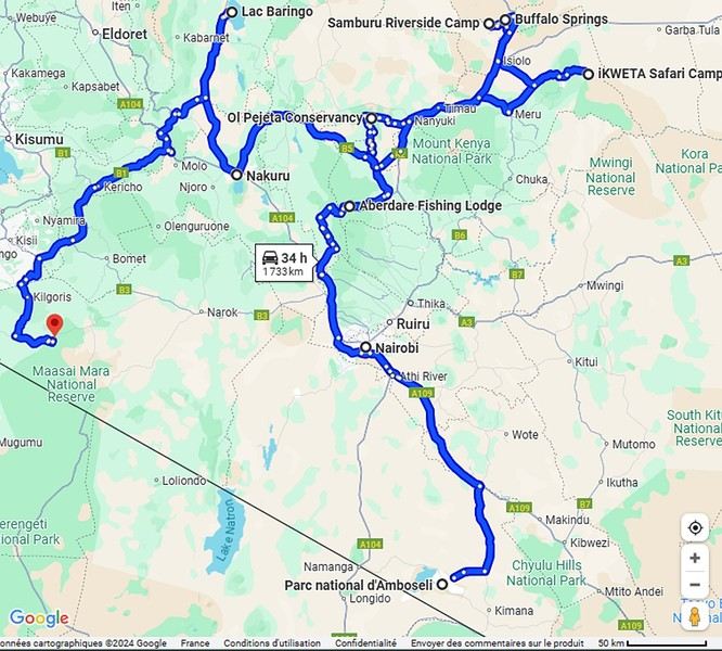
Ready to join us on safari to see some wild animals?
The two itineraries are almost identical (well, when you love something...) but we did make a few tweaks.
- The first part of the trip was with a local driver/guide, Félix, who was recommended by Sylvie56. Sylvie and her husband Ben are Kenya enthusiasts—they’ve been there countless times, always with Félix... and for good reason! He’s fantastic!
- The second part was with Melting Pot Safari, an agency that adapted to our photography needs. Tony Crocetta, the co-founder (along with his Kenyan friend Simon Chebon), is a wildlife photographer himself.
Here are the itineraries for both trips, including accommodations:
In 2021: Day 0: Paris / Nairobi - 67 Airport Hotel Day 1: Nairobi / Amboseli - Simba Cottage Day 2: Amboseli - Simba Cottage Day 3: Amboseli / Aberdares - Fishing Lodge Day 4: Aberdares - Fishing Lodge Day 5: Aberdares - Fishing Lodge Day 6: Aberdares / Samburu - Riverside Camp Day 7: Samburu - Riverside Camp Day 8: Samburu - Riverside Camp Day 9: Samburu / Nakuru - Merica Hotel Day 10: Nakuru / Baringo - Tumbili Cliff Lodge Day 11: Baringo - Tumbili Cliff Lodge Day 12: Baringo - Tumbili Cliff Lodge Day 13: Baringo / Maasai Mara – Meltingpot Bush Camp Day 14 to 18: Maasai Mara – Meltingpot Bush Camp Day 19: Maasai Mara / Nairobi – Roussel Guest House Day 20: Nairobi / Paris
In 2023: Day 0: Lyon / Paris / Nairobi - 67 Airport Hotel Day 1: Nairobi / Meru - Ikweta Camp Day 2: Meru - Ikweta Camp Day 3: Meru - Ikweta Camp Day 4: Meru / Samburu - Riverside Camp Day 5: Samburu – Riverside Camp Day 6: Samburu / Buffalo Springs – Samburu Simba Day 7: Buffalo Springs / Ol Pejeta – Sweetwater Camp Day 8: Ol Pejeta / Amboseli - Simba Cottage Day 9: Amboseli - Simba Cottage Day 10: Amboseli - Simba Cottage Day 11: Amboseli / Nakuru – Lake Nakuru Lodge Day 12: Nakuru / Baringo - Tumbili Cliff Lodge Day 13: Baringo - Tumbili Cliff Lodge Day 14: Baringo - Tumbili Cliff Lodge Day 15: Baringo / Maasai Mara – Meltingpot Bush Camp Day 16 to 20: Maasai Mara – Meltingpot Bush Camp Day 21: Maasai Mara / Nairobi / Paris
Here’s an itinerary—it’s not exactly what we did, but a combination of both.
Ready to join us on safari to see some wild animals?
L'Indre-et-Loire à vélo avec bivouac en 2019 English translation pending
Nous revoici. Cette fois, c’est le département de l'Indre-et-Loire qui est à l’honneur. La même joyeuse équipe, le même état d’esprit. J’ai de nouvelles sacoches sur ma monture. Tout un ensemble orange "Globtrotter". Du coup, j’ai même pu laissé ma sacoche de selle. Mathieu me l’avait offerte il y a quelques années, mais avec mes précédentes sacoches, ça ne passait pas.
Comme vous pouvez le remarquer, si vous me suivez, nous avons sauté une année. Rien de grave, mais un empêchement nous y a contraints. C’est donc avec fébrilité que nous attendions ce moment de retrouvailles joyeuses.
Je suis arrivé à Paris samedi, dimanche nous avons préparé les vélos et les bagages et nous sommes partis lundi, après avoir fait quelques courses. Comme c’est ma première utilisation de mes sacoches, nous avons dû opérer les réglages des attaches, puis répartir le chargement entre elles. Nouvelle organisation.
Voici notre voyage en quelques chiffres.
Durée : 5 jours
Distance : ~ 470 km
Dénivelé : ~ 2800 m D+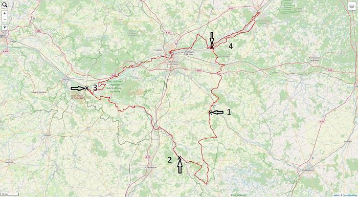
Comme vous pouvez le remarquer, si vous me suivez, nous avons sauté une année. Rien de grave, mais un empêchement nous y a contraints. C’est donc avec fébrilité que nous attendions ce moment de retrouvailles joyeuses.
Je suis arrivé à Paris samedi, dimanche nous avons préparé les vélos et les bagages et nous sommes partis lundi, après avoir fait quelques courses. Comme c’est ma première utilisation de mes sacoches, nous avons dû opérer les réglages des attaches, puis répartir le chargement entre elles. Nouvelle organisation.
Voici notre voyage en quelques chiffres.
Durée : 5 jours
Distance : ~ 470 km
Dénivelé : ~ 2800 m D+
Un voyage... une étape inattendue! English translation pending
Bonjour à tous,
Le voyage - pour ne pas trop sortir de VF - c'est bien sur la vie. L'étape inattendue, elle nous vient de l'orient et sans doute d' un Pangolin.
J'ai 72 ans, un peu d’hypertension, pas grand chose d'autre, alors, au delà du 11 mai je suis bon !
Bon pour continuer à voir mes petits enfants sur Skype, bon pour voir mes enfants masqués qui viennent nous voir de temps à autres à distance respectable, bon pour oublier les embrassades, les câlins, les gestes de tendresse, bon pour....un temps indéterminé à subir ces frustrations que portant je respecterait. Peu en parlent dans les médias, mais c'est une contrainte autre que de simplement porter un masque !!
Merci de m'avoir lu et belle journée confinée
Le voyage - pour ne pas trop sortir de VF - c'est bien sur la vie. L'étape inattendue, elle nous vient de l'orient et sans doute d' un Pangolin.
J'ai 72 ans, un peu d’hypertension, pas grand chose d'autre, alors, au delà du 11 mai je suis bon !
Bon pour continuer à voir mes petits enfants sur Skype, bon pour voir mes enfants masqués qui viennent nous voir de temps à autres à distance respectable, bon pour oublier les embrassades, les câlins, les gestes de tendresse, bon pour....un temps indéterminé à subir ces frustrations que portant je respecterait. Peu en parlent dans les médias, mais c'est une contrainte autre que de simplement porter un masque !!
Merci de m'avoir lu et belle journée confinée
Circuit au Népal en avril pour 18 jours sur place sans trek English translation pending
Bonjour,
je devais partir en Chine avec mon fils de 22 ans du 1er au 20 avril mais, évidemment, nous nous préparons à annuler (d'autant que c'était dans les régions juste au nord du Hubei). Du coup, nous cherchons à pivoter parce qu'on les attend depuis un moment ces vacances... Nous sommes bien tentés par le Népal. J'ai commencé à regarder les vols, ça semble jouable avec Air India à peu près sur les mêmes dates.
Un gros mois pour tout réorganiser, pas peur...
Sur les formalités, le routard signale qu'on peut télécharger un truc en ligne mais qu'il faut régler à l'arrivée en dollars, le MAE signale qu'on peut aussi passer au consulat. C'est pas très clair de comprendre quelle est la solution la plus facile... Votre avis ?
Concernant le contenu, on est plutôt tournés ambiance, culture, etc. On était au Yunnan l'an dernier et les hautes terres autour de Shangri-Là nous ont bien plût. Nous allons au Sichuan cet été (si...) et nous allons aller aussi sur les contreforts de l'Himalaya. On a fait des marches (20 km) à 3.000m et c'était agréable mais on ne se sent pas à faire une marche de plusieurs jours.
Sur le circuit, si on suppose qu'on arrive le 2 et qu'on repart le 19, ça doit pouvoir faire deux sous-circuits : Un circuit Katmandou-Bandipur Pokhara - Lumbini - Chitwan un circuit dans la vallée de Katmandou (qui semble déjà très riche)
Et, visiblement, coup de bol, on aura l'occasion de vivre le nouvel an ?
Qu'en pensez-vous ?
Un gros mois pour tout réorganiser, pas peur...
Sur les formalités, le routard signale qu'on peut télécharger un truc en ligne mais qu'il faut régler à l'arrivée en dollars, le MAE signale qu'on peut aussi passer au consulat. C'est pas très clair de comprendre quelle est la solution la plus facile... Votre avis ?
Concernant le contenu, on est plutôt tournés ambiance, culture, etc. On était au Yunnan l'an dernier et les hautes terres autour de Shangri-Là nous ont bien plût. Nous allons au Sichuan cet été (si...) et nous allons aller aussi sur les contreforts de l'Himalaya. On a fait des marches (20 km) à 3.000m et c'était agréable mais on ne se sent pas à faire une marche de plusieurs jours.
Sur le circuit, si on suppose qu'on arrive le 2 et qu'on repart le 19, ça doit pouvoir faire deux sous-circuits : Un circuit Katmandou-Bandipur Pokhara - Lumbini - Chitwan un circuit dans la vallée de Katmandou (qui semble déjà très riche)
Et, visiblement, coup de bol, on aura l'occasion de vivre le nouvel an ?
Qu'en pensez-vous ?
USA 2018: Ciels de foudre et terres de feu English translation pending
Arrivée très tardive à Denver après un voyage long et fatiguant.
Récupération du SUV standard chez Alamo. Peu, voire pas de choix. Des hyundai Santa Fe et deux Kia. J’opte pour une Santa Fe Sport. Celle-ci est au moins AWD (automatic wheel drive) contrairement aux Kia.
Je n’ai pas réservé d’hôtel à Denver, préférant quitter de suite l’agglomération de la capitale du Colorado pour prendre de l’avance sur ma (très) longue journée de route du lendemain.
Malgré la fatigue et la nuit, je parviens à quitter la ville assez facilement et sans me tromper. Je file droit au nord sur l’interstate 25 North pendant deux bonnes heures avant de me trouver un motel quelque part entre Fort Collins et Cheyenne. Je m’endors comme une souche.
24 août – de Fort Collins à Badlands national park.
Réveil très matinal, décalage horaire oblige. Le lever du jour est encore loin. Le temps d’avaler un café dans salle d’accueil et je reprends la route. J’adore ces voyages en solo dans l’ouest que je m’offre en général tous les deux ans. Ils m’apportent un sentiment de liberté assez grisant. On monte dans sa voiture de location et on part à l’aventure ! En préparant ce voyage, j’ai coché une série de sites que je n’avais pas encore arpentés et quelques autres que j’avais envie de revoir. Tout cela va m’amener à parcourir un nombre impressionnant de kilomètres à travers un cercle qui inclue le Colorado, le South Dakota, le Wyoming, l’Utah, l’Arizona, et le Nouveau Mexique. Je préfère ne pas compter.
Le programme de ce premier jour doit me faire gagner le South Dakota et le Badlands national park, Ca fait de la route pour une visite que je soupçonne un peu trop courte puisque j’ai prévu d’en repartir le lendemain matin. J’aurais dû prévoir davantage. Il fait beau et la route est sympa. Les grandes plaines du Wyoming s’étirent sous le soleil matinal. Je fais une pause dans la petite ville de Custer, du nom du général de triste mémoire.
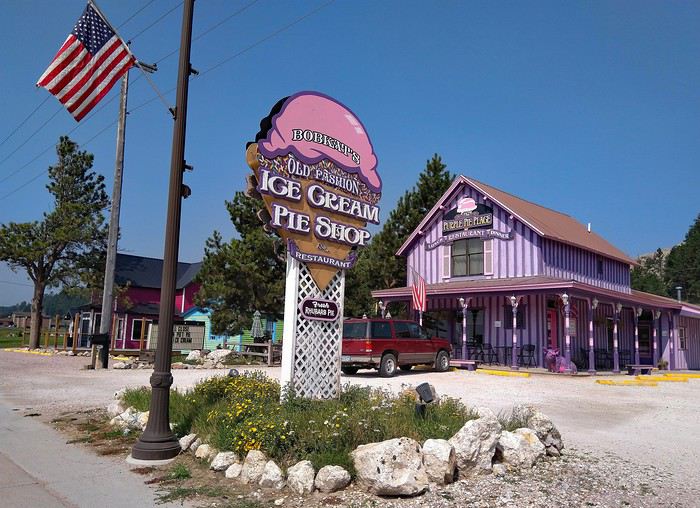 Puis c’est la traversée de Rapid city, agrémentée d’un rapide déjeuner. J’atteints l’entrée nord du Badlands national park en début d’après-midi. Beaucoup plus tôt qu’attendu. Tant mieux, je vais pouvoir en profiter. Le parc est tout en longueur et la route (Badlands loop road) qui le parcours du nord au sud est longue de 45 kilomètres. Le camping du parc que j’ai réservé est situé tout au bout de cette route, près de la sortie sud.
La première impression est excellente. Les falaises déchiquetées sont spectaculaires et plus haute que ce à quoi je m’attendais.
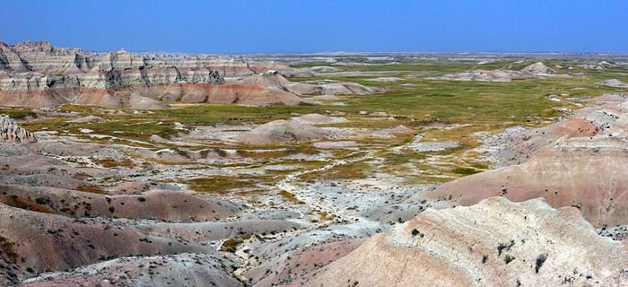
La route descend ensuite dans la vallée des « Yellow mounds ». C’est ma partie préférée du parc. On slalome entre des collines colorées surréalistes. Du jeune, du rouge, de l’orange au milieu d’une herbe vert pale. C’est sauvage, inattendu. J’adore…
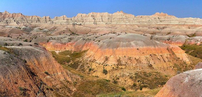
Pas mal de pause à mesure que je progresse vers le sud. Certains points de vue improvisés sont incroyables. Dommage qu’une bande de brume grise bouche l’horizon et gâche un peu la perspective.
J’arrive au camping. Je mets un bon moment avant de trouver mon emplacement, celui-ci ayant été changé suite à quelques inondations dans la plaine.
Ballades dans la partie sud. Windows trail, tout petit bout du Notch trail et un peu d’improvisation. L’après-midi se déroule tranquillement sous un ciel d’azur.
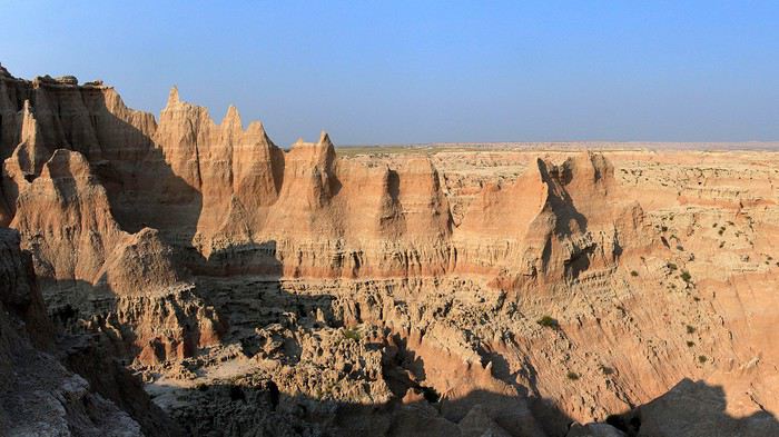
Je m’interroge sur la partie à privilégier pour le coucher de soleil et je songe naturellement aux Yellow mounds.
Retour au nord, donc, après quelques arrêts pour de courtes ballades improvisées au milieu des badlands. Je suis complètement emballé par ce cadre atypique dont la lumière de fin de journée accentue la magie.
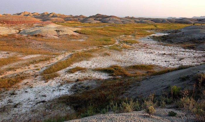
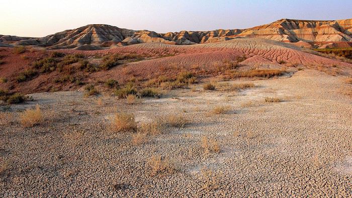
Je termine la journée sur une petite colline à l’entrée des Yellow mounds. Les couleurs qu’on peut y capter sont fabuleuses. Un coucher de soleil de compétition et qui ne ressemble à aucun autre.
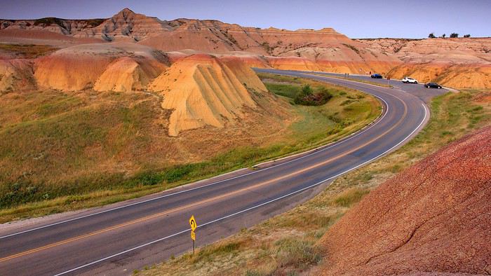
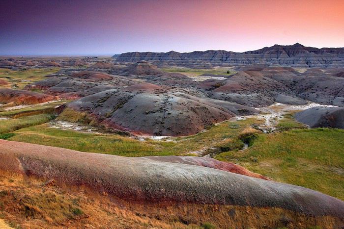
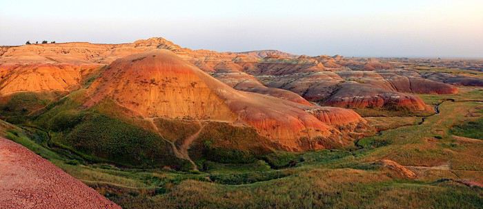
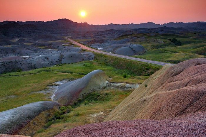
Retour au camping à la nuit tombée. La particularité des campings des national parks, c’est que les rangers y organisent chaque soir des activités en rapport avec la nature. Ce soir, c’est « observation du ciel nocturne ». Deux télescopes ont été installés près du traditionnel amphithéâtre à ciel ouvert. L’un est braqué sur Jupiter, l’autre sur la Lune que je n’avais jamais vue d’aussi prêt. Une belle manière de terminer cette journée riche en découvertes. Je ne regrette décidément pas de m’être imposé ce long détour par le South Dakota.
25 aout 2018 : De Badlands national park à Devils Tower national monument.
Encore un réveil très matinal, volontaire celui-là. Emballé par le spectacle offert par les Yellow mounds au coucher du soleil, j’ai décidé d’aller y admirer le lever du jour.
Je commence par m’installer au point de vue « Conata Basin overlook » qui offre un point de vue général sur la zone. Toujours cette zone de brume au-dessus de l’horizon qui retarde l’arrivée du soleil. Je l’attribue, peut-être à tort, aux nombreux incendies qui ravagent l’ouest depuis des semaines. Je me dis que je vais peut-être devoir subir ce désagrément esthétique pendant le reste du voyage.
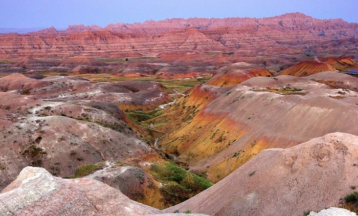
Le soleil finit par dépasser la brume et c’est assez grandiose. Sans doute manque-t-il un ciel dramatique au décor. Mais bon… Apprenons à nous contenter de l’existant.
Je poursuis vers le bas de la vallée en opérant un stop rapide à mi-chemin de la descente. Quelques dizaines de mètres de marche permettent de bénéficier d'une vue étendue sur les mounds.
Ma prochaine étape se situe à Yellow Mounds overlook, qui se trouve au sommet de la petite colline colorée de la veille. Presque aussi bien que la veille.
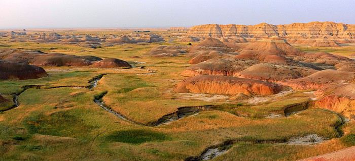
24 août – de Fort Collins à Badlands national park.
Réveil très matinal, décalage horaire oblige. Le lever du jour est encore loin. Le temps d’avaler un café dans salle d’accueil et je reprends la route. J’adore ces voyages en solo dans l’ouest que je m’offre en général tous les deux ans. Ils m’apportent un sentiment de liberté assez grisant. On monte dans sa voiture de location et on part à l’aventure ! En préparant ce voyage, j’ai coché une série de sites que je n’avais pas encore arpentés et quelques autres que j’avais envie de revoir. Tout cela va m’amener à parcourir un nombre impressionnant de kilomètres à travers un cercle qui inclue le Colorado, le South Dakota, le Wyoming, l’Utah, l’Arizona, et le Nouveau Mexique. Je préfère ne pas compter.
Le programme de ce premier jour doit me faire gagner le South Dakota et le Badlands national park, Ca fait de la route pour une visite que je soupçonne un peu trop courte puisque j’ai prévu d’en repartir le lendemain matin. J’aurais dû prévoir davantage. Il fait beau et la route est sympa. Les grandes plaines du Wyoming s’étirent sous le soleil matinal. Je fais une pause dans la petite ville de Custer, du nom du général de triste mémoire.
Puis c’est la traversée de Rapid city, agrémentée d’un rapide déjeuner. J’atteints l’entrée nord du Badlands national park en début d’après-midi. Beaucoup plus tôt qu’attendu. Tant mieux, je vais pouvoir en profiter. Le parc est tout en longueur et la route (Badlands loop road) qui le parcours du nord au sud est longue de 45 kilomètres. Le camping du parc que j’ai réservé est situé tout au bout de cette route, près de la sortie sud.La première impression est excellente. Les falaises déchiquetées sont spectaculaires et plus haute que ce à quoi je m’attendais.
La route descend ensuite dans la vallée des « Yellow mounds ». C’est ma partie préférée du parc. On slalome entre des collines colorées surréalistes. Du jeune, du rouge, de l’orange au milieu d’une herbe vert pale. C’est sauvage, inattendu. J’adore…
Pas mal de pause à mesure que je progresse vers le sud. Certains points de vue improvisés sont incroyables. Dommage qu’une bande de brume grise bouche l’horizon et gâche un peu la perspective.
J’arrive au camping. Je mets un bon moment avant de trouver mon emplacement, celui-ci ayant été changé suite à quelques inondations dans la plaine.
Ballades dans la partie sud. Windows trail, tout petit bout du Notch trail et un peu d’improvisation. L’après-midi se déroule tranquillement sous un ciel d’azur.
Je m’interroge sur la partie à privilégier pour le coucher de soleil et je songe naturellement aux Yellow mounds.
Retour au nord, donc, après quelques arrêts pour de courtes ballades improvisées au milieu des badlands. Je suis complètement emballé par ce cadre atypique dont la lumière de fin de journée accentue la magie.
Je termine la journée sur une petite colline à l’entrée des Yellow mounds. Les couleurs qu’on peut y capter sont fabuleuses. Un coucher de soleil de compétition et qui ne ressemble à aucun autre.
Retour au camping à la nuit tombée. La particularité des campings des national parks, c’est que les rangers y organisent chaque soir des activités en rapport avec la nature. Ce soir, c’est « observation du ciel nocturne ». Deux télescopes ont été installés près du traditionnel amphithéâtre à ciel ouvert. L’un est braqué sur Jupiter, l’autre sur la Lune que je n’avais jamais vue d’aussi prêt. Une belle manière de terminer cette journée riche en découvertes. Je ne regrette décidément pas de m’être imposé ce long détour par le South Dakota.
25 aout 2018 : De Badlands national park à Devils Tower national monument.
Encore un réveil très matinal, volontaire celui-là. Emballé par le spectacle offert par les Yellow mounds au coucher du soleil, j’ai décidé d’aller y admirer le lever du jour.
Je commence par m’installer au point de vue « Conata Basin overlook » qui offre un point de vue général sur la zone. Toujours cette zone de brume au-dessus de l’horizon qui retarde l’arrivée du soleil. Je l’attribue, peut-être à tort, aux nombreux incendies qui ravagent l’ouest depuis des semaines. Je me dis que je vais peut-être devoir subir ce désagrément esthétique pendant le reste du voyage.
Le soleil finit par dépasser la brume et c’est assez grandiose. Sans doute manque-t-il un ciel dramatique au décor. Mais bon… Apprenons à nous contenter de l’existant.
Je poursuis vers le bas de la vallée en opérant un stop rapide à mi-chemin de la descente. Quelques dizaines de mètres de marche permettent de bénéficier d'une vue étendue sur les mounds.
Ma prochaine étape se situe à Yellow Mounds overlook, qui se trouve au sommet de la petite colline colorée de la veille. Presque aussi bien que la veille.