Results for "vêtement+ou+chaussures+|+122+>+63"
22318 results found.
Petites aventures en famille dans l'Ouest américain en juillet 2006 (suite) English translation pending
Pour accéder au début de nos "zaventures" : http://voyageforum.com/v.f?post=678242;#678242
J18, dimanche 16/07 : Gooseneck Park-Valley of the Gods-Canyonland The Needles Passage à Mexican Hat, la bien nommée (vous verrez pourquoi en passant), puis détour (à ne pas manquer) vers Gooseneck State Park au NO de Mexican Hat, route 316 (Horseshoe Bend après 4 whiskeys : il y a une double boucle, là ça ne rentre vraiment plus dans le grand-angle). Nous passons aussi par Valley of the Gods (piste reliant la 261 à la 163) : mini-Monument Valley sans un chat avec une piste en parfait état (1 ou 2 gués pouvant peut-être parfois poser problème) : on a presque préféré ce coin à Monument Valley ! On en a d’ailleurs profité pour y faire une petite balade le matin avant la grosse chaleur : il n’y a pas de sentiers mais le climat désertique rend la végétation très clairsemée sauf dans les qq oasis en fond de vallée ou de canyon. Nous poursuivons vers le nord, passons voir les pétroglyphes de Newspaper Rock (amusant) et arrivons à The Needles dans Canyonlands. Nous posons les tentes au Squaw Flat Campground, très beau site, un peu chaud, heureusement il y a un robinet ! Belle petite balade vers Pothole Trail (45 mn) avec belle vue sur les Needles puis Roadside Ruin (20 mn, quelconque) puis Cave Spring (45 mn, un ancien camp de cowboys, amusant) Au camping, nous retrouvons des Québécois rencontrés un peu plus tôt dans la journée : les enfants après une bonne bataille d’eau, font des échanges culturels franco-québécois : « Tu connais le kg de merde ? Et toi, le trou-du-cul ? », pendant que les parents se font une soirée télé en regardant les photos des uns et des autres sur le portable !
J19, lundi 17/07 : Canyonland the Needles

Départ à 6h30 pour Chessler Park Trail, 18 km : il fait déjà 25°C. Le ciel est nuageux en ce début de journée : dommage pour les photos, tant mieux pour la température.

Arrivés à mi-parcours nous nous faufilons dans le très amusant Joint Trail (on se sent comme des fourmis se faufilant entre de gros pavés disjoints) et en sortant quelques centaines de mètres plus loin, le soleil est là. La température monte en flèche.

Heureusement on a pris beaucoup d’eau, des aliments salés, et les endroits ombragés ne manquent pas. Par courtes étapes de 10-15 mn entrecoupées de pauses pour laisser les organismes retrouver une température normale, nous arrivons épuisés (enfin, surtout moi !!) au terme de cette magnifique balade. Il fait 40°C en retrouvant la voiture vers 13h. L’orage ne tarde pas à arriver et nous pique-niquons sous la pluie (quel régal !!)
On a notre compte pour la journée et on file vers Moab prendre possession de notre « Cabin el Grande » au Archview Resort, idéalement situé juste en face de la piste menant à Canyonland Island in the Sky. De cet endroit, on distingue les Arches de Window Section de Arches Nat Park. Bref, tout serait parfait sans cette clim de m... qui développe au bas-mot 50 dB. Faut dire qu’elle est indispensable : au minimum 40°C tous les jours, couramment plus de 45°C. On est bien content de ne pas camper, d’ailleurs notre vieille tente est HS, on va l’enterrer ici…)
J20, mardi 18/07 : Dead Horse Point-island in the Sky-OnionCreek-FisherTower

Petit détour par Dead Horse Point peu après le lever du soleil (superbe en effet). On voit au fond le Colorado et plus près en contrebas la piste de Schafer Trail que nous emprunterons plus tard.

puis nous filons vers Island in the Sky où nous marchons jusqu’à Mesa Arch (30mn, chouette)

puis montons sur Aztec Butte (1h30, très chouette, très amusante, plusieurs greniers indiens au sommet d’une petite butte).
Nous descendons ensuite la piste de Shafer Trail (4X4 nécessaire), très impressionnante puisqu’elle plonge au fond du canyon. Elle permet plus loin d’avoir de belles vues sur le Colorado et rejoint ensuite la Potash Road, où l’on peut voir depuis sa voiture(!) des pétroglyphes et des traces de dinosaures et où il fait une chaleur accablante (48°C) si bien que nous abandonnons l’idée de marcher jusqu’à Corona Arch. Il faut environ 3h pour faire ce parcours.
Petite sieste à la cabin puis nous roulons sur la route 128 vers l’est jusqu’à la piste d’ Onion Creek (environ 40 mn de Moab) : piste pour 4X4 qui traverse une (minuscule ce jour-là) rivière une bonne vingtaine de fois dans un paysage de collines multicolores, et qui mène en haut à un vaste plateau encerclé de montagnes, écrasé de soleil (53°C ce jour-là). On redescend par la même piste et on fait une petite pause au bord de la rivière. De l’eau courante, quelques cailloux, qq bouts de bois, c’est le bonheur pour les enfants. Il faut remarquer que les « perenial river » sont très rares dans le coin, à part le Colorado bien sûr : nous avions pensé louer des canöés pour le descendre sur quelques miles mais la chaleur, la langueur de la rivière (du moins sur la portion autorisée en autonomie), les berges boueuses bordées de tamaris infranchissables le plus souvent, nous ont fait changer d’avis.
Nous roulons ensuite jusqu’aux Fisher Towers ( qq miles plus à l’est) : le ciel est plombé mais une éclaircie pourrait se produire quand le soleil passera sous les nuages.

Nous marchons donc jusqu’à The Titan (1 mile) et en effet la roche s’éclaire peu à peu sous les rayons du soleil couchant : magique. Le temps nous manque pour faire toute la rando (4h en tout) : dommage car selon Philippe, c’est encore plus beau plus loin (comme souvent !).
J21, mercredi 19/07 : Arches

Le réveil n’a pas sonné. Il est 7 h quand nous attaquons Delicate Arch (3 miles A/R) et il y a déjà plusieurs voitures sur le parking ! On croise même des courageux qui y sont montés pour le lever du soleil (pas de chance, c’est nuageux).
On arrive quand même à faire quelques photos sans personne… La foule arrive, alors on décide de prendre la piste qui mène au NE vers Klondike Bluff et Tower Arch : en très bon état, faisable ce jour-là sans 4X4, personne !

Très belle et chaude balade jusqu’à Tower Arch (2h30 A/R environ),

un coin magnifique sans un touriste à Arches, ça vaut le coup !! L’après-midi : piscine pour les enfants pendant que nous allons faire qq achats-souvenirs à Moab. Il n’y a pas grand-monde, ça doit être la chaleur…
J22, jeudi 20/07 : Arches A 5h30 nous attaquons Devil’s Garden, situé au nord de Arches. La chaleur des ces jours-ci nous a donné du courage pour nous lever de bonne heure.

On est tout seuls (pas facile à Arches), nous découvrons Landscape Arch (pas de soleil, dommage)

puis Double O Arch.

Le parcours est très amusant.

Nous décidons de ne pas aller vers Dark Angel pour échapper au groupe d’une dizaine de personnes que l’on voit arriver au loin et continuons par le Primitive Trail, bien balisé et sans difficulté extraordinaire malgré les nombreux panneaux d’avertissement rencontrés sur la première partie du parcours. Il suffit d’avoir des chaussures qui accrochent et un peu d'équilibre.

Nous enchaînons ensuite avec la Windows Section et rentrons faire une petite sieste bien méritée. Comme tous les jours, l’orage gronde dès le début de l’après-midi.

Nous décidons d’aller voir de plus près ces montagnes de Manti La Sal qui cristallisent tous les orages du coin. A quelques dizaines de km de Moab on découvre en parcourant la très belle La Sal Loop (en voiture) un paysage verdoyant avec des vaches bien grasses, des prairies en fleurs, des bouleaux énormes, des sapins, et même encore quelques plaques de neige. On monte jusqu’à plus de 3000m, il fait 12°C et il pleut, le bonheur !! On redescend par Castle Valley sur la route 128 : quelques très belles maisons modernes tout en bois avec vue imprenable sur le Castle, monolithe monumentvallesque, des champs, du vert, une vallée bien tranquille loin de la chaleur et de la poussière de Moab (nous avons subi une tempête de sable bien à l’abri dans notre cabin, impressionnant, elles sont fréquentes dans le coin, il y a eu quelques dégâts dans le camping).
J23, vendredi 21/07 : traversée des Rocheuses jusqu’à Denver
Nous reprenons l’avion ce soir vers 20h00. 600 km nous en séparent. Nous les avalerons sans problème, ce n’est que de l’autoroute, très belle dans ses 2 derniers tiers puisqu’elle longe le Colorado puis escalade les Rocheuses jusqu’à plus de 3000 m pour plonger d’un coup sur Denver.
J18, dimanche 16/07 : Gooseneck Park-Valley of the Gods-Canyonland The Needles Passage à Mexican Hat, la bien nommée (vous verrez pourquoi en passant), puis détour (à ne pas manquer) vers Gooseneck State Park au NO de Mexican Hat, route 316 (Horseshoe Bend après 4 whiskeys : il y a une double boucle, là ça ne rentre vraiment plus dans le grand-angle). Nous passons aussi par Valley of the Gods (piste reliant la 261 à la 163) : mini-Monument Valley sans un chat avec une piste en parfait état (1 ou 2 gués pouvant peut-être parfois poser problème) : on a presque préféré ce coin à Monument Valley ! On en a d’ailleurs profité pour y faire une petite balade le matin avant la grosse chaleur : il n’y a pas de sentiers mais le climat désertique rend la végétation très clairsemée sauf dans les qq oasis en fond de vallée ou de canyon. Nous poursuivons vers le nord, passons voir les pétroglyphes de Newspaper Rock (amusant) et arrivons à The Needles dans Canyonlands. Nous posons les tentes au Squaw Flat Campground, très beau site, un peu chaud, heureusement il y a un robinet ! Belle petite balade vers Pothole Trail (45 mn) avec belle vue sur les Needles puis Roadside Ruin (20 mn, quelconque) puis Cave Spring (45 mn, un ancien camp de cowboys, amusant) Au camping, nous retrouvons des Québécois rencontrés un peu plus tôt dans la journée : les enfants après une bonne bataille d’eau, font des échanges culturels franco-québécois : « Tu connais le kg de merde ? Et toi, le trou-du-cul ? », pendant que les parents se font une soirée télé en regardant les photos des uns et des autres sur le portable !
J19, lundi 17/07 : Canyonland the Needles
Départ à 6h30 pour Chessler Park Trail, 18 km : il fait déjà 25°C. Le ciel est nuageux en ce début de journée : dommage pour les photos, tant mieux pour la température.
Arrivés à mi-parcours nous nous faufilons dans le très amusant Joint Trail (on se sent comme des fourmis se faufilant entre de gros pavés disjoints) et en sortant quelques centaines de mètres plus loin, le soleil est là. La température monte en flèche.
Heureusement on a pris beaucoup d’eau, des aliments salés, et les endroits ombragés ne manquent pas. Par courtes étapes de 10-15 mn entrecoupées de pauses pour laisser les organismes retrouver une température normale, nous arrivons épuisés (enfin, surtout moi !!) au terme de cette magnifique balade. Il fait 40°C en retrouvant la voiture vers 13h. L’orage ne tarde pas à arriver et nous pique-niquons sous la pluie (quel régal !!)
On a notre compte pour la journée et on file vers Moab prendre possession de notre « Cabin el Grande » au Archview Resort, idéalement situé juste en face de la piste menant à Canyonland Island in the Sky. De cet endroit, on distingue les Arches de Window Section de Arches Nat Park. Bref, tout serait parfait sans cette clim de m... qui développe au bas-mot 50 dB. Faut dire qu’elle est indispensable : au minimum 40°C tous les jours, couramment plus de 45°C. On est bien content de ne pas camper, d’ailleurs notre vieille tente est HS, on va l’enterrer ici…)
J20, mardi 18/07 : Dead Horse Point-island in the Sky-OnionCreek-FisherTower
Petit détour par Dead Horse Point peu après le lever du soleil (superbe en effet). On voit au fond le Colorado et plus près en contrebas la piste de Schafer Trail que nous emprunterons plus tard.
puis nous filons vers Island in the Sky où nous marchons jusqu’à Mesa Arch (30mn, chouette)
puis montons sur Aztec Butte (1h30, très chouette, très amusante, plusieurs greniers indiens au sommet d’une petite butte).
Nous descendons ensuite la piste de Shafer Trail (4X4 nécessaire), très impressionnante puisqu’elle plonge au fond du canyon. Elle permet plus loin d’avoir de belles vues sur le Colorado et rejoint ensuite la Potash Road, où l’on peut voir depuis sa voiture(!) des pétroglyphes et des traces de dinosaures et où il fait une chaleur accablante (48°C) si bien que nous abandonnons l’idée de marcher jusqu’à Corona Arch. Il faut environ 3h pour faire ce parcours.
Petite sieste à la cabin puis nous roulons sur la route 128 vers l’est jusqu’à la piste d’ Onion Creek (environ 40 mn de Moab) : piste pour 4X4 qui traverse une (minuscule ce jour-là) rivière une bonne vingtaine de fois dans un paysage de collines multicolores, et qui mène en haut à un vaste plateau encerclé de montagnes, écrasé de soleil (53°C ce jour-là). On redescend par la même piste et on fait une petite pause au bord de la rivière. De l’eau courante, quelques cailloux, qq bouts de bois, c’est le bonheur pour les enfants. Il faut remarquer que les « perenial river » sont très rares dans le coin, à part le Colorado bien sûr : nous avions pensé louer des canöés pour le descendre sur quelques miles mais la chaleur, la langueur de la rivière (du moins sur la portion autorisée en autonomie), les berges boueuses bordées de tamaris infranchissables le plus souvent, nous ont fait changer d’avis.
Nous roulons ensuite jusqu’aux Fisher Towers ( qq miles plus à l’est) : le ciel est plombé mais une éclaircie pourrait se produire quand le soleil passera sous les nuages.
Nous marchons donc jusqu’à The Titan (1 mile) et en effet la roche s’éclaire peu à peu sous les rayons du soleil couchant : magique. Le temps nous manque pour faire toute la rando (4h en tout) : dommage car selon Philippe, c’est encore plus beau plus loin (comme souvent !).
J21, mercredi 19/07 : Arches
Le réveil n’a pas sonné. Il est 7 h quand nous attaquons Delicate Arch (3 miles A/R) et il y a déjà plusieurs voitures sur le parking ! On croise même des courageux qui y sont montés pour le lever du soleil (pas de chance, c’est nuageux).
On arrive quand même à faire quelques photos sans personne… La foule arrive, alors on décide de prendre la piste qui mène au NE vers Klondike Bluff et Tower Arch : en très bon état, faisable ce jour-là sans 4X4, personne !
Très belle et chaude balade jusqu’à Tower Arch (2h30 A/R environ),
un coin magnifique sans un touriste à Arches, ça vaut le coup !! L’après-midi : piscine pour les enfants pendant que nous allons faire qq achats-souvenirs à Moab. Il n’y a pas grand-monde, ça doit être la chaleur…
J22, jeudi 20/07 : Arches A 5h30 nous attaquons Devil’s Garden, situé au nord de Arches. La chaleur des ces jours-ci nous a donné du courage pour nous lever de bonne heure.
On est tout seuls (pas facile à Arches), nous découvrons Landscape Arch (pas de soleil, dommage)
puis Double O Arch.
Le parcours est très amusant.
Nous décidons de ne pas aller vers Dark Angel pour échapper au groupe d’une dizaine de personnes que l’on voit arriver au loin et continuons par le Primitive Trail, bien balisé et sans difficulté extraordinaire malgré les nombreux panneaux d’avertissement rencontrés sur la première partie du parcours. Il suffit d’avoir des chaussures qui accrochent et un peu d'équilibre.
Nous enchaînons ensuite avec la Windows Section et rentrons faire une petite sieste bien méritée. Comme tous les jours, l’orage gronde dès le début de l’après-midi.
Nous décidons d’aller voir de plus près ces montagnes de Manti La Sal qui cristallisent tous les orages du coin. A quelques dizaines de km de Moab on découvre en parcourant la très belle La Sal Loop (en voiture) un paysage verdoyant avec des vaches bien grasses, des prairies en fleurs, des bouleaux énormes, des sapins, et même encore quelques plaques de neige. On monte jusqu’à plus de 3000m, il fait 12°C et il pleut, le bonheur !! On redescend par Castle Valley sur la route 128 : quelques très belles maisons modernes tout en bois avec vue imprenable sur le Castle, monolithe monumentvallesque, des champs, du vert, une vallée bien tranquille loin de la chaleur et de la poussière de Moab (nous avons subi une tempête de sable bien à l’abri dans notre cabin, impressionnant, elles sont fréquentes dans le coin, il y a eu quelques dégâts dans le camping).
J23, vendredi 21/07 : traversée des Rocheuses jusqu’à Denver
Nous reprenons l’avion ce soir vers 20h00. 600 km nous en séparent. Nous les avalerons sans problème, ce n’est que de l’autoroute, très belle dans ses 2 derniers tiers puisqu’elle longe le Colorado puis escalade les Rocheuses jusqu’à plus de 3000 m pour plonger d’un coup sur Denver.
Que mettre dans la valise et tenues vestimentaires pour l'Inde? English translation pending
Bonjour,
j'ai beaucoup lu vos posts sur l'Inde ces derniers jours, plus particulièrement sur l'Inde su Nord. Ils m'ont apporté de précieux renseignements 🙂. J'ai tout de même 2 questions qui restent sans réponse (une partiellement).
Que dois-je mettre dans ma valise?
J'ai trouvé quelques conseils: Cadenas pour les sacs Répulsif moustiques Boules Quiès Manches longues et pantalons pour le soir Des stylos à offrir aux enfants (qui adorent ca??) Lampe de poche et moustiquaire mais ce n'est pas impératif.
J'ai aussi lu un "sac à viande" pour conserver l'eau au frais. C'est quoi? 😊 Est-ce un sac isotherme?
Pantacourt et débardeur (larges bretelles sans décolleté) ou pantalon et épaules couvertes?🤪
Certaines personnes disent que par marque de respect, il faut impérativement cacher ses chevilles et ses épaules (cf: une discussion sur le forum GDR). D'autres parlent de pantacourts et disent s'acheter les vêtements locaux au fur et à mesure de leur voyage. Je vis aux Maldives depuis 2 mois, on m'avait conseillé de porter des vêtements sous le genou et des tops recouvrant les épaules. Je me suis renseignée auprès des maldiviens, un bermuda et un débardeur à grosses bretelles sont suffisants.
Je ne connais pas l'Inde, je ne sais donc pas si je peux me vêtir comme ici, aux Maldives ou bien s'il me faut suivre un autre code vestimentaire...😕
Merci
Bettina🙂
j'ai beaucoup lu vos posts sur l'Inde ces derniers jours, plus particulièrement sur l'Inde su Nord. Ils m'ont apporté de précieux renseignements 🙂. J'ai tout de même 2 questions qui restent sans réponse (une partiellement).
Que dois-je mettre dans ma valise?
J'ai trouvé quelques conseils: Cadenas pour les sacs Répulsif moustiques Boules Quiès Manches longues et pantalons pour le soir Des stylos à offrir aux enfants (qui adorent ca??) Lampe de poche et moustiquaire mais ce n'est pas impératif.
J'ai aussi lu un "sac à viande" pour conserver l'eau au frais. C'est quoi? 😊 Est-ce un sac isotherme?
Pantacourt et débardeur (larges bretelles sans décolleté) ou pantalon et épaules couvertes?🤪
Certaines personnes disent que par marque de respect, il faut impérativement cacher ses chevilles et ses épaules (cf: une discussion sur le forum GDR). D'autres parlent de pantacourts et disent s'acheter les vêtements locaux au fur et à mesure de leur voyage. Je vis aux Maldives depuis 2 mois, on m'avait conseillé de porter des vêtements sous le genou et des tops recouvrant les épaules. Je me suis renseignée auprès des maldiviens, un bermuda et un débardeur à grosses bretelles sont suffisants.
Je ne connais pas l'Inde, je ne sais donc pas si je peux me vêtir comme ici, aux Maldives ou bien s'il me faut suivre un autre code vestimentaire...😕
Merci
Bettina🙂
Les tailleurs thailandais font-ils des robes de mariée style européen? English translation pending
Bonjour,
voilà, on part fin octobre en Thailande et j'entend bcp parler du rapport qualité/prix des tailleurs de costard thailandais.
Donc je me demandais si je pouvais en profiter pour faire faire ma robe de mariée sur mesure ? qq a-t-il déjà testé ? est-ce que vous pensez que cela est possible ? avez-vous de bonnes adresses ?
Merci de vos réponses.
dado 🙂
dado 🙂
Quel sac à dos choisir? English translation pending
bonjour, je vais partir dans 2 mois pour une grande randonnée et je compte acheter un grand sac à dos d'environ 65 litres! Je suis allé sur le site du vieux campeur et trois sac me parraissent idéals pour ce que je compte faire, les voilà :
NANDA 60+10 (MILLET) KHUMBU 65+10 (MILLET) FRONTIER 65+15 (LOWE ALPINE)
alors qu'en pensez vous?
j'attend vos reponses, merci!!!!
alors qu'en pensez vous?
j'attend vos reponses, merci!!!!
Choix de sac pour la randonnée pédestre English translation pending
Bonjour,
Je compte acheter tres prochainement un de ces deux sacs pour une randonnée pedestre d'environ cinq mois (du 22/23/24 février au 22/23/24 juillet)
Voilà les deux modèles avec lesquels j'hésite...lequel prendriez vous et pourquoi ????
Open Space sac de couchage Carpates II . Modèle trekking dont l'avant s'ouvre entièrement Col thermique spécial épousant la forme du cou pour une isolation maximale. Avec pochette intérieure. Extérieur: nylon résistant à la déchirure. Intérieur: coton. Garnissage: 400 g/m2, double épaisseur. L 230 x Lg 85/50 cm. Température min. d'utilisation -12 °C Poids 2, 5 kg Livré dans une housse de compression. Longue fermeture éclair à 2 curseurs dans le haut, avec fermeture velcro: facilement accessible. Le sac peut être ouvert pour être aéré. Extérieur: nylon ripstop 210 T, waterproof/waterresistant. Garnissage: 2 x 200 g/m2 de fibre creuse de polyester siliconée. Kit de réparation fourni. Couleur: bleu/ocre.
Wilsa sac de couchage Cevennes Intérieur en flanelle Confort optimal et conservation de la chaleur Modèle trekking avec col thermique et housse. Extérieur: nylon résistant à la déchirure. Garnissage: 300 g/m2, double épaisseur. L 230 x Lg 80/55 cm. Température min. d'utilisation -12 °C Poids 1, 8 kg Garnissage: 300 g/m2 de fibre creuse de polyester siliconée. Couleur dominante: bleu.
autre question: quel est l'avantage de la flanelle ?? (ou les inconvénients :) )
J'attends très vite vos réponses.
Julien
Je compte acheter tres prochainement un de ces deux sacs pour une randonnée pedestre d'environ cinq mois (du 22/23/24 février au 22/23/24 juillet)
Voilà les deux modèles avec lesquels j'hésite...lequel prendriez vous et pourquoi ????
Open Space sac de couchage Carpates II . Modèle trekking dont l'avant s'ouvre entièrement Col thermique spécial épousant la forme du cou pour une isolation maximale. Avec pochette intérieure. Extérieur: nylon résistant à la déchirure. Intérieur: coton. Garnissage: 400 g/m2, double épaisseur. L 230 x Lg 85/50 cm. Température min. d'utilisation -12 °C Poids 2, 5 kg Livré dans une housse de compression. Longue fermeture éclair à 2 curseurs dans le haut, avec fermeture velcro: facilement accessible. Le sac peut être ouvert pour être aéré. Extérieur: nylon ripstop 210 T, waterproof/waterresistant. Garnissage: 2 x 200 g/m2 de fibre creuse de polyester siliconée. Kit de réparation fourni. Couleur: bleu/ocre.
Wilsa sac de couchage Cevennes Intérieur en flanelle Confort optimal et conservation de la chaleur Modèle trekking avec col thermique et housse. Extérieur: nylon résistant à la déchirure. Garnissage: 300 g/m2, double épaisseur. L 230 x Lg 80/55 cm. Température min. d'utilisation -12 °C Poids 1, 8 kg Garnissage: 300 g/m2 de fibre creuse de polyester siliconée. Couleur dominante: bleu.
autre question: quel est l'avantage de la flanelle ?? (ou les inconvénients :) )
J'attends très vite vos réponses.
Julien
Hôtel Thalassa Village à Sousse English translation pending
Bonjour, à tous,
J'aimerai avoir plus d'infos sur l'hotel ci-dessus mentionné car j'aimerai partir au mois d'aout avec FRAM, sur certain sites il est 4* et d'autres 3* comme chez Fram.
D'avance merci pour vos réponses.
J'aimerai avoir plus d'infos sur l'hotel ci-dessus mentionné car j'aimerai partir au mois d'aout avec FRAM, sur certain sites il est 4* et d'autres 3* comme chez Fram.
D'avance merci pour vos réponses.
Do you adopt customs from your travels when you're back home?
I’ve kept the habit of blowing my nose in the sink and then washing my hands—a custom I picked up in India. Sometimes, non-travelers are shocked when they catch me in the act... 🤪
Also, when I run out of toilet paper, it doesn’t bother me—unless I’ve got company over... 🤪
Just got back from walking a friend’s dog (while they’re on vacation), wearing a djellaba and Tibetan boots... 😏😏😏 Oh, for sure, if I’d run into locals, I probably would’ve shocked them? 😏
Anyway, as long as I’m not spitting on the floor at a restaurant or squatting on the side of a highway with a water bottle in hand...
Do you bring back customs from your travels?
Also, when I run out of toilet paper, it doesn’t bother me—unless I’ve got company over... 🤪
Just got back from walking a friend’s dog (while they’re on vacation), wearing a djellaba and Tibetan boots... 😏😏😏 Oh, for sure, if I’d run into locals, I probably would’ve shocked them? 😏
Anyway, as long as I’m not spitting on the floor at a restaurant or squatting on the side of a highway with a water bottle in hand...
Do you bring back customs from your travels?
Passer de l'Inde, au Népal, par l'Himalaya pour se rendre au Tibet English translation pending
Moi et un ami avons l'intention de nous rendre en Inde, pour ensuite marcher jusq'au Népal, traverser l'Himalaya, pour ensuite arriver au Tibet. Et ce, durant la période estivale.
Mais c'est la première fois que nous faisons ce genre de voyage, et nous ne savons pas trop comment nous y prendre.
Nous aurions besoins d'information relative concernant le budget nécessaire (nous allons généralement coucher dans une tente et nous allons aussi nous déplacer le plus souvent à pied et nous allons partir environ durant un mois, un mois et demi). Le matériel nécessaire pour une tel entreprise.
Dans le fond tout ce qu'il y a savoir lorsque l'on entreprend de faire un trekk dans ces régions éloignées.
Merci d'avance à ceux qui saurons me répondre.
Thaïlande: visite guidée temples Bangkok + Klongs English translation pending
Salut à tous, si vous avez 2 minutes, j'aurais besoin d'un conseil :
J'ai une proposition pour me faire visiter les monuments de BKK ( enfin les principaux : palais royal, Wat Po, Boudha d'émeraude, Boudha couché) et ensuite un tour sur les klongs, tout ça en privé avec un guide parlant français. Mais le prix me parait super cher pour la thailande : 2040b/pers ...
Donc pensez vous que ça soit gaché de prendre un guide, qu'on peut très bien visiter tout seul et comprendre un peu ce qu'on voit ou bien vaut il mieux avoir un commentaire ?
Merci .
J'ai une proposition pour me faire visiter les monuments de BKK ( enfin les principaux : palais royal, Wat Po, Boudha d'émeraude, Boudha couché) et ensuite un tour sur les klongs, tout ça en privé avec un guide parlant français. Mais le prix me parait super cher pour la thailande : 2040b/pers ...
Donc pensez vous que ça soit gaché de prendre un guide, qu'on peut très bien visiter tout seul et comprendre un peu ce qu'on voit ou bien vaut il mieux avoir un commentaire ?
Merci .
Contrefaçons italiennes... English translation pending
Ils sont nombreux celles et ceux qui goûtent aux produits de luxe et souhaitent s'en offrir une jolie copie. En Italie, juste après Menton, on rencontre très très très fréquemment des vendeurs de Vuitton et autres Rolex bidonnés... Sachez qu'il y a peu, les autorités italiennes ont mené une opération et ils ont interpellé les .......... acheteurs - gagné! Coût de l'amende chez nos voisins: 3.000 euros. En France, jusqu'à présent, nos douaniers se contentent de confisquer. Bref, faites attention, ce type d'achat n'est pas dénué de risques pour votre portefeuille! Comme ce type de négoce est courant par chez nous, l'affaire est à suivre...
Shopping/vêtements à Bangkok English translation pending
salut à tous,
Je pars en Thailande dans 10 jours, et je voudrais connaitre le mailleur endroit pour acheter des vêtements à Bangkok. C'est mon deuxième voyage et l'année dernière je n'avais pas eu le temps de m'interesser à ce genre de choses tellement ce pays est riche en découvertes.
Je connais le week end market, mais cette fois je cherche plutôt des centre commerciaux pour acheter des VRAIS produits, surtout des vêtements.
MBK, Futur Park, The Emporium... lequel est le meilleur pour les vêtements ?
Merci d'avance de vos réponses
Merci d'avance de vos réponses
Endroits sublimes English translation pending
quels sont les endroits qui vous ont franchement éclatés ?....
Avis sur l'Hôtel Bahia Principe Punta Cana English translation pending
Bonjour
Les personnes qui sont déjà allés dans cet hôtel peuvent elles me donner leurs avis sur celui-ci ?
Nourriture, chambre, propreté, accueil, la plage est elle bien ? + d'autres infos pour nous aider nous y allons fin mars
merci pour les réponses
Les personnes qui sont déjà allés dans cet hôtel peuvent elles me donner leurs avis sur celui-ci ?
Nourriture, chambre, propreté, accueil, la plage est elle bien ? + d'autres infos pour nous aider nous y allons fin mars
merci pour les réponses
Visite de Rio de Janeiro English translation pending
Salut !!!
je pars au brésil dans à peine 2 mois, j'ai deja prevu beaucoup de choses mais je suis en train de me poser la question de savoir combien de jours je dois rester à Rio pour voir le principal ??? et qu'y a t il de principal justement à voir ??? de plus je vais sans doute passer une nuit blanche à rio pendant le carnaval, savez vous combien peut couter une telle nuit au sambodrome ???
merci de vos reponses
Até logo Anthony
je pars au brésil dans à peine 2 mois, j'ai deja prevu beaucoup de choses mais je suis en train de me poser la question de savoir combien de jours je dois rester à Rio pour voir le principal ??? et qu'y a t il de principal justement à voir ??? de plus je vais sans doute passer une nuit blanche à rio pendant le carnaval, savez vous combien peut couter une telle nuit au sambodrome ???
merci de vos reponses
Até logo Anthony
Que peut-on apporter et donner à Cuba? English translation pending
Je lis souvent que de donner des t-shirts, dentifrice, shampooing, etc est beaucoup apprécié.
Est-ce vrai ?
Quoi apporter ?
Commment ça marche ?
Est-ce vrai ?
Quoi apporter ?
Commment ça marche ?
Yet Another Travel Journal in this (Too) Familiar Rajasthan, But with Family and Kids
Prologue
This journal recounts a trip to Rajasthan that’s already over a year old and that I’ve only now found the chance to write about. The summer of 2024 marked my return to India—my tenth trip—after six long years away since my last solo wanderings in Tamil Nadu in 2018 (the journal of which is published on this site). That absence was partly (but not only) due to the long COVID and post-COVID period, which saw a complete halt and then a major slowdown in global tourism. To top it off, Voyage Forum announced its closure in an end-of-the-world atmosphere. A sad time for our favorite social activity…
A few weeks after returning from Rajasthan, I tried to motivate myself to start writing a journal to publish on a forum claiming to be VF’s successor, which I’d eventually signed up for out of desperation. But I kept hesitating and putting the project off because, for one, I no longer have the time I used to. For another, the vibe wasn’t really taking off on that forum—it was overrun with ads and not very active, contrary to what its host’s name suggested. Despite its good intentions and commendable role as a stopgap, it also turned out to be very impractical to use, especially when you don’t have much time like me. I’ll admit I’d occasionally check back on VF to see if anything was happening. But all the discussions remained frozen in time, stuck in that fateful year, 2020. Then, rumors swirled online about shady reasons behind its closure, leaving little room for hope.
And then, one fine morning, I got a message at work from Marien informing me that VF had reopened. What a huge surprise! Even though the forum’s “end” had played out in a somewhat apocalyptic atmosphere, the memories of passionate and heated discussions, the frank debates, and the useful exchanges that made this site a traveler’s goldmine and a unique hub of conviviality all came rushing back to me like a breath of fresh air. I finally saw a sign and tried to motivate myself to find the time to publish the journal of this tenth trip to India and fifth to Rajasthan. But in the end, I got bogged down in professional and family obligations and never managed to find the time to get started. That’s now fixed, though, because I had two reasons for wanting to do it: I find that looking back on a trip to tell others about it is a highly beneficial introspective exercise. Also, I thought this journal could be useful to other travelers on a few points.
Because, “do we really need yet another journal about Rajasthan?” you might rightly ask! Especially in a time when so many journals about the “Land of Kings” have been published since VF’s return, not to mention the countless stories you can already find online about this region, one of India’s most touristy. And I’d add, why go back to Rajasthan for a fifth time, where I’ve already dragged my feet more than enough—through its forts, deserts, temples, cities, villages, bumpy roads, train stations, tasty street food stalls, cheap guesthouses, and more? Where some might see just another overhyped tourist destination full of the same old *Arabian Nights* clichés, worn to a thread, that I mentioned earlier, when there’s so much else to see in India? Well, first because it’s a magnificent country I never tire of, where I started an academic study and made so many connections. It’s also packed with places where you won’t find a single tourist (right, Marie-Jo?), even in the heart of well-trodden paths and classic itineraries. And most importantly, as I said earlier, things have changed in recent years. First, after six years without traveling far, the urge to go back to India was getting stronger. But this time, no more solo trips (often) or duo adventures (sometimes)—now it’s a team of four that has to come along! And even if you can argue with that, what better place than Rajasthan to introduce India to people who’ve never seen it? To kids you want to amaze? Plus, traveling with your new little family to your favorite country isn’t the same as going solo in often spartan conditions that only affect you. It’s a different challenge, but ultimately probably much harder. So, is it really reasonable to take two kids to India, including a two-year-old baby? That’s one of the main goals of this journal (but not the only one)—to try to answer that question.
As you can tell, it’s not so much the destination but the slightly unusual setup of this trip that, in my opinion, will make this journal interesting. Despite my experience and expertise (yes, I dare say it) in India, there were plenty of questions before we finalized the plan and said, “Alright, let’s go!” The questions were flying for us parents. Is it wise to travel to India with a two-year-old? What would we do (it happened) if the kids got very sick? Would they be able to handle a road trip on Rajasthan’s bumpy, dusty roads using public transport? Could they handle the shock of such a different world—the dirt, poverty, pollution, noise (…and the smell, as they say), the spicy food, monkeys, mosquitoes, snakes, tigers, leopards, and so on? In short, all the clichés that I usually joke about suddenly became potential realities. Another concern: as a mixed Franco-African family (not me, but my partner and her oldest), wouldn’t we risk not always being well received, given what you sometimes hear about that in India? How would Indians react to seeing a mixed-race family, the ultimate taboo in a country of purity and social segregation, which would undoubtedly raise many questions for them? Of course, not everything went as expected… Because, as you know, with India—and what makes it charming for some—there are always complications: sometimes where you don’t expect them… and sometimes where you do. I’ll go into detail about that in the journal to come (not right away) and in the final review (even later). These experiences could be useful to travelers who find themselves in similar situations and have the same questions we did before embarking on such a journey. And maybe it’ll spark the curiosity of those who aren’t concerned and will read yet another Rajasthan journal, but with its own unique twists.
Despite my unchanged constraints, which mean I have little time to write this, I don’t want to rush the story, so I’ll take my time. There will probably be lulls. I hope that won’t stop people from coming to react, debate, share their impressions, or ask for information.
This journal recounts a trip to Rajasthan that’s already over a year old and that I’ve only now found the chance to write about. The summer of 2024 marked my return to India—my tenth trip—after six long years away since my last solo wanderings in Tamil Nadu in 2018 (the journal of which is published on this site). That absence was partly (but not only) due to the long COVID and post-COVID period, which saw a complete halt and then a major slowdown in global tourism. To top it off, Voyage Forum announced its closure in an end-of-the-world atmosphere. A sad time for our favorite social activity…
A few weeks after returning from Rajasthan, I tried to motivate myself to start writing a journal to publish on a forum claiming to be VF’s successor, which I’d eventually signed up for out of desperation. But I kept hesitating and putting the project off because, for one, I no longer have the time I used to. For another, the vibe wasn’t really taking off on that forum—it was overrun with ads and not very active, contrary to what its host’s name suggested. Despite its good intentions and commendable role as a stopgap, it also turned out to be very impractical to use, especially when you don’t have much time like me. I’ll admit I’d occasionally check back on VF to see if anything was happening. But all the discussions remained frozen in time, stuck in that fateful year, 2020. Then, rumors swirled online about shady reasons behind its closure, leaving little room for hope.
And then, one fine morning, I got a message at work from Marien informing me that VF had reopened. What a huge surprise! Even though the forum’s “end” had played out in a somewhat apocalyptic atmosphere, the memories of passionate and heated discussions, the frank debates, and the useful exchanges that made this site a traveler’s goldmine and a unique hub of conviviality all came rushing back to me like a breath of fresh air. I finally saw a sign and tried to motivate myself to find the time to publish the journal of this tenth trip to India and fifth to Rajasthan. But in the end, I got bogged down in professional and family obligations and never managed to find the time to get started. That’s now fixed, though, because I had two reasons for wanting to do it: I find that looking back on a trip to tell others about it is a highly beneficial introspective exercise. Also, I thought this journal could be useful to other travelers on a few points.
Because, “do we really need yet another journal about Rajasthan?” you might rightly ask! Especially in a time when so many journals about the “Land of Kings” have been published since VF’s return, not to mention the countless stories you can already find online about this region, one of India’s most touristy. And I’d add, why go back to Rajasthan for a fifth time, where I’ve already dragged my feet more than enough—through its forts, deserts, temples, cities, villages, bumpy roads, train stations, tasty street food stalls, cheap guesthouses, and more? Where some might see just another overhyped tourist destination full of the same old *Arabian Nights* clichés, worn to a thread, that I mentioned earlier, when there’s so much else to see in India? Well, first because it’s a magnificent country I never tire of, where I started an academic study and made so many connections. It’s also packed with places where you won’t find a single tourist (right, Marie-Jo?), even in the heart of well-trodden paths and classic itineraries. And most importantly, as I said earlier, things have changed in recent years. First, after six years without traveling far, the urge to go back to India was getting stronger. But this time, no more solo trips (often) or duo adventures (sometimes)—now it’s a team of four that has to come along! And even if you can argue with that, what better place than Rajasthan to introduce India to people who’ve never seen it? To kids you want to amaze? Plus, traveling with your new little family to your favorite country isn’t the same as going solo in often spartan conditions that only affect you. It’s a different challenge, but ultimately probably much harder. So, is it really reasonable to take two kids to India, including a two-year-old baby? That’s one of the main goals of this journal (but not the only one)—to try to answer that question.
As you can tell, it’s not so much the destination but the slightly unusual setup of this trip that, in my opinion, will make this journal interesting. Despite my experience and expertise (yes, I dare say it) in India, there were plenty of questions before we finalized the plan and said, “Alright, let’s go!” The questions were flying for us parents. Is it wise to travel to India with a two-year-old? What would we do (it happened) if the kids got very sick? Would they be able to handle a road trip on Rajasthan’s bumpy, dusty roads using public transport? Could they handle the shock of such a different world—the dirt, poverty, pollution, noise (…and the smell, as they say), the spicy food, monkeys, mosquitoes, snakes, tigers, leopards, and so on? In short, all the clichés that I usually joke about suddenly became potential realities. Another concern: as a mixed Franco-African family (not me, but my partner and her oldest), wouldn’t we risk not always being well received, given what you sometimes hear about that in India? How would Indians react to seeing a mixed-race family, the ultimate taboo in a country of purity and social segregation, which would undoubtedly raise many questions for them? Of course, not everything went as expected… Because, as you know, with India—and what makes it charming for some—there are always complications: sometimes where you don’t expect them… and sometimes where you do. I’ll go into detail about that in the journal to come (not right away) and in the final review (even later). These experiences could be useful to travelers who find themselves in similar situations and have the same questions we did before embarking on such a journey. And maybe it’ll spark the curiosity of those who aren’t concerned and will read yet another Rajasthan journal, but with its own unique twists.
Despite my unchanged constraints, which mean I have little time to write this, I don’t want to rush the story, so I’ll take my time. There will probably be lulls. I hope that won’t stop people from coming to react, debate, share their impressions, or ask for information.
Madagascar - June 2025
Five years of an unintended break... The closure of VF, COVID... What a joy to rediscover the pleasure of sharing!
I’ve stayed true to my habits: the following account is a collection of practical tips rather than a travel journal...
Madagascar is as big as France and Belgium combined. In three weeks, choices have to be made! It was the Great Tsingy that inspired our trip. We decided to focus on the southwest and the RN7. We skipped the Deep South and the North. Oh well...
OUR ITINERARY IN 3 WEEKS:
Fri 6 June – Direct AF flight to Tana – Flight arrives at 10:30 PM – Tana Sat – Antsirabe Sun – Miandrivazo Mon – Drive to the Masiakampy pier – Descent of the Tsiribihina River by pirogue - Bivouac Tue – Descent of the Tsiribihina River by pirogue - Bivouac Wed – Descent of the Tsiribihina River by pirogue – Bekopaka Thu – Pirogue on the Manambolo River and Small Tsingy of Bemaraha – Bekopaka Fri – Great Tsingy of Bemaraha – Bekopaka Sat – Avenue of the Baobabs – Morondava Sun – Belo sur Mer Mon – Free day – Belo sur Mer Tue – Manja Wed – Andavadoaka Thu – Free day – Andavadoaka Fri – Salary Lagoon – Mangily Sat – Ranohira Sun – Isalo National Park - Ranohira Mon – Anja Reserve - Ambalavao - Fianarantsoa Tue – FCE train canceled – Visit to a Tanala village - Manakara Wed – Pirogue on the Pangalanes Canal – Ranomafana Thu – Ranomafana NP – Ranomafana Fri – Ambositra – Antsirabe Sat 28 June – AF flight to Paris – Flight departs at 11:55 PM
TRIP ORGANIZATION: I prepared my trip using the usual guides (LP and Rough Guide), the internet, and the Freytag & Berndt map (1:1,000,000). I’m old-school—I still love visualizing my route on a paper map, even though in Madagascar, it’s misleading because some National Roads are only national in name!...
The agency: Since we couldn’t deal directly with a driver-guide (we lacked reliable info to take the plunge), we went through an agency to organize the logistics of our trip. We didn’t feel like using bush taxis (not enough time) or driving a 4x4 ourselves (neither the skills nor the boldness). The French agency connected us with a local agency, to whom I sent my detailed itinerary by email. A few exchanges via email and WhatsApp calls allowed us to finalize everything quickly after some adjustments. As you’ve gathered... we multiplied the commissions, which inflated the budget. That said, in the end, we were thrilled with our decision and our choice. Our trip was booked by the end of 2024, and reservations were made immediately. No bad surprises: the bookings in the planned hotels were honored, often with one of the best rooms. On our last day in Tana, before departure, we were lucky enough to meet the director I’d been communicating with, who helped build and validate our circuit. A very warm debriefing.
The driver-guide: The agency assigned us Faly, 33, a driver-guide for over 10 years. He stayed with us from start to finish: he picked us up at the airport on arrival and dropped us off 23 days later. A very experienced driver (which is important here), an open and cultured guide, reliable, punctual, and a great companion. And a provider of good advice throughout the trip. We made the most of the long stretches on dirt roads or highways to listen to him talk about daily life, rituals, wildlife, and flora... No time wasted! With a great playlist in the background, we combined business with pleasure! Faly’s accommodation and meals were included (quite often, hotels offer free lodging and meals to driver-guides who bring clients), as was the fuel. That didn’t stop us from inviting Faly to share a beer or our evening meal sometimes. He didn’t always accept, wanting to let us "enjoy our romantic evenings," as he put it. Present without being intrusive! Faly is fully capable of organizing a tailor-made trip directly. I recommend him without any hesitation—we were delighted with his service. I’ll gladly share his contact details via PM to anyone who asks.
Local guides: It’s the national guide’s prerogative to choose the local guides (mandatory in the parks). Thanks to his experience, Faly always booked us amazing, competent, and interesting local guides.
Hotels: I told the agency I wanted charming, comfortable accommodations, without falling into flashy luxury. We loved all the hotels (except the Hôtel Kanto in Manja). The rooms, mostly bungalows, were always spacious and clean. Unfortunately, I can’t give the prices—I didn’t get the details. Breakfast is always included, usually fresh and hearty. Very often, a small bottle of water is provided in the room.
Tana Hôtel Les 3 Métis Power cuts are common (!) in Tana. Bring a headlamp.
Antsirabe Ecolodge – Les chambres du voyageur Maybe our favorite! A few bungalows, beautifully arranged in a splendid tropical garden. The dog Kodak welcomes us warmly.
Miandrivazo Hôtel Princesse Tsiribihina Magnificent view of the valley.
Bekopaka Hôtel Orchidée du Bemaraha 2 (yes, 2) beautiful pools, a large open common room.
Morondava Hôtel Baobab Café Brand new or at least, according to Faly, just renovated. Very comfortable but without much charm (international style).
Belo sur Mer Ecolodge du Menabe The bungalows, all made of wood, bamboo, and thatch, are set on the beach. Very spacious and fully equipped! Large open-air restaurant by the sea. No hot water from the tap—it’s available in plastic bottles heated by the sun in front of each bungalow. Actually, we never used it... Another very, very beautiful spot.
Manja Hôtel Kanto The only hotel on this leg of the journey, so no choice. The owner knows it and, as a result, doesn’t bother. It’s a real dive! Tiny, dark room, a sordid bathroom with only a trickle of water—we skipped the shower! Clean sheets, though. Obviously, no Wi-Fi. The only place where I didn’t leave a tip. We were well warned about the discomfort of this stop, both by the agency and Faly. We weren’t surprised, and it even became a running joke during the trip. On the other hand, we found a nice little market in town.
Andavadoaka Manga Lodge What bliss! Especially after the horrible Hôtel Kanto. A paradise-like spot, overlooking three beautiful deserted white-sand beaches. Meals are served on the terrace facing the sea. Stunning sunset. We loved spending a day lounging here! We were the only guests and were pampered.
Mangily (Ifaty) Mangily is the "suburb" of Ifaty. Hôtel Vovo Telo A large beachfront bungalow complex. More touristy but pleasant—we spent a lovely evening there with our feet in the sand.
Ranohira Le Relais de la Reine A splendid resort built by a Frenchman, at the foot of the rocks, very well integrated into the environment. Beautiful marked trail starting from the garden.
Fianarantsoa Villa Sylvestre Contrary to what its name suggests, it’s a hotel right in the city center. Quite decent, though.
Manakara Parthenay Club Pretty bungalows in a large garden by the sea, but swimming isn’t safe—the water is too dangerous and rough.
Ranomafana Hôtel Thermal Very spacious rooms.
Meals: Not all our meals were included. It’s really not expensive. 1 meat or fish dish: around 35,000 Ar 1 full menu (starter, main, dessert): around 70,000 Ar 1 large THB beer (65 cl): between 8,000 and 12,000 Ar 1 piña colada: 15,000 Ar 1 flavored rum: 6,000 Ar (sometimes free) 1 glass of baobab juice (!): 5,000 Ar
We always ate very well. Rice is everywhere, served in large quantities. Zebu meat is quite good if not overcooked. Personally, I prefer fish, and I feasted: grouper, captain, crab, small lobsters...
We happily discovered baobab juice (especially in Belo, on the west coast). And of course, flavored rums!
We bought 2 packs of 6 bottles of mineral water at Carrefour (!) (about 5,000 Ar per large bottle) at the start of our trip. That was enough, especially since we often got water in the bungalows.
We had a few picnics included in our trip. Instead of picking up the hotel’s lunchbox, Faly prepared delicious, fresh, and varied picnics for us: tuna pasta salad, fried rice with eggs, grilled vegetables, and avocado...
An exceptional address not to miss: Mad Zébu – Belo sur Tsiribihina A highly reputed restaurant, a favorite of LP and Rough Guide, and rightly so! Gourmet cuisine, refined and elegant. Barely more expensive than elsewhere, and it’s worth it. We stopped there on our way up to Bekopaka and the Tsingy NP. Fully booked! So Faly reserved for our return, three days later. We’re still thanking him! What a treat!
THE BUDGET: Ariary exchange rate: 5,000 Ar = 1 €
Pre-trip expenses: Direct Air France flights: 930 € per person round trip Cost of the circuit with the agency: 2,880 € per person
The visa: Issued on arrival, very quickly. 35 € per person for a stay under 30 days. Super simple. Super fast.
On-site expenses: As soon as we arrived at the airport (it was nearly midnight), Faly advised us to exchange our euros for all our needs. There are few opportunities on our route to find an ATM or an open bank with a good rate. To be more comfortable, he took us to a small office under military protection just outside the airport. I exchanged 1,200 € (I had asked the agency for advice on the amount to bring) at a rate of 4,750 Ar and became a millionaire. Faly recounted all the stacks. That covered all our expenses (meals, drinks, tips) without ever feeling deprived. Personal purchases were made at the end of the trip. Convenient—it served as an adjustment variable. We spent our last million (200 €) on marquetry and vanilla. Tip: We asked for 200,000 Ar in 5,000 Ar bills for tips. That wasn’t too much—I even ran short of small bills in the last two days.
Tips: Madagascar is a poor country where every service deserves a small reward. While not mandatory, it’s customary. But no one ever demanded or expected it openly. On the contrary, I sometimes had to remind a porter to give them my small bill. We never carried our luggage—porters were always present when the car arrived or waiting at our door to watch for our departure. I gave each of them 5,000 Ar. In restaurants, I rounded up to the nearest ten and left the change. Local guides also expect a tip: I gave around 20,000 Ar per day for the two of us. Finally, the national guide also expects a gratuity. I had read online to budget 5 € per day per person. I added more since we were so happy with his services. The tip was given at the end of the trip, in euros, outside the budget.
Total budget all included (excluding personal purchases): 8,690 € Clearly, Madagascar is a country where life isn’t expensive, but travel costs add up quickly due to the need to rent a 4x4 with a driver.
HIGHLIGHTS:
· The dirt roads Yes, I’m listing them among the highlights! We loved those long hours spent driving at 20 km/h on rocky, muddy, white, red, or gray sand tracks... surrounded by tropical vegetation, palm trees, pandanus, mango trees... The experiences were sometimes thrilling: crossing a river on a ferry (just planks of wood fixed on two motorized pirogues side by side) or crossing a river without a ferry, with just a kid running ahead of the 4x4 to show the way; soft sand where the 4x4 easily gets stuck... The tracks are quite narrow, and crossing paths with a bush taxi, a zebu cart, or a herd of goats is always epic. So many beautiful images, so many beautiful photos! Much more beautiful than on asphalt. So yes, we loved those long stretches on dirt roads. For us, it was clearly part of the journey. Faly was particularly careful, and the 4x4 was comfortable. No injuries, no fatigue, even after 7 or 8 hours on rough tracks. The national roads (including the famous RN7) are badly damaged by cyclones, huge trucks, and lack of maintenance. Potholes have turned into ostrich nests, and we didn’t drive much faster than on the dirt roads.
· The landscapes, villages, encounters... We crossed a variety of stunning landscapes: mountains with slopes covered in terraced crops, rice fields from apple green to emerald green, sugarcane fields, then tropical forests, baobab forests (they deserve a special paragraph below), traveler’s tree forests. And then coastlines with white sand dunes against a backdrop of blue hues!... Magical! We also passed through many villages with houses whose architecture varied by region. The Betsileo houses display beautiful decorative brick reliefs. On the west coast, the houses are more precarious, made of bamboo with palm-thatched roofs. In the Highlands region, we found solid houses with pastel plaster. Each region has its own landscape, crops, habitat, and clothing. Zebu carts are often the only means of transport in remote villages. We saw them very frequently. Again, the cart’s decoration depends on the region. And then, we met many villagers coming out of the bush and walking to the next market, carrying their crops on their heads or shoulders. More beautiful photos!
· The descent of the Tsiribihina River We boarded around 9 AM in a long pirogue with Gana, the local guide, and two pirogue men. So, five of us. The pirogue is long but narrow, about 65 cm wide. We sat one behind the other at the front on seats padded with what would become our mattresses during the bivouacs. We only took the bare essentials for two nights. A little goodbye to Faly, whom we’d see again in three days! Don’t forget us! The river is silty—meaning orange, opaque but clean. We glided along silently. Gana showed us the trees, birds, crocodiles (we saw five—apparently, we were lucky). The pirogue men rowed to get us as close as possible to these crocs sunbathing on the roots of big trees. Yeah, right!... as soon as we got too close, *splash*, they disappeared into the water. We marveled at the mini rice fields lining the river. Every tiny plot, no matter how small, is cultivated. Above them, banana fields. And on the water, a whole life of fishermen and villagers living with and from the river. Gana warned us we’d eat on the pirogue because the journey was long. So, I expected chips... But no—fried rice and zebu steak, cooked right in the pirogue!! Incredible! In the middle of the afternoon, we reached a small beach where we disembarked. Gana led us about a hundred meters to a sublime waterfall. We were alone there. We had time to swim. We’d brought our swimsuits and a towel (bought at the Carrefour in Antsirabe on Faly’s wise advice!). This swim in this paradise-like spot remains one of our best memories. We found our pirogue again and set off until our first bivouac. We’d sailed for 7 hours today. The tents were set up on a wide beach, without a single tree. A moment of solitude... Uh, where can we go to the bathroom?... Especially since it was a full moon, so we felt like we were in the spotlight. Anyway... we did as everyone else—walked away, dug a hole, and the others turned their backs. A hearty meal on the beach before a comfortable and silent night. The next day, same program, with slightly different landscapes. The gorges widened, the trees were different. But still many colorful birds. Again, we ate on the pirogue: grilled chicken and vegetables. 9 hours of sailing. A similar bivouac. This time, we got it. On the third day, we finished the descent with 5 hours of sailing. So, 7 hours, 9 hours, 5 hours... doing nothing. It might sound boring... but it wasn’t. Like the dirt roads, these were contemplative moments. It glides, it’s calm, relaxing, and there’s a lot of life on this river, animal and human. Contemplation. Suspended time. On arrival, we disembarked at a sort of joyful, bustling river port. Of course, Faly was already there to pick us up.
· The Tsingy de Bemaraha NP (Small and Great) I have vertigo. During my research, several agencies advised me against visiting the Great Tsingy. "Stick to the Small ones," they said. Grrr, no, not what I wanted—we’ve dreamed of this for years! The agency we chose also warned me but didn’t discourage me. So we started with the Small Tsingy, quite close to Bekopaka, guided by Alisha. This forest of sharp limestone rocks is impressive. No vertigo issues here. The day was completed with a short pirogue ride on the Manambolo River and a visit to two caves with pretty formations. The next day, Faly and Alisha drove us to the Great Tsingy (a good hour on a terrible track). Arriving at the park entrance, Alisha equipped us with harnesses, carabiners, and gave us some safety instructions. Faly was also equipped. Wait? He’s coming with us? I quickly understood he was there for me—if I got stuck, he could go back with me, and Philippe could continue with Alisha. A wise precaution that delighted and reassured me. In the end, it was unnecessary since the famous bridge crossing was fully secured by the harness and carabiners. 18 meters on planks, one by one, it didn’t sway too much—I walked looking straight ahead, not a glance down. I even managed to smile in the middle of the crossing—I have a photo to prove it! I was overjoyed! The circuit in the Great Tsingy is a loop, so we didn’t have to cross the bridge again. We climbed to viewpoints offering breathtaking panoramic views. It’s extraordinary, unique, incredible. All this to say that if you have vertigo, don’t hesitate! It’s doable! It’s completely safe and really worth pushing your limits a bit! For those who’ve done treetop adventure courses, it’s similar. Also, no need to be a great athlete—just a bit of agility to climb a few ladders and high steps. Don’t censor yourself! I even had a small regret—the loop was a bit short (about 2 hours). I would’ve liked to continue or even redo it, with less apprehension. Tip: Do the Small Tsingy before the Great ones, or not at all. And if you can only do one, do the Great ones without hesitation.
· Canoeing in the Belo mangrove The Belo sur Mer ecolodge lends small individual canoes for free to go to the mangrove. We left at high tide, paddled for about twenty minutes to reach a fairly sparse forest where we could easily venture in. Very shallow water, crystal clear—we could see the roots of all these trees, schools of tiny fish... It was quite surprising. Until then, I only knew impenetrable, tangled mangroves. Here, nothing like that—we walked through an aquatic forest. We loved this adventure so much we left a bit late. The tide had gone out, and we had to carry our canoes for the last few meters... Of course, the staff came to help (probably laughing silently!). The lodge owners gave all the necessary explanations and lent a waterproof bag for the phone (because yes, it’s worth taking photos!). A very useful precaution—the canoes are small, low in the water, and paddling quickly soaks you. Again, this isn’t just for Tony Estanguet! It didn’t cause us any problems, not even sore muscles the next day. A great experience. It’ll take about 2 hours.
· Isalo NP Big surprise when we saw this huge rocky massif appear on the RN7! A massif of colored sandstone, carved with crevasses giving it a ruined look. Le Relais de la Reine is a little gem cleverly nestled in the heart of these rocks. A small marked trail starts from the garden. We picked up the description at reception and set off. Without a guide, alone following the markers, it took us 2 hours to complete this magnificent little trail, giving us a first glimpse of the massif before the hike the next day. And we enjoyed being completely alone for this walk. It’s free, easy, and well-signposted. Don’t miss it. In the evening, Faly took us to the so-called Isalo Window site—a hole in a wall through which we could see the sunset. We met all the tourists in the area here. We weren’t blown away by the show... The next day, we left early to reach the start of the hike. We met Zozoly at the guides’ office in the small town of Ranohira. During this hike, we climbed through the rocks to a viewpoint offering stunning 360° views of the massif. Then we reached a site called the "natural pool," breathtakingly beautiful, especially since we were alone again. A sort of oasis, a cascading waterfall, palm trees and tree ferns, fine sand, all nestled at the bottom of a small canyon. Paradise-like. We resisted swimming, but it was really tempting. A long walk on the plateaus then led us to a well-equipped picnic site where a local team prepared grills. Concrete tables were tiered in a spacious, shady clearing where a whole family of ring-tailed lemurs frolicked. They knew the tourists’ habits and tried to snatch food. Playful and not very shy, they amused us with their antics! We had to resist not luring them with a piece of banana!! Thousands of photos!! After the meal, we set off again with Zozoly for another landscape. This time, we were by a small river at the bottom of a canyon with high walls covered in vegetation. The trail was narrow and slippery, on a ledge of the wall. We progressed carefully. No danger, though. We first reached the Blue Pool, which only turns blue in photos (surprise!), then the Black Pool fed by a shower of waterfalls. Two magnificent spots that showed us a completely different aspect of the massif.
· Anja Reserve This ficus forest is home to many groups of lemurs. Used to humans, whom they don’t fear, they move around us, ignoring us completely. It’s almost annoying... The best place on our trip to see lemurs.
· The FCE train To the great regret of Manakara’s inhabitants, the FCE train hasn’t reached here for over a year and a half. As a result, there are far fewer tourists—the train was part of the experience. We drove there and didn’t regret coming to this port on the east coast.
· Visit to a Tanala village This visit wasn’t part of our program—it was added by the agency to compensate for the train not running. Which was the case. Not big fans of this kind of visit, where we feel like we’re at a zoo, voyeuristic, lacking authenticity, we followed the local guide with some skepticism and exchanged dubious looks. And yet... the guide’s explanations about village life and the warm, smiling welcome from the villagers charmed us and dispelled all our concerns. We learned a lot, met smiling families, and were able to enter these beautiful bamboo houses. A very pleasant surprise, rich in lessons.
· The Pangalanes Canal Arriving in Manakara, we crossed a bridge overlooking the Pangalanes Canal. A cry of surprise: the water is turquoise! We took a short pirogue ride with a team of three pirogue men and Joël, a local guide who explained the drama caused by the train’s halt. We stopped in a fishing village where Joël bought fish for the barbecue. We ended up on a beach where the team prepared the meal while we went to watch the fishermen return on the nearby beach. We admired the fishermen’s dexterity in untangling their nets, sorting their fish, cleaning their gear. On our return, we found a small table set up on the beach, in the shade of palm trees and casuarinas. Lobsters, captain fish, grilled vegetables, sautéed potatoes. A real feast (included in the trip cost).
· Ranomafana NP A 4-5 hour hike (some climbing) in a dense secondary forest to look for lemurs. As usual, we were accompanied by a local guide who, while waiting to find our furry friends, gave us lots of info on the vegetation, birds, and Tanala ethnic rituals. In the forest, we met 4 or 5 trackers, armed with radios to alert guides of their findings. In the end, we saw several lemurs of different types. Quite far, quite high... A nice complement to our lemur encounters in Isalo. Here, it rains 200 days a year. We started the hike in thick fog, but the forest’s density protected us from the humidity. Be careful—it can be a bit frustrating to see the lemurs so far away, so high. Nothing like the Anja Reserve or Isalo NP. Here, what’s fun is the hunt.
· The baobabs We were captivated by these kings of the forest, noble, imposing, majestic. We spotted them from very far away, towering over the rest of the vegetation. Alone, in small groups, or in forests, our trip allowed us to see hundreds of them! Mainly on the west coast. All different—bald, hairy, shaggy, short and stout, tall and thin, like Laurel and Hardy. Philippe took to naming them. Respectfully!
OUR FAVORITES: · The variety of landscapes. · The Tsingy NP.
OUR DISAPPOINTMENTS: · The Avenue of the Baobabs, very overrated and the only place where we saw crowds. We saw many other "forests" of baobabs that were much more impressive. · It’s hard to approach the population calmly as swarms of children run up as soon as we arrive, asking for sweets. Without any aggression, their smiles and laughter quickly made us forget this small inconvenience. We never gave out candy, clothes, or money. We left pens at a school and clothes with Faly.
IF WE WERE TO DO IT AGAIN: · Same period, same duration, same pace, same itinerary, but if we were to do it again today, I’d go through Faly directly! · Maybe we should’ve stayed in Ambalavao instead of Fianarantsoa. · Plan a longer loop in the Great Tsingy—it felt a bit too short.
MISCELLANEOUS: The welcome: ‘Samala Vazaha,’ there are many, many kids, sometimes overwhelming, never aggressive. We were impressed by the villagers’ smiles and good humor, towards us or even among themselves—laughter was everywhere. Safety: No problems. Out of (excessive?) caution, we spread all our money across several bags that we padlocked whenever we left the hotel. Bribes: We were stopped several times on the road by police or gendarmes. They checked our papers, sometimes our passports. Faly was perfectly in order. No discussion, no bribes, a cordial greeting from the officers. However, several times we found ourselves at small "tolls" on the tracks for villagers who had leveled the road or filled a hole, or for the young guy who ran through the river to show the way... Faly complied without discussion: every service deserves a small bill. Language: French is still widely spoken. Credit card: Unused. Cash: You need it! The climate at this time: Ideal—blue skies, sunshine, and mild temperatures (20-25°C) throughout our trip. Temperatures started to drop by our departure—winter was setting in. Clothing: T-shirt or polo and a vest sometimes in the evening, sandals on our feet, hiking shoes for all the hikes. Tip: We left a bag in the car (completely safe) with things we didn’t need daily and dirty laundry. The two bags to take out at each stop were much lighter. Before leaving, we left several polos and T-shirts with Faly, which, once washed, will make a few people happy. Tourist crowds at this time: Low—we were sometimes the only guests at the hotel. Faly explained that at the Isalo picnic site, in high season, you have to queue for a table, whereas we had our pick. Photos: Lots! Too many! That’s the problem with digital—we take so many! Health issues: Nothing serious, just the usual mild traveler’s diarrhea. Mosquitoes: They’re voracious. We took anti-malaria treatment. I’m still not sure if it was the right thing to do... I’m always very skeptical about such precautions. Internet: Free Wi-Fi at the lodges’ reception (except at Hôtel Kanto!), sometimes (rarely) in the bungalows. Phone: We didn’t try to get a local SIM card—the evening Wi-Fi was enough for us to make calls and send messages via WhatsApp. Make sure to turn off mobile data and switch to airplane mode (I activated it a bit late—received calls, spam ones at that, were charged...). Electricity: French plugs. Personal purchases: Beautiful wooden objects (sculptures and marquetry) or zebu horn items in Ambositra. 1 kg of vanilla (400,000 Ar – 80 € per kg) in Tana.
IN CONCLUSION: A trip of contemplation. A pause for admiration, as our local guide in Isalo NP said. Nothing else to do but walk, look, and enjoy. Here, there are no old stones, no museums—it’s a trip where nature reigns supreme. And what nature!
I’ve stayed true to my habits: the following account is a collection of practical tips rather than a travel journal...
Madagascar is as big as France and Belgium combined. In three weeks, choices have to be made! It was the Great Tsingy that inspired our trip. We decided to focus on the southwest and the RN7. We skipped the Deep South and the North. Oh well...
OUR ITINERARY IN 3 WEEKS:
Fri 6 June – Direct AF flight to Tana – Flight arrives at 10:30 PM – Tana Sat – Antsirabe Sun – Miandrivazo Mon – Drive to the Masiakampy pier – Descent of the Tsiribihina River by pirogue - Bivouac Tue – Descent of the Tsiribihina River by pirogue - Bivouac Wed – Descent of the Tsiribihina River by pirogue – Bekopaka Thu – Pirogue on the Manambolo River and Small Tsingy of Bemaraha – Bekopaka Fri – Great Tsingy of Bemaraha – Bekopaka Sat – Avenue of the Baobabs – Morondava Sun – Belo sur Mer Mon – Free day – Belo sur Mer Tue – Manja Wed – Andavadoaka Thu – Free day – Andavadoaka Fri – Salary Lagoon – Mangily Sat – Ranohira Sun – Isalo National Park - Ranohira Mon – Anja Reserve - Ambalavao - Fianarantsoa Tue – FCE train canceled – Visit to a Tanala village - Manakara Wed – Pirogue on the Pangalanes Canal – Ranomafana Thu – Ranomafana NP – Ranomafana Fri – Ambositra – Antsirabe Sat 28 June – AF flight to Paris – Flight departs at 11:55 PM
TRIP ORGANIZATION: I prepared my trip using the usual guides (LP and Rough Guide), the internet, and the Freytag & Berndt map (1:1,000,000). I’m old-school—I still love visualizing my route on a paper map, even though in Madagascar, it’s misleading because some National Roads are only national in name!...
The agency: Since we couldn’t deal directly with a driver-guide (we lacked reliable info to take the plunge), we went through an agency to organize the logistics of our trip. We didn’t feel like using bush taxis (not enough time) or driving a 4x4 ourselves (neither the skills nor the boldness). The French agency connected us with a local agency, to whom I sent my detailed itinerary by email. A few exchanges via email and WhatsApp calls allowed us to finalize everything quickly after some adjustments. As you’ve gathered... we multiplied the commissions, which inflated the budget. That said, in the end, we were thrilled with our decision and our choice. Our trip was booked by the end of 2024, and reservations were made immediately. No bad surprises: the bookings in the planned hotels were honored, often with one of the best rooms. On our last day in Tana, before departure, we were lucky enough to meet the director I’d been communicating with, who helped build and validate our circuit. A very warm debriefing.
The driver-guide: The agency assigned us Faly, 33, a driver-guide for over 10 years. He stayed with us from start to finish: he picked us up at the airport on arrival and dropped us off 23 days later. A very experienced driver (which is important here), an open and cultured guide, reliable, punctual, and a great companion. And a provider of good advice throughout the trip. We made the most of the long stretches on dirt roads or highways to listen to him talk about daily life, rituals, wildlife, and flora... No time wasted! With a great playlist in the background, we combined business with pleasure! Faly’s accommodation and meals were included (quite often, hotels offer free lodging and meals to driver-guides who bring clients), as was the fuel. That didn’t stop us from inviting Faly to share a beer or our evening meal sometimes. He didn’t always accept, wanting to let us "enjoy our romantic evenings," as he put it. Present without being intrusive! Faly is fully capable of organizing a tailor-made trip directly. I recommend him without any hesitation—we were delighted with his service. I’ll gladly share his contact details via PM to anyone who asks.
Local guides: It’s the national guide’s prerogative to choose the local guides (mandatory in the parks). Thanks to his experience, Faly always booked us amazing, competent, and interesting local guides.
Hotels: I told the agency I wanted charming, comfortable accommodations, without falling into flashy luxury. We loved all the hotels (except the Hôtel Kanto in Manja). The rooms, mostly bungalows, were always spacious and clean. Unfortunately, I can’t give the prices—I didn’t get the details. Breakfast is always included, usually fresh and hearty. Very often, a small bottle of water is provided in the room.
Tana Hôtel Les 3 Métis Power cuts are common (!) in Tana. Bring a headlamp.
Antsirabe Ecolodge – Les chambres du voyageur Maybe our favorite! A few bungalows, beautifully arranged in a splendid tropical garden. The dog Kodak welcomes us warmly.
Miandrivazo Hôtel Princesse Tsiribihina Magnificent view of the valley.
Bekopaka Hôtel Orchidée du Bemaraha 2 (yes, 2) beautiful pools, a large open common room.
Morondava Hôtel Baobab Café Brand new or at least, according to Faly, just renovated. Very comfortable but without much charm (international style).
Belo sur Mer Ecolodge du Menabe The bungalows, all made of wood, bamboo, and thatch, are set on the beach. Very spacious and fully equipped! Large open-air restaurant by the sea. No hot water from the tap—it’s available in plastic bottles heated by the sun in front of each bungalow. Actually, we never used it... Another very, very beautiful spot.
Manja Hôtel Kanto The only hotel on this leg of the journey, so no choice. The owner knows it and, as a result, doesn’t bother. It’s a real dive! Tiny, dark room, a sordid bathroom with only a trickle of water—we skipped the shower! Clean sheets, though. Obviously, no Wi-Fi. The only place where I didn’t leave a tip. We were well warned about the discomfort of this stop, both by the agency and Faly. We weren’t surprised, and it even became a running joke during the trip. On the other hand, we found a nice little market in town.
Andavadoaka Manga Lodge What bliss! Especially after the horrible Hôtel Kanto. A paradise-like spot, overlooking three beautiful deserted white-sand beaches. Meals are served on the terrace facing the sea. Stunning sunset. We loved spending a day lounging here! We were the only guests and were pampered.
Mangily (Ifaty) Mangily is the "suburb" of Ifaty. Hôtel Vovo Telo A large beachfront bungalow complex. More touristy but pleasant—we spent a lovely evening there with our feet in the sand.
Ranohira Le Relais de la Reine A splendid resort built by a Frenchman, at the foot of the rocks, very well integrated into the environment. Beautiful marked trail starting from the garden.
Fianarantsoa Villa Sylvestre Contrary to what its name suggests, it’s a hotel right in the city center. Quite decent, though.
Manakara Parthenay Club Pretty bungalows in a large garden by the sea, but swimming isn’t safe—the water is too dangerous and rough.
Ranomafana Hôtel Thermal Very spacious rooms.
Meals: Not all our meals were included. It’s really not expensive. 1 meat or fish dish: around 35,000 Ar 1 full menu (starter, main, dessert): around 70,000 Ar 1 large THB beer (65 cl): between 8,000 and 12,000 Ar 1 piña colada: 15,000 Ar 1 flavored rum: 6,000 Ar (sometimes free) 1 glass of baobab juice (!): 5,000 Ar
We always ate very well. Rice is everywhere, served in large quantities. Zebu meat is quite good if not overcooked. Personally, I prefer fish, and I feasted: grouper, captain, crab, small lobsters...
We happily discovered baobab juice (especially in Belo, on the west coast). And of course, flavored rums!
We bought 2 packs of 6 bottles of mineral water at Carrefour (!) (about 5,000 Ar per large bottle) at the start of our trip. That was enough, especially since we often got water in the bungalows.
We had a few picnics included in our trip. Instead of picking up the hotel’s lunchbox, Faly prepared delicious, fresh, and varied picnics for us: tuna pasta salad, fried rice with eggs, grilled vegetables, and avocado...
An exceptional address not to miss: Mad Zébu – Belo sur Tsiribihina A highly reputed restaurant, a favorite of LP and Rough Guide, and rightly so! Gourmet cuisine, refined and elegant. Barely more expensive than elsewhere, and it’s worth it. We stopped there on our way up to Bekopaka and the Tsingy NP. Fully booked! So Faly reserved for our return, three days later. We’re still thanking him! What a treat!
THE BUDGET: Ariary exchange rate: 5,000 Ar = 1 €
Pre-trip expenses: Direct Air France flights: 930 € per person round trip Cost of the circuit with the agency: 2,880 € per person
The visa: Issued on arrival, very quickly. 35 € per person for a stay under 30 days. Super simple. Super fast.
On-site expenses: As soon as we arrived at the airport (it was nearly midnight), Faly advised us to exchange our euros for all our needs. There are few opportunities on our route to find an ATM or an open bank with a good rate. To be more comfortable, he took us to a small office under military protection just outside the airport. I exchanged 1,200 € (I had asked the agency for advice on the amount to bring) at a rate of 4,750 Ar and became a millionaire. Faly recounted all the stacks. That covered all our expenses (meals, drinks, tips) without ever feeling deprived. Personal purchases were made at the end of the trip. Convenient—it served as an adjustment variable. We spent our last million (200 €) on marquetry and vanilla. Tip: We asked for 200,000 Ar in 5,000 Ar bills for tips. That wasn’t too much—I even ran short of small bills in the last two days.
Tips: Madagascar is a poor country where every service deserves a small reward. While not mandatory, it’s customary. But no one ever demanded or expected it openly. On the contrary, I sometimes had to remind a porter to give them my small bill. We never carried our luggage—porters were always present when the car arrived or waiting at our door to watch for our departure. I gave each of them 5,000 Ar. In restaurants, I rounded up to the nearest ten and left the change. Local guides also expect a tip: I gave around 20,000 Ar per day for the two of us. Finally, the national guide also expects a gratuity. I had read online to budget 5 € per day per person. I added more since we were so happy with his services. The tip was given at the end of the trip, in euros, outside the budget.
Total budget all included (excluding personal purchases): 8,690 € Clearly, Madagascar is a country where life isn’t expensive, but travel costs add up quickly due to the need to rent a 4x4 with a driver.
HIGHLIGHTS:
· The dirt roads Yes, I’m listing them among the highlights! We loved those long hours spent driving at 20 km/h on rocky, muddy, white, red, or gray sand tracks... surrounded by tropical vegetation, palm trees, pandanus, mango trees... The experiences were sometimes thrilling: crossing a river on a ferry (just planks of wood fixed on two motorized pirogues side by side) or crossing a river without a ferry, with just a kid running ahead of the 4x4 to show the way; soft sand where the 4x4 easily gets stuck... The tracks are quite narrow, and crossing paths with a bush taxi, a zebu cart, or a herd of goats is always epic. So many beautiful images, so many beautiful photos! Much more beautiful than on asphalt. So yes, we loved those long stretches on dirt roads. For us, it was clearly part of the journey. Faly was particularly careful, and the 4x4 was comfortable. No injuries, no fatigue, even after 7 or 8 hours on rough tracks. The national roads (including the famous RN7) are badly damaged by cyclones, huge trucks, and lack of maintenance. Potholes have turned into ostrich nests, and we didn’t drive much faster than on the dirt roads.
· The landscapes, villages, encounters... We crossed a variety of stunning landscapes: mountains with slopes covered in terraced crops, rice fields from apple green to emerald green, sugarcane fields, then tropical forests, baobab forests (they deserve a special paragraph below), traveler’s tree forests. And then coastlines with white sand dunes against a backdrop of blue hues!... Magical! We also passed through many villages with houses whose architecture varied by region. The Betsileo houses display beautiful decorative brick reliefs. On the west coast, the houses are more precarious, made of bamboo with palm-thatched roofs. In the Highlands region, we found solid houses with pastel plaster. Each region has its own landscape, crops, habitat, and clothing. Zebu carts are often the only means of transport in remote villages. We saw them very frequently. Again, the cart’s decoration depends on the region. And then, we met many villagers coming out of the bush and walking to the next market, carrying their crops on their heads or shoulders. More beautiful photos!
· The descent of the Tsiribihina River We boarded around 9 AM in a long pirogue with Gana, the local guide, and two pirogue men. So, five of us. The pirogue is long but narrow, about 65 cm wide. We sat one behind the other at the front on seats padded with what would become our mattresses during the bivouacs. We only took the bare essentials for two nights. A little goodbye to Faly, whom we’d see again in three days! Don’t forget us! The river is silty—meaning orange, opaque but clean. We glided along silently. Gana showed us the trees, birds, crocodiles (we saw five—apparently, we were lucky). The pirogue men rowed to get us as close as possible to these crocs sunbathing on the roots of big trees. Yeah, right!... as soon as we got too close, *splash*, they disappeared into the water. We marveled at the mini rice fields lining the river. Every tiny plot, no matter how small, is cultivated. Above them, banana fields. And on the water, a whole life of fishermen and villagers living with and from the river. Gana warned us we’d eat on the pirogue because the journey was long. So, I expected chips... But no—fried rice and zebu steak, cooked right in the pirogue!! Incredible! In the middle of the afternoon, we reached a small beach where we disembarked. Gana led us about a hundred meters to a sublime waterfall. We were alone there. We had time to swim. We’d brought our swimsuits and a towel (bought at the Carrefour in Antsirabe on Faly’s wise advice!). This swim in this paradise-like spot remains one of our best memories. We found our pirogue again and set off until our first bivouac. We’d sailed for 7 hours today. The tents were set up on a wide beach, without a single tree. A moment of solitude... Uh, where can we go to the bathroom?... Especially since it was a full moon, so we felt like we were in the spotlight. Anyway... we did as everyone else—walked away, dug a hole, and the others turned their backs. A hearty meal on the beach before a comfortable and silent night. The next day, same program, with slightly different landscapes. The gorges widened, the trees were different. But still many colorful birds. Again, we ate on the pirogue: grilled chicken and vegetables. 9 hours of sailing. A similar bivouac. This time, we got it. On the third day, we finished the descent with 5 hours of sailing. So, 7 hours, 9 hours, 5 hours... doing nothing. It might sound boring... but it wasn’t. Like the dirt roads, these were contemplative moments. It glides, it’s calm, relaxing, and there’s a lot of life on this river, animal and human. Contemplation. Suspended time. On arrival, we disembarked at a sort of joyful, bustling river port. Of course, Faly was already there to pick us up.
· The Tsingy de Bemaraha NP (Small and Great) I have vertigo. During my research, several agencies advised me against visiting the Great Tsingy. "Stick to the Small ones," they said. Grrr, no, not what I wanted—we’ve dreamed of this for years! The agency we chose also warned me but didn’t discourage me. So we started with the Small Tsingy, quite close to Bekopaka, guided by Alisha. This forest of sharp limestone rocks is impressive. No vertigo issues here. The day was completed with a short pirogue ride on the Manambolo River and a visit to two caves with pretty formations. The next day, Faly and Alisha drove us to the Great Tsingy (a good hour on a terrible track). Arriving at the park entrance, Alisha equipped us with harnesses, carabiners, and gave us some safety instructions. Faly was also equipped. Wait? He’s coming with us? I quickly understood he was there for me—if I got stuck, he could go back with me, and Philippe could continue with Alisha. A wise precaution that delighted and reassured me. In the end, it was unnecessary since the famous bridge crossing was fully secured by the harness and carabiners. 18 meters on planks, one by one, it didn’t sway too much—I walked looking straight ahead, not a glance down. I even managed to smile in the middle of the crossing—I have a photo to prove it! I was overjoyed! The circuit in the Great Tsingy is a loop, so we didn’t have to cross the bridge again. We climbed to viewpoints offering breathtaking panoramic views. It’s extraordinary, unique, incredible. All this to say that if you have vertigo, don’t hesitate! It’s doable! It’s completely safe and really worth pushing your limits a bit! For those who’ve done treetop adventure courses, it’s similar. Also, no need to be a great athlete—just a bit of agility to climb a few ladders and high steps. Don’t censor yourself! I even had a small regret—the loop was a bit short (about 2 hours). I would’ve liked to continue or even redo it, with less apprehension. Tip: Do the Small Tsingy before the Great ones, or not at all. And if you can only do one, do the Great ones without hesitation.
· Canoeing in the Belo mangrove The Belo sur Mer ecolodge lends small individual canoes for free to go to the mangrove. We left at high tide, paddled for about twenty minutes to reach a fairly sparse forest where we could easily venture in. Very shallow water, crystal clear—we could see the roots of all these trees, schools of tiny fish... It was quite surprising. Until then, I only knew impenetrable, tangled mangroves. Here, nothing like that—we walked through an aquatic forest. We loved this adventure so much we left a bit late. The tide had gone out, and we had to carry our canoes for the last few meters... Of course, the staff came to help (probably laughing silently!). The lodge owners gave all the necessary explanations and lent a waterproof bag for the phone (because yes, it’s worth taking photos!). A very useful precaution—the canoes are small, low in the water, and paddling quickly soaks you. Again, this isn’t just for Tony Estanguet! It didn’t cause us any problems, not even sore muscles the next day. A great experience. It’ll take about 2 hours.
· Isalo NP Big surprise when we saw this huge rocky massif appear on the RN7! A massif of colored sandstone, carved with crevasses giving it a ruined look. Le Relais de la Reine is a little gem cleverly nestled in the heart of these rocks. A small marked trail starts from the garden. We picked up the description at reception and set off. Without a guide, alone following the markers, it took us 2 hours to complete this magnificent little trail, giving us a first glimpse of the massif before the hike the next day. And we enjoyed being completely alone for this walk. It’s free, easy, and well-signposted. Don’t miss it. In the evening, Faly took us to the so-called Isalo Window site—a hole in a wall through which we could see the sunset. We met all the tourists in the area here. We weren’t blown away by the show... The next day, we left early to reach the start of the hike. We met Zozoly at the guides’ office in the small town of Ranohira. During this hike, we climbed through the rocks to a viewpoint offering stunning 360° views of the massif. Then we reached a site called the "natural pool," breathtakingly beautiful, especially since we were alone again. A sort of oasis, a cascading waterfall, palm trees and tree ferns, fine sand, all nestled at the bottom of a small canyon. Paradise-like. We resisted swimming, but it was really tempting. A long walk on the plateaus then led us to a well-equipped picnic site where a local team prepared grills. Concrete tables were tiered in a spacious, shady clearing where a whole family of ring-tailed lemurs frolicked. They knew the tourists’ habits and tried to snatch food. Playful and not very shy, they amused us with their antics! We had to resist not luring them with a piece of banana!! Thousands of photos!! After the meal, we set off again with Zozoly for another landscape. This time, we were by a small river at the bottom of a canyon with high walls covered in vegetation. The trail was narrow and slippery, on a ledge of the wall. We progressed carefully. No danger, though. We first reached the Blue Pool, which only turns blue in photos (surprise!), then the Black Pool fed by a shower of waterfalls. Two magnificent spots that showed us a completely different aspect of the massif.
· Anja Reserve This ficus forest is home to many groups of lemurs. Used to humans, whom they don’t fear, they move around us, ignoring us completely. It’s almost annoying... The best place on our trip to see lemurs.
· The FCE train To the great regret of Manakara’s inhabitants, the FCE train hasn’t reached here for over a year and a half. As a result, there are far fewer tourists—the train was part of the experience. We drove there and didn’t regret coming to this port on the east coast.
· Visit to a Tanala village This visit wasn’t part of our program—it was added by the agency to compensate for the train not running. Which was the case. Not big fans of this kind of visit, where we feel like we’re at a zoo, voyeuristic, lacking authenticity, we followed the local guide with some skepticism and exchanged dubious looks. And yet... the guide’s explanations about village life and the warm, smiling welcome from the villagers charmed us and dispelled all our concerns. We learned a lot, met smiling families, and were able to enter these beautiful bamboo houses. A very pleasant surprise, rich in lessons.
· The Pangalanes Canal Arriving in Manakara, we crossed a bridge overlooking the Pangalanes Canal. A cry of surprise: the water is turquoise! We took a short pirogue ride with a team of three pirogue men and Joël, a local guide who explained the drama caused by the train’s halt. We stopped in a fishing village where Joël bought fish for the barbecue. We ended up on a beach where the team prepared the meal while we went to watch the fishermen return on the nearby beach. We admired the fishermen’s dexterity in untangling their nets, sorting their fish, cleaning their gear. On our return, we found a small table set up on the beach, in the shade of palm trees and casuarinas. Lobsters, captain fish, grilled vegetables, sautéed potatoes. A real feast (included in the trip cost).
· Ranomafana NP A 4-5 hour hike (some climbing) in a dense secondary forest to look for lemurs. As usual, we were accompanied by a local guide who, while waiting to find our furry friends, gave us lots of info on the vegetation, birds, and Tanala ethnic rituals. In the forest, we met 4 or 5 trackers, armed with radios to alert guides of their findings. In the end, we saw several lemurs of different types. Quite far, quite high... A nice complement to our lemur encounters in Isalo. Here, it rains 200 days a year. We started the hike in thick fog, but the forest’s density protected us from the humidity. Be careful—it can be a bit frustrating to see the lemurs so far away, so high. Nothing like the Anja Reserve or Isalo NP. Here, what’s fun is the hunt.
· The baobabs We were captivated by these kings of the forest, noble, imposing, majestic. We spotted them from very far away, towering over the rest of the vegetation. Alone, in small groups, or in forests, our trip allowed us to see hundreds of them! Mainly on the west coast. All different—bald, hairy, shaggy, short and stout, tall and thin, like Laurel and Hardy. Philippe took to naming them. Respectfully!
OUR FAVORITES: · The variety of landscapes. · The Tsingy NP.
OUR DISAPPOINTMENTS: · The Avenue of the Baobabs, very overrated and the only place where we saw crowds. We saw many other "forests" of baobabs that were much more impressive. · It’s hard to approach the population calmly as swarms of children run up as soon as we arrive, asking for sweets. Without any aggression, their smiles and laughter quickly made us forget this small inconvenience. We never gave out candy, clothes, or money. We left pens at a school and clothes with Faly.
IF WE WERE TO DO IT AGAIN: · Same period, same duration, same pace, same itinerary, but if we were to do it again today, I’d go through Faly directly! · Maybe we should’ve stayed in Ambalavao instead of Fianarantsoa. · Plan a longer loop in the Great Tsingy—it felt a bit too short.
MISCELLANEOUS: The welcome: ‘Samala Vazaha,’ there are many, many kids, sometimes overwhelming, never aggressive. We were impressed by the villagers’ smiles and good humor, towards us or even among themselves—laughter was everywhere. Safety: No problems. Out of (excessive?) caution, we spread all our money across several bags that we padlocked whenever we left the hotel. Bribes: We were stopped several times on the road by police or gendarmes. They checked our papers, sometimes our passports. Faly was perfectly in order. No discussion, no bribes, a cordial greeting from the officers. However, several times we found ourselves at small "tolls" on the tracks for villagers who had leveled the road or filled a hole, or for the young guy who ran through the river to show the way... Faly complied without discussion: every service deserves a small bill. Language: French is still widely spoken. Credit card: Unused. Cash: You need it! The climate at this time: Ideal—blue skies, sunshine, and mild temperatures (20-25°C) throughout our trip. Temperatures started to drop by our departure—winter was setting in. Clothing: T-shirt or polo and a vest sometimes in the evening, sandals on our feet, hiking shoes for all the hikes. Tip: We left a bag in the car (completely safe) with things we didn’t need daily and dirty laundry. The two bags to take out at each stop were much lighter. Before leaving, we left several polos and T-shirts with Faly, which, once washed, will make a few people happy. Tourist crowds at this time: Low—we were sometimes the only guests at the hotel. Faly explained that at the Isalo picnic site, in high season, you have to queue for a table, whereas we had our pick. Photos: Lots! Too many! That’s the problem with digital—we take so many! Health issues: Nothing serious, just the usual mild traveler’s diarrhea. Mosquitoes: They’re voracious. We took anti-malaria treatment. I’m still not sure if it was the right thing to do... I’m always very skeptical about such precautions. Internet: Free Wi-Fi at the lodges’ reception (except at Hôtel Kanto!), sometimes (rarely) in the bungalows. Phone: We didn’t try to get a local SIM card—the evening Wi-Fi was enough for us to make calls and send messages via WhatsApp. Make sure to turn off mobile data and switch to airplane mode (I activated it a bit late—received calls, spam ones at that, were charged...). Electricity: French plugs. Personal purchases: Beautiful wooden objects (sculptures and marquetry) or zebu horn items in Ambositra. 1 kg of vanilla (400,000 Ar – 80 € per kg) in Tana.
IN CONCLUSION: A trip of contemplation. A pause for admiration, as our local guide in Isalo NP said. Nothing else to do but walk, look, and enjoy. Here, there are no old stones, no museums—it’s a trip where nature reigns supreme. And what nature!
Discussion au sujet du concours photo de juin 2020: "Multicolore" English translation pending
Hello,
C'est ici qu'on en parle.
Philippe
C'est ici qu'on en parle.
Philippe
Je vous invite à découvrir l'île de Lanzarote English translation pending
INTRODUCTION
Des vidéos sont insérées tout au long du résumé. Veuillez cliquer sur l'image pour démarrer la vidéo.
En février dernier, nous avons séjourné 2 semaines sur l'île de Lanzarote afin d'en découvrir les différents attraits touristiques.
Comme la plupart de nos précédents voyages, plusieurs semaines ont été consacrées à la création de notre itinéraire afin de pouvoir être en mesure d'atteindre parfaitement nos objectifs.
Lors de notre séjour, nous avons utilisé l'application Maps.me, une application mobile qui fournit des cartes hors ligne. Cette application s'avère très précieuse lors de nos déplacements en voiture, en randonnée et même lors de nos circuits à pied dans les grandes villes.
J'avais préalablement téléchargé les coordonnées GPS de toutes les attractions prévues à notre itinéraire dans l'application Maps.me, ce qui a facilité grandement nos déplacements.
La réservation de l'hébergement ainsi que la location d'une voiture ont été effectuées sur le web avant notre départ.
Nous sommes partis de l'aéroport de Québec et avons eu une escale à Montréal ainsi qu'à Bruxelles en Belgique avant d'atteindre Lanzarote.
Lanzarote fait partie des Îles Canaries qui elles-mêmes sont situées dans l'océan Atlantique, à l'ouest du Maroc. Celles-ci font d'ailleurs partie de l'Espagne.
Nous avions déjà visité l'île de Tenerife et nous avions adoré notre séjour à cet endroit.
Nous avons donc décidé de poursuivre la découverte des Îles Canaries en nous rendant à Lanzarote car cette île offre un paysage volcanique spectaculaire, des plages à faire rêver ainsi que de magnifiques villages aux maisons typiques de l'île qui sont majoritairement blanches.
Les sentiers de randonnée sont nombreux et nous permettent de découvrir une grande diversité de paysages.
Les attraits touristiques sont également fort nombreux et facilement accessibles car les routes de Lanzarote se parcourent aisément en voiture car celles-ci sont dans un état impeccable.
D'ailleurs, c'est un pur plaisir que de se déplacer sur ces routes car les paysages qui défilent sous nos yeux sont sensationnels et présentent une perspective différente selon la lumière du jour.
Des vidéos sont insérées tout au long du résumé. Veuillez cliquer sur l'image pour démarrer la vidéo.
En février dernier, nous avons séjourné 2 semaines sur l'île de Lanzarote afin d'en découvrir les différents attraits touristiques.
Comme la plupart de nos précédents voyages, plusieurs semaines ont été consacrées à la création de notre itinéraire afin de pouvoir être en mesure d'atteindre parfaitement nos objectifs.
Lors de notre séjour, nous avons utilisé l'application Maps.me, une application mobile qui fournit des cartes hors ligne. Cette application s'avère très précieuse lors de nos déplacements en voiture, en randonnée et même lors de nos circuits à pied dans les grandes villes.
J'avais préalablement téléchargé les coordonnées GPS de toutes les attractions prévues à notre itinéraire dans l'application Maps.me, ce qui a facilité grandement nos déplacements.
La réservation de l'hébergement ainsi que la location d'une voiture ont été effectuées sur le web avant notre départ.
Nous sommes partis de l'aéroport de Québec et avons eu une escale à Montréal ainsi qu'à Bruxelles en Belgique avant d'atteindre Lanzarote.
Lanzarote fait partie des Îles Canaries qui elles-mêmes sont situées dans l'océan Atlantique, à l'ouest du Maroc. Celles-ci font d'ailleurs partie de l'Espagne.
Nous avions déjà visité l'île de Tenerife et nous avions adoré notre séjour à cet endroit.
Nous avons donc décidé de poursuivre la découverte des Îles Canaries en nous rendant à Lanzarote car cette île offre un paysage volcanique spectaculaire, des plages à faire rêver ainsi que de magnifiques villages aux maisons typiques de l'île qui sont majoritairement blanches.
Les sentiers de randonnée sont nombreux et nous permettent de découvrir une grande diversité de paysages.
Les attraits touristiques sont également fort nombreux et facilement accessibles car les routes de Lanzarote se parcourent aisément en voiture car celles-ci sont dans un état impeccable.
D'ailleurs, c'est un pur plaisir que de se déplacer sur ces routes car les paysages qui défilent sous nos yeux sont sensationnels et présentent une perspective différente selon la lumière du jour.
Escapade japonaise à Shikoku, Kyushu, Yakushima et Tokyo English translation pending
Bonjour à tous,
Ici, vous trouverez la suite de notre périple au début de l'automne au Japon, qui aura duré 5 semaines et demi en tout, de fin septembre 2019 à début novembre 2019.
La suite, eh oui, car il y a un premier carnet intituléA la découverte du Japon : de Tokyo à l’archipel des Ryukyu (okinawa). Pour ceux que cela intéresserait, je vous mets les liens : Dans cette première partie, se trouve le récit de notre voyage à :
Tokyo (1ére partie), Kyoto et à Miyakojima (okinawa).
J’avais entamé l’écriture de la seconde partie du voyage mais visiblement voyageforum a supprimé ce deuxième carnet portant le même titre + Partie 2 et je ne le découvre que maintenant car je n’avais pas écrit depuis quelques temps. Qu’à cela ne tienne, je redémarre un second carnet avec un nouveau titre afin de partager la suite de notre voyage.
Dans cette deuxième partie, vous trouverez les lieux suivants :
A Shikoku: Takamatsu, Kotohira, La vallée de l’Iya, , Tokushima et Naruto, L’île de Yakushima, A Kyushu : Kagoshima, Chiran, Ibusuki, Takachiho, et Kumamoto, Et pour finir Tokyo (2éme partie). et "la conclusion"
Ici, vous trouverez la suite de notre périple au début de l'automne au Japon, qui aura duré 5 semaines et demi en tout, de fin septembre 2019 à début novembre 2019.
La suite, eh oui, car il y a un premier carnet intituléA la découverte du Japon : de Tokyo à l’archipel des Ryukyu (okinawa). Pour ceux que cela intéresserait, je vous mets les liens : Dans cette première partie, se trouve le récit de notre voyage à :
Tokyo (1ére partie), Kyoto et à Miyakojima (okinawa).
J’avais entamé l’écriture de la seconde partie du voyage mais visiblement voyageforum a supprimé ce deuxième carnet portant le même titre + Partie 2 et je ne le découvre que maintenant car je n’avais pas écrit depuis quelques temps. Qu’à cela ne tienne, je redémarre un second carnet avec un nouveau titre afin de partager la suite de notre voyage.
Dans cette deuxième partie, vous trouverez les lieux suivants :
A Shikoku: Takamatsu, Kotohira, La vallée de l’Iya, , Tokushima et Naruto, L’île de Yakushima, A Kyushu : Kagoshima, Chiran, Ibusuki, Takachiho, et Kumamoto, Et pour finir Tokyo (2éme partie). et "la conclusion"
Afrique du Sud 2019: retour en terres africaines et premier road-trip en famille English translation pending
Heureux de retrouver le forum d’Afrique australe pour me replonger dans notre voyage de l’été dernier et le partager avec vous.
Bien que ce fut déjà mon 4ème voyage en Afrique du Sud celui-ci eut, dès la préparation, une saveur toute particulière puisque ça allait être notre premier voyage en famille depuis une éternité, et cette fois-ci les rôles étaient inversés puisque c’est moi qui allais faire découvrir à mes parents ma destination de cœur, l’Afrique. 🙂
La concordance des temps dans cette dernière phrase m’a achevé… Ce carnet s’annonce compliqué. 😄
C’est un voyage que nous avons donc réalisé à 5, mes parents, mes 2 jeunes frères et moi-même. Ma sœur n’ayant pas pu se joindre à nous et Alison, ma copine, ayant gardé ses congés pour notre voyage de Septembre en Tanzanie.
C’est un rêve qui, enfin, se réalisait puisque cela faisait plusieurs années que j’essayais d’organiser quelque chose en famille et c’est en rentrant d’Alaksa en Aout 2018 que mes parents se sont motivés pour visiter l’Afrique du Sud. J’ai donc eu quasiment 1an pour préparer ce magnifique voyage en parallèle de celui en Tanzanie avec Alison.
Le circuit se voulait tant classique que magnifique. 24 jours à travers l’Afrique du Sud, à mes yeux le plus beau pays du monde, de Joburg à Capetown.
J0 (06/07/19) : Paris -> Madrid -> Johannesburg J1 (07/07/19) : OR Tambo Int Airport -> Forever Blyde Canyon J2 (08/07/19) : Blyde River Canyon J3 (09/07/19) : Forever Blyde Canyon –> Kruger National Park J4 (10/07/19) : Kruger National Park J5 (11/07/19) : Kruger National Park J6 (12/07/19) : Kruger National Park J7 (13/07/19) : Kruger National Park J8 (14/07/19) : Kruger National Park -> Santa Lucia J9 (15/07/19) : Isimangaliso wetland Park J10 (16/07/19) : Hluhluwe-iMfolozi J11 (17/07/19) : Hluhluwe-iMfolozi J12 (18/07/19) : Hluhluwe-iMfolozi -> Golden Gate NP J13 (19/07/19) : Golden Gate NP J14 (20/07/19) : Golden Gate NP -> Mountain Zebra NP J15 (21/07/19) : Mountain Zebra NP J16 (22/07/19) : Mountain Zebra NP J17 (23/07/19) : Mountain Zebra NP ->Cambedoo NP J18 (24/07/19) : Cambedoo NP -> Addo Elephant NP J19 (25/07/19) : Addo Elephant NP -> De Hoop NR J20 (26/07/19) : De Hoop NR J21 (27/07/19) : De Hoop NR - Capetown J22 (28/07/19) : Capetown J23 (29/07/19) : Capetown J24 (30/07/19) : Capetown - Johannesburg J25 (31/07/19) : Soweto – Départ
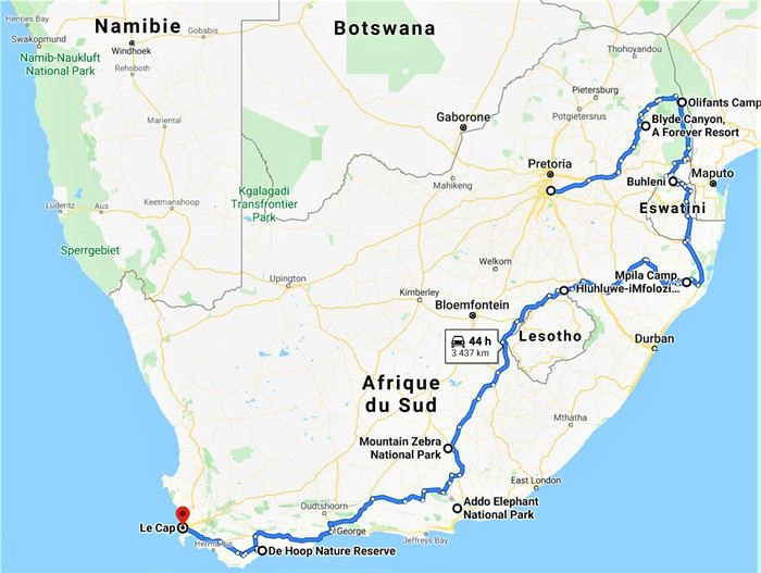
Étant 5 grands gabarits la question du véhicule était délicate puisque c’est dans ce véhicule que nous allions passer le plus de temps, en safari ou sur la route. Nous avons finalement opté pour la location d’un Hyundai H1 chez Budget, option la plus économique et la plus confortable avec 7 places et une plus haute garde au sol pour mieux voir les animaux et le paysage.
Après 11 mois d’attente, début des vacances scolaires et départ de Guadeloupe le vendredi 5 Juillet, pour mes parents et mes frères que je rejoindrai sur Paris le lendemain avant de décoller pour Madrid puis Joburg, tous ensemble, le samedi 6 au soir.
See you in the bush ! (Bilan conseils et budget en fin de carnet.)
Bien que ce fut déjà mon 4ème voyage en Afrique du Sud celui-ci eut, dès la préparation, une saveur toute particulière puisque ça allait être notre premier voyage en famille depuis une éternité, et cette fois-ci les rôles étaient inversés puisque c’est moi qui allais faire découvrir à mes parents ma destination de cœur, l’Afrique. 🙂
La concordance des temps dans cette dernière phrase m’a achevé… Ce carnet s’annonce compliqué. 😄
C’est un voyage que nous avons donc réalisé à 5, mes parents, mes 2 jeunes frères et moi-même. Ma sœur n’ayant pas pu se joindre à nous et Alison, ma copine, ayant gardé ses congés pour notre voyage de Septembre en Tanzanie.
C’est un rêve qui, enfin, se réalisait puisque cela faisait plusieurs années que j’essayais d’organiser quelque chose en famille et c’est en rentrant d’Alaksa en Aout 2018 que mes parents se sont motivés pour visiter l’Afrique du Sud. J’ai donc eu quasiment 1an pour préparer ce magnifique voyage en parallèle de celui en Tanzanie avec Alison.
Le circuit se voulait tant classique que magnifique. 24 jours à travers l’Afrique du Sud, à mes yeux le plus beau pays du monde, de Joburg à Capetown.
J0 (06/07/19) : Paris -> Madrid -> Johannesburg J1 (07/07/19) : OR Tambo Int Airport -> Forever Blyde Canyon J2 (08/07/19) : Blyde River Canyon J3 (09/07/19) : Forever Blyde Canyon –> Kruger National Park J4 (10/07/19) : Kruger National Park J5 (11/07/19) : Kruger National Park J6 (12/07/19) : Kruger National Park J7 (13/07/19) : Kruger National Park J8 (14/07/19) : Kruger National Park -> Santa Lucia J9 (15/07/19) : Isimangaliso wetland Park J10 (16/07/19) : Hluhluwe-iMfolozi J11 (17/07/19) : Hluhluwe-iMfolozi J12 (18/07/19) : Hluhluwe-iMfolozi -> Golden Gate NP J13 (19/07/19) : Golden Gate NP J14 (20/07/19) : Golden Gate NP -> Mountain Zebra NP J15 (21/07/19) : Mountain Zebra NP J16 (22/07/19) : Mountain Zebra NP J17 (23/07/19) : Mountain Zebra NP ->Cambedoo NP J18 (24/07/19) : Cambedoo NP -> Addo Elephant NP J19 (25/07/19) : Addo Elephant NP -> De Hoop NR J20 (26/07/19) : De Hoop NR J21 (27/07/19) : De Hoop NR - Capetown J22 (28/07/19) : Capetown J23 (29/07/19) : Capetown J24 (30/07/19) : Capetown - Johannesburg J25 (31/07/19) : Soweto – Départ
Étant 5 grands gabarits la question du véhicule était délicate puisque c’est dans ce véhicule que nous allions passer le plus de temps, en safari ou sur la route. Nous avons finalement opté pour la location d’un Hyundai H1 chez Budget, option la plus économique et la plus confortable avec 7 places et une plus haute garde au sol pour mieux voir les animaux et le paysage.
Après 11 mois d’attente, début des vacances scolaires et départ de Guadeloupe le vendredi 5 Juillet, pour mes parents et mes frères que je rejoindrai sur Paris le lendemain avant de décoller pour Madrid puis Joburg, tous ensemble, le samedi 6 au soir.
See you in the bush ! (Bilan conseils et budget en fin de carnet.)
California! Nevada! Utah! Oh!
After my trip to Oregon in 2018 (see Travel Journal "Oregon and Only Oregon"), I vaguely intended to return to the West (the western USA, of course—the west of France is where I almost live) someday, later... with no specific date or plan.
November 2018, I stumbled upon a promotion for round-trip flights from Paris to San Francisco. Well, I *stumbled*—they must’ve collected some "data" on me to make sure this deal crossed my path. And it worked! My ESTA was still valid, and two days later, it was decided: May 13, 2019 (departure from Paris) to June 15, 2019 (return to Paris).
The travel style? Just like last year: low-budget trip, rental car, and accommodation only in campgrounds, with no reservations to stay as free as possible.
Exceptions? 3 nights in a youth hostel upon arrival in downtown San Francisco, and 1 night on the way back (right before flying) in Montara, near Pacifica—a spot that seemed well-located for driving back to the airport in the middle of the night.
Now, to sketch out the rough itinerary. Here’s what it looked like after the trip:
Westernmost point: Montara Lighthouse on the coast, 30 km south of San Francisco (California); Easternmost point: Zion National Park (Utah). Northernmost point: Reno (Nevada). Southernmost point: Spring Mountain Ranch State Park in Blue Diamond, near Las Vegas (Nevada).
Another view:
I’ll be spending 33 days in this little area! I’m a slow traveler.
Meanwhile, I realized that in some places I wanted to visit (Las Vegas and National Parks), it was better to book ahead. So, I added to my reservations: - 2 nights in a hostel in Las Vegas - 6 nights of camping in the national parks (2 at Zion NP, 2 at Yosemite NP, 2 at Sequoia-Kings Canyon NP). Between all these dated stops, it’s a choose-your-own-adventure from the ideas I found.
I’m also a slow writer—slow writer, slow traveler—so it’ll take me a while to wrap this up. I’ll start tomorrow.
November 2018, I stumbled upon a promotion for round-trip flights from Paris to San Francisco. Well, I *stumbled*—they must’ve collected some "data" on me to make sure this deal crossed my path. And it worked! My ESTA was still valid, and two days later, it was decided: May 13, 2019 (departure from Paris) to June 15, 2019 (return to Paris).
The travel style? Just like last year: low-budget trip, rental car, and accommodation only in campgrounds, with no reservations to stay as free as possible.
Exceptions? 3 nights in a youth hostel upon arrival in downtown San Francisco, and 1 night on the way back (right before flying) in Montara, near Pacifica—a spot that seemed well-located for driving back to the airport in the middle of the night.
Now, to sketch out the rough itinerary. Here’s what it looked like after the trip:
Westernmost point: Montara Lighthouse on the coast, 30 km south of San Francisco (California); Easternmost point: Zion National Park (Utah). Northernmost point: Reno (Nevada). Southernmost point: Spring Mountain Ranch State Park in Blue Diamond, near Las Vegas (Nevada).
Another view:
I’ll be spending 33 days in this little area! I’m a slow traveler.
Meanwhile, I realized that in some places I wanted to visit (Las Vegas and National Parks), it was better to book ahead. So, I added to my reservations: - 2 nights in a hostel in Las Vegas - 6 nights of camping in the national parks (2 at Zion NP, 2 at Yosemite NP, 2 at Sequoia-Kings Canyon NP). Between all these dated stops, it’s a choose-your-own-adventure from the ideas I found.
I’m also a slow writer—slow writer, slow traveler—so it’ll take me a while to wrap this up. I’ll start tomorrow.
Istanbul, Men and Cats
Sunday, October 20, 2019
Glancing at the Bosphorus through the bay window of my room, I absentmindedly scatter my things while quietly settling in. Then I turn around, looking for my passport, my cash, my camera battery, eager to join the buzz of the street below. But for the past few minutes, I’ve felt a presence—something moved on the balcony. Suddenly, I spot a black-and-white furball half-hidden behind a pot, nearby. I approach to introduce myself: "Here, kitty, kitty..." I don’t know how to say "kitty" in Turkish, but the rather rude furball hisses in my face, and its ridiculous little tail doubles in size. Okay. Not friendly. I grab what’s within reach—a cream capsule—and offer it as a peace offering. It lunges at me, swipes the object away with a quick paw, and scratches me in the process.
I’m in Istanbul *
* For the title of my travel journal, I was inspired by the lovely film: "Kedi, Cats and Men" by Ceyda Torum
Glancing at the Bosphorus through the bay window of my room, I absentmindedly scatter my things while quietly settling in. Then I turn around, looking for my passport, my cash, my camera battery, eager to join the buzz of the street below. But for the past few minutes, I’ve felt a presence—something moved on the balcony. Suddenly, I spot a black-and-white furball half-hidden behind a pot, nearby. I approach to introduce myself: "Here, kitty, kitty..." I don’t know how to say "kitty" in Turkish, but the rather rude furball hisses in my face, and its ridiculous little tail doubles in size. Okay. Not friendly. I grab what’s within reach—a cream capsule—and offer it as a peace offering. It lunges at me, swipes the object away with a quick paw, and scratches me in the process.
I’m in Istanbul *
* For the title of my travel journal, I was inspired by the lovely film: "Kedi, Cats and Men" by Ceyda Torum
Four-week 4x4 trip around Madagascar
TRAVEL JOURNAL MADAGASCAR OCTOBER 2019
First of all, a big thank you to all the VoyageForum contributors who helped us plan our itinerary.
Introduction: There are three of us—a couple and a friend—all retired, aged 70. We spent four weeks in Madagascar, our first trip there, accompanied by a guide and a 4x4 driver-mechanic. We decided on the trip in June, and the process of requesting quotes, planning the itinerary, buying flight tickets, and applying for visas was quick. We finalized everything by the end of June.
Vehicle: The car was a Nissan Patrol, not new but well-maintained, and it served us perfectly. We had a few minor repairs—wheel bearings to change, a broken bull bar, and two flat tires throughout the trip. There was no air conditioning, so we drove with the windows open, which meant a bit of dust. In full sun, temperatures could reach 37/38°C.
Itinerary: The route started in Antananarivo upon arrival from the Air France flight from Roissy to Ivato and ended four weeks later at the same airport, passing through Antsirabe, Miandrivazo, the Tsiribihina River descent, Belo sur Tsiribihina, the Tsingy de Bemahara, the Avenue of the Baobabs, Morondava, Belo sur Mer, Morombe, Salary, Ifaty–Tulear, Ranohira, Fianarantsoa, the FCE train, Manakara, the Pangalanes Canal, Ranomafana, the Anja Reserve, and Ambositra.
Our local agency: The trip was organized with the help and logistical support of a local agency based in Antsirabe—a small, efficient, and enthusiastic team run by Élodie and her guide Manantsoa. If you'd like their contact details, feel free to message me directly. We have nothing but praise for them!
The roads: Travel was by 4x4 on rough, uneven tracks. We didn’t plan long stages to spare our backs, averaging a maximum of 5 to 6 hours per day. As for the RN7, the island’s most touristy road, there were no major issues. The Fianarantsoa Côte Est (FCE) train: This is the only train connecting Fianarantsoa to Manakara on the east coast. Taking it is an epic adventure—it takes an average of 17/18 hours to cover the 165 km between the two cities, passing through 17 stations, countless tunnels, and bridges. We left at 7 AM and arrived around 1:30 AM, but it was a direct way to connect with the local population at every stop. Even though we were comfortably seated in first class, we got a small glimpse of the harsh living conditions of the locals. One striking detail: on the last 80 km before Manakara, there wasn’t a single light—it was pitch black!
The Tsiribihina River descent: You can choose between a motorized barge or a rowed pirogue, depending on your comfort level. We opted for the motorized barge with a crew that included our guide, the captain, two sailors, and a cook. There was an upper deck for sunbathing and relaxing, and we slept in tents set up by the crew. The toilets were dry, and we showered with cold water from a waterfall—no complaints! The pirogue is more basic. It’s a slow, timeless journey along the river, with stunning landscapes, friendly locals, and diverse wildlife—lemurs, herons, birds of prey, kingfishers, and more.
Safety: The main safety concern on the roads is classic prevention—no flashy jewelry or visible valuables. In high-risk areas, vehicles travel in convoys escorted by the army, police, or gendarmerie. Elsewhere, our guide and driver handled "difficulties" like local "tolls," river crossings, and ferries with resourcefulness and calm. We never felt in danger during the four weeks, though we avoided driving or walking at night.
Accommodation: We chose mid-range hotels, always with private bathrooms and showers in the room. Sometimes there was no hot water, and water pressure was inconsistent, but that was city-wide, so we understood. In more touristy areas, the hotels were slightly better, though there’s still a long way to go to meet our standards! For the Tsiribihina descent, the crew set up a protected area for toilets and cold showers. We could even shower under the waterfall in the morning—cold and invigorating, but amazing!
Food: We ate well, whether it was European or Malagasy cuisine. The food was tasty and plentiful. The staple is rice—when imported from China or Myanmar, the quality isn’t always consistent. It’s served with everything. Zebu (beef) is good, and pork is less common but decent. Poultry isn’t raised in battery farms like at home; it’s free-range, tasty, but a bit tough. There’s a variety of vegetables, though we missed fresh fruit—it wasn’t the right season. Bananas and pineapples were abundant, with a few mangoes and oranges. On the coast, seafood was a treat—fish, shellfish, crabs, lobsters, sea cicadas, oysters, and more. Near Antananarivo, there’s a town called Behenjy specializing in foie gras, though in the heat, it’s not ideal for tasting. For local "hotely" restaurants (serving Malagasy food), it’s best to ask your guide to pick the best ones. As for tap water and raw vegetables, forget about them during your stay! We preferred to dine at the hotel to avoid nighttime outings, except in rare cases where a quality restaurant was nearby.
The people: It’s an understatement to say that Madagascar suffers from endemic poverty. In the cities, homeless people—men, women, children, even newborns—sleep on the streets or in makeshift shelters. The villages we passed through weren’t much better, and the remote ones we didn’t see are likely even worse. People lack everything—running water, electricity, schools, infrastructure—especially in the southern villages. Yet the land and rice fields seem to yield abundant harvests, and in desert areas, zebu farming is a way of life. The sea provides its riches—fish, lobsters, octopus, crabs, and more. Given the lack of education and income, begging is everywhere, a bit persistent but never aggressive. Bring as many things to give away as you can, and leave with empty hands—or rather, suitcases full of souvenirs! Let’s pay tribute to NGOs and religious institutions doing incredible work. On a personal level, we can only reflect, feel a bit of outrage, and act against this injustice. The Malagasy people don’t deserve this level of poverty. They’re also very religious—Catholic, Protestant, Adventist, Seventh-day Adventist, Jehovah’s Witness churches, and more, flourish across the island. In short, the people are welcoming, resigned, but so endearing and friendly!
Landscapes: The Tsingy, baobabs of all shapes and sizes—big, small, round, slender—the pristine beaches and Polynesian-like lagoons with deep blue waters between Tulear and Morombe, the rocks of the Isalo Massif reminiscent of the Wild West, the primary forests of Ranomafana, the red laterite landscapes of the Highlands dotted with villages, terraced rice fields, sunrises and sunsets on the east and west coasts, the views from the FCE train, the tranquility of the Pangalanes Canal (a bit like Kerala), the Vezo villages (nomads of the sea), the lagoon dotted with colorful square sails of Vezo fishermen—it’s all fantastic and varied!
Local transport: Overloaded bush taxis or trucks, zebu carts, rickshaws, tuk-tuks, and even carts pulled by people—it’s even more shocking!
Wildlife: The stars: - Lemurs—diurnal and nocturnal—there are so many to see, and you can spend hours watching them! - Chameleons—all shapes, sizes, and colors!
Climate: During our four weeks in September and October 2019 (we’d only been back for three days), we had just one day of rain. It was warm and pleasant everywhere during the trip. A light sweater for the evenings and waterproof clothing for rainy days are a good idea. Don’t forget sunglasses, swimsuits, sunscreen, mosquito repellent, malaria prophylaxis, flip-flops, hiking shoes for the parks, and all the usual essentials—nothing out of the ordinary!
Expenses: For half-board (breakfast and dinner), including transport (fuel), guide and driver, park entry fees, and local park guides, the cost was 2300 € per person for the four weeks. On top of that, you’ll need to add flight tickets, drinks, and lunch (around 5–10 € depending on your choices), as well as tips and personal expenses.
In short, we came back CHARMED.
Our thanks to ÉLODIE and MANANTSOA, as well as the drivers PAPOOSE and ROBERT.
First of all, a big thank you to all the VoyageForum contributors who helped us plan our itinerary.
Introduction: There are three of us—a couple and a friend—all retired, aged 70. We spent four weeks in Madagascar, our first trip there, accompanied by a guide and a 4x4 driver-mechanic. We decided on the trip in June, and the process of requesting quotes, planning the itinerary, buying flight tickets, and applying for visas was quick. We finalized everything by the end of June.
Vehicle: The car was a Nissan Patrol, not new but well-maintained, and it served us perfectly. We had a few minor repairs—wheel bearings to change, a broken bull bar, and two flat tires throughout the trip. There was no air conditioning, so we drove with the windows open, which meant a bit of dust. In full sun, temperatures could reach 37/38°C.
Itinerary: The route started in Antananarivo upon arrival from the Air France flight from Roissy to Ivato and ended four weeks later at the same airport, passing through Antsirabe, Miandrivazo, the Tsiribihina River descent, Belo sur Tsiribihina, the Tsingy de Bemahara, the Avenue of the Baobabs, Morondava, Belo sur Mer, Morombe, Salary, Ifaty–Tulear, Ranohira, Fianarantsoa, the FCE train, Manakara, the Pangalanes Canal, Ranomafana, the Anja Reserve, and Ambositra.
Our local agency: The trip was organized with the help and logistical support of a local agency based in Antsirabe—a small, efficient, and enthusiastic team run by Élodie and her guide Manantsoa. If you'd like their contact details, feel free to message me directly. We have nothing but praise for them!
The roads: Travel was by 4x4 on rough, uneven tracks. We didn’t plan long stages to spare our backs, averaging a maximum of 5 to 6 hours per day. As for the RN7, the island’s most touristy road, there were no major issues. The Fianarantsoa Côte Est (FCE) train: This is the only train connecting Fianarantsoa to Manakara on the east coast. Taking it is an epic adventure—it takes an average of 17/18 hours to cover the 165 km between the two cities, passing through 17 stations, countless tunnels, and bridges. We left at 7 AM and arrived around 1:30 AM, but it was a direct way to connect with the local population at every stop. Even though we were comfortably seated in first class, we got a small glimpse of the harsh living conditions of the locals. One striking detail: on the last 80 km before Manakara, there wasn’t a single light—it was pitch black!
The Tsiribihina River descent: You can choose between a motorized barge or a rowed pirogue, depending on your comfort level. We opted for the motorized barge with a crew that included our guide, the captain, two sailors, and a cook. There was an upper deck for sunbathing and relaxing, and we slept in tents set up by the crew. The toilets were dry, and we showered with cold water from a waterfall—no complaints! The pirogue is more basic. It’s a slow, timeless journey along the river, with stunning landscapes, friendly locals, and diverse wildlife—lemurs, herons, birds of prey, kingfishers, and more.
Safety: The main safety concern on the roads is classic prevention—no flashy jewelry or visible valuables. In high-risk areas, vehicles travel in convoys escorted by the army, police, or gendarmerie. Elsewhere, our guide and driver handled "difficulties" like local "tolls," river crossings, and ferries with resourcefulness and calm. We never felt in danger during the four weeks, though we avoided driving or walking at night.
Accommodation: We chose mid-range hotels, always with private bathrooms and showers in the room. Sometimes there was no hot water, and water pressure was inconsistent, but that was city-wide, so we understood. In more touristy areas, the hotels were slightly better, though there’s still a long way to go to meet our standards! For the Tsiribihina descent, the crew set up a protected area for toilets and cold showers. We could even shower under the waterfall in the morning—cold and invigorating, but amazing!
Food: We ate well, whether it was European or Malagasy cuisine. The food was tasty and plentiful. The staple is rice—when imported from China or Myanmar, the quality isn’t always consistent. It’s served with everything. Zebu (beef) is good, and pork is less common but decent. Poultry isn’t raised in battery farms like at home; it’s free-range, tasty, but a bit tough. There’s a variety of vegetables, though we missed fresh fruit—it wasn’t the right season. Bananas and pineapples were abundant, with a few mangoes and oranges. On the coast, seafood was a treat—fish, shellfish, crabs, lobsters, sea cicadas, oysters, and more. Near Antananarivo, there’s a town called Behenjy specializing in foie gras, though in the heat, it’s not ideal for tasting. For local "hotely" restaurants (serving Malagasy food), it’s best to ask your guide to pick the best ones. As for tap water and raw vegetables, forget about them during your stay! We preferred to dine at the hotel to avoid nighttime outings, except in rare cases where a quality restaurant was nearby.
The people: It’s an understatement to say that Madagascar suffers from endemic poverty. In the cities, homeless people—men, women, children, even newborns—sleep on the streets or in makeshift shelters. The villages we passed through weren’t much better, and the remote ones we didn’t see are likely even worse. People lack everything—running water, electricity, schools, infrastructure—especially in the southern villages. Yet the land and rice fields seem to yield abundant harvests, and in desert areas, zebu farming is a way of life. The sea provides its riches—fish, lobsters, octopus, crabs, and more. Given the lack of education and income, begging is everywhere, a bit persistent but never aggressive. Bring as many things to give away as you can, and leave with empty hands—or rather, suitcases full of souvenirs! Let’s pay tribute to NGOs and religious institutions doing incredible work. On a personal level, we can only reflect, feel a bit of outrage, and act against this injustice. The Malagasy people don’t deserve this level of poverty. They’re also very religious—Catholic, Protestant, Adventist, Seventh-day Adventist, Jehovah’s Witness churches, and more, flourish across the island. In short, the people are welcoming, resigned, but so endearing and friendly!
Landscapes: The Tsingy, baobabs of all shapes and sizes—big, small, round, slender—the pristine beaches and Polynesian-like lagoons with deep blue waters between Tulear and Morombe, the rocks of the Isalo Massif reminiscent of the Wild West, the primary forests of Ranomafana, the red laterite landscapes of the Highlands dotted with villages, terraced rice fields, sunrises and sunsets on the east and west coasts, the views from the FCE train, the tranquility of the Pangalanes Canal (a bit like Kerala), the Vezo villages (nomads of the sea), the lagoon dotted with colorful square sails of Vezo fishermen—it’s all fantastic and varied!
Local transport: Overloaded bush taxis or trucks, zebu carts, rickshaws, tuk-tuks, and even carts pulled by people—it’s even more shocking!
Wildlife: The stars: - Lemurs—diurnal and nocturnal—there are so many to see, and you can spend hours watching them! - Chameleons—all shapes, sizes, and colors!
Climate: During our four weeks in September and October 2019 (we’d only been back for three days), we had just one day of rain. It was warm and pleasant everywhere during the trip. A light sweater for the evenings and waterproof clothing for rainy days are a good idea. Don’t forget sunglasses, swimsuits, sunscreen, mosquito repellent, malaria prophylaxis, flip-flops, hiking shoes for the parks, and all the usual essentials—nothing out of the ordinary!
Expenses: For half-board (breakfast and dinner), including transport (fuel), guide and driver, park entry fees, and local park guides, the cost was 2300 € per person for the four weeks. On top of that, you’ll need to add flight tickets, drinks, and lunch (around 5–10 € depending on your choices), as well as tips and personal expenses.
In short, we came back CHARMED.
Our thanks to ÉLODIE and MANANTSOA, as well as the drivers PAPOOSE and ROBERT.
Voyage de 15 jours au Japon English translation pending
Bonjour !
tout d'abord merci à tous pour vos avis éclairés, cela fait pas mal de temps que je vous lis et cela m'aide vraiment beaucoup !!
J'avais ce projet de voyage depuis deux ans mais des aléas professionnels m'ont fait repoussé plusieurs fois le Japon aux calendes ...
Mais cette fois ça a l'air d'être la bonne et si tout va bien nous partons ma femme et moi mi-novembre ( certainement du 9 au 24 ) pour 15J.
Comme vous vous en doutez, nous voulons tout voir et faire des choix est un crève-cœur, aussi, si vous pouviez m'aider à caser sur ces 15 jours :
-Tokyo ( dont une excursion à Nokogiriyama une journée ) -Kyoto bien sur ( dont ... Nara et tout le reste !! 😛 ) -Takayama ( et Shirakawa-go ), une nuit en Ryokan -une nuit à Myiajima ( genre arrivée dans l'après midi et repartir le lendemain, pour échaper le plus possible aux flots de touristes )
Quelques précision: je sais que ça risque d'être la course, mais je n'arrive pas à faire plus de coupes ( j'ai plutôt encore envie de rajouter des étapes à Himeji, Okoyamaou encore Kurashiki ... ). Du coup, nous essayeront de voyager léger, de réduire les points de chutes et éventuellement d'utiliser le service d'envoi de bagages.
Le budget n'est à priori pas un souci, il s'agit d'un gros cadeau familial...
Bien sur Tokyo m'attire... mais pas prioritairement donc si il doit y avoir des coupes à faire ...
Je n'arrive juste pas, avec la problématique des transports, à mettre tout cela en ordre.
des suggestions ?
merci à tous par avance !!
tout d'abord merci à tous pour vos avis éclairés, cela fait pas mal de temps que je vous lis et cela m'aide vraiment beaucoup !!
J'avais ce projet de voyage depuis deux ans mais des aléas professionnels m'ont fait repoussé plusieurs fois le Japon aux calendes ...
Mais cette fois ça a l'air d'être la bonne et si tout va bien nous partons ma femme et moi mi-novembre ( certainement du 9 au 24 ) pour 15J.
Comme vous vous en doutez, nous voulons tout voir et faire des choix est un crève-cœur, aussi, si vous pouviez m'aider à caser sur ces 15 jours :
-Tokyo ( dont une excursion à Nokogiriyama une journée ) -Kyoto bien sur ( dont ... Nara et tout le reste !! 😛 ) -Takayama ( et Shirakawa-go ), une nuit en Ryokan -une nuit à Myiajima ( genre arrivée dans l'après midi et repartir le lendemain, pour échaper le plus possible aux flots de touristes )
Quelques précision: je sais que ça risque d'être la course, mais je n'arrive pas à faire plus de coupes ( j'ai plutôt encore envie de rajouter des étapes à Himeji, Okoyamaou encore Kurashiki ... ). Du coup, nous essayeront de voyager léger, de réduire les points de chutes et éventuellement d'utiliser le service d'envoi de bagages.
Le budget n'est à priori pas un souci, il s'agit d'un gros cadeau familial...
Bien sur Tokyo m'attire... mais pas prioritairement donc si il doit y avoir des coupes à faire ...
Je n'arrive juste pas, avec la problématique des transports, à mettre tout cela en ordre.
des suggestions ?
merci à tous par avance !!
Préparation de 3 semaines en Tanzanie en septembre English translation pending
Bonjour l'Afrique de l'Est ! 🙂
Je commence tout juste la préparation de notre voyage de couple 2019. Cette année se sera donc la Tanzanie ! A priori...😇
Je rêve de gravir le Kilimandjaro, Alison veut faire un maximum de safari et nous voudrions terminer par quelques jours de farniente sur Zanzibar.
J'ai lu la plupart des préparations et les quelques carnets sur ce forum. Merci à tout ceux qui ont partagés leur remarques et leur retour, c'est toujours très utile ! Surtout pour une destination comme la Tanzanie.
Nous avons 20 nuits sur place (billets d'avion pas encore achetés). Pour le Kilimandjaro nous avons décidé de faire l'ascension par la voie Machame en 5 nuits et 6 jours avec nuit à l’hôtel avant et après. Nous voulons ensuite faire 9 nuits de safari en camping. Et enfin nous finirons par 4 nuits à Zanzibar. Classique ! 🙂
Après avoir longuement exploré la possibilité du safari en self drive nous avons du nous raisonner et opter pour un safari guidé à partir d'Arusha à travers les parcs du nord. Notre budget n'est pas extensible et la différence de prix est de plus de 2000€ pour la semaine de safari. Sans compter la nourriture, l'essence, les péages, la location d'un tel satellite... donc pas de self drive pour cette fois ci ! Nous n'avons jamais fait de safari organisé et nous avons tellement d'appréhension sur ce type de voyage que ça ne peux que nous surprendre agréablement. 😇 Ce sera donc une découverte totale, tant sur la destination que sur le type de voyage ! 🙂
J'ai contacté plusieurs agence hier et devinez qui m'a répondu en premier ce matin... Kessy Brothers. Surprise ! 😉 Voici la base qu'il me propose pour le safari :
DAY 1: Moshi -> Tarangire national park / Twiga Lodge. DAY 2: Twiga Lodge -> Ngorongoro crater / Simba campsite. DAY 3: Simba Campsite -> Serengeti national park / Seronera campsite. DAY 4: Seronera campsite -> Serengeti national park / Waso camp site. DAY 5: Lake Natron / Kamakia campsite. DAY 6: Oldoinyo Lengai trekking / Moshi at New Nneneu Lodge Le tout pour 1565$/pers
Quelqu'un a t'il un avis sur ces camps/lodges ? J'ai 4 nuits à ajouter, quels sont les endroits qui valent d'y passer le plus de temps ? Est-ce que ça vaut le coup de dormir au lac Manyara ? au parc Arusha ?
Merci pour votre aide. Tout conseil est le bienvenu ! 🙂
Pierre
Je commence tout juste la préparation de notre voyage de couple 2019. Cette année se sera donc la Tanzanie ! A priori...😇
Je rêve de gravir le Kilimandjaro, Alison veut faire un maximum de safari et nous voudrions terminer par quelques jours de farniente sur Zanzibar.
J'ai lu la plupart des préparations et les quelques carnets sur ce forum. Merci à tout ceux qui ont partagés leur remarques et leur retour, c'est toujours très utile ! Surtout pour une destination comme la Tanzanie.
Nous avons 20 nuits sur place (billets d'avion pas encore achetés). Pour le Kilimandjaro nous avons décidé de faire l'ascension par la voie Machame en 5 nuits et 6 jours avec nuit à l’hôtel avant et après. Nous voulons ensuite faire 9 nuits de safari en camping. Et enfin nous finirons par 4 nuits à Zanzibar. Classique ! 🙂
Après avoir longuement exploré la possibilité du safari en self drive nous avons du nous raisonner et opter pour un safari guidé à partir d'Arusha à travers les parcs du nord. Notre budget n'est pas extensible et la différence de prix est de plus de 2000€ pour la semaine de safari. Sans compter la nourriture, l'essence, les péages, la location d'un tel satellite... donc pas de self drive pour cette fois ci ! Nous n'avons jamais fait de safari organisé et nous avons tellement d'appréhension sur ce type de voyage que ça ne peux que nous surprendre agréablement. 😇 Ce sera donc une découverte totale, tant sur la destination que sur le type de voyage ! 🙂
J'ai contacté plusieurs agence hier et devinez qui m'a répondu en premier ce matin... Kessy Brothers. Surprise ! 😉 Voici la base qu'il me propose pour le safari :
DAY 1: Moshi -> Tarangire national park / Twiga Lodge. DAY 2: Twiga Lodge -> Ngorongoro crater / Simba campsite. DAY 3: Simba Campsite -> Serengeti national park / Seronera campsite. DAY 4: Seronera campsite -> Serengeti national park / Waso camp site. DAY 5: Lake Natron / Kamakia campsite. DAY 6: Oldoinyo Lengai trekking / Moshi at New Nneneu Lodge Le tout pour 1565$/pers
Quelqu'un a t'il un avis sur ces camps/lodges ? J'ai 4 nuits à ajouter, quels sont les endroits qui valent d'y passer le plus de temps ? Est-ce que ça vaut le coup de dormir au lac Manyara ? au parc Arusha ?
Merci pour votre aide. Tout conseil est le bienvenu ! 🙂
Pierre
Un mois Pérou et Bolivie English translation pending
Bonjour à tous,
Nous voici revenus de notre périple qui s'est déroulé entre le 22 septembre et le 21 octobre 2018. Notre programme était à l'origine:
- Vol KLM Marseille- Amsterdam-Lima - 10 jours région Cuzco : Vallée sacrée, Trek Salkantay en autonomie, Machu Picchu - Lac Titicaca côtés Pérou et Bolivie - La Paz - Sud Lipez et Salar d'Uyuni en autonomie
On va voir qu'on a un peu du changer nos plans contraints et forcés.
Je remercie au passage ce forum et particulièrement cette rubrique de carnets de voyage qui m'a permis d'organiser la partie Salkantay et surtout Sud Lipez (Lolobe et Tberney entre autres). A mon tour maintenant de rédiger notre carnet qui je l'espère sera utile à d'autres. Bien sur, si vous avez besoin d'infos complémentaires, n'hésitez pas à me le demander en MP.
Je précise que ces vacances ont été organisés par moi seul, sans agence bien sur. Pour la partie Pérou, j'avais réservé en avance les logements (Bnb pour la plupart). Pour le Sud Lipez, seule la voiture avait été réservée, les hébergements ont été improvisés. C'est parti.
Bonne lecture.
Nous voici revenus de notre périple qui s'est déroulé entre le 22 septembre et le 21 octobre 2018. Notre programme était à l'origine:
- Vol KLM Marseille- Amsterdam-Lima - 10 jours région Cuzco : Vallée sacrée, Trek Salkantay en autonomie, Machu Picchu - Lac Titicaca côtés Pérou et Bolivie - La Paz - Sud Lipez et Salar d'Uyuni en autonomie
On va voir qu'on a un peu du changer nos plans contraints et forcés.
Je remercie au passage ce forum et particulièrement cette rubrique de carnets de voyage qui m'a permis d'organiser la partie Salkantay et surtout Sud Lipez (Lolobe et Tberney entre autres). A mon tour maintenant de rédiger notre carnet qui je l'espère sera utile à d'autres. Bien sur, si vous avez besoin d'infos complémentaires, n'hésitez pas à me le demander en MP.
Je précise que ces vacances ont été organisés par moi seul, sans agence bien sur. Pour la partie Pérou, j'avais réservé en avance les logements (Bnb pour la plupart). Pour le Sud Lipez, seule la voiture avait été réservée, les hébergements ont été improvisés. C'est parti.
Bonne lecture.
Ouganda et Rwanda juillet 2017 English translation pending
Bonjour,
Tout a commencé lors de nos vacances en Namibie en été 2016. J'ai réservé un Lodge sympa pour le soir d'anniversaire de notre fille, nous avons donc pris nos quartiers à l’Onguma Tree Top proche d'Etosha. Ce Lodge a seulement quatre bungalows sur pilotis, le soir tout le monde mange à la même table et c'est comme ça que nous avons fait la connaissance d'un couple italien très charmant.
Monsieur nous a raconté son voyage en Ouganda, en fait, il nous a surtout parlé du tracking des gorilles. A la maison, en réfléchissant à ce que nous voulions faire en juillet 2017, nous avons repensé au récit enthousiasmé du monsieur italien et la décision a été vite prise. Nous partirons en Ouganda !
J'ai lu quelques récits de voyage sur l'Ouganda. Il y en a très peu sur VF, mais j'ai aussi trouvé quelques retours d'expériences sur un Forum allemand. Je me suis vite rendue compte que je n'aurais pas le temps de préparer ce voyage comme je le fais habituellement. Et, les galères de certains avec leur voiture de location ne m'encourageait que moyennement. Bref, nous passerons par une agence sur place et prendrons un chauffeur-guide.
Après avoir contacté l'agence Speke Uganda, nous avons pris la décision de voyager avec un petit groupe de maximum six personnes, un guide et un chauffeur. Je dois bien avouer que le fait de voyager avec d'autres personnes me faisait un peu de soucis. Mais voilà, ça revenait quand-même moins cher et le programme avait l'air alléchant. Bref, nous avons payé l'acompte et n'avions plus qu'à nous réjouir. De ne pas préparer nos visites, ne pas choisir nos Lodges, me faisait quand-même un drôle d'effet. J'ai été heureusement bien occupée avec la préparation de notre voyage en Afrique du Sud et Namibie pour l'automne 2017.
L'option de faire deux trackings pour voir les gorilles a été vite prise. Nous en ferons un en Ouganda et un autre au Rwanda. Au moment de notre réservation, l'augmentation du prix pour le tracking au Rwanda n'a heureusement pas encore eu lieu.
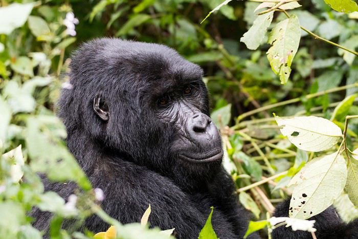 La maman et son petit
 Faire deux trackings a beaucoup d'avantages. Premièrement, on ne sait pas comment les gorilles vont se comporter. Seront-ils stationnaires ou faudra-t-il leur "courir" après. Cela permet aussi de voir deux familles différentes, donc d'avoir deux expériences distinctes.
Juste quelques mots sur l'agence. Nous sommes très contents de leur service. Les guides et chauffeurs (vous verrez plus loin pourquoi j'écris guides et chauffeurs au pluriel) étaient super sympas et se pliaient en quatre pour nous satisfaire. Tony, le patron de Speke Uganda nous a contactés deux fois pendant le voyage, afin de savoir si tout allait bien et si nous avions des désirs spécifiques. Bref, on peut dire que le suivi a été excellent.
Les hôtels et Lodges ont été en général bien à très bien, d'un bon standard pour les régions traversées et très propres. Nos guides faisaient très attention où nous mangions. D'après eux, nos estomacs ne supporteraient pas la nourriture proposée dans certains restaurants ou stands de rues. En Ouganda, l'eau n'est pas potable et il faut se méfier des aliments crus et lavés avec cette eau. Nous avions des bouteilles d'eau dans chaque salle de bain, car même rincer sa bouche ou sa brosse à dents avec de l'eau du robinet est déconseillé.
Nous avons été enchantés des parcs nationaux et avons été bien gâtés avec les animaux. Nous ne pensions pas en voir autant, ça été donc une excellente surprise.
Voilà, place au récit jour après jour. J'espère que vous aurez du plaisir à nous suivre.
Tout a commencé lors de nos vacances en Namibie en été 2016. J'ai réservé un Lodge sympa pour le soir d'anniversaire de notre fille, nous avons donc pris nos quartiers à l’Onguma Tree Top proche d'Etosha. Ce Lodge a seulement quatre bungalows sur pilotis, le soir tout le monde mange à la même table et c'est comme ça que nous avons fait la connaissance d'un couple italien très charmant.
Monsieur nous a raconté son voyage en Ouganda, en fait, il nous a surtout parlé du tracking des gorilles. A la maison, en réfléchissant à ce que nous voulions faire en juillet 2017, nous avons repensé au récit enthousiasmé du monsieur italien et la décision a été vite prise. Nous partirons en Ouganda !
J'ai lu quelques récits de voyage sur l'Ouganda. Il y en a très peu sur VF, mais j'ai aussi trouvé quelques retours d'expériences sur un Forum allemand. Je me suis vite rendue compte que je n'aurais pas le temps de préparer ce voyage comme je le fais habituellement. Et, les galères de certains avec leur voiture de location ne m'encourageait que moyennement. Bref, nous passerons par une agence sur place et prendrons un chauffeur-guide.
Après avoir contacté l'agence Speke Uganda, nous avons pris la décision de voyager avec un petit groupe de maximum six personnes, un guide et un chauffeur. Je dois bien avouer que le fait de voyager avec d'autres personnes me faisait un peu de soucis. Mais voilà, ça revenait quand-même moins cher et le programme avait l'air alléchant. Bref, nous avons payé l'acompte et n'avions plus qu'à nous réjouir. De ne pas préparer nos visites, ne pas choisir nos Lodges, me faisait quand-même un drôle d'effet. J'ai été heureusement bien occupée avec la préparation de notre voyage en Afrique du Sud et Namibie pour l'automne 2017.
L'option de faire deux trackings pour voir les gorilles a été vite prise. Nous en ferons un en Ouganda et un autre au Rwanda. Au moment de notre réservation, l'augmentation du prix pour le tracking au Rwanda n'a heureusement pas encore eu lieu.
La maman et son petit
Faire deux trackings a beaucoup d'avantages. Premièrement, on ne sait pas comment les gorilles vont se comporter. Seront-ils stationnaires ou faudra-t-il leur "courir" après. Cela permet aussi de voir deux familles différentes, donc d'avoir deux expériences distinctes.Juste quelques mots sur l'agence. Nous sommes très contents de leur service. Les guides et chauffeurs (vous verrez plus loin pourquoi j'écris guides et chauffeurs au pluriel) étaient super sympas et se pliaient en quatre pour nous satisfaire. Tony, le patron de Speke Uganda nous a contactés deux fois pendant le voyage, afin de savoir si tout allait bien et si nous avions des désirs spécifiques. Bref, on peut dire que le suivi a été excellent.
Les hôtels et Lodges ont été en général bien à très bien, d'un bon standard pour les régions traversées et très propres. Nos guides faisaient très attention où nous mangions. D'après eux, nos estomacs ne supporteraient pas la nourriture proposée dans certains restaurants ou stands de rues. En Ouganda, l'eau n'est pas potable et il faut se méfier des aliments crus et lavés avec cette eau. Nous avions des bouteilles d'eau dans chaque salle de bain, car même rincer sa bouche ou sa brosse à dents avec de l'eau du robinet est déconseillé.
Nous avons été enchantés des parcs nationaux et avons été bien gâtés avec les animaux. Nous ne pensions pas en voir autant, ça été donc une excellente surprise.
Voilà, place au récit jour après jour. J'espère que vous aurez du plaisir à nous suivre.
Retour de l'Ouest américain, de Yellowstone à Las Vegas English translation pending
Voilà maintenant quelques semaines que nous sommes rentrés des terres lointaines de l'Ouest américain.
Pour ma part, j'ai eu la chance de parcourir ces endroits pour la troisième fois. J'étais accompagnée cette fois de ma mère et de mon frère, qui eux, découvraient toutes ces merveilles pour la première fois.
Nous avons préparé ce voyage pendant plusieurs mois, pour finalement partir du 08 Juin au 01 Juillet 2017. J'en profite pour remercier tous les membres de ce forum qui partagent leurs expériences, cela m'a grandement aidé pour la préparation de mes trois voyages aux USA. Je vais donc à mon tour, partager les expériences positives, et négatives (!!!) de ce voyage, afin peut-être, qu'elles aident d'autres voyageurs !
Voici donc notre parcours en 23 jours :
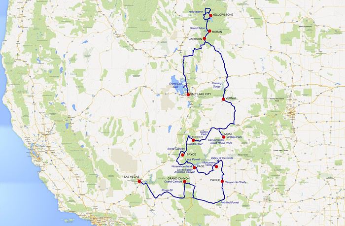
Pour ma part, j'ai eu la chance de parcourir ces endroits pour la troisième fois. J'étais accompagnée cette fois de ma mère et de mon frère, qui eux, découvraient toutes ces merveilles pour la première fois.
Nous avons préparé ce voyage pendant plusieurs mois, pour finalement partir du 08 Juin au 01 Juillet 2017. J'en profite pour remercier tous les membres de ce forum qui partagent leurs expériences, cela m'a grandement aidé pour la préparation de mes trois voyages aux USA. Je vais donc à mon tour, partager les expériences positives, et négatives (!!!) de ce voyage, afin peut-être, qu'elles aident d'autres voyageurs !
Voici donc notre parcours en 23 jours :
Le Maroc et le bonheur d'être accueillie! English translation pending
Bonjour à tous,
Voici un planning des posts avec les liens pour ceux qui ne veulent pas lire tous les posts; j'en ai profité pour corriger les chiffres des étapes dans lesquels s'étaient glissées des erreurs
Jour 1, Premiers pas dans un pays berbère musulman: le Maroc!
Jour 2, de Marrakech à Imlil, puis Tamatert. jour 3, De Tamatert à Taliouine, en passant par le tizi'n test jour 4, Visite des gorges de tislit et route de Taliouine à Foum zguid jour 4, suite, photos supplémentaires des gorges et route de Tislit à Foum zguid Jour 5, de foum zguid au bivouac de chez Nagui Suite de la journée 5, séjour au bivouac de l'erg Chegaga, Jour 6, du bivouac à Zagora, en passant par M'hamid jour 7, de Zagora à Amellagou, Jour 7 suite de Goulmina à Amellagou Jour 8 départ d'Amellagou en direction de Boumalne Jour 8 (suite) de Assoul en direction des gorges du todra jour 8 suite et fin en direction des gorges du Todra puis de Boumalne dadès Jour 9 circuit autour de Boumalne dadès! Jour 9 circuit autour de Boumalne dadès (suite)! Jour 10: départ de Boumalne Dadès et direction Ait Ben Haddou Jour 11 quelques compléments puis alentours d'Ait ben haddou.
Jour 11 suite: de Ait Ben Haddou à Télouet et la kasbah du Glaoui. (ça y est j'en ai eu le courage!!!) J11 suite et fin, J12 départ pour Paris.
Notre voyage s'est déroulé de fin février à début mars grâce à: - l'aide ultra précieuse de Attila, qui m'a donné envie d'aller visiter cette partie du monde, et qui a été un amour pour me proposer un itinéraire qui me convenait. Mille merci (dans ce cas, on met un "s" à merci?)😏 - l'aide non moins précieuse de Perju, pour les pistes à emprunter, qui pendant tout notre séjour, a surveillé les infos internationales en espérant qu'on n'y parle pas de 2 martiniquais disparus dans le désert..... Perju, tu es une vraie mère poule pour moi!!! Merciiiiiiiiiiiiiiiiiiiiiiiiiiiiiiiiiiiiiiiiiiiiiii.😄 - l'aide logistique et chaleureuse de Lacalo, qui nous a accueilli dans son riad. Il est génial ton riad et c'était super génial de te rencontrer et d'échanger avec toi. Gros gros Gros bisous!!! 😏 - l'aide de tous les membres du forum Maroc qui publie des carnets et donne une mine d'infos, et que je remercie énormément.
Jour 1, Premiers pas dans un pays berbère musulman: le Maroc!
A 12h15, nous avons quitté Paris sous la pluie, et sommes arrivés à Marrakech sous la pluie!!! La compagnie Royal Air Maroc est très bien, un déjeuner nous a été servi, du thé proposé, et le vol s'est bien déroulé, car j'étais assise à côté d'un charmant monsieur qui a bien voulu répondre à mes nombreuses questions et me donner plein de conseils sur mon voyage dans le sud marocain.
Après 3h de vol, nous découvrons le nouvel aéroport de Marrakech, qui a été inauguré pour la COP 22. Il est vraiment très beau, avec ses grands piliers blancs et son toit fait de lattes de différents coloris de bois. L'attente à la police des frontières est correcte comparée à la queue que nous avons eue à Orly.
A notre sortie, après avoir récupéré les bagages, je suis étonnée de ne pas voir Mohamed, le chauffeur qui est censé être venu nous chercher avec un panneau marqué "maison Do", nom du riad dans lequel nous dormons ce soir. Je téléphone donc à Lacalo, la propriétaire du riad, qui parait surprise aussi, appelle son chauffeur et me rappelle. Il est à l'extérieur de l'aéroport: les visiteurs n'ont pas le droit d'entrer dans le hall d'arrivée depuis les attentats!! Gloups!!! Les mesures de sécurité sont drastiques. Je me disais aussi que le hall immense avait l'air bien vide. Personne à l'intérieur à part les quelques voyageurs qui défilent au gré de la récupération de leurs bagages.
Nous sortons donc et faisons la connaissance du souriant et charmant Mohamed. La décision est prise de faire du change au centre ville de Marrakech. Nous découvrons donc la ville rose, où toutes les constructions sont faites de terre ocre, ce qui donne à l'ensemble un charme indiscutable. Nous longeons les remparts aérés de la vieille ville, et les nombreux trous d'aération ingénieusement disséminés dans les murs, font aujourd'hui le bonheur des pigeons qui y trouvent des lieux de nidification parfaits.
De nombreux arbres avec toutes leurs feuilles sont visibles le long de la route, des oliviers, des orangers avec des oranges, mais qui ne sont pas comestibles car elles sont amères!!!!! Dire qu'en Martinique, nous avons des oranges amères que nous consommons sans problème!!! De nombreux arbustes fleuris aussi attirent mon attention, car, il ne faut pas oublier que nous sommes en hiver, qu'il fait 15°C, l'après-midi. Devant mon étonnement, Mohamed m'explique que malgré la période hivernale, il pleut très peu à Marrakech, (et oui, nous arrivons l'un des rares jours où il pleut!!!!) l'ensoleillement est très important d'où les fleurs. Ma foi, quel contraste avec la région parisienne aux arbres complètement dénudés, que nous venons de quitter!!!
C'est marrant finalement, nous sommes partis de Martinique avec le soleil, et l'avons amené avec nous à Paris, ce que tous les habitants espéraient, et nous sommes partis de Paris avec la pluie et l'avons emmené avec nous, à Marrakech, ce qui fait le bonheur des Marrackchis!!!! Trop fort ces martiniquais!!!!!
A la recherche d'un bureau de change, Mohamed s'arrête tout d'abord près d'une banque, mais elle est fermée. Nous passons à travers des portes en arche, qui jalonnent les remparts, mais elles ne laissent passer qu'une voiture à la fois.
Nous sommes dans l'enceinte de la vieille ville. Je découvre avec plaisir ma première ville arabe, avec ses mosquées et leur minaret si emblématique, son palais royal et ses remparts.
Le dépaysement est total et tous mes sens sont en éveil. Les véhicules qui circulent sont très insolites: des motos qui tirent des bennes, des ânes qui tirent des charrettes, des calèches pour touristes tirées par des chevaux.... Je me sens comme une enfant de 5 ans qui découvre le monde. Tout est nouveau.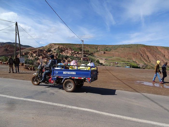
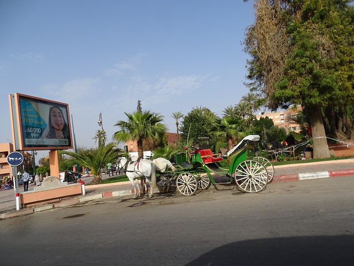
Nous nous dirigeons vers la medina, et passons par des ruelles ultra encombrées, de gens à pied, à bicyclette, à moto, conduisant des charrettes tirées par des ânes. Mohamed klaxonne maintenant de façon continue et avance régulièrement malgré la densité de la circulation, entre les échoppes régulièrement disposées le long des ruelles. Heureusement que ces rues sont à sens unique, malgré les motos qui circulent à contresens, nous sommes heureux de ne pas avoir à conduire dans ce dédale labyrinthique pour nous étrangers.
Mohamed s'arrête finalement devant une boutique et nous demande de suivre l'un des vigiles placés à l'entrée. Nous traversons un magasin remplis de babioles en tout genre, style brocante, mais brocante marocaine, porcelaine, instruments de musique, tapis, parfums, plats en bronze, horloges, .... Et les senteurs orientales sont un pur bonheur pour mes narines. Ah, nous voilà arrivés, ....... devant la caissière!!!! Et c'est elle qui va nous faire le change!!! On ne nous l'avait pas encore faite, celle là. Nous attendons donc un bon moment, que les clients de marchandises aient fini de régler leurs achats, pour que nous, les clients de devises, nous puissions échanger nos devises.
Lorsque nous retournons à la voiture, nous rencontrons Mohamed qui s'inquiétait de nous voir prendre tant de temps. Embarquement, puis direction maison Do. En cours de route, nous appelons Madame Yolande, pour qu'elle vienne à notre rencontre, au point de rendez- vous. Je découvre enfin avec plaisir, en vrai, le membre Lacalo du forum. Nous débarquons les bagages, et la suivons dans les ruelles pavées inégalement, sur 200m jusqu'à notre hébergement.
Nous entrons par une porte basse, typique des constructions locales, Jf, qui fait plus d'1,85m, doit se baisser et faire attention à sa tête. De surcroit, il faut lever les jambes pour franchir le pas de la porte, tout en se baissant, ce qui demande des qualités d'équilibriste. Moi, qui ne suis pas si grande, je suis comme un poisson dans l'eau. Même pas besoin de baisser la tête. Ce pays est fait pour moi. Quelques escaliers nous conduisent à un patio surmonté d'une verrière, sur lequel donnent les chambres.
D'un coté, un petit salon lecture. De l'autre, le salon petit déjeuner. C'est splendide. Nous découvrons note chambre duo, élégante, raffinée, orientale à souhait. La salle de bain attenante me fait me sentir dans une maison de poupée.
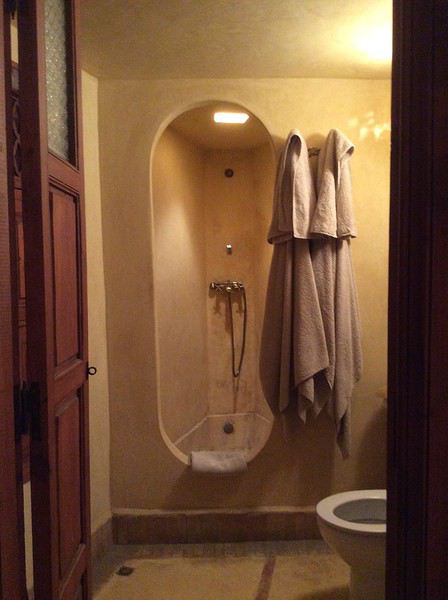
Une fois les bagages déposés, nous retournons au salon déguster un délicieux thé à la menthe, que nous triplons, tout en discutant avec Yolande qui nous donne plein de conseils pour visiter le souk, et la place Jemma el Fna. Elle nous donne aussi une carte de la médina, qui nous permettra de nous diriger. Nous faisons la connaissance d'Alli, charmant et souriant, qui est le gardien et s'occupe du petit déjeuner.
Puis, nous partons pour la place Jemma el fna, à travers le souk el kessabine. Les bicyclettes, les motos ne cessent de passer à côté de nous. Des gens nous proposent des objets à acheter, ou de nous conduire à une foire berbère. Heureusement, Yolande nous a prévenu d'ignorer les sollicitations. Les échoppes de vêtements succèdent aux boutiques de babouches, et aux boutiques de plats en étain ou en bronze. Nous arrivons à la place et tombons sur les animaux de foire: singes tenus en laisse, serpents dans des paniers que les hommes veulent absolument nous mettre sur les épaules ou autour du cou.
Pendant que nous avançons, nous entendons un cri qui semble venir de partout et de nulle part en même temps. C'est un cri rauque, long, qui s'amplifie. Puis nous comprenons que c'est l'appel à la prière. Nous traversons la place en direction d'une librairie pour y acheter une carte du Maroc, puis retournons dans un restaurant pour y dîner un couscous somme toute moyen, avec un délicieux jus d'orange, mais nous profitons d'une vue panoramique pour observer le soleil qui décline, la nuit qui s'installe, les lumières qui illuminent les roulottes qui se sont installées, et la place qui grouille de monde.
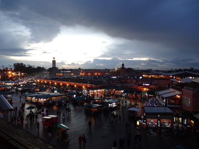
Une fois terminé le dîner, nous prenons le chemin du retour. Grâce à JF nous retrouvons sans encombre, notre trajet à travers le dédale des rues. A un moment, quand nous hésitons pour le choix de la porte d'entrée de Maison Do, des enfants nous montrent la bonne porte. Nous les remercions chaleureusement, et rentrons, dans nos appartements respectifs. Peu de temps, après, nous entendons de nouveau l'appel à la prière. C'est vraiment un bruit bizarre, et nous l'entendons de nos chambre, comme un bruit de fond. Il se produit 5 fois par jour, du coup, nous demandons à Ali à quelle heure est le premier appel. Etonné, il me demande si je veux prier.... 😇 Heu, non, c'est juste pour savoir à quelle heure je vais être réveillée!!! A 5h25 me répond Ali !!! Ah oui, si tôt??? Bon, bah, on va faire avec. Petit déj à 9h: Ok.
A 21h, dodo.
Voici un planning des posts avec les liens pour ceux qui ne veulent pas lire tous les posts; j'en ai profité pour corriger les chiffres des étapes dans lesquels s'étaient glissées des erreurs
Jour 1, Premiers pas dans un pays berbère musulman: le Maroc!
Jour 2, de Marrakech à Imlil, puis Tamatert. jour 3, De Tamatert à Taliouine, en passant par le tizi'n test jour 4, Visite des gorges de tislit et route de Taliouine à Foum zguid jour 4, suite, photos supplémentaires des gorges et route de Tislit à Foum zguid Jour 5, de foum zguid au bivouac de chez Nagui Suite de la journée 5, séjour au bivouac de l'erg Chegaga, Jour 6, du bivouac à Zagora, en passant par M'hamid jour 7, de Zagora à Amellagou, Jour 7 suite de Goulmina à Amellagou Jour 8 départ d'Amellagou en direction de Boumalne Jour 8 (suite) de Assoul en direction des gorges du todra jour 8 suite et fin en direction des gorges du Todra puis de Boumalne dadès Jour 9 circuit autour de Boumalne dadès! Jour 9 circuit autour de Boumalne dadès (suite)! Jour 10: départ de Boumalne Dadès et direction Ait Ben Haddou Jour 11 quelques compléments puis alentours d'Ait ben haddou.
Jour 11 suite: de Ait Ben Haddou à Télouet et la kasbah du Glaoui. (ça y est j'en ai eu le courage!!!) J11 suite et fin, J12 départ pour Paris.
Notre voyage s'est déroulé de fin février à début mars grâce à: - l'aide ultra précieuse de Attila, qui m'a donné envie d'aller visiter cette partie du monde, et qui a été un amour pour me proposer un itinéraire qui me convenait. Mille merci (dans ce cas, on met un "s" à merci?)😏 - l'aide non moins précieuse de Perju, pour les pistes à emprunter, qui pendant tout notre séjour, a surveillé les infos internationales en espérant qu'on n'y parle pas de 2 martiniquais disparus dans le désert..... Perju, tu es une vraie mère poule pour moi!!! Merciiiiiiiiiiiiiiiiiiiiiiiiiiiiiiiiiiiiiiiiiiiiiii.😄 - l'aide logistique et chaleureuse de Lacalo, qui nous a accueilli dans son riad. Il est génial ton riad et c'était super génial de te rencontrer et d'échanger avec toi. Gros gros Gros bisous!!! 😏 - l'aide de tous les membres du forum Maroc qui publie des carnets et donne une mine d'infos, et que je remercie énormément.
Jour 1, Premiers pas dans un pays berbère musulman: le Maroc!
A 12h15, nous avons quitté Paris sous la pluie, et sommes arrivés à Marrakech sous la pluie!!! La compagnie Royal Air Maroc est très bien, un déjeuner nous a été servi, du thé proposé, et le vol s'est bien déroulé, car j'étais assise à côté d'un charmant monsieur qui a bien voulu répondre à mes nombreuses questions et me donner plein de conseils sur mon voyage dans le sud marocain.
Après 3h de vol, nous découvrons le nouvel aéroport de Marrakech, qui a été inauguré pour la COP 22. Il est vraiment très beau, avec ses grands piliers blancs et son toit fait de lattes de différents coloris de bois. L'attente à la police des frontières est correcte comparée à la queue que nous avons eue à Orly.
A notre sortie, après avoir récupéré les bagages, je suis étonnée de ne pas voir Mohamed, le chauffeur qui est censé être venu nous chercher avec un panneau marqué "maison Do", nom du riad dans lequel nous dormons ce soir. Je téléphone donc à Lacalo, la propriétaire du riad, qui parait surprise aussi, appelle son chauffeur et me rappelle. Il est à l'extérieur de l'aéroport: les visiteurs n'ont pas le droit d'entrer dans le hall d'arrivée depuis les attentats!! Gloups!!! Les mesures de sécurité sont drastiques. Je me disais aussi que le hall immense avait l'air bien vide. Personne à l'intérieur à part les quelques voyageurs qui défilent au gré de la récupération de leurs bagages.
Nous sortons donc et faisons la connaissance du souriant et charmant Mohamed. La décision est prise de faire du change au centre ville de Marrakech. Nous découvrons donc la ville rose, où toutes les constructions sont faites de terre ocre, ce qui donne à l'ensemble un charme indiscutable. Nous longeons les remparts aérés de la vieille ville, et les nombreux trous d'aération ingénieusement disséminés dans les murs, font aujourd'hui le bonheur des pigeons qui y trouvent des lieux de nidification parfaits.
De nombreux arbres avec toutes leurs feuilles sont visibles le long de la route, des oliviers, des orangers avec des oranges, mais qui ne sont pas comestibles car elles sont amères!!!!! Dire qu'en Martinique, nous avons des oranges amères que nous consommons sans problème!!! De nombreux arbustes fleuris aussi attirent mon attention, car, il ne faut pas oublier que nous sommes en hiver, qu'il fait 15°C, l'après-midi. Devant mon étonnement, Mohamed m'explique que malgré la période hivernale, il pleut très peu à Marrakech, (et oui, nous arrivons l'un des rares jours où il pleut!!!!) l'ensoleillement est très important d'où les fleurs. Ma foi, quel contraste avec la région parisienne aux arbres complètement dénudés, que nous venons de quitter!!!
C'est marrant finalement, nous sommes partis de Martinique avec le soleil, et l'avons amené avec nous à Paris, ce que tous les habitants espéraient, et nous sommes partis de Paris avec la pluie et l'avons emmené avec nous, à Marrakech, ce qui fait le bonheur des Marrackchis!!!! Trop fort ces martiniquais!!!!!
A la recherche d'un bureau de change, Mohamed s'arrête tout d'abord près d'une banque, mais elle est fermée. Nous passons à travers des portes en arche, qui jalonnent les remparts, mais elles ne laissent passer qu'une voiture à la fois.
Nous sommes dans l'enceinte de la vieille ville. Je découvre avec plaisir ma première ville arabe, avec ses mosquées et leur minaret si emblématique, son palais royal et ses remparts.
Le dépaysement est total et tous mes sens sont en éveil. Les véhicules qui circulent sont très insolites: des motos qui tirent des bennes, des ânes qui tirent des charrettes, des calèches pour touristes tirées par des chevaux.... Je me sens comme une enfant de 5 ans qui découvre le monde. Tout est nouveau.
Nous nous dirigeons vers la medina, et passons par des ruelles ultra encombrées, de gens à pied, à bicyclette, à moto, conduisant des charrettes tirées par des ânes. Mohamed klaxonne maintenant de façon continue et avance régulièrement malgré la densité de la circulation, entre les échoppes régulièrement disposées le long des ruelles. Heureusement que ces rues sont à sens unique, malgré les motos qui circulent à contresens, nous sommes heureux de ne pas avoir à conduire dans ce dédale labyrinthique pour nous étrangers.
Mohamed s'arrête finalement devant une boutique et nous demande de suivre l'un des vigiles placés à l'entrée. Nous traversons un magasin remplis de babioles en tout genre, style brocante, mais brocante marocaine, porcelaine, instruments de musique, tapis, parfums, plats en bronze, horloges, .... Et les senteurs orientales sont un pur bonheur pour mes narines. Ah, nous voilà arrivés, ....... devant la caissière!!!! Et c'est elle qui va nous faire le change!!! On ne nous l'avait pas encore faite, celle là. Nous attendons donc un bon moment, que les clients de marchandises aient fini de régler leurs achats, pour que nous, les clients de devises, nous puissions échanger nos devises.
Lorsque nous retournons à la voiture, nous rencontrons Mohamed qui s'inquiétait de nous voir prendre tant de temps. Embarquement, puis direction maison Do. En cours de route, nous appelons Madame Yolande, pour qu'elle vienne à notre rencontre, au point de rendez- vous. Je découvre enfin avec plaisir, en vrai, le membre Lacalo du forum. Nous débarquons les bagages, et la suivons dans les ruelles pavées inégalement, sur 200m jusqu'à notre hébergement.
Nous entrons par une porte basse, typique des constructions locales, Jf, qui fait plus d'1,85m, doit se baisser et faire attention à sa tête. De surcroit, il faut lever les jambes pour franchir le pas de la porte, tout en se baissant, ce qui demande des qualités d'équilibriste. Moi, qui ne suis pas si grande, je suis comme un poisson dans l'eau. Même pas besoin de baisser la tête. Ce pays est fait pour moi. Quelques escaliers nous conduisent à un patio surmonté d'une verrière, sur lequel donnent les chambres.
D'un coté, un petit salon lecture. De l'autre, le salon petit déjeuner. C'est splendide. Nous découvrons note chambre duo, élégante, raffinée, orientale à souhait. La salle de bain attenante me fait me sentir dans une maison de poupée.
Une fois les bagages déposés, nous retournons au salon déguster un délicieux thé à la menthe, que nous triplons, tout en discutant avec Yolande qui nous donne plein de conseils pour visiter le souk, et la place Jemma el Fna. Elle nous donne aussi une carte de la médina, qui nous permettra de nous diriger. Nous faisons la connaissance d'Alli, charmant et souriant, qui est le gardien et s'occupe du petit déjeuner.
Puis, nous partons pour la place Jemma el fna, à travers le souk el kessabine. Les bicyclettes, les motos ne cessent de passer à côté de nous. Des gens nous proposent des objets à acheter, ou de nous conduire à une foire berbère. Heureusement, Yolande nous a prévenu d'ignorer les sollicitations. Les échoppes de vêtements succèdent aux boutiques de babouches, et aux boutiques de plats en étain ou en bronze. Nous arrivons à la place et tombons sur les animaux de foire: singes tenus en laisse, serpents dans des paniers que les hommes veulent absolument nous mettre sur les épaules ou autour du cou.
Pendant que nous avançons, nous entendons un cri qui semble venir de partout et de nulle part en même temps. C'est un cri rauque, long, qui s'amplifie. Puis nous comprenons que c'est l'appel à la prière. Nous traversons la place en direction d'une librairie pour y acheter une carte du Maroc, puis retournons dans un restaurant pour y dîner un couscous somme toute moyen, avec un délicieux jus d'orange, mais nous profitons d'une vue panoramique pour observer le soleil qui décline, la nuit qui s'installe, les lumières qui illuminent les roulottes qui se sont installées, et la place qui grouille de monde.
Une fois terminé le dîner, nous prenons le chemin du retour. Grâce à JF nous retrouvons sans encombre, notre trajet à travers le dédale des rues. A un moment, quand nous hésitons pour le choix de la porte d'entrée de Maison Do, des enfants nous montrent la bonne porte. Nous les remercions chaleureusement, et rentrons, dans nos appartements respectifs. Peu de temps, après, nous entendons de nouveau l'appel à la prière. C'est vraiment un bruit bizarre, et nous l'entendons de nos chambre, comme un bruit de fond. Il se produit 5 fois par jour, du coup, nous demandons à Ali à quelle heure est le premier appel. Etonné, il me demande si je veux prier.... 😇 Heu, non, c'est juste pour savoir à quelle heure je vais être réveillée!!! A 5h25 me répond Ali !!! Ah oui, si tôt??? Bon, bah, on va faire avec. Petit déj à 9h: Ok.
A 21h, dodo.