Results for "frontière+|+9+>+197"
51220 results found.
Traversée Mauritanie vers le Sénégal English translation pending
J'enquête pour le compte de Nathalie et son fiston Thomas (7ans aujourd'hui), qui, au départ de Marseille, partent 9 mois à Dakar en fin octobre .
Ils voulaient au départ y aller en voiture, mais apparemment 2 choses les freinent : le prix de la traversée voiture au départ de Marseille et du dédouanement, La traversée de la Mauritanie, car parait il qu'il n'y a "qu'une route sableuse, praticable uniquement lorsque le marée est basse"....😕
Qui peut éclairer notre lanterne ?
D'avance, merci de nous donner vos infos, toutes bonnes à prendre, et pourquoi pas un co voiturage s'il se présentait ? (Ils sont trés sympas tous les deux)
ion ion
Ils voulaient au départ y aller en voiture, mais apparemment 2 choses les freinent : le prix de la traversée voiture au départ de Marseille et du dédouanement, La traversée de la Mauritanie, car parait il qu'il n'y a "qu'une route sableuse, praticable uniquement lorsque le marée est basse"....😕
Qui peut éclairer notre lanterne ?
D'avance, merci de nous donner vos infos, toutes bonnes à prendre, et pourquoi pas un co voiturage s'il se présentait ? (Ils sont trés sympas tous les deux)
ion ion
Les problèmes de sécurité en Turquie English translation pending
Ma famille ( 2 adultes et 2 enfants ) souhaitait se rendre en turquie. Le ministère français des affaires étrangères déconseille ce pays pour les raisons suivantes :
LE MINISTERE DES AFFAIRES ETRANGERES de France
Des pluies diluviennes étant annoncées pour les prochains jours, les autorités d'Istanbul ont lancé, le 15 août, une alerte aux inondations.
Dans la nuit du 9 au 10 août 2004, deux attentats ont visé des hôtels de quartiers touristiques d'Istanbul (un dans le quartier de Laleli, le second dans le quartier de Sultanahmet) faisant deux morts et 7 blessés. Ces attentats, qui font suite à ceux perpétrés le 2 juillet contre un gouverneur dans l'est du pays, le 24 juin à l'approche du sommet de l'OTAN, à Ankara et à Istanbul, le 9 mars 2004 contre une loge maçonnique à Istanbul, et les 15 et 20 novembre 2003 à Istanbul, confirment la présence d'un risque terroriste en Turquie.
Les voyageurs projetant de se rendre en Turquie, et ayant décidé de maintenir leur voyage sont invités à faire preuve de la plus grande vigilance pendant toute la durée de leur séjour, particulièrement dans les grandes villes.
Un tremblement de terre, d'une magnitude de 5, 2 sur l'échelle de Richter, a eu lieu le 2 juillet 2004 dans les environs de la ville de Dogubayazit, située au nord-est de Van, à une vingtaine de km des frontières turco-arménienne et turco-iranienne. Bilan: plus de 20 morts et autant de blessés.
Compte tenu du risque de répliques, il est conseillé de faire preuve de vigilance lors de déplacements dans cette zone.
La frontière avec l'Irak reste fermée jusqu'à nouvel ordre. Il convient de faire preuve de la plus grande prudence en se rendant dans les districts du sud-est de la Turquie, d'éviter tout déplacement de nuit et dans des zones isolées. Par ailleurs, des restrictions à la circulation ne peuvent être exclues dans les districts frontaliers avec l'Irak, notamment dans les régions de Sirnak et d'Hakkari.
L'annonce par l'organisation terroriste PKK, à deux reprises, début septembre 2003 et fin mai 2004, d'une rupture du cessez-le-feu ne modifie pas de façon significative les indications qui précèdent. Les activités hostiles aux forces de l'ordre n'avaient d'ailleurs jamais été totalement interrompues. On observe une légère recrudescence depuis quelques semaines de ces activités.
Conseils généraux de sécurité
Avertissement
Dans les grandes villes et notamment à Istanbul, il est recommandé d'éviter dans la mesure du possible les situations potentielles à risque, telles qu'attroupements, ainsi que les quartiers périphériques et la proximité des commissariats de police ou des postes de gendarmerie. Il convient donc, en tout état de cause, de faire preuve de vigilance.
Avertissement concernant la drogue: Sur la fameuse "route des Balkans", la Turquie est un pays de transit en matière de produits stupéfiants (cannabis, héroïne, cocaïne, amphétamines, etc...). Il est conseillé de n'accepter aucun colis sans en connaître le contenu et, à fortiori, de n'acheter aucun produit "douteux", les peines encourues pouvant être très lourdes. L'usage et la détention de produits stupéfiants sont punissables d'une peine d'emprisonnement d'un à deux ans. Le trafic est punissable de peines allant de six à douze ans. Il existe des circonstances aggravantes (cession aux mineurs, ...).
La prudence est recommandée si on est abordé par des individus qui peuvent avoir des intentions malhonnêtes, lorsqu'ils proposent des boissons ou des aliments pouvant contenir des tranquillisants.
Compte tenu de la très forte inflation, il vaut mieux changer son argent au fur et à mesure des besoins. Les cartes Visa, Eurocard/Mastercard sont acceptées dans les grandes villes et les centres touristiques. Il est possible de procéder à des retraits de liquidités dans les distributeurs automatiques. Vérifier le change qui vous est rendu (tendance à l'escroquerie sur le change).
Dans le cas d'utilisation de la carte bleue, rester très prudent si la facturette est établie par le système du "fer à repasser" car les carbones sont susceptibles d'être réutilisés pour établir une fausse facture. En cas de perte de la carte visa, faire immédiatement opposition (noter le numéro sur un document séparé).
Risque sismique :
Le pays se trouvant sur une zone de forte activité sismique.
www.france.diplomatie.fr/voyageurs/etrangers/avis/conseils/fiches/fiche.asp?onglet=1&pays=TURQUIE
Y-a-t-il effectivement danger??
LE MINISTERE DES AFFAIRES ETRANGERES de France
Des pluies diluviennes étant annoncées pour les prochains jours, les autorités d'Istanbul ont lancé, le 15 août, une alerte aux inondations.
Dans la nuit du 9 au 10 août 2004, deux attentats ont visé des hôtels de quartiers touristiques d'Istanbul (un dans le quartier de Laleli, le second dans le quartier de Sultanahmet) faisant deux morts et 7 blessés. Ces attentats, qui font suite à ceux perpétrés le 2 juillet contre un gouverneur dans l'est du pays, le 24 juin à l'approche du sommet de l'OTAN, à Ankara et à Istanbul, le 9 mars 2004 contre une loge maçonnique à Istanbul, et les 15 et 20 novembre 2003 à Istanbul, confirment la présence d'un risque terroriste en Turquie.
Les voyageurs projetant de se rendre en Turquie, et ayant décidé de maintenir leur voyage sont invités à faire preuve de la plus grande vigilance pendant toute la durée de leur séjour, particulièrement dans les grandes villes.
Un tremblement de terre, d'une magnitude de 5, 2 sur l'échelle de Richter, a eu lieu le 2 juillet 2004 dans les environs de la ville de Dogubayazit, située au nord-est de Van, à une vingtaine de km des frontières turco-arménienne et turco-iranienne. Bilan: plus de 20 morts et autant de blessés.
Compte tenu du risque de répliques, il est conseillé de faire preuve de vigilance lors de déplacements dans cette zone.
La frontière avec l'Irak reste fermée jusqu'à nouvel ordre. Il convient de faire preuve de la plus grande prudence en se rendant dans les districts du sud-est de la Turquie, d'éviter tout déplacement de nuit et dans des zones isolées. Par ailleurs, des restrictions à la circulation ne peuvent être exclues dans les districts frontaliers avec l'Irak, notamment dans les régions de Sirnak et d'Hakkari.
L'annonce par l'organisation terroriste PKK, à deux reprises, début septembre 2003 et fin mai 2004, d'une rupture du cessez-le-feu ne modifie pas de façon significative les indications qui précèdent. Les activités hostiles aux forces de l'ordre n'avaient d'ailleurs jamais été totalement interrompues. On observe une légère recrudescence depuis quelques semaines de ces activités.
Conseils généraux de sécurité
Avertissement
Dans les grandes villes et notamment à Istanbul, il est recommandé d'éviter dans la mesure du possible les situations potentielles à risque, telles qu'attroupements, ainsi que les quartiers périphériques et la proximité des commissariats de police ou des postes de gendarmerie. Il convient donc, en tout état de cause, de faire preuve de vigilance.
Avertissement concernant la drogue: Sur la fameuse "route des Balkans", la Turquie est un pays de transit en matière de produits stupéfiants (cannabis, héroïne, cocaïne, amphétamines, etc...). Il est conseillé de n'accepter aucun colis sans en connaître le contenu et, à fortiori, de n'acheter aucun produit "douteux", les peines encourues pouvant être très lourdes. L'usage et la détention de produits stupéfiants sont punissables d'une peine d'emprisonnement d'un à deux ans. Le trafic est punissable de peines allant de six à douze ans. Il existe des circonstances aggravantes (cession aux mineurs, ...).
La prudence est recommandée si on est abordé par des individus qui peuvent avoir des intentions malhonnêtes, lorsqu'ils proposent des boissons ou des aliments pouvant contenir des tranquillisants.
Compte tenu de la très forte inflation, il vaut mieux changer son argent au fur et à mesure des besoins. Les cartes Visa, Eurocard/Mastercard sont acceptées dans les grandes villes et les centres touristiques. Il est possible de procéder à des retraits de liquidités dans les distributeurs automatiques. Vérifier le change qui vous est rendu (tendance à l'escroquerie sur le change).
Dans le cas d'utilisation de la carte bleue, rester très prudent si la facturette est établie par le système du "fer à repasser" car les carbones sont susceptibles d'être réutilisés pour établir une fausse facture. En cas de perte de la carte visa, faire immédiatement opposition (noter le numéro sur un document séparé).
Risque sismique :
Le pays se trouvant sur une zone de forte activité sismique.
www.france.diplomatie.fr/voyageurs/etrangers/avis/conseils/fiches/fiche.asp?onglet=1&pays=TURQUIE
Y-a-t-il effectivement danger??
Réseau GSM Orange English translation pending
Partant à l'hôtel SUNSCAPE CASA DEL MAR à BAYAHIBE ce jeudi - pouvez vous m'indiquer si l'on obtient du réseau GSM ORANGE - réponse urgente
Conseils sur Rangoon/Yangon au Myanmar English translation pending
Salut,
Je souhaite voyager a Rangoun/Yangon, est-ce que quelqu'un a des infos, conseils?
Merci
Pamina
Je souhaite voyager a Rangoun/Yangon, est-ce que quelqu'un a des infos, conseils?
Merci
Pamina
Liaisons Bangkok-Angkor (Cambodge) English translation pending
bonjour,
quelles sont les differents options possibles (avion ou train ou bus...) ?
à quel prix et aussi la durée du déplacement ?
merci 😏
quelles sont les differents options possibles (avion ou train ou bus...) ?
à quel prix et aussi la durée du déplacement ?
merci 😏
Ambiance indienne... envoutante English translation pending
Ceux qui ne connaissent pas encore Susheela Raman je leur conseille de l'ecouter trés vite 🙂
Britano-indienne, sa musique est à la mesure de son metissage, on se retrouve entre 2 mondes où les frontières sont abolies, les 2 univers apparement contradictoires se mélent pour donner vie à des mélodies agréablement rythmées, planantes...
Planante aussi, peut etre plus "indienne", la compil Indian Loundge idéal pour nuits étoilées eclairée par quelques bougies et un brin d'encens.... rechauffe l'hiver!
Je ne m'en lasse pas je suis transportée à chaque fois...
Nicaragua -côte caraibe - transport pour corn island English translation pending
hola,
alors voilà on se casse dans 2 semaines pour un itinéraire Guaté-Salvador et nicaragua.... au nica on voudrait aller du coté de corn island, little c.i etc... on se demande kel est le meilleur le moyen pour rejoindre corn island. Je sais kil est possible de longet le fleuve depuis le costa-rica pour remonter a la frontière du nica ..mais est-ce ke ca vaut la peine ?
sinon toute infos sur le pays, bons plans, bonne adresses .. des trucs à voir ki vous ont marqué !!! welcome les infos!!!! également sur le salvador ????
merci à ki voudra prendre le temps de me répondre !!!
Salutations, maud
alors voilà on se casse dans 2 semaines pour un itinéraire Guaté-Salvador et nicaragua.... au nica on voudrait aller du coté de corn island, little c.i etc... on se demande kel est le meilleur le moyen pour rejoindre corn island. Je sais kil est possible de longet le fleuve depuis le costa-rica pour remonter a la frontière du nica ..mais est-ce ke ca vaut la peine ?
sinon toute infos sur le pays, bons plans, bonne adresses .. des trucs à voir ki vous ont marqué !!! welcome les infos!!!! également sur le salvador ????
merci à ki voudra prendre le temps de me répondre !!!
Salutations, maud
Visas et entrées multiples en Asie du Sud-Est English translation pending
Bonjour,
Je dispose d'un billet d'avion Paris <-> Bangkok. La durée totale de mon voyage est de 12 semaines environ. Ce voyage est de type course et course contre la montre, peu importe...😄
Les chiffres ci-dessous ne sont donnés qu'à titre indicatif. Ne vous en préoccupez pas trop. L'important pour moi n'est pas là.
Le terme "par voie terrestre" désigne par bus, à pieds, ou en train.
Mes finances ne me permettent pas d'utiliser l'avion comme moyen de transport entre les pays.
Je souhaite me procurer les visas seulement lors du passage aux frontières, selon possibilité.
Mon voyage est le suivant (ordre chronologique; de fin février à fin mai):
1- Paris -> Bangkok. 2- Séjour 2 semaines en Thaïlande. 3- Passage Thaïlande -> Laos par voie terrestre. 4- Séjour de quelques jours au Laos. 5- Passage Laos -> Viêtnam par voie terrestre. 6- Séjour 3 semaines au Viêtnam. 7- Passage Viêtnam -> Cambodge par voie terrestre. 8- Séjour de quelques jours au Cambodge. 9- Passage Cambodge -> Thaïlande par voie terrestre. 10- Séjour 2 semaines en Thaïlande. 11- Passage Thaïlande -> Malaisie par voie terrestre. 12- Séjour de quelques jours en Malaisie. 13- Passage Malaisie -> Indonésie (Sumatra) en bateau. 14- Séjour de 3-4 semaines en Indonésie.
Ensuite, selon l'état de mes finances, 2 choix:
a)
15- Avion Indonésie (Jakarta ou Denpasar, Bali) -> Bangkok. 16- Quelques jours à Bangkok et allentours. 17- Bangkok -> Paris.
ou
b)
15- Retour sans arrêt véritable Indonésie -> Singapour (bateau) -> Malaisie (voie terrestre) -> Thaïlande (voie terrestre). 16- Quelques jours à Bangkok et allentours. 17- Bangkok -> Paris.
Ma question est simple: Quels visas me sont nécessaires et où puis-je les obtenir (je veux dire où SUR PLACE, pas en France; de préférence lors du passage des frontières) ? Problèmes/difficultés en vue ou pas ?
Notez que ce voyage nécessite 3 entrées en Thaïlande et, dans le cas b), 2 entrées en malaisie.
Notez aussi que je souhaite économiser le plus possible sur le coût des visas et sur leur délais d'obtention, quand c'est possible.
Info *utile* à savoir: Je voyagerais avec un bonne quantité de matériel photo (1 app photo argentique + 2 optiques, 1 app photo numérique réflex, 1 app photo numérique compact, accessoires pour optique, 1 disque dur externe pour décharge des cartes mémoires APN (petite taille), 1 graveur CDrom externe pour sauvegarde des photos numériques (petite taille), 20-30 CDs pour les gravures, 30-50 pellicules photo argentique, matériel pour recharger les accus des divers accessoires), et peut-être aussi avec un camescope numérique (+15-20 K7). Je ne suis pas journaliste ou autre, juste quelqu'un qui aime beaucoup la photo et la vidéo. 200 photos en moyenne par jour.
Autre question: Un billet d'avion Bangkok -> Paris constitue t'il, hors Thaïlande, un justificatif de poursuite de voyage aux frontières terrestres, fluviales et maritimes (billet retour ou justificatif de poursuite de voyage parfois demandé aux frontières) ?
Merci pour votre aide. 🙂
Michaël
Je dispose d'un billet d'avion Paris <-> Bangkok. La durée totale de mon voyage est de 12 semaines environ. Ce voyage est de type course et course contre la montre, peu importe...😄
Les chiffres ci-dessous ne sont donnés qu'à titre indicatif. Ne vous en préoccupez pas trop. L'important pour moi n'est pas là.
Le terme "par voie terrestre" désigne par bus, à pieds, ou en train.
Mes finances ne me permettent pas d'utiliser l'avion comme moyen de transport entre les pays.
Je souhaite me procurer les visas seulement lors du passage aux frontières, selon possibilité.
Mon voyage est le suivant (ordre chronologique; de fin février à fin mai):
1- Paris -> Bangkok. 2- Séjour 2 semaines en Thaïlande. 3- Passage Thaïlande -> Laos par voie terrestre. 4- Séjour de quelques jours au Laos. 5- Passage Laos -> Viêtnam par voie terrestre. 6- Séjour 3 semaines au Viêtnam. 7- Passage Viêtnam -> Cambodge par voie terrestre. 8- Séjour de quelques jours au Cambodge. 9- Passage Cambodge -> Thaïlande par voie terrestre. 10- Séjour 2 semaines en Thaïlande. 11- Passage Thaïlande -> Malaisie par voie terrestre. 12- Séjour de quelques jours en Malaisie. 13- Passage Malaisie -> Indonésie (Sumatra) en bateau. 14- Séjour de 3-4 semaines en Indonésie.
Ensuite, selon l'état de mes finances, 2 choix:
a)
15- Avion Indonésie (Jakarta ou Denpasar, Bali) -> Bangkok. 16- Quelques jours à Bangkok et allentours. 17- Bangkok -> Paris.
ou
b)
15- Retour sans arrêt véritable Indonésie -> Singapour (bateau) -> Malaisie (voie terrestre) -> Thaïlande (voie terrestre). 16- Quelques jours à Bangkok et allentours. 17- Bangkok -> Paris.
Ma question est simple: Quels visas me sont nécessaires et où puis-je les obtenir (je veux dire où SUR PLACE, pas en France; de préférence lors du passage des frontières) ? Problèmes/difficultés en vue ou pas ?
Notez que ce voyage nécessite 3 entrées en Thaïlande et, dans le cas b), 2 entrées en malaisie.
Notez aussi que je souhaite économiser le plus possible sur le coût des visas et sur leur délais d'obtention, quand c'est possible.
Info *utile* à savoir: Je voyagerais avec un bonne quantité de matériel photo (1 app photo argentique + 2 optiques, 1 app photo numérique réflex, 1 app photo numérique compact, accessoires pour optique, 1 disque dur externe pour décharge des cartes mémoires APN (petite taille), 1 graveur CDrom externe pour sauvegarde des photos numériques (petite taille), 20-30 CDs pour les gravures, 30-50 pellicules photo argentique, matériel pour recharger les accus des divers accessoires), et peut-être aussi avec un camescope numérique (+15-20 K7). Je ne suis pas journaliste ou autre, juste quelqu'un qui aime beaucoup la photo et la vidéo. 200 photos en moyenne par jour.
Autre question: Un billet d'avion Bangkok -> Paris constitue t'il, hors Thaïlande, un justificatif de poursuite de voyage aux frontières terrestres, fluviales et maritimes (billet retour ou justificatif de poursuite de voyage parfois demandé aux frontières) ?
Merci pour votre aide. 🙂
Michaël
Interdiction voitures plus de 5 ans au Sénégal English translation pending
Le Sénégal interdit depuis fin Juillet l'importation des voitures de plus de 5 ans (minibus 8 ans et camions 10 ans) Les voitures plus vieilles ne peuvent passer la frontière qu'avec un carnet de douane.Actuellement, celles qui en sont démunies sont refoulées à la frontière
Budget moyen en Jordanie? English translation pending
Hello tlm,
J'aurai aimé savoir quel était le budget moyen pour un voyage de +/-9 nuits en Jordanie ? Il est préférable de loger où et à quel prix ? Qu'est ce qu'il coûte cher ?
Par ailleurs, pour ceux qui sont allé en Jordanie, qu'est ce qu'il n'est pas indispensable de visiter...étant donné qu'on ne passera qu'une dizaine de jours.
Toute adresse, info, conseil etc sont les bienvenue et d'avance je vous en remercie !
A+ Birzouki
J'aurai aimé savoir quel était le budget moyen pour un voyage de +/-9 nuits en Jordanie ? Il est préférable de loger où et à quel prix ? Qu'est ce qu'il coûte cher ?
Par ailleurs, pour ceux qui sont allé en Jordanie, qu'est ce qu'il n'est pas indispensable de visiter...étant donné qu'on ne passera qu'une dizaine de jours.
Toute adresse, info, conseil etc sont les bienvenue et d'avance je vous en remercie !
A+ Birzouki
Risques en Turquie suite au conflit en Irak English translation pending
Je pars normalement fin juin avec mon mari et mes 3 enfants (12, 9 et 3 ans) en club à Dydime en Turquie. Etant donné ce qui se passe en Irak, toutes les personnes qui connaissent notre projet de vacances, nous déconseillent de partir. Raisons : risque de débordements d'une population musulmane face à des occidentaux, renversement de régime, risque accru de détournement d'avion et d'actes terroristes, erreur de tirs de missiles, etc... Même mon mari et mes enfants sont inquiets... Je vais régulièrement sur les sites des conseils aux voyageurs mais officiellement rien ne justifie pour l'instant un changement de programme. Ils recommandent cependant d'être vigilant et de se tenir au courant des événements. Le problème est que plus le temps passe, plus les frais d'annulation seront élevés...
Que me conseillez-vous ? Depuis le moment où j'ai réservé (fin janvier), je me pose des questions ... Avons-nous le droit d'exposer notre famille à des risques ? Il vaut peut-être mieux attendre l'année prochaine ?
Merci de vos conseils !!!!
Qui connait le Viva Dominicus? English translation pending
bonjour, j'aimerais connaitre les impréssions de personnes qui sont allés à ce club
cet hotel est proposé par AIR TRANSAT et revendique une animation francophone. pouvez vous me le confirmer.
avez vous des infos concernant le mini club???
toutes les infos sont les bien venues.
je reviens de l'hotel le Mélao, paladien nouvelles frontières🙂🙂🙂 si quelqu'un est intéréssé.
merci 😉
isabelle
cet hotel est proposé par AIR TRANSAT et revendique une animation francophone. pouvez vous me le confirmer.
avez vous des infos concernant le mini club???
toutes les infos sont les bien venues.
je reviens de l'hotel le Mélao, paladien nouvelles frontières🙂🙂🙂 si quelqu'un est intéréssé.
merci 😉
isabelle
Demande d'infos sur le Brésil English translation pending
Salut à tous !! 😄
Je vais partir durant 3 semaines (du 15 fév. au 9 mars 2003) au Brésil pour la 1ère fois et j'aimerais avoir des conseils sur les visites, les bons plans hébergements, les villes à visiter (on m'a vivement conseillé Bahia plutôt que rio ) etc...
A + et.......bon voyage ! 😉
Je vais partir durant 3 semaines (du 15 fév. au 9 mars 2003) au Brésil pour la 1ère fois et j'aimerais avoir des conseils sur les visites, les bons plans hébergements, les villes à visiter (on m'a vivement conseillé Bahia plutôt que rio ) etc...
A + et.......bon voyage ! 😉
Road conditions between San Pedro de Atacama and Salta, Argentina
Hi,
we’re planning a round trip from San Pedro de Atacama, Chile, to Salta, Argentina, in two months. On the way there, we’ll take the northern route via Susques, Route 27, then 52. But for the return, we were thinking of taking the southern route via San Antonio de los Cobres, Route 51, then 23. Is it similar to the northern route in terms of road surface? How busy is it, and are there gas stations? Basically, should we be worried about doing it in an SUV that’s supposedly 4x4 but has regular road tires and no second spare wheel, obviously...
I’ve seen that we can stop over in San Antonio de los Cobres.
Thanks for your feedback.
Raf.
What's the best way to get to Denmark for a cycling trip?
Good evening,
We’re planning a cycling tour in Denmark and I’m figuring out how to get there. We have electric mountain bikes (and since I’m really happy with mine, I’d prefer not to rent bikes there). We have 9 days.
- I looked into trains, but the prices aren’t great, and I’m worried we won’t always be able to take our bikes. Packing them in a bag and disassembling them seems overwhelming, especially given how big mine is.
- The Flexibus: we’d have to go through Paris from Lyon, which would waste a lot of time.
- Flying? It might not be more expensive than the train.
- We have a camper van, and I’m wondering if that’s an option. Do you know if you can park your vehicle for a week in a parking lot? I get the impression that parking time is limited. Thanks for your advice! Have a great evening,
Sandrine
We’re planning a cycling tour in Denmark and I’m figuring out how to get there. We have electric mountain bikes (and since I’m really happy with mine, I’d prefer not to rent bikes there). We have 9 days.
- I looked into trains, but the prices aren’t great, and I’m worried we won’t always be able to take our bikes. Packing them in a bag and disassembling them seems overwhelming, especially given how big mine is.
- The Flexibus: we’d have to go through Paris from Lyon, which would waste a lot of time.
- Flying? It might not be more expensive than the train.
- We have a camper van, and I’m wondering if that’s an option. Do you know if you can park your vehicle for a week in a parking lot? I get the impression that parking time is limited. Thanks for your advice! Have a great evening,
Sandrine
Thailand and TDAC: How does it work?
Hello to all the Thailand regulars.
I’ve been to Thailand several times, but it was about 20 years ago…
There’s a new system in place now, it seems.
TDAC – Thailand Digital Arrival Card.
Before arriving, I apply for a TDAC, okay. If during my stay I cross the border to spend a few days in Malaysia and then re-enter Thailand, do I need to submit a new TDAC application? Do I use the same TDAC as when I first entered the country?
Or do I initially have to pay for a Thai multi-entry visa?
Thanks in advance for your insights—I can’t find the answer online.
Pierre
I’ve been to Thailand several times, but it was about 20 years ago…
There’s a new system in place now, it seems.
TDAC – Thailand Digital Arrival Card.
Before arriving, I apply for a TDAC, okay. If during my stay I cross the border to spend a few days in Malaysia and then re-enter Thailand, do I need to submit a new TDAC application? Do I use the same TDAC as when I first entered the country?
Or do I initially have to pay for a Thai multi-entry visa?
Thanks in advance for your insights—I can’t find the answer online.
Pierre
Recap of 17 days between São Paulo, Rio de Janeiro, and Iguaçu/Puerto Iguazu
I’ll repost here the comments I gave in reply to Camidav – see their post https://voyageforum.com/forum/partir-10-jours-bresil-en-autonomie-d10702249/.
As we’ve said several times, 10 days is short for Brazil! But it’s still enough for a “little introduction.” My very recent experience (April 2025) with a 2½-week itinerary might give you some ideas. To start, here’s the route:
- - Saturday, March 29: departure from Lisbon and arrival in São Paulo with LATAM
- - 2 nights in São Paulo
- - Monday, March 31: bus from São Paulo to Paraty
- - Monday 31, Tuesday 1st, and Wednesday, April 2: 3 nights in Paraty
- - Thursday, April 3: bus from Paraty to Angra dos Reis, then ferry > Ilha Grande
- - Thursday 3, Friday 4, and Saturday, April 5: 3 nights in Abraão, on Ilha Grande
- - Sunday, April 6: speedboat > Conceição de Jacareí, then bus > Rio de Janeiro
- - Sunday 6, Monday 7, Tuesday 8, and Wednesday, April 9: 4 nights in Rio
- - Thursday, April 10: flight with LATAM from Rio to Foz do Iguaçu
- - Thursday, April 10: one night in Foz do Iguaçu
- - Friday, April 11: visit to Iguaçu Falls on the Brazilian side, then crossing the border to Puerto Iguazu
- - Friday 11 and Saturday, April 12: 2 nights in Puerto Iguazu
- - Saturday, April 12: visit to the falls on the Argentine side
- - Sunday, April 13: return to Brazil, LATAM flight > São Paulo
- - Sunday 13 and Monday, April 14: 2 nights in São Paulo
- - Tuesday, April 15: flight from São Paulo > Lisbon with LATAM, arriving Wednesday the 16th.
So, it’s clear I’m writing this now from Puerto Iguazu (Argentina), and the end of the trip is near: back to São Paulo and then the flight to Lisbon. I’ll of course share more about all this in the following messages.
California summer road trip itinerary with kids: your recommendations
Hi there,
We’re heading to California at the end of July for a road trip with our two kids, aged 7 and 9.
Here’s our planned two-week itinerary:
Los Angeles - San Diego - Palm Springs - Yosemite - Carmel and Big Sur - Santa Barbara - Los Angeles.
We don’t want to go to San Francisco.
Does this itinerary sound good to you?
Any recommendations for accommodations, especially in Yosemite and Carmel?
Thanks in advance for your help.
Thanks in advance for your help.
Sri Lanka Trip Report – December 2024
Hi there,
I just got back from a trip to Sri Lanka from December 18th to January 1st with 2 adults and 2 kids (12 years old).
If it helps, here’s my itinerary.
We left on December 18th from Madrid with Qatar Airways. No complaints. I booked my tickets back in March for 800 € per person. (I flew from Madrid because I live near the Spanish border and was too worried about strikes in France.) We arrived on December 19th at 4 PM (local time). Before leaving France, I’d booked a taxi through MyTransfer for 59 € to Sigiriya. A van was waiting for us at the airport exit. A never-ending 3-hour drive to Sigiriya. We stayed at Samana Guesthouse—very simple, clean, with a pool and an excellent Sri Lankan breakfast. Shower and straight to bed.
Friday, December 20th: Beautiful weather, but very humid and hot. We visited Lion Rock (36 € for adults) and then Pidurangala. I loved both sites—they’re a must-do in my opinion. Spent the late afternoon by the pool.
Saturday, December 21st: Another gorgeous day. The guesthouse manager offered us a free 2-hour tuk-tuk tour. We first visited a lake, rice fields, the temple, and the Sigiriya market, plus the usual tourist trap—the botanical garden (no pressure to buy anything at the end). Then we took a tuk-tuk to Dambulla Temple, the Golden Buddha, and the wholesale market.
Sunday, December 22nd: Still beautiful weather. I’d booked a taxi for 8 AM. We did all the long trips by taxi to save time. I’d ask for prices from 2 or 3 WhatsApp taxi agencies 2 days or the day before—super responsive, always got replies within 5 minutes. We headed to Ella (4-hour drive) for 22,000 LKR. Arrived in the afternoon at Rest Full Homestay—a small, family-run guesthouse. Clean, cozy, and an amazing Sri Lankan breakfast. In the afternoon, we went to Nine Arches Bridge. It was a Sunday, a Sri Lankan holiday, so it was *packed*—mostly locals and very few white tourists! Even though it was crowded, it was cool because it was all Sri Lankans. We waited an hour for the train. It’s worth seeing, but honestly, I didn’t think it was that amazing. Then we headed to the station to check if we needed to book tickets for the train to Haputale—turns out, no.
Monday, December 23rd: Beautiful weather. We hiked Ella Rock—a gorgeous trek. The final stretch is steep but shaded, so it wasn’t as tough as I’d read. The whole hike is stunning from start to finish. We saw the train pass twice (one blue, one red) and lots of women picking tea. After that, we did Little Adam’s Peak. It’s not hard, but it was *packed* with tourists—meh. Luckily, at the top, you can walk a bit farther (down one side and back up) to get some space to yourself. What I *didn’t* like was the commercial vibe at the big café/restaurant with a pool at the entrance of Little Adam’s Peak. Loud music, all that money being made right next to little souvenir stands run by Sri Lankans or tea-picking women. Felt off. Ended the day buying souvenirs at one of the few shops we found during the trip.
Tuesday, December 24th: Beautiful weather. Took the train to Haputale. We got to the station 30 minutes before the 9:30 AM train. We could’ve taken 2nd or 3rd class—I went with 2nd (160 LKR per person). It was crowded, but we managed to get seats—first 2, then 3. Only a 1-hour ride, but I *loved* it—windows and doors open the whole time. Arrived in Haputale around 11 AM, and the mist was already rolling in. We walked to our guesthouse, The Mist Holiday Bungalow. Simple but clean, with a great view of the tea plantations. The owner’s wife is Vietnamese and used to work for French tour operators, so her French is still pretty good—helpful for us since our English is terrible. They booked us a tuk-tuk for 4:45 AM the next day (2,000 LKR) to Lipton’s Seat. Spent the afternoon wandering around Haputale. Not much charm, but there’s a nice fruit and veggie market and a short walk through the tea plantations.
Wednesday, December 25th: Beautiful weather. The tuk-tuk was on time to take us to Lipton’s Seat. We were the first ones there—the sky was just starting to turn pink. In the end, only about ten of us watched the sunrise. The guesthouse had packed us breakfast, and we walked back down (half on the road, half through the plantations). Didn’t see any tea picking since it was Christmas, but the walk was still incredible. We took detours through villages full of kids. After that, we visited the tea factory. The tour was really interesting, and we took the bus back down to Haputale. Such a great moment—whole families were heading to mass, dressed up and made up. All so beautiful.
At noon, we left for Udawalawe National Park. Taxi for 14,000 LKR. Stayed at River Inn Safari Cottage. *Warning*: It’s the same place as Eagle Safari Cottage. I don’t recommend it. We’d always stayed with families before, but here it was just staff—totally different vibe. The pool was nice but not very clean (water was murky). The bungalow was big and fine, but it was brand new—so new the asphalt floor wasn’t fully dry. It’s in the middle of nowhere, so we had to eat on-site. Couldn’t leave a review on Booking because they never confirmed we’d stayed, and they canceled our reservation the next day.
Thursday, December 26th: Beautiful weather. I’d booked a safari through the hotel for 5:30–10 AM for 54 USD. Honestly, yes, there are a lot of jeeps, but it was great. The kids loved it—we saw everything there was to see. Left by taxi at 11:30 AM for Welligama (12,000 LKR). We didn’t stay in Welligama city but at Coconut Beach, between Welligama and Midigama. *Total crush* on the guesthouse: Sky Mountain Café with View. Such a lovely family. The mom makes amazing meals at reasonable prices. The view from the hill over the sea is unreal. Spent the afternoon walking along the beach.
Friday, December 27th: Beautiful weather. My kids are surfers. Unfortunately, there weren’t any boards their size to rent at Coconut, so we took a tuk-tuk to Welligama Bay (1,000 LKR). They surfed from 8 AM to 5 PM—rental was 5,000 LKR for the day. Meanwhile, we walked the beach and swam. Water was 29°C.
Saturday, December 28th: Beautiful weather, rain from 4 PM until midnight. Same surf day. They were so well-behaved the whole trip, so this was their reward.
Sunday, December 29th: Beautiful weather. Beach day at Coconut. *Warning*: It’s a reef break. For surfers, there are three spots (Coconut Left, Middle, and Right). The boys bodysurfed (with fins) all morning, and at 1 PM, we took the bus to Hikkaduwa. Stayed at Hotel Universal Beach. Nothing special—right on the water, but the rooms were dark even though they were clean. The manager was super nice, but the rest was meh, and breakfast was mediocre compared to what we’d had before (2 eggs and 3 slices of toast). Plus, it was late—8 AM. First impression of Hikkaduwa wasn’t great—way too many Russians for our taste.
Monday, December 30th: Beautiful weather. Spent the whole day exploring. Turtle Beach, then the other side of the beach (toward Galle) near the fishing port. The beach there is much wider, with scattered hotels and super quiet. It’s beautiful—I should’ve booked somewhere in that area. Ended up having a great day away from the crowds.
Tuesday, December 31st: Overcast, then beautiful, rain at 4 PM. Had to end the year (and the trip) with some surf. Rented boards for the kids (3,000 LKR per board for the day). Bad luck—the waves were on a reef break but small. Not great for them, but no big deal. They still got out of the water by 2 PM. Walked the beach (which is gorgeous), had a juice, and went for a swim. Then back to surfing in the rain at 4 PM.
Wednesday, January 1st: Left by taxi at 5 AM (18,000 LKR). Flight at 10 AM. Arrived in Madrid at 8 PM.
We left on December 18th from Madrid with Qatar Airways. No complaints. I booked my tickets back in March for 800 € per person. (I flew from Madrid because I live near the Spanish border and was too worried about strikes in France.) We arrived on December 19th at 4 PM (local time). Before leaving France, I’d booked a taxi through MyTransfer for 59 € to Sigiriya. A van was waiting for us at the airport exit. A never-ending 3-hour drive to Sigiriya. We stayed at Samana Guesthouse—very simple, clean, with a pool and an excellent Sri Lankan breakfast. Shower and straight to bed.
Friday, December 20th: Beautiful weather, but very humid and hot. We visited Lion Rock (36 € for adults) and then Pidurangala. I loved both sites—they’re a must-do in my opinion. Spent the late afternoon by the pool.
Saturday, December 21st: Another gorgeous day. The guesthouse manager offered us a free 2-hour tuk-tuk tour. We first visited a lake, rice fields, the temple, and the Sigiriya market, plus the usual tourist trap—the botanical garden (no pressure to buy anything at the end). Then we took a tuk-tuk to Dambulla Temple, the Golden Buddha, and the wholesale market.
Sunday, December 22nd: Still beautiful weather. I’d booked a taxi for 8 AM. We did all the long trips by taxi to save time. I’d ask for prices from 2 or 3 WhatsApp taxi agencies 2 days or the day before—super responsive, always got replies within 5 minutes. We headed to Ella (4-hour drive) for 22,000 LKR. Arrived in the afternoon at Rest Full Homestay—a small, family-run guesthouse. Clean, cozy, and an amazing Sri Lankan breakfast. In the afternoon, we went to Nine Arches Bridge. It was a Sunday, a Sri Lankan holiday, so it was *packed*—mostly locals and very few white tourists! Even though it was crowded, it was cool because it was all Sri Lankans. We waited an hour for the train. It’s worth seeing, but honestly, I didn’t think it was that amazing. Then we headed to the station to check if we needed to book tickets for the train to Haputale—turns out, no.
Monday, December 23rd: Beautiful weather. We hiked Ella Rock—a gorgeous trek. The final stretch is steep but shaded, so it wasn’t as tough as I’d read. The whole hike is stunning from start to finish. We saw the train pass twice (one blue, one red) and lots of women picking tea. After that, we did Little Adam’s Peak. It’s not hard, but it was *packed* with tourists—meh. Luckily, at the top, you can walk a bit farther (down one side and back up) to get some space to yourself. What I *didn’t* like was the commercial vibe at the big café/restaurant with a pool at the entrance of Little Adam’s Peak. Loud music, all that money being made right next to little souvenir stands run by Sri Lankans or tea-picking women. Felt off. Ended the day buying souvenirs at one of the few shops we found during the trip.
Tuesday, December 24th: Beautiful weather. Took the train to Haputale. We got to the station 30 minutes before the 9:30 AM train. We could’ve taken 2nd or 3rd class—I went with 2nd (160 LKR per person). It was crowded, but we managed to get seats—first 2, then 3. Only a 1-hour ride, but I *loved* it—windows and doors open the whole time. Arrived in Haputale around 11 AM, and the mist was already rolling in. We walked to our guesthouse, The Mist Holiday Bungalow. Simple but clean, with a great view of the tea plantations. The owner’s wife is Vietnamese and used to work for French tour operators, so her French is still pretty good—helpful for us since our English is terrible. They booked us a tuk-tuk for 4:45 AM the next day (2,000 LKR) to Lipton’s Seat. Spent the afternoon wandering around Haputale. Not much charm, but there’s a nice fruit and veggie market and a short walk through the tea plantations.
Wednesday, December 25th: Beautiful weather. The tuk-tuk was on time to take us to Lipton’s Seat. We were the first ones there—the sky was just starting to turn pink. In the end, only about ten of us watched the sunrise. The guesthouse had packed us breakfast, and we walked back down (half on the road, half through the plantations). Didn’t see any tea picking since it was Christmas, but the walk was still incredible. We took detours through villages full of kids. After that, we visited the tea factory. The tour was really interesting, and we took the bus back down to Haputale. Such a great moment—whole families were heading to mass, dressed up and made up. All so beautiful.
At noon, we left for Udawalawe National Park. Taxi for 14,000 LKR. Stayed at River Inn Safari Cottage. *Warning*: It’s the same place as Eagle Safari Cottage. I don’t recommend it. We’d always stayed with families before, but here it was just staff—totally different vibe. The pool was nice but not very clean (water was murky). The bungalow was big and fine, but it was brand new—so new the asphalt floor wasn’t fully dry. It’s in the middle of nowhere, so we had to eat on-site. Couldn’t leave a review on Booking because they never confirmed we’d stayed, and they canceled our reservation the next day.
Thursday, December 26th: Beautiful weather. I’d booked a safari through the hotel for 5:30–10 AM for 54 USD. Honestly, yes, there are a lot of jeeps, but it was great. The kids loved it—we saw everything there was to see. Left by taxi at 11:30 AM for Welligama (12,000 LKR). We didn’t stay in Welligama city but at Coconut Beach, between Welligama and Midigama. *Total crush* on the guesthouse: Sky Mountain Café with View. Such a lovely family. The mom makes amazing meals at reasonable prices. The view from the hill over the sea is unreal. Spent the afternoon walking along the beach.
Friday, December 27th: Beautiful weather. My kids are surfers. Unfortunately, there weren’t any boards their size to rent at Coconut, so we took a tuk-tuk to Welligama Bay (1,000 LKR). They surfed from 8 AM to 5 PM—rental was 5,000 LKR for the day. Meanwhile, we walked the beach and swam. Water was 29°C.
Saturday, December 28th: Beautiful weather, rain from 4 PM until midnight. Same surf day. They were so well-behaved the whole trip, so this was their reward.
Sunday, December 29th: Beautiful weather. Beach day at Coconut. *Warning*: It’s a reef break. For surfers, there are three spots (Coconut Left, Middle, and Right). The boys bodysurfed (with fins) all morning, and at 1 PM, we took the bus to Hikkaduwa. Stayed at Hotel Universal Beach. Nothing special—right on the water, but the rooms were dark even though they were clean. The manager was super nice, but the rest was meh, and breakfast was mediocre compared to what we’d had before (2 eggs and 3 slices of toast). Plus, it was late—8 AM. First impression of Hikkaduwa wasn’t great—way too many Russians for our taste.
Monday, December 30th: Beautiful weather. Spent the whole day exploring. Turtle Beach, then the other side of the beach (toward Galle) near the fishing port. The beach there is much wider, with scattered hotels and super quiet. It’s beautiful—I should’ve booked somewhere in that area. Ended up having a great day away from the crowds.
Tuesday, December 31st: Overcast, then beautiful, rain at 4 PM. Had to end the year (and the trip) with some surf. Rented boards for the kids (3,000 LKR per board for the day). Bad luck—the waves were on a reef break but small. Not great for them, but no big deal. They still got out of the water by 2 PM. Walked the beach (which is gorgeous), had a juice, and went for a swim. Then back to surfing in the rain at 4 PM.
Wednesday, January 1st: Left by taxi at 5 AM (18,000 LKR). Flight at 10 AM. Arrived in Madrid at 8 PM.
A trip to Australia: the Northern Territory.
Thursday, November 2, 2023
Lake Argyle – Katherine
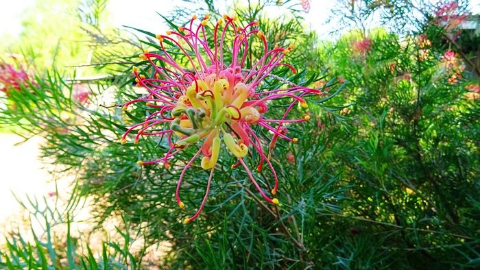
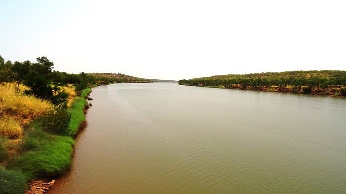
We had a great time. Now we’ve got to pay the price. We’re down one stop before Katherine. Gotta do the whole trip in one go—6 hours of driving. Let’s go! We’re a bit low on fuel with only 300 kilometers of range. The only station at the lake doesn’t open until 9 a.m., and the next (and only) one is 227 kilometers away… Should we risk it? Except for a magnificent frilled-neck lizard darting across the road on its big hind legs and an emu quickly disappearing into the bush, we didn’t see much. Oh—there was also a donkey, lost and panicked in the middle of the road… A quiet road with some beautiful scenery,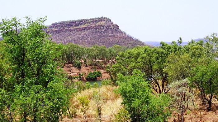 some worrying bushfires
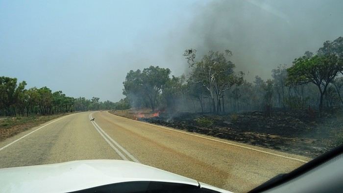
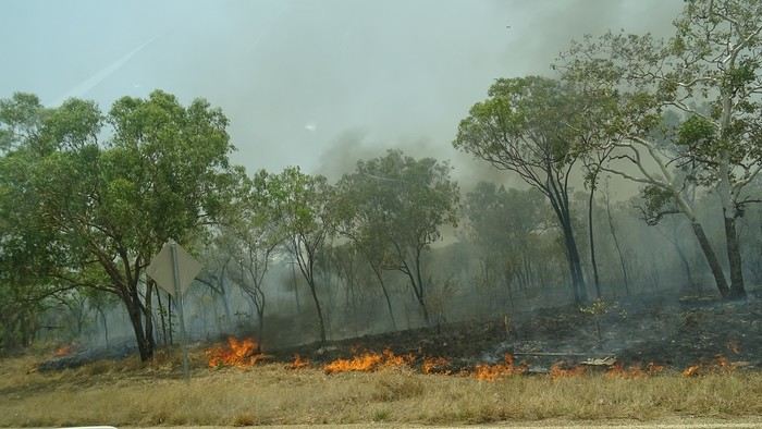 and a few opportunities to stop for a "warrior’s rest" (never go beyond the first second of the thought that starts drifting off the road…)
We cross an invisible border as we enter the Northern Territory, which comes with consequences—we immediately lose an hour and a half by changing time zones. The speed limit goes from 110 to 130.
and a few opportunities to stop for a "warrior’s rest" (never go beyond the first second of the thought that starts drifting off the road…)
We cross an invisible border as we enter the Northern Territory, which comes with consequences—we immediately lose an hour and a half by changing time zones. The speed limit goes from 110 to 130.
We arrive at the self check-in in Katherine. As usual, we’re a little taken aback at first. The noise, for starters. There’s a group rehearsing, it seems. We go check it out. We pass through the doors separating "The Stuart" from the adjoining bar and stumble upon what feels like collective hysteria. Turns out, it’s a concert. Aboriginal musicians completely fired up by some incredible music! There are just three of them, but they’re delivering a wall of sound that reminds us of South Africa’s finest neo-techno with a trance-like vibe. The crowd is wild! They’re singing in unison, screaming with joy. We get gently kicked out by security because we’re carrying our groceries, and they’re not having it. We promise ourselves we’ll come back once we’ve put them away in our little fridge.
Then we land. We end up finding plenty of nice things. It’s very possible we’ll like this place!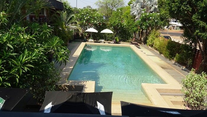
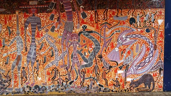 We head back to enjoy our post-battle Happy Hour.
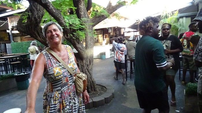 The concert’s over, but the crowd’s still riding the high. It’s indescribable. People are shouting across the room, screaming just for the fun of it—men and women alike. There’s pool, some beat-up arcade games being shaken like coconut trees. Dom and I feel like anthropologists. We’re pretty blown away. It’s epic! And the beer’s half the price it is elsewhere! We’ll definitely be back—that’s for sure!
We give up on finding a restaurant. Not sure they even exist, at least not this season. So, we’ve got a microwave—we eat at home on our little terrace, with a musical accompaniment from a massive orchestra of birds.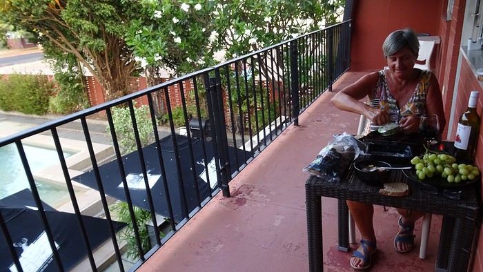 It sounds amazing!
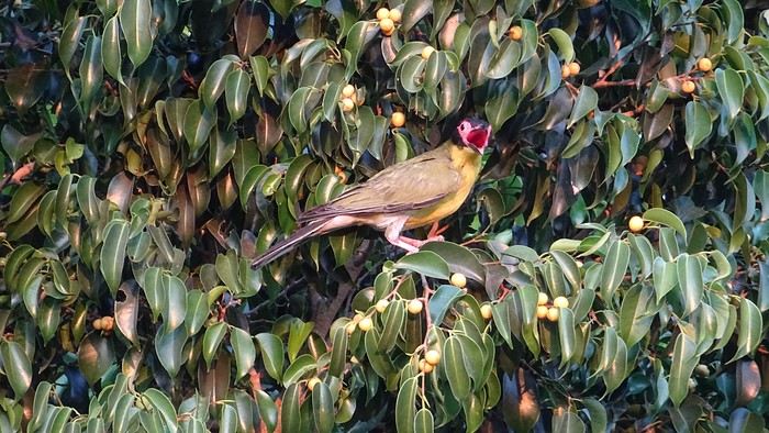
We had a great time. Now we’ve got to pay the price. We’re down one stop before Katherine. Gotta do the whole trip in one go—6 hours of driving. Let’s go! We’re a bit low on fuel with only 300 kilometers of range. The only station at the lake doesn’t open until 9 a.m., and the next (and only) one is 227 kilometers away… Should we risk it? Except for a magnificent frilled-neck lizard darting across the road on its big hind legs and an emu quickly disappearing into the bush, we didn’t see much. Oh—there was also a donkey, lost and panicked in the middle of the road… A quiet road with some beautiful scenery,
some worrying bushfires
and a few opportunities to stop for a "warrior’s rest" (never go beyond the first second of the thought that starts drifting off the road…)
We cross an invisible border as we enter the Northern Territory, which comes with consequences—we immediately lose an hour and a half by changing time zones. The speed limit goes from 110 to 130.
We arrive at the self check-in in Katherine. As usual, we’re a little taken aback at first. The noise, for starters. There’s a group rehearsing, it seems. We go check it out. We pass through the doors separating "The Stuart" from the adjoining bar and stumble upon what feels like collective hysteria. Turns out, it’s a concert. Aboriginal musicians completely fired up by some incredible music! There are just three of them, but they’re delivering a wall of sound that reminds us of South Africa’s finest neo-techno with a trance-like vibe. The crowd is wild! They’re singing in unison, screaming with joy. We get gently kicked out by security because we’re carrying our groceries, and they’re not having it. We promise ourselves we’ll come back once we’ve put them away in our little fridge.
Then we land. We end up finding plenty of nice things. It’s very possible we’ll like this place!
We head back to enjoy our post-battle Happy Hour.
The concert’s over, but the crowd’s still riding the high. It’s indescribable. People are shouting across the room, screaming just for the fun of it—men and women alike. There’s pool, some beat-up arcade games being shaken like coconut trees. Dom and I feel like anthropologists. We’re pretty blown away. It’s epic! And the beer’s half the price it is elsewhere! We’ll definitely be back—that’s for sure!We give up on finding a restaurant. Not sure they even exist, at least not this season. So, we’ve got a microwave—we eat at home on our little terrace, with a musical accompaniment from a massive orchestra of birds.
It sounds amazing!
The "Must-Sees" of the American West
This adventure began during Covid... Yep, Covid turned a lot of things upside down, but most of all, it kept us cooped up for a few months and stopped us from traveling for a while—even longer for a die-hard fan of the American West like me.
While borders were closed, I started imagining what an ideal itinerary might look like—one that would string together all the Southwest must-sees in just two weeks, during the best time of year: September and October. When the U.S. announced in September 2021 that borders would reopen in the coming weeks, I regained hope and began scouting flight tickets for a departure in September 2022.
But here’s the thing: tackling solo hikes, each one tougher than the last, right in the heart of the Wilderness, could be a risky—even reckless—endeavor for a father of three. After a quick chat with some virtual friends who are just as passionate about the Southwest as I am, with good physical condition and nearly the same list of must-visit spots, Franck and his brother Sullivan were in! 🙂
In November, we snagged flight tickets from Nice to San Francisco for the modest sum of 400 €, and a few days later, I booked a Toyota Tacoma pickup for 840 € !
It’s not cheap for just 15 days, and a pickup isn’t exactly ideal for luggage, but the prices for full-size 4x4s have become totally outrageous! Due to border closures, rental companies had to offload a lot of these big 4x4s, which tourists love. Then, supply and demand did the rest !
Franck and I spent the winter and spring trying to cram the equivalent of three weeks of hikes into two. But even with physical limits, we had to stay reasonable! Three to four months before departure, we entered the lotteries for different must-see spots: The Subway, Coyote Buttes North (home to the famous Wave), and Coyote Buttes South (CBS).
The Wave is the holy grail for any Southwest enthusiast. Since 2015, we’ve tried our luck with the online and on-site lotteries about ten times, but the spots are unfortunately limited: just 20 per day. A glimmer of hope, though—since early 2022, that number has increased to 64 people allowed per day, with 48 spots awarded via the online lottery.
After all three of us tried our luck for The Wave, on June 1st at exactly 5 PM, I got an email that started with, "Congratulations! You were successful in the Coyote Buttes North (The Wave) September 2022 Permit Lottery at Coyote Buttes North (The Wave)...". At 5:01 PM, I called Franck, whose dream it’s been for over 20 years—ever since the first photos were published in a travel magazine! He didn’t believe me when I told him, and I had to forward the email for him to finally accept the unbelievable: we were going to The Wave and all the incredible spots scattered across the protected area of Coyote Buttes North.
I’ve already been to Coyote Buttes South twice, but there are areas I couldn’t explore in the middle of summer because they were too remote. So, I had no trouble letting my buddies convince me to go back for a third time. Plus, given how hard it is to access, we had no trouble securing a permit online as long as we logged in at exactly 8 PM on the dot!
For The Subway, all three of us struck out. No big deal—we won at CBN and CBS!
Among the sites to visit, there are two that I’m particularly attached to because I know my chances of wanting to see them again are slim. The first is Angel Arch, one of the most legendary arches in the Southwest, due to its remoteness from any trace of civilization. To get there, the recommended hike is Upper Salt Creek, and you’re looking at a 50 km round-trip in an area with no water (in September) and populated by bears.
The second site is the Hopi Salt Trail, in Navajo land, which, after a very tough hike, lets you marvel at the turquoise-blue waters of the Little Colorado before it meets the Colorado River. The Hopi Salt Trail is, like The Wave, the holy grail for any Southwest enthusiast, and the windows of opportunity to see the water in that magical color are very short each year. For this, you have to monitor the Little Colorado’s gauges downstream from Cameron: if the level stays at its lowest for 10 consecutive days—meaning no rain—you can hope for turquoise water. The ideal period rarely exceeds 30 days a year, and it’s usually in June that all the stars align.
But unfortunately, one month before departure, while the flow rate at Cameron looked promising, several storms in September dashed our hopes of doing the Hopi Salt Trail, even at the end of the road trip.
We still had two consolation prizes, though:
After a last-minute cancellation, while keeping an eye out for available spots for The Subway, it turned out that three spots opened up exactly on the day we’d planned to go—so we rushed to grab them!! Regarding the 4x4 rental, the prices for full-size models dropped by several hundred dollars, and we ended up finding a Chevrolet Tahoe for less than $1000. A steal and a serious boost in comfort, so we could store all our gear and food without worry!
Here’s the initial plan in a perfect world: D1 The White Domes - Camping D2 Sunrise at The White Domes - The Subway D3 Coyote Buttes North D4 Coyote Buttes South - White Pocket D5 Wahweap Hoodoos - Sidestep Canyon - Colourful Canyon - White Rocks - Sunset at Yellow Rock D6 Broken Bow Arch - Reflection Canyon D7 Coyote Gulch D8 The Volcano (or The Oasis - Zebra Slot Canyon if the weather’s good) - North Caineville Mesa D9 The Needles: Squaw Canyon - Lost Canyon combo - Druid Arch - Chesler Park D10 Upper Salt Creek Day 1 - Camping D11 Upper Salt Creek Day 2 D12 Hopi-Navajo Territory: Ha Ho No Geh Canyon, Coal Mine Canyon, Bends of the Little Colorado D13 Grand Canyon: South Kaibab Trail and Bright Angel Trail D14 Upper East Zion: East Temple Loop, Jughandle Arch, Center of the Universe, and Checkerboard Mesa Summit And several backup options in case of bad weather, including Spencer Trail, West Cove, and Buffington Pockets.
Enough talking—time for action!
While borders were closed, I started imagining what an ideal itinerary might look like—one that would string together all the Southwest must-sees in just two weeks, during the best time of year: September and October. When the U.S. announced in September 2021 that borders would reopen in the coming weeks, I regained hope and began scouting flight tickets for a departure in September 2022.
But here’s the thing: tackling solo hikes, each one tougher than the last, right in the heart of the Wilderness, could be a risky—even reckless—endeavor for a father of three. After a quick chat with some virtual friends who are just as passionate about the Southwest as I am, with good physical condition and nearly the same list of must-visit spots, Franck and his brother Sullivan were in! 🙂
In November, we snagged flight tickets from Nice to San Francisco for the modest sum of 400 €, and a few days later, I booked a Toyota Tacoma pickup for 840 € !
It’s not cheap for just 15 days, and a pickup isn’t exactly ideal for luggage, but the prices for full-size 4x4s have become totally outrageous! Due to border closures, rental companies had to offload a lot of these big 4x4s, which tourists love. Then, supply and demand did the rest !
Franck and I spent the winter and spring trying to cram the equivalent of three weeks of hikes into two. But even with physical limits, we had to stay reasonable! Three to four months before departure, we entered the lotteries for different must-see spots: The Subway, Coyote Buttes North (home to the famous Wave), and Coyote Buttes South (CBS).
The Wave is the holy grail for any Southwest enthusiast. Since 2015, we’ve tried our luck with the online and on-site lotteries about ten times, but the spots are unfortunately limited: just 20 per day. A glimmer of hope, though—since early 2022, that number has increased to 64 people allowed per day, with 48 spots awarded via the online lottery.
After all three of us tried our luck for The Wave, on June 1st at exactly 5 PM, I got an email that started with, "Congratulations! You were successful in the Coyote Buttes North (The Wave) September 2022 Permit Lottery at Coyote Buttes North (The Wave)...". At 5:01 PM, I called Franck, whose dream it’s been for over 20 years—ever since the first photos were published in a travel magazine! He didn’t believe me when I told him, and I had to forward the email for him to finally accept the unbelievable: we were going to The Wave and all the incredible spots scattered across the protected area of Coyote Buttes North.
I’ve already been to Coyote Buttes South twice, but there are areas I couldn’t explore in the middle of summer because they were too remote. So, I had no trouble letting my buddies convince me to go back for a third time. Plus, given how hard it is to access, we had no trouble securing a permit online as long as we logged in at exactly 8 PM on the dot!
For The Subway, all three of us struck out. No big deal—we won at CBN and CBS!
Among the sites to visit, there are two that I’m particularly attached to because I know my chances of wanting to see them again are slim. The first is Angel Arch, one of the most legendary arches in the Southwest, due to its remoteness from any trace of civilization. To get there, the recommended hike is Upper Salt Creek, and you’re looking at a 50 km round-trip in an area with no water (in September) and populated by bears.
The second site is the Hopi Salt Trail, in Navajo land, which, after a very tough hike, lets you marvel at the turquoise-blue waters of the Little Colorado before it meets the Colorado River. The Hopi Salt Trail is, like The Wave, the holy grail for any Southwest enthusiast, and the windows of opportunity to see the water in that magical color are very short each year. For this, you have to monitor the Little Colorado’s gauges downstream from Cameron: if the level stays at its lowest for 10 consecutive days—meaning no rain—you can hope for turquoise water. The ideal period rarely exceeds 30 days a year, and it’s usually in June that all the stars align.
But unfortunately, one month before departure, while the flow rate at Cameron looked promising, several storms in September dashed our hopes of doing the Hopi Salt Trail, even at the end of the road trip.
We still had two consolation prizes, though:
After a last-minute cancellation, while keeping an eye out for available spots for The Subway, it turned out that three spots opened up exactly on the day we’d planned to go—so we rushed to grab them!! Regarding the 4x4 rental, the prices for full-size models dropped by several hundred dollars, and we ended up finding a Chevrolet Tahoe for less than $1000. A steal and a serious boost in comfort, so we could store all our gear and food without worry!
Here’s the initial plan in a perfect world: D1 The White Domes - Camping D2 Sunrise at The White Domes - The Subway D3 Coyote Buttes North D4 Coyote Buttes South - White Pocket D5 Wahweap Hoodoos - Sidestep Canyon - Colourful Canyon - White Rocks - Sunset at Yellow Rock D6 Broken Bow Arch - Reflection Canyon D7 Coyote Gulch D8 The Volcano (or The Oasis - Zebra Slot Canyon if the weather’s good) - North Caineville Mesa D9 The Needles: Squaw Canyon - Lost Canyon combo - Druid Arch - Chesler Park D10 Upper Salt Creek Day 1 - Camping D11 Upper Salt Creek Day 2 D12 Hopi-Navajo Territory: Ha Ho No Geh Canyon, Coal Mine Canyon, Bends of the Little Colorado D13 Grand Canyon: South Kaibab Trail and Bright Angel Trail D14 Upper East Zion: East Temple Loop, Jughandle Arch, Center of the Universe, and Checkerboard Mesa Summit And several backup options in case of bad weather, including Spencer Trail, West Cove, and Buffington Pockets.
Enough talking—time for action!
Transcanadienne à vélo entre Winnipeg et Sault-Sainte-Marie English translation pending
Bonjour à tous, et notamment aux locaux ...
Si tout va bien, en 2021 je traverserai le Canada à vélo, de Vancouver à Montréal (où j'ai de la famille). Je cherche l'itinéraire le meilleur en termes de sécurité et d'intérêt. Et cette longue portion (1400 kms) entre Winnipeg et Sault n'a pas la réputation d'être d'un intérêt majeur, sans même parler de la sécurité qui laisserait à désirer pour le cycliste. Pourtant, certains n'hésitent pas à s'y lancer, sans s'en plaindre outre mesure. D'autres au contraire font une incursion aux USA, en flirtant avec les frontières, cherchant les petites routes tranquilles quitte à faire des détours conséquents. J'hésite entre les 2 stratégies, et je suis en quête de témoignages ou d'avis. Y aurait-il des canadiens/québécois, ou des voyageurs qui pourraient m'apporter des éléments décisifs ? D'avance, je les en remercie !
PS : j'oubliais : Suivre le Grand Sentier entre ces 2 villes, est-ce jouable à vélo ?
Si tout va bien, en 2021 je traverserai le Canada à vélo, de Vancouver à Montréal (où j'ai de la famille). Je cherche l'itinéraire le meilleur en termes de sécurité et d'intérêt. Et cette longue portion (1400 kms) entre Winnipeg et Sault n'a pas la réputation d'être d'un intérêt majeur, sans même parler de la sécurité qui laisserait à désirer pour le cycliste. Pourtant, certains n'hésitent pas à s'y lancer, sans s'en plaindre outre mesure. D'autres au contraire font une incursion aux USA, en flirtant avec les frontières, cherchant les petites routes tranquilles quitte à faire des détours conséquents. J'hésite entre les 2 stratégies, et je suis en quête de témoignages ou d'avis. Y aurait-il des canadiens/québécois, ou des voyageurs qui pourraient m'apporter des éléments décisifs ? D'avance, je les en remercie !
PS : j'oubliais : Suivre le Grand Sentier entre ces 2 villes, est-ce jouable à vélo ?
Projet de voyage en Patagonie pour 3 semaines en famille en juillet/août 2021 English translation pending
Bonjour
je déterre un vieux sujet....
Je souhaite partir visiter la Patagonie des deux côtés avec une famille ayant des enfants de 7 et 9 ans pour trois semaines vers Juillet/ Août 2021.
j'aimerais voir
-les chutes d'iguazu - passez un ou deux jours dans une ferme pour voir les gauchos et manger les fameux bbq - le désert d'atacama, et l'endroit où l'on peut voir les grues - le lac avec la cave en marbre? -el Calafate, el chaiten le perito morino notamment - le parc torres del paine
Je suis amateur en photographie donc j'aimerais rester au moins 2 jours sur chaque endroit.
Pouvez-vous nous conseiller un ìtinéraire, les moyens de transport, hébergements confortables mais pas nécessairement des 4 étoiles etc
et le budget moyen
d'avance merci pour vos conseils
je déterre un vieux sujet....
Je souhaite partir visiter la Patagonie des deux côtés avec une famille ayant des enfants de 7 et 9 ans pour trois semaines vers Juillet/ Août 2021.
j'aimerais voir
-les chutes d'iguazu - passez un ou deux jours dans une ferme pour voir les gauchos et manger les fameux bbq - le désert d'atacama, et l'endroit où l'on peut voir les grues - le lac avec la cave en marbre? -el Calafate, el chaiten le perito morino notamment - le parc torres del paine
Je suis amateur en photographie donc j'aimerais rester au moins 2 jours sur chaque endroit.
Pouvez-vous nous conseiller un ìtinéraire, les moyens de transport, hébergements confortables mais pas nécessairement des 4 étoiles etc
et le budget moyen
d'avance merci pour vos conseils
Appli OsmAnd avec trace GPX (à vélo) English translation pending
bonjour amis cyclo.
j'ai téléchargé Osmand sur mon tél (redminote7) avec trace GPX, non pas pour suivre en direct mais simplement pour me retrouver si je me paume. j'ai testé ce matin. je retrouve ma position exacte dans le village mais lorsque je m'éloigne et pars dans la pampa, il y a pas moins de 4 ou 5 km d'écart. je précise que je teste dans le piémont pyrénéen .
y'a quelque chose qui a dû m'échapper….. quelqu'un à une idée ?
merci d'avance et bonnes balades ….cdt
Le Tonkin, une région superbe et accueillante English translation pending
Bonjour à tous,
Voici venu le temps du confinement
et la publication de carnets de voyages d’antan.
J’entre dans la danse également et me voici venue vous conter un séjour de 17 jours dans le nord du Vietnam en décembre 2011.
Présentation rapide : nous partons en couple (nos fils de 4 et 3 ans sont confiés à leurs grands- parents). Habitués à voyager en mode autonome, sans réservations à l’avance et privilégiant la conduite d’un véhicule, nous devons changer nos habitudes en raison de l’interdiction faite aux étrangers de louer des véhicules. Nous décidons donc de faire appel aux services d’une agence locale pour nous permettre de visiter le nord du Vietnam à proximité de la frontière chinoise. Nous (enfin je 😇) ajoutons à ce programme la découverte de la région de Sapa, de Tam Coc (la baie d’Ha Long terrestre) et la baie d’Ha Long (avec une surprise pour mon mari). Peu férus des villes, nous visiterons un peu Hanoi le jour de notre arrivée et avant notre départ.
Jour 0 – dimanche 4 décembre
Après avoir fêté les 60 ans et trois jours de mon beau-père autour d’un déjeuner au restaurant, nous nous rendons en fin de journée à Roissy CDG pour un vol direct Paris – Hanoi sur Vietnam Airlines. Pas de souvenir particulier presque dix ans après ce vol 🙂
Jour 1 – lundi 5 décembre
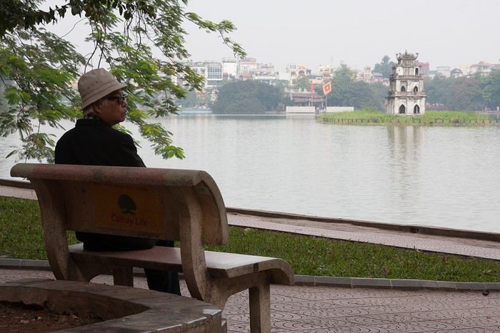
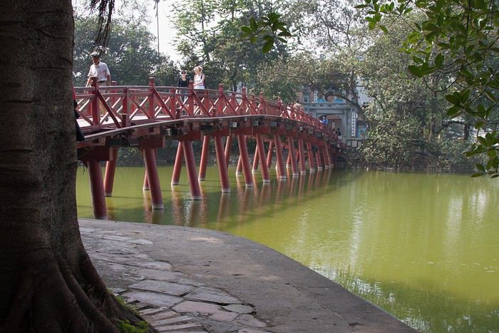
Arrivée matinale à 6h40. J’étais passée par ACA Voyages pour obtenir une lettre d’invitation (24 $) pour nous permettre d’obtenir un visa d’entrée. Les formalités sont vite effectuées au guichet d'immigration (40 € pour nous deux). Après avoir effectué du change (500 euros contre 14 millions de dongs), nous prenons un taxi et nous rendons au Paramount Hotel & Travel, seul hôtel réservé à l’avance pour notre première nuit. Nous débutons notre journée par quelques démarches. Nous nous rendons dans les locaux de l’agence locale pour faire connaissance avec notre conseillère et régler le solde de la prestation. Direction ensuite la gare pour acheter des billets de train pour Tam Coc et Lao Cai. Aucun souci rencontré pour acheter les billets auprès d’un guichetier très aimable. L’après-midi est consacré à la visite d’Hanoi : le lac Hoan Kiem (le lac de l’Epée Restituée) et ses agréables berges.

J’entre dans la danse également et me voici venue vous conter un séjour de 17 jours dans le nord du Vietnam en décembre 2011.
Présentation rapide : nous partons en couple (nos fils de 4 et 3 ans sont confiés à leurs grands- parents). Habitués à voyager en mode autonome, sans réservations à l’avance et privilégiant la conduite d’un véhicule, nous devons changer nos habitudes en raison de l’interdiction faite aux étrangers de louer des véhicules. Nous décidons donc de faire appel aux services d’une agence locale pour nous permettre de visiter le nord du Vietnam à proximité de la frontière chinoise. Nous (enfin je 😇) ajoutons à ce programme la découverte de la région de Sapa, de Tam Coc (la baie d’Ha Long terrestre) et la baie d’Ha Long (avec une surprise pour mon mari). Peu férus des villes, nous visiterons un peu Hanoi le jour de notre arrivée et avant notre départ.
Jour 0 – dimanche 4 décembre
Après avoir fêté les 60 ans et trois jours de mon beau-père autour d’un déjeuner au restaurant, nous nous rendons en fin de journée à Roissy CDG pour un vol direct Paris – Hanoi sur Vietnam Airlines. Pas de souvenir particulier presque dix ans après ce vol 🙂
Jour 1 – lundi 5 décembre
Arrivée matinale à 6h40. J’étais passée par ACA Voyages pour obtenir une lettre d’invitation (24 $) pour nous permettre d’obtenir un visa d’entrée. Les formalités sont vite effectuées au guichet d'immigration (40 € pour nous deux). Après avoir effectué du change (500 euros contre 14 millions de dongs), nous prenons un taxi et nous rendons au Paramount Hotel & Travel, seul hôtel réservé à l’avance pour notre première nuit. Nous débutons notre journée par quelques démarches. Nous nous rendons dans les locaux de l’agence locale pour faire connaissance avec notre conseillère et régler le solde de la prestation. Direction ensuite la gare pour acheter des billets de train pour Tam Coc et Lao Cai. Aucun souci rencontré pour acheter les billets auprès d’un guichetier très aimable. L’après-midi est consacré à la visite d’Hanoi : le lac Hoan Kiem (le lac de l’Epée Restituée) et ses agréables berges.
Location de 4x4 au Chili pour un trajet Chili-Bolivie-Argentine English translation pending
Bonjour,
Je souhaiterais louer un 4x4 à CALAMA où ARICA au Chili pour ensuite aller en Argentine (SALTA Etccc) et remonter en Bolivie puis retourner au Chili avec le même véhicule.
Est ce possible sans être trop embêté aux frontières? Est ce que cela comportera des frais supplémentaires auprès du loueur étant donné qu’il y aura forcément des routes en terre, du désert de sel, de sable, etc...?.
Je préférerais prendre cette option d’un seul véhicule plutôt que d’en louer un dans chaque pays ou de prendre des excursions 4x4.
Merci pour vos retours et vos expériences dans cette région Nord du Chili/Nord Ouest Argentin/Sud Ouest bolivien.
Est ce possible sans être trop embêté aux frontières? Est ce que cela comportera des frais supplémentaires auprès du loueur étant donné qu’il y aura forcément des routes en terre, du désert de sel, de sable, etc...?.
Je préférerais prendre cette option d’un seul véhicule plutôt que d’en louer un dans chaque pays ou de prendre des excursions 4x4.
Merci pour vos retours et vos expériences dans cette région Nord du Chili/Nord Ouest Argentin/Sud Ouest bolivien.
Vol Sydney - Paris par Thai Airways avec escale à Bangkok English translation pending
Bonjour,
Le vol a été réservé hier pour un départ jeudi 26 mars. En l'état actuel des choses, et bien sûr cela pourrait changer, est-ce qu'un ressortissant français peut embarquer à Sydney, effectuer 8h d'escale à Bangkok, avant de réembarquer pour Paris ? Y'a t'il à votre connaissance des contraintes, une procédure à respecter voire une impossibilité en raison des restrictions qui ferment petit à petit de nombreuses frontières... et si c'était le cas, quelle solution pour revenir en France ?
Merci pour vos avis éclairés.
Le vol a été réservé hier pour un départ jeudi 26 mars. En l'état actuel des choses, et bien sûr cela pourrait changer, est-ce qu'un ressortissant français peut embarquer à Sydney, effectuer 8h d'escale à Bangkok, avant de réembarquer pour Paris ? Y'a t'il à votre connaissance des contraintes, une procédure à respecter voire une impossibilité en raison des restrictions qui ferment petit à petit de nombreuses frontières... et si c'était le cas, quelle solution pour revenir en France ?
Merci pour vos avis éclairés.
On the Silk Road: Chronicles of a Sixty-Something Traveling Completely Independently
From Beijing to Khiva: China, Kyrgyzstan, Tajikistan, Uzbekistan
Chronicle of anecdotes, highlights, and other adventures that marked this eight-week journey in 2018.
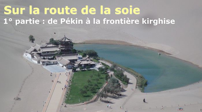
The Chinese Far West More than 30 years after my first trip to eastern China, I finally fulfilled an old dream: traveling solo from Beijing to the far west, discovering Xinjiang, the Uyghur people and the oppression they endure, the oases of Turpan and Kashgar, the Taklamakan Desert, the end of the Great Wall... The route was covered by train.
MENU PART 1: CHINA
1- Beijing (Jiankou) : the authentic Great Wall, without tourists 2- Cycling in Beijing, the best way to get around 3- Beijing : departure for the far west 4- Jiayuguan : getting by without English 5- Jiayuguan : scams and heritage 6- Dunhuang : abundance in the middle of the desert 7- Turpan : the Uyghurs under heavy surveillance 8- Kashgar : love at first sight for the old city 9- Kashgar : China’s recipe for controlling the populace 10- Tashkurgan : what on earth was I thinking going there! Kyrgyz border: a surreal epic Photo album from the 80s, contributions from other travelers (page 2)
1- JIANKOU Finding the authentic Great Wall, without tourists or a guide Friday, August 24, 2018 Thirty years later, I didn’t feel like revisiting the Great Wall at Badaling or any other overcrowded site. I chose to explore it at Jiankou, in its wildest, most authentic, and unrestored section, starting from a lost village deep in a valley—though it wasn’t *that* lost, since it had everything for communication.
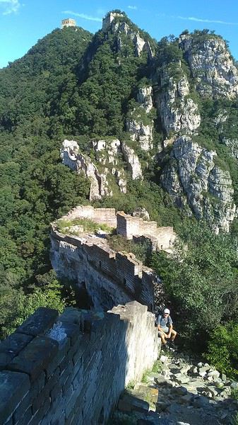
No need to pay for a taxi to get there—by timing it right, you can take the bus for just a few yuan. You have to get off at Xizhazi, the bus terminus. Be careful, there are only two buses a day in each direction. At the Xizhazi bus stop, I met a young couple who’d arrived with zero information about what to expect. We hiked the three of us toward the restored section of Mutianyu.
Still, be cautious With GPS and a topographic map (OpenTopoMap), you can set off without a problem or guide. The trail up to Jiankou is easy and well-marked. The trails down are too. But be careful—once you’re on the Wall, it’s real mountain hiking, with easy but dangerous climbing sections (over sheer drops). Not for amateurs or those afraid of heights! But what a reward. The Wall all to yourself, where it’s at its most daring. Truly mesmerizing.
More photos...
2- BEIJING The best way to get around the capital Sunday, August 26 The best way to explore the city is still by bike. Most are in a bike-share system, but you need to use an app—WeChat, the app that does everything, like monitoring your every move. No way I was installing that.
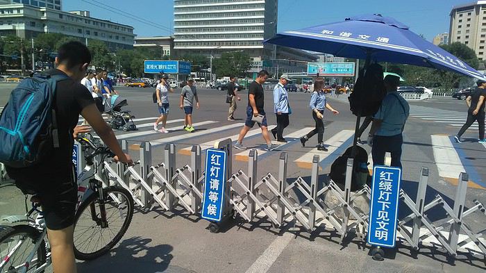
I found one at a rental shop near the hostel. The key is to quickly learn local traffic customs to minimize risks. Bike lanes are wide along the avenues.
But you still have to: - Watch out for anything parked on the bike paths—the most annoying are people napping or talking on the phone in their cars - Keep an eye on everything coming the wrong way—the list is long - The worst is right turns on red, which in Chinese traffic rules seem to have priority Once you get the hang of it, it’s fine. The city is huge but flat, so you can just wing it.
3- BEIJING By train to the far west Sunday, August 26 Beijing West Station is the size and operates like an airport. With your e-ticket from the agency, you first have to pick up your ticket at the special "English" counter, after passing through security. With your ticket in hand, you have to exit and enter through the boarding waiting area—not the platform—after a second security check.
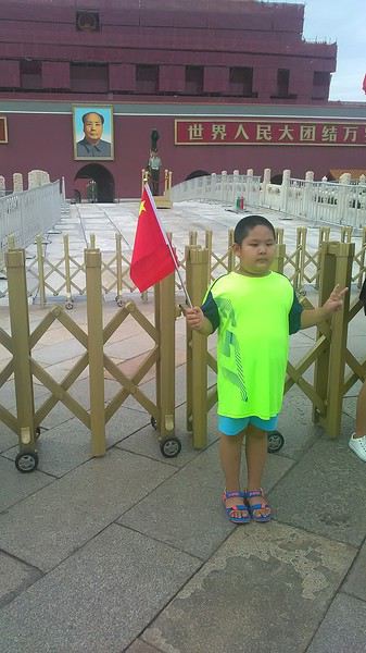 Then you find the right hall and wait for the sign to finally access the platform. In the end, it works pretty well given the incredible number of passengers to manage. Everywhere in Beijing, I saw that the Chinese have mastered crowd flow management.
Nice surprise: second-class carriages are clean, air-conditioned, and bright. Perfect, since I was in for 20 hours. One uniformed attendant per carriage, mobile meal service—luxury! Small downside: no luggage space. Hauling your suitcase up to the top bunk is quite a workout. I was in the middle, so it wasn’t too bad. The landscape, though, whether rural or urban, is pretty bleak. That should change once we leave the eastern plains.
Of course, I got my first police visit, with a thorough passport check and bag search. I was warned—going to the Chinese far west exposes you to this kind of hassle. But they were polite and respectful.
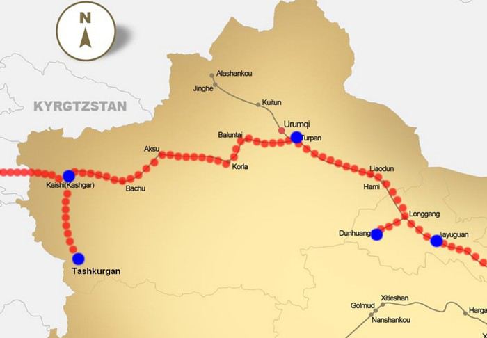 The Chinese Far West
4- JIAYUGUAN Getting by without English Monday, August 27 At the gates of two deserts (Gobi and Taklamakan) and at the foot of the Tibetan highlands, the Great Wall ends at Jiayuguan. Here, I found the deeper China I’d somewhat rediscovered during my bike ride, even if now everyone gets around on electric bikes and I’m no longer stared at like an alien.
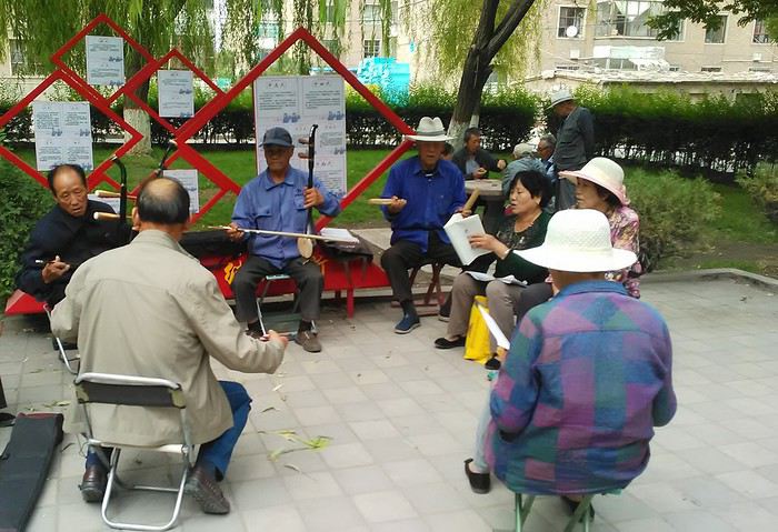
Prices are nothing like Beijing: you can find a full meal for 2 €, and my bike cost 7 € for two days. Plus, few people speak English—neither the owner of the HI hostel where I stayed, nor the ticket sellers at the sites, let alone the servers at the small eateries where I ate. Everything is written in Chinese. So I had to use the little Chinese I know to communicate about essentials. It makes the locals laugh to see a European trying to speak their language, but it earns respect. With Google Translate’s help, I managed.
Rant: With their avenues blocked for construction for kilometers without warning, and new roads not yet on maps, I must’ve taken 15 km of detours. More photos...
5- JIAYUGUAN Scams and heritage Tuesday, August 28 The Great Wall doesn’t exactly end at the fort I visited yesterday but 10 km further, at the entrance to a river gorge at the foot of the mountains. All that’s left is a badly damaged tower (more like a mound of earth) and a section of clay wall, similar to the one I biked yesterday.
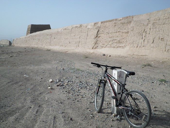
This morning, I hopped on my bike, determined to venture into the desert to see this highly symbolic site. First, you access it via a wide, brand-new road with not a soul in sight. Just before the site, I came across a grand welcome gate, very period-style, but it’s actually the inevitable toll booth.
Behind the gate, the road continues straight to the site, which you can see in the distance—at least 2 km away—the remains of the tower and wall. I had to leave my bike here. Fine. I went to the ticket counter and asked the price: 120 yuan! I couldn’t believe it—over 15 € for a simple mound of earth.
I showed my displeasure to the attendant, who couldn’t care less, and immediately turned back. 120 yuan—that’s the price for a new road, a fancy gate planted 2 km before the site just to force you to take a shuttle, and employees with nothing to do all day... Now I understand why I didn’t meet anyone!
Heritage China is a bit pricey Generally, sites are expensive for the country’s standard of living, but travelers are supposed to have money, so why hold back? I even gave up on the Forbidden City—reservations required days in advance (or on the black market at an impossible price). I prefer to keep the memory of my first visit, when entry must’ve cost a few dozen cents, and there were only a handful of visitors.
This morning, I took a taxi to see remarkable tombs of common people from the 3rd to 6th centuries. They’re small vaulted caves made of painted bricks, depicting scenes of daily life. Very pretty and moving. But even here, though the price was more reasonable, I was left wanting—only one of the 16 tombs is open to visitors, and it’s apparently not the most beautiful.
The authentic China—at least what’s left of it... Wandering the impersonal avenues of the city, you stumble upon a market. There, you still find traditional China—small shops with questionable hygiene, Go players, musicians, and even a dental prosthetist. The last refuge for those untouched by modernity. More photos...
6- DUNHUANG Abundance in the middle of the desert Wednesday, August 29 Well, I thought the landscape would be less bleak as I headed west. Nope. The only distraction in this expanse of dark, clayey sand is the forests of pylons and wind turbines, plus wild camels racing each other.
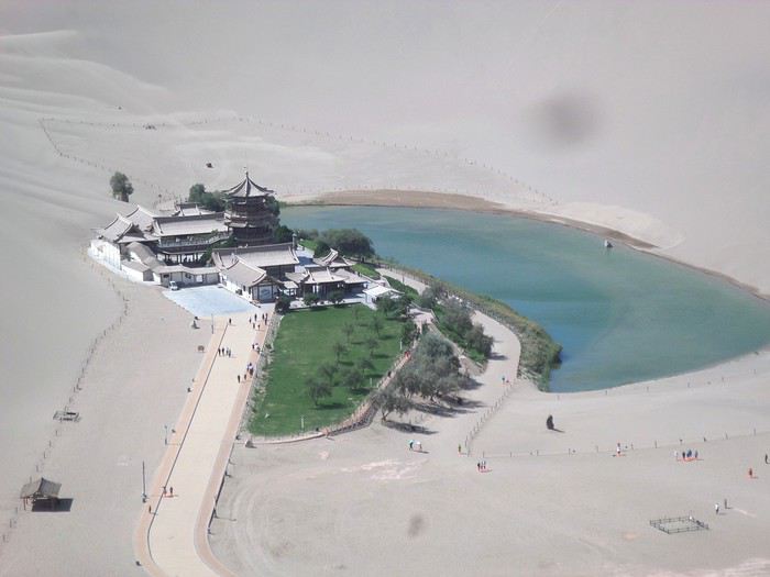 However, Dunhuang, the gateway to the Taklamakan, is by far the most pleasant Chinese city I know. There’s a real city center you can explore on foot. It’s hot but not unbearable, with a light, dry breeze. Much nicer than Beijing. The Han Chinese are still the majority, but the Muslim Uyghurs are more numerous, and the muezzin’s call to prayer echoes around the mosque.
The most surprising thing is the abundance and diversity of fruits and vegetables. You wonder how it all grows here. Well-irrigated, the desert sands are very fertile. Here, raisins have subtle, mysterious flavors, and the lamb really tastes like lamb.
Today, I visited the must-see Mingshashan, a dune complex next to which Pila is a molehill. The Basque Country, but covered in sand... More photos...
7- TURPAN The Uyghurs under heavy surveillance Friday, August 31 Surveillance cameras everywhere in the city, armed police stationed at intersections, in front of public buildings, at the entrance and inside tourist sites, police stations on every corner, patrols on foot or by car, khaki uniforms even for middle schoolers... here, the Han Chinese are in the minority, and you can feel it. Turpan feels like a city under siege.
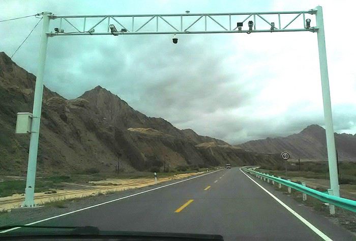
To enter the youth hostel where I stayed, there’s even a security gate, and the receptionist (a Han, like everyone in tourism) wears a bulletproof vest! Reassuring. Still, you don’t feel particularly threatened here, especially as a European. The troublemakers are the Chinese, not the Uyghurs. Generally, China is a very safe country for visitors.
Smile, you’re on camera! I was biking on an avenue when the car in front of me got flashed for driving slowly. I quickly understood why when I got flashed too.
Here, the official time is Beijing time, but it gets dark two hours later. It’ll be even worse in Kashgar. Trickier to manage: everything is displayed in Chinese and Arabic. Nothing in English. Choosing a menu is a shot in the dark. Apart from a few young Chinese, no one here speaks English, and my Chinese doesn’t seem very understandable...
Mogao, the end of the road for the Han Yesterday, near Dunhuang, I went to Mogao, a complex of decorated caves with Buddha sculptures and paintings. Stunning, but so crowded! Luckily, here in Turpan, Chinese tourists barely venture out. So I visited a Silk Road ghost town with only a handful of other visitors and under a howling wind.
The modern Chinese city is swallowing up the old Uyghur neighborhoods—only a museum-like district remains in the center, and pockets of resistance on the outskirts are doomed to disappear soon. More photos...
8- KASHGAR A (relative) love at first sight for the old city Sunday, September 2 After three overnight trains, here I am in the far west of China, nearly 4,000 km from the capital. Despite the omnipresent police and an old city preserved UNESCO-style, Kashgar is my Chinese love at first sight.
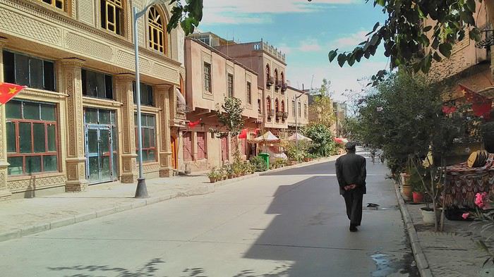
Finally, Chinese... well, sort of, because we’re in Uyghur territory here—a Turkic people with nothing culturally in common with the Han, the eastern Chinese. It started badly yesterday at Turfan station, where after three security gate passes, at least five passport checks, and a bag search, three adorable policewomen confiscated my antibacterial lotion because it had a flammable logo...
Then came the welcoming committee of armed cops at Kashgar station. Once all that was over, they left me alone—except you still have to go through security checks like everyone else to enter the old city, the bazaar, the livestock market... The further west you go, the more the siege mentality is evident. Luckily, the border isn’t far...
Despite the inevitable destruction-reconstruction, the city center has been well preserved. Thankfully, because it’s a very original style, a mix of local and colonial. I love it, even if it’s a bit too artificial, sanitized, and watered-down, and rather empty of residents. On the Silk Road, the city was famous for its great food. And it still is—rarely have I seen such richness and abundance of food! And not just scorpions or snakes. More photos...
9- KASHGAR China’s recipe for controlling the populace Saturday, September 1 Xinjiang, along with Tibet, is a "sensitive" area of rebellion in the eyes of Chinese authorities. As a result, the state has these regions and their populations under total control. Tourists also feel the consequences, even if they’re not at risk of re-education camps.
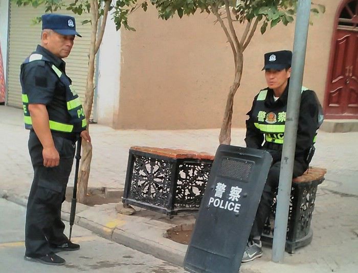 - Putting barbed wire and anti-ramming barriers around sensitive sites (schools, big hotels, government buildings...)
- Installing traffic surveillance gates with cameras and photo flashes (for all vehicles passing, including bikes) throughout the city and even in the countryside
- Posting uniformed guards with tasers, batons, or huge baseball bats every 100 meters
- Training the Han population (ethnic Chinese) in self-defense with sticks, preferably in the morning on the street. Men and women of all ages
- Starting school with the national anthem, doing military exercises, and receiving political indoctrination, all neatly lined up in the courtyard. (The dream school for any teacher)
- Placing a snitch in uniform (a pseudo-guard) in public gathering places, like youth hostels. Mine spends the day loafing around the courtyard
- Putting Chinese flags everywhere on the streets to remind everyone who’s in charge
- Installing security gates at every entrance to areas frequented by tourists (thanks for that) but not just there
- Never photographing cops, or else! I tried, but it’s not easy...
- Putting barbed wire and anti-ramming barriers around sensitive sites (schools, big hotels, government buildings...)
- Installing traffic surveillance gates with cameras and photo flashes (for all vehicles passing, including bikes) throughout the city and even in the countryside
- Posting uniformed guards with tasers, batons, or huge baseball bats every 100 meters
- Training the Han population (ethnic Chinese) in self-defense with sticks, preferably in the morning on the street. Men and women of all ages
- Starting school with the national anthem, doing military exercises, and receiving political indoctrination, all neatly lined up in the courtyard. (The dream school for any teacher)
- Placing a snitch in uniform (a pseudo-guard) in public gathering places, like youth hostels. Mine spends the day loafing around the courtyard
- Putting Chinese flags everywhere on the streets to remind everyone who’s in charge
- Installing security gates at every entrance to areas frequented by tourists (thanks for that) but not just there
- Never photographing cops, or else! I tried, but it’s not easy...
With all that, you can stroll around safely Not much crime! As for the amount the Chinese state spends to maintain such a system, it’s staggering! A third of the Han living in Xinjiang work in security. Today, I wandered freely around old Kashgar, which is quite large after all. More photos...
10- TASHKURGAN What on earth was I thinking going there! Wednesday, September 5 First, there’s the taxi—pretty crappy, with a driver who doesn’t speak a word of English and won’t stop smoking. Over six hours in that... shared with a completely out-of-it American.
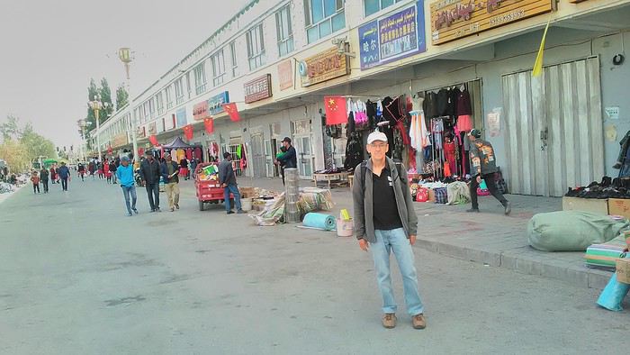
Then there are all the checkpoints along the way. I won’t go on—you know the drill by now.
After that, there’s Tashkurgan—a town with nothing to see, nothing to do. Deserted as soon as night falls. There’s this huge youth hostel and a few lost Chinese tapping away on their smartphones, chain-smoking. This lost American-European crowd, swapping tips on how to enter Pakistan or Tajikistan.
Luckily, there’s the Chinese Pamir Highway, lined with peaks over 7,000m. There’s the feeling of no longer being in China, with a population whose features are Middle Eastern. And these Tajik women with their stunning hairstyles and vibrant costumes. There’s the fact of having reached the westernmost Chinese city, far from crowds and tourist sites. A sort of end of the world. More photos...
11- KYRGYZ BORDER A surreal epic Thursday, September 6 The road from Kashgar to the Kyrgyzstan border is a little over 200 km and passes through beautiful landscapes of colorful, desert-like mountains with acrobatic folds. That’s the bucolic part of the trip.
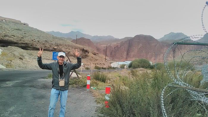 Yesterday, I managed to gather four people to rent a minibus to reach the border more easily: a Spaniard and an Argentine I’d already met in Turpan, and two New Zealanders who responded to the ad left at the hostel.
Absurdity and paranoia of Chinese authorities The highlight was crossing the town of Wuqia, 50 km past Kashgar. After tallying up with my fellow sufferers, we must’ve passed about ten checkpoints with: - Passport checks: 14 times, sometimes by two cops side by side - Bag checks: 4 times - Smartphone checks: 2 times, with deletion of "non-compliant" photos, and registration of your IMEI in the exit log!... Absurd and surreal at the same time, since my camera stayed in my bag, my apps are in French, and my photos have been online for ages...
With all that, we arrived just as the last checkpoint before the no man’s land marking the border between the two countries was on lunch break. And bam! Another 1.5-hour wait, alongside truckers who were much more used to this than we were.
What to think? The cops themselves aren’t fooled. They play the role they’re asked to, but sometimes you can coax a smile out of them—they realize how ridiculous the situation is.
What’s the point? That’s the big question my companions and I were tempted to answer with "to piss people off." To show you your place isn’t here, but with the other tourists, over there in the east, in Shanghai, Xi’an, or Guangzhou.
As for you, a traveler from a democratic country, you really experience this as aggression, humiliation, a violation of your private space. And yet, I’m respected, they speak to me properly. Today, I better understand what a Palestinian or a citizen of an occupied country might feel daily. A unique experience! Thanks, China.
And to top it off, the cherry on the cake! It’s still this glowing button you press to rate your passage after clearing the last obstacle before the exit stamp. I was so surprised it turned off before I could react. The Spaniard, with great humor and irony, had time to vote "excellent." In the end, he wasn’t wrong—you can hardly do better!
PS: I ditched my buddies at the border. They didn’t want to pay for a taxi to continue. So I took a direct taxi to Osh. The first 100 km are fabulous. I couldn’t take many photos, but I’ll be back on Monday to go to Tajikistan.
More photos...
The rest of the Silk Road, Part 2, in these travel journals: Kyrgyzstan, Tajikistan, Uzbekistan.
The Chinese Far West More than 30 years after my first trip to eastern China, I finally fulfilled an old dream: traveling solo from Beijing to the far west, discovering Xinjiang, the Uyghur people and the oppression they endure, the oases of Turpan and Kashgar, the Taklamakan Desert, the end of the Great Wall... The route was covered by train.
MENU PART 1: CHINA
1- Beijing (Jiankou) : the authentic Great Wall, without tourists 2- Cycling in Beijing, the best way to get around 3- Beijing : departure for the far west 4- Jiayuguan : getting by without English 5- Jiayuguan : scams and heritage 6- Dunhuang : abundance in the middle of the desert 7- Turpan : the Uyghurs under heavy surveillance 8- Kashgar : love at first sight for the old city 9- Kashgar : China’s recipe for controlling the populace 10- Tashkurgan : what on earth was I thinking going there! Kyrgyz border: a surreal epic Photo album from the 80s, contributions from other travelers (page 2)
1- JIANKOU Finding the authentic Great Wall, without tourists or a guide Friday, August 24, 2018 Thirty years later, I didn’t feel like revisiting the Great Wall at Badaling or any other overcrowded site. I chose to explore it at Jiankou, in its wildest, most authentic, and unrestored section, starting from a lost village deep in a valley—though it wasn’t *that* lost, since it had everything for communication.
No need to pay for a taxi to get there—by timing it right, you can take the bus for just a few yuan. You have to get off at Xizhazi, the bus terminus. Be careful, there are only two buses a day in each direction. At the Xizhazi bus stop, I met a young couple who’d arrived with zero information about what to expect. We hiked the three of us toward the restored section of Mutianyu.
Still, be cautious With GPS and a topographic map (OpenTopoMap), you can set off without a problem or guide. The trail up to Jiankou is easy and well-marked. The trails down are too. But be careful—once you’re on the Wall, it’s real mountain hiking, with easy but dangerous climbing sections (over sheer drops). Not for amateurs or those afraid of heights! But what a reward. The Wall all to yourself, where it’s at its most daring. Truly mesmerizing.
More photos...
2- BEIJING The best way to get around the capital Sunday, August 26 The best way to explore the city is still by bike. Most are in a bike-share system, but you need to use an app—WeChat, the app that does everything, like monitoring your every move. No way I was installing that.
I found one at a rental shop near the hostel. The key is to quickly learn local traffic customs to minimize risks. Bike lanes are wide along the avenues.
But you still have to: - Watch out for anything parked on the bike paths—the most annoying are people napping or talking on the phone in their cars - Keep an eye on everything coming the wrong way—the list is long - The worst is right turns on red, which in Chinese traffic rules seem to have priority Once you get the hang of it, it’s fine. The city is huge but flat, so you can just wing it.
3- BEIJING By train to the far west Sunday, August 26 Beijing West Station is the size and operates like an airport. With your e-ticket from the agency, you first have to pick up your ticket at the special "English" counter, after passing through security. With your ticket in hand, you have to exit and enter through the boarding waiting area—not the platform—after a second security check.
Then you find the right hall and wait for the sign to finally access the platform. In the end, it works pretty well given the incredible number of passengers to manage. Everywhere in Beijing, I saw that the Chinese have mastered crowd flow management.Nice surprise: second-class carriages are clean, air-conditioned, and bright. Perfect, since I was in for 20 hours. One uniformed attendant per carriage, mobile meal service—luxury! Small downside: no luggage space. Hauling your suitcase up to the top bunk is quite a workout. I was in the middle, so it wasn’t too bad. The landscape, though, whether rural or urban, is pretty bleak. That should change once we leave the eastern plains.
Of course, I got my first police visit, with a thorough passport check and bag search. I was warned—going to the Chinese far west exposes you to this kind of hassle. But they were polite and respectful.
The Chinese Far West4- JIAYUGUAN Getting by without English Monday, August 27 At the gates of two deserts (Gobi and Taklamakan) and at the foot of the Tibetan highlands, the Great Wall ends at Jiayuguan. Here, I found the deeper China I’d somewhat rediscovered during my bike ride, even if now everyone gets around on electric bikes and I’m no longer stared at like an alien.
Prices are nothing like Beijing: you can find a full meal for 2 €, and my bike cost 7 € for two days. Plus, few people speak English—neither the owner of the HI hostel where I stayed, nor the ticket sellers at the sites, let alone the servers at the small eateries where I ate. Everything is written in Chinese. So I had to use the little Chinese I know to communicate about essentials. It makes the locals laugh to see a European trying to speak their language, but it earns respect. With Google Translate’s help, I managed.
Rant: With their avenues blocked for construction for kilometers without warning, and new roads not yet on maps, I must’ve taken 15 km of detours. More photos...
5- JIAYUGUAN Scams and heritage Tuesday, August 28 The Great Wall doesn’t exactly end at the fort I visited yesterday but 10 km further, at the entrance to a river gorge at the foot of the mountains. All that’s left is a badly damaged tower (more like a mound of earth) and a section of clay wall, similar to the one I biked yesterday.
This morning, I hopped on my bike, determined to venture into the desert to see this highly symbolic site. First, you access it via a wide, brand-new road with not a soul in sight. Just before the site, I came across a grand welcome gate, very period-style, but it’s actually the inevitable toll booth.
Behind the gate, the road continues straight to the site, which you can see in the distance—at least 2 km away—the remains of the tower and wall. I had to leave my bike here. Fine. I went to the ticket counter and asked the price: 120 yuan! I couldn’t believe it—over 15 € for a simple mound of earth.
I showed my displeasure to the attendant, who couldn’t care less, and immediately turned back. 120 yuan—that’s the price for a new road, a fancy gate planted 2 km before the site just to force you to take a shuttle, and employees with nothing to do all day... Now I understand why I didn’t meet anyone!
Heritage China is a bit pricey Generally, sites are expensive for the country’s standard of living, but travelers are supposed to have money, so why hold back? I even gave up on the Forbidden City—reservations required days in advance (or on the black market at an impossible price). I prefer to keep the memory of my first visit, when entry must’ve cost a few dozen cents, and there were only a handful of visitors.
This morning, I took a taxi to see remarkable tombs of common people from the 3rd to 6th centuries. They’re small vaulted caves made of painted bricks, depicting scenes of daily life. Very pretty and moving. But even here, though the price was more reasonable, I was left wanting—only one of the 16 tombs is open to visitors, and it’s apparently not the most beautiful.
The authentic China—at least what’s left of it... Wandering the impersonal avenues of the city, you stumble upon a market. There, you still find traditional China—small shops with questionable hygiene, Go players, musicians, and even a dental prosthetist. The last refuge for those untouched by modernity. More photos...
6- DUNHUANG Abundance in the middle of the desert Wednesday, August 29 Well, I thought the landscape would be less bleak as I headed west. Nope. The only distraction in this expanse of dark, clayey sand is the forests of pylons and wind turbines, plus wild camels racing each other.
However, Dunhuang, the gateway to the Taklamakan, is by far the most pleasant Chinese city I know. There’s a real city center you can explore on foot. It’s hot but not unbearable, with a light, dry breeze. Much nicer than Beijing. The Han Chinese are still the majority, but the Muslim Uyghurs are more numerous, and the muezzin’s call to prayer echoes around the mosque.The most surprising thing is the abundance and diversity of fruits and vegetables. You wonder how it all grows here. Well-irrigated, the desert sands are very fertile. Here, raisins have subtle, mysterious flavors, and the lamb really tastes like lamb.
Today, I visited the must-see Mingshashan, a dune complex next to which Pila is a molehill. The Basque Country, but covered in sand... More photos...
7- TURPAN The Uyghurs under heavy surveillance Friday, August 31 Surveillance cameras everywhere in the city, armed police stationed at intersections, in front of public buildings, at the entrance and inside tourist sites, police stations on every corner, patrols on foot or by car, khaki uniforms even for middle schoolers... here, the Han Chinese are in the minority, and you can feel it. Turpan feels like a city under siege.
To enter the youth hostel where I stayed, there’s even a security gate, and the receptionist (a Han, like everyone in tourism) wears a bulletproof vest! Reassuring. Still, you don’t feel particularly threatened here, especially as a European. The troublemakers are the Chinese, not the Uyghurs. Generally, China is a very safe country for visitors.
Smile, you’re on camera! I was biking on an avenue when the car in front of me got flashed for driving slowly. I quickly understood why when I got flashed too.
Here, the official time is Beijing time, but it gets dark two hours later. It’ll be even worse in Kashgar. Trickier to manage: everything is displayed in Chinese and Arabic. Nothing in English. Choosing a menu is a shot in the dark. Apart from a few young Chinese, no one here speaks English, and my Chinese doesn’t seem very understandable...
Mogao, the end of the road for the Han Yesterday, near Dunhuang, I went to Mogao, a complex of decorated caves with Buddha sculptures and paintings. Stunning, but so crowded! Luckily, here in Turpan, Chinese tourists barely venture out. So I visited a Silk Road ghost town with only a handful of other visitors and under a howling wind.
The modern Chinese city is swallowing up the old Uyghur neighborhoods—only a museum-like district remains in the center, and pockets of resistance on the outskirts are doomed to disappear soon. More photos...
8- KASHGAR A (relative) love at first sight for the old city Sunday, September 2 After three overnight trains, here I am in the far west of China, nearly 4,000 km from the capital. Despite the omnipresent police and an old city preserved UNESCO-style, Kashgar is my Chinese love at first sight.
Finally, Chinese... well, sort of, because we’re in Uyghur territory here—a Turkic people with nothing culturally in common with the Han, the eastern Chinese. It started badly yesterday at Turfan station, where after three security gate passes, at least five passport checks, and a bag search, three adorable policewomen confiscated my antibacterial lotion because it had a flammable logo...
Then came the welcoming committee of armed cops at Kashgar station. Once all that was over, they left me alone—except you still have to go through security checks like everyone else to enter the old city, the bazaar, the livestock market... The further west you go, the more the siege mentality is evident. Luckily, the border isn’t far...
Despite the inevitable destruction-reconstruction, the city center has been well preserved. Thankfully, because it’s a very original style, a mix of local and colonial. I love it, even if it’s a bit too artificial, sanitized, and watered-down, and rather empty of residents. On the Silk Road, the city was famous for its great food. And it still is—rarely have I seen such richness and abundance of food! And not just scorpions or snakes. More photos...
9- KASHGAR China’s recipe for controlling the populace Saturday, September 1 Xinjiang, along with Tibet, is a "sensitive" area of rebellion in the eyes of Chinese authorities. As a result, the state has these regions and their populations under total control. Tourists also feel the consequences, even if they’re not at risk of re-education camps.
- Putting barbed wire and anti-ramming barriers around sensitive sites (schools, big hotels, government buildings...)
- Installing traffic surveillance gates with cameras and photo flashes (for all vehicles passing, including bikes) throughout the city and even in the countryside
- Posting uniformed guards with tasers, batons, or huge baseball bats every 100 meters
- Training the Han population (ethnic Chinese) in self-defense with sticks, preferably in the morning on the street. Men and women of all ages
- Starting school with the national anthem, doing military exercises, and receiving political indoctrination, all neatly lined up in the courtyard. (The dream school for any teacher)
- Placing a snitch in uniform (a pseudo-guard) in public gathering places, like youth hostels. Mine spends the day loafing around the courtyard
- Putting Chinese flags everywhere on the streets to remind everyone who’s in charge
- Installing security gates at every entrance to areas frequented by tourists (thanks for that) but not just there
- Never photographing cops, or else! I tried, but it’s not easy...With all that, you can stroll around safely Not much crime! As for the amount the Chinese state spends to maintain such a system, it’s staggering! A third of the Han living in Xinjiang work in security. Today, I wandered freely around old Kashgar, which is quite large after all. More photos...
10- TASHKURGAN What on earth was I thinking going there! Wednesday, September 5 First, there’s the taxi—pretty crappy, with a driver who doesn’t speak a word of English and won’t stop smoking. Over six hours in that... shared with a completely out-of-it American.
Then there are all the checkpoints along the way. I won’t go on—you know the drill by now.
After that, there’s Tashkurgan—a town with nothing to see, nothing to do. Deserted as soon as night falls. There’s this huge youth hostel and a few lost Chinese tapping away on their smartphones, chain-smoking. This lost American-European crowd, swapping tips on how to enter Pakistan or Tajikistan.
Luckily, there’s the Chinese Pamir Highway, lined with peaks over 7,000m. There’s the feeling of no longer being in China, with a population whose features are Middle Eastern. And these Tajik women with their stunning hairstyles and vibrant costumes. There’s the fact of having reached the westernmost Chinese city, far from crowds and tourist sites. A sort of end of the world. More photos...
11- KYRGYZ BORDER A surreal epic Thursday, September 6 The road from Kashgar to the Kyrgyzstan border is a little over 200 km and passes through beautiful landscapes of colorful, desert-like mountains with acrobatic folds. That’s the bucolic part of the trip.
Yesterday, I managed to gather four people to rent a minibus to reach the border more easily: a Spaniard and an Argentine I’d already met in Turpan, and two New Zealanders who responded to the ad left at the hostel.Absurdity and paranoia of Chinese authorities The highlight was crossing the town of Wuqia, 50 km past Kashgar. After tallying up with my fellow sufferers, we must’ve passed about ten checkpoints with: - Passport checks: 14 times, sometimes by two cops side by side - Bag checks: 4 times - Smartphone checks: 2 times, with deletion of "non-compliant" photos, and registration of your IMEI in the exit log!... Absurd and surreal at the same time, since my camera stayed in my bag, my apps are in French, and my photos have been online for ages...
With all that, we arrived just as the last checkpoint before the no man’s land marking the border between the two countries was on lunch break. And bam! Another 1.5-hour wait, alongside truckers who were much more used to this than we were.
What to think? The cops themselves aren’t fooled. They play the role they’re asked to, but sometimes you can coax a smile out of them—they realize how ridiculous the situation is.
What’s the point? That’s the big question my companions and I were tempted to answer with "to piss people off." To show you your place isn’t here, but with the other tourists, over there in the east, in Shanghai, Xi’an, or Guangzhou.
As for you, a traveler from a democratic country, you really experience this as aggression, humiliation, a violation of your private space. And yet, I’m respected, they speak to me properly. Today, I better understand what a Palestinian or a citizen of an occupied country might feel daily. A unique experience! Thanks, China.
And to top it off, the cherry on the cake! It’s still this glowing button you press to rate your passage after clearing the last obstacle before the exit stamp. I was so surprised it turned off before I could react. The Spaniard, with great humor and irony, had time to vote "excellent." In the end, he wasn’t wrong—you can hardly do better!
PS: I ditched my buddies at the border. They didn’t want to pay for a taxi to continue. So I took a direct taxi to Osh. The first 100 km are fabulous. I couldn’t take many photos, but I’ll be back on Monday to go to Tajikistan.
More photos...
The rest of the Silk Road, Part 2, in these travel journals: Kyrgyzstan, Tajikistan, Uzbekistan.
Itinéraire Chicago - les Grands Lacs - chutes du Niagara English translation pending
Bonjour à tous
Nous partons 3 semaines en Juillet aux ETATS UNIS
Nous sommes partis plusieurs fois dans cet immense pays, nous partons visiter Chicago, les grands lacs et pourquoi pas les chutes du Niagara.
J'ai déjà acheté les billets d'avions France-Chicago/Chicago-France.
J'aimerais connaître votre avis sur les 2 circuits ci-dessous
Je n'arrive pas à me décider. Ou m'orienter sur Chicago et la régions des grands ou partir vers Detroit, les chutes du Niagara et remonter vers les lacs. Je sais (en ayant potasser le forum )que la route de Chicago à Détroit est monotone. J'ai vu aussi que la douane entre les USA et le Canada peut être longue. J'ai vu aussi que pour la location de la voiture il faut s'orienter sur les compagnies connues pour avoir le droit de traverser la frontières. Mais, est ce un bon choix de rester sur la région des grands lacs ??? Nous aimons la nature et moins les villes.
Qu'en penses-vous ? merci par avance
CIRCUIT 1 CHICAGO/TORONTO/NIAGARA
Jour 1 France / CHICAGO Jour 2 CHICAGO Jour 3 CHICAGO Jour 4 CHICAGO-INDIANA DUNES (80 km) Jour 5 INDIANA DUNES-DETROIT (400 km) Jour 6 DETROIT (visite du musée Ford) Jour 7 DETROIT-NIAGARA Jour 8 Chutes du NIAGARA Jour 9 NIAGARA-TORONTO (200 km) Jour 10 TORONTO visite de la ville Jour 11 TORONTO-PENINSULE DE BRUCE à TOBERMORY (300km) Jour 12 PENINSULE DE BRUCE Jour 13 : PENINSULE DE BRUCE-ILE DE MANITOULIN en FERRY Jour 14 ILE DE MANITOULIN Jour 15 : ILE DE MANITOULIN-SAULT SAINTE MARINE (350 km) Jour 16 : SAULT SAINTE MARIE-MUNISING (200 km) Jour 17 : VISITE DU PARC PICTURED ROCKS NATIONAL LAKESHORE Jour 18 MUNISING-COMTE DE DOOR à EPHRAIM (350km) Jour 19 COMTE DE DOOR- MILWAUKEE (250 km) Jour 20 MILWAUKEE visite de la ville Jour 21 MILWAUKEE-CHICAGO (150 km) VOL en soirée
CIRCUIT 2 CHICAGO ET LES GRANDS LACS
Jour 1: FRANCE-CHICAGO Jour 2 CHICAGO Jour 3 CHICAGO Jour 4 CHICAGO-MILWAUKEE (150 km) Récupérer la voiture de location Jour 5 MIWAUKEE visite de la ville Jour 6 MILWAUKEE-EPHRAIM (3h de route) Jour 7 EPHRAIM Cave Point County Park et Peninsula State Park Peninsula State Park : Visiter le parc à vélo. Belle piste cyclable à travers la forêt en Bord de lac. Halte au phare Eagle Bluff par le Sunset Bike tour en une heure environ Jour 8 EPHRAIM-MARQUETTE (5h de route) Jour 9 PARC PICTURED ROCKS NATIONAL LAKESHORE Dormir à DULUTH Jour 10 DULUTH-GRAND MARAIS (2h de route) Jour 11 GRAND MARAIS-TERACE BAY (3h) Jour 12 TERACE BAY-SAULT SAINTE MARIE 500 km en 2 jours Jour 13 SAULT SAINTE MARIE-SAINT IGNACE (80 km) Jour 14 SAINT IGNACE-MAKINAC ISLAND Ferry Jour 16 MACKINAC ISLAND Jour17 MACKINAC ISLAND-TRAVERSE CITY ferry retour Jour 18 Sleeping Bear Dunes National Park Jour 19 TRAVERSE CITY-SAUGATUCK (3h30) Jour 20 WARREN DUNES STATE PARK Jour 21 WARREN DUNES-CHICAGO (1h30) VOL EN SOIREE
Je n'arrive pas à me décider. Ou m'orienter sur Chicago et la régions des grands ou partir vers Detroit, les chutes du Niagara et remonter vers les lacs. Je sais (en ayant potasser le forum )que la route de Chicago à Détroit est monotone. J'ai vu aussi que la douane entre les USA et le Canada peut être longue. J'ai vu aussi que pour la location de la voiture il faut s'orienter sur les compagnies connues pour avoir le droit de traverser la frontières. Mais, est ce un bon choix de rester sur la région des grands lacs ??? Nous aimons la nature et moins les villes.
Qu'en penses-vous ? merci par avance
CIRCUIT 1 CHICAGO/TORONTO/NIAGARA
Jour 1 France / CHICAGO Jour 2 CHICAGO Jour 3 CHICAGO Jour 4 CHICAGO-INDIANA DUNES (80 km) Jour 5 INDIANA DUNES-DETROIT (400 km) Jour 6 DETROIT (visite du musée Ford) Jour 7 DETROIT-NIAGARA Jour 8 Chutes du NIAGARA Jour 9 NIAGARA-TORONTO (200 km) Jour 10 TORONTO visite de la ville Jour 11 TORONTO-PENINSULE DE BRUCE à TOBERMORY (300km) Jour 12 PENINSULE DE BRUCE Jour 13 : PENINSULE DE BRUCE-ILE DE MANITOULIN en FERRY Jour 14 ILE DE MANITOULIN Jour 15 : ILE DE MANITOULIN-SAULT SAINTE MARINE (350 km) Jour 16 : SAULT SAINTE MARIE-MUNISING (200 km) Jour 17 : VISITE DU PARC PICTURED ROCKS NATIONAL LAKESHORE Jour 18 MUNISING-COMTE DE DOOR à EPHRAIM (350km) Jour 19 COMTE DE DOOR- MILWAUKEE (250 km) Jour 20 MILWAUKEE visite de la ville Jour 21 MILWAUKEE-CHICAGO (150 km) VOL en soirée
CIRCUIT 2 CHICAGO ET LES GRANDS LACS
Jour 1: FRANCE-CHICAGO Jour 2 CHICAGO Jour 3 CHICAGO Jour 4 CHICAGO-MILWAUKEE (150 km) Récupérer la voiture de location Jour 5 MIWAUKEE visite de la ville Jour 6 MILWAUKEE-EPHRAIM (3h de route) Jour 7 EPHRAIM Cave Point County Park et Peninsula State Park Peninsula State Park : Visiter le parc à vélo. Belle piste cyclable à travers la forêt en Bord de lac. Halte au phare Eagle Bluff par le Sunset Bike tour en une heure environ Jour 8 EPHRAIM-MARQUETTE (5h de route) Jour 9 PARC PICTURED ROCKS NATIONAL LAKESHORE Dormir à DULUTH Jour 10 DULUTH-GRAND MARAIS (2h de route) Jour 11 GRAND MARAIS-TERACE BAY (3h) Jour 12 TERACE BAY-SAULT SAINTE MARIE 500 km en 2 jours Jour 13 SAULT SAINTE MARIE-SAINT IGNACE (80 km) Jour 14 SAINT IGNACE-MAKINAC ISLAND Ferry Jour 16 MACKINAC ISLAND Jour17 MACKINAC ISLAND-TRAVERSE CITY ferry retour Jour 18 Sleeping Bear Dunes National Park Jour 19 TRAVERSE CITY-SAUGATUCK (3h30) Jour 20 WARREN DUNES STATE PARK Jour 21 WARREN DUNES-CHICAGO (1h30) VOL EN SOIREE
Voyage Montréal et New York avec bébé English translation pending
Bonjour,
nous partons 15 jours à Montréal au mois de juillet. J'essaye de préparer mon voyage mais j'ai du mal à me décider sur les choses à voir. Nous souhaitons rester 4/5 jours à Montréal puis aller à NYC puis revenir sur Montréal pour aller un peu dans le nord (ou alors direct de NYC au nord).
Nous avons un bébé de 18 mois pour le voyage donc ça nous limite un peu dans les longues distances (ou faire des arrets).
1ere question: que me conseillez vous comme hébergement à NYC? des bonnes adresses? sachant qu'on aura notre voiture qu'on aimerait laisser garé donc ne pas être en plein centre
2éme question: peut on passer sans soucis la frontière nyc montréal avec une voiture de location?
3éme question: est ce que ça vaut le coup de voir les chutes?
merci d'avance de vos réponses et conseils
2éme question: peut on passer sans soucis la frontière nyc montréal avec une voiture de location?
3éme question: est ce que ça vaut le coup de voir les chutes?
merci d'avance de vos réponses et conseils