Results for "San+Antonio+|+3+>+99"
43821 results found.
Argentine - Paraguay: 1 mois en février/mars 2006 English translation pending
Bonjour tout le monde,
Cela fait maintenant presque une semaine que je suis en Argentine. Alors, je voulais juste vous parler de mes impressions et d’endroits pas tres touristiques que j’ai visites et dont on ne parle pas tres souvent.
Samedi 18 fevrier 21 heures : je debarque a Buenos Aires.
Je suis restee 3 jours et j’ai vu bien sur, les quartiers de San Telmo, La Boca, Puerto Madero. San Telmo : quartier des antiquaires, sorte de marche aux puces pour touristes avec quelques demonstrations de tango par-ci par-la. Le dimanche, c’est une rue pietonne et animee. J’y suis passee le lundi en bus (donc, ce n’est plus pieton) et si on ne me l’avait pas dit, je n’aurais pas reconnu le quartier .... rien du tout, comme si le dimanche n’avait jamais existe😮. La Boca : c’est tres joli les maisons aux couleurs vives rouges, bleues, vertes ... mais c’est tout a fait dommage qu’elles soient essentiellement occupees par des restaurants, des boutiques de souvenirs et des expositions d’artistes pour touristes. Puerto Madero : l’ancien quartier des docks ou l’on a implante des restaurants et des bars pour « bobos ». On y trouve egalement le musee de l’immigration puisque tout les europeens arrivaient a cet endroit. Ne croyez pas que je n’aime pas Buenos Aires, mais j’ai trouve ces endroits presque « montes de toute piece pour les touristes ». Mais Buenos Aires, j’y ai aussi retrouve l’ambiance de Madrid, de Barcelone. Buenos Aires, c’est encore l’envers du decor : les « cartoneros » qui font de la recuperation dans les poubelles, de jour comme de nuit, les promeneurs de chiens, les enfants a l’entree des restaurants qui attendent ...
Pour visiter, j’ai contacte l’association « Cicerones de Buenos Aires ». Ce sont des habitants de Buenos Aires, benevoles, qui vous font visiter les quartiers que vous souhaitez voir. C’est gratuit, mais il faut payer tous les frais de la personne qui vous accompagne (si vous allez au restau, boire un verre ...) et donner un petit quelque chose (pas obligatoire) car l’association ne vit que de ces dons.
Pas de bol pour moi, je rate le festival de tango a une semaine pres. Je laisse le soin a ceux et celles qui arrivent de nous raconter 😉.
Mardi 21 fevrier 19 heures : je suis a la gare omnibus de Buenos Aires pour partir vers le nord en direction de Mercedes pour voir la reserve d’Esteros del Ibera.
La gare omnibus de Buenos Aires : dans les 150 guichets, plus de 70 quais ...., un va et vient incessant de bus qui partent dans toutes les directions, une voix qui hurle de maniere continue au haut parleur dont je ne comprends qu’une seule chose « 30 minutes, 30 minutes », mon bus qui n’arrive pas malgre l’heure qui avance ... Que va-t-il se passer dans 30 mns 😇? Je n’en saurai jamais rien car mon bus arrive enfin. Entre la chaleur exterieure, la chaleur des pots d’echappements, la promiscuite de la foule, je sens la sueur degouliner dans mon dos ... Ma 1ere experience en bus longue distance, semi cama. Tout le monde me disait « c’est confortable, c’est confortable ».... Je ne suis pas douillette, mais franchement ... la clim en pleine figure, pas de couverture, le siege « demi allonge ». Bon, j’espere que ce sera mieux la prochaine fois😐.
PS : j’ai retrouve la trace des freres BENSIMON 😎( pour ceux qui ne suivraient pas, voir le post de la rencontre VF du 22 janvier a Paris, page .....) : une immense affiche a la sortie de Buenos Aires.
Mercredi 22 fevrier 5h30 : l’hotesse du bus me reveille en plein rëve (j’ai quand mëme reussi a dormir).
En attendant l’heure de prendre mon billet, une argentine qui etait dans le bus m’aborde, on echange 2, 3 phrases et elle me dit au revoir .... en m’embrassant sur les 2 joues. J’adore les latinos pour ca. Au debut, ce genre de choses me choquait un peu, mais maintenant, je les aime trop. C’est aussi dans ce terminal de bus que je vois mes 1ers gauchos : teint burine, chapeau noir aux larges bords, large ceinture en cuir😇.
Mercredi 22 fevrier 12h45 : le « colectivo » (mini bus) part enfin pour Colonia Pelegrini ou se trouve la reserve des Iberas.
Il est trop top avec ses sieges en skye rouge petant😛. La reserve des Iberas : dans un village « pequenita » (minuscule, enfin a l’echelle argentine car c’est un carre qui doit faire au moins 1 km sur 1 km, mais c’est sur, il n’y a pas grand monde), une lagune avec des oiseaux superbes, des animaux s’apparentant au cochon d’inde, mais en 150 fois plus gros (la, je n’ai plus le nom en tëte), des crocodiles, des cerfs qui nagent et se promenent ... Puis une promenade a pied ou j’essaie de photographier ces oiseaux jaunes, rouges ou encore completement verts .... Dans la serie « la vie des bëtes », j’aurais du choisir les chiens, il y en a un nombre incalculable en Argentine, et ils sont beaucoup plus complaisants que les oiseaux).
Arriver a Colonia Pelegrini par Mercedes, c’est facile, mais en repartir pour Posadas encore plus au nord, c’est une aventure 😕... Il faut, soit repartir vers le sud puis remonter vers le nord, solution plus econonique mais couteuse en temps, soit louer une voiture (4X4) avec chauffeur, solution plus onereuse mais plus rapide .. Je ne suis pas seule dans cet endroit perdu, il y a 3 autres touristes aussi fous que moi et nous pouvons ainsi partager les frais de la voiture.
Vendredi 24 fevrier 11 heures : de Posadas, je decide de visiter une mission jesuite du Paraguay tout proche.
Bus, frontiere argentine, tampon sur le passeport, frontiere paraguayene, pas de tampon 🤪🤪???, visite des ruines impressionnantes quand mëme, bus de retour, frontiere paraguayene, STOP « vous n’avez pas de tampon d’entree » . Et bien non, j’ai demande a l’entree, on m’a dit qu’il n’y avait rien a faire. L’immigration ne veut rien entendre, 50 dollars d’amende reduite a 40 (suis pas sur que tout ait ete tres legal). J’ai les larmes aux yeux, de rage, de honte ou d’angoisse, je ne sais pas, je n’entends plus rien, il peut bien me dire tout ce qu’il veut, mon cerveau est vide .....
Alors voila, a une prochaine fois si j’ai des choses interessantes a vous raconter.
Tcha tchao, comme disent les argentins.
Cela fait maintenant presque une semaine que je suis en Argentine. Alors, je voulais juste vous parler de mes impressions et d’endroits pas tres touristiques que j’ai visites et dont on ne parle pas tres souvent.
Samedi 18 fevrier 21 heures : je debarque a Buenos Aires.
Je suis restee 3 jours et j’ai vu bien sur, les quartiers de San Telmo, La Boca, Puerto Madero. San Telmo : quartier des antiquaires, sorte de marche aux puces pour touristes avec quelques demonstrations de tango par-ci par-la. Le dimanche, c’est une rue pietonne et animee. J’y suis passee le lundi en bus (donc, ce n’est plus pieton) et si on ne me l’avait pas dit, je n’aurais pas reconnu le quartier .... rien du tout, comme si le dimanche n’avait jamais existe😮. La Boca : c’est tres joli les maisons aux couleurs vives rouges, bleues, vertes ... mais c’est tout a fait dommage qu’elles soient essentiellement occupees par des restaurants, des boutiques de souvenirs et des expositions d’artistes pour touristes. Puerto Madero : l’ancien quartier des docks ou l’on a implante des restaurants et des bars pour « bobos ». On y trouve egalement le musee de l’immigration puisque tout les europeens arrivaient a cet endroit. Ne croyez pas que je n’aime pas Buenos Aires, mais j’ai trouve ces endroits presque « montes de toute piece pour les touristes ». Mais Buenos Aires, j’y ai aussi retrouve l’ambiance de Madrid, de Barcelone. Buenos Aires, c’est encore l’envers du decor : les « cartoneros » qui font de la recuperation dans les poubelles, de jour comme de nuit, les promeneurs de chiens, les enfants a l’entree des restaurants qui attendent ...
Pour visiter, j’ai contacte l’association « Cicerones de Buenos Aires ». Ce sont des habitants de Buenos Aires, benevoles, qui vous font visiter les quartiers que vous souhaitez voir. C’est gratuit, mais il faut payer tous les frais de la personne qui vous accompagne (si vous allez au restau, boire un verre ...) et donner un petit quelque chose (pas obligatoire) car l’association ne vit que de ces dons.
Pas de bol pour moi, je rate le festival de tango a une semaine pres. Je laisse le soin a ceux et celles qui arrivent de nous raconter 😉.
Mardi 21 fevrier 19 heures : je suis a la gare omnibus de Buenos Aires pour partir vers le nord en direction de Mercedes pour voir la reserve d’Esteros del Ibera.
La gare omnibus de Buenos Aires : dans les 150 guichets, plus de 70 quais ...., un va et vient incessant de bus qui partent dans toutes les directions, une voix qui hurle de maniere continue au haut parleur dont je ne comprends qu’une seule chose « 30 minutes, 30 minutes », mon bus qui n’arrive pas malgre l’heure qui avance ... Que va-t-il se passer dans 30 mns 😇? Je n’en saurai jamais rien car mon bus arrive enfin. Entre la chaleur exterieure, la chaleur des pots d’echappements, la promiscuite de la foule, je sens la sueur degouliner dans mon dos ... Ma 1ere experience en bus longue distance, semi cama. Tout le monde me disait « c’est confortable, c’est confortable ».... Je ne suis pas douillette, mais franchement ... la clim en pleine figure, pas de couverture, le siege « demi allonge ». Bon, j’espere que ce sera mieux la prochaine fois😐.
PS : j’ai retrouve la trace des freres BENSIMON 😎( pour ceux qui ne suivraient pas, voir le post de la rencontre VF du 22 janvier a Paris, page .....) : une immense affiche a la sortie de Buenos Aires.
Mercredi 22 fevrier 5h30 : l’hotesse du bus me reveille en plein rëve (j’ai quand mëme reussi a dormir).
En attendant l’heure de prendre mon billet, une argentine qui etait dans le bus m’aborde, on echange 2, 3 phrases et elle me dit au revoir .... en m’embrassant sur les 2 joues. J’adore les latinos pour ca. Au debut, ce genre de choses me choquait un peu, mais maintenant, je les aime trop. C’est aussi dans ce terminal de bus que je vois mes 1ers gauchos : teint burine, chapeau noir aux larges bords, large ceinture en cuir😇.
Mercredi 22 fevrier 12h45 : le « colectivo » (mini bus) part enfin pour Colonia Pelegrini ou se trouve la reserve des Iberas.
Il est trop top avec ses sieges en skye rouge petant😛. La reserve des Iberas : dans un village « pequenita » (minuscule, enfin a l’echelle argentine car c’est un carre qui doit faire au moins 1 km sur 1 km, mais c’est sur, il n’y a pas grand monde), une lagune avec des oiseaux superbes, des animaux s’apparentant au cochon d’inde, mais en 150 fois plus gros (la, je n’ai plus le nom en tëte), des crocodiles, des cerfs qui nagent et se promenent ... Puis une promenade a pied ou j’essaie de photographier ces oiseaux jaunes, rouges ou encore completement verts .... Dans la serie « la vie des bëtes », j’aurais du choisir les chiens, il y en a un nombre incalculable en Argentine, et ils sont beaucoup plus complaisants que les oiseaux).
Arriver a Colonia Pelegrini par Mercedes, c’est facile, mais en repartir pour Posadas encore plus au nord, c’est une aventure 😕... Il faut, soit repartir vers le sud puis remonter vers le nord, solution plus econonique mais couteuse en temps, soit louer une voiture (4X4) avec chauffeur, solution plus onereuse mais plus rapide .. Je ne suis pas seule dans cet endroit perdu, il y a 3 autres touristes aussi fous que moi et nous pouvons ainsi partager les frais de la voiture.
Vendredi 24 fevrier 11 heures : de Posadas, je decide de visiter une mission jesuite du Paraguay tout proche.
Bus, frontiere argentine, tampon sur le passeport, frontiere paraguayene, pas de tampon 🤪🤪???, visite des ruines impressionnantes quand mëme, bus de retour, frontiere paraguayene, STOP « vous n’avez pas de tampon d’entree » . Et bien non, j’ai demande a l’entree, on m’a dit qu’il n’y avait rien a faire. L’immigration ne veut rien entendre, 50 dollars d’amende reduite a 40 (suis pas sur que tout ait ete tres legal). J’ai les larmes aux yeux, de rage, de honte ou d’angoisse, je ne sais pas, je n’entends plus rien, il peut bien me dire tout ce qu’il veut, mon cerveau est vide .....
Alors voila, a une prochaine fois si j’ai des choses interessantes a vous raconter.
Tcha tchao, comme disent les argentins.
Recherche communautés indigènes proches de la nature et des traditions English translation pending
Bonjour tout le monde,
Si je parviens à obtenir ma seconde bourse de voyage, je voudrais partir cet été dans les andes pour découvrir une ou plusieurs communautés (indigènes ou pas) qui vivent immergé dans la nature et ont une relation sacrée avec elle.
Comme il y a en a beaucoup, j'aurais voulu savoir si vous pourriez m'aider un peu.
Parfait serait bien sur une zone ou j'aurais accés tout au long de mon voyage à des fruits.
Merci de tout coeur d'avance 🙂
Michael
Si je parviens à obtenir ma seconde bourse de voyage, je voudrais partir cet été dans les andes pour découvrir une ou plusieurs communautés (indigènes ou pas) qui vivent immergé dans la nature et ont une relation sacrée avec elle.
Comme il y a en a beaucoup, j'aurais voulu savoir si vous pourriez m'aider un peu.
Parfait serait bien sur une zone ou j'aurais accés tout au long de mon voyage à des fruits.
Merci de tout coeur d'avance 🙂
Michael
Les 5 plus belles villes au monde English translation pending
Je classe Sydney comme archi favori
ensuite Auckland Kuala Lumpur Vienne et Barcelone
Bons plans au nord-ouest Argentine English translation pending
Salut,
Je pars 5 semaines en Argentine et j'ai envie de consacrer 12 jours au Nord Ouest du pays pour découvrir la culture indienne et andine. Y a t-il des trucs à voir ou à faire absolument? Je ne voudrais rien rater! merci🙂 cedric
Je pars 5 semaines en Argentine et j'ai envie de consacrer 12 jours au Nord Ouest du pays pour découvrir la culture indienne et andine. Y a t-il des trucs à voir ou à faire absolument? Je ne voudrais rien rater! merci🙂 cedric
Destination Pérou au départ de Guyane English translation pending
Bonjour à tous!
Je suis actuellement dans le sud de la France (Montpellier) mais je vais bientot partir vivre en Guyane, le 20 Novembre 2005 exactement.
J'ai décidé d'accomplir mon plus grand rêve, celui de partir visiter le Pérou, et me suis déjà fixé une date de départ et une durée de 2 mois pour accomplir ce périple et découvrir le plus de choses;début juin sera idéal car parait-il que cette période est agréable et l'on est en pleine saison touristique.
Cependant, je me retrouve bloqué par un premier gros souci: le billet d'avion, très cher et très long (plusieurs escales); à ce rythme, à mon arrivée à Lima, je n'aurais plus un sou en poche pour visiter le pays 😕!
Ayant donc du temps devant moi, j'ai décidé de me faire mon propre périple à moindre coup et avec beaucoup de sensations fortes; en gros, départ de cayenne jusqu'à St Georges de l'oyapock pour atteindre le Brésil, une traversée de la forêt amazonienne en 4x4 (dur dur parait-il) jusqu'à Macapà.
Ma première question est: est-il possible de se trouver une chambre d'hotel facilement à l'arrivée à Macapa, sachant qu'on y arrive généralement en pleine nuit (3-4h du matin)?
Pour continuer, je vais essayer de prendre un bateau et remonter l'Amazone selon le parcours suivant: Macapà, Santarem, Manaus, Porto Vuelho; cela devrait selon mes calculs me prendre 8 jours...
A porto Velho, Bus jusqu'à Rio Branco pour me rapprocher le plus possible de la frontière péruvienne.
Après cela, je ne sais pas encore...
Bilan: 12 jours intenses pour environ 400 euros (1300 reais), ce qui me parait financièrement raisonnable
Qu'en pensez-vous? auriez vous des idées ou des suggestions à me faire?
Je vous remercie d'avance pour vos réponses.
Argentine: train des nuages Salta English translation pending
qui a des renseignements sur le train des nuages ?, quid des éboulements sur le trajet ? je pars en ARGENTINE en novembre 2005.
Merci😊
mamimanou
Argentine: Salina Grande près de Jujuy English translation pending
Hello à tous,
Toujours dans la planifaction de mon trip dans le NOA, je souhaiterais savoir si quelqu'un est déjà allé faire un tour dans la Salina Grande? Cela a l'air quasiment aussi hallucinant qu'Uyuni, mais quasiment personne n'en parle sur le net... et dans les guides encore moins !
Quelqu'un sait-il comment y accéder ?
D'avance, merci pour vos tuyaux !
A+
PS : Sinon, pour ceux que cela intéresse, je serai dans le coin le 20/08, et j'ai peut-être (en cours de confirmation) un plan avec un guide français installé dans le coin qui peut organiser un trip vers la saline (et le reste, quebrada de Humahuaca etc) à la demande... mais il faut être plusieurs et je voyagerai seul.... Pour ceux qui sont intéressés, n'hésitez pas ! Plus on est nombreux, plus c'est avantageux !
Toujours dans la planifaction de mon trip dans le NOA, je souhaiterais savoir si quelqu'un est déjà allé faire un tour dans la Salina Grande? Cela a l'air quasiment aussi hallucinant qu'Uyuni, mais quasiment personne n'en parle sur le net... et dans les guides encore moins !
Quelqu'un sait-il comment y accéder ?
D'avance, merci pour vos tuyaux !
A+
PS : Sinon, pour ceux que cela intéresse, je serai dans le coin le 20/08, et j'ai peut-être (en cours de confirmation) un plan avec un guide français installé dans le coin qui peut organiser un trip vers la saline (et le reste, quebrada de Humahuaca etc) à la demande... mais il faut être plusieurs et je voyagerai seul.... Pour ceux qui sont intéressés, n'hésitez pas ! Plus on est nombreux, plus c'est avantageux !
Argentine: Mendoza ou Salta? English translation pending
Je vais avoir quelques jours de dispo au mois d'aout au depart de BA et devant etre apres a iguazu.
J'hesite entre salta et mendoza.
Salta parce que j'avais envie d'aller faire le neuneu dans le tren a las nubes (je suis bien heureux d'ailleurs d'avoir lu qu'on pouvait faire des excursions similaires en voiture) et on m'a dit que la region etait jolie.
Mendoza parce que je dois avoue que m'offrir une journee de ski me plairait bien; et je crois qu'on peut faire des excursions qui nous emmenent proche de l'aconcagua et pourquoi pas visiter des domaines viticoles.
Le probleme c'est que j'ai 5 jours et que je serais tout seul, sans voiture avec quand meme quelques bagages donc pas tres mobile.
Tous les avis sont bienvenus
(s'il faut que je prenne un avion entre BA et ? ou entre ? et Iguacu c'est faisable. de toute facon le lonely n'indique pas de bus entre mendoza et iguacu et pour salta-iguacu, je crois qu'il faut changer a tucuman)
Merci
Argentine: Train des nuages à Salta English translation pending
Bonjour a tous......
Je ne sais plus ( ma memoire a des fuites ) si j en ai deja parlé ici, mais au sujet du train des nuages de Salta, je le deconseille fortement .
Uniquement pour des raisons de securite.
La voie, le train et les services de ventes de billet appartiennent a des societes differentes.....aucun entretien de la ligne, le systeme est poussé a bout ! Chaque societe rejete a l autre la responsabilite de l entretien de la ligne ...et pendant ce temps la rien n'est fait ..... le train continue a passer.....
Dans 1 jour, 1 semaine, 1 mois, 1 an ou 10 ans, on apprendra que le train sera tombe d un pont ou d un precipice avec 1000 personnes a bord ...... tout le monde le regrettera, des tetes tomberont et chacun trouvera une responsabilite sur l autre . On parlera d accident, de fatalite ..etc...
En tout cas depuis samedi dernier, vous n avez plus le choix : Le service du train des nuages est suspendu ( pour une periode inconnue ) ....ne le regrettez pas, ca vous a peut etre sauvé la vie !
Pour "raison de securite", depuis samedi dernier, le gouvernement provincial de Salta a suspendu le service . Mais ne croyez pas pour autant que le probleme va etre regle......quelques coimas payées par ci par la, et le train va reprendre dans quelques semaines !
En tout cas ........lorsque L accident surviendra, il y en aura toujours qui prendront des tetes d "etonnes " au secretariat du tourisme a Salta .
A bientot !
Herge !
Je ne sais plus ( ma memoire a des fuites ) si j en ai deja parlé ici, mais au sujet du train des nuages de Salta, je le deconseille fortement .
Uniquement pour des raisons de securite.
La voie, le train et les services de ventes de billet appartiennent a des societes differentes.....aucun entretien de la ligne, le systeme est poussé a bout ! Chaque societe rejete a l autre la responsabilite de l entretien de la ligne ...et pendant ce temps la rien n'est fait ..... le train continue a passer.....
Dans 1 jour, 1 semaine, 1 mois, 1 an ou 10 ans, on apprendra que le train sera tombe d un pont ou d un precipice avec 1000 personnes a bord ...... tout le monde le regrettera, des tetes tomberont et chacun trouvera une responsabilite sur l autre . On parlera d accident, de fatalite ..etc...
En tout cas depuis samedi dernier, vous n avez plus le choix : Le service du train des nuages est suspendu ( pour une periode inconnue ) ....ne le regrettez pas, ca vous a peut etre sauvé la vie !
Pour "raison de securite", depuis samedi dernier, le gouvernement provincial de Salta a suspendu le service . Mais ne croyez pas pour autant que le probleme va etre regle......quelques coimas payées par ci par la, et le train va reprendre dans quelques semaines !
En tout cas ........lorsque L accident surviendra, il y en aura toujours qui prendront des tetes d "etonnes " au secretariat du tourisme a Salta .
A bientot !
Herge !
Seule en Argentine: sécurité et hébergement English translation pending
Bonjour,
J'ai 21 ans et je souhaite réaliser à l'un de mes projets c'est à dire de partir SEULE en Argentine pendant un certain temps (peu importe la durée, le mois et la ville). Des volontaires pour partir avec moi?😛😉🙂
J'aimerai savoir: le budget quotidien en Argentine ainsi des adresses des hebergements PAS CHER (chambre d'hôtel, auberge, etc.).
Je voulais aussi savoir si c'est un peu risquer qu'une jeune fille de 21 ans voyage seule vers l'inconnu? Quelles sont les mesures et précautions à prendre? Toutes infos seront les bienvenues!!!
Merci de votre aide!
A bientôt.
Voici mon adresse msn: indomystic@hotmail.com
J'aimerai savoir: le budget quotidien en Argentine ainsi des adresses des hebergements PAS CHER (chambre d'hôtel, auberge, etc.).
Je voulais aussi savoir si c'est un peu risquer qu'une jeune fille de 21 ans voyage seule vers l'inconnu? Quelles sont les mesures et précautions à prendre? Toutes infos seront les bienvenues!!!
Merci de votre aide!
A bientôt.
Voici mon adresse msn: indomystic@hotmail.com
Se rendre à Laetitia de la Colombie ou Vénézuela English translation pending
bonjour
je souhaiterais savoir si il est possible de se rendre à laetitia (amazonie) autrement qu'en avion (terre ou amazone) en venant de colombie ou du venezuela
et ce qu'il est possible de faire de là-bas pour pas des mille et des cents.... merci d'avance
et ce qu'il est possible de faire de là-bas pour pas des mille et des cents.... merci d'avance
Nord ou Sud de l'Argentine? English translation pending
Ma compagne et moi avons depuis plusieurs mois des billets d'avion pour santiago (5 semaines en juillet).
Depuis nous hésitons entre le sud chilien (mais c'est l'hiver, trop froid...), le nord (atacama, altiplanos, tres touristique parait-il et peut-etre trop désertique pour nous d'apres les photos) et passer en argentine (jujuy, salta, la pampa, etc...).
Finalement la troisieme option nous tente pas mal (ces grands ces pays-là, le choix est difficile !!).
Qu'en pensez-vous ? (ça sera notre premiere fois en amérique du sud). il parait que la région de salta et jujuy est splendide et peut-etre pas trop touristique. Est-ce que c'est plus varié que le nord chilien ? Je pensais peut-etre faire un tour à valparaiso, la serena et environs puis passer en argentine.
Est-ce qu'on peut louer une voiture en argentine sans probleme ? On aimerait bien explorer ces régions sans contraintes.
Est-ce qu'on peut passer sans probleme du chili en argentine depuis santiago vers cuyo ou cordoba ? depuis la serena ou antofagasta ?
Merci !
Finalement la troisieme option nous tente pas mal (ces grands ces pays-là, le choix est difficile !!).
Qu'en pensez-vous ? (ça sera notre premiere fois en amérique du sud). il parait que la région de salta et jujuy est splendide et peut-etre pas trop touristique. Est-ce que c'est plus varié que le nord chilien ? Je pensais peut-etre faire un tour à valparaiso, la serena et environs puis passer en argentine.
Est-ce qu'on peut louer une voiture en argentine sans probleme ? On aimerait bien explorer ces régions sans contraintes.
Est-ce qu'on peut passer sans probleme du chili en argentine depuis santiago vers cuyo ou cordoba ? depuis la serena ou antofagasta ?
Merci !
3 semaines en Argentine English translation pending
Hello,
Nous partons en Argentine au mois de mars (certains d'entre nous pour 2 semaines, les autres pour 3) et avons du mal a nous decider entre la Patagonie et le Nord Ouest (Salta). Est il possible de faire les 2?
D'autres petites questions maintenant que j'ai commence:
- est ce que la Peninsula Valdes vaut quand meme le coup en mars (pas bcp de choses a voir a cette saison d'apres les guides)?
- nous pensons zapper Ushuaia et la Terre de Feu et en profiter pour faire le lac Argentino puis prendre la Ruta 40 de el Calafate a Perito Moreno. Bonne idee? Combien de temps faut il compter?
- est ce que cela vaut le coup de louer une voiture pour voir plus de choses (je l’ai fait en Jordanie et ai vu beaucoup plus qu’en me deplacant en bus)?
Merci beaucoup (d'avance)
JB
Nous partons en Argentine au mois de mars (certains d'entre nous pour 2 semaines, les autres pour 3) et avons du mal a nous decider entre la Patagonie et le Nord Ouest (Salta). Est il possible de faire les 2?
D'autres petites questions maintenant que j'ai commence:
- est ce que la Peninsula Valdes vaut quand meme le coup en mars (pas bcp de choses a voir a cette saison d'apres les guides)?
- nous pensons zapper Ushuaia et la Terre de Feu et en profiter pour faire le lac Argentino puis prendre la Ruta 40 de el Calafate a Perito Moreno. Bonne idee? Combien de temps faut il compter?
- est ce que cela vaut le coup de louer une voiture pour voir plus de choses (je l’ai fait en Jordanie et ai vu beaucoup plus qu’en me deplacant en bus)?
Merci beaucoup (d'avance)
JB
Boucle Chili/Bolivie/Argentine English translation pending
Est-il possible et intéressant de faire une boucle au chili puis entrer en Bolivie puis passer en argentine et traverser les andes pour revenir au Chili ?
Depuis Santiago ou Buenos Aires...
Et cela en 4 ou 5 semaines (sans doute 5 soyons fous).
Est-ce que les régions traversées valent le coup ? Est-ce qu'il vaut mieux privilégier un seul pays ou deux ?
Merci !
Est-ce que les régions traversées valent le coup ? Est-ce qu'il vaut mieux privilégier un seul pays ou deux ?
Merci !
Argentine, visitez tout en 5 régions English translation pending
Pour voyager et decouvrir raisonnablement l Argentine, il faut se limiter pendant un sejour moyen ( de 3 a 4 semaines ) a decouvrir seulement une zone de l Argentine .( et encore ! )
Coupons le pays en 5 zones L été en Region 1 - La Patagonie ( avec la province de la Pampa )
6 Provinces, en rouge les routes principales, les points noirs, les villes et endroits interressants ! Meme a mon humble avis.....4 semaines pour ca, ca me parrait presque trop serré ! ( disons 2 mois pour toute cette zone )
A voir : Cliquez direct sur chaque endroit pour avoir un complement d information ! ) Parque Nacional Lanín Ruta de los Siete Lagos P.N. Nahuel Huapi Circuitos desde Bariloche P.N. Los Alerces Cueva de las Manos P.N. Los Glaciares Cerros Torre y Fitz Roy Ushuaia y P.N. Tierra del Fuego Punta Bermeja Puerto Madryn Península Valdés Reserva Natural Punta Tombo Camarones Reserva Natural Ría del Deseado Bahía y Península San Julián Río Gallegos M.N. Bosques Petrificados P.N. Lihué Calel Reserva Parque Luro Eté, Printemps et Automne Region 2 : Le Centre et la Province de Buenos Aires 2 provinces a visiter, mais quand meme ......Disons un bon mois ( 5 semaines ) A voir (obligatoire .........Mar del Plata et la costa atlantica en été ) La Pampa El gaucho Luján San Antonio de Areco Córdoba Sierras de Córdoba Reliquias jesuíticas Pinturas rupestres Parque Nacional Quebrada del Condorito La Plata Mar del Plata Balnearios atlánticos Buenos Aires Hiver, Printemps et Automne Region 3 : Le Cuyo
  4 Provinces ...possible en 1 mois aussi ( au pas de course ) A voir ( obligatoire ...sinon ca ne fait pas serieux ! ): Parque Nacional Talampaya Valle de la Luna Parque Nacional El Leoncito Vinos de Mendoza y San Juan Cerro Aconcagua Malargüe Parque Nacional Sierra de las Quijadas Parque Nacional San Guillermo Reserva Provincial Laguna Brava Hivers, Printemps et Automne Region 4 : Le Norte ( dont le Nord Ouest Argentin NOA )
  Pour ces 5 provinces, un bon mois vraiment minimum, en fait deux mois ca serait le top ! A voir : ( ABSOLUMENT ! ) San Miguel de Tucumán Parque Los Menhires y Ruinas de Quilmes Valles Calchaquíes Salta y el Tren a las Nubes Quebrada de Humahuaca Parque Provincial El Cochuna San Fernando del Valle de Catamarca Termas de Río Hondo Santiago del Estero Parques Nacionales El Rey, Baritú y Calilegua Iruya y Santa Victoria Monumento Natural Laguna de los Pozuelos Hiver, Printemps et Automne Region 5 : Le Litoral
  6 Provinces a voir en 1 mois minimum A voir : Posadas y Yacyretá Misiones Jesuíticas Los Pueblos de la Selva Parque Nacional Iguazú Balnearios fluviales Parque Nacional El Palmar Saltos del Moconá Esteros del Iberá Esteros, bañados y sabanas Dos lugares en el Chaco Corrientes y Resistencia Santa Fe de la Vera Cruz Rosario
Je reviendrais sur d'autres posts, zone par zone pour decortiquer les 5 Regions .
Conclusion : Ne partez pas en "Argentine" pour visiter l "Argentine", mais en fait venez visiter en 1 ou 2 mois une "Region" car a chaque region il serait dommage de ne pas jeter un coup d oeil sur "l autre coté de la frontiere".
Quand je dis Region ca englobe aussi ce qu il y a à coté juste de l'autre cote de la frontiere
Pour la Patagonie...il faut absolument passer au Chili et voir la patagonie chilienne et la terre de feu chilienne, domage d etre si pres et de ne pas y aller !
Pour la Region 2, Buenos Aires, il faut se payer absolument le bateau debarquer a Colonia et pousser a Montevideo voir jusqu a la cote de Punta del Este et filer jusqu au nord a la frontiere bresilienne .
Pour la region 3 : Passer a Mendoza, sans voir l Aconcagua, et ne pas redescendre sur Santiago de Chile serait une grossiere erreur ! et une visite de Valparaiso s'impose !
Pour la region 4 : Une fois a Jujuy, il faut absolument aller a la Quiaca et pousser un peu sur la Bolivie ne serait ce qu a Potosi !
Pour la region 5 : Si on est dans le coin de Formosa, passer absolument a Asuncion et du cote d Iguazu, voir foz do Iguazu et si on a le temps pousser vers Curitiba, passer a Incarnacion si on est a Posadas.
En fait oubliez les frontieres politiques, vous passer au Bresil, Uruguay, Chili, Bolivie, Paraguay sans aucun visa....marchez en zone geographique et decouvrer la totalite d un espace sans vous sentir bloquer "psychologiquement" par un trait en pointille sur une carte !
L erreur une fois a Mendoza ce n'est pas de faire impasse sur les chutes d Iguazu ou sur Ushuaia qui sont loins, mais c est de faire l'impasse sur Valparaiso et la cote pacifique qui sont juste a cote !!!!.
A bientot
Herge !
Coupons le pays en 5 zones L été en Region 1 - La Patagonie ( avec la province de la Pampa )
6 Provinces, en rouge les routes principales, les points noirs, les villes et endroits interressants ! Meme a mon humble avis.....4 semaines pour ca, ca me parrait presque trop serré ! ( disons 2 mois pour toute cette zone )
A voir : Cliquez direct sur chaque endroit pour avoir un complement d information ! ) Parque Nacional Lanín Ruta de los Siete Lagos P.N. Nahuel Huapi Circuitos desde Bariloche P.N. Los Alerces Cueva de las Manos P.N. Los Glaciares Cerros Torre y Fitz Roy Ushuaia y P.N. Tierra del Fuego Punta Bermeja Puerto Madryn Península Valdés Reserva Natural Punta Tombo Camarones Reserva Natural Ría del Deseado Bahía y Península San Julián Río Gallegos M.N. Bosques Petrificados P.N. Lihué Calel Reserva Parque Luro Eté, Printemps et Automne Region 2 : Le Centre et la Province de Buenos Aires
2 provinces a visiter, mais quand meme ......Disons un bon mois ( 5 semaines ) A voir (obligatoire .........Mar del Plata et la costa atlantica en été ) La Pampa El gaucho Luján San Antonio de Areco Córdoba Sierras de Córdoba Reliquias jesuíticas Pinturas rupestres Parque Nacional Quebrada del Condorito La Plata Mar del Plata Balnearios atlánticos Buenos Aires Hiver, Printemps et Automne Region 3 : Le Cuyo 4 Provinces ...possible en 1 mois aussi ( au pas de course ) A voir ( obligatoire ...sinon ca ne fait pas serieux ! ): Parque Nacional Talampaya Valle de la Luna Parque Nacional El Leoncito Vinos de Mendoza y San Juan Cerro Aconcagua Malargüe Parque Nacional Sierra de las Quijadas Parque Nacional San Guillermo Reserva Provincial Laguna Brava Hivers, Printemps et Automne Region 4 : Le Norte ( dont le Nord Ouest Argentin NOA ) Pour ces 5 provinces, un bon mois vraiment minimum, en fait deux mois ca serait le top ! A voir : ( ABSOLUMENT ! ) San Miguel de Tucumán Parque Los Menhires y Ruinas de Quilmes Valles Calchaquíes Salta y el Tren a las Nubes Quebrada de Humahuaca Parque Provincial El Cochuna San Fernando del Valle de Catamarca Termas de Río Hondo Santiago del Estero Parques Nacionales El Rey, Baritú y Calilegua Iruya y Santa Victoria Monumento Natural Laguna de los Pozuelos Hiver, Printemps et Automne Region 5 : Le Litoral 6 Provinces a voir en 1 mois minimum A voir : Posadas y Yacyretá Misiones Jesuíticas Los Pueblos de la Selva Parque Nacional Iguazú Balnearios fluviales Parque Nacional El Palmar Saltos del Moconá Esteros del Iberá Esteros, bañados y sabanas Dos lugares en el Chaco Corrientes y Resistencia Santa Fe de la Vera Cruz Rosario Je reviendrais sur d'autres posts, zone par zone pour decortiquer les 5 Regions .
Conclusion : Ne partez pas en "Argentine" pour visiter l "Argentine", mais en fait venez visiter en 1 ou 2 mois une "Region" car a chaque region il serait dommage de ne pas jeter un coup d oeil sur "l autre coté de la frontiere".
Quand je dis Region ca englobe aussi ce qu il y a à coté juste de l'autre cote de la frontiere
Pour la Patagonie...il faut absolument passer au Chili et voir la patagonie chilienne et la terre de feu chilienne, domage d etre si pres et de ne pas y aller !
Pour la Region 2, Buenos Aires, il faut se payer absolument le bateau debarquer a Colonia et pousser a Montevideo voir jusqu a la cote de Punta del Este et filer jusqu au nord a la frontiere bresilienne .
Pour la region 3 : Passer a Mendoza, sans voir l Aconcagua, et ne pas redescendre sur Santiago de Chile serait une grossiere erreur ! et une visite de Valparaiso s'impose !
Pour la region 4 : Une fois a Jujuy, il faut absolument aller a la Quiaca et pousser un peu sur la Bolivie ne serait ce qu a Potosi !
Pour la region 5 : Si on est dans le coin de Formosa, passer absolument a Asuncion et du cote d Iguazu, voir foz do Iguazu et si on a le temps pousser vers Curitiba, passer a Incarnacion si on est a Posadas.
En fait oubliez les frontieres politiques, vous passer au Bresil, Uruguay, Chili, Bolivie, Paraguay sans aucun visa....marchez en zone geographique et decouvrer la totalite d un espace sans vous sentir bloquer "psychologiquement" par un trait en pointille sur une carte !
L erreur une fois a Mendoza ce n'est pas de faire impasse sur les chutes d Iguazu ou sur Ushuaia qui sont loins, mais c est de faire l'impasse sur Valparaiso et la cote pacifique qui sont juste a cote !!!!.
A bientot
Herge !
Montréal/Mexique en autobus? English translation pending
Bonjour!
Est-ce qu'il existe des compagnies d'autobus qui font le trajet Montréal/Mexique?
Si oui, combien ça coûte?
Merci d'avance!
Kate
Est-ce qu'il existe des compagnies d'autobus qui font le trajet Montréal/Mexique?
Si oui, combien ça coûte?
Merci d'avance!
Kate
Visiter le Pérou English translation pending
Salut à tous!!!!🙂
j'ai vu que il y a beaucoup des personnes interessés en visiter Pérou, mon bel pays . Pour des personnes qui a besoin de renseignement sur ce qui concerne des lieux à visiter, aubergement, des transports, des gens, etc..........n'hesite pas de me contacter. Je serai très heureuse de pouvoir vous aider et échanger des info sur nos pays 😛.
à très bientôt,
Salutations du Pérou !!!!
Paolita
j'ai vu que il y a beaucoup des personnes interessés en visiter Pérou, mon bel pays . Pour des personnes qui a besoin de renseignement sur ce qui concerne des lieux à visiter, aubergement, des transports, des gens, etc..........n'hesite pas de me contacter. Je serai très heureuse de pouvoir vous aider et échanger des info sur nos pays 😛.
à très bientôt,
Salutations du Pérou !!!!
Paolita
Salta / Tren de las Nubes (Argentine) English translation pending
Bonjour à tous,
je pars en Argentine avec 2 potes fin Décembre et vais passer entre autre une semaine sur Salta (du Lundi matin au Lundi matin). Nous allons louer une voiture et pensons faire 1 boucle jusqu'à Huamanca et une autre dans la vallée de Calchaquies-Cafayate-La Quebrada et retour sur Salta.
Toutefois l'idée de prendre le Tren de las Nubes pour une journée nous emballait bien. Le hic: le train commercial ne fonctionne plus à cette période de l'année. Seul le train de marchandises part de Salta le Mercredi et revient le Vendredi. Qqun a-t-il déjà pris ce train et aurait des infos à nous fournir? Quels en sont les horaires? Le trajet dure-t-il 20h l'aller (comme le retour) comme j'ai pu le lire qqpart? Est-ce envisageable de prendre le taxi pour le retour (ou bien pour l'aller) ? Est-il possible de s'arrêter à une gare en cours de parcours? Ttes ces questions pour savoir si nous pouvons emprunter ce train tt en conservant nos 2 boucles (l'une du Lundi au Mardi et l'autre du Jeudi au Dimanche ou bien l'une du Lundi au Jeudi et l'autre du Samedi au Dimanche). Je vous ai pas embrouillé, j'espère! 😕
Merci d'avance pour votre aide! 😉
Stef
je pars en Argentine avec 2 potes fin Décembre et vais passer entre autre une semaine sur Salta (du Lundi matin au Lundi matin). Nous allons louer une voiture et pensons faire 1 boucle jusqu'à Huamanca et une autre dans la vallée de Calchaquies-Cafayate-La Quebrada et retour sur Salta.
Toutefois l'idée de prendre le Tren de las Nubes pour une journée nous emballait bien. Le hic: le train commercial ne fonctionne plus à cette période de l'année. Seul le train de marchandises part de Salta le Mercredi et revient le Vendredi. Qqun a-t-il déjà pris ce train et aurait des infos à nous fournir? Quels en sont les horaires? Le trajet dure-t-il 20h l'aller (comme le retour) comme j'ai pu le lire qqpart? Est-ce envisageable de prendre le taxi pour le retour (ou bien pour l'aller) ? Est-il possible de s'arrêter à une gare en cours de parcours? Ttes ces questions pour savoir si nous pouvons emprunter ce train tt en conservant nos 2 boucles (l'une du Lundi au Mardi et l'autre du Jeudi au Dimanche ou bien l'une du Lundi au Jeudi et l'autre du Samedi au Dimanche). Je vous ai pas embrouillé, j'espère! 😕
Merci d'avance pour votre aide! 😉
Stef
Voiturage Amérique du nord English translation pending
Salut,
Je ne sait pas si le terme voiturage est bon, mais on m'a parlé d'1 systeme ou des Américains cherches qq'1 pour conduire une voiture d'1 point A à un point B où les frais serai payés en échange de déplacer la voiture.
Qq'1 en sait plus là dessus?
Ciao
Je ne sait pas si le terme voiturage est bon, mais on m'a parlé d'1 systeme ou des Américains cherches qq'1 pour conduire une voiture d'1 point A à un point B où les frais serai payés en échange de déplacer la voiture.
Qq'1 en sait plus là dessus?
Ciao
Billet A/R pour le Mexique? English translation pending
je me prends la tête avec les billets d'avion !
je veux un billet pour le Mexique, mais je sais que je ne repartirais pas de ce pays. On me dit qu'il faut malgré tout que je prennes un retour même s'il ne me sert à rien.
comment puis je faire pour éviter de gaspiller un billet et puis si je prends un retour et que je ne suis pas dans l'avion, l'immigration n'entamme aucune démarche particulière ?
merci de bien vouloir me donner des infos
je veux un billet pour le Mexique, mais je sais que je ne repartirais pas de ce pays. On me dit qu'il faut malgré tout que je prennes un retour même s'il ne me sert à rien.
comment puis je faire pour éviter de gaspiller un billet et puis si je prends un retour et que je ne suis pas dans l'avion, l'immigration n'entamme aucune démarche particulière ?
merci de bien vouloir me donner des infos
Argentine du Nord English translation pending
🙂 hola,
voici quelques questions sur l'Argentine du Nord (j'y vais de la mi novembre à la mi décembre)
1) El Tren de las Nubes vaut-il la peine, ou est-ce aussi bien de faire le trajet en bus ? (il faut réserver, parait-il et il ne roule que jusque fin novembre ?)
2) j'aimerais voir la Laguna de los Pozuelos : y a t-il des flamands roses à cette époque? quel est le meilleur moyen de la visiter quand on voyage seule : agence sur place ? laquelle? un guide à conseiller ?
3) j'aimerais faire un trek de 2 ou 3 jours dans la "cloudforest" (pas trop haut, quoi😕)Quel PN me conseillez vous dans le coin, au point de vue prix aussi (pas trop cher) et possibilité de me joindre à un groupe?
4) plus à l'Est, quel PN choisir : Esteros de Ibera, Chaco, El Palmar? au point de vue faune et flore, mais aussi facilité, prix, agences, si l'on voyage seule (se joindre à un groupe)
D'autres endroits "nature" à ne pas rater dans le coin ?
Merci d'avance🙂
voici quelques questions sur l'Argentine du Nord (j'y vais de la mi novembre à la mi décembre)
1) El Tren de las Nubes vaut-il la peine, ou est-ce aussi bien de faire le trajet en bus ? (il faut réserver, parait-il et il ne roule que jusque fin novembre ?)
2) j'aimerais voir la Laguna de los Pozuelos : y a t-il des flamands roses à cette époque? quel est le meilleur moyen de la visiter quand on voyage seule : agence sur place ? laquelle? un guide à conseiller ?
3) j'aimerais faire un trek de 2 ou 3 jours dans la "cloudforest" (pas trop haut, quoi😕)Quel PN me conseillez vous dans le coin, au point de vue prix aussi (pas trop cher) et possibilité de me joindre à un groupe?
4) plus à l'Est, quel PN choisir : Esteros de Ibera, Chaco, El Palmar? au point de vue faune et flore, mais aussi facilité, prix, agences, si l'on voyage seule (se joindre à un groupe)
D'autres endroits "nature" à ne pas rater dans le coin ?
Merci d'avance🙂
Itinéraire en Amérique du Sud English translation pending
Bonjour a tous.
Je projete de faire un voyage en AMsud en fevrier ou Mars 2005. Je compte sur un voyage de 3semaines environ. Par contre au niveau du parcours, a part que il faut que j'aille au machu Picchu et a Cuzco car j'en reve, le reste je suis assez ouvert au proposition sachant que je veux voir un maximum de chose. Perou, Chili, Argentine? Voir mexique aussi???
Donc avez vous des idée ou avez vous fait deja un voyage comme ca? 😏merci
Je projete de faire un voyage en AMsud en fevrier ou Mars 2005. Je compte sur un voyage de 3semaines environ. Par contre au niveau du parcours, a part que il faut que j'aille au machu Picchu et a Cuzco car j'en reve, le reste je suis assez ouvert au proposition sachant que je veux voir un maximum de chose. Perou, Chili, Argentine? Voir mexique aussi???
Donc avez vous des idée ou avez vous fait deja un voyage comme ca? 😏merci
3 mois au Pérou et en Bolivie English translation pending
Je pars début juin pour 3 mois au Pérou et en Bolivie, et forcément beaucoup de questions se posent !
J'atteris à Lima et pense réaliser le crcuit suivant : ica / Nazca / Arequipa / Puno / La Paz / Salar de Uyuni / La Paz / Rurrenabaque / La Paz / Puno / Cuzco et Macchu Picchu / Lima
Déjà, au niveau des hotels : faut-il que je réserve à l'avance (et si oui, combien de temps) étant donné que je pars pendant les mois les plus touristiques ? Quant aux vêtements à emporter : les écarts de température peuvent être énormes surt ces différents trajets et évidemment je ne voudrais pas trop me charger. Mais 3 mois, c'est quand même long... Alors voilà, est-il facile de trouver des laveries sur place ? La doudoune est-elle une bonne idée (entre autres pour le Salar) sacahnt quand même que ça prend de la place ??
Merci pour vos réponses. Et si vous avez par ailleurs la moindre suggestion, des infos, trucs et astuces...
Déjà, au niveau des hotels : faut-il que je réserve à l'avance (et si oui, combien de temps) étant donné que je pars pendant les mois les plus touristiques ? Quant aux vêtements à emporter : les écarts de température peuvent être énormes surt ces différents trajets et évidemment je ne voudrais pas trop me charger. Mais 3 mois, c'est quand même long... Alors voilà, est-il facile de trouver des laveries sur place ? La doudoune est-elle une bonne idée (entre autres pour le Salar) sacahnt quand même que ça prend de la place ??
Merci pour vos réponses. Et si vous avez par ailleurs la moindre suggestion, des infos, trucs et astuces...
Conseils pour trajets en Argentine et logements English translation pending
Nous partons avec mon épouse et nos 3 enfants 12, deux fois 10 ans en Argentine en Août 2004. Cherchons logement sur Iguazu, Salta. Pensons faire BE Iguazu en bus et Iguazu Salta également. Est-ce faisable avec nos enfants ? Pouvez-vous nous donner des adresses sur Iguazu et Salta de logement ? Le Train dans les nuages est-il faisable avec nos enfants ou bien la solution de louer une voiture sur Salta pour réaliser le même circuit est-elle plus raisonnable ? Le sud à cette époque de l'année est-il vraiment déconseillé ?
Bonnes vacances en perspective. D'avance merci pour les réponses !
Bonnes vacances en perspective. D'avance merci pour les réponses !
Moustiques au Costa rica? English translation pending
Mon message peut sembler étrange mais je cherche simplement a mieux comprendre, voila j'ai lu dans un guide anglophone que dans la jungle costaricaine qu'il y a une mouche qui penetre l'épiderme😕 mais il ne parle pas des cons��quences et des precautions a prendre???
Join me in discovering Gran Canaria
Introduction
We stayed on the island of Gran Canaria during the first three months of 2024. It’s the third Canary Island we’ve visited, after Tenerife and Lanzarote.
We rented an apartment in Temisas. By staying in the same place for such a long period, the total price dropped by 50%.
We also rented a vehicle to make getting around the island easier.
Why the Canary Islands, and Gran Canaria in particular? For its pleasant climate, the nature and diversity of its landscapes, the charming villages, and especially the beauty of its many beaches.
In this travel journal, you’ll find a list of the many activities we did during our stay to explore the different attractions of this island.
These attractions are categorized to make it easier to find what interests you.
Videos are included throughout the summary. Click on the image to start the video.
To jump to a specific post, here are the relevant links:
HIKES:
Roque Nublo Maspalomas Dunes - Part 1 Maspalomas Dunes - Part 2 Los Azulejos de Veneguera Barranco de Las Vacas Ventana del Bentayga (Arco del Aserrador) Caves of the King Ventana de Morro (Ventana de la Ganifa) The Dog of Bentayga Cave of the Four Doors Ventana del Nublo Artenera - Caves of Acusa Seca Temisas - El Gigante Cave Fortress of Ansite Puerto de Las Nieves - Roque de Las Nieves Temisas - Cuevas de la Audiencia Roque Bentayga Guayadeque Ravine (Guayadeque Hermitage) Guayadeque Ravine (Cueva de Bartalo) El Zumacal - Barranco Tauco Casablanca Dam (Los Dolores Dam) Ayagaures - La Angostura Dam & Gambuesa Dam Santa Brígida - Alonso Ravine & Centennial Dragon Tree Pino Santo Hike in the Azuaje Ravine Gáldar - Red Lands of Samarrita Tejeda - Charco de La Paloma Bandama Boiler (Camino Borde de Caldera Bandama) Teror - Alamo Ravine Trail – SL-4 Telde - Calasio Caves Special Natural Reserve of Los Tilos de Moya Los Azulejos - Charco de Las Aneas Fataga Ravine Arinaga Military Battery Trail Maspalomas - Las Fuentes and del Canizo Ravines Mogán - Tauro Mountain Trail Tamabada - Llanos de La Mimbre & Sobre la Cueva Viewpoints Trail Hike to the Coronadero Arch via Barranco Hondo Barranco de Silva - Hike to the Jerez Caves Gáldar - Samson Cave - La Atalaya Peak Agaete - Roque Guayedra and Guayedra Ravine Artenara - Caballero Caves Arucas - Bufadero Salt Flats Barranco de Pino Gordo - Natural Pools Telde - Los Cernícalos Ravine Las Cruces - Toba Caves & Picón Puerto de Las Nieves - Moro Cave Agüimes - Morros de Ávila Caves Juncalillo del Sur - Laguna & Salinas de Abajo Caves of Camino de San Felipe Cruz de Tejeda, Cruz Chico and Degollada Viewpoint Hike on the Patalavaca Circuit Motor Grande - Puerto Rico Arch El Montañón - Los Hornos Dam Seafront Walk - Amadores Beach – Puerto Rico Beach Las Niñas Dam El Hornillo - Omega & Omicron Caves Arteara Necropolis Mogán - El Mulato Dam Las Garzas - El Regante Dam La Plata Route - Cho Flores Dam & El Charco Hondo Vega de Acusa - La Candelaria Dam Candelaria Hermitage – Acusa Seca Viewpoint Valsequillo de Gran Canaria – Roque La Vela Ayagaures Dam – GC-602 Lomo del Palo - Monte Pavón Trail Lugar La Laguna - Levada Fataga Dam & Ravine
BEACHES:
Mogán Beach Taurito Beach Tauro Beach Amadores Beach Puerto Rico Beach Anfi del Mar Beach Patalavaca Beach Meloneras Beach Maspalomas Beach English Beach (Playa del Inglés) Las Burras Beach San Agustin Beach Las Alcaravaneras Beach Las Canteras Beach (La Cicer) Las Canteras Beach (La Puntilla) Las Canteras Beach (Santa Catalina) Aquamarina Beach El Agujero - Bocabarranco Beach Hoya Del Pozo Beach Hoya Del Pozo Beach - Lizard with amputated tail El Cabron Beach Ojos de Garza Beach El Burrero Beach
NATURAL POOLS:
Charco Azul - El Risco Agaete Salt Flats Charco de Los Espejos - Sardina del Norte Natural Pools of Punta de Gáldar Snorkeling in the natural pool of Punta de Gáldar Natural Pool La Furnia o El Clavo - Gáldar Natural Pool of Los Dos Roques Emiliano Natural Pool - El Agujero Natural Pool of El Agujero Natural Pools of Roque Prieto Natural Pool El Altillo Los Charcones de Bañaderos – Arucas Natural Pools of El Charco de Las Palomas – Arucas Natural Pools of La Laja - Las Palmas de Gran Canaria Cueva de la Reina Mora - La Garita Natural Pools of Castillo del Romeral
TOWNS:
Center
Santa Brigida Vega de San Mateo Tejeda Artenara Vallesco Teror
Southwest
Santa Lucia de Tirajana Fataga San Bartolomé de Tirajana Puerto de Mogán La Aldea de San Nicolas
North
Arucas Firgas Moya Santa Maria de Guia Gáldar Agaete Puerto de Las Nieves
East
Vegueta - Las Palmas de Gran Canaria Triana - Las Palmas de Gran Canaria Ciudad Jardin - Las Palmas de Gran Canaria Canteras - Las Palmas de Gran Canaria Telde Valsequillo de Gran Canaria Ingenio Agüimes Temisas
VIEWPOINTS:
GC-60 Route (or nearby) GC-210 Route (or nearby) GC-210 Route between the tunnel and La Aldea de San Nicolás GC-215 & GC-65 Routes (or nearby) GC-200 Route (or nearby) GC-130 Route (or nearby) & GC-605 GC-70 Route (or nearby) & GC-21 Sheep herd on GC-70 Route GC-150, GC-240, GC-305, GC-350 & GC-301 Routes GC-606, GC-295, GC-231 and GC-41 Routes (or nearby) Viewpoints – GC-1 Route (or nearby) Viewpoints - Las Palmas de Gran Canaria Viewpoints - GC-2, GC-21, GC-15, GC-216 and GC-132 Routes (or nearby) Viewpoints - GC-503 & GC-217 Routes Viewpoints - GC-604, GC-505, GC-132, GC-42 and GC-802 Routes
MISCELLANEOUS:
San Rafael Aqueduct - Telde Abandoned San Rafael Estate - La Higuera Cenobio de Valerón La Cesta - Tejeda Puerto de la Aldea Scenic Route GC-671 to El Espinillo Scenic Route GC-607 to El Chorrillo The Galdar Cube (Santiago Quarry) Scenic Route GC-504 to Ayagaures Abandoned seaside resort in the Azuaje Ravine El Bufadero de La Garita – Telde GC-505 Route Abandoned Finca Las Haciendas (Los Mocanes) – Las Vegas de Valsequillo Ruins of San Juan Battery - Las Palmas de Gran Canaria Viera y Clavijo Canarian Botanical Garden - Las Palmas de Gran Canaria Tenefé Salt Flats Los Pérez, Lugarejos & Las Hoyas Dams Monte Pavón, Gran Canaria’s little Ireland Valleseco Lagoon Recreational Area Climbing - Fataga Ravine Surfing – El Agujero El Cairete Restaurant - Carrizal de Tejeda Paragliding flight observation - Los Giles La Cuevita Ayagaures Restaurant Statues and Murals - Cruce de Arinaga Aviation Monument (Las Majoreras) & Murals – Carrizal Artistic recycling by Antonio Peñita - Ojos de Garza Rainbows
We stayed on the island of Gran Canaria during the first three months of 2024. It’s the third Canary Island we’ve visited, after Tenerife and Lanzarote.
We rented an apartment in Temisas. By staying in the same place for such a long period, the total price dropped by 50%.
We also rented a vehicle to make getting around the island easier.
Why the Canary Islands, and Gran Canaria in particular? For its pleasant climate, the nature and diversity of its landscapes, the charming villages, and especially the beauty of its many beaches.
In this travel journal, you’ll find a list of the many activities we did during our stay to explore the different attractions of this island.
These attractions are categorized to make it easier to find what interests you.
Videos are included throughout the summary. Click on the image to start the video.
To jump to a specific post, here are the relevant links:
HIKES:
Roque Nublo Maspalomas Dunes - Part 1 Maspalomas Dunes - Part 2 Los Azulejos de Veneguera Barranco de Las Vacas Ventana del Bentayga (Arco del Aserrador) Caves of the King Ventana de Morro (Ventana de la Ganifa) The Dog of Bentayga Cave of the Four Doors Ventana del Nublo Artenera - Caves of Acusa Seca Temisas - El Gigante Cave Fortress of Ansite Puerto de Las Nieves - Roque de Las Nieves Temisas - Cuevas de la Audiencia Roque Bentayga Guayadeque Ravine (Guayadeque Hermitage) Guayadeque Ravine (Cueva de Bartalo) El Zumacal - Barranco Tauco Casablanca Dam (Los Dolores Dam) Ayagaures - La Angostura Dam & Gambuesa Dam Santa Brígida - Alonso Ravine & Centennial Dragon Tree Pino Santo Hike in the Azuaje Ravine Gáldar - Red Lands of Samarrita Tejeda - Charco de La Paloma Bandama Boiler (Camino Borde de Caldera Bandama) Teror - Alamo Ravine Trail – SL-4 Telde - Calasio Caves Special Natural Reserve of Los Tilos de Moya Los Azulejos - Charco de Las Aneas Fataga Ravine Arinaga Military Battery Trail Maspalomas - Las Fuentes and del Canizo Ravines Mogán - Tauro Mountain Trail Tamabada - Llanos de La Mimbre & Sobre la Cueva Viewpoints Trail Hike to the Coronadero Arch via Barranco Hondo Barranco de Silva - Hike to the Jerez Caves Gáldar - Samson Cave - La Atalaya Peak Agaete - Roque Guayedra and Guayedra Ravine Artenara - Caballero Caves Arucas - Bufadero Salt Flats Barranco de Pino Gordo - Natural Pools Telde - Los Cernícalos Ravine Las Cruces - Toba Caves & Picón Puerto de Las Nieves - Moro Cave Agüimes - Morros de Ávila Caves Juncalillo del Sur - Laguna & Salinas de Abajo Caves of Camino de San Felipe Cruz de Tejeda, Cruz Chico and Degollada Viewpoint Hike on the Patalavaca Circuit Motor Grande - Puerto Rico Arch El Montañón - Los Hornos Dam Seafront Walk - Amadores Beach – Puerto Rico Beach Las Niñas Dam El Hornillo - Omega & Omicron Caves Arteara Necropolis Mogán - El Mulato Dam Las Garzas - El Regante Dam La Plata Route - Cho Flores Dam & El Charco Hondo Vega de Acusa - La Candelaria Dam Candelaria Hermitage – Acusa Seca Viewpoint Valsequillo de Gran Canaria – Roque La Vela Ayagaures Dam – GC-602 Lomo del Palo - Monte Pavón Trail Lugar La Laguna - Levada Fataga Dam & Ravine
BEACHES:
Mogán Beach Taurito Beach Tauro Beach Amadores Beach Puerto Rico Beach Anfi del Mar Beach Patalavaca Beach Meloneras Beach Maspalomas Beach English Beach (Playa del Inglés) Las Burras Beach San Agustin Beach Las Alcaravaneras Beach Las Canteras Beach (La Cicer) Las Canteras Beach (La Puntilla) Las Canteras Beach (Santa Catalina) Aquamarina Beach El Agujero - Bocabarranco Beach Hoya Del Pozo Beach Hoya Del Pozo Beach - Lizard with amputated tail El Cabron Beach Ojos de Garza Beach El Burrero Beach
NATURAL POOLS:
Charco Azul - El Risco Agaete Salt Flats Charco de Los Espejos - Sardina del Norte Natural Pools of Punta de Gáldar Snorkeling in the natural pool of Punta de Gáldar Natural Pool La Furnia o El Clavo - Gáldar Natural Pool of Los Dos Roques Emiliano Natural Pool - El Agujero Natural Pool of El Agujero Natural Pools of Roque Prieto Natural Pool El Altillo Los Charcones de Bañaderos – Arucas Natural Pools of El Charco de Las Palomas – Arucas Natural Pools of La Laja - Las Palmas de Gran Canaria Cueva de la Reina Mora - La Garita Natural Pools of Castillo del Romeral
TOWNS:
Center
Santa Brigida Vega de San Mateo Tejeda Artenara Vallesco Teror
Southwest
Santa Lucia de Tirajana Fataga San Bartolomé de Tirajana Puerto de Mogán La Aldea de San Nicolas
North
Arucas Firgas Moya Santa Maria de Guia Gáldar Agaete Puerto de Las Nieves
East
Vegueta - Las Palmas de Gran Canaria Triana - Las Palmas de Gran Canaria Ciudad Jardin - Las Palmas de Gran Canaria Canteras - Las Palmas de Gran Canaria Telde Valsequillo de Gran Canaria Ingenio Agüimes Temisas
VIEWPOINTS:
GC-60 Route (or nearby) GC-210 Route (or nearby) GC-210 Route between the tunnel and La Aldea de San Nicolás GC-215 & GC-65 Routes (or nearby) GC-200 Route (or nearby) GC-130 Route (or nearby) & GC-605 GC-70 Route (or nearby) & GC-21 Sheep herd on GC-70 Route GC-150, GC-240, GC-305, GC-350 & GC-301 Routes GC-606, GC-295, GC-231 and GC-41 Routes (or nearby) Viewpoints – GC-1 Route (or nearby) Viewpoints - Las Palmas de Gran Canaria Viewpoints - GC-2, GC-21, GC-15, GC-216 and GC-132 Routes (or nearby) Viewpoints - GC-503 & GC-217 Routes Viewpoints - GC-604, GC-505, GC-132, GC-42 and GC-802 Routes
MISCELLANEOUS:
San Rafael Aqueduct - Telde Abandoned San Rafael Estate - La Higuera Cenobio de Valerón La Cesta - Tejeda Puerto de la Aldea Scenic Route GC-671 to El Espinillo Scenic Route GC-607 to El Chorrillo The Galdar Cube (Santiago Quarry) Scenic Route GC-504 to Ayagaures Abandoned seaside resort in the Azuaje Ravine El Bufadero de La Garita – Telde GC-505 Route Abandoned Finca Las Haciendas (Los Mocanes) – Las Vegas de Valsequillo Ruins of San Juan Battery - Las Palmas de Gran Canaria Viera y Clavijo Canarian Botanical Garden - Las Palmas de Gran Canaria Tenefé Salt Flats Los Pérez, Lugarejos & Las Hoyas Dams Monte Pavón, Gran Canaria’s little Ireland Valleseco Lagoon Recreational Area Climbing - Fataga Ravine Surfing – El Agujero El Cairete Restaurant - Carrizal de Tejeda Paragliding flight observation - Los Giles La Cuevita Ayagaures Restaurant Statues and Murals - Cruce de Arinaga Aviation Monument (Las Majoreras) & Murals – Carrizal Artistic recycling by Antonio Peñita - Ojos de Garza Rainbows
3 weeks in Colombia (August 2023)
Why Colombia?
It's quite simple. For the past few years, my daughter has been living with a Colombian from Bogotá. The idea was to discover his country, meet his family, and do part of the trip all four of us together.
We’re heading out first as scouts, then they’ll join us to continue the journey.
The itinerary was shared in another post—now it’s time for the impressions.
No photos, as for me, it’s video and nothing more!
Day 1: The big departure What was planned: A flight from Lyon Saint-Exupéry late morning heading to Frankfurt. Two hours of waiting in Frankfurt (just enough time to eat a pretzel!!) and then off to Bogotá for an arrival around 7 PM local time. I hadn’t done the Check-Mig (to be done 72 hours before the flight). I did it on my phone, giving a fake arrival date in Colombia, and the attendant told me there wouldn’t be any issues in Bogotá. Actually, two hours of delay at departure in Lyon because a sick passenger was on the plane—they had to evacuate him, and the ambulance that was supposed to be there didn’t have permission to come near the plane. Ah, French administrative formalities!!!!! Flight to Frankfurt with Lufthansa went smoothly. A sprint through the airport—very well organized. Connection secured, so we boarded the plane, and two hours later than scheduled, we took off for an 11-hour flight! Arrival in Bogotá, and the immigration process took over an hour and a half because of the crowds. However, no issues with the Check-Mig—they barely glanced at it. Our daughter’s father-in-law ended up waiting over 3 hours at the airport because of this!!! Surprise: No luggage. Luckily, we had packed essentials in our carry-ons! Quick administrative paperwork, and Lufthansa informed me our bags would be on the next flight, so no big deal. Off to our hotel in La Candelaria and a good night’s rest.
The plus: We’re in Bogotá! The minus: Flight delays are becoming more and more common.
Day 1: The big departure What was planned: A flight from Lyon Saint-Exupéry late morning heading to Frankfurt. Two hours of waiting in Frankfurt (just enough time to eat a pretzel!!) and then off to Bogotá for an arrival around 7 PM local time. I hadn’t done the Check-Mig (to be done 72 hours before the flight). I did it on my phone, giving a fake arrival date in Colombia, and the attendant told me there wouldn’t be any issues in Bogotá. Actually, two hours of delay at departure in Lyon because a sick passenger was on the plane—they had to evacuate him, and the ambulance that was supposed to be there didn’t have permission to come near the plane. Ah, French administrative formalities!!!!! Flight to Frankfurt with Lufthansa went smoothly. A sprint through the airport—very well organized. Connection secured, so we boarded the plane, and two hours later than scheduled, we took off for an 11-hour flight! Arrival in Bogotá, and the immigration process took over an hour and a half because of the crowds. However, no issues with the Check-Mig—they barely glanced at it. Our daughter’s father-in-law ended up waiting over 3 hours at the airport because of this!!! Surprise: No luggage. Luckily, we had packed essentials in our carry-ons! Quick administrative paperwork, and Lufthansa informed me our bags would be on the next flight, so no big deal. Off to our hotel in La Candelaria and a good night’s rest.
The plus: We’re in Bogotá! The minus: Flight delays are becoming more and more common.
21-Day Trip to La Gomera and La Palma
Travel Journal: 21 Days in La Gomera and La Palma
From February 6 to February 26, 2024
Tuesday, February 6 We left around 9 AM with our car, along with Pierre-Paul and Patricia, heading to the Bluepark parking lot in Bartenheim. As expected, we were awaited and left promptly for EuroAirport Basel. Took off at 12:25 PM for a 4-hour-15-minute flight under excellent conditions. Beautiful arrival in Tenerife with Teide in sight under a clear blue sky. Fifteen minutes later, we waited for bus No. 40 to Los Cristianos with quite a few other tourists, but we managed to find four seats. From the bus station, it was a 20-minute walk to our hotel. We checked into a lovely apartment for the four of us, complete with all the comforts. Outside, it was quite warm—at least 25°C! After dropping off our luggage, we went for a stroll. The immediate surroundings of the hotel held no interest for us: a modern, concrete area filled with hotels, bars, tourist agencies, and unappealing restaurants all offering the same bland international cuisine. Pat went to cool off at the pool, unfortunately overrun by loud, drunk English tourists. I took a walk to the paseo maritimo that leads to the port, skirting the seafront. The promenade was pleasant, but it could have been any seaside resort in the world—same old scene: a succession of bars with blaring music where many elderly people sipped cold beers waiting for the sunset, the backdrop a wall of resort-style hotels resembling rabbit hutches! Upon reaching the port, I scouted the route we’d take the next day to the Fred Olsen ferry. Back at the apartment, in the early evening, we looked for a non-touristy restaurant for dinner. Monique stopped a woman to ask her opinion! In this area, she told us, there’s no restaurant that serves Canarian or Spanish cuisine! The only place with decent restaurants is at the port. Off we went to the port, where we sat down at Al Bordo restaurant and ordered a seafood paella for four. Excellent, and at a very reasonable price (36 € for two). We returned to the hotel along the seafront.
Wednesday, February 7
Woke up at 6 AM. Had breakfast in the apartment with what we’d bought the day before at a supermarket. It was still dark when we left on foot toward the port, walking along the calm seafront at this early hour. Forty minutes later, we arrived and waited 10 minutes before the ferry docked. At 9:30 AM, we left the port of Los Cristianos for a 50-minute crossing on a calm sea under a beautiful blue sky. There were quite a few people on this large ferry, but many had no luggage, meaning they were visiting La Gomera for the day and would take the ferry back in the evening. Upon disembarking, we went straight to our rental car agency to pick up the car we’d booked online a few months earlier. It was a nice Peugeot 2008, spacious enough for the four of us and our luggage. We immediately took the beautiful road from San Sebastián that climbs directly into the mountains toward our rental in Vallehermoso. The road was in perfect condition—it seemed brand new, like all the others we’d take on this island later. This side of the island is very arid with little vegetation, and the terrain is particularly rugged, as it is throughout the island. We stopped at our first miradors, which would be followed by many more throughout our Canarian trip. Our first visit was to the small village of Agulo, perched on a promontory above the sea and at the foot of a high cliff. The village features typical Canarian houses with windows flush with the façade and black volcanic stone masonry on white or reddish-brown walls. The first recommended restaurant was already booked for a group, so we settled for the shaded terrace of the excellent El Alameda bar-restaurant. From Agulo, you can access the Abrante viewpoint via a winding road, where the view of Agulo, 600 meters below, is exceptional. A glass ledge over the void lets you test your fear of heights!
We drove to Vallehermoso to do our grocery shopping at the supermarket—a habit that would continue until the end of the trip. Our little house, "Casa rural El Encatadora," is located in a beautiful flower-filled valley a few kilometers west of Vallehermoso. Each of us had a bedroom with an en-suite bathroom, plus a living room, kitchen, and a small terrace overlooking the quiet street at the valley’s end, which didn’t bother us at all.
Thursday, February 8 The good weather seemed to follow us since our arrival in the Canary Islands. This morning, we took the road—still as beautiful and new—toward Arure, high up to the west. The landscape was magnificent, with breathtaking glimpses of the sea far below. In Arure, we parked in front of Conchita’s bar, where a hike (Rother No. 30) starts toward two viewpoints: Alojera, which we reached after 45 minutes on a lovely path. Monique, tired from the first steep climb, stopped at the first viewpoint and hitchhiked back to Arure. Meanwhile, we continued toward the second viewpoint, Los Barranquillos, where the view of the surroundings was partially hidden by misty clouds rising from the sea. The entire mountain is sculpted by ancient, endless terraces climbing until the slope becomes too steep for construction—visible traces of the hard work of past inhabitants trying to survive in a harsh environment. We had a decent lunch at La Conchita bar, then drove to the small seaside town of Puerto la Caleta, sheltered by an immense cliff plunging into the sea. Black sand beach, rough sea—despite our encouragement, Pat didn’t dare to swim! As for the old village of Caleta, it’s perched on the mountainside, and visiting it requires climbing steep, stair-filled alleys to discover a few traditional houses. Back at the casa, dinner in, and card games...
 Vallehermoso
Friday, February 9 This morning, the sky was overcast, and the peaks around us were shrouded in clouds. We took the same road as yesterday to hike Las Creces. Quickly gaining altitude, we entered a thick fog—visibility was very limited. We stopped at the Las Creces parking lot; visibility improved, and the sun wasn’t far off. The hike is entirely within a beautiful laurel forest, with the sun playing hide-and-seek, but it wasn’t cold despite the altitude. After finishing the loop trail, we decided to picnic—not there, as it was too chilly—but on Vallehermoso’s beach, where we found a nice picnic area sheltered by large black rocks. A short digestive walk on the surrounding hill to admire the little beach from above. Back in Vallehermoso, we did some grocery shopping, then tried to return to the casa—only to find ourselves locked out because we’d left the key in the lock inside! After several attempts and with the help of Yéli, a relative of the owner we called for help, we were finally able to get back in!
Saturday, February 10
It rained last night, and the sky remained overcast. Monique decided to rest this morning. PP, Pat, and I set off on the hike that starts from the house toward the Marichal reservoir. The sun wasn’t far off, and by 11 AM, it was fully out. The pleasant hike passed by many flower-filled gardens and orchards—orange, lemon, and mandarin trees in fruit. The path climbed gently toward the reservoir, where the view of the Cano rock dominating the landscape was magnificent. The last part of the climb was a bit tough, overgrown with lush vegetation, and the trail was slippery from last night’s rain. We descended via a different, much more pleasant path and returned to the casa just in time for lunch, prepared by Monique. This valley is rich with its many farmers and market gardeners who’ve cultivated the entire valley, taking advantage of the water flowing down from the mountain, captured upstream and redistributed through countless pipes snaking along the paths. Numerous tanks also store water during dry periods. The houses are scattered across both sides of the valley, and these colorful little homes add a beautiful touch to the landscape. The many palm trees give this valley a distinctly tropical feel—you could almost imagine yourself in the Caribbean. Add to that some salsa music drifting from a hut where farmers were working, and the picture is complete. A well-chilled beer apéro capped off a lovely morning. The afternoon was dedicated to rest, relaxation, reading, and games.
Sunday, February 11 The blue sky returned, though a few clouds still capped the highest peaks. Today, we visited Garajonay National Park, which covers the highest central mountains. Up there, we were above the clouds, and the panoramas from the various viewpoints were stunning: first, Cherelepin, accessible from the Laguna Grande parking lot, then Alto de Garajonay, offering an exceptional view of Teide—over 3,000 meters high—emerging from the clouds on Tenerife, far in the distance. We continued to the Los Roques viewpoints, then stopped for lunch at the Degollada de Peraza restaurant, where the view of the barranco was impressive. We descended toward San Sebastián and checked into our new lodging, La Cabezada, located in the countryside about 3 km above San Sebastián. It’s a small apartment adjacent to the owner’s, with a lovely terrace overlooking the surrounding mountains and surrounded by a beautiful garden. Apéro, then dinner on our beautiful terrace.
Monday, February 12 This morning, we went down to visit San Sebastián de La Gomera: its old tower, main street with some beautiful traditional houses, and the Church of the Assumption. Back at the casa for lunch. In the afternoon, Pat, PP, and I set off on the short hike from San Sebastián beach to La Guancha beach. We drove down and parked on the beach. The path climbs along the hill overlooking San Sebastián, passes by the tall Christ statue dominating the landscape, and roughly follows the coast down to the isolated Guancha beach. A beautiful hike under a hot sun, and a swim was welcome, even if the beach and sea access weren’t very comfortable due to large pebbles and quickly deepening water. Apart from two nudist bathers, there was no one on this beach. We returned the same way.
Tuesday, February 13 Rest day. We went down to town to stroll and do some shopping. I took the opportunity to visit the parador, beautifully situated above the city in a lovely garden overlooking the port and town. Together, we went for a cuba libre at the "Cuba Libre" bar, then had lunch at Breñusca (mediocre paella!). Back at the casa, then we went back down to town to see a carnival parade, a "passacalles," which actually passed an hour earlier than scheduled. Oh well.
Wednesday, February 14 Each to their own program this morning. Pat went swimming at San Sebastián beach, Monique rested at the casa, and PP and I set off on the hike from Playa de Avalos to the Ermita de Guadalupe on Playa del Cangrejo. It wasn’t easy to find the right road or the parking spot, but we managed. The path seemed to have suffered landslides, according to a sign at the trailhead! We decided to check it out, ready to turn back if it seemed too dangerous. In the end, apart from one or two slightly tricky spots where we had to climb a pile of rocks, the trail remained passable, though a bit vertigo-inducing in places. The narrow path clings to very vertical cliffs nearly 300 meters above sea level! But what a magnificent view. At one point, the trail runs alongside a wall of basaltic pipes. We returned via the drivable track that parallels the trail a bit lower. Back at the house for lunch. In the late afternoon, we returned to town to attend the "Entierro de las Sardinas" (Burial of the Sardine), which closes the Canarian carnival festivities. While waiting, we strolled through the parador’s gardens and had mojitos in town. Around 9 PM, we heard the noise and cries of the mourners. The procession advanced, led by a large papier-mâché sardine on a float, surrounded by wailing mourners. The procession headed toward the sea, where the sardine was burned, and a mini fireworks display ended the procession. It was all very good-natured, and everyone had fun. We ended the evening with dinner at a good fish restaurant, El Pajar.
 Entierro de la Sardina in San Sebastián de La Gomera
Thursday, February 15
Woke up at 5:15 AM. The only suitable ferry was at 7 AM, which would get us to La Palma by late morning rather than evening. We packed our bags, had breakfast, then headed to the port, left our rental car, and boarded the ferry to Tenerife, from where we’d continue to La Palma. Calm sea, beautiful sun—by 10:30 AM, we disembarked in La Palma. We picked up our car and immediately headed to our new apartment in Breña Alta. It’s a large apartment with a superb terrace facing the sea, fully equipped and very comfortable. The hosts recommended Casa Goyo restaurant, near the airport and close to us. It’s a restaurant with many small rooms, some of which can be reserved for families. The fish-based cuisine (chipirones, pulpo) was excellent, hearty, and reasonably priced. Since it’s in the airport’s flight path, we occasionally heard planes landing. Quick and efficient service. Afterward, we visited Santa Cruz de La Palma, which reminded us of the historic quarters of La Orotava in Tenerife or the capital of Gran Canaria.
Friday, February 16
Beautiful weather, blue sky. We headed to the San Bartolo viewpoint toward the northeast coast, then to the lovely village of San Andrés, which we explored. From there, we walked along the shore to the natural pools of Charco Azul, where we swam in the cool but "swimmable" sea. Back in San Andrés for lunch at the "San Andrés" restaurant on the beautiful church square. Very good fish-based meal. We got back in the car and continued along the north coast to the port of Espindola and the natural pools of Fajana near the Cumplida lighthouse. A fairly strong wind whipped up beautiful waves crashing onto the rocky coast in bursts of foam. Back in Santa Cruz, we stopped at the Mercadona supermarket to buy fresh shrimp for dinner. San Andrés
Saturday, February 17
Uniform blue sky, even on the heights. We took the beautiful road that winds up to the summit of the Caldera de Taburiente. Several viewpoints offer 360° views of the entire island and beyond: you can make out La Gomera, El Hierro, and, of course, Tenerife with the perfect triangle of Teide. We parked at the Los Andes viewpoint parking lot and started our hike to Pico de la Cruz along a trail following the ridge, offering superb views into the caldera. We got back in the car and passed by the Roque de los Muchachos astronomical complex, composed of numerous observatories, some with very aesthetic mirror telescopes. We hiked from the Roque de los Muchachos parking lot to the various viewpoints, always as impressive. Picnic on site, then back to Santa Cruz. We stopped by our car dealer because the oil warning light came on—better safe than sorry. The representative reassured us but preferred to give us a Fiat Cross SUV instead. The Caldera de Taburiente
Sunday, February 18 The weather was a bit mixed, with cloudy patches. We set off to hike the Barranco de la Cuba de Galga. Unfortunately, the Los Tilos trail had been closed for several months due to a major landslide. The parking lot by the road was already quite full, and indeed, we crossed paths with many hikers along the way—it’s an easy hike with little elevation gain, which is rare here in La Palma! The beautiful path winds through a very narrow, deep gorge covered in lush tropical vegetation—you’d think you were in a Southeast Asian forest, especially with the humidity in the gorge bringing out earthy and floral scents. Halfway through, Monique turned back while the rest of us continued to the Cuba de Galga. A light drizzle accompanied us on the return. For lunch, we went to Chipi Chipi restaurant in the heights of Santa Cruz. The cool air forced us to leave the lovely terrace for the slightly noisy dining room. The meal was very good and hearty. Afternoon spent resting at our house.
 La Cuba de la Galga
Monday, February 19 A few clouds still clung to the nearby mountain peaks. We headed south to Los Canarios. We stopped in front of the small San Antonio Abad church, where a path leads to the viewpoint in 15 minutes. Then we visited the San Antonio Volcano Interpretation Center and climbed to the viewpoint via the trail along the crater’s edge, offering a plunging view into the crater. Then PP, Pat, and I headed toward the Teneguía volcano but turned back given the remaining distance and the intense heat bearing down on us! Plus, the landscape was rather arid and not very interesting. We got back in the car and drove down to the salt flats at the island’s southern tip. The ocean crashes here in large waves, exploding against the volcanic rocks and feeding a "blowhole" carved into the rock. We stopped for drinks at the salt flats restaurant, then headed home. The salt flats in Fuencaliente
Tuesday, February 20 Beautiful weather with a few clouds clinging to the mountains, as usual. A relaxed morning since my parking reservation at La Cumbrecita didn’t start until 1 PM. It takes about 30 minutes from Santa Cruz to reach the valley floor via a beautiful but narrow road toward the end, though there’s very little traffic. Meanwhile, the clouds had disappeared, and the view from the La Cumbrecita viewpoint was superb. We recognized Pico de la Cruz in the distance, where we’d been a few days earlier. We then took the path leading to the Las Chozas viewpoint through a magnificent Canarian pine forest. We picnicked on site, then took the path to the Los Roques viewpoint. We returned the same way since the direct route was closed for construction. Back in Santa Cruz, we visited the Sanctuary of Las Nieves, with its beautiful golden Baroque altar. Hike from La Cumbrecita
Wednesday, February 21 After packing our things and loading the car, we left Santa Cruz under a very blue sky for Los Llanos de Aridane, where we stopped to visit this lovely town. The Church of Nuestra Señora de los Remedios has a beautiful coffered ceiling and an original papier-mâché Christ statue from the 16th century. Around it, colorful old Canarian houses brighten the streets of the town center. We took the opportunity to stroll, do some shopping, and finally sat down at La Pergola restaurant for a mediocre lunch. We got back in the car to check into our new house in Arecida. On the way, we stopped at the Mirador del Time, which once again offered an impressive panorama, allowing us—for the first time—to see the damage caused by the Tajogaite volcano eruption in 2021. You can clearly see the still-smoking crater and the large black lava flow covering the landscape down to the sea. We really liked our new accommodation: a local house that’s been renovated on the heights of Arecida, not far from the Canarian pine forest. From several terraces, we have a 360° view of the sea and mountains. We even have a private pool! There are two beautiful, brand-new bedrooms, each with its own bathroom—the best. Plus, we’re on the GR 131 trail that runs along the Barranco de las Angustias toward the northeast.
 Los Llanos de Aridane
Thursday, February 22 Once again, beautiful weather greeted us when we woke up. We started the GR 131 with the goal of reaching the Torre del Time viewpoint—about 400 meters of elevation gain. The path, quite steep at first, winds through a superb Canarian pine forest. A few viewpoints let you appreciate the sheer drop of the Barranco de las Angustias—watch out for vertigo! At the Torre del Time viewpoint, there’s a nearly 1,000-meter vertical drop. We returned via another path, the PLP1, which meanders first through this beautiful forest, then along lovely flower-filled gardens adjacent to beautiful properties that cascade from the forest down to the road serving these neighborhoods. This afternoon, we tried to get closer to the area devastated by the 2021 lava flows. Several roads are still closed or reserved for residents, while others—brand new—have been rebuilt to open up this densely populated and cultivated region. In some places, the lava flow slightly diverted, sparing some properties that logically should have disappeared. Now, they’re encircled by a massive cooled lava field. In other spots, twisted and charred metal scraps or greenhouse remains protrude from the lava—all that’s left of the former banana plantations. A little higher up, you can see the slightly smoking crater of Tajogaite, responsible for this disaster. Back to Casa Barreros.
 View of Los Llanos and, in the background, the 2021 lava flow
Friday, February 23
Though the sky was still blue, the temperature had dropped due to a chilly wind. By midday, it still rose to 22°C. Today, we headed north, specifically to the town of Tijarafe, where a very narrow road descends to the small port, Porís de Candelaria. The 3.7-kilometer road drops 700 meters in elevation, with gradients up to 30%—it was going to be intense! Indeed, the descent was scary, with the void right next to the very narrow road where passing was impossible except at a few rare spots. Everything went well—there was little traffic at this early hour. From the parking lot at the bottom, a path leads to Porís de Candelaria. It’s surprising to see this small fishing hamlet nestled in the shelter of an immense cave opening onto the sea, which was quite rough today. The sun, at this time of year, would appear late in the cave, which remained in shadow for much of the day. We returned via the same road, strolled through the small town of Puntagorda, and had lunch at El Jardín de los Naranjos restaurant—excellent meal. Fishing hamlet of Candelaria
Saturday, February 24 The air was still cool, but the sun was beautiful. While Monique stayed home to rest, the three of us headed to the village of Las Tricias to hike the Buracas Caves trail. We left the car parked on the LP1 road and took the small paved road down to the sign marking the trail’s start. The signage for all the trails we took here, as in La Gomera, was very well done. The path descended steadily, then more steeply toward the caves where the island’s first inhabitants lived—some petroglyphs are still visible in certain caves. The path then climbed back up, passing magnificent dragon trees and more or less elaborate huts occupied by Germans who’ve lived here for many years. Back at Casa Barreros for some rest.
Sunday, February 25 The weather once again blessed us with a beautiful day. This morning, we visited the local produce market held on weekends in Puntagorda. You’ll find agricultural products, crafts, and food to keep you going. A little further on, there’s a glass viewpoint overlooking the barranco plunging toward the sea, with a view of the thrill-seekers trying the zip line right next to it. Lunch at Naranjos—definitely a good spot—with their shrimp and spice tagliatelle. Back home for an afternoon of relaxation.
Monday, February 26 We left Arecida under a cloudy sky. Driving up from Los Llanos de Aridane toward the east, an enormous cascade of clouds poured from the mountain peaks into the Los Llanos plain—very impressive. Arriving in Santa Cruz, we went for a stroll, did some last-minute shopping, then had a final good-quality paella at La Chalana on the paseo maritimo. We left the car in the parking lot and took the 5 PM Olsen ferry to Tenerife on a slightly choppy sea, but the ferry didn’t rock too much. Arriving at 7:15 PM, we dropped off our things near the port in our reserved apartment and went for dinner at Abordo—rubbery chipirones. A digestive stroll among the ever-increasing number of tourists in Los Cristianos—restaurants were packed to the brim, the season is in full swing here. Gone is the calm of La Gomera and La Palma, and the laid-back tourism of German hikers among whom a few French were hiding!
Tuesday, February 27 To make our homemade breakfast more enjoyable, we went to buy pastries at the local bakery, then took one last walk on the paseo along the beaches, mingling with the many mobility scooters driven by elderly or disabled people, joggers, and tourists. Last apéro near the bus station, then off to the airport. After a smooth 4-hour-30-minute flight, we arrived in Basel-Mulhouse at 10:20 PM.
THE END
Conclusion A fantastic trip to two islands with magnificent and diverse nature, where landscapes range from desert-like to tropical depending on exposure to winds and clouds. Thanks to the many beautiful viewpoints, you can truly appreciate these exceptionally dynamic reliefs. A hiker’s paradise, the trails are all very well marked, though the choice of easy or moderate paths for "casual walkers" is quite limited. Another notable advantage, in our opinion, is that these islands are very lightly developed—you’ll hardly see any of those ugly hotel blocks that spoil the landscapes of some other Canary Islands. It’s true that the beaches on these two islands don’t meet traditional international tourism criteria: they’re small, with black sand, and often difficult to access. Special mention for the quality of the road network (except for a few small local roads), which seems brand new, well-paved, and well-signposted. We also enjoyed exceptional weather for February, with fewer than three days of gray or rainy weather out of 21.
Almost all the accommodations we chose met or exceeded our expectations, often at reasonable prices: an average of 98 € per night for an apartment or house with two bedrooms for four people.
All photos can be viewed by clicking this link: https://photos.app.goo.gl/G44pPk4g9PW1rNzg8
Tuesday, February 6 We left around 9 AM with our car, along with Pierre-Paul and Patricia, heading to the Bluepark parking lot in Bartenheim. As expected, we were awaited and left promptly for EuroAirport Basel. Took off at 12:25 PM for a 4-hour-15-minute flight under excellent conditions. Beautiful arrival in Tenerife with Teide in sight under a clear blue sky. Fifteen minutes later, we waited for bus No. 40 to Los Cristianos with quite a few other tourists, but we managed to find four seats. From the bus station, it was a 20-minute walk to our hotel. We checked into a lovely apartment for the four of us, complete with all the comforts. Outside, it was quite warm—at least 25°C! After dropping off our luggage, we went for a stroll. The immediate surroundings of the hotel held no interest for us: a modern, concrete area filled with hotels, bars, tourist agencies, and unappealing restaurants all offering the same bland international cuisine. Pat went to cool off at the pool, unfortunately overrun by loud, drunk English tourists. I took a walk to the paseo maritimo that leads to the port, skirting the seafront. The promenade was pleasant, but it could have been any seaside resort in the world—same old scene: a succession of bars with blaring music where many elderly people sipped cold beers waiting for the sunset, the backdrop a wall of resort-style hotels resembling rabbit hutches! Upon reaching the port, I scouted the route we’d take the next day to the Fred Olsen ferry. Back at the apartment, in the early evening, we looked for a non-touristy restaurant for dinner. Monique stopped a woman to ask her opinion! In this area, she told us, there’s no restaurant that serves Canarian or Spanish cuisine! The only place with decent restaurants is at the port. Off we went to the port, where we sat down at Al Bordo restaurant and ordered a seafood paella for four. Excellent, and at a very reasonable price (36 € for two). We returned to the hotel along the seafront.
Wednesday, February 7
Woke up at 6 AM. Had breakfast in the apartment with what we’d bought the day before at a supermarket. It was still dark when we left on foot toward the port, walking along the calm seafront at this early hour. Forty minutes later, we arrived and waited 10 minutes before the ferry docked. At 9:30 AM, we left the port of Los Cristianos for a 50-minute crossing on a calm sea under a beautiful blue sky. There were quite a few people on this large ferry, but many had no luggage, meaning they were visiting La Gomera for the day and would take the ferry back in the evening. Upon disembarking, we went straight to our rental car agency to pick up the car we’d booked online a few months earlier. It was a nice Peugeot 2008, spacious enough for the four of us and our luggage. We immediately took the beautiful road from San Sebastián that climbs directly into the mountains toward our rental in Vallehermoso. The road was in perfect condition—it seemed brand new, like all the others we’d take on this island later. This side of the island is very arid with little vegetation, and the terrain is particularly rugged, as it is throughout the island. We stopped at our first miradors, which would be followed by many more throughout our Canarian trip. Our first visit was to the small village of Agulo, perched on a promontory above the sea and at the foot of a high cliff. The village features typical Canarian houses with windows flush with the façade and black volcanic stone masonry on white or reddish-brown walls. The first recommended restaurant was already booked for a group, so we settled for the shaded terrace of the excellent El Alameda bar-restaurant. From Agulo, you can access the Abrante viewpoint via a winding road, where the view of Agulo, 600 meters below, is exceptional. A glass ledge over the void lets you test your fear of heights!
We drove to Vallehermoso to do our grocery shopping at the supermarket—a habit that would continue until the end of the trip. Our little house, "Casa rural El Encatadora," is located in a beautiful flower-filled valley a few kilometers west of Vallehermoso. Each of us had a bedroom with an en-suite bathroom, plus a living room, kitchen, and a small terrace overlooking the quiet street at the valley’s end, which didn’t bother us at all.
Thursday, February 8 The good weather seemed to follow us since our arrival in the Canary Islands. This morning, we took the road—still as beautiful and new—toward Arure, high up to the west. The landscape was magnificent, with breathtaking glimpses of the sea far below. In Arure, we parked in front of Conchita’s bar, where a hike (Rother No. 30) starts toward two viewpoints: Alojera, which we reached after 45 minutes on a lovely path. Monique, tired from the first steep climb, stopped at the first viewpoint and hitchhiked back to Arure. Meanwhile, we continued toward the second viewpoint, Los Barranquillos, where the view of the surroundings was partially hidden by misty clouds rising from the sea. The entire mountain is sculpted by ancient, endless terraces climbing until the slope becomes too steep for construction—visible traces of the hard work of past inhabitants trying to survive in a harsh environment. We had a decent lunch at La Conchita bar, then drove to the small seaside town of Puerto la Caleta, sheltered by an immense cliff plunging into the sea. Black sand beach, rough sea—despite our encouragement, Pat didn’t dare to swim! As for the old village of Caleta, it’s perched on the mountainside, and visiting it requires climbing steep, stair-filled alleys to discover a few traditional houses. Back at the casa, dinner in, and card games...
VallehermosoFriday, February 9 This morning, the sky was overcast, and the peaks around us were shrouded in clouds. We took the same road as yesterday to hike Las Creces. Quickly gaining altitude, we entered a thick fog—visibility was very limited. We stopped at the Las Creces parking lot; visibility improved, and the sun wasn’t far off. The hike is entirely within a beautiful laurel forest, with the sun playing hide-and-seek, but it wasn’t cold despite the altitude. After finishing the loop trail, we decided to picnic—not there, as it was too chilly—but on Vallehermoso’s beach, where we found a nice picnic area sheltered by large black rocks. A short digestive walk on the surrounding hill to admire the little beach from above. Back in Vallehermoso, we did some grocery shopping, then tried to return to the casa—only to find ourselves locked out because we’d left the key in the lock inside! After several attempts and with the help of Yéli, a relative of the owner we called for help, we were finally able to get back in!
Saturday, February 10
It rained last night, and the sky remained overcast. Monique decided to rest this morning. PP, Pat, and I set off on the hike that starts from the house toward the Marichal reservoir. The sun wasn’t far off, and by 11 AM, it was fully out. The pleasant hike passed by many flower-filled gardens and orchards—orange, lemon, and mandarin trees in fruit. The path climbed gently toward the reservoir, where the view of the Cano rock dominating the landscape was magnificent. The last part of the climb was a bit tough, overgrown with lush vegetation, and the trail was slippery from last night’s rain. We descended via a different, much more pleasant path and returned to the casa just in time for lunch, prepared by Monique. This valley is rich with its many farmers and market gardeners who’ve cultivated the entire valley, taking advantage of the water flowing down from the mountain, captured upstream and redistributed through countless pipes snaking along the paths. Numerous tanks also store water during dry periods. The houses are scattered across both sides of the valley, and these colorful little homes add a beautiful touch to the landscape. The many palm trees give this valley a distinctly tropical feel—you could almost imagine yourself in the Caribbean. Add to that some salsa music drifting from a hut where farmers were working, and the picture is complete. A well-chilled beer apéro capped off a lovely morning. The afternoon was dedicated to rest, relaxation, reading, and games.
Sunday, February 11 The blue sky returned, though a few clouds still capped the highest peaks. Today, we visited Garajonay National Park, which covers the highest central mountains. Up there, we were above the clouds, and the panoramas from the various viewpoints were stunning: first, Cherelepin, accessible from the Laguna Grande parking lot, then Alto de Garajonay, offering an exceptional view of Teide—over 3,000 meters high—emerging from the clouds on Tenerife, far in the distance. We continued to the Los Roques viewpoints, then stopped for lunch at the Degollada de Peraza restaurant, where the view of the barranco was impressive. We descended toward San Sebastián and checked into our new lodging, La Cabezada, located in the countryside about 3 km above San Sebastián. It’s a small apartment adjacent to the owner’s, with a lovely terrace overlooking the surrounding mountains and surrounded by a beautiful garden. Apéro, then dinner on our beautiful terrace.
Monday, February 12 This morning, we went down to visit San Sebastián de La Gomera: its old tower, main street with some beautiful traditional houses, and the Church of the Assumption. Back at the casa for lunch. In the afternoon, Pat, PP, and I set off on the short hike from San Sebastián beach to La Guancha beach. We drove down and parked on the beach. The path climbs along the hill overlooking San Sebastián, passes by the tall Christ statue dominating the landscape, and roughly follows the coast down to the isolated Guancha beach. A beautiful hike under a hot sun, and a swim was welcome, even if the beach and sea access weren’t very comfortable due to large pebbles and quickly deepening water. Apart from two nudist bathers, there was no one on this beach. We returned the same way.
Tuesday, February 13 Rest day. We went down to town to stroll and do some shopping. I took the opportunity to visit the parador, beautifully situated above the city in a lovely garden overlooking the port and town. Together, we went for a cuba libre at the "Cuba Libre" bar, then had lunch at Breñusca (mediocre paella!). Back at the casa, then we went back down to town to see a carnival parade, a "passacalles," which actually passed an hour earlier than scheduled. Oh well.
Wednesday, February 14 Each to their own program this morning. Pat went swimming at San Sebastián beach, Monique rested at the casa, and PP and I set off on the hike from Playa de Avalos to the Ermita de Guadalupe on Playa del Cangrejo. It wasn’t easy to find the right road or the parking spot, but we managed. The path seemed to have suffered landslides, according to a sign at the trailhead! We decided to check it out, ready to turn back if it seemed too dangerous. In the end, apart from one or two slightly tricky spots where we had to climb a pile of rocks, the trail remained passable, though a bit vertigo-inducing in places. The narrow path clings to very vertical cliffs nearly 300 meters above sea level! But what a magnificent view. At one point, the trail runs alongside a wall of basaltic pipes. We returned via the drivable track that parallels the trail a bit lower. Back at the house for lunch. In the late afternoon, we returned to town to attend the "Entierro de las Sardinas" (Burial of the Sardine), which closes the Canarian carnival festivities. While waiting, we strolled through the parador’s gardens and had mojitos in town. Around 9 PM, we heard the noise and cries of the mourners. The procession advanced, led by a large papier-mâché sardine on a float, surrounded by wailing mourners. The procession headed toward the sea, where the sardine was burned, and a mini fireworks display ended the procession. It was all very good-natured, and everyone had fun. We ended the evening with dinner at a good fish restaurant, El Pajar.
Entierro de la Sardina in San Sebastián de La GomeraThursday, February 15
Woke up at 5:15 AM. The only suitable ferry was at 7 AM, which would get us to La Palma by late morning rather than evening. We packed our bags, had breakfast, then headed to the port, left our rental car, and boarded the ferry to Tenerife, from where we’d continue to La Palma. Calm sea, beautiful sun—by 10:30 AM, we disembarked in La Palma. We picked up our car and immediately headed to our new apartment in Breña Alta. It’s a large apartment with a superb terrace facing the sea, fully equipped and very comfortable. The hosts recommended Casa Goyo restaurant, near the airport and close to us. It’s a restaurant with many small rooms, some of which can be reserved for families. The fish-based cuisine (chipirones, pulpo) was excellent, hearty, and reasonably priced. Since it’s in the airport’s flight path, we occasionally heard planes landing. Quick and efficient service. Afterward, we visited Santa Cruz de La Palma, which reminded us of the historic quarters of La Orotava in Tenerife or the capital of Gran Canaria.
Friday, February 16
Beautiful weather, blue sky. We headed to the San Bartolo viewpoint toward the northeast coast, then to the lovely village of San Andrés, which we explored. From there, we walked along the shore to the natural pools of Charco Azul, where we swam in the cool but "swimmable" sea. Back in San Andrés for lunch at the "San Andrés" restaurant on the beautiful church square. Very good fish-based meal. We got back in the car and continued along the north coast to the port of Espindola and the natural pools of Fajana near the Cumplida lighthouse. A fairly strong wind whipped up beautiful waves crashing onto the rocky coast in bursts of foam. Back in Santa Cruz, we stopped at the Mercadona supermarket to buy fresh shrimp for dinner.
San AndrésSaturday, February 17
Uniform blue sky, even on the heights. We took the beautiful road that winds up to the summit of the Caldera de Taburiente. Several viewpoints offer 360° views of the entire island and beyond: you can make out La Gomera, El Hierro, and, of course, Tenerife with the perfect triangle of Teide. We parked at the Los Andes viewpoint parking lot and started our hike to Pico de la Cruz along a trail following the ridge, offering superb views into the caldera. We got back in the car and passed by the Roque de los Muchachos astronomical complex, composed of numerous observatories, some with very aesthetic mirror telescopes. We hiked from the Roque de los Muchachos parking lot to the various viewpoints, always as impressive. Picnic on site, then back to Santa Cruz. We stopped by our car dealer because the oil warning light came on—better safe than sorry. The representative reassured us but preferred to give us a Fiat Cross SUV instead.
The Caldera de TaburienteSunday, February 18 The weather was a bit mixed, with cloudy patches. We set off to hike the Barranco de la Cuba de Galga. Unfortunately, the Los Tilos trail had been closed for several months due to a major landslide. The parking lot by the road was already quite full, and indeed, we crossed paths with many hikers along the way—it’s an easy hike with little elevation gain, which is rare here in La Palma! The beautiful path winds through a very narrow, deep gorge covered in lush tropical vegetation—you’d think you were in a Southeast Asian forest, especially with the humidity in the gorge bringing out earthy and floral scents. Halfway through, Monique turned back while the rest of us continued to the Cuba de Galga. A light drizzle accompanied us on the return. For lunch, we went to Chipi Chipi restaurant in the heights of Santa Cruz. The cool air forced us to leave the lovely terrace for the slightly noisy dining room. The meal was very good and hearty. Afternoon spent resting at our house.
La Cuba de la GalgaMonday, February 19 A few clouds still clung to the nearby mountain peaks. We headed south to Los Canarios. We stopped in front of the small San Antonio Abad church, where a path leads to the viewpoint in 15 minutes. Then we visited the San Antonio Volcano Interpretation Center and climbed to the viewpoint via the trail along the crater’s edge, offering a plunging view into the crater. Then PP, Pat, and I headed toward the Teneguía volcano but turned back given the remaining distance and the intense heat bearing down on us! Plus, the landscape was rather arid and not very interesting. We got back in the car and drove down to the salt flats at the island’s southern tip. The ocean crashes here in large waves, exploding against the volcanic rocks and feeding a "blowhole" carved into the rock. We stopped for drinks at the salt flats restaurant, then headed home.
The salt flats in FuencalienteTuesday, February 20 Beautiful weather with a few clouds clinging to the mountains, as usual. A relaxed morning since my parking reservation at La Cumbrecita didn’t start until 1 PM. It takes about 30 minutes from Santa Cruz to reach the valley floor via a beautiful but narrow road toward the end, though there’s very little traffic. Meanwhile, the clouds had disappeared, and the view from the La Cumbrecita viewpoint was superb. We recognized Pico de la Cruz in the distance, where we’d been a few days earlier. We then took the path leading to the Las Chozas viewpoint through a magnificent Canarian pine forest. We picnicked on site, then took the path to the Los Roques viewpoint. We returned the same way since the direct route was closed for construction. Back in Santa Cruz, we visited the Sanctuary of Las Nieves, with its beautiful golden Baroque altar.
Hike from La CumbrecitaWednesday, February 21 After packing our things and loading the car, we left Santa Cruz under a very blue sky for Los Llanos de Aridane, where we stopped to visit this lovely town. The Church of Nuestra Señora de los Remedios has a beautiful coffered ceiling and an original papier-mâché Christ statue from the 16th century. Around it, colorful old Canarian houses brighten the streets of the town center. We took the opportunity to stroll, do some shopping, and finally sat down at La Pergola restaurant for a mediocre lunch. We got back in the car to check into our new house in Arecida. On the way, we stopped at the Mirador del Time, which once again offered an impressive panorama, allowing us—for the first time—to see the damage caused by the Tajogaite volcano eruption in 2021. You can clearly see the still-smoking crater and the large black lava flow covering the landscape down to the sea. We really liked our new accommodation: a local house that’s been renovated on the heights of Arecida, not far from the Canarian pine forest. From several terraces, we have a 360° view of the sea and mountains. We even have a private pool! There are two beautiful, brand-new bedrooms, each with its own bathroom—the best. Plus, we’re on the GR 131 trail that runs along the Barranco de las Angustias toward the northeast.
Los Llanos de AridaneThursday, February 22 Once again, beautiful weather greeted us when we woke up. We started the GR 131 with the goal of reaching the Torre del Time viewpoint—about 400 meters of elevation gain. The path, quite steep at first, winds through a superb Canarian pine forest. A few viewpoints let you appreciate the sheer drop of the Barranco de las Angustias—watch out for vertigo! At the Torre del Time viewpoint, there’s a nearly 1,000-meter vertical drop. We returned via another path, the PLP1, which meanders first through this beautiful forest, then along lovely flower-filled gardens adjacent to beautiful properties that cascade from the forest down to the road serving these neighborhoods. This afternoon, we tried to get closer to the area devastated by the 2021 lava flows. Several roads are still closed or reserved for residents, while others—brand new—have been rebuilt to open up this densely populated and cultivated region. In some places, the lava flow slightly diverted, sparing some properties that logically should have disappeared. Now, they’re encircled by a massive cooled lava field. In other spots, twisted and charred metal scraps or greenhouse remains protrude from the lava—all that’s left of the former banana plantations. A little higher up, you can see the slightly smoking crater of Tajogaite, responsible for this disaster. Back to Casa Barreros.
View of Los Llanos and, in the background, the 2021 lava flowFriday, February 23
Though the sky was still blue, the temperature had dropped due to a chilly wind. By midday, it still rose to 22°C. Today, we headed north, specifically to the town of Tijarafe, where a very narrow road descends to the small port, Porís de Candelaria. The 3.7-kilometer road drops 700 meters in elevation, with gradients up to 30%—it was going to be intense! Indeed, the descent was scary, with the void right next to the very narrow road where passing was impossible except at a few rare spots. Everything went well—there was little traffic at this early hour. From the parking lot at the bottom, a path leads to Porís de Candelaria. It’s surprising to see this small fishing hamlet nestled in the shelter of an immense cave opening onto the sea, which was quite rough today. The sun, at this time of year, would appear late in the cave, which remained in shadow for much of the day. We returned via the same road, strolled through the small town of Puntagorda, and had lunch at El Jardín de los Naranjos restaurant—excellent meal.
Fishing hamlet of CandelariaSaturday, February 24 The air was still cool, but the sun was beautiful. While Monique stayed home to rest, the three of us headed to the village of Las Tricias to hike the Buracas Caves trail. We left the car parked on the LP1 road and took the small paved road down to the sign marking the trail’s start. The signage for all the trails we took here, as in La Gomera, was very well done. The path descended steadily, then more steeply toward the caves where the island’s first inhabitants lived—some petroglyphs are still visible in certain caves. The path then climbed back up, passing magnificent dragon trees and more or less elaborate huts occupied by Germans who’ve lived here for many years. Back at Casa Barreros for some rest.
Sunday, February 25 The weather once again blessed us with a beautiful day. This morning, we visited the local produce market held on weekends in Puntagorda. You’ll find agricultural products, crafts, and food to keep you going. A little further on, there’s a glass viewpoint overlooking the barranco plunging toward the sea, with a view of the thrill-seekers trying the zip line right next to it. Lunch at Naranjos—definitely a good spot—with their shrimp and spice tagliatelle. Back home for an afternoon of relaxation.
Monday, February 26 We left Arecida under a cloudy sky. Driving up from Los Llanos de Aridane toward the east, an enormous cascade of clouds poured from the mountain peaks into the Los Llanos plain—very impressive. Arriving in Santa Cruz, we went for a stroll, did some last-minute shopping, then had a final good-quality paella at La Chalana on the paseo maritimo. We left the car in the parking lot and took the 5 PM Olsen ferry to Tenerife on a slightly choppy sea, but the ferry didn’t rock too much. Arriving at 7:15 PM, we dropped off our things near the port in our reserved apartment and went for dinner at Abordo—rubbery chipirones. A digestive stroll among the ever-increasing number of tourists in Los Cristianos—restaurants were packed to the brim, the season is in full swing here. Gone is the calm of La Gomera and La Palma, and the laid-back tourism of German hikers among whom a few French were hiding!
Tuesday, February 27 To make our homemade breakfast more enjoyable, we went to buy pastries at the local bakery, then took one last walk on the paseo along the beaches, mingling with the many mobility scooters driven by elderly or disabled people, joggers, and tourists. Last apéro near the bus station, then off to the airport. After a smooth 4-hour-30-minute flight, we arrived in Basel-Mulhouse at 10:20 PM.
THE END
Conclusion A fantastic trip to two islands with magnificent and diverse nature, where landscapes range from desert-like to tropical depending on exposure to winds and clouds. Thanks to the many beautiful viewpoints, you can truly appreciate these exceptionally dynamic reliefs. A hiker’s paradise, the trails are all very well marked, though the choice of easy or moderate paths for "casual walkers" is quite limited. Another notable advantage, in our opinion, is that these islands are very lightly developed—you’ll hardly see any of those ugly hotel blocks that spoil the landscapes of some other Canary Islands. It’s true that the beaches on these two islands don’t meet traditional international tourism criteria: they’re small, with black sand, and often difficult to access. Special mention for the quality of the road network (except for a few small local roads), which seems brand new, well-paved, and well-signposted. We also enjoyed exceptional weather for February, with fewer than three days of gray or rainy weather out of 21.
Almost all the accommodations we chose met or exceeded our expectations, often at reasonable prices: an average of 98 € per night for an apartment or house with two bedrooms for four people.
All photos can be viewed by clicking this link: https://photos.app.goo.gl/G44pPk4g9PW1rNzg8
Été 2017: trois semaines en Colombie en famille English translation pending
Comment la Colombie nous est venue à l’esprit ?
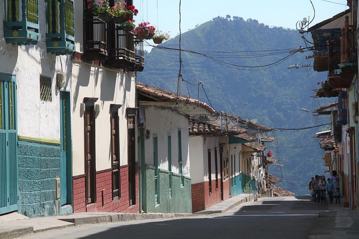
La première fois que j’ai entendu parler de la Colombie – comme destination touristique, j’entends –, c’était lors de notre voyage en Equateur au cours de notre hâlte à La Rana canto(que je recommande chaleureusement d’ailleurs pour qui voudrait faire un stop à la campagne. C’est vraiment très bien). Nadine et Pascal nous ont dit qu’ils commençaient à accueillir des backpackers venant de Colombie et que ces derniers trouvaient cela vraiment super.
Puis un podcast de Voyageurs du Monde m’a persuadée que la Colombie était le pays à visiter rapidement.
Ma fille (19 ans à l’époque) n’a pas été difficile à convaincre. Elle adore l’Amérique latine et une de ses meilleures amies a passé de nombreuses années en Colombie. Les garçons (mon tendre et cher, et notre fils - 17 ans) étaient loin d’être convaincus. Il faut dire que le site du ministère des affaires étrangères était tout sauf rassurant avec plein de rouge partout et un peu de jaune. Mais grâce à un travail de lobbying acharné et astucieux des filles, la promesse de bien rester dans les zones jaunes, ils ont fini par se laisser entraîner. (Entre notre décision et le voyage, le rouge du MAE a été largement réduit).
Restait à établir le parcours. La Colombie c’est grand, très grand. Et les routes sont lentes, très lentes. Pas question de vouloir trop en faire. Notre choix s’est porté sur la région du café, Medellin, Carthagène - parce que Carthagène a beau être très touristique, il nous paraissait difficilement envisageable de passer outre – et la Santander (avec Saint-Gil) que nous avons privilégié au parc de Tayrona (qui nous paraissait davantage semblable à ce que nous avions pu découvrir au cours de nos précédents voyages).
J’ai été guidée dans mes choix par les posts de Intothetrees -merci mille fois à lui- et le blog de Mars56 - merci aussi mille fois. Quelques blogs de voyageurs en tour du monde aussi (peu de sites évoquaient la Colombie à l’époque et j’ai découvert que les blogs de TDM étaient une bonne source d’information dans ce cas).
Pour optimiser les trajets, j’ai choisi une arrivée dans la région du café et un départ de Bogota. Trouver les billets au meilleur prix a été un peu compliqué et j’ai dû me résoudre à passer par un site de grossiste, chose que je ne fais jamais, en croisant les doigts pour ne pas avoir de problèmes. Deux vols intérieurs (Medellin – Carthagène et Carthagène – Bucaramanga) ont permis d’alléger les trajets.
Pour les hôtels, je n’ai pas eu le temps de potasser et puis à vrai dire, il n’y avait pas vraiment de quoi potasser. Je les ai choisis quelques jours à l’avance sur Booking en fonction des différents commentaires. Bien m’en a pris : en réservant depuis l’étranger – et Booking fait partie de « réserver depuis l’étranger », même nous étions déjà en Colombie lors de la réservation – on ne paye pas la TVA.
Au final, le trajet a donné cela.
5 août : trajet Paris - Perreira 6 août : Trajet pour Salamina – Salamina 7 août : Salamina - Balade aux alentours 8 août : Salamina - San Felix-vallée de Samaria 9 août : en route pour Jardin de Antoquia 10 août : Jardin de Antoquia 11 août : Jardin de Antoquia 12 août : trajet pour Medellín - musée de Antoquia 13 août : Guatape 14 août : Medellín - Free tour- Metrocable et Comuna 13 15 août : trajet pour Carthagène - Carthagène 16 août : Carthagène 17 août : Carthagène – les îles de Rosaire 18 août : Carthagène – La Boquhttp://illa 19 août : En route pour San Gil. Non ! pour Bogota ! 20 août : San Gil 21 août : Barichara- Guane 22 août : Rafting à San Gil 23 août : San Gil- Guadalupe 24 août : Guadalupe 25 août : Trajet pour Bogotá 26 août : Bogotá – bike tour – La calendelaria- musée de l’or 27 août : Bogotá - Montserrat- retour sur Paris
Tant pis pour la carte que j'ai faite sur Google earth : je ne peux pas la télécharger, pas assez de pixels!!
Nous avons donc adopté un rythme cool, nous laissant le temps de la découverte mais aussi du repos entre des trajets qui ont été souvent chaotiques voire complétement chamboulés. J’y reviendrai.
Un petit bilan, avant de passer au détail du récit : nous avons tout quatre bien apprécié la Colombie et les Colombiens. Le très bon espagnol de notre fille nous a beaucoup aidé à la fois pour nous débrouiller – mais nous aurions pu faire sans – mais aussi pour échanger avec les gens, notamment dans le bus. Le Colombie est un pays vraiment très chouette et mon seul regret, partagé par au moins un autre membre de la famille (je vous laisse deviner lequel), est de ne pas avoir eu plus de temps pour, par exemple, aller à Mompox ou encore Mongi.
Quant à la sécurité, souvent source d’interrogations, jamais nous ne nous sommes sentis menacés. Bien sûr nous avons pris les précautions d’usage et, dans les villes, Medellín et Bogotá, j’avais choisi pour nous loger les quartiers les plus sécures, peut-être moins typiques mais plus simples à gérer. Evidemment, cela ne veut pas dire qu’il n’y pas de problèmes, mais nous n’avons pas eu de soucis pour voyager. Dans la région du café, nous avons croisé maints militaires dûment armés, un peu impressionnant quand même.
La première fois que j’ai entendu parler de la Colombie – comme destination touristique, j’entends –, c’était lors de notre voyage en Equateur au cours de notre hâlte à La Rana canto(que je recommande chaleureusement d’ailleurs pour qui voudrait faire un stop à la campagne. C’est vraiment très bien). Nadine et Pascal nous ont dit qu’ils commençaient à accueillir des backpackers venant de Colombie et que ces derniers trouvaient cela vraiment super.
Puis un podcast de Voyageurs du Monde m’a persuadée que la Colombie était le pays à visiter rapidement.
Ma fille (19 ans à l’époque) n’a pas été difficile à convaincre. Elle adore l’Amérique latine et une de ses meilleures amies a passé de nombreuses années en Colombie. Les garçons (mon tendre et cher, et notre fils - 17 ans) étaient loin d’être convaincus. Il faut dire que le site du ministère des affaires étrangères était tout sauf rassurant avec plein de rouge partout et un peu de jaune. Mais grâce à un travail de lobbying acharné et astucieux des filles, la promesse de bien rester dans les zones jaunes, ils ont fini par se laisser entraîner. (Entre notre décision et le voyage, le rouge du MAE a été largement réduit).
Restait à établir le parcours. La Colombie c’est grand, très grand. Et les routes sont lentes, très lentes. Pas question de vouloir trop en faire. Notre choix s’est porté sur la région du café, Medellin, Carthagène - parce que Carthagène a beau être très touristique, il nous paraissait difficilement envisageable de passer outre – et la Santander (avec Saint-Gil) que nous avons privilégié au parc de Tayrona (qui nous paraissait davantage semblable à ce que nous avions pu découvrir au cours de nos précédents voyages).
J’ai été guidée dans mes choix par les posts de Intothetrees -merci mille fois à lui- et le blog de Mars56 - merci aussi mille fois. Quelques blogs de voyageurs en tour du monde aussi (peu de sites évoquaient la Colombie à l’époque et j’ai découvert que les blogs de TDM étaient une bonne source d’information dans ce cas).
Pour optimiser les trajets, j’ai choisi une arrivée dans la région du café et un départ de Bogota. Trouver les billets au meilleur prix a été un peu compliqué et j’ai dû me résoudre à passer par un site de grossiste, chose que je ne fais jamais, en croisant les doigts pour ne pas avoir de problèmes. Deux vols intérieurs (Medellin – Carthagène et Carthagène – Bucaramanga) ont permis d’alléger les trajets.
Pour les hôtels, je n’ai pas eu le temps de potasser et puis à vrai dire, il n’y avait pas vraiment de quoi potasser. Je les ai choisis quelques jours à l’avance sur Booking en fonction des différents commentaires. Bien m’en a pris : en réservant depuis l’étranger – et Booking fait partie de « réserver depuis l’étranger », même nous étions déjà en Colombie lors de la réservation – on ne paye pas la TVA.
Au final, le trajet a donné cela.
5 août : trajet Paris - Perreira 6 août : Trajet pour Salamina – Salamina 7 août : Salamina - Balade aux alentours 8 août : Salamina - San Felix-vallée de Samaria 9 août : en route pour Jardin de Antoquia 10 août : Jardin de Antoquia 11 août : Jardin de Antoquia 12 août : trajet pour Medellín - musée de Antoquia 13 août : Guatape 14 août : Medellín - Free tour- Metrocable et Comuna 13 15 août : trajet pour Carthagène - Carthagène 16 août : Carthagène 17 août : Carthagène – les îles de Rosaire 18 août : Carthagène – La Boquhttp://illa 19 août : En route pour San Gil. Non ! pour Bogota ! 20 août : San Gil 21 août : Barichara- Guane 22 août : Rafting à San Gil 23 août : San Gil- Guadalupe 24 août : Guadalupe 25 août : Trajet pour Bogotá 26 août : Bogotá – bike tour – La calendelaria- musée de l’or 27 août : Bogotá - Montserrat- retour sur Paris
Tant pis pour la carte que j'ai faite sur Google earth : je ne peux pas la télécharger, pas assez de pixels!!
Nous avons donc adopté un rythme cool, nous laissant le temps de la découverte mais aussi du repos entre des trajets qui ont été souvent chaotiques voire complétement chamboulés. J’y reviendrai.
Un petit bilan, avant de passer au détail du récit : nous avons tout quatre bien apprécié la Colombie et les Colombiens. Le très bon espagnol de notre fille nous a beaucoup aidé à la fois pour nous débrouiller – mais nous aurions pu faire sans – mais aussi pour échanger avec les gens, notamment dans le bus. Le Colombie est un pays vraiment très chouette et mon seul regret, partagé par au moins un autre membre de la famille (je vous laisse deviner lequel), est de ne pas avoir eu plus de temps pour, par exemple, aller à Mompox ou encore Mongi.
Quant à la sécurité, souvent source d’interrogations, jamais nous ne nous sommes sentis menacés. Bien sûr nous avons pris les précautions d’usage et, dans les villes, Medellín et Bogotá, j’avais choisi pour nous loger les quartiers les plus sécures, peut-être moins typiques mais plus simples à gérer. Evidemment, cela ne veut pas dire qu’il n’y pas de problèmes, mais nous n’avons pas eu de soucis pour voyager. Dans la région du café, nous avons croisé maints militaires dûment armés, un peu impressionnant quand même.
Discussion autour du concours du mois de mars 2020: Seul(e) au monde ou la solitude English translation pending
Bonjour 😉
C'est ici - et uniquement ici - qu'on discute à propos de la thématique du mois : Seul(e) au monde - concours photo du mois de Mars 2020
C'est ici - et uniquement ici - qu'on discute à propos de la thématique du mois : Seul(e) au monde - concours photo du mois de Mars 2020