Results for "Cannes+|+59+>+209"
5956 results found.
Madagascar - June 2025
Five years of an unintended break... The closure of VF, COVID... What a joy to rediscover the pleasure of sharing!
I’ve stayed true to my habits: the following account is a collection of practical tips rather than a travel journal...
Madagascar is as big as France and Belgium combined. In three weeks, choices have to be made! It was the Great Tsingy that inspired our trip. We decided to focus on the southwest and the RN7. We skipped the Deep South and the North. Oh well...
OUR ITINERARY IN 3 WEEKS:
Fri 6 June – Direct AF flight to Tana – Flight arrives at 10:30 PM – Tana Sat – Antsirabe Sun – Miandrivazo Mon – Drive to the Masiakampy pier – Descent of the Tsiribihina River by pirogue - Bivouac Tue – Descent of the Tsiribihina River by pirogue - Bivouac Wed – Descent of the Tsiribihina River by pirogue – Bekopaka Thu – Pirogue on the Manambolo River and Small Tsingy of Bemaraha – Bekopaka Fri – Great Tsingy of Bemaraha – Bekopaka Sat – Avenue of the Baobabs – Morondava Sun – Belo sur Mer Mon – Free day – Belo sur Mer Tue – Manja Wed – Andavadoaka Thu – Free day – Andavadoaka Fri – Salary Lagoon – Mangily Sat – Ranohira Sun – Isalo National Park - Ranohira Mon – Anja Reserve - Ambalavao - Fianarantsoa Tue – FCE train canceled – Visit to a Tanala village - Manakara Wed – Pirogue on the Pangalanes Canal – Ranomafana Thu – Ranomafana NP – Ranomafana Fri – Ambositra – Antsirabe Sat 28 June – AF flight to Paris – Flight departs at 11:55 PM
TRIP ORGANIZATION: I prepared my trip using the usual guides (LP and Rough Guide), the internet, and the Freytag & Berndt map (1:1,000,000). I’m old-school—I still love visualizing my route on a paper map, even though in Madagascar, it’s misleading because some National Roads are only national in name!...
The agency: Since we couldn’t deal directly with a driver-guide (we lacked reliable info to take the plunge), we went through an agency to organize the logistics of our trip. We didn’t feel like using bush taxis (not enough time) or driving a 4x4 ourselves (neither the skills nor the boldness). The French agency connected us with a local agency, to whom I sent my detailed itinerary by email. A few exchanges via email and WhatsApp calls allowed us to finalize everything quickly after some adjustments. As you’ve gathered... we multiplied the commissions, which inflated the budget. That said, in the end, we were thrilled with our decision and our choice. Our trip was booked by the end of 2024, and reservations were made immediately. No bad surprises: the bookings in the planned hotels were honored, often with one of the best rooms. On our last day in Tana, before departure, we were lucky enough to meet the director I’d been communicating with, who helped build and validate our circuit. A very warm debriefing.
The driver-guide: The agency assigned us Faly, 33, a driver-guide for over 10 years. He stayed with us from start to finish: he picked us up at the airport on arrival and dropped us off 23 days later. A very experienced driver (which is important here), an open and cultured guide, reliable, punctual, and a great companion. And a provider of good advice throughout the trip. We made the most of the long stretches on dirt roads or highways to listen to him talk about daily life, rituals, wildlife, and flora... No time wasted! With a great playlist in the background, we combined business with pleasure! Faly’s accommodation and meals were included (quite often, hotels offer free lodging and meals to driver-guides who bring clients), as was the fuel. That didn’t stop us from inviting Faly to share a beer or our evening meal sometimes. He didn’t always accept, wanting to let us "enjoy our romantic evenings," as he put it. Present without being intrusive! Faly is fully capable of organizing a tailor-made trip directly. I recommend him without any hesitation—we were delighted with his service. I’ll gladly share his contact details via PM to anyone who asks.
Local guides: It’s the national guide’s prerogative to choose the local guides (mandatory in the parks). Thanks to his experience, Faly always booked us amazing, competent, and interesting local guides.
Hotels: I told the agency I wanted charming, comfortable accommodations, without falling into flashy luxury. We loved all the hotels (except the Hôtel Kanto in Manja). The rooms, mostly bungalows, were always spacious and clean. Unfortunately, I can’t give the prices—I didn’t get the details. Breakfast is always included, usually fresh and hearty. Very often, a small bottle of water is provided in the room.
Tana Hôtel Les 3 Métis Power cuts are common (!) in Tana. Bring a headlamp.
Antsirabe Ecolodge – Les chambres du voyageur Maybe our favorite! A few bungalows, beautifully arranged in a splendid tropical garden. The dog Kodak welcomes us warmly.
Miandrivazo Hôtel Princesse Tsiribihina Magnificent view of the valley.
Bekopaka Hôtel Orchidée du Bemaraha 2 (yes, 2) beautiful pools, a large open common room.
Morondava Hôtel Baobab Café Brand new or at least, according to Faly, just renovated. Very comfortable but without much charm (international style).
Belo sur Mer Ecolodge du Menabe The bungalows, all made of wood, bamboo, and thatch, are set on the beach. Very spacious and fully equipped! Large open-air restaurant by the sea. No hot water from the tap—it’s available in plastic bottles heated by the sun in front of each bungalow. Actually, we never used it... Another very, very beautiful spot.
Manja Hôtel Kanto The only hotel on this leg of the journey, so no choice. The owner knows it and, as a result, doesn’t bother. It’s a real dive! Tiny, dark room, a sordid bathroom with only a trickle of water—we skipped the shower! Clean sheets, though. Obviously, no Wi-Fi. The only place where I didn’t leave a tip. We were well warned about the discomfort of this stop, both by the agency and Faly. We weren’t surprised, and it even became a running joke during the trip. On the other hand, we found a nice little market in town.
Andavadoaka Manga Lodge What bliss! Especially after the horrible Hôtel Kanto. A paradise-like spot, overlooking three beautiful deserted white-sand beaches. Meals are served on the terrace facing the sea. Stunning sunset. We loved spending a day lounging here! We were the only guests and were pampered.
Mangily (Ifaty) Mangily is the "suburb" of Ifaty. Hôtel Vovo Telo A large beachfront bungalow complex. More touristy but pleasant—we spent a lovely evening there with our feet in the sand.
Ranohira Le Relais de la Reine A splendid resort built by a Frenchman, at the foot of the rocks, very well integrated into the environment. Beautiful marked trail starting from the garden.
Fianarantsoa Villa Sylvestre Contrary to what its name suggests, it’s a hotel right in the city center. Quite decent, though.
Manakara Parthenay Club Pretty bungalows in a large garden by the sea, but swimming isn’t safe—the water is too dangerous and rough.
Ranomafana Hôtel Thermal Very spacious rooms.
Meals: Not all our meals were included. It’s really not expensive. 1 meat or fish dish: around 35,000 Ar 1 full menu (starter, main, dessert): around 70,000 Ar 1 large THB beer (65 cl): between 8,000 and 12,000 Ar 1 piña colada: 15,000 Ar 1 flavored rum: 6,000 Ar (sometimes free) 1 glass of baobab juice (!): 5,000 Ar
We always ate very well. Rice is everywhere, served in large quantities. Zebu meat is quite good if not overcooked. Personally, I prefer fish, and I feasted: grouper, captain, crab, small lobsters...
We happily discovered baobab juice (especially in Belo, on the west coast). And of course, flavored rums!
We bought 2 packs of 6 bottles of mineral water at Carrefour (!) (about 5,000 Ar per large bottle) at the start of our trip. That was enough, especially since we often got water in the bungalows.
We had a few picnics included in our trip. Instead of picking up the hotel’s lunchbox, Faly prepared delicious, fresh, and varied picnics for us: tuna pasta salad, fried rice with eggs, grilled vegetables, and avocado...
An exceptional address not to miss: Mad Zébu – Belo sur Tsiribihina A highly reputed restaurant, a favorite of LP and Rough Guide, and rightly so! Gourmet cuisine, refined and elegant. Barely more expensive than elsewhere, and it’s worth it. We stopped there on our way up to Bekopaka and the Tsingy NP. Fully booked! So Faly reserved for our return, three days later. We’re still thanking him! What a treat!
THE BUDGET: Ariary exchange rate: 5,000 Ar = 1 €
Pre-trip expenses: Direct Air France flights: 930 € per person round trip Cost of the circuit with the agency: 2,880 € per person
The visa: Issued on arrival, very quickly. 35 € per person for a stay under 30 days. Super simple. Super fast.
On-site expenses: As soon as we arrived at the airport (it was nearly midnight), Faly advised us to exchange our euros for all our needs. There are few opportunities on our route to find an ATM or an open bank with a good rate. To be more comfortable, he took us to a small office under military protection just outside the airport. I exchanged 1,200 € (I had asked the agency for advice on the amount to bring) at a rate of 4,750 Ar and became a millionaire. Faly recounted all the stacks. That covered all our expenses (meals, drinks, tips) without ever feeling deprived. Personal purchases were made at the end of the trip. Convenient—it served as an adjustment variable. We spent our last million (200 €) on marquetry and vanilla. Tip: We asked for 200,000 Ar in 5,000 Ar bills for tips. That wasn’t too much—I even ran short of small bills in the last two days.
Tips: Madagascar is a poor country where every service deserves a small reward. While not mandatory, it’s customary. But no one ever demanded or expected it openly. On the contrary, I sometimes had to remind a porter to give them my small bill. We never carried our luggage—porters were always present when the car arrived or waiting at our door to watch for our departure. I gave each of them 5,000 Ar. In restaurants, I rounded up to the nearest ten and left the change. Local guides also expect a tip: I gave around 20,000 Ar per day for the two of us. Finally, the national guide also expects a gratuity. I had read online to budget 5 € per day per person. I added more since we were so happy with his services. The tip was given at the end of the trip, in euros, outside the budget.
Total budget all included (excluding personal purchases): 8,690 € Clearly, Madagascar is a country where life isn’t expensive, but travel costs add up quickly due to the need to rent a 4x4 with a driver.
HIGHLIGHTS:
· The dirt roads Yes, I’m listing them among the highlights! We loved those long hours spent driving at 20 km/h on rocky, muddy, white, red, or gray sand tracks... surrounded by tropical vegetation, palm trees, pandanus, mango trees... The experiences were sometimes thrilling: crossing a river on a ferry (just planks of wood fixed on two motorized pirogues side by side) or crossing a river without a ferry, with just a kid running ahead of the 4x4 to show the way; soft sand where the 4x4 easily gets stuck... The tracks are quite narrow, and crossing paths with a bush taxi, a zebu cart, or a herd of goats is always epic. So many beautiful images, so many beautiful photos! Much more beautiful than on asphalt. So yes, we loved those long stretches on dirt roads. For us, it was clearly part of the journey. Faly was particularly careful, and the 4x4 was comfortable. No injuries, no fatigue, even after 7 or 8 hours on rough tracks. The national roads (including the famous RN7) are badly damaged by cyclones, huge trucks, and lack of maintenance. Potholes have turned into ostrich nests, and we didn’t drive much faster than on the dirt roads.
· The landscapes, villages, encounters... We crossed a variety of stunning landscapes: mountains with slopes covered in terraced crops, rice fields from apple green to emerald green, sugarcane fields, then tropical forests, baobab forests (they deserve a special paragraph below), traveler’s tree forests. And then coastlines with white sand dunes against a backdrop of blue hues!... Magical! We also passed through many villages with houses whose architecture varied by region. The Betsileo houses display beautiful decorative brick reliefs. On the west coast, the houses are more precarious, made of bamboo with palm-thatched roofs. In the Highlands region, we found solid houses with pastel plaster. Each region has its own landscape, crops, habitat, and clothing. Zebu carts are often the only means of transport in remote villages. We saw them very frequently. Again, the cart’s decoration depends on the region. And then, we met many villagers coming out of the bush and walking to the next market, carrying their crops on their heads or shoulders. More beautiful photos!
· The descent of the Tsiribihina River We boarded around 9 AM in a long pirogue with Gana, the local guide, and two pirogue men. So, five of us. The pirogue is long but narrow, about 65 cm wide. We sat one behind the other at the front on seats padded with what would become our mattresses during the bivouacs. We only took the bare essentials for two nights. A little goodbye to Faly, whom we’d see again in three days! Don’t forget us! The river is silty—meaning orange, opaque but clean. We glided along silently. Gana showed us the trees, birds, crocodiles (we saw five—apparently, we were lucky). The pirogue men rowed to get us as close as possible to these crocs sunbathing on the roots of big trees. Yeah, right!... as soon as we got too close, *splash*, they disappeared into the water. We marveled at the mini rice fields lining the river. Every tiny plot, no matter how small, is cultivated. Above them, banana fields. And on the water, a whole life of fishermen and villagers living with and from the river. Gana warned us we’d eat on the pirogue because the journey was long. So, I expected chips... But no—fried rice and zebu steak, cooked right in the pirogue!! Incredible! In the middle of the afternoon, we reached a small beach where we disembarked. Gana led us about a hundred meters to a sublime waterfall. We were alone there. We had time to swim. We’d brought our swimsuits and a towel (bought at the Carrefour in Antsirabe on Faly’s wise advice!). This swim in this paradise-like spot remains one of our best memories. We found our pirogue again and set off until our first bivouac. We’d sailed for 7 hours today. The tents were set up on a wide beach, without a single tree. A moment of solitude... Uh, where can we go to the bathroom?... Especially since it was a full moon, so we felt like we were in the spotlight. Anyway... we did as everyone else—walked away, dug a hole, and the others turned their backs. A hearty meal on the beach before a comfortable and silent night. The next day, same program, with slightly different landscapes. The gorges widened, the trees were different. But still many colorful birds. Again, we ate on the pirogue: grilled chicken and vegetables. 9 hours of sailing. A similar bivouac. This time, we got it. On the third day, we finished the descent with 5 hours of sailing. So, 7 hours, 9 hours, 5 hours... doing nothing. It might sound boring... but it wasn’t. Like the dirt roads, these were contemplative moments. It glides, it’s calm, relaxing, and there’s a lot of life on this river, animal and human. Contemplation. Suspended time. On arrival, we disembarked at a sort of joyful, bustling river port. Of course, Faly was already there to pick us up.
· The Tsingy de Bemaraha NP (Small and Great) I have vertigo. During my research, several agencies advised me against visiting the Great Tsingy. "Stick to the Small ones," they said. Grrr, no, not what I wanted—we’ve dreamed of this for years! The agency we chose also warned me but didn’t discourage me. So we started with the Small Tsingy, quite close to Bekopaka, guided by Alisha. This forest of sharp limestone rocks is impressive. No vertigo issues here. The day was completed with a short pirogue ride on the Manambolo River and a visit to two caves with pretty formations. The next day, Faly and Alisha drove us to the Great Tsingy (a good hour on a terrible track). Arriving at the park entrance, Alisha equipped us with harnesses, carabiners, and gave us some safety instructions. Faly was also equipped. Wait? He’s coming with us? I quickly understood he was there for me—if I got stuck, he could go back with me, and Philippe could continue with Alisha. A wise precaution that delighted and reassured me. In the end, it was unnecessary since the famous bridge crossing was fully secured by the harness and carabiners. 18 meters on planks, one by one, it didn’t sway too much—I walked looking straight ahead, not a glance down. I even managed to smile in the middle of the crossing—I have a photo to prove it! I was overjoyed! The circuit in the Great Tsingy is a loop, so we didn’t have to cross the bridge again. We climbed to viewpoints offering breathtaking panoramic views. It’s extraordinary, unique, incredible. All this to say that if you have vertigo, don’t hesitate! It’s doable! It’s completely safe and really worth pushing your limits a bit! For those who’ve done treetop adventure courses, it’s similar. Also, no need to be a great athlete—just a bit of agility to climb a few ladders and high steps. Don’t censor yourself! I even had a small regret—the loop was a bit short (about 2 hours). I would’ve liked to continue or even redo it, with less apprehension. Tip: Do the Small Tsingy before the Great ones, or not at all. And if you can only do one, do the Great ones without hesitation.
· Canoeing in the Belo mangrove The Belo sur Mer ecolodge lends small individual canoes for free to go to the mangrove. We left at high tide, paddled for about twenty minutes to reach a fairly sparse forest where we could easily venture in. Very shallow water, crystal clear—we could see the roots of all these trees, schools of tiny fish... It was quite surprising. Until then, I only knew impenetrable, tangled mangroves. Here, nothing like that—we walked through an aquatic forest. We loved this adventure so much we left a bit late. The tide had gone out, and we had to carry our canoes for the last few meters... Of course, the staff came to help (probably laughing silently!). The lodge owners gave all the necessary explanations and lent a waterproof bag for the phone (because yes, it’s worth taking photos!). A very useful precaution—the canoes are small, low in the water, and paddling quickly soaks you. Again, this isn’t just for Tony Estanguet! It didn’t cause us any problems, not even sore muscles the next day. A great experience. It’ll take about 2 hours.
· Isalo NP Big surprise when we saw this huge rocky massif appear on the RN7! A massif of colored sandstone, carved with crevasses giving it a ruined look. Le Relais de la Reine is a little gem cleverly nestled in the heart of these rocks. A small marked trail starts from the garden. We picked up the description at reception and set off. Without a guide, alone following the markers, it took us 2 hours to complete this magnificent little trail, giving us a first glimpse of the massif before the hike the next day. And we enjoyed being completely alone for this walk. It’s free, easy, and well-signposted. Don’t miss it. In the evening, Faly took us to the so-called Isalo Window site—a hole in a wall through which we could see the sunset. We met all the tourists in the area here. We weren’t blown away by the show... The next day, we left early to reach the start of the hike. We met Zozoly at the guides’ office in the small town of Ranohira. During this hike, we climbed through the rocks to a viewpoint offering stunning 360° views of the massif. Then we reached a site called the "natural pool," breathtakingly beautiful, especially since we were alone again. A sort of oasis, a cascading waterfall, palm trees and tree ferns, fine sand, all nestled at the bottom of a small canyon. Paradise-like. We resisted swimming, but it was really tempting. A long walk on the plateaus then led us to a well-equipped picnic site where a local team prepared grills. Concrete tables were tiered in a spacious, shady clearing where a whole family of ring-tailed lemurs frolicked. They knew the tourists’ habits and tried to snatch food. Playful and not very shy, they amused us with their antics! We had to resist not luring them with a piece of banana!! Thousands of photos!! After the meal, we set off again with Zozoly for another landscape. This time, we were by a small river at the bottom of a canyon with high walls covered in vegetation. The trail was narrow and slippery, on a ledge of the wall. We progressed carefully. No danger, though. We first reached the Blue Pool, which only turns blue in photos (surprise!), then the Black Pool fed by a shower of waterfalls. Two magnificent spots that showed us a completely different aspect of the massif.
· Anja Reserve This ficus forest is home to many groups of lemurs. Used to humans, whom they don’t fear, they move around us, ignoring us completely. It’s almost annoying... The best place on our trip to see lemurs.
· The FCE train To the great regret of Manakara’s inhabitants, the FCE train hasn’t reached here for over a year and a half. As a result, there are far fewer tourists—the train was part of the experience. We drove there and didn’t regret coming to this port on the east coast.
· Visit to a Tanala village This visit wasn’t part of our program—it was added by the agency to compensate for the train not running. Which was the case. Not big fans of this kind of visit, where we feel like we’re at a zoo, voyeuristic, lacking authenticity, we followed the local guide with some skepticism and exchanged dubious looks. And yet... the guide’s explanations about village life and the warm, smiling welcome from the villagers charmed us and dispelled all our concerns. We learned a lot, met smiling families, and were able to enter these beautiful bamboo houses. A very pleasant surprise, rich in lessons.
· The Pangalanes Canal Arriving in Manakara, we crossed a bridge overlooking the Pangalanes Canal. A cry of surprise: the water is turquoise! We took a short pirogue ride with a team of three pirogue men and Joël, a local guide who explained the drama caused by the train’s halt. We stopped in a fishing village where Joël bought fish for the barbecue. We ended up on a beach where the team prepared the meal while we went to watch the fishermen return on the nearby beach. We admired the fishermen’s dexterity in untangling their nets, sorting their fish, cleaning their gear. On our return, we found a small table set up on the beach, in the shade of palm trees and casuarinas. Lobsters, captain fish, grilled vegetables, sautéed potatoes. A real feast (included in the trip cost).
· Ranomafana NP A 4-5 hour hike (some climbing) in a dense secondary forest to look for lemurs. As usual, we were accompanied by a local guide who, while waiting to find our furry friends, gave us lots of info on the vegetation, birds, and Tanala ethnic rituals. In the forest, we met 4 or 5 trackers, armed with radios to alert guides of their findings. In the end, we saw several lemurs of different types. Quite far, quite high... A nice complement to our lemur encounters in Isalo. Here, it rains 200 days a year. We started the hike in thick fog, but the forest’s density protected us from the humidity. Be careful—it can be a bit frustrating to see the lemurs so far away, so high. Nothing like the Anja Reserve or Isalo NP. Here, what’s fun is the hunt.
· The baobabs We were captivated by these kings of the forest, noble, imposing, majestic. We spotted them from very far away, towering over the rest of the vegetation. Alone, in small groups, or in forests, our trip allowed us to see hundreds of them! Mainly on the west coast. All different—bald, hairy, shaggy, short and stout, tall and thin, like Laurel and Hardy. Philippe took to naming them. Respectfully!
OUR FAVORITES: · The variety of landscapes. · The Tsingy NP.
OUR DISAPPOINTMENTS: · The Avenue of the Baobabs, very overrated and the only place where we saw crowds. We saw many other "forests" of baobabs that were much more impressive. · It’s hard to approach the population calmly as swarms of children run up as soon as we arrive, asking for sweets. Without any aggression, their smiles and laughter quickly made us forget this small inconvenience. We never gave out candy, clothes, or money. We left pens at a school and clothes with Faly.
IF WE WERE TO DO IT AGAIN: · Same period, same duration, same pace, same itinerary, but if we were to do it again today, I’d go through Faly directly! · Maybe we should’ve stayed in Ambalavao instead of Fianarantsoa. · Plan a longer loop in the Great Tsingy—it felt a bit too short.
MISCELLANEOUS: The welcome: ‘Samala Vazaha,’ there are many, many kids, sometimes overwhelming, never aggressive. We were impressed by the villagers’ smiles and good humor, towards us or even among themselves—laughter was everywhere. Safety: No problems. Out of (excessive?) caution, we spread all our money across several bags that we padlocked whenever we left the hotel. Bribes: We were stopped several times on the road by police or gendarmes. They checked our papers, sometimes our passports. Faly was perfectly in order. No discussion, no bribes, a cordial greeting from the officers. However, several times we found ourselves at small "tolls" on the tracks for villagers who had leveled the road or filled a hole, or for the young guy who ran through the river to show the way... Faly complied without discussion: every service deserves a small bill. Language: French is still widely spoken. Credit card: Unused. Cash: You need it! The climate at this time: Ideal—blue skies, sunshine, and mild temperatures (20-25°C) throughout our trip. Temperatures started to drop by our departure—winter was setting in. Clothing: T-shirt or polo and a vest sometimes in the evening, sandals on our feet, hiking shoes for all the hikes. Tip: We left a bag in the car (completely safe) with things we didn’t need daily and dirty laundry. The two bags to take out at each stop were much lighter. Before leaving, we left several polos and T-shirts with Faly, which, once washed, will make a few people happy. Tourist crowds at this time: Low—we were sometimes the only guests at the hotel. Faly explained that at the Isalo picnic site, in high season, you have to queue for a table, whereas we had our pick. Photos: Lots! Too many! That’s the problem with digital—we take so many! Health issues: Nothing serious, just the usual mild traveler’s diarrhea. Mosquitoes: They’re voracious. We took anti-malaria treatment. I’m still not sure if it was the right thing to do... I’m always very skeptical about such precautions. Internet: Free Wi-Fi at the lodges’ reception (except at Hôtel Kanto!), sometimes (rarely) in the bungalows. Phone: We didn’t try to get a local SIM card—the evening Wi-Fi was enough for us to make calls and send messages via WhatsApp. Make sure to turn off mobile data and switch to airplane mode (I activated it a bit late—received calls, spam ones at that, were charged...). Electricity: French plugs. Personal purchases: Beautiful wooden objects (sculptures and marquetry) or zebu horn items in Ambositra. 1 kg of vanilla (400,000 Ar – 80 € per kg) in Tana.
IN CONCLUSION: A trip of contemplation. A pause for admiration, as our local guide in Isalo NP said. Nothing else to do but walk, look, and enjoy. Here, there are no old stones, no museums—it’s a trip where nature reigns supreme. And what nature!
I’ve stayed true to my habits: the following account is a collection of practical tips rather than a travel journal...
Madagascar is as big as France and Belgium combined. In three weeks, choices have to be made! It was the Great Tsingy that inspired our trip. We decided to focus on the southwest and the RN7. We skipped the Deep South and the North. Oh well...
OUR ITINERARY IN 3 WEEKS:
Fri 6 June – Direct AF flight to Tana – Flight arrives at 10:30 PM – Tana Sat – Antsirabe Sun – Miandrivazo Mon – Drive to the Masiakampy pier – Descent of the Tsiribihina River by pirogue - Bivouac Tue – Descent of the Tsiribihina River by pirogue - Bivouac Wed – Descent of the Tsiribihina River by pirogue – Bekopaka Thu – Pirogue on the Manambolo River and Small Tsingy of Bemaraha – Bekopaka Fri – Great Tsingy of Bemaraha – Bekopaka Sat – Avenue of the Baobabs – Morondava Sun – Belo sur Mer Mon – Free day – Belo sur Mer Tue – Manja Wed – Andavadoaka Thu – Free day – Andavadoaka Fri – Salary Lagoon – Mangily Sat – Ranohira Sun – Isalo National Park - Ranohira Mon – Anja Reserve - Ambalavao - Fianarantsoa Tue – FCE train canceled – Visit to a Tanala village - Manakara Wed – Pirogue on the Pangalanes Canal – Ranomafana Thu – Ranomafana NP – Ranomafana Fri – Ambositra – Antsirabe Sat 28 June – AF flight to Paris – Flight departs at 11:55 PM
TRIP ORGANIZATION: I prepared my trip using the usual guides (LP and Rough Guide), the internet, and the Freytag & Berndt map (1:1,000,000). I’m old-school—I still love visualizing my route on a paper map, even though in Madagascar, it’s misleading because some National Roads are only national in name!...
The agency: Since we couldn’t deal directly with a driver-guide (we lacked reliable info to take the plunge), we went through an agency to organize the logistics of our trip. We didn’t feel like using bush taxis (not enough time) or driving a 4x4 ourselves (neither the skills nor the boldness). The French agency connected us with a local agency, to whom I sent my detailed itinerary by email. A few exchanges via email and WhatsApp calls allowed us to finalize everything quickly after some adjustments. As you’ve gathered... we multiplied the commissions, which inflated the budget. That said, in the end, we were thrilled with our decision and our choice. Our trip was booked by the end of 2024, and reservations were made immediately. No bad surprises: the bookings in the planned hotels were honored, often with one of the best rooms. On our last day in Tana, before departure, we were lucky enough to meet the director I’d been communicating with, who helped build and validate our circuit. A very warm debriefing.
The driver-guide: The agency assigned us Faly, 33, a driver-guide for over 10 years. He stayed with us from start to finish: he picked us up at the airport on arrival and dropped us off 23 days later. A very experienced driver (which is important here), an open and cultured guide, reliable, punctual, and a great companion. And a provider of good advice throughout the trip. We made the most of the long stretches on dirt roads or highways to listen to him talk about daily life, rituals, wildlife, and flora... No time wasted! With a great playlist in the background, we combined business with pleasure! Faly’s accommodation and meals were included (quite often, hotels offer free lodging and meals to driver-guides who bring clients), as was the fuel. That didn’t stop us from inviting Faly to share a beer or our evening meal sometimes. He didn’t always accept, wanting to let us "enjoy our romantic evenings," as he put it. Present without being intrusive! Faly is fully capable of organizing a tailor-made trip directly. I recommend him without any hesitation—we were delighted with his service. I’ll gladly share his contact details via PM to anyone who asks.
Local guides: It’s the national guide’s prerogative to choose the local guides (mandatory in the parks). Thanks to his experience, Faly always booked us amazing, competent, and interesting local guides.
Hotels: I told the agency I wanted charming, comfortable accommodations, without falling into flashy luxury. We loved all the hotels (except the Hôtel Kanto in Manja). The rooms, mostly bungalows, were always spacious and clean. Unfortunately, I can’t give the prices—I didn’t get the details. Breakfast is always included, usually fresh and hearty. Very often, a small bottle of water is provided in the room.
Tana Hôtel Les 3 Métis Power cuts are common (!) in Tana. Bring a headlamp.
Antsirabe Ecolodge – Les chambres du voyageur Maybe our favorite! A few bungalows, beautifully arranged in a splendid tropical garden. The dog Kodak welcomes us warmly.
Miandrivazo Hôtel Princesse Tsiribihina Magnificent view of the valley.
Bekopaka Hôtel Orchidée du Bemaraha 2 (yes, 2) beautiful pools, a large open common room.
Morondava Hôtel Baobab Café Brand new or at least, according to Faly, just renovated. Very comfortable but without much charm (international style).
Belo sur Mer Ecolodge du Menabe The bungalows, all made of wood, bamboo, and thatch, are set on the beach. Very spacious and fully equipped! Large open-air restaurant by the sea. No hot water from the tap—it’s available in plastic bottles heated by the sun in front of each bungalow. Actually, we never used it... Another very, very beautiful spot.
Manja Hôtel Kanto The only hotel on this leg of the journey, so no choice. The owner knows it and, as a result, doesn’t bother. It’s a real dive! Tiny, dark room, a sordid bathroom with only a trickle of water—we skipped the shower! Clean sheets, though. Obviously, no Wi-Fi. The only place where I didn’t leave a tip. We were well warned about the discomfort of this stop, both by the agency and Faly. We weren’t surprised, and it even became a running joke during the trip. On the other hand, we found a nice little market in town.
Andavadoaka Manga Lodge What bliss! Especially after the horrible Hôtel Kanto. A paradise-like spot, overlooking three beautiful deserted white-sand beaches. Meals are served on the terrace facing the sea. Stunning sunset. We loved spending a day lounging here! We were the only guests and were pampered.
Mangily (Ifaty) Mangily is the "suburb" of Ifaty. Hôtel Vovo Telo A large beachfront bungalow complex. More touristy but pleasant—we spent a lovely evening there with our feet in the sand.
Ranohira Le Relais de la Reine A splendid resort built by a Frenchman, at the foot of the rocks, very well integrated into the environment. Beautiful marked trail starting from the garden.
Fianarantsoa Villa Sylvestre Contrary to what its name suggests, it’s a hotel right in the city center. Quite decent, though.
Manakara Parthenay Club Pretty bungalows in a large garden by the sea, but swimming isn’t safe—the water is too dangerous and rough.
Ranomafana Hôtel Thermal Very spacious rooms.
Meals: Not all our meals were included. It’s really not expensive. 1 meat or fish dish: around 35,000 Ar 1 full menu (starter, main, dessert): around 70,000 Ar 1 large THB beer (65 cl): between 8,000 and 12,000 Ar 1 piña colada: 15,000 Ar 1 flavored rum: 6,000 Ar (sometimes free) 1 glass of baobab juice (!): 5,000 Ar
We always ate very well. Rice is everywhere, served in large quantities. Zebu meat is quite good if not overcooked. Personally, I prefer fish, and I feasted: grouper, captain, crab, small lobsters...
We happily discovered baobab juice (especially in Belo, on the west coast). And of course, flavored rums!
We bought 2 packs of 6 bottles of mineral water at Carrefour (!) (about 5,000 Ar per large bottle) at the start of our trip. That was enough, especially since we often got water in the bungalows.
We had a few picnics included in our trip. Instead of picking up the hotel’s lunchbox, Faly prepared delicious, fresh, and varied picnics for us: tuna pasta salad, fried rice with eggs, grilled vegetables, and avocado...
An exceptional address not to miss: Mad Zébu – Belo sur Tsiribihina A highly reputed restaurant, a favorite of LP and Rough Guide, and rightly so! Gourmet cuisine, refined and elegant. Barely more expensive than elsewhere, and it’s worth it. We stopped there on our way up to Bekopaka and the Tsingy NP. Fully booked! So Faly reserved for our return, three days later. We’re still thanking him! What a treat!
THE BUDGET: Ariary exchange rate: 5,000 Ar = 1 €
Pre-trip expenses: Direct Air France flights: 930 € per person round trip Cost of the circuit with the agency: 2,880 € per person
The visa: Issued on arrival, very quickly. 35 € per person for a stay under 30 days. Super simple. Super fast.
On-site expenses: As soon as we arrived at the airport (it was nearly midnight), Faly advised us to exchange our euros for all our needs. There are few opportunities on our route to find an ATM or an open bank with a good rate. To be more comfortable, he took us to a small office under military protection just outside the airport. I exchanged 1,200 € (I had asked the agency for advice on the amount to bring) at a rate of 4,750 Ar and became a millionaire. Faly recounted all the stacks. That covered all our expenses (meals, drinks, tips) without ever feeling deprived. Personal purchases were made at the end of the trip. Convenient—it served as an adjustment variable. We spent our last million (200 €) on marquetry and vanilla. Tip: We asked for 200,000 Ar in 5,000 Ar bills for tips. That wasn’t too much—I even ran short of small bills in the last two days.
Tips: Madagascar is a poor country where every service deserves a small reward. While not mandatory, it’s customary. But no one ever demanded or expected it openly. On the contrary, I sometimes had to remind a porter to give them my small bill. We never carried our luggage—porters were always present when the car arrived or waiting at our door to watch for our departure. I gave each of them 5,000 Ar. In restaurants, I rounded up to the nearest ten and left the change. Local guides also expect a tip: I gave around 20,000 Ar per day for the two of us. Finally, the national guide also expects a gratuity. I had read online to budget 5 € per day per person. I added more since we were so happy with his services. The tip was given at the end of the trip, in euros, outside the budget.
Total budget all included (excluding personal purchases): 8,690 € Clearly, Madagascar is a country where life isn’t expensive, but travel costs add up quickly due to the need to rent a 4x4 with a driver.
HIGHLIGHTS:
· The dirt roads Yes, I’m listing them among the highlights! We loved those long hours spent driving at 20 km/h on rocky, muddy, white, red, or gray sand tracks... surrounded by tropical vegetation, palm trees, pandanus, mango trees... The experiences were sometimes thrilling: crossing a river on a ferry (just planks of wood fixed on two motorized pirogues side by side) or crossing a river without a ferry, with just a kid running ahead of the 4x4 to show the way; soft sand where the 4x4 easily gets stuck... The tracks are quite narrow, and crossing paths with a bush taxi, a zebu cart, or a herd of goats is always epic. So many beautiful images, so many beautiful photos! Much more beautiful than on asphalt. So yes, we loved those long stretches on dirt roads. For us, it was clearly part of the journey. Faly was particularly careful, and the 4x4 was comfortable. No injuries, no fatigue, even after 7 or 8 hours on rough tracks. The national roads (including the famous RN7) are badly damaged by cyclones, huge trucks, and lack of maintenance. Potholes have turned into ostrich nests, and we didn’t drive much faster than on the dirt roads.
· The landscapes, villages, encounters... We crossed a variety of stunning landscapes: mountains with slopes covered in terraced crops, rice fields from apple green to emerald green, sugarcane fields, then tropical forests, baobab forests (they deserve a special paragraph below), traveler’s tree forests. And then coastlines with white sand dunes against a backdrop of blue hues!... Magical! We also passed through many villages with houses whose architecture varied by region. The Betsileo houses display beautiful decorative brick reliefs. On the west coast, the houses are more precarious, made of bamboo with palm-thatched roofs. In the Highlands region, we found solid houses with pastel plaster. Each region has its own landscape, crops, habitat, and clothing. Zebu carts are often the only means of transport in remote villages. We saw them very frequently. Again, the cart’s decoration depends on the region. And then, we met many villagers coming out of the bush and walking to the next market, carrying their crops on their heads or shoulders. More beautiful photos!
· The descent of the Tsiribihina River We boarded around 9 AM in a long pirogue with Gana, the local guide, and two pirogue men. So, five of us. The pirogue is long but narrow, about 65 cm wide. We sat one behind the other at the front on seats padded with what would become our mattresses during the bivouacs. We only took the bare essentials for two nights. A little goodbye to Faly, whom we’d see again in three days! Don’t forget us! The river is silty—meaning orange, opaque but clean. We glided along silently. Gana showed us the trees, birds, crocodiles (we saw five—apparently, we were lucky). The pirogue men rowed to get us as close as possible to these crocs sunbathing on the roots of big trees. Yeah, right!... as soon as we got too close, *splash*, they disappeared into the water. We marveled at the mini rice fields lining the river. Every tiny plot, no matter how small, is cultivated. Above them, banana fields. And on the water, a whole life of fishermen and villagers living with and from the river. Gana warned us we’d eat on the pirogue because the journey was long. So, I expected chips... But no—fried rice and zebu steak, cooked right in the pirogue!! Incredible! In the middle of the afternoon, we reached a small beach where we disembarked. Gana led us about a hundred meters to a sublime waterfall. We were alone there. We had time to swim. We’d brought our swimsuits and a towel (bought at the Carrefour in Antsirabe on Faly’s wise advice!). This swim in this paradise-like spot remains one of our best memories. We found our pirogue again and set off until our first bivouac. We’d sailed for 7 hours today. The tents were set up on a wide beach, without a single tree. A moment of solitude... Uh, where can we go to the bathroom?... Especially since it was a full moon, so we felt like we were in the spotlight. Anyway... we did as everyone else—walked away, dug a hole, and the others turned their backs. A hearty meal on the beach before a comfortable and silent night. The next day, same program, with slightly different landscapes. The gorges widened, the trees were different. But still many colorful birds. Again, we ate on the pirogue: grilled chicken and vegetables. 9 hours of sailing. A similar bivouac. This time, we got it. On the third day, we finished the descent with 5 hours of sailing. So, 7 hours, 9 hours, 5 hours... doing nothing. It might sound boring... but it wasn’t. Like the dirt roads, these were contemplative moments. It glides, it’s calm, relaxing, and there’s a lot of life on this river, animal and human. Contemplation. Suspended time. On arrival, we disembarked at a sort of joyful, bustling river port. Of course, Faly was already there to pick us up.
· The Tsingy de Bemaraha NP (Small and Great) I have vertigo. During my research, several agencies advised me against visiting the Great Tsingy. "Stick to the Small ones," they said. Grrr, no, not what I wanted—we’ve dreamed of this for years! The agency we chose also warned me but didn’t discourage me. So we started with the Small Tsingy, quite close to Bekopaka, guided by Alisha. This forest of sharp limestone rocks is impressive. No vertigo issues here. The day was completed with a short pirogue ride on the Manambolo River and a visit to two caves with pretty formations. The next day, Faly and Alisha drove us to the Great Tsingy (a good hour on a terrible track). Arriving at the park entrance, Alisha equipped us with harnesses, carabiners, and gave us some safety instructions. Faly was also equipped. Wait? He’s coming with us? I quickly understood he was there for me—if I got stuck, he could go back with me, and Philippe could continue with Alisha. A wise precaution that delighted and reassured me. In the end, it was unnecessary since the famous bridge crossing was fully secured by the harness and carabiners. 18 meters on planks, one by one, it didn’t sway too much—I walked looking straight ahead, not a glance down. I even managed to smile in the middle of the crossing—I have a photo to prove it! I was overjoyed! The circuit in the Great Tsingy is a loop, so we didn’t have to cross the bridge again. We climbed to viewpoints offering breathtaking panoramic views. It’s extraordinary, unique, incredible. All this to say that if you have vertigo, don’t hesitate! It’s doable! It’s completely safe and really worth pushing your limits a bit! For those who’ve done treetop adventure courses, it’s similar. Also, no need to be a great athlete—just a bit of agility to climb a few ladders and high steps. Don’t censor yourself! I even had a small regret—the loop was a bit short (about 2 hours). I would’ve liked to continue or even redo it, with less apprehension. Tip: Do the Small Tsingy before the Great ones, or not at all. And if you can only do one, do the Great ones without hesitation.
· Canoeing in the Belo mangrove The Belo sur Mer ecolodge lends small individual canoes for free to go to the mangrove. We left at high tide, paddled for about twenty minutes to reach a fairly sparse forest where we could easily venture in. Very shallow water, crystal clear—we could see the roots of all these trees, schools of tiny fish... It was quite surprising. Until then, I only knew impenetrable, tangled mangroves. Here, nothing like that—we walked through an aquatic forest. We loved this adventure so much we left a bit late. The tide had gone out, and we had to carry our canoes for the last few meters... Of course, the staff came to help (probably laughing silently!). The lodge owners gave all the necessary explanations and lent a waterproof bag for the phone (because yes, it’s worth taking photos!). A very useful precaution—the canoes are small, low in the water, and paddling quickly soaks you. Again, this isn’t just for Tony Estanguet! It didn’t cause us any problems, not even sore muscles the next day. A great experience. It’ll take about 2 hours.
· Isalo NP Big surprise when we saw this huge rocky massif appear on the RN7! A massif of colored sandstone, carved with crevasses giving it a ruined look. Le Relais de la Reine is a little gem cleverly nestled in the heart of these rocks. A small marked trail starts from the garden. We picked up the description at reception and set off. Without a guide, alone following the markers, it took us 2 hours to complete this magnificent little trail, giving us a first glimpse of the massif before the hike the next day. And we enjoyed being completely alone for this walk. It’s free, easy, and well-signposted. Don’t miss it. In the evening, Faly took us to the so-called Isalo Window site—a hole in a wall through which we could see the sunset. We met all the tourists in the area here. We weren’t blown away by the show... The next day, we left early to reach the start of the hike. We met Zozoly at the guides’ office in the small town of Ranohira. During this hike, we climbed through the rocks to a viewpoint offering stunning 360° views of the massif. Then we reached a site called the "natural pool," breathtakingly beautiful, especially since we were alone again. A sort of oasis, a cascading waterfall, palm trees and tree ferns, fine sand, all nestled at the bottom of a small canyon. Paradise-like. We resisted swimming, but it was really tempting. A long walk on the plateaus then led us to a well-equipped picnic site where a local team prepared grills. Concrete tables were tiered in a spacious, shady clearing where a whole family of ring-tailed lemurs frolicked. They knew the tourists’ habits and tried to snatch food. Playful and not very shy, they amused us with their antics! We had to resist not luring them with a piece of banana!! Thousands of photos!! After the meal, we set off again with Zozoly for another landscape. This time, we were by a small river at the bottom of a canyon with high walls covered in vegetation. The trail was narrow and slippery, on a ledge of the wall. We progressed carefully. No danger, though. We first reached the Blue Pool, which only turns blue in photos (surprise!), then the Black Pool fed by a shower of waterfalls. Two magnificent spots that showed us a completely different aspect of the massif.
· Anja Reserve This ficus forest is home to many groups of lemurs. Used to humans, whom they don’t fear, they move around us, ignoring us completely. It’s almost annoying... The best place on our trip to see lemurs.
· The FCE train To the great regret of Manakara’s inhabitants, the FCE train hasn’t reached here for over a year and a half. As a result, there are far fewer tourists—the train was part of the experience. We drove there and didn’t regret coming to this port on the east coast.
· Visit to a Tanala village This visit wasn’t part of our program—it was added by the agency to compensate for the train not running. Which was the case. Not big fans of this kind of visit, where we feel like we’re at a zoo, voyeuristic, lacking authenticity, we followed the local guide with some skepticism and exchanged dubious looks. And yet... the guide’s explanations about village life and the warm, smiling welcome from the villagers charmed us and dispelled all our concerns. We learned a lot, met smiling families, and were able to enter these beautiful bamboo houses. A very pleasant surprise, rich in lessons.
· The Pangalanes Canal Arriving in Manakara, we crossed a bridge overlooking the Pangalanes Canal. A cry of surprise: the water is turquoise! We took a short pirogue ride with a team of three pirogue men and Joël, a local guide who explained the drama caused by the train’s halt. We stopped in a fishing village where Joël bought fish for the barbecue. We ended up on a beach where the team prepared the meal while we went to watch the fishermen return on the nearby beach. We admired the fishermen’s dexterity in untangling their nets, sorting their fish, cleaning their gear. On our return, we found a small table set up on the beach, in the shade of palm trees and casuarinas. Lobsters, captain fish, grilled vegetables, sautéed potatoes. A real feast (included in the trip cost).
· Ranomafana NP A 4-5 hour hike (some climbing) in a dense secondary forest to look for lemurs. As usual, we were accompanied by a local guide who, while waiting to find our furry friends, gave us lots of info on the vegetation, birds, and Tanala ethnic rituals. In the forest, we met 4 or 5 trackers, armed with radios to alert guides of their findings. In the end, we saw several lemurs of different types. Quite far, quite high... A nice complement to our lemur encounters in Isalo. Here, it rains 200 days a year. We started the hike in thick fog, but the forest’s density protected us from the humidity. Be careful—it can be a bit frustrating to see the lemurs so far away, so high. Nothing like the Anja Reserve or Isalo NP. Here, what’s fun is the hunt.
· The baobabs We were captivated by these kings of the forest, noble, imposing, majestic. We spotted them from very far away, towering over the rest of the vegetation. Alone, in small groups, or in forests, our trip allowed us to see hundreds of them! Mainly on the west coast. All different—bald, hairy, shaggy, short and stout, tall and thin, like Laurel and Hardy. Philippe took to naming them. Respectfully!
OUR FAVORITES: · The variety of landscapes. · The Tsingy NP.
OUR DISAPPOINTMENTS: · The Avenue of the Baobabs, very overrated and the only place where we saw crowds. We saw many other "forests" of baobabs that were much more impressive. · It’s hard to approach the population calmly as swarms of children run up as soon as we arrive, asking for sweets. Without any aggression, their smiles and laughter quickly made us forget this small inconvenience. We never gave out candy, clothes, or money. We left pens at a school and clothes with Faly.
IF WE WERE TO DO IT AGAIN: · Same period, same duration, same pace, same itinerary, but if we were to do it again today, I’d go through Faly directly! · Maybe we should’ve stayed in Ambalavao instead of Fianarantsoa. · Plan a longer loop in the Great Tsingy—it felt a bit too short.
MISCELLANEOUS: The welcome: ‘Samala Vazaha,’ there are many, many kids, sometimes overwhelming, never aggressive. We were impressed by the villagers’ smiles and good humor, towards us or even among themselves—laughter was everywhere. Safety: No problems. Out of (excessive?) caution, we spread all our money across several bags that we padlocked whenever we left the hotel. Bribes: We were stopped several times on the road by police or gendarmes. They checked our papers, sometimes our passports. Faly was perfectly in order. No discussion, no bribes, a cordial greeting from the officers. However, several times we found ourselves at small "tolls" on the tracks for villagers who had leveled the road or filled a hole, or for the young guy who ran through the river to show the way... Faly complied without discussion: every service deserves a small bill. Language: French is still widely spoken. Credit card: Unused. Cash: You need it! The climate at this time: Ideal—blue skies, sunshine, and mild temperatures (20-25°C) throughout our trip. Temperatures started to drop by our departure—winter was setting in. Clothing: T-shirt or polo and a vest sometimes in the evening, sandals on our feet, hiking shoes for all the hikes. Tip: We left a bag in the car (completely safe) with things we didn’t need daily and dirty laundry. The two bags to take out at each stop were much lighter. Before leaving, we left several polos and T-shirts with Faly, which, once washed, will make a few people happy. Tourist crowds at this time: Low—we were sometimes the only guests at the hotel. Faly explained that at the Isalo picnic site, in high season, you have to queue for a table, whereas we had our pick. Photos: Lots! Too many! That’s the problem with digital—we take so many! Health issues: Nothing serious, just the usual mild traveler’s diarrhea. Mosquitoes: They’re voracious. We took anti-malaria treatment. I’m still not sure if it was the right thing to do... I’m always very skeptical about such precautions. Internet: Free Wi-Fi at the lodges’ reception (except at Hôtel Kanto!), sometimes (rarely) in the bungalows. Phone: We didn’t try to get a local SIM card—the evening Wi-Fi was enough for us to make calls and send messages via WhatsApp. Make sure to turn off mobile data and switch to airplane mode (I activated it a bit late—received calls, spam ones at that, were charged...). Electricity: French plugs. Personal purchases: Beautiful wooden objects (sculptures and marquetry) or zebu horn items in Ambositra. 1 kg of vanilla (400,000 Ar – 80 € per kg) in Tana.
IN CONCLUSION: A trip of contemplation. A pause for admiration, as our local guide in Isalo NP said. Nothing else to do but walk, look, and enjoy. Here, there are no old stones, no museums—it’s a trip where nature reigns supreme. And what nature!
Namibia Travel Journal: May 2025 - Trip Review
NAMIBIA TRIP 2025: April 24 to May 20: Feel free to comment or ask us any questions about this amazing journey.
>> Find all our photos and videos for each day on our website here: www.montagne-aventure.net
**DAY 1: Thursday, April 24, 2025: Outbound Flights from Lyon to Windhoek via Munich - Visit to Munich:**

Off we go on a new adventure. The alarm rings at 6:30 AM, the travel bags are packed, and we head to Lyon Airport. We booked our flight tickets with Lufthansa. The first leg to Munich, Germany, is operated by AirBaltic. Departure at 1:05 PM for a 1-hour and 20-minute flight. We arrive at 2:30 PM.
**We now have a 7-hour layover, so we take the opportunity to get some fresh air and explore Munich.** We quickly exit Terminal 2 of the airport and head towards the subway. We buy a group day ticket "Airport-city Day Zone M-5," valid for 2 to 5 people at a price of 30.50 € (instead of 16.30 € per person). We take the S8 line to **Marienplatz** in 35 minutes. **This is the heart of the city.** The weather is overcast, quite cool, but dry. Perfect for a little city trip between two flights while leaving our large luggage in transit at the airport. **Munich is the third-largest German city after Berlin and Hamburg, in the Bavaria region.** **The center has a lot of charm and brings together several religious buildings, easy to explore on foot.** We are impressed by the number of people enjoying these 100% pedestrian streets, which are very pleasant. After Marienplatz, the most famous square with the town hall, we head to the Cathedral of Our Lady, a Gothic church, then continue to **Karlsplatz** and move on to **the food market offering a wide selection of high-end food products in an atmosphere where a certain art of living prevails.** We also visit St. Peter's Church before grabbing a bite to eat. Two good hours were enough for this 10 km city walk. It's time to take the subway back: by 6:30 PM, we are back at the airport. Now, it's time for a bit of waiting and rest. Our second flight is scheduled for 9:35 PM for a 9-hour and 30-minute journey to our final destination in Namibia: **Windhoek.**
> Round-trip flight tickets with Lufthansa from Lyon: 2029 €, or 1,014.50 € per person.
> Lyon Airport parking: 120 €
> Today's expenses: 7 € for 2 pizzas in France / 14 € for the restaurant in Munich / 30.50 € for the daily subway ticket in Munich.
**DAY 2: Friday, April 25, 2024: Arrival in Windhoek, Visit to the Namibian Capital:**
After a 9-hour and 30-minute overnight flight with Discover Airlines, we finally land on Namibian soil just before 7:30 AM. The day is breaking, and the colors are already stunning. We are eager despite the usual fatigue from the flight. The airline was punctual, with friendly staff and good meals, though a bit light. We are the first flight of the day to land, with no more than 15 flights per day here, from 7 AM to 8 PM. We disembark on the tarmac at this airport located in the middle of nowhere, **I finally set foot on African soil for the first time.** We exit among the first from the aircraft to go through the long formalities at the front of the line, as the wait can quickly become endless. Allow at least 5 minutes per person for e-visas. We still wait 45 minutes despite only about twenty people ahead of us. Phew, it's done. We collect our luggage and then withdraw money from an ATM. We make 4 withdrawals of the maximum amount, 2000 NAD $ per withdrawal, for a total of 380 €, or 95.33 € per withdrawal.
Our driver arrives at the same time, perfect timing, we were quick.
We leave the airport at 8:45 AM. By 9:30 AM, we arrive at the **Gracious Whisp vehicle rental agency**, located at the entrance of Windhoek, small and human-sized with a fleet of recent vehicles. More formalities, then a short wait as our vehicle is not yet ready. Time to decompress, catch our breath, and enjoy the very pleasant morning temperature. Not a cloud in sight. Next, a briefing on the vehicle, always with a bit of apprehension due to our approximate English. Allow 45 minutes of explanations, including setting up the roof tent, camping equipment, technical information in case of a flat tire, driving tips in Namibia, and a tour of the 4x4. We have all the necessary equipment for camping: mattresses, sleeping bags, pillows, table, chairs, gas stove, BBQ grill... as well as 2 spare tires, a compressor, a dual tank, and accessories for removing wheels. Off we go, it's time to muster our courage and get behind the wheel. **Heading to SuperSpar Maerua**, fortunately located less than 10 minutes away. We park with the help of a parking attendant; it's very crowded, the space is narrow, but everything goes well despite the cursed right-hand drive. Today's new mission: stock up on groceries. The store is well-stocked with local and imported products, catering to all tastes. We spend 114 € on groceries, from pasta to meat, BBQ lighters to dishwashing products. Two people load our groceries into two carts and transfer them to our vehicle; we feel compelled to leave a tip, 50 NAD $, as we don't have change yet. Now, we head to the hotel, 15 minutes away. Traffic is difficult at a complicated intersection; this will likely be the only traffic jam in Namibia. **We arrive at Kate's Nest Guesthouse & Backpackers around 1:15 PM, quite tired.** We take some well-deserved rest at this recent establishment, quite calm with secure private parking. After a short nap, we enjoy the quiet by the hotel pool. Night falls between 6:30 PM and 7 PM. We eat quietly in our room tonight before starting this long 4x4 road trip in camping mode in the heart of Namibia.
> Today's grocery expenses: 114 € at Super Spar Marua (2395.21 NAD $).
> Round-trip flight tickets with Lufthansa from Lyon: 2029 €, or 1,014.50 € per person.
> Vehicle rental: 4x4 Toyota with roof tent for 24 days: Gracious Whisp Car Rentals: 2,638 € (N$50,640) or **1,319 €** per person - (https://gwcarrentals.com/)
> Distance driven today: 15 km.
> Accommodation: Kate's Nest Guesthouse & Backpackers - 4 Aristotles Street Academia, 9000 Windhoek - 36 € for two for one night.
> Windhoek International Airport website: (https://www.airports.com.na/)
**DAY 3: Saturday, April 26, 2025: Windhoek to Hardap: Mariental Region - Kalahari Desert:**
After a good, restful night, we wake up leisurely around 7 AM. We enjoy the comfort provided by this first and last hotel before 24 nights under the tent.
**We leave Kate's Nest Guesthouse at 8:30 AM to tackle the Namibian roads.** We quickly leave the capital; in just 30 minutes, we find ourselves almost alone in the world. The landscape is dotted with small domes. We leave the **paved B1** quickly to turn left onto the **C15**. **From there, we won't see more than 10 vehicles all day.** After passing through the few houses of **Lekkerwaterpoort**, we tackle our first gravel road. These road sections are limited to 100 km/h, but even at 70 km/h, I find it already challenging. However, I quickly get used to it and gradually pick up speed to reach my cruising speed of around 80 to 90 km/h. **We are on immense straight lines crossing wild expanses as far as the eye can see.** **We come across two baboons, a few ostriches, and numerous cattle and sheep farms.** We pass through the charming village of **Uhlenhorst** with its typical houses and children with broad smiles waving at us. Life here is already very different from Windhoek. **The thermometer rises quickly from 16°C at 8:30 AM to over 28°C in the early afternoon.**
**We arrive at the Hardap Dam reserve at 2 PM.** We stop at the toll booth at the park entrance to pay the entrance fee: 250 NAD $ for 2 people and 1 vehicle. We continue to the dam and then the camp entrance, located a bit further. We had booked in advance, but this place remains little frequented by foreigners.
We take advantage of the hottest hours to rest by the large pool overlooking the immense lake, a very enjoyable moment. Would this be a bit of a vacation?
Around 4:30 PM, we head to the campsite. We overlook this vast water reserve. We arrive first; we will be only 3 vehicles spending the night here. It's time to get to work and set up our equipment for the first time. It takes us a good 20 minutes to set everything up, with a slight apprehension about unfolding the tent. Once this task is done, which we will have to repeat for almost a month, we will become much more efficient over time. Time for rest and contemplation in total silence. The sun gradually sets, and the heat quickly becomes bearable again. Bliss! **This dam is located 20 km northwest of Mariental in an area dotted with conical hills topped with dolerite buttons (Hardap means "hillock" in Nama). It captures the Fish River, which flows south, creating a large lake in the middle of an arid environment. The contrast is striking.** We enjoy our first sunset facing this 360° otherworldly landscape.
Around 7 PM, we start our first BBQ, or "braai" as it's called here. The temperature is perfect. The sun sets, giving way to a star-filled sky of incredible beauty thanks to the absence of any light pollution. The Milky Way will lull us throughout the evening. After some good sausages and potatoes on the BBQ, we head to our roof tent around 9:30 PM with a complete change of scenery in just 24 hours. France already seems so far away...
This campsite has shared showers and toilets, quite clean and functional, as well as a central area with several BBQs and tables. The sites are arranged in a semicircle, each with an electrical outlet. The sites are close to each other but spacious, some slightly shaded. We are only three vehicles tonight, so it's perfectly comfortable and quiet. Not to mention the large pool near the restaurant. Our trip is off to a great start.
> Today's road itinerary: Windhoek > Head south on the B1 to Rehoboth > Turn left onto the C25 then C15 to Stampriet > C20 to Hardap > Full north on the B1 > Then turn left onto the M93 - 5 hours of driving.
> Distance driven today: 354 km.
> Accommodation: Hardap Recreation Resort - 23.3 € for two - Large pool - GR6W+3M2, Hardap Game Reserve, Mariental, Namibia - (http://www.nwr.com.na/resorts/hardap-resort/)
**DAY 4: Sunday, April 27, 2025: Hardap - Brukkaros Volcano - Keetmanshoop - Quivertree Forest Rest Camp**
Our first night under the tent was very pleasant; the little wind quickly calmed down, giving way to absolute silence. The mattress is decent, more comfortable than some nights in Nepal. The length and width give us enough space for maximum comfort, despite my height (1.91 m). We wake up a little before 7 AM as the sun rises, and the lights dazzle us from the start of the day. We pack up the equipment in 30 minutes, quite easily. Then we enjoy the sun, which warms up quickly while we keep our light fleece on.
At 8:30 AM, **we hit the road again, heading south** to our first stop in **Mariental**. We want to do some shopping at SuperSpar, but once we arrive in the parking lot, a young local is fighting with the supermarket security guards and then threatens to throw stones. We don't want to take any risks right at the start, so despite the baton blows he receives, he doesn't stop. We leave empty-handed but fill up with fuel at the Shell station 1 km further. The price per liter is 21.33 NAD $, we fill our 107-liter tank for 107 €. In Namibia, you get served, and they bring the card machine to the window to pay. It's then customary to leave a tip.
We then take the B1 heading due south on a recently renovated road. Around 11:30 AM, we leave it on our right to take **a wild gravel road, the M98**. Just before **Berseba**, we turn right onto a small track, the **D3904 towards Brukkaros Crater up to a camp at 1588 m altitude**. The track then becomes too bumpy. We stop on the counter-slopes where **a wide panorama unfolds over these immense plains as far as the eye can see**. It's 12:15 PM, time for us to eat a rice and tuna salad facing this landscape.
**We are alone in the world until a vehicle arrives and parks next to us.** A bit of apprehension, 4 men head towards us. It turns out to be 4 shepherds looking for a lost foal. The conversation is pleasant, lost in the middle of nowhere. We find ourselves alone again in this absolute silence. **The heat becomes stifling with a good 30°C**. We get back on the road around 1 PM. Back on the B1, **we continue due south to Keetmanshoop**, which we reach around 3 PM. We stop there to do some shopping for 262 NAD $ (12 eggs, a can of tuna, a can of corn, bread, a soda, and a 5-liter water container), or 12.48 €. Two quite insistent children ask us for money or candy at the store exit, yet we give them a small tip, but they continue to cling to the car. Locals parked next to us tell them to leave us alone. Anyway, we finish the trip to **Quivertree Forest**, 15 km away. We will spend the night in this **pleasant farm run by a German**. Upon arrival, as the day before, and as I suppose in the future, we dive straight into the cool pool to relax after all these kilometers. A bliss. Then we take our 4x4 and choose a spot near these famous trees. After the 33°C this afternoon, once 4 PM passed, the temperature drops again and becomes very pleasant. **We are in the middle of the Kokerboom, one of the most interesting and characteristic plants of hot and arid regions. It's not really a tree but a variant of the aloe plant whose botanical name is Aloe Dichotoma. This Kokerboom has a smooth and thick trunk reaching up to 1 m in thickness and 9 m in height. They bloom for the first time at the age of 20 to 30 years.** The flowers are yellow and reach about thirty centimeters during the season between June and July. **They grow mainly in an environment with a high concentration of black rocks absorbing a large amount of heat (38°C). The rocks also serve to anchor the tree with its tentacle-like roots. It also resists frost. Each is between 200 and 300 years old.**
Around 5 PM, we walk to the farm reception to watch the feeding of **two cheetahs**. Magnificent carnivores taking their time to savor their piece of meat. **Then we return near our campsite to enjoy the sunset among these trees. The colors are sublime, as every evening apparently. A magnificent spectacle with colors evolving from yellow to orange then to pink, before giving way once again to a sky filled with thousands of stars.** Our campsite at Quiver Tree Forest Camp is very comfortable; we have a water supply, a stone table, a small lamp, an electrical outlet, a small tree for shade, and a BBQ that we won't use tonight; we'll cook on gas. The sites are far apart, with some shared facilities scattered around, a very beautiful setting. No reservation possible, no need, just show up directly. **The campsite accommodation for 2 people costs 28 €, including the reserve entrance fee of 5 €**. We finish this second bivouac evening around 9:30 PM, time for some reading and sleep in peaceful silence without wind.
> Today's road itinerary: Mariental > B1 heading south to Brukkaros > At Tses turn right towards Berseba via the M98 > Turn right onto the D3904 > 8 km > Brukkaros Volcano (stop at the lower camp as the track is difficult for 1 hour) > Keetmanshoop > Turn left onto the M29 > Quivertree Forest - 4 hours of driving.
> Distance driven today: 371 km.
> Distance walked today: 6 km.
> Today's expenses: Groceries for 12.48 € (262 NAD $) / Fuel for 107 € (1 liter of diesel for 21.33 NAD $).
> Accommodation: Quivertree Forest Rest Camp, P.O. Box 262, Keetmanshoop, Namibia - BBQ, hot showers, toilets, and electricity - No reservation - Pool - 18 €/Person (N$ 340.00 with park entrance) - (http://www.quivertreeforest.com/)
**DAY 5: Monday, April 28, 2025: Quivertree Forest Rest Camp - Giant's Playground - Keetmanshoop - Fish River Canyon - Canyon Roadhouse:**
After an excellent start to the night, we are woken up by the wind shortly before 6 AM, but the sunrise is not far off. We get up at 6:30 AM to enjoy it. The atmosphere is a bit cooler this morning, but the reward is already here.
The adventure continues. At 7:45 AM, we head towards **Giant's Playground**, 4 km away. We take a 3-kilometer walk through this expanse of blocks and igneous rocks.
We continue south at 8:45 AM, passing through Keetmanshoop again where we do some shopping for 25 €, a big stock-up for a good part of the trip: meats, canned goods, pasta, fruits... At 9:30 AM, we take the B4 to Fish River Canyon.
At 11:30 AM, we arrive at the entrance to the NWR park (350 NAD $ entrance for 2 people and 1 vehicle). The track becomes bumpy immediately upon entering the park. After about ten kilometers, we come upon this landscape carved by nature. In the end, it's well worth the detour. We were at the Grand Canyon in the USA exactly (https://www.montagne-aventure.net/2024/04/29/j21-3-juin-2024-grand-canyon-et-lac-powell/) and can thus confirm that this Fish River Canyon is comparable. We make several stops along the southern flank. **Here, nothing is developed; nature is almost in the wild state.** **With 160 km in length, up to 27 km in width, and a depth of 150 m, it is indeed the second-largest canyon in the world.** The history of the canyon is apparent in its different earth layers and stratification: the antiquity of the place is tangible, and the absence of vegetation is surprising. **It consists of two nested canyons, formed at distinct periods. The first distinct layer of schist, sandstone, and eruptive material surrounding the canyon was formed a few two billion years ago, then transformed due to heat and pressure into more solid rock such as gneiss. The inner canyon, carved more recently by the Fish River, has a depth of 270 m.**
We have a picnic once again alone in the world facing this grand panorama at the **Sulphur Spring View Point**. This is where the hiking trail begins, plunging into this narrow canyon, but it is forbidden to venture there alone without a guide. It's 30°C, but a slight wind makes the atmosphere bearable. At 1 PM, we retrace our steps and continue to the **Main View Point** then to the **Hikers View Point**.
In the south of Namibia, the Fish River Canyon, 160 km long, is a true geological wonder: a canyon nested within another canyon, one of the largest in the world. The first sedimentary layers formed two billion years ago; 500 million years ago, a period of tectonic activity caused these layers to crack and tilt, opening a vast canyon in the Earth's crust. The second canyon, with a depth of 270 m, was carved over time by the passage of the Fish River in this new valley.
At 3 PM, we arrive at our very charming camp for the evening, the **Canyon Road House**. We fill up with fuel right away because tomorrow we have a long day of isolated driving: 55 liters for 1240 NAD $. Then we settle into the campsite we had previously reserved in France. We are assigned site 2, very well set up under a tree with its BBQ and stone table just steps from the pool. We quickly set up the tent and jump straight into the pool for the relaxation moment of the day. As usual, the water is quite cool, but it's a real pleasure. Then we stroll around this Canyon Road House, which recreates the atmosphere of the roadside inns of the 1950s with old car wrecks and vintage gas pumps in a bygone era. **Around 5:45 PM, we start a short walk leading us to the top of a hill overlooking the wide plateau where we are to watch the sunset.**
And finally, to end this beautiful day, it's time for the braai, with grilled sausages and white beans on the evening menu.
> Park entrance: 150 DN/person + 50 DN/vehicle (18 € for two). It is possible to enter at two access points: Hobas in the north and Ai-Ais in the south.
> Today's road itinerary: M29 > Keetmanshoop > B1 > B4 > C12 (track) > After Holoog turn right onto the D601 (C37 track) > Accommodation on our right (stop just to check in before 6 PM) > Continue 30 km (30 minutes of track) to the viewpoints after Hobas where you must pay the entrance fee. Sunset View Point to the left > Return before sunset as the park closes (best lights at sunrise). 3 hours.
> Distance driven today: 228 km.
> Distance walked today: 10 km.
> Today's expenses: 25 € for groceries / 17 € for the Fish River Canyon park entrance / 58 € for fuel.
> Accommodation: Canyon Roadhouse, Gondwana Collection Namibia – 34.4 € for two - Pool - Near Hobas - (http://www.gondwana-collection.com/fr/accommodation/canyon-road-campsite)
**DAY 6: Tuesday, April 29, 2025: Canyon Roadhouse - Orange River - South African Border - Vista Trail - Gondwana Sperrgebiet Park - Aus:**
The night was excellent in this very comfortable campsite. **We wake up to the sound of birds** before the alarm at 6:45 AM. Our little morning routine starts as the sun rises. **A big day of driving awaits us to the South African border. This will be the southernmost point of our journey.** We hit the road at 8 AM via the C37, pass through **Hobas**, then turn onto the D207 to **Aussenkehr.** **We cross a mountainous barrier with some high peaks and perfect cones. The rock varies from orange to pink to black.**
We then cross a lunar desert as far as the eye can see on a giant dome; the track winds through nowhere without meeting anyone for hours. The landscapes are surprising. **We spot several ostriches and a gemsbok.** In the middle of this endless expanse, we come to an improbable intersection and continue right onto the D278.
In the middle of these arid lands, we come across a green zone: a vast vineyard. At 10:30 AM, **we come across a "Road closed" sign, fortunately, a local resident waves us to continue; a bit stressed, we proceed.** We start to follow the beautiful Orange River. On the other side of the bank, just a few meters away, South Africa is there. It is the second-longest river in Southern Africa, after the Zambezi. It flows over 2,000 km to the Atlantic. After passing through narrow gorges, we regain altitude before starting the descent, gently heading back north.
**We now cross and follow the Fish River, which joins the Orange River further south** **along this gorge dating back millennia.** At exactly noon, we take a lunch break by the Fish River, still without meeting a soul in this landscape between greenery and aridity. The temperature here is cooler with a pleasant 23°C on the banks, the perfect spot. **We continue on the track to Rosh Pinah**, where we find a paved road again. **The section along the Orange River and the Fish River was officially closed, but we were able to pass without any issues, avoiding a detour of at least 3 hours.** Phew. We now drive at high speed (limited to 120 km/h) through these vast spaces. We come across many ostriches after the **dozens of monkeys along the Fish River**. Around 3 PM, 3 km after the very small town of **Aus**, we reach **our campsite for the evening at Klein Aus Vista**. A new **small peaceful haven very well set up**. As usual, after checking in at reception, we jump straight into the beautiful pool to get our well-deserved dose of coolness, another good thermal shock that our bodies appreciate. Once this moment of relaxation is over, we take our 4x4 to reach the campsite located a bit higher, set apart at the foot of a hill that overlooks us.
After setting up, **around 5 PM, we head to the Vista Trail to climb to the top of a mountain overlooking the vast plain that surrounds us at 360°**. It takes about 30 minutes to climb. The place is just magical, **the perfect viewpoint to admire the sunset**. **We fully savor the moment. We also spot one of the few wild horses in the world capable of living in the desert.** Their numbers have decreased in recent years due to predation and drought (around 100 to 150). At 7 PM, we return to the camp, time for the braai and preparing the meal in this peaceful little camp.
In the south of Namibia, the Fish River Canyon, 160 km long, is a true geological wonder: a canyon nested within another canyon, one of the largest in the world. The first sedimentary layers formed two billion years ago; 500 million years ago, a period of tectonic activity caused these layers to crack and tilt, opening a vast canyon in the Earth's crust. The second canyon, with a depth of 270 m, was carved over time by the passage of the Fish River in this new valley.
> Today's road itinerary: 5 hours of driving: D324 heading south (track) > turn right onto the C10 (track) > D316 heading south > turn right onto the C13 > In Aus turn left onto the B4 > Campsite via a track on the left.
> Fuel station: Solitaire or Aus.
> Distance driven today: 398 km.
> Distance walked today: 7 km.
> Accommodation: Klein-Aus Vista Desert Horse Campsite - Farm Klein-Aus No 8 on the B4 main road to Luederitz Aus 9000, Aus, Namibia - (http://www.klein-aus-vista.com/accommodation/desert-horse-campsite/) 17908 420 DN - Water + Shared shower (hot water). No electricity.
**DAY 7: Wednesday, April 30, 2025: Aus - Kolmanskop - Diaz Point - Luderitz - Kanaan Desert:**
We wake up around 6:45 AM, with partly cloudy weather for once; we feel the ocean's influence gradually. But the sun isn't far off. At 7 AM, we leave the campsite heading west towards Luderitz via the B4. **First stop of the day: Kolmanskop, the ghost town we reach at 8:30 AM**, entry costs 180 NAD $ per person. We discover this **timeless place** in 1.5 hours, moving from building to building amidst violent sand-laden gusts of wind. There's a lot of charm in these different living spaces. **The sand quickly reclaimed the place after this mining town was abandoned.** This was once the headquarters of Consolidated Diamond Mines. It's hard to believe that this former town, where the diamond industry once flourished, had a hospital, a bowling alley, and a theater. The decline in diamond sales after World War II and the discovery of richer deposits put an end to this golden age. By 1956, the town was already completely deserted, and the sand had reclaimed its rights. **These dilapidated buildings swallowed by shifting dunes have something surreal about them.**
At 10:15 AM, we hit the road again **heading to Luderitz, 22 km away**, and first to **Diaz Point** **facing the Atlantic Ocean**. It's a wind-swept peninsula with its characteristic red and white lighthouse. There's a campsite and a coffee shop on site, but the place doesn't inspire rest without shade or shelter from the wind. We return to the city via the D701 track that runs along the ocean, be careful at low tide. We come across **a few fishermen and a fox as well as flamingos.**
We walk through the few streets of the city, much smaller than I imagined, then climb to the **famous little Lutheran church that overlooks the city, the Felsenkirchr.** **The wind blows very strongly here, and the sand is omnipresent, surrounded by the Namib Desert and the southern Atlantic coast.** **A German colonial relic barely touched by the 21st century, Luderitz seems frozen in the past, giving it both a gloomy and a certain charm. In short, it's certainly one of the most incongruous places in Africa.**
At 1:15 PM, just before leaving Luderitz, we do some shopping for 20.50 € and fill up with fuel: 61.50 €, 1290 NAD $ for 61 liters (21.18 $ per liter).
**We return via the B4 to Aus** (paved), **then via rougher tracks**, the C13 then the D707, magnificent as it runs along a mountain range with multiple colors on our right and an endless flat desert on the other side.
To access our campsite for the evening, we must take a **narrow private track for 7 km** on our right to emerge, in this total vastness, at the **isolated Kanaan Desert Retreat on a small hill**. I don't have time today to jump into the pool near the reception; we arrive at 5 PM at 8 small, isolated, and unique sites with a small kitchen, a shower, and a private toilet under a small tarp shelter. **A crazy charm with a unique view...** **This will be my favorite accommodation of this trip. The photos speak for themselves.** We jump into the outdoor shower while savoring the landscape, then prepare our evening braai while enjoying the colors fading, facing this plateau with bushes turning a vivid orange. **A moment that will remain etched for life.** **Savanna atmosphere under a thin emerging moon. Every minute offers different colors. Facing our meal, we have a natural giant screen.**
We end this day contemplating the stars and admire this thin orange moon setting on the horizon (8:42 PM).
**Ghost town just before Luderitz: Kolmanskop** (open from 8 AM to 3 PM - N$ 180 p.p – 9 €). Once, Kolmanskoppe was organized around diamond mining. After finding new, more prolific spots, the town was abandoned and is now a ghost town. The sand and dunes have reclaimed their rights and buried everything humans had built. Houses, train station, bakery, everything has been covered by sand, which passes through the windows, even though they are 1 meter high.
> Today's road itinerary: 5h30: B4 to Luderitz (paved) > Round trip > Kolmanskop on the left > Return via the previous campsite > Then C13 (track) > Turn left D707 (track) > Then track to the right to the campsite.
> Distance driven today: 438 km.
> Distance walked today: 8 km.
> Today's expenses: Groceries at the Spar in Luderitz for 20.50 € / Fuel fill-up in Luderitz for 61.50 €.
> Official Kolmanskop website: (https://kolmanskuppe.com) (open from 8 AM to 1 PM - N$ 180 p.p – 9 €).
> Accommodation: Night at the south of the Namibrand Nature Reserve: Kanaan Desert Retreat – 26.5 € for two - (http://www.kanaannamibia.com/) - Farm 104 Karas 9000 - Sanitary facilities + BBQ + Water + Pool - No electricity - My favorite accommodation of this trip.
**DAY 8: Thursday, May 1, 2025: Kanaan Desert Retreat - Namib Desert - Crossing the Namibrand Nature Reserve – Sesriem Canyon - Elim Dune - Little Sossus Lodge**
After a cooler night than the previous ones with about 10°C, we wake up around 7 AM. We admire, as usual, the sunrise between the desert and the mountains. **The spot from last night was truly perfect, isolated from the world, in total serenity, with a wake-up call to the sound of birds.**
We hit the road a little after 8 AM, heading north via the D707 to Spes Bona, then the gravel road C27 via Betta to Sesriem. **The landscapes roll by and dazzle us.** **We are right in the heart of the Namibrand reserve**, coming across numerous **zebras**, **impalas**, **ruminants that reproduce in large numbers**, and **gemsboks**. At noon, we stop in the shade of a tree to eat. The spot is so romantic facing orange arid mountains and a vast green plateau. **A landscape full of contrasts, timeless and silent.**
**The Namib Desert is the oldest on the planet; its name means "vast arid plain," and it also gave its name to the entire country: Namibia.** The majority of these arid and semi-arid lands dotted with viewpoints are part of the Namib-Naukluft National Park, which covers 23,000 km².
At 1 PM, we enter the Sossusvlei park. We start with the **Sesriem Canyon**, which is 3 km long and 30 m deep. We enter it with a short 1-hour hike into its depths. **It was carved by the Tsauchab River in an agglomerate of sand and pebbles over 15 million years old.** We retrace our steps back to Sesriem, which means "six belts," referring to the number of leather belts (from ox wagons) needed to draw water from the canyon. This remote locality is mainly the gateway to Sossusvlei but offers a gas station and some accommodations. For our part, we sleep 40 km away tonight.
**We then move on to Elim Dune.** It takes about 45 minutes of walking to reach its summit, and the climb is very breath-taking as we progress in the sand where we almost slide back with each step. **A first grand 360° panorama unfolds. The ochre color of the sand contrasts completely with the yellow plain and the brown and black mountains in the distance.**
At 3:15 PM, we start the descent facing Sesriem. We were completely alone once again on this dune. **These Namib dunes are composed of colored quartzite sand, presenting hues ranging from cream to orange and from red to purple. Unlike the ancient dunes of the Kalahari, these move with the wind and adopt distinct, ever-changing shapes.** Star dunes resemble stars seen from above, while transverse dunes, like those on the coast south of Walvis Bay, stand perpendicular to the prevailing southwest wind. The most stable dunes, which thus have the most vegetation, are parabolic dunes, due to the variability of the winds. Longitudinal (seif) dunes measure up to 100 m in height, while barchan dunes, crescent-shaped and predominant at the extreme north of the Skeleton Coast and south of Luderitz, are the most mobile, created by unidirectional winds.
**We get back on the road for 45 minutes to our campsite for the evening, Little Sossus, which we reach at 5 PM**, via C27 then right onto C19. As often upon our arrival, I jump into the cool pool to relax after all this driving, then we proceed to set up the camp. As the day before, the campsite consists of 10 fairly distant sites, with private sanitary facilities and a small roof. We are delighted with this crazy charm. The hot water for our shower is wood-heated: a Namibian lights it every evening around 5 PM.
For a change, or not, the menu features a small BBQ with pork ribs and pasta, facing another sunset, this time with partial cloud cover giving equally splendid colors. Time for a well-deserved rest after long corrugated tracks covered in our 4x4 today.
> Today's road itinerary: 4h45 of driving: Find the D707 and head north (track) > At Spesbona turn left onto the C27 (track) > At Sesriem after entering the park, turn left following View Point Sesriem > Continue 4.5 km to the Sesriem Canyon Parking > Return then head towards Elim Dune > Exit the park then take the D826 > Turn right onto the C19 heading SE > Turn right facing the D854 to the campsite (campsite closes at 7 PM).
> Distance driven today: 272 km.
> Distance walked today: 8 km.
> Today's expenses: Entry to the Sossusvlei Namib-Naukluft Park: 17 € for two (with one car).
> Accommodation: Little Sossus Lodge – 35 € for two - At the junction of the C19 and D854 roads Maltahohe 9000, Maltahohe, Namibia - (http://www.littlesossus.net/) - Pool + Private bathroom + Hot water + Electricity + BBQ + Grocery store (bread to order the day before).
**DAY 9: Friday, May 2, 2025: Little Sossus Lodge - Namib-Naukluft National Park – Sesriem - Sossusvlei - Big Daddy – Deadvlei - Tsauchab River Camp**
Today we start the day early to tackle **the famous dunes of Sossusvlei at first light**. The alarm goes off at 6 AM to leave the camp at 6:45 AM. The wind is blowing quite strongly in gusts this morning, but it only woke us up a quarter of an hour before sunrise. The park opens at 7:15 AM. We start with a small encounter: a friendly **jackal lounging by the roadside.**
We first have to cover the 40 km of track to Sesriem, pay the entrance fee (350 NAD $), and drive 65 km on a paved road this time to reach the **vast salt pan (a lake whose sediments are made of salts) of Sossusvlei**. **It appears amidst the gigantic red dunes that rise on either side. The wind constantly changes the shape of the dunes, as well as their colors, which vary with the light. The setting is breathtaking, giving an impression of immensity and timeless grandeur.**
The paved road ends; the last 4 kilometers become technical and are reserved for 4x4s. Phew, I pass without any problems, though not without stress, switching to L4 mode. **We start the ascent to Big Daddy at 8:45 AM, 325 m of elevation gain in the sand nonetheless.** We climb at an excellent speed despite the strong wind, in exactly 1 hour. At 9:45 AM, we are at the summit of what will remain etched for a long time. The 360° view is simply unimaginable; you have to experience it to believe it. The wind blows violently up there, **it feels like being in the high mountains, on a snow ridge, with a strong transport of sand. The atmosphere is magical.** We start the descent running barefoot in the steep sand.
**We then move on to its neighbor, Deadvlei.** **Here, petrified trees stand in the "vlei" (basin) with their dried branches casting desolate shadows on the white ground. The juxtaposition of the deep blue sky and the towering dunes is captivating.**
We return to the 4x4 parking at 11 AM, the stress rises again for the sandy track passage. We retrace our steps and stop at **Dune 45**.
At noon, we take the opportunity to picnic at the foot of **the beautiful Dune 40**, where there is already no one left. We enjoy the quiet again, well, almost, as the wind remains omnipresent.
At 1 PM, we return to **Sesriem**, where we fill up with fuel (21.15 NAD $ per liter), totaling 1630 for 77 liters (78 €), and do some shopping for 245 NAD $ (two nice pieces of pork, 2 cans, 2 sandwiches for tomorrow, and 1 soda), which is 12.48 €. It's 27°C. We hit the road again, heading to a new destination at 2 PM. We take the C19 back to Little Sossus where we spent the night, then turn left onto the gravel road D854 for about 40 km to **Tsauchab River camp**. Finally, we won't be sleeping here; we are redirected 7 km downstream to **Naukluft View Camp**, which also belongs to Tsauchab River Camp.
We arrive at 4 PM, and thankfully, the fatigue was starting to set in. **Our campsite is located under a small forest, providing some protection from the wind that blew strongly all day. The calm does us a world of good. Once again, a lot of charm**, with very spaced-out sites without any visibility. We can't wait to take our shower. It will be possible from 5 PM with, as the day before, water heated by a wood fire. Time to prepare the campsite for the night. And on the menu, a braai with two superb pieces of pork bought in Sesriem and fries!!!!
**The Namib Desert**
An impressive coastal desert stretching from the Atlantic to a high plateau inland, the narrow Namib Desert runs along the southwest African coast for about 1,300 km. **Considered one of the oldest deserts in the world**, it is bordered to the north by the Kaokoland Desert, which extends into Angola, and to the south by South Africa's Karoo. The narrow Namib is mostly less than 160 km wide. Despite this, it is considered to consist of three sections: the coastal strip influenced by the Atlantic; the Outer Namib, occupying what remains of the western half; and the Inner Namib, comprising the eastern half of the desert. Generally called the Skeleton Coast, the coastal Namib receives almost no rain and depends on regular marine fogs for moisture. From sea level, the terrain rises to 900 m, where the desert meets the base of the Great Escarpment to the east. In the Inner Namib, average annual rainfall is only about 50 mm.
The dryness is such a characteristic of the Namib that it is thought to have been in this arid state for at least 55 million years. It is all the more surprising to learn that animals such as vipers, geckos, zebras, and elephants live in this desert. Some areas of the Namib are also rich in flora, including Welwitschia mirabilis, which grows near the ground with seemingly exhausted leaves, extracting moisture from marine fogs and can live over 1,000 years. In the southern Namib, some dunes are up to 32 km long and 240 m high.
**The frequent fog of the Skeleton Coast:** Driving north along the coast of Namibia, the cold Benguela Current in the Atlantic cools the moist air above the ocean, which, upon meeting the warm desert air, leads to the formation of thick fog banks that drift up to 100 km into the center of the Namib before evaporating under the sun.
> Today's road itinerary: 4 hours of driving: C19 towards Sesriem (track) > D826 (paved) > Foot of Big Daddy via a technical sandy track > Return via the same route > D854 to Tsauchab.
> Gas station: Sesriem.
> Distance driven today: 254 km.
> Distance walked today: 12 km.
> Today's expenses: Park entry at Sesriem for 2 people: 17 € / Fuel fill-up: 78 € / Groceries at Sesriem gas station: 12 € (245 NAD $).
> Accommodation: Tsauchab River Camp - Naukluft View Camp - D054 & D850 GPS: S24 26' 37" E16 10' 11" Sossusvlei 22007, Maltahohe, Namibia - BBQ + Private sanitary facilities + Water - www.tsauchab.com
**DAY 10: Saturday, May 3, 2025: Tsauchab River Camp - Naukluft National Park - Olive Trail Hike (10 km) - Ababis Guest Farm**
We pack up the camp at 8 AM and continue our road trip north via the D854, a bumpy track with many corrugated sections. It's cool this morning, 12°C.
**We enter the Naukluft massif, discovering landscapes with very different terrain than before.** We first need to check in at the campsite, 13 km from the entrance at the end of the track: 350 NAD $ for 2 people and 1 vehicle, then return 4 km back. **On the agenda is the lovely Olive Trail, a 10 km hiking loop that starts 4 km northwest of the park office**, along the D854 that we follow. At 9:45 AM, the hike begins with a fairly steep ascent (about 45 minutes) among the **wild olive trees** from which the trail gets its name. **At the summit, we enjoy a view that embraces the Naukluft Valley.** We then turn east and gradually descend into a deep valley, passing over sometimes slippery rocks. We have a snack around 11:30 AM in these small gorges. **Further on, to cross the wall of a canyon in front of us, some chains are fixed to the rock to help us pass.** We finish this superb loop clockwise at 1:15 PM, taking 3.5 hours including 30 minutes of breaks. We only crossed a small group of 3 people on this wild adventure far from everything. At 1:45 PM, we exit the park and take the **D854 track north to Bullsport**. From there, we turn left and take the C14, which **runs along the bed of the Tsondab River.**
**We arrive at our campsite for the evening, Ababis Guest Farm, at 3 PM.** Quite early for once, allowing us to rest a bit in this peaceful farm where many sheep wander around us. We also enjoy the pool under a magnificent sun, less hot than the previous days, it's 22°C. The camp has only 4 spaced-out sites around shared sanitary facilities. **We are in the middle of a vast plain facing the Naukluft massif mountains.** We will have another beautiful sunset on these mountains. For the first time on this trip, **we will be completely alone at this campsite.** **We haven't encountered many people today**, just 3 during the hike and fewer than 10 vehicles all day.
> Today's road itinerary: Head north on the D854 (track) > Turn left to enter the Naukfluft National Park > Continue on the track then turn right to the Olive Trail hike parking lot (1 hour for 45 km). Return to the D854 and continue north > At Bullsport turn left onto the C14 to Ababis (still a track) > The camp is located on the left facing the D1261 (1 hour for 60 km from Olive Trail). Total: 2 hours of driving for 100 km.
> Gas station: No gas station on the route, except in Solitaire.
> Distance driven today: 115 km.
> Distance walked today: 13 km.
> Accommodation: Ababis Gaestefarm - Night booked by email – payment on site: (https://www.ababis-gaestefarm.de/) - P.O.Box 1004, Maltahöhe - N$ 300.00 per person
**DAY 11: Sunday, May 4, 2025: Ababis Gaestefarm - Namib-Naukluft National Park – Solitaire - Gaub Pass - Kuiseb Canyon - Moon Landscape - Walvis Bay**
The night was, for the first time since the start of this road trip, quite difficult. A strong wind accompanied us all night, making the tent flap constantly. A racket that drove us crazy. We still managed to sleep a few hours. The morning sun brings back our smiles. We hit the road for this new stage a little before 7:45 AM.
We start the day with a first stop less than 15 km away **on the C14 in Solitaire** at 8:15 AM. **This town is lost in the middle of nowhere with its small gas station with a western atmosphere adorned with rusted and sand-covered car wrecks.** After a quick supply stop: 86 NAD $, or 4 € for 1 water container and a box of cookies, we continue north still on the C14, **crossing the Tropic of Capricorn** then devouring this **magnificent track up to Gaub Pass**. **A succession of narrow gorges, turns, climbs, and descents breaking the monotony of the previous long straight lines.** We are right in the heart of no man's land for 200 km. We then start the descent to the **Kuiseb Canyon. It houses the wide bed of the eponymous river, dry almost all year.** Even when it flows for 2 to 3 weeks during the rainy season, it doesn't go beyond Gobabeb and then seeps into the sand. **The drinking water that supplies Walvis Bay is pumped at Rooibank from this underground water table.** **We now cross the Kuiseb Desert where impressive dunes roll down.** We make a short stop at a **natural rock arch** reminding us of our (https://www.montagne-aventure.net/2024/04/29/j19-1-juin-2024-canyonlands-national-park-et-arches-national-park/). Then we gradually descend towards **Walvis Bay** where we will spend the night. At noon, we enter the **Dorob National Park**. The thermometer drops 10°C in 10 minutes as we get closer to the Atlantic Ocean.
At 12:45 PM, much earlier than initially planned, we arrive at the **Moon Landscape** (View Point 4, free) to have a snack, via a very recent surprising dual carriageway in the middle of nowhere, then via the C28. We are again in the hinterlands, the temperature has soared: 30°C without a bit of shade. Even if the colors and the panorama must be exceptional at sunrise or sunset, the detour for this 360° panorama is still worth it. Extreme aridity as far as the eye can see. The place lives up to its name; it really feels like being on the moon. We get back on the road at 1:30 PM via the D1991, C28, then again the A2, which is very new. The latter runs along the beautiful dunes up to the **Dune 7**, where we make another stop.
Then we head towards our final destination of the day, **Walvis Bay. Its port is sheltered by a sand spit, a natural breakwater that protects the city from the powerful assaults of the ocean. Its port was long a strategic place: claimed by the Cape Colony in 1795, it was officially annexed by the British in 1878 to counter Germany's ambitions in the region. A colony of fur seals, pelicans, flamingos, and whale terns have made it their home.**
We do a big grocery shopping at the Spar located in the center for 66 €; it's very easy to park there. Then we fill up with fuel at an Engen station right across for 1117 NAD $ for 54 liters (20.6 NAD $ per liter), which is 54 €. We then **enjoy the seaside in the Lagoon neighborhood**, where it's also easy to park. After kilometers in the desert, **this cool break is more than welcome. The outside temperature is 22°C. In the distance, we can clearly see the clouds lingering over Swakopmund.**
We take the 4x4 one last time to the **Lagoon Chalets where we will spend the night**. The spot is well set up and surprising in the heart of a residential neighborhood. The sites are quite large, separated by fences around very comfortable shared sanitary facilities. BBQ, electricity, and shaded area. We settle in quietly before going out on foot to watch the **sunset over the Pacific Ocean along Lagoon Promenade Road**. We can still see this impressive persistent mist in the distance. The neighborhood is very peaceful, certainly without much charm, but with a very well-developed seafront that inspires relaxation after kilometers without meeting anyone in inhospitable lands. We end the day with our traditional braai: grilled chicken thighs and sautéed potatoes in the coolness of a starry sky.
> Today's road itinerary: 5h30 of driving (or 3h30 of driving for 250 km without the Moon Landscape): Head north on the C14 > Cross the Tropic of Capricorn > Gaub Pass > Kuiseb Canyon on our left in a round trip > Continue to Green Valley and leave the C14 to the right on the D1984 > Turn right on the C28 > Then left D1991 to Moon Landscape D1991 View Point 4 > Return via the same road and stop at Dune 7 for sunset > Walvis Bay.
> Gas station: Solitaire or Walvis Bay.
> Distance driven today: 372 km.
> Distance walked today: 5 km.
> Today's expenses: Fuel fill-up for 54 € + Groceries for 66 € at Spar.
> Accommodation: Walvis Bay: Lagoon Chalets – 36.6 € for two - (http://www.lagoonchaletswb.com/) - 8th Road West, Meersig Meersig 9000, Walvis Bay, Namibia - BBQ – Electricity – Shared sanitary facilities.

**DAY 12: Monday, May 5, 2025: Walvis Bay - Swakopmund - Round Trip to Cape Cross (seals) - Wreck of the Zeila en route - Henties Bay - Spitzkoppe Tented Camp & Campsite**
After an excellent night, a bit cooler and more humid than usual, we wake up around 7 AM and leave the camp at 7:45 AM to **follow the Atlantic coast heading north**. We thus leave **Walvis Bay**, a very pleasant stopover town, and follow the ocean via the B2. **We enter the mist and Swakopmund** at 8:40 AM, parking **near the lighthouse**. The atmosphere is very quiet, the streets seem dead with large empty parking lots and very little traffic, but the few open shops are filled with expatriates enjoying their breakfasts, French bakeries, cafes, travel agencies... **We are in this Benguela Current, a fast cold ocean current that flows from South Africa, up the coasts of Namibia and Angola, towards the northwest to join a warm equatorial current. Hence the supply of very fish-rich waters and this tenacious mist depending on the seasons. In the northern part of the Namib Desert, fogs are frequent during the southern winter. It's almost the only source of moisture since the city of Swakopmund receives, on average, only 11 liters of water per m² in December and January.**
**Swakopmund is wedged between the dunes and the Atlantic rollers. It is the Namibian capital of adventure activities and has a ghostly colonial remnant. With its German architecture, its seaside promenade, it resembles a seaside town of the North Sea or the Baltic.** It is also a bustling African city. **Nearly two-thirds of Swakopmund's population live in Mondesa, a township created during apartheid, northeast of the city center, a legacy of the South African mandate.** The heart of the city is located in the area of the pier, at the foot of the lighthouse, better known as the Mole. During the South African occupation of Swakopmund, the port took a back seat to Walvis Bay.
Continuing on this C34, sometimes on salt, we come across the famous **wreck of the Zeila, stranded in 2008**, on our left. We can see it through the thick fog, being very close to the beach. It's 10:15 AM. Further on, Henties Bay is a bay that attracts many fishermen; it's teeming with vehicles equipped with fishing rods. Besides its fish-rich waters, it enjoys a relaxed atmosphere and a large beach suitable for walks.
We continue further north, heading to Cape Cross, this time a round trip because we will turn off later here in Henties Bay to reach Spitzkoppe via good gravel roads that are quiet alternatives to the very busy paved B2 further south. **Henties Bay is part of the Dorob National Park, a multi-purpose park protecting coastal ecosystems and hosting the many renowned recreational activities of the region. The part of the coast north of Swakopmund up to the Ugab is particularly popular with fishermen who come in droves to fish for saltwater fish.** The small concrete buildings spaced at regular intervals are actually toilets for fishermen and campers. The coastline is also dotted with world-renowned surf spots.
Even before arriving, we can already smell it before we come across thousands of seals (population in 2021: 1.5 million). **The Cape Cross Seal Reserve, the most renowned on the Namibian coast, is home to the most famous breeding colony of fur seals, which seems to take full advantage of the high concentrations of fish present in the icy waters of the Benguela Current. We are impressed by the sight of these 100,000 pinnipeds lounging on the beach and frolicking in the waves.** We have a picnic a little away from the smells facing the ocean in the sun.
At 12:45 PM, it's time to hit the road again. We retrace our steps back to Henties Bay. We stop there to do another big grocery run before not encountering any big cities for many days. We will only buy fresh items day by day until the end of the trip; we have 23 € worth. **In the space of 30 minutes, we go from 15 to 36°C. The thermal shock with an amplitude of more than 20°C.** At 1:45 PM, we hit the road again via the D1918, then we try a very small track on our left, the D1925. It becomes narrow and rough; I have a bit of apprehension. We arrive at a gate to open in the middle of nowhere, then young children run up to us asking for water or food... We then drive to **Spitzkoppe. The arrival right in front of the mountains is majestic, off the beaten path. This mountain appears in the distance like a mirage above the dusty plains of southern Damaraland.** We come across a second gate held by a guard. We enter the "Community Camp" campsite without realizing it through the west entrance. We are given a small paper, then we go to the reception passing **at the foot of these gigantic, magnificent rocks.** Once at the reception, we are informed that this is not the camp we had booked. Ours is located just a little further, and in the end, it's better because the latter was packed. We were able to cross the park very close to these rocks without paying. We exit through the main entrance; 5 Himba children cling to our doors and trunk asking for bread and food again. We continue despite them staying attached, worried about hurting them. Phew, more fear than harm. We cross the few houses and arrive at the right camp at 4:30 PM, the Spitzkoppe Tented & Campsite. The spot is much quieter and well set up. We have site C12, cozy to perfection with its sink, a private shower and toilet, as well as electricity, under the shade of a tree and facing the mountains. The sunset and sunrise will be perfect. We set up the tent and, without delay, head to the pool for a big dose of coolness. Then it's time to prepare the BBQ and **contemplate the fading lights on the Spitzkoppe massif.**
> Today's road itinerary: 5 hours of driving: Head north on the B2 (paved) along the ocean > Swakopmund > C34 (paved) still heading north > On the left, the wreck of the Zeila before Henties Bay > Cape Cross round trip > Henties Bay > D1916 heading east (track) > Turn left onto D3716 > Turn left to the campsite.
> Gas station: Swakopmund or Henties Bay.
> Distance driven today: 344 km.
> Distance walked today: 6 km.
> Today's expenses: Groceries in Henties Bay: 23 € + Cape Cross park entry: 17 €.
> Accommodation: Spitzkoppe Tented Camp & Campsite - Spitzkoppe River Valley 00000, Spitzkoppe river valley, Namibia - (http://spitzkoppemountaincamp.com/) - 26 € - Pool - BBQ - Shower and toilet.
**DAY 13: Tuesday, May 6, 2025: Spitzkoppe - Rock Pools - Uis**
It's 6:45 AM, **we wake up at the foot of one of the most emblematic landscapes of the country, Spitzkoppe, which towers over the valley at 1,728 m.** **The Spitzkoppe massif, "pointed hat" in Afrikaans, is actually a set of three rock formations: Big Spitzkoppe, the granite domes of the Pontok Mountains that surround it, and Little Spitzkoppe, to the southwest. It was first climbed in 1946 and has never stopped attracting experienced climbers; it remains one of the most challenging ascents in the country. The climate in the region is hot**, so try to visit during the cooler months, as it can quickly reach 36°C in the sun in the afternoon. **Spitzkoppe is particularly striking at dusk, as it was last night, and at dawn this morning when the low light sets the rocks ablaze with red and orange hues. The spectacle is unique.**
We re-enter the park managed by the local community (160 NAD $ per person), then start with the **arch sector**. We quietly enjoy all the viewpoints under perfect orange colors. We leave this magnificent spot, reminding us of (https://www.montagne-aventure.net/2024/04/29/j19-1-juin-2024-canyonlands-national-park-et-arches-national-park/), but with much less crowding here. Around 10 AM, we head closer to these mythical peaks, including the main one nicknamed the Matterhorn of Namibia. Then we finish with the **ascent of the rock above Rock Pool. The 360° view of the park is a must-see. Small natural pools carved into the rock bring a bit of water to this arid and rocky landscape.** The wind blows strongly up there, and during a photo shoot with a tripod, it falls forward right onto the lens glass, cracking it... Frustration and shouts, these will be the last quality photos of this trip, and a new bill to pay when we return to replace it... Disgusted.
We continue to **Bushmans Paradise**, have a lunch break in the shade of a rock before hitting the road again around 12:30 PM after thoroughly exploring the park, feeling weakened and sad about my passion: photography...
We fill up with fuel as soon as we arrive in Uis at the price of 21 NAD $ per liter, a total of 1021 NAD $ for 50 liters (52 € by card). **Uis is a former mining town. Tin mining ceased in the early 1990s, but the high white mountain where the ore was dumped is clearly visible. The region is rich in amethysts, Brandberg crystals, and other semi-precious stones; we come across many vendors on the roadside.**
We then head to our final destination of the day, the **Daureb Isib Restcamp**. We arrive quite early for once at 2:45 PM in the heat, but the camp is just perfectly set up, surely the most upscale we will have during this trip. We are in a fortunately shaded area under palm leaves, with a table, chairs with cushions, a sink, a hot shower, toilets, a beautiful pool, and of course our private BBQ. Perfect for regaining a bit of a smile after the fall of my DSLR camera. **We are facing the Brandberg massif, the "fire mountain" in Afrikaans, dominated by Königstein (2,573 m), the highest peak in Namibia.** **The Brandberg owes its name to the reddish-orange glow that forms on its slopes at dawn and dusk, when the sun's rays awaken its red granite faces studded with crystals. It also hides a real treasure inside, as it contains an exceptional concentration of prehistoric rock art**, mainly paintings and some petroglyphs, including the most famous of them, the **White Lady in the Tsisab Gorge**. There are over 43,000 in total, dating back 2,000 to 4,000 years, scattered in hundreds of crevices around the mountain.
Time for the usual swim, laundry, and evening cooking. On the braai menu, local sausages with cheese pasta and leftovers for a good salad the next day.
> Today's road itinerary: 1h45: Head north on the D3716 > Then D1930 (gravel and sand track) to Uis.
> Gas station: Uis.
> Distance driven today: 113 km.
> Distance walked today: 6 km.
> Today's expenses: Fuel fill-up in Uis for 52 € (1,021 NAD $).

> Accommodation: Daureb Isib Restcamp - Erf 672 C/O 3rd & 4th Avenue Uis 9000, Uis, Namibia - (http://www.daurebisib.com/) – 31 € - Pool. Comfort with private bathroom + electricity + Wi-Fi at the restaurant. Clear sky for a beautiful starry night.
**DAY 14: Wednesday, May 7, 2025: Brandberg (Namibia's Highest Mountain) - Damaraland:**
**The Brandberg massif is an isolated, dome-shaped mountain, an inselberg, that towers over the gravel plains scorched by the sun of the Namib Desert to the northwest. It measures 23 km long and 20 km wide. It is the highest point in Namibia at 2,573 meters.**
This massif formed about 130 million years ago when a gigantic viscous mass of magma from deep within the Earth's crust rose through the surrounding rock layers before solidifying. Later, the granite mass was exposed by the erosion of the surrounding rocks.
**The Brandberg is the highest mountain in Namibia, peaking at an altitude of 2,573 m. The indigenous San people call it the "burning mountain," as it appears to glow with a red light at sunset. With its considerable height and width, this massif influences the local climate, attracting more rain on its slopes than the desert below.** The rain seeps through the springs. Unique animal and plant species thrive in this high-altitude environment, and prehistoric paintings adorn the rock faces hidden in the ravines around the base of the mountain.
The first night was also hot since the start of this trip, the thermometer did not drop below 20°C. We wake up gently around 8 AM, a pleasant sleep-in, the sun is already out. After a quick morning cleanup of the 4x4, we have time today, we hit the road at 9:30 AM, getting lost in the Brandberg massif. We are now in the **Damaraland, which stretches from the majestic rock formations of the Brandberg in the south, where we are today, to the bushy expanses at the foot of the rugged mountains of Sesfontein in the north, where we will be tomorrow. It is the perfect destination for wildlife and flora observation.**
We take the track heading towards the **White Lady**, but we want an alternative to this guided visit only. So, just before arriving, we turn right towards a viewpoint named on Google Maps **Rastplatz**. We come across **small Himba villages, living in extreme poverty with no natural resources; the inhabitants ask for water with every passing vehicle...** A bit further, we encounter about ten **ostriches** in the middle of the track, magnificent, as we get closer to the mountains in the background, and a few meters further, **a herd of Oryx**. Then we approach the **bed of the Ugab River**. We then go back and have a snack in the middle of nowhere, under the shade of our 4x4, facing the mountainous massif. We get back on the road around noon, while the temperature is at its peak in this very hot region, 35°C on the gauge with very dry air. We go up the C35 slightly then turn left onto the small track D2319 until we reach the Ugab bed again. Back to Uis in the mid-afternoon.
We did not book the same campsite as the previous night; today we are at the Brandberg Rest Camp. Unfortunately, the camp is not at the same level as the previous one, which was perfect. But the price is also much lower. The sites are next to each other, separated by small fences behind the main building. But it will do just fine. We have our BBQ and electricity, the shared sanitary facilities are decent. We then lounge in the large pool. We will then buy some water for 10 € at the supermarket located right across.
> Gas station: Uis.
> Distance driven today: 118 km.
> Today's expenses: Groceries in Uis: 10 €.
> Accommodation: Brandberg Rest Camp Uis - No 3 Uis Street Namibia 9000, Damaraland, Namibia - (http://www.brandbergrestcamp.com/) - Large pool – Shower – Electricity
**DAY 15: Thursday, May 8, 2025: Damaraland: Petrified Forest - Ugab Valley - Palmwag**
The night was excellent and slightly cooler than the previous one. We wake up around 7 AM and hit the road just before 7:45 AM heading to a new destination as we continue this Namibian road trip. **We cross Damaraland today from south to north.** First via the C35 to **Khorixas**, then turning left onto the C39. **We come across some villagers walking kilometers under the scorching sun with only a small water container in their hand... What a tough life, light-years away from ours.** About 40 km west of this town, we arrive at the **Petrified Forest National Monument**. It is a vast expanse of veld (open vegetation area), dotted with petrified tree trunks that can reach 34 m in length and 6 m in circumference, estimated to be over 260 million years old. These trees belonged to the Gymnospermae family, conifers among which we find today's cycads and welwitschias. The absence of roots and branches suggests that the trunks were deposited here during a significant flood. The site has about fifty trees, some half-buried in sandstone, others perfectly petrified in silica with their bark and growth rings. A guide is mandatory at the entrance to visit the site.
We then continue on this C39 due west to the junction of the D2612. We make a round trip to the south to **Twyfelfontein, which means "uncertain spring" or "bubbling spring" in Damara**. The site is a UNESCO World Heritage site, located at the entrance of the grassy Aba Huab Valley and houses one of the largest collections of rock art on the continent. More than **2,500 petroglyphs** have been discovered on over 200 stones, as well as some rock paintings. They date back about 6,000 years and others 2,500 years. Many engravings depict species that have since disappeared from the region, such as elephants, rhinoceroses, giraffes, and lions. The presence of a seal attests to the existence of links with the coastline at the time, now over 100 km away. It is here, as well as at Brandberg, that the human history of Namibia began with these testimonies of ritual and economic practices among hunter-gatherer peoples.
We continue a bit further south on the D3214 then D3254 to visit the **Organ Pipes, "organ pipes"**. The entrance is also paid, much to our regret... 500 NAD $ for two. We take a well-marked trail leading to a small gorge containing dolerite (coarse-grained basalt) columns 4 m high and aligned on an astonishing 100 m long wall. We are in a volcanic chain stretching over a dozen kilometers, a pile of scoria that seems to have been exposed to fire, the Burnt Mountain "burnt mountain" stands in a bleak and desolate landscape where almost nothing grows.
We head back north and return to the C39 then the C43 to **Palmwag where we will spend the night**. **This concession, covering an area of 5,500 km², is a region of red hills and plains, remarkable for its rolling landscapes as well as its rich fauna and flora**. The region serves as a **buffer zone between Etosha and the Skeleton Coast**. We have a good chance of encountering black rhinos, desert elephants, and lions, as well as spotted hyenas, giraffes, gemsboks, and other antelopes.
We pass the sanitary control barrier at 4 PM, just before entering Palmwag. In our direction, from south to north, we are simply asked about our future destinations and to present my French driver's license. A few meters further, there is a small gas station, then on our left our final destination of the day: the Palmwag Lodge Campsites. We are happy to arrive after this long journey. The welcome is very pleasant, and the site is very comfortable with a real brick shelter housing our shower and toilet, as well as water and electricity. We always have a BBQ available, but today we unfortunately no longer have meat due to concerns about the sanitary control, but we were not sure if it was rather in the other direction that the transport of fresh meat and dairy products is prohibited. We now cross our fingers to be able to observe some different animals, as the place is renowned for elephants, giraffes, and rhinos. We first take some time to relax in the pool before going for a walk around the reserve, without encountering anything unfortunately this evening, but the wake-up will be up to par... Time for the sunset, which is always one of the highlights of the day.
> Today's road itinerary: 5h30 of driving: C35 heading north > Then turn left onto the C39 > Petrified Forest > Go down on the D3612 in a round trip to Twyfelfontain (rock paintings and Organ Pipes) > Go back up on the C39 then C43 to Palmwag > Round trip on the C40 to Mount Grootberg Pass.
For info on the C43, there is a sanitary control at the entrance and exit (transporting raw meat is prohibited).
Palmwag: black rhinos (guided or free visit? at sunrise or sunset).
> Gas station: Twyfelfontain or Palmwag (07:00 – 19:00) – Tire repair in Palmwag.
> Distance driven today: 349 km.
> Distance walked today: km.
> Accommodation: North of Palmwag Lodge Campsites - GPS Coordinates -19.88556°, 13.93694° - Pool – Water and electricity – 34 € - (https://gondwana-collection.com/accommodation/palmwag-campsite?LodgeName=PALMWAG%20CAMPSITE)
**DAY 16: Friday, May 9, 2025: Palmwag - Sesfontein - Entry into Kaokoland - Opuwo**
This morning, we take our time watching for wildlife. We can finally observe our first **kudus** as the sun begins to illuminate the plain in front of us (see video and time-lapse of the day). A few minutes later, we also spot **a couple of giraffes with their calf**, moving calmly and serenely.
**We leave Palmwag** at 9 AM, heading to the northernmost point of Damaraland via the C43 to Sesfontein.
A few kilometers on the track, and we come across **a herd of zebras**, 11 to be exact, in the middle of green hills. Even further, it's more than twenty that cross right in front of us, a treat for our eyes. Their gait is majestic; they are very sensitive to noise. Some are more curious than others and don't hesitate to stay close if we remain quiet. We then cross numerous rough riverbeds. We must always stay very attentive at the wheel because we can drive at over 80 km/h on straight lines and then suddenly have to brake to cross these small streams, usually already dry at this time of year. Many antelopes are still present by the side of the track; the heat is already rising, and they are often lying on the ground at this hour.
**We arrive in Sesfontein at 11:15 AM**, just as the children are leaving school. Transportation is done by donkey-drawn carts. The villagers spend their time in the shade of the trees and in front of the few small shops. The atmosphere of its streets is dusty with a laid-back pace; this town has the feel of an oasis located **by the Hoanib River**, the town of six springs from which it gets its name. Founded in 1896, it was a military outpost built after a cattle plague epidemic. This page of its history is reflected in Fort Sesfontein, erected in 1905 to fight cattle diseases, arms smuggling, and poaching.
We take a lunch break at the exit of the village around 11:30 AM in the shade of a tree, so peaceful, it's 32°C. We continue further north, away from the usual tourist routes, and **enter the Kunene region, also called Kaokoland**. The track becomes narrower and more winding. **These are now vast solitary spaces largely devoid of roads, simply crossed by sandy tracks opened by the South African army just a few decades ago.** The fauna and flora have managed to adapt to this harsh and dry environment, like the desert elephant, an endangered species whose slender legs are perfectly suited to the long journeys the animal must make to find water, a rare resource. This region is also the territory of the Himba people, emblematic of the country. Its name comes from the Kunene River, which marks a narrow belt of vegetation at the Angolan border.
**We arrive in Opuwo at 3 PM**, **this town is the capital of the Kunene region**. Its name means "the end" in the Herero language, a fitting term for this dusty collection of commercial buildings surrounded by traditional huts with round thatched roofs.
**Opuwo is a strong cultural moment of this trip in Himba territory, this semi-nomadic people traditionally settles in an onganda (small village), moving if necessary to find access to water. Himba women are known for their ochre-colored cream, otjize, a mixture of butterfat and ochre powder, applied to protect and moisturize the skin and hair. Fire and smoke play an important role in their culture.** Smoke, often scented with herbs, is used by women for purification. It can also convey prayers to the supreme being, Muluru. In traditional celebrations, there is always a sacred fire that remains lit between the main hut and the animal enclosure, to maintain ties with the ancestors.
Right upon arrival, we fill up with fuel at the Shell station at the price of 21.48 NAD $ per liter, or 67 liters for 1454 NAD $ (72 €) by card. We then quickly stock up on meat at the Spar **where Himba women with bare breasts mix with us, the only white people shopping in the aisles**. **Since the beginning of this trip, this is where life is most bustling**. There are many people on these dusty streets, after kilometers without seeing anyone, the shock is brutal. There are small markets, poverty but also wealth. The town is quite spread out. There are no white people left, **we finally discover the true, harsh African life.**
We arrive at the **Opuwo Country Lodge at 3:30 PM**, located slightly on the heights. We have site 9 at the end of the property for maximum isolation as we like. Once again, we have private sanitary facilities, a BBQ, and electricity. Once settled, we walk 10 minutes to the reception where the pool is located to cool off. An infinity pool that is just magnificent facing the vast landscape before us. But this contrast between this little comfort and the town below makes us uneasy. The employees walk back down. A guard is present at the entrance of the lodge to ensure security; the park where we are is fenced. We enjoy a good braai, then enjoy the few lights of the town gradually lighting up. The night will be quite noisy for once with very loud music rising from a party below until 2:30 AM... And yet it comes from far away... Maybe a bar? In any case, we rule out what we thought was just a party during our visit here on Friday.
> Today's road itinerary: 4 hours of track: Return via the C43 heading south to Opuwo.
> Gas station: Okangwati or Opuwo
> Distance driven today: 261 km.
> Today's expenses: Fuel fill-up in Opuwo for 72 € + Groceries in Opuwo for 21 €.
> Accommodation: Opuwo Country Hotel - Opuwo Hilltop Opuwo 9000, Opuwo, Namibia - -18.044682 / 13.833861 - (http://www.opuwolodge.com/) - N$600.00 - Pool / Water / Private sanitary facilities / Electricity / BBQ.
**DAY 17: Saturday, May 10, 2025: Opuwo to Epupa Falls:**
We take our time this morning by the **Kunene River**, then we hit the road at 8:45 AM. This is our return trip to Opuwo.
After 4 good hours of driving, **we return to the bustling life of Opuwo**. We refill with fuel at the Shell station (21.48 NAD $ per liter) 820 NAD $ (40 €) for 38 liters and do a quick grocery run at the Spar for 488 NAD $ (24 €). We don't take any meat because we have the **sanitary barrier** to cross tomorrow before entering Etosha Park. We pay for these two expenses in cash for the first time; until now, the credit card was always accepted, so we now have to use the cash we withdrew at the airport. Then we head back to the Opuwo Country Lodge, arriving at the campsite at 2 PM. We are the first to arrive, we rest for a moment before heading to the pool and then end the day around our traditional BBQ with sausages and sautéed potatoes. The full moon accompanies us, perfect for nighttime observations in Etosha starting tomorrow.
The campsite's location should be avoided because we again have infernal music that gets louder from 7 PM to 2:30 AM... And yet it comes from far away... Maybe a bar? In any case, we eliminate what we thought was just a party during our visit here on Friday.
> Today's road itinerary: 4 hours of track: Return via the C43 heading south to Opuwo.
> Gas station: Okangwati or Opuwo
> Distance driven today: 180 km.
> Accommodation: Opuwo Country Hotel - Opuwo Hilltop Opuwo 9000, Opuwo, Namibia - -18.044682 / 13.833861 - (http://www.opuwolodge.com/) - N$600.00 - Pool / Water / Electricity / BBQ
**DAY 18: Sunday, May 11, 2025: Epupa Falls:**
Time for a "vacation" day; we wake up leisurely at 8 AM and take our time this morning. Breakfast and even coffee. The night was good, lulled by the sound of the waterfalls.
In the late morning, we head out on the small path along the banks of the Kunene River, which offers magnificent landscapes. We have a beautiful view of Angola from the opposite bank. The falls extend over about 1.5 km and flow over a series of promontories, the highest of which reaches 37 m.
At noon, we return to our campsite to eat in the shade of the palm trees. On the menu: fried eggs and pasta. We take advantage of this afternoon to rest before the last part of this road trip, with reading, writing, and pool time on the agenda.
In the late afternoon, we return to one of the viewpoints overlooking Epupa Falls to once again enjoy the sunset colors from a different angle. We are over the moon; our thoughts wander in all directions. We discuss future trips, adventures, reminisce about our memories, and think about the world around us... We savor the luck of being here. On the way back, a Himba woman asks if we can give her a ride in our 4x4 to Opuwo tomorrow.
Tonight, we dine on our traditional braai with white beans by the Kunene River. We are lulled by the sound of this powerful river flowing under the song of insects. The coolness sets in, and we fall asleep under the stars.
> Distance driven today: 0 km.
> Distance walked today: 10 km.
> Accommodation: Omarunga Lodge Campsites - 68 € for two nights - Site by the river - (https://gondwana-collection.com/fr/accommodation/omarunga-epupa-falls-campsite?LodgeName=OMARUNGA%20EPUPA-FALLS%20CAMPSITE&hsLang=en)

**DAY 19: Monday, May 12, 2025: Epupa to Opuwo**
We enjoy the morning a bit more by the **Kunene River**, then we hit the road at 8:45 AM. This is our return trip to Opuwo.
After 4 good hours on the road, **we return to the bustling life of Opuwo**. We refill with fuel at the Shell station (21.48 NAD $ per liter) for 820 NAD $ (40 €) for 38 liters and do a quick grocery run at the Spar for 488 NAD $ (24 €). We don't take any meat because we have the **sanitary barrier** to cross tomorrow before entering Etosha Park. We pay in cash for these two expenses for the first time; until now, the credit card was always accepted, so we have to use the cash we withdrew at the airport. Then we head back to the Opuwo Country Lodge, arriving at the campsite at 2:30 PM. We are the first to arrive, rest for a moment before heading to the pool, and then end the day with our traditional BBQ: sausages and sautéed potatoes. The full moon accompanies us, perfect for nighttime observations in Etosha starting tomorrow.
The campsite's location should be avoided, as we again have loud music until 2:30 AM... And it comes from far away... Maybe a bar? In any case, we rule out what we thought was just a party during our visit here on Friday.
> Today's road itinerary: 4 hours of track: Return via the C43 heading south to Opuwo.
> Gas station: Okangwati or Opuwo
> Distance driven today: 180 km.
> Accommodation: Opuwo Country Hotel - Opuwo Hilltop Opuwo 9000, Opuwo, Namibia - -18.044682 / 13.833861 - (http://www.opuwolodge.com/) - N$600.00 - Pool / Water / Private sanitary facilities / Electricity / BBQ
**DAY 20: Tuesday, May 13, 2025: Opuwo – Etosha - Olifantsrus**
We wake up before dawn around 6:30 AM. We pack up the camp at 7:15 AM heading to a first waterhole to watch the sunrise and start our day of observations and discoveries. It's 11°C, and as soon as we leave the campsite, we come across numerous zebras, foxes, and springboks with the sun rising on the horizon. Magnificent images.
**At 8:30 AM, we are still alone**, we witness **one of the most beautiful scenes of this trip: 3 lionesses hunting springboks**. It's thanks to the latter, slowing down, that we manage to spot 4 lionesses' heads barely above the tall grass. They hide, stand up, move slowly... We wait without moving. This is their perfect terrain for camouflage. **We are on the lookout and try to be discreet during this hunting scene**. We leave the area to let them finish their remarkable work and continue the track towards the East. The terrain becomes completely flat. It's now been 3 hours since we left the campsite without noticing the time passing, and especially without meeting anyone. Around 10 AM, near a waterhole, we come across a solitary elephant mixed with zebras, buffaloes, and springboks.
Around 11 AM, we take a lunch break; here, it's us who are enclosed in enclosures. Whether in the campsites or the few small equipped areas, we are fenced in by a gate. The animals are free on their territory. The wind has picked up again, just like the sun. We eat alone in absolute calm in the heart of this incredible, unique park; there are no words to describe what nature offers us here, far from any human activity. We start to see some safari vehicles arriving, but the attendance remains much lower than I had imagined. At most, a total of fifteen throughout the day.
Etosha is also a wonderful reserve of vegetation; you can find multiple mopane groves. But also acacias and other trees appreciated by ruminants. The south and east of the park have the most waterholes, which is where most animals gather. In the West, the vegetation is denser, and the wildlife is harder to spot, but it is well present, especially the black-faced impala and Hartmann's mountain zebra, which are found almost nowhere else. The area being less frequented, the bush feeling is more pronounced.
30 minutes of track after eating, **we come across a solitary male lion. The build compared to the females this morning is noticeable from afar**, even though this one is quite far from us unfortunately, unlike this morning when they were right on top of us.
**Etosha is the preferred habitat of lions in Namibia, with about 330 individuals roaming the park's plains, nearly half of the country's wild lions.** The big cats rest under the trees near waterholes, especially the one at Okaukuejo where we arrive today, but it's also a good spot for elephants and rhinos.
We then enter the territory of buffaloes, which we come across by the dozens now. Wow, the encounters keep coming. Then around 2 PM, we follow this immense **Etosha Pan** for the first time, which we will follow for a good part of tomorrow's day.
We arrive at our campsite at 3:30 PM after more than 8 hours of self-safari filled with discoveries. We sleep tonight at the **Olifantsrus Camp**, which we had previously booked in France. We had to wait and click several times for a spot to open up, as the camp has very few sites, and that's a good thing. It is located in one of the wildest areas of Etosha and has a practical observation tower overlooking a waterhole, offering us great opportunities to spot wildlife after nightfall (see photos). **The sunset is once again memorable.** In the guestbook at the reception, where each visitor can note their observations, 3 lions were seen the day before just a few steps from here (1 male, 1 female, and their cub), on a part of the track we didn't cover today; it will be on tomorrow morning's program. We cross our fingers for these predators.
> Today's road itinerary: 6 hours of driving: Leave Opuwo via the C41 (paved road) > Turn right onto the C35 (paved road) to the Galton Gate > Enter Etosha Park.
> Gas station: Opuwo.
> Distance driven today: 369 km.
> Accommodation: Olifantsrus Camping site - 53.4 € for two – Shared sanitary facilities – Electricity – BBQ – No grocery store - (https://www.etoshanationalpark.org/fr/accommodation/olifantsrus-camp)

**DAY 21: Wednesday, May 14, 2025: Etosha National Park: From Olifantsrus to Okaukuejo:**
We wake up before dawn around 6:30 AM. We pack up the camp at 7:15 AM as the gates open, heading to a first waterhole to watch the sunrise and start our day of observations. It's 11°C, and just outside the campsite, we come across numerous zebras, foxes, and springboks with the sun rising on the horizon. Magnificent scenes.
**At 8:30 AM, we are still alone**, and we witness **one of the most beautiful moments of this trip: three lionesses hunting springboks**. Thanks to the springboks slowing down, we manage to spot four lionesses' heads barely above the tall grass. They hide, stand up, and move slowly... We wait without moving. This is their perfect terrain for camouflage. **We stay alert and try to be discreet during this hunting scene**. We leave the area to let them finish their remarkable work and continue the track towards the east. The terrain becomes completely flat. It's been 3 hours since we left the campsite without noticing the time, and especially without meeting anyone. Around 10 AM, near a waterhole, we come across a solitary elephant mixed with zebras, buffaloes, and springboks.
Around 11 AM, we take a lunch break; here, it's us who are enclosed in enclosures. Whether in the campsites or the few small equipped areas, we are fenced in by a gate. The animals are free on their territory. The wind has picked up again, just like the sun. We eat alone in absolute calm in the heart of this incredible, unique park; there are no words to describe what nature offers us here, far from any human activity. We start to see some safari vehicles arriving, but the attendance remains much lower than I had imagined. At most, a total of fifteen throughout the day.
Etosha is also a wonderful reserve of vegetation; you can find multiple mopane groves. But also acacias and other trees appreciated by ruminants. The south and east of the park have the most waterholes, which is where most animals gather. In the west, the vegetation is denser, and the wildlife is harder to spot, but it is well present, especially the black-faced impala and Hartmann's mountain zebra, which are found almost nowhere else. The area being less frequented, the bush feeling is more pronounced.
Thirty minutes of track after eating, **we come across a solitary male lion. The build compared to the females this morning is noticeable from afar**, even though this one is quite far from us unfortunately, unlike this morning when they were right on top of us.
**Etosha is the preferred habitat of lions in Namibia, with about 330 individuals roaming the park's plains, nearly half of the country's wild lions.** The big cats rest under the trees near waterholes, especially the one at Okaukuejo where we arrive today, but it's also a good spot for elephants and rhinos.
We then enter the territory of buffaloes, which we come across by the dozens now. Wow, the encounters keep coming. Then around 2 PM, we follow this immense **Etosha Pan** for the first time, which we will follow for a good part of tomorrow's day.
We arrive at our campsite at 3:30 PM after more than 8 hours of self-safari filled with discoveries. We sleep tonight at the **Okaukuejo Resort**. Upon arrival, this impression of a small town in the middle of hundreds of kilometers without infrastructure remains shocking. **The atmosphere is quite different from last night in our small wild campsite**. However, even though the attendance is higher, we are lucky to get a site in a corner (number 46). **The lit waterhole will also be a reward**. After checking in, we take advantage of the small grocery store to buy two meats for our next BBQs in the park, 3 pork chops and sausages, as well as a cold drink for 252 NAD $. This locality also offers a gas station, a restaurant, and a nice pool, but our goal during this park stay remains focused on the wildlife, so I won't give in this time. Time to set up, followed by a short rest, then our toilette before heading to the "waterhole" for the sunset around 6 PM. **A new grand spectacle unfolds before us, a hundred zebras come to hydrate right before our eyes at the water reserve facing the sunset in a cloud of dust. Then a couple of lions approach stealthily without managing to fill their stomachs. A third guest arrives, a second male lion also comes to drink. The waterhole now becomes the territory of the lions... We are speechless facing what nature offers us, we savor for over an hour scrutinizing the smallest details. What an intense day, images that will remain forever etched in our minds.** It's our turn to have our meal with three beautiful pork chops on the BBQ accompanied by curry vegetables.
At 9 PM, we decide to return to the waterhole, a wonderful idea because we find **an elephant and two black rhinos courting in the water. The male has a hard time seducing his sweetheart and eventually leaves, but a third rhino appears out of nowhere to join her. The scenes unfold under the spotlights** accompanied by a sky full of stars. We eventually go to bed. Looking forward to the rest of the story tomorrow.
> Today's road itinerary: Camp Olifantsrus > Camp Okaukuejo.
> Gas station: Okaukuejo camp.
> Distance driven today: 229 km. > Today's expenses: Groceries for 12 €.
> Accommodation: Okaukuejo Camping Site - 48.12 € for two - Pool - Gas station - Lit waterhole - Grocery store - (https://www.etoshanationalpark.org/fr/accommodation/okaukuejo)

**DAY 22: Thursday, May 15, 2025: Etosha National Park: From Okaukuejo to Halali:**
We wake up around 5:30 AM to a strange noise getting closer, a few thunderclaps, then heavy rain pours down on us! The first since the start of this trip, we had forgotten its sound and smell. We leave the campsite quickly at 7:13 AM as the gates open, the rain stops just in time!
We are right in the heart of the park today. We arrive at the Etosha Pan, an immense flat salt desert that, a few days a year, transforms into a shallow expanse teeming with flamingos and pelicans. At the end of the dry season, everything, from elephants to grasslands, is covered in the white, chalky dust of Etosha.
Around noon, at the Riedfontein waterhole, we spot two male lions in this picturesque savannah. As we've noticed, the females hunt while the males protect the territory. The males and cubs will benefit first.
The day was less emotional than the previous one. We encounter far fewer animals, often at a greater distance. Is it because of the stormy rain we had at dawn this morning, or is it the area? The tracks were also more exhausting, especially the Rhino Drive without meeting a soul. But the view over the immense salt pan as far as the eye can see is worth seeing. Maybe the waterhole at the campsite will surprise us tonight as it did yesterday?
We arrive at 4 PM at the Halali Resort for our last night in the park. We still have a lit waterhole, more intimate than yesterday's, and we can walk around the park thanks to a hiking trail. The sanitary facilities are shared and quite recent, with each site offering its own BBQ and electrical outlet. After setting up and a quick wash, we head on foot to the Halali waterhole for sunset. Tonight's menu features local sausages (beef and pork) with curry pasta.
> Today's road itinerary: Camp Okaukuejo > Camp Halali.
> Gas station: Halali Camp.
> Distance driven today: 242 km.
> Accommodation: Halali Camping Site - 48.12 € for two - Pool - Gas station - Lit waterhole - Grocery store - (https://www.nwr.com.na/resorts/halali-resort/)

**DAY 23: Friday, May 16, 2025: Etosha National Park: From Halali to Namutoni - Waterberg Park:**
We pack up the camp at 7:15 AM as the gates open. It's 17°C, and the sun is out as usual. **We follow the Etosha Pan, still quite wet at this time of year.** The small track offers different viewpoints under a sun gradually rising higher.
The further east we go, the more we encounter gnus, kudus, and impalas. **We are once again spoiled and delighted by everything we discover this morning.** A majestic **giraffe** appears before our eyes just before arriving at **Namutoni** around 9:45 AM, quickly followed by 4 other companions. From there, we change plans, do the **Fischer's Pan** loop, and then decide to exit through the northern gate, allowing us to cover the entire park. Our last encounters will be with these tallest animals, the giraffes, and what a spectacle to see them spread their legs to hydrate, followed by gnus.
Just before the exit, we take a lunch break at an equipped area at 11:30 AM.
**We leave Etosha National Park with a touch of nostalgia through the King Nehale Iya Mpingana gate** at 12:30 PM. We find the beautiful paved B1 road, which is a great relief. Cows and goats take over; driving at 120 km/h on these single-lane, two-way roads with these animals we brush past requires constant vigilance. We fill up with fuel at 1:30 PM in **Oshivelo** (21.33 $ per liter), 93 liters for 99 € by card. Since we hadn't planned to go so far north out of Etosha, we are surprised to go through a **sanitary check** at the exit of the town, but it turns out to be even quicker than the previous one, a simple glance in the fridge by very smiling women, much more pleasant than the staff at the Etosha entrances and exits.
We pass **near Lake Otjikoto** ("deep hole" in Herero), which is **one of the only two natural lakes in Namibia along with its neighbor Lake Guinas**. In 1851, explorers Charles Andersson and Francis Galton came across this karst lake occupying a limestone cauldron 100 m long, 150 m wide, and 55 m deep. Its steep walls, about 20 m high, are the result of the collapse of the rock roof of the sinkhole under water pressure. This lake is also known for the large quantity of weapons and ammunition found in its depths. Remnants of the region's violent past, they were dumped there in 1915 by the retreating German army, refusing to let South African troops get their hands on them. Unfortunately, it's paid entry, and given the late hour, we continue on our way. To our great surprise, there is a lot of traffic on this B1, including many trucks, the first time we've seen so many people in this country. The landscapes change; we even discover deciduous trees taking on their autumn colors.
We pass through **Tsumeb**, and the road continues to **Otjiwarongo**, which means "pleasant place" in the Herero language, and the town lives up to its name. Prosperous and peaceful, with wide avenues and a relaxed atmosphere, we stop there to do some shopping. We buy some local meat to treat ourselves during these last two remaining camping nights: skewers, pork, and sausages, as well as biscuits, a last water tank, and yogurt for Mimi; 388 NAD $ - 20 €. We get back on the road heading south via the B1 for 15 minutes, then turn left onto the C42, still paved, for 30 minutes and 41 km, then left again onto the D2512, a wavy sandy track for 15 minutes.
**We enter the Waterberg National Park this evening.** The arrival facing this mountainous massif in the middle of the plains under the end-of-day lights of a deep red makes us even more eager to discover it. **Composed of impressive sandstone cliffs, tangles of vines, a canopy teeming with birds, elusive wildlife, and improbable dinosaur footprints. The Waterberg occupies a large sandstone plateau 50 km long and 16 km wide, at an altitude of 150 m above the plain.** It is possible to encounter elands, black wildebeests, roan antelopes, buffaloes, and red hartebeests, and with luck, leopards, as well as 200 identified bird species.
We arrive at the NWR campsite at 6 PM, the first time we arrive so late, just before nightfall. It's from here that various hiking trails start for tomorrow's day, including the **Mountain View Trail** that climbs to the edge of the plateau. We quickly settle into this peaceful camp where calm reigns, no more than 5 vehicles tonight. The place is shaded, with fairly recent shared sanitary facilities, electricity, and a BBQ for each. We savor our second-to-last braai under the stars, hearing our plane that brought us to Frankfurt fly over, every day at the same time over the Waterberg then Etosha. Very rare, as there are very few flights that land or fly over Namibian skies.
> Today's road itinerary: 10 hours of driving: B1 then C42 then D2512.
> Gas station: Exit of Etosha Park, Tsumeb, Otavi, or Waterberg Park.
> Distance driven today: 616 km.
> Accommodation: NWR Waterberg Camping Site - Pool - Water - 45 € for two - (https://www.nwr.com.na/resorts/waterberg-resort/#1577510913112-8f243e49-35a647e7-1997)

**DAY 24: Saturday, May 17, 2025: Waterberg Park - Otjiwa:**
We wake up around 7 AM after a very cool night.
**At sunrise, the cliffs appear even redder, and the cries of baboons echo around us.** We come across about thirty of them. We start the hike around 8:15 AM. **The Mountain View Trail will take us to the Waterberg Plateau.** The temperature is pleasant for walking. **The trail starts in a thick forest where the song of birds resonates.** The path is little frequented, so progress is slow and irregular; we regularly have to duck, step over, and climb rocks. However, in 35 minutes, we reach the top of the plateau. We are once again alone in the world in this Namibian nature. **The 360° panorama extends over a wide plain of green shrubs below, then over these steep red cliffs** giving access to this suspended plateau of the Waterberg. To enter, unfortunately, a special permit is required, and you must be accompanied by a guide. We savor the moment under the already hot sun at 9 AM. After an hour reminiscing about our journey on our rocky promontory, we start the descent at 10 AM, completing a loop back to our starting point. **At 10:30 AM, we pass by the small cemetery of German fighters who died in 1904**, then we hit the road back to the B1. We take a lunch break at noon at one of the tables scattered regularly along the paved roads. We are watched by **baboons** perched in their tree. We then decide to make a **detour through the town of Otjiwarongo**, which we didn't have time to explore properly yesterday. **A quick visit to the train station is a must to see locomotive No. 41, built in 1912 by the German company Henschel. It was transported to Namibia to carry ore between the mines of Tsumeb and the port of Swakopmund before being decommissioned in 1960 when the tracks were modified.**
We return to do some shopping and bring back some souvenirs for 300 NAD $ (14 €). We then take the road south on the B1. I start to feel the end of this immense loop through Namibia. Morale is gradually dropping. But we still have plenty of beautiful things to discover. We arrive at 3 PM at the **Otjiwa Safari Lodge. This will be our last night camping after 22 nights sleeping in the wild to the sound of animals.** The nostalgia is palpable. We enter this high-end private park; we don't really feel at home upon arrival. The reception, the pool, the restaurant, everything is very upscale, unlike anything we've experienced during this road trip. However, the reserve has its charm; we come across our beautiful antelopes again. The 10 sites are very comfortable, spaced apart under some bushes. Each has, of course, its BBQ, electricity, lighting, and sink. Before enjoying our last evening, we need to do a thorough dusting of the 4x4 and a good cleaning and organizing of our belongings. Then it's time for our last perfect braai: chicken and pork skewers, as well as tomato-flavored white beans.
> Today's road itinerary: 1h30 of driving: Waterberg > Otjiwarongo > Okonjima wildlife reserve - D2512 then C22 then B1 then turn right onto a 3 km track.
> Gas station: Waterberg Park.
> Distance driven today: 135 km.
> Distance walked today: 6 km.
> Today's expenses: Souvenirs for 14 €.
> Accommodation: Otjiwa Safari Lodge - B1 main road, west side Otjiwarongo 12001, Otjiwarongo, Namibia - (http://www.otjiwa.com.na/) – 40 € for two – From 3 PM.
**DAY 25: Sunday, May 18, 2025: Otjiwa - Windhoek:**
For this last leg of our Namibian journey, we complete the loop back to our starting point, Windhoek. We leave our last campsite at Otjiwa, later than usual, at 10 AM. We head due south on the B1 in less than 3 hours to the country's capital, not without a touch of nostalgia after all these kilometers traveled through Namibia. The landscapes roll by with a lot of melancholy. We make a stop 60 km north, in Okahandja. We take the opportunity to fill up with fuel (21.10 $ per liter), 500 NAD $ for 23 liters; the card machine wasn't working, so we had to withdraw from an ATM at the next gas station. A local was quite insistent at my window, asking for food or money. Anyway, after 15 minutes, we get back on the road.
From here, we take the new A1, a 2x2 lane highway limited, like the previous roads, to 120 km/h. Then we gradually see some of the country's industries before entering the capital in the blink of an eye. We arrive at 1:45 PM at Chameleon Backpackers. It's a small hostel-style hotel with a central pool, a shared kitchen, secure indoor parking, and a restaurant. They also organize tours (3 Day Express, 3 Day Link, 4 Days Etosha, 7 Day Norbert Adventure), very different from everything we've encountered so far, a kind of atmosphere like in Thailand. There are dormitories, rooms with shared bathrooms, and our little cocoon, the Love Bird, a room located alone on the upper floor with its small balcony, a swing, its bathroom, and its large bed with a thatched roof. A lot of charm while overlooking the pool. We eat before setting off to explore the capital.
Windhoek is a modern and well-maintained city, contrasting completely with the rest of the country. It is heavily influenced by its German colonial heritage, still very present in some streets of the capital. The architecture is colorful and surprising. The skyline is shared between the spires of a neo-baroque cathedral, the unusual silhouette of three castles from the German colonial era, and glass and steel skyscrapers. Office workers head to Zoo Park at lunchtime.
We enjoy the smell of grills at some street corners lined with small single-story houses with zinc roofs.
We first head to Windhoek's emblematic monument, its unofficial symbol: Christuskirche, just a 10-minute walk away. This German Lutheran church rises above the traffic at the center of an intersection. Built in 1907 with local sandstone. The roof and other elements were imported from Europe. The result evokes a gingerbread house.
We then walk along the pedestrian shopping street of **Post Street Mall** to admire African crafts, but on this Sunday, most shops are closed; we'll come back tomorrow. We return via the Wernhil shopping center.
> Today's road itinerary: Return to Windhoek in 3 hours via the B1 then the A1. In the capital, turn left onto Florence Nightingale, then right onto Beethoven Street then C28 then B6, then Bismarck Street. Take Church Street and Trift Street towards Voight Street.
> Gas station: Okahandja or Windhoek.
> Distance driven today: 245 km.
> Accommodation: Chameleon Backpackers & Guesthouse – 49 € for two - 5-7 Voigt St, North Windhoek Central, 9000 Windhoek
**DAY 26: Monday, May 19, 2025: Windhoek, Visit to the Namibian Capital:**
Our last sleep in Namibia... The wake-up is a bit sad; we still enjoy this return to comfort in a real bed. After a hearty breakfast, we check out of our little cocoon at 10 AM. We leave our vehicle in the secure parking lot and return for a walk in the center of Windhoek. On this Monday, the center is immediately livelier while still remaining extremely calm for a capital. The pace of life is slow; employees move slowly without rushing, each task is performed with a slowness that is almost surprising. A few skyscrapers further on, we quickly leave the hyper-center. We retrace our steps to the shopping gallery where we linger for a while. We eat around noon with African music in the background, making us even more nostalgic. Then the trip will gradually come to an end, unfortunately, until the moment when we will have to, not without regret, return our rental vehicle around 3 PM... We stop by the hotel again and then head to the rental agency and then to the airport by shuttle, included in our contract.
At 4:20 PM, we are back at the airport. We see ourselves upon arrival as if it were yesterday... Tears are not far off; we wait, the formalities are much quicker than upon arrival. **We board by walking across the tarmac on foot, escorted by about fifteen Namibians, facing the sunset. It will be there until the end, beautifully drawn on the horizon, to say goodbye to Namibia...**
> Round-trip flight tickets with Lufthansa from Lyon: 2029 €, or **1,014.50 €** per person.
> Vehicle rental: 4x4 Toyota with roof tent for 24 days: Gracious Whisp Car Rentals: 2,638 € (N$50,640) or **1,319 €** per person - (https://gwcarrentals.com/)
**DAY 27: Tuesday, May 20, 2025:** Flight FRA 8:15 AM -> 9:35 AM LYS (Air Dolomite No. 1074)
Total expenses including flight tickets + vehicle rental + visa + Lyon parking + food + fuel:
Cost per person: 3467 € Cost for two: 6935 €
>> All our photos and videos for each day on our website here: (https://www.montagne-aventure.net/voyages-découvertes/namibie-2025/)
>> Find all our photos and videos for each day on our website here: www.montagne-aventure.net
**DAY 1: Thursday, April 24, 2025: Outbound Flights from Lyon to Windhoek via Munich - Visit to Munich:**
Off we go on a new adventure. The alarm rings at 6:30 AM, the travel bags are packed, and we head to Lyon Airport. We booked our flight tickets with Lufthansa. The first leg to Munich, Germany, is operated by AirBaltic. Departure at 1:05 PM for a 1-hour and 20-minute flight. We arrive at 2:30 PM.
**We now have a 7-hour layover, so we take the opportunity to get some fresh air and explore Munich.** We quickly exit Terminal 2 of the airport and head towards the subway. We buy a group day ticket "Airport-city Day Zone M-5," valid for 2 to 5 people at a price of 30.50 € (instead of 16.30 € per person). We take the S8 line to **Marienplatz** in 35 minutes. **This is the heart of the city.** The weather is overcast, quite cool, but dry. Perfect for a little city trip between two flights while leaving our large luggage in transit at the airport. **Munich is the third-largest German city after Berlin and Hamburg, in the Bavaria region.** **The center has a lot of charm and brings together several religious buildings, easy to explore on foot.** We are impressed by the number of people enjoying these 100% pedestrian streets, which are very pleasant. After Marienplatz, the most famous square with the town hall, we head to the Cathedral of Our Lady, a Gothic church, then continue to **Karlsplatz** and move on to **the food market offering a wide selection of high-end food products in an atmosphere where a certain art of living prevails.** We also visit St. Peter's Church before grabbing a bite to eat. Two good hours were enough for this 10 km city walk. It's time to take the subway back: by 6:30 PM, we are back at the airport. Now, it's time for a bit of waiting and rest. Our second flight is scheduled for 9:35 PM for a 9-hour and 30-minute journey to our final destination in Namibia: **Windhoek.**
> Round-trip flight tickets with Lufthansa from Lyon: 2029 €, or 1,014.50 € per person.
> Lyon Airport parking: 120 €
> Today's expenses: 7 € for 2 pizzas in France / 14 € for the restaurant in Munich / 30.50 € for the daily subway ticket in Munich.
**DAY 2: Friday, April 25, 2024: Arrival in Windhoek, Visit to the Namibian Capital:**
After a 9-hour and 30-minute overnight flight with Discover Airlines, we finally land on Namibian soil just before 7:30 AM. The day is breaking, and the colors are already stunning. We are eager despite the usual fatigue from the flight. The airline was punctual, with friendly staff and good meals, though a bit light. We are the first flight of the day to land, with no more than 15 flights per day here, from 7 AM to 8 PM. We disembark on the tarmac at this airport located in the middle of nowhere, **I finally set foot on African soil for the first time.** We exit among the first from the aircraft to go through the long formalities at the front of the line, as the wait can quickly become endless. Allow at least 5 minutes per person for e-visas. We still wait 45 minutes despite only about twenty people ahead of us. Phew, it's done. We collect our luggage and then withdraw money from an ATM. We make 4 withdrawals of the maximum amount, 2000 NAD $ per withdrawal, for a total of 380 €, or 95.33 € per withdrawal.
Our driver arrives at the same time, perfect timing, we were quick.
We leave the airport at 8:45 AM. By 9:30 AM, we arrive at the **Gracious Whisp vehicle rental agency**, located at the entrance of Windhoek, small and human-sized with a fleet of recent vehicles. More formalities, then a short wait as our vehicle is not yet ready. Time to decompress, catch our breath, and enjoy the very pleasant morning temperature. Not a cloud in sight. Next, a briefing on the vehicle, always with a bit of apprehension due to our approximate English. Allow 45 minutes of explanations, including setting up the roof tent, camping equipment, technical information in case of a flat tire, driving tips in Namibia, and a tour of the 4x4. We have all the necessary equipment for camping: mattresses, sleeping bags, pillows, table, chairs, gas stove, BBQ grill... as well as 2 spare tires, a compressor, a dual tank, and accessories for removing wheels. Off we go, it's time to muster our courage and get behind the wheel. **Heading to SuperSpar Maerua**, fortunately located less than 10 minutes away. We park with the help of a parking attendant; it's very crowded, the space is narrow, but everything goes well despite the cursed right-hand drive. Today's new mission: stock up on groceries. The store is well-stocked with local and imported products, catering to all tastes. We spend 114 € on groceries, from pasta to meat, BBQ lighters to dishwashing products. Two people load our groceries into two carts and transfer them to our vehicle; we feel compelled to leave a tip, 50 NAD $, as we don't have change yet. Now, we head to the hotel, 15 minutes away. Traffic is difficult at a complicated intersection; this will likely be the only traffic jam in Namibia. **We arrive at Kate's Nest Guesthouse & Backpackers around 1:15 PM, quite tired.** We take some well-deserved rest at this recent establishment, quite calm with secure private parking. After a short nap, we enjoy the quiet by the hotel pool. Night falls between 6:30 PM and 7 PM. We eat quietly in our room tonight before starting this long 4x4 road trip in camping mode in the heart of Namibia.
> Today's grocery expenses: 114 € at Super Spar Marua (2395.21 NAD $).
> Round-trip flight tickets with Lufthansa from Lyon: 2029 €, or 1,014.50 € per person.
> Vehicle rental: 4x4 Toyota with roof tent for 24 days: Gracious Whisp Car Rentals: 2,638 € (N$50,640) or **1,319 €** per person - (https://gwcarrentals.com/)
> Distance driven today: 15 km.
> Accommodation: Kate's Nest Guesthouse & Backpackers - 4 Aristotles Street Academia, 9000 Windhoek - 36 € for two for one night.
> Windhoek International Airport website: (https://www.airports.com.na/)
**DAY 3: Saturday, April 26, 2025: Windhoek to Hardap: Mariental Region - Kalahari Desert:**
After a good, restful night, we wake up leisurely around 7 AM. We enjoy the comfort provided by this first and last hotel before 24 nights under the tent.
**We leave Kate's Nest Guesthouse at 8:30 AM to tackle the Namibian roads.** We quickly leave the capital; in just 30 minutes, we find ourselves almost alone in the world. The landscape is dotted with small domes. We leave the **paved B1** quickly to turn left onto the **C15**. **From there, we won't see more than 10 vehicles all day.** After passing through the few houses of **Lekkerwaterpoort**, we tackle our first gravel road. These road sections are limited to 100 km/h, but even at 70 km/h, I find it already challenging. However, I quickly get used to it and gradually pick up speed to reach my cruising speed of around 80 to 90 km/h. **We are on immense straight lines crossing wild expanses as far as the eye can see.** **We come across two baboons, a few ostriches, and numerous cattle and sheep farms.** We pass through the charming village of **Uhlenhorst** with its typical houses and children with broad smiles waving at us. Life here is already very different from Windhoek. **The thermometer rises quickly from 16°C at 8:30 AM to over 28°C in the early afternoon.**
**We arrive at the Hardap Dam reserve at 2 PM.** We stop at the toll booth at the park entrance to pay the entrance fee: 250 NAD $ for 2 people and 1 vehicle. We continue to the dam and then the camp entrance, located a bit further. We had booked in advance, but this place remains little frequented by foreigners.
We take advantage of the hottest hours to rest by the large pool overlooking the immense lake, a very enjoyable moment. Would this be a bit of a vacation?
Around 4:30 PM, we head to the campsite. We overlook this vast water reserve. We arrive first; we will be only 3 vehicles spending the night here. It's time to get to work and set up our equipment for the first time. It takes us a good 20 minutes to set everything up, with a slight apprehension about unfolding the tent. Once this task is done, which we will have to repeat for almost a month, we will become much more efficient over time. Time for rest and contemplation in total silence. The sun gradually sets, and the heat quickly becomes bearable again. Bliss! **This dam is located 20 km northwest of Mariental in an area dotted with conical hills topped with dolerite buttons (Hardap means "hillock" in Nama). It captures the Fish River, which flows south, creating a large lake in the middle of an arid environment. The contrast is striking.** We enjoy our first sunset facing this 360° otherworldly landscape.
Around 7 PM, we start our first BBQ, or "braai" as it's called here. The temperature is perfect. The sun sets, giving way to a star-filled sky of incredible beauty thanks to the absence of any light pollution. The Milky Way will lull us throughout the evening. After some good sausages and potatoes on the BBQ, we head to our roof tent around 9:30 PM with a complete change of scenery in just 24 hours. France already seems so far away...
This campsite has shared showers and toilets, quite clean and functional, as well as a central area with several BBQs and tables. The sites are arranged in a semicircle, each with an electrical outlet. The sites are close to each other but spacious, some slightly shaded. We are only three vehicles tonight, so it's perfectly comfortable and quiet. Not to mention the large pool near the restaurant. Our trip is off to a great start.
> Today's road itinerary: Windhoek > Head south on the B1 to Rehoboth > Turn left onto the C25 then C15 to Stampriet > C20 to Hardap > Full north on the B1 > Then turn left onto the M93 - 5 hours of driving.
> Distance driven today: 354 km.
> Accommodation: Hardap Recreation Resort - 23.3 € for two - Large pool - GR6W+3M2, Hardap Game Reserve, Mariental, Namibia - (http://www.nwr.com.na/resorts/hardap-resort/)
**DAY 4: Sunday, April 27, 2025: Hardap - Brukkaros Volcano - Keetmanshoop - Quivertree Forest Rest Camp**
Our first night under the tent was very pleasant; the little wind quickly calmed down, giving way to absolute silence. The mattress is decent, more comfortable than some nights in Nepal. The length and width give us enough space for maximum comfort, despite my height (1.91 m). We wake up a little before 7 AM as the sun rises, and the lights dazzle us from the start of the day. We pack up the equipment in 30 minutes, quite easily. Then we enjoy the sun, which warms up quickly while we keep our light fleece on.
At 8:30 AM, **we hit the road again, heading south** to our first stop in **Mariental**. We want to do some shopping at SuperSpar, but once we arrive in the parking lot, a young local is fighting with the supermarket security guards and then threatens to throw stones. We don't want to take any risks right at the start, so despite the baton blows he receives, he doesn't stop. We leave empty-handed but fill up with fuel at the Shell station 1 km further. The price per liter is 21.33 NAD $, we fill our 107-liter tank for 107 €. In Namibia, you get served, and they bring the card machine to the window to pay. It's then customary to leave a tip.
We then take the B1 heading due south on a recently renovated road. Around 11:30 AM, we leave it on our right to take **a wild gravel road, the M98**. Just before **Berseba**, we turn right onto a small track, the **D3904 towards Brukkaros Crater up to a camp at 1588 m altitude**. The track then becomes too bumpy. We stop on the counter-slopes where **a wide panorama unfolds over these immense plains as far as the eye can see**. It's 12:15 PM, time for us to eat a rice and tuna salad facing this landscape.
**We are alone in the world until a vehicle arrives and parks next to us.** A bit of apprehension, 4 men head towards us. It turns out to be 4 shepherds looking for a lost foal. The conversation is pleasant, lost in the middle of nowhere. We find ourselves alone again in this absolute silence. **The heat becomes stifling with a good 30°C**. We get back on the road around 1 PM. Back on the B1, **we continue due south to Keetmanshoop**, which we reach around 3 PM. We stop there to do some shopping for 262 NAD $ (12 eggs, a can of tuna, a can of corn, bread, a soda, and a 5-liter water container), or 12.48 €. Two quite insistent children ask us for money or candy at the store exit, yet we give them a small tip, but they continue to cling to the car. Locals parked next to us tell them to leave us alone. Anyway, we finish the trip to **Quivertree Forest**, 15 km away. We will spend the night in this **pleasant farm run by a German**. Upon arrival, as the day before, and as I suppose in the future, we dive straight into the cool pool to relax after all these kilometers. A bliss. Then we take our 4x4 and choose a spot near these famous trees. After the 33°C this afternoon, once 4 PM passed, the temperature drops again and becomes very pleasant. **We are in the middle of the Kokerboom, one of the most interesting and characteristic plants of hot and arid regions. It's not really a tree but a variant of the aloe plant whose botanical name is Aloe Dichotoma. This Kokerboom has a smooth and thick trunk reaching up to 1 m in thickness and 9 m in height. They bloom for the first time at the age of 20 to 30 years.** The flowers are yellow and reach about thirty centimeters during the season between June and July. **They grow mainly in an environment with a high concentration of black rocks absorbing a large amount of heat (38°C). The rocks also serve to anchor the tree with its tentacle-like roots. It also resists frost. Each is between 200 and 300 years old.**
Around 5 PM, we walk to the farm reception to watch the feeding of **two cheetahs**. Magnificent carnivores taking their time to savor their piece of meat. **Then we return near our campsite to enjoy the sunset among these trees. The colors are sublime, as every evening apparently. A magnificent spectacle with colors evolving from yellow to orange then to pink, before giving way once again to a sky filled with thousands of stars.** Our campsite at Quiver Tree Forest Camp is very comfortable; we have a water supply, a stone table, a small lamp, an electrical outlet, a small tree for shade, and a BBQ that we won't use tonight; we'll cook on gas. The sites are far apart, with some shared facilities scattered around, a very beautiful setting. No reservation possible, no need, just show up directly. **The campsite accommodation for 2 people costs 28 €, including the reserve entrance fee of 5 €**. We finish this second bivouac evening around 9:30 PM, time for some reading and sleep in peaceful silence without wind.
> Today's road itinerary: Mariental > B1 heading south to Brukkaros > At Tses turn right towards Berseba via the M98 > Turn right onto the D3904 > 8 km > Brukkaros Volcano (stop at the lower camp as the track is difficult for 1 hour) > Keetmanshoop > Turn left onto the M29 > Quivertree Forest - 4 hours of driving.
> Distance driven today: 371 km.
> Distance walked today: 6 km.
> Today's expenses: Groceries for 12.48 € (262 NAD $) / Fuel for 107 € (1 liter of diesel for 21.33 NAD $).
> Accommodation: Quivertree Forest Rest Camp, P.O. Box 262, Keetmanshoop, Namibia - BBQ, hot showers, toilets, and electricity - No reservation - Pool - 18 €/Person (N$ 340.00 with park entrance) - (http://www.quivertreeforest.com/)
**DAY 5: Monday, April 28, 2025: Quivertree Forest Rest Camp - Giant's Playground - Keetmanshoop - Fish River Canyon - Canyon Roadhouse:**
After an excellent start to the night, we are woken up by the wind shortly before 6 AM, but the sunrise is not far off. We get up at 6:30 AM to enjoy it. The atmosphere is a bit cooler this morning, but the reward is already here.
The adventure continues. At 7:45 AM, we head towards **Giant's Playground**, 4 km away. We take a 3-kilometer walk through this expanse of blocks and igneous rocks.
We continue south at 8:45 AM, passing through Keetmanshoop again where we do some shopping for 25 €, a big stock-up for a good part of the trip: meats, canned goods, pasta, fruits... At 9:30 AM, we take the B4 to Fish River Canyon.
At 11:30 AM, we arrive at the entrance to the NWR park (350 NAD $ entrance for 2 people and 1 vehicle). The track becomes bumpy immediately upon entering the park. After about ten kilometers, we come upon this landscape carved by nature. In the end, it's well worth the detour. We were at the Grand Canyon in the USA exactly (https://www.montagne-aventure.net/2024/04/29/j21-3-juin-2024-grand-canyon-et-lac-powell/) and can thus confirm that this Fish River Canyon is comparable. We make several stops along the southern flank. **Here, nothing is developed; nature is almost in the wild state.** **With 160 km in length, up to 27 km in width, and a depth of 150 m, it is indeed the second-largest canyon in the world.** The history of the canyon is apparent in its different earth layers and stratification: the antiquity of the place is tangible, and the absence of vegetation is surprising. **It consists of two nested canyons, formed at distinct periods. The first distinct layer of schist, sandstone, and eruptive material surrounding the canyon was formed a few two billion years ago, then transformed due to heat and pressure into more solid rock such as gneiss. The inner canyon, carved more recently by the Fish River, has a depth of 270 m.**
We have a picnic once again alone in the world facing this grand panorama at the **Sulphur Spring View Point**. This is where the hiking trail begins, plunging into this narrow canyon, but it is forbidden to venture there alone without a guide. It's 30°C, but a slight wind makes the atmosphere bearable. At 1 PM, we retrace our steps and continue to the **Main View Point** then to the **Hikers View Point**.
In the south of Namibia, the Fish River Canyon, 160 km long, is a true geological wonder: a canyon nested within another canyon, one of the largest in the world. The first sedimentary layers formed two billion years ago; 500 million years ago, a period of tectonic activity caused these layers to crack and tilt, opening a vast canyon in the Earth's crust. The second canyon, with a depth of 270 m, was carved over time by the passage of the Fish River in this new valley.
At 3 PM, we arrive at our very charming camp for the evening, the **Canyon Road House**. We fill up with fuel right away because tomorrow we have a long day of isolated driving: 55 liters for 1240 NAD $. Then we settle into the campsite we had previously reserved in France. We are assigned site 2, very well set up under a tree with its BBQ and stone table just steps from the pool. We quickly set up the tent and jump straight into the pool for the relaxation moment of the day. As usual, the water is quite cool, but it's a real pleasure. Then we stroll around this Canyon Road House, which recreates the atmosphere of the roadside inns of the 1950s with old car wrecks and vintage gas pumps in a bygone era. **Around 5:45 PM, we start a short walk leading us to the top of a hill overlooking the wide plateau where we are to watch the sunset.**
And finally, to end this beautiful day, it's time for the braai, with grilled sausages and white beans on the evening menu.
> Park entrance: 150 DN/person + 50 DN/vehicle (18 € for two). It is possible to enter at two access points: Hobas in the north and Ai-Ais in the south.
> Today's road itinerary: M29 > Keetmanshoop > B1 > B4 > C12 (track) > After Holoog turn right onto the D601 (C37 track) > Accommodation on our right (stop just to check in before 6 PM) > Continue 30 km (30 minutes of track) to the viewpoints after Hobas where you must pay the entrance fee. Sunset View Point to the left > Return before sunset as the park closes (best lights at sunrise). 3 hours.
> Distance driven today: 228 km.
> Distance walked today: 10 km.
> Today's expenses: 25 € for groceries / 17 € for the Fish River Canyon park entrance / 58 € for fuel.
> Accommodation: Canyon Roadhouse, Gondwana Collection Namibia – 34.4 € for two - Pool - Near Hobas - (http://www.gondwana-collection.com/fr/accommodation/canyon-road-campsite)
**DAY 6: Tuesday, April 29, 2025: Canyon Roadhouse - Orange River - South African Border - Vista Trail - Gondwana Sperrgebiet Park - Aus:**
The night was excellent in this very comfortable campsite. **We wake up to the sound of birds** before the alarm at 6:45 AM. Our little morning routine starts as the sun rises. **A big day of driving awaits us to the South African border. This will be the southernmost point of our journey.** We hit the road at 8 AM via the C37, pass through **Hobas**, then turn onto the D207 to **Aussenkehr.** **We cross a mountainous barrier with some high peaks and perfect cones. The rock varies from orange to pink to black.**
We then cross a lunar desert as far as the eye can see on a giant dome; the track winds through nowhere without meeting anyone for hours. The landscapes are surprising. **We spot several ostriches and a gemsbok.** In the middle of this endless expanse, we come to an improbable intersection and continue right onto the D278.
In the middle of these arid lands, we come across a green zone: a vast vineyard. At 10:30 AM, **we come across a "Road closed" sign, fortunately, a local resident waves us to continue; a bit stressed, we proceed.** We start to follow the beautiful Orange River. On the other side of the bank, just a few meters away, South Africa is there. It is the second-longest river in Southern Africa, after the Zambezi. It flows over 2,000 km to the Atlantic. After passing through narrow gorges, we regain altitude before starting the descent, gently heading back north.
**We now cross and follow the Fish River, which joins the Orange River further south** **along this gorge dating back millennia.** At exactly noon, we take a lunch break by the Fish River, still without meeting a soul in this landscape between greenery and aridity. The temperature here is cooler with a pleasant 23°C on the banks, the perfect spot. **We continue on the track to Rosh Pinah**, where we find a paved road again. **The section along the Orange River and the Fish River was officially closed, but we were able to pass without any issues, avoiding a detour of at least 3 hours.** Phew. We now drive at high speed (limited to 120 km/h) through these vast spaces. We come across many ostriches after the **dozens of monkeys along the Fish River**. Around 3 PM, 3 km after the very small town of **Aus**, we reach **our campsite for the evening at Klein Aus Vista**. A new **small peaceful haven very well set up**. As usual, after checking in at reception, we jump straight into the beautiful pool to get our well-deserved dose of coolness, another good thermal shock that our bodies appreciate. Once this moment of relaxation is over, we take our 4x4 to reach the campsite located a bit higher, set apart at the foot of a hill that overlooks us.
After setting up, **around 5 PM, we head to the Vista Trail to climb to the top of a mountain overlooking the vast plain that surrounds us at 360°**. It takes about 30 minutes to climb. The place is just magical, **the perfect viewpoint to admire the sunset**. **We fully savor the moment. We also spot one of the few wild horses in the world capable of living in the desert.** Their numbers have decreased in recent years due to predation and drought (around 100 to 150). At 7 PM, we return to the camp, time for the braai and preparing the meal in this peaceful little camp.
In the south of Namibia, the Fish River Canyon, 160 km long, is a true geological wonder: a canyon nested within another canyon, one of the largest in the world. The first sedimentary layers formed two billion years ago; 500 million years ago, a period of tectonic activity caused these layers to crack and tilt, opening a vast canyon in the Earth's crust. The second canyon, with a depth of 270 m, was carved over time by the passage of the Fish River in this new valley.
> Today's road itinerary: 5 hours of driving: D324 heading south (track) > turn right onto the C10 (track) > D316 heading south > turn right onto the C13 > In Aus turn left onto the B4 > Campsite via a track on the left.
> Fuel station: Solitaire or Aus.
> Distance driven today: 398 km.
> Distance walked today: 7 km.
> Accommodation: Klein-Aus Vista Desert Horse Campsite - Farm Klein-Aus No 8 on the B4 main road to Luederitz Aus 9000, Aus, Namibia - (http://www.klein-aus-vista.com/accommodation/desert-horse-campsite/) 17908 420 DN - Water + Shared shower (hot water). No electricity.
**DAY 7: Wednesday, April 30, 2025: Aus - Kolmanskop - Diaz Point - Luderitz - Kanaan Desert:**
We wake up around 6:45 AM, with partly cloudy weather for once; we feel the ocean's influence gradually. But the sun isn't far off. At 7 AM, we leave the campsite heading west towards Luderitz via the B4. **First stop of the day: Kolmanskop, the ghost town we reach at 8:30 AM**, entry costs 180 NAD $ per person. We discover this **timeless place** in 1.5 hours, moving from building to building amidst violent sand-laden gusts of wind. There's a lot of charm in these different living spaces. **The sand quickly reclaimed the place after this mining town was abandoned.** This was once the headquarters of Consolidated Diamond Mines. It's hard to believe that this former town, where the diamond industry once flourished, had a hospital, a bowling alley, and a theater. The decline in diamond sales after World War II and the discovery of richer deposits put an end to this golden age. By 1956, the town was already completely deserted, and the sand had reclaimed its rights. **These dilapidated buildings swallowed by shifting dunes have something surreal about them.**
At 10:15 AM, we hit the road again **heading to Luderitz, 22 km away**, and first to **Diaz Point** **facing the Atlantic Ocean**. It's a wind-swept peninsula with its characteristic red and white lighthouse. There's a campsite and a coffee shop on site, but the place doesn't inspire rest without shade or shelter from the wind. We return to the city via the D701 track that runs along the ocean, be careful at low tide. We come across **a few fishermen and a fox as well as flamingos.**
We walk through the few streets of the city, much smaller than I imagined, then climb to the **famous little Lutheran church that overlooks the city, the Felsenkirchr.** **The wind blows very strongly here, and the sand is omnipresent, surrounded by the Namib Desert and the southern Atlantic coast.** **A German colonial relic barely touched by the 21st century, Luderitz seems frozen in the past, giving it both a gloomy and a certain charm. In short, it's certainly one of the most incongruous places in Africa.**
At 1:15 PM, just before leaving Luderitz, we do some shopping for 20.50 € and fill up with fuel: 61.50 €, 1290 NAD $ for 61 liters (21.18 $ per liter).
**We return via the B4 to Aus** (paved), **then via rougher tracks**, the C13 then the D707, magnificent as it runs along a mountain range with multiple colors on our right and an endless flat desert on the other side.
To access our campsite for the evening, we must take a **narrow private track for 7 km** on our right to emerge, in this total vastness, at the **isolated Kanaan Desert Retreat on a small hill**. I don't have time today to jump into the pool near the reception; we arrive at 5 PM at 8 small, isolated, and unique sites with a small kitchen, a shower, and a private toilet under a small tarp shelter. **A crazy charm with a unique view...** **This will be my favorite accommodation of this trip. The photos speak for themselves.** We jump into the outdoor shower while savoring the landscape, then prepare our evening braai while enjoying the colors fading, facing this plateau with bushes turning a vivid orange. **A moment that will remain etched for life.** **Savanna atmosphere under a thin emerging moon. Every minute offers different colors. Facing our meal, we have a natural giant screen.**
We end this day contemplating the stars and admire this thin orange moon setting on the horizon (8:42 PM).
**Ghost town just before Luderitz: Kolmanskop** (open from 8 AM to 3 PM - N$ 180 p.p – 9 €). Once, Kolmanskoppe was organized around diamond mining. After finding new, more prolific spots, the town was abandoned and is now a ghost town. The sand and dunes have reclaimed their rights and buried everything humans had built. Houses, train station, bakery, everything has been covered by sand, which passes through the windows, even though they are 1 meter high.
> Today's road itinerary: 5h30: B4 to Luderitz (paved) > Round trip > Kolmanskop on the left > Return via the previous campsite > Then C13 (track) > Turn left D707 (track) > Then track to the right to the campsite.
> Distance driven today: 438 km.
> Distance walked today: 8 km.
> Today's expenses: Groceries at the Spar in Luderitz for 20.50 € / Fuel fill-up in Luderitz for 61.50 €.
> Official Kolmanskop website: (https://kolmanskuppe.com) (open from 8 AM to 1 PM - N$ 180 p.p – 9 €).
> Accommodation: Night at the south of the Namibrand Nature Reserve: Kanaan Desert Retreat – 26.5 € for two - (http://www.kanaannamibia.com/) - Farm 104 Karas 9000 - Sanitary facilities + BBQ + Water + Pool - No electricity - My favorite accommodation of this trip.
**DAY 8: Thursday, May 1, 2025: Kanaan Desert Retreat - Namib Desert - Crossing the Namibrand Nature Reserve – Sesriem Canyon - Elim Dune - Little Sossus Lodge**
After a cooler night than the previous ones with about 10°C, we wake up around 7 AM. We admire, as usual, the sunrise between the desert and the mountains. **The spot from last night was truly perfect, isolated from the world, in total serenity, with a wake-up call to the sound of birds.**
We hit the road a little after 8 AM, heading north via the D707 to Spes Bona, then the gravel road C27 via Betta to Sesriem. **The landscapes roll by and dazzle us.** **We are right in the heart of the Namibrand reserve**, coming across numerous **zebras**, **impalas**, **ruminants that reproduce in large numbers**, and **gemsboks**. At noon, we stop in the shade of a tree to eat. The spot is so romantic facing orange arid mountains and a vast green plateau. **A landscape full of contrasts, timeless and silent.**
**The Namib Desert is the oldest on the planet; its name means "vast arid plain," and it also gave its name to the entire country: Namibia.** The majority of these arid and semi-arid lands dotted with viewpoints are part of the Namib-Naukluft National Park, which covers 23,000 km².
At 1 PM, we enter the Sossusvlei park. We start with the **Sesriem Canyon**, which is 3 km long and 30 m deep. We enter it with a short 1-hour hike into its depths. **It was carved by the Tsauchab River in an agglomerate of sand and pebbles over 15 million years old.** We retrace our steps back to Sesriem, which means "six belts," referring to the number of leather belts (from ox wagons) needed to draw water from the canyon. This remote locality is mainly the gateway to Sossusvlei but offers a gas station and some accommodations. For our part, we sleep 40 km away tonight.
**We then move on to Elim Dune.** It takes about 45 minutes of walking to reach its summit, and the climb is very breath-taking as we progress in the sand where we almost slide back with each step. **A first grand 360° panorama unfolds. The ochre color of the sand contrasts completely with the yellow plain and the brown and black mountains in the distance.**
At 3:15 PM, we start the descent facing Sesriem. We were completely alone once again on this dune. **These Namib dunes are composed of colored quartzite sand, presenting hues ranging from cream to orange and from red to purple. Unlike the ancient dunes of the Kalahari, these move with the wind and adopt distinct, ever-changing shapes.** Star dunes resemble stars seen from above, while transverse dunes, like those on the coast south of Walvis Bay, stand perpendicular to the prevailing southwest wind. The most stable dunes, which thus have the most vegetation, are parabolic dunes, due to the variability of the winds. Longitudinal (seif) dunes measure up to 100 m in height, while barchan dunes, crescent-shaped and predominant at the extreme north of the Skeleton Coast and south of Luderitz, are the most mobile, created by unidirectional winds.
**We get back on the road for 45 minutes to our campsite for the evening, Little Sossus, which we reach at 5 PM**, via C27 then right onto C19. As often upon our arrival, I jump into the cool pool to relax after all this driving, then we proceed to set up the camp. As the day before, the campsite consists of 10 fairly distant sites, with private sanitary facilities and a small roof. We are delighted with this crazy charm. The hot water for our shower is wood-heated: a Namibian lights it every evening around 5 PM.
For a change, or not, the menu features a small BBQ with pork ribs and pasta, facing another sunset, this time with partial cloud cover giving equally splendid colors. Time for a well-deserved rest after long corrugated tracks covered in our 4x4 today.
> Today's road itinerary: 4h45 of driving: Find the D707 and head north (track) > At Spesbona turn left onto the C27 (track) > At Sesriem after entering the park, turn left following View Point Sesriem > Continue 4.5 km to the Sesriem Canyon Parking > Return then head towards Elim Dune > Exit the park then take the D826 > Turn right onto the C19 heading SE > Turn right facing the D854 to the campsite (campsite closes at 7 PM).
> Distance driven today: 272 km.
> Distance walked today: 8 km.
> Today's expenses: Entry to the Sossusvlei Namib-Naukluft Park: 17 € for two (with one car).
> Accommodation: Little Sossus Lodge – 35 € for two - At the junction of the C19 and D854 roads Maltahohe 9000, Maltahohe, Namibia - (http://www.littlesossus.net/) - Pool + Private bathroom + Hot water + Electricity + BBQ + Grocery store (bread to order the day before).
**DAY 9: Friday, May 2, 2025: Little Sossus Lodge - Namib-Naukluft National Park – Sesriem - Sossusvlei - Big Daddy – Deadvlei - Tsauchab River Camp**
Today we start the day early to tackle **the famous dunes of Sossusvlei at first light**. The alarm goes off at 6 AM to leave the camp at 6:45 AM. The wind is blowing quite strongly in gusts this morning, but it only woke us up a quarter of an hour before sunrise. The park opens at 7:15 AM. We start with a small encounter: a friendly **jackal lounging by the roadside.**
We first have to cover the 40 km of track to Sesriem, pay the entrance fee (350 NAD $), and drive 65 km on a paved road this time to reach the **vast salt pan (a lake whose sediments are made of salts) of Sossusvlei**. **It appears amidst the gigantic red dunes that rise on either side. The wind constantly changes the shape of the dunes, as well as their colors, which vary with the light. The setting is breathtaking, giving an impression of immensity and timeless grandeur.**
The paved road ends; the last 4 kilometers become technical and are reserved for 4x4s. Phew, I pass without any problems, though not without stress, switching to L4 mode. **We start the ascent to Big Daddy at 8:45 AM, 325 m of elevation gain in the sand nonetheless.** We climb at an excellent speed despite the strong wind, in exactly 1 hour. At 9:45 AM, we are at the summit of what will remain etched for a long time. The 360° view is simply unimaginable; you have to experience it to believe it. The wind blows violently up there, **it feels like being in the high mountains, on a snow ridge, with a strong transport of sand. The atmosphere is magical.** We start the descent running barefoot in the steep sand.
**We then move on to its neighbor, Deadvlei.** **Here, petrified trees stand in the "vlei" (basin) with their dried branches casting desolate shadows on the white ground. The juxtaposition of the deep blue sky and the towering dunes is captivating.**
We return to the 4x4 parking at 11 AM, the stress rises again for the sandy track passage. We retrace our steps and stop at **Dune 45**.
At noon, we take the opportunity to picnic at the foot of **the beautiful Dune 40**, where there is already no one left. We enjoy the quiet again, well, almost, as the wind remains omnipresent.
At 1 PM, we return to **Sesriem**, where we fill up with fuel (21.15 NAD $ per liter), totaling 1630 for 77 liters (78 €), and do some shopping for 245 NAD $ (two nice pieces of pork, 2 cans, 2 sandwiches for tomorrow, and 1 soda), which is 12.48 €. It's 27°C. We hit the road again, heading to a new destination at 2 PM. We take the C19 back to Little Sossus where we spent the night, then turn left onto the gravel road D854 for about 40 km to **Tsauchab River camp**. Finally, we won't be sleeping here; we are redirected 7 km downstream to **Naukluft View Camp**, which also belongs to Tsauchab River Camp.
We arrive at 4 PM, and thankfully, the fatigue was starting to set in. **Our campsite is located under a small forest, providing some protection from the wind that blew strongly all day. The calm does us a world of good. Once again, a lot of charm**, with very spaced-out sites without any visibility. We can't wait to take our shower. It will be possible from 5 PM with, as the day before, water heated by a wood fire. Time to prepare the campsite for the night. And on the menu, a braai with two superb pieces of pork bought in Sesriem and fries!!!!
**The Namib Desert**
An impressive coastal desert stretching from the Atlantic to a high plateau inland, the narrow Namib Desert runs along the southwest African coast for about 1,300 km. **Considered one of the oldest deserts in the world**, it is bordered to the north by the Kaokoland Desert, which extends into Angola, and to the south by South Africa's Karoo. The narrow Namib is mostly less than 160 km wide. Despite this, it is considered to consist of three sections: the coastal strip influenced by the Atlantic; the Outer Namib, occupying what remains of the western half; and the Inner Namib, comprising the eastern half of the desert. Generally called the Skeleton Coast, the coastal Namib receives almost no rain and depends on regular marine fogs for moisture. From sea level, the terrain rises to 900 m, where the desert meets the base of the Great Escarpment to the east. In the Inner Namib, average annual rainfall is only about 50 mm.
The dryness is such a characteristic of the Namib that it is thought to have been in this arid state for at least 55 million years. It is all the more surprising to learn that animals such as vipers, geckos, zebras, and elephants live in this desert. Some areas of the Namib are also rich in flora, including Welwitschia mirabilis, which grows near the ground with seemingly exhausted leaves, extracting moisture from marine fogs and can live over 1,000 years. In the southern Namib, some dunes are up to 32 km long and 240 m high.
**The frequent fog of the Skeleton Coast:** Driving north along the coast of Namibia, the cold Benguela Current in the Atlantic cools the moist air above the ocean, which, upon meeting the warm desert air, leads to the formation of thick fog banks that drift up to 100 km into the center of the Namib before evaporating under the sun.
> Today's road itinerary: 4 hours of driving: C19 towards Sesriem (track) > D826 (paved) > Foot of Big Daddy via a technical sandy track > Return via the same route > D854 to Tsauchab.
> Gas station: Sesriem.
> Distance driven today: 254 km.
> Distance walked today: 12 km.
> Today's expenses: Park entry at Sesriem for 2 people: 17 € / Fuel fill-up: 78 € / Groceries at Sesriem gas station: 12 € (245 NAD $).
> Accommodation: Tsauchab River Camp - Naukluft View Camp - D054 & D850 GPS: S24 26' 37" E16 10' 11" Sossusvlei 22007, Maltahohe, Namibia - BBQ + Private sanitary facilities + Water - www.tsauchab.com
**DAY 10: Saturday, May 3, 2025: Tsauchab River Camp - Naukluft National Park - Olive Trail Hike (10 km) - Ababis Guest Farm**
We pack up the camp at 8 AM and continue our road trip north via the D854, a bumpy track with many corrugated sections. It's cool this morning, 12°C.
**We enter the Naukluft massif, discovering landscapes with very different terrain than before.** We first need to check in at the campsite, 13 km from the entrance at the end of the track: 350 NAD $ for 2 people and 1 vehicle, then return 4 km back. **On the agenda is the lovely Olive Trail, a 10 km hiking loop that starts 4 km northwest of the park office**, along the D854 that we follow. At 9:45 AM, the hike begins with a fairly steep ascent (about 45 minutes) among the **wild olive trees** from which the trail gets its name. **At the summit, we enjoy a view that embraces the Naukluft Valley.** We then turn east and gradually descend into a deep valley, passing over sometimes slippery rocks. We have a snack around 11:30 AM in these small gorges. **Further on, to cross the wall of a canyon in front of us, some chains are fixed to the rock to help us pass.** We finish this superb loop clockwise at 1:15 PM, taking 3.5 hours including 30 minutes of breaks. We only crossed a small group of 3 people on this wild adventure far from everything. At 1:45 PM, we exit the park and take the **D854 track north to Bullsport**. From there, we turn left and take the C14, which **runs along the bed of the Tsondab River.**
**We arrive at our campsite for the evening, Ababis Guest Farm, at 3 PM.** Quite early for once, allowing us to rest a bit in this peaceful farm where many sheep wander around us. We also enjoy the pool under a magnificent sun, less hot than the previous days, it's 22°C. The camp has only 4 spaced-out sites around shared sanitary facilities. **We are in the middle of a vast plain facing the Naukluft massif mountains.** We will have another beautiful sunset on these mountains. For the first time on this trip, **we will be completely alone at this campsite.** **We haven't encountered many people today**, just 3 during the hike and fewer than 10 vehicles all day.
> Today's road itinerary: Head north on the D854 (track) > Turn left to enter the Naukfluft National Park > Continue on the track then turn right to the Olive Trail hike parking lot (1 hour for 45 km). Return to the D854 and continue north > At Bullsport turn left onto the C14 to Ababis (still a track) > The camp is located on the left facing the D1261 (1 hour for 60 km from Olive Trail). Total: 2 hours of driving for 100 km.
> Gas station: No gas station on the route, except in Solitaire.
> Distance driven today: 115 km.
> Distance walked today: 13 km.
> Accommodation: Ababis Gaestefarm - Night booked by email – payment on site: (https://www.ababis-gaestefarm.de/) - P.O.Box 1004, Maltahöhe - N$ 300.00 per person
**DAY 11: Sunday, May 4, 2025: Ababis Gaestefarm - Namib-Naukluft National Park – Solitaire - Gaub Pass - Kuiseb Canyon - Moon Landscape - Walvis Bay**
The night was, for the first time since the start of this road trip, quite difficult. A strong wind accompanied us all night, making the tent flap constantly. A racket that drove us crazy. We still managed to sleep a few hours. The morning sun brings back our smiles. We hit the road for this new stage a little before 7:45 AM.
We start the day with a first stop less than 15 km away **on the C14 in Solitaire** at 8:15 AM. **This town is lost in the middle of nowhere with its small gas station with a western atmosphere adorned with rusted and sand-covered car wrecks.** After a quick supply stop: 86 NAD $, or 4 € for 1 water container and a box of cookies, we continue north still on the C14, **crossing the Tropic of Capricorn** then devouring this **magnificent track up to Gaub Pass**. **A succession of narrow gorges, turns, climbs, and descents breaking the monotony of the previous long straight lines.** We are right in the heart of no man's land for 200 km. We then start the descent to the **Kuiseb Canyon. It houses the wide bed of the eponymous river, dry almost all year.** Even when it flows for 2 to 3 weeks during the rainy season, it doesn't go beyond Gobabeb and then seeps into the sand. **The drinking water that supplies Walvis Bay is pumped at Rooibank from this underground water table.** **We now cross the Kuiseb Desert where impressive dunes roll down.** We make a short stop at a **natural rock arch** reminding us of our (https://www.montagne-aventure.net/2024/04/29/j19-1-juin-2024-canyonlands-national-park-et-arches-national-park/). Then we gradually descend towards **Walvis Bay** where we will spend the night. At noon, we enter the **Dorob National Park**. The thermometer drops 10°C in 10 minutes as we get closer to the Atlantic Ocean.
At 12:45 PM, much earlier than initially planned, we arrive at the **Moon Landscape** (View Point 4, free) to have a snack, via a very recent surprising dual carriageway in the middle of nowhere, then via the C28. We are again in the hinterlands, the temperature has soared: 30°C without a bit of shade. Even if the colors and the panorama must be exceptional at sunrise or sunset, the detour for this 360° panorama is still worth it. Extreme aridity as far as the eye can see. The place lives up to its name; it really feels like being on the moon. We get back on the road at 1:30 PM via the D1991, C28, then again the A2, which is very new. The latter runs along the beautiful dunes up to the **Dune 7**, where we make another stop.
Then we head towards our final destination of the day, **Walvis Bay. Its port is sheltered by a sand spit, a natural breakwater that protects the city from the powerful assaults of the ocean. Its port was long a strategic place: claimed by the Cape Colony in 1795, it was officially annexed by the British in 1878 to counter Germany's ambitions in the region. A colony of fur seals, pelicans, flamingos, and whale terns have made it their home.**
We do a big grocery shopping at the Spar located in the center for 66 €; it's very easy to park there. Then we fill up with fuel at an Engen station right across for 1117 NAD $ for 54 liters (20.6 NAD $ per liter), which is 54 €. We then **enjoy the seaside in the Lagoon neighborhood**, where it's also easy to park. After kilometers in the desert, **this cool break is more than welcome. The outside temperature is 22°C. In the distance, we can clearly see the clouds lingering over Swakopmund.**
We take the 4x4 one last time to the **Lagoon Chalets where we will spend the night**. The spot is well set up and surprising in the heart of a residential neighborhood. The sites are quite large, separated by fences around very comfortable shared sanitary facilities. BBQ, electricity, and shaded area. We settle in quietly before going out on foot to watch the **sunset over the Pacific Ocean along Lagoon Promenade Road**. We can still see this impressive persistent mist in the distance. The neighborhood is very peaceful, certainly without much charm, but with a very well-developed seafront that inspires relaxation after kilometers without meeting anyone in inhospitable lands. We end the day with our traditional braai: grilled chicken thighs and sautéed potatoes in the coolness of a starry sky.
> Today's road itinerary: 5h30 of driving (or 3h30 of driving for 250 km without the Moon Landscape): Head north on the C14 > Cross the Tropic of Capricorn > Gaub Pass > Kuiseb Canyon on our left in a round trip > Continue to Green Valley and leave the C14 to the right on the D1984 > Turn right on the C28 > Then left D1991 to Moon Landscape D1991 View Point 4 > Return via the same road and stop at Dune 7 for sunset > Walvis Bay.
> Gas station: Solitaire or Walvis Bay.
> Distance driven today: 372 km.
> Distance walked today: 5 km.
> Today's expenses: Fuel fill-up for 54 € + Groceries for 66 € at Spar.
> Accommodation: Walvis Bay: Lagoon Chalets – 36.6 € for two - (http://www.lagoonchaletswb.com/) - 8th Road West, Meersig Meersig 9000, Walvis Bay, Namibia - BBQ – Electricity – Shared sanitary facilities.
**DAY 12: Monday, May 5, 2025: Walvis Bay - Swakopmund - Round Trip to Cape Cross (seals) - Wreck of the Zeila en route - Henties Bay - Spitzkoppe Tented Camp & Campsite**
After an excellent night, a bit cooler and more humid than usual, we wake up around 7 AM and leave the camp at 7:45 AM to **follow the Atlantic coast heading north**. We thus leave **Walvis Bay**, a very pleasant stopover town, and follow the ocean via the B2. **We enter the mist and Swakopmund** at 8:40 AM, parking **near the lighthouse**. The atmosphere is very quiet, the streets seem dead with large empty parking lots and very little traffic, but the few open shops are filled with expatriates enjoying their breakfasts, French bakeries, cafes, travel agencies... **We are in this Benguela Current, a fast cold ocean current that flows from South Africa, up the coasts of Namibia and Angola, towards the northwest to join a warm equatorial current. Hence the supply of very fish-rich waters and this tenacious mist depending on the seasons. In the northern part of the Namib Desert, fogs are frequent during the southern winter. It's almost the only source of moisture since the city of Swakopmund receives, on average, only 11 liters of water per m² in December and January.**
**Swakopmund is wedged between the dunes and the Atlantic rollers. It is the Namibian capital of adventure activities and has a ghostly colonial remnant. With its German architecture, its seaside promenade, it resembles a seaside town of the North Sea or the Baltic.** It is also a bustling African city. **Nearly two-thirds of Swakopmund's population live in Mondesa, a township created during apartheid, northeast of the city center, a legacy of the South African mandate.** The heart of the city is located in the area of the pier, at the foot of the lighthouse, better known as the Mole. During the South African occupation of Swakopmund, the port took a back seat to Walvis Bay.
Continuing on this C34, sometimes on salt, we come across the famous **wreck of the Zeila, stranded in 2008**, on our left. We can see it through the thick fog, being very close to the beach. It's 10:15 AM. Further on, Henties Bay is a bay that attracts many fishermen; it's teeming with vehicles equipped with fishing rods. Besides its fish-rich waters, it enjoys a relaxed atmosphere and a large beach suitable for walks.
We continue further north, heading to Cape Cross, this time a round trip because we will turn off later here in Henties Bay to reach Spitzkoppe via good gravel roads that are quiet alternatives to the very busy paved B2 further south. **Henties Bay is part of the Dorob National Park, a multi-purpose park protecting coastal ecosystems and hosting the many renowned recreational activities of the region. The part of the coast north of Swakopmund up to the Ugab is particularly popular with fishermen who come in droves to fish for saltwater fish.** The small concrete buildings spaced at regular intervals are actually toilets for fishermen and campers. The coastline is also dotted with world-renowned surf spots.
Even before arriving, we can already smell it before we come across thousands of seals (population in 2021: 1.5 million). **The Cape Cross Seal Reserve, the most renowned on the Namibian coast, is home to the most famous breeding colony of fur seals, which seems to take full advantage of the high concentrations of fish present in the icy waters of the Benguela Current. We are impressed by the sight of these 100,000 pinnipeds lounging on the beach and frolicking in the waves.** We have a picnic a little away from the smells facing the ocean in the sun.
At 12:45 PM, it's time to hit the road again. We retrace our steps back to Henties Bay. We stop there to do another big grocery run before not encountering any big cities for many days. We will only buy fresh items day by day until the end of the trip; we have 23 € worth. **In the space of 30 minutes, we go from 15 to 36°C. The thermal shock with an amplitude of more than 20°C.** At 1:45 PM, we hit the road again via the D1918, then we try a very small track on our left, the D1925. It becomes narrow and rough; I have a bit of apprehension. We arrive at a gate to open in the middle of nowhere, then young children run up to us asking for water or food... We then drive to **Spitzkoppe. The arrival right in front of the mountains is majestic, off the beaten path. This mountain appears in the distance like a mirage above the dusty plains of southern Damaraland.** We come across a second gate held by a guard. We enter the "Community Camp" campsite without realizing it through the west entrance. We are given a small paper, then we go to the reception passing **at the foot of these gigantic, magnificent rocks.** Once at the reception, we are informed that this is not the camp we had booked. Ours is located just a little further, and in the end, it's better because the latter was packed. We were able to cross the park very close to these rocks without paying. We exit through the main entrance; 5 Himba children cling to our doors and trunk asking for bread and food again. We continue despite them staying attached, worried about hurting them. Phew, more fear than harm. We cross the few houses and arrive at the right camp at 4:30 PM, the Spitzkoppe Tented & Campsite. The spot is much quieter and well set up. We have site C12, cozy to perfection with its sink, a private shower and toilet, as well as electricity, under the shade of a tree and facing the mountains. The sunset and sunrise will be perfect. We set up the tent and, without delay, head to the pool for a big dose of coolness. Then it's time to prepare the BBQ and **contemplate the fading lights on the Spitzkoppe massif.**
> Today's road itinerary: 5 hours of driving: Head north on the B2 (paved) along the ocean > Swakopmund > C34 (paved) still heading north > On the left, the wreck of the Zeila before Henties Bay > Cape Cross round trip > Henties Bay > D1916 heading east (track) > Turn left onto D3716 > Turn left to the campsite.
> Gas station: Swakopmund or Henties Bay.
> Distance driven today: 344 km.
> Distance walked today: 6 km.
> Today's expenses: Groceries in Henties Bay: 23 € + Cape Cross park entry: 17 €.
> Accommodation: Spitzkoppe Tented Camp & Campsite - Spitzkoppe River Valley 00000, Spitzkoppe river valley, Namibia - (http://spitzkoppemountaincamp.com/) - 26 € - Pool - BBQ - Shower and toilet.
**DAY 13: Tuesday, May 6, 2025: Spitzkoppe - Rock Pools - Uis**
It's 6:45 AM, **we wake up at the foot of one of the most emblematic landscapes of the country, Spitzkoppe, which towers over the valley at 1,728 m.** **The Spitzkoppe massif, "pointed hat" in Afrikaans, is actually a set of three rock formations: Big Spitzkoppe, the granite domes of the Pontok Mountains that surround it, and Little Spitzkoppe, to the southwest. It was first climbed in 1946 and has never stopped attracting experienced climbers; it remains one of the most challenging ascents in the country. The climate in the region is hot**, so try to visit during the cooler months, as it can quickly reach 36°C in the sun in the afternoon. **Spitzkoppe is particularly striking at dusk, as it was last night, and at dawn this morning when the low light sets the rocks ablaze with red and orange hues. The spectacle is unique.**
We re-enter the park managed by the local community (160 NAD $ per person), then start with the **arch sector**. We quietly enjoy all the viewpoints under perfect orange colors. We leave this magnificent spot, reminding us of (https://www.montagne-aventure.net/2024/04/29/j19-1-juin-2024-canyonlands-national-park-et-arches-national-park/), but with much less crowding here. Around 10 AM, we head closer to these mythical peaks, including the main one nicknamed the Matterhorn of Namibia. Then we finish with the **ascent of the rock above Rock Pool. The 360° view of the park is a must-see. Small natural pools carved into the rock bring a bit of water to this arid and rocky landscape.** The wind blows strongly up there, and during a photo shoot with a tripod, it falls forward right onto the lens glass, cracking it... Frustration and shouts, these will be the last quality photos of this trip, and a new bill to pay when we return to replace it... Disgusted.
We continue to **Bushmans Paradise**, have a lunch break in the shade of a rock before hitting the road again around 12:30 PM after thoroughly exploring the park, feeling weakened and sad about my passion: photography...
We fill up with fuel as soon as we arrive in Uis at the price of 21 NAD $ per liter, a total of 1021 NAD $ for 50 liters (52 € by card). **Uis is a former mining town. Tin mining ceased in the early 1990s, but the high white mountain where the ore was dumped is clearly visible. The region is rich in amethysts, Brandberg crystals, and other semi-precious stones; we come across many vendors on the roadside.**
We then head to our final destination of the day, the **Daureb Isib Restcamp**. We arrive quite early for once at 2:45 PM in the heat, but the camp is just perfectly set up, surely the most upscale we will have during this trip. We are in a fortunately shaded area under palm leaves, with a table, chairs with cushions, a sink, a hot shower, toilets, a beautiful pool, and of course our private BBQ. Perfect for regaining a bit of a smile after the fall of my DSLR camera. **We are facing the Brandberg massif, the "fire mountain" in Afrikaans, dominated by Königstein (2,573 m), the highest peak in Namibia.** **The Brandberg owes its name to the reddish-orange glow that forms on its slopes at dawn and dusk, when the sun's rays awaken its red granite faces studded with crystals. It also hides a real treasure inside, as it contains an exceptional concentration of prehistoric rock art**, mainly paintings and some petroglyphs, including the most famous of them, the **White Lady in the Tsisab Gorge**. There are over 43,000 in total, dating back 2,000 to 4,000 years, scattered in hundreds of crevices around the mountain.
Time for the usual swim, laundry, and evening cooking. On the braai menu, local sausages with cheese pasta and leftovers for a good salad the next day.
> Today's road itinerary: 1h45: Head north on the D3716 > Then D1930 (gravel and sand track) to Uis.
> Gas station: Uis.
> Distance driven today: 113 km.
> Distance walked today: 6 km.
> Today's expenses: Fuel fill-up in Uis for 52 € (1,021 NAD $).
> Accommodation: Daureb Isib Restcamp - Erf 672 C/O 3rd & 4th Avenue Uis 9000, Uis, Namibia - (http://www.daurebisib.com/) – 31 € - Pool. Comfort with private bathroom + electricity + Wi-Fi at the restaurant. Clear sky for a beautiful starry night.
**DAY 14: Wednesday, May 7, 2025: Brandberg (Namibia's Highest Mountain) - Damaraland:**
**The Brandberg massif is an isolated, dome-shaped mountain, an inselberg, that towers over the gravel plains scorched by the sun of the Namib Desert to the northwest. It measures 23 km long and 20 km wide. It is the highest point in Namibia at 2,573 meters.**
This massif formed about 130 million years ago when a gigantic viscous mass of magma from deep within the Earth's crust rose through the surrounding rock layers before solidifying. Later, the granite mass was exposed by the erosion of the surrounding rocks.
**The Brandberg is the highest mountain in Namibia, peaking at an altitude of 2,573 m. The indigenous San people call it the "burning mountain," as it appears to glow with a red light at sunset. With its considerable height and width, this massif influences the local climate, attracting more rain on its slopes than the desert below.** The rain seeps through the springs. Unique animal and plant species thrive in this high-altitude environment, and prehistoric paintings adorn the rock faces hidden in the ravines around the base of the mountain.
The first night was also hot since the start of this trip, the thermometer did not drop below 20°C. We wake up gently around 8 AM, a pleasant sleep-in, the sun is already out. After a quick morning cleanup of the 4x4, we have time today, we hit the road at 9:30 AM, getting lost in the Brandberg massif. We are now in the **Damaraland, which stretches from the majestic rock formations of the Brandberg in the south, where we are today, to the bushy expanses at the foot of the rugged mountains of Sesfontein in the north, where we will be tomorrow. It is the perfect destination for wildlife and flora observation.**
We take the track heading towards the **White Lady**, but we want an alternative to this guided visit only. So, just before arriving, we turn right towards a viewpoint named on Google Maps **Rastplatz**. We come across **small Himba villages, living in extreme poverty with no natural resources; the inhabitants ask for water with every passing vehicle...** A bit further, we encounter about ten **ostriches** in the middle of the track, magnificent, as we get closer to the mountains in the background, and a few meters further, **a herd of Oryx**. Then we approach the **bed of the Ugab River**. We then go back and have a snack in the middle of nowhere, under the shade of our 4x4, facing the mountainous massif. We get back on the road around noon, while the temperature is at its peak in this very hot region, 35°C on the gauge with very dry air. We go up the C35 slightly then turn left onto the small track D2319 until we reach the Ugab bed again. Back to Uis in the mid-afternoon.
We did not book the same campsite as the previous night; today we are at the Brandberg Rest Camp. Unfortunately, the camp is not at the same level as the previous one, which was perfect. But the price is also much lower. The sites are next to each other, separated by small fences behind the main building. But it will do just fine. We have our BBQ and electricity, the shared sanitary facilities are decent. We then lounge in the large pool. We will then buy some water for 10 € at the supermarket located right across.
> Gas station: Uis.
> Distance driven today: 118 km.
> Today's expenses: Groceries in Uis: 10 €.
> Accommodation: Brandberg Rest Camp Uis - No 3 Uis Street Namibia 9000, Damaraland, Namibia - (http://www.brandbergrestcamp.com/) - Large pool – Shower – Electricity
**DAY 15: Thursday, May 8, 2025: Damaraland: Petrified Forest - Ugab Valley - Palmwag**
The night was excellent and slightly cooler than the previous one. We wake up around 7 AM and hit the road just before 7:45 AM heading to a new destination as we continue this Namibian road trip. **We cross Damaraland today from south to north.** First via the C35 to **Khorixas**, then turning left onto the C39. **We come across some villagers walking kilometers under the scorching sun with only a small water container in their hand... What a tough life, light-years away from ours.** About 40 km west of this town, we arrive at the **Petrified Forest National Monument**. It is a vast expanse of veld (open vegetation area), dotted with petrified tree trunks that can reach 34 m in length and 6 m in circumference, estimated to be over 260 million years old. These trees belonged to the Gymnospermae family, conifers among which we find today's cycads and welwitschias. The absence of roots and branches suggests that the trunks were deposited here during a significant flood. The site has about fifty trees, some half-buried in sandstone, others perfectly petrified in silica with their bark and growth rings. A guide is mandatory at the entrance to visit the site.
We then continue on this C39 due west to the junction of the D2612. We make a round trip to the south to **Twyfelfontein, which means "uncertain spring" or "bubbling spring" in Damara**. The site is a UNESCO World Heritage site, located at the entrance of the grassy Aba Huab Valley and houses one of the largest collections of rock art on the continent. More than **2,500 petroglyphs** have been discovered on over 200 stones, as well as some rock paintings. They date back about 6,000 years and others 2,500 years. Many engravings depict species that have since disappeared from the region, such as elephants, rhinoceroses, giraffes, and lions. The presence of a seal attests to the existence of links with the coastline at the time, now over 100 km away. It is here, as well as at Brandberg, that the human history of Namibia began with these testimonies of ritual and economic practices among hunter-gatherer peoples.
We continue a bit further south on the D3214 then D3254 to visit the **Organ Pipes, "organ pipes"**. The entrance is also paid, much to our regret... 500 NAD $ for two. We take a well-marked trail leading to a small gorge containing dolerite (coarse-grained basalt) columns 4 m high and aligned on an astonishing 100 m long wall. We are in a volcanic chain stretching over a dozen kilometers, a pile of scoria that seems to have been exposed to fire, the Burnt Mountain "burnt mountain" stands in a bleak and desolate landscape where almost nothing grows.
We head back north and return to the C39 then the C43 to **Palmwag where we will spend the night**. **This concession, covering an area of 5,500 km², is a region of red hills and plains, remarkable for its rolling landscapes as well as its rich fauna and flora**. The region serves as a **buffer zone between Etosha and the Skeleton Coast**. We have a good chance of encountering black rhinos, desert elephants, and lions, as well as spotted hyenas, giraffes, gemsboks, and other antelopes.
We pass the sanitary control barrier at 4 PM, just before entering Palmwag. In our direction, from south to north, we are simply asked about our future destinations and to present my French driver's license. A few meters further, there is a small gas station, then on our left our final destination of the day: the Palmwag Lodge Campsites. We are happy to arrive after this long journey. The welcome is very pleasant, and the site is very comfortable with a real brick shelter housing our shower and toilet, as well as water and electricity. We always have a BBQ available, but today we unfortunately no longer have meat due to concerns about the sanitary control, but we were not sure if it was rather in the other direction that the transport of fresh meat and dairy products is prohibited. We now cross our fingers to be able to observe some different animals, as the place is renowned for elephants, giraffes, and rhinos. We first take some time to relax in the pool before going for a walk around the reserve, without encountering anything unfortunately this evening, but the wake-up will be up to par... Time for the sunset, which is always one of the highlights of the day.
> Today's road itinerary: 5h30 of driving: C35 heading north > Then turn left onto the C39 > Petrified Forest > Go down on the D3612 in a round trip to Twyfelfontain (rock paintings and Organ Pipes) > Go back up on the C39 then C43 to Palmwag > Round trip on the C40 to Mount Grootberg Pass.
For info on the C43, there is a sanitary control at the entrance and exit (transporting raw meat is prohibited).
Palmwag: black rhinos (guided or free visit? at sunrise or sunset).
> Gas station: Twyfelfontain or Palmwag (07:00 – 19:00) – Tire repair in Palmwag.
> Distance driven today: 349 km.
> Distance walked today: km.
> Accommodation: North of Palmwag Lodge Campsites - GPS Coordinates -19.88556°, 13.93694° - Pool – Water and electricity – 34 € - (https://gondwana-collection.com/accommodation/palmwag-campsite?LodgeName=PALMWAG%20CAMPSITE)
**DAY 16: Friday, May 9, 2025: Palmwag - Sesfontein - Entry into Kaokoland - Opuwo**
This morning, we take our time watching for wildlife. We can finally observe our first **kudus** as the sun begins to illuminate the plain in front of us (see video and time-lapse of the day). A few minutes later, we also spot **a couple of giraffes with their calf**, moving calmly and serenely.
**We leave Palmwag** at 9 AM, heading to the northernmost point of Damaraland via the C43 to Sesfontein.
A few kilometers on the track, and we come across **a herd of zebras**, 11 to be exact, in the middle of green hills. Even further, it's more than twenty that cross right in front of us, a treat for our eyes. Their gait is majestic; they are very sensitive to noise. Some are more curious than others and don't hesitate to stay close if we remain quiet. We then cross numerous rough riverbeds. We must always stay very attentive at the wheel because we can drive at over 80 km/h on straight lines and then suddenly have to brake to cross these small streams, usually already dry at this time of year. Many antelopes are still present by the side of the track; the heat is already rising, and they are often lying on the ground at this hour.
**We arrive in Sesfontein at 11:15 AM**, just as the children are leaving school. Transportation is done by donkey-drawn carts. The villagers spend their time in the shade of the trees and in front of the few small shops. The atmosphere of its streets is dusty with a laid-back pace; this town has the feel of an oasis located **by the Hoanib River**, the town of six springs from which it gets its name. Founded in 1896, it was a military outpost built after a cattle plague epidemic. This page of its history is reflected in Fort Sesfontein, erected in 1905 to fight cattle diseases, arms smuggling, and poaching.
We take a lunch break at the exit of the village around 11:30 AM in the shade of a tree, so peaceful, it's 32°C. We continue further north, away from the usual tourist routes, and **enter the Kunene region, also called Kaokoland**. The track becomes narrower and more winding. **These are now vast solitary spaces largely devoid of roads, simply crossed by sandy tracks opened by the South African army just a few decades ago.** The fauna and flora have managed to adapt to this harsh and dry environment, like the desert elephant, an endangered species whose slender legs are perfectly suited to the long journeys the animal must make to find water, a rare resource. This region is also the territory of the Himba people, emblematic of the country. Its name comes from the Kunene River, which marks a narrow belt of vegetation at the Angolan border.
**We arrive in Opuwo at 3 PM**, **this town is the capital of the Kunene region**. Its name means "the end" in the Herero language, a fitting term for this dusty collection of commercial buildings surrounded by traditional huts with round thatched roofs.
**Opuwo is a strong cultural moment of this trip in Himba territory, this semi-nomadic people traditionally settles in an onganda (small village), moving if necessary to find access to water. Himba women are known for their ochre-colored cream, otjize, a mixture of butterfat and ochre powder, applied to protect and moisturize the skin and hair. Fire and smoke play an important role in their culture.** Smoke, often scented with herbs, is used by women for purification. It can also convey prayers to the supreme being, Muluru. In traditional celebrations, there is always a sacred fire that remains lit between the main hut and the animal enclosure, to maintain ties with the ancestors.
Right upon arrival, we fill up with fuel at the Shell station at the price of 21.48 NAD $ per liter, or 67 liters for 1454 NAD $ (72 €) by card. We then quickly stock up on meat at the Spar **where Himba women with bare breasts mix with us, the only white people shopping in the aisles**. **Since the beginning of this trip, this is where life is most bustling**. There are many people on these dusty streets, after kilometers without seeing anyone, the shock is brutal. There are small markets, poverty but also wealth. The town is quite spread out. There are no white people left, **we finally discover the true, harsh African life.**
We arrive at the **Opuwo Country Lodge at 3:30 PM**, located slightly on the heights. We have site 9 at the end of the property for maximum isolation as we like. Once again, we have private sanitary facilities, a BBQ, and electricity. Once settled, we walk 10 minutes to the reception where the pool is located to cool off. An infinity pool that is just magnificent facing the vast landscape before us. But this contrast between this little comfort and the town below makes us uneasy. The employees walk back down. A guard is present at the entrance of the lodge to ensure security; the park where we are is fenced. We enjoy a good braai, then enjoy the few lights of the town gradually lighting up. The night will be quite noisy for once with very loud music rising from a party below until 2:30 AM... And yet it comes from far away... Maybe a bar? In any case, we rule out what we thought was just a party during our visit here on Friday.
> Today's road itinerary: 4 hours of track: Return via the C43 heading south to Opuwo.
> Gas station: Okangwati or Opuwo
> Distance driven today: 261 km.
> Today's expenses: Fuel fill-up in Opuwo for 72 € + Groceries in Opuwo for 21 €.
> Accommodation: Opuwo Country Hotel - Opuwo Hilltop Opuwo 9000, Opuwo, Namibia - -18.044682 / 13.833861 - (http://www.opuwolodge.com/) - N$600.00 - Pool / Water / Private sanitary facilities / Electricity / BBQ.
**DAY 17: Saturday, May 10, 2025: Opuwo to Epupa Falls:**
We take our time this morning by the **Kunene River**, then we hit the road at 8:45 AM. This is our return trip to Opuwo.
After 4 good hours of driving, **we return to the bustling life of Opuwo**. We refill with fuel at the Shell station (21.48 NAD $ per liter) 820 NAD $ (40 €) for 38 liters and do a quick grocery run at the Spar for 488 NAD $ (24 €). We don't take any meat because we have the **sanitary barrier** to cross tomorrow before entering Etosha Park. We pay for these two expenses in cash for the first time; until now, the credit card was always accepted, so we now have to use the cash we withdrew at the airport. Then we head back to the Opuwo Country Lodge, arriving at the campsite at 2 PM. We are the first to arrive, we rest for a moment before heading to the pool and then end the day around our traditional BBQ with sausages and sautéed potatoes. The full moon accompanies us, perfect for nighttime observations in Etosha starting tomorrow.
The campsite's location should be avoided because we again have infernal music that gets louder from 7 PM to 2:30 AM... And yet it comes from far away... Maybe a bar? In any case, we eliminate what we thought was just a party during our visit here on Friday.
> Today's road itinerary: 4 hours of track: Return via the C43 heading south to Opuwo.
> Gas station: Okangwati or Opuwo
> Distance driven today: 180 km.
> Accommodation: Opuwo Country Hotel - Opuwo Hilltop Opuwo 9000, Opuwo, Namibia - -18.044682 / 13.833861 - (http://www.opuwolodge.com/) - N$600.00 - Pool / Water / Electricity / BBQ
**DAY 18: Sunday, May 11, 2025: Epupa Falls:**
Time for a "vacation" day; we wake up leisurely at 8 AM and take our time this morning. Breakfast and even coffee. The night was good, lulled by the sound of the waterfalls.
In the late morning, we head out on the small path along the banks of the Kunene River, which offers magnificent landscapes. We have a beautiful view of Angola from the opposite bank. The falls extend over about 1.5 km and flow over a series of promontories, the highest of which reaches 37 m.
At noon, we return to our campsite to eat in the shade of the palm trees. On the menu: fried eggs and pasta. We take advantage of this afternoon to rest before the last part of this road trip, with reading, writing, and pool time on the agenda.
In the late afternoon, we return to one of the viewpoints overlooking Epupa Falls to once again enjoy the sunset colors from a different angle. We are over the moon; our thoughts wander in all directions. We discuss future trips, adventures, reminisce about our memories, and think about the world around us... We savor the luck of being here. On the way back, a Himba woman asks if we can give her a ride in our 4x4 to Opuwo tomorrow.
Tonight, we dine on our traditional braai with white beans by the Kunene River. We are lulled by the sound of this powerful river flowing under the song of insects. The coolness sets in, and we fall asleep under the stars.
> Distance driven today: 0 km.
> Distance walked today: 10 km.
> Accommodation: Omarunga Lodge Campsites - 68 € for two nights - Site by the river - (https://gondwana-collection.com/fr/accommodation/omarunga-epupa-falls-campsite?LodgeName=OMARUNGA%20EPUPA-FALLS%20CAMPSITE&hsLang=en)
**DAY 19: Monday, May 12, 2025: Epupa to Opuwo**
We enjoy the morning a bit more by the **Kunene River**, then we hit the road at 8:45 AM. This is our return trip to Opuwo.
After 4 good hours on the road, **we return to the bustling life of Opuwo**. We refill with fuel at the Shell station (21.48 NAD $ per liter) for 820 NAD $ (40 €) for 38 liters and do a quick grocery run at the Spar for 488 NAD $ (24 €). We don't take any meat because we have the **sanitary barrier** to cross tomorrow before entering Etosha Park. We pay in cash for these two expenses for the first time; until now, the credit card was always accepted, so we have to use the cash we withdrew at the airport. Then we head back to the Opuwo Country Lodge, arriving at the campsite at 2:30 PM. We are the first to arrive, rest for a moment before heading to the pool, and then end the day with our traditional BBQ: sausages and sautéed potatoes. The full moon accompanies us, perfect for nighttime observations in Etosha starting tomorrow.
The campsite's location should be avoided, as we again have loud music until 2:30 AM... And it comes from far away... Maybe a bar? In any case, we rule out what we thought was just a party during our visit here on Friday.
> Today's road itinerary: 4 hours of track: Return via the C43 heading south to Opuwo.
> Gas station: Okangwati or Opuwo
> Distance driven today: 180 km.
> Accommodation: Opuwo Country Hotel - Opuwo Hilltop Opuwo 9000, Opuwo, Namibia - -18.044682 / 13.833861 - (http://www.opuwolodge.com/) - N$600.00 - Pool / Water / Private sanitary facilities / Electricity / BBQ
**DAY 20: Tuesday, May 13, 2025: Opuwo – Etosha - Olifantsrus**
We wake up before dawn around 6:30 AM. We pack up the camp at 7:15 AM heading to a first waterhole to watch the sunrise and start our day of observations and discoveries. It's 11°C, and as soon as we leave the campsite, we come across numerous zebras, foxes, and springboks with the sun rising on the horizon. Magnificent images.
**At 8:30 AM, we are still alone**, we witness **one of the most beautiful scenes of this trip: 3 lionesses hunting springboks**. It's thanks to the latter, slowing down, that we manage to spot 4 lionesses' heads barely above the tall grass. They hide, stand up, move slowly... We wait without moving. This is their perfect terrain for camouflage. **We are on the lookout and try to be discreet during this hunting scene**. We leave the area to let them finish their remarkable work and continue the track towards the East. The terrain becomes completely flat. It's now been 3 hours since we left the campsite without noticing the time passing, and especially without meeting anyone. Around 10 AM, near a waterhole, we come across a solitary elephant mixed with zebras, buffaloes, and springboks.
Around 11 AM, we take a lunch break; here, it's us who are enclosed in enclosures. Whether in the campsites or the few small equipped areas, we are fenced in by a gate. The animals are free on their territory. The wind has picked up again, just like the sun. We eat alone in absolute calm in the heart of this incredible, unique park; there are no words to describe what nature offers us here, far from any human activity. We start to see some safari vehicles arriving, but the attendance remains much lower than I had imagined. At most, a total of fifteen throughout the day.
Etosha is also a wonderful reserve of vegetation; you can find multiple mopane groves. But also acacias and other trees appreciated by ruminants. The south and east of the park have the most waterholes, which is where most animals gather. In the West, the vegetation is denser, and the wildlife is harder to spot, but it is well present, especially the black-faced impala and Hartmann's mountain zebra, which are found almost nowhere else. The area being less frequented, the bush feeling is more pronounced.
30 minutes of track after eating, **we come across a solitary male lion. The build compared to the females this morning is noticeable from afar**, even though this one is quite far from us unfortunately, unlike this morning when they were right on top of us.
**Etosha is the preferred habitat of lions in Namibia, with about 330 individuals roaming the park's plains, nearly half of the country's wild lions.** The big cats rest under the trees near waterholes, especially the one at Okaukuejo where we arrive today, but it's also a good spot for elephants and rhinos.
We then enter the territory of buffaloes, which we come across by the dozens now. Wow, the encounters keep coming. Then around 2 PM, we follow this immense **Etosha Pan** for the first time, which we will follow for a good part of tomorrow's day.
We arrive at our campsite at 3:30 PM after more than 8 hours of self-safari filled with discoveries. We sleep tonight at the **Olifantsrus Camp**, which we had previously booked in France. We had to wait and click several times for a spot to open up, as the camp has very few sites, and that's a good thing. It is located in one of the wildest areas of Etosha and has a practical observation tower overlooking a waterhole, offering us great opportunities to spot wildlife after nightfall (see photos). **The sunset is once again memorable.** In the guestbook at the reception, where each visitor can note their observations, 3 lions were seen the day before just a few steps from here (1 male, 1 female, and their cub), on a part of the track we didn't cover today; it will be on tomorrow morning's program. We cross our fingers for these predators.
> Today's road itinerary: 6 hours of driving: Leave Opuwo via the C41 (paved road) > Turn right onto the C35 (paved road) to the Galton Gate > Enter Etosha Park.
> Gas station: Opuwo.
> Distance driven today: 369 km.
> Accommodation: Olifantsrus Camping site - 53.4 € for two – Shared sanitary facilities – Electricity – BBQ – No grocery store - (https://www.etoshanationalpark.org/fr/accommodation/olifantsrus-camp)
**DAY 21: Wednesday, May 14, 2025: Etosha National Park: From Olifantsrus to Okaukuejo:**
We wake up before dawn around 6:30 AM. We pack up the camp at 7:15 AM as the gates open, heading to a first waterhole to watch the sunrise and start our day of observations. It's 11°C, and just outside the campsite, we come across numerous zebras, foxes, and springboks with the sun rising on the horizon. Magnificent scenes.
**At 8:30 AM, we are still alone**, and we witness **one of the most beautiful moments of this trip: three lionesses hunting springboks**. Thanks to the springboks slowing down, we manage to spot four lionesses' heads barely above the tall grass. They hide, stand up, and move slowly... We wait without moving. This is their perfect terrain for camouflage. **We stay alert and try to be discreet during this hunting scene**. We leave the area to let them finish their remarkable work and continue the track towards the east. The terrain becomes completely flat. It's been 3 hours since we left the campsite without noticing the time, and especially without meeting anyone. Around 10 AM, near a waterhole, we come across a solitary elephant mixed with zebras, buffaloes, and springboks.
Around 11 AM, we take a lunch break; here, it's us who are enclosed in enclosures. Whether in the campsites or the few small equipped areas, we are fenced in by a gate. The animals are free on their territory. The wind has picked up again, just like the sun. We eat alone in absolute calm in the heart of this incredible, unique park; there are no words to describe what nature offers us here, far from any human activity. We start to see some safari vehicles arriving, but the attendance remains much lower than I had imagined. At most, a total of fifteen throughout the day.
Etosha is also a wonderful reserve of vegetation; you can find multiple mopane groves. But also acacias and other trees appreciated by ruminants. The south and east of the park have the most waterholes, which is where most animals gather. In the west, the vegetation is denser, and the wildlife is harder to spot, but it is well present, especially the black-faced impala and Hartmann's mountain zebra, which are found almost nowhere else. The area being less frequented, the bush feeling is more pronounced.
Thirty minutes of track after eating, **we come across a solitary male lion. The build compared to the females this morning is noticeable from afar**, even though this one is quite far from us unfortunately, unlike this morning when they were right on top of us.
**Etosha is the preferred habitat of lions in Namibia, with about 330 individuals roaming the park's plains, nearly half of the country's wild lions.** The big cats rest under the trees near waterholes, especially the one at Okaukuejo where we arrive today, but it's also a good spot for elephants and rhinos.
We then enter the territory of buffaloes, which we come across by the dozens now. Wow, the encounters keep coming. Then around 2 PM, we follow this immense **Etosha Pan** for the first time, which we will follow for a good part of tomorrow's day.
We arrive at our campsite at 3:30 PM after more than 8 hours of self-safari filled with discoveries. We sleep tonight at the **Okaukuejo Resort**. Upon arrival, this impression of a small town in the middle of hundreds of kilometers without infrastructure remains shocking. **The atmosphere is quite different from last night in our small wild campsite**. However, even though the attendance is higher, we are lucky to get a site in a corner (number 46). **The lit waterhole will also be a reward**. After checking in, we take advantage of the small grocery store to buy two meats for our next BBQs in the park, 3 pork chops and sausages, as well as a cold drink for 252 NAD $. This locality also offers a gas station, a restaurant, and a nice pool, but our goal during this park stay remains focused on the wildlife, so I won't give in this time. Time to set up, followed by a short rest, then our toilette before heading to the "waterhole" for the sunset around 6 PM. **A new grand spectacle unfolds before us, a hundred zebras come to hydrate right before our eyes at the water reserve facing the sunset in a cloud of dust. Then a couple of lions approach stealthily without managing to fill their stomachs. A third guest arrives, a second male lion also comes to drink. The waterhole now becomes the territory of the lions... We are speechless facing what nature offers us, we savor for over an hour scrutinizing the smallest details. What an intense day, images that will remain forever etched in our minds.** It's our turn to have our meal with three beautiful pork chops on the BBQ accompanied by curry vegetables.
At 9 PM, we decide to return to the waterhole, a wonderful idea because we find **an elephant and two black rhinos courting in the water. The male has a hard time seducing his sweetheart and eventually leaves, but a third rhino appears out of nowhere to join her. The scenes unfold under the spotlights** accompanied by a sky full of stars. We eventually go to bed. Looking forward to the rest of the story tomorrow.
> Today's road itinerary: Camp Olifantsrus > Camp Okaukuejo.
> Gas station: Okaukuejo camp.
> Distance driven today: 229 km. > Today's expenses: Groceries for 12 €.
> Accommodation: Okaukuejo Camping Site - 48.12 € for two - Pool - Gas station - Lit waterhole - Grocery store - (https://www.etoshanationalpark.org/fr/accommodation/okaukuejo)
**DAY 22: Thursday, May 15, 2025: Etosha National Park: From Okaukuejo to Halali:**
We wake up around 5:30 AM to a strange noise getting closer, a few thunderclaps, then heavy rain pours down on us! The first since the start of this trip, we had forgotten its sound and smell. We leave the campsite quickly at 7:13 AM as the gates open, the rain stops just in time!
We are right in the heart of the park today. We arrive at the Etosha Pan, an immense flat salt desert that, a few days a year, transforms into a shallow expanse teeming with flamingos and pelicans. At the end of the dry season, everything, from elephants to grasslands, is covered in the white, chalky dust of Etosha.
Around noon, at the Riedfontein waterhole, we spot two male lions in this picturesque savannah. As we've noticed, the females hunt while the males protect the territory. The males and cubs will benefit first.
The day was less emotional than the previous one. We encounter far fewer animals, often at a greater distance. Is it because of the stormy rain we had at dawn this morning, or is it the area? The tracks were also more exhausting, especially the Rhino Drive without meeting a soul. But the view over the immense salt pan as far as the eye can see is worth seeing. Maybe the waterhole at the campsite will surprise us tonight as it did yesterday?
We arrive at 4 PM at the Halali Resort for our last night in the park. We still have a lit waterhole, more intimate than yesterday's, and we can walk around the park thanks to a hiking trail. The sanitary facilities are shared and quite recent, with each site offering its own BBQ and electrical outlet. After setting up and a quick wash, we head on foot to the Halali waterhole for sunset. Tonight's menu features local sausages (beef and pork) with curry pasta.
> Today's road itinerary: Camp Okaukuejo > Camp Halali.
> Gas station: Halali Camp.
> Distance driven today: 242 km.
> Accommodation: Halali Camping Site - 48.12 € for two - Pool - Gas station - Lit waterhole - Grocery store - (https://www.nwr.com.na/resorts/halali-resort/)
**DAY 23: Friday, May 16, 2025: Etosha National Park: From Halali to Namutoni - Waterberg Park:**
We pack up the camp at 7:15 AM as the gates open. It's 17°C, and the sun is out as usual. **We follow the Etosha Pan, still quite wet at this time of year.** The small track offers different viewpoints under a sun gradually rising higher.
The further east we go, the more we encounter gnus, kudus, and impalas. **We are once again spoiled and delighted by everything we discover this morning.** A majestic **giraffe** appears before our eyes just before arriving at **Namutoni** around 9:45 AM, quickly followed by 4 other companions. From there, we change plans, do the **Fischer's Pan** loop, and then decide to exit through the northern gate, allowing us to cover the entire park. Our last encounters will be with these tallest animals, the giraffes, and what a spectacle to see them spread their legs to hydrate, followed by gnus.
Just before the exit, we take a lunch break at an equipped area at 11:30 AM.
**We leave Etosha National Park with a touch of nostalgia through the King Nehale Iya Mpingana gate** at 12:30 PM. We find the beautiful paved B1 road, which is a great relief. Cows and goats take over; driving at 120 km/h on these single-lane, two-way roads with these animals we brush past requires constant vigilance. We fill up with fuel at 1:30 PM in **Oshivelo** (21.33 $ per liter), 93 liters for 99 € by card. Since we hadn't planned to go so far north out of Etosha, we are surprised to go through a **sanitary check** at the exit of the town, but it turns out to be even quicker than the previous one, a simple glance in the fridge by very smiling women, much more pleasant than the staff at the Etosha entrances and exits.
We pass **near Lake Otjikoto** ("deep hole" in Herero), which is **one of the only two natural lakes in Namibia along with its neighbor Lake Guinas**. In 1851, explorers Charles Andersson and Francis Galton came across this karst lake occupying a limestone cauldron 100 m long, 150 m wide, and 55 m deep. Its steep walls, about 20 m high, are the result of the collapse of the rock roof of the sinkhole under water pressure. This lake is also known for the large quantity of weapons and ammunition found in its depths. Remnants of the region's violent past, they were dumped there in 1915 by the retreating German army, refusing to let South African troops get their hands on them. Unfortunately, it's paid entry, and given the late hour, we continue on our way. To our great surprise, there is a lot of traffic on this B1, including many trucks, the first time we've seen so many people in this country. The landscapes change; we even discover deciduous trees taking on their autumn colors.
We pass through **Tsumeb**, and the road continues to **Otjiwarongo**, which means "pleasant place" in the Herero language, and the town lives up to its name. Prosperous and peaceful, with wide avenues and a relaxed atmosphere, we stop there to do some shopping. We buy some local meat to treat ourselves during these last two remaining camping nights: skewers, pork, and sausages, as well as biscuits, a last water tank, and yogurt for Mimi; 388 NAD $ - 20 €. We get back on the road heading south via the B1 for 15 minutes, then turn left onto the C42, still paved, for 30 minutes and 41 km, then left again onto the D2512, a wavy sandy track for 15 minutes.
**We enter the Waterberg National Park this evening.** The arrival facing this mountainous massif in the middle of the plains under the end-of-day lights of a deep red makes us even more eager to discover it. **Composed of impressive sandstone cliffs, tangles of vines, a canopy teeming with birds, elusive wildlife, and improbable dinosaur footprints. The Waterberg occupies a large sandstone plateau 50 km long and 16 km wide, at an altitude of 150 m above the plain.** It is possible to encounter elands, black wildebeests, roan antelopes, buffaloes, and red hartebeests, and with luck, leopards, as well as 200 identified bird species.
We arrive at the NWR campsite at 6 PM, the first time we arrive so late, just before nightfall. It's from here that various hiking trails start for tomorrow's day, including the **Mountain View Trail** that climbs to the edge of the plateau. We quickly settle into this peaceful camp where calm reigns, no more than 5 vehicles tonight. The place is shaded, with fairly recent shared sanitary facilities, electricity, and a BBQ for each. We savor our second-to-last braai under the stars, hearing our plane that brought us to Frankfurt fly over, every day at the same time over the Waterberg then Etosha. Very rare, as there are very few flights that land or fly over Namibian skies.
> Today's road itinerary: 10 hours of driving: B1 then C42 then D2512.
> Gas station: Exit of Etosha Park, Tsumeb, Otavi, or Waterberg Park.
> Distance driven today: 616 km.
> Accommodation: NWR Waterberg Camping Site - Pool - Water - 45 € for two - (https://www.nwr.com.na/resorts/waterberg-resort/#1577510913112-8f243e49-35a647e7-1997)
**DAY 24: Saturday, May 17, 2025: Waterberg Park - Otjiwa:**
We wake up around 7 AM after a very cool night.
**At sunrise, the cliffs appear even redder, and the cries of baboons echo around us.** We come across about thirty of them. We start the hike around 8:15 AM. **The Mountain View Trail will take us to the Waterberg Plateau.** The temperature is pleasant for walking. **The trail starts in a thick forest where the song of birds resonates.** The path is little frequented, so progress is slow and irregular; we regularly have to duck, step over, and climb rocks. However, in 35 minutes, we reach the top of the plateau. We are once again alone in the world in this Namibian nature. **The 360° panorama extends over a wide plain of green shrubs below, then over these steep red cliffs** giving access to this suspended plateau of the Waterberg. To enter, unfortunately, a special permit is required, and you must be accompanied by a guide. We savor the moment under the already hot sun at 9 AM. After an hour reminiscing about our journey on our rocky promontory, we start the descent at 10 AM, completing a loop back to our starting point. **At 10:30 AM, we pass by the small cemetery of German fighters who died in 1904**, then we hit the road back to the B1. We take a lunch break at noon at one of the tables scattered regularly along the paved roads. We are watched by **baboons** perched in their tree. We then decide to make a **detour through the town of Otjiwarongo**, which we didn't have time to explore properly yesterday. **A quick visit to the train station is a must to see locomotive No. 41, built in 1912 by the German company Henschel. It was transported to Namibia to carry ore between the mines of Tsumeb and the port of Swakopmund before being decommissioned in 1960 when the tracks were modified.**
We return to do some shopping and bring back some souvenirs for 300 NAD $ (14 €). We then take the road south on the B1. I start to feel the end of this immense loop through Namibia. Morale is gradually dropping. But we still have plenty of beautiful things to discover. We arrive at 3 PM at the **Otjiwa Safari Lodge. This will be our last night camping after 22 nights sleeping in the wild to the sound of animals.** The nostalgia is palpable. We enter this high-end private park; we don't really feel at home upon arrival. The reception, the pool, the restaurant, everything is very upscale, unlike anything we've experienced during this road trip. However, the reserve has its charm; we come across our beautiful antelopes again. The 10 sites are very comfortable, spaced apart under some bushes. Each has, of course, its BBQ, electricity, lighting, and sink. Before enjoying our last evening, we need to do a thorough dusting of the 4x4 and a good cleaning and organizing of our belongings. Then it's time for our last perfect braai: chicken and pork skewers, as well as tomato-flavored white beans.
> Today's road itinerary: 1h30 of driving: Waterberg > Otjiwarongo > Okonjima wildlife reserve - D2512 then C22 then B1 then turn right onto a 3 km track.
> Gas station: Waterberg Park.
> Distance driven today: 135 km.
> Distance walked today: 6 km.
> Today's expenses: Souvenirs for 14 €.
> Accommodation: Otjiwa Safari Lodge - B1 main road, west side Otjiwarongo 12001, Otjiwarongo, Namibia - (http://www.otjiwa.com.na/) – 40 € for two – From 3 PM.
**DAY 25: Sunday, May 18, 2025: Otjiwa - Windhoek:**
For this last leg of our Namibian journey, we complete the loop back to our starting point, Windhoek. We leave our last campsite at Otjiwa, later than usual, at 10 AM. We head due south on the B1 in less than 3 hours to the country's capital, not without a touch of nostalgia after all these kilometers traveled through Namibia. The landscapes roll by with a lot of melancholy. We make a stop 60 km north, in Okahandja. We take the opportunity to fill up with fuel (21.10 $ per liter), 500 NAD $ for 23 liters; the card machine wasn't working, so we had to withdraw from an ATM at the next gas station. A local was quite insistent at my window, asking for food or money. Anyway, after 15 minutes, we get back on the road.
From here, we take the new A1, a 2x2 lane highway limited, like the previous roads, to 120 km/h. Then we gradually see some of the country's industries before entering the capital in the blink of an eye. We arrive at 1:45 PM at Chameleon Backpackers. It's a small hostel-style hotel with a central pool, a shared kitchen, secure indoor parking, and a restaurant. They also organize tours (3 Day Express, 3 Day Link, 4 Days Etosha, 7 Day Norbert Adventure), very different from everything we've encountered so far, a kind of atmosphere like in Thailand. There are dormitories, rooms with shared bathrooms, and our little cocoon, the Love Bird, a room located alone on the upper floor with its small balcony, a swing, its bathroom, and its large bed with a thatched roof. A lot of charm while overlooking the pool. We eat before setting off to explore the capital.
Windhoek is a modern and well-maintained city, contrasting completely with the rest of the country. It is heavily influenced by its German colonial heritage, still very present in some streets of the capital. The architecture is colorful and surprising. The skyline is shared between the spires of a neo-baroque cathedral, the unusual silhouette of three castles from the German colonial era, and glass and steel skyscrapers. Office workers head to Zoo Park at lunchtime.
We enjoy the smell of grills at some street corners lined with small single-story houses with zinc roofs.
We first head to Windhoek's emblematic monument, its unofficial symbol: Christuskirche, just a 10-minute walk away. This German Lutheran church rises above the traffic at the center of an intersection. Built in 1907 with local sandstone. The roof and other elements were imported from Europe. The result evokes a gingerbread house.
We then walk along the pedestrian shopping street of **Post Street Mall** to admire African crafts, but on this Sunday, most shops are closed; we'll come back tomorrow. We return via the Wernhil shopping center.
> Today's road itinerary: Return to Windhoek in 3 hours via the B1 then the A1. In the capital, turn left onto Florence Nightingale, then right onto Beethoven Street then C28 then B6, then Bismarck Street. Take Church Street and Trift Street towards Voight Street.
> Gas station: Okahandja or Windhoek.
> Distance driven today: 245 km.
> Accommodation: Chameleon Backpackers & Guesthouse – 49 € for two - 5-7 Voigt St, North Windhoek Central, 9000 Windhoek
**DAY 26: Monday, May 19, 2025: Windhoek, Visit to the Namibian Capital:**
Our last sleep in Namibia... The wake-up is a bit sad; we still enjoy this return to comfort in a real bed. After a hearty breakfast, we check out of our little cocoon at 10 AM. We leave our vehicle in the secure parking lot and return for a walk in the center of Windhoek. On this Monday, the center is immediately livelier while still remaining extremely calm for a capital. The pace of life is slow; employees move slowly without rushing, each task is performed with a slowness that is almost surprising. A few skyscrapers further on, we quickly leave the hyper-center. We retrace our steps to the shopping gallery where we linger for a while. We eat around noon with African music in the background, making us even more nostalgic. Then the trip will gradually come to an end, unfortunately, until the moment when we will have to, not without regret, return our rental vehicle around 3 PM... We stop by the hotel again and then head to the rental agency and then to the airport by shuttle, included in our contract.
At 4:20 PM, we are back at the airport. We see ourselves upon arrival as if it were yesterday... Tears are not far off; we wait, the formalities are much quicker than upon arrival. **We board by walking across the tarmac on foot, escorted by about fifteen Namibians, facing the sunset. It will be there until the end, beautifully drawn on the horizon, to say goodbye to Namibia...**
> Round-trip flight tickets with Lufthansa from Lyon: 2029 €, or **1,014.50 €** per person.
> Vehicle rental: 4x4 Toyota with roof tent for 24 days: Gracious Whisp Car Rentals: 2,638 € (N$50,640) or **1,319 €** per person - (https://gwcarrentals.com/)
**DAY 27: Tuesday, May 20, 2025:** Flight FRA 8:15 AM -> 9:35 AM LYS (Air Dolomite No. 1074)
Total expenses including flight tickets + vehicle rental + visa + Lyon parking + food + fuel:
Cost per person: 3467 € Cost for two: 6935 €
>> All our photos and videos for each day on our website here: (https://www.montagne-aventure.net/voyages-découvertes/namibie-2025/)
Louisiana - Mississippi - Tennessee - Arkansas - April 2024
The context:
The urge to return to the USA, to explore a new part of the country. I don’t need much convincing to go back to Uncle Sam’s land. My wife’s on board too.
So, off we go for my 9th trip to the USA! (I didn’t take notes, so this is from memory)
Day 1: The departure: Flight with two layovers. I usually avoid layovers in the US before the final destination because of immigration. This time, my flight was Lyon/Munich, then Munich/Chicago, and finally Chicago/New Orleans. The layover in Chicago was 3 hours, and since I’d been through this airport twice before and found it super efficient both times, I wasn’t too worried when I booked my tickets—especially with Lufthansa. Unfortunately, there were several flight changes before departure, the last one leaving us with only a 2h14 layover in Chicago. I called Lufthansa to check if that would be enough, and they told me immigration in Chicago takes about an hour and 45 minutes (according to their calculations). So, I left feeling confident. A 15-minute delay leaving Lyon, then a 1-hour delay leaving Munich—now I’m starting to worry. When we arrived in Chicago, we rushed, cut in line, and made it to immigration. And then—an impossible queue. Game over, we missed our last flight. Of course, Lufthansa rebooked us for the next morning, arriving around 10 AM, and booked us a hotel. I found someone to call Alamo in New Orleans to make sure my rental car would still be there. Everything’s sorted—except our luggage, which we have no idea where it is! My little worry is that we land at 9:45 AM the next morning, and we’ve booked a tour at 11 AM at Laura Plantation, which is about an hour’s drive away! Wait and see…
The +: We're back in the USA The -: Once again, flight delays
Day 1: The departure: Flight with two layovers. I usually avoid layovers in the US before the final destination because of immigration. This time, my flight was Lyon/Munich, then Munich/Chicago, and finally Chicago/New Orleans. The layover in Chicago was 3 hours, and since I’d been through this airport twice before and found it super efficient both times, I wasn’t too worried when I booked my tickets—especially with Lufthansa. Unfortunately, there were several flight changes before departure, the last one leaving us with only a 2h14 layover in Chicago. I called Lufthansa to check if that would be enough, and they told me immigration in Chicago takes about an hour and 45 minutes (according to their calculations). So, I left feeling confident. A 15-minute delay leaving Lyon, then a 1-hour delay leaving Munich—now I’m starting to worry. When we arrived in Chicago, we rushed, cut in line, and made it to immigration. And then—an impossible queue. Game over, we missed our last flight. Of course, Lufthansa rebooked us for the next morning, arriving around 10 AM, and booked us a hotel. I found someone to call Alamo in New Orleans to make sure my rental car would still be there. Everything’s sorted—except our luggage, which we have no idea where it is! My little worry is that we land at 9:45 AM the next morning, and we’ve booked a tour at 11 AM at Laura Plantation, which is about an hour’s drive away! Wait and see…
The +: We're back in the USA The -: Once again, flight delays
Texas, Louisiana, and a Touch of Florida
After five trips to the American West, we had planned to switch countries and continents to visit Turkey. However, by the time we made up our minds, flight ticket prices had nearly doubled, reaching 400 € for a round-trip ticket. A bit disappointed, I started looking at transatlantic flight prices and stumbled upon discounted tickets from Basel-Mulhouse to Dallas—at the same price as our tickets to Turkey!
No hesitation needed; we bought the five tickets for a total of 1,860 € excluding baggage!
From Fort Worth Airport, we had two options: - Head west on a loop through Texas, New Mexico, and southern Colorado - Head east to change the scenery and explore East Texas, Louisiana, with a possible detour into Florida.
The latter option won unanimously, so here we are, off to discover new states, mainly Louisiana and Texas.
One of the main post-COVID challenges is finding a reasonably priced car rental. After an initial booking around 1,300 €, we kept an eye on prices a few weeks before departure and managed to snag a better deal at around 900 € for a comfortable sedan.
Yes, this summer will also be a first: no 4x4, no camping, and plenty of restaurants!
As always, I’ve planned a packed itinerary, ready to adjust on the go. A few weeks before departure, we learned we’d be at full capacity—our eldest son, Maxime, got his first-year med school results. By finishing as a top admit, he avoided the mandatory July-August internship that would’ve kept him from joining us. Instead, he wrapped up his internship at the last minute the night before our big departure.
We’ll get to savor these special moments together.
The itinerary: Day 1 - 07/15: Fort Worth Day 2: Dallas Day 3: Jefferson - Caddo Lake Day 4: Black Bayou Lake - Natchez - Stanton Hall and Rosalie Mansion Day 5: St. Francisville - Rosedown Plantation - Cat Island Wildlife Refuge Day 6: Mobile - USS Alabama Battleship Memorial Park Day 7 - 8: Pensacola Beach Day 9: Bellingrath Gardens - New Orleans Day 10 - 11: New Orleans Day 12: Plantation Route Day 13: Jungle Gardens - Tabasco Factory - Vermilionville - Lake Martin Day 14: Baton Rouge - USS Kidd Day 15: Houma - Cajun Man's Swamp Tour Day 16: Galveston, Texas Day 17: Space Center Houston - Painted Churches Day 18: San Antonio Day 19: Texas Hill Country Day 20: Texas Hill Country and evening in San Antonio Day 21: Austin and Waco
Day 0 - 07/14: The departure timing isn’t exactly relaxing. On Thursday late afternoon, we hit the road to Alsace, aiming to drop off our two cockers with family before reaching the airport at 2 AM for a 3-hour power nap. Not exactly fresh, we arrive at the terminal looking for a British Airways counter. None in sight, so we try our luck at a United Airlines counter—who knows, maybe it’ll work out. And bingo! The agent checks us in. We didn’t quite understand why, but maybe there’s some agreement between airlines. For the first time, we’re traveling without checked baggage, so no extra fees. Not a huge feat, given the scorching temperatures awaiting us!
The connecting flight to London goes smoothly.
During the layover, liquid checks get stricter—now requiring small bottles to be in a pre-approved clear bag, with only one bag allowed per passenger. Normally, no big deal, but between deodorant, sunscreen, after-sun lotion, hand sanitizer, contact lens solution, etc., we spend 20 minutes optimizing the arrangement! When we finally succeed, one of the security staff bursts out laughing and congratulates us!
With our stomachs growling, we grab an American breakfast before browsing the airport shops.
We then discover our plane for the long-haul flight and are thrilled to see it’s an A380—a first for Laetitia, though the rest of the family experienced it during our winter getaway. Still just as impressive!
With a hint of uncertainty, we take off for the States—my third trip in barely 12 months. This time, no endless badlands, canyons, slot canyons, hoodoos, or brain rocks, but a journey through five states (Texas, Louisiana, a quick stop in Mississippi, Alabama, and the northwest tip of Florida), where we hope to soak up a unique vibe... with a packed schedule of diverse visits.
Arrival at Fort Worth Airport and customs go smoothly. Since we have no checked baggage, we’re first in line at the Dollar counter. In just 3 minutes, the formalities are done. We decline the Toll Pass, which I don’t think we’ll need based on my "calculations," and head to the Dollar parking lot, where an employee tells us we can pick any car we want!
There are about thirty cars waiting. Too many choices!
After last year’s mishap in Oakland, where our 4x4’s trunk was broken into, we’re looking for a sedan to hide our luggage this time. Unfortunately, there are none—only SUVs. We finally settle on a comfortable 7-seater Ford SUV with a massive trunk when set up for five.
On the road from Fort Worth to Dallas, we accidentally take a toll highway without realizing until it’s too late to exit. Let’s hope Dollar doesn’t charge us a week’s worth of their pricey Toll Pass for a $2 toll. We’ll see... In the meantime, Maxime sets up Google Maps to avoid toll roads.
Since it’s not too late, we stop by the nearest Walmart for groceries before checking into our hotel room for three nights in East Dallas suburb.
No hesitation needed; we bought the five tickets for a total of 1,860 € excluding baggage!
From Fort Worth Airport, we had two options: - Head west on a loop through Texas, New Mexico, and southern Colorado - Head east to change the scenery and explore East Texas, Louisiana, with a possible detour into Florida.
The latter option won unanimously, so here we are, off to discover new states, mainly Louisiana and Texas.
One of the main post-COVID challenges is finding a reasonably priced car rental. After an initial booking around 1,300 €, we kept an eye on prices a few weeks before departure and managed to snag a better deal at around 900 € for a comfortable sedan.
Yes, this summer will also be a first: no 4x4, no camping, and plenty of restaurants!
As always, I’ve planned a packed itinerary, ready to adjust on the go. A few weeks before departure, we learned we’d be at full capacity—our eldest son, Maxime, got his first-year med school results. By finishing as a top admit, he avoided the mandatory July-August internship that would’ve kept him from joining us. Instead, he wrapped up his internship at the last minute the night before our big departure.
We’ll get to savor these special moments together.
The itinerary: Day 1 - 07/15: Fort Worth Day 2: Dallas Day 3: Jefferson - Caddo Lake Day 4: Black Bayou Lake - Natchez - Stanton Hall and Rosalie Mansion Day 5: St. Francisville - Rosedown Plantation - Cat Island Wildlife Refuge Day 6: Mobile - USS Alabama Battleship Memorial Park Day 7 - 8: Pensacola Beach Day 9: Bellingrath Gardens - New Orleans Day 10 - 11: New Orleans Day 12: Plantation Route Day 13: Jungle Gardens - Tabasco Factory - Vermilionville - Lake Martin Day 14: Baton Rouge - USS Kidd Day 15: Houma - Cajun Man's Swamp Tour Day 16: Galveston, Texas Day 17: Space Center Houston - Painted Churches Day 18: San Antonio Day 19: Texas Hill Country Day 20: Texas Hill Country and evening in San Antonio Day 21: Austin and Waco
Day 0 - 07/14: The departure timing isn’t exactly relaxing. On Thursday late afternoon, we hit the road to Alsace, aiming to drop off our two cockers with family before reaching the airport at 2 AM for a 3-hour power nap. Not exactly fresh, we arrive at the terminal looking for a British Airways counter. None in sight, so we try our luck at a United Airlines counter—who knows, maybe it’ll work out. And bingo! The agent checks us in. We didn’t quite understand why, but maybe there’s some agreement between airlines. For the first time, we’re traveling without checked baggage, so no extra fees. Not a huge feat, given the scorching temperatures awaiting us!
The connecting flight to London goes smoothly.
During the layover, liquid checks get stricter—now requiring small bottles to be in a pre-approved clear bag, with only one bag allowed per passenger. Normally, no big deal, but between deodorant, sunscreen, after-sun lotion, hand sanitizer, contact lens solution, etc., we spend 20 minutes optimizing the arrangement! When we finally succeed, one of the security staff bursts out laughing and congratulates us!
With our stomachs growling, we grab an American breakfast before browsing the airport shops.
We then discover our plane for the long-haul flight and are thrilled to see it’s an A380—a first for Laetitia, though the rest of the family experienced it during our winter getaway. Still just as impressive!
With a hint of uncertainty, we take off for the States—my third trip in barely 12 months. This time, no endless badlands, canyons, slot canyons, hoodoos, or brain rocks, but a journey through five states (Texas, Louisiana, a quick stop in Mississippi, Alabama, and the northwest tip of Florida), where we hope to soak up a unique vibe... with a packed schedule of diverse visits.
Arrival at Fort Worth Airport and customs go smoothly. Since we have no checked baggage, we’re first in line at the Dollar counter. In just 3 minutes, the formalities are done. We decline the Toll Pass, which I don’t think we’ll need based on my "calculations," and head to the Dollar parking lot, where an employee tells us we can pick any car we want!
There are about thirty cars waiting. Too many choices!
After last year’s mishap in Oakland, where our 4x4’s trunk was broken into, we’re looking for a sedan to hide our luggage this time. Unfortunately, there are none—only SUVs. We finally settle on a comfortable 7-seater Ford SUV with a massive trunk when set up for five.
On the road from Fort Worth to Dallas, we accidentally take a toll highway without realizing until it’s too late to exit. Let’s hope Dollar doesn’t charge us a week’s worth of their pricey Toll Pass for a $2 toll. We’ll see... In the meantime, Maxime sets up Google Maps to avoid toll roads.
Since it’s not too late, we stop by the nearest Walmart for groceries before checking into our hotel room for three nights in East Dallas suburb.
A trip to Australia: Far North Queensland
Thursday, November 9, 2023
Cairns
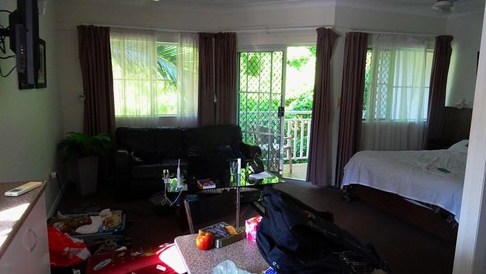
TV scriptwriters are a funny bunch. As soon as their ordinary mug starts becoming recognizable on the street thanks to success, their egos start swelling. They walk on clouds. So, one of the guys who worked on the script for our trip—the one who specifically came up with the bit about the SD card being ejected into the great beyond—has built himself a nice little reputation. The kind that can sometimes launch a real career. Then, inevitably, they just can’t stop. That’s how this guy had the poor idea of adding one last twist to the sequence that made him a one-day star. An idea that’s basically about squeezing the lemon until the very last drop, if you know what I mean. The little bag I take everywhere with my essentials—car keys, camera, phone—has also hosted a bunch of secondary items over time. Tissues, a book, city maps... whatever. It became a mess! So I finally decided to sort it out. I empty it onto a table. And there, stunned, I find the memory card that Dom and I desperately searched for on all fours on Cahill’s Crossing walkway, remember? Under the shocked gaze of a little Australian girl. It had ejected straight into my bag! What do you think? Should we fire the scriptwriter? It’s way too improbable! Stuff like that doesn’t happen in real life, right?
We head out to explore Cairns. The city is mostly about the waterfront, the Esplanade. You’ll find tons of bronze plaques there, most of them in memory of a deceased loved one. All you have to do is shell out a few hundred euros, and one day, a bewildered tourist will read your prose, charmed by your lovely turns of phrase. Vanity is a thriving business!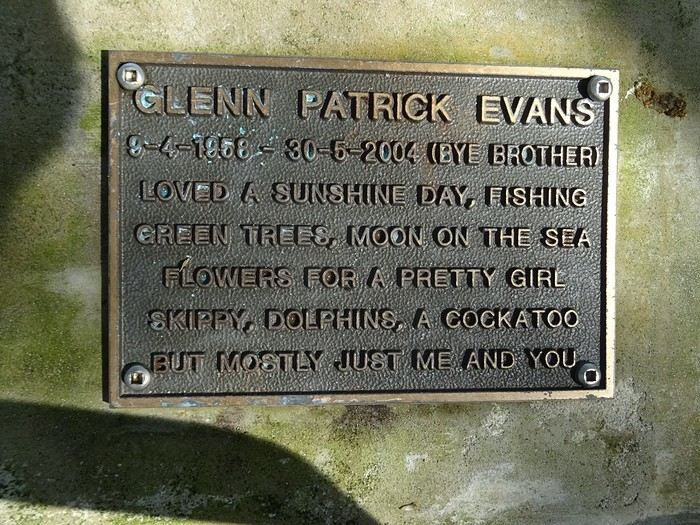
It makes for some reading... We spot our parakeets again... What were they called? Oh right, in abundance! Everywhere, banyan fig trees provide shade from a sun that never seems to tire. Parks... Here, kids are king.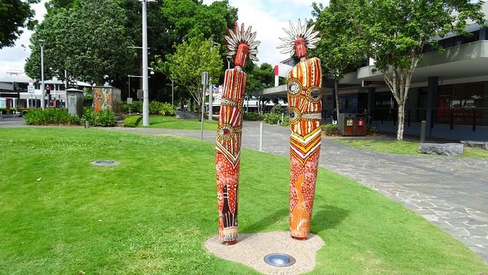 Luxury hotels with their infinity pools...
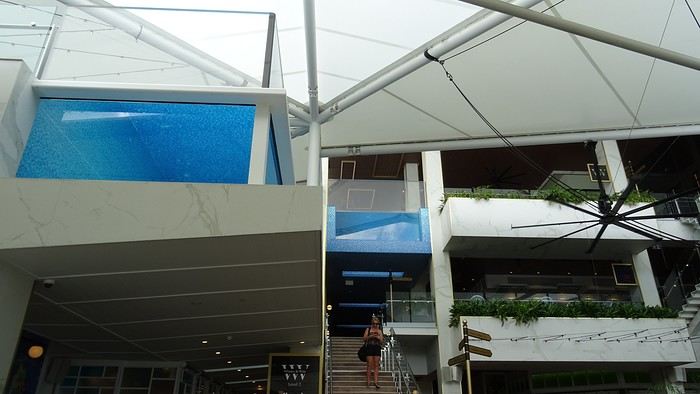
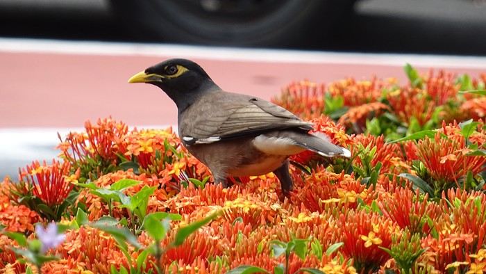 You don’t know where to look first... You’ve got to go all out. Google... Where can we rent bikes? When we finally track down the only operator in town, we find the place closed. A bit further on, a Visitor’s Center might find us an alternative? We meet a charming young guy, super dynamic and a great communicator. We leave without bikes but with a full snorkeling package for the day after tomorrow! I call the shop that let us down... Well done! The owner was at the doctor’s; he’s back now, and we can make a deal!
- Oh, Dominique, where are you off to like that, so proudly and at full speed? - Me? To the Botanic Garden, of course! It’s huge and free!
They’ve recycled oil tanks into art galleries!
TV scriptwriters are a funny bunch. As soon as their ordinary mug starts becoming recognizable on the street thanks to success, their egos start swelling. They walk on clouds. So, one of the guys who worked on the script for our trip—the one who specifically came up with the bit about the SD card being ejected into the great beyond—has built himself a nice little reputation. The kind that can sometimes launch a real career. Then, inevitably, they just can’t stop. That’s how this guy had the poor idea of adding one last twist to the sequence that made him a one-day star. An idea that’s basically about squeezing the lemon until the very last drop, if you know what I mean. The little bag I take everywhere with my essentials—car keys, camera, phone—has also hosted a bunch of secondary items over time. Tissues, a book, city maps... whatever. It became a mess! So I finally decided to sort it out. I empty it onto a table. And there, stunned, I find the memory card that Dom and I desperately searched for on all fours on Cahill’s Crossing walkway, remember? Under the shocked gaze of a little Australian girl. It had ejected straight into my bag! What do you think? Should we fire the scriptwriter? It’s way too improbable! Stuff like that doesn’t happen in real life, right?
We head out to explore Cairns. The city is mostly about the waterfront, the Esplanade. You’ll find tons of bronze plaques there, most of them in memory of a deceased loved one. All you have to do is shell out a few hundred euros, and one day, a bewildered tourist will read your prose, charmed by your lovely turns of phrase. Vanity is a thriving business!
It makes for some reading... We spot our parakeets again... What were they called? Oh right, in abundance! Everywhere, banyan fig trees provide shade from a sun that never seems to tire. Parks... Here, kids are king.
Luxury hotels with their infinity pools...
You don’t know where to look first... You’ve got to go all out. Google... Where can we rent bikes? When we finally track down the only operator in town, we find the place closed. A bit further on, a Visitor’s Center might find us an alternative? We meet a charming young guy, super dynamic and a great communicator. We leave without bikes but with a full snorkeling package for the day after tomorrow! I call the shop that let us down... Well done! The owner was at the doctor’s; he’s back now, and we can make a deal!
- Oh, Dominique, where are you off to like that, so proudly and at full speed? - Me? To the Botanic Garden, of course! It’s huge and free!
They’ve recycled oil tanks into art galleries!
VoyageForum Members' 2025 Cruise Departure Calendar
hi everyone
I’ll go ahead and restart the cruise calendar for 2025 for now.
It can give people ideas and might help members meet up!
Two essential rules: don’t “quote” the calendar when replying—this’ll avoid any confusion and if you can, list your cruise in this example format: enter the month first, then date /username / SHIP / number of days / destination / departure port
FEBRUARY
14/02- poupou10 / CELEBRITY INFINITY /11 days / Greece Turkey Cyprus / Piraeus (Athens) AUGUST 01/08- poupou10 / REGAL PRINCESS /13 days / British Isles / Southampton YOUR TURN 😉 NUMBER OF CRUISES 2025: 2 JANUARY FEBRUARY 14/02- poupou10 / CELEBRITY INFINITY /11 days / Greece Turkey Cyprus / Piraeus (Athens) MARCH APRIL MAY JUNE JULY AUGUST 01/08- poupou10 / REGAL PRINCESS /13 days / British Isles / Southampton SEPTEMBER OCTOBER NOVEMBER DECEMBER
Two essential rules: don’t “quote” the calendar when replying—this’ll avoid any confusion and if you can, list your cruise in this example format: enter the month first, then date /username / SHIP / number of days / destination / departure port
FEBRUARY
14/02- poupou10 / CELEBRITY INFINITY /11 days / Greece Turkey Cyprus / Piraeus (Athens) AUGUST 01/08- poupou10 / REGAL PRINCESS /13 days / British Isles / Southampton YOUR TURN 😉 NUMBER OF CRUISES 2025: 2 JANUARY FEBRUARY 14/02- poupou10 / CELEBRITY INFINITY /11 days / Greece Turkey Cyprus / Piraeus (Athens) MARCH APRIL MAY JUNE JULY AUGUST 01/08- poupou10 / REGAL PRINCESS /13 days / British Isles / Southampton SEPTEMBER OCTOBER NOVEMBER DECEMBER
First trips after...
A turbulent period came to an end around 2022.
Many of us have returned to big trips after making only very small ones—or none at all. For a little anecdote, my dentist told me that due to the lack of travel, a lot of clients treated themselves to implants they would’ve otherwise skipped. The joy of traveling again probably gave some vacationers smiles they hadn’t dared to show before!
Here, you can share what’s on your mind: Have these new, real trips disappointed you, rejuvenated you, or just relieved a long frustration?
For my part, not being so young anymore, there was definitely relief but no explosion of joy. I just had the feeling of picking up the thread of life after a foggy pause, with the bitter taste that 2 or 3 years of my life had been partly stolen from me.
Many of us have returned to big trips after making only very small ones—or none at all. For a little anecdote, my dentist told me that due to the lack of travel, a lot of clients treated themselves to implants they would’ve otherwise skipped. The joy of traveling again probably gave some vacationers smiles they hadn’t dared to show before!
Here, you can share what’s on your mind: Have these new, real trips disappointed you, rejuvenated you, or just relieved a long frustration?
For my part, not being so young anymore, there was definitely relief but no explosion of joy. I just had the feeling of picking up the thread of life after a foggy pause, with the bitter taste that 2 or 3 years of my life had been partly stolen from me.
République Dominicaine: au fil de la route... et autres souvenirs English translation pending
Ce sont mes derniers souvenirs de voyage à l'étranger, c'était avant … avant que la pandémie de la Covid-19 ne s'abatte sur notre planète et contrarie (en autre !) nos désirs de voyages loin de chez nous. Un récit à propos d'une dernière escale dans les Caraïbes, elle date du début mars et c'était donc en République Dominicaine. Ce carnet aborde principalement le souvenir d'une échappée le long d'une « route » hors des sentiers battus, dans le nord de l'île. Une région bien moins fréquentée et donc moins connue que les très courus sites balnéaires de cette grande île tropicale. Un récit qui est également l'occasion pour moi de partager dans une seconde partie quelques autres souvenirs de voyage en Rep. Dom. Ils sont un peu plus anciens et concernent quelques uns des incontournables sites à visiter de la destination.
--
L'escale approche. Peu à peu, la côte se fait plus nette, le soleil a fait disparaître la nébulosité et la plage d'Amber Cove apparaît dans toute sa beauté.
Le trio qui fait le charme des îles tropicales est bien présent sous nos yeux : des eaux bleues, du sable clair bordé d'une palmeraie et un versant verdoyant qui en impose en surplomb du rivage. Un coquet clocher aux tonalités jaune et rose bonbon émerge au-dessus de cette étendue de palmes. Pour afficher la nationalité de l'île, les couleurs sont hissées haut. On reconnaît les carrés rouge et bleu séparés d'une croix blanche du drapeau de la République Dominicaine.
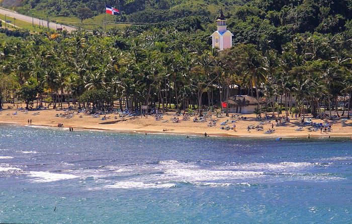
Nous sommes précisément sur la côte nord de l'île, dans la région de l'ancienne ville coloniale espagnole de Puerto Plata.
Un dernier coup d’œil sur la jolie baie encadrée de promontoires rocheux en fond de décor et bordée d'une langue de terre au vert lumineux qui défile juste sous nos yeux.
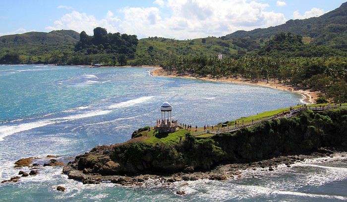
A peine débarqués du navire, on embarque à nouveau … mais sur un tout autre moyen de transport, finie la navigation, on prend place maintenant sur un drôle de véhicule hybride. Un genre de machine à grosses roues, dans un style intermédiaire entre camion et bus d'aventures tout-terrain. De simples banquettes font offices de sièges, quant aux dossiers et aux montants métalliques, ils sont tous rembourrés et capitonnés … On le comprend vite, la route, enfin la piste qui s'annonce pour cette virée risque d'être chaotique. Pas de doute, il ne doit pas s'agir d'un long ruban de bitume très tranquille !
Pour l'instant nous traversons la paisible petite ville de Maimon. Une agglomération sans grand intérêt si ce n'est d'avoir un aperçu de la vie quotidienne locale. Des enfants bruyants jouent dans la cour de l'école et quelques habitantes font leurs achats dans les boutiques, la plupart sont de simples maisons/cases comme d'ailleurs beaucoup d'habitations. En voici deux exemples assez représentatifs du style de l'habitat local. Une simple maison recouverte de tôles ondulées mais dont les murs extérieurs sont agrémentés d'une teinte bleutée. C'est un aspect des plus courants dans la petite cité.
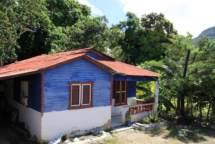
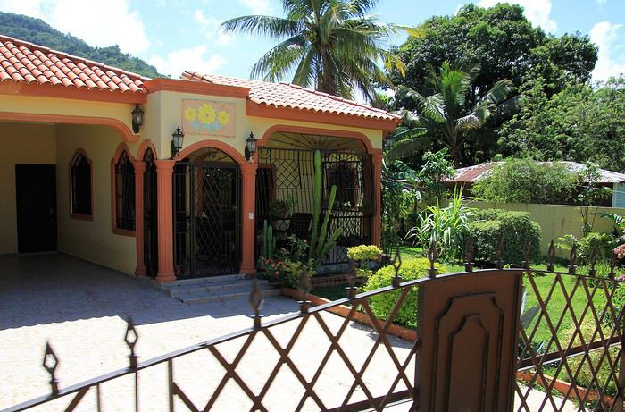
Plus loin, nous passons devant une maison un peu plus cossue : un propret jardinet et des grilles ouvragées entourent cette demeure plus élaborée et dont on imagine le meilleur confort intérieur.
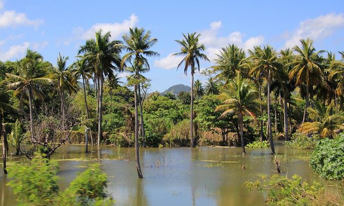
Passons la périphérie urbaine, place à la campagne. On le constate dès le début du trajet, les terrains aux abords de la voie sont détrempés voire inondés. Le chauffeur, sympa, nous informe que de récentes et fortes intempéries ont quelque peu endommagé la piste que nous devons emprunter … Au fond de cette baie, le courant et les torrents ont charrié des quantités de branchages, certains sont encore là, amassés au bord du rivage bordé de mangrove.
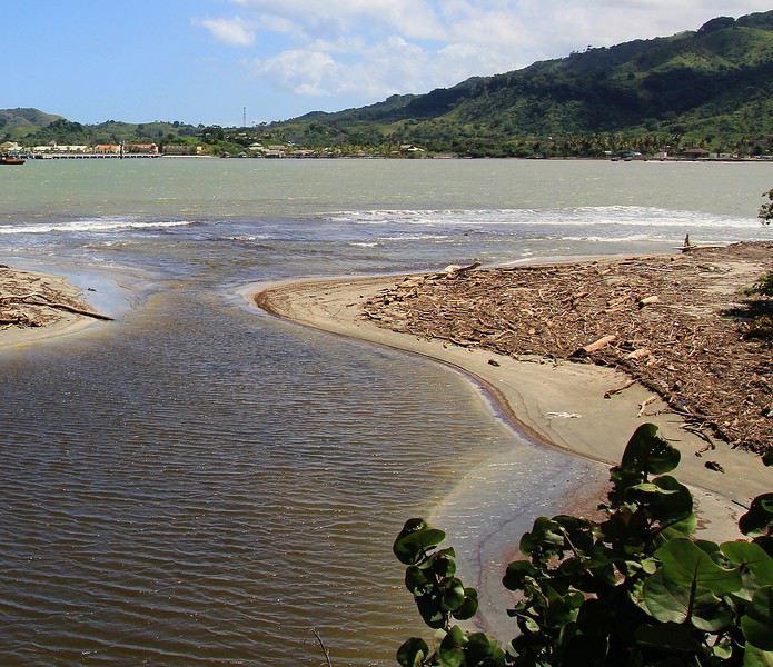
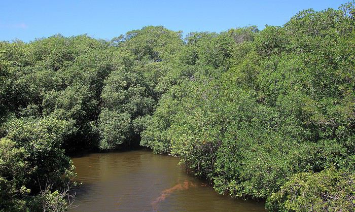
Sur ce tronçon, un torrent a emporté une partie de la route, le passage se fait désormais sur une seule voie constituée de terre battue.
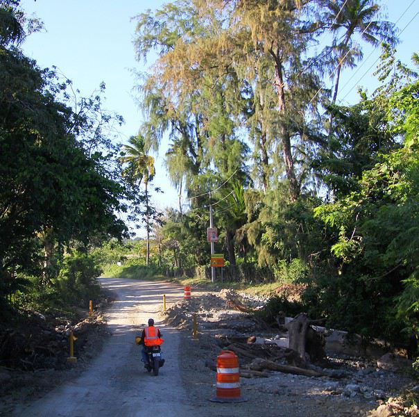
To the Top West End
In this time of general travel-journal scarcity, I’m stepping up to tell you about a far-too-short getaway to the Top West End, a local term for the very northern part of Western Australia, right on the border ( ;) ) with the Northern Territory.
As usual, I didn’t manage to keep it short, but this time I’ve got photos to go with it!
August 2020. Since the opportunities to explore the world are extremely limited right now, all we (R&X) can do is explore our own island! Well, just a part of it, because with the state borders still closed, we’re stuck in Western Australia (WA).
Luckily, we’re pretty fortunate because this state is huge: over 2.5 million km² (that’s more than four times the size of France or 1.5 times Quebec). What’s more, stretching over 20 degrees of latitude between the Antarctic Ocean and the Timor Sea, you’ll find climates ranging from Mediterranean to arid to tropical. That’s actually why we decided to head as far north as possible. Sick of the endless rainy winter in Perth, bring on the heat of the Kimberley... way up Nooorth!
Friday. At the airport, the main terminal was closed (not enough flights), so we ended up in the annex (where flights to the various mines usually depart from). There was no crowd at the gate, and in this huge, single departure lounge, empty seats were plentiful. Only three flights were listed on the screens for the rest of the morning: the first to Coondewanna (?), the second to Darwin, and ours to Kununurra (code KNX).
A cool breeze swept through the half-open corridors along the runways. At the top of the walkway leading to the Fokker 100 (the Airbuses and Boeings are now parked!), a flight attendant greeted us with a basket full of sanitary masks. We were actually the only masked passengers (the staff weren’t wearing them either). With zero Covid-19 cases in WA at the time, the only rule was to maintain social distancing—something pretty hard to do on a full plane!
It was also my first time wearing a mask—it felt weird, pretty uncomfortable, and after a while, painful behind the ears. I really feel for those who have to wear one all day, every day. The flight lasted three long hours, but luckily, I had a good book. From the window, I watched an endless expanse of salt lakes in all shapes and sizes—round, elongated, gray, white, sometimes blue and green—and an infinity of winding, capricious meanders, along with long straight lines that led nowhere. The last half-hour got more interesting as rocky, swollen formations and long, sloping plateaus appeared. Against the vast ochre landscape, green patches became more frequent.
Just before landing, rows of green fields briefly appeared, along with an surprisingly wide river—but we were already rolling down the tarmac. A few hangars, a myriad of small, stationary planes, and a tiny terminal topped with a sign: “Welcome to Kununurra.”
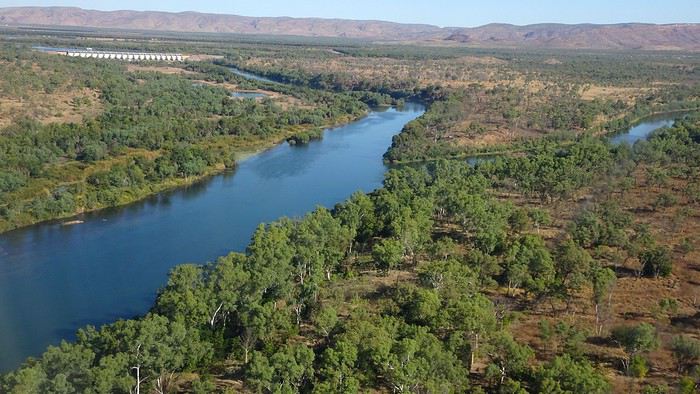
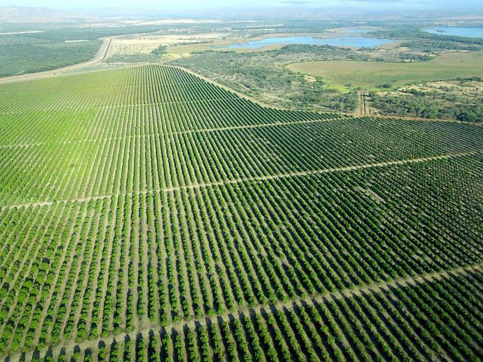
We wanted heat, and here it was—34°C the moment we stepped off the plane! We felt alive again and totally ridiculous in our jeans and sweaters. We quickly grabbed our suitcase and picked up the 4x4 we’d rented—more out of necessity, since only that type of vehicle can access the national parks we planned to visit.
Just four kilometers separated us from Kununurra, a town of 5,000 people founded in 1961 during the construction of the Lake Argyle Dam and the development of the Ord River Irrigation Area Scheme (more on that later). On the horizon, mountain ranges (a bit of an exaggeration, since we know Mt. Meharry, WA’s highest ‘mountain,’ doesn’t even reach 1,250 meters!) and closer to the road, a few irrigation canals cutting through stretches of bush, then a huge park overlooking a small lake lined with reeds.
A row of baobabs (yes, there are baobabs in Australia too!), a series of motels with immaculate lawns, a gas station, and there’s the main street leading to the town center—that is, the parking lots of the two supermarkets, the bottleshop, the pub, the Town Hall, the municipal pool, and the Tourist Office (already closed!), and at the next roundabout, another park, the Presbyterian church, and a few other shops. In short, two or three green blocks that you can explore in no time.
One road leads to the small industrial area and one of the town’s three or four campgrounds, while another heads toward the residential neighborhoods, which look just like the typical suburbs you find in any Australian city—except with tropical vegetation. We stocked up at Coles, an identical copy of the one near our place, and—surprise—the prices were practically the same.
We checked into one of the motels. The receptionist listed the town’s three or four restaurants, insisting that it’s always better to book a table. She recommended the Pump House, a bit outside town on the lake’s edge. “Best spot to watch the sunset, but hurry up.” she told us. It was only 5:00 PM!
When we got there half an hour later, the place was packed, and the sun had already disappeared behind a row of trees! Sure enough, we’d see a few days later that the sunset can be a stunning spectacle—if you wait a bit for the sky (especially if it’s cloudy) to blaze and reflect in the lake’s calm waters. A little disappointed, we headed back into town, where we easily found the other lively spot in town: the pub (nothing like an old English pub). Above the long L-shaped bar, several giant screens (thankfully muted) were broadcasting live footy, rugby league, etc. In one corner, players circled the pool table, while in another, customers were digging into plates of the day’s special. Instead of rooms, there were various patios where groups of friends and coworkers (easily recognizable by the fluoro vests they were still wearing) were gathered. We found a table under a mango tree—unfortunately, a little too close to the guitarist strumming his entire Country Music repertoire, complete with Keith Urban-style tremolos. Guaranteed culture shock!
Since it’s the custom here, we called the Country Club to book a table before the kitchen closed! The CC is the town’s—and even the region’s—fancy spot. Dark decor, modern furniture, dim lighting, and the air conditioning blasting. The twenty or so customers had taken refuge on the vast terrace, lit by torches. The view of the tall eucalyptus trees, illuminated by spotlights shifting from red to blue, was breathtaking.
The menu was minimal, but the grilled salmon was excellent, and the Pavlova (the meringue dessert Kiwis and Aussies have been arguing over since 1906) with melon and watermelon was absolutely divine.
It wasn’t even 9:00 PM, and we were already in bed. Had we already adopted the Top West End’s chicken schedule?!
To be continued... Journal dedicated to Attila
As usual, I didn’t manage to keep it short, but this time I’ve got photos to go with it!
August 2020. Since the opportunities to explore the world are extremely limited right now, all we (R&X) can do is explore our own island! Well, just a part of it, because with the state borders still closed, we’re stuck in Western Australia (WA).
Luckily, we’re pretty fortunate because this state is huge: over 2.5 million km² (that’s more than four times the size of France or 1.5 times Quebec). What’s more, stretching over 20 degrees of latitude between the Antarctic Ocean and the Timor Sea, you’ll find climates ranging from Mediterranean to arid to tropical. That’s actually why we decided to head as far north as possible. Sick of the endless rainy winter in Perth, bring on the heat of the Kimberley... way up Nooorth!
Friday. At the airport, the main terminal was closed (not enough flights), so we ended up in the annex (where flights to the various mines usually depart from). There was no crowd at the gate, and in this huge, single departure lounge, empty seats were plentiful. Only three flights were listed on the screens for the rest of the morning: the first to Coondewanna (?), the second to Darwin, and ours to Kununurra (code KNX).
A cool breeze swept through the half-open corridors along the runways. At the top of the walkway leading to the Fokker 100 (the Airbuses and Boeings are now parked!), a flight attendant greeted us with a basket full of sanitary masks. We were actually the only masked passengers (the staff weren’t wearing them either). With zero Covid-19 cases in WA at the time, the only rule was to maintain social distancing—something pretty hard to do on a full plane!
It was also my first time wearing a mask—it felt weird, pretty uncomfortable, and after a while, painful behind the ears. I really feel for those who have to wear one all day, every day. The flight lasted three long hours, but luckily, I had a good book. From the window, I watched an endless expanse of salt lakes in all shapes and sizes—round, elongated, gray, white, sometimes blue and green—and an infinity of winding, capricious meanders, along with long straight lines that led nowhere. The last half-hour got more interesting as rocky, swollen formations and long, sloping plateaus appeared. Against the vast ochre landscape, green patches became more frequent.
Just before landing, rows of green fields briefly appeared, along with an surprisingly wide river—but we were already rolling down the tarmac. A few hangars, a myriad of small, stationary planes, and a tiny terminal topped with a sign: “Welcome to Kununurra.”
We wanted heat, and here it was—34°C the moment we stepped off the plane! We felt alive again and totally ridiculous in our jeans and sweaters. We quickly grabbed our suitcase and picked up the 4x4 we’d rented—more out of necessity, since only that type of vehicle can access the national parks we planned to visit.
Just four kilometers separated us from Kununurra, a town of 5,000 people founded in 1961 during the construction of the Lake Argyle Dam and the development of the Ord River Irrigation Area Scheme (more on that later). On the horizon, mountain ranges (a bit of an exaggeration, since we know Mt. Meharry, WA’s highest ‘mountain,’ doesn’t even reach 1,250 meters!) and closer to the road, a few irrigation canals cutting through stretches of bush, then a huge park overlooking a small lake lined with reeds.
A row of baobabs (yes, there are baobabs in Australia too!), a series of motels with immaculate lawns, a gas station, and there’s the main street leading to the town center—that is, the parking lots of the two supermarkets, the bottleshop, the pub, the Town Hall, the municipal pool, and the Tourist Office (already closed!), and at the next roundabout, another park, the Presbyterian church, and a few other shops. In short, two or three green blocks that you can explore in no time.
One road leads to the small industrial area and one of the town’s three or four campgrounds, while another heads toward the residential neighborhoods, which look just like the typical suburbs you find in any Australian city—except with tropical vegetation. We stocked up at Coles, an identical copy of the one near our place, and—surprise—the prices were practically the same.
We checked into one of the motels. The receptionist listed the town’s three or four restaurants, insisting that it’s always better to book a table. She recommended the Pump House, a bit outside town on the lake’s edge. “Best spot to watch the sunset, but hurry up.” she told us. It was only 5:00 PM!
When we got there half an hour later, the place was packed, and the sun had already disappeared behind a row of trees! Sure enough, we’d see a few days later that the sunset can be a stunning spectacle—if you wait a bit for the sky (especially if it’s cloudy) to blaze and reflect in the lake’s calm waters. A little disappointed, we headed back into town, where we easily found the other lively spot in town: the pub (nothing like an old English pub). Above the long L-shaped bar, several giant screens (thankfully muted) were broadcasting live footy, rugby league, etc. In one corner, players circled the pool table, while in another, customers were digging into plates of the day’s special. Instead of rooms, there were various patios where groups of friends and coworkers (easily recognizable by the fluoro vests they were still wearing) were gathered. We found a table under a mango tree—unfortunately, a little too close to the guitarist strumming his entire Country Music repertoire, complete with Keith Urban-style tremolos. Guaranteed culture shock!
Since it’s the custom here, we called the Country Club to book a table before the kitchen closed! The CC is the town’s—and even the region’s—fancy spot. Dark decor, modern furniture, dim lighting, and the air conditioning blasting. The twenty or so customers had taken refuge on the vast terrace, lit by torches. The view of the tall eucalyptus trees, illuminated by spotlights shifting from red to blue, was breathtaking.
The menu was minimal, but the grilled salmon was excellent, and the Pavlova (the meringue dessert Kiwis and Aussies have been arguing over since 1906) with melon and watermelon was absolutely divine.
It wasn’t even 9:00 PM, and we were already in bed. Had we already adopted the Top West End’s chicken schedule?!
To be continued... Journal dedicated to Attila
On part en vadrouille au Cambodge! English translation pending
Hello tout le monde !
Vous trouverez ci-dessous mon carnet dédié au voyage que j'ai réalisé l'an passé au Cambodge...
La restriction du nombre de photos imposée par VF m'empêchera de publier ici tous mes clichés. Vous pouvez donc les consulter sur mon site : https://www.onpartenvadrouille.com/ où toutes les journées sont déjà accessibles. Bonne lecture !!!
9 février - Vers un nouveau départ...
L’air de rien, monsieur l’hiver s’est installé confortablement, apportant avec lui dans ses bagages ses amis les nuages grisâtres, nuits tombant à dix-sept heures, gouttes au nez et vieux barbu tout de rouge vêtu. Alors, l’humain lambda boude dans son coin, prétextant une déprime passagère hivernale et une envie d’hibernation foudroyante. Chanceux que je suis, c’est à ce moment précis que chaque année, le génie sort de ma lampe de chevet : « Bonjour maître ! Qu’est-ce qui vous ferait plaisir ?... Un nouveau petit voyage, peut-être ? - Je dis oui, oui et re-oui » ! Chouette, il est temps de préparer les valises et de faire un choix. Choix très difficile entre mes tongs bleues et mes tongs orange. Et puis choix de la destination ! Pique-nique-douille, c’est toi l’andouille de Guéméné ! Suosdei !!! Si je te dis « Salut » dans une langue qui fleure bon l’exotisme, c’est que nous allons ensemble partager un nouveau voyage en direction de l’Asie du sud-est. Et oui, l’Asie du sud-est en hiver, il n’y a rien de mieux pour te requinquer un homme. Et puis l’Asie du sud-est, je l’ai dans la peau, au sens propre comme au sens figuré. Et cette fois-ci, ce sera dans un pays frontalier de la Thaïlande, du Laos et du Vietnam. Pays sous protectorat français jusqu’en 1953, titre d’une chanson de Kim Wilde, pays dont la capitale est Phnom Penh, je suis, je suis, … Ding dong, trop tard !... Le Cambodge !
Qui dit introduction à un nouveau voyage dit aussi interrogatoire. Je mets ma petite robe blanche moulante, je croise, je décroise les jambes, … Oups, j’avais oublié de mettre une culotte… C’est bon, l’interrogatoire peut débuter :
Qui ? Pour m’accompagner, ma femme et mes deux filles qu’on appellera pour cette histoire Sandrine, Anna et Sasha... tout simplement parce que ce sont leurs prénoms ! On devait être accompagné par mes deux parents qui nous ont déjà suivis en Thaïlande il y a maintenant sept ans, mais une petite opération du genou a contraint ma mère à jeter l’éponge dans le visage de son chirurgien au dernier moment. Seul mon père sera de la sauterie en tant que guest star ! On souhaite donc tous ensemble la bienvenue à notre fournisseur d’anecdotes !
Combien ? On part un vendredi et on rentre un dimanche deux semaines plus tard…. Donc si tu comptes bien sur tes dix doigts, ça fait dix-sept jours, voyage compris.
Quoi ? Un voyage mi-routard, mi-pénard. Un circuit optimisé en restant au minimum trois jours par endroit pour éviter de perdre trop de temps dans les transports. De la découverte, des vieilles pierres, de la gastronomie, des rencontres, de la bonne bière, de l’exploration, … Et puis on n’oublie surtout pas de brosser « Martine » dans le bon sens en finissant par quelques jours de repos à l’ombre des cocotiers.
Où ? Pour commencer, le noooooord avec Siem Reap, puis Koh Rong tout au sud. On enchaîne ensuite par Koh Rong Samloem, pour finir tranquillement par Phnom Penh d’où nous regagnerons nos pénates.
Comment ? Scooter, tuk tuk, bus, bateau et tongs. Voilà nos moyens de locomotion ! Come on baby, do the locomooootion...
Bon, je crois avoir répondu à toutes tes questions. Aladin, à la deux, il est donc l’heure d’y aller mon bon génie : Pour tous les amoureux de l’Asie du sud-est ou pour te donner l'envie de le devenir, je déclare donc officiellement ce nouveau voyage ouvert ! Et là, tu te dis peut-être : « Oh, la chance qu’il a !!! » C’est marrant toutes ces personnes qui te répondent systématiquement ça quand tu leur annonces que tu pars en voyage… Premièrement, je ne vois pas ce que la chance vient faire là-dedans puisqu’il suffit de saisir son numéro de carte bancaire sur internet pour gagner un billet d’avion. Crois-moi sur parole, rien de plus simple, on gagne à tous les coups ! Deuxièmement, à tous ceux qui s’imaginent que les voyages, ce n’est que Bisounours et licornes pailletées, je rappelle quand même que la première journée d’un voyage, c’est-à-dire la journée d’aujourd’hui, rime toujours avec aéroport, avion, attente, décalage horaire, fatigue, … Un beau programme à te faire aimer le RER un jour de grève ! Mais rassure-toi, avec moi, inutile d'attacher ta ceinture, ça va être un voyage pépère, hyper rapide, sans zone de turbulences, ni même d’hôtesse à reluquer… puisqu'on est déjà arrivé !! Et oui, moi président, je t’ai exonéré des trois vols qui nous ont menés de Paris à Siem Reap en passant par Amman et Bangkok. Moi président, je t’ai fait grâce de vingt-quatre heures de transport éreintantes. Moi, président, je te dispense solennellement de toutes ces cernes sur ton visage puisque Sandrine se les est toutes accaparées... Seul fait marquant à se mettre sous la dent : Le petit Jésus des avions a sournoisement essayé de nous faire louper notre correspondance à Bangkok ! En direct live rien que pour toi, en voici le récit : On s’installe confortablement dans les sièges en face de notre porte d’embarquement F1A, on s’endort, on se réveille trois heures après, Jean-Michel Ecran au-dessus de notre porte affiche désormais « Shanghai » en lieu et place de « Siem Reap » qui y trônait pourtant fièrement tout à l’heure ! As-tu déjà vu le film « Maman j’ai raté l’avion » ? Et bien voici, « Maman, j’ai presque raté l’avion » ! En voici le scénario… Je m’enquière de la situation auprès d’une gentille hôtesse qui me répond que l’embarquement pour Siem Reap a déménagé en porte D1A à l’autre bout de l’aéroport pendant notre sommeil. « Vite, vite, la porte ferme dans huit minutes !... » S’il te plait, pour la suite de l’histoire, il te faut mettre la musique de Mission impossible... Pan ! C’est partie pour la finale du cent-dix mètres haies en direct de l’aéroport de Bangkok !... Ouf, un brin essoufflé, je remporte la victoire haut la main !... Sauf que, … déconfiture totale ! Du même genre que lorsque tes deux meilleurs attaquants sont forfaits pour la finale de la ligue des champions : En porte D1A, ils embarquent pour un vol pour « Abou Dhabi » !!! « Siem Reap, Siem Reap, please ? - Gate J1A ! » C’est pas possible, l’autre andouillette de tout à l’heure ne sait pas prononcer les « J » correctement ! Nouvelle course folle dans l'aéroport. Je prends de nouveau la tête du convoi, les autres tentant laborieusement de me coller au train. Me voyant arriver en courant, l'hôtesse d’embarquement me fait des signes de loin pour m'indiquer que c'est fini… Horreur, malheur !!! Une fois à sa hauteur, Youhou, champagne, elle m’indiquait en fait qu'il n'était pas nécessaire de courir car le vol a du retard. Allez, Champomy, c’est moi qui régale ! Enfin, … verre d’eau pour tout le monde, quoi !
La description de ce 9 février se termine avec une arrivée tardive à Siem Reap, un passage des formalités administratives bien longuet et rudimentaire, et un transport en tuk tuk affrété par notre hôtel pour traverser pour la première fois cette ville que je découvre enfin ; elle que je connais par procuration grâce à toutes mes innombrables lectures préparatoires d’avant voyage. J’ai un peu l’impression de rencontrer pour la première fois une personne rencontrée virtuellement de longue date sur internet. J’ai aussi l’impression de me sentir comme à la maison. Ça me fait ça à chaque fois avec l’Asie du sud-est. Les odeurs, les bruits, l'ambiance… Je ne saurais comment l'expliquer, mais il n'y a pas de période d'adaptation… Un petit mot sur notre hôtel, La Rose Blanche, établissement un peu excentré mais qui nous ravit les yeux dès notre arrivée. Comme dit l'adage, « avec l'âge, on s'embourgeoise ». Il est possible de trouver à Siem Reap des hôtels vraiment pas chers. Mais en mettant un tout petit peu plus que pas cher, il est possible de trouver de petites perles comme le nôtre dans lequel nous passerons les cinq prochaines nuits bien au chaud.
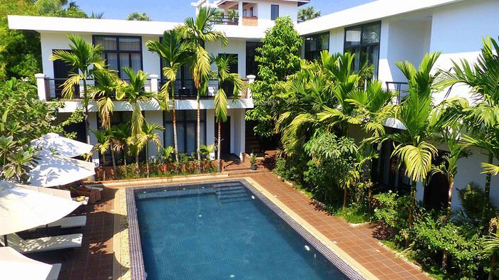
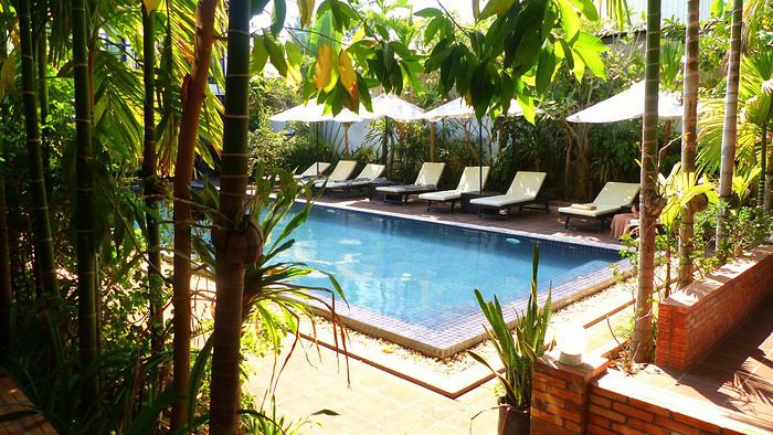
Allez, quelques morceaux de crocodile grillés sur un petit barbecue cambodgien dans un restaurant pas très loin de notre camp de base et c’est déjà l’heure de l’extinction des feux. Je sais que quelques heures seulement nous séparent de nos premières découvertes et il ne faudrait pas qu’on y arrive fatigués. Je te dis donc tout simplement à demain si tu le veux bien, et surtout si tu souhaites nous accompagner dans ce nouveau numéro de Dora l’exploratrice. De toute façon, demain est une autre aventure...
9 février - Vers un nouveau départ...
L’air de rien, monsieur l’hiver s’est installé confortablement, apportant avec lui dans ses bagages ses amis les nuages grisâtres, nuits tombant à dix-sept heures, gouttes au nez et vieux barbu tout de rouge vêtu. Alors, l’humain lambda boude dans son coin, prétextant une déprime passagère hivernale et une envie d’hibernation foudroyante. Chanceux que je suis, c’est à ce moment précis que chaque année, le génie sort de ma lampe de chevet : « Bonjour maître ! Qu’est-ce qui vous ferait plaisir ?... Un nouveau petit voyage, peut-être ? - Je dis oui, oui et re-oui » ! Chouette, il est temps de préparer les valises et de faire un choix. Choix très difficile entre mes tongs bleues et mes tongs orange. Et puis choix de la destination ! Pique-nique-douille, c’est toi l’andouille de Guéméné ! Suosdei !!! Si je te dis « Salut » dans une langue qui fleure bon l’exotisme, c’est que nous allons ensemble partager un nouveau voyage en direction de l’Asie du sud-est. Et oui, l’Asie du sud-est en hiver, il n’y a rien de mieux pour te requinquer un homme. Et puis l’Asie du sud-est, je l’ai dans la peau, au sens propre comme au sens figuré. Et cette fois-ci, ce sera dans un pays frontalier de la Thaïlande, du Laos et du Vietnam. Pays sous protectorat français jusqu’en 1953, titre d’une chanson de Kim Wilde, pays dont la capitale est Phnom Penh, je suis, je suis, … Ding dong, trop tard !... Le Cambodge !
Qui dit introduction à un nouveau voyage dit aussi interrogatoire. Je mets ma petite robe blanche moulante, je croise, je décroise les jambes, … Oups, j’avais oublié de mettre une culotte… C’est bon, l’interrogatoire peut débuter :
Qui ? Pour m’accompagner, ma femme et mes deux filles qu’on appellera pour cette histoire Sandrine, Anna et Sasha... tout simplement parce que ce sont leurs prénoms ! On devait être accompagné par mes deux parents qui nous ont déjà suivis en Thaïlande il y a maintenant sept ans, mais une petite opération du genou a contraint ma mère à jeter l’éponge dans le visage de son chirurgien au dernier moment. Seul mon père sera de la sauterie en tant que guest star ! On souhaite donc tous ensemble la bienvenue à notre fournisseur d’anecdotes !
Combien ? On part un vendredi et on rentre un dimanche deux semaines plus tard…. Donc si tu comptes bien sur tes dix doigts, ça fait dix-sept jours, voyage compris.
Quoi ? Un voyage mi-routard, mi-pénard. Un circuit optimisé en restant au minimum trois jours par endroit pour éviter de perdre trop de temps dans les transports. De la découverte, des vieilles pierres, de la gastronomie, des rencontres, de la bonne bière, de l’exploration, … Et puis on n’oublie surtout pas de brosser « Martine » dans le bon sens en finissant par quelques jours de repos à l’ombre des cocotiers.
Où ? Pour commencer, le noooooord avec Siem Reap, puis Koh Rong tout au sud. On enchaîne ensuite par Koh Rong Samloem, pour finir tranquillement par Phnom Penh d’où nous regagnerons nos pénates.
Comment ? Scooter, tuk tuk, bus, bateau et tongs. Voilà nos moyens de locomotion ! Come on baby, do the locomooootion...
Bon, je crois avoir répondu à toutes tes questions. Aladin, à la deux, il est donc l’heure d’y aller mon bon génie : Pour tous les amoureux de l’Asie du sud-est ou pour te donner l'envie de le devenir, je déclare donc officiellement ce nouveau voyage ouvert ! Et là, tu te dis peut-être : « Oh, la chance qu’il a !!! » C’est marrant toutes ces personnes qui te répondent systématiquement ça quand tu leur annonces que tu pars en voyage… Premièrement, je ne vois pas ce que la chance vient faire là-dedans puisqu’il suffit de saisir son numéro de carte bancaire sur internet pour gagner un billet d’avion. Crois-moi sur parole, rien de plus simple, on gagne à tous les coups ! Deuxièmement, à tous ceux qui s’imaginent que les voyages, ce n’est que Bisounours et licornes pailletées, je rappelle quand même que la première journée d’un voyage, c’est-à-dire la journée d’aujourd’hui, rime toujours avec aéroport, avion, attente, décalage horaire, fatigue, … Un beau programme à te faire aimer le RER un jour de grève ! Mais rassure-toi, avec moi, inutile d'attacher ta ceinture, ça va être un voyage pépère, hyper rapide, sans zone de turbulences, ni même d’hôtesse à reluquer… puisqu'on est déjà arrivé !! Et oui, moi président, je t’ai exonéré des trois vols qui nous ont menés de Paris à Siem Reap en passant par Amman et Bangkok. Moi président, je t’ai fait grâce de vingt-quatre heures de transport éreintantes. Moi, président, je te dispense solennellement de toutes ces cernes sur ton visage puisque Sandrine se les est toutes accaparées... Seul fait marquant à se mettre sous la dent : Le petit Jésus des avions a sournoisement essayé de nous faire louper notre correspondance à Bangkok ! En direct live rien que pour toi, en voici le récit : On s’installe confortablement dans les sièges en face de notre porte d’embarquement F1A, on s’endort, on se réveille trois heures après, Jean-Michel Ecran au-dessus de notre porte affiche désormais « Shanghai » en lieu et place de « Siem Reap » qui y trônait pourtant fièrement tout à l’heure ! As-tu déjà vu le film « Maman j’ai raté l’avion » ? Et bien voici, « Maman, j’ai presque raté l’avion » ! En voici le scénario… Je m’enquière de la situation auprès d’une gentille hôtesse qui me répond que l’embarquement pour Siem Reap a déménagé en porte D1A à l’autre bout de l’aéroport pendant notre sommeil. « Vite, vite, la porte ferme dans huit minutes !... » S’il te plait, pour la suite de l’histoire, il te faut mettre la musique de Mission impossible... Pan ! C’est partie pour la finale du cent-dix mètres haies en direct de l’aéroport de Bangkok !... Ouf, un brin essoufflé, je remporte la victoire haut la main !... Sauf que, … déconfiture totale ! Du même genre que lorsque tes deux meilleurs attaquants sont forfaits pour la finale de la ligue des champions : En porte D1A, ils embarquent pour un vol pour « Abou Dhabi » !!! « Siem Reap, Siem Reap, please ? - Gate J1A ! » C’est pas possible, l’autre andouillette de tout à l’heure ne sait pas prononcer les « J » correctement ! Nouvelle course folle dans l'aéroport. Je prends de nouveau la tête du convoi, les autres tentant laborieusement de me coller au train. Me voyant arriver en courant, l'hôtesse d’embarquement me fait des signes de loin pour m'indiquer que c'est fini… Horreur, malheur !!! Une fois à sa hauteur, Youhou, champagne, elle m’indiquait en fait qu'il n'était pas nécessaire de courir car le vol a du retard. Allez, Champomy, c’est moi qui régale ! Enfin, … verre d’eau pour tout le monde, quoi !
La description de ce 9 février se termine avec une arrivée tardive à Siem Reap, un passage des formalités administratives bien longuet et rudimentaire, et un transport en tuk tuk affrété par notre hôtel pour traverser pour la première fois cette ville que je découvre enfin ; elle que je connais par procuration grâce à toutes mes innombrables lectures préparatoires d’avant voyage. J’ai un peu l’impression de rencontrer pour la première fois une personne rencontrée virtuellement de longue date sur internet. J’ai aussi l’impression de me sentir comme à la maison. Ça me fait ça à chaque fois avec l’Asie du sud-est. Les odeurs, les bruits, l'ambiance… Je ne saurais comment l'expliquer, mais il n'y a pas de période d'adaptation… Un petit mot sur notre hôtel, La Rose Blanche, établissement un peu excentré mais qui nous ravit les yeux dès notre arrivée. Comme dit l'adage, « avec l'âge, on s'embourgeoise ». Il est possible de trouver à Siem Reap des hôtels vraiment pas chers. Mais en mettant un tout petit peu plus que pas cher, il est possible de trouver de petites perles comme le nôtre dans lequel nous passerons les cinq prochaines nuits bien au chaud.
Allez, quelques morceaux de crocodile grillés sur un petit barbecue cambodgien dans un restaurant pas très loin de notre camp de base et c’est déjà l’heure de l’extinction des feux. Je sais que quelques heures seulement nous séparent de nos premières découvertes et il ne faudrait pas qu’on y arrive fatigués. Je te dis donc tout simplement à demain si tu le veux bien, et surtout si tu souhaites nous accompagner dans ce nouveau numéro de Dora l’exploratrice. De toute façon, demain est une autre aventure...
Le Nord de l'Italie English translation pending
Bonjour tout le monde !
Les vacances ont pris un virage particulier cette année. Grâce ou à cause d'un virus qui fait peur à beaucoup. Justifié ou pas. Il a donc fallu changer les plans. Pas de séjour au Moyen-orient, vu que les aéroports sont fermés et donc, après moultes réflexions, et au vu des pays assez sûrs pour nous laisser la possibilité de ne pas trop souffrir du port du masque, nous avons choisi le Nord de l'Italie.
Au Sud des Dolomites plus précisément. Avec un arrêt à l'aller sur Varazze et la côte Ligure. Et au retour un arrêt sur Arenzzano. Que je vais d'ailleurs rayer de mes fichiers. Très mauvaise expérience cette dernière ville.
Bref et en détail, le suivi du carnet sera le suivant :
Sud de la France vers Montpellier, Varazze (Hotel 2 nuits), Pescheria del Garde, en courant d'air, Trente (Hotel 10 nuits), Molveno/Andolo et les lacs, Le Lac de Garde, Venise (en train), Bolzano (en train), Verone (en train), Merano, San Candido, Levico Terme et les Lacs, Aranzzano, Retour France.
En résumé que dire ?
La côte reste la côte. avec ses qualités et ses défauts. Mais c'est l'Italie que l'on aime. Ses bains privés, ses morceaux (2 mètres😎 ) de plage publique pour le peuple, ses cris, ses odeurs... et sa circulation automobile anarchique au possible.
Le Nord en revanche est assez....coincé, et même assez "Bobo". Très allemand aussi car la région du Trentin/Haut-Adige n'est Italienne que depuis 1918. Tout ici respire l'ordre et la méthode. En clair, vous pouvez déguster une pizza mais avec de la viande fumée au lieu du Chorizo😎 . Humour ! On parle Allemand et après Italien. Tout est en deux langues. Même les pompiers de San Candido parlent allemand entre eux.
Au bord des routes, on vend des sacs de patates en lieu et place de fruits et légumes.
Le pire dans le coin étant les sportifs en vélo ! Dans le Nord, les pistes cyclables sont légions. Et s'il n'y en a pas, on prends le trottoir. Je suis en vélo, donc j'ai tous les droits. Comme sur Amsterdam. Il faut faire attention de ne pas froisser les cyclistes. Pas trop écolos car beaucoup de vélo électriques...Qui doivent bien se recharger quelque part... Marrant le type qui vient prendre son petit-déjeuner avec les chaussures à cales sur un parquet ancien et bien entretenu. Très classe !!! Les motards sont plus civilisés ! Même une horde sauvage de 30 Harleys qui passe dans un petit village avec un bruit ... d'Harley ! 😎
Sinon, le coin est sympa.
Ha, j'allais oublier.
Un mot pour nos ami(e)s camping-caristes. Dans le Nord et sur quasiment toutes les villes (au moins) que j'ai pu visiter, il y a des parcs pour les CC. On ne se pose pas où l'on veut. Et pas de discussions !!! 😎 Molveno par exemple ou les CC sont en rang d'oignons avec juste de quoi ouvrir la porte ou poser une table de camping. La nuit, ce doit être marrant😏
Nous commencerons donc demain par Varazze. 2600 photos à trier et classer... c'est long. Juste une pour commencer.
Les vacances ont pris un virage particulier cette année. Grâce ou à cause d'un virus qui fait peur à beaucoup. Justifié ou pas. Il a donc fallu changer les plans. Pas de séjour au Moyen-orient, vu que les aéroports sont fermés et donc, après moultes réflexions, et au vu des pays assez sûrs pour nous laisser la possibilité de ne pas trop souffrir du port du masque, nous avons choisi le Nord de l'Italie.
Au Sud des Dolomites plus précisément. Avec un arrêt à l'aller sur Varazze et la côte Ligure. Et au retour un arrêt sur Arenzzano. Que je vais d'ailleurs rayer de mes fichiers. Très mauvaise expérience cette dernière ville.
Bref et en détail, le suivi du carnet sera le suivant :
Sud de la France vers Montpellier, Varazze (Hotel 2 nuits), Pescheria del Garde, en courant d'air, Trente (Hotel 10 nuits), Molveno/Andolo et les lacs, Le Lac de Garde, Venise (en train), Bolzano (en train), Verone (en train), Merano, San Candido, Levico Terme et les Lacs, Aranzzano, Retour France.
En résumé que dire ?
La côte reste la côte. avec ses qualités et ses défauts. Mais c'est l'Italie que l'on aime. Ses bains privés, ses morceaux (2 mètres😎 ) de plage publique pour le peuple, ses cris, ses odeurs... et sa circulation automobile anarchique au possible.
Le Nord en revanche est assez....coincé, et même assez "Bobo". Très allemand aussi car la région du Trentin/Haut-Adige n'est Italienne que depuis 1918. Tout ici respire l'ordre et la méthode. En clair, vous pouvez déguster une pizza mais avec de la viande fumée au lieu du Chorizo😎 . Humour ! On parle Allemand et après Italien. Tout est en deux langues. Même les pompiers de San Candido parlent allemand entre eux.
Au bord des routes, on vend des sacs de patates en lieu et place de fruits et légumes.
Le pire dans le coin étant les sportifs en vélo ! Dans le Nord, les pistes cyclables sont légions. Et s'il n'y en a pas, on prends le trottoir. Je suis en vélo, donc j'ai tous les droits. Comme sur Amsterdam. Il faut faire attention de ne pas froisser les cyclistes. Pas trop écolos car beaucoup de vélo électriques...Qui doivent bien se recharger quelque part... Marrant le type qui vient prendre son petit-déjeuner avec les chaussures à cales sur un parquet ancien et bien entretenu. Très classe !!! Les motards sont plus civilisés ! Même une horde sauvage de 30 Harleys qui passe dans un petit village avec un bruit ... d'Harley ! 😎
Sinon, le coin est sympa.
Ha, j'allais oublier.
Un mot pour nos ami(e)s camping-caristes. Dans le Nord et sur quasiment toutes les villes (au moins) que j'ai pu visiter, il y a des parcs pour les CC. On ne se pose pas où l'on veut. Et pas de discussions !!! 😎 Molveno par exemple ou les CC sont en rang d'oignons avec juste de quoi ouvrir la porte ou poser une table de camping. La nuit, ce doit être marrant😏
Nous commencerons donc demain par Varazze. 2600 photos à trier et classer... c'est long. Juste une pour commencer.
Retour aux Marquises: les îles méridionales Hiva Oa, Tahuata et Fatu Iva English translation pending
INTRO
En ces temps épidémiques troublés, la Polynésie Française - et en particulier l' archipel des Marquises - ont des atouts exceptionnels en matière de tourisme. A ce jour, l' épidémie de Coronavirus a juste effleuré le Territoire -presque uniquement Tahiti et Moorea - dont les îles éloignées ont été strictement confinées dès le départ, les offres sanitaires et hospitalières sur place étant très limitées. Pour l' instant, la situation est sous contrôle.
Le tourisme retrouve lentement ses marques depuis la mi-juillet. Il s'agit actuellement plus de tourisme local que de tourisme international, bien que la destination Polynésie / Marquises soit attirante : beauté et unicité des paysages, authenticité d'un archipel, certes situé à 4 heures d'avion ATR de Tahiti, mais que l' on peut facilement découvrir en solo et donc en dehors de la très onéreuse croisière sur l' Aranui, sécurité physique mais aussi sanitaire. Les Européens - dont une majorité de Français - arrivent... Ils avaient déjà leurs billets depuis des mois et l' entrée sur le territoire est facilitée.
Nous devions faire ce second voyage aux Marquises en mai dernier, mais il fut annulé jusqu'à la reprise progressive des vols en interne.
Nous avons simplement acheté un billet Air Tahiti en ligne, sans utiliser le Pass Marquises qui ne permet pas de visiter les deux îles les plus méridionales, à savoir Tahuata et Fatu Iva, dépourvues d'aéroport. On ne peut y aller qu' en bateau, en excursion à la journée ( ou plus bien sur ) pour Tahuata et en navette municipale au départ de Hiva Oa pour aller à Fatu Iva.
Les horaires changeant fréquemment, la première chose à faire est de se renseigner sur les jours de passage vers Fatu Iva. En ce moment, il y en a trois : le lundi ( départ à 2 heures du matin ), le mardi ( départ à 6 heures ) et le samedi ( départ à 6 heures également ). Mais tout cela aura peut-être changé dans 3 mois. Il faut donc une stratégie d'approche !
On peut rajouter la visite de ces deux îles à celles qui sont incluses dans le Pass, à savoir Nuku Hiva, Ua Pou, Ua Huka et Hiva Oa. Prévoir alors une extension de 8 jours environ, à partir de Hiva Oa.
Pourquoi vouloir absolument visiter ces deux îles peu accessibles ? Justement parce qu'il faut les mériter ! Elles demeurent très différentes.
L' une, Tahuata, a un lagon, des plages de sable blanc, des falaises abruptes, des baies échancrées ourlées d'une végétation luxuriante, des couleurs uniques dans les bleus et turquoise et culmine à plus de 1000 mètres.
L' autre, Fatu Iva , est une beauté sauvage et altière avec ses à-pics qui dévalent vers l' océan bleu outremer ( ou 'moana' en tahitien ), connue surtout pour sa fameuse baie des Vierges, considérée par beaucoup - en particulier les navigateurs - comme la plus belle île de Polynésie.
Dans mon premier carnet sur les Marquises, j' avais déjà mentionné notre séjour à Hiva Oa, un peu trop court. Cette fois, entre notre arrivée et notre retour, nous passerons 4 nuits à Hiva Oa et 4 nuits à Fatu Iva. Une journée et demie sera consacrée aussi à Hiva Oa.
Avant de partir à la découverte de ces îles polynésiennes lointaines et peu visitées, quelques chiffres édifiants qui montrent que les Marquises ont échappé de peu à l' oubli, à la perte de leur identité singulière et à la disparition de leur culture. L' archipel comptait 20000 habitants en 1842, seulement 2000 en 1920, environ 8000 actuellement en 2020. Au début des années 1920, c'est grâce à la politique nataliste du Dr Rollin, administrateur des Marquises de l' époque, que la situation commença lentement à s' améliorer. Ensuite et paradoxalement, ce fut un évêque, Mgr Lecleac'h, qui s'érigea en animateur engagé du réveil identitaire, via la sauvegarde du patrimoine, la reconnaissance de la langue marquisienne ( et non tahitienne ), les danses ( jugées trop lascives par les missionnaires ), les chants, le tatouage, enfin l' artisanat inspiré des motifs et des symboles de la culture ancienne. L' icône du renouveau marquisien est sans conteste le tiki, demi-dieu et créateur de l' homme. En lui réside la divinité et les ancêtres légendaires.

TAHUATA ou Île Lumière
DANS LA LEGENDE DES MARQUISES C' est la plus petite île habitée des Marquises dont le nom signifie l' aube en marquisien. J' aurai, plus tard, l' occasion de revenir sur la légende de la création des Marquises : dans cette légende, Tahuata représente le dernier acte de la construction avant l' aube. La symbolique de son nom est liée à l' arrivée de la lumière du jour, signifiant la fin de la construction de la 'Grande Maison', alias l' archipel des Marquises.
UN PEU DE GEOLOGIE Tahuata et Fatu Iva sont soeurs géologiquement parlant. Ce sont des îles plus jeunes que celles du nord de l' archipel ( de 5, 5 millions d'années au Nord-Ouest à seulement 1,2 million d'années au Sud-Est ) L' activité volcanique passée s' est matérialisée sous la forme de volcans dits boucliers, différents des volcans hawaiïens ou tahitiens, qui , suite à des secousses sismiques violentes et répétées, se sont peu à peu effondrés, disparaissant sous les flots de la moitié voire davantage des boucliers initiaux. Résultat : les calderas sont imbriquées l'une dans l' autre , la caldeira initiale étant dotée d'un volcan interne plus petit et plus récent. C 'est le cas à Fatu Iva par exemple.
UN PEU DE GEOGRAPHIE
Située à seulement 4 kms de Hiva Oa , on ne peut rejoindre Tahuata que par mer après 40 à 60 mn de navigation selon le temps ( il existe un catamaran communal, le Tahuata Nui mais qui est souvent en panne pour une durée indéterminée... ). On choisira entre l' excursion à la journée ou le passage simple en speedboat privé, assez cher. Ou si l' on doit résider à Tahuata, on s'arrangera au préalable avec la pension de famille choisie pour discuter des modalités et du prix de la course aller-retour entre Tahuata et Hiva Oa. Le canal dit du Bordelais qui est emprunté par les bateaux peut être extrêmement agité par des courants violents et rallonger un peu la course. (Petite digression sur ce fameux canal du Bordelais... Qui est donc ce Bordelais ? Un certain Joseph Capri ( ou Kabri ou Kabris ), originaire de Bordeaux même, initialement matelot de son état sur un bâtiment baleinier qui fait naufrage sur la côte de Nuku Hiva. Kabri , capturé par les guerriers du roi anthropophage de NH, s'apprête à mourir et à finir rôti à la broche, mais est sauvé in extremis par la fille du roi qui demande sa grâce. Celle-ci est accordée, il épouse la belle dans la foulée, le roi tatoue son gendre lui-même, lui offre des parures en tapa et mousse et le nomme grand juge du pays. Il tue, torture, garrotte, découpe en morceaux. Il pacifie à sa manière ! La vie est douce et belle, il a six enfants de sa princesse marquisienne ... Et puis un jour où il sommeille dans la nature, il est kidnappé par le navigateur russe Krunsenstern qui, à coups de knout, le ramène au navire puis à St Petersbourg pour y être interrogé et jugé. Kabri parvient à s' échapper vers Paris, demande à rencontrer Louis XVIII qu'il traite comme son cousin. Ce dernier - contre toute attente - le reçoit et lui donne un peu d'argent, mais la chance a définitivement tourné pour Kabri qui se retrouve à Valenciennes, gagnant son pain comme bête de foire. Il mourra à 42 ans, épuisé et sans avoir pu repartir vers son île marquisienne et vers sa famille nombreuse. Les autorités lui éviteront post mortem l' infamie d'une exhumation et d'un empaillage, son tatouage corporel et facial ayant conquis un amateur !!! JB Kabri le Tatoué, dessin publié dans le livre de Von Langsdorff
Retour à Tahuata... L' île n'est entourée que partiellement de récifs coralliens ( comme Mangareva aux îles Gambier ) , et est agrémentée de magnifiques plages de sable blanc, en particulier celle de Hanamoenoa. Avec ses versants escarpés se terminant en falaises, des vallées étroites et profondes ouvrant sur des baies échancrées à la végétation dense telles celles jumelles de Iva Iva Nui et de Iva Iva Iti, Tahuata surprend et attire. ' C'est une des rares fois où j' eus le désir de posséder de la terre ', écrivit en son temps le navigateur Alain Gerbault, conquis par une île qu'il qualifiait d'enchanteresse. Son relief est très accidenté et les communications terrestres - sur des pistes improbables - entre les vallées sont difficiles. L' île culmine au Mont Tumu-Mea-Ufa à 1050 m. Sa superficie est de 60 km2, avec une population de 650 à 700 habitants environ. L' île comporte 4 villages : Vaitahu, petit port historique, avec son église aux murs de galets et un magnifique vitrail, son musée d'art et d'histoire, et sa proximité avec des sites archéologiques; Hapatoni, autre village avec sa voie pavée ou ' allée de la reine ', construite sur ordre de la reine Vaekehu II au 19ème siècle, bordée d'arbres centenaires de tamanu plantés par les anciens , et ses ' me'ae ' ( ou ' marae ' en tahitien). Egalement Motopu et Hanatetena, deux plus petits villages. Il y a d'autres chemins pavés dans l' île, à Hapatoni en particulier, et des pétroglyphes à Hanatahua. On peut donc passer plus d'une journée à Tahuata, y séjourner dans l' une de ses pensions. Les chemins et pistes de l' île se prêtent parfaitement à la randonnée pédestre.
UN PEU D HISTOIRE
Plusieurs édifices du village de Vaitahu commémorent un passé souvent tragique. On peut y voir les trois stèles érigées en souvenir de l' arrivée des Espagnols en 1595, puis de celle de militaires français en 1838 et enfin de la prise de possession de l' archipel par l' amiral Abel Dupetit-Thouars en 1842. Alvaro de Mendaña y Neira jeta l' ancre à Vaitahu en 1595, un premier contact avec ceux que l' on appelait à l' époque dans les mers du Sud et ailleurs ' les naturels ' qui tourna rapidement au massacre par les soldats espagnols de 200 villageois, guerriers et civils mélangés. On peut comprendre, dans ce contexte, que l' arrivée d'Occidentaux au 18ème siècle et au début du 19ème siècle ait suscité beaucoup de méfiance, d'animosité et d'hostilité de la part des habitants de Tahuata, et des autres îles également. Les premières tentatives d' évangélisation protestante d'abord en 1797 puis catholique en 1839 se soldèrent par un échec retentissant ( le gouvernement français avait l' habitude d'envoyer les missionnaires en éclaireurs afin de tâter le terrain.. ). Le religieux ayant failli à sa mission, il restait donc le politique et le militaire : l' expédition Dupetit-Thouars arrive en vue de Tahuata mi - avril 1842. Les Français sont dans un premier temps plutôt bien reçus par le chef / roi Iotete qui a récemment subi la pression de la marine américaine et qui se dit que la France le protégera. On attribue donc un terrain en hauteur aux Français pour la construction d'un fortin et d'une garnison. Dupetit-Thouars veut aller vite et propose à Iotete de se mettre sous la protection du roi de France, Louis-Philippe. Iotete accepte et, le 1er mai, est organisée une cérémonie pour la prise de possession officielle des îles Sud de l' archipel des Marquises - et par extension de tout l' archipel - par la France en présence des missionnaires et du neveu de Iotete, Maheono, également chef de Hanatetena. Et puis rapidement, un malaise grandissant s'installe, l' ambiance se dégrade, Iotete devient peu accommodant et versatile, ne supportant pas de se voir privé de son autorité de chef incontesté. Il fugue dans la montagne, organise la résistance aux Français que l' on vient pourtant de fêter, et finit par assiéger le fortin à moitié achevé avec ses guerriers. Résultat : des morts et des blessés des deux côtés et un chaos inattendu. Après palabres et promesses, l' amiral, fidèle à sa stratégie initiale, convainc Iotete - contacté et ramené à la raison par son neveu - de revenir à la table des négociations, et les termes d' une paix durable sont établis définitivement. Iotete a tenté de lutter mais a perdu et la guerre et son pouvoir, son ' mana '. Il mourra l' année suivante, une fin triste et sans avenir pour un chef qui ne sera pas élevé au rang de dieu le jour de ses funérailles.
 Prise de possession officielle de Tahuata
De g. à d. : Maheono, Iotete ( en habit militaire d'apparat à galons d'or époque Louis XV ), le père Baudichon, Abel Dupetit-Thouars
Prise de possession officielle de Tahuata
De g. à d. : Maheono, Iotete ( en habit militaire d'apparat à galons d'or époque Louis XV ), le père Baudichon, Abel Dupetit-Thouars
 Iotete le 1er Mais 1842 ( portrait par Max Radiguet )
 Iotete le 1er mai 1842 ( portrait par Max Radiguet )
 Maheono, neveu de Iotete et son saisissant tatouage facial
 Guerriers marquisiens 19ème siècle
L' amiral repart bientôt sur son navire La Reine Blanche vers Tahiti où il va obtenir le 9 septembre 1842 de la reine Pomaré IV son acceptation formelle de placer son île sous protectorat français. C' est ainsi que Les Marquises alias La Terre des Hommes ( ou Te Fenua Enata en marquisien ) devient la première colonie française dans le Pacifique Sud un peu avant Tahiti.
FAUNE ET FLORE Depuis sa disparition de Hiva Oa, suite à l' introduction malheureuse d'un rapace nocturne, le grand-duc de Virginie ( ou Bubo Virginiasus en latin ), la seule population survivante de ' pahi ' ou martin-chasseur des Marquises, vit à Tahuata, en grand danger d'extinction, car en déclin lent mais constant. il ne resterait que 300 individus au mieux. La destruction du grand-duc est autorisée à cause de son impact fatal sur la faune aviaire locale. Des excursions à pied et à cheval, en excursion à la demi-journée ou à la journée entière, à la découverte du ' pahi ' sont possibles. Contacter le comité de tourisme de Tahuata.
ACTIVITES TRADITIONNELLES
Il y a à Tahuata plusieurs centres d'artisanat et ce dernier est le plus réputé des Marquises, en particulier pour la sculpture sur os. Dans l' île, on est souvent sculpteur de père en fils; les hommes travaillent le bois de rose, l' os de cheval, de chèvre et de mouton et le rostre d'espadon. Dans la vallée d'Hapatoni, ce sont surtout d' expertes sculptrices qui sont à l' oeuvre, souvent depuis des années. Au travail de l' os ou du rostre d'espadon, elles ajoutent la confection de bijoux originaux. La culture du coprah est bien présente à Tahuata et permet aux agriculteurs de gagner un revenu fixe. Les cultures vivrières et les récoltes d'agrumes tels les pamplemousses, très réputés permettent l' autosuffisance alimentaire des habitants de l' île et un peu d'exportation vers le marché et les supermarchés de Papeete ( via la diaspora marquisienne installée à Tahiti ). Pêche et chasse participent également, pleinement, de ce désir d'autosuffisance. La nature est généreuse et tout pousse à profusion et l' on vit simplement mais plutôt bien à Tahuata comme ailleurs aux Marquises, d'autant que désormais, les cargos mixtes apportent régulièrement de Tahiti ce qui manque aux îliens.
Fatu Iva L' île de tous les superlatifs / L'île érotique

Guerrier marquisien tatoué originaire de Fatu Iva 19ème siècle On notera sur sa poitrine les motifs reconstitués d'une tête de tiki, que l' on retrouve aussi sur la crosse du casse-tête ( ou ' u'u ' en marquisien ), arme réservée au guerrier. Cette tête est supposée augmenter le ' mana ' ( alias la puissance ), les yeux en amande évoquent cette puissance surnaturelle tandis que la bouche étirée où apparaissent parfois langue et dents, est censée défier l' adversaire.
SELON LA LEGENDE Dans la légende de la construction de l' archipel des Marquises, selon laquelle chaque île est partie intégrante de la Maison des Dieux, Fatu Iva représente la toiture faite de 9 ( Iva ) tresses ( Fatu ) de feuilles de palmier. Elle s'est aussi appelée Santa Magdalena, nom donné par Alvaro de Mendaña en l' honneur de la sainte du même nom.
UN PEU DE GEOGRAPHIE Fatu Iva est une île située à 75 kms de Hiva Oa, d'une superficie de 84 km2. Longue de 10 kilomètres et large de 4, elle a la forme d'un croissant ou d'un haricot. Elle culmine au Mont Touaouoho à 960 mètres et héberge une population d'environ 600 habitants. C' est l' île la plus australe de l' archipel, la plus isolée aussi car il est impossible d'y construire un aéroport en raison du relief accidenté ou même un aérodrome comme à Ua Pou par exemple. C' est aussi la plus pluvieuse, étant la plus proche du tropique du Capricorne. Les pluies étant abondantes, l' île est recouverte d'une végétation luxuriante en particulier en son centre où prospère une forêt primaire tropicale dense. C' est aussi l'île la plus sauvage et la plus spectaculaire de l' archipel. Géologiquement parlant, elle est constituée de deux caldeiras volcaniques enchâssées l' une dans l' autre. La première date de 2 millions d'années environ, la seconde, deux fois plus petite est née d'une énorme éruption, comme en témoignent les massives chandelles basaltiques qui montent au ciel tout autour de la baie de Hanavave, dite baie des Vierges. Initialement appelée baie des Verges par les Marquisiens, elle a été rebaptisée par de pudibonds missionnaires, effarouchés par l' imagerie locale et ses sous-entendus. Fatu Iva n' a que deux villages situées chacun sur le bord extérieur des deux caldeiras : Hanavave aux colonnes basaltiques et Omoa, chef-lieu de l' île , village surplombé par un piton rocheux qui surprend par son profil rappelant la tête d'un moai de l' île de Pâques.
UN PEU D'HISTOIRE Comme les autres îles de l' archipel, Fatu Iva fut initialement peuplée par des Polynésiens venus de l' ouest. Les rivalités entre tribus étaient au départ incessantes et donnèrent lieu à des batailles sanglantes. C' est en juillet 1595 que l'île - tout comme celle de Tahuata - fut abordée pour la première fois par un occidental, le navigateur espagnol Alvaro de Mendaña de Neira , le premier du genre à avoir établi des contacts avec des populations polynésiennes. Mais il n' y débarqua pas. Il crût tout d'abord avoir découvert les Iles Salomon, le but ultime de son voyage, mais se rendit rapidement compte qu' il avait découvert une nouvelle terre dans un archipel d' îles auxquelles il donna le nom de ' Marquesas de Mendoza ' pour remercier le Vice-Roi du Pérou - alias Garcia Hurtado de Mendoza y Maurique, IV marquis de Cañete - qui l' avait aidé à monter et financer son expédition, et pour honorer en même temps son épouse et ses filles. En 1935, l' anthropologue norvégien Thor Heyerdahl - et futur aventurier du Kon Tiki - aborda Fatu Iva avec l' idée bien ancrée d' en faire son éden. Il y vécut un an avec sa femme, d'abord à Omoa, puis à Ouia, une vallée inconfortablement située sur la côte au vent et désormais retournée à l' état naturel, ayant été abandonnée par ses quelques habitants. Heyerdahl avait à l' époque avancé l' hypothèse erronée que les Maori descendaient des Indiens d'Amérique du Sud alors qu'ils sont originellement arrivés en pirogue de l' Asie du Sud-Est, et plus particulièrement de Taïwan. ( Je vous renvoie à mon carnet sur Taïwan où j' aborde ce sujet )
De 1960 à 1966, une majorité d'hommes de Fatu Iva partirent travailler au CEP de Mururoa, participant ainsi de l' émigration économique ayant commencé à l' époque, et s'étant poursuivie jusqu'à nos jours, les perspectives en termes d' emploi étant plus que limitées si l' on ne veut pas rester ou devenir agriculteur ou coprahculteur comme ses parents ou grands-parents.
FAUNE ET FLORE L' île est une terre d'abondance pour les agrumes, les fruits en général et les fleurs... Tout pousse ou presque. Elle possède une espèce endémique très menacée aujourd'hui : le Monarque ( ou oma'o ke'eke'e en marquisien ', dont il ne restait il y a peu que 6 couples au monde ! Le rat noir et le chat haret ont littéralement décimé cette espèce, dévorant oeufs, oisillons et même femelles en couvaison. Un programme de sauvegarde de l' espèce a été mis en place, avec des résultats encourageants, le nombre de couples ayant augmenté ces dernières années.
ECONOMIE L' île est ravitaillée uniquement par bateau. Une unique route partiellement bétonnée des deux côtés, et partiellement à l' état de piste, et longue de 17 kilomètres relie les deux villages. On peut également aller d'un village à l' autre par la mer en un quart d'heure de navigation. Le secteur primaire prévaut à Fatu Iva, en particulier la culture du coprah, et puis la pêche au thon, à l' espadon et au thazard. On y a cultivé le noni à outrance à une certaine époque mais celle-ci est un peu révolue, les bienfaits miraculeux du noni n' ayant pas vraiment été prouvés scientifiquement. Comme à Rurutu, on a abandonné la culture du café qui était pourtant prometteuse il y a une quarantaine d'années. En revanche, on trouve davantage de vergers et des vanillières. La chasse aux cochons et aux chèvres permet l' auto-suffisance en viande quand le ravitaillement venu de Tahiti vient à manquer ou arrive irrégulièrement. L' artisanat s'est développé grâce au tourisme et aux expositions semestrielles organisées à Papeete. La spécialité - principalement féminine - de Fatu Iva est le tapa dont les dessins s'inspirent des anciens tatouages marquisiens. La sculpture sur bois ou os ou noix de coco est plutôt réservée aux hommes, nourrie des anciennes figures et des symboles centenaires : tikis sculptés en bois de rose ou en bois noir, casse-tête, plats de présentation.
Suivez-moi en page 2.....
TAHUATA ou Île Lumière
DANS LA LEGENDE DES MARQUISES C' est la plus petite île habitée des Marquises dont le nom signifie l' aube en marquisien. J' aurai, plus tard, l' occasion de revenir sur la légende de la création des Marquises : dans cette légende, Tahuata représente le dernier acte de la construction avant l' aube. La symbolique de son nom est liée à l' arrivée de la lumière du jour, signifiant la fin de la construction de la 'Grande Maison', alias l' archipel des Marquises.
UN PEU DE GEOLOGIE Tahuata et Fatu Iva sont soeurs géologiquement parlant. Ce sont des îles plus jeunes que celles du nord de l' archipel ( de 5, 5 millions d'années au Nord-Ouest à seulement 1,2 million d'années au Sud-Est ) L' activité volcanique passée s' est matérialisée sous la forme de volcans dits boucliers, différents des volcans hawaiïens ou tahitiens, qui , suite à des secousses sismiques violentes et répétées, se sont peu à peu effondrés, disparaissant sous les flots de la moitié voire davantage des boucliers initiaux. Résultat : les calderas sont imbriquées l'une dans l' autre , la caldeira initiale étant dotée d'un volcan interne plus petit et plus récent. C 'est le cas à Fatu Iva par exemple.
UN PEU DE GEOGRAPHIE
Située à seulement 4 kms de Hiva Oa , on ne peut rejoindre Tahuata que par mer après 40 à 60 mn de navigation selon le temps ( il existe un catamaran communal, le Tahuata Nui mais qui est souvent en panne pour une durée indéterminée... ). On choisira entre l' excursion à la journée ou le passage simple en speedboat privé, assez cher. Ou si l' on doit résider à Tahuata, on s'arrangera au préalable avec la pension de famille choisie pour discuter des modalités et du prix de la course aller-retour entre Tahuata et Hiva Oa. Le canal dit du Bordelais qui est emprunté par les bateaux peut être extrêmement agité par des courants violents et rallonger un peu la course. (Petite digression sur ce fameux canal du Bordelais... Qui est donc ce Bordelais ? Un certain Joseph Capri ( ou Kabri ou Kabris ), originaire de Bordeaux même, initialement matelot de son état sur un bâtiment baleinier qui fait naufrage sur la côte de Nuku Hiva. Kabri , capturé par les guerriers du roi anthropophage de NH, s'apprête à mourir et à finir rôti à la broche, mais est sauvé in extremis par la fille du roi qui demande sa grâce. Celle-ci est accordée, il épouse la belle dans la foulée, le roi tatoue son gendre lui-même, lui offre des parures en tapa et mousse et le nomme grand juge du pays. Il tue, torture, garrotte, découpe en morceaux. Il pacifie à sa manière ! La vie est douce et belle, il a six enfants de sa princesse marquisienne ... Et puis un jour où il sommeille dans la nature, il est kidnappé par le navigateur russe Krunsenstern qui, à coups de knout, le ramène au navire puis à St Petersbourg pour y être interrogé et jugé. Kabri parvient à s' échapper vers Paris, demande à rencontrer Louis XVIII qu'il traite comme son cousin. Ce dernier - contre toute attente - le reçoit et lui donne un peu d'argent, mais la chance a définitivement tourné pour Kabri qui se retrouve à Valenciennes, gagnant son pain comme bête de foire. Il mourra à 42 ans, épuisé et sans avoir pu repartir vers son île marquisienne et vers sa famille nombreuse. Les autorités lui éviteront post mortem l' infamie d'une exhumation et d'un empaillage, son tatouage corporel et facial ayant conquis un amateur !!!
JB Kabri le Tatoué, dessin publié dans le livre de Von LangsdorffRetour à Tahuata... L' île n'est entourée que partiellement de récifs coralliens ( comme Mangareva aux îles Gambier ) , et est agrémentée de magnifiques plages de sable blanc, en particulier celle de Hanamoenoa. Avec ses versants escarpés se terminant en falaises, des vallées étroites et profondes ouvrant sur des baies échancrées à la végétation dense telles celles jumelles de Iva Iva Nui et de Iva Iva Iti, Tahuata surprend et attire. ' C'est une des rares fois où j' eus le désir de posséder de la terre ', écrivit en son temps le navigateur Alain Gerbault, conquis par une île qu'il qualifiait d'enchanteresse. Son relief est très accidenté et les communications terrestres - sur des pistes improbables - entre les vallées sont difficiles. L' île culmine au Mont Tumu-Mea-Ufa à 1050 m. Sa superficie est de 60 km2, avec une population de 650 à 700 habitants environ. L' île comporte 4 villages : Vaitahu, petit port historique, avec son église aux murs de galets et un magnifique vitrail, son musée d'art et d'histoire, et sa proximité avec des sites archéologiques; Hapatoni, autre village avec sa voie pavée ou ' allée de la reine ', construite sur ordre de la reine Vaekehu II au 19ème siècle, bordée d'arbres centenaires de tamanu plantés par les anciens , et ses ' me'ae ' ( ou ' marae ' en tahitien). Egalement Motopu et Hanatetena, deux plus petits villages. Il y a d'autres chemins pavés dans l' île, à Hapatoni en particulier, et des pétroglyphes à Hanatahua. On peut donc passer plus d'une journée à Tahuata, y séjourner dans l' une de ses pensions. Les chemins et pistes de l' île se prêtent parfaitement à la randonnée pédestre.
UN PEU D HISTOIRE
Plusieurs édifices du village de Vaitahu commémorent un passé souvent tragique. On peut y voir les trois stèles érigées en souvenir de l' arrivée des Espagnols en 1595, puis de celle de militaires français en 1838 et enfin de la prise de possession de l' archipel par l' amiral Abel Dupetit-Thouars en 1842. Alvaro de Mendaña y Neira jeta l' ancre à Vaitahu en 1595, un premier contact avec ceux que l' on appelait à l' époque dans les mers du Sud et ailleurs ' les naturels ' qui tourna rapidement au massacre par les soldats espagnols de 200 villageois, guerriers et civils mélangés. On peut comprendre, dans ce contexte, que l' arrivée d'Occidentaux au 18ème siècle et au début du 19ème siècle ait suscité beaucoup de méfiance, d'animosité et d'hostilité de la part des habitants de Tahuata, et des autres îles également. Les premières tentatives d' évangélisation protestante d'abord en 1797 puis catholique en 1839 se soldèrent par un échec retentissant ( le gouvernement français avait l' habitude d'envoyer les missionnaires en éclaireurs afin de tâter le terrain.. ). Le religieux ayant failli à sa mission, il restait donc le politique et le militaire : l' expédition Dupetit-Thouars arrive en vue de Tahuata mi - avril 1842. Les Français sont dans un premier temps plutôt bien reçus par le chef / roi Iotete qui a récemment subi la pression de la marine américaine et qui se dit que la France le protégera. On attribue donc un terrain en hauteur aux Français pour la construction d'un fortin et d'une garnison. Dupetit-Thouars veut aller vite et propose à Iotete de se mettre sous la protection du roi de France, Louis-Philippe. Iotete accepte et, le 1er mai, est organisée une cérémonie pour la prise de possession officielle des îles Sud de l' archipel des Marquises - et par extension de tout l' archipel - par la France en présence des missionnaires et du neveu de Iotete, Maheono, également chef de Hanatetena. Et puis rapidement, un malaise grandissant s'installe, l' ambiance se dégrade, Iotete devient peu accommodant et versatile, ne supportant pas de se voir privé de son autorité de chef incontesté. Il fugue dans la montagne, organise la résistance aux Français que l' on vient pourtant de fêter, et finit par assiéger le fortin à moitié achevé avec ses guerriers. Résultat : des morts et des blessés des deux côtés et un chaos inattendu. Après palabres et promesses, l' amiral, fidèle à sa stratégie initiale, convainc Iotete - contacté et ramené à la raison par son neveu - de revenir à la table des négociations, et les termes d' une paix durable sont établis définitivement. Iotete a tenté de lutter mais a perdu et la guerre et son pouvoir, son ' mana '. Il mourra l' année suivante, une fin triste et sans avenir pour un chef qui ne sera pas élevé au rang de dieu le jour de ses funérailles.
Prise de possession officielle de Tahuata
De g. à d. : Maheono, Iotete ( en habit militaire d'apparat à galons d'or époque Louis XV ), le père Baudichon, Abel Dupetit-Thouars
Iotete le 1er Mais 1842 ( portrait par Max Radiguet )
Iotete le 1er mai 1842 ( portrait par Max Radiguet )
Maheono, neveu de Iotete et son saisissant tatouage facial
Guerriers marquisiens 19ème siècleL' amiral repart bientôt sur son navire La Reine Blanche vers Tahiti où il va obtenir le 9 septembre 1842 de la reine Pomaré IV son acceptation formelle de placer son île sous protectorat français. C' est ainsi que Les Marquises alias La Terre des Hommes ( ou Te Fenua Enata en marquisien ) devient la première colonie française dans le Pacifique Sud un peu avant Tahiti.
FAUNE ET FLORE Depuis sa disparition de Hiva Oa, suite à l' introduction malheureuse d'un rapace nocturne, le grand-duc de Virginie ( ou Bubo Virginiasus en latin ), la seule population survivante de ' pahi ' ou martin-chasseur des Marquises, vit à Tahuata, en grand danger d'extinction, car en déclin lent mais constant. il ne resterait que 300 individus au mieux. La destruction du grand-duc est autorisée à cause de son impact fatal sur la faune aviaire locale. Des excursions à pied et à cheval, en excursion à la demi-journée ou à la journée entière, à la découverte du ' pahi ' sont possibles. Contacter le comité de tourisme de Tahuata.
ACTIVITES TRADITIONNELLES
Il y a à Tahuata plusieurs centres d'artisanat et ce dernier est le plus réputé des Marquises, en particulier pour la sculpture sur os. Dans l' île, on est souvent sculpteur de père en fils; les hommes travaillent le bois de rose, l' os de cheval, de chèvre et de mouton et le rostre d'espadon. Dans la vallée d'Hapatoni, ce sont surtout d' expertes sculptrices qui sont à l' oeuvre, souvent depuis des années. Au travail de l' os ou du rostre d'espadon, elles ajoutent la confection de bijoux originaux. La culture du coprah est bien présente à Tahuata et permet aux agriculteurs de gagner un revenu fixe. Les cultures vivrières et les récoltes d'agrumes tels les pamplemousses, très réputés permettent l' autosuffisance alimentaire des habitants de l' île et un peu d'exportation vers le marché et les supermarchés de Papeete ( via la diaspora marquisienne installée à Tahiti ). Pêche et chasse participent également, pleinement, de ce désir d'autosuffisance. La nature est généreuse et tout pousse à profusion et l' on vit simplement mais plutôt bien à Tahuata comme ailleurs aux Marquises, d'autant que désormais, les cargos mixtes apportent régulièrement de Tahiti ce qui manque aux îliens.
Fatu Iva L' île de tous les superlatifs / L'île érotique
Guerrier marquisien tatoué originaire de Fatu Iva 19ème siècle On notera sur sa poitrine les motifs reconstitués d'une tête de tiki, que l' on retrouve aussi sur la crosse du casse-tête ( ou ' u'u ' en marquisien ), arme réservée au guerrier. Cette tête est supposée augmenter le ' mana ' ( alias la puissance ), les yeux en amande évoquent cette puissance surnaturelle tandis que la bouche étirée où apparaissent parfois langue et dents, est censée défier l' adversaire.
SELON LA LEGENDE Dans la légende de la construction de l' archipel des Marquises, selon laquelle chaque île est partie intégrante de la Maison des Dieux, Fatu Iva représente la toiture faite de 9 ( Iva ) tresses ( Fatu ) de feuilles de palmier. Elle s'est aussi appelée Santa Magdalena, nom donné par Alvaro de Mendaña en l' honneur de la sainte du même nom.
UN PEU DE GEOGRAPHIE Fatu Iva est une île située à 75 kms de Hiva Oa, d'une superficie de 84 km2. Longue de 10 kilomètres et large de 4, elle a la forme d'un croissant ou d'un haricot. Elle culmine au Mont Touaouoho à 960 mètres et héberge une population d'environ 600 habitants. C' est l' île la plus australe de l' archipel, la plus isolée aussi car il est impossible d'y construire un aéroport en raison du relief accidenté ou même un aérodrome comme à Ua Pou par exemple. C' est aussi la plus pluvieuse, étant la plus proche du tropique du Capricorne. Les pluies étant abondantes, l' île est recouverte d'une végétation luxuriante en particulier en son centre où prospère une forêt primaire tropicale dense. C' est aussi l'île la plus sauvage et la plus spectaculaire de l' archipel. Géologiquement parlant, elle est constituée de deux caldeiras volcaniques enchâssées l' une dans l' autre. La première date de 2 millions d'années environ, la seconde, deux fois plus petite est née d'une énorme éruption, comme en témoignent les massives chandelles basaltiques qui montent au ciel tout autour de la baie de Hanavave, dite baie des Vierges. Initialement appelée baie des Verges par les Marquisiens, elle a été rebaptisée par de pudibonds missionnaires, effarouchés par l' imagerie locale et ses sous-entendus. Fatu Iva n' a que deux villages situées chacun sur le bord extérieur des deux caldeiras : Hanavave aux colonnes basaltiques et Omoa, chef-lieu de l' île , village surplombé par un piton rocheux qui surprend par son profil rappelant la tête d'un moai de l' île de Pâques.
UN PEU D'HISTOIRE Comme les autres îles de l' archipel, Fatu Iva fut initialement peuplée par des Polynésiens venus de l' ouest. Les rivalités entre tribus étaient au départ incessantes et donnèrent lieu à des batailles sanglantes. C' est en juillet 1595 que l'île - tout comme celle de Tahuata - fut abordée pour la première fois par un occidental, le navigateur espagnol Alvaro de Mendaña de Neira , le premier du genre à avoir établi des contacts avec des populations polynésiennes. Mais il n' y débarqua pas. Il crût tout d'abord avoir découvert les Iles Salomon, le but ultime de son voyage, mais se rendit rapidement compte qu' il avait découvert une nouvelle terre dans un archipel d' îles auxquelles il donna le nom de ' Marquesas de Mendoza ' pour remercier le Vice-Roi du Pérou - alias Garcia Hurtado de Mendoza y Maurique, IV marquis de Cañete - qui l' avait aidé à monter et financer son expédition, et pour honorer en même temps son épouse et ses filles. En 1935, l' anthropologue norvégien Thor Heyerdahl - et futur aventurier du Kon Tiki - aborda Fatu Iva avec l' idée bien ancrée d' en faire son éden. Il y vécut un an avec sa femme, d'abord à Omoa, puis à Ouia, une vallée inconfortablement située sur la côte au vent et désormais retournée à l' état naturel, ayant été abandonnée par ses quelques habitants. Heyerdahl avait à l' époque avancé l' hypothèse erronée que les Maori descendaient des Indiens d'Amérique du Sud alors qu'ils sont originellement arrivés en pirogue de l' Asie du Sud-Est, et plus particulièrement de Taïwan. ( Je vous renvoie à mon carnet sur Taïwan où j' aborde ce sujet )
De 1960 à 1966, une majorité d'hommes de Fatu Iva partirent travailler au CEP de Mururoa, participant ainsi de l' émigration économique ayant commencé à l' époque, et s'étant poursuivie jusqu'à nos jours, les perspectives en termes d' emploi étant plus que limitées si l' on ne veut pas rester ou devenir agriculteur ou coprahculteur comme ses parents ou grands-parents.
FAUNE ET FLORE L' île est une terre d'abondance pour les agrumes, les fruits en général et les fleurs... Tout pousse ou presque. Elle possède une espèce endémique très menacée aujourd'hui : le Monarque ( ou oma'o ke'eke'e en marquisien ', dont il ne restait il y a peu que 6 couples au monde ! Le rat noir et le chat haret ont littéralement décimé cette espèce, dévorant oeufs, oisillons et même femelles en couvaison. Un programme de sauvegarde de l' espèce a été mis en place, avec des résultats encourageants, le nombre de couples ayant augmenté ces dernières années.
ECONOMIE L' île est ravitaillée uniquement par bateau. Une unique route partiellement bétonnée des deux côtés, et partiellement à l' état de piste, et longue de 17 kilomètres relie les deux villages. On peut également aller d'un village à l' autre par la mer en un quart d'heure de navigation. Le secteur primaire prévaut à Fatu Iva, en particulier la culture du coprah, et puis la pêche au thon, à l' espadon et au thazard. On y a cultivé le noni à outrance à une certaine époque mais celle-ci est un peu révolue, les bienfaits miraculeux du noni n' ayant pas vraiment été prouvés scientifiquement. Comme à Rurutu, on a abandonné la culture du café qui était pourtant prometteuse il y a une quarantaine d'années. En revanche, on trouve davantage de vergers et des vanillières. La chasse aux cochons et aux chèvres permet l' auto-suffisance en viande quand le ravitaillement venu de Tahiti vient à manquer ou arrive irrégulièrement. L' artisanat s'est développé grâce au tourisme et aux expositions semestrielles organisées à Papeete. La spécialité - principalement féminine - de Fatu Iva est le tapa dont les dessins s'inspirent des anciens tatouages marquisiens. La sculpture sur bois ou os ou noix de coco est plutôt réservée aux hommes, nourrie des anciennes figures et des symboles centenaires : tikis sculptés en bois de rose ou en bois noir, casse-tête, plats de présentation.
Suivez-moi en page 2.....
Concours photo de juillet 2020: Verticale(s) English translation pending
Bonjour 🙂
Après déjà dix ans depuis la première édition, nous voici au lancement du 120ème concours.
J’aime l'idée de garder la surprise des photos qui pourront être proposées, c’est pourquoi j’ai choisi un thème ouvert : Verticale(s). Il n’y aura pas de contrôle au fil à plomb, ça pourra pencher un peu mais raisonnablement. Pour accompagner le démarrage du concours, vous trouverez quelques pistes en bas de ce message.
Vous pourrez participer jusqu’au samedi 25 juillet à 23h59, heure de Paris. Chaque participant est autorisé à poster jusqu’à trois photos, numérotées de 1 à 3, en précisant le lieu de prise de vue. N’hésitez pas à accompagner vos photos de quelques lignes.
Le vote aura lieu du dimanche 26 juillet 0h01 au jeudi 30 juillet à 22h. Il est accessible à tous, participants ou non, dans la limite d’un vote, et se fera par l’attribution d’un total de six points répartis sur 3 ou 4 photos : Photo n°1 : 3 points Photo n°2 : 2 points Photo n°3 : 1 point - OU - Photo n°3A et photo n°3B : 1/2 point chacune
La photo gagnante sera celle qui aura remporté le plus de points. En cas d’égalité pour la première position, les photos seront départagées par le nombre de votes à 3 points, puis , si l'égalité persiste, par le nombre de votes à 2 points, etc.
Le ou la gagnant(e) aura le privilège d’organiser le concours suivant.
Ce fil est réservé aux photos participantes et aux votes. Pour le blabla ça se passe ici ! Le diaporama arrivera dans quelques jours et figurera dans ma signature.
C’est parti 🙂
Après déjà dix ans depuis la première édition, nous voici au lancement du 120ème concours.
J’aime l'idée de garder la surprise des photos qui pourront être proposées, c’est pourquoi j’ai choisi un thème ouvert : Verticale(s). Il n’y aura pas de contrôle au fil à plomb, ça pourra pencher un peu mais raisonnablement. Pour accompagner le démarrage du concours, vous trouverez quelques pistes en bas de ce message.
Vous pourrez participer jusqu’au samedi 25 juillet à 23h59, heure de Paris. Chaque participant est autorisé à poster jusqu’à trois photos, numérotées de 1 à 3, en précisant le lieu de prise de vue. N’hésitez pas à accompagner vos photos de quelques lignes.
Le vote aura lieu du dimanche 26 juillet 0h01 au jeudi 30 juillet à 22h. Il est accessible à tous, participants ou non, dans la limite d’un vote, et se fera par l’attribution d’un total de six points répartis sur 3 ou 4 photos : Photo n°1 : 3 points Photo n°2 : 2 points Photo n°3 : 1 point - OU - Photo n°3A et photo n°3B : 1/2 point chacune
La photo gagnante sera celle qui aura remporté le plus de points. En cas d’égalité pour la première position, les photos seront départagées par le nombre de votes à 3 points, puis , si l'égalité persiste, par le nombre de votes à 2 points, etc.
Le ou la gagnant(e) aura le privilège d’organiser le concours suivant.
Ce fil est réservé aux photos participantes et aux votes. Pour le blabla ça se passe ici ! Le diaporama arrivera dans quelques jours et figurera dans ma signature.
C’est parti 🙂
La crème miracle c'est vraiment le pied? English translation pending
Bonjour,
Comme beaucoup ici mon passeport restera donc dans son tiroir cet été. Mon vélo, lui, restera dans le garage et c'est en France, et à pied, que je vais voyager. Départ de Calais dans la semaine prochaine. L'idée est de rejoindre Hendaye, en 3 mois environ. J'ai déjà traversé la France en marchant il y a une dizaine d'années ( de Saint-Malo à Menton ). Je crois que j'ai réuni tout mon matériel ( je vais bivouaquer le plus clair du temps, donc le sac sera plutôt lourd ). Je vais étrenner mes Meindl en cuir toutes neuves pour l'occasion, donc je prends des kilomètres de sparadrap pour éteindre mes ampoules 🙂. Par contre je me demandais s'il existait une crème qui détend muscles et/ou tendons en fin d'étape ? Quotidiennement je pédale beaucoup mais je n'ai pas beaucoup marché ces derniers temps et j'ai peur des jambes-piquets du petit matin, surtout au début...
L.
Comme beaucoup ici mon passeport restera donc dans son tiroir cet été. Mon vélo, lui, restera dans le garage et c'est en France, et à pied, que je vais voyager. Départ de Calais dans la semaine prochaine. L'idée est de rejoindre Hendaye, en 3 mois environ. J'ai déjà traversé la France en marchant il y a une dizaine d'années ( de Saint-Malo à Menton ). Je crois que j'ai réuni tout mon matériel ( je vais bivouaquer le plus clair du temps, donc le sac sera plutôt lourd ). Je vais étrenner mes Meindl en cuir toutes neuves pour l'occasion, donc je prends des kilomètres de sparadrap pour éteindre mes ampoules 🙂. Par contre je me demandais s'il existait une crème qui détend muscles et/ou tendons en fin d'étape ? Quotidiennement je pédale beaucoup mais je n'ai pas beaucoup marché ces derniers temps et j'ai peur des jambes-piquets du petit matin, surtout au début...
L.
Where to eat well in Finistère?
Leaving in 15 days for Brittany, specifically the southern Finistère and Bénodet...
Tourists expected to boost the culinary restaurant industry!
Haven’t read the guide for latecomers yet, and I’m really wary of online reviews. Where can I eat without getting ripped off, enjoy quality food—crêperies, seafood, nice atmosphere... Thanks to all you savvy foodies!
Tourists expected to boost the culinary restaurant industry!
Haven’t read the guide for latecomers yet, and I’m really wary of online reviews. Where can I eat without getting ripped off, enjoy quality food—crêperies, seafood, nice atmosphere... Thanks to all you savvy foodies!
Wild Camping in Southern Africa
Hey everyone,
I’m sharing a slightly unusual travel journal with three goals. To make it work, this discussion should stay in the travel journal section so we can find it easily and keep adding info to existing posts.
This journal is meant to help "newbies" discover these magical places.
We go to Southern Africa not just for the animals, but also for that soft light, the atmosphere, and those incredible wild campsites where you feel so at home... I’d love for you all to share your favorite spots here—those we miss so much.
The last goal is figuring out how to photograph them. Honestly, I’m not happy with my photos because they don’t capture the feeling I get when I’m there or that unique atmosphere.
I’ll start with one of the first spots that, for me, is one of the most beautiful in Southern Africa: Passarge Valley 2 in the Central Kalahari. There, you’re alone—completely alone. The next campsite is over 25 km away, and that’s a half-day of 4x4 driving. In front of you, there’s nothing but the CKGR plains with herds of springboks... absolutely stunning 😎

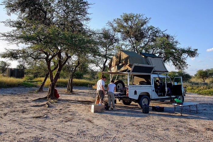
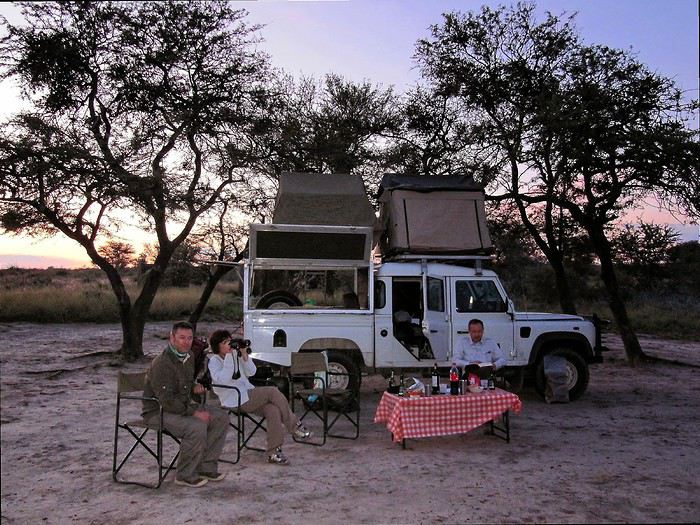
I’m sharing a slightly unusual travel journal with three goals. To make it work, this discussion should stay in the travel journal section so we can find it easily and keep adding info to existing posts.
This journal is meant to help "newbies" discover these magical places.
We go to Southern Africa not just for the animals, but also for that soft light, the atmosphere, and those incredible wild campsites where you feel so at home... I’d love for you all to share your favorite spots here—those we miss so much.
The last goal is figuring out how to photograph them. Honestly, I’m not happy with my photos because they don’t capture the feeling I get when I’m there or that unique atmosphere.
I’ll start with one of the first spots that, for me, is one of the most beautiful in Southern Africa: Passarge Valley 2 in the Central Kalahari. There, you’re alone—completely alone. The next campsite is over 25 km away, and that’s a half-day of 4x4 driving. In front of you, there’s nothing but the CKGR plains with herds of springboks... absolutely stunning 😎
Vos meilleures plages en voyage English translation pending
Bonjour
Avec le confinement j'ai pris le temps de faire un gros tri dans mes photos. Beaucoup étaient des photos de plages qui m'ont rappelé de magnifiques souvenirs.
Donc je me demandais qu'elles sont les 3 plages qui vous viennent à l'esprit quand vous y pensez et qui vous ont marqué d'une manière ou d'une autre.
Personnellement 3 me viennent à l'esprit car elles étaient calmes, pas aménagées, en pleine nature et quasiment personnes dessus.
1) plage barra velha sur l'île de Marajo au Brésil (en plus j'ai pu louer une petite cabane sur pilotis pendant 1 semaine sur cette plage)
2)Mission beach dans l'état du Queensland en Australie
3) La plage du parc de Cahuita au Costa rica
Personnellement 3 me viennent à l'esprit car elles étaient calmes, pas aménagées, en pleine nature et quasiment personnes dessus.
1) plage barra velha sur l'île de Marajo au Brésil (en plus j'ai pu louer une petite cabane sur pilotis pendant 1 semaine sur cette plage)
2)Mission beach dans l'état du Queensland en Australie
3) La plage du parc de Cahuita au Costa rica
Concours photo de mai 2020: "Défilés et Cortèges" English translation pending
Salut à tou(te)s.
Gagnant du concours d'avril 2020 il m'échoit de vous proposer celui de mai 2020 :
En ce mois de mai propice aux défilés, surtout le 1er en temps normal (sans pandémie donc sans distanciation physique), je vous propose le sujet du concours de photo du mois « Défilés et Cortèges » avec les précautions suivantes :
Ce sera celui de participants au défilé en nombre, en extérieur, pour une cause explicite dans l'image proposée (pancarte ou slogan, costumes, décor...). Ce ne sera donc ni la déambulation d'une foule, même bigarrée, ni une file d'attente, mais un cortège de rue qu'il soit religieux, militaire, funéraire, festif, revendicatif, exprimant joie ou peine, colère ou détermination. La foule qui peut l'accompagner ne sera pas l'objet central de la photo mais son complément (prouvant son audience). Voir l'introduction de l'article Défilé sur Wikipédia : On l'aura compris : pas de défilé d'animaux, de chars, ni de roches fracturées : des gens qui se réunissent pour une cause explicite, affichant leurs costumes, leurs uniformes.
Exemples : Cortège du Palio de Sienne (août 2012) :
Fête des vignerons 2019 à Vevey, bout de fanfare :
Fête des saintes patronnes de Santa Fiora (Toscane - juillet 2009). Toutes obédiences des autorités municipales à la fin de la procession :
Participation Chaque participant(e) peut proposer jusqu'à 3 photos, et ce jusqu'au vendredi 22/05 à 20h00, heure de Paris. Chaque photo sera présentée dans un seul message, en indiquant son numéro (1, 2 ou 3). Pensez à ajouter une petite explication, commentaire, localisation, date de prise de vue.
Vote Chaque membre VF peut voter pour les 3 photos qu'il ou elle juge les meilleures selon ses propres critères et en tenant compte du thème.
Les votes se feront du samedi 23/05 au vendredi 29/05 à 20h00, heure de Paris. Les photos choisies seront citées dans l'ordre de préférence : - la 1re photo : 3 points - la 2e : 2 points - la 3e : 1 point
Un seul et unique vote pour 3 photos est accepté par membre.
Conclusion Le vainqueur est l'auteur de la photo ayant reçu le plus de points. Les résultats seront publiés le 30/05. En cas d'égalité, le nombre de premières places prévaudra. Le vainqueur aura l'honneur d'organiser le concours du mois de juin.
Le diaporama est là. La discussion est là
À vous de jouer !
En ce mois de mai propice aux défilés, surtout le 1er en temps normal (sans pandémie donc sans distanciation physique), je vous propose le sujet du concours de photo du mois « Défilés et Cortèges » avec les précautions suivantes :
Ce sera celui de participants au défilé en nombre, en extérieur, pour une cause explicite dans l'image proposée (pancarte ou slogan, costumes, décor...). Ce ne sera donc ni la déambulation d'une foule, même bigarrée, ni une file d'attente, mais un cortège de rue qu'il soit religieux, militaire, funéraire, festif, revendicatif, exprimant joie ou peine, colère ou détermination. La foule qui peut l'accompagner ne sera pas l'objet central de la photo mais son complément (prouvant son audience). Voir l'introduction de l'article Défilé sur Wikipédia : On l'aura compris : pas de défilé d'animaux, de chars, ni de roches fracturées : des gens qui se réunissent pour une cause explicite, affichant leurs costumes, leurs uniformes.
Exemples : Cortège du Palio de Sienne (août 2012) :
Fête des vignerons 2019 à Vevey, bout de fanfare :
Fête des saintes patronnes de Santa Fiora (Toscane - juillet 2009). Toutes obédiences des autorités municipales à la fin de la procession :
Participation Chaque participant(e) peut proposer jusqu'à 3 photos, et ce jusqu'au vendredi 22/05 à 20h00, heure de Paris. Chaque photo sera présentée dans un seul message, en indiquant son numéro (1, 2 ou 3). Pensez à ajouter une petite explication, commentaire, localisation, date de prise de vue.
Vote Chaque membre VF peut voter pour les 3 photos qu'il ou elle juge les meilleures selon ses propres critères et en tenant compte du thème.
Les votes se feront du samedi 23/05 au vendredi 29/05 à 20h00, heure de Paris. Les photos choisies seront citées dans l'ordre de préférence : - la 1re photo : 3 points - la 2e : 2 points - la 3e : 1 point
Un seul et unique vote pour 3 photos est accepté par membre.
Conclusion Le vainqueur est l'auteur de la photo ayant reçu le plus de points. Les résultats seront publiés le 30/05. En cas d'égalité, le nombre de premières places prévaudra. Le vainqueur aura l'honneur d'organiser le concours du mois de juin.
Le diaporama est là. La discussion est là
À vous de jouer !
Intérêt du Vietnam English translation pending
Je vous donne mon avis sincère de voyageur sur le Vietnam sachant que j'ai voyagé là-bas en février et que je ne suis pas allé au nord de Hanoï ni au sud de Nha Trang.
Pour juger un voyage, j'ai l'habitude de séparer l'aspect pratique d'un côté et l'intérêt des sites de l'autre.
Du côté « pratique », le Vietnam obtient un 19/20. Je n'entre pas dans le détail mais il est incroyablement facile et bon marché de voyager dans ce pays. Et avec des standards occidentaux voire meilleurs. Enormément de moyens de transport, hôtels d'excellente qualité et vraiment pas chers...
Entre l'aspect pratique et l'intérêt des sites, je mets la cuisine et le climat. Je ne vais pas écrire des lignes sur la cuisine qui fait tout simplement partie des tops mondiaux. Juste 2 bémols : les prix sont très élevés dans les restaus raffinés par rapport aux prix du pays. Et contrairement à la Chine, on peut tomber sur des restaus où on se moque des touristes. Résultat : un repas perdu alors que chaque repas peut se transformer en souvenir de rêve au Vietnam. Donc attention. Les guides touristiques écrits sont ici très utiles.
On est averti qu'au Vietnam le temps peu être gris. Et selon les sources, on peut reprendre espoir et se dire que finalement cette saison n'a pas l'air si mal. Pour ma part, je n'ai peut-être pas eu de chance mais alors j'en ai eu beaucoup dans les nombreux autres pays où je suis allé. Le ciel est souvent gris. Au nord, ça peut même être une attraction pour curieux de voir cette grisaille prête à vous tomber sur la tête. D'autre part, j'ai rarement vu une telle fraîcheur à une telle lattitude.
Les gens sont très sympas. Certains parlent anglais et il est très intéressant d'échanger avec les vietnamiens mais il faut savoir qu'ils ont un caractère trempé dans l'acier...
Les sites sont d'un intérêt limité. Le pays est surpeuplé et avide de développement. L'aspect traditionnel et religieux est quasi absent notamment par rapport à la Thaïlande. La nature est très très abîmée. Quand vous lisez les guides, vous vous dîtes que vous allez vous régaler à explorer les côtes ou qu'il y a des animaux à voir. C'est le problèmes des guides écrits qui ne comparent pas les pays entre eux. Ils vont utiliser les même adjectifs pour un pays moyen et pour les plus beaux pays. Oui, il y a des pays beaucoup mieux que d'autres ! En fait les côtes vietnamiennes ne sont pas terribles. Selon un guide les îles Cham sont un « époustouflant archipel ». Peut-être que si le Vietnam était le seul pays sur terre ce serait vrai mais il n'en est rien et il y a beaucoup mieux ailleurs. Les grottes de Phong Nha ouvertes au grand public sont d'un intérêt très limité et les autres sont vraiment très très chères d'accès et nécessitent souvent des réservations.
Mon but n'est pas de dénigrer le Vietnam mais d'éclairer les voyageurs car les guides ne le font pas. Je pense que le Vietnam est un pays idéal pour un retraité ou pour vivre quelques mois. Par contre si vous souhaitez découvrir ce qu'il y a de mieux en Asie du sud-est et que vous n'avez que quelques semaines par an, ne commencez pas par le Vietnam.
Pour juger un voyage, j'ai l'habitude de séparer l'aspect pratique d'un côté et l'intérêt des sites de l'autre.
Du côté « pratique », le Vietnam obtient un 19/20. Je n'entre pas dans le détail mais il est incroyablement facile et bon marché de voyager dans ce pays. Et avec des standards occidentaux voire meilleurs. Enormément de moyens de transport, hôtels d'excellente qualité et vraiment pas chers...
Entre l'aspect pratique et l'intérêt des sites, je mets la cuisine et le climat. Je ne vais pas écrire des lignes sur la cuisine qui fait tout simplement partie des tops mondiaux. Juste 2 bémols : les prix sont très élevés dans les restaus raffinés par rapport aux prix du pays. Et contrairement à la Chine, on peut tomber sur des restaus où on se moque des touristes. Résultat : un repas perdu alors que chaque repas peut se transformer en souvenir de rêve au Vietnam. Donc attention. Les guides touristiques écrits sont ici très utiles.
On est averti qu'au Vietnam le temps peu être gris. Et selon les sources, on peut reprendre espoir et se dire que finalement cette saison n'a pas l'air si mal. Pour ma part, je n'ai peut-être pas eu de chance mais alors j'en ai eu beaucoup dans les nombreux autres pays où je suis allé. Le ciel est souvent gris. Au nord, ça peut même être une attraction pour curieux de voir cette grisaille prête à vous tomber sur la tête. D'autre part, j'ai rarement vu une telle fraîcheur à une telle lattitude.
Les gens sont très sympas. Certains parlent anglais et il est très intéressant d'échanger avec les vietnamiens mais il faut savoir qu'ils ont un caractère trempé dans l'acier...
Les sites sont d'un intérêt limité. Le pays est surpeuplé et avide de développement. L'aspect traditionnel et religieux est quasi absent notamment par rapport à la Thaïlande. La nature est très très abîmée. Quand vous lisez les guides, vous vous dîtes que vous allez vous régaler à explorer les côtes ou qu'il y a des animaux à voir. C'est le problèmes des guides écrits qui ne comparent pas les pays entre eux. Ils vont utiliser les même adjectifs pour un pays moyen et pour les plus beaux pays. Oui, il y a des pays beaucoup mieux que d'autres ! En fait les côtes vietnamiennes ne sont pas terribles. Selon un guide les îles Cham sont un « époustouflant archipel ». Peut-être que si le Vietnam était le seul pays sur terre ce serait vrai mais il n'en est rien et il y a beaucoup mieux ailleurs. Les grottes de Phong Nha ouvertes au grand public sont d'un intérêt très limité et les autres sont vraiment très très chères d'accès et nécessitent souvent des réservations.
Mon but n'est pas de dénigrer le Vietnam mais d'éclairer les voyageurs car les guides ne le font pas. Je pense que le Vietnam est un pays idéal pour un retraité ou pour vivre quelques mois. Par contre si vous souhaitez découvrir ce qu'il y a de mieux en Asie du sud-est et que vous n'avez que quelques semaines par an, ne commencez pas par le Vietnam.
On part en vadrouille dans les Balkans! English translation pending
Et bien le confinement a de beaux jours devant lui ! Chose promise, chose due (publier une journée de vadrouille par jour de confinement) ! Après le carnet sur un voyage aux Etats-Unis (voyageforum.com/...-americain-d9943984/), après le carnet sur une vadrouille en Jordanie (https://voyageforum.com/discussion/on-part-en-vadrouille-en-jordanie-d9991360/), voici maintenant un carnet dans les balkans, voyage réalisé il y a maintenant quelques années :
Et on garde les bonnes habitudes, publication d'une journée par jour, à chaque fois à 17h30 ! Bonne lecture et n'hésite pas à laisser un commentaire, une question, une remarque, ...
Franck
Et on garde les bonnes habitudes, publication d'une journée par jour, à chaque fois à 17h30 ! Bonne lecture et n'hésite pas à laisser un commentaire, une question, une remarque, ...
Franck
Vils rébus et rébus de villes, saison 2 English translation pending
Bon, avant de vous proposer une nouvelle série d'énigmes, vous trouverez ci-dessous un rappel de tous les épisodes précédents., qui vous permettra de vous entraîner, si besoin, évidemment, il y avait. Les solutions se trouvent au fil des messages.
https://voyageforum.com/v.f?post=6770753;a=6770753 https://voyageforum.com/v.f?post=7089406;a=7089406 https://voyageforum.com/v.f?post=7233679;a=7233679 https://voyageforum.com/v.f?post=5903551;a=5903551 (il manque des images) https://voyageforum.com/v.f?post=5906497;a=5906497 https://voyageforum.com/v.f?post=5911990;a=5911990 https://voyageforum.com/v.f?post=6631536;a=6631536
Je ne pensais pas en avoir fait tant que ça, mais bon, les faits sont là. Je reviens pour la nouvelle série inédite.
https://voyageforum.com/v.f?post=6770753;a=6770753 https://voyageforum.com/v.f?post=7089406;a=7089406 https://voyageforum.com/v.f?post=7233679;a=7233679 https://voyageforum.com/v.f?post=5903551;a=5903551 (il manque des images) https://voyageforum.com/v.f?post=5906497;a=5906497 https://voyageforum.com/v.f?post=5911990;a=5911990 https://voyageforum.com/v.f?post=6631536;a=6631536
Je ne pensais pas en avoir fait tant que ça, mais bon, les faits sont là. Je reviens pour la nouvelle série inédite.
Été 1985 : un voyage de noces hors du commun dans la Chine pop English translation pending
Deuxième séjour à Pékin en 2018, je discute à l'auberge avec une voyageuse :
"Pékin ! Ici on vit vraiment dans un autre monde."
"Peut-être, mais alors que dire du Pékin des années 80. Une autre planète !"
Ceux qui découvrent cette Chine du 21° siècle ne retrouveront guère que des fragments de celle que je vais raconter ici, comme j'ai pu le constater par moi-même. (Voir mes carnets sur la route de la soie.)
Ce sera donc un carnet "impressions de Chine", ce qui m'est resté de plus marquant. Les quelques photos jaunies que j'ai pu sauver sont scannées et de mauvaise qualité. Merci à Jacqueline et Jean-Pierre pour leur contribution photographique, entièrement d'époque elle aussi.
AU MENU
Préambule - le contexte politique et économique du pays Chapitre 1 - Un voyage qui s'annonce pas très romantique, c'était prévu... Chapitre 2 - Pékin : le trafic de monnaie. Illégal mais indispensable. Chapitre 3 - Pékin 1985-2018 : du Moyen-Age à la révolution technologique. Immersion comparative. Chapitre 4 - Pékin : un billet de train pour Xi'an ? Pas si simple que ça. Chapitre 5 - Le "qi feng shui". Le soigneur se fait soigner. Chapitre 6 - Xi'an : «mei yo», la réponse favorite des fonctionnaires. Chapitre 7 - Vol au-dessus de la jungle. Le coucou arrivera-t-il à bon port ? Chapitre 8 - Chongqing : le bal, ou la vie sexuelle des jeunes chinois. Chapitre 9 - Croisière pop sur le Yangtse. Chapitre 10 - L'hôtel à rats. C'est à Wuhan, comme par hasard. Chapitre 11 - Canton : à la recherche de xiao Wu. Chapitre 12 - Canton : un train sous haute surveillance. Chapitre 13 - Hong Kong : dur retour à la civilisation. Albums : les photos d'époque signées Jacqueline et Jean-Pierre. A partir de la page 5 Témoignages et photos d'époque. Merci aux différents contributeurs. A partir de la page 6. Ne manquez pas le Tibet et le Xinjiang !
PREAMBULE : le contexte politique et économique Comment voyager dans ce pays encore très fermé, obscur, énigmatique, dont en Europe on ne connaît guère la mentalité, les règles de fonctionnement, dont on ne perçoit à l'étranger que quelques images soigneusement filtrées par la censure. Comment se déplacer, se loger, se nourrir, sans moyen de communication, sans réservation d'hôtel ou de train, sans connaître la langue , sans aide, sans guide, sans assistance, sans carte bleue...
1984, date clé pour le voyageur Après trente années de communisme à marche forcée, de campagnes idéologiques calamiteuses pour les populations, de luttes intestines pour le pouvoir, le pays n'arrive pas à décoller économiquement. L'écart grandit avec les nations développées. Mais avec le rétablissement des relations diplomatiques avec les Etats Unis en 1979, le nouveau président, Deng Xiaoping, tient enfin sa revanche et entame sa longue marche vers le progrès. Les fossiles maoïstes de la "longue marche", des "cent fleurs", du "grand bond en avant", les criminels de la "grande révolution culturelle prolétarienne", représentés par la "bande des quatre", tous ceux qui l'avaient évincé du pouvoir et condamné à l'oubli au fin fond d'une province, le sont à leur tour.
Le "révisionniste", comme l'a appelé la veuve Mao, lance ses réformes de libéralisation et d'ouverture de l'économie : « Peu importe qu'un chat soit blanc ou noir, l'essentiel est qu'il attrape les souris ! » Parole du maître.
Parmi ces réformes : l'ouverture au tourisme. Jusqu'à présent, pour visiter le pays, il fallait obligatoirement, soit passer par un tour opérateur avec guide et circuit programmé, soit demander des autorisations de voyage pour un nombre limité de destinations. Très peu pour moi. Mais en 1984, monsieur Deng supprime le permis de circuler et ouvre quasiment tout le pays aux visiteurs. L'info provoque un déclic : - C'est l'occasion ou jamais. L'année prochaine, ce sera la Chine. Et en sac à dos! Et ce sera aussi notre voyage de noces...
Nous aurons le privilège d'être parmi les premiers voyageurs occidentaux à tenter l'aventure. Je pourrai enfin mettre en pratique ce que j'ai appris de chinois à la fac et réaliser un vieux rêve. A nous la Chine, à nous la découverte de ce pays mystérieux et fascinant. Quelle réalité se cache derrière ces images édulcorées de bonheur populaire que nous distillent les images officielles ? Comment vit-on réellement dans ce pays ? Quel accueil réserve-t-on aux impérialistes occidentaux ?

Wuhan, 1985 : slogans révolutionnaires pour mini gardes rouges
CHAPITRE 1 : un voyage qui s'annonce pas très romantique, c'était prévu... Eh oui, juste mariés, il y a peut-être plus glamour comme destination. Bon, Venise, on connaît déjà. Quoi de mieux qu'une telle aventure pour forger un couple ? Pendant toute l'année, je peaufine le projet : itinéraire, transports, hébergements... Les guides de voyage sur la Chine ne sont pas nombreux, il n'en existe d'ailleurs qu'un en français. Pour ce qui est de l'itinéraire, c'est à peu près établi, pour le reste, ce sera au coup par coup, improvisation et opportunités. L'aventure quoi. Juste qu'on dispose d'un mois entre l'atterrissage et le retour à Hong-Kong. Pour l'itinéraire, ce sera donc Pékin - Hong Kong, mais par où et comment ? C'est le grand mystère, même si certains incontournables sont au programme : la Grande Muraille, Xi'an et son armée en terre cuite, la croisière sur le Yang Tse Kiang...
Août 1985 : Hong Kong, premiers pas en extrême-orient Munis d'un joli visa sur notre passeport et d'un billet d'avion Hong Kong - Pékin acheté en agence en France, nous débarquons à Hong Kong pour y passer une nuit avant de repartir pour Pékin le lendemain, L'atterrissage au-dessus de la ville est spectaculaire, l'avion louvoie entre les immeubles pour plonger vers la piste au raz de l'océan, un véritable tour de manège à sensations. Pas trop le temps d'explorer la ville, mais le dépaysement est déjà total. Et pourtant, ce n'est rien à côté de ce qui nous attend...
Ca commence plutôt mal Aéroport de Hong Kong, le lendemain. Nos billets sont valables, pas de problème, seulement : - Désolé, mais vous n'avez pas confirmé votre vol, l'avion est complet. Il va falloir attendre deux ou trois jours... Eh oui, en 1985, il faut confirmer son vol la veille par téléphone. Dans l'excitation et l'émotion, nous avions complètement oublié la consigne. Zut alors, deux ou trois jours de perdus sur le projet, c'est beaucoup trop. - Attendez ici, peut-être il y aura des places si des voyageurs ne se présentent pas. Longue attente plutôt anxieuse, et quelques minutes avant le décollage, petit signe de l'employé : - C'est bon, il reste deux places, vous pouvez partir.
Pékin : avenue Xidan. Photo : Jacqueline et Jean-Pierre
Dès l'aéroport, j'ai senti le choc... Une simple piste en béton, pas d'avion en attente, un trafic aérien quasi nul, un bâtiment à la chinoise, usé et vieillot à souhait, des gardes en uniforme. L'aéroport est encore une base militaire, accessoirement civile pour quelques rares liaisons vers l'URSS et les pays d'Asie. Il n'y a rien dans ce qui fait office de hall d'accueil, une pièce de quelques dizaines de mètres carré tout au plus.
Contrôles minutieux, file d'attente, les militaires ne sont pas très souriants, et le comité d'accueil pas très... accueillant. On n'est pas là pour rigoler, surtout avec ces étrangers qui débarquent de Hong Kong, la zone capitaliste. Eh oui, Hong Kong chinois, ce sera dans une dizaine d'années. D'ici là...
Des billets de Monopoly ?! Un simple bureau dans un recoin fait office de banque. Vite, changer nos travelers chèques en dollars. Ben oui, la carte bleue, ça n'existe pas encore. Derrière son boulier, l'employé fait ses calculs à une vitesse incroyable et me rend le change. Surprise : j'ai une liasse de jolis billets tout neufs dans la main, mais ils n'ont rien à voir avec la monnaie locale. La preuve, il n'y a pas le portrait du grand timonier, mais des jolis dessins de monuments et paysages ! Ca ressemble davantage à des billets de Monopoly.
C'est quoi ce truc ?
Une bonne affaire, mais un gros risque En fait, c'est une monnaie spéciale réservée aux étrangers. Nous allons vite apprendre deux choses. - Un, cette monnaie n'est pas utilisée (et même interdite) par les chinois dans leur vie quotidienne. Elle est réservée aux étrangers et ils doivent payer avec. - Deux, elle est très recherchée par quelques autochtones, car c'est la seule monnaie ayant un équivalent dollar. A l'époque, le yuan chinois ne vaut absolument rien, il n'est pas convertible dans une autre monnaie. Pire que le kopeck. Du coup, notre monnaie "spécial étrangers" fait l'objet d'un trafic formellement interdit et sévèrement réprimé par les autorités.
Mais comment faire si tu veux voyager en dehors des circuits touristiques et des grands hôtels, juste prendre le bus par exemple ou manger dans une gargote. Ca, les autorités n'en ont cure. Un étranger, ça dort dans les hôtels de luxe, ça prend l'avion ou le train en première classe, ça mange dans les grands restaurants. Mieux encore, ça voyage en groupe avec un guide.
Pas d'autre solution, il faudra changer au black Dans la rue, avec les petits trafiquants locaux. Il y a même un cours « officiel » du change : un yuan de Monopoly contre trois yuans de monnaie populaire. A l'époque, un yuan, c'est à peu près un franc. Une sacrée bonne affaire ! Le tout, c'est de ne pas se faire pincer. Les rumeurs les plus folles courent sur les peines encourues pour les trafiquants, mais aussi pour les étrangers qui se font pincer. C'est d'ailleurs marqué sur certains documents. Si les peines de prison ferme ont de quoi dissuader le voyageur, il faudra quand même prendre le risque, pas le choix. Une des nombreuses absurdités du système.
Pékin : place Tian An Men. Photo : Jacqueline et Jean-Pierre
Mise à l'épreuve 1 : trouver un hébergement... Sortie de l'aéroport, c'est l'après-midi. Quelques taxis attendent, réservés aux privilégiés du régime et aux étrangers. Mais nous ne savons même pas où nous allons, juste en ville, et on verra après. Donc ce sera le bus, celui-ci prend la monnaie de Monopoly. C'est notre premier transport en commun, direction le centre ville, à une vingtaine de kilomètres. Très bien, mais où aller, à qui demander un tuyau, un renseignement, une bonne adresse ?
L'aéroport étant en rase campagne, la route bordée d'arbres qui conduit à Pékin centre ressemble à une de nos départementales. De part et d'autres, c'est le défilé des paysans, le plus souvent à pied, tirant des charrettes à bras, quelques fois à bicyclette ou en tracteur. Pour nous occidentaux déjà rodés aux autoroutes, c'est un choc. Ici, pas de voiture individuelle : les véhicules à moteur, c'est juste des camions, quelques bus et de rares taxi, c'est tout .
La carte de Pékin n'indique rien d'autre que le nom des rues, impossible de savoir où se trouve tel service, hôtel, restaurant... Il faut se débrouiller. Les quelques éléments écrits et oraux de chinois que je possède, je vais vite devoir les mettre à l'épreuve. L'anglais ici, on connaît pas.
Juste à côté de nous est assise une jeune femme, bien de sa personne, sans doute un cadre du parti ou d'une grande entreprise. Elle semble plus amène que les autres voyageurs, plus disposée à rendre service. J'entame la conversation comme je peux. Après les échanges d'usage : - Nous sommes français, c'est notre premier voyage en Chine. Connaissez-vous un hôtel sur le trajet du bus qui nous accepterait ? Coup de chance, la femme nous en indique un non loin d'un arrêt, elle nous dira quand il faudra descendre.
Mise à l'épreuve 2 : et qui accepte les étrangers... L'hôtel n'est pas facile à trouver, tout se ressemble ici et rien ne permet de discerner au premier coup d'oeil la fonction d'un bâtiment. Ce n'est même pas écrit « hôtel » à l'entrée. Finalement nous poussons la porte de ce qui semble être ce que nous cherchons. Un étroit couloir sombre, un guichet, une sorte de réception, on dirait un peu un hôtel. Le type de l'accueil est très surpris de nous voir ici, mais oui, c'est bien un hôtel, sauf que : - C'est interdit aux étrangers, vous ne devez pas rester ici ! - Mais comment faire alors ? Le type décroche son téléphone, puis, au bout d'un moment : - Prenez le bus et descendez à cet arrêt, vous y trouverez un hôtel pour vous.
C'est ainsi que nous découvrons que nous ne pourrons pas loger comme on veut dans le pays. La plupart des hôtels sont interdits aux étrangers, il faut toujours aller à l'hôtel spécial « wai guo ren». Oui, mais ce n'est pas forcément indiqué. Quant à dormir chez l'habitant, ce n'est même pas la peine d'y songer, c'est interdit. De plus, quand on voit dans quoi vivent les gens en ville, le peu d'espace dont ils disposent, ça ne donne pas vraiment envie de se faire inviter.
Je ne me souviens plus comment nous avons fait pour trouver le bon bus et le bon arrêt, juste que ça n'a pas été facile du tout. La contrôleuse du bus a tiré une drôle de tronche quand je lui ai tendu le billet de Monoploy, mais elle n'avait pas le choix. Un mao le ticket, dix centimes de franc. Premier aperçu du coup de la vie : trois fois rien. Dans le bus, tous les regards sont fixés sur nous...
Pas de doute, il faut absolument trouver de la monnaie locale, et le plus vite possible. On ne va rien pouvoir faire avec cette monnaie de m... Et quand par hasard ils sont acceptés, on y perd sacrément au change, car ils nous rendent l'argent en monnaie locale. C'est une arnaque gouvernementale bien calculée !
Prochain épisode : le trafic de monnaie
Ce sera donc un carnet "impressions de Chine", ce qui m'est resté de plus marquant. Les quelques photos jaunies que j'ai pu sauver sont scannées et de mauvaise qualité. Merci à Jacqueline et Jean-Pierre pour leur contribution photographique, entièrement d'époque elle aussi.
AU MENU
Préambule - le contexte politique et économique du pays Chapitre 1 - Un voyage qui s'annonce pas très romantique, c'était prévu... Chapitre 2 - Pékin : le trafic de monnaie. Illégal mais indispensable. Chapitre 3 - Pékin 1985-2018 : du Moyen-Age à la révolution technologique. Immersion comparative. Chapitre 4 - Pékin : un billet de train pour Xi'an ? Pas si simple que ça. Chapitre 5 - Le "qi feng shui". Le soigneur se fait soigner. Chapitre 6 - Xi'an : «mei yo», la réponse favorite des fonctionnaires. Chapitre 7 - Vol au-dessus de la jungle. Le coucou arrivera-t-il à bon port ? Chapitre 8 - Chongqing : le bal, ou la vie sexuelle des jeunes chinois. Chapitre 9 - Croisière pop sur le Yangtse. Chapitre 10 - L'hôtel à rats. C'est à Wuhan, comme par hasard. Chapitre 11 - Canton : à la recherche de xiao Wu. Chapitre 12 - Canton : un train sous haute surveillance. Chapitre 13 - Hong Kong : dur retour à la civilisation. Albums : les photos d'époque signées Jacqueline et Jean-Pierre. A partir de la page 5 Témoignages et photos d'époque. Merci aux différents contributeurs. A partir de la page 6. Ne manquez pas le Tibet et le Xinjiang !
PREAMBULE : le contexte politique et économique Comment voyager dans ce pays encore très fermé, obscur, énigmatique, dont en Europe on ne connaît guère la mentalité, les règles de fonctionnement, dont on ne perçoit à l'étranger que quelques images soigneusement filtrées par la censure. Comment se déplacer, se loger, se nourrir, sans moyen de communication, sans réservation d'hôtel ou de train, sans connaître la langue , sans aide, sans guide, sans assistance, sans carte bleue...
1984, date clé pour le voyageur Après trente années de communisme à marche forcée, de campagnes idéologiques calamiteuses pour les populations, de luttes intestines pour le pouvoir, le pays n'arrive pas à décoller économiquement. L'écart grandit avec les nations développées. Mais avec le rétablissement des relations diplomatiques avec les Etats Unis en 1979, le nouveau président, Deng Xiaoping, tient enfin sa revanche et entame sa longue marche vers le progrès. Les fossiles maoïstes de la "longue marche", des "cent fleurs", du "grand bond en avant", les criminels de la "grande révolution culturelle prolétarienne", représentés par la "bande des quatre", tous ceux qui l'avaient évincé du pouvoir et condamné à l'oubli au fin fond d'une province, le sont à leur tour.
Le "révisionniste", comme l'a appelé la veuve Mao, lance ses réformes de libéralisation et d'ouverture de l'économie : « Peu importe qu'un chat soit blanc ou noir, l'essentiel est qu'il attrape les souris ! » Parole du maître.
Parmi ces réformes : l'ouverture au tourisme. Jusqu'à présent, pour visiter le pays, il fallait obligatoirement, soit passer par un tour opérateur avec guide et circuit programmé, soit demander des autorisations de voyage pour un nombre limité de destinations. Très peu pour moi. Mais en 1984, monsieur Deng supprime le permis de circuler et ouvre quasiment tout le pays aux visiteurs. L'info provoque un déclic : - C'est l'occasion ou jamais. L'année prochaine, ce sera la Chine. Et en sac à dos! Et ce sera aussi notre voyage de noces...
Nous aurons le privilège d'être parmi les premiers voyageurs occidentaux à tenter l'aventure. Je pourrai enfin mettre en pratique ce que j'ai appris de chinois à la fac et réaliser un vieux rêve. A nous la Chine, à nous la découverte de ce pays mystérieux et fascinant. Quelle réalité se cache derrière ces images édulcorées de bonheur populaire que nous distillent les images officielles ? Comment vit-on réellement dans ce pays ? Quel accueil réserve-t-on aux impérialistes occidentaux ?
Wuhan, 1985 : slogans révolutionnaires pour mini gardes rouges
CHAPITRE 1 : un voyage qui s'annonce pas très romantique, c'était prévu... Eh oui, juste mariés, il y a peut-être plus glamour comme destination. Bon, Venise, on connaît déjà. Quoi de mieux qu'une telle aventure pour forger un couple ? Pendant toute l'année, je peaufine le projet : itinéraire, transports, hébergements... Les guides de voyage sur la Chine ne sont pas nombreux, il n'en existe d'ailleurs qu'un en français. Pour ce qui est de l'itinéraire, c'est à peu près établi, pour le reste, ce sera au coup par coup, improvisation et opportunités. L'aventure quoi. Juste qu'on dispose d'un mois entre l'atterrissage et le retour à Hong-Kong. Pour l'itinéraire, ce sera donc Pékin - Hong Kong, mais par où et comment ? C'est le grand mystère, même si certains incontournables sont au programme : la Grande Muraille, Xi'an et son armée en terre cuite, la croisière sur le Yang Tse Kiang...
Août 1985 : Hong Kong, premiers pas en extrême-orient Munis d'un joli visa sur notre passeport et d'un billet d'avion Hong Kong - Pékin acheté en agence en France, nous débarquons à Hong Kong pour y passer une nuit avant de repartir pour Pékin le lendemain, L'atterrissage au-dessus de la ville est spectaculaire, l'avion louvoie entre les immeubles pour plonger vers la piste au raz de l'océan, un véritable tour de manège à sensations. Pas trop le temps d'explorer la ville, mais le dépaysement est déjà total. Et pourtant, ce n'est rien à côté de ce qui nous attend...
Ca commence plutôt mal Aéroport de Hong Kong, le lendemain. Nos billets sont valables, pas de problème, seulement : - Désolé, mais vous n'avez pas confirmé votre vol, l'avion est complet. Il va falloir attendre deux ou trois jours... Eh oui, en 1985, il faut confirmer son vol la veille par téléphone. Dans l'excitation et l'émotion, nous avions complètement oublié la consigne. Zut alors, deux ou trois jours de perdus sur le projet, c'est beaucoup trop. - Attendez ici, peut-être il y aura des places si des voyageurs ne se présentent pas. Longue attente plutôt anxieuse, et quelques minutes avant le décollage, petit signe de l'employé : - C'est bon, il reste deux places, vous pouvez partir.
Pékin : avenue Xidan. Photo : Jacqueline et Jean-Pierre
Dès l'aéroport, j'ai senti le choc... Une simple piste en béton, pas d'avion en attente, un trafic aérien quasi nul, un bâtiment à la chinoise, usé et vieillot à souhait, des gardes en uniforme. L'aéroport est encore une base militaire, accessoirement civile pour quelques rares liaisons vers l'URSS et les pays d'Asie. Il n'y a rien dans ce qui fait office de hall d'accueil, une pièce de quelques dizaines de mètres carré tout au plus.
Contrôles minutieux, file d'attente, les militaires ne sont pas très souriants, et le comité d'accueil pas très... accueillant. On n'est pas là pour rigoler, surtout avec ces étrangers qui débarquent de Hong Kong, la zone capitaliste. Eh oui, Hong Kong chinois, ce sera dans une dizaine d'années. D'ici là...
Des billets de Monopoly ?! Un simple bureau dans un recoin fait office de banque. Vite, changer nos travelers chèques en dollars. Ben oui, la carte bleue, ça n'existe pas encore. Derrière son boulier, l'employé fait ses calculs à une vitesse incroyable et me rend le change. Surprise : j'ai une liasse de jolis billets tout neufs dans la main, mais ils n'ont rien à voir avec la monnaie locale. La preuve, il n'y a pas le portrait du grand timonier, mais des jolis dessins de monuments et paysages ! Ca ressemble davantage à des billets de Monopoly.
C'est quoi ce truc ?
Une bonne affaire, mais un gros risque En fait, c'est une monnaie spéciale réservée aux étrangers. Nous allons vite apprendre deux choses. - Un, cette monnaie n'est pas utilisée (et même interdite) par les chinois dans leur vie quotidienne. Elle est réservée aux étrangers et ils doivent payer avec. - Deux, elle est très recherchée par quelques autochtones, car c'est la seule monnaie ayant un équivalent dollar. A l'époque, le yuan chinois ne vaut absolument rien, il n'est pas convertible dans une autre monnaie. Pire que le kopeck. Du coup, notre monnaie "spécial étrangers" fait l'objet d'un trafic formellement interdit et sévèrement réprimé par les autorités.
Mais comment faire si tu veux voyager en dehors des circuits touristiques et des grands hôtels, juste prendre le bus par exemple ou manger dans une gargote. Ca, les autorités n'en ont cure. Un étranger, ça dort dans les hôtels de luxe, ça prend l'avion ou le train en première classe, ça mange dans les grands restaurants. Mieux encore, ça voyage en groupe avec un guide.
Pas d'autre solution, il faudra changer au black Dans la rue, avec les petits trafiquants locaux. Il y a même un cours « officiel » du change : un yuan de Monopoly contre trois yuans de monnaie populaire. A l'époque, un yuan, c'est à peu près un franc. Une sacrée bonne affaire ! Le tout, c'est de ne pas se faire pincer. Les rumeurs les plus folles courent sur les peines encourues pour les trafiquants, mais aussi pour les étrangers qui se font pincer. C'est d'ailleurs marqué sur certains documents. Si les peines de prison ferme ont de quoi dissuader le voyageur, il faudra quand même prendre le risque, pas le choix. Une des nombreuses absurdités du système.
Pékin : place Tian An Men. Photo : Jacqueline et Jean-Pierre
Mise à l'épreuve 1 : trouver un hébergement... Sortie de l'aéroport, c'est l'après-midi. Quelques taxis attendent, réservés aux privilégiés du régime et aux étrangers. Mais nous ne savons même pas où nous allons, juste en ville, et on verra après. Donc ce sera le bus, celui-ci prend la monnaie de Monopoly. C'est notre premier transport en commun, direction le centre ville, à une vingtaine de kilomètres. Très bien, mais où aller, à qui demander un tuyau, un renseignement, une bonne adresse ?
L'aéroport étant en rase campagne, la route bordée d'arbres qui conduit à Pékin centre ressemble à une de nos départementales. De part et d'autres, c'est le défilé des paysans, le plus souvent à pied, tirant des charrettes à bras, quelques fois à bicyclette ou en tracteur. Pour nous occidentaux déjà rodés aux autoroutes, c'est un choc. Ici, pas de voiture individuelle : les véhicules à moteur, c'est juste des camions, quelques bus et de rares taxi, c'est tout .
La carte de Pékin n'indique rien d'autre que le nom des rues, impossible de savoir où se trouve tel service, hôtel, restaurant... Il faut se débrouiller. Les quelques éléments écrits et oraux de chinois que je possède, je vais vite devoir les mettre à l'épreuve. L'anglais ici, on connaît pas.
Juste à côté de nous est assise une jeune femme, bien de sa personne, sans doute un cadre du parti ou d'une grande entreprise. Elle semble plus amène que les autres voyageurs, plus disposée à rendre service. J'entame la conversation comme je peux. Après les échanges d'usage : - Nous sommes français, c'est notre premier voyage en Chine. Connaissez-vous un hôtel sur le trajet du bus qui nous accepterait ? Coup de chance, la femme nous en indique un non loin d'un arrêt, elle nous dira quand il faudra descendre.
Mise à l'épreuve 2 : et qui accepte les étrangers... L'hôtel n'est pas facile à trouver, tout se ressemble ici et rien ne permet de discerner au premier coup d'oeil la fonction d'un bâtiment. Ce n'est même pas écrit « hôtel » à l'entrée. Finalement nous poussons la porte de ce qui semble être ce que nous cherchons. Un étroit couloir sombre, un guichet, une sorte de réception, on dirait un peu un hôtel. Le type de l'accueil est très surpris de nous voir ici, mais oui, c'est bien un hôtel, sauf que : - C'est interdit aux étrangers, vous ne devez pas rester ici ! - Mais comment faire alors ? Le type décroche son téléphone, puis, au bout d'un moment : - Prenez le bus et descendez à cet arrêt, vous y trouverez un hôtel pour vous.
C'est ainsi que nous découvrons que nous ne pourrons pas loger comme on veut dans le pays. La plupart des hôtels sont interdits aux étrangers, il faut toujours aller à l'hôtel spécial « wai guo ren». Oui, mais ce n'est pas forcément indiqué. Quant à dormir chez l'habitant, ce n'est même pas la peine d'y songer, c'est interdit. De plus, quand on voit dans quoi vivent les gens en ville, le peu d'espace dont ils disposent, ça ne donne pas vraiment envie de se faire inviter.
Je ne me souviens plus comment nous avons fait pour trouver le bon bus et le bon arrêt, juste que ça n'a pas été facile du tout. La contrôleuse du bus a tiré une drôle de tronche quand je lui ai tendu le billet de Monoploy, mais elle n'avait pas le choix. Un mao le ticket, dix centimes de franc. Premier aperçu du coup de la vie : trois fois rien. Dans le bus, tous les regards sont fixés sur nous...
Pas de doute, il faut absolument trouver de la monnaie locale, et le plus vite possible. On ne va rien pouvoir faire avec cette monnaie de m... Et quand par hasard ils sont acceptés, on y perd sacrément au change, car ils nous rendent l'argent en monnaie locale. C'est une arnaque gouvernementale bien calculée !
Prochain épisode : le trafic de monnaie
Photo depuis chez vous et description de l'ambiance dans votre rue English translation pending
À cause du connardevirus, l'immense majorité d'entre nous doit rester chez soi. Alors j'ai pensé: pourquoi ne pas faire un tour du monde (vu qu'on a des membres qui habitent partout dans le monde) sans mettre un pied dehors ?
L'idée est de poster une photo prise depuis chez vous, à la fenêtre (ce n'est pas un "concours photo", l'important c'est le témoignage.... Ceci dit si vous savez prendre de belles photos, n'hésitez pas non plus !). Accompagnez la photo d'un petit commentaire, une anecdote qui a pu avoir lieu dans votre rue, ou comment se passe le confinement dans votre quartier.
Bon, je poste ça, mais je n'ai pas encore déchargé mes propres images de mon portable (je n'ai pas d'appareil photo digne de ce nom chez moi)
J'espère que le défi vous intéresse... A vous !
L'idée est de poster une photo prise depuis chez vous, à la fenêtre (ce n'est pas un "concours photo", l'important c'est le témoignage.... Ceci dit si vous savez prendre de belles photos, n'hésitez pas non plus !). Accompagnez la photo d'un petit commentaire, une anecdote qui a pu avoir lieu dans votre rue, ou comment se passe le confinement dans votre quartier.
Bon, je poste ça, mais je n'ai pas encore déchargé mes propres images de mon portable (je n'ai pas d'appareil photo digne de ce nom chez moi)
J'espère que le défi vous intéresse... A vous !
Eswatini, en traversant le petit royaume English translation pending
 C'est un petit pays enclavé au cœur de l'Afrique australe, coincé entre l'Afrique du sud et le Mozambique. Et si ce nom d' Eswatini ne vous évoque rien, sachez que son appellation ancienne est bien plus connue … Swaziland mais c'était avant 2018, avant que le Roi du pays ne décide de nommer son territoire en langue locale. Car une des particularités de ce pays, pardon de ce royaume, est d'être la dernière monarchie absolue du continent africain.
Lorsqu'on voyage en Afrique du Sud, du Sud au Nord, la traversée de l'eSwatini s'avère le plus court chemin entre les réserves animalières de Huluwe et celles de la région du célèbre parc Kruger.
Je vous invite donc avec ce récit à la découverte (enfin à un aperçu) de ce petit royaume, le road trip vous fera traverser les paysages vallonnés et verdoyants de cet original eSwatini.
C'est un petit pays enclavé au cœur de l'Afrique australe, coincé entre l'Afrique du sud et le Mozambique. Et si ce nom d' Eswatini ne vous évoque rien, sachez que son appellation ancienne est bien plus connue … Swaziland mais c'était avant 2018, avant que le Roi du pays ne décide de nommer son territoire en langue locale. Car une des particularités de ce pays, pardon de ce royaume, est d'être la dernière monarchie absolue du continent africain.
Lorsqu'on voyage en Afrique du Sud, du Sud au Nord, la traversée de l'eSwatini s'avère le plus court chemin entre les réserves animalières de Huluwe et celles de la région du célèbre parc Kruger.
Je vous invite donc avec ce récit à la découverte (enfin à un aperçu) de ce petit royaume, le road trip vous fera traverser les paysages vallonnés et verdoyants de cet original eSwatini.………………………………………………………………………………………………………………………...
Avant de débuter notre périple à travers l'eSwatini, du Sud au Nord, faut-il encore y pénétrer. Place à la séquence formalités.
Nous voici au poste frontière de Lavumisa, enfin pour l'instant nous attendons devant les grilles et les murs hérissés de fils de fer barbelés. Même si le pays est petit par son étendue, environ 200 kilomètres sur 130 de large et sa population modeste avec seulement 1,5 millions d'habitants … modeste étant bien le terme car la pauvreté y sévit à grande échelle ! eh bien, on le constate, ce poste douanier a tout d'une grande nation avec des bâtiments aux imposantes dimensions. Une succession de hangars, de halls et de bureaux qui paraissent quelque peu démesurés en rapport au nombre de personnes qui passent ce matin cette frontière. Nous sommes à bord d'un minibus pour ce voyage mais il nous faut mettre pieds à terre, la réglementation locale nous oblige à passer la frontière individuellement et en marchant.
Presque une petite randonnée entre une chicane formée par des grillages puis ensuite avec la traversée d'un parking et d'une cour avant de pénétrer dans un immense hall agréablement climatisé. Là, les employés attendent les passants. Présentation des passeports puis traditionnels coups de tampon, à la va vite ! Pour les formalités, c'en est donc terminé car il me faut préciser que je n'ai pas souvenir d'un quelconque contrôle de nos bagages qui eux étaient restés tranquillement à bord de notre véhicule …
A l'opposé des bureaux, sur une table trône un distributeur, il met à la disposition des visiteurs un cadeau de bienvenue dans le royaume. Mais de quoi s'agit-il ? En fait, c'est un distributeur de préservatifs et en plus il y a le choix entre deux modèles. Cela pourrait prêter à sourire mais finalement l'initiative des autorités locales est bien pensée. Car il faut savoir que dans ce territoire (comme d'ailleurs dans plusieurs autres du continent africain), un inquiétant fléau sévit, le Sida ! Au plus fort de l'épidémie il y aurait eu, paraît-il, plus d'un quart de séropositifs parmi la population locale, la plus forte prévalence au monde. Des chiffres alarmants qui ont donc motivé cette distribution gratuite … jusqu'aux portes du pays. Une dernière précision, d'après les statistiques la situation se serait améliorée, on ne peut que s'en réjouir.
A nous maintenant la découverte du royaume de l'eSwatini. Juste après la frontière, le premier bâtiment officiel couleur locale est ce simple bureau de poste.
Passé le bourg, nous cheminons sur une longue route droite. De part et d'autre, place à une savane desséchée parsemée d'arbustes et d’acacias, elle s'étend à perte de vue sur une région sans relief. Pour être franc, ce sud du territoire n'est pas vraiment la plus belle région de ce pays. Ça et là, il y a bien quelques habitations. De simples cases, quelques lopins de terre arides et quelques animaux, chèvres et vaches, toutes aussi maigres les unes que les autres.
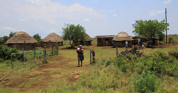
On l'imagine, c'est une vie de misère que vivent ces rares habitants. Dès que l'on s'arrête sur le bord de la route, femmes et enfants viennent à notre rencontre … pour nous dire bonjour certes, mais surtout pour quémander quelques objets ou un peu de monnaie … cela peut paraître un peu agaçant mais ne serait-on pas tenter de faire pareil si nous étions à leur place ?
Après une soixantaine de kilomètres parcourus sur cette très rectiligne nationale MR8, notre seconde halte est une pause restauration au bourg de Nsoko. Le Nisela Coffee shop est un établissement à l'hygiène plutôt rassurante … ce qui malheureusement ne semble pas toujours le cas des quelques « cantines » de villages. Une fois rassasié (repas simple mais correct) et en attendant la poursuite du trajet, on profite de ces quelques instants de repos … pas en piquant une courte sieste à l'ombre des épineux mais pour faire une petite balade digestive.
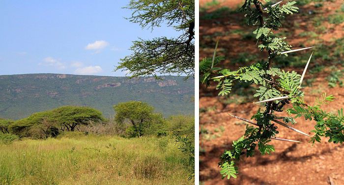
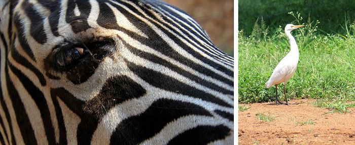
Au Nisela, se trouve un parc avec quelques animaux « sauvages » dans des enclos sécurisés, à l'image de ce zèbre à l’œil vitreux. C'est une invitation à en découvrir un peu plus car le Nisela est aussi un lieu de départ pour des safaris animaliers. Ainsi, comme en Afrique du Sud, le Swaziland, pardon l'eSwatini, est un territoire où l'on peut observer une grande partie de la faune sauvage de l'Afrique australe. Mais les réserves locales sont moins renommées que celles de la région du célèbre Parc Kruger … notre destination, au-delà des terres de l'eSwatini.
A propos des animaux du pays, j'ai bien aimé la vue d'un dessin au style naïf d'un artiste local. Le dessin représentait la faune animalière de ces contrées avec des animaux sauvages et aussi des animaux domestiques … Je m'en suis inspiré pour réaliser le dessin, à ma manière et sans prétention, présenté ci-dessous.
Nous avons repris la route et peu à peu le paysage change catégoriquement d'aspect. Il en est fini des étendues de savanes brûlées par le soleil, place maintenant à des plaines cultivées. Ici, c'est le royaume de la canne à sucre. Des hectares et des hectares de champs de cannes qui ondulent au gré des vents, la proximité avec ce cours d'eau n'est sans doute pas étrangère à la fertilité de ces terres.
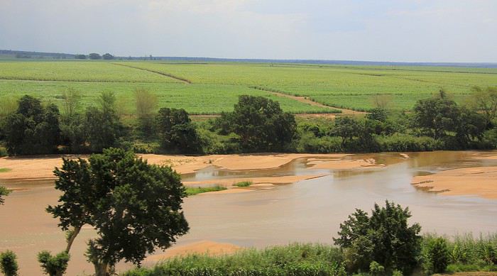
Qui dit champs de cannes à sucre … dit évidement présence dans cette région d'une imposante distillerie avec son corollaire, les nombreuses charrettes et/ou camions chargés de cannes fraîchement coupées. Ils se dirigent tous vers la grande distillerie. L'image paraît sympathique et très couleur locale … sauf si, sur la route, on suit de tels chargements. Vous vous en doutez, ils roulent à petite vitesse, tout en vous masquant la vue. Grrr !
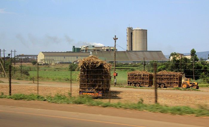
Une autre usine avec sa haute silhouette de cathédrale industrielle ne passe pas inaperçue dans cette région de plaine agricole. En grandes lettres, le mot «Farm Chemicals » apparaît à la base de la tour. Ici, on fabrique en grand volume des engrais, des herbicides et j'en passe … indispensables produits vous dises les cultivateurs pour rentabiliser la production, certes, mais tout ça n'est sûrement pas très naturel … bref, c'est un autre thème et pas vraiment le sujet principal de ce récit.
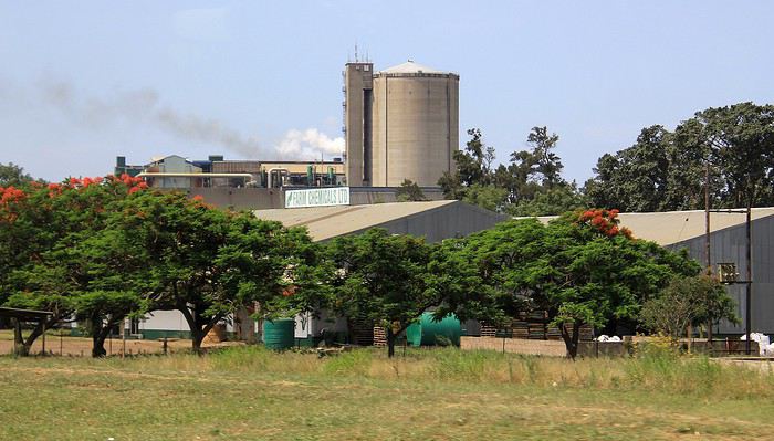
Poursuivons notre route. Une voie jalonnée de hameaux et de petits commerces. A les observer les uns après les autres, on ne peut pas dire qu'ils donnent l'impression de baigner dans l'opulence. Quelques produits étalés dans des constructions cubiques colorées à grand renfort de teintes vives, histoire d'égayer la simplicité ou plutôt une certaine misère.
Nous sommes pourtant en pleine après-midi mais peu à peu la luminosité décline comme si le crépuscule approchait. Quant au ciel, d'énormes nuages sombres l'encombrent … la suite ? Facile de la deviner. Un déluge s'est abattu sur le secteur.
Des trombes d'eau, des coulées de boue qui longent la route et par endroits qui même la traversent. Et des essuie-glaces qui ne parviennent plus à assurer une bonne visibilité. J'aurais été au volant, je pense que je me serais arrêté dans l'attente d'une éclaircie mais notre chauffeur de continuer à rouler tant bien que mal … on lui a fait confiance presque les yeux fermés car même ouverts, on ne voyait plus rien ! enfin si, à travers la vitre inondée de pluie j'ai cru voir une fantomatique voiture, le fait d'être rouge a certainement aidé à la distinguer.
On continue donc de rouler, à vitesse réduite mais on avance toujours sur une route lessivée qui progressivement s'élève. Une succession de lacets parmi des collines et l'on se retrouve à présent sur les hauteurs.
C'est bien connu, après la pluie place aux rayons de soleil, encore timides alors que nous parvenons dans les faubourgs de Manzini. La ville, une des plus importantes de l'eSwatini de part sa population (environ 78 000 habitants) est aussi et surtout une cité active sur le plan commercial. Pendant la période coloniale britannique dans les années 1890, la ville abritait même le quartier général des administrations avant de céder son statue de capitale à la ville de Mbabane (on y passera un peu plus tard).
Et comme on peut le constater sur cette photo, quelques belles maisons sont bâties sur ces collines en périphérie de l'agglomération. Un aspect bien différent des masures et des huttes observées auparavant dans la lointaine campagne. Ici, on l'imagine, vivent quelques membres des classes sociales parmi les plus favorisées du pays, entre élites et privilégiés.
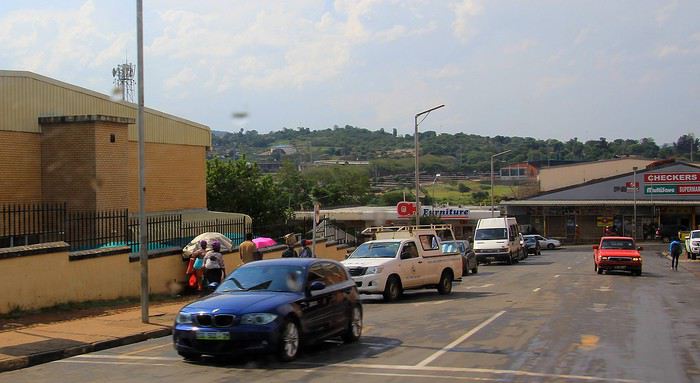
Passons le centre ville, ses boutiques, ses centres commerciaux et ses carrefours … pour longer encore des parkings et des hangars. Là, par exemple, voici une concession automobile où l'on vend des « Cars from Japan », rien de bien original me direz-vous … sauf si l'on précise que toutes les voitures vendues ici sont des occasions qui ont déjà de nombreux kilomètres au compteur !
Les prix de ces voitures importées et « recyclées » sont plus abordables pour la population locale (enfin pour ceux qui en ont les moyens !). Au Japon, la tendance et la réglementation obligent les propriétaires à renouveler très régulièrement leur véhicule. Ainsi pour ces voitures japonaises, c'est une nouvelle vie qui leur est offerte à rouler sur les routes de l'eSwatini.
On part en vadrouille dans l'ouest américain! Oui, encore... English translation pending
En ces temps difficiles qui nous obligent à trouver des occupations, je vous soumets ici un carnet que j'avais rédigé il y a quelques années et que je n'ai jamais publié ici... Bonne lecture (pour ceux que ça intéresse...)...
24 juillet - Itinéraire d’une famille gâtée
Envie de t’évader ? Envie de rêver ? Envie de t’amuser ? Oui ? Alors tu as frappé à la bonne adresse... Plus précisément à l’adresse de celui qui a attrapé un virus… En l’occurrence, moi… Et ce virus, pas question de m’en débarrasser en me bourrant d’antibiotiques. Non seulement, les antibiotiques, ce n’est pas automatique, mais ce virus-là, j’en prends grand soin. Je l’entretiens, même… Ce virus, c’est l’étasunite ! Je l’ai contracté le jour où j’ai posé mes arpions chez l’oncle Sam pour la première fois, il y a une décennie de cela. Tout ça ne me rajeunit pas mais depuis ce fameux jour, lui et moi, nous ne nous sommes plus jamais quittés. Un proverbe dit à ce sujet que si tu vas aux Etats-Unis une fois, tu y reviendras un jour… Ben moi, depuis, j’y suis même retourné deux autres fois ! Et figure-toi que si tu lis ces quelques lignes, c’est que je m’apprête à y retourner pour une quatrième vadrouille !... Pour cette fois-ci, je vais accomplir un de mes rêves ! Me faire la route 66 sur mon Harley avec une belle brune accrochée à ma taille... Manque de bol, ma femme est blonde, je n'ai pas le permis moto et nous avons deux louloutes de quatre et sept ans… Va donc falloir que je revoie mes plans...
Bon, si tu es un lecteur assidu de nos précédentes vadrouilles, nous n’avons plus de secret pour toi, si bien que tu sais déjà que nous sommes quatre, juste un an de plus par rapport à la dernière fois… Il y a bien évidemment Sandrine, ma femme alias le portefeuille ; Sasha, notre petite globetrotteuse de quatre ans ; et Anna notre routarde de sept ans et plus toutes ses dents... Ah, et je m’oubliais ! Moi, Franck, la trentaine bien tassée, alias le conducteur, le tour opérateur, le narrateur, le cuisinier, le… Oui, je sais, moi aussi, j’aimerais bien déléguer… Ah, mais j’oublie encore quelqu’un !… Toi… Mais bon, sauf le respect que je te dois, tu ne seras une nouvelle fois que le spectateur du film que nous allons tourner et interpréter… D’ailleurs, quel en sera le titre ?... Et bien après réflexion, on a le choix entre « Voyage entre geysers et déserts », ou alors « Sous le soleil de Beverly Hills »… Pour ce coup-là, en espérant ne pas les vexer, on décide de poser un lapin à Brandon et Brenda… Car oui, c’est décidé, cette nouvelle édition sera composée d'indiens, de geysers, de trappeurs, de pionniers, de bisons, de chercheurs d'or, de hors-la-loi, de ranchs et de cowboys ! A nous les grands espaces… et les gros hamburgers !!! A nous l’ouest américain et ses films qui donnent tant envie : Délivrance, la colline a des yeux, Shining, The Descent, ...
Mais un voyage comme celui-là, ça se prépare un ‘tiot peu. Premièrement, il faut du blé, du flouze, du fric, du pognon, des pépettes, de la caillasse… Ben oui, ça coûte cher tout ça, donc à moins de faire comme le PSG et te faire subventionner par un investisseur qatari, il va falloir que tu en mettes de côté. Deuxièmement, il faut un minimum de travail de préparation. Et je commencerai mon histoire par un retour dans le passé, un bond dans le temps pour revenir pile poil au moment où Sandrine a enfin craqué sous mes coups de butoir et m’a donné son ô combien précieuse approbation… « Allez, ok, c’est bon, fais-toi plaisir ! » Sans avoir réellement conscience de la portée de ces quelques mots, elle venait de me signer un contrat de travail d’un an ! Car moi, ni une, ni deux, j'ai employé toute une équipe de lutins pour m'aider à préparer mon itinéraire. Lecture de carnets de voyage, questions sur des forums, épluchage de guides, visionnage de films, essorage d’internet, … Au final, je dois dire que je suis plus que satisfait de leur boulot ! Ce qui me permet non pas de faire un bilan puisqu'heureusement, le voyage n'est pas commencé, mais plutôt un petit compte-rendu chiffré de ce qui nous attend. Huit états à traverser ou à effleurer, plus de cinq mille kilomètres à parcourir, vingt jours pleins sur place, deux hôtels, quatorze campings différents, huit heures de décalage... Mes trois blondes vont-elles le supporter ? Optimiste que je suis, je mise sur un grand « Oui » ! D’ailleurs, pour les préparer, j’ai mis en place un programme intensif trois mois avant le départ : Marche autour de notre immense propriété, westerns tous les soirs, Coca et hamburgers à volonté à tous les repas !... Et oui, qui ménage sa monture voyage plus souvent !
Avant de tailler la route, je profite de cette intro pour publier une petite annonce à destination des cambrioleurs amateurs de textes de voyage : passez votre route, ma maison est équipée d’une alarme biométrique avec double varifocale et matrice de commutation. De plus, j’ai loué à un pote du neuf trois son gros pitbull pour l’occasion. Sans compter que pendant nos vacances, ma maison va être occupée par mes parents qui sont tous les deux experts en arts martiaux !... D’ailleurs, pourquoi je te raconte ces bobards alors que tu ne connais même pas mon adresse… C'est le 25, avenue des canaris à Triffouillis-sur-Retourne... Euh, merci de ne pas m’envoyer de carte postale à l'adresse ci-dessus... c'est une fausse !
Bon, chut, ça y est, c’est l’heure de l’évaluation… On va savoir si toute la famille est prête pour le grand départ : « Sandrine, donne-moi les huit états dans lesquels nous allons poser les pieds... - Colorado, Wyoming, Nebraska, Dakota du sud, Montana, Idaho, Utah et... euh... mince, oh, je l’ai sur le bout de la langue… Ah oui, l’Arizona !!!… - Mouais… C’était moins une… Encore un peu et tu n’partais pas avec nous ! Et toi, Anna, cite-moi les quatre présidents sculptés sur le Mont Rushmore ? - Abram Licol, Tomasse Washington, George Jeffessonne et Theodore Rousevelle... - Ok, on va dire que c’est bon… Et toi, Sasha, dans quel pays allons-nous cet été ? - Les Jétajuniiiiis de l’Amérique de Mickey ! » Ok, c’est bon, elles sont fin prêtes ! Attention, départ imminent !
24 juillet - Itinéraire d’une famille gâtée
Envie de t’évader ? Envie de rêver ? Envie de t’amuser ? Oui ? Alors tu as frappé à la bonne adresse... Plus précisément à l’adresse de celui qui a attrapé un virus… En l’occurrence, moi… Et ce virus, pas question de m’en débarrasser en me bourrant d’antibiotiques. Non seulement, les antibiotiques, ce n’est pas automatique, mais ce virus-là, j’en prends grand soin. Je l’entretiens, même… Ce virus, c’est l’étasunite ! Je l’ai contracté le jour où j’ai posé mes arpions chez l’oncle Sam pour la première fois, il y a une décennie de cela. Tout ça ne me rajeunit pas mais depuis ce fameux jour, lui et moi, nous ne nous sommes plus jamais quittés. Un proverbe dit à ce sujet que si tu vas aux Etats-Unis une fois, tu y reviendras un jour… Ben moi, depuis, j’y suis même retourné deux autres fois ! Et figure-toi que si tu lis ces quelques lignes, c’est que je m’apprête à y retourner pour une quatrième vadrouille !... Pour cette fois-ci, je vais accomplir un de mes rêves ! Me faire la route 66 sur mon Harley avec une belle brune accrochée à ma taille... Manque de bol, ma femme est blonde, je n'ai pas le permis moto et nous avons deux louloutes de quatre et sept ans… Va donc falloir que je revoie mes plans...
Bon, si tu es un lecteur assidu de nos précédentes vadrouilles, nous n’avons plus de secret pour toi, si bien que tu sais déjà que nous sommes quatre, juste un an de plus par rapport à la dernière fois… Il y a bien évidemment Sandrine, ma femme alias le portefeuille ; Sasha, notre petite globetrotteuse de quatre ans ; et Anna notre routarde de sept ans et plus toutes ses dents... Ah, et je m’oubliais ! Moi, Franck, la trentaine bien tassée, alias le conducteur, le tour opérateur, le narrateur, le cuisinier, le… Oui, je sais, moi aussi, j’aimerais bien déléguer… Ah, mais j’oublie encore quelqu’un !… Toi… Mais bon, sauf le respect que je te dois, tu ne seras une nouvelle fois que le spectateur du film que nous allons tourner et interpréter… D’ailleurs, quel en sera le titre ?... Et bien après réflexion, on a le choix entre « Voyage entre geysers et déserts », ou alors « Sous le soleil de Beverly Hills »… Pour ce coup-là, en espérant ne pas les vexer, on décide de poser un lapin à Brandon et Brenda… Car oui, c’est décidé, cette nouvelle édition sera composée d'indiens, de geysers, de trappeurs, de pionniers, de bisons, de chercheurs d'or, de hors-la-loi, de ranchs et de cowboys ! A nous les grands espaces… et les gros hamburgers !!! A nous l’ouest américain et ses films qui donnent tant envie : Délivrance, la colline a des yeux, Shining, The Descent, ...
Mais un voyage comme celui-là, ça se prépare un ‘tiot peu. Premièrement, il faut du blé, du flouze, du fric, du pognon, des pépettes, de la caillasse… Ben oui, ça coûte cher tout ça, donc à moins de faire comme le PSG et te faire subventionner par un investisseur qatari, il va falloir que tu en mettes de côté. Deuxièmement, il faut un minimum de travail de préparation. Et je commencerai mon histoire par un retour dans le passé, un bond dans le temps pour revenir pile poil au moment où Sandrine a enfin craqué sous mes coups de butoir et m’a donné son ô combien précieuse approbation… « Allez, ok, c’est bon, fais-toi plaisir ! » Sans avoir réellement conscience de la portée de ces quelques mots, elle venait de me signer un contrat de travail d’un an ! Car moi, ni une, ni deux, j'ai employé toute une équipe de lutins pour m'aider à préparer mon itinéraire. Lecture de carnets de voyage, questions sur des forums, épluchage de guides, visionnage de films, essorage d’internet, … Au final, je dois dire que je suis plus que satisfait de leur boulot ! Ce qui me permet non pas de faire un bilan puisqu'heureusement, le voyage n'est pas commencé, mais plutôt un petit compte-rendu chiffré de ce qui nous attend. Huit états à traverser ou à effleurer, plus de cinq mille kilomètres à parcourir, vingt jours pleins sur place, deux hôtels, quatorze campings différents, huit heures de décalage... Mes trois blondes vont-elles le supporter ? Optimiste que je suis, je mise sur un grand « Oui » ! D’ailleurs, pour les préparer, j’ai mis en place un programme intensif trois mois avant le départ : Marche autour de notre immense propriété, westerns tous les soirs, Coca et hamburgers à volonté à tous les repas !... Et oui, qui ménage sa monture voyage plus souvent !
Avant de tailler la route, je profite de cette intro pour publier une petite annonce à destination des cambrioleurs amateurs de textes de voyage : passez votre route, ma maison est équipée d’une alarme biométrique avec double varifocale et matrice de commutation. De plus, j’ai loué à un pote du neuf trois son gros pitbull pour l’occasion. Sans compter que pendant nos vacances, ma maison va être occupée par mes parents qui sont tous les deux experts en arts martiaux !... D’ailleurs, pourquoi je te raconte ces bobards alors que tu ne connais même pas mon adresse… C'est le 25, avenue des canaris à Triffouillis-sur-Retourne... Euh, merci de ne pas m’envoyer de carte postale à l'adresse ci-dessus... c'est une fausse !
Bon, chut, ça y est, c’est l’heure de l’évaluation… On va savoir si toute la famille est prête pour le grand départ : « Sandrine, donne-moi les huit états dans lesquels nous allons poser les pieds... - Colorado, Wyoming, Nebraska, Dakota du sud, Montana, Idaho, Utah et... euh... mince, oh, je l’ai sur le bout de la langue… Ah oui, l’Arizona !!!… - Mouais… C’était moins une… Encore un peu et tu n’partais pas avec nous ! Et toi, Anna, cite-moi les quatre présidents sculptés sur le Mont Rushmore ? - Abram Licol, Tomasse Washington, George Jeffessonne et Theodore Rousevelle... - Ok, on va dire que c’est bon… Et toi, Sasha, dans quel pays allons-nous cet été ? - Les Jétajuniiiiis de l’Amérique de Mickey ! » Ok, c’est bon, elles sont fin prêtes ! Attention, départ imminent !
Italie "verrouillée": quelles conséquences? English translation pending
Bonsoir,
Ce soir le ministre Italien a annoncé que tout voyage vers l’Italie est désormais interdit! Interdiction aux italiens de quitter le pays!
Quel conséquence pour les départs en croisière de Marseille ou Barcelone ? ( sachant qu’aucune escale en Italie sera autorisé )
On aura certainement un communiqué des compagnies demain.
Quel conséquence pour les départs en croisière de Marseille ou Barcelone ? ( sachant qu’aucune escale en Italie sera autorisé )
On aura certainement un communiqué des compagnies demain.
Petit compte-rendu voyage du 29 janvier au 19 février 2020 aux Philippines English translation pending
Bonjour à tous. Pour avoir profité de nombreux conseils et renseignements de ce forum dans la préparation de mon voyage, voici ma petite contribution sous forme de compte-rendu.
Voyage du 29 janvier au 19 février 2020 aux Philipines .
Trajet: Aller Montréal/ Manille via Beijing (Air China) Bonne cie rien à redire ( avion presque vide à cause du Coronavirus, donc possibilité de dormir......très apprécié sur un vol de 15hres)
Arrivée de nuit à Manille et j'ai dormi au terminal 3, 2 ième étage ( il y a un hotel avec des lits-cubes pour +- $27$ CAN ( ca m'a évité d'avoir à faire face aux arnaques de taxi fatigué et épuisé du voyage.) Le lendemain, direction parc Rizal et Intramuros (taxi meter en exigeant le meter, 600 php) J'ai appris par la suite qu'il est beaucoup plus sécuritaire et moins cher de se servir de Grab, l'application équivalente à Uber. Le mëme trajet coüte environ 300php.
Le soir , bateau de nuit de Manille avec 2goTravel 57$CAN(le quai est à proximité d'Intramusos, en moto-taxi 50php).
Si c'était à refaire, je paierais un peu plus cher pour une cabine privé, ou je prendrais un vol. La formule dortoir fut décevante.....bruits, odeurs, saleté, bagages non surveillés, bref mauvaise expérience. Arrivée à Coron, le matin, après 13heures de bateau.
Coron 4 jours: hot spring accessibles en moto (si vous louez c'est l'idéal pour la liberté que cela procure) et en moto-taxi. Presque personnes töt le matin, alors qu'on peut presque marché sur les tëtes le soir. On peut accéder à Siete Pecados à partir d'un village de pecheurs pas très loin des sources d'eau chaude.Personnellement, ce n'est pas le plus beau site de snorkeling que j'ai vu. Les environs de Coron sont magnifiques. Voir aussi le lever de soleil sur le sommet de la montagne, ca vaut le coup.Bref, j'ai adoré Coron (Busuanga) et les tours sont très bien.
El Nido 4 jours. Pour ceux qui connaissent, El Nido se compare à Aonang en Thailande.............touriste à fond de train avec tout ce que cela comporte. Mais les paysages et les tours A et D valent le coup. À refaire, je ne resterais que 2 jours, un pour chaque tours.Par contre, ma randonnée à Tay Tay fut enrichissante.....pour vraiment voir la vrai vie et parler avec les philipins (au fait, louer un scooter n'est pas dangereux en soit en respectant des règles de prudence et de sécurité élémentaires, et aucune arnaques comme dans certains autres pays d'Asie. Par contre, ce qui fut étonnant pour moi, c'est qu'une route devienne soudainement un sentier pour plusieurs kilomètres, pour redevenir presqu'une autoroute plus loin, et vice versa.......sans aucune logique de continuité de construction! Ca reste pour moi un mystère!!!)
Port Barton 4 jours. PB est en train de devenir un EL Nido 2. Beaux tours et paysages, mais usine à touristes en devenir malheureusement. Ce qui n'a rien arrangé, j'ai eu de la difficulté à dormir 2 nuits sur 4 à cause de jeunes fëtards irrespectueux dont le centre de l'univers se trouvait exactement au mëme endroit qu'eux! La aussi, je n'y resterais que 2 jours pour 2 tours. Une randonnée de PB à San Vincente s'est révélée une véritable expédition de par la qualité de la route (sentier en grande partie mais qui sera bientöt de l'histoire vu les travaux en cours.) Il y à deux petites chutes avec bassins sur ce parcours. Ca permets de se relaxer et de se rafraïchir, et d'enlever la poussière accumulée sur la route.
Mangrove resort 1 jour. Pas assez long si j'y retournais. Claude le proprio est un personnage en soit, très intéressant de discuter de plein de sujets avec lui. Belle rivière pour naviguer. On a l'impression d'ëtre dans une scène du film Apocalyps Now. Par contre pas de possibilité de louer un scooter, donc on est restreint en déplacement.
Puerto Princesa 2 jours. Ville assez neutre. Ferme de crocodiles à voir si on a le temps mais sans plus.
Retour à Manille par avion Cebu Pacific -2 jours. Autant le premier jour de mon arrivée, Manille m'a laissé une impression d'insécurité, autant j'ai trouvé ses habitants agréables au retour.J'ai mëme fais un trajet de 2hre30 dans 4 différents Jeepney dans des quartiers assez pauvres, avec l'aide de plusieurs personnes pour me conseiller et me guider, le tout sans la moindre crainte. Bref, Manille est relativement bien si on fait preuve de bon sens et qu'on affiche pas son opulence à la vue de tous.La pauvreté qu"on y voit est bouleversante.....
Le gouvernement ayant fermé le territoire à tout ce qui viens de Chine, j'ai dü me racheter un billet de retour avec Philipines Airlines à gros prix ( bonne cie avec plus d'espace pour les jambes en classe économique que d'autres cies.)
En résumé, j'ai adoré les Philipines mëme si j'ai fais un circuit assez touristique. Les Philipins sont accueillants honnëtes et serviables pour la plupart. Y retourner, ce que je compte bien, je viserais plutöt des endroits moins touristiques afin de vivre vraiment les Philipines.
Voila, si vous avez des questions, pas de problème, juste à me faire signe.
Compte rendu 10 jours nord Oman en indépendants arabophones English translation pending
Nous avons passé une dizaine de jours dans le Nord d'Oman en couple , mi-février. Nous avions globalement prévu notre parcours à l'avance, car oui, il faudra faire des choix si vous voulez parcourir le nord d'Oman: et malgré cela, vous allez en manger , des kilomètres de route !
Notre but était de parcourir le nord par nos propres moyens en choisissant nos spots. Nous avons réservé les hôtels en avance sur booking. Les hôtels étaient de classe moyenne à haute (le moyen tourne autour de 35 euros petit dej inclus et les hautes classes de 60 à 140 euros la nuit petit dej inclus). Il est toujours possible de trouver des hôtels petits budgets à Oman. Mais nous voulions aussi du confort. Un choix personnel que nous avons assumé et auquel nous avons pallié en mangeant dans des restos petits prix.
Le pays complet est un grand chantier. Depuis les années 70 le défunt Sultan Qaboos s'est donné les moyens de faire progresser vitesse grand V son pays et ses habitants. Contrairement à ses voisins du Golfe, le sultan a redistribué les bénéfices du pétrole à son peuple, leur mettant à disposition une sécurité sociale à 1 rial par habitant par mois, un terrain pour construire une maison et 100 000 euros. Pour le reste, un omanais contracte un crédit à taux zéro dont la somme est annuellement révisée à la baisse en fonction du bénéfice du pays. Si Oman a beaucoup gagné, le gain est utilisé pour réduire la dette de ses habitants. Magique. Ne vous étonnez donc pas des châteaux qui leur servent de maison. Un véritable régal pour les yeux.
Petite précision, nous sommes arabophones , ce qui nous a permis d'obtenir certaines infos très agréables concernant les spots à voir, ceux à éviter, et cela nous a aidé à mieux comprendre et connaître les us et coutumes omanaises. Cela nous a grandement aidés et ravis. Ces gens sont extrêmement tolérants tout en aimant leurs coutumes, ils sont pacifiques et serviables (oui, le sens du service a un aspect religieux, mais nous pouvons vous assurer qu'en Oman, vous rendre service va bien au-delà du fait d'obtenir des hassanat) .
Concernant les 4x4 versus voiture classique. Oui, le 4x4 est bien plus onéreux à la location mais croyez-nous, il vous évitera bien des sueurs froides et frais de dépannage. Les routes des jebel, la piste vers les camps du désert, certains accès à des wadi (le tiwi notamment) sont quasi impraticables en voiture berline ou citadine. Au meilleur des cas vous auriez une peur bleue de faire le chemin inverse, au pire des cas vous casseriez la voiture. Sans compter la frustration extrême de ne pas pouvoir aller jusqu'au bout d'un chemin par peur de finir avec un pneu crevé. Donc oui, le 4x4 est un excellent choix pour un road trip à Oman. Et le prix de l'essence (environ 40 centimes le litre) ne vous fera pas mourir en payant votre plein. Pas plus que les routes : tout est gratuit, pas de péage. Ne prenez surtout pas une voiture à kilométrage limité. Les indications de maps sont très aléatoires et souvent données à vol d'oiseau. Vous vous en tireriez pour des sommes folles en dépassement de kilomètres.
Le pays est extrêmement montagneux. Les reliefs sont présents jusqu'au bord du désert et entre les quartiers de la capitale, qui sont d'ailleurs souvent divisés par ces reliefs. Ainsi, malgré les accès rapides flambant neufs, les villes s'étalent sur plusieurs kilomètres. Si vous n'avez pas le permis, oubliez Mascate , oubliez Oman tout court en fait. Ou venez en circuit organisé. Il est tout simplement impossible de circuler à pied dans certaines parties de la ville, où serpentent les voies rapides. Hormis certains endroits sauvages, les routes sont magnifiquement bien entretenues et neuves. Vous croiserez peu voire pas de policiers mais d'innombrables radars dernier cri (de la petite boîte blanche à la tourelle grise, il y en a toute une collection). Les limitations de vitesse sont strictes et ne pensez pas vous défiler: à la sortie du pays on vous présentera directement la facture à payer immédiatement. Prudence donc, roulez avec vigilance. Quant aux accidents, les assurances n'ont ici quasiment aucun pouvoir. Les conflits se règlent en général à l'amiable. Mais étant donné que vous n'avez probablement pas les mêmes moyens qu'un omanais , nous vous conseillerons d'éviter le plus possible les accidents. Les arrangements à l'amiable se chiffrent en plusieurs centaines de rials...
Pour s'orienter, Google Maps est vraiment l'application qui nous a le plus servi. Nous avions téléchargé Maps.me mais avions vite constaté que son GPS perdait régulièrement la boule. Facile de trouver le lieu recherché sur l'application, mais pour trouver le chemin comme un gps, autre histoire. La flèche partait dans tous les sens. Privilégiez Google.
Côté vêtements, Oman reçoit encore peu de touristes (prions pour que cela reste ainsi), et malgré le peu de touristes nous avons déjà été outrés par leur façon de s'habiller. En Oman, personne ne vous regardera mal ou ne vous fera de remontrances sur votre façon de vous habiller. Mais sachez que vous n'êtes pas en Europe, que vous avez choisi d'aller chez eux (et ils ne vous attendent pas, ils vivent très bien sans tourisme et le plus petit agriculteur est bien souvent plus riche que vous). Donc par pitié, respectez-les et mettez au moins un pantalon et des manches courtes... le débardeur et le short sont une véritable insulte à leur façon de vivre, et cela vaut aussi pour les hommes. Voir des groupes de français se trimbaler en short jean et débardeur nous a mis dans un embarras considérable ("nan nan nous ne sommes pas français nous, nan nan). Le soir dans le désert et surtout dans la montagne (jebel shams pour nous) il fait vite frais. Une bonne polaire est un minimum. Et si comme moi vous êtes un véritable aimant à moustiques, prenez des antihistaminiques et un bon répulsif : ces sales petites bêtes ne sont pas effrayées par le désert ni par la montagne pendant la nuit. J'ai littéralement été dévorée par les moustiques pendant ma nuit dans le désert (visage bouffi au matin, recherche urgente d'Aerius en pharmacie et tout et tout). Je vous aurez prévenu ! A part ça, il fait vite chaud en février.Des pantalons légers style yoga amples ou en lin sont l'idéal, avec des t-shirt manches longues ou courtes + deux trois cardigans longs manches longues pour pouvoir se balader dans certaines villes sans avoir une étiquette "touriste" placardée sur le visage ( à Sur notamment, dans le quartier du souk majoritairement wahhabite, même si personne ne vous embêtera, vous vous sentirez tout nu au milieu des niqab) . Un foulard toujours dans le sac pour visiter les lieux saints ou à mettre sur la tête "à l'iranienne" lorsque votre bon sens vous indique que cela serait mieux. Messieurs, uniquement des t shirts chemises à manches longues ou courtes et des pantalons légers. Abandonnez les shorts et débardeurs. Pour la baignade , short type boardshort et t-shirt anti UV pour les femmes, et short long pour les hommes c'est ok pour les wadis. Bien sûr vous y trouverez la panoplie complète des Martine en bikini, mais souvenez-vous que ce n'est pas parce que des gens sont mal éduqués que vous devez faire pareil. Sauf si votre but est de mettre mal à l'aise les locaux et qu'ils finissent avec les années par devenir méchants. Mais ça c'est une autre histoire. Si vous vous retrouvez un jour avec une grosse quantité de linge à laver (j'ai constaté que le linge sèche mal en intérieur, et même sur le balcon au bord de la mer à Sifah, les vêtements ont pris 14 bonnes heures à être à peu près secs) donnez tout à un pressing. Il y en a absolument partout en Oman. Leurs dishdashas immaculées et sans un seul pli, ce n'est pas Madame, mais le pressing indien du coin. Ils déposent des sacs de vêtements sur place en coup de vent avec un numéro, toujours avec une confiance aveugle, sans compter les vêtements ni rien, et se font appeler au téléphone quand c'est prêt. Cela coûte une misère. A la fin de notre séjour nous avons fait un gros sac de vêtements sales et hop, pressing. Nous avons récupéré les affaires propres le soir même. Cela fait ça de moins à faire au retour. Pour les chaussures, si vous faites comme nous un tourisme sans gros trekk, une bonne paire de baskets, des pieds nus confortables type birkenstock et des chaussures fermées de baignade seront la panoplie parfaite. Nous avons escaladé les rochers de tous les wadis avec des baskets de nage achetées sur Amazon à quinze euros et elles n'ont pas pris une ride.
Pour la nourriture , vous allez clairement finir par détester le riz. Oman dispose d'une cuisine mélangeant la cuisine syrienne, libanaise, indienne et yéménite. Mais surtout indienne en fait. En revenant en France, vous aurez la nausée rien qu'en voyant un bol de basmati. Donc prenez TripAdvisor et consultez les resto alentours afin de ne pas tomber uniquement sur des resto fast India. Variez les plaisirs. Surtout qu'en Oman mème les brochettes sur le bord de la route sont mangeables les yeux fermés. Ici le lavage des mains est sacré ! Ne soyez pas étonnés de voir dans des restaurants des petites cabines fermées où vont des omanais. Ils n'ont culturellement pas l'habitude de se mélanger pour manger , et par respect préféreront s'isoler, encore plus s'ils ont leur famille avec eux. Beaucoup de restos disposent d'ailleurs de family rooms où mangent uniquement les familles (si vous voyagez avec vos enfants, vous pouvez aussi en profiter !). Certaines de ces cabines sont aussi faites pour les personnes qui souhaitent manger à terre à la omanaise: on met par terre un plastique et on mange à la main sans couverts. Vous pourrez tester! Les resto proposent rarement des desserts. Pour en manger il faut aller dans des restos spécialisés qui ne font que les desserts . Les plus connus sont les kunefe et autres gâteaux au fromage et sirop ater (sirop de sucre et eau de rose). Un véritable délice à partager (à Mascate, le Ravenna Konafa propose ces desserts à tomber par terre). Lors de vos sorties culinaires vous verrez énormément d'Omanais arriver dans les restos et repartir les bras chargés de sacs. Ils sont totalement accros à une appli, Talabat, une sorte de Uber Eats mais sans la livraison à domicile. Ils commandent et viennent chercher sur place leur repas. Certains passent commande a longueur de journée, pour tous les repas. Magie du rial.. et de la femme à tout faire thaïlandaise qui devient très souvent la meilleure amie de la citadine omanaise aisée, femme au foyer, qui partage son temps entre les malls et les commandes talabat devant la télé. On ne peut pas tout faire. Mais contrairement à leurs voisins Emiratis et Saoudiens , les Omanais ont généralement un profond respect pour leur personnel et s'entendent très bien avec les immigrés indo-banglado-pakistanais. Il est même courant de voir les dames omanaises se promener avec leur employée thai sans leurs enfants, partageant de la street food ensemble et bavardant comme deux copines. Les employés indiens, bangladais et pakistanais sont dans 90% des cas adorables et se plieront en dix pour vous satisfaire. Le pourboire n'est pas du tout dans les habitudes omanaises (pas plus que le bakchich, donc pas la peine d'essayer de leur brandir un billet avec insistance s'ils refusent -nous avons vu la scène-) mais laissez un petit quelque chose lors de vos repas, cela leur fera plaisir. La plupart des employés immigrés ne parlent pas un mot d'arabe. Révisez vos bases d'anglais pour vous faire comprendre des employés dans les magasins et restos. Ils ne parlent pas français non plus sauf les Tunisiens, généralement employés dans la restauration et les services de guide. Dans les malls, la propreté est incroyable, jusque dans les toilettes. Vous aurez à peine le temps de faire pipi qu'une employée passera derrière vous pour nettoyer. Au musée national, elle est passée juste derrière moi pour effacer les éventuelles traces de mes doigts sur les parois. Limite gênant mais au moins, c'est nickel partout.
Le prix de la nourriture est bon marché si vous vous adaptez à la nourriture locale. Les mezzes libanais tournent autour de 1 rial la portion et c'est une portion pour deux ou trois personnes ! Les plats sont très bien servis en Oman. N'ayez donc pas les yeux plus gros que le ventre lors de la commande. Il y aura toujours moyen d'ajouter quelque chose à la fin s'il vous reste de la place. A savoir, comme un peu partout dans les pays arabes, le Nescafé est roi. Rares sont les coffee shops basiques qui proposent de l'expresso. Vous en trouverez dans les malls et certains cafés d'hôtels ( le Zaki Hotel à Sur a su rassasier mon manque de latte expresso). Quant au café au lait il est souvent fait avec du lait concentré sucré. Moi qui déteste le café sucré, je ne vous raconte pas la galère pour leur expliquer que le lait concentré sucré ne nécessite pas de rajouter EN PLUS du sucre. Épique. J'ai fini par prendre mes latte directement au mcdo ou dans les stations service où c'était une machine.
Concernant notre trajet, nous avons choisi d'emprunter le chemin inverse de celui des circuits organisés, afin de ne pas nous retrouver englués dans les groupes lors des visites que nous aurions forcément eues en commun. Nous avons donc commencé directement par Nizwa au lieu de rester à Mascate 1 ou 2 jours et de continuer vers Sur. Les circuits organisés commencent généralement le dimanche et effectuent une boucle de Mascate à Sur en passant par les wadis , puis Ras al Jinz, le camp dans le désert, le marché d'Ibra, Jebel Shams, Nizwa et Birkat el Mauz. Nous avons fait le contraire et ajouté des choses car nos jours supplémentaires nous le permettaient. Nous avons aussi enlevé Raz el Jinz pour une question éthique (les 20 groupes de 15 personnes par jour pour regarder les tortues pondre, non merci. Laissons ces précieuses petites bêtes en paix) Finir par 3 jours dans la région de Mascate fut une bonne idée. Nous avons fait nos petites emplettes en fonction de l'argent restant et avons pu comparer les prix avec ce que nous avions trouvé dans les souks plus au sud. En plus, les trois jours dans le bel hôtel Murooj Grand Hotel nous ont aussi permis de nous reposer de notre périple. Cela n'aurait pas été possible dans l'autre sens.
Entre 11h et 16h30, la plupart des villes omanaises sont en mode off. Les boutiques des souks sont fermées ainsi que les magasins des rues. Profitez du matin et de la fin de journée pour les emplettes, sauf dans les malls où se réfugient beaucoup d'omanais dans ces heures chaudes. Cette mi journée est l'idéal pour une pause sur une plage ou un wadi.
J'allais oublier : certains endroits touristiques ne se payent qu'en carte (Jabrin, Bahla, ...). Vérifiez donc bien votre solde et votre plafond de carte bleue avant de partir. Autant notre carte visa premier débit nous a empêché de prendre la voiture de location à l'aéroport, autant elle a très très bien fonctionné pour payer les hôtels et les visites. Les Omanais ont plusieurs habitudes qu'il faut comprendre. La première, ils vous inviteront spontanément chez eux, même après un échange de 3 ou 4 mots. MAIS ne prenez pas cette invitation pour une réelle invitation! C'est ce qu'on appelle une invitation de politesse. Elle n'a pas vocation à se réaliser. Évitez donc de faire les boulets et de suivre tous les Omanais qui vous proposent de les suivre chez eux. Par-contre, s'ils sont en train de boire un café, posés sur un bout de trottoir, et qu'ils vous en offrent un, acceptez avec plaisir. Une fois, un Omanais nous a offert nos sodas à un coffee shop sans raison, juste comme ça, après un simple échange de bonjour. Dans ce cas, acceptez juste et remerciez. Pas la peine d'en faire des tonnes. Les Omanais partagent rarement leur table avec des non Omanais, encore plus quand une femme est présente. Cela tend à changer avec les nouvelles générations mais est encore bien ancré chez les anciens. Vous trouverez aussi des Omanais faisant du stop au bord de la route. Si vous n'êtes qu'entre hommes, vous pouvez les prendre. Si une femme est dans la voiture, la plupart refusera poliment de monter donc passez votre chemin. D'ailleurs les Omanais sont très timides avec les femmes. Ne prenez pas cela pour du dédain ou de la misogynie. Dans les malls, beaucoup fréquentent des non omanaises en tant que collègues, et rougissent au moindre petit contact physique. Doucement donc avec les éclats d'affection.
Nous avons pris un vol Turkish airlines avec escale à Istanbul, les vols directs de Paris par Oman Air dépassant largement notre budget. Nous sommes partis pendant les vacances scolaires , ce qui n'a pas aidé à obtenir les meilleurs tarifs.
Notre arrivée a 2h30 du matin ne fut pas des plus plaisantes. Nous avions réservé une voiture via Rentalcars, déjà payée. Mais l'agence Thrifty à l'aéroport n'a pas voulu nous donner la voiture car notre carte était une carte de débit et non de crédit (alors que c'était une Premium, donc pas la moins chère). A l'heure où j'écris ces lignes nous n'avons pas encore été remboursés (hors 3 jours de pénalités sur lesquelles nous pouvons gentiment nous asseoir). Sur place, le monsieur de l'agence de location nous a trouvé un loueur local pour un 4x4 qui acceptait le cash. Eh oui, toutes les agences de l'aéroport refusent les cartes de débit... Nous avons changé quelques euros à l'aéroport pour mettre de l'essence et acheter deux cartes sim à 5 rials Ooredoo à l'aéroport et nous voilà donc partis avec notre énorme Nissan Pathfinder 8 places au lieu de notre Kia Sportage initialement prévu. Direction un hôtel proche de l'aéroport, le Muscat Hills Hotel.... dans lequel nous n'avons dormi que 3 h , réveillés par les bruits du chantier voisin , avant de prendre un petit dej plus que frugal sur place et de partir pour Nizwa. Mauvais choix d'hôtel mais au vu de notre arrivée retardée, heureusement qu'il n'était pas loin de l'aéroport.
Sur le chemin de Nizwa , nous nous sommes arrêtés au village de Birkat al Mauz où nous avons fui les groupes de touristes pour nous enfoncer dans la palmeraie au gré du falaj en parlant à des locaux. Nous avons fini par siroter un jus citron menthe glacé au petit café à l'entrée de la ville. Très dépaysant.
Nous sommes arrivés à Nizwa où nous avons posé nos valises vers midi au Nizwa Heritage Inn proche du fort. Nous avons mangé dans un buffet indien franchement pas top de l'autre coté de l'avenue (un conseil : regardez tripadvisor) puis nous avons visité le fort. Cher (5 rials) et tellement moins intéressant que ses voisins de Bahla et Jabrin qui ne coûtent eux que 500 baisals... une photo externe est largement suffisante ! Le fort de Nizwa est le seul que nous avons pu payer en cash. Jabrin et Bahla se payent obligatoirement en carte. Nous avons fait une sieste à l'hôtel puis avons déambulé en fin de journée dans Nizwa, où le souk ouvre tard et ferme très tôt. Les vendeurs semblent avoir une boutique pour le loisir et pas vraiment par nécessité. Nous avons fait du change dans une agence dans la rue des bijoutiers, puis dodo.
Le lendemain nous avons fait le fort de Bahla et de Jabrin au plus tôt. Les deux étaient vraiment très beaux, d'autant plus que le fort de Bahla, restauré, venait juste de rouvrir. On pouvait y déambuler à souhait mais il n'y avait encore aucune indication pour les touristes. Nul doute que dans peu de temps le parcours touristique sera aussi bien réalisé que celui de Jabrin, dans lequel nous avons passé quasi deux heures. Nous avons mangé sur le pouce et sommes remontés vers Misfat el Abriyeen où des vieux messieurs nous ont indiqué les chemins les plus sympas pour visiter puis nous sommes remontés doucement vers le Jebel Shams, jusqu'au camp de Sama Heights Resort. Ce camp niché au creux des montagnes était superbe , avec un beau point de vue sur le coucher de soleil et des repas délicieux.
Le matin, des petites biquettes sont venues nous faire coucou à côté de notre terrasse. Nous avons pris un petit-déjeuner copieux et sommes redescendus dans le vieil Al Hamra où nous avons visité le musée vivant de Bait as safah. L'occasion de voir et de photographier des femmes qui réalisent devant vos yeux les gestes d'antan pour la fabrication de l'huile de moringa, du pain etc... le tout dans une vieille maison visitable. Un vieux monsieur du premier étage qui faisait des objets en tressage, ravis de voir deux arabophones lui rendre visite, nous a chanté de jolis poèmes en l'honneur du defunt sultan Qaboos autour d'une tasse café. Possibilité de leur acheter sur place le fruit de leur labeur pour quelques rials. Une façon de promouvoir un tourisme différent. Nous avons repris la voiture pour partir vers Bidiyyah. Très long trajet mais quand on découvre cela passe vite. A Bidiyyah, nous avons emprunté la piste de sable qui rejoignait le campement Sama Al Wasil dans le désert. Ne réservez surtout pas de camp dans le désert si vous comptez y aller en berline. Le 4x4 est indispensable ! Nous n'avions pas dégonflé les pneus, pour la piste ce n'est pas nécessaire. Mais si vous comptez faire du dune bashing avec votre propre véhicule, dégonflez tout ça à Bidiyyah ou Al Wasil pour quelques baisal . Monsieur a fini ensablé dans les dunes à cause de ça ("non pas besoin de dégonfler je te dis!" Bin voyons...) à se faire dépanner à côté des chameaux par quatre omanais qui se moquaient allègrement de lui : "t'as pas dégonflé tes pneus et tu as voulu faire du dune bashing? Mouahahaha". Après avoir contemplé le coucher de soleil du haut de la dune (il faut beaucoup de courage pour l'escalader, prévoir des bouteilles d'eau pour boire au sommet) nous sommes redescendus manger et dormir. Joli campement confortable mais qui manque cruellement d'ambiance. Le soir on tourne un peu en rond.
Le mercredi nous sommes repartis pour le marché féminin d'Ibra. On nous avait un peu vendu du rêve. Peut-être est-ce parce que nos racines maghrébines nous ont habitués aux souqs immenses et agités? C'était un petit marché, dont la seule originalité résidait dans le fait que de nombreuses femmes bédouines portant la burqa étaient présentes. Nous avons essayé les photos, mais avons vite rangé l'appareil étant donné les regards noirs qu'on nous renvoyait. A moins que vous vouliez acheter des foulards indiens, des bas de manches et pantalons qui brillent ou des pastèques, le marché d'Ibra n'a rien de transcendant. Je me souviens avoir croisé quelques bédouines portant la burqa à Sib en plein milieu de la marina à deux pas des yachts de luxe et m'être dit "mais pourquoi sommes-nous allés jusqu'à Ibra pour en voir?"
Reprise du volant pour Wadi bani Khaled. Le wadi est très touristique et aménagé dans ce but. Restaurant touristique (cher et pas bon), parking et ponts , tout est fait pour attirer les touristes en masse. Le wadi reste cependant charmant si on s'enfonce dedans. Ne pas se contenter de la première piscine. Tôt le matin et à partir de 15h les groupes ne seront pas là et vous serez plus tranquilles. Nous sommes ensuite remontés vers Sur, où nous avons posé nos valises au Zaki Hotel Apartment et dégusté le meilleur latte de toute ma vie. Le soir même, nous avons visité le chantier des dhows (la petite boutique de l'atelier était ouverte par chance, nous avons pu acheter notre petite boutre à 10 rials) puis nous avons escaladé le promontoire avec les tourelles à côté du pont suspendu pour une magnifique vue sur le coucher de soleil. Là nous avons discuté avec un omanais qui nous a raconté à peu près toute sa vie. Dîner au restaurant Alhawash sur la corniche. Très bien servi et très jolie vue, le tout bon marché ( à peine 8 rials pour de multiples mezzes et une dizaine de crevettes royales grillées). Ensuite nous avons visité le souk(ici vit une diaspora wahhabite, ne vous étonnez pas des nombreux niqab. Mais personne ne vous dira rien si vous ne portez pas le voile.) où j'ai pu trouver un joli bracelet en argent 925 omanais fait main à un prix raisonnable.
Le lendemain, nous avons filé vers le wadi tiwi. Tres sceptiques , nous nous sommes engagés sur une route très très tortueuse, dangereuse, flippante, bref tout ce qui vous dresse les poils sur les bras. Maintes fois, ne croisant aucun touriste, nous avons voulu rebrousser chemin mais au final nous sommes arrivés au paradis. Nous avons rencontré un habitant qui nous a guidé vers une fantastique cascade au centre d'une palmeraie et de piscines naturelles extraordinaires en contrebas. Il nous a menés vers le fond pour nager avec lui et nous faire découvrir tout le wadi. C'était vraiment magique, nous n'avons pas regretté d'avoir persévéré jusqu'au bout de cet atroce chemin sans fin. Si cela vous intéresse, contactez-moi en MP pour les coordonnées de ce monsieur Said Salim qui mène également des treks dans les wadis alentours sur plusieurs jours. Nous l'avons rencontré par pur hasard, il a un cœur immense et des pieds en titane. Ensuite, nous sommes remontés vers le wadi Shab. Plus touristique que son voisin, il fallait payer 1 rial par personne pour traverser l'embouchure du cours d'eau. Compter ensuite 40 bonnes minutes pour atteindre les piscines qui étaient pleines de touristes en maillot de bain rikiki et omanais(es) qui essayaient tant bien que mal de détourner leurs yeux du spectacle affligeant. Cela nous a révoltés et a un peu gâché le tout. Jusqu'à ce que nous tombions sur le même omanais qui nous avait raconté sa vie à Sur! Coïncidence formidable. Il nous a emmené dans tous les petits endroits sympas du wadi. Ne pas hésiter à le remonter jusqu'à la fameuse caverne où coule la superbe cascade. Prévoir un appareil photo waterproof. Le nôtre ne l'était pas et impossible d'ouvrir le sac étanche dans la caverne, il n'y avait aucun support. Nous sommes ensuite repartis vers mascate pour pouvoir longer la côte en direction de Sifah. Oui... le pays est en travaux constants. Et les GPS sont rarement à jour. Nous nous sommes rendus comptes le jour J qu'il était impossible de longer la côte des wadis jusqu'à Sifah sans devoir repasser par Mascate. Une belle perte de temps de 50 minutes ! Sifah, c'est le Saint-Tropez d'Oman. Les expatriés et locaux fortunés s'y retrouvent pour pouvoir vivre à l'européene. Alcool, pas mal de prostituées ramenées par leur riche client pour une escapade à l'abris des regards, touristes français privilégiés, ... on trouve de tout. C'est totalement coupé du reste du pays. Vigiles à l'entrée, pas de ville alentours directement accessible, taux de change hallucinant, ... on est sur une autre planète. Ce fut agréable en grande partie grâce au confort inégalable de la chambre du Sifawy Boutique et au dîner et petit dej incroyables , mais ce fut cher et j'ai trouvé le personnel très froid contrairement aux autres hôtels. Au choix, j'aurais pris une autre nuit à Sur qui est vraiment une ville charmante avec une belle corniche où il fait bon marcher en fin de journée pour regarder les gens jouer au foot sur la plage.
Nous avons profité un peu de la piscine le matin avant de remonter tranquillement vers Sib. Nous sommes passés par le bord de mer, en faisant un arrêt sur la plage de Yitti, très belle et assez fréquentée par les locaux ce vendredi, jour de congé. Nous sommes arrivés au Peninsula à Sib, avons posé nos valises. Nous avons mangé syrien au restaurant Damascino de l'autre côté de l'avenue (petit prix, très bon goût, nous recommandons) et sommes allés visiter ce petit port, qui s'est avéré être une marina de luxe, bordée d'une rue piétonne commerçante et de coffee shops à l'européenne, où nous avons pu prendre notre première chicha depuis le début du séjour (pas donnée à 5 RO, mais ça fait du bien) et marché dans notre premier petit mall. C'est propre, c'est net, et ça permet de voir un énorme melting pot. Ici se côtoient riches expatriés, saoudiens, qataris et omanais aisés. Soit on adore, soit on est mal à l'aise avec cette ambiance où l'argent est le dernier des problèmes. Ce fut une petite parenthèse qui nous a permis de voir une autre face d'Oman. Nous avions pris cet hôtel dans la perspective de nous rendre le lendemain sur les îles Damaniyyat. Mais au vu de notre argent qui avait fondu beaucoup plus vite que ce que nous avions prévu (sans pour autant faire de folies, mais l'argent part vite à Oman), nous avons préféré réserver nos 60 RO pour autre chose.
Le samedi, nous sommes donc partis au wadi al Hawqain, à une heure de route environ de Sib. Ce wadi n'est pas sur les circuits touristiques. Il est essentiellement composé d'une cascade avec un long cours d'eau, facilement accessible avec un parking directement à côté. Il est essentiellement fréquenté par les employés étrangers, des indiens, bangladis etc... qui viennent ici en famille pour pic niquer. Nous avons beaucoup aimé ce wadi, malgré le fait que ce fut le seul où nous avons trouvé des déchets. Il semble être nettement moins nettoyé que les autres, peut-être à cause de sa non notoriété. Nous n'avons donc pas voulu nous baigner, mais néanmoins, le wadi est fort joli avec sa cascade. Juste avant, nous avions pris le chemin inverse et étions tombés sur des cascades tombant de la montagne, par pur hasard, avec des petits vieux qui bavardaient au bord en faisant des ricochets avec des cailloux. Nous sommes ensuite rentrés doucement, direction le Murooj Grand Hôtel à Mascate dans le quartier de Ghubrah, où nous allions passer nos trois derniers jours pour explorer Mascate et nous reposer.
A Mascate, nous avons visité un seul musée. Nous sommes des adeptes de la marche, et nous trouvions déjà que les thèmes abordés par les musées et endroits historiques se répétaient de l'un à l'autre (stockage de dattes, majlis, bijoux, khanjars etc etc). Le musée national était suffisant pour voir de jolies pièces, mais nous ne nous voyions pas en faire davantage. Nous avons préféré flâner à plusieurs reprises au Muttrah Souq, marcher le long de la corniche jusqu'au Riyam Park, parlé avec des locaux, ... Un soir, nous nous sommes rendus au bord de mer de Shati el Qurm pour fumer une chicha au café The Address Café. Ici, le Camel Cookie accueille le soir la jeunesse Omanaise qui se retrouve entre copine et entre copains (séparés, je vous ai dit que les omanais étaient timides) pour boire un café le soir et bavarder. Pour les repas, nous avons dîné au Damascino d'Al Khuwair, dans un resto yéménite de la même rue à côté d'un magasin de robes de mariée, et un soir au Turkish House, énorme ensemble de trois restos turcs de grillades, recommandé par Tripadvisor. Dans aucun, nous n'avons mal mangé. Tous avaient leur charme et leur cuisine, nous les recommandons tous. Aucun des restos dans lesquels nous avons mangé n'étaient chers. C'était notre priorité pour notre budget. Nous sommes aussi allés un matin à Barka, où nous avons visité la Bait Naaman, résidence des imam originale riche en beaux khanjars, et pour voir le tout mignon souk aux poissons en face du fort, qui lui était fermé (ils attendaient la confirmation du ministère du tourisme pour l'ouverture post rénovation, pas de chance). Ici thons, balistes et autres poulpes sont en vente sur un marché ouvert voué à disparaître, au vu de l'énorme complexe en construction juste à côté.
Côté souvenirs, nous n'avons pas fait de folies. Déjà, pour les habits de femme, ça ne vole pas haut. A moins que vous soyez accro aux abaya noir corbeau en polyester, vous ne trouverez pas grand chose. Je me suis trouvé une belle jalabiya colorée de la marque Kashkha au Oman Mall pour 10 rials. Les foulards colorés sont ici réservés à la tête des hommes pour les turbans. J'en ai acheté, pour les porter en écharpe en France. Le prix oscille de 2 à 25 RO. Les plus chers sont ceux au motif traditionnel omanais, qui ressemble à un motif indien. Nous en avons prix deux, qu'on a réussi à marchander à 10 RO chacun au lieu de 15. C'est à peu près le seul motif traditionnel qu'on puisse trouver pour Oman. Monsieur, qui collectionne les habits musulmans du monde entier, s'est pris une dishdasha de qualité intermédiaire, à 10 RO. Pous notre fils de 3 ans, nous avons pris deux petites dishdasha colorées à 4RO pièce et le couvre chef assorti à 2,5RO (ceux fabriqués en Oman sont plus chers, autour de 10RO la chechia). Si vous voulez une dishdasha sur mesure, comptez une semaine de travail, donc prévoyez. Il existe plusieurs qualités car plusieurs épaisseurs de tissus. Évitez d'acheter dans le souk couvert de Muttrah. Nous avons trouvé notre bonheur autour, dans les boutiques fréquentées par les omanais à l'extérieur du souk. Les prix sont divisés par cinq facilement, voire davantage. Concernant les cannes de chamelier, elles commencent pour les plus simples à 1 RO et peuvent aller jusqu'à bien plus pour celles avec des motifs en argent. Les khanjars véritables en argent commencent à environ 70 RO pour le petit modèle (environ 25cm) , 140 pour le modèle classique d'une trentaine de cm, et bien plus pour quelque chose en argent épais etc. Vous pourrez sinon trouver quelque chose de touristique encadré pour quelques rials. Le mieux est, selon nous, de les acheter à Bahla ou à Ibra, autour du souk. Je me suis acheté un bracelet traditionnel omanais (avec les petites pointes) en argent 925 à 25 RO. Monsieur s'est pris une bouteille de parfum omanais moyenne gamme à 20 RO. Pour le parfum, vous pourrez trouver la marque Amouage dans le Grand Mall. Mais il faudra prévoir un grand, grand budget. Quand la dame nous a annoncé les prix (175 RO en promotion pour le moins cher , gloups) nous avons gentiment prétexté "devoir réfléchir". Pour les vêtements, rien de bien intéressant par rapport à nos malls français. Vous pourrez juste trouver quelques marques indiennes aux prix intéressants. A ce titre nous avons pris une kurta pour homme à 11 RO, très jolie et ouvragée, dans le Grand mall. D'autres idées de prix pour la vie quotidienne: les cigarettes (pas évidentes à trouver à part dans les stations service) sont à 1.200 rial pour les hommes, 800 baisals pour les "cigarettes de femme" (oui, les toutes fines et longues, sont pour eux des "cigarettes de femme"). Une bouteille d'eau coûte autour de 200 baisals en fonction de la taille. Pareil pour les canettes de soda. Ici, ce sont surtout des Pepsi, plus que des Coca. Les prix de l'alimentation en supermarché (Carrefour, Lulu Market, ...) sont les mêmes qu'en France pour à peu près tout.
Voilà un petit résumé de notre parcours. Evidemment, nous avons certainement oublié quelques petites choses, et ce témoignage reflète uniquement notre propre expérience au gré de nos discussions avec les locaux et de notre périple en indépendants. Nous espérons pouvoir parcourir Oman plus longtemps et dans d'autres régions quand notre budget nous le permettra. Ce fut un super voyage, probablement notre meilleur après l'Egypte! Si vous avez des questions n'hésitez pas. Nous y répondrons avec plaisir.
Pour s'orienter, Google Maps est vraiment l'application qui nous a le plus servi. Nous avions téléchargé Maps.me mais avions vite constaté que son GPS perdait régulièrement la boule. Facile de trouver le lieu recherché sur l'application, mais pour trouver le chemin comme un gps, autre histoire. La flèche partait dans tous les sens. Privilégiez Google.
Côté vêtements, Oman reçoit encore peu de touristes (prions pour que cela reste ainsi), et malgré le peu de touristes nous avons déjà été outrés par leur façon de s'habiller. En Oman, personne ne vous regardera mal ou ne vous fera de remontrances sur votre façon de vous habiller. Mais sachez que vous n'êtes pas en Europe, que vous avez choisi d'aller chez eux (et ils ne vous attendent pas, ils vivent très bien sans tourisme et le plus petit agriculteur est bien souvent plus riche que vous). Donc par pitié, respectez-les et mettez au moins un pantalon et des manches courtes... le débardeur et le short sont une véritable insulte à leur façon de vivre, et cela vaut aussi pour les hommes. Voir des groupes de français se trimbaler en short jean et débardeur nous a mis dans un embarras considérable ("nan nan nous ne sommes pas français nous, nan nan). Le soir dans le désert et surtout dans la montagne (jebel shams pour nous) il fait vite frais. Une bonne polaire est un minimum. Et si comme moi vous êtes un véritable aimant à moustiques, prenez des antihistaminiques et un bon répulsif : ces sales petites bêtes ne sont pas effrayées par le désert ni par la montagne pendant la nuit. J'ai littéralement été dévorée par les moustiques pendant ma nuit dans le désert (visage bouffi au matin, recherche urgente d'Aerius en pharmacie et tout et tout). Je vous aurez prévenu ! A part ça, il fait vite chaud en février.Des pantalons légers style yoga amples ou en lin sont l'idéal, avec des t-shirt manches longues ou courtes + deux trois cardigans longs manches longues pour pouvoir se balader dans certaines villes sans avoir une étiquette "touriste" placardée sur le visage ( à Sur notamment, dans le quartier du souk majoritairement wahhabite, même si personne ne vous embêtera, vous vous sentirez tout nu au milieu des niqab) . Un foulard toujours dans le sac pour visiter les lieux saints ou à mettre sur la tête "à l'iranienne" lorsque votre bon sens vous indique que cela serait mieux. Messieurs, uniquement des t shirts chemises à manches longues ou courtes et des pantalons légers. Abandonnez les shorts et débardeurs. Pour la baignade , short type boardshort et t-shirt anti UV pour les femmes, et short long pour les hommes c'est ok pour les wadis. Bien sûr vous y trouverez la panoplie complète des Martine en bikini, mais souvenez-vous que ce n'est pas parce que des gens sont mal éduqués que vous devez faire pareil. Sauf si votre but est de mettre mal à l'aise les locaux et qu'ils finissent avec les années par devenir méchants. Mais ça c'est une autre histoire. Si vous vous retrouvez un jour avec une grosse quantité de linge à laver (j'ai constaté que le linge sèche mal en intérieur, et même sur le balcon au bord de la mer à Sifah, les vêtements ont pris 14 bonnes heures à être à peu près secs) donnez tout à un pressing. Il y en a absolument partout en Oman. Leurs dishdashas immaculées et sans un seul pli, ce n'est pas Madame, mais le pressing indien du coin. Ils déposent des sacs de vêtements sur place en coup de vent avec un numéro, toujours avec une confiance aveugle, sans compter les vêtements ni rien, et se font appeler au téléphone quand c'est prêt. Cela coûte une misère. A la fin de notre séjour nous avons fait un gros sac de vêtements sales et hop, pressing. Nous avons récupéré les affaires propres le soir même. Cela fait ça de moins à faire au retour. Pour les chaussures, si vous faites comme nous un tourisme sans gros trekk, une bonne paire de baskets, des pieds nus confortables type birkenstock et des chaussures fermées de baignade seront la panoplie parfaite. Nous avons escaladé les rochers de tous les wadis avec des baskets de nage achetées sur Amazon à quinze euros et elles n'ont pas pris une ride.
Pour la nourriture , vous allez clairement finir par détester le riz. Oman dispose d'une cuisine mélangeant la cuisine syrienne, libanaise, indienne et yéménite. Mais surtout indienne en fait. En revenant en France, vous aurez la nausée rien qu'en voyant un bol de basmati. Donc prenez TripAdvisor et consultez les resto alentours afin de ne pas tomber uniquement sur des resto fast India. Variez les plaisirs. Surtout qu'en Oman mème les brochettes sur le bord de la route sont mangeables les yeux fermés. Ici le lavage des mains est sacré ! Ne soyez pas étonnés de voir dans des restaurants des petites cabines fermées où vont des omanais. Ils n'ont culturellement pas l'habitude de se mélanger pour manger , et par respect préféreront s'isoler, encore plus s'ils ont leur famille avec eux. Beaucoup de restos disposent d'ailleurs de family rooms où mangent uniquement les familles (si vous voyagez avec vos enfants, vous pouvez aussi en profiter !). Certaines de ces cabines sont aussi faites pour les personnes qui souhaitent manger à terre à la omanaise: on met par terre un plastique et on mange à la main sans couverts. Vous pourrez tester! Les resto proposent rarement des desserts. Pour en manger il faut aller dans des restos spécialisés qui ne font que les desserts . Les plus connus sont les kunefe et autres gâteaux au fromage et sirop ater (sirop de sucre et eau de rose). Un véritable délice à partager (à Mascate, le Ravenna Konafa propose ces desserts à tomber par terre). Lors de vos sorties culinaires vous verrez énormément d'Omanais arriver dans les restos et repartir les bras chargés de sacs. Ils sont totalement accros à une appli, Talabat, une sorte de Uber Eats mais sans la livraison à domicile. Ils commandent et viennent chercher sur place leur repas. Certains passent commande a longueur de journée, pour tous les repas. Magie du rial.. et de la femme à tout faire thaïlandaise qui devient très souvent la meilleure amie de la citadine omanaise aisée, femme au foyer, qui partage son temps entre les malls et les commandes talabat devant la télé. On ne peut pas tout faire. Mais contrairement à leurs voisins Emiratis et Saoudiens , les Omanais ont généralement un profond respect pour leur personnel et s'entendent très bien avec les immigrés indo-banglado-pakistanais. Il est même courant de voir les dames omanaises se promener avec leur employée thai sans leurs enfants, partageant de la street food ensemble et bavardant comme deux copines. Les employés indiens, bangladais et pakistanais sont dans 90% des cas adorables et se plieront en dix pour vous satisfaire. Le pourboire n'est pas du tout dans les habitudes omanaises (pas plus que le bakchich, donc pas la peine d'essayer de leur brandir un billet avec insistance s'ils refusent -nous avons vu la scène-) mais laissez un petit quelque chose lors de vos repas, cela leur fera plaisir. La plupart des employés immigrés ne parlent pas un mot d'arabe. Révisez vos bases d'anglais pour vous faire comprendre des employés dans les magasins et restos. Ils ne parlent pas français non plus sauf les Tunisiens, généralement employés dans la restauration et les services de guide. Dans les malls, la propreté est incroyable, jusque dans les toilettes. Vous aurez à peine le temps de faire pipi qu'une employée passera derrière vous pour nettoyer. Au musée national, elle est passée juste derrière moi pour effacer les éventuelles traces de mes doigts sur les parois. Limite gênant mais au moins, c'est nickel partout.
Le prix de la nourriture est bon marché si vous vous adaptez à la nourriture locale. Les mezzes libanais tournent autour de 1 rial la portion et c'est une portion pour deux ou trois personnes ! Les plats sont très bien servis en Oman. N'ayez donc pas les yeux plus gros que le ventre lors de la commande. Il y aura toujours moyen d'ajouter quelque chose à la fin s'il vous reste de la place. A savoir, comme un peu partout dans les pays arabes, le Nescafé est roi. Rares sont les coffee shops basiques qui proposent de l'expresso. Vous en trouverez dans les malls et certains cafés d'hôtels ( le Zaki Hotel à Sur a su rassasier mon manque de latte expresso). Quant au café au lait il est souvent fait avec du lait concentré sucré. Moi qui déteste le café sucré, je ne vous raconte pas la galère pour leur expliquer que le lait concentré sucré ne nécessite pas de rajouter EN PLUS du sucre. Épique. J'ai fini par prendre mes latte directement au mcdo ou dans les stations service où c'était une machine.
Concernant notre trajet, nous avons choisi d'emprunter le chemin inverse de celui des circuits organisés, afin de ne pas nous retrouver englués dans les groupes lors des visites que nous aurions forcément eues en commun. Nous avons donc commencé directement par Nizwa au lieu de rester à Mascate 1 ou 2 jours et de continuer vers Sur. Les circuits organisés commencent généralement le dimanche et effectuent une boucle de Mascate à Sur en passant par les wadis , puis Ras al Jinz, le camp dans le désert, le marché d'Ibra, Jebel Shams, Nizwa et Birkat el Mauz. Nous avons fait le contraire et ajouté des choses car nos jours supplémentaires nous le permettaient. Nous avons aussi enlevé Raz el Jinz pour une question éthique (les 20 groupes de 15 personnes par jour pour regarder les tortues pondre, non merci. Laissons ces précieuses petites bêtes en paix) Finir par 3 jours dans la région de Mascate fut une bonne idée. Nous avons fait nos petites emplettes en fonction de l'argent restant et avons pu comparer les prix avec ce que nous avions trouvé dans les souks plus au sud. En plus, les trois jours dans le bel hôtel Murooj Grand Hotel nous ont aussi permis de nous reposer de notre périple. Cela n'aurait pas été possible dans l'autre sens.
Entre 11h et 16h30, la plupart des villes omanaises sont en mode off. Les boutiques des souks sont fermées ainsi que les magasins des rues. Profitez du matin et de la fin de journée pour les emplettes, sauf dans les malls où se réfugient beaucoup d'omanais dans ces heures chaudes. Cette mi journée est l'idéal pour une pause sur une plage ou un wadi.
J'allais oublier : certains endroits touristiques ne se payent qu'en carte (Jabrin, Bahla, ...). Vérifiez donc bien votre solde et votre plafond de carte bleue avant de partir. Autant notre carte visa premier débit nous a empêché de prendre la voiture de location à l'aéroport, autant elle a très très bien fonctionné pour payer les hôtels et les visites. Les Omanais ont plusieurs habitudes qu'il faut comprendre. La première, ils vous inviteront spontanément chez eux, même après un échange de 3 ou 4 mots. MAIS ne prenez pas cette invitation pour une réelle invitation! C'est ce qu'on appelle une invitation de politesse. Elle n'a pas vocation à se réaliser. Évitez donc de faire les boulets et de suivre tous les Omanais qui vous proposent de les suivre chez eux. Par-contre, s'ils sont en train de boire un café, posés sur un bout de trottoir, et qu'ils vous en offrent un, acceptez avec plaisir. Une fois, un Omanais nous a offert nos sodas à un coffee shop sans raison, juste comme ça, après un simple échange de bonjour. Dans ce cas, acceptez juste et remerciez. Pas la peine d'en faire des tonnes. Les Omanais partagent rarement leur table avec des non Omanais, encore plus quand une femme est présente. Cela tend à changer avec les nouvelles générations mais est encore bien ancré chez les anciens. Vous trouverez aussi des Omanais faisant du stop au bord de la route. Si vous n'êtes qu'entre hommes, vous pouvez les prendre. Si une femme est dans la voiture, la plupart refusera poliment de monter donc passez votre chemin. D'ailleurs les Omanais sont très timides avec les femmes. Ne prenez pas cela pour du dédain ou de la misogynie. Dans les malls, beaucoup fréquentent des non omanaises en tant que collègues, et rougissent au moindre petit contact physique. Doucement donc avec les éclats d'affection.
Nous avons pris un vol Turkish airlines avec escale à Istanbul, les vols directs de Paris par Oman Air dépassant largement notre budget. Nous sommes partis pendant les vacances scolaires , ce qui n'a pas aidé à obtenir les meilleurs tarifs.
Notre arrivée a 2h30 du matin ne fut pas des plus plaisantes. Nous avions réservé une voiture via Rentalcars, déjà payée. Mais l'agence Thrifty à l'aéroport n'a pas voulu nous donner la voiture car notre carte était une carte de débit et non de crédit (alors que c'était une Premium, donc pas la moins chère). A l'heure où j'écris ces lignes nous n'avons pas encore été remboursés (hors 3 jours de pénalités sur lesquelles nous pouvons gentiment nous asseoir). Sur place, le monsieur de l'agence de location nous a trouvé un loueur local pour un 4x4 qui acceptait le cash. Eh oui, toutes les agences de l'aéroport refusent les cartes de débit... Nous avons changé quelques euros à l'aéroport pour mettre de l'essence et acheter deux cartes sim à 5 rials Ooredoo à l'aéroport et nous voilà donc partis avec notre énorme Nissan Pathfinder 8 places au lieu de notre Kia Sportage initialement prévu. Direction un hôtel proche de l'aéroport, le Muscat Hills Hotel.... dans lequel nous n'avons dormi que 3 h , réveillés par les bruits du chantier voisin , avant de prendre un petit dej plus que frugal sur place et de partir pour Nizwa. Mauvais choix d'hôtel mais au vu de notre arrivée retardée, heureusement qu'il n'était pas loin de l'aéroport.
Sur le chemin de Nizwa , nous nous sommes arrêtés au village de Birkat al Mauz où nous avons fui les groupes de touristes pour nous enfoncer dans la palmeraie au gré du falaj en parlant à des locaux. Nous avons fini par siroter un jus citron menthe glacé au petit café à l'entrée de la ville. Très dépaysant.
Nous sommes arrivés à Nizwa où nous avons posé nos valises vers midi au Nizwa Heritage Inn proche du fort. Nous avons mangé dans un buffet indien franchement pas top de l'autre coté de l'avenue (un conseil : regardez tripadvisor) puis nous avons visité le fort. Cher (5 rials) et tellement moins intéressant que ses voisins de Bahla et Jabrin qui ne coûtent eux que 500 baisals... une photo externe est largement suffisante ! Le fort de Nizwa est le seul que nous avons pu payer en cash. Jabrin et Bahla se payent obligatoirement en carte. Nous avons fait une sieste à l'hôtel puis avons déambulé en fin de journée dans Nizwa, où le souk ouvre tard et ferme très tôt. Les vendeurs semblent avoir une boutique pour le loisir et pas vraiment par nécessité. Nous avons fait du change dans une agence dans la rue des bijoutiers, puis dodo.
Le lendemain nous avons fait le fort de Bahla et de Jabrin au plus tôt. Les deux étaient vraiment très beaux, d'autant plus que le fort de Bahla, restauré, venait juste de rouvrir. On pouvait y déambuler à souhait mais il n'y avait encore aucune indication pour les touristes. Nul doute que dans peu de temps le parcours touristique sera aussi bien réalisé que celui de Jabrin, dans lequel nous avons passé quasi deux heures. Nous avons mangé sur le pouce et sommes remontés vers Misfat el Abriyeen où des vieux messieurs nous ont indiqué les chemins les plus sympas pour visiter puis nous sommes remontés doucement vers le Jebel Shams, jusqu'au camp de Sama Heights Resort. Ce camp niché au creux des montagnes était superbe , avec un beau point de vue sur le coucher de soleil et des repas délicieux.
Le matin, des petites biquettes sont venues nous faire coucou à côté de notre terrasse. Nous avons pris un petit-déjeuner copieux et sommes redescendus dans le vieil Al Hamra où nous avons visité le musée vivant de Bait as safah. L'occasion de voir et de photographier des femmes qui réalisent devant vos yeux les gestes d'antan pour la fabrication de l'huile de moringa, du pain etc... le tout dans une vieille maison visitable. Un vieux monsieur du premier étage qui faisait des objets en tressage, ravis de voir deux arabophones lui rendre visite, nous a chanté de jolis poèmes en l'honneur du defunt sultan Qaboos autour d'une tasse café. Possibilité de leur acheter sur place le fruit de leur labeur pour quelques rials. Une façon de promouvoir un tourisme différent. Nous avons repris la voiture pour partir vers Bidiyyah. Très long trajet mais quand on découvre cela passe vite. A Bidiyyah, nous avons emprunté la piste de sable qui rejoignait le campement Sama Al Wasil dans le désert. Ne réservez surtout pas de camp dans le désert si vous comptez y aller en berline. Le 4x4 est indispensable ! Nous n'avions pas dégonflé les pneus, pour la piste ce n'est pas nécessaire. Mais si vous comptez faire du dune bashing avec votre propre véhicule, dégonflez tout ça à Bidiyyah ou Al Wasil pour quelques baisal . Monsieur a fini ensablé dans les dunes à cause de ça ("non pas besoin de dégonfler je te dis!" Bin voyons...) à se faire dépanner à côté des chameaux par quatre omanais qui se moquaient allègrement de lui : "t'as pas dégonflé tes pneus et tu as voulu faire du dune bashing? Mouahahaha". Après avoir contemplé le coucher de soleil du haut de la dune (il faut beaucoup de courage pour l'escalader, prévoir des bouteilles d'eau pour boire au sommet) nous sommes redescendus manger et dormir. Joli campement confortable mais qui manque cruellement d'ambiance. Le soir on tourne un peu en rond.
Le mercredi nous sommes repartis pour le marché féminin d'Ibra. On nous avait un peu vendu du rêve. Peut-être est-ce parce que nos racines maghrébines nous ont habitués aux souqs immenses et agités? C'était un petit marché, dont la seule originalité résidait dans le fait que de nombreuses femmes bédouines portant la burqa étaient présentes. Nous avons essayé les photos, mais avons vite rangé l'appareil étant donné les regards noirs qu'on nous renvoyait. A moins que vous vouliez acheter des foulards indiens, des bas de manches et pantalons qui brillent ou des pastèques, le marché d'Ibra n'a rien de transcendant. Je me souviens avoir croisé quelques bédouines portant la burqa à Sib en plein milieu de la marina à deux pas des yachts de luxe et m'être dit "mais pourquoi sommes-nous allés jusqu'à Ibra pour en voir?"
Reprise du volant pour Wadi bani Khaled. Le wadi est très touristique et aménagé dans ce but. Restaurant touristique (cher et pas bon), parking et ponts , tout est fait pour attirer les touristes en masse. Le wadi reste cependant charmant si on s'enfonce dedans. Ne pas se contenter de la première piscine. Tôt le matin et à partir de 15h les groupes ne seront pas là et vous serez plus tranquilles. Nous sommes ensuite remontés vers Sur, où nous avons posé nos valises au Zaki Hotel Apartment et dégusté le meilleur latte de toute ma vie. Le soir même, nous avons visité le chantier des dhows (la petite boutique de l'atelier était ouverte par chance, nous avons pu acheter notre petite boutre à 10 rials) puis nous avons escaladé le promontoire avec les tourelles à côté du pont suspendu pour une magnifique vue sur le coucher de soleil. Là nous avons discuté avec un omanais qui nous a raconté à peu près toute sa vie. Dîner au restaurant Alhawash sur la corniche. Très bien servi et très jolie vue, le tout bon marché ( à peine 8 rials pour de multiples mezzes et une dizaine de crevettes royales grillées). Ensuite nous avons visité le souk(ici vit une diaspora wahhabite, ne vous étonnez pas des nombreux niqab. Mais personne ne vous dira rien si vous ne portez pas le voile.) où j'ai pu trouver un joli bracelet en argent 925 omanais fait main à un prix raisonnable.
Le lendemain, nous avons filé vers le wadi tiwi. Tres sceptiques , nous nous sommes engagés sur une route très très tortueuse, dangereuse, flippante, bref tout ce qui vous dresse les poils sur les bras. Maintes fois, ne croisant aucun touriste, nous avons voulu rebrousser chemin mais au final nous sommes arrivés au paradis. Nous avons rencontré un habitant qui nous a guidé vers une fantastique cascade au centre d'une palmeraie et de piscines naturelles extraordinaires en contrebas. Il nous a menés vers le fond pour nager avec lui et nous faire découvrir tout le wadi. C'était vraiment magique, nous n'avons pas regretté d'avoir persévéré jusqu'au bout de cet atroce chemin sans fin. Si cela vous intéresse, contactez-moi en MP pour les coordonnées de ce monsieur Said Salim qui mène également des treks dans les wadis alentours sur plusieurs jours. Nous l'avons rencontré par pur hasard, il a un cœur immense et des pieds en titane. Ensuite, nous sommes remontés vers le wadi Shab. Plus touristique que son voisin, il fallait payer 1 rial par personne pour traverser l'embouchure du cours d'eau. Compter ensuite 40 bonnes minutes pour atteindre les piscines qui étaient pleines de touristes en maillot de bain rikiki et omanais(es) qui essayaient tant bien que mal de détourner leurs yeux du spectacle affligeant. Cela nous a révoltés et a un peu gâché le tout. Jusqu'à ce que nous tombions sur le même omanais qui nous avait raconté sa vie à Sur! Coïncidence formidable. Il nous a emmené dans tous les petits endroits sympas du wadi. Ne pas hésiter à le remonter jusqu'à la fameuse caverne où coule la superbe cascade. Prévoir un appareil photo waterproof. Le nôtre ne l'était pas et impossible d'ouvrir le sac étanche dans la caverne, il n'y avait aucun support. Nous sommes ensuite repartis vers mascate pour pouvoir longer la côte en direction de Sifah. Oui... le pays est en travaux constants. Et les GPS sont rarement à jour. Nous nous sommes rendus comptes le jour J qu'il était impossible de longer la côte des wadis jusqu'à Sifah sans devoir repasser par Mascate. Une belle perte de temps de 50 minutes ! Sifah, c'est le Saint-Tropez d'Oman. Les expatriés et locaux fortunés s'y retrouvent pour pouvoir vivre à l'européene. Alcool, pas mal de prostituées ramenées par leur riche client pour une escapade à l'abris des regards, touristes français privilégiés, ... on trouve de tout. C'est totalement coupé du reste du pays. Vigiles à l'entrée, pas de ville alentours directement accessible, taux de change hallucinant, ... on est sur une autre planète. Ce fut agréable en grande partie grâce au confort inégalable de la chambre du Sifawy Boutique et au dîner et petit dej incroyables , mais ce fut cher et j'ai trouvé le personnel très froid contrairement aux autres hôtels. Au choix, j'aurais pris une autre nuit à Sur qui est vraiment une ville charmante avec une belle corniche où il fait bon marcher en fin de journée pour regarder les gens jouer au foot sur la plage.
Nous avons profité un peu de la piscine le matin avant de remonter tranquillement vers Sib. Nous sommes passés par le bord de mer, en faisant un arrêt sur la plage de Yitti, très belle et assez fréquentée par les locaux ce vendredi, jour de congé. Nous sommes arrivés au Peninsula à Sib, avons posé nos valises. Nous avons mangé syrien au restaurant Damascino de l'autre côté de l'avenue (petit prix, très bon goût, nous recommandons) et sommes allés visiter ce petit port, qui s'est avéré être une marina de luxe, bordée d'une rue piétonne commerçante et de coffee shops à l'européenne, où nous avons pu prendre notre première chicha depuis le début du séjour (pas donnée à 5 RO, mais ça fait du bien) et marché dans notre premier petit mall. C'est propre, c'est net, et ça permet de voir un énorme melting pot. Ici se côtoient riches expatriés, saoudiens, qataris et omanais aisés. Soit on adore, soit on est mal à l'aise avec cette ambiance où l'argent est le dernier des problèmes. Ce fut une petite parenthèse qui nous a permis de voir une autre face d'Oman. Nous avions pris cet hôtel dans la perspective de nous rendre le lendemain sur les îles Damaniyyat. Mais au vu de notre argent qui avait fondu beaucoup plus vite que ce que nous avions prévu (sans pour autant faire de folies, mais l'argent part vite à Oman), nous avons préféré réserver nos 60 RO pour autre chose.
Le samedi, nous sommes donc partis au wadi al Hawqain, à une heure de route environ de Sib. Ce wadi n'est pas sur les circuits touristiques. Il est essentiellement composé d'une cascade avec un long cours d'eau, facilement accessible avec un parking directement à côté. Il est essentiellement fréquenté par les employés étrangers, des indiens, bangladis etc... qui viennent ici en famille pour pic niquer. Nous avons beaucoup aimé ce wadi, malgré le fait que ce fut le seul où nous avons trouvé des déchets. Il semble être nettement moins nettoyé que les autres, peut-être à cause de sa non notoriété. Nous n'avons donc pas voulu nous baigner, mais néanmoins, le wadi est fort joli avec sa cascade. Juste avant, nous avions pris le chemin inverse et étions tombés sur des cascades tombant de la montagne, par pur hasard, avec des petits vieux qui bavardaient au bord en faisant des ricochets avec des cailloux. Nous sommes ensuite rentrés doucement, direction le Murooj Grand Hôtel à Mascate dans le quartier de Ghubrah, où nous allions passer nos trois derniers jours pour explorer Mascate et nous reposer.
A Mascate, nous avons visité un seul musée. Nous sommes des adeptes de la marche, et nous trouvions déjà que les thèmes abordés par les musées et endroits historiques se répétaient de l'un à l'autre (stockage de dattes, majlis, bijoux, khanjars etc etc). Le musée national était suffisant pour voir de jolies pièces, mais nous ne nous voyions pas en faire davantage. Nous avons préféré flâner à plusieurs reprises au Muttrah Souq, marcher le long de la corniche jusqu'au Riyam Park, parlé avec des locaux, ... Un soir, nous nous sommes rendus au bord de mer de Shati el Qurm pour fumer une chicha au café The Address Café. Ici, le Camel Cookie accueille le soir la jeunesse Omanaise qui se retrouve entre copine et entre copains (séparés, je vous ai dit que les omanais étaient timides) pour boire un café le soir et bavarder. Pour les repas, nous avons dîné au Damascino d'Al Khuwair, dans un resto yéménite de la même rue à côté d'un magasin de robes de mariée, et un soir au Turkish House, énorme ensemble de trois restos turcs de grillades, recommandé par Tripadvisor. Dans aucun, nous n'avons mal mangé. Tous avaient leur charme et leur cuisine, nous les recommandons tous. Aucun des restos dans lesquels nous avons mangé n'étaient chers. C'était notre priorité pour notre budget. Nous sommes aussi allés un matin à Barka, où nous avons visité la Bait Naaman, résidence des imam originale riche en beaux khanjars, et pour voir le tout mignon souk aux poissons en face du fort, qui lui était fermé (ils attendaient la confirmation du ministère du tourisme pour l'ouverture post rénovation, pas de chance). Ici thons, balistes et autres poulpes sont en vente sur un marché ouvert voué à disparaître, au vu de l'énorme complexe en construction juste à côté.
Côté souvenirs, nous n'avons pas fait de folies. Déjà, pour les habits de femme, ça ne vole pas haut. A moins que vous soyez accro aux abaya noir corbeau en polyester, vous ne trouverez pas grand chose. Je me suis trouvé une belle jalabiya colorée de la marque Kashkha au Oman Mall pour 10 rials. Les foulards colorés sont ici réservés à la tête des hommes pour les turbans. J'en ai acheté, pour les porter en écharpe en France. Le prix oscille de 2 à 25 RO. Les plus chers sont ceux au motif traditionnel omanais, qui ressemble à un motif indien. Nous en avons prix deux, qu'on a réussi à marchander à 10 RO chacun au lieu de 15. C'est à peu près le seul motif traditionnel qu'on puisse trouver pour Oman. Monsieur, qui collectionne les habits musulmans du monde entier, s'est pris une dishdasha de qualité intermédiaire, à 10 RO. Pous notre fils de 3 ans, nous avons pris deux petites dishdasha colorées à 4RO pièce et le couvre chef assorti à 2,5RO (ceux fabriqués en Oman sont plus chers, autour de 10RO la chechia). Si vous voulez une dishdasha sur mesure, comptez une semaine de travail, donc prévoyez. Il existe plusieurs qualités car plusieurs épaisseurs de tissus. Évitez d'acheter dans le souk couvert de Muttrah. Nous avons trouvé notre bonheur autour, dans les boutiques fréquentées par les omanais à l'extérieur du souk. Les prix sont divisés par cinq facilement, voire davantage. Concernant les cannes de chamelier, elles commencent pour les plus simples à 1 RO et peuvent aller jusqu'à bien plus pour celles avec des motifs en argent. Les khanjars véritables en argent commencent à environ 70 RO pour le petit modèle (environ 25cm) , 140 pour le modèle classique d'une trentaine de cm, et bien plus pour quelque chose en argent épais etc. Vous pourrez sinon trouver quelque chose de touristique encadré pour quelques rials. Le mieux est, selon nous, de les acheter à Bahla ou à Ibra, autour du souk. Je me suis acheté un bracelet traditionnel omanais (avec les petites pointes) en argent 925 à 25 RO. Monsieur s'est pris une bouteille de parfum omanais moyenne gamme à 20 RO. Pour le parfum, vous pourrez trouver la marque Amouage dans le Grand Mall. Mais il faudra prévoir un grand, grand budget. Quand la dame nous a annoncé les prix (175 RO en promotion pour le moins cher , gloups) nous avons gentiment prétexté "devoir réfléchir". Pour les vêtements, rien de bien intéressant par rapport à nos malls français. Vous pourrez juste trouver quelques marques indiennes aux prix intéressants. A ce titre nous avons pris une kurta pour homme à 11 RO, très jolie et ouvragée, dans le Grand mall. D'autres idées de prix pour la vie quotidienne: les cigarettes (pas évidentes à trouver à part dans les stations service) sont à 1.200 rial pour les hommes, 800 baisals pour les "cigarettes de femme" (oui, les toutes fines et longues, sont pour eux des "cigarettes de femme"). Une bouteille d'eau coûte autour de 200 baisals en fonction de la taille. Pareil pour les canettes de soda. Ici, ce sont surtout des Pepsi, plus que des Coca. Les prix de l'alimentation en supermarché (Carrefour, Lulu Market, ...) sont les mêmes qu'en France pour à peu près tout.
Voilà un petit résumé de notre parcours. Evidemment, nous avons certainement oublié quelques petites choses, et ce témoignage reflète uniquement notre propre expérience au gré de nos discussions avec les locaux et de notre périple en indépendants. Nous espérons pouvoir parcourir Oman plus longtemps et dans d'autres régions quand notre budget nous le permettra. Ce fut un super voyage, probablement notre meilleur après l'Egypte! Si vous avez des questions n'hésitez pas. Nous y répondrons avec plaisir.
Notre trip en Afrique du Sud, destination Le Cap English translation pending
Vendredi 28 nov, 7h, nous sommes réveillés depuis 1h. En attendant le breakfast de 8h, nous partons sur les hauteurs voir le phare et la côte sauvage, elle est magnifique, les vagues sont toutes argentées par les rayons de soleil. Il n'y a que les cris des oiseaux et le clapotis de l'eau.
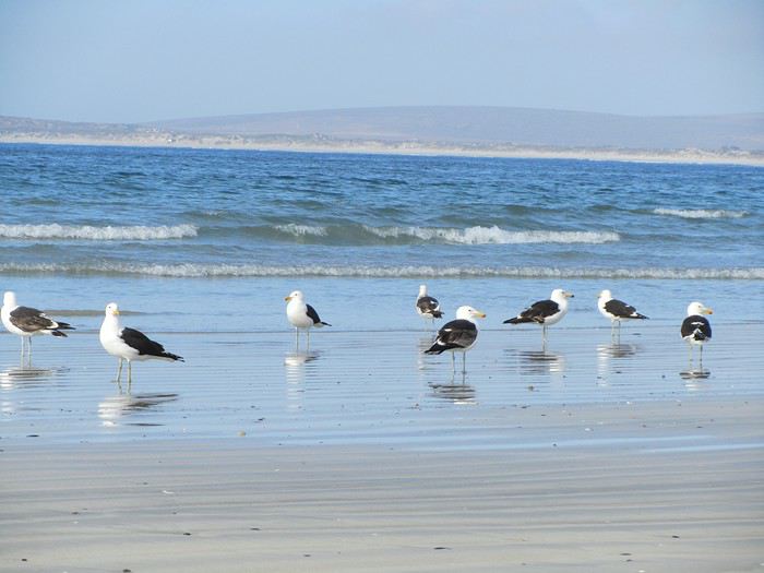 Nous avons découvert échouée sur le sable une famille de phoques , personne n'a su nous dire ce qui a causer leur mort et une énorme méduse au moins 30 cm de diamètre!
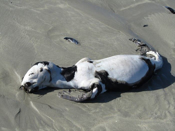


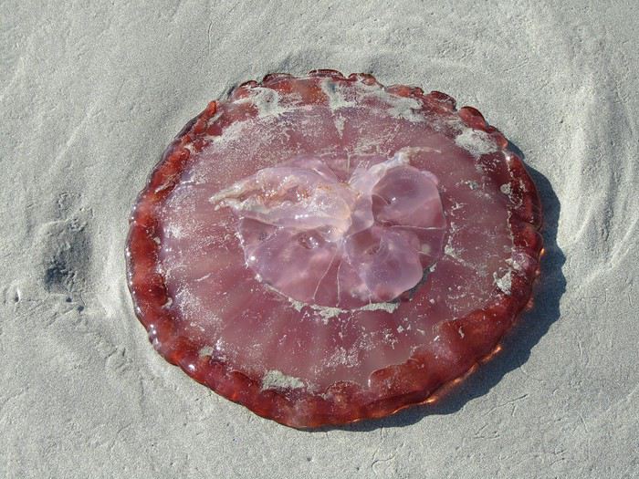
L'air marin a taquiné notre appétit, il fait bon être devant le petit déjeuner. Nous rencontrons un italien qui parle parfaitement le français, c'est un ami de la propriétaire, elle l'a appelé pour qu'il vienne nous faire la causette. Il est en Afrique du Sud depuis 40 ans, il connait bien Toulon, même au bout du monde, nous entendons parler de la France.
Nous les quittons à regrets, nous étions si bien dans ce petit village, mais il nous faut poursuivre notre balade vers Clanwilliam via Velddrif, Eland's Bay, la côte est splendide, pique -nique près de Lambert's Bay, royaume de la langouste, son port de pêche les exporte dans le monde entier; les amateurs de sensations fortes ne seront pas déçus par l'odeur qui y règne!
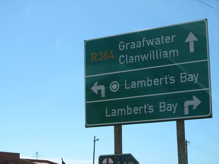
Nous atteignons Clanwillian , typique ambiance de ville d'Afrique. Pôle de la commercialisation du Rooibos, herbe rouge (ça ne se fume pas) le "thé" sud-africain par excellence, une plante locale dont la décoction, pauvre en tanin et exempte de caféine, est supposée avoir des vertus médicinales, est exportée dans le monde.
Tour de ville, recherche d'un B&B. Dans une rue calme et fleurie, bordée d'agréables maisons, nous remarquons "B&B ELEPHANT RIVER", c'est ici qu'il faut dormir!
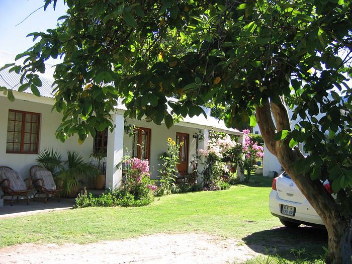
Mais il n'y a personne pour nous recevoir, le portail est fermé et les chiens dans le fond du jardin aboient à qui mieux mieux. Au bout de 10 mn d'attente, un ouvrier jardinier qui passait nous fait signe de rester et reprend son chemin... Quelques minutes plus tard, la propriétaire arrive à notre grand étonnement, ce monsieur était allé la prévenir! Elle nous fait visiter les trois lodges et choisir celui qui nous convient. Tarif défiant tout concurrence 500 rands la nuit. Nous ne rencontrons que des personnes avenantes et sympathiques. Après un douche qui n'était pas superflue, tour du quartier et du centre ville à pied.
 nous rencontrons une manifestation pour le SIDA
Tout près du lodge, nous avons repéré un resto accueillant et sympathique,
 encore une fois les steaks sont énormes 500gr, nous ne le cherchons pas sous les frites, c'est le contraire qui se produit
 Il est 21h30, le sommeil se fait sentir, il est vrai que nous sommes debout depuis 6h du matin. J'oublie de vous dire que nous avons un lit à baldaquin!!

Demain, une bonne journée nous attend.
Nous avons découvert échouée sur le sable une famille de phoques , personne n'a su nous dire ce qui a causer leur mort et une énorme méduse au moins 30 cm de diamètre!
L'air marin a taquiné notre appétit, il fait bon être devant le petit déjeuner. Nous rencontrons un italien qui parle parfaitement le français, c'est un ami de la propriétaire, elle l'a appelé pour qu'il vienne nous faire la causette. Il est en Afrique du Sud depuis 40 ans, il connait bien Toulon, même au bout du monde, nous entendons parler de la France.
Nous les quittons à regrets, nous étions si bien dans ce petit village, mais il nous faut poursuivre notre balade vers Clanwilliam via Velddrif, Eland's Bay, la côte est splendide, pique -nique près de Lambert's Bay, royaume de la langouste, son port de pêche les exporte dans le monde entier; les amateurs de sensations fortes ne seront pas déçus par l'odeur qui y règne!
Nous atteignons Clanwillian , typique ambiance de ville d'Afrique. Pôle de la commercialisation du Rooibos, herbe rouge (ça ne se fume pas) le "thé" sud-africain par excellence, une plante locale dont la décoction, pauvre en tanin et exempte de caféine, est supposée avoir des vertus médicinales, est exportée dans le monde.
Tour de ville, recherche d'un B&B. Dans une rue calme et fleurie, bordée d'agréables maisons, nous remarquons "B&B ELEPHANT RIVER", c'est ici qu'il faut dormir!
Mais il n'y a personne pour nous recevoir, le portail est fermé et les chiens dans le fond du jardin aboient à qui mieux mieux. Au bout de 10 mn d'attente, un ouvrier jardinier qui passait nous fait signe de rester et reprend son chemin... Quelques minutes plus tard, la propriétaire arrive à notre grand étonnement, ce monsieur était allé la prévenir! Elle nous fait visiter les trois lodges et choisir celui qui nous convient. Tarif défiant tout concurrence 500 rands la nuit. Nous ne rencontrons que des personnes avenantes et sympathiques. Après un douche qui n'était pas superflue, tour du quartier et du centre ville à pied.
nous rencontrons une manifestation pour le SIDA
Tout près du lodge, nous avons repéré un resto accueillant et sympathique,
encore une fois les steaks sont énormes 500gr, nous ne le cherchons pas sous les frites, c'est le contraire qui se produit
Il est 21h30, le sommeil se fait sentir, il est vrai que nous sommes debout depuis 6h du matin. J'oublie de vous dire que nous avons un lit à baldaquin!!
Demain, une bonne journée nous attend.
Croisière MSC Splendida Dubaï - Gênes du 12 mars 2020 et escale au Pirée English translation pending
Bonjour
Nous allons effectuer la croisière Dubai Génes du 12 au 29 mars 2020 sur le MSC SPLENDIDA
Pour l'escale au Pirée le 26 mars, nous avons réservé le tour d'athènes avec Piraeus express bus (20€), y aurait t-il des membres interéssés par cette visite ou déjà inscrits?
Merci d'avance
Pour l'escale au Pirée le 26 mars, nous avons réservé le tour d'athènes avec Piraeus express bus (20€), y aurait t-il des membres interéssés par cette visite ou déjà inscrits?
Merci d'avance