Results for "Canyons+the+Ancients+|+3+>+99"
23708 results found.
June 2026 Theme Thread: Such a Beautiful Landscape
This is where we chat.
A summer in the sun in... Iceland!!
Ah, Iceland and us—it’s quite the story, or rather, a long wait... The first time we considered going was already 7-8 years ago, after reading travel journals describing breathtaking landscapes, countless active and dormant volcanoes, glaciers, and waterfalls with extraordinary flows. In short, this island, made of fire and ice, right at Europe’s doorstep with its own unique culture, had nothing but advantages, and it was urgent to visit without delay 😇
My *Routard* guidebook is actually from 2016. So why did Iceland make us wait so long before we finally gave in to its charms? Yes, why indeed?
Simply because reading other travel journals revealed the cost of living there—and especially the harsh climate, even in the middle of July 🤪! Some journals described entire weeks of rain and foggy weather, making it tricky to explore the island. The budget wasn’t spared either, because in the most touristy areas, especially in the south and around Myvatn, accommodation prices are downright indecent—even outright robbery. 😕
Plus, in the Highlands, there’s literally no permanent lodging, and the only way to spend several nights there is to camp. And camping in winter conditions wasn’t exactly part of our plans... 😄
So, year after year, this trip kept getting postponed...
until August 2023, when prices for Southern Africa, North or South America, or even Asia were all way too high for summer 2024!
That’s when I turned my attention back to the Land of Fire and Ice and scoured all the comparison sites for the best accommodation deals across the country. Planning for 20 nights, I found 13 nights in "proper" lodging for 5 people at an average cost of under 200 €! A miracle, considering that in the southern glacier region, around Vik or Myvatn, prices range from 300 to 1000 € per night 😮 😮!
Still, that means we’ll have to camp for 7 nights, mostly in the Highlands, near Askja or Landmannalaugar. 😎
For once, I built the daily itinerary entirely around the decently priced lodgings I found 11 months in advance! The shortage of places to stay in some areas forced me to plan a few long transition days and make some tough choices. No big deal, though—there’s so much to do on this island 🙂!
Once the main itinerary was set, everyone agreed to the plan: 2/3 in proper lodging and 1/3 camping, even the most camping-averse among us! *Follow my gaze...*
By the time we bought the flight tickets, I had to tweak the itinerary a bit because one or two places were already booked! Plus, it was impossible to wait for a more refined plan to adjust reservations, since almost all bookings are non-refundable!! The harsh law of supply and demand...
For the car rental, we booked a Hyundai Tucson, approved for the Highlands, from Lava Car Rental—a company I’d read good reviews about in a Facebook group—for a cool 2500 € with full insurance. A real 4x4, like a Defender, would’ve been more than double...! Welcome to Iceland 😕...
Activities and excursions also required some tough choices. We had two must-dos: whale watching in Húsavík (60 € pp on Getyourguide) and a Glacier and Summer Treasure Glacier Walk with BlueIceland (165 € pp with discount codes on Getyourguide).
For the baths, we skipped the Blue Lagoon—too expensive—in favor of the Secret Lagoon and the Myvatn Baths, the Blue Lagoon’s equivalent but half the price.
Two baths for the price of one... and even more, since I spotted several free hot-water swimming spots.
Itinerary: Day 1: Arrival in Reykjavik - Hraunfossar Waterfall - Surtshellir Cave Day 2: Grábrók Crater - Snæfellsnes Peninsula Day 3: Stykkishólmur - Sturlungalaug Hot Springs Day 4: Northwest Coast - Akureyri - Goðafoss Day 5: Myvatn Day 6: Myvatn - Dettifoss - Selfoss - Rauðhólar Day 7: Húsavík Whale Watching - Dettifoss - Selfoss Day 8: Stuðlagil Canyon - Seyðisfjörður Day 9: Puffin colony - Störurð Hike Day 10: Hengifoss - East Fjords, Mjóifjörður Day 11: Viking Village - Jökulsárlón - Fjallsárlón Day 12: Glacier Excursion - Svartifoss Day 13: Fjaðrárgljúfur Canyon - Vík Day 14: Þakgil - Lava Show Vík Day 15: Southern Waterfalls Day Day 16: Landmannalaugar - Skalli Hike Day 17: Landmannalaugar - Bláhnjúkur - Brennisteinsalda Day 18: Secret Lagoon, Kerlingarfjöll, and Gullfoss Day 19: Geysir - Reykjavik Day 20: Bruarfoss - Þingvellir - Kerid Crater - Krýsuvík Geothermal Area Day 21: Reykjanes Peninsula
Friday, July 5, 2024, is our last workday before driving up to Alsace overnight to leave the cockers at Grandpa’s for boarding. Then, at 1:30 AM, we’ll head to Frankfurt, where a direct flight to Iceland awaits.
We arrive at 4 AM. Since we leave at 7 AM, the "night" will only last the equivalent of a 30-minute nap 🤪... just enough to get us in the road-trip mood 😏!!
My *Routard* guidebook is actually from 2016. So why did Iceland make us wait so long before we finally gave in to its charms? Yes, why indeed?
Simply because reading other travel journals revealed the cost of living there—and especially the harsh climate, even in the middle of July 🤪! Some journals described entire weeks of rain and foggy weather, making it tricky to explore the island. The budget wasn’t spared either, because in the most touristy areas, especially in the south and around Myvatn, accommodation prices are downright indecent—even outright robbery. 😕
Plus, in the Highlands, there’s literally no permanent lodging, and the only way to spend several nights there is to camp. And camping in winter conditions wasn’t exactly part of our plans... 😄
So, year after year, this trip kept getting postponed...
until August 2023, when prices for Southern Africa, North or South America, or even Asia were all way too high for summer 2024!
That’s when I turned my attention back to the Land of Fire and Ice and scoured all the comparison sites for the best accommodation deals across the country. Planning for 20 nights, I found 13 nights in "proper" lodging for 5 people at an average cost of under 200 €! A miracle, considering that in the southern glacier region, around Vik or Myvatn, prices range from 300 to 1000 € per night 😮 😮!
Still, that means we’ll have to camp for 7 nights, mostly in the Highlands, near Askja or Landmannalaugar. 😎
For once, I built the daily itinerary entirely around the decently priced lodgings I found 11 months in advance! The shortage of places to stay in some areas forced me to plan a few long transition days and make some tough choices. No big deal, though—there’s so much to do on this island 🙂!
Once the main itinerary was set, everyone agreed to the plan: 2/3 in proper lodging and 1/3 camping, even the most camping-averse among us! *Follow my gaze...*
By the time we bought the flight tickets, I had to tweak the itinerary a bit because one or two places were already booked! Plus, it was impossible to wait for a more refined plan to adjust reservations, since almost all bookings are non-refundable!! The harsh law of supply and demand...
For the car rental, we booked a Hyundai Tucson, approved for the Highlands, from Lava Car Rental—a company I’d read good reviews about in a Facebook group—for a cool 2500 € with full insurance. A real 4x4, like a Defender, would’ve been more than double...! Welcome to Iceland 😕...
Activities and excursions also required some tough choices. We had two must-dos: whale watching in Húsavík (60 € pp on Getyourguide) and a Glacier and Summer Treasure Glacier Walk with BlueIceland (165 € pp with discount codes on Getyourguide).
For the baths, we skipped the Blue Lagoon—too expensive—in favor of the Secret Lagoon and the Myvatn Baths, the Blue Lagoon’s equivalent but half the price.
Two baths for the price of one... and even more, since I spotted several free hot-water swimming spots.
Itinerary: Day 1: Arrival in Reykjavik - Hraunfossar Waterfall - Surtshellir Cave Day 2: Grábrók Crater - Snæfellsnes Peninsula Day 3: Stykkishólmur - Sturlungalaug Hot Springs Day 4: Northwest Coast - Akureyri - Goðafoss Day 5: Myvatn Day 6: Myvatn - Dettifoss - Selfoss - Rauðhólar Day 7: Húsavík Whale Watching - Dettifoss - Selfoss Day 8: Stuðlagil Canyon - Seyðisfjörður Day 9: Puffin colony - Störurð Hike Day 10: Hengifoss - East Fjords, Mjóifjörður Day 11: Viking Village - Jökulsárlón - Fjallsárlón Day 12: Glacier Excursion - Svartifoss Day 13: Fjaðrárgljúfur Canyon - Vík Day 14: Þakgil - Lava Show Vík Day 15: Southern Waterfalls Day Day 16: Landmannalaugar - Skalli Hike Day 17: Landmannalaugar - Bláhnjúkur - Brennisteinsalda Day 18: Secret Lagoon, Kerlingarfjöll, and Gullfoss Day 19: Geysir - Reykjavik Day 20: Bruarfoss - Þingvellir - Kerid Crater - Krýsuvík Geothermal Area Day 21: Reykjanes Peninsula
Friday, July 5, 2024, is our last workday before driving up to Alsace overnight to leave the cockers at Grandpa’s for boarding. Then, at 1:30 AM, we’ll head to Frankfurt, where a direct flight to Iceland awaits.
We arrive at 4 AM. Since we leave at 7 AM, the "night" will only last the equivalent of a 30-minute nap 🤪... just enough to get us in the road-trip mood 😏!!
Langtang – Trekking in the Rain
We did the Langtang trek (hike) from September 10th to 17th, with the first and last days being the trip from Kathmandu and back—so 6 days of actual walking. It’s a fairly well-known trek but certainly not as famous or crowded as those in the Annapurna or Everest regions, which is why we chose it.
In theory, it’s mandatory to have a guide for this trek. In reality, it seems there are ways to bypass the regulations: we met at least two people hiking without a guide—a South Korean, a New Zealander, and possibly also a couple of English women and an American couple, though we’re not sure if they had a guide.
The agency we booked with had told us it was an affordable trek for relatively older people in good shape—which is our case (I’m 72 myself). I have to say upfront that we found it quite challenging, maybe because we didn’t have good weather—it was the end of the monsoon season. To be clear, no matter your fitness level, I’d say doing this trek in the middle of the monsoon season would be suicidal.
Day 1 – Journey from Kathmandu to Syapru Besi
On Monday, September 8th, there had been violent protests in Kathmandu against the government, which had, among other things, blocked access to social media and been accused of nepotism and corruption. There were 19 deaths. The situation was very tense on the day of our departure, Wednesday the 10th. The agency warned us that public transport was very unreliable. So, we decided to take a jeep, at an additional cost of $100 ($160 minus what was already budgeted for the bus).
We left a little before 7 a.m. and it took us a good hour just to reach the outskirts of Kathmandu. Along the way, we saw several houses and vehicles set on fire by protesters.
The road to Syapru Besi is only 120 km, but it’s frankly awful. It’s always narrow, winds through endless mountains, and the shoulders range from bad to confusing to nonexistent. Several sections are just dirt tracks. We didn’t regret opting for the jeep, as we could stop several times at our convenience—if only to let Y (my Thai partner) throw up everything she had. She’d taken her usual motion sickness medication, but the constant turns, accelerations, and braking eventually made her terribly carsick.
In Nuwakot, we stopped for breakfast at a nice little restaurant, Jimbu. It was around 8:30 a.m., and we’d barely covered 60 km. The restaurant has a lovely garden overlooking the Trishuli Ganga, the river flowing down from Syapru Besi. First photo: the river in the bottom right corner, mist and clouds over the mountain on the other side.
An hour later, my second photo: the hills along the Trishuli Ganga. You can see the different crops—lush green rice paddies in the lower right and corn, already yellowed and likely harvested, in the foreground on the left. And of course, the mist and clouds through which you can glimpse the mountain on the other side of the river.
In theory, it’s mandatory to have a guide for this trek. In reality, it seems there are ways to bypass the regulations: we met at least two people hiking without a guide—a South Korean, a New Zealander, and possibly also a couple of English women and an American couple, though we’re not sure if they had a guide.
The agency we booked with had told us it was an affordable trek for relatively older people in good shape—which is our case (I’m 72 myself). I have to say upfront that we found it quite challenging, maybe because we didn’t have good weather—it was the end of the monsoon season. To be clear, no matter your fitness level, I’d say doing this trek in the middle of the monsoon season would be suicidal.
Day 1 – Journey from Kathmandu to Syapru Besi
On Monday, September 8th, there had been violent protests in Kathmandu against the government, which had, among other things, blocked access to social media and been accused of nepotism and corruption. There were 19 deaths. The situation was very tense on the day of our departure, Wednesday the 10th. The agency warned us that public transport was very unreliable. So, we decided to take a jeep, at an additional cost of $100 ($160 minus what was already budgeted for the bus).
We left a little before 7 a.m. and it took us a good hour just to reach the outskirts of Kathmandu. Along the way, we saw several houses and vehicles set on fire by protesters.
The road to Syapru Besi is only 120 km, but it’s frankly awful. It’s always narrow, winds through endless mountains, and the shoulders range from bad to confusing to nonexistent. Several sections are just dirt tracks. We didn’t regret opting for the jeep, as we could stop several times at our convenience—if only to let Y (my Thai partner) throw up everything she had. She’d taken her usual motion sickness medication, but the constant turns, accelerations, and braking eventually made her terribly carsick.
In Nuwakot, we stopped for breakfast at a nice little restaurant, Jimbu. It was around 8:30 a.m., and we’d barely covered 60 km. The restaurant has a lovely garden overlooking the Trishuli Ganga, the river flowing down from Syapru Besi. First photo: the river in the bottom right corner, mist and clouds over the mountain on the other side.
An hour later, my second photo: the hills along the Trishuli Ganga. You can see the different crops—lush green rice paddies in the lower right and corn, already yellowed and likely harvested, in the foreground on the left. And of course, the mist and clouds through which you can glimpse the mountain on the other side of the river.
Namibia Travel Journal: May 2025 - Trip Review
NAMIBIA TRIP 2025: April 24 to May 20: Feel free to comment or ask us any questions about this amazing journey.
>> Find all our photos and videos for each day on our website here: www.montagne-aventure.net
**DAY 1: Thursday, April 24, 2025: Outbound Flights from Lyon to Windhoek via Munich - Visit to Munich:**

Off we go on a new adventure. The alarm rings at 6:30 AM, the travel bags are packed, and we head to Lyon Airport. We booked our flight tickets with Lufthansa. The first leg to Munich, Germany, is operated by AirBaltic. Departure at 1:05 PM for a 1-hour and 20-minute flight. We arrive at 2:30 PM.
**We now have a 7-hour layover, so we take the opportunity to get some fresh air and explore Munich.** We quickly exit Terminal 2 of the airport and head towards the subway. We buy a group day ticket "Airport-city Day Zone M-5," valid for 2 to 5 people at a price of 30.50 € (instead of 16.30 € per person). We take the S8 line to **Marienplatz** in 35 minutes. **This is the heart of the city.** The weather is overcast, quite cool, but dry. Perfect for a little city trip between two flights while leaving our large luggage in transit at the airport. **Munich is the third-largest German city after Berlin and Hamburg, in the Bavaria region.** **The center has a lot of charm and brings together several religious buildings, easy to explore on foot.** We are impressed by the number of people enjoying these 100% pedestrian streets, which are very pleasant. After Marienplatz, the most famous square with the town hall, we head to the Cathedral of Our Lady, a Gothic church, then continue to **Karlsplatz** and move on to **the food market offering a wide selection of high-end food products in an atmosphere where a certain art of living prevails.** We also visit St. Peter's Church before grabbing a bite to eat. Two good hours were enough for this 10 km city walk. It's time to take the subway back: by 6:30 PM, we are back at the airport. Now, it's time for a bit of waiting and rest. Our second flight is scheduled for 9:35 PM for a 9-hour and 30-minute journey to our final destination in Namibia: **Windhoek.**
> Round-trip flight tickets with Lufthansa from Lyon: 2029 €, or 1,014.50 € per person.
> Lyon Airport parking: 120 €
> Today's expenses: 7 € for 2 pizzas in France / 14 € for the restaurant in Munich / 30.50 € for the daily subway ticket in Munich.
**DAY 2: Friday, April 25, 2024: Arrival in Windhoek, Visit to the Namibian Capital:**
After a 9-hour and 30-minute overnight flight with Discover Airlines, we finally land on Namibian soil just before 7:30 AM. The day is breaking, and the colors are already stunning. We are eager despite the usual fatigue from the flight. The airline was punctual, with friendly staff and good meals, though a bit light. We are the first flight of the day to land, with no more than 15 flights per day here, from 7 AM to 8 PM. We disembark on the tarmac at this airport located in the middle of nowhere, **I finally set foot on African soil for the first time.** We exit among the first from the aircraft to go through the long formalities at the front of the line, as the wait can quickly become endless. Allow at least 5 minutes per person for e-visas. We still wait 45 minutes despite only about twenty people ahead of us. Phew, it's done. We collect our luggage and then withdraw money from an ATM. We make 4 withdrawals of the maximum amount, 2000 NAD $ per withdrawal, for a total of 380 €, or 95.33 € per withdrawal.
Our driver arrives at the same time, perfect timing, we were quick.
We leave the airport at 8:45 AM. By 9:30 AM, we arrive at the **Gracious Whisp vehicle rental agency**, located at the entrance of Windhoek, small and human-sized with a fleet of recent vehicles. More formalities, then a short wait as our vehicle is not yet ready. Time to decompress, catch our breath, and enjoy the very pleasant morning temperature. Not a cloud in sight. Next, a briefing on the vehicle, always with a bit of apprehension due to our approximate English. Allow 45 minutes of explanations, including setting up the roof tent, camping equipment, technical information in case of a flat tire, driving tips in Namibia, and a tour of the 4x4. We have all the necessary equipment for camping: mattresses, sleeping bags, pillows, table, chairs, gas stove, BBQ grill... as well as 2 spare tires, a compressor, a dual tank, and accessories for removing wheels. Off we go, it's time to muster our courage and get behind the wheel. **Heading to SuperSpar Maerua**, fortunately located less than 10 minutes away. We park with the help of a parking attendant; it's very crowded, the space is narrow, but everything goes well despite the cursed right-hand drive. Today's new mission: stock up on groceries. The store is well-stocked with local and imported products, catering to all tastes. We spend 114 € on groceries, from pasta to meat, BBQ lighters to dishwashing products. Two people load our groceries into two carts and transfer them to our vehicle; we feel compelled to leave a tip, 50 NAD $, as we don't have change yet. Now, we head to the hotel, 15 minutes away. Traffic is difficult at a complicated intersection; this will likely be the only traffic jam in Namibia. **We arrive at Kate's Nest Guesthouse & Backpackers around 1:15 PM, quite tired.** We take some well-deserved rest at this recent establishment, quite calm with secure private parking. After a short nap, we enjoy the quiet by the hotel pool. Night falls between 6:30 PM and 7 PM. We eat quietly in our room tonight before starting this long 4x4 road trip in camping mode in the heart of Namibia.
> Today's grocery expenses: 114 € at Super Spar Marua (2395.21 NAD $).
> Round-trip flight tickets with Lufthansa from Lyon: 2029 €, or 1,014.50 € per person.
> Vehicle rental: 4x4 Toyota with roof tent for 24 days: Gracious Whisp Car Rentals: 2,638 € (N$50,640) or **1,319 €** per person - (https://gwcarrentals.com/)
> Distance driven today: 15 km.
> Accommodation: Kate's Nest Guesthouse & Backpackers - 4 Aristotles Street Academia, 9000 Windhoek - 36 € for two for one night.
> Windhoek International Airport website: (https://www.airports.com.na/)
**DAY 3: Saturday, April 26, 2025: Windhoek to Hardap: Mariental Region - Kalahari Desert:**
After a good, restful night, we wake up leisurely around 7 AM. We enjoy the comfort provided by this first and last hotel before 24 nights under the tent.
**We leave Kate's Nest Guesthouse at 8:30 AM to tackle the Namibian roads.** We quickly leave the capital; in just 30 minutes, we find ourselves almost alone in the world. The landscape is dotted with small domes. We leave the **paved B1** quickly to turn left onto the **C15**. **From there, we won't see more than 10 vehicles all day.** After passing through the few houses of **Lekkerwaterpoort**, we tackle our first gravel road. These road sections are limited to 100 km/h, but even at 70 km/h, I find it already challenging. However, I quickly get used to it and gradually pick up speed to reach my cruising speed of around 80 to 90 km/h. **We are on immense straight lines crossing wild expanses as far as the eye can see.** **We come across two baboons, a few ostriches, and numerous cattle and sheep farms.** We pass through the charming village of **Uhlenhorst** with its typical houses and children with broad smiles waving at us. Life here is already very different from Windhoek. **The thermometer rises quickly from 16°C at 8:30 AM to over 28°C in the early afternoon.**
**We arrive at the Hardap Dam reserve at 2 PM.** We stop at the toll booth at the park entrance to pay the entrance fee: 250 NAD $ for 2 people and 1 vehicle. We continue to the dam and then the camp entrance, located a bit further. We had booked in advance, but this place remains little frequented by foreigners.
We take advantage of the hottest hours to rest by the large pool overlooking the immense lake, a very enjoyable moment. Would this be a bit of a vacation?
Around 4:30 PM, we head to the campsite. We overlook this vast water reserve. We arrive first; we will be only 3 vehicles spending the night here. It's time to get to work and set up our equipment for the first time. It takes us a good 20 minutes to set everything up, with a slight apprehension about unfolding the tent. Once this task is done, which we will have to repeat for almost a month, we will become much more efficient over time. Time for rest and contemplation in total silence. The sun gradually sets, and the heat quickly becomes bearable again. Bliss! **This dam is located 20 km northwest of Mariental in an area dotted with conical hills topped with dolerite buttons (Hardap means "hillock" in Nama). It captures the Fish River, which flows south, creating a large lake in the middle of an arid environment. The contrast is striking.** We enjoy our first sunset facing this 360° otherworldly landscape.
Around 7 PM, we start our first BBQ, or "braai" as it's called here. The temperature is perfect. The sun sets, giving way to a star-filled sky of incredible beauty thanks to the absence of any light pollution. The Milky Way will lull us throughout the evening. After some good sausages and potatoes on the BBQ, we head to our roof tent around 9:30 PM with a complete change of scenery in just 24 hours. France already seems so far away...
This campsite has shared showers and toilets, quite clean and functional, as well as a central area with several BBQs and tables. The sites are arranged in a semicircle, each with an electrical outlet. The sites are close to each other but spacious, some slightly shaded. We are only three vehicles tonight, so it's perfectly comfortable and quiet. Not to mention the large pool near the restaurant. Our trip is off to a great start.
> Today's road itinerary: Windhoek > Head south on the B1 to Rehoboth > Turn left onto the C25 then C15 to Stampriet > C20 to Hardap > Full north on the B1 > Then turn left onto the M93 - 5 hours of driving.
> Distance driven today: 354 km.
> Accommodation: Hardap Recreation Resort - 23.3 € for two - Large pool - GR6W+3M2, Hardap Game Reserve, Mariental, Namibia - (http://www.nwr.com.na/resorts/hardap-resort/)
**DAY 4: Sunday, April 27, 2025: Hardap - Brukkaros Volcano - Keetmanshoop - Quivertree Forest Rest Camp**
Our first night under the tent was very pleasant; the little wind quickly calmed down, giving way to absolute silence. The mattress is decent, more comfortable than some nights in Nepal. The length and width give us enough space for maximum comfort, despite my height (1.91 m). We wake up a little before 7 AM as the sun rises, and the lights dazzle us from the start of the day. We pack up the equipment in 30 minutes, quite easily. Then we enjoy the sun, which warms up quickly while we keep our light fleece on.
At 8:30 AM, **we hit the road again, heading south** to our first stop in **Mariental**. We want to do some shopping at SuperSpar, but once we arrive in the parking lot, a young local is fighting with the supermarket security guards and then threatens to throw stones. We don't want to take any risks right at the start, so despite the baton blows he receives, he doesn't stop. We leave empty-handed but fill up with fuel at the Shell station 1 km further. The price per liter is 21.33 NAD $, we fill our 107-liter tank for 107 €. In Namibia, you get served, and they bring the card machine to the window to pay. It's then customary to leave a tip.
We then take the B1 heading due south on a recently renovated road. Around 11:30 AM, we leave it on our right to take **a wild gravel road, the M98**. Just before **Berseba**, we turn right onto a small track, the **D3904 towards Brukkaros Crater up to a camp at 1588 m altitude**. The track then becomes too bumpy. We stop on the counter-slopes where **a wide panorama unfolds over these immense plains as far as the eye can see**. It's 12:15 PM, time for us to eat a rice and tuna salad facing this landscape.
**We are alone in the world until a vehicle arrives and parks next to us.** A bit of apprehension, 4 men head towards us. It turns out to be 4 shepherds looking for a lost foal. The conversation is pleasant, lost in the middle of nowhere. We find ourselves alone again in this absolute silence. **The heat becomes stifling with a good 30°C**. We get back on the road around 1 PM. Back on the B1, **we continue due south to Keetmanshoop**, which we reach around 3 PM. We stop there to do some shopping for 262 NAD $ (12 eggs, a can of tuna, a can of corn, bread, a soda, and a 5-liter water container), or 12.48 €. Two quite insistent children ask us for money or candy at the store exit, yet we give them a small tip, but they continue to cling to the car. Locals parked next to us tell them to leave us alone. Anyway, we finish the trip to **Quivertree Forest**, 15 km away. We will spend the night in this **pleasant farm run by a German**. Upon arrival, as the day before, and as I suppose in the future, we dive straight into the cool pool to relax after all these kilometers. A bliss. Then we take our 4x4 and choose a spot near these famous trees. After the 33°C this afternoon, once 4 PM passed, the temperature drops again and becomes very pleasant. **We are in the middle of the Kokerboom, one of the most interesting and characteristic plants of hot and arid regions. It's not really a tree but a variant of the aloe plant whose botanical name is Aloe Dichotoma. This Kokerboom has a smooth and thick trunk reaching up to 1 m in thickness and 9 m in height. They bloom for the first time at the age of 20 to 30 years.** The flowers are yellow and reach about thirty centimeters during the season between June and July. **They grow mainly in an environment with a high concentration of black rocks absorbing a large amount of heat (38°C). The rocks also serve to anchor the tree with its tentacle-like roots. It also resists frost. Each is between 200 and 300 years old.**
Around 5 PM, we walk to the farm reception to watch the feeding of **two cheetahs**. Magnificent carnivores taking their time to savor their piece of meat. **Then we return near our campsite to enjoy the sunset among these trees. The colors are sublime, as every evening apparently. A magnificent spectacle with colors evolving from yellow to orange then to pink, before giving way once again to a sky filled with thousands of stars.** Our campsite at Quiver Tree Forest Camp is very comfortable; we have a water supply, a stone table, a small lamp, an electrical outlet, a small tree for shade, and a BBQ that we won't use tonight; we'll cook on gas. The sites are far apart, with some shared facilities scattered around, a very beautiful setting. No reservation possible, no need, just show up directly. **The campsite accommodation for 2 people costs 28 €, including the reserve entrance fee of 5 €**. We finish this second bivouac evening around 9:30 PM, time for some reading and sleep in peaceful silence without wind.
> Today's road itinerary: Mariental > B1 heading south to Brukkaros > At Tses turn right towards Berseba via the M98 > Turn right onto the D3904 > 8 km > Brukkaros Volcano (stop at the lower camp as the track is difficult for 1 hour) > Keetmanshoop > Turn left onto the M29 > Quivertree Forest - 4 hours of driving.
> Distance driven today: 371 km.
> Distance walked today: 6 km.
> Today's expenses: Groceries for 12.48 € (262 NAD $) / Fuel for 107 € (1 liter of diesel for 21.33 NAD $).
> Accommodation: Quivertree Forest Rest Camp, P.O. Box 262, Keetmanshoop, Namibia - BBQ, hot showers, toilets, and electricity - No reservation - Pool - 18 €/Person (N$ 340.00 with park entrance) - (http://www.quivertreeforest.com/)
**DAY 5: Monday, April 28, 2025: Quivertree Forest Rest Camp - Giant's Playground - Keetmanshoop - Fish River Canyon - Canyon Roadhouse:**
After an excellent start to the night, we are woken up by the wind shortly before 6 AM, but the sunrise is not far off. We get up at 6:30 AM to enjoy it. The atmosphere is a bit cooler this morning, but the reward is already here.
The adventure continues. At 7:45 AM, we head towards **Giant's Playground**, 4 km away. We take a 3-kilometer walk through this expanse of blocks and igneous rocks.
We continue south at 8:45 AM, passing through Keetmanshoop again where we do some shopping for 25 €, a big stock-up for a good part of the trip: meats, canned goods, pasta, fruits... At 9:30 AM, we take the B4 to Fish River Canyon.
At 11:30 AM, we arrive at the entrance to the NWR park (350 NAD $ entrance for 2 people and 1 vehicle). The track becomes bumpy immediately upon entering the park. After about ten kilometers, we come upon this landscape carved by nature. In the end, it's well worth the detour. We were at the Grand Canyon in the USA exactly (https://www.montagne-aventure.net/2024/04/29/j21-3-juin-2024-grand-canyon-et-lac-powell/) and can thus confirm that this Fish River Canyon is comparable. We make several stops along the southern flank. **Here, nothing is developed; nature is almost in the wild state.** **With 160 km in length, up to 27 km in width, and a depth of 150 m, it is indeed the second-largest canyon in the world.** The history of the canyon is apparent in its different earth layers and stratification: the antiquity of the place is tangible, and the absence of vegetation is surprising. **It consists of two nested canyons, formed at distinct periods. The first distinct layer of schist, sandstone, and eruptive material surrounding the canyon was formed a few two billion years ago, then transformed due to heat and pressure into more solid rock such as gneiss. The inner canyon, carved more recently by the Fish River, has a depth of 270 m.**
We have a picnic once again alone in the world facing this grand panorama at the **Sulphur Spring View Point**. This is where the hiking trail begins, plunging into this narrow canyon, but it is forbidden to venture there alone without a guide. It's 30°C, but a slight wind makes the atmosphere bearable. At 1 PM, we retrace our steps and continue to the **Main View Point** then to the **Hikers View Point**.
In the south of Namibia, the Fish River Canyon, 160 km long, is a true geological wonder: a canyon nested within another canyon, one of the largest in the world. The first sedimentary layers formed two billion years ago; 500 million years ago, a period of tectonic activity caused these layers to crack and tilt, opening a vast canyon in the Earth's crust. The second canyon, with a depth of 270 m, was carved over time by the passage of the Fish River in this new valley.
At 3 PM, we arrive at our very charming camp for the evening, the **Canyon Road House**. We fill up with fuel right away because tomorrow we have a long day of isolated driving: 55 liters for 1240 NAD $. Then we settle into the campsite we had previously reserved in France. We are assigned site 2, very well set up under a tree with its BBQ and stone table just steps from the pool. We quickly set up the tent and jump straight into the pool for the relaxation moment of the day. As usual, the water is quite cool, but it's a real pleasure. Then we stroll around this Canyon Road House, which recreates the atmosphere of the roadside inns of the 1950s with old car wrecks and vintage gas pumps in a bygone era. **Around 5:45 PM, we start a short walk leading us to the top of a hill overlooking the wide plateau where we are to watch the sunset.**
And finally, to end this beautiful day, it's time for the braai, with grilled sausages and white beans on the evening menu.
> Park entrance: 150 DN/person + 50 DN/vehicle (18 € for two). It is possible to enter at two access points: Hobas in the north and Ai-Ais in the south.
> Today's road itinerary: M29 > Keetmanshoop > B1 > B4 > C12 (track) > After Holoog turn right onto the D601 (C37 track) > Accommodation on our right (stop just to check in before 6 PM) > Continue 30 km (30 minutes of track) to the viewpoints after Hobas where you must pay the entrance fee. Sunset View Point to the left > Return before sunset as the park closes (best lights at sunrise). 3 hours.
> Distance driven today: 228 km.
> Distance walked today: 10 km.
> Today's expenses: 25 € for groceries / 17 € for the Fish River Canyon park entrance / 58 € for fuel.
> Accommodation: Canyon Roadhouse, Gondwana Collection Namibia – 34.4 € for two - Pool - Near Hobas - (http://www.gondwana-collection.com/fr/accommodation/canyon-road-campsite)
**DAY 6: Tuesday, April 29, 2025: Canyon Roadhouse - Orange River - South African Border - Vista Trail - Gondwana Sperrgebiet Park - Aus:**
The night was excellent in this very comfortable campsite. **We wake up to the sound of birds** before the alarm at 6:45 AM. Our little morning routine starts as the sun rises. **A big day of driving awaits us to the South African border. This will be the southernmost point of our journey.** We hit the road at 8 AM via the C37, pass through **Hobas**, then turn onto the D207 to **Aussenkehr.** **We cross a mountainous barrier with some high peaks and perfect cones. The rock varies from orange to pink to black.**
We then cross a lunar desert as far as the eye can see on a giant dome; the track winds through nowhere without meeting anyone for hours. The landscapes are surprising. **We spot several ostriches and a gemsbok.** In the middle of this endless expanse, we come to an improbable intersection and continue right onto the D278.
In the middle of these arid lands, we come across a green zone: a vast vineyard. At 10:30 AM, **we come across a "Road closed" sign, fortunately, a local resident waves us to continue; a bit stressed, we proceed.** We start to follow the beautiful Orange River. On the other side of the bank, just a few meters away, South Africa is there. It is the second-longest river in Southern Africa, after the Zambezi. It flows over 2,000 km to the Atlantic. After passing through narrow gorges, we regain altitude before starting the descent, gently heading back north.
**We now cross and follow the Fish River, which joins the Orange River further south** **along this gorge dating back millennia.** At exactly noon, we take a lunch break by the Fish River, still without meeting a soul in this landscape between greenery and aridity. The temperature here is cooler with a pleasant 23°C on the banks, the perfect spot. **We continue on the track to Rosh Pinah**, where we find a paved road again. **The section along the Orange River and the Fish River was officially closed, but we were able to pass without any issues, avoiding a detour of at least 3 hours.** Phew. We now drive at high speed (limited to 120 km/h) through these vast spaces. We come across many ostriches after the **dozens of monkeys along the Fish River**. Around 3 PM, 3 km after the very small town of **Aus**, we reach **our campsite for the evening at Klein Aus Vista**. A new **small peaceful haven very well set up**. As usual, after checking in at reception, we jump straight into the beautiful pool to get our well-deserved dose of coolness, another good thermal shock that our bodies appreciate. Once this moment of relaxation is over, we take our 4x4 to reach the campsite located a bit higher, set apart at the foot of a hill that overlooks us.
After setting up, **around 5 PM, we head to the Vista Trail to climb to the top of a mountain overlooking the vast plain that surrounds us at 360°**. It takes about 30 minutes to climb. The place is just magical, **the perfect viewpoint to admire the sunset**. **We fully savor the moment. We also spot one of the few wild horses in the world capable of living in the desert.** Their numbers have decreased in recent years due to predation and drought (around 100 to 150). At 7 PM, we return to the camp, time for the braai and preparing the meal in this peaceful little camp.
In the south of Namibia, the Fish River Canyon, 160 km long, is a true geological wonder: a canyon nested within another canyon, one of the largest in the world. The first sedimentary layers formed two billion years ago; 500 million years ago, a period of tectonic activity caused these layers to crack and tilt, opening a vast canyon in the Earth's crust. The second canyon, with a depth of 270 m, was carved over time by the passage of the Fish River in this new valley.
> Today's road itinerary: 5 hours of driving: D324 heading south (track) > turn right onto the C10 (track) > D316 heading south > turn right onto the C13 > In Aus turn left onto the B4 > Campsite via a track on the left.
> Fuel station: Solitaire or Aus.
> Distance driven today: 398 km.
> Distance walked today: 7 km.
> Accommodation: Klein-Aus Vista Desert Horse Campsite - Farm Klein-Aus No 8 on the B4 main road to Luederitz Aus 9000, Aus, Namibia - (http://www.klein-aus-vista.com/accommodation/desert-horse-campsite/) 17908 420 DN - Water + Shared shower (hot water). No electricity.
**DAY 7: Wednesday, April 30, 2025: Aus - Kolmanskop - Diaz Point - Luderitz - Kanaan Desert:**
We wake up around 6:45 AM, with partly cloudy weather for once; we feel the ocean's influence gradually. But the sun isn't far off. At 7 AM, we leave the campsite heading west towards Luderitz via the B4. **First stop of the day: Kolmanskop, the ghost town we reach at 8:30 AM**, entry costs 180 NAD $ per person. We discover this **timeless place** in 1.5 hours, moving from building to building amidst violent sand-laden gusts of wind. There's a lot of charm in these different living spaces. **The sand quickly reclaimed the place after this mining town was abandoned.** This was once the headquarters of Consolidated Diamond Mines. It's hard to believe that this former town, where the diamond industry once flourished, had a hospital, a bowling alley, and a theater. The decline in diamond sales after World War II and the discovery of richer deposits put an end to this golden age. By 1956, the town was already completely deserted, and the sand had reclaimed its rights. **These dilapidated buildings swallowed by shifting dunes have something surreal about them.**
At 10:15 AM, we hit the road again **heading to Luderitz, 22 km away**, and first to **Diaz Point** **facing the Atlantic Ocean**. It's a wind-swept peninsula with its characteristic red and white lighthouse. There's a campsite and a coffee shop on site, but the place doesn't inspire rest without shade or shelter from the wind. We return to the city via the D701 track that runs along the ocean, be careful at low tide. We come across **a few fishermen and a fox as well as flamingos.**
We walk through the few streets of the city, much smaller than I imagined, then climb to the **famous little Lutheran church that overlooks the city, the Felsenkirchr.** **The wind blows very strongly here, and the sand is omnipresent, surrounded by the Namib Desert and the southern Atlantic coast.** **A German colonial relic barely touched by the 21st century, Luderitz seems frozen in the past, giving it both a gloomy and a certain charm. In short, it's certainly one of the most incongruous places in Africa.**
At 1:15 PM, just before leaving Luderitz, we do some shopping for 20.50 € and fill up with fuel: 61.50 €, 1290 NAD $ for 61 liters (21.18 $ per liter).
**We return via the B4 to Aus** (paved), **then via rougher tracks**, the C13 then the D707, magnificent as it runs along a mountain range with multiple colors on our right and an endless flat desert on the other side.
To access our campsite for the evening, we must take a **narrow private track for 7 km** on our right to emerge, in this total vastness, at the **isolated Kanaan Desert Retreat on a small hill**. I don't have time today to jump into the pool near the reception; we arrive at 5 PM at 8 small, isolated, and unique sites with a small kitchen, a shower, and a private toilet under a small tarp shelter. **A crazy charm with a unique view...** **This will be my favorite accommodation of this trip. The photos speak for themselves.** We jump into the outdoor shower while savoring the landscape, then prepare our evening braai while enjoying the colors fading, facing this plateau with bushes turning a vivid orange. **A moment that will remain etched for life.** **Savanna atmosphere under a thin emerging moon. Every minute offers different colors. Facing our meal, we have a natural giant screen.**
We end this day contemplating the stars and admire this thin orange moon setting on the horizon (8:42 PM).
**Ghost town just before Luderitz: Kolmanskop** (open from 8 AM to 3 PM - N$ 180 p.p – 9 €). Once, Kolmanskoppe was organized around diamond mining. After finding new, more prolific spots, the town was abandoned and is now a ghost town. The sand and dunes have reclaimed their rights and buried everything humans had built. Houses, train station, bakery, everything has been covered by sand, which passes through the windows, even though they are 1 meter high.
> Today's road itinerary: 5h30: B4 to Luderitz (paved) > Round trip > Kolmanskop on the left > Return via the previous campsite > Then C13 (track) > Turn left D707 (track) > Then track to the right to the campsite.
> Distance driven today: 438 km.
> Distance walked today: 8 km.
> Today's expenses: Groceries at the Spar in Luderitz for 20.50 € / Fuel fill-up in Luderitz for 61.50 €.
> Official Kolmanskop website: (https://kolmanskuppe.com) (open from 8 AM to 1 PM - N$ 180 p.p – 9 €).
> Accommodation: Night at the south of the Namibrand Nature Reserve: Kanaan Desert Retreat – 26.5 € for two - (http://www.kanaannamibia.com/) - Farm 104 Karas 9000 - Sanitary facilities + BBQ + Water + Pool - No electricity - My favorite accommodation of this trip.
**DAY 8: Thursday, May 1, 2025: Kanaan Desert Retreat - Namib Desert - Crossing the Namibrand Nature Reserve – Sesriem Canyon - Elim Dune - Little Sossus Lodge**
After a cooler night than the previous ones with about 10°C, we wake up around 7 AM. We admire, as usual, the sunrise between the desert and the mountains. **The spot from last night was truly perfect, isolated from the world, in total serenity, with a wake-up call to the sound of birds.**
We hit the road a little after 8 AM, heading north via the D707 to Spes Bona, then the gravel road C27 via Betta to Sesriem. **The landscapes roll by and dazzle us.** **We are right in the heart of the Namibrand reserve**, coming across numerous **zebras**, **impalas**, **ruminants that reproduce in large numbers**, and **gemsboks**. At noon, we stop in the shade of a tree to eat. The spot is so romantic facing orange arid mountains and a vast green plateau. **A landscape full of contrasts, timeless and silent.**
**The Namib Desert is the oldest on the planet; its name means "vast arid plain," and it also gave its name to the entire country: Namibia.** The majority of these arid and semi-arid lands dotted with viewpoints are part of the Namib-Naukluft National Park, which covers 23,000 km².
At 1 PM, we enter the Sossusvlei park. We start with the **Sesriem Canyon**, which is 3 km long and 30 m deep. We enter it with a short 1-hour hike into its depths. **It was carved by the Tsauchab River in an agglomerate of sand and pebbles over 15 million years old.** We retrace our steps back to Sesriem, which means "six belts," referring to the number of leather belts (from ox wagons) needed to draw water from the canyon. This remote locality is mainly the gateway to Sossusvlei but offers a gas station and some accommodations. For our part, we sleep 40 km away tonight.
**We then move on to Elim Dune.** It takes about 45 minutes of walking to reach its summit, and the climb is very breath-taking as we progress in the sand where we almost slide back with each step. **A first grand 360° panorama unfolds. The ochre color of the sand contrasts completely with the yellow plain and the brown and black mountains in the distance.**
At 3:15 PM, we start the descent facing Sesriem. We were completely alone once again on this dune. **These Namib dunes are composed of colored quartzite sand, presenting hues ranging from cream to orange and from red to purple. Unlike the ancient dunes of the Kalahari, these move with the wind and adopt distinct, ever-changing shapes.** Star dunes resemble stars seen from above, while transverse dunes, like those on the coast south of Walvis Bay, stand perpendicular to the prevailing southwest wind. The most stable dunes, which thus have the most vegetation, are parabolic dunes, due to the variability of the winds. Longitudinal (seif) dunes measure up to 100 m in height, while barchan dunes, crescent-shaped and predominant at the extreme north of the Skeleton Coast and south of Luderitz, are the most mobile, created by unidirectional winds.
**We get back on the road for 45 minutes to our campsite for the evening, Little Sossus, which we reach at 5 PM**, via C27 then right onto C19. As often upon our arrival, I jump into the cool pool to relax after all this driving, then we proceed to set up the camp. As the day before, the campsite consists of 10 fairly distant sites, with private sanitary facilities and a small roof. We are delighted with this crazy charm. The hot water for our shower is wood-heated: a Namibian lights it every evening around 5 PM.
For a change, or not, the menu features a small BBQ with pork ribs and pasta, facing another sunset, this time with partial cloud cover giving equally splendid colors. Time for a well-deserved rest after long corrugated tracks covered in our 4x4 today.
> Today's road itinerary: 4h45 of driving: Find the D707 and head north (track) > At Spesbona turn left onto the C27 (track) > At Sesriem after entering the park, turn left following View Point Sesriem > Continue 4.5 km to the Sesriem Canyon Parking > Return then head towards Elim Dune > Exit the park then take the D826 > Turn right onto the C19 heading SE > Turn right facing the D854 to the campsite (campsite closes at 7 PM).
> Distance driven today: 272 km.
> Distance walked today: 8 km.
> Today's expenses: Entry to the Sossusvlei Namib-Naukluft Park: 17 € for two (with one car).
> Accommodation: Little Sossus Lodge – 35 € for two - At the junction of the C19 and D854 roads Maltahohe 9000, Maltahohe, Namibia - (http://www.littlesossus.net/) - Pool + Private bathroom + Hot water + Electricity + BBQ + Grocery store (bread to order the day before).
**DAY 9: Friday, May 2, 2025: Little Sossus Lodge - Namib-Naukluft National Park – Sesriem - Sossusvlei - Big Daddy – Deadvlei - Tsauchab River Camp**
Today we start the day early to tackle **the famous dunes of Sossusvlei at first light**. The alarm goes off at 6 AM to leave the camp at 6:45 AM. The wind is blowing quite strongly in gusts this morning, but it only woke us up a quarter of an hour before sunrise. The park opens at 7:15 AM. We start with a small encounter: a friendly **jackal lounging by the roadside.**
We first have to cover the 40 km of track to Sesriem, pay the entrance fee (350 NAD $), and drive 65 km on a paved road this time to reach the **vast salt pan (a lake whose sediments are made of salts) of Sossusvlei**. **It appears amidst the gigantic red dunes that rise on either side. The wind constantly changes the shape of the dunes, as well as their colors, which vary with the light. The setting is breathtaking, giving an impression of immensity and timeless grandeur.**
The paved road ends; the last 4 kilometers become technical and are reserved for 4x4s. Phew, I pass without any problems, though not without stress, switching to L4 mode. **We start the ascent to Big Daddy at 8:45 AM, 325 m of elevation gain in the sand nonetheless.** We climb at an excellent speed despite the strong wind, in exactly 1 hour. At 9:45 AM, we are at the summit of what will remain etched for a long time. The 360° view is simply unimaginable; you have to experience it to believe it. The wind blows violently up there, **it feels like being in the high mountains, on a snow ridge, with a strong transport of sand. The atmosphere is magical.** We start the descent running barefoot in the steep sand.
**We then move on to its neighbor, Deadvlei.** **Here, petrified trees stand in the "vlei" (basin) with their dried branches casting desolate shadows on the white ground. The juxtaposition of the deep blue sky and the towering dunes is captivating.**
We return to the 4x4 parking at 11 AM, the stress rises again for the sandy track passage. We retrace our steps and stop at **Dune 45**.
At noon, we take the opportunity to picnic at the foot of **the beautiful Dune 40**, where there is already no one left. We enjoy the quiet again, well, almost, as the wind remains omnipresent.
At 1 PM, we return to **Sesriem**, where we fill up with fuel (21.15 NAD $ per liter), totaling 1630 for 77 liters (78 €), and do some shopping for 245 NAD $ (two nice pieces of pork, 2 cans, 2 sandwiches for tomorrow, and 1 soda), which is 12.48 €. It's 27°C. We hit the road again, heading to a new destination at 2 PM. We take the C19 back to Little Sossus where we spent the night, then turn left onto the gravel road D854 for about 40 km to **Tsauchab River camp**. Finally, we won't be sleeping here; we are redirected 7 km downstream to **Naukluft View Camp**, which also belongs to Tsauchab River Camp.
We arrive at 4 PM, and thankfully, the fatigue was starting to set in. **Our campsite is located under a small forest, providing some protection from the wind that blew strongly all day. The calm does us a world of good. Once again, a lot of charm**, with very spaced-out sites without any visibility. We can't wait to take our shower. It will be possible from 5 PM with, as the day before, water heated by a wood fire. Time to prepare the campsite for the night. And on the menu, a braai with two superb pieces of pork bought in Sesriem and fries!!!!
**The Namib Desert**
An impressive coastal desert stretching from the Atlantic to a high plateau inland, the narrow Namib Desert runs along the southwest African coast for about 1,300 km. **Considered one of the oldest deserts in the world**, it is bordered to the north by the Kaokoland Desert, which extends into Angola, and to the south by South Africa's Karoo. The narrow Namib is mostly less than 160 km wide. Despite this, it is considered to consist of three sections: the coastal strip influenced by the Atlantic; the Outer Namib, occupying what remains of the western half; and the Inner Namib, comprising the eastern half of the desert. Generally called the Skeleton Coast, the coastal Namib receives almost no rain and depends on regular marine fogs for moisture. From sea level, the terrain rises to 900 m, where the desert meets the base of the Great Escarpment to the east. In the Inner Namib, average annual rainfall is only about 50 mm.
The dryness is such a characteristic of the Namib that it is thought to have been in this arid state for at least 55 million years. It is all the more surprising to learn that animals such as vipers, geckos, zebras, and elephants live in this desert. Some areas of the Namib are also rich in flora, including Welwitschia mirabilis, which grows near the ground with seemingly exhausted leaves, extracting moisture from marine fogs and can live over 1,000 years. In the southern Namib, some dunes are up to 32 km long and 240 m high.
**The frequent fog of the Skeleton Coast:** Driving north along the coast of Namibia, the cold Benguela Current in the Atlantic cools the moist air above the ocean, which, upon meeting the warm desert air, leads to the formation of thick fog banks that drift up to 100 km into the center of the Namib before evaporating under the sun.
> Today's road itinerary: 4 hours of driving: C19 towards Sesriem (track) > D826 (paved) > Foot of Big Daddy via a technical sandy track > Return via the same route > D854 to Tsauchab.
> Gas station: Sesriem.
> Distance driven today: 254 km.
> Distance walked today: 12 km.
> Today's expenses: Park entry at Sesriem for 2 people: 17 € / Fuel fill-up: 78 € / Groceries at Sesriem gas station: 12 € (245 NAD $).
> Accommodation: Tsauchab River Camp - Naukluft View Camp - D054 & D850 GPS: S24 26' 37" E16 10' 11" Sossusvlei 22007, Maltahohe, Namibia - BBQ + Private sanitary facilities + Water - www.tsauchab.com
**DAY 10: Saturday, May 3, 2025: Tsauchab River Camp - Naukluft National Park - Olive Trail Hike (10 km) - Ababis Guest Farm**
We pack up the camp at 8 AM and continue our road trip north via the D854, a bumpy track with many corrugated sections. It's cool this morning, 12°C.
**We enter the Naukluft massif, discovering landscapes with very different terrain than before.** We first need to check in at the campsite, 13 km from the entrance at the end of the track: 350 NAD $ for 2 people and 1 vehicle, then return 4 km back. **On the agenda is the lovely Olive Trail, a 10 km hiking loop that starts 4 km northwest of the park office**, along the D854 that we follow. At 9:45 AM, the hike begins with a fairly steep ascent (about 45 minutes) among the **wild olive trees** from which the trail gets its name. **At the summit, we enjoy a view that embraces the Naukluft Valley.** We then turn east and gradually descend into a deep valley, passing over sometimes slippery rocks. We have a snack around 11:30 AM in these small gorges. **Further on, to cross the wall of a canyon in front of us, some chains are fixed to the rock to help us pass.** We finish this superb loop clockwise at 1:15 PM, taking 3.5 hours including 30 minutes of breaks. We only crossed a small group of 3 people on this wild adventure far from everything. At 1:45 PM, we exit the park and take the **D854 track north to Bullsport**. From there, we turn left and take the C14, which **runs along the bed of the Tsondab River.**
**We arrive at our campsite for the evening, Ababis Guest Farm, at 3 PM.** Quite early for once, allowing us to rest a bit in this peaceful farm where many sheep wander around us. We also enjoy the pool under a magnificent sun, less hot than the previous days, it's 22°C. The camp has only 4 spaced-out sites around shared sanitary facilities. **We are in the middle of a vast plain facing the Naukluft massif mountains.** We will have another beautiful sunset on these mountains. For the first time on this trip, **we will be completely alone at this campsite.** **We haven't encountered many people today**, just 3 during the hike and fewer than 10 vehicles all day.
> Today's road itinerary: Head north on the D854 (track) > Turn left to enter the Naukfluft National Park > Continue on the track then turn right to the Olive Trail hike parking lot (1 hour for 45 km). Return to the D854 and continue north > At Bullsport turn left onto the C14 to Ababis (still a track) > The camp is located on the left facing the D1261 (1 hour for 60 km from Olive Trail). Total: 2 hours of driving for 100 km.
> Gas station: No gas station on the route, except in Solitaire.
> Distance driven today: 115 km.
> Distance walked today: 13 km.
> Accommodation: Ababis Gaestefarm - Night booked by email – payment on site: (https://www.ababis-gaestefarm.de/) - P.O.Box 1004, Maltahöhe - N$ 300.00 per person
**DAY 11: Sunday, May 4, 2025: Ababis Gaestefarm - Namib-Naukluft National Park – Solitaire - Gaub Pass - Kuiseb Canyon - Moon Landscape - Walvis Bay**
The night was, for the first time since the start of this road trip, quite difficult. A strong wind accompanied us all night, making the tent flap constantly. A racket that drove us crazy. We still managed to sleep a few hours. The morning sun brings back our smiles. We hit the road for this new stage a little before 7:45 AM.
We start the day with a first stop less than 15 km away **on the C14 in Solitaire** at 8:15 AM. **This town is lost in the middle of nowhere with its small gas station with a western atmosphere adorned with rusted and sand-covered car wrecks.** After a quick supply stop: 86 NAD $, or 4 € for 1 water container and a box of cookies, we continue north still on the C14, **crossing the Tropic of Capricorn** then devouring this **magnificent track up to Gaub Pass**. **A succession of narrow gorges, turns, climbs, and descents breaking the monotony of the previous long straight lines.** We are right in the heart of no man's land for 200 km. We then start the descent to the **Kuiseb Canyon. It houses the wide bed of the eponymous river, dry almost all year.** Even when it flows for 2 to 3 weeks during the rainy season, it doesn't go beyond Gobabeb and then seeps into the sand. **The drinking water that supplies Walvis Bay is pumped at Rooibank from this underground water table.** **We now cross the Kuiseb Desert where impressive dunes roll down.** We make a short stop at a **natural rock arch** reminding us of our (https://www.montagne-aventure.net/2024/04/29/j19-1-juin-2024-canyonlands-national-park-et-arches-national-park/). Then we gradually descend towards **Walvis Bay** where we will spend the night. At noon, we enter the **Dorob National Park**. The thermometer drops 10°C in 10 minutes as we get closer to the Atlantic Ocean.
At 12:45 PM, much earlier than initially planned, we arrive at the **Moon Landscape** (View Point 4, free) to have a snack, via a very recent surprising dual carriageway in the middle of nowhere, then via the C28. We are again in the hinterlands, the temperature has soared: 30°C without a bit of shade. Even if the colors and the panorama must be exceptional at sunrise or sunset, the detour for this 360° panorama is still worth it. Extreme aridity as far as the eye can see. The place lives up to its name; it really feels like being on the moon. We get back on the road at 1:30 PM via the D1991, C28, then again the A2, which is very new. The latter runs along the beautiful dunes up to the **Dune 7**, where we make another stop.
Then we head towards our final destination of the day, **Walvis Bay. Its port is sheltered by a sand spit, a natural breakwater that protects the city from the powerful assaults of the ocean. Its port was long a strategic place: claimed by the Cape Colony in 1795, it was officially annexed by the British in 1878 to counter Germany's ambitions in the region. A colony of fur seals, pelicans, flamingos, and whale terns have made it their home.**
We do a big grocery shopping at the Spar located in the center for 66 €; it's very easy to park there. Then we fill up with fuel at an Engen station right across for 1117 NAD $ for 54 liters (20.6 NAD $ per liter), which is 54 €. We then **enjoy the seaside in the Lagoon neighborhood**, where it's also easy to park. After kilometers in the desert, **this cool break is more than welcome. The outside temperature is 22°C. In the distance, we can clearly see the clouds lingering over Swakopmund.**
We take the 4x4 one last time to the **Lagoon Chalets where we will spend the night**. The spot is well set up and surprising in the heart of a residential neighborhood. The sites are quite large, separated by fences around very comfortable shared sanitary facilities. BBQ, electricity, and shaded area. We settle in quietly before going out on foot to watch the **sunset over the Pacific Ocean along Lagoon Promenade Road**. We can still see this impressive persistent mist in the distance. The neighborhood is very peaceful, certainly without much charm, but with a very well-developed seafront that inspires relaxation after kilometers without meeting anyone in inhospitable lands. We end the day with our traditional braai: grilled chicken thighs and sautéed potatoes in the coolness of a starry sky.
> Today's road itinerary: 5h30 of driving (or 3h30 of driving for 250 km without the Moon Landscape): Head north on the C14 > Cross the Tropic of Capricorn > Gaub Pass > Kuiseb Canyon on our left in a round trip > Continue to Green Valley and leave the C14 to the right on the D1984 > Turn right on the C28 > Then left D1991 to Moon Landscape D1991 View Point 4 > Return via the same road and stop at Dune 7 for sunset > Walvis Bay.
> Gas station: Solitaire or Walvis Bay.
> Distance driven today: 372 km.
> Distance walked today: 5 km.
> Today's expenses: Fuel fill-up for 54 € + Groceries for 66 € at Spar.
> Accommodation: Walvis Bay: Lagoon Chalets – 36.6 € for two - (http://www.lagoonchaletswb.com/) - 8th Road West, Meersig Meersig 9000, Walvis Bay, Namibia - BBQ – Electricity – Shared sanitary facilities.

**DAY 12: Monday, May 5, 2025: Walvis Bay - Swakopmund - Round Trip to Cape Cross (seals) - Wreck of the Zeila en route - Henties Bay - Spitzkoppe Tented Camp & Campsite**
After an excellent night, a bit cooler and more humid than usual, we wake up around 7 AM and leave the camp at 7:45 AM to **follow the Atlantic coast heading north**. We thus leave **Walvis Bay**, a very pleasant stopover town, and follow the ocean via the B2. **We enter the mist and Swakopmund** at 8:40 AM, parking **near the lighthouse**. The atmosphere is very quiet, the streets seem dead with large empty parking lots and very little traffic, but the few open shops are filled with expatriates enjoying their breakfasts, French bakeries, cafes, travel agencies... **We are in this Benguela Current, a fast cold ocean current that flows from South Africa, up the coasts of Namibia and Angola, towards the northwest to join a warm equatorial current. Hence the supply of very fish-rich waters and this tenacious mist depending on the seasons. In the northern part of the Namib Desert, fogs are frequent during the southern winter. It's almost the only source of moisture since the city of Swakopmund receives, on average, only 11 liters of water per m² in December and January.**
**Swakopmund is wedged between the dunes and the Atlantic rollers. It is the Namibian capital of adventure activities and has a ghostly colonial remnant. With its German architecture, its seaside promenade, it resembles a seaside town of the North Sea or the Baltic.** It is also a bustling African city. **Nearly two-thirds of Swakopmund's population live in Mondesa, a township created during apartheid, northeast of the city center, a legacy of the South African mandate.** The heart of the city is located in the area of the pier, at the foot of the lighthouse, better known as the Mole. During the South African occupation of Swakopmund, the port took a back seat to Walvis Bay.
Continuing on this C34, sometimes on salt, we come across the famous **wreck of the Zeila, stranded in 2008**, on our left. We can see it through the thick fog, being very close to the beach. It's 10:15 AM. Further on, Henties Bay is a bay that attracts many fishermen; it's teeming with vehicles equipped with fishing rods. Besides its fish-rich waters, it enjoys a relaxed atmosphere and a large beach suitable for walks.
We continue further north, heading to Cape Cross, this time a round trip because we will turn off later here in Henties Bay to reach Spitzkoppe via good gravel roads that are quiet alternatives to the very busy paved B2 further south. **Henties Bay is part of the Dorob National Park, a multi-purpose park protecting coastal ecosystems and hosting the many renowned recreational activities of the region. The part of the coast north of Swakopmund up to the Ugab is particularly popular with fishermen who come in droves to fish for saltwater fish.** The small concrete buildings spaced at regular intervals are actually toilets for fishermen and campers. The coastline is also dotted with world-renowned surf spots.
Even before arriving, we can already smell it before we come across thousands of seals (population in 2021: 1.5 million). **The Cape Cross Seal Reserve, the most renowned on the Namibian coast, is home to the most famous breeding colony of fur seals, which seems to take full advantage of the high concentrations of fish present in the icy waters of the Benguela Current. We are impressed by the sight of these 100,000 pinnipeds lounging on the beach and frolicking in the waves.** We have a picnic a little away from the smells facing the ocean in the sun.
At 12:45 PM, it's time to hit the road again. We retrace our steps back to Henties Bay. We stop there to do another big grocery run before not encountering any big cities for many days. We will only buy fresh items day by day until the end of the trip; we have 23 € worth. **In the space of 30 minutes, we go from 15 to 36°C. The thermal shock with an amplitude of more than 20°C.** At 1:45 PM, we hit the road again via the D1918, then we try a very small track on our left, the D1925. It becomes narrow and rough; I have a bit of apprehension. We arrive at a gate to open in the middle of nowhere, then young children run up to us asking for water or food... We then drive to **Spitzkoppe. The arrival right in front of the mountains is majestic, off the beaten path. This mountain appears in the distance like a mirage above the dusty plains of southern Damaraland.** We come across a second gate held by a guard. We enter the "Community Camp" campsite without realizing it through the west entrance. We are given a small paper, then we go to the reception passing **at the foot of these gigantic, magnificent rocks.** Once at the reception, we are informed that this is not the camp we had booked. Ours is located just a little further, and in the end, it's better because the latter was packed. We were able to cross the park very close to these rocks without paying. We exit through the main entrance; 5 Himba children cling to our doors and trunk asking for bread and food again. We continue despite them staying attached, worried about hurting them. Phew, more fear than harm. We cross the few houses and arrive at the right camp at 4:30 PM, the Spitzkoppe Tented & Campsite. The spot is much quieter and well set up. We have site C12, cozy to perfection with its sink, a private shower and toilet, as well as electricity, under the shade of a tree and facing the mountains. The sunset and sunrise will be perfect. We set up the tent and, without delay, head to the pool for a big dose of coolness. Then it's time to prepare the BBQ and **contemplate the fading lights on the Spitzkoppe massif.**
> Today's road itinerary: 5 hours of driving: Head north on the B2 (paved) along the ocean > Swakopmund > C34 (paved) still heading north > On the left, the wreck of the Zeila before Henties Bay > Cape Cross round trip > Henties Bay > D1916 heading east (track) > Turn left onto D3716 > Turn left to the campsite.
> Gas station: Swakopmund or Henties Bay.
> Distance driven today: 344 km.
> Distance walked today: 6 km.
> Today's expenses: Groceries in Henties Bay: 23 € + Cape Cross park entry: 17 €.
> Accommodation: Spitzkoppe Tented Camp & Campsite - Spitzkoppe River Valley 00000, Spitzkoppe river valley, Namibia - (http://spitzkoppemountaincamp.com/) - 26 € - Pool - BBQ - Shower and toilet.
**DAY 13: Tuesday, May 6, 2025: Spitzkoppe - Rock Pools - Uis**
It's 6:45 AM, **we wake up at the foot of one of the most emblematic landscapes of the country, Spitzkoppe, which towers over the valley at 1,728 m.** **The Spitzkoppe massif, "pointed hat" in Afrikaans, is actually a set of three rock formations: Big Spitzkoppe, the granite domes of the Pontok Mountains that surround it, and Little Spitzkoppe, to the southwest. It was first climbed in 1946 and has never stopped attracting experienced climbers; it remains one of the most challenging ascents in the country. The climate in the region is hot**, so try to visit during the cooler months, as it can quickly reach 36°C in the sun in the afternoon. **Spitzkoppe is particularly striking at dusk, as it was last night, and at dawn this morning when the low light sets the rocks ablaze with red and orange hues. The spectacle is unique.**
We re-enter the park managed by the local community (160 NAD $ per person), then start with the **arch sector**. We quietly enjoy all the viewpoints under perfect orange colors. We leave this magnificent spot, reminding us of (https://www.montagne-aventure.net/2024/04/29/j19-1-juin-2024-canyonlands-national-park-et-arches-national-park/), but with much less crowding here. Around 10 AM, we head closer to these mythical peaks, including the main one nicknamed the Matterhorn of Namibia. Then we finish with the **ascent of the rock above Rock Pool. The 360° view of the park is a must-see. Small natural pools carved into the rock bring a bit of water to this arid and rocky landscape.** The wind blows strongly up there, and during a photo shoot with a tripod, it falls forward right onto the lens glass, cracking it... Frustration and shouts, these will be the last quality photos of this trip, and a new bill to pay when we return to replace it... Disgusted.
We continue to **Bushmans Paradise**, have a lunch break in the shade of a rock before hitting the road again around 12:30 PM after thoroughly exploring the park, feeling weakened and sad about my passion: photography...
We fill up with fuel as soon as we arrive in Uis at the price of 21 NAD $ per liter, a total of 1021 NAD $ for 50 liters (52 € by card). **Uis is a former mining town. Tin mining ceased in the early 1990s, but the high white mountain where the ore was dumped is clearly visible. The region is rich in amethysts, Brandberg crystals, and other semi-precious stones; we come across many vendors on the roadside.**
We then head to our final destination of the day, the **Daureb Isib Restcamp**. We arrive quite early for once at 2:45 PM in the heat, but the camp is just perfectly set up, surely the most upscale we will have during this trip. We are in a fortunately shaded area under palm leaves, with a table, chairs with cushions, a sink, a hot shower, toilets, a beautiful pool, and of course our private BBQ. Perfect for regaining a bit of a smile after the fall of my DSLR camera. **We are facing the Brandberg massif, the "fire mountain" in Afrikaans, dominated by Königstein (2,573 m), the highest peak in Namibia.** **The Brandberg owes its name to the reddish-orange glow that forms on its slopes at dawn and dusk, when the sun's rays awaken its red granite faces studded with crystals. It also hides a real treasure inside, as it contains an exceptional concentration of prehistoric rock art**, mainly paintings and some petroglyphs, including the most famous of them, the **White Lady in the Tsisab Gorge**. There are over 43,000 in total, dating back 2,000 to 4,000 years, scattered in hundreds of crevices around the mountain.
Time for the usual swim, laundry, and evening cooking. On the braai menu, local sausages with cheese pasta and leftovers for a good salad the next day.
> Today's road itinerary: 1h45: Head north on the D3716 > Then D1930 (gravel and sand track) to Uis.
> Gas station: Uis.
> Distance driven today: 113 km.
> Distance walked today: 6 km.
> Today's expenses: Fuel fill-up in Uis for 52 € (1,021 NAD $).

> Accommodation: Daureb Isib Restcamp - Erf 672 C/O 3rd & 4th Avenue Uis 9000, Uis, Namibia - (http://www.daurebisib.com/) – 31 € - Pool. Comfort with private bathroom + electricity + Wi-Fi at the restaurant. Clear sky for a beautiful starry night.
**DAY 14: Wednesday, May 7, 2025: Brandberg (Namibia's Highest Mountain) - Damaraland:**
**The Brandberg massif is an isolated, dome-shaped mountain, an inselberg, that towers over the gravel plains scorched by the sun of the Namib Desert to the northwest. It measures 23 km long and 20 km wide. It is the highest point in Namibia at 2,573 meters.**
This massif formed about 130 million years ago when a gigantic viscous mass of magma from deep within the Earth's crust rose through the surrounding rock layers before solidifying. Later, the granite mass was exposed by the erosion of the surrounding rocks.
**The Brandberg is the highest mountain in Namibia, peaking at an altitude of 2,573 m. The indigenous San people call it the "burning mountain," as it appears to glow with a red light at sunset. With its considerable height and width, this massif influences the local climate, attracting more rain on its slopes than the desert below.** The rain seeps through the springs. Unique animal and plant species thrive in this high-altitude environment, and prehistoric paintings adorn the rock faces hidden in the ravines around the base of the mountain.
The first night was also hot since the start of this trip, the thermometer did not drop below 20°C. We wake up gently around 8 AM, a pleasant sleep-in, the sun is already out. After a quick morning cleanup of the 4x4, we have time today, we hit the road at 9:30 AM, getting lost in the Brandberg massif. We are now in the **Damaraland, which stretches from the majestic rock formations of the Brandberg in the south, where we are today, to the bushy expanses at the foot of the rugged mountains of Sesfontein in the north, where we will be tomorrow. It is the perfect destination for wildlife and flora observation.**
We take the track heading towards the **White Lady**, but we want an alternative to this guided visit only. So, just before arriving, we turn right towards a viewpoint named on Google Maps **Rastplatz**. We come across **small Himba villages, living in extreme poverty with no natural resources; the inhabitants ask for water with every passing vehicle...** A bit further, we encounter about ten **ostriches** in the middle of the track, magnificent, as we get closer to the mountains in the background, and a few meters further, **a herd of Oryx**. Then we approach the **bed of the Ugab River**. We then go back and have a snack in the middle of nowhere, under the shade of our 4x4, facing the mountainous massif. We get back on the road around noon, while the temperature is at its peak in this very hot region, 35°C on the gauge with very dry air. We go up the C35 slightly then turn left onto the small track D2319 until we reach the Ugab bed again. Back to Uis in the mid-afternoon.
We did not book the same campsite as the previous night; today we are at the Brandberg Rest Camp. Unfortunately, the camp is not at the same level as the previous one, which was perfect. But the price is also much lower. The sites are next to each other, separated by small fences behind the main building. But it will do just fine. We have our BBQ and electricity, the shared sanitary facilities are decent. We then lounge in the large pool. We will then buy some water for 10 € at the supermarket located right across.
> Gas station: Uis.
> Distance driven today: 118 km.
> Today's expenses: Groceries in Uis: 10 €.
> Accommodation: Brandberg Rest Camp Uis - No 3 Uis Street Namibia 9000, Damaraland, Namibia - (http://www.brandbergrestcamp.com/) - Large pool – Shower – Electricity
**DAY 15: Thursday, May 8, 2025: Damaraland: Petrified Forest - Ugab Valley - Palmwag**
The night was excellent and slightly cooler than the previous one. We wake up around 7 AM and hit the road just before 7:45 AM heading to a new destination as we continue this Namibian road trip. **We cross Damaraland today from south to north.** First via the C35 to **Khorixas**, then turning left onto the C39. **We come across some villagers walking kilometers under the scorching sun with only a small water container in their hand... What a tough life, light-years away from ours.** About 40 km west of this town, we arrive at the **Petrified Forest National Monument**. It is a vast expanse of veld (open vegetation area), dotted with petrified tree trunks that can reach 34 m in length and 6 m in circumference, estimated to be over 260 million years old. These trees belonged to the Gymnospermae family, conifers among which we find today's cycads and welwitschias. The absence of roots and branches suggests that the trunks were deposited here during a significant flood. The site has about fifty trees, some half-buried in sandstone, others perfectly petrified in silica with their bark and growth rings. A guide is mandatory at the entrance to visit the site.
We then continue on this C39 due west to the junction of the D2612. We make a round trip to the south to **Twyfelfontein, which means "uncertain spring" or "bubbling spring" in Damara**. The site is a UNESCO World Heritage site, located at the entrance of the grassy Aba Huab Valley and houses one of the largest collections of rock art on the continent. More than **2,500 petroglyphs** have been discovered on over 200 stones, as well as some rock paintings. They date back about 6,000 years and others 2,500 years. Many engravings depict species that have since disappeared from the region, such as elephants, rhinoceroses, giraffes, and lions. The presence of a seal attests to the existence of links with the coastline at the time, now over 100 km away. It is here, as well as at Brandberg, that the human history of Namibia began with these testimonies of ritual and economic practices among hunter-gatherer peoples.
We continue a bit further south on the D3214 then D3254 to visit the **Organ Pipes, "organ pipes"**. The entrance is also paid, much to our regret... 500 NAD $ for two. We take a well-marked trail leading to a small gorge containing dolerite (coarse-grained basalt) columns 4 m high and aligned on an astonishing 100 m long wall. We are in a volcanic chain stretching over a dozen kilometers, a pile of scoria that seems to have been exposed to fire, the Burnt Mountain "burnt mountain" stands in a bleak and desolate landscape where almost nothing grows.
We head back north and return to the C39 then the C43 to **Palmwag where we will spend the night**. **This concession, covering an area of 5,500 km², is a region of red hills and plains, remarkable for its rolling landscapes as well as its rich fauna and flora**. The region serves as a **buffer zone between Etosha and the Skeleton Coast**. We have a good chance of encountering black rhinos, desert elephants, and lions, as well as spotted hyenas, giraffes, gemsboks, and other antelopes.
We pass the sanitary control barrier at 4 PM, just before entering Palmwag. In our direction, from south to north, we are simply asked about our future destinations and to present my French driver's license. A few meters further, there is a small gas station, then on our left our final destination of the day: the Palmwag Lodge Campsites. We are happy to arrive after this long journey. The welcome is very pleasant, and the site is very comfortable with a real brick shelter housing our shower and toilet, as well as water and electricity. We always have a BBQ available, but today we unfortunately no longer have meat due to concerns about the sanitary control, but we were not sure if it was rather in the other direction that the transport of fresh meat and dairy products is prohibited. We now cross our fingers to be able to observe some different animals, as the place is renowned for elephants, giraffes, and rhinos. We first take some time to relax in the pool before going for a walk around the reserve, without encountering anything unfortunately this evening, but the wake-up will be up to par... Time for the sunset, which is always one of the highlights of the day.
> Today's road itinerary: 5h30 of driving: C35 heading north > Then turn left onto the C39 > Petrified Forest > Go down on the D3612 in a round trip to Twyfelfontain (rock paintings and Organ Pipes) > Go back up on the C39 then C43 to Palmwag > Round trip on the C40 to Mount Grootberg Pass.
For info on the C43, there is a sanitary control at the entrance and exit (transporting raw meat is prohibited).
Palmwag: black rhinos (guided or free visit? at sunrise or sunset).
> Gas station: Twyfelfontain or Palmwag (07:00 – 19:00) – Tire repair in Palmwag.
> Distance driven today: 349 km.
> Distance walked today: km.
> Accommodation: North of Palmwag Lodge Campsites - GPS Coordinates -19.88556°, 13.93694° - Pool – Water and electricity – 34 € - (https://gondwana-collection.com/accommodation/palmwag-campsite?LodgeName=PALMWAG%20CAMPSITE)
**DAY 16: Friday, May 9, 2025: Palmwag - Sesfontein - Entry into Kaokoland - Opuwo**
This morning, we take our time watching for wildlife. We can finally observe our first **kudus** as the sun begins to illuminate the plain in front of us (see video and time-lapse of the day). A few minutes later, we also spot **a couple of giraffes with their calf**, moving calmly and serenely.
**We leave Palmwag** at 9 AM, heading to the northernmost point of Damaraland via the C43 to Sesfontein.
A few kilometers on the track, and we come across **a herd of zebras**, 11 to be exact, in the middle of green hills. Even further, it's more than twenty that cross right in front of us, a treat for our eyes. Their gait is majestic; they are very sensitive to noise. Some are more curious than others and don't hesitate to stay close if we remain quiet. We then cross numerous rough riverbeds. We must always stay very attentive at the wheel because we can drive at over 80 km/h on straight lines and then suddenly have to brake to cross these small streams, usually already dry at this time of year. Many antelopes are still present by the side of the track; the heat is already rising, and they are often lying on the ground at this hour.
**We arrive in Sesfontein at 11:15 AM**, just as the children are leaving school. Transportation is done by donkey-drawn carts. The villagers spend their time in the shade of the trees and in front of the few small shops. The atmosphere of its streets is dusty with a laid-back pace; this town has the feel of an oasis located **by the Hoanib River**, the town of six springs from which it gets its name. Founded in 1896, it was a military outpost built after a cattle plague epidemic. This page of its history is reflected in Fort Sesfontein, erected in 1905 to fight cattle diseases, arms smuggling, and poaching.
We take a lunch break at the exit of the village around 11:30 AM in the shade of a tree, so peaceful, it's 32°C. We continue further north, away from the usual tourist routes, and **enter the Kunene region, also called Kaokoland**. The track becomes narrower and more winding. **These are now vast solitary spaces largely devoid of roads, simply crossed by sandy tracks opened by the South African army just a few decades ago.** The fauna and flora have managed to adapt to this harsh and dry environment, like the desert elephant, an endangered species whose slender legs are perfectly suited to the long journeys the animal must make to find water, a rare resource. This region is also the territory of the Himba people, emblematic of the country. Its name comes from the Kunene River, which marks a narrow belt of vegetation at the Angolan border.
**We arrive in Opuwo at 3 PM**, **this town is the capital of the Kunene region**. Its name means "the end" in the Herero language, a fitting term for this dusty collection of commercial buildings surrounded by traditional huts with round thatched roofs.
**Opuwo is a strong cultural moment of this trip in Himba territory, this semi-nomadic people traditionally settles in an onganda (small village), moving if necessary to find access to water. Himba women are known for their ochre-colored cream, otjize, a mixture of butterfat and ochre powder, applied to protect and moisturize the skin and hair. Fire and smoke play an important role in their culture.** Smoke, often scented with herbs, is used by women for purification. It can also convey prayers to the supreme being, Muluru. In traditional celebrations, there is always a sacred fire that remains lit between the main hut and the animal enclosure, to maintain ties with the ancestors.
Right upon arrival, we fill up with fuel at the Shell station at the price of 21.48 NAD $ per liter, or 67 liters for 1454 NAD $ (72 €) by card. We then quickly stock up on meat at the Spar **where Himba women with bare breasts mix with us, the only white people shopping in the aisles**. **Since the beginning of this trip, this is where life is most bustling**. There are many people on these dusty streets, after kilometers without seeing anyone, the shock is brutal. There are small markets, poverty but also wealth. The town is quite spread out. There are no white people left, **we finally discover the true, harsh African life.**
We arrive at the **Opuwo Country Lodge at 3:30 PM**, located slightly on the heights. We have site 9 at the end of the property for maximum isolation as we like. Once again, we have private sanitary facilities, a BBQ, and electricity. Once settled, we walk 10 minutes to the reception where the pool is located to cool off. An infinity pool that is just magnificent facing the vast landscape before us. But this contrast between this little comfort and the town below makes us uneasy. The employees walk back down. A guard is present at the entrance of the lodge to ensure security; the park where we are is fenced. We enjoy a good braai, then enjoy the few lights of the town gradually lighting up. The night will be quite noisy for once with very loud music rising from a party below until 2:30 AM... And yet it comes from far away... Maybe a bar? In any case, we rule out what we thought was just a party during our visit here on Friday.
> Today's road itinerary: 4 hours of track: Return via the C43 heading south to Opuwo.
> Gas station: Okangwati or Opuwo
> Distance driven today: 261 km.
> Today's expenses: Fuel fill-up in Opuwo for 72 € + Groceries in Opuwo for 21 €.
> Accommodation: Opuwo Country Hotel - Opuwo Hilltop Opuwo 9000, Opuwo, Namibia - -18.044682 / 13.833861 - (http://www.opuwolodge.com/) - N$600.00 - Pool / Water / Private sanitary facilities / Electricity / BBQ.
**DAY 17: Saturday, May 10, 2025: Opuwo to Epupa Falls:**
We take our time this morning by the **Kunene River**, then we hit the road at 8:45 AM. This is our return trip to Opuwo.
After 4 good hours of driving, **we return to the bustling life of Opuwo**. We refill with fuel at the Shell station (21.48 NAD $ per liter) 820 NAD $ (40 €) for 38 liters and do a quick grocery run at the Spar for 488 NAD $ (24 €). We don't take any meat because we have the **sanitary barrier** to cross tomorrow before entering Etosha Park. We pay for these two expenses in cash for the first time; until now, the credit card was always accepted, so we now have to use the cash we withdrew at the airport. Then we head back to the Opuwo Country Lodge, arriving at the campsite at 2 PM. We are the first to arrive, we rest for a moment before heading to the pool and then end the day around our traditional BBQ with sausages and sautéed potatoes. The full moon accompanies us, perfect for nighttime observations in Etosha starting tomorrow.
The campsite's location should be avoided because we again have infernal music that gets louder from 7 PM to 2:30 AM... And yet it comes from far away... Maybe a bar? In any case, we eliminate what we thought was just a party during our visit here on Friday.
> Today's road itinerary: 4 hours of track: Return via the C43 heading south to Opuwo.
> Gas station: Okangwati or Opuwo
> Distance driven today: 180 km.
> Accommodation: Opuwo Country Hotel - Opuwo Hilltop Opuwo 9000, Opuwo, Namibia - -18.044682 / 13.833861 - (http://www.opuwolodge.com/) - N$600.00 - Pool / Water / Electricity / BBQ
**DAY 18: Sunday, May 11, 2025: Epupa Falls:**
Time for a "vacation" day; we wake up leisurely at 8 AM and take our time this morning. Breakfast and even coffee. The night was good, lulled by the sound of the waterfalls.
In the late morning, we head out on the small path along the banks of the Kunene River, which offers magnificent landscapes. We have a beautiful view of Angola from the opposite bank. The falls extend over about 1.5 km and flow over a series of promontories, the highest of which reaches 37 m.
At noon, we return to our campsite to eat in the shade of the palm trees. On the menu: fried eggs and pasta. We take advantage of this afternoon to rest before the last part of this road trip, with reading, writing, and pool time on the agenda.
In the late afternoon, we return to one of the viewpoints overlooking Epupa Falls to once again enjoy the sunset colors from a different angle. We are over the moon; our thoughts wander in all directions. We discuss future trips, adventures, reminisce about our memories, and think about the world around us... We savor the luck of being here. On the way back, a Himba woman asks if we can give her a ride in our 4x4 to Opuwo tomorrow.
Tonight, we dine on our traditional braai with white beans by the Kunene River. We are lulled by the sound of this powerful river flowing under the song of insects. The coolness sets in, and we fall asleep under the stars.
> Distance driven today: 0 km.
> Distance walked today: 10 km.
> Accommodation: Omarunga Lodge Campsites - 68 € for two nights - Site by the river - (https://gondwana-collection.com/fr/accommodation/omarunga-epupa-falls-campsite?LodgeName=OMARUNGA%20EPUPA-FALLS%20CAMPSITE&hsLang=en)

**DAY 19: Monday, May 12, 2025: Epupa to Opuwo**
We enjoy the morning a bit more by the **Kunene River**, then we hit the road at 8:45 AM. This is our return trip to Opuwo.
After 4 good hours on the road, **we return to the bustling life of Opuwo**. We refill with fuel at the Shell station (21.48 NAD $ per liter) for 820 NAD $ (40 €) for 38 liters and do a quick grocery run at the Spar for 488 NAD $ (24 €). We don't take any meat because we have the **sanitary barrier** to cross tomorrow before entering Etosha Park. We pay in cash for these two expenses for the first time; until now, the credit card was always accepted, so we have to use the cash we withdrew at the airport. Then we head back to the Opuwo Country Lodge, arriving at the campsite at 2:30 PM. We are the first to arrive, rest for a moment before heading to the pool, and then end the day with our traditional BBQ: sausages and sautéed potatoes. The full moon accompanies us, perfect for nighttime observations in Etosha starting tomorrow.
The campsite's location should be avoided, as we again have loud music until 2:30 AM... And it comes from far away... Maybe a bar? In any case, we rule out what we thought was just a party during our visit here on Friday.
> Today's road itinerary: 4 hours of track: Return via the C43 heading south to Opuwo.
> Gas station: Okangwati or Opuwo
> Distance driven today: 180 km.
> Accommodation: Opuwo Country Hotel - Opuwo Hilltop Opuwo 9000, Opuwo, Namibia - -18.044682 / 13.833861 - (http://www.opuwolodge.com/) - N$600.00 - Pool / Water / Private sanitary facilities / Electricity / BBQ
**DAY 20: Tuesday, May 13, 2025: Opuwo – Etosha - Olifantsrus**
We wake up before dawn around 6:30 AM. We pack up the camp at 7:15 AM heading to a first waterhole to watch the sunrise and start our day of observations and discoveries. It's 11°C, and as soon as we leave the campsite, we come across numerous zebras, foxes, and springboks with the sun rising on the horizon. Magnificent images.
**At 8:30 AM, we are still alone**, we witness **one of the most beautiful scenes of this trip: 3 lionesses hunting springboks**. It's thanks to the latter, slowing down, that we manage to spot 4 lionesses' heads barely above the tall grass. They hide, stand up, move slowly... We wait without moving. This is their perfect terrain for camouflage. **We are on the lookout and try to be discreet during this hunting scene**. We leave the area to let them finish their remarkable work and continue the track towards the East. The terrain becomes completely flat. It's now been 3 hours since we left the campsite without noticing the time passing, and especially without meeting anyone. Around 10 AM, near a waterhole, we come across a solitary elephant mixed with zebras, buffaloes, and springboks.
Around 11 AM, we take a lunch break; here, it's us who are enclosed in enclosures. Whether in the campsites or the few small equipped areas, we are fenced in by a gate. The animals are free on their territory. The wind has picked up again, just like the sun. We eat alone in absolute calm in the heart of this incredible, unique park; there are no words to describe what nature offers us here, far from any human activity. We start to see some safari vehicles arriving, but the attendance remains much lower than I had imagined. At most, a total of fifteen throughout the day.
Etosha is also a wonderful reserve of vegetation; you can find multiple mopane groves. But also acacias and other trees appreciated by ruminants. The south and east of the park have the most waterholes, which is where most animals gather. In the West, the vegetation is denser, and the wildlife is harder to spot, but it is well present, especially the black-faced impala and Hartmann's mountain zebra, which are found almost nowhere else. The area being less frequented, the bush feeling is more pronounced.
30 minutes of track after eating, **we come across a solitary male lion. The build compared to the females this morning is noticeable from afar**, even though this one is quite far from us unfortunately, unlike this morning when they were right on top of us.
**Etosha is the preferred habitat of lions in Namibia, with about 330 individuals roaming the park's plains, nearly half of the country's wild lions.** The big cats rest under the trees near waterholes, especially the one at Okaukuejo where we arrive today, but it's also a good spot for elephants and rhinos.
We then enter the territory of buffaloes, which we come across by the dozens now. Wow, the encounters keep coming. Then around 2 PM, we follow this immense **Etosha Pan** for the first time, which we will follow for a good part of tomorrow's day.
We arrive at our campsite at 3:30 PM after more than 8 hours of self-safari filled with discoveries. We sleep tonight at the **Olifantsrus Camp**, which we had previously booked in France. We had to wait and click several times for a spot to open up, as the camp has very few sites, and that's a good thing. It is located in one of the wildest areas of Etosha and has a practical observation tower overlooking a waterhole, offering us great opportunities to spot wildlife after nightfall (see photos). **The sunset is once again memorable.** In the guestbook at the reception, where each visitor can note their observations, 3 lions were seen the day before just a few steps from here (1 male, 1 female, and their cub), on a part of the track we didn't cover today; it will be on tomorrow morning's program. We cross our fingers for these predators.
> Today's road itinerary: 6 hours of driving: Leave Opuwo via the C41 (paved road) > Turn right onto the C35 (paved road) to the Galton Gate > Enter Etosha Park.
> Gas station: Opuwo.
> Distance driven today: 369 km.
> Accommodation: Olifantsrus Camping site - 53.4 € for two – Shared sanitary facilities – Electricity – BBQ – No grocery store - (https://www.etoshanationalpark.org/fr/accommodation/olifantsrus-camp)

**DAY 21: Wednesday, May 14, 2025: Etosha National Park: From Olifantsrus to Okaukuejo:**
We wake up before dawn around 6:30 AM. We pack up the camp at 7:15 AM as the gates open, heading to a first waterhole to watch the sunrise and start our day of observations. It's 11°C, and just outside the campsite, we come across numerous zebras, foxes, and springboks with the sun rising on the horizon. Magnificent scenes.
**At 8:30 AM, we are still alone**, and we witness **one of the most beautiful moments of this trip: three lionesses hunting springboks**. Thanks to the springboks slowing down, we manage to spot four lionesses' heads barely above the tall grass. They hide, stand up, and move slowly... We wait without moving. This is their perfect terrain for camouflage. **We stay alert and try to be discreet during this hunting scene**. We leave the area to let them finish their remarkable work and continue the track towards the east. The terrain becomes completely flat. It's been 3 hours since we left the campsite without noticing the time, and especially without meeting anyone. Around 10 AM, near a waterhole, we come across a solitary elephant mixed with zebras, buffaloes, and springboks.
Around 11 AM, we take a lunch break; here, it's us who are enclosed in enclosures. Whether in the campsites or the few small equipped areas, we are fenced in by a gate. The animals are free on their territory. The wind has picked up again, just like the sun. We eat alone in absolute calm in the heart of this incredible, unique park; there are no words to describe what nature offers us here, far from any human activity. We start to see some safari vehicles arriving, but the attendance remains much lower than I had imagined. At most, a total of fifteen throughout the day.
Etosha is also a wonderful reserve of vegetation; you can find multiple mopane groves. But also acacias and other trees appreciated by ruminants. The south and east of the park have the most waterholes, which is where most animals gather. In the west, the vegetation is denser, and the wildlife is harder to spot, but it is well present, especially the black-faced impala and Hartmann's mountain zebra, which are found almost nowhere else. The area being less frequented, the bush feeling is more pronounced.
Thirty minutes of track after eating, **we come across a solitary male lion. The build compared to the females this morning is noticeable from afar**, even though this one is quite far from us unfortunately, unlike this morning when they were right on top of us.
**Etosha is the preferred habitat of lions in Namibia, with about 330 individuals roaming the park's plains, nearly half of the country's wild lions.** The big cats rest under the trees near waterholes, especially the one at Okaukuejo where we arrive today, but it's also a good spot for elephants and rhinos.
We then enter the territory of buffaloes, which we come across by the dozens now. Wow, the encounters keep coming. Then around 2 PM, we follow this immense **Etosha Pan** for the first time, which we will follow for a good part of tomorrow's day.
We arrive at our campsite at 3:30 PM after more than 8 hours of self-safari filled with discoveries. We sleep tonight at the **Okaukuejo Resort**. Upon arrival, this impression of a small town in the middle of hundreds of kilometers without infrastructure remains shocking. **The atmosphere is quite different from last night in our small wild campsite**. However, even though the attendance is higher, we are lucky to get a site in a corner (number 46). **The lit waterhole will also be a reward**. After checking in, we take advantage of the small grocery store to buy two meats for our next BBQs in the park, 3 pork chops and sausages, as well as a cold drink for 252 NAD $. This locality also offers a gas station, a restaurant, and a nice pool, but our goal during this park stay remains focused on the wildlife, so I won't give in this time. Time to set up, followed by a short rest, then our toilette before heading to the "waterhole" for the sunset around 6 PM. **A new grand spectacle unfolds before us, a hundred zebras come to hydrate right before our eyes at the water reserve facing the sunset in a cloud of dust. Then a couple of lions approach stealthily without managing to fill their stomachs. A third guest arrives, a second male lion also comes to drink. The waterhole now becomes the territory of the lions... We are speechless facing what nature offers us, we savor for over an hour scrutinizing the smallest details. What an intense day, images that will remain forever etched in our minds.** It's our turn to have our meal with three beautiful pork chops on the BBQ accompanied by curry vegetables.
At 9 PM, we decide to return to the waterhole, a wonderful idea because we find **an elephant and two black rhinos courting in the water. The male has a hard time seducing his sweetheart and eventually leaves, but a third rhino appears out of nowhere to join her. The scenes unfold under the spotlights** accompanied by a sky full of stars. We eventually go to bed. Looking forward to the rest of the story tomorrow.
> Today's road itinerary: Camp Olifantsrus > Camp Okaukuejo.
> Gas station: Okaukuejo camp.
> Distance driven today: 229 km. > Today's expenses: Groceries for 12 €.
> Accommodation: Okaukuejo Camping Site - 48.12 € for two - Pool - Gas station - Lit waterhole - Grocery store - (https://www.etoshanationalpark.org/fr/accommodation/okaukuejo)

**DAY 22: Thursday, May 15, 2025: Etosha National Park: From Okaukuejo to Halali:**
We wake up around 5:30 AM to a strange noise getting closer, a few thunderclaps, then heavy rain pours down on us! The first since the start of this trip, we had forgotten its sound and smell. We leave the campsite quickly at 7:13 AM as the gates open, the rain stops just in time!
We are right in the heart of the park today. We arrive at the Etosha Pan, an immense flat salt desert that, a few days a year, transforms into a shallow expanse teeming with flamingos and pelicans. At the end of the dry season, everything, from elephants to grasslands, is covered in the white, chalky dust of Etosha.
Around noon, at the Riedfontein waterhole, we spot two male lions in this picturesque savannah. As we've noticed, the females hunt while the males protect the territory. The males and cubs will benefit first.
The day was less emotional than the previous one. We encounter far fewer animals, often at a greater distance. Is it because of the stormy rain we had at dawn this morning, or is it the area? The tracks were also more exhausting, especially the Rhino Drive without meeting a soul. But the view over the immense salt pan as far as the eye can see is worth seeing. Maybe the waterhole at the campsite will surprise us tonight as it did yesterday?
We arrive at 4 PM at the Halali Resort for our last night in the park. We still have a lit waterhole, more intimate than yesterday's, and we can walk around the park thanks to a hiking trail. The sanitary facilities are shared and quite recent, with each site offering its own BBQ and electrical outlet. After setting up and a quick wash, we head on foot to the Halali waterhole for sunset. Tonight's menu features local sausages (beef and pork) with curry pasta.
> Today's road itinerary: Camp Okaukuejo > Camp Halali.
> Gas station: Halali Camp.
> Distance driven today: 242 km.
> Accommodation: Halali Camping Site - 48.12 € for two - Pool - Gas station - Lit waterhole - Grocery store - (https://www.nwr.com.na/resorts/halali-resort/)

**DAY 23: Friday, May 16, 2025: Etosha National Park: From Halali to Namutoni - Waterberg Park:**
We pack up the camp at 7:15 AM as the gates open. It's 17°C, and the sun is out as usual. **We follow the Etosha Pan, still quite wet at this time of year.** The small track offers different viewpoints under a sun gradually rising higher.
The further east we go, the more we encounter gnus, kudus, and impalas. **We are once again spoiled and delighted by everything we discover this morning.** A majestic **giraffe** appears before our eyes just before arriving at **Namutoni** around 9:45 AM, quickly followed by 4 other companions. From there, we change plans, do the **Fischer's Pan** loop, and then decide to exit through the northern gate, allowing us to cover the entire park. Our last encounters will be with these tallest animals, the giraffes, and what a spectacle to see them spread their legs to hydrate, followed by gnus.
Just before the exit, we take a lunch break at an equipped area at 11:30 AM.
**We leave Etosha National Park with a touch of nostalgia through the King Nehale Iya Mpingana gate** at 12:30 PM. We find the beautiful paved B1 road, which is a great relief. Cows and goats take over; driving at 120 km/h on these single-lane, two-way roads with these animals we brush past requires constant vigilance. We fill up with fuel at 1:30 PM in **Oshivelo** (21.33 $ per liter), 93 liters for 99 € by card. Since we hadn't planned to go so far north out of Etosha, we are surprised to go through a **sanitary check** at the exit of the town, but it turns out to be even quicker than the previous one, a simple glance in the fridge by very smiling women, much more pleasant than the staff at the Etosha entrances and exits.
We pass **near Lake Otjikoto** ("deep hole" in Herero), which is **one of the only two natural lakes in Namibia along with its neighbor Lake Guinas**. In 1851, explorers Charles Andersson and Francis Galton came across this karst lake occupying a limestone cauldron 100 m long, 150 m wide, and 55 m deep. Its steep walls, about 20 m high, are the result of the collapse of the rock roof of the sinkhole under water pressure. This lake is also known for the large quantity of weapons and ammunition found in its depths. Remnants of the region's violent past, they were dumped there in 1915 by the retreating German army, refusing to let South African troops get their hands on them. Unfortunately, it's paid entry, and given the late hour, we continue on our way. To our great surprise, there is a lot of traffic on this B1, including many trucks, the first time we've seen so many people in this country. The landscapes change; we even discover deciduous trees taking on their autumn colors.
We pass through **Tsumeb**, and the road continues to **Otjiwarongo**, which means "pleasant place" in the Herero language, and the town lives up to its name. Prosperous and peaceful, with wide avenues and a relaxed atmosphere, we stop there to do some shopping. We buy some local meat to treat ourselves during these last two remaining camping nights: skewers, pork, and sausages, as well as biscuits, a last water tank, and yogurt for Mimi; 388 NAD $ - 20 €. We get back on the road heading south via the B1 for 15 minutes, then turn left onto the C42, still paved, for 30 minutes and 41 km, then left again onto the D2512, a wavy sandy track for 15 minutes.
**We enter the Waterberg National Park this evening.** The arrival facing this mountainous massif in the middle of the plains under the end-of-day lights of a deep red makes us even more eager to discover it. **Composed of impressive sandstone cliffs, tangles of vines, a canopy teeming with birds, elusive wildlife, and improbable dinosaur footprints. The Waterberg occupies a large sandstone plateau 50 km long and 16 km wide, at an altitude of 150 m above the plain.** It is possible to encounter elands, black wildebeests, roan antelopes, buffaloes, and red hartebeests, and with luck, leopards, as well as 200 identified bird species.
We arrive at the NWR campsite at 6 PM, the first time we arrive so late, just before nightfall. It's from here that various hiking trails start for tomorrow's day, including the **Mountain View Trail** that climbs to the edge of the plateau. We quickly settle into this peaceful camp where calm reigns, no more than 5 vehicles tonight. The place is shaded, with fairly recent shared sanitary facilities, electricity, and a BBQ for each. We savor our second-to-last braai under the stars, hearing our plane that brought us to Frankfurt fly over, every day at the same time over the Waterberg then Etosha. Very rare, as there are very few flights that land or fly over Namibian skies.
> Today's road itinerary: 10 hours of driving: B1 then C42 then D2512.
> Gas station: Exit of Etosha Park, Tsumeb, Otavi, or Waterberg Park.
> Distance driven today: 616 km.
> Accommodation: NWR Waterberg Camping Site - Pool - Water - 45 € for two - (https://www.nwr.com.na/resorts/waterberg-resort/#1577510913112-8f243e49-35a647e7-1997)

**DAY 24: Saturday, May 17, 2025: Waterberg Park - Otjiwa:**
We wake up around 7 AM after a very cool night.
**At sunrise, the cliffs appear even redder, and the cries of baboons echo around us.** We come across about thirty of them. We start the hike around 8:15 AM. **The Mountain View Trail will take us to the Waterberg Plateau.** The temperature is pleasant for walking. **The trail starts in a thick forest where the song of birds resonates.** The path is little frequented, so progress is slow and irregular; we regularly have to duck, step over, and climb rocks. However, in 35 minutes, we reach the top of the plateau. We are once again alone in the world in this Namibian nature. **The 360° panorama extends over a wide plain of green shrubs below, then over these steep red cliffs** giving access to this suspended plateau of the Waterberg. To enter, unfortunately, a special permit is required, and you must be accompanied by a guide. We savor the moment under the already hot sun at 9 AM. After an hour reminiscing about our journey on our rocky promontory, we start the descent at 10 AM, completing a loop back to our starting point. **At 10:30 AM, we pass by the small cemetery of German fighters who died in 1904**, then we hit the road back to the B1. We take a lunch break at noon at one of the tables scattered regularly along the paved roads. We are watched by **baboons** perched in their tree. We then decide to make a **detour through the town of Otjiwarongo**, which we didn't have time to explore properly yesterday. **A quick visit to the train station is a must to see locomotive No. 41, built in 1912 by the German company Henschel. It was transported to Namibia to carry ore between the mines of Tsumeb and the port of Swakopmund before being decommissioned in 1960 when the tracks were modified.**
We return to do some shopping and bring back some souvenirs for 300 NAD $ (14 €). We then take the road south on the B1. I start to feel the end of this immense loop through Namibia. Morale is gradually dropping. But we still have plenty of beautiful things to discover. We arrive at 3 PM at the **Otjiwa Safari Lodge. This will be our last night camping after 22 nights sleeping in the wild to the sound of animals.** The nostalgia is palpable. We enter this high-end private park; we don't really feel at home upon arrival. The reception, the pool, the restaurant, everything is very upscale, unlike anything we've experienced during this road trip. However, the reserve has its charm; we come across our beautiful antelopes again. The 10 sites are very comfortable, spaced apart under some bushes. Each has, of course, its BBQ, electricity, lighting, and sink. Before enjoying our last evening, we need to do a thorough dusting of the 4x4 and a good cleaning and organizing of our belongings. Then it's time for our last perfect braai: chicken and pork skewers, as well as tomato-flavored white beans.
> Today's road itinerary: 1h30 of driving: Waterberg > Otjiwarongo > Okonjima wildlife reserve - D2512 then C22 then B1 then turn right onto a 3 km track.
> Gas station: Waterberg Park.
> Distance driven today: 135 km.
> Distance walked today: 6 km.
> Today's expenses: Souvenirs for 14 €.
> Accommodation: Otjiwa Safari Lodge - B1 main road, west side Otjiwarongo 12001, Otjiwarongo, Namibia - (http://www.otjiwa.com.na/) – 40 € for two – From 3 PM.
**DAY 25: Sunday, May 18, 2025: Otjiwa - Windhoek:**
For this last leg of our Namibian journey, we complete the loop back to our starting point, Windhoek. We leave our last campsite at Otjiwa, later than usual, at 10 AM. We head due south on the B1 in less than 3 hours to the country's capital, not without a touch of nostalgia after all these kilometers traveled through Namibia. The landscapes roll by with a lot of melancholy. We make a stop 60 km north, in Okahandja. We take the opportunity to fill up with fuel (21.10 $ per liter), 500 NAD $ for 23 liters; the card machine wasn't working, so we had to withdraw from an ATM at the next gas station. A local was quite insistent at my window, asking for food or money. Anyway, after 15 minutes, we get back on the road.
From here, we take the new A1, a 2x2 lane highway limited, like the previous roads, to 120 km/h. Then we gradually see some of the country's industries before entering the capital in the blink of an eye. We arrive at 1:45 PM at Chameleon Backpackers. It's a small hostel-style hotel with a central pool, a shared kitchen, secure indoor parking, and a restaurant. They also organize tours (3 Day Express, 3 Day Link, 4 Days Etosha, 7 Day Norbert Adventure), very different from everything we've encountered so far, a kind of atmosphere like in Thailand. There are dormitories, rooms with shared bathrooms, and our little cocoon, the Love Bird, a room located alone on the upper floor with its small balcony, a swing, its bathroom, and its large bed with a thatched roof. A lot of charm while overlooking the pool. We eat before setting off to explore the capital.
Windhoek is a modern and well-maintained city, contrasting completely with the rest of the country. It is heavily influenced by its German colonial heritage, still very present in some streets of the capital. The architecture is colorful and surprising. The skyline is shared between the spires of a neo-baroque cathedral, the unusual silhouette of three castles from the German colonial era, and glass and steel skyscrapers. Office workers head to Zoo Park at lunchtime.
We enjoy the smell of grills at some street corners lined with small single-story houses with zinc roofs.
We first head to Windhoek's emblematic monument, its unofficial symbol: Christuskirche, just a 10-minute walk away. This German Lutheran church rises above the traffic at the center of an intersection. Built in 1907 with local sandstone. The roof and other elements were imported from Europe. The result evokes a gingerbread house.
We then walk along the pedestrian shopping street of **Post Street Mall** to admire African crafts, but on this Sunday, most shops are closed; we'll come back tomorrow. We return via the Wernhil shopping center.
> Today's road itinerary: Return to Windhoek in 3 hours via the B1 then the A1. In the capital, turn left onto Florence Nightingale, then right onto Beethoven Street then C28 then B6, then Bismarck Street. Take Church Street and Trift Street towards Voight Street.
> Gas station: Okahandja or Windhoek.
> Distance driven today: 245 km.
> Accommodation: Chameleon Backpackers & Guesthouse – 49 € for two - 5-7 Voigt St, North Windhoek Central, 9000 Windhoek
**DAY 26: Monday, May 19, 2025: Windhoek, Visit to the Namibian Capital:**
Our last sleep in Namibia... The wake-up is a bit sad; we still enjoy this return to comfort in a real bed. After a hearty breakfast, we check out of our little cocoon at 10 AM. We leave our vehicle in the secure parking lot and return for a walk in the center of Windhoek. On this Monday, the center is immediately livelier while still remaining extremely calm for a capital. The pace of life is slow; employees move slowly without rushing, each task is performed with a slowness that is almost surprising. A few skyscrapers further on, we quickly leave the hyper-center. We retrace our steps to the shopping gallery where we linger for a while. We eat around noon with African music in the background, making us even more nostalgic. Then the trip will gradually come to an end, unfortunately, until the moment when we will have to, not without regret, return our rental vehicle around 3 PM... We stop by the hotel again and then head to the rental agency and then to the airport by shuttle, included in our contract.
At 4:20 PM, we are back at the airport. We see ourselves upon arrival as if it were yesterday... Tears are not far off; we wait, the formalities are much quicker than upon arrival. **We board by walking across the tarmac on foot, escorted by about fifteen Namibians, facing the sunset. It will be there until the end, beautifully drawn on the horizon, to say goodbye to Namibia...**
> Round-trip flight tickets with Lufthansa from Lyon: 2029 €, or **1,014.50 €** per person.
> Vehicle rental: 4x4 Toyota with roof tent for 24 days: Gracious Whisp Car Rentals: 2,638 € (N$50,640) or **1,319 €** per person - (https://gwcarrentals.com/)
**DAY 27: Tuesday, May 20, 2025:** Flight FRA 8:15 AM -> 9:35 AM LYS (Air Dolomite No. 1074)
Total expenses including flight tickets + vehicle rental + visa + Lyon parking + food + fuel:
Cost per person: 3467 € Cost for two: 6935 €
>> All our photos and videos for each day on our website here: (https://www.montagne-aventure.net/voyages-découvertes/namibie-2025/)
>> Find all our photos and videos for each day on our website here: www.montagne-aventure.net
**DAY 1: Thursday, April 24, 2025: Outbound Flights from Lyon to Windhoek via Munich - Visit to Munich:**
Off we go on a new adventure. The alarm rings at 6:30 AM, the travel bags are packed, and we head to Lyon Airport. We booked our flight tickets with Lufthansa. The first leg to Munich, Germany, is operated by AirBaltic. Departure at 1:05 PM for a 1-hour and 20-minute flight. We arrive at 2:30 PM.
**We now have a 7-hour layover, so we take the opportunity to get some fresh air and explore Munich.** We quickly exit Terminal 2 of the airport and head towards the subway. We buy a group day ticket "Airport-city Day Zone M-5," valid for 2 to 5 people at a price of 30.50 € (instead of 16.30 € per person). We take the S8 line to **Marienplatz** in 35 minutes. **This is the heart of the city.** The weather is overcast, quite cool, but dry. Perfect for a little city trip between two flights while leaving our large luggage in transit at the airport. **Munich is the third-largest German city after Berlin and Hamburg, in the Bavaria region.** **The center has a lot of charm and brings together several religious buildings, easy to explore on foot.** We are impressed by the number of people enjoying these 100% pedestrian streets, which are very pleasant. After Marienplatz, the most famous square with the town hall, we head to the Cathedral of Our Lady, a Gothic church, then continue to **Karlsplatz** and move on to **the food market offering a wide selection of high-end food products in an atmosphere where a certain art of living prevails.** We also visit St. Peter's Church before grabbing a bite to eat. Two good hours were enough for this 10 km city walk. It's time to take the subway back: by 6:30 PM, we are back at the airport. Now, it's time for a bit of waiting and rest. Our second flight is scheduled for 9:35 PM for a 9-hour and 30-minute journey to our final destination in Namibia: **Windhoek.**
> Round-trip flight tickets with Lufthansa from Lyon: 2029 €, or 1,014.50 € per person.
> Lyon Airport parking: 120 €
> Today's expenses: 7 € for 2 pizzas in France / 14 € for the restaurant in Munich / 30.50 € for the daily subway ticket in Munich.
**DAY 2: Friday, April 25, 2024: Arrival in Windhoek, Visit to the Namibian Capital:**
After a 9-hour and 30-minute overnight flight with Discover Airlines, we finally land on Namibian soil just before 7:30 AM. The day is breaking, and the colors are already stunning. We are eager despite the usual fatigue from the flight. The airline was punctual, with friendly staff and good meals, though a bit light. We are the first flight of the day to land, with no more than 15 flights per day here, from 7 AM to 8 PM. We disembark on the tarmac at this airport located in the middle of nowhere, **I finally set foot on African soil for the first time.** We exit among the first from the aircraft to go through the long formalities at the front of the line, as the wait can quickly become endless. Allow at least 5 minutes per person for e-visas. We still wait 45 minutes despite only about twenty people ahead of us. Phew, it's done. We collect our luggage and then withdraw money from an ATM. We make 4 withdrawals of the maximum amount, 2000 NAD $ per withdrawal, for a total of 380 €, or 95.33 € per withdrawal.
Our driver arrives at the same time, perfect timing, we were quick.
We leave the airport at 8:45 AM. By 9:30 AM, we arrive at the **Gracious Whisp vehicle rental agency**, located at the entrance of Windhoek, small and human-sized with a fleet of recent vehicles. More formalities, then a short wait as our vehicle is not yet ready. Time to decompress, catch our breath, and enjoy the very pleasant morning temperature. Not a cloud in sight. Next, a briefing on the vehicle, always with a bit of apprehension due to our approximate English. Allow 45 minutes of explanations, including setting up the roof tent, camping equipment, technical information in case of a flat tire, driving tips in Namibia, and a tour of the 4x4. We have all the necessary equipment for camping: mattresses, sleeping bags, pillows, table, chairs, gas stove, BBQ grill... as well as 2 spare tires, a compressor, a dual tank, and accessories for removing wheels. Off we go, it's time to muster our courage and get behind the wheel. **Heading to SuperSpar Maerua**, fortunately located less than 10 minutes away. We park with the help of a parking attendant; it's very crowded, the space is narrow, but everything goes well despite the cursed right-hand drive. Today's new mission: stock up on groceries. The store is well-stocked with local and imported products, catering to all tastes. We spend 114 € on groceries, from pasta to meat, BBQ lighters to dishwashing products. Two people load our groceries into two carts and transfer them to our vehicle; we feel compelled to leave a tip, 50 NAD $, as we don't have change yet. Now, we head to the hotel, 15 minutes away. Traffic is difficult at a complicated intersection; this will likely be the only traffic jam in Namibia. **We arrive at Kate's Nest Guesthouse & Backpackers around 1:15 PM, quite tired.** We take some well-deserved rest at this recent establishment, quite calm with secure private parking. After a short nap, we enjoy the quiet by the hotel pool. Night falls between 6:30 PM and 7 PM. We eat quietly in our room tonight before starting this long 4x4 road trip in camping mode in the heart of Namibia.
> Today's grocery expenses: 114 € at Super Spar Marua (2395.21 NAD $).
> Round-trip flight tickets with Lufthansa from Lyon: 2029 €, or 1,014.50 € per person.
> Vehicle rental: 4x4 Toyota with roof tent for 24 days: Gracious Whisp Car Rentals: 2,638 € (N$50,640) or **1,319 €** per person - (https://gwcarrentals.com/)
> Distance driven today: 15 km.
> Accommodation: Kate's Nest Guesthouse & Backpackers - 4 Aristotles Street Academia, 9000 Windhoek - 36 € for two for one night.
> Windhoek International Airport website: (https://www.airports.com.na/)
**DAY 3: Saturday, April 26, 2025: Windhoek to Hardap: Mariental Region - Kalahari Desert:**
After a good, restful night, we wake up leisurely around 7 AM. We enjoy the comfort provided by this first and last hotel before 24 nights under the tent.
**We leave Kate's Nest Guesthouse at 8:30 AM to tackle the Namibian roads.** We quickly leave the capital; in just 30 minutes, we find ourselves almost alone in the world. The landscape is dotted with small domes. We leave the **paved B1** quickly to turn left onto the **C15**. **From there, we won't see more than 10 vehicles all day.** After passing through the few houses of **Lekkerwaterpoort**, we tackle our first gravel road. These road sections are limited to 100 km/h, but even at 70 km/h, I find it already challenging. However, I quickly get used to it and gradually pick up speed to reach my cruising speed of around 80 to 90 km/h. **We are on immense straight lines crossing wild expanses as far as the eye can see.** **We come across two baboons, a few ostriches, and numerous cattle and sheep farms.** We pass through the charming village of **Uhlenhorst** with its typical houses and children with broad smiles waving at us. Life here is already very different from Windhoek. **The thermometer rises quickly from 16°C at 8:30 AM to over 28°C in the early afternoon.**
**We arrive at the Hardap Dam reserve at 2 PM.** We stop at the toll booth at the park entrance to pay the entrance fee: 250 NAD $ for 2 people and 1 vehicle. We continue to the dam and then the camp entrance, located a bit further. We had booked in advance, but this place remains little frequented by foreigners.
We take advantage of the hottest hours to rest by the large pool overlooking the immense lake, a very enjoyable moment. Would this be a bit of a vacation?
Around 4:30 PM, we head to the campsite. We overlook this vast water reserve. We arrive first; we will be only 3 vehicles spending the night here. It's time to get to work and set up our equipment for the first time. It takes us a good 20 minutes to set everything up, with a slight apprehension about unfolding the tent. Once this task is done, which we will have to repeat for almost a month, we will become much more efficient over time. Time for rest and contemplation in total silence. The sun gradually sets, and the heat quickly becomes bearable again. Bliss! **This dam is located 20 km northwest of Mariental in an area dotted with conical hills topped with dolerite buttons (Hardap means "hillock" in Nama). It captures the Fish River, which flows south, creating a large lake in the middle of an arid environment. The contrast is striking.** We enjoy our first sunset facing this 360° otherworldly landscape.
Around 7 PM, we start our first BBQ, or "braai" as it's called here. The temperature is perfect. The sun sets, giving way to a star-filled sky of incredible beauty thanks to the absence of any light pollution. The Milky Way will lull us throughout the evening. After some good sausages and potatoes on the BBQ, we head to our roof tent around 9:30 PM with a complete change of scenery in just 24 hours. France already seems so far away...
This campsite has shared showers and toilets, quite clean and functional, as well as a central area with several BBQs and tables. The sites are arranged in a semicircle, each with an electrical outlet. The sites are close to each other but spacious, some slightly shaded. We are only three vehicles tonight, so it's perfectly comfortable and quiet. Not to mention the large pool near the restaurant. Our trip is off to a great start.
> Today's road itinerary: Windhoek > Head south on the B1 to Rehoboth > Turn left onto the C25 then C15 to Stampriet > C20 to Hardap > Full north on the B1 > Then turn left onto the M93 - 5 hours of driving.
> Distance driven today: 354 km.
> Accommodation: Hardap Recreation Resort - 23.3 € for two - Large pool - GR6W+3M2, Hardap Game Reserve, Mariental, Namibia - (http://www.nwr.com.na/resorts/hardap-resort/)
**DAY 4: Sunday, April 27, 2025: Hardap - Brukkaros Volcano - Keetmanshoop - Quivertree Forest Rest Camp**
Our first night under the tent was very pleasant; the little wind quickly calmed down, giving way to absolute silence. The mattress is decent, more comfortable than some nights in Nepal. The length and width give us enough space for maximum comfort, despite my height (1.91 m). We wake up a little before 7 AM as the sun rises, and the lights dazzle us from the start of the day. We pack up the equipment in 30 minutes, quite easily. Then we enjoy the sun, which warms up quickly while we keep our light fleece on.
At 8:30 AM, **we hit the road again, heading south** to our first stop in **Mariental**. We want to do some shopping at SuperSpar, but once we arrive in the parking lot, a young local is fighting with the supermarket security guards and then threatens to throw stones. We don't want to take any risks right at the start, so despite the baton blows he receives, he doesn't stop. We leave empty-handed but fill up with fuel at the Shell station 1 km further. The price per liter is 21.33 NAD $, we fill our 107-liter tank for 107 €. In Namibia, you get served, and they bring the card machine to the window to pay. It's then customary to leave a tip.
We then take the B1 heading due south on a recently renovated road. Around 11:30 AM, we leave it on our right to take **a wild gravel road, the M98**. Just before **Berseba**, we turn right onto a small track, the **D3904 towards Brukkaros Crater up to a camp at 1588 m altitude**. The track then becomes too bumpy. We stop on the counter-slopes where **a wide panorama unfolds over these immense plains as far as the eye can see**. It's 12:15 PM, time for us to eat a rice and tuna salad facing this landscape.
**We are alone in the world until a vehicle arrives and parks next to us.** A bit of apprehension, 4 men head towards us. It turns out to be 4 shepherds looking for a lost foal. The conversation is pleasant, lost in the middle of nowhere. We find ourselves alone again in this absolute silence. **The heat becomes stifling with a good 30°C**. We get back on the road around 1 PM. Back on the B1, **we continue due south to Keetmanshoop**, which we reach around 3 PM. We stop there to do some shopping for 262 NAD $ (12 eggs, a can of tuna, a can of corn, bread, a soda, and a 5-liter water container), or 12.48 €. Two quite insistent children ask us for money or candy at the store exit, yet we give them a small tip, but they continue to cling to the car. Locals parked next to us tell them to leave us alone. Anyway, we finish the trip to **Quivertree Forest**, 15 km away. We will spend the night in this **pleasant farm run by a German**. Upon arrival, as the day before, and as I suppose in the future, we dive straight into the cool pool to relax after all these kilometers. A bliss. Then we take our 4x4 and choose a spot near these famous trees. After the 33°C this afternoon, once 4 PM passed, the temperature drops again and becomes very pleasant. **We are in the middle of the Kokerboom, one of the most interesting and characteristic plants of hot and arid regions. It's not really a tree but a variant of the aloe plant whose botanical name is Aloe Dichotoma. This Kokerboom has a smooth and thick trunk reaching up to 1 m in thickness and 9 m in height. They bloom for the first time at the age of 20 to 30 years.** The flowers are yellow and reach about thirty centimeters during the season between June and July. **They grow mainly in an environment with a high concentration of black rocks absorbing a large amount of heat (38°C). The rocks also serve to anchor the tree with its tentacle-like roots. It also resists frost. Each is between 200 and 300 years old.**
Around 5 PM, we walk to the farm reception to watch the feeding of **two cheetahs**. Magnificent carnivores taking their time to savor their piece of meat. **Then we return near our campsite to enjoy the sunset among these trees. The colors are sublime, as every evening apparently. A magnificent spectacle with colors evolving from yellow to orange then to pink, before giving way once again to a sky filled with thousands of stars.** Our campsite at Quiver Tree Forest Camp is very comfortable; we have a water supply, a stone table, a small lamp, an electrical outlet, a small tree for shade, and a BBQ that we won't use tonight; we'll cook on gas. The sites are far apart, with some shared facilities scattered around, a very beautiful setting. No reservation possible, no need, just show up directly. **The campsite accommodation for 2 people costs 28 €, including the reserve entrance fee of 5 €**. We finish this second bivouac evening around 9:30 PM, time for some reading and sleep in peaceful silence without wind.
> Today's road itinerary: Mariental > B1 heading south to Brukkaros > At Tses turn right towards Berseba via the M98 > Turn right onto the D3904 > 8 km > Brukkaros Volcano (stop at the lower camp as the track is difficult for 1 hour) > Keetmanshoop > Turn left onto the M29 > Quivertree Forest - 4 hours of driving.
> Distance driven today: 371 km.
> Distance walked today: 6 km.
> Today's expenses: Groceries for 12.48 € (262 NAD $) / Fuel for 107 € (1 liter of diesel for 21.33 NAD $).
> Accommodation: Quivertree Forest Rest Camp, P.O. Box 262, Keetmanshoop, Namibia - BBQ, hot showers, toilets, and electricity - No reservation - Pool - 18 €/Person (N$ 340.00 with park entrance) - (http://www.quivertreeforest.com/)
**DAY 5: Monday, April 28, 2025: Quivertree Forest Rest Camp - Giant's Playground - Keetmanshoop - Fish River Canyon - Canyon Roadhouse:**
After an excellent start to the night, we are woken up by the wind shortly before 6 AM, but the sunrise is not far off. We get up at 6:30 AM to enjoy it. The atmosphere is a bit cooler this morning, but the reward is already here.
The adventure continues. At 7:45 AM, we head towards **Giant's Playground**, 4 km away. We take a 3-kilometer walk through this expanse of blocks and igneous rocks.
We continue south at 8:45 AM, passing through Keetmanshoop again where we do some shopping for 25 €, a big stock-up for a good part of the trip: meats, canned goods, pasta, fruits... At 9:30 AM, we take the B4 to Fish River Canyon.
At 11:30 AM, we arrive at the entrance to the NWR park (350 NAD $ entrance for 2 people and 1 vehicle). The track becomes bumpy immediately upon entering the park. After about ten kilometers, we come upon this landscape carved by nature. In the end, it's well worth the detour. We were at the Grand Canyon in the USA exactly (https://www.montagne-aventure.net/2024/04/29/j21-3-juin-2024-grand-canyon-et-lac-powell/) and can thus confirm that this Fish River Canyon is comparable. We make several stops along the southern flank. **Here, nothing is developed; nature is almost in the wild state.** **With 160 km in length, up to 27 km in width, and a depth of 150 m, it is indeed the second-largest canyon in the world.** The history of the canyon is apparent in its different earth layers and stratification: the antiquity of the place is tangible, and the absence of vegetation is surprising. **It consists of two nested canyons, formed at distinct periods. The first distinct layer of schist, sandstone, and eruptive material surrounding the canyon was formed a few two billion years ago, then transformed due to heat and pressure into more solid rock such as gneiss. The inner canyon, carved more recently by the Fish River, has a depth of 270 m.**
We have a picnic once again alone in the world facing this grand panorama at the **Sulphur Spring View Point**. This is where the hiking trail begins, plunging into this narrow canyon, but it is forbidden to venture there alone without a guide. It's 30°C, but a slight wind makes the atmosphere bearable. At 1 PM, we retrace our steps and continue to the **Main View Point** then to the **Hikers View Point**.
In the south of Namibia, the Fish River Canyon, 160 km long, is a true geological wonder: a canyon nested within another canyon, one of the largest in the world. The first sedimentary layers formed two billion years ago; 500 million years ago, a period of tectonic activity caused these layers to crack and tilt, opening a vast canyon in the Earth's crust. The second canyon, with a depth of 270 m, was carved over time by the passage of the Fish River in this new valley.
At 3 PM, we arrive at our very charming camp for the evening, the **Canyon Road House**. We fill up with fuel right away because tomorrow we have a long day of isolated driving: 55 liters for 1240 NAD $. Then we settle into the campsite we had previously reserved in France. We are assigned site 2, very well set up under a tree with its BBQ and stone table just steps from the pool. We quickly set up the tent and jump straight into the pool for the relaxation moment of the day. As usual, the water is quite cool, but it's a real pleasure. Then we stroll around this Canyon Road House, which recreates the atmosphere of the roadside inns of the 1950s with old car wrecks and vintage gas pumps in a bygone era. **Around 5:45 PM, we start a short walk leading us to the top of a hill overlooking the wide plateau where we are to watch the sunset.**
And finally, to end this beautiful day, it's time for the braai, with grilled sausages and white beans on the evening menu.
> Park entrance: 150 DN/person + 50 DN/vehicle (18 € for two). It is possible to enter at two access points: Hobas in the north and Ai-Ais in the south.
> Today's road itinerary: M29 > Keetmanshoop > B1 > B4 > C12 (track) > After Holoog turn right onto the D601 (C37 track) > Accommodation on our right (stop just to check in before 6 PM) > Continue 30 km (30 minutes of track) to the viewpoints after Hobas where you must pay the entrance fee. Sunset View Point to the left > Return before sunset as the park closes (best lights at sunrise). 3 hours.
> Distance driven today: 228 km.
> Distance walked today: 10 km.
> Today's expenses: 25 € for groceries / 17 € for the Fish River Canyon park entrance / 58 € for fuel.
> Accommodation: Canyon Roadhouse, Gondwana Collection Namibia – 34.4 € for two - Pool - Near Hobas - (http://www.gondwana-collection.com/fr/accommodation/canyon-road-campsite)
**DAY 6: Tuesday, April 29, 2025: Canyon Roadhouse - Orange River - South African Border - Vista Trail - Gondwana Sperrgebiet Park - Aus:**
The night was excellent in this very comfortable campsite. **We wake up to the sound of birds** before the alarm at 6:45 AM. Our little morning routine starts as the sun rises. **A big day of driving awaits us to the South African border. This will be the southernmost point of our journey.** We hit the road at 8 AM via the C37, pass through **Hobas**, then turn onto the D207 to **Aussenkehr.** **We cross a mountainous barrier with some high peaks and perfect cones. The rock varies from orange to pink to black.**
We then cross a lunar desert as far as the eye can see on a giant dome; the track winds through nowhere without meeting anyone for hours. The landscapes are surprising. **We spot several ostriches and a gemsbok.** In the middle of this endless expanse, we come to an improbable intersection and continue right onto the D278.
In the middle of these arid lands, we come across a green zone: a vast vineyard. At 10:30 AM, **we come across a "Road closed" sign, fortunately, a local resident waves us to continue; a bit stressed, we proceed.** We start to follow the beautiful Orange River. On the other side of the bank, just a few meters away, South Africa is there. It is the second-longest river in Southern Africa, after the Zambezi. It flows over 2,000 km to the Atlantic. After passing through narrow gorges, we regain altitude before starting the descent, gently heading back north.
**We now cross and follow the Fish River, which joins the Orange River further south** **along this gorge dating back millennia.** At exactly noon, we take a lunch break by the Fish River, still without meeting a soul in this landscape between greenery and aridity. The temperature here is cooler with a pleasant 23°C on the banks, the perfect spot. **We continue on the track to Rosh Pinah**, where we find a paved road again. **The section along the Orange River and the Fish River was officially closed, but we were able to pass without any issues, avoiding a detour of at least 3 hours.** Phew. We now drive at high speed (limited to 120 km/h) through these vast spaces. We come across many ostriches after the **dozens of monkeys along the Fish River**. Around 3 PM, 3 km after the very small town of **Aus**, we reach **our campsite for the evening at Klein Aus Vista**. A new **small peaceful haven very well set up**. As usual, after checking in at reception, we jump straight into the beautiful pool to get our well-deserved dose of coolness, another good thermal shock that our bodies appreciate. Once this moment of relaxation is over, we take our 4x4 to reach the campsite located a bit higher, set apart at the foot of a hill that overlooks us.
After setting up, **around 5 PM, we head to the Vista Trail to climb to the top of a mountain overlooking the vast plain that surrounds us at 360°**. It takes about 30 minutes to climb. The place is just magical, **the perfect viewpoint to admire the sunset**. **We fully savor the moment. We also spot one of the few wild horses in the world capable of living in the desert.** Their numbers have decreased in recent years due to predation and drought (around 100 to 150). At 7 PM, we return to the camp, time for the braai and preparing the meal in this peaceful little camp.
In the south of Namibia, the Fish River Canyon, 160 km long, is a true geological wonder: a canyon nested within another canyon, one of the largest in the world. The first sedimentary layers formed two billion years ago; 500 million years ago, a period of tectonic activity caused these layers to crack and tilt, opening a vast canyon in the Earth's crust. The second canyon, with a depth of 270 m, was carved over time by the passage of the Fish River in this new valley.
> Today's road itinerary: 5 hours of driving: D324 heading south (track) > turn right onto the C10 (track) > D316 heading south > turn right onto the C13 > In Aus turn left onto the B4 > Campsite via a track on the left.
> Fuel station: Solitaire or Aus.
> Distance driven today: 398 km.
> Distance walked today: 7 km.
> Accommodation: Klein-Aus Vista Desert Horse Campsite - Farm Klein-Aus No 8 on the B4 main road to Luederitz Aus 9000, Aus, Namibia - (http://www.klein-aus-vista.com/accommodation/desert-horse-campsite/) 17908 420 DN - Water + Shared shower (hot water). No electricity.
**DAY 7: Wednesday, April 30, 2025: Aus - Kolmanskop - Diaz Point - Luderitz - Kanaan Desert:**
We wake up around 6:45 AM, with partly cloudy weather for once; we feel the ocean's influence gradually. But the sun isn't far off. At 7 AM, we leave the campsite heading west towards Luderitz via the B4. **First stop of the day: Kolmanskop, the ghost town we reach at 8:30 AM**, entry costs 180 NAD $ per person. We discover this **timeless place** in 1.5 hours, moving from building to building amidst violent sand-laden gusts of wind. There's a lot of charm in these different living spaces. **The sand quickly reclaimed the place after this mining town was abandoned.** This was once the headquarters of Consolidated Diamond Mines. It's hard to believe that this former town, where the diamond industry once flourished, had a hospital, a bowling alley, and a theater. The decline in diamond sales after World War II and the discovery of richer deposits put an end to this golden age. By 1956, the town was already completely deserted, and the sand had reclaimed its rights. **These dilapidated buildings swallowed by shifting dunes have something surreal about them.**
At 10:15 AM, we hit the road again **heading to Luderitz, 22 km away**, and first to **Diaz Point** **facing the Atlantic Ocean**. It's a wind-swept peninsula with its characteristic red and white lighthouse. There's a campsite and a coffee shop on site, but the place doesn't inspire rest without shade or shelter from the wind. We return to the city via the D701 track that runs along the ocean, be careful at low tide. We come across **a few fishermen and a fox as well as flamingos.**
We walk through the few streets of the city, much smaller than I imagined, then climb to the **famous little Lutheran church that overlooks the city, the Felsenkirchr.** **The wind blows very strongly here, and the sand is omnipresent, surrounded by the Namib Desert and the southern Atlantic coast.** **A German colonial relic barely touched by the 21st century, Luderitz seems frozen in the past, giving it both a gloomy and a certain charm. In short, it's certainly one of the most incongruous places in Africa.**
At 1:15 PM, just before leaving Luderitz, we do some shopping for 20.50 € and fill up with fuel: 61.50 €, 1290 NAD $ for 61 liters (21.18 $ per liter).
**We return via the B4 to Aus** (paved), **then via rougher tracks**, the C13 then the D707, magnificent as it runs along a mountain range with multiple colors on our right and an endless flat desert on the other side.
To access our campsite for the evening, we must take a **narrow private track for 7 km** on our right to emerge, in this total vastness, at the **isolated Kanaan Desert Retreat on a small hill**. I don't have time today to jump into the pool near the reception; we arrive at 5 PM at 8 small, isolated, and unique sites with a small kitchen, a shower, and a private toilet under a small tarp shelter. **A crazy charm with a unique view...** **This will be my favorite accommodation of this trip. The photos speak for themselves.** We jump into the outdoor shower while savoring the landscape, then prepare our evening braai while enjoying the colors fading, facing this plateau with bushes turning a vivid orange. **A moment that will remain etched for life.** **Savanna atmosphere under a thin emerging moon. Every minute offers different colors. Facing our meal, we have a natural giant screen.**
We end this day contemplating the stars and admire this thin orange moon setting on the horizon (8:42 PM).
**Ghost town just before Luderitz: Kolmanskop** (open from 8 AM to 3 PM - N$ 180 p.p – 9 €). Once, Kolmanskoppe was organized around diamond mining. After finding new, more prolific spots, the town was abandoned and is now a ghost town. The sand and dunes have reclaimed their rights and buried everything humans had built. Houses, train station, bakery, everything has been covered by sand, which passes through the windows, even though they are 1 meter high.
> Today's road itinerary: 5h30: B4 to Luderitz (paved) > Round trip > Kolmanskop on the left > Return via the previous campsite > Then C13 (track) > Turn left D707 (track) > Then track to the right to the campsite.
> Distance driven today: 438 km.
> Distance walked today: 8 km.
> Today's expenses: Groceries at the Spar in Luderitz for 20.50 € / Fuel fill-up in Luderitz for 61.50 €.
> Official Kolmanskop website: (https://kolmanskuppe.com) (open from 8 AM to 1 PM - N$ 180 p.p – 9 €).
> Accommodation: Night at the south of the Namibrand Nature Reserve: Kanaan Desert Retreat – 26.5 € for two - (http://www.kanaannamibia.com/) - Farm 104 Karas 9000 - Sanitary facilities + BBQ + Water + Pool - No electricity - My favorite accommodation of this trip.
**DAY 8: Thursday, May 1, 2025: Kanaan Desert Retreat - Namib Desert - Crossing the Namibrand Nature Reserve – Sesriem Canyon - Elim Dune - Little Sossus Lodge**
After a cooler night than the previous ones with about 10°C, we wake up around 7 AM. We admire, as usual, the sunrise between the desert and the mountains. **The spot from last night was truly perfect, isolated from the world, in total serenity, with a wake-up call to the sound of birds.**
We hit the road a little after 8 AM, heading north via the D707 to Spes Bona, then the gravel road C27 via Betta to Sesriem. **The landscapes roll by and dazzle us.** **We are right in the heart of the Namibrand reserve**, coming across numerous **zebras**, **impalas**, **ruminants that reproduce in large numbers**, and **gemsboks**. At noon, we stop in the shade of a tree to eat. The spot is so romantic facing orange arid mountains and a vast green plateau. **A landscape full of contrasts, timeless and silent.**
**The Namib Desert is the oldest on the planet; its name means "vast arid plain," and it also gave its name to the entire country: Namibia.** The majority of these arid and semi-arid lands dotted with viewpoints are part of the Namib-Naukluft National Park, which covers 23,000 km².
At 1 PM, we enter the Sossusvlei park. We start with the **Sesriem Canyon**, which is 3 km long and 30 m deep. We enter it with a short 1-hour hike into its depths. **It was carved by the Tsauchab River in an agglomerate of sand and pebbles over 15 million years old.** We retrace our steps back to Sesriem, which means "six belts," referring to the number of leather belts (from ox wagons) needed to draw water from the canyon. This remote locality is mainly the gateway to Sossusvlei but offers a gas station and some accommodations. For our part, we sleep 40 km away tonight.
**We then move on to Elim Dune.** It takes about 45 minutes of walking to reach its summit, and the climb is very breath-taking as we progress in the sand where we almost slide back with each step. **A first grand 360° panorama unfolds. The ochre color of the sand contrasts completely with the yellow plain and the brown and black mountains in the distance.**
At 3:15 PM, we start the descent facing Sesriem. We were completely alone once again on this dune. **These Namib dunes are composed of colored quartzite sand, presenting hues ranging from cream to orange and from red to purple. Unlike the ancient dunes of the Kalahari, these move with the wind and adopt distinct, ever-changing shapes.** Star dunes resemble stars seen from above, while transverse dunes, like those on the coast south of Walvis Bay, stand perpendicular to the prevailing southwest wind. The most stable dunes, which thus have the most vegetation, are parabolic dunes, due to the variability of the winds. Longitudinal (seif) dunes measure up to 100 m in height, while barchan dunes, crescent-shaped and predominant at the extreme north of the Skeleton Coast and south of Luderitz, are the most mobile, created by unidirectional winds.
**We get back on the road for 45 minutes to our campsite for the evening, Little Sossus, which we reach at 5 PM**, via C27 then right onto C19. As often upon our arrival, I jump into the cool pool to relax after all this driving, then we proceed to set up the camp. As the day before, the campsite consists of 10 fairly distant sites, with private sanitary facilities and a small roof. We are delighted with this crazy charm. The hot water for our shower is wood-heated: a Namibian lights it every evening around 5 PM.
For a change, or not, the menu features a small BBQ with pork ribs and pasta, facing another sunset, this time with partial cloud cover giving equally splendid colors. Time for a well-deserved rest after long corrugated tracks covered in our 4x4 today.
> Today's road itinerary: 4h45 of driving: Find the D707 and head north (track) > At Spesbona turn left onto the C27 (track) > At Sesriem after entering the park, turn left following View Point Sesriem > Continue 4.5 km to the Sesriem Canyon Parking > Return then head towards Elim Dune > Exit the park then take the D826 > Turn right onto the C19 heading SE > Turn right facing the D854 to the campsite (campsite closes at 7 PM).
> Distance driven today: 272 km.
> Distance walked today: 8 km.
> Today's expenses: Entry to the Sossusvlei Namib-Naukluft Park: 17 € for two (with one car).
> Accommodation: Little Sossus Lodge – 35 € for two - At the junction of the C19 and D854 roads Maltahohe 9000, Maltahohe, Namibia - (http://www.littlesossus.net/) - Pool + Private bathroom + Hot water + Electricity + BBQ + Grocery store (bread to order the day before).
**DAY 9: Friday, May 2, 2025: Little Sossus Lodge - Namib-Naukluft National Park – Sesriem - Sossusvlei - Big Daddy – Deadvlei - Tsauchab River Camp**
Today we start the day early to tackle **the famous dunes of Sossusvlei at first light**. The alarm goes off at 6 AM to leave the camp at 6:45 AM. The wind is blowing quite strongly in gusts this morning, but it only woke us up a quarter of an hour before sunrise. The park opens at 7:15 AM. We start with a small encounter: a friendly **jackal lounging by the roadside.**
We first have to cover the 40 km of track to Sesriem, pay the entrance fee (350 NAD $), and drive 65 km on a paved road this time to reach the **vast salt pan (a lake whose sediments are made of salts) of Sossusvlei**. **It appears amidst the gigantic red dunes that rise on either side. The wind constantly changes the shape of the dunes, as well as their colors, which vary with the light. The setting is breathtaking, giving an impression of immensity and timeless grandeur.**
The paved road ends; the last 4 kilometers become technical and are reserved for 4x4s. Phew, I pass without any problems, though not without stress, switching to L4 mode. **We start the ascent to Big Daddy at 8:45 AM, 325 m of elevation gain in the sand nonetheless.** We climb at an excellent speed despite the strong wind, in exactly 1 hour. At 9:45 AM, we are at the summit of what will remain etched for a long time. The 360° view is simply unimaginable; you have to experience it to believe it. The wind blows violently up there, **it feels like being in the high mountains, on a snow ridge, with a strong transport of sand. The atmosphere is magical.** We start the descent running barefoot in the steep sand.
**We then move on to its neighbor, Deadvlei.** **Here, petrified trees stand in the "vlei" (basin) with their dried branches casting desolate shadows on the white ground. The juxtaposition of the deep blue sky and the towering dunes is captivating.**
We return to the 4x4 parking at 11 AM, the stress rises again for the sandy track passage. We retrace our steps and stop at **Dune 45**.
At noon, we take the opportunity to picnic at the foot of **the beautiful Dune 40**, where there is already no one left. We enjoy the quiet again, well, almost, as the wind remains omnipresent.
At 1 PM, we return to **Sesriem**, where we fill up with fuel (21.15 NAD $ per liter), totaling 1630 for 77 liters (78 €), and do some shopping for 245 NAD $ (two nice pieces of pork, 2 cans, 2 sandwiches for tomorrow, and 1 soda), which is 12.48 €. It's 27°C. We hit the road again, heading to a new destination at 2 PM. We take the C19 back to Little Sossus where we spent the night, then turn left onto the gravel road D854 for about 40 km to **Tsauchab River camp**. Finally, we won't be sleeping here; we are redirected 7 km downstream to **Naukluft View Camp**, which also belongs to Tsauchab River Camp.
We arrive at 4 PM, and thankfully, the fatigue was starting to set in. **Our campsite is located under a small forest, providing some protection from the wind that blew strongly all day. The calm does us a world of good. Once again, a lot of charm**, with very spaced-out sites without any visibility. We can't wait to take our shower. It will be possible from 5 PM with, as the day before, water heated by a wood fire. Time to prepare the campsite for the night. And on the menu, a braai with two superb pieces of pork bought in Sesriem and fries!!!!
**The Namib Desert**
An impressive coastal desert stretching from the Atlantic to a high plateau inland, the narrow Namib Desert runs along the southwest African coast for about 1,300 km. **Considered one of the oldest deserts in the world**, it is bordered to the north by the Kaokoland Desert, which extends into Angola, and to the south by South Africa's Karoo. The narrow Namib is mostly less than 160 km wide. Despite this, it is considered to consist of three sections: the coastal strip influenced by the Atlantic; the Outer Namib, occupying what remains of the western half; and the Inner Namib, comprising the eastern half of the desert. Generally called the Skeleton Coast, the coastal Namib receives almost no rain and depends on regular marine fogs for moisture. From sea level, the terrain rises to 900 m, where the desert meets the base of the Great Escarpment to the east. In the Inner Namib, average annual rainfall is only about 50 mm.
The dryness is such a characteristic of the Namib that it is thought to have been in this arid state for at least 55 million years. It is all the more surprising to learn that animals such as vipers, geckos, zebras, and elephants live in this desert. Some areas of the Namib are also rich in flora, including Welwitschia mirabilis, which grows near the ground with seemingly exhausted leaves, extracting moisture from marine fogs and can live over 1,000 years. In the southern Namib, some dunes are up to 32 km long and 240 m high.
**The frequent fog of the Skeleton Coast:** Driving north along the coast of Namibia, the cold Benguela Current in the Atlantic cools the moist air above the ocean, which, upon meeting the warm desert air, leads to the formation of thick fog banks that drift up to 100 km into the center of the Namib before evaporating under the sun.
> Today's road itinerary: 4 hours of driving: C19 towards Sesriem (track) > D826 (paved) > Foot of Big Daddy via a technical sandy track > Return via the same route > D854 to Tsauchab.
> Gas station: Sesriem.
> Distance driven today: 254 km.
> Distance walked today: 12 km.
> Today's expenses: Park entry at Sesriem for 2 people: 17 € / Fuel fill-up: 78 € / Groceries at Sesriem gas station: 12 € (245 NAD $).
> Accommodation: Tsauchab River Camp - Naukluft View Camp - D054 & D850 GPS: S24 26' 37" E16 10' 11" Sossusvlei 22007, Maltahohe, Namibia - BBQ + Private sanitary facilities + Water - www.tsauchab.com
**DAY 10: Saturday, May 3, 2025: Tsauchab River Camp - Naukluft National Park - Olive Trail Hike (10 km) - Ababis Guest Farm**
We pack up the camp at 8 AM and continue our road trip north via the D854, a bumpy track with many corrugated sections. It's cool this morning, 12°C.
**We enter the Naukluft massif, discovering landscapes with very different terrain than before.** We first need to check in at the campsite, 13 km from the entrance at the end of the track: 350 NAD $ for 2 people and 1 vehicle, then return 4 km back. **On the agenda is the lovely Olive Trail, a 10 km hiking loop that starts 4 km northwest of the park office**, along the D854 that we follow. At 9:45 AM, the hike begins with a fairly steep ascent (about 45 minutes) among the **wild olive trees** from which the trail gets its name. **At the summit, we enjoy a view that embraces the Naukluft Valley.** We then turn east and gradually descend into a deep valley, passing over sometimes slippery rocks. We have a snack around 11:30 AM in these small gorges. **Further on, to cross the wall of a canyon in front of us, some chains are fixed to the rock to help us pass.** We finish this superb loop clockwise at 1:15 PM, taking 3.5 hours including 30 minutes of breaks. We only crossed a small group of 3 people on this wild adventure far from everything. At 1:45 PM, we exit the park and take the **D854 track north to Bullsport**. From there, we turn left and take the C14, which **runs along the bed of the Tsondab River.**
**We arrive at our campsite for the evening, Ababis Guest Farm, at 3 PM.** Quite early for once, allowing us to rest a bit in this peaceful farm where many sheep wander around us. We also enjoy the pool under a magnificent sun, less hot than the previous days, it's 22°C. The camp has only 4 spaced-out sites around shared sanitary facilities. **We are in the middle of a vast plain facing the Naukluft massif mountains.** We will have another beautiful sunset on these mountains. For the first time on this trip, **we will be completely alone at this campsite.** **We haven't encountered many people today**, just 3 during the hike and fewer than 10 vehicles all day.
> Today's road itinerary: Head north on the D854 (track) > Turn left to enter the Naukfluft National Park > Continue on the track then turn right to the Olive Trail hike parking lot (1 hour for 45 km). Return to the D854 and continue north > At Bullsport turn left onto the C14 to Ababis (still a track) > The camp is located on the left facing the D1261 (1 hour for 60 km from Olive Trail). Total: 2 hours of driving for 100 km.
> Gas station: No gas station on the route, except in Solitaire.
> Distance driven today: 115 km.
> Distance walked today: 13 km.
> Accommodation: Ababis Gaestefarm - Night booked by email – payment on site: (https://www.ababis-gaestefarm.de/) - P.O.Box 1004, Maltahöhe - N$ 300.00 per person
**DAY 11: Sunday, May 4, 2025: Ababis Gaestefarm - Namib-Naukluft National Park – Solitaire - Gaub Pass - Kuiseb Canyon - Moon Landscape - Walvis Bay**
The night was, for the first time since the start of this road trip, quite difficult. A strong wind accompanied us all night, making the tent flap constantly. A racket that drove us crazy. We still managed to sleep a few hours. The morning sun brings back our smiles. We hit the road for this new stage a little before 7:45 AM.
We start the day with a first stop less than 15 km away **on the C14 in Solitaire** at 8:15 AM. **This town is lost in the middle of nowhere with its small gas station with a western atmosphere adorned with rusted and sand-covered car wrecks.** After a quick supply stop: 86 NAD $, or 4 € for 1 water container and a box of cookies, we continue north still on the C14, **crossing the Tropic of Capricorn** then devouring this **magnificent track up to Gaub Pass**. **A succession of narrow gorges, turns, climbs, and descents breaking the monotony of the previous long straight lines.** We are right in the heart of no man's land for 200 km. We then start the descent to the **Kuiseb Canyon. It houses the wide bed of the eponymous river, dry almost all year.** Even when it flows for 2 to 3 weeks during the rainy season, it doesn't go beyond Gobabeb and then seeps into the sand. **The drinking water that supplies Walvis Bay is pumped at Rooibank from this underground water table.** **We now cross the Kuiseb Desert where impressive dunes roll down.** We make a short stop at a **natural rock arch** reminding us of our (https://www.montagne-aventure.net/2024/04/29/j19-1-juin-2024-canyonlands-national-park-et-arches-national-park/). Then we gradually descend towards **Walvis Bay** where we will spend the night. At noon, we enter the **Dorob National Park**. The thermometer drops 10°C in 10 minutes as we get closer to the Atlantic Ocean.
At 12:45 PM, much earlier than initially planned, we arrive at the **Moon Landscape** (View Point 4, free) to have a snack, via a very recent surprising dual carriageway in the middle of nowhere, then via the C28. We are again in the hinterlands, the temperature has soared: 30°C without a bit of shade. Even if the colors and the panorama must be exceptional at sunrise or sunset, the detour for this 360° panorama is still worth it. Extreme aridity as far as the eye can see. The place lives up to its name; it really feels like being on the moon. We get back on the road at 1:30 PM via the D1991, C28, then again the A2, which is very new. The latter runs along the beautiful dunes up to the **Dune 7**, where we make another stop.
Then we head towards our final destination of the day, **Walvis Bay. Its port is sheltered by a sand spit, a natural breakwater that protects the city from the powerful assaults of the ocean. Its port was long a strategic place: claimed by the Cape Colony in 1795, it was officially annexed by the British in 1878 to counter Germany's ambitions in the region. A colony of fur seals, pelicans, flamingos, and whale terns have made it their home.**
We do a big grocery shopping at the Spar located in the center for 66 €; it's very easy to park there. Then we fill up with fuel at an Engen station right across for 1117 NAD $ for 54 liters (20.6 NAD $ per liter), which is 54 €. We then **enjoy the seaside in the Lagoon neighborhood**, where it's also easy to park. After kilometers in the desert, **this cool break is more than welcome. The outside temperature is 22°C. In the distance, we can clearly see the clouds lingering over Swakopmund.**
We take the 4x4 one last time to the **Lagoon Chalets where we will spend the night**. The spot is well set up and surprising in the heart of a residential neighborhood. The sites are quite large, separated by fences around very comfortable shared sanitary facilities. BBQ, electricity, and shaded area. We settle in quietly before going out on foot to watch the **sunset over the Pacific Ocean along Lagoon Promenade Road**. We can still see this impressive persistent mist in the distance. The neighborhood is very peaceful, certainly without much charm, but with a very well-developed seafront that inspires relaxation after kilometers without meeting anyone in inhospitable lands. We end the day with our traditional braai: grilled chicken thighs and sautéed potatoes in the coolness of a starry sky.
> Today's road itinerary: 5h30 of driving (or 3h30 of driving for 250 km without the Moon Landscape): Head north on the C14 > Cross the Tropic of Capricorn > Gaub Pass > Kuiseb Canyon on our left in a round trip > Continue to Green Valley and leave the C14 to the right on the D1984 > Turn right on the C28 > Then left D1991 to Moon Landscape D1991 View Point 4 > Return via the same road and stop at Dune 7 for sunset > Walvis Bay.
> Gas station: Solitaire or Walvis Bay.
> Distance driven today: 372 km.
> Distance walked today: 5 km.
> Today's expenses: Fuel fill-up for 54 € + Groceries for 66 € at Spar.
> Accommodation: Walvis Bay: Lagoon Chalets – 36.6 € for two - (http://www.lagoonchaletswb.com/) - 8th Road West, Meersig Meersig 9000, Walvis Bay, Namibia - BBQ – Electricity – Shared sanitary facilities.
**DAY 12: Monday, May 5, 2025: Walvis Bay - Swakopmund - Round Trip to Cape Cross (seals) - Wreck of the Zeila en route - Henties Bay - Spitzkoppe Tented Camp & Campsite**
After an excellent night, a bit cooler and more humid than usual, we wake up around 7 AM and leave the camp at 7:45 AM to **follow the Atlantic coast heading north**. We thus leave **Walvis Bay**, a very pleasant stopover town, and follow the ocean via the B2. **We enter the mist and Swakopmund** at 8:40 AM, parking **near the lighthouse**. The atmosphere is very quiet, the streets seem dead with large empty parking lots and very little traffic, but the few open shops are filled with expatriates enjoying their breakfasts, French bakeries, cafes, travel agencies... **We are in this Benguela Current, a fast cold ocean current that flows from South Africa, up the coasts of Namibia and Angola, towards the northwest to join a warm equatorial current. Hence the supply of very fish-rich waters and this tenacious mist depending on the seasons. In the northern part of the Namib Desert, fogs are frequent during the southern winter. It's almost the only source of moisture since the city of Swakopmund receives, on average, only 11 liters of water per m² in December and January.**
**Swakopmund is wedged between the dunes and the Atlantic rollers. It is the Namibian capital of adventure activities and has a ghostly colonial remnant. With its German architecture, its seaside promenade, it resembles a seaside town of the North Sea or the Baltic.** It is also a bustling African city. **Nearly two-thirds of Swakopmund's population live in Mondesa, a township created during apartheid, northeast of the city center, a legacy of the South African mandate.** The heart of the city is located in the area of the pier, at the foot of the lighthouse, better known as the Mole. During the South African occupation of Swakopmund, the port took a back seat to Walvis Bay.
Continuing on this C34, sometimes on salt, we come across the famous **wreck of the Zeila, stranded in 2008**, on our left. We can see it through the thick fog, being very close to the beach. It's 10:15 AM. Further on, Henties Bay is a bay that attracts many fishermen; it's teeming with vehicles equipped with fishing rods. Besides its fish-rich waters, it enjoys a relaxed atmosphere and a large beach suitable for walks.
We continue further north, heading to Cape Cross, this time a round trip because we will turn off later here in Henties Bay to reach Spitzkoppe via good gravel roads that are quiet alternatives to the very busy paved B2 further south. **Henties Bay is part of the Dorob National Park, a multi-purpose park protecting coastal ecosystems and hosting the many renowned recreational activities of the region. The part of the coast north of Swakopmund up to the Ugab is particularly popular with fishermen who come in droves to fish for saltwater fish.** The small concrete buildings spaced at regular intervals are actually toilets for fishermen and campers. The coastline is also dotted with world-renowned surf spots.
Even before arriving, we can already smell it before we come across thousands of seals (population in 2021: 1.5 million). **The Cape Cross Seal Reserve, the most renowned on the Namibian coast, is home to the most famous breeding colony of fur seals, which seems to take full advantage of the high concentrations of fish present in the icy waters of the Benguela Current. We are impressed by the sight of these 100,000 pinnipeds lounging on the beach and frolicking in the waves.** We have a picnic a little away from the smells facing the ocean in the sun.
At 12:45 PM, it's time to hit the road again. We retrace our steps back to Henties Bay. We stop there to do another big grocery run before not encountering any big cities for many days. We will only buy fresh items day by day until the end of the trip; we have 23 € worth. **In the space of 30 minutes, we go from 15 to 36°C. The thermal shock with an amplitude of more than 20°C.** At 1:45 PM, we hit the road again via the D1918, then we try a very small track on our left, the D1925. It becomes narrow and rough; I have a bit of apprehension. We arrive at a gate to open in the middle of nowhere, then young children run up to us asking for water or food... We then drive to **Spitzkoppe. The arrival right in front of the mountains is majestic, off the beaten path. This mountain appears in the distance like a mirage above the dusty plains of southern Damaraland.** We come across a second gate held by a guard. We enter the "Community Camp" campsite without realizing it through the west entrance. We are given a small paper, then we go to the reception passing **at the foot of these gigantic, magnificent rocks.** Once at the reception, we are informed that this is not the camp we had booked. Ours is located just a little further, and in the end, it's better because the latter was packed. We were able to cross the park very close to these rocks without paying. We exit through the main entrance; 5 Himba children cling to our doors and trunk asking for bread and food again. We continue despite them staying attached, worried about hurting them. Phew, more fear than harm. We cross the few houses and arrive at the right camp at 4:30 PM, the Spitzkoppe Tented & Campsite. The spot is much quieter and well set up. We have site C12, cozy to perfection with its sink, a private shower and toilet, as well as electricity, under the shade of a tree and facing the mountains. The sunset and sunrise will be perfect. We set up the tent and, without delay, head to the pool for a big dose of coolness. Then it's time to prepare the BBQ and **contemplate the fading lights on the Spitzkoppe massif.**
> Today's road itinerary: 5 hours of driving: Head north on the B2 (paved) along the ocean > Swakopmund > C34 (paved) still heading north > On the left, the wreck of the Zeila before Henties Bay > Cape Cross round trip > Henties Bay > D1916 heading east (track) > Turn left onto D3716 > Turn left to the campsite.
> Gas station: Swakopmund or Henties Bay.
> Distance driven today: 344 km.
> Distance walked today: 6 km.
> Today's expenses: Groceries in Henties Bay: 23 € + Cape Cross park entry: 17 €.
> Accommodation: Spitzkoppe Tented Camp & Campsite - Spitzkoppe River Valley 00000, Spitzkoppe river valley, Namibia - (http://spitzkoppemountaincamp.com/) - 26 € - Pool - BBQ - Shower and toilet.
**DAY 13: Tuesday, May 6, 2025: Spitzkoppe - Rock Pools - Uis**
It's 6:45 AM, **we wake up at the foot of one of the most emblematic landscapes of the country, Spitzkoppe, which towers over the valley at 1,728 m.** **The Spitzkoppe massif, "pointed hat" in Afrikaans, is actually a set of three rock formations: Big Spitzkoppe, the granite domes of the Pontok Mountains that surround it, and Little Spitzkoppe, to the southwest. It was first climbed in 1946 and has never stopped attracting experienced climbers; it remains one of the most challenging ascents in the country. The climate in the region is hot**, so try to visit during the cooler months, as it can quickly reach 36°C in the sun in the afternoon. **Spitzkoppe is particularly striking at dusk, as it was last night, and at dawn this morning when the low light sets the rocks ablaze with red and orange hues. The spectacle is unique.**
We re-enter the park managed by the local community (160 NAD $ per person), then start with the **arch sector**. We quietly enjoy all the viewpoints under perfect orange colors. We leave this magnificent spot, reminding us of (https://www.montagne-aventure.net/2024/04/29/j19-1-juin-2024-canyonlands-national-park-et-arches-national-park/), but with much less crowding here. Around 10 AM, we head closer to these mythical peaks, including the main one nicknamed the Matterhorn of Namibia. Then we finish with the **ascent of the rock above Rock Pool. The 360° view of the park is a must-see. Small natural pools carved into the rock bring a bit of water to this arid and rocky landscape.** The wind blows strongly up there, and during a photo shoot with a tripod, it falls forward right onto the lens glass, cracking it... Frustration and shouts, these will be the last quality photos of this trip, and a new bill to pay when we return to replace it... Disgusted.
We continue to **Bushmans Paradise**, have a lunch break in the shade of a rock before hitting the road again around 12:30 PM after thoroughly exploring the park, feeling weakened and sad about my passion: photography...
We fill up with fuel as soon as we arrive in Uis at the price of 21 NAD $ per liter, a total of 1021 NAD $ for 50 liters (52 € by card). **Uis is a former mining town. Tin mining ceased in the early 1990s, but the high white mountain where the ore was dumped is clearly visible. The region is rich in amethysts, Brandberg crystals, and other semi-precious stones; we come across many vendors on the roadside.**
We then head to our final destination of the day, the **Daureb Isib Restcamp**. We arrive quite early for once at 2:45 PM in the heat, but the camp is just perfectly set up, surely the most upscale we will have during this trip. We are in a fortunately shaded area under palm leaves, with a table, chairs with cushions, a sink, a hot shower, toilets, a beautiful pool, and of course our private BBQ. Perfect for regaining a bit of a smile after the fall of my DSLR camera. **We are facing the Brandberg massif, the "fire mountain" in Afrikaans, dominated by Königstein (2,573 m), the highest peak in Namibia.** **The Brandberg owes its name to the reddish-orange glow that forms on its slopes at dawn and dusk, when the sun's rays awaken its red granite faces studded with crystals. It also hides a real treasure inside, as it contains an exceptional concentration of prehistoric rock art**, mainly paintings and some petroglyphs, including the most famous of them, the **White Lady in the Tsisab Gorge**. There are over 43,000 in total, dating back 2,000 to 4,000 years, scattered in hundreds of crevices around the mountain.
Time for the usual swim, laundry, and evening cooking. On the braai menu, local sausages with cheese pasta and leftovers for a good salad the next day.
> Today's road itinerary: 1h45: Head north on the D3716 > Then D1930 (gravel and sand track) to Uis.
> Gas station: Uis.
> Distance driven today: 113 km.
> Distance walked today: 6 km.
> Today's expenses: Fuel fill-up in Uis for 52 € (1,021 NAD $).
> Accommodation: Daureb Isib Restcamp - Erf 672 C/O 3rd & 4th Avenue Uis 9000, Uis, Namibia - (http://www.daurebisib.com/) – 31 € - Pool. Comfort with private bathroom + electricity + Wi-Fi at the restaurant. Clear sky for a beautiful starry night.
**DAY 14: Wednesday, May 7, 2025: Brandberg (Namibia's Highest Mountain) - Damaraland:**
**The Brandberg massif is an isolated, dome-shaped mountain, an inselberg, that towers over the gravel plains scorched by the sun of the Namib Desert to the northwest. It measures 23 km long and 20 km wide. It is the highest point in Namibia at 2,573 meters.**
This massif formed about 130 million years ago when a gigantic viscous mass of magma from deep within the Earth's crust rose through the surrounding rock layers before solidifying. Later, the granite mass was exposed by the erosion of the surrounding rocks.
**The Brandberg is the highest mountain in Namibia, peaking at an altitude of 2,573 m. The indigenous San people call it the "burning mountain," as it appears to glow with a red light at sunset. With its considerable height and width, this massif influences the local climate, attracting more rain on its slopes than the desert below.** The rain seeps through the springs. Unique animal and plant species thrive in this high-altitude environment, and prehistoric paintings adorn the rock faces hidden in the ravines around the base of the mountain.
The first night was also hot since the start of this trip, the thermometer did not drop below 20°C. We wake up gently around 8 AM, a pleasant sleep-in, the sun is already out. After a quick morning cleanup of the 4x4, we have time today, we hit the road at 9:30 AM, getting lost in the Brandberg massif. We are now in the **Damaraland, which stretches from the majestic rock formations of the Brandberg in the south, where we are today, to the bushy expanses at the foot of the rugged mountains of Sesfontein in the north, where we will be tomorrow. It is the perfect destination for wildlife and flora observation.**
We take the track heading towards the **White Lady**, but we want an alternative to this guided visit only. So, just before arriving, we turn right towards a viewpoint named on Google Maps **Rastplatz**. We come across **small Himba villages, living in extreme poverty with no natural resources; the inhabitants ask for water with every passing vehicle...** A bit further, we encounter about ten **ostriches** in the middle of the track, magnificent, as we get closer to the mountains in the background, and a few meters further, **a herd of Oryx**. Then we approach the **bed of the Ugab River**. We then go back and have a snack in the middle of nowhere, under the shade of our 4x4, facing the mountainous massif. We get back on the road around noon, while the temperature is at its peak in this very hot region, 35°C on the gauge with very dry air. We go up the C35 slightly then turn left onto the small track D2319 until we reach the Ugab bed again. Back to Uis in the mid-afternoon.
We did not book the same campsite as the previous night; today we are at the Brandberg Rest Camp. Unfortunately, the camp is not at the same level as the previous one, which was perfect. But the price is also much lower. The sites are next to each other, separated by small fences behind the main building. But it will do just fine. We have our BBQ and electricity, the shared sanitary facilities are decent. We then lounge in the large pool. We will then buy some water for 10 € at the supermarket located right across.
> Gas station: Uis.
> Distance driven today: 118 km.
> Today's expenses: Groceries in Uis: 10 €.
> Accommodation: Brandberg Rest Camp Uis - No 3 Uis Street Namibia 9000, Damaraland, Namibia - (http://www.brandbergrestcamp.com/) - Large pool – Shower – Electricity
**DAY 15: Thursday, May 8, 2025: Damaraland: Petrified Forest - Ugab Valley - Palmwag**
The night was excellent and slightly cooler than the previous one. We wake up around 7 AM and hit the road just before 7:45 AM heading to a new destination as we continue this Namibian road trip. **We cross Damaraland today from south to north.** First via the C35 to **Khorixas**, then turning left onto the C39. **We come across some villagers walking kilometers under the scorching sun with only a small water container in their hand... What a tough life, light-years away from ours.** About 40 km west of this town, we arrive at the **Petrified Forest National Monument**. It is a vast expanse of veld (open vegetation area), dotted with petrified tree trunks that can reach 34 m in length and 6 m in circumference, estimated to be over 260 million years old. These trees belonged to the Gymnospermae family, conifers among which we find today's cycads and welwitschias. The absence of roots and branches suggests that the trunks were deposited here during a significant flood. The site has about fifty trees, some half-buried in sandstone, others perfectly petrified in silica with their bark and growth rings. A guide is mandatory at the entrance to visit the site.
We then continue on this C39 due west to the junction of the D2612. We make a round trip to the south to **Twyfelfontein, which means "uncertain spring" or "bubbling spring" in Damara**. The site is a UNESCO World Heritage site, located at the entrance of the grassy Aba Huab Valley and houses one of the largest collections of rock art on the continent. More than **2,500 petroglyphs** have been discovered on over 200 stones, as well as some rock paintings. They date back about 6,000 years and others 2,500 years. Many engravings depict species that have since disappeared from the region, such as elephants, rhinoceroses, giraffes, and lions. The presence of a seal attests to the existence of links with the coastline at the time, now over 100 km away. It is here, as well as at Brandberg, that the human history of Namibia began with these testimonies of ritual and economic practices among hunter-gatherer peoples.
We continue a bit further south on the D3214 then D3254 to visit the **Organ Pipes, "organ pipes"**. The entrance is also paid, much to our regret... 500 NAD $ for two. We take a well-marked trail leading to a small gorge containing dolerite (coarse-grained basalt) columns 4 m high and aligned on an astonishing 100 m long wall. We are in a volcanic chain stretching over a dozen kilometers, a pile of scoria that seems to have been exposed to fire, the Burnt Mountain "burnt mountain" stands in a bleak and desolate landscape where almost nothing grows.
We head back north and return to the C39 then the C43 to **Palmwag where we will spend the night**. **This concession, covering an area of 5,500 km², is a region of red hills and plains, remarkable for its rolling landscapes as well as its rich fauna and flora**. The region serves as a **buffer zone between Etosha and the Skeleton Coast**. We have a good chance of encountering black rhinos, desert elephants, and lions, as well as spotted hyenas, giraffes, gemsboks, and other antelopes.
We pass the sanitary control barrier at 4 PM, just before entering Palmwag. In our direction, from south to north, we are simply asked about our future destinations and to present my French driver's license. A few meters further, there is a small gas station, then on our left our final destination of the day: the Palmwag Lodge Campsites. We are happy to arrive after this long journey. The welcome is very pleasant, and the site is very comfortable with a real brick shelter housing our shower and toilet, as well as water and electricity. We always have a BBQ available, but today we unfortunately no longer have meat due to concerns about the sanitary control, but we were not sure if it was rather in the other direction that the transport of fresh meat and dairy products is prohibited. We now cross our fingers to be able to observe some different animals, as the place is renowned for elephants, giraffes, and rhinos. We first take some time to relax in the pool before going for a walk around the reserve, without encountering anything unfortunately this evening, but the wake-up will be up to par... Time for the sunset, which is always one of the highlights of the day.
> Today's road itinerary: 5h30 of driving: C35 heading north > Then turn left onto the C39 > Petrified Forest > Go down on the D3612 in a round trip to Twyfelfontain (rock paintings and Organ Pipes) > Go back up on the C39 then C43 to Palmwag > Round trip on the C40 to Mount Grootberg Pass.
For info on the C43, there is a sanitary control at the entrance and exit (transporting raw meat is prohibited).
Palmwag: black rhinos (guided or free visit? at sunrise or sunset).
> Gas station: Twyfelfontain or Palmwag (07:00 – 19:00) – Tire repair in Palmwag.
> Distance driven today: 349 km.
> Distance walked today: km.
> Accommodation: North of Palmwag Lodge Campsites - GPS Coordinates -19.88556°, 13.93694° - Pool – Water and electricity – 34 € - (https://gondwana-collection.com/accommodation/palmwag-campsite?LodgeName=PALMWAG%20CAMPSITE)
**DAY 16: Friday, May 9, 2025: Palmwag - Sesfontein - Entry into Kaokoland - Opuwo**
This morning, we take our time watching for wildlife. We can finally observe our first **kudus** as the sun begins to illuminate the plain in front of us (see video and time-lapse of the day). A few minutes later, we also spot **a couple of giraffes with their calf**, moving calmly and serenely.
**We leave Palmwag** at 9 AM, heading to the northernmost point of Damaraland via the C43 to Sesfontein.
A few kilometers on the track, and we come across **a herd of zebras**, 11 to be exact, in the middle of green hills. Even further, it's more than twenty that cross right in front of us, a treat for our eyes. Their gait is majestic; they are very sensitive to noise. Some are more curious than others and don't hesitate to stay close if we remain quiet. We then cross numerous rough riverbeds. We must always stay very attentive at the wheel because we can drive at over 80 km/h on straight lines and then suddenly have to brake to cross these small streams, usually already dry at this time of year. Many antelopes are still present by the side of the track; the heat is already rising, and they are often lying on the ground at this hour.
**We arrive in Sesfontein at 11:15 AM**, just as the children are leaving school. Transportation is done by donkey-drawn carts. The villagers spend their time in the shade of the trees and in front of the few small shops. The atmosphere of its streets is dusty with a laid-back pace; this town has the feel of an oasis located **by the Hoanib River**, the town of six springs from which it gets its name. Founded in 1896, it was a military outpost built after a cattle plague epidemic. This page of its history is reflected in Fort Sesfontein, erected in 1905 to fight cattle diseases, arms smuggling, and poaching.
We take a lunch break at the exit of the village around 11:30 AM in the shade of a tree, so peaceful, it's 32°C. We continue further north, away from the usual tourist routes, and **enter the Kunene region, also called Kaokoland**. The track becomes narrower and more winding. **These are now vast solitary spaces largely devoid of roads, simply crossed by sandy tracks opened by the South African army just a few decades ago.** The fauna and flora have managed to adapt to this harsh and dry environment, like the desert elephant, an endangered species whose slender legs are perfectly suited to the long journeys the animal must make to find water, a rare resource. This region is also the territory of the Himba people, emblematic of the country. Its name comes from the Kunene River, which marks a narrow belt of vegetation at the Angolan border.
**We arrive in Opuwo at 3 PM**, **this town is the capital of the Kunene region**. Its name means "the end" in the Herero language, a fitting term for this dusty collection of commercial buildings surrounded by traditional huts with round thatched roofs.
**Opuwo is a strong cultural moment of this trip in Himba territory, this semi-nomadic people traditionally settles in an onganda (small village), moving if necessary to find access to water. Himba women are known for their ochre-colored cream, otjize, a mixture of butterfat and ochre powder, applied to protect and moisturize the skin and hair. Fire and smoke play an important role in their culture.** Smoke, often scented with herbs, is used by women for purification. It can also convey prayers to the supreme being, Muluru. In traditional celebrations, there is always a sacred fire that remains lit between the main hut and the animal enclosure, to maintain ties with the ancestors.
Right upon arrival, we fill up with fuel at the Shell station at the price of 21.48 NAD $ per liter, or 67 liters for 1454 NAD $ (72 €) by card. We then quickly stock up on meat at the Spar **where Himba women with bare breasts mix with us, the only white people shopping in the aisles**. **Since the beginning of this trip, this is where life is most bustling**. There are many people on these dusty streets, after kilometers without seeing anyone, the shock is brutal. There are small markets, poverty but also wealth. The town is quite spread out. There are no white people left, **we finally discover the true, harsh African life.**
We arrive at the **Opuwo Country Lodge at 3:30 PM**, located slightly on the heights. We have site 9 at the end of the property for maximum isolation as we like. Once again, we have private sanitary facilities, a BBQ, and electricity. Once settled, we walk 10 minutes to the reception where the pool is located to cool off. An infinity pool that is just magnificent facing the vast landscape before us. But this contrast between this little comfort and the town below makes us uneasy. The employees walk back down. A guard is present at the entrance of the lodge to ensure security; the park where we are is fenced. We enjoy a good braai, then enjoy the few lights of the town gradually lighting up. The night will be quite noisy for once with very loud music rising from a party below until 2:30 AM... And yet it comes from far away... Maybe a bar? In any case, we rule out what we thought was just a party during our visit here on Friday.
> Today's road itinerary: 4 hours of track: Return via the C43 heading south to Opuwo.
> Gas station: Okangwati or Opuwo
> Distance driven today: 261 km.
> Today's expenses: Fuel fill-up in Opuwo for 72 € + Groceries in Opuwo for 21 €.
> Accommodation: Opuwo Country Hotel - Opuwo Hilltop Opuwo 9000, Opuwo, Namibia - -18.044682 / 13.833861 - (http://www.opuwolodge.com/) - N$600.00 - Pool / Water / Private sanitary facilities / Electricity / BBQ.
**DAY 17: Saturday, May 10, 2025: Opuwo to Epupa Falls:**
We take our time this morning by the **Kunene River**, then we hit the road at 8:45 AM. This is our return trip to Opuwo.
After 4 good hours of driving, **we return to the bustling life of Opuwo**. We refill with fuel at the Shell station (21.48 NAD $ per liter) 820 NAD $ (40 €) for 38 liters and do a quick grocery run at the Spar for 488 NAD $ (24 €). We don't take any meat because we have the **sanitary barrier** to cross tomorrow before entering Etosha Park. We pay for these two expenses in cash for the first time; until now, the credit card was always accepted, so we now have to use the cash we withdrew at the airport. Then we head back to the Opuwo Country Lodge, arriving at the campsite at 2 PM. We are the first to arrive, we rest for a moment before heading to the pool and then end the day around our traditional BBQ with sausages and sautéed potatoes. The full moon accompanies us, perfect for nighttime observations in Etosha starting tomorrow.
The campsite's location should be avoided because we again have infernal music that gets louder from 7 PM to 2:30 AM... And yet it comes from far away... Maybe a bar? In any case, we eliminate what we thought was just a party during our visit here on Friday.
> Today's road itinerary: 4 hours of track: Return via the C43 heading south to Opuwo.
> Gas station: Okangwati or Opuwo
> Distance driven today: 180 km.
> Accommodation: Opuwo Country Hotel - Opuwo Hilltop Opuwo 9000, Opuwo, Namibia - -18.044682 / 13.833861 - (http://www.opuwolodge.com/) - N$600.00 - Pool / Water / Electricity / BBQ
**DAY 18: Sunday, May 11, 2025: Epupa Falls:**
Time for a "vacation" day; we wake up leisurely at 8 AM and take our time this morning. Breakfast and even coffee. The night was good, lulled by the sound of the waterfalls.
In the late morning, we head out on the small path along the banks of the Kunene River, which offers magnificent landscapes. We have a beautiful view of Angola from the opposite bank. The falls extend over about 1.5 km and flow over a series of promontories, the highest of which reaches 37 m.
At noon, we return to our campsite to eat in the shade of the palm trees. On the menu: fried eggs and pasta. We take advantage of this afternoon to rest before the last part of this road trip, with reading, writing, and pool time on the agenda.
In the late afternoon, we return to one of the viewpoints overlooking Epupa Falls to once again enjoy the sunset colors from a different angle. We are over the moon; our thoughts wander in all directions. We discuss future trips, adventures, reminisce about our memories, and think about the world around us... We savor the luck of being here. On the way back, a Himba woman asks if we can give her a ride in our 4x4 to Opuwo tomorrow.
Tonight, we dine on our traditional braai with white beans by the Kunene River. We are lulled by the sound of this powerful river flowing under the song of insects. The coolness sets in, and we fall asleep under the stars.
> Distance driven today: 0 km.
> Distance walked today: 10 km.
> Accommodation: Omarunga Lodge Campsites - 68 € for two nights - Site by the river - (https://gondwana-collection.com/fr/accommodation/omarunga-epupa-falls-campsite?LodgeName=OMARUNGA%20EPUPA-FALLS%20CAMPSITE&hsLang=en)
**DAY 19: Monday, May 12, 2025: Epupa to Opuwo**
We enjoy the morning a bit more by the **Kunene River**, then we hit the road at 8:45 AM. This is our return trip to Opuwo.
After 4 good hours on the road, **we return to the bustling life of Opuwo**. We refill with fuel at the Shell station (21.48 NAD $ per liter) for 820 NAD $ (40 €) for 38 liters and do a quick grocery run at the Spar for 488 NAD $ (24 €). We don't take any meat because we have the **sanitary barrier** to cross tomorrow before entering Etosha Park. We pay in cash for these two expenses for the first time; until now, the credit card was always accepted, so we have to use the cash we withdrew at the airport. Then we head back to the Opuwo Country Lodge, arriving at the campsite at 2:30 PM. We are the first to arrive, rest for a moment before heading to the pool, and then end the day with our traditional BBQ: sausages and sautéed potatoes. The full moon accompanies us, perfect for nighttime observations in Etosha starting tomorrow.
The campsite's location should be avoided, as we again have loud music until 2:30 AM... And it comes from far away... Maybe a bar? In any case, we rule out what we thought was just a party during our visit here on Friday.
> Today's road itinerary: 4 hours of track: Return via the C43 heading south to Opuwo.
> Gas station: Okangwati or Opuwo
> Distance driven today: 180 km.
> Accommodation: Opuwo Country Hotel - Opuwo Hilltop Opuwo 9000, Opuwo, Namibia - -18.044682 / 13.833861 - (http://www.opuwolodge.com/) - N$600.00 - Pool / Water / Private sanitary facilities / Electricity / BBQ
**DAY 20: Tuesday, May 13, 2025: Opuwo – Etosha - Olifantsrus**
We wake up before dawn around 6:30 AM. We pack up the camp at 7:15 AM heading to a first waterhole to watch the sunrise and start our day of observations and discoveries. It's 11°C, and as soon as we leave the campsite, we come across numerous zebras, foxes, and springboks with the sun rising on the horizon. Magnificent images.
**At 8:30 AM, we are still alone**, we witness **one of the most beautiful scenes of this trip: 3 lionesses hunting springboks**. It's thanks to the latter, slowing down, that we manage to spot 4 lionesses' heads barely above the tall grass. They hide, stand up, move slowly... We wait without moving. This is their perfect terrain for camouflage. **We are on the lookout and try to be discreet during this hunting scene**. We leave the area to let them finish their remarkable work and continue the track towards the East. The terrain becomes completely flat. It's now been 3 hours since we left the campsite without noticing the time passing, and especially without meeting anyone. Around 10 AM, near a waterhole, we come across a solitary elephant mixed with zebras, buffaloes, and springboks.
Around 11 AM, we take a lunch break; here, it's us who are enclosed in enclosures. Whether in the campsites or the few small equipped areas, we are fenced in by a gate. The animals are free on their territory. The wind has picked up again, just like the sun. We eat alone in absolute calm in the heart of this incredible, unique park; there are no words to describe what nature offers us here, far from any human activity. We start to see some safari vehicles arriving, but the attendance remains much lower than I had imagined. At most, a total of fifteen throughout the day.
Etosha is also a wonderful reserve of vegetation; you can find multiple mopane groves. But also acacias and other trees appreciated by ruminants. The south and east of the park have the most waterholes, which is where most animals gather. In the West, the vegetation is denser, and the wildlife is harder to spot, but it is well present, especially the black-faced impala and Hartmann's mountain zebra, which are found almost nowhere else. The area being less frequented, the bush feeling is more pronounced.
30 minutes of track after eating, **we come across a solitary male lion. The build compared to the females this morning is noticeable from afar**, even though this one is quite far from us unfortunately, unlike this morning when they were right on top of us.
**Etosha is the preferred habitat of lions in Namibia, with about 330 individuals roaming the park's plains, nearly half of the country's wild lions.** The big cats rest under the trees near waterholes, especially the one at Okaukuejo where we arrive today, but it's also a good spot for elephants and rhinos.
We then enter the territory of buffaloes, which we come across by the dozens now. Wow, the encounters keep coming. Then around 2 PM, we follow this immense **Etosha Pan** for the first time, which we will follow for a good part of tomorrow's day.
We arrive at our campsite at 3:30 PM after more than 8 hours of self-safari filled with discoveries. We sleep tonight at the **Olifantsrus Camp**, which we had previously booked in France. We had to wait and click several times for a spot to open up, as the camp has very few sites, and that's a good thing. It is located in one of the wildest areas of Etosha and has a practical observation tower overlooking a waterhole, offering us great opportunities to spot wildlife after nightfall (see photos). **The sunset is once again memorable.** In the guestbook at the reception, where each visitor can note their observations, 3 lions were seen the day before just a few steps from here (1 male, 1 female, and their cub), on a part of the track we didn't cover today; it will be on tomorrow morning's program. We cross our fingers for these predators.
> Today's road itinerary: 6 hours of driving: Leave Opuwo via the C41 (paved road) > Turn right onto the C35 (paved road) to the Galton Gate > Enter Etosha Park.
> Gas station: Opuwo.
> Distance driven today: 369 km.
> Accommodation: Olifantsrus Camping site - 53.4 € for two – Shared sanitary facilities – Electricity – BBQ – No grocery store - (https://www.etoshanationalpark.org/fr/accommodation/olifantsrus-camp)
**DAY 21: Wednesday, May 14, 2025: Etosha National Park: From Olifantsrus to Okaukuejo:**
We wake up before dawn around 6:30 AM. We pack up the camp at 7:15 AM as the gates open, heading to a first waterhole to watch the sunrise and start our day of observations. It's 11°C, and just outside the campsite, we come across numerous zebras, foxes, and springboks with the sun rising on the horizon. Magnificent scenes.
**At 8:30 AM, we are still alone**, and we witness **one of the most beautiful moments of this trip: three lionesses hunting springboks**. Thanks to the springboks slowing down, we manage to spot four lionesses' heads barely above the tall grass. They hide, stand up, and move slowly... We wait without moving. This is their perfect terrain for camouflage. **We stay alert and try to be discreet during this hunting scene**. We leave the area to let them finish their remarkable work and continue the track towards the east. The terrain becomes completely flat. It's been 3 hours since we left the campsite without noticing the time, and especially without meeting anyone. Around 10 AM, near a waterhole, we come across a solitary elephant mixed with zebras, buffaloes, and springboks.
Around 11 AM, we take a lunch break; here, it's us who are enclosed in enclosures. Whether in the campsites or the few small equipped areas, we are fenced in by a gate. The animals are free on their territory. The wind has picked up again, just like the sun. We eat alone in absolute calm in the heart of this incredible, unique park; there are no words to describe what nature offers us here, far from any human activity. We start to see some safari vehicles arriving, but the attendance remains much lower than I had imagined. At most, a total of fifteen throughout the day.
Etosha is also a wonderful reserve of vegetation; you can find multiple mopane groves. But also acacias and other trees appreciated by ruminants. The south and east of the park have the most waterholes, which is where most animals gather. In the west, the vegetation is denser, and the wildlife is harder to spot, but it is well present, especially the black-faced impala and Hartmann's mountain zebra, which are found almost nowhere else. The area being less frequented, the bush feeling is more pronounced.
Thirty minutes of track after eating, **we come across a solitary male lion. The build compared to the females this morning is noticeable from afar**, even though this one is quite far from us unfortunately, unlike this morning when they were right on top of us.
**Etosha is the preferred habitat of lions in Namibia, with about 330 individuals roaming the park's plains, nearly half of the country's wild lions.** The big cats rest under the trees near waterholes, especially the one at Okaukuejo where we arrive today, but it's also a good spot for elephants and rhinos.
We then enter the territory of buffaloes, which we come across by the dozens now. Wow, the encounters keep coming. Then around 2 PM, we follow this immense **Etosha Pan** for the first time, which we will follow for a good part of tomorrow's day.
We arrive at our campsite at 3:30 PM after more than 8 hours of self-safari filled with discoveries. We sleep tonight at the **Okaukuejo Resort**. Upon arrival, this impression of a small town in the middle of hundreds of kilometers without infrastructure remains shocking. **The atmosphere is quite different from last night in our small wild campsite**. However, even though the attendance is higher, we are lucky to get a site in a corner (number 46). **The lit waterhole will also be a reward**. After checking in, we take advantage of the small grocery store to buy two meats for our next BBQs in the park, 3 pork chops and sausages, as well as a cold drink for 252 NAD $. This locality also offers a gas station, a restaurant, and a nice pool, but our goal during this park stay remains focused on the wildlife, so I won't give in this time. Time to set up, followed by a short rest, then our toilette before heading to the "waterhole" for the sunset around 6 PM. **A new grand spectacle unfolds before us, a hundred zebras come to hydrate right before our eyes at the water reserve facing the sunset in a cloud of dust. Then a couple of lions approach stealthily without managing to fill their stomachs. A third guest arrives, a second male lion also comes to drink. The waterhole now becomes the territory of the lions... We are speechless facing what nature offers us, we savor for over an hour scrutinizing the smallest details. What an intense day, images that will remain forever etched in our minds.** It's our turn to have our meal with three beautiful pork chops on the BBQ accompanied by curry vegetables.
At 9 PM, we decide to return to the waterhole, a wonderful idea because we find **an elephant and two black rhinos courting in the water. The male has a hard time seducing his sweetheart and eventually leaves, but a third rhino appears out of nowhere to join her. The scenes unfold under the spotlights** accompanied by a sky full of stars. We eventually go to bed. Looking forward to the rest of the story tomorrow.
> Today's road itinerary: Camp Olifantsrus > Camp Okaukuejo.
> Gas station: Okaukuejo camp.
> Distance driven today: 229 km. > Today's expenses: Groceries for 12 €.
> Accommodation: Okaukuejo Camping Site - 48.12 € for two - Pool - Gas station - Lit waterhole - Grocery store - (https://www.etoshanationalpark.org/fr/accommodation/okaukuejo)
**DAY 22: Thursday, May 15, 2025: Etosha National Park: From Okaukuejo to Halali:**
We wake up around 5:30 AM to a strange noise getting closer, a few thunderclaps, then heavy rain pours down on us! The first since the start of this trip, we had forgotten its sound and smell. We leave the campsite quickly at 7:13 AM as the gates open, the rain stops just in time!
We are right in the heart of the park today. We arrive at the Etosha Pan, an immense flat salt desert that, a few days a year, transforms into a shallow expanse teeming with flamingos and pelicans. At the end of the dry season, everything, from elephants to grasslands, is covered in the white, chalky dust of Etosha.
Around noon, at the Riedfontein waterhole, we spot two male lions in this picturesque savannah. As we've noticed, the females hunt while the males protect the territory. The males and cubs will benefit first.
The day was less emotional than the previous one. We encounter far fewer animals, often at a greater distance. Is it because of the stormy rain we had at dawn this morning, or is it the area? The tracks were also more exhausting, especially the Rhino Drive without meeting a soul. But the view over the immense salt pan as far as the eye can see is worth seeing. Maybe the waterhole at the campsite will surprise us tonight as it did yesterday?
We arrive at 4 PM at the Halali Resort for our last night in the park. We still have a lit waterhole, more intimate than yesterday's, and we can walk around the park thanks to a hiking trail. The sanitary facilities are shared and quite recent, with each site offering its own BBQ and electrical outlet. After setting up and a quick wash, we head on foot to the Halali waterhole for sunset. Tonight's menu features local sausages (beef and pork) with curry pasta.
> Today's road itinerary: Camp Okaukuejo > Camp Halali.
> Gas station: Halali Camp.
> Distance driven today: 242 km.
> Accommodation: Halali Camping Site - 48.12 € for two - Pool - Gas station - Lit waterhole - Grocery store - (https://www.nwr.com.na/resorts/halali-resort/)
**DAY 23: Friday, May 16, 2025: Etosha National Park: From Halali to Namutoni - Waterberg Park:**
We pack up the camp at 7:15 AM as the gates open. It's 17°C, and the sun is out as usual. **We follow the Etosha Pan, still quite wet at this time of year.** The small track offers different viewpoints under a sun gradually rising higher.
The further east we go, the more we encounter gnus, kudus, and impalas. **We are once again spoiled and delighted by everything we discover this morning.** A majestic **giraffe** appears before our eyes just before arriving at **Namutoni** around 9:45 AM, quickly followed by 4 other companions. From there, we change plans, do the **Fischer's Pan** loop, and then decide to exit through the northern gate, allowing us to cover the entire park. Our last encounters will be with these tallest animals, the giraffes, and what a spectacle to see them spread their legs to hydrate, followed by gnus.
Just before the exit, we take a lunch break at an equipped area at 11:30 AM.
**We leave Etosha National Park with a touch of nostalgia through the King Nehale Iya Mpingana gate** at 12:30 PM. We find the beautiful paved B1 road, which is a great relief. Cows and goats take over; driving at 120 km/h on these single-lane, two-way roads with these animals we brush past requires constant vigilance. We fill up with fuel at 1:30 PM in **Oshivelo** (21.33 $ per liter), 93 liters for 99 € by card. Since we hadn't planned to go so far north out of Etosha, we are surprised to go through a **sanitary check** at the exit of the town, but it turns out to be even quicker than the previous one, a simple glance in the fridge by very smiling women, much more pleasant than the staff at the Etosha entrances and exits.
We pass **near Lake Otjikoto** ("deep hole" in Herero), which is **one of the only two natural lakes in Namibia along with its neighbor Lake Guinas**. In 1851, explorers Charles Andersson and Francis Galton came across this karst lake occupying a limestone cauldron 100 m long, 150 m wide, and 55 m deep. Its steep walls, about 20 m high, are the result of the collapse of the rock roof of the sinkhole under water pressure. This lake is also known for the large quantity of weapons and ammunition found in its depths. Remnants of the region's violent past, they were dumped there in 1915 by the retreating German army, refusing to let South African troops get their hands on them. Unfortunately, it's paid entry, and given the late hour, we continue on our way. To our great surprise, there is a lot of traffic on this B1, including many trucks, the first time we've seen so many people in this country. The landscapes change; we even discover deciduous trees taking on their autumn colors.
We pass through **Tsumeb**, and the road continues to **Otjiwarongo**, which means "pleasant place" in the Herero language, and the town lives up to its name. Prosperous and peaceful, with wide avenues and a relaxed atmosphere, we stop there to do some shopping. We buy some local meat to treat ourselves during these last two remaining camping nights: skewers, pork, and sausages, as well as biscuits, a last water tank, and yogurt for Mimi; 388 NAD $ - 20 €. We get back on the road heading south via the B1 for 15 minutes, then turn left onto the C42, still paved, for 30 minutes and 41 km, then left again onto the D2512, a wavy sandy track for 15 minutes.
**We enter the Waterberg National Park this evening.** The arrival facing this mountainous massif in the middle of the plains under the end-of-day lights of a deep red makes us even more eager to discover it. **Composed of impressive sandstone cliffs, tangles of vines, a canopy teeming with birds, elusive wildlife, and improbable dinosaur footprints. The Waterberg occupies a large sandstone plateau 50 km long and 16 km wide, at an altitude of 150 m above the plain.** It is possible to encounter elands, black wildebeests, roan antelopes, buffaloes, and red hartebeests, and with luck, leopards, as well as 200 identified bird species.
We arrive at the NWR campsite at 6 PM, the first time we arrive so late, just before nightfall. It's from here that various hiking trails start for tomorrow's day, including the **Mountain View Trail** that climbs to the edge of the plateau. We quickly settle into this peaceful camp where calm reigns, no more than 5 vehicles tonight. The place is shaded, with fairly recent shared sanitary facilities, electricity, and a BBQ for each. We savor our second-to-last braai under the stars, hearing our plane that brought us to Frankfurt fly over, every day at the same time over the Waterberg then Etosha. Very rare, as there are very few flights that land or fly over Namibian skies.
> Today's road itinerary: 10 hours of driving: B1 then C42 then D2512.
> Gas station: Exit of Etosha Park, Tsumeb, Otavi, or Waterberg Park.
> Distance driven today: 616 km.
> Accommodation: NWR Waterberg Camping Site - Pool - Water - 45 € for two - (https://www.nwr.com.na/resorts/waterberg-resort/#1577510913112-8f243e49-35a647e7-1997)
**DAY 24: Saturday, May 17, 2025: Waterberg Park - Otjiwa:**
We wake up around 7 AM after a very cool night.
**At sunrise, the cliffs appear even redder, and the cries of baboons echo around us.** We come across about thirty of them. We start the hike around 8:15 AM. **The Mountain View Trail will take us to the Waterberg Plateau.** The temperature is pleasant for walking. **The trail starts in a thick forest where the song of birds resonates.** The path is little frequented, so progress is slow and irregular; we regularly have to duck, step over, and climb rocks. However, in 35 minutes, we reach the top of the plateau. We are once again alone in the world in this Namibian nature. **The 360° panorama extends over a wide plain of green shrubs below, then over these steep red cliffs** giving access to this suspended plateau of the Waterberg. To enter, unfortunately, a special permit is required, and you must be accompanied by a guide. We savor the moment under the already hot sun at 9 AM. After an hour reminiscing about our journey on our rocky promontory, we start the descent at 10 AM, completing a loop back to our starting point. **At 10:30 AM, we pass by the small cemetery of German fighters who died in 1904**, then we hit the road back to the B1. We take a lunch break at noon at one of the tables scattered regularly along the paved roads. We are watched by **baboons** perched in their tree. We then decide to make a **detour through the town of Otjiwarongo**, which we didn't have time to explore properly yesterday. **A quick visit to the train station is a must to see locomotive No. 41, built in 1912 by the German company Henschel. It was transported to Namibia to carry ore between the mines of Tsumeb and the port of Swakopmund before being decommissioned in 1960 when the tracks were modified.**
We return to do some shopping and bring back some souvenirs for 300 NAD $ (14 €). We then take the road south on the B1. I start to feel the end of this immense loop through Namibia. Morale is gradually dropping. But we still have plenty of beautiful things to discover. We arrive at 3 PM at the **Otjiwa Safari Lodge. This will be our last night camping after 22 nights sleeping in the wild to the sound of animals.** The nostalgia is palpable. We enter this high-end private park; we don't really feel at home upon arrival. The reception, the pool, the restaurant, everything is very upscale, unlike anything we've experienced during this road trip. However, the reserve has its charm; we come across our beautiful antelopes again. The 10 sites are very comfortable, spaced apart under some bushes. Each has, of course, its BBQ, electricity, lighting, and sink. Before enjoying our last evening, we need to do a thorough dusting of the 4x4 and a good cleaning and organizing of our belongings. Then it's time for our last perfect braai: chicken and pork skewers, as well as tomato-flavored white beans.
> Today's road itinerary: 1h30 of driving: Waterberg > Otjiwarongo > Okonjima wildlife reserve - D2512 then C22 then B1 then turn right onto a 3 km track.
> Gas station: Waterberg Park.
> Distance driven today: 135 km.
> Distance walked today: 6 km.
> Today's expenses: Souvenirs for 14 €.
> Accommodation: Otjiwa Safari Lodge - B1 main road, west side Otjiwarongo 12001, Otjiwarongo, Namibia - (http://www.otjiwa.com.na/) – 40 € for two – From 3 PM.
**DAY 25: Sunday, May 18, 2025: Otjiwa - Windhoek:**
For this last leg of our Namibian journey, we complete the loop back to our starting point, Windhoek. We leave our last campsite at Otjiwa, later than usual, at 10 AM. We head due south on the B1 in less than 3 hours to the country's capital, not without a touch of nostalgia after all these kilometers traveled through Namibia. The landscapes roll by with a lot of melancholy. We make a stop 60 km north, in Okahandja. We take the opportunity to fill up with fuel (21.10 $ per liter), 500 NAD $ for 23 liters; the card machine wasn't working, so we had to withdraw from an ATM at the next gas station. A local was quite insistent at my window, asking for food or money. Anyway, after 15 minutes, we get back on the road.
From here, we take the new A1, a 2x2 lane highway limited, like the previous roads, to 120 km/h. Then we gradually see some of the country's industries before entering the capital in the blink of an eye. We arrive at 1:45 PM at Chameleon Backpackers. It's a small hostel-style hotel with a central pool, a shared kitchen, secure indoor parking, and a restaurant. They also organize tours (3 Day Express, 3 Day Link, 4 Days Etosha, 7 Day Norbert Adventure), very different from everything we've encountered so far, a kind of atmosphere like in Thailand. There are dormitories, rooms with shared bathrooms, and our little cocoon, the Love Bird, a room located alone on the upper floor with its small balcony, a swing, its bathroom, and its large bed with a thatched roof. A lot of charm while overlooking the pool. We eat before setting off to explore the capital.
Windhoek is a modern and well-maintained city, contrasting completely with the rest of the country. It is heavily influenced by its German colonial heritage, still very present in some streets of the capital. The architecture is colorful and surprising. The skyline is shared between the spires of a neo-baroque cathedral, the unusual silhouette of three castles from the German colonial era, and glass and steel skyscrapers. Office workers head to Zoo Park at lunchtime.
We enjoy the smell of grills at some street corners lined with small single-story houses with zinc roofs.
We first head to Windhoek's emblematic monument, its unofficial symbol: Christuskirche, just a 10-minute walk away. This German Lutheran church rises above the traffic at the center of an intersection. Built in 1907 with local sandstone. The roof and other elements were imported from Europe. The result evokes a gingerbread house.
We then walk along the pedestrian shopping street of **Post Street Mall** to admire African crafts, but on this Sunday, most shops are closed; we'll come back tomorrow. We return via the Wernhil shopping center.
> Today's road itinerary: Return to Windhoek in 3 hours via the B1 then the A1. In the capital, turn left onto Florence Nightingale, then right onto Beethoven Street then C28 then B6, then Bismarck Street. Take Church Street and Trift Street towards Voight Street.
> Gas station: Okahandja or Windhoek.
> Distance driven today: 245 km.
> Accommodation: Chameleon Backpackers & Guesthouse – 49 € for two - 5-7 Voigt St, North Windhoek Central, 9000 Windhoek
**DAY 26: Monday, May 19, 2025: Windhoek, Visit to the Namibian Capital:**
Our last sleep in Namibia... The wake-up is a bit sad; we still enjoy this return to comfort in a real bed. After a hearty breakfast, we check out of our little cocoon at 10 AM. We leave our vehicle in the secure parking lot and return for a walk in the center of Windhoek. On this Monday, the center is immediately livelier while still remaining extremely calm for a capital. The pace of life is slow; employees move slowly without rushing, each task is performed with a slowness that is almost surprising. A few skyscrapers further on, we quickly leave the hyper-center. We retrace our steps to the shopping gallery where we linger for a while. We eat around noon with African music in the background, making us even more nostalgic. Then the trip will gradually come to an end, unfortunately, until the moment when we will have to, not without regret, return our rental vehicle around 3 PM... We stop by the hotel again and then head to the rental agency and then to the airport by shuttle, included in our contract.
At 4:20 PM, we are back at the airport. We see ourselves upon arrival as if it were yesterday... Tears are not far off; we wait, the formalities are much quicker than upon arrival. **We board by walking across the tarmac on foot, escorted by about fifteen Namibians, facing the sunset. It will be there until the end, beautifully drawn on the horizon, to say goodbye to Namibia...**
> Round-trip flight tickets with Lufthansa from Lyon: 2029 €, or **1,014.50 €** per person.
> Vehicle rental: 4x4 Toyota with roof tent for 24 days: Gracious Whisp Car Rentals: 2,638 € (N$50,640) or **1,319 €** per person - (https://gwcarrentals.com/)
**DAY 27: Tuesday, May 20, 2025:** Flight FRA 8:15 AM -> 9:35 AM LYS (Air Dolomite No. 1074)
Total expenses including flight tickets + vehicle rental + visa + Lyon parking + food + fuel:
Cost per person: 3467 € Cost for two: 6935 €
>> All our photos and videos for each day on our website here: (https://www.montagne-aventure.net/voyages-découvertes/namibie-2025/)
What budget should I plan for 3 weeks on the US West Coast?
Hi everyone,
I’m a total USA addict. I’ve already done several road trips, including the East Coast and West Coast. I’m here today because I’m planning to go back for another road trip on the West Coast. Possibly with one of my sisters and a couple of friends. It’s still just a plan for now, but I’m working on an itinerary in the meantime. Ideally, I’d leave in 2026, but I don’t have the exact dates yet—maybe April-May or September-October. My last trip to the West Coast was in September 2014. We went for 2 weeks, but this time it’d be 3 weeks. What made me want to go back was simply a colleague who just left today. As I’m writing this, he’s on the plane. I’m so happy for him, but now all I can think about is going back.
Since I recently went to NY, I noticed that prices have really gone up. I assume the same is true for the West Coast? For 2 people over 3 weeks, what budget should I expect? We’re the type to watch our spending and find great tips. I think we’ll arrive in San Francisco like the first time and leave from either Los Angeles or Las Vegas.
Thanks to everyone for your advice and help.
I’m a total USA addict. I’ve already done several road trips, including the East Coast and West Coast. I’m here today because I’m planning to go back for another road trip on the West Coast. Possibly with one of my sisters and a couple of friends. It’s still just a plan for now, but I’m working on an itinerary in the meantime. Ideally, I’d leave in 2026, but I don’t have the exact dates yet—maybe April-May or September-October. My last trip to the West Coast was in September 2014. We went for 2 weeks, but this time it’d be 3 weeks. What made me want to go back was simply a colleague who just left today. As I’m writing this, he’s on the plane. I’m so happy for him, but now all I can think about is going back.
Since I recently went to NY, I noticed that prices have really gone up. I assume the same is true for the West Coast? For 2 people over 3 weeks, what budget should I expect? We’re the type to watch our spending and find great tips. I think we’ll arrive in San Francisco like the first time and leave from either Los Angeles or Las Vegas.
Thanks to everyone for your advice and help.
Iceland: A Week on the Land of Ice and Fire in April
4 years... it’s been so long!!!
What a pleasure to be back on VF and, most of all, to see all the forum members again 🙂
And what a joy to read the travel journals of those travel addicts who were quicker than their own shadow to share their discoveries. Their keyboards and mice must’ve been itching
I’ll admit I’m feeling a bit of that itch too, but I’m way too lazy to dive into the story of our latest trip—last summer in the northwest USA. I’ll probably get to it later, but it might take a while! So, I’m jumping into the short recap of our *way* too short trip to Iceland at the end of April 2024. And even though it’s not the done thing, I’m going to spoil it and start with the conclusion: it was *amazing*!!!
Back in February, on the eve of leaving for a few days’ holiday in Alsace, we started wondering what we could do for Easter break. Scotland and Iceland were the top contenders. The boys are growing up, but they still travel with us often, and they tipped the scales in favor of Iceland. Since we decided a bit late, before booking the flights, I took a quick look at available accommodations. There wasn’t much left, and some were at crazy prices, but I managed to line up a decent itinerary with places that seemed like good value for money. I read travel journals on VF and blogs I could find, picked up bits of info from Facebook groups, and the route quickly took shape—even if I struggled with the place names, mixing them up and forgetting them. The dream could begin...
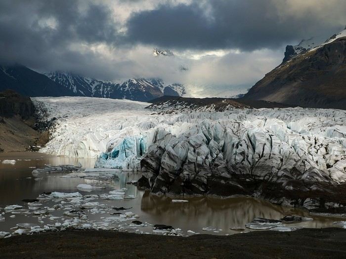
Bookings
Flight tickets bought directly from Fly Play’s website: 1520 € for the four of us (adult fare), with just two checked bags and one carry-on each. It was the compromise we found to keep costs down while still fitting all the bulky clothes we’d need. Late April isn’t quite winter anymore, but it’s not quite spring either, so we packed for chilly weather. Fly Play is Icelandair’s low-cost airline. No complaints: check-in was quick, service was efficient, and the flights were on time.
The car. Booked with Golden Circle car rental, a small family-run business with offices just 5 minutes from the airport. I’d read good things about them, and I can confirm everything went smoothly with our Dacia Duster—it wasn’t brand new, but it was reliable and spacious. We paid 463 € for the week, with full insurance included. The manager picked us up at the airport 10 minutes after I messaged him on WhatsApp to say we’d arrived. For the return trip, since our flight was super early and the agency wasn’t open yet, we agreed to leave the car in the airport parking lot and sent him a photo of the spot so he could find it. Super convenient! I read *so* many questions on Facebook groups about insurance: *Should I get the max coverage or not? I’ve got a Visa Premier, I’ve never had an accident, it adds 100 €...* Between sandstorms that can damage the bodywork and skidding off the road due to bad weather (we saw a few cars in ditches!), we decided to go for the rental company’s max insurance to be safe. It was also a requirement for leaving the car in the airport parking lot on our way back, since we couldn’t do the final inspection.
Accommodations were all booked on Booking.com and Hotels.com: - 2 nights in a cottage at Fossatun Country Hotel, near Borgarnes (we rented the sunset cottage—great spot, with a nice view and separate from the other lodgings) - 1 night in an apartment at Bakki Hostel and Apartments, in Eyrarbakki (top-notch) - 1 night in a gorgeous (and pricey!) apartment at Vik Apartments - 2 nights in a family room at Adventure Hof Hotel (perfect location) - 1 night at Blue Viking Studio near the airport (meh, but fine for a few hours’ sleep before an early flight) Total: 1234 €, averaging 176 € per night for 4-person accommodations.
The itinerary Day 1: Arrival around noon at the airport - Hraunfossar / Night at Fossatun Country Hotel Day 2: Snæfellsnes Peninsula / Night at Fossatun Country Hotel Day 3: Bruarfoss - Geysir - Gullfoss - Reykjadalur hot springs / Night in Eyrarbakki Day 4: Seljalandsfoss and Gljúfrafoss - DC-3 wreck (the one near Seljalandsfoss) - Skógafoss - Kvernufoss - Sólheimajökull (hike to the foot of the glacier) - Dyrhólaey - Reynisfjara Beach / Night in Vík Day 5: Fjaðrárgljúfur Canyon - Vatnajökull (3-hour hike to Svartifoss and Skaftafell) / Night in Hof Day 6: Múlagljúfur Canyon (2h45 hike) - Fjallsárlón - Jökulsárlón and Diamond Beach - Svínafellsjökull / Night in Hof Day 7: Drive back - Reykjavik - Sky Lagoon / Night in Keflavík Day 8: Flight back at 6 AM
That’s the practical side covered. I’ll leave you with a photo of our trusty steed.
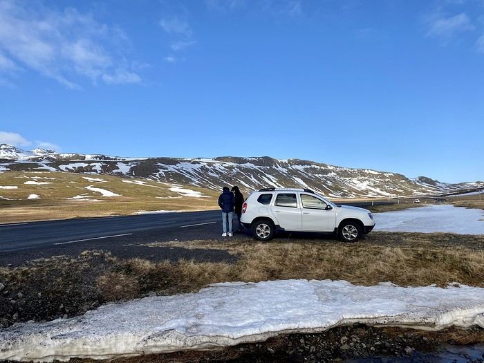
And what a joy to read the travel journals of those travel addicts who were quicker than their own shadow to share their discoveries. Their keyboards and mice must’ve been itching
I’ll admit I’m feeling a bit of that itch too, but I’m way too lazy to dive into the story of our latest trip—last summer in the northwest USA. I’ll probably get to it later, but it might take a while! So, I’m jumping into the short recap of our *way* too short trip to Iceland at the end of April 2024. And even though it’s not the done thing, I’m going to spoil it and start with the conclusion: it was *amazing*!!!
Back in February, on the eve of leaving for a few days’ holiday in Alsace, we started wondering what we could do for Easter break. Scotland and Iceland were the top contenders. The boys are growing up, but they still travel with us often, and they tipped the scales in favor of Iceland. Since we decided a bit late, before booking the flights, I took a quick look at available accommodations. There wasn’t much left, and some were at crazy prices, but I managed to line up a decent itinerary with places that seemed like good value for money. I read travel journals on VF and blogs I could find, picked up bits of info from Facebook groups, and the route quickly took shape—even if I struggled with the place names, mixing them up and forgetting them. The dream could begin...
Bookings
Flight tickets bought directly from Fly Play’s website: 1520 € for the four of us (adult fare), with just two checked bags and one carry-on each. It was the compromise we found to keep costs down while still fitting all the bulky clothes we’d need. Late April isn’t quite winter anymore, but it’s not quite spring either, so we packed for chilly weather. Fly Play is Icelandair’s low-cost airline. No complaints: check-in was quick, service was efficient, and the flights were on time.
The car. Booked with Golden Circle car rental, a small family-run business with offices just 5 minutes from the airport. I’d read good things about them, and I can confirm everything went smoothly with our Dacia Duster—it wasn’t brand new, but it was reliable and spacious. We paid 463 € for the week, with full insurance included. The manager picked us up at the airport 10 minutes after I messaged him on WhatsApp to say we’d arrived. For the return trip, since our flight was super early and the agency wasn’t open yet, we agreed to leave the car in the airport parking lot and sent him a photo of the spot so he could find it. Super convenient! I read *so* many questions on Facebook groups about insurance: *Should I get the max coverage or not? I’ve got a Visa Premier, I’ve never had an accident, it adds 100 €...* Between sandstorms that can damage the bodywork and skidding off the road due to bad weather (we saw a few cars in ditches!), we decided to go for the rental company’s max insurance to be safe. It was also a requirement for leaving the car in the airport parking lot on our way back, since we couldn’t do the final inspection.
Accommodations were all booked on Booking.com and Hotels.com: - 2 nights in a cottage at Fossatun Country Hotel, near Borgarnes (we rented the sunset cottage—great spot, with a nice view and separate from the other lodgings) - 1 night in an apartment at Bakki Hostel and Apartments, in Eyrarbakki (top-notch) - 1 night in a gorgeous (and pricey!) apartment at Vik Apartments - 2 nights in a family room at Adventure Hof Hotel (perfect location) - 1 night at Blue Viking Studio near the airport (meh, but fine for a few hours’ sleep before an early flight) Total: 1234 €, averaging 176 € per night for 4-person accommodations.
The itinerary Day 1: Arrival around noon at the airport - Hraunfossar / Night at Fossatun Country Hotel Day 2: Snæfellsnes Peninsula / Night at Fossatun Country Hotel Day 3: Bruarfoss - Geysir - Gullfoss - Reykjadalur hot springs / Night in Eyrarbakki Day 4: Seljalandsfoss and Gljúfrafoss - DC-3 wreck (the one near Seljalandsfoss) - Skógafoss - Kvernufoss - Sólheimajökull (hike to the foot of the glacier) - Dyrhólaey - Reynisfjara Beach / Night in Vík Day 5: Fjaðrárgljúfur Canyon - Vatnajökull (3-hour hike to Svartifoss and Skaftafell) / Night in Hof Day 6: Múlagljúfur Canyon (2h45 hike) - Fjallsárlón - Jökulsárlón and Diamond Beach - Svínafellsjökull / Night in Hof Day 7: Drive back - Reykjavik - Sky Lagoon / Night in Keflavík Day 8: Flight back at 6 AM
That’s the practical side covered. I’ll leave you with a photo of our trusty steed.
Quinze jours au Soudan en février 2020 English translation pending
Bonjour 😏
Le temps du confinement me permet de me mettre à jour dans mes carnets de voyage.
Une nouvelle aventure. Je pars avec Justine, une ancienne élève qui a 28 ans. Son premier voyage à part des hôtels club..
La location de voiture sans chauffeur est impossible au Soudan. J’ai décidé de louer une voiture avec chauffeur. Je suis donc passé par une agence, 90 euros par jour pour voiture, pétrole, chauffeur (son logement et sa nourriture comprise). Aucune autre prestation.
Je ne voulais pas me contenter du Nord et des sites archéologiques, circuit classique que font les quelques touristes qui vont au Soudan et mais partir vers le sud, dans le Kordofan pour aller dans les nubas mountains. Dans cette partie du soudan, il y a eu pendant des années, une guerre intense avec le gouvernement central. Le mouvement de rébellion existe toujours, le SPLM. L’armée de ce mouvement est toujours en place. Elle réclame un égal développement pour cette partie du territoire dans lequel il n’y a aucun investissement. Dans cette région, le peuple Nuba comprend une mosaïque de tribus. Je voulais aller dans cette région et avait construit un itinéraire que l’agence avait accepté. Hélas, je n’ai pas pu faire tout ce que je voulais car il fallait des autorisations du SPLM que nous n’avons pas eu. 10 jours avant de partir, toujours pas de certitude de pouvoir faire la boucle prévue. Alors que j’avais dit que je ne voulais pas de guide, l’agence m’a parlé d’un gars, dit guide, natif de cette région. Je l’ai contacté directement et nous nous sommes mis d’accord sur sa prestation ! Sur la route, pour les arrêts dans les villages, il n’était pas indispensable, car je n’ai aucun souci pour aller à la rencontre de la population. C’est souvent moi qui disais, on s’arrête là et là… Mais il avait pris des contacts avec les autorités locales. Cela nous a permis de vivre dans un village, impossible sans lui.
1èr partie du voyage : LE KORDOFAN ET LE PAYS NUBAS, au sud de Khartoum
Cela a été le must de notre voyage pour les contacts avec la population. Je voyage beaucoup mais je n’avais pas vécu cela depuis longtemps. Partout l’accueil a été extraordinaire et jamais on ne nous a demandé quoique ce soit.
1er jour KHARTOUN/DILLING
Longue route puisque nous sommes partis à 7 h et arrivés à 17 h 30, mais avec plusieurs arrêts ! En voici quelques uns.
Marché des chameaux "El molih camel market". Le grand marché est le samedi, nous y passons un lundi… Pas beaucoup d’effervescence mais pour notre premier marché de chameaux, on apprécie !
Arrêt dans un village de la tribu Ahamada. Excellent accueil. Nous sommes accueillis dans 3 maisons. Une des familles était très chaleureuse. Nous étions au début du voyage, je ne maîtrisais pas la suite de la journée. Mais à refaire, j’aurais accepté leur invitation de partager un moment ensemble.
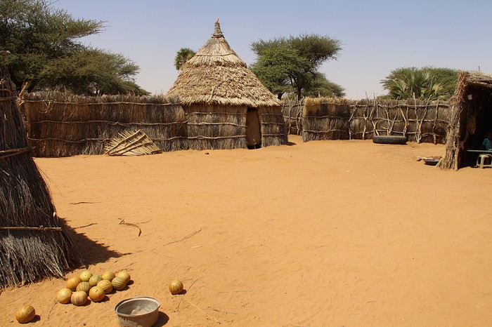
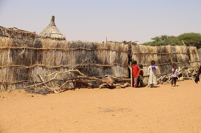
Arrêt à ville de Barra. Nous sommes en début d’après-midi. Notre premier marché. Le souk est animé. Les gens sont étonnés de voir des « blancs » et nous regardaient avec de grands yeux.
Puis arrêt dans un autre village. A nouveau un très bon accueil.
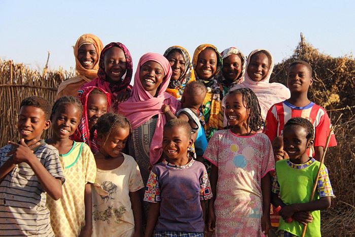
Bien sûr, il faut prendre son temps pour créer le contact
Ce qui m’a passionné sur cette route macadamisée, en très bon état, un peu monotone car les paysages sont plats, pas vraiment jolis, ce sont les camions, avec leur hauteur de marchandises. C’est vraiment très impressionnant. Je vous livre quelques spécimens.
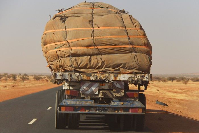
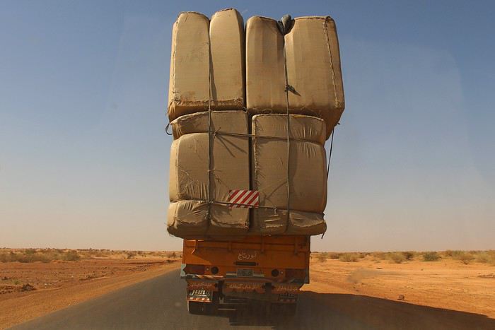
Le temps du confinement me permet de me mettre à jour dans mes carnets de voyage.
Une nouvelle aventure. Je pars avec Justine, une ancienne élève qui a 28 ans. Son premier voyage à part des hôtels club..
La location de voiture sans chauffeur est impossible au Soudan. J’ai décidé de louer une voiture avec chauffeur. Je suis donc passé par une agence, 90 euros par jour pour voiture, pétrole, chauffeur (son logement et sa nourriture comprise). Aucune autre prestation.
Je ne voulais pas me contenter du Nord et des sites archéologiques, circuit classique que font les quelques touristes qui vont au Soudan et mais partir vers le sud, dans le Kordofan pour aller dans les nubas mountains. Dans cette partie du soudan, il y a eu pendant des années, une guerre intense avec le gouvernement central. Le mouvement de rébellion existe toujours, le SPLM. L’armée de ce mouvement est toujours en place. Elle réclame un égal développement pour cette partie du territoire dans lequel il n’y a aucun investissement. Dans cette région, le peuple Nuba comprend une mosaïque de tribus. Je voulais aller dans cette région et avait construit un itinéraire que l’agence avait accepté. Hélas, je n’ai pas pu faire tout ce que je voulais car il fallait des autorisations du SPLM que nous n’avons pas eu. 10 jours avant de partir, toujours pas de certitude de pouvoir faire la boucle prévue. Alors que j’avais dit que je ne voulais pas de guide, l’agence m’a parlé d’un gars, dit guide, natif de cette région. Je l’ai contacté directement et nous nous sommes mis d’accord sur sa prestation ! Sur la route, pour les arrêts dans les villages, il n’était pas indispensable, car je n’ai aucun souci pour aller à la rencontre de la population. C’est souvent moi qui disais, on s’arrête là et là… Mais il avait pris des contacts avec les autorités locales. Cela nous a permis de vivre dans un village, impossible sans lui.
1èr partie du voyage : LE KORDOFAN ET LE PAYS NUBAS, au sud de Khartoum
Cela a été le must de notre voyage pour les contacts avec la population. Je voyage beaucoup mais je n’avais pas vécu cela depuis longtemps. Partout l’accueil a été extraordinaire et jamais on ne nous a demandé quoique ce soit.
1er jour KHARTOUN/DILLING
Longue route puisque nous sommes partis à 7 h et arrivés à 17 h 30, mais avec plusieurs arrêts ! En voici quelques uns.
Marché des chameaux "El molih camel market". Le grand marché est le samedi, nous y passons un lundi… Pas beaucoup d’effervescence mais pour notre premier marché de chameaux, on apprécie !
Arrêt dans un village de la tribu Ahamada. Excellent accueil. Nous sommes accueillis dans 3 maisons. Une des familles était très chaleureuse. Nous étions au début du voyage, je ne maîtrisais pas la suite de la journée. Mais à refaire, j’aurais accepté leur invitation de partager un moment ensemble.
Arrêt à ville de Barra. Nous sommes en début d’après-midi. Notre premier marché. Le souk est animé. Les gens sont étonnés de voir des « blancs » et nous regardaient avec de grands yeux.
Puis arrêt dans un autre village. A nouveau un très bon accueil.
Bien sûr, il faut prendre son temps pour créer le contact
Ce qui m’a passionné sur cette route macadamisée, en très bon état, un peu monotone car les paysages sont plats, pas vraiment jolis, ce sont les camions, avec leur hauteur de marchandises. C’est vraiment très impressionnant. Je vous livre quelques spécimens.
Off to explore Jordan!
Well, since the lockdown is dragging on, I’m starting a new travel journal following the one I finished publishing yesterday:
https://voyageforum.com/discussion/voyage-pays-perles-voyage-dans-ouest-americain-d9943984/
This time, after the U.S., we’re heading to the Middle East—Jordan!
And we’re keeping up the good habits: one day’s entry published every day at 5:30 PM! Happy reading, and feel free to leave a comment, question, or remark...
Franck
Franck
Jordanie 2019: 10 jours au pays des rêves English translation pending
Bonjour la communauté !
Vous trouverez sur ce topic notre carnet de voyage (ma femme et moi) pour un séjour de 10 jours sur place en JORDANIE en Octobre 2019. Le premier message est une introduction, ensuite, nous posterons les étapes au fur et à mesure (une étape = un jour sur place).
J0 - Introduction - Planning J1 - Le Vol J2 - Les Châteaux du désert J3 - Jerash - Ajlun - Dead Sea J4 - Wadi Mujib - Karak - Dana J5 - Dana - Shawbak - Little Petra J6 - Petra J7 - Petra J8 - Wadi Rum J9 - Wadi Rum J10 - Aqaba J11 - Amman J12 - BONUS - 1 jour à Istanbul LE BILAN
Bonne lecture !
J0 - INTRODUCTION - PLANNING
Voici notre carnet de route JORDANIE 2019. Une étape de ce carnet correspond à un jour sur place. Nous y sommes restés 10 jours, tous resterons dans nos mémoires !
POURQUOI LA JORDANIE ? Nous avions déjà entendu parler de la Jordanie et des merveilles que ce pays offre. Depuis plusieurs années, nous alternons nos types de destination et récemment, nous pensions soit à un pays du Maghreb, soit au Moyen-Orient. Pétra principalement revenant souvent dans nos têtes, notre choix s'est donc tout naturellement porté sur la Jordanie !
Pour la période, nous avions des possibilités soit en Juillet-Août, soit en octobre lors des vacances scolaires. Nous nous sommes rapidement rabattus sur Octobre. Cela collait mieux à notre "agenda" personnel et de plus, les températures d'Octobre sont plus douces qu'en Juillet ou en Août. La haute saison en Jordanie est le printemps (Avril) et l'automne (Septembre-Octobre). Par contre, cela correspond également à la période où les prix sont les plus élevés.
Et c'est ainsi que nous nous sommes préparés pour notre dernier voyage de l'année : Jordanie 2019 ! Nous avons utilisé le guide du Routard Jordanie 2020 (très bien).. comme d'habitude. Des fidèles parmi les fidèles.
NOTRE ITINÉRAIRE L'itinéraire est plus ou moins tracé. En effet, la partie ouest de la Jordanie se visite facilement. Amman et son aéroport étant situé au Nord de cette partie, il nous est donc paru évident de faire une boucle du nord vers le sud en balayant les différents site à visiter sur ce parcours.
Nous arrivions et partions de l'aéroport de Amman. Donc une fois sur Aqaba, au sud, nous sommes remontés pour visiter Amman, la veille de notre départ. Nous préférions en effet, être la veille du départ à proximité de l'aéroport, on ne sait jamais :
PETRA: vous avez le choix entre 1, 2 ou 3 jours. Nous y sommes restés 2 jours ce qui est suffisant pour visiter et faire les principales randonnées. 1 jour peut paraitre un peu juste, dans ce cas, il faudra faire des concessions. 3 jours peut être préférable si vous avez des enfants et/ou que vous souhaitez marcher tranquillement. WADI RUM: Là aussi, vous avez plusieurs possibilités pour la durée, tout comme le choix de la découverte. Personnellement, il était impensable de ne pas visiter avec des bédouins en mode vadrouille le jour et bivouac le nuit. Les tentes en durs (très -trop- nombreuses) dénaturent le site et honnêtement...ce n'est pas notre truc. Chacun fait comme il le souhaite mais nous ne conseillons pas ce mode de tourisme. CHÂTEAUX DU DÉSERT: de par la durée de notre séjour (10 jours), nous avons noté que les châteaux du désert était...déserté. héhé. Nous voulions absolument les visiter, quitte à réduire notre temps de visite sur Madaba et Amman.
Attention, on trouve des dos d'âne partout dans le pays, y compris sur les grands axes ! Leur signalétique n'est pas non plus optimale donc gare aux mauvaises surprises
Pour plus de détails sur notre planning pour les 10 jours sur place, je peux vous l'envoyer par message privé.
NOTRE BUDGET
VOL: nous sommes partis avec Turkish Airlines. Nous avons trouvé des billets AR à 370€/personne. Turkish Airlines est une très bonne compagnie aérienne (repas, écran, coussin..). De plus l'aéroport d'Istanbul, tout nouveau, tout beau, est parfait! REPAS: nous avons privilégié les restaurants bon marché en général. A Pétra, notre hôtel préparait des lunchbox à 3 JOD. Pas cher et la box est complète (banane, pita, biscuit, pomme, tomate, vache qui rit, eau) LOGEMENT: Globalement, nous avons trouvé des chambres doubles avec salle de douche privée pour 40€ en moyenne. Nous avons payé un peu moins cher à Dana car nous étions dans un tipi (20€), mais excessivement cher sur la Mer Morte où on ne trouve que des grands hôtels (Crowne Plaza, Dead Sea Spa hotel..) ayant privatisés l'accès à la plage (100€). TRANSPORT: nous avons loué une voiture avec MONTECARLO. Ils sont venus nous chercher à l'aéroport, leur agence de l'aéroport est située à 5-10 minutes de l'aéroport même. Nous avions une berline Kia, boite auto, pour 26 JOD par jour (33-34€/jour). L'essence est moins cher qu'en France (0.77 JOD /litre pour de l'essence 90). Nous avons hésité à rendre la voiture avant de visiter AMMAN, la circulation y est dense et compliquée, mais finalement, nous l'avons gardée les 10 jours. Jérôme n'a pas trouvé difficile de rouler dans AMMAN, sûrement des restes de son expérience en Afrique. ACTIVITÉ: inévitable, le Jordan Pass ! A acheter en ligne avant le voyage, il est proposé avec 3 tarifs selon la durée à Pétra: 70, 75, 80 JOD (respectivement 1, 2 ou 3 jours). Il inclut le VISA obligatoire (40 JOD si payé seul à part), l'entrée à Pétra (50 JD si payé seul à part) et l'entrée de 40 sites (Wadi Rum, Jerash, Ajlun, Karak, ...) donc il est très avantageux. En plus, nous avons payé le Siq Trail (plutôt cher) et l'accès au Mt Nébo, non inclus dans le Jordan Pass. EXTRA: pas trop d'extra si ce n'est du thé à droite à gauche, du jus de grenade... etc. mais à des prix abordables. Par contre, nous avons bu une seule bière, à l'hôtel de la Mer Morte, pour un peu plus de 7 euros, et on était en happy hour!
La Jordanie n'est pas une destination qu'on peut considérer comme bon marché. Les restaurants classiques sont à peine moins chers qu'en France. L'entrée de Pétra reste assez cher (>60€), de même qu'un séjour dans le désert de Wadi Rum. Bref, la Jordanie n'est pas une destination low cost honnêtement.
 EN ROOOUTE
J0 - Introduction - Planning J1 - Le Vol J2 - Les Châteaux du désert J3 - Jerash - Ajlun - Dead Sea J4 - Wadi Mujib - Karak - Dana J5 - Dana - Shawbak - Little Petra J6 - Petra J7 - Petra J8 - Wadi Rum J9 - Wadi Rum J10 - Aqaba J11 - Amman J12 - BONUS - 1 jour à Istanbul LE BILAN
Bonne lecture !
J0 - INTRODUCTION - PLANNING
Voici notre carnet de route JORDANIE 2019. Une étape de ce carnet correspond à un jour sur place. Nous y sommes restés 10 jours, tous resterons dans nos mémoires !
POURQUOI LA JORDANIE ? Nous avions déjà entendu parler de la Jordanie et des merveilles que ce pays offre. Depuis plusieurs années, nous alternons nos types de destination et récemment, nous pensions soit à un pays du Maghreb, soit au Moyen-Orient. Pétra principalement revenant souvent dans nos têtes, notre choix s'est donc tout naturellement porté sur la Jordanie !
Pour la période, nous avions des possibilités soit en Juillet-Août, soit en octobre lors des vacances scolaires. Nous nous sommes rapidement rabattus sur Octobre. Cela collait mieux à notre "agenda" personnel et de plus, les températures d'Octobre sont plus douces qu'en Juillet ou en Août. La haute saison en Jordanie est le printemps (Avril) et l'automne (Septembre-Octobre). Par contre, cela correspond également à la période où les prix sont les plus élevés.
Et c'est ainsi que nous nous sommes préparés pour notre dernier voyage de l'année : Jordanie 2019 ! Nous avons utilisé le guide du Routard Jordanie 2020 (très bien).. comme d'habitude. Des fidèles parmi les fidèles.
NOTRE ITINÉRAIRE L'itinéraire est plus ou moins tracé. En effet, la partie ouest de la Jordanie se visite facilement. Amman et son aéroport étant situé au Nord de cette partie, il nous est donc paru évident de faire une boucle du nord vers le sud en balayant les différents site à visiter sur ce parcours.
Nous arrivions et partions de l'aéroport de Amman. Donc une fois sur Aqaba, au sud, nous sommes remontés pour visiter Amman, la veille de notre départ. Nous préférions en effet, être la veille du départ à proximité de l'aéroport, on ne sait jamais :
PETRA: vous avez le choix entre 1, 2 ou 3 jours. Nous y sommes restés 2 jours ce qui est suffisant pour visiter et faire les principales randonnées. 1 jour peut paraitre un peu juste, dans ce cas, il faudra faire des concessions. 3 jours peut être préférable si vous avez des enfants et/ou que vous souhaitez marcher tranquillement. WADI RUM: Là aussi, vous avez plusieurs possibilités pour la durée, tout comme le choix de la découverte. Personnellement, il était impensable de ne pas visiter avec des bédouins en mode vadrouille le jour et bivouac le nuit. Les tentes en durs (très -trop- nombreuses) dénaturent le site et honnêtement...ce n'est pas notre truc. Chacun fait comme il le souhaite mais nous ne conseillons pas ce mode de tourisme. CHÂTEAUX DU DÉSERT: de par la durée de notre séjour (10 jours), nous avons noté que les châteaux du désert était...déserté. héhé. Nous voulions absolument les visiter, quitte à réduire notre temps de visite sur Madaba et Amman.
Attention, on trouve des dos d'âne partout dans le pays, y compris sur les grands axes ! Leur signalétique n'est pas non plus optimale donc gare aux mauvaises surprises
Pour plus de détails sur notre planning pour les 10 jours sur place, je peux vous l'envoyer par message privé.
NOTRE BUDGET
VOL: nous sommes partis avec Turkish Airlines. Nous avons trouvé des billets AR à 370€/personne. Turkish Airlines est une très bonne compagnie aérienne (repas, écran, coussin..). De plus l'aéroport d'Istanbul, tout nouveau, tout beau, est parfait! REPAS: nous avons privilégié les restaurants bon marché en général. A Pétra, notre hôtel préparait des lunchbox à 3 JOD. Pas cher et la box est complète (banane, pita, biscuit, pomme, tomate, vache qui rit, eau) LOGEMENT: Globalement, nous avons trouvé des chambres doubles avec salle de douche privée pour 40€ en moyenne. Nous avons payé un peu moins cher à Dana car nous étions dans un tipi (20€), mais excessivement cher sur la Mer Morte où on ne trouve que des grands hôtels (Crowne Plaza, Dead Sea Spa hotel..) ayant privatisés l'accès à la plage (100€). TRANSPORT: nous avons loué une voiture avec MONTECARLO. Ils sont venus nous chercher à l'aéroport, leur agence de l'aéroport est située à 5-10 minutes de l'aéroport même. Nous avions une berline Kia, boite auto, pour 26 JOD par jour (33-34€/jour). L'essence est moins cher qu'en France (0.77 JOD /litre pour de l'essence 90). Nous avons hésité à rendre la voiture avant de visiter AMMAN, la circulation y est dense et compliquée, mais finalement, nous l'avons gardée les 10 jours. Jérôme n'a pas trouvé difficile de rouler dans AMMAN, sûrement des restes de son expérience en Afrique. ACTIVITÉ: inévitable, le Jordan Pass ! A acheter en ligne avant le voyage, il est proposé avec 3 tarifs selon la durée à Pétra: 70, 75, 80 JOD (respectivement 1, 2 ou 3 jours). Il inclut le VISA obligatoire (40 JOD si payé seul à part), l'entrée à Pétra (50 JD si payé seul à part) et l'entrée de 40 sites (Wadi Rum, Jerash, Ajlun, Karak, ...) donc il est très avantageux. En plus, nous avons payé le Siq Trail (plutôt cher) et l'accès au Mt Nébo, non inclus dans le Jordan Pass. EXTRA: pas trop d'extra si ce n'est du thé à droite à gauche, du jus de grenade... etc. mais à des prix abordables. Par contre, nous avons bu une seule bière, à l'hôtel de la Mer Morte, pour un peu plus de 7 euros, et on était en happy hour!
La Jordanie n'est pas une destination qu'on peut considérer comme bon marché. Les restaurants classiques sont à peine moins chers qu'en France. L'entrée de Pétra reste assez cher (>60€), de même qu'un séjour dans le désert de Wadi Rum. Bref, la Jordanie n'est pas une destination low cost honnêtement.
EN ROOOUTEAutumn trip from Puglia to Naples via Basilicata...
Hi everyone!!!
I’m finally getting around to writing about this 20-day trip to southern Italy: we didn’t travel this summer, and luckily, we found beautiful light and dreamy weather there at the end of September.
First, here’s the context of the trip: we’re both "confirmed seniors" but still curious and alert enough to enjoy the itinerary we’d imagined! We wanted a mix of discoveries—culture, cities, and nature—with guaranteed sunshine and the occasional short hike... We’re flying to Naples, round-trip, because the flight times work better for us. We rented a car online, picked it up at the airport (details to come... and it won’t be the highlight of the trip!), and booked our hotels in advance.
A quick overview of the itinerary: leaving Naples on September 15th, early in the morning, we’ll drive straight across the boot of Italy to Bari. After 11 days in Puglia, we’ll head back toward our starting point, taking our time: Matera in Basilicata, Maratea by the sea, and finally Paestum with its incredible temples.
Day 1: Brussels-Naples flight (Brussels Airlines) went smoothly; it landed an hour early, and we were thrilled, thinking we could use that time for a quick visit or two... Everything went well until we left the airport. We took the shuttle to the car rental offices, and at first glance, we realized this wouldn’t be smooth sailing!!! In front of every office (they’re side by side), there were already lines and kids sitting on suitcases—everyone looked exhausted... We resigned ourselves to waiting: nothing moved until tempers flared at the counters, and two people nearly came to blows. Things sped up a little, and after 2 (two...) hours of waiting, we finally got our chariot: a black Fiat Tipo, dirty, with a few dents and scratches that we made sure to note in the contract... but it ran!
Off to Bari, then: no time for sightseeing along the way! From there, we headed straight to our hotel in the countryside near Polignano a Mare.
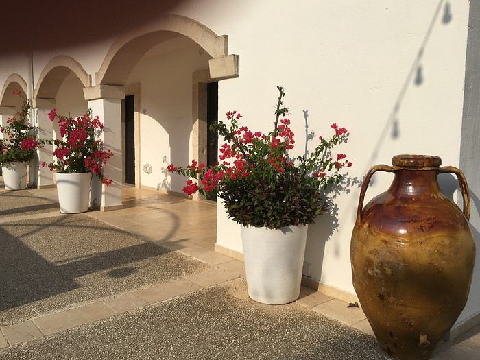
A recurring detail: this happened constantly during our travels. We’d installed our own GPS, fully updated... In recent years, many dirt roads have become drivable, and lots of hotels and hostels have opened in the outskirts of towns. It was extremely rare for our ‘guide’ to recognize the street—let alone the number—we entered. Often, we got by calling the hotel reception: it might seem like a small thing, but it happened so often it became frustrating. In hindsight, it seems like without Google Maps, we’d have been lost!
Anyway, we were beautifully settled, with a terrace overlooking olive groves and the sea in the distance: all was well.
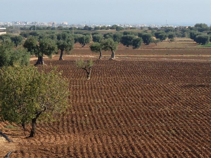
To be continued...
I’m finally getting around to writing about this 20-day trip to southern Italy: we didn’t travel this summer, and luckily, we found beautiful light and dreamy weather there at the end of September.
First, here’s the context of the trip: we’re both "confirmed seniors" but still curious and alert enough to enjoy the itinerary we’d imagined! We wanted a mix of discoveries—culture, cities, and nature—with guaranteed sunshine and the occasional short hike... We’re flying to Naples, round-trip, because the flight times work better for us. We rented a car online, picked it up at the airport (details to come... and it won’t be the highlight of the trip!), and booked our hotels in advance.
A quick overview of the itinerary: leaving Naples on September 15th, early in the morning, we’ll drive straight across the boot of Italy to Bari. After 11 days in Puglia, we’ll head back toward our starting point, taking our time: Matera in Basilicata, Maratea by the sea, and finally Paestum with its incredible temples.
Day 1: Brussels-Naples flight (Brussels Airlines) went smoothly; it landed an hour early, and we were thrilled, thinking we could use that time for a quick visit or two... Everything went well until we left the airport. We took the shuttle to the car rental offices, and at first glance, we realized this wouldn’t be smooth sailing!!! In front of every office (they’re side by side), there were already lines and kids sitting on suitcases—everyone looked exhausted... We resigned ourselves to waiting: nothing moved until tempers flared at the counters, and two people nearly came to blows. Things sped up a little, and after 2 (two...) hours of waiting, we finally got our chariot: a black Fiat Tipo, dirty, with a few dents and scratches that we made sure to note in the contract... but it ran!
Off to Bari, then: no time for sightseeing along the way! From there, we headed straight to our hotel in the countryside near Polignano a Mare.
A recurring detail: this happened constantly during our travels. We’d installed our own GPS, fully updated... In recent years, many dirt roads have become drivable, and lots of hotels and hostels have opened in the outskirts of towns. It was extremely rare for our ‘guide’ to recognize the street—let alone the number—we entered. Often, we got by calling the hotel reception: it might seem like a small thing, but it happened so often it became frustrating. In hindsight, it seems like without Google Maps, we’d have been lost!
Anyway, we were beautifully settled, with a terrace overlooking olive groves and the sea in the distance: all was well.
To be continued...
Guide de voyage et itinéraire en Jordanie: les conseils d'un expat! English translation pending
Bonjour à tous les voyageurs et voyageuses ! Bienvenu(e)s sur ce carnet de voyage portant sur la Jordanie, une des perles du Moyen-Orient et l’un des plus beaux pays dans lequel j’ai voyagé. J’ai l’habitude de poster des carnets de voyages détaillés lors de mes trips. Cette fois-ci, je vais pouvoir être encore plus exhaustif car, après avoir visité le pays en 2017, j’y ai habité durant plus de 6 mois en tant d’expatrié entre janvier et juillet 2019 !
L’idée est de vous proposer le parcours idéal pour votre prochain voyage en Jordanie, avec les bons plans, les immanquables ainsi que l’itinéraire le mieux adapté à un trip durant entre 1 et 2 semaines ! Je serai aussi ravi de répondre à vos questions, vos prises de têtes et vos inquiétudes sur cette discussion 😊
Tout d’abord pourquoi la Jordanie ? Dans le contexte actuel, c’est l’un des derniers pays visitable et accessible à tout le monde dans la région. Ici, pas de risque, pas d’instabilité. Le royaume hachémite (Hachem, c’est le nom de la famille royale) a décidé de miser gros sur le tourisme et tout est fait pour que votre séjour ici se déroule sans encombre. Ensuite, pour un pays de petite taille, la Jordanie regorge de richesses culturelles et naturelles. Que vous soyez passionnés d’histoire, amoureux de la nature ou bien grands sportifs, la Jordanie saura répondre à vos attentes. Pour ma part, j’adore l’Histoire. Eh bien, tenez-vous prêts, en Jordanie j’ai pu visiter des vestiges datant du néolithique, observer l’influence des pharaons d’Egypte, les restes des grands royaumes bibliques, les constructions fascinante du peuple nabatéen, la trace du passage durable des grecs avec Alexandre le Grand, les très nombreux vestiges romains, l’évocation des passages de Moïse, Jésus et autres grands personnages de la bible, les constructions byzantines puis islamiques (omeyyades, abbassides), les forteresses des Croisés, les souvenirs de l’occupation Ottomane, les traces de l’occupation par l’empire Britannique et enfin la naissance d’un tout jeune pays, la Jordanie, dont le territoire a été le théâtre millénaire du passage des hommes dans une région plus que jamais stratégique depuis des milliers d’années. Bref ! C’est beau, c’est intéressant et c’est assez unique d’avoir tout ça sur une ligne Nord-Sud de moins de 400km !
Pour illustrer un peu les propos qui vont suivre, voici deux petites vidéos que j’ai réalisé lorsque j’habitais en Jordanie (j’aime bien faire des vidéos de voyage oui !), j’ai aussi réalisé la musique moi-même. C’est donc du 100% fait maison 😊 La première vidéo « Wadi & Jebel » porte sur plusieurs endroits de la Jordanie. La deuxième vidéo « Wadi Rum » porte évidemment sur le désert du Wadi Rum, grandiose, magnifique ! J’espère que ces vidéos vous donneront encore plus l’eau à la bouche concernant ce magnifique pays ! https://www.youtube.com/watch?v=tvnyf95y9zc
https://www.youtube.com/watch?v=ISok1lxgBvs
Le Jordan Pass : Avant toute chose, il convient de mentionner le Jordan Pass. C’est un must pour tout voyageur désireux de visiter la Jordanie. Il inclut le visa d’entrée ainsi qu’un accès à quasiment tous les sites touristiques payants du pays. On économise ainsi énormément en achetant le Jordan Pass, qui se commande sur internet via le site du ministère du tourisme jordanien. Vous pouvez choisir entre un Pass incluant 1, 2 ou 3 jours de visites à Petra (en plus de toutes les autres prestations et du prix du visa). Le prix de base du Jordan Pass est de 90€ (pour 1 jour de visite à Petra). Bref, il est impératif d’avoir son Jordan Pass avant d’aller visiter le pays !
Itinéraire(s) : La Jordanie est un pays qui nécessite au minimum 1 semaine pour en faire le tour (on peut bien sur venir pour 1 week-end et faire Petra puis repartir, mais je préfère me concentrer sur un programme complet). C’est donc un pays qui a l’avantage de pouvoir être parcouru en 1 semaine. Bien entendu, pour ceux qui ont plus de temps, il est possible de rester 15 jours et de profiter au mieux du pays en le visitant de manière optimale (c’est la meilleure solution, mais tout le monde n’a pas 15 jours à poser). Je vais donc rédiger un itinéraire qui me semble le plus adapté à un séjour d’une grosse semaine en Jordanie, ensuite je rajouterai mes conseils si vous voulez prolonger le séjour de plusieurs jours ou d’une semaine entière. J’ai choisi de mettre le nom des bonnes adresses (hôtels, restos, camps etc…) si vous souhaitez plus d’informations, n’hésitez pas à me demander.
1er Jour : -Arrivée à l’aéroport d’Amman (de plus en plus de vols touristiques ont ouvert entre l’Europe et Aqaba, dans le sud du pays. Si vous atterrissez à Aqaba, vous pouvez suivre l’itinéraire, mais en démarrant d’Aqaba, dans le sud). Transfert vers le centre-ville, soit en taxi (20-25 JOD, pas plus !) soit en navette de la compagnie Sariyah (http://sariyahexpress.com/en/content/airport-express) qui propose de vous emmener vers la ville, mais il faudra ensuite prendre un taxi (max 5JOD) pour rejoindre le centre-ville. -Amman est une ville qui se visite en 1 jour. Il y a de belles choses mais les joyaux du pays ne se trouvent pas là. Programme d’une visite d’Amman : La citadelle avec ses ruines et sa superbe vue de la ville, l’amphithéâtre romain et l’Odéon, le souk du centre-ville, le quartier de Jabal-Al-Weibdeh (où j’ai habité durant 6 mois) pour y prendre un café avant d’aller visiter la superbe Mosquée du Roi Abdallah. -Où manger : Hachem Restaurant. En plein centre-ville, c’est une institution autant pour les touristes que pour les locaux, falafels, houmous et thé pour quelques dinars, immanquable ! A un prix plus élevé, le restaurant Shams-al-Balad dans le centre propose des plats typiquement locaux, avec une touche de classe, sur une superbe terrasse. Très bons brunchs également le matin. -Où dormir : Le Sydney hôtel, en plein centre-ville propose des chambres propres et modernes à prix raisonnable. Si on veut un peu plus de standing, je conseille les appartements Shams-Al-Weibdeh, très confort avec piscine et terrasse offrant une super vue sur la ville.
2ème jour : -Départ le matin d’Amman, direction le sud vers le petit village de Dana ! Au programme, la route des rois. Malgré la distance relativement petite (200km) il faut prévoir la journée. Sur la route des rois on roule lentement, au grès des villages, des canyons, des locaux, des descentes, des montées, des vues magnifiques et des pauses photos. C’est une super route qui vaut la journée. Les curieux s’arrêteront visiter le châteaux Croisé de Kerak sur le chemin. Moment fort de la journée : le passage dans le « grand canyon jordanien », le Wadi Mujib. Une vue époustouflante qui vaut le détour à elle seule. On peut même faire une pause à midi en remontant de l’autre côté, il y a un petit resto sympa sur le bord de la route avec la vue sur le canyon. -Arrivée l’après-midi dans le petit village de Dana, mon coup de cœur en Jordanie. Pour les hôtels, il y en a pour tous les goûts. J’ai bien aimé le Dana Moon Hostel où je suis resté plusieurs fois, avec un accueil chaleureux et une belle terrasse où prendre son petit déjeuner. A Dana, on y reste 1 jour, 2 si vous avez un coup de cœur. C’est un petit village au cœur d’une réserve naturelle préservée (chose assez rare en Jordanie…). Depuis le village, la vue est incroyable sur la vallée qui s’étend jusqu’à la Mer Morte, avec, au loin, la Palestine. Si vous aimez la marche, vous pouvez faire une rando en vous enfonçant dans la vallée et en remontant quand vous le souhaitez. C’est un endroit calme, grandiose qui vaut le détour assurément !
3ème jour : -Sachant que Petra nécessite une journée entière, mieux vaut se réveiller directement sur place pour la visiter. Ainsi, le matin, pourquoi pas profiter du calme de la vallée de Dana. Peut-être même d’une petite randonnée dans la vallée ou bien en surplombant celle-ci en se faisant un petit pique-nique ? Ensuite, départ de Dana, direction Petra ! Environ 1h30 de route (un peu plus si on s’arrête visiter le château de Shaubak sur la route). Lorsqu’on arrive à Wadi Musa (ou Gaia, nouveau nom de la ville où se trouve Petra), on se rend bizarrement compte qu’on n’est pas les seuls à avoir eu l’idée de venir visiter Petra… Les locaux s’en sont aussi rendus compte et proposent des dizaines et des dizaines d’Hotels, restaurants, activités, visites etc… Mais peu importe, Petra est là et c’est l’essentiel ! Comme je l’ai dit avant, il vaut mieux privilégier une journée entière (du matin jusqu’au soir) pour visiter Petra. Après, cela va dépendre de votre Jordan Pass et du nombre de jours à Petra que vous avez choisi (1, 2 ou 3), dans cet itinéraire simplifié, je pars du principe qu’on ne fera qu’un jour à Petra (ce qui peut suffire en faisant une belle grosse journée sur place). -Où dormir : Beaucoup d’hôtels et d’offres à Petra. J’ai trouvé ça un peu + cher et – satisfaisant que dans le reste du pays. Mais bon c’est normal car c’est LE point de passage obligatoire. Selon vos goûts et vos budgets vous trouverez le logement qui vous convient. Attention quand même à essayer dans l’idéal de réserver la nuit d’hôtel quelques jours avant. Ça permettra justement de choisir un bon rapport qualité/prix plutôt que de prendre les derniers hôtels disponibles. -Où manger : un peu pareil que pour les hôtels, y a le choix ! J’ai mangé deux fois au restaurant El-Arabi en plein centre-ville. Si vous n’avez pas fait votre choix et réfléchissez encore, pourquoi ne pas essayer celui-ci.
4ème jour : -Journée entière à Petra ! Alors comme je le disais, il faut s’attendre à beaucoup de touristes. Attention à ne pas se faire avoir par les locaux qui vous proposent un tour en jeep ou bien vous disent qu’il est impossible de marcher pour faire le site. Cependant, le site conserve sa magie ! C’est un lieu incroyable, gigantesque, où l’on y passe au minimum une journée entière. Si vous êtes des bons marcheurs, vous pouvez parcourir une bonne dizaine de km dans la journée. Après l’entrée par le centre de visiteur, vous passerez le canyon (Siq) puis le trésor (Khazneh) qui sont les plus connus. Je vous conseille de parcourir le site en direction du Monastère, situé dans les montagnes après un très long escalier. Le chemin est magnifique, le Monastère encore plus ! Ensuite, si vos jambes vous soutiennent encore, poursuivre un peu après le Monastère sur des pitons rocheux qu’on voit à quelques centaines de mètres. De là-haut, la vue est incroyable, sur toute une vallée à pic et au loin la vallée de la Mer Morte tout en contrebas. Ensuite, retour à pied jusqu’au centre de visiteurs. Je vous garantis que vous serez fatigués ! Un repas et un repos bien mérités vous attendent à l’hôtel de Wadi Musa (Gaia), pour être en forme et partir tôt le lendemain !
5ème jour : -Départ tôt le matin depuis Petra, direction le Wadi Rum ! Mon lieu favori en Jordanie. Tellement de puissance, de beauté, de grandeur. On se croirait sur une autre planète, on se dépayse complètement, c’est assez intense ! Pour visiter le Wadi Rum je conseille très fortement de le faire avec un camp de bédouins. C’est même l’unique façon de la faire, sauf si on est en compagnie de guides ou de gens qui connaissent bien le lieu. Il faut donc impérativement réserver le camp de bédouins dans lequel on voudra passer son séjour dans le désert. Il existe une multitude de de prestataires. Certains plus critiquables que d’autres, notamment au niveau environnemental et éthique (voir le guide du Routard qui évoque bien le problème). Les bédouins viendront vous chercher sur le parking du centre pour visiteurs. Ils viennent généralement en Jeep et récupèrent le groupe de touristes. Ensuite, c’est parti pour la visite du désert et la nuit dans un camp. -Encore une fois, il y en a pour tous les goûts : luxe, sportif, roots, francophone, nuit à la belle étoile, dans un camp tout aménagé, chameau, rando, escalade etc… A vous de choisir en fonction de votre budget, de vos envies et du confort que vous désirez. Pour ma part, mon expérience favorite a été mon séjour réalisé avec Wadi Rum Bedouin Friends. Le prix était standard, pas plus haut que les autres et propose une expérience à taille humaine, respectueuse du désert, de ses habitants et de ses traditions : de la marche, du calme, des nuits à la belle étoile sur matelas avec couvertures, repas autour du feu. On n’est pas dans le bling-bling touristique irrespectueux. C’est tout l’inverse et c’est pour cela que je conseille ce prestataire-là. -Dans l’idéal, pour bien profiter de Wadi Rum et s’en imprégner, il faut y passer 2 jours (avec l’arrivée le matin depuis Petra) + 2 nuits. Ça permet notamment d’avoir une journée entière (réveil puis coucher) dans le désert et d’avoir un sentiment d’immersion. Si vous pouvez vous le permettre c’est bien, sinon, 1 jour et 1 nuit (comme je l’ai fait la 1ere fois que je suis venu en Jordanie) suffisent aussi à vire une super expérience.
6ème jour : -Route de Wadi Rum direction Aqaba. Le trajet n’est pas très long, une grosse heure, pas plus. Belle route qui coupe à travers la montagne et descend vers la Mer Rouge. Arrivée à Aqaba le matin. Aqaba, on aime ou on n’aime pas. C’est une ville assez spéciale, différente du reste du pays. Ce n’est pas forcément une ville qui se visite, on y vient surtout pour la Mer Rouge. -Je vous conseille de prendre un logement au sud de la ville, dans le secteur de South Beach (5km au sud de la ville). J’ai logé au Bedouin Moon Village et ce fut assez agréable. Pas forcément pour le confort, mais plutôt pour l’emplacement (on traverse la route et on se retrouve sur la plage). On peut louer des équipements de snorkeling pour 5JOD la journée. -Comme activité, je conseille de profiter de la plage et la piscine, après ces journées d’aventures à Petra et dans le désert, un peu de repos ça ne fait pas de mal. D’autant plus que la plage est assez incroyable ! En moins de 10mn de marche on trouve de super spots de snorkeling, c’est impressionnant, au bord de l’eau, à 15 mètres du rivage, on trouve quantité de coraux, poissons multicolores dans une eau transparente. Pour ceux qui voulaient voir les fonds marins sans se lancer dans une longue journée plongée (comme moi) c’est l’idéal ! Le soir est le moment idéal pour faire une virée en ville à Aqaba. On y trouve de bons restos de poisson (les seuls dans le pays) ainsi que des restaurant locaux comme le Syrian Palace (très peu cher). On peut même boire une bière en terrasse, au bar Ali Baba en plein centre ! -Pour ce qui est de la plongée, je ne m’y connais malheureusement pas. Je n’ai pas essayé d’en faire à Aqaba et je ne pourrai pas vous aiguiller sur le sujet.
7ème jour : -Remontée de Aqaba vers la Mer Morte, à travers la Wadi Araba (vallée de la Mer Morte). Une route assez clean qui remonte vers le nord en longeant la frontière avec Israël. Plus on avance et plus on perd en altitude, sachant qu’on avait démarré du niveau de la mer ! L’arrivée à la Mer Morte se fait à -430m, le point le plus bas du monde ! -2 options s’offrent à vous : soit vous passez l’après-midi à la Mer Morte et vous dormez sur place dans l’un des complexes hôteliers construit sur les rives. C’est un peu plus cher mais ça a l’avantage de permettre de profiter de la Mer Morte ainsi que d’un hôtel de luxe. Deuxième option, passer l’après-midi à la Mer Morte puis remonter ensuite vers la ville de Madaba (environ 1h de route). L’avantage sera de découvrir une nouvelle ville dans la soirée, qui plus est Madaba, ville chrétienne où l’on pourra savourer du vin au diner et se balader en ville. -Pour l’option hôtel à la Mer Morte, je vous laisse faire votre choix en fonction de votre budget, mais on est sur du haute gamme. L’hôtel vous offrira la prestation Mer Morte et tout ce qui va avec. Pour la 2ème option, il faudra passer par un hôtel pour accéder à la Mer Morte avec équipement (douche, bains de boue, piscine…) ou bien vous pouvez aller à Amman Beach, situé entre les hôtels sur la rive. C’est un peu moins cher et plus populaire. Dans tous les cas mieux vaut choisir une de ces options plutôt que d’aller en solo dans la mer sur une plage non aménagée (le danger c’est le sel, si on n’a pas accès à une douche d’eau douce rapidement après la baignade). -Si vous avez choisi l’option Madaba, vous pouvez passer la soirée dans le centre-ville, dans un des nombreux restaurants. Nous avions dormi au Mariam Hôtel pour un prix raisonnable avec chambre confortable et piscine. En fonction de votre temps et de vos horaires, il faut visiter à Madaba l’église Saint George avec la carte de la terre sainte en mosaïque.
8ème jour : -Direction Jérash au nord d’Amman ! Une grosse heure de route vers le nord sur l’autoroute (ça fait du bien). Le site est vraiment magnifique. Tout une ville romaine conservée ça laisse bouche bée. Entre le cardo, les colonnades, les arches, les temples et l’amphithéâtre, on a de quoi y passer au moins 4h. Jérash est l’un des incontournables du pays, surtout quand on aime les ruines romaines. Pour midi, je vous conseille ensuite d’aller manger au Green Valley Restaurant à Jérash à l’entrée de la ville. Rien que pour leur immense terrasse, ça vaut le détour ! -Retour dans l’après-midi à Amman. En fonction de votre avion, vous pouvez directement rejoindre l’aéroport, ou bien passer votre dernière nuit à Amman avant de décoller le lendemain.
Voilà donc l’itinéraire pour une grosse semaine de visite de la Jordanie. J’ai essayé de faire un itinéraire le plus compact possible, en rassemblant tous les lieux incontournables et les bons plans du pays. Bien entendu, cet itinéraire est modifiable en fonction de vos goûts, votre budget et votre temps sur place. Vous pouvez faire ça dans le sens que vous souhaitez, en fonction de ce que vous avez lu et de ce que vous préférez 😊
Séjour prolongé (8 à 15 jours) : -Si vous avez prévu un séjour plus long qu’une semaine en Jordanie (bonne idée !!) alors vous allez pouvoir encore mieux profiter du pays. Globalement, l’idée est de faire le même itinéraire que celui évoqué ci-dessus, mais en faisant des arrêts plus longs à chaque endroit pour profiter au maximum. -Je conseille tout de même d’aller visiter le site d’Umm Qais dans le nord du pays. Ce sont de superbes ruines romaines, avec un panorama magnifique sur le plateau du Golan en face, les montagnes du Liban au loin et le lac de Tibériade en Israël sur la gauche. Il y a un restaurant avec une belle terrasse où vous pourrez manger à midi après la visite. -Si vous aimez la randonnée et la nature, pourquoi pas rester une deuxième journée à Dana et vous lancer dans une longue rando dans la vallée qui vous prendra la journée et dormir une deuxième nuit sur place. -Au sud d’Amman se trouve le Wadi Mujib. Il est possible de faire une journée de canyoning et de randonnée dans le lit de la rivière creusée dans le canyon. On arrive à la fin dans la vallée de la Mer Morte ! -Pour Petra, vous pouvez facilement y passer une deuxième journée, voir même une troisième journée, avec différents parcours, lieux à découvrir etc… -En ce qui concerne le Wadi Rum, comme je l’ai mentionné précédemment, faire 2 jours et 2 nuits rend la chose encore plus grandiose ! Vous pouvez ensuite choisir à votre guise d’y passer encore plus de temps, je pense que le terrain de jeu est assez grand pour prolonger l’expérience. -A Aqaba, si vous êtes intéressés par de la plongée, vous pouvez facilement passer plusieurs jours sur place à visiter les différents endroits (très nombreux) qui valent le coup dans la Mer Rouge. -Pour la Mer Morte, pourquoi pas choisir les deux options que je vous proposais : dormir sur place dans l’un des hôtels puis le lendemain profiter de la ville de Madaba et y dormir en visitant les lieux historiques durant la journée.
Discussion : Je répondrai avec plaisir à toutes vos questions concernant le budget, certaines villes, des endroits non mentionnés, le climat, la culture, la nourriture etc… C’est un beau pays, qui mérite le détour et si je peux vous aider à faciliter un peu votre séjour cela me rendra heureux également ! Je vous laisse à nouveau avec mes 2 petites vidéos de voyage en Jordanie. N’hésitez pas à les partager également 😊
https://www.youtube.com/watch?v=ISok1lxgBvs
https://www.youtube.com/watch?v=tvnyf95y9zc
Bon voyage !
Florian
L’idée est de vous proposer le parcours idéal pour votre prochain voyage en Jordanie, avec les bons plans, les immanquables ainsi que l’itinéraire le mieux adapté à un trip durant entre 1 et 2 semaines ! Je serai aussi ravi de répondre à vos questions, vos prises de têtes et vos inquiétudes sur cette discussion 😊
Tout d’abord pourquoi la Jordanie ? Dans le contexte actuel, c’est l’un des derniers pays visitable et accessible à tout le monde dans la région. Ici, pas de risque, pas d’instabilité. Le royaume hachémite (Hachem, c’est le nom de la famille royale) a décidé de miser gros sur le tourisme et tout est fait pour que votre séjour ici se déroule sans encombre. Ensuite, pour un pays de petite taille, la Jordanie regorge de richesses culturelles et naturelles. Que vous soyez passionnés d’histoire, amoureux de la nature ou bien grands sportifs, la Jordanie saura répondre à vos attentes. Pour ma part, j’adore l’Histoire. Eh bien, tenez-vous prêts, en Jordanie j’ai pu visiter des vestiges datant du néolithique, observer l’influence des pharaons d’Egypte, les restes des grands royaumes bibliques, les constructions fascinante du peuple nabatéen, la trace du passage durable des grecs avec Alexandre le Grand, les très nombreux vestiges romains, l’évocation des passages de Moïse, Jésus et autres grands personnages de la bible, les constructions byzantines puis islamiques (omeyyades, abbassides), les forteresses des Croisés, les souvenirs de l’occupation Ottomane, les traces de l’occupation par l’empire Britannique et enfin la naissance d’un tout jeune pays, la Jordanie, dont le territoire a été le théâtre millénaire du passage des hommes dans une région plus que jamais stratégique depuis des milliers d’années. Bref ! C’est beau, c’est intéressant et c’est assez unique d’avoir tout ça sur une ligne Nord-Sud de moins de 400km !
Pour illustrer un peu les propos qui vont suivre, voici deux petites vidéos que j’ai réalisé lorsque j’habitais en Jordanie (j’aime bien faire des vidéos de voyage oui !), j’ai aussi réalisé la musique moi-même. C’est donc du 100% fait maison 😊 La première vidéo « Wadi & Jebel » porte sur plusieurs endroits de la Jordanie. La deuxième vidéo « Wadi Rum » porte évidemment sur le désert du Wadi Rum, grandiose, magnifique ! J’espère que ces vidéos vous donneront encore plus l’eau à la bouche concernant ce magnifique pays ! https://www.youtube.com/watch?v=tvnyf95y9zc
https://www.youtube.com/watch?v=ISok1lxgBvs
Le Jordan Pass : Avant toute chose, il convient de mentionner le Jordan Pass. C’est un must pour tout voyageur désireux de visiter la Jordanie. Il inclut le visa d’entrée ainsi qu’un accès à quasiment tous les sites touristiques payants du pays. On économise ainsi énormément en achetant le Jordan Pass, qui se commande sur internet via le site du ministère du tourisme jordanien. Vous pouvez choisir entre un Pass incluant 1, 2 ou 3 jours de visites à Petra (en plus de toutes les autres prestations et du prix du visa). Le prix de base du Jordan Pass est de 90€ (pour 1 jour de visite à Petra). Bref, il est impératif d’avoir son Jordan Pass avant d’aller visiter le pays !
Itinéraire(s) : La Jordanie est un pays qui nécessite au minimum 1 semaine pour en faire le tour (on peut bien sur venir pour 1 week-end et faire Petra puis repartir, mais je préfère me concentrer sur un programme complet). C’est donc un pays qui a l’avantage de pouvoir être parcouru en 1 semaine. Bien entendu, pour ceux qui ont plus de temps, il est possible de rester 15 jours et de profiter au mieux du pays en le visitant de manière optimale (c’est la meilleure solution, mais tout le monde n’a pas 15 jours à poser). Je vais donc rédiger un itinéraire qui me semble le plus adapté à un séjour d’une grosse semaine en Jordanie, ensuite je rajouterai mes conseils si vous voulez prolonger le séjour de plusieurs jours ou d’une semaine entière. J’ai choisi de mettre le nom des bonnes adresses (hôtels, restos, camps etc…) si vous souhaitez plus d’informations, n’hésitez pas à me demander.
1er Jour : -Arrivée à l’aéroport d’Amman (de plus en plus de vols touristiques ont ouvert entre l’Europe et Aqaba, dans le sud du pays. Si vous atterrissez à Aqaba, vous pouvez suivre l’itinéraire, mais en démarrant d’Aqaba, dans le sud). Transfert vers le centre-ville, soit en taxi (20-25 JOD, pas plus !) soit en navette de la compagnie Sariyah (http://sariyahexpress.com/en/content/airport-express) qui propose de vous emmener vers la ville, mais il faudra ensuite prendre un taxi (max 5JOD) pour rejoindre le centre-ville. -Amman est une ville qui se visite en 1 jour. Il y a de belles choses mais les joyaux du pays ne se trouvent pas là. Programme d’une visite d’Amman : La citadelle avec ses ruines et sa superbe vue de la ville, l’amphithéâtre romain et l’Odéon, le souk du centre-ville, le quartier de Jabal-Al-Weibdeh (où j’ai habité durant 6 mois) pour y prendre un café avant d’aller visiter la superbe Mosquée du Roi Abdallah. -Où manger : Hachem Restaurant. En plein centre-ville, c’est une institution autant pour les touristes que pour les locaux, falafels, houmous et thé pour quelques dinars, immanquable ! A un prix plus élevé, le restaurant Shams-al-Balad dans le centre propose des plats typiquement locaux, avec une touche de classe, sur une superbe terrasse. Très bons brunchs également le matin. -Où dormir : Le Sydney hôtel, en plein centre-ville propose des chambres propres et modernes à prix raisonnable. Si on veut un peu plus de standing, je conseille les appartements Shams-Al-Weibdeh, très confort avec piscine et terrasse offrant une super vue sur la ville.
2ème jour : -Départ le matin d’Amman, direction le sud vers le petit village de Dana ! Au programme, la route des rois. Malgré la distance relativement petite (200km) il faut prévoir la journée. Sur la route des rois on roule lentement, au grès des villages, des canyons, des locaux, des descentes, des montées, des vues magnifiques et des pauses photos. C’est une super route qui vaut la journée. Les curieux s’arrêteront visiter le châteaux Croisé de Kerak sur le chemin. Moment fort de la journée : le passage dans le « grand canyon jordanien », le Wadi Mujib. Une vue époustouflante qui vaut le détour à elle seule. On peut même faire une pause à midi en remontant de l’autre côté, il y a un petit resto sympa sur le bord de la route avec la vue sur le canyon. -Arrivée l’après-midi dans le petit village de Dana, mon coup de cœur en Jordanie. Pour les hôtels, il y en a pour tous les goûts. J’ai bien aimé le Dana Moon Hostel où je suis resté plusieurs fois, avec un accueil chaleureux et une belle terrasse où prendre son petit déjeuner. A Dana, on y reste 1 jour, 2 si vous avez un coup de cœur. C’est un petit village au cœur d’une réserve naturelle préservée (chose assez rare en Jordanie…). Depuis le village, la vue est incroyable sur la vallée qui s’étend jusqu’à la Mer Morte, avec, au loin, la Palestine. Si vous aimez la marche, vous pouvez faire une rando en vous enfonçant dans la vallée et en remontant quand vous le souhaitez. C’est un endroit calme, grandiose qui vaut le détour assurément !
3ème jour : -Sachant que Petra nécessite une journée entière, mieux vaut se réveiller directement sur place pour la visiter. Ainsi, le matin, pourquoi pas profiter du calme de la vallée de Dana. Peut-être même d’une petite randonnée dans la vallée ou bien en surplombant celle-ci en se faisant un petit pique-nique ? Ensuite, départ de Dana, direction Petra ! Environ 1h30 de route (un peu plus si on s’arrête visiter le château de Shaubak sur la route). Lorsqu’on arrive à Wadi Musa (ou Gaia, nouveau nom de la ville où se trouve Petra), on se rend bizarrement compte qu’on n’est pas les seuls à avoir eu l’idée de venir visiter Petra… Les locaux s’en sont aussi rendus compte et proposent des dizaines et des dizaines d’Hotels, restaurants, activités, visites etc… Mais peu importe, Petra est là et c’est l’essentiel ! Comme je l’ai dit avant, il vaut mieux privilégier une journée entière (du matin jusqu’au soir) pour visiter Petra. Après, cela va dépendre de votre Jordan Pass et du nombre de jours à Petra que vous avez choisi (1, 2 ou 3), dans cet itinéraire simplifié, je pars du principe qu’on ne fera qu’un jour à Petra (ce qui peut suffire en faisant une belle grosse journée sur place). -Où dormir : Beaucoup d’hôtels et d’offres à Petra. J’ai trouvé ça un peu + cher et – satisfaisant que dans le reste du pays. Mais bon c’est normal car c’est LE point de passage obligatoire. Selon vos goûts et vos budgets vous trouverez le logement qui vous convient. Attention quand même à essayer dans l’idéal de réserver la nuit d’hôtel quelques jours avant. Ça permettra justement de choisir un bon rapport qualité/prix plutôt que de prendre les derniers hôtels disponibles. -Où manger : un peu pareil que pour les hôtels, y a le choix ! J’ai mangé deux fois au restaurant El-Arabi en plein centre-ville. Si vous n’avez pas fait votre choix et réfléchissez encore, pourquoi ne pas essayer celui-ci.
4ème jour : -Journée entière à Petra ! Alors comme je le disais, il faut s’attendre à beaucoup de touristes. Attention à ne pas se faire avoir par les locaux qui vous proposent un tour en jeep ou bien vous disent qu’il est impossible de marcher pour faire le site. Cependant, le site conserve sa magie ! C’est un lieu incroyable, gigantesque, où l’on y passe au minimum une journée entière. Si vous êtes des bons marcheurs, vous pouvez parcourir une bonne dizaine de km dans la journée. Après l’entrée par le centre de visiteur, vous passerez le canyon (Siq) puis le trésor (Khazneh) qui sont les plus connus. Je vous conseille de parcourir le site en direction du Monastère, situé dans les montagnes après un très long escalier. Le chemin est magnifique, le Monastère encore plus ! Ensuite, si vos jambes vous soutiennent encore, poursuivre un peu après le Monastère sur des pitons rocheux qu’on voit à quelques centaines de mètres. De là-haut, la vue est incroyable, sur toute une vallée à pic et au loin la vallée de la Mer Morte tout en contrebas. Ensuite, retour à pied jusqu’au centre de visiteurs. Je vous garantis que vous serez fatigués ! Un repas et un repos bien mérités vous attendent à l’hôtel de Wadi Musa (Gaia), pour être en forme et partir tôt le lendemain !
5ème jour : -Départ tôt le matin depuis Petra, direction le Wadi Rum ! Mon lieu favori en Jordanie. Tellement de puissance, de beauté, de grandeur. On se croirait sur une autre planète, on se dépayse complètement, c’est assez intense ! Pour visiter le Wadi Rum je conseille très fortement de le faire avec un camp de bédouins. C’est même l’unique façon de la faire, sauf si on est en compagnie de guides ou de gens qui connaissent bien le lieu. Il faut donc impérativement réserver le camp de bédouins dans lequel on voudra passer son séjour dans le désert. Il existe une multitude de de prestataires. Certains plus critiquables que d’autres, notamment au niveau environnemental et éthique (voir le guide du Routard qui évoque bien le problème). Les bédouins viendront vous chercher sur le parking du centre pour visiteurs. Ils viennent généralement en Jeep et récupèrent le groupe de touristes. Ensuite, c’est parti pour la visite du désert et la nuit dans un camp. -Encore une fois, il y en a pour tous les goûts : luxe, sportif, roots, francophone, nuit à la belle étoile, dans un camp tout aménagé, chameau, rando, escalade etc… A vous de choisir en fonction de votre budget, de vos envies et du confort que vous désirez. Pour ma part, mon expérience favorite a été mon séjour réalisé avec Wadi Rum Bedouin Friends. Le prix était standard, pas plus haut que les autres et propose une expérience à taille humaine, respectueuse du désert, de ses habitants et de ses traditions : de la marche, du calme, des nuits à la belle étoile sur matelas avec couvertures, repas autour du feu. On n’est pas dans le bling-bling touristique irrespectueux. C’est tout l’inverse et c’est pour cela que je conseille ce prestataire-là. -Dans l’idéal, pour bien profiter de Wadi Rum et s’en imprégner, il faut y passer 2 jours (avec l’arrivée le matin depuis Petra) + 2 nuits. Ça permet notamment d’avoir une journée entière (réveil puis coucher) dans le désert et d’avoir un sentiment d’immersion. Si vous pouvez vous le permettre c’est bien, sinon, 1 jour et 1 nuit (comme je l’ai fait la 1ere fois que je suis venu en Jordanie) suffisent aussi à vire une super expérience.
6ème jour : -Route de Wadi Rum direction Aqaba. Le trajet n’est pas très long, une grosse heure, pas plus. Belle route qui coupe à travers la montagne et descend vers la Mer Rouge. Arrivée à Aqaba le matin. Aqaba, on aime ou on n’aime pas. C’est une ville assez spéciale, différente du reste du pays. Ce n’est pas forcément une ville qui se visite, on y vient surtout pour la Mer Rouge. -Je vous conseille de prendre un logement au sud de la ville, dans le secteur de South Beach (5km au sud de la ville). J’ai logé au Bedouin Moon Village et ce fut assez agréable. Pas forcément pour le confort, mais plutôt pour l’emplacement (on traverse la route et on se retrouve sur la plage). On peut louer des équipements de snorkeling pour 5JOD la journée. -Comme activité, je conseille de profiter de la plage et la piscine, après ces journées d’aventures à Petra et dans le désert, un peu de repos ça ne fait pas de mal. D’autant plus que la plage est assez incroyable ! En moins de 10mn de marche on trouve de super spots de snorkeling, c’est impressionnant, au bord de l’eau, à 15 mètres du rivage, on trouve quantité de coraux, poissons multicolores dans une eau transparente. Pour ceux qui voulaient voir les fonds marins sans se lancer dans une longue journée plongée (comme moi) c’est l’idéal ! Le soir est le moment idéal pour faire une virée en ville à Aqaba. On y trouve de bons restos de poisson (les seuls dans le pays) ainsi que des restaurant locaux comme le Syrian Palace (très peu cher). On peut même boire une bière en terrasse, au bar Ali Baba en plein centre ! -Pour ce qui est de la plongée, je ne m’y connais malheureusement pas. Je n’ai pas essayé d’en faire à Aqaba et je ne pourrai pas vous aiguiller sur le sujet.
7ème jour : -Remontée de Aqaba vers la Mer Morte, à travers la Wadi Araba (vallée de la Mer Morte). Une route assez clean qui remonte vers le nord en longeant la frontière avec Israël. Plus on avance et plus on perd en altitude, sachant qu’on avait démarré du niveau de la mer ! L’arrivée à la Mer Morte se fait à -430m, le point le plus bas du monde ! -2 options s’offrent à vous : soit vous passez l’après-midi à la Mer Morte et vous dormez sur place dans l’un des complexes hôteliers construit sur les rives. C’est un peu plus cher mais ça a l’avantage de permettre de profiter de la Mer Morte ainsi que d’un hôtel de luxe. Deuxième option, passer l’après-midi à la Mer Morte puis remonter ensuite vers la ville de Madaba (environ 1h de route). L’avantage sera de découvrir une nouvelle ville dans la soirée, qui plus est Madaba, ville chrétienne où l’on pourra savourer du vin au diner et se balader en ville. -Pour l’option hôtel à la Mer Morte, je vous laisse faire votre choix en fonction de votre budget, mais on est sur du haute gamme. L’hôtel vous offrira la prestation Mer Morte et tout ce qui va avec. Pour la 2ème option, il faudra passer par un hôtel pour accéder à la Mer Morte avec équipement (douche, bains de boue, piscine…) ou bien vous pouvez aller à Amman Beach, situé entre les hôtels sur la rive. C’est un peu moins cher et plus populaire. Dans tous les cas mieux vaut choisir une de ces options plutôt que d’aller en solo dans la mer sur une plage non aménagée (le danger c’est le sel, si on n’a pas accès à une douche d’eau douce rapidement après la baignade). -Si vous avez choisi l’option Madaba, vous pouvez passer la soirée dans le centre-ville, dans un des nombreux restaurants. Nous avions dormi au Mariam Hôtel pour un prix raisonnable avec chambre confortable et piscine. En fonction de votre temps et de vos horaires, il faut visiter à Madaba l’église Saint George avec la carte de la terre sainte en mosaïque.
8ème jour : -Direction Jérash au nord d’Amman ! Une grosse heure de route vers le nord sur l’autoroute (ça fait du bien). Le site est vraiment magnifique. Tout une ville romaine conservée ça laisse bouche bée. Entre le cardo, les colonnades, les arches, les temples et l’amphithéâtre, on a de quoi y passer au moins 4h. Jérash est l’un des incontournables du pays, surtout quand on aime les ruines romaines. Pour midi, je vous conseille ensuite d’aller manger au Green Valley Restaurant à Jérash à l’entrée de la ville. Rien que pour leur immense terrasse, ça vaut le détour ! -Retour dans l’après-midi à Amman. En fonction de votre avion, vous pouvez directement rejoindre l’aéroport, ou bien passer votre dernière nuit à Amman avant de décoller le lendemain.
Voilà donc l’itinéraire pour une grosse semaine de visite de la Jordanie. J’ai essayé de faire un itinéraire le plus compact possible, en rassemblant tous les lieux incontournables et les bons plans du pays. Bien entendu, cet itinéraire est modifiable en fonction de vos goûts, votre budget et votre temps sur place. Vous pouvez faire ça dans le sens que vous souhaitez, en fonction de ce que vous avez lu et de ce que vous préférez 😊
Séjour prolongé (8 à 15 jours) : -Si vous avez prévu un séjour plus long qu’une semaine en Jordanie (bonne idée !!) alors vous allez pouvoir encore mieux profiter du pays. Globalement, l’idée est de faire le même itinéraire que celui évoqué ci-dessus, mais en faisant des arrêts plus longs à chaque endroit pour profiter au maximum. -Je conseille tout de même d’aller visiter le site d’Umm Qais dans le nord du pays. Ce sont de superbes ruines romaines, avec un panorama magnifique sur le plateau du Golan en face, les montagnes du Liban au loin et le lac de Tibériade en Israël sur la gauche. Il y a un restaurant avec une belle terrasse où vous pourrez manger à midi après la visite. -Si vous aimez la randonnée et la nature, pourquoi pas rester une deuxième journée à Dana et vous lancer dans une longue rando dans la vallée qui vous prendra la journée et dormir une deuxième nuit sur place. -Au sud d’Amman se trouve le Wadi Mujib. Il est possible de faire une journée de canyoning et de randonnée dans le lit de la rivière creusée dans le canyon. On arrive à la fin dans la vallée de la Mer Morte ! -Pour Petra, vous pouvez facilement y passer une deuxième journée, voir même une troisième journée, avec différents parcours, lieux à découvrir etc… -En ce qui concerne le Wadi Rum, comme je l’ai mentionné précédemment, faire 2 jours et 2 nuits rend la chose encore plus grandiose ! Vous pouvez ensuite choisir à votre guise d’y passer encore plus de temps, je pense que le terrain de jeu est assez grand pour prolonger l’expérience. -A Aqaba, si vous êtes intéressés par de la plongée, vous pouvez facilement passer plusieurs jours sur place à visiter les différents endroits (très nombreux) qui valent le coup dans la Mer Rouge. -Pour la Mer Morte, pourquoi pas choisir les deux options que je vous proposais : dormir sur place dans l’un des hôtels puis le lendemain profiter de la ville de Madaba et y dormir en visitant les lieux historiques durant la journée.
Discussion : Je répondrai avec plaisir à toutes vos questions concernant le budget, certaines villes, des endroits non mentionnés, le climat, la culture, la nourriture etc… C’est un beau pays, qui mérite le détour et si je peux vous aider à faciliter un peu votre séjour cela me rendra heureux également ! Je vous laisse à nouveau avec mes 2 petites vidéos de voyage en Jordanie. N’hésitez pas à les partager également 😊
https://www.youtube.com/watch?v=ISok1lxgBvs
https://www.youtube.com/watch?v=tvnyf95y9zc
Bon voyage !
Florian
Autotour dans l'Ouest américain: par soi-même ou avec une agence? English translation pending
Bonjour à tous,
Je désire partir avec mon fils de 15 ans aux Etats-Unis, découvrir les parcs de l'Ouest américain. J'hésite entre l'organiser toute seule ou passer par une agence. Je serai la seule à conduire et je ne suis pas super bonne en anglais. J'ai déjà obtenu un devis par une agence et j'ai essayé de comparer le tarif si je réserve moi-même, je pense qu'il y a au moins 2000-2500 Euros que je pourrai économiser en l'organisant moi-même !!! Donc ma question : est-ce qu'un voyage aux Etats-Unis, à deux (1 adulte et un ado) peut s'organiser tout seul ou vaut-il mieux passer par une agence qui propose en cas de problème des aides locales ? Est-ce que quelqu'un parmi vous est parti ainsi à 2, avec un ado ?
Merci pour vos réponses. Laetidjee
Je désire partir avec mon fils de 15 ans aux Etats-Unis, découvrir les parcs de l'Ouest américain. J'hésite entre l'organiser toute seule ou passer par une agence. Je serai la seule à conduire et je ne suis pas super bonne en anglais. J'ai déjà obtenu un devis par une agence et j'ai essayé de comparer le tarif si je réserve moi-même, je pense qu'il y a au moins 2000-2500 Euros que je pourrai économiser en l'organisant moi-même !!! Donc ma question : est-ce qu'un voyage aux Etats-Unis, à deux (1 adulte et un ado) peut s'organiser tout seul ou vaut-il mieux passer par une agence qui propose en cas de problème des aides locales ? Est-ce que quelqu'un parmi vous est parti ainsi à 2, avec un ado ?
Merci pour vos réponses. Laetidjee
Péripéties d'une famille en terres namibiennes English translation pending
Il règne une atmosphère un peu étrange ce weekend à la maison… Alors que d’habitude, à la veille d’un grand départ la tension et l’agitation dominent ; cette année c’est le calme. Tellement calme que le weekend nous paraît long. Tellement long que l’impatience nous ronge intérieurement ; comme une boule au ventre prête à exploser d’émerveillement au fil des surprises et rencontres qui nous attendent au cours des 4 prochaines semaines.
La Namibie c’est une grande première pour toute la tribu. Si avec nos 3 enfants nous avons coutume de poser nos valises sur le sol américain, cette année cap au Sud ! Autre façon de voyager aussi, puisque notre habituel combo SUV+motels laisse place à l’inévitable 4x4 avec le motel – euh la tente – sur le toit… A nous la zenitude des ciels étoilés au milieu du désert ! Nous sommes adeptes des randos dans le wilderness des US ; cette année nous plongeons dans une autre dimension de la notion des grands espaces. Et pourquoi fait-il si calme à la maison alors ?? Parce que nous sommes fin prêts. Tous les sacs sont bouclés depuis vendredi soir ; alors qu’on ne décolle que ce dimanche à 17h… Nous sommes confiants. Parce que tout est réservé sur place via Madiza Tours à Windhoek. Parce que le forum nous a procuré les excellents conseils indispensables à l’établissement et la réussite d’un tel itinéraire que nous voulons « plein la vue sans trop se presser ». Merci encore à tous ceux qui l’alimentent quotidiennement !
J’ai pris l’habitude de rédiger mes carnets de voyage au-jour-le-jour ; seule façon selon moi d’immortaliser des souvenirs tellement forts et nombreux que je crains que les détails ne soient trop éphémères. Même si cela demande un certain investissement en temps, quel bonheur quand ces souvenirs se ravivent à la relecture des semaines, des mois, des années plus tard ! Quand je voyage aux Etats-Unis, je prends plaisir aussi à partager mes notes et photos journalières en live (ou presque) sur le forum. Notes qui servent ensuite à la rédaction plus formelle de mon blog - http://photoolivier.com/wp/decouverte-usa/. Ici en Namibie, je sais que le défi sera de taille, étant donné l’absence quasi complète de connexion internet tout au long de notre périple, et le manque d’électricité pour recharger l’ordi ; le traditionnel « live » risque d’accuser rapidement un sacré différé ; mais qu’importe ! C’est un ressenti « à chaud » que nous voulons partager.
Aussi, nous vous invitons par le biais de ce carnet à prendre place sur le toit de notre 4x4, et à en prendre plein la vue autant que nous alors que nous dévalons les pistes namibiennes. Nombre de places illimitées 😊
Olivier
La Namibie c’est une grande première pour toute la tribu. Si avec nos 3 enfants nous avons coutume de poser nos valises sur le sol américain, cette année cap au Sud ! Autre façon de voyager aussi, puisque notre habituel combo SUV+motels laisse place à l’inévitable 4x4 avec le motel – euh la tente – sur le toit… A nous la zenitude des ciels étoilés au milieu du désert ! Nous sommes adeptes des randos dans le wilderness des US ; cette année nous plongeons dans une autre dimension de la notion des grands espaces. Et pourquoi fait-il si calme à la maison alors ?? Parce que nous sommes fin prêts. Tous les sacs sont bouclés depuis vendredi soir ; alors qu’on ne décolle que ce dimanche à 17h… Nous sommes confiants. Parce que tout est réservé sur place via Madiza Tours à Windhoek. Parce que le forum nous a procuré les excellents conseils indispensables à l’établissement et la réussite d’un tel itinéraire que nous voulons « plein la vue sans trop se presser ». Merci encore à tous ceux qui l’alimentent quotidiennement !
J’ai pris l’habitude de rédiger mes carnets de voyage au-jour-le-jour ; seule façon selon moi d’immortaliser des souvenirs tellement forts et nombreux que je crains que les détails ne soient trop éphémères. Même si cela demande un certain investissement en temps, quel bonheur quand ces souvenirs se ravivent à la relecture des semaines, des mois, des années plus tard ! Quand je voyage aux Etats-Unis, je prends plaisir aussi à partager mes notes et photos journalières en live (ou presque) sur le forum. Notes qui servent ensuite à la rédaction plus formelle de mon blog - http://photoolivier.com/wp/decouverte-usa/. Ici en Namibie, je sais que le défi sera de taille, étant donné l’absence quasi complète de connexion internet tout au long de notre périple, et le manque d’électricité pour recharger l’ordi ; le traditionnel « live » risque d’accuser rapidement un sacré différé ; mais qu’importe ! C’est un ressenti « à chaud » que nous voulons partager.
Aussi, nous vous invitons par le biais de ce carnet à prendre place sur le toit de notre 4x4, et à en prendre plein la vue autant que nous alors que nous dévalons les pistes namibiennes. Nombre de places illimitées 😊
Olivier
Roadtrip Ouest US de 20 jours English translation pending
17 et 18 juin C'est le départ ! Marseille Barstow Tout d'abord direction Turin. Pourquoi Turin? Tout simplement parce que les taxes d'aéroport sont tellement moins chères qu'en France. Nos vols Turin Los Angeles 320 euros pièce. A 6 cela nous fait 2000 euros d'économisés par rapport à un départ de Marseille. Après 4h30 de route, quelques émotions pour accéder au parking réservé à l'avance, passage de l'embarquement et nous voilà fin prêts. Mais c'était sans compter les grèves d'Air France qui ont perturbé le ciel européen. Résultats des courses notre vol Turin Madrid parti avec 2 heures de retard, un sprint de dingue à Madrid pour chopper notre vol. Malheureusement les bagages n'ont pas suivi et on se retrouve à LA sans rien. Ça commence bien!! Mais positivons, nous , nous y sommes. Après déclaration au desk bagages perdus direction Alamo pour récupérer notre véhicule. Nous quittons non sans mal Los Angeles, la circulation est dense et nous dirigeons vers Barstow pour notre première nuit au Best Western Desert Villa Inn. Nous avons décidé de quitter Los Angeles pour nous rapprocher du Grand Canyon. Avant d'arriver à l'hôtel, arrêt aux outlets à l'entrée de Barstow. Les bagages n'étant pas arrivés, American Airlines nous a autorisé à nous habiller et nous chausser. Pas de montant particulier, la consigne étant ''budget raisonnable'' ça veut dire quoi raisonnable?? Nous avons bien été remboursés de nos dépenses à peu près 1 mois après notre retour en France. Les Outlets de Barstow ne sont pas aussi spectaculaires qu'à Vegas mais nous trouvons Ralph Lauren, Calvin Klein, Levis, Nike...Séquence shopping terminée, un petit détour au supermarché, notre hôtel ne fait pas restaurant. L'hôtel est très correct, l'accueil sympathique. Un petit bain à la piscine, un casse croûte et au dodo !
Résumé https://www.youtube.com/watch?v=9n0WAuCTddc&t=9s
19 juin Barstow - Williams par la 66
Le décalage horaire ça a du bon. Lever matinal, ça tombe bien aujourd'hui nous avons une longue route.
Après avoir acheté 2 glacières, récupéré des glaçons, l'aventure peut commencer. Les gars sont au volant et nous déroulent des kilomètres, quelquefois sans âme qui vive... Notre premier arrêt sera au mythique Bagdad Café autrefois appelé Sidewinder Cafe. Au son de ''Calling You '' interprété par Jevetta Steele nous pouvons réaliser à quel point ce lieu est très prisé et en particulier par les français. Les murs sont recouverts d'autocollants de club sportif, d'associations, au plafond des écharpes, des maillots, et une multitude de billets de banque de différents pays. Pour faire comme tout le monde nous laissons notre empreinte avec une licence de basket et une ancienne carte d'électeur...
19 juin Barstow - Williams par la 66
Le décalage horaire ça a du bon. Lever matinal, ça tombe bien aujourd'hui nous avons une longue route.
Après avoir acheté 2 glacières, récupéré des glaçons, l'aventure peut commencer. Les gars sont au volant et nous déroulent des kilomètres, quelquefois sans âme qui vive... Notre premier arrêt sera au mythique Bagdad Café autrefois appelé Sidewinder Cafe. Au son de ''Calling You '' interprété par Jevetta Steele nous pouvons réaliser à quel point ce lieu est très prisé et en particulier par les français. Les murs sont recouverts d'autocollants de club sportif, d'associations, au plafond des écharpes, des maillots, et une multitude de billets de banque de différents pays. Pour faire comme tout le monde nous laissons notre empreinte avec une licence de basket et une ancienne carte d'électeur...
Itinéraire road trip aux États-Unis English translation pending
Bonsoir a tous 😊 Fin octobre nous partons 2 semaines faire le "fameux" road trip dans l'ouest et avant de commencer a réserver certaines choses j'aimerais vous montrer notre itinéraire. On est vraiment pas sûrs de toutes les étapes encore. On est conscients que ça va être très rapide et qu'on va manquer de temps a certains endroits mais on veut vraiment optimiser les 2 semaines. Je précise aussi que l'année dernière nous sommes déjà allés 6 jours a Los Angeles (Santa Monica, Hollywood, Griffith, Universal, WB, Beverly hills, UCLA..) et 3 jours a Vegas qu'on a adoré (dont 1 au grand canyon) donc il y a certaines choses qu'on décide de zapper.
BREF, voici notre potentiel itinéraire :
J1 Arrivée a LA a 15h. Récupération de la voiture de loc, et quelques courses J2 Disneyland California adventure, nuit a Anaheim J3 Palm springs et Joshua tree. Nuit a Joshua tree J4 départ Las Vegas. Nuit las Vegas J5 Las Vegas, nuit las Vegas. J6 départ Zion, nuit Bryce (ou Zion?) J7 Bryce. Nuit a Page J8 Horseshoebend + antelope et route Monument Valley. Nuit monument Valley J9 route grand canyon nuit grand canyon J10 Grand canyon nuit étape a Las Vegas J11 Route pour death Valley et traversée. Nuit près du parc J12 Route Sequoia Park, nuit Sequoia Park J12 route jusqu'à SF en passant par quelques points de la silicon Valley (Stanford university + campus Google) Soirée Halloween a San Francisco J13 San Francisco nuit SF (on ne souhaite faire que Alcatraz et golden Gate, et balades dans la ville) J14 Matin SF et retour en France
C'est vraiment short je sais mais qu'en pensez vous ?
L'Orégon et seulement l'Orégon English translation pending
Bonjour, j'ai lu de nombreux carnets de voyage sur les Etats-Unis (sur l'Ouest des Etats-Unis pour être précis) ; beaucoup concernent le Sud-Ouest et/ou Yellowstone.
J'ai fait en 2018 un voyage en Orégon, destination bien moins présente sur le forum ; c'est ce qui me décide à commencer ce carnet de voyage. J'espère aller au bout en avançant petit à petit.
J'ai voyagé seul, avec un budget limité ; l'hébergement s'est fait en camping à l'exception de 2 nuits à l'arrivée et 2 nuits juste avant le retour.
Le voyage a eu lieu du 30 mai 2018 (départ Roissy) au 6 juillet 2018 (retour Roissy).
J'avais pris un billet AR Paris-Portland environ 7 mois avant le départ. Portland est une destination chère, mais c'est la porte d'entrée de l'Oregon par avion. Billet acheté chez Condor 770 euro.
J'avais réservé une voiture chez Thrifty du 1 juin au 4 juillet : Ford fiesta (le plus petit modèle) pour 750 euro.
Le billet d'avion, la voiture de location et 2 fois 2 nuits étaient les seules réservations faites ; l'itinéraire n'était pas fixé, mais j'avais des idées assez précises sur ce que je voulais faire ; le voyage (itinéraire précis, longueur des étapes) s'est construit au fur et à mesure avec une part importante d'improvisation.
Les nuits réservées l'ont été en auberges de jeunesse ou hostel ; il y en a 2 à Portland : j'avais choisi celle située près du centre à l'arrivée (19ième avenue NW), celle plus excentrée (Hawthorne Boulevard SE) avant le retour.
Les photos viendront après avoir quitté Portland. Je m'efforcerai d'être précis sur les lieux, les itinéraires, les routes empruntées.
Jour 1 : mercredi 30 mai Journée en avion (la plus longue...) Vol aller : Paris-Manchester par Flybe, le tronçon suivant jusqu'à Los Angeles par Thomas Cook Airlines, Los Angeles-Portland (pour finir) par Alaska Airlines. Premier vol en retard (un peu), deuxième vol en retard (beaucoup) : l'avion pour Portland est parti depuis longtemps à l'arrivée à Los Angeles. Le mot du jour : "delayed" lu des dizaines de fois. Je m'adresse au bureau d'aide qui m'oriente vers le comptoir d'Alaska Airlines (compagnie importante) qui a un autre vol en soirée vers Portland : en 10 minutes tout est réglé, j'ai une carte d'embarquement et j'attends à la porte indiquée. Mais le mot du jour va s'afficher : "delayed", suivi d'une estimation de l'heure de départ qui s'éloigne plusieurs fois. L'avion part enfin ; il va arriver à Portland peu avant minuit ; je récupère mon bagage : j'ai prévu de prendre le MAX , un train-tram qui relie l'aéroport (10kms à l'est du centre) à la ville ; je trouve le terminus : il y a un MAX à quai ; j'achète un billet à un automate et je monte dans le MAX (c'est le dernier). Trois stations plus loin, le MAX stoppe ; les quelques voyageurs descendent, puis le conducteur, qui se dirige vers l'arrière du train pour repartir dans l'autre sens ; je discute avec lui : le dernier MAX ne va pas dans le centre, il repart dans un quartier périphérique de l'est de Portland (Gresham) et reste au dépôt pour la nuit ; il n'y a plus de tram pour le centre. Heureusement le conducteur est serviable ( comme beaucoup d'Américains) ; avant le terminus la ligne passe près d'un arrêt de bus : il vérifie l'heure du dernier bus, m'explique où descendre, comment aller à l'arrêt et me trouve un voyageur qui va "surveiller" depuis sa place que je ne me perds pas ; je me retrouve donc à l'arrêt de bus ; le dernier doit passer à 1h15 ; la quartier est désert : pas de circulation, pas de piéton, environnement glauque. Finalement 2 personnes arriveront (dont une à vélo) et prendront le dernier bus . Le chauffeur, lui aussi serviable, m'indiquera où descendre (19ième avenue) pour rejoindre mon hébergement. 2h30 fin de la première journée
Jour 1 : mercredi 30 mai Journée en avion (la plus longue...) Vol aller : Paris-Manchester par Flybe, le tronçon suivant jusqu'à Los Angeles par Thomas Cook Airlines, Los Angeles-Portland (pour finir) par Alaska Airlines. Premier vol en retard (un peu), deuxième vol en retard (beaucoup) : l'avion pour Portland est parti depuis longtemps à l'arrivée à Los Angeles. Le mot du jour : "delayed" lu des dizaines de fois. Je m'adresse au bureau d'aide qui m'oriente vers le comptoir d'Alaska Airlines (compagnie importante) qui a un autre vol en soirée vers Portland : en 10 minutes tout est réglé, j'ai une carte d'embarquement et j'attends à la porte indiquée. Mais le mot du jour va s'afficher : "delayed", suivi d'une estimation de l'heure de départ qui s'éloigne plusieurs fois. L'avion part enfin ; il va arriver à Portland peu avant minuit ; je récupère mon bagage : j'ai prévu de prendre le MAX , un train-tram qui relie l'aéroport (10kms à l'est du centre) à la ville ; je trouve le terminus : il y a un MAX à quai ; j'achète un billet à un automate et je monte dans le MAX (c'est le dernier). Trois stations plus loin, le MAX stoppe ; les quelques voyageurs descendent, puis le conducteur, qui se dirige vers l'arrière du train pour repartir dans l'autre sens ; je discute avec lui : le dernier MAX ne va pas dans le centre, il repart dans un quartier périphérique de l'est de Portland (Gresham) et reste au dépôt pour la nuit ; il n'y a plus de tram pour le centre. Heureusement le conducteur est serviable ( comme beaucoup d'Américains) ; avant le terminus la ligne passe près d'un arrêt de bus : il vérifie l'heure du dernier bus, m'explique où descendre, comment aller à l'arrêt et me trouve un voyageur qui va "surveiller" depuis sa place que je ne me perds pas ; je me retrouve donc à l'arrêt de bus ; le dernier doit passer à 1h15 ; la quartier est désert : pas de circulation, pas de piéton, environnement glauque. Finalement 2 personnes arriveront (dont une à vélo) et prendront le dernier bus . Le chauffeur, lui aussi serviable, m'indiquera où descendre (19ième avenue) pour rejoindre mon hébergement. 2h30 fin de la première journée
Projet de circuit dans l'Ouest américain English translation pending
bonjour à tous,
j'ai récemment demandé l'avis des forumeurs pour un voyage dans l'ouest des etats-unis, depuis le projet a mûri et s'est modifié. C'est pourquoi je reviens vers vous pour vous soumettre mon projet afin que des corrections puissent être données à mon circuit.
nous sommes 4 à partir, un couple de 58 et 61 ans et un couple de 29 ans du 28/09 au 11/10/2019, voici le circuit :
jour 1 samedi 28/09/2019 PARIS SAN FRANCISCO AIR BNB jour 2 dimanche 29/09 SAN FRANCISCO visites nécessitant la voiture jour 3 lundi 30/09 SAN FRANCISCO visites à pied
jour 4 mardi 1/10 San Francisco -Tuolumne Grove (séquoias) 3h20 176 miles 2h marche Yosemite Valley visitor center Bridalveil falls El capitan Half dome Yosemite fall trail Housekeeping camp rivière total 4h25 207 miles 333 km
la rando à tuolumne grove est en suspens : si elle a lieu le mardi, il faut faire un détour mais le mercredi le temps risque de manquer? ce sera peut-être une visite à supprimer?
jour 5 mercredi 2/10 yosemite valley Tuolumne Grove (séquoias) 37 min 18 miles 2h marche bodie 2h10 90 miles lee vining 50 min 32 miles total 3h40 139 miles 223 km
jour 6 jeudi 3/10 lee vining mesquita flat sand dunes 3h34 205 miles route 395 et 190 Mesquite Flat Sand Dunes /zabriskie point /artist's drive/ devil's golf course /badwater 1h37 65 miles bad water shoshone 1h17 56 miles total 7h 330 miles 531 km le choix de shoshone est du au prix de l'hôtel moins cher qu'au centre à furnace creek, je pense avoir le temps de m'arrêter aux points de vue jusqu'à 18h30(heure du sunset) et de finir d'arriver à l'hôtel par la suite?
jour 7 vendredi 4/10 SHOSHONE BRYCE CANYON 6h 334 miles 537 km par SPRINGDALE traversée du parc de ZION par route scenic 9, route panoramique qui traverse le sud de Zion NP
jour 8 samedi 5/10 BRYCE CANYON
jour 9 dimanche 6/10 BRYCE CANYON LAKE POWELL PAGE 2H44 153 miles 246 km
jour 10 lundi 7/10 PAGE ANTELOPE CANYON 13 min 8 miles 12 km MONUMENT VALLEY 2h10 124 miles 200 km
jour 11 mardi 8/10 MONUMENT VALLEY HORSESHOEBEND 2h 124 miles 200 km MONUMENT VALLEY GRAND CANYON 4h26 258 miles 415 km
jour 12 mercredi 9/10 GRAND CANYON
jour 13 jeudi 10/10 GRAND CANYON WILLIAMS(Cruiser'Cafe) SELIGMAN OATMAN arrêts route 66 LAS VEGAS 4h15 450km LAS VEGAS
jour 14 vendredi 11/10 LAS VEGAS jour 15 samedi 12/10 vol retour TOTAL 2935 KM
merci à tous ceux qui pourront apporter leur contribution et m'indiquer les points à améliorer
bonne journée à tous
gisèle
j'ai récemment demandé l'avis des forumeurs pour un voyage dans l'ouest des etats-unis, depuis le projet a mûri et s'est modifié. C'est pourquoi je reviens vers vous pour vous soumettre mon projet afin que des corrections puissent être données à mon circuit.
nous sommes 4 à partir, un couple de 58 et 61 ans et un couple de 29 ans du 28/09 au 11/10/2019, voici le circuit :
jour 1 samedi 28/09/2019 PARIS SAN FRANCISCO AIR BNB jour 2 dimanche 29/09 SAN FRANCISCO visites nécessitant la voiture jour 3 lundi 30/09 SAN FRANCISCO visites à pied
jour 4 mardi 1/10 San Francisco -Tuolumne Grove (séquoias) 3h20 176 miles 2h marche Yosemite Valley visitor center Bridalveil falls El capitan Half dome Yosemite fall trail Housekeeping camp rivière total 4h25 207 miles 333 km
la rando à tuolumne grove est en suspens : si elle a lieu le mardi, il faut faire un détour mais le mercredi le temps risque de manquer? ce sera peut-être une visite à supprimer?
jour 5 mercredi 2/10 yosemite valley Tuolumne Grove (séquoias) 37 min 18 miles 2h marche bodie 2h10 90 miles lee vining 50 min 32 miles total 3h40 139 miles 223 km
jour 6 jeudi 3/10 lee vining mesquita flat sand dunes 3h34 205 miles route 395 et 190 Mesquite Flat Sand Dunes /zabriskie point /artist's drive/ devil's golf course /badwater 1h37 65 miles bad water shoshone 1h17 56 miles total 7h 330 miles 531 km le choix de shoshone est du au prix de l'hôtel moins cher qu'au centre à furnace creek, je pense avoir le temps de m'arrêter aux points de vue jusqu'à 18h30(heure du sunset) et de finir d'arriver à l'hôtel par la suite?
jour 7 vendredi 4/10 SHOSHONE BRYCE CANYON 6h 334 miles 537 km par SPRINGDALE traversée du parc de ZION par route scenic 9, route panoramique qui traverse le sud de Zion NP
jour 8 samedi 5/10 BRYCE CANYON
jour 9 dimanche 6/10 BRYCE CANYON LAKE POWELL PAGE 2H44 153 miles 246 km
jour 10 lundi 7/10 PAGE ANTELOPE CANYON 13 min 8 miles 12 km MONUMENT VALLEY 2h10 124 miles 200 km
jour 11 mardi 8/10 MONUMENT VALLEY HORSESHOEBEND 2h 124 miles 200 km MONUMENT VALLEY GRAND CANYON 4h26 258 miles 415 km
jour 12 mercredi 9/10 GRAND CANYON
jour 13 jeudi 10/10 GRAND CANYON WILLIAMS(Cruiser'Cafe) SELIGMAN OATMAN arrêts route 66 LAS VEGAS 4h15 450km LAS VEGAS
jour 14 vendredi 11/10 LAS VEGAS jour 15 samedi 12/10 vol retour TOTAL 2935 KM
merci à tous ceux qui pourront apporter leur contribution et m'indiquer les points à améliorer
bonne journée à tous
gisèle
10 jours de road trip en Basse-Californie au Mexique English translation pending
Bonjour a tous!,
Récemment grisé par la publication de mon 1er carnet de voyage en Equateur, je me lance maintenant a l’assaut d’un 2eme ! Nos destinations récentes (Thaïlande, Vietnam, Pérou) ayant été abordées maintes fois, je me décide pour un carnet sur une destination relativement méconnue sur VoyageForum mais qui pourrait être utile à certains voyageurs : la Basse Californie (Baja California) au Mexique.
Il ne s’agit guère d’une destination très prisée des européens, le Mexique « continental» ayant largement les atouts touristiques pour passer un excellent voyage. Je recommanderais plutôt la Basse Californie comme un side-trip associé a la visite du Mexique « continental » ou aux expatriés nord américains par exemple.
Notre séjour fut un road trip de 10 jours effectué en 4x4 de location au départ et retour de San Jose de Cabo. Nous nous sommes limités au tiers sud de la péninsule afin de privilégier les visites à la voiture. Ce voyage a été effectué fin Septembre 2016 – cette période étant très calme au niveau tourisme mais n’est pas non plus très propice pour voir les baleines – un des atout de cette région. Cela ne nous a pas particulièrement gêné car ce n’était pas le but premier de notre voyage. L’intégralité des photos est disponible ici: fannyetstephaneexplorations.weebly.com/
Voici le détail de ce road trip:
Jour 1 (Samedi 24 sept 2016) Arrivée a San Jose del Cabo en debut d’apres midi – Prise en charge de la voiture de location – Route vers Los Barriles – Nuit a Los Barriles
Jour 2 (Dimanche 25 Septembre 2016) Route pour La Paz – Journée a Playa Balandra et Playa El Tecolote – Visite de La Paz - Nuit a Hotel La Concha au nord de La Paz
Jour 3 (lundi 26 Septembre 2016) Route pour Loreto – Visite et Nuit a Loreto
Jour 4 (Mardi 27 Septembre 2016) Journée a Bahia de Concepcion (playa el requeson, coyote, el burro, los cocos, concepcion et santispac) – Visite de Mulege (mission Santa Rosalia) - Nuit a Mulege
Jour 5 (mercedi 28 Septembre 2016) Route jusqu’a San Isidro– Visite de la mission San Francisco a San Javier – Nuit a Ciudad Constitucion (hotel Oasis)
Jour 6 (jeudi 29 Septembre 2016) Route pour Todos Santos – Visite et nuit a Todos Santos
Jour 7 (Vendredi 30 Septembre 2016) Journee a Cabo San Lucas (Apres-midi a Bahia Santa Maria) – Nuit a Cabo San lucas (holiday inn express)
Jour 8 (Samedi 1 Octobre 2016) Journee a Cabo San Lucas (matinée a Bahia Chileno et apres-midi a Cabo San lucas) – Nuit a Cabo San lucas (Holiday Inn express)
Jour 9 (Dimanche 2 Octobre 2016)
Vol retour depuis San Jose del Cabo
La suite jour par jour au prochain episode, bonne lecture!
Récemment grisé par la publication de mon 1er carnet de voyage en Equateur, je me lance maintenant a l’assaut d’un 2eme ! Nos destinations récentes (Thaïlande, Vietnam, Pérou) ayant été abordées maintes fois, je me décide pour un carnet sur une destination relativement méconnue sur VoyageForum mais qui pourrait être utile à certains voyageurs : la Basse Californie (Baja California) au Mexique.
Il ne s’agit guère d’une destination très prisée des européens, le Mexique « continental» ayant largement les atouts touristiques pour passer un excellent voyage. Je recommanderais plutôt la Basse Californie comme un side-trip associé a la visite du Mexique « continental » ou aux expatriés nord américains par exemple.
Notre séjour fut un road trip de 10 jours effectué en 4x4 de location au départ et retour de San Jose de Cabo. Nous nous sommes limités au tiers sud de la péninsule afin de privilégier les visites à la voiture. Ce voyage a été effectué fin Septembre 2016 – cette période étant très calme au niveau tourisme mais n’est pas non plus très propice pour voir les baleines – un des atout de cette région. Cela ne nous a pas particulièrement gêné car ce n’était pas le but premier de notre voyage. L’intégralité des photos est disponible ici: fannyetstephaneexplorations.weebly.com/
Voici le détail de ce road trip:
Jour 1 (Samedi 24 sept 2016) Arrivée a San Jose del Cabo en debut d’apres midi – Prise en charge de la voiture de location – Route vers Los Barriles – Nuit a Los Barriles
Jour 2 (Dimanche 25 Septembre 2016) Route pour La Paz – Journée a Playa Balandra et Playa El Tecolote – Visite de La Paz - Nuit a Hotel La Concha au nord de La Paz
Jour 3 (lundi 26 Septembre 2016) Route pour Loreto – Visite et Nuit a Loreto
Jour 4 (Mardi 27 Septembre 2016) Journée a Bahia de Concepcion (playa el requeson, coyote, el burro, los cocos, concepcion et santispac) – Visite de Mulege (mission Santa Rosalia) - Nuit a Mulege
Jour 5 (mercedi 28 Septembre 2016) Route jusqu’a San Isidro– Visite de la mission San Francisco a San Javier – Nuit a Ciudad Constitucion (hotel Oasis)
Jour 6 (jeudi 29 Septembre 2016) Route pour Todos Santos – Visite et nuit a Todos Santos
Jour 7 (Vendredi 30 Septembre 2016) Journee a Cabo San Lucas (Apres-midi a Bahia Santa Maria) – Nuit a Cabo San lucas (holiday inn express)
Jour 8 (Samedi 1 Octobre 2016) Journee a Cabo San Lucas (matinée a Bahia Chileno et apres-midi a Cabo San lucas) – Nuit a Cabo San lucas (Holiday Inn express)
Jour 9 (Dimanche 2 Octobre 2016)
Vol retour depuis San Jose del Cabo
La suite jour par jour au prochain episode, bonne lecture!
Avis sur ce voyagiste pour les États-Unis? (avec jeunes enfants) English translation pending
bonjour,
Quelqu'un a-t-il fait un circuit organisé avec l'agence de voyages Back Roads située à Paris ? si oui en avez-vous été satisfait ?
Nous envisageons un voyage avec de jeunes enfants en vue de visiter les parcs nationaux de l'ouest américain, à cet effet, nous avons demandé un devis à l'agence back roads recommandée dans divers guides, mais n'avons pas trouvé d'avis récents sur le sérieux de cette agence ; cette agence est-elle fiable ? Ses prestations sont-elles respectées ?
merci de vos réponses.
San Diego - Los Angeles pour 9 nuits English translation pending
Bonjour
je reprend cette discussion..
donc mon idée serait de faire san diego .. los angeles mais en visitant : cottenwood moab fruita death valley Fin janvier
alors mon idée mais justement je ne demande qu'à l’améliorer.
j1 depart de san diego le matin ( je pensais dormir vers gila bend.. mais suis preneuse d autres idées) j2 flagstatt pour cottonwood j3 bluff ou blandind?? j4 moab j5 ?? moab encore? j6 fruita j7 st george? j8 beatty? à prioris pas de dispo sur death valley??) j9 santa monica j10 depart
vous en pensez quoi??
donc mon idée serait de faire san diego .. los angeles mais en visitant : cottenwood moab fruita death valley Fin janvier
alors mon idée mais justement je ne demande qu'à l’améliorer.
j1 depart de san diego le matin ( je pensais dormir vers gila bend.. mais suis preneuse d autres idées) j2 flagstatt pour cottonwood j3 bluff ou blandind?? j4 moab j5 ?? moab encore? j6 fruita j7 st george? j8 beatty? à prioris pas de dispo sur death valley??) j9 santa monica j10 depart
vous en pensez quoi??
L'Albanie par la route, avec un peu de Macédoine et de Grèce English translation pending
Nous étions déjà venus dans les Balkans en 2008 mais sans visiter l'Albanie, ce sera donc le but de notre voyage cet automne. Depuis ce voyage, il y a dix ans, le tourisme a explosé dans ces pays, ce qui ne se fait pas sans détérioration de l'environnement, hélas, surtout le long des côtes...
Après la traversée des Balkans, nous parcourrons l'Albanie du nord-ouest vers l'est, avec une petite incursion en Macédoine, puis descendrons en Grèce du nord avec un séjour sur l'île de Lefkada puis nous remonterons vers les gorges du Vikos, avant de repasser en Albanie où nous suivrons la côte, visiterons Berat, et reviendrons à Shkoder pour refaire la route en sens inverse (Montenegro, Croatie, Slovénie) et une halte à Venise avant de rentrer chez nous... le tout en un mois et demi, environ (du 10/09 au 18/10/2018)
La route jusqu'en Albanie :Le 10 et le 11/09/2018 : Traversée de la France (nous partons de l'ouest, région nantaise)
Le 12/09 : nous passons le col du Petit St Bernard puis c'est la descente vers la vallée d'Aoste. En Italie, nous prenons l'autoroute. Ce sera une très longue journée assez stressante du fait de la quantité incroyable de camions de toutes nationalités qui empruntent cette autoroute (nous en avions déjà fait l'expérience plusieurs fois, traverser l'Italie du nord, c'est coton ). 3ème étape près de Trieste, à Monfalcone, le long d'un petit port : Marina Nova. Endroit bien tranquille et balade le long de la plage qui nous permet de décompresser après toute cette route... et ce n'est pas fini!
Jeudi 13/09/2018 : Nous entrons en Slovénie. Il n'y a pas de péage pour aller de Kosina à Pasjak, à la frontière croate. Ce n'est pas une autoroute. La Slovénie est vite traversée et nous voilà en Croatie. Nous suivons la côte : Rijeka, Kraljevica, Novi Vinodolski. La côte est très urbanisée, aménagée à outrance... difficile de se garer par là... nous trouvons un petit coin sauvage pour déjeuner sur les falaises. Notre premier bain de mer depuis le départ. C'est bien agréable, la mer est toujours aussi transparente que quand nous étions venus en Croatie il y a dix ans déjà! Nous décidons de passer par la montagne en prenant une route qui monte en lacets jusqu'à Ottoçac, petite ville tranquille où nous changeons quelques euros à la banque (très bon taux, pas de commission), histoire d'avoir quelques kunas sur nous au cas où. La route traverse des villages où l'on peut encore voir des traces de la guerre qui est pourtant finie depuis vingt ans. On voit bien que tout est misé sur le tourisme, côte hyper moderne et construite, arrière-pays laissé à l'abandon, et ça, nous le verrons dans tous les pays des Balkans... Nous passons la nuit dans la montagne dans un cadre magnifique, mais il ne faut pas s'aventurer dans les bois environnants, il y reste des mines, comme l'indiquent les panneaux ornés d'une tête de mort.
Vendredi 14/09 : Il nous reste 11kms de piste caillouteuse à emprunter pour descendre de l'autre côté de la montagne et atteindre la route qui mène à la côte en passant par Knin, puis Sinj. Nous passons près du grand lac Perucko. La route serpente dans un paysage de collines et maquis jusqu'à Makarska où nous prenons la route de côte jusqu'à Dubrovnik où nous arrivons vers 17h30 (après avoir traversé la petite partie du littoral bosniaque et donc passage de frontières à chaque bout!). Ici, c'est évidemment très touristique et très développé : beaucoup d'immeubles et centres commerciaux, grosse circulation à cette heure. Nous allons au camping Kupari à 11kms de Dubrovnik où nous étions déjà venus il y a dix ans. Il n'a pas changé! Il est très agréablement situé dans un parc arboré, un peu sauvage et assez vaste pour que l'on ne soit pas les uns sur les autres contrairement à un autre camping que nous avions vus non loin où les gens étaient serrés comme des sardines dans un petit espace sans ombre... De plus il n'est pas cher : 18€ pour 2 et le fourgon. La plage est de l'autre côté de la route mais il y a un passage souterrain pour la traverser. Ce qui nous étonne beaucoup, c'est que le grand ensemble d'immeubles et de salles de réception situé autour de cette petite plage, dans un grand parc, est resté dans le même état d'abandon comme nous l'avions découvert en 2008. Ce complexe touristique réservé aux membres du gouvernement et de l'armée au temps de Tito, a été bombardé en 1991 et depuis la fin de la guerre, il est resté propriété de l'état qui n'a pas trouvé preneur pour le reconstruire et, depuis, le temps continue son oeuvre... Etrange, dans c'est endroit hyper-touristique, à proximité de Dubrovnik de trouver encore des bâtiments dans cet état alors que le potentiel est énorme... en attendant, il est accessible à tous, ce qui permet d'accéder à la plage et de s'y prélasser dans l'atmosphère un peu particulière de fin d'une époque !
Samedi 15/09/2018 : Passage de la frontière avec le Montenegro, puis nous prenons la belle route qui longe les bouches de Kotor. Par ici, c'est hyper-touristique, beaucoup plus qu'il y a dix ans. Beaucoup de circulation, des cars de touristes qui débarquent des groupes... l'horreur ! La côte est très bétonnée... nous quittons le bord de mer pour le lac Skadar et faisons une petite halte pour revoir le petit bourg de Virpazar que nous avions beaucoup aimé en 2008 et qui s'était révélé si tranquille à l'époque... mais là, horreur : une circulation énorme dans ce petit village, des véhicules garés partout, un monde de fou (nous sommes samedi, ceci explique peut-être cela). Nous sommes bien déçus, décidément...
Nous arrivons à la frontière albanaise à Hani i Hotit, après avoir traversé des endroits très très moches : entrepôts de matériaux, bâtiments construits n'importe où et n'importe comment), nous passons la frontière en 30mn et gagnons le bord du lac Skadar où nous trouvons un très joli endroit au bout d'un chemin où se trouve un camping. Nous sommes en pleine nature, face au lac où nous nous baignons et assistons au superbe coucher de soleil...
L'Ouest américain sous un oeil nouveau pour notre 22ème voyage English translation pending
J1 : paris -> Denver
pour ce 22ème voyage, pas de thème de prédilection mais une grosse envie de retourner dans pas mal de sites pour prendre des photos aériennes avec un drône que j’avais pu expérimenté en avril notamment en faisant de super photos au dessus de réflexion canyon. Comme en 2017, le choix s’est porté sur denver comme aéroport de destination avec des vols delta airlines (bon tarif et horaires optimisés), non pas par sa proximité avec les principaux sites à visiter mais parce que c’est un des aéroport où l’on maximise les chances d’avoir un véhicule digne de ce nom. En arrivant sur le territoire américain à l’aéroport de Minneapolis, ce fut le bordel à l’immigration avec un poste sur 2 à peine ouvert et une gestion calamiteuse des filles d’attente. On ne se faisait guère d’illusion pour avoir la correspondance pour Denver mais nous avons finalement eu l’avion…. Sans les bagages. Et oui, il faut bien une première fois : en 22 voyages aux US c’est la première fois que nous n’avons pas eu les bagages à l’arrivée. Mais bon je prends toujours des vols avec au moins 1 ou 2 vols intérieurs suivant le nôtre en cas de retard donc à l’arrivée le personnel au sol en charge des bagages l’indique que cela arrivera par le vol de 19h. Du coup cela doit laisser le temps d’aller chercher la voiture et peut être faire les courses. Pour la voiture de location, même technique que l’an dernier avec paiement au comptoir et deux réservations chez Hertz et Budget pour avoir deux fois plus de chance et pas de frais en cas de no show même si c’est un peu plus cher qu’en pré-paiement. Là le premier choix s’est porté chez Hertz car le loueur proposait une catégorie spécifique jeep wrangler qui a peu d’équivalent dans sa catégorie. En arrivant avec le bus, j’en repère déjà une sur le parking et dit à Lysiane que je veux celle-ci et c’est bien celle-ci que l’on va avoir : une wrangler sahara bien équipée Pour une wrangler qui reste assez rustique. Les pneus sont en bon état et ont l’air mieux que les goodyear all terrain habituel …. Nous avons été les premier au guichet donc c’est en un temps record que l’on repart avec la voiture, direction l’hotel que je prends toujours sur Tower road très proche aéroport puis cap sur le wal mart pour faire les courses ce qui nous arrive rarement le premier jour en arrivant. Nous avons à peine le temps de les faire et de retourner à l’aéroport que les bagages sont déjà en train de tourner sur le tapis. Fin d’une première journée bien remplie et qui va nous permettre de partir tôt le lendemain matin.
J2 : Denver -> Grand junction
bien que proche aéroport, le petit dej n’est servi qu’à partir de 5h30 donc le départ se fera vers 6h30 direction grand junction où nous arriverons pour pique niquer. On était parti cette année une semaine plus tard que l’an dernier mais il fait quasiment aussi chaud avec un bon 35° . pour ce premier jour, j’avais choisi des spots en dehors des sentiers battus à savoir Ela arch (ou natural bridge je ne sais pas bien) en premier puis Lower sieber canyon ensuite. Arrivés proche de l’endroit où se situe Ela arch, une clôture se dresse avec un joli panneau ‘no trespassing’ assez clair et même si l’arche n’est qu’à 300m , je vais me contenter d’une vue distante car l’habitation des propriétaires est très proche et pas envie de me faire tirer comme un lapin même si l’envie d’y aller m’a traversé l’esprit : il faut bien que le 600m de l’appareil photo serve à quelque chose !!!!
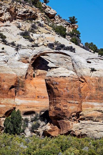
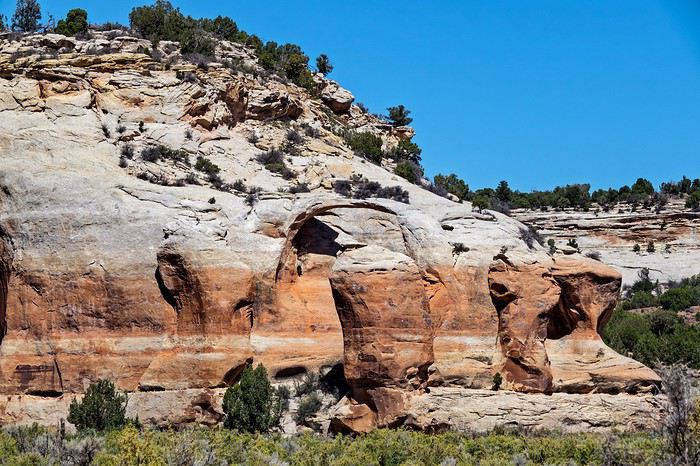
on continue sur la route qui se transforme ensuite en Piste pour atteindre le parking pour aller à Lower sieber canyon qui se trouve proche de Black ridge wilderness. Une trace GPS est utile car il y a pas ou très peu de cairns pour se repérer. Après environ 1 mile en longeant la RIM, il faut descendre au fond du canyon. Ce n’est pas profond, environ 100m, mais c’est très glissant (loose rock) et étroit. Lysiane ne le sent pas trop mais elle va prendre sur elle pour aller au bout de la descente. La suite est facile même si la marche dans le sable avec la forte chaleur est parfois pénible. Après environ 2.5 miles on arrive devant la falaise qui abrite les petroglyphs sur 30m environ. Ceux-ci sont nombreux et de qualité même si on est en plein soleil.
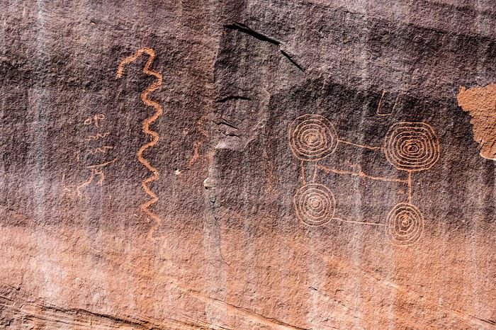
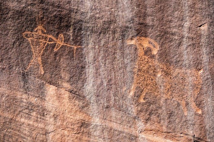
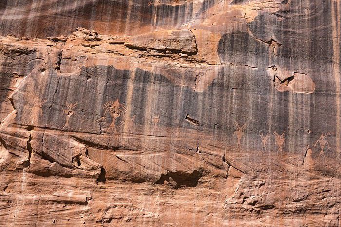
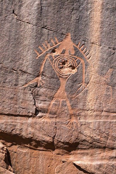
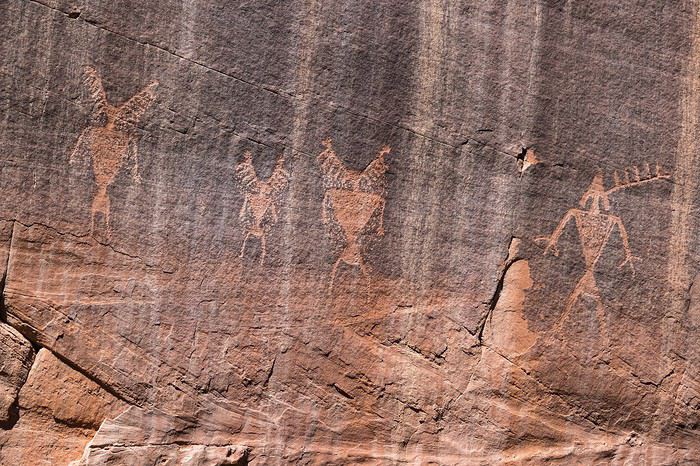
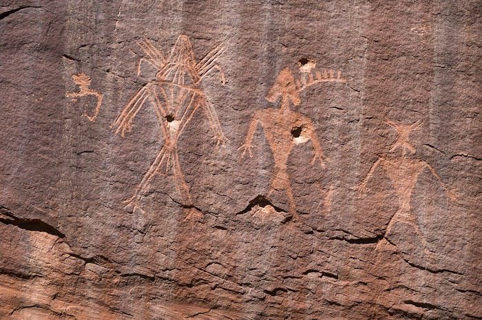
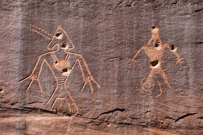
Je ne l’ai pas vu sur place, mais uniquement après en regardant les photos, mais il y a plusieurs impacts de balles sur la paroi donc des gros bourrins sont venus jusqu’ici pour s’entrainer au tir sur des petroglyphs !!! il y a quand même des sacrés abrutis. En repartant on passera pas la scenic road de Colorado national monument en faisant des stops sur les points de vue. Même si nous avons fait beaucoup de route (7h), je suis content de la journée et de cette belle découverte de petroglyphs confidentiels.
J3 : Grand junction -> Moab Lorsque nous étions allés dans Pritchett canyon en juin 2012 il faisait très chaud (près de 40°) , nous avions souffert pour faire l’aller et retour jusqu’à Pritchett arch , étions arrivés à sec d’eau à la voiture et c’est l’un des randos où j’avais le plus de traces de sel sur le visage et les vêtements. Du coup nous n’étions pas allés voir Hall Bridge. C’est donc la destination du jour. Nous sommes sur place vers 9h30 et les prévisions pour la journée font état de grosse chaleur à savoir autour de 35° donc nécessité de prendre de bonnes réserves de boisson « electrolytiques » pour ne pas de déshydrater. Contrairement à 2012 la rando me semble moins dénuée d’intérêt et cette fois ci nous verrons un groupe de véhicules vraiment tout terrains !!!!
la chaleur est bien présente mais il y a toujours du vent donc c’est supportable. peu après la bifurcation dans le canyon qui mène à Hall bridge arrive la seule difficulté de la rando, à savoir un passage de classe 2 je pense qui nécessite de faire attention surtout à la descente. Hall bridge ne se révèle que tout dernier moment car celui-ci est bien caché par le relief.
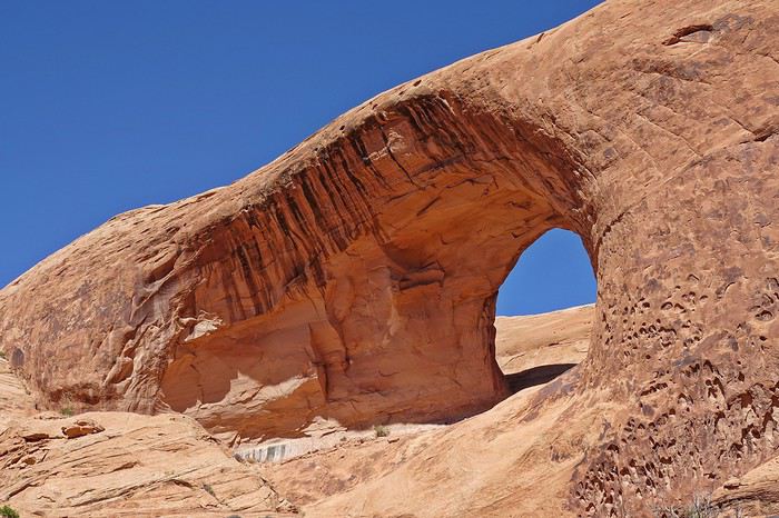
Cela tombe bien, nous avons juste en face un spot de pique-nique parfait à l’ombre permettant de profiter de la vue. Il y a pas mal de vent donc j’hésite à sortir le drône mais je tente quand même le coup sans prendre trop de risques et il m’offrira de jolies vues de Hall bridge.
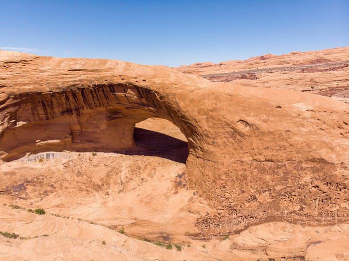
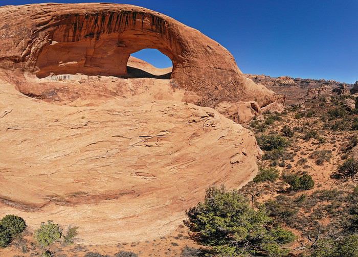
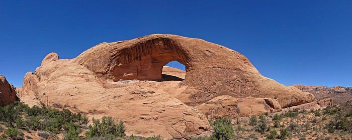
On fera le retour en plein cagnard et avec cette chaleur on ne fera pas le détour vers troll bridge et préfèreront arriver tôt chez Dave et kay pour discuter avec eux plus longuement et passer une bonne soirée avec eux, marc & judy et paul & dee.
pour ce 22ème voyage, pas de thème de prédilection mais une grosse envie de retourner dans pas mal de sites pour prendre des photos aériennes avec un drône que j’avais pu expérimenté en avril notamment en faisant de super photos au dessus de réflexion canyon. Comme en 2017, le choix s’est porté sur denver comme aéroport de destination avec des vols delta airlines (bon tarif et horaires optimisés), non pas par sa proximité avec les principaux sites à visiter mais parce que c’est un des aéroport où l’on maximise les chances d’avoir un véhicule digne de ce nom. En arrivant sur le territoire américain à l’aéroport de Minneapolis, ce fut le bordel à l’immigration avec un poste sur 2 à peine ouvert et une gestion calamiteuse des filles d’attente. On ne se faisait guère d’illusion pour avoir la correspondance pour Denver mais nous avons finalement eu l’avion…. Sans les bagages. Et oui, il faut bien une première fois : en 22 voyages aux US c’est la première fois que nous n’avons pas eu les bagages à l’arrivée. Mais bon je prends toujours des vols avec au moins 1 ou 2 vols intérieurs suivant le nôtre en cas de retard donc à l’arrivée le personnel au sol en charge des bagages l’indique que cela arrivera par le vol de 19h. Du coup cela doit laisser le temps d’aller chercher la voiture et peut être faire les courses. Pour la voiture de location, même technique que l’an dernier avec paiement au comptoir et deux réservations chez Hertz et Budget pour avoir deux fois plus de chance et pas de frais en cas de no show même si c’est un peu plus cher qu’en pré-paiement. Là le premier choix s’est porté chez Hertz car le loueur proposait une catégorie spécifique jeep wrangler qui a peu d’équivalent dans sa catégorie. En arrivant avec le bus, j’en repère déjà une sur le parking et dit à Lysiane que je veux celle-ci et c’est bien celle-ci que l’on va avoir : une wrangler sahara bien équipée Pour une wrangler qui reste assez rustique. Les pneus sont en bon état et ont l’air mieux que les goodyear all terrain habituel …. Nous avons été les premier au guichet donc c’est en un temps record que l’on repart avec la voiture, direction l’hotel que je prends toujours sur Tower road très proche aéroport puis cap sur le wal mart pour faire les courses ce qui nous arrive rarement le premier jour en arrivant. Nous avons à peine le temps de les faire et de retourner à l’aéroport que les bagages sont déjà en train de tourner sur le tapis. Fin d’une première journée bien remplie et qui va nous permettre de partir tôt le lendemain matin.
J2 : Denver -> Grand junction
bien que proche aéroport, le petit dej n’est servi qu’à partir de 5h30 donc le départ se fera vers 6h30 direction grand junction où nous arriverons pour pique niquer. On était parti cette année une semaine plus tard que l’an dernier mais il fait quasiment aussi chaud avec un bon 35° . pour ce premier jour, j’avais choisi des spots en dehors des sentiers battus à savoir Ela arch (ou natural bridge je ne sais pas bien) en premier puis Lower sieber canyon ensuite. Arrivés proche de l’endroit où se situe Ela arch, une clôture se dresse avec un joli panneau ‘no trespassing’ assez clair et même si l’arche n’est qu’à 300m , je vais me contenter d’une vue distante car l’habitation des propriétaires est très proche et pas envie de me faire tirer comme un lapin même si l’envie d’y aller m’a traversé l’esprit : il faut bien que le 600m de l’appareil photo serve à quelque chose !!!!
on continue sur la route qui se transforme ensuite en Piste pour atteindre le parking pour aller à Lower sieber canyon qui se trouve proche de Black ridge wilderness. Une trace GPS est utile car il y a pas ou très peu de cairns pour se repérer. Après environ 1 mile en longeant la RIM, il faut descendre au fond du canyon. Ce n’est pas profond, environ 100m, mais c’est très glissant (loose rock) et étroit. Lysiane ne le sent pas trop mais elle va prendre sur elle pour aller au bout de la descente. La suite est facile même si la marche dans le sable avec la forte chaleur est parfois pénible. Après environ 2.5 miles on arrive devant la falaise qui abrite les petroglyphs sur 30m environ. Ceux-ci sont nombreux et de qualité même si on est en plein soleil.
Je ne l’ai pas vu sur place, mais uniquement après en regardant les photos, mais il y a plusieurs impacts de balles sur la paroi donc des gros bourrins sont venus jusqu’ici pour s’entrainer au tir sur des petroglyphs !!! il y a quand même des sacrés abrutis. En repartant on passera pas la scenic road de Colorado national monument en faisant des stops sur les points de vue. Même si nous avons fait beaucoup de route (7h), je suis content de la journée et de cette belle découverte de petroglyphs confidentiels.
J3 : Grand junction -> Moab Lorsque nous étions allés dans Pritchett canyon en juin 2012 il faisait très chaud (près de 40°) , nous avions souffert pour faire l’aller et retour jusqu’à Pritchett arch , étions arrivés à sec d’eau à la voiture et c’est l’un des randos où j’avais le plus de traces de sel sur le visage et les vêtements. Du coup nous n’étions pas allés voir Hall Bridge. C’est donc la destination du jour. Nous sommes sur place vers 9h30 et les prévisions pour la journée font état de grosse chaleur à savoir autour de 35° donc nécessité de prendre de bonnes réserves de boisson « electrolytiques » pour ne pas de déshydrater. Contrairement à 2012 la rando me semble moins dénuée d’intérêt et cette fois ci nous verrons un groupe de véhicules vraiment tout terrains !!!!
la chaleur est bien présente mais il y a toujours du vent donc c’est supportable. peu après la bifurcation dans le canyon qui mène à Hall bridge arrive la seule difficulté de la rando, à savoir un passage de classe 2 je pense qui nécessite de faire attention surtout à la descente. Hall bridge ne se révèle que tout dernier moment car celui-ci est bien caché par le relief.
Cela tombe bien, nous avons juste en face un spot de pique-nique parfait à l’ombre permettant de profiter de la vue. Il y a pas mal de vent donc j’hésite à sortir le drône mais je tente quand même le coup sans prendre trop de risques et il m’offrira de jolies vues de Hall bridge.
On fera le retour en plein cagnard et avec cette chaleur on ne fera pas le détour vers troll bridge et préfèreront arriver tôt chez Dave et kay pour discuter avec eux plus longuement et passer une bonne soirée avec eux, marc & judy et paul & dee.
Entre Argentine et Bolivie English translation pending
Iguazu, Uyuni, Altiplano, Cordillère, autant de noms mythiques qui résonnent à l'oreille des voyageurs comme des promesses de découvertes inoubliables. Nous partons pour 8 semaines à la découverte de ces espaces grandioses. En voici un aperçu:
13/06: Nous embarquons vers CDG puis, peu avant minuit, décollons vers Buenos Aires. Le vol se déroule sans histoire quand vers 5h du matin, encore endormis, nous entendons la commandante de bord nous annoncer qu'elle a du faire demi-tour en plein océan à cause d'une fuite hydraulique et que nous allons retourner à Paris. C'est une grosse déception car nous craignons de passer de longues heures d'attente et notre journée de redécouverte de Buenos Aires est fichue...
14/06 : vers 7h30 nous atterrissons sous la bienveillante protection des pompiers qui refroidissent les freins. Une fois dans l'aérogare il nous faut encore faire la queue au comptoir pour obtenir une carte d'embarquement sur le nouveau vol programmé avec un nouvel avion à 13H30. Avec un peu de retard nous nous installons dans nos sièges d'autant plus de plaisir que l'heure annoncée pour l'arrivée est 22h, donc pas trop tard pour profiter de l'hôtel réservé et récupérer un peu de ces longues heures de vol et d'attente. Cette fois, le vol se déroule sans contretemps et à 22h précises nous atterrissons à Buenos Aires. Les formalités de police se déroulent très rapidement, les bagages sont vite récupérés et, à la sortie, le guichet Tienda Leon nous tend les bras pour réserver une voiture qui nous emmène de suite vers l'hôtel en 45 minutes.
15/06 : un copieux petit déjeuner buffet nous cale avant d'affronter la fraîcheur matinale de l'hiver qui nous surprend un peu quand nous partons à la recherche d'un distributeur de billets qui nous délivre chichement ses pesos (4500 maximum par retrait). Un taxi nous conduit vers l'aeroparque. Nous redécouvrons la grande avenue du 9 juillet et ses encombrements et en 40 minutes nous sommes arrivés. En 1h50 Latam nous mène à Puerto Iguazu en survolant d'abord les buildings tentaculaires de Buenos Aires, le gigantesque estuaire du rio de la Plata puis les immenses étendues agricoles des plaines argentines qui, peu à peu, cèdent la place à des zones forestières denses. Juste avant l'atterrissage, nous apercevons le rio Iguazu qui déroule ses courbes et un nuage de brume marquant l'emplacement des chutes. Le bus assure la desserte en porte à porte des hôtels du centre et à 15h nous pouvons déposer nos bagages à l’hôtel Lilian. Un peu affamés, notre première envie est de trouver un restaurant qui pourra calmer notre fringale. Le premier trouvé sera le bon et un biftec de chorizo accompagné de fritas papas aura vite raison de notre appétit. Une rapide découverte de la ville paisible aux maisons basses noyées sous la végétation nous mène sur les bords du rio. Le ciel gris, la poussière rouge des rues, la végétation créent une ambiance bien particulière et dépaysante.
IGUAZU 16/06 : nous empruntons le bus à la gare routière pour rejoindre le parc des chutes d'Iguazu, distantes d'environ 20 kms. L'ambiance est plutôt calme en ce début de matinée et la foule que nous craignions n'est, par chance, pas au rendez-vous. Suivant les conseils « avisés » de notre guide papier nous commençons par le circuit inférieur qui, par un système d'escaliers et de passerelles métalliques humides et glissantes, permet de découvrir la base de plusieurs cascades environnées de roche rouge et ocre baignant dans une végétation luxuriante. Le soleil est de la partie et des arcs-en-ciel soulignent la vapeur blanche qui s'échappe du pied des chutes. Le spectacle vaut particulièrement par le nombre et la répartition des cascades alignées sur un arc rejoignant les deux rives du rio. A la fin du parcours nous rejoignons le sentier supérieur qui domine les cataractes d'où s'échappent des volutes de brume emportées par la brise. Le bouillonnement et la puissance des chutes accompagnées du bruit permanent de l'eau constituent un remarquable spectacle mais nous laissent un peu sur notre faim car nous avons l'impression d'un spectacle déjà vu ailleurs et pas complètement exceptionnel. Heureusement la gorge du diable, dernier belvédère sur la rive argentine nous fera changer d'avis tellement la puissance du fleuve est impressionnante. Dans un fracas incroyable l'eau dévale une large gorge d'où remontent des nuées ballottées par les mouvements d'air.
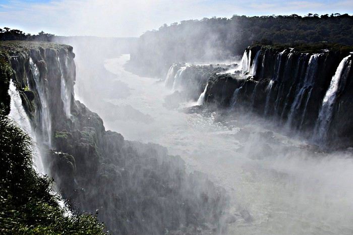
Avant d'emprunter le petit train qui transporte les visiteurs vers la garganta nous avions achetés quelques empanadas pour calmer notre fringale mais les coatis voraces qui rodent autour des tables de pique nique se sont précipités pour déchirer le sac les contenant et nous en voler une grande partie !!!
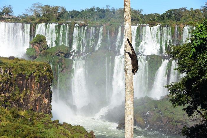
Avant de quitter le parc, nous décidons de parcourir à nouveau le sentier inférieur dans le sens opposé et nous apprécions beaucoup ce nouveau parcours avec une luminosité différente du matin.
17/06 : aujourd'hui, nous partons sur la rive brésilienne. Le soleil est bien présent à nouveau et l'air matinal vif (6°). Le chauffeur du bus oublie un peu trop souvent de tenir le volant et de regarder la route mais le bus doit connaître le chemin... Le contrôle des passeports à la frontière est rapide et il n'est que 9h quand nous arrivons à l'entrée du parc. Après avoir acheté les billets d'entrée nous montons dans un bus à impériale. Croyant bénéficier d'une vue élargie nous nous précipitons à l'étage, ce qui nous permet de nous geler durant tout le trajet sans bénéficier du moindre paysage car la route serpente en forêt. Accompagnés par la foule des visiteurs nous empruntons le sentier en balcon qui domine le rio et rapidement offre des vues spectaculaires sur l'ensemble des chutes. Nous apprécions cette vue panoramique sur la rive visitée la veille. Le sentier rejoint rapidement les abords de la gorge du diable et une passerelle spectaculaire permet de plonger au cœur des embruns où les flots bouillonnants sont à portée de main. Il faut un peu se frayer un chemin dans la foule qui use et abuse des selfies devant les chutes mais le spectacle est vraiment impressionnant.
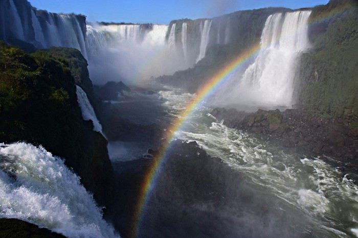
Difficile de se résoudre à quitter les lieux tellement la fascination est grande devant la force des éléments. De retour à l'entrée du parc il suffit de parcourir 200 mètres pour trouver le parc des oiseaux qui sera notre promenade de l'après-midi. Dans un cadre forestier plaisant et calme d'immenses volières permettent d'observer de près toucans, ibis rouges, flamands, perroquets colorés, etc...
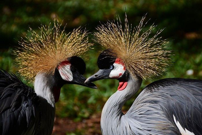
Le parcours est très intéressant et la multitude de couleurs chatoyantes fascinante. Le même chauffeur de bus que le matin nous ramène à Puerto Iguazu avec toujours autant de fougue !!!
13/06: Nous embarquons vers CDG puis, peu avant minuit, décollons vers Buenos Aires. Le vol se déroule sans histoire quand vers 5h du matin, encore endormis, nous entendons la commandante de bord nous annoncer qu'elle a du faire demi-tour en plein océan à cause d'une fuite hydraulique et que nous allons retourner à Paris. C'est une grosse déception car nous craignons de passer de longues heures d'attente et notre journée de redécouverte de Buenos Aires est fichue...
14/06 : vers 7h30 nous atterrissons sous la bienveillante protection des pompiers qui refroidissent les freins. Une fois dans l'aérogare il nous faut encore faire la queue au comptoir pour obtenir une carte d'embarquement sur le nouveau vol programmé avec un nouvel avion à 13H30. Avec un peu de retard nous nous installons dans nos sièges d'autant plus de plaisir que l'heure annoncée pour l'arrivée est 22h, donc pas trop tard pour profiter de l'hôtel réservé et récupérer un peu de ces longues heures de vol et d'attente. Cette fois, le vol se déroule sans contretemps et à 22h précises nous atterrissons à Buenos Aires. Les formalités de police se déroulent très rapidement, les bagages sont vite récupérés et, à la sortie, le guichet Tienda Leon nous tend les bras pour réserver une voiture qui nous emmène de suite vers l'hôtel en 45 minutes.
15/06 : un copieux petit déjeuner buffet nous cale avant d'affronter la fraîcheur matinale de l'hiver qui nous surprend un peu quand nous partons à la recherche d'un distributeur de billets qui nous délivre chichement ses pesos (4500 maximum par retrait). Un taxi nous conduit vers l'aeroparque. Nous redécouvrons la grande avenue du 9 juillet et ses encombrements et en 40 minutes nous sommes arrivés. En 1h50 Latam nous mène à Puerto Iguazu en survolant d'abord les buildings tentaculaires de Buenos Aires, le gigantesque estuaire du rio de la Plata puis les immenses étendues agricoles des plaines argentines qui, peu à peu, cèdent la place à des zones forestières denses. Juste avant l'atterrissage, nous apercevons le rio Iguazu qui déroule ses courbes et un nuage de brume marquant l'emplacement des chutes. Le bus assure la desserte en porte à porte des hôtels du centre et à 15h nous pouvons déposer nos bagages à l’hôtel Lilian. Un peu affamés, notre première envie est de trouver un restaurant qui pourra calmer notre fringale. Le premier trouvé sera le bon et un biftec de chorizo accompagné de fritas papas aura vite raison de notre appétit. Une rapide découverte de la ville paisible aux maisons basses noyées sous la végétation nous mène sur les bords du rio. Le ciel gris, la poussière rouge des rues, la végétation créent une ambiance bien particulière et dépaysante.
IGUAZU 16/06 : nous empruntons le bus à la gare routière pour rejoindre le parc des chutes d'Iguazu, distantes d'environ 20 kms. L'ambiance est plutôt calme en ce début de matinée et la foule que nous craignions n'est, par chance, pas au rendez-vous. Suivant les conseils « avisés » de notre guide papier nous commençons par le circuit inférieur qui, par un système d'escaliers et de passerelles métalliques humides et glissantes, permet de découvrir la base de plusieurs cascades environnées de roche rouge et ocre baignant dans une végétation luxuriante. Le soleil est de la partie et des arcs-en-ciel soulignent la vapeur blanche qui s'échappe du pied des chutes. Le spectacle vaut particulièrement par le nombre et la répartition des cascades alignées sur un arc rejoignant les deux rives du rio. A la fin du parcours nous rejoignons le sentier supérieur qui domine les cataractes d'où s'échappent des volutes de brume emportées par la brise. Le bouillonnement et la puissance des chutes accompagnées du bruit permanent de l'eau constituent un remarquable spectacle mais nous laissent un peu sur notre faim car nous avons l'impression d'un spectacle déjà vu ailleurs et pas complètement exceptionnel. Heureusement la gorge du diable, dernier belvédère sur la rive argentine nous fera changer d'avis tellement la puissance du fleuve est impressionnante. Dans un fracas incroyable l'eau dévale une large gorge d'où remontent des nuées ballottées par les mouvements d'air.
Avant d'emprunter le petit train qui transporte les visiteurs vers la garganta nous avions achetés quelques empanadas pour calmer notre fringale mais les coatis voraces qui rodent autour des tables de pique nique se sont précipités pour déchirer le sac les contenant et nous en voler une grande partie !!!
Avant de quitter le parc, nous décidons de parcourir à nouveau le sentier inférieur dans le sens opposé et nous apprécions beaucoup ce nouveau parcours avec une luminosité différente du matin.
17/06 : aujourd'hui, nous partons sur la rive brésilienne. Le soleil est bien présent à nouveau et l'air matinal vif (6°). Le chauffeur du bus oublie un peu trop souvent de tenir le volant et de regarder la route mais le bus doit connaître le chemin... Le contrôle des passeports à la frontière est rapide et il n'est que 9h quand nous arrivons à l'entrée du parc. Après avoir acheté les billets d'entrée nous montons dans un bus à impériale. Croyant bénéficier d'une vue élargie nous nous précipitons à l'étage, ce qui nous permet de nous geler durant tout le trajet sans bénéficier du moindre paysage car la route serpente en forêt. Accompagnés par la foule des visiteurs nous empruntons le sentier en balcon qui domine le rio et rapidement offre des vues spectaculaires sur l'ensemble des chutes. Nous apprécions cette vue panoramique sur la rive visitée la veille. Le sentier rejoint rapidement les abords de la gorge du diable et une passerelle spectaculaire permet de plonger au cœur des embruns où les flots bouillonnants sont à portée de main. Il faut un peu se frayer un chemin dans la foule qui use et abuse des selfies devant les chutes mais le spectacle est vraiment impressionnant.
Difficile de se résoudre à quitter les lieux tellement la fascination est grande devant la force des éléments. De retour à l'entrée du parc il suffit de parcourir 200 mètres pour trouver le parc des oiseaux qui sera notre promenade de l'après-midi. Dans un cadre forestier plaisant et calme d'immenses volières permettent d'observer de près toucans, ibis rouges, flamands, perroquets colorés, etc...
Le parcours est très intéressant et la multitude de couleurs chatoyantes fascinante. Le même chauffeur de bus que le matin nous ramène à Puerto Iguazu avec toujours autant de fougue !!!
USA: entre 5 et 45°C dans le Southwest en septembre English translation pending
Après un premier voyage classique en famille en juillet 2017 qui se déroula merveilleusement bien, nous avons été déclaré coupable d'avoir aimé le Southwest 😛
Et comme tout le monde le sait, les coupables retournent toujours sur le lieu du crime 😏
Avion: C'est en octobre 2017, après définition du nombre de jour de congés disponibles, que nous achetons 2 billets directement à la compagnie Swiss. Nous avions déjà pris cette compagnie l'année dernière et tout c'était bien passé. Cependant nous avions acheté les billets par Lufthansa et le vol retour était opéré par United. Cette année ce sera Swiss (enfin Edelweiss) sur tout la ligne sauf pour les correspondances qui sont opérées respectivement par Lufthansa et Swiss au retour.
Le vol se fera à destination de Las Vegas au départ de Francfort via Zurich (2h40 d'escale à l'aller et 1h20 au retour) pour un tarif de 550€ par personne. En prenant le départ directement à Zurich, c'est 300€ de plus par personne. Le choix est très vite fait !
En janvier 2018, nous sommes contactés par Swiss pour un changement d'horaire du vol retour. Départ à 21h45 au lieu de 14h45. Ils nous proposeront de modifier gratuitement notre vol retour pour un direct LAS > FRA le lendemain mais niveau congé, madame est dans l'impossibilité de poser un jour supplémentaire. On se contentera de 21h45 qui au final nous permet de profiter de la dernière journée sur place.
Voiture de location: A peine les billets d'avion achetés, j'ai commencé à scruter régulièrement les offres de prix des différents "grands loueurs", c'est à dire Hertz, Avis et Alamo. Nous avions loué chez Hertz l'année passée et avions été particulièrement satisfait du véhicule mais aussi des employés de l'agence de McCarran.
En octobre ou novembre 2017 je trouve un SUV AWD 7 places catégorie FRAR pour 674$ chez Hertz (avec "feu" le code qui allait bien). Tarif très intéressant car pour la même durée en départ LAS et abandon SFO on avait payé 742$ l'année dernière. Je prends donc réservation du véhicule en paiement sur place. Un 7 places pour 2 oui, c'est grand, mais on voulait un AWD et chez Hertz ils le sont tous dans cette catégorie.
En décembre 2017 j'avais constaté que sur le site irlandais de Hertz, le Cadillac Escalade (catégorie Prestige) était 3 fois moins cher que sur le site français de la firme ... 890$ au lieu de 2700$ ... OK, c'est presque 300$ plus cher mais obtenir cette catégorie à ce prix pour 20 jours, ça demande réflexion. La réservation est prise en paiement sur place, on se décidera plus tard.
Peu de temps avant le départ, une alerte sur le forum prévient d'une soudaine augmentation de prix sur les locations de voiture. Le code qui allait bien n'était plus .... Branle-bas de combat pour retrouver un tarif correct avec un code générique ou que l'on a le droit d'utiliser. Au final, une augmentation de presque 60$ ...
Logements: Marre de voir tous ces carnets montrant de parfaits et somptueux emplacements de camping ! Mais encore; c'est la (re)lecture du blog de JP (Orionide) jeveuxcamperauxusa.blogspot.com/...amping-prati... qui nous convainc. Mais attention, le camping sera une première pour nous ... Bah ouais y un début à tout !
On se décidera donc sur un 50/50 motel/camping afin d'avoir un plus de confort de temps à autre.
Tous les campings ont été réservés dès leur disponibilité sur www.recreation.gov/ , www.reserveamerica.com/ et un camping privé en direct. Le site www.campsitephotos.com/ nous a permit de parfois choisir le bon emplacement. On testera donc un peu toute sorte de camping (NP, SP, NF, privé) mais pas le sauvage.
Les motels ont été réservés via le groupe www.choicehotels.com/ la plus part du temps mais il y aussi du www.bestwestern.fr/ et du www.wyndhamhotels.com/en-uk. Sur 2018, nous avons annulé et repris environ 6 fois des motels déjà réservés pour cause de baisse de prix. 1 hôtel a été réservé sur fr.hotels.com/ car le tarif était plus bas qu'en direct. D'autres hôtels ont été réservés en direct et hors grandes chaines.
Ces 2 chaines (ChoiceHotels et Wyndham) ont l'air de pratiquer le Lean Management comme les hôtels de Las Vegas et les locations de voiture (chez Hertz particulièrement). Pour faire simple, les prix varient souvent selon un algorithme ou une science que seuls eux connaissent et ils faut donc être aux aguets pour annuler et re-réserver si on souhaite bénéficier d'un prix plus avantageux. Certains proposent de bons prix en non-annulable, je déconseille sauf si on est certain à 100% qu'il n'y aura pas de changement.
Le circuit: Bon là, pas de mystère, je ne pense pas que vous verrez des lieux inconnus du forum. Mais concrètement, si vous voulez connaitre le circuit .... ben y a qu'à suivre 😎
Sommaire:
Jour 0: on se rapproche un peu plus du départ Jour 1: il était temps après presque un an d'attente Jour 2: réveil matinal et prêts à avaler du bitume pour rejoindre Death Valley NP Jour 3: couleurs matinales sur la Vallée de la Mort et retour à la case Las Vegas Jour 4: à Las Vegas y a aussi des Red Rock ! Jour 5: Utah nous voilà ! (Zion NP) Jour 6: les mollets chauffent sur Observation Point Trail (Zion NP) Jour 7: direction St George en passant par les Red Cliffs Jour 8: Yant Flat, passage express à Zion NP puis repos à Sand Hollow SP Jour 9: Left Fork of North Creek to the Subway Jour 10: prenons un peu d'altitude direction Cedar City Jour 11: de Cedar City à Kodachrome Basin SP Jour 12: rejoignons Page pour découvrir la région Jour 13: un secret pas très bien gardé: Edmaier's Secret Jour 14: finissons en avec Page et sa région mais restons en Arizona Jour 15: de Chinle à Holbrook Jour 16: de Holbrook à Flagstaff avec un petit bout de Route 66 Jour 17: un peu plus bas en Arizona, Sedona nous voilà ! Jour 18: encore à Sedona Jour 19: de Sedona vers Kingman: un petit bout de route sur la Mother Road Jour 20: faut rejoindre le point de départ, Kingman to Las Vegas Jour 21: the last day before take-off Bilans financiers
Et comme tout le monde le sait, les coupables retournent toujours sur le lieu du crime 😏
Avion: C'est en octobre 2017, après définition du nombre de jour de congés disponibles, que nous achetons 2 billets directement à la compagnie Swiss. Nous avions déjà pris cette compagnie l'année dernière et tout c'était bien passé. Cependant nous avions acheté les billets par Lufthansa et le vol retour était opéré par United. Cette année ce sera Swiss (enfin Edelweiss) sur tout la ligne sauf pour les correspondances qui sont opérées respectivement par Lufthansa et Swiss au retour.
Le vol se fera à destination de Las Vegas au départ de Francfort via Zurich (2h40 d'escale à l'aller et 1h20 au retour) pour un tarif de 550€ par personne. En prenant le départ directement à Zurich, c'est 300€ de plus par personne. Le choix est très vite fait !
En janvier 2018, nous sommes contactés par Swiss pour un changement d'horaire du vol retour. Départ à 21h45 au lieu de 14h45. Ils nous proposeront de modifier gratuitement notre vol retour pour un direct LAS > FRA le lendemain mais niveau congé, madame est dans l'impossibilité de poser un jour supplémentaire. On se contentera de 21h45 qui au final nous permet de profiter de la dernière journée sur place.
Voiture de location: A peine les billets d'avion achetés, j'ai commencé à scruter régulièrement les offres de prix des différents "grands loueurs", c'est à dire Hertz, Avis et Alamo. Nous avions loué chez Hertz l'année passée et avions été particulièrement satisfait du véhicule mais aussi des employés de l'agence de McCarran.
En octobre ou novembre 2017 je trouve un SUV AWD 7 places catégorie FRAR pour 674$ chez Hertz (avec "feu" le code qui allait bien). Tarif très intéressant car pour la même durée en départ LAS et abandon SFO on avait payé 742$ l'année dernière. Je prends donc réservation du véhicule en paiement sur place. Un 7 places pour 2 oui, c'est grand, mais on voulait un AWD et chez Hertz ils le sont tous dans cette catégorie.
En décembre 2017 j'avais constaté que sur le site irlandais de Hertz, le Cadillac Escalade (catégorie Prestige) était 3 fois moins cher que sur le site français de la firme ... 890$ au lieu de 2700$ ... OK, c'est presque 300$ plus cher mais obtenir cette catégorie à ce prix pour 20 jours, ça demande réflexion. La réservation est prise en paiement sur place, on se décidera plus tard.
Peu de temps avant le départ, une alerte sur le forum prévient d'une soudaine augmentation de prix sur les locations de voiture. Le code qui allait bien n'était plus .... Branle-bas de combat pour retrouver un tarif correct avec un code générique ou que l'on a le droit d'utiliser. Au final, une augmentation de presque 60$ ...
Logements: Marre de voir tous ces carnets montrant de parfaits et somptueux emplacements de camping ! Mais encore; c'est la (re)lecture du blog de JP (Orionide) jeveuxcamperauxusa.blogspot.com/...amping-prati... qui nous convainc. Mais attention, le camping sera une première pour nous ... Bah ouais y un début à tout !
On se décidera donc sur un 50/50 motel/camping afin d'avoir un plus de confort de temps à autre.
Tous les campings ont été réservés dès leur disponibilité sur www.recreation.gov/ , www.reserveamerica.com/ et un camping privé en direct. Le site www.campsitephotos.com/ nous a permit de parfois choisir le bon emplacement. On testera donc un peu toute sorte de camping (NP, SP, NF, privé) mais pas le sauvage.
Les motels ont été réservés via le groupe www.choicehotels.com/ la plus part du temps mais il y aussi du www.bestwestern.fr/ et du www.wyndhamhotels.com/en-uk. Sur 2018, nous avons annulé et repris environ 6 fois des motels déjà réservés pour cause de baisse de prix. 1 hôtel a été réservé sur fr.hotels.com/ car le tarif était plus bas qu'en direct. D'autres hôtels ont été réservés en direct et hors grandes chaines.
Ces 2 chaines (ChoiceHotels et Wyndham) ont l'air de pratiquer le Lean Management comme les hôtels de Las Vegas et les locations de voiture (chez Hertz particulièrement). Pour faire simple, les prix varient souvent selon un algorithme ou une science que seuls eux connaissent et ils faut donc être aux aguets pour annuler et re-réserver si on souhaite bénéficier d'un prix plus avantageux. Certains proposent de bons prix en non-annulable, je déconseille sauf si on est certain à 100% qu'il n'y aura pas de changement.
Le circuit: Bon là, pas de mystère, je ne pense pas que vous verrez des lieux inconnus du forum. Mais concrètement, si vous voulez connaitre le circuit .... ben y a qu'à suivre 😎
Sommaire:
Jour 0: on se rapproche un peu plus du départ Jour 1: il était temps après presque un an d'attente Jour 2: réveil matinal et prêts à avaler du bitume pour rejoindre Death Valley NP Jour 3: couleurs matinales sur la Vallée de la Mort et retour à la case Las Vegas Jour 4: à Las Vegas y a aussi des Red Rock ! Jour 5: Utah nous voilà ! (Zion NP) Jour 6: les mollets chauffent sur Observation Point Trail (Zion NP) Jour 7: direction St George en passant par les Red Cliffs Jour 8: Yant Flat, passage express à Zion NP puis repos à Sand Hollow SP Jour 9: Left Fork of North Creek to the Subway Jour 10: prenons un peu d'altitude direction Cedar City Jour 11: de Cedar City à Kodachrome Basin SP Jour 12: rejoignons Page pour découvrir la région Jour 13: un secret pas très bien gardé: Edmaier's Secret Jour 14: finissons en avec Page et sa région mais restons en Arizona Jour 15: de Chinle à Holbrook Jour 16: de Holbrook à Flagstaff avec un petit bout de Route 66 Jour 17: un peu plus bas en Arizona, Sedona nous voilà ! Jour 18: encore à Sedona Jour 19: de Sedona vers Kingman: un petit bout de route sur la Mother Road Jour 20: faut rejoindre le point de départ, Kingman to Las Vegas Jour 21: the last day before take-off Bilans financiers
Le Ladakh seulement pour les trekkeurs? English translation pending
Je précise avant toute chose que ceci n'est pas un guide de voyage et que les informations contenues ne sont qu'approximatives. Si vous voulez avoir les vraies infos, consultez un guide. Moi, je ne soumets que les photos de ce que j'ai pu voir sans faire de trek!! 😉
Le Ladakh! Si vous savez où c'est, alors vous en savez plus que moi quand Michant m'en a parlé pour la première fois. Merci de m'en avoir parlé!!!
Un site de référence : ladak. free.fr Une personne de référence sur Vf: Djullé84, c'est un extra terrestre que j'ai eu la chance de rencontrer sur place, il va au Ladakh chaque année depuis les années 1990!!! C'est un type formidablement génial, sans qui je en serais jamais allée la-bas. Merci mille fois à toi, Jean-Louis TAILLEFER (Alias Djullé84). (Merci Marien de m'avoir fait la relève de la confusion avec Germaine TAILLEFERRE!!)
Un carnet incontournable pour qui veut voir les paysages du Ladakh c'est celui de Marien: Périple dans les régions himalaynnes de l'ouest. Ne vous laissez pas rebuter par le premier post qui parle de Delhi, à partir du reste on passe vers Srinagar puis on monte progressivement vers le Ladakh. Ce sont ses photos qui m'ont donné vraiment envie d'aller voir par moi-même. J'ai dévoré ce carnet du début jusqu'à la fin.. Je ne vois pas comment j'ai pu l'oublier dans la première version de ce post!!! 100 000 millions de pardon Marien.😊
C'est où? Bah en Inde!!! Par rapport à la Martinique, c'est à 9h30 de décalage horaire!!!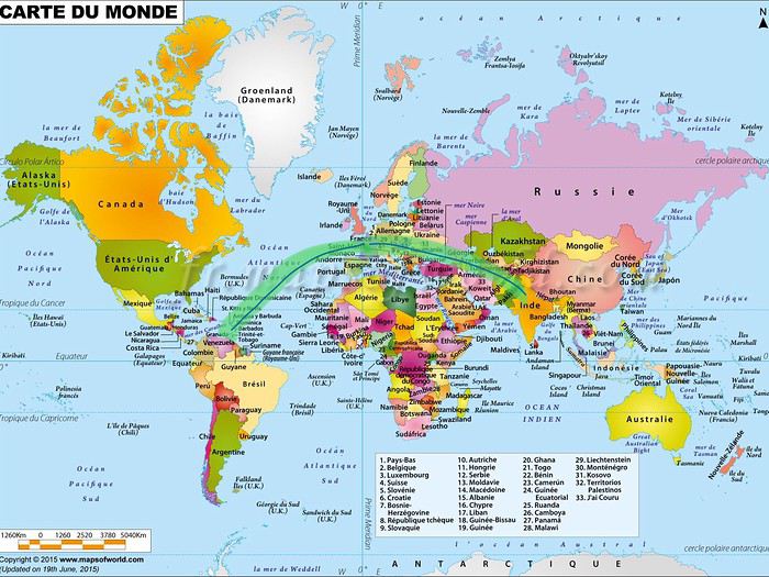 Mais ce n'est pas la vraie Inde, il paraît.🤪 C'est plus soft!! Il paraît!! C'est dans l'Himalaya, coincé entre le Pakistan au nord et à l'est, ennemi juré de l'Inde, et la Chine, à l'ouest, en très mauvais termes avec l'Inde. Il paraîtrait que la Chine et le Pakistan sont entrain de s'allier.... Donc l'armée indienne est à la manœuvre au Ladakh, et le développement du réseau routier est une priorité pour acheminer les convois très nombreux d'hommes, de nourriture, de matériel....Il y a des travaux partout sur les routes et pistes.
Bref, la-bas, le nombre de soldats au km carré est impressionnant. Je me demande s'il n'y a pas au moins autant de camps militaires que de villages!! Devant ces camps, il est interdit de prendre des photos, et aussi devant tout ce qui peut être stratégique pour la défense des intérêts indiens dans la région. Donc, photos interdites à l'aéroport!!.
Autre conséquence de tout ça, des régions frontalières (comme la nubra valley, le lac tsomoriri, le lac pangong) ne sont autorisées aux touristes étrangers que sous condition, et il faut un permis qui n'est accordé que pour 7 jours consécutifs, et délivré par les agences de voyage. D'autres régions sont carrément interdites aux étrangers, et accessibles seulement aux touristes indiens avec un permis spécial.
Voilà en gros ce que je peux vous dire pour que vous compreniez la situation géopolitique de cette région.
Ensuite, lorsqu'on pense Himalaya, on pense Népal, on pense trek. Et du coup, la question que je me suis posée était, moi qui n'aime pas marcher, et surtout pas les treks, quel intérêt d'aller la-bas?
Et puis, grâce à Djullé, j'ai découvert les paysages, les monastères, les ladakhi, et j'ai découvert qu'il y avait des routes carrossables, des bus, et surtout des taxis à profusion, donc les marches pourraient être réduites au minimum. J'ai aussi découvert qu'il y avait autre chose que des hébergements sommaires, car je tiens vraiment à mon confort, 😇du coup, je me suis dit : testons!!! Allons voir!!
Et voilà comment je nous ai fait atterrir à Leh, capitale du Ladakh, à 3500m d'altitude, à la mi- juillet, mon mari et moi.
Il est possible d'y arriver en bus, par la route qui passe par Manali, ou par la route qui passe par Srinagar. C'est beaucoup plus long, plus chaotique, mais beaucoup moins cher. Bref, comme nous ne voyageons pas petit budget, nous avons pris l'avion à l'aller puis finalement au retour aussi.🤪
Notre voyage total en Inde a duré 30 jours, mais la partie Ladakh a duré 21 jours.
Maintenant que vous savez le comment du pourquoi.... Voyons ce qu'on peut découvrir quand on n'est pas un trekkeur.
De la Martinique à l’Etat du Jammu et Cachemire, état du nord de l’inde, dans l’Himalaya, il y a un très long trajet:
nous avons d’abord pris un vol Fort de France Paris, fait 10 jours pour nous ajuster aux 6 heures de décalage, en faisant un tour entre France et Suisse: Paris, Colmar, Hasliburg (1 nuit à plus de 1000m), Ulrichen ( 1 nuit à plus de 1400m), Fiescheralp ( 2 nuits à plus de 2000m) , Haute Savoie, Paris.
après ces 10 jours de pré acclimatation à L’altitude, nous avons pris un vol de la lufthanza, de Roissy, via Francfort, pour l’aéroport Indira Ghandi de Delhi. Puis après 5 h d’escales, qui nous ont laissė le temps, sereinement, d’aller faire transformer nos e-visa en visa réels sur nos passeports, de récupérer nos bagages, de trouver le comptoir des vols domestiques d’air India, de faire des photos à côté des éléphants placés en décoration, d’apprécier les sculptures décoratives sur les murs de la salle d’embarquement où des relaxes sont occupés par des passagers,
 d'apprécier une sculpture remarquable avec des hommes en position de yoga
 de faire un peu de change au taux réel de 1euro=74 roupies, de nous enregistrer sur le vol vers, Leh, capitale du Ladakh, de trouver la porte d’embarquement, puis de profiter tranquillement de notre vol d’1h20 pour atterrir à 3500m d’altitude à 7h40 ! Il y a 9h30 de décalage avec la Martinique!
Jour 1 Arrivée à Leh
a) l'aéroport et les taxis!!
Il fait chaud, les formalités administratives sont vite expédiées, nous faisons encore un peu de change à l’aéroport de Leh, taux encore moins intéressant, une fois les taxes et les commissions retirées, mais au moins je suis tranquille. Nous avons des billets de 2000, de 500, et de 100 roupies. Cela fait près de 24h que nous n’avons pas dormi, et je ne suis pas certaine d’avoir le courage de quitter l’hôtel pour aller au centre ville faire du change.
Et là, nous devons aller à une caisse centrale, où un monsieur appelle le nom d'un chauffeur qui a la charge de nous emmener à notre guest house, le mantra cottage. Bizarrement, quand nous arrivons à son taxi, il est au milieu d'un amoncellement de taxis, et il est impossible de sortir sans que les autres ne déplacent les leurs. Il nous faudra 1/4 d'heure pour sortir de cette masse de taxis agglutinés les uns derrière les autres, le temps que notre chauffeur klaxonne afin d'attirer l'attention des autres et qu'il fasse son chemin au fur et à mesure. Première chose qui m'aura vraiment amusée: l'anarchie et la désorganisation apparente!!
Autre surprise, le taxi est un suzuki maruti. Vous ne connaissez pas? C'est normal!! 😮. Je n'en ai jamais vu en Europe ni aux USA, bref, je les ai découverts en Inde. C'est ça. C'est un petit truc avec 4 roues, tout petit, bref, pour moi, ça va, mais mon mari qui mesure 1,87m et qui est de forte corpulence, c'est une autre histoire. Vous voyez la différence de taille avec le chauffeur. Ils sont petits les ladakhis et les indiens. Ça me rappelle le Maroc.....
Après 15mn de trajets de conduite à gauche, héritage de la Grande Bretagne, ponctués d’interminables coups de klaxons, de dėpassements d’autres véhicules inimaginables chez nous, après avoir circulé à côté de vaches maigrelettes, évité de justesse des piétons qui traversaient, nous finissons par rejoindre notre hôtel, le mantra cottage, blotti en haut de la ville, dans son écrin de verdure.
b) Le mantra cottage et les toilettes indiennes!!!
Vous voyez la tente noire devant.............. Et bien, c'est là que nous avons dormi...😉 ........................................ Quoi ??? Vous ne me croyez pas??
Bon, ok! Des ouvriers travaillent aux abords, et leurs logements sont les tentes placées en contre-bas de l’hôtel. Ici, la vie n’est pas facile pour tout le monde!!!
Nous, nous avons dormi dans le bâtiment un peu plus loin, en longeant l'allée carrelée qui passe près du restaurant de la guest house.
Voici notre chambre, lors de notre arrivée.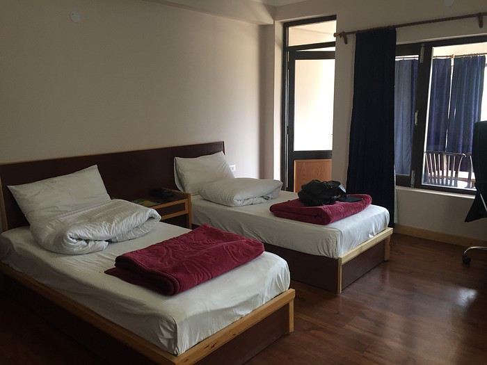
Quant à nous, touristes rois, nous sommes sommes accueillis comme des dignitaires, nos 2 valises et nos 2 bagages cabines sont pris en charge par des porteurs, pendant que nous réglons les 700 roupies du taxi. Nous longeons l’allée qui mène au bâtiment principal, et nous découvrons celui que les autres appellent le manageur, c'est Karma. Il nous demande de nous installer sur des fauteuils très confortables dans le restaurant, nous fait servir un thé de bienvenue, puis nous informe que le petit déjeûner est disponible et inclus dans le pris de la chambre. Il est 8h30 du matin, et le petit déj de l’avion est déjà vite oublié. Nous acceptons avec plaisir et dégustons omelette, toasts, pancakes aux mixed fruits, jus de fruits au choix, pomme ou orange. Puis, il nous rappelle que nous avons une réservation pour 2 jours, nous donne un formulaire à remplir pour l’administration indienne, dans lequel il faut donner son nom, prénom, adresse, fonction, renseignements de validité du passeport, du visa, date d’arrivée en Inde, dans l’hôtel.... Bref, un vrai flicage, et ce sera le cas dans chaque hébergement par la suite! Le document est à remplir, à chaque fois, pour chacun de nous. Une fois tout ça expédié, nous suivons les porteurs et le manageur dans notre chambre au 2ème étage en montant les escaliers. Le manageur refuse que je porte mon sac à dos, et m’invite à monter lentement pour favoriser une meilleure acclimation à l’altitude. Beaucoup boire, marcher lentement, manger léger et se reposer pendant les 24 premières heures. Recommandations que nous suivrons à la lettre. Nous découvrons notre chambre avec ses lits jumeaux, mais surtout la salle de bain, version indienne!. Alors, ..... Comment vous expliquer? Je découvre la spécificité des toilettes indiennes. Pour ceux qui sont déjà allés en Inde, vous pouvez passer à l'étape suivante, mais moi qui y allait pour la première fois, ce fût un voyage dans le voyage!!!😇
Les indiens n’utilisent pas de papier hygiéniques pour s’essuyer après les gros besoins mais se lavent à grande eau, avec la main gauche, (main impure), puis le papier hygiénique ne sert qu’à se sécher. Le grand et le petit seaux ainsi qu’une douchette à côté du wc ( regardez bien le tuyau qui pend entre le WC et le lavabo), sont là pour cet usage!..Ce sera le cas, dans tous nos hébergements, à quelques variantes près.
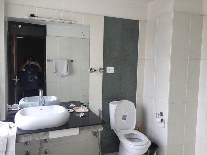
Il est 10h, crevés, une fois nos bagages et premiers effets sortis, nous plongeons dans un sommeil réparateur. Vers 15h, réveillés tous les 2, nous décidons de descendre faire un tour au centre ville, sur notre chemin, nous trouvons de nombreux comptoirs de change, le premier pour 1euro=78 roupies, un autre plus loin à 1euro= 79,20 roupies. Les liasses de roupies s’accumulent, en billets de 500 roupies et quelques billets de 100 roupies. Puis nous découvrons des échoppes qui vendent toutes sortes de choses, entre autres des tee shirts avec décorations cousues main, et le motif est au choix de l’acheteur.
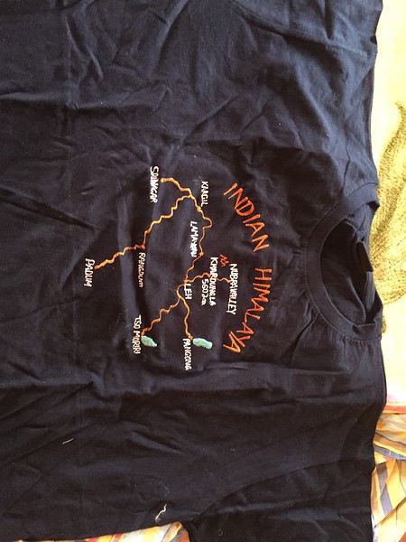
J’en commande 2 dans la première échoppe rencontrée et 2 autres un peu plus loin avec d’autres motifs de carte du Ladakh et du Zanskar, qui retracent les coins que nous avons prévu de visiter: Lamayuru, Kargil, le Zanskar avec Rangdum, Padum et ses environs, la nubra valley, les abords du lac Pangong, et du lac tsomoriri. Nous les récupérerons demain soir à partir de 19h, les échoppes ferment pour la plupart vers 20h, voire 21h. Puis nous continuons de nous enfoncer dans le centre ville, et faisons l’objet des sollicitations des vendeurs de produits en cachemire. Hélas pour eux, nous avons fait un stage au Maroc, et nous sommes blindés dans l’art de refuser gentiment les invitations à venir seulement regarder. Nous nous sommes fait avoir au Maroc, avec les phrases du genre « pour le plaisir des yeux », nous n’allons pas nous faire avoir aussi en Inde, « come and just have a look »!! Nous nous promenons maintenant dans les rues pleines de poussières, la plupart des locaux portent des masques pour se protéger. Nous finirons le lendemain soir, par acheter un bandana chacun pour le placer comme pas mal de gens sur le nez!
Puis nous arrivons à l’agence dreamland trek and adventures, afin de faire préparer nos permis pour la nubra valley et la pangong tso. Mais, il est trop tôt par rapport à la date prévue pour ce circuit, les permis ne se font que la veille.
Nous repartons et décidons de rentrer à l’hotel en taxi, et pour motiver le chauffeur à nous ramener, nous incluons un tour à Leh palace,
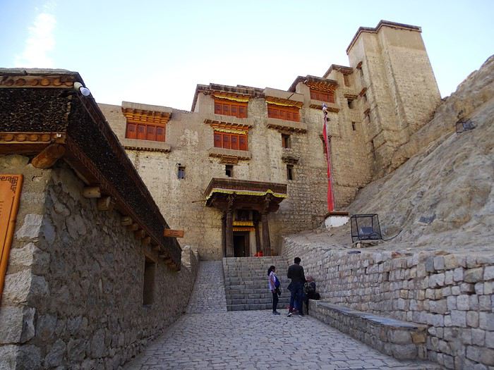
La bas, nous avons une vue panoramique de Leh et nous voyons au dessus de nous, le gonpa de Namgyal Tsemo, vers lequel nous nous dirigeons ensuite.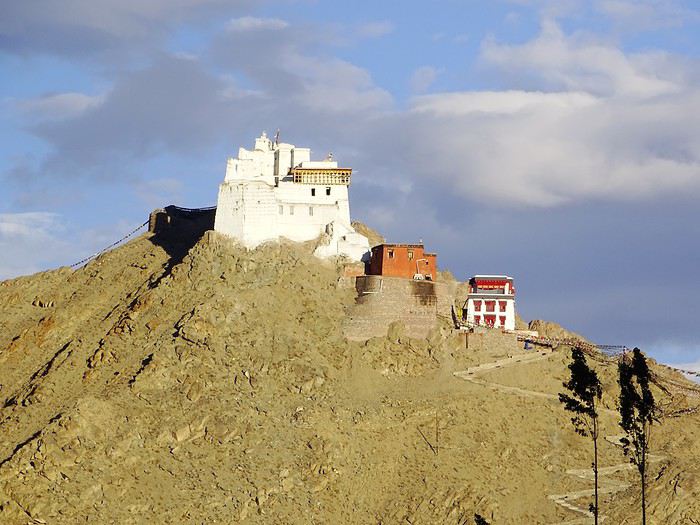 Pour ceux que le côté historique intéresse, un panneau explique l'histoire de ce gonpa.
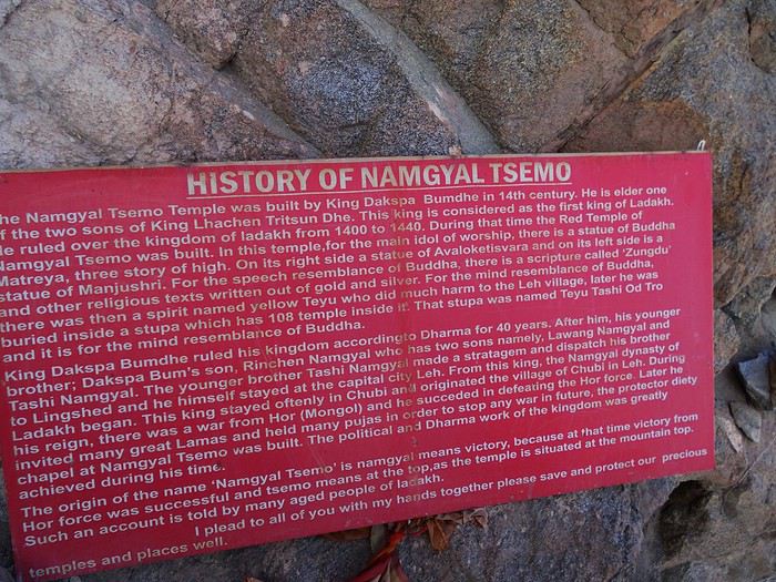
Chacun de ces batiments est évidement séparés du parking des taxis par une montée assez ardue, et accessible seulement par une volée de marches d'escalier, assez gratinée.
Pour nous qui venons d'arriver à 3500 m alors que nous vivons au niveau de la mer, et vu qu'on nous a recommandé de nous ménager, nous nous contentons d'arriver là où la vue panoramique nous comble, mais nous nous abstenons des visites intérieures.
De Leh palace, nous pouvons admirer aussi notre chauffeur de taxi à côté de sa maruti suzuki: un vrai ladakhi. A chaque fois, le chauffeur de taxi reste en contrebas avec les autres taxis pour nous attendre. C’est lui sous les lungtas, les fameux drapeaux de prière boudhistes. Avec ma visite au Ladakh, j'ai aussi plongé dans le monde bouddhiste. Ce fût encore un autre voyage.
Le soir, j'organise avec Kharma une réservation d'un chauffeur de taxi pour nous emmener visiter les monastères aux environs de Leh: Spituk, Alchi, Basgo.
Dîner à l’hôtel puis dodo bien mérité. Les matelas de nos lits au Ladakh sont vraiment durs, bien loin de nos matelas molletonnés et douillets. Ce sera une constante problématique pour nous. Au mantra cottage, la chambre est équipée d’une couette molletonnée, que je mets sur le lit, et je dors dessus. Une autre problématique pour nous est la nourriture et ses effets indésirables sur nos intestins! Heureusement, nous sommes venus avec de nombreux anti diarrhéiques. Mais bon, c’est quand même désagréable.
Autre chose qui a été une constante au Ladakh, c'est la chaleur la journée (environ 25 à 30°C) avec une petite fraîcheur la nuit (environ 20°C), très loin des températures hivernales que j'aime en voyage. Bref, un vrai plantage de ce côté là, et des vêtements d'hiver qui ont été emmenés pour rien!😊
Voilà!!! Fin du 1er jour.
Le Ladakh! Si vous savez où c'est, alors vous en savez plus que moi quand Michant m'en a parlé pour la première fois. Merci de m'en avoir parlé!!!
Un site de référence : ladak. free.fr Une personne de référence sur Vf: Djullé84, c'est un extra terrestre que j'ai eu la chance de rencontrer sur place, il va au Ladakh chaque année depuis les années 1990!!! C'est un type formidablement génial, sans qui je en serais jamais allée la-bas. Merci mille fois à toi, Jean-Louis TAILLEFER (Alias Djullé84). (Merci Marien de m'avoir fait la relève de la confusion avec Germaine TAILLEFERRE!!)
Un carnet incontournable pour qui veut voir les paysages du Ladakh c'est celui de Marien: Périple dans les régions himalaynnes de l'ouest. Ne vous laissez pas rebuter par le premier post qui parle de Delhi, à partir du reste on passe vers Srinagar puis on monte progressivement vers le Ladakh. Ce sont ses photos qui m'ont donné vraiment envie d'aller voir par moi-même. J'ai dévoré ce carnet du début jusqu'à la fin.. Je ne vois pas comment j'ai pu l'oublier dans la première version de ce post!!! 100 000 millions de pardon Marien.😊
C'est où? Bah en Inde!!! Par rapport à la Martinique, c'est à 9h30 de décalage horaire!!!
Mais ce n'est pas la vraie Inde, il paraît.🤪 C'est plus soft!! Il paraît!! C'est dans l'Himalaya, coincé entre le Pakistan au nord et à l'est, ennemi juré de l'Inde, et la Chine, à l'ouest, en très mauvais termes avec l'Inde. Il paraîtrait que la Chine et le Pakistan sont entrain de s'allier.... Donc l'armée indienne est à la manœuvre au Ladakh, et le développement du réseau routier est une priorité pour acheminer les convois très nombreux d'hommes, de nourriture, de matériel....Il y a des travaux partout sur les routes et pistes.Bref, la-bas, le nombre de soldats au km carré est impressionnant. Je me demande s'il n'y a pas au moins autant de camps militaires que de villages!! Devant ces camps, il est interdit de prendre des photos, et aussi devant tout ce qui peut être stratégique pour la défense des intérêts indiens dans la région. Donc, photos interdites à l'aéroport!!.
Autre conséquence de tout ça, des régions frontalières (comme la nubra valley, le lac tsomoriri, le lac pangong) ne sont autorisées aux touristes étrangers que sous condition, et il faut un permis qui n'est accordé que pour 7 jours consécutifs, et délivré par les agences de voyage. D'autres régions sont carrément interdites aux étrangers, et accessibles seulement aux touristes indiens avec un permis spécial.
Voilà en gros ce que je peux vous dire pour que vous compreniez la situation géopolitique de cette région.
Ensuite, lorsqu'on pense Himalaya, on pense Népal, on pense trek. Et du coup, la question que je me suis posée était, moi qui n'aime pas marcher, et surtout pas les treks, quel intérêt d'aller la-bas?
Et puis, grâce à Djullé, j'ai découvert les paysages, les monastères, les ladakhi, et j'ai découvert qu'il y avait des routes carrossables, des bus, et surtout des taxis à profusion, donc les marches pourraient être réduites au minimum. J'ai aussi découvert qu'il y avait autre chose que des hébergements sommaires, car je tiens vraiment à mon confort, 😇du coup, je me suis dit : testons!!! Allons voir!!
Et voilà comment je nous ai fait atterrir à Leh, capitale du Ladakh, à 3500m d'altitude, à la mi- juillet, mon mari et moi.
Il est possible d'y arriver en bus, par la route qui passe par Manali, ou par la route qui passe par Srinagar. C'est beaucoup plus long, plus chaotique, mais beaucoup moins cher. Bref, comme nous ne voyageons pas petit budget, nous avons pris l'avion à l'aller puis finalement au retour aussi.🤪
Notre voyage total en Inde a duré 30 jours, mais la partie Ladakh a duré 21 jours.
Maintenant que vous savez le comment du pourquoi.... Voyons ce qu'on peut découvrir quand on n'est pas un trekkeur.
De la Martinique à l’Etat du Jammu et Cachemire, état du nord de l’inde, dans l’Himalaya, il y a un très long trajet:
nous avons d’abord pris un vol Fort de France Paris, fait 10 jours pour nous ajuster aux 6 heures de décalage, en faisant un tour entre France et Suisse: Paris, Colmar, Hasliburg (1 nuit à plus de 1000m), Ulrichen ( 1 nuit à plus de 1400m), Fiescheralp ( 2 nuits à plus de 2000m) , Haute Savoie, Paris.
après ces 10 jours de pré acclimatation à L’altitude, nous avons pris un vol de la lufthanza, de Roissy, via Francfort, pour l’aéroport Indira Ghandi de Delhi. Puis après 5 h d’escales, qui nous ont laissė le temps, sereinement, d’aller faire transformer nos e-visa en visa réels sur nos passeports, de récupérer nos bagages, de trouver le comptoir des vols domestiques d’air India, de faire des photos à côté des éléphants placés en décoration,
d’apprécier les sculptures décoratives sur les murs de la salle d’embarquement où des relaxes sont occupés par des passagers,
d'apprécier une sculpture remarquable avec des hommes en position de yoga
de faire un peu de change au taux réel de 1euro=74 roupies, de nous enregistrer sur le vol vers, Leh, capitale du Ladakh, de trouver la porte d’embarquement, puis de profiter tranquillement de notre vol d’1h20 pour atterrir à 3500m d’altitude à 7h40 ! Il y a 9h30 de décalage avec la Martinique!Jour 1 Arrivée à Leh
a) l'aéroport et les taxis!!
Il fait chaud, les formalités administratives sont vite expédiées, nous faisons encore un peu de change à l’aéroport de Leh, taux encore moins intéressant, une fois les taxes et les commissions retirées, mais au moins je suis tranquille. Nous avons des billets de 2000, de 500, et de 100 roupies. Cela fait près de 24h que nous n’avons pas dormi, et je ne suis pas certaine d’avoir le courage de quitter l’hôtel pour aller au centre ville faire du change.
Et là, nous devons aller à une caisse centrale, où un monsieur appelle le nom d'un chauffeur qui a la charge de nous emmener à notre guest house, le mantra cottage. Bizarrement, quand nous arrivons à son taxi, il est au milieu d'un amoncellement de taxis, et il est impossible de sortir sans que les autres ne déplacent les leurs. Il nous faudra 1/4 d'heure pour sortir de cette masse de taxis agglutinés les uns derrière les autres, le temps que notre chauffeur klaxonne afin d'attirer l'attention des autres et qu'il fasse son chemin au fur et à mesure. Première chose qui m'aura vraiment amusée: l'anarchie et la désorganisation apparente!!
Autre surprise, le taxi est un suzuki maruti. Vous ne connaissez pas? C'est normal!! 😮. Je n'en ai jamais vu en Europe ni aux USA, bref, je les ai découverts en Inde. C'est ça.
C'est un petit truc avec 4 roues, tout petit, bref, pour moi, ça va, mais mon mari qui mesure 1,87m et qui est de forte corpulence, c'est une autre histoire. Vous voyez la différence de taille avec le chauffeur. Ils sont petits les ladakhis et les indiens. Ça me rappelle le Maroc.....
Après 15mn de trajets de conduite à gauche, héritage de la Grande Bretagne, ponctués d’interminables coups de klaxons, de dėpassements d’autres véhicules inimaginables chez nous, après avoir circulé à côté de vaches maigrelettes, évité de justesse des piétons qui traversaient, nous finissons par rejoindre notre hôtel, le mantra cottage, blotti en haut de la ville, dans son écrin de verdure.
b) Le mantra cottage et les toilettes indiennes!!!
Vous voyez la tente noire devant.............. Et bien, c'est là que nous avons dormi...😉 ........................................ Quoi ??? Vous ne me croyez pas??
Bon, ok! Des ouvriers travaillent aux abords, et leurs logements sont les tentes placées en contre-bas de l’hôtel. Ici, la vie n’est pas facile pour tout le monde!!!
Nous, nous avons dormi dans le bâtiment un peu plus loin, en longeant l'allée carrelée qui passe près du restaurant de la guest house.
Voici notre chambre, lors de notre arrivée.
Quant à nous, touristes rois, nous sommes sommes accueillis comme des dignitaires, nos 2 valises et nos 2 bagages cabines sont pris en charge par des porteurs, pendant que nous réglons les 700 roupies du taxi. Nous longeons l’allée qui mène au bâtiment principal, et nous découvrons celui que les autres appellent le manageur, c'est Karma. Il nous demande de nous installer sur des fauteuils très confortables dans le restaurant, nous fait servir un thé de bienvenue, puis nous informe que le petit déjeûner est disponible et inclus dans le pris de la chambre. Il est 8h30 du matin, et le petit déj de l’avion est déjà vite oublié. Nous acceptons avec plaisir et dégustons omelette, toasts, pancakes aux mixed fruits, jus de fruits au choix, pomme ou orange. Puis, il nous rappelle que nous avons une réservation pour 2 jours, nous donne un formulaire à remplir pour l’administration indienne, dans lequel il faut donner son nom, prénom, adresse, fonction, renseignements de validité du passeport, du visa, date d’arrivée en Inde, dans l’hôtel.... Bref, un vrai flicage, et ce sera le cas dans chaque hébergement par la suite! Le document est à remplir, à chaque fois, pour chacun de nous. Une fois tout ça expédié, nous suivons les porteurs et le manageur dans notre chambre au 2ème étage en montant les escaliers. Le manageur refuse que je porte mon sac à dos, et m’invite à monter lentement pour favoriser une meilleure acclimation à l’altitude. Beaucoup boire, marcher lentement, manger léger et se reposer pendant les 24 premières heures. Recommandations que nous suivrons à la lettre. Nous découvrons notre chambre avec ses lits jumeaux, mais surtout la salle de bain, version indienne!. Alors, ..... Comment vous expliquer? Je découvre la spécificité des toilettes indiennes. Pour ceux qui sont déjà allés en Inde, vous pouvez passer à l'étape suivante, mais moi qui y allait pour la première fois, ce fût un voyage dans le voyage!!!😇
Les indiens n’utilisent pas de papier hygiéniques pour s’essuyer après les gros besoins mais se lavent à grande eau, avec la main gauche, (main impure), puis le papier hygiénique ne sert qu’à se sécher. Le grand et le petit seaux ainsi qu’une douchette à côté du wc ( regardez bien le tuyau qui pend entre le WC et le lavabo), sont là pour cet usage!..Ce sera le cas, dans tous nos hébergements, à quelques variantes près.
Il est 10h, crevés, une fois nos bagages et premiers effets sortis, nous plongeons dans un sommeil réparateur. Vers 15h, réveillés tous les 2, nous décidons de descendre faire un tour au centre ville, sur notre chemin, nous trouvons de nombreux comptoirs de change, le premier pour 1euro=78 roupies, un autre plus loin à 1euro= 79,20 roupies. Les liasses de roupies s’accumulent, en billets de 500 roupies et quelques billets de 100 roupies. Puis nous découvrons des échoppes qui vendent toutes sortes de choses, entre autres des tee shirts avec décorations cousues main, et le motif est au choix de l’acheteur.
J’en commande 2 dans la première échoppe rencontrée et 2 autres un peu plus loin avec d’autres motifs de carte du Ladakh et du Zanskar, qui retracent les coins que nous avons prévu de visiter: Lamayuru, Kargil, le Zanskar avec Rangdum, Padum et ses environs, la nubra valley, les abords du lac Pangong, et du lac tsomoriri. Nous les récupérerons demain soir à partir de 19h, les échoppes ferment pour la plupart vers 20h, voire 21h. Puis nous continuons de nous enfoncer dans le centre ville, et faisons l’objet des sollicitations des vendeurs de produits en cachemire. Hélas pour eux, nous avons fait un stage au Maroc, et nous sommes blindés dans l’art de refuser gentiment les invitations à venir seulement regarder. Nous nous sommes fait avoir au Maroc, avec les phrases du genre « pour le plaisir des yeux », nous n’allons pas nous faire avoir aussi en Inde, « come and just have a look »!! Nous nous promenons maintenant dans les rues pleines de poussières, la plupart des locaux portent des masques pour se protéger. Nous finirons le lendemain soir, par acheter un bandana chacun pour le placer comme pas mal de gens sur le nez!
Puis nous arrivons à l’agence dreamland trek and adventures, afin de faire préparer nos permis pour la nubra valley et la pangong tso. Mais, il est trop tôt par rapport à la date prévue pour ce circuit, les permis ne se font que la veille.
Nous repartons et décidons de rentrer à l’hotel en taxi, et pour motiver le chauffeur à nous ramener, nous incluons un tour à Leh palace,
La bas, nous avons une vue panoramique de Leh et nous voyons au dessus de nous, le gonpa de Namgyal Tsemo, vers lequel nous nous dirigeons ensuite.
Pour ceux que le côté historique intéresse, un panneau explique l'histoire de ce gonpa.Chacun de ces batiments est évidement séparés du parking des taxis par une montée assez ardue, et accessible seulement par une volée de marches d'escalier, assez gratinée.
Pour nous qui venons d'arriver à 3500 m alors que nous vivons au niveau de la mer, et vu qu'on nous a recommandé de nous ménager, nous nous contentons d'arriver là où la vue panoramique nous comble, mais nous nous abstenons des visites intérieures.
De Leh palace, nous pouvons admirer aussi notre chauffeur de taxi à côté de sa maruti suzuki: un vrai ladakhi. A chaque fois, le chauffeur de taxi reste en contrebas avec les autres taxis pour nous attendre. C’est lui sous les lungtas, les fameux drapeaux de prière boudhistes. Avec ma visite au Ladakh, j'ai aussi plongé dans le monde bouddhiste. Ce fût encore un autre voyage.
Le soir, j'organise avec Kharma une réservation d'un chauffeur de taxi pour nous emmener visiter les monastères aux environs de Leh: Spituk, Alchi, Basgo.
Dîner à l’hôtel puis dodo bien mérité. Les matelas de nos lits au Ladakh sont vraiment durs, bien loin de nos matelas molletonnés et douillets. Ce sera une constante problématique pour nous. Au mantra cottage, la chambre est équipée d’une couette molletonnée, que je mets sur le lit, et je dors dessus. Une autre problématique pour nous est la nourriture et ses effets indésirables sur nos intestins! Heureusement, nous sommes venus avec de nombreux anti diarrhéiques. Mais bon, c’est quand même désagréable.
Autre chose qui a été une constante au Ladakh, c'est la chaleur la journée (environ 25 à 30°C) avec une petite fraîcheur la nuit (environ 20°C), très loin des températures hivernales que j'aime en voyage. Bref, un vrai plantage de ce côté là, et des vêtements d'hiver qui ont été emmenés pour rien!😊
Voilà!!! Fin du 1er jour.
L'Ouest américain en 15 jours... English translation pending
Voici ma 4ème contribution.
Après la Floride, le virus américain s'est emparé de moi et de ma famille.
En octobre 2017, j'ai réservé sur un coup de tête des billets d'avion pour un aller à San Francisco et un retour de Los Angeles. Les dates étaient du 28 juin 2018 au 12 juillet 2018 pour 4 personnes (Mon épouse 42 ans, mes deux filles de 14 et 15 ans et moi 43 ans). Il est vrai que les billets d'avion nous revenaient à 437 Euro/TTC par personne (Expedia), je n'ai pu résister.
J'ai suivi par une réservation d'une voiture sur Carigami, une chevrolet traverse 6 places chez AVIS. Ce n'est qu'après cela que j'ai commencé à faire notre itinéraire qui a changé à de nombreuses reprises. j'ai ensuite réservé par Booking les hôtels et deux excursions par internet sur les sites officiels soit Alcatraz et antelope canyon upper.
Notre road trip :
Jour 1 Bruxelles - San Francisco Jour 2 San Francisco Jour 3 San Francisco - Santa Cruz - San Simeon - Arroyo Grande Jour 4 Arroyo Grande - trail of 100 Giant - Bakersfield Jour 5 Bakersfield - Death Valley - Pahrump Jour 6 Pahrump - Las Vegas Jour 7 Las Vegas Jour 8 Las Vegas - Bryce Canyon - Tropic Jour 9 Tropic - Arches National Park - Moab Jour 10 Moab - Monument valley - Page Jour 11 Page - Grand Canyon - Flagstaff Jour 12 Flagstaff - Oatman - Joshua National Park -Twentynine palms Jour 13 Twentynine palms - Barstow - Los Angeles Jour 14 Los Angeles Jour 15 Los Angeles - Bruxelles (+1)
Après la Floride, le virus américain s'est emparé de moi et de ma famille.
En octobre 2017, j'ai réservé sur un coup de tête des billets d'avion pour un aller à San Francisco et un retour de Los Angeles. Les dates étaient du 28 juin 2018 au 12 juillet 2018 pour 4 personnes (Mon épouse 42 ans, mes deux filles de 14 et 15 ans et moi 43 ans). Il est vrai que les billets d'avion nous revenaient à 437 Euro/TTC par personne (Expedia), je n'ai pu résister.
J'ai suivi par une réservation d'une voiture sur Carigami, une chevrolet traverse 6 places chez AVIS. Ce n'est qu'après cela que j'ai commencé à faire notre itinéraire qui a changé à de nombreuses reprises. j'ai ensuite réservé par Booking les hôtels et deux excursions par internet sur les sites officiels soit Alcatraz et antelope canyon upper.
Notre road trip :
Jour 1 Bruxelles - San Francisco Jour 2 San Francisco Jour 3 San Francisco - Santa Cruz - San Simeon - Arroyo Grande Jour 4 Arroyo Grande - trail of 100 Giant - Bakersfield Jour 5 Bakersfield - Death Valley - Pahrump Jour 6 Pahrump - Las Vegas Jour 7 Las Vegas Jour 8 Las Vegas - Bryce Canyon - Tropic Jour 9 Tropic - Arches National Park - Moab Jour 10 Moab - Monument valley - Page Jour 11 Page - Grand Canyon - Flagstaff Jour 12 Flagstaff - Oatman - Joshua National Park -Twentynine palms Jour 13 Twentynine palms - Barstow - Los Angeles Jour 14 Los Angeles Jour 15 Los Angeles - Bruxelles (+1)
Vingt quatre jours en Namibie (premier voyage africain) English translation pending
Bonjour amis voyageurs,
après plusieurs années de réflexion et d'hésitation, de voyages magnifiques en Asie ou en Amérique, nous nous sommes enfin décidés pour le continent africain et la Namibie. Ce pays nous fait rêver de longue date déjà et voilà maintenant plusieurs mois que nous avons booké nos billets et nos premiers lodges. Comme il s'agit d'un tout premier voyage, aussi bien en Afrique qu'en Namibie, nous resterons assez classique. Je sais que les forums regorgent d'informations sur ce beau pays, mais je voulais simplement partager notre itinéraire avec vous et nous sommes preneurs d'informations concernant les "MUST DO" et "MUST SEE".
Nous voyagerons avec un 4x4 Double Cab avec deux tentes sur le toit, même si nous passerons la plupart de nos nuitées en lodges et seulement 4 ou 5 nuits en campsite/camping.
Voici donc l'itinéraire :
Samedi 25.08 : Arrivée vers 15:00 à Windhoek Airport. On récupère le 4x4, irons faire quelques achats et dormirons sur Windhoek. Nous avons réfléchi longuement si nous enchaînions directement sur le trajet pour rejoindre le Kalahari mais après 3 avions et plus de 20 heures de vadrouille, ce n'était peut-être pas raisonnable (vol FRA-CDG + CDG-JNB + JNB-WDH). La nuitée à Windhoek n'est pas encore bookée , un endroit sympa à nous conseiller avec parking pour garer le 4x4 ?
Dimanche 26.08 : Départ pour Marienthal et rejoindre Hoachanas ou nous logerons au Kalahari Auob Camp Luxury Tent. Vaut-il mieux prendre la C15 ou prendre la 81 ? Il faut visiblement 2:45 de route, donc nous aurons encore une grosse bonne partie de l'après-midi sur place. Balade dans les dunes du Kalahari, observation des oiseaux, et le ciel étoilé une fois la nuit installée. D'autres idèes ?
Lundi 27.08: Direction Keetmanshoop dans la matinée, 350km et 3:30 de route (si on se fit à Google Maps). Nous voulons aller voir cette fameuse Quivertree Forest. Nous logerons au Quiver Inn Guesthouse. D'autres choses à faire dans les parages ?
Mardi 28.08: Direction Fish River Canyon (150km et 2:00 de route) où nous passerons 2 nuits au Gondwana Canyon Village. Au programme: Quelques balades, Canyon Drive et coucher de soleil sur la Canyon. Randos ou suggestions? Je sais qu'il est interdit de descendre en solo dans le canyon, suite à un récent grave accident. Les randos organisées se font sur 3 à 5 jours, donc impossible pour nous. Possibilité aussi de rejoindre Ais Richtersveld Transfrontier Park pour kayak ou rafting, mais aussi les sources chaudes de Ai Ais Hot Springs. Et biensûr, photos au lever et coucher de soleil indispensable.
Mercredi 29.08: Fish River - 2ème jour
Jeudi 30.08: Direction Aus (290 km et 3:20 de route) avec nos 2 premières nuitées en camping au Klein Aus Vista Desert Horse Camping. Ces deux jours seront consacrés à Aus, Lüderitz, Tirasberge, chevaux sauvage, je pense qu'il y a de quoi faire et voir dans cette région.
Vendredi 31.08 : 2ème jour sur Aus
Samedi 01.09: Direction Sesriem et les dunes (près de 5:00 de route et 350 à 380 km). Nous passerons 2 nuitées au Sossusvlei Lodge. Quelle route nous conseillez-vous ? Ces 2 jours seront consacrés aux dunes bien évidemment et au Namib-Naukluft Parc. Preneurs d'idées... et je sais qu'il y a pas mal d'activités de proposées alors que choisir ?
Dimanche 02.09: Sesriem - 2ème jour. Tour en Ballon à l’aube.
Lundi 03.09 : Direction Solitaire (83 km et 1:10 de route). Une nuitée au Solitaire Desert Farm Camping. Sur place: rando, guepards, VTT.
Mardi 04.09 : Direction Swakopmund (260 km et 3:20 de route) via la C14 puis C28 pour halte à Bloodkoppie puis Moon Land Valley et la Welwitschia Plaines. Nuitée au Namib Guesthouse de Swakopmund.
Mercredi 05.09 : Direction Spitzkoppe (180 km et 2:30 de route via la B2). Nuitée au Campsite de Spitzkoppe.Natural Bridge, Lever et coucher de soleil, balades, peintures rupestres des Bushmens. D’autres choses à ne pas manquer ?
Jeudi 06.09 : Direction Brandberg (130 km et 2:00 de route). Nuitée au Brandberg White Lady Lodge. Elephant drive, randos, fresques. Quelques tips ?
Vendredi 07.09 : Direction Grootberg. Passage par Twyvelfontein. (250 km et 4:00 de route). Randos, Grootberg mount. Palmwag Concession.
Samedi 08.09 : 2ème jour sur Grootberg.
Dimanche 09.09 : Nous allons rejoindre Outjo et Sasa Safari Camp ou nous passerons une nuit. Un stop est prévu sur la route à Vingerklip.
Lundi 10.09 : Trajet (280 km et 4:00 de route) pour rallier notre lodge dans Etosha. Le Etosha Aoba Lodge. Nous passerons 2 nuitées dans Etosha. Bien évidemment, le programme est évident : animaux, animaux et animaux…
Mardi 11.09 : 2ème jour dans Etosha
Mercredi 12.09 : Nous partons pour Waterberg (315 km et 4:00 de route) où nous passerons une nuitée au Waterberg Wilderness Campsite. Rhino drive - rhino tracking, rando.
Jeudi 13.09 : Direction Döbra (290 km et 3:00 de route) ou nous passerons 2 nuitées pour nous reposer, au Immanuel Lodge. Au programme, farniente, piscine et peut-être encore quelques randonnées dans les parages.
Vendredi 14.09 : 2ème jour au Immanuel Lodge
Samedi 15.09 : Nous repartons sur Windhoek où nous rendrons le véhicule. Après-midi shopping et visite.
Dimanche 16.09 : 2ème et dernier jour sur la capitale consacré à la ville et aux derniers achats et souvenirs. Quelques suggestions ?
Lundi 17.09 : Jour du départ pour rejoindre l’Europe via JNB et CDG. Arrivée à Francfort le mardi 18.09 au matin.
Nous sommes preneurs de conseils, recommandations, suggestions, etc etc… Merci amis voyageurs !
après plusieurs années de réflexion et d'hésitation, de voyages magnifiques en Asie ou en Amérique, nous nous sommes enfin décidés pour le continent africain et la Namibie. Ce pays nous fait rêver de longue date déjà et voilà maintenant plusieurs mois que nous avons booké nos billets et nos premiers lodges. Comme il s'agit d'un tout premier voyage, aussi bien en Afrique qu'en Namibie, nous resterons assez classique. Je sais que les forums regorgent d'informations sur ce beau pays, mais je voulais simplement partager notre itinéraire avec vous et nous sommes preneurs d'informations concernant les "MUST DO" et "MUST SEE".
Nous voyagerons avec un 4x4 Double Cab avec deux tentes sur le toit, même si nous passerons la plupart de nos nuitées en lodges et seulement 4 ou 5 nuits en campsite/camping.
Voici donc l'itinéraire :
Samedi 25.08 : Arrivée vers 15:00 à Windhoek Airport. On récupère le 4x4, irons faire quelques achats et dormirons sur Windhoek. Nous avons réfléchi longuement si nous enchaînions directement sur le trajet pour rejoindre le Kalahari mais après 3 avions et plus de 20 heures de vadrouille, ce n'était peut-être pas raisonnable (vol FRA-CDG + CDG-JNB + JNB-WDH). La nuitée à Windhoek n'est pas encore bookée , un endroit sympa à nous conseiller avec parking pour garer le 4x4 ?
Dimanche 26.08 : Départ pour Marienthal et rejoindre Hoachanas ou nous logerons au Kalahari Auob Camp Luxury Tent. Vaut-il mieux prendre la C15 ou prendre la 81 ? Il faut visiblement 2:45 de route, donc nous aurons encore une grosse bonne partie de l'après-midi sur place. Balade dans les dunes du Kalahari, observation des oiseaux, et le ciel étoilé une fois la nuit installée. D'autres idèes ?
Lundi 27.08: Direction Keetmanshoop dans la matinée, 350km et 3:30 de route (si on se fit à Google Maps). Nous voulons aller voir cette fameuse Quivertree Forest. Nous logerons au Quiver Inn Guesthouse. D'autres choses à faire dans les parages ?
Mardi 28.08: Direction Fish River Canyon (150km et 2:00 de route) où nous passerons 2 nuits au Gondwana Canyon Village. Au programme: Quelques balades, Canyon Drive et coucher de soleil sur la Canyon. Randos ou suggestions? Je sais qu'il est interdit de descendre en solo dans le canyon, suite à un récent grave accident. Les randos organisées se font sur 3 à 5 jours, donc impossible pour nous. Possibilité aussi de rejoindre Ais Richtersveld Transfrontier Park pour kayak ou rafting, mais aussi les sources chaudes de Ai Ais Hot Springs. Et biensûr, photos au lever et coucher de soleil indispensable.
Mercredi 29.08: Fish River - 2ème jour
Jeudi 30.08: Direction Aus (290 km et 3:20 de route) avec nos 2 premières nuitées en camping au Klein Aus Vista Desert Horse Camping. Ces deux jours seront consacrés à Aus, Lüderitz, Tirasberge, chevaux sauvage, je pense qu'il y a de quoi faire et voir dans cette région.
Vendredi 31.08 : 2ème jour sur Aus
Samedi 01.09: Direction Sesriem et les dunes (près de 5:00 de route et 350 à 380 km). Nous passerons 2 nuitées au Sossusvlei Lodge. Quelle route nous conseillez-vous ? Ces 2 jours seront consacrés aux dunes bien évidemment et au Namib-Naukluft Parc. Preneurs d'idées... et je sais qu'il y a pas mal d'activités de proposées alors que choisir ?
Dimanche 02.09: Sesriem - 2ème jour. Tour en Ballon à l’aube.
Lundi 03.09 : Direction Solitaire (83 km et 1:10 de route). Une nuitée au Solitaire Desert Farm Camping. Sur place: rando, guepards, VTT.
Mardi 04.09 : Direction Swakopmund (260 km et 3:20 de route) via la C14 puis C28 pour halte à Bloodkoppie puis Moon Land Valley et la Welwitschia Plaines. Nuitée au Namib Guesthouse de Swakopmund.
Mercredi 05.09 : Direction Spitzkoppe (180 km et 2:30 de route via la B2). Nuitée au Campsite de Spitzkoppe.Natural Bridge, Lever et coucher de soleil, balades, peintures rupestres des Bushmens. D’autres choses à ne pas manquer ?
Jeudi 06.09 : Direction Brandberg (130 km et 2:00 de route). Nuitée au Brandberg White Lady Lodge. Elephant drive, randos, fresques. Quelques tips ?
Vendredi 07.09 : Direction Grootberg. Passage par Twyvelfontein. (250 km et 4:00 de route). Randos, Grootberg mount. Palmwag Concession.
Samedi 08.09 : 2ème jour sur Grootberg.
Dimanche 09.09 : Nous allons rejoindre Outjo et Sasa Safari Camp ou nous passerons une nuit. Un stop est prévu sur la route à Vingerklip.
Lundi 10.09 : Trajet (280 km et 4:00 de route) pour rallier notre lodge dans Etosha. Le Etosha Aoba Lodge. Nous passerons 2 nuitées dans Etosha. Bien évidemment, le programme est évident : animaux, animaux et animaux…
Mardi 11.09 : 2ème jour dans Etosha
Mercredi 12.09 : Nous partons pour Waterberg (315 km et 4:00 de route) où nous passerons une nuitée au Waterberg Wilderness Campsite. Rhino drive - rhino tracking, rando.
Jeudi 13.09 : Direction Döbra (290 km et 3:00 de route) ou nous passerons 2 nuitées pour nous reposer, au Immanuel Lodge. Au programme, farniente, piscine et peut-être encore quelques randonnées dans les parages.
Vendredi 14.09 : 2ème jour au Immanuel Lodge
Samedi 15.09 : Nous repartons sur Windhoek où nous rendrons le véhicule. Après-midi shopping et visite.
Dimanche 16.09 : 2ème et dernier jour sur la capitale consacré à la ville et aux derniers achats et souvenirs. Quelques suggestions ?
Lundi 17.09 : Jour du départ pour rejoindre l’Europe via JNB et CDG. Arrivée à Francfort le mardi 18.09 au matin.
Nous sommes preneurs de conseils, recommandations, suggestions, etc etc… Merci amis voyageurs !
Voyage aux États-Unis via Expedia English translation pending
Bonjour, j’ai commandé deux places sur le site Expedia pour mon voyage au état unis mon premier, c’est la première fois que je passe par expédia, je fais ce voyage avec ma sœur et je voulais savoir si le mail faisait office de place pour le voyage ‘
Ma deuxième question: j’ai vu qu’il demandé de passer par le site American Airlines pour choisir ses places, cela n’a pas été fait d’office ? Est-ce la même chose pour les bagages ?
Ma deuxième question: j’ai vu qu’il demandé de passer par le site American Airlines pour choisir ses places, cela n’a pas été fait d’office ? Est-ce la même chose pour les bagages ?
Construire un itinéraire autour de Yellowstone et Moab (voyage en famille pour les 60 ans de ma maman) English translation pending
Bonjour à tous,
Je prépare pour les 60 ans de ma maman, un voyage en famille dans l’Ouest américain. La section Etats-Unis est bien remplie sur ce secteur mais pas exactement toujours sur ma recherche. Je m’explique. Mon frère et moi avons déjà fait le Sud de l’ouest américain avec les parcs « classiques » (Yosemite, Death Valley, Grand Canyon, Bryce Canyon, Zion NP, Monument Valley, Antelope Canyon/HorseShoe…) ainsi que LA et SF. On voulait pour ce trip se focaliser sur 3 endroits en particulier : - - Yellowstone - - Moab NP - - Las Vegas (avec mes parents on a un rituel d’une soirée au casino pendant les vacances donc là, l’occaz est trop belle !!) donc vite en passant (car on n’est pas trop ville, c’est pour le kiff).
J’avais envisagé plein de chose genre : 1/ arrivée carrément de Vancouver (pour des espaces bien vert), retour de Vegas (mais peu d’info sur l’intérêt réel du trajet Vancouver-Yellowstone) 2/ passer par LA (où j’ai un ami d’enfance à qui on pourrait dire bonjour), terminer par de la plage (pas trop notre truc) ou Universal Studio 3/ passer par SF (car la ville pourrait plaire à mes parents et aussi il y a la région du vin qu’on pourrait visiter vu que mes parents adorent le vin) 4/ passer que par Salt Lake City et Vegas et en se recentrant sur moins de kms
On n’est pas contre REFAIRE un certain nombre de parc déjà faits (j’avais adoré Bryce et Antelope donc ça pourrait se refaire je pense mais il y a l’air d’y avoir aussi pas mal de parcs autour qu’on ne connait pas du style : canyonlands, capitol reef, Glen Canyon, Grand staircase National Monument, …).
Bon après eux (nos parents) ne connaissent pas du tout et peut-être qu’ils ont juste ENVIE de se faire le Grand Canyon (moi j’avais été un peu déçue à l’époque mais je n’avais pas fait ni l’hélico ni la rando jusqu’à Havasupai donc peut-être que ça y était pour quelque chose). Bref je ne sais pas trop comment me décider tant il y a de choses à faire…
Pour vous aider à me conseiller : - - On adore conduire, et on sera beaucoup à pouvoir se relayer. Passer une journée dans la voiture s’il y a des centres d’intérêt en chemin n'est pas un frein (on l'a fait en Namibie et on avait adoré) - - Nous aurions grosso modo 3 semaines (entre 21 et 25 jours maxi sur place je pense). Je pensais dédier à minima : - - 4 jours à Yellowstone - - 4 jours à Moab - - 2 nuits à Vegas Faut-il plus pour ces lieux à l’origine du voyage ?
Si on tourne autour de ces lieux, que conseillez-vous en une vingtaine de jour ?
Merci pour votre aide toujours précieuse
Je prépare pour les 60 ans de ma maman, un voyage en famille dans l’Ouest américain. La section Etats-Unis est bien remplie sur ce secteur mais pas exactement toujours sur ma recherche. Je m’explique. Mon frère et moi avons déjà fait le Sud de l’ouest américain avec les parcs « classiques » (Yosemite, Death Valley, Grand Canyon, Bryce Canyon, Zion NP, Monument Valley, Antelope Canyon/HorseShoe…) ainsi que LA et SF. On voulait pour ce trip se focaliser sur 3 endroits en particulier : - - Yellowstone - - Moab NP - - Las Vegas (avec mes parents on a un rituel d’une soirée au casino pendant les vacances donc là, l’occaz est trop belle !!) donc vite en passant (car on n’est pas trop ville, c’est pour le kiff).
J’avais envisagé plein de chose genre : 1/ arrivée carrément de Vancouver (pour des espaces bien vert), retour de Vegas (mais peu d’info sur l’intérêt réel du trajet Vancouver-Yellowstone) 2/ passer par LA (où j’ai un ami d’enfance à qui on pourrait dire bonjour), terminer par de la plage (pas trop notre truc) ou Universal Studio 3/ passer par SF (car la ville pourrait plaire à mes parents et aussi il y a la région du vin qu’on pourrait visiter vu que mes parents adorent le vin) 4/ passer que par Salt Lake City et Vegas et en se recentrant sur moins de kms
On n’est pas contre REFAIRE un certain nombre de parc déjà faits (j’avais adoré Bryce et Antelope donc ça pourrait se refaire je pense mais il y a l’air d’y avoir aussi pas mal de parcs autour qu’on ne connait pas du style : canyonlands, capitol reef, Glen Canyon, Grand staircase National Monument, …).
Bon après eux (nos parents) ne connaissent pas du tout et peut-être qu’ils ont juste ENVIE de se faire le Grand Canyon (moi j’avais été un peu déçue à l’époque mais je n’avais pas fait ni l’hélico ni la rando jusqu’à Havasupai donc peut-être que ça y était pour quelque chose). Bref je ne sais pas trop comment me décider tant il y a de choses à faire…
Pour vous aider à me conseiller : - - On adore conduire, et on sera beaucoup à pouvoir se relayer. Passer une journée dans la voiture s’il y a des centres d’intérêt en chemin n'est pas un frein (on l'a fait en Namibie et on avait adoré) - - Nous aurions grosso modo 3 semaines (entre 21 et 25 jours maxi sur place je pense). Je pensais dédier à minima : - - 4 jours à Yellowstone - - 4 jours à Moab - - 2 nuits à Vegas Faut-il plus pour ces lieux à l’origine du voyage ?
Si on tourne autour de ces lieux, que conseillez-vous en une vingtaine de jour ?
Merci pour votre aide toujours précieuse
Troisième périple dans cet Ouest fascinant! English translation pending
Tout juste revenus en juin 2017 d'un périple de 3 semaines dans l'Ouest des USA (carnet "2 Charentais ds l'Ouest des USA"), le projet d'un 3ème séjour se profilait...
Dès le mois d'Octobre 2017, nous trouvons des billets intéressants : 2 Paris/Denver-Denver/Paris, première nuit d'hôtel à l'aéroport de Denver (1270 €)... pour début juin 2018.
Bien entendu, nous n'avons pas choisi cette destination au hasard. Nous avions ciblé quelques sites. Restait à construire notre périple. Une fois de plus, des aides précieuses de routards ont été les bienvenues !
Habitant la province, il nous faut nous rendre à Paris la veille de notre départ. Judicieuse précaution, car en mai 2017, un suicide à proximité de notre gare de province nous avait retardés de 3 heures...
Cette année 2018, départ pour Paris prévu le 3 juin. Mais, depuis 2 mois, des grèves SNCF perlées nous obligent à trouver une autre solution. Nous optons pour un trajet en voiture sur Bordeaux. Une de nos enfants, son conjoint et leur petit y demeurent. Nous y laisserions notre voiture. Ils nous conduiraient à l'aéroport. Quelques jours avant le vol prévu le 3 juin au matin, nous apprenons que l'aéroport de Bx/Mérignac est très touché par une grève Air France !!
Dernière solution loin de nous enchanter : Aller en voiture à Paris, avec les risques éventuels, la fatigue... Une âme charitable nous propose un parking dans Paris...
Le 2 juin, pas d'annulation de vol Bx/Orly à notre connaissance. Nous partons donc à Bordeaux. Nous en profitons pour passer une bonne partie de la journée dans la jolie ville de St Emilion. Nous l'avions visitée il y a plus de 40 ans ! Nous arpentons les rues pavées, étroites, à l'abri du soleil de la vieille ville. Nous y déjeunons, puis direction Bazas, au Sud de Bordeaux...
Bien entendu, nous n'avons pas choisi cette destination au hasard. Nous avions ciblé quelques sites. Restait à construire notre périple. Une fois de plus, des aides précieuses de routards ont été les bienvenues !
Habitant la province, il nous faut nous rendre à Paris la veille de notre départ. Judicieuse précaution, car en mai 2017, un suicide à proximité de notre gare de province nous avait retardés de 3 heures...
Cette année 2018, départ pour Paris prévu le 3 juin. Mais, depuis 2 mois, des grèves SNCF perlées nous obligent à trouver une autre solution. Nous optons pour un trajet en voiture sur Bordeaux. Une de nos enfants, son conjoint et leur petit y demeurent. Nous y laisserions notre voiture. Ils nous conduiraient à l'aéroport. Quelques jours avant le vol prévu le 3 juin au matin, nous apprenons que l'aéroport de Bx/Mérignac est très touché par une grève Air France !!
Dernière solution loin de nous enchanter : Aller en voiture à Paris, avec les risques éventuels, la fatigue... Une âme charitable nous propose un parking dans Paris...
Le 2 juin, pas d'annulation de vol Bx/Orly à notre connaissance. Nous partons donc à Bordeaux. Nous en profitons pour passer une bonne partie de la journée dans la jolie ville de St Emilion. Nous l'avions visitée il y a plus de 40 ans ! Nous arpentons les rues pavées, étroites, à l'abri du soleil de la vieille ville. Nous y déjeunons, puis direction Bazas, au Sud de Bordeaux...