Results for "Datça+|+123+>+233"
2550 results found.
Trip Report: Silk Road Journey in China
Hi everyone,
This trip report covers a journey along the Silk Road in China (see detailed description below) undertaken in October 2025. The goal isn’t to recount the trip but to provide information that might help those who want to take a similar journey. Much of the information is valid for any trip to China.
Who we are: a retired couple, aged 63 and 65 (age gives discounts on entry to various sites and museums in China, which is why I won’t list prices here—I don’t know them, but you can easily find them online). We’re used to traveling independently. We speak English, which is the only foreign language spoken in China, though by very few people. I speak and read a little Chinese, which helped, but you can easily get by without it (without any English at all, I think it would be more difficult).
Period: We arrived just after "Golden Week," when all of China is on vacation, and after the summer, when schools are out, so we encountered very few tourists (99.99% of whom were Chinese). Our experience with booking visits in advance (which we didn’t need to do) isn’t representative for those who want to travel in the summer! The October-November period was perfect for our trip—it wasn’t too hot or too cold (one day of snow on the Tibetan Plateau), though it was only a few degrees on the Tibetan part, with altitudes between 2,000 and 3,000 meters. The trees were beautifully colored.
General remarks: Everyone we dealt with was very kind and perfectly honest. If you order a meal without really understanding what to do and the person modifies your order, trust them—the result is what you need. If a taxi driver signals that they’ll wait for you to finish your visit and pick you up afterward, trust them. It means there aren’t many taxis where you are, and it’ll be more convenient. For prices at street vendors, we always found the right ballpark, and sometimes they even added a little extra to please us. A taxi driver treated us to lunch, and an employee drove us back to the hotel after a visit because there were no taxis. If you struggle to buy a ticket online because there’s no counter, someone will come to help. People even spontaneously ask if everything’s okay and if you need anything.
Everywhere we went was very clean, including restrooms (trains, stations, hotels, museums, tourist sites) and streets. The old stereotypes about this no longer apply.
The trip can be challenging for those who have difficulty walking. The distances to cover on foot in stations, to access sites, and within the sites themselves can sometimes be really long.
We used the Lonely Planet guide in English (published at the end of August 2025) a little for preparation, but mostly relied on the internet.
Before leaving: No visa is needed for French citizens for stays under 30 days. You get a stamp on your passport upon arrival and departure, and the formalities themselves are very quick in both directions (excluding any potential queues). Just a photo and fingerprints upon arrival, and welcome to China’s facial recognition system.
Money: All your payments (see below) will go through your Visa card—there will be hundreds, including many payments of 20 cents to a few euros. So, you need an international option that allows unlimited card transactions. Since cash is rarely needed, the allowed number of ATM withdrawals can be low. We made 3 withdrawals totaling 800 € for a month and could have managed with just 2. The exchange rate charged on our Visa card was 12 € for 100 RMB (yuan).
Install the following apps on your smartphone before leaving (otherwise, you’ll only have access to the Chinese versions, if available): - Alipay, which is used to pay everywhere in China (details below). You need to link it to your credit card, then provide proof of identity by uploading a passport photo and completing a facial recognition session. Alipay gives access to Didi (China’s Uber), public transport (metro/bus), and can also translate phrases. - WeChat (Weixin in Chinese, pronounced *weishin*), which is also used for payments but also replaces WhatsApp. Unfortunately, to activate your account, you need someone who already has WeChat to sponsor you (preferably a Chinese person). We asked someone at our first accommodations to do this—no problem. By sharing your WeChat number with accommodations, they can send you messages that are automatically translated, and you can communicate with people thanks to the translation (translation to French is very poor; it’s much better in English, but unfortunately, WeChat detects your phone’s language). Alipay and WeChat are accepted almost everywhere, but some places only accept WeChat. - Amap, the international version of Baidu Maps, which replaces Google Maps (not at all up-to-date in China). The English names of hotels often have little to do with the Chinese names except for a phonetic resemblance. To find them on Amap, it’s best to copy the Chinese name found on your Trip reservation under "show address in Chinese." - A VPN. We had CyberGhost, which didn’t work, but according to other travelers, NordVPN and Windscribe do. Without a VPN, you can’t access Google services, on WhatsApp you can send and receive text but not photos, and you can’t send or receive emails on Gmail addresses. We managed without a VPN by using Firefox as a browser and Bing as a search engine. - Trip, for booking trains and accommodations, and buying some tickets. It’s the equivalent of Booking for accommodations, but Booking has very few listings in China, while Trip has hundreds in every city. Most hotels and trains are exchangeable and refundable until the day before, with no or minimal fees.
You don’t need contactless (NFC) payment on your phone. Either you scan a barcode and enter the amount to pay, or you display a barcode, and they scan it with a scanner, and the amount is deducted directly.
Upon arrival: - Buy a Chinese SIM card: 100 RMB for 300 GB of data and several hours of talk time (we didn’t use it). Set the Chinese number as a reference on Alipay, WeChat, and Amap. - Find someone to sponsor you on WeChat.
Transportation: - **Plane**: China Eastern, Paris-Canton then Canton-Urumqi on the way out, and Xian-Canton then Canton-Paris on the way back. International flights were smooth, but the schedules for the two domestic flights were changed. It was fine on the way out because we had some leeway, but on the way back, we were notified the morning of that our flight was canceled and replaced with one that didn’t allow for the connection. We called and changed to an earlier flight (I think we were lucky to find available seats). - **Train**: Most long distances were covered by high-speed trains (called D or G in China) at 240 or 300 km/h. Second class is perfect—just as comfortable and clean as our TGVs. The only advantage of first class is the wider seats for larger people, but the downside is that seats are often booked in advance and thus less available. You can book trains long in advance on Trip, but they only go on sale in China 15 days before departure, so that’s when you’ll know if you have a ticket. Initially, we booked first class, but there were no seats available on the day, so we ended up booking everything in second class, which was perfect. There’s no paper ticket—if you’ve bought one, you go to the station, show your passport, and enter. You do the same to access the platform 15 minutes before the train, and that’s it. Our train was canceled twice, but no problem—we went to the ticket counter, got a refund, and were offered a replacement. It didn’t delay us by more than an hour (maybe it would be harder in peak season). For prices, check Trip.com, but it’s significantly cheaper than in France. - **Bus**: We took the bus between Xining and Tongren, Tongren to Xiahe, and Hezuo to Lanzhou—about 3 hours each time for 200 km, 6 € per person, and departures were right on time. - **Taxi**: For trips between the station and hotel, or hotel and visits. If you take a Didi via the Alipay app, you activate your location, enter your destination, and it offers several taxis. You accept, and you get the car’s license plate and its real-time position on the map. When you get in, the driver often asks for the last four digits of your phone number to confirm. Otherwise, you go to the taxi stand outside the station. The price per kilometer is around 20 cents, so for a 30 km trip from the station to the hotel, you’ll pay about 6 €. We never tried to save more by taking local buses, but since the metro in Xian costs 25 cents per trip, it’s probably in the same ballpark. Amap provides public transport routes like Google Maps. - **Driver**: We hired a taxi/driver for the day several times for sightseeing. Prices ranged from 350 to 1,000 RMB (the most expensive was arranged through the Sofitel Xining concierge) for trips ranging from a few hours to a full day, sometimes covering over 300 km (see the detailed trip description).
Accommodations: All booked in advance on Trip, but several were changed during the trip. Off-season, there were no issues. We mostly stayed in upscale places, but in China, that means 50 to 60 € per night in the most central or convenient neighborhood. Note: Almost all hotels have a 5/5 rating on Trip, but it seems the Chinese avoid giving lower ratings to be polite. So, you have to read the comments to realize that in France, we might have given a 2 or 3!
Food: At the table, you’re served hot water or a hot infusion, presumably made with purified water. We never got sick from drinking it, but don’t drink tap water. Purified or mineral water is easy to find.
In restaurants, you can manage by pointing to the dish you want from another diner, on the wall where there are photos, or on the menu with pictures. The food in the region isn’t often spicy, and people usually ask or signal before adding the red spicy sauce, so you should be able to handle it if you don’t like chili at all.
The "fake old quarters" in several cities are great places to find all kinds of restaurants (see detailed trip below).
Like Google Maps, Amap can show you nearby restaurants.
Shopping: For dried fruits, buy them in Turfan—you won’t find the same variety and quality even in Xian. Generally, if you like something, buy it. If you wait, you might not find it outside the region where you are.
In Xian, there’s a "Tea City" where you can find all kinds of tea (from cheap to very expensive).
The trip in more detail: I won’t dwell on the beauty or interest of the sites here since that’s a matter of personal taste. However, I will do so for lesser-known places to give an idea to those who might be interested.
For many sites, there are shuttles (sometimes not included in the ticket price but costing around 1 €) that take you to the interesting spots. We always took them—it saves you from walking past countless shops or along uninteresting paths.
- **Urumqi**: We spent only one night there, arriving in the middle of the afternoon and leaving the next morning. We stayed at the Dana Hotel in the bazaar. Given the size of the city, it’s a good option because I don’t think there are many other interesting places. The bazaar is brand new and not at all "typical" (Turfan’s bazaar is infinitely more interesting), but the dining area is very nice.
- **Turfan**: Stayed at the New Dap Hostel, which was great. The neighborhood is nice, not far from the city, and easy to find food. The museum is closed until 2026 (Amap provides museum hours and closures). We took a day trip (for the two of us) with a driver to the Bezeklik Caves, Flaming Mountains, the abandoned city of Gaochang, the Tuyuk Village Museum, and the Emin Minaret for 500 RMB from 9 AM to 8 PM (arranged by the hostel). The landscape during the excursion was quite fabulous. We also visited the Karez Museum and the abandoned city of Jiaohe on our own the next day. At this time of year, the sun sets around 6 PM, and there’s often haze after 5 PM, so for Jiaohe, for example, which takes about 3 hours to visit, it’s best to be there by 1 or 2 PM at the latest.
The Dahua Market area is perfect for dried fruits (including the famous grapes), and you can eat there among locals in their traditional costumes. Next to it, there are buildings full of shops selling made-in-China items—it kept us busy for a good half-day, if not more.
- **Dunhuang**: Stayed in a guesthouse near the dunes—the city center isn’t far but seems quite artificial. Visited the dunes, with a ticket valid for 3 days. Lots of Chinese tourists—very typical and interesting from an ethnological perspective 😊. We got up early one morning to climb the highest dune, just beyond the one everyone goes to. It’s a bit long and tiring, but the view is worth it. Visited the Mogao Caves, buying the ticket on-site (no chance in season without booking in advance). We met two other French people and got a French-speaking guide (by pretending not to understand English). It was really worth it—a group of 4 instead of 20, and they took their time (2 hours) for the visit. We took a day trip to the Yulin Caves (2.5 hours by road and 160 km one way) with a driver for 350 RMB. We liked it a lot, but if the Mogao Caves are enough for you, it’s not very different.
- **Jiayuguan**: Stayed in a city-center hotel. Visited the Wei and Jin tombs (actually just one)—that’s where we were told the taxi should wait to take us back to the city. We went down into a crypt with lots of decorated bricks from the 3rd century. We really liked it, but it’s not as spectacular as the fort if you’re not a fan. Visited the Jiayuguan Fort and, with the same ticket, climbed a small section of the Great Wall 10 km away. Plan at least 3 good hours for all this—there’s plenty to see.
- **Zhangye**: Stayed at The Silk Road Travelers Hostel, rustic but very nice and organizes excursions. Visited the Danxia (colored mountains)—just as spectacular as the photos. You can easily spend 3 hours there, so plan to finish before sunset to avoid the haze (you can always stay longer for the sunset if the weather’s nice). The next day, visited the Mati Si Temple in the cliff. The 10,000 Buddha Caves are under renovation, but the setting and the main temple are well worth the visit (the paths through the cliff tunnels must be hellish in peak season). You can probably organize these two excursions yourself by asking any taxi driver. Also visited the Giant Buddha Temple in the city center—really worth it.
- **Xining**: Stayed in a city-center hotel. Visited the Tibetan Medicine Museum to see the world’s largest thangka (1 km long), made over 40 years by renowned artists. It’s absolutely magnificent, on par with the virtuosity (but over 1 km) of the thangkas painted by famous artists in Xiahe (see below). Hired a female taxi driver for the day to visit Kumbum Monastery (Ta’er Si in Chinese) and the Danxia area in Guide, 50 km beyond the monastery. It’s less spectacular than Zhangye’s Danxia, but we really liked it (including the journey’s landscape). The next day, visited the old Ming-era Qutan Monastery—no visitors, with beautiful murals (half under renovation). Accessible by train to Haidong or Ledu, then a taxi. Xining’s mosque is of no interest, but there’s a pedestrian street with food stalls nearby that’s very nice.
- **Tongren**: Stayed near the main monastery. Visited Longwu Monastery (several hours), with lots of nice shops along the street leading to it. Then visited Wutun Monastery, which is less lively but beautiful and close to thangka workshops. You can go in and watch the painters at work. For a thangka made by a renowned artist, count about a year of work for 1 m² and around 10,000 €.
- **Xiahe**: Stayed in a city-center hotel. Visited Labrang Monastery—very nice but not as much as Tongren’s because many halls were closed. I think it’s better to go in season and take an English-guided tour (but it’s still worth the trip, even off-season).
- **Langmusi**: Took a taxi, but you can also take a bus (though very early in the morning and longer). Particularly beautiful for us because we woke up to bright sunshine and 5 cm of snow everywhere. Visited the two temples (really nice) and did the classic hike in the gorges starting at the Fairy Cave. For those interested, we continued along the canyon path, and after the meadow where marmots are clearly visible in summer, we climbed toward a pass on the left at 3,800 meters. The view of Langmusi and, above all, the vast grasslands and distant mountains was fabulous (3 hours round trip from the temple). You could probably reach the 4,000-meter summit by continuing up the valley instead of turning left, but according to guides, it’s better to count 7 hours round trip (no technical difficulty). You can leave Langmusi by bus, but off-season, you first have to take a taxi to a stop outside the city and wait for the bus. We didn’t try and took a taxi to Hezuo instead.
Note on this region: A high-speed train is under construction from Xining to Langmusi and beyond (never seen such an impressive construction site!). When it’s operational (in one or two years, I think), access to the area will be revolutionized, and perhaps some of the charm will be lost.
- **Hezuo**: Stopped on the way from Langmusi to Lanzhou. Visited the Milarepa Pagoda, entirely destroyed during the Cultural Revolution and since rebuilt. We liked it since we were passing through, but it doesn’t necessarily justify a long detour.
- **Lanzhou**: Reached by one of the many buses from Hezuo. Stayed in the "fake old quarter," which is extremely pleasant, especially in the evening with restaurants, groups of Chinese women dancing to loud music, etc. Visited Bingling Si with a driver, 120 km away—the landscape and site are absolutely magnificent, with no one around at our time of year. Visited the Gansu Museum (where the famous Flying Horse is, but it’s a replica). We bought the ticket on entry, but in season, you probably need to book in advance.
- **Yinchuan**: Stayed in the city center. A city we discovered by chance in the Lonely Planet—worth it if you have time. On the way, we stopped for a few hours in Zhongwei, where there’s an incredible Taoist temple (I’ll let you be surprised). Visited the Western Xia tombs—we took the short option, which visits Tomb 3. We think the others are similar but less impressive. The surrounding landscape and site are quite spectacular. Visited the film sets (really fun if you like Chinese movies), the short but interesting Ningxia Museum, and finally the modern art museum. The architecture is avant-garde, and there are some beautiful works (we like it, but it’s far from the center—hire a driver who waits, or you might have to wait for an employee to offer a ride back).
- **Tianshui**: Stayed in the suburbs, but you should find a hotel near the "fake old quarter" between the Fu Xi Temples and the Taoist temple—it’s a very nice area, and the two temples (especially the Taoist one) are within walking distance. Visited the Maijishan Caves—the ticket includes the shuttle to get there. Took a taxi from Lanzhou for about 10 € in 45 minutes. We found these caves fabulous.
- **Xi’an**: Stayed 500 meters from the Bell Tower at Hantang Inn—very convenient. We’d been before, so we didn’t revisit the Terracotta Army. The calligraphy district is worth it, as is the Muslim Quarter, though it’s very touristy. The area indicated on the Lonely Planet’s walking tour near the old fruit and vegetable market isn’t very interesting. To buy tea, you can go to the Northwest International Tea City, with dozens of shops. We chose one at random, tasted, and bought various teas. There’s everything from cheap to extremely expensive, but you can find reasonable prices even in seemingly luxurious shops. Along the street north of this area, there are large stores with tons of Chinese goods selling dishes, wedding items, etc. We spent hours there. In the city center, there are only malls with more or less international brands.
- **Longmen Grottoes**: Visited as a round trip by high-speed train from Xian—1 hour 15 minutes to Longmen’s high-speed train station, and the site entrance is 15 minutes by taxi.
We didn’t go to Mount Hua Shan, but there’s a high-speed train station nearby, and there were people on the train who were clearly going there. So, you can probably do this excursion in a day from Xian as well.
Conclusion: We hope this report makes you want to go or helps you if you’re already planning to. If you have questions that you can’t find the answer to by searching properly online and we can answer, don’t hesitate.
This trip report covers a journey along the Silk Road in China (see detailed description below) undertaken in October 2025. The goal isn’t to recount the trip but to provide information that might help those who want to take a similar journey. Much of the information is valid for any trip to China.
Who we are: a retired couple, aged 63 and 65 (age gives discounts on entry to various sites and museums in China, which is why I won’t list prices here—I don’t know them, but you can easily find them online). We’re used to traveling independently. We speak English, which is the only foreign language spoken in China, though by very few people. I speak and read a little Chinese, which helped, but you can easily get by without it (without any English at all, I think it would be more difficult).
Period: We arrived just after "Golden Week," when all of China is on vacation, and after the summer, when schools are out, so we encountered very few tourists (99.99% of whom were Chinese). Our experience with booking visits in advance (which we didn’t need to do) isn’t representative for those who want to travel in the summer! The October-November period was perfect for our trip—it wasn’t too hot or too cold (one day of snow on the Tibetan Plateau), though it was only a few degrees on the Tibetan part, with altitudes between 2,000 and 3,000 meters. The trees were beautifully colored.
General remarks: Everyone we dealt with was very kind and perfectly honest. If you order a meal without really understanding what to do and the person modifies your order, trust them—the result is what you need. If a taxi driver signals that they’ll wait for you to finish your visit and pick you up afterward, trust them. It means there aren’t many taxis where you are, and it’ll be more convenient. For prices at street vendors, we always found the right ballpark, and sometimes they even added a little extra to please us. A taxi driver treated us to lunch, and an employee drove us back to the hotel after a visit because there were no taxis. If you struggle to buy a ticket online because there’s no counter, someone will come to help. People even spontaneously ask if everything’s okay and if you need anything.
Everywhere we went was very clean, including restrooms (trains, stations, hotels, museums, tourist sites) and streets. The old stereotypes about this no longer apply.
The trip can be challenging for those who have difficulty walking. The distances to cover on foot in stations, to access sites, and within the sites themselves can sometimes be really long.
We used the Lonely Planet guide in English (published at the end of August 2025) a little for preparation, but mostly relied on the internet.
Before leaving: No visa is needed for French citizens for stays under 30 days. You get a stamp on your passport upon arrival and departure, and the formalities themselves are very quick in both directions (excluding any potential queues). Just a photo and fingerprints upon arrival, and welcome to China’s facial recognition system.
Money: All your payments (see below) will go through your Visa card—there will be hundreds, including many payments of 20 cents to a few euros. So, you need an international option that allows unlimited card transactions. Since cash is rarely needed, the allowed number of ATM withdrawals can be low. We made 3 withdrawals totaling 800 € for a month and could have managed with just 2. The exchange rate charged on our Visa card was 12 € for 100 RMB (yuan).
Install the following apps on your smartphone before leaving (otherwise, you’ll only have access to the Chinese versions, if available): - Alipay, which is used to pay everywhere in China (details below). You need to link it to your credit card, then provide proof of identity by uploading a passport photo and completing a facial recognition session. Alipay gives access to Didi (China’s Uber), public transport (metro/bus), and can also translate phrases. - WeChat (Weixin in Chinese, pronounced *weishin*), which is also used for payments but also replaces WhatsApp. Unfortunately, to activate your account, you need someone who already has WeChat to sponsor you (preferably a Chinese person). We asked someone at our first accommodations to do this—no problem. By sharing your WeChat number with accommodations, they can send you messages that are automatically translated, and you can communicate with people thanks to the translation (translation to French is very poor; it’s much better in English, but unfortunately, WeChat detects your phone’s language). Alipay and WeChat are accepted almost everywhere, but some places only accept WeChat. - Amap, the international version of Baidu Maps, which replaces Google Maps (not at all up-to-date in China). The English names of hotels often have little to do with the Chinese names except for a phonetic resemblance. To find them on Amap, it’s best to copy the Chinese name found on your Trip reservation under "show address in Chinese." - A VPN. We had CyberGhost, which didn’t work, but according to other travelers, NordVPN and Windscribe do. Without a VPN, you can’t access Google services, on WhatsApp you can send and receive text but not photos, and you can’t send or receive emails on Gmail addresses. We managed without a VPN by using Firefox as a browser and Bing as a search engine. - Trip, for booking trains and accommodations, and buying some tickets. It’s the equivalent of Booking for accommodations, but Booking has very few listings in China, while Trip has hundreds in every city. Most hotels and trains are exchangeable and refundable until the day before, with no or minimal fees.
You don’t need contactless (NFC) payment on your phone. Either you scan a barcode and enter the amount to pay, or you display a barcode, and they scan it with a scanner, and the amount is deducted directly.
Upon arrival: - Buy a Chinese SIM card: 100 RMB for 300 GB of data and several hours of talk time (we didn’t use it). Set the Chinese number as a reference on Alipay, WeChat, and Amap. - Find someone to sponsor you on WeChat.
Transportation: - **Plane**: China Eastern, Paris-Canton then Canton-Urumqi on the way out, and Xian-Canton then Canton-Paris on the way back. International flights were smooth, but the schedules for the two domestic flights were changed. It was fine on the way out because we had some leeway, but on the way back, we were notified the morning of that our flight was canceled and replaced with one that didn’t allow for the connection. We called and changed to an earlier flight (I think we were lucky to find available seats). - **Train**: Most long distances were covered by high-speed trains (called D or G in China) at 240 or 300 km/h. Second class is perfect—just as comfortable and clean as our TGVs. The only advantage of first class is the wider seats for larger people, but the downside is that seats are often booked in advance and thus less available. You can book trains long in advance on Trip, but they only go on sale in China 15 days before departure, so that’s when you’ll know if you have a ticket. Initially, we booked first class, but there were no seats available on the day, so we ended up booking everything in second class, which was perfect. There’s no paper ticket—if you’ve bought one, you go to the station, show your passport, and enter. You do the same to access the platform 15 minutes before the train, and that’s it. Our train was canceled twice, but no problem—we went to the ticket counter, got a refund, and were offered a replacement. It didn’t delay us by more than an hour (maybe it would be harder in peak season). For prices, check Trip.com, but it’s significantly cheaper than in France. - **Bus**: We took the bus between Xining and Tongren, Tongren to Xiahe, and Hezuo to Lanzhou—about 3 hours each time for 200 km, 6 € per person, and departures were right on time. - **Taxi**: For trips between the station and hotel, or hotel and visits. If you take a Didi via the Alipay app, you activate your location, enter your destination, and it offers several taxis. You accept, and you get the car’s license plate and its real-time position on the map. When you get in, the driver often asks for the last four digits of your phone number to confirm. Otherwise, you go to the taxi stand outside the station. The price per kilometer is around 20 cents, so for a 30 km trip from the station to the hotel, you’ll pay about 6 €. We never tried to save more by taking local buses, but since the metro in Xian costs 25 cents per trip, it’s probably in the same ballpark. Amap provides public transport routes like Google Maps. - **Driver**: We hired a taxi/driver for the day several times for sightseeing. Prices ranged from 350 to 1,000 RMB (the most expensive was arranged through the Sofitel Xining concierge) for trips ranging from a few hours to a full day, sometimes covering over 300 km (see the detailed trip description).
Accommodations: All booked in advance on Trip, but several were changed during the trip. Off-season, there were no issues. We mostly stayed in upscale places, but in China, that means 50 to 60 € per night in the most central or convenient neighborhood. Note: Almost all hotels have a 5/5 rating on Trip, but it seems the Chinese avoid giving lower ratings to be polite. So, you have to read the comments to realize that in France, we might have given a 2 or 3!
Food: At the table, you’re served hot water or a hot infusion, presumably made with purified water. We never got sick from drinking it, but don’t drink tap water. Purified or mineral water is easy to find.
In restaurants, you can manage by pointing to the dish you want from another diner, on the wall where there are photos, or on the menu with pictures. The food in the region isn’t often spicy, and people usually ask or signal before adding the red spicy sauce, so you should be able to handle it if you don’t like chili at all.
The "fake old quarters" in several cities are great places to find all kinds of restaurants (see detailed trip below).
Like Google Maps, Amap can show you nearby restaurants.
Shopping: For dried fruits, buy them in Turfan—you won’t find the same variety and quality even in Xian. Generally, if you like something, buy it. If you wait, you might not find it outside the region where you are.
In Xian, there’s a "Tea City" where you can find all kinds of tea (from cheap to very expensive).
The trip in more detail: I won’t dwell on the beauty or interest of the sites here since that’s a matter of personal taste. However, I will do so for lesser-known places to give an idea to those who might be interested.
For many sites, there are shuttles (sometimes not included in the ticket price but costing around 1 €) that take you to the interesting spots. We always took them—it saves you from walking past countless shops or along uninteresting paths.
- **Urumqi**: We spent only one night there, arriving in the middle of the afternoon and leaving the next morning. We stayed at the Dana Hotel in the bazaar. Given the size of the city, it’s a good option because I don’t think there are many other interesting places. The bazaar is brand new and not at all "typical" (Turfan’s bazaar is infinitely more interesting), but the dining area is very nice.
- **Turfan**: Stayed at the New Dap Hostel, which was great. The neighborhood is nice, not far from the city, and easy to find food. The museum is closed until 2026 (Amap provides museum hours and closures). We took a day trip (for the two of us) with a driver to the Bezeklik Caves, Flaming Mountains, the abandoned city of Gaochang, the Tuyuk Village Museum, and the Emin Minaret for 500 RMB from 9 AM to 8 PM (arranged by the hostel). The landscape during the excursion was quite fabulous. We also visited the Karez Museum and the abandoned city of Jiaohe on our own the next day. At this time of year, the sun sets around 6 PM, and there’s often haze after 5 PM, so for Jiaohe, for example, which takes about 3 hours to visit, it’s best to be there by 1 or 2 PM at the latest.
The Dahua Market area is perfect for dried fruits (including the famous grapes), and you can eat there among locals in their traditional costumes. Next to it, there are buildings full of shops selling made-in-China items—it kept us busy for a good half-day, if not more.
- **Dunhuang**: Stayed in a guesthouse near the dunes—the city center isn’t far but seems quite artificial. Visited the dunes, with a ticket valid for 3 days. Lots of Chinese tourists—very typical and interesting from an ethnological perspective 😊. We got up early one morning to climb the highest dune, just beyond the one everyone goes to. It’s a bit long and tiring, but the view is worth it. Visited the Mogao Caves, buying the ticket on-site (no chance in season without booking in advance). We met two other French people and got a French-speaking guide (by pretending not to understand English). It was really worth it—a group of 4 instead of 20, and they took their time (2 hours) for the visit. We took a day trip to the Yulin Caves (2.5 hours by road and 160 km one way) with a driver for 350 RMB. We liked it a lot, but if the Mogao Caves are enough for you, it’s not very different.
- **Jiayuguan**: Stayed in a city-center hotel. Visited the Wei and Jin tombs (actually just one)—that’s where we were told the taxi should wait to take us back to the city. We went down into a crypt with lots of decorated bricks from the 3rd century. We really liked it, but it’s not as spectacular as the fort if you’re not a fan. Visited the Jiayuguan Fort and, with the same ticket, climbed a small section of the Great Wall 10 km away. Plan at least 3 good hours for all this—there’s plenty to see.
- **Zhangye**: Stayed at The Silk Road Travelers Hostel, rustic but very nice and organizes excursions. Visited the Danxia (colored mountains)—just as spectacular as the photos. You can easily spend 3 hours there, so plan to finish before sunset to avoid the haze (you can always stay longer for the sunset if the weather’s nice). The next day, visited the Mati Si Temple in the cliff. The 10,000 Buddha Caves are under renovation, but the setting and the main temple are well worth the visit (the paths through the cliff tunnels must be hellish in peak season). You can probably organize these two excursions yourself by asking any taxi driver. Also visited the Giant Buddha Temple in the city center—really worth it.
- **Xining**: Stayed in a city-center hotel. Visited the Tibetan Medicine Museum to see the world’s largest thangka (1 km long), made over 40 years by renowned artists. It’s absolutely magnificent, on par with the virtuosity (but over 1 km) of the thangkas painted by famous artists in Xiahe (see below). Hired a female taxi driver for the day to visit Kumbum Monastery (Ta’er Si in Chinese) and the Danxia area in Guide, 50 km beyond the monastery. It’s less spectacular than Zhangye’s Danxia, but we really liked it (including the journey’s landscape). The next day, visited the old Ming-era Qutan Monastery—no visitors, with beautiful murals (half under renovation). Accessible by train to Haidong or Ledu, then a taxi. Xining’s mosque is of no interest, but there’s a pedestrian street with food stalls nearby that’s very nice.
- **Tongren**: Stayed near the main monastery. Visited Longwu Monastery (several hours), with lots of nice shops along the street leading to it. Then visited Wutun Monastery, which is less lively but beautiful and close to thangka workshops. You can go in and watch the painters at work. For a thangka made by a renowned artist, count about a year of work for 1 m² and around 10,000 €.
- **Xiahe**: Stayed in a city-center hotel. Visited Labrang Monastery—very nice but not as much as Tongren’s because many halls were closed. I think it’s better to go in season and take an English-guided tour (but it’s still worth the trip, even off-season).
- **Langmusi**: Took a taxi, but you can also take a bus (though very early in the morning and longer). Particularly beautiful for us because we woke up to bright sunshine and 5 cm of snow everywhere. Visited the two temples (really nice) and did the classic hike in the gorges starting at the Fairy Cave. For those interested, we continued along the canyon path, and after the meadow where marmots are clearly visible in summer, we climbed toward a pass on the left at 3,800 meters. The view of Langmusi and, above all, the vast grasslands and distant mountains was fabulous (3 hours round trip from the temple). You could probably reach the 4,000-meter summit by continuing up the valley instead of turning left, but according to guides, it’s better to count 7 hours round trip (no technical difficulty). You can leave Langmusi by bus, but off-season, you first have to take a taxi to a stop outside the city and wait for the bus. We didn’t try and took a taxi to Hezuo instead.
Note on this region: A high-speed train is under construction from Xining to Langmusi and beyond (never seen such an impressive construction site!). When it’s operational (in one or two years, I think), access to the area will be revolutionized, and perhaps some of the charm will be lost.
- **Hezuo**: Stopped on the way from Langmusi to Lanzhou. Visited the Milarepa Pagoda, entirely destroyed during the Cultural Revolution and since rebuilt. We liked it since we were passing through, but it doesn’t necessarily justify a long detour.
- **Lanzhou**: Reached by one of the many buses from Hezuo. Stayed in the "fake old quarter," which is extremely pleasant, especially in the evening with restaurants, groups of Chinese women dancing to loud music, etc. Visited Bingling Si with a driver, 120 km away—the landscape and site are absolutely magnificent, with no one around at our time of year. Visited the Gansu Museum (where the famous Flying Horse is, but it’s a replica). We bought the ticket on entry, but in season, you probably need to book in advance.
- **Yinchuan**: Stayed in the city center. A city we discovered by chance in the Lonely Planet—worth it if you have time. On the way, we stopped for a few hours in Zhongwei, where there’s an incredible Taoist temple (I’ll let you be surprised). Visited the Western Xia tombs—we took the short option, which visits Tomb 3. We think the others are similar but less impressive. The surrounding landscape and site are quite spectacular. Visited the film sets (really fun if you like Chinese movies), the short but interesting Ningxia Museum, and finally the modern art museum. The architecture is avant-garde, and there are some beautiful works (we like it, but it’s far from the center—hire a driver who waits, or you might have to wait for an employee to offer a ride back).
- **Tianshui**: Stayed in the suburbs, but you should find a hotel near the "fake old quarter" between the Fu Xi Temples and the Taoist temple—it’s a very nice area, and the two temples (especially the Taoist one) are within walking distance. Visited the Maijishan Caves—the ticket includes the shuttle to get there. Took a taxi from Lanzhou for about 10 € in 45 minutes. We found these caves fabulous.
- **Xi’an**: Stayed 500 meters from the Bell Tower at Hantang Inn—very convenient. We’d been before, so we didn’t revisit the Terracotta Army. The calligraphy district is worth it, as is the Muslim Quarter, though it’s very touristy. The area indicated on the Lonely Planet’s walking tour near the old fruit and vegetable market isn’t very interesting. To buy tea, you can go to the Northwest International Tea City, with dozens of shops. We chose one at random, tasted, and bought various teas. There’s everything from cheap to extremely expensive, but you can find reasonable prices even in seemingly luxurious shops. Along the street north of this area, there are large stores with tons of Chinese goods selling dishes, wedding items, etc. We spent hours there. In the city center, there are only malls with more or less international brands.
- **Longmen Grottoes**: Visited as a round trip by high-speed train from Xian—1 hour 15 minutes to Longmen’s high-speed train station, and the site entrance is 15 minutes by taxi.
We didn’t go to Mount Hua Shan, but there’s a high-speed train station nearby, and there were people on the train who were clearly going there. So, you can probably do this excursion in a day from Xian as well.
Conclusion: We hope this report makes you want to go or helps you if you’re already planning to. If you have questions that you can’t find the answer to by searching properly online and we can answer, don’t hesitate.
Backpacking itinerary in Tunisia
Hi there,
I'm urgently planning a trip to Tunisia in November, backpacker-style (no agency, no guide or taxi, public transport, youth hostels or small hotels, local restaurants). I'm not interested in the beach, and I like to take my time at archaeological sites and museums (twice as long as the average visitor). I'm aiming for about two weeks, give or take.
First, I'm trying to roughly outline a route/schedule so I can book my flight as soon as possible (no desert in the south this time—I went there years ago and want to stay independent). I’ve sketched out the following itinerary, knowing that apparently, there are quite a few towns without budget-friendly hotels (even on Airbnb), which means I’ll be staying longer where they’re available. Three questions: 1. Does this seem reasonable overall (time spent in each city)? 2. Should I add other cities, maybe in the northwest? 3. For hotels, in November, is it better to scout options on booking sites first, then book on the spot for cheaper rates (no site commission + possible negotiation)? Also, are hotels not listed online and found randomly on-site much cheaper?
ROUGH ITINERARY (order to be confirmed)
TUNIS 5 days (cheap accommodations: 13 or 19 €) 2 days: Medina, souks, Bardo Museum, Royal Mausoleum of Tourbet El Bey, Zitouna Mosque (exterior) 1 day: Sidi Bou Said 1 day: Carthage 1 day: A-R Dougga (bus to Tebersouk 2h + taxi) – pack a picnic + option: hike to Zaghouan (750m+, 10km round trip) – worth it? Doable alone?
KAIROUAN 2 days (very expensive room: 40-50 €!) Great Mosque, Medina, Three Doors Mosque, medieval cemetery, Sidi Sahbi Mosque...
SOUSSE 3 days (room 15 €) 2 days: Medina, archaeological museum, Port El Kantaoui, the Ribat (fortress), Contemporary Art Museum Dar Am Taïeb, Dar Essid (17th-century traditional house) 1 day: A-R El Jem (60km away) + option: 1 day A-R Monastir? Worth it? + option: 1 day A-R Mahdia (or 2 days sleeping there)?
OPTIONS -> Gabes to mix things up? But is it easy to find cheap lodging and get around/visit alone? -> Other sights or stops to sleep: Sfax, El Kef, others? -> Kerkenna Islands (easy accommodation?)
Thanks for your thoughts and opinions on these options. Once I’ve adjusted the duration, I’ll book my tickets for early November! (By the way, do you think I should arrive and depart from two different airports?)
I'm urgently planning a trip to Tunisia in November, backpacker-style (no agency, no guide or taxi, public transport, youth hostels or small hotels, local restaurants). I'm not interested in the beach, and I like to take my time at archaeological sites and museums (twice as long as the average visitor). I'm aiming for about two weeks, give or take.
First, I'm trying to roughly outline a route/schedule so I can book my flight as soon as possible (no desert in the south this time—I went there years ago and want to stay independent). I’ve sketched out the following itinerary, knowing that apparently, there are quite a few towns without budget-friendly hotels (even on Airbnb), which means I’ll be staying longer where they’re available. Three questions: 1. Does this seem reasonable overall (time spent in each city)? 2. Should I add other cities, maybe in the northwest? 3. For hotels, in November, is it better to scout options on booking sites first, then book on the spot for cheaper rates (no site commission + possible negotiation)? Also, are hotels not listed online and found randomly on-site much cheaper?
ROUGH ITINERARY (order to be confirmed)
TUNIS 5 days (cheap accommodations: 13 or 19 €) 2 days: Medina, souks, Bardo Museum, Royal Mausoleum of Tourbet El Bey, Zitouna Mosque (exterior) 1 day: Sidi Bou Said 1 day: Carthage 1 day: A-R Dougga (bus to Tebersouk 2h + taxi) – pack a picnic + option: hike to Zaghouan (750m+, 10km round trip) – worth it? Doable alone?
KAIROUAN 2 days (very expensive room: 40-50 €!) Great Mosque, Medina, Three Doors Mosque, medieval cemetery, Sidi Sahbi Mosque...
SOUSSE 3 days (room 15 €) 2 days: Medina, archaeological museum, Port El Kantaoui, the Ribat (fortress), Contemporary Art Museum Dar Am Taïeb, Dar Essid (17th-century traditional house) 1 day: A-R El Jem (60km away) + option: 1 day A-R Monastir? Worth it? + option: 1 day A-R Mahdia (or 2 days sleeping there)?
OPTIONS -> Gabes to mix things up? But is it easy to find cheap lodging and get around/visit alone? -> Other sights or stops to sleep: Sfax, El Kef, others? -> Kerkenna Islands (easy accommodation?)
Thanks for your thoughts and opinions on these options. Once I’ve adjusted the duration, I’ll book my tickets for early November! (By the way, do you think I should arrive and depart from two different airports?)
What's the best option: local SIM card or international plan?
Hi there,
A question for those who’ve looked into this.
What’s more advantageous or preferable: buying a local SIM card for GPS and SMS (we’ll handle calls via WhatsApp), or going with a plan from our mobile provider (Orange) that offers international packages with several options up to 150GB?
Does anyone know the price of SIM cards at Vodacom?
Thanks to anyone who chimes in! 😉
Dan
Thanks to anyone who chimes in! 😉
Dan
Travel Journal - 28 Days in China in August 2025
Hi everyone! I’m sharing a modest travel journal from my trip to China in August 2025.
There wasn’t much room for improvisation on this trip—everything was planned in advance. Since August is peak season, I decided to book train tickets early, and once that was set, I reserved all the accommodations too. I got everything on Trip.com.
I bought the flight tickets back in March from Hainan Airlines. They were super expensive, but with these travel dates, I couldn’t exactly dream of a bargain!
I picked up e-SIMs valid for a month from Free just before departure: 10 € for the e-SIM + 19.90 € for a one-month plan with 35 GB of data abroad.
No need for a VPN with these e-SIMs, but D. still got one—a multi-device plan for 5 € with a discount from Let’s VPN, valid for a month. It was for evenings at the hotel on Wi-Fi to avoid burning through the 35 GB with video.
I downloaded Alipay, WeChat, Amap (Baidu Maps), and Trip.com. We also have Google Translate and Maps.me—absolute must-haves.
We’re ready to go!
I’ve been waiting for this day for nearly 15 years!! I travel a lot, but this one—this is MY TRIP 🙂 It’s been postponed so many times: because I wanted to do it with the right person, because I have a Turkish stamp in my passport and heard they don’t issue visas with that, because of COVID... and then China introduced a 30-day visa exemption, and that was the green light! Ugh, they forced us to take our vacation in August this year—far from ideal—but no more delays. Saturday, August 2, 2025: it’s finally the big day!
Days 1 and 2: We got dropped off at Charles de Gaulle at 9:30 AM. I supposedly checked in online, but only for the first flight and without getting the boarding pass... Might as well scrap online check-in in that case. So, we spent over an hour in line at the counter to get them. We didn’t have any checked luggage—just our backpacks as carry-ons—so this was a step we’d never had to deal with before, but whatever, it’s done. No wait at passport control, 5 minutes through security, a quick walk around the terminal, 10 minutes in the boarding area, and it was already time to board. Departure around 12:45 PM, arrival in Chongqing at 4:50 AM. We had a few hours of layover before our next flight. Went through immigration, connecting flight control, and security. Pro tip: check your next flight’s boarding gate right after immigration. We never saw it displayed again anywhere in the terminal.
The Free e-SIMs work—phew!
Took off at 9:30 AM, arrived in Guangzhou (Canton) at 11:20 AM in the rain. I love how Chongqing is translated as "Tchoung King" on the screens in the plane—very French!
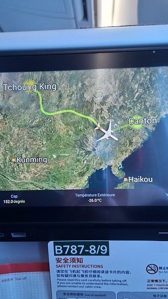
During my first two trips to China, we paid for everything in cash, but this time, we’re going all-in on Alipay and WeChat. I still brought the leftover change from previous trips—it might come in handy. At the metro station, they showed us a QR code to buy tickets via WeChat. There were probably machines and even a ticket counter, but we didn’t see them, and buying via WeChat was pretty simple. 8 yuan to Changshu Lu, which is 22 stops. So far, so good. Then, we had to find the hotel, which wasn’t on Google Maps, Maps.me, or Amap... Easy 😎! We found it without too much hassle, though. Dropped off our stuff and went out to eat. 55 yuan for two claypots with fish/eel, rice, cabbage, and purple eggplant. When we left, it was pouring. We grabbed our umbrellas and set off to explore the neighborhood: Enning Road (we’ll come back later to check out a specific spot), Shangxiajiu (the pedestrian shopping street), Baohua Road... The area is pretty diverse—one street to the next, it’s like stepping into a different world.

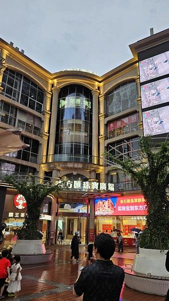
There weren’t many people around, probably because of the rain. We grabbed a quick street food dinner and went to bed—we were exhausted. We struggled to stay awake until 11 PM to adjust to the time change as quickly as possible. There’s a 6-hour time difference.
There wasn’t much room for improvisation on this trip—everything was planned in advance. Since August is peak season, I decided to book train tickets early, and once that was set, I reserved all the accommodations too. I got everything on Trip.com.
I bought the flight tickets back in March from Hainan Airlines. They were super expensive, but with these travel dates, I couldn’t exactly dream of a bargain!
I picked up e-SIMs valid for a month from Free just before departure: 10 € for the e-SIM + 19.90 € for a one-month plan with 35 GB of data abroad.
No need for a VPN with these e-SIMs, but D. still got one—a multi-device plan for 5 € with a discount from Let’s VPN, valid for a month. It was for evenings at the hotel on Wi-Fi to avoid burning through the 35 GB with video.
I downloaded Alipay, WeChat, Amap (Baidu Maps), and Trip.com. We also have Google Translate and Maps.me—absolute must-haves.
We’re ready to go!
I’ve been waiting for this day for nearly 15 years!! I travel a lot, but this one—this is MY TRIP 🙂 It’s been postponed so many times: because I wanted to do it with the right person, because I have a Turkish stamp in my passport and heard they don’t issue visas with that, because of COVID... and then China introduced a 30-day visa exemption, and that was the green light! Ugh, they forced us to take our vacation in August this year—far from ideal—but no more delays. Saturday, August 2, 2025: it’s finally the big day!
Days 1 and 2: We got dropped off at Charles de Gaulle at 9:30 AM. I supposedly checked in online, but only for the first flight and without getting the boarding pass... Might as well scrap online check-in in that case. So, we spent over an hour in line at the counter to get them. We didn’t have any checked luggage—just our backpacks as carry-ons—so this was a step we’d never had to deal with before, but whatever, it’s done. No wait at passport control, 5 minutes through security, a quick walk around the terminal, 10 minutes in the boarding area, and it was already time to board. Departure around 12:45 PM, arrival in Chongqing at 4:50 AM. We had a few hours of layover before our next flight. Went through immigration, connecting flight control, and security. Pro tip: check your next flight’s boarding gate right after immigration. We never saw it displayed again anywhere in the terminal.
The Free e-SIMs work—phew!
Took off at 9:30 AM, arrived in Guangzhou (Canton) at 11:20 AM in the rain. I love how Chongqing is translated as "Tchoung King" on the screens in the plane—very French!
During my first two trips to China, we paid for everything in cash, but this time, we’re going all-in on Alipay and WeChat. I still brought the leftover change from previous trips—it might come in handy. At the metro station, they showed us a QR code to buy tickets via WeChat. There were probably machines and even a ticket counter, but we didn’t see them, and buying via WeChat was pretty simple. 8 yuan to Changshu Lu, which is 22 stops. So far, so good. Then, we had to find the hotel, which wasn’t on Google Maps, Maps.me, or Amap... Easy 😎! We found it without too much hassle, though. Dropped off our stuff and went out to eat. 55 yuan for two claypots with fish/eel, rice, cabbage, and purple eggplant. When we left, it was pouring. We grabbed our umbrellas and set off to explore the neighborhood: Enning Road (we’ll come back later to check out a specific spot), Shangxiajiu (the pedestrian shopping street), Baohua Road... The area is pretty diverse—one street to the next, it’s like stepping into a different world.
There weren’t many people around, probably because of the rain. We grabbed a quick street food dinner and went to bed—we were exhausted. We struggled to stay awake until 11 PM to adjust to the time change as quickly as possible. There’s a 6-hour time difference.
Tips for beginners on a 3-month trip to South America
Hi everyone,
With a friend, we’re planning a big trip to South America from January to mid-April 2026.
Our planned itinerary:
Argentina Chile Brazil (for Rio’s Carnival) Peru Then heading to Costa Rica to wrap up the trip.
We don’t have a precise route yet, but here are the key stops we’d absolutely love to include:
Iguazu Falls (Foz de Iguaçu) Patagonia (especially the Perito Moreno Glacier) Atacama Desert Rio Carnival Machu Picchu
This is our first time taking a trip of this scale, and we’d love some advice from more experienced travelers. To narrow it down, here are the main things we’re worried about:
1. Travel agency
For a trip this big, do you think a travel agency is helpful, or is it better to organize everything ourselves? If so, which ones would you recommend for a tight budget? We were considering G Adventures for parts of the trip. Any feedback on them?
2. Practical tips and money
For luggage, would you recommend a small rolling suitcase or a big backpack?
About payments: Is it easy to pay by card, or is cash the way to go? If cash is king, how do you manage your budget—do you use services like Western Union for transfers? Currency exchange: Is it easy to exchange money on the spot? Which places are best for that? For costs, what’s a reasonable monthly budget for average travelers?
3. Accommodation
Is it easy to find hotels/hostels on the fly, or is it better to book a few days/weeks in advance (especially in high season)?
4. Transportation
Same question for buses: Can you buy tickets the same day, or should you book a few days/weeks (or even months) ahead for certain routes? Any recommendations for reliable companies between these countries and within them?
5. Phone service
How do you handle mobile networks, especially when crossing borders? Do you need a SIM card per country? Are there plans that cover multiple countries? Are eSIMs available? What’s the best way to set it up? Thanks in advance for your tips and experiences! We’re all ears for any great tips, hacks, or pitfalls to avoid.
Argentina Chile Brazil (for Rio’s Carnival) Peru Then heading to Costa Rica to wrap up the trip.
We don’t have a precise route yet, but here are the key stops we’d absolutely love to include:
Iguazu Falls (Foz de Iguaçu) Patagonia (especially the Perito Moreno Glacier) Atacama Desert Rio Carnival Machu Picchu
This is our first time taking a trip of this scale, and we’d love some advice from more experienced travelers. To narrow it down, here are the main things we’re worried about:
1. Travel agency
For a trip this big, do you think a travel agency is helpful, or is it better to organize everything ourselves? If so, which ones would you recommend for a tight budget? We were considering G Adventures for parts of the trip. Any feedback on them?
2. Practical tips and money
For luggage, would you recommend a small rolling suitcase or a big backpack?
About payments: Is it easy to pay by card, or is cash the way to go? If cash is king, how do you manage your budget—do you use services like Western Union for transfers? Currency exchange: Is it easy to exchange money on the spot? Which places are best for that? For costs, what’s a reasonable monthly budget for average travelers?
3. Accommodation
Is it easy to find hotels/hostels on the fly, or is it better to book a few days/weeks in advance (especially in high season)?
4. Transportation
Same question for buses: Can you buy tickets the same day, or should you book a few days/weeks (or even months) ahead for certain routes? Any recommendations for reliable companies between these countries and within them?
5. Phone service
How do you handle mobile networks, especially when crossing borders? Do you need a SIM card per country? Are there plans that cover multiple countries? Are eSIMs available? What’s the best way to set it up? Thanks in advance for your tips and experiences! We’re all ears for any great tips, hacks, or pitfalls to avoid.
Thailand and TDAC: How does it work?
Hello to all the Thailand regulars.
I’ve been to Thailand several times, but it was about 20 years ago…
There’s a new system in place now, it seems.
TDAC – Thailand Digital Arrival Card.
Before arriving, I apply for a TDAC, okay. If during my stay I cross the border to spend a few days in Malaysia and then re-enter Thailand, do I need to submit a new TDAC application? Do I use the same TDAC as when I first entered the country?
Or do I initially have to pay for a Thai multi-entry visa?
Thanks in advance for your insights—I can’t find the answer online.
Pierre
I’ve been to Thailand several times, but it was about 20 years ago…
There’s a new system in place now, it seems.
TDAC – Thailand Digital Arrival Card.
Before arriving, I apply for a TDAC, okay. If during my stay I cross the border to spend a few days in Malaysia and then re-enter Thailand, do I need to submit a new TDAC application? Do I use the same TDAC as when I first entered the country?
Or do I initially have to pay for a Thai multi-entry visa?
Thanks in advance for your insights—I can’t find the answer online.
Pierre
A few tips for a first family trip to Japan
Hi everyone,
Let me introduce myself—I’m Christophe. I’m taking the plunge and planning my first trip to Japan for late February 2026. There’ll be five of us: my wife and I, and our three daughters, aged 12 and 15. Between the internet, travel agencies, and social media, there’s info coming from all directions, but it’s tough to find clear, objective, and relevant answers. I’d like this first trip to follow a classic route: 4/5 days in Tokyo 4 days in Kyoto (Nara) 2 days in Osaka (maybe Universal Studios) I’ve got a few questions—could you share your thoughts? 1. Is it better to return to Tokyo to catch our flight home, or is flying out directly from Osaka a better option? 2. For accommodation, would you recommend a hotel or an Airbnb? Since there are five of us, I think we’d like a small kitchen and a bit of space. 3. The famous JR Pass: is it worth it, or should we just buy tickets for each trip? I’ve read that the JR Pass has gotten more expensive and isn’t the ideal solution anymore, especially if you’re staying in the same cities for several days. 4. We’d like to have two phones—do you recommend eSIMs or a pocket Wi-Fi?
That’s it—I hope you can help shed some light on this. Thanks! Christophe
Let me introduce myself—I’m Christophe. I’m taking the plunge and planning my first trip to Japan for late February 2026. There’ll be five of us: my wife and I, and our three daughters, aged 12 and 15. Between the internet, travel agencies, and social media, there’s info coming from all directions, but it’s tough to find clear, objective, and relevant answers. I’d like this first trip to follow a classic route: 4/5 days in Tokyo 4 days in Kyoto (Nara) 2 days in Osaka (maybe Universal Studios) I’ve got a few questions—could you share your thoughts? 1. Is it better to return to Tokyo to catch our flight home, or is flying out directly from Osaka a better option? 2. For accommodation, would you recommend a hotel or an Airbnb? Since there are five of us, I think we’d like a small kitchen and a bit of space. 3. The famous JR Pass: is it worth it, or should we just buy tickets for each trip? I’ve read that the JR Pass has gotten more expensive and isn’t the ideal solution anymore, especially if you’re staying in the same cities for several days. 4. We’d like to have two phones—do you recommend eSIMs or a pocket Wi-Fi?
That’s it—I hope you can help shed some light on this. Thanks! Christophe
What budget should I plan for 3 weeks on the US West Coast?
Hi everyone,
I’m a total USA addict. I’ve already done several road trips, including the East Coast and West Coast. I’m here today because I’m planning to go back for another road trip on the West Coast. Possibly with one of my sisters and a couple of friends. It’s still just a plan for now, but I’m working on an itinerary in the meantime. Ideally, I’d leave in 2026, but I don’t have the exact dates yet—maybe April-May or September-October. My last trip to the West Coast was in September 2014. We went for 2 weeks, but this time it’d be 3 weeks. What made me want to go back was simply a colleague who just left today. As I’m writing this, he’s on the plane. I’m so happy for him, but now all I can think about is going back.
Since I recently went to NY, I noticed that prices have really gone up. I assume the same is true for the West Coast? For 2 people over 3 weeks, what budget should I expect? We’re the type to watch our spending and find great tips. I think we’ll arrive in San Francisco like the first time and leave from either Los Angeles or Las Vegas.
Thanks to everyone for your advice and help.
I’m a total USA addict. I’ve already done several road trips, including the East Coast and West Coast. I’m here today because I’m planning to go back for another road trip on the West Coast. Possibly with one of my sisters and a couple of friends. It’s still just a plan for now, but I’m working on an itinerary in the meantime. Ideally, I’d leave in 2026, but I don’t have the exact dates yet—maybe April-May or September-October. My last trip to the West Coast was in September 2014. We went for 2 weeks, but this time it’d be 3 weeks. What made me want to go back was simply a colleague who just left today. As I’m writing this, he’s on the plane. I’m so happy for him, but now all I can think about is going back.
Since I recently went to NY, I noticed that prices have really gone up. I assume the same is true for the West Coast? For 2 people over 3 weeks, what budget should I expect? We’re the type to watch our spending and find great tips. I think we’ll arrive in San Francisco like the first time and leave from either Los Angeles or Las Vegas.
Thanks to everyone for your advice and help.
Back from Yunnan and Guizhou
We’re a retired French couple.
We’ve just spent 4 weeks in China:
- 1. Exploring Yunnan in a group (12 people); a journey that took us from the Vietnamese border in the south to the edges of Tibet in the north.
- 2. A private trip to Guizhou with just a driver.
We’re absolutely delighted with what we discovered: a modern country with excellent infrastructure (especially the low level of urban pollution thanks to the high number of electric vehicles, the absence of diesel, and no noisy motorbikes in these two less industrialized provinces), friendly Chinese people who were always ready to help us when we had difficulties or questions, and a rich natural and cultural heritage.
The language barrier remains the biggest challenge, despite instant translation tools.
For both trips, we booked through the agency CIELCHINE, which we highly recommend.
The value for money is unbeatable.
The services were luxurious, especially for us since we usually travel alone on a tight budget for accommodation and food.
The agency’s staff were perfectly competent and, what’s more, warm and welcoming.
For Yunnan, our guide SEBASTIEN, who was experienced and knowledgeable, won everyone over.
In Guizhou, our driver HUANG was professionally flawless and guided us through villages he knows well. Friendly and full of humor, he’d spontaneously talk to people he met, which made us be treated with much more kindness and allowed us to exchange a few basic words.
As you can see, I haven’t ticked anything negative—not because I’m hiding anything or have any ulterior motive, but because I’m completely satisfied and the experience even exceeded all my expectations.
Feasibility and safety for a trip to Bangladesh
Hi there,
I’m planning a trip to Bangladesh for tourism during All Saints' Day 25. The government website is pretty discouraging! I’d love to hear from people living there or who’ve been recently before I buy my tickets.
How’s the security level and feasibility of a circuit (boat, train, bus around the country)? We’re used to basic conditions :)
Thanks in advance for your tips!
Cécile
Scam in Japan
Hello,
I’m currently in Japan, in Osaka, and we just avoided a scam I wasn’t familiar with.
We were in the tall tower in Tennoji when we were approached by two Japanese guys around 20 years old.
One, speaking broken English, asked us to make a video for his friend who’s in the hospital.
The scam involves distracting you to steal your phone or later asking for money for this so-called friend, while the other stays in the background and keeps an eye on our surroundings. We obviously refused, pretending we didn’t speak English, and they left. But after 10 minutes, they came back, this time translating with his phone. After looking it up online, they call this the "sick friend scam"—used to ask for money. I’ve been coming to Japan twice a year for 15 years and had never seen this before. Also, I’ve noticed some aggressive behavior from a few Japanese people toward tourists—shoving in stores, a 1000¥ fee for luggage when taking the train from the airport, and terrible service in some hotels.
Japan plans to require an ETA (Electronic Travel Authorization) in 2025 for entry, which will need to be applied for and paid for online, along with a surveillance app. The exact date isn’t known yet, and Europe is protesting, considering reciprocity if necessary. Let’s see if this gets canceled, as the new prime minister seems to be backtracking.
The "Must-Sees" of the American West
This adventure began during Covid... Yep, Covid turned a lot of things upside down, but most of all, it kept us cooped up for a few months and stopped us from traveling for a while—even longer for a die-hard fan of the American West like me.
While borders were closed, I started imagining what an ideal itinerary might look like—one that would string together all the Southwest must-sees in just two weeks, during the best time of year: September and October. When the U.S. announced in September 2021 that borders would reopen in the coming weeks, I regained hope and began scouting flight tickets for a departure in September 2022.
But here’s the thing: tackling solo hikes, each one tougher than the last, right in the heart of the Wilderness, could be a risky—even reckless—endeavor for a father of three. After a quick chat with some virtual friends who are just as passionate about the Southwest as I am, with good physical condition and nearly the same list of must-visit spots, Franck and his brother Sullivan were in! 🙂
In November, we snagged flight tickets from Nice to San Francisco for the modest sum of 400 €, and a few days later, I booked a Toyota Tacoma pickup for 840 € !
It’s not cheap for just 15 days, and a pickup isn’t exactly ideal for luggage, but the prices for full-size 4x4s have become totally outrageous! Due to border closures, rental companies had to offload a lot of these big 4x4s, which tourists love. Then, supply and demand did the rest !
Franck and I spent the winter and spring trying to cram the equivalent of three weeks of hikes into two. But even with physical limits, we had to stay reasonable! Three to four months before departure, we entered the lotteries for different must-see spots: The Subway, Coyote Buttes North (home to the famous Wave), and Coyote Buttes South (CBS).
The Wave is the holy grail for any Southwest enthusiast. Since 2015, we’ve tried our luck with the online and on-site lotteries about ten times, but the spots are unfortunately limited: just 20 per day. A glimmer of hope, though—since early 2022, that number has increased to 64 people allowed per day, with 48 spots awarded via the online lottery.
After all three of us tried our luck for The Wave, on June 1st at exactly 5 PM, I got an email that started with, "Congratulations! You were successful in the Coyote Buttes North (The Wave) September 2022 Permit Lottery at Coyote Buttes North (The Wave)...". At 5:01 PM, I called Franck, whose dream it’s been for over 20 years—ever since the first photos were published in a travel magazine! He didn’t believe me when I told him, and I had to forward the email for him to finally accept the unbelievable: we were going to The Wave and all the incredible spots scattered across the protected area of Coyote Buttes North.
I’ve already been to Coyote Buttes South twice, but there are areas I couldn’t explore in the middle of summer because they were too remote. So, I had no trouble letting my buddies convince me to go back for a third time. Plus, given how hard it is to access, we had no trouble securing a permit online as long as we logged in at exactly 8 PM on the dot!
For The Subway, all three of us struck out. No big deal—we won at CBN and CBS!
Among the sites to visit, there are two that I’m particularly attached to because I know my chances of wanting to see them again are slim. The first is Angel Arch, one of the most legendary arches in the Southwest, due to its remoteness from any trace of civilization. To get there, the recommended hike is Upper Salt Creek, and you’re looking at a 50 km round-trip in an area with no water (in September) and populated by bears.
The second site is the Hopi Salt Trail, in Navajo land, which, after a very tough hike, lets you marvel at the turquoise-blue waters of the Little Colorado before it meets the Colorado River. The Hopi Salt Trail is, like The Wave, the holy grail for any Southwest enthusiast, and the windows of opportunity to see the water in that magical color are very short each year. For this, you have to monitor the Little Colorado’s gauges downstream from Cameron: if the level stays at its lowest for 10 consecutive days—meaning no rain—you can hope for turquoise water. The ideal period rarely exceeds 30 days a year, and it’s usually in June that all the stars align.
But unfortunately, one month before departure, while the flow rate at Cameron looked promising, several storms in September dashed our hopes of doing the Hopi Salt Trail, even at the end of the road trip.
We still had two consolation prizes, though:
After a last-minute cancellation, while keeping an eye out for available spots for The Subway, it turned out that three spots opened up exactly on the day we’d planned to go—so we rushed to grab them!! Regarding the 4x4 rental, the prices for full-size models dropped by several hundred dollars, and we ended up finding a Chevrolet Tahoe for less than $1000. A steal and a serious boost in comfort, so we could store all our gear and food without worry!
Here’s the initial plan in a perfect world: D1 The White Domes - Camping D2 Sunrise at The White Domes - The Subway D3 Coyote Buttes North D4 Coyote Buttes South - White Pocket D5 Wahweap Hoodoos - Sidestep Canyon - Colourful Canyon - White Rocks - Sunset at Yellow Rock D6 Broken Bow Arch - Reflection Canyon D7 Coyote Gulch D8 The Volcano (or The Oasis - Zebra Slot Canyon if the weather’s good) - North Caineville Mesa D9 The Needles: Squaw Canyon - Lost Canyon combo - Druid Arch - Chesler Park D10 Upper Salt Creek Day 1 - Camping D11 Upper Salt Creek Day 2 D12 Hopi-Navajo Territory: Ha Ho No Geh Canyon, Coal Mine Canyon, Bends of the Little Colorado D13 Grand Canyon: South Kaibab Trail and Bright Angel Trail D14 Upper East Zion: East Temple Loop, Jughandle Arch, Center of the Universe, and Checkerboard Mesa Summit And several backup options in case of bad weather, including Spencer Trail, West Cove, and Buffington Pockets.
Enough talking—time for action!
While borders were closed, I started imagining what an ideal itinerary might look like—one that would string together all the Southwest must-sees in just two weeks, during the best time of year: September and October. When the U.S. announced in September 2021 that borders would reopen in the coming weeks, I regained hope and began scouting flight tickets for a departure in September 2022.
But here’s the thing: tackling solo hikes, each one tougher than the last, right in the heart of the Wilderness, could be a risky—even reckless—endeavor for a father of three. After a quick chat with some virtual friends who are just as passionate about the Southwest as I am, with good physical condition and nearly the same list of must-visit spots, Franck and his brother Sullivan were in! 🙂
In November, we snagged flight tickets from Nice to San Francisco for the modest sum of 400 €, and a few days later, I booked a Toyota Tacoma pickup for 840 € !
It’s not cheap for just 15 days, and a pickup isn’t exactly ideal for luggage, but the prices for full-size 4x4s have become totally outrageous! Due to border closures, rental companies had to offload a lot of these big 4x4s, which tourists love. Then, supply and demand did the rest !
Franck and I spent the winter and spring trying to cram the equivalent of three weeks of hikes into two. But even with physical limits, we had to stay reasonable! Three to four months before departure, we entered the lotteries for different must-see spots: The Subway, Coyote Buttes North (home to the famous Wave), and Coyote Buttes South (CBS).
The Wave is the holy grail for any Southwest enthusiast. Since 2015, we’ve tried our luck with the online and on-site lotteries about ten times, but the spots are unfortunately limited: just 20 per day. A glimmer of hope, though—since early 2022, that number has increased to 64 people allowed per day, with 48 spots awarded via the online lottery.
After all three of us tried our luck for The Wave, on June 1st at exactly 5 PM, I got an email that started with, "Congratulations! You were successful in the Coyote Buttes North (The Wave) September 2022 Permit Lottery at Coyote Buttes North (The Wave)...". At 5:01 PM, I called Franck, whose dream it’s been for over 20 years—ever since the first photos were published in a travel magazine! He didn’t believe me when I told him, and I had to forward the email for him to finally accept the unbelievable: we were going to The Wave and all the incredible spots scattered across the protected area of Coyote Buttes North.
I’ve already been to Coyote Buttes South twice, but there are areas I couldn’t explore in the middle of summer because they were too remote. So, I had no trouble letting my buddies convince me to go back for a third time. Plus, given how hard it is to access, we had no trouble securing a permit online as long as we logged in at exactly 8 PM on the dot!
For The Subway, all three of us struck out. No big deal—we won at CBN and CBS!
Among the sites to visit, there are two that I’m particularly attached to because I know my chances of wanting to see them again are slim. The first is Angel Arch, one of the most legendary arches in the Southwest, due to its remoteness from any trace of civilization. To get there, the recommended hike is Upper Salt Creek, and you’re looking at a 50 km round-trip in an area with no water (in September) and populated by bears.
The second site is the Hopi Salt Trail, in Navajo land, which, after a very tough hike, lets you marvel at the turquoise-blue waters of the Little Colorado before it meets the Colorado River. The Hopi Salt Trail is, like The Wave, the holy grail for any Southwest enthusiast, and the windows of opportunity to see the water in that magical color are very short each year. For this, you have to monitor the Little Colorado’s gauges downstream from Cameron: if the level stays at its lowest for 10 consecutive days—meaning no rain—you can hope for turquoise water. The ideal period rarely exceeds 30 days a year, and it’s usually in June that all the stars align.
But unfortunately, one month before departure, while the flow rate at Cameron looked promising, several storms in September dashed our hopes of doing the Hopi Salt Trail, even at the end of the road trip.
We still had two consolation prizes, though:
After a last-minute cancellation, while keeping an eye out for available spots for The Subway, it turned out that three spots opened up exactly on the day we’d planned to go—so we rushed to grab them!! Regarding the 4x4 rental, the prices for full-size models dropped by several hundred dollars, and we ended up finding a Chevrolet Tahoe for less than $1000. A steal and a serious boost in comfort, so we could store all our gear and food without worry!
Here’s the initial plan in a perfect world: D1 The White Domes - Camping D2 Sunrise at The White Domes - The Subway D3 Coyote Buttes North D4 Coyote Buttes South - White Pocket D5 Wahweap Hoodoos - Sidestep Canyon - Colourful Canyon - White Rocks - Sunset at Yellow Rock D6 Broken Bow Arch - Reflection Canyon D7 Coyote Gulch D8 The Volcano (or The Oasis - Zebra Slot Canyon if the weather’s good) - North Caineville Mesa D9 The Needles: Squaw Canyon - Lost Canyon combo - Druid Arch - Chesler Park D10 Upper Salt Creek Day 1 - Camping D11 Upper Salt Creek Day 2 D12 Hopi-Navajo Territory: Ha Ho No Geh Canyon, Coal Mine Canyon, Bends of the Little Colorado D13 Grand Canyon: South Kaibab Trail and Bright Angel Trail D14 Upper East Zion: East Temple Loop, Jughandle Arch, Center of the Universe, and Checkerboard Mesa Summit And several backup options in case of bad weather, including Spencer Trail, West Cove, and Buffington Pockets.
Enough talking—time for action!
To the Top West End
In this time of general travel-journal scarcity, I’m stepping up to tell you about a far-too-short getaway to the Top West End, a local term for the very northern part of Western Australia, right on the border ( ;) ) with the Northern Territory.
As usual, I didn’t manage to keep it short, but this time I’ve got photos to go with it!
August 2020. Since the opportunities to explore the world are extremely limited right now, all we (R&X) can do is explore our own island! Well, just a part of it, because with the state borders still closed, we’re stuck in Western Australia (WA).
Luckily, we’re pretty fortunate because this state is huge: over 2.5 million km² (that’s more than four times the size of France or 1.5 times Quebec). What’s more, stretching over 20 degrees of latitude between the Antarctic Ocean and the Timor Sea, you’ll find climates ranging from Mediterranean to arid to tropical. That’s actually why we decided to head as far north as possible. Sick of the endless rainy winter in Perth, bring on the heat of the Kimberley... way up Nooorth!
Friday. At the airport, the main terminal was closed (not enough flights), so we ended up in the annex (where flights to the various mines usually depart from). There was no crowd at the gate, and in this huge, single departure lounge, empty seats were plentiful. Only three flights were listed on the screens for the rest of the morning: the first to Coondewanna (?), the second to Darwin, and ours to Kununurra (code KNX).
A cool breeze swept through the half-open corridors along the runways. At the top of the walkway leading to the Fokker 100 (the Airbuses and Boeings are now parked!), a flight attendant greeted us with a basket full of sanitary masks. We were actually the only masked passengers (the staff weren’t wearing them either). With zero Covid-19 cases in WA at the time, the only rule was to maintain social distancing—something pretty hard to do on a full plane!
It was also my first time wearing a mask—it felt weird, pretty uncomfortable, and after a while, painful behind the ears. I really feel for those who have to wear one all day, every day. The flight lasted three long hours, but luckily, I had a good book. From the window, I watched an endless expanse of salt lakes in all shapes and sizes—round, elongated, gray, white, sometimes blue and green—and an infinity of winding, capricious meanders, along with long straight lines that led nowhere. The last half-hour got more interesting as rocky, swollen formations and long, sloping plateaus appeared. Against the vast ochre landscape, green patches became more frequent.
Just before landing, rows of green fields briefly appeared, along with an surprisingly wide river—but we were already rolling down the tarmac. A few hangars, a myriad of small, stationary planes, and a tiny terminal topped with a sign: “Welcome to Kununurra.”
We wanted heat, and here it was—34°C the moment we stepped off the plane! We felt alive again and totally ridiculous in our jeans and sweaters. We quickly grabbed our suitcase and picked up the 4x4 we’d rented—more out of necessity, since only that type of vehicle can access the national parks we planned to visit.
Just four kilometers separated us from Kununurra, a town of 5,000 people founded in 1961 during the construction of the Lake Argyle Dam and the development of the Ord River Irrigation Area Scheme (more on that later). On the horizon, mountain ranges (a bit of an exaggeration, since we know Mt. Meharry, WA’s highest ‘mountain,’ doesn’t even reach 1,250 meters!) and closer to the road, a few irrigation canals cutting through stretches of bush, then a huge park overlooking a small lake lined with reeds.
A row of baobabs (yes, there are baobabs in Australia too!), a series of motels with immaculate lawns, a gas station, and there’s the main street leading to the town center—that is, the parking lots of the two supermarkets, the bottleshop, the pub, the Town Hall, the municipal pool, and the Tourist Office (already closed!), and at the next roundabout, another park, the Presbyterian church, and a few other shops. In short, two or three green blocks that you can explore in no time.
One road leads to the small industrial area and one of the town’s three or four campgrounds, while another heads toward the residential neighborhoods, which look just like the typical suburbs you find in any Australian city—except with tropical vegetation. We stocked up at Coles, an identical copy of the one near our place, and—surprise—the prices were practically the same.
We checked into one of the motels. The receptionist listed the town’s three or four restaurants, insisting that it’s always better to book a table. She recommended the Pump House, a bit outside town on the lake’s edge. “Best spot to watch the sunset, but hurry up.” she told us. It was only 5:00 PM!
When we got there half an hour later, the place was packed, and the sun had already disappeared behind a row of trees! Sure enough, we’d see a few days later that the sunset can be a stunning spectacle—if you wait a bit for the sky (especially if it’s cloudy) to blaze and reflect in the lake’s calm waters. A little disappointed, we headed back into town, where we easily found the other lively spot in town: the pub (nothing like an old English pub). Above the long L-shaped bar, several giant screens (thankfully muted) were broadcasting live footy, rugby league, etc. In one corner, players circled the pool table, while in another, customers were digging into plates of the day’s special. Instead of rooms, there were various patios where groups of friends and coworkers (easily recognizable by the fluoro vests they were still wearing) were gathered. We found a table under a mango tree—unfortunately, a little too close to the guitarist strumming his entire Country Music repertoire, complete with Keith Urban-style tremolos. Guaranteed culture shock!
Since it’s the custom here, we called the Country Club to book a table before the kitchen closed! The CC is the town’s—and even the region’s—fancy spot. Dark decor, modern furniture, dim lighting, and the air conditioning blasting. The twenty or so customers had taken refuge on the vast terrace, lit by torches. The view of the tall eucalyptus trees, illuminated by spotlights shifting from red to blue, was breathtaking.
The menu was minimal, but the grilled salmon was excellent, and the Pavlova (the meringue dessert Kiwis and Aussies have been arguing over since 1906) with melon and watermelon was absolutely divine.
It wasn’t even 9:00 PM, and we were already in bed. Had we already adopted the Top West End’s chicken schedule?!
To be continued... Journal dedicated to Attila
As usual, I didn’t manage to keep it short, but this time I’ve got photos to go with it!
August 2020. Since the opportunities to explore the world are extremely limited right now, all we (R&X) can do is explore our own island! Well, just a part of it, because with the state borders still closed, we’re stuck in Western Australia (WA).
Luckily, we’re pretty fortunate because this state is huge: over 2.5 million km² (that’s more than four times the size of France or 1.5 times Quebec). What’s more, stretching over 20 degrees of latitude between the Antarctic Ocean and the Timor Sea, you’ll find climates ranging from Mediterranean to arid to tropical. That’s actually why we decided to head as far north as possible. Sick of the endless rainy winter in Perth, bring on the heat of the Kimberley... way up Nooorth!
Friday. At the airport, the main terminal was closed (not enough flights), so we ended up in the annex (where flights to the various mines usually depart from). There was no crowd at the gate, and in this huge, single departure lounge, empty seats were plentiful. Only three flights were listed on the screens for the rest of the morning: the first to Coondewanna (?), the second to Darwin, and ours to Kununurra (code KNX).
A cool breeze swept through the half-open corridors along the runways. At the top of the walkway leading to the Fokker 100 (the Airbuses and Boeings are now parked!), a flight attendant greeted us with a basket full of sanitary masks. We were actually the only masked passengers (the staff weren’t wearing them either). With zero Covid-19 cases in WA at the time, the only rule was to maintain social distancing—something pretty hard to do on a full plane!
It was also my first time wearing a mask—it felt weird, pretty uncomfortable, and after a while, painful behind the ears. I really feel for those who have to wear one all day, every day. The flight lasted three long hours, but luckily, I had a good book. From the window, I watched an endless expanse of salt lakes in all shapes and sizes—round, elongated, gray, white, sometimes blue and green—and an infinity of winding, capricious meanders, along with long straight lines that led nowhere. The last half-hour got more interesting as rocky, swollen formations and long, sloping plateaus appeared. Against the vast ochre landscape, green patches became more frequent.
Just before landing, rows of green fields briefly appeared, along with an surprisingly wide river—but we were already rolling down the tarmac. A few hangars, a myriad of small, stationary planes, and a tiny terminal topped with a sign: “Welcome to Kununurra.”
We wanted heat, and here it was—34°C the moment we stepped off the plane! We felt alive again and totally ridiculous in our jeans and sweaters. We quickly grabbed our suitcase and picked up the 4x4 we’d rented—more out of necessity, since only that type of vehicle can access the national parks we planned to visit.
Just four kilometers separated us from Kununurra, a town of 5,000 people founded in 1961 during the construction of the Lake Argyle Dam and the development of the Ord River Irrigation Area Scheme (more on that later). On the horizon, mountain ranges (a bit of an exaggeration, since we know Mt. Meharry, WA’s highest ‘mountain,’ doesn’t even reach 1,250 meters!) and closer to the road, a few irrigation canals cutting through stretches of bush, then a huge park overlooking a small lake lined with reeds.
A row of baobabs (yes, there are baobabs in Australia too!), a series of motels with immaculate lawns, a gas station, and there’s the main street leading to the town center—that is, the parking lots of the two supermarkets, the bottleshop, the pub, the Town Hall, the municipal pool, and the Tourist Office (already closed!), and at the next roundabout, another park, the Presbyterian church, and a few other shops. In short, two or three green blocks that you can explore in no time.
One road leads to the small industrial area and one of the town’s three or four campgrounds, while another heads toward the residential neighborhoods, which look just like the typical suburbs you find in any Australian city—except with tropical vegetation. We stocked up at Coles, an identical copy of the one near our place, and—surprise—the prices were practically the same.
We checked into one of the motels. The receptionist listed the town’s three or four restaurants, insisting that it’s always better to book a table. She recommended the Pump House, a bit outside town on the lake’s edge. “Best spot to watch the sunset, but hurry up.” she told us. It was only 5:00 PM!
When we got there half an hour later, the place was packed, and the sun had already disappeared behind a row of trees! Sure enough, we’d see a few days later that the sunset can be a stunning spectacle—if you wait a bit for the sky (especially if it’s cloudy) to blaze and reflect in the lake’s calm waters. A little disappointed, we headed back into town, where we easily found the other lively spot in town: the pub (nothing like an old English pub). Above the long L-shaped bar, several giant screens (thankfully muted) were broadcasting live footy, rugby league, etc. In one corner, players circled the pool table, while in another, customers were digging into plates of the day’s special. Instead of rooms, there were various patios where groups of friends and coworkers (easily recognizable by the fluoro vests they were still wearing) were gathered. We found a table under a mango tree—unfortunately, a little too close to the guitarist strumming his entire Country Music repertoire, complete with Keith Urban-style tremolos. Guaranteed culture shock!
Since it’s the custom here, we called the Country Club to book a table before the kitchen closed! The CC is the town’s—and even the region’s—fancy spot. Dark decor, modern furniture, dim lighting, and the air conditioning blasting. The twenty or so customers had taken refuge on the vast terrace, lit by torches. The view of the tall eucalyptus trees, illuminated by spotlights shifting from red to blue, was breathtaking.
The menu was minimal, but the grilled salmon was excellent, and the Pavlova (the meringue dessert Kiwis and Aussies have been arguing over since 1906) with melon and watermelon was absolutely divine.
It wasn’t even 9:00 PM, and we were already in bed. Had we already adopted the Top West End’s chicken schedule?!
To be continued... Journal dedicated to Attila
Ce n'était pas mieux avant et ce n'est pas mieux après English translation pending
j ai connu un âge d or des voyages en pays etrangers. En gros des annees 1980 aux annees 2000.
avant c était les avions pour les privilégiés, des zones entieres sans hôtels , des chambres et des lits datant du moyen âge et parfois d immenses difficultés pour se comprendre. une bonne partie du monde pour des aventuriers au dos solide et au sommeil facile
apres c est devenu l invasion touristique , les paysages défigurés , la mer souillée , les bourrins en bus et sur paquebots , le tourisme local avec les défauts occidentaux et pas leurs qualités. une bonne partie du monde a vous gâcher le paysage avec leurs minables selfies
Il y a pour tout une période optimale. Avant c est trop tôt, apres ca devient difficile. Ce n est pas Voyagesforum qui me contredira........
avant c était les avions pour les privilégiés, des zones entieres sans hôtels , des chambres et des lits datant du moyen âge et parfois d immenses difficultés pour se comprendre. une bonne partie du monde pour des aventuriers au dos solide et au sommeil facile
apres c est devenu l invasion touristique , les paysages défigurés , la mer souillée , les bourrins en bus et sur paquebots , le tourisme local avec les défauts occidentaux et pas leurs qualités. une bonne partie du monde a vous gâcher le paysage avec leurs minables selfies
Il y a pour tout une période optimale. Avant c est trop tôt, apres ca devient difficile. Ce n est pas Voyagesforum qui me contredira........
Louer une voiture ou pas pour faire ce trajet au Brésil English translation pending
Bonjour,
Je regarde à aller au Brésil et on voudrait faire Rio-Salvador-Recife en voiture avec des arrêts entre ces villes.
Louer une voiture au Brésil vaut t'il le coup pour faire ce trajet ? Le prix du carburant est bon marché ? Conduire au Brésil est comme ici ou dangereux ?
Merci
Merci
La Bretagne avec le Jacques Cartier "Ponant" du 18 au 25 juillet 2020 English translation pending
Bonjour
J'avais envisagé d'attendre début Octobre et notre retour à Rennes pour faire le C/R
de notre croisière " La Bretagne : entre côtes sauvages et phares "
Mais tout compte fait , je change d'avis et démarre ce C/R dès maintenant :
Au retour de notre 20 ème croisière , fin Novembre 2019 , ( Transat de Marseille à
Miami sur le MSC Divina ) , nous avions décidé de faire une (petite ) pause pour les
croisières et donc de ne rien réserver avant plusieurs mois .
Sage décision en fait au vu des évènements sanitaires du Printemps puisque nous
avons échappé aux problèmes subis par nombre de touristes qui se sont retrouvés
avec des avoirs qu'il ne pourront utiliser ( au mieux ) que dans plusieurs mois .
A la fin de l'an dernier , je m'étais inscrit à la newsletter de Ponant , plus pour rêver
qu'autre chose .
Mais début Juin , alors que toutes les croisières sont annulées les unes après les autres ,
Ponant , profitant notamment de la capacité réduite de ses navires et du retour en
France métropolitaine de presque tous , met en place 2 itinéraires en Méditerranée et
3 en Manche et Atlantique .
La croisière au départ de Nice pour contourner la Corse nous plaisait bien mais rejoindre
Nice posait , à ce moment là , problème .
Nous décidons donc de nous rabattre sur la croisière au départ de St Malo car là , pas de
souci pour nous y rendre 🙂
Les raisons de notre choix : de mémoire , St Malo est fréquemment une ville d'escale pour
les bateaux de croisière mais quasiment jamais une ville d'embarquement ( et là aussi
de débarquement ) , donc autant en profiter .
De plus l'itinéraire nous plait avec la visite d'iles connues ( mais que nous reverrons avec
plaisir ) et de vraies découvertes dont les Scilly , au large de la Cornouaille britannique .
Mi Juin , nous décidons de réserver la croisière au départ de St Malo du 18 Juillet , sachant
que nous avons la possibilité d'annuler , sans pénalités , jusqu'à 72 heures avant le départ .
L'annulation , nous y avons pensé quand , fin Juin , nous avons appris que l'escale aux
Scilly était supprimée 😠 , remplacée par Ouessant , une escale à Groix se substituant
à celle de Hoëdic .
Toutes les autres croisières étaient aussi affectées par la suppression des escales à l'étranger
pour raisons sanitaires ( jours de quarantaine )
Nous trouverons donc peut-être une autre occasion pour nous rendre aux Scilly
Comme d'habitude , je m'égare avec ce préambule un peu long .
Je vais donc faire une pause avant de vous embarquer sur le Jacques Cartier .
A plus
Jean-Pierre
Il est grand temps de rallumer les étoiles! English translation pending
Bonjour à tous
Le Vietnam pays magique multiculturel aux paysages diversifiés et époustouflants. Voilà ce que je vous invite à partager sans aborder s'il vous plaît ce qui aujourd'hui empêche la planète de vivre... Essayons d'être constructifs et positivons! Il est grand temps de rallumer les étoiles!
Pour commencer avec légèreté: La médecine des Dao, le bain aux herbes. C'est un moment délicieux après une journée de marche et de visites rien de tel pour vous requinquer! Ce bain est très souvent proposé aux touristes dans le nord, spécialité de l'ethnie Dao il est "accommodé" dans plusieurs maisons d'hôtes et hôtels aux besoins des touristes.
Traditionnellement les recettes sont destinées à chaque cas et en fonction de la pathologie: femmes enceintes ou qui viennent d'accoucher, nouveau-nés, malades, vieillards…les herbes seront donc choisies en fonction des besoins et du type de médication (orale, en bain, en emplâtre...). C'est dès l'aube que les femmes, les hommes, les chamanes iront cueillir ces plantes, racines et écorces dans la forêt, le tout sera combiné à un régime adapté (on ne mange pas de tout..) et souvent suivi d'un massage spécifique.
Nous en avons testé plusieurs à plusieurs endroits mais celui de la chamane Dao d'un petit village au nord de Muong Lay restera sans doute le plus authentique et le plus insolite.. On nous prend en main dès notre arrivée dans la maison de la chamane. Elle y vit avec sa fille et son gendre... Maison, je devrai plus dire assemblage de planches et de tôles et quand on connaît les rigueurs de l'hivers on peut rêver mieux. La pièce principale est bourrée de pots en tout genre remplis de décoctions plus ou moins troubles...ces sont les médications à avaler, beurk.. Il y a aussi de gros sacs (plastique) d'herbes, de racines, d'écorces, un vrai magasin d'herboriste (l'ordre et la propreté en moins) sans oublier bien sur l'hôtel des ancêtres. Derrière des rideaux, les couches des habitants, nous ne dormirons pas là, ouf.. Puis attenantes, les deux salles des bains avec 2 baquets chacune et entre les deux sous une pergola un énorme foyer construit en ciment surmonté d'une aussi énorme bassine où l'eau et les herbes "cuisent" jusqu'à parfois 12 heures...c'est là que l'on fait aussi cuire la soupe des cochons... Le feu est alimenté de poupée de maïs et de bois. C'est dans ces baquets que nous tromperont plus ou moins longtemps...le temps de "cuisson" est décidé par la chamane en fonction de chacun, jamais plus de 30 mm...et les herbes qui seront rajoutée dans les baquets seront aussi choisies en fonction de chaque "malade". C'est très très chaud, il faut vraiment se faire violence pour entrer là dedans et c'est sans compter qu'une fois immergés la dame ajoute de l'eau chaude bien sur...ouille. Une fois "les touristes bien cuits" on nous sort de là, inutile de préciser que nous ressemblons plus à des homards qu'à des visages pâles... Après cuisson, nous serons conduits ensuite vers le silo à grains, où une pièce spéciale massage à été aménagée à son top, on l'atteint via une échelle de bois...au sol deux couches. Ici commence le moment le plus douloureux de tous les massages faits au Vietnam par le gendre et la fille de la maison.. Pas de douces caresses, non, non, mais un pétrissage et un battage en bonne et due forme suivis de torsion, j'ai cru ma dernière heure arrivée... Pour clore la séance nous dînerons chez la chamane d'un souper spécial, la couleur des mets est importante, nous ne mangerons que du blanc et du vert....des légumes et des herbes inconnues de nous et un peu de poulet bouilli, élastique à souhait, sans doute celui que nous avons croisé sur le chemin en arrivant et des petits poissons frits (très bons). C'est sans conteste le meilleur soin reçu au Vietnam si l'on fait abstraction de la propreté des lieux, des serviettes (surtout apporter les siennes) et des moments douloureux.
Le Vietnam pays magique multiculturel aux paysages diversifiés et époustouflants. Voilà ce que je vous invite à partager sans aborder s'il vous plaît ce qui aujourd'hui empêche la planète de vivre... Essayons d'être constructifs et positivons! Il est grand temps de rallumer les étoiles!
Pour commencer avec légèreté: La médecine des Dao, le bain aux herbes. C'est un moment délicieux après une journée de marche et de visites rien de tel pour vous requinquer! Ce bain est très souvent proposé aux touristes dans le nord, spécialité de l'ethnie Dao il est "accommodé" dans plusieurs maisons d'hôtes et hôtels aux besoins des touristes.
Traditionnellement les recettes sont destinées à chaque cas et en fonction de la pathologie: femmes enceintes ou qui viennent d'accoucher, nouveau-nés, malades, vieillards…les herbes seront donc choisies en fonction des besoins et du type de médication (orale, en bain, en emplâtre...). C'est dès l'aube que les femmes, les hommes, les chamanes iront cueillir ces plantes, racines et écorces dans la forêt, le tout sera combiné à un régime adapté (on ne mange pas de tout..) et souvent suivi d'un massage spécifique.
Nous en avons testé plusieurs à plusieurs endroits mais celui de la chamane Dao d'un petit village au nord de Muong Lay restera sans doute le plus authentique et le plus insolite.. On nous prend en main dès notre arrivée dans la maison de la chamane. Elle y vit avec sa fille et son gendre... Maison, je devrai plus dire assemblage de planches et de tôles et quand on connaît les rigueurs de l'hivers on peut rêver mieux. La pièce principale est bourrée de pots en tout genre remplis de décoctions plus ou moins troubles...ces sont les médications à avaler, beurk.. Il y a aussi de gros sacs (plastique) d'herbes, de racines, d'écorces, un vrai magasin d'herboriste (l'ordre et la propreté en moins) sans oublier bien sur l'hôtel des ancêtres. Derrière des rideaux, les couches des habitants, nous ne dormirons pas là, ouf.. Puis attenantes, les deux salles des bains avec 2 baquets chacune et entre les deux sous une pergola un énorme foyer construit en ciment surmonté d'une aussi énorme bassine où l'eau et les herbes "cuisent" jusqu'à parfois 12 heures...c'est là que l'on fait aussi cuire la soupe des cochons... Le feu est alimenté de poupée de maïs et de bois. C'est dans ces baquets que nous tromperont plus ou moins longtemps...le temps de "cuisson" est décidé par la chamane en fonction de chacun, jamais plus de 30 mm...et les herbes qui seront rajoutée dans les baquets seront aussi choisies en fonction de chaque "malade". C'est très très chaud, il faut vraiment se faire violence pour entrer là dedans et c'est sans compter qu'une fois immergés la dame ajoute de l'eau chaude bien sur...ouille. Une fois "les touristes bien cuits" on nous sort de là, inutile de préciser que nous ressemblons plus à des homards qu'à des visages pâles... Après cuisson, nous serons conduits ensuite vers le silo à grains, où une pièce spéciale massage à été aménagée à son top, on l'atteint via une échelle de bois...au sol deux couches. Ici commence le moment le plus douloureux de tous les massages faits au Vietnam par le gendre et la fille de la maison.. Pas de douces caresses, non, non, mais un pétrissage et un battage en bonne et due forme suivis de torsion, j'ai cru ma dernière heure arrivée... Pour clore la séance nous dînerons chez la chamane d'un souper spécial, la couleur des mets est importante, nous ne mangerons que du blanc et du vert....des légumes et des herbes inconnues de nous et un peu de poulet bouilli, élastique à souhait, sans doute celui que nous avons croisé sur le chemin en arrivant et des petits poissons frits (très bons). C'est sans conteste le meilleur soin reçu au Vietnam si l'on fait abstraction de la propreté des lieux, des serviettes (surtout apporter les siennes) et des moments douloureux.
La crème miracle c'est vraiment le pied? English translation pending
Bonjour,
Comme beaucoup ici mon passeport restera donc dans son tiroir cet été. Mon vélo, lui, restera dans le garage et c'est en France, et à pied, que je vais voyager. Départ de Calais dans la semaine prochaine. L'idée est de rejoindre Hendaye, en 3 mois environ. J'ai déjà traversé la France en marchant il y a une dizaine d'années ( de Saint-Malo à Menton ). Je crois que j'ai réuni tout mon matériel ( je vais bivouaquer le plus clair du temps, donc le sac sera plutôt lourd ). Je vais étrenner mes Meindl en cuir toutes neuves pour l'occasion, donc je prends des kilomètres de sparadrap pour éteindre mes ampoules 🙂. Par contre je me demandais s'il existait une crème qui détend muscles et/ou tendons en fin d'étape ? Quotidiennement je pédale beaucoup mais je n'ai pas beaucoup marché ces derniers temps et j'ai peur des jambes-piquets du petit matin, surtout au début...
L.
Comme beaucoup ici mon passeport restera donc dans son tiroir cet été. Mon vélo, lui, restera dans le garage et c'est en France, et à pied, que je vais voyager. Départ de Calais dans la semaine prochaine. L'idée est de rejoindre Hendaye, en 3 mois environ. J'ai déjà traversé la France en marchant il y a une dizaine d'années ( de Saint-Malo à Menton ). Je crois que j'ai réuni tout mon matériel ( je vais bivouaquer le plus clair du temps, donc le sac sera plutôt lourd ). Je vais étrenner mes Meindl en cuir toutes neuves pour l'occasion, donc je prends des kilomètres de sparadrap pour éteindre mes ampoules 🙂. Par contre je me demandais s'il existait une crème qui détend muscles et/ou tendons en fin d'étape ? Quotidiennement je pédale beaucoup mais je n'ai pas beaucoup marché ces derniers temps et j'ai peur des jambes-piquets du petit matin, surtout au début...
L.
15 jours en août 2020 en Croatie English translation pending
Bonjour tout le monde,
me voici de retour après plusieurs semaines d'hésitations quant à notre voyage de cet été. Le voyage d'origine est celui-ci : https://voyageforum.com/discussion/itineraires-logements-visites-road-trip-dix-jours-split-dubrovnik-en-aout-d9829312/
Malheureusement (ou pas d'ailleurs) il y a changement de programme.... en effet le vol aller est décalé et j'ai bien peur que Volotea m'annonce à la dernière minute qu'il n'y a carrément plus de vols !!! Bref pour faire simple, réservation annulée et nouvelle réservation chez Transavia quasi au même prix mais du 5 au 19 aout soit 4 jours de plus. Il me reste quand même 2 problèmes de taille, à savoir : - arrivée à Dubrovnik au lieu de Split - 3 nuits réservées et non annulables à Lumbarda ( et au prix des nuits j'ai pas trop envie de faire l'impasse dessus !! )
J'ai donc élaboré un nouveau voyage et bien sur il me faut des conseils avisés pour peaufiner tout ça...... Nous sommes 2 adultes avec 2 enfants de 10 et 16 ans. Voilà a quoi ça ressemble :
J1 : arrivée à Dubrovnik 10h le matin (nuit à Dubrovnik) J2 : visite de Dubrovnik + Mont Srd (nuit à Dubrovnik) J3 : Route pour Korcula via la presqu'ile (nuit à Lumbarda déjà réservée) J4 : Ile de Korcula (nuit à Lumbarda déjà réservée) J5 : Ile de Korcula (nuit à Lumbarda déjà réservée) J6 :route pour Split (par la route ou direct par ferry) (nuit aux alentours de Split) J7 : visite de Split (nuit aux alentours de Split) J8 : Krka (nuit aux alentours de Split) J9 : journée "off", surement visite de Trogir et baignade (nuit aux alentours de Split) J10 : J11 : J12 : Route pour Mljet (route ou ferry en fonction du point de départ) J13 : Ile de Mljet J14 : Ile de Mljet J15 : départ tot et avion à Dubrovnik 11h
Il me manque encore pas mal de choses mais c'est une 1ère ébauche... j'ai plusieurs interrogations : - Est ce qu'il ne vaut mieux pas aller en direct à Korcula le J1 et garder Dubrovnik pour la fin de parcours ? J'ai peur que 2 jours de plus sur cette ile fasse peut être de trop... - J10 et J11 j'hésite entre remonter au nord ou faire une autre ile (Hvar par ex) à la place de Mljet. J'aimerais bien pouvoir faire un détour par la Bosnie et Mostar mais malheureusement c'est pour le moment impossible à prévoir... - partir de Mljet le dernier jour est il faisable sans trop de risque ?
Bref beaucoup de points à éclaircir et il ne me reste que quelques semaines....
me voici de retour après plusieurs semaines d'hésitations quant à notre voyage de cet été. Le voyage d'origine est celui-ci : https://voyageforum.com/discussion/itineraires-logements-visites-road-trip-dix-jours-split-dubrovnik-en-aout-d9829312/
Malheureusement (ou pas d'ailleurs) il y a changement de programme.... en effet le vol aller est décalé et j'ai bien peur que Volotea m'annonce à la dernière minute qu'il n'y a carrément plus de vols !!! Bref pour faire simple, réservation annulée et nouvelle réservation chez Transavia quasi au même prix mais du 5 au 19 aout soit 4 jours de plus. Il me reste quand même 2 problèmes de taille, à savoir : - arrivée à Dubrovnik au lieu de Split - 3 nuits réservées et non annulables à Lumbarda ( et au prix des nuits j'ai pas trop envie de faire l'impasse dessus !! )
J'ai donc élaboré un nouveau voyage et bien sur il me faut des conseils avisés pour peaufiner tout ça...... Nous sommes 2 adultes avec 2 enfants de 10 et 16 ans. Voilà a quoi ça ressemble :
J1 : arrivée à Dubrovnik 10h le matin (nuit à Dubrovnik) J2 : visite de Dubrovnik + Mont Srd (nuit à Dubrovnik) J3 : Route pour Korcula via la presqu'ile (nuit à Lumbarda déjà réservée) J4 : Ile de Korcula (nuit à Lumbarda déjà réservée) J5 : Ile de Korcula (nuit à Lumbarda déjà réservée) J6 :route pour Split (par la route ou direct par ferry) (nuit aux alentours de Split) J7 : visite de Split (nuit aux alentours de Split) J8 : Krka (nuit aux alentours de Split) J9 : journée "off", surement visite de Trogir et baignade (nuit aux alentours de Split) J10 : J11 : J12 : Route pour Mljet (route ou ferry en fonction du point de départ) J13 : Ile de Mljet J14 : Ile de Mljet J15 : départ tot et avion à Dubrovnik 11h
Il me manque encore pas mal de choses mais c'est une 1ère ébauche... j'ai plusieurs interrogations : - Est ce qu'il ne vaut mieux pas aller en direct à Korcula le J1 et garder Dubrovnik pour la fin de parcours ? J'ai peur que 2 jours de plus sur cette ile fasse peut être de trop... - J10 et J11 j'hésite entre remonter au nord ou faire une autre ile (Hvar par ex) à la place de Mljet. J'aimerais bien pouvoir faire un détour par la Bosnie et Mostar mais malheureusement c'est pour le moment impossible à prévoir... - partir de Mljet le dernier jour est il faisable sans trop de risque ?
Bref beaucoup de points à éclaircir et il ne me reste que quelques semaines....
Abus agence de voyage lors d'un remboursement de vol pour la Martinique English translation pending
Bonsoir,
J ai pris une réservation pour un vol à destination de la Martinique. A cause du covid j ai bien souffert pour que l agence accepte mon report une fois acceptée ils m ont pris des frais à hauteur de 100e par billet.Je suis convaincue qu il s agit d une arnaque.
Brazil 2020: Amazon, Northeast, Chapada, and Boipeba – a winning combo!
Hello everyone.
Preamble:
Sooner or later, you’ve got to take the plunge! I thought lockdown would be the perfect time to start this travel journal, but between working from home and gardening, I just didn’t have the time (or the motivation). Plus, long-haul trips weren’t really on the cards back then... But then I stumbled upon my photos and thought, "I’ve got to share my latest adventure in Brazil—you guessed it!"
First, a little flashback: some of you (yes, really, in DMs!) pointed out the big gaps in my travel journals—India in 2019, Vietnam in 2018, so many missed opportunities!
Truth is, for India, I traveled with a private guide and honestly didn’t have much to add to the tons of well-documented journals already out there. Plus, I still haven’t decided if I love or hate India... So, how do you share your feelings when you’re not even sure yourself? As for Vietnam, I had plenty to say—even though the itinerary was pretty classic—but I’ll admit the vibe on this part of the forum at the time kinda put me off for a while... And time flies, and memories fade... Anyway, just wanted to clear that up for my (many or few) readers. *Tudo bem*, let’s get started!!
Preamble:
Sooner or later, you’ve got to take the plunge! I thought lockdown would be the perfect time to start this travel journal, but between working from home and gardening, I just didn’t have the time (or the motivation). Plus, long-haul trips weren’t really on the cards back then... But then I stumbled upon my photos and thought, "I’ve got to share my latest adventure in Brazil—you guessed it!"
First, a little flashback: some of you (yes, really, in DMs!) pointed out the big gaps in my travel journals—India in 2019, Vietnam in 2018, so many missed opportunities!
Truth is, for India, I traveled with a private guide and honestly didn’t have much to add to the tons of well-documented journals already out there. Plus, I still haven’t decided if I love or hate India... So, how do you share your feelings when you’re not even sure yourself? As for Vietnam, I had plenty to say—even though the itinerary was pretty classic—but I’ll admit the vibe on this part of the forum at the time kinda put me off for a while... And time flies, and memories fade... Anyway, just wanted to clear that up for my (many or few) readers. *Tudo bem*, let’s get started!!
Ouest américain (voiture puis RV) juillet 2021 English translation pending
Bonjour à tous,
Nous envisageons un voyage en famille (3 "enfants" : 20, 18 et 14 ans) dans l'ouest des USA pour l'été 2021. Nous pourrions y consacrer entre 3 et 4 semaines.
Nous tenons à faire une partie du voyage en RV pour découvrir cette manière différente de voyager. J'ai lu et relu les (dés)avantages généraux. Par contre, si un point particulier retient l'attention d'un RViste, je suis très intéressée. Je pense à des infos du genre : à monument valley, il faut prévoir un "tour" car le RV ne passe pas.
J'aimerais d'abord vous soumettre le trajet actuellement à l'étude :
- Arrivée à SanFrancisco - Visite SF (possible à pieds et à vélos, semble-t-il)
Location de la voiture - Monterey (incontournable pour le grand, fan des fonds marins)
- Yosemite (j'aimerais faire aussi Sequoia. Sensé de faire les deux ? Possible de satisfaire ma soif de géants ailleurs sur le trajet ?)
- (Bodies ?) : la plus jeune voudrait voir plein de villes fantôme... mais j'ai peur que ça n'en veille pas les km
- Vallée de la mort - (Rhyolite) - Vegas (un rapide passage)
Remise de la voiture (selon google : 1326km) , location du RV - Zion - Bryce - Arches/Moab - Mesa verde - Monument valley - Antelope - (Powell Lake) - Grand Canyon - Meteor Crater excentré mais intrigant pour nous, curieux de l'espace.
- traverser Mojave (et Calico ?) ou Joshua tree (et Pioneertown ?) - Los Angeles Remise du RV (google annonce 2826km) et retour dans nos pénates, des étoiles plein les yeux.
J'espère que ma demande n'est pas trop vague mais c'est tout ce que j'ai en ce moment. J'éprouve le besoin, pour ce premier grand voyage organisé par mes soins et avant de pousser plus avant, de vérifier si le projet tient la route.Merci de m'avoir lue. Waha
Nous envisageons un voyage en famille (3 "enfants" : 20, 18 et 14 ans) dans l'ouest des USA pour l'été 2021. Nous pourrions y consacrer entre 3 et 4 semaines.
Nous tenons à faire une partie du voyage en RV pour découvrir cette manière différente de voyager. J'ai lu et relu les (dés)avantages généraux. Par contre, si un point particulier retient l'attention d'un RViste, je suis très intéressée. Je pense à des infos du genre : à monument valley, il faut prévoir un "tour" car le RV ne passe pas.
J'aimerais d'abord vous soumettre le trajet actuellement à l'étude :
- Arrivée à SanFrancisco - Visite SF (possible à pieds et à vélos, semble-t-il)
Location de la voiture - Monterey (incontournable pour le grand, fan des fonds marins)
- Yosemite (j'aimerais faire aussi Sequoia. Sensé de faire les deux ? Possible de satisfaire ma soif de géants ailleurs sur le trajet ?)
- (Bodies ?) : la plus jeune voudrait voir plein de villes fantôme... mais j'ai peur que ça n'en veille pas les km
- Vallée de la mort - (Rhyolite) - Vegas (un rapide passage)
Remise de la voiture (selon google : 1326km) , location du RV - Zion - Bryce - Arches/Moab - Mesa verde - Monument valley - Antelope - (Powell Lake) - Grand Canyon - Meteor Crater excentré mais intrigant pour nous, curieux de l'espace.
- traverser Mojave (et Calico ?) ou Joshua tree (et Pioneertown ?) - Los Angeles Remise du RV (google annonce 2826km) et retour dans nos pénates, des étoiles plein les yeux.
J'espère que ma demande n'est pas trop vague mais c'est tout ce que j'ai en ce moment. J'éprouve le besoin, pour ce premier grand voyage organisé par mes soins et avant de pousser plus avant, de vérifier si le projet tient la route.Merci de m'avoir lue. Waha
Voyage à Playa del Carmen avec escale aux États-Unis en juillet English translation pending
Bonjour je pars le 22 juillet pour playa del Carmen j ai réservé via voyage privé nous ferons escale aux États Unis pour l’instant mon voyage est maintenu.POuvez vous me dire la situation là-bas et est ce que mon voyage sera annulé ?
Merci d avance
Peut-être une partie de l'est du Canada (Québec) English translation pending
Bonjour, un nouveau projet, pourquoi pas.
Après 5 voyages aux USA, nous avons décidé de changer de lieu, un peu aidé aussi par une visite à faire a une amie à Victoria. Certes on aurait bien aimé qu’elle soit sur la côte est mais voilà. Nous prévoyons de faire une halte de quelques jours à Victoria dans le courant du mois de juin puis de rejoindre Montréal.
Une rapide présentation s’impose. Nous sommes un couple de retraité qui aura 71 ans à cette époque. On voyage en voiture avec les nuits en motels/hôtels, aucune expérience avec les B&B qui semblent très courant dans ce pays. Comme je suis le seul conducteur, j’ai volontairement limité les trajets à environ 300km/jour à la suite d’une mauvaise expérience en 2017. On aime bien randonner mais maintenant, on se contente de petites distances assez faciles, au besoin on en fera plusieurs par jour.
Dans le circuit ci-dessous, je n’ai, bien sûr, pas indiqué tous les petits arrêts inévitables ici ou là. Comme vous le voyez, les dates ne sont pas fixes et le nombre de jours peut aussi évoluer un peu. Donc rien n’est réservé !
Le circuit
J01-Vancouver-Montréal, avion, récupérer la voiture, la visite de Montréal ne nous intéresse pas. Nuit à : Saint-Jérome J02-NP Mont Tremblant : La Chute du Diable, la Roche, la Coulée & la Corniche, Le Lac des Femmes Nuit à : Saint-Jérome J03-NP de la Mauricie : Le Passage, Lac Edouard Nuit à : Grand-Mère J04-Parc des Chutes-de-la-Petite-Rivière-Bostonnais, Pont couvert Ducharme, Halte du Curé-Normandin Nuit à : Ermitage Saint-Antoine J05-Lac St-Jean, Val Jalbert, Chambord Chute Ouiatchouan, Parc de la Pointe-Taillon Nuit à : Alma J06-Saguenay : Fjord du Saguenay, Site de la Nouvelle-France, Statue Notre-Dame-Du-Saguenay, L’Anse de Tabatière Nuit à : Saint-Simeon J07-Saint-Simeon-Rivière-Du-Loup Ferry, Grand Falls, Hays Falls, journée de transition Nuit à : Fredericton J08-Welsford Falls, Saint-John : Marché de Saint-Jean, Mispec Beach, Saint Martins Sea Caves Nuit à : Saint-Martins J09-Fundy Trail Nuit à : Alma J10-Cap Enragé, Pays de la Sagouine, Dune de Buctouche, NP Kouchibouguac : Marais Salé, Le Castor Nuit à : Miramichi J11-Musée Acadien du Québec, Phare de Miscou Nuit à : Caraquet J12-Notre-Dame Du Mont-Saint-Joseph, journée de transition Nuit à : Bonaventure J13-Parc de l'Île-Bonaventure-et-du-Rocher-Percé, Chute Rivière Aux Emeraudes Nuit à : Gaspé J14-NP du Forillon : La Taïga, Grande-Grave “Une tournée dans les Parages”, Cap gaspé, Le bout du Monde Nuit à : Gaspé J15- NP du Forillon : Cap Bon-Ami, Tour du Mont-Saint-Alban Belvédère de L'Anse-de-L'Étang, Grande-Vallee, L'Anse-Pleureuse, Mont-Saint-Pierre Nuit à : Sainte-Anne-Des-Monts J16-NP de la Gaspésie : Lac aux Américains, Mont Ernest-Laforge Nuit à : Matane J17-Phare-de-Pointe-au-Père, NP du Bic : Cap-Caribou & Pointe-aux-Épinettes, Cap-à-l'Orignal, Trois-Pistoles, Rivière-Du-Loup, Notre-Dame-Du-Portage Nuit à : Kamouraska J18 à J20 Quebec, nuit sur place J21- Montréal, retour en avion
Malgré mon passage dans les environs de Québec pour mon travail, il y a une dizaine d’année, nous ne connaissons pas ce pays, donc vos avis nous seraient précieux.
Est-il utile de prendre une carte annuelle pour les entrées dans les NP et si oui, laquelle ?
Merci de vos réponses.
Après 5 voyages aux USA, nous avons décidé de changer de lieu, un peu aidé aussi par une visite à faire a une amie à Victoria. Certes on aurait bien aimé qu’elle soit sur la côte est mais voilà. Nous prévoyons de faire une halte de quelques jours à Victoria dans le courant du mois de juin puis de rejoindre Montréal.
Une rapide présentation s’impose. Nous sommes un couple de retraité qui aura 71 ans à cette époque. On voyage en voiture avec les nuits en motels/hôtels, aucune expérience avec les B&B qui semblent très courant dans ce pays. Comme je suis le seul conducteur, j’ai volontairement limité les trajets à environ 300km/jour à la suite d’une mauvaise expérience en 2017. On aime bien randonner mais maintenant, on se contente de petites distances assez faciles, au besoin on en fera plusieurs par jour.
Dans le circuit ci-dessous, je n’ai, bien sûr, pas indiqué tous les petits arrêts inévitables ici ou là. Comme vous le voyez, les dates ne sont pas fixes et le nombre de jours peut aussi évoluer un peu. Donc rien n’est réservé !
Le circuit
J01-Vancouver-Montréal, avion, récupérer la voiture, la visite de Montréal ne nous intéresse pas. Nuit à : Saint-Jérome J02-NP Mont Tremblant : La Chute du Diable, la Roche, la Coulée & la Corniche, Le Lac des Femmes Nuit à : Saint-Jérome J03-NP de la Mauricie : Le Passage, Lac Edouard Nuit à : Grand-Mère J04-Parc des Chutes-de-la-Petite-Rivière-Bostonnais, Pont couvert Ducharme, Halte du Curé-Normandin Nuit à : Ermitage Saint-Antoine J05-Lac St-Jean, Val Jalbert, Chambord Chute Ouiatchouan, Parc de la Pointe-Taillon Nuit à : Alma J06-Saguenay : Fjord du Saguenay, Site de la Nouvelle-France, Statue Notre-Dame-Du-Saguenay, L’Anse de Tabatière Nuit à : Saint-Simeon J07-Saint-Simeon-Rivière-Du-Loup Ferry, Grand Falls, Hays Falls, journée de transition Nuit à : Fredericton J08-Welsford Falls, Saint-John : Marché de Saint-Jean, Mispec Beach, Saint Martins Sea Caves Nuit à : Saint-Martins J09-Fundy Trail Nuit à : Alma J10-Cap Enragé, Pays de la Sagouine, Dune de Buctouche, NP Kouchibouguac : Marais Salé, Le Castor Nuit à : Miramichi J11-Musée Acadien du Québec, Phare de Miscou Nuit à : Caraquet J12-Notre-Dame Du Mont-Saint-Joseph, journée de transition Nuit à : Bonaventure J13-Parc de l'Île-Bonaventure-et-du-Rocher-Percé, Chute Rivière Aux Emeraudes Nuit à : Gaspé J14-NP du Forillon : La Taïga, Grande-Grave “Une tournée dans les Parages”, Cap gaspé, Le bout du Monde Nuit à : Gaspé J15- NP du Forillon : Cap Bon-Ami, Tour du Mont-Saint-Alban Belvédère de L'Anse-de-L'Étang, Grande-Vallee, L'Anse-Pleureuse, Mont-Saint-Pierre Nuit à : Sainte-Anne-Des-Monts J16-NP de la Gaspésie : Lac aux Américains, Mont Ernest-Laforge Nuit à : Matane J17-Phare-de-Pointe-au-Père, NP du Bic : Cap-Caribou & Pointe-aux-Épinettes, Cap-à-l'Orignal, Trois-Pistoles, Rivière-Du-Loup, Notre-Dame-Du-Portage Nuit à : Kamouraska J18 à J20 Quebec, nuit sur place J21- Montréal, retour en avion
Malgré mon passage dans les environs de Québec pour mon travail, il y a une dizaine d’année, nous ne connaissons pas ce pays, donc vos avis nous seraient précieux.
Est-il utile de prendre une carte annuelle pour les entrées dans les NP et si oui, laquelle ?
Merci de vos réponses.
L'Italie rouvrira ses frontières aux touristes de l'UE à partir du 3 juin English translation pending
Bjr,
L'Italie ouvrira ses frontières au monde entier à compter du 3 juin sans mise en quarantaine et les déplacements seront autorisés dans tout le pays sans restrictions. il faut redémarrer le tourisme rapidement dit le gouvernement.
L'Italie ouvrira ses frontières au monde entier à compter du 3 juin sans mise en quarantaine et les déplacements seront autorisés dans tout le pays sans restrictions. il faut redémarrer le tourisme rapidement dit le gouvernement.
Dans quel pays aimeriez-vous vous expatrier? English translation pending
Je saisis au vol cette remarque d'Attila (que je partage!)
Franchement, je serais le gouvernement, je demanderais l'asile en ...?... et dirais aux français, démerdez vous.
et cette autre :
On fait le coucou dans les discussions mais jamais on n'en entame une...
pour proposer un nouveau post sur un mode très différent de voyager.
Où aimeriez-vous partir vivre?
Bien sûr vous choisissez votre pays ou région d'accueil, on part du principe que ce n'est pas une obligation que l'on vous fait.
Et vous avez besoin de vous éloigner momentanément de votre lieu de vie habituel, pour quelque raison que ce soit.
Quels seraient les atouts locaux importants pour vous de cette nouvelle installation : population, climat, paysages, archéologie, autres .... ?
Franchement, je serais le gouvernement, je demanderais l'asile en ...?... et dirais aux français, démerdez vous.
et cette autre :
On fait le coucou dans les discussions mais jamais on n'en entame une...
pour proposer un nouveau post sur un mode très différent de voyager.
Où aimeriez-vous partir vivre?
Bien sûr vous choisissez votre pays ou région d'accueil, on part du principe que ce n'est pas une obligation que l'on vous fait.
Et vous avez besoin de vous éloigner momentanément de votre lieu de vie habituel, pour quelque raison que ce soit.
Quels seraient les atouts locaux importants pour vous de cette nouvelle installation : population, climat, paysages, archéologie, autres .... ?
100 km autour du domicile English translation pending
Bonjour,
Quelqu'un a-t-il une information fiable quant à la définition des 100 kms évoqués par le Premier Ministre ? S'agit il de 100 kms à vol d'oiseau du domicile ou 100 kms en suivant des routes ou des chemins, ce qui, bien sûr, change la donne ? Merci.
Quelqu'un a-t-il une information fiable quant à la définition des 100 kms évoqués par le Premier Ministre ? S'agit il de 100 kms à vol d'oiseau du domicile ou 100 kms en suivant des routes ou des chemins, ce qui, bien sûr, change la donne ? Merci.
American Airlines rajoute des escales à mon vol pour le Pérou English translation pending
Bonjour a tous
Nous avons reservé il y a quelques des billets d'avions pour le Perou au mois de septembre avec la compagnie America Airlines. Nous avions choisi un départ de Paris avec une escale a Miami puis vol Lima. Maintenant on me modifie mon vol avec une escale a Londre puis a Miami.
-Les compagnies ont t'elle le droit de faire ce genre de chose sans modifier ses tarifs vu que c'est pas ce que j'avais choisi dans la multitude de proposition?
-Les liaisons entre le France et les USA étant surrement supendue en septembre, c'est pas un risque d'accepter de partir dans ses conditions?
Merci d'avance pour vos conseils
Nous avons reservé il y a quelques des billets d'avions pour le Perou au mois de septembre avec la compagnie America Airlines. Nous avions choisi un départ de Paris avec une escale a Miami puis vol Lima. Maintenant on me modifie mon vol avec une escale a Londre puis a Miami.
-Les compagnies ont t'elle le droit de faire ce genre de chose sans modifier ses tarifs vu que c'est pas ce que j'avais choisi dans la multitude de proposition?
-Les liaisons entre le France et les USA étant surrement supendue en septembre, c'est pas un risque d'accepter de partir dans ses conditions?
Merci d'avance pour vos conseils
Carnet de voyage de 15 jours en Ouganda en février 2020 English translation pending
Bonsoir à tous,
Nous voilà de retour en France après 15 jours passés en Ouganda (février 2020), en selfdrive (sans chauffeur pour les non-bilingues 🤪), sans guide, et sans réservation. Je vous fais part de mon retour d’expérience, d’une forme de compte rendu de voyage, mais surtout d’information que j’aurais aimé trouver AVANT de partir, et que je trouve manquante sur les différents forums de discussion que j’ai arpentés durant mon départ.
Si ça peut aider certain, avec plaisir 🙂
Je vais donc commencer par aborder des aspects pratiques:
ARGENT: À l’aéroport, vous trouverez des bureaux de change (ouvert à 23h lors de notre arrivée, je pense que ça fonctionne h24). Ils prennent les euros ! J’avais changé des euros en dollars, pour les changer à nouveau en shilling ougandais, 2 conversions, 2 fois les frais… Attention: en Ouganda, on n’accepte pas les dollars américains « ancien », que les nouveaux. Ça c’est indiqué dans des guides, mais je me suis fait avoir.
Les cartes Mastercard fonctionnent aussi bien que Visa contrairement à ce que j’ai pu lire. Toutefois, en dehors des parcs nationaux, des villes de Fort Portal / Jinja / Kampala / Entebbe, et d’établissement hôtelier un peu huppé, ça va être difficile de s’en servir. Prévoyez du liquide, anticipez les étapes pour retirer de l’argent, augmentez votre cashflow bancaire avant de partir (montant maximum de retrait par semaine de votre CB).
Il est possible de payer en dollars l’hébergement, certains restaurants, le loueur de voitures. Mais il vaut mieux payer en shilling, ne serait-ce que les petits achats type souvenir ou fruit et légume en bord de route.
VOITURE: Il faut clairement dénoncer la compagnie Alpha Rent A Car. Ce sont les seuls populaires en France, en raison d’un encart publicitaire dans le Petit Futé il y a plusieurs années maintenant. Les témoignages de problème sont nombreux, et nous avons croisé des français sur place qui n’ont eu que des problèmes. Un pépin sur une voiture, ça peut arriver. Mais perdre une roue comme je l’ai lu sur ce forum, ou avoir un véhicule avec le volant à gauche (au lieu d’à droite en Ouganda) comme je l’ai vu sur place, c’est inacceptable.
De plus, il y a beaucoup d’autres compagnies de location de voiture. Je les ai toutes contactées: aucune ne demande des frais de réservation. Seul Alpha Rent en exige (et encore, pas tout le temps, allez comprendre). En vrac, vous trouverez: Rent a Car Uganda Auto Rental Uganda Holiday Car Rentals Selfdrive In Uganda Rent Cars Uganda Your Drive Uganda 4x4 car rentals road trips in east africa Uganda Car Rental Alpha Rent a Car Car Rental Uganda Uganda Self Drive Roadtrip Africa Pour un Landcruiser avec tente sur le toit, les prix varient entre 68$/jours et 140$/jours. Nous avons fait le choix de la compagnie Uganda Car Rental à 90$/jours.
Attention: les loueurs de voitures s’échangent les véhicules entre eux (notre voiture était logotée d’une autre compagnie), et le personnel change souvent. Échangez avec eux, mettez-les à l’épreuve de leur réactivité, soyez exigeant et précis sur vos attentes, faites vous confirmer plusieurs fois les choses.
Attention n°2: alors que nous n’avions rien demandé d’autre que la tente sur le toit et chaise et table de camping, nous avons eu plein d’options en plus (frigo, plein de matos pratique, mais demandé au départ). Bonne nouvelle ? Oui, car nous étions que 2. Mais pas de coffre par conséquent, nos bagages sur les sièges arrière…. Faites attention si vous êtes plus de 2 dans la voiture, à bien le préciser. Histoire que vos enfants (ou amis) puissent avoir une petite place à l’arrière.
CONDUITE: Bien que de plus en plus de routes soient goudronnées, il reste encore beaucoup de routes de terre, qui se transforment en route de boue quand il pleut (et il pleut souvent, même si pas longtemps). Un 4x4 est indispensable. On peut toujours faire autrement (la preuve, les Ougandais ont des voitures classiques, surchargées, pneus lisses…), mais c’est une question de sécurité, et surtout de ne pas gérer des emmerdes en vacance.
Par expérience de conduite, j’ai exigé: un landrover, 2 roues de secours, des pneus 4x4 (et pas des pneus route comme ils font souvent), du matériel de traction (sangle minimum), un compresseur, câbles pour batterie, boite manuelle (pas indispensable), diesel (plus puissant), double réservoir (pas indispensable, mais pratique).
Attention: pour les novices, conduire un 4x4 ça s’apprend. Il faut savoir quand passer en 4 roues motrices (c’est déjà trop tard si vous êtes déjà enlisé), savoir utiliser les vitesses courtes, savoir quand utiliser le différentiel et son blocage… Rien de compliquer, mais un landcruiser en 2 roues motrices, c’est juste une grosse voiture surélevée qui peine à monter un trottoir. Renseignez-vous avant de partir, ça sera plus simple.
Les petites motos (bodas) ne sont pas vraiment un problème. Il ne faut pas trop se préoccuper d’eux, ils se glissent dans la circulation et gèrent très bien leur affaire. Le plus dangereux reste les autres voitures et camions, qui peuvent mordre votre côté de la route sous prétexte d’un dépassement ou d’un obstacle. Il faut gérer ça. La circulation peut être très dense en ville, mais rien d’alarmant non plus. Prendre son mal en patience, s’imposer et faire pareil que les autres, ça reste le meilleur conseil. Une habitude de conduite en heure de pointe dans à Marseille est suffisante pour survivre au chaos ougandais 😆.
NAVIGATION ET TEMPS DE TRAJET: Il n’y a AUCUN panneau de signalisation en Ouganda. Aucune ville indiquée, aucun lodge ou camping fléché. Un vague panneau une fois sur place si vous avez de la chance. Oubliez les cartes papier, aucune n’est à jour (ou en tout cas je n’en ai pas trouvé). Oubliez les maps.me, les cartes ne sont pas assez récentes non plus, on s’est retrouvé en rade entre Entebbe et Kampala dès le premier jour. Oubliez Garmin, la voiture était proposée avec un GPS Garmin, la carte n’était pas à jour (peut-être que la version était ancienne, je ne sais pas).
La très bonne nouvelle, c’est que Google Maps fonctionne très bien. On peut télécharger la carte pour une navigation hors ligne (il faut le faire un plusieurs fois sur iPhone, on ne peut pas télécharger la carte en entier d’un seul coup). Les temps de trajet sont fiables (hors circulation dans Kampala), avec une bonne prise en considération du terrain. Une bonne surprise.
Les temps de trajet sont longs. Très long. Rien d’insurmontable, mais il faut aimer se faire secouer durant des heures. Moi j’adore cette conduite, mais ça peut gâcher les vacances si ce n’est pas votre cas. Quelques exemples de temps de trajet:
Entebbe => Mburo Lake: 5h00, 224km Mburo => Bunyonyi Lake: 5h30, 272km
Encore une fois, Google Maps est assez précis, vous pouvez vous fier aux estimations en rajoutant un peu de marge (météo, pause déjeuner, etc…)
=> CONCLUSION CONDUITE: Pas besoin d’être un pilote du Paris - Dakar pour s’en sortir en Ouganda. Mais il faut aimer la conduite sur piste, et le prendre comme une aventure avec son lot d’imprévu. Nous avons eu un incident sur une route boueuse après une grosse pluie entre Bwindi NP et Queen Elisabeth NP, avec 3 poids lourds enlisés et des voitures tentant leur chance au milieu. Nous sommes restés coincés 1h30. Pour moi c’était une super anecdote, j’ai pu faire de super photo, parler avec des personnes… Pour d’autres, ça peut être vécu comme un enfer, une galère qui gâche les vacances, une angoisse… prenez un chauffeur 😉
CORRUPTION: Les barrages de police sont nombreux, mais globalement ils n’arrêtent pas les touristes. 50km/h en ville, 80km/h sur les routes. Les occasions de faire un excès de vitesse sont rares, donc pas de problème de ce côté-là. Attention, tous les villages ne sont pas clairement délimités à 50km/h, avec un policier qui contrôle pourtant… c’est le seul cas d’excès de vitesse délicat.
Il y a un barrage de police toujours au même endroit, où il y a de la corruption. Voici les données GPS: https://goo.gl/maps/hiENjY9UfC86EZLA6 Ce barrage est indiqué sur différentes applications communautaires, et nous ne sommes pas passés au travers.
Connaissant le barrage, j’ai particulièrement fait attention à ma vitesse. Le policier m’arrête, prétend à un excès de vitesse à 62km/h au lieu de 50km/h. La démarche officiel est de suivre le policier jusqu’à une banque, et de payer devant lui une contravention officielle. Il propose tout de suite si on pense à une autre solution… je vous laisse deviner pourquoi.
Nous avons négocié l’amende de 200 000 shilling (50 euros) à 100 000 (25 euros). À ce prix-là, je n’ai pas cherché plus loin. Nous avons croisé des Belges qui ont négocié à 50 000 shilling 2 jours plus tôt. Une technique qui semble bien fonctionner est de faire semblant de ne pas parler anglais. Le policier s’agace, ne pouvant pas proposer sa transaction corrompue, et vous laisse partir. Bref, à chacun sa technique, au pire ça ne vous coutera pas bien cher, et ça n’est arrivé qu’une seule fois.
SÉCURITÉ: Si on parle de la population, il n’y a rien à craindre en Ouganda. Les gens sont peaceful comme ils le disent eux-mêmes. On vous regarde un peu de travers quand vous arrivez dans un village, mais parce que vous êtes la curiosité de la journée (ou de la semaine). On viendra souvent vous parler, juste pour savoir qui vous êtes, ce que vous faites, d’où vous venez, et puis c’est tout. Les rares fois où nous avons entendu « give me money », un simple « non » a suffi à terminer la discussion. Même dans les villages les plus isolé, on ne vous pousse pas à la consommation, on ne vient pas vous embêter, c’est très agréable. Libre à vous d’en profiter pour échanger ou non avec des locaux. C’était un objectif de voyage pour nous, chacun ses priorités. Nous n’avons jamais assisté à une dispute, à un mouvement de foule, à une bagarre (ça doit bien sûr arriver, je ne dis pas non plus le contraire).
Nous n’avons pas fait le Nord Est du pays, où il semblerait que la population à la frontière du Kenya ait une culture proche des Mazaïs. Ils ont la réputation d’être plus hostiles, d’être armés (mais les Américains aussi, ça n’empêche pas le tourisme), mais nous avons eu des discours contradictoires. À découvrir lors d’un prochain voyage.
10 000 shillings ougandais représentent à peu près 2,50 euros. Les billets les plus courants sont de 10 000, 20 000 et 50 000. Autant vous dire que pour payer un plein d’essence, vous allez sortir de grosse liasse de billets. Là aussi, aucun problème de sécurité. Je me balade toujours avec caméra et appareil photo autour du coup, plus téléphone. Je n’ai jamais eu de problème non plus.
Si on parle d’animaux, il y a une volonté de tout sécuriser dans les parcs… enfin, de mettre des personnes armées pour vous protéger. Les dangers existent (les hippos font des morts, c’est connu), mais ce qui est en réalité une prestation de service pour que le touriste se sente en sécurité peut tourner en paranoïa chez ce même touriste. Si vous dormez avec une tente sur le toit, il n’y a rien à craindre. Et même au sol dans un camping, il n’y a pas grand-chose à craindre. Les singes sont des pics assiettes, donc on ne laisse pas sa voiture ouverte, pas de nourriture dehors, etc…
MALADIES: Je ne suis pas médecin, je vais juste livrer mon expérience. En annonçant notre souhait de voyage en Ouganda, les craintes de notre entourage étaient nombreuses. Je suppose que nous ne sommes pas les seuls.
PALUDISME (malaria): très peu de moustiques à cette période de l’année, le pays est en altitude. Aucune piqûre à déplorer en 15 jours, ni pour ma femme ni pour moi. Les 2 seules zones à moustiques sont à Queen Elisabeth et aux Murchison Falls, au bord de l’eau. Mais on est très loin de la Camargue, on a vu 2 ou 3 moustiques nous tourner autour durant le diner. Les moustiques vecteurs du paludisme piquent que la nuit. Donc au coucher du soleil, on met de la crème, on met des vêtements préalablement imbibés de produit, on dort sous une moustiquaire. Pour ce qui est de la malarone, je vous laisse voir. Moi je ne l’ai pas toléré et ai stoppé au bout de 5 jours (Pr Raoult, si tu nous lis…). Sur une quinzaine de touristes interrogés (touriste européen ou américain, mais pas français), mon expérience me montre que très peu de gens prennent la malarone qui est décrit comme un poison. Je vous laisse voir.
EBOLA: il y a une crise en RDC, à 10km à vol d’oiseau des zones touristiques de l’Est ougandais. Beaucoup d’inquiétude là dessus, mais rien à signaler une fois sur place. Précision de l’OMS: Ebola est contagieux au contact de sécession humaine (vomis, selles, urine, salive, sperme, sang…), uniquement quand la maladie est déclarée (donc quand le patient à 40 de fièvre ne tient plus debout, et est en train de se vider…). Ebola n’est pas contagieux durant la période d’incubation. Bref, je ne minimise pas la dangerosité de cette maladie dramatique, mais sauf voyage humanitaire, la probabilité est plus que faible dans un trip touristique classique.
RAGE: valable dans tous les pays du monde, si vous ne voulez pas de problème, ne touchez pas les animaux. Même le joli petit chat du camping, ou l’adorable chien de l’hôtel. À vous de mesurer derrière votre inquiétude sur le sujet.
BILHARZIOSE: parasite qu’on attrape en se baignant en eau douce. Aucun problème pour l’océan ou les piscines (si correctement entretenu, mais en général ça se voit). Si vous ne voulez pas prendre de risque, ne vous baignez pas dans les lacs et rivières. A priori, le lac Bunyonyi est une curiosité scientifique non expliquée, car absence de bilharziose. Nous n’avons pas eu envie de nous baigner, et je ne sais pas si j’aurais pris le risque dans le cas contraire. À vous de voir.
INTOXICATION: comme dans tous les pays de ce type, ne buvez pas l’eau du robinet. Après, à chacun son inquiétude par rapport à une bonne diarrhée. Nous nous sommes lavé les dents à l’eau du robinet, nous avons mangé local en achetant dans les petits villages, et tout s’est très bien passé. Si vous êtes inquiet, il y a des soupes lyophilisées dans les supermarchés d’Entebbe et Kampala, mais c’est dommage 😄.
NOURITURE: Enfin un pays d’Afrique où l’on trouve à manger partout (le voyage précédent était la Namibie, c’était plus compliqué). Avocat, choux, tomate, courgette, concombre, courge, manioc, banane, mangue, ananas, papaye, jack fruit…. sont en abondance en bord de route. Ainsi que les chapatis (sorte de galette de pain, comme en Inde). Les prix sont dérisoires (en centimes d’euros). Pour nous, cela suffisait pour petit déjeuner et déjeuner. Pour le diner, les restaurants des lodges et campings proposent entré / plat / dessert pour 10$ par personne. C’était dans notre budget et une solution de confort.
Attention: on ne trouve plus rien à acheter autour du parc de Murchison Falls. Il faut impérativement faire le plein avant.
Pour l’eau, il est difficile de trouver de grosses bouteilles de 5 litres en dehors de Entebbe, Kampala et Fort Portal. Mais pas de problème pour trouver des bouteilles de 1 ou 2 litres. Anticipez également, sinon vous n’allez boire que du Coca ou du Pepsi.
STATION-SERVICE: Ce n’est pas un problème, on en trouve globalement partout, diesel ou essence. Le prix pour le Diesel est à moins d’1 euro le litre… ça va vite quand même, notre voiture fait du 15l au 100km avec un double réservoir de 150 litres… N’attendez pas la réserve, mais pas de problème particulier.
PARCS NATIONAUX: Comme souvent en Afrique, les parcs sont chers, les tarifs calqués sur le Kenya voisin, alors que les prestations ne sont pas comparables (pas du tout même). C’est le jeu, mais il devient frustrant de payer pour tout assez rapidement. Comptez 90$ pour 2 personnes + voitures à Queen Elisabeth et Murchison Falls (40$ par personne plus environ 10$ la voiture). Les gorilles sont très chers, et ça va encore augmenter (dixit un guide croisé sur place). À Bwindi, la simple randonnée de 10km aller / retour pour aller voir une cascade coute 70$ par personne pour une durée entre 1 et 3 heures de marche selon niveau.
HERBERGEMENT: On va parler de ce qu’on connait uniquement. Il est possible, avec une tente sur le toit, de dormir dans les lodges qui accepteront facilement de vous laisser sur le parking, et de vous ouvrir les sanitaires et le restaurant. Environ 10$ par personne par nuit.
Les nuits sont bruyantes: entre les insectes, les oiseaux, la fête de vendredi à dimanche dans les villages, les gardes pour votre sécurité qui déambulent, prévoyez les boules quies en fonction de la légèreté de votre sommeil.
Le camping sauvage n’est absolument pas interdit contrairement à ce que j’ai pu lire à de nombreuses reprisent. Il faut néanmoins prendre le temps de demander l’autorisation, ou prendre le risque de se faire déloger en pleine nuit. Et accepter le bruit de la population: les Ougandais se couchent tard et se lèvent tôt. Il est bien sûr déconseillé par les tours opérateurs qui préfèrent vous vendre un hébergement.
Les lodges peuvent être abordables ou assez cher, en ayant un confort sonore pas meilleur qu’une tente… quitte à ne pas bien dormir, autant que ça ne coute pas cher, c’est mon point de vue.
CLIMAT: La seule information que je possède est pour ma période de voyage. La saison des pluies commence en février, décembre janvier et février sont donc une période sèche. On aura toutefois eu des passages pluvieux 5 jours sur 12 sur place. Nous avons eu chaud, parfois même une chaleur humide (à Bwindi et Murchison Falls), qui ne redescend pas la nuit. Bonnet et veste sont restés dans les valises, pantalons et t-shirts manche longue supportable certains soirs.
Ne vous fatiguez pas à demander la météo sur place, nous n’avons jamais eu une autre réponse que: weather is unpredictable.
NOTRE PARCOURS: Maintenant que j’ai fait un préambule très long, je vous parle un peu du voyage !
Arrivée à Entebbe un samedi soir, 22h30 heure local. Nous avons adopté une stratégie de prendre un hôtel confortable à Entebbe, avec une personne venu nous chercher. Le chauffeur est à l’heure, on attend 40 minutes un autre couple de touriste, l’occasion de laisser nos bagages à ce dernier et d’aller acheter à manger juste à côté, de changer de l’argent dans l’aeroport, et d’acheter une carte SIM pour téléphone et data internet, sécurité supplémentaire.
Je précise à ce stade qu’en dehors de cet hôtel du premier soir et de la location de voiture, les 2 sans aucune confirmation par paiement, nous n’avons rien réservé. Un vague trajet idéal, mais rien de définitif, aucune réservation. C’est notre façon de voyager. Nous n’avons jamais été confronté à des établissements complets. Et nous avions fait la même chose sans problème au mois d’août en Namibie, là où beaucoup prétendent que c’est impossible (également pour Etosha).
Dimanche matin, j’avais donné RDV au loueur de voitures à l’hôtel en début de matinée. De quoi faire le check-in au calme, de charger les bagages, de prendre nos marques. Je n’avais pas exclu d’être déçu par le véhicule et de le refuser. Encore une fois, les agences de locations sont nombreuses, je ne connais pas l’étendue du parc automobile ougandais, mais je refuse de me mettre en danger pour un véhicule vétuste et mal entretenu. Fin de matinée, on quitte l’hôtel avec la voiture qui se révèle parfaite, on fait le point, un stop dans un Mall pour faire acheter de l’eau, et d’autres choses qui ne se révèleront pas très utiles (des pattes et du riz, quelques fruits plus cher et moins bon que sur la route, des bières alors que tous les campings en proposent à bon prix, du produit vaisselle et une éponge - qu’il y avait dans la voiture, mais que nous n’avions pas vu). On prend la route pour le lac Mburo. Nous arrivons suffisamment tôt pour ne pas entrer dans le parc (camping en dehors), mais profiter des environs, faire quelques photos, nous installer confortablement.
Mieux que des mots, des images. Je ne fais pas la promotion de ma vidéo de souvenir de voyage familial, je partage une expérience, point (j’anticipe certaines mauvaises langues sur ce forum comme partout). Si ça vous intéresse, faites-vous plaisir.
Le parcours a donc été Mburo, Bunyonyi, Bundi, Queen Elizabeth, Fort Portal, Murchison Falls, Jinja, Kamapala. Rien de prévu, aucune réservation, on restait plus longtemps si c’était bien, moins longtemps si ça ne nous plaisait pas.
FIN DE SÉJOUR: Héritage familial, je suis stressé de louper un avion. Surtout au retour, il faut rendre la voiture, faire le check out, repackager les valises, arriver en avance, passer les diverses sécurités, et surtout se rendre à l’aéroport…
Bref, on s’est offert un autre luxe: départ vendredi soir 22h00, on a rendu la voiture à Kamapala la veille au soir. 1 journée de moins de location qui paye sans problème la nuit d’hôtel à la capital. Pas grand-chose à visiter à Kampala de mon point de vue, tout en reconnaissant qu’il pleuvait ce vendredi-là et que nous avons profiter de la piscine de l’hôtel toute la journée avant de rentrer et reprendre le travail…
Du coup le transfère vers l’aéroport est géré par l’hôtel qui a l’habitude des horaires et des temps de trajet. Un vendredi soir, il prévoyait 3h au lieu d’1h… Finalement nous aurons mis 1h45. Nous ne regrettons pas cette option, même si j’aurais aimé me promener un peu dans Kampala avec un Boda.
CONCLUSION: La conclusion sera subjective, et n'a donc pas vocation à mettre en garde ou à encourager. Nous avons ADORE l'Ouganda. Parce que nous avions déjà fait des pays plus facile et propice pour voir des animaux (Afrique du Sud, Namibie...) Parce que j'adore conduire, et que me mettre dans une situation délicate n'est pas un problème (sans aller chercher l'extrême non plus) Parce que l'Ouganda est encore un pays mal organisé pour le tourisme, avec ses incohérences et parfois ses excès. Parce qu'on peut y voyager sans avoir tout planifié, et qu'il y a toujours un bout de terrain sur lequel on peut dormir. Parce que rencontrer des gens et comprendre un peu leur culture est un sujet qui nous intéresse.
Je ne conseillerai pas forcément l'Ouganda comme première destination africaine. Ni comme première destination en selfdrive. Il y a plus facile, plus "efficace", plus varié (mais du coup plus grand), plus carrossable... mais de fait, moins authentique.
Nous voilà de retour en France après 15 jours passés en Ouganda (février 2020), en selfdrive (sans chauffeur pour les non-bilingues 🤪), sans guide, et sans réservation. Je vous fais part de mon retour d’expérience, d’une forme de compte rendu de voyage, mais surtout d’information que j’aurais aimé trouver AVANT de partir, et que je trouve manquante sur les différents forums de discussion que j’ai arpentés durant mon départ.
Si ça peut aider certain, avec plaisir 🙂
Je vais donc commencer par aborder des aspects pratiques:
ARGENT: À l’aéroport, vous trouverez des bureaux de change (ouvert à 23h lors de notre arrivée, je pense que ça fonctionne h24). Ils prennent les euros ! J’avais changé des euros en dollars, pour les changer à nouveau en shilling ougandais, 2 conversions, 2 fois les frais… Attention: en Ouganda, on n’accepte pas les dollars américains « ancien », que les nouveaux. Ça c’est indiqué dans des guides, mais je me suis fait avoir.
Les cartes Mastercard fonctionnent aussi bien que Visa contrairement à ce que j’ai pu lire. Toutefois, en dehors des parcs nationaux, des villes de Fort Portal / Jinja / Kampala / Entebbe, et d’établissement hôtelier un peu huppé, ça va être difficile de s’en servir. Prévoyez du liquide, anticipez les étapes pour retirer de l’argent, augmentez votre cashflow bancaire avant de partir (montant maximum de retrait par semaine de votre CB).
Il est possible de payer en dollars l’hébergement, certains restaurants, le loueur de voitures. Mais il vaut mieux payer en shilling, ne serait-ce que les petits achats type souvenir ou fruit et légume en bord de route.
VOITURE: Il faut clairement dénoncer la compagnie Alpha Rent A Car. Ce sont les seuls populaires en France, en raison d’un encart publicitaire dans le Petit Futé il y a plusieurs années maintenant. Les témoignages de problème sont nombreux, et nous avons croisé des français sur place qui n’ont eu que des problèmes. Un pépin sur une voiture, ça peut arriver. Mais perdre une roue comme je l’ai lu sur ce forum, ou avoir un véhicule avec le volant à gauche (au lieu d’à droite en Ouganda) comme je l’ai vu sur place, c’est inacceptable.
De plus, il y a beaucoup d’autres compagnies de location de voiture. Je les ai toutes contactées: aucune ne demande des frais de réservation. Seul Alpha Rent en exige (et encore, pas tout le temps, allez comprendre). En vrac, vous trouverez: Rent a Car Uganda Auto Rental Uganda Holiday Car Rentals Selfdrive In Uganda Rent Cars Uganda Your Drive Uganda 4x4 car rentals road trips in east africa Uganda Car Rental Alpha Rent a Car Car Rental Uganda Uganda Self Drive Roadtrip Africa Pour un Landcruiser avec tente sur le toit, les prix varient entre 68$/jours et 140$/jours. Nous avons fait le choix de la compagnie Uganda Car Rental à 90$/jours.
Attention: les loueurs de voitures s’échangent les véhicules entre eux (notre voiture était logotée d’une autre compagnie), et le personnel change souvent. Échangez avec eux, mettez-les à l’épreuve de leur réactivité, soyez exigeant et précis sur vos attentes, faites vous confirmer plusieurs fois les choses.
Attention n°2: alors que nous n’avions rien demandé d’autre que la tente sur le toit et chaise et table de camping, nous avons eu plein d’options en plus (frigo, plein de matos pratique, mais demandé au départ). Bonne nouvelle ? Oui, car nous étions que 2. Mais pas de coffre par conséquent, nos bagages sur les sièges arrière…. Faites attention si vous êtes plus de 2 dans la voiture, à bien le préciser. Histoire que vos enfants (ou amis) puissent avoir une petite place à l’arrière.
CONDUITE: Bien que de plus en plus de routes soient goudronnées, il reste encore beaucoup de routes de terre, qui se transforment en route de boue quand il pleut (et il pleut souvent, même si pas longtemps). Un 4x4 est indispensable. On peut toujours faire autrement (la preuve, les Ougandais ont des voitures classiques, surchargées, pneus lisses…), mais c’est une question de sécurité, et surtout de ne pas gérer des emmerdes en vacance.
Par expérience de conduite, j’ai exigé: un landrover, 2 roues de secours, des pneus 4x4 (et pas des pneus route comme ils font souvent), du matériel de traction (sangle minimum), un compresseur, câbles pour batterie, boite manuelle (pas indispensable), diesel (plus puissant), double réservoir (pas indispensable, mais pratique).
Attention: pour les novices, conduire un 4x4 ça s’apprend. Il faut savoir quand passer en 4 roues motrices (c’est déjà trop tard si vous êtes déjà enlisé), savoir utiliser les vitesses courtes, savoir quand utiliser le différentiel et son blocage… Rien de compliquer, mais un landcruiser en 2 roues motrices, c’est juste une grosse voiture surélevée qui peine à monter un trottoir. Renseignez-vous avant de partir, ça sera plus simple.
Les petites motos (bodas) ne sont pas vraiment un problème. Il ne faut pas trop se préoccuper d’eux, ils se glissent dans la circulation et gèrent très bien leur affaire. Le plus dangereux reste les autres voitures et camions, qui peuvent mordre votre côté de la route sous prétexte d’un dépassement ou d’un obstacle. Il faut gérer ça. La circulation peut être très dense en ville, mais rien d’alarmant non plus. Prendre son mal en patience, s’imposer et faire pareil que les autres, ça reste le meilleur conseil. Une habitude de conduite en heure de pointe dans à Marseille est suffisante pour survivre au chaos ougandais 😆.
NAVIGATION ET TEMPS DE TRAJET: Il n’y a AUCUN panneau de signalisation en Ouganda. Aucune ville indiquée, aucun lodge ou camping fléché. Un vague panneau une fois sur place si vous avez de la chance. Oubliez les cartes papier, aucune n’est à jour (ou en tout cas je n’en ai pas trouvé). Oubliez les maps.me, les cartes ne sont pas assez récentes non plus, on s’est retrouvé en rade entre Entebbe et Kampala dès le premier jour. Oubliez Garmin, la voiture était proposée avec un GPS Garmin, la carte n’était pas à jour (peut-être que la version était ancienne, je ne sais pas).
La très bonne nouvelle, c’est que Google Maps fonctionne très bien. On peut télécharger la carte pour une navigation hors ligne (il faut le faire un plusieurs fois sur iPhone, on ne peut pas télécharger la carte en entier d’un seul coup). Les temps de trajet sont fiables (hors circulation dans Kampala), avec une bonne prise en considération du terrain. Une bonne surprise.
Les temps de trajet sont longs. Très long. Rien d’insurmontable, mais il faut aimer se faire secouer durant des heures. Moi j’adore cette conduite, mais ça peut gâcher les vacances si ce n’est pas votre cas. Quelques exemples de temps de trajet:
Entebbe => Mburo Lake: 5h00, 224km Mburo => Bunyonyi Lake: 5h30, 272km
Encore une fois, Google Maps est assez précis, vous pouvez vous fier aux estimations en rajoutant un peu de marge (météo, pause déjeuner, etc…)
=> CONCLUSION CONDUITE: Pas besoin d’être un pilote du Paris - Dakar pour s’en sortir en Ouganda. Mais il faut aimer la conduite sur piste, et le prendre comme une aventure avec son lot d’imprévu. Nous avons eu un incident sur une route boueuse après une grosse pluie entre Bwindi NP et Queen Elisabeth NP, avec 3 poids lourds enlisés et des voitures tentant leur chance au milieu. Nous sommes restés coincés 1h30. Pour moi c’était une super anecdote, j’ai pu faire de super photo, parler avec des personnes… Pour d’autres, ça peut être vécu comme un enfer, une galère qui gâche les vacances, une angoisse… prenez un chauffeur 😉
CORRUPTION: Les barrages de police sont nombreux, mais globalement ils n’arrêtent pas les touristes. 50km/h en ville, 80km/h sur les routes. Les occasions de faire un excès de vitesse sont rares, donc pas de problème de ce côté-là. Attention, tous les villages ne sont pas clairement délimités à 50km/h, avec un policier qui contrôle pourtant… c’est le seul cas d’excès de vitesse délicat.
Il y a un barrage de police toujours au même endroit, où il y a de la corruption. Voici les données GPS: https://goo.gl/maps/hiENjY9UfC86EZLA6 Ce barrage est indiqué sur différentes applications communautaires, et nous ne sommes pas passés au travers.
Connaissant le barrage, j’ai particulièrement fait attention à ma vitesse. Le policier m’arrête, prétend à un excès de vitesse à 62km/h au lieu de 50km/h. La démarche officiel est de suivre le policier jusqu’à une banque, et de payer devant lui une contravention officielle. Il propose tout de suite si on pense à une autre solution… je vous laisse deviner pourquoi.
Nous avons négocié l’amende de 200 000 shilling (50 euros) à 100 000 (25 euros). À ce prix-là, je n’ai pas cherché plus loin. Nous avons croisé des Belges qui ont négocié à 50 000 shilling 2 jours plus tôt. Une technique qui semble bien fonctionner est de faire semblant de ne pas parler anglais. Le policier s’agace, ne pouvant pas proposer sa transaction corrompue, et vous laisse partir. Bref, à chacun sa technique, au pire ça ne vous coutera pas bien cher, et ça n’est arrivé qu’une seule fois.
SÉCURITÉ: Si on parle de la population, il n’y a rien à craindre en Ouganda. Les gens sont peaceful comme ils le disent eux-mêmes. On vous regarde un peu de travers quand vous arrivez dans un village, mais parce que vous êtes la curiosité de la journée (ou de la semaine). On viendra souvent vous parler, juste pour savoir qui vous êtes, ce que vous faites, d’où vous venez, et puis c’est tout. Les rares fois où nous avons entendu « give me money », un simple « non » a suffi à terminer la discussion. Même dans les villages les plus isolé, on ne vous pousse pas à la consommation, on ne vient pas vous embêter, c’est très agréable. Libre à vous d’en profiter pour échanger ou non avec des locaux. C’était un objectif de voyage pour nous, chacun ses priorités. Nous n’avons jamais assisté à une dispute, à un mouvement de foule, à une bagarre (ça doit bien sûr arriver, je ne dis pas non plus le contraire).
Nous n’avons pas fait le Nord Est du pays, où il semblerait que la population à la frontière du Kenya ait une culture proche des Mazaïs. Ils ont la réputation d’être plus hostiles, d’être armés (mais les Américains aussi, ça n’empêche pas le tourisme), mais nous avons eu des discours contradictoires. À découvrir lors d’un prochain voyage.
10 000 shillings ougandais représentent à peu près 2,50 euros. Les billets les plus courants sont de 10 000, 20 000 et 50 000. Autant vous dire que pour payer un plein d’essence, vous allez sortir de grosse liasse de billets. Là aussi, aucun problème de sécurité. Je me balade toujours avec caméra et appareil photo autour du coup, plus téléphone. Je n’ai jamais eu de problème non plus.
Si on parle d’animaux, il y a une volonté de tout sécuriser dans les parcs… enfin, de mettre des personnes armées pour vous protéger. Les dangers existent (les hippos font des morts, c’est connu), mais ce qui est en réalité une prestation de service pour que le touriste se sente en sécurité peut tourner en paranoïa chez ce même touriste. Si vous dormez avec une tente sur le toit, il n’y a rien à craindre. Et même au sol dans un camping, il n’y a pas grand-chose à craindre. Les singes sont des pics assiettes, donc on ne laisse pas sa voiture ouverte, pas de nourriture dehors, etc…
MALADIES: Je ne suis pas médecin, je vais juste livrer mon expérience. En annonçant notre souhait de voyage en Ouganda, les craintes de notre entourage étaient nombreuses. Je suppose que nous ne sommes pas les seuls.
PALUDISME (malaria): très peu de moustiques à cette période de l’année, le pays est en altitude. Aucune piqûre à déplorer en 15 jours, ni pour ma femme ni pour moi. Les 2 seules zones à moustiques sont à Queen Elisabeth et aux Murchison Falls, au bord de l’eau. Mais on est très loin de la Camargue, on a vu 2 ou 3 moustiques nous tourner autour durant le diner. Les moustiques vecteurs du paludisme piquent que la nuit. Donc au coucher du soleil, on met de la crème, on met des vêtements préalablement imbibés de produit, on dort sous une moustiquaire. Pour ce qui est de la malarone, je vous laisse voir. Moi je ne l’ai pas toléré et ai stoppé au bout de 5 jours (Pr Raoult, si tu nous lis…). Sur une quinzaine de touristes interrogés (touriste européen ou américain, mais pas français), mon expérience me montre que très peu de gens prennent la malarone qui est décrit comme un poison. Je vous laisse voir.
EBOLA: il y a une crise en RDC, à 10km à vol d’oiseau des zones touristiques de l’Est ougandais. Beaucoup d’inquiétude là dessus, mais rien à signaler une fois sur place. Précision de l’OMS: Ebola est contagieux au contact de sécession humaine (vomis, selles, urine, salive, sperme, sang…), uniquement quand la maladie est déclarée (donc quand le patient à 40 de fièvre ne tient plus debout, et est en train de se vider…). Ebola n’est pas contagieux durant la période d’incubation. Bref, je ne minimise pas la dangerosité de cette maladie dramatique, mais sauf voyage humanitaire, la probabilité est plus que faible dans un trip touristique classique.
RAGE: valable dans tous les pays du monde, si vous ne voulez pas de problème, ne touchez pas les animaux. Même le joli petit chat du camping, ou l’adorable chien de l’hôtel. À vous de mesurer derrière votre inquiétude sur le sujet.
BILHARZIOSE: parasite qu’on attrape en se baignant en eau douce. Aucun problème pour l’océan ou les piscines (si correctement entretenu, mais en général ça se voit). Si vous ne voulez pas prendre de risque, ne vous baignez pas dans les lacs et rivières. A priori, le lac Bunyonyi est une curiosité scientifique non expliquée, car absence de bilharziose. Nous n’avons pas eu envie de nous baigner, et je ne sais pas si j’aurais pris le risque dans le cas contraire. À vous de voir.
INTOXICATION: comme dans tous les pays de ce type, ne buvez pas l’eau du robinet. Après, à chacun son inquiétude par rapport à une bonne diarrhée. Nous nous sommes lavé les dents à l’eau du robinet, nous avons mangé local en achetant dans les petits villages, et tout s’est très bien passé. Si vous êtes inquiet, il y a des soupes lyophilisées dans les supermarchés d’Entebbe et Kampala, mais c’est dommage 😄.
NOURITURE: Enfin un pays d’Afrique où l’on trouve à manger partout (le voyage précédent était la Namibie, c’était plus compliqué). Avocat, choux, tomate, courgette, concombre, courge, manioc, banane, mangue, ananas, papaye, jack fruit…. sont en abondance en bord de route. Ainsi que les chapatis (sorte de galette de pain, comme en Inde). Les prix sont dérisoires (en centimes d’euros). Pour nous, cela suffisait pour petit déjeuner et déjeuner. Pour le diner, les restaurants des lodges et campings proposent entré / plat / dessert pour 10$ par personne. C’était dans notre budget et une solution de confort.
Attention: on ne trouve plus rien à acheter autour du parc de Murchison Falls. Il faut impérativement faire le plein avant.
Pour l’eau, il est difficile de trouver de grosses bouteilles de 5 litres en dehors de Entebbe, Kampala et Fort Portal. Mais pas de problème pour trouver des bouteilles de 1 ou 2 litres. Anticipez également, sinon vous n’allez boire que du Coca ou du Pepsi.
STATION-SERVICE: Ce n’est pas un problème, on en trouve globalement partout, diesel ou essence. Le prix pour le Diesel est à moins d’1 euro le litre… ça va vite quand même, notre voiture fait du 15l au 100km avec un double réservoir de 150 litres… N’attendez pas la réserve, mais pas de problème particulier.
PARCS NATIONAUX: Comme souvent en Afrique, les parcs sont chers, les tarifs calqués sur le Kenya voisin, alors que les prestations ne sont pas comparables (pas du tout même). C’est le jeu, mais il devient frustrant de payer pour tout assez rapidement. Comptez 90$ pour 2 personnes + voitures à Queen Elisabeth et Murchison Falls (40$ par personne plus environ 10$ la voiture). Les gorilles sont très chers, et ça va encore augmenter (dixit un guide croisé sur place). À Bwindi, la simple randonnée de 10km aller / retour pour aller voir une cascade coute 70$ par personne pour une durée entre 1 et 3 heures de marche selon niveau.
HERBERGEMENT: On va parler de ce qu’on connait uniquement. Il est possible, avec une tente sur le toit, de dormir dans les lodges qui accepteront facilement de vous laisser sur le parking, et de vous ouvrir les sanitaires et le restaurant. Environ 10$ par personne par nuit.
Les nuits sont bruyantes: entre les insectes, les oiseaux, la fête de vendredi à dimanche dans les villages, les gardes pour votre sécurité qui déambulent, prévoyez les boules quies en fonction de la légèreté de votre sommeil.
Le camping sauvage n’est absolument pas interdit contrairement à ce que j’ai pu lire à de nombreuses reprisent. Il faut néanmoins prendre le temps de demander l’autorisation, ou prendre le risque de se faire déloger en pleine nuit. Et accepter le bruit de la population: les Ougandais se couchent tard et se lèvent tôt. Il est bien sûr déconseillé par les tours opérateurs qui préfèrent vous vendre un hébergement.
Les lodges peuvent être abordables ou assez cher, en ayant un confort sonore pas meilleur qu’une tente… quitte à ne pas bien dormir, autant que ça ne coute pas cher, c’est mon point de vue.
CLIMAT: La seule information que je possède est pour ma période de voyage. La saison des pluies commence en février, décembre janvier et février sont donc une période sèche. On aura toutefois eu des passages pluvieux 5 jours sur 12 sur place. Nous avons eu chaud, parfois même une chaleur humide (à Bwindi et Murchison Falls), qui ne redescend pas la nuit. Bonnet et veste sont restés dans les valises, pantalons et t-shirts manche longue supportable certains soirs.
Ne vous fatiguez pas à demander la météo sur place, nous n’avons jamais eu une autre réponse que: weather is unpredictable.
NOTRE PARCOURS: Maintenant que j’ai fait un préambule très long, je vous parle un peu du voyage !
Arrivée à Entebbe un samedi soir, 22h30 heure local. Nous avons adopté une stratégie de prendre un hôtel confortable à Entebbe, avec une personne venu nous chercher. Le chauffeur est à l’heure, on attend 40 minutes un autre couple de touriste, l’occasion de laisser nos bagages à ce dernier et d’aller acheter à manger juste à côté, de changer de l’argent dans l’aeroport, et d’acheter une carte SIM pour téléphone et data internet, sécurité supplémentaire.
Je précise à ce stade qu’en dehors de cet hôtel du premier soir et de la location de voiture, les 2 sans aucune confirmation par paiement, nous n’avons rien réservé. Un vague trajet idéal, mais rien de définitif, aucune réservation. C’est notre façon de voyager. Nous n’avons jamais été confronté à des établissements complets. Et nous avions fait la même chose sans problème au mois d’août en Namibie, là où beaucoup prétendent que c’est impossible (également pour Etosha).
Dimanche matin, j’avais donné RDV au loueur de voitures à l’hôtel en début de matinée. De quoi faire le check-in au calme, de charger les bagages, de prendre nos marques. Je n’avais pas exclu d’être déçu par le véhicule et de le refuser. Encore une fois, les agences de locations sont nombreuses, je ne connais pas l’étendue du parc automobile ougandais, mais je refuse de me mettre en danger pour un véhicule vétuste et mal entretenu. Fin de matinée, on quitte l’hôtel avec la voiture qui se révèle parfaite, on fait le point, un stop dans un Mall pour faire acheter de l’eau, et d’autres choses qui ne se révèleront pas très utiles (des pattes et du riz, quelques fruits plus cher et moins bon que sur la route, des bières alors que tous les campings en proposent à bon prix, du produit vaisselle et une éponge - qu’il y avait dans la voiture, mais que nous n’avions pas vu). On prend la route pour le lac Mburo. Nous arrivons suffisamment tôt pour ne pas entrer dans le parc (camping en dehors), mais profiter des environs, faire quelques photos, nous installer confortablement.
Mieux que des mots, des images. Je ne fais pas la promotion de ma vidéo de souvenir de voyage familial, je partage une expérience, point (j’anticipe certaines mauvaises langues sur ce forum comme partout). Si ça vous intéresse, faites-vous plaisir.
Le parcours a donc été Mburo, Bunyonyi, Bundi, Queen Elizabeth, Fort Portal, Murchison Falls, Jinja, Kamapala. Rien de prévu, aucune réservation, on restait plus longtemps si c’était bien, moins longtemps si ça ne nous plaisait pas.
FIN DE SÉJOUR: Héritage familial, je suis stressé de louper un avion. Surtout au retour, il faut rendre la voiture, faire le check out, repackager les valises, arriver en avance, passer les diverses sécurités, et surtout se rendre à l’aéroport…
Bref, on s’est offert un autre luxe: départ vendredi soir 22h00, on a rendu la voiture à Kamapala la veille au soir. 1 journée de moins de location qui paye sans problème la nuit d’hôtel à la capital. Pas grand-chose à visiter à Kampala de mon point de vue, tout en reconnaissant qu’il pleuvait ce vendredi-là et que nous avons profiter de la piscine de l’hôtel toute la journée avant de rentrer et reprendre le travail…
Du coup le transfère vers l’aéroport est géré par l’hôtel qui a l’habitude des horaires et des temps de trajet. Un vendredi soir, il prévoyait 3h au lieu d’1h… Finalement nous aurons mis 1h45. Nous ne regrettons pas cette option, même si j’aurais aimé me promener un peu dans Kampala avec un Boda.
CONCLUSION: La conclusion sera subjective, et n'a donc pas vocation à mettre en garde ou à encourager. Nous avons ADORE l'Ouganda. Parce que nous avions déjà fait des pays plus facile et propice pour voir des animaux (Afrique du Sud, Namibie...) Parce que j'adore conduire, et que me mettre dans une situation délicate n'est pas un problème (sans aller chercher l'extrême non plus) Parce que l'Ouganda est encore un pays mal organisé pour le tourisme, avec ses incohérences et parfois ses excès. Parce qu'on peut y voyager sans avoir tout planifié, et qu'il y a toujours un bout de terrain sur lequel on peut dormir. Parce que rencontrer des gens et comprendre un peu leur culture est un sujet qui nous intéresse.
Je ne conseillerai pas forcément l'Ouganda comme première destination africaine. Ni comme première destination en selfdrive. Il y a plus facile, plus "efficace", plus varié (mais du coup plus grand), plus carrossable... mais de fait, moins authentique.
Mais où qu'il est ce truc là (4) English translation pending