Results for "Saint-Floret+|+127"
82317 results found.
Réservation d'hôtels et transport au Costa Rica English translation pending
Bonjour,
Nous partons 2 semaines au Costa Rica fin mars.
Quelqu'un aurait-il des adresses d'hôtels petit budget à Quepos ou Manuel Antonio ? Toutes nos demandes par Internet pour la date du 30 mars restent négatives et je pense qu'à cette date, il nous faut réserver.
D'autre part, est-il facile d'explorer Tortuguero à partir de Limon et revenir par l'intérieur (bateau + bus) sur San José ?
Encore une question. Nous serons sur place la semaine de Pâques. Les bus circulent-ils les jours avant Pâques et pendant le WE de Pâques ?
Toute autre information sera la bienvenue.
Merci.
Nous partons 2 semaines au Costa Rica fin mars.
Quelqu'un aurait-il des adresses d'hôtels petit budget à Quepos ou Manuel Antonio ? Toutes nos demandes par Internet pour la date du 30 mars restent négatives et je pense qu'à cette date, il nous faut réserver.
D'autre part, est-il facile d'explorer Tortuguero à partir de Limon et revenir par l'intérieur (bateau + bus) sur San José ?
Encore une question. Nous serons sur place la semaine de Pâques. Les bus circulent-ils les jours avant Pâques et pendant le WE de Pâques ?
Toute autre information sera la bienvenue.
Merci.
Immigrer au Québec (Montréal) English translation pending
😏 Nous sommes un couple 35 ans avec un enfant de 8 ans, depuis 2 mois nous nous renseignons sur un éventuel départ à montreal d'ici fin juin 2005 nous nous y préparons, l'hiver prochain nous envisageons d'aller à montreal pour se familiariser avec le canada. Nous avons eu des séance d'info à la délégation du québec qui nous a permis de prendre une décision définitive : partir. Si vous êtes sur le point de partir ou bien vous envisagez également un départ, un échange d'info mutuel serait sympa.
A+
A+
Meilleure saison pour circuit de 10 jours en Guyane? English translation pending
😉 Nous avons gagné deux billets d'avion pour aller en Guyane avant le 31 septembre 2004.
Nous aimerions savoir quelle est la meilleure période ?
Entre 8 et 10 jours, quel est le meilleur circuit à faire ?
Quelle tenues adoptées ?
Quelle précaution faut il prendre coté santé ?
Merci de vos éclairages,
A bientôt
HORUS
Merci de vos éclairages,
A bientôt
HORUS
Citations sur les voyages English translation pending
... En ce 1er jour de l'an 2004 😉...
Voici trois jolies citations sur les voyages ... certains d'entre vous, s'y retrouveront peut-être ?
"Le véritable voyage de découverte ne consiste pas à chercher de nouveaux paysages mais d'avoir de nouveaux yeux" - M. Proust.
"Il n' y a d'homme plus complet que celui qui a beaucoup voyagé, qui a changé vingt fois la forme de sa pensée et de sa vie" A. De Lamartine.
"Tant il est vrai qu'on est persuadé que les voyages forment le jugement et perfectionnent l'homme, qu'on prétend être comme ces plantes qui ne peuvent porter de bons fruits qu'après avoir été transplantées" F.Deseine.
Et pour finir ...un proverbe chinois ... Puisque nous entamons une nouvelle année 🙂 ...
"Il faut rajouter de la vie aux années et non des années à la vie"
Bonne année 2004 à tous ... remplie de fabuleux voyages et de profondes découvertes.
Gene
Voici trois jolies citations sur les voyages ... certains d'entre vous, s'y retrouveront peut-être ?
"Le véritable voyage de découverte ne consiste pas à chercher de nouveaux paysages mais d'avoir de nouveaux yeux" - M. Proust.
"Il n' y a d'homme plus complet que celui qui a beaucoup voyagé, qui a changé vingt fois la forme de sa pensée et de sa vie" A. De Lamartine.
"Tant il est vrai qu'on est persuadé que les voyages forment le jugement et perfectionnent l'homme, qu'on prétend être comme ces plantes qui ne peuvent porter de bons fruits qu'après avoir été transplantées" F.Deseine.
Et pour finir ...un proverbe chinois ... Puisque nous entamons une nouvelle année 🙂 ...
"Il faut rajouter de la vie aux années et non des années à la vie"
Bonne année 2004 à tous ... remplie de fabuleux voyages et de profondes découvertes.
Gene
Page by Page on the Assisi Way – 1,200 km on Foot
Preamble
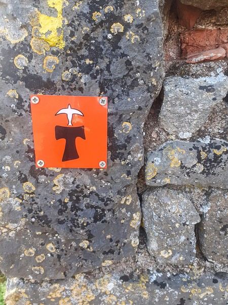
June 2024. While hiking with my brother on the GR 36 Tour du Morvan, I catch sight now and then of strange rectangular markers fixed to tree trunks. Against a bright orange background, a deep black Greek tau topped with a white dove. My first encounter with the Assisi Way. The Way of St. Francis: a pilgrimage route linking Vézelay in Burgundy to Assisi in Italy, covering nearly 1,800 km. It felt like an obvious next step—I immediately knew I’d take it on, attempt the adventure solo.
In the months that followed, I talked about my project to everyone—family, friends, my partner. An avalanche of comments, more or less the same but varying depending on each person’s character and life experiences. But deep down, it all boiled down to one legitimate question: why?
And the answers? Hesitant, awkward, partial, even confused. I quickly realized they weren’t so easy to find. It was as if my project seemed more like a whim, a kind of intimate caprice, rather than a well-thought-out plan. Of course, I knew the reasons that pushed me to leave—you always have to give some. Loved ones need to understand to feel reassured, and that’s understandable. But I fear that when I list them, they’ll sound like the same old checklist anyone embarking on this kind of journey might give. Of all the reasons I could mention, I’ll highlight just one here: the call of the road, the solo adventure that brings a powerful sense of freedom. A bit like Monsieur Seguin’s goat, who from her comfortable pen gazes longingly at the unconstrained horizon of the mountain. But if I’m being honest, I think I didn’t really know what I was looking for—or, more importantly, what I’d find. Deep down, when I reflect on it, one word keeps coming up that explains nothing and everything at once: desire.
Now well past sixty, I know that when I ask myself who I am or where I’m going, two things bring me fully back to myself: hiking and writing. And my intention was also to anchor this adventure through words, day by day. Writing down my feelings, emotions, discoveries, and reflections each evening. The famous travel journal that grounds the daily experience in reality. When I discovered the app "Polarstep," which was initially just meant to keep my loved ones updated and reassured, inform them of my progress, and maintain a connection, I found an opportunity to do it a little differently than usual. No retrospective notes polished up after returning, but spontaneous writing—recounting everything that crossed my mind during the day and publishing it immediately. A journey lived in real time.
This text is the exact transcription of my daily writings. Rereading them, I didn’t change a thing—just corrected a few mistakes and tweaked some awkward phrasing here and there. Short texts, fitting the format imposed by this kind of app. Writing as if addressing others.
Now, all that was left was to walk. April 18, 2026 – Vézelay.
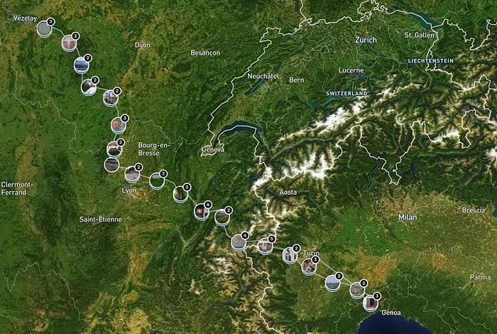
June 2024. While hiking with my brother on the GR 36 Tour du Morvan, I catch sight now and then of strange rectangular markers fixed to tree trunks. Against a bright orange background, a deep black Greek tau topped with a white dove. My first encounter with the Assisi Way. The Way of St. Francis: a pilgrimage route linking Vézelay in Burgundy to Assisi in Italy, covering nearly 1,800 km. It felt like an obvious next step—I immediately knew I’d take it on, attempt the adventure solo.
In the months that followed, I talked about my project to everyone—family, friends, my partner. An avalanche of comments, more or less the same but varying depending on each person’s character and life experiences. But deep down, it all boiled down to one legitimate question: why?
And the answers? Hesitant, awkward, partial, even confused. I quickly realized they weren’t so easy to find. It was as if my project seemed more like a whim, a kind of intimate caprice, rather than a well-thought-out plan. Of course, I knew the reasons that pushed me to leave—you always have to give some. Loved ones need to understand to feel reassured, and that’s understandable. But I fear that when I list them, they’ll sound like the same old checklist anyone embarking on this kind of journey might give. Of all the reasons I could mention, I’ll highlight just one here: the call of the road, the solo adventure that brings a powerful sense of freedom. A bit like Monsieur Seguin’s goat, who from her comfortable pen gazes longingly at the unconstrained horizon of the mountain. But if I’m being honest, I think I didn’t really know what I was looking for—or, more importantly, what I’d find. Deep down, when I reflect on it, one word keeps coming up that explains nothing and everything at once: desire.
Now well past sixty, I know that when I ask myself who I am or where I’m going, two things bring me fully back to myself: hiking and writing. And my intention was also to anchor this adventure through words, day by day. Writing down my feelings, emotions, discoveries, and reflections each evening. The famous travel journal that grounds the daily experience in reality. When I discovered the app "Polarstep," which was initially just meant to keep my loved ones updated and reassured, inform them of my progress, and maintain a connection, I found an opportunity to do it a little differently than usual. No retrospective notes polished up after returning, but spontaneous writing—recounting everything that crossed my mind during the day and publishing it immediately. A journey lived in real time.
This text is the exact transcription of my daily writings. Rereading them, I didn’t change a thing—just corrected a few mistakes and tweaked some awkward phrasing here and there. Short texts, fitting the format imposed by this kind of app. Writing as if addressing others.
Now, all that was left was to walk. April 18, 2026 – Vézelay.
Where to go for 2 weeks in Canada during Indian summer?
Hi everyone,
I’ve got 2 weeks of vacation to take (around Sept 15–Oct 10 max).
I’m thinking of Canada since I’ve never been, to see the beautiful fall colors, mix in some sports activities (hiking or others), and a bit of city exploration...
Traveling solo, backpacker style (youth hostels), renting a car/van or using buses... (whichever is most cost-effective and practical).
Which area would you recommend?
For arrival, I can fly into Montreal, Quebec City, or Toronto at the cheapest fares.
What itinerary (big picture) or activities would you suggest? Or maybe you’d advise against it? ))
Thanks in advance!
For arrival, I can fly into Montreal, Quebec City, or Toronto at the cheapest fares.
What itinerary (big picture) or activities would you suggest? Or maybe you’d advise against it? ))
Thanks in advance!
Off on an adventure in Sri Lanka
Day 1 – December 6
Our decision is our decision. And it’s firm and final. Next winter, our plane will spread its great wings toward the island of Ceylon! "Wait a minute... Ceylon... Ceylon... that name rings a bell, but I can’t quite place it on the globe Grandma gave me for Christmas! Ceylon... Oh right, I’ve got it: Ceylon is the name of my tea!" Exactly. But the name on your pretty tea box is also the one used until 1972 for this island nation, a speck on the Indian Ocean at the southern tip of the Indian subcontinent: Sri Lanka!
For this new adventure, I’m exceptionally leaving my Flo behind, cowardly replaced by a double dose of testosterone. To write the book of this journey with me, I’m bringing along my brother, who’s used to this kind of thing, and... a guest star: My model of resilience. My dad! All aboard! Or rather, all aboard our tuk-tuk! Yes, you read that right: A real tuk-tuk, a little colorful rolling box that putters along at two miles an hour. The idea? Well, Sri Lanka and its winding roads overlooking the vastness of lush nature are tailor-made for this kind of vehicle. And since it’s one of only two countries in the world that allow foreigners to rent and drive these mini speedsters, we’ll be crisscrossing the island in our two-square-meter rolling box. Plus, adopting this mode of transport is a surefire way to connect directly with the locals, who’ll surely be curious to see a foreigner driving their iconic vehicle. Not to mention the... let’s say... spicy anecdotes it might generate. I mean, heading into a subtropical zone with my jet-black dad and his unpredictable digestive flora while deliberately choosing the tuk-tuk as our *only* means of transport? That’s the winning combo for an unforgettable adventure! "More seriously, Dad, Sullivan, I’m already loving the idea of living this adventure together, the three of us—brothers and father..."
So, does the intro to this new adventure get your salivary glands going? Yes? Too bad. Because unfortunately, the program handed out by the lady at the entrance has been slightly... let’s say *crumpled*. Some might even say "scrunched up and nearly tossed in the trash." First, six days ago, as the countdown echoed in us like a call to adventure, Cyclone Ditwah grabbed Sri Lanka, played with it like a rag doll, and left it battered on the ground. The toll is devastating: over a thousand dead, thousands of homes wiped out by relentless rains, roads and railways swallowed by massive mudslides. A country wounded once again, after the civil war, the 2004 tsunami, and the post-Covid economic crisis.
But as if this weather disaster wasn’t enough to shake our unbreakable adventurer spirit, fate decided to mess with us further by cutting our trio down to two. The victim? My brother, violently turned away because of a simple date on his passport that didn’t match the border officials’ expectations. Return to sender!
So now it’s just the two of us allowed to board the Qatar Airways Airbus A380 for this trip. If he were here, Denis Brognart would say, "And in the end, only one remains!" Except I know you’ll be with us, following our adventures! Right?
Our decision is our decision. And it’s firm and final. Next winter, our plane will spread its great wings toward the island of Ceylon! "Wait a minute... Ceylon... Ceylon... that name rings a bell, but I can’t quite place it on the globe Grandma gave me for Christmas! Ceylon... Oh right, I’ve got it: Ceylon is the name of my tea!" Exactly. But the name on your pretty tea box is also the one used until 1972 for this island nation, a speck on the Indian Ocean at the southern tip of the Indian subcontinent: Sri Lanka!
For this new adventure, I’m exceptionally leaving my Flo behind, cowardly replaced by a double dose of testosterone. To write the book of this journey with me, I’m bringing along my brother, who’s used to this kind of thing, and... a guest star: My model of resilience. My dad! All aboard! Or rather, all aboard our tuk-tuk! Yes, you read that right: A real tuk-tuk, a little colorful rolling box that putters along at two miles an hour. The idea? Well, Sri Lanka and its winding roads overlooking the vastness of lush nature are tailor-made for this kind of vehicle. And since it’s one of only two countries in the world that allow foreigners to rent and drive these mini speedsters, we’ll be crisscrossing the island in our two-square-meter rolling box. Plus, adopting this mode of transport is a surefire way to connect directly with the locals, who’ll surely be curious to see a foreigner driving their iconic vehicle. Not to mention the... let’s say... spicy anecdotes it might generate. I mean, heading into a subtropical zone with my jet-black dad and his unpredictable digestive flora while deliberately choosing the tuk-tuk as our *only* means of transport? That’s the winning combo for an unforgettable adventure! "More seriously, Dad, Sullivan, I’m already loving the idea of living this adventure together, the three of us—brothers and father..."
So, does the intro to this new adventure get your salivary glands going? Yes? Too bad. Because unfortunately, the program handed out by the lady at the entrance has been slightly... let’s say *crumpled*. Some might even say "scrunched up and nearly tossed in the trash." First, six days ago, as the countdown echoed in us like a call to adventure, Cyclone Ditwah grabbed Sri Lanka, played with it like a rag doll, and left it battered on the ground. The toll is devastating: over a thousand dead, thousands of homes wiped out by relentless rains, roads and railways swallowed by massive mudslides. A country wounded once again, after the civil war, the 2004 tsunami, and the post-Covid economic crisis.
But as if this weather disaster wasn’t enough to shake our unbreakable adventurer spirit, fate decided to mess with us further by cutting our trio down to two. The victim? My brother, violently turned away because of a simple date on his passport that didn’t match the border officials’ expectations. Return to sender!
So now it’s just the two of us allowed to board the Qatar Airways Airbus A380 for this trip. If he were here, Denis Brognart would say, "And in the end, only one remains!" Except I know you’ll be with us, following our adventures! Right?
Discussion around March 2026's Theme: Metal, Metallic
This is where we share stories (or post extra photos) around March’s theme Metal, Metallic.
Back to the March 2026 contest: HERE
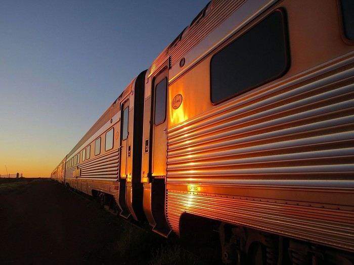
The Ghan (train connecting Adelaide to Darwin), at dawn.
Back to the March 2026 contest: HERE
The Ghan (train connecting Adelaide to Darwin), at dawn.
Tunisian Impressions (Live)
Hi there,
I arrived in Tunisia this afternoon for a full 14-day stay.
I took a direct Tunisair flight from Nice, which departed about thirty minutes late (that’s nothing compared to the "nightmares" I’ve had on some of my recent trips).
The flight lasts around 1 hour and 20 minutes, and a small snack was served on board (a sort of quiche with chickpea purée, a small bread roll, a portion of cheese like La Vache qui rit, and a small chocolate cake). It’s worth mentioning because it’s becoming increasingly rare on short flights. I was seated between two Tunisian gentlemen who gave me some great tips for my trip, especially about negotiating prices. One of them is a former cameraman for France Télévisions, very cultured and well-traveled—his daughter is a journalist at France Télévisions (I found some of her articles online). In short, the flight was very pleasant and quick.

I’m staying at the Hôtel Royal Victoria. I booked it yesterday afternoon by email without providing my credit card number. The room costs 241 TND (71 €) with breakfast included. It has heating, a small fridge, a safe, a hairdryer, Wi-Fi, and a TV with international channels. There’s a police van permanently parked in the square where the hotel is located.
This hotel is housed in the former British consulate and later embassy. It has a lot of charm with its painted wood ceilings and doors, and its bathroom covered in ceramic tiles. The tiny elevator is from another era. The main advantage of the hotel is its location between the medina and Avenue Bourguiba. Nearby, there’s the Magasin Général, where you can find groceries and some typical products like rose water, geranium water, and tons of halwa (a customer kindly explained how to eat it and which is the best).
After nightfall, I took a short stroll down Avenue Bourguiba. There weren’t many people around—it’s windy and cold.
I’ve already noticed the warm welcome from Tunisians. The supermarket cashier welcomed me to Tunisia, and a gentleman I asked for directions to the Magasin Général (I was about to climb stairs leading to a mosque!) insisted on inviting me for coffee, but I declined.
The rest of my itinerary will depend on the weather. If it doesn’t rain tomorrow, I might visit Carthage since the Bardo Museum is closed on Mondays, as are the museums in Sidi Bou Said.
TO BE CONTINUED...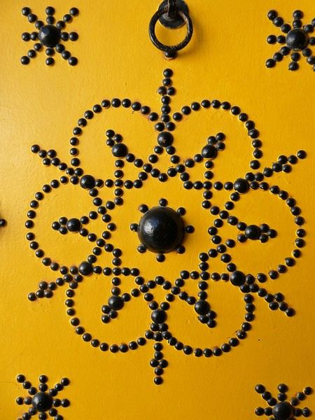


I arrived in Tunisia this afternoon for a full 14-day stay.
I took a direct Tunisair flight from Nice, which departed about thirty minutes late (that’s nothing compared to the "nightmares" I’ve had on some of my recent trips).
The flight lasts around 1 hour and 20 minutes, and a small snack was served on board (a sort of quiche with chickpea purée, a small bread roll, a portion of cheese like La Vache qui rit, and a small chocolate cake). It’s worth mentioning because it’s becoming increasingly rare on short flights. I was seated between two Tunisian gentlemen who gave me some great tips for my trip, especially about negotiating prices. One of them is a former cameraman for France Télévisions, very cultured and well-traveled—his daughter is a journalist at France Télévisions (I found some of her articles online). In short, the flight was very pleasant and quick.
I’m staying at the Hôtel Royal Victoria. I booked it yesterday afternoon by email without providing my credit card number. The room costs 241 TND (71 €) with breakfast included. It has heating, a small fridge, a safe, a hairdryer, Wi-Fi, and a TV with international channels. There’s a police van permanently parked in the square where the hotel is located.
This hotel is housed in the former British consulate and later embassy. It has a lot of charm with its painted wood ceilings and doors, and its bathroom covered in ceramic tiles. The tiny elevator is from another era. The main advantage of the hotel is its location between the medina and Avenue Bourguiba. Nearby, there’s the Magasin Général, where you can find groceries and some typical products like rose water, geranium water, and tons of halwa (a customer kindly explained how to eat it and which is the best).
After nightfall, I took a short stroll down Avenue Bourguiba. There weren’t many people around—it’s windy and cold.
I’ve already noticed the warm welcome from Tunisians. The supermarket cashier welcomed me to Tunisia, and a gentleman I asked for directions to the Magasin Général (I was about to climb stairs leading to a mosque!) insisted on inviting me for coffee, but I declined.
The rest of my itinerary will depend on the weather. If it doesn’t rain tomorrow, I might visit Carthage since the Bardo Museum is closed on Mondays, as are the museums in Sidi Bou Said.
TO BE CONTINUED...
Cantal—have you heard of it?
...
After Southern Tanzania, I’m sharing a travel story about the Cantal region with you...
...
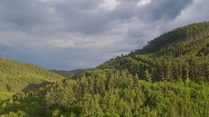
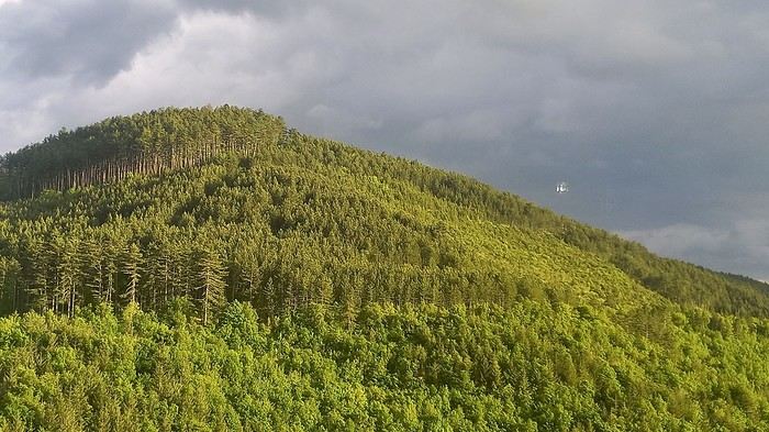
For us, at the start of 2025, Le CANTAL was a true “Terra Incognita”!!
After seeing some tempting TV reports, we decided to fill this gap—especially in terms of landscapes. On the same trip, we’ll also head to the Arcachon Basin, the International Seaplane Gathering in Biscarrosse, and my native Landes region...
So, on May 20th, we left Marseille in the rain and thunder, heading toward Nîmes, Saint-Hippolyte, Mont Aigoual, Florac, and stopping in Marvejols to give my arthritic back a break for the night.
The next morning, we decided to revisit the Parc aux Loups du Gévaudan (Europe’s largest wolf park). As someone used to photo safaris in the wilds of East Africa, I’m not a fan of zoos at all—but I *do* have a deep admiration for wolves!!
Since it’s pretty unlikely I’ll ever see one in the wild, I’ll settle for this Parc aux Loups in Marvejols. This will be our third visit to this incredible gathering of these fascinating canines.
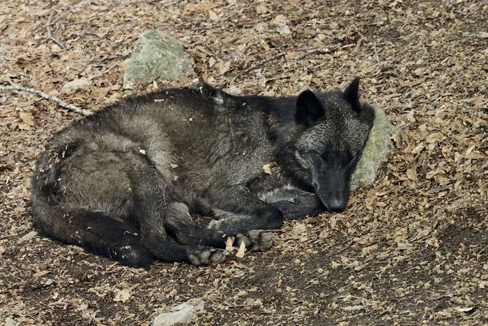
Some are still finishing their chilly night...
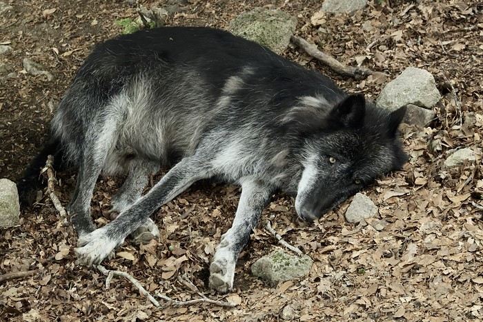
...
After Southern Tanzania, I’m sharing a travel story about the Cantal region with you...
...
For us, at the start of 2025, Le CANTAL was a true “Terra Incognita”!!
After seeing some tempting TV reports, we decided to fill this gap—especially in terms of landscapes. On the same trip, we’ll also head to the Arcachon Basin, the International Seaplane Gathering in Biscarrosse, and my native Landes region...
So, on May 20th, we left Marseille in the rain and thunder, heading toward Nîmes, Saint-Hippolyte, Mont Aigoual, Florac, and stopping in Marvejols to give my arthritic back a break for the night.
The next morning, we decided to revisit the Parc aux Loups du Gévaudan (Europe’s largest wolf park). As someone used to photo safaris in the wilds of East Africa, I’m not a fan of zoos at all—but I *do* have a deep admiration for wolves!!
Since it’s pretty unlikely I’ll ever see one in the wild, I’ll settle for this Parc aux Loups in Marvejols. This will be our third visit to this incredible gathering of these fascinating canines.
Some are still finishing their chilly night...
...
Namibia Travel Journal: May 2025 - Trip Review
NAMIBIA TRIP 2025: April 24 to May 20: Feel free to comment or ask us any questions about this amazing journey.
>> Find all our photos and videos for each day on our website here: www.montagne-aventure.net
**DAY 1: Thursday, April 24, 2025: Outbound Flights from Lyon to Windhoek via Munich - Visit to Munich:**

Off we go on a new adventure. The alarm rings at 6:30 AM, the travel bags are packed, and we head to Lyon Airport. We booked our flight tickets with Lufthansa. The first leg to Munich, Germany, is operated by AirBaltic. Departure at 1:05 PM for a 1-hour and 20-minute flight. We arrive at 2:30 PM.
**We now have a 7-hour layover, so we take the opportunity to get some fresh air and explore Munich.** We quickly exit Terminal 2 of the airport and head towards the subway. We buy a group day ticket "Airport-city Day Zone M-5," valid for 2 to 5 people at a price of 30.50 € (instead of 16.30 € per person). We take the S8 line to **Marienplatz** in 35 minutes. **This is the heart of the city.** The weather is overcast, quite cool, but dry. Perfect for a little city trip between two flights while leaving our large luggage in transit at the airport. **Munich is the third-largest German city after Berlin and Hamburg, in the Bavaria region.** **The center has a lot of charm and brings together several religious buildings, easy to explore on foot.** We are impressed by the number of people enjoying these 100% pedestrian streets, which are very pleasant. After Marienplatz, the most famous square with the town hall, we head to the Cathedral of Our Lady, a Gothic church, then continue to **Karlsplatz** and move on to **the food market offering a wide selection of high-end food products in an atmosphere where a certain art of living prevails.** We also visit St. Peter's Church before grabbing a bite to eat. Two good hours were enough for this 10 km city walk. It's time to take the subway back: by 6:30 PM, we are back at the airport. Now, it's time for a bit of waiting and rest. Our second flight is scheduled for 9:35 PM for a 9-hour and 30-minute journey to our final destination in Namibia: **Windhoek.**
> Round-trip flight tickets with Lufthansa from Lyon: 2029 €, or 1,014.50 € per person.
> Lyon Airport parking: 120 €
> Today's expenses: 7 € for 2 pizzas in France / 14 € for the restaurant in Munich / 30.50 € for the daily subway ticket in Munich.
**DAY 2: Friday, April 25, 2024: Arrival in Windhoek, Visit to the Namibian Capital:**
After a 9-hour and 30-minute overnight flight with Discover Airlines, we finally land on Namibian soil just before 7:30 AM. The day is breaking, and the colors are already stunning. We are eager despite the usual fatigue from the flight. The airline was punctual, with friendly staff and good meals, though a bit light. We are the first flight of the day to land, with no more than 15 flights per day here, from 7 AM to 8 PM. We disembark on the tarmac at this airport located in the middle of nowhere, **I finally set foot on African soil for the first time.** We exit among the first from the aircraft to go through the long formalities at the front of the line, as the wait can quickly become endless. Allow at least 5 minutes per person for e-visas. We still wait 45 minutes despite only about twenty people ahead of us. Phew, it's done. We collect our luggage and then withdraw money from an ATM. We make 4 withdrawals of the maximum amount, 2000 NAD $ per withdrawal, for a total of 380 €, or 95.33 € per withdrawal.
Our driver arrives at the same time, perfect timing, we were quick.
We leave the airport at 8:45 AM. By 9:30 AM, we arrive at the **Gracious Whisp vehicle rental agency**, located at the entrance of Windhoek, small and human-sized with a fleet of recent vehicles. More formalities, then a short wait as our vehicle is not yet ready. Time to decompress, catch our breath, and enjoy the very pleasant morning temperature. Not a cloud in sight. Next, a briefing on the vehicle, always with a bit of apprehension due to our approximate English. Allow 45 minutes of explanations, including setting up the roof tent, camping equipment, technical information in case of a flat tire, driving tips in Namibia, and a tour of the 4x4. We have all the necessary equipment for camping: mattresses, sleeping bags, pillows, table, chairs, gas stove, BBQ grill... as well as 2 spare tires, a compressor, a dual tank, and accessories for removing wheels. Off we go, it's time to muster our courage and get behind the wheel. **Heading to SuperSpar Maerua**, fortunately located less than 10 minutes away. We park with the help of a parking attendant; it's very crowded, the space is narrow, but everything goes well despite the cursed right-hand drive. Today's new mission: stock up on groceries. The store is well-stocked with local and imported products, catering to all tastes. We spend 114 € on groceries, from pasta to meat, BBQ lighters to dishwashing products. Two people load our groceries into two carts and transfer them to our vehicle; we feel compelled to leave a tip, 50 NAD $, as we don't have change yet. Now, we head to the hotel, 15 minutes away. Traffic is difficult at a complicated intersection; this will likely be the only traffic jam in Namibia. **We arrive at Kate's Nest Guesthouse & Backpackers around 1:15 PM, quite tired.** We take some well-deserved rest at this recent establishment, quite calm with secure private parking. After a short nap, we enjoy the quiet by the hotel pool. Night falls between 6:30 PM and 7 PM. We eat quietly in our room tonight before starting this long 4x4 road trip in camping mode in the heart of Namibia.
> Today's grocery expenses: 114 € at Super Spar Marua (2395.21 NAD $).
> Round-trip flight tickets with Lufthansa from Lyon: 2029 €, or 1,014.50 € per person.
> Vehicle rental: 4x4 Toyota with roof tent for 24 days: Gracious Whisp Car Rentals: 2,638 € (N$50,640) or **1,319 €** per person - (https://gwcarrentals.com/)
> Distance driven today: 15 km.
> Accommodation: Kate's Nest Guesthouse & Backpackers - 4 Aristotles Street Academia, 9000 Windhoek - 36 € for two for one night.
> Windhoek International Airport website: (https://www.airports.com.na/)
**DAY 3: Saturday, April 26, 2025: Windhoek to Hardap: Mariental Region - Kalahari Desert:**
After a good, restful night, we wake up leisurely around 7 AM. We enjoy the comfort provided by this first and last hotel before 24 nights under the tent.
**We leave Kate's Nest Guesthouse at 8:30 AM to tackle the Namibian roads.** We quickly leave the capital; in just 30 minutes, we find ourselves almost alone in the world. The landscape is dotted with small domes. We leave the **paved B1** quickly to turn left onto the **C15**. **From there, we won't see more than 10 vehicles all day.** After passing through the few houses of **Lekkerwaterpoort**, we tackle our first gravel road. These road sections are limited to 100 km/h, but even at 70 km/h, I find it already challenging. However, I quickly get used to it and gradually pick up speed to reach my cruising speed of around 80 to 90 km/h. **We are on immense straight lines crossing wild expanses as far as the eye can see.** **We come across two baboons, a few ostriches, and numerous cattle and sheep farms.** We pass through the charming village of **Uhlenhorst** with its typical houses and children with broad smiles waving at us. Life here is already very different from Windhoek. **The thermometer rises quickly from 16°C at 8:30 AM to over 28°C in the early afternoon.**
**We arrive at the Hardap Dam reserve at 2 PM.** We stop at the toll booth at the park entrance to pay the entrance fee: 250 NAD $ for 2 people and 1 vehicle. We continue to the dam and then the camp entrance, located a bit further. We had booked in advance, but this place remains little frequented by foreigners.
We take advantage of the hottest hours to rest by the large pool overlooking the immense lake, a very enjoyable moment. Would this be a bit of a vacation?
Around 4:30 PM, we head to the campsite. We overlook this vast water reserve. We arrive first; we will be only 3 vehicles spending the night here. It's time to get to work and set up our equipment for the first time. It takes us a good 20 minutes to set everything up, with a slight apprehension about unfolding the tent. Once this task is done, which we will have to repeat for almost a month, we will become much more efficient over time. Time for rest and contemplation in total silence. The sun gradually sets, and the heat quickly becomes bearable again. Bliss! **This dam is located 20 km northwest of Mariental in an area dotted with conical hills topped with dolerite buttons (Hardap means "hillock" in Nama). It captures the Fish River, which flows south, creating a large lake in the middle of an arid environment. The contrast is striking.** We enjoy our first sunset facing this 360° otherworldly landscape.
Around 7 PM, we start our first BBQ, or "braai" as it's called here. The temperature is perfect. The sun sets, giving way to a star-filled sky of incredible beauty thanks to the absence of any light pollution. The Milky Way will lull us throughout the evening. After some good sausages and potatoes on the BBQ, we head to our roof tent around 9:30 PM with a complete change of scenery in just 24 hours. France already seems so far away...
This campsite has shared showers and toilets, quite clean and functional, as well as a central area with several BBQs and tables. The sites are arranged in a semicircle, each with an electrical outlet. The sites are close to each other but spacious, some slightly shaded. We are only three vehicles tonight, so it's perfectly comfortable and quiet. Not to mention the large pool near the restaurant. Our trip is off to a great start.
> Today's road itinerary: Windhoek > Head south on the B1 to Rehoboth > Turn left onto the C25 then C15 to Stampriet > C20 to Hardap > Full north on the B1 > Then turn left onto the M93 - 5 hours of driving.
> Distance driven today: 354 km.
> Accommodation: Hardap Recreation Resort - 23.3 € for two - Large pool - GR6W+3M2, Hardap Game Reserve, Mariental, Namibia - (http://www.nwr.com.na/resorts/hardap-resort/)
**DAY 4: Sunday, April 27, 2025: Hardap - Brukkaros Volcano - Keetmanshoop - Quivertree Forest Rest Camp**
Our first night under the tent was very pleasant; the little wind quickly calmed down, giving way to absolute silence. The mattress is decent, more comfortable than some nights in Nepal. The length and width give us enough space for maximum comfort, despite my height (1.91 m). We wake up a little before 7 AM as the sun rises, and the lights dazzle us from the start of the day. We pack up the equipment in 30 minutes, quite easily. Then we enjoy the sun, which warms up quickly while we keep our light fleece on.
At 8:30 AM, **we hit the road again, heading south** to our first stop in **Mariental**. We want to do some shopping at SuperSpar, but once we arrive in the parking lot, a young local is fighting with the supermarket security guards and then threatens to throw stones. We don't want to take any risks right at the start, so despite the baton blows he receives, he doesn't stop. We leave empty-handed but fill up with fuel at the Shell station 1 km further. The price per liter is 21.33 NAD $, we fill our 107-liter tank for 107 €. In Namibia, you get served, and they bring the card machine to the window to pay. It's then customary to leave a tip.
We then take the B1 heading due south on a recently renovated road. Around 11:30 AM, we leave it on our right to take **a wild gravel road, the M98**. Just before **Berseba**, we turn right onto a small track, the **D3904 towards Brukkaros Crater up to a camp at 1588 m altitude**. The track then becomes too bumpy. We stop on the counter-slopes where **a wide panorama unfolds over these immense plains as far as the eye can see**. It's 12:15 PM, time for us to eat a rice and tuna salad facing this landscape.
**We are alone in the world until a vehicle arrives and parks next to us.** A bit of apprehension, 4 men head towards us. It turns out to be 4 shepherds looking for a lost foal. The conversation is pleasant, lost in the middle of nowhere. We find ourselves alone again in this absolute silence. **The heat becomes stifling with a good 30°C**. We get back on the road around 1 PM. Back on the B1, **we continue due south to Keetmanshoop**, which we reach around 3 PM. We stop there to do some shopping for 262 NAD $ (12 eggs, a can of tuna, a can of corn, bread, a soda, and a 5-liter water container), or 12.48 €. Two quite insistent children ask us for money or candy at the store exit, yet we give them a small tip, but they continue to cling to the car. Locals parked next to us tell them to leave us alone. Anyway, we finish the trip to **Quivertree Forest**, 15 km away. We will spend the night in this **pleasant farm run by a German**. Upon arrival, as the day before, and as I suppose in the future, we dive straight into the cool pool to relax after all these kilometers. A bliss. Then we take our 4x4 and choose a spot near these famous trees. After the 33°C this afternoon, once 4 PM passed, the temperature drops again and becomes very pleasant. **We are in the middle of the Kokerboom, one of the most interesting and characteristic plants of hot and arid regions. It's not really a tree but a variant of the aloe plant whose botanical name is Aloe Dichotoma. This Kokerboom has a smooth and thick trunk reaching up to 1 m in thickness and 9 m in height. They bloom for the first time at the age of 20 to 30 years.** The flowers are yellow and reach about thirty centimeters during the season between June and July. **They grow mainly in an environment with a high concentration of black rocks absorbing a large amount of heat (38°C). The rocks also serve to anchor the tree with its tentacle-like roots. It also resists frost. Each is between 200 and 300 years old.**
Around 5 PM, we walk to the farm reception to watch the feeding of **two cheetahs**. Magnificent carnivores taking their time to savor their piece of meat. **Then we return near our campsite to enjoy the sunset among these trees. The colors are sublime, as every evening apparently. A magnificent spectacle with colors evolving from yellow to orange then to pink, before giving way once again to a sky filled with thousands of stars.** Our campsite at Quiver Tree Forest Camp is very comfortable; we have a water supply, a stone table, a small lamp, an electrical outlet, a small tree for shade, and a BBQ that we won't use tonight; we'll cook on gas. The sites are far apart, with some shared facilities scattered around, a very beautiful setting. No reservation possible, no need, just show up directly. **The campsite accommodation for 2 people costs 28 €, including the reserve entrance fee of 5 €**. We finish this second bivouac evening around 9:30 PM, time for some reading and sleep in peaceful silence without wind.
> Today's road itinerary: Mariental > B1 heading south to Brukkaros > At Tses turn right towards Berseba via the M98 > Turn right onto the D3904 > 8 km > Brukkaros Volcano (stop at the lower camp as the track is difficult for 1 hour) > Keetmanshoop > Turn left onto the M29 > Quivertree Forest - 4 hours of driving.
> Distance driven today: 371 km.
> Distance walked today: 6 km.
> Today's expenses: Groceries for 12.48 € (262 NAD $) / Fuel for 107 € (1 liter of diesel for 21.33 NAD $).
> Accommodation: Quivertree Forest Rest Camp, P.O. Box 262, Keetmanshoop, Namibia - BBQ, hot showers, toilets, and electricity - No reservation - Pool - 18 €/Person (N$ 340.00 with park entrance) - (http://www.quivertreeforest.com/)
**DAY 5: Monday, April 28, 2025: Quivertree Forest Rest Camp - Giant's Playground - Keetmanshoop - Fish River Canyon - Canyon Roadhouse:**
After an excellent start to the night, we are woken up by the wind shortly before 6 AM, but the sunrise is not far off. We get up at 6:30 AM to enjoy it. The atmosphere is a bit cooler this morning, but the reward is already here.
The adventure continues. At 7:45 AM, we head towards **Giant's Playground**, 4 km away. We take a 3-kilometer walk through this expanse of blocks and igneous rocks.
We continue south at 8:45 AM, passing through Keetmanshoop again where we do some shopping for 25 €, a big stock-up for a good part of the trip: meats, canned goods, pasta, fruits... At 9:30 AM, we take the B4 to Fish River Canyon.
At 11:30 AM, we arrive at the entrance to the NWR park (350 NAD $ entrance for 2 people and 1 vehicle). The track becomes bumpy immediately upon entering the park. After about ten kilometers, we come upon this landscape carved by nature. In the end, it's well worth the detour. We were at the Grand Canyon in the USA exactly (https://www.montagne-aventure.net/2024/04/29/j21-3-juin-2024-grand-canyon-et-lac-powell/) and can thus confirm that this Fish River Canyon is comparable. We make several stops along the southern flank. **Here, nothing is developed; nature is almost in the wild state.** **With 160 km in length, up to 27 km in width, and a depth of 150 m, it is indeed the second-largest canyon in the world.** The history of the canyon is apparent in its different earth layers and stratification: the antiquity of the place is tangible, and the absence of vegetation is surprising. **It consists of two nested canyons, formed at distinct periods. The first distinct layer of schist, sandstone, and eruptive material surrounding the canyon was formed a few two billion years ago, then transformed due to heat and pressure into more solid rock such as gneiss. The inner canyon, carved more recently by the Fish River, has a depth of 270 m.**
We have a picnic once again alone in the world facing this grand panorama at the **Sulphur Spring View Point**. This is where the hiking trail begins, plunging into this narrow canyon, but it is forbidden to venture there alone without a guide. It's 30°C, but a slight wind makes the atmosphere bearable. At 1 PM, we retrace our steps and continue to the **Main View Point** then to the **Hikers View Point**.
In the south of Namibia, the Fish River Canyon, 160 km long, is a true geological wonder: a canyon nested within another canyon, one of the largest in the world. The first sedimentary layers formed two billion years ago; 500 million years ago, a period of tectonic activity caused these layers to crack and tilt, opening a vast canyon in the Earth's crust. The second canyon, with a depth of 270 m, was carved over time by the passage of the Fish River in this new valley.
At 3 PM, we arrive at our very charming camp for the evening, the **Canyon Road House**. We fill up with fuel right away because tomorrow we have a long day of isolated driving: 55 liters for 1240 NAD $. Then we settle into the campsite we had previously reserved in France. We are assigned site 2, very well set up under a tree with its BBQ and stone table just steps from the pool. We quickly set up the tent and jump straight into the pool for the relaxation moment of the day. As usual, the water is quite cool, but it's a real pleasure. Then we stroll around this Canyon Road House, which recreates the atmosphere of the roadside inns of the 1950s with old car wrecks and vintage gas pumps in a bygone era. **Around 5:45 PM, we start a short walk leading us to the top of a hill overlooking the wide plateau where we are to watch the sunset.**
And finally, to end this beautiful day, it's time for the braai, with grilled sausages and white beans on the evening menu.
> Park entrance: 150 DN/person + 50 DN/vehicle (18 € for two). It is possible to enter at two access points: Hobas in the north and Ai-Ais in the south.
> Today's road itinerary: M29 > Keetmanshoop > B1 > B4 > C12 (track) > After Holoog turn right onto the D601 (C37 track) > Accommodation on our right (stop just to check in before 6 PM) > Continue 30 km (30 minutes of track) to the viewpoints after Hobas where you must pay the entrance fee. Sunset View Point to the left > Return before sunset as the park closes (best lights at sunrise). 3 hours.
> Distance driven today: 228 km.
> Distance walked today: 10 km.
> Today's expenses: 25 € for groceries / 17 € for the Fish River Canyon park entrance / 58 € for fuel.
> Accommodation: Canyon Roadhouse, Gondwana Collection Namibia – 34.4 € for two - Pool - Near Hobas - (http://www.gondwana-collection.com/fr/accommodation/canyon-road-campsite)
**DAY 6: Tuesday, April 29, 2025: Canyon Roadhouse - Orange River - South African Border - Vista Trail - Gondwana Sperrgebiet Park - Aus:**
The night was excellent in this very comfortable campsite. **We wake up to the sound of birds** before the alarm at 6:45 AM. Our little morning routine starts as the sun rises. **A big day of driving awaits us to the South African border. This will be the southernmost point of our journey.** We hit the road at 8 AM via the C37, pass through **Hobas**, then turn onto the D207 to **Aussenkehr.** **We cross a mountainous barrier with some high peaks and perfect cones. The rock varies from orange to pink to black.**
We then cross a lunar desert as far as the eye can see on a giant dome; the track winds through nowhere without meeting anyone for hours. The landscapes are surprising. **We spot several ostriches and a gemsbok.** In the middle of this endless expanse, we come to an improbable intersection and continue right onto the D278.
In the middle of these arid lands, we come across a green zone: a vast vineyard. At 10:30 AM, **we come across a "Road closed" sign, fortunately, a local resident waves us to continue; a bit stressed, we proceed.** We start to follow the beautiful Orange River. On the other side of the bank, just a few meters away, South Africa is there. It is the second-longest river in Southern Africa, after the Zambezi. It flows over 2,000 km to the Atlantic. After passing through narrow gorges, we regain altitude before starting the descent, gently heading back north.
**We now cross and follow the Fish River, which joins the Orange River further south** **along this gorge dating back millennia.** At exactly noon, we take a lunch break by the Fish River, still without meeting a soul in this landscape between greenery and aridity. The temperature here is cooler with a pleasant 23°C on the banks, the perfect spot. **We continue on the track to Rosh Pinah**, where we find a paved road again. **The section along the Orange River and the Fish River was officially closed, but we were able to pass without any issues, avoiding a detour of at least 3 hours.** Phew. We now drive at high speed (limited to 120 km/h) through these vast spaces. We come across many ostriches after the **dozens of monkeys along the Fish River**. Around 3 PM, 3 km after the very small town of **Aus**, we reach **our campsite for the evening at Klein Aus Vista**. A new **small peaceful haven very well set up**. As usual, after checking in at reception, we jump straight into the beautiful pool to get our well-deserved dose of coolness, another good thermal shock that our bodies appreciate. Once this moment of relaxation is over, we take our 4x4 to reach the campsite located a bit higher, set apart at the foot of a hill that overlooks us.
After setting up, **around 5 PM, we head to the Vista Trail to climb to the top of a mountain overlooking the vast plain that surrounds us at 360°**. It takes about 30 minutes to climb. The place is just magical, **the perfect viewpoint to admire the sunset**. **We fully savor the moment. We also spot one of the few wild horses in the world capable of living in the desert.** Their numbers have decreased in recent years due to predation and drought (around 100 to 150). At 7 PM, we return to the camp, time for the braai and preparing the meal in this peaceful little camp.
In the south of Namibia, the Fish River Canyon, 160 km long, is a true geological wonder: a canyon nested within another canyon, one of the largest in the world. The first sedimentary layers formed two billion years ago; 500 million years ago, a period of tectonic activity caused these layers to crack and tilt, opening a vast canyon in the Earth's crust. The second canyon, with a depth of 270 m, was carved over time by the passage of the Fish River in this new valley.
> Today's road itinerary: 5 hours of driving: D324 heading south (track) > turn right onto the C10 (track) > D316 heading south > turn right onto the C13 > In Aus turn left onto the B4 > Campsite via a track on the left.
> Fuel station: Solitaire or Aus.
> Distance driven today: 398 km.
> Distance walked today: 7 km.
> Accommodation: Klein-Aus Vista Desert Horse Campsite - Farm Klein-Aus No 8 on the B4 main road to Luederitz Aus 9000, Aus, Namibia - (http://www.klein-aus-vista.com/accommodation/desert-horse-campsite/) 17908 420 DN - Water + Shared shower (hot water). No electricity.
**DAY 7: Wednesday, April 30, 2025: Aus - Kolmanskop - Diaz Point - Luderitz - Kanaan Desert:**
We wake up around 6:45 AM, with partly cloudy weather for once; we feel the ocean's influence gradually. But the sun isn't far off. At 7 AM, we leave the campsite heading west towards Luderitz via the B4. **First stop of the day: Kolmanskop, the ghost town we reach at 8:30 AM**, entry costs 180 NAD $ per person. We discover this **timeless place** in 1.5 hours, moving from building to building amidst violent sand-laden gusts of wind. There's a lot of charm in these different living spaces. **The sand quickly reclaimed the place after this mining town was abandoned.** This was once the headquarters of Consolidated Diamond Mines. It's hard to believe that this former town, where the diamond industry once flourished, had a hospital, a bowling alley, and a theater. The decline in diamond sales after World War II and the discovery of richer deposits put an end to this golden age. By 1956, the town was already completely deserted, and the sand had reclaimed its rights. **These dilapidated buildings swallowed by shifting dunes have something surreal about them.**
At 10:15 AM, we hit the road again **heading to Luderitz, 22 km away**, and first to **Diaz Point** **facing the Atlantic Ocean**. It's a wind-swept peninsula with its characteristic red and white lighthouse. There's a campsite and a coffee shop on site, but the place doesn't inspire rest without shade or shelter from the wind. We return to the city via the D701 track that runs along the ocean, be careful at low tide. We come across **a few fishermen and a fox as well as flamingos.**
We walk through the few streets of the city, much smaller than I imagined, then climb to the **famous little Lutheran church that overlooks the city, the Felsenkirchr.** **The wind blows very strongly here, and the sand is omnipresent, surrounded by the Namib Desert and the southern Atlantic coast.** **A German colonial relic barely touched by the 21st century, Luderitz seems frozen in the past, giving it both a gloomy and a certain charm. In short, it's certainly one of the most incongruous places in Africa.**
At 1:15 PM, just before leaving Luderitz, we do some shopping for 20.50 € and fill up with fuel: 61.50 €, 1290 NAD $ for 61 liters (21.18 $ per liter).
**We return via the B4 to Aus** (paved), **then via rougher tracks**, the C13 then the D707, magnificent as it runs along a mountain range with multiple colors on our right and an endless flat desert on the other side.
To access our campsite for the evening, we must take a **narrow private track for 7 km** on our right to emerge, in this total vastness, at the **isolated Kanaan Desert Retreat on a small hill**. I don't have time today to jump into the pool near the reception; we arrive at 5 PM at 8 small, isolated, and unique sites with a small kitchen, a shower, and a private toilet under a small tarp shelter. **A crazy charm with a unique view...** **This will be my favorite accommodation of this trip. The photos speak for themselves.** We jump into the outdoor shower while savoring the landscape, then prepare our evening braai while enjoying the colors fading, facing this plateau with bushes turning a vivid orange. **A moment that will remain etched for life.** **Savanna atmosphere under a thin emerging moon. Every minute offers different colors. Facing our meal, we have a natural giant screen.**
We end this day contemplating the stars and admire this thin orange moon setting on the horizon (8:42 PM).
**Ghost town just before Luderitz: Kolmanskop** (open from 8 AM to 3 PM - N$ 180 p.p – 9 €). Once, Kolmanskoppe was organized around diamond mining. After finding new, more prolific spots, the town was abandoned and is now a ghost town. The sand and dunes have reclaimed their rights and buried everything humans had built. Houses, train station, bakery, everything has been covered by sand, which passes through the windows, even though they are 1 meter high.
> Today's road itinerary: 5h30: B4 to Luderitz (paved) > Round trip > Kolmanskop on the left > Return via the previous campsite > Then C13 (track) > Turn left D707 (track) > Then track to the right to the campsite.
> Distance driven today: 438 km.
> Distance walked today: 8 km.
> Today's expenses: Groceries at the Spar in Luderitz for 20.50 € / Fuel fill-up in Luderitz for 61.50 €.
> Official Kolmanskop website: (https://kolmanskuppe.com) (open from 8 AM to 1 PM - N$ 180 p.p – 9 €).
> Accommodation: Night at the south of the Namibrand Nature Reserve: Kanaan Desert Retreat – 26.5 € for two - (http://www.kanaannamibia.com/) - Farm 104 Karas 9000 - Sanitary facilities + BBQ + Water + Pool - No electricity - My favorite accommodation of this trip.
**DAY 8: Thursday, May 1, 2025: Kanaan Desert Retreat - Namib Desert - Crossing the Namibrand Nature Reserve – Sesriem Canyon - Elim Dune - Little Sossus Lodge**
After a cooler night than the previous ones with about 10°C, we wake up around 7 AM. We admire, as usual, the sunrise between the desert and the mountains. **The spot from last night was truly perfect, isolated from the world, in total serenity, with a wake-up call to the sound of birds.**
We hit the road a little after 8 AM, heading north via the D707 to Spes Bona, then the gravel road C27 via Betta to Sesriem. **The landscapes roll by and dazzle us.** **We are right in the heart of the Namibrand reserve**, coming across numerous **zebras**, **impalas**, **ruminants that reproduce in large numbers**, and **gemsboks**. At noon, we stop in the shade of a tree to eat. The spot is so romantic facing orange arid mountains and a vast green plateau. **A landscape full of contrasts, timeless and silent.**
**The Namib Desert is the oldest on the planet; its name means "vast arid plain," and it also gave its name to the entire country: Namibia.** The majority of these arid and semi-arid lands dotted with viewpoints are part of the Namib-Naukluft National Park, which covers 23,000 km².
At 1 PM, we enter the Sossusvlei park. We start with the **Sesriem Canyon**, which is 3 km long and 30 m deep. We enter it with a short 1-hour hike into its depths. **It was carved by the Tsauchab River in an agglomerate of sand and pebbles over 15 million years old.** We retrace our steps back to Sesriem, which means "six belts," referring to the number of leather belts (from ox wagons) needed to draw water from the canyon. This remote locality is mainly the gateway to Sossusvlei but offers a gas station and some accommodations. For our part, we sleep 40 km away tonight.
**We then move on to Elim Dune.** It takes about 45 minutes of walking to reach its summit, and the climb is very breath-taking as we progress in the sand where we almost slide back with each step. **A first grand 360° panorama unfolds. The ochre color of the sand contrasts completely with the yellow plain and the brown and black mountains in the distance.**
At 3:15 PM, we start the descent facing Sesriem. We were completely alone once again on this dune. **These Namib dunes are composed of colored quartzite sand, presenting hues ranging from cream to orange and from red to purple. Unlike the ancient dunes of the Kalahari, these move with the wind and adopt distinct, ever-changing shapes.** Star dunes resemble stars seen from above, while transverse dunes, like those on the coast south of Walvis Bay, stand perpendicular to the prevailing southwest wind. The most stable dunes, which thus have the most vegetation, are parabolic dunes, due to the variability of the winds. Longitudinal (seif) dunes measure up to 100 m in height, while barchan dunes, crescent-shaped and predominant at the extreme north of the Skeleton Coast and south of Luderitz, are the most mobile, created by unidirectional winds.
**We get back on the road for 45 minutes to our campsite for the evening, Little Sossus, which we reach at 5 PM**, via C27 then right onto C19. As often upon our arrival, I jump into the cool pool to relax after all this driving, then we proceed to set up the camp. As the day before, the campsite consists of 10 fairly distant sites, with private sanitary facilities and a small roof. We are delighted with this crazy charm. The hot water for our shower is wood-heated: a Namibian lights it every evening around 5 PM.
For a change, or not, the menu features a small BBQ with pork ribs and pasta, facing another sunset, this time with partial cloud cover giving equally splendid colors. Time for a well-deserved rest after long corrugated tracks covered in our 4x4 today.
> Today's road itinerary: 4h45 of driving: Find the D707 and head north (track) > At Spesbona turn left onto the C27 (track) > At Sesriem after entering the park, turn left following View Point Sesriem > Continue 4.5 km to the Sesriem Canyon Parking > Return then head towards Elim Dune > Exit the park then take the D826 > Turn right onto the C19 heading SE > Turn right facing the D854 to the campsite (campsite closes at 7 PM).
> Distance driven today: 272 km.
> Distance walked today: 8 km.
> Today's expenses: Entry to the Sossusvlei Namib-Naukluft Park: 17 € for two (with one car).
> Accommodation: Little Sossus Lodge – 35 € for two - At the junction of the C19 and D854 roads Maltahohe 9000, Maltahohe, Namibia - (http://www.littlesossus.net/) - Pool + Private bathroom + Hot water + Electricity + BBQ + Grocery store (bread to order the day before).
**DAY 9: Friday, May 2, 2025: Little Sossus Lodge - Namib-Naukluft National Park – Sesriem - Sossusvlei - Big Daddy – Deadvlei - Tsauchab River Camp**
Today we start the day early to tackle **the famous dunes of Sossusvlei at first light**. The alarm goes off at 6 AM to leave the camp at 6:45 AM. The wind is blowing quite strongly in gusts this morning, but it only woke us up a quarter of an hour before sunrise. The park opens at 7:15 AM. We start with a small encounter: a friendly **jackal lounging by the roadside.**
We first have to cover the 40 km of track to Sesriem, pay the entrance fee (350 NAD $), and drive 65 km on a paved road this time to reach the **vast salt pan (a lake whose sediments are made of salts) of Sossusvlei**. **It appears amidst the gigantic red dunes that rise on either side. The wind constantly changes the shape of the dunes, as well as their colors, which vary with the light. The setting is breathtaking, giving an impression of immensity and timeless grandeur.**
The paved road ends; the last 4 kilometers become technical and are reserved for 4x4s. Phew, I pass without any problems, though not without stress, switching to L4 mode. **We start the ascent to Big Daddy at 8:45 AM, 325 m of elevation gain in the sand nonetheless.** We climb at an excellent speed despite the strong wind, in exactly 1 hour. At 9:45 AM, we are at the summit of what will remain etched for a long time. The 360° view is simply unimaginable; you have to experience it to believe it. The wind blows violently up there, **it feels like being in the high mountains, on a snow ridge, with a strong transport of sand. The atmosphere is magical.** We start the descent running barefoot in the steep sand.
**We then move on to its neighbor, Deadvlei.** **Here, petrified trees stand in the "vlei" (basin) with their dried branches casting desolate shadows on the white ground. The juxtaposition of the deep blue sky and the towering dunes is captivating.**
We return to the 4x4 parking at 11 AM, the stress rises again for the sandy track passage. We retrace our steps and stop at **Dune 45**.
At noon, we take the opportunity to picnic at the foot of **the beautiful Dune 40**, where there is already no one left. We enjoy the quiet again, well, almost, as the wind remains omnipresent.
At 1 PM, we return to **Sesriem**, where we fill up with fuel (21.15 NAD $ per liter), totaling 1630 for 77 liters (78 €), and do some shopping for 245 NAD $ (two nice pieces of pork, 2 cans, 2 sandwiches for tomorrow, and 1 soda), which is 12.48 €. It's 27°C. We hit the road again, heading to a new destination at 2 PM. We take the C19 back to Little Sossus where we spent the night, then turn left onto the gravel road D854 for about 40 km to **Tsauchab River camp**. Finally, we won't be sleeping here; we are redirected 7 km downstream to **Naukluft View Camp**, which also belongs to Tsauchab River Camp.
We arrive at 4 PM, and thankfully, the fatigue was starting to set in. **Our campsite is located under a small forest, providing some protection from the wind that blew strongly all day. The calm does us a world of good. Once again, a lot of charm**, with very spaced-out sites without any visibility. We can't wait to take our shower. It will be possible from 5 PM with, as the day before, water heated by a wood fire. Time to prepare the campsite for the night. And on the menu, a braai with two superb pieces of pork bought in Sesriem and fries!!!!
**The Namib Desert**
An impressive coastal desert stretching from the Atlantic to a high plateau inland, the narrow Namib Desert runs along the southwest African coast for about 1,300 km. **Considered one of the oldest deserts in the world**, it is bordered to the north by the Kaokoland Desert, which extends into Angola, and to the south by South Africa's Karoo. The narrow Namib is mostly less than 160 km wide. Despite this, it is considered to consist of three sections: the coastal strip influenced by the Atlantic; the Outer Namib, occupying what remains of the western half; and the Inner Namib, comprising the eastern half of the desert. Generally called the Skeleton Coast, the coastal Namib receives almost no rain and depends on regular marine fogs for moisture. From sea level, the terrain rises to 900 m, where the desert meets the base of the Great Escarpment to the east. In the Inner Namib, average annual rainfall is only about 50 mm.
The dryness is such a characteristic of the Namib that it is thought to have been in this arid state for at least 55 million years. It is all the more surprising to learn that animals such as vipers, geckos, zebras, and elephants live in this desert. Some areas of the Namib are also rich in flora, including Welwitschia mirabilis, which grows near the ground with seemingly exhausted leaves, extracting moisture from marine fogs and can live over 1,000 years. In the southern Namib, some dunes are up to 32 km long and 240 m high.
**The frequent fog of the Skeleton Coast:** Driving north along the coast of Namibia, the cold Benguela Current in the Atlantic cools the moist air above the ocean, which, upon meeting the warm desert air, leads to the formation of thick fog banks that drift up to 100 km into the center of the Namib before evaporating under the sun.
> Today's road itinerary: 4 hours of driving: C19 towards Sesriem (track) > D826 (paved) > Foot of Big Daddy via a technical sandy track > Return via the same route > D854 to Tsauchab.
> Gas station: Sesriem.
> Distance driven today: 254 km.
> Distance walked today: 12 km.
> Today's expenses: Park entry at Sesriem for 2 people: 17 € / Fuel fill-up: 78 € / Groceries at Sesriem gas station: 12 € (245 NAD $).
> Accommodation: Tsauchab River Camp - Naukluft View Camp - D054 & D850 GPS: S24 26' 37" E16 10' 11" Sossusvlei 22007, Maltahohe, Namibia - BBQ + Private sanitary facilities + Water - www.tsauchab.com
**DAY 10: Saturday, May 3, 2025: Tsauchab River Camp - Naukluft National Park - Olive Trail Hike (10 km) - Ababis Guest Farm**
We pack up the camp at 8 AM and continue our road trip north via the D854, a bumpy track with many corrugated sections. It's cool this morning, 12°C.
**We enter the Naukluft massif, discovering landscapes with very different terrain than before.** We first need to check in at the campsite, 13 km from the entrance at the end of the track: 350 NAD $ for 2 people and 1 vehicle, then return 4 km back. **On the agenda is the lovely Olive Trail, a 10 km hiking loop that starts 4 km northwest of the park office**, along the D854 that we follow. At 9:45 AM, the hike begins with a fairly steep ascent (about 45 minutes) among the **wild olive trees** from which the trail gets its name. **At the summit, we enjoy a view that embraces the Naukluft Valley.** We then turn east and gradually descend into a deep valley, passing over sometimes slippery rocks. We have a snack around 11:30 AM in these small gorges. **Further on, to cross the wall of a canyon in front of us, some chains are fixed to the rock to help us pass.** We finish this superb loop clockwise at 1:15 PM, taking 3.5 hours including 30 minutes of breaks. We only crossed a small group of 3 people on this wild adventure far from everything. At 1:45 PM, we exit the park and take the **D854 track north to Bullsport**. From there, we turn left and take the C14, which **runs along the bed of the Tsondab River.**
**We arrive at our campsite for the evening, Ababis Guest Farm, at 3 PM.** Quite early for once, allowing us to rest a bit in this peaceful farm where many sheep wander around us. We also enjoy the pool under a magnificent sun, less hot than the previous days, it's 22°C. The camp has only 4 spaced-out sites around shared sanitary facilities. **We are in the middle of a vast plain facing the Naukluft massif mountains.** We will have another beautiful sunset on these mountains. For the first time on this trip, **we will be completely alone at this campsite.** **We haven't encountered many people today**, just 3 during the hike and fewer than 10 vehicles all day.
> Today's road itinerary: Head north on the D854 (track) > Turn left to enter the Naukfluft National Park > Continue on the track then turn right to the Olive Trail hike parking lot (1 hour for 45 km). Return to the D854 and continue north > At Bullsport turn left onto the C14 to Ababis (still a track) > The camp is located on the left facing the D1261 (1 hour for 60 km from Olive Trail). Total: 2 hours of driving for 100 km.
> Gas station: No gas station on the route, except in Solitaire.
> Distance driven today: 115 km.
> Distance walked today: 13 km.
> Accommodation: Ababis Gaestefarm - Night booked by email – payment on site: (https://www.ababis-gaestefarm.de/) - P.O.Box 1004, Maltahöhe - N$ 300.00 per person
**DAY 11: Sunday, May 4, 2025: Ababis Gaestefarm - Namib-Naukluft National Park – Solitaire - Gaub Pass - Kuiseb Canyon - Moon Landscape - Walvis Bay**
The night was, for the first time since the start of this road trip, quite difficult. A strong wind accompanied us all night, making the tent flap constantly. A racket that drove us crazy. We still managed to sleep a few hours. The morning sun brings back our smiles. We hit the road for this new stage a little before 7:45 AM.
We start the day with a first stop less than 15 km away **on the C14 in Solitaire** at 8:15 AM. **This town is lost in the middle of nowhere with its small gas station with a western atmosphere adorned with rusted and sand-covered car wrecks.** After a quick supply stop: 86 NAD $, or 4 € for 1 water container and a box of cookies, we continue north still on the C14, **crossing the Tropic of Capricorn** then devouring this **magnificent track up to Gaub Pass**. **A succession of narrow gorges, turns, climbs, and descents breaking the monotony of the previous long straight lines.** We are right in the heart of no man's land for 200 km. We then start the descent to the **Kuiseb Canyon. It houses the wide bed of the eponymous river, dry almost all year.** Even when it flows for 2 to 3 weeks during the rainy season, it doesn't go beyond Gobabeb and then seeps into the sand. **The drinking water that supplies Walvis Bay is pumped at Rooibank from this underground water table.** **We now cross the Kuiseb Desert where impressive dunes roll down.** We make a short stop at a **natural rock arch** reminding us of our (https://www.montagne-aventure.net/2024/04/29/j19-1-juin-2024-canyonlands-national-park-et-arches-national-park/). Then we gradually descend towards **Walvis Bay** where we will spend the night. At noon, we enter the **Dorob National Park**. The thermometer drops 10°C in 10 minutes as we get closer to the Atlantic Ocean.
At 12:45 PM, much earlier than initially planned, we arrive at the **Moon Landscape** (View Point 4, free) to have a snack, via a very recent surprising dual carriageway in the middle of nowhere, then via the C28. We are again in the hinterlands, the temperature has soared: 30°C without a bit of shade. Even if the colors and the panorama must be exceptional at sunrise or sunset, the detour for this 360° panorama is still worth it. Extreme aridity as far as the eye can see. The place lives up to its name; it really feels like being on the moon. We get back on the road at 1:30 PM via the D1991, C28, then again the A2, which is very new. The latter runs along the beautiful dunes up to the **Dune 7**, where we make another stop.
Then we head towards our final destination of the day, **Walvis Bay. Its port is sheltered by a sand spit, a natural breakwater that protects the city from the powerful assaults of the ocean. Its port was long a strategic place: claimed by the Cape Colony in 1795, it was officially annexed by the British in 1878 to counter Germany's ambitions in the region. A colony of fur seals, pelicans, flamingos, and whale terns have made it their home.**
We do a big grocery shopping at the Spar located in the center for 66 €; it's very easy to park there. Then we fill up with fuel at an Engen station right across for 1117 NAD $ for 54 liters (20.6 NAD $ per liter), which is 54 €. We then **enjoy the seaside in the Lagoon neighborhood**, where it's also easy to park. After kilometers in the desert, **this cool break is more than welcome. The outside temperature is 22°C. In the distance, we can clearly see the clouds lingering over Swakopmund.**
We take the 4x4 one last time to the **Lagoon Chalets where we will spend the night**. The spot is well set up and surprising in the heart of a residential neighborhood. The sites are quite large, separated by fences around very comfortable shared sanitary facilities. BBQ, electricity, and shaded area. We settle in quietly before going out on foot to watch the **sunset over the Pacific Ocean along Lagoon Promenade Road**. We can still see this impressive persistent mist in the distance. The neighborhood is very peaceful, certainly without much charm, but with a very well-developed seafront that inspires relaxation after kilometers without meeting anyone in inhospitable lands. We end the day with our traditional braai: grilled chicken thighs and sautéed potatoes in the coolness of a starry sky.
> Today's road itinerary: 5h30 of driving (or 3h30 of driving for 250 km without the Moon Landscape): Head north on the C14 > Cross the Tropic of Capricorn > Gaub Pass > Kuiseb Canyon on our left in a round trip > Continue to Green Valley and leave the C14 to the right on the D1984 > Turn right on the C28 > Then left D1991 to Moon Landscape D1991 View Point 4 > Return via the same road and stop at Dune 7 for sunset > Walvis Bay.
> Gas station: Solitaire or Walvis Bay.
> Distance driven today: 372 km.
> Distance walked today: 5 km.
> Today's expenses: Fuel fill-up for 54 € + Groceries for 66 € at Spar.
> Accommodation: Walvis Bay: Lagoon Chalets – 36.6 € for two - (http://www.lagoonchaletswb.com/) - 8th Road West, Meersig Meersig 9000, Walvis Bay, Namibia - BBQ – Electricity – Shared sanitary facilities.

**DAY 12: Monday, May 5, 2025: Walvis Bay - Swakopmund - Round Trip to Cape Cross (seals) - Wreck of the Zeila en route - Henties Bay - Spitzkoppe Tented Camp & Campsite**
After an excellent night, a bit cooler and more humid than usual, we wake up around 7 AM and leave the camp at 7:45 AM to **follow the Atlantic coast heading north**. We thus leave **Walvis Bay**, a very pleasant stopover town, and follow the ocean via the B2. **We enter the mist and Swakopmund** at 8:40 AM, parking **near the lighthouse**. The atmosphere is very quiet, the streets seem dead with large empty parking lots and very little traffic, but the few open shops are filled with expatriates enjoying their breakfasts, French bakeries, cafes, travel agencies... **We are in this Benguela Current, a fast cold ocean current that flows from South Africa, up the coasts of Namibia and Angola, towards the northwest to join a warm equatorial current. Hence the supply of very fish-rich waters and this tenacious mist depending on the seasons. In the northern part of the Namib Desert, fogs are frequent during the southern winter. It's almost the only source of moisture since the city of Swakopmund receives, on average, only 11 liters of water per m² in December and January.**
**Swakopmund is wedged between the dunes and the Atlantic rollers. It is the Namibian capital of adventure activities and has a ghostly colonial remnant. With its German architecture, its seaside promenade, it resembles a seaside town of the North Sea or the Baltic.** It is also a bustling African city. **Nearly two-thirds of Swakopmund's population live in Mondesa, a township created during apartheid, northeast of the city center, a legacy of the South African mandate.** The heart of the city is located in the area of the pier, at the foot of the lighthouse, better known as the Mole. During the South African occupation of Swakopmund, the port took a back seat to Walvis Bay.
Continuing on this C34, sometimes on salt, we come across the famous **wreck of the Zeila, stranded in 2008**, on our left. We can see it through the thick fog, being very close to the beach. It's 10:15 AM. Further on, Henties Bay is a bay that attracts many fishermen; it's teeming with vehicles equipped with fishing rods. Besides its fish-rich waters, it enjoys a relaxed atmosphere and a large beach suitable for walks.
We continue further north, heading to Cape Cross, this time a round trip because we will turn off later here in Henties Bay to reach Spitzkoppe via good gravel roads that are quiet alternatives to the very busy paved B2 further south. **Henties Bay is part of the Dorob National Park, a multi-purpose park protecting coastal ecosystems and hosting the many renowned recreational activities of the region. The part of the coast north of Swakopmund up to the Ugab is particularly popular with fishermen who come in droves to fish for saltwater fish.** The small concrete buildings spaced at regular intervals are actually toilets for fishermen and campers. The coastline is also dotted with world-renowned surf spots.
Even before arriving, we can already smell it before we come across thousands of seals (population in 2021: 1.5 million). **The Cape Cross Seal Reserve, the most renowned on the Namibian coast, is home to the most famous breeding colony of fur seals, which seems to take full advantage of the high concentrations of fish present in the icy waters of the Benguela Current. We are impressed by the sight of these 100,000 pinnipeds lounging on the beach and frolicking in the waves.** We have a picnic a little away from the smells facing the ocean in the sun.
At 12:45 PM, it's time to hit the road again. We retrace our steps back to Henties Bay. We stop there to do another big grocery run before not encountering any big cities for many days. We will only buy fresh items day by day until the end of the trip; we have 23 € worth. **In the space of 30 minutes, we go from 15 to 36°C. The thermal shock with an amplitude of more than 20°C.** At 1:45 PM, we hit the road again via the D1918, then we try a very small track on our left, the D1925. It becomes narrow and rough; I have a bit of apprehension. We arrive at a gate to open in the middle of nowhere, then young children run up to us asking for water or food... We then drive to **Spitzkoppe. The arrival right in front of the mountains is majestic, off the beaten path. This mountain appears in the distance like a mirage above the dusty plains of southern Damaraland.** We come across a second gate held by a guard. We enter the "Community Camp" campsite without realizing it through the west entrance. We are given a small paper, then we go to the reception passing **at the foot of these gigantic, magnificent rocks.** Once at the reception, we are informed that this is not the camp we had booked. Ours is located just a little further, and in the end, it's better because the latter was packed. We were able to cross the park very close to these rocks without paying. We exit through the main entrance; 5 Himba children cling to our doors and trunk asking for bread and food again. We continue despite them staying attached, worried about hurting them. Phew, more fear than harm. We cross the few houses and arrive at the right camp at 4:30 PM, the Spitzkoppe Tented & Campsite. The spot is much quieter and well set up. We have site C12, cozy to perfection with its sink, a private shower and toilet, as well as electricity, under the shade of a tree and facing the mountains. The sunset and sunrise will be perfect. We set up the tent and, without delay, head to the pool for a big dose of coolness. Then it's time to prepare the BBQ and **contemplate the fading lights on the Spitzkoppe massif.**
> Today's road itinerary: 5 hours of driving: Head north on the B2 (paved) along the ocean > Swakopmund > C34 (paved) still heading north > On the left, the wreck of the Zeila before Henties Bay > Cape Cross round trip > Henties Bay > D1916 heading east (track) > Turn left onto D3716 > Turn left to the campsite.
> Gas station: Swakopmund or Henties Bay.
> Distance driven today: 344 km.
> Distance walked today: 6 km.
> Today's expenses: Groceries in Henties Bay: 23 € + Cape Cross park entry: 17 €.
> Accommodation: Spitzkoppe Tented Camp & Campsite - Spitzkoppe River Valley 00000, Spitzkoppe river valley, Namibia - (http://spitzkoppemountaincamp.com/) - 26 € - Pool - BBQ - Shower and toilet.
**DAY 13: Tuesday, May 6, 2025: Spitzkoppe - Rock Pools - Uis**
It's 6:45 AM, **we wake up at the foot of one of the most emblematic landscapes of the country, Spitzkoppe, which towers over the valley at 1,728 m.** **The Spitzkoppe massif, "pointed hat" in Afrikaans, is actually a set of three rock formations: Big Spitzkoppe, the granite domes of the Pontok Mountains that surround it, and Little Spitzkoppe, to the southwest. It was first climbed in 1946 and has never stopped attracting experienced climbers; it remains one of the most challenging ascents in the country. The climate in the region is hot**, so try to visit during the cooler months, as it can quickly reach 36°C in the sun in the afternoon. **Spitzkoppe is particularly striking at dusk, as it was last night, and at dawn this morning when the low light sets the rocks ablaze with red and orange hues. The spectacle is unique.**
We re-enter the park managed by the local community (160 NAD $ per person), then start with the **arch sector**. We quietly enjoy all the viewpoints under perfect orange colors. We leave this magnificent spot, reminding us of (https://www.montagne-aventure.net/2024/04/29/j19-1-juin-2024-canyonlands-national-park-et-arches-national-park/), but with much less crowding here. Around 10 AM, we head closer to these mythical peaks, including the main one nicknamed the Matterhorn of Namibia. Then we finish with the **ascent of the rock above Rock Pool. The 360° view of the park is a must-see. Small natural pools carved into the rock bring a bit of water to this arid and rocky landscape.** The wind blows strongly up there, and during a photo shoot with a tripod, it falls forward right onto the lens glass, cracking it... Frustration and shouts, these will be the last quality photos of this trip, and a new bill to pay when we return to replace it... Disgusted.
We continue to **Bushmans Paradise**, have a lunch break in the shade of a rock before hitting the road again around 12:30 PM after thoroughly exploring the park, feeling weakened and sad about my passion: photography...
We fill up with fuel as soon as we arrive in Uis at the price of 21 NAD $ per liter, a total of 1021 NAD $ for 50 liters (52 € by card). **Uis is a former mining town. Tin mining ceased in the early 1990s, but the high white mountain where the ore was dumped is clearly visible. The region is rich in amethysts, Brandberg crystals, and other semi-precious stones; we come across many vendors on the roadside.**
We then head to our final destination of the day, the **Daureb Isib Restcamp**. We arrive quite early for once at 2:45 PM in the heat, but the camp is just perfectly set up, surely the most upscale we will have during this trip. We are in a fortunately shaded area under palm leaves, with a table, chairs with cushions, a sink, a hot shower, toilets, a beautiful pool, and of course our private BBQ. Perfect for regaining a bit of a smile after the fall of my DSLR camera. **We are facing the Brandberg massif, the "fire mountain" in Afrikaans, dominated by Königstein (2,573 m), the highest peak in Namibia.** **The Brandberg owes its name to the reddish-orange glow that forms on its slopes at dawn and dusk, when the sun's rays awaken its red granite faces studded with crystals. It also hides a real treasure inside, as it contains an exceptional concentration of prehistoric rock art**, mainly paintings and some petroglyphs, including the most famous of them, the **White Lady in the Tsisab Gorge**. There are over 43,000 in total, dating back 2,000 to 4,000 years, scattered in hundreds of crevices around the mountain.
Time for the usual swim, laundry, and evening cooking. On the braai menu, local sausages with cheese pasta and leftovers for a good salad the next day.
> Today's road itinerary: 1h45: Head north on the D3716 > Then D1930 (gravel and sand track) to Uis.
> Gas station: Uis.
> Distance driven today: 113 km.
> Distance walked today: 6 km.
> Today's expenses: Fuel fill-up in Uis for 52 € (1,021 NAD $).

> Accommodation: Daureb Isib Restcamp - Erf 672 C/O 3rd & 4th Avenue Uis 9000, Uis, Namibia - (http://www.daurebisib.com/) – 31 € - Pool. Comfort with private bathroom + electricity + Wi-Fi at the restaurant. Clear sky for a beautiful starry night.
**DAY 14: Wednesday, May 7, 2025: Brandberg (Namibia's Highest Mountain) - Damaraland:**
**The Brandberg massif is an isolated, dome-shaped mountain, an inselberg, that towers over the gravel plains scorched by the sun of the Namib Desert to the northwest. It measures 23 km long and 20 km wide. It is the highest point in Namibia at 2,573 meters.**
This massif formed about 130 million years ago when a gigantic viscous mass of magma from deep within the Earth's crust rose through the surrounding rock layers before solidifying. Later, the granite mass was exposed by the erosion of the surrounding rocks.
**The Brandberg is the highest mountain in Namibia, peaking at an altitude of 2,573 m. The indigenous San people call it the "burning mountain," as it appears to glow with a red light at sunset. With its considerable height and width, this massif influences the local climate, attracting more rain on its slopes than the desert below.** The rain seeps through the springs. Unique animal and plant species thrive in this high-altitude environment, and prehistoric paintings adorn the rock faces hidden in the ravines around the base of the mountain.
The first night was also hot since the start of this trip, the thermometer did not drop below 20°C. We wake up gently around 8 AM, a pleasant sleep-in, the sun is already out. After a quick morning cleanup of the 4x4, we have time today, we hit the road at 9:30 AM, getting lost in the Brandberg massif. We are now in the **Damaraland, which stretches from the majestic rock formations of the Brandberg in the south, where we are today, to the bushy expanses at the foot of the rugged mountains of Sesfontein in the north, where we will be tomorrow. It is the perfect destination for wildlife and flora observation.**
We take the track heading towards the **White Lady**, but we want an alternative to this guided visit only. So, just before arriving, we turn right towards a viewpoint named on Google Maps **Rastplatz**. We come across **small Himba villages, living in extreme poverty with no natural resources; the inhabitants ask for water with every passing vehicle...** A bit further, we encounter about ten **ostriches** in the middle of the track, magnificent, as we get closer to the mountains in the background, and a few meters further, **a herd of Oryx**. Then we approach the **bed of the Ugab River**. We then go back and have a snack in the middle of nowhere, under the shade of our 4x4, facing the mountainous massif. We get back on the road around noon, while the temperature is at its peak in this very hot region, 35°C on the gauge with very dry air. We go up the C35 slightly then turn left onto the small track D2319 until we reach the Ugab bed again. Back to Uis in the mid-afternoon.
We did not book the same campsite as the previous night; today we are at the Brandberg Rest Camp. Unfortunately, the camp is not at the same level as the previous one, which was perfect. But the price is also much lower. The sites are next to each other, separated by small fences behind the main building. But it will do just fine. We have our BBQ and electricity, the shared sanitary facilities are decent. We then lounge in the large pool. We will then buy some water for 10 € at the supermarket located right across.
> Gas station: Uis.
> Distance driven today: 118 km.
> Today's expenses: Groceries in Uis: 10 €.
> Accommodation: Brandberg Rest Camp Uis - No 3 Uis Street Namibia 9000, Damaraland, Namibia - (http://www.brandbergrestcamp.com/) - Large pool – Shower – Electricity
**DAY 15: Thursday, May 8, 2025: Damaraland: Petrified Forest - Ugab Valley - Palmwag**
The night was excellent and slightly cooler than the previous one. We wake up around 7 AM and hit the road just before 7:45 AM heading to a new destination as we continue this Namibian road trip. **We cross Damaraland today from south to north.** First via the C35 to **Khorixas**, then turning left onto the C39. **We come across some villagers walking kilometers under the scorching sun with only a small water container in their hand... What a tough life, light-years away from ours.** About 40 km west of this town, we arrive at the **Petrified Forest National Monument**. It is a vast expanse of veld (open vegetation area), dotted with petrified tree trunks that can reach 34 m in length and 6 m in circumference, estimated to be over 260 million years old. These trees belonged to the Gymnospermae family, conifers among which we find today's cycads and welwitschias. The absence of roots and branches suggests that the trunks were deposited here during a significant flood. The site has about fifty trees, some half-buried in sandstone, others perfectly petrified in silica with their bark and growth rings. A guide is mandatory at the entrance to visit the site.
We then continue on this C39 due west to the junction of the D2612. We make a round trip to the south to **Twyfelfontein, which means "uncertain spring" or "bubbling spring" in Damara**. The site is a UNESCO World Heritage site, located at the entrance of the grassy Aba Huab Valley and houses one of the largest collections of rock art on the continent. More than **2,500 petroglyphs** have been discovered on over 200 stones, as well as some rock paintings. They date back about 6,000 years and others 2,500 years. Many engravings depict species that have since disappeared from the region, such as elephants, rhinoceroses, giraffes, and lions. The presence of a seal attests to the existence of links with the coastline at the time, now over 100 km away. It is here, as well as at Brandberg, that the human history of Namibia began with these testimonies of ritual and economic practices among hunter-gatherer peoples.
We continue a bit further south on the D3214 then D3254 to visit the **Organ Pipes, "organ pipes"**. The entrance is also paid, much to our regret... 500 NAD $ for two. We take a well-marked trail leading to a small gorge containing dolerite (coarse-grained basalt) columns 4 m high and aligned on an astonishing 100 m long wall. We are in a volcanic chain stretching over a dozen kilometers, a pile of scoria that seems to have been exposed to fire, the Burnt Mountain "burnt mountain" stands in a bleak and desolate landscape where almost nothing grows.
We head back north and return to the C39 then the C43 to **Palmwag where we will spend the night**. **This concession, covering an area of 5,500 km², is a region of red hills and plains, remarkable for its rolling landscapes as well as its rich fauna and flora**. The region serves as a **buffer zone between Etosha and the Skeleton Coast**. We have a good chance of encountering black rhinos, desert elephants, and lions, as well as spotted hyenas, giraffes, gemsboks, and other antelopes.
We pass the sanitary control barrier at 4 PM, just before entering Palmwag. In our direction, from south to north, we are simply asked about our future destinations and to present my French driver's license. A few meters further, there is a small gas station, then on our left our final destination of the day: the Palmwag Lodge Campsites. We are happy to arrive after this long journey. The welcome is very pleasant, and the site is very comfortable with a real brick shelter housing our shower and toilet, as well as water and electricity. We always have a BBQ available, but today we unfortunately no longer have meat due to concerns about the sanitary control, but we were not sure if it was rather in the other direction that the transport of fresh meat and dairy products is prohibited. We now cross our fingers to be able to observe some different animals, as the place is renowned for elephants, giraffes, and rhinos. We first take some time to relax in the pool before going for a walk around the reserve, without encountering anything unfortunately this evening, but the wake-up will be up to par... Time for the sunset, which is always one of the highlights of the day.
> Today's road itinerary: 5h30 of driving: C35 heading north > Then turn left onto the C39 > Petrified Forest > Go down on the D3612 in a round trip to Twyfelfontain (rock paintings and Organ Pipes) > Go back up on the C39 then C43 to Palmwag > Round trip on the C40 to Mount Grootberg Pass.
For info on the C43, there is a sanitary control at the entrance and exit (transporting raw meat is prohibited).
Palmwag: black rhinos (guided or free visit? at sunrise or sunset).
> Gas station: Twyfelfontain or Palmwag (07:00 – 19:00) – Tire repair in Palmwag.
> Distance driven today: 349 km.
> Distance walked today: km.
> Accommodation: North of Palmwag Lodge Campsites - GPS Coordinates -19.88556°, 13.93694° - Pool – Water and electricity – 34 € - (https://gondwana-collection.com/accommodation/palmwag-campsite?LodgeName=PALMWAG%20CAMPSITE)
**DAY 16: Friday, May 9, 2025: Palmwag - Sesfontein - Entry into Kaokoland - Opuwo**
This morning, we take our time watching for wildlife. We can finally observe our first **kudus** as the sun begins to illuminate the plain in front of us (see video and time-lapse of the day). A few minutes later, we also spot **a couple of giraffes with their calf**, moving calmly and serenely.
**We leave Palmwag** at 9 AM, heading to the northernmost point of Damaraland via the C43 to Sesfontein.
A few kilometers on the track, and we come across **a herd of zebras**, 11 to be exact, in the middle of green hills. Even further, it's more than twenty that cross right in front of us, a treat for our eyes. Their gait is majestic; they are very sensitive to noise. Some are more curious than others and don't hesitate to stay close if we remain quiet. We then cross numerous rough riverbeds. We must always stay very attentive at the wheel because we can drive at over 80 km/h on straight lines and then suddenly have to brake to cross these small streams, usually already dry at this time of year. Many antelopes are still present by the side of the track; the heat is already rising, and they are often lying on the ground at this hour.
**We arrive in Sesfontein at 11:15 AM**, just as the children are leaving school. Transportation is done by donkey-drawn carts. The villagers spend their time in the shade of the trees and in front of the few small shops. The atmosphere of its streets is dusty with a laid-back pace; this town has the feel of an oasis located **by the Hoanib River**, the town of six springs from which it gets its name. Founded in 1896, it was a military outpost built after a cattle plague epidemic. This page of its history is reflected in Fort Sesfontein, erected in 1905 to fight cattle diseases, arms smuggling, and poaching.
We take a lunch break at the exit of the village around 11:30 AM in the shade of a tree, so peaceful, it's 32°C. We continue further north, away from the usual tourist routes, and **enter the Kunene region, also called Kaokoland**. The track becomes narrower and more winding. **These are now vast solitary spaces largely devoid of roads, simply crossed by sandy tracks opened by the South African army just a few decades ago.** The fauna and flora have managed to adapt to this harsh and dry environment, like the desert elephant, an endangered species whose slender legs are perfectly suited to the long journeys the animal must make to find water, a rare resource. This region is also the territory of the Himba people, emblematic of the country. Its name comes from the Kunene River, which marks a narrow belt of vegetation at the Angolan border.
**We arrive in Opuwo at 3 PM**, **this town is the capital of the Kunene region**. Its name means "the end" in the Herero language, a fitting term for this dusty collection of commercial buildings surrounded by traditional huts with round thatched roofs.
**Opuwo is a strong cultural moment of this trip in Himba territory, this semi-nomadic people traditionally settles in an onganda (small village), moving if necessary to find access to water. Himba women are known for their ochre-colored cream, otjize, a mixture of butterfat and ochre powder, applied to protect and moisturize the skin and hair. Fire and smoke play an important role in their culture.** Smoke, often scented with herbs, is used by women for purification. It can also convey prayers to the supreme being, Muluru. In traditional celebrations, there is always a sacred fire that remains lit between the main hut and the animal enclosure, to maintain ties with the ancestors.
Right upon arrival, we fill up with fuel at the Shell station at the price of 21.48 NAD $ per liter, or 67 liters for 1454 NAD $ (72 €) by card. We then quickly stock up on meat at the Spar **where Himba women with bare breasts mix with us, the only white people shopping in the aisles**. **Since the beginning of this trip, this is where life is most bustling**. There are many people on these dusty streets, after kilometers without seeing anyone, the shock is brutal. There are small markets, poverty but also wealth. The town is quite spread out. There are no white people left, **we finally discover the true, harsh African life.**
We arrive at the **Opuwo Country Lodge at 3:30 PM**, located slightly on the heights. We have site 9 at the end of the property for maximum isolation as we like. Once again, we have private sanitary facilities, a BBQ, and electricity. Once settled, we walk 10 minutes to the reception where the pool is located to cool off. An infinity pool that is just magnificent facing the vast landscape before us. But this contrast between this little comfort and the town below makes us uneasy. The employees walk back down. A guard is present at the entrance of the lodge to ensure security; the park where we are is fenced. We enjoy a good braai, then enjoy the few lights of the town gradually lighting up. The night will be quite noisy for once with very loud music rising from a party below until 2:30 AM... And yet it comes from far away... Maybe a bar? In any case, we rule out what we thought was just a party during our visit here on Friday.
> Today's road itinerary: 4 hours of track: Return via the C43 heading south to Opuwo.
> Gas station: Okangwati or Opuwo
> Distance driven today: 261 km.
> Today's expenses: Fuel fill-up in Opuwo for 72 € + Groceries in Opuwo for 21 €.
> Accommodation: Opuwo Country Hotel - Opuwo Hilltop Opuwo 9000, Opuwo, Namibia - -18.044682 / 13.833861 - (http://www.opuwolodge.com/) - N$600.00 - Pool / Water / Private sanitary facilities / Electricity / BBQ.
**DAY 17: Saturday, May 10, 2025: Opuwo to Epupa Falls:**
We take our time this morning by the **Kunene River**, then we hit the road at 8:45 AM. This is our return trip to Opuwo.
After 4 good hours of driving, **we return to the bustling life of Opuwo**. We refill with fuel at the Shell station (21.48 NAD $ per liter) 820 NAD $ (40 €) for 38 liters and do a quick grocery run at the Spar for 488 NAD $ (24 €). We don't take any meat because we have the **sanitary barrier** to cross tomorrow before entering Etosha Park. We pay for these two expenses in cash for the first time; until now, the credit card was always accepted, so we now have to use the cash we withdrew at the airport. Then we head back to the Opuwo Country Lodge, arriving at the campsite at 2 PM. We are the first to arrive, we rest for a moment before heading to the pool and then end the day around our traditional BBQ with sausages and sautéed potatoes. The full moon accompanies us, perfect for nighttime observations in Etosha starting tomorrow.
The campsite's location should be avoided because we again have infernal music that gets louder from 7 PM to 2:30 AM... And yet it comes from far away... Maybe a bar? In any case, we eliminate what we thought was just a party during our visit here on Friday.
> Today's road itinerary: 4 hours of track: Return via the C43 heading south to Opuwo.
> Gas station: Okangwati or Opuwo
> Distance driven today: 180 km.
> Accommodation: Opuwo Country Hotel - Opuwo Hilltop Opuwo 9000, Opuwo, Namibia - -18.044682 / 13.833861 - (http://www.opuwolodge.com/) - N$600.00 - Pool / Water / Electricity / BBQ
**DAY 18: Sunday, May 11, 2025: Epupa Falls:**
Time for a "vacation" day; we wake up leisurely at 8 AM and take our time this morning. Breakfast and even coffee. The night was good, lulled by the sound of the waterfalls.
In the late morning, we head out on the small path along the banks of the Kunene River, which offers magnificent landscapes. We have a beautiful view of Angola from the opposite bank. The falls extend over about 1.5 km and flow over a series of promontories, the highest of which reaches 37 m.
At noon, we return to our campsite to eat in the shade of the palm trees. On the menu: fried eggs and pasta. We take advantage of this afternoon to rest before the last part of this road trip, with reading, writing, and pool time on the agenda.
In the late afternoon, we return to one of the viewpoints overlooking Epupa Falls to once again enjoy the sunset colors from a different angle. We are over the moon; our thoughts wander in all directions. We discuss future trips, adventures, reminisce about our memories, and think about the world around us... We savor the luck of being here. On the way back, a Himba woman asks if we can give her a ride in our 4x4 to Opuwo tomorrow.
Tonight, we dine on our traditional braai with white beans by the Kunene River. We are lulled by the sound of this powerful river flowing under the song of insects. The coolness sets in, and we fall asleep under the stars.
> Distance driven today: 0 km.
> Distance walked today: 10 km.
> Accommodation: Omarunga Lodge Campsites - 68 € for two nights - Site by the river - (https://gondwana-collection.com/fr/accommodation/omarunga-epupa-falls-campsite?LodgeName=OMARUNGA%20EPUPA-FALLS%20CAMPSITE&hsLang=en)

**DAY 19: Monday, May 12, 2025: Epupa to Opuwo**
We enjoy the morning a bit more by the **Kunene River**, then we hit the road at 8:45 AM. This is our return trip to Opuwo.
After 4 good hours on the road, **we return to the bustling life of Opuwo**. We refill with fuel at the Shell station (21.48 NAD $ per liter) for 820 NAD $ (40 €) for 38 liters and do a quick grocery run at the Spar for 488 NAD $ (24 €). We don't take any meat because we have the **sanitary barrier** to cross tomorrow before entering Etosha Park. We pay in cash for these two expenses for the first time; until now, the credit card was always accepted, so we have to use the cash we withdrew at the airport. Then we head back to the Opuwo Country Lodge, arriving at the campsite at 2:30 PM. We are the first to arrive, rest for a moment before heading to the pool, and then end the day with our traditional BBQ: sausages and sautéed potatoes. The full moon accompanies us, perfect for nighttime observations in Etosha starting tomorrow.
The campsite's location should be avoided, as we again have loud music until 2:30 AM... And it comes from far away... Maybe a bar? In any case, we rule out what we thought was just a party during our visit here on Friday.
> Today's road itinerary: 4 hours of track: Return via the C43 heading south to Opuwo.
> Gas station: Okangwati or Opuwo
> Distance driven today: 180 km.
> Accommodation: Opuwo Country Hotel - Opuwo Hilltop Opuwo 9000, Opuwo, Namibia - -18.044682 / 13.833861 - (http://www.opuwolodge.com/) - N$600.00 - Pool / Water / Private sanitary facilities / Electricity / BBQ
**DAY 20: Tuesday, May 13, 2025: Opuwo – Etosha - Olifantsrus**
We wake up before dawn around 6:30 AM. We pack up the camp at 7:15 AM heading to a first waterhole to watch the sunrise and start our day of observations and discoveries. It's 11°C, and as soon as we leave the campsite, we come across numerous zebras, foxes, and springboks with the sun rising on the horizon. Magnificent images.
**At 8:30 AM, we are still alone**, we witness **one of the most beautiful scenes of this trip: 3 lionesses hunting springboks**. It's thanks to the latter, slowing down, that we manage to spot 4 lionesses' heads barely above the tall grass. They hide, stand up, move slowly... We wait without moving. This is their perfect terrain for camouflage. **We are on the lookout and try to be discreet during this hunting scene**. We leave the area to let them finish their remarkable work and continue the track towards the East. The terrain becomes completely flat. It's now been 3 hours since we left the campsite without noticing the time passing, and especially without meeting anyone. Around 10 AM, near a waterhole, we come across a solitary elephant mixed with zebras, buffaloes, and springboks.
Around 11 AM, we take a lunch break; here, it's us who are enclosed in enclosures. Whether in the campsites or the few small equipped areas, we are fenced in by a gate. The animals are free on their territory. The wind has picked up again, just like the sun. We eat alone in absolute calm in the heart of this incredible, unique park; there are no words to describe what nature offers us here, far from any human activity. We start to see some safari vehicles arriving, but the attendance remains much lower than I had imagined. At most, a total of fifteen throughout the day.
Etosha is also a wonderful reserve of vegetation; you can find multiple mopane groves. But also acacias and other trees appreciated by ruminants. The south and east of the park have the most waterholes, which is where most animals gather. In the West, the vegetation is denser, and the wildlife is harder to spot, but it is well present, especially the black-faced impala and Hartmann's mountain zebra, which are found almost nowhere else. The area being less frequented, the bush feeling is more pronounced.
30 minutes of track after eating, **we come across a solitary male lion. The build compared to the females this morning is noticeable from afar**, even though this one is quite far from us unfortunately, unlike this morning when they were right on top of us.
**Etosha is the preferred habitat of lions in Namibia, with about 330 individuals roaming the park's plains, nearly half of the country's wild lions.** The big cats rest under the trees near waterholes, especially the one at Okaukuejo where we arrive today, but it's also a good spot for elephants and rhinos.
We then enter the territory of buffaloes, which we come across by the dozens now. Wow, the encounters keep coming. Then around 2 PM, we follow this immense **Etosha Pan** for the first time, which we will follow for a good part of tomorrow's day.
We arrive at our campsite at 3:30 PM after more than 8 hours of self-safari filled with discoveries. We sleep tonight at the **Olifantsrus Camp**, which we had previously booked in France. We had to wait and click several times for a spot to open up, as the camp has very few sites, and that's a good thing. It is located in one of the wildest areas of Etosha and has a practical observation tower overlooking a waterhole, offering us great opportunities to spot wildlife after nightfall (see photos). **The sunset is once again memorable.** In the guestbook at the reception, where each visitor can note their observations, 3 lions were seen the day before just a few steps from here (1 male, 1 female, and their cub), on a part of the track we didn't cover today; it will be on tomorrow morning's program. We cross our fingers for these predators.
> Today's road itinerary: 6 hours of driving: Leave Opuwo via the C41 (paved road) > Turn right onto the C35 (paved road) to the Galton Gate > Enter Etosha Park.
> Gas station: Opuwo.
> Distance driven today: 369 km.
> Accommodation: Olifantsrus Camping site - 53.4 € for two – Shared sanitary facilities – Electricity – BBQ – No grocery store - (https://www.etoshanationalpark.org/fr/accommodation/olifantsrus-camp)

**DAY 21: Wednesday, May 14, 2025: Etosha National Park: From Olifantsrus to Okaukuejo:**
We wake up before dawn around 6:30 AM. We pack up the camp at 7:15 AM as the gates open, heading to a first waterhole to watch the sunrise and start our day of observations. It's 11°C, and just outside the campsite, we come across numerous zebras, foxes, and springboks with the sun rising on the horizon. Magnificent scenes.
**At 8:30 AM, we are still alone**, and we witness **one of the most beautiful moments of this trip: three lionesses hunting springboks**. Thanks to the springboks slowing down, we manage to spot four lionesses' heads barely above the tall grass. They hide, stand up, and move slowly... We wait without moving. This is their perfect terrain for camouflage. **We stay alert and try to be discreet during this hunting scene**. We leave the area to let them finish their remarkable work and continue the track towards the east. The terrain becomes completely flat. It's been 3 hours since we left the campsite without noticing the time, and especially without meeting anyone. Around 10 AM, near a waterhole, we come across a solitary elephant mixed with zebras, buffaloes, and springboks.
Around 11 AM, we take a lunch break; here, it's us who are enclosed in enclosures. Whether in the campsites or the few small equipped areas, we are fenced in by a gate. The animals are free on their territory. The wind has picked up again, just like the sun. We eat alone in absolute calm in the heart of this incredible, unique park; there are no words to describe what nature offers us here, far from any human activity. We start to see some safari vehicles arriving, but the attendance remains much lower than I had imagined. At most, a total of fifteen throughout the day.
Etosha is also a wonderful reserve of vegetation; you can find multiple mopane groves. But also acacias and other trees appreciated by ruminants. The south and east of the park have the most waterholes, which is where most animals gather. In the west, the vegetation is denser, and the wildlife is harder to spot, but it is well present, especially the black-faced impala and Hartmann's mountain zebra, which are found almost nowhere else. The area being less frequented, the bush feeling is more pronounced.
Thirty minutes of track after eating, **we come across a solitary male lion. The build compared to the females this morning is noticeable from afar**, even though this one is quite far from us unfortunately, unlike this morning when they were right on top of us.
**Etosha is the preferred habitat of lions in Namibia, with about 330 individuals roaming the park's plains, nearly half of the country's wild lions.** The big cats rest under the trees near waterholes, especially the one at Okaukuejo where we arrive today, but it's also a good spot for elephants and rhinos.
We then enter the territory of buffaloes, which we come across by the dozens now. Wow, the encounters keep coming. Then around 2 PM, we follow this immense **Etosha Pan** for the first time, which we will follow for a good part of tomorrow's day.
We arrive at our campsite at 3:30 PM after more than 8 hours of self-safari filled with discoveries. We sleep tonight at the **Okaukuejo Resort**. Upon arrival, this impression of a small town in the middle of hundreds of kilometers without infrastructure remains shocking. **The atmosphere is quite different from last night in our small wild campsite**. However, even though the attendance is higher, we are lucky to get a site in a corner (number 46). **The lit waterhole will also be a reward**. After checking in, we take advantage of the small grocery store to buy two meats for our next BBQs in the park, 3 pork chops and sausages, as well as a cold drink for 252 NAD $. This locality also offers a gas station, a restaurant, and a nice pool, but our goal during this park stay remains focused on the wildlife, so I won't give in this time. Time to set up, followed by a short rest, then our toilette before heading to the "waterhole" for the sunset around 6 PM. **A new grand spectacle unfolds before us, a hundred zebras come to hydrate right before our eyes at the water reserve facing the sunset in a cloud of dust. Then a couple of lions approach stealthily without managing to fill their stomachs. A third guest arrives, a second male lion also comes to drink. The waterhole now becomes the territory of the lions... We are speechless facing what nature offers us, we savor for over an hour scrutinizing the smallest details. What an intense day, images that will remain forever etched in our minds.** It's our turn to have our meal with three beautiful pork chops on the BBQ accompanied by curry vegetables.
At 9 PM, we decide to return to the waterhole, a wonderful idea because we find **an elephant and two black rhinos courting in the water. The male has a hard time seducing his sweetheart and eventually leaves, but a third rhino appears out of nowhere to join her. The scenes unfold under the spotlights** accompanied by a sky full of stars. We eventually go to bed. Looking forward to the rest of the story tomorrow.
> Today's road itinerary: Camp Olifantsrus > Camp Okaukuejo.
> Gas station: Okaukuejo camp.
> Distance driven today: 229 km. > Today's expenses: Groceries for 12 €.
> Accommodation: Okaukuejo Camping Site - 48.12 € for two - Pool - Gas station - Lit waterhole - Grocery store - (https://www.etoshanationalpark.org/fr/accommodation/okaukuejo)

**DAY 22: Thursday, May 15, 2025: Etosha National Park: From Okaukuejo to Halali:**
We wake up around 5:30 AM to a strange noise getting closer, a few thunderclaps, then heavy rain pours down on us! The first since the start of this trip, we had forgotten its sound and smell. We leave the campsite quickly at 7:13 AM as the gates open, the rain stops just in time!
We are right in the heart of the park today. We arrive at the Etosha Pan, an immense flat salt desert that, a few days a year, transforms into a shallow expanse teeming with flamingos and pelicans. At the end of the dry season, everything, from elephants to grasslands, is covered in the white, chalky dust of Etosha.
Around noon, at the Riedfontein waterhole, we spot two male lions in this picturesque savannah. As we've noticed, the females hunt while the males protect the territory. The males and cubs will benefit first.
The day was less emotional than the previous one. We encounter far fewer animals, often at a greater distance. Is it because of the stormy rain we had at dawn this morning, or is it the area? The tracks were also more exhausting, especially the Rhino Drive without meeting a soul. But the view over the immense salt pan as far as the eye can see is worth seeing. Maybe the waterhole at the campsite will surprise us tonight as it did yesterday?
We arrive at 4 PM at the Halali Resort for our last night in the park. We still have a lit waterhole, more intimate than yesterday's, and we can walk around the park thanks to a hiking trail. The sanitary facilities are shared and quite recent, with each site offering its own BBQ and electrical outlet. After setting up and a quick wash, we head on foot to the Halali waterhole for sunset. Tonight's menu features local sausages (beef and pork) with curry pasta.
> Today's road itinerary: Camp Okaukuejo > Camp Halali.
> Gas station: Halali Camp.
> Distance driven today: 242 km.
> Accommodation: Halali Camping Site - 48.12 € for two - Pool - Gas station - Lit waterhole - Grocery store - (https://www.nwr.com.na/resorts/halali-resort/)

**DAY 23: Friday, May 16, 2025: Etosha National Park: From Halali to Namutoni - Waterberg Park:**
We pack up the camp at 7:15 AM as the gates open. It's 17°C, and the sun is out as usual. **We follow the Etosha Pan, still quite wet at this time of year.** The small track offers different viewpoints under a sun gradually rising higher.
The further east we go, the more we encounter gnus, kudus, and impalas. **We are once again spoiled and delighted by everything we discover this morning.** A majestic **giraffe** appears before our eyes just before arriving at **Namutoni** around 9:45 AM, quickly followed by 4 other companions. From there, we change plans, do the **Fischer's Pan** loop, and then decide to exit through the northern gate, allowing us to cover the entire park. Our last encounters will be with these tallest animals, the giraffes, and what a spectacle to see them spread their legs to hydrate, followed by gnus.
Just before the exit, we take a lunch break at an equipped area at 11:30 AM.
**We leave Etosha National Park with a touch of nostalgia through the King Nehale Iya Mpingana gate** at 12:30 PM. We find the beautiful paved B1 road, which is a great relief. Cows and goats take over; driving at 120 km/h on these single-lane, two-way roads with these animals we brush past requires constant vigilance. We fill up with fuel at 1:30 PM in **Oshivelo** (21.33 $ per liter), 93 liters for 99 € by card. Since we hadn't planned to go so far north out of Etosha, we are surprised to go through a **sanitary check** at the exit of the town, but it turns out to be even quicker than the previous one, a simple glance in the fridge by very smiling women, much more pleasant than the staff at the Etosha entrances and exits.
We pass **near Lake Otjikoto** ("deep hole" in Herero), which is **one of the only two natural lakes in Namibia along with its neighbor Lake Guinas**. In 1851, explorers Charles Andersson and Francis Galton came across this karst lake occupying a limestone cauldron 100 m long, 150 m wide, and 55 m deep. Its steep walls, about 20 m high, are the result of the collapse of the rock roof of the sinkhole under water pressure. This lake is also known for the large quantity of weapons and ammunition found in its depths. Remnants of the region's violent past, they were dumped there in 1915 by the retreating German army, refusing to let South African troops get their hands on them. Unfortunately, it's paid entry, and given the late hour, we continue on our way. To our great surprise, there is a lot of traffic on this B1, including many trucks, the first time we've seen so many people in this country. The landscapes change; we even discover deciduous trees taking on their autumn colors.
We pass through **Tsumeb**, and the road continues to **Otjiwarongo**, which means "pleasant place" in the Herero language, and the town lives up to its name. Prosperous and peaceful, with wide avenues and a relaxed atmosphere, we stop there to do some shopping. We buy some local meat to treat ourselves during these last two remaining camping nights: skewers, pork, and sausages, as well as biscuits, a last water tank, and yogurt for Mimi; 388 NAD $ - 20 €. We get back on the road heading south via the B1 for 15 minutes, then turn left onto the C42, still paved, for 30 minutes and 41 km, then left again onto the D2512, a wavy sandy track for 15 minutes.
**We enter the Waterberg National Park this evening.** The arrival facing this mountainous massif in the middle of the plains under the end-of-day lights of a deep red makes us even more eager to discover it. **Composed of impressive sandstone cliffs, tangles of vines, a canopy teeming with birds, elusive wildlife, and improbable dinosaur footprints. The Waterberg occupies a large sandstone plateau 50 km long and 16 km wide, at an altitude of 150 m above the plain.** It is possible to encounter elands, black wildebeests, roan antelopes, buffaloes, and red hartebeests, and with luck, leopards, as well as 200 identified bird species.
We arrive at the NWR campsite at 6 PM, the first time we arrive so late, just before nightfall. It's from here that various hiking trails start for tomorrow's day, including the **Mountain View Trail** that climbs to the edge of the plateau. We quickly settle into this peaceful camp where calm reigns, no more than 5 vehicles tonight. The place is shaded, with fairly recent shared sanitary facilities, electricity, and a BBQ for each. We savor our second-to-last braai under the stars, hearing our plane that brought us to Frankfurt fly over, every day at the same time over the Waterberg then Etosha. Very rare, as there are very few flights that land or fly over Namibian skies.
> Today's road itinerary: 10 hours of driving: B1 then C42 then D2512.
> Gas station: Exit of Etosha Park, Tsumeb, Otavi, or Waterberg Park.
> Distance driven today: 616 km.
> Accommodation: NWR Waterberg Camping Site - Pool - Water - 45 € for two - (https://www.nwr.com.na/resorts/waterberg-resort/#1577510913112-8f243e49-35a647e7-1997)

**DAY 24: Saturday, May 17, 2025: Waterberg Park - Otjiwa:**
We wake up around 7 AM after a very cool night.
**At sunrise, the cliffs appear even redder, and the cries of baboons echo around us.** We come across about thirty of them. We start the hike around 8:15 AM. **The Mountain View Trail will take us to the Waterberg Plateau.** The temperature is pleasant for walking. **The trail starts in a thick forest where the song of birds resonates.** The path is little frequented, so progress is slow and irregular; we regularly have to duck, step over, and climb rocks. However, in 35 minutes, we reach the top of the plateau. We are once again alone in the world in this Namibian nature. **The 360° panorama extends over a wide plain of green shrubs below, then over these steep red cliffs** giving access to this suspended plateau of the Waterberg. To enter, unfortunately, a special permit is required, and you must be accompanied by a guide. We savor the moment under the already hot sun at 9 AM. After an hour reminiscing about our journey on our rocky promontory, we start the descent at 10 AM, completing a loop back to our starting point. **At 10:30 AM, we pass by the small cemetery of German fighters who died in 1904**, then we hit the road back to the B1. We take a lunch break at noon at one of the tables scattered regularly along the paved roads. We are watched by **baboons** perched in their tree. We then decide to make a **detour through the town of Otjiwarongo**, which we didn't have time to explore properly yesterday. **A quick visit to the train station is a must to see locomotive No. 41, built in 1912 by the German company Henschel. It was transported to Namibia to carry ore between the mines of Tsumeb and the port of Swakopmund before being decommissioned in 1960 when the tracks were modified.**
We return to do some shopping and bring back some souvenirs for 300 NAD $ (14 €). We then take the road south on the B1. I start to feel the end of this immense loop through Namibia. Morale is gradually dropping. But we still have plenty of beautiful things to discover. We arrive at 3 PM at the **Otjiwa Safari Lodge. This will be our last night camping after 22 nights sleeping in the wild to the sound of animals.** The nostalgia is palpable. We enter this high-end private park; we don't really feel at home upon arrival. The reception, the pool, the restaurant, everything is very upscale, unlike anything we've experienced during this road trip. However, the reserve has its charm; we come across our beautiful antelopes again. The 10 sites are very comfortable, spaced apart under some bushes. Each has, of course, its BBQ, electricity, lighting, and sink. Before enjoying our last evening, we need to do a thorough dusting of the 4x4 and a good cleaning and organizing of our belongings. Then it's time for our last perfect braai: chicken and pork skewers, as well as tomato-flavored white beans.
> Today's road itinerary: 1h30 of driving: Waterberg > Otjiwarongo > Okonjima wildlife reserve - D2512 then C22 then B1 then turn right onto a 3 km track.
> Gas station: Waterberg Park.
> Distance driven today: 135 km.
> Distance walked today: 6 km.
> Today's expenses: Souvenirs for 14 €.
> Accommodation: Otjiwa Safari Lodge - B1 main road, west side Otjiwarongo 12001, Otjiwarongo, Namibia - (http://www.otjiwa.com.na/) – 40 € for two – From 3 PM.
**DAY 25: Sunday, May 18, 2025: Otjiwa - Windhoek:**
For this last leg of our Namibian journey, we complete the loop back to our starting point, Windhoek. We leave our last campsite at Otjiwa, later than usual, at 10 AM. We head due south on the B1 in less than 3 hours to the country's capital, not without a touch of nostalgia after all these kilometers traveled through Namibia. The landscapes roll by with a lot of melancholy. We make a stop 60 km north, in Okahandja. We take the opportunity to fill up with fuel (21.10 $ per liter), 500 NAD $ for 23 liters; the card machine wasn't working, so we had to withdraw from an ATM at the next gas station. A local was quite insistent at my window, asking for food or money. Anyway, after 15 minutes, we get back on the road.
From here, we take the new A1, a 2x2 lane highway limited, like the previous roads, to 120 km/h. Then we gradually see some of the country's industries before entering the capital in the blink of an eye. We arrive at 1:45 PM at Chameleon Backpackers. It's a small hostel-style hotel with a central pool, a shared kitchen, secure indoor parking, and a restaurant. They also organize tours (3 Day Express, 3 Day Link, 4 Days Etosha, 7 Day Norbert Adventure), very different from everything we've encountered so far, a kind of atmosphere like in Thailand. There are dormitories, rooms with shared bathrooms, and our little cocoon, the Love Bird, a room located alone on the upper floor with its small balcony, a swing, its bathroom, and its large bed with a thatched roof. A lot of charm while overlooking the pool. We eat before setting off to explore the capital.
Windhoek is a modern and well-maintained city, contrasting completely with the rest of the country. It is heavily influenced by its German colonial heritage, still very present in some streets of the capital. The architecture is colorful and surprising. The skyline is shared between the spires of a neo-baroque cathedral, the unusual silhouette of three castles from the German colonial era, and glass and steel skyscrapers. Office workers head to Zoo Park at lunchtime.
We enjoy the smell of grills at some street corners lined with small single-story houses with zinc roofs.
We first head to Windhoek's emblematic monument, its unofficial symbol: Christuskirche, just a 10-minute walk away. This German Lutheran church rises above the traffic at the center of an intersection. Built in 1907 with local sandstone. The roof and other elements were imported from Europe. The result evokes a gingerbread house.
We then walk along the pedestrian shopping street of **Post Street Mall** to admire African crafts, but on this Sunday, most shops are closed; we'll come back tomorrow. We return via the Wernhil shopping center.
> Today's road itinerary: Return to Windhoek in 3 hours via the B1 then the A1. In the capital, turn left onto Florence Nightingale, then right onto Beethoven Street then C28 then B6, then Bismarck Street. Take Church Street and Trift Street towards Voight Street.
> Gas station: Okahandja or Windhoek.
> Distance driven today: 245 km.
> Accommodation: Chameleon Backpackers & Guesthouse – 49 € for two - 5-7 Voigt St, North Windhoek Central, 9000 Windhoek
**DAY 26: Monday, May 19, 2025: Windhoek, Visit to the Namibian Capital:**
Our last sleep in Namibia... The wake-up is a bit sad; we still enjoy this return to comfort in a real bed. After a hearty breakfast, we check out of our little cocoon at 10 AM. We leave our vehicle in the secure parking lot and return for a walk in the center of Windhoek. On this Monday, the center is immediately livelier while still remaining extremely calm for a capital. The pace of life is slow; employees move slowly without rushing, each task is performed with a slowness that is almost surprising. A few skyscrapers further on, we quickly leave the hyper-center. We retrace our steps to the shopping gallery where we linger for a while. We eat around noon with African music in the background, making us even more nostalgic. Then the trip will gradually come to an end, unfortunately, until the moment when we will have to, not without regret, return our rental vehicle around 3 PM... We stop by the hotel again and then head to the rental agency and then to the airport by shuttle, included in our contract.
At 4:20 PM, we are back at the airport. We see ourselves upon arrival as if it were yesterday... Tears are not far off; we wait, the formalities are much quicker than upon arrival. **We board by walking across the tarmac on foot, escorted by about fifteen Namibians, facing the sunset. It will be there until the end, beautifully drawn on the horizon, to say goodbye to Namibia...**
> Round-trip flight tickets with Lufthansa from Lyon: 2029 €, or **1,014.50 €** per person.
> Vehicle rental: 4x4 Toyota with roof tent for 24 days: Gracious Whisp Car Rentals: 2,638 € (N$50,640) or **1,319 €** per person - (https://gwcarrentals.com/)
**DAY 27: Tuesday, May 20, 2025:** Flight FRA 8:15 AM -> 9:35 AM LYS (Air Dolomite No. 1074)
Total expenses including flight tickets + vehicle rental + visa + Lyon parking + food + fuel:
Cost per person: 3467 € Cost for two: 6935 €
>> All our photos and videos for each day on our website here: (https://www.montagne-aventure.net/voyages-découvertes/namibie-2025/)
>> Find all our photos and videos for each day on our website here: www.montagne-aventure.net
**DAY 1: Thursday, April 24, 2025: Outbound Flights from Lyon to Windhoek via Munich - Visit to Munich:**
Off we go on a new adventure. The alarm rings at 6:30 AM, the travel bags are packed, and we head to Lyon Airport. We booked our flight tickets with Lufthansa. The first leg to Munich, Germany, is operated by AirBaltic. Departure at 1:05 PM for a 1-hour and 20-minute flight. We arrive at 2:30 PM.
**We now have a 7-hour layover, so we take the opportunity to get some fresh air and explore Munich.** We quickly exit Terminal 2 of the airport and head towards the subway. We buy a group day ticket "Airport-city Day Zone M-5," valid for 2 to 5 people at a price of 30.50 € (instead of 16.30 € per person). We take the S8 line to **Marienplatz** in 35 minutes. **This is the heart of the city.** The weather is overcast, quite cool, but dry. Perfect for a little city trip between two flights while leaving our large luggage in transit at the airport. **Munich is the third-largest German city after Berlin and Hamburg, in the Bavaria region.** **The center has a lot of charm and brings together several religious buildings, easy to explore on foot.** We are impressed by the number of people enjoying these 100% pedestrian streets, which are very pleasant. After Marienplatz, the most famous square with the town hall, we head to the Cathedral of Our Lady, a Gothic church, then continue to **Karlsplatz** and move on to **the food market offering a wide selection of high-end food products in an atmosphere where a certain art of living prevails.** We also visit St. Peter's Church before grabbing a bite to eat. Two good hours were enough for this 10 km city walk. It's time to take the subway back: by 6:30 PM, we are back at the airport. Now, it's time for a bit of waiting and rest. Our second flight is scheduled for 9:35 PM for a 9-hour and 30-minute journey to our final destination in Namibia: **Windhoek.**
> Round-trip flight tickets with Lufthansa from Lyon: 2029 €, or 1,014.50 € per person.
> Lyon Airport parking: 120 €
> Today's expenses: 7 € for 2 pizzas in France / 14 € for the restaurant in Munich / 30.50 € for the daily subway ticket in Munich.
**DAY 2: Friday, April 25, 2024: Arrival in Windhoek, Visit to the Namibian Capital:**
After a 9-hour and 30-minute overnight flight with Discover Airlines, we finally land on Namibian soil just before 7:30 AM. The day is breaking, and the colors are already stunning. We are eager despite the usual fatigue from the flight. The airline was punctual, with friendly staff and good meals, though a bit light. We are the first flight of the day to land, with no more than 15 flights per day here, from 7 AM to 8 PM. We disembark on the tarmac at this airport located in the middle of nowhere, **I finally set foot on African soil for the first time.** We exit among the first from the aircraft to go through the long formalities at the front of the line, as the wait can quickly become endless. Allow at least 5 minutes per person for e-visas. We still wait 45 minutes despite only about twenty people ahead of us. Phew, it's done. We collect our luggage and then withdraw money from an ATM. We make 4 withdrawals of the maximum amount, 2000 NAD $ per withdrawal, for a total of 380 €, or 95.33 € per withdrawal.
Our driver arrives at the same time, perfect timing, we were quick.
We leave the airport at 8:45 AM. By 9:30 AM, we arrive at the **Gracious Whisp vehicle rental agency**, located at the entrance of Windhoek, small and human-sized with a fleet of recent vehicles. More formalities, then a short wait as our vehicle is not yet ready. Time to decompress, catch our breath, and enjoy the very pleasant morning temperature. Not a cloud in sight. Next, a briefing on the vehicle, always with a bit of apprehension due to our approximate English. Allow 45 minutes of explanations, including setting up the roof tent, camping equipment, technical information in case of a flat tire, driving tips in Namibia, and a tour of the 4x4. We have all the necessary equipment for camping: mattresses, sleeping bags, pillows, table, chairs, gas stove, BBQ grill... as well as 2 spare tires, a compressor, a dual tank, and accessories for removing wheels. Off we go, it's time to muster our courage and get behind the wheel. **Heading to SuperSpar Maerua**, fortunately located less than 10 minutes away. We park with the help of a parking attendant; it's very crowded, the space is narrow, but everything goes well despite the cursed right-hand drive. Today's new mission: stock up on groceries. The store is well-stocked with local and imported products, catering to all tastes. We spend 114 € on groceries, from pasta to meat, BBQ lighters to dishwashing products. Two people load our groceries into two carts and transfer them to our vehicle; we feel compelled to leave a tip, 50 NAD $, as we don't have change yet. Now, we head to the hotel, 15 minutes away. Traffic is difficult at a complicated intersection; this will likely be the only traffic jam in Namibia. **We arrive at Kate's Nest Guesthouse & Backpackers around 1:15 PM, quite tired.** We take some well-deserved rest at this recent establishment, quite calm with secure private parking. After a short nap, we enjoy the quiet by the hotel pool. Night falls between 6:30 PM and 7 PM. We eat quietly in our room tonight before starting this long 4x4 road trip in camping mode in the heart of Namibia.
> Today's grocery expenses: 114 € at Super Spar Marua (2395.21 NAD $).
> Round-trip flight tickets with Lufthansa from Lyon: 2029 €, or 1,014.50 € per person.
> Vehicle rental: 4x4 Toyota with roof tent for 24 days: Gracious Whisp Car Rentals: 2,638 € (N$50,640) or **1,319 €** per person - (https://gwcarrentals.com/)
> Distance driven today: 15 km.
> Accommodation: Kate's Nest Guesthouse & Backpackers - 4 Aristotles Street Academia, 9000 Windhoek - 36 € for two for one night.
> Windhoek International Airport website: (https://www.airports.com.na/)
**DAY 3: Saturday, April 26, 2025: Windhoek to Hardap: Mariental Region - Kalahari Desert:**
After a good, restful night, we wake up leisurely around 7 AM. We enjoy the comfort provided by this first and last hotel before 24 nights under the tent.
**We leave Kate's Nest Guesthouse at 8:30 AM to tackle the Namibian roads.** We quickly leave the capital; in just 30 minutes, we find ourselves almost alone in the world. The landscape is dotted with small domes. We leave the **paved B1** quickly to turn left onto the **C15**. **From there, we won't see more than 10 vehicles all day.** After passing through the few houses of **Lekkerwaterpoort**, we tackle our first gravel road. These road sections are limited to 100 km/h, but even at 70 km/h, I find it already challenging. However, I quickly get used to it and gradually pick up speed to reach my cruising speed of around 80 to 90 km/h. **We are on immense straight lines crossing wild expanses as far as the eye can see.** **We come across two baboons, a few ostriches, and numerous cattle and sheep farms.** We pass through the charming village of **Uhlenhorst** with its typical houses and children with broad smiles waving at us. Life here is already very different from Windhoek. **The thermometer rises quickly from 16°C at 8:30 AM to over 28°C in the early afternoon.**
**We arrive at the Hardap Dam reserve at 2 PM.** We stop at the toll booth at the park entrance to pay the entrance fee: 250 NAD $ for 2 people and 1 vehicle. We continue to the dam and then the camp entrance, located a bit further. We had booked in advance, but this place remains little frequented by foreigners.
We take advantage of the hottest hours to rest by the large pool overlooking the immense lake, a very enjoyable moment. Would this be a bit of a vacation?
Around 4:30 PM, we head to the campsite. We overlook this vast water reserve. We arrive first; we will be only 3 vehicles spending the night here. It's time to get to work and set up our equipment for the first time. It takes us a good 20 minutes to set everything up, with a slight apprehension about unfolding the tent. Once this task is done, which we will have to repeat for almost a month, we will become much more efficient over time. Time for rest and contemplation in total silence. The sun gradually sets, and the heat quickly becomes bearable again. Bliss! **This dam is located 20 km northwest of Mariental in an area dotted with conical hills topped with dolerite buttons (Hardap means "hillock" in Nama). It captures the Fish River, which flows south, creating a large lake in the middle of an arid environment. The contrast is striking.** We enjoy our first sunset facing this 360° otherworldly landscape.
Around 7 PM, we start our first BBQ, or "braai" as it's called here. The temperature is perfect. The sun sets, giving way to a star-filled sky of incredible beauty thanks to the absence of any light pollution. The Milky Way will lull us throughout the evening. After some good sausages and potatoes on the BBQ, we head to our roof tent around 9:30 PM with a complete change of scenery in just 24 hours. France already seems so far away...
This campsite has shared showers and toilets, quite clean and functional, as well as a central area with several BBQs and tables. The sites are arranged in a semicircle, each with an electrical outlet. The sites are close to each other but spacious, some slightly shaded. We are only three vehicles tonight, so it's perfectly comfortable and quiet. Not to mention the large pool near the restaurant. Our trip is off to a great start.
> Today's road itinerary: Windhoek > Head south on the B1 to Rehoboth > Turn left onto the C25 then C15 to Stampriet > C20 to Hardap > Full north on the B1 > Then turn left onto the M93 - 5 hours of driving.
> Distance driven today: 354 km.
> Accommodation: Hardap Recreation Resort - 23.3 € for two - Large pool - GR6W+3M2, Hardap Game Reserve, Mariental, Namibia - (http://www.nwr.com.na/resorts/hardap-resort/)
**DAY 4: Sunday, April 27, 2025: Hardap - Brukkaros Volcano - Keetmanshoop - Quivertree Forest Rest Camp**
Our first night under the tent was very pleasant; the little wind quickly calmed down, giving way to absolute silence. The mattress is decent, more comfortable than some nights in Nepal. The length and width give us enough space for maximum comfort, despite my height (1.91 m). We wake up a little before 7 AM as the sun rises, and the lights dazzle us from the start of the day. We pack up the equipment in 30 minutes, quite easily. Then we enjoy the sun, which warms up quickly while we keep our light fleece on.
At 8:30 AM, **we hit the road again, heading south** to our first stop in **Mariental**. We want to do some shopping at SuperSpar, but once we arrive in the parking lot, a young local is fighting with the supermarket security guards and then threatens to throw stones. We don't want to take any risks right at the start, so despite the baton blows he receives, he doesn't stop. We leave empty-handed but fill up with fuel at the Shell station 1 km further. The price per liter is 21.33 NAD $, we fill our 107-liter tank for 107 €. In Namibia, you get served, and they bring the card machine to the window to pay. It's then customary to leave a tip.
We then take the B1 heading due south on a recently renovated road. Around 11:30 AM, we leave it on our right to take **a wild gravel road, the M98**. Just before **Berseba**, we turn right onto a small track, the **D3904 towards Brukkaros Crater up to a camp at 1588 m altitude**. The track then becomes too bumpy. We stop on the counter-slopes where **a wide panorama unfolds over these immense plains as far as the eye can see**. It's 12:15 PM, time for us to eat a rice and tuna salad facing this landscape.
**We are alone in the world until a vehicle arrives and parks next to us.** A bit of apprehension, 4 men head towards us. It turns out to be 4 shepherds looking for a lost foal. The conversation is pleasant, lost in the middle of nowhere. We find ourselves alone again in this absolute silence. **The heat becomes stifling with a good 30°C**. We get back on the road around 1 PM. Back on the B1, **we continue due south to Keetmanshoop**, which we reach around 3 PM. We stop there to do some shopping for 262 NAD $ (12 eggs, a can of tuna, a can of corn, bread, a soda, and a 5-liter water container), or 12.48 €. Two quite insistent children ask us for money or candy at the store exit, yet we give them a small tip, but they continue to cling to the car. Locals parked next to us tell them to leave us alone. Anyway, we finish the trip to **Quivertree Forest**, 15 km away. We will spend the night in this **pleasant farm run by a German**. Upon arrival, as the day before, and as I suppose in the future, we dive straight into the cool pool to relax after all these kilometers. A bliss. Then we take our 4x4 and choose a spot near these famous trees. After the 33°C this afternoon, once 4 PM passed, the temperature drops again and becomes very pleasant. **We are in the middle of the Kokerboom, one of the most interesting and characteristic plants of hot and arid regions. It's not really a tree but a variant of the aloe plant whose botanical name is Aloe Dichotoma. This Kokerboom has a smooth and thick trunk reaching up to 1 m in thickness and 9 m in height. They bloom for the first time at the age of 20 to 30 years.** The flowers are yellow and reach about thirty centimeters during the season between June and July. **They grow mainly in an environment with a high concentration of black rocks absorbing a large amount of heat (38°C). The rocks also serve to anchor the tree with its tentacle-like roots. It also resists frost. Each is between 200 and 300 years old.**
Around 5 PM, we walk to the farm reception to watch the feeding of **two cheetahs**. Magnificent carnivores taking their time to savor their piece of meat. **Then we return near our campsite to enjoy the sunset among these trees. The colors are sublime, as every evening apparently. A magnificent spectacle with colors evolving from yellow to orange then to pink, before giving way once again to a sky filled with thousands of stars.** Our campsite at Quiver Tree Forest Camp is very comfortable; we have a water supply, a stone table, a small lamp, an electrical outlet, a small tree for shade, and a BBQ that we won't use tonight; we'll cook on gas. The sites are far apart, with some shared facilities scattered around, a very beautiful setting. No reservation possible, no need, just show up directly. **The campsite accommodation for 2 people costs 28 €, including the reserve entrance fee of 5 €**. We finish this second bivouac evening around 9:30 PM, time for some reading and sleep in peaceful silence without wind.
> Today's road itinerary: Mariental > B1 heading south to Brukkaros > At Tses turn right towards Berseba via the M98 > Turn right onto the D3904 > 8 km > Brukkaros Volcano (stop at the lower camp as the track is difficult for 1 hour) > Keetmanshoop > Turn left onto the M29 > Quivertree Forest - 4 hours of driving.
> Distance driven today: 371 km.
> Distance walked today: 6 km.
> Today's expenses: Groceries for 12.48 € (262 NAD $) / Fuel for 107 € (1 liter of diesel for 21.33 NAD $).
> Accommodation: Quivertree Forest Rest Camp, P.O. Box 262, Keetmanshoop, Namibia - BBQ, hot showers, toilets, and electricity - No reservation - Pool - 18 €/Person (N$ 340.00 with park entrance) - (http://www.quivertreeforest.com/)
**DAY 5: Monday, April 28, 2025: Quivertree Forest Rest Camp - Giant's Playground - Keetmanshoop - Fish River Canyon - Canyon Roadhouse:**
After an excellent start to the night, we are woken up by the wind shortly before 6 AM, but the sunrise is not far off. We get up at 6:30 AM to enjoy it. The atmosphere is a bit cooler this morning, but the reward is already here.
The adventure continues. At 7:45 AM, we head towards **Giant's Playground**, 4 km away. We take a 3-kilometer walk through this expanse of blocks and igneous rocks.
We continue south at 8:45 AM, passing through Keetmanshoop again where we do some shopping for 25 €, a big stock-up for a good part of the trip: meats, canned goods, pasta, fruits... At 9:30 AM, we take the B4 to Fish River Canyon.
At 11:30 AM, we arrive at the entrance to the NWR park (350 NAD $ entrance for 2 people and 1 vehicle). The track becomes bumpy immediately upon entering the park. After about ten kilometers, we come upon this landscape carved by nature. In the end, it's well worth the detour. We were at the Grand Canyon in the USA exactly (https://www.montagne-aventure.net/2024/04/29/j21-3-juin-2024-grand-canyon-et-lac-powell/) and can thus confirm that this Fish River Canyon is comparable. We make several stops along the southern flank. **Here, nothing is developed; nature is almost in the wild state.** **With 160 km in length, up to 27 km in width, and a depth of 150 m, it is indeed the second-largest canyon in the world.** The history of the canyon is apparent in its different earth layers and stratification: the antiquity of the place is tangible, and the absence of vegetation is surprising. **It consists of two nested canyons, formed at distinct periods. The first distinct layer of schist, sandstone, and eruptive material surrounding the canyon was formed a few two billion years ago, then transformed due to heat and pressure into more solid rock such as gneiss. The inner canyon, carved more recently by the Fish River, has a depth of 270 m.**
We have a picnic once again alone in the world facing this grand panorama at the **Sulphur Spring View Point**. This is where the hiking trail begins, plunging into this narrow canyon, but it is forbidden to venture there alone without a guide. It's 30°C, but a slight wind makes the atmosphere bearable. At 1 PM, we retrace our steps and continue to the **Main View Point** then to the **Hikers View Point**.
In the south of Namibia, the Fish River Canyon, 160 km long, is a true geological wonder: a canyon nested within another canyon, one of the largest in the world. The first sedimentary layers formed two billion years ago; 500 million years ago, a period of tectonic activity caused these layers to crack and tilt, opening a vast canyon in the Earth's crust. The second canyon, with a depth of 270 m, was carved over time by the passage of the Fish River in this new valley.
At 3 PM, we arrive at our very charming camp for the evening, the **Canyon Road House**. We fill up with fuel right away because tomorrow we have a long day of isolated driving: 55 liters for 1240 NAD $. Then we settle into the campsite we had previously reserved in France. We are assigned site 2, very well set up under a tree with its BBQ and stone table just steps from the pool. We quickly set up the tent and jump straight into the pool for the relaxation moment of the day. As usual, the water is quite cool, but it's a real pleasure. Then we stroll around this Canyon Road House, which recreates the atmosphere of the roadside inns of the 1950s with old car wrecks and vintage gas pumps in a bygone era. **Around 5:45 PM, we start a short walk leading us to the top of a hill overlooking the wide plateau where we are to watch the sunset.**
And finally, to end this beautiful day, it's time for the braai, with grilled sausages and white beans on the evening menu.
> Park entrance: 150 DN/person + 50 DN/vehicle (18 € for two). It is possible to enter at two access points: Hobas in the north and Ai-Ais in the south.
> Today's road itinerary: M29 > Keetmanshoop > B1 > B4 > C12 (track) > After Holoog turn right onto the D601 (C37 track) > Accommodation on our right (stop just to check in before 6 PM) > Continue 30 km (30 minutes of track) to the viewpoints after Hobas where you must pay the entrance fee. Sunset View Point to the left > Return before sunset as the park closes (best lights at sunrise). 3 hours.
> Distance driven today: 228 km.
> Distance walked today: 10 km.
> Today's expenses: 25 € for groceries / 17 € for the Fish River Canyon park entrance / 58 € for fuel.
> Accommodation: Canyon Roadhouse, Gondwana Collection Namibia – 34.4 € for two - Pool - Near Hobas - (http://www.gondwana-collection.com/fr/accommodation/canyon-road-campsite)
**DAY 6: Tuesday, April 29, 2025: Canyon Roadhouse - Orange River - South African Border - Vista Trail - Gondwana Sperrgebiet Park - Aus:**
The night was excellent in this very comfortable campsite. **We wake up to the sound of birds** before the alarm at 6:45 AM. Our little morning routine starts as the sun rises. **A big day of driving awaits us to the South African border. This will be the southernmost point of our journey.** We hit the road at 8 AM via the C37, pass through **Hobas**, then turn onto the D207 to **Aussenkehr.** **We cross a mountainous barrier with some high peaks and perfect cones. The rock varies from orange to pink to black.**
We then cross a lunar desert as far as the eye can see on a giant dome; the track winds through nowhere without meeting anyone for hours. The landscapes are surprising. **We spot several ostriches and a gemsbok.** In the middle of this endless expanse, we come to an improbable intersection and continue right onto the D278.
In the middle of these arid lands, we come across a green zone: a vast vineyard. At 10:30 AM, **we come across a "Road closed" sign, fortunately, a local resident waves us to continue; a bit stressed, we proceed.** We start to follow the beautiful Orange River. On the other side of the bank, just a few meters away, South Africa is there. It is the second-longest river in Southern Africa, after the Zambezi. It flows over 2,000 km to the Atlantic. After passing through narrow gorges, we regain altitude before starting the descent, gently heading back north.
**We now cross and follow the Fish River, which joins the Orange River further south** **along this gorge dating back millennia.** At exactly noon, we take a lunch break by the Fish River, still without meeting a soul in this landscape between greenery and aridity. The temperature here is cooler with a pleasant 23°C on the banks, the perfect spot. **We continue on the track to Rosh Pinah**, where we find a paved road again. **The section along the Orange River and the Fish River was officially closed, but we were able to pass without any issues, avoiding a detour of at least 3 hours.** Phew. We now drive at high speed (limited to 120 km/h) through these vast spaces. We come across many ostriches after the **dozens of monkeys along the Fish River**. Around 3 PM, 3 km after the very small town of **Aus**, we reach **our campsite for the evening at Klein Aus Vista**. A new **small peaceful haven very well set up**. As usual, after checking in at reception, we jump straight into the beautiful pool to get our well-deserved dose of coolness, another good thermal shock that our bodies appreciate. Once this moment of relaxation is over, we take our 4x4 to reach the campsite located a bit higher, set apart at the foot of a hill that overlooks us.
After setting up, **around 5 PM, we head to the Vista Trail to climb to the top of a mountain overlooking the vast plain that surrounds us at 360°**. It takes about 30 minutes to climb. The place is just magical, **the perfect viewpoint to admire the sunset**. **We fully savor the moment. We also spot one of the few wild horses in the world capable of living in the desert.** Their numbers have decreased in recent years due to predation and drought (around 100 to 150). At 7 PM, we return to the camp, time for the braai and preparing the meal in this peaceful little camp.
In the south of Namibia, the Fish River Canyon, 160 km long, is a true geological wonder: a canyon nested within another canyon, one of the largest in the world. The first sedimentary layers formed two billion years ago; 500 million years ago, a period of tectonic activity caused these layers to crack and tilt, opening a vast canyon in the Earth's crust. The second canyon, with a depth of 270 m, was carved over time by the passage of the Fish River in this new valley.
> Today's road itinerary: 5 hours of driving: D324 heading south (track) > turn right onto the C10 (track) > D316 heading south > turn right onto the C13 > In Aus turn left onto the B4 > Campsite via a track on the left.
> Fuel station: Solitaire or Aus.
> Distance driven today: 398 km.
> Distance walked today: 7 km.
> Accommodation: Klein-Aus Vista Desert Horse Campsite - Farm Klein-Aus No 8 on the B4 main road to Luederitz Aus 9000, Aus, Namibia - (http://www.klein-aus-vista.com/accommodation/desert-horse-campsite/) 17908 420 DN - Water + Shared shower (hot water). No electricity.
**DAY 7: Wednesday, April 30, 2025: Aus - Kolmanskop - Diaz Point - Luderitz - Kanaan Desert:**
We wake up around 6:45 AM, with partly cloudy weather for once; we feel the ocean's influence gradually. But the sun isn't far off. At 7 AM, we leave the campsite heading west towards Luderitz via the B4. **First stop of the day: Kolmanskop, the ghost town we reach at 8:30 AM**, entry costs 180 NAD $ per person. We discover this **timeless place** in 1.5 hours, moving from building to building amidst violent sand-laden gusts of wind. There's a lot of charm in these different living spaces. **The sand quickly reclaimed the place after this mining town was abandoned.** This was once the headquarters of Consolidated Diamond Mines. It's hard to believe that this former town, where the diamond industry once flourished, had a hospital, a bowling alley, and a theater. The decline in diamond sales after World War II and the discovery of richer deposits put an end to this golden age. By 1956, the town was already completely deserted, and the sand had reclaimed its rights. **These dilapidated buildings swallowed by shifting dunes have something surreal about them.**
At 10:15 AM, we hit the road again **heading to Luderitz, 22 km away**, and first to **Diaz Point** **facing the Atlantic Ocean**. It's a wind-swept peninsula with its characteristic red and white lighthouse. There's a campsite and a coffee shop on site, but the place doesn't inspire rest without shade or shelter from the wind. We return to the city via the D701 track that runs along the ocean, be careful at low tide. We come across **a few fishermen and a fox as well as flamingos.**
We walk through the few streets of the city, much smaller than I imagined, then climb to the **famous little Lutheran church that overlooks the city, the Felsenkirchr.** **The wind blows very strongly here, and the sand is omnipresent, surrounded by the Namib Desert and the southern Atlantic coast.** **A German colonial relic barely touched by the 21st century, Luderitz seems frozen in the past, giving it both a gloomy and a certain charm. In short, it's certainly one of the most incongruous places in Africa.**
At 1:15 PM, just before leaving Luderitz, we do some shopping for 20.50 € and fill up with fuel: 61.50 €, 1290 NAD $ for 61 liters (21.18 $ per liter).
**We return via the B4 to Aus** (paved), **then via rougher tracks**, the C13 then the D707, magnificent as it runs along a mountain range with multiple colors on our right and an endless flat desert on the other side.
To access our campsite for the evening, we must take a **narrow private track for 7 km** on our right to emerge, in this total vastness, at the **isolated Kanaan Desert Retreat on a small hill**. I don't have time today to jump into the pool near the reception; we arrive at 5 PM at 8 small, isolated, and unique sites with a small kitchen, a shower, and a private toilet under a small tarp shelter. **A crazy charm with a unique view...** **This will be my favorite accommodation of this trip. The photos speak for themselves.** We jump into the outdoor shower while savoring the landscape, then prepare our evening braai while enjoying the colors fading, facing this plateau with bushes turning a vivid orange. **A moment that will remain etched for life.** **Savanna atmosphere under a thin emerging moon. Every minute offers different colors. Facing our meal, we have a natural giant screen.**
We end this day contemplating the stars and admire this thin orange moon setting on the horizon (8:42 PM).
**Ghost town just before Luderitz: Kolmanskop** (open from 8 AM to 3 PM - N$ 180 p.p – 9 €). Once, Kolmanskoppe was organized around diamond mining. After finding new, more prolific spots, the town was abandoned and is now a ghost town. The sand and dunes have reclaimed their rights and buried everything humans had built. Houses, train station, bakery, everything has been covered by sand, which passes through the windows, even though they are 1 meter high.
> Today's road itinerary: 5h30: B4 to Luderitz (paved) > Round trip > Kolmanskop on the left > Return via the previous campsite > Then C13 (track) > Turn left D707 (track) > Then track to the right to the campsite.
> Distance driven today: 438 km.
> Distance walked today: 8 km.
> Today's expenses: Groceries at the Spar in Luderitz for 20.50 € / Fuel fill-up in Luderitz for 61.50 €.
> Official Kolmanskop website: (https://kolmanskuppe.com) (open from 8 AM to 1 PM - N$ 180 p.p – 9 €).
> Accommodation: Night at the south of the Namibrand Nature Reserve: Kanaan Desert Retreat – 26.5 € for two - (http://www.kanaannamibia.com/) - Farm 104 Karas 9000 - Sanitary facilities + BBQ + Water + Pool - No electricity - My favorite accommodation of this trip.
**DAY 8: Thursday, May 1, 2025: Kanaan Desert Retreat - Namib Desert - Crossing the Namibrand Nature Reserve – Sesriem Canyon - Elim Dune - Little Sossus Lodge**
After a cooler night than the previous ones with about 10°C, we wake up around 7 AM. We admire, as usual, the sunrise between the desert and the mountains. **The spot from last night was truly perfect, isolated from the world, in total serenity, with a wake-up call to the sound of birds.**
We hit the road a little after 8 AM, heading north via the D707 to Spes Bona, then the gravel road C27 via Betta to Sesriem. **The landscapes roll by and dazzle us.** **We are right in the heart of the Namibrand reserve**, coming across numerous **zebras**, **impalas**, **ruminants that reproduce in large numbers**, and **gemsboks**. At noon, we stop in the shade of a tree to eat. The spot is so romantic facing orange arid mountains and a vast green plateau. **A landscape full of contrasts, timeless and silent.**
**The Namib Desert is the oldest on the planet; its name means "vast arid plain," and it also gave its name to the entire country: Namibia.** The majority of these arid and semi-arid lands dotted with viewpoints are part of the Namib-Naukluft National Park, which covers 23,000 km².
At 1 PM, we enter the Sossusvlei park. We start with the **Sesriem Canyon**, which is 3 km long and 30 m deep. We enter it with a short 1-hour hike into its depths. **It was carved by the Tsauchab River in an agglomerate of sand and pebbles over 15 million years old.** We retrace our steps back to Sesriem, which means "six belts," referring to the number of leather belts (from ox wagons) needed to draw water from the canyon. This remote locality is mainly the gateway to Sossusvlei but offers a gas station and some accommodations. For our part, we sleep 40 km away tonight.
**We then move on to Elim Dune.** It takes about 45 minutes of walking to reach its summit, and the climb is very breath-taking as we progress in the sand where we almost slide back with each step. **A first grand 360° panorama unfolds. The ochre color of the sand contrasts completely with the yellow plain and the brown and black mountains in the distance.**
At 3:15 PM, we start the descent facing Sesriem. We were completely alone once again on this dune. **These Namib dunes are composed of colored quartzite sand, presenting hues ranging from cream to orange and from red to purple. Unlike the ancient dunes of the Kalahari, these move with the wind and adopt distinct, ever-changing shapes.** Star dunes resemble stars seen from above, while transverse dunes, like those on the coast south of Walvis Bay, stand perpendicular to the prevailing southwest wind. The most stable dunes, which thus have the most vegetation, are parabolic dunes, due to the variability of the winds. Longitudinal (seif) dunes measure up to 100 m in height, while barchan dunes, crescent-shaped and predominant at the extreme north of the Skeleton Coast and south of Luderitz, are the most mobile, created by unidirectional winds.
**We get back on the road for 45 minutes to our campsite for the evening, Little Sossus, which we reach at 5 PM**, via C27 then right onto C19. As often upon our arrival, I jump into the cool pool to relax after all this driving, then we proceed to set up the camp. As the day before, the campsite consists of 10 fairly distant sites, with private sanitary facilities and a small roof. We are delighted with this crazy charm. The hot water for our shower is wood-heated: a Namibian lights it every evening around 5 PM.
For a change, or not, the menu features a small BBQ with pork ribs and pasta, facing another sunset, this time with partial cloud cover giving equally splendid colors. Time for a well-deserved rest after long corrugated tracks covered in our 4x4 today.
> Today's road itinerary: 4h45 of driving: Find the D707 and head north (track) > At Spesbona turn left onto the C27 (track) > At Sesriem after entering the park, turn left following View Point Sesriem > Continue 4.5 km to the Sesriem Canyon Parking > Return then head towards Elim Dune > Exit the park then take the D826 > Turn right onto the C19 heading SE > Turn right facing the D854 to the campsite (campsite closes at 7 PM).
> Distance driven today: 272 km.
> Distance walked today: 8 km.
> Today's expenses: Entry to the Sossusvlei Namib-Naukluft Park: 17 € for two (with one car).
> Accommodation: Little Sossus Lodge – 35 € for two - At the junction of the C19 and D854 roads Maltahohe 9000, Maltahohe, Namibia - (http://www.littlesossus.net/) - Pool + Private bathroom + Hot water + Electricity + BBQ + Grocery store (bread to order the day before).
**DAY 9: Friday, May 2, 2025: Little Sossus Lodge - Namib-Naukluft National Park – Sesriem - Sossusvlei - Big Daddy – Deadvlei - Tsauchab River Camp**
Today we start the day early to tackle **the famous dunes of Sossusvlei at first light**. The alarm goes off at 6 AM to leave the camp at 6:45 AM. The wind is blowing quite strongly in gusts this morning, but it only woke us up a quarter of an hour before sunrise. The park opens at 7:15 AM. We start with a small encounter: a friendly **jackal lounging by the roadside.**
We first have to cover the 40 km of track to Sesriem, pay the entrance fee (350 NAD $), and drive 65 km on a paved road this time to reach the **vast salt pan (a lake whose sediments are made of salts) of Sossusvlei**. **It appears amidst the gigantic red dunes that rise on either side. The wind constantly changes the shape of the dunes, as well as their colors, which vary with the light. The setting is breathtaking, giving an impression of immensity and timeless grandeur.**
The paved road ends; the last 4 kilometers become technical and are reserved for 4x4s. Phew, I pass without any problems, though not without stress, switching to L4 mode. **We start the ascent to Big Daddy at 8:45 AM, 325 m of elevation gain in the sand nonetheless.** We climb at an excellent speed despite the strong wind, in exactly 1 hour. At 9:45 AM, we are at the summit of what will remain etched for a long time. The 360° view is simply unimaginable; you have to experience it to believe it. The wind blows violently up there, **it feels like being in the high mountains, on a snow ridge, with a strong transport of sand. The atmosphere is magical.** We start the descent running barefoot in the steep sand.
**We then move on to its neighbor, Deadvlei.** **Here, petrified trees stand in the "vlei" (basin) with their dried branches casting desolate shadows on the white ground. The juxtaposition of the deep blue sky and the towering dunes is captivating.**
We return to the 4x4 parking at 11 AM, the stress rises again for the sandy track passage. We retrace our steps and stop at **Dune 45**.
At noon, we take the opportunity to picnic at the foot of **the beautiful Dune 40**, where there is already no one left. We enjoy the quiet again, well, almost, as the wind remains omnipresent.
At 1 PM, we return to **Sesriem**, where we fill up with fuel (21.15 NAD $ per liter), totaling 1630 for 77 liters (78 €), and do some shopping for 245 NAD $ (two nice pieces of pork, 2 cans, 2 sandwiches for tomorrow, and 1 soda), which is 12.48 €. It's 27°C. We hit the road again, heading to a new destination at 2 PM. We take the C19 back to Little Sossus where we spent the night, then turn left onto the gravel road D854 for about 40 km to **Tsauchab River camp**. Finally, we won't be sleeping here; we are redirected 7 km downstream to **Naukluft View Camp**, which also belongs to Tsauchab River Camp.
We arrive at 4 PM, and thankfully, the fatigue was starting to set in. **Our campsite is located under a small forest, providing some protection from the wind that blew strongly all day. The calm does us a world of good. Once again, a lot of charm**, with very spaced-out sites without any visibility. We can't wait to take our shower. It will be possible from 5 PM with, as the day before, water heated by a wood fire. Time to prepare the campsite for the night. And on the menu, a braai with two superb pieces of pork bought in Sesriem and fries!!!!
**The Namib Desert**
An impressive coastal desert stretching from the Atlantic to a high plateau inland, the narrow Namib Desert runs along the southwest African coast for about 1,300 km. **Considered one of the oldest deserts in the world**, it is bordered to the north by the Kaokoland Desert, which extends into Angola, and to the south by South Africa's Karoo. The narrow Namib is mostly less than 160 km wide. Despite this, it is considered to consist of three sections: the coastal strip influenced by the Atlantic; the Outer Namib, occupying what remains of the western half; and the Inner Namib, comprising the eastern half of the desert. Generally called the Skeleton Coast, the coastal Namib receives almost no rain and depends on regular marine fogs for moisture. From sea level, the terrain rises to 900 m, where the desert meets the base of the Great Escarpment to the east. In the Inner Namib, average annual rainfall is only about 50 mm.
The dryness is such a characteristic of the Namib that it is thought to have been in this arid state for at least 55 million years. It is all the more surprising to learn that animals such as vipers, geckos, zebras, and elephants live in this desert. Some areas of the Namib are also rich in flora, including Welwitschia mirabilis, which grows near the ground with seemingly exhausted leaves, extracting moisture from marine fogs and can live over 1,000 years. In the southern Namib, some dunes are up to 32 km long and 240 m high.
**The frequent fog of the Skeleton Coast:** Driving north along the coast of Namibia, the cold Benguela Current in the Atlantic cools the moist air above the ocean, which, upon meeting the warm desert air, leads to the formation of thick fog banks that drift up to 100 km into the center of the Namib before evaporating under the sun.
> Today's road itinerary: 4 hours of driving: C19 towards Sesriem (track) > D826 (paved) > Foot of Big Daddy via a technical sandy track > Return via the same route > D854 to Tsauchab.
> Gas station: Sesriem.
> Distance driven today: 254 km.
> Distance walked today: 12 km.
> Today's expenses: Park entry at Sesriem for 2 people: 17 € / Fuel fill-up: 78 € / Groceries at Sesriem gas station: 12 € (245 NAD $).
> Accommodation: Tsauchab River Camp - Naukluft View Camp - D054 & D850 GPS: S24 26' 37" E16 10' 11" Sossusvlei 22007, Maltahohe, Namibia - BBQ + Private sanitary facilities + Water - www.tsauchab.com
**DAY 10: Saturday, May 3, 2025: Tsauchab River Camp - Naukluft National Park - Olive Trail Hike (10 km) - Ababis Guest Farm**
We pack up the camp at 8 AM and continue our road trip north via the D854, a bumpy track with many corrugated sections. It's cool this morning, 12°C.
**We enter the Naukluft massif, discovering landscapes with very different terrain than before.** We first need to check in at the campsite, 13 km from the entrance at the end of the track: 350 NAD $ for 2 people and 1 vehicle, then return 4 km back. **On the agenda is the lovely Olive Trail, a 10 km hiking loop that starts 4 km northwest of the park office**, along the D854 that we follow. At 9:45 AM, the hike begins with a fairly steep ascent (about 45 minutes) among the **wild olive trees** from which the trail gets its name. **At the summit, we enjoy a view that embraces the Naukluft Valley.** We then turn east and gradually descend into a deep valley, passing over sometimes slippery rocks. We have a snack around 11:30 AM in these small gorges. **Further on, to cross the wall of a canyon in front of us, some chains are fixed to the rock to help us pass.** We finish this superb loop clockwise at 1:15 PM, taking 3.5 hours including 30 minutes of breaks. We only crossed a small group of 3 people on this wild adventure far from everything. At 1:45 PM, we exit the park and take the **D854 track north to Bullsport**. From there, we turn left and take the C14, which **runs along the bed of the Tsondab River.**
**We arrive at our campsite for the evening, Ababis Guest Farm, at 3 PM.** Quite early for once, allowing us to rest a bit in this peaceful farm where many sheep wander around us. We also enjoy the pool under a magnificent sun, less hot than the previous days, it's 22°C. The camp has only 4 spaced-out sites around shared sanitary facilities. **We are in the middle of a vast plain facing the Naukluft massif mountains.** We will have another beautiful sunset on these mountains. For the first time on this trip, **we will be completely alone at this campsite.** **We haven't encountered many people today**, just 3 during the hike and fewer than 10 vehicles all day.
> Today's road itinerary: Head north on the D854 (track) > Turn left to enter the Naukfluft National Park > Continue on the track then turn right to the Olive Trail hike parking lot (1 hour for 45 km). Return to the D854 and continue north > At Bullsport turn left onto the C14 to Ababis (still a track) > The camp is located on the left facing the D1261 (1 hour for 60 km from Olive Trail). Total: 2 hours of driving for 100 km.
> Gas station: No gas station on the route, except in Solitaire.
> Distance driven today: 115 km.
> Distance walked today: 13 km.
> Accommodation: Ababis Gaestefarm - Night booked by email – payment on site: (https://www.ababis-gaestefarm.de/) - P.O.Box 1004, Maltahöhe - N$ 300.00 per person
**DAY 11: Sunday, May 4, 2025: Ababis Gaestefarm - Namib-Naukluft National Park – Solitaire - Gaub Pass - Kuiseb Canyon - Moon Landscape - Walvis Bay**
The night was, for the first time since the start of this road trip, quite difficult. A strong wind accompanied us all night, making the tent flap constantly. A racket that drove us crazy. We still managed to sleep a few hours. The morning sun brings back our smiles. We hit the road for this new stage a little before 7:45 AM.
We start the day with a first stop less than 15 km away **on the C14 in Solitaire** at 8:15 AM. **This town is lost in the middle of nowhere with its small gas station with a western atmosphere adorned with rusted and sand-covered car wrecks.** After a quick supply stop: 86 NAD $, or 4 € for 1 water container and a box of cookies, we continue north still on the C14, **crossing the Tropic of Capricorn** then devouring this **magnificent track up to Gaub Pass**. **A succession of narrow gorges, turns, climbs, and descents breaking the monotony of the previous long straight lines.** We are right in the heart of no man's land for 200 km. We then start the descent to the **Kuiseb Canyon. It houses the wide bed of the eponymous river, dry almost all year.** Even when it flows for 2 to 3 weeks during the rainy season, it doesn't go beyond Gobabeb and then seeps into the sand. **The drinking water that supplies Walvis Bay is pumped at Rooibank from this underground water table.** **We now cross the Kuiseb Desert where impressive dunes roll down.** We make a short stop at a **natural rock arch** reminding us of our (https://www.montagne-aventure.net/2024/04/29/j19-1-juin-2024-canyonlands-national-park-et-arches-national-park/). Then we gradually descend towards **Walvis Bay** where we will spend the night. At noon, we enter the **Dorob National Park**. The thermometer drops 10°C in 10 minutes as we get closer to the Atlantic Ocean.
At 12:45 PM, much earlier than initially planned, we arrive at the **Moon Landscape** (View Point 4, free) to have a snack, via a very recent surprising dual carriageway in the middle of nowhere, then via the C28. We are again in the hinterlands, the temperature has soared: 30°C without a bit of shade. Even if the colors and the panorama must be exceptional at sunrise or sunset, the detour for this 360° panorama is still worth it. Extreme aridity as far as the eye can see. The place lives up to its name; it really feels like being on the moon. We get back on the road at 1:30 PM via the D1991, C28, then again the A2, which is very new. The latter runs along the beautiful dunes up to the **Dune 7**, where we make another stop.
Then we head towards our final destination of the day, **Walvis Bay. Its port is sheltered by a sand spit, a natural breakwater that protects the city from the powerful assaults of the ocean. Its port was long a strategic place: claimed by the Cape Colony in 1795, it was officially annexed by the British in 1878 to counter Germany's ambitions in the region. A colony of fur seals, pelicans, flamingos, and whale terns have made it their home.**
We do a big grocery shopping at the Spar located in the center for 66 €; it's very easy to park there. Then we fill up with fuel at an Engen station right across for 1117 NAD $ for 54 liters (20.6 NAD $ per liter), which is 54 €. We then **enjoy the seaside in the Lagoon neighborhood**, where it's also easy to park. After kilometers in the desert, **this cool break is more than welcome. The outside temperature is 22°C. In the distance, we can clearly see the clouds lingering over Swakopmund.**
We take the 4x4 one last time to the **Lagoon Chalets where we will spend the night**. The spot is well set up and surprising in the heart of a residential neighborhood. The sites are quite large, separated by fences around very comfortable shared sanitary facilities. BBQ, electricity, and shaded area. We settle in quietly before going out on foot to watch the **sunset over the Pacific Ocean along Lagoon Promenade Road**. We can still see this impressive persistent mist in the distance. The neighborhood is very peaceful, certainly without much charm, but with a very well-developed seafront that inspires relaxation after kilometers without meeting anyone in inhospitable lands. We end the day with our traditional braai: grilled chicken thighs and sautéed potatoes in the coolness of a starry sky.
> Today's road itinerary: 5h30 of driving (or 3h30 of driving for 250 km without the Moon Landscape): Head north on the C14 > Cross the Tropic of Capricorn > Gaub Pass > Kuiseb Canyon on our left in a round trip > Continue to Green Valley and leave the C14 to the right on the D1984 > Turn right on the C28 > Then left D1991 to Moon Landscape D1991 View Point 4 > Return via the same road and stop at Dune 7 for sunset > Walvis Bay.
> Gas station: Solitaire or Walvis Bay.
> Distance driven today: 372 km.
> Distance walked today: 5 km.
> Today's expenses: Fuel fill-up for 54 € + Groceries for 66 € at Spar.
> Accommodation: Walvis Bay: Lagoon Chalets – 36.6 € for two - (http://www.lagoonchaletswb.com/) - 8th Road West, Meersig Meersig 9000, Walvis Bay, Namibia - BBQ – Electricity – Shared sanitary facilities.
**DAY 12: Monday, May 5, 2025: Walvis Bay - Swakopmund - Round Trip to Cape Cross (seals) - Wreck of the Zeila en route - Henties Bay - Spitzkoppe Tented Camp & Campsite**
After an excellent night, a bit cooler and more humid than usual, we wake up around 7 AM and leave the camp at 7:45 AM to **follow the Atlantic coast heading north**. We thus leave **Walvis Bay**, a very pleasant stopover town, and follow the ocean via the B2. **We enter the mist and Swakopmund** at 8:40 AM, parking **near the lighthouse**. The atmosphere is very quiet, the streets seem dead with large empty parking lots and very little traffic, but the few open shops are filled with expatriates enjoying their breakfasts, French bakeries, cafes, travel agencies... **We are in this Benguela Current, a fast cold ocean current that flows from South Africa, up the coasts of Namibia and Angola, towards the northwest to join a warm equatorial current. Hence the supply of very fish-rich waters and this tenacious mist depending on the seasons. In the northern part of the Namib Desert, fogs are frequent during the southern winter. It's almost the only source of moisture since the city of Swakopmund receives, on average, only 11 liters of water per m² in December and January.**
**Swakopmund is wedged between the dunes and the Atlantic rollers. It is the Namibian capital of adventure activities and has a ghostly colonial remnant. With its German architecture, its seaside promenade, it resembles a seaside town of the North Sea or the Baltic.** It is also a bustling African city. **Nearly two-thirds of Swakopmund's population live in Mondesa, a township created during apartheid, northeast of the city center, a legacy of the South African mandate.** The heart of the city is located in the area of the pier, at the foot of the lighthouse, better known as the Mole. During the South African occupation of Swakopmund, the port took a back seat to Walvis Bay.
Continuing on this C34, sometimes on salt, we come across the famous **wreck of the Zeila, stranded in 2008**, on our left. We can see it through the thick fog, being very close to the beach. It's 10:15 AM. Further on, Henties Bay is a bay that attracts many fishermen; it's teeming with vehicles equipped with fishing rods. Besides its fish-rich waters, it enjoys a relaxed atmosphere and a large beach suitable for walks.
We continue further north, heading to Cape Cross, this time a round trip because we will turn off later here in Henties Bay to reach Spitzkoppe via good gravel roads that are quiet alternatives to the very busy paved B2 further south. **Henties Bay is part of the Dorob National Park, a multi-purpose park protecting coastal ecosystems and hosting the many renowned recreational activities of the region. The part of the coast north of Swakopmund up to the Ugab is particularly popular with fishermen who come in droves to fish for saltwater fish.** The small concrete buildings spaced at regular intervals are actually toilets for fishermen and campers. The coastline is also dotted with world-renowned surf spots.
Even before arriving, we can already smell it before we come across thousands of seals (population in 2021: 1.5 million). **The Cape Cross Seal Reserve, the most renowned on the Namibian coast, is home to the most famous breeding colony of fur seals, which seems to take full advantage of the high concentrations of fish present in the icy waters of the Benguela Current. We are impressed by the sight of these 100,000 pinnipeds lounging on the beach and frolicking in the waves.** We have a picnic a little away from the smells facing the ocean in the sun.
At 12:45 PM, it's time to hit the road again. We retrace our steps back to Henties Bay. We stop there to do another big grocery run before not encountering any big cities for many days. We will only buy fresh items day by day until the end of the trip; we have 23 € worth. **In the space of 30 minutes, we go from 15 to 36°C. The thermal shock with an amplitude of more than 20°C.** At 1:45 PM, we hit the road again via the D1918, then we try a very small track on our left, the D1925. It becomes narrow and rough; I have a bit of apprehension. We arrive at a gate to open in the middle of nowhere, then young children run up to us asking for water or food... We then drive to **Spitzkoppe. The arrival right in front of the mountains is majestic, off the beaten path. This mountain appears in the distance like a mirage above the dusty plains of southern Damaraland.** We come across a second gate held by a guard. We enter the "Community Camp" campsite without realizing it through the west entrance. We are given a small paper, then we go to the reception passing **at the foot of these gigantic, magnificent rocks.** Once at the reception, we are informed that this is not the camp we had booked. Ours is located just a little further, and in the end, it's better because the latter was packed. We were able to cross the park very close to these rocks without paying. We exit through the main entrance; 5 Himba children cling to our doors and trunk asking for bread and food again. We continue despite them staying attached, worried about hurting them. Phew, more fear than harm. We cross the few houses and arrive at the right camp at 4:30 PM, the Spitzkoppe Tented & Campsite. The spot is much quieter and well set up. We have site C12, cozy to perfection with its sink, a private shower and toilet, as well as electricity, under the shade of a tree and facing the mountains. The sunset and sunrise will be perfect. We set up the tent and, without delay, head to the pool for a big dose of coolness. Then it's time to prepare the BBQ and **contemplate the fading lights on the Spitzkoppe massif.**
> Today's road itinerary: 5 hours of driving: Head north on the B2 (paved) along the ocean > Swakopmund > C34 (paved) still heading north > On the left, the wreck of the Zeila before Henties Bay > Cape Cross round trip > Henties Bay > D1916 heading east (track) > Turn left onto D3716 > Turn left to the campsite.
> Gas station: Swakopmund or Henties Bay.
> Distance driven today: 344 km.
> Distance walked today: 6 km.
> Today's expenses: Groceries in Henties Bay: 23 € + Cape Cross park entry: 17 €.
> Accommodation: Spitzkoppe Tented Camp & Campsite - Spitzkoppe River Valley 00000, Spitzkoppe river valley, Namibia - (http://spitzkoppemountaincamp.com/) - 26 € - Pool - BBQ - Shower and toilet.
**DAY 13: Tuesday, May 6, 2025: Spitzkoppe - Rock Pools - Uis**
It's 6:45 AM, **we wake up at the foot of one of the most emblematic landscapes of the country, Spitzkoppe, which towers over the valley at 1,728 m.** **The Spitzkoppe massif, "pointed hat" in Afrikaans, is actually a set of three rock formations: Big Spitzkoppe, the granite domes of the Pontok Mountains that surround it, and Little Spitzkoppe, to the southwest. It was first climbed in 1946 and has never stopped attracting experienced climbers; it remains one of the most challenging ascents in the country. The climate in the region is hot**, so try to visit during the cooler months, as it can quickly reach 36°C in the sun in the afternoon. **Spitzkoppe is particularly striking at dusk, as it was last night, and at dawn this morning when the low light sets the rocks ablaze with red and orange hues. The spectacle is unique.**
We re-enter the park managed by the local community (160 NAD $ per person), then start with the **arch sector**. We quietly enjoy all the viewpoints under perfect orange colors. We leave this magnificent spot, reminding us of (https://www.montagne-aventure.net/2024/04/29/j19-1-juin-2024-canyonlands-national-park-et-arches-national-park/), but with much less crowding here. Around 10 AM, we head closer to these mythical peaks, including the main one nicknamed the Matterhorn of Namibia. Then we finish with the **ascent of the rock above Rock Pool. The 360° view of the park is a must-see. Small natural pools carved into the rock bring a bit of water to this arid and rocky landscape.** The wind blows strongly up there, and during a photo shoot with a tripod, it falls forward right onto the lens glass, cracking it... Frustration and shouts, these will be the last quality photos of this trip, and a new bill to pay when we return to replace it... Disgusted.
We continue to **Bushmans Paradise**, have a lunch break in the shade of a rock before hitting the road again around 12:30 PM after thoroughly exploring the park, feeling weakened and sad about my passion: photography...
We fill up with fuel as soon as we arrive in Uis at the price of 21 NAD $ per liter, a total of 1021 NAD $ for 50 liters (52 € by card). **Uis is a former mining town. Tin mining ceased in the early 1990s, but the high white mountain where the ore was dumped is clearly visible. The region is rich in amethysts, Brandberg crystals, and other semi-precious stones; we come across many vendors on the roadside.**
We then head to our final destination of the day, the **Daureb Isib Restcamp**. We arrive quite early for once at 2:45 PM in the heat, but the camp is just perfectly set up, surely the most upscale we will have during this trip. We are in a fortunately shaded area under palm leaves, with a table, chairs with cushions, a sink, a hot shower, toilets, a beautiful pool, and of course our private BBQ. Perfect for regaining a bit of a smile after the fall of my DSLR camera. **We are facing the Brandberg massif, the "fire mountain" in Afrikaans, dominated by Königstein (2,573 m), the highest peak in Namibia.** **The Brandberg owes its name to the reddish-orange glow that forms on its slopes at dawn and dusk, when the sun's rays awaken its red granite faces studded with crystals. It also hides a real treasure inside, as it contains an exceptional concentration of prehistoric rock art**, mainly paintings and some petroglyphs, including the most famous of them, the **White Lady in the Tsisab Gorge**. There are over 43,000 in total, dating back 2,000 to 4,000 years, scattered in hundreds of crevices around the mountain.
Time for the usual swim, laundry, and evening cooking. On the braai menu, local sausages with cheese pasta and leftovers for a good salad the next day.
> Today's road itinerary: 1h45: Head north on the D3716 > Then D1930 (gravel and sand track) to Uis.
> Gas station: Uis.
> Distance driven today: 113 km.
> Distance walked today: 6 km.
> Today's expenses: Fuel fill-up in Uis for 52 € (1,021 NAD $).
> Accommodation: Daureb Isib Restcamp - Erf 672 C/O 3rd & 4th Avenue Uis 9000, Uis, Namibia - (http://www.daurebisib.com/) – 31 € - Pool. Comfort with private bathroom + electricity + Wi-Fi at the restaurant. Clear sky for a beautiful starry night.
**DAY 14: Wednesday, May 7, 2025: Brandberg (Namibia's Highest Mountain) - Damaraland:**
**The Brandberg massif is an isolated, dome-shaped mountain, an inselberg, that towers over the gravel plains scorched by the sun of the Namib Desert to the northwest. It measures 23 km long and 20 km wide. It is the highest point in Namibia at 2,573 meters.**
This massif formed about 130 million years ago when a gigantic viscous mass of magma from deep within the Earth's crust rose through the surrounding rock layers before solidifying. Later, the granite mass was exposed by the erosion of the surrounding rocks.
**The Brandberg is the highest mountain in Namibia, peaking at an altitude of 2,573 m. The indigenous San people call it the "burning mountain," as it appears to glow with a red light at sunset. With its considerable height and width, this massif influences the local climate, attracting more rain on its slopes than the desert below.** The rain seeps through the springs. Unique animal and plant species thrive in this high-altitude environment, and prehistoric paintings adorn the rock faces hidden in the ravines around the base of the mountain.
The first night was also hot since the start of this trip, the thermometer did not drop below 20°C. We wake up gently around 8 AM, a pleasant sleep-in, the sun is already out. After a quick morning cleanup of the 4x4, we have time today, we hit the road at 9:30 AM, getting lost in the Brandberg massif. We are now in the **Damaraland, which stretches from the majestic rock formations of the Brandberg in the south, where we are today, to the bushy expanses at the foot of the rugged mountains of Sesfontein in the north, where we will be tomorrow. It is the perfect destination for wildlife and flora observation.**
We take the track heading towards the **White Lady**, but we want an alternative to this guided visit only. So, just before arriving, we turn right towards a viewpoint named on Google Maps **Rastplatz**. We come across **small Himba villages, living in extreme poverty with no natural resources; the inhabitants ask for water with every passing vehicle...** A bit further, we encounter about ten **ostriches** in the middle of the track, magnificent, as we get closer to the mountains in the background, and a few meters further, **a herd of Oryx**. Then we approach the **bed of the Ugab River**. We then go back and have a snack in the middle of nowhere, under the shade of our 4x4, facing the mountainous massif. We get back on the road around noon, while the temperature is at its peak in this very hot region, 35°C on the gauge with very dry air. We go up the C35 slightly then turn left onto the small track D2319 until we reach the Ugab bed again. Back to Uis in the mid-afternoon.
We did not book the same campsite as the previous night; today we are at the Brandberg Rest Camp. Unfortunately, the camp is not at the same level as the previous one, which was perfect. But the price is also much lower. The sites are next to each other, separated by small fences behind the main building. But it will do just fine. We have our BBQ and electricity, the shared sanitary facilities are decent. We then lounge in the large pool. We will then buy some water for 10 € at the supermarket located right across.
> Gas station: Uis.
> Distance driven today: 118 km.
> Today's expenses: Groceries in Uis: 10 €.
> Accommodation: Brandberg Rest Camp Uis - No 3 Uis Street Namibia 9000, Damaraland, Namibia - (http://www.brandbergrestcamp.com/) - Large pool – Shower – Electricity
**DAY 15: Thursday, May 8, 2025: Damaraland: Petrified Forest - Ugab Valley - Palmwag**
The night was excellent and slightly cooler than the previous one. We wake up around 7 AM and hit the road just before 7:45 AM heading to a new destination as we continue this Namibian road trip. **We cross Damaraland today from south to north.** First via the C35 to **Khorixas**, then turning left onto the C39. **We come across some villagers walking kilometers under the scorching sun with only a small water container in their hand... What a tough life, light-years away from ours.** About 40 km west of this town, we arrive at the **Petrified Forest National Monument**. It is a vast expanse of veld (open vegetation area), dotted with petrified tree trunks that can reach 34 m in length and 6 m in circumference, estimated to be over 260 million years old. These trees belonged to the Gymnospermae family, conifers among which we find today's cycads and welwitschias. The absence of roots and branches suggests that the trunks were deposited here during a significant flood. The site has about fifty trees, some half-buried in sandstone, others perfectly petrified in silica with their bark and growth rings. A guide is mandatory at the entrance to visit the site.
We then continue on this C39 due west to the junction of the D2612. We make a round trip to the south to **Twyfelfontein, which means "uncertain spring" or "bubbling spring" in Damara**. The site is a UNESCO World Heritage site, located at the entrance of the grassy Aba Huab Valley and houses one of the largest collections of rock art on the continent. More than **2,500 petroglyphs** have been discovered on over 200 stones, as well as some rock paintings. They date back about 6,000 years and others 2,500 years. Many engravings depict species that have since disappeared from the region, such as elephants, rhinoceroses, giraffes, and lions. The presence of a seal attests to the existence of links with the coastline at the time, now over 100 km away. It is here, as well as at Brandberg, that the human history of Namibia began with these testimonies of ritual and economic practices among hunter-gatherer peoples.
We continue a bit further south on the D3214 then D3254 to visit the **Organ Pipes, "organ pipes"**. The entrance is also paid, much to our regret... 500 NAD $ for two. We take a well-marked trail leading to a small gorge containing dolerite (coarse-grained basalt) columns 4 m high and aligned on an astonishing 100 m long wall. We are in a volcanic chain stretching over a dozen kilometers, a pile of scoria that seems to have been exposed to fire, the Burnt Mountain "burnt mountain" stands in a bleak and desolate landscape where almost nothing grows.
We head back north and return to the C39 then the C43 to **Palmwag where we will spend the night**. **This concession, covering an area of 5,500 km², is a region of red hills and plains, remarkable for its rolling landscapes as well as its rich fauna and flora**. The region serves as a **buffer zone between Etosha and the Skeleton Coast**. We have a good chance of encountering black rhinos, desert elephants, and lions, as well as spotted hyenas, giraffes, gemsboks, and other antelopes.
We pass the sanitary control barrier at 4 PM, just before entering Palmwag. In our direction, from south to north, we are simply asked about our future destinations and to present my French driver's license. A few meters further, there is a small gas station, then on our left our final destination of the day: the Palmwag Lodge Campsites. We are happy to arrive after this long journey. The welcome is very pleasant, and the site is very comfortable with a real brick shelter housing our shower and toilet, as well as water and electricity. We always have a BBQ available, but today we unfortunately no longer have meat due to concerns about the sanitary control, but we were not sure if it was rather in the other direction that the transport of fresh meat and dairy products is prohibited. We now cross our fingers to be able to observe some different animals, as the place is renowned for elephants, giraffes, and rhinos. We first take some time to relax in the pool before going for a walk around the reserve, without encountering anything unfortunately this evening, but the wake-up will be up to par... Time for the sunset, which is always one of the highlights of the day.
> Today's road itinerary: 5h30 of driving: C35 heading north > Then turn left onto the C39 > Petrified Forest > Go down on the D3612 in a round trip to Twyfelfontain (rock paintings and Organ Pipes) > Go back up on the C39 then C43 to Palmwag > Round trip on the C40 to Mount Grootberg Pass.
For info on the C43, there is a sanitary control at the entrance and exit (transporting raw meat is prohibited).
Palmwag: black rhinos (guided or free visit? at sunrise or sunset).
> Gas station: Twyfelfontain or Palmwag (07:00 – 19:00) – Tire repair in Palmwag.
> Distance driven today: 349 km.
> Distance walked today: km.
> Accommodation: North of Palmwag Lodge Campsites - GPS Coordinates -19.88556°, 13.93694° - Pool – Water and electricity – 34 € - (https://gondwana-collection.com/accommodation/palmwag-campsite?LodgeName=PALMWAG%20CAMPSITE)
**DAY 16: Friday, May 9, 2025: Palmwag - Sesfontein - Entry into Kaokoland - Opuwo**
This morning, we take our time watching for wildlife. We can finally observe our first **kudus** as the sun begins to illuminate the plain in front of us (see video and time-lapse of the day). A few minutes later, we also spot **a couple of giraffes with their calf**, moving calmly and serenely.
**We leave Palmwag** at 9 AM, heading to the northernmost point of Damaraland via the C43 to Sesfontein.
A few kilometers on the track, and we come across **a herd of zebras**, 11 to be exact, in the middle of green hills. Even further, it's more than twenty that cross right in front of us, a treat for our eyes. Their gait is majestic; they are very sensitive to noise. Some are more curious than others and don't hesitate to stay close if we remain quiet. We then cross numerous rough riverbeds. We must always stay very attentive at the wheel because we can drive at over 80 km/h on straight lines and then suddenly have to brake to cross these small streams, usually already dry at this time of year. Many antelopes are still present by the side of the track; the heat is already rising, and they are often lying on the ground at this hour.
**We arrive in Sesfontein at 11:15 AM**, just as the children are leaving school. Transportation is done by donkey-drawn carts. The villagers spend their time in the shade of the trees and in front of the few small shops. The atmosphere of its streets is dusty with a laid-back pace; this town has the feel of an oasis located **by the Hoanib River**, the town of six springs from which it gets its name. Founded in 1896, it was a military outpost built after a cattle plague epidemic. This page of its history is reflected in Fort Sesfontein, erected in 1905 to fight cattle diseases, arms smuggling, and poaching.
We take a lunch break at the exit of the village around 11:30 AM in the shade of a tree, so peaceful, it's 32°C. We continue further north, away from the usual tourist routes, and **enter the Kunene region, also called Kaokoland**. The track becomes narrower and more winding. **These are now vast solitary spaces largely devoid of roads, simply crossed by sandy tracks opened by the South African army just a few decades ago.** The fauna and flora have managed to adapt to this harsh and dry environment, like the desert elephant, an endangered species whose slender legs are perfectly suited to the long journeys the animal must make to find water, a rare resource. This region is also the territory of the Himba people, emblematic of the country. Its name comes from the Kunene River, which marks a narrow belt of vegetation at the Angolan border.
**We arrive in Opuwo at 3 PM**, **this town is the capital of the Kunene region**. Its name means "the end" in the Herero language, a fitting term for this dusty collection of commercial buildings surrounded by traditional huts with round thatched roofs.
**Opuwo is a strong cultural moment of this trip in Himba territory, this semi-nomadic people traditionally settles in an onganda (small village), moving if necessary to find access to water. Himba women are known for their ochre-colored cream, otjize, a mixture of butterfat and ochre powder, applied to protect and moisturize the skin and hair. Fire and smoke play an important role in their culture.** Smoke, often scented with herbs, is used by women for purification. It can also convey prayers to the supreme being, Muluru. In traditional celebrations, there is always a sacred fire that remains lit between the main hut and the animal enclosure, to maintain ties with the ancestors.
Right upon arrival, we fill up with fuel at the Shell station at the price of 21.48 NAD $ per liter, or 67 liters for 1454 NAD $ (72 €) by card. We then quickly stock up on meat at the Spar **where Himba women with bare breasts mix with us, the only white people shopping in the aisles**. **Since the beginning of this trip, this is where life is most bustling**. There are many people on these dusty streets, after kilometers without seeing anyone, the shock is brutal. There are small markets, poverty but also wealth. The town is quite spread out. There are no white people left, **we finally discover the true, harsh African life.**
We arrive at the **Opuwo Country Lodge at 3:30 PM**, located slightly on the heights. We have site 9 at the end of the property for maximum isolation as we like. Once again, we have private sanitary facilities, a BBQ, and electricity. Once settled, we walk 10 minutes to the reception where the pool is located to cool off. An infinity pool that is just magnificent facing the vast landscape before us. But this contrast between this little comfort and the town below makes us uneasy. The employees walk back down. A guard is present at the entrance of the lodge to ensure security; the park where we are is fenced. We enjoy a good braai, then enjoy the few lights of the town gradually lighting up. The night will be quite noisy for once with very loud music rising from a party below until 2:30 AM... And yet it comes from far away... Maybe a bar? In any case, we rule out what we thought was just a party during our visit here on Friday.
> Today's road itinerary: 4 hours of track: Return via the C43 heading south to Opuwo.
> Gas station: Okangwati or Opuwo
> Distance driven today: 261 km.
> Today's expenses: Fuel fill-up in Opuwo for 72 € + Groceries in Opuwo for 21 €.
> Accommodation: Opuwo Country Hotel - Opuwo Hilltop Opuwo 9000, Opuwo, Namibia - -18.044682 / 13.833861 - (http://www.opuwolodge.com/) - N$600.00 - Pool / Water / Private sanitary facilities / Electricity / BBQ.
**DAY 17: Saturday, May 10, 2025: Opuwo to Epupa Falls:**
We take our time this morning by the **Kunene River**, then we hit the road at 8:45 AM. This is our return trip to Opuwo.
After 4 good hours of driving, **we return to the bustling life of Opuwo**. We refill with fuel at the Shell station (21.48 NAD $ per liter) 820 NAD $ (40 €) for 38 liters and do a quick grocery run at the Spar for 488 NAD $ (24 €). We don't take any meat because we have the **sanitary barrier** to cross tomorrow before entering Etosha Park. We pay for these two expenses in cash for the first time; until now, the credit card was always accepted, so we now have to use the cash we withdrew at the airport. Then we head back to the Opuwo Country Lodge, arriving at the campsite at 2 PM. We are the first to arrive, we rest for a moment before heading to the pool and then end the day around our traditional BBQ with sausages and sautéed potatoes. The full moon accompanies us, perfect for nighttime observations in Etosha starting tomorrow.
The campsite's location should be avoided because we again have infernal music that gets louder from 7 PM to 2:30 AM... And yet it comes from far away... Maybe a bar? In any case, we eliminate what we thought was just a party during our visit here on Friday.
> Today's road itinerary: 4 hours of track: Return via the C43 heading south to Opuwo.
> Gas station: Okangwati or Opuwo
> Distance driven today: 180 km.
> Accommodation: Opuwo Country Hotel - Opuwo Hilltop Opuwo 9000, Opuwo, Namibia - -18.044682 / 13.833861 - (http://www.opuwolodge.com/) - N$600.00 - Pool / Water / Electricity / BBQ
**DAY 18: Sunday, May 11, 2025: Epupa Falls:**
Time for a "vacation" day; we wake up leisurely at 8 AM and take our time this morning. Breakfast and even coffee. The night was good, lulled by the sound of the waterfalls.
In the late morning, we head out on the small path along the banks of the Kunene River, which offers magnificent landscapes. We have a beautiful view of Angola from the opposite bank. The falls extend over about 1.5 km and flow over a series of promontories, the highest of which reaches 37 m.
At noon, we return to our campsite to eat in the shade of the palm trees. On the menu: fried eggs and pasta. We take advantage of this afternoon to rest before the last part of this road trip, with reading, writing, and pool time on the agenda.
In the late afternoon, we return to one of the viewpoints overlooking Epupa Falls to once again enjoy the sunset colors from a different angle. We are over the moon; our thoughts wander in all directions. We discuss future trips, adventures, reminisce about our memories, and think about the world around us... We savor the luck of being here. On the way back, a Himba woman asks if we can give her a ride in our 4x4 to Opuwo tomorrow.
Tonight, we dine on our traditional braai with white beans by the Kunene River. We are lulled by the sound of this powerful river flowing under the song of insects. The coolness sets in, and we fall asleep under the stars.
> Distance driven today: 0 km.
> Distance walked today: 10 km.
> Accommodation: Omarunga Lodge Campsites - 68 € for two nights - Site by the river - (https://gondwana-collection.com/fr/accommodation/omarunga-epupa-falls-campsite?LodgeName=OMARUNGA%20EPUPA-FALLS%20CAMPSITE&hsLang=en)
**DAY 19: Monday, May 12, 2025: Epupa to Opuwo**
We enjoy the morning a bit more by the **Kunene River**, then we hit the road at 8:45 AM. This is our return trip to Opuwo.
After 4 good hours on the road, **we return to the bustling life of Opuwo**. We refill with fuel at the Shell station (21.48 NAD $ per liter) for 820 NAD $ (40 €) for 38 liters and do a quick grocery run at the Spar for 488 NAD $ (24 €). We don't take any meat because we have the **sanitary barrier** to cross tomorrow before entering Etosha Park. We pay in cash for these two expenses for the first time; until now, the credit card was always accepted, so we have to use the cash we withdrew at the airport. Then we head back to the Opuwo Country Lodge, arriving at the campsite at 2:30 PM. We are the first to arrive, rest for a moment before heading to the pool, and then end the day with our traditional BBQ: sausages and sautéed potatoes. The full moon accompanies us, perfect for nighttime observations in Etosha starting tomorrow.
The campsite's location should be avoided, as we again have loud music until 2:30 AM... And it comes from far away... Maybe a bar? In any case, we rule out what we thought was just a party during our visit here on Friday.
> Today's road itinerary: 4 hours of track: Return via the C43 heading south to Opuwo.
> Gas station: Okangwati or Opuwo
> Distance driven today: 180 km.
> Accommodation: Opuwo Country Hotel - Opuwo Hilltop Opuwo 9000, Opuwo, Namibia - -18.044682 / 13.833861 - (http://www.opuwolodge.com/) - N$600.00 - Pool / Water / Private sanitary facilities / Electricity / BBQ
**DAY 20: Tuesday, May 13, 2025: Opuwo – Etosha - Olifantsrus**
We wake up before dawn around 6:30 AM. We pack up the camp at 7:15 AM heading to a first waterhole to watch the sunrise and start our day of observations and discoveries. It's 11°C, and as soon as we leave the campsite, we come across numerous zebras, foxes, and springboks with the sun rising on the horizon. Magnificent images.
**At 8:30 AM, we are still alone**, we witness **one of the most beautiful scenes of this trip: 3 lionesses hunting springboks**. It's thanks to the latter, slowing down, that we manage to spot 4 lionesses' heads barely above the tall grass. They hide, stand up, move slowly... We wait without moving. This is their perfect terrain for camouflage. **We are on the lookout and try to be discreet during this hunting scene**. We leave the area to let them finish their remarkable work and continue the track towards the East. The terrain becomes completely flat. It's now been 3 hours since we left the campsite without noticing the time passing, and especially without meeting anyone. Around 10 AM, near a waterhole, we come across a solitary elephant mixed with zebras, buffaloes, and springboks.
Around 11 AM, we take a lunch break; here, it's us who are enclosed in enclosures. Whether in the campsites or the few small equipped areas, we are fenced in by a gate. The animals are free on their territory. The wind has picked up again, just like the sun. We eat alone in absolute calm in the heart of this incredible, unique park; there are no words to describe what nature offers us here, far from any human activity. We start to see some safari vehicles arriving, but the attendance remains much lower than I had imagined. At most, a total of fifteen throughout the day.
Etosha is also a wonderful reserve of vegetation; you can find multiple mopane groves. But also acacias and other trees appreciated by ruminants. The south and east of the park have the most waterholes, which is where most animals gather. In the West, the vegetation is denser, and the wildlife is harder to spot, but it is well present, especially the black-faced impala and Hartmann's mountain zebra, which are found almost nowhere else. The area being less frequented, the bush feeling is more pronounced.
30 minutes of track after eating, **we come across a solitary male lion. The build compared to the females this morning is noticeable from afar**, even though this one is quite far from us unfortunately, unlike this morning when they were right on top of us.
**Etosha is the preferred habitat of lions in Namibia, with about 330 individuals roaming the park's plains, nearly half of the country's wild lions.** The big cats rest under the trees near waterholes, especially the one at Okaukuejo where we arrive today, but it's also a good spot for elephants and rhinos.
We then enter the territory of buffaloes, which we come across by the dozens now. Wow, the encounters keep coming. Then around 2 PM, we follow this immense **Etosha Pan** for the first time, which we will follow for a good part of tomorrow's day.
We arrive at our campsite at 3:30 PM after more than 8 hours of self-safari filled with discoveries. We sleep tonight at the **Olifantsrus Camp**, which we had previously booked in France. We had to wait and click several times for a spot to open up, as the camp has very few sites, and that's a good thing. It is located in one of the wildest areas of Etosha and has a practical observation tower overlooking a waterhole, offering us great opportunities to spot wildlife after nightfall (see photos). **The sunset is once again memorable.** In the guestbook at the reception, where each visitor can note their observations, 3 lions were seen the day before just a few steps from here (1 male, 1 female, and their cub), on a part of the track we didn't cover today; it will be on tomorrow morning's program. We cross our fingers for these predators.
> Today's road itinerary: 6 hours of driving: Leave Opuwo via the C41 (paved road) > Turn right onto the C35 (paved road) to the Galton Gate > Enter Etosha Park.
> Gas station: Opuwo.
> Distance driven today: 369 km.
> Accommodation: Olifantsrus Camping site - 53.4 € for two – Shared sanitary facilities – Electricity – BBQ – No grocery store - (https://www.etoshanationalpark.org/fr/accommodation/olifantsrus-camp)
**DAY 21: Wednesday, May 14, 2025: Etosha National Park: From Olifantsrus to Okaukuejo:**
We wake up before dawn around 6:30 AM. We pack up the camp at 7:15 AM as the gates open, heading to a first waterhole to watch the sunrise and start our day of observations. It's 11°C, and just outside the campsite, we come across numerous zebras, foxes, and springboks with the sun rising on the horizon. Magnificent scenes.
**At 8:30 AM, we are still alone**, and we witness **one of the most beautiful moments of this trip: three lionesses hunting springboks**. Thanks to the springboks slowing down, we manage to spot four lionesses' heads barely above the tall grass. They hide, stand up, and move slowly... We wait without moving. This is their perfect terrain for camouflage. **We stay alert and try to be discreet during this hunting scene**. We leave the area to let them finish their remarkable work and continue the track towards the east. The terrain becomes completely flat. It's been 3 hours since we left the campsite without noticing the time, and especially without meeting anyone. Around 10 AM, near a waterhole, we come across a solitary elephant mixed with zebras, buffaloes, and springboks.
Around 11 AM, we take a lunch break; here, it's us who are enclosed in enclosures. Whether in the campsites or the few small equipped areas, we are fenced in by a gate. The animals are free on their territory. The wind has picked up again, just like the sun. We eat alone in absolute calm in the heart of this incredible, unique park; there are no words to describe what nature offers us here, far from any human activity. We start to see some safari vehicles arriving, but the attendance remains much lower than I had imagined. At most, a total of fifteen throughout the day.
Etosha is also a wonderful reserve of vegetation; you can find multiple mopane groves. But also acacias and other trees appreciated by ruminants. The south and east of the park have the most waterholes, which is where most animals gather. In the west, the vegetation is denser, and the wildlife is harder to spot, but it is well present, especially the black-faced impala and Hartmann's mountain zebra, which are found almost nowhere else. The area being less frequented, the bush feeling is more pronounced.
Thirty minutes of track after eating, **we come across a solitary male lion. The build compared to the females this morning is noticeable from afar**, even though this one is quite far from us unfortunately, unlike this morning when they were right on top of us.
**Etosha is the preferred habitat of lions in Namibia, with about 330 individuals roaming the park's plains, nearly half of the country's wild lions.** The big cats rest under the trees near waterholes, especially the one at Okaukuejo where we arrive today, but it's also a good spot for elephants and rhinos.
We then enter the territory of buffaloes, which we come across by the dozens now. Wow, the encounters keep coming. Then around 2 PM, we follow this immense **Etosha Pan** for the first time, which we will follow for a good part of tomorrow's day.
We arrive at our campsite at 3:30 PM after more than 8 hours of self-safari filled with discoveries. We sleep tonight at the **Okaukuejo Resort**. Upon arrival, this impression of a small town in the middle of hundreds of kilometers without infrastructure remains shocking. **The atmosphere is quite different from last night in our small wild campsite**. However, even though the attendance is higher, we are lucky to get a site in a corner (number 46). **The lit waterhole will also be a reward**. After checking in, we take advantage of the small grocery store to buy two meats for our next BBQs in the park, 3 pork chops and sausages, as well as a cold drink for 252 NAD $. This locality also offers a gas station, a restaurant, and a nice pool, but our goal during this park stay remains focused on the wildlife, so I won't give in this time. Time to set up, followed by a short rest, then our toilette before heading to the "waterhole" for the sunset around 6 PM. **A new grand spectacle unfolds before us, a hundred zebras come to hydrate right before our eyes at the water reserve facing the sunset in a cloud of dust. Then a couple of lions approach stealthily without managing to fill their stomachs. A third guest arrives, a second male lion also comes to drink. The waterhole now becomes the territory of the lions... We are speechless facing what nature offers us, we savor for over an hour scrutinizing the smallest details. What an intense day, images that will remain forever etched in our minds.** It's our turn to have our meal with three beautiful pork chops on the BBQ accompanied by curry vegetables.
At 9 PM, we decide to return to the waterhole, a wonderful idea because we find **an elephant and two black rhinos courting in the water. The male has a hard time seducing his sweetheart and eventually leaves, but a third rhino appears out of nowhere to join her. The scenes unfold under the spotlights** accompanied by a sky full of stars. We eventually go to bed. Looking forward to the rest of the story tomorrow.
> Today's road itinerary: Camp Olifantsrus > Camp Okaukuejo.
> Gas station: Okaukuejo camp.
> Distance driven today: 229 km. > Today's expenses: Groceries for 12 €.
> Accommodation: Okaukuejo Camping Site - 48.12 € for two - Pool - Gas station - Lit waterhole - Grocery store - (https://www.etoshanationalpark.org/fr/accommodation/okaukuejo)
**DAY 22: Thursday, May 15, 2025: Etosha National Park: From Okaukuejo to Halali:**
We wake up around 5:30 AM to a strange noise getting closer, a few thunderclaps, then heavy rain pours down on us! The first since the start of this trip, we had forgotten its sound and smell. We leave the campsite quickly at 7:13 AM as the gates open, the rain stops just in time!
We are right in the heart of the park today. We arrive at the Etosha Pan, an immense flat salt desert that, a few days a year, transforms into a shallow expanse teeming with flamingos and pelicans. At the end of the dry season, everything, from elephants to grasslands, is covered in the white, chalky dust of Etosha.
Around noon, at the Riedfontein waterhole, we spot two male lions in this picturesque savannah. As we've noticed, the females hunt while the males protect the territory. The males and cubs will benefit first.
The day was less emotional than the previous one. We encounter far fewer animals, often at a greater distance. Is it because of the stormy rain we had at dawn this morning, or is it the area? The tracks were also more exhausting, especially the Rhino Drive without meeting a soul. But the view over the immense salt pan as far as the eye can see is worth seeing. Maybe the waterhole at the campsite will surprise us tonight as it did yesterday?
We arrive at 4 PM at the Halali Resort for our last night in the park. We still have a lit waterhole, more intimate than yesterday's, and we can walk around the park thanks to a hiking trail. The sanitary facilities are shared and quite recent, with each site offering its own BBQ and electrical outlet. After setting up and a quick wash, we head on foot to the Halali waterhole for sunset. Tonight's menu features local sausages (beef and pork) with curry pasta.
> Today's road itinerary: Camp Okaukuejo > Camp Halali.
> Gas station: Halali Camp.
> Distance driven today: 242 km.
> Accommodation: Halali Camping Site - 48.12 € for two - Pool - Gas station - Lit waterhole - Grocery store - (https://www.nwr.com.na/resorts/halali-resort/)
**DAY 23: Friday, May 16, 2025: Etosha National Park: From Halali to Namutoni - Waterberg Park:**
We pack up the camp at 7:15 AM as the gates open. It's 17°C, and the sun is out as usual. **We follow the Etosha Pan, still quite wet at this time of year.** The small track offers different viewpoints under a sun gradually rising higher.
The further east we go, the more we encounter gnus, kudus, and impalas. **We are once again spoiled and delighted by everything we discover this morning.** A majestic **giraffe** appears before our eyes just before arriving at **Namutoni** around 9:45 AM, quickly followed by 4 other companions. From there, we change plans, do the **Fischer's Pan** loop, and then decide to exit through the northern gate, allowing us to cover the entire park. Our last encounters will be with these tallest animals, the giraffes, and what a spectacle to see them spread their legs to hydrate, followed by gnus.
Just before the exit, we take a lunch break at an equipped area at 11:30 AM.
**We leave Etosha National Park with a touch of nostalgia through the King Nehale Iya Mpingana gate** at 12:30 PM. We find the beautiful paved B1 road, which is a great relief. Cows and goats take over; driving at 120 km/h on these single-lane, two-way roads with these animals we brush past requires constant vigilance. We fill up with fuel at 1:30 PM in **Oshivelo** (21.33 $ per liter), 93 liters for 99 € by card. Since we hadn't planned to go so far north out of Etosha, we are surprised to go through a **sanitary check** at the exit of the town, but it turns out to be even quicker than the previous one, a simple glance in the fridge by very smiling women, much more pleasant than the staff at the Etosha entrances and exits.
We pass **near Lake Otjikoto** ("deep hole" in Herero), which is **one of the only two natural lakes in Namibia along with its neighbor Lake Guinas**. In 1851, explorers Charles Andersson and Francis Galton came across this karst lake occupying a limestone cauldron 100 m long, 150 m wide, and 55 m deep. Its steep walls, about 20 m high, are the result of the collapse of the rock roof of the sinkhole under water pressure. This lake is also known for the large quantity of weapons and ammunition found in its depths. Remnants of the region's violent past, they were dumped there in 1915 by the retreating German army, refusing to let South African troops get their hands on them. Unfortunately, it's paid entry, and given the late hour, we continue on our way. To our great surprise, there is a lot of traffic on this B1, including many trucks, the first time we've seen so many people in this country. The landscapes change; we even discover deciduous trees taking on their autumn colors.
We pass through **Tsumeb**, and the road continues to **Otjiwarongo**, which means "pleasant place" in the Herero language, and the town lives up to its name. Prosperous and peaceful, with wide avenues and a relaxed atmosphere, we stop there to do some shopping. We buy some local meat to treat ourselves during these last two remaining camping nights: skewers, pork, and sausages, as well as biscuits, a last water tank, and yogurt for Mimi; 388 NAD $ - 20 €. We get back on the road heading south via the B1 for 15 minutes, then turn left onto the C42, still paved, for 30 minutes and 41 km, then left again onto the D2512, a wavy sandy track for 15 minutes.
**We enter the Waterberg National Park this evening.** The arrival facing this mountainous massif in the middle of the plains under the end-of-day lights of a deep red makes us even more eager to discover it. **Composed of impressive sandstone cliffs, tangles of vines, a canopy teeming with birds, elusive wildlife, and improbable dinosaur footprints. The Waterberg occupies a large sandstone plateau 50 km long and 16 km wide, at an altitude of 150 m above the plain.** It is possible to encounter elands, black wildebeests, roan antelopes, buffaloes, and red hartebeests, and with luck, leopards, as well as 200 identified bird species.
We arrive at the NWR campsite at 6 PM, the first time we arrive so late, just before nightfall. It's from here that various hiking trails start for tomorrow's day, including the **Mountain View Trail** that climbs to the edge of the plateau. We quickly settle into this peaceful camp where calm reigns, no more than 5 vehicles tonight. The place is shaded, with fairly recent shared sanitary facilities, electricity, and a BBQ for each. We savor our second-to-last braai under the stars, hearing our plane that brought us to Frankfurt fly over, every day at the same time over the Waterberg then Etosha. Very rare, as there are very few flights that land or fly over Namibian skies.
> Today's road itinerary: 10 hours of driving: B1 then C42 then D2512.
> Gas station: Exit of Etosha Park, Tsumeb, Otavi, or Waterberg Park.
> Distance driven today: 616 km.
> Accommodation: NWR Waterberg Camping Site - Pool - Water - 45 € for two - (https://www.nwr.com.na/resorts/waterberg-resort/#1577510913112-8f243e49-35a647e7-1997)
**DAY 24: Saturday, May 17, 2025: Waterberg Park - Otjiwa:**
We wake up around 7 AM after a very cool night.
**At sunrise, the cliffs appear even redder, and the cries of baboons echo around us.** We come across about thirty of them. We start the hike around 8:15 AM. **The Mountain View Trail will take us to the Waterberg Plateau.** The temperature is pleasant for walking. **The trail starts in a thick forest where the song of birds resonates.** The path is little frequented, so progress is slow and irregular; we regularly have to duck, step over, and climb rocks. However, in 35 minutes, we reach the top of the plateau. We are once again alone in the world in this Namibian nature. **The 360° panorama extends over a wide plain of green shrubs below, then over these steep red cliffs** giving access to this suspended plateau of the Waterberg. To enter, unfortunately, a special permit is required, and you must be accompanied by a guide. We savor the moment under the already hot sun at 9 AM. After an hour reminiscing about our journey on our rocky promontory, we start the descent at 10 AM, completing a loop back to our starting point. **At 10:30 AM, we pass by the small cemetery of German fighters who died in 1904**, then we hit the road back to the B1. We take a lunch break at noon at one of the tables scattered regularly along the paved roads. We are watched by **baboons** perched in their tree. We then decide to make a **detour through the town of Otjiwarongo**, which we didn't have time to explore properly yesterday. **A quick visit to the train station is a must to see locomotive No. 41, built in 1912 by the German company Henschel. It was transported to Namibia to carry ore between the mines of Tsumeb and the port of Swakopmund before being decommissioned in 1960 when the tracks were modified.**
We return to do some shopping and bring back some souvenirs for 300 NAD $ (14 €). We then take the road south on the B1. I start to feel the end of this immense loop through Namibia. Morale is gradually dropping. But we still have plenty of beautiful things to discover. We arrive at 3 PM at the **Otjiwa Safari Lodge. This will be our last night camping after 22 nights sleeping in the wild to the sound of animals.** The nostalgia is palpable. We enter this high-end private park; we don't really feel at home upon arrival. The reception, the pool, the restaurant, everything is very upscale, unlike anything we've experienced during this road trip. However, the reserve has its charm; we come across our beautiful antelopes again. The 10 sites are very comfortable, spaced apart under some bushes. Each has, of course, its BBQ, electricity, lighting, and sink. Before enjoying our last evening, we need to do a thorough dusting of the 4x4 and a good cleaning and organizing of our belongings. Then it's time for our last perfect braai: chicken and pork skewers, as well as tomato-flavored white beans.
> Today's road itinerary: 1h30 of driving: Waterberg > Otjiwarongo > Okonjima wildlife reserve - D2512 then C22 then B1 then turn right onto a 3 km track.
> Gas station: Waterberg Park.
> Distance driven today: 135 km.
> Distance walked today: 6 km.
> Today's expenses: Souvenirs for 14 €.
> Accommodation: Otjiwa Safari Lodge - B1 main road, west side Otjiwarongo 12001, Otjiwarongo, Namibia - (http://www.otjiwa.com.na/) – 40 € for two – From 3 PM.
**DAY 25: Sunday, May 18, 2025: Otjiwa - Windhoek:**
For this last leg of our Namibian journey, we complete the loop back to our starting point, Windhoek. We leave our last campsite at Otjiwa, later than usual, at 10 AM. We head due south on the B1 in less than 3 hours to the country's capital, not without a touch of nostalgia after all these kilometers traveled through Namibia. The landscapes roll by with a lot of melancholy. We make a stop 60 km north, in Okahandja. We take the opportunity to fill up with fuel (21.10 $ per liter), 500 NAD $ for 23 liters; the card machine wasn't working, so we had to withdraw from an ATM at the next gas station. A local was quite insistent at my window, asking for food or money. Anyway, after 15 minutes, we get back on the road.
From here, we take the new A1, a 2x2 lane highway limited, like the previous roads, to 120 km/h. Then we gradually see some of the country's industries before entering the capital in the blink of an eye. We arrive at 1:45 PM at Chameleon Backpackers. It's a small hostel-style hotel with a central pool, a shared kitchen, secure indoor parking, and a restaurant. They also organize tours (3 Day Express, 3 Day Link, 4 Days Etosha, 7 Day Norbert Adventure), very different from everything we've encountered so far, a kind of atmosphere like in Thailand. There are dormitories, rooms with shared bathrooms, and our little cocoon, the Love Bird, a room located alone on the upper floor with its small balcony, a swing, its bathroom, and its large bed with a thatched roof. A lot of charm while overlooking the pool. We eat before setting off to explore the capital.
Windhoek is a modern and well-maintained city, contrasting completely with the rest of the country. It is heavily influenced by its German colonial heritage, still very present in some streets of the capital. The architecture is colorful and surprising. The skyline is shared between the spires of a neo-baroque cathedral, the unusual silhouette of three castles from the German colonial era, and glass and steel skyscrapers. Office workers head to Zoo Park at lunchtime.
We enjoy the smell of grills at some street corners lined with small single-story houses with zinc roofs.
We first head to Windhoek's emblematic monument, its unofficial symbol: Christuskirche, just a 10-minute walk away. This German Lutheran church rises above the traffic at the center of an intersection. Built in 1907 with local sandstone. The roof and other elements were imported from Europe. The result evokes a gingerbread house.
We then walk along the pedestrian shopping street of **Post Street Mall** to admire African crafts, but on this Sunday, most shops are closed; we'll come back tomorrow. We return via the Wernhil shopping center.
> Today's road itinerary: Return to Windhoek in 3 hours via the B1 then the A1. In the capital, turn left onto Florence Nightingale, then right onto Beethoven Street then C28 then B6, then Bismarck Street. Take Church Street and Trift Street towards Voight Street.
> Gas station: Okahandja or Windhoek.
> Distance driven today: 245 km.
> Accommodation: Chameleon Backpackers & Guesthouse – 49 € for two - 5-7 Voigt St, North Windhoek Central, 9000 Windhoek
**DAY 26: Monday, May 19, 2025: Windhoek, Visit to the Namibian Capital:**
Our last sleep in Namibia... The wake-up is a bit sad; we still enjoy this return to comfort in a real bed. After a hearty breakfast, we check out of our little cocoon at 10 AM. We leave our vehicle in the secure parking lot and return for a walk in the center of Windhoek. On this Monday, the center is immediately livelier while still remaining extremely calm for a capital. The pace of life is slow; employees move slowly without rushing, each task is performed with a slowness that is almost surprising. A few skyscrapers further on, we quickly leave the hyper-center. We retrace our steps to the shopping gallery where we linger for a while. We eat around noon with African music in the background, making us even more nostalgic. Then the trip will gradually come to an end, unfortunately, until the moment when we will have to, not without regret, return our rental vehicle around 3 PM... We stop by the hotel again and then head to the rental agency and then to the airport by shuttle, included in our contract.
At 4:20 PM, we are back at the airport. We see ourselves upon arrival as if it were yesterday... Tears are not far off; we wait, the formalities are much quicker than upon arrival. **We board by walking across the tarmac on foot, escorted by about fifteen Namibians, facing the sunset. It will be there until the end, beautifully drawn on the horizon, to say goodbye to Namibia...**
> Round-trip flight tickets with Lufthansa from Lyon: 2029 €, or **1,014.50 €** per person.
> Vehicle rental: 4x4 Toyota with roof tent for 24 days: Gracious Whisp Car Rentals: 2,638 € (N$50,640) or **1,319 €** per person - (https://gwcarrentals.com/)
**DAY 27: Tuesday, May 20, 2025:** Flight FRA 8:15 AM -> 9:35 AM LYS (Air Dolomite No. 1074)
Total expenses including flight tickets + vehicle rental + visa + Lyon parking + food + fuel:
Cost per person: 3467 € Cost for two: 6935 €
>> All our photos and videos for each day on our website here: (https://www.montagne-aventure.net/voyages-découvertes/namibie-2025/)
Newfoundland: Hikes in Gros Morne National Park
INTRODUCTION
Creating a masterpiece like Gros Morne National Park wasn’t done overnight. So, when you first discover this extraordinary place, it’s easy to understand why Mother Nature took over 485 million years to bring it to life.
Here, glacial valleys, forests, rugged coastline, beaches, and peat bogs follow one another and intertwine to form a unique ecosystem, one that’s rare in the world. After all, this is where geologists found tangible evidence of the theory of continental drift, and it’s one of the few places on Earth where you can see—and even walk on—the Earth’s mantle. This site is a true celebration of the raw, enigmatic power and beauty of the physical world.
Designated a national park in 1973 and later a UNESCO World Heritage Site in 1987, it’s an 1,805 km² playground just waiting for the adventurer in you. Whether you’re traveling solo, with family, or with friends, for a few days or several weeks, you won’t run out of things to do here.
Source: https://www.exploretnl.ca/parc-national-gros-morne
The hikes we did in this region are listed below. Each hike has a link so you can quickly access more information about it.
Videos are embedded throughout the summary. Click on the image to start the video.
Stanleyville Trail Trout River Pond Trail Trout River Pond Trail (Return) Green Gardens Trail Tablelands Trail Scenic Route 431 Lookout Hills Trail Southeast Brook Falls Trail Gros Morne Mountain Trail (James Callaghan Trail) Berry Hill Trail Baker's Brook Falls Trail Berry Hill Pond Trail Western Brook Pond Trail Boat Tour on Western Brook Pond Steve’s Trail Shallow Bay Beach
Creating a masterpiece like Gros Morne National Park wasn’t done overnight. So, when you first discover this extraordinary place, it’s easy to understand why Mother Nature took over 485 million years to bring it to life.
Here, glacial valleys, forests, rugged coastline, beaches, and peat bogs follow one another and intertwine to form a unique ecosystem, one that’s rare in the world. After all, this is where geologists found tangible evidence of the theory of continental drift, and it’s one of the few places on Earth where you can see—and even walk on—the Earth’s mantle. This site is a true celebration of the raw, enigmatic power and beauty of the physical world.
Designated a national park in 1973 and later a UNESCO World Heritage Site in 1987, it’s an 1,805 km² playground just waiting for the adventurer in you. Whether you’re traveling solo, with family, or with friends, for a few days or several weeks, you won’t run out of things to do here.
Source: https://www.exploretnl.ca/parc-national-gros-morne
The hikes we did in this region are listed below. Each hike has a link so you can quickly access more information about it.
Videos are embedded throughout the summary. Click on the image to start the video.
Stanleyville Trail Trout River Pond Trail Trout River Pond Trail (Return) Green Gardens Trail Tablelands Trail Scenic Route 431 Lookout Hills Trail Southeast Brook Falls Trail Gros Morne Mountain Trail (James Callaghan Trail) Berry Hill Trail Baker's Brook Falls Trail Berry Hill Pond Trail Western Brook Pond Trail Boat Tour on Western Brook Pond Steve’s Trail Shallow Bay Beach
Tanzania 2019 - Polé Polé
KARIBUUU
Over 5 years later, I’m finally getting around to writing the travel journal for our first trip to East Africa: Tanzania. *Polé Polé*, as they say! 😎
A trip I’d started planning just 6 years ago, in February 2019, for my post-internship exam vacation. After returning to South Africa in July 2019 with my family, this trip, planned for September 2019, would be all about discovery and a few firsts: first trip with friends, first trek, first time in East Africa. I really wanted to attempt the Kilimanjaro ascent, try to still see some of its "eternal" ice, and Alison wanted to do as much safari as possible. Unlike with the Zulus, Himbas, or San, visiting a Maasai village wasn’t on the agenda. Thanks to the Kessy Brothers agency, who were super responsive, Sandy from VF, and other members who helped prepare our trip, we settled on the following itinerary:
Day -1 (8/30): Departure from Pointe-à-Pitre Day 0 (8/31): Departure from Paris Day 1 (9/01): Arrival at Kilimanjaro Airport / Ameg Lodge (Moshi) DAY 2 (9/02): Machame gate / Machame camp DAY 3 (9/03): Shira / Shira camp DAY 4 (9/04): Baranco / Baranco camp DAY 5 (9/05): Barafu / Barafu camp DAY 6 (9/06): Barafu + Summit at midnight / Mweka camp DAY 7 (9/07): Mweka gate / Sal Salnero Hotel (Moshi) DAY 8 (9/08): Arusha National Park / Kanga camp DAY 9 (9/09): Tarangire National Park / Kanga camp DAY 10 (9/10): Tarangire National Park / Twiga Lodge DAY 11 (9/11): Lake Manyara / Twiga Lodge DAY 12 (9/12): Ngorongoro Crater / Simba campsite DAY 13 (9/13): Serengeti National Park / Seronera campsite DAY 14 (9/14): Serengeti National Park - Uoga Kuria Camp DAY 15 (9/15): Serengeti National Park / Waso campsite DAY 16 (9/16): Lake Natron / Maasai Giraffe Ecolodge DAY 17 (9/17): Kilimanjaro Airport Day 18 (9/18): Zanzibar Day 19 (9/19): Zanzibar Day 20 (9/20): Zanzibar Day 21 (9/21): Zanzibar
As I mentioned in my first travel journal about our South Africa trip, I’ve had a special connection to Tanzania for a long time. Growing up in the Indian Ocean without ever visiting Africa, those wildlife documentaries on TV when I skipped my pharmacy classes... I imagined and dreamed about this land and country so much.
The original plan was to go just the two of us with Alison, but somehow—though I don’t quite remember how—we ended up organizing the trip with our friends Mélissa and Doriane, who joined us in Arusha after our Kilimanjaro trek for the last two weeks and their very first safari. I think it was Melissa who had the idea to crash our trip, and she was right to do so! 😉 Flights: Pointe-à-Pitre-Grand Case and Grand Case-Paris with Air Caraïbes. Flights: Paris-JRO and ZNZ-Paris with Kenya Airways (layover in Nairobi). Flight: JRO-ZNZ with Air Tanzania.
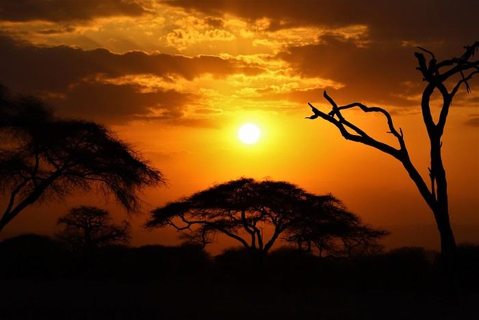
Safe travels! !
Over 5 years later, I’m finally getting around to writing the travel journal for our first trip to East Africa: Tanzania. *Polé Polé*, as they say! 😎
A trip I’d started planning just 6 years ago, in February 2019, for my post-internship exam vacation. After returning to South Africa in July 2019 with my family, this trip, planned for September 2019, would be all about discovery and a few firsts: first trip with friends, first trek, first time in East Africa. I really wanted to attempt the Kilimanjaro ascent, try to still see some of its "eternal" ice, and Alison wanted to do as much safari as possible. Unlike with the Zulus, Himbas, or San, visiting a Maasai village wasn’t on the agenda. Thanks to the Kessy Brothers agency, who were super responsive, Sandy from VF, and other members who helped prepare our trip, we settled on the following itinerary:
Day -1 (8/30): Departure from Pointe-à-Pitre Day 0 (8/31): Departure from Paris Day 1 (9/01): Arrival at Kilimanjaro Airport / Ameg Lodge (Moshi) DAY 2 (9/02): Machame gate / Machame camp DAY 3 (9/03): Shira / Shira camp DAY 4 (9/04): Baranco / Baranco camp DAY 5 (9/05): Barafu / Barafu camp DAY 6 (9/06): Barafu + Summit at midnight / Mweka camp DAY 7 (9/07): Mweka gate / Sal Salnero Hotel (Moshi) DAY 8 (9/08): Arusha National Park / Kanga camp DAY 9 (9/09): Tarangire National Park / Kanga camp DAY 10 (9/10): Tarangire National Park / Twiga Lodge DAY 11 (9/11): Lake Manyara / Twiga Lodge DAY 12 (9/12): Ngorongoro Crater / Simba campsite DAY 13 (9/13): Serengeti National Park / Seronera campsite DAY 14 (9/14): Serengeti National Park - Uoga Kuria Camp DAY 15 (9/15): Serengeti National Park / Waso campsite DAY 16 (9/16): Lake Natron / Maasai Giraffe Ecolodge DAY 17 (9/17): Kilimanjaro Airport Day 18 (9/18): Zanzibar Day 19 (9/19): Zanzibar Day 20 (9/20): Zanzibar Day 21 (9/21): Zanzibar
As I mentioned in my first travel journal about our South Africa trip, I’ve had a special connection to Tanzania for a long time. Growing up in the Indian Ocean without ever visiting Africa, those wildlife documentaries on TV when I skipped my pharmacy classes... I imagined and dreamed about this land and country so much.
The original plan was to go just the two of us with Alison, but somehow—though I don’t quite remember how—we ended up organizing the trip with our friends Mélissa and Doriane, who joined us in Arusha after our Kilimanjaro trek for the last two weeks and their very first safari. I think it was Melissa who had the idea to crash our trip, and she was right to do so! 😉 Flights: Pointe-à-Pitre-Grand Case and Grand Case-Paris with Air Caraïbes. Flights: Paris-JRO and ZNZ-Paris with Kenya Airways (layover in Nairobi). Flight: JRO-ZNZ with Air Tanzania.
Safe travels! !
Tuscany: Arezzo province and the Siena area
So happy the forum reopened last October!!!
I’ve started reading again (posts, travel journals) and chiming in on a few discussions. Now I’m stepping it up by writing a new travel journal—I’ve already posted a few between 2018 and 2020.
My latest trip was to Italy from August 27 to September 26, 2024. As the title says, it was a wander through Tuscany in parts of the region that aren’t the most visited. No Firenze-Siena-Pisa trilogy, no San Gimignano; there’ll be a quick detour into Siena, but I’ll skip the best-known sights. That choice, plus traveling in September, should help dodge overtourism. It worked out—crowds were light, sometimes very light, the whole way. Here’s the practical rundown: - a long trip outside peak season (ah, retirees!) - solo camping (caravan) - a mix of activities (hiking, mountain biking, sightseeing) in places that aren’t always packed with tourists. Still, I don’t feel like I ended up in some hidden-away spots. Not sure if this will draw any readers.
DAY 1: Tuesday, August 27, 2024 The heat was intense on the drive in across the plain; two big storms—more rain and hail than lightning and thunder—threw the weather off, the first near Imola, the second on the four-lane road up the Savio valley. I left the Cesena-Roma four-lane at the Verghereto exit and climbed up to Balze (1,100 meters). The campsite is even higher (1,200 meters), in the forest near the source of the Tevere (Tiber). Staying up here will cut down on driving for the first part of the trip: a route through the Appennino (Apennines) on the border between Toscana and Emilia-Romagna. The temperature was surprisingly mild for the altitude, the air thick with moisture by late afternoon. I drove back down from the campsite to Balze (2 km on the road) to grab groceries (it’s doable) and scout tomorrow’s hike. .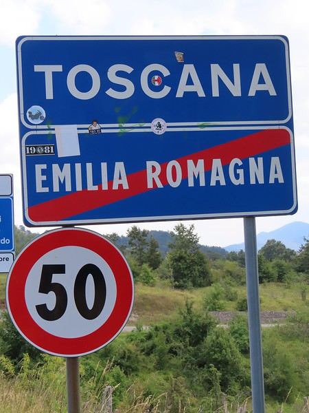
The endpoint of the planned hike is just a few meters from this sign (the trail crosses this road about 3 km from Balze). I realized Balze and the source of the Tevere (Tiber) are actually in Emilia-Romagna, not Toscana. I always thought the Tevere (Tiber), which flows toward Roma (Tyrrhenian side), started in Toscana! I’ll come back to this quirk in Day 3’s write-up.
My latest trip was to Italy from August 27 to September 26, 2024. As the title says, it was a wander through Tuscany in parts of the region that aren’t the most visited. No Firenze-Siena-Pisa trilogy, no San Gimignano; there’ll be a quick detour into Siena, but I’ll skip the best-known sights. That choice, plus traveling in September, should help dodge overtourism. It worked out—crowds were light, sometimes very light, the whole way. Here’s the practical rundown: - a long trip outside peak season (ah, retirees!) - solo camping (caravan) - a mix of activities (hiking, mountain biking, sightseeing) in places that aren’t always packed with tourists. Still, I don’t feel like I ended up in some hidden-away spots. Not sure if this will draw any readers.
DAY 1: Tuesday, August 27, 2024 The heat was intense on the drive in across the plain; two big storms—more rain and hail than lightning and thunder—threw the weather off, the first near Imola, the second on the four-lane road up the Savio valley. I left the Cesena-Roma four-lane at the Verghereto exit and climbed up to Balze (1,100 meters). The campsite is even higher (1,200 meters), in the forest near the source of the Tevere (Tiber). Staying up here will cut down on driving for the first part of the trip: a route through the Appennino (Apennines) on the border between Toscana and Emilia-Romagna. The temperature was surprisingly mild for the altitude, the air thick with moisture by late afternoon. I drove back down from the campsite to Balze (2 km on the road) to grab groceries (it’s doable) and scout tomorrow’s hike. .
The endpoint of the planned hike is just a few meters from this sign (the trail crosses this road about 3 km from Balze). I realized Balze and the source of the Tevere (Tiber) are actually in Emilia-Romagna, not Toscana. I always thought the Tevere (Tiber), which flows toward Roma (Tyrrhenian side), started in Toscana! I’ll come back to this quirk in Day 3’s write-up.
Discussion Embracing Dawn: December 2024 Photo Contest
Hey there,
This is where we chat and share photos outside the contest.
Good night! 😛
This is where we chat and share photos outside the contest.
Good night! 😛
A Month in Laos and Cambodia
Hello everyone,
At the start of November, a bit of rest before winter will be perfect to kick off this travel journal. There aren’t many recent journals about this part of the world, so I’ll take the plunge—my way of celebrating the (unexpected) return of this forum, which has been such a big part of my life for over 15 years.
So, back to Asia at the end of 2023. After Myanmar in 2015 and Vietnam in 2018, we’ve chosen Laos this time. And when talking with friends (you know how it is—everyone asks, "So, where are you going this year?"), a couple of friends asked to join us ("You see, my wife dreams of a trip to Asia, and I dream of traveling like you, independently"). We’ve spent a week with them (and other friends) in Portugal, so we know they’re easygoing and flexible. They’ll only be with us after Christmas (due to lots of grandkids), so deal—we’re bringing them along! A new experience for us.
A new experience that’ll start with tweaking the itinerary. Originally, I planned to stay a month in Laos, but what could be more magical for my friend’s wife than discovering Asia by way of Angkor! Plus, our two daughters asked for some beach time at the end of the trip! So, it’ll be Laos and Cambodia—neither of which we’ve visited before, so no complaints there.
The route will be pretty classic, though a bit scattered to fit our dates and wishes. For us, we’ll arrive in Luang Prabang (LP) to take some time to acclimate, then a few days in the northern Laos mountains, Nong Khiaw and Muang Ngoi. Back to LP for a direct flight to Pakse. Yes, I know—so many amazing places we’ll miss along the way, but as you know, choosing means letting go... From Pakse, I’m leaving a few days open (no bookings), but I’m eyeing Champassak and the 4,000 Islands. That’s where Mariel and Naty (our friends!) will join us on December 30th. I’ve tentatively added the Bolaven Plateau loop to the plan (still no bookings). Their Laos adventure will be short—by January 3rd, we’ll cross the border into Cambodia, heading straight to Siem Reap for 5 days. Then, I’ll fulfill my promise with a magical detour to Koh Rong Sanloem via a night bus (a must-do in Asia!). On to Phnom Penh for 2 days—where our trip ends, while Mariel and Naty will stop in Bangkok for 3 days before flying home.
So, fasten your seatbelts, flight attendants at the doors, and sorry for the long intro—here we go on this Asian adventure!
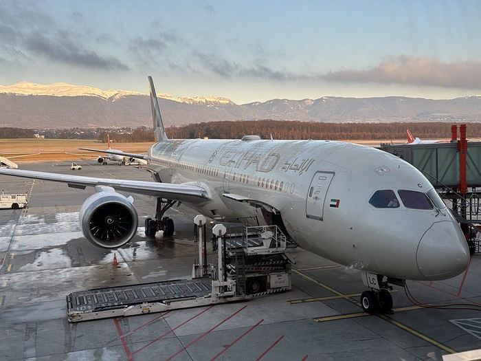
At the start of November, a bit of rest before winter will be perfect to kick off this travel journal. There aren’t many recent journals about this part of the world, so I’ll take the plunge—my way of celebrating the (unexpected) return of this forum, which has been such a big part of my life for over 15 years.
So, back to Asia at the end of 2023. After Myanmar in 2015 and Vietnam in 2018, we’ve chosen Laos this time. And when talking with friends (you know how it is—everyone asks, "So, where are you going this year?"), a couple of friends asked to join us ("You see, my wife dreams of a trip to Asia, and I dream of traveling like you, independently"). We’ve spent a week with them (and other friends) in Portugal, so we know they’re easygoing and flexible. They’ll only be with us after Christmas (due to lots of grandkids), so deal—we’re bringing them along! A new experience for us.
A new experience that’ll start with tweaking the itinerary. Originally, I planned to stay a month in Laos, but what could be more magical for my friend’s wife than discovering Asia by way of Angkor! Plus, our two daughters asked for some beach time at the end of the trip! So, it’ll be Laos and Cambodia—neither of which we’ve visited before, so no complaints there.
The route will be pretty classic, though a bit scattered to fit our dates and wishes. For us, we’ll arrive in Luang Prabang (LP) to take some time to acclimate, then a few days in the northern Laos mountains, Nong Khiaw and Muang Ngoi. Back to LP for a direct flight to Pakse. Yes, I know—so many amazing places we’ll miss along the way, but as you know, choosing means letting go... From Pakse, I’m leaving a few days open (no bookings), but I’m eyeing Champassak and the 4,000 Islands. That’s where Mariel and Naty (our friends!) will join us on December 30th. I’ve tentatively added the Bolaven Plateau loop to the plan (still no bookings). Their Laos adventure will be short—by January 3rd, we’ll cross the border into Cambodia, heading straight to Siem Reap for 5 days. Then, I’ll fulfill my promise with a magical detour to Koh Rong Sanloem via a night bus (a must-do in Asia!). On to Phnom Penh for 2 days—where our trip ends, while Mariel and Naty will stop in Bangkok for 3 days before flying home.
So, fasten your seatbelts, flight attendants at the doors, and sorry for the long intro—here we go on this Asian adventure!
Cruise departing from Le Havre: what to see?
Hi everyone, I’m so happy Voyage Forum is back online.
This is perfect timing since we’re leaving on November 28th for a cruise departing from Le Havre (Southampton, Zeebrugge, Rotterdam, Hamburg). Could you share some info on the distances from the ports to the city centers, sights to see, etc.?
Thanks so much, and see you soon!
Southwest! 8 weeks with the family, Denver-to-Denver loop, 1st part...
Hey there, VoyageForum!!!
I’ve combed through this site up, down, and sideways to plan our two-month road trip across the American Southwest during the summer of 2022, so it only feels right to give back and revive the USA travel journal section—helping others prep, travel, or relive their own memories! 😏
A quick intro to the stars of this trip is coming soon... in an upcoming post!
Table of Contents:
Road trip introduction Day 1 & 2: the days we double-checked all our papers... Day 3 & 3 bis: The day we discovered Denver... Day 4: The day of the race, the carriage, and the little one’s cough... Day 5: the day the road trip truly began... Day 6 & 6 bis: the day of Nature’s first wonders... Day 7: the day the sky fell on our heads... Day 8 & 8 bis: the day we saw ghosts... Day 9: the day we climbed the mountain... Day 10: the day the theme song from "The Last Picture Show" played on loop in my head... Day 11: the day we lived like Native Americans... Day 12: the day we left civilization behind... Day 13 & 13 bis: the day we explored another planet... Day 14 & 14 bis: the day Caro reunited with HER rocks... Day 15 & 15 bis: the day of the fantastic ride... Day 16: the day we cooled off in Lake Powell... Day 17: the day the Colorado River’s meanders were all ours... Day 18: the day we dipped our feet in the Colorado... Day 19: the day the guys discovered true vastness... Day 20 & 20 bis: the day we covered a few acres of Route 66 before sunset... Day 21: the day the credit card said stop... right before the STRIP... Day 22: the day we finally discovered Cirque du Soleil... Day 23: the day we returned to calm... well, almost... Day 24: the day we reached our home base for 6 nights: Saint George Day 25: the day we should’ve explored Yant Flat... Day 26: the day it was 13°C at Cedar Breaks... Day 27: the day we explored The Narrows in Zion NP... Day 28: the day we discovered Snow Canyon... Day 29: the day we hiked to the "SUBWAY"... Day 30: the day we encountered the abyss—from the north this time... Day 31: the day we arrived in a place where dreams begin... Kanab... Day 32: the day we discovered the first treasures along House Rock Valley... 2nd part: the second part of the journey... Day 33: the day we discovered a magical place... Edmaier's Secret... Day 34: the day Cottonwood Road didn’t open up to us... Day 35: the day of the classic Queen’s Garden + Navajo Loop—and another event that became a classic... Day 36: the second day in Bryce... pure bliss!!! Day 37: the day we swam at the foot of Calf Creek Falls... Day 38: the day we took the Burr Trail, even with storms lurking... Day 39: The day of the goblins... Day 40: the day we enjoyed the peaceful Capitol Reef NP... Day 41: the day of the Rim Overlook and another letdown... Day 42: the day we arrived in... Moab... Day 43: the first day in Arches National Park... Day 44: the day of the Fisher Towers... Day 45: the day of Bow Tie & Corona Arches... Day 46: The day of Shafer Trail + Potash Road... Day 47: The second day in Arches NP... Day 48: the day we discovered Colorado NM in a flash... Day 49: the day of Black Canyon... Day 50: the day we passed through Durango before falling for Silverton... Day 51: the day we went through Ouray and ended up in Gunnison... Day 52: the day of Kebler Pass and arriving at the hot springs... Day 53: the day of hot springs II, then the road back to Denver... Day 54: the last day... Day 55: back home and the RECAP...
I’ve combed through this site up, down, and sideways to plan our two-month road trip across the American Southwest during the summer of 2022, so it only feels right to give back and revive the USA travel journal section—helping others prep, travel, or relive their own memories! 😏
A quick intro to the stars of this trip is coming soon... in an upcoming post!
Table of Contents:
Road trip introduction Day 1 & 2: the days we double-checked all our papers... Day 3 & 3 bis: The day we discovered Denver... Day 4: The day of the race, the carriage, and the little one’s cough... Day 5: the day the road trip truly began... Day 6 & 6 bis: the day of Nature’s first wonders... Day 7: the day the sky fell on our heads... Day 8 & 8 bis: the day we saw ghosts... Day 9: the day we climbed the mountain... Day 10: the day the theme song from "The Last Picture Show" played on loop in my head... Day 11: the day we lived like Native Americans... Day 12: the day we left civilization behind... Day 13 & 13 bis: the day we explored another planet... Day 14 & 14 bis: the day Caro reunited with HER rocks... Day 15 & 15 bis: the day of the fantastic ride... Day 16: the day we cooled off in Lake Powell... Day 17: the day the Colorado River’s meanders were all ours... Day 18: the day we dipped our feet in the Colorado... Day 19: the day the guys discovered true vastness... Day 20 & 20 bis: the day we covered a few acres of Route 66 before sunset... Day 21: the day the credit card said stop... right before the STRIP... Day 22: the day we finally discovered Cirque du Soleil... Day 23: the day we returned to calm... well, almost... Day 24: the day we reached our home base for 6 nights: Saint George Day 25: the day we should’ve explored Yant Flat... Day 26: the day it was 13°C at Cedar Breaks... Day 27: the day we explored The Narrows in Zion NP... Day 28: the day we discovered Snow Canyon... Day 29: the day we hiked to the "SUBWAY"... Day 30: the day we encountered the abyss—from the north this time... Day 31: the day we arrived in a place where dreams begin... Kanab... Day 32: the day we discovered the first treasures along House Rock Valley... 2nd part: the second part of the journey... Day 33: the day we discovered a magical place... Edmaier's Secret... Day 34: the day Cottonwood Road didn’t open up to us... Day 35: the day of the classic Queen’s Garden + Navajo Loop—and another event that became a classic... Day 36: the second day in Bryce... pure bliss!!! Day 37: the day we swam at the foot of Calf Creek Falls... Day 38: the day we took the Burr Trail, even with storms lurking... Day 39: The day of the goblins... Day 40: the day we enjoyed the peaceful Capitol Reef NP... Day 41: the day of the Rim Overlook and another letdown... Day 42: the day we arrived in... Moab... Day 43: the first day in Arches National Park... Day 44: the day of the Fisher Towers... Day 45: the day of Bow Tie & Corona Arches... Day 46: The day of Shafer Trail + Potash Road... Day 47: The second day in Arches NP... Day 48: the day we discovered Colorado NM in a flash... Day 49: the day of Black Canyon... Day 50: the day we passed through Durango before falling for Silverton... Day 51: the day we went through Ouray and ended up in Gunnison... Day 52: the day of Kebler Pass and arriving at the hot springs... Day 53: the day of hot springs II, then the road back to Denver... Day 54: the last day... Day 55: back home and the RECAP...
La Bulgarie aux nuances slaves et ottomanes English translation pending
Bonjour à tous,
De retour d'un petit séjour de 10 jours en Europe de l'Est en Bulgarie, je démarre ce 5ème carnet de voyage. C'était une première pour nous dans cette zone géographique et nous avons été saisis par la beauté, la diversité des paysages, la culture et la richesse folklorique de ce petit pays. Nous avons longtemps hésité et n'avions réservé nos billets d'avion que 2 jours précédents notre départ de France. Les frontières n'étaient pas bloquées fin Aout, les tests PCR n'étaient pas encore obligatoires entre les 2 pays, mais qu'en serait-il à notre retour début Septembre? Partir en pleine pandémie n'est pas chose aisée mais l'envie d'explorer cette partie du monde a été plus forte et y a t-il un vrai bonheur sans une légère prise de risque ?
Arrivés à 0h50 le 28 Aout à Sofia, nous logeons dans l’hôtel le plus proche de l'aéroport, sachant que quelques heures plus tard, nous retournerons à ce même aéroport pour y louer une petite voiture. Très bon plan. Transfert immédiat, un service au top!
Le 28 Aout, nous quittons Sofia pour le monastère de Rila à 2h de route de là. La voiture est basique, pas de GPS, mais nous sommes dans l'espace Schengen et notre téléphone portable sera un allié précieux. Pas de frais supplémentaires pour l'utiliser et il nous guidera tout au long de notre séjour, nous faisant éviter embouteillages, routes en travaux. Encore un bon plan.
Le Monastère de Rila (en bulgare : Рилски Манастир, Rilski Manastir) fut fondé au X siècle par saint Jean de Rila, un ermite canonisé par l'Église orthodoxe. Il fait partie du patrimoine mondial de l'Unesco. C'est une merveille. Peu de monde et aucun touriste étranger. Le soir nous avons demandé s'il était possible de loger dans le monastère et un moine nous a conduit dans une cellule avec 2 lits et une petite salle de bain pour une poignée de Leva. Quand les quelques pèlerins ou touristes bulgares avaient quitté les lieux, nous avions le monastère pour nous. Une soirée douce dans un grand calme avec les sons des cloches toutes les heures et les psalmodies des moines. Magique.


Départ aux aurores le 29 Aout vers le sud. Première halte à Melnik, un village traditionnel mais qui a été 'transformé' pour les touristes en une multitude de restaurants et d’hôtels. Il ne demeure que c'est assez joli et nous avons arpenté l'unique grand rue pour traverser le village de bas en haut.

A 8km de là dans la montagne au milieu de cheminées de fées ocres et rouilles, il y a le petit monastère de Rozhen. Pour les courageux, on peut randonner entre Melnik et Rozhen au milieu de ce paysage unique, mais il faisait 36°....donc la voiture était la bienvenue🤪.
 L'entrée du monastère.
Un vrai petit bijou.
De retour d'un petit séjour de 10 jours en Europe de l'Est en Bulgarie, je démarre ce 5ème carnet de voyage. C'était une première pour nous dans cette zone géographique et nous avons été saisis par la beauté, la diversité des paysages, la culture et la richesse folklorique de ce petit pays. Nous avons longtemps hésité et n'avions réservé nos billets d'avion que 2 jours précédents notre départ de France. Les frontières n'étaient pas bloquées fin Aout, les tests PCR n'étaient pas encore obligatoires entre les 2 pays, mais qu'en serait-il à notre retour début Septembre? Partir en pleine pandémie n'est pas chose aisée mais l'envie d'explorer cette partie du monde a été plus forte et y a t-il un vrai bonheur sans une légère prise de risque ?
Arrivés à 0h50 le 28 Aout à Sofia, nous logeons dans l’hôtel le plus proche de l'aéroport, sachant que quelques heures plus tard, nous retournerons à ce même aéroport pour y louer une petite voiture. Très bon plan. Transfert immédiat, un service au top!
Le 28 Aout, nous quittons Sofia pour le monastère de Rila à 2h de route de là. La voiture est basique, pas de GPS, mais nous sommes dans l'espace Schengen et notre téléphone portable sera un allié précieux. Pas de frais supplémentaires pour l'utiliser et il nous guidera tout au long de notre séjour, nous faisant éviter embouteillages, routes en travaux. Encore un bon plan.
Le Monastère de Rila (en bulgare : Рилски Манастир, Rilski Manastir) fut fondé au X siècle par saint Jean de Rila, un ermite canonisé par l'Église orthodoxe. Il fait partie du patrimoine mondial de l'Unesco. C'est une merveille. Peu de monde et aucun touriste étranger. Le soir nous avons demandé s'il était possible de loger dans le monastère et un moine nous a conduit dans une cellule avec 2 lits et une petite salle de bain pour une poignée de Leva. Quand les quelques pèlerins ou touristes bulgares avaient quitté les lieux, nous avions le monastère pour nous. Une soirée douce dans un grand calme avec les sons des cloches toutes les heures et les psalmodies des moines. Magique.
Départ aux aurores le 29 Aout vers le sud. Première halte à Melnik, un village traditionnel mais qui a été 'transformé' pour les touristes en une multitude de restaurants et d’hôtels. Il ne demeure que c'est assez joli et nous avons arpenté l'unique grand rue pour traverser le village de bas en haut.
A 8km de là dans la montagne au milieu de cheminées de fées ocres et rouilles, il y a le petit monastère de Rozhen. Pour les courageux, on peut randonner entre Melnik et Rozhen au milieu de ce paysage unique, mais il faisait 36°....donc la voiture était la bienvenue🤪.
L'entrée du monastère.
Un vrai petit bijou.
Photo Contest, September 2020: Departure or Arrival Scenes and Places
Hello everyone, 🙂
This month’s theme is: places, departure or arrival scenes.
The places include: train or bus stations, passenger ports, and airports.
Here, for example, is Beijing West Railway Station
 This is Beijing West Railway Station.
You can submit a photo of the whole place, a part of it (inside or outside, the platforms), or a detail (like a station clock) as long as it clearly shows it’s a departure or arrival spot—such as a timetable display.
Or here’s another example:
This is Beijing West Railway Station.
You can submit a photo of the whole place, a part of it (inside or outside, the platforms), or a detail (like a station clock) as long as it clearly shows it’s a departure or arrival spot—such as a timetable display.
Or here’s another example:
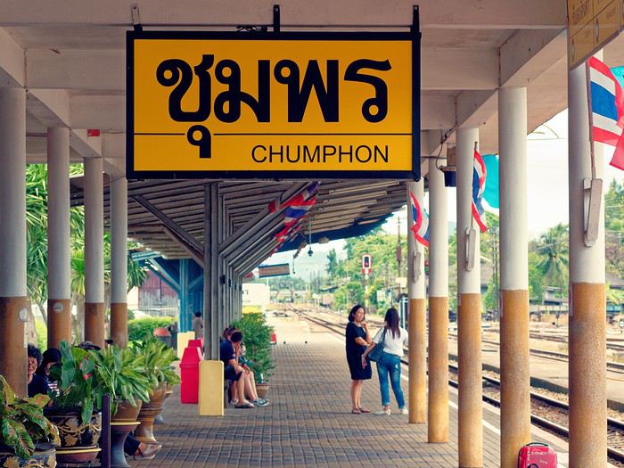
Even if you’re not in one of these places, a departure or arrival scene is welcome: Example: Early morning departure from a pagoda at Inle Lake (Myanmar) as people head back to their villages in the surrounding hills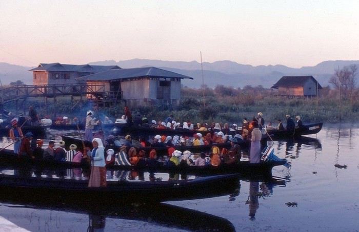
A vehicle about to leave: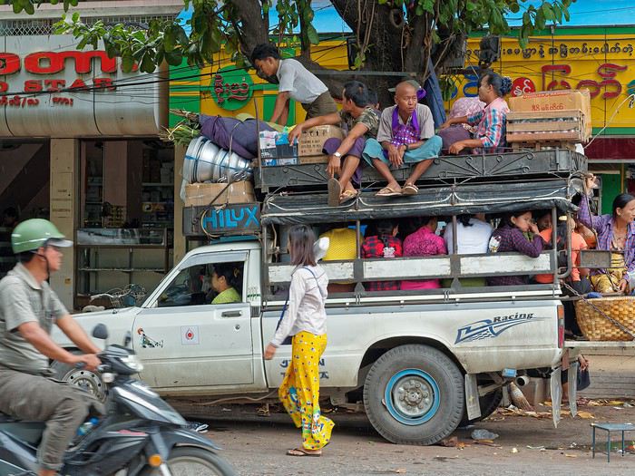
People are also allowed, as long as they’re clearly identified as travelers about to depart or who have just arrived. Bus station in Thailand (a photo I’d shared for the "solitude" theme)
Another example: in the foreground, a boat docked, and just above, another that has just left (Rangoon, Myanmar—these boats serve cities in the Irrawaddy Delta, and in some areas, they’re still the only means of transport for locals).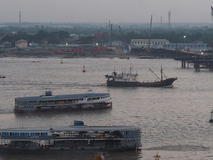
You can also include departures or arrivals from races, but again, it must be at the start or finish, not during the race: Boats before the start of the Route du Rhum in Saint-Malo: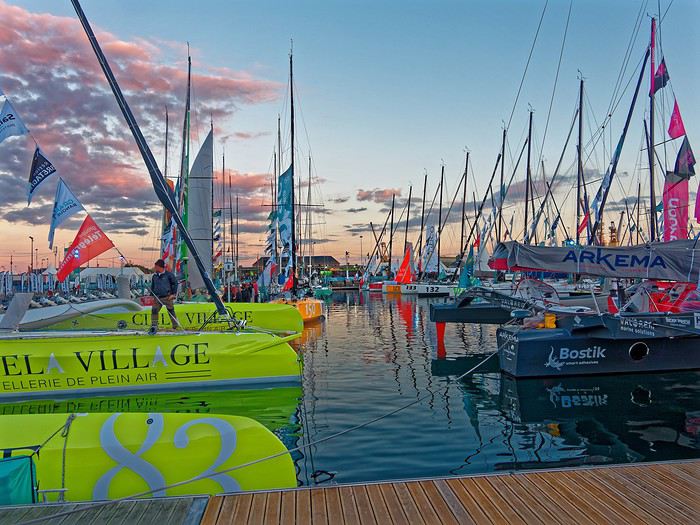
Participation: Each participant can submit up to 3 photos, until Tuesday, September 22 at 11:59 PM Paris time. Each photo must be posted in a separate message, with its number (1, 2, or 3). Don’t forget to add a short description (comment, location, etc.).
Voting: Every VoyageForum member can vote for the 4 photos they think are the best, based on their own criteria and the theme (I’m trying this format this month). Voting will take place from Wednesday, September 23 to Tuesday, September 29 at 11:59 PM Paris time.
Photos should be ranked in order of preference: - 1st photo: 4 points - 2nd: 3 points - 3rd: 2 points - 4th: 1 point
Each member can vote only once for 4 photos. No ties for 4th place with half a point each.
The winner is the photographer whose photo receives the most points. Results will be announced on September 30. In case of a tie, the number of first-place votes will decide. The winner will have the honor of organizing October’s contest.
Give me two or three days to put together the slideshow—I’ll definitely reach out to Masterpo via PM for advice if I’m stuck (and if he’s willing).
Good luck to everyone—may the best photographer win! Let’s get started! For discussion, it’s here
This is Beijing West Railway Station.
You can submit a photo of the whole place, a part of it (inside or outside, the platforms), or a detail (like a station clock) as long as it clearly shows it’s a departure or arrival spot—such as a timetable display.
Or here’s another example:
Even if you’re not in one of these places, a departure or arrival scene is welcome: Example: Early morning departure from a pagoda at Inle Lake (Myanmar) as people head back to their villages in the surrounding hills
A vehicle about to leave:
People are also allowed, as long as they’re clearly identified as travelers about to depart or who have just arrived. Bus station in Thailand (a photo I’d shared for the "solitude" theme)
Another example: in the foreground, a boat docked, and just above, another that has just left (Rangoon, Myanmar—these boats serve cities in the Irrawaddy Delta, and in some areas, they’re still the only means of transport for locals).
You can also include departures or arrivals from races, but again, it must be at the start or finish, not during the race: Boats before the start of the Route du Rhum in Saint-Malo:
Participation: Each participant can submit up to 3 photos, until Tuesday, September 22 at 11:59 PM Paris time. Each photo must be posted in a separate message, with its number (1, 2, or 3). Don’t forget to add a short description (comment, location, etc.).
Voting: Every VoyageForum member can vote for the 4 photos they think are the best, based on their own criteria and the theme (I’m trying this format this month). Voting will take place from Wednesday, September 23 to Tuesday, September 29 at 11:59 PM Paris time.
Photos should be ranked in order of preference: - 1st photo: 4 points - 2nd: 3 points - 3rd: 2 points - 4th: 1 point
Each member can vote only once for 4 photos. No ties for 4th place with half a point each.
The winner is the photographer whose photo receives the most points. Results will be announced on September 30. In case of a tie, the number of first-place votes will decide. The winner will have the honor of organizing October’s contest.
Give me two or three days to put together the slideshow—I’ll definitely reach out to Masterpo via PM for advice if I’m stuck (and if he’s willing).
Good luck to everyone—may the best photographer win! Let’s get started! For discussion, it’s here
Traversée de la Chartreuse en solo English translation pending
Trek solo n°6
On admettra que cette année fut spéciale. Je devais faire la traversée de Majorque en avril et puis... SALUE JE M'APPELLE COVID 19 ET JE VIENS VOUS FAIRE CHIER. Du coup, peu de projets pour cet été, difficile d'estimer les possibilités de voyage à l'étranger, pas très envie non plus de faire circuler cette merde... Alors je me rabats sur mes chères Alpes, ma foi de très bonne qualité. Début juillet, je consulte mon pote David, un normand exilé au pays des montagnes, pour savoir quand il sera chez lui, à Chambéry. Je cale donc un périple fin juillet, de Grenoble à Chambéry, via le massif de la Chartreuse, et en profiterai pour lui rendre visite.
Trajet réservé : départ le 25 juillet en train vers Grenoble, retour le 2 août en bus depuis Chambéry.
Je m'attends pas à quelque chose d'exceptionnel, je sais pas pourquoi. Ça a l'air très joli, mais pas très haut, et pas très sauvage. Mais après ces derniers mois bizarres, ce confinement éprouvant et les longs mois sans nature, un peu de montagne ne peut me faire que du bien. Et au moins, même si la météo n'est pas avec moi, je vais pas crever de froid, pour une fois (les plus hauts sommets sont à 2000m environ).
Après un petit séjour en Normandie natale et quelques trips de Caen, me voici en halte en région parisienne pour faire mon sac, la veille du départ. Ce qui m'inquiète le plus, c'est l'accès à l'eau. Il n'y a pas beaucoup de neige l'hiver (voire pas du tout certaines années), donc très peu de rivières en altitude. Les sources sont pour abreuver les troupeaux et bergers, mais souvent, l'été, elles sont à sec... Je checke quand même les dernières mises à jour des randonneurs sur refuge.info, qui recense tous les abris et les sources, pour voir un peu l'état des lieux. Ça devrait le faire. Je prends quand même 3 gourdes de 75 ml au lieu de 2 habituellement, ce qui me fait au maximum 2,25L d'eau en réserve.
Je blinde mon sac de 50L : 13 kg sans eau. Mh. Je sais pas comment je me démerde pour me retrouver avec autant de poids. Je lis pas mal de carnets de randonneurs qui portent 8 kg. Pourtant, j'ai pas prévu beaucoup de bouffe, peu d'habits, le strict minimum pour l'autonomie... Je comprends pas comment ça peut monter aussi haut pour seulement une semaine, d'ailleurs je me pose la question tous les ans.
On admettra que cette année fut spéciale. Je devais faire la traversée de Majorque en avril et puis... SALUE JE M'APPELLE COVID 19 ET JE VIENS VOUS FAIRE CHIER. Du coup, peu de projets pour cet été, difficile d'estimer les possibilités de voyage à l'étranger, pas très envie non plus de faire circuler cette merde... Alors je me rabats sur mes chères Alpes, ma foi de très bonne qualité. Début juillet, je consulte mon pote David, un normand exilé au pays des montagnes, pour savoir quand il sera chez lui, à Chambéry. Je cale donc un périple fin juillet, de Grenoble à Chambéry, via le massif de la Chartreuse, et en profiterai pour lui rendre visite.
Trajet réservé : départ le 25 juillet en train vers Grenoble, retour le 2 août en bus depuis Chambéry.
Je m'attends pas à quelque chose d'exceptionnel, je sais pas pourquoi. Ça a l'air très joli, mais pas très haut, et pas très sauvage. Mais après ces derniers mois bizarres, ce confinement éprouvant et les longs mois sans nature, un peu de montagne ne peut me faire que du bien. Et au moins, même si la météo n'est pas avec moi, je vais pas crever de froid, pour une fois (les plus hauts sommets sont à 2000m environ).
Après un petit séjour en Normandie natale et quelques trips de Caen, me voici en halte en région parisienne pour faire mon sac, la veille du départ. Ce qui m'inquiète le plus, c'est l'accès à l'eau. Il n'y a pas beaucoup de neige l'hiver (voire pas du tout certaines années), donc très peu de rivières en altitude. Les sources sont pour abreuver les troupeaux et bergers, mais souvent, l'été, elles sont à sec... Je checke quand même les dernières mises à jour des randonneurs sur refuge.info, qui recense tous les abris et les sources, pour voir un peu l'état des lieux. Ça devrait le faire. Je prends quand même 3 gourdes de 75 ml au lieu de 2 habituellement, ce qui me fait au maximum 2,25L d'eau en réserve.
Je blinde mon sac de 50L : 13 kg sans eau. Mh. Je sais pas comment je me démerde pour me retrouver avec autant de poids. Je lis pas mal de carnets de randonneurs qui portent 8 kg. Pourtant, j'ai pas prévu beaucoup de bouffe, peu d'habits, le strict minimum pour l'autonomie... Je comprends pas comment ça peut monter aussi haut pour seulement une semaine, d'ailleurs je me pose la question tous les ans.
Mon voyage chez les Birmans du 21 janvier au 9 février 2020 English translation pending
MON VOYAGE CHEZ LES BIRMANS. Du 21 JANVIER au 9 FEVRIER 2020
LA BIRMANIE, le MYANMAR…….
Envie de repartir en Asie, oui mais où ? Après plusieurs voyages dans les pays de l’Est, dix voyages en Inde suivis d’autres en Thaïlande, Laos, Cambodge, Sri-Lanka, Vietnam…. Quel pays d’Asie allait m’attirer ? J’en discute avec Christian, passionné de voyages, et devant sa persuasion que la Birmanie était un pays qui allait me plaire à coup sûr, me voilà lancée ! En avant, documentation sur le pays, itinéraires éventuels, prix des billets d’avion, réflexion….Ho, tout compte fait, je vais à Ténériffe…. Allez, rebelote, itinéraire, avion, etc... Non, finalement, la Birmanie me fait de l’œil mais je me pose plein de questions telles que je ne parle pas anglais, je n’ai plus vingt ans, je ne connais pas le pays! Oui, et alors… et les autres fois ? C’était pareil! Allez, je revois le circuit de Ténériffe. Oui mais, je veux quand même allez en Birmanie ! Je suis d’accord avec vous, je ne sais pas ce que je veux… mais ceux qui me connaissent ne seront pas étonnés de ce comportement face à un choix… Un soir, je me surprends en train de réserver un billet d’avion à la compagnie THAI AIRWAYS. L’Asie aura gagné une fois de plus! L’e-visa pour ce pays est très facile à obtenir par internet au prix de 45 dollars. Comme souvent, je fais appel à Booking.com pour choisir mes hôtels et petit à petit, je commence à les réserver au fur et à mesure que j’établis mon circuit.
La Birmanie est l’ancien nom. En effet, en 1989, la jungle militaire qui est au pouvoir depuis 1962, donne officiellement le nom Myanmar. Ce pays s’appelle désormais depuis le 21 octobre 2010 République de l’Union du Myanmar. Tous les pays n’acceptent pas ce changement donc les deux noms se disent. Plusieurs villes ont également changé de nom (exemple : Rangoon devient Yangon ; Moulmein devient Mawlamyine, etc). Ce pays a également changé de drapeau et d’hymne national. Ceci a été fait notamment dans le but de rompre psychologiquement avec le passé colonial anglais mais aussi pour d’autres points politiques trop compliqués pour moi. La Birmanie a aussi changé plusieurs fois de capitales; actuellement, c’est Naypyidaw. Je n’y suis pas allée et n’ai jamais réussi à prononcer ce nom. La Birmanie partage ses frontières avec la Chine, la Thaïlande, le Laos, le Bangladesh et l’Inde. Il y a plusieurs états dont certains ne sont pas conseillers aux voyageurs car encore considérés comme dangereux. C’est un pays multi religieux ; il n’y a pas de religion officielle mais c’est la philosophie bouddhiste qui y règne largement. Il y a environ 53 millions d’habitants. Le faciès varie d’un à l’autre. Certains Birmans ont des traits bridés, d’autres tirent plus sur les indiens mais encore… Moi, je ne vois pas la différence.
Vu que c’est mon premier séjour en Birmanie, le circuit va être assez facile car je ne choisis que les principales villes : Yangon, Mandalay, Bagan, Lac Inle puis Hpa An et Moulmein dans le sud. J’ai hésité à la fin entre ces deux dernières ou un séjour plage. A refaire, je prends quatre jours supplémentaires pour terminer à Ngapali en bord de mer.
Je fais appel, pour la première fois dans mes voyages, à un coach. Ce sera Anna qui habite à Yangon. Je lui verse la somme de 200 euros pour qu’elle m’aide à trouver des guides, chauffeurs, hôtels francophones. Au final, cela ne m’aura pas servi à grand chose puisque j’ai quand même fait à ma manière la plupart du temps. Tiens donc, y en a-t-il qui serait étonné ?
Le temps passe, il est temps de faire les derniers vaccins et les valises.
Dans ce récit, vous entendrez quelques mots qui reviennent souvent, je vous en donne d’emblée l’explication simplifiée (certains savent, je sais)…
Pagodes : lieu de culte bouddhiste où se trouve souvent une relique du Bouddha, certaines peuvent avoir plusieurs étages, sont soit circulaires, octogonales ou carrées, le toit est évasé ou en épi. Peut aussi être un ensemble de Stupas dont souvent une plus grande au centre. On peut s’y promener, se recueillir, prier rencontrer des moines, etc…
Stupas : (nom masculin), monuments funéraires bouddhistes en forme de dôme, renfermant soit une relique (cheveu, dent, etc.) du Bouddha ou des ossements d’un Saint. On peut les contourner mais jamais y pénétrer car complètement murés. Certains peuvent avoir plusieurs étages et une terminaison en ombrelle.
Temples : semblables aux Pagodes mais voués à des divinités, des Saints, des héros etc… contrairement aux Pagodes vouées uniquement au Bouddha. Comme les Pagodes, certains sont accessibles pour s’y recueillir, prier, visiter.
Monastères : certains sont encore en activité et d’autres pas. Ils sont habités par des moines ou des nonnes. Des élèves peuvent aller étudier, d’autres prier. Plusieurs monastères sont ouverts au public pour y pratiquer la méditation.
Pirogues : à ne pas confondre avec Pagodes… ce sont des petits bateaux naviguant sur les lacs et canaux.
Longyi : costume traditionnel. Pour les dames: morceau de tissu de deux mètres à entourer autour de la taille formant une longue jupe aux couleurs colorées et fleuries. Pour les hommes: tissu à carreaux portant le nom de paso.
Je vous avoue qu’il n’y a pas très longtemps que je fais la différence entre tous ces mots. Mais en voyageant, on apprend un peu.
21 JANVIER 2020 (jour 1) : Départ pour 12 h de vol qui se déroulent très bien, films français à disposition, bonne nourriture, bon siège, bon whisky-coca… une escale de 2H30 à Bangkok avant le départ pour YANGON avec une arrivée à 8H35 au Myanmar.
22 JANVIER 2020 (jour 2) Après avoir récupéré mes bagages, je vais directement changé des euros en Kyats qui est la monnaie locale : un euro c’est 1600 kyats. On peut payer beaucoup en dollars et on sait changer des euros partout. Je vais ensuite acheter une carte sim pour avoir internet puis direction vers un bureau de taxis. On essaye de me doubler le prix de la course mais comme je me suis très bien renseignée avant de partir, je négocie pour enfin obtenir un prix raisonnable de 9000 kyats (env. 6 €). Il est maintenant 9 H 30 et il fait déjà 32 degrés.
J’ai réservé une chambre à l’hôtel Clover City avec Booking.com (33 € la nuit, petit déjeuner inclus). Il est bien situé dans une petite rue de Yangon. Près du grand centre commercial Bogyoke, à 500 mètres de la Pagode Sule et non loin des restaurants, bars, taxis, massages, etc… Il est au-delà de mes attentes vu le faible prix pour cette ville. Il est très propre et la chambre est lumineuse. Je peux prendre possession des lieux directement malgré qu’il ne soit pas 14 H.
Je range mes affaires à moitié puis je me rends en taxi admirer la plus belle Pagode de Birmanie, la Pagode Shwedagon, âgée de 2500 ans. Toutes les personnes qui visitent ce pays viennent impérativement voir cette Pagode. C’est un des sites le plus sacré de Birmanie. Certains disent que c’est la plus belle Pagode au monde. Le routard dit que c’est l’âme de la ville de Yangon. D’autres diront qu’elle est au Bouddhisme ce que la Mecque est aux Musulmans. Pourquoi ne pas dire, elle est ce que le Vatican est aux Catholiques (ça n’engage que moi)!
Je compte m’en donner à cœur joie car étant seule, je peux flâner à ma guise. Le taximan me dépose au pied d’un énorme escalier et l’ascension commence avec des échoppes à gauche et à droite de ceux-ci. Quand on arrive sur les lieux, on comprend mieux ici l’importance du Bouddhisme dans la vie quotidienne des Birmans. Il est dit que cette Pagode date du 5ème siècle mais il n’y a pas de traces écrites avant le 15ème siècle. Par contre, les chercheurs sont d’accord sur le point qu’il y avait bien eu une Pagode à cet emplacement au premier millénaire de notre ère. Au dessus des escaliers, à l’entrée proprement dite, après avoir payé, on me demande de mettre un longyi malgré mon pantalon fuseau. Je devrais payer 300 kyats qu’on me rendra à la sortie. Il y a quatre entrées et sorties, faudra encore retrouver la bonne. Bref, je suis d’attaque pour entamer cette première visite de mon périple.
Je suis tout de suite éblouie et euphorique de voir cet ensemble archéologique majestueux. Je ne sais par où commencer à gauche, à droite… Bon, je me décide car voilà déjà dix minutes que je suis devant le Stupa central qui m’hypnotise. Il faut dire qu’il mesure 99 mètres de haut et 43 mètres de diamètre à la base ; son bulbe est recouvert de plus de 700 kilos d’or. Dans sa partie supérieure, il y a 5448 diamants, 2317 rubis, saphirs et autres joyaux, il y a 1065 petites cloches en or et à l’extrême un diamant de 76 carats. Maintenant, comprenez-vous mieux mon allégresse? Lors du parcours, on peut regarder le dessus du Stupa avec des jumelles mais ça reste assez flou. Je prends des dizaines de photos en le contournant car selon l’heure et l’endroit, la lumière et la situation n’étant pas la même, ça lui donne des reflets différents. Tout à coup, je vois quelques personnes regarder dans une petite flaque d’eau et photographier cette flaque…Bizarre! Curieusement, je m’approche et fait de même… Rien … Je me retire et d’autres recommencent à photographier. Qu’ai-je raté dans l’histoire ? Je recommence à plusieurs reprises puis enfin, sous un certain angle, le stupa est reflété dans cette petite flaque d’eau. Magnifique ! Mais j’ai failli passer à côté sans le voir. Le stupa est entouré de multiples sanctuaires où les pèlerins prient, se recueillent et prennent des photos. Je commence mon tour par la gauche. Que de sanctuaires, de statues de Bouddha, de petits temples (dont un hindou), etc… J’aurais certainement appris plus avec un guide que seule mais ça aurait été forcément au pas de course. Je me réjouis encore d’être seule pour pouvoir trainer, aller, revenir sur mes pas et savourer à 100%. Oups, que vois-je ? Un ascenseur…Merci le taximan. Pas grave.
Actuellement, je suis nez à nez avec une cloche de 16 tonnes. Pour la petite histoire, lors du pillage de 1824, elle sombra dans la rivière. Les anglais tentèrent de la voler pour la conduire à Calcutta. N’y arrivant pas et la laissant pour compte, les Birmans la récupèrent et elle retourna à sa place. Je frappe un coup sur celle-ci avec un gros bâton mais des birmans m’expliquant qu’il faut taper trois coups et avec une manière particulière. Un peu plus loin, je contemple un Bouddha en Jade. Après trois heures d’imprégnation dans cette Pagode, les yeux pétillants, la tête pleine de souvenirs, je redescends les marches et prend la direction des taxis. Je ne vais pas trop négocier car, à part à l’aéroport, ils sont plutôt corrects, juste un petit rabais pour dire. Je décide de me rendre rapidement dans un restaurant car ils ferment tôt, 19 H pour la plupart. Je me fais conduire au Green Galery recommandé par le guide du Routard et le Lonely. C’est un petit endroit charmant. Au départ, je suis seule à une grande table quand subitement surgit un groupe de huit personnes; la patronne me propose de m’installer avec un couple de français, ce que je fis bien volontiers. La nourriture est excellente. Le vin blanc pas très bon et très cher. En fait, le menu me coûte 4 euros et la coupe de vin 2,5 euros… J’ai compris, ce n’est pas leur truc, dorénavant, ce sera de la bière !
Après ce bon repas, je demande au taxi de m’emmener dans le centre car contrairement aux restaurants, les magasins ferment assez tard. Je suis à la recherche d’opticiens. Les lunettes sont moins chères en Asie. Après avoir pris mes renseignements dans plusieurs magasins, je me mets d’accord avec l’opticien Lucky. Je reviendrai demain avec ma prescription. En rentrant à l’hôtel, à pied, je vois une enseigne foot-massage. Ni une ni deux, en avant, parti pour une heure de massage de pieds avant de regagner mon hôtel pour y passer une nuit de rêve.
23 JANVIER 2020 (jour 3) : Après cette bonne nuit réparatrice, un bon petit déjeuner m’attend en bas. Je commence la journée en conduisant ma prescription chez Lucky qui me promet de bien la respecter en faisant des verres progressifs et affinés. Il m’assure qu’elles seront prêtent le surlendemain. Cool, 65 euros pour les verres et une belle monture de couleur bleue comme je le souhaitais.
J’appelle un taxi afin qu’il m’emmène à la Cathédrale Catholique de l’Immaculée Conception. Il m’arrête devant une église et dit OK…mais non pas OK car j’ai vu les photos et ça ne ressemble pas du tout à la Cathédrale. Il a compris que je savais où je voulais aller et m’y emmène illico. La façade est magnifique mais au moment de pousser la barrière, le gardien me refoule disant qu’il est l’heure de manger et que les portes rouvrent à 14 H. Ce n’est pas grave, je reviendrai plus tard.
Maintenant, je fais appel à mon sens de l’orientation, de mon plan et de map Google car c’est à pied que je vais continuer ma visite au milieu de cette grande ville. Finalement, je me retrouve désespérée sur un banc d’abris d’autobus en train de retourner mes plans dans tous les sens. A ce moment, un Birman m’accoste pour faire quelques pas avec moi afin de m’indiquer le chemin pour me rendre au secrétariat.
Le Secrétariat est un très grand bâtiment en briques rouges, ce qui est l’emblème de l’architecture victorienne. Il fut érigé entre 1889 et 1905 donc bien évidemment par les Britanniques. En 1930, un tremblement de terre l’endommagea puis ironie du sort, en mai 2008, ce fut le cyclone Nargis qui l’abîma (138.000 morts). Cette tragédie fut la plus grande catastrophe naturelle du pays. Le Secrétariat est encore en rénovation donc il n’est possible que d’en visiter une partie.
Cet établissement était le siège du gouvernement de la Birmanie Britannique puis devint le siège Birman après l’indépendance. C’est l’endroit où l’homme politique Aung San fut assassiné en juillet 1947 à l’âge de 32 ans ainsi que six ministres. C’était le père de Daw Aung San Suu Kyi, femme d’état, conseillère et porte parole actuelle. C’est une figure de la non violence face à la dictature militaire du Pays (pour les plus initiés voir le génocide des Rohingya). Elle a reçu le prix Nobel de la Paix en 1991. Je ne visiterai que la partie non payante du secrétariat déjà bien représentative. Au premier étage, il y a d’immenses salles et on a une vue sur la cour extérieure. Au rez-de-chaussée, se trouvent aussi des salles aménagées, l’une en atelier de peinture, une en salle de spectacle et une en magasin d’artisanat. Là, je me laisse séduire par un bracelet en perle de Jade. La dernière salle que je visite est transformée en cafétéria où je me pose pour siroter un thé froid succulent dont je ne retrouverai ce goût nulle part ailleurs. C’est un lieu hautement historique et je peux assurer que ça se ressent ! Je terminerai la visite en faisait le tour extérieur sous le soleil et en me relaxant un moment devant la fontaine. Le lieu est propice aux photos ! C’est une visite que je n’aurais voulu manquer pour rien au monde.
La Cathédrale de l’Immaculée Conception n’est pas très loin ; j’essaie de retrouver le chemin toute seule. Yes, j’y suis arrivée. Bon pour certains, ça peut paraître facile mais quand on connait mon sens de l’orientation, on comprend que pour moi, c’est un exploit. A peine avoir franchi la barrière, je laisse mon sac à la consigne pour être libre de mes mouvements. Je suis devant un bâtiment magnifique ; c’est la plus grande Cathédrale Catholique de Birmanie.
Je m’empresse d’aller voir l’intérieur en briques rouges. L’édifice date de 1909. Les vitraux sont majestueux ; j’y cherche St Martin, patron des Arquebusiers de Visé pour le dire à mon petit fils, mais il n’est pas représenté…tant pis! Après un court instant de recueillement, je fais le tour du bâtiment extérieur. C’est reposant et j’y prends beaucoup de plaisir surtout en voyant la grotte représentant celle de Lourdes, entretenue par une indienne. Ca me fait repenser à une très grande Cathédrale pas loin de Pondichéry en Inde. En récupérant mon sac, je demande à quelle heure sera la prochaine messe. Je n’y participerai pas car celle du soir est trop tard et celle du matin est trop tôt ; c’est une excuse, oui… vous croyez ?
Après cet épisode religieux, je pensais faire le tour du quartier colonial à pied mais ça s’avère plus compliqué que prévu. Mes plans ne sont pas au top! Je loupe l’Hôtel de Ville, le Bâtiment de Télécom…Je ne me tracasse pas plus que ça car je repasse ici à la fin du séjour et je pourrais donc fignoler… Enfin, c’est-ce que je crois sur le moment…
Pour le moment, je n’ai qu’une idée, c’est d’aller au Strand Hôtel près du lac. Le taximen me dépose devant un bâtiment emblématique, de l’époque colonial. Il fut abîmé en 1942 par les bombardements puis réquisitionné par les troupes nippones qui font leur écurie hors du bar. Quelle honte! En 1945, au retour des Anglais, le bar rouvre ses portes. Très vite, il devient un repaire de Backpackers. Après un accident mortel d’un chanteur local, le bar est interdit aux birmans sauf ceux endimancher d’une veste et d’une cravate ou inviter par un étranger. Je me retrouve donc en pleine ambiance coloniale. C’est très grand et élégant. Je rentre dans l’immense bar pour y boire je ne sais trop quoi devant cet étalage bien plus achalandé qu’aux Olivettes de Liège dont ma fille est patronne. Vu le prix, le choix est vite fait; c’est une bière à 3 €, le moins cher sur la carte. Tout à coup, un monsieur m’appelle de son fauteuil (oui, moi aussi je suis dans un fauteuil). Je suis surprise de cet appel mais en fait, il se rappelle m’avoir vu à l’aéroport et m’avoir aidé à me dépatouiller lors de l’achat de ma carte sim. C’est un australien parlant français qui accompagne une personne âgée. Au moment de payer l’addition, on me demande 5 €! Je n’ai pas fait attention que le prix sur la carte était sans compter les taxes. J’ai donné un peu moins prétextant que je n’avais rien de plus sur moi. Pas bien, mais pour une 25cl. franchement, c’est beaucoup. Tout se termine bien avec un grand sourire.
La bière digérée, je fais quelques pas pour arriver au bureau de Poste à tendance britannique également. Je voulais acheter des timbres mais je n’ai encore vu aucune carte postale donc je vais attendre.
Je traverse la vertigineuse et dangereuse rue, espérant survivre à ce passage. Je prends ce risque pour photographier la Poste et l’hôtel Strand de face. Du coup, je suis près de l’embarcadère du ferry pour aller à Daha; je vais y jeter un œil et je prévois ça pour la fin du séjour. Faisant demi-tour, je me faufile dans un petit marché local où tout le monde mange je ne sais pas trop quoi… Je scrute la saisissante rue que je dois retraverser mais après quelques pas, je suis agréablement surprise de voir qu’il y a une passerelle donc pas de soucis. Je me demandant comment j’ai pu la traverser à pied sans me faire accrocher! De retour vivante sur l’autre trottoir, je photographie quelques vieux bâtiments notamment le bureau de douane maritime et une ambassade indienne je pense. Puis je déambule dans les YGN walls (petites rues) dans l’espoir d’aller à la 19ème rue où j’ai lu que c’était l’endroit idéal pour aller boire une bonne bière. Il y a de l’ambiance dans cette rue; elle ne doit pas être la seule à mon avis. De retour sur les grands axes, c’est assez folklorique car c’est la préparation du Nouvel An Chinois. Je m’y amuse beaucoup. Ce soir, j’irai manger dans le restaurant indien indiqué dans le guide du routard. Je le trouve en faisant appel à mon fidèle ami Mapp Google. Je suis seule dans cet endroit tenu par des indiens sympathiques. Je m’offre un copieux thali (assortiment de plats de l’entrée au dessert, servis dans de petits récipients en métal disposés sur un plateau rond en métal également). Ce sera mon petit clin d’œil à l’Inde! Pays toujours omniprésent dans mon esprit…Oui, je crois que mon histoire d’amour avec l’Inde n’est pas finie! Au retour, je vous laisse deviner foot-massage ou pas?
24 JANVIER 2020 (jour 4) : Aujourd’hui, c’est la journée que je redoutais de faire sans guide et pourtant, c’est comme une grande aventurière que je me dirige droit vers la gare centrale pour faire la balade du train circulaire. Le prix est dérisoire 1 € l’aller/retour. Ce train lent est censé faire le tour de Yangon en passant par les villages de banlieue, faisant 39 arrêts. Au total, il fait 45 km en 3 heures mais actuellement, une partie est fermée en raison de travaux sur la ligne. C’est une façon intéressante et amusante de voir la vie des gens hors de la ville. Dans ce train, il y a de tout. Quand je dis de tout, le mot est faible. Beaucoup de paysans l’utilisent pour aller en ville ou au marcher. Ils montent dans ce train spécial avec des colis, des mannes, des animaux. A un moment donné, il y avait un colis de plus de 2,5 mètres dans le wagon. J’ose espérer que ce n’était pas un mort qu’on transportait! On y vend des légumes, du riz cuit, du thé chaud, des lunettes, des bics et encore bien plus. On y mange, boit; les gens parlent ou plutôt crient, rient, dorment. Une femme allaite son bébé. Une mamy fait une ratatouille à sa petite fille. C’est toute une vie à bord de ce train. Les portes sont ouvertes et certains se penchent pour s’aérer. J’ai pris place à côté de la porte pour être sûre de ne rien rater et avoir de l’air. Nous sommes 4 touristes au milieu des autochtones.
Après 1H30 de trajet, je me demande où je vais descendre parmi ces petits patelins sans importance. Ma destination finale sera là où j’aperçois un marché. Me voilà donc en pleine pampa au marché où je ne pourrais pas prendre de photos. Après avoir parcouru les lieux, je prends place sur une toute petite chaise, au milieu du jeu de quilles, pour manger des nouilles et boire un thé. J’ai voulu prendre un taxi pour rentrer mais les prix étant exorbitants, je reprends le train en sens inverse. Rebelote, tout le monde rit, dit bonjour, me dévisage gentiment, accepte que je les prennent en photo; quel monde différent. Malgré la chaleur et le vacarme, je réussi à m’endormir un moment. A la gare centrale, point de départ, je m’attarde un peu pour revivre un peu cette magie. C’est une expérience que je n’aurais voulu rater pour rien au monde. Je rentre à pied et fait un détour vers la Pagode SULE que je n’irai pas visiter. Je suis claquée et il fait toujours aussi chaud. Je passe chez Lucky récupérer mes lunettes. Elles ne vont pas. Je l’aurais bien juré ça... Les verres sont trop forts, lourds pas du tout amincis et trop forte dégression est intolérable. Je ne suis pas satisfaite et le fais bien comprendre à l’aimable opticien qui me dit que je ne me tracasse pas, il va les refaire avec une correction moins forte et il va « encore » amincir les verres. Je n’ose imaginer s’ils n’avaient pas déjà été amincis. Bon, ça va. Je les récupérerai à la fin du séjour. C’est l’heure d’aller savourer un plat gastronomique: crevettes géantes à la sauce au poivre vert. Un régal, j’en ai l’eau à la bouche rien qu’à y penser. Ce repas m’aura couté 6 euros avec les boissons. Je termine la journée par un foot-massage, hé oui encore j’adore ça… et encore une fois, pour le prix je ne vais pas m’en priver (3 € pour une heure). Une fois rentrée à l’hôtel, je m’attaque la valise qui s’est cassée à l’arrivée. Heureusement, j’avais pris une petite corde à linge qui va permettre qu’elle ne s’éventre demain à l’enregistrement.
25 JANVIER 2020 (jour 5) : Départ pour l’aéroport domestique, direction MANDALAY. Il y a un problème à l’aéroport car c’est mon nom d’épouse qui est inscrit sur le billet; je dois payer 25 dollars pour le changement mais j’étais au courant depuis que j’ai effectué la réservation. C’est à cause de la saisie automatique de mon ordinateur et je n’ai vérifié le nom qu‘après le paiement. Encore heureux que je le vois à la première réservation car dans mon élan, je faisais les quatre autres ainsi! Me voilà installée dans un avion à hélices, c’est bizarre… et j’avoue avoir eu très peur à l’atterrissage tellement l’engin bougeait. C’est la 2ème ville de Birmanie et capitale culturelle. Elle fut la dernière capitale du royaume Birman dans un périmètre de quelques dizaines de km²; les trois autres étant Ava, Amarapura, Sagaing. Je visiterai toutes ces villes avoisinantes.
A mon arrivée à l’aéroport, j’avais demandé à l’hôtel de m’envoyer un taxi. J’ai réservé l’hôtel Aurora, excellente adresse, propre, 18€ petit déj inclus. Sur facebook, je suis abonnée à un groupe nommé «les français en Birmanie» et j’ai la chance d’avoir un membre, Eric, qui m’a donné énormément de conseils durant tout mon séjour. C’est d’aillleurs lui qui m’a suggéré d’appeler un étudiant de Mandalay qui apprenait pour être guide francophone. J’ai pris contact avec celui-ci depuis la Belgique et avons convenu d’un rendez-vous. A mon arrivée à l’hôtel, le jeune Myat Min Ko Ko m’attendait déjà à la réception. Il patientera encore un peu, le temps des formalités et de déposer mes bagages à la chambre. Myat Min Ko Ko, qui sera donc mon guide francophone à Mandalay, commence par me donner quelques informations. Par exemple, on compterait environ 1000 Monastères et Pagodes alors qu’à l’époque du dernier Roi, il y en avait 1257. Il ajoute qu’on comptabiliserait encore 52652 Moines, 46854 Novices et 8559 Nonnes.
Vers 16H, nous enfourchons sa moto et go pour la première visite de Mandalai. Il y a du trafic mais il roule prudemment. J’en profite pour aller directement acheter de la toile scotch pour consolider ma valise ainsi c’est fait.
Nous contournons l’immense rempart pour arriver au monastère Shwenandaw, dit le monastère d’or. Jadis, il en était tout recouvert, ce qui n’est plus le cas. Sa structure est en teck, sculpté et ciselé à la perfection. Il a quatre niveaux de toiture séparés et est entouré d’une plateforme. On y retrouve des sculptures de danseurs, de fleurs ainsi que Nats (esprits qui vénèrent l’image du Bouddha). Il est soutenu par des piliers en teck mais on y trouve aussi des piliers en marbre. Il est issu du Palais Royal en bois d’Amarapura et fut déplacé en 1857 à Mandalay. Le roi Midon y mourut en 1878 et son fils allait souvent y méditer; persuadé que son père hantait les lieux, il le fit redémonter et retiré de la cité royale. Pendant les 5 années suivantes, il le fit reconstruire par les moines qui y résidèrent jusqu’aux environs de 1940. Pendant la guerre, il fut occupé par les japonais. Il brûla quasi totalement en mars 1945, sous les bombes britanniques. J’ai beaucoup aimé la visite de ce monastère qui n’est donc plus habité à l’heure actuelle. Comme je prends bien mon temps, l’heure tourne et le second monastère prévu, situé quasi en face, ferme à l’instant. Dommage, car je n’aurais pas l’occasion d’y revenir.
On remonte sur la moto et Myat Min Ko Ko me dit qu’on va voir le plus grand livre du monde. Je m’attendais à tout sauf à ce que j’allais découvrir… En effet, ce livre s’appelle la Pagode Kuthodaw. Le jeune homme me donne quelques explications. Accrochez-vous pour suivre, moi j’ai bien dû le faire! C’est un ensemble de Stupas, construit de 1860 à 1868 et restauré en 1892. L’enseignement du Bouddha est gravé sur 729 stèles en marbre d’1m50 de haut sur 13 cm d’épaisseur. Chaque stèle est protégée par une grotte (Kyauksa) sous un petit Stupa blanc. Au final de ces 729 stèles, ce sera tout le Tipitaka (ensemble de textes composés d’après les paroles du Bouddha, datant d’un siècle av JC) qui sera rassemblé. Au centre, se trouve un stupa doré de 57 mètres de haut. C’est un réel plaisir de se perdre dans cet univers blanc, magnifique et apaisant.
Nous terminons l’après-midi dans un restaurant typique que Myat Min Ko Ko me conseille, le Mingalabar. Le resto est plein à craquer et on est arrivé juste avant de devoir faire la file pour entrer. J’invite l’étudiant à rester avec moi pour cet agréable moment. On commande un plat mais on en reçoit dix petits, tous différents. C’était gustatif! A la fin du repas, nous voulions aller au-dessus de la colline voir le coucher du soleil mais il est tard, commence à faire noir. En moto, ça peut être dangereux. La première journée à Mandalay aura déjà été très riche culturellement.
26 JANVIER 2020 (jour 6) : J’ai rendez-vous avec Myat Min Ko Ko ce matin à 8H30; il est accompagné d’un chauffeur de taxi car aujourd’hui, c’est trop loin pour s’y rendre à moto. Oui, nous allons gambader dans les trois anciennes capitales dont je parlais hier. A chaque fois qu’ils changeaient de Rois, ils changeaient de capitales…
Après quelques kilomètres, nous faisons un arrêt au Temple Mahamuni, le plus prestigieux de toute la ville et très vénéré. Il date de 1784. Il fut incendié puis reconstruit au 20ème siècle par un architecte français. Il y a 252 colonnes dorées, sculptées et ornées de fresques. Dans une petite chambre, très beau et grand Bouddha de 4 mètres de haut, constitué de 6,5 tonnes d’or. A 4 H du matin, les fidèles lavent son visage avec une brosse en or et toute la journée, les hommes viennent y coller des feuilles d’or sur le corps; les femmes n’ont pas ce droit… Dans l’allée, en sortant, j’achète des tongs en bambou dont j’aurais, plus tard, la surprise de voir qu’elles ont déteint mes pieds en noir (goudron, sais pas). Ensuite, on se balade dans le quartier des sculpteurs de marbre. C’est très passionnant de voir le bloc à l’état brut puis sa transformation à chaque étape jusqu’à devenir un Bouddha ou une autre pièce décorative. On ne s’attarde pas car c’est très poussiéreux (du coup, là, c’est tout blanc).
Nous reprenons le chemin et traversons AMARAPURA, située à 10 km au sud de Mandalay, construite en 1783 (les astrologues disent entre 1824 et 1858). Nous profitons de la superbe vue au-delà du pont et au sommet de la colline. On y reviendra le soir car un rendez-vous important nous attend 3 km plus loin, en pleine campagne.
En effet, il faut être à 10 H précise au Monastère Mahagandhon, construit en 1785. C’est un des trois sanctuaires le plus sacré en Birmanie avec la Pagode Shwedagon de Yangon et le temple du rocher d’Or dans le sud. A 10H15, pas moins de 1000 moines défilent chaque jour pour faire l’aumône. Il fait noir de monde, beaucoup de touristes chinois. Mon guide me donne un masque pour la première fois. Des gardes font régner l’ordre car les chinois ne sont pas très disciplinés; des barrières de sécurité sont même installées sinon ils ne laisseraient pas passer les moines tranquillement. Après cet impressionnant défilé, on voit les moines dans leur réfectoire et les personnes ayant participé à la donation des repas peuvent entrer. Il y a des Moines de tout âge, du plus jeune qui peut avoir 8 ans au plus âgé. Leur vie est très rudimentaire: lever à 5H, petit déjeuner léger puis travail jusqu’à 10H15, moment de l’aumône, suivi de leur dernier repas à midi. C’était vraiment un moment à ne pas rater!
En quittant le monastère, je visite un atelier traditionnel de tissage sur soie.
Nous reprenons la route vers l’ancienne capitale de SAGAIN, construite en 1315 après la chute de Bagan en 1287. Des quatre capitales, c'est celle-ci qui dégage le plus de charme; on y ressent une grande importance religieuse. J’y croise d’ailleurs des Nonnes pour la première fois. La route longeant les bords de la rivière Irrawaddy est magnifique. Au sommet de la colline, la vue est époustouflante sur la rivière et les 1000 Pagodes.
On voit la Pagode Son Oo Punyashin. Je visite le Temple U Min Thone Caves où il fait très calme. Il y 30 grottes avec 45 Bouddhas qui y sont nichés. On entre par un côté et on sort par l’autre. C’est magnifique et reposant.
Nous irons manger au restaurant Sagaing Hill en bas de la colline car à AVA (INWA), prochaine étape, il n’y a ni resto ni bar et on va y rester un moment.
Après un bon repas, en route pour une toute belle expérience dans la toute première capitale qui est AVA et qui se situe à 26 km de Mandalay. C’est la cité des pierres précieuses, fondée par un chef local Shan en 1364 après la chute de l’empire de Bagan.
On abandonne le taxi pour traverser la rivière en bateau où des charrettes tirées par des chevaux attendent les visiteurs pour visiter le site qui est assez grand. C’est très agréable de se balader au milieu des rizières, des palmiers à sucre, des anciens Temples et croiser d’autres charrettes.
Il y a 200 à 250 Pagodes, Temples ou Monastères ainsi que l’ancien Palais Royal qui est à l’abandon et dont il ne reste que la tour de guet. En premier, on descend voir le Monastère Bagaya où il règne une ambiance mystique. Il est tout en bois de teck, sculpté et traité au pétrole. Il est toujours habité. Un Moine donne cours aux novices dans une belle salle de prière. En second, ce sera la Pagode Yadana puis le Monastère Mu Nu Ok Kyaug tout en briques rouges. Il va s’en dire que j’en ai vu beaucoup d’autres mais il est impossible de me rappeler les noms vu que je n’ai pas fait mon récit au jour le jour comme pour mes autres voyages (à cause de ma tablette).
A force de grimper et de descendre de mon attelage, j’ai fini par craquer mon pantalon; heureusement, j’ai un grand foulard pour mettre à ma taille. En terminant la boucle, blocage dans un bouchon de charrettes à chevaux…
Pour terminer la journée culturelle, il est temps de se rendre au Pont U Bein pour y admirer le coucher de soleil. On arrive à l’avance et déjà il fait noir de monde; beaucoup de chinois encore; hop, je remets le masque. Ha oui, aussi beaucoup de moustiques, et je n’ai pas mon répulsif. Je ne suis pas trop à l’aise entre les chinois et les moustiques! Ce pont construit en 1849 (certains diront 1782 quand Amarapura était capitale) est soutenu par 824 piliers en teck récupérés à Ava. Il mesure 1200 mètres ce qui en fait le plus long pont/passerelle en teck du monde. Il enjambe le lac Taungthaman à Amarapura.
Il est temps de dire au revoir à mon petit guide qui aura été parfait. Ce soir, j’ai décidé de manger à la terrasse de l’hôtel Aurora où je dors. J’y rencontre Fatima, une algérienne qui visite le pays en solo également. On organise la journée du lendemain ensemble. Je lui renseigne aussi l’étudiant pour les jours suivants. Il viendra rencontrer Fatima le soir même et me dire au-revoir encore une fois en m’offrant un petit cadeau: un beau dessin de pêcheurs fait à l’encre de chine acheté à AVA.
27 JANVIER 2020 (jour 7) : J’ai dormi 12 heures, c’est dire si la journée précédente avait été bien remplie. Je n’ai pas l’habitude de faire mes visites accompagnée d’autres voyageurs; je fais une exception qui me confirmera dans ma décision de voyager seule… Avec Fatima, nous avions rendez-vous à 10H30 à l’accueil. Elle n’est pas là et la réceptionniste me dit d’attendre; elle va arriver. Déjà, ça je n’aime pas… Après dix minutes, je n’ai pas envie de perdre plus de temps, je me prépare à sortir quand tout à coup, la Fatima fit son apparition. Elle était à la Banque. Allez go, tuc tuc vers l’embarcadère pour prendre le bateau qui va à MINGUN. Le gars ne comprend rien et nous changeons de tuc tuc. A l’embarcadère, on nous signale que le bateau public partait à 8H30; ben, oui, mais là, il est 11 H… Nous demandons pour avoir un bateau privé mais après une attente de vingt minutes, prenons la décision (que nous regretterons amèrement) d’y aller en tuc tuc. En fait, au lieu de faire moins d’une heure en bateau, nous mettons des heures pour faire un détour de 80 km en tuc tuc. Le chemin est en grande partie le même que j’ai pris le jour avant. On est très secouées dans ce véhicule, non pas de luxe; on a froid et on ne voit pas la fin du trajet. Arrivées tant bien que mal à Mingun, on constater que ce village est très joli. Il y a beaucoup de magasins et en premier, je vais acheter un Longyi pour mettre sur mes épaules le soir. Pfff, Je n’ose même pas imaginer ce retour…
Nous commençons par découvrir la Pagode Pahtodawgy, en forme cubique et inachevée. Les travaux commencèrent en 1790. Elle fut détruite par deux tremblements de terre, ce qui nous empêche d’ailleurs de continuer notre visite plus loin que la première volée d‘escaliers. On voit une immense lézarde à cause du séisme de 1838. Ceci dit en passant, la Birmanie a connu plusieurs séismes violents notamment en 1956 de magnitude 7 entraînant de nombreux dégâts. Rebelote en 2012. Pour en revenir à la Pagode, le roi voulait qu’elle soit la plus grande du monde. La fameuse cloche de Mingun lui était d’ailleurs destinée. Elle abrite 40.000 objets dans sa chambre à reliques dont une dent du Bouddha offerte par l’Empereur de Chine en 1789. Les esclaves y travaillèrent jusqu’à la mort du Roi en 1819. Maintenant, ça ressemble à un gros tas de briques. Pourquoi n’est pas finie? Ça reste une énigme… soit le roi était mégalomane et à bout de ressource, soit pour une autre raison comme semble le démontrer de récentes recherches.
On fait une pause en bas de la Pagode pour savourer deux jus de bambou; c’est trop bon! Ça fera office de notre repas de midi car on ne voyons rien à manger.
Nous apercevons la Pagode Hsinbyume dite la Pagode blanche. Elle est magnifique, d’un blanc immaculé, ressemblant à une grosse meringue, comportant sept terrasses et un beau point de vue au sommet. Elle fut construite en la mémoire de l’épouse du Roi en 1816.
L’attraction principale à Mingun, est sa cloche suspendue, en bronze, qui pèse 90 tonnes. Elle fut commandée par le roi en 1808 pour la Pagode inachevée. C’est la plus grosse cloche au monde avec celle de Moscou à la différence que celle-ci sonne tandis que l’autre non. Je n’ai pas raté l’occasion d’y taper quelques coups de bâton…
28 JANVIER 2020 (jour 8) : Aujourd’hui, départ pour BAGAN tellement tôt que je n’ai pas réussi à dormir la nuit. A l’aéroport, le chauffeur d’Anna (qui m’a un peu aidé à construire mon circuit) devrait être là. Je ne le vois pas. Je téléphone à Anna. En réalité, je me suis trompée d’une heure quand je lui ai fourni les détails du vol. Je prends un autre taxi pour me rendre à la Villa Bagan où je vais résider trois nuits. J’ai réservé avec booking.com. Je dois attendre ma chambre qui sera libre à 14H. Sur ce, le chauffeur contacté par Anna s’amène à la Villa. Je laisse mes bagages à la consigne et nous partons faire une première visite. Anna m’a dit que je pouvais lui faire confiance et comme je ne saurais quand même pas tout visiter dans cette ville, il me fera découvrir ce qu’il y a de mieux. Donc je me laisse guider! Il m’emmène dans un des 75 petits villages traditionnels où les routes sont en terre. Ces villages vivent principalement du tourisme, de l’artisanat tel la peinture sur toile ou sur faïence. Je me demande de quoi il vivait quand le pays était fermé aux touristes? C’est vrai qu’ils sont producteurs d’arachides, de sésames, de petits pois, d’haricots, d’oignons, de maïs, riz et sucre de palme. J’entame une balade paisible (en tout cas, au début) dans ce petit village où les maisons sont sur pilotis. D’ailleurs, je me faufile parmi celles-ci pour mieux découvrir la vie des habitants. J’adore ça… Je rigole un peu moins quand deux chiens viennent vers moi en aboyant! Ça va, j’ai pu passer entre les deux monstres qui ont été rappelés par les habitants. Voilà où la curiosité mène! A la sortie du bled, il y a un petit temple blanc tout mignon. Quelques vendeurs de toile accostent les rares touristes, je pense d’ailleurs être la seule. Je tombe en amour devant une toile représentant les montgolfières de Bagan au milieu des champs de Stupas. Je négocie mais je n’arrive pas à un prix raisonnable donc je ne l’achète pas. J’en trouverais sûrement plus loin.
Après cette première visite, le chauffeur me ramène à la Villa Bagan où je dois normalement y trouver la chambre prête. On me conduit dans le fond du bâtiment dans une chambre à l’étage, grande et froide. Je rouspète car il est bien indiqué sur mon voucher, chambre avec vue sur la piscine au rez-de-chaussée. Ils disent que ce n’est pas possible, que tout est complet. Je téléphone à Anna pour lui expliquer la situation (la pauvre, elle n’y est pour rien mais elle parle Birman)… On lui dit la même chose. Je ne suis pas contente, demande pour parler au manager et essaie de trouver le service clientèle sur Booking.
Ils m’ont vu faire et comme par hasard, cinq minutes plus tard, la manager arrive me demandant de la suivre vers une chambre face à la piscine au rez-de-chaussée de chaussée, pas du tout occupée… Cette chambre est magnifique! Je retrouve le sourire et déguste une bonne bière fraîche sur la petite terrasse avant de prendre mon repas du soir à l’hôtel.
29 JANVIER 2020 (jour 9) : Ce matin au petit déjeuner, je fais la connaissance d’un couple de français. On se donne rendez-vous pour passer la soirée ensemble. Le chauffeur m’attend pour une longue journée. En chemin, j’aperçois beaucoup de personnes qui font la visite du site à vélo ou moto. Moi, je ne pourrais pas car vu mon médiocre sens de l’orientation, je tournerais en rond des heures. Il y a 2217 pagodes, temples et stupas étalés sur ce site historique de 42 km². A savoir, qu’il y en avait 4000 avant les nombreux tremblements de terre. Le dernier séisme remonte à 2016 ravageant 200 pagodes et causa la mort de trois personnes. J’ai eu l’occasion de parler avec un habitant qui m’a décrit ce qu’il a vécu avec sa famille à ce moment.
Voici une dizaine de monuments visités aujourd’hui: la pagode Shwezigon, Kyan Sit Thar Umin, le temple de Htilominlo, Uppali Thein, le temple de l’Ananda, Shwegûgyi, Thatbyinnyu, Mingalazedi, la pagode Shwesandaw.
J’ai visité aussi le temple Nat Hlaug Kyaung qui est le seul temple hindou encore debout sur le site; il est dédié à Vishnu; les statues originales ont été dérobées par un industriel allemand au 19ème siècle
Le soir, le chauffeur me conduira à un endroit magique pour voir le coucher de soleil mais trop de nuages, juste une petite percée à un moment donné.
En rentrant, je retrouve le couple français pour aller au diner-spectacle de marionnettes à côté de l’hôtel. Le spectacle n’pas terrible mais il y a une très bonne ambiance. Nous avons commandé notre repas sans trop savoir ce qu’on allait recevoir, comme la plupart du temps. Lorsqu’on amène les plats, le monsieur français reçoit un plat avec un énorme couvercle. On se dit, waah… Au final, quand il soulève celui-ci, il y avait juste un petit bol de riz. On a bien rigolé!
30 JANVIER 2020 (jour 10) : Aujourd’hui, je vais découvrir une autre partie du site. J’avais une liste de monuments, dressée par Anna, ce qui n’était déjà pas mal mais le chauffeur a trouvé de bon augure d’en rajouter quelque uns… Au préalable, il s’arrête à la poste pour acheter des timbres et poster mes cartes. En avant pour la première tournée de monuments très vieux dont voici quelques noms: Dhammayangyi, Sulamani, Pyathegyi Pagoda, Gaudawpalin temple, Khay min gha, Alo daw pyi, Sei et Mahabodi pagoda. A propos de cette dernière pagode à l’architecture Hindoue inspirée du temple de Bodh-Gayâ en Inde, je m’y suis sentie très à l’aise. Elle est tout à fait différente des autres pagodes bouddhistes… Je prendrais plaisir en me baladant dans un temple hindou et à rester assise un long moment… A cet instant précis, je réalise que je n’ai pas fini mon histoire avec l’Inde! Je suis très étonnée de voir les peintures murales toujours belles, bien conservées, dans certains temples; je pense notamment au temple souterrain. C’est l’heure du repas et ce sera des scampis au menu. Je vois à côté du resto qu’il y a un salon de foot-massage. J’y vais et en sors bien relaxée. La détente est de courte durée car je suis attendue de pied ferme pour la suite de la visite.
En sortant d’un Temple, je revois des toiles peintes avec des montgolfières et des moines. J’en achète deux, cette fois à un prix attractif. Je continue à voir plusieurs bâtiment, à marcher pieds nus partout, à m’asseoir n’importe où… J’apprends plus tard qu’il y a beaucoup de serpents à Bagan…. Brrr, et dire que je n’y avais même pas pensé! Je dis stop. Assez des visites de Temples, Stupas, Pagodes. Je n’en peux plus. Il insiste pour en voir encore un ou deux mais je veux rentrer.
En soirée, je décide de partie seule à pied à la recherche d’un restaurant. Je marche dans le noir avec ma lampe de poche. Il y a beaucoup de chiens errants. Je commence à paniquer et après avoir marché une vingtaine de minutes, je rentre dans le premier restaurant où il n’y a pas une âme. Pas terrible le repas. Au retour, je m’arrête dans un salon pour faire un massage traditionnel complet du corps. J’avais oublié que ça faisait si mal… bon, je supporte mais je ne saurais peut-être plus bouger demain! Ce sera ma dernière nuit dans cette belle grande chambre à la villa Bagan. Je n’aurais pas profité de la piscine car vu la réaction des gens qui veulent s’y hasarder, je pense que l’eau est trop froide.
31 JANVIER 2020 (jour 11) : Nous avions convenus avec le driver de partir plus tôt à l’aéroport afin de s’arrêter en chemin voir le départ des montgolfières avec le lever du soleil. Il y en a des dizaines qui décollent et s’élèvent gracieusement dans le ciel. Je n’ai pas fait un tour de montgolfière car j’ai le vertige et le prix est extravagant à savoir 250 à 300 euros pour une heure maximum! Je conclurai mon étape à Bagan gardant en mémoire ses 2000 pagodes, temples, stupas aux couleurs changeantes, ses levers et couchers de soleil magiques tel dans un rêve et dignent de générer des souvenirs inoubliables! Sur la route de l’aéroport, il est temps de dire au revoir au chauffeur qui aura été très professionnel et sympathique.
A nouveau dans un avion à hélices, celui-ci m’emmène à HEHO à 30 km du LAC INLE, au cœur du plateau Shan, à 800 mètres d’altitude. Un taxi me conduit à l’hôtel Inle Strand à NYAUNG SHWE à 3 km du lac. La chambre est jolie avec des vitres partout, vue sur la rivière et une terrasse, bien insonorisée donc le bruit des pirogues ne dérangent pas. Il est bien situé, propre, personnel sympa. Le prix est de 25 euros la nuit petit déjeuner inclus.
S’il y a bien un endroit qui m’a donné du mal à choisir un hôtel, c’est ici. Au départ, selon l’avis d’Anna, j’avais réservé au Thanaka hôtel car le patron parle français. Vu le prix excessif et, comme de toute façon ailleurs on ne me parle quand même pas en français, j’ai opté pour un hôtel moins cher; Une soirée, je suis quand même allée au Thanaka, histoire de faire un brin de causette en mangeant. A ma grande stupéfaction, personne ne parlait français dans cet hôtel; le patron n’était pas là. Donc, j’ai bien fait de ne pas dormir là!
Je consacre cet après-midi à contacter le piroguier afin d’organiser la journée du lendemain, à ranger mes habits, à écrire un peu et à faire un massage. Le soir, je vais manger au restaurant Ancestor, conseillé par Eric. La patronne birmane parle français. Elle est très sympathique, prend place à mes côtés, me conseille les endroits à visiter le lendemain et mieux encore, elle les note en birman ainsi le piroguier n’aura qu’à suivre ce programme. Je dois avouer que j’ai eu beaucoup de chance de correspondre avec Eric, d’abord sur le site des français en Birmanie et ensuite en message privé. C’est un passionné de ce pays et il m’aura donné beaucoup de bonnes adresses et mis en contact avec de bonnes personnes. Je l’en remercie vivement.
1er FEVIER 2020 (jour 12) : Déjeuner à 7 h du matin. A 8H, le piroguier que j’appellerai Pan (sans certitude) vient me chercher à l’embarcadère devant l’hôtel. Je suis bien installée au milieu de la pirogue sur une chaise en bois. Je suis couverte jusqu’aux dents car il fait froid le matin sur le lac. Après une bonne demi-heure à traverser le canal, nous arrivons au lac Inlé. C’est un lac d’eau douce entouré de collines, qui fait 22 km de long et 10 km de large. Ses rives et son arrière-pays abritent de nombreux groupes ethniques. Nous nous dirigeons droit vers le marché des cinq jours. C’est un marché qui va dans cinq endroits différents durant la semaine. Les ethnies Pa-O, Danu et Intha y viennent pour vendre leurs produits respectifs. Ce jour, il se déroule dans une grande Pagode. Je m’y promène. Je m’y sens bien. J’achète des bracelets en pierre de jade et en œil du tigre. Des dames font de la pâte dans de la friterie; j’ai envie de goûter mais je m’abstiens! Le soleil est là et je commence à enlever les couches les unes après les autres. Je vais dans un coin de la Pagode enlever le 2ème pantalon que j’avais enfilé.
Je reprends place dans la pirogue et voyage au gré du vent, découvrant le mode de vie des habitants. A partir d’ici, le lac se rétrécit et laisse place aux maisons sur pilotis. Chaque ménage a sa propre pirogue. Les enfants l’utilisent pour aller à l’école. Les parents vont faire les courses et travailler en pirogue. Toute la vie ici se passe sur l’eau. Ce qui fait la particularité du lac relève aussi de l’art des pêcheurs, les Inthas. Ils ont une technique particulière. Ils se déplacent souvent avec de petites pirogues avec ou sans moteur. Ils sont debout à l’avant, utilisent une seule rame qu’ils utilisent à l’aide de leurs jambes gardant ainsi leurs mains libres pour pêcher. C’est un spectacle unique!
Nous partons en direction du pittoresque village de INDEIN (ou Inthein) qui se situe sur la rive sud ouest du lac, à plus de 500 m d’altitude. On y accède par de petits barrages faits main pour monter en bateau. C’est assez spécial! A Indein, il règne une ambiance pacifique. Ce village est célèbre pour 1054 Stupa construites au 17 et 18ème siècles; ce qui explique que la plupart sont en ruine. Par contre, certaines sont toujours fièrement debout ou en cours de restauration. Le site domine le village et c’est en moto que je vais découvrir ce lieu faisant penser à un autre monde. En redescendant, des enfants attendent le peu de touristes dont je fais partie pour vendre des foulards. Bizarre comme ils savent dire « maman malade »… C’est, je pense, le seul endroit en Birmanie où je me suis sentie « touriste ». J’ai quand même craqué pour un énorme foulard magnifique. Il n’est pas rare de voir des enfants travailler, même à de lourdes tâches.
Je reprends place dans la pirogue pour retourne un peu en arrière afin d’aller diner puis petit tour du patelin avant de rejoindre Pan qui m’attend pour me conduire à Nampan visiter une usine de cigares (les cherrots, rouleaux de tabac). Ce sont des femmes qui travaillent là; elles font 500 cherrots par jour voir même 800 pour une femme d’expérience. Je n’en prendrai pas tout de suite car je les trouve cher et je ne sais pas si mon fils va aimer. Retour à la pirogue. Et en avant, je monte, je descends. Arrêt dans une petite industrie où l’on travaille la soie et le lotus. C’est magnifique les habits en lotus; le prix est exorbitant mais que je peux comprendre! Inutile de dire que je ne suis pas acheteuse… Sur le chemin de retour, il y a des marchés flottants; j’en avais déjà vu dans d’autres pays d’Asie du sud-est (Vietnam, Thaïlande, Laos, Cambodge). On terminera la journée par le monastère Kyaung Nga Hpe, dit le monastère des chats sauteurs. Avant, les moines faisaient faire des acrobaties aux chats. Maintenant, il n’y a plus guère de chats, j’en ai vu un roux… Je remercie Pan pour cette belle journée. Le rendez-vous est pris pour le lendemain en guise d’autres aventures. A 300 mètres de l’hôtel, je repère un «happy hour». Je ne résiste pas à un double cocktail à base de rhum. Il reste un peu de temps avant la fin du happy hour. Go pour deux nouvelles boissons. Le patron a beaucoup de peine à comprendre mon désir de manger une cuisse de poulet. J’ai reçu un plat qui n’y ressemblait pas. Toujours est-il que c’était bon. Mieux vaut ne pas chercher à comprendre…
2 FEVIER 2020 (jour 13) : J’ai donné rendez-vous à Pan pour aller naviguer sur le lac SAKKAR à trois heures de Nyaug Shwe où je réside. J’ai beaucoup hésité en préparant mon voyage pour voir si oui ou non, je ferai cette excursion car d’après certains commentaires sur le forum, ça paraissait pénible. Aussi, la restauratrice birmane m’avait dit qu’une semaine auparavant, elle avait dû faire demi-tour à cause qu’il n’y avait pas assez d’eau pour passer d’un lac à l’autre (sécheresse). Toujours aussi téméraire, je ne recule pas devant si peu et au final, je ne regrette pas du tout cette escapade un peu singulière!
Nous sommes obligés de refaire une bonne partie du Lac Inle avant de dévier vers le lac Sakkar. Au fur et à mesure, le lac se rétrécit pour finalement se transformer en petits canaux. Ici, c’est nettement moins touristique. C’est avec de la joie dans les yeux que je découvre la vie au bord de l’eau. Au bord des rives, les dames font leur vaisselle, lavent leurs cheveux, les enfants se baignent, les pères vont faire les courses ou travailler en pirogue. Toute leur vie tourne autour de l’eau. Tout cela est magnifique. Le canal rétrécit de plus en plus, il n’y a plus de maisons sur pilotis, il n’y a même plus d’eau pour passer. Nous voilà, embourbés dans les marécages entre les deux lacs; les hélices s‘emmêlent; il doit avoir 40 cm d’eau; nous sommes à l’arrêt complet. A nos côtés, une pirogue est également embourbée; les deux passagers français ne le prennent pas bien du tout. C’est tout en râlant qu’ils doivent enjamber dans ma piètre demeure pendant que les piroguiers tentent de débroussailler le terrain, que dis-je, le passage d’un lac à l’autre… J’ai quand même cru qu’on n’arriverait plus à avancer ni à reculer mais je suis restée cool sur mon siège en plastique au beau milieu de mon mini navire, espérant ne pas devoir aller pousser avec eux! Les deux piroguiers retroussent leur longyi, poussent, secouent et finalement arrivent à débloquer les engins. Péniblement, nous sortons de ce couloir en pensant qu’il faudra y repasser au retour… Enfin, le lac Sakkar est en vue. Il y a de l’eau, plus de soucis… On est arrivé dans l’état Shan. La profondeur de ce lac est variable. Il peut y avoir 2,10 m de profondeur en saison normale. Pendant la saison sèche, il peut n’y avoir que 50 cm. A la saison des pluies, il peut dépasser 4 mètres d’où les maisons sur pilotis. On s’arrête au Monastère de Tharkong. C’est un ensemble de stupas un peu comme à Indein. En face, se dessine un petit village où je vais manger et y faire tour; j’y achète le savon local. En rentrant, je demande à Pan de repasser dans une usine de cigares car j’ai pu contacter mon fils qui est d’accord de tester ces cheroots. Il y a tous les goûts. Ils veulent que je teste mais je ne fume plus depuis peu donc pas d’imprudence. Plus tard, j’apprendrai que ces cigares ne sont pas terribles et que mon chérubin les a refilés à un copain ! Après Pan veut m’emmener voir un atelier de poterie; je refuse car j’en ai vu des dizaines dans plusieurs pays. Je suis de retour à Ngaug Shwe vers 17 heures et je remercie encore Pan d’avoir été un excellent guide piroguier. Le soir, je retourne dans ce petit resto qui sert de délicieux cocktails. Par contre, j’ai oublié ce que j’ai mangé… Le breuvage était peut-être un peu trop corsé! En rentrant, je passe au salon de massage où je m’endors pendant la séance.
3 FEVIER 2020 (jour 14) : Aujourd’hui, j’ai réservé un taxi via l’hôtel pour me rendre à PINDAYA, un village à 1180 mètres d’altitude. Le chauffeur n’est pas très sympathique et ne comprends pas qu’il doit m’arrêter pour faire des photos quand les paysages ou les situations s’y prêtent. Il a comme idée d’aller du point A au point B, ce qui m’irrite. Il téléphone à son grand-père qui parle un peu français. Je lui explique mes desideratas mais il est aussi borné que son petit-fils et rien ne change. C’est dommage car on voit des scènes de vie, des femmes réparant les rues ou portant des seaux de pierres, des chars dans les petits chemins agricoles, etc… Dans son parcours bien déterminé, il me conduit directement vers un marché local que j’apprécie d’ailleurs. Heureusement qu’on ne parlait pas encore de distanciation car on y était serré comme des sardines. La deuxième visite sera une usine d’ombrelles faites avec du papier de murier. Je me suis amusée dans cet atelier tellement c’était joli. J’ai d’ailleurs acheté une mini-ombrelle pour mettre dans ma chambre ainsi que des livres et un foulard. Le marchandage fut laborieux; dans ce pays, ce n’est pas trop leur truc!
Enfin, nous voilà arrivé à la fameuse Pagode Shwe Oo Min de Pindaya. La grotte aux 8000 Bouddhas est une des plus belles de l’Asie du sud-est. Cette caverne en calcaire est spectaculaire. C’est tout un réseau de grottes naturelles où les vietnamiens venaient se cacher pendant la guerre. Le visiteur est accueilli par une énorme araignée qui trône devant l’entrée. Selon une légende, une araignée géante aurait capturé une princesse dans cette grotte et un prince passant par là l’aurait tuée et ainsi sauvé la princesse. On accède à la première grotte en ascenseur. Il y a des Bouddhas de toutes les sortes. Je me sens très bien dans ce lieu. Le seul bémol, c’est que je suis arrivée en même temps qu’un groupe de français un peu bruyants. Mais comme je traîne pendant ma visite et eux pas du tout, j’ai pu retrouver le calme. Je savais qu’il y avait une petite grotte de méditation, j’ai cherché encore et encore pour enfin apercevoir un trou menant à celle-ci. C’est en rampant que je suis allée méditer un court instant. En y repensant, il y aurait pu avoir des serpents ou des araignées dans ce trou… brrr! Je termine cette visite et rejoins le taximan pour entamer le chemin du retour. Je lui rappelle qu’on doit passer voir l’impressionnant pont de chemin de fer. Ouf, il a compris. Je profite pour aller me balader au milieu de celui-ci avec un vide à gauche et à droite; franchement, moi qui ai le vertige, ce n’est pas très malin… un gars m’a prise en photo et ce sera un bon souvenir!
La journée se termine tranquillement en bouclant ma valise car demain matin, départ en avion vers Yangon pour vivre d’autres aventures.
4 FEVIER 2020 (jour 15) : A 11 H du matin, arrivée à Yangon où SOE, un chauffeur de chez Elégant Smile, m’attend pour faire un circuit de cinq jours dans la partie sud de la Birmanie. Bon début, il ne me dit pas bonjour. Il a les traits forts bridés, ce qui ne rend pas son visage sympathique. Je m’apercevrais vite que mes sentiments sont réciproques. Je sens qu’on va s’éclater tous les deux pendant ce périple. J’avoue que le jour précédent, je l’ai un peu agressé par message car il ne répondait à rien de ce que je lui demandais, pourtant traduit en anglais. J’ai dû faire intervenir son patron qui a certainement déjà dû le réprimander.
Avant de partir, je lui demande pour aller changer un peu d’argent tant que je suis toujours à l’aéroport. Il me contredit et m’envoie ailleurs; je le suis mais je ne suis pas satisfaite du taux de change donc je reviens à l’endroit initial. Il ne sait pas encore que je suis très têtue. Mais là, je me fais ridiculiser car ce n’est pas un bureau de change mais un endroit où on vend uniquement des cartes sim et des excursions. Tant pis, je suis vexée, il sera payé en dollars.
Départ pour cinq heures de route; je m’endors une partie du voyage, je ne perds pas grand-chose car, au début, le paysage n’est pas terrible. Il me réveille en hurlant à son portable. Je lui dis, avec la froideur que je peux avoir dans ces cas là, qu’il pourra téléphoner quand il aura fini son service! C’est étrange comme à certains moments, l’anglais me sort bien de la bouche. Habituellement, je suis plus calme mais il m’énerve déjà après quelques heures. Bref, il s’excuse et l’on continue cette longue route. Mais ne voilà t’il pas qu’il commence à éternuer, sans même mettre sa main devant la bouche. J’ai vaguement entendu qu’il se passait quelque chose avec un virus en Chine, donc lui demande de porter un masque afin de ne pas propager ses microbes dans la voiture. Il accepte. Pour le repas de midi, il m’arrête dans un self-service. Je dois demander à la serveuse ce qu’il me faut. Je pense qu’elle me mettre un peu de tout ce que je demande donc opte pour tel et tel plat… En fait, je n’ai rien compris à leur système et je me retrouve avec trois plats consistants… et un jus d’ananas. Je repars l’estomac bien trop plein, ce qui fait que je me rendors.
Tout à coup, il s’arrête devant une énorme colline et m’envoie visiter le site. Au réveil, sous un soleil de plomb, sans casquette ni crème solaire, je refuse et lui propose de revenir le lendemain. Il me fait comprendre que nous sommes à 35 km de Hpa An et que demain, ce ne sera pas notre chemin. Je tire la tête, vais dans le coffre sortir mon attirail pour le soleil et de l’eau. Je suis de mauvaise humeur pour faire cette visite surtout en voyant tous ces escaliers à grimper. Bizarre, car c’est une cave au départ donc on devrait descendre…Mais non, on monte à croire que c’est fait rien que pour m’embêter.
C’est la grotte Bayin-Ngi que je découvre après l’escalade impressionnante de la volée d’escaliers. Je me ravive en arrivant car cette cave est sublime et remplie de Bouddhas. Je commence à me sentir beaucoup mieux du coup et très contente d’être là. Après avoir fait le tour des Bouddhas, j’aperçois une cavité qui s’enfonce dans le noir. Les trois autres personnes présentes dans la grotte n’y vont pas mais moi, j’y pousse le bout du nez. Je suis seule au monde pour affronter mon pèlerinage. Il y fait de plus en plus noir, j’allume la torche de mon portable pour explorer les lieux. Le sol est de plus en plus glissant. J’avance doucement quand tout à coup, à la suite d’une fausse manœuvre, la torche de mon GSM s’éteint. Sur la tête de tous les Dieux et de tous les Bouddhas, je n’ai jamais rien vu d’aussi noir. Le silence est solennel. Je panique un moment car j’ai peur que la batterie ne soit plate. Je ne parcours pas un sentier bien déterminé mais un espace vaste et sans lumière, je ne peux pas retrouver mon chemin sans lumière. Par chance, je réussi à rallumer le portable et sa torche et c’est avec un grand soulagement que j’aperçois une petite lueur au loin. Je suis vraiment inconsciente quand je suis en voyage; j’aurais pu glisser, tomber, personne ne m’aurait retrouvé car là, pas de réseau pour appeler. Dans mon propre pays, je ne prendrai pas le dixième de risques! Enfin sortie des ténèbres, je suis accueillie par quelques singes qui n’ont pas l’air méchants mais qui volent quand même le sachet de fruits d’une petite fille. Je redescends par un autre chemin qui donne sur la piscine des moines. Départ pour les derniers kilomètres avant d’arriver à l’hôtel Galaxy à HPA AN. Je redoutais un peu cet hôtel car ici, ce n’est pas très touristique. La clim souffle de l’air chaud plutôt que froid. Je fais un triage dans ma valise pour laisser dans le coffre ce que je n’aurais pas besoin pendant cinq jours. Je n’ai pas faim donc je ne ressors pas. Je me douche puis vais dormir à 22H30.
5 FEVIER 2020 (jour 16) : Après une bonne nuit de repos et un excellent petit-déjeuner, je retrouve avec joie (hum…) Soe. Je demande à faire en premier la visite de la grotte Saddan; d’après les avis elle est intéressante et je préfère laisser pour la fin les moins bien au cas où je serais trop fatiguée. On est sensé traverser en longueur cette grotte et revenir avec une petite barque qui en fera le tour. C’est donc avec entrain et à la lueur de ma lampe de poche que je déambule dans celle-ci parmi les nombreux Bouddhas. Certaines salles sont aussi hautes qu’une cathédrale. Il y a beaucoup de chauves-souris accrochées au plafond. Après une demi-heure, j’aperçois la sortie et effectivement les petits bateaux sont là. Contre une modique somme, j’embarque prête à explorer par voie navigable le contour de cette énorme grotte. Quelle ne fut pas ma surprise quand 100 mètres plus loin, la dame me fait comprendre que c’est fini, je dois descendre et continuer à pied. Hé oui, ça me poursuit, plus d’eau… Ca valait bien la peine! Toujours est-il que le parcours à pied est superbe. Je suis seule au milieu des rizières. Il fait calme, le soleil brille. Je marche sereinement sur la terre sèche et craquelée, en imaginant qu’en temps normal, les barques y passent. Je fais connaissance avec un petit animal qui ressemble à un varan mais avec une peau de serpent; je le photographie en m’approchant de plus en plus près. Le chauffeur me dira, par la suite, qu’il mord…vrai ou pas?
Après cette jolie balade, nous nous rendons à la Kaw-Ka-Thaung Cave. La particularité de ce lieu est qu’à l’entrée, il y a toute une très longue file de statues de moines tenant un bol pour faire l’aumône. C’est très joli et atypique.
Un peu plus loin, en passant devant la grotte Badamya, on longue un plan d’eau pour arriver à une piscine naturelle entourées de gargotes sur pilotis, surplombant les rizières. Soe me dit que ce n’est pas bien et de ne pas y aller. Je ne l’écoute pas et vais m’installer en savourant une bonne bière fraîche tout en regardant les jeunes du coin se baigner.
En continuant le chemin, nous arrivons à Kyaik-Ka-Lat qui est un somptueux piton rocheux au milieu d’un lac artificiel, entouré de rizières et de marais. Ce piton est plus étroit à sa base qu’au sommet, avec un petit monastère au pied et des stupas dont un au sommet. Je fais une petite balade, longeant le monastère et admirant la beauté du site. Il y a de nombreuses voitures de police; à mon avis, un personnage important doit être dans le coin.
Départ vers la Kaw-Gone Cave qui se trouve au pied d’une colline. C’est tout simplement une pure merveille, indescriptible. Ce sont des cadres naturels taillés dans la roche, représentant des milliers de petits bouddhas. On est entouré par un enchevêtrement de scènes, de tablettes et de statues. En sortant de la grotte, on grimpe environ 200 marches pour arriver à un magnifique point de vue.
Départ vers la Ya-Thay-Pyan Cave dont je n’ai plus de souvenirs.
A 18 H, nous devons nous trouver devant la Bat Cave. C’est à cette heure précise que des milliers de chauve-souris vont sortir de la grotte. Des hommes et des femmes font beaucoup de bruit, en tapant sur des objets, afin qu’elles prennent toutes leur envol. On assiste alors à un spectacle étrange en voyant ce nuage noir interminable. En fait, elles vont parcourir 50 km pour aller chasser les insectes avant de revenir dans la nuit. J’ai déjà vu une telle chose au Laos.
Il est temps maintenant de rentrer car la journée fut bien chargée. Je demande au chauffeur de me conduire au restaurant chez Lucky (qu’on m’avait renseigné) mais arrivé devant, il n’y a pas une âme et je préfère aller voir ailleurs. SOE toujours aussi sympathique me reconduit à l’hôtel plutôt que de chercher avec moi un petit restaurant sympa. C’est donc seule que je découvrirai, dans une petite rue, le Wadee Resto que je recommande vivement. Je terminerai la soirée au marché de nuit.
6 FEVIER 2020 (jour 17) : Je quitte Hpa An, où certes je n’ai pas tout visité manque de temps. A 11 km de Hpa An, j’insiste pour aller voir le jardin Lumpini que SOE n’a pas voulu me faire visiter auparavant, invoquant qu’il n’y a rien à voir. Mais ce n’est pas l’impression que j’ai eue en lisant ma documentation; donc, on y va! Ce jardin dévoré par la végétation se situe au pied du mont Zwekabin qui est la plus haute montagne de calcaire entourant Hpa An. Le paysage est fabuleux et vertigineux.
En entrant au Lumpini Garden, on se trouve devant plus de 1100 Bouddhas assis, aux robes dorées, situés en rangées à perdre de vue. Je me promène un peu à pied puis fait un aller/retour en voiture en filmant et en chantant par la fenêtre. C’est certain maintenant, SOE me prend bien pour une originale. Au fond du jardin, il y a un téléphérique; je me prends au jeu d’aller y faire un petit tour. SOE me dit encore que ça ne vaut pas la peine. C’est vrai que c’est riquiqui mais je m’y amuse accompagnée d’une charmante dame birmane. Nous contemplons le paysage qui nous en met plein la vue au point que nous oublions de descendre à l’arrêt; nous avons dû sauter un peu plus haut. Folklorique mais rigolo… je suis contente d’avoir fait cette étape!
Maintenant, c’est le vrai départ pour MOULMEIN. Enfin, non pas tout à fait, car en chemin, il y a un monastère qui est surtout visité par les personnes qui font le chemin en bateau. L’U.N.A AUK Monastery est un complexe datant du 19 ème siècle, se composant d’un monastère, de deux pagodes et d’un temple. Je me balade paisiblement car il règne ici une atmosphère très sereine. C’est un des joyaux du sud du pays. Après un moment, je vois une autre sortie donnant sur un petit village très animé, par contre. C’est à l’école que ça se passe. Je m’y précipite et me faufile parmi les parents qui admirent le spectacle de leurs rejetons. Après cet agréable moment, je repars dans le calme terminer la visite du monastère. J’y rencontre une famille avec trois petits enfants; nous prenons plein de photos dans une ambiance sympa. Ce n’est pas tout, je dois rejoindre SOE qui m’attend de pied ferme.
Nous ferons un arrêt à la pagode Kyaikthalan Paya qui est située bien haut; on voit d’ailleurs le Stupa de loin. Heureusement, c’est en ascenseur qu’on y arrive puis on traverse une longue passerelle qui nous donne une vue vertigineuse sur la ville. On aperçoit même la prison. L’endroit est vraiment spectaculaire. Je n’ai pas de mots pour le décrire tellement c’est beau et il faut vraiment voir les photos pour s’en rendre compte. Encore un délicieux moment. C’est étrange d’ailleurs car après tous ces complexes de monastères, pagodes, stupas, je pourrais en avoir marre mais c’est tellement beau que je suis surprise à chaque lieu que je découvre.
Nous arrivons à MOULMEIN. Cette ville se situe à 60 km de Hpa An; elle est frontalière avec la Thaïlande. Ancienne capitale, c’est la 3ème grande ville du pays et c’est l’état Môn. SOE me débarque à l’hôtel et se barre vite fait. Je découvre ma chambre, range mes affaires. Je vois qu’il n’y a pas de restaurants dans les alentours donc je commande un repas sans importance à l’hôtel qui me sera servi dans la chambre.
7 FEVIER 2020 (jour 18) : La journée s’annonce bien car aujourd’hui, je vais visiter le plus grand centre de méditation de Birmanie. C’est à 10 km que se trouve le Pa Auk Monastery. Il s’étend dans la forêt sur 400 hectares. On y reçoit des moines, des novices ou tout simplement des visiteurs désireux de vivre l’aventure soit pour quelques jours, quelques semaines, quelques mois voire plusieurs années. Le règlement est sévère. Ici, on ne rigole pas. Celui qui fait la démarche de rentrer dans ce centre, ne serait-ce que pour 4-5 jours, doit laisser son passeport à l’accueil, étant ainsi obligé de respecter le contrat! Les moines ou les adeptes méditent quatre fois par jour dans deux grandes salles du monastère se trouvant assez loin dans la forêt. Ils sont installés, sous une moustiquaire pour ne pas être dérangés, avec un coussin et une bouteille d’eau. A mon arrivée, ce n’est pas l’heure de la méditation ce qui me permet de rester un moment seule dans la salle pour méditer à ma guise parmi ces moustiquaires. Le lieu est serein, j’y ressens des ondes positives. Je m’y sens bien. J’entame le chemin de retour en descendant la forêt, croisant de nombreuses petites maisonnettes en bois. Ce sont les habitations des moines. Il y a aussi des dortoirs communs pour les novices et visiteurs. En arrivant aux cuisines, je suis surprise de voir les moines en file indienne, attendant leur déjeuner, tenant leur grand plat à la main. Ils sont derrière des barreaux, ça fait un peu prison… J’arrive péniblement à entrer dans la cuisine pour voir le ballet des cuisiniers manipulant leurs louches. Il y a aussi des volontaires pour aider à servir les repas. Après avoir fait ma curieuse, je m’en vais sur la pointe des pieds car je n’ai pas l’intention de manger ici! Je me répète, mais ce fut un moment privilégié…
Je rejoins le chauffeur pour aller visiter l’Ile de Bilu Gyun (Ile des Ogres). Je suis impatiente de voir où il m’emmène car le jour avant, avec son traducteur, il m’a fait lire qu’on allait visiter une longue cheminée noire et voir un mur… J’avoue que sur le coup, je n’étais pas ravie… Il roule trop vite, je n’apprécie pas et j’envoie un sms à son patron.
Tout à coup, je vois un groupe de quelques personnes faisant la fête, habillées de manière tribale, suivant un char fleuri. SOE qui a l’air d’ignorer ce spectacle prie tous les Bouddhas du monde pour que je ne lui demande pas de m’arrêter. Prière non exaucée car je saute presque hors de la voiture pour suivre le mouvement folklorique qui se dirige vers un petit bled. Je ne saurais jamais à quoi était due cette fête; j’espère juste que ce n’était pas un enterrement. On ne sait jamais, je ne connais pas leurs coutumes à ce niveau! En revenant à la voiture, je m’arrête devant l’école; les enfants en blousse blanche et pantalon ou jupe bleu me font des signes et des sourires qui me font craquer. Allez go, vite à la voiture; je ne voudrais pas que SOE fasse une crise de nerf.
L’Ile de Bilu est un lieu authentique; elle est très verdoyante et compte 78 villages. Le visiteur n‘a pas le droit de dormir sur cette île. On arrive dans un village, à Midon je pense, où une grande statue représentant une pipe trône au milieu du rond point. Un peu plus loin, une petite industrie familiale m’invite à voir leur travail. Ils fabriquent des pipes et autres objets en bois de Padouk (à ne pas confondre avec le bois de rose). Je comprends à cet instant que la grande cheminée noire, c’était une pipe… Je n’en achète pas mais me laisse tenter par d’autres petits objets en bois tels bics, boitiers à bic, etc… Un peu plus loin, une autre petite industrie fabrique des ardoises pour les écoles ou autres usages. Là, je comprends que c’est ça le mur… ha, ces traducteurs, on ne peut pas toujours s’y fier. On termine par la visite d’un magasin d’artisanat où l’on fabrique des chapeaux en paille et de jolis sacs en bambou ou en fibre de coco. Je succombe au charme d’un petit sac tout mignon avant de quitter cette île magique.
Avant de continuer la visite, je m’arrête pour me restaurer au bord de la rivière. C’est magique; je déguste des calamars avec une bonne pinte, je ne dis que ça!
C’est vers Gaungse Kyun (Ile du Shampooing) que nous nous dirigeons. Je dois y aller en barque mais il faut attendre quatre autres personnes avant de quitter l’embarcadère; ils ne tardent pas à arriver. Au 14ème siècle, on procédait à une cérémonie annuelle qui consistait à laver la chevelure royale avec de l’eau de source d’où son nom « Ile du Shampooing ». L’ile est minuscule, elle doit faire 200 mètres de long. Il y a 70 Stupas et des Temples dont un népalais et un hindou. Je me suis mise à la recherche du temple hindou pour y trouver Ganèche. Il règne ici une telle sérénité (hé oui encore) qui donne envie d’y rester. Quoique tout à coup, plusieurs chiens accourent vers moi en aboyant et là, c’était nettement moins serein. Les maîtres heureusement présents les ont rappelés sans quoi, j’aurais servi de diner à ces clébards. On est obligé de se balader pieds nus, en espérant ne pas marcher sur un serpent ou autre indésirable. Toujours est-il que beaucoup de clous trainaient au sol et j’ai remis mes sandales. L’heure du retour a sonné et comme prévu, j’attends à l’embarcadère mais là, plus personne. Je suis seule. J’attends patiemment sur un banc que quelqu’un arrive pour me rapatrier sur le continent. C’était très agréable et insolite.
De retour sur la terre ferme, j’attends le coucher du soleil devant une bonne bière fraîche avant d’aller manger dans un charmant petit restaurant. En rentrant à l’hôtel, je m’arrête faire un massage de crâne. Ce sera ma dernière soirée du petit circuit.
8 FEVIER 2020 (jour 19) : Aujourd’hui, ce sera une journée voiture puisque nous rentrons à Yangon. Je retourne dans l’hôtel du premier jour. Je vais chez Lucky chercher mes lunettes mais elles ne vont toujours pas et je refuse de les acheter; je perds mon acompte de 20 dollars. Je suis fatiguée du trajet; après le souper, je m’offre un dernier foot massage puis dodo.
9 FEVIER 2020 (jour 20) : J’avais prévu de faire encore quelques visites à Yangon tel que prendre le ferry pour aller à Daha mais là, je commence à fatiguer et je préfère flâner. J’achète une nouvelle valise abandonnant lâchement celle qui m’a accompagné durant tout ce circuit. Je suis contente car c’est le petit réceptionniste très sympathique qui l’a récupérée pour lui. Je retourne au secrétariat car cet endroit m’avait beaucoup plu; j’achète encore un bracelet en œil du tigre.
Ce soir, mon voyage chez les Birmans se termine. Je prends l’avion en soirée vers Bangkok puis après une escale de deux heures, départ pour Bruxelles.
Je clôture ici mon récit. Vous aurez compris que ce voyage fut magnifique, riche culturellement et émotionnellement. Ce pays fut une très belle découverte!
Marie Claire Fin du récit le 16 juillet 2020.
Dépenses :
Vol international 600 euros + 4 vols intérieurs 310 euros Nourriture 210 euros Hôtels 600 euros Massages 90 euros Visites, taxis, chauffeur, circuit 820 euros Divers 200 euros Visa 50 euros Trains A/R 20 euros Livres routard 20 euros Coatch Anna 200 euros
Soit 3120 euros
LA BIRMANIE, le MYANMAR…….
Envie de repartir en Asie, oui mais où ? Après plusieurs voyages dans les pays de l’Est, dix voyages en Inde suivis d’autres en Thaïlande, Laos, Cambodge, Sri-Lanka, Vietnam…. Quel pays d’Asie allait m’attirer ? J’en discute avec Christian, passionné de voyages, et devant sa persuasion que la Birmanie était un pays qui allait me plaire à coup sûr, me voilà lancée ! En avant, documentation sur le pays, itinéraires éventuels, prix des billets d’avion, réflexion….Ho, tout compte fait, je vais à Ténériffe…. Allez, rebelote, itinéraire, avion, etc... Non, finalement, la Birmanie me fait de l’œil mais je me pose plein de questions telles que je ne parle pas anglais, je n’ai plus vingt ans, je ne connais pas le pays! Oui, et alors… et les autres fois ? C’était pareil! Allez, je revois le circuit de Ténériffe. Oui mais, je veux quand même allez en Birmanie ! Je suis d’accord avec vous, je ne sais pas ce que je veux… mais ceux qui me connaissent ne seront pas étonnés de ce comportement face à un choix… Un soir, je me surprends en train de réserver un billet d’avion à la compagnie THAI AIRWAYS. L’Asie aura gagné une fois de plus! L’e-visa pour ce pays est très facile à obtenir par internet au prix de 45 dollars. Comme souvent, je fais appel à Booking.com pour choisir mes hôtels et petit à petit, je commence à les réserver au fur et à mesure que j’établis mon circuit.
La Birmanie est l’ancien nom. En effet, en 1989, la jungle militaire qui est au pouvoir depuis 1962, donne officiellement le nom Myanmar. Ce pays s’appelle désormais depuis le 21 octobre 2010 République de l’Union du Myanmar. Tous les pays n’acceptent pas ce changement donc les deux noms se disent. Plusieurs villes ont également changé de nom (exemple : Rangoon devient Yangon ; Moulmein devient Mawlamyine, etc). Ce pays a également changé de drapeau et d’hymne national. Ceci a été fait notamment dans le but de rompre psychologiquement avec le passé colonial anglais mais aussi pour d’autres points politiques trop compliqués pour moi. La Birmanie a aussi changé plusieurs fois de capitales; actuellement, c’est Naypyidaw. Je n’y suis pas allée et n’ai jamais réussi à prononcer ce nom. La Birmanie partage ses frontières avec la Chine, la Thaïlande, le Laos, le Bangladesh et l’Inde. Il y a plusieurs états dont certains ne sont pas conseillers aux voyageurs car encore considérés comme dangereux. C’est un pays multi religieux ; il n’y a pas de religion officielle mais c’est la philosophie bouddhiste qui y règne largement. Il y a environ 53 millions d’habitants. Le faciès varie d’un à l’autre. Certains Birmans ont des traits bridés, d’autres tirent plus sur les indiens mais encore… Moi, je ne vois pas la différence.
Vu que c’est mon premier séjour en Birmanie, le circuit va être assez facile car je ne choisis que les principales villes : Yangon, Mandalay, Bagan, Lac Inle puis Hpa An et Moulmein dans le sud. J’ai hésité à la fin entre ces deux dernières ou un séjour plage. A refaire, je prends quatre jours supplémentaires pour terminer à Ngapali en bord de mer.
Je fais appel, pour la première fois dans mes voyages, à un coach. Ce sera Anna qui habite à Yangon. Je lui verse la somme de 200 euros pour qu’elle m’aide à trouver des guides, chauffeurs, hôtels francophones. Au final, cela ne m’aura pas servi à grand chose puisque j’ai quand même fait à ma manière la plupart du temps. Tiens donc, y en a-t-il qui serait étonné ?
Le temps passe, il est temps de faire les derniers vaccins et les valises.
Dans ce récit, vous entendrez quelques mots qui reviennent souvent, je vous en donne d’emblée l’explication simplifiée (certains savent, je sais)…
Pagodes : lieu de culte bouddhiste où se trouve souvent une relique du Bouddha, certaines peuvent avoir plusieurs étages, sont soit circulaires, octogonales ou carrées, le toit est évasé ou en épi. Peut aussi être un ensemble de Stupas dont souvent une plus grande au centre. On peut s’y promener, se recueillir, prier rencontrer des moines, etc…
Stupas : (nom masculin), monuments funéraires bouddhistes en forme de dôme, renfermant soit une relique (cheveu, dent, etc.) du Bouddha ou des ossements d’un Saint. On peut les contourner mais jamais y pénétrer car complètement murés. Certains peuvent avoir plusieurs étages et une terminaison en ombrelle.
Temples : semblables aux Pagodes mais voués à des divinités, des Saints, des héros etc… contrairement aux Pagodes vouées uniquement au Bouddha. Comme les Pagodes, certains sont accessibles pour s’y recueillir, prier, visiter.
Monastères : certains sont encore en activité et d’autres pas. Ils sont habités par des moines ou des nonnes. Des élèves peuvent aller étudier, d’autres prier. Plusieurs monastères sont ouverts au public pour y pratiquer la méditation.
Pirogues : à ne pas confondre avec Pagodes… ce sont des petits bateaux naviguant sur les lacs et canaux.
Longyi : costume traditionnel. Pour les dames: morceau de tissu de deux mètres à entourer autour de la taille formant une longue jupe aux couleurs colorées et fleuries. Pour les hommes: tissu à carreaux portant le nom de paso.
Je vous avoue qu’il n’y a pas très longtemps que je fais la différence entre tous ces mots. Mais en voyageant, on apprend un peu.
21 JANVIER 2020 (jour 1) : Départ pour 12 h de vol qui se déroulent très bien, films français à disposition, bonne nourriture, bon siège, bon whisky-coca… une escale de 2H30 à Bangkok avant le départ pour YANGON avec une arrivée à 8H35 au Myanmar.
22 JANVIER 2020 (jour 2) Après avoir récupéré mes bagages, je vais directement changé des euros en Kyats qui est la monnaie locale : un euro c’est 1600 kyats. On peut payer beaucoup en dollars et on sait changer des euros partout. Je vais ensuite acheter une carte sim pour avoir internet puis direction vers un bureau de taxis. On essaye de me doubler le prix de la course mais comme je me suis très bien renseignée avant de partir, je négocie pour enfin obtenir un prix raisonnable de 9000 kyats (env. 6 €). Il est maintenant 9 H 30 et il fait déjà 32 degrés.
J’ai réservé une chambre à l’hôtel Clover City avec Booking.com (33 € la nuit, petit déjeuner inclus). Il est bien situé dans une petite rue de Yangon. Près du grand centre commercial Bogyoke, à 500 mètres de la Pagode Sule et non loin des restaurants, bars, taxis, massages, etc… Il est au-delà de mes attentes vu le faible prix pour cette ville. Il est très propre et la chambre est lumineuse. Je peux prendre possession des lieux directement malgré qu’il ne soit pas 14 H.
Je range mes affaires à moitié puis je me rends en taxi admirer la plus belle Pagode de Birmanie, la Pagode Shwedagon, âgée de 2500 ans. Toutes les personnes qui visitent ce pays viennent impérativement voir cette Pagode. C’est un des sites le plus sacré de Birmanie. Certains disent que c’est la plus belle Pagode au monde. Le routard dit que c’est l’âme de la ville de Yangon. D’autres diront qu’elle est au Bouddhisme ce que la Mecque est aux Musulmans. Pourquoi ne pas dire, elle est ce que le Vatican est aux Catholiques (ça n’engage que moi)!
Je compte m’en donner à cœur joie car étant seule, je peux flâner à ma guise. Le taximan me dépose au pied d’un énorme escalier et l’ascension commence avec des échoppes à gauche et à droite de ceux-ci. Quand on arrive sur les lieux, on comprend mieux ici l’importance du Bouddhisme dans la vie quotidienne des Birmans. Il est dit que cette Pagode date du 5ème siècle mais il n’y a pas de traces écrites avant le 15ème siècle. Par contre, les chercheurs sont d’accord sur le point qu’il y avait bien eu une Pagode à cet emplacement au premier millénaire de notre ère. Au dessus des escaliers, à l’entrée proprement dite, après avoir payé, on me demande de mettre un longyi malgré mon pantalon fuseau. Je devrais payer 300 kyats qu’on me rendra à la sortie. Il y a quatre entrées et sorties, faudra encore retrouver la bonne. Bref, je suis d’attaque pour entamer cette première visite de mon périple.
Je suis tout de suite éblouie et euphorique de voir cet ensemble archéologique majestueux. Je ne sais par où commencer à gauche, à droite… Bon, je me décide car voilà déjà dix minutes que je suis devant le Stupa central qui m’hypnotise. Il faut dire qu’il mesure 99 mètres de haut et 43 mètres de diamètre à la base ; son bulbe est recouvert de plus de 700 kilos d’or. Dans sa partie supérieure, il y a 5448 diamants, 2317 rubis, saphirs et autres joyaux, il y a 1065 petites cloches en or et à l’extrême un diamant de 76 carats. Maintenant, comprenez-vous mieux mon allégresse? Lors du parcours, on peut regarder le dessus du Stupa avec des jumelles mais ça reste assez flou. Je prends des dizaines de photos en le contournant car selon l’heure et l’endroit, la lumière et la situation n’étant pas la même, ça lui donne des reflets différents. Tout à coup, je vois quelques personnes regarder dans une petite flaque d’eau et photographier cette flaque…Bizarre! Curieusement, je m’approche et fait de même… Rien … Je me retire et d’autres recommencent à photographier. Qu’ai-je raté dans l’histoire ? Je recommence à plusieurs reprises puis enfin, sous un certain angle, le stupa est reflété dans cette petite flaque d’eau. Magnifique ! Mais j’ai failli passer à côté sans le voir. Le stupa est entouré de multiples sanctuaires où les pèlerins prient, se recueillent et prennent des photos. Je commence mon tour par la gauche. Que de sanctuaires, de statues de Bouddha, de petits temples (dont un hindou), etc… J’aurais certainement appris plus avec un guide que seule mais ça aurait été forcément au pas de course. Je me réjouis encore d’être seule pour pouvoir trainer, aller, revenir sur mes pas et savourer à 100%. Oups, que vois-je ? Un ascenseur…Merci le taximan. Pas grave.
Actuellement, je suis nez à nez avec une cloche de 16 tonnes. Pour la petite histoire, lors du pillage de 1824, elle sombra dans la rivière. Les anglais tentèrent de la voler pour la conduire à Calcutta. N’y arrivant pas et la laissant pour compte, les Birmans la récupèrent et elle retourna à sa place. Je frappe un coup sur celle-ci avec un gros bâton mais des birmans m’expliquant qu’il faut taper trois coups et avec une manière particulière. Un peu plus loin, je contemple un Bouddha en Jade. Après trois heures d’imprégnation dans cette Pagode, les yeux pétillants, la tête pleine de souvenirs, je redescends les marches et prend la direction des taxis. Je ne vais pas trop négocier car, à part à l’aéroport, ils sont plutôt corrects, juste un petit rabais pour dire. Je décide de me rendre rapidement dans un restaurant car ils ferment tôt, 19 H pour la plupart. Je me fais conduire au Green Galery recommandé par le guide du Routard et le Lonely. C’est un petit endroit charmant. Au départ, je suis seule à une grande table quand subitement surgit un groupe de huit personnes; la patronne me propose de m’installer avec un couple de français, ce que je fis bien volontiers. La nourriture est excellente. Le vin blanc pas très bon et très cher. En fait, le menu me coûte 4 euros et la coupe de vin 2,5 euros… J’ai compris, ce n’est pas leur truc, dorénavant, ce sera de la bière !
Après ce bon repas, je demande au taxi de m’emmener dans le centre car contrairement aux restaurants, les magasins ferment assez tard. Je suis à la recherche d’opticiens. Les lunettes sont moins chères en Asie. Après avoir pris mes renseignements dans plusieurs magasins, je me mets d’accord avec l’opticien Lucky. Je reviendrai demain avec ma prescription. En rentrant à l’hôtel, à pied, je vois une enseigne foot-massage. Ni une ni deux, en avant, parti pour une heure de massage de pieds avant de regagner mon hôtel pour y passer une nuit de rêve.
23 JANVIER 2020 (jour 3) : Après cette bonne nuit réparatrice, un bon petit déjeuner m’attend en bas. Je commence la journée en conduisant ma prescription chez Lucky qui me promet de bien la respecter en faisant des verres progressifs et affinés. Il m’assure qu’elles seront prêtent le surlendemain. Cool, 65 euros pour les verres et une belle monture de couleur bleue comme je le souhaitais.
J’appelle un taxi afin qu’il m’emmène à la Cathédrale Catholique de l’Immaculée Conception. Il m’arrête devant une église et dit OK…mais non pas OK car j’ai vu les photos et ça ne ressemble pas du tout à la Cathédrale. Il a compris que je savais où je voulais aller et m’y emmène illico. La façade est magnifique mais au moment de pousser la barrière, le gardien me refoule disant qu’il est l’heure de manger et que les portes rouvrent à 14 H. Ce n’est pas grave, je reviendrai plus tard.
Maintenant, je fais appel à mon sens de l’orientation, de mon plan et de map Google car c’est à pied que je vais continuer ma visite au milieu de cette grande ville. Finalement, je me retrouve désespérée sur un banc d’abris d’autobus en train de retourner mes plans dans tous les sens. A ce moment, un Birman m’accoste pour faire quelques pas avec moi afin de m’indiquer le chemin pour me rendre au secrétariat.
Le Secrétariat est un très grand bâtiment en briques rouges, ce qui est l’emblème de l’architecture victorienne. Il fut érigé entre 1889 et 1905 donc bien évidemment par les Britanniques. En 1930, un tremblement de terre l’endommagea puis ironie du sort, en mai 2008, ce fut le cyclone Nargis qui l’abîma (138.000 morts). Cette tragédie fut la plus grande catastrophe naturelle du pays. Le Secrétariat est encore en rénovation donc il n’est possible que d’en visiter une partie.
Cet établissement était le siège du gouvernement de la Birmanie Britannique puis devint le siège Birman après l’indépendance. C’est l’endroit où l’homme politique Aung San fut assassiné en juillet 1947 à l’âge de 32 ans ainsi que six ministres. C’était le père de Daw Aung San Suu Kyi, femme d’état, conseillère et porte parole actuelle. C’est une figure de la non violence face à la dictature militaire du Pays (pour les plus initiés voir le génocide des Rohingya). Elle a reçu le prix Nobel de la Paix en 1991. Je ne visiterai que la partie non payante du secrétariat déjà bien représentative. Au premier étage, il y a d’immenses salles et on a une vue sur la cour extérieure. Au rez-de-chaussée, se trouvent aussi des salles aménagées, l’une en atelier de peinture, une en salle de spectacle et une en magasin d’artisanat. Là, je me laisse séduire par un bracelet en perle de Jade. La dernière salle que je visite est transformée en cafétéria où je me pose pour siroter un thé froid succulent dont je ne retrouverai ce goût nulle part ailleurs. C’est un lieu hautement historique et je peux assurer que ça se ressent ! Je terminerai la visite en faisait le tour extérieur sous le soleil et en me relaxant un moment devant la fontaine. Le lieu est propice aux photos ! C’est une visite que je n’aurais voulu manquer pour rien au monde.
La Cathédrale de l’Immaculée Conception n’est pas très loin ; j’essaie de retrouver le chemin toute seule. Yes, j’y suis arrivée. Bon pour certains, ça peut paraître facile mais quand on connait mon sens de l’orientation, on comprend que pour moi, c’est un exploit. A peine avoir franchi la barrière, je laisse mon sac à la consigne pour être libre de mes mouvements. Je suis devant un bâtiment magnifique ; c’est la plus grande Cathédrale Catholique de Birmanie.
Je m’empresse d’aller voir l’intérieur en briques rouges. L’édifice date de 1909. Les vitraux sont majestueux ; j’y cherche St Martin, patron des Arquebusiers de Visé pour le dire à mon petit fils, mais il n’est pas représenté…tant pis! Après un court instant de recueillement, je fais le tour du bâtiment extérieur. C’est reposant et j’y prends beaucoup de plaisir surtout en voyant la grotte représentant celle de Lourdes, entretenue par une indienne. Ca me fait repenser à une très grande Cathédrale pas loin de Pondichéry en Inde. En récupérant mon sac, je demande à quelle heure sera la prochaine messe. Je n’y participerai pas car celle du soir est trop tard et celle du matin est trop tôt ; c’est une excuse, oui… vous croyez ?
Après cet épisode religieux, je pensais faire le tour du quartier colonial à pied mais ça s’avère plus compliqué que prévu. Mes plans ne sont pas au top! Je loupe l’Hôtel de Ville, le Bâtiment de Télécom…Je ne me tracasse pas plus que ça car je repasse ici à la fin du séjour et je pourrais donc fignoler… Enfin, c’est-ce que je crois sur le moment…
Pour le moment, je n’ai qu’une idée, c’est d’aller au Strand Hôtel près du lac. Le taximen me dépose devant un bâtiment emblématique, de l’époque colonial. Il fut abîmé en 1942 par les bombardements puis réquisitionné par les troupes nippones qui font leur écurie hors du bar. Quelle honte! En 1945, au retour des Anglais, le bar rouvre ses portes. Très vite, il devient un repaire de Backpackers. Après un accident mortel d’un chanteur local, le bar est interdit aux birmans sauf ceux endimancher d’une veste et d’une cravate ou inviter par un étranger. Je me retrouve donc en pleine ambiance coloniale. C’est très grand et élégant. Je rentre dans l’immense bar pour y boire je ne sais trop quoi devant cet étalage bien plus achalandé qu’aux Olivettes de Liège dont ma fille est patronne. Vu le prix, le choix est vite fait; c’est une bière à 3 €, le moins cher sur la carte. Tout à coup, un monsieur m’appelle de son fauteuil (oui, moi aussi je suis dans un fauteuil). Je suis surprise de cet appel mais en fait, il se rappelle m’avoir vu à l’aéroport et m’avoir aidé à me dépatouiller lors de l’achat de ma carte sim. C’est un australien parlant français qui accompagne une personne âgée. Au moment de payer l’addition, on me demande 5 €! Je n’ai pas fait attention que le prix sur la carte était sans compter les taxes. J’ai donné un peu moins prétextant que je n’avais rien de plus sur moi. Pas bien, mais pour une 25cl. franchement, c’est beaucoup. Tout se termine bien avec un grand sourire.
La bière digérée, je fais quelques pas pour arriver au bureau de Poste à tendance britannique également. Je voulais acheter des timbres mais je n’ai encore vu aucune carte postale donc je vais attendre.
Je traverse la vertigineuse et dangereuse rue, espérant survivre à ce passage. Je prends ce risque pour photographier la Poste et l’hôtel Strand de face. Du coup, je suis près de l’embarcadère du ferry pour aller à Daha; je vais y jeter un œil et je prévois ça pour la fin du séjour. Faisant demi-tour, je me faufile dans un petit marché local où tout le monde mange je ne sais pas trop quoi… Je scrute la saisissante rue que je dois retraverser mais après quelques pas, je suis agréablement surprise de voir qu’il y a une passerelle donc pas de soucis. Je me demandant comment j’ai pu la traverser à pied sans me faire accrocher! De retour vivante sur l’autre trottoir, je photographie quelques vieux bâtiments notamment le bureau de douane maritime et une ambassade indienne je pense. Puis je déambule dans les YGN walls (petites rues) dans l’espoir d’aller à la 19ème rue où j’ai lu que c’était l’endroit idéal pour aller boire une bonne bière. Il y a de l’ambiance dans cette rue; elle ne doit pas être la seule à mon avis. De retour sur les grands axes, c’est assez folklorique car c’est la préparation du Nouvel An Chinois. Je m’y amuse beaucoup. Ce soir, j’irai manger dans le restaurant indien indiqué dans le guide du routard. Je le trouve en faisant appel à mon fidèle ami Mapp Google. Je suis seule dans cet endroit tenu par des indiens sympathiques. Je m’offre un copieux thali (assortiment de plats de l’entrée au dessert, servis dans de petits récipients en métal disposés sur un plateau rond en métal également). Ce sera mon petit clin d’œil à l’Inde! Pays toujours omniprésent dans mon esprit…Oui, je crois que mon histoire d’amour avec l’Inde n’est pas finie! Au retour, je vous laisse deviner foot-massage ou pas?
24 JANVIER 2020 (jour 4) : Aujourd’hui, c’est la journée que je redoutais de faire sans guide et pourtant, c’est comme une grande aventurière que je me dirige droit vers la gare centrale pour faire la balade du train circulaire. Le prix est dérisoire 1 € l’aller/retour. Ce train lent est censé faire le tour de Yangon en passant par les villages de banlieue, faisant 39 arrêts. Au total, il fait 45 km en 3 heures mais actuellement, une partie est fermée en raison de travaux sur la ligne. C’est une façon intéressante et amusante de voir la vie des gens hors de la ville. Dans ce train, il y a de tout. Quand je dis de tout, le mot est faible. Beaucoup de paysans l’utilisent pour aller en ville ou au marcher. Ils montent dans ce train spécial avec des colis, des mannes, des animaux. A un moment donné, il y avait un colis de plus de 2,5 mètres dans le wagon. J’ose espérer que ce n’était pas un mort qu’on transportait! On y vend des légumes, du riz cuit, du thé chaud, des lunettes, des bics et encore bien plus. On y mange, boit; les gens parlent ou plutôt crient, rient, dorment. Une femme allaite son bébé. Une mamy fait une ratatouille à sa petite fille. C’est toute une vie à bord de ce train. Les portes sont ouvertes et certains se penchent pour s’aérer. J’ai pris place à côté de la porte pour être sûre de ne rien rater et avoir de l’air. Nous sommes 4 touristes au milieu des autochtones.
Après 1H30 de trajet, je me demande où je vais descendre parmi ces petits patelins sans importance. Ma destination finale sera là où j’aperçois un marché. Me voilà donc en pleine pampa au marché où je ne pourrais pas prendre de photos. Après avoir parcouru les lieux, je prends place sur une toute petite chaise, au milieu du jeu de quilles, pour manger des nouilles et boire un thé. J’ai voulu prendre un taxi pour rentrer mais les prix étant exorbitants, je reprends le train en sens inverse. Rebelote, tout le monde rit, dit bonjour, me dévisage gentiment, accepte que je les prennent en photo; quel monde différent. Malgré la chaleur et le vacarme, je réussi à m’endormir un moment. A la gare centrale, point de départ, je m’attarde un peu pour revivre un peu cette magie. C’est une expérience que je n’aurais voulu rater pour rien au monde. Je rentre à pied et fait un détour vers la Pagode SULE que je n’irai pas visiter. Je suis claquée et il fait toujours aussi chaud. Je passe chez Lucky récupérer mes lunettes. Elles ne vont pas. Je l’aurais bien juré ça... Les verres sont trop forts, lourds pas du tout amincis et trop forte dégression est intolérable. Je ne suis pas satisfaite et le fais bien comprendre à l’aimable opticien qui me dit que je ne me tracasse pas, il va les refaire avec une correction moins forte et il va « encore » amincir les verres. Je n’ose imaginer s’ils n’avaient pas déjà été amincis. Bon, ça va. Je les récupérerai à la fin du séjour. C’est l’heure d’aller savourer un plat gastronomique: crevettes géantes à la sauce au poivre vert. Un régal, j’en ai l’eau à la bouche rien qu’à y penser. Ce repas m’aura couté 6 euros avec les boissons. Je termine la journée par un foot-massage, hé oui encore j’adore ça… et encore une fois, pour le prix je ne vais pas m’en priver (3 € pour une heure). Une fois rentrée à l’hôtel, je m’attaque la valise qui s’est cassée à l’arrivée. Heureusement, j’avais pris une petite corde à linge qui va permettre qu’elle ne s’éventre demain à l’enregistrement.
25 JANVIER 2020 (jour 5) : Départ pour l’aéroport domestique, direction MANDALAY. Il y a un problème à l’aéroport car c’est mon nom d’épouse qui est inscrit sur le billet; je dois payer 25 dollars pour le changement mais j’étais au courant depuis que j’ai effectué la réservation. C’est à cause de la saisie automatique de mon ordinateur et je n’ai vérifié le nom qu‘après le paiement. Encore heureux que je le vois à la première réservation car dans mon élan, je faisais les quatre autres ainsi! Me voilà installée dans un avion à hélices, c’est bizarre… et j’avoue avoir eu très peur à l’atterrissage tellement l’engin bougeait. C’est la 2ème ville de Birmanie et capitale culturelle. Elle fut la dernière capitale du royaume Birman dans un périmètre de quelques dizaines de km²; les trois autres étant Ava, Amarapura, Sagaing. Je visiterai toutes ces villes avoisinantes.
A mon arrivée à l’aéroport, j’avais demandé à l’hôtel de m’envoyer un taxi. J’ai réservé l’hôtel Aurora, excellente adresse, propre, 18€ petit déj inclus. Sur facebook, je suis abonnée à un groupe nommé «les français en Birmanie» et j’ai la chance d’avoir un membre, Eric, qui m’a donné énormément de conseils durant tout mon séjour. C’est d’aillleurs lui qui m’a suggéré d’appeler un étudiant de Mandalay qui apprenait pour être guide francophone. J’ai pris contact avec celui-ci depuis la Belgique et avons convenu d’un rendez-vous. A mon arrivée à l’hôtel, le jeune Myat Min Ko Ko m’attendait déjà à la réception. Il patientera encore un peu, le temps des formalités et de déposer mes bagages à la chambre. Myat Min Ko Ko, qui sera donc mon guide francophone à Mandalay, commence par me donner quelques informations. Par exemple, on compterait environ 1000 Monastères et Pagodes alors qu’à l’époque du dernier Roi, il y en avait 1257. Il ajoute qu’on comptabiliserait encore 52652 Moines, 46854 Novices et 8559 Nonnes.
Vers 16H, nous enfourchons sa moto et go pour la première visite de Mandalai. Il y a du trafic mais il roule prudemment. J’en profite pour aller directement acheter de la toile scotch pour consolider ma valise ainsi c’est fait.
Nous contournons l’immense rempart pour arriver au monastère Shwenandaw, dit le monastère d’or. Jadis, il en était tout recouvert, ce qui n’est plus le cas. Sa structure est en teck, sculpté et ciselé à la perfection. Il a quatre niveaux de toiture séparés et est entouré d’une plateforme. On y retrouve des sculptures de danseurs, de fleurs ainsi que Nats (esprits qui vénèrent l’image du Bouddha). Il est soutenu par des piliers en teck mais on y trouve aussi des piliers en marbre. Il est issu du Palais Royal en bois d’Amarapura et fut déplacé en 1857 à Mandalay. Le roi Midon y mourut en 1878 et son fils allait souvent y méditer; persuadé que son père hantait les lieux, il le fit redémonter et retiré de la cité royale. Pendant les 5 années suivantes, il le fit reconstruire par les moines qui y résidèrent jusqu’aux environs de 1940. Pendant la guerre, il fut occupé par les japonais. Il brûla quasi totalement en mars 1945, sous les bombes britanniques. J’ai beaucoup aimé la visite de ce monastère qui n’est donc plus habité à l’heure actuelle. Comme je prends bien mon temps, l’heure tourne et le second monastère prévu, situé quasi en face, ferme à l’instant. Dommage, car je n’aurais pas l’occasion d’y revenir.
On remonte sur la moto et Myat Min Ko Ko me dit qu’on va voir le plus grand livre du monde. Je m’attendais à tout sauf à ce que j’allais découvrir… En effet, ce livre s’appelle la Pagode Kuthodaw. Le jeune homme me donne quelques explications. Accrochez-vous pour suivre, moi j’ai bien dû le faire! C’est un ensemble de Stupas, construit de 1860 à 1868 et restauré en 1892. L’enseignement du Bouddha est gravé sur 729 stèles en marbre d’1m50 de haut sur 13 cm d’épaisseur. Chaque stèle est protégée par une grotte (Kyauksa) sous un petit Stupa blanc. Au final de ces 729 stèles, ce sera tout le Tipitaka (ensemble de textes composés d’après les paroles du Bouddha, datant d’un siècle av JC) qui sera rassemblé. Au centre, se trouve un stupa doré de 57 mètres de haut. C’est un réel plaisir de se perdre dans cet univers blanc, magnifique et apaisant.
Nous terminons l’après-midi dans un restaurant typique que Myat Min Ko Ko me conseille, le Mingalabar. Le resto est plein à craquer et on est arrivé juste avant de devoir faire la file pour entrer. J’invite l’étudiant à rester avec moi pour cet agréable moment. On commande un plat mais on en reçoit dix petits, tous différents. C’était gustatif! A la fin du repas, nous voulions aller au-dessus de la colline voir le coucher du soleil mais il est tard, commence à faire noir. En moto, ça peut être dangereux. La première journée à Mandalay aura déjà été très riche culturellement.
26 JANVIER 2020 (jour 6) : J’ai rendez-vous avec Myat Min Ko Ko ce matin à 8H30; il est accompagné d’un chauffeur de taxi car aujourd’hui, c’est trop loin pour s’y rendre à moto. Oui, nous allons gambader dans les trois anciennes capitales dont je parlais hier. A chaque fois qu’ils changeaient de Rois, ils changeaient de capitales…
Après quelques kilomètres, nous faisons un arrêt au Temple Mahamuni, le plus prestigieux de toute la ville et très vénéré. Il date de 1784. Il fut incendié puis reconstruit au 20ème siècle par un architecte français. Il y a 252 colonnes dorées, sculptées et ornées de fresques. Dans une petite chambre, très beau et grand Bouddha de 4 mètres de haut, constitué de 6,5 tonnes d’or. A 4 H du matin, les fidèles lavent son visage avec une brosse en or et toute la journée, les hommes viennent y coller des feuilles d’or sur le corps; les femmes n’ont pas ce droit… Dans l’allée, en sortant, j’achète des tongs en bambou dont j’aurais, plus tard, la surprise de voir qu’elles ont déteint mes pieds en noir (goudron, sais pas). Ensuite, on se balade dans le quartier des sculpteurs de marbre. C’est très passionnant de voir le bloc à l’état brut puis sa transformation à chaque étape jusqu’à devenir un Bouddha ou une autre pièce décorative. On ne s’attarde pas car c’est très poussiéreux (du coup, là, c’est tout blanc).
Nous reprenons le chemin et traversons AMARAPURA, située à 10 km au sud de Mandalay, construite en 1783 (les astrologues disent entre 1824 et 1858). Nous profitons de la superbe vue au-delà du pont et au sommet de la colline. On y reviendra le soir car un rendez-vous important nous attend 3 km plus loin, en pleine campagne.
En effet, il faut être à 10 H précise au Monastère Mahagandhon, construit en 1785. C’est un des trois sanctuaires le plus sacré en Birmanie avec la Pagode Shwedagon de Yangon et le temple du rocher d’Or dans le sud. A 10H15, pas moins de 1000 moines défilent chaque jour pour faire l’aumône. Il fait noir de monde, beaucoup de touristes chinois. Mon guide me donne un masque pour la première fois. Des gardes font régner l’ordre car les chinois ne sont pas très disciplinés; des barrières de sécurité sont même installées sinon ils ne laisseraient pas passer les moines tranquillement. Après cet impressionnant défilé, on voit les moines dans leur réfectoire et les personnes ayant participé à la donation des repas peuvent entrer. Il y a des Moines de tout âge, du plus jeune qui peut avoir 8 ans au plus âgé. Leur vie est très rudimentaire: lever à 5H, petit déjeuner léger puis travail jusqu’à 10H15, moment de l’aumône, suivi de leur dernier repas à midi. C’était vraiment un moment à ne pas rater!
En quittant le monastère, je visite un atelier traditionnel de tissage sur soie.
Nous reprenons la route vers l’ancienne capitale de SAGAIN, construite en 1315 après la chute de Bagan en 1287. Des quatre capitales, c'est celle-ci qui dégage le plus de charme; on y ressent une grande importance religieuse. J’y croise d’ailleurs des Nonnes pour la première fois. La route longeant les bords de la rivière Irrawaddy est magnifique. Au sommet de la colline, la vue est époustouflante sur la rivière et les 1000 Pagodes.
On voit la Pagode Son Oo Punyashin. Je visite le Temple U Min Thone Caves où il fait très calme. Il y 30 grottes avec 45 Bouddhas qui y sont nichés. On entre par un côté et on sort par l’autre. C’est magnifique et reposant.
Nous irons manger au restaurant Sagaing Hill en bas de la colline car à AVA (INWA), prochaine étape, il n’y a ni resto ni bar et on va y rester un moment.
Après un bon repas, en route pour une toute belle expérience dans la toute première capitale qui est AVA et qui se situe à 26 km de Mandalay. C’est la cité des pierres précieuses, fondée par un chef local Shan en 1364 après la chute de l’empire de Bagan.
On abandonne le taxi pour traverser la rivière en bateau où des charrettes tirées par des chevaux attendent les visiteurs pour visiter le site qui est assez grand. C’est très agréable de se balader au milieu des rizières, des palmiers à sucre, des anciens Temples et croiser d’autres charrettes.
Il y a 200 à 250 Pagodes, Temples ou Monastères ainsi que l’ancien Palais Royal qui est à l’abandon et dont il ne reste que la tour de guet. En premier, on descend voir le Monastère Bagaya où il règne une ambiance mystique. Il est tout en bois de teck, sculpté et traité au pétrole. Il est toujours habité. Un Moine donne cours aux novices dans une belle salle de prière. En second, ce sera la Pagode Yadana puis le Monastère Mu Nu Ok Kyaug tout en briques rouges. Il va s’en dire que j’en ai vu beaucoup d’autres mais il est impossible de me rappeler les noms vu que je n’ai pas fait mon récit au jour le jour comme pour mes autres voyages (à cause de ma tablette).
A force de grimper et de descendre de mon attelage, j’ai fini par craquer mon pantalon; heureusement, j’ai un grand foulard pour mettre à ma taille. En terminant la boucle, blocage dans un bouchon de charrettes à chevaux…
Pour terminer la journée culturelle, il est temps de se rendre au Pont U Bein pour y admirer le coucher de soleil. On arrive à l’avance et déjà il fait noir de monde; beaucoup de chinois encore; hop, je remets le masque. Ha oui, aussi beaucoup de moustiques, et je n’ai pas mon répulsif. Je ne suis pas trop à l’aise entre les chinois et les moustiques! Ce pont construit en 1849 (certains diront 1782 quand Amarapura était capitale) est soutenu par 824 piliers en teck récupérés à Ava. Il mesure 1200 mètres ce qui en fait le plus long pont/passerelle en teck du monde. Il enjambe le lac Taungthaman à Amarapura.
Il est temps de dire au revoir à mon petit guide qui aura été parfait. Ce soir, j’ai décidé de manger à la terrasse de l’hôtel Aurora où je dors. J’y rencontre Fatima, une algérienne qui visite le pays en solo également. On organise la journée du lendemain ensemble. Je lui renseigne aussi l’étudiant pour les jours suivants. Il viendra rencontrer Fatima le soir même et me dire au-revoir encore une fois en m’offrant un petit cadeau: un beau dessin de pêcheurs fait à l’encre de chine acheté à AVA.
27 JANVIER 2020 (jour 7) : J’ai dormi 12 heures, c’est dire si la journée précédente avait été bien remplie. Je n’ai pas l’habitude de faire mes visites accompagnée d’autres voyageurs; je fais une exception qui me confirmera dans ma décision de voyager seule… Avec Fatima, nous avions rendez-vous à 10H30 à l’accueil. Elle n’est pas là et la réceptionniste me dit d’attendre; elle va arriver. Déjà, ça je n’aime pas… Après dix minutes, je n’ai pas envie de perdre plus de temps, je me prépare à sortir quand tout à coup, la Fatima fit son apparition. Elle était à la Banque. Allez go, tuc tuc vers l’embarcadère pour prendre le bateau qui va à MINGUN. Le gars ne comprend rien et nous changeons de tuc tuc. A l’embarcadère, on nous signale que le bateau public partait à 8H30; ben, oui, mais là, il est 11 H… Nous demandons pour avoir un bateau privé mais après une attente de vingt minutes, prenons la décision (que nous regretterons amèrement) d’y aller en tuc tuc. En fait, au lieu de faire moins d’une heure en bateau, nous mettons des heures pour faire un détour de 80 km en tuc tuc. Le chemin est en grande partie le même que j’ai pris le jour avant. On est très secouées dans ce véhicule, non pas de luxe; on a froid et on ne voit pas la fin du trajet. Arrivées tant bien que mal à Mingun, on constater que ce village est très joli. Il y a beaucoup de magasins et en premier, je vais acheter un Longyi pour mettre sur mes épaules le soir. Pfff, Je n’ose même pas imaginer ce retour…
Nous commençons par découvrir la Pagode Pahtodawgy, en forme cubique et inachevée. Les travaux commencèrent en 1790. Elle fut détruite par deux tremblements de terre, ce qui nous empêche d’ailleurs de continuer notre visite plus loin que la première volée d‘escaliers. On voit une immense lézarde à cause du séisme de 1838. Ceci dit en passant, la Birmanie a connu plusieurs séismes violents notamment en 1956 de magnitude 7 entraînant de nombreux dégâts. Rebelote en 2012. Pour en revenir à la Pagode, le roi voulait qu’elle soit la plus grande du monde. La fameuse cloche de Mingun lui était d’ailleurs destinée. Elle abrite 40.000 objets dans sa chambre à reliques dont une dent du Bouddha offerte par l’Empereur de Chine en 1789. Les esclaves y travaillèrent jusqu’à la mort du Roi en 1819. Maintenant, ça ressemble à un gros tas de briques. Pourquoi n’est pas finie? Ça reste une énigme… soit le roi était mégalomane et à bout de ressource, soit pour une autre raison comme semble le démontrer de récentes recherches.
On fait une pause en bas de la Pagode pour savourer deux jus de bambou; c’est trop bon! Ça fera office de notre repas de midi car on ne voyons rien à manger.
Nous apercevons la Pagode Hsinbyume dite la Pagode blanche. Elle est magnifique, d’un blanc immaculé, ressemblant à une grosse meringue, comportant sept terrasses et un beau point de vue au sommet. Elle fut construite en la mémoire de l’épouse du Roi en 1816.
L’attraction principale à Mingun, est sa cloche suspendue, en bronze, qui pèse 90 tonnes. Elle fut commandée par le roi en 1808 pour la Pagode inachevée. C’est la plus grosse cloche au monde avec celle de Moscou à la différence que celle-ci sonne tandis que l’autre non. Je n’ai pas raté l’occasion d’y taper quelques coups de bâton…
28 JANVIER 2020 (jour 8) : Aujourd’hui, départ pour BAGAN tellement tôt que je n’ai pas réussi à dormir la nuit. A l’aéroport, le chauffeur d’Anna (qui m’a un peu aidé à construire mon circuit) devrait être là. Je ne le vois pas. Je téléphone à Anna. En réalité, je me suis trompée d’une heure quand je lui ai fourni les détails du vol. Je prends un autre taxi pour me rendre à la Villa Bagan où je vais résider trois nuits. J’ai réservé avec booking.com. Je dois attendre ma chambre qui sera libre à 14H. Sur ce, le chauffeur contacté par Anna s’amène à la Villa. Je laisse mes bagages à la consigne et nous partons faire une première visite. Anna m’a dit que je pouvais lui faire confiance et comme je ne saurais quand même pas tout visiter dans cette ville, il me fera découvrir ce qu’il y a de mieux. Donc je me laisse guider! Il m’emmène dans un des 75 petits villages traditionnels où les routes sont en terre. Ces villages vivent principalement du tourisme, de l’artisanat tel la peinture sur toile ou sur faïence. Je me demande de quoi il vivait quand le pays était fermé aux touristes? C’est vrai qu’ils sont producteurs d’arachides, de sésames, de petits pois, d’haricots, d’oignons, de maïs, riz et sucre de palme. J’entame une balade paisible (en tout cas, au début) dans ce petit village où les maisons sont sur pilotis. D’ailleurs, je me faufile parmi celles-ci pour mieux découvrir la vie des habitants. J’adore ça… Je rigole un peu moins quand deux chiens viennent vers moi en aboyant! Ça va, j’ai pu passer entre les deux monstres qui ont été rappelés par les habitants. Voilà où la curiosité mène! A la sortie du bled, il y a un petit temple blanc tout mignon. Quelques vendeurs de toile accostent les rares touristes, je pense d’ailleurs être la seule. Je tombe en amour devant une toile représentant les montgolfières de Bagan au milieu des champs de Stupas. Je négocie mais je n’arrive pas à un prix raisonnable donc je ne l’achète pas. J’en trouverais sûrement plus loin.
Après cette première visite, le chauffeur me ramène à la Villa Bagan où je dois normalement y trouver la chambre prête. On me conduit dans le fond du bâtiment dans une chambre à l’étage, grande et froide. Je rouspète car il est bien indiqué sur mon voucher, chambre avec vue sur la piscine au rez-de-chaussée. Ils disent que ce n’est pas possible, que tout est complet. Je téléphone à Anna pour lui expliquer la situation (la pauvre, elle n’y est pour rien mais elle parle Birman)… On lui dit la même chose. Je ne suis pas contente, demande pour parler au manager et essaie de trouver le service clientèle sur Booking.
Ils m’ont vu faire et comme par hasard, cinq minutes plus tard, la manager arrive me demandant de la suivre vers une chambre face à la piscine au rez-de-chaussée de chaussée, pas du tout occupée… Cette chambre est magnifique! Je retrouve le sourire et déguste une bonne bière fraîche sur la petite terrasse avant de prendre mon repas du soir à l’hôtel.
29 JANVIER 2020 (jour 9) : Ce matin au petit déjeuner, je fais la connaissance d’un couple de français. On se donne rendez-vous pour passer la soirée ensemble. Le chauffeur m’attend pour une longue journée. En chemin, j’aperçois beaucoup de personnes qui font la visite du site à vélo ou moto. Moi, je ne pourrais pas car vu mon médiocre sens de l’orientation, je tournerais en rond des heures. Il y a 2217 pagodes, temples et stupas étalés sur ce site historique de 42 km². A savoir, qu’il y en avait 4000 avant les nombreux tremblements de terre. Le dernier séisme remonte à 2016 ravageant 200 pagodes et causa la mort de trois personnes. J’ai eu l’occasion de parler avec un habitant qui m’a décrit ce qu’il a vécu avec sa famille à ce moment.
Voici une dizaine de monuments visités aujourd’hui: la pagode Shwezigon, Kyan Sit Thar Umin, le temple de Htilominlo, Uppali Thein, le temple de l’Ananda, Shwegûgyi, Thatbyinnyu, Mingalazedi, la pagode Shwesandaw.
J’ai visité aussi le temple Nat Hlaug Kyaung qui est le seul temple hindou encore debout sur le site; il est dédié à Vishnu; les statues originales ont été dérobées par un industriel allemand au 19ème siècle
Le soir, le chauffeur me conduira à un endroit magique pour voir le coucher de soleil mais trop de nuages, juste une petite percée à un moment donné.
En rentrant, je retrouve le couple français pour aller au diner-spectacle de marionnettes à côté de l’hôtel. Le spectacle n’pas terrible mais il y a une très bonne ambiance. Nous avons commandé notre repas sans trop savoir ce qu’on allait recevoir, comme la plupart du temps. Lorsqu’on amène les plats, le monsieur français reçoit un plat avec un énorme couvercle. On se dit, waah… Au final, quand il soulève celui-ci, il y avait juste un petit bol de riz. On a bien rigolé!
30 JANVIER 2020 (jour 10) : Aujourd’hui, je vais découvrir une autre partie du site. J’avais une liste de monuments, dressée par Anna, ce qui n’était déjà pas mal mais le chauffeur a trouvé de bon augure d’en rajouter quelque uns… Au préalable, il s’arrête à la poste pour acheter des timbres et poster mes cartes. En avant pour la première tournée de monuments très vieux dont voici quelques noms: Dhammayangyi, Sulamani, Pyathegyi Pagoda, Gaudawpalin temple, Khay min gha, Alo daw pyi, Sei et Mahabodi pagoda. A propos de cette dernière pagode à l’architecture Hindoue inspirée du temple de Bodh-Gayâ en Inde, je m’y suis sentie très à l’aise. Elle est tout à fait différente des autres pagodes bouddhistes… Je prendrais plaisir en me baladant dans un temple hindou et à rester assise un long moment… A cet instant précis, je réalise que je n’ai pas fini mon histoire avec l’Inde! Je suis très étonnée de voir les peintures murales toujours belles, bien conservées, dans certains temples; je pense notamment au temple souterrain. C’est l’heure du repas et ce sera des scampis au menu. Je vois à côté du resto qu’il y a un salon de foot-massage. J’y vais et en sors bien relaxée. La détente est de courte durée car je suis attendue de pied ferme pour la suite de la visite.
En sortant d’un Temple, je revois des toiles peintes avec des montgolfières et des moines. J’en achète deux, cette fois à un prix attractif. Je continue à voir plusieurs bâtiment, à marcher pieds nus partout, à m’asseoir n’importe où… J’apprends plus tard qu’il y a beaucoup de serpents à Bagan…. Brrr, et dire que je n’y avais même pas pensé! Je dis stop. Assez des visites de Temples, Stupas, Pagodes. Je n’en peux plus. Il insiste pour en voir encore un ou deux mais je veux rentrer.
En soirée, je décide de partie seule à pied à la recherche d’un restaurant. Je marche dans le noir avec ma lampe de poche. Il y a beaucoup de chiens errants. Je commence à paniquer et après avoir marché une vingtaine de minutes, je rentre dans le premier restaurant où il n’y a pas une âme. Pas terrible le repas. Au retour, je m’arrête dans un salon pour faire un massage traditionnel complet du corps. J’avais oublié que ça faisait si mal… bon, je supporte mais je ne saurais peut-être plus bouger demain! Ce sera ma dernière nuit dans cette belle grande chambre à la villa Bagan. Je n’aurais pas profité de la piscine car vu la réaction des gens qui veulent s’y hasarder, je pense que l’eau est trop froide.
31 JANVIER 2020 (jour 11) : Nous avions convenus avec le driver de partir plus tôt à l’aéroport afin de s’arrêter en chemin voir le départ des montgolfières avec le lever du soleil. Il y en a des dizaines qui décollent et s’élèvent gracieusement dans le ciel. Je n’ai pas fait un tour de montgolfière car j’ai le vertige et le prix est extravagant à savoir 250 à 300 euros pour une heure maximum! Je conclurai mon étape à Bagan gardant en mémoire ses 2000 pagodes, temples, stupas aux couleurs changeantes, ses levers et couchers de soleil magiques tel dans un rêve et dignent de générer des souvenirs inoubliables! Sur la route de l’aéroport, il est temps de dire au revoir au chauffeur qui aura été très professionnel et sympathique.
A nouveau dans un avion à hélices, celui-ci m’emmène à HEHO à 30 km du LAC INLE, au cœur du plateau Shan, à 800 mètres d’altitude. Un taxi me conduit à l’hôtel Inle Strand à NYAUNG SHWE à 3 km du lac. La chambre est jolie avec des vitres partout, vue sur la rivière et une terrasse, bien insonorisée donc le bruit des pirogues ne dérangent pas. Il est bien situé, propre, personnel sympa. Le prix est de 25 euros la nuit petit déjeuner inclus.
S’il y a bien un endroit qui m’a donné du mal à choisir un hôtel, c’est ici. Au départ, selon l’avis d’Anna, j’avais réservé au Thanaka hôtel car le patron parle français. Vu le prix excessif et, comme de toute façon ailleurs on ne me parle quand même pas en français, j’ai opté pour un hôtel moins cher; Une soirée, je suis quand même allée au Thanaka, histoire de faire un brin de causette en mangeant. A ma grande stupéfaction, personne ne parlait français dans cet hôtel; le patron n’était pas là. Donc, j’ai bien fait de ne pas dormir là!
Je consacre cet après-midi à contacter le piroguier afin d’organiser la journée du lendemain, à ranger mes habits, à écrire un peu et à faire un massage. Le soir, je vais manger au restaurant Ancestor, conseillé par Eric. La patronne birmane parle français. Elle est très sympathique, prend place à mes côtés, me conseille les endroits à visiter le lendemain et mieux encore, elle les note en birman ainsi le piroguier n’aura qu’à suivre ce programme. Je dois avouer que j’ai eu beaucoup de chance de correspondre avec Eric, d’abord sur le site des français en Birmanie et ensuite en message privé. C’est un passionné de ce pays et il m’aura donné beaucoup de bonnes adresses et mis en contact avec de bonnes personnes. Je l’en remercie vivement.
1er FEVIER 2020 (jour 12) : Déjeuner à 7 h du matin. A 8H, le piroguier que j’appellerai Pan (sans certitude) vient me chercher à l’embarcadère devant l’hôtel. Je suis bien installée au milieu de la pirogue sur une chaise en bois. Je suis couverte jusqu’aux dents car il fait froid le matin sur le lac. Après une bonne demi-heure à traverser le canal, nous arrivons au lac Inlé. C’est un lac d’eau douce entouré de collines, qui fait 22 km de long et 10 km de large. Ses rives et son arrière-pays abritent de nombreux groupes ethniques. Nous nous dirigeons droit vers le marché des cinq jours. C’est un marché qui va dans cinq endroits différents durant la semaine. Les ethnies Pa-O, Danu et Intha y viennent pour vendre leurs produits respectifs. Ce jour, il se déroule dans une grande Pagode. Je m’y promène. Je m’y sens bien. J’achète des bracelets en pierre de jade et en œil du tigre. Des dames font de la pâte dans de la friterie; j’ai envie de goûter mais je m’abstiens! Le soleil est là et je commence à enlever les couches les unes après les autres. Je vais dans un coin de la Pagode enlever le 2ème pantalon que j’avais enfilé.
Je reprends place dans la pirogue et voyage au gré du vent, découvrant le mode de vie des habitants. A partir d’ici, le lac se rétrécit et laisse place aux maisons sur pilotis. Chaque ménage a sa propre pirogue. Les enfants l’utilisent pour aller à l’école. Les parents vont faire les courses et travailler en pirogue. Toute la vie ici se passe sur l’eau. Ce qui fait la particularité du lac relève aussi de l’art des pêcheurs, les Inthas. Ils ont une technique particulière. Ils se déplacent souvent avec de petites pirogues avec ou sans moteur. Ils sont debout à l’avant, utilisent une seule rame qu’ils utilisent à l’aide de leurs jambes gardant ainsi leurs mains libres pour pêcher. C’est un spectacle unique!
Nous partons en direction du pittoresque village de INDEIN (ou Inthein) qui se situe sur la rive sud ouest du lac, à plus de 500 m d’altitude. On y accède par de petits barrages faits main pour monter en bateau. C’est assez spécial! A Indein, il règne une ambiance pacifique. Ce village est célèbre pour 1054 Stupa construites au 17 et 18ème siècles; ce qui explique que la plupart sont en ruine. Par contre, certaines sont toujours fièrement debout ou en cours de restauration. Le site domine le village et c’est en moto que je vais découvrir ce lieu faisant penser à un autre monde. En redescendant, des enfants attendent le peu de touristes dont je fais partie pour vendre des foulards. Bizarre comme ils savent dire « maman malade »… C’est, je pense, le seul endroit en Birmanie où je me suis sentie « touriste ». J’ai quand même craqué pour un énorme foulard magnifique. Il n’est pas rare de voir des enfants travailler, même à de lourdes tâches.
Je reprends place dans la pirogue pour retourne un peu en arrière afin d’aller diner puis petit tour du patelin avant de rejoindre Pan qui m’attend pour me conduire à Nampan visiter une usine de cigares (les cherrots, rouleaux de tabac). Ce sont des femmes qui travaillent là; elles font 500 cherrots par jour voir même 800 pour une femme d’expérience. Je n’en prendrai pas tout de suite car je les trouve cher et je ne sais pas si mon fils va aimer. Retour à la pirogue. Et en avant, je monte, je descends. Arrêt dans une petite industrie où l’on travaille la soie et le lotus. C’est magnifique les habits en lotus; le prix est exorbitant mais que je peux comprendre! Inutile de dire que je ne suis pas acheteuse… Sur le chemin de retour, il y a des marchés flottants; j’en avais déjà vu dans d’autres pays d’Asie du sud-est (Vietnam, Thaïlande, Laos, Cambodge). On terminera la journée par le monastère Kyaung Nga Hpe, dit le monastère des chats sauteurs. Avant, les moines faisaient faire des acrobaties aux chats. Maintenant, il n’y a plus guère de chats, j’en ai vu un roux… Je remercie Pan pour cette belle journée. Le rendez-vous est pris pour le lendemain en guise d’autres aventures. A 300 mètres de l’hôtel, je repère un «happy hour». Je ne résiste pas à un double cocktail à base de rhum. Il reste un peu de temps avant la fin du happy hour. Go pour deux nouvelles boissons. Le patron a beaucoup de peine à comprendre mon désir de manger une cuisse de poulet. J’ai reçu un plat qui n’y ressemblait pas. Toujours est-il que c’était bon. Mieux vaut ne pas chercher à comprendre…
2 FEVIER 2020 (jour 13) : J’ai donné rendez-vous à Pan pour aller naviguer sur le lac SAKKAR à trois heures de Nyaug Shwe où je réside. J’ai beaucoup hésité en préparant mon voyage pour voir si oui ou non, je ferai cette excursion car d’après certains commentaires sur le forum, ça paraissait pénible. Aussi, la restauratrice birmane m’avait dit qu’une semaine auparavant, elle avait dû faire demi-tour à cause qu’il n’y avait pas assez d’eau pour passer d’un lac à l’autre (sécheresse). Toujours aussi téméraire, je ne recule pas devant si peu et au final, je ne regrette pas du tout cette escapade un peu singulière!
Nous sommes obligés de refaire une bonne partie du Lac Inle avant de dévier vers le lac Sakkar. Au fur et à mesure, le lac se rétrécit pour finalement se transformer en petits canaux. Ici, c’est nettement moins touristique. C’est avec de la joie dans les yeux que je découvre la vie au bord de l’eau. Au bord des rives, les dames font leur vaisselle, lavent leurs cheveux, les enfants se baignent, les pères vont faire les courses ou travailler en pirogue. Toute leur vie tourne autour de l’eau. Tout cela est magnifique. Le canal rétrécit de plus en plus, il n’y a plus de maisons sur pilotis, il n’y a même plus d’eau pour passer. Nous voilà, embourbés dans les marécages entre les deux lacs; les hélices s‘emmêlent; il doit avoir 40 cm d’eau; nous sommes à l’arrêt complet. A nos côtés, une pirogue est également embourbée; les deux passagers français ne le prennent pas bien du tout. C’est tout en râlant qu’ils doivent enjamber dans ma piètre demeure pendant que les piroguiers tentent de débroussailler le terrain, que dis-je, le passage d’un lac à l’autre… J’ai quand même cru qu’on n’arriverait plus à avancer ni à reculer mais je suis restée cool sur mon siège en plastique au beau milieu de mon mini navire, espérant ne pas devoir aller pousser avec eux! Les deux piroguiers retroussent leur longyi, poussent, secouent et finalement arrivent à débloquer les engins. Péniblement, nous sortons de ce couloir en pensant qu’il faudra y repasser au retour… Enfin, le lac Sakkar est en vue. Il y a de l’eau, plus de soucis… On est arrivé dans l’état Shan. La profondeur de ce lac est variable. Il peut y avoir 2,10 m de profondeur en saison normale. Pendant la saison sèche, il peut n’y avoir que 50 cm. A la saison des pluies, il peut dépasser 4 mètres d’où les maisons sur pilotis. On s’arrête au Monastère de Tharkong. C’est un ensemble de stupas un peu comme à Indein. En face, se dessine un petit village où je vais manger et y faire tour; j’y achète le savon local. En rentrant, je demande à Pan de repasser dans une usine de cigares car j’ai pu contacter mon fils qui est d’accord de tester ces cheroots. Il y a tous les goûts. Ils veulent que je teste mais je ne fume plus depuis peu donc pas d’imprudence. Plus tard, j’apprendrai que ces cigares ne sont pas terribles et que mon chérubin les a refilés à un copain ! Après Pan veut m’emmener voir un atelier de poterie; je refuse car j’en ai vu des dizaines dans plusieurs pays. Je suis de retour à Ngaug Shwe vers 17 heures et je remercie encore Pan d’avoir été un excellent guide piroguier. Le soir, je retourne dans ce petit resto qui sert de délicieux cocktails. Par contre, j’ai oublié ce que j’ai mangé… Le breuvage était peut-être un peu trop corsé! En rentrant, je passe au salon de massage où je m’endors pendant la séance.
3 FEVIER 2020 (jour 14) : Aujourd’hui, j’ai réservé un taxi via l’hôtel pour me rendre à PINDAYA, un village à 1180 mètres d’altitude. Le chauffeur n’est pas très sympathique et ne comprends pas qu’il doit m’arrêter pour faire des photos quand les paysages ou les situations s’y prêtent. Il a comme idée d’aller du point A au point B, ce qui m’irrite. Il téléphone à son grand-père qui parle un peu français. Je lui explique mes desideratas mais il est aussi borné que son petit-fils et rien ne change. C’est dommage car on voit des scènes de vie, des femmes réparant les rues ou portant des seaux de pierres, des chars dans les petits chemins agricoles, etc… Dans son parcours bien déterminé, il me conduit directement vers un marché local que j’apprécie d’ailleurs. Heureusement qu’on ne parlait pas encore de distanciation car on y était serré comme des sardines. La deuxième visite sera une usine d’ombrelles faites avec du papier de murier. Je me suis amusée dans cet atelier tellement c’était joli. J’ai d’ailleurs acheté une mini-ombrelle pour mettre dans ma chambre ainsi que des livres et un foulard. Le marchandage fut laborieux; dans ce pays, ce n’est pas trop leur truc!
Enfin, nous voilà arrivé à la fameuse Pagode Shwe Oo Min de Pindaya. La grotte aux 8000 Bouddhas est une des plus belles de l’Asie du sud-est. Cette caverne en calcaire est spectaculaire. C’est tout un réseau de grottes naturelles où les vietnamiens venaient se cacher pendant la guerre. Le visiteur est accueilli par une énorme araignée qui trône devant l’entrée. Selon une légende, une araignée géante aurait capturé une princesse dans cette grotte et un prince passant par là l’aurait tuée et ainsi sauvé la princesse. On accède à la première grotte en ascenseur. Il y a des Bouddhas de toutes les sortes. Je me sens très bien dans ce lieu. Le seul bémol, c’est que je suis arrivée en même temps qu’un groupe de français un peu bruyants. Mais comme je traîne pendant ma visite et eux pas du tout, j’ai pu retrouver le calme. Je savais qu’il y avait une petite grotte de méditation, j’ai cherché encore et encore pour enfin apercevoir un trou menant à celle-ci. C’est en rampant que je suis allée méditer un court instant. En y repensant, il y aurait pu avoir des serpents ou des araignées dans ce trou… brrr! Je termine cette visite et rejoins le taximan pour entamer le chemin du retour. Je lui rappelle qu’on doit passer voir l’impressionnant pont de chemin de fer. Ouf, il a compris. Je profite pour aller me balader au milieu de celui-ci avec un vide à gauche et à droite; franchement, moi qui ai le vertige, ce n’est pas très malin… un gars m’a prise en photo et ce sera un bon souvenir!
La journée se termine tranquillement en bouclant ma valise car demain matin, départ en avion vers Yangon pour vivre d’autres aventures.
4 FEVIER 2020 (jour 15) : A 11 H du matin, arrivée à Yangon où SOE, un chauffeur de chez Elégant Smile, m’attend pour faire un circuit de cinq jours dans la partie sud de la Birmanie. Bon début, il ne me dit pas bonjour. Il a les traits forts bridés, ce qui ne rend pas son visage sympathique. Je m’apercevrais vite que mes sentiments sont réciproques. Je sens qu’on va s’éclater tous les deux pendant ce périple. J’avoue que le jour précédent, je l’ai un peu agressé par message car il ne répondait à rien de ce que je lui demandais, pourtant traduit en anglais. J’ai dû faire intervenir son patron qui a certainement déjà dû le réprimander.
Avant de partir, je lui demande pour aller changer un peu d’argent tant que je suis toujours à l’aéroport. Il me contredit et m’envoie ailleurs; je le suis mais je ne suis pas satisfaite du taux de change donc je reviens à l’endroit initial. Il ne sait pas encore que je suis très têtue. Mais là, je me fais ridiculiser car ce n’est pas un bureau de change mais un endroit où on vend uniquement des cartes sim et des excursions. Tant pis, je suis vexée, il sera payé en dollars.
Départ pour cinq heures de route; je m’endors une partie du voyage, je ne perds pas grand-chose car, au début, le paysage n’est pas terrible. Il me réveille en hurlant à son portable. Je lui dis, avec la froideur que je peux avoir dans ces cas là, qu’il pourra téléphoner quand il aura fini son service! C’est étrange comme à certains moments, l’anglais me sort bien de la bouche. Habituellement, je suis plus calme mais il m’énerve déjà après quelques heures. Bref, il s’excuse et l’on continue cette longue route. Mais ne voilà t’il pas qu’il commence à éternuer, sans même mettre sa main devant la bouche. J’ai vaguement entendu qu’il se passait quelque chose avec un virus en Chine, donc lui demande de porter un masque afin de ne pas propager ses microbes dans la voiture. Il accepte. Pour le repas de midi, il m’arrête dans un self-service. Je dois demander à la serveuse ce qu’il me faut. Je pense qu’elle me mettre un peu de tout ce que je demande donc opte pour tel et tel plat… En fait, je n’ai rien compris à leur système et je me retrouve avec trois plats consistants… et un jus d’ananas. Je repars l’estomac bien trop plein, ce qui fait que je me rendors.
Tout à coup, il s’arrête devant une énorme colline et m’envoie visiter le site. Au réveil, sous un soleil de plomb, sans casquette ni crème solaire, je refuse et lui propose de revenir le lendemain. Il me fait comprendre que nous sommes à 35 km de Hpa An et que demain, ce ne sera pas notre chemin. Je tire la tête, vais dans le coffre sortir mon attirail pour le soleil et de l’eau. Je suis de mauvaise humeur pour faire cette visite surtout en voyant tous ces escaliers à grimper. Bizarre, car c’est une cave au départ donc on devrait descendre…Mais non, on monte à croire que c’est fait rien que pour m’embêter.
C’est la grotte Bayin-Ngi que je découvre après l’escalade impressionnante de la volée d’escaliers. Je me ravive en arrivant car cette cave est sublime et remplie de Bouddhas. Je commence à me sentir beaucoup mieux du coup et très contente d’être là. Après avoir fait le tour des Bouddhas, j’aperçois une cavité qui s’enfonce dans le noir. Les trois autres personnes présentes dans la grotte n’y vont pas mais moi, j’y pousse le bout du nez. Je suis seule au monde pour affronter mon pèlerinage. Il y fait de plus en plus noir, j’allume la torche de mon portable pour explorer les lieux. Le sol est de plus en plus glissant. J’avance doucement quand tout à coup, à la suite d’une fausse manœuvre, la torche de mon GSM s’éteint. Sur la tête de tous les Dieux et de tous les Bouddhas, je n’ai jamais rien vu d’aussi noir. Le silence est solennel. Je panique un moment car j’ai peur que la batterie ne soit plate. Je ne parcours pas un sentier bien déterminé mais un espace vaste et sans lumière, je ne peux pas retrouver mon chemin sans lumière. Par chance, je réussi à rallumer le portable et sa torche et c’est avec un grand soulagement que j’aperçois une petite lueur au loin. Je suis vraiment inconsciente quand je suis en voyage; j’aurais pu glisser, tomber, personne ne m’aurait retrouvé car là, pas de réseau pour appeler. Dans mon propre pays, je ne prendrai pas le dixième de risques! Enfin sortie des ténèbres, je suis accueillie par quelques singes qui n’ont pas l’air méchants mais qui volent quand même le sachet de fruits d’une petite fille. Je redescends par un autre chemin qui donne sur la piscine des moines. Départ pour les derniers kilomètres avant d’arriver à l’hôtel Galaxy à HPA AN. Je redoutais un peu cet hôtel car ici, ce n’est pas très touristique. La clim souffle de l’air chaud plutôt que froid. Je fais un triage dans ma valise pour laisser dans le coffre ce que je n’aurais pas besoin pendant cinq jours. Je n’ai pas faim donc je ne ressors pas. Je me douche puis vais dormir à 22H30.
5 FEVIER 2020 (jour 16) : Après une bonne nuit de repos et un excellent petit-déjeuner, je retrouve avec joie (hum…) Soe. Je demande à faire en premier la visite de la grotte Saddan; d’après les avis elle est intéressante et je préfère laisser pour la fin les moins bien au cas où je serais trop fatiguée. On est sensé traverser en longueur cette grotte et revenir avec une petite barque qui en fera le tour. C’est donc avec entrain et à la lueur de ma lampe de poche que je déambule dans celle-ci parmi les nombreux Bouddhas. Certaines salles sont aussi hautes qu’une cathédrale. Il y a beaucoup de chauves-souris accrochées au plafond. Après une demi-heure, j’aperçois la sortie et effectivement les petits bateaux sont là. Contre une modique somme, j’embarque prête à explorer par voie navigable le contour de cette énorme grotte. Quelle ne fut pas ma surprise quand 100 mètres plus loin, la dame me fait comprendre que c’est fini, je dois descendre et continuer à pied. Hé oui, ça me poursuit, plus d’eau… Ca valait bien la peine! Toujours est-il que le parcours à pied est superbe. Je suis seule au milieu des rizières. Il fait calme, le soleil brille. Je marche sereinement sur la terre sèche et craquelée, en imaginant qu’en temps normal, les barques y passent. Je fais connaissance avec un petit animal qui ressemble à un varan mais avec une peau de serpent; je le photographie en m’approchant de plus en plus près. Le chauffeur me dira, par la suite, qu’il mord…vrai ou pas?
Après cette jolie balade, nous nous rendons à la Kaw-Ka-Thaung Cave. La particularité de ce lieu est qu’à l’entrée, il y a toute une très longue file de statues de moines tenant un bol pour faire l’aumône. C’est très joli et atypique.
Un peu plus loin, en passant devant la grotte Badamya, on longue un plan d’eau pour arriver à une piscine naturelle entourées de gargotes sur pilotis, surplombant les rizières. Soe me dit que ce n’est pas bien et de ne pas y aller. Je ne l’écoute pas et vais m’installer en savourant une bonne bière fraîche tout en regardant les jeunes du coin se baigner.
En continuant le chemin, nous arrivons à Kyaik-Ka-Lat qui est un somptueux piton rocheux au milieu d’un lac artificiel, entouré de rizières et de marais. Ce piton est plus étroit à sa base qu’au sommet, avec un petit monastère au pied et des stupas dont un au sommet. Je fais une petite balade, longeant le monastère et admirant la beauté du site. Il y a de nombreuses voitures de police; à mon avis, un personnage important doit être dans le coin.
Départ vers la Kaw-Gone Cave qui se trouve au pied d’une colline. C’est tout simplement une pure merveille, indescriptible. Ce sont des cadres naturels taillés dans la roche, représentant des milliers de petits bouddhas. On est entouré par un enchevêtrement de scènes, de tablettes et de statues. En sortant de la grotte, on grimpe environ 200 marches pour arriver à un magnifique point de vue.
Départ vers la Ya-Thay-Pyan Cave dont je n’ai plus de souvenirs.
A 18 H, nous devons nous trouver devant la Bat Cave. C’est à cette heure précise que des milliers de chauve-souris vont sortir de la grotte. Des hommes et des femmes font beaucoup de bruit, en tapant sur des objets, afin qu’elles prennent toutes leur envol. On assiste alors à un spectacle étrange en voyant ce nuage noir interminable. En fait, elles vont parcourir 50 km pour aller chasser les insectes avant de revenir dans la nuit. J’ai déjà vu une telle chose au Laos.
Il est temps maintenant de rentrer car la journée fut bien chargée. Je demande au chauffeur de me conduire au restaurant chez Lucky (qu’on m’avait renseigné) mais arrivé devant, il n’y a pas une âme et je préfère aller voir ailleurs. SOE toujours aussi sympathique me reconduit à l’hôtel plutôt que de chercher avec moi un petit restaurant sympa. C’est donc seule que je découvrirai, dans une petite rue, le Wadee Resto que je recommande vivement. Je terminerai la soirée au marché de nuit.
6 FEVIER 2020 (jour 17) : Je quitte Hpa An, où certes je n’ai pas tout visité manque de temps. A 11 km de Hpa An, j’insiste pour aller voir le jardin Lumpini que SOE n’a pas voulu me faire visiter auparavant, invoquant qu’il n’y a rien à voir. Mais ce n’est pas l’impression que j’ai eue en lisant ma documentation; donc, on y va! Ce jardin dévoré par la végétation se situe au pied du mont Zwekabin qui est la plus haute montagne de calcaire entourant Hpa An. Le paysage est fabuleux et vertigineux.
En entrant au Lumpini Garden, on se trouve devant plus de 1100 Bouddhas assis, aux robes dorées, situés en rangées à perdre de vue. Je me promène un peu à pied puis fait un aller/retour en voiture en filmant et en chantant par la fenêtre. C’est certain maintenant, SOE me prend bien pour une originale. Au fond du jardin, il y a un téléphérique; je me prends au jeu d’aller y faire un petit tour. SOE me dit encore que ça ne vaut pas la peine. C’est vrai que c’est riquiqui mais je m’y amuse accompagnée d’une charmante dame birmane. Nous contemplons le paysage qui nous en met plein la vue au point que nous oublions de descendre à l’arrêt; nous avons dû sauter un peu plus haut. Folklorique mais rigolo… je suis contente d’avoir fait cette étape!
Maintenant, c’est le vrai départ pour MOULMEIN. Enfin, non pas tout à fait, car en chemin, il y a un monastère qui est surtout visité par les personnes qui font le chemin en bateau. L’U.N.A AUK Monastery est un complexe datant du 19 ème siècle, se composant d’un monastère, de deux pagodes et d’un temple. Je me balade paisiblement car il règne ici une atmosphère très sereine. C’est un des joyaux du sud du pays. Après un moment, je vois une autre sortie donnant sur un petit village très animé, par contre. C’est à l’école que ça se passe. Je m’y précipite et me faufile parmi les parents qui admirent le spectacle de leurs rejetons. Après cet agréable moment, je repars dans le calme terminer la visite du monastère. J’y rencontre une famille avec trois petits enfants; nous prenons plein de photos dans une ambiance sympa. Ce n’est pas tout, je dois rejoindre SOE qui m’attend de pied ferme.
Nous ferons un arrêt à la pagode Kyaikthalan Paya qui est située bien haut; on voit d’ailleurs le Stupa de loin. Heureusement, c’est en ascenseur qu’on y arrive puis on traverse une longue passerelle qui nous donne une vue vertigineuse sur la ville. On aperçoit même la prison. L’endroit est vraiment spectaculaire. Je n’ai pas de mots pour le décrire tellement c’est beau et il faut vraiment voir les photos pour s’en rendre compte. Encore un délicieux moment. C’est étrange d’ailleurs car après tous ces complexes de monastères, pagodes, stupas, je pourrais en avoir marre mais c’est tellement beau que je suis surprise à chaque lieu que je découvre.
Nous arrivons à MOULMEIN. Cette ville se situe à 60 km de Hpa An; elle est frontalière avec la Thaïlande. Ancienne capitale, c’est la 3ème grande ville du pays et c’est l’état Môn. SOE me débarque à l’hôtel et se barre vite fait. Je découvre ma chambre, range mes affaires. Je vois qu’il n’y a pas de restaurants dans les alentours donc je commande un repas sans importance à l’hôtel qui me sera servi dans la chambre.
7 FEVIER 2020 (jour 18) : La journée s’annonce bien car aujourd’hui, je vais visiter le plus grand centre de méditation de Birmanie. C’est à 10 km que se trouve le Pa Auk Monastery. Il s’étend dans la forêt sur 400 hectares. On y reçoit des moines, des novices ou tout simplement des visiteurs désireux de vivre l’aventure soit pour quelques jours, quelques semaines, quelques mois voire plusieurs années. Le règlement est sévère. Ici, on ne rigole pas. Celui qui fait la démarche de rentrer dans ce centre, ne serait-ce que pour 4-5 jours, doit laisser son passeport à l’accueil, étant ainsi obligé de respecter le contrat! Les moines ou les adeptes méditent quatre fois par jour dans deux grandes salles du monastère se trouvant assez loin dans la forêt. Ils sont installés, sous une moustiquaire pour ne pas être dérangés, avec un coussin et une bouteille d’eau. A mon arrivée, ce n’est pas l’heure de la méditation ce qui me permet de rester un moment seule dans la salle pour méditer à ma guise parmi ces moustiquaires. Le lieu est serein, j’y ressens des ondes positives. Je m’y sens bien. J’entame le chemin de retour en descendant la forêt, croisant de nombreuses petites maisonnettes en bois. Ce sont les habitations des moines. Il y a aussi des dortoirs communs pour les novices et visiteurs. En arrivant aux cuisines, je suis surprise de voir les moines en file indienne, attendant leur déjeuner, tenant leur grand plat à la main. Ils sont derrière des barreaux, ça fait un peu prison… J’arrive péniblement à entrer dans la cuisine pour voir le ballet des cuisiniers manipulant leurs louches. Il y a aussi des volontaires pour aider à servir les repas. Après avoir fait ma curieuse, je m’en vais sur la pointe des pieds car je n’ai pas l’intention de manger ici! Je me répète, mais ce fut un moment privilégié…
Je rejoins le chauffeur pour aller visiter l’Ile de Bilu Gyun (Ile des Ogres). Je suis impatiente de voir où il m’emmène car le jour avant, avec son traducteur, il m’a fait lire qu’on allait visiter une longue cheminée noire et voir un mur… J’avoue que sur le coup, je n’étais pas ravie… Il roule trop vite, je n’apprécie pas et j’envoie un sms à son patron.
Tout à coup, je vois un groupe de quelques personnes faisant la fête, habillées de manière tribale, suivant un char fleuri. SOE qui a l’air d’ignorer ce spectacle prie tous les Bouddhas du monde pour que je ne lui demande pas de m’arrêter. Prière non exaucée car je saute presque hors de la voiture pour suivre le mouvement folklorique qui se dirige vers un petit bled. Je ne saurais jamais à quoi était due cette fête; j’espère juste que ce n’était pas un enterrement. On ne sait jamais, je ne connais pas leurs coutumes à ce niveau! En revenant à la voiture, je m’arrête devant l’école; les enfants en blousse blanche et pantalon ou jupe bleu me font des signes et des sourires qui me font craquer. Allez go, vite à la voiture; je ne voudrais pas que SOE fasse une crise de nerf.
L’Ile de Bilu est un lieu authentique; elle est très verdoyante et compte 78 villages. Le visiteur n‘a pas le droit de dormir sur cette île. On arrive dans un village, à Midon je pense, où une grande statue représentant une pipe trône au milieu du rond point. Un peu plus loin, une petite industrie familiale m’invite à voir leur travail. Ils fabriquent des pipes et autres objets en bois de Padouk (à ne pas confondre avec le bois de rose). Je comprends à cet instant que la grande cheminée noire, c’était une pipe… Je n’en achète pas mais me laisse tenter par d’autres petits objets en bois tels bics, boitiers à bic, etc… Un peu plus loin, une autre petite industrie fabrique des ardoises pour les écoles ou autres usages. Là, je comprends que c’est ça le mur… ha, ces traducteurs, on ne peut pas toujours s’y fier. On termine par la visite d’un magasin d’artisanat où l’on fabrique des chapeaux en paille et de jolis sacs en bambou ou en fibre de coco. Je succombe au charme d’un petit sac tout mignon avant de quitter cette île magique.
Avant de continuer la visite, je m’arrête pour me restaurer au bord de la rivière. C’est magique; je déguste des calamars avec une bonne pinte, je ne dis que ça!
C’est vers Gaungse Kyun (Ile du Shampooing) que nous nous dirigeons. Je dois y aller en barque mais il faut attendre quatre autres personnes avant de quitter l’embarcadère; ils ne tardent pas à arriver. Au 14ème siècle, on procédait à une cérémonie annuelle qui consistait à laver la chevelure royale avec de l’eau de source d’où son nom « Ile du Shampooing ». L’ile est minuscule, elle doit faire 200 mètres de long. Il y a 70 Stupas et des Temples dont un népalais et un hindou. Je me suis mise à la recherche du temple hindou pour y trouver Ganèche. Il règne ici une telle sérénité (hé oui encore) qui donne envie d’y rester. Quoique tout à coup, plusieurs chiens accourent vers moi en aboyant et là, c’était nettement moins serein. Les maîtres heureusement présents les ont rappelés sans quoi, j’aurais servi de diner à ces clébards. On est obligé de se balader pieds nus, en espérant ne pas marcher sur un serpent ou autre indésirable. Toujours est-il que beaucoup de clous trainaient au sol et j’ai remis mes sandales. L’heure du retour a sonné et comme prévu, j’attends à l’embarcadère mais là, plus personne. Je suis seule. J’attends patiemment sur un banc que quelqu’un arrive pour me rapatrier sur le continent. C’était très agréable et insolite.
De retour sur la terre ferme, j’attends le coucher du soleil devant une bonne bière fraîche avant d’aller manger dans un charmant petit restaurant. En rentrant à l’hôtel, je m’arrête faire un massage de crâne. Ce sera ma dernière soirée du petit circuit.
8 FEVIER 2020 (jour 19) : Aujourd’hui, ce sera une journée voiture puisque nous rentrons à Yangon. Je retourne dans l’hôtel du premier jour. Je vais chez Lucky chercher mes lunettes mais elles ne vont toujours pas et je refuse de les acheter; je perds mon acompte de 20 dollars. Je suis fatiguée du trajet; après le souper, je m’offre un dernier foot massage puis dodo.
9 FEVIER 2020 (jour 20) : J’avais prévu de faire encore quelques visites à Yangon tel que prendre le ferry pour aller à Daha mais là, je commence à fatiguer et je préfère flâner. J’achète une nouvelle valise abandonnant lâchement celle qui m’a accompagné durant tout ce circuit. Je suis contente car c’est le petit réceptionniste très sympathique qui l’a récupérée pour lui. Je retourne au secrétariat car cet endroit m’avait beaucoup plu; j’achète encore un bracelet en œil du tigre.
Ce soir, mon voyage chez les Birmans se termine. Je prends l’avion en soirée vers Bangkok puis après une escale de deux heures, départ pour Bruxelles.
Je clôture ici mon récit. Vous aurez compris que ce voyage fut magnifique, riche culturellement et émotionnellement. Ce pays fut une très belle découverte!
Marie Claire Fin du récit le 16 juillet 2020.
Dépenses :
Vol international 600 euros + 4 vols intérieurs 310 euros Nourriture 210 euros Hôtels 600 euros Massages 90 euros Visites, taxis, chauffeur, circuit 820 euros Divers 200 euros Visa 50 euros Trains A/R 20 euros Livres routard 20 euros Coatch Anna 200 euros
Soit 3120 euros
Concours photo de juillet 2020: Verticale(s) English translation pending
Bonjour 🙂
Après déjà dix ans depuis la première édition, nous voici au lancement du 120ème concours.
J’aime l'idée de garder la surprise des photos qui pourront être proposées, c’est pourquoi j’ai choisi un thème ouvert : Verticale(s). Il n’y aura pas de contrôle au fil à plomb, ça pourra pencher un peu mais raisonnablement. Pour accompagner le démarrage du concours, vous trouverez quelques pistes en bas de ce message.
Vous pourrez participer jusqu’au samedi 25 juillet à 23h59, heure de Paris. Chaque participant est autorisé à poster jusqu’à trois photos, numérotées de 1 à 3, en précisant le lieu de prise de vue. N’hésitez pas à accompagner vos photos de quelques lignes.
Le vote aura lieu du dimanche 26 juillet 0h01 au jeudi 30 juillet à 22h. Il est accessible à tous, participants ou non, dans la limite d’un vote, et se fera par l’attribution d’un total de six points répartis sur 3 ou 4 photos : Photo n°1 : 3 points Photo n°2 : 2 points Photo n°3 : 1 point - OU - Photo n°3A et photo n°3B : 1/2 point chacune
La photo gagnante sera celle qui aura remporté le plus de points. En cas d’égalité pour la première position, les photos seront départagées par le nombre de votes à 3 points, puis , si l'égalité persiste, par le nombre de votes à 2 points, etc.
Le ou la gagnant(e) aura le privilège d’organiser le concours suivant.
Ce fil est réservé aux photos participantes et aux votes. Pour le blabla ça se passe ici ! Le diaporama arrivera dans quelques jours et figurera dans ma signature.
C’est parti 🙂
Après déjà dix ans depuis la première édition, nous voici au lancement du 120ème concours.
J’aime l'idée de garder la surprise des photos qui pourront être proposées, c’est pourquoi j’ai choisi un thème ouvert : Verticale(s). Il n’y aura pas de contrôle au fil à plomb, ça pourra pencher un peu mais raisonnablement. Pour accompagner le démarrage du concours, vous trouverez quelques pistes en bas de ce message.
Vous pourrez participer jusqu’au samedi 25 juillet à 23h59, heure de Paris. Chaque participant est autorisé à poster jusqu’à trois photos, numérotées de 1 à 3, en précisant le lieu de prise de vue. N’hésitez pas à accompagner vos photos de quelques lignes.
Le vote aura lieu du dimanche 26 juillet 0h01 au jeudi 30 juillet à 22h. Il est accessible à tous, participants ou non, dans la limite d’un vote, et se fera par l’attribution d’un total de six points répartis sur 3 ou 4 photos : Photo n°1 : 3 points Photo n°2 : 2 points Photo n°3 : 1 point - OU - Photo n°3A et photo n°3B : 1/2 point chacune
La photo gagnante sera celle qui aura remporté le plus de points. En cas d’égalité pour la première position, les photos seront départagées par le nombre de votes à 3 points, puis , si l'égalité persiste, par le nombre de votes à 2 points, etc.
Le ou la gagnant(e) aura le privilège d’organiser le concours suivant.
Ce fil est réservé aux photos participantes et aux votes. Pour le blabla ça se passe ici ! Le diaporama arrivera dans quelques jours et figurera dans ma signature.
C’est parti 🙂
Conseils pour une randonnée niveau débutant en Normandie English translation pending
Bonsoir tout le monde !🙂
J’ai pour projet de partir en randonner à pied sur plusieurs jours, je suis débutant dans le monde du trekking. J’aimerais partir de Normanville (27930) en me donnant comme point d’arrivé Etretat (76790). Ce projet se fera sur plusieurs jours de marches, en bivouaquant dans la nature. Je suis plutôt sportif, c’est ma première randonnée, je pense pouvoir faire entre 25-35km (cela reste à déterminer en fonction des reliefs du trajet. Ce projet a donné naissance à une multitude de questions, c’est pour cela que je me tourne vers vous pour en apprendre davantage sur le sujet et trouver réponses à mes questions.
Ou j’en suis ? Pour le moment je suis en train de réfléchir sur l’itinéraire, pour se faire je travaille avec le site Openrunner, peut(être avez vous un autre outil plus performant à me conseiller ? J’ai vu qu’il existe bon nombre de sentiers, avez-vous des petites idées sur lesquelles je pourrais potentiellement emprunter ? La grande question c'est , comment bien organiser son trajet ?
Concernant le bivouaqage, comment trouver de bon endroit ? Je vous remercie d’avance à la contribution que vous apporterez au sujet
Bonne soirée
J’ai pour projet de partir en randonner à pied sur plusieurs jours, je suis débutant dans le monde du trekking. J’aimerais partir de Normanville (27930) en me donnant comme point d’arrivé Etretat (76790). Ce projet se fera sur plusieurs jours de marches, en bivouaquant dans la nature. Je suis plutôt sportif, c’est ma première randonnée, je pense pouvoir faire entre 25-35km (cela reste à déterminer en fonction des reliefs du trajet. Ce projet a donné naissance à une multitude de questions, c’est pour cela que je me tourne vers vous pour en apprendre davantage sur le sujet et trouver réponses à mes questions.
Ou j’en suis ? Pour le moment je suis en train de réfléchir sur l’itinéraire, pour se faire je travaille avec le site Openrunner, peut(être avez vous un autre outil plus performant à me conseiller ? J’ai vu qu’il existe bon nombre de sentiers, avez-vous des petites idées sur lesquelles je pourrais potentiellement emprunter ? La grande question c'est , comment bien organiser son trajet ?
Concernant le bivouaqage, comment trouver de bon endroit ? Je vous remercie d’avance à la contribution que vous apporterez au sujet
Bonne soirée
Enfin libres! Entre rivières, fleuves et canaux, à vélo au fil de l'eau entre Seine et Loire English translation pending
Une fois n'est pas coutume, un petit carnet d'une promenade près de chez moi...
La période de strict confinement est derrière nous. Un rayon de 100 kilomètres pour explorer, les longues sorties à vélo de nouveau autorisées, un lundi de Pentecôte qui nous offre un week-end prolongé... Il n'en fallait pas plus pour fêter à notre façon ce déconfinement ensoleillé. Avec Franckie, et Olivier, nous avons pédalé, campé et nagé, rejoins tous les soirs par JP et ses enfants pour dîner et festoyer. Récit de trois jours, 310 km à vélo, au fil de la Seine, du Loing, du canal du Loing, du canal d'Orléans, de la Loire et de l'Essonne. Un manifeste pour la liberté...
30/05/2020 Jour: 105 km
Départ de Corbeil-Essonnes, le long de la Seine.
Cette route, du moins sur les 40 premiers kilomètres, nous est très familière. Nous l'empruntons fréquemment lors de nos sorties dominicales. Aujourd'hui, c'est différent. Nos vélos sont chargés de tout le matériel de camping nécessaire pour passer des nuits sauvages au bord de l'eau. Aucune contrainte de temps, ce soir, personne ne nous attend. L'objectif est de rester au plus près des fleuves, rivières et canaux que nous allons longer. Les cinquante premiers kilomètres se font donc en bord de Seine. Nous suivons ses boucles avec minutie sur des pistes et chemins aménagés, au cœur d'un décor sauvage et dépaysant.
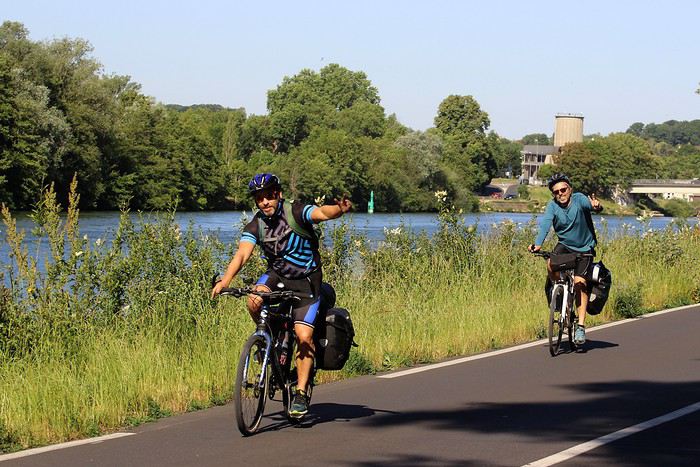


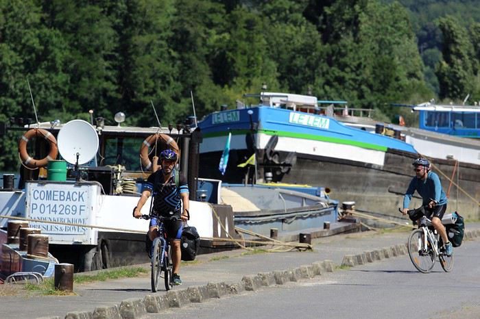
Les stigmates du confinement sont encore visibles: de la rubalise interdit l'accès aux berges. Stigmates ou héritage d'une histoire récente car l'interdiction n'est plus respectée. Le soleil et l'insouciance nous propulsent déjà dans le monde d'après.
Une jolie piste cyclable relie Morêt-sur-Loing à Montargis en longeant le canal du Loing. Nous la parcourons à vive allure, ce qui n'empêche pas Olivier de saluer tous les promeneurs et autres passants que nous croisons... Il va sans dire que nous adressons toutes nos excuses à tous les promeneurs qui se seraient sentis heurtés ou agressés par ces "bonjours" énergiques.


La période de strict confinement est derrière nous. Un rayon de 100 kilomètres pour explorer, les longues sorties à vélo de nouveau autorisées, un lundi de Pentecôte qui nous offre un week-end prolongé... Il n'en fallait pas plus pour fêter à notre façon ce déconfinement ensoleillé. Avec Franckie, et Olivier, nous avons pédalé, campé et nagé, rejoins tous les soirs par JP et ses enfants pour dîner et festoyer. Récit de trois jours, 310 km à vélo, au fil de la Seine, du Loing, du canal du Loing, du canal d'Orléans, de la Loire et de l'Essonne. Un manifeste pour la liberté...
30/05/2020 Jour: 105 km
Départ de Corbeil-Essonnes, le long de la Seine.
Cette route, du moins sur les 40 premiers kilomètres, nous est très familière. Nous l'empruntons fréquemment lors de nos sorties dominicales. Aujourd'hui, c'est différent. Nos vélos sont chargés de tout le matériel de camping nécessaire pour passer des nuits sauvages au bord de l'eau. Aucune contrainte de temps, ce soir, personne ne nous attend. L'objectif est de rester au plus près des fleuves, rivières et canaux que nous allons longer. Les cinquante premiers kilomètres se font donc en bord de Seine. Nous suivons ses boucles avec minutie sur des pistes et chemins aménagés, au cœur d'un décor sauvage et dépaysant.
Les stigmates du confinement sont encore visibles: de la rubalise interdit l'accès aux berges. Stigmates ou héritage d'une histoire récente car l'interdiction n'est plus respectée. Le soleil et l'insouciance nous propulsent déjà dans le monde d'après.
Une jolie piste cyclable relie Morêt-sur-Loing à Montargis en longeant le canal du Loing. Nous la parcourons à vive allure, ce qui n'empêche pas Olivier de saluer tous les promeneurs et autres passants que nous croisons... Il va sans dire que nous adressons toutes nos excuses à tous les promeneurs qui se seraient sentis heurtés ou agressés par ces "bonjours" énergiques.
Visite de ville et stationnement de son vélo de voyage English translation pending
Bonjour,
Plutôt novice en voyage découverte à vélo, je me pose les questions suivantes, ayant plutôt peur du vol.
En fait, je pratique de l'itinérant et en traversant une ville sur mon parcours, j'ai tendance à déambuler à vélo partout dans le centre pour la découvrir, en tant qu'usager de la rue.
Je ne quitte pas mon vélo, sauf s'il s'agit d'une ville étape où la question ne se pose pas, puisque j'ai du temps en fin d'apm et le lendemain matin (le vélo étant parqué sur le lieu d'hébergement) :
Que faites vous de votre vélo tout équipé, lorsque vous prenez un peu de temps pour visiter à pieds le centre historique d'une ville que vous traversez (ou un musée, un château, un jardin botanique ...) ?
Savez vous s'il existe un service de gardiennage gratuit (ou payant ?) des vélos dans les Offices de tourisme en France ou sur les lieux visités ?
Quel est votre expérience ou avis ? Merci pour vos réponses.
Le Nord Pas-de-Calais à vélo avec bivouacs en 2017 English translation pending
Bonjour à toutes et tous. L’année dernière, les dés ont désigné le département du Nord. Et oui, si vous avez lu nos précédentes aventures, vous savez que le choix de la destination est décidé par le hasard des dés. Donc nous voilà une nouvelle fois réunis pour pédaler quelques jours, Mathieu et moi.
Notre matériel est le même a peu de chose prêt, et nous avons la chance de laisser la voiture chez le frère de Mathieu, qui habite Lille. Bon, Mathieu n’a pas été inspiré pour préparer l’itinéraire, donc, nous allons faire au jour le jour. Ce qui explique le double département.
Attention aux âmes sensibles, il se peut qu’il y ait des images contenant des petits feu durant nos bivouacs. Aux personnes facilement influençables et souhaitant reproduire ces ambiances qui semblent joyeuses, sachez qu’elles ne l’étaient pas du tout, et je ne peux que vous déconseiller de faire comme nous. À bons entendeurs, je vous laisse lire nos précédents voyages que vous trouverez sur mon profile, pour comprendre le bien-fondé de cette remarque.
Voici notre voyage en quelques chiffres.
Durée : 4 jours (oui, c’est court, la faute m’incombe)
Distance : ~ 310 km
Dénivelé : ~ 1700m D+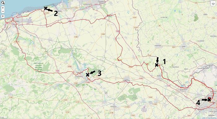
Notre matériel est le même a peu de chose prêt, et nous avons la chance de laisser la voiture chez le frère de Mathieu, qui habite Lille. Bon, Mathieu n’a pas été inspiré pour préparer l’itinéraire, donc, nous allons faire au jour le jour. Ce qui explique le double département.
Attention aux âmes sensibles, il se peut qu’il y ait des images contenant des petits feu durant nos bivouacs. Aux personnes facilement influençables et souhaitant reproduire ces ambiances qui semblent joyeuses, sachez qu’elles ne l’étaient pas du tout, et je ne peux que vous déconseiller de faire comme nous. À bons entendeurs, je vous laisse lire nos précédents voyages que vous trouverez sur mon profile, pour comprendre le bien-fondé de cette remarque.
Voici notre voyage en quelques chiffres.
Durée : 4 jours (oui, c’est court, la faute m’incombe)
Distance : ~ 310 km
Dénivelé : ~ 1700m D+
Concours photo de mai 2020: "Défilés et Cortèges" English translation pending
Salut à tou(te)s.
Gagnant du concours d'avril 2020 il m'échoit de vous proposer celui de mai 2020 :
En ce mois de mai propice aux défilés, surtout le 1er en temps normal (sans pandémie donc sans distanciation physique), je vous propose le sujet du concours de photo du mois « Défilés et Cortèges » avec les précautions suivantes :
Ce sera celui de participants au défilé en nombre, en extérieur, pour une cause explicite dans l'image proposée (pancarte ou slogan, costumes, décor...). Ce ne sera donc ni la déambulation d'une foule, même bigarrée, ni une file d'attente, mais un cortège de rue qu'il soit religieux, militaire, funéraire, festif, revendicatif, exprimant joie ou peine, colère ou détermination. La foule qui peut l'accompagner ne sera pas l'objet central de la photo mais son complément (prouvant son audience). Voir l'introduction de l'article Défilé sur Wikipédia : On l'aura compris : pas de défilé d'animaux, de chars, ni de roches fracturées : des gens qui se réunissent pour une cause explicite, affichant leurs costumes, leurs uniformes.
Exemples : Cortège du Palio de Sienne (août 2012) :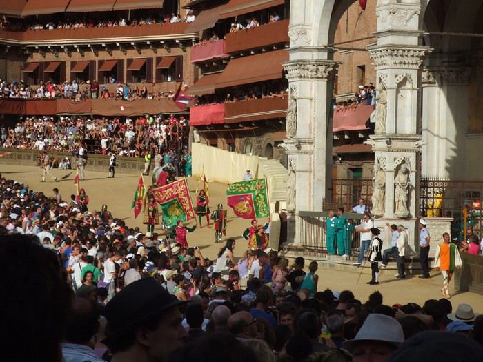
Fête des vignerons 2019 à Vevey, bout de fanfare :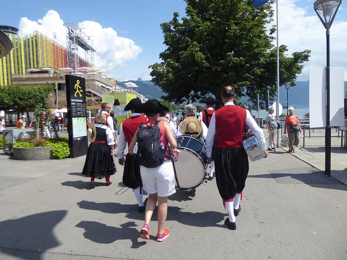
Fête des saintes patronnes de Santa Fiora (Toscane - juillet 2009). Toutes obédiences des autorités municipales à la fin de la procession :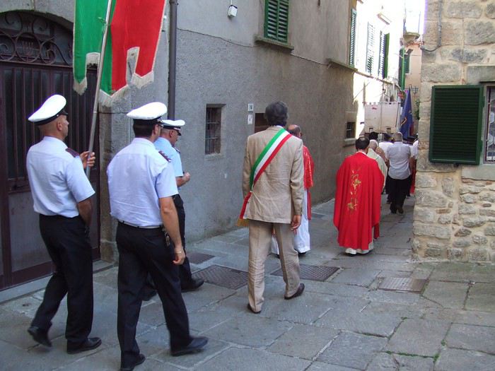
Participation Chaque participant(e) peut proposer jusqu'à 3 photos, et ce jusqu'au vendredi 22/05 à 20h00, heure de Paris. Chaque photo sera présentée dans un seul message, en indiquant son numéro (1, 2 ou 3). Pensez à ajouter une petite explication, commentaire, localisation, date de prise de vue.
Vote Chaque membre VF peut voter pour les 3 photos qu'il ou elle juge les meilleures selon ses propres critères et en tenant compte du thème.
Les votes se feront du samedi 23/05 au vendredi 29/05 à 20h00, heure de Paris. Les photos choisies seront citées dans l'ordre de préférence : - la 1re photo : 3 points - la 2e : 2 points - la 3e : 1 point
Un seul et unique vote pour 3 photos est accepté par membre.
Conclusion Le vainqueur est l'auteur de la photo ayant reçu le plus de points. Les résultats seront publiés le 30/05. En cas d'égalité, le nombre de premières places prévaudra. Le vainqueur aura l'honneur d'organiser le concours du mois de juin.
Le diaporama est là. La discussion est là
À vous de jouer !
En ce mois de mai propice aux défilés, surtout le 1er en temps normal (sans pandémie donc sans distanciation physique), je vous propose le sujet du concours de photo du mois « Défilés et Cortèges » avec les précautions suivantes :
Ce sera celui de participants au défilé en nombre, en extérieur, pour une cause explicite dans l'image proposée (pancarte ou slogan, costumes, décor...). Ce ne sera donc ni la déambulation d'une foule, même bigarrée, ni une file d'attente, mais un cortège de rue qu'il soit religieux, militaire, funéraire, festif, revendicatif, exprimant joie ou peine, colère ou détermination. La foule qui peut l'accompagner ne sera pas l'objet central de la photo mais son complément (prouvant son audience). Voir l'introduction de l'article Défilé sur Wikipédia : On l'aura compris : pas de défilé d'animaux, de chars, ni de roches fracturées : des gens qui se réunissent pour une cause explicite, affichant leurs costumes, leurs uniformes.
Exemples : Cortège du Palio de Sienne (août 2012) :
Fête des vignerons 2019 à Vevey, bout de fanfare :
Fête des saintes patronnes de Santa Fiora (Toscane - juillet 2009). Toutes obédiences des autorités municipales à la fin de la procession :
Participation Chaque participant(e) peut proposer jusqu'à 3 photos, et ce jusqu'au vendredi 22/05 à 20h00, heure de Paris. Chaque photo sera présentée dans un seul message, en indiquant son numéro (1, 2 ou 3). Pensez à ajouter une petite explication, commentaire, localisation, date de prise de vue.
Vote Chaque membre VF peut voter pour les 3 photos qu'il ou elle juge les meilleures selon ses propres critères et en tenant compte du thème.
Les votes se feront du samedi 23/05 au vendredi 29/05 à 20h00, heure de Paris. Les photos choisies seront citées dans l'ordre de préférence : - la 1re photo : 3 points - la 2e : 2 points - la 3e : 1 point
Un seul et unique vote pour 3 photos est accepté par membre.
Conclusion Le vainqueur est l'auteur de la photo ayant reçu le plus de points. Les résultats seront publiés le 30/05. En cas d'égalité, le nombre de premières places prévaudra. Le vainqueur aura l'honneur d'organiser le concours du mois de juin.
Le diaporama est là. La discussion est là
À vous de jouer !
La Dordogne à vélo avec bivouac English translation pending
Bonjour à tous.
Voici que je vais vous présenter le récit de notre troisième périple. Toujours les mêmes protagonistes, c’est-à-dire Mathieu et moi. C’est une nouvelle aventure, mais la même impatience nous tenaille, la même joie des préparatifs la veille du départ et les mêmes papillons dans le ventre quand on prend la route.
Cette année, c’est la Dordogne qui fut désignée par le hasard des dés. Une autre très belle région à découvrir.
Mathieu, à toujours son Bergamon, mais il a abandonné la remorque au profit de belles sacoches artisanales. Dans l’année, j’ai investi dans une nouvelle monture. Un VSF Fahrradmanufaktur TX-Randonneur. C’est un robuste vélo allemand, très bien équipé, avec lequel je m’entraîne depuis le mois de juin. J’y ai rajouté une sacoche de guidon.
Voici notre voyage en quelques chiffres.
Durée : 7 jours
Distance : ~ 484 km
Dénivelé : ~ 5700m D+
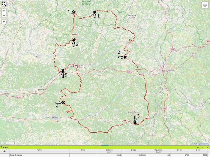
Voici que je vais vous présenter le récit de notre troisième périple. Toujours les mêmes protagonistes, c’est-à-dire Mathieu et moi. C’est une nouvelle aventure, mais la même impatience nous tenaille, la même joie des préparatifs la veille du départ et les mêmes papillons dans le ventre quand on prend la route.
Cette année, c’est la Dordogne qui fut désignée par le hasard des dés. Une autre très belle région à découvrir.
Mathieu, à toujours son Bergamon, mais il a abandonné la remorque au profit de belles sacoches artisanales. Dans l’année, j’ai investi dans une nouvelle monture. Un VSF Fahrradmanufaktur TX-Randonneur. C’est un robuste vélo allemand, très bien équipé, avec lequel je m’entraîne depuis le mois de juin. J’y ai rajouté une sacoche de guidon.
Voici notre voyage en quelques chiffres.
Durée : 7 jours
Distance : ~ 484 km
Dénivelé : ~ 5700m D+
L'hiver au pays des merveilles (Maroc) English translation pending
Bonjour,
Je crains que le forum ne soit morose dans les mois à venir , alors pourquoi ne pas faire un nouveau carnet de voyage . J'ai eu la chance de rentrer du Maroc 2 jours avant la suspension des vols et me retrouve donc, comme vous sans doute , en mode confinement total, chez moi, en Basse-Bretagne , avec quelques centaines de photos de mon dernier séjour à sélectionner, recadrer, retravailler .... On s'occupe comme on peut, alors pourquoi ne pas en faire profiter les Forumeurs ?
Je suis resté au Maroc un mois et j'avais organisé un circuit de 10 nuits / 11 jours pour ma plus jeune fille ( 17 ans ) , mon épouse et la grand- mère, ma chère belle-mère, Mina . Ça correspond aux vacances de février en France .
J'avais donc prévu un voyage " simple" sur le papier, mais qui chaque jour et comme toujours allait nous réserver son lot de découvertes, d'émerveillements, de rencontres, de surprises ....
Au programme :
- Départ de Rabat - 2 nuits à Ouarzazate - 2 nuits à N'kob - 2 nuits à Foum Zguid, avec une longue journée 4X4 au plus profond du désert - 4 nuits à Icht / Borj Biramane et retour sur Rabat
Je vais donc essayer d'éviter des redites avec mes précédents carnets, mais le Maroc a tant de richesses à montrer.....
Rabat est une de mes balades urbaines préférées au Maroc . Je découvre toujours de nouveaux endroits, de jolis détails, des points de vue .... Je vais donc m'y balader avec toujours un plaisir renouvelé
Ma première surprise se passe en médina où je découvre avec étonnement que les autorités ont fait le ménage . Tout ce qui encombrait les rues ( déballages sauvages, marchands de tortues et autres lézards, empiétements sur les trottoirs, la rue , etc.... ) a disparu . Plus rien . Même les commerces " en dur " sont "rentrés dans leurs murs" : plus rien sur la voie publique, pas même une chaise.... Une première au Maroc ?
Si le résultat est plutôt agréable dans la rue des consuls ( rue de l'artisanat ) et la rue Souika ( commerces vestimentaires surtout ) , le boulevard Mohamed V, où régnaient les petits restaurants et gargotes , est désormais mort . Ils ont perdu la quasi-totalité de leur ancienne surface commerciale et ne peuvent plus accueillir que quelques clients à la fois . La rue est tuée et il ne me reste plus qu'à chercher un autre endroit où casser la croûte dans la ville . Ce qui est bénéfique dans une rue ( on peut enfin flâner tranquillement ) est catastrophique dans l'autre ( le commerce est mort et le charme est parti ) . A suivre ....
Bon. C'est comme çà . Ici, dans la rue Souika ( à l'heure de la prière ) . Il y a même des poubelles en plastique positionnées dans la rue !
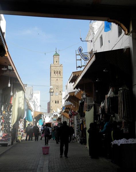
Une autre artère de la médina est la rue Sidi Fatah . Elle donne sur la rue Souika . Une magnifique mosquée y a été restaurée . Si j'en crois mon plan, il s'agit de la mosquée Moulay El Mekki . La porte principale est couverte et on trouve sur chacun des côtés 2 très belles portes ( 4 au total ) . Le minaret octogonal est remarquable . L'ensemble est complété par plusieurs marabout et un peu plus loin se trouve une importante zaouia . C'est vraiment très joli .
L'entrée principale est somptueuse . Le grand art de la peinture sur bois.
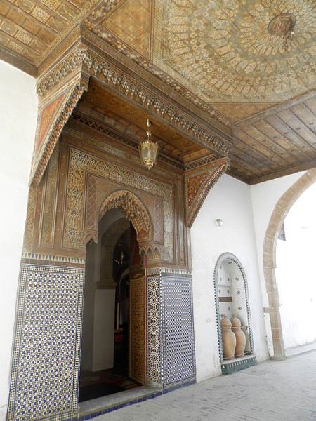
Quelques portes latérales
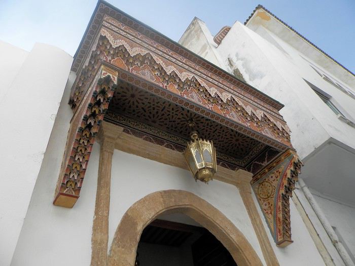
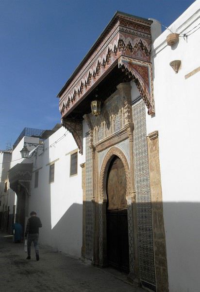
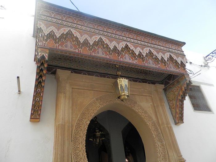
C'est vraiment très agréable de se balader sur la côte atlantique en cette saison ( mi-février ) . Il fait entre 18 et 22 degrés . Temps lumineux . Je n'aurai d'ailleurs pas de pluie pendant un mois ( après avoir eu de la pluie à peu près tous les jours les 5 derniers mois ) : que du bonheur donc ....
Le minaret octogonal
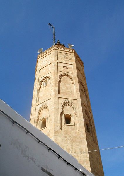
et la rue Sidi Fatah
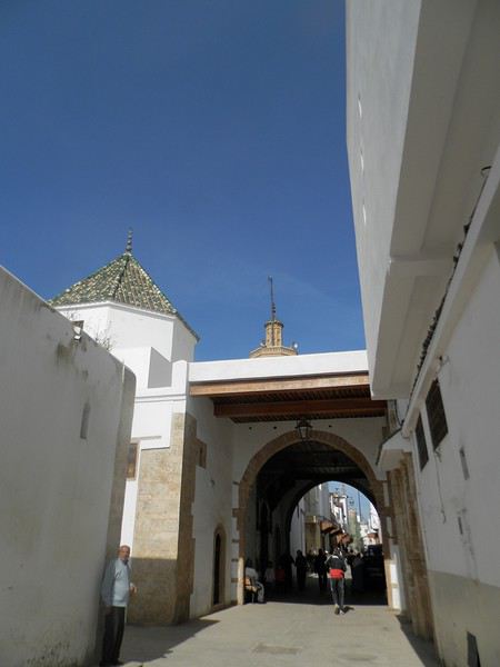
La rénovation des monuments de la médina est presque terminée . La rue des consuls reprend vie, même si les nombreux fondouks de cette rue sont toujours en travaux . J'ai hâte de les revoir . Je déambule dans les ruelles tranquilles , toujours à l’affût de ces détails qui en font le charme .
Une belle oeuvre de street-art accroche mon œil ....
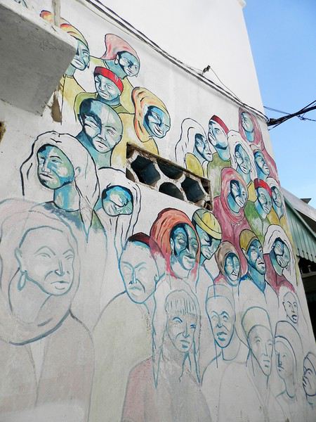
et cette fenêtre a un charme fou .
Cette fois , mes pas me portent vers les quais ( on pourrait presque dire le port ) de Rabat . Je quitte la médina par un jolie porte : l'ensemble , également restauré, est charmant . J'arrive directement sur l'Oued Bou Regreg .
Au cœur de la capitale subsiste un coin " pêche " . Un petit navire est devenu un restaurant-Lounge , plutôt luxueux ( menu à 790 dirhams pour 2 en cette Saint Valentin ) .
Rabat se donne des airs de petite Essaouira avec ses mouettes, ses bateaux, sa médina au fond, ses filets de pêche .... Le même site à l'horizontale .
Au fond, Les Oudayas
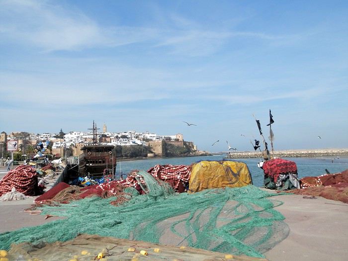
Un " pêche promenade ", me passe sous le nez . C'est mignon . On a envie de le faire la prochaine fois . Il y avait une activité de passeurs entre Rabat et Salé . Mais avec les ponts, le tramway, ..... Certains se sont adaptés , même si çà se fait toujours, plutôt en été ( la plage de Salé est toute proche ) .
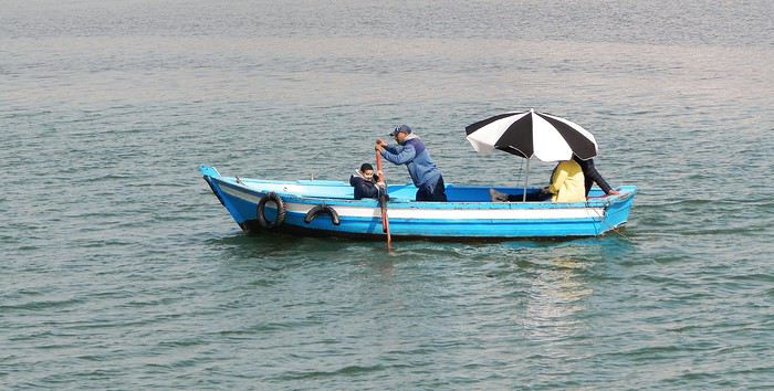
Quelques barques rentrent , les unes après les autres et s'amarrent au ponton, côté Salé . Surement les lointains descendants des redoutables corsaires de Salé . Leur univers a été " explosé" ces dernières années avec l'immense projet d'aménagement de l'oued Bou Regreg . Il leur reste un petit ponton , ..... et juste après, on a construit une grande marina pour accueillir les nouveaux jouets de l'aristocratie locale .
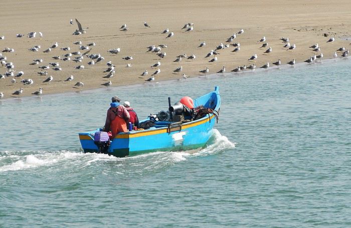
et une autre
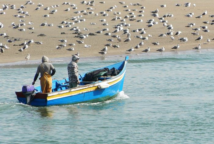
Tout ceci fait un curieux mélange entre une architecture ancestrale et la plus grande modernité ....
Ci-après, à gauche, le médina sur sa falaise, au fond le toit blanc du nouveau " Grand Théâtre de Rabat ), à côté duquel commence à sortir la future tour Mohamed VI qui sera la plus haute d' Afrique , et à droite la marina côté Salé .
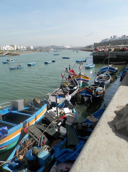
Mais la Kasbah veille toujours sur la capitale
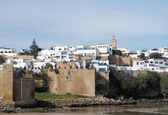
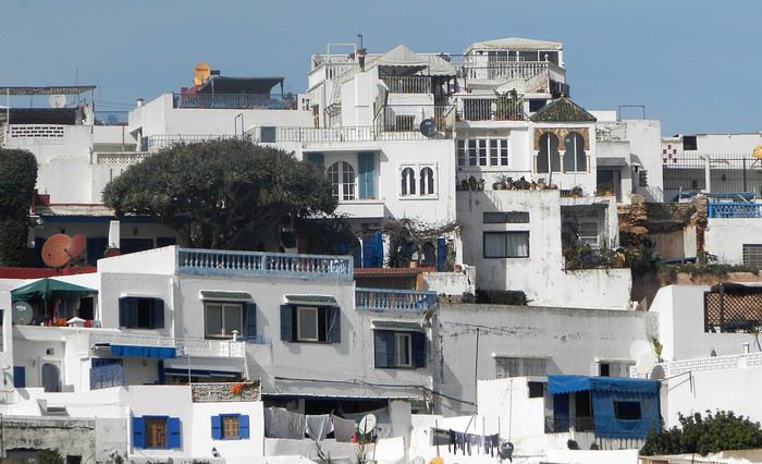
Un dernier regard ...
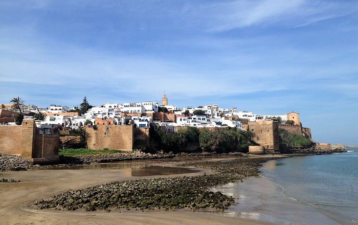
Voila pour ce nouveau coup de projecteur sur la capitale . Faites le détour et surprenez- vous
Demain, j'enfourche ma bonne Dacia Sandero et nous partons à l'assaut de l'Atlas .
Je crains que le forum ne soit morose dans les mois à venir , alors pourquoi ne pas faire un nouveau carnet de voyage . J'ai eu la chance de rentrer du Maroc 2 jours avant la suspension des vols et me retrouve donc, comme vous sans doute , en mode confinement total, chez moi, en Basse-Bretagne , avec quelques centaines de photos de mon dernier séjour à sélectionner, recadrer, retravailler .... On s'occupe comme on peut, alors pourquoi ne pas en faire profiter les Forumeurs ?
Je suis resté au Maroc un mois et j'avais organisé un circuit de 10 nuits / 11 jours pour ma plus jeune fille ( 17 ans ) , mon épouse et la grand- mère, ma chère belle-mère, Mina . Ça correspond aux vacances de février en France .
J'avais donc prévu un voyage " simple" sur le papier, mais qui chaque jour et comme toujours allait nous réserver son lot de découvertes, d'émerveillements, de rencontres, de surprises ....
Au programme :
- Départ de Rabat - 2 nuits à Ouarzazate - 2 nuits à N'kob - 2 nuits à Foum Zguid, avec une longue journée 4X4 au plus profond du désert - 4 nuits à Icht / Borj Biramane et retour sur Rabat
Je vais donc essayer d'éviter des redites avec mes précédents carnets, mais le Maroc a tant de richesses à montrer.....
Rabat est une de mes balades urbaines préférées au Maroc . Je découvre toujours de nouveaux endroits, de jolis détails, des points de vue .... Je vais donc m'y balader avec toujours un plaisir renouvelé
Ma première surprise se passe en médina où je découvre avec étonnement que les autorités ont fait le ménage . Tout ce qui encombrait les rues ( déballages sauvages, marchands de tortues et autres lézards, empiétements sur les trottoirs, la rue , etc.... ) a disparu . Plus rien . Même les commerces " en dur " sont "rentrés dans leurs murs" : plus rien sur la voie publique, pas même une chaise.... Une première au Maroc ?
Si le résultat est plutôt agréable dans la rue des consuls ( rue de l'artisanat ) et la rue Souika ( commerces vestimentaires surtout ) , le boulevard Mohamed V, où régnaient les petits restaurants et gargotes , est désormais mort . Ils ont perdu la quasi-totalité de leur ancienne surface commerciale et ne peuvent plus accueillir que quelques clients à la fois . La rue est tuée et il ne me reste plus qu'à chercher un autre endroit où casser la croûte dans la ville . Ce qui est bénéfique dans une rue ( on peut enfin flâner tranquillement ) est catastrophique dans l'autre ( le commerce est mort et le charme est parti ) . A suivre ....
Bon. C'est comme çà . Ici, dans la rue Souika ( à l'heure de la prière ) . Il y a même des poubelles en plastique positionnées dans la rue !
Une autre artère de la médina est la rue Sidi Fatah . Elle donne sur la rue Souika . Une magnifique mosquée y a été restaurée . Si j'en crois mon plan, il s'agit de la mosquée Moulay El Mekki . La porte principale est couverte et on trouve sur chacun des côtés 2 très belles portes ( 4 au total ) . Le minaret octogonal est remarquable . L'ensemble est complété par plusieurs marabout et un peu plus loin se trouve une importante zaouia . C'est vraiment très joli .
L'entrée principale est somptueuse . Le grand art de la peinture sur bois.
Quelques portes latérales
C'est vraiment très agréable de se balader sur la côte atlantique en cette saison ( mi-février ) . Il fait entre 18 et 22 degrés . Temps lumineux . Je n'aurai d'ailleurs pas de pluie pendant un mois ( après avoir eu de la pluie à peu près tous les jours les 5 derniers mois ) : que du bonheur donc ....
Le minaret octogonal
et la rue Sidi Fatah
La rénovation des monuments de la médina est presque terminée . La rue des consuls reprend vie, même si les nombreux fondouks de cette rue sont toujours en travaux . J'ai hâte de les revoir . Je déambule dans les ruelles tranquilles , toujours à l’affût de ces détails qui en font le charme .
Une belle oeuvre de street-art accroche mon œil ....
et cette fenêtre a un charme fou .
Cette fois , mes pas me portent vers les quais ( on pourrait presque dire le port ) de Rabat . Je quitte la médina par un jolie porte : l'ensemble , également restauré, est charmant . J'arrive directement sur l'Oued Bou Regreg .
Au cœur de la capitale subsiste un coin " pêche " . Un petit navire est devenu un restaurant-Lounge , plutôt luxueux ( menu à 790 dirhams pour 2 en cette Saint Valentin ) .
Rabat se donne des airs de petite Essaouira avec ses mouettes, ses bateaux, sa médina au fond, ses filets de pêche .... Le même site à l'horizontale .
Au fond, Les Oudayas
Un " pêche promenade ", me passe sous le nez . C'est mignon . On a envie de le faire la prochaine fois . Il y avait une activité de passeurs entre Rabat et Salé . Mais avec les ponts, le tramway, ..... Certains se sont adaptés , même si çà se fait toujours, plutôt en été ( la plage de Salé est toute proche ) .
Quelques barques rentrent , les unes après les autres et s'amarrent au ponton, côté Salé . Surement les lointains descendants des redoutables corsaires de Salé . Leur univers a été " explosé" ces dernières années avec l'immense projet d'aménagement de l'oued Bou Regreg . Il leur reste un petit ponton , ..... et juste après, on a construit une grande marina pour accueillir les nouveaux jouets de l'aristocratie locale .
et une autre
Tout ceci fait un curieux mélange entre une architecture ancestrale et la plus grande modernité ....
Ci-après, à gauche, le médina sur sa falaise, au fond le toit blanc du nouveau " Grand Théâtre de Rabat ), à côté duquel commence à sortir la future tour Mohamed VI qui sera la plus haute d' Afrique , et à droite la marina côté Salé .
Mais la Kasbah veille toujours sur la capitale
Un dernier regard ...
Voila pour ce nouveau coup de projecteur sur la capitale . Faites le détour et surprenez- vous
Demain, j'enfourche ma bonne Dacia Sandero et nous partons à l'assaut de l'Atlas .