Results for "Pont+Charles+|+123+>+226"
26381 results found.
Cabarete en République Dominicaine English translation pending
Départ prévu le 10 janvier ..... et plus j'en parle autour de moi et plus les gens me disent que c'est pas terrible lol ... que les plages sont pas jolies, très sauvage, sales etc....
Qu'en pensez-vous ??? Est-ce moins touristique que punta cana ? y a-t-il de jolis sites et plages à visiter à proximité ???? Je me pose pas mal de question ??? Le climat en janvier ???
Merci de m'éclairer car je sais que sur ce forum j'ai à faire à des connaisseurs .....
J'en profite pour vous souhaite de BONNES FETES DE FIN D'ANNEE
bérengère😉
J'en profite pour vous souhaite de BONNES FETES DE FIN D'ANNEE
bérengère😉
Sénégal: température de l'eau et air à Saly en décembre? English translation pending
😏NOUS PARTONS DEBUT DECEMBRE ET NOUS SOMMES FRILEUX SURTOUT DANS L'EAU
MERCI DE VOS RENSEIGNEMENTS
A+
Vos commentaires sur notre itinéraire pour la côte ouest des Etats-Unis English translation pending
Bonjour,
Ci-dessous notre itinéraire pour notre futur trip en octobre. On aimerait profiter un peu limiter la route malgré les kilometres quitte à sacrifier quelques passages (lac powell ???... ). En gros, j'aimerais avoir votre avis sur cette première proposition pour l'affiner et prévoir au mieux ce séjour de reve ! =)
Merci pour votre aide 😛
Date jour Activité 01/10/2005 samedi Arrivé à Los angeles et nuit à palm springs 02/10/2005 dimanche Route vers Grand Canyon 03/10/2005 lundi visite grd canyon puis monument valley 04/10/2005 mardi moab & Bryce 05/10/2005 mercredi Bryce-> Page -> Zion 06/10/2005 jeudi Las Vegas 07/10/2005 vendredi Las Vegas 08/10/2005 samedi death valley 09/10/2005 dimanche Yosemite 10/10/2005 lundi San Francisco 11/10/2005 mardi Monterey 12/10/2005 mercredi Cote et LA 13/10/2005 jeudi Los Angeles 14/10/2005 vendredi Départ France 15/10/2005 samedi
Ci-dessous notre itinéraire pour notre futur trip en octobre. On aimerait profiter un peu limiter la route malgré les kilometres quitte à sacrifier quelques passages (lac powell ???... ). En gros, j'aimerais avoir votre avis sur cette première proposition pour l'affiner et prévoir au mieux ce séjour de reve ! =)
Merci pour votre aide 😛
Date jour Activité 01/10/2005 samedi Arrivé à Los angeles et nuit à palm springs 02/10/2005 dimanche Route vers Grand Canyon 03/10/2005 lundi visite grd canyon puis monument valley 04/10/2005 mardi moab & Bryce 05/10/2005 mercredi Bryce-> Page -> Zion 06/10/2005 jeudi Las Vegas 07/10/2005 vendredi Las Vegas 08/10/2005 samedi death valley 09/10/2005 dimanche Yosemite 10/10/2005 lundi San Francisco 11/10/2005 mardi Monterey 12/10/2005 mercredi Cote et LA 13/10/2005 jeudi Los Angeles 14/10/2005 vendredi Départ France 15/10/2005 samedi
Récit d' un périple dans l'Ouest Canadien English translation pending
Bonjour à tous,
Je viens de rentrer de l Ouest Canadien avec mon épouse ou nous avons passé un agréable séjour🙂 de 22 jours hormis le fait que la totalité de nos valises soient arrivées avec 3 jours de retard😕 (merci British Airways) ! La météo a été assez variable, mais nous n’avons pas eu énormément de pluie, c’est déjà ça, il a fait très beau les 5 derniers jours sur le Pacifique😎. Toutes nos réservations de B&B, même sans avoir versé d’acompte ont été respectées, et nous avons été très bien accueillis, ça me semble une bonne alternative pour celles et ceux qui ne sont pas campeurs. De Vancouver nous sommes montés vers Revelstoke, où nous avons fait un stop au mont Revelstoke (très beau, beaucoup de fleurs), à Roger Pass (grandiose) pour nous rendre ensuite 3 jours sur Golden😉 (Parc Yoho). Nous avons fait Emerald Lake, Wapta Falls, Twin Falls, Takkakaw Falls, O’Hara Lake😉 (montée par Oesa lake Trail puis descente par Yukness Ledges et Opabin East ) Nous nous sommes rendus sur Banff ensuite, où nous avons fait Lake Louise, Agnes Lake (+ Big beehive, à la montée assez pentue), Johnstone Canyon, et Moraine Lake. Sur Yoho et Banff, on aura pu observer plusieurs Wapitis mâles aux bois impressionnants, tamias à tête dorée, pikas, marmottes, chevreuils, mais pas d’ours… La route vers Jasper, Icefield Parkway a été faite sous la pluie, et un temps très bouché😕, (heureusement que nous en avions fait une partie la veille sous le soleil jusque Peyto Lake car nous étions au courant des prévisions du lendemain), donc nous nous sommes pratiquement pas arrêtés au Glacier Athabasca. Sur Jasper, nous avons commencé par le mont Edith Cavell dont le sommet était envahi par les nuages mais le soleil éclairait bien les glaciers Angel et Cavell, ce qui nous a permis de les entendre craquer. C’est très impressionnant !😉 Lors de notre descente, peu avant d’arriver sur la Hwy 93A, et toujours attentif au moindre mouvement dans les forêts, j’aperçois une grande silhouette au fond d’une petite prairie. On stoppe la voiture, et nous apercevons un ours brun (femelle) et son petit😮 ! nous sommes restés à côté de la voiture les observer un petit moment. Nous avons fait Maligne Lake l’après midi et de nouveau aperçu un ours noir en fin de journée aux environs de Jasper😉. Le lendemain, nous sommes allés au lac Annette vers 07h15, et là, nous avons vu une trentaine de Wapitis (femelles et jeunes) regroupés le long du lac, c’était vraiment top. Nous avons fait ensuite Maligne Canyon (du 1er au 5ème pont - très bien) puis Sunwapta et Athabasca Falls (très belles chutes au débit impressionnant, notamment Athabasca). Sur le retour vers Jasper, on a pu observer pendant 1 heure environ un ours noir qui se nourrissait le long de l’Hwy 93, traversant même par 2 fois les voies !!!😄 Nous avons également vu 4 chèvres de montagne à la recherche de minéraux. Le dernier jour su Jasper, nous avons fait la vallée des 5 lacs (bien, notamment le 3ème), puis un peu de repos😇, car nous nous partions chaque jour vers 07h00. Lors du trajet entre Jasper et Clearwater, nous avons bénéficié d’une météo dégagée😎, ce qui nous a permis d’admirer le majestueux Mont Robson, vraiment impressionnant ! d’autant qu’il avait neigé la veille en altitude. Nous avons également fait Rearguard Falls (beau site). Arrivés à Clearwater, nous avons fait un petit survol de 45 minutes au dessus du parc Wells Gray (Helmcken Falls…). Dès notre 1ère rando le lendemain, le long de la rivière Helmcken, nous avons très vite compris que les moustiques sont d’une voracité impressionnante, et ce malgré le répulsif, résultat : une quarantaine de piqûres au soir de l ère journée et une vingtaine pour ma femme🏴☠️. La propiétaire du B&B nous a dit que les pluies abondantes de juin peuvent en être la cause, et elle confirmait qu’il y en avait plus que d’habitude !!! Donc nous avons un peu levé le pied sur les randos dans ce parc et avons fait les deux belles chutes d’eau : Helmcken et Dawson Falls, et vus 2 renards dont un noir et gris. Nous avons ensuite pris la direction de l’île de Vancouver, en passant par les hauts sommets eux aussi encore enneigés, au Nord Est de Vancouver. Nous sommes restés 2 bonnes journées su Pacific Rim, un beau parc, avec notamment deux très belles forêts pluviales, plus préservées que Cathedral Grove selon nous, d’autant que les panneaux indicatifs en français permettent vraiment de comprendre l’écosystème de ces forêts particulières. Nous avons aimé Tofino et Ucluelet, avec leurs petits ports de pêche, les hydravions (nous avons fait un A/R entre Tofino et Clayoquot Sound, c’est vraiment une belle côte, très sauvage, et plein d’ilôts). Sur Campbell River, nous avons fait une sortie en mer, qui ne nous a pas permis d’aller voir les orques, car un avis de tempête est tombé en début de sortie😕, et la houle et les courants étaient trop forts (on s’en souviendra, car étant donné le vent, on décollait littéralement sur les vagues, c’était vraiment impressionnant😉, et mon dos s’en souvient !) Le pilote nous a emmené dans un endroit plus calme afin de voir les aigles à tête blanche (qui attrapent les poissons assomés par la puissance des courants!), ainsi que les phoques. Sur l’île nous avons vue également un jeune ours et un ourson. Retour sur Vancouver pour la dernière demi-journée, ce qui nous a suffi amplement.
Voilà pour ce petit compte rendu de notre périple, où nous en avons pris plein les yeux, tant par les paysages grandioses que par la faune et la flore très préservée, même si les 22 jours sont beaucoup trop courts pour tout découvrir. Merci à ceux qui nous ont aidés à préparer ce voyage, en particulier Vilcanota, qui est un guide à lui tout seul pour les Rockies Canadiennes😉 ! Bon voyage à ceux qui vont partir, car pour nous, c'est la reprise😕. Benoit & Cindy
Je viens de rentrer de l Ouest Canadien avec mon épouse ou nous avons passé un agréable séjour🙂 de 22 jours hormis le fait que la totalité de nos valises soient arrivées avec 3 jours de retard😕 (merci British Airways) ! La météo a été assez variable, mais nous n’avons pas eu énormément de pluie, c’est déjà ça, il a fait très beau les 5 derniers jours sur le Pacifique😎. Toutes nos réservations de B&B, même sans avoir versé d’acompte ont été respectées, et nous avons été très bien accueillis, ça me semble une bonne alternative pour celles et ceux qui ne sont pas campeurs. De Vancouver nous sommes montés vers Revelstoke, où nous avons fait un stop au mont Revelstoke (très beau, beaucoup de fleurs), à Roger Pass (grandiose) pour nous rendre ensuite 3 jours sur Golden😉 (Parc Yoho). Nous avons fait Emerald Lake, Wapta Falls, Twin Falls, Takkakaw Falls, O’Hara Lake😉 (montée par Oesa lake Trail puis descente par Yukness Ledges et Opabin East ) Nous nous sommes rendus sur Banff ensuite, où nous avons fait Lake Louise, Agnes Lake (+ Big beehive, à la montée assez pentue), Johnstone Canyon, et Moraine Lake. Sur Yoho et Banff, on aura pu observer plusieurs Wapitis mâles aux bois impressionnants, tamias à tête dorée, pikas, marmottes, chevreuils, mais pas d’ours… La route vers Jasper, Icefield Parkway a été faite sous la pluie, et un temps très bouché😕, (heureusement que nous en avions fait une partie la veille sous le soleil jusque Peyto Lake car nous étions au courant des prévisions du lendemain), donc nous nous sommes pratiquement pas arrêtés au Glacier Athabasca. Sur Jasper, nous avons commencé par le mont Edith Cavell dont le sommet était envahi par les nuages mais le soleil éclairait bien les glaciers Angel et Cavell, ce qui nous a permis de les entendre craquer. C’est très impressionnant !😉 Lors de notre descente, peu avant d’arriver sur la Hwy 93A, et toujours attentif au moindre mouvement dans les forêts, j’aperçois une grande silhouette au fond d’une petite prairie. On stoppe la voiture, et nous apercevons un ours brun (femelle) et son petit😮 ! nous sommes restés à côté de la voiture les observer un petit moment. Nous avons fait Maligne Lake l’après midi et de nouveau aperçu un ours noir en fin de journée aux environs de Jasper😉. Le lendemain, nous sommes allés au lac Annette vers 07h15, et là, nous avons vu une trentaine de Wapitis (femelles et jeunes) regroupés le long du lac, c’était vraiment top. Nous avons fait ensuite Maligne Canyon (du 1er au 5ème pont - très bien) puis Sunwapta et Athabasca Falls (très belles chutes au débit impressionnant, notamment Athabasca). Sur le retour vers Jasper, on a pu observer pendant 1 heure environ un ours noir qui se nourrissait le long de l’Hwy 93, traversant même par 2 fois les voies !!!😄 Nous avons également vu 4 chèvres de montagne à la recherche de minéraux. Le dernier jour su Jasper, nous avons fait la vallée des 5 lacs (bien, notamment le 3ème), puis un peu de repos😇, car nous nous partions chaque jour vers 07h00. Lors du trajet entre Jasper et Clearwater, nous avons bénéficié d’une météo dégagée😎, ce qui nous a permis d’admirer le majestueux Mont Robson, vraiment impressionnant ! d’autant qu’il avait neigé la veille en altitude. Nous avons également fait Rearguard Falls (beau site). Arrivés à Clearwater, nous avons fait un petit survol de 45 minutes au dessus du parc Wells Gray (Helmcken Falls…). Dès notre 1ère rando le lendemain, le long de la rivière Helmcken, nous avons très vite compris que les moustiques sont d’une voracité impressionnante, et ce malgré le répulsif, résultat : une quarantaine de piqûres au soir de l ère journée et une vingtaine pour ma femme🏴☠️. La propiétaire du B&B nous a dit que les pluies abondantes de juin peuvent en être la cause, et elle confirmait qu’il y en avait plus que d’habitude !!! Donc nous avons un peu levé le pied sur les randos dans ce parc et avons fait les deux belles chutes d’eau : Helmcken et Dawson Falls, et vus 2 renards dont un noir et gris. Nous avons ensuite pris la direction de l’île de Vancouver, en passant par les hauts sommets eux aussi encore enneigés, au Nord Est de Vancouver. Nous sommes restés 2 bonnes journées su Pacific Rim, un beau parc, avec notamment deux très belles forêts pluviales, plus préservées que Cathedral Grove selon nous, d’autant que les panneaux indicatifs en français permettent vraiment de comprendre l’écosystème de ces forêts particulières. Nous avons aimé Tofino et Ucluelet, avec leurs petits ports de pêche, les hydravions (nous avons fait un A/R entre Tofino et Clayoquot Sound, c’est vraiment une belle côte, très sauvage, et plein d’ilôts). Sur Campbell River, nous avons fait une sortie en mer, qui ne nous a pas permis d’aller voir les orques, car un avis de tempête est tombé en début de sortie😕, et la houle et les courants étaient trop forts (on s’en souviendra, car étant donné le vent, on décollait littéralement sur les vagues, c’était vraiment impressionnant😉, et mon dos s’en souvient !) Le pilote nous a emmené dans un endroit plus calme afin de voir les aigles à tête blanche (qui attrapent les poissons assomés par la puissance des courants!), ainsi que les phoques. Sur l’île nous avons vue également un jeune ours et un ourson. Retour sur Vancouver pour la dernière demi-journée, ce qui nous a suffi amplement.
Voilà pour ce petit compte rendu de notre périple, où nous en avons pris plein les yeux, tant par les paysages grandioses que par la faune et la flore très préservée, même si les 22 jours sont beaucoup trop courts pour tout découvrir. Merci à ceux qui nous ont aidés à préparer ce voyage, en particulier Vilcanota, qui est un guide à lui tout seul pour les Rockies Canadiennes😉 ! Bon voyage à ceux qui vont partir, car pour nous, c'est la reprise😕. Benoit & Cindy
Meilleure formule pour visiter les sites historiques en Egypte? English translation pending
coucou!!
je compte emmener ma mère qui reve de visiter l'égypte, cet été, disons début juillet, je me demande quelle est la meilleure formule qui nous permettrait de voir un maximum de sites historiques et archéologiques, hotel ou croisière?? (ma mère n'est pas routarde donc les plans sac à dos ...pas top..)
je m'inquiète de voir les annonces d'agences qui ne nous laissent au fil de l'eau que dans le sud, donc qui ne nous permet pas le caire et ses alentours...en plus de constater que toutes excursions sont hors de prix et en sus du séjour.
est ce quelqu'un connait une bonne agence ? un bon site? une bonne technique?
et tout autre renseignement sur le pays, les habitants, les choses à voir, à éviter, sont la bienvenue.
biz à tous.
je compte emmener ma mère qui reve de visiter l'égypte, cet été, disons début juillet, je me demande quelle est la meilleure formule qui nous permettrait de voir un maximum de sites historiques et archéologiques, hotel ou croisière?? (ma mère n'est pas routarde donc les plans sac à dos ...pas top..)
je m'inquiète de voir les annonces d'agences qui ne nous laissent au fil de l'eau que dans le sud, donc qui ne nous permet pas le caire et ses alentours...en plus de constater que toutes excursions sont hors de prix et en sus du séjour.
est ce quelqu'un connait une bonne agence ? un bon site? une bonne technique?
et tout autre renseignement sur le pays, les habitants, les choses à voir, à éviter, sont la bienvenue.
biz à tous.
Croisière Nil "magie de l'Egypte" Thomas Cook déconseillée English translation pending
Bonjour à tous,
Je reviens d'une croisière sur le Nil, organisée par Thomas Cook. Depart de Louxor jusqu'a Aswan puis retour Louxor.
je deconseille fortement cette croisière. D'une part il nous a été vendu un sejour de 8 jours et 7 nuits. Depart le Samedi retour le Samedi. En fait nous avons decouvert les vols 5 jours avant le depart. Il s'agissait d'un vol depart le Samedi à 22H30...arrivée a Louxor à 4H30 du matin donc une arrivée au bateau vers les 6H30. Là on nous donne la chambre, petit dejeuner et depart à 7H30 pour le visite de la vallée des rois !! et cela correspond donc à notre première nuit de croisière..pas mal!
Ensuite la restauration sur le bateau Adonis etait à peine digne d'une cantine scolaire. D'une part tous les repas sont servis à la place, nous n'avons eu un buffet que pour un seul repas. Votre place à table est imposée, impossible de changer, pour connaitre d'uatres personnes. Et le repas demarre à des horaires strictes signalés par une clochette dans tout le bateau...une vrai pension.
tous les repas nous avions des plats tres simples, avec de la viande ultra cuite et fine, style semelle de chaussure, accompagné de frites mal cuites, ou de legume sans preparation ( riz, petit pois, haricots..), une soupe le soir. Les desserts etaient somptueux, avec un choix entre un jour un buffet de fruit c'est a dire : orange, bananes, peches, et date, ou alors lorsque le chef etait en forme, un flan !!!
Le service etait tres limité, il fallait reclamer plusieurs fois l'ouverture des grands parasols qui necessitait la confirmation d'un chef??? les serveurs n'ayant aucune autonomie pour decider quoique ce soit.
La piscine du bateau etait impropre à la baignade, au bout de 3 jours, l'eau etait pleine de larve de moustique, de plaques suspectes en suspension, comme si les filtres et les produits d'entretien etaient absents.
Le bateau a été renove, c'est essentiellement le hall d'entree, et les chambre, par contre le pont superieur est assez minable, le retaurant ne prete pas au plaisir de le table...
Pour finir la correspondante Thomas Cook sur le bateau, prenommée Simone, ne faisait aucun cas de toutes les recriminations des clients. La boite de commentaires clients etaient pleines en milieu de semaine, et lorsque je lui ai signalé elle m'a repondu que c'etait normal, elle ne la regardait qu'en fin de semaine apres le depart des clients...Impossible de lui faire changer quoi due ce soit. Exemple les menus n'etaient jamais affichés, et comme le service etait à la place, on ne savait jamais ce que l'on allait manger. Les serveurs ne parlant ni bine le Francais ou l'anglais, on ne savait jamais comment organiser son repas.
Bref, heureusement les sites de l'ancienne Egypte sont formidable...la nouvelle ne donne pas envie, la plus part des personnes sur les sites ( gardiens, employé de guichet, etc) sont tres desagreables, et il n'y a que le pourboire qui les interesse...
A vous lire
Jean Pierre
Je reviens d'une croisière sur le Nil, organisée par Thomas Cook. Depart de Louxor jusqu'a Aswan puis retour Louxor.
je deconseille fortement cette croisière. D'une part il nous a été vendu un sejour de 8 jours et 7 nuits. Depart le Samedi retour le Samedi. En fait nous avons decouvert les vols 5 jours avant le depart. Il s'agissait d'un vol depart le Samedi à 22H30...arrivée a Louxor à 4H30 du matin donc une arrivée au bateau vers les 6H30. Là on nous donne la chambre, petit dejeuner et depart à 7H30 pour le visite de la vallée des rois !! et cela correspond donc à notre première nuit de croisière..pas mal!
Ensuite la restauration sur le bateau Adonis etait à peine digne d'une cantine scolaire. D'une part tous les repas sont servis à la place, nous n'avons eu un buffet que pour un seul repas. Votre place à table est imposée, impossible de changer, pour connaitre d'uatres personnes. Et le repas demarre à des horaires strictes signalés par une clochette dans tout le bateau...une vrai pension.
tous les repas nous avions des plats tres simples, avec de la viande ultra cuite et fine, style semelle de chaussure, accompagné de frites mal cuites, ou de legume sans preparation ( riz, petit pois, haricots..), une soupe le soir. Les desserts etaient somptueux, avec un choix entre un jour un buffet de fruit c'est a dire : orange, bananes, peches, et date, ou alors lorsque le chef etait en forme, un flan !!!
Le service etait tres limité, il fallait reclamer plusieurs fois l'ouverture des grands parasols qui necessitait la confirmation d'un chef??? les serveurs n'ayant aucune autonomie pour decider quoique ce soit.
La piscine du bateau etait impropre à la baignade, au bout de 3 jours, l'eau etait pleine de larve de moustique, de plaques suspectes en suspension, comme si les filtres et les produits d'entretien etaient absents.
Le bateau a été renove, c'est essentiellement le hall d'entree, et les chambre, par contre le pont superieur est assez minable, le retaurant ne prete pas au plaisir de le table...
Pour finir la correspondante Thomas Cook sur le bateau, prenommée Simone, ne faisait aucun cas de toutes les recriminations des clients. La boite de commentaires clients etaient pleines en milieu de semaine, et lorsque je lui ai signalé elle m'a repondu que c'etait normal, elle ne la regardait qu'en fin de semaine apres le depart des clients...Impossible de lui faire changer quoi due ce soit. Exemple les menus n'etaient jamais affichés, et comme le service etait à la place, on ne savait jamais ce que l'on allait manger. Les serveurs ne parlant ni bine le Francais ou l'anglais, on ne savait jamais comment organiser son repas.
Bref, heureusement les sites de l'ancienne Egypte sont formidable...la nouvelle ne donne pas envie, la plus part des personnes sur les sites ( gardiens, employé de guichet, etc) sont tres desagreables, et il n'y a que le pourboire qui les interesse...
A vous lire
Jean Pierre
Cyclotourisme au Danemark English translation pending
Bonjour!
Je vais effectuer pour la première fois un voyage à vélo en juin, au Danemark. J'aurai voulu avoir tous les conseils possibles concernant l'équipement, quoi mettre dans les sacoches, les règles de base à vélo, etc.
Merci d'avance!
Lilidh
Je vais effectuer pour la première fois un voyage à vélo en juin, au Danemark. J'aurai voulu avoir tous les conseils possibles concernant l'équipement, quoi mettre dans les sacoches, les règles de base à vélo, etc.
Merci d'avance!
Lilidh
Au sujet du Paraguay English translation pending
bonjour a tous
je me prepare un bon petit trip a la fin de l année en amérique du sud
je recherche un bon plan pour un billet open 1an avec une arrivée sur lima, pour le retour peu importe tant que c est possible, on me parle de 800 a 900 euros chez KLM??
qqun connait il bien le paraguay, ce pays m attire a un point mais j aimerai connaitre vos opinions, je suis persuadé q c magnifique et super posé!!
connaissez vous des plans travail benevolat ds des parcs naturels en bolivie ou paraguay????
merci d'avance!!!!!
bons trips a tous
je me prepare un bon petit trip a la fin de l année en amérique du sud
je recherche un bon plan pour un billet open 1an avec une arrivée sur lima, pour le retour peu importe tant que c est possible, on me parle de 800 a 900 euros chez KLM??
qqun connait il bien le paraguay, ce pays m attire a un point mais j aimerai connaitre vos opinions, je suis persuadé q c magnifique et super posé!!
connaissez vous des plans travail benevolat ds des parcs naturels en bolivie ou paraguay????
merci d'avance!!!!!
bons trips a tous
Carte Air France Club 2000 English translation pending
Bonjour,
quelqu'un peut il me renseigner sur la carte CLUB 2000 Air FRANCE, je sais que c'est le niveau au dessus de Fréquence Rouge mais à combien de miles la donnent ils?Quelles sont les conditions d'attribution?quels en sont les avantages?
Je suis déjà F+Rouge.
Merci pour vos infos.
F
quelqu'un peut il me renseigner sur la carte CLUB 2000 Air FRANCE, je sais que c'est le niveau au dessus de Fréquence Rouge mais à combien de miles la donnent ils?Quelles sont les conditions d'attribution?quels en sont les avantages?
Je suis déjà F+Rouge.
Merci pour vos infos.
F
Que voir avant de mourir? English translation pending
🙂Ce We, je suis tombée sur un livre qui avait à peu près ce titre là... Genre "100 choses à voir ou à vivre dans le monde avant de mourir"... J'ouvre.... curieuse.....
Et là! déception! L'hôtel 4 étoiles de la station super balnéaire, le plus grand palace du monde avec un lit à eau bouillonnante (😐bon, c est rigolo, mais ce serait pas ma dernière volonté non plus...) dans la suite royale plus plus...etc etc... (je précise que c'était à Londres... ce sont donc peut être les choix des anglais 😉)
Je suis sûre qu'à nous tous, on aura AUCUN mal à trouver 100 choses à voir qui nous font rêver POUR DE VRAI...
Voilà mes idées, j'en mets 5 pour vous laisser de la place : les chutes d'Iguacu (mon côté préféré : l'argentin, parce qu'il nous renvoit à notre.... petitesse au sens propre 😉) les fonds sous-marins de Pulau Bunaken (nord de Sulawesi, Indonésie) Rio de Janeiro depuis le Christ Rédempteur quand quelques nuages s'accrochent encore aux Dos Irmaos Venise, la place San Marco sous la neige au petit jour le temple de Borobudur sur Java
A vous!!! (j'ai encore plein d'idées mais bon..) ET QUE CE QUE VOUS AVEZ VU... sinon c est trop facile!!!🙂
Et là! déception! L'hôtel 4 étoiles de la station super balnéaire, le plus grand palace du monde avec un lit à eau bouillonnante (😐bon, c est rigolo, mais ce serait pas ma dernière volonté non plus...) dans la suite royale plus plus...etc etc... (je précise que c'était à Londres... ce sont donc peut être les choix des anglais 😉)
Je suis sûre qu'à nous tous, on aura AUCUN mal à trouver 100 choses à voir qui nous font rêver POUR DE VRAI...
Voilà mes idées, j'en mets 5 pour vous laisser de la place : les chutes d'Iguacu (mon côté préféré : l'argentin, parce qu'il nous renvoit à notre.... petitesse au sens propre 😉) les fonds sous-marins de Pulau Bunaken (nord de Sulawesi, Indonésie) Rio de Janeiro depuis le Christ Rédempteur quand quelques nuages s'accrochent encore aux Dos Irmaos Venise, la place San Marco sous la neige au petit jour le temple de Borobudur sur Java
A vous!!! (j'ai encore plein d'idées mais bon..) ET QUE CE QUE VOUS AVEZ VU... sinon c est trop facile!!!🙂
Financièrement comment faites-vous? English translation pending
Hello tout le monde!
J'en lis des choses intéressantes dans ce forum!🙂
Malgré tout il y a une question que je me pose suite à certains postes où j'ai pu lire que certaines personnes partent tous les deux mois.
Comment faites vous financièrement? Franchement un voyage ça coûte cher! Je pars 5 mois (3 en asie, 3 sem. en Nouvelle-Zélande, 3 semaines en Australie, et le reste entre Hong-Kong, Guilin (en Chine) et enfin Pékin-Moscou en Transsibérien). Cela m'aura coûté CHF 20, 000.00. Tout compris (billets, ass. maladie, médic., etc...). Si j ai pu mettre cet argent de côté c est grâce au fait que je vive depuis 2 ans (retour d'un précédent voyage) chez ma maman et que j'aie économisé un loyer!
Je sais que si je pouvais ce voyage ne serait pas le dernier. Mais si en rentrant, lorsque j aurai retrouvé du travail, je loue un appart, achète qques meubles etc... eh bien pfuiiiiittt les économies. Le salaire moins l'ass. maladie, les impôts, le loyer (et encore pire pour ceux qui ont une voiture!) ne permet plus d'économiser grand chose..🏴☠️
Alors donnez moi votre secret !!! Est ce que vous voyagez sans aller faire aucune visite de site, dormez à la belle étoile etc...😉
Merci pour votre réponse....
Bizzzzz
Diane
J'en lis des choses intéressantes dans ce forum!🙂
Malgré tout il y a une question que je me pose suite à certains postes où j'ai pu lire que certaines personnes partent tous les deux mois.
Comment faites vous financièrement? Franchement un voyage ça coûte cher! Je pars 5 mois (3 en asie, 3 sem. en Nouvelle-Zélande, 3 semaines en Australie, et le reste entre Hong-Kong, Guilin (en Chine) et enfin Pékin-Moscou en Transsibérien). Cela m'aura coûté CHF 20, 000.00. Tout compris (billets, ass. maladie, médic., etc...). Si j ai pu mettre cet argent de côté c est grâce au fait que je vive depuis 2 ans (retour d'un précédent voyage) chez ma maman et que j'aie économisé un loyer!
Je sais que si je pouvais ce voyage ne serait pas le dernier. Mais si en rentrant, lorsque j aurai retrouvé du travail, je loue un appart, achète qques meubles etc... eh bien pfuiiiiittt les économies. Le salaire moins l'ass. maladie, les impôts, le loyer (et encore pire pour ceux qui ont une voiture!) ne permet plus d'économiser grand chose..🏴☠️
Alors donnez moi votre secret !!! Est ce que vous voyagez sans aller faire aucune visite de site, dormez à la belle étoile etc...😉
Merci pour votre réponse....
Bizzzzz
Diane
Shanti India... Une vallée dans l'Himalaya... English translation pending
Namasté 🙂 Pour faire plaisir à certain(e)s, voilà encore de quoi j'espère, vous faire rêver, et vous emmener quelques temps, dans un village haut perché dans l'Himalaya...
"Delhi, le soleil se couche, j’attends le bus qui doit m’emmener dans la vallée de Parvati. Il a du retard, et je ne sais rien faire d’autre qu’attendre… 1h, 1h et demi, 2h, 3h plus tard, enfin on part. Je m’installe au fond du bus, et papote gaiement avec une très sympa hollandaise. On traverse Delhi, les rues bondées de camions, voitures déglinguées, rickshaw, motos, charrettes tirées par des ânes ou des hommes... La poussière vole dans tous les sens. Après deux ou trois heures de route, on s’arrête pour une petite pause. J’aimerais dormir dans ce bus car je n’arriverai dans la Parvati Valley que demain, mais je ne parviens jamais à dormir avec toutes ces bosses et fosses dans les routes… Je demande aux autres voyageurs si personne n’a un somnifère pour moi. Un canadien m’en donne deux. Je remonte dans le bus, avale un des deux cachets, une heure après, je ne dors toujours pas. Je prends le deuxième cachet…
Le lendemain matin… « Miss ? Here Manali! » Hein??? Mais je devais descendre à Bajaura, bien avant!!! Le bus qui redescend s’en va dans 5 minutes, je cours comme une folle, et saute dedans sans même qu’il ne s’arrête. Je paie ma place, et me rendors aussitôt assise… « Miss? Here Bajaura! » Je me réveille et change de bus… Je paie ma place, et me rendors directement… « Miss? Here Birshiani! » J’ouvre les yeux, et ne vois que la route qui s’arrête, pas une maison aux alentours… Le gros village de Birshiani se trouve à quelques centaines de mètres derrière moi. Je demande ou se trouve le village de Kalga, et on me pointe les collines où je vois des villages haut perchés. J’accroche mon sac au dos, et me mets en route… Traverse un mignon petit pont de bois, salue un minuscule édifice dédié à Shiva, et commence à grimper la colline. Pour grimper, ça grimpe… Je m’arrête toutes les 10 minutes, essoufflée comme une bête. Je croise une jolie paysanne et lui demande ou se trouve Kalga. Elle me montre un des deux villages décidément bien haut perchés. Le paysage est incroyable… Des montagnes aux sommets enneigés se découpent sur le ciel bleu, le petit chemin que j’emprunte est bordé de pins de toutes sortes, d’érables, d’épicéas, de bouleaux et puis des rhododendrons, genévriers… Je croise des chevaux dans une clairière, j’hallucine… Sors mon appareil photo, me repose encore, rêve encore non-stop, j’ai du mal à croire que je suis dans une vallée de l’Himalaya. Enfin j’arrive au sommet de la colline, voit les premières maisons du village, reçois des « Namasté » souriants au possible, et leur demande ou se trouve la maison de monsieur Khiltse. On m’indique une grande maison de bois sur pilotis, un peu en dehors du village. Je longe la maison, et appelle Manu, que j’ai rencontré à Bangkok il y a deux mois. Il m’accueille avec un grand sourire, son copain est là (ben oui il est homo) et me dit que j’ai de la chance de les trouver, demain ils partent pour Bénarès quelques semaines. Manu habite ici, il loue une partie de la maison, juste une pièce principale, avec un grand matelas recouvert d’un tas de couvertures, deux ou trois étagères remplies de petits ustensiles de cuisine, de livres et une autre de vêtements. Au milieu de la pièce, un petit four. Un tout petit four, comme une boite en fer avec un trou sur le côté pour mettre le bois, un trou recouvert d’une plaque au-dessus pour une casserole, d’ailleurs du riz est en train de cuire, et de l’autre côté s’échappe une buse qui mène au plafond. C’est déjà la fin de l’après midi. J’ai mis un temps fou pour monter jusqu’ici. Je devrais être en pleine forme après avoir dormi autant de temps dans les bus, mais Manu me dit que nous sommes à 2900 mètres, normal donc que je n’ai pas trop d’énergie… Nous sommes ravis de nous revoir, et papotons gaiement en coupant les légumes. Le repas prêt, on s’installe sur la terrasse à même le plancher, l’assiette sur les genoux. Je crevais de faim, Manu tenait un restaurant dans la banlieue parisienne, il a tout quitté pour vivre ici, je le comprends !!! Son petit plat est un festin, sans épices torrides, je me régale. Comme ils partent le lendemain, il m’invite à rester ici le temps que je veux, et m’explique le fonctionnement de son petit chez lui. La salle de bain? La petite rivière est à deux mètres de la maison, le bidon d’eau est là, et pour la toilette, c’est derrière les rochers, que j’aperçois derrière le champ ou un paysan et son buffle labourent la terre.Après un petit thé, nous faisons chauffer l’eau pour la vaisselle, et dans une grande bassine, petit à petit la vaisselle se termine. Une bouteille d’eau à la main, je vais dire bonjour aux rochers, et retourne chez Manu installer mon hamac pour la nuit. Des bougies pour seule lumière, perchée dans mon hamac un peu au-dessus du lit, je n’ai pas envie de dormir, bien enroulée dans une grosse couverture, qu’est ce que je suis bien… Je regarde le ciel étoilé et l’ombre des montagnes à travers les grandes fenêtres… Rzzz…"
"Delhi, le soleil se couche, j’attends le bus qui doit m’emmener dans la vallée de Parvati. Il a du retard, et je ne sais rien faire d’autre qu’attendre… 1h, 1h et demi, 2h, 3h plus tard, enfin on part. Je m’installe au fond du bus, et papote gaiement avec une très sympa hollandaise. On traverse Delhi, les rues bondées de camions, voitures déglinguées, rickshaw, motos, charrettes tirées par des ânes ou des hommes... La poussière vole dans tous les sens. Après deux ou trois heures de route, on s’arrête pour une petite pause. J’aimerais dormir dans ce bus car je n’arriverai dans la Parvati Valley que demain, mais je ne parviens jamais à dormir avec toutes ces bosses et fosses dans les routes… Je demande aux autres voyageurs si personne n’a un somnifère pour moi. Un canadien m’en donne deux. Je remonte dans le bus, avale un des deux cachets, une heure après, je ne dors toujours pas. Je prends le deuxième cachet…
Le lendemain matin… « Miss ? Here Manali! » Hein??? Mais je devais descendre à Bajaura, bien avant!!! Le bus qui redescend s’en va dans 5 minutes, je cours comme une folle, et saute dedans sans même qu’il ne s’arrête. Je paie ma place, et me rendors aussitôt assise… « Miss? Here Bajaura! » Je me réveille et change de bus… Je paie ma place, et me rendors directement… « Miss? Here Birshiani! » J’ouvre les yeux, et ne vois que la route qui s’arrête, pas une maison aux alentours… Le gros village de Birshiani se trouve à quelques centaines de mètres derrière moi. Je demande ou se trouve le village de Kalga, et on me pointe les collines où je vois des villages haut perchés. J’accroche mon sac au dos, et me mets en route… Traverse un mignon petit pont de bois, salue un minuscule édifice dédié à Shiva, et commence à grimper la colline. Pour grimper, ça grimpe… Je m’arrête toutes les 10 minutes, essoufflée comme une bête. Je croise une jolie paysanne et lui demande ou se trouve Kalga. Elle me montre un des deux villages décidément bien haut perchés. Le paysage est incroyable… Des montagnes aux sommets enneigés se découpent sur le ciel bleu, le petit chemin que j’emprunte est bordé de pins de toutes sortes, d’érables, d’épicéas, de bouleaux et puis des rhododendrons, genévriers… Je croise des chevaux dans une clairière, j’hallucine… Sors mon appareil photo, me repose encore, rêve encore non-stop, j’ai du mal à croire que je suis dans une vallée de l’Himalaya. Enfin j’arrive au sommet de la colline, voit les premières maisons du village, reçois des « Namasté » souriants au possible, et leur demande ou se trouve la maison de monsieur Khiltse. On m’indique une grande maison de bois sur pilotis, un peu en dehors du village. Je longe la maison, et appelle Manu, que j’ai rencontré à Bangkok il y a deux mois. Il m’accueille avec un grand sourire, son copain est là (ben oui il est homo) et me dit que j’ai de la chance de les trouver, demain ils partent pour Bénarès quelques semaines. Manu habite ici, il loue une partie de la maison, juste une pièce principale, avec un grand matelas recouvert d’un tas de couvertures, deux ou trois étagères remplies de petits ustensiles de cuisine, de livres et une autre de vêtements. Au milieu de la pièce, un petit four. Un tout petit four, comme une boite en fer avec un trou sur le côté pour mettre le bois, un trou recouvert d’une plaque au-dessus pour une casserole, d’ailleurs du riz est en train de cuire, et de l’autre côté s’échappe une buse qui mène au plafond. C’est déjà la fin de l’après midi. J’ai mis un temps fou pour monter jusqu’ici. Je devrais être en pleine forme après avoir dormi autant de temps dans les bus, mais Manu me dit que nous sommes à 2900 mètres, normal donc que je n’ai pas trop d’énergie… Nous sommes ravis de nous revoir, et papotons gaiement en coupant les légumes. Le repas prêt, on s’installe sur la terrasse à même le plancher, l’assiette sur les genoux. Je crevais de faim, Manu tenait un restaurant dans la banlieue parisienne, il a tout quitté pour vivre ici, je le comprends !!! Son petit plat est un festin, sans épices torrides, je me régale. Comme ils partent le lendemain, il m’invite à rester ici le temps que je veux, et m’explique le fonctionnement de son petit chez lui. La salle de bain? La petite rivière est à deux mètres de la maison, le bidon d’eau est là, et pour la toilette, c’est derrière les rochers, que j’aperçois derrière le champ ou un paysan et son buffle labourent la terre.Après un petit thé, nous faisons chauffer l’eau pour la vaisselle, et dans une grande bassine, petit à petit la vaisselle se termine. Une bouteille d’eau à la main, je vais dire bonjour aux rochers, et retourne chez Manu installer mon hamac pour la nuit. Des bougies pour seule lumière, perchée dans mon hamac un peu au-dessus du lit, je n’ai pas envie de dormir, bien enroulée dans une grosse couverture, qu’est ce que je suis bien… Je regarde le ciel étoilé et l’ombre des montagnes à travers les grandes fenêtres… Rzzz…"
Devises, transports, logement au Cambodge English translation pending
bonjour à tous
j'espère aller au cambodge cet été (juillet-août) et ne connais pas encore ce pays.
je suis à la recherche de tout info (vol, hébergement, lieux, etc) pour mettre en place ce voyage de 3 semaines environ.
qq questions pratiques: les euros sont-ils utilisés couramment tout comme au vietnam? la demande de visa en france est-elle longue? les déplacements sur place sont-ils aisés?
merci de vos lumières!
à bientôt
agnès
j'espère aller au cambodge cet été (juillet-août) et ne connais pas encore ce pays.
je suis à la recherche de tout info (vol, hébergement, lieux, etc) pour mettre en place ce voyage de 3 semaines environ.
qq questions pratiques: les euros sont-ils utilisés couramment tout comme au vietnam? la demande de visa en france est-elle longue? les déplacements sur place sont-ils aisés?
merci de vos lumières!
à bientôt
agnès
Maroc: Premières traces atlastiques English translation pending
Extrait de mon premier ... et dernier essai d'écriture de voyage.
C'était lors de mes premiers pas dans l'Atlas marocain ... il y a fort longtemps.
Entre ces lignes à la syntaxe hésitante et leur parution ici, je suis retourné une vingtaine de fois dans l'Atlas. C'est dire la sympathie que j'éprouve pour ce milieu ...
Ne me demandez pas pourquoi je ne me lasse pas de ce milieu au point d'y retourner régulièrement et parfois sur de longs mois. Il y a autre chose en plus de la diversité et la beautée de ces paysages (tout n'est pas cailloux et poussière comme le secteur parcouru ces jours là) et de l'extrème sympathie et gentillesse de la population berbère de l'Atlas, une vibration interne, dès que je foule ces sentiers, que je ne saurais décrire .
Si d'aucuns veulent sortir des sentiers atlastiques trop fréquentés par les "treks-Opérators" et guides locaux, faites moi signe. Je me ferai un plaisir de vous donner des infos sur une vallée très attachante.
- --
( ... ) ANERGUI- Ayt Khoya
Maison de la famille Fouzal.
La nuit est douce, sans lune. Si j’en crois les ronflements qui s’élèvent jusqu’à la terrasse, mes hôtes sont déjà dans les bras de Morphée. Du petit lait, du pain, du thé, des amandes offerts avant leur coucher, une lanterne pour éclairer la suite des traces écrites de ce périple atlastique, le décor est planté.
Anergui, un endroit où l'on va... et non un endroit où l'on passe ! Depuis Ouaouizerth, la vallée est uniquement accessible à pied ou à dos de mulet. Un isolement qui préserve ce petit havre de quiétude et de fraîcheur, tapi au pied d’une falaise en forme parfaite de fer à cheval, dominée par les 3243 mètres du djebel Mourik. On y vit à l’écart des grandes voies de passage, dans la terre, de la terre, adaptant ses besoins à ses maigres richesses, et laissant couler lentement les jours gais ou tristes que verse la volonté divine.
Quelques très rares passes dans des éboulis en pans inclinés, boisés sommairement de chênes verts, permettent de franchir ce rempart continu, formé par un colossal mouvement orogénique. L’itinéraire d’accès le plus court passe par Tillouguitte, Tamga et Tizi n’Ouanergui. C’est celui que nous avons emprunté avant hier avec Mohammed. Une belle dizaine d’heures de marche étaient prévues au départ de Tillouguitte. En nous faisant déposer par un camion avant le pont de Tamga nous avons évité la piste poussiéreuse, gagné trois heures et entamé une marche d’approche du col bien agréable le long de la rivière Ahensal, à l’ombre des pins d’Alep.
Cinq petits hameaux, quelques maisons individuelles éparses et igherman, les “greniers fortifiés familiaux “, toujours construit sur les pentes pour une protection indispensable contre les crues, mais aussi par besoin vital de réserver à la culture la plus petite parcelle disponible, forment l'habitat des Ayt Anergui.
Tout au fond du creuset une manne permanente en provenance d'Imilchil et du plateau des lacs arrose par séguias interposées les cultures de la vallée. L’Assif Melloul, la “rivière blanche”, serpente dans le relief, trouve la faille à l’ouest et évite l’obstacle Mourik. Nous sommes à 1500 mètres. L’altitude n’autorise pas les palmiers, mais une agriculture de subsistance et, les bonnes années, le minimum alimentaire: blé, orge, maïs et aussi des noyers, des amandiers, pêchers, pommiers et quelques légumes.
Le final en beauté de mon errance atlastique était vaguement prévu dans les gorges du Dades ou du Thodra. Depuis Thinerir ou Boulmane n’Dades, la fascinante place Djmâa el Fna et les souks de Marrakech, à peine entrevus lors de mon arrivée, ne sont plus qu’à une journée de bus ! Mais il me faut d’abord atteindre le versant sud du massif. Depuis Anergui il y a de nombreux itinéraires pour rejoindre Boulmane. Toutefois, pour un étranger à ce milieu, le plus sûr et plus court chemin pour atteindre les versants sud – 3 jours au rythme d’un roumi porteur de sac à dos – est la grande piste muletière foulée régulièrement par les commerçants qui se rendent du souk es Sebt deM’semrirau souk el Khemis d’Anergui, et inversement. J’y trouverais toujours du monde et de l’aide en cas de besoin.
C’était l’option retenue à mon arrivée dans cette vallée. Mais au « thé-apéritif » de midi, j’ai vite deviné que le roumi, moi en l’occurrence, devenait sujet de délibération entre Mohammed, son père et son oncle.
Pendant le tagine la discussion a marqué une pause. C’est qu’ici on parle peu en mangeant. Le plat étant commun à tous les convives, celui qui parle trop … mange moins.
Au « thé-digestif », entre deux claquements de langue marquant son approbation sur la qualité du breuvage, Mohammed m’a proposé de m’accompagner sur une partie du trajet. Le mulet de son cousin porterait les bagages. J’ai bien sûr accepté. On ne fait pas la fine bouche devant une proposition qui dispense du portage de dix sept kilos de sac à dos. Et puis, après réflexion, vu qu’en plus du mulet je pouvais bénéficier aussi des services d’un fonctionnaire près à se dégourdir les jambes dans les montagnes de son enfance, pourquoi ne pas se lancer sur des sentiers moins "battus" ?
La description de Kousser et des conditions de vie des éleveurs sur ces terres ingrates rapportées hier par Mohammed, m’avait déjà mis l’eau à la bouche … et la carte sous les yeux. J’ai ainsi pu observer que la traversée de ce plateau pouvait, en deux jours, mener à Zawiat Ahensal. De là il est encore possible, par un petit crochet de deux jours suplémentaires, de rejoindre M’semrir. Rien d’insurmontable somme toute car je me sens en jambes. Cependant mon manque de connaissance du milieu, et cette grande (! ! !) sagesse qui m’habite m’interdisaient de me lancer seul sur cet itinéraire incertain. Mais après la proposition de Mohammed, la donne était différente. S’il voulait bien m’accompagner jusqu’à Zawiat Ahensal au lieu de la vallée d’Imdrhas, l’occasion était à saisir !
Au « thé-apéritif » du soir, je leur ai fait ma nouvelle proposition d'itinéraire. Pendant que nos doigts prenaient peu à peu la délicate teinte rouge safranée de la sauce tagine la discussion a cessé, comme il se doit, mais quatre verres de « thé-digestif » doivent aider à la réflexion car au dernier la décision était prise .
« Mohammed t’accompagnera jusqu’à Zawia, et au-delà si tu veux ».
Le père avait parlé, l’oncle approuvait et Mohammed traduisait. La sécurité d’un étranger sur les terres de la tribu est aussi affaire de son hôte.
Ce qui était dit devait être fait.
Il est plus de minuit, nous partons tout à l'heure à six heures...
Est-ce bien raisonnable ?
TAGHIA
Mon intention de passer ce hameauet de poser bivouac dans Bou Ighaln après avoir franchi le Jbel Timghazine, était-elle trop matinale ? En tous cas elle n’a pas su résister à l’appel de la petite plate-forme herbeuse qui domine la rivière à l’entrée des gorges. Me voilà à l’abri d’une éventuelle crue. Ce serait con de me retrouver à l’entrée de Zawia à trois heures du matin flottant sur mon karimat.
C’était le dernier conseil de Mohammed avant de nous séparer ce matin. Ne pas se fier à une météo, aussi clémente soit-elle au moment d’installer un bivouac. Un orage arrive vite, et la crue qui s’en suit peut-être dévastatrice, surtout à la sortie de telles gorges.
Mohammed a rebroussé chemin ce matin après que nous ayons passé la nuit à Zawia Ahensal chez un ami de son père. Il compte refaire en une journée la montée à Kousser et sa traversée. Un trajet qui nous a demandé deux belles journées de marche à l’aller. Il faut dire que lui montera sur le mulet sur la quasi totalité de l’itinéraire, ce qu’il n’a sans doute pas osé faire quand nous étions ensemble et que je tenais absolument à marcher.
C’est donc la reprise de mon aventure solitaire dans ces montagnes. Avec des provisions pour trois jours, un ravitaillement possible à Oussikis, des semelles en bon état et un moral à toute épreuve, c’est plus qu’il n’en faut pour atteindre Boulmane n’Dades.
J’ai bien aimé la ballade de ce matin depuis la Zawia . Trois heures de promenade bucolique le long de la petite rivière qui se jette plus bas dans l’assif Ahensal à travers vergers et parcelles cultivées d’orge ou peut-être de blé, je ne sais pas comment les différencier, ont suffit pour rejoindre les maisons de terre rouge de Taghia. Et puis il y a eu les falaises vertigineuses qui font face au village, et dans lesquelles je me vois déjà accroché avec mes potes grimpeurs, la transparence de l’eau, la proximité des vergers le vert profond des petites terrasses étagées sur les pentes soulignées de coquelicots et puis cette petite place herbeuse, là entre le village et les gorges, et loin la-bas le col que je devais franchir. Cela vaut bien l’octroi d’une demi-journée de contemplation.
Sieste, promenade dans les gorges et toilette complète dans la rivière, ont donc remplacé avantageusement la programmation du départ. La rivière charrie beaucoup de bois et le plaisir de la veillée autour du feu de bivouac, non encore éprouvé dans ces montagnes, est si grand que je laisse filer sereinement les heures habituellement dédiées au sommeil réparateur.
Qu’il est doux de pouvoir gérer son temps et son rythme ! On en a si peu l’occasion dans notre vie "speedée" de citadin européen qu’il ne faut pas négliger l’opportunité. Je ne m’accorderai cependant de fantaisies qu’avec l’emploi du temps. L’itinéraire conseillé par mon hôte de la veille sera suivi à la lettre. Du moins en ai-je l’intention au moment où j’écris. Sans guide ni topo, les points de passage principaux que m’a indiqué notre hôte d’hier soir ne seront peut-être pas si évidents à trouver. Surtout si comme cela semble être le cas, au-delà du col je retrouve un terrain similaire à Kousser, sans points de repères et des traces multiples de déplacements de troupeaux qui partent dans tous les sens. Quel contraste entre les vallées comme Anergui et Zawia Ahensal où les dépôts alluvionnaires et la volonté des hommes à travailler la terre en font de fertiles oasis de montagne, et la désolation minérale de Kousser !
Ce plateau d’altitude présente des signes inquiétants de déboisement. Vaincue par le climat et les pasteurs acharnés à sa perte pour la survie de leurs troupeaux, la végétation est poussée dans ses derniers retranchements.
Au milieu des pierres, des buissons épineux et des squelettes difformes de leurs congénères, il ne résiste plus que quelques genévriers thuryfères centenaires. Pas d’eau autre que celle un peu croupie de deux sources misérables. Si elles m’ont inquiété au point d’y diluer quelques cachets d’hydroclonazone, elles doivent pourtant faire le bonheur des hommes et du bétail habitant cette austère contrée,
Pour un Franc-comtois, même d’adoption, qui n’a connu que les forêts vosgiennes et les verts pâturages alpins, le premier contact physique avec cette désolation minérale est impressionnant. Néanmoins ce milieu a pour moi quelque chose d’attirant. Je sais déjà que j’y reviendrai.
D’ici là il me reste à rejoindre Oussikis et Boulmane. Il est donc temps de trouver le sommeil.
Jbel Timghazine
Le soleil avait déjà franchi la crête quand j’ai ouvert la tente. La surprise n’est apparue que lorsque mes yeux se sont habituées à la belle luminosité matinale. Posés sur une pierre à coté du foyer, deux œufs frais et une petite galette d’orge attendaient patiemment mon réveil. Je doute que beaucoup de ²sans-abri² aient souvent fait la même trouvaille, en sortant de leurs cartons après une nuit sous les ponts de la Seine.
Après un petit déjeuner copieux, la cuisson des œufs pour la route et une toilette vivifiante dans l’eau glacée, j’ai entamé le sentier raide et sinueux dans les pentes du Jbel Timghazine sans avoir pu remercier mon mystérieux et généreux donateur.
Trois heures plus tard, dépouillé d’une grande partie de ma bonne forme matinale, je pose mon sac au pied d’un genévrier squelettique et centenaire. La vue quasi aérienne sur le village de Taghia explique les deux litres de sueur que je viens de laisser dans la pente. Plus au loin, en suivant les méandres de la rivière et les cultures en terrasses, apparaissent les silhouettes des magnifiques ksours des chorfas de Zawiat Ahensal déjà prisonnières de la brume de chaleur. De l’autre coté … premier aperçu sur les grandes pentes délavées des contreforts sud de cet Atlas oriental. La traversée de Kousser n’aurait-elle été qu’une misérable mise en jambes avant l’exil de pierres, terre et poussière qui se présente en contrebas ?
J’ai vidé une gourde mais l’autre est presque pleine. C’est suffisant pour une petite soupe ce soir et un café demain matin, mais tiendra-t-elle jusqu’au bivouac si je ne trouve rien d’autre à boire cet après-midi ? Par mesure de précaution, je commence à mettre en pratique la technique du moissonneur en période de ramadan : le petit cailloux dans la bouche qui aide à saliver. Tant qu’il reste de la salive !
J’ai admiré une dernière fois l’imposant massif du Jbel Aroudane qui domine Zawiat Ahensal, en me promettant d’en faire le tour lors d’une prochaine virée. Après avoir bien ajusté le sac à dos sur les épaules et serré la ceinture ventrale, je me suis lancé dans la pente en courant. Bien imprudent quand j’y pense maintenant !
En perpétuelle recherche de l’équilibre perdu sur les pierres qui roulaient sous les semelles, j’ai dévalé, les quatre cents mètres de dénivelé. Quand j’ai repris pied sur la terre ferme j’ai eu l’impression d’être encore poussé par mon élan. Pendant longtemps encore la foulée est restée longue et alerte. Curieusement, la petite angoisse que j’avais eue en voyant ce qui m’attendait depuis le col avait totalement disparue. J’éprouvais au contraire une très agréable sensation de liberté qui semblait stimuler mes capacités physiques mises à mal dans la sévère ascension matinale. Pourtant Oussikis était encore bien loin, quelque part là-bas vers le sud-est, au bout de cette trace qui semblait ne mener nulle part ailleurs que dans les cailloux et la poussière,
Rappel que la demi-douzaine de figues sèches et la barre énergétique avalées au col manquent de sucres lents, le rythme a faibli vers le milieu de l’après-midi. Dans le même temps mes épaules me faisaient savoir qu’elles auraient plaisir à être soulagées quelques minutes. Il était temps d’alléger mon sac à dos d’une boite de sardines et une ou deux tartines de « Vache qui rit », le seul fromage -mais est-ce bien du fromage ?- trouvé au souk d’Anergui.
J’étais plongé dans ces pensées sans grande teneur philosophique, quand j’ai eu la frousse de la décennie !
Ils couraient dans ma direction et m’ont cloué sur place. Le palpitant à cent quarante, les poils au garde à vous et la sueur gelée sur le front, j’ai ramassé deux parpaings pour le premier qui dépasserait le périmètre de sécurité … si j’en avais le temps !
Les deux chiens galeux se sont arrêtés à quatre ou cinq mètres de moi en grognant et aboyant tous crocs dehors. En une fraction de seconde j’ai revu toute cette scène du film ²La guerre du feu², quand les trois héros pourchassés par des lions passent la nuit sur un arbre avec les fauves à leurs pieds.
Certes je n’avais pas à faire à des lions, mais je n’avais pas non plus de genévrier sous la main. Le dernier tronc contre lequel je m’étais appuyé était là-haut sur le col !
Il m’a semblé un peu puéril d’essayer de les amadouer en leur racontant cette histoire drôle, et j’ai opté pour la fermeté. Je m’apprêtais à casser les dents du premier quand …
Zorro est arrivé éhéééé ! ! ! ! ! !
Non, je délire. C’est l’émotion du souvenir ! Ou le soleil et l’altitude. Je ne sais pas.
D’abord sur ma gauche, deux claquements coup sur coup, secs et très brefs ont retenti. Puis il y a eu les sifflements et la poussière soulevée par les impacts entre moi et les chiens. La hausse était ajustée. Deux autres cailloux sont tombés. L’un entre les deux horreurs, l’autre a atteint sa cible. Kaïkaïkaï, faisait celle qui courait en boitant, tandis que l’autre reculait, mais toujours en aboyant.
Mes mollets devaient leur salut à la descendance berbère de Thierry La Fronde !
Deux jeunes garçons m’ont rejoint. Ils m’ont dévisagé avec la curiosité que je pourrai montrer le jour de ma rencontre avec un petit homme vert.
- Salamaleikoum.
- Salamaleikoum ... (Silence) Mani abrid n’Oussikis ?
Tilla taghbalout ? »
Comme j’ai longuement travaillé la prononciation de cette formule -la première que j’ai apprise dans ces montagnes pour éviter que l’on retrouve un jour un petit tas d’os de roumi à coté de son sac à dos- ils ont compris tout de suite.
Oui, c’était bien le chemin d’Oussikis mais au geste de la main, j’ai compris que je n’étais pas encore rendu ! Oui, il y avait bien une source dans les parages et ils se proposaient de m’y emmener. Le plus âgé m’a fait signe de le suivre tandis que son petit compère s’en allait retrouver le troupeau, accompagné par les chiens qui ne semblaient pas très rancuniers.
Etonnant ! A cinq minutes de l’endroit de notre rencontre, derrière un monticule sur lequel quelques petites chèvres noires et trois dromadaires broutaient des cailloux, deux tentes et une belle combe verdoyante signalaient la présence de l’eau. Me voilà prévenu, inutile de sucer des petits cailloux avant de m’être assuré qu’il n’y a pas de crottes de biques dans un rayon de cinq kilomètres. Qui dit biquette, dit forcément taghbalout.
Mon jeune sauveur m’a prié de m’asseoir sous la première tente. Il a allumé les branches sèches d’un buisson, et posé dans les flammes une bouilloire noire de suie. Pendant que l’eau chauffait, il est allé jusqu’à l’autre tente. Quelques instants plus tard, il en revenait avec une fille portant baluchon sur le dos. Un baluchon braillard dérangé dans sa sieste par la visite d’un fâcheux.
Une fois de plus, j’ai pu mesurer le sacré de l’hospitalité de ces montagnards. Un roumi passe, comme passe un commerçant, un nomade ou un fquih. Leurs ventres sont peut-être vides et ils ont besoin de forces et de repos pour continuer leur chemin ; alors on se doit de partager sa pitance, fusse-t-elle maigre, et son toit.
Mon ventre était vide, en effet, mais pas mon sac à dos !
Je me serais contenté d’une petite halte à la source, le temps d’avaler mes deux œufs durs et une boite de sardines à la tomate, mais dehors, la fille s’activait déjà. Quand j’ai réalisé, il était trop tard. L’eau tiède coulait dans le puits de farine. Une pierre plate avait remplacé la bouilloire sur les braises et attendait la pâte que malaxaient déjà des mains expertes.
Le garçon a fini la préparation du thé et a servi un verre de thé. Un seul.
Soudain je me suis rappelé. Que faire ? Que dire ? Envahi d’une gêne terrible je regardais le verre posé devant moi. Je n’y avais encore pas touché que déjà la fille tendait la galette brûlante au garçon.
Eux qui n’avaient pas mangé depuis l’aube et suceraient leur soif jusqu’au soleil disparu, m’offraient du thé et me cuisaient du pain alors que c’était le ramadan !
Il a coupé la galette en quatre. Il a posé les morceaux à coté du verre sur le papier bleu qui ici emballe les pains de sucre et m’a invité à manger. Bismillah, baraka Allah illik. Dans ces circonstances je ne sais rien dire d’autre. J’ai bu et j’ai mangé pendant qu’ils me regardaient en souriant.
Qu’Allah, puisque vous y croyez, vous le rende au centuple.
Au moment de les quitter, il m’a encore prié de prendre le pain qui restait. J’ai sorti un des deux œufs, une boite de sardines, une poignée d’amandes et deux portions de ²Vache qui rit². J’ai laissé le tout sur une pierre à coté du foyer et je suis parti.
Je n’avais pas encore rejoint la trace où nous nous étions rencontrés, quand le garçon m’a rattrapé. De son propos je n’ai compris que ²Taghbalout², mais c’était suffisantje partais sans refaire le plein de ma gourde ! Nous sommes revenus vers le campement. A ma surprise, au lieu d’aller à la source nous nous sommes dirigés vers l’autre tente où il m’a une fois encore, invité à m’asseoir.
La fille et le bébé emmailloté étaient là. Elle, un beau sein à l’air, mais qui ne m’était pas destiné, lui visiblement affamé s’y accrochait avidement. Devant ma réticence à m’asseoir de nouveau, mon sauveur à la fronde me montre quelque chose à l’extrémité de la dépression. Une silhouette féminine en amazone sur un baudet s’éloignait dans les reliefs du terrain. J’ai compris qu’il avait envoyé une autre femme chercher de l’eau à la source et … qu’il était inutile d’insister ! Je n’avais plus qu’à partager leur natte en attendant qu’elle revienne, et à laisser filer mes pensées en direction de cette jolie et souriante jeune mère qui, sans aucune gêne devant moi, allaitait son enfant.
Qui prétend que les femmes berbères sont farouches face aux étrangers ?
L’heure tournait et j’attendais avec impatience le retour de ma chercheuse d’eau pour reprendre la route. J’ai prétexté une cigarette que je ne voulais pas fumer en leur présence et je suis sorti de la tente pour regarder dans la direction où je l’avais vu s’éloigner. Il n’y avait personne sur le chemin. Avisant que la source était peut-être plus éloignée que je ne croyais, je me suis avancé un peu sur la trace.
J’ai repensé à ce marchand de Marrakech qui me disait il y a quelques jours : « Roumi, quand tu arrives au Maroc jette ta magana. ». Un fonctionnaire d’Anergui m’a bien reconfirmé plus tard que, dans ce milieu, il est bon de « savoir se patienter », mais que voulez vous, il est des vieux démons dont on a du mal à se débarrasser !
Le jeune m’a rejoint et entraîné à l’écart du chemin. Je ne comprenais plus rien car il insistait pour monter sur un petit promontoire à l’écart du chemin. Depuis le sommet de la bosse, j’avais une belle vue rétrospective sur le chemin parcouru depuis le col et surtout, après que le garçon m’ait montré au loin, très loin, la petite chaîne que je devais encore franchir, j’ai mieux apprécié le chemin qu’il me restait à couvrir ! C’est pour cela qu’il m’a entraîné là-haut. Gestes et petits dessins dans la terre à l’appui, j’ai fini par comprendre que les bergers de ce secteur atteignent Oussikis en une journée et que, chargé comme j’étais, ce serait une grosse bavante. Alors il m’invitait à passer la nuit chez lui.
Derrière le petit massif, après le Tizi n’Idikel, il y a selon le garçon des sources et d’autres campements. Mais d’ici là …
Voilà pourquoi je vais passer ma première nuit sous une tente de nomades et que j’ai eu largement le temps de faire ce résumé de la journée.
AQQA N’WAROUGHOULT
Hier, comme pour m’aider à soigner mon impatience, la femme, l’âne et les bidons ne sont revenus qu’en fin d’après midi. Trois heures pour le plein d’eau et l’aller-retour.
Et quel plein ! Un jerrican de 25 litres dans un panier du chouari, cinq anciens bidons d’huile Lesieur dans l’autre panier pour équilibrer, quatre autres bidons, plus petits pendus de chaque coté et, trois dans un drap savamment enroulé sur les épaules de la p’tite dame ! Soit quelques soixante dix litres d’eau. Visiblement elle ne doit pas avoir envie d’y retourner tous les jours...
Quatre heures de l’après-midi. Le corps est enfin au repos.
Ce matin, avant de prendre congé de mes hôtes, j’ai mis ma montre hors de portée dans une boite au fond du sac. Promis madame, je ne la ressortirai que la veille du départ. J’ai bien retenu la leçon, mais comprenez moi aussi… j’ai un avion à prendre !
Au-delà des difficultés gastriques de la nuit passée, je réalise finalement la chance que j’ai eu hier en croisant deux molosses galeux intéressés par mes dodus mollets. Il m’eût fallu sucer beaucoup de petits cailloux pour parvenir à préserver l’eau nécessaire au bivouac du soir. Certes ils sont légion dans les parages, mais pour la soif, j’avoue préférer quelque chose de moins solide !
Au départ de ce matin, mes jambes étaient plus lourdes à traîner que le sac à dos. Il m’a fallu les ménager en adoptant le rythme lent d’un arthrosé de la hanche (avec tout le respect que je porte pour les malheureux qui souffrent de ce mal). Malgré le manque de point d’ombre pour une petite sieste réparatrice, j’ai atteint sans trop de dommage les campements de l’aqqa n’ waroughoult.
Heureusement, je n’ai pas eu de difficultés de ²navigation². La trace à suivre était simple : Trois heures plein sud jusqu’au pied de la petite barrière repérée la veille avec Mustapha et qui paraissait ne jamais se rapprocher, une heure et demi de montée sur un chemin inconfortable et heureusement pas trop abrupt, autant de descente pour franchir l’obstacle et laisser définitivement derrière moi, du moins je l’espère, cet immense champ de cailloux.
J’ai installé ma tente à distance respectable du campement, rencontré les femmes à la source, et refusé poliment aux maris alertés du passage d’un étranger, l’invitation à manger et dormir sous leur khaïmas. Il faut dire que je ne tiens pas plus que cela à repartager une nuit de ramadan dans les mêmes conditions que la précédente !
Malgré les chants et les rythmes des taadlount, j’ai trouvé un peu longue la moitié de la nuit passée à manger de la bouillie d’orge au beurre rance, à tremper du pain dans l’huile d’olive et à boire des litres de thé sucré à en achever un diabétique. Interminable aussi l’autre moitié de la nuit dédiée à renvoyer, par différents orifices opposés, ce que mon organisme refusait obstinément de garder ; c’est à dire la totalité de ce que j’avais avalé.
A qui la faute ? La fatigue ? Non. Hier, j’étais très loin d’un tel épuisement. Un coup de soleil ? Je n’en ai jamais attrapé de ma vie et j’ai connu des expositions plus dures que ce printemps berbère. L’huile d’olive ? J’ai déjà eu souvent l’occasion les jours précédents d’y tremper le pain et les doigts et j’aime bien. L’eau ? Ah …peut-être. Que reste-t-il ? Le beurre rance !
Le beurre … l’eau ? L’eau ou ce putain de beurre rance ? Je ne pose pas longtemps la question et désigne coupable ce dernier. En total accord avec moi même, je vote unanimement sa suppression de mon régime des jours à venir. Il doit certainement être délicieux pour un palais averti et assimilable par un organisme entraîné à ce type d’agression, mais cela ne m’ emballe plus que ça. Surtout, je pourrai m’en passer plus facilement que d’une eau, même croupie, dans laquelle il est toujours possible de tremper quelques cachets d’hydroclonazone en cas de doute.
Voilà pourquoi, sans pouvoir l’expliquer, j’ai tout à l’heure refusé, avec le sourire, l’hospitalité berbère. Ils ont dû me prendre pour un sauvage ingrat.
OUSSIKIS
Le dos bien calé contre un tronc de peuplier au bord de la rivière, le verre de thé à porté de main, la gamelle sur le feu et les doigts de pied en bouquet de violettes, je me demande finalement si ce que j’aime dans la randonnée ce n’est pas surtout l’après randonnée…
Je repense à ma divine surprise au réveil après la longue nuit réparatrice dans les pâturages de l’aqqa n’ waroughoult.
Deux petits sourires timides ont accueilli la tête hirsute qui venait de quitter les bras de Morphée. Assises sagement non loin de ma tente, deux gamines attendaient patiemment mon réveil pour m’offrir l’éternelle et excellente galette d’orge cuite à la pierre. Les parents visiblement ne m’ont pas tenu rigueur du refus de leur hospitalité hier après-midi.
La forme retrouvée, du pain encore tiède pour mon petit déjeuner, et la perspective d’être à M’semrir ce soir, la journée commençait mieux que la veille. Les deux barres de céréales énergétiques que je leur ai tendues et ma dernière orange ont prestement disparu dans le fichu en laine que l’une d’elles portait sur son dos. A voir leurs mines réjouies, les mômes n’ont pas semblé mécontentes de l’échange. Les petits cabris malingres dont elles ont la garde non plus tant ils mordaient à belles dents les derniers morceaux du premier des trois pains que je porte depuis la Zawia.
Les fillettes sont restées là jusqu’à mon départ. Redevenues espiègles, ne ratant pas un de mes gestes, elles les commentaient en sourdine comme si elles craignaient que je comprenne leurs propos. Elles m’ont ensuite suivi pendant un moment, poussant les cabris devant elles en leur jetant des cailloux et force petits cris, certainement du langage caprin que je serais bien incapable d’imiter
Comme la plupart des traces utilisées par les bergers dans ces montagnes, celle qui à usé les semelles de mes chaussures aujourd’hui n’est pas indiquée sur la carte ; aussi, après un rapide coup d’œil pour estimer le temps et le chemin qu’il restait à parcourir, n’ai-je pas jugé utile ce matin de la garder à portée de main. Devant mon quart en fer blanc, l’itinéraire était évident : suivre la déclinaison de l’aqqa n’ waroughoult jusqu’à son ouverture sur le plateau d’Oussikis.
Le pas était allègre ; et délectable la sensation d’être beaucoup plus gaillard que la veille. Une bonne nuit sans beurre rance, du pain frais, quelques tapis herbeux, une belle source suivie d’un petit, mais bien sympathique ru, et les sourires féminins croisés dans cet agréable vallon ont suffi à rendre débordante l’énergie nécessaire à ce début de journée : je serais à Oussikis au pire dans le milieu de l’après-midi.
De l’optimisme il en faut, bien sûr, mais point trop. Avec lui s’installe l’insouciance. La suite m’a démontré que je péchais par excès.
Il était plus de midi et, au rythme suivi, le paysage aurait déjà du changer. Or je naviguais encore dans de grands méandres, entre des bosses caillouteuses piquées ça et là de tirlist, et zébrées de centaines de traces. Mais de troupeau oualouet de bergers non plus, qui pouvaient m’en dire un peu plus sur ma situation géographique. En pensant à ce petit filet d’eau qui disparaissait de temps en temps dans les accidents du terrain pour ressurgir plusieurs centaines de mètres plus loin, j’ai gravi un de ces promontoires pour avoir une vue plus dominante et réconfortante, du moins je l’espérais, de la suite des événements. J’aurais du m’inquiéter quand il n’a plus refait surface. La disparition des marques de fer à mulet, dans les dizaines de traces de nos amis caprins aurait du m’alarmer également. J’aurais pu aussi me soucier des petites variations observées sur la nature du terrain, mais que j’avais mises sur le compte d’une lecture matinale et (trop ?) rapide de la carte.
Si j’avais …
Mais avec des "si" il paraît qu’on peut mettre Lutèce en amphore. Je me suis dit que j’essaierais une autre fois. Ce n’était pas mon souci du moment. J’ai remplacé les lamentations par une boite de sardines à la tomate et au piment, les deux dernières portions de « vache qui rit », une barre énergétique et deux belles gorgées d’eau presque fraîche.
Les pensées sont plus claires quand on a le ventre plein et la vue s’améliore, c’est chose bien connue ! Oussikis était là. Je devrais dire là-bas. Il n’y avait pas d’erreur, M’semrir était derrière. Le seul problème étant que ma boussole me faisait gentiment remarquer que je regardais vers l’Ouest.
Je l’ai cru sur parole, elle n’a jamais menti. Cela voulait dire que j’avais largement dérivé vers l’Est ! Il ne restait plus alors à répondre à une question. Allais-je faire demi-tour jusqu’à retomber sur l’endroit où j’avais quitté le vallon principal, ou rectifier le cap depuis ma salle à manger et filer droit par monts et par vaux ? L’expression prenant là tout son sens.
Toujours prêt pour de nouvelles aventures, j’ai été tenté par les vaux et les monts. Mais combien de ces derniers aurais-je eu à franchir jusqu’à retrouver la piste muletière invisible au fond des premiers? J’ai donc opté pour une "retraite positive" et à l’heure où j’écris je me félicite de la sagesse du choix.
Une heure plus tard, je retrouvais des traces de mulet et mon filet d’eau cabotin. Au loin, deux formes vagues fréquentaient la même trace que j’avais suivie le matin. Dans sa progression, l’une d’elles s’est dédoublé, un peu comme la très fameuse histoire des petits pains il y a une vingtaine de siècles. Rapidement les trois formes prenaient l’apparence d’un tri pattes et deux quadrupèdes. C’était finalement deux baudets menés au bâton, et sans ménagement, par un monsieur sans âge ... et sans dents ; du moins sur le devant. Je n’ai pas eu l’occasion d’approfondir l’inspection. L’état du burnous témoignait de la difficulté des conditions de vie du propriétaire. La peau de son visage était plus tannée et craquelée que celle qui dépassait du chouari d’un des petits ânes et il était aussi sec qu’un Justin Bridou. Pardon, la comparaison pouvant paraître mal placée pour un musulman, sec comme son bâton de berger, me semble une comparaison plus appropriée. Il était chaussé de deux morceaux de pneu, Good Year peut-être, mais je le jurerais pas. Entre les lanières de cuir qui maintenaient cette originale, mais certainement très efficace protection, débordaient de robustes appendices, noirs, tordus et crevassés. Ils devaient, à une autre époque, ressembler à des orteils.
A en juger par la vitesse à laquelle je me suis fait rejoindre, la forme physique de l’ensemble ne semble toutefois pas souffrir des apparences !
« B’jou M’ssiou ». Il ne s’est pas mis au garde à vous, mais la main portée rapidement à hauteur de son turban révélait la récente "pacification" effectuée dans ces montagnes par les militaires français. De la phrase qui a suivi son salut, je n’ai compris que barda et arioul. Mais ce fut suffisant pour que j’accepte l’invitationà soulager mes frêles épaules. Sans demander aux baudets, déjà passablement chargés, lequel acceptait de porter le sac à dos, mon énergique papy a chargé le plus petit, certainement le plus robuste. En matière de baudet j’ai pensé que je pouvais lui faire confiance et ne me suis pas opposé au choix. Comme quoi, encore une fois, il ne faut jamais se fier aux apparences !
Finalement, même si je traînais encore sur les sentiers à l’heure où je devais faire la sieste au bord de la rivière, je ne m’en suis pas trop mal sorti sur ce coup là. Trois heures, malheureusement sans beaucoup d’échanges possibles, ont suffit pour rejoindre Oussikis.
( .... )
C'était lors de mes premiers pas dans l'Atlas marocain ... il y a fort longtemps.
Entre ces lignes à la syntaxe hésitante et leur parution ici, je suis retourné une vingtaine de fois dans l'Atlas. C'est dire la sympathie que j'éprouve pour ce milieu ...
Ne me demandez pas pourquoi je ne me lasse pas de ce milieu au point d'y retourner régulièrement et parfois sur de longs mois. Il y a autre chose en plus de la diversité et la beautée de ces paysages (tout n'est pas cailloux et poussière comme le secteur parcouru ces jours là) et de l'extrème sympathie et gentillesse de la population berbère de l'Atlas, une vibration interne, dès que je foule ces sentiers, que je ne saurais décrire .
Si d'aucuns veulent sortir des sentiers atlastiques trop fréquentés par les "treks-Opérators" et guides locaux, faites moi signe. Je me ferai un plaisir de vous donner des infos sur une vallée très attachante.
- --
( ... ) ANERGUI- Ayt Khoya
Maison de la famille Fouzal.
La nuit est douce, sans lune. Si j’en crois les ronflements qui s’élèvent jusqu’à la terrasse, mes hôtes sont déjà dans les bras de Morphée. Du petit lait, du pain, du thé, des amandes offerts avant leur coucher, une lanterne pour éclairer la suite des traces écrites de ce périple atlastique, le décor est planté.
Anergui, un endroit où l'on va... et non un endroit où l'on passe ! Depuis Ouaouizerth, la vallée est uniquement accessible à pied ou à dos de mulet. Un isolement qui préserve ce petit havre de quiétude et de fraîcheur, tapi au pied d’une falaise en forme parfaite de fer à cheval, dominée par les 3243 mètres du djebel Mourik. On y vit à l’écart des grandes voies de passage, dans la terre, de la terre, adaptant ses besoins à ses maigres richesses, et laissant couler lentement les jours gais ou tristes que verse la volonté divine.
Quelques très rares passes dans des éboulis en pans inclinés, boisés sommairement de chênes verts, permettent de franchir ce rempart continu, formé par un colossal mouvement orogénique. L’itinéraire d’accès le plus court passe par Tillouguitte, Tamga et Tizi n’Ouanergui. C’est celui que nous avons emprunté avant hier avec Mohammed. Une belle dizaine d’heures de marche étaient prévues au départ de Tillouguitte. En nous faisant déposer par un camion avant le pont de Tamga nous avons évité la piste poussiéreuse, gagné trois heures et entamé une marche d’approche du col bien agréable le long de la rivière Ahensal, à l’ombre des pins d’Alep.
Cinq petits hameaux, quelques maisons individuelles éparses et igherman, les “greniers fortifiés familiaux “, toujours construit sur les pentes pour une protection indispensable contre les crues, mais aussi par besoin vital de réserver à la culture la plus petite parcelle disponible, forment l'habitat des Ayt Anergui.
Tout au fond du creuset une manne permanente en provenance d'Imilchil et du plateau des lacs arrose par séguias interposées les cultures de la vallée. L’Assif Melloul, la “rivière blanche”, serpente dans le relief, trouve la faille à l’ouest et évite l’obstacle Mourik. Nous sommes à 1500 mètres. L’altitude n’autorise pas les palmiers, mais une agriculture de subsistance et, les bonnes années, le minimum alimentaire: blé, orge, maïs et aussi des noyers, des amandiers, pêchers, pommiers et quelques légumes.
Le final en beauté de mon errance atlastique était vaguement prévu dans les gorges du Dades ou du Thodra. Depuis Thinerir ou Boulmane n’Dades, la fascinante place Djmâa el Fna et les souks de Marrakech, à peine entrevus lors de mon arrivée, ne sont plus qu’à une journée de bus ! Mais il me faut d’abord atteindre le versant sud du massif. Depuis Anergui il y a de nombreux itinéraires pour rejoindre Boulmane. Toutefois, pour un étranger à ce milieu, le plus sûr et plus court chemin pour atteindre les versants sud – 3 jours au rythme d’un roumi porteur de sac à dos – est la grande piste muletière foulée régulièrement par les commerçants qui se rendent du souk es Sebt deM’semrirau souk el Khemis d’Anergui, et inversement. J’y trouverais toujours du monde et de l’aide en cas de besoin.
C’était l’option retenue à mon arrivée dans cette vallée. Mais au « thé-apéritif » de midi, j’ai vite deviné que le roumi, moi en l’occurrence, devenait sujet de délibération entre Mohammed, son père et son oncle.
Pendant le tagine la discussion a marqué une pause. C’est qu’ici on parle peu en mangeant. Le plat étant commun à tous les convives, celui qui parle trop … mange moins.
Au « thé-digestif », entre deux claquements de langue marquant son approbation sur la qualité du breuvage, Mohammed m’a proposé de m’accompagner sur une partie du trajet. Le mulet de son cousin porterait les bagages. J’ai bien sûr accepté. On ne fait pas la fine bouche devant une proposition qui dispense du portage de dix sept kilos de sac à dos. Et puis, après réflexion, vu qu’en plus du mulet je pouvais bénéficier aussi des services d’un fonctionnaire près à se dégourdir les jambes dans les montagnes de son enfance, pourquoi ne pas se lancer sur des sentiers moins "battus" ?
La description de Kousser et des conditions de vie des éleveurs sur ces terres ingrates rapportées hier par Mohammed, m’avait déjà mis l’eau à la bouche … et la carte sous les yeux. J’ai ainsi pu observer que la traversée de ce plateau pouvait, en deux jours, mener à Zawiat Ahensal. De là il est encore possible, par un petit crochet de deux jours suplémentaires, de rejoindre M’semrir. Rien d’insurmontable somme toute car je me sens en jambes. Cependant mon manque de connaissance du milieu, et cette grande (! ! !) sagesse qui m’habite m’interdisaient de me lancer seul sur cet itinéraire incertain. Mais après la proposition de Mohammed, la donne était différente. S’il voulait bien m’accompagner jusqu’à Zawiat Ahensal au lieu de la vallée d’Imdrhas, l’occasion était à saisir !
Au « thé-apéritif » du soir, je leur ai fait ma nouvelle proposition d'itinéraire. Pendant que nos doigts prenaient peu à peu la délicate teinte rouge safranée de la sauce tagine la discussion a cessé, comme il se doit, mais quatre verres de « thé-digestif » doivent aider à la réflexion car au dernier la décision était prise .
« Mohammed t’accompagnera jusqu’à Zawia, et au-delà si tu veux ».
Le père avait parlé, l’oncle approuvait et Mohammed traduisait. La sécurité d’un étranger sur les terres de la tribu est aussi affaire de son hôte.
Ce qui était dit devait être fait.
Il est plus de minuit, nous partons tout à l'heure à six heures...
Est-ce bien raisonnable ?
TAGHIA
Mon intention de passer ce hameauet de poser bivouac dans Bou Ighaln après avoir franchi le Jbel Timghazine, était-elle trop matinale ? En tous cas elle n’a pas su résister à l’appel de la petite plate-forme herbeuse qui domine la rivière à l’entrée des gorges. Me voilà à l’abri d’une éventuelle crue. Ce serait con de me retrouver à l’entrée de Zawia à trois heures du matin flottant sur mon karimat.
C’était le dernier conseil de Mohammed avant de nous séparer ce matin. Ne pas se fier à une météo, aussi clémente soit-elle au moment d’installer un bivouac. Un orage arrive vite, et la crue qui s’en suit peut-être dévastatrice, surtout à la sortie de telles gorges.
Mohammed a rebroussé chemin ce matin après que nous ayons passé la nuit à Zawia Ahensal chez un ami de son père. Il compte refaire en une journée la montée à Kousser et sa traversée. Un trajet qui nous a demandé deux belles journées de marche à l’aller. Il faut dire que lui montera sur le mulet sur la quasi totalité de l’itinéraire, ce qu’il n’a sans doute pas osé faire quand nous étions ensemble et que je tenais absolument à marcher.
C’est donc la reprise de mon aventure solitaire dans ces montagnes. Avec des provisions pour trois jours, un ravitaillement possible à Oussikis, des semelles en bon état et un moral à toute épreuve, c’est plus qu’il n’en faut pour atteindre Boulmane n’Dades.
J’ai bien aimé la ballade de ce matin depuis la Zawia . Trois heures de promenade bucolique le long de la petite rivière qui se jette plus bas dans l’assif Ahensal à travers vergers et parcelles cultivées d’orge ou peut-être de blé, je ne sais pas comment les différencier, ont suffit pour rejoindre les maisons de terre rouge de Taghia. Et puis il y a eu les falaises vertigineuses qui font face au village, et dans lesquelles je me vois déjà accroché avec mes potes grimpeurs, la transparence de l’eau, la proximité des vergers le vert profond des petites terrasses étagées sur les pentes soulignées de coquelicots et puis cette petite place herbeuse, là entre le village et les gorges, et loin la-bas le col que je devais franchir. Cela vaut bien l’octroi d’une demi-journée de contemplation.
Sieste, promenade dans les gorges et toilette complète dans la rivière, ont donc remplacé avantageusement la programmation du départ. La rivière charrie beaucoup de bois et le plaisir de la veillée autour du feu de bivouac, non encore éprouvé dans ces montagnes, est si grand que je laisse filer sereinement les heures habituellement dédiées au sommeil réparateur.
Qu’il est doux de pouvoir gérer son temps et son rythme ! On en a si peu l’occasion dans notre vie "speedée" de citadin européen qu’il ne faut pas négliger l’opportunité. Je ne m’accorderai cependant de fantaisies qu’avec l’emploi du temps. L’itinéraire conseillé par mon hôte de la veille sera suivi à la lettre. Du moins en ai-je l’intention au moment où j’écris. Sans guide ni topo, les points de passage principaux que m’a indiqué notre hôte d’hier soir ne seront peut-être pas si évidents à trouver. Surtout si comme cela semble être le cas, au-delà du col je retrouve un terrain similaire à Kousser, sans points de repères et des traces multiples de déplacements de troupeaux qui partent dans tous les sens. Quel contraste entre les vallées comme Anergui et Zawia Ahensal où les dépôts alluvionnaires et la volonté des hommes à travailler la terre en font de fertiles oasis de montagne, et la désolation minérale de Kousser !
Ce plateau d’altitude présente des signes inquiétants de déboisement. Vaincue par le climat et les pasteurs acharnés à sa perte pour la survie de leurs troupeaux, la végétation est poussée dans ses derniers retranchements.
Au milieu des pierres, des buissons épineux et des squelettes difformes de leurs congénères, il ne résiste plus que quelques genévriers thuryfères centenaires. Pas d’eau autre que celle un peu croupie de deux sources misérables. Si elles m’ont inquiété au point d’y diluer quelques cachets d’hydroclonazone, elles doivent pourtant faire le bonheur des hommes et du bétail habitant cette austère contrée,
Pour un Franc-comtois, même d’adoption, qui n’a connu que les forêts vosgiennes et les verts pâturages alpins, le premier contact physique avec cette désolation minérale est impressionnant. Néanmoins ce milieu a pour moi quelque chose d’attirant. Je sais déjà que j’y reviendrai.
D’ici là il me reste à rejoindre Oussikis et Boulmane. Il est donc temps de trouver le sommeil.
Jbel Timghazine
Le soleil avait déjà franchi la crête quand j’ai ouvert la tente. La surprise n’est apparue que lorsque mes yeux se sont habituées à la belle luminosité matinale. Posés sur une pierre à coté du foyer, deux œufs frais et une petite galette d’orge attendaient patiemment mon réveil. Je doute que beaucoup de ²sans-abri² aient souvent fait la même trouvaille, en sortant de leurs cartons après une nuit sous les ponts de la Seine.
Après un petit déjeuner copieux, la cuisson des œufs pour la route et une toilette vivifiante dans l’eau glacée, j’ai entamé le sentier raide et sinueux dans les pentes du Jbel Timghazine sans avoir pu remercier mon mystérieux et généreux donateur.
Trois heures plus tard, dépouillé d’une grande partie de ma bonne forme matinale, je pose mon sac au pied d’un genévrier squelettique et centenaire. La vue quasi aérienne sur le village de Taghia explique les deux litres de sueur que je viens de laisser dans la pente. Plus au loin, en suivant les méandres de la rivière et les cultures en terrasses, apparaissent les silhouettes des magnifiques ksours des chorfas de Zawiat Ahensal déjà prisonnières de la brume de chaleur. De l’autre coté … premier aperçu sur les grandes pentes délavées des contreforts sud de cet Atlas oriental. La traversée de Kousser n’aurait-elle été qu’une misérable mise en jambes avant l’exil de pierres, terre et poussière qui se présente en contrebas ?
J’ai vidé une gourde mais l’autre est presque pleine. C’est suffisant pour une petite soupe ce soir et un café demain matin, mais tiendra-t-elle jusqu’au bivouac si je ne trouve rien d’autre à boire cet après-midi ? Par mesure de précaution, je commence à mettre en pratique la technique du moissonneur en période de ramadan : le petit cailloux dans la bouche qui aide à saliver. Tant qu’il reste de la salive !
J’ai admiré une dernière fois l’imposant massif du Jbel Aroudane qui domine Zawiat Ahensal, en me promettant d’en faire le tour lors d’une prochaine virée. Après avoir bien ajusté le sac à dos sur les épaules et serré la ceinture ventrale, je me suis lancé dans la pente en courant. Bien imprudent quand j’y pense maintenant !
En perpétuelle recherche de l’équilibre perdu sur les pierres qui roulaient sous les semelles, j’ai dévalé, les quatre cents mètres de dénivelé. Quand j’ai repris pied sur la terre ferme j’ai eu l’impression d’être encore poussé par mon élan. Pendant longtemps encore la foulée est restée longue et alerte. Curieusement, la petite angoisse que j’avais eue en voyant ce qui m’attendait depuis le col avait totalement disparue. J’éprouvais au contraire une très agréable sensation de liberté qui semblait stimuler mes capacités physiques mises à mal dans la sévère ascension matinale. Pourtant Oussikis était encore bien loin, quelque part là-bas vers le sud-est, au bout de cette trace qui semblait ne mener nulle part ailleurs que dans les cailloux et la poussière,
Rappel que la demi-douzaine de figues sèches et la barre énergétique avalées au col manquent de sucres lents, le rythme a faibli vers le milieu de l’après-midi. Dans le même temps mes épaules me faisaient savoir qu’elles auraient plaisir à être soulagées quelques minutes. Il était temps d’alléger mon sac à dos d’une boite de sardines et une ou deux tartines de « Vache qui rit », le seul fromage -mais est-ce bien du fromage ?- trouvé au souk d’Anergui.
J’étais plongé dans ces pensées sans grande teneur philosophique, quand j’ai eu la frousse de la décennie !
Ils couraient dans ma direction et m’ont cloué sur place. Le palpitant à cent quarante, les poils au garde à vous et la sueur gelée sur le front, j’ai ramassé deux parpaings pour le premier qui dépasserait le périmètre de sécurité … si j’en avais le temps !
Les deux chiens galeux se sont arrêtés à quatre ou cinq mètres de moi en grognant et aboyant tous crocs dehors. En une fraction de seconde j’ai revu toute cette scène du film ²La guerre du feu², quand les trois héros pourchassés par des lions passent la nuit sur un arbre avec les fauves à leurs pieds.
Certes je n’avais pas à faire à des lions, mais je n’avais pas non plus de genévrier sous la main. Le dernier tronc contre lequel je m’étais appuyé était là-haut sur le col !
Il m’a semblé un peu puéril d’essayer de les amadouer en leur racontant cette histoire drôle, et j’ai opté pour la fermeté. Je m’apprêtais à casser les dents du premier quand …
Zorro est arrivé éhéééé ! ! ! ! ! !
Non, je délire. C’est l’émotion du souvenir ! Ou le soleil et l’altitude. Je ne sais pas.
D’abord sur ma gauche, deux claquements coup sur coup, secs et très brefs ont retenti. Puis il y a eu les sifflements et la poussière soulevée par les impacts entre moi et les chiens. La hausse était ajustée. Deux autres cailloux sont tombés. L’un entre les deux horreurs, l’autre a atteint sa cible. Kaïkaïkaï, faisait celle qui courait en boitant, tandis que l’autre reculait, mais toujours en aboyant.
Mes mollets devaient leur salut à la descendance berbère de Thierry La Fronde !
Deux jeunes garçons m’ont rejoint. Ils m’ont dévisagé avec la curiosité que je pourrai montrer le jour de ma rencontre avec un petit homme vert.
- Salamaleikoum.
- Salamaleikoum ... (Silence) Mani abrid n’Oussikis ?
Tilla taghbalout ? »
Comme j’ai longuement travaillé la prononciation de cette formule -la première que j’ai apprise dans ces montagnes pour éviter que l’on retrouve un jour un petit tas d’os de roumi à coté de son sac à dos- ils ont compris tout de suite.
Oui, c’était bien le chemin d’Oussikis mais au geste de la main, j’ai compris que je n’étais pas encore rendu ! Oui, il y avait bien une source dans les parages et ils se proposaient de m’y emmener. Le plus âgé m’a fait signe de le suivre tandis que son petit compère s’en allait retrouver le troupeau, accompagné par les chiens qui ne semblaient pas très rancuniers.
Etonnant ! A cinq minutes de l’endroit de notre rencontre, derrière un monticule sur lequel quelques petites chèvres noires et trois dromadaires broutaient des cailloux, deux tentes et une belle combe verdoyante signalaient la présence de l’eau. Me voilà prévenu, inutile de sucer des petits cailloux avant de m’être assuré qu’il n’y a pas de crottes de biques dans un rayon de cinq kilomètres. Qui dit biquette, dit forcément taghbalout.
Mon jeune sauveur m’a prié de m’asseoir sous la première tente. Il a allumé les branches sèches d’un buisson, et posé dans les flammes une bouilloire noire de suie. Pendant que l’eau chauffait, il est allé jusqu’à l’autre tente. Quelques instants plus tard, il en revenait avec une fille portant baluchon sur le dos. Un baluchon braillard dérangé dans sa sieste par la visite d’un fâcheux.
Une fois de plus, j’ai pu mesurer le sacré de l’hospitalité de ces montagnards. Un roumi passe, comme passe un commerçant, un nomade ou un fquih. Leurs ventres sont peut-être vides et ils ont besoin de forces et de repos pour continuer leur chemin ; alors on se doit de partager sa pitance, fusse-t-elle maigre, et son toit.
Mon ventre était vide, en effet, mais pas mon sac à dos !
Je me serais contenté d’une petite halte à la source, le temps d’avaler mes deux œufs durs et une boite de sardines à la tomate, mais dehors, la fille s’activait déjà. Quand j’ai réalisé, il était trop tard. L’eau tiède coulait dans le puits de farine. Une pierre plate avait remplacé la bouilloire sur les braises et attendait la pâte que malaxaient déjà des mains expertes.
Le garçon a fini la préparation du thé et a servi un verre de thé. Un seul.
Soudain je me suis rappelé. Que faire ? Que dire ? Envahi d’une gêne terrible je regardais le verre posé devant moi. Je n’y avais encore pas touché que déjà la fille tendait la galette brûlante au garçon.
Eux qui n’avaient pas mangé depuis l’aube et suceraient leur soif jusqu’au soleil disparu, m’offraient du thé et me cuisaient du pain alors que c’était le ramadan !
Il a coupé la galette en quatre. Il a posé les morceaux à coté du verre sur le papier bleu qui ici emballe les pains de sucre et m’a invité à manger. Bismillah, baraka Allah illik. Dans ces circonstances je ne sais rien dire d’autre. J’ai bu et j’ai mangé pendant qu’ils me regardaient en souriant.
Qu’Allah, puisque vous y croyez, vous le rende au centuple.
Au moment de les quitter, il m’a encore prié de prendre le pain qui restait. J’ai sorti un des deux œufs, une boite de sardines, une poignée d’amandes et deux portions de ²Vache qui rit². J’ai laissé le tout sur une pierre à coté du foyer et je suis parti.
Je n’avais pas encore rejoint la trace où nous nous étions rencontrés, quand le garçon m’a rattrapé. De son propos je n’ai compris que ²Taghbalout², mais c’était suffisantje partais sans refaire le plein de ma gourde ! Nous sommes revenus vers le campement. A ma surprise, au lieu d’aller à la source nous nous sommes dirigés vers l’autre tente où il m’a une fois encore, invité à m’asseoir.
La fille et le bébé emmailloté étaient là. Elle, un beau sein à l’air, mais qui ne m’était pas destiné, lui visiblement affamé s’y accrochait avidement. Devant ma réticence à m’asseoir de nouveau, mon sauveur à la fronde me montre quelque chose à l’extrémité de la dépression. Une silhouette féminine en amazone sur un baudet s’éloignait dans les reliefs du terrain. J’ai compris qu’il avait envoyé une autre femme chercher de l’eau à la source et … qu’il était inutile d’insister ! Je n’avais plus qu’à partager leur natte en attendant qu’elle revienne, et à laisser filer mes pensées en direction de cette jolie et souriante jeune mère qui, sans aucune gêne devant moi, allaitait son enfant.
Qui prétend que les femmes berbères sont farouches face aux étrangers ?
L’heure tournait et j’attendais avec impatience le retour de ma chercheuse d’eau pour reprendre la route. J’ai prétexté une cigarette que je ne voulais pas fumer en leur présence et je suis sorti de la tente pour regarder dans la direction où je l’avais vu s’éloigner. Il n’y avait personne sur le chemin. Avisant que la source était peut-être plus éloignée que je ne croyais, je me suis avancé un peu sur la trace.
J’ai repensé à ce marchand de Marrakech qui me disait il y a quelques jours : « Roumi, quand tu arrives au Maroc jette ta magana. ». Un fonctionnaire d’Anergui m’a bien reconfirmé plus tard que, dans ce milieu, il est bon de « savoir se patienter », mais que voulez vous, il est des vieux démons dont on a du mal à se débarrasser !
Le jeune m’a rejoint et entraîné à l’écart du chemin. Je ne comprenais plus rien car il insistait pour monter sur un petit promontoire à l’écart du chemin. Depuis le sommet de la bosse, j’avais une belle vue rétrospective sur le chemin parcouru depuis le col et surtout, après que le garçon m’ait montré au loin, très loin, la petite chaîne que je devais encore franchir, j’ai mieux apprécié le chemin qu’il me restait à couvrir ! C’est pour cela qu’il m’a entraîné là-haut. Gestes et petits dessins dans la terre à l’appui, j’ai fini par comprendre que les bergers de ce secteur atteignent Oussikis en une journée et que, chargé comme j’étais, ce serait une grosse bavante. Alors il m’invitait à passer la nuit chez lui.
Derrière le petit massif, après le Tizi n’Idikel, il y a selon le garçon des sources et d’autres campements. Mais d’ici là …
Voilà pourquoi je vais passer ma première nuit sous une tente de nomades et que j’ai eu largement le temps de faire ce résumé de la journée.
AQQA N’WAROUGHOULT
Hier, comme pour m’aider à soigner mon impatience, la femme, l’âne et les bidons ne sont revenus qu’en fin d’après midi. Trois heures pour le plein d’eau et l’aller-retour.
Et quel plein ! Un jerrican de 25 litres dans un panier du chouari, cinq anciens bidons d’huile Lesieur dans l’autre panier pour équilibrer, quatre autres bidons, plus petits pendus de chaque coté et, trois dans un drap savamment enroulé sur les épaules de la p’tite dame ! Soit quelques soixante dix litres d’eau. Visiblement elle ne doit pas avoir envie d’y retourner tous les jours...
Quatre heures de l’après-midi. Le corps est enfin au repos.
Ce matin, avant de prendre congé de mes hôtes, j’ai mis ma montre hors de portée dans une boite au fond du sac. Promis madame, je ne la ressortirai que la veille du départ. J’ai bien retenu la leçon, mais comprenez moi aussi… j’ai un avion à prendre !
Au-delà des difficultés gastriques de la nuit passée, je réalise finalement la chance que j’ai eu hier en croisant deux molosses galeux intéressés par mes dodus mollets. Il m’eût fallu sucer beaucoup de petits cailloux pour parvenir à préserver l’eau nécessaire au bivouac du soir. Certes ils sont légion dans les parages, mais pour la soif, j’avoue préférer quelque chose de moins solide !
Au départ de ce matin, mes jambes étaient plus lourdes à traîner que le sac à dos. Il m’a fallu les ménager en adoptant le rythme lent d’un arthrosé de la hanche (avec tout le respect que je porte pour les malheureux qui souffrent de ce mal). Malgré le manque de point d’ombre pour une petite sieste réparatrice, j’ai atteint sans trop de dommage les campements de l’aqqa n’ waroughoult.
Heureusement, je n’ai pas eu de difficultés de ²navigation². La trace à suivre était simple : Trois heures plein sud jusqu’au pied de la petite barrière repérée la veille avec Mustapha et qui paraissait ne jamais se rapprocher, une heure et demi de montée sur un chemin inconfortable et heureusement pas trop abrupt, autant de descente pour franchir l’obstacle et laisser définitivement derrière moi, du moins je l’espère, cet immense champ de cailloux.
J’ai installé ma tente à distance respectable du campement, rencontré les femmes à la source, et refusé poliment aux maris alertés du passage d’un étranger, l’invitation à manger et dormir sous leur khaïmas. Il faut dire que je ne tiens pas plus que cela à repartager une nuit de ramadan dans les mêmes conditions que la précédente !
Malgré les chants et les rythmes des taadlount, j’ai trouvé un peu longue la moitié de la nuit passée à manger de la bouillie d’orge au beurre rance, à tremper du pain dans l’huile d’olive et à boire des litres de thé sucré à en achever un diabétique. Interminable aussi l’autre moitié de la nuit dédiée à renvoyer, par différents orifices opposés, ce que mon organisme refusait obstinément de garder ; c’est à dire la totalité de ce que j’avais avalé.
A qui la faute ? La fatigue ? Non. Hier, j’étais très loin d’un tel épuisement. Un coup de soleil ? Je n’en ai jamais attrapé de ma vie et j’ai connu des expositions plus dures que ce printemps berbère. L’huile d’olive ? J’ai déjà eu souvent l’occasion les jours précédents d’y tremper le pain et les doigts et j’aime bien. L’eau ? Ah …peut-être. Que reste-t-il ? Le beurre rance !
Le beurre … l’eau ? L’eau ou ce putain de beurre rance ? Je ne pose pas longtemps la question et désigne coupable ce dernier. En total accord avec moi même, je vote unanimement sa suppression de mon régime des jours à venir. Il doit certainement être délicieux pour un palais averti et assimilable par un organisme entraîné à ce type d’agression, mais cela ne m’ emballe plus que ça. Surtout, je pourrai m’en passer plus facilement que d’une eau, même croupie, dans laquelle il est toujours possible de tremper quelques cachets d’hydroclonazone en cas de doute.
Voilà pourquoi, sans pouvoir l’expliquer, j’ai tout à l’heure refusé, avec le sourire, l’hospitalité berbère. Ils ont dû me prendre pour un sauvage ingrat.
OUSSIKIS
Le dos bien calé contre un tronc de peuplier au bord de la rivière, le verre de thé à porté de main, la gamelle sur le feu et les doigts de pied en bouquet de violettes, je me demande finalement si ce que j’aime dans la randonnée ce n’est pas surtout l’après randonnée…
Je repense à ma divine surprise au réveil après la longue nuit réparatrice dans les pâturages de l’aqqa n’ waroughoult.
Deux petits sourires timides ont accueilli la tête hirsute qui venait de quitter les bras de Morphée. Assises sagement non loin de ma tente, deux gamines attendaient patiemment mon réveil pour m’offrir l’éternelle et excellente galette d’orge cuite à la pierre. Les parents visiblement ne m’ont pas tenu rigueur du refus de leur hospitalité hier après-midi.
La forme retrouvée, du pain encore tiède pour mon petit déjeuner, et la perspective d’être à M’semrir ce soir, la journée commençait mieux que la veille. Les deux barres de céréales énergétiques que je leur ai tendues et ma dernière orange ont prestement disparu dans le fichu en laine que l’une d’elles portait sur son dos. A voir leurs mines réjouies, les mômes n’ont pas semblé mécontentes de l’échange. Les petits cabris malingres dont elles ont la garde non plus tant ils mordaient à belles dents les derniers morceaux du premier des trois pains que je porte depuis la Zawia.
Les fillettes sont restées là jusqu’à mon départ. Redevenues espiègles, ne ratant pas un de mes gestes, elles les commentaient en sourdine comme si elles craignaient que je comprenne leurs propos. Elles m’ont ensuite suivi pendant un moment, poussant les cabris devant elles en leur jetant des cailloux et force petits cris, certainement du langage caprin que je serais bien incapable d’imiter
Comme la plupart des traces utilisées par les bergers dans ces montagnes, celle qui à usé les semelles de mes chaussures aujourd’hui n’est pas indiquée sur la carte ; aussi, après un rapide coup d’œil pour estimer le temps et le chemin qu’il restait à parcourir, n’ai-je pas jugé utile ce matin de la garder à portée de main. Devant mon quart en fer blanc, l’itinéraire était évident : suivre la déclinaison de l’aqqa n’ waroughoult jusqu’à son ouverture sur le plateau d’Oussikis.
Le pas était allègre ; et délectable la sensation d’être beaucoup plus gaillard que la veille. Une bonne nuit sans beurre rance, du pain frais, quelques tapis herbeux, une belle source suivie d’un petit, mais bien sympathique ru, et les sourires féminins croisés dans cet agréable vallon ont suffi à rendre débordante l’énergie nécessaire à ce début de journée : je serais à Oussikis au pire dans le milieu de l’après-midi.
De l’optimisme il en faut, bien sûr, mais point trop. Avec lui s’installe l’insouciance. La suite m’a démontré que je péchais par excès.
Il était plus de midi et, au rythme suivi, le paysage aurait déjà du changer. Or je naviguais encore dans de grands méandres, entre des bosses caillouteuses piquées ça et là de tirlist, et zébrées de centaines de traces. Mais de troupeau oualouet de bergers non plus, qui pouvaient m’en dire un peu plus sur ma situation géographique. En pensant à ce petit filet d’eau qui disparaissait de temps en temps dans les accidents du terrain pour ressurgir plusieurs centaines de mètres plus loin, j’ai gravi un de ces promontoires pour avoir une vue plus dominante et réconfortante, du moins je l’espérais, de la suite des événements. J’aurais du m’inquiéter quand il n’a plus refait surface. La disparition des marques de fer à mulet, dans les dizaines de traces de nos amis caprins aurait du m’alarmer également. J’aurais pu aussi me soucier des petites variations observées sur la nature du terrain, mais que j’avais mises sur le compte d’une lecture matinale et (trop ?) rapide de la carte.
Si j’avais …
Mais avec des "si" il paraît qu’on peut mettre Lutèce en amphore. Je me suis dit que j’essaierais une autre fois. Ce n’était pas mon souci du moment. J’ai remplacé les lamentations par une boite de sardines à la tomate et au piment, les deux dernières portions de « vache qui rit », une barre énergétique et deux belles gorgées d’eau presque fraîche.
Les pensées sont plus claires quand on a le ventre plein et la vue s’améliore, c’est chose bien connue ! Oussikis était là. Je devrais dire là-bas. Il n’y avait pas d’erreur, M’semrir était derrière. Le seul problème étant que ma boussole me faisait gentiment remarquer que je regardais vers l’Ouest.
Je l’ai cru sur parole, elle n’a jamais menti. Cela voulait dire que j’avais largement dérivé vers l’Est ! Il ne restait plus alors à répondre à une question. Allais-je faire demi-tour jusqu’à retomber sur l’endroit où j’avais quitté le vallon principal, ou rectifier le cap depuis ma salle à manger et filer droit par monts et par vaux ? L’expression prenant là tout son sens.
Toujours prêt pour de nouvelles aventures, j’ai été tenté par les vaux et les monts. Mais combien de ces derniers aurais-je eu à franchir jusqu’à retrouver la piste muletière invisible au fond des premiers? J’ai donc opté pour une "retraite positive" et à l’heure où j’écris je me félicite de la sagesse du choix.
Une heure plus tard, je retrouvais des traces de mulet et mon filet d’eau cabotin. Au loin, deux formes vagues fréquentaient la même trace que j’avais suivie le matin. Dans sa progression, l’une d’elles s’est dédoublé, un peu comme la très fameuse histoire des petits pains il y a une vingtaine de siècles. Rapidement les trois formes prenaient l’apparence d’un tri pattes et deux quadrupèdes. C’était finalement deux baudets menés au bâton, et sans ménagement, par un monsieur sans âge ... et sans dents ; du moins sur le devant. Je n’ai pas eu l’occasion d’approfondir l’inspection. L’état du burnous témoignait de la difficulté des conditions de vie du propriétaire. La peau de son visage était plus tannée et craquelée que celle qui dépassait du chouari d’un des petits ânes et il était aussi sec qu’un Justin Bridou. Pardon, la comparaison pouvant paraître mal placée pour un musulman, sec comme son bâton de berger, me semble une comparaison plus appropriée. Il était chaussé de deux morceaux de pneu, Good Year peut-être, mais je le jurerais pas. Entre les lanières de cuir qui maintenaient cette originale, mais certainement très efficace protection, débordaient de robustes appendices, noirs, tordus et crevassés. Ils devaient, à une autre époque, ressembler à des orteils.
A en juger par la vitesse à laquelle je me suis fait rejoindre, la forme physique de l’ensemble ne semble toutefois pas souffrir des apparences !
« B’jou M’ssiou ». Il ne s’est pas mis au garde à vous, mais la main portée rapidement à hauteur de son turban révélait la récente "pacification" effectuée dans ces montagnes par les militaires français. De la phrase qui a suivi son salut, je n’ai compris que barda et arioul. Mais ce fut suffisant pour que j’accepte l’invitationà soulager mes frêles épaules. Sans demander aux baudets, déjà passablement chargés, lequel acceptait de porter le sac à dos, mon énergique papy a chargé le plus petit, certainement le plus robuste. En matière de baudet j’ai pensé que je pouvais lui faire confiance et ne me suis pas opposé au choix. Comme quoi, encore une fois, il ne faut jamais se fier aux apparences !
Finalement, même si je traînais encore sur les sentiers à l’heure où je devais faire la sieste au bord de la rivière, je ne m’en suis pas trop mal sorti sur ce coup là. Trois heures, malheureusement sans beaucoup d’échanges possibles, ont suffit pour rejoindre Oussikis.
( .... )
From Avignon to Casamance Without Flying
Hi there,
Last February, I made a trip using "public transport" from France to southern Senegal via Spain, Morocco, Western Sahara, and Mauritania.
It’s a journey of about 5,000 km, where I took trains (as far as Marrakech), ferries (to cross Gibraltar and then to reach Casamance from Dakar), and mostly buses on the long desert straightaways. I hadn’t planned any stops in advance or booked any hotels, except for the very first train to Spain, which left plenty of room for the unexpected. Why travel by land and sea? In recent years, flight-free travel has been gaining popularity. On social media, posts explaining how to cross Europe by train as quickly as possible go viral. Traveling without flying—and making sure people know about it—has become a great way to earn a badge of eco-responsibility: an essential totem for anyone wanting to prove both their dedication to the ecological cause and the wisdom of slow travel. I haven’t flown in years, and this journey to West Africa could easily be filed under "responsible travel." But it wouldn’t be honest to say that: in reality, it wasn’t really my aversion to flying that motivated this long trek. I see overland travel primarily as a way to experience the world’s geography at a grounded, earthly pace—the pace of the locals. Besides, I’ll be flying back, which disqualifies any claim to being a model of sustainability. So no eco-badge, and no adventurer’s badge either: you won’t find any heroic tales of camel rides in lost lands or mineral train wagons in this account (popular with influencers, the Mauritania iron ore train now attracts tourists from all over the world, turning "the experience" into something you "have to do at least once in your life"). This five-part story, written on the road, has no other ambition than to recount a journey through places and people, and to share the thoughts they inspire in me. As simply and, I hope, as humbly as possible.
I’m posting the episodes here, which you can also find on my blog (with more photos) at the following links:
Episode 1: Spain, from Avignon to Algeciras
Episode 2: Morocco, from Tangier to Tarfaya
Episode 3: Western Sahara, from Tarfaya to Guerguerat
Episode 4: Mauritania, from Guerguerat to Nouakchott
Episode 5: Senegal, from Rosso to Saloulou
To help those who might want to make the same trip, I’ve also put together a summary of the route with recommendations—you can read it at the end of the story and on the blog: From France to Senegal Without Flying: Route and Itinerary Recommendations
Happy reading, and safe travels!
Last February, I made a trip using "public transport" from France to southern Senegal via Spain, Morocco, Western Sahara, and Mauritania.
It’s a journey of about 5,000 km, where I took trains (as far as Marrakech), ferries (to cross Gibraltar and then to reach Casamance from Dakar), and mostly buses on the long desert straightaways. I hadn’t planned any stops in advance or booked any hotels, except for the very first train to Spain, which left plenty of room for the unexpected. Why travel by land and sea? In recent years, flight-free travel has been gaining popularity. On social media, posts explaining how to cross Europe by train as quickly as possible go viral. Traveling without flying—and making sure people know about it—has become a great way to earn a badge of eco-responsibility: an essential totem for anyone wanting to prove both their dedication to the ecological cause and the wisdom of slow travel. I haven’t flown in years, and this journey to West Africa could easily be filed under "responsible travel." But it wouldn’t be honest to say that: in reality, it wasn’t really my aversion to flying that motivated this long trek. I see overland travel primarily as a way to experience the world’s geography at a grounded, earthly pace—the pace of the locals. Besides, I’ll be flying back, which disqualifies any claim to being a model of sustainability. So no eco-badge, and no adventurer’s badge either: you won’t find any heroic tales of camel rides in lost lands or mineral train wagons in this account (popular with influencers, the Mauritania iron ore train now attracts tourists from all over the world, turning "the experience" into something you "have to do at least once in your life"). This five-part story, written on the road, has no other ambition than to recount a journey through places and people, and to share the thoughts they inspire in me. As simply and, I hope, as humbly as possible.
I’m posting the episodes here, which you can also find on my blog (with more photos) at the following links:
Episode 1: Spain, from Avignon to Algeciras
Episode 2: Morocco, from Tangier to Tarfaya
Episode 3: Western Sahara, from Tarfaya to Guerguerat
Episode 4: Mauritania, from Guerguerat to Nouakchott
Episode 5: Senegal, from Rosso to Saloulou
To help those who might want to make the same trip, I’ve also put together a summary of the route with recommendations—you can read it at the end of the story and on the blog: From France to Senegal Without Flying: Route and Itinerary Recommendations
Happy reading, and safe travels!
A Bold Combo: Southern Peru, Bolivia, and Northern Chile
Hello everyone,
For our latest 3-week family trip (yes, the kids are growing up, and two of them are about to enter the working world), we’re heading to South America! For our first time on this continent, I had planned a classic 3-week loop in Peru.
But since we won’t be returning to this part of the world anytime soon, I thought: why not follow in the footsteps of Franck, aka Bibouns51, who, in 18 days, didn’t just stick to Peru but also added two of the planet’s most stunning landscapes to his itinerary... the Salar de Uyuni in Bolivia and its neighbor, the fabulous Atacama Desert in northern Chile !!
So, I set about the tricky task of limiting the regions we’d visit in Peru to those we considered must-sees, to avoid rushing too much. The visit schedules were optimized, including several comfortable overnight buses that have the huge advantage of letting us hop between regions.
So, we’re off on a somewhat adventurous trip with three domestic flights (two on the first day and one on the last), two overnight buses for quick hops, several car rentals, the services of a few drivers to make the trip more comfortable, and even a tour operator for crossing the Salar...
Our main concern is altitude sickness, and we’re bringing Diamox, aspirin, etc., just in case.
Our second worry before departure was not even getting off the ground... Yes, for once, we’re leaving from France—Marseille, to be exact. The week before our departure, with the surprise air traffic controllers’ strike, I remembered why we usually prefer to leave from abroad, like Turin or Barcelona... In the end, it wasn’t the air traffic controllers who made us nervous but the early July wildfires that paralyzed the airport a few days before our departure. Fortunately, the fires were quickly brought under control, and on the big day, everything was smooth sailing!
Detailed itinerary (which changed on Day 1 due to departure hiccups): Day 0: Flight Marseille - Madrid - Lima PERU Theoretical and abandoned Day 1: Flight Lima - Cuzco and visit Cuzco (Puka Pukara, Tambomachay, Cristo Blanco Observatory, Sacsayhuaman sunset) - Night in Cuzco Day 2: Taxi -> Chinchero - Moray - Maras Salt Mines - Ollantaytambo - Train to Aguas Calientes Day 3: Machu Picchu - Return train to Ollantaytambo Day 4: 2-day taxi -> Pisac - Tipon - Andahuaylillas - Huaro - Night in San Pedro Day 5: Palcoyo - Checacupe - Vinicunca - Return and night in Cuzco Day 6: Day in Cuzco (catch-up on Sacsayhuaman, San Blas district, Temple of the Sun) - Overnight bus to Arequipa Day 7: Rental car -> On the road to Colca Canyon, night in Cabanaconde Day 8: Descent to the bottom of Colca Canyon, night at Oasis Sangalle Day 9: Ascent from the canyon - Maca - Chivay - Return and night in Arequipa Day 10: Visit Arequipa (Santa Catalina Convent, La Recoleta Church and Monastery, La Compañía Church, Cathedral) - Overnight bus to Puno Day 11: Lake Titicaca - Night in Puno BOLIVIA Day 12: Shared taxi -> Road to La Paz, visit downtown La Paz - Night 1 in La Paz Day 13: Moon Valley and Las Animas Valley - Night 2 in La Paz Day 14: Day in La Paz - Night 3 in La Paz Day 15: Flight to Uyuni - Day 1 of Salar de Uyuni tour - Night at the edge of the Salar Day 16: Crossing the Lipez region and lagoons - Night near Laguna Colorada Day 17: Sol de Mañana CHILE Day 17 cont.: Pre-booked transfer to SPDA - 4x4 rental - Pukara de Quitor - Stargazing tour - Night 1 in SPDA Day 18: Death Valley and Moon Valley - Night 2 in SPDA Day 19: Miscanti and Miniques Lagoons, Salar de Aguas Calientes and its Piedra Roja, Tebenquiche Lagoon and Quebrada del Diablo - Night 3 in SPDA Day 20: Rainbow Valley and swim in the Puritama River - Night 4 in SPDA Day 21: Tebenquiche Lagoon - Bus to Calama - Flight to Santiago Day 22: Return Santiago - Madrid - Marseille
Day 0 - 11/07: Destination Lima
Our first flight from Marseille went smoothly to our Iberia layover in Madrid.
In Madrid, just after getting off the plane around 8 PM, and as we were walking through the terminal, we got a rude awakening!!
We saw the word "Cancelled" next to our flight number on the display boards. Thinking it must be a glitch, we checked another screen, but the system was stubborn, and the same dreaded word appeared !
So, we headed to the Iberia counter, where an agent confirmed that our Friday evening flight was canceled and rescheduled for the next morning. The reason? A breakdown and no replacement plane, even though we were in Madrid, Iberia’s home base!
To make matters worse, I remembered our super-tight schedule, planned to the minute, with no buffer day in Lima. Since I’m a bit phobic of megacities and hadn’t found anything appealing in the Peruvian capital in our guidebooks, we’d planned to leave Lima as soon as possible for Cusco, the heart of the Sacred Valley, to spend our first day there.
Bad idea, because we already knew the 4-hour buffer wouldn’t be enough, and we’d miss the domestic flight, which was, of course, non-refundable and non-changeable. So, we had to call LATAM from Madrid to find another flight for Saturday evening and negotiate a rate to recover some of our initial outlay.
After an hour on the phone with customer service, several endless holds, and three failed attempts to dictate our credit card number over the phone to a Spaniard speaking English with a thick accent, we finally managed to confirm the transaction, securing our new flight tickets for a moderate extra cost of just 150 € total.
At first, we were pretty bummed about losing a day and incurring extra fees to reschedule the domestic flight, but then, when we learned from an Iberia customer service rep that we’d receive the max compensation of 600 € per traveler, we even ended up grinning... because 3000 € in refunds for only losing the first day in Cusco? We’d sign up for that 10 times over!!
Iberia then took care of us, putting us up in a hotel where we had dinner before a short 5-hour night and an early morning departure. I took the opportunity to improvise a quick day of sightseeing in Lima, focusing on the Barranco and Miraflores districts.
For our latest 3-week family trip (yes, the kids are growing up, and two of them are about to enter the working world), we’re heading to South America! For our first time on this continent, I had planned a classic 3-week loop in Peru.
But since we won’t be returning to this part of the world anytime soon, I thought: why not follow in the footsteps of Franck, aka Bibouns51, who, in 18 days, didn’t just stick to Peru but also added two of the planet’s most stunning landscapes to his itinerary... the Salar de Uyuni in Bolivia and its neighbor, the fabulous Atacama Desert in northern Chile !!
So, I set about the tricky task of limiting the regions we’d visit in Peru to those we considered must-sees, to avoid rushing too much. The visit schedules were optimized, including several comfortable overnight buses that have the huge advantage of letting us hop between regions.
So, we’re off on a somewhat adventurous trip with three domestic flights (two on the first day and one on the last), two overnight buses for quick hops, several car rentals, the services of a few drivers to make the trip more comfortable, and even a tour operator for crossing the Salar...
Our main concern is altitude sickness, and we’re bringing Diamox, aspirin, etc., just in case.
Our second worry before departure was not even getting off the ground... Yes, for once, we’re leaving from France—Marseille, to be exact. The week before our departure, with the surprise air traffic controllers’ strike, I remembered why we usually prefer to leave from abroad, like Turin or Barcelona... In the end, it wasn’t the air traffic controllers who made us nervous but the early July wildfires that paralyzed the airport a few days before our departure. Fortunately, the fires were quickly brought under control, and on the big day, everything was smooth sailing!
Detailed itinerary (which changed on Day 1 due to departure hiccups): Day 0: Flight Marseille - Madrid - Lima PERU Theoretical and abandoned Day 1: Flight Lima - Cuzco and visit Cuzco (Puka Pukara, Tambomachay, Cristo Blanco Observatory, Sacsayhuaman sunset) - Night in Cuzco Day 2: Taxi -> Chinchero - Moray - Maras Salt Mines - Ollantaytambo - Train to Aguas Calientes Day 3: Machu Picchu - Return train to Ollantaytambo Day 4: 2-day taxi -> Pisac - Tipon - Andahuaylillas - Huaro - Night in San Pedro Day 5: Palcoyo - Checacupe - Vinicunca - Return and night in Cuzco Day 6: Day in Cuzco (catch-up on Sacsayhuaman, San Blas district, Temple of the Sun) - Overnight bus to Arequipa Day 7: Rental car -> On the road to Colca Canyon, night in Cabanaconde Day 8: Descent to the bottom of Colca Canyon, night at Oasis Sangalle Day 9: Ascent from the canyon - Maca - Chivay - Return and night in Arequipa Day 10: Visit Arequipa (Santa Catalina Convent, La Recoleta Church and Monastery, La Compañía Church, Cathedral) - Overnight bus to Puno Day 11: Lake Titicaca - Night in Puno BOLIVIA Day 12: Shared taxi -> Road to La Paz, visit downtown La Paz - Night 1 in La Paz Day 13: Moon Valley and Las Animas Valley - Night 2 in La Paz Day 14: Day in La Paz - Night 3 in La Paz Day 15: Flight to Uyuni - Day 1 of Salar de Uyuni tour - Night at the edge of the Salar Day 16: Crossing the Lipez region and lagoons - Night near Laguna Colorada Day 17: Sol de Mañana CHILE Day 17 cont.: Pre-booked transfer to SPDA - 4x4 rental - Pukara de Quitor - Stargazing tour - Night 1 in SPDA Day 18: Death Valley and Moon Valley - Night 2 in SPDA Day 19: Miscanti and Miniques Lagoons, Salar de Aguas Calientes and its Piedra Roja, Tebenquiche Lagoon and Quebrada del Diablo - Night 3 in SPDA Day 20: Rainbow Valley and swim in the Puritama River - Night 4 in SPDA Day 21: Tebenquiche Lagoon - Bus to Calama - Flight to Santiago Day 22: Return Santiago - Madrid - Marseille
Day 0 - 11/07: Destination Lima
Our first flight from Marseille went smoothly to our Iberia layover in Madrid.
In Madrid, just after getting off the plane around 8 PM, and as we were walking through the terminal, we got a rude awakening!!
We saw the word "Cancelled" next to our flight number on the display boards. Thinking it must be a glitch, we checked another screen, but the system was stubborn, and the same dreaded word appeared !
So, we headed to the Iberia counter, where an agent confirmed that our Friday evening flight was canceled and rescheduled for the next morning. The reason? A breakdown and no replacement plane, even though we were in Madrid, Iberia’s home base!
To make matters worse, I remembered our super-tight schedule, planned to the minute, with no buffer day in Lima. Since I’m a bit phobic of megacities and hadn’t found anything appealing in the Peruvian capital in our guidebooks, we’d planned to leave Lima as soon as possible for Cusco, the heart of the Sacred Valley, to spend our first day there.
Bad idea, because we already knew the 4-hour buffer wouldn’t be enough, and we’d miss the domestic flight, which was, of course, non-refundable and non-changeable. So, we had to call LATAM from Madrid to find another flight for Saturday evening and negotiate a rate to recover some of our initial outlay.
After an hour on the phone with customer service, several endless holds, and three failed attempts to dictate our credit card number over the phone to a Spaniard speaking English with a thick accent, we finally managed to confirm the transaction, securing our new flight tickets for a moderate extra cost of just 150 € total.
At first, we were pretty bummed about losing a day and incurring extra fees to reschedule the domestic flight, but then, when we learned from an Iberia customer service rep that we’d receive the max compensation of 600 € per traveler, we even ended up grinning... because 3000 € in refunds for only losing the first day in Cusco? We’d sign up for that 10 times over!!
Iberia then took care of us, putting us up in a hotel where we had dinner before a short 5-hour night and an early morning departure. I took the opportunity to improvise a quick day of sightseeing in Lima, focusing on the Barranco and Miraflores districts.
Some trips are born twice - Peru April - May 2025
Some trips are born twice.
Ours was supposed to happen in 2020. Everything was ready: the itinerary, the flight tickets, hotel reservations and Machu Picchu, the rental car, dreams of high altitudes and wide-open spaces. And then the world stopped.
Like so many other plans, our trip to Peru was put on hold. Disappointment was followed by a more concrete reality: paperwork, endless back-and-forth, and battles to recover some of the costs we’d already paid.
The years went by. Life moved on, with its shifting priorities and unexpected twists. Rescheduling this trip wasn’t possible until 2025.
The itinerary stayed mostly true to what we’d imagined five years earlier. One major difference, though—in 2020, we’d planned to rent a car and explore the roads completely independently. Most importantly, we hadn’t included the three-day Ausangate trek, due to lack of time.
For 2025, our plans evolved. 4x4 rental prices had skyrocketed, and when we looked at our schedule more closely, we realized quite a few days didn’t actually need a vehicle. So we made a different choice and opted for private drivers instead. A decision we never regretted. Always punctual, thoughtful, and available... they were so much more than just drivers.
All our reservations were made in January, except for the trek, which we booked in February.
Finding reliable drivers on our own was tough, so we asked Laurent from Tout Pérou to handle it for us. Going through Tout Pérou also gave us a discount on the train ride to Aguas Calientes, so Laurent booked those tickets too. He also bought our Machu Picchu entrance tickets at the same price we would’ve paid on the official website. When comparing domestic flight prices, we found it was cheaper to book from Peru, so Laurent took care of those as well.
This time, nothing was going to stop us. Peru was waiting. And we were ready. 🙂
Ours was supposed to happen in 2020. Everything was ready: the itinerary, the flight tickets, hotel reservations and Machu Picchu, the rental car, dreams of high altitudes and wide-open spaces. And then the world stopped.
Like so many other plans, our trip to Peru was put on hold. Disappointment was followed by a more concrete reality: paperwork, endless back-and-forth, and battles to recover some of the costs we’d already paid.
The years went by. Life moved on, with its shifting priorities and unexpected twists. Rescheduling this trip wasn’t possible until 2025.
The itinerary stayed mostly true to what we’d imagined five years earlier. One major difference, though—in 2020, we’d planned to rent a car and explore the roads completely independently. Most importantly, we hadn’t included the three-day Ausangate trek, due to lack of time.
For 2025, our plans evolved. 4x4 rental prices had skyrocketed, and when we looked at our schedule more closely, we realized quite a few days didn’t actually need a vehicle. So we made a different choice and opted for private drivers instead. A decision we never regretted. Always punctual, thoughtful, and available... they were so much more than just drivers.
All our reservations were made in January, except for the trek, which we booked in February.
Finding reliable drivers on our own was tough, so we asked Laurent from Tout Pérou to handle it for us. Going through Tout Pérou also gave us a discount on the train ride to Aguas Calientes, so Laurent booked those tickets too. He also bought our Machu Picchu entrance tickets at the same price we would’ve paid on the official website. When comparing domestic flight prices, we found it was cheaper to book from Peru, so Laurent took care of those as well.
This time, nothing was going to stop us. Peru was waiting. And we were ready. 🙂
Nepal Feedback
NAMASTE NEPAL! PRACTICAL INFO AND EXPERIENCE FEEDBACK
Stay from March 25 to April 16, 2025
· Flight tickets Air India (via Delhi) (via Skyscanner) = 1130 € per person · Planned budget (and respected without too many restrictions and while buying a few small gifts) = 2000 € for the stay for two. Buses, taxis, and entrance fees to various sites represent a budget to consider. Meals are cheap. Drinks like beer/Coke, however, are not cheap and cost the equivalent of a meal. · Exchange rate of the rupee during our stay = 0.0064 € (the exchange rate is almost identical everywhere, including at the airport). · At the airport, purchase of two SIM cards (phone) = 1000 NPR x 2 for 28 days. · Kathmandu: we had booked the hotel upon arrival: Kathmandu Boutique Hotel (+977 015 357 446 – email: booking@kathmanduboutiquehotel.com), very well located in a quiet alley off the street, south of Thamel, a 10-minute walk from Durbar Square. A hotel like Nepal knows how to do, where tall people will have to duck. Night + breakfast = 18 € for two. Very warm welcome, great location, excellent value for money. · Bhaktapur: we had also booked a hotel for the end of our stay because the chance of the year 2025 made the Nepali New Year and Bisket Jatra particularly festive in Bhaktapur: Manju Baha Hotel School (+977 976 7234014 – email: manjubahahotel@gmail.com) located in an old monastery. "A social enterprise transforming an old monastery into a charming hotel, offering professional hospitality training to underprivileged Nepali youth." Night + breakfast = 32 € for two. Beautifully decorated room. Very warm welcome. Don’t miss the Changunarayan site (near Bhaktapur), it’s amazing. And if you’re lucky enough to be in Bhaktapur in mid-April for 3 days, there’s the Bisket Jatra festivities (Newari festival), joyful, noisy, fun, and wild… · Pokhara (hotel recommended by the Kathmandu hotel): Hotel Green Tara, Lakeside, 10th street, set back, quiet (Tel. +977 61 462698 – email: greentara_67@hotmail.com) · Trek permit (Lower Mustang, no need for an agency or guide, permits checked at Ghasa and Jomsom) = 2000 NPR per person (2 ID photos) · Bus Kathmandu/Pokhara and return = 2000 NPR per person · Bus Pokhara/Jomsom, 2 one-way tickets = 2800 NPR. · Taxi: negotiation with a driver we recommend, Vicky (+977 984 075 599). You explain what you want, negotiate the price, and he waits for you during the visit. Very charming, we used him several times. For example: departure from our hotel at 10 AM -> Boudhanath/Pashupatinath/Patan return at 5 PM to the hotel = 6500 NPR – Swayambhunath (round trip) = 1200 NPR · Site prices: https://ntb.gov.np/plan-your-trip/before-you-come/heritage-site-entry-fees o Visitor Pass for Kathmandu Durbar Square (for the duration of the stay, show your visa) = 1000 NPR per person (1 ID photo) o Bhaktapur Durbar Square (old town) = 1800 NPR per person o Patan = 1000 NPR per person o Swayambhu Stupa = 200 NPR per person o Boudha Stupa = 200 NPR per person o Pashupatinath Temple = 1000 NPR per person (interesting to take a guide) o Changunarayan Temple (6 km north of Bhaktapur) = 400 NPR per person o Mountain Museum in Pokhara = 750 NPR per person · E-cigarettes: e-cigarettes are banned in India and confiscated whether they’re in carry-on or checked luggage. On the way there, we had kept them in our carry-on, they were confiscated in Delhi. On the way back, learning from our previous experience, we put them in our checked luggage. Someone came to get us to take them out of our bags and confiscate them… You can find e-cigarettes and products in Kathmandu.
* * *
I’m 74 years old. I went to Nepal in 1982, 1983, and the last time in 1986. I wanted to introduce this beautiful and endearing country to my husband, and it was… now or never. So we decided it was now.
I knew the trek starting from Pokhara: Naudanda/Birethanti/Ghorepani/Tatopani/Kalopani. There was no way I was going to do that trek, especially the 1000-meter staircase to reach Ghorepani… You have to stay humble with age.
Back then, the road didn’t exist. I didn’t consider, with the construction of this road (NH48) along the western bank of the Kali Gandaki, doing a trek along a windy and dusty road. Was there an alternative hiking trail on the eastern bank? No one answered my question on VoyageForum, so I did my research online. And I found this site: "Andrées de Ruiter and Prem Rai - Trekking the Annapurna Circuit, including the new NATT trails that avoid the road - A guide to one of the most beautiful trekking regions in Nepal and the world (2011) - NATT = New Annapurna Trekking Trail".
Phew! A solution was emerging. This circuit from 2011 wasn’t fully marked. The idea was to go from Jomsom to Tatopani, so we needed to make sure the path was well-marked all the way, which we did, and the path exists, marked in red and white!
So, with the walking times information, we built our 8-day circuit:
· Jomsom/Thinigaon · Thinigaon/Chimang · Chimang/Saura · Saura/Kokhetanti · Rest day or, if in good shape: loop to Sekong Lake · Kokhetanti/Jhipra Deurali · Jhipra Deurali/Kopchepani · Kopchepani/Tatopani
It’s a senior trek, after all. So the walking times noted on the sites indicated 3 hours or even 4 hours for the two longest stages. That pace suited us fine.
On March 29, we left Kathmandu (1400m), after visiting the must-see sites, by bus to Pokhara: 200 km and 8.5 hours on a chaotic road under construction. I had a memory of Pokhara where it was the first city where you could see the Himalayan range, especially Machhapuchhare. But the pollution is such, the dust raised by traffic and construction, that no horizon is visible except the first hills around Pokhara.
We stayed 24 hours in Pokhara (820m), and on March 31, we left our luggage at the hotel and set off with our lightest backpacks: change of clothes, toiletries, first aid kit, anti-chafing cream, water bottle, sleeping bag liner, and light shoes for the stages.
We took the bus to Jomsom: 160 km/7.5 hours including stops for bathroom breaks, tea, and lunch. The road is nothing but a chaos of potholes, landslides, construction, dust, rebuilding, and mudslides. In Ghasa, the bus stops, and we’re told we’re at a checkpoint and that the two foreigners in the bus, my husband and I, need to have our permits checked, which takes a few minutes. The driving is rock-and-roll, surprising, and courteous. The drivers have their codes, and on these improbable roads, they’re virtuosos.
We could have chosen the plane, but several reasons dissuaded us: if there’s too much wind, the planes don’t take off; personally, I wasn’t reassured about landing in Jomsom, and this transport has a cost.
We arrived around 2 PM in Jomsom (2720m), and despite the early wake-up, the nearly 8 hours on the bus, and the altitude, we decided to head straight to Thinigaon (2840m). At the Jomsom checkpoint, they told us it was a 30-minute walk. Great! Except we took an hour and a half on an uphill road, bent over to fight a strong wind. But the Himalayan range is there! The Dhaulagiri, the Nilgiri, the Annapurnas as a reward.
In Thinigaon, we found a room at the "Nilgiri View Hotel" run by a didi (big sister in Nepali). From the lodge’s roof, she proudly showed us the different peaks surrounding the village and told us, worried, that it hadn’t snowed here for 3 years. She said there are very few tourists, that the season is rather in September/October/November. It seems there’s not a soul in this village, yet mules pass through the narrow street paved with large flat stones, their bells ringing. We dine at 6 PM and go to bed… Room = 1200 NPR and dinner, breakfast, and drinks = 2560 NPR.
On April 1, we set off at 9 AM, not for Chimang as planned but for Marpha! The didi from the Thinigaon lodge had said it was a 3-hour walk. The first part of this stage is attractive, the mountains are magnificent and imposing, the landscape is superb, there’s no one around, a feeling of being "alone in the world." We follow Dhumbra Tal, this small green lake. The path is a rocky track that climbs steeply. Then, around a hill, we start the big descent that joins the Kali Gandaki. We face the wind head-on, and the violent gusts take our breath away, throw us off balance, and envelop us in dust. We see the road on the other side of the Kali Gandaki. We arrive in the village of Chhairo at 2 PM, completely exhausted and with blistered feet, after 5 hours of walking instead of the planned 3.5 hours.
We’re welcomed by the village nurse, who tells us there’s a lodge in the village. Chhairo is a Tibetan village, a 20-minute walk from Marpha (according to the locals, multiply by 2 or even 3 for us…). We’re going to revise our trek plan and, first of all, spend the night in Chhairo.
The lodge is quite pleasant, and Karma, the hostess, is very friendly. She asks about our plans and suggests we stay in Chhairo the next day, from where we can visit Marpha and also Chimang, a 1-hour walk away, in light mode, meaning without backpacks. She invites us to participate in a village ceremony the next evening.
We immediately accept the proposal, as our feet need rest and the welcome is so warm… Dinner and bed!
We reworked our trek plan, which was too ambitious for our untrained bodies and, let’s face it… no longer in our first youth. In the initial plan, we thought there wouldn’t be too much elevation gain following the Kali Gandaki, but checking the map, we realize there might be significant elevation changes between Sauru and Sirkung. So we plan:
· Tomorrow: visit Marpha (2670m) and Chimang (2744m) · April 3: bus from Chhairo (2700m) to Kalopani (2530m) and continue on foot to Ghasa (2010m) · April 4: Ghasa/Pairataplo (1940m) · April 5: Pairatapla/Gadpar (1580m) · April 6: Gadpar/Narchyang (1510m) · April 7: Narchyang/Tatopani (1190m) · April 8: return to Pokhara.
Normally, it’s all downhill…
April 2, a rest day then… We set off in the morning to explore Marpha. We have to take a temporary bridge because the suspension bridge is closed due to road construction. We join the road and arrive in Marpha, a village famous for its apple orchards, brandy, cider, and apple juice production. This village is magnificent with its stone houses and monastery clinging to the hillside. The road construction spared it. There are people, but very few Western tourists.
We have lunch in Marpha and go back through Chhairo to take the path to Chimang. We cross a fragrant pine forest and find the rocky path; the landscape is splendid. We walk quietly, passing peaceful buffaloes and cows, and arrive at the foot of a stone staircase… 275 steps (which we counted on the way back) leading us to the village of Chimang. Chimang is an isolated Newari village that seems a bit desolate. Despite the slopes, there are crops on every little bit of land. Thankfully, we changed our initial program because there’s no lodge in this village, contrary to what we saw on a map… We wander through the village, which seems very deserted, have coffee in a house from another world, and then head back to Chhairo.
A rest day? = 5 hours of walking!!
Dinner and village ceremony. From what we understand, this ceremony is in honor of the Dalai Lama. Men, women, and children in traditional costumes gather twice a month; they dance, make, and offer small sweet cakes with Tibetan tea (made from tea, yak butter—often rancid—water, and salt). Surprising for first-timers…
Around 10 PM, we leave the ceremony; tomorrow morning, we need to be on the roadside by 7 AM to catch the bus to Kalopani…
This village of Chhairo is very pleasant and welcoming, no tourists, just two motorcyclists who arrived in the evening, one of whom participated in the ceremony and discreetly poured his Tibetan tea outside.
Lodge: "Norsang Tibetan Guesthouse and Restaurant". Total bill for 2 nights, 2 dinners, 2 breakfasts, and drinks = 8000 NPR.
April 3: bus from Chhairo to Kalopani, about 1.5 hours for the 20 km (200 NPR per person). We descend on the right bank of the Kali Gandaki. We find the red and white markings to resume the trek toward Ghasa. We’re in a fragrant pine forest, the Dhaulagiri on one side and the Annapurnas on the other, magnificent, and the path is pleasant and easy. We get a bit lost in this forest, always looking for the markings. Near Lete, two trekkers pass us, and we meet them again a little further on with two very young children, to whom we give the 2 hard-boiled eggs I didn’t eat this morning. They accepted them without hesitation.
We arrive in a village and ask for directions to Ghasa. The young girls point the way. But we come across a forest being logged, trees cut in all directions. We turn back and ask for confirmation. They confirm… But the two young girls catch up with us and clear the way. We have to step over, go around, and cross the felled trees, with no indication at all. Through this pick-up sticks of felled trees, the girls lead us to the top of a stone staircase, indicating that was the path. It’s the only place where we saw rhododendrons in bloom.
We descend the staircase. At the bottom, to the left, there’s a bridge to go toward Choyo, and to the right, a path to Ghasa. We take the right path and join the road. We should normally find the red and white markings, but we don’t… So we continue on the western bank road of the Kali Gandaki.
A little before the village of Misi, we see fumaroles on the opposite bank that seem to come from the ground. We don’t understand. We stopped to eat in the village of Misi (noodle soup = 600 NPR), but it’s hard to communicate with the elderly people running the guesthouse.
We continued on the road, not finding the marked path parallel to the road. Landslides, both on the left and right banks, seem to have taken over the marked routes. It’s a place where the Kali Gandaki gorge narrows, and on the opposite bank, the mountain smokes more and more, and we now hear the crackling of fire. Across from us, the mountain is burning… Our initial plan had us passing on that burning bank right now…
We arrive in Ghasa at 3:30 PM, a 6.5-hour stage but with a 1-hour stop at noon. We’re at the "Florida Guesthouse and Restaurant." From our room, we see the mountain smoking on the other side of the river, and at night, we see the flames. In this village, posters show Himalayan eagles and vultures that seem to be protected species. Indeed, we saw (and heard) 3 eagles circling today.
April 4 – Today, heading to Pairothapla or Kopchepani depending on our feet, accommodation options, and simply our desires.
No more smoke on the mountain this morning. It’s chilly, 7:45 AM, the sky is clear, just a smell of smoke outside.
Price of the lodge = 1000 NPR for the night + 3580 NPR for meals.
We cross Ghasa, which stretches over more than a kilometer. We have a drink at the last guesthouse in the village, and the didi, when she learns our destination, tells us to be careful because the villages we’re going to aren’t safe. Should we distribute our rupees in different pockets? Nah, we kept going.
At the exit of Ghasa, we find the red and white markings and take the suspension bridge to cross the boiling waters of the Kali Gandaki. The passage is impressive because the river is tumultuous. Lots of climbs and even more descents. We’re back on the eastern bank. It’s hot! On the narrow path, we meet a group of buffaloes. Who has the right of way? We decide to stick as close as possible to the rock wall and move forward calmly. The buffaloes look at us, chewing placidly, with no intention of jumping on us. Phew!
After a 5-hour stage (including stops), we arrive in Pairothapla, with hot feet and firm thighs, and decide we won’t go any further. It’s a good thing because there’s a lodge, the most basic so far, but with a great welcome. We have a meal and a short nap. The buffaloes we met on the way belong to this house. They come to drink at the fountain by the path.
Our host, very pleasant, doesn’t know what to do to please us and is very attentive. He wants to chat. He has two children, a 4-year-old girl and a 7-year-old boy. Where do they go to school? Do they go? He tells us that the fires in the mountain are caused by people, but for what reason? We won’t find out, but it’s illegal. From here, we can still see smoke rising in the distance. The wife is a bit less friendly. Corn kernels dry on a woven straw mat on the ground, and the mom sorts them.
From where we are, we overlook the valley and see the road under construction winding along the mountainside on the other bank.
Dinner on the terrace of the house overlooking the path, windbreaker and fleece on: dal bhat chicken for me and chicken curry for my husband: "organic" products, at least local production. There are small vegetable gardens everywhere with all sorts of vegetables.
April 5 – While we’re having breakfast on the terrace of our lodge, 5 porters, straps on their foreheads, heavily loaded, pass by on the path. A few minutes later, a group of 9 people appears. It must be said that since the beginning of our journey, we’ve met very few hikers. Two backpackers in Chhairo, the two hikers near Lete, two female hikers passed us before Pairothapla, a solo female hiker passed us…
The lodge in Pairothapla is called "Bimala Lodge & Thakali Kitchen" – Price for night + 4 meals + 2 breakfasts = 3000 NPR.
The descent toward the Kali Gandaki involves climbs whose steps we didn’t count. Clearly, the landslides on the mountain cause changes to the official ACAP trek marked in red and white, and the marking updates can’t keep up with the pace of these landslides. It’s almost always by chance that we find the markings. Fortunately, we can follow the power line that guides us somewhat.
Drink stop in Kopchepani, the legs are fine, but the feet don’t like being tightly enclosed. A group of trekkers with porters passes on the path. We met buffaloes that we kindly let pass; the path was wide enough, but it was a staircase going up, and we didn’t want to take any risks.
Across, a view of the magnificent Rupse Waterfall on the other bank of the Kali Gandaki, at the bottom, lots of vehicles and people.
Arrival in Gadpar after crossing a rather unwelcoming small village and cultivated gardens between dry stone walls, each better built than the last.
First lodge spotted, first lodge adopted to answer the call of our feet, and a very warm welcome from the owner. Since we hadn’t eaten at noon, we had Tibetan bread/jam. 6-hour stage including 1 hour of stops. Night + dinner + breakfast + drinks = 5060 NPR
April 6 – Today, heading to Narchyang.
For several days, we’ve seen banana trees with their bunches of fruit and even a prickly pear with large fruits ripening.
This stage is quite peaceful and pleasant. We take a suspension bridge to cross a tributary of the Kali Gandaki. While we’re resting for a moment before crossing the bridge, a couple of porters, a man and a woman, arrive and start across the bridge with their wood load in a basket held by a strap on their forehead, making them bend. We set off too… lighter than them.
On the other side of the bridge… a stone staircase, and it climbs steeply. The porter couple didn’t take this staircase; they went right on the path.
At the top of the staircase, we arrive in Narchyang after a 4-hour stage. A magnificent waterfall overlooks the village. We get lost in this fairly large village looking for a lodge. After wandering around for a while, we ask for directions, and an 84-year-old man takes us through the whole village and accompanies us to a very nice lodge run by a woman.
We chat with our hostess, who asks where we’re from and where we’re going. We explain that we want to reach Tatopani the next day and then return to Pokhara. She tells us there are 4x4s going directly to Pokhara and that it would probably be easier than taking a bus that might be full in Tatopani. After a quick consultation, we decide to return to Pokhara the next day by 4x4. She finds us a 4x4 with 2 seats left, departure at 8 AM – 5 hours on the road and 1500 NPR per person. A charming didi who does everything to be pleasant and helpful.
Narchyang community lodge = night + snacks + dinner + breakfast = 3000 NPR.
There you go, our trek ends tomorrow. Many necessary changes and adaptations to our initial trek, but no regrets, it was superb and a great experience that, for my part, I won’t be able to repeat. Always this encounter with the endearing, welcoming, curious, and very kind Nepali people. It was now or never, and we did it!
* * *
In conclusion, 3 full weeks in Nepal is a duration that allows visiting Kathmandu, Patan, and Bhaktapur, enjoying the various sites, and soaking in the atmosphere and urban Nepali life.
The trek, even revised and corrected, allowed us to get close to the impressive Annapurna and Dhaulagiri peaks. One or two acclimatization days might be necessary to get the body in tune with this magical and extraordinary land.
Stay from March 25 to April 16, 2025
· Flight tickets Air India (via Delhi) (via Skyscanner) = 1130 € per person · Planned budget (and respected without too many restrictions and while buying a few small gifts) = 2000 € for the stay for two. Buses, taxis, and entrance fees to various sites represent a budget to consider. Meals are cheap. Drinks like beer/Coke, however, are not cheap and cost the equivalent of a meal. · Exchange rate of the rupee during our stay = 0.0064 € (the exchange rate is almost identical everywhere, including at the airport). · At the airport, purchase of two SIM cards (phone) = 1000 NPR x 2 for 28 days. · Kathmandu: we had booked the hotel upon arrival: Kathmandu Boutique Hotel (+977 015 357 446 – email: booking@kathmanduboutiquehotel.com), very well located in a quiet alley off the street, south of Thamel, a 10-minute walk from Durbar Square. A hotel like Nepal knows how to do, where tall people will have to duck. Night + breakfast = 18 € for two. Very warm welcome, great location, excellent value for money. · Bhaktapur: we had also booked a hotel for the end of our stay because the chance of the year 2025 made the Nepali New Year and Bisket Jatra particularly festive in Bhaktapur: Manju Baha Hotel School (+977 976 7234014 – email: manjubahahotel@gmail.com) located in an old monastery. "A social enterprise transforming an old monastery into a charming hotel, offering professional hospitality training to underprivileged Nepali youth." Night + breakfast = 32 € for two. Beautifully decorated room. Very warm welcome. Don’t miss the Changunarayan site (near Bhaktapur), it’s amazing. And if you’re lucky enough to be in Bhaktapur in mid-April for 3 days, there’s the Bisket Jatra festivities (Newari festival), joyful, noisy, fun, and wild… · Pokhara (hotel recommended by the Kathmandu hotel): Hotel Green Tara, Lakeside, 10th street, set back, quiet (Tel. +977 61 462698 – email: greentara_67@hotmail.com) · Trek permit (Lower Mustang, no need for an agency or guide, permits checked at Ghasa and Jomsom) = 2000 NPR per person (2 ID photos) · Bus Kathmandu/Pokhara and return = 2000 NPR per person · Bus Pokhara/Jomsom, 2 one-way tickets = 2800 NPR. · Taxi: negotiation with a driver we recommend, Vicky (+977 984 075 599). You explain what you want, negotiate the price, and he waits for you during the visit. Very charming, we used him several times. For example: departure from our hotel at 10 AM -> Boudhanath/Pashupatinath/Patan return at 5 PM to the hotel = 6500 NPR – Swayambhunath (round trip) = 1200 NPR · Site prices: https://ntb.gov.np/plan-your-trip/before-you-come/heritage-site-entry-fees o Visitor Pass for Kathmandu Durbar Square (for the duration of the stay, show your visa) = 1000 NPR per person (1 ID photo) o Bhaktapur Durbar Square (old town) = 1800 NPR per person o Patan = 1000 NPR per person o Swayambhu Stupa = 200 NPR per person o Boudha Stupa = 200 NPR per person o Pashupatinath Temple = 1000 NPR per person (interesting to take a guide) o Changunarayan Temple (6 km north of Bhaktapur) = 400 NPR per person o Mountain Museum in Pokhara = 750 NPR per person · E-cigarettes: e-cigarettes are banned in India and confiscated whether they’re in carry-on or checked luggage. On the way there, we had kept them in our carry-on, they were confiscated in Delhi. On the way back, learning from our previous experience, we put them in our checked luggage. Someone came to get us to take them out of our bags and confiscate them… You can find e-cigarettes and products in Kathmandu.
* * *
I’m 74 years old. I went to Nepal in 1982, 1983, and the last time in 1986. I wanted to introduce this beautiful and endearing country to my husband, and it was… now or never. So we decided it was now.
I knew the trek starting from Pokhara: Naudanda/Birethanti/Ghorepani/Tatopani/Kalopani. There was no way I was going to do that trek, especially the 1000-meter staircase to reach Ghorepani… You have to stay humble with age.
Back then, the road didn’t exist. I didn’t consider, with the construction of this road (NH48) along the western bank of the Kali Gandaki, doing a trek along a windy and dusty road. Was there an alternative hiking trail on the eastern bank? No one answered my question on VoyageForum, so I did my research online. And I found this site: "Andrées de Ruiter and Prem Rai - Trekking the Annapurna Circuit, including the new NATT trails that avoid the road - A guide to one of the most beautiful trekking regions in Nepal and the world (2011) - NATT = New Annapurna Trekking Trail".
Phew! A solution was emerging. This circuit from 2011 wasn’t fully marked. The idea was to go from Jomsom to Tatopani, so we needed to make sure the path was well-marked all the way, which we did, and the path exists, marked in red and white!
So, with the walking times information, we built our 8-day circuit:
· Jomsom/Thinigaon · Thinigaon/Chimang · Chimang/Saura · Saura/Kokhetanti · Rest day or, if in good shape: loop to Sekong Lake · Kokhetanti/Jhipra Deurali · Jhipra Deurali/Kopchepani · Kopchepani/Tatopani
It’s a senior trek, after all. So the walking times noted on the sites indicated 3 hours or even 4 hours for the two longest stages. That pace suited us fine.
On March 29, we left Kathmandu (1400m), after visiting the must-see sites, by bus to Pokhara: 200 km and 8.5 hours on a chaotic road under construction. I had a memory of Pokhara where it was the first city where you could see the Himalayan range, especially Machhapuchhare. But the pollution is such, the dust raised by traffic and construction, that no horizon is visible except the first hills around Pokhara.
We stayed 24 hours in Pokhara (820m), and on March 31, we left our luggage at the hotel and set off with our lightest backpacks: change of clothes, toiletries, first aid kit, anti-chafing cream, water bottle, sleeping bag liner, and light shoes for the stages.
We took the bus to Jomsom: 160 km/7.5 hours including stops for bathroom breaks, tea, and lunch. The road is nothing but a chaos of potholes, landslides, construction, dust, rebuilding, and mudslides. In Ghasa, the bus stops, and we’re told we’re at a checkpoint and that the two foreigners in the bus, my husband and I, need to have our permits checked, which takes a few minutes. The driving is rock-and-roll, surprising, and courteous. The drivers have their codes, and on these improbable roads, they’re virtuosos.
We could have chosen the plane, but several reasons dissuaded us: if there’s too much wind, the planes don’t take off; personally, I wasn’t reassured about landing in Jomsom, and this transport has a cost.
We arrived around 2 PM in Jomsom (2720m), and despite the early wake-up, the nearly 8 hours on the bus, and the altitude, we decided to head straight to Thinigaon (2840m). At the Jomsom checkpoint, they told us it was a 30-minute walk. Great! Except we took an hour and a half on an uphill road, bent over to fight a strong wind. But the Himalayan range is there! The Dhaulagiri, the Nilgiri, the Annapurnas as a reward.
In Thinigaon, we found a room at the "Nilgiri View Hotel" run by a didi (big sister in Nepali). From the lodge’s roof, she proudly showed us the different peaks surrounding the village and told us, worried, that it hadn’t snowed here for 3 years. She said there are very few tourists, that the season is rather in September/October/November. It seems there’s not a soul in this village, yet mules pass through the narrow street paved with large flat stones, their bells ringing. We dine at 6 PM and go to bed… Room = 1200 NPR and dinner, breakfast, and drinks = 2560 NPR.
On April 1, we set off at 9 AM, not for Chimang as planned but for Marpha! The didi from the Thinigaon lodge had said it was a 3-hour walk. The first part of this stage is attractive, the mountains are magnificent and imposing, the landscape is superb, there’s no one around, a feeling of being "alone in the world." We follow Dhumbra Tal, this small green lake. The path is a rocky track that climbs steeply. Then, around a hill, we start the big descent that joins the Kali Gandaki. We face the wind head-on, and the violent gusts take our breath away, throw us off balance, and envelop us in dust. We see the road on the other side of the Kali Gandaki. We arrive in the village of Chhairo at 2 PM, completely exhausted and with blistered feet, after 5 hours of walking instead of the planned 3.5 hours.
We’re welcomed by the village nurse, who tells us there’s a lodge in the village. Chhairo is a Tibetan village, a 20-minute walk from Marpha (according to the locals, multiply by 2 or even 3 for us…). We’re going to revise our trek plan and, first of all, spend the night in Chhairo.
The lodge is quite pleasant, and Karma, the hostess, is very friendly. She asks about our plans and suggests we stay in Chhairo the next day, from where we can visit Marpha and also Chimang, a 1-hour walk away, in light mode, meaning without backpacks. She invites us to participate in a village ceremony the next evening.
We immediately accept the proposal, as our feet need rest and the welcome is so warm… Dinner and bed!
We reworked our trek plan, which was too ambitious for our untrained bodies and, let’s face it… no longer in our first youth. In the initial plan, we thought there wouldn’t be too much elevation gain following the Kali Gandaki, but checking the map, we realize there might be significant elevation changes between Sauru and Sirkung. So we plan:
· Tomorrow: visit Marpha (2670m) and Chimang (2744m) · April 3: bus from Chhairo (2700m) to Kalopani (2530m) and continue on foot to Ghasa (2010m) · April 4: Ghasa/Pairataplo (1940m) · April 5: Pairatapla/Gadpar (1580m) · April 6: Gadpar/Narchyang (1510m) · April 7: Narchyang/Tatopani (1190m) · April 8: return to Pokhara.
Normally, it’s all downhill…
April 2, a rest day then… We set off in the morning to explore Marpha. We have to take a temporary bridge because the suspension bridge is closed due to road construction. We join the road and arrive in Marpha, a village famous for its apple orchards, brandy, cider, and apple juice production. This village is magnificent with its stone houses and monastery clinging to the hillside. The road construction spared it. There are people, but very few Western tourists.
We have lunch in Marpha and go back through Chhairo to take the path to Chimang. We cross a fragrant pine forest and find the rocky path; the landscape is splendid. We walk quietly, passing peaceful buffaloes and cows, and arrive at the foot of a stone staircase… 275 steps (which we counted on the way back) leading us to the village of Chimang. Chimang is an isolated Newari village that seems a bit desolate. Despite the slopes, there are crops on every little bit of land. Thankfully, we changed our initial program because there’s no lodge in this village, contrary to what we saw on a map… We wander through the village, which seems very deserted, have coffee in a house from another world, and then head back to Chhairo.
A rest day? = 5 hours of walking!!
Dinner and village ceremony. From what we understand, this ceremony is in honor of the Dalai Lama. Men, women, and children in traditional costumes gather twice a month; they dance, make, and offer small sweet cakes with Tibetan tea (made from tea, yak butter—often rancid—water, and salt). Surprising for first-timers…
Around 10 PM, we leave the ceremony; tomorrow morning, we need to be on the roadside by 7 AM to catch the bus to Kalopani…
This village of Chhairo is very pleasant and welcoming, no tourists, just two motorcyclists who arrived in the evening, one of whom participated in the ceremony and discreetly poured his Tibetan tea outside.
Lodge: "Norsang Tibetan Guesthouse and Restaurant". Total bill for 2 nights, 2 dinners, 2 breakfasts, and drinks = 8000 NPR.
April 3: bus from Chhairo to Kalopani, about 1.5 hours for the 20 km (200 NPR per person). We descend on the right bank of the Kali Gandaki. We find the red and white markings to resume the trek toward Ghasa. We’re in a fragrant pine forest, the Dhaulagiri on one side and the Annapurnas on the other, magnificent, and the path is pleasant and easy. We get a bit lost in this forest, always looking for the markings. Near Lete, two trekkers pass us, and we meet them again a little further on with two very young children, to whom we give the 2 hard-boiled eggs I didn’t eat this morning. They accepted them without hesitation.
We arrive in a village and ask for directions to Ghasa. The young girls point the way. But we come across a forest being logged, trees cut in all directions. We turn back and ask for confirmation. They confirm… But the two young girls catch up with us and clear the way. We have to step over, go around, and cross the felled trees, with no indication at all. Through this pick-up sticks of felled trees, the girls lead us to the top of a stone staircase, indicating that was the path. It’s the only place where we saw rhododendrons in bloom.
We descend the staircase. At the bottom, to the left, there’s a bridge to go toward Choyo, and to the right, a path to Ghasa. We take the right path and join the road. We should normally find the red and white markings, but we don’t… So we continue on the western bank road of the Kali Gandaki.
A little before the village of Misi, we see fumaroles on the opposite bank that seem to come from the ground. We don’t understand. We stopped to eat in the village of Misi (noodle soup = 600 NPR), but it’s hard to communicate with the elderly people running the guesthouse.
We continued on the road, not finding the marked path parallel to the road. Landslides, both on the left and right banks, seem to have taken over the marked routes. It’s a place where the Kali Gandaki gorge narrows, and on the opposite bank, the mountain smokes more and more, and we now hear the crackling of fire. Across from us, the mountain is burning… Our initial plan had us passing on that burning bank right now…
We arrive in Ghasa at 3:30 PM, a 6.5-hour stage but with a 1-hour stop at noon. We’re at the "Florida Guesthouse and Restaurant." From our room, we see the mountain smoking on the other side of the river, and at night, we see the flames. In this village, posters show Himalayan eagles and vultures that seem to be protected species. Indeed, we saw (and heard) 3 eagles circling today.
April 4 – Today, heading to Pairothapla or Kopchepani depending on our feet, accommodation options, and simply our desires.
No more smoke on the mountain this morning. It’s chilly, 7:45 AM, the sky is clear, just a smell of smoke outside.
Price of the lodge = 1000 NPR for the night + 3580 NPR for meals.
We cross Ghasa, which stretches over more than a kilometer. We have a drink at the last guesthouse in the village, and the didi, when she learns our destination, tells us to be careful because the villages we’re going to aren’t safe. Should we distribute our rupees in different pockets? Nah, we kept going.
At the exit of Ghasa, we find the red and white markings and take the suspension bridge to cross the boiling waters of the Kali Gandaki. The passage is impressive because the river is tumultuous. Lots of climbs and even more descents. We’re back on the eastern bank. It’s hot! On the narrow path, we meet a group of buffaloes. Who has the right of way? We decide to stick as close as possible to the rock wall and move forward calmly. The buffaloes look at us, chewing placidly, with no intention of jumping on us. Phew!
After a 5-hour stage (including stops), we arrive in Pairothapla, with hot feet and firm thighs, and decide we won’t go any further. It’s a good thing because there’s a lodge, the most basic so far, but with a great welcome. We have a meal and a short nap. The buffaloes we met on the way belong to this house. They come to drink at the fountain by the path.
Our host, very pleasant, doesn’t know what to do to please us and is very attentive. He wants to chat. He has two children, a 4-year-old girl and a 7-year-old boy. Where do they go to school? Do they go? He tells us that the fires in the mountain are caused by people, but for what reason? We won’t find out, but it’s illegal. From here, we can still see smoke rising in the distance. The wife is a bit less friendly. Corn kernels dry on a woven straw mat on the ground, and the mom sorts them.
From where we are, we overlook the valley and see the road under construction winding along the mountainside on the other bank.
Dinner on the terrace of the house overlooking the path, windbreaker and fleece on: dal bhat chicken for me and chicken curry for my husband: "organic" products, at least local production. There are small vegetable gardens everywhere with all sorts of vegetables.
April 5 – While we’re having breakfast on the terrace of our lodge, 5 porters, straps on their foreheads, heavily loaded, pass by on the path. A few minutes later, a group of 9 people appears. It must be said that since the beginning of our journey, we’ve met very few hikers. Two backpackers in Chhairo, the two hikers near Lete, two female hikers passed us before Pairothapla, a solo female hiker passed us…
The lodge in Pairothapla is called "Bimala Lodge & Thakali Kitchen" – Price for night + 4 meals + 2 breakfasts = 3000 NPR.
The descent toward the Kali Gandaki involves climbs whose steps we didn’t count. Clearly, the landslides on the mountain cause changes to the official ACAP trek marked in red and white, and the marking updates can’t keep up with the pace of these landslides. It’s almost always by chance that we find the markings. Fortunately, we can follow the power line that guides us somewhat.
Drink stop in Kopchepani, the legs are fine, but the feet don’t like being tightly enclosed. A group of trekkers with porters passes on the path. We met buffaloes that we kindly let pass; the path was wide enough, but it was a staircase going up, and we didn’t want to take any risks.
Across, a view of the magnificent Rupse Waterfall on the other bank of the Kali Gandaki, at the bottom, lots of vehicles and people.
Arrival in Gadpar after crossing a rather unwelcoming small village and cultivated gardens between dry stone walls, each better built than the last.
First lodge spotted, first lodge adopted to answer the call of our feet, and a very warm welcome from the owner. Since we hadn’t eaten at noon, we had Tibetan bread/jam. 6-hour stage including 1 hour of stops. Night + dinner + breakfast + drinks = 5060 NPR
April 6 – Today, heading to Narchyang.
For several days, we’ve seen banana trees with their bunches of fruit and even a prickly pear with large fruits ripening.
This stage is quite peaceful and pleasant. We take a suspension bridge to cross a tributary of the Kali Gandaki. While we’re resting for a moment before crossing the bridge, a couple of porters, a man and a woman, arrive and start across the bridge with their wood load in a basket held by a strap on their forehead, making them bend. We set off too… lighter than them.
On the other side of the bridge… a stone staircase, and it climbs steeply. The porter couple didn’t take this staircase; they went right on the path.
At the top of the staircase, we arrive in Narchyang after a 4-hour stage. A magnificent waterfall overlooks the village. We get lost in this fairly large village looking for a lodge. After wandering around for a while, we ask for directions, and an 84-year-old man takes us through the whole village and accompanies us to a very nice lodge run by a woman.
We chat with our hostess, who asks where we’re from and where we’re going. We explain that we want to reach Tatopani the next day and then return to Pokhara. She tells us there are 4x4s going directly to Pokhara and that it would probably be easier than taking a bus that might be full in Tatopani. After a quick consultation, we decide to return to Pokhara the next day by 4x4. She finds us a 4x4 with 2 seats left, departure at 8 AM – 5 hours on the road and 1500 NPR per person. A charming didi who does everything to be pleasant and helpful.
Narchyang community lodge = night + snacks + dinner + breakfast = 3000 NPR.
There you go, our trek ends tomorrow. Many necessary changes and adaptations to our initial trek, but no regrets, it was superb and a great experience that, for my part, I won’t be able to repeat. Always this encounter with the endearing, welcoming, curious, and very kind Nepali people. It was now or never, and we did it!
* * *
In conclusion, 3 full weeks in Nepal is a duration that allows visiting Kathmandu, Patan, and Bhaktapur, enjoying the various sites, and soaking in the atmosphere and urban Nepali life.
The trek, even revised and corrected, allowed us to get close to the impressive Annapurna and Dhaulagiri peaks. One or two acclimatization days might be necessary to get the body in tune with this magical and extraordinary land.
The Foam of Days
Now that the curtain has fallen on the past year, it’s time to see what’s happening around here.
It seems pretty quiet, but I’ll read more in detail later.
First, I need to tell you all an anecdote.
My eldest little girl, in her third year of law school, was really scared she wouldn’t pass the year. I told her: “Trust yourself, you’ve worked so hard, and worst case, if you fail, you’ll just redo the year.” “But I don’t think I’ll make it—they changed the rules, and if I mess up even one unit, I have to start all over.” I knew her grades weren’t exactly stellar, and with what I was about to say, I wasn’t taking much of a risk. “Here’s the deal, sweetheart: if you pass, I promise I’ll take you to India, just the two of us.” I have to admit, India is a country I’ve talked about so much to all my grandchildren that in their minds, it’s become a magical, mythical place (hmm).
July had barely begun when my phone rang, her name flashing on the screen. “Mamido, I did it!” My promise came rushing back—oh no, oh no, oh no! “Congratulations, sweetheart!” A little shyly, she said: “Is the India trip still on?”
And me, replying: “Of course it is!”
And that’s that—a promise is a promise, or you risk losing that precious trust that keeps hearts warm and at peace.
We’re leaving in February. Only 8 days—yikes, the carbon footprint! But we can’t miss her tutorials, or she’ll be kicked out. Personally, that works just fine for me.
Going to India has become a challenge for me. It’s far, it’s exhausting, I sweat, I hate mosquitoes, the spices bother my mouth when I used to love them. There’s noise all the time—at night, the dogs bark nonstop, and we almost get run over. I’ll get lost in the streets because my sense of direction has vanished. I don’t like rice anymore. All that chaos and those cultural differences that once enchanted me now just overwhelm me. But I promised.
The upside—and it’s a big one—Raman, the same driver I’ve had forever, will be at the airport with a sign with our names. We’ll stop at the same little shop for chai (or tea, plain and simple) with that aroma that intoxicates me, halfway through the trip.
It’ll be a tiny trip—staying with friends, I’ll show her a few places I love: Chidambaram, Mamallapuram, and the clinic where I worked. Then we’ll head back. My little girl will go home to her parents.
As for me, I’ll leave right away for our Scottish island with Homme for our chilly winter.
How can you love a country so much you want to live there, then suddenly reject it, no longer able to appreciate what once made it special? That’s the mystery of love, I guess.
First, I need to tell you all an anecdote.
My eldest little girl, in her third year of law school, was really scared she wouldn’t pass the year. I told her: “Trust yourself, you’ve worked so hard, and worst case, if you fail, you’ll just redo the year.” “But I don’t think I’ll make it—they changed the rules, and if I mess up even one unit, I have to start all over.” I knew her grades weren’t exactly stellar, and with what I was about to say, I wasn’t taking much of a risk. “Here’s the deal, sweetheart: if you pass, I promise I’ll take you to India, just the two of us.” I have to admit, India is a country I’ve talked about so much to all my grandchildren that in their minds, it’s become a magical, mythical place (hmm).
July had barely begun when my phone rang, her name flashing on the screen. “Mamido, I did it!” My promise came rushing back—oh no, oh no, oh no! “Congratulations, sweetheart!” A little shyly, she said: “Is the India trip still on?”
And me, replying: “Of course it is!”
And that’s that—a promise is a promise, or you risk losing that precious trust that keeps hearts warm and at peace.
We’re leaving in February. Only 8 days—yikes, the carbon footprint! But we can’t miss her tutorials, or she’ll be kicked out. Personally, that works just fine for me.
Going to India has become a challenge for me. It’s far, it’s exhausting, I sweat, I hate mosquitoes, the spices bother my mouth when I used to love them. There’s noise all the time—at night, the dogs bark nonstop, and we almost get run over. I’ll get lost in the streets because my sense of direction has vanished. I don’t like rice anymore. All that chaos and those cultural differences that once enchanted me now just overwhelm me. But I promised.
The upside—and it’s a big one—Raman, the same driver I’ve had forever, will be at the airport with a sign with our names. We’ll stop at the same little shop for chai (or tea, plain and simple) with that aroma that intoxicates me, halfway through the trip.
It’ll be a tiny trip—staying with friends, I’ll show her a few places I love: Chidambaram, Mamallapuram, and the clinic where I worked. Then we’ll head back. My little girl will go home to her parents.
As for me, I’ll leave right away for our Scottish island with Homme for our chilly winter.
How can you love a country so much you want to live there, then suddenly reject it, no longer able to appreciate what once made it special? That’s the mystery of love, I guess.
Trip to Morocco in September-October 2025, in our camper van
Hi everyone,
We’re just back from a month-long trip to Morocco in our camper van.
After crossing France (we left from the Nantes area) and Spain, we arrived in Algeciras where we bought our boat tickets to Tangier. When we got to Tangier, as we were going through customs, you can imagine our surprise when the customs officer took our road map of Morocco and pointed out the label "Western Sahara" (just like in the forum’s destination section, by the way!).
He wanted it to say "Moroccan Sahara" instead!!! But there was nothing we could do—it was an old map... He wouldn’t listen, and after long discussions with the other (younger) customs officers, he finally gave it back and let us through... Unbelievable! Later, we heard that other travelers had their maps confiscated outright.
So, hide it well if you want to keep yours!!!
Anyway, we skirted around Tangier’s suburbs—pretty grim—and finally arrived in Asilah.
Following the coast and the long promenade along the beach, we reached the campsite. It was a bit crowded, not much shade, but it wasn’t far from the medina or the beach, and it wasn’t expensive. There’s some life here: Moroccan families seem to live on-site, in tents or basic bungalows. A woman was cooking tagine on a brazier—we were right in the atmosphere! The night was quiet, and we slept well. We set off on foot, walking along the seafront to the medina... We’d already been here in 2009. It was less touristy back then! Still, at this early hour, the little streets inside were very quiet. The walls had been freshly whitewashed, and there were even more murals than before. Around 11:30 AM, we strolled along the ramparts by the sea. There was a nice breeze! And a lot more people around. We enjoyed a milkshake on the terrace of a café overlooking the beach that stretches out at the foot of the medina. Some young guys were having fun diving off the rocks—and even off the top of the wall!
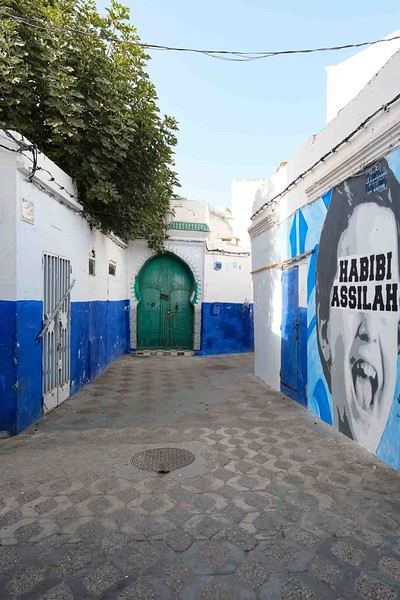
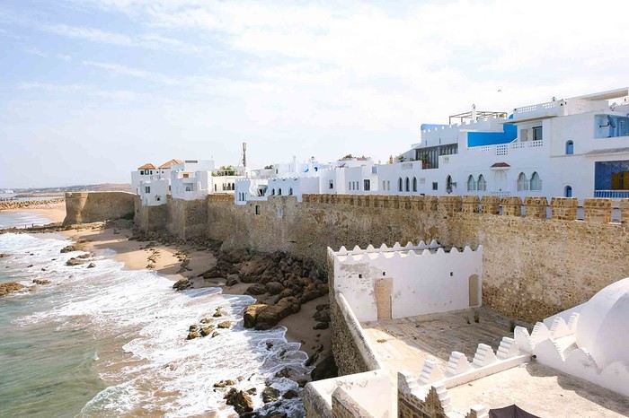
Anyway, we skirted around Tangier’s suburbs—pretty grim—and finally arrived in Asilah.
Following the coast and the long promenade along the beach, we reached the campsite. It was a bit crowded, not much shade, but it wasn’t far from the medina or the beach, and it wasn’t expensive. There’s some life here: Moroccan families seem to live on-site, in tents or basic bungalows. A woman was cooking tagine on a brazier—we were right in the atmosphere! The night was quiet, and we slept well. We set off on foot, walking along the seafront to the medina... We’d already been here in 2009. It was less touristy back then! Still, at this early hour, the little streets inside were very quiet. The walls had been freshly whitewashed, and there were even more murals than before. Around 11:30 AM, we strolled along the ramparts by the sea. There was a nice breeze! And a lot more people around. We enjoyed a milkshake on the terrace of a café overlooking the beach that stretches out at the foot of the medina. Some young guys were having fun diving off the rocks—and even off the top of the wall!
Old Burmese Adventures (oh, so many!)
Hey everyone,
Yesterday, I checked the Thailand forum to see if there were any questions to answer, but not much was happening—it was pretty quiet. Then I scrolled through the Southeast Asia section and realized that, even though Burma (Myanmar) was included, there weren’t many posts about it... I’ve only been there once, back in 1987, so it’s hard to create a photo thread about multiple trips like I sometimes do for Thailand. Still, that one trip was packed with unusual adventures, so I thought I’d share a few stories from it.
Since I didn’t take any notes at the time, this is all from memory—it’s not an exhaustive travel journal and isn’t meant to help plan a future trip to Myanmar.
Don’t expect photos; there won’t be any. I have some, but they’re slides that would need scanning and editing one by one to fix the wear and tear of time—way too much work.
The Context.
Back then (reminder: 1987), I was volunteering in Paris at the counter of a travel agency on Rue des Écoles. The agency was part of a well-known organization based in Mulhouse that mostly offered scheduled flights to Asia, charter flights to the Mediterranean, and flights to Mali with their own plane. They also had a few rare "roots"-style trips to certain destinations—trips where you didn’t bring your tennis racket but were ready to soak in everything, even if it meant tough conditions.
I’d already been to Thailand, Indonesia, and the Philippines in Asia. The director knew this, so he asked me to accompany a group to Burma. At the time, tours to Burma were already being sold by competitors, but they all had to go through the state-run agency, Touristburma (buses and hotels for tourists, and they only showed you what they wanted you to see—kind of like traveling in North Korea today). The service was only payable in dollars at the official exchange rate (which was six times worse than the black market rate, mind you...), and since it went through the state agency, all the money ended up with the junta.
My job was to do everything *without* going through Touristburma, which was completely illegal there. Nothing would be booked in advance. Back then, the Burmese visa was only valid for 8 days/7 nights, and since clients were paying for the experience, the itinerary was planned ahead. I’d have to find transport and a guide on the black market as soon as I arrived.
The clients weren’t misled—they knew from the start that the trip would be off the books, that officially we’d be a small group of friends (not an agency), unlike the truth (Touristburma wasn’t mandatory for individual travelers), and that it would be challenging. They also knew their trip would cost 3-4 times less while giving them a much better experience of Burma. As for pretending to be a group of friends, there were only six of us, so it worked out.
To cover all expenses (accommodation, transport, excursions), the agency gave me a sufficient budget. They also gave me the *same* budget a second time, which was strictly for bribing officials who might cause trouble, for backshish (tips), and, if needed, to "help" me get out of prison.
Before I left, I was thoroughly briefed by another guy who’d led the previous trip (he’d dealt with all the initial challenges). He explained everything I needed to know, what to watch out for, and advised me on what to bring as "gifts" (samples of well-known perfumes, specific cigarette and whisky brands, etc.). For the perfume samples, I rallied my family, friends, and even stores. For the rest, I’d pick things up at the duty-free shops in Don Muang (Bangkok’s only airport at the time)—I had the budget for it.
I couldn’t wait to leave...
Yesterday, I checked the Thailand forum to see if there were any questions to answer, but not much was happening—it was pretty quiet. Then I scrolled through the Southeast Asia section and realized that, even though Burma (Myanmar) was included, there weren’t many posts about it... I’ve only been there once, back in 1987, so it’s hard to create a photo thread about multiple trips like I sometimes do for Thailand. Still, that one trip was packed with unusual adventures, so I thought I’d share a few stories from it.
Since I didn’t take any notes at the time, this is all from memory—it’s not an exhaustive travel journal and isn’t meant to help plan a future trip to Myanmar.
Don’t expect photos; there won’t be any. I have some, but they’re slides that would need scanning and editing one by one to fix the wear and tear of time—way too much work.
The Context.
Back then (reminder: 1987), I was volunteering in Paris at the counter of a travel agency on Rue des Écoles. The agency was part of a well-known organization based in Mulhouse that mostly offered scheduled flights to Asia, charter flights to the Mediterranean, and flights to Mali with their own plane. They also had a few rare "roots"-style trips to certain destinations—trips where you didn’t bring your tennis racket but were ready to soak in everything, even if it meant tough conditions.
I’d already been to Thailand, Indonesia, and the Philippines in Asia. The director knew this, so he asked me to accompany a group to Burma. At the time, tours to Burma were already being sold by competitors, but they all had to go through the state-run agency, Touristburma (buses and hotels for tourists, and they only showed you what they wanted you to see—kind of like traveling in North Korea today). The service was only payable in dollars at the official exchange rate (which was six times worse than the black market rate, mind you...), and since it went through the state agency, all the money ended up with the junta.
My job was to do everything *without* going through Touristburma, which was completely illegal there. Nothing would be booked in advance. Back then, the Burmese visa was only valid for 8 days/7 nights, and since clients were paying for the experience, the itinerary was planned ahead. I’d have to find transport and a guide on the black market as soon as I arrived.
The clients weren’t misled—they knew from the start that the trip would be off the books, that officially we’d be a small group of friends (not an agency), unlike the truth (Touristburma wasn’t mandatory for individual travelers), and that it would be challenging. They also knew their trip would cost 3-4 times less while giving them a much better experience of Burma. As for pretending to be a group of friends, there were only six of us, so it worked out.
To cover all expenses (accommodation, transport, excursions), the agency gave me a sufficient budget. They also gave me the *same* budget a second time, which was strictly for bribing officials who might cause trouble, for backshish (tips), and, if needed, to "help" me get out of prison.
Before I left, I was thoroughly briefed by another guy who’d led the previous trip (he’d dealt with all the initial challenges). He explained everything I needed to know, what to watch out for, and advised me on what to bring as "gifts" (samples of well-known perfumes, specific cigarette and whisky brands, etc.). For the perfume samples, I rallied my family, friends, and even stores. For the rest, I’d pick things up at the duty-free shops in Don Muang (Bangkok’s only airport at the time)—I had the budget for it.
I couldn’t wait to leave...
Three weeks in Yunnan in October 2025
We just spent three weeks in Yunnan.
I’ve started writing up a travel journal about the trip.
Another side of my trip to Thailand: Villages, nature, countryside, mountains...
February 9th is a pivotal day during my trip to Thailand. Up until this date, my focus had been on cities, temples, and other urban landmarks. Starting February 10th, I’ll finally leave the city behind for the outskirts—one town, one life, farther from tourism, more real, more authentic... Then comes the bucolic surroundings of Chiang Mai, nature, the countryside, the mountains.
This morning, I head to visit the ethnographic museum. I’d been told about another one, but it’s permanently closed. I wonder if it’s the same one that might have changed its name and location.
I thoroughly enjoy visiting this museum. At first, I’m a bit annoyed because the place is packed with noisy school groups blocking the display cases without even showing the slightest interest. But soon, their chaperones manage to lead them into another room, giving me some peace. They maintain this distance throughout the tour, allowing me to explore the museum in complete tranquility. I really appreciate their tact.
I’m amazed by the absolutely stunning fabric displays and the countless everyday objects, especially the very old pottery. There’s so much beautiful basketry and intricately carved wood. The statues are also incredible... After seeing all of them, I no longer feel like buying any from the shops.
On my way back, not far from my hotel, I discover a rather unique place that only serves one drink, which they’ve made their specialty: egg coffee! A pretty surprising novelty. I have to try it.

At the bottom of the cup, they pour a layer of milk, topped with a layer of liquid coffee, followed by a layer of egg yolk, and finally a top layer that turns out to be a mix of coffee and cocoa powder. It’s a cold drink that, in the end, doesn’t have much flavor, and the price is pretty steep for such a small cup. You’re paying for the exclusivity!
Later in the day, I venture once again into small alleys, something I love doing when exploring a new city—no specific goal, just wandering east of the city, outside the walls.

I encounter very few tourists there and discover unsuspected little shops overflowing with lovely items, much cheaper than what you find in the heart of the tourist district. Then I wander through the floors of Warorot Market. I discover another kind of temple there: the temple of good deals. I love finding clothes that are really original for locals, not the flood of shirts and pants that tourists love but no Thai would ever buy, which invade the shops in the "Historic Square." I stop in my tracks in front of a stall with beautiful shirts featuring stunning geometric patterns in elegant color combinations and very short sleeves. Hmm, these would be perfect for showing off my biceps, one of which is adorned with the magnificent Ganesh tattoo I got last year in Bali. "When you’ve got nice things, you’ve got to show them off!" he said. 😜🙏💪 I pick out two for 380 baht and negotiate them down to 300. But the seller won’t go any lower. I understand I’ve reached the limit of her commercial possibilities. Just as I’m leaving the shop, happy with my purchase, my ever-helpful inner voice, Petite Voix, suggests: - You didn’t try them on because you were too lazy to take off the one you’re wearing and also because of the sweat, but you could just put one on over the one you’re wearing. It’s light enough that it won’t bother you.
I go back to the two sellers, who burst out laughing when I ask to try them on. - Oh no, it’s way too small for you! It’s a women’s shirt! - But they don’t look particularly feminine in style! And I chose XXL... I put the shirt on, and of course, it won’t close. Then I notice the buttons are on the wrong side. That’s why the sleeves seemed so short!!! They put the shirts back on the rack and refund me without any fuss, commenting amid total hilarity: - Well, thank goodness you tried it on just as you were leaving the shop!
Since I don’t want to walk too much before tomorrow’s first Big Outing with the driver, I end my stroll with a visit to two very pretty temples recommended by Joël.

I’d rather not post more temple photos. But these ones smell like village and countryside...


I’ve never seen anything like Wat Ket Karam, so extravagant...


And I end my day with two other lesser-known temples: Wat Noung Kham, simple and finally free of gold and glitter,

and Wat Dap Phai, where an intimate ceremony is taking place at the end of the day.
This morning, I head to visit the ethnographic museum. I’d been told about another one, but it’s permanently closed. I wonder if it’s the same one that might have changed its name and location.
I thoroughly enjoy visiting this museum. At first, I’m a bit annoyed because the place is packed with noisy school groups blocking the display cases without even showing the slightest interest. But soon, their chaperones manage to lead them into another room, giving me some peace. They maintain this distance throughout the tour, allowing me to explore the museum in complete tranquility. I really appreciate their tact.
I’m amazed by the absolutely stunning fabric displays and the countless everyday objects, especially the very old pottery. There’s so much beautiful basketry and intricately carved wood. The statues are also incredible... After seeing all of them, I no longer feel like buying any from the shops.
On my way back, not far from my hotel, I discover a rather unique place that only serves one drink, which they’ve made their specialty: egg coffee! A pretty surprising novelty. I have to try it.
At the bottom of the cup, they pour a layer of milk, topped with a layer of liquid coffee, followed by a layer of egg yolk, and finally a top layer that turns out to be a mix of coffee and cocoa powder. It’s a cold drink that, in the end, doesn’t have much flavor, and the price is pretty steep for such a small cup. You’re paying for the exclusivity!
Later in the day, I venture once again into small alleys, something I love doing when exploring a new city—no specific goal, just wandering east of the city, outside the walls.
I encounter very few tourists there and discover unsuspected little shops overflowing with lovely items, much cheaper than what you find in the heart of the tourist district. Then I wander through the floors of Warorot Market. I discover another kind of temple there: the temple of good deals. I love finding clothes that are really original for locals, not the flood of shirts and pants that tourists love but no Thai would ever buy, which invade the shops in the "Historic Square." I stop in my tracks in front of a stall with beautiful shirts featuring stunning geometric patterns in elegant color combinations and very short sleeves. Hmm, these would be perfect for showing off my biceps, one of which is adorned with the magnificent Ganesh tattoo I got last year in Bali. "When you’ve got nice things, you’ve got to show them off!" he said. 😜🙏💪 I pick out two for 380 baht and negotiate them down to 300. But the seller won’t go any lower. I understand I’ve reached the limit of her commercial possibilities. Just as I’m leaving the shop, happy with my purchase, my ever-helpful inner voice, Petite Voix, suggests: - You didn’t try them on because you were too lazy to take off the one you’re wearing and also because of the sweat, but you could just put one on over the one you’re wearing. It’s light enough that it won’t bother you.
I go back to the two sellers, who burst out laughing when I ask to try them on. - Oh no, it’s way too small for you! It’s a women’s shirt! - But they don’t look particularly feminine in style! And I chose XXL... I put the shirt on, and of course, it won’t close. Then I notice the buttons are on the wrong side. That’s why the sleeves seemed so short!!! They put the shirts back on the rack and refund me without any fuss, commenting amid total hilarity: - Well, thank goodness you tried it on just as you were leaving the shop!
Since I don’t want to walk too much before tomorrow’s first Big Outing with the driver, I end my stroll with a visit to two very pretty temples recommended by Joël.
I’d rather not post more temple photos. But these ones smell like village and countryside...
I’ve never seen anything like Wat Ket Karam, so extravagant...
And I end my day with two other lesser-known temples: Wat Noung Kham, simple and finally free of gold and glitter,
and Wat Dap Phai, where an intimate ceremony is taking place at the end of the day.
Madagascar - June 2025
Five years of an unintended break... The closure of VF, COVID... What a joy to rediscover the pleasure of sharing!
I’ve stayed true to my habits: the following account is a collection of practical tips rather than a travel journal...
Madagascar is as big as France and Belgium combined. In three weeks, choices have to be made! It was the Great Tsingy that inspired our trip. We decided to focus on the southwest and the RN7. We skipped the Deep South and the North. Oh well...
OUR ITINERARY IN 3 WEEKS:
Fri 6 June – Direct AF flight to Tana – Flight arrives at 10:30 PM – Tana Sat – Antsirabe Sun – Miandrivazo Mon – Drive to the Masiakampy pier – Descent of the Tsiribihina River by pirogue - Bivouac Tue – Descent of the Tsiribihina River by pirogue - Bivouac Wed – Descent of the Tsiribihina River by pirogue – Bekopaka Thu – Pirogue on the Manambolo River and Small Tsingy of Bemaraha – Bekopaka Fri – Great Tsingy of Bemaraha – Bekopaka Sat – Avenue of the Baobabs – Morondava Sun – Belo sur Mer Mon – Free day – Belo sur Mer Tue – Manja Wed – Andavadoaka Thu – Free day – Andavadoaka Fri – Salary Lagoon – Mangily Sat – Ranohira Sun – Isalo National Park - Ranohira Mon – Anja Reserve - Ambalavao - Fianarantsoa Tue – FCE train canceled – Visit to a Tanala village - Manakara Wed – Pirogue on the Pangalanes Canal – Ranomafana Thu – Ranomafana NP – Ranomafana Fri – Ambositra – Antsirabe Sat 28 June – AF flight to Paris – Flight departs at 11:55 PM
TRIP ORGANIZATION: I prepared my trip using the usual guides (LP and Rough Guide), the internet, and the Freytag & Berndt map (1:1,000,000). I’m old-school—I still love visualizing my route on a paper map, even though in Madagascar, it’s misleading because some National Roads are only national in name!...
The agency: Since we couldn’t deal directly with a driver-guide (we lacked reliable info to take the plunge), we went through an agency to organize the logistics of our trip. We didn’t feel like using bush taxis (not enough time) or driving a 4x4 ourselves (neither the skills nor the boldness). The French agency connected us with a local agency, to whom I sent my detailed itinerary by email. A few exchanges via email and WhatsApp calls allowed us to finalize everything quickly after some adjustments. As you’ve gathered... we multiplied the commissions, which inflated the budget. That said, in the end, we were thrilled with our decision and our choice. Our trip was booked by the end of 2024, and reservations were made immediately. No bad surprises: the bookings in the planned hotels were honored, often with one of the best rooms. On our last day in Tana, before departure, we were lucky enough to meet the director I’d been communicating with, who helped build and validate our circuit. A very warm debriefing.
The driver-guide: The agency assigned us Faly, 33, a driver-guide for over 10 years. He stayed with us from start to finish: he picked us up at the airport on arrival and dropped us off 23 days later. A very experienced driver (which is important here), an open and cultured guide, reliable, punctual, and a great companion. And a provider of good advice throughout the trip. We made the most of the long stretches on dirt roads or highways to listen to him talk about daily life, rituals, wildlife, and flora... No time wasted! With a great playlist in the background, we combined business with pleasure! Faly’s accommodation and meals were included (quite often, hotels offer free lodging and meals to driver-guides who bring clients), as was the fuel. That didn’t stop us from inviting Faly to share a beer or our evening meal sometimes. He didn’t always accept, wanting to let us "enjoy our romantic evenings," as he put it. Present without being intrusive! Faly is fully capable of organizing a tailor-made trip directly. I recommend him without any hesitation—we were delighted with his service. I’ll gladly share his contact details via PM to anyone who asks.
Local guides: It’s the national guide’s prerogative to choose the local guides (mandatory in the parks). Thanks to his experience, Faly always booked us amazing, competent, and interesting local guides.
Hotels: I told the agency I wanted charming, comfortable accommodations, without falling into flashy luxury. We loved all the hotels (except the Hôtel Kanto in Manja). The rooms, mostly bungalows, were always spacious and clean. Unfortunately, I can’t give the prices—I didn’t get the details. Breakfast is always included, usually fresh and hearty. Very often, a small bottle of water is provided in the room.
Tana Hôtel Les 3 Métis Power cuts are common (!) in Tana. Bring a headlamp.
Antsirabe Ecolodge – Les chambres du voyageur Maybe our favorite! A few bungalows, beautifully arranged in a splendid tropical garden. The dog Kodak welcomes us warmly.
Miandrivazo Hôtel Princesse Tsiribihina Magnificent view of the valley.
Bekopaka Hôtel Orchidée du Bemaraha 2 (yes, 2) beautiful pools, a large open common room.
Morondava Hôtel Baobab Café Brand new or at least, according to Faly, just renovated. Very comfortable but without much charm (international style).
Belo sur Mer Ecolodge du Menabe The bungalows, all made of wood, bamboo, and thatch, are set on the beach. Very spacious and fully equipped! Large open-air restaurant by the sea. No hot water from the tap—it’s available in plastic bottles heated by the sun in front of each bungalow. Actually, we never used it... Another very, very beautiful spot.
Manja Hôtel Kanto The only hotel on this leg of the journey, so no choice. The owner knows it and, as a result, doesn’t bother. It’s a real dive! Tiny, dark room, a sordid bathroom with only a trickle of water—we skipped the shower! Clean sheets, though. Obviously, no Wi-Fi. The only place where I didn’t leave a tip. We were well warned about the discomfort of this stop, both by the agency and Faly. We weren’t surprised, and it even became a running joke during the trip. On the other hand, we found a nice little market in town.
Andavadoaka Manga Lodge What bliss! Especially after the horrible Hôtel Kanto. A paradise-like spot, overlooking three beautiful deserted white-sand beaches. Meals are served on the terrace facing the sea. Stunning sunset. We loved spending a day lounging here! We were the only guests and were pampered.
Mangily (Ifaty) Mangily is the "suburb" of Ifaty. Hôtel Vovo Telo A large beachfront bungalow complex. More touristy but pleasant—we spent a lovely evening there with our feet in the sand.
Ranohira Le Relais de la Reine A splendid resort built by a Frenchman, at the foot of the rocks, very well integrated into the environment. Beautiful marked trail starting from the garden.
Fianarantsoa Villa Sylvestre Contrary to what its name suggests, it’s a hotel right in the city center. Quite decent, though.
Manakara Parthenay Club Pretty bungalows in a large garden by the sea, but swimming isn’t safe—the water is too dangerous and rough.
Ranomafana Hôtel Thermal Very spacious rooms.
Meals: Not all our meals were included. It’s really not expensive. 1 meat or fish dish: around 35,000 Ar 1 full menu (starter, main, dessert): around 70,000 Ar 1 large THB beer (65 cl): between 8,000 and 12,000 Ar 1 piña colada: 15,000 Ar 1 flavored rum: 6,000 Ar (sometimes free) 1 glass of baobab juice (!): 5,000 Ar
We always ate very well. Rice is everywhere, served in large quantities. Zebu meat is quite good if not overcooked. Personally, I prefer fish, and I feasted: grouper, captain, crab, small lobsters...
We happily discovered baobab juice (especially in Belo, on the west coast). And of course, flavored rums!
We bought 2 packs of 6 bottles of mineral water at Carrefour (!) (about 5,000 Ar per large bottle) at the start of our trip. That was enough, especially since we often got water in the bungalows.
We had a few picnics included in our trip. Instead of picking up the hotel’s lunchbox, Faly prepared delicious, fresh, and varied picnics for us: tuna pasta salad, fried rice with eggs, grilled vegetables, and avocado...
An exceptional address not to miss: Mad Zébu – Belo sur Tsiribihina A highly reputed restaurant, a favorite of LP and Rough Guide, and rightly so! Gourmet cuisine, refined and elegant. Barely more expensive than elsewhere, and it’s worth it. We stopped there on our way up to Bekopaka and the Tsingy NP. Fully booked! So Faly reserved for our return, three days later. We’re still thanking him! What a treat!
THE BUDGET: Ariary exchange rate: 5,000 Ar = 1 €
Pre-trip expenses: Direct Air France flights: 930 € per person round trip Cost of the circuit with the agency: 2,880 € per person
The visa: Issued on arrival, very quickly. 35 € per person for a stay under 30 days. Super simple. Super fast.
On-site expenses: As soon as we arrived at the airport (it was nearly midnight), Faly advised us to exchange our euros for all our needs. There are few opportunities on our route to find an ATM or an open bank with a good rate. To be more comfortable, he took us to a small office under military protection just outside the airport. I exchanged 1,200 € (I had asked the agency for advice on the amount to bring) at a rate of 4,750 Ar and became a millionaire. Faly recounted all the stacks. That covered all our expenses (meals, drinks, tips) without ever feeling deprived. Personal purchases were made at the end of the trip. Convenient—it served as an adjustment variable. We spent our last million (200 €) on marquetry and vanilla. Tip: We asked for 200,000 Ar in 5,000 Ar bills for tips. That wasn’t too much—I even ran short of small bills in the last two days.
Tips: Madagascar is a poor country where every service deserves a small reward. While not mandatory, it’s customary. But no one ever demanded or expected it openly. On the contrary, I sometimes had to remind a porter to give them my small bill. We never carried our luggage—porters were always present when the car arrived or waiting at our door to watch for our departure. I gave each of them 5,000 Ar. In restaurants, I rounded up to the nearest ten and left the change. Local guides also expect a tip: I gave around 20,000 Ar per day for the two of us. Finally, the national guide also expects a gratuity. I had read online to budget 5 € per day per person. I added more since we were so happy with his services. The tip was given at the end of the trip, in euros, outside the budget.
Total budget all included (excluding personal purchases): 8,690 € Clearly, Madagascar is a country where life isn’t expensive, but travel costs add up quickly due to the need to rent a 4x4 with a driver.
HIGHLIGHTS:
· The dirt roads Yes, I’m listing them among the highlights! We loved those long hours spent driving at 20 km/h on rocky, muddy, white, red, or gray sand tracks... surrounded by tropical vegetation, palm trees, pandanus, mango trees... The experiences were sometimes thrilling: crossing a river on a ferry (just planks of wood fixed on two motorized pirogues side by side) or crossing a river without a ferry, with just a kid running ahead of the 4x4 to show the way; soft sand where the 4x4 easily gets stuck... The tracks are quite narrow, and crossing paths with a bush taxi, a zebu cart, or a herd of goats is always epic. So many beautiful images, so many beautiful photos! Much more beautiful than on asphalt. So yes, we loved those long stretches on dirt roads. For us, it was clearly part of the journey. Faly was particularly careful, and the 4x4 was comfortable. No injuries, no fatigue, even after 7 or 8 hours on rough tracks. The national roads (including the famous RN7) are badly damaged by cyclones, huge trucks, and lack of maintenance. Potholes have turned into ostrich nests, and we didn’t drive much faster than on the dirt roads.
· The landscapes, villages, encounters... We crossed a variety of stunning landscapes: mountains with slopes covered in terraced crops, rice fields from apple green to emerald green, sugarcane fields, then tropical forests, baobab forests (they deserve a special paragraph below), traveler’s tree forests. And then coastlines with white sand dunes against a backdrop of blue hues!... Magical! We also passed through many villages with houses whose architecture varied by region. The Betsileo houses display beautiful decorative brick reliefs. On the west coast, the houses are more precarious, made of bamboo with palm-thatched roofs. In the Highlands region, we found solid houses with pastel plaster. Each region has its own landscape, crops, habitat, and clothing. Zebu carts are often the only means of transport in remote villages. We saw them very frequently. Again, the cart’s decoration depends on the region. And then, we met many villagers coming out of the bush and walking to the next market, carrying their crops on their heads or shoulders. More beautiful photos!
· The descent of the Tsiribihina River We boarded around 9 AM in a long pirogue with Gana, the local guide, and two pirogue men. So, five of us. The pirogue is long but narrow, about 65 cm wide. We sat one behind the other at the front on seats padded with what would become our mattresses during the bivouacs. We only took the bare essentials for two nights. A little goodbye to Faly, whom we’d see again in three days! Don’t forget us! The river is silty—meaning orange, opaque but clean. We glided along silently. Gana showed us the trees, birds, crocodiles (we saw five—apparently, we were lucky). The pirogue men rowed to get us as close as possible to these crocs sunbathing on the roots of big trees. Yeah, right!... as soon as we got too close, *splash*, they disappeared into the water. We marveled at the mini rice fields lining the river. Every tiny plot, no matter how small, is cultivated. Above them, banana fields. And on the water, a whole life of fishermen and villagers living with and from the river. Gana warned us we’d eat on the pirogue because the journey was long. So, I expected chips... But no—fried rice and zebu steak, cooked right in the pirogue!! Incredible! In the middle of the afternoon, we reached a small beach where we disembarked. Gana led us about a hundred meters to a sublime waterfall. We were alone there. We had time to swim. We’d brought our swimsuits and a towel (bought at the Carrefour in Antsirabe on Faly’s wise advice!). This swim in this paradise-like spot remains one of our best memories. We found our pirogue again and set off until our first bivouac. We’d sailed for 7 hours today. The tents were set up on a wide beach, without a single tree. A moment of solitude... Uh, where can we go to the bathroom?... Especially since it was a full moon, so we felt like we were in the spotlight. Anyway... we did as everyone else—walked away, dug a hole, and the others turned their backs. A hearty meal on the beach before a comfortable and silent night. The next day, same program, with slightly different landscapes. The gorges widened, the trees were different. But still many colorful birds. Again, we ate on the pirogue: grilled chicken and vegetables. 9 hours of sailing. A similar bivouac. This time, we got it. On the third day, we finished the descent with 5 hours of sailing. So, 7 hours, 9 hours, 5 hours... doing nothing. It might sound boring... but it wasn’t. Like the dirt roads, these were contemplative moments. It glides, it’s calm, relaxing, and there’s a lot of life on this river, animal and human. Contemplation. Suspended time. On arrival, we disembarked at a sort of joyful, bustling river port. Of course, Faly was already there to pick us up.
· The Tsingy de Bemaraha NP (Small and Great) I have vertigo. During my research, several agencies advised me against visiting the Great Tsingy. "Stick to the Small ones," they said. Grrr, no, not what I wanted—we’ve dreamed of this for years! The agency we chose also warned me but didn’t discourage me. So we started with the Small Tsingy, quite close to Bekopaka, guided by Alisha. This forest of sharp limestone rocks is impressive. No vertigo issues here. The day was completed with a short pirogue ride on the Manambolo River and a visit to two caves with pretty formations. The next day, Faly and Alisha drove us to the Great Tsingy (a good hour on a terrible track). Arriving at the park entrance, Alisha equipped us with harnesses, carabiners, and gave us some safety instructions. Faly was also equipped. Wait? He’s coming with us? I quickly understood he was there for me—if I got stuck, he could go back with me, and Philippe could continue with Alisha. A wise precaution that delighted and reassured me. In the end, it was unnecessary since the famous bridge crossing was fully secured by the harness and carabiners. 18 meters on planks, one by one, it didn’t sway too much—I walked looking straight ahead, not a glance down. I even managed to smile in the middle of the crossing—I have a photo to prove it! I was overjoyed! The circuit in the Great Tsingy is a loop, so we didn’t have to cross the bridge again. We climbed to viewpoints offering breathtaking panoramic views. It’s extraordinary, unique, incredible. All this to say that if you have vertigo, don’t hesitate! It’s doable! It’s completely safe and really worth pushing your limits a bit! For those who’ve done treetop adventure courses, it’s similar. Also, no need to be a great athlete—just a bit of agility to climb a few ladders and high steps. Don’t censor yourself! I even had a small regret—the loop was a bit short (about 2 hours). I would’ve liked to continue or even redo it, with less apprehension. Tip: Do the Small Tsingy before the Great ones, or not at all. And if you can only do one, do the Great ones without hesitation.
· Canoeing in the Belo mangrove The Belo sur Mer ecolodge lends small individual canoes for free to go to the mangrove. We left at high tide, paddled for about twenty minutes to reach a fairly sparse forest where we could easily venture in. Very shallow water, crystal clear—we could see the roots of all these trees, schools of tiny fish... It was quite surprising. Until then, I only knew impenetrable, tangled mangroves. Here, nothing like that—we walked through an aquatic forest. We loved this adventure so much we left a bit late. The tide had gone out, and we had to carry our canoes for the last few meters... Of course, the staff came to help (probably laughing silently!). The lodge owners gave all the necessary explanations and lent a waterproof bag for the phone (because yes, it’s worth taking photos!). A very useful precaution—the canoes are small, low in the water, and paddling quickly soaks you. Again, this isn’t just for Tony Estanguet! It didn’t cause us any problems, not even sore muscles the next day. A great experience. It’ll take about 2 hours.
· Isalo NP Big surprise when we saw this huge rocky massif appear on the RN7! A massif of colored sandstone, carved with crevasses giving it a ruined look. Le Relais de la Reine is a little gem cleverly nestled in the heart of these rocks. A small marked trail starts from the garden. We picked up the description at reception and set off. Without a guide, alone following the markers, it took us 2 hours to complete this magnificent little trail, giving us a first glimpse of the massif before the hike the next day. And we enjoyed being completely alone for this walk. It’s free, easy, and well-signposted. Don’t miss it. In the evening, Faly took us to the so-called Isalo Window site—a hole in a wall through which we could see the sunset. We met all the tourists in the area here. We weren’t blown away by the show... The next day, we left early to reach the start of the hike. We met Zozoly at the guides’ office in the small town of Ranohira. During this hike, we climbed through the rocks to a viewpoint offering stunning 360° views of the massif. Then we reached a site called the "natural pool," breathtakingly beautiful, especially since we were alone again. A sort of oasis, a cascading waterfall, palm trees and tree ferns, fine sand, all nestled at the bottom of a small canyon. Paradise-like. We resisted swimming, but it was really tempting. A long walk on the plateaus then led us to a well-equipped picnic site where a local team prepared grills. Concrete tables were tiered in a spacious, shady clearing where a whole family of ring-tailed lemurs frolicked. They knew the tourists’ habits and tried to snatch food. Playful and not very shy, they amused us with their antics! We had to resist not luring them with a piece of banana!! Thousands of photos!! After the meal, we set off again with Zozoly for another landscape. This time, we were by a small river at the bottom of a canyon with high walls covered in vegetation. The trail was narrow and slippery, on a ledge of the wall. We progressed carefully. No danger, though. We first reached the Blue Pool, which only turns blue in photos (surprise!), then the Black Pool fed by a shower of waterfalls. Two magnificent spots that showed us a completely different aspect of the massif.
· Anja Reserve This ficus forest is home to many groups of lemurs. Used to humans, whom they don’t fear, they move around us, ignoring us completely. It’s almost annoying... The best place on our trip to see lemurs.
· The FCE train To the great regret of Manakara’s inhabitants, the FCE train hasn’t reached here for over a year and a half. As a result, there are far fewer tourists—the train was part of the experience. We drove there and didn’t regret coming to this port on the east coast.
· Visit to a Tanala village This visit wasn’t part of our program—it was added by the agency to compensate for the train not running. Which was the case. Not big fans of this kind of visit, where we feel like we’re at a zoo, voyeuristic, lacking authenticity, we followed the local guide with some skepticism and exchanged dubious looks. And yet... the guide’s explanations about village life and the warm, smiling welcome from the villagers charmed us and dispelled all our concerns. We learned a lot, met smiling families, and were able to enter these beautiful bamboo houses. A very pleasant surprise, rich in lessons.
· The Pangalanes Canal Arriving in Manakara, we crossed a bridge overlooking the Pangalanes Canal. A cry of surprise: the water is turquoise! We took a short pirogue ride with a team of three pirogue men and Joël, a local guide who explained the drama caused by the train’s halt. We stopped in a fishing village where Joël bought fish for the barbecue. We ended up on a beach where the team prepared the meal while we went to watch the fishermen return on the nearby beach. We admired the fishermen’s dexterity in untangling their nets, sorting their fish, cleaning their gear. On our return, we found a small table set up on the beach, in the shade of palm trees and casuarinas. Lobsters, captain fish, grilled vegetables, sautéed potatoes. A real feast (included in the trip cost).
· Ranomafana NP A 4-5 hour hike (some climbing) in a dense secondary forest to look for lemurs. As usual, we were accompanied by a local guide who, while waiting to find our furry friends, gave us lots of info on the vegetation, birds, and Tanala ethnic rituals. In the forest, we met 4 or 5 trackers, armed with radios to alert guides of their findings. In the end, we saw several lemurs of different types. Quite far, quite high... A nice complement to our lemur encounters in Isalo. Here, it rains 200 days a year. We started the hike in thick fog, but the forest’s density protected us from the humidity. Be careful—it can be a bit frustrating to see the lemurs so far away, so high. Nothing like the Anja Reserve or Isalo NP. Here, what’s fun is the hunt.
· The baobabs We were captivated by these kings of the forest, noble, imposing, majestic. We spotted them from very far away, towering over the rest of the vegetation. Alone, in small groups, or in forests, our trip allowed us to see hundreds of them! Mainly on the west coast. All different—bald, hairy, shaggy, short and stout, tall and thin, like Laurel and Hardy. Philippe took to naming them. Respectfully!
OUR FAVORITES: · The variety of landscapes. · The Tsingy NP.
OUR DISAPPOINTMENTS: · The Avenue of the Baobabs, very overrated and the only place where we saw crowds. We saw many other "forests" of baobabs that were much more impressive. · It’s hard to approach the population calmly as swarms of children run up as soon as we arrive, asking for sweets. Without any aggression, their smiles and laughter quickly made us forget this small inconvenience. We never gave out candy, clothes, or money. We left pens at a school and clothes with Faly.
IF WE WERE TO DO IT AGAIN: · Same period, same duration, same pace, same itinerary, but if we were to do it again today, I’d go through Faly directly! · Maybe we should’ve stayed in Ambalavao instead of Fianarantsoa. · Plan a longer loop in the Great Tsingy—it felt a bit too short.
MISCELLANEOUS: The welcome: ‘Samala Vazaha,’ there are many, many kids, sometimes overwhelming, never aggressive. We were impressed by the villagers’ smiles and good humor, towards us or even among themselves—laughter was everywhere. Safety: No problems. Out of (excessive?) caution, we spread all our money across several bags that we padlocked whenever we left the hotel. Bribes: We were stopped several times on the road by police or gendarmes. They checked our papers, sometimes our passports. Faly was perfectly in order. No discussion, no bribes, a cordial greeting from the officers. However, several times we found ourselves at small "tolls" on the tracks for villagers who had leveled the road or filled a hole, or for the young guy who ran through the river to show the way... Faly complied without discussion: every service deserves a small bill. Language: French is still widely spoken. Credit card: Unused. Cash: You need it! The climate at this time: Ideal—blue skies, sunshine, and mild temperatures (20-25°C) throughout our trip. Temperatures started to drop by our departure—winter was setting in. Clothing: T-shirt or polo and a vest sometimes in the evening, sandals on our feet, hiking shoes for all the hikes. Tip: We left a bag in the car (completely safe) with things we didn’t need daily and dirty laundry. The two bags to take out at each stop were much lighter. Before leaving, we left several polos and T-shirts with Faly, which, once washed, will make a few people happy. Tourist crowds at this time: Low—we were sometimes the only guests at the hotel. Faly explained that at the Isalo picnic site, in high season, you have to queue for a table, whereas we had our pick. Photos: Lots! Too many! That’s the problem with digital—we take so many! Health issues: Nothing serious, just the usual mild traveler’s diarrhea. Mosquitoes: They’re voracious. We took anti-malaria treatment. I’m still not sure if it was the right thing to do... I’m always very skeptical about such precautions. Internet: Free Wi-Fi at the lodges’ reception (except at Hôtel Kanto!), sometimes (rarely) in the bungalows. Phone: We didn’t try to get a local SIM card—the evening Wi-Fi was enough for us to make calls and send messages via WhatsApp. Make sure to turn off mobile data and switch to airplane mode (I activated it a bit late—received calls, spam ones at that, were charged...). Electricity: French plugs. Personal purchases: Beautiful wooden objects (sculptures and marquetry) or zebu horn items in Ambositra. 1 kg of vanilla (400,000 Ar – 80 € per kg) in Tana.
IN CONCLUSION: A trip of contemplation. A pause for admiration, as our local guide in Isalo NP said. Nothing else to do but walk, look, and enjoy. Here, there are no old stones, no museums—it’s a trip where nature reigns supreme. And what nature!
I’ve stayed true to my habits: the following account is a collection of practical tips rather than a travel journal...
Madagascar is as big as France and Belgium combined. In three weeks, choices have to be made! It was the Great Tsingy that inspired our trip. We decided to focus on the southwest and the RN7. We skipped the Deep South and the North. Oh well...
OUR ITINERARY IN 3 WEEKS:
Fri 6 June – Direct AF flight to Tana – Flight arrives at 10:30 PM – Tana Sat – Antsirabe Sun – Miandrivazo Mon – Drive to the Masiakampy pier – Descent of the Tsiribihina River by pirogue - Bivouac Tue – Descent of the Tsiribihina River by pirogue - Bivouac Wed – Descent of the Tsiribihina River by pirogue – Bekopaka Thu – Pirogue on the Manambolo River and Small Tsingy of Bemaraha – Bekopaka Fri – Great Tsingy of Bemaraha – Bekopaka Sat – Avenue of the Baobabs – Morondava Sun – Belo sur Mer Mon – Free day – Belo sur Mer Tue – Manja Wed – Andavadoaka Thu – Free day – Andavadoaka Fri – Salary Lagoon – Mangily Sat – Ranohira Sun – Isalo National Park - Ranohira Mon – Anja Reserve - Ambalavao - Fianarantsoa Tue – FCE train canceled – Visit to a Tanala village - Manakara Wed – Pirogue on the Pangalanes Canal – Ranomafana Thu – Ranomafana NP – Ranomafana Fri – Ambositra – Antsirabe Sat 28 June – AF flight to Paris – Flight departs at 11:55 PM
TRIP ORGANIZATION: I prepared my trip using the usual guides (LP and Rough Guide), the internet, and the Freytag & Berndt map (1:1,000,000). I’m old-school—I still love visualizing my route on a paper map, even though in Madagascar, it’s misleading because some National Roads are only national in name!...
The agency: Since we couldn’t deal directly with a driver-guide (we lacked reliable info to take the plunge), we went through an agency to organize the logistics of our trip. We didn’t feel like using bush taxis (not enough time) or driving a 4x4 ourselves (neither the skills nor the boldness). The French agency connected us with a local agency, to whom I sent my detailed itinerary by email. A few exchanges via email and WhatsApp calls allowed us to finalize everything quickly after some adjustments. As you’ve gathered... we multiplied the commissions, which inflated the budget. That said, in the end, we were thrilled with our decision and our choice. Our trip was booked by the end of 2024, and reservations were made immediately. No bad surprises: the bookings in the planned hotels were honored, often with one of the best rooms. On our last day in Tana, before departure, we were lucky enough to meet the director I’d been communicating with, who helped build and validate our circuit. A very warm debriefing.
The driver-guide: The agency assigned us Faly, 33, a driver-guide for over 10 years. He stayed with us from start to finish: he picked us up at the airport on arrival and dropped us off 23 days later. A very experienced driver (which is important here), an open and cultured guide, reliable, punctual, and a great companion. And a provider of good advice throughout the trip. We made the most of the long stretches on dirt roads or highways to listen to him talk about daily life, rituals, wildlife, and flora... No time wasted! With a great playlist in the background, we combined business with pleasure! Faly’s accommodation and meals were included (quite often, hotels offer free lodging and meals to driver-guides who bring clients), as was the fuel. That didn’t stop us from inviting Faly to share a beer or our evening meal sometimes. He didn’t always accept, wanting to let us "enjoy our romantic evenings," as he put it. Present without being intrusive! Faly is fully capable of organizing a tailor-made trip directly. I recommend him without any hesitation—we were delighted with his service. I’ll gladly share his contact details via PM to anyone who asks.
Local guides: It’s the national guide’s prerogative to choose the local guides (mandatory in the parks). Thanks to his experience, Faly always booked us amazing, competent, and interesting local guides.
Hotels: I told the agency I wanted charming, comfortable accommodations, without falling into flashy luxury. We loved all the hotels (except the Hôtel Kanto in Manja). The rooms, mostly bungalows, were always spacious and clean. Unfortunately, I can’t give the prices—I didn’t get the details. Breakfast is always included, usually fresh and hearty. Very often, a small bottle of water is provided in the room.
Tana Hôtel Les 3 Métis Power cuts are common (!) in Tana. Bring a headlamp.
Antsirabe Ecolodge – Les chambres du voyageur Maybe our favorite! A few bungalows, beautifully arranged in a splendid tropical garden. The dog Kodak welcomes us warmly.
Miandrivazo Hôtel Princesse Tsiribihina Magnificent view of the valley.
Bekopaka Hôtel Orchidée du Bemaraha 2 (yes, 2) beautiful pools, a large open common room.
Morondava Hôtel Baobab Café Brand new or at least, according to Faly, just renovated. Very comfortable but without much charm (international style).
Belo sur Mer Ecolodge du Menabe The bungalows, all made of wood, bamboo, and thatch, are set on the beach. Very spacious and fully equipped! Large open-air restaurant by the sea. No hot water from the tap—it’s available in plastic bottles heated by the sun in front of each bungalow. Actually, we never used it... Another very, very beautiful spot.
Manja Hôtel Kanto The only hotel on this leg of the journey, so no choice. The owner knows it and, as a result, doesn’t bother. It’s a real dive! Tiny, dark room, a sordid bathroom with only a trickle of water—we skipped the shower! Clean sheets, though. Obviously, no Wi-Fi. The only place where I didn’t leave a tip. We were well warned about the discomfort of this stop, both by the agency and Faly. We weren’t surprised, and it even became a running joke during the trip. On the other hand, we found a nice little market in town.
Andavadoaka Manga Lodge What bliss! Especially after the horrible Hôtel Kanto. A paradise-like spot, overlooking three beautiful deserted white-sand beaches. Meals are served on the terrace facing the sea. Stunning sunset. We loved spending a day lounging here! We were the only guests and were pampered.
Mangily (Ifaty) Mangily is the "suburb" of Ifaty. Hôtel Vovo Telo A large beachfront bungalow complex. More touristy but pleasant—we spent a lovely evening there with our feet in the sand.
Ranohira Le Relais de la Reine A splendid resort built by a Frenchman, at the foot of the rocks, very well integrated into the environment. Beautiful marked trail starting from the garden.
Fianarantsoa Villa Sylvestre Contrary to what its name suggests, it’s a hotel right in the city center. Quite decent, though.
Manakara Parthenay Club Pretty bungalows in a large garden by the sea, but swimming isn’t safe—the water is too dangerous and rough.
Ranomafana Hôtel Thermal Very spacious rooms.
Meals: Not all our meals were included. It’s really not expensive. 1 meat or fish dish: around 35,000 Ar 1 full menu (starter, main, dessert): around 70,000 Ar 1 large THB beer (65 cl): between 8,000 and 12,000 Ar 1 piña colada: 15,000 Ar 1 flavored rum: 6,000 Ar (sometimes free) 1 glass of baobab juice (!): 5,000 Ar
We always ate very well. Rice is everywhere, served in large quantities. Zebu meat is quite good if not overcooked. Personally, I prefer fish, and I feasted: grouper, captain, crab, small lobsters...
We happily discovered baobab juice (especially in Belo, on the west coast). And of course, flavored rums!
We bought 2 packs of 6 bottles of mineral water at Carrefour (!) (about 5,000 Ar per large bottle) at the start of our trip. That was enough, especially since we often got water in the bungalows.
We had a few picnics included in our trip. Instead of picking up the hotel’s lunchbox, Faly prepared delicious, fresh, and varied picnics for us: tuna pasta salad, fried rice with eggs, grilled vegetables, and avocado...
An exceptional address not to miss: Mad Zébu – Belo sur Tsiribihina A highly reputed restaurant, a favorite of LP and Rough Guide, and rightly so! Gourmet cuisine, refined and elegant. Barely more expensive than elsewhere, and it’s worth it. We stopped there on our way up to Bekopaka and the Tsingy NP. Fully booked! So Faly reserved for our return, three days later. We’re still thanking him! What a treat!
THE BUDGET: Ariary exchange rate: 5,000 Ar = 1 €
Pre-trip expenses: Direct Air France flights: 930 € per person round trip Cost of the circuit with the agency: 2,880 € per person
The visa: Issued on arrival, very quickly. 35 € per person for a stay under 30 days. Super simple. Super fast.
On-site expenses: As soon as we arrived at the airport (it was nearly midnight), Faly advised us to exchange our euros for all our needs. There are few opportunities on our route to find an ATM or an open bank with a good rate. To be more comfortable, he took us to a small office under military protection just outside the airport. I exchanged 1,200 € (I had asked the agency for advice on the amount to bring) at a rate of 4,750 Ar and became a millionaire. Faly recounted all the stacks. That covered all our expenses (meals, drinks, tips) without ever feeling deprived. Personal purchases were made at the end of the trip. Convenient—it served as an adjustment variable. We spent our last million (200 €) on marquetry and vanilla. Tip: We asked for 200,000 Ar in 5,000 Ar bills for tips. That wasn’t too much—I even ran short of small bills in the last two days.
Tips: Madagascar is a poor country where every service deserves a small reward. While not mandatory, it’s customary. But no one ever demanded or expected it openly. On the contrary, I sometimes had to remind a porter to give them my small bill. We never carried our luggage—porters were always present when the car arrived or waiting at our door to watch for our departure. I gave each of them 5,000 Ar. In restaurants, I rounded up to the nearest ten and left the change. Local guides also expect a tip: I gave around 20,000 Ar per day for the two of us. Finally, the national guide also expects a gratuity. I had read online to budget 5 € per day per person. I added more since we were so happy with his services. The tip was given at the end of the trip, in euros, outside the budget.
Total budget all included (excluding personal purchases): 8,690 € Clearly, Madagascar is a country where life isn’t expensive, but travel costs add up quickly due to the need to rent a 4x4 with a driver.
HIGHLIGHTS:
· The dirt roads Yes, I’m listing them among the highlights! We loved those long hours spent driving at 20 km/h on rocky, muddy, white, red, or gray sand tracks... surrounded by tropical vegetation, palm trees, pandanus, mango trees... The experiences were sometimes thrilling: crossing a river on a ferry (just planks of wood fixed on two motorized pirogues side by side) or crossing a river without a ferry, with just a kid running ahead of the 4x4 to show the way; soft sand where the 4x4 easily gets stuck... The tracks are quite narrow, and crossing paths with a bush taxi, a zebu cart, or a herd of goats is always epic. So many beautiful images, so many beautiful photos! Much more beautiful than on asphalt. So yes, we loved those long stretches on dirt roads. For us, it was clearly part of the journey. Faly was particularly careful, and the 4x4 was comfortable. No injuries, no fatigue, even after 7 or 8 hours on rough tracks. The national roads (including the famous RN7) are badly damaged by cyclones, huge trucks, and lack of maintenance. Potholes have turned into ostrich nests, and we didn’t drive much faster than on the dirt roads.
· The landscapes, villages, encounters... We crossed a variety of stunning landscapes: mountains with slopes covered in terraced crops, rice fields from apple green to emerald green, sugarcane fields, then tropical forests, baobab forests (they deserve a special paragraph below), traveler’s tree forests. And then coastlines with white sand dunes against a backdrop of blue hues!... Magical! We also passed through many villages with houses whose architecture varied by region. The Betsileo houses display beautiful decorative brick reliefs. On the west coast, the houses are more precarious, made of bamboo with palm-thatched roofs. In the Highlands region, we found solid houses with pastel plaster. Each region has its own landscape, crops, habitat, and clothing. Zebu carts are often the only means of transport in remote villages. We saw them very frequently. Again, the cart’s decoration depends on the region. And then, we met many villagers coming out of the bush and walking to the next market, carrying their crops on their heads or shoulders. More beautiful photos!
· The descent of the Tsiribihina River We boarded around 9 AM in a long pirogue with Gana, the local guide, and two pirogue men. So, five of us. The pirogue is long but narrow, about 65 cm wide. We sat one behind the other at the front on seats padded with what would become our mattresses during the bivouacs. We only took the bare essentials for two nights. A little goodbye to Faly, whom we’d see again in three days! Don’t forget us! The river is silty—meaning orange, opaque but clean. We glided along silently. Gana showed us the trees, birds, crocodiles (we saw five—apparently, we were lucky). The pirogue men rowed to get us as close as possible to these crocs sunbathing on the roots of big trees. Yeah, right!... as soon as we got too close, *splash*, they disappeared into the water. We marveled at the mini rice fields lining the river. Every tiny plot, no matter how small, is cultivated. Above them, banana fields. And on the water, a whole life of fishermen and villagers living with and from the river. Gana warned us we’d eat on the pirogue because the journey was long. So, I expected chips... But no—fried rice and zebu steak, cooked right in the pirogue!! Incredible! In the middle of the afternoon, we reached a small beach where we disembarked. Gana led us about a hundred meters to a sublime waterfall. We were alone there. We had time to swim. We’d brought our swimsuits and a towel (bought at the Carrefour in Antsirabe on Faly’s wise advice!). This swim in this paradise-like spot remains one of our best memories. We found our pirogue again and set off until our first bivouac. We’d sailed for 7 hours today. The tents were set up on a wide beach, without a single tree. A moment of solitude... Uh, where can we go to the bathroom?... Especially since it was a full moon, so we felt like we were in the spotlight. Anyway... we did as everyone else—walked away, dug a hole, and the others turned their backs. A hearty meal on the beach before a comfortable and silent night. The next day, same program, with slightly different landscapes. The gorges widened, the trees were different. But still many colorful birds. Again, we ate on the pirogue: grilled chicken and vegetables. 9 hours of sailing. A similar bivouac. This time, we got it. On the third day, we finished the descent with 5 hours of sailing. So, 7 hours, 9 hours, 5 hours... doing nothing. It might sound boring... but it wasn’t. Like the dirt roads, these were contemplative moments. It glides, it’s calm, relaxing, and there’s a lot of life on this river, animal and human. Contemplation. Suspended time. On arrival, we disembarked at a sort of joyful, bustling river port. Of course, Faly was already there to pick us up.
· The Tsingy de Bemaraha NP (Small and Great) I have vertigo. During my research, several agencies advised me against visiting the Great Tsingy. "Stick to the Small ones," they said. Grrr, no, not what I wanted—we’ve dreamed of this for years! The agency we chose also warned me but didn’t discourage me. So we started with the Small Tsingy, quite close to Bekopaka, guided by Alisha. This forest of sharp limestone rocks is impressive. No vertigo issues here. The day was completed with a short pirogue ride on the Manambolo River and a visit to two caves with pretty formations. The next day, Faly and Alisha drove us to the Great Tsingy (a good hour on a terrible track). Arriving at the park entrance, Alisha equipped us with harnesses, carabiners, and gave us some safety instructions. Faly was also equipped. Wait? He’s coming with us? I quickly understood he was there for me—if I got stuck, he could go back with me, and Philippe could continue with Alisha. A wise precaution that delighted and reassured me. In the end, it was unnecessary since the famous bridge crossing was fully secured by the harness and carabiners. 18 meters on planks, one by one, it didn’t sway too much—I walked looking straight ahead, not a glance down. I even managed to smile in the middle of the crossing—I have a photo to prove it! I was overjoyed! The circuit in the Great Tsingy is a loop, so we didn’t have to cross the bridge again. We climbed to viewpoints offering breathtaking panoramic views. It’s extraordinary, unique, incredible. All this to say that if you have vertigo, don’t hesitate! It’s doable! It’s completely safe and really worth pushing your limits a bit! For those who’ve done treetop adventure courses, it’s similar. Also, no need to be a great athlete—just a bit of agility to climb a few ladders and high steps. Don’t censor yourself! I even had a small regret—the loop was a bit short (about 2 hours). I would’ve liked to continue or even redo it, with less apprehension. Tip: Do the Small Tsingy before the Great ones, or not at all. And if you can only do one, do the Great ones without hesitation.
· Canoeing in the Belo mangrove The Belo sur Mer ecolodge lends small individual canoes for free to go to the mangrove. We left at high tide, paddled for about twenty minutes to reach a fairly sparse forest where we could easily venture in. Very shallow water, crystal clear—we could see the roots of all these trees, schools of tiny fish... It was quite surprising. Until then, I only knew impenetrable, tangled mangroves. Here, nothing like that—we walked through an aquatic forest. We loved this adventure so much we left a bit late. The tide had gone out, and we had to carry our canoes for the last few meters... Of course, the staff came to help (probably laughing silently!). The lodge owners gave all the necessary explanations and lent a waterproof bag for the phone (because yes, it’s worth taking photos!). A very useful precaution—the canoes are small, low in the water, and paddling quickly soaks you. Again, this isn’t just for Tony Estanguet! It didn’t cause us any problems, not even sore muscles the next day. A great experience. It’ll take about 2 hours.
· Isalo NP Big surprise when we saw this huge rocky massif appear on the RN7! A massif of colored sandstone, carved with crevasses giving it a ruined look. Le Relais de la Reine is a little gem cleverly nestled in the heart of these rocks. A small marked trail starts from the garden. We picked up the description at reception and set off. Without a guide, alone following the markers, it took us 2 hours to complete this magnificent little trail, giving us a first glimpse of the massif before the hike the next day. And we enjoyed being completely alone for this walk. It’s free, easy, and well-signposted. Don’t miss it. In the evening, Faly took us to the so-called Isalo Window site—a hole in a wall through which we could see the sunset. We met all the tourists in the area here. We weren’t blown away by the show... The next day, we left early to reach the start of the hike. We met Zozoly at the guides’ office in the small town of Ranohira. During this hike, we climbed through the rocks to a viewpoint offering stunning 360° views of the massif. Then we reached a site called the "natural pool," breathtakingly beautiful, especially since we were alone again. A sort of oasis, a cascading waterfall, palm trees and tree ferns, fine sand, all nestled at the bottom of a small canyon. Paradise-like. We resisted swimming, but it was really tempting. A long walk on the plateaus then led us to a well-equipped picnic site where a local team prepared grills. Concrete tables were tiered in a spacious, shady clearing where a whole family of ring-tailed lemurs frolicked. They knew the tourists’ habits and tried to snatch food. Playful and not very shy, they amused us with their antics! We had to resist not luring them with a piece of banana!! Thousands of photos!! After the meal, we set off again with Zozoly for another landscape. This time, we were by a small river at the bottom of a canyon with high walls covered in vegetation. The trail was narrow and slippery, on a ledge of the wall. We progressed carefully. No danger, though. We first reached the Blue Pool, which only turns blue in photos (surprise!), then the Black Pool fed by a shower of waterfalls. Two magnificent spots that showed us a completely different aspect of the massif.
· Anja Reserve This ficus forest is home to many groups of lemurs. Used to humans, whom they don’t fear, they move around us, ignoring us completely. It’s almost annoying... The best place on our trip to see lemurs.
· The FCE train To the great regret of Manakara’s inhabitants, the FCE train hasn’t reached here for over a year and a half. As a result, there are far fewer tourists—the train was part of the experience. We drove there and didn’t regret coming to this port on the east coast.
· Visit to a Tanala village This visit wasn’t part of our program—it was added by the agency to compensate for the train not running. Which was the case. Not big fans of this kind of visit, where we feel like we’re at a zoo, voyeuristic, lacking authenticity, we followed the local guide with some skepticism and exchanged dubious looks. And yet... the guide’s explanations about village life and the warm, smiling welcome from the villagers charmed us and dispelled all our concerns. We learned a lot, met smiling families, and were able to enter these beautiful bamboo houses. A very pleasant surprise, rich in lessons.
· The Pangalanes Canal Arriving in Manakara, we crossed a bridge overlooking the Pangalanes Canal. A cry of surprise: the water is turquoise! We took a short pirogue ride with a team of three pirogue men and Joël, a local guide who explained the drama caused by the train’s halt. We stopped in a fishing village where Joël bought fish for the barbecue. We ended up on a beach where the team prepared the meal while we went to watch the fishermen return on the nearby beach. We admired the fishermen’s dexterity in untangling their nets, sorting their fish, cleaning their gear. On our return, we found a small table set up on the beach, in the shade of palm trees and casuarinas. Lobsters, captain fish, grilled vegetables, sautéed potatoes. A real feast (included in the trip cost).
· Ranomafana NP A 4-5 hour hike (some climbing) in a dense secondary forest to look for lemurs. As usual, we were accompanied by a local guide who, while waiting to find our furry friends, gave us lots of info on the vegetation, birds, and Tanala ethnic rituals. In the forest, we met 4 or 5 trackers, armed with radios to alert guides of their findings. In the end, we saw several lemurs of different types. Quite far, quite high... A nice complement to our lemur encounters in Isalo. Here, it rains 200 days a year. We started the hike in thick fog, but the forest’s density protected us from the humidity. Be careful—it can be a bit frustrating to see the lemurs so far away, so high. Nothing like the Anja Reserve or Isalo NP. Here, what’s fun is the hunt.
· The baobabs We were captivated by these kings of the forest, noble, imposing, majestic. We spotted them from very far away, towering over the rest of the vegetation. Alone, in small groups, or in forests, our trip allowed us to see hundreds of them! Mainly on the west coast. All different—bald, hairy, shaggy, short and stout, tall and thin, like Laurel and Hardy. Philippe took to naming them. Respectfully!
OUR FAVORITES: · The variety of landscapes. · The Tsingy NP.
OUR DISAPPOINTMENTS: · The Avenue of the Baobabs, very overrated and the only place where we saw crowds. We saw many other "forests" of baobabs that were much more impressive. · It’s hard to approach the population calmly as swarms of children run up as soon as we arrive, asking for sweets. Without any aggression, their smiles and laughter quickly made us forget this small inconvenience. We never gave out candy, clothes, or money. We left pens at a school and clothes with Faly.
IF WE WERE TO DO IT AGAIN: · Same period, same duration, same pace, same itinerary, but if we were to do it again today, I’d go through Faly directly! · Maybe we should’ve stayed in Ambalavao instead of Fianarantsoa. · Plan a longer loop in the Great Tsingy—it felt a bit too short.
MISCELLANEOUS: The welcome: ‘Samala Vazaha,’ there are many, many kids, sometimes overwhelming, never aggressive. We were impressed by the villagers’ smiles and good humor, towards us or even among themselves—laughter was everywhere. Safety: No problems. Out of (excessive?) caution, we spread all our money across several bags that we padlocked whenever we left the hotel. Bribes: We were stopped several times on the road by police or gendarmes. They checked our papers, sometimes our passports. Faly was perfectly in order. No discussion, no bribes, a cordial greeting from the officers. However, several times we found ourselves at small "tolls" on the tracks for villagers who had leveled the road or filled a hole, or for the young guy who ran through the river to show the way... Faly complied without discussion: every service deserves a small bill. Language: French is still widely spoken. Credit card: Unused. Cash: You need it! The climate at this time: Ideal—blue skies, sunshine, and mild temperatures (20-25°C) throughout our trip. Temperatures started to drop by our departure—winter was setting in. Clothing: T-shirt or polo and a vest sometimes in the evening, sandals on our feet, hiking shoes for all the hikes. Tip: We left a bag in the car (completely safe) with things we didn’t need daily and dirty laundry. The two bags to take out at each stop were much lighter. Before leaving, we left several polos and T-shirts with Faly, which, once washed, will make a few people happy. Tourist crowds at this time: Low—we were sometimes the only guests at the hotel. Faly explained that at the Isalo picnic site, in high season, you have to queue for a table, whereas we had our pick. Photos: Lots! Too many! That’s the problem with digital—we take so many! Health issues: Nothing serious, just the usual mild traveler’s diarrhea. Mosquitoes: They’re voracious. We took anti-malaria treatment. I’m still not sure if it was the right thing to do... I’m always very skeptical about such precautions. Internet: Free Wi-Fi at the lodges’ reception (except at Hôtel Kanto!), sometimes (rarely) in the bungalows. Phone: We didn’t try to get a local SIM card—the evening Wi-Fi was enough for us to make calls and send messages via WhatsApp. Make sure to turn off mobile data and switch to airplane mode (I activated it a bit late—received calls, spam ones at that, were charged...). Electricity: French plugs. Personal purchases: Beautiful wooden objects (sculptures and marquetry) or zebu horn items in Ambositra. 1 kg of vanilla (400,000 Ar – 80 € per kg) in Tana.
IN CONCLUSION: A trip of contemplation. A pause for admiration, as our local guide in Isalo NP said. Nothing else to do but walk, look, and enjoy. Here, there are no old stones, no museums—it’s a trip where nature reigns supreme. And what nature!
What to see in Madagascar in 10 days with kids?
Hello,
A few months ago, I posted a message in the Southern Africa section about a family trip in July/August. In the end, since I had too much trouble deciding on the destination and procrastinated too much with the planning 😎, I changed my mind and we’re going for a completely different trip—to Madagascar, a country we already know a bit since we’ve traveled there several times for 4 to 6 months each time, though our last visit was back in 2012!
The tickets are booked: 19 days on the ground (excluding arrival and departure days in Tana), spanning July and August.
We’re not looking to rack up landscapes (and kilometers). The kids really want to see lots of animals, while we mostly want to show them what daily life is like in Malagasy villages. So ideally, we’d like a trip split into two parts: - For 8/10 days, a hiking portion. The idea isn’t to do a tough trek in very remote areas but rather to walk from one village to another. Let’s say 3-4 hours a day. And when we arrive in each village, we’d have time to explore a bit, chat with the locals, let our kids play with the village children, etc. Stay with locals when possible. Move to a new village every day or every 2-3 days. - A few days visiting 1 or 2 national parks (with lemurs if possible to keep everyone happy!) - With the inevitable travel days, we’ll quickly hit 19 days.
Does this kind of trip sound doable (and fun) to you? Do you know of any villages that would fit our hiking plans?
I don’t have a preferred region yet, except that very dry landscapes appeal to me less. My real love from past trips was the highlands and their bright green rice paddies against red earth, but I’m a bit worried about the cold at this time of year.
After my initial research (thanks to this forum), I get the impression that the Ambalavao/Ambohimahamasina area might meet our criteria. I saw there are "accueil paysan" (farm stays) in that area, which could match what we’re looking for and would let us visit Andringitra National Park and Ranomafana on the way there or back.
But I’m open to all your more original ideas!
For logistical questions (transport, guides, accommodations, etc.), I’ll tackle those later—it’ll depend on the area we choose.
Thanks in advance for your suggestions
A few months ago, I posted a message in the Southern Africa section about a family trip in July/August. In the end, since I had too much trouble deciding on the destination and procrastinated too much with the planning 😎, I changed my mind and we’re going for a completely different trip—to Madagascar, a country we already know a bit since we’ve traveled there several times for 4 to 6 months each time, though our last visit was back in 2012!
The tickets are booked: 19 days on the ground (excluding arrival and departure days in Tana), spanning July and August.
We’re not looking to rack up landscapes (and kilometers). The kids really want to see lots of animals, while we mostly want to show them what daily life is like in Malagasy villages. So ideally, we’d like a trip split into two parts: - For 8/10 days, a hiking portion. The idea isn’t to do a tough trek in very remote areas but rather to walk from one village to another. Let’s say 3-4 hours a day. And when we arrive in each village, we’d have time to explore a bit, chat with the locals, let our kids play with the village children, etc. Stay with locals when possible. Move to a new village every day or every 2-3 days. - A few days visiting 1 or 2 national parks (with lemurs if possible to keep everyone happy!) - With the inevitable travel days, we’ll quickly hit 19 days.
Does this kind of trip sound doable (and fun) to you? Do you know of any villages that would fit our hiking plans?
I don’t have a preferred region yet, except that very dry landscapes appeal to me less. My real love from past trips was the highlands and their bright green rice paddies against red earth, but I’m a bit worried about the cold at this time of year.
After my initial research (thanks to this forum), I get the impression that the Ambalavao/Ambohimahamasina area might meet our criteria. I saw there are "accueil paysan" (farm stays) in that area, which could match what we’re looking for and would let us visit Andringitra National Park and Ranomafana on the way there or back.
But I’m open to all your more original ideas!
For logistical questions (transport, guides, accommodations, etc.), I’ll tackle those later—it’ll depend on the area we choose.
Thanks in advance for your suggestions
Warm January in Kerala (and a bit of Karnataka)
Hi everyone,
We're back in India for the 7th time (for the other trips, check here:
https://www.unendroitoualler.fr/asie/) ... But this time, no more exploring or trekking! With age, we're just spending a quiet month in southern India, a country we particularly love...
Our journey starts in Kovalam, then Monroe Island, Varkala, Kochi, Kannur, Udupi, and finally, as in recent years, Gokarna.
No problem getting around—there’s the train all along the coast...
Night in Trivandrum
Prepaid taxi to the « Safire Residency », where we stayed last year. This hotel is still just as nice and welcoming (980 INR). Then, dinner at the restaurant « Ariya Niwas » where we enjoyed those delicious dosas again! (We missed them!)
Night in Trivandrum
Prepaid taxi to the « Safire Residency », where we stayed last year. This hotel is still just as nice and welcoming (980 INR). Then, dinner at the restaurant « Ariya Niwas » where we enjoyed those delicious dosas again! (We missed them!)
New Walks from Jodhpur to Narnaul (Feb 24)
I’ve been busy—here’s another travel journal on Rajasthan, with some new discoveries as always.
Thursday, January 25: I left home at 4:30 AM and headed to Barcelona airport. The roads weren’t blocked by farmers yet, so I made the trip without any issues. I arrived at the airport at 7:10 AM, called Parkvia, and someone picked up my car 15 minutes later. All that was left was to check in my luggage. My Etihad flight was at 10:25 AM, which gave me time for breakfast. We landed in Abu Dhabi at 7:30 PM. The flight to Delhi was at 10:15 PM, the transfer went smoothly without any stress, and we arrived in Delhi at 3:00 AM. I couldn’t waste any time upon arrival because I had a flight to Jodhpur at 6:55 AM. I got to customs, and what a nice surprise—the hall was empty. I went through immediately, had my passport and visa checked, and everything was fine. I grabbed my bag quickly and looked for the transfer to T2, which is outside. You have to walk along the taxi parking lot and take the long corridors—it’s well signposted, and the transfer took 10 minutes. At first, I was a little stressed, not knowing how long customs would take, but in the end, I was early for my 6:55 AM flight. I’m even glad I booked this one, as it got me to Jodhpur at 8:20 AM.
When I arrived, I took an auto-rickshaw to Jodhpur Palace GH, which I’d booked on Booking. The welcome was nice, and I was given a room right away. I was hoping to rest a bit, but unfortunately, it was very noisy. I settled in, took a shower, and was ready to go out and explore the city. The owner stopped me as I was leaving and told me I had to change rooms—I had to repack my bag before heading out. He showed me the way to the clock tower, which is about a 15-minute walk away.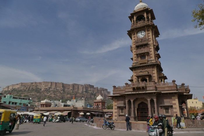
A market lines the street leading to the tower, and the traffic is intense.
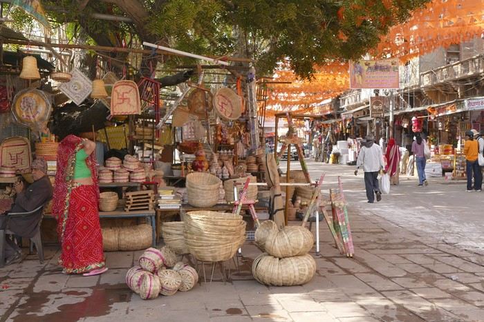
I set off in search of the stepwells and Gulab Sagar, a large basin with three water jets and a great view of Mehrangarh Fort. And yes, more baoris!
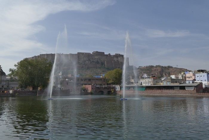
Toorji Ka Jhalra Bawdi isn’t far away. It’s a meet-up spot for tourists, with restaurants and terraces lining the area. The place is nice.
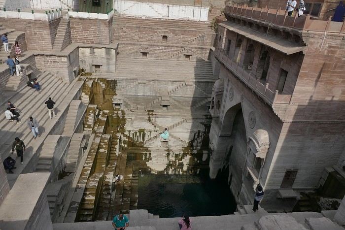
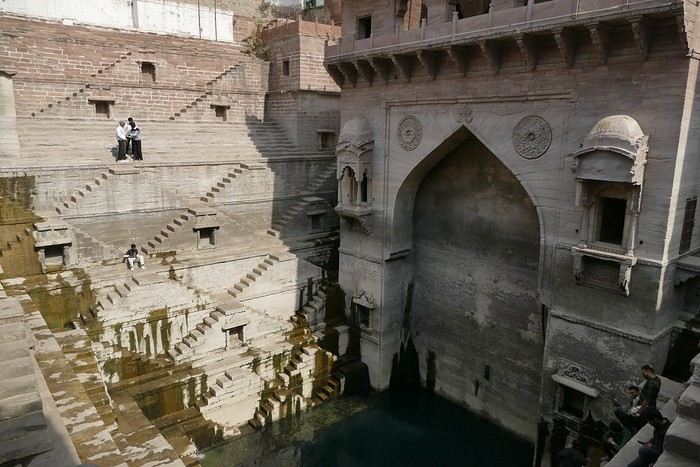
I looked for Mahila Bagh Ka Jhalra, went around in circles a bit, and finally found it right across from Gulab Sagar, where I’d already been. It’s not in good condition—it’s a shame it hasn’t been restored.
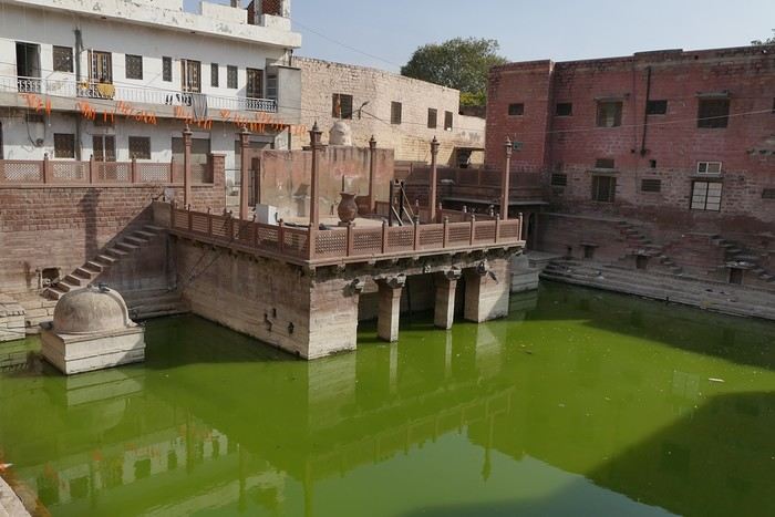
I went back through the clock tower area, found a currency exchange with a good rate, and booked my train tickets for the whole trip. The street was lively, with heavy traffic.
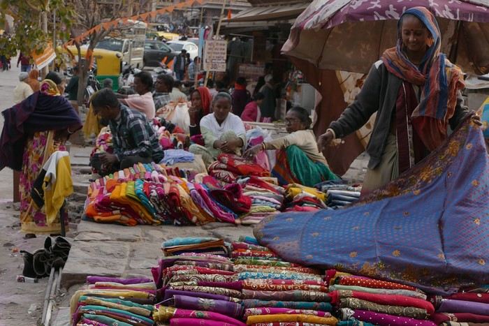
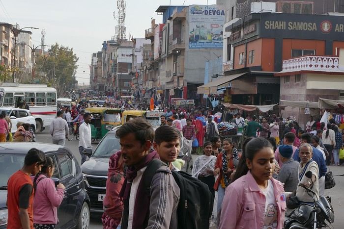
I was tired and headed back to the guesthouse. When I got there, I realized my phone wasn’t showing the right time, which gave me a chance to rest before going out for dinner. The Indigo restaurant is nearby and will be perfect.
Thursday, January 25: I left home at 4:30 AM and headed to Barcelona airport. The roads weren’t blocked by farmers yet, so I made the trip without any issues. I arrived at the airport at 7:10 AM, called Parkvia, and someone picked up my car 15 minutes later. All that was left was to check in my luggage. My Etihad flight was at 10:25 AM, which gave me time for breakfast. We landed in Abu Dhabi at 7:30 PM. The flight to Delhi was at 10:15 PM, the transfer went smoothly without any stress, and we arrived in Delhi at 3:00 AM. I couldn’t waste any time upon arrival because I had a flight to Jodhpur at 6:55 AM. I got to customs, and what a nice surprise—the hall was empty. I went through immediately, had my passport and visa checked, and everything was fine. I grabbed my bag quickly and looked for the transfer to T2, which is outside. You have to walk along the taxi parking lot and take the long corridors—it’s well signposted, and the transfer took 10 minutes. At first, I was a little stressed, not knowing how long customs would take, but in the end, I was early for my 6:55 AM flight. I’m even glad I booked this one, as it got me to Jodhpur at 8:20 AM.
When I arrived, I took an auto-rickshaw to Jodhpur Palace GH, which I’d booked on Booking. The welcome was nice, and I was given a room right away. I was hoping to rest a bit, but unfortunately, it was very noisy. I settled in, took a shower, and was ready to go out and explore the city. The owner stopped me as I was leaving and told me I had to change rooms—I had to repack my bag before heading out. He showed me the way to the clock tower, which is about a 15-minute walk away.
A market lines the street leading to the tower, and the traffic is intense.
I set off in search of the stepwells and Gulab Sagar, a large basin with three water jets and a great view of Mehrangarh Fort. And yes, more baoris!
Toorji Ka Jhalra Bawdi isn’t far away. It’s a meet-up spot for tourists, with restaurants and terraces lining the area. The place is nice.
I looked for Mahila Bagh Ka Jhalra, went around in circles a bit, and finally found it right across from Gulab Sagar, where I’d already been. It’s not in good condition—it’s a shame it hasn’t been restored.
I went back through the clock tower area, found a currency exchange with a good rate, and booked my train tickets for the whole trip. The street was lively, with heavy traffic.
I was tired and headed back to the guesthouse. When I got there, I realized my phone wasn’t showing the right time, which gave me a chance to rest before going out for dinner. The Indigo restaurant is nearby and will be perfect.
Albania in Autumn Colors
A new work assignment means our vacation dates can't stay the same.
We had planned to go to the Canary Islands, but flight prices are skyrocketing with this new holiday schedule.
So, I’m looking for an alternative to Gran Canaria and El Hierro and found two round-trip flights with Wizz Air to Tirana.
398 €, including baggage and seats—perfect!
Plus, the departure and return times are great, which is pretty rare for a low-cost flight!
All that’s left is to rent a car, plan the route, and book accommodations.
With two weeks, we’ll have to make some choices!
Here’s the final itinerary: Shkodra (2 nights), Valbonë (3 nights), Tirana (1 night), Lake Ohrid (1 night), Korçë (1 night), Përmet (1 night), Gjirokastër (1 night), Himarë (2 nights), Berat (2 nights), and Krujë (1 night).
A mix of countryside and small towns, a bit of the Mediterranean, and some mountains!
Late October isn’t the best season, so let’s keep our fingers crossed for the rest...
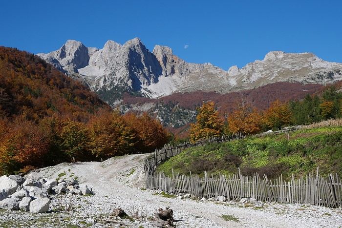
We had planned to go to the Canary Islands, but flight prices are skyrocketing with this new holiday schedule.
So, I’m looking for an alternative to Gran Canaria and El Hierro and found two round-trip flights with Wizz Air to Tirana.
398 €, including baggage and seats—perfect!
Plus, the departure and return times are great, which is pretty rare for a low-cost flight!
All that’s left is to rent a car, plan the route, and book accommodations.
With two weeks, we’ll have to make some choices!
Here’s the final itinerary: Shkodra (2 nights), Valbonë (3 nights), Tirana (1 night), Lake Ohrid (1 night), Korçë (1 night), Përmet (1 night), Gjirokastër (1 night), Himarë (2 nights), Berat (2 nights), and Krujë (1 night).
A mix of countryside and small towns, a bit of the Mediterranean, and some mountains!
Late October isn’t the best season, so let’s keep our fingers crossed for the rest...
Unusual trip to Rajasthan November 2022
Friday, November 4
My flight Barcelona - Abu Dhabi - Delhi went smoothly, it’s on time, and here I am back in India after 3 long years.
As I step off the plane, we head toward customs. It’s 3 AM, I’m tired but happy. The huge customs hall is below ground level and buzzing with people who’ve just arrived. In the end, they’re well organized—Indians to the left, foreigners to the right, and all along the hall, the customs officers’ posts, who remain very zen despite the crowd. It took me less than 2 hours to get out of the airport, which was pretty quick.
For this return trip, I got in touch with a driver from the "Lovers of India" group who was supposed to take me from the airport to Udaipur, passing through non-touristy villages like I love. This French-speaking driver had convinced me to travel by car, which was supposed to make moving from village to village easier. Two or three days before departure, I receive a message from the driver saying he was sick with a cold and sending another driver, his very kind brother who knows Rajasthan well but doesn’t speak French. I’m a bit disappointed by this message and doubtful about the driver’s sincerity, but I don’t have time to find another driver, so I stick to my plans, though I’m not at ease.
At the exit, the driver hasn’t arrived, and I wait half an hour before seeing him show up with a big smile, "Namaste." We don’t waste time and head to the car, which is clean and new.
We get to know each other in the car and hit the road toward Alwar. Along the way, we stop for lunch and to taste my first masala chai, which wakes up my taste buds.
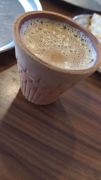
I doze off during the drive, and we arrive at the Atlantic Hotel in Alwar at 10:30 AM. My room is on the ground floor, and I settle in quickly. The Wi-Fi isn’t working, but the staff do everything they can to fix it. At noon, Gajender, the driver, suggests visiting the Qila Fort, which is on the heights of Alwar. The fort is closed for restoration, but safari tours are offered—jeep, guide, driver, and visit for 1600 Rs.
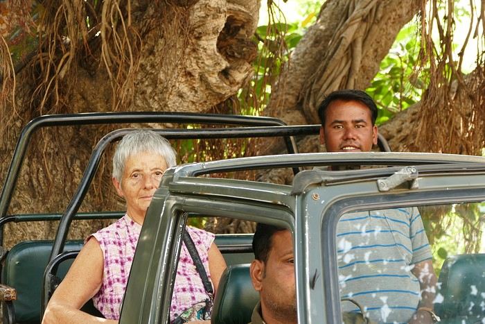
We follow the great wall, which is impressive—the second largest in India and the third in the world.
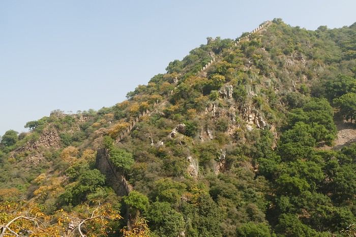
We spot peacocks and monkeys.
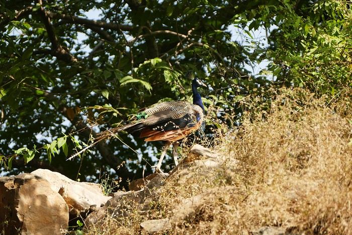
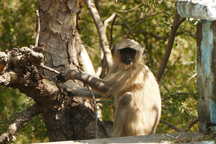
The guide shows me an old stepwell lost in nature. It’s always my thing to check out these baoris, which can be stunning, but this one isn’t anything special. We arrive at the palace overlooking the city.
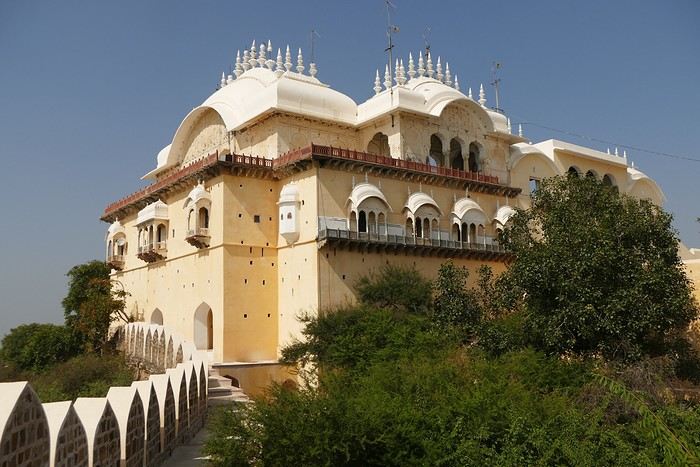
We walk around the palace, and I discover another stepwell that’s not worth lingering over.
The tour is over, and I had a great time despite the fatigue. We head back down to Alwar, near the City Palace, which has been turned into administrative offices. Gaju (the driver’s nickname) finds a parking spot near a dhaba where we have lunch (paneer masala, chapatis, chai)—it’s delicious. With my energy restored, we head to the palace. On the top floor is a museum that I visit.
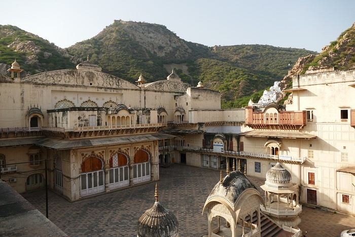
At the exit of the museum, we have to go back down and walk around the palace to get to the Moosi Maharani Chhatri. I’ve been here once before and really liked it, and the place is still the same—calm and relaxing.
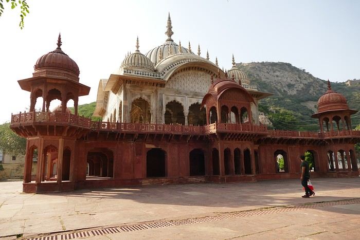
"This monument is the most artistic in Alwar and also the most royal, filled with fascinating history. Maharaja Vinay Singh of Alwar built this two-story cenotaph in 1815 in memory of his father, Maharaja Bakhtawar Singh. It’s also known as Moosi Maharani ki Chhatri, named after the king’s mistress, who performed sati upon his death. After the sati, she was accepted as the king’s wife. It’s an elegant monument, shaped like a flower and built with a mix of brown sandstone and white marble. The first floor is made of sandstone, while the upper floor and the chhatris (cenotaphs) are in white marble. Its sculpted pavilion has dome-shaped arches with intricate lace-like and exquisite floral patterns. There are complex motifs that shine brightly in the sunlight. The colorful circular ceiling is an important part of Moosi Maharani Ki Chhatri and is adorned with faded gold-leaf paintings of mythological figures and scenes. The footprints of Maharaja and Moosi Rani are engraved in marble inside the cenotaph, and locals pay their respects to them."
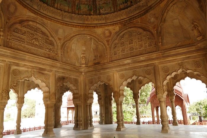
Near the chhatri, there’s a large water reservoir with a magnificent view. The place is peaceful and relaxing, and I stay here for a while, contemplating and daydreaming before heading back to the hotel for some well-deserved rest. The Wi-Fi is working now. I’m the only foreign guest, and since my room is near the entrance, I’ll be well taken care of throughout my stay.
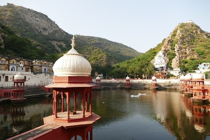
I doze off during the drive, and we arrive at the Atlantic Hotel in Alwar at 10:30 AM. My room is on the ground floor, and I settle in quickly. The Wi-Fi isn’t working, but the staff do everything they can to fix it. At noon, Gajender, the driver, suggests visiting the Qila Fort, which is on the heights of Alwar. The fort is closed for restoration, but safari tours are offered—jeep, guide, driver, and visit for 1600 Rs.
We follow the great wall, which is impressive—the second largest in India and the third in the world.
We spot peacocks and monkeys.
The guide shows me an old stepwell lost in nature. It’s always my thing to check out these baoris, which can be stunning, but this one isn’t anything special. We arrive at the palace overlooking the city.
We walk around the palace, and I discover another stepwell that’s not worth lingering over.
The tour is over, and I had a great time despite the fatigue. We head back down to Alwar, near the City Palace, which has been turned into administrative offices. Gaju (the driver’s nickname) finds a parking spot near a dhaba where we have lunch (paneer masala, chapatis, chai)—it’s delicious. With my energy restored, we head to the palace. On the top floor is a museum that I visit.
At the exit of the museum, we have to go back down and walk around the palace to get to the Moosi Maharani Chhatri. I’ve been here once before and really liked it, and the place is still the same—calm and relaxing.
"This monument is the most artistic in Alwar and also the most royal, filled with fascinating history. Maharaja Vinay Singh of Alwar built this two-story cenotaph in 1815 in memory of his father, Maharaja Bakhtawar Singh. It’s also known as Moosi Maharani ki Chhatri, named after the king’s mistress, who performed sati upon his death. After the sati, she was accepted as the king’s wife. It’s an elegant monument, shaped like a flower and built with a mix of brown sandstone and white marble. The first floor is made of sandstone, while the upper floor and the chhatris (cenotaphs) are in white marble. Its sculpted pavilion has dome-shaped arches with intricate lace-like and exquisite floral patterns. There are complex motifs that shine brightly in the sunlight. The colorful circular ceiling is an important part of Moosi Maharani Ki Chhatri and is adorned with faded gold-leaf paintings of mythological figures and scenes. The footprints of Maharaja and Moosi Rani are engraved in marble inside the cenotaph, and locals pay their respects to them."
Near the chhatri, there’s a large water reservoir with a magnificent view. The place is peaceful and relaxing, and I stay here for a while, contemplating and daydreaming before heading back to the hotel for some well-deserved rest. The Wi-Fi is working now. I’m the only foreign guest, and since my room is near the entrance, I’ll be well taken care of throughout my stay.
The Great Ocean Road in Australia
Tuesday, December 5, 2023
Melbourne – Lorne
We pick up the car 500 meters away, in a Chinatown parking lot that the hotel has a deal with, then it’s off with a *vroom vroom* while listening to a podcast about the victim of a compulsive mythomaniac—who also happens to be her husband—leading a completely compartmentalized double life. Later, he discovers, after contacting his alter-ego from this parallel universe, that he was actually living a *third* life... and maybe even more? We arrive in Torquay, where we stretch our legs along the Koorie Cultural Walk with a view of Bells Beach...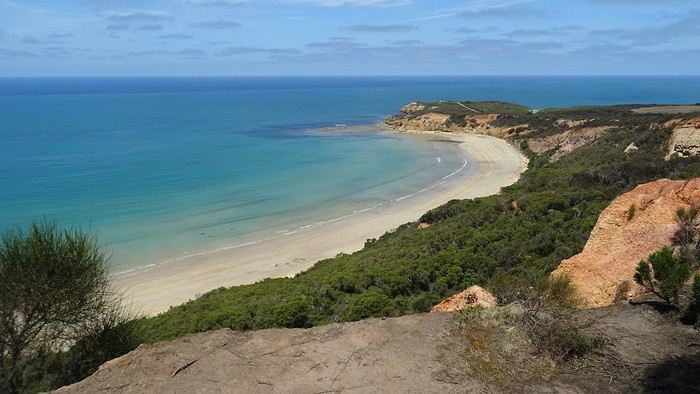
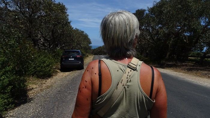
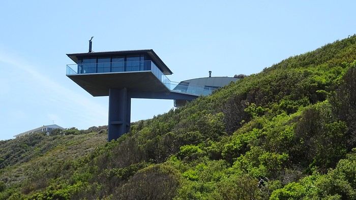
It’s here, just outside Lorne, that the Great Ocean Road officially begins...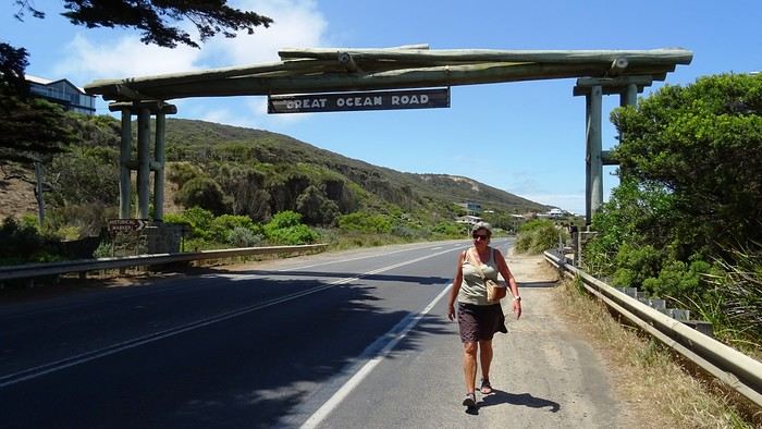
We arrive at our apartment, which is pretty nice—Dom and I are really particular about the quality of our terraces. I’ve never really talked about the practical quirks of daily life in Australia. For example, I could tell you that *every single* power outlet we used on this trip had a switch to turn it on or off. No exceptions, ever! Why? They must find it useful, but for us, it’s a total mystery... And of course, their power outlets require an adapter. Just one of many little peculiarities. Another odd observation: *every* toilet, even the most remote ones hidden deep in the bush, always had a roll of toilet paper available. No shortages here!
And then we’re greeted by a big family of cute sparrows...
Another odd observation: *every* toilet, even the most remote ones hidden deep in the bush, always had a roll of toilet paper available. No shortages here!
And then we’re greeted by a big family of cute sparrows...
We spent a long time enjoying their pool before heading out for a walk—all the way to Erskine Falls, about ten kilometers away...
We pick up the car 500 meters away, in a Chinatown parking lot that the hotel has a deal with, then it’s off with a *vroom vroom* while listening to a podcast about the victim of a compulsive mythomaniac—who also happens to be her husband—leading a completely compartmentalized double life. Later, he discovers, after contacting his alter-ego from this parallel universe, that he was actually living a *third* life... and maybe even more? We arrive in Torquay, where we stretch our legs along the Koorie Cultural Walk with a view of Bells Beach...
It’s here, just outside Lorne, that the Great Ocean Road officially begins...
We arrive at our apartment, which is pretty nice—Dom and I are really particular about the quality of our terraces. I’ve never really talked about the practical quirks of daily life in Australia. For example, I could tell you that *every single* power outlet we used on this trip had a switch to turn it on or off. No exceptions, ever! Why? They must find it useful, but for us, it’s a total mystery... And of course, their power outlets require an adapter. Just one of many little peculiarities.
Another odd observation: *every* toilet, even the most remote ones hidden deep in the bush, always had a roll of toilet paper available. No shortages here!
And then we’re greeted by a big family of cute sparrows...We spent a long time enjoying their pool before heading out for a walk—all the way to Erskine Falls, about ten kilometers away...