Results for "plage+ou+balnéaire+|+4+>+130"
275403 results found.
Climat à Agadir en juillet English translation pending
🙂Bonjour,
j'aimerais savoir quelle est la température à Agadir au début du mois de juillet. Je prévois passer mes vacances estivales au Maroc avec mon mari et mes 2 enfants!!!! Avez-vous des suggestions? merci Izazbelle
j'aimerais savoir quelle est la température à Agadir au début du mois de juillet. Je prévois passer mes vacances estivales au Maroc avec mon mari et mes 2 enfants!!!! Avez-vous des suggestions? merci Izazbelle
Budget, transport et plages en Birmanie English translation pending
Du 1 janvier 2005 au 12 fevrier, en couple, nous partons en Birmanie.
conseil pour prolonger le visa?
Les bonnes plages, pour un peu de repos?
Les moyens de transport pratique ?
Le budget par jour moyen?
Traitement pallu?
Nous voyageons sac à dos avec petit budget.
Merci. 😉
Nous voyageons sac à dos avec petit budget.
Merci. 😉
Itinéraire pour le Cambodge English translation pending
Bonjour,
Ca y est 🙂… les billets d’avion sont réservés et livrés à domicile : aller / retour Paris Bangkok, destination Cambodge…. pour deux jeunes qui en veulent !
Nous sommes en train de préparer un itinéraire de voyages… et on s’dit que la difficulté réside dans les temps de transport. Alors pour 3 semaines et demi, je souhaiterais connaître la faisabilité du parcours « théorique » que nous nous donnons.
Point départ Bangkok, direction le poste frontalier Aranya Prathet et premier arrêt à Battambang : ville élégante à l’atmosphère coloniale. Puis, par voie fluviale (Stung Sangker) relier Battambang à Siem Reap et les temples d’Angkor… De là et toujours par voie fluviale (lac Tonlé Sap), relier Siem Reap à Phnom Penh.
Pour la suite, notre choix s’est posé sur la découverte du Nord-Est du Cambodge, et donc laisser de côté pour cette année le Sud et ses stations balnéaires.
Alors.. à partir de Phnom Penh, rejoindre Kratie par voie fluviale, étape utile pour atteindre la région de Ratanakiri. Puis, monter jusqu’à Ban Lung, meilleure base pour explorer les richesses naturelles des alentours.
Après avoir atteint le bout du monde, nous pensons rejoindre Bangkok par liaisons aériennes, de Ban Lung jusqu’à Phnom Pen, puis de Phon Penh jusqu’à Bangkok.
Maintenant à vous de jouer… est-ce que l’itinéraire proposé est envisageable sur 3 semaines et demi ? les transports choisis sont-ils judicieux ?
Je vous remercie d’avance pour tous les conseils que vous pourrez nous donner, afin de faire de ce voyage une expérience humaine inoubliable….
Tane.
Ca y est 🙂… les billets d’avion sont réservés et livrés à domicile : aller / retour Paris Bangkok, destination Cambodge…. pour deux jeunes qui en veulent !
Nous sommes en train de préparer un itinéraire de voyages… et on s’dit que la difficulté réside dans les temps de transport. Alors pour 3 semaines et demi, je souhaiterais connaître la faisabilité du parcours « théorique » que nous nous donnons.
Point départ Bangkok, direction le poste frontalier Aranya Prathet et premier arrêt à Battambang : ville élégante à l’atmosphère coloniale. Puis, par voie fluviale (Stung Sangker) relier Battambang à Siem Reap et les temples d’Angkor… De là et toujours par voie fluviale (lac Tonlé Sap), relier Siem Reap à Phnom Penh.
Pour la suite, notre choix s’est posé sur la découverte du Nord-Est du Cambodge, et donc laisser de côté pour cette année le Sud et ses stations balnéaires.
Alors.. à partir de Phnom Penh, rejoindre Kratie par voie fluviale, étape utile pour atteindre la région de Ratanakiri. Puis, monter jusqu’à Ban Lung, meilleure base pour explorer les richesses naturelles des alentours.
Après avoir atteint le bout du monde, nous pensons rejoindre Bangkok par liaisons aériennes, de Ban Lung jusqu’à Phnom Pen, puis de Phon Penh jusqu’à Bangkok.
Maintenant à vous de jouer… est-ce que l’itinéraire proposé est envisageable sur 3 semaines et demi ? les transports choisis sont-ils judicieux ?
Je vous remercie d’avance pour tous les conseils que vous pourrez nous donner, afin de faire de ce voyage une expérience humaine inoubliable….
Tane.
Je vous aide pour la Croatie English translation pending
Croate ayant des origines francaise je vis sur la cote dalmate je serai heureux d'aider de donner des bons tuyaux ou meme d'acceuillir d'eventuel voyageur pour leur faire partager l'amour de mon pays. A charge de revanche! 😉
Feedback on 20-Day Malaysia Itinerary
Hi everyone! Here’s a rough draft of my itinerary: I’d like to rent a car in KL and return it in Penang.
Is there an overnight bus from Langkawi to the Perhentians?
Another option: skip one of the two islands to drive back down to KL and stop at Pulau Redang?
Day 1: Arrival at 10 AM, car rental for 7 days, Putrajaya, night in KL Day 2: Batu Caves, Taman Negara, night in TN Day 3: Taman Negara, night in TN Day 4: Drive to Cameron Highlands, night in CH Day 5: Cameron Highlands, Ipoh, night in Penang Day 6: Penang, George Town Day 7: Return rental car in Penang and flight to Langkawi. Night in Langkawi (4 nights) Day 8: Langkawi Day 9: Langkawi Day 10: Langkawi Day 11: Overnight bus? Langkawi to Perhentians (5 nights) Day 12: Perhentians Day 13: Perhentians Day 14: Perhentians Day 15: Perhentians -> KL (flight) Day 17: KL Day 18: KL Day 19: Return flight at 1 PM
Thanks for your expert advice! !
Day 1: Arrival at 10 AM, car rental for 7 days, Putrajaya, night in KL Day 2: Batu Caves, Taman Negara, night in TN Day 3: Taman Negara, night in TN Day 4: Drive to Cameron Highlands, night in CH Day 5: Cameron Highlands, Ipoh, night in Penang Day 6: Penang, George Town Day 7: Return rental car in Penang and flight to Langkawi. Night in Langkawi (4 nights) Day 8: Langkawi Day 9: Langkawi Day 10: Langkawi Day 11: Overnight bus? Langkawi to Perhentians (5 nights) Day 12: Perhentians Day 13: Perhentians Day 14: Perhentians Day 15: Perhentians -> KL (flight) Day 17: KL Day 18: KL Day 19: Return flight at 1 PM
Thanks for your expert advice! !
4 weeks in Bali, Java, and Sulawesi
We’re a couple in our sixties and spent four weeks in Indonesia during October 2025.
First, we got all the necessary documents—Indonesian visa, Bali-specific visa, and customs forms—from specialized Indonesian websites. You *can* get them on arrival, but it takes a lot of time.
Unfortunately, we chose to spend the first six days of our trip in Ubud and Amed, on Bali, which we bitterly regretted. You can arrive in Indonesia without going through Bali—this island is overcrowded with tourists, cars, and scooters, and it’s home to 4,400,000 people despite being smaller than Corsica. The locals are very kind, helpful, and friendly, and the food is good, but everything is geared toward tourists—nothing feels truly authentic. At least in the parts of Bali we visited: Sanur in the south (where we spent three days before flying back to France), Ubud, and Amed. The north of the island might be more interesting, but we didn’t go there.
After Bali, we headed to Yogyakarta, on Java, to explore the city and, most importantly, visit the temples of Borobudur and Prambanan.
It’s like going from a hyper-touristy universe to a world with almost no tourists. When you walk around the city, you barely see any tourists—the people are very approachable and happy to chat. As for Borobudur and Prambanan, they’re an absolute must on this trip. You *can* visit both temples in one day, including seeing Borobudur at sunrise. We split the visits over two days. We booked Borobudur the day before on the official site, which offers specific visiting times. For Prambanan, we bought the ticket and hired a guide on-site.
We spent four days on Java before flying to Sulawesi, also called Celebes. Makassar, the island’s capital, was just a stopover between flights, but we had time to admire the beautiful new mosque at sunset. Then, we spent four days in Toraja country, another highlight of the trip, visiting cemeteries and attending a funeral ceremony with around 600 people near Rantepao. We experienced truly unique and extraordinary moments. Above Toraja country, a few hours’ drive away, lies the Bada Valley and its megaliths—the tallest is 4.8 meters high, and there are about fifteen scattered across the rice fields. We saw five of them. There were a few tourists in Toraja, but in Bada, we were alone. Unforgettable memories, stunning landscapes, and always-smiling, kind, approachable people.
To wrap up the trip, we spent five nights in the Togian Islands, north of the Bada Valley, alone in a resort with three bungalows. The view was a white-sand beach and the nearby coral reef, complete with colorful fish, turtles, dolphins, and sharks.
After eleven nights in Sulawesi, we returned to Bali. Our last nights were in Sanur, a beach town with all-inclusive hotels (we stayed in an Airbnb), restaurants serving beef bourguignon, and tourists who don’t really go to Indonesia—they just go to Bali.
Practical tip: download Grab, the local Uber—it’s super handy. This year, we opted for an eSIM, which is also very convenient. You can buy it in France and activate it when you arrive at the airport.
I’m happy to answer any questions!
PS: Despite my mixed feelings about Bali, it *can* still be a travel destination—but Indonesia has so much more to offer! Marc
First, we got all the necessary documents—Indonesian visa, Bali-specific visa, and customs forms—from specialized Indonesian websites. You *can* get them on arrival, but it takes a lot of time.
Unfortunately, we chose to spend the first six days of our trip in Ubud and Amed, on Bali, which we bitterly regretted. You can arrive in Indonesia without going through Bali—this island is overcrowded with tourists, cars, and scooters, and it’s home to 4,400,000 people despite being smaller than Corsica. The locals are very kind, helpful, and friendly, and the food is good, but everything is geared toward tourists—nothing feels truly authentic. At least in the parts of Bali we visited: Sanur in the south (where we spent three days before flying back to France), Ubud, and Amed. The north of the island might be more interesting, but we didn’t go there.
After Bali, we headed to Yogyakarta, on Java, to explore the city and, most importantly, visit the temples of Borobudur and Prambanan.
It’s like going from a hyper-touristy universe to a world with almost no tourists. When you walk around the city, you barely see any tourists—the people are very approachable and happy to chat. As for Borobudur and Prambanan, they’re an absolute must on this trip. You *can* visit both temples in one day, including seeing Borobudur at sunrise. We split the visits over two days. We booked Borobudur the day before on the official site, which offers specific visiting times. For Prambanan, we bought the ticket and hired a guide on-site.
We spent four days on Java before flying to Sulawesi, also called Celebes. Makassar, the island’s capital, was just a stopover between flights, but we had time to admire the beautiful new mosque at sunset. Then, we spent four days in Toraja country, another highlight of the trip, visiting cemeteries and attending a funeral ceremony with around 600 people near Rantepao. We experienced truly unique and extraordinary moments. Above Toraja country, a few hours’ drive away, lies the Bada Valley and its megaliths—the tallest is 4.8 meters high, and there are about fifteen scattered across the rice fields. We saw five of them. There were a few tourists in Toraja, but in Bada, we were alone. Unforgettable memories, stunning landscapes, and always-smiling, kind, approachable people.
To wrap up the trip, we spent five nights in the Togian Islands, north of the Bada Valley, alone in a resort with three bungalows. The view was a white-sand beach and the nearby coral reef, complete with colorful fish, turtles, dolphins, and sharks.
After eleven nights in Sulawesi, we returned to Bali. Our last nights were in Sanur, a beach town with all-inclusive hotels (we stayed in an Airbnb), restaurants serving beef bourguignon, and tourists who don’t really go to Indonesia—they just go to Bali.
Practical tip: download Grab, the local Uber—it’s super handy. This year, we opted for an eSIM, which is also very convenient. You can buy it in France and activate it when you arrive at the airport.
I’m happy to answer any questions!
PS: Despite my mixed feelings about Bali, it *can* still be a travel destination—but Indonesia has so much more to offer! Marc
Namibia Travel Journal: May 2025 - Trip Review
NAMIBIA TRIP 2025: April 24 to May 20: Feel free to comment or ask us any questions about this amazing journey.
>> Find all our photos and videos for each day on our website here: www.montagne-aventure.net
**DAY 1: Thursday, April 24, 2025: Outbound Flights from Lyon to Windhoek via Munich - Visit to Munich:**

Off we go on a new adventure. The alarm rings at 6:30 AM, the travel bags are packed, and we head to Lyon Airport. We booked our flight tickets with Lufthansa. The first leg to Munich, Germany, is operated by AirBaltic. Departure at 1:05 PM for a 1-hour and 20-minute flight. We arrive at 2:30 PM.
**We now have a 7-hour layover, so we take the opportunity to get some fresh air and explore Munich.** We quickly exit Terminal 2 of the airport and head towards the subway. We buy a group day ticket "Airport-city Day Zone M-5," valid for 2 to 5 people at a price of 30.50 € (instead of 16.30 € per person). We take the S8 line to **Marienplatz** in 35 minutes. **This is the heart of the city.** The weather is overcast, quite cool, but dry. Perfect for a little city trip between two flights while leaving our large luggage in transit at the airport. **Munich is the third-largest German city after Berlin and Hamburg, in the Bavaria region.** **The center has a lot of charm and brings together several religious buildings, easy to explore on foot.** We are impressed by the number of people enjoying these 100% pedestrian streets, which are very pleasant. After Marienplatz, the most famous square with the town hall, we head to the Cathedral of Our Lady, a Gothic church, then continue to **Karlsplatz** and move on to **the food market offering a wide selection of high-end food products in an atmosphere where a certain art of living prevails.** We also visit St. Peter's Church before grabbing a bite to eat. Two good hours were enough for this 10 km city walk. It's time to take the subway back: by 6:30 PM, we are back at the airport. Now, it's time for a bit of waiting and rest. Our second flight is scheduled for 9:35 PM for a 9-hour and 30-minute journey to our final destination in Namibia: **Windhoek.**
> Round-trip flight tickets with Lufthansa from Lyon: 2029 €, or 1,014.50 € per person.
> Lyon Airport parking: 120 €
> Today's expenses: 7 € for 2 pizzas in France / 14 € for the restaurant in Munich / 30.50 € for the daily subway ticket in Munich.
**DAY 2: Friday, April 25, 2024: Arrival in Windhoek, Visit to the Namibian Capital:**
After a 9-hour and 30-minute overnight flight with Discover Airlines, we finally land on Namibian soil just before 7:30 AM. The day is breaking, and the colors are already stunning. We are eager despite the usual fatigue from the flight. The airline was punctual, with friendly staff and good meals, though a bit light. We are the first flight of the day to land, with no more than 15 flights per day here, from 7 AM to 8 PM. We disembark on the tarmac at this airport located in the middle of nowhere, **I finally set foot on African soil for the first time.** We exit among the first from the aircraft to go through the long formalities at the front of the line, as the wait can quickly become endless. Allow at least 5 minutes per person for e-visas. We still wait 45 minutes despite only about twenty people ahead of us. Phew, it's done. We collect our luggage and then withdraw money from an ATM. We make 4 withdrawals of the maximum amount, 2000 NAD $ per withdrawal, for a total of 380 €, or 95.33 € per withdrawal.
Our driver arrives at the same time, perfect timing, we were quick.
We leave the airport at 8:45 AM. By 9:30 AM, we arrive at the **Gracious Whisp vehicle rental agency**, located at the entrance of Windhoek, small and human-sized with a fleet of recent vehicles. More formalities, then a short wait as our vehicle is not yet ready. Time to decompress, catch our breath, and enjoy the very pleasant morning temperature. Not a cloud in sight. Next, a briefing on the vehicle, always with a bit of apprehension due to our approximate English. Allow 45 minutes of explanations, including setting up the roof tent, camping equipment, technical information in case of a flat tire, driving tips in Namibia, and a tour of the 4x4. We have all the necessary equipment for camping: mattresses, sleeping bags, pillows, table, chairs, gas stove, BBQ grill... as well as 2 spare tires, a compressor, a dual tank, and accessories for removing wheels. Off we go, it's time to muster our courage and get behind the wheel. **Heading to SuperSpar Maerua**, fortunately located less than 10 minutes away. We park with the help of a parking attendant; it's very crowded, the space is narrow, but everything goes well despite the cursed right-hand drive. Today's new mission: stock up on groceries. The store is well-stocked with local and imported products, catering to all tastes. We spend 114 € on groceries, from pasta to meat, BBQ lighters to dishwashing products. Two people load our groceries into two carts and transfer them to our vehicle; we feel compelled to leave a tip, 50 NAD $, as we don't have change yet. Now, we head to the hotel, 15 minutes away. Traffic is difficult at a complicated intersection; this will likely be the only traffic jam in Namibia. **We arrive at Kate's Nest Guesthouse & Backpackers around 1:15 PM, quite tired.** We take some well-deserved rest at this recent establishment, quite calm with secure private parking. After a short nap, we enjoy the quiet by the hotel pool. Night falls between 6:30 PM and 7 PM. We eat quietly in our room tonight before starting this long 4x4 road trip in camping mode in the heart of Namibia.
> Today's grocery expenses: 114 € at Super Spar Marua (2395.21 NAD $).
> Round-trip flight tickets with Lufthansa from Lyon: 2029 €, or 1,014.50 € per person.
> Vehicle rental: 4x4 Toyota with roof tent for 24 days: Gracious Whisp Car Rentals: 2,638 € (N$50,640) or **1,319 €** per person - (https://gwcarrentals.com/)
> Distance driven today: 15 km.
> Accommodation: Kate's Nest Guesthouse & Backpackers - 4 Aristotles Street Academia, 9000 Windhoek - 36 € for two for one night.
> Windhoek International Airport website: (https://www.airports.com.na/)
**DAY 3: Saturday, April 26, 2025: Windhoek to Hardap: Mariental Region - Kalahari Desert:**
After a good, restful night, we wake up leisurely around 7 AM. We enjoy the comfort provided by this first and last hotel before 24 nights under the tent.
**We leave Kate's Nest Guesthouse at 8:30 AM to tackle the Namibian roads.** We quickly leave the capital; in just 30 minutes, we find ourselves almost alone in the world. The landscape is dotted with small domes. We leave the **paved B1** quickly to turn left onto the **C15**. **From there, we won't see more than 10 vehicles all day.** After passing through the few houses of **Lekkerwaterpoort**, we tackle our first gravel road. These road sections are limited to 100 km/h, but even at 70 km/h, I find it already challenging. However, I quickly get used to it and gradually pick up speed to reach my cruising speed of around 80 to 90 km/h. **We are on immense straight lines crossing wild expanses as far as the eye can see.** **We come across two baboons, a few ostriches, and numerous cattle and sheep farms.** We pass through the charming village of **Uhlenhorst** with its typical houses and children with broad smiles waving at us. Life here is already very different from Windhoek. **The thermometer rises quickly from 16°C at 8:30 AM to over 28°C in the early afternoon.**
**We arrive at the Hardap Dam reserve at 2 PM.** We stop at the toll booth at the park entrance to pay the entrance fee: 250 NAD $ for 2 people and 1 vehicle. We continue to the dam and then the camp entrance, located a bit further. We had booked in advance, but this place remains little frequented by foreigners.
We take advantage of the hottest hours to rest by the large pool overlooking the immense lake, a very enjoyable moment. Would this be a bit of a vacation?
Around 4:30 PM, we head to the campsite. We overlook this vast water reserve. We arrive first; we will be only 3 vehicles spending the night here. It's time to get to work and set up our equipment for the first time. It takes us a good 20 minutes to set everything up, with a slight apprehension about unfolding the tent. Once this task is done, which we will have to repeat for almost a month, we will become much more efficient over time. Time for rest and contemplation in total silence. The sun gradually sets, and the heat quickly becomes bearable again. Bliss! **This dam is located 20 km northwest of Mariental in an area dotted with conical hills topped with dolerite buttons (Hardap means "hillock" in Nama). It captures the Fish River, which flows south, creating a large lake in the middle of an arid environment. The contrast is striking.** We enjoy our first sunset facing this 360° otherworldly landscape.
Around 7 PM, we start our first BBQ, or "braai" as it's called here. The temperature is perfect. The sun sets, giving way to a star-filled sky of incredible beauty thanks to the absence of any light pollution. The Milky Way will lull us throughout the evening. After some good sausages and potatoes on the BBQ, we head to our roof tent around 9:30 PM with a complete change of scenery in just 24 hours. France already seems so far away...
This campsite has shared showers and toilets, quite clean and functional, as well as a central area with several BBQs and tables. The sites are arranged in a semicircle, each with an electrical outlet. The sites are close to each other but spacious, some slightly shaded. We are only three vehicles tonight, so it's perfectly comfortable and quiet. Not to mention the large pool near the restaurant. Our trip is off to a great start.
> Today's road itinerary: Windhoek > Head south on the B1 to Rehoboth > Turn left onto the C25 then C15 to Stampriet > C20 to Hardap > Full north on the B1 > Then turn left onto the M93 - 5 hours of driving.
> Distance driven today: 354 km.
> Accommodation: Hardap Recreation Resort - 23.3 € for two - Large pool - GR6W+3M2, Hardap Game Reserve, Mariental, Namibia - (http://www.nwr.com.na/resorts/hardap-resort/)
**DAY 4: Sunday, April 27, 2025: Hardap - Brukkaros Volcano - Keetmanshoop - Quivertree Forest Rest Camp**
Our first night under the tent was very pleasant; the little wind quickly calmed down, giving way to absolute silence. The mattress is decent, more comfortable than some nights in Nepal. The length and width give us enough space for maximum comfort, despite my height (1.91 m). We wake up a little before 7 AM as the sun rises, and the lights dazzle us from the start of the day. We pack up the equipment in 30 minutes, quite easily. Then we enjoy the sun, which warms up quickly while we keep our light fleece on.
At 8:30 AM, **we hit the road again, heading south** to our first stop in **Mariental**. We want to do some shopping at SuperSpar, but once we arrive in the parking lot, a young local is fighting with the supermarket security guards and then threatens to throw stones. We don't want to take any risks right at the start, so despite the baton blows he receives, he doesn't stop. We leave empty-handed but fill up with fuel at the Shell station 1 km further. The price per liter is 21.33 NAD $, we fill our 107-liter tank for 107 €. In Namibia, you get served, and they bring the card machine to the window to pay. It's then customary to leave a tip.
We then take the B1 heading due south on a recently renovated road. Around 11:30 AM, we leave it on our right to take **a wild gravel road, the M98**. Just before **Berseba**, we turn right onto a small track, the **D3904 towards Brukkaros Crater up to a camp at 1588 m altitude**. The track then becomes too bumpy. We stop on the counter-slopes where **a wide panorama unfolds over these immense plains as far as the eye can see**. It's 12:15 PM, time for us to eat a rice and tuna salad facing this landscape.
**We are alone in the world until a vehicle arrives and parks next to us.** A bit of apprehension, 4 men head towards us. It turns out to be 4 shepherds looking for a lost foal. The conversation is pleasant, lost in the middle of nowhere. We find ourselves alone again in this absolute silence. **The heat becomes stifling with a good 30°C**. We get back on the road around 1 PM. Back on the B1, **we continue due south to Keetmanshoop**, which we reach around 3 PM. We stop there to do some shopping for 262 NAD $ (12 eggs, a can of tuna, a can of corn, bread, a soda, and a 5-liter water container), or 12.48 €. Two quite insistent children ask us for money or candy at the store exit, yet we give them a small tip, but they continue to cling to the car. Locals parked next to us tell them to leave us alone. Anyway, we finish the trip to **Quivertree Forest**, 15 km away. We will spend the night in this **pleasant farm run by a German**. Upon arrival, as the day before, and as I suppose in the future, we dive straight into the cool pool to relax after all these kilometers. A bliss. Then we take our 4x4 and choose a spot near these famous trees. After the 33°C this afternoon, once 4 PM passed, the temperature drops again and becomes very pleasant. **We are in the middle of the Kokerboom, one of the most interesting and characteristic plants of hot and arid regions. It's not really a tree but a variant of the aloe plant whose botanical name is Aloe Dichotoma. This Kokerboom has a smooth and thick trunk reaching up to 1 m in thickness and 9 m in height. They bloom for the first time at the age of 20 to 30 years.** The flowers are yellow and reach about thirty centimeters during the season between June and July. **They grow mainly in an environment with a high concentration of black rocks absorbing a large amount of heat (38°C). The rocks also serve to anchor the tree with its tentacle-like roots. It also resists frost. Each is between 200 and 300 years old.**
Around 5 PM, we walk to the farm reception to watch the feeding of **two cheetahs**. Magnificent carnivores taking their time to savor their piece of meat. **Then we return near our campsite to enjoy the sunset among these trees. The colors are sublime, as every evening apparently. A magnificent spectacle with colors evolving from yellow to orange then to pink, before giving way once again to a sky filled with thousands of stars.** Our campsite at Quiver Tree Forest Camp is very comfortable; we have a water supply, a stone table, a small lamp, an electrical outlet, a small tree for shade, and a BBQ that we won't use tonight; we'll cook on gas. The sites are far apart, with some shared facilities scattered around, a very beautiful setting. No reservation possible, no need, just show up directly. **The campsite accommodation for 2 people costs 28 €, including the reserve entrance fee of 5 €**. We finish this second bivouac evening around 9:30 PM, time for some reading and sleep in peaceful silence without wind.
> Today's road itinerary: Mariental > B1 heading south to Brukkaros > At Tses turn right towards Berseba via the M98 > Turn right onto the D3904 > 8 km > Brukkaros Volcano (stop at the lower camp as the track is difficult for 1 hour) > Keetmanshoop > Turn left onto the M29 > Quivertree Forest - 4 hours of driving.
> Distance driven today: 371 km.
> Distance walked today: 6 km.
> Today's expenses: Groceries for 12.48 € (262 NAD $) / Fuel for 107 € (1 liter of diesel for 21.33 NAD $).
> Accommodation: Quivertree Forest Rest Camp, P.O. Box 262, Keetmanshoop, Namibia - BBQ, hot showers, toilets, and electricity - No reservation - Pool - 18 €/Person (N$ 340.00 with park entrance) - (http://www.quivertreeforest.com/)
**DAY 5: Monday, April 28, 2025: Quivertree Forest Rest Camp - Giant's Playground - Keetmanshoop - Fish River Canyon - Canyon Roadhouse:**
After an excellent start to the night, we are woken up by the wind shortly before 6 AM, but the sunrise is not far off. We get up at 6:30 AM to enjoy it. The atmosphere is a bit cooler this morning, but the reward is already here.
The adventure continues. At 7:45 AM, we head towards **Giant's Playground**, 4 km away. We take a 3-kilometer walk through this expanse of blocks and igneous rocks.
We continue south at 8:45 AM, passing through Keetmanshoop again where we do some shopping for 25 €, a big stock-up for a good part of the trip: meats, canned goods, pasta, fruits... At 9:30 AM, we take the B4 to Fish River Canyon.
At 11:30 AM, we arrive at the entrance to the NWR park (350 NAD $ entrance for 2 people and 1 vehicle). The track becomes bumpy immediately upon entering the park. After about ten kilometers, we come upon this landscape carved by nature. In the end, it's well worth the detour. We were at the Grand Canyon in the USA exactly (https://www.montagne-aventure.net/2024/04/29/j21-3-juin-2024-grand-canyon-et-lac-powell/) and can thus confirm that this Fish River Canyon is comparable. We make several stops along the southern flank. **Here, nothing is developed; nature is almost in the wild state.** **With 160 km in length, up to 27 km in width, and a depth of 150 m, it is indeed the second-largest canyon in the world.** The history of the canyon is apparent in its different earth layers and stratification: the antiquity of the place is tangible, and the absence of vegetation is surprising. **It consists of two nested canyons, formed at distinct periods. The first distinct layer of schist, sandstone, and eruptive material surrounding the canyon was formed a few two billion years ago, then transformed due to heat and pressure into more solid rock such as gneiss. The inner canyon, carved more recently by the Fish River, has a depth of 270 m.**
We have a picnic once again alone in the world facing this grand panorama at the **Sulphur Spring View Point**. This is where the hiking trail begins, plunging into this narrow canyon, but it is forbidden to venture there alone without a guide. It's 30°C, but a slight wind makes the atmosphere bearable. At 1 PM, we retrace our steps and continue to the **Main View Point** then to the **Hikers View Point**.
In the south of Namibia, the Fish River Canyon, 160 km long, is a true geological wonder: a canyon nested within another canyon, one of the largest in the world. The first sedimentary layers formed two billion years ago; 500 million years ago, a period of tectonic activity caused these layers to crack and tilt, opening a vast canyon in the Earth's crust. The second canyon, with a depth of 270 m, was carved over time by the passage of the Fish River in this new valley.
At 3 PM, we arrive at our very charming camp for the evening, the **Canyon Road House**. We fill up with fuel right away because tomorrow we have a long day of isolated driving: 55 liters for 1240 NAD $. Then we settle into the campsite we had previously reserved in France. We are assigned site 2, very well set up under a tree with its BBQ and stone table just steps from the pool. We quickly set up the tent and jump straight into the pool for the relaxation moment of the day. As usual, the water is quite cool, but it's a real pleasure. Then we stroll around this Canyon Road House, which recreates the atmosphere of the roadside inns of the 1950s with old car wrecks and vintage gas pumps in a bygone era. **Around 5:45 PM, we start a short walk leading us to the top of a hill overlooking the wide plateau where we are to watch the sunset.**
And finally, to end this beautiful day, it's time for the braai, with grilled sausages and white beans on the evening menu.
> Park entrance: 150 DN/person + 50 DN/vehicle (18 € for two). It is possible to enter at two access points: Hobas in the north and Ai-Ais in the south.
> Today's road itinerary: M29 > Keetmanshoop > B1 > B4 > C12 (track) > After Holoog turn right onto the D601 (C37 track) > Accommodation on our right (stop just to check in before 6 PM) > Continue 30 km (30 minutes of track) to the viewpoints after Hobas where you must pay the entrance fee. Sunset View Point to the left > Return before sunset as the park closes (best lights at sunrise). 3 hours.
> Distance driven today: 228 km.
> Distance walked today: 10 km.
> Today's expenses: 25 € for groceries / 17 € for the Fish River Canyon park entrance / 58 € for fuel.
> Accommodation: Canyon Roadhouse, Gondwana Collection Namibia – 34.4 € for two - Pool - Near Hobas - (http://www.gondwana-collection.com/fr/accommodation/canyon-road-campsite)
**DAY 6: Tuesday, April 29, 2025: Canyon Roadhouse - Orange River - South African Border - Vista Trail - Gondwana Sperrgebiet Park - Aus:**
The night was excellent in this very comfortable campsite. **We wake up to the sound of birds** before the alarm at 6:45 AM. Our little morning routine starts as the sun rises. **A big day of driving awaits us to the South African border. This will be the southernmost point of our journey.** We hit the road at 8 AM via the C37, pass through **Hobas**, then turn onto the D207 to **Aussenkehr.** **We cross a mountainous barrier with some high peaks and perfect cones. The rock varies from orange to pink to black.**
We then cross a lunar desert as far as the eye can see on a giant dome; the track winds through nowhere without meeting anyone for hours. The landscapes are surprising. **We spot several ostriches and a gemsbok.** In the middle of this endless expanse, we come to an improbable intersection and continue right onto the D278.
In the middle of these arid lands, we come across a green zone: a vast vineyard. At 10:30 AM, **we come across a "Road closed" sign, fortunately, a local resident waves us to continue; a bit stressed, we proceed.** We start to follow the beautiful Orange River. On the other side of the bank, just a few meters away, South Africa is there. It is the second-longest river in Southern Africa, after the Zambezi. It flows over 2,000 km to the Atlantic. After passing through narrow gorges, we regain altitude before starting the descent, gently heading back north.
**We now cross and follow the Fish River, which joins the Orange River further south** **along this gorge dating back millennia.** At exactly noon, we take a lunch break by the Fish River, still without meeting a soul in this landscape between greenery and aridity. The temperature here is cooler with a pleasant 23°C on the banks, the perfect spot. **We continue on the track to Rosh Pinah**, where we find a paved road again. **The section along the Orange River and the Fish River was officially closed, but we were able to pass without any issues, avoiding a detour of at least 3 hours.** Phew. We now drive at high speed (limited to 120 km/h) through these vast spaces. We come across many ostriches after the **dozens of monkeys along the Fish River**. Around 3 PM, 3 km after the very small town of **Aus**, we reach **our campsite for the evening at Klein Aus Vista**. A new **small peaceful haven very well set up**. As usual, after checking in at reception, we jump straight into the beautiful pool to get our well-deserved dose of coolness, another good thermal shock that our bodies appreciate. Once this moment of relaxation is over, we take our 4x4 to reach the campsite located a bit higher, set apart at the foot of a hill that overlooks us.
After setting up, **around 5 PM, we head to the Vista Trail to climb to the top of a mountain overlooking the vast plain that surrounds us at 360°**. It takes about 30 minutes to climb. The place is just magical, **the perfect viewpoint to admire the sunset**. **We fully savor the moment. We also spot one of the few wild horses in the world capable of living in the desert.** Their numbers have decreased in recent years due to predation and drought (around 100 to 150). At 7 PM, we return to the camp, time for the braai and preparing the meal in this peaceful little camp.
In the south of Namibia, the Fish River Canyon, 160 km long, is a true geological wonder: a canyon nested within another canyon, one of the largest in the world. The first sedimentary layers formed two billion years ago; 500 million years ago, a period of tectonic activity caused these layers to crack and tilt, opening a vast canyon in the Earth's crust. The second canyon, with a depth of 270 m, was carved over time by the passage of the Fish River in this new valley.
> Today's road itinerary: 5 hours of driving: D324 heading south (track) > turn right onto the C10 (track) > D316 heading south > turn right onto the C13 > In Aus turn left onto the B4 > Campsite via a track on the left.
> Fuel station: Solitaire or Aus.
> Distance driven today: 398 km.
> Distance walked today: 7 km.
> Accommodation: Klein-Aus Vista Desert Horse Campsite - Farm Klein-Aus No 8 on the B4 main road to Luederitz Aus 9000, Aus, Namibia - (http://www.klein-aus-vista.com/accommodation/desert-horse-campsite/) 17908 420 DN - Water + Shared shower (hot water). No electricity.
**DAY 7: Wednesday, April 30, 2025: Aus - Kolmanskop - Diaz Point - Luderitz - Kanaan Desert:**
We wake up around 6:45 AM, with partly cloudy weather for once; we feel the ocean's influence gradually. But the sun isn't far off. At 7 AM, we leave the campsite heading west towards Luderitz via the B4. **First stop of the day: Kolmanskop, the ghost town we reach at 8:30 AM**, entry costs 180 NAD $ per person. We discover this **timeless place** in 1.5 hours, moving from building to building amidst violent sand-laden gusts of wind. There's a lot of charm in these different living spaces. **The sand quickly reclaimed the place after this mining town was abandoned.** This was once the headquarters of Consolidated Diamond Mines. It's hard to believe that this former town, where the diamond industry once flourished, had a hospital, a bowling alley, and a theater. The decline in diamond sales after World War II and the discovery of richer deposits put an end to this golden age. By 1956, the town was already completely deserted, and the sand had reclaimed its rights. **These dilapidated buildings swallowed by shifting dunes have something surreal about them.**
At 10:15 AM, we hit the road again **heading to Luderitz, 22 km away**, and first to **Diaz Point** **facing the Atlantic Ocean**. It's a wind-swept peninsula with its characteristic red and white lighthouse. There's a campsite and a coffee shop on site, but the place doesn't inspire rest without shade or shelter from the wind. We return to the city via the D701 track that runs along the ocean, be careful at low tide. We come across **a few fishermen and a fox as well as flamingos.**
We walk through the few streets of the city, much smaller than I imagined, then climb to the **famous little Lutheran church that overlooks the city, the Felsenkirchr.** **The wind blows very strongly here, and the sand is omnipresent, surrounded by the Namib Desert and the southern Atlantic coast.** **A German colonial relic barely touched by the 21st century, Luderitz seems frozen in the past, giving it both a gloomy and a certain charm. In short, it's certainly one of the most incongruous places in Africa.**
At 1:15 PM, just before leaving Luderitz, we do some shopping for 20.50 € and fill up with fuel: 61.50 €, 1290 NAD $ for 61 liters (21.18 $ per liter).
**We return via the B4 to Aus** (paved), **then via rougher tracks**, the C13 then the D707, magnificent as it runs along a mountain range with multiple colors on our right and an endless flat desert on the other side.
To access our campsite for the evening, we must take a **narrow private track for 7 km** on our right to emerge, in this total vastness, at the **isolated Kanaan Desert Retreat on a small hill**. I don't have time today to jump into the pool near the reception; we arrive at 5 PM at 8 small, isolated, and unique sites with a small kitchen, a shower, and a private toilet under a small tarp shelter. **A crazy charm with a unique view...** **This will be my favorite accommodation of this trip. The photos speak for themselves.** We jump into the outdoor shower while savoring the landscape, then prepare our evening braai while enjoying the colors fading, facing this plateau with bushes turning a vivid orange. **A moment that will remain etched for life.** **Savanna atmosphere under a thin emerging moon. Every minute offers different colors. Facing our meal, we have a natural giant screen.**
We end this day contemplating the stars and admire this thin orange moon setting on the horizon (8:42 PM).
**Ghost town just before Luderitz: Kolmanskop** (open from 8 AM to 3 PM - N$ 180 p.p – 9 €). Once, Kolmanskoppe was organized around diamond mining. After finding new, more prolific spots, the town was abandoned and is now a ghost town. The sand and dunes have reclaimed their rights and buried everything humans had built. Houses, train station, bakery, everything has been covered by sand, which passes through the windows, even though they are 1 meter high.
> Today's road itinerary: 5h30: B4 to Luderitz (paved) > Round trip > Kolmanskop on the left > Return via the previous campsite > Then C13 (track) > Turn left D707 (track) > Then track to the right to the campsite.
> Distance driven today: 438 km.
> Distance walked today: 8 km.
> Today's expenses: Groceries at the Spar in Luderitz for 20.50 € / Fuel fill-up in Luderitz for 61.50 €.
> Official Kolmanskop website: (https://kolmanskuppe.com) (open from 8 AM to 1 PM - N$ 180 p.p – 9 €).
> Accommodation: Night at the south of the Namibrand Nature Reserve: Kanaan Desert Retreat – 26.5 € for two - (http://www.kanaannamibia.com/) - Farm 104 Karas 9000 - Sanitary facilities + BBQ + Water + Pool - No electricity - My favorite accommodation of this trip.
**DAY 8: Thursday, May 1, 2025: Kanaan Desert Retreat - Namib Desert - Crossing the Namibrand Nature Reserve – Sesriem Canyon - Elim Dune - Little Sossus Lodge**
After a cooler night than the previous ones with about 10°C, we wake up around 7 AM. We admire, as usual, the sunrise between the desert and the mountains. **The spot from last night was truly perfect, isolated from the world, in total serenity, with a wake-up call to the sound of birds.**
We hit the road a little after 8 AM, heading north via the D707 to Spes Bona, then the gravel road C27 via Betta to Sesriem. **The landscapes roll by and dazzle us.** **We are right in the heart of the Namibrand reserve**, coming across numerous **zebras**, **impalas**, **ruminants that reproduce in large numbers**, and **gemsboks**. At noon, we stop in the shade of a tree to eat. The spot is so romantic facing orange arid mountains and a vast green plateau. **A landscape full of contrasts, timeless and silent.**
**The Namib Desert is the oldest on the planet; its name means "vast arid plain," and it also gave its name to the entire country: Namibia.** The majority of these arid and semi-arid lands dotted with viewpoints are part of the Namib-Naukluft National Park, which covers 23,000 km².
At 1 PM, we enter the Sossusvlei park. We start with the **Sesriem Canyon**, which is 3 km long and 30 m deep. We enter it with a short 1-hour hike into its depths. **It was carved by the Tsauchab River in an agglomerate of sand and pebbles over 15 million years old.** We retrace our steps back to Sesriem, which means "six belts," referring to the number of leather belts (from ox wagons) needed to draw water from the canyon. This remote locality is mainly the gateway to Sossusvlei but offers a gas station and some accommodations. For our part, we sleep 40 km away tonight.
**We then move on to Elim Dune.** It takes about 45 minutes of walking to reach its summit, and the climb is very breath-taking as we progress in the sand where we almost slide back with each step. **A first grand 360° panorama unfolds. The ochre color of the sand contrasts completely with the yellow plain and the brown and black mountains in the distance.**
At 3:15 PM, we start the descent facing Sesriem. We were completely alone once again on this dune. **These Namib dunes are composed of colored quartzite sand, presenting hues ranging from cream to orange and from red to purple. Unlike the ancient dunes of the Kalahari, these move with the wind and adopt distinct, ever-changing shapes.** Star dunes resemble stars seen from above, while transverse dunes, like those on the coast south of Walvis Bay, stand perpendicular to the prevailing southwest wind. The most stable dunes, which thus have the most vegetation, are parabolic dunes, due to the variability of the winds. Longitudinal (seif) dunes measure up to 100 m in height, while barchan dunes, crescent-shaped and predominant at the extreme north of the Skeleton Coast and south of Luderitz, are the most mobile, created by unidirectional winds.
**We get back on the road for 45 minutes to our campsite for the evening, Little Sossus, which we reach at 5 PM**, via C27 then right onto C19. As often upon our arrival, I jump into the cool pool to relax after all this driving, then we proceed to set up the camp. As the day before, the campsite consists of 10 fairly distant sites, with private sanitary facilities and a small roof. We are delighted with this crazy charm. The hot water for our shower is wood-heated: a Namibian lights it every evening around 5 PM.
For a change, or not, the menu features a small BBQ with pork ribs and pasta, facing another sunset, this time with partial cloud cover giving equally splendid colors. Time for a well-deserved rest after long corrugated tracks covered in our 4x4 today.
> Today's road itinerary: 4h45 of driving: Find the D707 and head north (track) > At Spesbona turn left onto the C27 (track) > At Sesriem after entering the park, turn left following View Point Sesriem > Continue 4.5 km to the Sesriem Canyon Parking > Return then head towards Elim Dune > Exit the park then take the D826 > Turn right onto the C19 heading SE > Turn right facing the D854 to the campsite (campsite closes at 7 PM).
> Distance driven today: 272 km.
> Distance walked today: 8 km.
> Today's expenses: Entry to the Sossusvlei Namib-Naukluft Park: 17 € for two (with one car).
> Accommodation: Little Sossus Lodge – 35 € for two - At the junction of the C19 and D854 roads Maltahohe 9000, Maltahohe, Namibia - (http://www.littlesossus.net/) - Pool + Private bathroom + Hot water + Electricity + BBQ + Grocery store (bread to order the day before).
**DAY 9: Friday, May 2, 2025: Little Sossus Lodge - Namib-Naukluft National Park – Sesriem - Sossusvlei - Big Daddy – Deadvlei - Tsauchab River Camp**
Today we start the day early to tackle **the famous dunes of Sossusvlei at first light**. The alarm goes off at 6 AM to leave the camp at 6:45 AM. The wind is blowing quite strongly in gusts this morning, but it only woke us up a quarter of an hour before sunrise. The park opens at 7:15 AM. We start with a small encounter: a friendly **jackal lounging by the roadside.**
We first have to cover the 40 km of track to Sesriem, pay the entrance fee (350 NAD $), and drive 65 km on a paved road this time to reach the **vast salt pan (a lake whose sediments are made of salts) of Sossusvlei**. **It appears amidst the gigantic red dunes that rise on either side. The wind constantly changes the shape of the dunes, as well as their colors, which vary with the light. The setting is breathtaking, giving an impression of immensity and timeless grandeur.**
The paved road ends; the last 4 kilometers become technical and are reserved for 4x4s. Phew, I pass without any problems, though not without stress, switching to L4 mode. **We start the ascent to Big Daddy at 8:45 AM, 325 m of elevation gain in the sand nonetheless.** We climb at an excellent speed despite the strong wind, in exactly 1 hour. At 9:45 AM, we are at the summit of what will remain etched for a long time. The 360° view is simply unimaginable; you have to experience it to believe it. The wind blows violently up there, **it feels like being in the high mountains, on a snow ridge, with a strong transport of sand. The atmosphere is magical.** We start the descent running barefoot in the steep sand.
**We then move on to its neighbor, Deadvlei.** **Here, petrified trees stand in the "vlei" (basin) with their dried branches casting desolate shadows on the white ground. The juxtaposition of the deep blue sky and the towering dunes is captivating.**
We return to the 4x4 parking at 11 AM, the stress rises again for the sandy track passage. We retrace our steps and stop at **Dune 45**.
At noon, we take the opportunity to picnic at the foot of **the beautiful Dune 40**, where there is already no one left. We enjoy the quiet again, well, almost, as the wind remains omnipresent.
At 1 PM, we return to **Sesriem**, where we fill up with fuel (21.15 NAD $ per liter), totaling 1630 for 77 liters (78 €), and do some shopping for 245 NAD $ (two nice pieces of pork, 2 cans, 2 sandwiches for tomorrow, and 1 soda), which is 12.48 €. It's 27°C. We hit the road again, heading to a new destination at 2 PM. We take the C19 back to Little Sossus where we spent the night, then turn left onto the gravel road D854 for about 40 km to **Tsauchab River camp**. Finally, we won't be sleeping here; we are redirected 7 km downstream to **Naukluft View Camp**, which also belongs to Tsauchab River Camp.
We arrive at 4 PM, and thankfully, the fatigue was starting to set in. **Our campsite is located under a small forest, providing some protection from the wind that blew strongly all day. The calm does us a world of good. Once again, a lot of charm**, with very spaced-out sites without any visibility. We can't wait to take our shower. It will be possible from 5 PM with, as the day before, water heated by a wood fire. Time to prepare the campsite for the night. And on the menu, a braai with two superb pieces of pork bought in Sesriem and fries!!!!
**The Namib Desert**
An impressive coastal desert stretching from the Atlantic to a high plateau inland, the narrow Namib Desert runs along the southwest African coast for about 1,300 km. **Considered one of the oldest deserts in the world**, it is bordered to the north by the Kaokoland Desert, which extends into Angola, and to the south by South Africa's Karoo. The narrow Namib is mostly less than 160 km wide. Despite this, it is considered to consist of three sections: the coastal strip influenced by the Atlantic; the Outer Namib, occupying what remains of the western half; and the Inner Namib, comprising the eastern half of the desert. Generally called the Skeleton Coast, the coastal Namib receives almost no rain and depends on regular marine fogs for moisture. From sea level, the terrain rises to 900 m, where the desert meets the base of the Great Escarpment to the east. In the Inner Namib, average annual rainfall is only about 50 mm.
The dryness is such a characteristic of the Namib that it is thought to have been in this arid state for at least 55 million years. It is all the more surprising to learn that animals such as vipers, geckos, zebras, and elephants live in this desert. Some areas of the Namib are also rich in flora, including Welwitschia mirabilis, which grows near the ground with seemingly exhausted leaves, extracting moisture from marine fogs and can live over 1,000 years. In the southern Namib, some dunes are up to 32 km long and 240 m high.
**The frequent fog of the Skeleton Coast:** Driving north along the coast of Namibia, the cold Benguela Current in the Atlantic cools the moist air above the ocean, which, upon meeting the warm desert air, leads to the formation of thick fog banks that drift up to 100 km into the center of the Namib before evaporating under the sun.
> Today's road itinerary: 4 hours of driving: C19 towards Sesriem (track) > D826 (paved) > Foot of Big Daddy via a technical sandy track > Return via the same route > D854 to Tsauchab.
> Gas station: Sesriem.
> Distance driven today: 254 km.
> Distance walked today: 12 km.
> Today's expenses: Park entry at Sesriem for 2 people: 17 € / Fuel fill-up: 78 € / Groceries at Sesriem gas station: 12 € (245 NAD $).
> Accommodation: Tsauchab River Camp - Naukluft View Camp - D054 & D850 GPS: S24 26' 37" E16 10' 11" Sossusvlei 22007, Maltahohe, Namibia - BBQ + Private sanitary facilities + Water - www.tsauchab.com
**DAY 10: Saturday, May 3, 2025: Tsauchab River Camp - Naukluft National Park - Olive Trail Hike (10 km) - Ababis Guest Farm**
We pack up the camp at 8 AM and continue our road trip north via the D854, a bumpy track with many corrugated sections. It's cool this morning, 12°C.
**We enter the Naukluft massif, discovering landscapes with very different terrain than before.** We first need to check in at the campsite, 13 km from the entrance at the end of the track: 350 NAD $ for 2 people and 1 vehicle, then return 4 km back. **On the agenda is the lovely Olive Trail, a 10 km hiking loop that starts 4 km northwest of the park office**, along the D854 that we follow. At 9:45 AM, the hike begins with a fairly steep ascent (about 45 minutes) among the **wild olive trees** from which the trail gets its name. **At the summit, we enjoy a view that embraces the Naukluft Valley.** We then turn east and gradually descend into a deep valley, passing over sometimes slippery rocks. We have a snack around 11:30 AM in these small gorges. **Further on, to cross the wall of a canyon in front of us, some chains are fixed to the rock to help us pass.** We finish this superb loop clockwise at 1:15 PM, taking 3.5 hours including 30 minutes of breaks. We only crossed a small group of 3 people on this wild adventure far from everything. At 1:45 PM, we exit the park and take the **D854 track north to Bullsport**. From there, we turn left and take the C14, which **runs along the bed of the Tsondab River.**
**We arrive at our campsite for the evening, Ababis Guest Farm, at 3 PM.** Quite early for once, allowing us to rest a bit in this peaceful farm where many sheep wander around us. We also enjoy the pool under a magnificent sun, less hot than the previous days, it's 22°C. The camp has only 4 spaced-out sites around shared sanitary facilities. **We are in the middle of a vast plain facing the Naukluft massif mountains.** We will have another beautiful sunset on these mountains. For the first time on this trip, **we will be completely alone at this campsite.** **We haven't encountered many people today**, just 3 during the hike and fewer than 10 vehicles all day.
> Today's road itinerary: Head north on the D854 (track) > Turn left to enter the Naukfluft National Park > Continue on the track then turn right to the Olive Trail hike parking lot (1 hour for 45 km). Return to the D854 and continue north > At Bullsport turn left onto the C14 to Ababis (still a track) > The camp is located on the left facing the D1261 (1 hour for 60 km from Olive Trail). Total: 2 hours of driving for 100 km.
> Gas station: No gas station on the route, except in Solitaire.
> Distance driven today: 115 km.
> Distance walked today: 13 km.
> Accommodation: Ababis Gaestefarm - Night booked by email – payment on site: (https://www.ababis-gaestefarm.de/) - P.O.Box 1004, Maltahöhe - N$ 300.00 per person
**DAY 11: Sunday, May 4, 2025: Ababis Gaestefarm - Namib-Naukluft National Park – Solitaire - Gaub Pass - Kuiseb Canyon - Moon Landscape - Walvis Bay**
The night was, for the first time since the start of this road trip, quite difficult. A strong wind accompanied us all night, making the tent flap constantly. A racket that drove us crazy. We still managed to sleep a few hours. The morning sun brings back our smiles. We hit the road for this new stage a little before 7:45 AM.
We start the day with a first stop less than 15 km away **on the C14 in Solitaire** at 8:15 AM. **This town is lost in the middle of nowhere with its small gas station with a western atmosphere adorned with rusted and sand-covered car wrecks.** After a quick supply stop: 86 NAD $, or 4 € for 1 water container and a box of cookies, we continue north still on the C14, **crossing the Tropic of Capricorn** then devouring this **magnificent track up to Gaub Pass**. **A succession of narrow gorges, turns, climbs, and descents breaking the monotony of the previous long straight lines.** We are right in the heart of no man's land for 200 km. We then start the descent to the **Kuiseb Canyon. It houses the wide bed of the eponymous river, dry almost all year.** Even when it flows for 2 to 3 weeks during the rainy season, it doesn't go beyond Gobabeb and then seeps into the sand. **The drinking water that supplies Walvis Bay is pumped at Rooibank from this underground water table.** **We now cross the Kuiseb Desert where impressive dunes roll down.** We make a short stop at a **natural rock arch** reminding us of our (https://www.montagne-aventure.net/2024/04/29/j19-1-juin-2024-canyonlands-national-park-et-arches-national-park/). Then we gradually descend towards **Walvis Bay** where we will spend the night. At noon, we enter the **Dorob National Park**. The thermometer drops 10°C in 10 minutes as we get closer to the Atlantic Ocean.
At 12:45 PM, much earlier than initially planned, we arrive at the **Moon Landscape** (View Point 4, free) to have a snack, via a very recent surprising dual carriageway in the middle of nowhere, then via the C28. We are again in the hinterlands, the temperature has soared: 30°C without a bit of shade. Even if the colors and the panorama must be exceptional at sunrise or sunset, the detour for this 360° panorama is still worth it. Extreme aridity as far as the eye can see. The place lives up to its name; it really feels like being on the moon. We get back on the road at 1:30 PM via the D1991, C28, then again the A2, which is very new. The latter runs along the beautiful dunes up to the **Dune 7**, where we make another stop.
Then we head towards our final destination of the day, **Walvis Bay. Its port is sheltered by a sand spit, a natural breakwater that protects the city from the powerful assaults of the ocean. Its port was long a strategic place: claimed by the Cape Colony in 1795, it was officially annexed by the British in 1878 to counter Germany's ambitions in the region. A colony of fur seals, pelicans, flamingos, and whale terns have made it their home.**
We do a big grocery shopping at the Spar located in the center for 66 €; it's very easy to park there. Then we fill up with fuel at an Engen station right across for 1117 NAD $ for 54 liters (20.6 NAD $ per liter), which is 54 €. We then **enjoy the seaside in the Lagoon neighborhood**, where it's also easy to park. After kilometers in the desert, **this cool break is more than welcome. The outside temperature is 22°C. In the distance, we can clearly see the clouds lingering over Swakopmund.**
We take the 4x4 one last time to the **Lagoon Chalets where we will spend the night**. The spot is well set up and surprising in the heart of a residential neighborhood. The sites are quite large, separated by fences around very comfortable shared sanitary facilities. BBQ, electricity, and shaded area. We settle in quietly before going out on foot to watch the **sunset over the Pacific Ocean along Lagoon Promenade Road**. We can still see this impressive persistent mist in the distance. The neighborhood is very peaceful, certainly without much charm, but with a very well-developed seafront that inspires relaxation after kilometers without meeting anyone in inhospitable lands. We end the day with our traditional braai: grilled chicken thighs and sautéed potatoes in the coolness of a starry sky.
> Today's road itinerary: 5h30 of driving (or 3h30 of driving for 250 km without the Moon Landscape): Head north on the C14 > Cross the Tropic of Capricorn > Gaub Pass > Kuiseb Canyon on our left in a round trip > Continue to Green Valley and leave the C14 to the right on the D1984 > Turn right on the C28 > Then left D1991 to Moon Landscape D1991 View Point 4 > Return via the same road and stop at Dune 7 for sunset > Walvis Bay.
> Gas station: Solitaire or Walvis Bay.
> Distance driven today: 372 km.
> Distance walked today: 5 km.
> Today's expenses: Fuel fill-up for 54 € + Groceries for 66 € at Spar.
> Accommodation: Walvis Bay: Lagoon Chalets – 36.6 € for two - (http://www.lagoonchaletswb.com/) - 8th Road West, Meersig Meersig 9000, Walvis Bay, Namibia - BBQ – Electricity – Shared sanitary facilities.

**DAY 12: Monday, May 5, 2025: Walvis Bay - Swakopmund - Round Trip to Cape Cross (seals) - Wreck of the Zeila en route - Henties Bay - Spitzkoppe Tented Camp & Campsite**
After an excellent night, a bit cooler and more humid than usual, we wake up around 7 AM and leave the camp at 7:45 AM to **follow the Atlantic coast heading north**. We thus leave **Walvis Bay**, a very pleasant stopover town, and follow the ocean via the B2. **We enter the mist and Swakopmund** at 8:40 AM, parking **near the lighthouse**. The atmosphere is very quiet, the streets seem dead with large empty parking lots and very little traffic, but the few open shops are filled with expatriates enjoying their breakfasts, French bakeries, cafes, travel agencies... **We are in this Benguela Current, a fast cold ocean current that flows from South Africa, up the coasts of Namibia and Angola, towards the northwest to join a warm equatorial current. Hence the supply of very fish-rich waters and this tenacious mist depending on the seasons. In the northern part of the Namib Desert, fogs are frequent during the southern winter. It's almost the only source of moisture since the city of Swakopmund receives, on average, only 11 liters of water per m² in December and January.**
**Swakopmund is wedged between the dunes and the Atlantic rollers. It is the Namibian capital of adventure activities and has a ghostly colonial remnant. With its German architecture, its seaside promenade, it resembles a seaside town of the North Sea or the Baltic.** It is also a bustling African city. **Nearly two-thirds of Swakopmund's population live in Mondesa, a township created during apartheid, northeast of the city center, a legacy of the South African mandate.** The heart of the city is located in the area of the pier, at the foot of the lighthouse, better known as the Mole. During the South African occupation of Swakopmund, the port took a back seat to Walvis Bay.
Continuing on this C34, sometimes on salt, we come across the famous **wreck of the Zeila, stranded in 2008**, on our left. We can see it through the thick fog, being very close to the beach. It's 10:15 AM. Further on, Henties Bay is a bay that attracts many fishermen; it's teeming with vehicles equipped with fishing rods. Besides its fish-rich waters, it enjoys a relaxed atmosphere and a large beach suitable for walks.
We continue further north, heading to Cape Cross, this time a round trip because we will turn off later here in Henties Bay to reach Spitzkoppe via good gravel roads that are quiet alternatives to the very busy paved B2 further south. **Henties Bay is part of the Dorob National Park, a multi-purpose park protecting coastal ecosystems and hosting the many renowned recreational activities of the region. The part of the coast north of Swakopmund up to the Ugab is particularly popular with fishermen who come in droves to fish for saltwater fish.** The small concrete buildings spaced at regular intervals are actually toilets for fishermen and campers. The coastline is also dotted with world-renowned surf spots.
Even before arriving, we can already smell it before we come across thousands of seals (population in 2021: 1.5 million). **The Cape Cross Seal Reserve, the most renowned on the Namibian coast, is home to the most famous breeding colony of fur seals, which seems to take full advantage of the high concentrations of fish present in the icy waters of the Benguela Current. We are impressed by the sight of these 100,000 pinnipeds lounging on the beach and frolicking in the waves.** We have a picnic a little away from the smells facing the ocean in the sun.
At 12:45 PM, it's time to hit the road again. We retrace our steps back to Henties Bay. We stop there to do another big grocery run before not encountering any big cities for many days. We will only buy fresh items day by day until the end of the trip; we have 23 € worth. **In the space of 30 minutes, we go from 15 to 36°C. The thermal shock with an amplitude of more than 20°C.** At 1:45 PM, we hit the road again via the D1918, then we try a very small track on our left, the D1925. It becomes narrow and rough; I have a bit of apprehension. We arrive at a gate to open in the middle of nowhere, then young children run up to us asking for water or food... We then drive to **Spitzkoppe. The arrival right in front of the mountains is majestic, off the beaten path. This mountain appears in the distance like a mirage above the dusty plains of southern Damaraland.** We come across a second gate held by a guard. We enter the "Community Camp" campsite without realizing it through the west entrance. We are given a small paper, then we go to the reception passing **at the foot of these gigantic, magnificent rocks.** Once at the reception, we are informed that this is not the camp we had booked. Ours is located just a little further, and in the end, it's better because the latter was packed. We were able to cross the park very close to these rocks without paying. We exit through the main entrance; 5 Himba children cling to our doors and trunk asking for bread and food again. We continue despite them staying attached, worried about hurting them. Phew, more fear than harm. We cross the few houses and arrive at the right camp at 4:30 PM, the Spitzkoppe Tented & Campsite. The spot is much quieter and well set up. We have site C12, cozy to perfection with its sink, a private shower and toilet, as well as electricity, under the shade of a tree and facing the mountains. The sunset and sunrise will be perfect. We set up the tent and, without delay, head to the pool for a big dose of coolness. Then it's time to prepare the BBQ and **contemplate the fading lights on the Spitzkoppe massif.**
> Today's road itinerary: 5 hours of driving: Head north on the B2 (paved) along the ocean > Swakopmund > C34 (paved) still heading north > On the left, the wreck of the Zeila before Henties Bay > Cape Cross round trip > Henties Bay > D1916 heading east (track) > Turn left onto D3716 > Turn left to the campsite.
> Gas station: Swakopmund or Henties Bay.
> Distance driven today: 344 km.
> Distance walked today: 6 km.
> Today's expenses: Groceries in Henties Bay: 23 € + Cape Cross park entry: 17 €.
> Accommodation: Spitzkoppe Tented Camp & Campsite - Spitzkoppe River Valley 00000, Spitzkoppe river valley, Namibia - (http://spitzkoppemountaincamp.com/) - 26 € - Pool - BBQ - Shower and toilet.
**DAY 13: Tuesday, May 6, 2025: Spitzkoppe - Rock Pools - Uis**
It's 6:45 AM, **we wake up at the foot of one of the most emblematic landscapes of the country, Spitzkoppe, which towers over the valley at 1,728 m.** **The Spitzkoppe massif, "pointed hat" in Afrikaans, is actually a set of three rock formations: Big Spitzkoppe, the granite domes of the Pontok Mountains that surround it, and Little Spitzkoppe, to the southwest. It was first climbed in 1946 and has never stopped attracting experienced climbers; it remains one of the most challenging ascents in the country. The climate in the region is hot**, so try to visit during the cooler months, as it can quickly reach 36°C in the sun in the afternoon. **Spitzkoppe is particularly striking at dusk, as it was last night, and at dawn this morning when the low light sets the rocks ablaze with red and orange hues. The spectacle is unique.**
We re-enter the park managed by the local community (160 NAD $ per person), then start with the **arch sector**. We quietly enjoy all the viewpoints under perfect orange colors. We leave this magnificent spot, reminding us of (https://www.montagne-aventure.net/2024/04/29/j19-1-juin-2024-canyonlands-national-park-et-arches-national-park/), but with much less crowding here. Around 10 AM, we head closer to these mythical peaks, including the main one nicknamed the Matterhorn of Namibia. Then we finish with the **ascent of the rock above Rock Pool. The 360° view of the park is a must-see. Small natural pools carved into the rock bring a bit of water to this arid and rocky landscape.** The wind blows strongly up there, and during a photo shoot with a tripod, it falls forward right onto the lens glass, cracking it... Frustration and shouts, these will be the last quality photos of this trip, and a new bill to pay when we return to replace it... Disgusted.
We continue to **Bushmans Paradise**, have a lunch break in the shade of a rock before hitting the road again around 12:30 PM after thoroughly exploring the park, feeling weakened and sad about my passion: photography...
We fill up with fuel as soon as we arrive in Uis at the price of 21 NAD $ per liter, a total of 1021 NAD $ for 50 liters (52 € by card). **Uis is a former mining town. Tin mining ceased in the early 1990s, but the high white mountain where the ore was dumped is clearly visible. The region is rich in amethysts, Brandberg crystals, and other semi-precious stones; we come across many vendors on the roadside.**
We then head to our final destination of the day, the **Daureb Isib Restcamp**. We arrive quite early for once at 2:45 PM in the heat, but the camp is just perfectly set up, surely the most upscale we will have during this trip. We are in a fortunately shaded area under palm leaves, with a table, chairs with cushions, a sink, a hot shower, toilets, a beautiful pool, and of course our private BBQ. Perfect for regaining a bit of a smile after the fall of my DSLR camera. **We are facing the Brandberg massif, the "fire mountain" in Afrikaans, dominated by Königstein (2,573 m), the highest peak in Namibia.** **The Brandberg owes its name to the reddish-orange glow that forms on its slopes at dawn and dusk, when the sun's rays awaken its red granite faces studded with crystals. It also hides a real treasure inside, as it contains an exceptional concentration of prehistoric rock art**, mainly paintings and some petroglyphs, including the most famous of them, the **White Lady in the Tsisab Gorge**. There are over 43,000 in total, dating back 2,000 to 4,000 years, scattered in hundreds of crevices around the mountain.
Time for the usual swim, laundry, and evening cooking. On the braai menu, local sausages with cheese pasta and leftovers for a good salad the next day.
> Today's road itinerary: 1h45: Head north on the D3716 > Then D1930 (gravel and sand track) to Uis.
> Gas station: Uis.
> Distance driven today: 113 km.
> Distance walked today: 6 km.
> Today's expenses: Fuel fill-up in Uis for 52 € (1,021 NAD $).

> Accommodation: Daureb Isib Restcamp - Erf 672 C/O 3rd & 4th Avenue Uis 9000, Uis, Namibia - (http://www.daurebisib.com/) – 31 € - Pool. Comfort with private bathroom + electricity + Wi-Fi at the restaurant. Clear sky for a beautiful starry night.
**DAY 14: Wednesday, May 7, 2025: Brandberg (Namibia's Highest Mountain) - Damaraland:**
**The Brandberg massif is an isolated, dome-shaped mountain, an inselberg, that towers over the gravel plains scorched by the sun of the Namib Desert to the northwest. It measures 23 km long and 20 km wide. It is the highest point in Namibia at 2,573 meters.**
This massif formed about 130 million years ago when a gigantic viscous mass of magma from deep within the Earth's crust rose through the surrounding rock layers before solidifying. Later, the granite mass was exposed by the erosion of the surrounding rocks.
**The Brandberg is the highest mountain in Namibia, peaking at an altitude of 2,573 m. The indigenous San people call it the "burning mountain," as it appears to glow with a red light at sunset. With its considerable height and width, this massif influences the local climate, attracting more rain on its slopes than the desert below.** The rain seeps through the springs. Unique animal and plant species thrive in this high-altitude environment, and prehistoric paintings adorn the rock faces hidden in the ravines around the base of the mountain.
The first night was also hot since the start of this trip, the thermometer did not drop below 20°C. We wake up gently around 8 AM, a pleasant sleep-in, the sun is already out. After a quick morning cleanup of the 4x4, we have time today, we hit the road at 9:30 AM, getting lost in the Brandberg massif. We are now in the **Damaraland, which stretches from the majestic rock formations of the Brandberg in the south, where we are today, to the bushy expanses at the foot of the rugged mountains of Sesfontein in the north, where we will be tomorrow. It is the perfect destination for wildlife and flora observation.**
We take the track heading towards the **White Lady**, but we want an alternative to this guided visit only. So, just before arriving, we turn right towards a viewpoint named on Google Maps **Rastplatz**. We come across **small Himba villages, living in extreme poverty with no natural resources; the inhabitants ask for water with every passing vehicle...** A bit further, we encounter about ten **ostriches** in the middle of the track, magnificent, as we get closer to the mountains in the background, and a few meters further, **a herd of Oryx**. Then we approach the **bed of the Ugab River**. We then go back and have a snack in the middle of nowhere, under the shade of our 4x4, facing the mountainous massif. We get back on the road around noon, while the temperature is at its peak in this very hot region, 35°C on the gauge with very dry air. We go up the C35 slightly then turn left onto the small track D2319 until we reach the Ugab bed again. Back to Uis in the mid-afternoon.
We did not book the same campsite as the previous night; today we are at the Brandberg Rest Camp. Unfortunately, the camp is not at the same level as the previous one, which was perfect. But the price is also much lower. The sites are next to each other, separated by small fences behind the main building. But it will do just fine. We have our BBQ and electricity, the shared sanitary facilities are decent. We then lounge in the large pool. We will then buy some water for 10 € at the supermarket located right across.
> Gas station: Uis.
> Distance driven today: 118 km.
> Today's expenses: Groceries in Uis: 10 €.
> Accommodation: Brandberg Rest Camp Uis - No 3 Uis Street Namibia 9000, Damaraland, Namibia - (http://www.brandbergrestcamp.com/) - Large pool – Shower – Electricity
**DAY 15: Thursday, May 8, 2025: Damaraland: Petrified Forest - Ugab Valley - Palmwag**
The night was excellent and slightly cooler than the previous one. We wake up around 7 AM and hit the road just before 7:45 AM heading to a new destination as we continue this Namibian road trip. **We cross Damaraland today from south to north.** First via the C35 to **Khorixas**, then turning left onto the C39. **We come across some villagers walking kilometers under the scorching sun with only a small water container in their hand... What a tough life, light-years away from ours.** About 40 km west of this town, we arrive at the **Petrified Forest National Monument**. It is a vast expanse of veld (open vegetation area), dotted with petrified tree trunks that can reach 34 m in length and 6 m in circumference, estimated to be over 260 million years old. These trees belonged to the Gymnospermae family, conifers among which we find today's cycads and welwitschias. The absence of roots and branches suggests that the trunks were deposited here during a significant flood. The site has about fifty trees, some half-buried in sandstone, others perfectly petrified in silica with their bark and growth rings. A guide is mandatory at the entrance to visit the site.
We then continue on this C39 due west to the junction of the D2612. We make a round trip to the south to **Twyfelfontein, which means "uncertain spring" or "bubbling spring" in Damara**. The site is a UNESCO World Heritage site, located at the entrance of the grassy Aba Huab Valley and houses one of the largest collections of rock art on the continent. More than **2,500 petroglyphs** have been discovered on over 200 stones, as well as some rock paintings. They date back about 6,000 years and others 2,500 years. Many engravings depict species that have since disappeared from the region, such as elephants, rhinoceroses, giraffes, and lions. The presence of a seal attests to the existence of links with the coastline at the time, now over 100 km away. It is here, as well as at Brandberg, that the human history of Namibia began with these testimonies of ritual and economic practices among hunter-gatherer peoples.
We continue a bit further south on the D3214 then D3254 to visit the **Organ Pipes, "organ pipes"**. The entrance is also paid, much to our regret... 500 NAD $ for two. We take a well-marked trail leading to a small gorge containing dolerite (coarse-grained basalt) columns 4 m high and aligned on an astonishing 100 m long wall. We are in a volcanic chain stretching over a dozen kilometers, a pile of scoria that seems to have been exposed to fire, the Burnt Mountain "burnt mountain" stands in a bleak and desolate landscape where almost nothing grows.
We head back north and return to the C39 then the C43 to **Palmwag where we will spend the night**. **This concession, covering an area of 5,500 km², is a region of red hills and plains, remarkable for its rolling landscapes as well as its rich fauna and flora**. The region serves as a **buffer zone between Etosha and the Skeleton Coast**. We have a good chance of encountering black rhinos, desert elephants, and lions, as well as spotted hyenas, giraffes, gemsboks, and other antelopes.
We pass the sanitary control barrier at 4 PM, just before entering Palmwag. In our direction, from south to north, we are simply asked about our future destinations and to present my French driver's license. A few meters further, there is a small gas station, then on our left our final destination of the day: the Palmwag Lodge Campsites. We are happy to arrive after this long journey. The welcome is very pleasant, and the site is very comfortable with a real brick shelter housing our shower and toilet, as well as water and electricity. We always have a BBQ available, but today we unfortunately no longer have meat due to concerns about the sanitary control, but we were not sure if it was rather in the other direction that the transport of fresh meat and dairy products is prohibited. We now cross our fingers to be able to observe some different animals, as the place is renowned for elephants, giraffes, and rhinos. We first take some time to relax in the pool before going for a walk around the reserve, without encountering anything unfortunately this evening, but the wake-up will be up to par... Time for the sunset, which is always one of the highlights of the day.
> Today's road itinerary: 5h30 of driving: C35 heading north > Then turn left onto the C39 > Petrified Forest > Go down on the D3612 in a round trip to Twyfelfontain (rock paintings and Organ Pipes) > Go back up on the C39 then C43 to Palmwag > Round trip on the C40 to Mount Grootberg Pass.
For info on the C43, there is a sanitary control at the entrance and exit (transporting raw meat is prohibited).
Palmwag: black rhinos (guided or free visit? at sunrise or sunset).
> Gas station: Twyfelfontain or Palmwag (07:00 – 19:00) – Tire repair in Palmwag.
> Distance driven today: 349 km.
> Distance walked today: km.
> Accommodation: North of Palmwag Lodge Campsites - GPS Coordinates -19.88556°, 13.93694° - Pool – Water and electricity – 34 € - (https://gondwana-collection.com/accommodation/palmwag-campsite?LodgeName=PALMWAG%20CAMPSITE)
**DAY 16: Friday, May 9, 2025: Palmwag - Sesfontein - Entry into Kaokoland - Opuwo**
This morning, we take our time watching for wildlife. We can finally observe our first **kudus** as the sun begins to illuminate the plain in front of us (see video and time-lapse of the day). A few minutes later, we also spot **a couple of giraffes with their calf**, moving calmly and serenely.
**We leave Palmwag** at 9 AM, heading to the northernmost point of Damaraland via the C43 to Sesfontein.
A few kilometers on the track, and we come across **a herd of zebras**, 11 to be exact, in the middle of green hills. Even further, it's more than twenty that cross right in front of us, a treat for our eyes. Their gait is majestic; they are very sensitive to noise. Some are more curious than others and don't hesitate to stay close if we remain quiet. We then cross numerous rough riverbeds. We must always stay very attentive at the wheel because we can drive at over 80 km/h on straight lines and then suddenly have to brake to cross these small streams, usually already dry at this time of year. Many antelopes are still present by the side of the track; the heat is already rising, and they are often lying on the ground at this hour.
**We arrive in Sesfontein at 11:15 AM**, just as the children are leaving school. Transportation is done by donkey-drawn carts. The villagers spend their time in the shade of the trees and in front of the few small shops. The atmosphere of its streets is dusty with a laid-back pace; this town has the feel of an oasis located **by the Hoanib River**, the town of six springs from which it gets its name. Founded in 1896, it was a military outpost built after a cattle plague epidemic. This page of its history is reflected in Fort Sesfontein, erected in 1905 to fight cattle diseases, arms smuggling, and poaching.
We take a lunch break at the exit of the village around 11:30 AM in the shade of a tree, so peaceful, it's 32°C. We continue further north, away from the usual tourist routes, and **enter the Kunene region, also called Kaokoland**. The track becomes narrower and more winding. **These are now vast solitary spaces largely devoid of roads, simply crossed by sandy tracks opened by the South African army just a few decades ago.** The fauna and flora have managed to adapt to this harsh and dry environment, like the desert elephant, an endangered species whose slender legs are perfectly suited to the long journeys the animal must make to find water, a rare resource. This region is also the territory of the Himba people, emblematic of the country. Its name comes from the Kunene River, which marks a narrow belt of vegetation at the Angolan border.
**We arrive in Opuwo at 3 PM**, **this town is the capital of the Kunene region**. Its name means "the end" in the Herero language, a fitting term for this dusty collection of commercial buildings surrounded by traditional huts with round thatched roofs.
**Opuwo is a strong cultural moment of this trip in Himba territory, this semi-nomadic people traditionally settles in an onganda (small village), moving if necessary to find access to water. Himba women are known for their ochre-colored cream, otjize, a mixture of butterfat and ochre powder, applied to protect and moisturize the skin and hair. Fire and smoke play an important role in their culture.** Smoke, often scented with herbs, is used by women for purification. It can also convey prayers to the supreme being, Muluru. In traditional celebrations, there is always a sacred fire that remains lit between the main hut and the animal enclosure, to maintain ties with the ancestors.
Right upon arrival, we fill up with fuel at the Shell station at the price of 21.48 NAD $ per liter, or 67 liters for 1454 NAD $ (72 €) by card. We then quickly stock up on meat at the Spar **where Himba women with bare breasts mix with us, the only white people shopping in the aisles**. **Since the beginning of this trip, this is where life is most bustling**. There are many people on these dusty streets, after kilometers without seeing anyone, the shock is brutal. There are small markets, poverty but also wealth. The town is quite spread out. There are no white people left, **we finally discover the true, harsh African life.**
We arrive at the **Opuwo Country Lodge at 3:30 PM**, located slightly on the heights. We have site 9 at the end of the property for maximum isolation as we like. Once again, we have private sanitary facilities, a BBQ, and electricity. Once settled, we walk 10 minutes to the reception where the pool is located to cool off. An infinity pool that is just magnificent facing the vast landscape before us. But this contrast between this little comfort and the town below makes us uneasy. The employees walk back down. A guard is present at the entrance of the lodge to ensure security; the park where we are is fenced. We enjoy a good braai, then enjoy the few lights of the town gradually lighting up. The night will be quite noisy for once with very loud music rising from a party below until 2:30 AM... And yet it comes from far away... Maybe a bar? In any case, we rule out what we thought was just a party during our visit here on Friday.
> Today's road itinerary: 4 hours of track: Return via the C43 heading south to Opuwo.
> Gas station: Okangwati or Opuwo
> Distance driven today: 261 km.
> Today's expenses: Fuel fill-up in Opuwo for 72 € + Groceries in Opuwo for 21 €.
> Accommodation: Opuwo Country Hotel - Opuwo Hilltop Opuwo 9000, Opuwo, Namibia - -18.044682 / 13.833861 - (http://www.opuwolodge.com/) - N$600.00 - Pool / Water / Private sanitary facilities / Electricity / BBQ.
**DAY 17: Saturday, May 10, 2025: Opuwo to Epupa Falls:**
We take our time this morning by the **Kunene River**, then we hit the road at 8:45 AM. This is our return trip to Opuwo.
After 4 good hours of driving, **we return to the bustling life of Opuwo**. We refill with fuel at the Shell station (21.48 NAD $ per liter) 820 NAD $ (40 €) for 38 liters and do a quick grocery run at the Spar for 488 NAD $ (24 €). We don't take any meat because we have the **sanitary barrier** to cross tomorrow before entering Etosha Park. We pay for these two expenses in cash for the first time; until now, the credit card was always accepted, so we now have to use the cash we withdrew at the airport. Then we head back to the Opuwo Country Lodge, arriving at the campsite at 2 PM. We are the first to arrive, we rest for a moment before heading to the pool and then end the day around our traditional BBQ with sausages and sautéed potatoes. The full moon accompanies us, perfect for nighttime observations in Etosha starting tomorrow.
The campsite's location should be avoided because we again have infernal music that gets louder from 7 PM to 2:30 AM... And yet it comes from far away... Maybe a bar? In any case, we eliminate what we thought was just a party during our visit here on Friday.
> Today's road itinerary: 4 hours of track: Return via the C43 heading south to Opuwo.
> Gas station: Okangwati or Opuwo
> Distance driven today: 180 km.
> Accommodation: Opuwo Country Hotel - Opuwo Hilltop Opuwo 9000, Opuwo, Namibia - -18.044682 / 13.833861 - (http://www.opuwolodge.com/) - N$600.00 - Pool / Water / Electricity / BBQ
**DAY 18: Sunday, May 11, 2025: Epupa Falls:**
Time for a "vacation" day; we wake up leisurely at 8 AM and take our time this morning. Breakfast and even coffee. The night was good, lulled by the sound of the waterfalls.
In the late morning, we head out on the small path along the banks of the Kunene River, which offers magnificent landscapes. We have a beautiful view of Angola from the opposite bank. The falls extend over about 1.5 km and flow over a series of promontories, the highest of which reaches 37 m.
At noon, we return to our campsite to eat in the shade of the palm trees. On the menu: fried eggs and pasta. We take advantage of this afternoon to rest before the last part of this road trip, with reading, writing, and pool time on the agenda.
In the late afternoon, we return to one of the viewpoints overlooking Epupa Falls to once again enjoy the sunset colors from a different angle. We are over the moon; our thoughts wander in all directions. We discuss future trips, adventures, reminisce about our memories, and think about the world around us... We savor the luck of being here. On the way back, a Himba woman asks if we can give her a ride in our 4x4 to Opuwo tomorrow.
Tonight, we dine on our traditional braai with white beans by the Kunene River. We are lulled by the sound of this powerful river flowing under the song of insects. The coolness sets in, and we fall asleep under the stars.
> Distance driven today: 0 km.
> Distance walked today: 10 km.
> Accommodation: Omarunga Lodge Campsites - 68 € for two nights - Site by the river - (https://gondwana-collection.com/fr/accommodation/omarunga-epupa-falls-campsite?LodgeName=OMARUNGA%20EPUPA-FALLS%20CAMPSITE&hsLang=en)

**DAY 19: Monday, May 12, 2025: Epupa to Opuwo**
We enjoy the morning a bit more by the **Kunene River**, then we hit the road at 8:45 AM. This is our return trip to Opuwo.
After 4 good hours on the road, **we return to the bustling life of Opuwo**. We refill with fuel at the Shell station (21.48 NAD $ per liter) for 820 NAD $ (40 €) for 38 liters and do a quick grocery run at the Spar for 488 NAD $ (24 €). We don't take any meat because we have the **sanitary barrier** to cross tomorrow before entering Etosha Park. We pay in cash for these two expenses for the first time; until now, the credit card was always accepted, so we have to use the cash we withdrew at the airport. Then we head back to the Opuwo Country Lodge, arriving at the campsite at 2:30 PM. We are the first to arrive, rest for a moment before heading to the pool, and then end the day with our traditional BBQ: sausages and sautéed potatoes. The full moon accompanies us, perfect for nighttime observations in Etosha starting tomorrow.
The campsite's location should be avoided, as we again have loud music until 2:30 AM... And it comes from far away... Maybe a bar? In any case, we rule out what we thought was just a party during our visit here on Friday.
> Today's road itinerary: 4 hours of track: Return via the C43 heading south to Opuwo.
> Gas station: Okangwati or Opuwo
> Distance driven today: 180 km.
> Accommodation: Opuwo Country Hotel - Opuwo Hilltop Opuwo 9000, Opuwo, Namibia - -18.044682 / 13.833861 - (http://www.opuwolodge.com/) - N$600.00 - Pool / Water / Private sanitary facilities / Electricity / BBQ
**DAY 20: Tuesday, May 13, 2025: Opuwo – Etosha - Olifantsrus**
We wake up before dawn around 6:30 AM. We pack up the camp at 7:15 AM heading to a first waterhole to watch the sunrise and start our day of observations and discoveries. It's 11°C, and as soon as we leave the campsite, we come across numerous zebras, foxes, and springboks with the sun rising on the horizon. Magnificent images.
**At 8:30 AM, we are still alone**, we witness **one of the most beautiful scenes of this trip: 3 lionesses hunting springboks**. It's thanks to the latter, slowing down, that we manage to spot 4 lionesses' heads barely above the tall grass. They hide, stand up, move slowly... We wait without moving. This is their perfect terrain for camouflage. **We are on the lookout and try to be discreet during this hunting scene**. We leave the area to let them finish their remarkable work and continue the track towards the East. The terrain becomes completely flat. It's now been 3 hours since we left the campsite without noticing the time passing, and especially without meeting anyone. Around 10 AM, near a waterhole, we come across a solitary elephant mixed with zebras, buffaloes, and springboks.
Around 11 AM, we take a lunch break; here, it's us who are enclosed in enclosures. Whether in the campsites or the few small equipped areas, we are fenced in by a gate. The animals are free on their territory. The wind has picked up again, just like the sun. We eat alone in absolute calm in the heart of this incredible, unique park; there are no words to describe what nature offers us here, far from any human activity. We start to see some safari vehicles arriving, but the attendance remains much lower than I had imagined. At most, a total of fifteen throughout the day.
Etosha is also a wonderful reserve of vegetation; you can find multiple mopane groves. But also acacias and other trees appreciated by ruminants. The south and east of the park have the most waterholes, which is where most animals gather. In the West, the vegetation is denser, and the wildlife is harder to spot, but it is well present, especially the black-faced impala and Hartmann's mountain zebra, which are found almost nowhere else. The area being less frequented, the bush feeling is more pronounced.
30 minutes of track after eating, **we come across a solitary male lion. The build compared to the females this morning is noticeable from afar**, even though this one is quite far from us unfortunately, unlike this morning when they were right on top of us.
**Etosha is the preferred habitat of lions in Namibia, with about 330 individuals roaming the park's plains, nearly half of the country's wild lions.** The big cats rest under the trees near waterholes, especially the one at Okaukuejo where we arrive today, but it's also a good spot for elephants and rhinos.
We then enter the territory of buffaloes, which we come across by the dozens now. Wow, the encounters keep coming. Then around 2 PM, we follow this immense **Etosha Pan** for the first time, which we will follow for a good part of tomorrow's day.
We arrive at our campsite at 3:30 PM after more than 8 hours of self-safari filled with discoveries. We sleep tonight at the **Olifantsrus Camp**, which we had previously booked in France. We had to wait and click several times for a spot to open up, as the camp has very few sites, and that's a good thing. It is located in one of the wildest areas of Etosha and has a practical observation tower overlooking a waterhole, offering us great opportunities to spot wildlife after nightfall (see photos). **The sunset is once again memorable.** In the guestbook at the reception, where each visitor can note their observations, 3 lions were seen the day before just a few steps from here (1 male, 1 female, and their cub), on a part of the track we didn't cover today; it will be on tomorrow morning's program. We cross our fingers for these predators.
> Today's road itinerary: 6 hours of driving: Leave Opuwo via the C41 (paved road) > Turn right onto the C35 (paved road) to the Galton Gate > Enter Etosha Park.
> Gas station: Opuwo.
> Distance driven today: 369 km.
> Accommodation: Olifantsrus Camping site - 53.4 € for two – Shared sanitary facilities – Electricity – BBQ – No grocery store - (https://www.etoshanationalpark.org/fr/accommodation/olifantsrus-camp)

**DAY 21: Wednesday, May 14, 2025: Etosha National Park: From Olifantsrus to Okaukuejo:**
We wake up before dawn around 6:30 AM. We pack up the camp at 7:15 AM as the gates open, heading to a first waterhole to watch the sunrise and start our day of observations. It's 11°C, and just outside the campsite, we come across numerous zebras, foxes, and springboks with the sun rising on the horizon. Magnificent scenes.
**At 8:30 AM, we are still alone**, and we witness **one of the most beautiful moments of this trip: three lionesses hunting springboks**. Thanks to the springboks slowing down, we manage to spot four lionesses' heads barely above the tall grass. They hide, stand up, and move slowly... We wait without moving. This is their perfect terrain for camouflage. **We stay alert and try to be discreet during this hunting scene**. We leave the area to let them finish their remarkable work and continue the track towards the east. The terrain becomes completely flat. It's been 3 hours since we left the campsite without noticing the time, and especially without meeting anyone. Around 10 AM, near a waterhole, we come across a solitary elephant mixed with zebras, buffaloes, and springboks.
Around 11 AM, we take a lunch break; here, it's us who are enclosed in enclosures. Whether in the campsites or the few small equipped areas, we are fenced in by a gate. The animals are free on their territory. The wind has picked up again, just like the sun. We eat alone in absolute calm in the heart of this incredible, unique park; there are no words to describe what nature offers us here, far from any human activity. We start to see some safari vehicles arriving, but the attendance remains much lower than I had imagined. At most, a total of fifteen throughout the day.
Etosha is also a wonderful reserve of vegetation; you can find multiple mopane groves. But also acacias and other trees appreciated by ruminants. The south and east of the park have the most waterholes, which is where most animals gather. In the west, the vegetation is denser, and the wildlife is harder to spot, but it is well present, especially the black-faced impala and Hartmann's mountain zebra, which are found almost nowhere else. The area being less frequented, the bush feeling is more pronounced.
Thirty minutes of track after eating, **we come across a solitary male lion. The build compared to the females this morning is noticeable from afar**, even though this one is quite far from us unfortunately, unlike this morning when they were right on top of us.
**Etosha is the preferred habitat of lions in Namibia, with about 330 individuals roaming the park's plains, nearly half of the country's wild lions.** The big cats rest under the trees near waterholes, especially the one at Okaukuejo where we arrive today, but it's also a good spot for elephants and rhinos.
We then enter the territory of buffaloes, which we come across by the dozens now. Wow, the encounters keep coming. Then around 2 PM, we follow this immense **Etosha Pan** for the first time, which we will follow for a good part of tomorrow's day.
We arrive at our campsite at 3:30 PM after more than 8 hours of self-safari filled with discoveries. We sleep tonight at the **Okaukuejo Resort**. Upon arrival, this impression of a small town in the middle of hundreds of kilometers without infrastructure remains shocking. **The atmosphere is quite different from last night in our small wild campsite**. However, even though the attendance is higher, we are lucky to get a site in a corner (number 46). **The lit waterhole will also be a reward**. After checking in, we take advantage of the small grocery store to buy two meats for our next BBQs in the park, 3 pork chops and sausages, as well as a cold drink for 252 NAD $. This locality also offers a gas station, a restaurant, and a nice pool, but our goal during this park stay remains focused on the wildlife, so I won't give in this time. Time to set up, followed by a short rest, then our toilette before heading to the "waterhole" for the sunset around 6 PM. **A new grand spectacle unfolds before us, a hundred zebras come to hydrate right before our eyes at the water reserve facing the sunset in a cloud of dust. Then a couple of lions approach stealthily without managing to fill their stomachs. A third guest arrives, a second male lion also comes to drink. The waterhole now becomes the territory of the lions... We are speechless facing what nature offers us, we savor for over an hour scrutinizing the smallest details. What an intense day, images that will remain forever etched in our minds.** It's our turn to have our meal with three beautiful pork chops on the BBQ accompanied by curry vegetables.
At 9 PM, we decide to return to the waterhole, a wonderful idea because we find **an elephant and two black rhinos courting in the water. The male has a hard time seducing his sweetheart and eventually leaves, but a third rhino appears out of nowhere to join her. The scenes unfold under the spotlights** accompanied by a sky full of stars. We eventually go to bed. Looking forward to the rest of the story tomorrow.
> Today's road itinerary: Camp Olifantsrus > Camp Okaukuejo.
> Gas station: Okaukuejo camp.
> Distance driven today: 229 km. > Today's expenses: Groceries for 12 €.
> Accommodation: Okaukuejo Camping Site - 48.12 € for two - Pool - Gas station - Lit waterhole - Grocery store - (https://www.etoshanationalpark.org/fr/accommodation/okaukuejo)

**DAY 22: Thursday, May 15, 2025: Etosha National Park: From Okaukuejo to Halali:**
We wake up around 5:30 AM to a strange noise getting closer, a few thunderclaps, then heavy rain pours down on us! The first since the start of this trip, we had forgotten its sound and smell. We leave the campsite quickly at 7:13 AM as the gates open, the rain stops just in time!
We are right in the heart of the park today. We arrive at the Etosha Pan, an immense flat salt desert that, a few days a year, transforms into a shallow expanse teeming with flamingos and pelicans. At the end of the dry season, everything, from elephants to grasslands, is covered in the white, chalky dust of Etosha.
Around noon, at the Riedfontein waterhole, we spot two male lions in this picturesque savannah. As we've noticed, the females hunt while the males protect the territory. The males and cubs will benefit first.
The day was less emotional than the previous one. We encounter far fewer animals, often at a greater distance. Is it because of the stormy rain we had at dawn this morning, or is it the area? The tracks were also more exhausting, especially the Rhino Drive without meeting a soul. But the view over the immense salt pan as far as the eye can see is worth seeing. Maybe the waterhole at the campsite will surprise us tonight as it did yesterday?
We arrive at 4 PM at the Halali Resort for our last night in the park. We still have a lit waterhole, more intimate than yesterday's, and we can walk around the park thanks to a hiking trail. The sanitary facilities are shared and quite recent, with each site offering its own BBQ and electrical outlet. After setting up and a quick wash, we head on foot to the Halali waterhole for sunset. Tonight's menu features local sausages (beef and pork) with curry pasta.
> Today's road itinerary: Camp Okaukuejo > Camp Halali.
> Gas station: Halali Camp.
> Distance driven today: 242 km.
> Accommodation: Halali Camping Site - 48.12 € for two - Pool - Gas station - Lit waterhole - Grocery store - (https://www.nwr.com.na/resorts/halali-resort/)

**DAY 23: Friday, May 16, 2025: Etosha National Park: From Halali to Namutoni - Waterberg Park:**
We pack up the camp at 7:15 AM as the gates open. It's 17°C, and the sun is out as usual. **We follow the Etosha Pan, still quite wet at this time of year.** The small track offers different viewpoints under a sun gradually rising higher.
The further east we go, the more we encounter gnus, kudus, and impalas. **We are once again spoiled and delighted by everything we discover this morning.** A majestic **giraffe** appears before our eyes just before arriving at **Namutoni** around 9:45 AM, quickly followed by 4 other companions. From there, we change plans, do the **Fischer's Pan** loop, and then decide to exit through the northern gate, allowing us to cover the entire park. Our last encounters will be with these tallest animals, the giraffes, and what a spectacle to see them spread their legs to hydrate, followed by gnus.
Just before the exit, we take a lunch break at an equipped area at 11:30 AM.
**We leave Etosha National Park with a touch of nostalgia through the King Nehale Iya Mpingana gate** at 12:30 PM. We find the beautiful paved B1 road, which is a great relief. Cows and goats take over; driving at 120 km/h on these single-lane, two-way roads with these animals we brush past requires constant vigilance. We fill up with fuel at 1:30 PM in **Oshivelo** (21.33 $ per liter), 93 liters for 99 € by card. Since we hadn't planned to go so far north out of Etosha, we are surprised to go through a **sanitary check** at the exit of the town, but it turns out to be even quicker than the previous one, a simple glance in the fridge by very smiling women, much more pleasant than the staff at the Etosha entrances and exits.
We pass **near Lake Otjikoto** ("deep hole" in Herero), which is **one of the only two natural lakes in Namibia along with its neighbor Lake Guinas**. In 1851, explorers Charles Andersson and Francis Galton came across this karst lake occupying a limestone cauldron 100 m long, 150 m wide, and 55 m deep. Its steep walls, about 20 m high, are the result of the collapse of the rock roof of the sinkhole under water pressure. This lake is also known for the large quantity of weapons and ammunition found in its depths. Remnants of the region's violent past, they were dumped there in 1915 by the retreating German army, refusing to let South African troops get their hands on them. Unfortunately, it's paid entry, and given the late hour, we continue on our way. To our great surprise, there is a lot of traffic on this B1, including many trucks, the first time we've seen so many people in this country. The landscapes change; we even discover deciduous trees taking on their autumn colors.
We pass through **Tsumeb**, and the road continues to **Otjiwarongo**, which means "pleasant place" in the Herero language, and the town lives up to its name. Prosperous and peaceful, with wide avenues and a relaxed atmosphere, we stop there to do some shopping. We buy some local meat to treat ourselves during these last two remaining camping nights: skewers, pork, and sausages, as well as biscuits, a last water tank, and yogurt for Mimi; 388 NAD $ - 20 €. We get back on the road heading south via the B1 for 15 minutes, then turn left onto the C42, still paved, for 30 minutes and 41 km, then left again onto the D2512, a wavy sandy track for 15 minutes.
**We enter the Waterberg National Park this evening.** The arrival facing this mountainous massif in the middle of the plains under the end-of-day lights of a deep red makes us even more eager to discover it. **Composed of impressive sandstone cliffs, tangles of vines, a canopy teeming with birds, elusive wildlife, and improbable dinosaur footprints. The Waterberg occupies a large sandstone plateau 50 km long and 16 km wide, at an altitude of 150 m above the plain.** It is possible to encounter elands, black wildebeests, roan antelopes, buffaloes, and red hartebeests, and with luck, leopards, as well as 200 identified bird species.
We arrive at the NWR campsite at 6 PM, the first time we arrive so late, just before nightfall. It's from here that various hiking trails start for tomorrow's day, including the **Mountain View Trail** that climbs to the edge of the plateau. We quickly settle into this peaceful camp where calm reigns, no more than 5 vehicles tonight. The place is shaded, with fairly recent shared sanitary facilities, electricity, and a BBQ for each. We savor our second-to-last braai under the stars, hearing our plane that brought us to Frankfurt fly over, every day at the same time over the Waterberg then Etosha. Very rare, as there are very few flights that land or fly over Namibian skies.
> Today's road itinerary: 10 hours of driving: B1 then C42 then D2512.
> Gas station: Exit of Etosha Park, Tsumeb, Otavi, or Waterberg Park.
> Distance driven today: 616 km.
> Accommodation: NWR Waterberg Camping Site - Pool - Water - 45 € for two - (https://www.nwr.com.na/resorts/waterberg-resort/#1577510913112-8f243e49-35a647e7-1997)

**DAY 24: Saturday, May 17, 2025: Waterberg Park - Otjiwa:**
We wake up around 7 AM after a very cool night.
**At sunrise, the cliffs appear even redder, and the cries of baboons echo around us.** We come across about thirty of them. We start the hike around 8:15 AM. **The Mountain View Trail will take us to the Waterberg Plateau.** The temperature is pleasant for walking. **The trail starts in a thick forest where the song of birds resonates.** The path is little frequented, so progress is slow and irregular; we regularly have to duck, step over, and climb rocks. However, in 35 minutes, we reach the top of the plateau. We are once again alone in the world in this Namibian nature. **The 360° panorama extends over a wide plain of green shrubs below, then over these steep red cliffs** giving access to this suspended plateau of the Waterberg. To enter, unfortunately, a special permit is required, and you must be accompanied by a guide. We savor the moment under the already hot sun at 9 AM. After an hour reminiscing about our journey on our rocky promontory, we start the descent at 10 AM, completing a loop back to our starting point. **At 10:30 AM, we pass by the small cemetery of German fighters who died in 1904**, then we hit the road back to the B1. We take a lunch break at noon at one of the tables scattered regularly along the paved roads. We are watched by **baboons** perched in their tree. We then decide to make a **detour through the town of Otjiwarongo**, which we didn't have time to explore properly yesterday. **A quick visit to the train station is a must to see locomotive No. 41, built in 1912 by the German company Henschel. It was transported to Namibia to carry ore between the mines of Tsumeb and the port of Swakopmund before being decommissioned in 1960 when the tracks were modified.**
We return to do some shopping and bring back some souvenirs for 300 NAD $ (14 €). We then take the road south on the B1. I start to feel the end of this immense loop through Namibia. Morale is gradually dropping. But we still have plenty of beautiful things to discover. We arrive at 3 PM at the **Otjiwa Safari Lodge. This will be our last night camping after 22 nights sleeping in the wild to the sound of animals.** The nostalgia is palpable. We enter this high-end private park; we don't really feel at home upon arrival. The reception, the pool, the restaurant, everything is very upscale, unlike anything we've experienced during this road trip. However, the reserve has its charm; we come across our beautiful antelopes again. The 10 sites are very comfortable, spaced apart under some bushes. Each has, of course, its BBQ, electricity, lighting, and sink. Before enjoying our last evening, we need to do a thorough dusting of the 4x4 and a good cleaning and organizing of our belongings. Then it's time for our last perfect braai: chicken and pork skewers, as well as tomato-flavored white beans.
> Today's road itinerary: 1h30 of driving: Waterberg > Otjiwarongo > Okonjima wildlife reserve - D2512 then C22 then B1 then turn right onto a 3 km track.
> Gas station: Waterberg Park.
> Distance driven today: 135 km.
> Distance walked today: 6 km.
> Today's expenses: Souvenirs for 14 €.
> Accommodation: Otjiwa Safari Lodge - B1 main road, west side Otjiwarongo 12001, Otjiwarongo, Namibia - (http://www.otjiwa.com.na/) – 40 € for two – From 3 PM.
**DAY 25: Sunday, May 18, 2025: Otjiwa - Windhoek:**
For this last leg of our Namibian journey, we complete the loop back to our starting point, Windhoek. We leave our last campsite at Otjiwa, later than usual, at 10 AM. We head due south on the B1 in less than 3 hours to the country's capital, not without a touch of nostalgia after all these kilometers traveled through Namibia. The landscapes roll by with a lot of melancholy. We make a stop 60 km north, in Okahandja. We take the opportunity to fill up with fuel (21.10 $ per liter), 500 NAD $ for 23 liters; the card machine wasn't working, so we had to withdraw from an ATM at the next gas station. A local was quite insistent at my window, asking for food or money. Anyway, after 15 minutes, we get back on the road.
From here, we take the new A1, a 2x2 lane highway limited, like the previous roads, to 120 km/h. Then we gradually see some of the country's industries before entering the capital in the blink of an eye. We arrive at 1:45 PM at Chameleon Backpackers. It's a small hostel-style hotel with a central pool, a shared kitchen, secure indoor parking, and a restaurant. They also organize tours (3 Day Express, 3 Day Link, 4 Days Etosha, 7 Day Norbert Adventure), very different from everything we've encountered so far, a kind of atmosphere like in Thailand. There are dormitories, rooms with shared bathrooms, and our little cocoon, the Love Bird, a room located alone on the upper floor with its small balcony, a swing, its bathroom, and its large bed with a thatched roof. A lot of charm while overlooking the pool. We eat before setting off to explore the capital.
Windhoek is a modern and well-maintained city, contrasting completely with the rest of the country. It is heavily influenced by its German colonial heritage, still very present in some streets of the capital. The architecture is colorful and surprising. The skyline is shared between the spires of a neo-baroque cathedral, the unusual silhouette of three castles from the German colonial era, and glass and steel skyscrapers. Office workers head to Zoo Park at lunchtime.
We enjoy the smell of grills at some street corners lined with small single-story houses with zinc roofs.
We first head to Windhoek's emblematic monument, its unofficial symbol: Christuskirche, just a 10-minute walk away. This German Lutheran church rises above the traffic at the center of an intersection. Built in 1907 with local sandstone. The roof and other elements were imported from Europe. The result evokes a gingerbread house.
We then walk along the pedestrian shopping street of **Post Street Mall** to admire African crafts, but on this Sunday, most shops are closed; we'll come back tomorrow. We return via the Wernhil shopping center.
> Today's road itinerary: Return to Windhoek in 3 hours via the B1 then the A1. In the capital, turn left onto Florence Nightingale, then right onto Beethoven Street then C28 then B6, then Bismarck Street. Take Church Street and Trift Street towards Voight Street.
> Gas station: Okahandja or Windhoek.
> Distance driven today: 245 km.
> Accommodation: Chameleon Backpackers & Guesthouse – 49 € for two - 5-7 Voigt St, North Windhoek Central, 9000 Windhoek
**DAY 26: Monday, May 19, 2025: Windhoek, Visit to the Namibian Capital:**
Our last sleep in Namibia... The wake-up is a bit sad; we still enjoy this return to comfort in a real bed. After a hearty breakfast, we check out of our little cocoon at 10 AM. We leave our vehicle in the secure parking lot and return for a walk in the center of Windhoek. On this Monday, the center is immediately livelier while still remaining extremely calm for a capital. The pace of life is slow; employees move slowly without rushing, each task is performed with a slowness that is almost surprising. A few skyscrapers further on, we quickly leave the hyper-center. We retrace our steps to the shopping gallery where we linger for a while. We eat around noon with African music in the background, making us even more nostalgic. Then the trip will gradually come to an end, unfortunately, until the moment when we will have to, not without regret, return our rental vehicle around 3 PM... We stop by the hotel again and then head to the rental agency and then to the airport by shuttle, included in our contract.
At 4:20 PM, we are back at the airport. We see ourselves upon arrival as if it were yesterday... Tears are not far off; we wait, the formalities are much quicker than upon arrival. **We board by walking across the tarmac on foot, escorted by about fifteen Namibians, facing the sunset. It will be there until the end, beautifully drawn on the horizon, to say goodbye to Namibia...**
> Round-trip flight tickets with Lufthansa from Lyon: 2029 €, or **1,014.50 €** per person.
> Vehicle rental: 4x4 Toyota with roof tent for 24 days: Gracious Whisp Car Rentals: 2,638 € (N$50,640) or **1,319 €** per person - (https://gwcarrentals.com/)
**DAY 27: Tuesday, May 20, 2025:** Flight FRA 8:15 AM -> 9:35 AM LYS (Air Dolomite No. 1074)
Total expenses including flight tickets + vehicle rental + visa + Lyon parking + food + fuel:
Cost per person: 3467 € Cost for two: 6935 €
>> All our photos and videos for each day on our website here: (https://www.montagne-aventure.net/voyages-découvertes/namibie-2025/)
>> Find all our photos and videos for each day on our website here: www.montagne-aventure.net
**DAY 1: Thursday, April 24, 2025: Outbound Flights from Lyon to Windhoek via Munich - Visit to Munich:**
Off we go on a new adventure. The alarm rings at 6:30 AM, the travel bags are packed, and we head to Lyon Airport. We booked our flight tickets with Lufthansa. The first leg to Munich, Germany, is operated by AirBaltic. Departure at 1:05 PM for a 1-hour and 20-minute flight. We arrive at 2:30 PM.
**We now have a 7-hour layover, so we take the opportunity to get some fresh air and explore Munich.** We quickly exit Terminal 2 of the airport and head towards the subway. We buy a group day ticket "Airport-city Day Zone M-5," valid for 2 to 5 people at a price of 30.50 € (instead of 16.30 € per person). We take the S8 line to **Marienplatz** in 35 minutes. **This is the heart of the city.** The weather is overcast, quite cool, but dry. Perfect for a little city trip between two flights while leaving our large luggage in transit at the airport. **Munich is the third-largest German city after Berlin and Hamburg, in the Bavaria region.** **The center has a lot of charm and brings together several religious buildings, easy to explore on foot.** We are impressed by the number of people enjoying these 100% pedestrian streets, which are very pleasant. After Marienplatz, the most famous square with the town hall, we head to the Cathedral of Our Lady, a Gothic church, then continue to **Karlsplatz** and move on to **the food market offering a wide selection of high-end food products in an atmosphere where a certain art of living prevails.** We also visit St. Peter's Church before grabbing a bite to eat. Two good hours were enough for this 10 km city walk. It's time to take the subway back: by 6:30 PM, we are back at the airport. Now, it's time for a bit of waiting and rest. Our second flight is scheduled for 9:35 PM for a 9-hour and 30-minute journey to our final destination in Namibia: **Windhoek.**
> Round-trip flight tickets with Lufthansa from Lyon: 2029 €, or 1,014.50 € per person.
> Lyon Airport parking: 120 €
> Today's expenses: 7 € for 2 pizzas in France / 14 € for the restaurant in Munich / 30.50 € for the daily subway ticket in Munich.
**DAY 2: Friday, April 25, 2024: Arrival in Windhoek, Visit to the Namibian Capital:**
After a 9-hour and 30-minute overnight flight with Discover Airlines, we finally land on Namibian soil just before 7:30 AM. The day is breaking, and the colors are already stunning. We are eager despite the usual fatigue from the flight. The airline was punctual, with friendly staff and good meals, though a bit light. We are the first flight of the day to land, with no more than 15 flights per day here, from 7 AM to 8 PM. We disembark on the tarmac at this airport located in the middle of nowhere, **I finally set foot on African soil for the first time.** We exit among the first from the aircraft to go through the long formalities at the front of the line, as the wait can quickly become endless. Allow at least 5 minutes per person for e-visas. We still wait 45 minutes despite only about twenty people ahead of us. Phew, it's done. We collect our luggage and then withdraw money from an ATM. We make 4 withdrawals of the maximum amount, 2000 NAD $ per withdrawal, for a total of 380 €, or 95.33 € per withdrawal.
Our driver arrives at the same time, perfect timing, we were quick.
We leave the airport at 8:45 AM. By 9:30 AM, we arrive at the **Gracious Whisp vehicle rental agency**, located at the entrance of Windhoek, small and human-sized with a fleet of recent vehicles. More formalities, then a short wait as our vehicle is not yet ready. Time to decompress, catch our breath, and enjoy the very pleasant morning temperature. Not a cloud in sight. Next, a briefing on the vehicle, always with a bit of apprehension due to our approximate English. Allow 45 minutes of explanations, including setting up the roof tent, camping equipment, technical information in case of a flat tire, driving tips in Namibia, and a tour of the 4x4. We have all the necessary equipment for camping: mattresses, sleeping bags, pillows, table, chairs, gas stove, BBQ grill... as well as 2 spare tires, a compressor, a dual tank, and accessories for removing wheels. Off we go, it's time to muster our courage and get behind the wheel. **Heading to SuperSpar Maerua**, fortunately located less than 10 minutes away. We park with the help of a parking attendant; it's very crowded, the space is narrow, but everything goes well despite the cursed right-hand drive. Today's new mission: stock up on groceries. The store is well-stocked with local and imported products, catering to all tastes. We spend 114 € on groceries, from pasta to meat, BBQ lighters to dishwashing products. Two people load our groceries into two carts and transfer them to our vehicle; we feel compelled to leave a tip, 50 NAD $, as we don't have change yet. Now, we head to the hotel, 15 minutes away. Traffic is difficult at a complicated intersection; this will likely be the only traffic jam in Namibia. **We arrive at Kate's Nest Guesthouse & Backpackers around 1:15 PM, quite tired.** We take some well-deserved rest at this recent establishment, quite calm with secure private parking. After a short nap, we enjoy the quiet by the hotel pool. Night falls between 6:30 PM and 7 PM. We eat quietly in our room tonight before starting this long 4x4 road trip in camping mode in the heart of Namibia.
> Today's grocery expenses: 114 € at Super Spar Marua (2395.21 NAD $).
> Round-trip flight tickets with Lufthansa from Lyon: 2029 €, or 1,014.50 € per person.
> Vehicle rental: 4x4 Toyota with roof tent for 24 days: Gracious Whisp Car Rentals: 2,638 € (N$50,640) or **1,319 €** per person - (https://gwcarrentals.com/)
> Distance driven today: 15 km.
> Accommodation: Kate's Nest Guesthouse & Backpackers - 4 Aristotles Street Academia, 9000 Windhoek - 36 € for two for one night.
> Windhoek International Airport website: (https://www.airports.com.na/)
**DAY 3: Saturday, April 26, 2025: Windhoek to Hardap: Mariental Region - Kalahari Desert:**
After a good, restful night, we wake up leisurely around 7 AM. We enjoy the comfort provided by this first and last hotel before 24 nights under the tent.
**We leave Kate's Nest Guesthouse at 8:30 AM to tackle the Namibian roads.** We quickly leave the capital; in just 30 minutes, we find ourselves almost alone in the world. The landscape is dotted with small domes. We leave the **paved B1** quickly to turn left onto the **C15**. **From there, we won't see more than 10 vehicles all day.** After passing through the few houses of **Lekkerwaterpoort**, we tackle our first gravel road. These road sections are limited to 100 km/h, but even at 70 km/h, I find it already challenging. However, I quickly get used to it and gradually pick up speed to reach my cruising speed of around 80 to 90 km/h. **We are on immense straight lines crossing wild expanses as far as the eye can see.** **We come across two baboons, a few ostriches, and numerous cattle and sheep farms.** We pass through the charming village of **Uhlenhorst** with its typical houses and children with broad smiles waving at us. Life here is already very different from Windhoek. **The thermometer rises quickly from 16°C at 8:30 AM to over 28°C in the early afternoon.**
**We arrive at the Hardap Dam reserve at 2 PM.** We stop at the toll booth at the park entrance to pay the entrance fee: 250 NAD $ for 2 people and 1 vehicle. We continue to the dam and then the camp entrance, located a bit further. We had booked in advance, but this place remains little frequented by foreigners.
We take advantage of the hottest hours to rest by the large pool overlooking the immense lake, a very enjoyable moment. Would this be a bit of a vacation?
Around 4:30 PM, we head to the campsite. We overlook this vast water reserve. We arrive first; we will be only 3 vehicles spending the night here. It's time to get to work and set up our equipment for the first time. It takes us a good 20 minutes to set everything up, with a slight apprehension about unfolding the tent. Once this task is done, which we will have to repeat for almost a month, we will become much more efficient over time. Time for rest and contemplation in total silence. The sun gradually sets, and the heat quickly becomes bearable again. Bliss! **This dam is located 20 km northwest of Mariental in an area dotted with conical hills topped with dolerite buttons (Hardap means "hillock" in Nama). It captures the Fish River, which flows south, creating a large lake in the middle of an arid environment. The contrast is striking.** We enjoy our first sunset facing this 360° otherworldly landscape.
Around 7 PM, we start our first BBQ, or "braai" as it's called here. The temperature is perfect. The sun sets, giving way to a star-filled sky of incredible beauty thanks to the absence of any light pollution. The Milky Way will lull us throughout the evening. After some good sausages and potatoes on the BBQ, we head to our roof tent around 9:30 PM with a complete change of scenery in just 24 hours. France already seems so far away...
This campsite has shared showers and toilets, quite clean and functional, as well as a central area with several BBQs and tables. The sites are arranged in a semicircle, each with an electrical outlet. The sites are close to each other but spacious, some slightly shaded. We are only three vehicles tonight, so it's perfectly comfortable and quiet. Not to mention the large pool near the restaurant. Our trip is off to a great start.
> Today's road itinerary: Windhoek > Head south on the B1 to Rehoboth > Turn left onto the C25 then C15 to Stampriet > C20 to Hardap > Full north on the B1 > Then turn left onto the M93 - 5 hours of driving.
> Distance driven today: 354 km.
> Accommodation: Hardap Recreation Resort - 23.3 € for two - Large pool - GR6W+3M2, Hardap Game Reserve, Mariental, Namibia - (http://www.nwr.com.na/resorts/hardap-resort/)
**DAY 4: Sunday, April 27, 2025: Hardap - Brukkaros Volcano - Keetmanshoop - Quivertree Forest Rest Camp**
Our first night under the tent was very pleasant; the little wind quickly calmed down, giving way to absolute silence. The mattress is decent, more comfortable than some nights in Nepal. The length and width give us enough space for maximum comfort, despite my height (1.91 m). We wake up a little before 7 AM as the sun rises, and the lights dazzle us from the start of the day. We pack up the equipment in 30 minutes, quite easily. Then we enjoy the sun, which warms up quickly while we keep our light fleece on.
At 8:30 AM, **we hit the road again, heading south** to our first stop in **Mariental**. We want to do some shopping at SuperSpar, but once we arrive in the parking lot, a young local is fighting with the supermarket security guards and then threatens to throw stones. We don't want to take any risks right at the start, so despite the baton blows he receives, he doesn't stop. We leave empty-handed but fill up with fuel at the Shell station 1 km further. The price per liter is 21.33 NAD $, we fill our 107-liter tank for 107 €. In Namibia, you get served, and they bring the card machine to the window to pay. It's then customary to leave a tip.
We then take the B1 heading due south on a recently renovated road. Around 11:30 AM, we leave it on our right to take **a wild gravel road, the M98**. Just before **Berseba**, we turn right onto a small track, the **D3904 towards Brukkaros Crater up to a camp at 1588 m altitude**. The track then becomes too bumpy. We stop on the counter-slopes where **a wide panorama unfolds over these immense plains as far as the eye can see**. It's 12:15 PM, time for us to eat a rice and tuna salad facing this landscape.
**We are alone in the world until a vehicle arrives and parks next to us.** A bit of apprehension, 4 men head towards us. It turns out to be 4 shepherds looking for a lost foal. The conversation is pleasant, lost in the middle of nowhere. We find ourselves alone again in this absolute silence. **The heat becomes stifling with a good 30°C**. We get back on the road around 1 PM. Back on the B1, **we continue due south to Keetmanshoop**, which we reach around 3 PM. We stop there to do some shopping for 262 NAD $ (12 eggs, a can of tuna, a can of corn, bread, a soda, and a 5-liter water container), or 12.48 €. Two quite insistent children ask us for money or candy at the store exit, yet we give them a small tip, but they continue to cling to the car. Locals parked next to us tell them to leave us alone. Anyway, we finish the trip to **Quivertree Forest**, 15 km away. We will spend the night in this **pleasant farm run by a German**. Upon arrival, as the day before, and as I suppose in the future, we dive straight into the cool pool to relax after all these kilometers. A bliss. Then we take our 4x4 and choose a spot near these famous trees. After the 33°C this afternoon, once 4 PM passed, the temperature drops again and becomes very pleasant. **We are in the middle of the Kokerboom, one of the most interesting and characteristic plants of hot and arid regions. It's not really a tree but a variant of the aloe plant whose botanical name is Aloe Dichotoma. This Kokerboom has a smooth and thick trunk reaching up to 1 m in thickness and 9 m in height. They bloom for the first time at the age of 20 to 30 years.** The flowers are yellow and reach about thirty centimeters during the season between June and July. **They grow mainly in an environment with a high concentration of black rocks absorbing a large amount of heat (38°C). The rocks also serve to anchor the tree with its tentacle-like roots. It also resists frost. Each is between 200 and 300 years old.**
Around 5 PM, we walk to the farm reception to watch the feeding of **two cheetahs**. Magnificent carnivores taking their time to savor their piece of meat. **Then we return near our campsite to enjoy the sunset among these trees. The colors are sublime, as every evening apparently. A magnificent spectacle with colors evolving from yellow to orange then to pink, before giving way once again to a sky filled with thousands of stars.** Our campsite at Quiver Tree Forest Camp is very comfortable; we have a water supply, a stone table, a small lamp, an electrical outlet, a small tree for shade, and a BBQ that we won't use tonight; we'll cook on gas. The sites are far apart, with some shared facilities scattered around, a very beautiful setting. No reservation possible, no need, just show up directly. **The campsite accommodation for 2 people costs 28 €, including the reserve entrance fee of 5 €**. We finish this second bivouac evening around 9:30 PM, time for some reading and sleep in peaceful silence without wind.
> Today's road itinerary: Mariental > B1 heading south to Brukkaros > At Tses turn right towards Berseba via the M98 > Turn right onto the D3904 > 8 km > Brukkaros Volcano (stop at the lower camp as the track is difficult for 1 hour) > Keetmanshoop > Turn left onto the M29 > Quivertree Forest - 4 hours of driving.
> Distance driven today: 371 km.
> Distance walked today: 6 km.
> Today's expenses: Groceries for 12.48 € (262 NAD $) / Fuel for 107 € (1 liter of diesel for 21.33 NAD $).
> Accommodation: Quivertree Forest Rest Camp, P.O. Box 262, Keetmanshoop, Namibia - BBQ, hot showers, toilets, and electricity - No reservation - Pool - 18 €/Person (N$ 340.00 with park entrance) - (http://www.quivertreeforest.com/)
**DAY 5: Monday, April 28, 2025: Quivertree Forest Rest Camp - Giant's Playground - Keetmanshoop - Fish River Canyon - Canyon Roadhouse:**
After an excellent start to the night, we are woken up by the wind shortly before 6 AM, but the sunrise is not far off. We get up at 6:30 AM to enjoy it. The atmosphere is a bit cooler this morning, but the reward is already here.
The adventure continues. At 7:45 AM, we head towards **Giant's Playground**, 4 km away. We take a 3-kilometer walk through this expanse of blocks and igneous rocks.
We continue south at 8:45 AM, passing through Keetmanshoop again where we do some shopping for 25 €, a big stock-up for a good part of the trip: meats, canned goods, pasta, fruits... At 9:30 AM, we take the B4 to Fish River Canyon.
At 11:30 AM, we arrive at the entrance to the NWR park (350 NAD $ entrance for 2 people and 1 vehicle). The track becomes bumpy immediately upon entering the park. After about ten kilometers, we come upon this landscape carved by nature. In the end, it's well worth the detour. We were at the Grand Canyon in the USA exactly (https://www.montagne-aventure.net/2024/04/29/j21-3-juin-2024-grand-canyon-et-lac-powell/) and can thus confirm that this Fish River Canyon is comparable. We make several stops along the southern flank. **Here, nothing is developed; nature is almost in the wild state.** **With 160 km in length, up to 27 km in width, and a depth of 150 m, it is indeed the second-largest canyon in the world.** The history of the canyon is apparent in its different earth layers and stratification: the antiquity of the place is tangible, and the absence of vegetation is surprising. **It consists of two nested canyons, formed at distinct periods. The first distinct layer of schist, sandstone, and eruptive material surrounding the canyon was formed a few two billion years ago, then transformed due to heat and pressure into more solid rock such as gneiss. The inner canyon, carved more recently by the Fish River, has a depth of 270 m.**
We have a picnic once again alone in the world facing this grand panorama at the **Sulphur Spring View Point**. This is where the hiking trail begins, plunging into this narrow canyon, but it is forbidden to venture there alone without a guide. It's 30°C, but a slight wind makes the atmosphere bearable. At 1 PM, we retrace our steps and continue to the **Main View Point** then to the **Hikers View Point**.
In the south of Namibia, the Fish River Canyon, 160 km long, is a true geological wonder: a canyon nested within another canyon, one of the largest in the world. The first sedimentary layers formed two billion years ago; 500 million years ago, a period of tectonic activity caused these layers to crack and tilt, opening a vast canyon in the Earth's crust. The second canyon, with a depth of 270 m, was carved over time by the passage of the Fish River in this new valley.
At 3 PM, we arrive at our very charming camp for the evening, the **Canyon Road House**. We fill up with fuel right away because tomorrow we have a long day of isolated driving: 55 liters for 1240 NAD $. Then we settle into the campsite we had previously reserved in France. We are assigned site 2, very well set up under a tree with its BBQ and stone table just steps from the pool. We quickly set up the tent and jump straight into the pool for the relaxation moment of the day. As usual, the water is quite cool, but it's a real pleasure. Then we stroll around this Canyon Road House, which recreates the atmosphere of the roadside inns of the 1950s with old car wrecks and vintage gas pumps in a bygone era. **Around 5:45 PM, we start a short walk leading us to the top of a hill overlooking the wide plateau where we are to watch the sunset.**
And finally, to end this beautiful day, it's time for the braai, with grilled sausages and white beans on the evening menu.
> Park entrance: 150 DN/person + 50 DN/vehicle (18 € for two). It is possible to enter at two access points: Hobas in the north and Ai-Ais in the south.
> Today's road itinerary: M29 > Keetmanshoop > B1 > B4 > C12 (track) > After Holoog turn right onto the D601 (C37 track) > Accommodation on our right (stop just to check in before 6 PM) > Continue 30 km (30 minutes of track) to the viewpoints after Hobas where you must pay the entrance fee. Sunset View Point to the left > Return before sunset as the park closes (best lights at sunrise). 3 hours.
> Distance driven today: 228 km.
> Distance walked today: 10 km.
> Today's expenses: 25 € for groceries / 17 € for the Fish River Canyon park entrance / 58 € for fuel.
> Accommodation: Canyon Roadhouse, Gondwana Collection Namibia – 34.4 € for two - Pool - Near Hobas - (http://www.gondwana-collection.com/fr/accommodation/canyon-road-campsite)
**DAY 6: Tuesday, April 29, 2025: Canyon Roadhouse - Orange River - South African Border - Vista Trail - Gondwana Sperrgebiet Park - Aus:**
The night was excellent in this very comfortable campsite. **We wake up to the sound of birds** before the alarm at 6:45 AM. Our little morning routine starts as the sun rises. **A big day of driving awaits us to the South African border. This will be the southernmost point of our journey.** We hit the road at 8 AM via the C37, pass through **Hobas**, then turn onto the D207 to **Aussenkehr.** **We cross a mountainous barrier with some high peaks and perfect cones. The rock varies from orange to pink to black.**
We then cross a lunar desert as far as the eye can see on a giant dome; the track winds through nowhere without meeting anyone for hours. The landscapes are surprising. **We spot several ostriches and a gemsbok.** In the middle of this endless expanse, we come to an improbable intersection and continue right onto the D278.
In the middle of these arid lands, we come across a green zone: a vast vineyard. At 10:30 AM, **we come across a "Road closed" sign, fortunately, a local resident waves us to continue; a bit stressed, we proceed.** We start to follow the beautiful Orange River. On the other side of the bank, just a few meters away, South Africa is there. It is the second-longest river in Southern Africa, after the Zambezi. It flows over 2,000 km to the Atlantic. After passing through narrow gorges, we regain altitude before starting the descent, gently heading back north.
**We now cross and follow the Fish River, which joins the Orange River further south** **along this gorge dating back millennia.** At exactly noon, we take a lunch break by the Fish River, still without meeting a soul in this landscape between greenery and aridity. The temperature here is cooler with a pleasant 23°C on the banks, the perfect spot. **We continue on the track to Rosh Pinah**, where we find a paved road again. **The section along the Orange River and the Fish River was officially closed, but we were able to pass without any issues, avoiding a detour of at least 3 hours.** Phew. We now drive at high speed (limited to 120 km/h) through these vast spaces. We come across many ostriches after the **dozens of monkeys along the Fish River**. Around 3 PM, 3 km after the very small town of **Aus**, we reach **our campsite for the evening at Klein Aus Vista**. A new **small peaceful haven very well set up**. As usual, after checking in at reception, we jump straight into the beautiful pool to get our well-deserved dose of coolness, another good thermal shock that our bodies appreciate. Once this moment of relaxation is over, we take our 4x4 to reach the campsite located a bit higher, set apart at the foot of a hill that overlooks us.
After setting up, **around 5 PM, we head to the Vista Trail to climb to the top of a mountain overlooking the vast plain that surrounds us at 360°**. It takes about 30 minutes to climb. The place is just magical, **the perfect viewpoint to admire the sunset**. **We fully savor the moment. We also spot one of the few wild horses in the world capable of living in the desert.** Their numbers have decreased in recent years due to predation and drought (around 100 to 150). At 7 PM, we return to the camp, time for the braai and preparing the meal in this peaceful little camp.
In the south of Namibia, the Fish River Canyon, 160 km long, is a true geological wonder: a canyon nested within another canyon, one of the largest in the world. The first sedimentary layers formed two billion years ago; 500 million years ago, a period of tectonic activity caused these layers to crack and tilt, opening a vast canyon in the Earth's crust. The second canyon, with a depth of 270 m, was carved over time by the passage of the Fish River in this new valley.
> Today's road itinerary: 5 hours of driving: D324 heading south (track) > turn right onto the C10 (track) > D316 heading south > turn right onto the C13 > In Aus turn left onto the B4 > Campsite via a track on the left.
> Fuel station: Solitaire or Aus.
> Distance driven today: 398 km.
> Distance walked today: 7 km.
> Accommodation: Klein-Aus Vista Desert Horse Campsite - Farm Klein-Aus No 8 on the B4 main road to Luederitz Aus 9000, Aus, Namibia - (http://www.klein-aus-vista.com/accommodation/desert-horse-campsite/) 17908 420 DN - Water + Shared shower (hot water). No electricity.
**DAY 7: Wednesday, April 30, 2025: Aus - Kolmanskop - Diaz Point - Luderitz - Kanaan Desert:**
We wake up around 6:45 AM, with partly cloudy weather for once; we feel the ocean's influence gradually. But the sun isn't far off. At 7 AM, we leave the campsite heading west towards Luderitz via the B4. **First stop of the day: Kolmanskop, the ghost town we reach at 8:30 AM**, entry costs 180 NAD $ per person. We discover this **timeless place** in 1.5 hours, moving from building to building amidst violent sand-laden gusts of wind. There's a lot of charm in these different living spaces. **The sand quickly reclaimed the place after this mining town was abandoned.** This was once the headquarters of Consolidated Diamond Mines. It's hard to believe that this former town, where the diamond industry once flourished, had a hospital, a bowling alley, and a theater. The decline in diamond sales after World War II and the discovery of richer deposits put an end to this golden age. By 1956, the town was already completely deserted, and the sand had reclaimed its rights. **These dilapidated buildings swallowed by shifting dunes have something surreal about them.**
At 10:15 AM, we hit the road again **heading to Luderitz, 22 km away**, and first to **Diaz Point** **facing the Atlantic Ocean**. It's a wind-swept peninsula with its characteristic red and white lighthouse. There's a campsite and a coffee shop on site, but the place doesn't inspire rest without shade or shelter from the wind. We return to the city via the D701 track that runs along the ocean, be careful at low tide. We come across **a few fishermen and a fox as well as flamingos.**
We walk through the few streets of the city, much smaller than I imagined, then climb to the **famous little Lutheran church that overlooks the city, the Felsenkirchr.** **The wind blows very strongly here, and the sand is omnipresent, surrounded by the Namib Desert and the southern Atlantic coast.** **A German colonial relic barely touched by the 21st century, Luderitz seems frozen in the past, giving it both a gloomy and a certain charm. In short, it's certainly one of the most incongruous places in Africa.**
At 1:15 PM, just before leaving Luderitz, we do some shopping for 20.50 € and fill up with fuel: 61.50 €, 1290 NAD $ for 61 liters (21.18 $ per liter).
**We return via the B4 to Aus** (paved), **then via rougher tracks**, the C13 then the D707, magnificent as it runs along a mountain range with multiple colors on our right and an endless flat desert on the other side.
To access our campsite for the evening, we must take a **narrow private track for 7 km** on our right to emerge, in this total vastness, at the **isolated Kanaan Desert Retreat on a small hill**. I don't have time today to jump into the pool near the reception; we arrive at 5 PM at 8 small, isolated, and unique sites with a small kitchen, a shower, and a private toilet under a small tarp shelter. **A crazy charm with a unique view...** **This will be my favorite accommodation of this trip. The photos speak for themselves.** We jump into the outdoor shower while savoring the landscape, then prepare our evening braai while enjoying the colors fading, facing this plateau with bushes turning a vivid orange. **A moment that will remain etched for life.** **Savanna atmosphere under a thin emerging moon. Every minute offers different colors. Facing our meal, we have a natural giant screen.**
We end this day contemplating the stars and admire this thin orange moon setting on the horizon (8:42 PM).
**Ghost town just before Luderitz: Kolmanskop** (open from 8 AM to 3 PM - N$ 180 p.p – 9 €). Once, Kolmanskoppe was organized around diamond mining. After finding new, more prolific spots, the town was abandoned and is now a ghost town. The sand and dunes have reclaimed their rights and buried everything humans had built. Houses, train station, bakery, everything has been covered by sand, which passes through the windows, even though they are 1 meter high.
> Today's road itinerary: 5h30: B4 to Luderitz (paved) > Round trip > Kolmanskop on the left > Return via the previous campsite > Then C13 (track) > Turn left D707 (track) > Then track to the right to the campsite.
> Distance driven today: 438 km.
> Distance walked today: 8 km.
> Today's expenses: Groceries at the Spar in Luderitz for 20.50 € / Fuel fill-up in Luderitz for 61.50 €.
> Official Kolmanskop website: (https://kolmanskuppe.com) (open from 8 AM to 1 PM - N$ 180 p.p – 9 €).
> Accommodation: Night at the south of the Namibrand Nature Reserve: Kanaan Desert Retreat – 26.5 € for two - (http://www.kanaannamibia.com/) - Farm 104 Karas 9000 - Sanitary facilities + BBQ + Water + Pool - No electricity - My favorite accommodation of this trip.
**DAY 8: Thursday, May 1, 2025: Kanaan Desert Retreat - Namib Desert - Crossing the Namibrand Nature Reserve – Sesriem Canyon - Elim Dune - Little Sossus Lodge**
After a cooler night than the previous ones with about 10°C, we wake up around 7 AM. We admire, as usual, the sunrise between the desert and the mountains. **The spot from last night was truly perfect, isolated from the world, in total serenity, with a wake-up call to the sound of birds.**
We hit the road a little after 8 AM, heading north via the D707 to Spes Bona, then the gravel road C27 via Betta to Sesriem. **The landscapes roll by and dazzle us.** **We are right in the heart of the Namibrand reserve**, coming across numerous **zebras**, **impalas**, **ruminants that reproduce in large numbers**, and **gemsboks**. At noon, we stop in the shade of a tree to eat. The spot is so romantic facing orange arid mountains and a vast green plateau. **A landscape full of contrasts, timeless and silent.**
**The Namib Desert is the oldest on the planet; its name means "vast arid plain," and it also gave its name to the entire country: Namibia.** The majority of these arid and semi-arid lands dotted with viewpoints are part of the Namib-Naukluft National Park, which covers 23,000 km².
At 1 PM, we enter the Sossusvlei park. We start with the **Sesriem Canyon**, which is 3 km long and 30 m deep. We enter it with a short 1-hour hike into its depths. **It was carved by the Tsauchab River in an agglomerate of sand and pebbles over 15 million years old.** We retrace our steps back to Sesriem, which means "six belts," referring to the number of leather belts (from ox wagons) needed to draw water from the canyon. This remote locality is mainly the gateway to Sossusvlei but offers a gas station and some accommodations. For our part, we sleep 40 km away tonight.
**We then move on to Elim Dune.** It takes about 45 minutes of walking to reach its summit, and the climb is very breath-taking as we progress in the sand where we almost slide back with each step. **A first grand 360° panorama unfolds. The ochre color of the sand contrasts completely with the yellow plain and the brown and black mountains in the distance.**
At 3:15 PM, we start the descent facing Sesriem. We were completely alone once again on this dune. **These Namib dunes are composed of colored quartzite sand, presenting hues ranging from cream to orange and from red to purple. Unlike the ancient dunes of the Kalahari, these move with the wind and adopt distinct, ever-changing shapes.** Star dunes resemble stars seen from above, while transverse dunes, like those on the coast south of Walvis Bay, stand perpendicular to the prevailing southwest wind. The most stable dunes, which thus have the most vegetation, are parabolic dunes, due to the variability of the winds. Longitudinal (seif) dunes measure up to 100 m in height, while barchan dunes, crescent-shaped and predominant at the extreme north of the Skeleton Coast and south of Luderitz, are the most mobile, created by unidirectional winds.
**We get back on the road for 45 minutes to our campsite for the evening, Little Sossus, which we reach at 5 PM**, via C27 then right onto C19. As often upon our arrival, I jump into the cool pool to relax after all this driving, then we proceed to set up the camp. As the day before, the campsite consists of 10 fairly distant sites, with private sanitary facilities and a small roof. We are delighted with this crazy charm. The hot water for our shower is wood-heated: a Namibian lights it every evening around 5 PM.
For a change, or not, the menu features a small BBQ with pork ribs and pasta, facing another sunset, this time with partial cloud cover giving equally splendid colors. Time for a well-deserved rest after long corrugated tracks covered in our 4x4 today.
> Today's road itinerary: 4h45 of driving: Find the D707 and head north (track) > At Spesbona turn left onto the C27 (track) > At Sesriem after entering the park, turn left following View Point Sesriem > Continue 4.5 km to the Sesriem Canyon Parking > Return then head towards Elim Dune > Exit the park then take the D826 > Turn right onto the C19 heading SE > Turn right facing the D854 to the campsite (campsite closes at 7 PM).
> Distance driven today: 272 km.
> Distance walked today: 8 km.
> Today's expenses: Entry to the Sossusvlei Namib-Naukluft Park: 17 € for two (with one car).
> Accommodation: Little Sossus Lodge – 35 € for two - At the junction of the C19 and D854 roads Maltahohe 9000, Maltahohe, Namibia - (http://www.littlesossus.net/) - Pool + Private bathroom + Hot water + Electricity + BBQ + Grocery store (bread to order the day before).
**DAY 9: Friday, May 2, 2025: Little Sossus Lodge - Namib-Naukluft National Park – Sesriem - Sossusvlei - Big Daddy – Deadvlei - Tsauchab River Camp**
Today we start the day early to tackle **the famous dunes of Sossusvlei at first light**. The alarm goes off at 6 AM to leave the camp at 6:45 AM. The wind is blowing quite strongly in gusts this morning, but it only woke us up a quarter of an hour before sunrise. The park opens at 7:15 AM. We start with a small encounter: a friendly **jackal lounging by the roadside.**
We first have to cover the 40 km of track to Sesriem, pay the entrance fee (350 NAD $), and drive 65 km on a paved road this time to reach the **vast salt pan (a lake whose sediments are made of salts) of Sossusvlei**. **It appears amidst the gigantic red dunes that rise on either side. The wind constantly changes the shape of the dunes, as well as their colors, which vary with the light. The setting is breathtaking, giving an impression of immensity and timeless grandeur.**
The paved road ends; the last 4 kilometers become technical and are reserved for 4x4s. Phew, I pass without any problems, though not without stress, switching to L4 mode. **We start the ascent to Big Daddy at 8:45 AM, 325 m of elevation gain in the sand nonetheless.** We climb at an excellent speed despite the strong wind, in exactly 1 hour. At 9:45 AM, we are at the summit of what will remain etched for a long time. The 360° view is simply unimaginable; you have to experience it to believe it. The wind blows violently up there, **it feels like being in the high mountains, on a snow ridge, with a strong transport of sand. The atmosphere is magical.** We start the descent running barefoot in the steep sand.
**We then move on to its neighbor, Deadvlei.** **Here, petrified trees stand in the "vlei" (basin) with their dried branches casting desolate shadows on the white ground. The juxtaposition of the deep blue sky and the towering dunes is captivating.**
We return to the 4x4 parking at 11 AM, the stress rises again for the sandy track passage. We retrace our steps and stop at **Dune 45**.
At noon, we take the opportunity to picnic at the foot of **the beautiful Dune 40**, where there is already no one left. We enjoy the quiet again, well, almost, as the wind remains omnipresent.
At 1 PM, we return to **Sesriem**, where we fill up with fuel (21.15 NAD $ per liter), totaling 1630 for 77 liters (78 €), and do some shopping for 245 NAD $ (two nice pieces of pork, 2 cans, 2 sandwiches for tomorrow, and 1 soda), which is 12.48 €. It's 27°C. We hit the road again, heading to a new destination at 2 PM. We take the C19 back to Little Sossus where we spent the night, then turn left onto the gravel road D854 for about 40 km to **Tsauchab River camp**. Finally, we won't be sleeping here; we are redirected 7 km downstream to **Naukluft View Camp**, which also belongs to Tsauchab River Camp.
We arrive at 4 PM, and thankfully, the fatigue was starting to set in. **Our campsite is located under a small forest, providing some protection from the wind that blew strongly all day. The calm does us a world of good. Once again, a lot of charm**, with very spaced-out sites without any visibility. We can't wait to take our shower. It will be possible from 5 PM with, as the day before, water heated by a wood fire. Time to prepare the campsite for the night. And on the menu, a braai with two superb pieces of pork bought in Sesriem and fries!!!!
**The Namib Desert**
An impressive coastal desert stretching from the Atlantic to a high plateau inland, the narrow Namib Desert runs along the southwest African coast for about 1,300 km. **Considered one of the oldest deserts in the world**, it is bordered to the north by the Kaokoland Desert, which extends into Angola, and to the south by South Africa's Karoo. The narrow Namib is mostly less than 160 km wide. Despite this, it is considered to consist of three sections: the coastal strip influenced by the Atlantic; the Outer Namib, occupying what remains of the western half; and the Inner Namib, comprising the eastern half of the desert. Generally called the Skeleton Coast, the coastal Namib receives almost no rain and depends on regular marine fogs for moisture. From sea level, the terrain rises to 900 m, where the desert meets the base of the Great Escarpment to the east. In the Inner Namib, average annual rainfall is only about 50 mm.
The dryness is such a characteristic of the Namib that it is thought to have been in this arid state for at least 55 million years. It is all the more surprising to learn that animals such as vipers, geckos, zebras, and elephants live in this desert. Some areas of the Namib are also rich in flora, including Welwitschia mirabilis, which grows near the ground with seemingly exhausted leaves, extracting moisture from marine fogs and can live over 1,000 years. In the southern Namib, some dunes are up to 32 km long and 240 m high.
**The frequent fog of the Skeleton Coast:** Driving north along the coast of Namibia, the cold Benguela Current in the Atlantic cools the moist air above the ocean, which, upon meeting the warm desert air, leads to the formation of thick fog banks that drift up to 100 km into the center of the Namib before evaporating under the sun.
> Today's road itinerary: 4 hours of driving: C19 towards Sesriem (track) > D826 (paved) > Foot of Big Daddy via a technical sandy track > Return via the same route > D854 to Tsauchab.
> Gas station: Sesriem.
> Distance driven today: 254 km.
> Distance walked today: 12 km.
> Today's expenses: Park entry at Sesriem for 2 people: 17 € / Fuel fill-up: 78 € / Groceries at Sesriem gas station: 12 € (245 NAD $).
> Accommodation: Tsauchab River Camp - Naukluft View Camp - D054 & D850 GPS: S24 26' 37" E16 10' 11" Sossusvlei 22007, Maltahohe, Namibia - BBQ + Private sanitary facilities + Water - www.tsauchab.com
**DAY 10: Saturday, May 3, 2025: Tsauchab River Camp - Naukluft National Park - Olive Trail Hike (10 km) - Ababis Guest Farm**
We pack up the camp at 8 AM and continue our road trip north via the D854, a bumpy track with many corrugated sections. It's cool this morning, 12°C.
**We enter the Naukluft massif, discovering landscapes with very different terrain than before.** We first need to check in at the campsite, 13 km from the entrance at the end of the track: 350 NAD $ for 2 people and 1 vehicle, then return 4 km back. **On the agenda is the lovely Olive Trail, a 10 km hiking loop that starts 4 km northwest of the park office**, along the D854 that we follow. At 9:45 AM, the hike begins with a fairly steep ascent (about 45 minutes) among the **wild olive trees** from which the trail gets its name. **At the summit, we enjoy a view that embraces the Naukluft Valley.** We then turn east and gradually descend into a deep valley, passing over sometimes slippery rocks. We have a snack around 11:30 AM in these small gorges. **Further on, to cross the wall of a canyon in front of us, some chains are fixed to the rock to help us pass.** We finish this superb loop clockwise at 1:15 PM, taking 3.5 hours including 30 minutes of breaks. We only crossed a small group of 3 people on this wild adventure far from everything. At 1:45 PM, we exit the park and take the **D854 track north to Bullsport**. From there, we turn left and take the C14, which **runs along the bed of the Tsondab River.**
**We arrive at our campsite for the evening, Ababis Guest Farm, at 3 PM.** Quite early for once, allowing us to rest a bit in this peaceful farm where many sheep wander around us. We also enjoy the pool under a magnificent sun, less hot than the previous days, it's 22°C. The camp has only 4 spaced-out sites around shared sanitary facilities. **We are in the middle of a vast plain facing the Naukluft massif mountains.** We will have another beautiful sunset on these mountains. For the first time on this trip, **we will be completely alone at this campsite.** **We haven't encountered many people today**, just 3 during the hike and fewer than 10 vehicles all day.
> Today's road itinerary: Head north on the D854 (track) > Turn left to enter the Naukfluft National Park > Continue on the track then turn right to the Olive Trail hike parking lot (1 hour for 45 km). Return to the D854 and continue north > At Bullsport turn left onto the C14 to Ababis (still a track) > The camp is located on the left facing the D1261 (1 hour for 60 km from Olive Trail). Total: 2 hours of driving for 100 km.
> Gas station: No gas station on the route, except in Solitaire.
> Distance driven today: 115 km.
> Distance walked today: 13 km.
> Accommodation: Ababis Gaestefarm - Night booked by email – payment on site: (https://www.ababis-gaestefarm.de/) - P.O.Box 1004, Maltahöhe - N$ 300.00 per person
**DAY 11: Sunday, May 4, 2025: Ababis Gaestefarm - Namib-Naukluft National Park – Solitaire - Gaub Pass - Kuiseb Canyon - Moon Landscape - Walvis Bay**
The night was, for the first time since the start of this road trip, quite difficult. A strong wind accompanied us all night, making the tent flap constantly. A racket that drove us crazy. We still managed to sleep a few hours. The morning sun brings back our smiles. We hit the road for this new stage a little before 7:45 AM.
We start the day with a first stop less than 15 km away **on the C14 in Solitaire** at 8:15 AM. **This town is lost in the middle of nowhere with its small gas station with a western atmosphere adorned with rusted and sand-covered car wrecks.** After a quick supply stop: 86 NAD $, or 4 € for 1 water container and a box of cookies, we continue north still on the C14, **crossing the Tropic of Capricorn** then devouring this **magnificent track up to Gaub Pass**. **A succession of narrow gorges, turns, climbs, and descents breaking the monotony of the previous long straight lines.** We are right in the heart of no man's land for 200 km. We then start the descent to the **Kuiseb Canyon. It houses the wide bed of the eponymous river, dry almost all year.** Even when it flows for 2 to 3 weeks during the rainy season, it doesn't go beyond Gobabeb and then seeps into the sand. **The drinking water that supplies Walvis Bay is pumped at Rooibank from this underground water table.** **We now cross the Kuiseb Desert where impressive dunes roll down.** We make a short stop at a **natural rock arch** reminding us of our (https://www.montagne-aventure.net/2024/04/29/j19-1-juin-2024-canyonlands-national-park-et-arches-national-park/). Then we gradually descend towards **Walvis Bay** where we will spend the night. At noon, we enter the **Dorob National Park**. The thermometer drops 10°C in 10 minutes as we get closer to the Atlantic Ocean.
At 12:45 PM, much earlier than initially planned, we arrive at the **Moon Landscape** (View Point 4, free) to have a snack, via a very recent surprising dual carriageway in the middle of nowhere, then via the C28. We are again in the hinterlands, the temperature has soared: 30°C without a bit of shade. Even if the colors and the panorama must be exceptional at sunrise or sunset, the detour for this 360° panorama is still worth it. Extreme aridity as far as the eye can see. The place lives up to its name; it really feels like being on the moon. We get back on the road at 1:30 PM via the D1991, C28, then again the A2, which is very new. The latter runs along the beautiful dunes up to the **Dune 7**, where we make another stop.
Then we head towards our final destination of the day, **Walvis Bay. Its port is sheltered by a sand spit, a natural breakwater that protects the city from the powerful assaults of the ocean. Its port was long a strategic place: claimed by the Cape Colony in 1795, it was officially annexed by the British in 1878 to counter Germany's ambitions in the region. A colony of fur seals, pelicans, flamingos, and whale terns have made it their home.**
We do a big grocery shopping at the Spar located in the center for 66 €; it's very easy to park there. Then we fill up with fuel at an Engen station right across for 1117 NAD $ for 54 liters (20.6 NAD $ per liter), which is 54 €. We then **enjoy the seaside in the Lagoon neighborhood**, where it's also easy to park. After kilometers in the desert, **this cool break is more than welcome. The outside temperature is 22°C. In the distance, we can clearly see the clouds lingering over Swakopmund.**
We take the 4x4 one last time to the **Lagoon Chalets where we will spend the night**. The spot is well set up and surprising in the heart of a residential neighborhood. The sites are quite large, separated by fences around very comfortable shared sanitary facilities. BBQ, electricity, and shaded area. We settle in quietly before going out on foot to watch the **sunset over the Pacific Ocean along Lagoon Promenade Road**. We can still see this impressive persistent mist in the distance. The neighborhood is very peaceful, certainly without much charm, but with a very well-developed seafront that inspires relaxation after kilometers without meeting anyone in inhospitable lands. We end the day with our traditional braai: grilled chicken thighs and sautéed potatoes in the coolness of a starry sky.
> Today's road itinerary: 5h30 of driving (or 3h30 of driving for 250 km without the Moon Landscape): Head north on the C14 > Cross the Tropic of Capricorn > Gaub Pass > Kuiseb Canyon on our left in a round trip > Continue to Green Valley and leave the C14 to the right on the D1984 > Turn right on the C28 > Then left D1991 to Moon Landscape D1991 View Point 4 > Return via the same road and stop at Dune 7 for sunset > Walvis Bay.
> Gas station: Solitaire or Walvis Bay.
> Distance driven today: 372 km.
> Distance walked today: 5 km.
> Today's expenses: Fuel fill-up for 54 € + Groceries for 66 € at Spar.
> Accommodation: Walvis Bay: Lagoon Chalets – 36.6 € for two - (http://www.lagoonchaletswb.com/) - 8th Road West, Meersig Meersig 9000, Walvis Bay, Namibia - BBQ – Electricity – Shared sanitary facilities.
**DAY 12: Monday, May 5, 2025: Walvis Bay - Swakopmund - Round Trip to Cape Cross (seals) - Wreck of the Zeila en route - Henties Bay - Spitzkoppe Tented Camp & Campsite**
After an excellent night, a bit cooler and more humid than usual, we wake up around 7 AM and leave the camp at 7:45 AM to **follow the Atlantic coast heading north**. We thus leave **Walvis Bay**, a very pleasant stopover town, and follow the ocean via the B2. **We enter the mist and Swakopmund** at 8:40 AM, parking **near the lighthouse**. The atmosphere is very quiet, the streets seem dead with large empty parking lots and very little traffic, but the few open shops are filled with expatriates enjoying their breakfasts, French bakeries, cafes, travel agencies... **We are in this Benguela Current, a fast cold ocean current that flows from South Africa, up the coasts of Namibia and Angola, towards the northwest to join a warm equatorial current. Hence the supply of very fish-rich waters and this tenacious mist depending on the seasons. In the northern part of the Namib Desert, fogs are frequent during the southern winter. It's almost the only source of moisture since the city of Swakopmund receives, on average, only 11 liters of water per m² in December and January.**
**Swakopmund is wedged between the dunes and the Atlantic rollers. It is the Namibian capital of adventure activities and has a ghostly colonial remnant. With its German architecture, its seaside promenade, it resembles a seaside town of the North Sea or the Baltic.** It is also a bustling African city. **Nearly two-thirds of Swakopmund's population live in Mondesa, a township created during apartheid, northeast of the city center, a legacy of the South African mandate.** The heart of the city is located in the area of the pier, at the foot of the lighthouse, better known as the Mole. During the South African occupation of Swakopmund, the port took a back seat to Walvis Bay.
Continuing on this C34, sometimes on salt, we come across the famous **wreck of the Zeila, stranded in 2008**, on our left. We can see it through the thick fog, being very close to the beach. It's 10:15 AM. Further on, Henties Bay is a bay that attracts many fishermen; it's teeming with vehicles equipped with fishing rods. Besides its fish-rich waters, it enjoys a relaxed atmosphere and a large beach suitable for walks.
We continue further north, heading to Cape Cross, this time a round trip because we will turn off later here in Henties Bay to reach Spitzkoppe via good gravel roads that are quiet alternatives to the very busy paved B2 further south. **Henties Bay is part of the Dorob National Park, a multi-purpose park protecting coastal ecosystems and hosting the many renowned recreational activities of the region. The part of the coast north of Swakopmund up to the Ugab is particularly popular with fishermen who come in droves to fish for saltwater fish.** The small concrete buildings spaced at regular intervals are actually toilets for fishermen and campers. The coastline is also dotted with world-renowned surf spots.
Even before arriving, we can already smell it before we come across thousands of seals (population in 2021: 1.5 million). **The Cape Cross Seal Reserve, the most renowned on the Namibian coast, is home to the most famous breeding colony of fur seals, which seems to take full advantage of the high concentrations of fish present in the icy waters of the Benguela Current. We are impressed by the sight of these 100,000 pinnipeds lounging on the beach and frolicking in the waves.** We have a picnic a little away from the smells facing the ocean in the sun.
At 12:45 PM, it's time to hit the road again. We retrace our steps back to Henties Bay. We stop there to do another big grocery run before not encountering any big cities for many days. We will only buy fresh items day by day until the end of the trip; we have 23 € worth. **In the space of 30 minutes, we go from 15 to 36°C. The thermal shock with an amplitude of more than 20°C.** At 1:45 PM, we hit the road again via the D1918, then we try a very small track on our left, the D1925. It becomes narrow and rough; I have a bit of apprehension. We arrive at a gate to open in the middle of nowhere, then young children run up to us asking for water or food... We then drive to **Spitzkoppe. The arrival right in front of the mountains is majestic, off the beaten path. This mountain appears in the distance like a mirage above the dusty plains of southern Damaraland.** We come across a second gate held by a guard. We enter the "Community Camp" campsite without realizing it through the west entrance. We are given a small paper, then we go to the reception passing **at the foot of these gigantic, magnificent rocks.** Once at the reception, we are informed that this is not the camp we had booked. Ours is located just a little further, and in the end, it's better because the latter was packed. We were able to cross the park very close to these rocks without paying. We exit through the main entrance; 5 Himba children cling to our doors and trunk asking for bread and food again. We continue despite them staying attached, worried about hurting them. Phew, more fear than harm. We cross the few houses and arrive at the right camp at 4:30 PM, the Spitzkoppe Tented & Campsite. The spot is much quieter and well set up. We have site C12, cozy to perfection with its sink, a private shower and toilet, as well as electricity, under the shade of a tree and facing the mountains. The sunset and sunrise will be perfect. We set up the tent and, without delay, head to the pool for a big dose of coolness. Then it's time to prepare the BBQ and **contemplate the fading lights on the Spitzkoppe massif.**
> Today's road itinerary: 5 hours of driving: Head north on the B2 (paved) along the ocean > Swakopmund > C34 (paved) still heading north > On the left, the wreck of the Zeila before Henties Bay > Cape Cross round trip > Henties Bay > D1916 heading east (track) > Turn left onto D3716 > Turn left to the campsite.
> Gas station: Swakopmund or Henties Bay.
> Distance driven today: 344 km.
> Distance walked today: 6 km.
> Today's expenses: Groceries in Henties Bay: 23 € + Cape Cross park entry: 17 €.
> Accommodation: Spitzkoppe Tented Camp & Campsite - Spitzkoppe River Valley 00000, Spitzkoppe river valley, Namibia - (http://spitzkoppemountaincamp.com/) - 26 € - Pool - BBQ - Shower and toilet.
**DAY 13: Tuesday, May 6, 2025: Spitzkoppe - Rock Pools - Uis**
It's 6:45 AM, **we wake up at the foot of one of the most emblematic landscapes of the country, Spitzkoppe, which towers over the valley at 1,728 m.** **The Spitzkoppe massif, "pointed hat" in Afrikaans, is actually a set of three rock formations: Big Spitzkoppe, the granite domes of the Pontok Mountains that surround it, and Little Spitzkoppe, to the southwest. It was first climbed in 1946 and has never stopped attracting experienced climbers; it remains one of the most challenging ascents in the country. The climate in the region is hot**, so try to visit during the cooler months, as it can quickly reach 36°C in the sun in the afternoon. **Spitzkoppe is particularly striking at dusk, as it was last night, and at dawn this morning when the low light sets the rocks ablaze with red and orange hues. The spectacle is unique.**
We re-enter the park managed by the local community (160 NAD $ per person), then start with the **arch sector**. We quietly enjoy all the viewpoints under perfect orange colors. We leave this magnificent spot, reminding us of (https://www.montagne-aventure.net/2024/04/29/j19-1-juin-2024-canyonlands-national-park-et-arches-national-park/), but with much less crowding here. Around 10 AM, we head closer to these mythical peaks, including the main one nicknamed the Matterhorn of Namibia. Then we finish with the **ascent of the rock above Rock Pool. The 360° view of the park is a must-see. Small natural pools carved into the rock bring a bit of water to this arid and rocky landscape.** The wind blows strongly up there, and during a photo shoot with a tripod, it falls forward right onto the lens glass, cracking it... Frustration and shouts, these will be the last quality photos of this trip, and a new bill to pay when we return to replace it... Disgusted.
We continue to **Bushmans Paradise**, have a lunch break in the shade of a rock before hitting the road again around 12:30 PM after thoroughly exploring the park, feeling weakened and sad about my passion: photography...
We fill up with fuel as soon as we arrive in Uis at the price of 21 NAD $ per liter, a total of 1021 NAD $ for 50 liters (52 € by card). **Uis is a former mining town. Tin mining ceased in the early 1990s, but the high white mountain where the ore was dumped is clearly visible. The region is rich in amethysts, Brandberg crystals, and other semi-precious stones; we come across many vendors on the roadside.**
We then head to our final destination of the day, the **Daureb Isib Restcamp**. We arrive quite early for once at 2:45 PM in the heat, but the camp is just perfectly set up, surely the most upscale we will have during this trip. We are in a fortunately shaded area under palm leaves, with a table, chairs with cushions, a sink, a hot shower, toilets, a beautiful pool, and of course our private BBQ. Perfect for regaining a bit of a smile after the fall of my DSLR camera. **We are facing the Brandberg massif, the "fire mountain" in Afrikaans, dominated by Königstein (2,573 m), the highest peak in Namibia.** **The Brandberg owes its name to the reddish-orange glow that forms on its slopes at dawn and dusk, when the sun's rays awaken its red granite faces studded with crystals. It also hides a real treasure inside, as it contains an exceptional concentration of prehistoric rock art**, mainly paintings and some petroglyphs, including the most famous of them, the **White Lady in the Tsisab Gorge**. There are over 43,000 in total, dating back 2,000 to 4,000 years, scattered in hundreds of crevices around the mountain.
Time for the usual swim, laundry, and evening cooking. On the braai menu, local sausages with cheese pasta and leftovers for a good salad the next day.
> Today's road itinerary: 1h45: Head north on the D3716 > Then D1930 (gravel and sand track) to Uis.
> Gas station: Uis.
> Distance driven today: 113 km.
> Distance walked today: 6 km.
> Today's expenses: Fuel fill-up in Uis for 52 € (1,021 NAD $).
> Accommodation: Daureb Isib Restcamp - Erf 672 C/O 3rd & 4th Avenue Uis 9000, Uis, Namibia - (http://www.daurebisib.com/) – 31 € - Pool. Comfort with private bathroom + electricity + Wi-Fi at the restaurant. Clear sky for a beautiful starry night.
**DAY 14: Wednesday, May 7, 2025: Brandberg (Namibia's Highest Mountain) - Damaraland:**
**The Brandberg massif is an isolated, dome-shaped mountain, an inselberg, that towers over the gravel plains scorched by the sun of the Namib Desert to the northwest. It measures 23 km long and 20 km wide. It is the highest point in Namibia at 2,573 meters.**
This massif formed about 130 million years ago when a gigantic viscous mass of magma from deep within the Earth's crust rose through the surrounding rock layers before solidifying. Later, the granite mass was exposed by the erosion of the surrounding rocks.
**The Brandberg is the highest mountain in Namibia, peaking at an altitude of 2,573 m. The indigenous San people call it the "burning mountain," as it appears to glow with a red light at sunset. With its considerable height and width, this massif influences the local climate, attracting more rain on its slopes than the desert below.** The rain seeps through the springs. Unique animal and plant species thrive in this high-altitude environment, and prehistoric paintings adorn the rock faces hidden in the ravines around the base of the mountain.
The first night was also hot since the start of this trip, the thermometer did not drop below 20°C. We wake up gently around 8 AM, a pleasant sleep-in, the sun is already out. After a quick morning cleanup of the 4x4, we have time today, we hit the road at 9:30 AM, getting lost in the Brandberg massif. We are now in the **Damaraland, which stretches from the majestic rock formations of the Brandberg in the south, where we are today, to the bushy expanses at the foot of the rugged mountains of Sesfontein in the north, where we will be tomorrow. It is the perfect destination for wildlife and flora observation.**
We take the track heading towards the **White Lady**, but we want an alternative to this guided visit only. So, just before arriving, we turn right towards a viewpoint named on Google Maps **Rastplatz**. We come across **small Himba villages, living in extreme poverty with no natural resources; the inhabitants ask for water with every passing vehicle...** A bit further, we encounter about ten **ostriches** in the middle of the track, magnificent, as we get closer to the mountains in the background, and a few meters further, **a herd of Oryx**. Then we approach the **bed of the Ugab River**. We then go back and have a snack in the middle of nowhere, under the shade of our 4x4, facing the mountainous massif. We get back on the road around noon, while the temperature is at its peak in this very hot region, 35°C on the gauge with very dry air. We go up the C35 slightly then turn left onto the small track D2319 until we reach the Ugab bed again. Back to Uis in the mid-afternoon.
We did not book the same campsite as the previous night; today we are at the Brandberg Rest Camp. Unfortunately, the camp is not at the same level as the previous one, which was perfect. But the price is also much lower. The sites are next to each other, separated by small fences behind the main building. But it will do just fine. We have our BBQ and electricity, the shared sanitary facilities are decent. We then lounge in the large pool. We will then buy some water for 10 € at the supermarket located right across.
> Gas station: Uis.
> Distance driven today: 118 km.
> Today's expenses: Groceries in Uis: 10 €.
> Accommodation: Brandberg Rest Camp Uis - No 3 Uis Street Namibia 9000, Damaraland, Namibia - (http://www.brandbergrestcamp.com/) - Large pool – Shower – Electricity
**DAY 15: Thursday, May 8, 2025: Damaraland: Petrified Forest - Ugab Valley - Palmwag**
The night was excellent and slightly cooler than the previous one. We wake up around 7 AM and hit the road just before 7:45 AM heading to a new destination as we continue this Namibian road trip. **We cross Damaraland today from south to north.** First via the C35 to **Khorixas**, then turning left onto the C39. **We come across some villagers walking kilometers under the scorching sun with only a small water container in their hand... What a tough life, light-years away from ours.** About 40 km west of this town, we arrive at the **Petrified Forest National Monument**. It is a vast expanse of veld (open vegetation area), dotted with petrified tree trunks that can reach 34 m in length and 6 m in circumference, estimated to be over 260 million years old. These trees belonged to the Gymnospermae family, conifers among which we find today's cycads and welwitschias. The absence of roots and branches suggests that the trunks were deposited here during a significant flood. The site has about fifty trees, some half-buried in sandstone, others perfectly petrified in silica with their bark and growth rings. A guide is mandatory at the entrance to visit the site.
We then continue on this C39 due west to the junction of the D2612. We make a round trip to the south to **Twyfelfontein, which means "uncertain spring" or "bubbling spring" in Damara**. The site is a UNESCO World Heritage site, located at the entrance of the grassy Aba Huab Valley and houses one of the largest collections of rock art on the continent. More than **2,500 petroglyphs** have been discovered on over 200 stones, as well as some rock paintings. They date back about 6,000 years and others 2,500 years. Many engravings depict species that have since disappeared from the region, such as elephants, rhinoceroses, giraffes, and lions. The presence of a seal attests to the existence of links with the coastline at the time, now over 100 km away. It is here, as well as at Brandberg, that the human history of Namibia began with these testimonies of ritual and economic practices among hunter-gatherer peoples.
We continue a bit further south on the D3214 then D3254 to visit the **Organ Pipes, "organ pipes"**. The entrance is also paid, much to our regret... 500 NAD $ for two. We take a well-marked trail leading to a small gorge containing dolerite (coarse-grained basalt) columns 4 m high and aligned on an astonishing 100 m long wall. We are in a volcanic chain stretching over a dozen kilometers, a pile of scoria that seems to have been exposed to fire, the Burnt Mountain "burnt mountain" stands in a bleak and desolate landscape where almost nothing grows.
We head back north and return to the C39 then the C43 to **Palmwag where we will spend the night**. **This concession, covering an area of 5,500 km², is a region of red hills and plains, remarkable for its rolling landscapes as well as its rich fauna and flora**. The region serves as a **buffer zone between Etosha and the Skeleton Coast**. We have a good chance of encountering black rhinos, desert elephants, and lions, as well as spotted hyenas, giraffes, gemsboks, and other antelopes.
We pass the sanitary control barrier at 4 PM, just before entering Palmwag. In our direction, from south to north, we are simply asked about our future destinations and to present my French driver's license. A few meters further, there is a small gas station, then on our left our final destination of the day: the Palmwag Lodge Campsites. We are happy to arrive after this long journey. The welcome is very pleasant, and the site is very comfortable with a real brick shelter housing our shower and toilet, as well as water and electricity. We always have a BBQ available, but today we unfortunately no longer have meat due to concerns about the sanitary control, but we were not sure if it was rather in the other direction that the transport of fresh meat and dairy products is prohibited. We now cross our fingers to be able to observe some different animals, as the place is renowned for elephants, giraffes, and rhinos. We first take some time to relax in the pool before going for a walk around the reserve, without encountering anything unfortunately this evening, but the wake-up will be up to par... Time for the sunset, which is always one of the highlights of the day.
> Today's road itinerary: 5h30 of driving: C35 heading north > Then turn left onto the C39 > Petrified Forest > Go down on the D3612 in a round trip to Twyfelfontain (rock paintings and Organ Pipes) > Go back up on the C39 then C43 to Palmwag > Round trip on the C40 to Mount Grootberg Pass.
For info on the C43, there is a sanitary control at the entrance and exit (transporting raw meat is prohibited).
Palmwag: black rhinos (guided or free visit? at sunrise or sunset).
> Gas station: Twyfelfontain or Palmwag (07:00 – 19:00) – Tire repair in Palmwag.
> Distance driven today: 349 km.
> Distance walked today: km.
> Accommodation: North of Palmwag Lodge Campsites - GPS Coordinates -19.88556°, 13.93694° - Pool – Water and electricity – 34 € - (https://gondwana-collection.com/accommodation/palmwag-campsite?LodgeName=PALMWAG%20CAMPSITE)
**DAY 16: Friday, May 9, 2025: Palmwag - Sesfontein - Entry into Kaokoland - Opuwo**
This morning, we take our time watching for wildlife. We can finally observe our first **kudus** as the sun begins to illuminate the plain in front of us (see video and time-lapse of the day). A few minutes later, we also spot **a couple of giraffes with their calf**, moving calmly and serenely.
**We leave Palmwag** at 9 AM, heading to the northernmost point of Damaraland via the C43 to Sesfontein.
A few kilometers on the track, and we come across **a herd of zebras**, 11 to be exact, in the middle of green hills. Even further, it's more than twenty that cross right in front of us, a treat for our eyes. Their gait is majestic; they are very sensitive to noise. Some are more curious than others and don't hesitate to stay close if we remain quiet. We then cross numerous rough riverbeds. We must always stay very attentive at the wheel because we can drive at over 80 km/h on straight lines and then suddenly have to brake to cross these small streams, usually already dry at this time of year. Many antelopes are still present by the side of the track; the heat is already rising, and they are often lying on the ground at this hour.
**We arrive in Sesfontein at 11:15 AM**, just as the children are leaving school. Transportation is done by donkey-drawn carts. The villagers spend their time in the shade of the trees and in front of the few small shops. The atmosphere of its streets is dusty with a laid-back pace; this town has the feel of an oasis located **by the Hoanib River**, the town of six springs from which it gets its name. Founded in 1896, it was a military outpost built after a cattle plague epidemic. This page of its history is reflected in Fort Sesfontein, erected in 1905 to fight cattle diseases, arms smuggling, and poaching.
We take a lunch break at the exit of the village around 11:30 AM in the shade of a tree, so peaceful, it's 32°C. We continue further north, away from the usual tourist routes, and **enter the Kunene region, also called Kaokoland**. The track becomes narrower and more winding. **These are now vast solitary spaces largely devoid of roads, simply crossed by sandy tracks opened by the South African army just a few decades ago.** The fauna and flora have managed to adapt to this harsh and dry environment, like the desert elephant, an endangered species whose slender legs are perfectly suited to the long journeys the animal must make to find water, a rare resource. This region is also the territory of the Himba people, emblematic of the country. Its name comes from the Kunene River, which marks a narrow belt of vegetation at the Angolan border.
**We arrive in Opuwo at 3 PM**, **this town is the capital of the Kunene region**. Its name means "the end" in the Herero language, a fitting term for this dusty collection of commercial buildings surrounded by traditional huts with round thatched roofs.
**Opuwo is a strong cultural moment of this trip in Himba territory, this semi-nomadic people traditionally settles in an onganda (small village), moving if necessary to find access to water. Himba women are known for their ochre-colored cream, otjize, a mixture of butterfat and ochre powder, applied to protect and moisturize the skin and hair. Fire and smoke play an important role in their culture.** Smoke, often scented with herbs, is used by women for purification. It can also convey prayers to the supreme being, Muluru. In traditional celebrations, there is always a sacred fire that remains lit between the main hut and the animal enclosure, to maintain ties with the ancestors.
Right upon arrival, we fill up with fuel at the Shell station at the price of 21.48 NAD $ per liter, or 67 liters for 1454 NAD $ (72 €) by card. We then quickly stock up on meat at the Spar **where Himba women with bare breasts mix with us, the only white people shopping in the aisles**. **Since the beginning of this trip, this is where life is most bustling**. There are many people on these dusty streets, after kilometers without seeing anyone, the shock is brutal. There are small markets, poverty but also wealth. The town is quite spread out. There are no white people left, **we finally discover the true, harsh African life.**
We arrive at the **Opuwo Country Lodge at 3:30 PM**, located slightly on the heights. We have site 9 at the end of the property for maximum isolation as we like. Once again, we have private sanitary facilities, a BBQ, and electricity. Once settled, we walk 10 minutes to the reception where the pool is located to cool off. An infinity pool that is just magnificent facing the vast landscape before us. But this contrast between this little comfort and the town below makes us uneasy. The employees walk back down. A guard is present at the entrance of the lodge to ensure security; the park where we are is fenced. We enjoy a good braai, then enjoy the few lights of the town gradually lighting up. The night will be quite noisy for once with very loud music rising from a party below until 2:30 AM... And yet it comes from far away... Maybe a bar? In any case, we rule out what we thought was just a party during our visit here on Friday.
> Today's road itinerary: 4 hours of track: Return via the C43 heading south to Opuwo.
> Gas station: Okangwati or Opuwo
> Distance driven today: 261 km.
> Today's expenses: Fuel fill-up in Opuwo for 72 € + Groceries in Opuwo for 21 €.
> Accommodation: Opuwo Country Hotel - Opuwo Hilltop Opuwo 9000, Opuwo, Namibia - -18.044682 / 13.833861 - (http://www.opuwolodge.com/) - N$600.00 - Pool / Water / Private sanitary facilities / Electricity / BBQ.
**DAY 17: Saturday, May 10, 2025: Opuwo to Epupa Falls:**
We take our time this morning by the **Kunene River**, then we hit the road at 8:45 AM. This is our return trip to Opuwo.
After 4 good hours of driving, **we return to the bustling life of Opuwo**. We refill with fuel at the Shell station (21.48 NAD $ per liter) 820 NAD $ (40 €) for 38 liters and do a quick grocery run at the Spar for 488 NAD $ (24 €). We don't take any meat because we have the **sanitary barrier** to cross tomorrow before entering Etosha Park. We pay for these two expenses in cash for the first time; until now, the credit card was always accepted, so we now have to use the cash we withdrew at the airport. Then we head back to the Opuwo Country Lodge, arriving at the campsite at 2 PM. We are the first to arrive, we rest for a moment before heading to the pool and then end the day around our traditional BBQ with sausages and sautéed potatoes. The full moon accompanies us, perfect for nighttime observations in Etosha starting tomorrow.
The campsite's location should be avoided because we again have infernal music that gets louder from 7 PM to 2:30 AM... And yet it comes from far away... Maybe a bar? In any case, we eliminate what we thought was just a party during our visit here on Friday.
> Today's road itinerary: 4 hours of track: Return via the C43 heading south to Opuwo.
> Gas station: Okangwati or Opuwo
> Distance driven today: 180 km.
> Accommodation: Opuwo Country Hotel - Opuwo Hilltop Opuwo 9000, Opuwo, Namibia - -18.044682 / 13.833861 - (http://www.opuwolodge.com/) - N$600.00 - Pool / Water / Electricity / BBQ
**DAY 18: Sunday, May 11, 2025: Epupa Falls:**
Time for a "vacation" day; we wake up leisurely at 8 AM and take our time this morning. Breakfast and even coffee. The night was good, lulled by the sound of the waterfalls.
In the late morning, we head out on the small path along the banks of the Kunene River, which offers magnificent landscapes. We have a beautiful view of Angola from the opposite bank. The falls extend over about 1.5 km and flow over a series of promontories, the highest of which reaches 37 m.
At noon, we return to our campsite to eat in the shade of the palm trees. On the menu: fried eggs and pasta. We take advantage of this afternoon to rest before the last part of this road trip, with reading, writing, and pool time on the agenda.
In the late afternoon, we return to one of the viewpoints overlooking Epupa Falls to once again enjoy the sunset colors from a different angle. We are over the moon; our thoughts wander in all directions. We discuss future trips, adventures, reminisce about our memories, and think about the world around us... We savor the luck of being here. On the way back, a Himba woman asks if we can give her a ride in our 4x4 to Opuwo tomorrow.
Tonight, we dine on our traditional braai with white beans by the Kunene River. We are lulled by the sound of this powerful river flowing under the song of insects. The coolness sets in, and we fall asleep under the stars.
> Distance driven today: 0 km.
> Distance walked today: 10 km.
> Accommodation: Omarunga Lodge Campsites - 68 € for two nights - Site by the river - (https://gondwana-collection.com/fr/accommodation/omarunga-epupa-falls-campsite?LodgeName=OMARUNGA%20EPUPA-FALLS%20CAMPSITE&hsLang=en)
**DAY 19: Monday, May 12, 2025: Epupa to Opuwo**
We enjoy the morning a bit more by the **Kunene River**, then we hit the road at 8:45 AM. This is our return trip to Opuwo.
After 4 good hours on the road, **we return to the bustling life of Opuwo**. We refill with fuel at the Shell station (21.48 NAD $ per liter) for 820 NAD $ (40 €) for 38 liters and do a quick grocery run at the Spar for 488 NAD $ (24 €). We don't take any meat because we have the **sanitary barrier** to cross tomorrow before entering Etosha Park. We pay in cash for these two expenses for the first time; until now, the credit card was always accepted, so we have to use the cash we withdrew at the airport. Then we head back to the Opuwo Country Lodge, arriving at the campsite at 2:30 PM. We are the first to arrive, rest for a moment before heading to the pool, and then end the day with our traditional BBQ: sausages and sautéed potatoes. The full moon accompanies us, perfect for nighttime observations in Etosha starting tomorrow.
The campsite's location should be avoided, as we again have loud music until 2:30 AM... And it comes from far away... Maybe a bar? In any case, we rule out what we thought was just a party during our visit here on Friday.
> Today's road itinerary: 4 hours of track: Return via the C43 heading south to Opuwo.
> Gas station: Okangwati or Opuwo
> Distance driven today: 180 km.
> Accommodation: Opuwo Country Hotel - Opuwo Hilltop Opuwo 9000, Opuwo, Namibia - -18.044682 / 13.833861 - (http://www.opuwolodge.com/) - N$600.00 - Pool / Water / Private sanitary facilities / Electricity / BBQ
**DAY 20: Tuesday, May 13, 2025: Opuwo – Etosha - Olifantsrus**
We wake up before dawn around 6:30 AM. We pack up the camp at 7:15 AM heading to a first waterhole to watch the sunrise and start our day of observations and discoveries. It's 11°C, and as soon as we leave the campsite, we come across numerous zebras, foxes, and springboks with the sun rising on the horizon. Magnificent images.
**At 8:30 AM, we are still alone**, we witness **one of the most beautiful scenes of this trip: 3 lionesses hunting springboks**. It's thanks to the latter, slowing down, that we manage to spot 4 lionesses' heads barely above the tall grass. They hide, stand up, move slowly... We wait without moving. This is their perfect terrain for camouflage. **We are on the lookout and try to be discreet during this hunting scene**. We leave the area to let them finish their remarkable work and continue the track towards the East. The terrain becomes completely flat. It's now been 3 hours since we left the campsite without noticing the time passing, and especially without meeting anyone. Around 10 AM, near a waterhole, we come across a solitary elephant mixed with zebras, buffaloes, and springboks.
Around 11 AM, we take a lunch break; here, it's us who are enclosed in enclosures. Whether in the campsites or the few small equipped areas, we are fenced in by a gate. The animals are free on their territory. The wind has picked up again, just like the sun. We eat alone in absolute calm in the heart of this incredible, unique park; there are no words to describe what nature offers us here, far from any human activity. We start to see some safari vehicles arriving, but the attendance remains much lower than I had imagined. At most, a total of fifteen throughout the day.
Etosha is also a wonderful reserve of vegetation; you can find multiple mopane groves. But also acacias and other trees appreciated by ruminants. The south and east of the park have the most waterholes, which is where most animals gather. In the West, the vegetation is denser, and the wildlife is harder to spot, but it is well present, especially the black-faced impala and Hartmann's mountain zebra, which are found almost nowhere else. The area being less frequented, the bush feeling is more pronounced.
30 minutes of track after eating, **we come across a solitary male lion. The build compared to the females this morning is noticeable from afar**, even though this one is quite far from us unfortunately, unlike this morning when they were right on top of us.
**Etosha is the preferred habitat of lions in Namibia, with about 330 individuals roaming the park's plains, nearly half of the country's wild lions.** The big cats rest under the trees near waterholes, especially the one at Okaukuejo where we arrive today, but it's also a good spot for elephants and rhinos.
We then enter the territory of buffaloes, which we come across by the dozens now. Wow, the encounters keep coming. Then around 2 PM, we follow this immense **Etosha Pan** for the first time, which we will follow for a good part of tomorrow's day.
We arrive at our campsite at 3:30 PM after more than 8 hours of self-safari filled with discoveries. We sleep tonight at the **Olifantsrus Camp**, which we had previously booked in France. We had to wait and click several times for a spot to open up, as the camp has very few sites, and that's a good thing. It is located in one of the wildest areas of Etosha and has a practical observation tower overlooking a waterhole, offering us great opportunities to spot wildlife after nightfall (see photos). **The sunset is once again memorable.** In the guestbook at the reception, where each visitor can note their observations, 3 lions were seen the day before just a few steps from here (1 male, 1 female, and their cub), on a part of the track we didn't cover today; it will be on tomorrow morning's program. We cross our fingers for these predators.
> Today's road itinerary: 6 hours of driving: Leave Opuwo via the C41 (paved road) > Turn right onto the C35 (paved road) to the Galton Gate > Enter Etosha Park.
> Gas station: Opuwo.
> Distance driven today: 369 km.
> Accommodation: Olifantsrus Camping site - 53.4 € for two – Shared sanitary facilities – Electricity – BBQ – No grocery store - (https://www.etoshanationalpark.org/fr/accommodation/olifantsrus-camp)
**DAY 21: Wednesday, May 14, 2025: Etosha National Park: From Olifantsrus to Okaukuejo:**
We wake up before dawn around 6:30 AM. We pack up the camp at 7:15 AM as the gates open, heading to a first waterhole to watch the sunrise and start our day of observations. It's 11°C, and just outside the campsite, we come across numerous zebras, foxes, and springboks with the sun rising on the horizon. Magnificent scenes.
**At 8:30 AM, we are still alone**, and we witness **one of the most beautiful moments of this trip: three lionesses hunting springboks**. Thanks to the springboks slowing down, we manage to spot four lionesses' heads barely above the tall grass. They hide, stand up, and move slowly... We wait without moving. This is their perfect terrain for camouflage. **We stay alert and try to be discreet during this hunting scene**. We leave the area to let them finish their remarkable work and continue the track towards the east. The terrain becomes completely flat. It's been 3 hours since we left the campsite without noticing the time, and especially without meeting anyone. Around 10 AM, near a waterhole, we come across a solitary elephant mixed with zebras, buffaloes, and springboks.
Around 11 AM, we take a lunch break; here, it's us who are enclosed in enclosures. Whether in the campsites or the few small equipped areas, we are fenced in by a gate. The animals are free on their territory. The wind has picked up again, just like the sun. We eat alone in absolute calm in the heart of this incredible, unique park; there are no words to describe what nature offers us here, far from any human activity. We start to see some safari vehicles arriving, but the attendance remains much lower than I had imagined. At most, a total of fifteen throughout the day.
Etosha is also a wonderful reserve of vegetation; you can find multiple mopane groves. But also acacias and other trees appreciated by ruminants. The south and east of the park have the most waterholes, which is where most animals gather. In the west, the vegetation is denser, and the wildlife is harder to spot, but it is well present, especially the black-faced impala and Hartmann's mountain zebra, which are found almost nowhere else. The area being less frequented, the bush feeling is more pronounced.
Thirty minutes of track after eating, **we come across a solitary male lion. The build compared to the females this morning is noticeable from afar**, even though this one is quite far from us unfortunately, unlike this morning when they were right on top of us.
**Etosha is the preferred habitat of lions in Namibia, with about 330 individuals roaming the park's plains, nearly half of the country's wild lions.** The big cats rest under the trees near waterholes, especially the one at Okaukuejo where we arrive today, but it's also a good spot for elephants and rhinos.
We then enter the territory of buffaloes, which we come across by the dozens now. Wow, the encounters keep coming. Then around 2 PM, we follow this immense **Etosha Pan** for the first time, which we will follow for a good part of tomorrow's day.
We arrive at our campsite at 3:30 PM after more than 8 hours of self-safari filled with discoveries. We sleep tonight at the **Okaukuejo Resort**. Upon arrival, this impression of a small town in the middle of hundreds of kilometers without infrastructure remains shocking. **The atmosphere is quite different from last night in our small wild campsite**. However, even though the attendance is higher, we are lucky to get a site in a corner (number 46). **The lit waterhole will also be a reward**. After checking in, we take advantage of the small grocery store to buy two meats for our next BBQs in the park, 3 pork chops and sausages, as well as a cold drink for 252 NAD $. This locality also offers a gas station, a restaurant, and a nice pool, but our goal during this park stay remains focused on the wildlife, so I won't give in this time. Time to set up, followed by a short rest, then our toilette before heading to the "waterhole" for the sunset around 6 PM. **A new grand spectacle unfolds before us, a hundred zebras come to hydrate right before our eyes at the water reserve facing the sunset in a cloud of dust. Then a couple of lions approach stealthily without managing to fill their stomachs. A third guest arrives, a second male lion also comes to drink. The waterhole now becomes the territory of the lions... We are speechless facing what nature offers us, we savor for over an hour scrutinizing the smallest details. What an intense day, images that will remain forever etched in our minds.** It's our turn to have our meal with three beautiful pork chops on the BBQ accompanied by curry vegetables.
At 9 PM, we decide to return to the waterhole, a wonderful idea because we find **an elephant and two black rhinos courting in the water. The male has a hard time seducing his sweetheart and eventually leaves, but a third rhino appears out of nowhere to join her. The scenes unfold under the spotlights** accompanied by a sky full of stars. We eventually go to bed. Looking forward to the rest of the story tomorrow.
> Today's road itinerary: Camp Olifantsrus > Camp Okaukuejo.
> Gas station: Okaukuejo camp.
> Distance driven today: 229 km. > Today's expenses: Groceries for 12 €.
> Accommodation: Okaukuejo Camping Site - 48.12 € for two - Pool - Gas station - Lit waterhole - Grocery store - (https://www.etoshanationalpark.org/fr/accommodation/okaukuejo)
**DAY 22: Thursday, May 15, 2025: Etosha National Park: From Okaukuejo to Halali:**
We wake up around 5:30 AM to a strange noise getting closer, a few thunderclaps, then heavy rain pours down on us! The first since the start of this trip, we had forgotten its sound and smell. We leave the campsite quickly at 7:13 AM as the gates open, the rain stops just in time!
We are right in the heart of the park today. We arrive at the Etosha Pan, an immense flat salt desert that, a few days a year, transforms into a shallow expanse teeming with flamingos and pelicans. At the end of the dry season, everything, from elephants to grasslands, is covered in the white, chalky dust of Etosha.
Around noon, at the Riedfontein waterhole, we spot two male lions in this picturesque savannah. As we've noticed, the females hunt while the males protect the territory. The males and cubs will benefit first.
The day was less emotional than the previous one. We encounter far fewer animals, often at a greater distance. Is it because of the stormy rain we had at dawn this morning, or is it the area? The tracks were also more exhausting, especially the Rhino Drive without meeting a soul. But the view over the immense salt pan as far as the eye can see is worth seeing. Maybe the waterhole at the campsite will surprise us tonight as it did yesterday?
We arrive at 4 PM at the Halali Resort for our last night in the park. We still have a lit waterhole, more intimate than yesterday's, and we can walk around the park thanks to a hiking trail. The sanitary facilities are shared and quite recent, with each site offering its own BBQ and electrical outlet. After setting up and a quick wash, we head on foot to the Halali waterhole for sunset. Tonight's menu features local sausages (beef and pork) with curry pasta.
> Today's road itinerary: Camp Okaukuejo > Camp Halali.
> Gas station: Halali Camp.
> Distance driven today: 242 km.
> Accommodation: Halali Camping Site - 48.12 € for two - Pool - Gas station - Lit waterhole - Grocery store - (https://www.nwr.com.na/resorts/halali-resort/)
**DAY 23: Friday, May 16, 2025: Etosha National Park: From Halali to Namutoni - Waterberg Park:**
We pack up the camp at 7:15 AM as the gates open. It's 17°C, and the sun is out as usual. **We follow the Etosha Pan, still quite wet at this time of year.** The small track offers different viewpoints under a sun gradually rising higher.
The further east we go, the more we encounter gnus, kudus, and impalas. **We are once again spoiled and delighted by everything we discover this morning.** A majestic **giraffe** appears before our eyes just before arriving at **Namutoni** around 9:45 AM, quickly followed by 4 other companions. From there, we change plans, do the **Fischer's Pan** loop, and then decide to exit through the northern gate, allowing us to cover the entire park. Our last encounters will be with these tallest animals, the giraffes, and what a spectacle to see them spread their legs to hydrate, followed by gnus.
Just before the exit, we take a lunch break at an equipped area at 11:30 AM.
**We leave Etosha National Park with a touch of nostalgia through the King Nehale Iya Mpingana gate** at 12:30 PM. We find the beautiful paved B1 road, which is a great relief. Cows and goats take over; driving at 120 km/h on these single-lane, two-way roads with these animals we brush past requires constant vigilance. We fill up with fuel at 1:30 PM in **Oshivelo** (21.33 $ per liter), 93 liters for 99 € by card. Since we hadn't planned to go so far north out of Etosha, we are surprised to go through a **sanitary check** at the exit of the town, but it turns out to be even quicker than the previous one, a simple glance in the fridge by very smiling women, much more pleasant than the staff at the Etosha entrances and exits.
We pass **near Lake Otjikoto** ("deep hole" in Herero), which is **one of the only two natural lakes in Namibia along with its neighbor Lake Guinas**. In 1851, explorers Charles Andersson and Francis Galton came across this karst lake occupying a limestone cauldron 100 m long, 150 m wide, and 55 m deep. Its steep walls, about 20 m high, are the result of the collapse of the rock roof of the sinkhole under water pressure. This lake is also known for the large quantity of weapons and ammunition found in its depths. Remnants of the region's violent past, they were dumped there in 1915 by the retreating German army, refusing to let South African troops get their hands on them. Unfortunately, it's paid entry, and given the late hour, we continue on our way. To our great surprise, there is a lot of traffic on this B1, including many trucks, the first time we've seen so many people in this country. The landscapes change; we even discover deciduous trees taking on their autumn colors.
We pass through **Tsumeb**, and the road continues to **Otjiwarongo**, which means "pleasant place" in the Herero language, and the town lives up to its name. Prosperous and peaceful, with wide avenues and a relaxed atmosphere, we stop there to do some shopping. We buy some local meat to treat ourselves during these last two remaining camping nights: skewers, pork, and sausages, as well as biscuits, a last water tank, and yogurt for Mimi; 388 NAD $ - 20 €. We get back on the road heading south via the B1 for 15 minutes, then turn left onto the C42, still paved, for 30 minutes and 41 km, then left again onto the D2512, a wavy sandy track for 15 minutes.
**We enter the Waterberg National Park this evening.** The arrival facing this mountainous massif in the middle of the plains under the end-of-day lights of a deep red makes us even more eager to discover it. **Composed of impressive sandstone cliffs, tangles of vines, a canopy teeming with birds, elusive wildlife, and improbable dinosaur footprints. The Waterberg occupies a large sandstone plateau 50 km long and 16 km wide, at an altitude of 150 m above the plain.** It is possible to encounter elands, black wildebeests, roan antelopes, buffaloes, and red hartebeests, and with luck, leopards, as well as 200 identified bird species.
We arrive at the NWR campsite at 6 PM, the first time we arrive so late, just before nightfall. It's from here that various hiking trails start for tomorrow's day, including the **Mountain View Trail** that climbs to the edge of the plateau. We quickly settle into this peaceful camp where calm reigns, no more than 5 vehicles tonight. The place is shaded, with fairly recent shared sanitary facilities, electricity, and a BBQ for each. We savor our second-to-last braai under the stars, hearing our plane that brought us to Frankfurt fly over, every day at the same time over the Waterberg then Etosha. Very rare, as there are very few flights that land or fly over Namibian skies.
> Today's road itinerary: 10 hours of driving: B1 then C42 then D2512.
> Gas station: Exit of Etosha Park, Tsumeb, Otavi, or Waterberg Park.
> Distance driven today: 616 km.
> Accommodation: NWR Waterberg Camping Site - Pool - Water - 45 € for two - (https://www.nwr.com.na/resorts/waterberg-resort/#1577510913112-8f243e49-35a647e7-1997)
**DAY 24: Saturday, May 17, 2025: Waterberg Park - Otjiwa:**
We wake up around 7 AM after a very cool night.
**At sunrise, the cliffs appear even redder, and the cries of baboons echo around us.** We come across about thirty of them. We start the hike around 8:15 AM. **The Mountain View Trail will take us to the Waterberg Plateau.** The temperature is pleasant for walking. **The trail starts in a thick forest where the song of birds resonates.** The path is little frequented, so progress is slow and irregular; we regularly have to duck, step over, and climb rocks. However, in 35 minutes, we reach the top of the plateau. We are once again alone in the world in this Namibian nature. **The 360° panorama extends over a wide plain of green shrubs below, then over these steep red cliffs** giving access to this suspended plateau of the Waterberg. To enter, unfortunately, a special permit is required, and you must be accompanied by a guide. We savor the moment under the already hot sun at 9 AM. After an hour reminiscing about our journey on our rocky promontory, we start the descent at 10 AM, completing a loop back to our starting point. **At 10:30 AM, we pass by the small cemetery of German fighters who died in 1904**, then we hit the road back to the B1. We take a lunch break at noon at one of the tables scattered regularly along the paved roads. We are watched by **baboons** perched in their tree. We then decide to make a **detour through the town of Otjiwarongo**, which we didn't have time to explore properly yesterday. **A quick visit to the train station is a must to see locomotive No. 41, built in 1912 by the German company Henschel. It was transported to Namibia to carry ore between the mines of Tsumeb and the port of Swakopmund before being decommissioned in 1960 when the tracks were modified.**
We return to do some shopping and bring back some souvenirs for 300 NAD $ (14 €). We then take the road south on the B1. I start to feel the end of this immense loop through Namibia. Morale is gradually dropping. But we still have plenty of beautiful things to discover. We arrive at 3 PM at the **Otjiwa Safari Lodge. This will be our last night camping after 22 nights sleeping in the wild to the sound of animals.** The nostalgia is palpable. We enter this high-end private park; we don't really feel at home upon arrival. The reception, the pool, the restaurant, everything is very upscale, unlike anything we've experienced during this road trip. However, the reserve has its charm; we come across our beautiful antelopes again. The 10 sites are very comfortable, spaced apart under some bushes. Each has, of course, its BBQ, electricity, lighting, and sink. Before enjoying our last evening, we need to do a thorough dusting of the 4x4 and a good cleaning and organizing of our belongings. Then it's time for our last perfect braai: chicken and pork skewers, as well as tomato-flavored white beans.
> Today's road itinerary: 1h30 of driving: Waterberg > Otjiwarongo > Okonjima wildlife reserve - D2512 then C22 then B1 then turn right onto a 3 km track.
> Gas station: Waterberg Park.
> Distance driven today: 135 km.
> Distance walked today: 6 km.
> Today's expenses: Souvenirs for 14 €.
> Accommodation: Otjiwa Safari Lodge - B1 main road, west side Otjiwarongo 12001, Otjiwarongo, Namibia - (http://www.otjiwa.com.na/) – 40 € for two – From 3 PM.
**DAY 25: Sunday, May 18, 2025: Otjiwa - Windhoek:**
For this last leg of our Namibian journey, we complete the loop back to our starting point, Windhoek. We leave our last campsite at Otjiwa, later than usual, at 10 AM. We head due south on the B1 in less than 3 hours to the country's capital, not without a touch of nostalgia after all these kilometers traveled through Namibia. The landscapes roll by with a lot of melancholy. We make a stop 60 km north, in Okahandja. We take the opportunity to fill up with fuel (21.10 $ per liter), 500 NAD $ for 23 liters; the card machine wasn't working, so we had to withdraw from an ATM at the next gas station. A local was quite insistent at my window, asking for food or money. Anyway, after 15 minutes, we get back on the road.
From here, we take the new A1, a 2x2 lane highway limited, like the previous roads, to 120 km/h. Then we gradually see some of the country's industries before entering the capital in the blink of an eye. We arrive at 1:45 PM at Chameleon Backpackers. It's a small hostel-style hotel with a central pool, a shared kitchen, secure indoor parking, and a restaurant. They also organize tours (3 Day Express, 3 Day Link, 4 Days Etosha, 7 Day Norbert Adventure), very different from everything we've encountered so far, a kind of atmosphere like in Thailand. There are dormitories, rooms with shared bathrooms, and our little cocoon, the Love Bird, a room located alone on the upper floor with its small balcony, a swing, its bathroom, and its large bed with a thatched roof. A lot of charm while overlooking the pool. We eat before setting off to explore the capital.
Windhoek is a modern and well-maintained city, contrasting completely with the rest of the country. It is heavily influenced by its German colonial heritage, still very present in some streets of the capital. The architecture is colorful and surprising. The skyline is shared between the spires of a neo-baroque cathedral, the unusual silhouette of three castles from the German colonial era, and glass and steel skyscrapers. Office workers head to Zoo Park at lunchtime.
We enjoy the smell of grills at some street corners lined with small single-story houses with zinc roofs.
We first head to Windhoek's emblematic monument, its unofficial symbol: Christuskirche, just a 10-minute walk away. This German Lutheran church rises above the traffic at the center of an intersection. Built in 1907 with local sandstone. The roof and other elements were imported from Europe. The result evokes a gingerbread house.
We then walk along the pedestrian shopping street of **Post Street Mall** to admire African crafts, but on this Sunday, most shops are closed; we'll come back tomorrow. We return via the Wernhil shopping center.
> Today's road itinerary: Return to Windhoek in 3 hours via the B1 then the A1. In the capital, turn left onto Florence Nightingale, then right onto Beethoven Street then C28 then B6, then Bismarck Street. Take Church Street and Trift Street towards Voight Street.
> Gas station: Okahandja or Windhoek.
> Distance driven today: 245 km.
> Accommodation: Chameleon Backpackers & Guesthouse – 49 € for two - 5-7 Voigt St, North Windhoek Central, 9000 Windhoek
**DAY 26: Monday, May 19, 2025: Windhoek, Visit to the Namibian Capital:**
Our last sleep in Namibia... The wake-up is a bit sad; we still enjoy this return to comfort in a real bed. After a hearty breakfast, we check out of our little cocoon at 10 AM. We leave our vehicle in the secure parking lot and return for a walk in the center of Windhoek. On this Monday, the center is immediately livelier while still remaining extremely calm for a capital. The pace of life is slow; employees move slowly without rushing, each task is performed with a slowness that is almost surprising. A few skyscrapers further on, we quickly leave the hyper-center. We retrace our steps to the shopping gallery where we linger for a while. We eat around noon with African music in the background, making us even more nostalgic. Then the trip will gradually come to an end, unfortunately, until the moment when we will have to, not without regret, return our rental vehicle around 3 PM... We stop by the hotel again and then head to the rental agency and then to the airport by shuttle, included in our contract.
At 4:20 PM, we are back at the airport. We see ourselves upon arrival as if it were yesterday... Tears are not far off; we wait, the formalities are much quicker than upon arrival. **We board by walking across the tarmac on foot, escorted by about fifteen Namibians, facing the sunset. It will be there until the end, beautifully drawn on the horizon, to say goodbye to Namibia...**
> Round-trip flight tickets with Lufthansa from Lyon: 2029 €, or **1,014.50 €** per person.
> Vehicle rental: 4x4 Toyota with roof tent for 24 days: Gracious Whisp Car Rentals: 2,638 € (N$50,640) or **1,319 €** per person - (https://gwcarrentals.com/)
**DAY 27: Tuesday, May 20, 2025:** Flight FRA 8:15 AM -> 9:35 AM LYS (Air Dolomite No. 1074)
Total expenses including flight tickets + vehicle rental + visa + Lyon parking + food + fuel:
Cost per person: 3467 € Cost for two: 6935 €
>> All our photos and videos for each day on our website here: (https://www.montagne-aventure.net/voyages-découvertes/namibie-2025/)
13 nights in Crete with family: itinerary, tips, and questions before departure
Hi everyone,
I’d love to get your thoughts on a 13-night trip to Crete this summer. We’ll be 2 adults and 2 kids (5 and 10 years old), and we’re renting a car to get around.
➔ If you have any tips on renting a car, I’m all ears! (I was thinking of picking it up at the airport.)
For now, I’m planning a round-trip flight to Heraklion (I’m still debating whether to return from Chania, in which case we’d spend our last night in Paleóchora or Elos). Here’s how I’m splitting up the nights:
08/07 - 11/07 (3 nights) → Heraklion
Visit the Minoan Palace of Knossos Explore the city: archaeological museum, Venetian harbor, Koules Fortress Possible day trip to Matala or the east coast, depending on how we feel
11/07 - 14/07 (3 nights) → Rethymnon
Explore Rethymnon’s old town Walk around Argiroupoli (natural springs, waterfalls) Relax on the beaches in the area
14/07 - 18/07 (4 nights) → Chania
Visit the historic center Day trip to Seitan Limania (wild beach) Day at Balos Beach & Gramvousa (by boat or hike)
18/07 - 20/07 (2 nights) → Paleóchora or Elos ➔ Do you have a preference between these two spots? They both seem like great, low-key places, but Elos is more mountainous.
Hike through Samaria Gorge (full-day trip) ➔ Do you think this is doable with a 5-year-old? I’ve read there’s a bus at the end of the gorge, but I’m worried about missing the ferry and having to rush the kids. Relax at Elafonissi Beach
20/07 - 21/07 (1 night) → Heraklion
Return the day before our flight to avoid stress.
Thanks in advance for your feedback and tips! 😊
08/07 - 11/07 (3 nights) → Heraklion
Visit the Minoan Palace of Knossos Explore the city: archaeological museum, Venetian harbor, Koules Fortress Possible day trip to Matala or the east coast, depending on how we feel
11/07 - 14/07 (3 nights) → Rethymnon
Explore Rethymnon’s old town Walk around Argiroupoli (natural springs, waterfalls) Relax on the beaches in the area
14/07 - 18/07 (4 nights) → Chania
Visit the historic center Day trip to Seitan Limania (wild beach) Day at Balos Beach & Gramvousa (by boat or hike)
18/07 - 20/07 (2 nights) → Paleóchora or Elos ➔ Do you have a preference between these two spots? They both seem like great, low-key places, but Elos is more mountainous.
Hike through Samaria Gorge (full-day trip) ➔ Do you think this is doable with a 5-year-old? I’ve read there’s a bus at the end of the gorge, but I’m worried about missing the ferry and having to rush the kids. Relax at Elafonissi Beach
20/07 - 21/07 (1 night) → Heraklion
Return the day before our flight to avoid stress.
Thanks in advance for your feedback and tips! 😊
Which destination to prioritize in Southeast Asia in the summer?
Hi there,
Big travel year in Asia for me. I’m heading to Southeast Asia for a month in mid-July. The dates aren’t flexible since I’m going primarily for a wedding (Laos). So, I’ll start my trip in Laos for 4 days, then head off... where?
I’ve already done a trip exclusively in Laos a few years ago. I also visited Vietnam for the second time last year, so I’d love to explore something new. I was thinking of Cambodia (but only for Angkor) and northern Thailand, which I haven’t seen yet (Chiang Mai, Chiang Rai, Mae Hong Son, Nan, Phrae, Phayao, Pa Hin Ngam National Park), and wrapping up with a few nights in Koh Samui. My question is about the weather. From what I’ve seen, Koh Samui seems to be spared during this period. But for Angkor and northern Thailand, I’m not so sure—it feels like a gamble. And I’m really not in the mood for rainy vacations, since I already get enough gray skies where I live 😅.
So, I had another idea: after Laos, I could head to Bali (or another Indonesian island) where it’s supposedly the right season. The flight ticket price is exactly the same, including a one-way to Bali and the return from Bali (with a layover in Bangkok). For those who’ve traveled in July, what do you think? Is there a big risk in trying northern Thailand and Angkor?
Thanks in advance!
I’ve already done a trip exclusively in Laos a few years ago. I also visited Vietnam for the second time last year, so I’d love to explore something new. I was thinking of Cambodia (but only for Angkor) and northern Thailand, which I haven’t seen yet (Chiang Mai, Chiang Rai, Mae Hong Son, Nan, Phrae, Phayao, Pa Hin Ngam National Park), and wrapping up with a few nights in Koh Samui. My question is about the weather. From what I’ve seen, Koh Samui seems to be spared during this period. But for Angkor and northern Thailand, I’m not so sure—it feels like a gamble. And I’m really not in the mood for rainy vacations, since I already get enough gray skies where I live 😅.
So, I had another idea: after Laos, I could head to Bali (or another Indonesian island) where it’s supposedly the right season. The flight ticket price is exactly the same, including a one-way to Bali and the return from Bali (with a layover in Bangkok). For those who’ve traveled in July, what do you think? Is there a big risk in trying northern Thailand and Angkor?
Thanks in advance!
Eastern Crete in September 2024
Travel journal in Eastern Crete from September 8th to 29th, 2024
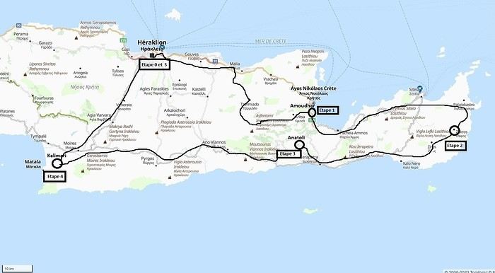 Our 21-day itinerary
Sunday, 08/09: Once again—and this is the eighth time—we’re setting off, the four of us: Patrick, Michelle, Jacques, and Monique, for the Greek islands. This time, we’ve chosen Crete. No need to wake up at 3 or 4 a.m. to reach Basel-Mulhouse Airport at dawn to catch the first flight to Greece at 6 a.m.! Given the prohibitive prices charged by EasyJet, we found flights that were half the price from Zurich Airport, which is accessible in 3 hours by train from Colmar. Pierre-Paul drives all four of us to Colmar train station, where we take the train to Basel and then, 20 minutes later, the direct train to Zurich Airport. After wandering around the airport, we go for a coffee at 6 € each! We’re in Switzerland, after all. The other dining areas all have vending machines for selecting and paying for meals—soon, there won’t be anyone left to serve you! After a short wait, we take off at 7:45 p.m. (20 minutes late) in an Aegean Airbus A321. Free in-flight meal service isn’t bad either! We land in Heraklion around 11:15 p.m. We pick up our rental car (a red Seat Ibiza) at the airport and head straight to our apartment, located 2 km from the city center. Thanks to the GPS, we find it quickly. It’s a beautiful, fully renovated apartment with all the comforts and well-equipped. On the table, there’s wine, bottles of water, jam, coffee, etc. Given the late hour, we won’t stay up long.
Monday, 09/09: To enhance our breakfast, Michelle and Monique set off to find a bakery nearby. They return with croissants and donuts—yum... Then we head to the west coast. The highway follows the coastline, but we prefer taking the old road to Malia, our first stop. We visit the major archaeological site of this Minoan city under the hot sun. The site covers a vast area, but the ruins aren’t very evocative except for a few beautiful amphorae scattered around. The explanations in a small house at the entrance are interesting and help us better understand the organization of the ancient city with its different districts. From there, we head toward the nearby mountains to see the thousand-year-old plane tree in the village of Krasi. We take the opportunity to enjoy an excellent lunch of moussaka and delicious gemista at the Krassopsychia taverna in the village center. Pleasant surprise: the prices are still reasonable, with a bill of 70 € for four, including wine and water. The friendly tradition of complimentary dessert and glasses of raki continues—great! We’ve set the bar high right away! Let’s hope the rest lives up to it! On the way back toward the Lassithi Plateau, we stop at the Kardiotisa Monastery perched high on the mountain to enjoy a magnificent view of the entire region. Just a little further, we arrive at the Lassithi Plateau: the presence of small windmills used to pump water from the ground is the typical feature of this plateau. We complete a full loop around the plateau, passing by numerous orchards and vegetable gardens that occupy the entire space. At the end of the plateau, we once again cross mountain passes via winding roads that bring us near Agios Nikolaos. Our apartment is located about ten kilometers further south in Amoudhara. The owner, who was notified, waits for us and shows us her superb apartment, whose large terrace overlooks the entire Mirabello Bay. She then gives us valuable information about the different beaches in the area. Dinner will be frugal, given our hearty lunch in Krasi!
 Sunset over Mirabello Bay
Tuesday, 10/09: A bit of a gray sky when we wake up around 8 a.m., but the sun will soon triumph over the scattered clouds. For our first swim, we opt for Voulisma Beach, even though our host warned us it was a bit “crowdy.” That’s understandable given the beautiful emerald color of the sea and the lovely curve of the beach. To avoid the big crowds, we move toward the eastern part of the beach, accessible via a steep staircase. The water is very warm, and this first dip is very pleasant. Before returning to the apartment, we stop at the bakery to buy spinach pies, essential ingredients to accompany our Greek salad for lunch. Of course, everything will be washed down with ouzo, which will remain our favorite drink for the next three weeks—but in moderation!!! A nap is in order after all that effort. In the late afternoon, we drive to Agios Nikolaos, the main seaside resort in Crete. We’re not too enthusiastic about visiting this mass-tourism resort, but the center of Agios, concentrated around the small inner harbor, is pleasant to see despite the plethora of shops and restaurants. We dine a little outside the harbor in the shaded courtyard of the Avli taverna: the oven-baked lamb, squid with spinach, and cuttlefish ink orzo pasta are all highly appreciated. We still stay under a 75 € bill for four.
 Mirabello Bay seen from our terrace
Wednesday, 11/09: At 8 a.m., the terrace is already bathed in sunlight, and it’s already quite hot. The small parasol barely gives us enough shade, but we’re not complaining! For our second swim, we head to a tiny beach recommended by our host, just 3 minutes by car from our place. The path leading to it is very discreet, and we don’t find it right away! It’s a small sandy cove with a few welcome tamarisk trees for shade. When we arrive, there are two swimmers, and there won’t be more than five or six in the morning. After lunch and a nap, we head to the beautiful village of Kritsa, just a few kilometers away. It’s too late to visit the beautiful church of Kera Panagia, which is already closed. We settle for the exterior, which is worth a look. The weather is clouding over, and big clouds are gathering. Upon arriving in Kritsa, a heavy shower forces us to take shelter in the Platanos taverna in the village center, and since it’s nearly 7 p.m., we decide to stay and dine there. Good choice—excellent meze: croquettes and stuffed zucchini flowers, gigantes beans, grilled tomatoes and feta, and pancetta as the main dish. The rain stops just as we decide to head back.
 Village of Kritsa
Thursday, 12/09: Our terrace faces east, so we get to watch the sunrise around 7 a.m.—it’s truly a beautiful sight we never tire of. Around 9 a.m., we head to the village of Plaka, where boats depart for the island of Spinalonga, located north of Agios Nikolaos. We board the first boat, which sets sail at 10 a.m., and we’re not alone—the boat is practically full. After 10 minutes, we land on the island at the same time as several other boats from Elounda or Agios. Needless to say, there are already quite a few people walking through the streets of the leper village. The visit remains interesting and moving as we read the explanatory panels recounting the island’s history under Byzantine and then Turkish rule, followed by its transformation into a leper colony. As soon as we climb toward the top of the island via more or less maintained paths, there’s almost no one left. The 360° view from up there is stunning.
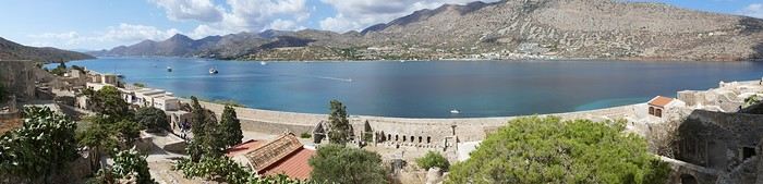
Spinalonga Island
The heat is now unbearable, and we can’t wait to get back home to have lunch on our terrace and rest. In the late afternoon, we go grocery shopping at the AB supermarket at the entrance of Agios. We had spotted another nice restaurant in our guide, but unfortunately, there’s a different one at the indicated location that doesn’t inspire us. So, we return to the Avli taverna for another dinner just as good as the first.
Friday, 13/09: We repeat yesterday’s successful program: a swim in our little cove, lunch on the terrace, a nap, and then, in the late afternoon, we discover another nearby village, Kroustas, nestled in the olive groves near Kritsa. Much less touristy than Kritsa, it’s mostly inhabited by locals, especially the elderly who are enjoying the cool air on their chairs—if you can call it cool given the still-high temperatures in the late afternoon! We then return to visit Kritsa, which we hadn’t been able to explore due to the rain. Dinner at a taverna in the village center at a very reasonable price.
Saturday, 14/09: Today, we move to our new base further east. We start with a high viewpoint at the Faneromeni Monastery, which overlooks Mirabello Bay. The monastery itself is of little interest as it’s under renovation with excessive concrete work. We continue to the village of Kavoussi to see another exceptional tree after a few kilometers on a dusty, bumpy track. It’s an olive tree said to be about 3,200 years old—impressive, and the countryside is very beautiful. It’s time to find a place for lunch. We find one in the charming little port of Mohlos, where a few tavernas surround a very nice small beach. Our choice falls on the Bogazzi taverna, where we enjoy fried fish. To reach our new base in Zakros, we still have to drive through the mountains before reaching Sitia, Paleokastro, and finally Zakros. The region is beautiful, with olive groves and rows of wind turbines taking advantage of the strong wind near the northern tip of the island. In Zakros, we’re greeted by our very friendly host. Here too, we have all the comforts and a beautiful terrace overlooking the village. The apartment has reversible air conditioners, but the overly simple instructions leave us puzzled. Thinking we’ve set it correctly, we realize a little too late that it’s blowing hot air over 30°C! After numerous attempts and testing several confusing programs, we finally succeed! Dinner on our new terrace.
Sunday, 15/09: This morning, we get up early to hike in the “Gorge of the Dead” while it’s still cool. The sky is blue as usual! We park in the nearest parking lot and start our descent via a beautiful path winding through the olive groves. A little further on, the landscape opens up, and the path, now a stony trail, begins the descent to the dry riverbed. On either side of the riverbed rise beautiful reddish cliffs.
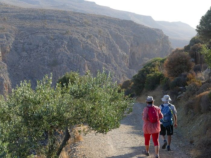
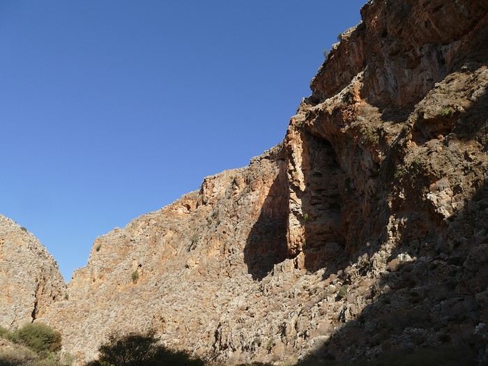
Gorge of the Dead
The trail winds its way through this narrow gorge with difficulty. It was in the many caves visible halfway up the slope that the Minoans buried their dead, hence the name “Gorge of the Dead.” The gorge opens onto a beautiful small pebble beach. A swim is welcome after this hike that made us sweat. The hike took us 1 hour and 25 minutes, and a little less on the way back. Meanwhile, Monique did some shopping and prepared an excellent lunch. In the late afternoon, we go down to dine at Platanakis, a taverna in the small village of Kato Zakros.
Monday, 16/09: This morning, we explore the northern part of the east coast near Palekastro. We start with a dip at the beautiful Hionia Beach near Palekastro. The water is still just as nice, but a light breeze is blowing—not enough to spoil our fun! Seeing all the wind turbines lining the ridges, it’s no surprise.
 Grocery shopping in Palekastro and return to Zakros. A little rain in the late afternoon and an excellent dinner at Iannis Mitsakakis’ Taverna in Adravastis. These are the kind of small tavernas we love—unpretentious, a few tables on a terrace, a warm welcome, a short menu guaranteeing freshness, tasty dishes prepared by the server’s mom, and a light bill. What more could you ask for!
Tuesday, 17/09: We head back toward Palekastro to do some shopping, but it’s also the road to the Toplou Monastery. There, we see a collection of magnificent icons dating from the 15th to the 20th century. We can also admire drawings of Orthodox religious architecture. We continue toward the Mavros Akrotiri headland to enjoy the view of the sea and rocky capes. On the way back to our place, we make a small detour to see the famous Vai palm grove. Meh... As for Vai Beach, it’s filled with paid umbrellas and sunbeds, and there are so many people that we flee. Plus, having to pay for parking is another reason to snub this trendy beach. We prefer our Hionia Beach, which we already appreciated the other day. In the late afternoon, Pat and I start the trail that begins at Kato Zakros Beach heading south. The poorly marked path crosses a plateau of sharp limestone. The paint and cairn markings are no longer very visible, and with dusk approaching, we turn back toward Kato Zakros. Dinner at the Platanakis taverna—less good than last time.
Wednesday, 18/09: To avoid the scorching sun, Pat, Mimi, and I get up earlier than usual to hike the Hohlakies Gorge. At this early hour, the sky is quite cloudy, and it’s drizzling. When we arrive in the village of Hohlakies, we park in front of a small chapel, the start of the hike. The sky is now completely clear. The trail starts among the olive groves, then after passing through a gate, we descend into the gorge filled with large rocks. We’re alone in the world, and the landscape is magnificent. A few wild goats clinging to the cliff watch us from above. After 1 hour and 15 minutes, we emerge onto the wonderful Karoumès Beach. A pleasant swim, then back to civilization! A walk in the late afternoon in Zakros to discover the beautiful springs route. Dinner in Adravastis.
Thursday, 19/09: Another move: Before heading to our next stop, we make a detour to see the beautiful Keratokampos Beach and can’t resist a swim in the still-warm, clear water. We continue our journey via Ziros, then reach the south coast and have lunch at the Stephi taverna in Ferma—excellent meal! The south coast is quite urbanized and has much less charm than the east coast we’ve just left! The numerous plastic greenhouses are partly to blame. We stop for groceries in Ierapetra. Around 3 p.m., we arrive at our destination in the small perched village of Anatoli. Our lodging is at the top of the village, and from the path leading to it, we have a magnificent view of the coastal plain, unfortunately overloaded with plastic greenhouses. It reminds us of the landscapes of El Ejido in Andalusia.
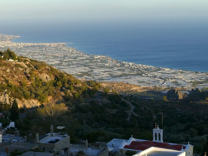 View of the Ierapetra coast from Anatoli
Friday, 20/09: A walk and discovery of the hamlet of Anatoli. There are few services—a tiny grocery store, a taverna, and that’s it. Fortunately, the traveling baker arrives and honks. We take the opportunity to buy fresh bread. Leaving the village, we take a path that should lead us to the hamlet of Drygies. The landscape is beautiful. We walk through a lovely pine forest before arriving at the hamlet. The path continues to a taverna that’s closed today, with a superb terrace overlooking the coast. Luckily, the owner arrives and informs us that the taverna will be open next Sunday and that we can enjoy barbecued meat. Noted! We head back to Anatoli via the small paved road with, fortunately, very limited traffic. Lunch on our terrace, then a dip in our private pool! The water is noticeably cooler than at the beach. Dinner at the village taverna: there’s only one menu—meze starters, souvlaki, water, wine, and bread—all for 35 €! We think we’re dreaming—was there a mistake? No.
Saturday, 21/09: We discover the beach of the village of Myrtos, a small seaside resort that’s quite touristy but on a human scale. We swim in the western part of the beach, and once again, we’re alone in the water. The best part: warm water and tamarisk trees for welcome shade. There’s even a shower to rinse off! In the late afternoon, Pat and I decide to go for a hike in the Selakano pine forest. To get there, we take a narrow, winding, and poorly paved road after the village of Christos. Plus, at this altitude, we encounter clouds clinging to the mountain, so it’s drizzling, and visibility is reduced. We decide to turn back and return to Anatoli. As compensation, we take the path that passes in front of the lodging and leads us to the Timios Stavros chapel, which crowns the summit of the nearby mountain. We arrive at the summit just in time for the sunset at 7 p.m. Breathtaking 360° panorama and magnificent colors!
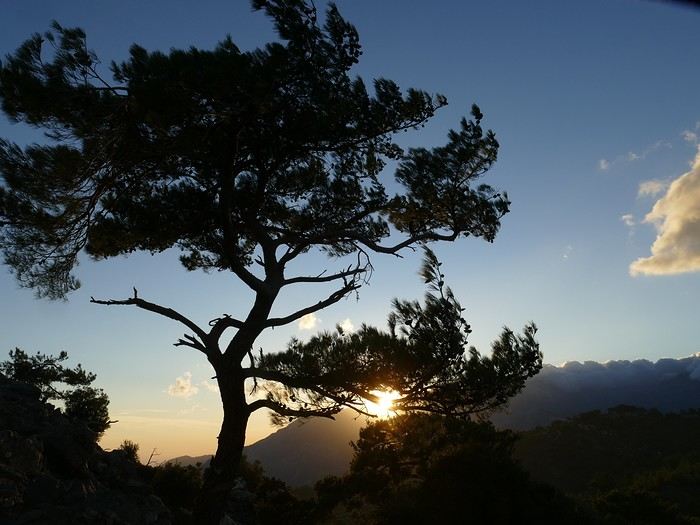 Sunset from Anatoli
Sunday, 22/09: This morning, Pat, Mimi, and I go for a hike in the Sarakina Gorge, located about 12 km from Anatoli via a beautiful road winding through irrigated olive groves. We park in the small parking lot before the trail. At the start, the path follows a levada (small irrigation canal) and quickly enters a very narrow gorge flanked by high cliffs. The riverbed is cluttered with huge rocks blocking the passage. No matter—in the technical sections, ropes or ladders allow us to overcome these obstacles with a bit of skill. You can imagine how quickly the riverbed must rise during a storm, given the narrowness of the gorge!
We progress slowly through this magnificent and impressive rocky chaos. At the exit of the gorge, we take another return path that partly follows the paved road. Back in Anatoli, we go to lunch at the Drygies taverna. We sit at the edge of the terrace under a huge tree that covers almost the entire terrace and order grilled lamb dishes prepared according to the ancient “antikristo” method.
Monday, 23/09: Departure for our last stop before Heraklion. We thought about swimming at Tertsa Beach, but it turns out to be less pleasant than expected, with pebbles and an uneven rocky plateau. So, we return to Myrtos Beach, which we know well and suits us perfectly. We head west, leaving the coast a bit. Around 3:30 p.m., we arrive at our destination in the village of Kamilari, near the famous Matala spot. We’ve rented a beautiful, modern, well-equipped apartment with a lovely shaded terrace. The owner is very friendly and explains everything necessary for a good stay. We explore the quite touristy village with its few tavernas, all full of tourists, mostly Germans.
Tuesday, 24/09: Visit to the village of Sivas, well restored thanks to the Germans, who have invested a lot here. We take the opportunity to scout out “friendly” tavernas, then go for a swim at Kalamaki Beach. Apart from a small sandy access, you have to enter the water via a chaotic limestone plateau—proof of this is that Monique trips slightly when entering the water. A group of very unfriendly German women blocks the sandy passage and doesn’t hesitate to push swimmers they deem too close. Back home, lunch, and a nap. In the late afternoon, we drive to visit the nearby Phaistos site. We benefit from very beautiful lighting. From the elevated site, we overlook the Messara Plain with a beautiful view of the olive grove checkerboards highlighted by the late afternoon sun. The site itself is quite vast, but to appreciate it, it’s better to read the explanatory panels placed throughout the different quarters. At this hour, the site is almost empty, and the beautiful light adds charm to the visit.
Wednesday, 25/09: Departure for the village of Matala, which doesn’t interest us in itself, having been there during the “hippie” era in 1976. However, going to Red Beach, only accessible by taking a path overlooking this area, appeals to us much more. We park in the large parking lot just outside the village and start our climb, which brings us to a pass from where we can admire this beautiful red-sand beach framed by beautiful cliffs plunging into the sea. The weather is magnificent, and at this early hour, there aren’t many people yet. We swim in the free part located near the cliff on the right when arriving at the beach. The sea is like glass, warm, and without a single ripple—a real treat! After half an hour, we turn back, and now there are many people rushing on this path, not at all made for feet in sandals or flip-flops, yet many vacationers venture out like this! Matala lives up to its image—a trendy place, full of shops, bars, and restaurants. You could be in any seaside resort with a standard global urbanism, lacking particular charm. Back home. In the late afternoon, a walk through the olive groves surrounding Kamilari, then dinner at Evangelina’s, who runs the Minoan Parassies taverna in the middle of the olive groves. Evangelina is quite a character: we came to reserve a table for 8 p.m. when it was only 7 p.m., but since we lingered near her restaurant, she prepares a table for us and urges us to sit down! And there she takes our order, and a little later, the meze arrive, followed by the main dishes. We finish this good dinner with several generous glasses of raki, accompanied by Evangelina’s encouragements, repeating “poya poya bravo bravo” in a loop. We’re in great shape too, by the way! We return in the middle of the night, on foot, fortunately, with the path vaguely lit by our phones...
Thursday, 26/09: This morning, we discover a new beach, Kommos Beach, not far from Kamilari either. It’s a long sandy beach, a small part of which is dedicated to paid umbrellas and sunbeds, and the rest is free. We spot a tamarisk tree to take shelter from the still-hot sun, and once again, we enjoy clear, warm water. The few swimmers spread out easily over nearly 500 meters of beach. In the late afternoon, Pat and I go to admire the sunset from the hill near our lodging. The hill, covered with olive trees, is threatened by a planned housing development of large cubic villas—trends dictate. Concrete never stops...
Friday, 27/09: We thought about leaving the car at the Odiyitria Monastery, the end of the paved road, but since the track descending to the cave remains drivable, we park 3 km further at the junction of the track leading to Kali Limenes Beach. We still have to walk for half an hour on a less drivable track, and then we’re at the entrance of the Farango Gorge. It’s a beautiful, easy hike since we follow the dry pebble riverbed. Before arriving at the beach, there’s a very beautiful small chapel sheltered under a large cliff, beautifully lit at this early hour.
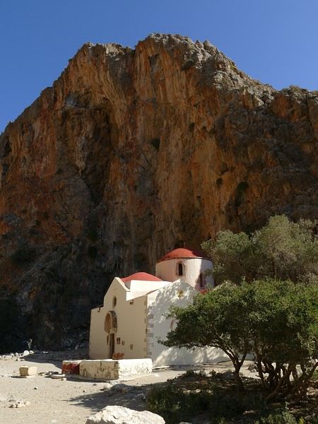
Agio Farango Chapel
A few climbers are scaling the cliff, and about ten swimmers are enjoying the sea. Return to the car under the hot sun. In the late afternoon, we all return to visit the interesting Odiyitria Monastery. Last swim at Kommos Beach and an excellent dinner at the Sigelakis taverna in Sivas.
Saturday, 28/09: There’s an end-of-vacation atmosphere... We pack our bags and head north. A short stop to see the village of Vorri, and a little over an hour later, we arrive in the big city of Heraklion. Since it’s too early to check into the apartment, we park in the city center to visit the famous archaeological museum. It’s indeed a must-see highlight of our stay in Crete. All four of us are amazed by the quantity and quality of the objects presented from the Minoan civilization. After more than 2 hours, we come out without having seen everything, but we’re a bit overwhelmed by all these wonders. Lunch at a nice little taverna very close to the Titus Church. We go to take possession of our apartment—the same as on the way there, still just as satisfying. In the late afternoon, I go alone for a walk in the historic district of the city, passing by the Morosini Fountain, which is bustling with people—some seated at café terraces, others standing and chatting. There’s a lively atmosphere here. A little further on are the Venetian loggia and the Agios Titos Church. I walk down to the old Venetian port to stroll along the jetty and admire the fortifications under beautiful late-afternoon lighting, then return to the apartment. Dinner near our place at Kiriakis, a “chic” restaurant but with very reasonable prices and excellent cuisine.
Sunday, 29/09: Wake-up at 3:30 a.m., quick coffee, and drive to the nearby airport. We leave the car in the parking lot. Already a lot of people at this early hour. Since we don’t have checked luggage, we go straight to security, which goes fairly quickly, then it’s waiting time and takeoff on time in an Airbus A321 for a 45-minute flight to Athens. We take off again in another Airbus A321 with a 50-minute delay to arrive in Zurich at 11:10 a.m. local time. Then we have to take the train to Basel and then the one to Colmar. With fewer Sunday services, we won’t arrive in Colmar until around 4 p.m.
Conclusion All four of us returned very satisfied with this stay in Crete for several reasons: - We found superb beaches with clear, warm water and often very few vacationers. - The few hikes we did were magnificent, especially those where the trails went through gorges leading to deserted beaches. - We greatly appreciated Cretan gastronomy—there were so few disappointments that we can count them on one hand. - All the accommodations we booked turned out to be superb, with the icing on the cake being the very friendly welcome from our hosts. - Generally, contacts with Cretans were always very warm despite the language barrier—we speak a little Greek. - We also appreciated the diversity of landscapes in this eastern part of Crete, with plateaus and mountains with splendid rugged reliefs.
Note: The photo album is available by clicking on this link: https://photos.app.goo.gl/hfdjQndA5eXkL5k7 Captions are only visible per photo by clicking on the circled “i” in the top right. Budget: approximately 3,300 € per couple for 21 days, including train and flights Budget details per couple: - Flight Zurich-Heraklion: 440 € - Trains Colmar-Basel-Zurich round trip for 4: 442.40 € (221 € per couple) - Accommodation: 2,431 € / 21 = 115.80 € per night for 4 (1,216 € per couple) - Car rental for 21 days: 684 € + 145 € fuel (1,150 km) (414 € per couple) - Restaurants, food, etc.: 1,009 €
Our 21-day itinerarySunday, 08/09: Once again—and this is the eighth time—we’re setting off, the four of us: Patrick, Michelle, Jacques, and Monique, for the Greek islands. This time, we’ve chosen Crete. No need to wake up at 3 or 4 a.m. to reach Basel-Mulhouse Airport at dawn to catch the first flight to Greece at 6 a.m.! Given the prohibitive prices charged by EasyJet, we found flights that were half the price from Zurich Airport, which is accessible in 3 hours by train from Colmar. Pierre-Paul drives all four of us to Colmar train station, where we take the train to Basel and then, 20 minutes later, the direct train to Zurich Airport. After wandering around the airport, we go for a coffee at 6 € each! We’re in Switzerland, after all. The other dining areas all have vending machines for selecting and paying for meals—soon, there won’t be anyone left to serve you! After a short wait, we take off at 7:45 p.m. (20 minutes late) in an Aegean Airbus A321. Free in-flight meal service isn’t bad either! We land in Heraklion around 11:15 p.m. We pick up our rental car (a red Seat Ibiza) at the airport and head straight to our apartment, located 2 km from the city center. Thanks to the GPS, we find it quickly. It’s a beautiful, fully renovated apartment with all the comforts and well-equipped. On the table, there’s wine, bottles of water, jam, coffee, etc. Given the late hour, we won’t stay up long.
Monday, 09/09: To enhance our breakfast, Michelle and Monique set off to find a bakery nearby. They return with croissants and donuts—yum... Then we head to the west coast. The highway follows the coastline, but we prefer taking the old road to Malia, our first stop. We visit the major archaeological site of this Minoan city under the hot sun. The site covers a vast area, but the ruins aren’t very evocative except for a few beautiful amphorae scattered around. The explanations in a small house at the entrance are interesting and help us better understand the organization of the ancient city with its different districts. From there, we head toward the nearby mountains to see the thousand-year-old plane tree in the village of Krasi. We take the opportunity to enjoy an excellent lunch of moussaka and delicious gemista at the Krassopsychia taverna in the village center. Pleasant surprise: the prices are still reasonable, with a bill of 70 € for four, including wine and water. The friendly tradition of complimentary dessert and glasses of raki continues—great! We’ve set the bar high right away! Let’s hope the rest lives up to it! On the way back toward the Lassithi Plateau, we stop at the Kardiotisa Monastery perched high on the mountain to enjoy a magnificent view of the entire region. Just a little further, we arrive at the Lassithi Plateau: the presence of small windmills used to pump water from the ground is the typical feature of this plateau. We complete a full loop around the plateau, passing by numerous orchards and vegetable gardens that occupy the entire space. At the end of the plateau, we once again cross mountain passes via winding roads that bring us near Agios Nikolaos. Our apartment is located about ten kilometers further south in Amoudhara. The owner, who was notified, waits for us and shows us her superb apartment, whose large terrace overlooks the entire Mirabello Bay. She then gives us valuable information about the different beaches in the area. Dinner will be frugal, given our hearty lunch in Krasi!
Sunset over Mirabello BayTuesday, 10/09: A bit of a gray sky when we wake up around 8 a.m., but the sun will soon triumph over the scattered clouds. For our first swim, we opt for Voulisma Beach, even though our host warned us it was a bit “crowdy.” That’s understandable given the beautiful emerald color of the sea and the lovely curve of the beach. To avoid the big crowds, we move toward the eastern part of the beach, accessible via a steep staircase. The water is very warm, and this first dip is very pleasant. Before returning to the apartment, we stop at the bakery to buy spinach pies, essential ingredients to accompany our Greek salad for lunch. Of course, everything will be washed down with ouzo, which will remain our favorite drink for the next three weeks—but in moderation!!! A nap is in order after all that effort. In the late afternoon, we drive to Agios Nikolaos, the main seaside resort in Crete. We’re not too enthusiastic about visiting this mass-tourism resort, but the center of Agios, concentrated around the small inner harbor, is pleasant to see despite the plethora of shops and restaurants. We dine a little outside the harbor in the shaded courtyard of the Avli taverna: the oven-baked lamb, squid with spinach, and cuttlefish ink orzo pasta are all highly appreciated. We still stay under a 75 € bill for four.
Mirabello Bay seen from our terraceWednesday, 11/09: At 8 a.m., the terrace is already bathed in sunlight, and it’s already quite hot. The small parasol barely gives us enough shade, but we’re not complaining! For our second swim, we head to a tiny beach recommended by our host, just 3 minutes by car from our place. The path leading to it is very discreet, and we don’t find it right away! It’s a small sandy cove with a few welcome tamarisk trees for shade. When we arrive, there are two swimmers, and there won’t be more than five or six in the morning. After lunch and a nap, we head to the beautiful village of Kritsa, just a few kilometers away. It’s too late to visit the beautiful church of Kera Panagia, which is already closed. We settle for the exterior, which is worth a look. The weather is clouding over, and big clouds are gathering. Upon arriving in Kritsa, a heavy shower forces us to take shelter in the Platanos taverna in the village center, and since it’s nearly 7 p.m., we decide to stay and dine there. Good choice—excellent meze: croquettes and stuffed zucchini flowers, gigantes beans, grilled tomatoes and feta, and pancetta as the main dish. The rain stops just as we decide to head back.
Village of KritsaThursday, 12/09: Our terrace faces east, so we get to watch the sunrise around 7 a.m.—it’s truly a beautiful sight we never tire of. Around 9 a.m., we head to the village of Plaka, where boats depart for the island of Spinalonga, located north of Agios Nikolaos. We board the first boat, which sets sail at 10 a.m., and we’re not alone—the boat is practically full. After 10 minutes, we land on the island at the same time as several other boats from Elounda or Agios. Needless to say, there are already quite a few people walking through the streets of the leper village. The visit remains interesting and moving as we read the explanatory panels recounting the island’s history under Byzantine and then Turkish rule, followed by its transformation into a leper colony. As soon as we climb toward the top of the island via more or less maintained paths, there’s almost no one left. The 360° view from up there is stunning.
Spinalonga Island
The heat is now unbearable, and we can’t wait to get back home to have lunch on our terrace and rest. In the late afternoon, we go grocery shopping at the AB supermarket at the entrance of Agios. We had spotted another nice restaurant in our guide, but unfortunately, there’s a different one at the indicated location that doesn’t inspire us. So, we return to the Avli taverna for another dinner just as good as the first.
Friday, 13/09: We repeat yesterday’s successful program: a swim in our little cove, lunch on the terrace, a nap, and then, in the late afternoon, we discover another nearby village, Kroustas, nestled in the olive groves near Kritsa. Much less touristy than Kritsa, it’s mostly inhabited by locals, especially the elderly who are enjoying the cool air on their chairs—if you can call it cool given the still-high temperatures in the late afternoon! We then return to visit Kritsa, which we hadn’t been able to explore due to the rain. Dinner at a taverna in the village center at a very reasonable price.
Saturday, 14/09: Today, we move to our new base further east. We start with a high viewpoint at the Faneromeni Monastery, which overlooks Mirabello Bay. The monastery itself is of little interest as it’s under renovation with excessive concrete work. We continue to the village of Kavoussi to see another exceptional tree after a few kilometers on a dusty, bumpy track. It’s an olive tree said to be about 3,200 years old—impressive, and the countryside is very beautiful. It’s time to find a place for lunch. We find one in the charming little port of Mohlos, where a few tavernas surround a very nice small beach. Our choice falls on the Bogazzi taverna, where we enjoy fried fish. To reach our new base in Zakros, we still have to drive through the mountains before reaching Sitia, Paleokastro, and finally Zakros. The region is beautiful, with olive groves and rows of wind turbines taking advantage of the strong wind near the northern tip of the island. In Zakros, we’re greeted by our very friendly host. Here too, we have all the comforts and a beautiful terrace overlooking the village. The apartment has reversible air conditioners, but the overly simple instructions leave us puzzled. Thinking we’ve set it correctly, we realize a little too late that it’s blowing hot air over 30°C! After numerous attempts and testing several confusing programs, we finally succeed! Dinner on our new terrace.
Sunday, 15/09: This morning, we get up early to hike in the “Gorge of the Dead” while it’s still cool. The sky is blue as usual! We park in the nearest parking lot and start our descent via a beautiful path winding through the olive groves. A little further on, the landscape opens up, and the path, now a stony trail, begins the descent to the dry riverbed. On either side of the riverbed rise beautiful reddish cliffs.
Gorge of the Dead
The trail winds its way through this narrow gorge with difficulty. It was in the many caves visible halfway up the slope that the Minoans buried their dead, hence the name “Gorge of the Dead.” The gorge opens onto a beautiful small pebble beach. A swim is welcome after this hike that made us sweat. The hike took us 1 hour and 25 minutes, and a little less on the way back. Meanwhile, Monique did some shopping and prepared an excellent lunch. In the late afternoon, we go down to dine at Platanakis, a taverna in the small village of Kato Zakros.
Monday, 16/09: This morning, we explore the northern part of the east coast near Palekastro. We start with a dip at the beautiful Hionia Beach near Palekastro. The water is still just as nice, but a light breeze is blowing—not enough to spoil our fun! Seeing all the wind turbines lining the ridges, it’s no surprise.
Grocery shopping in Palekastro and return to Zakros. A little rain in the late afternoon and an excellent dinner at Iannis Mitsakakis’ Taverna in Adravastis. These are the kind of small tavernas we love—unpretentious, a few tables on a terrace, a warm welcome, a short menu guaranteeing freshness, tasty dishes prepared by the server’s mom, and a light bill. What more could you ask for!Tuesday, 17/09: We head back toward Palekastro to do some shopping, but it’s also the road to the Toplou Monastery. There, we see a collection of magnificent icons dating from the 15th to the 20th century. We can also admire drawings of Orthodox religious architecture. We continue toward the Mavros Akrotiri headland to enjoy the view of the sea and rocky capes. On the way back to our place, we make a small detour to see the famous Vai palm grove. Meh... As for Vai Beach, it’s filled with paid umbrellas and sunbeds, and there are so many people that we flee. Plus, having to pay for parking is another reason to snub this trendy beach. We prefer our Hionia Beach, which we already appreciated the other day. In the late afternoon, Pat and I start the trail that begins at Kato Zakros Beach heading south. The poorly marked path crosses a plateau of sharp limestone. The paint and cairn markings are no longer very visible, and with dusk approaching, we turn back toward Kato Zakros. Dinner at the Platanakis taverna—less good than last time.
Wednesday, 18/09: To avoid the scorching sun, Pat, Mimi, and I get up earlier than usual to hike the Hohlakies Gorge. At this early hour, the sky is quite cloudy, and it’s drizzling. When we arrive in the village of Hohlakies, we park in front of a small chapel, the start of the hike. The sky is now completely clear. The trail starts among the olive groves, then after passing through a gate, we descend into the gorge filled with large rocks. We’re alone in the world, and the landscape is magnificent. A few wild goats clinging to the cliff watch us from above. After 1 hour and 15 minutes, we emerge onto the wonderful Karoumès Beach. A pleasant swim, then back to civilization! A walk in the late afternoon in Zakros to discover the beautiful springs route. Dinner in Adravastis.
Thursday, 19/09: Another move: Before heading to our next stop, we make a detour to see the beautiful Keratokampos Beach and can’t resist a swim in the still-warm, clear water. We continue our journey via Ziros, then reach the south coast and have lunch at the Stephi taverna in Ferma—excellent meal! The south coast is quite urbanized and has much less charm than the east coast we’ve just left! The numerous plastic greenhouses are partly to blame. We stop for groceries in Ierapetra. Around 3 p.m., we arrive at our destination in the small perched village of Anatoli. Our lodging is at the top of the village, and from the path leading to it, we have a magnificent view of the coastal plain, unfortunately overloaded with plastic greenhouses. It reminds us of the landscapes of El Ejido in Andalusia.
View of the Ierapetra coast from AnatoliFriday, 20/09: A walk and discovery of the hamlet of Anatoli. There are few services—a tiny grocery store, a taverna, and that’s it. Fortunately, the traveling baker arrives and honks. We take the opportunity to buy fresh bread. Leaving the village, we take a path that should lead us to the hamlet of Drygies. The landscape is beautiful. We walk through a lovely pine forest before arriving at the hamlet. The path continues to a taverna that’s closed today, with a superb terrace overlooking the coast. Luckily, the owner arrives and informs us that the taverna will be open next Sunday and that we can enjoy barbecued meat. Noted! We head back to Anatoli via the small paved road with, fortunately, very limited traffic. Lunch on our terrace, then a dip in our private pool! The water is noticeably cooler than at the beach. Dinner at the village taverna: there’s only one menu—meze starters, souvlaki, water, wine, and bread—all for 35 €! We think we’re dreaming—was there a mistake? No.
Saturday, 21/09: We discover the beach of the village of Myrtos, a small seaside resort that’s quite touristy but on a human scale. We swim in the western part of the beach, and once again, we’re alone in the water. The best part: warm water and tamarisk trees for welcome shade. There’s even a shower to rinse off! In the late afternoon, Pat and I decide to go for a hike in the Selakano pine forest. To get there, we take a narrow, winding, and poorly paved road after the village of Christos. Plus, at this altitude, we encounter clouds clinging to the mountain, so it’s drizzling, and visibility is reduced. We decide to turn back and return to Anatoli. As compensation, we take the path that passes in front of the lodging and leads us to the Timios Stavros chapel, which crowns the summit of the nearby mountain. We arrive at the summit just in time for the sunset at 7 p.m. Breathtaking 360° panorama and magnificent colors!
Sunset from AnatoliSunday, 22/09: This morning, Pat, Mimi, and I go for a hike in the Sarakina Gorge, located about 12 km from Anatoli via a beautiful road winding through irrigated olive groves. We park in the small parking lot before the trail. At the start, the path follows a levada (small irrigation canal) and quickly enters a very narrow gorge flanked by high cliffs. The riverbed is cluttered with huge rocks blocking the passage. No matter—in the technical sections, ropes or ladders allow us to overcome these obstacles with a bit of skill. You can imagine how quickly the riverbed must rise during a storm, given the narrowness of the gorge!
We progress slowly through this magnificent and impressive rocky chaos. At the exit of the gorge, we take another return path that partly follows the paved road. Back in Anatoli, we go to lunch at the Drygies taverna. We sit at the edge of the terrace under a huge tree that covers almost the entire terrace and order grilled lamb dishes prepared according to the ancient “antikristo” method.
Monday, 23/09: Departure for our last stop before Heraklion. We thought about swimming at Tertsa Beach, but it turns out to be less pleasant than expected, with pebbles and an uneven rocky plateau. So, we return to Myrtos Beach, which we know well and suits us perfectly. We head west, leaving the coast a bit. Around 3:30 p.m., we arrive at our destination in the village of Kamilari, near the famous Matala spot. We’ve rented a beautiful, modern, well-equipped apartment with a lovely shaded terrace. The owner is very friendly and explains everything necessary for a good stay. We explore the quite touristy village with its few tavernas, all full of tourists, mostly Germans.
Tuesday, 24/09: Visit to the village of Sivas, well restored thanks to the Germans, who have invested a lot here. We take the opportunity to scout out “friendly” tavernas, then go for a swim at Kalamaki Beach. Apart from a small sandy access, you have to enter the water via a chaotic limestone plateau—proof of this is that Monique trips slightly when entering the water. A group of very unfriendly German women blocks the sandy passage and doesn’t hesitate to push swimmers they deem too close. Back home, lunch, and a nap. In the late afternoon, we drive to visit the nearby Phaistos site. We benefit from very beautiful lighting. From the elevated site, we overlook the Messara Plain with a beautiful view of the olive grove checkerboards highlighted by the late afternoon sun. The site itself is quite vast, but to appreciate it, it’s better to read the explanatory panels placed throughout the different quarters. At this hour, the site is almost empty, and the beautiful light adds charm to the visit.
Wednesday, 25/09: Departure for the village of Matala, which doesn’t interest us in itself, having been there during the “hippie” era in 1976. However, going to Red Beach, only accessible by taking a path overlooking this area, appeals to us much more. We park in the large parking lot just outside the village and start our climb, which brings us to a pass from where we can admire this beautiful red-sand beach framed by beautiful cliffs plunging into the sea. The weather is magnificent, and at this early hour, there aren’t many people yet. We swim in the free part located near the cliff on the right when arriving at the beach. The sea is like glass, warm, and without a single ripple—a real treat! After half an hour, we turn back, and now there are many people rushing on this path, not at all made for feet in sandals or flip-flops, yet many vacationers venture out like this! Matala lives up to its image—a trendy place, full of shops, bars, and restaurants. You could be in any seaside resort with a standard global urbanism, lacking particular charm. Back home. In the late afternoon, a walk through the olive groves surrounding Kamilari, then dinner at Evangelina’s, who runs the Minoan Parassies taverna in the middle of the olive groves. Evangelina is quite a character: we came to reserve a table for 8 p.m. when it was only 7 p.m., but since we lingered near her restaurant, she prepares a table for us and urges us to sit down! And there she takes our order, and a little later, the meze arrive, followed by the main dishes. We finish this good dinner with several generous glasses of raki, accompanied by Evangelina’s encouragements, repeating “poya poya bravo bravo” in a loop. We’re in great shape too, by the way! We return in the middle of the night, on foot, fortunately, with the path vaguely lit by our phones...
Thursday, 26/09: This morning, we discover a new beach, Kommos Beach, not far from Kamilari either. It’s a long sandy beach, a small part of which is dedicated to paid umbrellas and sunbeds, and the rest is free. We spot a tamarisk tree to take shelter from the still-hot sun, and once again, we enjoy clear, warm water. The few swimmers spread out easily over nearly 500 meters of beach. In the late afternoon, Pat and I go to admire the sunset from the hill near our lodging. The hill, covered with olive trees, is threatened by a planned housing development of large cubic villas—trends dictate. Concrete never stops...
Friday, 27/09: We thought about leaving the car at the Odiyitria Monastery, the end of the paved road, but since the track descending to the cave remains drivable, we park 3 km further at the junction of the track leading to Kali Limenes Beach. We still have to walk for half an hour on a less drivable track, and then we’re at the entrance of the Farango Gorge. It’s a beautiful, easy hike since we follow the dry pebble riverbed. Before arriving at the beach, there’s a very beautiful small chapel sheltered under a large cliff, beautifully lit at this early hour.
Agio Farango Chapel
A few climbers are scaling the cliff, and about ten swimmers are enjoying the sea. Return to the car under the hot sun. In the late afternoon, we all return to visit the interesting Odiyitria Monastery. Last swim at Kommos Beach and an excellent dinner at the Sigelakis taverna in Sivas.
Saturday, 28/09: There’s an end-of-vacation atmosphere... We pack our bags and head north. A short stop to see the village of Vorri, and a little over an hour later, we arrive in the big city of Heraklion. Since it’s too early to check into the apartment, we park in the city center to visit the famous archaeological museum. It’s indeed a must-see highlight of our stay in Crete. All four of us are amazed by the quantity and quality of the objects presented from the Minoan civilization. After more than 2 hours, we come out without having seen everything, but we’re a bit overwhelmed by all these wonders. Lunch at a nice little taverna very close to the Titus Church. We go to take possession of our apartment—the same as on the way there, still just as satisfying. In the late afternoon, I go alone for a walk in the historic district of the city, passing by the Morosini Fountain, which is bustling with people—some seated at café terraces, others standing and chatting. There’s a lively atmosphere here. A little further on are the Venetian loggia and the Agios Titos Church. I walk down to the old Venetian port to stroll along the jetty and admire the fortifications under beautiful late-afternoon lighting, then return to the apartment. Dinner near our place at Kiriakis, a “chic” restaurant but with very reasonable prices and excellent cuisine.
Sunday, 29/09: Wake-up at 3:30 a.m., quick coffee, and drive to the nearby airport. We leave the car in the parking lot. Already a lot of people at this early hour. Since we don’t have checked luggage, we go straight to security, which goes fairly quickly, then it’s waiting time and takeoff on time in an Airbus A321 for a 45-minute flight to Athens. We take off again in another Airbus A321 with a 50-minute delay to arrive in Zurich at 11:10 a.m. local time. Then we have to take the train to Basel and then the one to Colmar. With fewer Sunday services, we won’t arrive in Colmar until around 4 p.m.
Conclusion All four of us returned very satisfied with this stay in Crete for several reasons: - We found superb beaches with clear, warm water and often very few vacationers. - The few hikes we did were magnificent, especially those where the trails went through gorges leading to deserted beaches. - We greatly appreciated Cretan gastronomy—there were so few disappointments that we can count them on one hand. - All the accommodations we booked turned out to be superb, with the icing on the cake being the very friendly welcome from our hosts. - Generally, contacts with Cretans were always very warm despite the language barrier—we speak a little Greek. - We also appreciated the diversity of landscapes in this eastern part of Crete, with plateaus and mountains with splendid rugged reliefs.
Note: The photo album is available by clicking on this link: https://photos.app.goo.gl/hfdjQndA5eXkL5k7 Captions are only visible per photo by clicking on the circled “i” in the top right. Budget: approximately 3,300 € per couple for 21 days, including train and flights Budget details per couple: - Flight Zurich-Heraklion: 440 € - Trains Colmar-Basel-Zurich round trip for 4: 442.40 € (221 € per couple) - Accommodation: 2,431 € / 21 = 115.80 € per night for 4 (1,216 € per couple) - Car rental for 21 days: 684 € + 145 € fuel (1,150 km) (414 € per couple) - Restaurants, food, etc.: 1,009 €
Découverte de Fuerteventura par la randonnée English translation pending
Découverte de Fuerteventura aux canaries par la rando.
Souvent la même image des canaries : destination soleil avec tourisme de masse. Il y a une dizaine d’année, un ami nous propose de nous prêter un appartement, pendant 15 jours en été, à Tenerife. Un peu bête de refuser un tel cadeau. C’est sûr, la côte sur cette île, pour moi, c’est une horreur. Mais supers randos sur les hauteurs de l’île avec le Rother. Donc les 4 années qui suivirent, à Nöel, nous avons fait d’autres îles des canaries. Dans l’ordre Lanzarotte, la Palma, El Hierro, La Gomera (celle que nous avons le moins aimé). A toussaint 2019, j’ai voulu continuer la découverte des îles en allant à Fuenteventura. Les copains : « Pas terrible, on y va que pour la plage, le golf et le surf, paysages répétitifs, c’est super aride, pas de végétation…. Tant pis, le guide Rother me faisait dire que j’allais pouvoir trouver mon bonheur. Et quel bonheur. Nous avons été enchantés de la diversité des paysages. Alors oui, pour être aride, c’est une île aride (mais j’adore). Pas ou très peu de personnes sur les circuits de rando. Certains circuits plus difficiles que d’autres. Mais dans l’ensemble, peu de dénivelé donc c’est plus facile que les îles de la Gomera, la Palma etc…
L’idée de ce carnet est, par les photos, de vous montrer la diversité et la beauté des paysages. Pour chaque jour, je vous donnerais les numéros des circuits du Rother. En y ajoutant mes commentaires (vous ne les comprendrez que si vous faites la rando). C’est simplement des petits trucs, compléments d’infos qui peuvent servir ! On est bien d’accord, ce ne sont pas des randos engagées, pour grands sportifs. Randonnées plaisir mais qui permettent de découvrir l’île autrement. J’avais lu pas mal de carnet de voyage mais c’était toujours la même description des villages, des belvédères et des routes. Tout ce qui ne m’intéresse pas. Alors voilà le pourquoi de ce carnet.
2 locations AIRBNB : une au nord, une au sud. 2 excellentes locations. Lorsque nous y retournerons, car nous sommes loin d’avoir épuisé les randos du Rother, j’y rajouterai un logement au centre de l’île.
La 1ère location était dans un village près des axes routiers, où l’on trouve tout ce qu’il faut du point de vue des commerces, pas envahi par les touristes et pas surfait : LAJARES. Une belle petite maison, mitoyenne avec les propriétaires supers sympas. Mobilier contemporain, maison lumineuse. Parfait. CASA YEYI. Vous pouvez regarder sur ARBNB et si cela vous plait, je peux vous donner des contacts directs en MP
1ère journée de rando (ciel nuageux, la seule journée du voyage)
circuit 2 du Rother. Départ 11 h, Commencer la rando en partant de Lajères (sur la route de Mjanicho). Prendre à gauche de la chaine de volcan. Puis arrivée au milieu, partir à droite pour arriver en en haut de la CALDERA HONDO La Caldera Hondo est chouette si on fait le tour et que l’on sort un peu du chemin de crête en passant un peu en dessous. De superbes couleurs de lave.

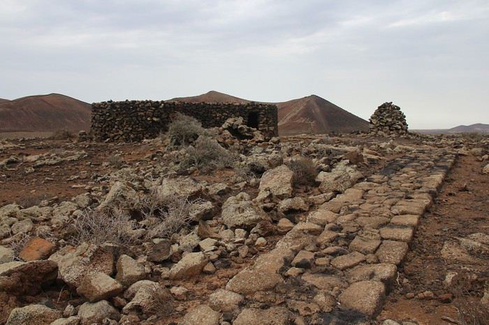
Après cela, on peut peut continuer sur Corrajelo. Pas par le chemin de grande randonnée proposé par le Rother, qui n’a aucun intérêt car piste avec des voitures, mais en passant par le haut de la chaîne des volcans. Bon, pas vraiment de chemin, pas facile, mais chouette. C’est parfois du hors-piste, un peu l’aventure mais pas difficile en regardant l’horizon de trouver son chemin. Et de beaux points de vue !

Nous coupons à travers les Calderas car nous ne voulons pas aller jusque la ville de Corrajelo. Arrivée 14 h 30 au 2ième rond-point avant Corraléjo en venant de Lajarès. Stop jusque Lajarés (facile, en 5 minutes). Arrivée à 15 h 25 à Lajeres.
L’après-midi, départ vers 16 h 30 pour EL COTILLO. Village qui ne nous a pas séduit MAIS en même temps, nous ne nous y sommes pas arrêtés, pas envie! Chemin de randonnée numéro 3 du Rother. Ne pas laisser sa voiture au début du circuit, mais au bout de la plage. Essayer de trouver des chemins pour descendre dans les criques. C’est possible, il faut chercher mais c’est super. Météo couverte mais de belles photos. Chemin tracé en haut de la falaise. De beaux points de vue
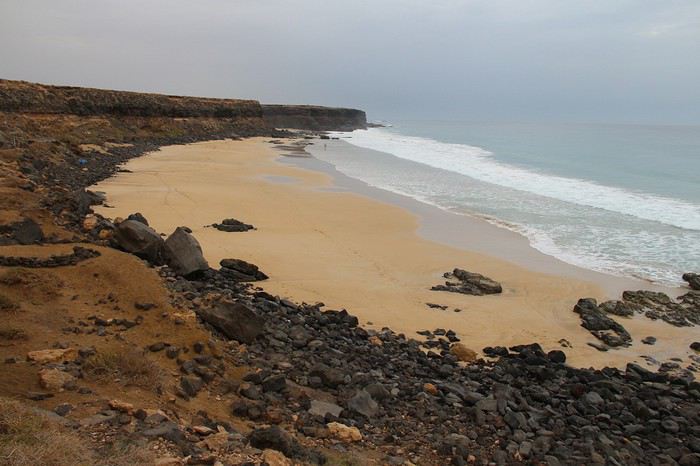
à suivre...
Souvent la même image des canaries : destination soleil avec tourisme de masse. Il y a une dizaine d’année, un ami nous propose de nous prêter un appartement, pendant 15 jours en été, à Tenerife. Un peu bête de refuser un tel cadeau. C’est sûr, la côte sur cette île, pour moi, c’est une horreur. Mais supers randos sur les hauteurs de l’île avec le Rother. Donc les 4 années qui suivirent, à Nöel, nous avons fait d’autres îles des canaries. Dans l’ordre Lanzarotte, la Palma, El Hierro, La Gomera (celle que nous avons le moins aimé). A toussaint 2019, j’ai voulu continuer la découverte des îles en allant à Fuenteventura. Les copains : « Pas terrible, on y va que pour la plage, le golf et le surf, paysages répétitifs, c’est super aride, pas de végétation…. Tant pis, le guide Rother me faisait dire que j’allais pouvoir trouver mon bonheur. Et quel bonheur. Nous avons été enchantés de la diversité des paysages. Alors oui, pour être aride, c’est une île aride (mais j’adore). Pas ou très peu de personnes sur les circuits de rando. Certains circuits plus difficiles que d’autres. Mais dans l’ensemble, peu de dénivelé donc c’est plus facile que les îles de la Gomera, la Palma etc…
L’idée de ce carnet est, par les photos, de vous montrer la diversité et la beauté des paysages. Pour chaque jour, je vous donnerais les numéros des circuits du Rother. En y ajoutant mes commentaires (vous ne les comprendrez que si vous faites la rando). C’est simplement des petits trucs, compléments d’infos qui peuvent servir ! On est bien d’accord, ce ne sont pas des randos engagées, pour grands sportifs. Randonnées plaisir mais qui permettent de découvrir l’île autrement. J’avais lu pas mal de carnet de voyage mais c’était toujours la même description des villages, des belvédères et des routes. Tout ce qui ne m’intéresse pas. Alors voilà le pourquoi de ce carnet.
2 locations AIRBNB : une au nord, une au sud. 2 excellentes locations. Lorsque nous y retournerons, car nous sommes loin d’avoir épuisé les randos du Rother, j’y rajouterai un logement au centre de l’île.
La 1ère location était dans un village près des axes routiers, où l’on trouve tout ce qu’il faut du point de vue des commerces, pas envahi par les touristes et pas surfait : LAJARES. Une belle petite maison, mitoyenne avec les propriétaires supers sympas. Mobilier contemporain, maison lumineuse. Parfait. CASA YEYI. Vous pouvez regarder sur ARBNB et si cela vous plait, je peux vous donner des contacts directs en MP
1ère journée de rando (ciel nuageux, la seule journée du voyage)
circuit 2 du Rother. Départ 11 h, Commencer la rando en partant de Lajères (sur la route de Mjanicho). Prendre à gauche de la chaine de volcan. Puis arrivée au milieu, partir à droite pour arriver en en haut de la CALDERA HONDO La Caldera Hondo est chouette si on fait le tour et que l’on sort un peu du chemin de crête en passant un peu en dessous. De superbes couleurs de lave.
Après cela, on peut peut continuer sur Corrajelo. Pas par le chemin de grande randonnée proposé par le Rother, qui n’a aucun intérêt car piste avec des voitures, mais en passant par le haut de la chaîne des volcans. Bon, pas vraiment de chemin, pas facile, mais chouette. C’est parfois du hors-piste, un peu l’aventure mais pas difficile en regardant l’horizon de trouver son chemin. Et de beaux points de vue !
Nous coupons à travers les Calderas car nous ne voulons pas aller jusque la ville de Corrajelo. Arrivée 14 h 30 au 2ième rond-point avant Corraléjo en venant de Lajarès. Stop jusque Lajarés (facile, en 5 minutes). Arrivée à 15 h 25 à Lajeres.
L’après-midi, départ vers 16 h 30 pour EL COTILLO. Village qui ne nous a pas séduit MAIS en même temps, nous ne nous y sommes pas arrêtés, pas envie! Chemin de randonnée numéro 3 du Rother. Ne pas laisser sa voiture au début du circuit, mais au bout de la plage. Essayer de trouver des chemins pour descendre dans les criques. C’est possible, il faut chercher mais c’est super. Météo couverte mais de belles photos. Chemin tracé en haut de la falaise. De beaux points de vue
à suivre...
De Angkor à Hong Kong, le grand écart asiatique English translation pending
Hello tout le monde !
Bon, celà fait deux mois que nous sommes rentrés, deux mois que je vis avec des souvenirs pleins la tête, deux mois que je me dis qu'il faudrait tout raconter, car comme souvent j'ai puisé énormément d'infos sur VF pour préparer ce voyage 🙂
Alors aller à Angkor était pour moi un rêve depuis de longues années. Un mythe, assez obsédant. On devait y aller en 2009, mais madame est tombée enceinte, puis une seconde fois, et on a repoussé jusqu'à ce que les loulous soient suffisamment grands pour faire cette découverte en autonomie, à notre rythme (on avait fait la Malaisie l'an passé, et celà c'était déjà très bien passé). Et puis cette année, j'ai eu 40 ans, alors quoi de meilleur cadeaux que de réaliser un rêve 😉
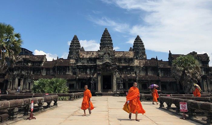
Décision fut prise en Avril pour un voyage aux vacances de la Toussaint (on part toujours à cette époque, que je trouve totalement déprimante sur Paris😕). Le programme : Angkor, puis du balnéaire/plongée. Après avoir étudié les billets d'avion, un voyage Paris-Siem Reap puis Phuket-Paris se faisait bien avec Cathay Pacific, donc via Hong-Kong. Donc on s'est dit : quitte à passer à Hong-Kong, autant y rester un peu pour découvrir cette ville qui nous faisait fantasmer.😊
Donc le programme fut le suivant : Départ le 19 octobre, escale à Hong-Kong et arrivée à Siem Reap le 20 au matin du 20 au 23 : découverte de Angkor le 24 : un petit vol Air Asia pour Phuket d'où nous sommes restés 5 jours à Khao Lak (j'en parlerai assez peu ici ; le but pour moi était de plonger sur un site mythique, Richelieu Rock, pendant que la famille prenait du bon temps) Retour le 30 vers Hong-Kong où nous sommes restés 3 jours, jusqu'au décollage pour Paris le 01/11 au soir. Arrivée à Paris le 2 novembre, juste avant la rentrée
Concernant les logements, voyageant avec enfants (6/9 ans), on a 2 principes simples : - on réserve tout à l'avance - grosse priorité mise sur la qualité du logement, avec piscine obligatoire et 2 espaces de couchage
- Pour Siem Reap, on cherchait un petit hotel de charme, bien situé mais au calme Une petite étude de marché via booking et tripadvisor nous a conduit à Eureka Villas. Superbe, tout petit boutique hotel, dans une petite rue au calme, très cosy, 5 minutes de tuk-tuk de Pub Street, quelques restos/gargottes à côté, piscine mignonnette. Je recommande absolument. - Pour Khao Lak, ce fut le Ramada Resort. Bon, c'est très bien, tout neuf et propret, mais assez décevant, impersonnel, plage pas terrible. Mais tous les restos de Bang Niang à 5 minutes à pied - Enfin, à Hong-Kong, le Royal Plaza. Excellent, très bien situé à Mong Kok, mais piscine un peu froide
Pour l'aérien : - Cathay Pacific, topissime. Très confortable, PNC prévenants, toujours qqch à grignoter (je revois mon fils manger des nouilles au milieu de la nuit😛). Bien mieux que Qatar Airways, pris pour nos 3 précédents voyages, où j'ai toujours trouvé celà très impersonnel. - Les liaisons régionales ont été faites avec Cathay Dragon. Rien de spécial à dire, si ce n'est que l'on a eu 2 heures de retard pour le Phuket-Hong-Kong. Mais organisation top à l'arrivée, tous les voyageurs en correspondance étaient attendus à la porte - Un vol Siem-Reap-Phuket par Air Asia qui a décollé avec.... 20 minutes d'avance !!🙂 (je précise celà pour toutes les mauvaises langues qui critiquent les retards, soi-disant, de Air Asia...)
Allez, je vous emmène 😉
Bon, celà fait deux mois que nous sommes rentrés, deux mois que je vis avec des souvenirs pleins la tête, deux mois que je me dis qu'il faudrait tout raconter, car comme souvent j'ai puisé énormément d'infos sur VF pour préparer ce voyage 🙂
Alors aller à Angkor était pour moi un rêve depuis de longues années. Un mythe, assez obsédant. On devait y aller en 2009, mais madame est tombée enceinte, puis une seconde fois, et on a repoussé jusqu'à ce que les loulous soient suffisamment grands pour faire cette découverte en autonomie, à notre rythme (on avait fait la Malaisie l'an passé, et celà c'était déjà très bien passé). Et puis cette année, j'ai eu 40 ans, alors quoi de meilleur cadeaux que de réaliser un rêve 😉
Décision fut prise en Avril pour un voyage aux vacances de la Toussaint (on part toujours à cette époque, que je trouve totalement déprimante sur Paris😕). Le programme : Angkor, puis du balnéaire/plongée. Après avoir étudié les billets d'avion, un voyage Paris-Siem Reap puis Phuket-Paris se faisait bien avec Cathay Pacific, donc via Hong-Kong. Donc on s'est dit : quitte à passer à Hong-Kong, autant y rester un peu pour découvrir cette ville qui nous faisait fantasmer.😊
Donc le programme fut le suivant : Départ le 19 octobre, escale à Hong-Kong et arrivée à Siem Reap le 20 au matin du 20 au 23 : découverte de Angkor le 24 : un petit vol Air Asia pour Phuket d'où nous sommes restés 5 jours à Khao Lak (j'en parlerai assez peu ici ; le but pour moi était de plonger sur un site mythique, Richelieu Rock, pendant que la famille prenait du bon temps) Retour le 30 vers Hong-Kong où nous sommes restés 3 jours, jusqu'au décollage pour Paris le 01/11 au soir. Arrivée à Paris le 2 novembre, juste avant la rentrée
Concernant les logements, voyageant avec enfants (6/9 ans), on a 2 principes simples : - on réserve tout à l'avance - grosse priorité mise sur la qualité du logement, avec piscine obligatoire et 2 espaces de couchage
- Pour Siem Reap, on cherchait un petit hotel de charme, bien situé mais au calme Une petite étude de marché via booking et tripadvisor nous a conduit à Eureka Villas. Superbe, tout petit boutique hotel, dans une petite rue au calme, très cosy, 5 minutes de tuk-tuk de Pub Street, quelques restos/gargottes à côté, piscine mignonnette. Je recommande absolument. - Pour Khao Lak, ce fut le Ramada Resort. Bon, c'est très bien, tout neuf et propret, mais assez décevant, impersonnel, plage pas terrible. Mais tous les restos de Bang Niang à 5 minutes à pied - Enfin, à Hong-Kong, le Royal Plaza. Excellent, très bien situé à Mong Kok, mais piscine un peu froide
Pour l'aérien : - Cathay Pacific, topissime. Très confortable, PNC prévenants, toujours qqch à grignoter (je revois mon fils manger des nouilles au milieu de la nuit😛). Bien mieux que Qatar Airways, pris pour nos 3 précédents voyages, où j'ai toujours trouvé celà très impersonnel. - Les liaisons régionales ont été faites avec Cathay Dragon. Rien de spécial à dire, si ce n'est que l'on a eu 2 heures de retard pour le Phuket-Hong-Kong. Mais organisation top à l'arrivée, tous les voyageurs en correspondance étaient attendus à la porte - Un vol Siem-Reap-Phuket par Air Asia qui a décollé avec.... 20 minutes d'avance !!🙂 (je précise celà pour toutes les mauvaises langues qui critiquent les retards, soi-disant, de Air Asia...)
Allez, je vous emmène 😉
Visiter la Turquie en camping-car English translation pending
Je remarque que les spécialistes organisant des circuits en camping-car ne proposent plus la destination Turquie dans leurs catalogues.Quelle peut en être la raison : sécurité incertaine ou autres ??
Certains ont-ils visite ce pays récemment en camping-car ?
Quelles sont vos observations ?
Merci de vos informations .
Planning le delta du Mékong à partir de Ha Tien English translation pending
Bonjour,
je suis en train de faire le planning pour notre voyage du Delta du Mekong en janvier2020.
J'ai déjà pu trouver la première partie, c'est à dire le nord et Hanoi puis Phu Quoc. Nous rentrons donc de Phu Quoc le 3 Janvier et nous voulons faire de Ha Tien, en bus à Rach Gia, puis en speedboat sur le canal jusqu'à Ca Mau, monter vers Soc Trang en bus ou si cela existe en canalboat, vers Can Tho, puis Vinh Long -marché flottant de Cai Be, Ben Tre pour finir à Ho Chi Minh 2-3 jours. Nous ne parlons pas le vietnamien, mais anglais et aurons un Translator comme petite aide. Qui peut nous donner des adresses et infos pour avoir un maximum de belles choses à voir? Merci pour vos infos
Quarante jours au centre de l'Inde et trajet à affiner English translation pending
Bonjour à tous les connaisseurs de l’Inde dont j’ai lu avec plaisir vos interventions et carnets sur VF.
Je suis en construction de notre prochain voyage en Inde, ce sera le 3 ème. Nous avions terminé le premier à Hampi après avoir voyagé dans le Sud, le 2 ème à Dehli après avoir visité le Gujarat et remonté ensuite de Bhopal à Dehli.
Cette fois notre désir de voir les sites de Ajanta et Ellora ce qui nous emmène dans le centre, voici donc notre trajet mais il nous reste des jours en fin de voyage et je suis désireuse d’avoir vos conseils autant pour terminer celui-ci que sur le parcours. Jours à caser!
Merci d’avance à ceux qui prendront le temps de me donner quelques coups de pouce...
Inde itinéraire dans ces états: Goa, Karnataka, Andhra Pradesh, Maharastra, Madhya Pradesh. Ce voyage aura lieu de mi janvier à fin février. Pas de voiture avec chauffeur mais nous n’avons plus l’age des trop grosses galères et si nécessaire nous prendrons un taxi.
Calendrier et trajet
J1 samedi arrivée 0h05 à Bombay, avion 5h05 pour Goa , Goa de J1 à J4 trouver où? Repos et acclimatation
J5 mercredi louer taxi pour aller à Gadag site de Lakkundi et arriver le soir à Badami. J6,7,8 Badami : temple, grottes et monter vers tank. Aihole, Pattadakal, Mahakuta J9 train pour Bijapur dimanche (marché à voir). Visite ville. J10 Bijapur visite voir LP... J11 départ Gulbarga bus 4h J11 et 12 Gulbarga fort mosquée temple (1,5 jour) excursion Kanagahalli http://www.luczanits.net/sites/Kanganhalli.html J13 départ pour Bidar essayer de s’arrêter en route à Hunnabal nuit Bidar J14 a 16 Bidar excursion J17 train vers Hyderabad le matin 18 Hyderabad 18 train de nuit pour Aurangabad J19 et 20 Aurangabad visite ville (moulin panchakki) Excursion Ellora, fort Daulatabad. J21 Ajanta essayer d’y dormir ou continuer bus vers Jalgaon J22 a 24 Burhanpur prendre charrette tirée par chevaux pour visiter ville... J24 train pour Khandwa et bus pour Maheswhar J25,26 Maheswhar J27 départ Mandu j27,28,29 Mandu. J30 Départ Indore pour??? Alternative Indore, ujjain, Kota, Bundi, Udaipur que l’on connaît et vol pour Bombay ou Bundi Jaïpur et vol pour Bombay ou Ajmer et vol Bombay Alternative de Indore long trajet une journée pour Nasik 3, 4 nuits Nasik et arrivée Bombay j35 ce qui fait quand même 6 jours à Bombay.
J38 Vol Bombay 39 40, 41Bombay J41 2h du matin vol Retour.
Inde itinéraire dans ces états: Goa, Karnataka, Andhra Pradesh, Maharastra, Madhya Pradesh. Ce voyage aura lieu de mi janvier à fin février. Pas de voiture avec chauffeur mais nous n’avons plus l’age des trop grosses galères et si nécessaire nous prendrons un taxi.
Calendrier et trajet
J1 samedi arrivée 0h05 à Bombay, avion 5h05 pour Goa , Goa de J1 à J4 trouver où? Repos et acclimatation
J5 mercredi louer taxi pour aller à Gadag site de Lakkundi et arriver le soir à Badami. J6,7,8 Badami : temple, grottes et monter vers tank. Aihole, Pattadakal, Mahakuta J9 train pour Bijapur dimanche (marché à voir). Visite ville. J10 Bijapur visite voir LP... J11 départ Gulbarga bus 4h J11 et 12 Gulbarga fort mosquée temple (1,5 jour) excursion Kanagahalli http://www.luczanits.net/sites/Kanganhalli.html J13 départ pour Bidar essayer de s’arrêter en route à Hunnabal nuit Bidar J14 a 16 Bidar excursion J17 train vers Hyderabad le matin 18 Hyderabad 18 train de nuit pour Aurangabad J19 et 20 Aurangabad visite ville (moulin panchakki) Excursion Ellora, fort Daulatabad. J21 Ajanta essayer d’y dormir ou continuer bus vers Jalgaon J22 a 24 Burhanpur prendre charrette tirée par chevaux pour visiter ville... J24 train pour Khandwa et bus pour Maheswhar J25,26 Maheswhar J27 départ Mandu j27,28,29 Mandu. J30 Départ Indore pour??? Alternative Indore, ujjain, Kota, Bundi, Udaipur que l’on connaît et vol pour Bombay ou Bundi Jaïpur et vol pour Bombay ou Ajmer et vol Bombay Alternative de Indore long trajet une journée pour Nasik 3, 4 nuits Nasik et arrivée Bombay j35 ce qui fait quand même 6 jours à Bombay.
J38 Vol Bombay 39 40, 41Bombay J41 2h du matin vol Retour.
Itinéraire 17 jours Bosnie-Herzégovine et Monténégro English translation pending
Bonsoir,
Je crée un nouveau post pour détailler mon itinéraire. Décollage dans 10 jours et les préparatifs avancent petit à petit. Ce qui est prévu : un beau road trip pour avoir un aperçu du Monténégro et de la Bosnie-Herzégovine. L'itinéraire proposé est une base, tout pourra bouger une fois sur place en fonction de notre feeling, même si certaines étapes me paraissent incontournables tellement ça à l'air beau 😮😄
Après avoir lu la grosse majorité du forum (et autres !), j'ai préparé un itinéraire qui grosso modo devrait ressembler à ça :
J1 Dubrovnik aeroport-Perast-Kotor - 75km - 2 à 3h suivant douane J2 Péninsule de Lustica - Kotor - 75km - 2 à 3h J3 Kotor -Lovcen-Cetinje- Budva ou Petrocac - 100km - 3 à 4h J4 Budva-Sveti Stefan-Stari bar- Ulcinj-Virpazar -120km - 3 à 4h J5 Virpazar-Rijeka-Kolasin - 125km - 4h J6 Kolasin-Durmitor - 100km - 3h J7 Durmitor J8 Durmitor-Foca-Trebinje - 230km - 5 à 8h J9 Trebinje - Blagaj - Mostar - 120km - 3h J10 Mostar-Konjic-Sarajevo - 120km - 3h J11 Sarajevo J12 Sarajevo-Travnik-Jajce - 160km - 3 à 5h J13 Jacjce-Prozor Rama-Imotzi - 180km 4 à 5h J14 Imotzi-Kravica waterfall-Pocitlej - 75km - 2h J15 Bonus J16 Bonus J17 Dubrovnik J18 Départ
Côté Monténégro, voilà la "boucle" qui n'en est pas une, que je compte faire : goo.gl/maps/KbMbrhP8B8DsCevZ9
Côté Bosnie, voilà la "boucle" prévue : goo.gl/maps/P5xwoRxMP4fW9Sa68
J'attends vos avis, mais j'ai dores et déjà des interrogations : - pour le J4, j'hésite à aller jusqu'à Stari Bar et Ulcinj... Est ce que ça vaut vraiment le déplacement ? Si oui, c'est possible la petite route de Ulcinj à Vizpasar le long du lac, mais ça risque de nous prendre beaucoup de temps car route très petite et accidentée. A voir. Sinon on profitera un peu de la côte et on ira direct de Budva à Vizapsar en fin de journée. - J8, j'ai pris la décision de faire une grosse grosse journée de route, mais de passer par le canyon de Piva et aller direct à Foca depuis la Bosnie, puis de descendre à Trebinje. J'ai bien conscience que c'est un très long trajet, mais vu que la route est magnifique, c'est top pour une journée de road trip. On partira tôt et on prendra le temps de faire des petites pauses à droite à gauche. Est ce faisable ou bien c'est vraiment trop trop long ? Du coup avec cet itinéraire, je zappe totalement Gorazde, mais est ce que c'est vraiment incontournable ? - J13 cette journée est assez longue aussi niveau route, mais le détour vers le lac à priori ne rallonge pas de beaucoup. J'ai mis Imotzi pour les lacs, bleu et rouge, mais est ce que ça vaut vraiment le déplacement ? Est ce que c'est facile de passer et repasser la frontière à cet endroit là ? Si c'est pour perdre beaucoup de temps, on zappera cette étape. - J15 et J16 : je me laisse deux journées complètes en plus qu'on "utilisera" ou bon nous semble dans le trajet, dans un lieu qui nous plaira plus que les autres. Sinon j'aurai peut-être d'autres suggestions d'incontournables ?? - J17 je pense que juste l'après-midi à Dubrovnik ça nous suffira. Il n'y aura qu'un "petit" bateau de croisière donc sans doute pas une foule énorme, ça devrait aller. Quel conseil pour dormir avant cette étape ? Une dernière nuit en Bosnie ou plutôt vers Dubrovnik ? Quel conseil pour le passage de frontière : où est ce qu'on attendra le moins dans cette zone pour faire Bosnie/Croatie ?
Voilà, j'attends des avis et modifications éventuelles... car entre le "papier" et la réalité, je sais que c'est pas la même chose... 😛
Merci d'avance à tous pour votre aide 😄
Je crée un nouveau post pour détailler mon itinéraire. Décollage dans 10 jours et les préparatifs avancent petit à petit. Ce qui est prévu : un beau road trip pour avoir un aperçu du Monténégro et de la Bosnie-Herzégovine. L'itinéraire proposé est une base, tout pourra bouger une fois sur place en fonction de notre feeling, même si certaines étapes me paraissent incontournables tellement ça à l'air beau 😮😄
Après avoir lu la grosse majorité du forum (et autres !), j'ai préparé un itinéraire qui grosso modo devrait ressembler à ça :
J1 Dubrovnik aeroport-Perast-Kotor - 75km - 2 à 3h suivant douane J2 Péninsule de Lustica - Kotor - 75km - 2 à 3h J3 Kotor -Lovcen-Cetinje- Budva ou Petrocac - 100km - 3 à 4h J4 Budva-Sveti Stefan-Stari bar- Ulcinj-Virpazar -120km - 3 à 4h J5 Virpazar-Rijeka-Kolasin - 125km - 4h J6 Kolasin-Durmitor - 100km - 3h J7 Durmitor J8 Durmitor-Foca-Trebinje - 230km - 5 à 8h J9 Trebinje - Blagaj - Mostar - 120km - 3h J10 Mostar-Konjic-Sarajevo - 120km - 3h J11 Sarajevo J12 Sarajevo-Travnik-Jajce - 160km - 3 à 5h J13 Jacjce-Prozor Rama-Imotzi - 180km 4 à 5h J14 Imotzi-Kravica waterfall-Pocitlej - 75km - 2h J15 Bonus J16 Bonus J17 Dubrovnik J18 Départ
Côté Monténégro, voilà la "boucle" qui n'en est pas une, que je compte faire : goo.gl/maps/KbMbrhP8B8DsCevZ9
Côté Bosnie, voilà la "boucle" prévue : goo.gl/maps/P5xwoRxMP4fW9Sa68
J'attends vos avis, mais j'ai dores et déjà des interrogations : - pour le J4, j'hésite à aller jusqu'à Stari Bar et Ulcinj... Est ce que ça vaut vraiment le déplacement ? Si oui, c'est possible la petite route de Ulcinj à Vizpasar le long du lac, mais ça risque de nous prendre beaucoup de temps car route très petite et accidentée. A voir. Sinon on profitera un peu de la côte et on ira direct de Budva à Vizapsar en fin de journée. - J8, j'ai pris la décision de faire une grosse grosse journée de route, mais de passer par le canyon de Piva et aller direct à Foca depuis la Bosnie, puis de descendre à Trebinje. J'ai bien conscience que c'est un très long trajet, mais vu que la route est magnifique, c'est top pour une journée de road trip. On partira tôt et on prendra le temps de faire des petites pauses à droite à gauche. Est ce faisable ou bien c'est vraiment trop trop long ? Du coup avec cet itinéraire, je zappe totalement Gorazde, mais est ce que c'est vraiment incontournable ? - J13 cette journée est assez longue aussi niveau route, mais le détour vers le lac à priori ne rallonge pas de beaucoup. J'ai mis Imotzi pour les lacs, bleu et rouge, mais est ce que ça vaut vraiment le déplacement ? Est ce que c'est facile de passer et repasser la frontière à cet endroit là ? Si c'est pour perdre beaucoup de temps, on zappera cette étape. - J15 et J16 : je me laisse deux journées complètes en plus qu'on "utilisera" ou bon nous semble dans le trajet, dans un lieu qui nous plaira plus que les autres. Sinon j'aurai peut-être d'autres suggestions d'incontournables ?? - J17 je pense que juste l'après-midi à Dubrovnik ça nous suffira. Il n'y aura qu'un "petit" bateau de croisière donc sans doute pas une foule énorme, ça devrait aller. Quel conseil pour dormir avant cette étape ? Une dernière nuit en Bosnie ou plutôt vers Dubrovnik ? Quel conseil pour le passage de frontière : où est ce qu'on attendra le moins dans cette zone pour faire Bosnie/Croatie ?
Voilà, j'attends des avis et modifications éventuelles... car entre le "papier" et la réalité, je sais que c'est pas la même chose... 😛
Merci d'avance à tous pour votre aide 😄
Nouvelles formalités administratives du e-Visa pour la Thaïlande English translation pending
Bonjour
Depuis quelques années avec mon épouse nous allons passer l' hiver 60 jours en Thailande.
Nous avons déjà nos billets avion pour janvier 2020 et vivant dans le sud de la France, chaque année nous allions au consulat Thaïlandais de Lyon pour nos visas de 60 jours.
Ors selon les nouvelles formalités administratives de "l'e-visa" je vois ce jour que le consulat de Lyon ne se chargera plus des visas, et qu'après avoir réuni les différentes démarches internet et documents demandés il faut déposer à l'Ambassade de Thailande située à Paris; ou payer un organisme agréé pour le faire mais en final attendre qu l'ambassade vous fixe un rendez vous pour déposer ou récupérer les passeports.
Le but de ce "e-visas" étant soit disant, de simplifier le processus d’obtention, en ce qui me concerne je ne comprends pas la démarche et demande de l'aide pour y voir plus clair. Merci.
Le but de ce "e-visas" étant soit disant, de simplifier le processus d’obtention, en ce qui me concerne je ne comprends pas la démarche et demande de l'aide pour y voir plus clair. Merci.
Pauvre Sihanoukville! English translation pending
bonjour
vous , voyageurs d'un moment , vous allez vous dire :"mais , nous on s'en fiche, on est de passage ! "
et bien , non ! parce qu'à cause d'une invasion massive , sauvage , des chinois, population essentiellement "affairistes" , TOUS les prix , à tous les niveaux ont déjà explosés !! une chambre il y a 2 ans seulement à Sihanoukville était à environ 10/15 $ , aujourd'hui elle sera à 40/50 $ !!, sale , bruyante , car TOUTE la ville est en chantier , pour construite plus de 80 casinos , et faire venir" l'élite" de chine c'est à dire les joueurs , et les mafieux avec ! ceci avec la bénédiction des plus hautes instances ...enfin décidées à réduire cette invasion , suite aux trop nombreux problêmes que cette communauté engendre ;bagarres , criminalité en hausse , cohabitation difficile avec les trop gentils khmers , égouts des nouveaux bâtiments à la mer !
bruits de chantiers , poussière sur toute la ville et le plus INCROYABLE MAIS VRAI ; IL VOUS SERA DIFFICILE DE TROUVER UN RESTAURANT , UN HOTEL , UNE GUEST HOUSE KHMER !! peut être le plus ODIEUX : dans certains quartiers , ces envahisseurs vous y INTERDISENT l'accès ....
alors que , sihanouk est la SEULE station balnéaire , qui possède de belles plages ;en ville : ocheteal , sérenpidity , soka , indépendance , puis à une dizaine de kms ; OTRES 1 et OTRES 2 la plus belle ;
hélas défigurées par le béton ;et routes défoncées ;
voilà le tableau , que TOUS les médias déplorent , en termes bien plus virulents , regardez donc sur le net !
je suis triste parce que j'aime trop ces Cambodgiens si agréables et chaleureux et que je viens d'apprendre qu' à cause de la voracité , l'appât du gain facile de ces affairistes dans un immeuble en construction , dans cette ville , sans permis , avec interdiction de construire , ont fait qu'il s'est écroulé (renseignez vous ! ) il y aurait 17 voir 25 morts !
par mal façon bien sur , pour gagner plus !
ceci sur un immeuble de 7 étages OR ils en construisent certains de plus de ...40 étages !
c'était juste un petit rappel de la triste réalité dans cette ville AVANT agréable et devenue un ENFER !
(avec des amis , j'y ai résidé 5 ans en paix jusqu'au jour , il y a 2 ans où "ILS " sont arrivés et nous ont chassés ...)
bon vent et bons voyages le plus longtemps possible !
cordialement
Jacques
Budget pour le Sénégal English translation pending
bonjour
nous allons partir au senegal pour un mois doit on apporter du liquide ou privilégié la carte bleue pas trop d’intérêt ?
le change est il taxé ?
qu'elle budget faut il prévoir pour la nourriture, faire son repas ou le resto
merci de vos réponses danybettina
nous allons partir au senegal pour un mois doit on apporter du liquide ou privilégié la carte bleue pas trop d’intérêt ?
le change est il taxé ?
qu'elle budget faut il prévoir pour la nourriture, faire son repas ou le resto
merci de vos réponses danybettina
Mon itinéraire de 19 jours en Andalousie English translation pending
Bonjour,
Svp, donnez moi votre avis sur mon itinéraire. Dites moi si je dois ajouter ou enlever des étapes, s’il est bien optimisé. Alors, voilà mon itinéraire, arrivée et départ de Malaga:
2 nuits à Malaga (1er jour visiter Malaga; 2ème jour randonnée Caminito del rey et Antequera) 3ème jour: Départ vers la Sierra Nevada, et visite (Randonnée?.) des villages Alpujarras, nuit à Orgiva 4, 5, 6 ème jours: visite de Grenade 7 ème jour: visite de Guadix, Ubeda et Beaza, nuit à Beaza 8, 9 ème jours: Visite de Grenade 10 ème jour: départ vers Seville, visite de Madina Azahara, Chateau El modovar et Carmona 11, 12: visite de Seville 13, 14 : départ vers les villages blancs nuits à Ronda 15: départ vers Cadix, visite de Arcos de la Frontera, visite de Cadix, 16: visite de Sunlucar, nuit à Cadix 17: départ vers Malaga ou environ, suivre la cote tout en visitant les villages intéressants 18, 19 jours: visite Entre autres Mijas, Nerja, et autres villages/points d’intérêts Voilà qu’en pensez-vous? Avez-vous d’autres suggestions? Pouvez-vous me suggérer un endroit sympa autre que Malaga et pas loin de l’aéroport pour les 3 dernières nuits?
Merci d’avance
2 nuits à Malaga (1er jour visiter Malaga; 2ème jour randonnée Caminito del rey et Antequera) 3ème jour: Départ vers la Sierra Nevada, et visite (Randonnée?.) des villages Alpujarras, nuit à Orgiva 4, 5, 6 ème jours: visite de Grenade 7 ème jour: visite de Guadix, Ubeda et Beaza, nuit à Beaza 8, 9 ème jours: Visite de Grenade 10 ème jour: départ vers Seville, visite de Madina Azahara, Chateau El modovar et Carmona 11, 12: visite de Seville 13, 14 : départ vers les villages blancs nuits à Ronda 15: départ vers Cadix, visite de Arcos de la Frontera, visite de Cadix, 16: visite de Sunlucar, nuit à Cadix 17: départ vers Malaga ou environ, suivre la cote tout en visitant les villages intéressants 18, 19 jours: visite Entre autres Mijas, Nerja, et autres villages/points d’intérêts Voilà qu’en pensez-vous? Avez-vous d’autres suggestions? Pouvez-vous me suggérer un endroit sympa autre que Malaga et pas loin de l’aéroport pour les 3 dernières nuits?
Merci d’avance
3 semaines en mai. Lanzarote - La Palma - La Gomera - Ténérife English translation pending
Les Canaries - mai 2018 LANZAROTE -> LA PALMA -> LA GOMERA -> TENERIFE
L’archipel des Canaries, situé au large des côtes du Maroc et du Sahara occidental, est l'une des 17 communautés autonomes espagnoles.
Les Canaries font partie de la Macaronésie, un ensemble géographique regroupant les territoires insulaires volcaniques des îles Canaries, de Madère, des Açores et du Cap-Vert.
Le nom des Iles Canaries provient du latin " Canariae insulae " qui veut dire " Iles aux chiens "
Ø la douceur d'un éternel printemps et une invraisemblable variété
Qu’il s’agisse de farniente en bord de plage, de balades sur le dos des volcans ou dans la jungle tropicale, L’archipel espagnol est composé de 7 îles très différentes.
Paysages volcaniques ou exubérantes forêts primaires, criques déchiquetées d’un noir brillant ou vagues de dunes, adorables petites villes coloniales ou grandes cités palpitantes... des contrastes constants.
Chaque île est un monde en soi, fière de son histoire et de ses coutumes. Toutes, cependant, partagent l'héritage des Guanches, les premiers habitants préhispaniques de l'archipel.
Ø Laquelle choisir ? Bien loin de la réputation d'îles balnéaires bétonnées, Tenerife et Gran Canaria offrent des paysages grandioses au sein d'une pléthore de parcs nationaux et autres réserves naturelles. La première est coiffée par le majestueux volcan Teide ; la seconde est sillonnée de profonds ravins et de gorges pittoresques ; le tout façonné par l'activité volcanique. La Palma et La Gomera surprennent par leur beauté naturelle : aux falaises immenses répondent des coulées de lave figées et des vallées étroites où prospère encore une riche laurisylve - cette forêt touffue des origines. Plus sauvage et plus isolée, la petite El Hierro demeure un véritable laboratoire écolo, idéal pour se réfugier loin du monde, entre balade et plongée sous marine. Sur Fuerteventura la sauvage, deux merveilles de la nature : la péninsule de Jandía et son immense plage naturelle, ainsi que les dunes de Corralejo. Sans oublier une myriade de petits villages et de petits ports. Lanzarote, avec ses façades blanches et ses volets verts aux petits airs d’île grecque, superbement mise en valeur et préservée par la volonté d’un artiste génial, César Manrique. Il protégea même les volcans, comme ce parc national de Timanfaya aux paysages quasi lunaires.
L’« île aux volcans », la plus ancienne des Canaries (23 millions d’années), tient une place originale dans l’archipel. Elle a obtenu en 1993 le titre de réserve de biosphère par l’Unesco, validant le choix d’un développement économique durable et de la préservation de l’environnement et des ressources naturelles de l’île. Dotée d’un climat exceptionnellement doux malgré la proximité de l’Afrique, Lanzarote dévoile de spectaculaires champs de lave figée, des panoramas époustouflants et de superbes plages ! On y découvre aussi un paysage agricole unique, l’aridité du sol volcanique ayant obligé les paysans à vivre avec le déficit de pluie, et à imaginer des formes de cultures adaptées.
L’île possède aussi une identité culturelle vraiment particulière, grâce notamment aux œuvres d’un artiste génial et visionnaire : César Manrique... En accord avec le gouvernement local, il parvint à imposer non seulement la sauvegarde de l’architecture rurale et populaire traditionnelle, mais aussi à la prescrire dans toutes les constructions nouvelles. Résultat : des petites villes blanches idéales, sans trop de dérives bétonnières ou inesthétiques, en symbiose totale avec des paysages de rêve... Au milieu de tout cela, des créations artistiques exceptionnelles, littéralement fondues dans la nature.
ñ Vol NICE 07h00-> 9H05 Madrid 11h25 -> LANZAROTE 13H05(6h de voyage) Ž Location voiture 5 jours aéroport H Hébergement Casa en San Bartolomé - Maison -1/5 nuits ‚Visite : San Bartolomé à pied + Casa Museo Monumento Campesino+ balade dans les vignes direction la Geria J1 – Jeudi 3 mai
i Casa Museo Monumento Campesino Construit par l'une des personnalités phares de Lanzarote, César Manrique, le Monumento del Campesino est un hommage au travail laborieux des habitants de Lanzarote. Sur ces terres arides, couvertes des sombres cendres volcaniques se dresse le monument à la Fécondité imaginé par l'artiste, natif et amoureux de l'île. La sculpture a été réalisée en 1968 à partir d'anciens containers d'eau de voiliers et de divers objets peints, assemblés entre eux. L'œuvre s'élève sur 15 mètres dans le ciel canarien. Juste à côté du monument, la Casa-Muséo que l'on traduira par Maison-Musée du Paysan regroupe un ensemble de bâtiments articulés autour d'une place ouverte, dans la plus pure tradition de Lanzarote. Murs de chaux immaculée, volets verts, et palmiers : voilà le décor d'une grande sobriété et à la fois d'une rare beauté. L'ensemble abrite l'intérieur d'une maison traditionnelle de Lanzarote et présente les métiers typiques de l'île (cordonnerie, tissage, poterie, viticulture, presse à vin). D'autres annexes ont été rajoutées comme une salle de réception pour les manifestations folkloriques et un point de vente de produits locaux. Ces extensions ont été creusées à l'intérieur d'une ancienne carrière d'extraction de pierres. Un passage aménagé laisse voir à nu la lave séchée. On y trouve également un excellent restaurant dédié à la gastronomie canarienne, où il est possible de goûter les fameuses " papas " (petites pommes de terre servies en robe de chambre et avec la sauce typique, le mojo verde ou rojo), accompagnées d'une viande de lapin et d'un verre de vin local.
i Le gofio Hérité des Guanches, les premiers habitants de Tenerife, le gofio (ou Gaudes en français) a gagné sa place parmi les piliers de l'alimentation aux Canaries. Il consiste en une farine de céréales grillées dont il existe différentes variétés et qui est remarquable en raison de son goût et de ses bienfaits pour la santé. Il accompagne habituellement des potages mais on le mange aussi avec du lait au petit-déjeuner, en escaldón, si on le mélange avec du bouillon de poisson, ou à l'apéritif, ou pétri avec du miel et des amandes pour le déguster en dessert ou en mousses. On trouve donc cet ingrédient entièrement naturel dans pratiquement toutes les maisons des Canaries. Sa couleur, dans les tons beiges et jaunes, varie selon s'il a été élaboré à base de maïs ou de blé ou en grillant les différentes céréales. Son délicieux arôme, sec et intense, caractérise les moulins traditionnels dans lesquels les céréales sont grillées et moulues, et qui existent encore sur l'île. S'agissant d'un aliment consommé par les aborigènes de Tenerife, il est aussi un symbole de l'identité de l'île pour la plupart de ses habitants. Ses bienfaits nutritionnels furent essentiels à la survie de la population durant les périodes de famine correspondant aux étapes les plus difficiles de l'histoire des Canaries.
i La culture du vin Le vignoble de Lanzarote est connu pour sa technique de plantation qui tire parti de la roche volcanique : on creuse une dépression circulaire remplie de cendre, dont le milieu accueillera le cep de vigne et les pentes recueilleront l'eau de pluie et la rosée; puis, sur le côté d'où souffle le vent, on élève un muret de pierres crues en demi-lune pour protéger la vigne. Le résultat est un paysage singulier, évoquant des écailles grises (la cendre volcanique) portant chacune un liseré clair (le muret coupe-vent, dit soco ou goro) autour d'une tache verte, le cep de vigne.
i La culture de l'aloe-vera Le climat de Lanzarote convient parfaitement à cette plante épineuse qui vit dans le désert. L'intérieur des feuilles contient un gel gluant très riche en vitamines, minéraux et acides aminés qui aurait de nombreuses vertus l'aloe-vera prendrait un soin tout particulier de la peau ce qui en fait un produit cosmétique hors pair ! La commercialisation de ce cactus se fait sous différentes formes : crème, savon, shampooing, boisson, etc., produits que l'on peut trouver dans les quelques points de vente souvent placés à côté des plantations. En se rendant dans un magasin tenu directement par un producteur, les tarifs seront moins chers qu'ailleurs. Ž voiture de location Prando 1 cratère Corona (14 km, 450 D, 4H) avec pluie au sommet + grand tour avec vue panoramique sur la playa de Farama et sur l’île de la Graciosa ‚Visite : Cueva de los verdes + balade dans les vignes direction la Geria H Hébergement Casa en San Bartolomé - Maison -2/5 nuits J2 – vendredi 4 mai
i Le Volcan de la Corona Le haut du volcan de la Corona offre une magnifique vue panoramique du Nord de l'île. Plusieurs itinéraires de randonnée permettent d'atteindre le sommet qui se trouve à presque 600 m d'altitude. Les sentiers qui arpentent son flanc Nord apportent l'avantage de traverser une grande zone où sont cultivées les vignes de l'île à la méthode locale. En prenant de l'altitude, la vue sur le vignoble est magnifique
i La Cueva de Los Verdes Peut être traduit par la Grotte des Verts, est un tunnel de lave qui a pour origine d’importantes éruptions du volcan Monte de la Corona il y a 3000 à 4500 ans. Le tunnel s'est vidé puis refroidit et constitue maintenant une grotte d’environ deux kilomètres de long qui possède des aspects géologiques et historiques de grand intérêt. La grotte a par la suite été utilisée par les anciens Majos Guanches (aborigènes des Canaris) comme refuge contre les attaques de corsaires qui ravageaient périodiquement l’île. Il se visite aujourd'hui en toute sécurité puisqu'il n'y a aucune activité volcanique en cours. Le site est aménagé sur une profondeur d'environ 500 m et un éclairage ainsi que des escaliers facilitent la visite. Durant la visite, une surprise attend le visiteur... J3 – samedi 5 mai Ž voiture de location ‚vVisite dans le parc de Timanfaya : Chameaux + tour en Bus pour visiter les montagnes de feu + démonstrations volcaniques + restaurant El Diablo PRando 2 -Caldera Blanca (11 km, 400 D+et-) au départ de Mancha Blanca ‚Visite : La Géria et Bodega H Hébergement Casa en San Bartolomé - Maison -3/5 nuits
i Parc national de Timanfaya Le parc regroupe les plus beaux cônes volcaniques de l'île. Il renferme, sur une superficie de 51 km², environ 25 volcans (les plus connus :Montaña de Fuego, la Caldera del Corazoncillo et la Montaña Rajada), éteints en apparence, les dernières activités volcaniques de l'île datant de 1824. Par endroit, à seulement quelques mètres de profondeur, la température peut atteindre plus de 500°C Timanfaya a été déclaré Parc National le 9 août 1974. Ces paysages lunaires, quelque peusurréalistes, sont ceux que l’on voit partout quand on évoque l’île. Leur beauté est saisissante et s’étend sur des kilomètres, reflétant unelarge palette de couleurs selon le moment de la journée, selon le temps ensoleillé ou nuageux.
i Las montañas del Fuego Nées dans les violentes éruptions volcaniques qui ont secoué le sud de Lanzarote entre 1730 et 1736, elles sont à l’origine du Parc national de Timanfaya. L’activité volcanique est toujours présente et il existe des points de chaleur qui atteignent 120 ºC en surface et 600 ºC à 13 mètres de profondeur. L’accès à ce site exceptionnel est réglementé et limité afin de le préserver. Le parc est totalement interdit à pied comme en voiture. Manrique est revenu apposer sa signature en concevant un espace dans lequel cohabitent de façon harmonieuse l’art, l’homme et la nature. La visite se fait dans un bus spécialement conçu pour parcourir « La Route des Volcans » sur 14 kilomètres et en 45 minutes environ, route dessinée par Manrique de telle sort qu’on ne la voit pas le long du parcours Il a conçu également le restaurant El Diablo pour donner vie à ce désert. Le four utilise la chaleur naturelle que donne la terre pour préparer des plats uniques. La chaleur, extrême, remonte jusqu’à la surface et se reflète au travers d’expériences inoubliables qui émerveilleront les visiteurs. Les Montagnes de feu possèdent la beauté de la désolation et offrent une symphonie de couleurs ocre qui ne laisse jamais indifférent le spectateur, rendu humble devant une œuvre d’art imposante et vivante
i Caldera Blanca La Caldera Blanca est l'un des cratères les plus spectaculaires du Parc Naturel. Son cône volcanique très clair se voit de loin, la majorité des autres cônes étant bien plus foncés. Le diamètre de la caldera est d'environ 1,2 km. Il existe plusieurs itinéraires pour s'y rendre mais le plus simple et le plus court est celui qui part du village de Mancha Blanca il faut prendre la piste qui mène 700 m plus loin à un parking . 2,5 km de marche sont alors nécessaires pour atteindre le volcan et ceux qui le souhaitent pourront grimper au sommet.
i La Geria La région de La Geria jouxte le Parc Naturel Los Volcanes. Une belle route traverse un étonnant paysage volcanique, partiellement façonné par la main de l'homme. Ici, au milieu des plaines de lapilli, on aperçoit des murets de pierres volcaniques, disposés en demi-lune. Au centre de chaque muret un pied de vigne a été planté. Ce cep est ainsi protégé du vent. Parfois, il n'y a pas de murets le cep de vigne est alors placé dans un trou creusé par l'homme. L'homme a réussi à produire du raisin dans cet environnement minéral hostile. Il fait ainsi de Lanzarote une région vinicole où l'on peut déguster du bon vin ! Ž voiture de location ‚Visite : Téguise (château+ marché) + Haria + Jardin de cactus + Fondation Manrique à Tahiche H Hébergement Casa en San Bartolomé - Maison - 4/5 nuits J4 – dimanche 6 mai
i Teguise La plus séduisante bourgade de Lanzarote ; un charme réel, une architecture ancienne homogène et protégée, une riche offre culturelle Egalement nommé La Villa de Teguise, Teguise est un très beau village canarien très prisé des touristes. Comme presque partout à Lanzarote, les maisons sont blanches. S'y promener est vraiment agréable et les restaurants sont nombreux pour la pause déjeuner ou le dîner
i Haria Haría est situé dans l'envoûtante vallée de Las Mil Palmeras (la vallée des Mille Palmiers), l'une des meilleures palmeraies autochtones des Îles Canaries. En suivant la route qui pénètre dans les montagnes, on peut apercevoir une oasis au milieu de la géologie pure de l'île : des terres vertes et des cultures parsemées sur la couleur blanche de l'architecture populaire de l'île. Haría repose à l'ombre d'un mystérieux volcan de la Corona, bercé par la tranquillité d'un paysage rural de grand intérêt.
i Le Jardin de cactus Cet incroyable jardin botanique est l’une des dernières œuvres de César Manrique et se trouve dans une ancienne carrière de picón (cailloutis volcaniques), . Le parc dispose de plus de 1400 espèces différentes de cactus et un total d’environ 9600 cactus. Ce qui remarquable est la parfaite harmonie dans la situation et la distribution des ressources naturelles avec les éléments typiques du paysage insulaire. À noter également l’excellente conservation des moulins à vent construits à partir de cendres volcaniques très compactes. Superbe exemple de l’application du concept « art-nature »
i La Fondation César Manrique Cette fondation a été créée en 1982 par César Manrique (et un groupe d'amis) cet artiste, à la fois peintre, architecte et sculpteur, a su mettre en avant l'île de Lanzarote dans ses œuvres. Aujourd'hui, la fondation se trouve dans la maison de Manrique qui fait office de Musée des Arts. Les bâtiments utilisent la roche volcanique noire pour mettre en valeurs les objets d'arts qu'ils contiennent. La demeure de Manrique, construite en 1966 sur l’une des plus belles coulées de lave percée de 5 bulles volcaniques, avec salons, terrasses et jardins ; alliance d’éléments architecturaux et naturels
Ž voiture de location PRando 3 -Salinas de Janubio via los Hervideros jusqu’à El Golfo, retour par chemin (15 km, 200D+et-) + visite de playa Blanca en voiture H Hébergement Casa en San Bartolomé - Maison -5/5 nuits J5 – lundi 7 mai
i Las Salinas de Janubio Les Salinas de Janubio sont des marais salants qui se trouvent au niveau de la Caleta de Janubio, sur la côte sud-ouest de l’île. Ressemblant à un patchwork géant avec des rectangles remplis d'eau, d'autres secs et d'autres recouverts par une couche de sel, le tout donnant sur la mer en toile de fond, ils offrent une image de carte postale parmi les plus belles de Lanzarote. Cette grande crique s’est formée entre les années 1730 et 1736 après des éruptions volcaniques qui l’ont isolée de la mer par un banc de sable et créant de la sorte un bassin intérieur. C’est ce bassin alimenté par les eaux de mer qui, aujourd’hui, permet la production du sel, la plus importante de toutes les îles Canaries.Les marais salants ont été construits en 1895. Avant cela, des produits telles que le blé, le maïs ou le seigle y étaient cultivés.
i Los Hervideros Il s'agit de cavités creusées par la mer dans la roche volcanique. Le site est aménagé et de petits sentiers facilitent l'approche des cavités : on peut alors facilement observer le spectacle très impressionnant des vagues qui s'y engouffrent !
i El Golfo El Golfo est situé dans la région de Yaiza, dans l'ouest de Lanzarote, et il fait partie du Parc Naturel des Volcans. Il s’agit d’un cratère qui se trouve au niveau de la mer duquel il ne reste que la moitié, avec un lac aux eaux de couleur verte à l’intérieur. La couleur verte du lac est due à la présence d’organismes végétaux en superficie. Ce lac a été déclaré Réserve Naturelle, c’est pourquoi la baignade y est interdite. La côte est riche en roches volcaniques aux formes spectaculaires et aux couleurs noires, rouges et jaunes. La mer passe à travers ce cratère et forme une jolie plage noire qui contraste avec la couleur verte du lac. Une plage de sable noir est située juste en face de la lagune, mais prudence car les vagues y sont souvent fortes ! El Golfo est également le nom du petit village situé au Nord du cratère.
En forme de cœur, La Palma est une très belle île à la végétation luxuriante et verdoyante, évoquant un peu Madère. Elle possède des villages authentiques, des volcans, des sites naturels, des bananeraies, un vin délicieux... Une simple escapade sur cette île serait une erreur car elle peut constituer un voyage à part entière. Son paysage rocailleux et boisé est parsemé de volcans comme Teneguía et Cumbre Vieja. La capitale de l'île, Santa Cruz de la Palma, est une ville portuaire dotée d'étroites rues pavées et de maisons avec balcon en bois. Le parc national de la Caldera de Taburiente comprend une vaste formation en cratère, et son terrain est couvert de forêts de pins, où se nichent des cascades. Superficie : 708,3 km² Ž Restitution voiture de location ñ Vol Binter : Lanzarote 12H00-> 12H45 Grande Canarie 16H00 ->LA PALMA ->16h50 v Bus aéroport - Santa Cruz La Palma H Hébergement Apartemento Clasico, Santa Cruz de la Palma -3 chambres-1/2 nuits J6 – mardi 8 mai
i Santa Cruz de la Palma Santa Cruz de La Palma est la capitale de l'île de La Palma, aux Canaries espagnoles. Elle est réputée pour son architecture vieille de plusieurs siècles, ses rues pavées et son port animé. Un ancien couvent abrite le musée insulaire de La Palma, qui propose une collection d'art et des expositions sur l'histoire naturelle et l'ethnographie. Le musée maritime est une reproduction du bateau de Christophe Colomb du XVe siècle, le Santa Maria. L'avenida Maritima: les maisons aux balcons canariens typiques. Ceux à 2 étages ne se rencontrent plus guère qu’ à Santa Cruz, dans cette rue en front de mer. ; Žaller taxiSC La Palma -> départ rando : 25 kms PRando 4-Traversée - ruta Los Volcanos (18 km, 900 D+,1500 D-) v retour Bus 201 de Fuencaliente -> SC La Palma ŽLouer voiture 4 jours aéroport (Céline et Jacques) H Hébergement Apartemento Clasico, Santa Cruz de la Palma -3 chambres-2/2 nuits J7 – mercredi 9 mai
i Ruta de los Volcanos Situé entre les villes du centre et du Sud de l'île, le parcours de los Volcanes offre un trekking naturel le long de ce qui fût à l'époque une importante voie de communication. Ce chemin, aménagé et signalisé, traverse le Parc Naturel de Cumbre Vieja. Avec une végétation rare et des pentes d'exigence élevée entre les volcans, nous vous recommandons de prévoir des vêtements adaptés ainsi que de l'eau et des provisions pour ce sentier qui dure environ cinq heures. Avec une longueur de 17,5 kilomètres, l'itinéraire du parcours de los Volcanes a une dénivellation de 1 207 mètres. Son parcours naturel oscille entre les 725 mètres d'altitude minimale à Fuencaliente et les 1 932 mètres maximaux qu'il atteint sur la crête du sommet. Le trekking permet de contempler les deux versants de l'île et, avec un peu de chance, des espèces animales endémiques comme la corneille et la buse.
i Transvulcania Un des courses de longue distance de montagne les plus difficiles au monde. Créée 2009, elle se déroule au mois de mai et de nombreux coureurs de tous pays y participent. La course rejoint notamment le point culminant de l'île, le Roque de los Muchachos, à 2 426 mètres. Si l'ultra-marathon est le format le plus connu, la Transvulcania accueille d'autres courses de longueur et dénivelé variable. - Ultramarathon : 74 km avec 4 400 m D+ et 4 000 m D- (distance établie en 2014) - Marathon : 45 km avec 1 900 m D+ et 3 300 m D- - Semi-marathon : 24 km avec 2 097m D+ et 689 m D+ - Kilomètre vertical : 7,6 km et 1200m D+ Ž voiture de location -SC La Palma - ruta de la Cresteria: 25 kms PRando 5-Traversée - Pico de la Nieve - Roque de los Muchachos (15 km, 500m D- 1000m D+) Ž 2 groupes et échange clé voiture au milieu Ž voiture de location Retour sur Tazacorte = 55 kms depuis l’observatoire, conduite Céline sur route très sinueuse HCity house, Tazacorte - 2 chambres -1/2 nuits J8 – jeudi 10 mai
i Parc National et Caldera de Taburiente La Caldeira, une fente qui atteint 7 km dans sa plus grande largeur, constitue les restes d'un stratovolcan effondré. La dépression qui forme la Caldeira se situe entre 600 et 900 mètres au-dessus du niveau de la mer, tandis que la crête formant le cercle rocheux qui l'entoure atteint 2 424 mètres à son point culminant, (Roque de los Muchachos). C'est là que se trouve l'observatoire du Roque de los Muchachos. Elle est recouverte de forêts denses de pin canarien et sillonnée par de profonds ravins Partiellement incluse dans le Parque Nacional de la Caldera de Taburiente, elle a été déclaré Parc Naturel en 1954 et Réserve mondiale de la Biosphère de l’UNESCO en 2002 . Ici, la nature garde un précieux trésor de diverté géologique mais aussi biologique.
i Roque de los Muchachos L'un des rebords de la caldeira, le Roque de los Muchachos, constitue le point culminant de La Palma avec 2 426 mètres d'altitude. Depuis ce sommet, il est possible de voir l'ensemble de l'île de La Palma et en particulier la caldeira de Taburiente, ainsi que les îles de Tenerife, El Hierro et La Gomera.
i Observatoire du Roque de los Muchachos Il a été inauguré par le roi et la reine d'Espagne en 1985 et appartient à l'Institut d'astrophysique des Canaries (IAC). C’est l'un des meilleurs lieux du monde pour observer les étoiles. Un ciel net grâce à un écran naturel de nuages : El Roque de los Muchachos affiche l'un des cieux les plus nets de la planète grâce à sa qualité environnementale et à des caractéristiques physiques particulières. La position de l'île au milieu de l'Océan Atlantique et son climat particulier provoquent une formation de nuage entre mille et deux mille mètres d'altitudes. Ces facteurs naturels font que les nuages créent un miroir naturel et empêchent que la pollution lumineuse des villes côtières rende difficile l'observation nocturne des étoiles. De nombreux télescopes y sont installés, le fleuron est le Gran Tecan, un télescope géant de 10,4 m de diamètre. On y étudie aussi les sursauts gamma avec le Major Atmospheric Gamma-ray Imaging Cherenkov Telescope (MAGIC) qui sera bientôt épaulé par le CTA (Cherenkov Telescope Array). C’est là que Miguel Claro s’est rendu pour réaliser ce panorama de la voie lactée (un assemblage de plusieurs clichés), sous l’un des ciels les plus noirs de la planète. Ž voiture de locationTazacorte -> Fuencaliente PRando 6- Traversée – Fuencaliente + Volcan Teneguia + Faro et Salinas + au retour Volcan San Antonio (12 km, 800m D-) v retour Bus 500 Faro -> Fuencaliente Ž voiture de locationRetour – Tazacorte (Céline) HCity house, Tazacorte- 2 chambres -2/2 nuits J9 – vendredi 11 mai
i Volcan Teneguia La dernière éruption volcanique à la surface des Canaries En 1971, le volcan Teneguia a fait la une des journaux du monde entier en s'ouvrant, des milliers de mètres cube de magma incandescent surgissant de ses entrailles. L’éruption a couvert de lave et de gravillon volcanique une parte importante de l'extrême sud de l'île de la Palma. Pour préserver les laves vierges du volcan Teneguia ainsi que son compagnon du XVIIIème siècle le volcan San Antonio, on l'a déclaré Monument Naturel.
i Les salines de Fuencaliente Les salines, ont été classés Site d'Intérêt Scientifique car se posent de nombreux oiseaux migrateurs. Ici, la terre, l'eau et l'air s'allient pour faire des salines de Fuencaliente un paysage humain d'une valeur immense, où les contrastes entre le blanc du sel, le noir de la terre volcanique et le bleu de la mer composent un cadre d'une grande beauté. L'eau de l'océan coule entre la pierre et la boue, formant un labyrinthe où le soleil l'évapore et condense le niveau de salinité. Se produisent alors de magnifiques effets de couleur, allant du jaune au bleu, en passant par le rose. Les petits cristaux brillent et sont collectés de manière artisanale, formant des pyramides qui sont ensuite séchées par l'air.
i Volcan San Antonio Le centre des visiteurs du Volcan de San Antonio, propose une fascinante histoire volcanique de l’île et permet de sentir la chaleur du volcan. Un sentier monte au volcan San Antonio, et permet d’apprécier la vue magnifique de la partie la plus jeune de l'Espagne, provoquée par la dernière éruption de 1971. On y admire la beauté du Volcan Teneguía, le sentier vertigineux qui couronne sa cime, les étendues de Fuencaliente, et le GR-131 qui mène aux salines et au phare de Fuencaliente.
Ž voiture de location :allerTazacorte -> Los Tilos (24 km) PRando 7 - Bosque de Los Tilos- (PR LP 6 Casa del Monte - Marcos y Cordero - Los Tilos) (20 km, 1600 D) Ž voiture de location : retour Los Tilios à San Andres y Sauces (6 km) H Las Lonjas/ San Andres y Sauces – Maison - 1/1 nuit J10 – samedi 12 mai
i Forêt primitive de Los Tilos La forêt de Los Tilos (Les Tilleuls) est une explosion de biodiversité et de vert qui charme au premier coup d'oeil. Une jungle inoffensive et tranquille qui regorge de mousse, de silence et de l'odeur de l’épais feuillage frais. Los Tilos est l'un des rares bastions de laurisilva du monde, une forêt primitive et touffue d'arbres à grandes feuilles qui prolifèrent sur la planète depuis des millions d'années. Los Tilos a donc été déclaré Réserve de la Biosphère de l'UNESCO en 2002, une protection qui aujourd'hui recouvre toute l'île de La Palma. La route se termine près du centre des visites qui offre des salles à thème, des projections de vidéos et une cafétéria.
i Les Sources de Marcos et de Cordero - un trekking à la recherche des origines de l'eau La randonnée débute sur le parking proche du Centro de Visitantes. On emprunte une piste forestière sur 3km. Après avoir franchi un petit tunnel on traverse le pont qui franchit le Barranco del Agua. On attaque ensuite la montée de 1400m dans la forêt regorgeant de pins canariens touffu et de végétation autochtone (laurisilva) Il sillonne au fond du lit du torrent Barranco Rivero, ( le terrain est parfois technique mais magnifique) Après une ultime montée pour sortie du barranco, on découvre les sources de Cordero ! Le sentier suit le canal qui collecte les eaux des sources puis le bruit de l’eau qui coule se fait de plus en plus entendre ce sont les sources de Marcos qui dévalent la pente. L’itinéraire suit maintenant plus ou moins une ligne de niveau et devient assez surprenant avec le passage de 13 tunnels entre 50 et 350 mètres de long. C’est assez incroyable ! N’oubliez pas d’emporter une frontale ou une lampe de poche, c’est utile ! Autre élément important : embarquez une veste imperméable, le 12ième tunnel ouvre une véritable douche ! Arrivé à la Casa del Monte, Il faut prendre un sentier ‘prohibido’ pour aborder une descente parfois technique et équipée de corde à certains endroits, attention ça glisse un peu ! On retrouve ensuite notre une piste forestière du début de la rando
Ž voiture location San Andres y Sauces -> Santa Cruz La Palma Žrestitution voiture location au port J Ferry Naviera – Santa Cruz La Palma -> San Sebastian La Gomera HPension Colon – San Sebastian de la Gomera– 3 chambres - 1/2 nuits J11 – dimanche 13 mai
La Gomera est l’une des plus petites îles de l’archipel, après El Hierro. La richesse de sa flore fera le bonheur des amoureux de nature. La Gomera est, de plus, préservée du tourisme car elle n’a que très peu de plages. Les lieux sont restés sauvages et c’est un vrai bonheur d’y randonner. Les ravins qui se lancent à la mer, les vallées couvertes de palmiers verts, les plages de sable noir et d'eaux cristallines, des bois touffus millénaires avec des sources qui vous invitent à vous rafraîchir... Un ensemble naturel qui conforme une Réserve de la Biosphère avec des espèces déjà disparues ailleurs dans le monde. La partie la plus exceptionnelle de l'île est constituée par le parc national de Garajonay, classé au patrimoine mondial de l'Unesco. La Gomera dispose de 17 espaces protégés qui occupent un tiers de l'île, de forme circulaire (environ 25 km par 25 km en longueur et en largeur). La Gomera culmine à près de 1 500 mètres d'altitude Exterminé ailleurs aux Canaries durant la conquête espagnole, les Guanches ont mieux résisté à La Goméra, et on retrouve encore aujourd'hui cet esprit rebelle chez les habitants La Gomera est surnommée Isla Colombina – Ile de Colomb. Car c'est à La Gomera que Christophe Colomb fit sa dernière escale avant de découvrir l'Amérique en 1492 !
i Climat Baignée par les alizés, le climat de l’île de La Gomera répond à variantes modérées subtropicales. En raison de sa géographie complexe, l’île contient plusieurs microclimats en fonction de la pente. Dans le nord, exposé au vent des alizés, on trouve un climat où l’humidité s’élève. En raison de l’altitude des montagnes, la vapeur de pluie se condense en créant une forêt verte intacte depuis des milliers d’années (Parc national de Garajonay). La température est donc inférieure de celle du sud, où les vents font monter la température. Le climat y est beaucoup plus chaud et ensoleillé pendant la plupart de l’année. Par conséquent, le climat de l’île de La Gomera, avec peu de fluctuations, présente une température moyenne de 22 degrés pendant toute l’année.
i SIlbo (le sifflement en espagnol) C'est le langage aborigène de l'île déclaré Patrimoine Culturel Immatériel de l'Humanité par l'UNESCO. Encore aujourd'hui vous pourrez communiquer avec des sifflements. Il est enseigné à l'école.
Ž Taxi San Sebastian -> ? PRando 8 - ? à La Hermigua (18km 950D+ et 1200D-) v retour Bus – La Hermigua ->San Sebastian HPension Colon – San Sebastian de la Gomera– 3 chambres - 1/2 nuits J12 – lundi 14 mai
i San Sebastian Le port d’entrée de l’île est également sa capitale. Moteur économique et culturel de La Gomera, il est aussi connu pour son passé historique. Le séjour de Christophe Colomb qui a pris ce port comme dernier point de départ pour la découverte de l’Amérique a fait de San Sebastian une place unique dans les îles Canaries. Comme monuments historiques, il faut souligner la Torre del Conde (La Tour du Comte), une forteresse médiévale et le plus ancien bâtiment conservé dans les îles, ainsi comme Nuestra Senora de La Asuncion (Notre-Dame de l���Assomption), un vrai musée d’art religieux, avec de chef d’œuvres du XVIe au XIXe siècle. La Casa de la Aguada, avec son puits où la légende dit que Christophe Colomb a pris d’ici l’eau avec laquelle il a baptisée le nouveau continent.
Ž Taxi San Sebastian -> Roque Agando PRando 9- Roque Agando à Chipude (10km 500m D+ et 1200D-) HHotel SONIA Chipude -2 Chambres J13 – mardi 15 mai
i Roques de Agando Le rocher d'Agando est un neck (*), symbole de l’ile de la Gomera. Il est le plus important pic d'un groupe appelé simplement « Los Roques ». Situé près du centre de l'île, il s'élève directement au-dessus de la route principale entre la capitale de l'île, San Sebastián de la Gomera, et le parc national de Garajonay. Le sommet n'est pas accessible à pied et l'escalade est interdite car il est dans une zone protégée. (*) Terme anglais signifiant « cou »= relief volcanique résiduel en forme de pointe de grande dimension. Il correspond à une ancienne cheminée volcanique qui s'est solidifiée, par remplissage ou comblement vertical de matériel à la fin d'une éruption, et qui a été ensuite dégagée par l'érosion. Cette structure de lave solidifiée résiste mieux à l'érosion que les matériaux d'éjection qui l'entourent. Une fois le cône érodé, il reste une aiguille qui est la relique d'un cône disparu
i Chipude Chipude est un village de montagne à une altitude d’environ 700 mètres. Son église de Notre-Dame de la Candelaria du XVIe siècle et l’une des plus anciennes de l’île. Le monument naturel de La Fortaleza (la forteresse) s'élève de l´autre côté du ravin. Cette colline ressemble à la montagne de la Table en Afrique du Sud ! De nombreux Guanches s'y réfugièrent avant d'être massacré par les Espagnols. La mesa mystique cache un autre témoignage de l’installation précoce du plateau fertile. A son sommet il y a un site archéologique, des spirales de pierre d’origine inconnue, mais très probablement un lieu rituel. Ž Taxi San Sebastian -> Roque Agando PRando 10- Chipude-via foret El Cedro- Hermigua (22 km 550m D+ et 1580m D-) HApartamentos Playa Santa Catalina, Hermigua - Appartement - 3 chambres J14 – mercredi 16 mai
i Fôret El Cedreo Le Bosque del Cedro est une forêt humide fait partie du Parc national de Garajonay
i Laurisilva- parc de GaraJonay Le Parc national de Garajonay est classé au Patrimoine mondial de l'Unesco. Il est caractérisé par la présence de paysages forestiers étonnants plongés dans la brume que l'on appelle "laurisilva". L'humidité de la vapeur d'eau condensée des sources et de nombreux cours d'eau y favorisent une végétation luxuriante, proche de celle de l'ère tertiaire, qui a presque entièrement disparu d'Europe méridionale en raison des changements climatiques. Cette formation végétale constitue un des meilleurs exemples conservés de ce type d'écosystème unique au monde . La forêt de lauriers couvre quelque 70 % du parc de Garajonay
i Hermigua Hermigua a le meilleur climat au monde, selon le dire de scientifiques étrangers du début du siècle dernier !!!.Niché dans un ravin à perte de vue, il vient finir sur la plage de Santa Catalina, un lieu privilégié où les étendues vertes formées par les bananiers viennent jouer avec le bleu de la mer. Hermigua est située dans la vallée la plus riche en eau de La Gomera. Elle est approvisionnée en eau durant toute l'année par le Rio del Cedro permettant à la commune de vivre essentiellement de l'agriculture. le Parc national de Garajonay, qui se trouve en partie sur le territoire de la commune de Hermigua, se trouve à 6 km à l'est du centre. J15 – jeudi 17 mai PRando 11- Hermigua – Agulo- Mirador de Abrante- centre des visiteurs Juego de bolas -Vallerhermoso (20 km 1000m D+et-) HAparthotel Triana II à Vallehermoso – appartement - 3 chambres
i Agulo Nichée dans une dépression naturelle, est élevée sur une plate-forme qui sert comme balcon sur la mer. L’architecture de la partie vieille ville d’Agulo est l’une des meilleurs préservée des Canaries Agulo était historiquement l’une des municipalités les plus prospères de l’île, étant le premier à avoir de l’eau, l’électricité et de construire un bossoir – une jetée en béton, métal et bois qui a été utilisé pour l’exportation de bananes et de tomates. On peut toujours voir les ruines du bossoir. Ce petit village, apprécié pour son charme et sa beauté, offre une vue précieuse sur l'océan et le Teide, sur l'île voisine de Tenerife.
i Mijador de Abrante En haut du rocher, les visiteurs ne se penchent pas sur le précipice, mais flottent au-dessus de celui-ci. À l'extrémité du mirador se trouve une saillie de sept mètres de long avec un sol en verre soutenant celui qui aura le courage de s'y aventurer comme s'il était suspendu dans l'air pour contempler un paysage rural typique des Îles Canaries. 400 m plus bas, et en absence du nuage, on distingue la petite vallée de Agulo, avec ses grappes de maisons et ses terrasses agricoles, encaissée entre les rochers presque verticaux et ouverte sur l'océan atlantique. i Vallehermoso Le centre historique de Vallehermoso comporte des exemples intéressants d´architecture traditionnelle, la plus remarquable étant l’Église de San Juan Bautista, un bel exemple d’architecture néo-gothique achevée au début du XXe siècle. À l’embouchure de ses gorges abruptes, se trouve une station balnéaire avec des piscines équipées pour le plaisir des locaux et des visiteurs. En raison de son étendue, Vallehermoso compte un grand nombre de hameaux disposés dans ses vallées et gorges où les randonneurs peuvent contempler la beauté de certains endroits moins fréquentés et où le temps semble s’être arrêté.
PRando 12- Vallerhermoso – Valle grand Rey (17 km 1000m D+ et 1300m D-) HJardín del Conde , Valle Gran Rey - appartement - 2 chambres ½ nuit J16 – vendredi 18 mai
i Sirop de palme - Miel de Palma Le sirop de palmier, ou miel de palme, est un sirop édulcorant obtenu à partir de la sève de palmiers. Son appellation de miel provient de l’aspect et du goût de ce sirop qui évoquent un miel d’abeille semi-liquide. Ce sirop est produit dans les Îles Canaries, en Amérique du Sud et en Asie du Sud-Est..Sur la Gomera, il est produit à partir des palmiers Phoenix canariensis. Le procédé d'obtention et de concentration de la sève est similaire au procédé utilisé pour produire le sirop d'érable. La sève, appelée guarapo, est collectée dans des récipients à partir d'incisions pratiquées sur le tronc durant la nuit pour éviter son altération par la chaleur et le soleil. La sève recueillie est récoltée le matin. Le miel de palme contient majoritairement du saccharose (57 %) et en minorité du fructose (1 %) et du glucose (1 %)
i Mirador Manrique Le mirador d'Abrante (véritable balcon sur le Teide), et celui de Palmarejo, aménagé par le célèbre artiste de Lanzarote César Manrique, pour contempler la vallée de Gran Rey. L'endroit abrite un restaurant et une boutique, comme pour chaque réalisation de César Manrique !
i Valle Gran Rey Située dans un grand ravin qui part de Arure, l’ancienne capitale de la municipalité, elle est devenue la principale zone touristique sur l’île de La Gomera. Il débouche sur des plages magnifiques de sable noir et d'eaux bleues. La beauté de ses paysages verts regorgeant de palmiers contraste avec les petites maisons blanches de la ville. J17 – samedi 19 mai ‚Excursion baleines HJardín del Conde , Valle Gran Rey - appartement - 2 chambres 2/2 nuit
i Baleines à la Gomera La Gomera et Tenerife appartiennent aux régions du monde où les activités d’observation des cétacés sont les plus appréciées et offrent une remarquable variété d’espèces. Ici en plein Atlantique devant les côtes de La Gomera, on peut voir des baleines et des dauphins dans leur milieu naturel, avec une probabilité de 90% car vivent toute l’année, en permanence, devant La Gomera. Parmi ceux-ci, on trouve de nombreuses sortes de dauphins comme les grands dauphins, les dauphins tachetés de l’Atlantique, les dauphins à bec étroit et les dauphins communs à bec court. De plus toute une population de baleines-pilote vit de façon permanent aux Canaries.
i Almogrote L’almogrote est une préparation de couleur orangée, dont la texture est proche de celle d'un pâté, réalisée à partir de fromage sec (généralement de chèvre), Le fromage est mélangé avec des poivrons ou des piments, de l'ail et de l'huile d'olive. Il est le plus souvent consommé étalé sur du pain. vbus ligne 1 Valle Gran Rey 8h à San. Sebastian de la Gomera (remontée dans le temps: vallée Grand rey, hipude, forêt) PRando 13- ? – San. Sebastian (6 km 500m D-) J Ferry Naviera San. Sebastian de la Gomera ->Ténerife Los Cristianos HOcean Dreams , Los Cristianos- Auberge de jeunesse - 2 chambres J18 –dimanche 20 mai
Tenerife, la plus grande île, est dominée par le pic du Teide, volcan encore actif et parfois enneigé, qui possède son propre observatoire astronomique et appartient au parc national du Teide.
J19 –lundi 21 mai (férié) Ž voiture location (Céline) de Los Cristianos au Parking Montaña Blanca PRando 14 - Montana Bianca à refugeAltavista à 3200m (10 km, 900m D+) Hrefuge Altavista – prévoir son repas
i Parque Nacional de Las Cañadas del Teide Le parc national du Teide est le plus grand des îles Canaries. Un paysage unique de cratères, volcans et fleuves de lave pétrifiée qui entourent l'impressionnante silhouette du volcan Teide, qui se dresse jusqu'à 3 718 m d'altitude. L’unique route traverse le parc est équipée de nombreux miradors qui permettent de composer une vue panoramique complète et centres de visiteurs expliquent les secrets de cette zone volcanique. Un réseau de sentiers bien fourni pour les randonneurs qui souhaitent pénétrer dans le parc et accéder au refuge d'Altavista à 3 270 mètres d'altitude.
En 2007 l'UNESCO, a classé le parc national du Teide, patrimoine naturel de l'humanité car c'est « l'un des lieux les plus riches et les plus variés en succession de paysages volcaniques et spectacularité de valeurs naturelles du monde entier »…
i Le volcan Teide Le Teide est la troisième structure volcanique la plus haute et volumineuse de la planète, derrière le Mauna loa et Mauna kea à Hawaï, et le plus haut sommet des îles Canaries et de toute l'Espagne. Sa formation commença il y a 170 000 ans après un gigantesque glissement de l'édifice volcanique précédent, encore plus grand que l'actuel. C'est ainsi que se forma la caldera de Las Cañadas, dont nous ne pouvons voir aujourd'hui qu'une partie de la paroi qui, lorsque le Teide grandit à l'intérieur, se remplit de ses matières. Les strates volcaniques augmentent car les éruptions de lave successives, de plus en plus visqueuses, se superposent. Au cours des 20 000 dernières années, la plupart des éruptions (Montaña Blanca, Pico Cabras, etc.) se sont produites autour de la base du Teide, car il est très difficile que la lave surgisse à une hauteur plus élevée depuis son sommet. Le Teide, de par son altitude imposante, fut considéré pendant l'époque d'expansion européenne, comme la montagne la plus haute du monde, étant donné qu'il était utilisé comme phare dans la navigation sur l'Océan Atlantique vers le sud, par des navigateurs aussi bien espagnols, que portugais ou britanniques.
Selon les croyances des aborigènes canariens (Guanches), Guayota, le roi du mal, le démon, vivait à l'intérieur du Teide (l'enfer), et il enleva le dieu Magec (dieu de la lumière et du soleil), et l'emmena avec lui à l'intérieur du Teide. Les Guanches demandèrent grâce à Achamán, leur dieu suprême, qui parvint à vaincre Guayota, à sortir Magec des entrailles du Teide et à boucher son cratère. On dit que le bouchon que mit Achamán est le dernier cône du volcan, de couleur blanchâtre, qui couronne le Teide.
PRando 15 - refugeAltavista à 6h – mont Teide (3718m) – Pico Viejo – Canada Bianca – Parador del Turismo (15 km, 500m D+ 1800m D- ) Ž voiture location (Céline)du Parking Montaña Blanca à Puerto de la Cruz HHotel Marte, Puerto de la Cruz-2 chambres avec petit dej
J20 –mardi 22 mai
i Puerto de la Cruz Bien qu'elle soit la plus petite commune de Tenerife, Puerto de la Cruz renferme de nombreux attraits comme sa vieille ville protégée ou sa large promenade du front de mer, idéale pour de longues balades paisibles le long de ses plages de sable volcanique noir. Son climat agréable (entre 22 ºC et 15 ºC) fit d'elle le premier centre touristique des îles Canaries, depuis qu'elle fut qualifiée de destination idéale au XIXe siècle. L’immense zoo Loro Parque, qui se trouve à l'ouest. Sur le front de mer, Lago Martiánez est un complexe aquatique d'eau salée conçu par l'architecte César Manrique. J21 –mercredi 23 mai Ž voiture location (Céline)de Puerto de la Cruz ‚Visite de La Orotava- musée du Vin Ž restitution voiture location (Céline et Jacques )à l’aéroport – retour en taxi au logement HAuberge de jeunesse- La Laguna- 2 Chambres
i Orotava La Orotava, située au cœur de la vallée du même nom, est l'une des localités les plus jolies de l'île. Le centre historique de la commune est situé à 390 mètres d'altitude et fut déclaré ensemble historique et artistique en 1976. Ses rues sont parsemées d'édifices revêtant un grand intérêt patrimonial et de grande importance pour la commune, dont notamment l'Université européenne des Canaries. Les balcons typiques ornent les façades de ses maisons traditionnelles. Les tapis de fleurs et de terre volcanique, qui sont confectionnés chaque année à durant les célébrations du Corpus Christi, ainsi que sa traditionnelle Semaine sainte, qui est célébrée depuis le XVIIe siècle, sont très connus. Une fois par an, les splendeurs volcaniques de Tenerife prennent l’apparence d’immenses peintures de sables, beautés éphémères qu’il est possible de voir devant la mairie. Des ‘peintres’ se relayent sous une grande bâche pour terminer les tapis de sable à temps. ‘’Il faut en moyenne 45 jours pour réaliser ces peintures de sable volcanique. Toutes les couleurs sont fabriquées à partir de la poudre de terre recueillie au parc du volcan Teide. Le basalte donne le noir, le cuivre donne le vert, l’oxyde fer le rouge, le souffre le jaune… Au total, nous utilisons 1,3 tonne de sable qui a été passé plusieurs fois au tamis avant d’être minutieusement placée sur le sol. C’est un travail de précision ! Rien n’est laissé au hasard et nous dessinons d’abord les lignes du tableau avec de la craie. » ‚Visite de La Laguna Ž Taxi jusqu’àl’aéroport ñVol Tenerife Nord 14h50->18H35 Madrid 21H15 -> Nice 23h05
J22 –jeudi 24 mai
i La laguna La Laguna a servi de modèle architectural pour La Havane (Cuba) et Cartagena de las Indias (Colombie). Elle fut le centre économique et surtout politique de l’île durant plusieurs siècles.Forte d’un prestigieux passé, La Laguna conserve plusieurs dizaines de palais aux façades baroques ou maniéristes, aux balcons de bois ouvragés et aux patios élégants. Le classement par l’Unesco au Patrimoine mondial, en 1999, a définitivement protégé le centre historique.
Ø Laquelle choisir ? Bien loin de la réputation d'îles balnéaires bétonnées, Tenerife et Gran Canaria offrent des paysages grandioses au sein d'une pléthore de parcs nationaux et autres réserves naturelles. La première est coiffée par le majestueux volcan Teide ; la seconde est sillonnée de profonds ravins et de gorges pittoresques ; le tout façonné par l'activité volcanique. La Palma et La Gomera surprennent par leur beauté naturelle : aux falaises immenses répondent des coulées de lave figées et des vallées étroites où prospère encore une riche laurisylve - cette forêt touffue des origines. Plus sauvage et plus isolée, la petite El Hierro demeure un véritable laboratoire écolo, idéal pour se réfugier loin du monde, entre balade et plongée sous marine. Sur Fuerteventura la sauvage, deux merveilles de la nature : la péninsule de Jandía et son immense plage naturelle, ainsi que les dunes de Corralejo. Sans oublier une myriade de petits villages et de petits ports. Lanzarote, avec ses façades blanches et ses volets verts aux petits airs d’île grecque, superbement mise en valeur et préservée par la volonté d’un artiste génial, César Manrique. Il protégea même les volcans, comme ce parc national de Timanfaya aux paysages quasi lunaires.
L’« île aux volcans », la plus ancienne des Canaries (23 millions d’années), tient une place originale dans l’archipel. Elle a obtenu en 1993 le titre de réserve de biosphère par l’Unesco, validant le choix d’un développement économique durable et de la préservation de l’environnement et des ressources naturelles de l’île. Dotée d’un climat exceptionnellement doux malgré la proximité de l’Afrique, Lanzarote dévoile de spectaculaires champs de lave figée, des panoramas époustouflants et de superbes plages ! On y découvre aussi un paysage agricole unique, l’aridité du sol volcanique ayant obligé les paysans à vivre avec le déficit de pluie, et à imaginer des formes de cultures adaptées.
L’île possède aussi une identité culturelle vraiment particulière, grâce notamment aux œuvres d’un artiste génial et visionnaire : César Manrique... En accord avec le gouvernement local, il parvint à imposer non seulement la sauvegarde de l’architecture rurale et populaire traditionnelle, mais aussi à la prescrire dans toutes les constructions nouvelles. Résultat : des petites villes blanches idéales, sans trop de dérives bétonnières ou inesthétiques, en symbiose totale avec des paysages de rêve... Au milieu de tout cela, des créations artistiques exceptionnelles, littéralement fondues dans la nature.
ñ Vol NICE 07h00-> 9H05 Madrid 11h25 -> LANZAROTE 13H05(6h de voyage) Ž Location voiture 5 jours aéroport H Hébergement Casa en San Bartolomé - Maison -1/5 nuits ‚Visite : San Bartolomé à pied + Casa Museo Monumento Campesino+ balade dans les vignes direction la Geria J1 – Jeudi 3 mai
i Casa Museo Monumento Campesino Construit par l'une des personnalités phares de Lanzarote, César Manrique, le Monumento del Campesino est un hommage au travail laborieux des habitants de Lanzarote. Sur ces terres arides, couvertes des sombres cendres volcaniques se dresse le monument à la Fécondité imaginé par l'artiste, natif et amoureux de l'île. La sculpture a été réalisée en 1968 à partir d'anciens containers d'eau de voiliers et de divers objets peints, assemblés entre eux. L'œuvre s'élève sur 15 mètres dans le ciel canarien. Juste à côté du monument, la Casa-Muséo que l'on traduira par Maison-Musée du Paysan regroupe un ensemble de bâtiments articulés autour d'une place ouverte, dans la plus pure tradition de Lanzarote. Murs de chaux immaculée, volets verts, et palmiers : voilà le décor d'une grande sobriété et à la fois d'une rare beauté. L'ensemble abrite l'intérieur d'une maison traditionnelle de Lanzarote et présente les métiers typiques de l'île (cordonnerie, tissage, poterie, viticulture, presse à vin). D'autres annexes ont été rajoutées comme une salle de réception pour les manifestations folkloriques et un point de vente de produits locaux. Ces extensions ont été creusées à l'intérieur d'une ancienne carrière d'extraction de pierres. Un passage aménagé laisse voir à nu la lave séchée. On y trouve également un excellent restaurant dédié à la gastronomie canarienne, où il est possible de goûter les fameuses " papas " (petites pommes de terre servies en robe de chambre et avec la sauce typique, le mojo verde ou rojo), accompagnées d'une viande de lapin et d'un verre de vin local.
i Le gofio Hérité des Guanches, les premiers habitants de Tenerife, le gofio (ou Gaudes en français) a gagné sa place parmi les piliers de l'alimentation aux Canaries. Il consiste en une farine de céréales grillées dont il existe différentes variétés et qui est remarquable en raison de son goût et de ses bienfaits pour la santé. Il accompagne habituellement des potages mais on le mange aussi avec du lait au petit-déjeuner, en escaldón, si on le mélange avec du bouillon de poisson, ou à l'apéritif, ou pétri avec du miel et des amandes pour le déguster en dessert ou en mousses. On trouve donc cet ingrédient entièrement naturel dans pratiquement toutes les maisons des Canaries. Sa couleur, dans les tons beiges et jaunes, varie selon s'il a été élaboré à base de maïs ou de blé ou en grillant les différentes céréales. Son délicieux arôme, sec et intense, caractérise les moulins traditionnels dans lesquels les céréales sont grillées et moulues, et qui existent encore sur l'île. S'agissant d'un aliment consommé par les aborigènes de Tenerife, il est aussi un symbole de l'identité de l'île pour la plupart de ses habitants. Ses bienfaits nutritionnels furent essentiels à la survie de la population durant les périodes de famine correspondant aux étapes les plus difficiles de l'histoire des Canaries.
i La culture du vin Le vignoble de Lanzarote est connu pour sa technique de plantation qui tire parti de la roche volcanique : on creuse une dépression circulaire remplie de cendre, dont le milieu accueillera le cep de vigne et les pentes recueilleront l'eau de pluie et la rosée; puis, sur le côté d'où souffle le vent, on élève un muret de pierres crues en demi-lune pour protéger la vigne. Le résultat est un paysage singulier, évoquant des écailles grises (la cendre volcanique) portant chacune un liseré clair (le muret coupe-vent, dit soco ou goro) autour d'une tache verte, le cep de vigne.
i La culture de l'aloe-vera Le climat de Lanzarote convient parfaitement à cette plante épineuse qui vit dans le désert. L'intérieur des feuilles contient un gel gluant très riche en vitamines, minéraux et acides aminés qui aurait de nombreuses vertus l'aloe-vera prendrait un soin tout particulier de la peau ce qui en fait un produit cosmétique hors pair ! La commercialisation de ce cactus se fait sous différentes formes : crème, savon, shampooing, boisson, etc., produits que l'on peut trouver dans les quelques points de vente souvent placés à côté des plantations. En se rendant dans un magasin tenu directement par un producteur, les tarifs seront moins chers qu'ailleurs. Ž voiture de location Prando 1 cratère Corona (14 km, 450 D, 4H) avec pluie au sommet + grand tour avec vue panoramique sur la playa de Farama et sur l’île de la Graciosa ‚Visite : Cueva de los verdes + balade dans les vignes direction la Geria H Hébergement Casa en San Bartolomé - Maison -2/5 nuits J2 – vendredi 4 mai
i Le Volcan de la Corona Le haut du volcan de la Corona offre une magnifique vue panoramique du Nord de l'île. Plusieurs itinéraires de randonnée permettent d'atteindre le sommet qui se trouve à presque 600 m d'altitude. Les sentiers qui arpentent son flanc Nord apportent l'avantage de traverser une grande zone où sont cultivées les vignes de l'île à la méthode locale. En prenant de l'altitude, la vue sur le vignoble est magnifique
i La Cueva de Los Verdes Peut être traduit par la Grotte des Verts, est un tunnel de lave qui a pour origine d’importantes éruptions du volcan Monte de la Corona il y a 3000 à 4500 ans. Le tunnel s'est vidé puis refroidit et constitue maintenant une grotte d’environ deux kilomètres de long qui possède des aspects géologiques et historiques de grand intérêt. La grotte a par la suite été utilisée par les anciens Majos Guanches (aborigènes des Canaris) comme refuge contre les attaques de corsaires qui ravageaient périodiquement l’île. Il se visite aujourd'hui en toute sécurité puisqu'il n'y a aucune activité volcanique en cours. Le site est aménagé sur une profondeur d'environ 500 m et un éclairage ainsi que des escaliers facilitent la visite. Durant la visite, une surprise attend le visiteur... J3 – samedi 5 mai Ž voiture de location ‚vVisite dans le parc de Timanfaya : Chameaux + tour en Bus pour visiter les montagnes de feu + démonstrations volcaniques + restaurant El Diablo PRando 2 -Caldera Blanca (11 km, 400 D+et-) au départ de Mancha Blanca ‚Visite : La Géria et Bodega H Hébergement Casa en San Bartolomé - Maison -3/5 nuits
i Parc national de Timanfaya Le parc regroupe les plus beaux cônes volcaniques de l'île. Il renferme, sur une superficie de 51 km², environ 25 volcans (les plus connus :Montaña de Fuego, la Caldera del Corazoncillo et la Montaña Rajada), éteints en apparence, les dernières activités volcaniques de l'île datant de 1824. Par endroit, à seulement quelques mètres de profondeur, la température peut atteindre plus de 500°C Timanfaya a été déclaré Parc National le 9 août 1974. Ces paysages lunaires, quelque peusurréalistes, sont ceux que l’on voit partout quand on évoque l’île. Leur beauté est saisissante et s’étend sur des kilomètres, reflétant unelarge palette de couleurs selon le moment de la journée, selon le temps ensoleillé ou nuageux.
i Las montañas del Fuego Nées dans les violentes éruptions volcaniques qui ont secoué le sud de Lanzarote entre 1730 et 1736, elles sont à l’origine du Parc national de Timanfaya. L’activité volcanique est toujours présente et il existe des points de chaleur qui atteignent 120 ºC en surface et 600 ºC à 13 mètres de profondeur. L’accès à ce site exceptionnel est réglementé et limité afin de le préserver. Le parc est totalement interdit à pied comme en voiture. Manrique est revenu apposer sa signature en concevant un espace dans lequel cohabitent de façon harmonieuse l’art, l’homme et la nature. La visite se fait dans un bus spécialement conçu pour parcourir « La Route des Volcans » sur 14 kilomètres et en 45 minutes environ, route dessinée par Manrique de telle sort qu’on ne la voit pas le long du parcours Il a conçu également le restaurant El Diablo pour donner vie à ce désert. Le four utilise la chaleur naturelle que donne la terre pour préparer des plats uniques. La chaleur, extrême, remonte jusqu’à la surface et se reflète au travers d’expériences inoubliables qui émerveilleront les visiteurs. Les Montagnes de feu possèdent la beauté de la désolation et offrent une symphonie de couleurs ocre qui ne laisse jamais indifférent le spectateur, rendu humble devant une œuvre d’art imposante et vivante
i Caldera Blanca La Caldera Blanca est l'un des cratères les plus spectaculaires du Parc Naturel. Son cône volcanique très clair se voit de loin, la majorité des autres cônes étant bien plus foncés. Le diamètre de la caldera est d'environ 1,2 km. Il existe plusieurs itinéraires pour s'y rendre mais le plus simple et le plus court est celui qui part du village de Mancha Blanca il faut prendre la piste qui mène 700 m plus loin à un parking . 2,5 km de marche sont alors nécessaires pour atteindre le volcan et ceux qui le souhaitent pourront grimper au sommet.
i La Geria La région de La Geria jouxte le Parc Naturel Los Volcanes. Une belle route traverse un étonnant paysage volcanique, partiellement façonné par la main de l'homme. Ici, au milieu des plaines de lapilli, on aperçoit des murets de pierres volcaniques, disposés en demi-lune. Au centre de chaque muret un pied de vigne a été planté. Ce cep est ainsi protégé du vent. Parfois, il n'y a pas de murets le cep de vigne est alors placé dans un trou creusé par l'homme. L'homme a réussi à produire du raisin dans cet environnement minéral hostile. Il fait ainsi de Lanzarote une région vinicole où l'on peut déguster du bon vin ! Ž voiture de location ‚Visite : Téguise (château+ marché) + Haria + Jardin de cactus + Fondation Manrique à Tahiche H Hébergement Casa en San Bartolomé - Maison - 4/5 nuits J4 – dimanche 6 mai
i Teguise La plus séduisante bourgade de Lanzarote ; un charme réel, une architecture ancienne homogène et protégée, une riche offre culturelle Egalement nommé La Villa de Teguise, Teguise est un très beau village canarien très prisé des touristes. Comme presque partout à Lanzarote, les maisons sont blanches. S'y promener est vraiment agréable et les restaurants sont nombreux pour la pause déjeuner ou le dîner
i Haria Haría est situé dans l'envoûtante vallée de Las Mil Palmeras (la vallée des Mille Palmiers), l'une des meilleures palmeraies autochtones des Îles Canaries. En suivant la route qui pénètre dans les montagnes, on peut apercevoir une oasis au milieu de la géologie pure de l'île : des terres vertes et des cultures parsemées sur la couleur blanche de l'architecture populaire de l'île. Haría repose à l'ombre d'un mystérieux volcan de la Corona, bercé par la tranquillité d'un paysage rural de grand intérêt.
i Le Jardin de cactus Cet incroyable jardin botanique est l’une des dernières œuvres de César Manrique et se trouve dans une ancienne carrière de picón (cailloutis volcaniques), . Le parc dispose de plus de 1400 espèces différentes de cactus et un total d’environ 9600 cactus. Ce qui remarquable est la parfaite harmonie dans la situation et la distribution des ressources naturelles avec les éléments typiques du paysage insulaire. À noter également l’excellente conservation des moulins à vent construits à partir de cendres volcaniques très compactes. Superbe exemple de l’application du concept « art-nature »
i La Fondation César Manrique Cette fondation a été créée en 1982 par César Manrique (et un groupe d'amis) cet artiste, à la fois peintre, architecte et sculpteur, a su mettre en avant l'île de Lanzarote dans ses œuvres. Aujourd'hui, la fondation se trouve dans la maison de Manrique qui fait office de Musée des Arts. Les bâtiments utilisent la roche volcanique noire pour mettre en valeurs les objets d'arts qu'ils contiennent. La demeure de Manrique, construite en 1966 sur l’une des plus belles coulées de lave percée de 5 bulles volcaniques, avec salons, terrasses et jardins ; alliance d’éléments architecturaux et naturels
Ž voiture de location PRando 3 -Salinas de Janubio via los Hervideros jusqu’à El Golfo, retour par chemin (15 km, 200D+et-) + visite de playa Blanca en voiture H Hébergement Casa en San Bartolomé - Maison -5/5 nuits J5 – lundi 7 mai
i Las Salinas de Janubio Les Salinas de Janubio sont des marais salants qui se trouvent au niveau de la Caleta de Janubio, sur la côte sud-ouest de l’île. Ressemblant à un patchwork géant avec des rectangles remplis d'eau, d'autres secs et d'autres recouverts par une couche de sel, le tout donnant sur la mer en toile de fond, ils offrent une image de carte postale parmi les plus belles de Lanzarote. Cette grande crique s’est formée entre les années 1730 et 1736 après des éruptions volcaniques qui l’ont isolée de la mer par un banc de sable et créant de la sorte un bassin intérieur. C’est ce bassin alimenté par les eaux de mer qui, aujourd’hui, permet la production du sel, la plus importante de toutes les îles Canaries.Les marais salants ont été construits en 1895. Avant cela, des produits telles que le blé, le maïs ou le seigle y étaient cultivés.
i Los Hervideros Il s'agit de cavités creusées par la mer dans la roche volcanique. Le site est aménagé et de petits sentiers facilitent l'approche des cavités : on peut alors facilement observer le spectacle très impressionnant des vagues qui s'y engouffrent !
i El Golfo El Golfo est situé dans la région de Yaiza, dans l'ouest de Lanzarote, et il fait partie du Parc Naturel des Volcans. Il s’agit d’un cratère qui se trouve au niveau de la mer duquel il ne reste que la moitié, avec un lac aux eaux de couleur verte à l’intérieur. La couleur verte du lac est due à la présence d’organismes végétaux en superficie. Ce lac a été déclaré Réserve Naturelle, c’est pourquoi la baignade y est interdite. La côte est riche en roches volcaniques aux formes spectaculaires et aux couleurs noires, rouges et jaunes. La mer passe à travers ce cratère et forme une jolie plage noire qui contraste avec la couleur verte du lac. Une plage de sable noir est située juste en face de la lagune, mais prudence car les vagues y sont souvent fortes ! El Golfo est également le nom du petit village situé au Nord du cratère.
En forme de cœur, La Palma est une très belle île à la végétation luxuriante et verdoyante, évoquant un peu Madère. Elle possède des villages authentiques, des volcans, des sites naturels, des bananeraies, un vin délicieux... Une simple escapade sur cette île serait une erreur car elle peut constituer un voyage à part entière. Son paysage rocailleux et boisé est parsemé de volcans comme Teneguía et Cumbre Vieja. La capitale de l'île, Santa Cruz de la Palma, est une ville portuaire dotée d'étroites rues pavées et de maisons avec balcon en bois. Le parc national de la Caldera de Taburiente comprend une vaste formation en cratère, et son terrain est couvert de forêts de pins, où se nichent des cascades. Superficie : 708,3 km² Ž Restitution voiture de location ñ Vol Binter : Lanzarote 12H00-> 12H45 Grande Canarie 16H00 ->LA PALMA ->16h50 v Bus aéroport - Santa Cruz La Palma H Hébergement Apartemento Clasico, Santa Cruz de la Palma -3 chambres-1/2 nuits J6 – mardi 8 mai
i Santa Cruz de la Palma Santa Cruz de La Palma est la capitale de l'île de La Palma, aux Canaries espagnoles. Elle est réputée pour son architecture vieille de plusieurs siècles, ses rues pavées et son port animé. Un ancien couvent abrite le musée insulaire de La Palma, qui propose une collection d'art et des expositions sur l'histoire naturelle et l'ethnographie. Le musée maritime est une reproduction du bateau de Christophe Colomb du XVe siècle, le Santa Maria. L'avenida Maritima: les maisons aux balcons canariens typiques. Ceux à 2 étages ne se rencontrent plus guère qu’ à Santa Cruz, dans cette rue en front de mer. ; Žaller taxiSC La Palma -> départ rando : 25 kms PRando 4-Traversée - ruta Los Volcanos (18 km, 900 D+,1500 D-) v retour Bus 201 de Fuencaliente -> SC La Palma ŽLouer voiture 4 jours aéroport (Céline et Jacques) H Hébergement Apartemento Clasico, Santa Cruz de la Palma -3 chambres-2/2 nuits J7 – mercredi 9 mai
i Ruta de los Volcanos Situé entre les villes du centre et du Sud de l'île, le parcours de los Volcanes offre un trekking naturel le long de ce qui fût à l'époque une importante voie de communication. Ce chemin, aménagé et signalisé, traverse le Parc Naturel de Cumbre Vieja. Avec une végétation rare et des pentes d'exigence élevée entre les volcans, nous vous recommandons de prévoir des vêtements adaptés ainsi que de l'eau et des provisions pour ce sentier qui dure environ cinq heures. Avec une longueur de 17,5 kilomètres, l'itinéraire du parcours de los Volcanes a une dénivellation de 1 207 mètres. Son parcours naturel oscille entre les 725 mètres d'altitude minimale à Fuencaliente et les 1 932 mètres maximaux qu'il atteint sur la crête du sommet. Le trekking permet de contempler les deux versants de l'île et, avec un peu de chance, des espèces animales endémiques comme la corneille et la buse.
i Transvulcania Un des courses de longue distance de montagne les plus difficiles au monde. Créée 2009, elle se déroule au mois de mai et de nombreux coureurs de tous pays y participent. La course rejoint notamment le point culminant de l'île, le Roque de los Muchachos, à 2 426 mètres. Si l'ultra-marathon est le format le plus connu, la Transvulcania accueille d'autres courses de longueur et dénivelé variable. - Ultramarathon : 74 km avec 4 400 m D+ et 4 000 m D- (distance établie en 2014) - Marathon : 45 km avec 1 900 m D+ et 3 300 m D- - Semi-marathon : 24 km avec 2 097m D+ et 689 m D+ - Kilomètre vertical : 7,6 km et 1200m D+ Ž voiture de location -SC La Palma - ruta de la Cresteria: 25 kms PRando 5-Traversée - Pico de la Nieve - Roque de los Muchachos (15 km, 500m D- 1000m D+) Ž 2 groupes et échange clé voiture au milieu Ž voiture de location Retour sur Tazacorte = 55 kms depuis l’observatoire, conduite Céline sur route très sinueuse HCity house, Tazacorte - 2 chambres -1/2 nuits J8 – jeudi 10 mai
i Parc National et Caldera de Taburiente La Caldeira, une fente qui atteint 7 km dans sa plus grande largeur, constitue les restes d'un stratovolcan effondré. La dépression qui forme la Caldeira se situe entre 600 et 900 mètres au-dessus du niveau de la mer, tandis que la crête formant le cercle rocheux qui l'entoure atteint 2 424 mètres à son point culminant, (Roque de los Muchachos). C'est là que se trouve l'observatoire du Roque de los Muchachos. Elle est recouverte de forêts denses de pin canarien et sillonnée par de profonds ravins Partiellement incluse dans le Parque Nacional de la Caldera de Taburiente, elle a été déclaré Parc Naturel en 1954 et Réserve mondiale de la Biosphère de l’UNESCO en 2002 . Ici, la nature garde un précieux trésor de diverté géologique mais aussi biologique.
i Roque de los Muchachos L'un des rebords de la caldeira, le Roque de los Muchachos, constitue le point culminant de La Palma avec 2 426 mètres d'altitude. Depuis ce sommet, il est possible de voir l'ensemble de l'île de La Palma et en particulier la caldeira de Taburiente, ainsi que les îles de Tenerife, El Hierro et La Gomera.
i Observatoire du Roque de los Muchachos Il a été inauguré par le roi et la reine d'Espagne en 1985 et appartient à l'Institut d'astrophysique des Canaries (IAC). C’est l'un des meilleurs lieux du monde pour observer les étoiles. Un ciel net grâce à un écran naturel de nuages : El Roque de los Muchachos affiche l'un des cieux les plus nets de la planète grâce à sa qualité environnementale et à des caractéristiques physiques particulières. La position de l'île au milieu de l'Océan Atlantique et son climat particulier provoquent une formation de nuage entre mille et deux mille mètres d'altitudes. Ces facteurs naturels font que les nuages créent un miroir naturel et empêchent que la pollution lumineuse des villes côtières rende difficile l'observation nocturne des étoiles. De nombreux télescopes y sont installés, le fleuron est le Gran Tecan, un télescope géant de 10,4 m de diamètre. On y étudie aussi les sursauts gamma avec le Major Atmospheric Gamma-ray Imaging Cherenkov Telescope (MAGIC) qui sera bientôt épaulé par le CTA (Cherenkov Telescope Array). C’est là que Miguel Claro s’est rendu pour réaliser ce panorama de la voie lactée (un assemblage de plusieurs clichés), sous l’un des ciels les plus noirs de la planète. Ž voiture de locationTazacorte -> Fuencaliente PRando 6- Traversée – Fuencaliente + Volcan Teneguia + Faro et Salinas + au retour Volcan San Antonio (12 km, 800m D-) v retour Bus 500 Faro -> Fuencaliente Ž voiture de locationRetour – Tazacorte (Céline) HCity house, Tazacorte- 2 chambres -2/2 nuits J9 – vendredi 11 mai
i Volcan Teneguia La dernière éruption volcanique à la surface des Canaries En 1971, le volcan Teneguia a fait la une des journaux du monde entier en s'ouvrant, des milliers de mètres cube de magma incandescent surgissant de ses entrailles. L’éruption a couvert de lave et de gravillon volcanique une parte importante de l'extrême sud de l'île de la Palma. Pour préserver les laves vierges du volcan Teneguia ainsi que son compagnon du XVIIIème siècle le volcan San Antonio, on l'a déclaré Monument Naturel.
i Les salines de Fuencaliente Les salines, ont été classés Site d'Intérêt Scientifique car se posent de nombreux oiseaux migrateurs. Ici, la terre, l'eau et l'air s'allient pour faire des salines de Fuencaliente un paysage humain d'une valeur immense, où les contrastes entre le blanc du sel, le noir de la terre volcanique et le bleu de la mer composent un cadre d'une grande beauté. L'eau de l'océan coule entre la pierre et la boue, formant un labyrinthe où le soleil l'évapore et condense le niveau de salinité. Se produisent alors de magnifiques effets de couleur, allant du jaune au bleu, en passant par le rose. Les petits cristaux brillent et sont collectés de manière artisanale, formant des pyramides qui sont ensuite séchées par l'air.
i Volcan San Antonio Le centre des visiteurs du Volcan de San Antonio, propose une fascinante histoire volcanique de l’île et permet de sentir la chaleur du volcan. Un sentier monte au volcan San Antonio, et permet d’apprécier la vue magnifique de la partie la plus jeune de l'Espagne, provoquée par la dernière éruption de 1971. On y admire la beauté du Volcan Teneguía, le sentier vertigineux qui couronne sa cime, les étendues de Fuencaliente, et le GR-131 qui mène aux salines et au phare de Fuencaliente.
Ž voiture de location :allerTazacorte -> Los Tilos (24 km) PRando 7 - Bosque de Los Tilos- (PR LP 6 Casa del Monte - Marcos y Cordero - Los Tilos) (20 km, 1600 D) Ž voiture de location : retour Los Tilios à San Andres y Sauces (6 km) H Las Lonjas/ San Andres y Sauces – Maison - 1/1 nuit J10 – samedi 12 mai
i Forêt primitive de Los Tilos La forêt de Los Tilos (Les Tilleuls) est une explosion de biodiversité et de vert qui charme au premier coup d'oeil. Une jungle inoffensive et tranquille qui regorge de mousse, de silence et de l'odeur de l’épais feuillage frais. Los Tilos est l'un des rares bastions de laurisilva du monde, une forêt primitive et touffue d'arbres à grandes feuilles qui prolifèrent sur la planète depuis des millions d'années. Los Tilos a donc été déclaré Réserve de la Biosphère de l'UNESCO en 2002, une protection qui aujourd'hui recouvre toute l'île de La Palma. La route se termine près du centre des visites qui offre des salles à thème, des projections de vidéos et une cafétéria.
i Les Sources de Marcos et de Cordero - un trekking à la recherche des origines de l'eau La randonnée débute sur le parking proche du Centro de Visitantes. On emprunte une piste forestière sur 3km. Après avoir franchi un petit tunnel on traverse le pont qui franchit le Barranco del Agua. On attaque ensuite la montée de 1400m dans la forêt regorgeant de pins canariens touffu et de végétation autochtone (laurisilva) Il sillonne au fond du lit du torrent Barranco Rivero, ( le terrain est parfois technique mais magnifique) Après une ultime montée pour sortie du barranco, on découvre les sources de Cordero ! Le sentier suit le canal qui collecte les eaux des sources puis le bruit de l’eau qui coule se fait de plus en plus entendre ce sont les sources de Marcos qui dévalent la pente. L’itinéraire suit maintenant plus ou moins une ligne de niveau et devient assez surprenant avec le passage de 13 tunnels entre 50 et 350 mètres de long. C’est assez incroyable ! N’oubliez pas d’emporter une frontale ou une lampe de poche, c’est utile ! Autre élément important : embarquez une veste imperméable, le 12ième tunnel ouvre une véritable douche ! Arrivé à la Casa del Monte, Il faut prendre un sentier ‘prohibido’ pour aborder une descente parfois technique et équipée de corde à certains endroits, attention ça glisse un peu ! On retrouve ensuite notre une piste forestière du début de la rando
Ž voiture location San Andres y Sauces -> Santa Cruz La Palma Žrestitution voiture location au port J Ferry Naviera – Santa Cruz La Palma -> San Sebastian La Gomera HPension Colon – San Sebastian de la Gomera– 3 chambres - 1/2 nuits J11 – dimanche 13 mai
La Gomera est l’une des plus petites îles de l’archipel, après El Hierro. La richesse de sa flore fera le bonheur des amoureux de nature. La Gomera est, de plus, préservée du tourisme car elle n’a que très peu de plages. Les lieux sont restés sauvages et c’est un vrai bonheur d’y randonner. Les ravins qui se lancent à la mer, les vallées couvertes de palmiers verts, les plages de sable noir et d'eaux cristallines, des bois touffus millénaires avec des sources qui vous invitent à vous rafraîchir... Un ensemble naturel qui conforme une Réserve de la Biosphère avec des espèces déjà disparues ailleurs dans le monde. La partie la plus exceptionnelle de l'île est constituée par le parc national de Garajonay, classé au patrimoine mondial de l'Unesco. La Gomera dispose de 17 espaces protégés qui occupent un tiers de l'île, de forme circulaire (environ 25 km par 25 km en longueur et en largeur). La Gomera culmine à près de 1 500 mètres d'altitude Exterminé ailleurs aux Canaries durant la conquête espagnole, les Guanches ont mieux résisté à La Goméra, et on retrouve encore aujourd'hui cet esprit rebelle chez les habitants La Gomera est surnommée Isla Colombina – Ile de Colomb. Car c'est à La Gomera que Christophe Colomb fit sa dernière escale avant de découvrir l'Amérique en 1492 !
i Climat Baignée par les alizés, le climat de l’île de La Gomera répond à variantes modérées subtropicales. En raison de sa géographie complexe, l’île contient plusieurs microclimats en fonction de la pente. Dans le nord, exposé au vent des alizés, on trouve un climat où l’humidité s’élève. En raison de l’altitude des montagnes, la vapeur de pluie se condense en créant une forêt verte intacte depuis des milliers d’années (Parc national de Garajonay). La température est donc inférieure de celle du sud, où les vents font monter la température. Le climat y est beaucoup plus chaud et ensoleillé pendant la plupart de l’année. Par conséquent, le climat de l’île de La Gomera, avec peu de fluctuations, présente une température moyenne de 22 degrés pendant toute l’année.
i SIlbo (le sifflement en espagnol) C'est le langage aborigène de l'île déclaré Patrimoine Culturel Immatériel de l'Humanité par l'UNESCO. Encore aujourd'hui vous pourrez communiquer avec des sifflements. Il est enseigné à l'école.
Ž Taxi San Sebastian -> ? PRando 8 - ? à La Hermigua (18km 950D+ et 1200D-) v retour Bus – La Hermigua ->San Sebastian HPension Colon – San Sebastian de la Gomera– 3 chambres - 1/2 nuits J12 – lundi 14 mai
i San Sebastian Le port d’entrée de l’île est également sa capitale. Moteur économique et culturel de La Gomera, il est aussi connu pour son passé historique. Le séjour de Christophe Colomb qui a pris ce port comme dernier point de départ pour la découverte de l’Amérique a fait de San Sebastian une place unique dans les îles Canaries. Comme monuments historiques, il faut souligner la Torre del Conde (La Tour du Comte), une forteresse médiévale et le plus ancien bâtiment conservé dans les îles, ainsi comme Nuestra Senora de La Asuncion (Notre-Dame de l���Assomption), un vrai musée d’art religieux, avec de chef d’œuvres du XVIe au XIXe siècle. La Casa de la Aguada, avec son puits où la légende dit que Christophe Colomb a pris d’ici l’eau avec laquelle il a baptisée le nouveau continent.
Ž Taxi San Sebastian -> Roque Agando PRando 9- Roque Agando à Chipude (10km 500m D+ et 1200D-) HHotel SONIA Chipude -2 Chambres J13 – mardi 15 mai
i Roques de Agando Le rocher d'Agando est un neck (*), symbole de l’ile de la Gomera. Il est le plus important pic d'un groupe appelé simplement « Los Roques ». Situé près du centre de l'île, il s'élève directement au-dessus de la route principale entre la capitale de l'île, San Sebastián de la Gomera, et le parc national de Garajonay. Le sommet n'est pas accessible à pied et l'escalade est interdite car il est dans une zone protégée. (*) Terme anglais signifiant « cou »= relief volcanique résiduel en forme de pointe de grande dimension. Il correspond à une ancienne cheminée volcanique qui s'est solidifiée, par remplissage ou comblement vertical de matériel à la fin d'une éruption, et qui a été ensuite dégagée par l'érosion. Cette structure de lave solidifiée résiste mieux à l'érosion que les matériaux d'éjection qui l'entourent. Une fois le cône érodé, il reste une aiguille qui est la relique d'un cône disparu
i Chipude Chipude est un village de montagne à une altitude d’environ 700 mètres. Son église de Notre-Dame de la Candelaria du XVIe siècle et l’une des plus anciennes de l’île. Le monument naturel de La Fortaleza (la forteresse) s'élève de l´autre côté du ravin. Cette colline ressemble à la montagne de la Table en Afrique du Sud ! De nombreux Guanches s'y réfugièrent avant d'être massacré par les Espagnols. La mesa mystique cache un autre témoignage de l’installation précoce du plateau fertile. A son sommet il y a un site archéologique, des spirales de pierre d’origine inconnue, mais très probablement un lieu rituel. Ž Taxi San Sebastian -> Roque Agando PRando 10- Chipude-via foret El Cedro- Hermigua (22 km 550m D+ et 1580m D-) HApartamentos Playa Santa Catalina, Hermigua - Appartement - 3 chambres J14 – mercredi 16 mai
i Fôret El Cedreo Le Bosque del Cedro est une forêt humide fait partie du Parc national de Garajonay
i Laurisilva- parc de GaraJonay Le Parc national de Garajonay est classé au Patrimoine mondial de l'Unesco. Il est caractérisé par la présence de paysages forestiers étonnants plongés dans la brume que l'on appelle "laurisilva". L'humidité de la vapeur d'eau condensée des sources et de nombreux cours d'eau y favorisent une végétation luxuriante, proche de celle de l'ère tertiaire, qui a presque entièrement disparu d'Europe méridionale en raison des changements climatiques. Cette formation végétale constitue un des meilleurs exemples conservés de ce type d'écosystème unique au monde . La forêt de lauriers couvre quelque 70 % du parc de Garajonay
i Hermigua Hermigua a le meilleur climat au monde, selon le dire de scientifiques étrangers du début du siècle dernier !!!.Niché dans un ravin à perte de vue, il vient finir sur la plage de Santa Catalina, un lieu privilégié où les étendues vertes formées par les bananiers viennent jouer avec le bleu de la mer. Hermigua est située dans la vallée la plus riche en eau de La Gomera. Elle est approvisionnée en eau durant toute l'année par le Rio del Cedro permettant à la commune de vivre essentiellement de l'agriculture. le Parc national de Garajonay, qui se trouve en partie sur le territoire de la commune de Hermigua, se trouve à 6 km à l'est du centre. J15 – jeudi 17 mai PRando 11- Hermigua – Agulo- Mirador de Abrante- centre des visiteurs Juego de bolas -Vallerhermoso (20 km 1000m D+et-) HAparthotel Triana II à Vallehermoso – appartement - 3 chambres
i Agulo Nichée dans une dépression naturelle, est élevée sur une plate-forme qui sert comme balcon sur la mer. L’architecture de la partie vieille ville d’Agulo est l’une des meilleurs préservée des Canaries Agulo était historiquement l’une des municipalités les plus prospères de l’île, étant le premier à avoir de l’eau, l’électricité et de construire un bossoir – une jetée en béton, métal et bois qui a été utilisé pour l’exportation de bananes et de tomates. On peut toujours voir les ruines du bossoir. Ce petit village, apprécié pour son charme et sa beauté, offre une vue précieuse sur l'océan et le Teide, sur l'île voisine de Tenerife.
i Mijador de Abrante En haut du rocher, les visiteurs ne se penchent pas sur le précipice, mais flottent au-dessus de celui-ci. À l'extrémité du mirador se trouve une saillie de sept mètres de long avec un sol en verre soutenant celui qui aura le courage de s'y aventurer comme s'il était suspendu dans l'air pour contempler un paysage rural typique des Îles Canaries. 400 m plus bas, et en absence du nuage, on distingue la petite vallée de Agulo, avec ses grappes de maisons et ses terrasses agricoles, encaissée entre les rochers presque verticaux et ouverte sur l'océan atlantique. i Vallehermoso Le centre historique de Vallehermoso comporte des exemples intéressants d´architecture traditionnelle, la plus remarquable étant l’Église de San Juan Bautista, un bel exemple d’architecture néo-gothique achevée au début du XXe siècle. À l’embouchure de ses gorges abruptes, se trouve une station balnéaire avec des piscines équipées pour le plaisir des locaux et des visiteurs. En raison de son étendue, Vallehermoso compte un grand nombre de hameaux disposés dans ses vallées et gorges où les randonneurs peuvent contempler la beauté de certains endroits moins fréquentés et où le temps semble s’être arrêté.
PRando 12- Vallerhermoso – Valle grand Rey (17 km 1000m D+ et 1300m D-) HJardín del Conde , Valle Gran Rey - appartement - 2 chambres ½ nuit J16 – vendredi 18 mai
i Sirop de palme - Miel de Palma Le sirop de palmier, ou miel de palme, est un sirop édulcorant obtenu à partir de la sève de palmiers. Son appellation de miel provient de l’aspect et du goût de ce sirop qui évoquent un miel d’abeille semi-liquide. Ce sirop est produit dans les Îles Canaries, en Amérique du Sud et en Asie du Sud-Est..Sur la Gomera, il est produit à partir des palmiers Phoenix canariensis. Le procédé d'obtention et de concentration de la sève est similaire au procédé utilisé pour produire le sirop d'érable. La sève, appelée guarapo, est collectée dans des récipients à partir d'incisions pratiquées sur le tronc durant la nuit pour éviter son altération par la chaleur et le soleil. La sève recueillie est récoltée le matin. Le miel de palme contient majoritairement du saccharose (57 %) et en minorité du fructose (1 %) et du glucose (1 %)
i Mirador Manrique Le mirador d'Abrante (véritable balcon sur le Teide), et celui de Palmarejo, aménagé par le célèbre artiste de Lanzarote César Manrique, pour contempler la vallée de Gran Rey. L'endroit abrite un restaurant et une boutique, comme pour chaque réalisation de César Manrique !
i Valle Gran Rey Située dans un grand ravin qui part de Arure, l’ancienne capitale de la municipalité, elle est devenue la principale zone touristique sur l’île de La Gomera. Il débouche sur des plages magnifiques de sable noir et d'eaux bleues. La beauté de ses paysages verts regorgeant de palmiers contraste avec les petites maisons blanches de la ville. J17 – samedi 19 mai ‚Excursion baleines HJardín del Conde , Valle Gran Rey - appartement - 2 chambres 2/2 nuit
i Baleines à la Gomera La Gomera et Tenerife appartiennent aux régions du monde où les activités d’observation des cétacés sont les plus appréciées et offrent une remarquable variété d’espèces. Ici en plein Atlantique devant les côtes de La Gomera, on peut voir des baleines et des dauphins dans leur milieu naturel, avec une probabilité de 90% car vivent toute l’année, en permanence, devant La Gomera. Parmi ceux-ci, on trouve de nombreuses sortes de dauphins comme les grands dauphins, les dauphins tachetés de l’Atlantique, les dauphins à bec étroit et les dauphins communs à bec court. De plus toute une population de baleines-pilote vit de façon permanent aux Canaries.
i Almogrote L’almogrote est une préparation de couleur orangée, dont la texture est proche de celle d'un pâté, réalisée à partir de fromage sec (généralement de chèvre), Le fromage est mélangé avec des poivrons ou des piments, de l'ail et de l'huile d'olive. Il est le plus souvent consommé étalé sur du pain. vbus ligne 1 Valle Gran Rey 8h à San. Sebastian de la Gomera (remontée dans le temps: vallée Grand rey, hipude, forêt) PRando 13- ? – San. Sebastian (6 km 500m D-) J Ferry Naviera San. Sebastian de la Gomera ->Ténerife Los Cristianos HOcean Dreams , Los Cristianos- Auberge de jeunesse - 2 chambres J18 –dimanche 20 mai
Tenerife, la plus grande île, est dominée par le pic du Teide, volcan encore actif et parfois enneigé, qui possède son propre observatoire astronomique et appartient au parc national du Teide.
J19 –lundi 21 mai (férié) Ž voiture location (Céline) de Los Cristianos au Parking Montaña Blanca PRando 14 - Montana Bianca à refugeAltavista à 3200m (10 km, 900m D+) Hrefuge Altavista – prévoir son repas
i Parque Nacional de Las Cañadas del Teide Le parc national du Teide est le plus grand des îles Canaries. Un paysage unique de cratères, volcans et fleuves de lave pétrifiée qui entourent l'impressionnante silhouette du volcan Teide, qui se dresse jusqu'à 3 718 m d'altitude. L’unique route traverse le parc est équipée de nombreux miradors qui permettent de composer une vue panoramique complète et centres de visiteurs expliquent les secrets de cette zone volcanique. Un réseau de sentiers bien fourni pour les randonneurs qui souhaitent pénétrer dans le parc et accéder au refuge d'Altavista à 3 270 mètres d'altitude.
En 2007 l'UNESCO, a classé le parc national du Teide, patrimoine naturel de l'humanité car c'est « l'un des lieux les plus riches et les plus variés en succession de paysages volcaniques et spectacularité de valeurs naturelles du monde entier »…
i Le volcan Teide Le Teide est la troisième structure volcanique la plus haute et volumineuse de la planète, derrière le Mauna loa et Mauna kea à Hawaï, et le plus haut sommet des îles Canaries et de toute l'Espagne. Sa formation commença il y a 170 000 ans après un gigantesque glissement de l'édifice volcanique précédent, encore plus grand que l'actuel. C'est ainsi que se forma la caldera de Las Cañadas, dont nous ne pouvons voir aujourd'hui qu'une partie de la paroi qui, lorsque le Teide grandit à l'intérieur, se remplit de ses matières. Les strates volcaniques augmentent car les éruptions de lave successives, de plus en plus visqueuses, se superposent. Au cours des 20 000 dernières années, la plupart des éruptions (Montaña Blanca, Pico Cabras, etc.) se sont produites autour de la base du Teide, car il est très difficile que la lave surgisse à une hauteur plus élevée depuis son sommet. Le Teide, de par son altitude imposante, fut considéré pendant l'époque d'expansion européenne, comme la montagne la plus haute du monde, étant donné qu'il était utilisé comme phare dans la navigation sur l'Océan Atlantique vers le sud, par des navigateurs aussi bien espagnols, que portugais ou britanniques.
Selon les croyances des aborigènes canariens (Guanches), Guayota, le roi du mal, le démon, vivait à l'intérieur du Teide (l'enfer), et il enleva le dieu Magec (dieu de la lumière et du soleil), et l'emmena avec lui à l'intérieur du Teide. Les Guanches demandèrent grâce à Achamán, leur dieu suprême, qui parvint à vaincre Guayota, à sortir Magec des entrailles du Teide et à boucher son cratère. On dit que le bouchon que mit Achamán est le dernier cône du volcan, de couleur blanchâtre, qui couronne le Teide.
PRando 15 - refugeAltavista à 6h – mont Teide (3718m) – Pico Viejo – Canada Bianca – Parador del Turismo (15 km, 500m D+ 1800m D- ) Ž voiture location (Céline)du Parking Montaña Blanca à Puerto de la Cruz HHotel Marte, Puerto de la Cruz-2 chambres avec petit dej
J20 –mardi 22 mai
i Puerto de la Cruz Bien qu'elle soit la plus petite commune de Tenerife, Puerto de la Cruz renferme de nombreux attraits comme sa vieille ville protégée ou sa large promenade du front de mer, idéale pour de longues balades paisibles le long de ses plages de sable volcanique noir. Son climat agréable (entre 22 ºC et 15 ºC) fit d'elle le premier centre touristique des îles Canaries, depuis qu'elle fut qualifiée de destination idéale au XIXe siècle. L’immense zoo Loro Parque, qui se trouve à l'ouest. Sur le front de mer, Lago Martiánez est un complexe aquatique d'eau salée conçu par l'architecte César Manrique. J21 –mercredi 23 mai Ž voiture location (Céline)de Puerto de la Cruz ‚Visite de La Orotava- musée du Vin Ž restitution voiture location (Céline et Jacques )à l’aéroport – retour en taxi au logement HAuberge de jeunesse- La Laguna- 2 Chambres
i Orotava La Orotava, située au cœur de la vallée du même nom, est l'une des localités les plus jolies de l'île. Le centre historique de la commune est situé à 390 mètres d'altitude et fut déclaré ensemble historique et artistique en 1976. Ses rues sont parsemées d'édifices revêtant un grand intérêt patrimonial et de grande importance pour la commune, dont notamment l'Université européenne des Canaries. Les balcons typiques ornent les façades de ses maisons traditionnelles. Les tapis de fleurs et de terre volcanique, qui sont confectionnés chaque année à durant les célébrations du Corpus Christi, ainsi que sa traditionnelle Semaine sainte, qui est célébrée depuis le XVIIe siècle, sont très connus. Une fois par an, les splendeurs volcaniques de Tenerife prennent l’apparence d’immenses peintures de sables, beautés éphémères qu’il est possible de voir devant la mairie. Des ‘peintres’ se relayent sous une grande bâche pour terminer les tapis de sable à temps. ‘’Il faut en moyenne 45 jours pour réaliser ces peintures de sable volcanique. Toutes les couleurs sont fabriquées à partir de la poudre de terre recueillie au parc du volcan Teide. Le basalte donne le noir, le cuivre donne le vert, l’oxyde fer le rouge, le souffre le jaune… Au total, nous utilisons 1,3 tonne de sable qui a été passé plusieurs fois au tamis avant d’être minutieusement placée sur le sol. C’est un travail de précision ! Rien n’est laissé au hasard et nous dessinons d’abord les lignes du tableau avec de la craie. » ‚Visite de La Laguna Ž Taxi jusqu’àl’aéroport ñVol Tenerife Nord 14h50->18H35 Madrid 21H15 -> Nice 23h05
J22 –jeudi 24 mai
i La laguna La Laguna a servi de modèle architectural pour La Havane (Cuba) et Cartagena de las Indias (Colombie). Elle fut le centre économique et surtout politique de l’île durant plusieurs siècles.Forte d’un prestigieux passé, La Laguna conserve plusieurs dizaines de palais aux façades baroques ou maniéristes, aux balcons de bois ouvragés et aux patios élégants. Le classement par l’Unesco au Patrimoine mondial, en 1999, a définitivement protégé le centre historique.
Destination pour 4 jours après Koh Lanta en direction de l'aéroport de Phuket English translation pending
Coucou à tous 🙂
Je suis dans les préparatifs de notre 6ème voyage au pays du sourire et j'ai besoin de votre aide. Nous arrivons et repartons de l'aéroport de Phuket (19 décembre-10 janvier). D'abord, nous serons 5 jours dans un resort situé sur la route menant à Khao Lak (en principe, au calme...).
Ensuite, nous pensons rejoindre Koh Lanta via un ferry partant de Phuket (que nous rejoindrons depuis Khao Lak de bon matin). Après nos 12 jours à Koh Lanta (je sais, c'est long 12 jours mais on adore cette île ;-)), nous avons encore 4 nuits à disposition avant notre vol retour, agendé au soir tard à Phuket.
Quelle destination sympa me conseilleriez-vous pour terminer notre périple? Dans l'idéal, ce serait "entre" Koh Lanta et Phuket, ou tout du moins avec un accès assez facile à Phuket Airport tout en sachant qu'on exclu l'ile de Phuket et Phi Phi (trop touristique à notre goût). J'ai pensé à Ko Yao Noi/Yai, mais j'ai peur que la baignade ne soit pas top en raison des fortes marées dans le coin (on voyage avec deux enfants). Sinon, Koh Jum? Ao Nang/Railay sont très touristique, ou je me trompe? Avez-vous peut-être d'autres idées?
Merci d'avance à ceux qui prendront la peine de me répondre
Je suis dans les préparatifs de notre 6ème voyage au pays du sourire et j'ai besoin de votre aide. Nous arrivons et repartons de l'aéroport de Phuket (19 décembre-10 janvier). D'abord, nous serons 5 jours dans un resort situé sur la route menant à Khao Lak (en principe, au calme...).
Ensuite, nous pensons rejoindre Koh Lanta via un ferry partant de Phuket (que nous rejoindrons depuis Khao Lak de bon matin). Après nos 12 jours à Koh Lanta (je sais, c'est long 12 jours mais on adore cette île ;-)), nous avons encore 4 nuits à disposition avant notre vol retour, agendé au soir tard à Phuket.
Quelle destination sympa me conseilleriez-vous pour terminer notre périple? Dans l'idéal, ce serait "entre" Koh Lanta et Phuket, ou tout du moins avec un accès assez facile à Phuket Airport tout en sachant qu'on exclu l'ile de Phuket et Phi Phi (trop touristique à notre goût). J'ai pensé à Ko Yao Noi/Yai, mais j'ai peur que la baignade ne soit pas top en raison des fortes marées dans le coin (on voyage avec deux enfants). Sinon, Koh Jum? Ao Nang/Railay sont très touristique, ou je me trompe? Avez-vous peut-être d'autres idées?
Merci d'avance à ceux qui prendront la peine de me répondre
Croisière sur le Costa Mediterranea, 9 mars 2019: de Dubaï à Savone English translation pending
Bonjour,
Qui va faire cette croisi��re sur le Méditerranea ?

Egalement l'expérience de cette croisière sur les escales que nous ne connaissons pas.
Vol à part ou avec Costa ?
Excellente soirée, Alexandre
Qui va faire cette croisi��re sur le Méditerranea ?
Egalement l'expérience de cette croisière sur les escales que nous ne connaissons pas.
Vol à part ou avec Costa ?
Excellente soirée, Alexandre
Découvrir de belles plages à Phuket English translation pending
Bonjour à tous 😉,
Voilà je viens vers vous tous pour me diriger un peu car je suis un peu perdu !
Nous devons prendre un avion de Chiang Maï pour nous rendre 5 jours dans le coin de Puket.
J'aimerais savoir si vous pouvez m'aider dans quel coin je dois me poser mes valises pour découvrir de belles plages et cette région à savoir que c'est dans la période du 17 au 25 juillet 2018 !
Je sais que c'est pas la période idéale pour ce coin, mais vu que nous connaissons pas, on prend le risque.
J'attends un max d'info si vous pouvez m'aider, pour les hôtels un budget de 40 euros par nuit et si vous avez de bonnes adresses de resto.
Merci à tous
Circuit 15 jours à Bali English translation pending
Bonjour à tous les spécialistes et autres voyageurs !
Bali à deux, 15 jours début octobre 2018. A mon tour de demander de l'aide car je tourne en rond et n'arrive pas à monter mon circuit. Quelques vagues idées piochées ici et là, des conseils de mes contacts Vfistes mais beaucoup d'avis qui divergent.
Je souhaite découvrir ce qu'il y a à découvrir (tant pis pour le monde), 4 ou 5 spots seraient suffisants. Ville, campagne, mer, temples, rizières... Je prends tout si c'est beau ! Bref j'ai un début d'idée:
-Dempasar -Jimbaran, 2 nuits -Ubud, 4 nuits -Munbuk, combien de nuits ? -Belle plage, laquelle ? (une île ?) 4 nuits Si meilleures idées, lesquelles ? Il reste 8 nuits à caser...
Je vous avais prévenus: c'est vraiment un début d'idée 😊 Merci 😉
Bali à deux, 15 jours début octobre 2018. A mon tour de demander de l'aide car je tourne en rond et n'arrive pas à monter mon circuit. Quelques vagues idées piochées ici et là, des conseils de mes contacts Vfistes mais beaucoup d'avis qui divergent.
Je souhaite découvrir ce qu'il y a à découvrir (tant pis pour le monde), 4 ou 5 spots seraient suffisants. Ville, campagne, mer, temples, rizières... Je prends tout si c'est beau ! Bref j'ai un début d'idée:
-Dempasar -Jimbaran, 2 nuits -Ubud, 4 nuits -Munbuk, combien de nuits ? -Belle plage, laquelle ? (une île ?) 4 nuits Si meilleures idées, lesquelles ? Il reste 8 nuits à caser...
Je vous avais prévenus: c'est vraiment un début d'idée 😊 Merci 😉
Itinéraire de 25 jours en Turquie de la mi-septembre à la mi-octobre English translation pending
Bonjour,
J'apprécierais grandement des conseils de voyageurs qui connaissent ce pays et qui pourraient m'aider à valider ou à améliorer notre itinéraire prévue. Nous prévoyons faire ce voyage de mi-septembre à mi-octobre. Après notre séjour �� Istanbul, nous comptons louer une voiture pour la durée du voyage. Notre itinéraire se présente comme suit et l'avons réfléchi en considérant la saison, la température...etc. : 1. Istambul : 4 nuits 2. Safranbolu (Karabuk) : 2 nuits considérant la distance de 402 km. 3. Sinop : 2 nuits : 296 km : prendre un peu de temps pour profiter de la mer Morte et des environs 4. Descendre vers la Cappadocce directement : ( qui est à 543 km de Sinop, 7 heures de route selon google map) : est-ce réaliste ? Quelques sites intéressant en descendant ? la route est OK pour cette grande distance ? Nous aurions aimé passer par Amasya et Silvas et prendre 3-4 jours de plus pour descendre par là mais manque de jours....). Nous y resterions 5 nuits. Est-ce trop ? Nous aimerions nous baser à un endroit et sillonner les environs. Des recommandations ? Petite ville ou village charmant ? 5. 1 nuit entre la Cappadoce et Antalya. Comme Antalya est à plus de 700km de la Cappadoce, nous aurons besoin d'une nuit entre les deux . Konya est sur le chemin mais quelqu'un a-t-il un meilleur endroit pour cette halte. 6. nous aimerions passer au moins une semaine dans le sud sur la mer entre Antalya et Bodrum. Avez-vous des suggestions ? Deux pieds à terre de 3-4 jours dans ce coin pour arpenter les environs. Toute cette régions semble intéressante mais nous apprécierions vos suggestions car toute cette région semble magnifique. Nous tenterions de trouver 2 appts sur airbnb pour ce séjour près de la mer. 7. - Izmir ou autre: 1 nuit : Izmir est à 239 km de Bodrum; il serait préférable possiblement de passer Izmir et de trouver un endroit sympatique entre Izmir et Istanbul pour se rapprocher d'Istanbul qui est à environ 500 km d'Izmir. Izmir est-elle un incontournable ? 8. 1 nuit à Istanbul pour prendre l'vion de retour le lendemain
Voici l'itinéraire développé jusqu'à maintenant alors toute suggestion de modification d'itinéraire, de lieux pour se poser, de charmants endroits pour se loger...etc. Toutes vos recommandations sont tellement bienvenues.
Merci d'avance amis voyageurs.
Claude, Canada
J'apprécierais grandement des conseils de voyageurs qui connaissent ce pays et qui pourraient m'aider à valider ou à améliorer notre itinéraire prévue. Nous prévoyons faire ce voyage de mi-septembre à mi-octobre. Après notre séjour �� Istanbul, nous comptons louer une voiture pour la durée du voyage. Notre itinéraire se présente comme suit et l'avons réfléchi en considérant la saison, la température...etc. : 1. Istambul : 4 nuits 2. Safranbolu (Karabuk) : 2 nuits considérant la distance de 402 km. 3. Sinop : 2 nuits : 296 km : prendre un peu de temps pour profiter de la mer Morte et des environs 4. Descendre vers la Cappadocce directement : ( qui est à 543 km de Sinop, 7 heures de route selon google map) : est-ce réaliste ? Quelques sites intéressant en descendant ? la route est OK pour cette grande distance ? Nous aurions aimé passer par Amasya et Silvas et prendre 3-4 jours de plus pour descendre par là mais manque de jours....). Nous y resterions 5 nuits. Est-ce trop ? Nous aimerions nous baser à un endroit et sillonner les environs. Des recommandations ? Petite ville ou village charmant ? 5. 1 nuit entre la Cappadoce et Antalya. Comme Antalya est à plus de 700km de la Cappadoce, nous aurons besoin d'une nuit entre les deux . Konya est sur le chemin mais quelqu'un a-t-il un meilleur endroit pour cette halte. 6. nous aimerions passer au moins une semaine dans le sud sur la mer entre Antalya et Bodrum. Avez-vous des suggestions ? Deux pieds à terre de 3-4 jours dans ce coin pour arpenter les environs. Toute cette régions semble intéressante mais nous apprécierions vos suggestions car toute cette région semble magnifique. Nous tenterions de trouver 2 appts sur airbnb pour ce séjour près de la mer. 7. - Izmir ou autre: 1 nuit : Izmir est à 239 km de Bodrum; il serait préférable possiblement de passer Izmir et de trouver un endroit sympatique entre Izmir et Istanbul pour se rapprocher d'Istanbul qui est à environ 500 km d'Izmir. Izmir est-elle un incontournable ? 8. 1 nuit à Istanbul pour prendre l'vion de retour le lendemain
Voici l'itinéraire développé jusqu'à maintenant alors toute suggestion de modification d'itinéraire, de lieux pour se poser, de charmants endroits pour se loger...etc. Toutes vos recommandations sont tellement bienvenues.
Merci d'avance amis voyageurs.
Claude, Canada
Premier voyage de 30 jours au Vietnam English translation pending
Amis du Forum, bonjour,
Nous recherchons votre aide, vos idées et suggestions pour notre voyage au Vietnam de cet été. C’est notre première visite au Vietnam.
Nous arrivons à Ho Chi Minh le mardi 24 juillet 2018 en fin de matinée et nous devons être à Hanoi pour recevoir notre famille à l’aéroport le samedi 04 aout 2018 en fin d’après-midi. Là, nous continuerons la deuxième partie de notre voyage avec eux pour la partie Nord jusqu’à notre départ ensemble le mercredi 22 aout 2018.
Comment organiseriez-vous au mieux ces 11 nuits dans le Sud, sachant que dans cette première partie, nous serons à 2 avec un esprit Globe-Trotter, et que nous pouvons facilement nous déplacer en Bus, Train ou même Avion.
Combien de nuits à Saigon et pour quoi voir ?
Quelle meilleure solution pour le Delta du Mékong ? Ben Tre, Can Be, Can Tho ?
Comment remonter vers le Nord et que privilégier en remontant, Mui Ne, Da Lat, Nha Trang, Hoi An, Hué ?
Sachant que nous habitons sur la Coté d’Azur, au bord de la mer, et que nous ne privilégions pas les plages, y vivant toute l’année.
Ensuite, pour le Nord, nous serons avec un enfant de 2 ans et il faudra en tenir compte pour les 19 nuits restantes. Votre avis nous intéresse également pour cette seconde partie, que nous souhaitons plus paisible, mais avec bien sûr la nécessité de voir ce qui est incontournable.
Merci beaucoup de vos expériences et de vos conseils.
Très cordialement.
Chris et Eve.
Combiné Laos - Cambodge en septembre English translation pending
Bonjour,
Mon compagnon et moi prévoyons un voyage au Laos et au Cambodge pour environ 4-5 semaines en Septembre. Je galère un peu sur l’itinéraire et j’aurai besoin de votre aide. Je pensais prendre un Billet ParisàLuang Prabang et Phnom Penh àParis L’inverse est-il mieux ?
Pour Le Laos, je compte faire le nord qui semble vraiment beau. Quels villages visités ? Pouvez –vous m’aider à détailler cette partie de l’itinéraire ? Ensuite redescendre sur Ventiane puis prendre pour Paksé pour visiter le plateau des Bolovens, puis partir ensuite pour les 4000 iles pour ensuite passer la frontière Laos Cambodge. Au Cambodge, mon itinéraire est très flou et j’ai peur de trop m’éparpiller. Je voulais visiter : - Siem reap pour quelques jours - Kratie - Kampot Kep - Et repartir de Phnom Penh Merci pour votre aide, Lucie 🙂
Mon compagnon et moi prévoyons un voyage au Laos et au Cambodge pour environ 4-5 semaines en Septembre. Je galère un peu sur l’itinéraire et j’aurai besoin de votre aide. Je pensais prendre un Billet ParisàLuang Prabang et Phnom Penh àParis L’inverse est-il mieux ?
Pour Le Laos, je compte faire le nord qui semble vraiment beau. Quels villages visités ? Pouvez –vous m’aider à détailler cette partie de l’itinéraire ? Ensuite redescendre sur Ventiane puis prendre pour Paksé pour visiter le plateau des Bolovens, puis partir ensuite pour les 4000 iles pour ensuite passer la frontière Laos Cambodge. Au Cambodge, mon itinéraire est très flou et j’ai peur de trop m’éparpiller. Je voulais visiter : - Siem reap pour quelques jours - Kratie - Kampot Kep - Et repartir de Phnom Penh Merci pour votre aide, Lucie 🙂
Une semaine au Monténégro + Dubrovnik avec bébé d'un an, septembre 2017 English translation pending
Bonjour à tous,
Utilisateurs de Voyage Forum pour planifier plusieurs de nos voyages, nous n'avions jamais eu le temps de faire partager à notre tour nos expériences de voyage. Avant de demander à nouveau l'aide de la communauté pour un futur voyage, je tenais donc à vous faire partager notre expérience lors d'un voyage à Dubrovnik et au Monténégro, une semaine du 2 au 9 septembre 2017.
Plusieurs contrainte au moment de choisir la destination : une seule semaine de vacances et un bébé qui vient de fêter son 1er anniversaire au moment du départ, donc quelques contraintes d'organisation et la volonté de ne pas aller dans un pays trop chaud. Nous partons également de Bordeaux, ce qui rajoute une contrainte sur le temps de voyage en n'ayant qu'une semaine à y consacrer. Nous avons donc jeté notre dévolu sur Dubrovnik et le Monténégro, rêvant depuis quelques temps de découvrir ce pays plein de promesses. En effet, Volotea propose des vols directs vers Dubrovnik depuis Bordeaux 2 fois par semaine.
Avant de revenir sur les aspects "pratiques", voici notre itinéraire.
Jour 1 : départ très matinal, arrivée à Dubrovnik où nous récupérons la voiture. Route vers le Monténégro. Passage de la frontière un peu long (nous avons pris la route "classique"). Nous nous arrêtons pour manger le midi à Herceg Novi en bord de mer, du côté plus moderne de la ville. Parfait pour se mettre dans l'ambiance des vacances. Puis première halte visite dans la vieille ville dans laquelle on fait un petit tour. On longe ensuite le fjord et ses magnifiques paysages jusqu'à Perast. On se demandait s'il serait possible de prendre le bateau jusqu'à Notre-Dame des Rochers. Rien de plus facile car lorsque vous arrivez, on vous "aide" à vous garer et on vous propose un bateau. Pour une fois être abordé ainsi simplifie la vie, et nous partons sur cette jolie petite île au milieu du fjord, paysage typique du pays (j'ai oublié le prix du billet mais c'était très correct). Suite du trajet jusqu'à Dobrota où nous avons un appartement pour 2 nuits au bord du fjord, avec une petite plage de galets de l'autre côté de la route.
Jour 2 : Visite de Kotor. Nous arrivons à nous garer sur le port, mais sans doute grâce à une arrivée matinale. Il y a un peu de monde mais c'est tout à fait correct surtout qu'il y a plein de petites rues. Les touristes et Monténégrins sont surpris lorsqu'ils découvrent que l'on a un bébé dans le dos. Ils font plein de sourires que notre fille leur rend bien en faisant des coucous telle la reine d'Angleterre dans son carrosse, c'est marrant. Comme un orage est prévu, on n'ose pas au début s’aventurer sur le sentier au-dessus de la ville, mais finalement le temps se dégage et on monte jusqu'à l'église (pas le trajet complet, on avait peur que ça fasse long avec notre fille) d'où on a quand même une magnifique vue. L'après-midi on part en direction de la péninsule de Lustica. Les vues sur l'autre côté des bouches de Kotor où nous nous trouvions la veille sont très belles. On se perd un peu pour arriver à Rose, village très mignon où on fera la pause goûter. Les paysages sur la péninsule sont assez variables. Au retour à l'appartement, on tente une petite baignade dans l'eau du fjord.
Jour 3 : Aujourd'hui on prend la Serpentine ! La fameuse route sinueuse au-dessus de Kotor. A chaque virage les paysages sont sublimes et il y a plusieurs endroits sur le bas-côté qui permettent de s'arrêter facilement 2/3 fois en cours de montée. On arrive dans le parc national du Lovcen et on s'arrête pour visiter le Mausolée de Njegos. Pas très facile de se garer (pas de parking il faut se garer le long de la route et selon l'affluence cela peut être un peu loin). Lors de notre visite c'était correct. La vue sur l'ensemble du pays est incroyable. On voit à des kilomètres à la ronde et on prend conscience du caractère montagneux de ce pays qui porte bien son nom et où on passe si vite de la mer à la montage. Petit arrêt à Cetinje, jolie petite ville dans un style différent des "stari grad" du pays. On reprend la route vers Budva où on fera un petit tour de la vieille ville avant de faire une pause baignade sur la petite plage accolée à l'enceinte de la vieille ville. Nuit dans un appartement à Petrovac où on fait un restaurant et une balade le soir le long de la mer qui fait un peu plus "station balnéaire" mais toutes proportions gardées, et est très agréable.
Jour 4 : ce matin et ce midi c'est plage. La petite crique est très jolie. Au Monténégro on peut louer 2 transats et un parasol (pratique avec un bébé) pour 10€ la journée ou s'installer directement avec sa serviette. En début d'après-midi on reprend la route pour aller visiter Stari Bar, vestiges d'une vieille ville abandonnée. On prend la direction de Virpazar où après avoir avancé jusqu'à un point de vue sur le lac Skadar on prend possession de notre appartement avec vue sur un des canaux menant au lac.
Jour 5 : on avait planifié une sortie sur le lac avec le site le mieux noté de trip advisor mais il nous fait faux bon (merci le wifi pour pouvoir quand même communiquer)... On part donc avec les propriétaires de l'appartement et nous ne regrettons pas ! Nous sommes seulement tous les 3 et nous partons pour 1h30 (il faut environ 30 mn pour remonter les canaux) car nous craignons que ce soit ensuite un peu long avec notre fille. Nous avons déjà un bel aperçu de la végétation et voyons pas mal d'oiseaux ! Un tour un peu plus long est sans doute sympathique aussi. On prend la route pour notre trajet le plus long. On fait une halte à Ostrog (merci à notre fille pour nous avoir permis de nous garer au plus près ! car sans le siège auto, nous aurions dû nous garer assez bas et beaucoup beaucoup monter !). La route dans ce sens est récente je crois, et effectivement aucun problème. La visite est assez rapide mais n'en demeure pas moins impressionnante. La vue est très belle. Le parking n'est pas le lieu idéal pour manger (très chaud et pas d'ombre) mais nous devons ensuite reprendre la route pour Durmitor. Comme notre fille ne marchait pas, elle n'a pas pu se défouler (pas de 4 pattes sur ce bitume brûlant !) et le trajet suivant est un peu compliqué... Arrivée à Durmitor, en pleine montage, grand contraste avec les paysages précédents. Notre appartement ressemble à un petit chalet en bois style canadien et il y a des jeux pour enfants, c'est chouette. Après s'être un peu dégourdi les jambes, on prend la voiture pour aller admirer la vue du pont au-dessus du canyon de la Tara. Que c'est beau ! Pour les amateurs de sensations, il y a une tyrolienne d'un bout à l'autre ! Ayant beaucoup préparé le voyage, j'ai repéré un petit parking sur google map à quelques minutes de route en longeant le canyon pour être cette fois tout en bas au bord de l'eau. Le coin est très calme est très joli aussi. On avait prévu pour cette étape polaire pour tout le monde et surpyjama pour notre fille, et on a bien fait vu les températures nocturnes ! Excellent petit restaurant au pied des pistes. Après une cure de poisson, on attaque les plats bien copieux 😊
Jour 6 : que c'est agréable le petit déjeuner sur la terrasse dehors avec le soleil qui se lève et nous réchauffe ! Ce matin on va faire une petite marche autour du lac noir. Les couleurs sont incroyables avec le contraste de l'eau et des arbres. On est peut-être un peu ambitieux en voulant faire tout le tour du lac, la fin nous paraît un peu longue (notre fille commence à grogner), mais que les paysages sont beaux ! Repas dans le même restaurant au pied des pistes car il a des jeux pour enfants qui vont permettre de se défouler un peu avant la route. Route vers Dubrovnik. On longe à nouveau le fjord et ses magnifiques paysages. Cette fois on prend la route côtière. Un peu d'attente pour passer la douane, mais ça va. Au moins la vue est de ce côté plus jolie. On peut sortir de la voiture et regarder le fjord. On laisse la voiture à l'aéroport et on rejoint en VTC notre appartement (intérêt d'avoir notre propre siège auto).
Jour 7 : Dubrovnik (à prévoir peut-être pour la promenade sur les remparts par temps très chaud : un parapluie pour protéger bébé du soleil car le chapeau est un peu limite)
Jour 8 : Dubrovnik et retour
Aspects pratiques pour voyage avec bébé : - Nous avions emporté la totalité des petits pots et yaourts sous vide pour la semaine, ainsi que toutes les couches. Cela peut paraître beaucoup surtout en n'ayant droit qu'à 2 valises en soute, mais finalement cela libère de la place pour quelques petits souvenirs et nous n'avons pas regretté ce choix qui nous a évité de perdre du temps à en chercher sur place (vu le peu d'offre visible dans les quelques supermarchés dans lesquels nous sommes rentrés, nous avons sans doute bien fait pour les petits pots ; on peut toujours trouver des couches bien sûr). - Nous avons fait la totalité du voyage avec un porte-bébé. On nous avait prêté une poussette pockit, mais honnêtement elle ne nous a pas servi. Si vous avez un porte bébé physiologique, bébé y sera bien mieux pour dormir, surtout avec des pavés ou des marches, ce qui est le cas de quasiment toutes les villes visitées. - Nous avons amené un lit bébé de voyage (avec un montage du type tente 2s Quechua) qui passait dans un bagage cabine, ainsi qu'une "chaise haute" de voyage en tissu qui permet d'attacher bébé à une chaise. Le lit permet de s'éviter le stress de toujours demander si un lit bébé est disponible. - Nous avions amené le cosy dans laquelle notre fille rentrait encore, ce qui permettait d'avoir un siège sûr et pas trop encombrant à transporter. - Le gros avantage du Monténégro est que la quasi totalité des hébergements étaient des petits appartements ce qui permettait de coucher notre fille à une heure correcte sans lui imposer un restaurant tous les soirs, et quant à nous de profiter du repas acheté à emporter ou dans une petite supérette, sur le balcon avec souvent une belle vue. - Les temps de route étaient toujours limités, excepté la journée avec halte à Ostrog, donc compatibles avec des temps de sieste.
Autre aspects pratiques : - Attention le Monténégro est hors UE pour les communications téléphoniques, à savoir pour éviter les surcoûts. - Le Monténégro a choisi l'euro mais est hors zone euro, il y a donc les mêmes frais bancaires que dans n'importe quel pays.
Voilà, j'espère que tout ceci pourra vous être utile, n'hésitez pas à me poser des questions.
Si un jour j'ai le temps, je ferai la même chose sur les pays baltes, destination parfaite pendant la grossesse...
Bonne journée
Utilisateurs de Voyage Forum pour planifier plusieurs de nos voyages, nous n'avions jamais eu le temps de faire partager à notre tour nos expériences de voyage. Avant de demander à nouveau l'aide de la communauté pour un futur voyage, je tenais donc à vous faire partager notre expérience lors d'un voyage à Dubrovnik et au Monténégro, une semaine du 2 au 9 septembre 2017.
Plusieurs contrainte au moment de choisir la destination : une seule semaine de vacances et un bébé qui vient de fêter son 1er anniversaire au moment du départ, donc quelques contraintes d'organisation et la volonté de ne pas aller dans un pays trop chaud. Nous partons également de Bordeaux, ce qui rajoute une contrainte sur le temps de voyage en n'ayant qu'une semaine à y consacrer. Nous avons donc jeté notre dévolu sur Dubrovnik et le Monténégro, rêvant depuis quelques temps de découvrir ce pays plein de promesses. En effet, Volotea propose des vols directs vers Dubrovnik depuis Bordeaux 2 fois par semaine.
Avant de revenir sur les aspects "pratiques", voici notre itinéraire.
Jour 1 : départ très matinal, arrivée à Dubrovnik où nous récupérons la voiture. Route vers le Monténégro. Passage de la frontière un peu long (nous avons pris la route "classique"). Nous nous arrêtons pour manger le midi à Herceg Novi en bord de mer, du côté plus moderne de la ville. Parfait pour se mettre dans l'ambiance des vacances. Puis première halte visite dans la vieille ville dans laquelle on fait un petit tour. On longe ensuite le fjord et ses magnifiques paysages jusqu'à Perast. On se demandait s'il serait possible de prendre le bateau jusqu'à Notre-Dame des Rochers. Rien de plus facile car lorsque vous arrivez, on vous "aide" à vous garer et on vous propose un bateau. Pour une fois être abordé ainsi simplifie la vie, et nous partons sur cette jolie petite île au milieu du fjord, paysage typique du pays (j'ai oublié le prix du billet mais c'était très correct). Suite du trajet jusqu'à Dobrota où nous avons un appartement pour 2 nuits au bord du fjord, avec une petite plage de galets de l'autre côté de la route.
Jour 2 : Visite de Kotor. Nous arrivons à nous garer sur le port, mais sans doute grâce à une arrivée matinale. Il y a un peu de monde mais c'est tout à fait correct surtout qu'il y a plein de petites rues. Les touristes et Monténégrins sont surpris lorsqu'ils découvrent que l'on a un bébé dans le dos. Ils font plein de sourires que notre fille leur rend bien en faisant des coucous telle la reine d'Angleterre dans son carrosse, c'est marrant. Comme un orage est prévu, on n'ose pas au début s’aventurer sur le sentier au-dessus de la ville, mais finalement le temps se dégage et on monte jusqu'à l'église (pas le trajet complet, on avait peur que ça fasse long avec notre fille) d'où on a quand même une magnifique vue. L'après-midi on part en direction de la péninsule de Lustica. Les vues sur l'autre côté des bouches de Kotor où nous nous trouvions la veille sont très belles. On se perd un peu pour arriver à Rose, village très mignon où on fera la pause goûter. Les paysages sur la péninsule sont assez variables. Au retour à l'appartement, on tente une petite baignade dans l'eau du fjord.
Jour 3 : Aujourd'hui on prend la Serpentine ! La fameuse route sinueuse au-dessus de Kotor. A chaque virage les paysages sont sublimes et il y a plusieurs endroits sur le bas-côté qui permettent de s'arrêter facilement 2/3 fois en cours de montée. On arrive dans le parc national du Lovcen et on s'arrête pour visiter le Mausolée de Njegos. Pas très facile de se garer (pas de parking il faut se garer le long de la route et selon l'affluence cela peut être un peu loin). Lors de notre visite c'était correct. La vue sur l'ensemble du pays est incroyable. On voit à des kilomètres à la ronde et on prend conscience du caractère montagneux de ce pays qui porte bien son nom et où on passe si vite de la mer à la montage. Petit arrêt à Cetinje, jolie petite ville dans un style différent des "stari grad" du pays. On reprend la route vers Budva où on fera un petit tour de la vieille ville avant de faire une pause baignade sur la petite plage accolée à l'enceinte de la vieille ville. Nuit dans un appartement à Petrovac où on fait un restaurant et une balade le soir le long de la mer qui fait un peu plus "station balnéaire" mais toutes proportions gardées, et est très agréable.
Jour 4 : ce matin et ce midi c'est plage. La petite crique est très jolie. Au Monténégro on peut louer 2 transats et un parasol (pratique avec un bébé) pour 10€ la journée ou s'installer directement avec sa serviette. En début d'après-midi on reprend la route pour aller visiter Stari Bar, vestiges d'une vieille ville abandonnée. On prend la direction de Virpazar où après avoir avancé jusqu'à un point de vue sur le lac Skadar on prend possession de notre appartement avec vue sur un des canaux menant au lac.
Jour 5 : on avait planifié une sortie sur le lac avec le site le mieux noté de trip advisor mais il nous fait faux bon (merci le wifi pour pouvoir quand même communiquer)... On part donc avec les propriétaires de l'appartement et nous ne regrettons pas ! Nous sommes seulement tous les 3 et nous partons pour 1h30 (il faut environ 30 mn pour remonter les canaux) car nous craignons que ce soit ensuite un peu long avec notre fille. Nous avons déjà un bel aperçu de la végétation et voyons pas mal d'oiseaux ! Un tour un peu plus long est sans doute sympathique aussi. On prend la route pour notre trajet le plus long. On fait une halte à Ostrog (merci à notre fille pour nous avoir permis de nous garer au plus près ! car sans le siège auto, nous aurions dû nous garer assez bas et beaucoup beaucoup monter !). La route dans ce sens est récente je crois, et effectivement aucun problème. La visite est assez rapide mais n'en demeure pas moins impressionnante. La vue est très belle. Le parking n'est pas le lieu idéal pour manger (très chaud et pas d'ombre) mais nous devons ensuite reprendre la route pour Durmitor. Comme notre fille ne marchait pas, elle n'a pas pu se défouler (pas de 4 pattes sur ce bitume brûlant !) et le trajet suivant est un peu compliqué... Arrivée à Durmitor, en pleine montage, grand contraste avec les paysages précédents. Notre appartement ressemble à un petit chalet en bois style canadien et il y a des jeux pour enfants, c'est chouette. Après s'être un peu dégourdi les jambes, on prend la voiture pour aller admirer la vue du pont au-dessus du canyon de la Tara. Que c'est beau ! Pour les amateurs de sensations, il y a une tyrolienne d'un bout à l'autre ! Ayant beaucoup préparé le voyage, j'ai repéré un petit parking sur google map à quelques minutes de route en longeant le canyon pour être cette fois tout en bas au bord de l'eau. Le coin est très calme est très joli aussi. On avait prévu pour cette étape polaire pour tout le monde et surpyjama pour notre fille, et on a bien fait vu les températures nocturnes ! Excellent petit restaurant au pied des pistes. Après une cure de poisson, on attaque les plats bien copieux 😊
Jour 6 : que c'est agréable le petit déjeuner sur la terrasse dehors avec le soleil qui se lève et nous réchauffe ! Ce matin on va faire une petite marche autour du lac noir. Les couleurs sont incroyables avec le contraste de l'eau et des arbres. On est peut-être un peu ambitieux en voulant faire tout le tour du lac, la fin nous paraît un peu longue (notre fille commence à grogner), mais que les paysages sont beaux ! Repas dans le même restaurant au pied des pistes car il a des jeux pour enfants qui vont permettre de se défouler un peu avant la route. Route vers Dubrovnik. On longe à nouveau le fjord et ses magnifiques paysages. Cette fois on prend la route côtière. Un peu d'attente pour passer la douane, mais ça va. Au moins la vue est de ce côté plus jolie. On peut sortir de la voiture et regarder le fjord. On laisse la voiture à l'aéroport et on rejoint en VTC notre appartement (intérêt d'avoir notre propre siège auto).
Jour 7 : Dubrovnik (à prévoir peut-être pour la promenade sur les remparts par temps très chaud : un parapluie pour protéger bébé du soleil car le chapeau est un peu limite)
Jour 8 : Dubrovnik et retour
Aspects pratiques pour voyage avec bébé : - Nous avions emporté la totalité des petits pots et yaourts sous vide pour la semaine, ainsi que toutes les couches. Cela peut paraître beaucoup surtout en n'ayant droit qu'à 2 valises en soute, mais finalement cela libère de la place pour quelques petits souvenirs et nous n'avons pas regretté ce choix qui nous a évité de perdre du temps à en chercher sur place (vu le peu d'offre visible dans les quelques supermarchés dans lesquels nous sommes rentrés, nous avons sans doute bien fait pour les petits pots ; on peut toujours trouver des couches bien sûr). - Nous avons fait la totalité du voyage avec un porte-bébé. On nous avait prêté une poussette pockit, mais honnêtement elle ne nous a pas servi. Si vous avez un porte bébé physiologique, bébé y sera bien mieux pour dormir, surtout avec des pavés ou des marches, ce qui est le cas de quasiment toutes les villes visitées. - Nous avons amené un lit bébé de voyage (avec un montage du type tente 2s Quechua) qui passait dans un bagage cabine, ainsi qu'une "chaise haute" de voyage en tissu qui permet d'attacher bébé à une chaise. Le lit permet de s'éviter le stress de toujours demander si un lit bébé est disponible. - Nous avions amené le cosy dans laquelle notre fille rentrait encore, ce qui permettait d'avoir un siège sûr et pas trop encombrant à transporter. - Le gros avantage du Monténégro est que la quasi totalité des hébergements étaient des petits appartements ce qui permettait de coucher notre fille à une heure correcte sans lui imposer un restaurant tous les soirs, et quant à nous de profiter du repas acheté à emporter ou dans une petite supérette, sur le balcon avec souvent une belle vue. - Les temps de route étaient toujours limités, excepté la journée avec halte à Ostrog, donc compatibles avec des temps de sieste.
Autre aspects pratiques : - Attention le Monténégro est hors UE pour les communications téléphoniques, à savoir pour éviter les surcoûts. - Le Monténégro a choisi l'euro mais est hors zone euro, il y a donc les mêmes frais bancaires que dans n'importe quel pays.
Voilà, j'espère que tout ceci pourra vous être utile, n'hésitez pas à me poser des questions.
Si un jour j'ai le temps, je ferai la même chose sur les pays baltes, destination parfaite pendant la grossesse...
Bonne journée
Voyage 3 semaines en Bulgarie en août English translation pending
Bonjour
je pars avec ma fille de 17 ans pour 3 semaines en août prochain. Nous n'avons à ce jour que le billet d'avion - arrivée à Sofia j'aurai besoin de vos conseils pour l'organisation de ces vacances.
Nous aimerions dans l'idéal commencer par des randos sur plusieurs jours si possible dans 2 régions différentes. Les voyagistes en France sont très chers mais d'après ce que j'ai lu, sur les sites, la vie sur place est assez bon marché. Connaissez-vous un guide sur place ou une agence qui pourrait nous organiser cela ?
nous aimerions rester une semaine au bord de la mer noire, histoire de décompresser et de barboter. Nous aimerions rester dans une petite auberge assez typique dans un endroit assez préservé si ça existe toujours ...
en ce qui concerne Sofia, pouvez-vous me conseiller un hébergement dans le centre, bon marché pour arrivée.
d'avance merci
sandrine
je pars avec ma fille de 17 ans pour 3 semaines en août prochain. Nous n'avons à ce jour que le billet d'avion - arrivée à Sofia j'aurai besoin de vos conseils pour l'organisation de ces vacances.
Nous aimerions dans l'idéal commencer par des randos sur plusieurs jours si possible dans 2 régions différentes. Les voyagistes en France sont très chers mais d'après ce que j'ai lu, sur les sites, la vie sur place est assez bon marché. Connaissez-vous un guide sur place ou une agence qui pourrait nous organiser cela ?
nous aimerions rester une semaine au bord de la mer noire, histoire de décompresser et de barboter. Nous aimerions rester dans une petite auberge assez typique dans un endroit assez préservé si ça existe toujours ...
en ce qui concerne Sofia, pouvez-vous me conseiller un hébergement dans le centre, bon marché pour arrivée.
d'avance merci
sandrine