Results for "Great+Sand+Dunes+|+3+>+99"
3706 results found.
Two-Month Australia Itinerary Plan for 2027
Hi everyone! I’m planning a long trip of two and a half months and could use some input to fine-tune my itinerary. I already have a good idea of the dates and how the climate will vary depending on where we are in Australia. Feel free to share your thoughts!
**Zone 1: DARWIN – August 17 to 22 (6 days)** Activities & visits: Crocosaurus Cove, Kakadu Park scenic flight, 3-day excursion to Kakadu, Litchfield, and Katherine National Parks Flight to Alice Springs on the 23rd
**Zone 2: ALICE SPRINGS – ULURU – August 23 to 30 (8 days)** Car rental Activities & visits: Alice Springs (1 day), West MacDonnell Ranges (1 day), Watarrka National Park, Uluru (3 days) Flight to Cairns on the 31st
**Zone 3: CAIRNS – August 31 to September 9 (10 days)** Car rental from the 31st to the 6th Activities & visits: Port Douglas, Daintree Rainforest, Mount Quincan, Herberton Historic Village, Cairns, Great Barrier Reef Bus to Townsville on the 10th
**Zone 4: TOWNSVILLE – NOOSA – September 10 to 26 (17 days)** Activities & visits: Magnetic Island Bus to Airlie Beach on the 13th Activities & visits: Whitsunday Islands, Great Barrier Reef Car rental from the 17th to the 20th Activities & visits: Eungella National Park Overnight bus from Mackay to Hervey Bay (20th to 21st) Activities & visits: K’gari (Fraser Island) Bus to Noosa on the 25th Activities & visits: Noosa National Park Bus to Brisbane on the 27th
**Zone 5: BRISBANE – September 27 to October 1 (5 days)** Car rental from the 29th to the 1st Activities & visits: Brisbane, Glass House Mountains, Springbrook National Park, Lone Pine Koala Sanctuary Bus to Coffs Harbour on the 2nd
**Zone 6: COFFS HARBOUR – October 2 to 4** Car rental from the 3rd to the 4th Activities & visits: Dorrigo National Park Overnight bus to Sydney (4th to 5th)
**Zone 7: SYDNEY – October 5 to 9 (5 days)** Car rental from the 7th to the 9th Activities & visits: Sydney, Blue Mountains, Jenolan Caves Overnight bus to Melbourne (9th to 10th)
**Zone 8: MELBOURNE – October 10 to 16 (7 days)** Car rental from the 13th to the 16th Activities & visits: Melbourne, Phillip Island, Great Ocean Road Flight to Hobart on the 17th
**Zone 9: TASMANIA – October 17 to 23 (6 days)** Car rental from the 17th to the 23rd Activities & visits: Hobart, Tasman Peninsula, Freycinet National Park, Natureworld Flight to Perth on the 23rd
**Zone 10: PERTH – October 24 to 27 (4 days)** Activities & visits: Rottnest Island, Wave Rock, Perth Flight to Paris on the 28th
**Zone 1: DARWIN – August 17 to 22 (6 days)** Activities & visits: Crocosaurus Cove, Kakadu Park scenic flight, 3-day excursion to Kakadu, Litchfield, and Katherine National Parks Flight to Alice Springs on the 23rd
**Zone 2: ALICE SPRINGS – ULURU – August 23 to 30 (8 days)** Car rental Activities & visits: Alice Springs (1 day), West MacDonnell Ranges (1 day), Watarrka National Park, Uluru (3 days) Flight to Cairns on the 31st
**Zone 3: CAIRNS – August 31 to September 9 (10 days)** Car rental from the 31st to the 6th Activities & visits: Port Douglas, Daintree Rainforest, Mount Quincan, Herberton Historic Village, Cairns, Great Barrier Reef Bus to Townsville on the 10th
**Zone 4: TOWNSVILLE – NOOSA – September 10 to 26 (17 days)** Activities & visits: Magnetic Island Bus to Airlie Beach on the 13th Activities & visits: Whitsunday Islands, Great Barrier Reef Car rental from the 17th to the 20th Activities & visits: Eungella National Park Overnight bus from Mackay to Hervey Bay (20th to 21st) Activities & visits: K’gari (Fraser Island) Bus to Noosa on the 25th Activities & visits: Noosa National Park Bus to Brisbane on the 27th
**Zone 5: BRISBANE – September 27 to October 1 (5 days)** Car rental from the 29th to the 1st Activities & visits: Brisbane, Glass House Mountains, Springbrook National Park, Lone Pine Koala Sanctuary Bus to Coffs Harbour on the 2nd
**Zone 6: COFFS HARBOUR – October 2 to 4** Car rental from the 3rd to the 4th Activities & visits: Dorrigo National Park Overnight bus to Sydney (4th to 5th)
**Zone 7: SYDNEY – October 5 to 9 (5 days)** Car rental from the 7th to the 9th Activities & visits: Sydney, Blue Mountains, Jenolan Caves Overnight bus to Melbourne (9th to 10th)
**Zone 8: MELBOURNE – October 10 to 16 (7 days)** Car rental from the 13th to the 16th Activities & visits: Melbourne, Phillip Island, Great Ocean Road Flight to Hobart on the 17th
**Zone 9: TASMANIA – October 17 to 23 (6 days)** Car rental from the 17th to the 23rd Activities & visits: Hobart, Tasman Peninsula, Freycinet National Park, Natureworld Flight to Perth on the 23rd
**Zone 10: PERTH – October 24 to 27 (4 days)** Activities & visits: Rottnest Island, Wave Rock, Perth Flight to Paris on the 28th
December Photo Contest Discussion: One or Multiple Shots of Towers
This is the place to chat about December’s theme!
I’ll start with a little TOUR of the world’s TOURS.
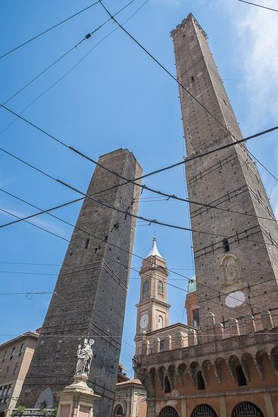
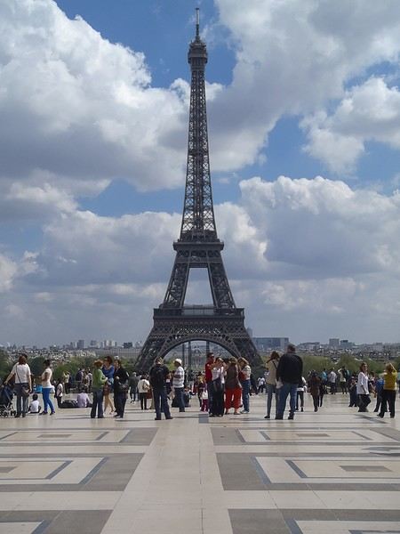
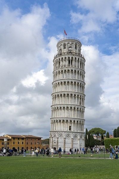
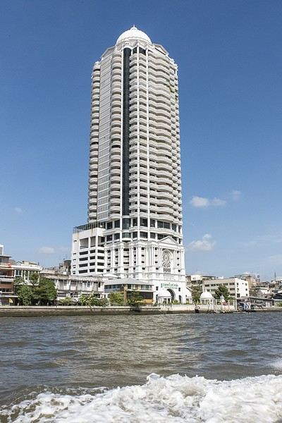
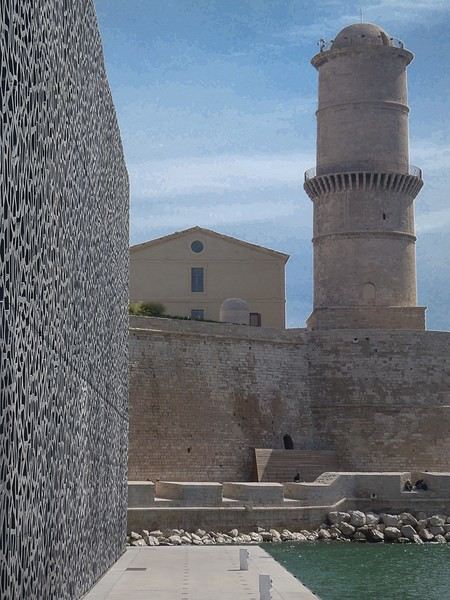
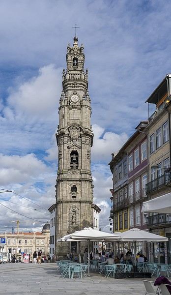
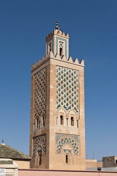
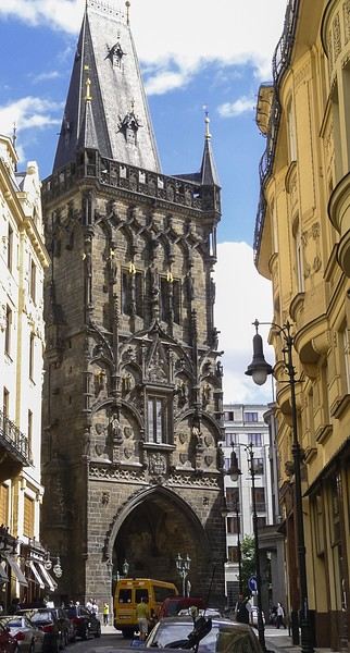
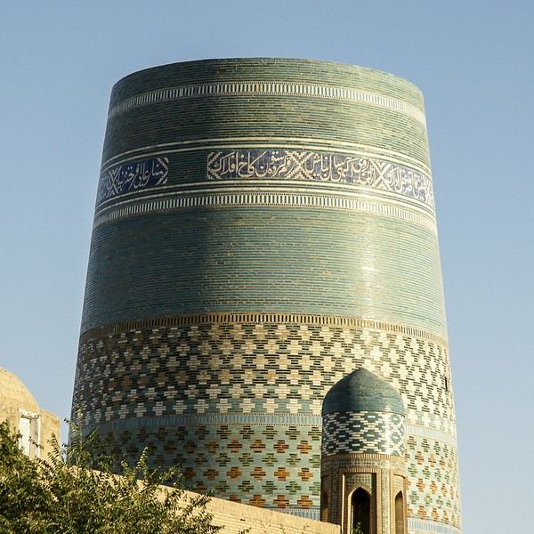
Of course, you can submit multiple photos of the same tower in the contest—it’s the quality of the photo that’ll be judged during voting, not just the subject!
Of course, you can submit multiple photos of the same tower in the contest—it’s the quality of the photo that’ll be judged during voting, not just the subject!
Scotland - Skye Trail and a little extra
After our amazing experience in the Lofoten Islands in summer 2023, I suggested to Jean Marie another trek I’d been wanting to do for a long time: the Skye Trail in Scotland.
A few photos of this stunning island and he was sold and ready to go.
The route is available on the excellent WalkHighlands site HERE (there’s also a Cicerone guide on the subject). And since I thought it was a shame it avoided the Black Cuillins, I added a 3-day detour in that area.
We took advantage of the May bank holidays in 2024, partly to avoid the peak tourist season and also the midge period—because for some reason, mosquitoes love me 😠!!
27/04 – Day 1 – Transfer to Skye and start of the trek: Rubha Hunish - Flodigarry 28/04 – Day 2 – Flodigarry – just before the Old Man of Storr 29/04 – Day 3 – Old Man of Storr – Portree, then bus to Sligachan 30/04 - Day 4 - Sligachan - Glenbrittle campsite via the Fairy Pools 01/05 – Day 5 – Round trip to Sgùrr na Banachdich from Glenbrittle campsite 02/05 – Day 6 – Round trip to Coire Lagan and walk on the Rubh an Dùnain peninsula 03/05 – Day 7 – Return (hitchhiking) to Sligachan campsite and hike in the Red Cuillins 04/05 – Day 8 – Resuming the Skye Trail – Sligachan – Elgol 05/05 – Day 9 – Elgol – Somewhere on the climb to Bla Bheinn 06/05 – Day 10 – Somewhere on the climb to Bla Bheinn - Broadford 07/05 – Day 11 – Visit to the Armadale Castle and park 08 & 09/05 – Return to Glasgow, visit the city, and return flight And here’s the summary
A few photos of this stunning island and he was sold and ready to go.
The route is available on the excellent WalkHighlands site HERE (there’s also a Cicerone guide on the subject). And since I thought it was a shame it avoided the Black Cuillins, I added a 3-day detour in that area.
We took advantage of the May bank holidays in 2024, partly to avoid the peak tourist season and also the midge period—because for some reason, mosquitoes love me 😠!!
27/04 – Day 1 – Transfer to Skye and start of the trek: Rubha Hunish - Flodigarry 28/04 – Day 2 – Flodigarry – just before the Old Man of Storr 29/04 – Day 3 – Old Man of Storr – Portree, then bus to Sligachan 30/04 - Day 4 - Sligachan - Glenbrittle campsite via the Fairy Pools 01/05 – Day 5 – Round trip to Sgùrr na Banachdich from Glenbrittle campsite 02/05 – Day 6 – Round trip to Coire Lagan and walk on the Rubh an Dùnain peninsula 03/05 – Day 7 – Return (hitchhiking) to Sligachan campsite and hike in the Red Cuillins 04/05 – Day 8 – Resuming the Skye Trail – Sligachan – Elgol 05/05 – Day 9 – Elgol – Somewhere on the climb to Bla Bheinn 06/05 – Day 10 – Somewhere on the climb to Bla Bheinn - Broadford 07/05 – Day 11 – Visit to the Armadale Castle and park 08 & 09/05 – Return to Glasgow, visit the city, and return flight And here’s the summary
Langtang – Trekking in the Rain
We did the Langtang trek (hike) from September 10th to 17th, with the first and last days being the trip from Kathmandu and back—so 6 days of actual walking. It’s a fairly well-known trek but certainly not as famous or crowded as those in the Annapurna or Everest regions, which is why we chose it.
In theory, it’s mandatory to have a guide for this trek. In reality, it seems there are ways to bypass the regulations: we met at least two people hiking without a guide—a South Korean, a New Zealander, and possibly also a couple of English women and an American couple, though we’re not sure if they had a guide.
The agency we booked with had told us it was an affordable trek for relatively older people in good shape—which is our case (I’m 72 myself). I have to say upfront that we found it quite challenging, maybe because we didn’t have good weather—it was the end of the monsoon season. To be clear, no matter your fitness level, I’d say doing this trek in the middle of the monsoon season would be suicidal.
Day 1 – Journey from Kathmandu to Syapru Besi
On Monday, September 8th, there had been violent protests in Kathmandu against the government, which had, among other things, blocked access to social media and been accused of nepotism and corruption. There were 19 deaths. The situation was very tense on the day of our departure, Wednesday the 10th. The agency warned us that public transport was very unreliable. So, we decided to take a jeep, at an additional cost of $100 ($160 minus what was already budgeted for the bus).
We left a little before 7 a.m. and it took us a good hour just to reach the outskirts of Kathmandu. Along the way, we saw several houses and vehicles set on fire by protesters.
The road to Syapru Besi is only 120 km, but it’s frankly awful. It’s always narrow, winds through endless mountains, and the shoulders range from bad to confusing to nonexistent. Several sections are just dirt tracks. We didn’t regret opting for the jeep, as we could stop several times at our convenience—if only to let Y (my Thai partner) throw up everything she had. She’d taken her usual motion sickness medication, but the constant turns, accelerations, and braking eventually made her terribly carsick.
In Nuwakot, we stopped for breakfast at a nice little restaurant, Jimbu. It was around 8:30 a.m., and we’d barely covered 60 km. The restaurant has a lovely garden overlooking the Trishuli Ganga, the river flowing down from Syapru Besi. First photo: the river in the bottom right corner, mist and clouds over the mountain on the other side.
An hour later, my second photo: the hills along the Trishuli Ganga. You can see the different crops—lush green rice paddies in the lower right and corn, already yellowed and likely harvested, in the foreground on the left. And of course, the mist and clouds through which you can glimpse the mountain on the other side of the river.
In theory, it’s mandatory to have a guide for this trek. In reality, it seems there are ways to bypass the regulations: we met at least two people hiking without a guide—a South Korean, a New Zealander, and possibly also a couple of English women and an American couple, though we’re not sure if they had a guide.
The agency we booked with had told us it was an affordable trek for relatively older people in good shape—which is our case (I’m 72 myself). I have to say upfront that we found it quite challenging, maybe because we didn’t have good weather—it was the end of the monsoon season. To be clear, no matter your fitness level, I’d say doing this trek in the middle of the monsoon season would be suicidal.
Day 1 – Journey from Kathmandu to Syapru Besi
On Monday, September 8th, there had been violent protests in Kathmandu against the government, which had, among other things, blocked access to social media and been accused of nepotism and corruption. There were 19 deaths. The situation was very tense on the day of our departure, Wednesday the 10th. The agency warned us that public transport was very unreliable. So, we decided to take a jeep, at an additional cost of $100 ($160 minus what was already budgeted for the bus).
We left a little before 7 a.m. and it took us a good hour just to reach the outskirts of Kathmandu. Along the way, we saw several houses and vehicles set on fire by protesters.
The road to Syapru Besi is only 120 km, but it’s frankly awful. It’s always narrow, winds through endless mountains, and the shoulders range from bad to confusing to nonexistent. Several sections are just dirt tracks. We didn’t regret opting for the jeep, as we could stop several times at our convenience—if only to let Y (my Thai partner) throw up everything she had. She’d taken her usual motion sickness medication, but the constant turns, accelerations, and braking eventually made her terribly carsick.
In Nuwakot, we stopped for breakfast at a nice little restaurant, Jimbu. It was around 8:30 a.m., and we’d barely covered 60 km. The restaurant has a lovely garden overlooking the Trishuli Ganga, the river flowing down from Syapru Besi. First photo: the river in the bottom right corner, mist and clouds over the mountain on the other side.
An hour later, my second photo: the hills along the Trishuli Ganga. You can see the different crops—lush green rice paddies in the lower right and corn, already yellowed and likely harvested, in the foreground on the left. And of course, the mist and clouds through which you can glimpse the mountain on the other side of the river.
Preparing a Zimbabwe-Zambia Road Trip
Hi everyone,
I’m starting to plan an itinerary for September 2027 focused on Zimbabwe and Zambia. I’d love to visit Gonarezhou National Park—I see there are two sectors: the Mwenezi Region in the south and the area around the Runde River in the north. Should I cover both sectors or just focus on the northern region?
For the parks along the Zambezi River, is it better to visit Mana Pools on the Zimbabwe side or Lower Zambezi on the Zambia side?
Thanks in advance for any tips on the parks in these two countries.
Have a great day, everyone.
The great American West in 23 days
Hi there,
I’m right in the middle of planning a trip to the American West—23 days from 07/30 to 08/23.
Departure from Orly to Los Angeles with a layover in San Francisco, and return from Los Angeles to Orly.
Day 1: Orly - San Francisco (1 night)
Day 2 & 3: Los Angeles (2 nights)
Day 4, 5 & 6: San Francisco (3 nights)
Day 7: Lake Tahoe (1 night)
Day 8 & 9: Portland (2 nights)
Day 10, 11 & 12: Seattle (3 nights)
Day 13 & 14: Yellowstone (2 nights)
Day 15 & 16: Salt Lake City (2 nights)
Day 17 & 18: Las Vegas (2 nights)
Day 19 & 20: Grand Canyon (2 nights)
Day 21 & 22: Los Angeles (2 nights)
Day 23: Return flight (1 night in the air)
The flight’s already booked: 2250 € for 3 people. Car’s reserved—just finalized the last booking today: a Rav4 for 23 days from Sixt in Santa Monica, 715 € (all insurance included). Hotels are booked with free cancellation since I keep finding better options, and the itinerary isn’t 100% set yet.
The flight’s already booked: 2250 € for 3 people. Car’s reserved—just finalized the last booking today: a Rav4 for 23 days from Sixt in Santa Monica, 715 € (all insurance included). Hotels are booked with free cancellation since I keep finding better options, and the itinerary isn’t 100% set yet.
Undecided on the itinerary for a one-month summer road trip
Hi everyone,
We’re thinking of heading back to the US but we’re still debating the itinerary. We’d love to revisit New York, but after that...? We’ve already explored the East Coast without making it down to Florida. So we’re wondering if we should go there. New Orleans has been catching our eye, and Memphis with its blues-rock vibe is also really appealing. A road trip that would start on the East Coast and head inland/mid-country. Any suggestions?
Or... we’re even considering stretching all the way to the West Coast: - Passing through LA, which we’d ultimately skipped on our West Coast trip, but maybe it’s not the best time to go with all those wildfires that have devastated iconic spots... - Or heading north to Washington and/or Oregon states, or closer, Montana.
Anyway, I’d love to hear your thoughts on what kind of loop we could do in 4 weeks... Given that in 2023, we spent nearly 6 weeks in the West, covering San Francisco, Yosemite, Death Valley, Mammoth Lake, Monument Valley, Grand Canyon, Page and its surroundings, Arches, Canyonlands, Grand Teton, Yellowstone, Zion, Bryce, and Las Vegas.
On that note, I have to give a big shout-out to Thibaut, aka ITAT, for his time and invaluable advice in planning that West Coast trip. Since then, I’ve really enjoyed taking the time to share tips about places I’ve visited! Speaking of which, don’t hesitate to PM me for West Coast advice! Otherwise, I’ll be sharing a recap of that trip in a travel journal—currently in Word—that I’ll post on the forum later. For those interested, I also made a video montage (with clickable chapters in the description) of those 5 weeks here: https://www.youtube.com/watch?v=Wx8d4ommhv4. Just a heads-up: the Bodie videos aren’t mine (my GoPro died), and the grass was completely green when we passed through, unlike in the video.
Looking forward to your suggestions! !
We’re thinking of heading back to the US but we’re still debating the itinerary. We’d love to revisit New York, but after that...? We’ve already explored the East Coast without making it down to Florida. So we’re wondering if we should go there. New Orleans has been catching our eye, and Memphis with its blues-rock vibe is also really appealing. A road trip that would start on the East Coast and head inland/mid-country. Any suggestions?
Or... we’re even considering stretching all the way to the West Coast: - Passing through LA, which we’d ultimately skipped on our West Coast trip, but maybe it’s not the best time to go with all those wildfires that have devastated iconic spots... - Or heading north to Washington and/or Oregon states, or closer, Montana.
Anyway, I’d love to hear your thoughts on what kind of loop we could do in 4 weeks... Given that in 2023, we spent nearly 6 weeks in the West, covering San Francisco, Yosemite, Death Valley, Mammoth Lake, Monument Valley, Grand Canyon, Page and its surroundings, Arches, Canyonlands, Grand Teton, Yellowstone, Zion, Bryce, and Las Vegas.
On that note, I have to give a big shout-out to Thibaut, aka ITAT, for his time and invaluable advice in planning that West Coast trip. Since then, I’ve really enjoyed taking the time to share tips about places I’ve visited! Speaking of which, don’t hesitate to PM me for West Coast advice! Otherwise, I’ll be sharing a recap of that trip in a travel journal—currently in Word—that I’ll post on the forum later. For those interested, I also made a video montage (with clickable chapters in the description) of those 5 weeks here: https://www.youtube.com/watch?v=Wx8d4ommhv4. Just a heads-up: the Bodie videos aren’t mine (my GoPro died), and the grass was completely green when we passed through, unlike in the video.
Looking forward to your suggestions! !
A long journey around Australia
Sunday, October 1st, 2023
Mulhouse-London
We dumped our trash on our neighbors. We hugged, overflowing with emotion. Then Léa from Taxis S showed up. She knows us well. For ages, she’s been our driver. She was practically the official taxiwoman for the trips of the company where Dom and I met. She knew us when we were single! Almost teenagers! She knows everyone and fills in the biographies of people we’d forgotten.
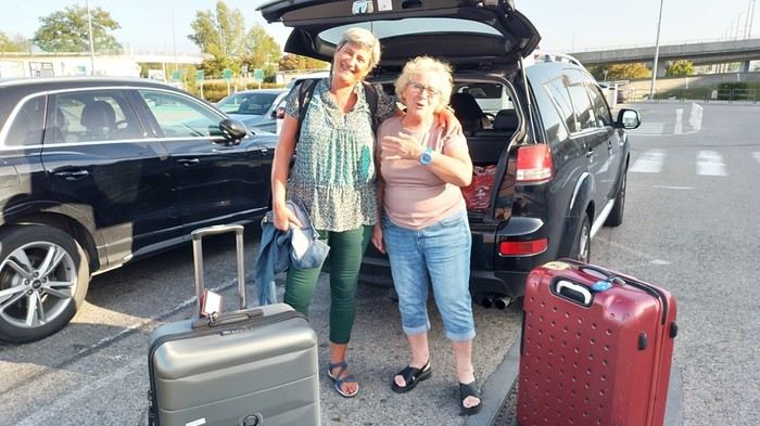 Across the street, while we loaded the luggage, S., perched in his window frame, waved a handkerchief. This wasn’t just any trip.
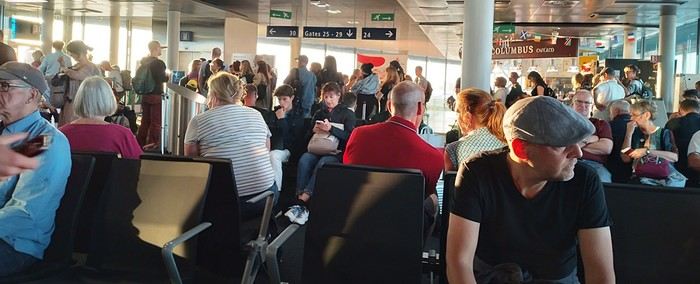 Then things got tricky. It’s funny how fate sinks its teeth into our happy moments—there’s this whole intermediate phase where the poison seeps in unnoticed because you’re still in the dark...
First, there was a delay on our flight to London. Dom immediately went on high alert, while I stayed calm. In my mind, we had two hours. I knew we had to go from Terminal 5 to Terminal 4, but two hours—come on, that’s plenty, right?
Then things got tricky. It’s funny how fate sinks its teeth into our happy moments—there’s this whole intermediate phase where the poison seeps in unnoticed because you’re still in the dark...
First, there was a delay on our flight to London. Dom immediately went on high alert, while I stayed calm. In my mind, we had two hours. I knew we had to go from Terminal 5 to Terminal 4, but two hours—come on, that’s plenty, right?
Bad calculation! Because those two hours were between the first flight’s landing and the second’s takeoff. But flights close at least half an hour before departure. Getting from one terminal to another means taking a shuttle bus. We waited for the one going to Terminal 4... until a young guy paid to direct people (who hadn’t seen us) informed us it was no longer possible to access Terminal 4 without going through Terminal 2 first for a connection! That really cranked up the pressure. We started installing a mental countdown with a programmed explosion at the end—guaranteed stress with added beads of sweat. The terminal bus was driven by a young Pakistani guy. We were *so* tense we bombarded him with our frantic, repetitive questions. “So? When are we getting there? What’s happening? Why aren’t we moving?” Our eyes were glued to our watches. The poor guy knew. Perfectly. Because it was obvious—no way around it. We weren’t going to make it. It was impossible. But Dom and I stubbornly refused to believe it. Then the kid stopped the bus. Me, hysterical: “What are you doing? What’s going on? Our plane takes off in... in... 4 minutes!!!! We’re gonna miss iiiiiit!” He wasn’t calm either. “You’ve already missed it!” He explained we had to cross a zone that required an escort car to clear a path through the runways. Impossible to do without. It’s forbidden. We had to WAIT (!!!). Then he got a radio call—he had to rush to Terminal 3 to pick up a passenger who was *super* tight on time. “Amir!!!! It’s RIGHT NOW!” they yelled in his already-red ears, thanks to the complaints of two hysterical Frenchies. Dom and I were in overdrive, hallucinating! We wanted to stop him, maybe even hit him to prevent him from turning around. He picked up the girl, whom we instantly hated like the most despicable witch. I turned on my data, searched for Malaysia Airlines’ number at Terminal 4, called, and actually got someone—quite a feat. A woman cut off my frantic rambling with a blunt “It’s over, the check-in is closed, the plane is about to take off.” I heard her but refused to accept it. I yelled, “We’re coming!” She shot back her monolithic “It’s over.” Finally at the doors of that damn Terminal 4, we ran—*really* ran—a marathon, Gate 6, security checks, pat-downs, “Take off your belts,” we asked questions, everyone seemed confident, we ran with one hand holding up our pants, the other clutching our belt, Gate 6—the room was empty. A girl was sitting there, calmly on the phone. We pounced on her. She calmed us down. Little by little, the light came back. Our brains rebooted. We finally understood it was over. We’d have to start crafting a new plan with the new reality. It started with a return to Terminal 5 to talk to British Airways, which took a good hour. With the same driver as before. We were alone with him. He took the time to apologize, to assure us it wasn’t his fault, that our problem had no solution, that nothing could’ve changed the outcome. At BA, we were exhausted. We were greeted by a handsome young man in a navy-blue uniform with gold stripes everywhere. We could’ve made a scene, but we were just relieved to find someone who’d take charge of our story. It was a minimal response, but it was *a* response. I suppose we could’ve demanded a business-class upgrade or a free trip, but we were just happy with a few vouchers for food, a hotel room with breakfast, and a little bag with plastic toys, a razor, toothbrush, hygiene products, and a T-shirt... Trinkets... But we were fine with it all—we said thank you eagerly because the essential was assured. He found us seats on flights tomorrow. *Tomorrow.* We were afraid to hope! We had the exact same flights but a day later. The same crappy times, but it was all good. We felt saved from the shipwreck, like survivors. - And what about the luggage? - .... !!!!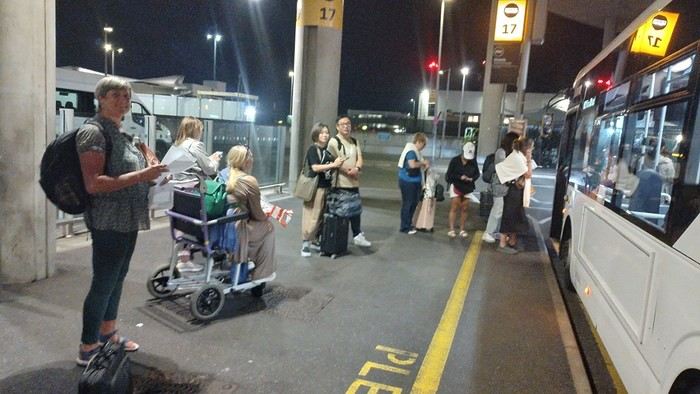
Monday, October 2nd, 2023 London - Kuala Lumpur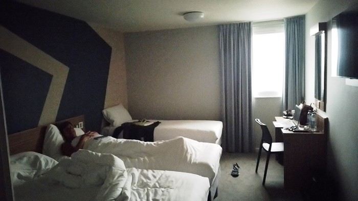
It wasn’t the Ritz, but with exhaustion on our side, we slept well. The continental breakfast was way better than we’d expected from an Ibis Budget. Still, it wasn’t enough to restore my joy for life. The course correction had turned into an arduous obstacle course. I scoured the car rental site every which way. Couldn’t reschedule the car. I’d done it before, but this time... Not to mention the laptop battery was complaining—the Brits have this quirk of making their power outlets incompatible with our chargers. Frustrated, I called them but ended up with a girl who declared herself incompetent and offered to have someone from Avis in Perth call me back—someone who’d supposedly handle rentals better. I decided to wait while taking a bath. Barely settled in, the phone rang. I was soaking wet, of course, and asked Dom to answer. Unfortunately, she’s known for disliking my phone, and in a clumsy move, she hung up. We got annoyed. She put dry towels on the edge of the bathtub, but—another false move—they fell in the water. The phone rang again... I completely redid the plans for the next two days, then transferred the files to my phone to consult them later offline. I plugged in my USB cable... *Plop!* The battery died abruptly—my PC shut down without any of the usual polite warnings! I looked around, hoping to find someone to strangle... Long story short, you can tell the day started under the worst omens. I was in a foul mood and spread my bad vibes to Dominique, who was initially in much better spirits... I called Mastercard, hoping to get a refund for the non-refundable night in Perth we’d already paid for. Same old song: “We’ll call you back”... Then... I’ll cut it short—buses, trains, lots of waiting... We rushed to reach the infamous Terminal 4.
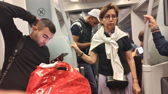
We tried new options and convinced ourselves that a delayed departure flight is unrecoverable, no matter the scenario. We were furious that BA hadn’t bothered to tell us, leaving us to run around like rats in a burning house.
Tuesday, October 3rd, 2023 Kuala Lumpur-Perth
The flight was pretty nice. 13 hours, though. Dom and I were facing each other across the aisle. We could get up easily whenever we wanted without bothering anyone and chat when we felt like it. Besides, their chicken was amazing. They were kind enough to offer Dom a truly remarkable glass of rum. Good movies too, including the excellent *Prisoners* by Denis Villeneuve. At KL, during boarding, we developed a nagging worry about our luggage. We checked with some Malaysian Airlines staff. I sensed their hesitation. They made calls. Then changed their minds, giving us smiles and thumbs up...
Wednesday, October 4th, 2023 Perth
*Happy is the man who, like Ulysses, has had a fine voyage.* Well, for us, it wasn’t that. Finally arrived, we experienced the loneliness of tourists watching the baggage carousel spin, emptying of its precious containers one by one, until only a handful of travelers were left, staring at each other in disbelief. Without luggage, you’re kinda screwed. Not even a change of socks—our feet had been swimming in the same shoes for 3 days. No adapter, so no laptop. No toiletries. We could’ve cried! The lost luggage guy played his part. If you want compensation, fill out the disclaimer on the website made for that. And then, “Don’t worry, your luggage will arrive tomorrow!” “Don’t worry?!” From the start of the trip, we’ve been jerked around, fed lies. Tomorrow is the *absolute* last chance to get them back. Beyond that, we’d have to scramble a whole new trip. And lose a lot in the process! I have no idea how to go about it. Tomorrow... OMG... Tomorrow... We landed at 1 AM. Avis, the car rental place, opens at 6:30. Luckily, we found some decent breakfast. It cheered us up and gave us a second wind. Incorrigible, we started believing again! Well, then we just killed time. What else was there to do?

In front of Avis’s little shack, we were freezing. We’d been there since dawn. The girl who showed up, a Latina, immediately saw us as a nuisance who’d ruin her hopes of a peaceful start. Her face and tone were as unwelcoming as possible. You know us—it ended with hugs. She gave us a gorgeous, brand-new car! A hybrid with ultra-sophisticated features, all buttons you shouldn’t touch if you want to drive this thing without causing irreparable damage! We’re off! Driving on the left is easy at first. You think about it constantly. It’s counterintuitive, it takes effort. It’s later, when you get used to it and confidence sets in, that it becomes dangerous—old reflexes can send you into a wall. Anyway, the car and I immediately clicked.
In Perth, underground parking next to the hotel, friendly welcome—we ended up forgetting all the morning’s mishaps. Should we go sightseeing?
https://voyageforum.com/images/posts/small/1733767537-5Nwk6t3DsBZNOzf.jpg
Across the street, while we loaded the luggage, S., perched in his window frame, waved a handkerchief. This wasn’t just any trip.
Then things got tricky. It’s funny how fate sinks its teeth into our happy moments—there’s this whole intermediate phase where the poison seeps in unnoticed because you’re still in the dark...
First, there was a delay on our flight to London. Dom immediately went on high alert, while I stayed calm. In my mind, we had two hours. I knew we had to go from Terminal 5 to Terminal 4, but two hours—come on, that’s plenty, right?
Bad calculation! Because those two hours were between the first flight’s landing and the second’s takeoff. But flights close at least half an hour before departure. Getting from one terminal to another means taking a shuttle bus. We waited for the one going to Terminal 4... until a young guy paid to direct people (who hadn’t seen us) informed us it was no longer possible to access Terminal 4 without going through Terminal 2 first for a connection! That really cranked up the pressure. We started installing a mental countdown with a programmed explosion at the end—guaranteed stress with added beads of sweat. The terminal bus was driven by a young Pakistani guy. We were *so* tense we bombarded him with our frantic, repetitive questions. “So? When are we getting there? What’s happening? Why aren’t we moving?” Our eyes were glued to our watches. The poor guy knew. Perfectly. Because it was obvious—no way around it. We weren’t going to make it. It was impossible. But Dom and I stubbornly refused to believe it. Then the kid stopped the bus. Me, hysterical: “What are you doing? What’s going on? Our plane takes off in... in... 4 minutes!!!! We’re gonna miss iiiiiit!” He wasn’t calm either. “You’ve already missed it!” He explained we had to cross a zone that required an escort car to clear a path through the runways. Impossible to do without. It’s forbidden. We had to WAIT (!!!). Then he got a radio call—he had to rush to Terminal 3 to pick up a passenger who was *super* tight on time. “Amir!!!! It’s RIGHT NOW!” they yelled in his already-red ears, thanks to the complaints of two hysterical Frenchies. Dom and I were in overdrive, hallucinating! We wanted to stop him, maybe even hit him to prevent him from turning around. He picked up the girl, whom we instantly hated like the most despicable witch. I turned on my data, searched for Malaysia Airlines’ number at Terminal 4, called, and actually got someone—quite a feat. A woman cut off my frantic rambling with a blunt “It’s over, the check-in is closed, the plane is about to take off.” I heard her but refused to accept it. I yelled, “We’re coming!” She shot back her monolithic “It’s over.” Finally at the doors of that damn Terminal 4, we ran—*really* ran—a marathon, Gate 6, security checks, pat-downs, “Take off your belts,” we asked questions, everyone seemed confident, we ran with one hand holding up our pants, the other clutching our belt, Gate 6—the room was empty. A girl was sitting there, calmly on the phone. We pounced on her. She calmed us down. Little by little, the light came back. Our brains rebooted. We finally understood it was over. We’d have to start crafting a new plan with the new reality. It started with a return to Terminal 5 to talk to British Airways, which took a good hour. With the same driver as before. We were alone with him. He took the time to apologize, to assure us it wasn’t his fault, that our problem had no solution, that nothing could’ve changed the outcome. At BA, we were exhausted. We were greeted by a handsome young man in a navy-blue uniform with gold stripes everywhere. We could’ve made a scene, but we were just relieved to find someone who’d take charge of our story. It was a minimal response, but it was *a* response. I suppose we could’ve demanded a business-class upgrade or a free trip, but we were just happy with a few vouchers for food, a hotel room with breakfast, and a little bag with plastic toys, a razor, toothbrush, hygiene products, and a T-shirt... Trinkets... But we were fine with it all—we said thank you eagerly because the essential was assured. He found us seats on flights tomorrow. *Tomorrow.* We were afraid to hope! We had the exact same flights but a day later. The same crappy times, but it was all good. We felt saved from the shipwreck, like survivors. - And what about the luggage? - .... !!!!
Monday, October 2nd, 2023 London - Kuala Lumpur
It wasn’t the Ritz, but with exhaustion on our side, we slept well. The continental breakfast was way better than we’d expected from an Ibis Budget. Still, it wasn’t enough to restore my joy for life. The course correction had turned into an arduous obstacle course. I scoured the car rental site every which way. Couldn’t reschedule the car. I’d done it before, but this time... Not to mention the laptop battery was complaining—the Brits have this quirk of making their power outlets incompatible with our chargers. Frustrated, I called them but ended up with a girl who declared herself incompetent and offered to have someone from Avis in Perth call me back—someone who’d supposedly handle rentals better. I decided to wait while taking a bath. Barely settled in, the phone rang. I was soaking wet, of course, and asked Dom to answer. Unfortunately, she’s known for disliking my phone, and in a clumsy move, she hung up. We got annoyed. She put dry towels on the edge of the bathtub, but—another false move—they fell in the water. The phone rang again... I completely redid the plans for the next two days, then transferred the files to my phone to consult them later offline. I plugged in my USB cable... *Plop!* The battery died abruptly—my PC shut down without any of the usual polite warnings! I looked around, hoping to find someone to strangle... Long story short, you can tell the day started under the worst omens. I was in a foul mood and spread my bad vibes to Dominique, who was initially in much better spirits... I called Mastercard, hoping to get a refund for the non-refundable night in Perth we’d already paid for. Same old song: “We’ll call you back”... Then... I’ll cut it short—buses, trains, lots of waiting... We rushed to reach the infamous Terminal 4.
We tried new options and convinced ourselves that a delayed departure flight is unrecoverable, no matter the scenario. We were furious that BA hadn’t bothered to tell us, leaving us to run around like rats in a burning house.
Tuesday, October 3rd, 2023 Kuala Lumpur-Perth
The flight was pretty nice. 13 hours, though. Dom and I were facing each other across the aisle. We could get up easily whenever we wanted without bothering anyone and chat when we felt like it. Besides, their chicken was amazing. They were kind enough to offer Dom a truly remarkable glass of rum. Good movies too, including the excellent *Prisoners* by Denis Villeneuve. At KL, during boarding, we developed a nagging worry about our luggage. We checked with some Malaysian Airlines staff. I sensed their hesitation. They made calls. Then changed their minds, giving us smiles and thumbs up...
Wednesday, October 4th, 2023 Perth
*Happy is the man who, like Ulysses, has had a fine voyage.* Well, for us, it wasn’t that. Finally arrived, we experienced the loneliness of tourists watching the baggage carousel spin, emptying of its precious containers one by one, until only a handful of travelers were left, staring at each other in disbelief. Without luggage, you’re kinda screwed. Not even a change of socks—our feet had been swimming in the same shoes for 3 days. No adapter, so no laptop. No toiletries. We could’ve cried! The lost luggage guy played his part. If you want compensation, fill out the disclaimer on the website made for that. And then, “Don’t worry, your luggage will arrive tomorrow!” “Don’t worry?!” From the start of the trip, we’ve been jerked around, fed lies. Tomorrow is the *absolute* last chance to get them back. Beyond that, we’d have to scramble a whole new trip. And lose a lot in the process! I have no idea how to go about it. Tomorrow... OMG... Tomorrow... We landed at 1 AM. Avis, the car rental place, opens at 6:30. Luckily, we found some decent breakfast. It cheered us up and gave us a second wind. Incorrigible, we started believing again! Well, then we just killed time. What else was there to do?
In front of Avis’s little shack, we were freezing. We’d been there since dawn. The girl who showed up, a Latina, immediately saw us as a nuisance who’d ruin her hopes of a peaceful start. Her face and tone were as unwelcoming as possible. You know us—it ended with hugs. She gave us a gorgeous, brand-new car! A hybrid with ultra-sophisticated features, all buttons you shouldn’t touch if you want to drive this thing without causing irreparable damage! We’re off! Driving on the left is easy at first. You think about it constantly. It’s counterintuitive, it takes effort. It’s later, when you get used to it and confidence sets in, that it becomes dangerous—old reflexes can send you into a wall. Anyway, the car and I immediately clicked.
In Perth, underground parking next to the hotel, friendly welcome—we ended up forgetting all the morning’s mishaps. Should we go sightseeing?
https://voyageforum.com/images/posts/small/1733767537-5Nwk6t3DsBZNOzf.jpg
The "Must-Sees" of the American West
This adventure began during Covid... Yep, Covid turned a lot of things upside down, but most of all, it kept us cooped up for a few months and stopped us from traveling for a while—even longer for a die-hard fan of the American West like me.
While borders were closed, I started imagining what an ideal itinerary might look like—one that would string together all the Southwest must-sees in just two weeks, during the best time of year: September and October. When the U.S. announced in September 2021 that borders would reopen in the coming weeks, I regained hope and began scouting flight tickets for a departure in September 2022.
But here’s the thing: tackling solo hikes, each one tougher than the last, right in the heart of the Wilderness, could be a risky—even reckless—endeavor for a father of three. After a quick chat with some virtual friends who are just as passionate about the Southwest as I am, with good physical condition and nearly the same list of must-visit spots, Franck and his brother Sullivan were in! 🙂
In November, we snagged flight tickets from Nice to San Francisco for the modest sum of 400 €, and a few days later, I booked a Toyota Tacoma pickup for 840 € !
It’s not cheap for just 15 days, and a pickup isn’t exactly ideal for luggage, but the prices for full-size 4x4s have become totally outrageous! Due to border closures, rental companies had to offload a lot of these big 4x4s, which tourists love. Then, supply and demand did the rest !
Franck and I spent the winter and spring trying to cram the equivalent of three weeks of hikes into two. But even with physical limits, we had to stay reasonable! Three to four months before departure, we entered the lotteries for different must-see spots: The Subway, Coyote Buttes North (home to the famous Wave), and Coyote Buttes South (CBS).
The Wave is the holy grail for any Southwest enthusiast. Since 2015, we’ve tried our luck with the online and on-site lotteries about ten times, but the spots are unfortunately limited: just 20 per day. A glimmer of hope, though—since early 2022, that number has increased to 64 people allowed per day, with 48 spots awarded via the online lottery.
After all three of us tried our luck for The Wave, on June 1st at exactly 5 PM, I got an email that started with, "Congratulations! You were successful in the Coyote Buttes North (The Wave) September 2022 Permit Lottery at Coyote Buttes North (The Wave)...". At 5:01 PM, I called Franck, whose dream it’s been for over 20 years—ever since the first photos were published in a travel magazine! He didn’t believe me when I told him, and I had to forward the email for him to finally accept the unbelievable: we were going to The Wave and all the incredible spots scattered across the protected area of Coyote Buttes North.
I’ve already been to Coyote Buttes South twice, but there are areas I couldn’t explore in the middle of summer because they were too remote. So, I had no trouble letting my buddies convince me to go back for a third time. Plus, given how hard it is to access, we had no trouble securing a permit online as long as we logged in at exactly 8 PM on the dot!
For The Subway, all three of us struck out. No big deal—we won at CBN and CBS!
Among the sites to visit, there are two that I’m particularly attached to because I know my chances of wanting to see them again are slim. The first is Angel Arch, one of the most legendary arches in the Southwest, due to its remoteness from any trace of civilization. To get there, the recommended hike is Upper Salt Creek, and you’re looking at a 50 km round-trip in an area with no water (in September) and populated by bears.
The second site is the Hopi Salt Trail, in Navajo land, which, after a very tough hike, lets you marvel at the turquoise-blue waters of the Little Colorado before it meets the Colorado River. The Hopi Salt Trail is, like The Wave, the holy grail for any Southwest enthusiast, and the windows of opportunity to see the water in that magical color are very short each year. For this, you have to monitor the Little Colorado’s gauges downstream from Cameron: if the level stays at its lowest for 10 consecutive days—meaning no rain—you can hope for turquoise water. The ideal period rarely exceeds 30 days a year, and it’s usually in June that all the stars align.
But unfortunately, one month before departure, while the flow rate at Cameron looked promising, several storms in September dashed our hopes of doing the Hopi Salt Trail, even at the end of the road trip.
We still had two consolation prizes, though:
After a last-minute cancellation, while keeping an eye out for available spots for The Subway, it turned out that three spots opened up exactly on the day we’d planned to go—so we rushed to grab them!! Regarding the 4x4 rental, the prices for full-size models dropped by several hundred dollars, and we ended up finding a Chevrolet Tahoe for less than $1000. A steal and a serious boost in comfort, so we could store all our gear and food without worry!
Here’s the initial plan in a perfect world: D1 The White Domes - Camping D2 Sunrise at The White Domes - The Subway D3 Coyote Buttes North D4 Coyote Buttes South - White Pocket D5 Wahweap Hoodoos - Sidestep Canyon - Colourful Canyon - White Rocks - Sunset at Yellow Rock D6 Broken Bow Arch - Reflection Canyon D7 Coyote Gulch D8 The Volcano (or The Oasis - Zebra Slot Canyon if the weather’s good) - North Caineville Mesa D9 The Needles: Squaw Canyon - Lost Canyon combo - Druid Arch - Chesler Park D10 Upper Salt Creek Day 1 - Camping D11 Upper Salt Creek Day 2 D12 Hopi-Navajo Territory: Ha Ho No Geh Canyon, Coal Mine Canyon, Bends of the Little Colorado D13 Grand Canyon: South Kaibab Trail and Bright Angel Trail D14 Upper East Zion: East Temple Loop, Jughandle Arch, Center of the Universe, and Checkerboard Mesa Summit And several backup options in case of bad weather, including Spencer Trail, West Cove, and Buffington Pockets.
Enough talking—time for action!
While borders were closed, I started imagining what an ideal itinerary might look like—one that would string together all the Southwest must-sees in just two weeks, during the best time of year: September and October. When the U.S. announced in September 2021 that borders would reopen in the coming weeks, I regained hope and began scouting flight tickets for a departure in September 2022.
But here’s the thing: tackling solo hikes, each one tougher than the last, right in the heart of the Wilderness, could be a risky—even reckless—endeavor for a father of three. After a quick chat with some virtual friends who are just as passionate about the Southwest as I am, with good physical condition and nearly the same list of must-visit spots, Franck and his brother Sullivan were in! 🙂
In November, we snagged flight tickets from Nice to San Francisco for the modest sum of 400 €, and a few days later, I booked a Toyota Tacoma pickup for 840 € !
It’s not cheap for just 15 days, and a pickup isn’t exactly ideal for luggage, but the prices for full-size 4x4s have become totally outrageous! Due to border closures, rental companies had to offload a lot of these big 4x4s, which tourists love. Then, supply and demand did the rest !
Franck and I spent the winter and spring trying to cram the equivalent of three weeks of hikes into two. But even with physical limits, we had to stay reasonable! Three to four months before departure, we entered the lotteries for different must-see spots: The Subway, Coyote Buttes North (home to the famous Wave), and Coyote Buttes South (CBS).
The Wave is the holy grail for any Southwest enthusiast. Since 2015, we’ve tried our luck with the online and on-site lotteries about ten times, but the spots are unfortunately limited: just 20 per day. A glimmer of hope, though—since early 2022, that number has increased to 64 people allowed per day, with 48 spots awarded via the online lottery.
After all three of us tried our luck for The Wave, on June 1st at exactly 5 PM, I got an email that started with, "Congratulations! You were successful in the Coyote Buttes North (The Wave) September 2022 Permit Lottery at Coyote Buttes North (The Wave)...". At 5:01 PM, I called Franck, whose dream it’s been for over 20 years—ever since the first photos were published in a travel magazine! He didn’t believe me when I told him, and I had to forward the email for him to finally accept the unbelievable: we were going to The Wave and all the incredible spots scattered across the protected area of Coyote Buttes North.
I’ve already been to Coyote Buttes South twice, but there are areas I couldn’t explore in the middle of summer because they were too remote. So, I had no trouble letting my buddies convince me to go back for a third time. Plus, given how hard it is to access, we had no trouble securing a permit online as long as we logged in at exactly 8 PM on the dot!
For The Subway, all three of us struck out. No big deal—we won at CBN and CBS!
Among the sites to visit, there are two that I’m particularly attached to because I know my chances of wanting to see them again are slim. The first is Angel Arch, one of the most legendary arches in the Southwest, due to its remoteness from any trace of civilization. To get there, the recommended hike is Upper Salt Creek, and you’re looking at a 50 km round-trip in an area with no water (in September) and populated by bears.
The second site is the Hopi Salt Trail, in Navajo land, which, after a very tough hike, lets you marvel at the turquoise-blue waters of the Little Colorado before it meets the Colorado River. The Hopi Salt Trail is, like The Wave, the holy grail for any Southwest enthusiast, and the windows of opportunity to see the water in that magical color are very short each year. For this, you have to monitor the Little Colorado’s gauges downstream from Cameron: if the level stays at its lowest for 10 consecutive days—meaning no rain—you can hope for turquoise water. The ideal period rarely exceeds 30 days a year, and it’s usually in June that all the stars align.
But unfortunately, one month before departure, while the flow rate at Cameron looked promising, several storms in September dashed our hopes of doing the Hopi Salt Trail, even at the end of the road trip.
We still had two consolation prizes, though:
After a last-minute cancellation, while keeping an eye out for available spots for The Subway, it turned out that three spots opened up exactly on the day we’d planned to go—so we rushed to grab them!! Regarding the 4x4 rental, the prices for full-size models dropped by several hundred dollars, and we ended up finding a Chevrolet Tahoe for less than $1000. A steal and a serious boost in comfort, so we could store all our gear and food without worry!
Here’s the initial plan in a perfect world: D1 The White Domes - Camping D2 Sunrise at The White Domes - The Subway D3 Coyote Buttes North D4 Coyote Buttes South - White Pocket D5 Wahweap Hoodoos - Sidestep Canyon - Colourful Canyon - White Rocks - Sunset at Yellow Rock D6 Broken Bow Arch - Reflection Canyon D7 Coyote Gulch D8 The Volcano (or The Oasis - Zebra Slot Canyon if the weather’s good) - North Caineville Mesa D9 The Needles: Squaw Canyon - Lost Canyon combo - Druid Arch - Chesler Park D10 Upper Salt Creek Day 1 - Camping D11 Upper Salt Creek Day 2 D12 Hopi-Navajo Territory: Ha Ho No Geh Canyon, Coal Mine Canyon, Bends of the Little Colorado D13 Grand Canyon: South Kaibab Trail and Bright Angel Trail D14 Upper East Zion: East Temple Loop, Jughandle Arch, Center of the Universe, and Checkerboard Mesa Summit And several backup options in case of bad weather, including Spencer Trail, West Cove, and Buffington Pockets.
Enough talking—time for action!
Getting around Zambia and choosing wildlife parks
Hello,
We’re planning a trip to Zambia in 2 years. This will be our 4th trip to Southern Africa—the last one this year was Moremi, Boteti, KCGR, and KTP as a self-drive with campsites and no guide, just my wife and me. For this year’s trip, we prepared 2 years in advance—bookings are really complicated. We were lucky to get a spot at Bitterpan in KTP (there are only 4 chalets).
We’d like to know if it’s easy to get around Zambia, especially when it comes to restocking supplies. Should we rent a 4x4 in Zambia, Namibia, or South Africa? Botswana is very expensive. Which parks are the most interesting? We’re into wildlife photography.
Looking forward to hearing from you. Thanks in advance! Best regards, Jean-Marc
We’d like to know if it’s easy to get around Zambia, especially when it comes to restocking supplies. Should we rent a 4x4 in Zambia, Namibia, or South Africa? Botswana is very expensive. Which parks are the most interesting? We’re into wildlife photography.
Looking forward to hearing from you. Thanks in advance! Best regards, Jean-Marc
4 friends discover a piece of North India
Hello fellow travelers!
I’m adding my small contribution to the reopening celebration by posting this travel journal from India, made in January 2024. We’re 4 friends (2 couples), and we did a 3-week loop in Rajasthan, stopping by Delhi and Agra (which, as everyone knows, aren’t in Rajasthan 😛). Delhi - Agra - Jaipur - Bundi - Udaipur - Jodhpur - Jaisalmer - Delhi
We rented a car with a driver from Agra to Jaisalmer, 550 € for 14 days. https://chauffeurpriveeninde.com/fr/
We took the train from Delhi to Agra and the plane (Spicejet) from Jaisalmer to Delhi.
Most of the accommodations were booked on Booking before we left.
I’m sharing this story written by Richard and illustrated by me. We dedicate it to Nathalie and Bruno, our amazing travel companions.
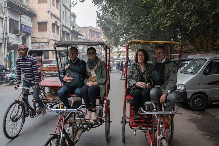
I’m adding my small contribution to the reopening celebration by posting this travel journal from India, made in January 2024. We’re 4 friends (2 couples), and we did a 3-week loop in Rajasthan, stopping by Delhi and Agra (which, as everyone knows, aren’t in Rajasthan 😛). Delhi - Agra - Jaipur - Bundi - Udaipur - Jodhpur - Jaisalmer - Delhi
We rented a car with a driver from Agra to Jaisalmer, 550 € for 14 days. https://chauffeurpriveeninde.com/fr/
We took the train from Delhi to Agra and the plane (Spicejet) from Jaisalmer to Delhi.
Most of the accommodations were booked on Booking before we left.
I’m sharing this story written by Richard and illustrated by me. We dedicate it to Nathalie and Bruno, our amazing travel companions.
To the Top West End
In this time of general travel-journal scarcity, I’m stepping up to tell you about a far-too-short getaway to the Top West End, a local term for the very northern part of Western Australia, right on the border ( ;) ) with the Northern Territory.
As usual, I didn’t manage to keep it short, but this time I’ve got photos to go with it!
August 2020. Since the opportunities to explore the world are extremely limited right now, all we (R&X) can do is explore our own island! Well, just a part of it, because with the state borders still closed, we’re stuck in Western Australia (WA).
Luckily, we’re pretty fortunate because this state is huge: over 2.5 million km² (that’s more than four times the size of France or 1.5 times Quebec). What’s more, stretching over 20 degrees of latitude between the Antarctic Ocean and the Timor Sea, you’ll find climates ranging from Mediterranean to arid to tropical. That’s actually why we decided to head as far north as possible. Sick of the endless rainy winter in Perth, bring on the heat of the Kimberley... way up Nooorth!
Friday. At the airport, the main terminal was closed (not enough flights), so we ended up in the annex (where flights to the various mines usually depart from). There was no crowd at the gate, and in this huge, single departure lounge, empty seats were plentiful. Only three flights were listed on the screens for the rest of the morning: the first to Coondewanna (?), the second to Darwin, and ours to Kununurra (code KNX).
A cool breeze swept through the half-open corridors along the runways. At the top of the walkway leading to the Fokker 100 (the Airbuses and Boeings are now parked!), a flight attendant greeted us with a basket full of sanitary masks. We were actually the only masked passengers (the staff weren’t wearing them either). With zero Covid-19 cases in WA at the time, the only rule was to maintain social distancing—something pretty hard to do on a full plane!
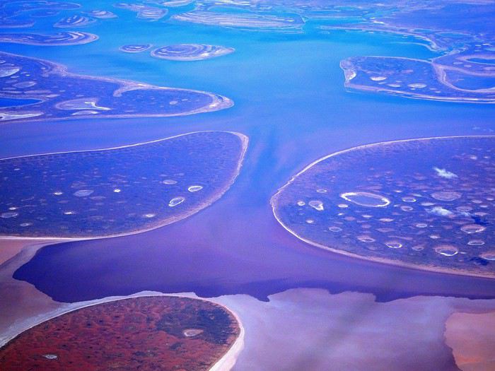
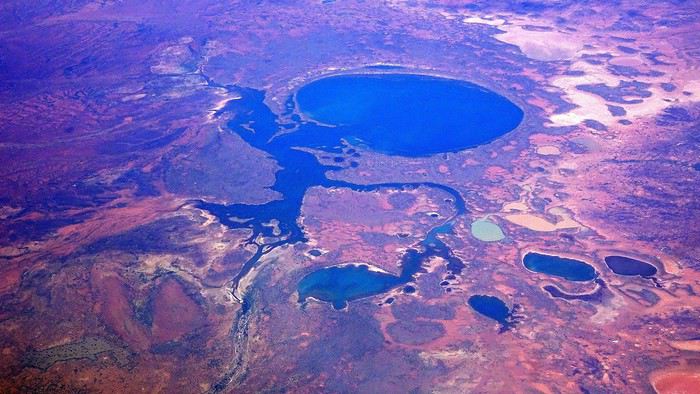
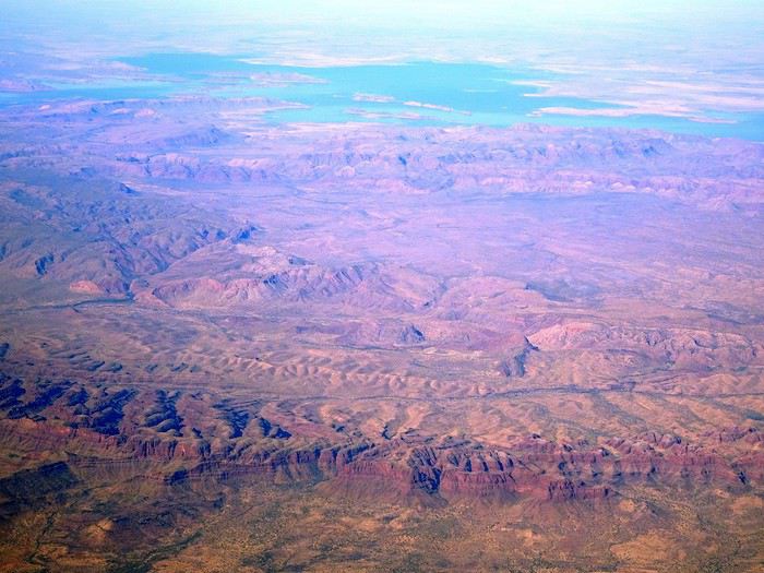
It was also my first time wearing a mask—it felt weird, pretty uncomfortable, and after a while, painful behind the ears. I really feel for those who have to wear one all day, every day. The flight lasted three long hours, but luckily, I had a good book. From the window, I watched an endless expanse of salt lakes in all shapes and sizes—round, elongated, gray, white, sometimes blue and green—and an infinity of winding, capricious meanders, along with long straight lines that led nowhere. The last half-hour got more interesting as rocky, swollen formations and long, sloping plateaus appeared. Against the vast ochre landscape, green patches became more frequent.
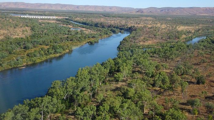
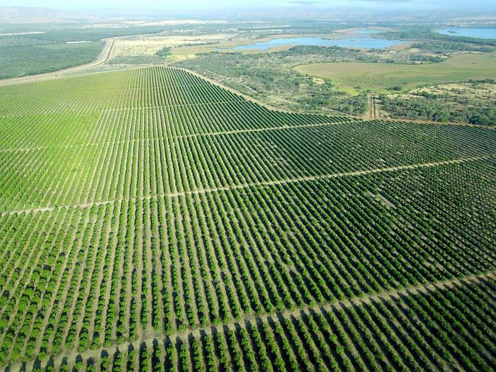
Just before landing, rows of green fields briefly appeared, along with an surprisingly wide river—but we were already rolling down the tarmac. A few hangars, a myriad of small, stationary planes, and a tiny terminal topped with a sign: “Welcome to Kununurra.”
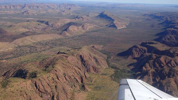
We wanted heat, and here it was—34°C the moment we stepped off the plane! We felt alive again and totally ridiculous in our jeans and sweaters. We quickly grabbed our suitcase and picked up the 4x4 we’d rented—more out of necessity, since only that type of vehicle can access the national parks we planned to visit.
Just four kilometers separated us from Kununurra, a town of 5,000 people founded in 1961 during the construction of the Lake Argyle Dam and the development of the Ord River Irrigation Area Scheme (more on that later). On the horizon, mountain ranges (a bit of an exaggeration, since we know Mt. Meharry, WA’s highest ‘mountain,’ doesn’t even reach 1,250 meters!) and closer to the road, a few irrigation canals cutting through stretches of bush, then a huge park overlooking a small lake lined with reeds.
A row of baobabs (yes, there are baobabs in Australia too!), a series of motels with immaculate lawns, a gas station, and there’s the main street leading to the town center—that is, the parking lots of the two supermarkets, the bottleshop, the pub, the Town Hall, the municipal pool, and the Tourist Office (already closed!), and at the next roundabout, another park, the Presbyterian church, and a few other shops. In short, two or three green blocks that you can explore in no time.
One road leads to the small industrial area and one of the town’s three or four campgrounds, while another heads toward the residential neighborhoods, which look just like the typical suburbs you find in any Australian city—except with tropical vegetation. We stocked up at Coles, an identical copy of the one near our place, and—surprise—the prices were practically the same.
We checked into one of the motels. The receptionist listed the town’s three or four restaurants, insisting that it’s always better to book a table. She recommended the Pump House, a bit outside town on the lake’s edge. “Best spot to watch the sunset, but hurry up.” she told us. It was only 5:00 PM!
When we got there half an hour later, the place was packed, and the sun had already disappeared behind a row of trees! Sure enough, we’d see a few days later that the sunset can be a stunning spectacle—if you wait a bit for the sky (especially if it’s cloudy) to blaze and reflect in the lake’s calm waters. A little disappointed, we headed back into town, where we easily found the other lively spot in town: the pub (nothing like an old English pub). Above the long L-shaped bar, several giant screens (thankfully muted) were broadcasting live footy, rugby league, etc. In one corner, players circled the pool table, while in another, customers were digging into plates of the day’s special. Instead of rooms, there were various patios where groups of friends and coworkers (easily recognizable by the fluoro vests they were still wearing) were gathered. We found a table under a mango tree—unfortunately, a little too close to the guitarist strumming his entire Country Music repertoire, complete with Keith Urban-style tremolos. Guaranteed culture shock!
Since it’s the custom here, we called the Country Club to book a table before the kitchen closed! The CC is the town’s—and even the region’s—fancy spot. Dark decor, modern furniture, dim lighting, and the air conditioning blasting. The twenty or so customers had taken refuge on the vast terrace, lit by torches. The view of the tall eucalyptus trees, illuminated by spotlights shifting from red to blue, was breathtaking.
The menu was minimal, but the grilled salmon was excellent, and the Pavlova (the meringue dessert Kiwis and Aussies have been arguing over since 1906) with melon and watermelon was absolutely divine.
It wasn’t even 9:00 PM, and we were already in bed. Had we already adopted the Top West End’s chicken schedule?!
To be continued... Journal dedicated to Attila
As usual, I didn’t manage to keep it short, but this time I’ve got photos to go with it!
August 2020. Since the opportunities to explore the world are extremely limited right now, all we (R&X) can do is explore our own island! Well, just a part of it, because with the state borders still closed, we’re stuck in Western Australia (WA).
Luckily, we’re pretty fortunate because this state is huge: over 2.5 million km² (that’s more than four times the size of France or 1.5 times Quebec). What’s more, stretching over 20 degrees of latitude between the Antarctic Ocean and the Timor Sea, you’ll find climates ranging from Mediterranean to arid to tropical. That’s actually why we decided to head as far north as possible. Sick of the endless rainy winter in Perth, bring on the heat of the Kimberley... way up Nooorth!
Friday. At the airport, the main terminal was closed (not enough flights), so we ended up in the annex (where flights to the various mines usually depart from). There was no crowd at the gate, and in this huge, single departure lounge, empty seats were plentiful. Only three flights were listed on the screens for the rest of the morning: the first to Coondewanna (?), the second to Darwin, and ours to Kununurra (code KNX).
A cool breeze swept through the half-open corridors along the runways. At the top of the walkway leading to the Fokker 100 (the Airbuses and Boeings are now parked!), a flight attendant greeted us with a basket full of sanitary masks. We were actually the only masked passengers (the staff weren’t wearing them either). With zero Covid-19 cases in WA at the time, the only rule was to maintain social distancing—something pretty hard to do on a full plane!
It was also my first time wearing a mask—it felt weird, pretty uncomfortable, and after a while, painful behind the ears. I really feel for those who have to wear one all day, every day. The flight lasted three long hours, but luckily, I had a good book. From the window, I watched an endless expanse of salt lakes in all shapes and sizes—round, elongated, gray, white, sometimes blue and green—and an infinity of winding, capricious meanders, along with long straight lines that led nowhere. The last half-hour got more interesting as rocky, swollen formations and long, sloping plateaus appeared. Against the vast ochre landscape, green patches became more frequent.
Just before landing, rows of green fields briefly appeared, along with an surprisingly wide river—but we were already rolling down the tarmac. A few hangars, a myriad of small, stationary planes, and a tiny terminal topped with a sign: “Welcome to Kununurra.”
We wanted heat, and here it was—34°C the moment we stepped off the plane! We felt alive again and totally ridiculous in our jeans and sweaters. We quickly grabbed our suitcase and picked up the 4x4 we’d rented—more out of necessity, since only that type of vehicle can access the national parks we planned to visit.
Just four kilometers separated us from Kununurra, a town of 5,000 people founded in 1961 during the construction of the Lake Argyle Dam and the development of the Ord River Irrigation Area Scheme (more on that later). On the horizon, mountain ranges (a bit of an exaggeration, since we know Mt. Meharry, WA’s highest ‘mountain,’ doesn’t even reach 1,250 meters!) and closer to the road, a few irrigation canals cutting through stretches of bush, then a huge park overlooking a small lake lined with reeds.
A row of baobabs (yes, there are baobabs in Australia too!), a series of motels with immaculate lawns, a gas station, and there’s the main street leading to the town center—that is, the parking lots of the two supermarkets, the bottleshop, the pub, the Town Hall, the municipal pool, and the Tourist Office (already closed!), and at the next roundabout, another park, the Presbyterian church, and a few other shops. In short, two or three green blocks that you can explore in no time.
One road leads to the small industrial area and one of the town’s three or four campgrounds, while another heads toward the residential neighborhoods, which look just like the typical suburbs you find in any Australian city—except with tropical vegetation. We stocked up at Coles, an identical copy of the one near our place, and—surprise—the prices were practically the same.
We checked into one of the motels. The receptionist listed the town’s three or four restaurants, insisting that it’s always better to book a table. She recommended the Pump House, a bit outside town on the lake’s edge. “Best spot to watch the sunset, but hurry up.” she told us. It was only 5:00 PM!
When we got there half an hour later, the place was packed, and the sun had already disappeared behind a row of trees! Sure enough, we’d see a few days later that the sunset can be a stunning spectacle—if you wait a bit for the sky (especially if it’s cloudy) to blaze and reflect in the lake’s calm waters. A little disappointed, we headed back into town, where we easily found the other lively spot in town: the pub (nothing like an old English pub). Above the long L-shaped bar, several giant screens (thankfully muted) were broadcasting live footy, rugby league, etc. In one corner, players circled the pool table, while in another, customers were digging into plates of the day’s special. Instead of rooms, there were various patios where groups of friends and coworkers (easily recognizable by the fluoro vests they were still wearing) were gathered. We found a table under a mango tree—unfortunately, a little too close to the guitarist strumming his entire Country Music repertoire, complete with Keith Urban-style tremolos. Guaranteed culture shock!
Since it’s the custom here, we called the Country Club to book a table before the kitchen closed! The CC is the town’s—and even the region’s—fancy spot. Dark decor, modern furniture, dim lighting, and the air conditioning blasting. The twenty or so customers had taken refuge on the vast terrace, lit by torches. The view of the tall eucalyptus trees, illuminated by spotlights shifting from red to blue, was breathtaking.
The menu was minimal, but the grilled salmon was excellent, and the Pavlova (the meringue dessert Kiwis and Aussies have been arguing over since 1906) with melon and watermelon was absolutely divine.
It wasn’t even 9:00 PM, and we were already in bed. Had we already adopted the Top West End’s chicken schedule?!
To be continued... Journal dedicated to Attila
Rejoindre la HITRR à partir d'Alstrom Point par la Smoky Mountain Road English translation pending
Hello à tous !
Comme les voyages de cette année n'ont pu avoir lieu et qu'ils vont, pour la plupart, être repoussés à l'année prochaine, on en profite pour étoffer et améliorer un peu l'itinéraire initialement prévu. Du coup, j'ai une question : Est-ce quelqu'un a déjà emprunté la Smoky Mountain Road pour rejoindre la Hole in the Rock Road ? Si oui, quel est l'état de la piste (j'aurai un Wrangler) sachant que Google Maps m'indique 3 heures à partir d'Alstrom Point ? Et enfin, y a-t-il des choses à y voir (après le Smoky Mountain Overlook) ?
Merci d'avance,
Choix de cadre acier cause douleur aux cervicales (à vélo) English translation pending
Bonjour,
Lors de mes recherches sur le net je suis tombé plusieurs fois sur ce forum donc je me suis dit que ce serait intéressant d'y demander de bons conseils.
Après 3 années à partir en vacances avec nos Peugeot ns pliant et la volonté d'utiliser le moins possible la voiture nous avons décidé d'investir dans des vélos un peux plus sérieux, histoire d'aller encore plus loin avec plus d'efficacité !
Je trouve en occaz un ktm pour ma femme, cadre alu roues de 700 et fourche télescopique avec tous les œillets qui vont bien pour recevoir de l'équipement plus tard. Pour moi je trouve un bmc alpen challenge à 40mn de chez moi à un bon prix et sur place je succombe à cette beauté. Frein à disque hydraulique, cadre alu, roue 700, Shimano 105.... Bref une belle bête !
Sauf que finalement c'est un bout de bois et qu'après chaque sortie je ressent des douleurs aux cervicales. J'ai joué sur tout ce que j'ai pu pour m'y faire, raccourcie la potence avec un angle plus grand, ajouté des cornes, joué sur différents réglages de selle mais rien n'y fait. J'en conclue donc que le soucis ne vient peut être pas de la position plutôt sportive sur ce vélo mais bien le retour des chocs dans directement dans mes cervicales !
Nous envisageons de faire une partie de la Loire à vélo l'année prochaine et je ne me voit pas partir avec le bmc.
Maintenant ce que j'en pense : à 43 ans j'ai été un peu prétentieux de prendre ce type de vélo hyper urbain pour finalement faire un peu de chemin.
Maintenant les solutions et c'est là que j'ai besoin de vos conseils : soit je revend le bmc et je me retrouve un vélo moins typé sportif, soit je trouve un kit cadre et je dépouille le bmc qui est bien équipé.
Cahier des charges : pour une utilisation mixte chemin + ou- roulant/ petite route à 20km/h maxi. En priorité je veux du confort, de bons freins car j'ai ma petite derrière moi, de quoi poser des sacoches avant par la suite, et un budget plutôt serré (disons 300/400e pour un kit cadre que je retrouverai en partie en revendant le bmc) ou 600/700e pour un vélo complet.
Voilà vous savez tout, j'attends vos avis et vos expériences pour m'aider dans mes choix.... Merci !
Concours photo de juillet 2020: Verticale(s) English translation pending
Bonjour 🙂
Après déjà dix ans depuis la première édition, nous voici au lancement du 120ème concours.
J’aime l'idée de garder la surprise des photos qui pourront être proposées, c’est pourquoi j’ai choisi un thème ouvert : Verticale(s). Il n’y aura pas de contrôle au fil à plomb, ça pourra pencher un peu mais raisonnablement. Pour accompagner le démarrage du concours, vous trouverez quelques pistes en bas de ce message.
Vous pourrez participer jusqu’au samedi 25 juillet à 23h59, heure de Paris. Chaque participant est autorisé à poster jusqu’à trois photos, numérotées de 1 à 3, en précisant le lieu de prise de vue. N’hésitez pas à accompagner vos photos de quelques lignes.
Le vote aura lieu du dimanche 26 juillet 0h01 au jeudi 30 juillet à 22h. Il est accessible à tous, participants ou non, dans la limite d’un vote, et se fera par l’attribution d’un total de six points répartis sur 3 ou 4 photos : Photo n°1 : 3 points Photo n°2 : 2 points Photo n°3 : 1 point - OU - Photo n°3A et photo n°3B : 1/2 point chacune
La photo gagnante sera celle qui aura remporté le plus de points. En cas d’égalité pour la première position, les photos seront départagées par le nombre de votes à 3 points, puis , si l'égalité persiste, par le nombre de votes à 2 points, etc.
Le ou la gagnant(e) aura le privilège d’organiser le concours suivant.
Ce fil est réservé aux photos participantes et aux votes. Pour le blabla ça se passe ici ! Le diaporama arrivera dans quelques jours et figurera dans ma signature.
C’est parti 🙂
Après déjà dix ans depuis la première édition, nous voici au lancement du 120ème concours.
J’aime l'idée de garder la surprise des photos qui pourront être proposées, c’est pourquoi j’ai choisi un thème ouvert : Verticale(s). Il n’y aura pas de contrôle au fil à plomb, ça pourra pencher un peu mais raisonnablement. Pour accompagner le démarrage du concours, vous trouverez quelques pistes en bas de ce message.
Vous pourrez participer jusqu’au samedi 25 juillet à 23h59, heure de Paris. Chaque participant est autorisé à poster jusqu’à trois photos, numérotées de 1 à 3, en précisant le lieu de prise de vue. N’hésitez pas à accompagner vos photos de quelques lignes.
Le vote aura lieu du dimanche 26 juillet 0h01 au jeudi 30 juillet à 22h. Il est accessible à tous, participants ou non, dans la limite d’un vote, et se fera par l’attribution d’un total de six points répartis sur 3 ou 4 photos : Photo n°1 : 3 points Photo n°2 : 2 points Photo n°3 : 1 point - OU - Photo n°3A et photo n°3B : 1/2 point chacune
La photo gagnante sera celle qui aura remporté le plus de points. En cas d’égalité pour la première position, les photos seront départagées par le nombre de votes à 3 points, puis , si l'égalité persiste, par le nombre de votes à 2 points, etc.
Le ou la gagnant(e) aura le privilège d’organiser le concours suivant.
Ce fil est réservé aux photos participantes et aux votes. Pour le blabla ça se passe ici ! Le diaporama arrivera dans quelques jours et figurera dans ma signature.
C’est parti 🙂
Préparation pour 3 semaines au Canada en septembre-octobre English translation pending
Bonjour,
Ma copine et moi projetons, si les conditions le permettre, de réaliser un road-trip de 3 semaines dans l'Ouest Canada entre Septembre et Octobre prochain.
Pour l'instant nous avons posés nos congés du 19 Sept au 11 Octobre. Le seul soucis c'est qu'on lit un peu tout et son contraire sur cette période. Entre "été indien" et "pluies abondantes, période défavorable" je ne sais pas trop quoi en penser.
Est-ce que certain d'entre vous ont fait ce voyage à cette période ? Faut il mieux avancer nos congés ? Ou faire les 2 premières semaines dans l'Ouest et la dernière semaine au Quebec ?
Merci pour vos retours et conseils !
Pierre
Ma copine et moi projetons, si les conditions le permettre, de réaliser un road-trip de 3 semaines dans l'Ouest Canada entre Septembre et Octobre prochain.
Pour l'instant nous avons posés nos congés du 19 Sept au 11 Octobre. Le seul soucis c'est qu'on lit un peu tout et son contraire sur cette période. Entre "été indien" et "pluies abondantes, période défavorable" je ne sais pas trop quoi en penser.
Est-ce que certain d'entre vous ont fait ce voyage à cette période ? Faut il mieux avancer nos congés ? Ou faire les 2 premières semaines dans l'Ouest et la dernière semaine au Quebec ?
Merci pour vos retours et conseils !
Pierre
La Zambie en été, parcours et distances English translation pending
Bonjour,
dans mon cerveau, l'Afrique Australe me relance (j'espère que ce n'est pas grave !) et du coup je me dis que la Zambie pourrait être une destination à connaitre au vu des quelques carnets parcourus.
J'en suis aux balbutiements. et donc je voudrais voir d'abord dans les grandes lignes si le parcours est jouable dans mon timing, car j'ai lu que les distances sont importantes en Zambie et je ne voudrais pas construire un trip trop chronophage en km par rapport au temps passé dans les parcs.
Bien entendu c'est en 4*4 avec tentes que je veux faire ce parcours. J'ai visité la Namibie (3 semaines) de cette façon en étant le chauffeur. Je n'ai pas une très grande expérience de 4*4 (l'autre fois c'était à Oman, deux semaines), mais je ne pense pas non plus être un lapin de 3 semaines. Au Botswana, j'avais un chauffeur, donc ça compte pas, même si j'ai bien observé sa façon de faire.
A mon avis l'arrivée à Lusaka semble un bon compromis (je suis allé à Victoria Falls côté Zimbawe, donc cela me permet de ne pas caler forcément Livingstone).
Les parcs que j'ai envie de voir sont Kafue, North Luangwa, South Luangwa et Lower Zambezi. Sur le dernier c'est qu'il me semble être sur la route entre Lusaka et South Luangwa, mais ce n'est pas celui qui est prioritaire. Il y a peut être d'autres lieux à conseiller ...
A la louche j'ai compté 3 jours par parc (c'est une moyenne car peut êrte certains méritent plus et d'autres moins), ce qui fait 12 jours en parc et comme je veux partir 3 semaines cela reste 9 jours pour caler les vols Europe/Afrique et les trajets entre parcs.
D'où la première question : C'est jouable ?
Deuxième question : Le loueur de voiture.
J'ai vu Hemingway basé sur Livingstone. J'imagine qu'ils acheminent des véhicules sur Lusaka
J'ai lu aussi que Bushlore pouvait d'AFS faire un transfert jusqu'en Zambie dans des prix corrects.
Y-a-t-il d'autres possibilités ?
Troisième question: Quand commencer le gros du boulot (réservations) ?
Merci à tous a+
Merci à tous a+
Komodo version "croisière tout confort" et "plongée camping" English translation pending
Allez je me lance : après le carnet philippin , voici le carnet indonésien retraçant une semaine passée au sein du parc de Komodo .
J’espère qu’il pourra aider les futurs voyageurs et les aidera à patienter jusque là .
Pour les nouveaux venus, nous voyageons en famille avec nos enfants qui avaient 15 ans au moment du voyage , qui s’est déroulé pendant les vacances de la Toussaint 2017 (une semaine à Komodo et une semaine à Bali essentiellement dans la région d’Ubud pendant la fête de Galungan )
Ce voyage fut le premier pour nous en Asie (et vous avez pu constater qu’il ne fut pas le dernier). Il a été fait en autonomie sans passer par une agence mais tout a été programmé et booké en avance.
Aller à Komodo pour un premier séjour asiatique n’est pas forcément très commun mais je rêvais de rencontrer et si possible de nager/plonger avec des raies manta. Plus voir les fameux dragons, ça ne se refuse pas c'est unique ...
Cela fut un bon prétexte pour ma fille et moi , après un baptême réalisé au Mexique en 2013, de passer notre Openwater à Marseille en juillet 2017 en prévision . Les hommes ne nous ont pas suivies (hélas pour notre porte monnaie , vu qu'au final ils ont décidé de plonger à Komodo et sans certification cela revient le double/plongée ... )
Pourquoi une semaine à Komodo ? Pour prendre le temps d’apprécier à sa juste valeur ce parc réputé pour être une destination phare pour les amoureux de plongée et snorkeling et bien en profiter.
Après une nuit proche de Labuan Bajo ( qui se trouve sur l’ile de Florès et qui est le port de départ pour le parc de Komodo) , nous avons fait une croisière de 4 jours/3 nuits puis deux jours de plongée en dormant sur l’ile de Sebayur directement au sein du parc national.
A bientôt pour la suite !

J’espère qu’il pourra aider les futurs voyageurs et les aidera à patienter jusque là .
Pour les nouveaux venus, nous voyageons en famille avec nos enfants qui avaient 15 ans au moment du voyage , qui s’est déroulé pendant les vacances de la Toussaint 2017 (une semaine à Komodo et une semaine à Bali essentiellement dans la région d’Ubud pendant la fête de Galungan )
Ce voyage fut le premier pour nous en Asie (et vous avez pu constater qu’il ne fut pas le dernier). Il a été fait en autonomie sans passer par une agence mais tout a été programmé et booké en avance.
Aller à Komodo pour un premier séjour asiatique n’est pas forcément très commun mais je rêvais de rencontrer et si possible de nager/plonger avec des raies manta. Plus voir les fameux dragons, ça ne se refuse pas c'est unique ...
Cela fut un bon prétexte pour ma fille et moi , après un baptême réalisé au Mexique en 2013, de passer notre Openwater à Marseille en juillet 2017 en prévision . Les hommes ne nous ont pas suivies (hélas pour notre porte monnaie , vu qu'au final ils ont décidé de plonger à Komodo et sans certification cela revient le double/plongée ... )
Pourquoi une semaine à Komodo ? Pour prendre le temps d’apprécier à sa juste valeur ce parc réputé pour être une destination phare pour les amoureux de plongée et snorkeling et bien en profiter.
Après une nuit proche de Labuan Bajo ( qui se trouve sur l’ile de Florès et qui est le port de départ pour le parc de Komodo) , nous avons fait une croisière de 4 jours/3 nuits puis deux jours de plongée en dormant sur l’ile de Sebayur directement au sein du parc national.
A bientôt pour la suite !
Votre avis sur itinéraire possible en Afrique du Sud English translation pending
Bonjour!
Si la Covid-19 le permet, nous aimerions passer 3 mois en Afrique du Sud (le pays). Nous y serions du 05 janvier au 5 avril 2021.
Après la lecture du Routard, et la lecture de l’équivalent d’une année de messages sur ce forum, les questions fusent et nous sommes de - en - sûrs de savoir comment départager ces 3 mois...
Avant d’entrer dans le vif du sujet, un peu sur nous:
Aimons nous retrouver dans des milieux naturels, le + loin possible des foules (on est Canadiens, après tout...). On aime voir des animaux sauvages et non pas dressés à donner la papatte ou à prendre la pause.
On aime (et on est habitués) de faire du camping « sauvage » (sans bloc sanitaire ou électricité), mais on peut aussi se résoudre à passer quelques nuits dans un enclos pour humains à l’intérieur des parcs nationaux. Ils sont chez eux, pas nous. On oublie les lodges à 600 euros la nuit.
On est vraiment pas obligés de voir le cap de Bonne-Espérance, Robben Island ou des colonies de manchots... si ça veut dire de faire l’impasse sur des lieux isolés, peu fréquentés mais dignes de détours.
On aime bien louer des voiture question d’aller où bon nous semble, d’avoir nos équipements prêts et à portée de mains, et surtout de pouvoir garder une réserve de nourriture pour les jours (bénis) où il n’y a pas de Walmart à l’horizon...
Nous pensons qu’il serait très sage de laisser tomber la Namibie et le Botswana (autres voyages à venir?) et de se concentrer sur l’Afrique du Sud, mais devrions-nous nécessairement mettre le Lesotho et le eSwatini au programme?
Je pose la question, car ces 2 pays semblent avoir beaucoup à offrir, mais nous risquerions (peut-être) de manquer de temps et beaucoup de belles choses/lieux en Afrique du Sud en contrepartie?!?
Une certitude: nous ne reviendrons PAS dans ce pays pour une seconde visite. Merci, de ne pas demander: pourquoi?
Donc, on inclus ces deux enclaves ou pas?
On a pensé à cet itinéraire mal dégrossi:
Arrivée à Jo’burg, location d’une voiture ou 4 X 4 et faire 1 mois dans le Nord-est (Kruger, entre autre) puis remettre la voiture. Prendre un vol pour Durban ou Port Elizabeth ou Port Edward, louer une voiture et faire moitié-moitié région côtière et intérieur des terres (s’il y a effectivement de quoi se mettre sous la dent, d’autant plus qu’on déteste faire de la plage...) faire 1 mois , remettre la voiture. Prendre un vol pour le Cap, louer une voiture et explorer les grands alentours en 1 mois (s’il y a quelque chose également à se mettre derrière la cravate...) Vol de retour vers Jo’burg.
Un autre itinéraire pourrait comprendre 1 semaine (ou +) au Lesotho et 1 semaine (ou +) au eSwatini et on rognerait 2 semaines (ou +) en Afrique du Sud proprement dite.
Donc, on oublie: plages, visites de vignobles, et réserves animalières avec animaux à toucher qui rugissent sur demande.
Par contre, on prendra bonne note des endroits perdus et hors des sentiers battus que vous avez aimé. Oui, oui... On est sérieux: + c’est éloigné de tout, plus on aime!
On notera aussi les randonnées pédestres guidées ou non, les réserves animalières qui respectent les animaux (si ça existe...).
Désolé, je suis de plus en plus misanthrope, et ça transpire des fois un peu trop...
Bien vôtre
Marc Lamarre
Si la Covid-19 le permet, nous aimerions passer 3 mois en Afrique du Sud (le pays). Nous y serions du 05 janvier au 5 avril 2021.
Après la lecture du Routard, et la lecture de l’équivalent d’une année de messages sur ce forum, les questions fusent et nous sommes de - en - sûrs de savoir comment départager ces 3 mois...
Avant d’entrer dans le vif du sujet, un peu sur nous:
Aimons nous retrouver dans des milieux naturels, le + loin possible des foules (on est Canadiens, après tout...). On aime voir des animaux sauvages et non pas dressés à donner la papatte ou à prendre la pause.
On aime (et on est habitués) de faire du camping « sauvage » (sans bloc sanitaire ou électricité), mais on peut aussi se résoudre à passer quelques nuits dans un enclos pour humains à l’intérieur des parcs nationaux. Ils sont chez eux, pas nous. On oublie les lodges à 600 euros la nuit.
On est vraiment pas obligés de voir le cap de Bonne-Espérance, Robben Island ou des colonies de manchots... si ça veut dire de faire l’impasse sur des lieux isolés, peu fréquentés mais dignes de détours.
On aime bien louer des voiture question d’aller où bon nous semble, d’avoir nos équipements prêts et à portée de mains, et surtout de pouvoir garder une réserve de nourriture pour les jours (bénis) où il n’y a pas de Walmart à l’horizon...
Nous pensons qu’il serait très sage de laisser tomber la Namibie et le Botswana (autres voyages à venir?) et de se concentrer sur l’Afrique du Sud, mais devrions-nous nécessairement mettre le Lesotho et le eSwatini au programme?
Je pose la question, car ces 2 pays semblent avoir beaucoup à offrir, mais nous risquerions (peut-être) de manquer de temps et beaucoup de belles choses/lieux en Afrique du Sud en contrepartie?!?
Une certitude: nous ne reviendrons PAS dans ce pays pour une seconde visite. Merci, de ne pas demander: pourquoi?
Donc, on inclus ces deux enclaves ou pas?
On a pensé à cet itinéraire mal dégrossi:
Arrivée à Jo’burg, location d’une voiture ou 4 X 4 et faire 1 mois dans le Nord-est (Kruger, entre autre) puis remettre la voiture. Prendre un vol pour Durban ou Port Elizabeth ou Port Edward, louer une voiture et faire moitié-moitié région côtière et intérieur des terres (s’il y a effectivement de quoi se mettre sous la dent, d’autant plus qu’on déteste faire de la plage...) faire 1 mois , remettre la voiture. Prendre un vol pour le Cap, louer une voiture et explorer les grands alentours en 1 mois (s’il y a quelque chose également à se mettre derrière la cravate...) Vol de retour vers Jo’burg.
Un autre itinéraire pourrait comprendre 1 semaine (ou +) au Lesotho et 1 semaine (ou +) au eSwatini et on rognerait 2 semaines (ou +) en Afrique du Sud proprement dite.
Donc, on oublie: plages, visites de vignobles, et réserves animalières avec animaux à toucher qui rugissent sur demande.
Par contre, on prendra bonne note des endroits perdus et hors des sentiers battus que vous avez aimé. Oui, oui... On est sérieux: + c’est éloigné de tout, plus on aime!
On notera aussi les randonnées pédestres guidées ou non, les réserves animalières qui respectent les animaux (si ça existe...).
Désolé, je suis de plus en plus misanthrope, et ça transpire des fois un peu trop...
Bien vôtre
Marc Lamarre
Canada et USA: le north-east à vélo et transports collectifs English translation pending
Carnets de route d'un sexagénaire à vélo
Niagara, Boston, Cape Cod, Nantucket, Nouvelle Angleterre, Nouveau Brunswick, Québec, Saint Laurent, Montréal... Surprises, galères et émotions. Un voyage contrasté sur le continent des contrastes.
Partir en solo à vélo sans date de retour. Un rêve que je caressais depuis longtemps et que la retraite me permet de réaliser tant que la forme physique est là.
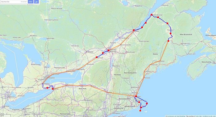 Les étapes, les portions à vélo (en bleu), les portions en bus et train (en orange)
Pour le parcours, j'utilise les tracés de la carte Open Cycle Map
Les étapes, les portions à vélo (en bleu), les portions en bus et train (en orange)
Pour le parcours, j'utilise les tracés de la carte Open Cycle Map
Les étapes, les portions à vélo (en bleu), les portions en bus et train (en orange)
Pour le parcours, j'utilise les tracés de la carte Open Cycle MapLa Namibie (et environs) des piafous English translation pending
Bonjour à tous,
Je n'avais pas encore partagé sur Voyage Forum un de nos safaris à orientation piafoulogique. (Piafoulogique, car beaucoup de nos safaris, comme beaucoup dans nos safaris, sont orientés vers la gent ailée, même si perso myself pour ma part je ne crache pas sur un lycaon ou un guépard ou...)
C'est donc avec un plaisir que j'espère vous faire partager que je vais vous montrer quelques-unes des photos d'oiseaux que nous avons faites en Namibie, ma blonde et moi. J'ai adopté une présentation par ordre alphabétique, une sorte de catalogue succinct des emplumés namibiens. Succinct car nous n'avons de photos (montrables ou à peu près) que de 139 espèces namibiennes (plus 24 au Botswana et Zimbabwe), même pas le quart de l'avifaune namibienne (687 espèces d'après Avibase). Et aussi 34 espèces de mammifères, dont il ne sera pas question ici (à 4 ou 5 photos près dans le pavé ci-dessous).

Amitiés à tous et bises aux autres
BL
PS : pour ceux qui seraient intéressés par des détails sur notre voyage, je les renvoie à notre carnet de voyage sur Wilipi. Nous avons voyagé "pépère" avec un guide-chauffeur (l'excellent Olivier), avec un circuit organisé (par Namvic) qui nous a conduits de Windhoek à Victoria Falls.
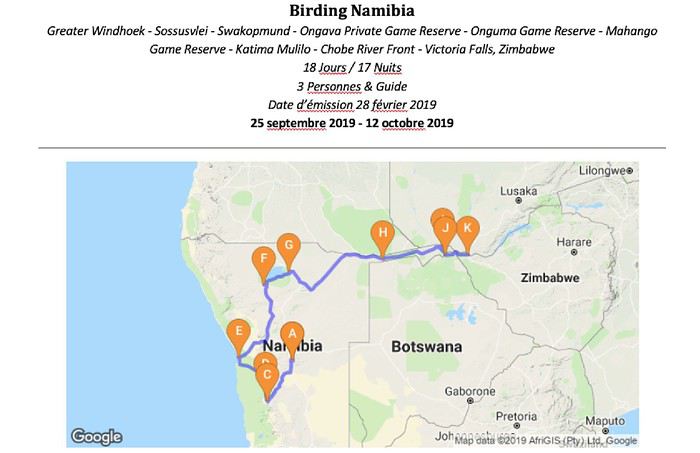
PS' : et pour ceux qui se demandent "mais pourquoi tant d'ailes", j'ai essayé de répondre à la question finalo-fondamentale "Et les piafous dans tout ça ?" dans une page de safari-tanzanie.net "Photographier des oiseaux en safari ... Pourquoi ? Où ? Lesquels ? Comment ?"
PS '' : et enfin d'enfin, l'index des espèces namibiennes (et assimilées) photographiées
Je n'avais pas encore partagé sur Voyage Forum un de nos safaris à orientation piafoulogique. (Piafoulogique, car beaucoup de nos safaris, comme beaucoup dans nos safaris, sont orientés vers la gent ailée, même si perso myself pour ma part je ne crache pas sur un lycaon ou un guépard ou...)
C'est donc avec un plaisir que j'espère vous faire partager que je vais vous montrer quelques-unes des photos d'oiseaux que nous avons faites en Namibie, ma blonde et moi. J'ai adopté une présentation par ordre alphabétique, une sorte de catalogue succinct des emplumés namibiens. Succinct car nous n'avons de photos (montrables ou à peu près) que de 139 espèces namibiennes (plus 24 au Botswana et Zimbabwe), même pas le quart de l'avifaune namibienne (687 espèces d'après Avibase). Et aussi 34 espèces de mammifères, dont il ne sera pas question ici (à 4 ou 5 photos près dans le pavé ci-dessous).
Amitiés à tous et bises aux autres
BL
PS : pour ceux qui seraient intéressés par des détails sur notre voyage, je les renvoie à notre carnet de voyage sur Wilipi. Nous avons voyagé "pépère" avec un guide-chauffeur (l'excellent Olivier), avec un circuit organisé (par Namvic) qui nous a conduits de Windhoek à Victoria Falls.
PS' : et pour ceux qui se demandent "mais pourquoi tant d'ailes", j'ai essayé de répondre à la question finalo-fondamentale "Et les piafous dans tout ça ?" dans une page de safari-tanzanie.net "Photographier des oiseaux en safari ... Pourquoi ? Où ? Lesquels ? Comment ?"
PS '' : et enfin d'enfin, l'index des espèces namibiennes (et assimilées) photographiées
De Portland à Chicago, le nord par les parcs nationaux en Harley English translation pending
Hello,
après bien des années me revoilà sur le forum, il s'agit cette fois de mon dernier voyage aux USA, fin août et début septembre 2019 au travers une partie du nord du pays. Bonne lecture.
Il en aura fallu du temps, 6 ans depuis le dernier séjour aux US, pour pouvoir rassembler de nouveau quelques personnes ayant le temps et le cash nécessaire à la réalisation de ce trip depuis trop longtemps en attente. Je partirai donc avec ma copine en passagère et à nouveau le frangin comme compagnon de route.
Ainsi début 2019 les préparatifs commencèrent, réservation des motos, des ElectraGlides pour cette fois, histoire d’avoir suffisamment d’espace bagages pour 2 personnes. A nouveau réservé chez EG en passant par Cooldrive. Réservation des vols Zürich – Portland avec courte escale à Vancouver sur Air Canada pour l’aller et Chicago – Zürich avec Swiss pour le retour. Reste environ 200 jours à patienter avant le grand départ, durant lesquels on actualise notre ESTA, établissons un plan de guerre concernant le matériel à prendre et réservons l’hôtel à l’arrivée à Portland ainsi que les hébergements sur Yellowstone, attrait touristique oblige.
Et finalement arrive le grand jour, départ de Zürich aéroport à 10h05 direction Vancouver (Canada) où l’on se pose à 11h30 après 10h25 de vol avec Air Canada. Très bon vol, avion récent très bien équipé et personnel agréable. Après une escale de 2h où l’on passe directement la douane US dans l’aéroport de Vancouver on reprend un petit bimoteur pour 1h14 de vol. Magnifique survol des Monts Rainier, St Helens et Hood, majestueuses montagnes s’élevant au dessus des forêts nord-américaines avant l’atterrissage à Portland (OR) à 14h44. Plus de douane à passer du coup reste à prendre le train pour rejoindre le centre et le Park Lane Suites & Inn où l’on logera les 2 prochaines nuits. Hôtel placé à mi-chemin entre le centre et le jardin japonais, avec places de parc. Wifi peu fonctionnel dans l’annexe mais ok dans le lobby. Confort standard. Ensuite tranquille, quelques bières en terrasse et repas du soir friture à l’arrache avant une nuit difficile, décalage horaire oblige…
JOUR 1 : Nous voici au premier jour à proprement dit et il s’annonce chargé ! On se lève tôt et descente en ville pour un petit déj au Starbucks puis passage à l’Oregon State Office afin de se munir du précieux « America The Beautiful annual pass » qui vous donne accès pour la modique somme de 80$ à tous les monuments, parcs, forêts nationaux pour 2 motos / 4 personnes (Yellowstone est par exemple déjà 35$ et nous allons en faire un certain nombre). Suite de quoi on saute dans un Uber pour aller récupérer nos destriers pour les 3 prochaines semaines. Après quelques formalités et signatures d’usage, d’avoir convaincu le vieux râleur sexiste de l’agence d’inscrire ma chérie comme 2e conducteur et d’avoir compris comment fonctionnait la connexion Bluetooth parce qu’un bon roadtrip se fait avec une bonne playlist, nous voilà parti pour nos premiers tours de roues. Le soleil est bien présent et la température agréable, de quoi présager une excellente journée. Après un bout d’Interstate histoire de traverser la ville sans se faire ch*** on prend la WA14, magnifique route qui longe la Columbia River au bord de l’eau, jusqu’au Hood River Bridge qui est un pont à péage. Nous traversons pour tirer plein sud direction le Mont Hood. Le paysage change rapidement alors que la rivière fait place aux vignes et vergers, il y a l’embarras du choix pour une halte dégustation de vin ou cidre. Petit à petit les vergers s’éclipsent au profit de la forêt à mesure que l’on monte en direction de la montagne. La route est agréable de même que la température qui se rafraîchit avec l’altitude, on s’arrête manger dans un petit chalet au pied d’une station de ski avant de reprendre la US26 pour Portland et ses 35°C. Passage à l’hôtel afin d’enfiler des vêtements plus légers puis visite du magnifique Japanese Garden, de ses jardins zen, étangs et chutes d’eau. Pour le repas du soir je conseille vivement le North 45 Pub sur la 21st Avenue pour déguster de magnifiques plats de moules locales servies avec une baguette rustique dans le patio avec une bière et une bouteille de rouge. On a toujours testé les bières et vins locaux autant que disponibles. On essaie d’éloigner la fatigue le plus longtemps possible pour combattre se fichu décalage horaire avant de goûter à un repos bien mérité.
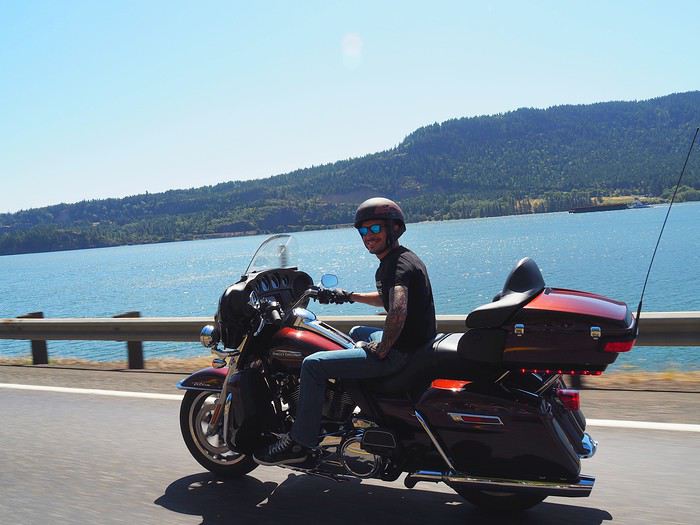
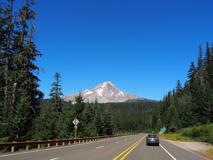
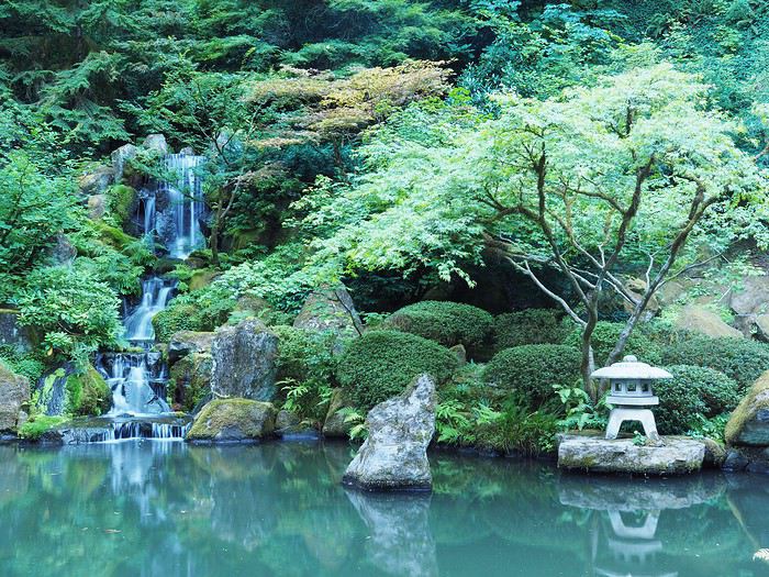
Il en aura fallu du temps, 6 ans depuis le dernier séjour aux US, pour pouvoir rassembler de nouveau quelques personnes ayant le temps et le cash nécessaire à la réalisation de ce trip depuis trop longtemps en attente. Je partirai donc avec ma copine en passagère et à nouveau le frangin comme compagnon de route.
Ainsi début 2019 les préparatifs commencèrent, réservation des motos, des ElectraGlides pour cette fois, histoire d’avoir suffisamment d’espace bagages pour 2 personnes. A nouveau réservé chez EG en passant par Cooldrive. Réservation des vols Zürich – Portland avec courte escale à Vancouver sur Air Canada pour l’aller et Chicago – Zürich avec Swiss pour le retour. Reste environ 200 jours à patienter avant le grand départ, durant lesquels on actualise notre ESTA, établissons un plan de guerre concernant le matériel à prendre et réservons l’hôtel à l’arrivée à Portland ainsi que les hébergements sur Yellowstone, attrait touristique oblige.
Et finalement arrive le grand jour, départ de Zürich aéroport à 10h05 direction Vancouver (Canada) où l’on se pose à 11h30 après 10h25 de vol avec Air Canada. Très bon vol, avion récent très bien équipé et personnel agréable. Après une escale de 2h où l’on passe directement la douane US dans l’aéroport de Vancouver on reprend un petit bimoteur pour 1h14 de vol. Magnifique survol des Monts Rainier, St Helens et Hood, majestueuses montagnes s’élevant au dessus des forêts nord-américaines avant l’atterrissage à Portland (OR) à 14h44. Plus de douane à passer du coup reste à prendre le train pour rejoindre le centre et le Park Lane Suites & Inn où l’on logera les 2 prochaines nuits. Hôtel placé à mi-chemin entre le centre et le jardin japonais, avec places de parc. Wifi peu fonctionnel dans l’annexe mais ok dans le lobby. Confort standard. Ensuite tranquille, quelques bières en terrasse et repas du soir friture à l’arrache avant une nuit difficile, décalage horaire oblige…
JOUR 1 : Nous voici au premier jour à proprement dit et il s’annonce chargé ! On se lève tôt et descente en ville pour un petit déj au Starbucks puis passage à l’Oregon State Office afin de se munir du précieux « America The Beautiful annual pass » qui vous donne accès pour la modique somme de 80$ à tous les monuments, parcs, forêts nationaux pour 2 motos / 4 personnes (Yellowstone est par exemple déjà 35$ et nous allons en faire un certain nombre). Suite de quoi on saute dans un Uber pour aller récupérer nos destriers pour les 3 prochaines semaines. Après quelques formalités et signatures d’usage, d’avoir convaincu le vieux râleur sexiste de l’agence d’inscrire ma chérie comme 2e conducteur et d’avoir compris comment fonctionnait la connexion Bluetooth parce qu’un bon roadtrip se fait avec une bonne playlist, nous voilà parti pour nos premiers tours de roues. Le soleil est bien présent et la température agréable, de quoi présager une excellente journée. Après un bout d’Interstate histoire de traverser la ville sans se faire ch*** on prend la WA14, magnifique route qui longe la Columbia River au bord de l’eau, jusqu’au Hood River Bridge qui est un pont à péage. Nous traversons pour tirer plein sud direction le Mont Hood. Le paysage change rapidement alors que la rivière fait place aux vignes et vergers, il y a l’embarras du choix pour une halte dégustation de vin ou cidre. Petit à petit les vergers s’éclipsent au profit de la forêt à mesure que l’on monte en direction de la montagne. La route est agréable de même que la température qui se rafraîchit avec l’altitude, on s’arrête manger dans un petit chalet au pied d’une station de ski avant de reprendre la US26 pour Portland et ses 35°C. Passage à l’hôtel afin d’enfiler des vêtements plus légers puis visite du magnifique Japanese Garden, de ses jardins zen, étangs et chutes d’eau. Pour le repas du soir je conseille vivement le North 45 Pub sur la 21st Avenue pour déguster de magnifiques plats de moules locales servies avec une baguette rustique dans le patio avec une bière et une bouteille de rouge. On a toujours testé les bières et vins locaux autant que disponibles. On essaie d’éloigner la fatigue le plus longtemps possible pour combattre se fichu décalage horaire avant de goûter à un repos bien mérité.
Itinéraire Chicago - les Grands Lacs - chutes du Niagara English translation pending
Bonjour à tous
Nous partons 3 semaines en Juillet aux ETATS UNIS
Nous sommes partis plusieurs fois dans cet immense pays, nous partons visiter Chicago, les grands lacs et pourquoi pas les chutes du Niagara.
J'ai déjà acheté les billets d'avions France-Chicago/Chicago-France.
J'aimerais connaître votre avis sur les 2 circuits ci-dessous
Je n'arrive pas à me décider. Ou m'orienter sur Chicago et la régions des grands ou partir vers Detroit, les chutes du Niagara et remonter vers les lacs. Je sais (en ayant potasser le forum )que la route de Chicago à Détroit est monotone. J'ai vu aussi que la douane entre les USA et le Canada peut être longue. J'ai vu aussi que pour la location de la voiture il faut s'orienter sur les compagnies connues pour avoir le droit de traverser la frontières. Mais, est ce un bon choix de rester sur la région des grands lacs ??? Nous aimons la nature et moins les villes.
Qu'en penses-vous ? merci par avance
CIRCUIT 1 CHICAGO/TORONTO/NIAGARA
Jour 1 France / CHICAGO Jour 2 CHICAGO Jour 3 CHICAGO Jour 4 CHICAGO-INDIANA DUNES (80 km) Jour 5 INDIANA DUNES-DETROIT (400 km) Jour 6 DETROIT (visite du musée Ford) Jour 7 DETROIT-NIAGARA Jour 8 Chutes du NIAGARA Jour 9 NIAGARA-TORONTO (200 km) Jour 10 TORONTO visite de la ville Jour 11 TORONTO-PENINSULE DE BRUCE à TOBERMORY (300km) Jour 12 PENINSULE DE BRUCE Jour 13 : PENINSULE DE BRUCE-ILE DE MANITOULIN en FERRY Jour 14 ILE DE MANITOULIN Jour 15 : ILE DE MANITOULIN-SAULT SAINTE MARINE (350 km) Jour 16 : SAULT SAINTE MARIE-MUNISING (200 km) Jour 17 : VISITE DU PARC PICTURED ROCKS NATIONAL LAKESHORE Jour 18 MUNISING-COMTE DE DOOR à EPHRAIM (350km) Jour 19 COMTE DE DOOR- MILWAUKEE (250 km) Jour 20 MILWAUKEE visite de la ville Jour 21 MILWAUKEE-CHICAGO (150 km) VOL en soirée
CIRCUIT 2 CHICAGO ET LES GRANDS LACS
Jour 1: FRANCE-CHICAGO Jour 2 CHICAGO Jour 3 CHICAGO Jour 4 CHICAGO-MILWAUKEE (150 km) Récupérer la voiture de location Jour 5 MIWAUKEE visite de la ville Jour 6 MILWAUKEE-EPHRAIM (3h de route) Jour 7 EPHRAIM Cave Point County Park et Peninsula State Park Peninsula State Park : Visiter le parc à vélo. Belle piste cyclable à travers la forêt en Bord de lac. Halte au phare Eagle Bluff par le Sunset Bike tour en une heure environ Jour 8 EPHRAIM-MARQUETTE (5h de route) Jour 9 PARC PICTURED ROCKS NATIONAL LAKESHORE Dormir à DULUTH Jour 10 DULUTH-GRAND MARAIS (2h de route) Jour 11 GRAND MARAIS-TERACE BAY (3h) Jour 12 TERACE BAY-SAULT SAINTE MARIE 500 km en 2 jours Jour 13 SAULT SAINTE MARIE-SAINT IGNACE (80 km) Jour 14 SAINT IGNACE-MAKINAC ISLAND Ferry Jour 16 MACKINAC ISLAND Jour17 MACKINAC ISLAND-TRAVERSE CITY ferry retour Jour 18 Sleeping Bear Dunes National Park Jour 19 TRAVERSE CITY-SAUGATUCK (3h30) Jour 20 WARREN DUNES STATE PARK Jour 21 WARREN DUNES-CHICAGO (1h30) VOL EN SOIREE
Je n'arrive pas à me décider. Ou m'orienter sur Chicago et la régions des grands ou partir vers Detroit, les chutes du Niagara et remonter vers les lacs. Je sais (en ayant potasser le forum )que la route de Chicago à Détroit est monotone. J'ai vu aussi que la douane entre les USA et le Canada peut être longue. J'ai vu aussi que pour la location de la voiture il faut s'orienter sur les compagnies connues pour avoir le droit de traverser la frontières. Mais, est ce un bon choix de rester sur la région des grands lacs ??? Nous aimons la nature et moins les villes.
Qu'en penses-vous ? merci par avance
CIRCUIT 1 CHICAGO/TORONTO/NIAGARA
Jour 1 France / CHICAGO Jour 2 CHICAGO Jour 3 CHICAGO Jour 4 CHICAGO-INDIANA DUNES (80 km) Jour 5 INDIANA DUNES-DETROIT (400 km) Jour 6 DETROIT (visite du musée Ford) Jour 7 DETROIT-NIAGARA Jour 8 Chutes du NIAGARA Jour 9 NIAGARA-TORONTO (200 km) Jour 10 TORONTO visite de la ville Jour 11 TORONTO-PENINSULE DE BRUCE à TOBERMORY (300km) Jour 12 PENINSULE DE BRUCE Jour 13 : PENINSULE DE BRUCE-ILE DE MANITOULIN en FERRY Jour 14 ILE DE MANITOULIN Jour 15 : ILE DE MANITOULIN-SAULT SAINTE MARINE (350 km) Jour 16 : SAULT SAINTE MARIE-MUNISING (200 km) Jour 17 : VISITE DU PARC PICTURED ROCKS NATIONAL LAKESHORE Jour 18 MUNISING-COMTE DE DOOR à EPHRAIM (350km) Jour 19 COMTE DE DOOR- MILWAUKEE (250 km) Jour 20 MILWAUKEE visite de la ville Jour 21 MILWAUKEE-CHICAGO (150 km) VOL en soirée
CIRCUIT 2 CHICAGO ET LES GRANDS LACS
Jour 1: FRANCE-CHICAGO Jour 2 CHICAGO Jour 3 CHICAGO Jour 4 CHICAGO-MILWAUKEE (150 km) Récupérer la voiture de location Jour 5 MIWAUKEE visite de la ville Jour 6 MILWAUKEE-EPHRAIM (3h de route) Jour 7 EPHRAIM Cave Point County Park et Peninsula State Park Peninsula State Park : Visiter le parc à vélo. Belle piste cyclable à travers la forêt en Bord de lac. Halte au phare Eagle Bluff par le Sunset Bike tour en une heure environ Jour 8 EPHRAIM-MARQUETTE (5h de route) Jour 9 PARC PICTURED ROCKS NATIONAL LAKESHORE Dormir à DULUTH Jour 10 DULUTH-GRAND MARAIS (2h de route) Jour 11 GRAND MARAIS-TERACE BAY (3h) Jour 12 TERACE BAY-SAULT SAINTE MARIE 500 km en 2 jours Jour 13 SAULT SAINTE MARIE-SAINT IGNACE (80 km) Jour 14 SAINT IGNACE-MAKINAC ISLAND Ferry Jour 16 MACKINAC ISLAND Jour17 MACKINAC ISLAND-TRAVERSE CITY ferry retour Jour 18 Sleeping Bear Dunes National Park Jour 19 TRAVERSE CITY-SAUGATUCK (3h30) Jour 20 WARREN DUNES STATE PARK Jour 21 WARREN DUNES-CHICAGO (1h30) VOL EN SOIREE
Antelope Canyon, Horseshoe Bend, etc... "overcrowded". Effet de Panurge ou Instagram? English translation pending
trop de touristes dans les lieux … touristiques ( air connu😛)
Les derniers vingt ans et surtout la dernière décennie ont vu grimper en flèche la fréquentation des Parcs nationaux, enfin au moins de certains, ainsi que de certains sites tels que Antelope Canyon et Horseshoe Bend
Antelope Canyon, parce que c’est payant, revient souvent sur les forums francophones, anglophones, hispanophones et certainement d’autres . Taper ‘’ Antelope Canyon rip-off ( ou scam) ‘’ et vous verrez que les Français ne sont pas les seuls à râler !
Voici quelques uns des repères qui ont jalonné la montée en puissance d’Antelope Canyon dans le monde du tourisme !
Dans les années 70 ces parages étaient parcourus par les bergers Navajos, quelques scientifiques, naturalistes ou géologues, de rares photographes et c’était à peu près tout ! Par exemple c’est par un collègue senior que j’en ai entendu parler …
L’histoire dit qu’un jour un berger Navajo rencontre un photographe tout équipé, marchant dans le désert, quelque peu hagard, qui cherchait désespérément un certain canyon aux couleurs et formes étonnantes dont il avait entendu parler . Il l’y aurait conduit et aurait vite réalisé que les ‘Américains’ étaient prêts à payer pour y venir.
Ça aurait donc commencé comme cela… !
En tous cas vers le milieu ou la fin des années 70 deux revues importantes présentent le site aux Américains…
- au niveau régional Arizona Highways
- au niveau national National Geographic qui lui apporte une première consécration
En 1997 les Français et autres Européens notamment font partie de la nouvelle clientèle internationale qui commence à affluer. Cette période est évidemment marquée par la tragédie du flash flood au cours duquel plusieurs touristes français trouvent la mort. Selon les responsables locaux du moment la fréquentation aurait en fait sensiblement augmentée après cette tragédie !
En 2009 quand Microsoft décide d’incorporer une série de photos à Windows 7 les choses changent d’échelle. En deux ans Microsoft vend plus de 450 millions de licences et fait ainsi visionner les images à haute fidélité du site à des centaines de millions de personnes ( les titulaires de la licence et toute le reste de la famille ou du bureau!)
En 2010 c’est le lancement de Instagramdont la presse américaine s’accorde à dire qu’il a été instrumental dans le flux touristique toujours croissant et pas seulement à Antelope Canyon !
En 2019 on vient de faire le constat que les requêtes Google sur Antelope Canyon ont explosé depuis : elles auraient augmenté de 660 % !
L’année 2019 marque aussi la fin des créneaux horaires réservés aux ‘’photographes avec tripode’’ les tours ''standard'' étant devenus trop difficiles à gérer
Antelope Canyon is Shutting Down Its Photo Tours Due to …
Antelope Canyon photography tours are canceled. Here's why
En 2020 les opérateurs affirment que cette décision devrait réduire la pression sur les groupes de visiteurs ‘’standard’’ ceux qui arrivent en masse, le portable au bout d’une perche pour le selfie de rigueur ( paraît-il)
…
Si vous avez aimez la montée en puissance d’ Antelope Canyon et le rôle des réseaux sociaux (Instagram etc….)
.. vous allez adorer celle de Horseshoe Bend….
… en 10 ans (2009-2019) la fréquentation touristique annuelle y est passée de moins de 40 000 personnes à environ 2 200 000 mais ce sont surtout les cinq dernières années qui ont vu s’emballer le flux, la fièvre Antelope canyon se serait alors propagée via Instagram selon le Wall Street Journal lui-même l’été dernier
Instagram Turns Obscure U.S. Sights Into Social-Media …
Et comme nous l’expliquait ABC TV, également en juillet dernier
Link to ABC News story
pas étonnant donc que le prix des chambres d’hôtel à PAGE flambe!
Les derniers vingt ans et surtout la dernière décennie ont vu grimper en flèche la fréquentation des Parcs nationaux, enfin au moins de certains, ainsi que de certains sites tels que Antelope Canyon et Horseshoe Bend
Antelope Canyon, parce que c’est payant, revient souvent sur les forums francophones, anglophones, hispanophones et certainement d’autres . Taper ‘’ Antelope Canyon rip-off ( ou scam) ‘’ et vous verrez que les Français ne sont pas les seuls à râler !
Voici quelques uns des repères qui ont jalonné la montée en puissance d’Antelope Canyon dans le monde du tourisme !
Dans les années 70 ces parages étaient parcourus par les bergers Navajos, quelques scientifiques, naturalistes ou géologues, de rares photographes et c’était à peu près tout ! Par exemple c’est par un collègue senior que j’en ai entendu parler …
L’histoire dit qu’un jour un berger Navajo rencontre un photographe tout équipé, marchant dans le désert, quelque peu hagard, qui cherchait désespérément un certain canyon aux couleurs et formes étonnantes dont il avait entendu parler . Il l’y aurait conduit et aurait vite réalisé que les ‘Américains’ étaient prêts à payer pour y venir.
Ça aurait donc commencé comme cela… !
En tous cas vers le milieu ou la fin des années 70 deux revues importantes présentent le site aux Américains…
- au niveau régional Arizona Highways
- au niveau national National Geographic qui lui apporte une première consécration
En 1997 les Français et autres Européens notamment font partie de la nouvelle clientèle internationale qui commence à affluer. Cette période est évidemment marquée par la tragédie du flash flood au cours duquel plusieurs touristes français trouvent la mort. Selon les responsables locaux du moment la fréquentation aurait en fait sensiblement augmentée après cette tragédie !
En 2009 quand Microsoft décide d’incorporer une série de photos à Windows 7 les choses changent d’échelle. En deux ans Microsoft vend plus de 450 millions de licences et fait ainsi visionner les images à haute fidélité du site à des centaines de millions de personnes ( les titulaires de la licence et toute le reste de la famille ou du bureau!)
En 2010 c’est le lancement de Instagramdont la presse américaine s’accorde à dire qu’il a été instrumental dans le flux touristique toujours croissant et pas seulement à Antelope Canyon !
En 2019 on vient de faire le constat que les requêtes Google sur Antelope Canyon ont explosé depuis : elles auraient augmenté de 660 % !
L’année 2019 marque aussi la fin des créneaux horaires réservés aux ‘’photographes avec tripode’’ les tours ''standard'' étant devenus trop difficiles à gérer
Antelope Canyon is Shutting Down Its Photo Tours Due to …
Antelope Canyon photography tours are canceled. Here's why
En 2020 les opérateurs affirment que cette décision devrait réduire la pression sur les groupes de visiteurs ‘’standard’’ ceux qui arrivent en masse, le portable au bout d’une perche pour le selfie de rigueur ( paraît-il)
…
Si vous avez aimez la montée en puissance d’ Antelope Canyon et le rôle des réseaux sociaux (Instagram etc….)
.. vous allez adorer celle de Horseshoe Bend….
… en 10 ans (2009-2019) la fréquentation touristique annuelle y est passée de moins de 40 000 personnes à environ 2 200 000 mais ce sont surtout les cinq dernières années qui ont vu s’emballer le flux, la fièvre Antelope canyon se serait alors propagée via Instagram selon le Wall Street Journal lui-même l’été dernier
Instagram Turns Obscure U.S. Sights Into Social-Media …
Et comme nous l’expliquait ABC TV, également en juillet dernier
Link to ABC News story
pas étonnant donc que le prix des chambres d’hôtel à PAGE flambe!
Location d'auto ou camping-car pour la Nouvelle-Zélande en février-mars English translation pending
Bonjour
Nous sommes un couple de "vieux retraités", nous envisageons voyager ( 2 mois) en Nouvelle-Zélande en février et mars 2021 ....serait-il préférable de débuter notre voyage par le sud (Christchurch) ou par le nord (Auckland)......notre destination précédente étant Sydney.
Aussi, nous hésitons beaucoup entre la location d'une auto ou d'un Camping Car....toutes les informations et/ou tous les commentaires suite à vos expériences sont bienvenus
Merci pour votre aide
Lucie
Aussi, nous hésitons beaucoup entre la location d'une auto ou d'un Camping Car....toutes les informations et/ou tous les commentaires suite à vos expériences sont bienvenus
Merci pour votre aide
Lucie
Idées choses à voir et activités de grand air au Tennessee, Alabama et Géorgie English translation pending
Hello les amis,
Je suis à la recherche de choses à voir et activités de grand air à faire entre la Géorgie, le Tennessee et l'Alabama...
J'ai déjà parcouru pas mal de guides et de sites, mais j'avoue ne pas être super emballé pour le moment... Je précise que les musées c'est vraiment pas mon trip. Je préfère une bonne rando VTT ou Kayak, une ballade sur une belle plage, la découverte d'un lieu insolite. Des lieux cultes (déjà repéré Graceland et L'hotel loraine...
Ouais je sais j'en demande beaucoup et je ne pense pas que ce type de destination soit très courue. Mais je tente ma chance.
Je prends toute idée originale 😉
Sinon, je ferais comme d'hab, zéro préparation, 100% AVENTURE 😎
From Ol Pejeta to Tsavo West (Kenya)
Hello everyone,
Here’s the story of our two-week trip—13 nights, actually—in the national parks of northern and southeastern Kenya, which we took last September at the end of summer. My wife and I planned this trip with a French agency (Bel Africa, Paris), which worked with a local operator in Nairobi (Nadhy Travels & Tours). The latter provided a driver-guide and vouchers, but no aperitif🙁! Our all-inclusive package included animal safaris exclusively in a customized 4x4 vehicle (with a pop-up roof) and accommodations in high-quality lodges that we selected ourselves. It’s great for comfort, but not so much for the wallet. The cost was obviously astronomical for the services provided. But that’s just my usual take on lodging in East and Southern Africa! Our itinerary was a loop starting and ending in Nairobi, passing through Ol Pejeta, Buffalo Springs-Samburu, Meru NP, Amboseli, and Tsavo West.
Trip breakdown:
Day 1 to 3: Ol Pejeta Day 3 to 7: Buffalo Springs Day 7 to 8: Meru NP-Nairobi Day 9 to 11: Nairobi-Amboseli Day 11 to 14: Tsavo West
Photo gear we brought:
- 1 bridge camera - 2 DSLR bodies - 2 telephoto lenses: 70-200mm f/2.8 and 200-500mm f/5.6 - 2 pairs of 10x42 binoculars
What motivated this trip? We wanted to recharge and were looking for a certain tranquility that would be ideal for wildlife observation and photography—our hobbies. That immediately ruled out the parks in the southwest, which are too crowded. Plus, those would have likely been a repeat of what we experienced in Tanzania a few years earlier (see my travel journal "The Great Migration"). Buffalo Springs particularly appealed to us because of the unique animal species it’s home to. It was really their existence that drove our choices. We wanted to see animals we’d never seen before in their natural habitats.
So, on a beautiful late-summer evening, we took off from Paris-CDG for Nairobi. The overnight flight was uneventful, and we landed early in the morning at Jomo Kenyatta International Airport (NBO). But our driver-guide wasn’t waiting for us. Judging by the number of signs being held up, we must have been the only travelers in that situation. Good grief, why wasn’t he there like all the others?
Here’s the story of our two-week trip—13 nights, actually—in the national parks of northern and southeastern Kenya, which we took last September at the end of summer. My wife and I planned this trip with a French agency (Bel Africa, Paris), which worked with a local operator in Nairobi (Nadhy Travels & Tours). The latter provided a driver-guide and vouchers, but no aperitif🙁! Our all-inclusive package included animal safaris exclusively in a customized 4x4 vehicle (with a pop-up roof) and accommodations in high-quality lodges that we selected ourselves. It’s great for comfort, but not so much for the wallet. The cost was obviously astronomical for the services provided. But that’s just my usual take on lodging in East and Southern Africa! Our itinerary was a loop starting and ending in Nairobi, passing through Ol Pejeta, Buffalo Springs-Samburu, Meru NP, Amboseli, and Tsavo West.
Trip breakdown:
Day 1 to 3: Ol Pejeta Day 3 to 7: Buffalo Springs Day 7 to 8: Meru NP-Nairobi Day 9 to 11: Nairobi-Amboseli Day 11 to 14: Tsavo West
Photo gear we brought:
- 1 bridge camera - 2 DSLR bodies - 2 telephoto lenses: 70-200mm f/2.8 and 200-500mm f/5.6 - 2 pairs of 10x42 binoculars
What motivated this trip? We wanted to recharge and were looking for a certain tranquility that would be ideal for wildlife observation and photography—our hobbies. That immediately ruled out the parks in the southwest, which are too crowded. Plus, those would have likely been a repeat of what we experienced in Tanzania a few years earlier (see my travel journal "The Great Migration"). Buffalo Springs particularly appealed to us because of the unique animal species it’s home to. It was really their existence that drove our choices. We wanted to see animals we’d never seen before in their natural habitats.
So, on a beautiful late-summer evening, we took off from Paris-CDG for Nairobi. The overnight flight was uneventful, and we landed early in the morning at Jomo Kenyatta International Airport (NBO). But our driver-guide wasn’t waiting for us. Judging by the number of signs being held up, we must have been the only travelers in that situation. Good grief, why wasn’t he there like all the others?
Un "Esta" bientôt nécessaire pour se rendre au Royaume-Uni? English translation pending
Visiblement, les autorités britanniques auraient dans l'idée de mettre en place un système d'Esta identique à celui existant pour les USA pour tous les voyageurs actuellement dispensés de visa (y compris donc les ressortissants de l'U.E.) souhaitant se rendre dans le pays une fois le Brexit effectif (s'il le devient un jour...).
Lire la suite...
Un mois dans le nord du Pakistan English translation pending
1 mois au Pakistan, C’était GÉNIAL !
Un pays où le tourisme chinois, coréen et japonais est florissant. Du côté européen, 1 groupe de trekkeurs, et 2 individuels. C’est tout !
Nous étions 2 copines. Début janvier, achat du billet d’avion pour le Pakistan pour y passer un mois. Départ 31 juillet, retour 27 août avec une arrivée à Lahore et un départ d’Islamabad. Objectif : le nord du Pakistan.
Le visa : Pour entrer au Pakistan, il faut une invitation d’un pakistanais ou d’une agence française ou locale. Pour profiter au mieux de paysages et pouvoir s’arrêter où nous voulions, nous avions décidé de louer une voiture. Recherche de loueurs : nous n’avons pas trouvé de location sans chauffeur. Et j’ai envie de dire, avec du recul, aucun regret : notre chauffeur étant super, avec une parfaite connaissance du circuit que nous voulions faire. De plus, les routes sont souvent catastrophiques (en dehors des grands axes) et seules, nous aurions certainement renoncé à une bonne partie du périple !
Arrivée à Lahore où nous y avons passé 2 jours. Grande ville, bruyante à cause des motos mais avec une vieille ville très authentique. Pas de souci pour y passer 2 jours sans s’ennuyer (pourquoi pas 3). Et la population est accueillante, souriante. Une entrée en matière dans le pays très intéressante.
Puis nous avons pris un bus pour Islamabad. Nous n’avons pas du tout apprécié cette ville qui n’a aucune âme. Tracé au carré, avec des grands boulevards. Au centre de chaque quartier un centre commercial. Le seul intérêt : la mosquée.
C’est à Islamabad que nous avons été pris en charge par notre chauffeur. L’enjeu était de taille : il fallait s’entendre avec lui parce que 27 jours, cela peut être long avec quelqu’un avec qui il n’y a pas de complicité ! il nous a rapidement dit que nous étions des touristes « un peu spéciale » mais il s’est très vite adapté à nos attentes et à notre rythme. Le circuit avait été établi auparavant. Il a été respecté mais nous avons parfois modifié les étapes où nous avons dormi. Il faut le dire, c’est grâce à sa capacité d’adaptation, notre voyage a été formidable
cela commence mal, j'ai oublié les photos ! et maintenant, je ne sais pas les mettre en grand !
ISLAMABAD / CHILAS Journée longue. On a mis 5 h d’Islamabad pour arriver à l’intersection qui nous fasse rentrer dans la vallée de Kaghan. Route encombrée de voitures, camions… bruit, passage de villes sans intérêt. La vallée jusque Naran, je n’y ai pas trouvé d’intérêt, rien d’exceptionnel à mes yeux. Vallée fréquentée par les pakistanais qui viennent chercher la fraicheur et de Naran, faire la randonnée jusqu’au Glacier de Nanga Parbat. Après Naran, village touristique au milieu de la vallée, les paysages sont plus beaux. (Alors attention, à mes yeux car personnellement, je préfère les paysages arides. Donc sur mes photos, beaucoup de paysages arides. Ce qui ne veut pas dire que dans certains endroits il n’y a pas d’arbres mais comme je prends des photos pour me faire plaisir, de ce que j’aime, je fais peu de photos des paysages plus verts !) Au total, 12 h 30 de route !
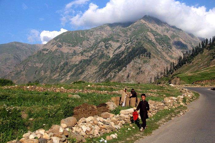
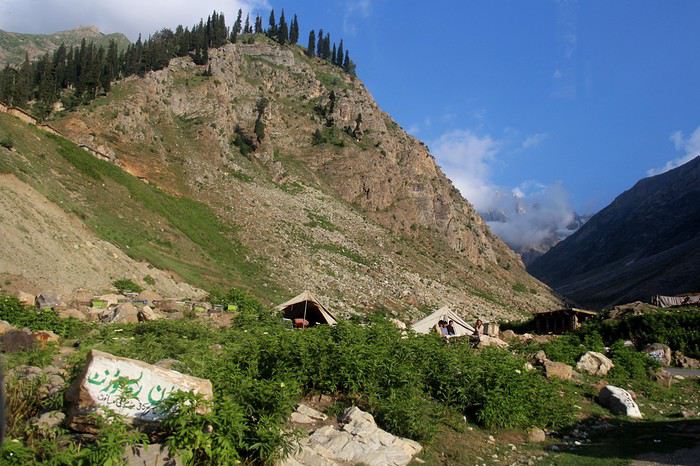 Nous n’avons connu de Chilas que la rue principale le soir, pas vraiment animée, car nous sommes reparties le lendemain matin pour traverser le plateau de Diosai. Avec du recul, nous aurions dû prendre le temps le matin de marcher dans la petite ville et profiter de l’environnement).
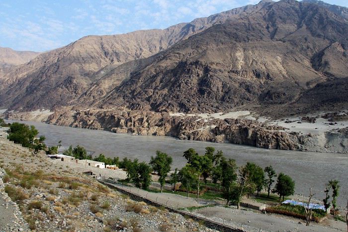
CHILAS /ASTORE La vallée de Chilas, jusque l’embranchement d’Astore est superbe. Après, c’est une vallée très resserrée.
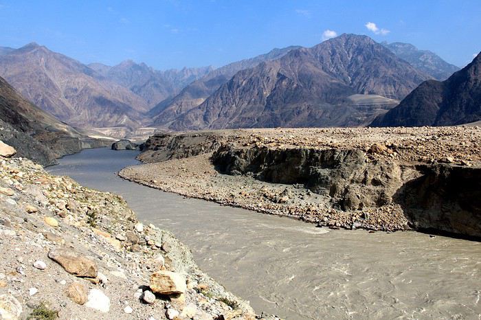
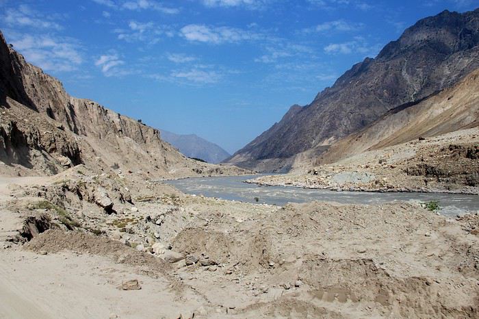
c'est l'occasion de voir nos premiers trucks pakistanais
Astore : une rue principale avec le bazar. Du monde le matin. Peu de contact et on fait vite le tour ! Mais en même temps, l’occasion d’observer la vie, les tenues. Et aucun touriste de quelques nationalités qu’ils soient.
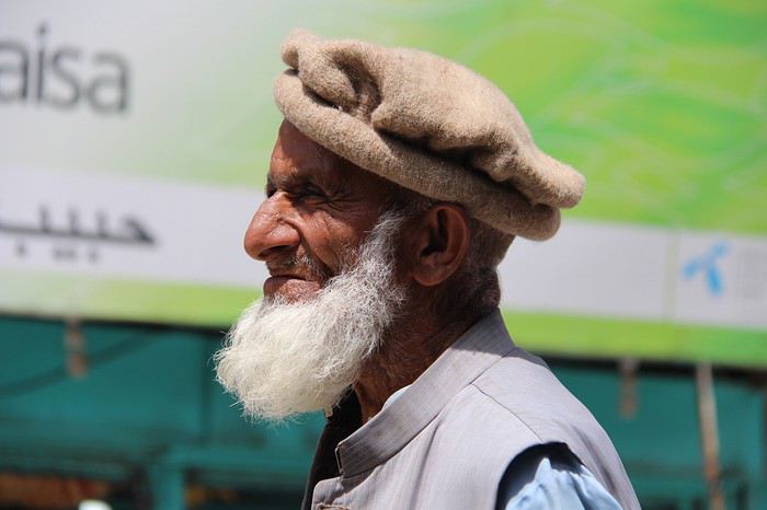
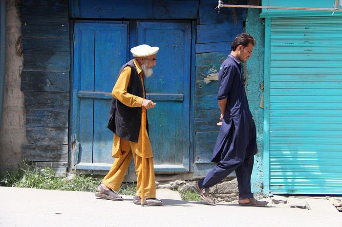
Dans l’après-midi, nous sommes allés dans la vallée de Rama (c’est vert !). Quelques familles y vivent, l’occasion de belles rencontres.
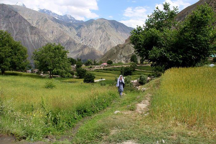
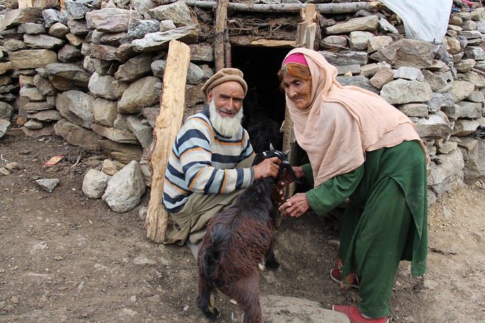
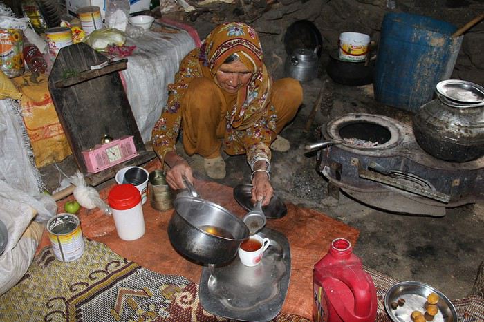
à suivre....
Un pays où le tourisme chinois, coréen et japonais est florissant. Du côté européen, 1 groupe de trekkeurs, et 2 individuels. C’est tout !
Nous étions 2 copines. Début janvier, achat du billet d’avion pour le Pakistan pour y passer un mois. Départ 31 juillet, retour 27 août avec une arrivée à Lahore et un départ d’Islamabad. Objectif : le nord du Pakistan.
Le visa : Pour entrer au Pakistan, il faut une invitation d’un pakistanais ou d’une agence française ou locale. Pour profiter au mieux de paysages et pouvoir s’arrêter où nous voulions, nous avions décidé de louer une voiture. Recherche de loueurs : nous n’avons pas trouvé de location sans chauffeur. Et j’ai envie de dire, avec du recul, aucun regret : notre chauffeur étant super, avec une parfaite connaissance du circuit que nous voulions faire. De plus, les routes sont souvent catastrophiques (en dehors des grands axes) et seules, nous aurions certainement renoncé à une bonne partie du périple !
Arrivée à Lahore où nous y avons passé 2 jours. Grande ville, bruyante à cause des motos mais avec une vieille ville très authentique. Pas de souci pour y passer 2 jours sans s’ennuyer (pourquoi pas 3). Et la population est accueillante, souriante. Une entrée en matière dans le pays très intéressante.
Puis nous avons pris un bus pour Islamabad. Nous n’avons pas du tout apprécié cette ville qui n’a aucune âme. Tracé au carré, avec des grands boulevards. Au centre de chaque quartier un centre commercial. Le seul intérêt : la mosquée.
C’est à Islamabad que nous avons été pris en charge par notre chauffeur. L’enjeu était de taille : il fallait s’entendre avec lui parce que 27 jours, cela peut être long avec quelqu’un avec qui il n’y a pas de complicité ! il nous a rapidement dit que nous étions des touristes « un peu spéciale » mais il s’est très vite adapté à nos attentes et à notre rythme. Le circuit avait été établi auparavant. Il a été respecté mais nous avons parfois modifié les étapes où nous avons dormi. Il faut le dire, c’est grâce à sa capacité d’adaptation, notre voyage a été formidable
cela commence mal, j'ai oublié les photos ! et maintenant, je ne sais pas les mettre en grand !
ISLAMABAD / CHILAS Journée longue. On a mis 5 h d’Islamabad pour arriver à l’intersection qui nous fasse rentrer dans la vallée de Kaghan. Route encombrée de voitures, camions… bruit, passage de villes sans intérêt. La vallée jusque Naran, je n’y ai pas trouvé d’intérêt, rien d’exceptionnel à mes yeux. Vallée fréquentée par les pakistanais qui viennent chercher la fraicheur et de Naran, faire la randonnée jusqu’au Glacier de Nanga Parbat. Après Naran, village touristique au milieu de la vallée, les paysages sont plus beaux. (Alors attention, à mes yeux car personnellement, je préfère les paysages arides. Donc sur mes photos, beaucoup de paysages arides. Ce qui ne veut pas dire que dans certains endroits il n’y a pas d’arbres mais comme je prends des photos pour me faire plaisir, de ce que j’aime, je fais peu de photos des paysages plus verts !) Au total, 12 h 30 de route !
Nous n’avons connu de Chilas que la rue principale le soir, pas vraiment animée, car nous sommes reparties le lendemain matin pour traverser le plateau de Diosai. Avec du recul, nous aurions dû prendre le temps le matin de marcher dans la petite ville et profiter de l’environnement).CHILAS /ASTORE La vallée de Chilas, jusque l’embranchement d’Astore est superbe. Après, c’est une vallée très resserrée.
c'est l'occasion de voir nos premiers trucks pakistanais
Astore : une rue principale avec le bazar. Du monde le matin. Peu de contact et on fait vite le tour ! Mais en même temps, l’occasion d’observer la vie, les tenues. Et aucun touriste de quelques nationalités qu’ils soient.
Dans l’après-midi, nous sommes allés dans la vallée de Rama (c’est vert !). Quelques familles y vivent, l’occasion de belles rencontres.
à suivre....
Avis circuit 24 jours dans l'Ouest américain mi-mai English translation pending
Bonsoir
Voici le 1er jet d'un programme de 24 jours. Départ mi mai
Les billets sont déjà réservés, j'avais une idée après avoir lu les forums, mais je trace le circuit.
Y a t il intérêt à s'arrêter à Bodi Ghost Town si on s'est déjà arrêtés à Calico Ghost Town ?
On a essayé de prendre un peu de temps pour s'arrêter dans les parcs.
Dans Yosemite quand je vais sur google maps il me dit que je ne peux pas traverser, du coup je mets des nuits sur Groveland
Qu'en pensez vous ?
Jour 1 : France - LA, Arrivée LA et récupération voiture de loc Jours 2, 3 et 4 : Los Angeles Jour 5 : Los Angeles – San Diego : 190 km / San Diego – San Bernardino : 170 km Jour 6 : San Bernardino – Calico Ghost Town – Needles : 350 km Jour 7 : Route 66. Needles-Hackberry-Seligman-Flagstaff : 350 km Jour 8 : Grand Canyon par le Sud (1 jour, vol hélico) Jour 9 : Grand Canyon – Monument Valley : 280 km Jour 10 : Monument Valley (ballade cheval) -Antelope Canyon (nuit Page) : 200km Jour 11 : Antelope – Bryce Canyon (1 jour Bryce) : 190 km Jour 12 : Bryce Canyon-Zion (1 jour Zion) : 120 km Jour 13 : Zion – Las Vegas : 265 km Jours 14 et 15 : Las Vegas Jour 16 : Las Vegas – Death Valley – Lone Pine : 400 km Jour 17 : Lone Pine – Bodie ghost town : 250 km (2 h visite Bodie) Jour 18 : Bodie – Groveland : 360 km (nuit groveland) Jours 19 et 20 : Yosemite (2 jour) . Départ le 3 après midi vers San Francisco (240 km) Jours 21,22 et 23 : SF. Restitution voiture en arrivant. Jour 24 : Vol San Franciso - France, arrivée le 7 juin
Jour 1 : France - LA, Arrivée LA et récupération voiture de loc Jours 2, 3 et 4 : Los Angeles Jour 5 : Los Angeles – San Diego : 190 km / San Diego – San Bernardino : 170 km Jour 6 : San Bernardino – Calico Ghost Town – Needles : 350 km Jour 7 : Route 66. Needles-Hackberry-Seligman-Flagstaff : 350 km Jour 8 : Grand Canyon par le Sud (1 jour, vol hélico) Jour 9 : Grand Canyon – Monument Valley : 280 km Jour 10 : Monument Valley (ballade cheval) -Antelope Canyon (nuit Page) : 200km Jour 11 : Antelope – Bryce Canyon (1 jour Bryce) : 190 km Jour 12 : Bryce Canyon-Zion (1 jour Zion) : 120 km Jour 13 : Zion – Las Vegas : 265 km Jours 14 et 15 : Las Vegas Jour 16 : Las Vegas – Death Valley – Lone Pine : 400 km Jour 17 : Lone Pine – Bodie ghost town : 250 km (2 h visite Bodie) Jour 18 : Bodie – Groveland : 360 km (nuit groveland) Jours 19 et 20 : Yosemite (2 jour) . Départ le 3 après midi vers San Francisco (240 km) Jours 21,22 et 23 : SF. Restitution voiture en arrivant. Jour 24 : Vol San Franciso - France, arrivée le 7 juin