Results for "Baie+Saint-Paul+|+128"
19300 results found.
Votre avis sur Ste Lucie English translation pending
Je veux savoir pour les plages.. pour tout.... merci...
Vos impressions sur combiné Réunion/Maurice English translation pending
bonjour tout le monde,
je recherche des détails, des impressions sur les combinés Réunion/maurice proposé par les tours opérator....
est-ce qu'en 5 nuits à la Réunion on a quand même le temps de découvrir un grand nombre de site?
est-ce qq. a déjà testé le combiné proposé par Air Transat (5nuits à la Réunion et 5 nuits à l'île Maurice)? est-ce un bon rapport qualité-prix?
merci d'avance - biz
je recherche des détails, des impressions sur les combinés Réunion/maurice proposé par les tours opérator....
est-ce qu'en 5 nuits à la Réunion on a quand même le temps de découvrir un grand nombre de site?
est-ce qq. a déjà testé le combiné proposé par Air Transat (5nuits à la Réunion et 5 nuits à l'île Maurice)? est-ce un bon rapport qualité-prix?
merci d'avance - biz
Croisière St-Martin - Ste Lucie, Barbades, St Thomas, St Kitts English translation pending
Bonjour Voyageurs !!😎
Nous ferons en janvier prochain notre première croisière ! Nous aimerions avoir des informations, des expériences vécues sur le monde des croisières. Nous partirons pour 10 jours à bord du Summit de Celebrity en partance de Fort Lauderdale en Floride et ferons escales à St-Martin, Ste-Lucie, Barbades, St-Thomas et St-Kitts.
Nous avons déjà faits plusieurs voyages dans le sud mais c'est la première fois que nous partirons "en mer" et que nous irons dans les antilles du sud !
Alors si avez de l'information soit, sur la compagniie de croisière, le bateau, la vie à bord ou sur les différentes escales (excursions à faire ou choses à voir) nous en serions bien reconnaissants !! 🙂
Nous ferons en janvier prochain notre première croisière ! Nous aimerions avoir des informations, des expériences vécues sur le monde des croisières. Nous partirons pour 10 jours à bord du Summit de Celebrity en partance de Fort Lauderdale en Floride et ferons escales à St-Martin, Ste-Lucie, Barbades, St-Thomas et St-Kitts.
Nous avons déjà faits plusieurs voyages dans le sud mais c'est la première fois que nous partirons "en mer" et que nous irons dans les antilles du sud !
Alors si avez de l'information soit, sur la compagniie de croisière, le bateau, la vie à bord ou sur les différentes escales (excursions à faire ou choses à voir) nous en serions bien reconnaissants !! 🙂
Backpacking in French Polynesia
😎Hi there, fellow backpackers in French Polynesia,
I’ll share my personal impressions and some tips for budget backpackers. French Polynesia isn’t just for the rich—I’ve met plenty of backpackers exploring these islands on a shoestring! The biggest expense is definitely the flight ticket. Since the beginning of April 2003, Corsair no longer serves Papeete, leaving only Air France and Air Tahiti Nui (and long live competition!). (AF is ATN’s partner, and a round-trip Paris-Papeete ticket costs at least 1300 € all taxes included.)
"An agreement was signed on 14/08/2002 between the Government of French Polynesia, Nouvelles Frontières Touraventure, Air Tahiti Nui, and Corsair. Corsair’s operation of the Papeete route was scheduled to continue until March 31, 2003. From that date, the Polynesian carrier Air Tahiti Nui would reinforce this route and put two A 340-300s into service."
Before heading to French Polynesia, ask for the brochure *"La petite hôtellerie & l'hébergement chez l'habitant à Tahiti et ses Îles"* (updated every year). Of course, a travel guide from the bookstore is also very useful. Address: Maison de Tahiti et ses îles, 28, bld Saint Germain, 75005 Paris Phone: 01 55 42 64 64 www.voyageatahiti.com This brochure helped me a lot: rates, phone numbers, transfer prices, camping info...
French Polynesia is vast! Which islands do you want to visit? The Marquesas from September to December, and the rest... Two seasons: hot and humid from November to March, and a cooler season from April to October. Note that the rainy season runs from November to April. It can rain for 3 or 4 days straight... but hey, as the Tahitians say: so what! Or, well, plants need rain. In July and August, it gets chilly in the evenings in Tahiti and Moorea (the record is 16°C)!
Things to do on Tahiti: island tour, excursion to the interior, the Pearl Museum, the Museum of Tahiti and its Islands, dinner at the food trucks on the waterfront parking lot (VIP boats), Papeete Market. After that, it’s time to head to the other islands...
Cheapest accommodation right in the center of Papeete: Teamo Hostel (5-minute walk from the market!). Dorm beds cost 2100 CFP (a bit run-down, but hey, we’re backpackers, right?). It’s run by a Chinese grandma married to a Tahitian. (You can’t cook or make coffee anymore because some backpackers stole kitchen utensils.) Apparently, there’s a cheap place to stay near the hospital where you can cook, but I don’t know the address...
Truck fare from FAA airport to downtown Papeete: 130 CFP during the day, 200 CFP at night (runs 24/7). You can eat cheaply at Papeete Market (sandwiches for 300 CFP, takeaway meals from 400 to 700 CFP).
Maritime transport from Papeete to Moorea: Aremiti Ferry, 1060 CFP one way. Truck to Moorea Camping or Nelson and Josiane’s camping: 300 CFP. Rates at Nelson’s: camping 1100 CFP/night/person; dorm 1600 CFP/night/person—clean and much better than Moorea Camping.
At Moorea Camping, the shark tour (feeding sharks and rays + snorkeling) costs 2500 CFP/person for guests and 3000 CFP for others (it’s the cheapest on the island—I did it three times!). Getting around isn’t easy because the truck only runs according to ferry schedules, about 3 or 4 times a day. You’ll need to rent a bike or scooter, but it’s expensive: bike rental for 8 hours is 2000 CFP. For the sporty types, the island tour is 60 km.
I can’t afford to stay at the Sofitel in Moorea, but I know it has the most beautiful beach on the island!
To continue to the other islands, you’ll need to either return to Papeete or take a plane, but since we’re broke, we head back to Papeete to catch the boats at Motu-Uta (the maritime port, a 15-minute walk from downtown). Destinations include: - Tuamotu: Tikehau, Rangiroa, Ahe, Apataki, Manihi, Fakarava... - Austral Islands: Rimatara, Rurutu, Tubuai, Raivavae, Rapa - Leeward Islands: Huahine, Raiatea, Tahaa, Bora Bora, Maupiti - Gambier and the Marquesas Islands: Nuku-Hiva, Hiva-Oa...
You can get maritime schedules from the tourist office (very useful for boat info, schedules, destinations, rates, etc.).
For transport, opt for inter-island ships: schooners or bonitiers (super cheap), but be prepared for long trips with minimal comfort and seasickness... For example, Rurutu to Papeete takes 42 hours at sea! Papeete to Bora Bora is 22 hours!
Update: The cargo ship Dory 2 sank (gasoline explosion), and Vaeanu II is grounded on the reef at Rimatara (Austral Islands).
To be continued in episode (2/)...
I’ll share my personal impressions and some tips for budget backpackers. French Polynesia isn’t just for the rich—I’ve met plenty of backpackers exploring these islands on a shoestring! The biggest expense is definitely the flight ticket. Since the beginning of April 2003, Corsair no longer serves Papeete, leaving only Air France and Air Tahiti Nui (and long live competition!). (AF is ATN’s partner, and a round-trip Paris-Papeete ticket costs at least 1300 € all taxes included.)
"An agreement was signed on 14/08/2002 between the Government of French Polynesia, Nouvelles Frontières Touraventure, Air Tahiti Nui, and Corsair. Corsair’s operation of the Papeete route was scheduled to continue until March 31, 2003. From that date, the Polynesian carrier Air Tahiti Nui would reinforce this route and put two A 340-300s into service."
Before heading to French Polynesia, ask for the brochure *"La petite hôtellerie & l'hébergement chez l'habitant à Tahiti et ses Îles"* (updated every year). Of course, a travel guide from the bookstore is also very useful. Address: Maison de Tahiti et ses îles, 28, bld Saint Germain, 75005 Paris Phone: 01 55 42 64 64 www.voyageatahiti.com This brochure helped me a lot: rates, phone numbers, transfer prices, camping info...
French Polynesia is vast! Which islands do you want to visit? The Marquesas from September to December, and the rest... Two seasons: hot and humid from November to March, and a cooler season from April to October. Note that the rainy season runs from November to April. It can rain for 3 or 4 days straight... but hey, as the Tahitians say: so what! Or, well, plants need rain. In July and August, it gets chilly in the evenings in Tahiti and Moorea (the record is 16°C)!
Things to do on Tahiti: island tour, excursion to the interior, the Pearl Museum, the Museum of Tahiti and its Islands, dinner at the food trucks on the waterfront parking lot (VIP boats), Papeete Market. After that, it’s time to head to the other islands...
Cheapest accommodation right in the center of Papeete: Teamo Hostel (5-minute walk from the market!). Dorm beds cost 2100 CFP (a bit run-down, but hey, we’re backpackers, right?). It’s run by a Chinese grandma married to a Tahitian. (You can’t cook or make coffee anymore because some backpackers stole kitchen utensils.) Apparently, there’s a cheap place to stay near the hospital where you can cook, but I don’t know the address...
Truck fare from FAA airport to downtown Papeete: 130 CFP during the day, 200 CFP at night (runs 24/7). You can eat cheaply at Papeete Market (sandwiches for 300 CFP, takeaway meals from 400 to 700 CFP).
Maritime transport from Papeete to Moorea: Aremiti Ferry, 1060 CFP one way. Truck to Moorea Camping or Nelson and Josiane’s camping: 300 CFP. Rates at Nelson’s: camping 1100 CFP/night/person; dorm 1600 CFP/night/person—clean and much better than Moorea Camping.
At Moorea Camping, the shark tour (feeding sharks and rays + snorkeling) costs 2500 CFP/person for guests and 3000 CFP for others (it’s the cheapest on the island—I did it three times!). Getting around isn’t easy because the truck only runs according to ferry schedules, about 3 or 4 times a day. You’ll need to rent a bike or scooter, but it’s expensive: bike rental for 8 hours is 2000 CFP. For the sporty types, the island tour is 60 km.
I can’t afford to stay at the Sofitel in Moorea, but I know it has the most beautiful beach on the island!
To continue to the other islands, you’ll need to either return to Papeete or take a plane, but since we’re broke, we head back to Papeete to catch the boats at Motu-Uta (the maritime port, a 15-minute walk from downtown). Destinations include: - Tuamotu: Tikehau, Rangiroa, Ahe, Apataki, Manihi, Fakarava... - Austral Islands: Rimatara, Rurutu, Tubuai, Raivavae, Rapa - Leeward Islands: Huahine, Raiatea, Tahaa, Bora Bora, Maupiti - Gambier and the Marquesas Islands: Nuku-Hiva, Hiva-Oa...
You can get maritime schedules from the tourist office (very useful for boat info, schedules, destinations, rates, etc.).
For transport, opt for inter-island ships: schooners or bonitiers (super cheap), but be prepared for long trips with minimal comfort and seasickness... For example, Rurutu to Papeete takes 42 hours at sea! Papeete to Bora Bora is 22 hours!
Update: The cargo ship Dory 2 sank (gasoline explosion), and Vaeanu II is grounded on the reef at Rimatara (Austral Islands).
To be continued in episode (2/)...
3-Week Itinerary for First Trip to Québec
Hello,
I’m looking for your help planning a 3-week road trip from mid-September to early October starting in Montréal.
We’d like to explore part of Québec and the Gaspésie, and we’re intentionally starting with the Gaspésie because if we leave it for the end (early October), the weather might be less favorable and a lot of places will already be closed. I’ve also read that the fall colors are more beautiful in the Mauricie and Laurentides regions toward the end of our trip (early October).
Here’s the itinerary we’ve come up with:
Montréal (arrival and departure airport) -> Québec City -> Charlevoix -> Crossing the St. Lawrence River from St-Siméon to Rivière-du-Loup -> Rimouski and Parc du Bic -> Gaspésie along the coast (Matapedia, Percé, Bonaventure Island, Gaspé, Forillon Park) -> Crossing the St. Lawrence River from Matane to Baie-Comeau -> Tadoussac to Lac Saint-Jean via the route along the Saguenay River -> Return to Montréal via La Tuque, crossing the Laurentides and Mauricie Park
This is our first time in Canada, so don’t hesitate to be critical (I won’t take it badly ;)), if the route seems too ambitious (we know there’ll be a lot of driving!) or if it’s better to skip some stops that aren’t must-sees.
Thanks so much for your help.
I’m looking for your help planning a 3-week road trip from mid-September to early October starting in Montréal.
We’d like to explore part of Québec and the Gaspésie, and we’re intentionally starting with the Gaspésie because if we leave it for the end (early October), the weather might be less favorable and a lot of places will already be closed. I’ve also read that the fall colors are more beautiful in the Mauricie and Laurentides regions toward the end of our trip (early October).
Here’s the itinerary we’ve come up with:
Montréal (arrival and departure airport) -> Québec City -> Charlevoix -> Crossing the St. Lawrence River from St-Siméon to Rivière-du-Loup -> Rimouski and Parc du Bic -> Gaspésie along the coast (Matapedia, Percé, Bonaventure Island, Gaspé, Forillon Park) -> Crossing the St. Lawrence River from Matane to Baie-Comeau -> Tadoussac to Lac Saint-Jean via the route along the Saguenay River -> Return to Montréal via La Tuque, crossing the Laurentides and Mauricie Park
This is our first time in Canada, so don’t hesitate to be critical (I won’t take it badly ;)), if the route seems too ambitious (we know there’ll be a lot of driving!) or if it’s better to skip some stops that aren’t must-sees.
Thanks so much for your help.
Nice at the end of April: neighborhoods, villages to visit, and transport passes
Hi there,
Could you recommend some nice and affordable neighborhoods to book a hotel in for visiting Nice and exploring its surroundings and nearby villages?
I’d like to know if it’s better to book the entire stay in Nice and take day trips to the villages, or if there are villages worth spending at least one night in to really explore them properly?
Since all the villages are stunning and we have to make a choice, which ones are absolutely must-visit?
My 16-year-old daughter and I will be spending a week there at the end of April. We’ll arrive by TGV from Paris and plan to use public transport during our stay. Do you know if there’s a weekly transport pass available and how much it costs?
Thanks in advance for your help!
I’d like to know if it’s better to book the entire stay in Nice and take day trips to the villages, or if there are villages worth spending at least one night in to really explore them properly?
Since all the villages are stunning and we have to make a choice, which ones are absolutely must-visit?
My 16-year-old daughter and I will be spending a week there at the end of April. We’ll arrive by TGV from Paris and plan to use public transport during our stay. Do you know if there’s a weekly transport pass available and how much it costs?
Thanks in advance for your help!
Arusha, Tanzania - October 2025
I would wish never to go to bed where I had woken up, to wander my tent from the shores of Egypt to those of the Persian Gulf; to have no goal for the evening other than the evening itself; to traverse on foot, with my eyes and my heart, all these unknown lands, all these races of people so different from my own; to contemplate humanity, God’s finest creation, in all its forms.
Lamartine in Fatalla Sayeghir’s Account (1861)
As soon as it’s about flying, I lose all willpower. Being reasonable and thoughtful, I still lose all my composure at the mere possibility of a flight—especially if it’s piloted by F.—and even more so if that flight can take me to unexplored lands. I’ve long wanted to unravel the mystery of animal tourism, and why not in Tanzania, following up on my trip from four years ago, when I was already questioning the glaring inequalities in Zanzibar: the coastal strip sacrificed to capitalism, and the inland areas, just a hundred meters from the waves, where you find—though a bit more peaceful than elsewhere on the continent—the chaos of Africa.
I’m an adventurer at heart. When it comes to the terrain, though, it’s a whole different story. I see people setting off for months at a time; I know my endurance doesn’t last beyond three days. It’s not that I’m afraid of this unfamiliar environment when it comes to embracing different realities. I’m mostly afraid of myself—of this heightened sensitivity that makes me see things I’d rather not see and understand others that sometimes overwhelm me.
After an absolutely fantastic daytime flight, I land in Zanzibar and have to resign myself—this is the whole point of the trip—to what feels like a real spacewalk. I’m alone. My lucky star, backed up by my phone, will serve as my lifeline. I step out of the airport and breathe in the scent of Africa full-on: a mix of exotic perfumes, baked earth, and poorly refined fuel, inevitably mingled with the smell of wood smoke. So many images come flooding back. So many stories. Another world.
I head to Arusha the very next day. The gateway to the country’s northern national parks, this city of half a million offers one of those rare breath-holding dives that Africa keeps secret. As the only white person walking the streets, I know I’m visible and vulnerable, yet I move forward confidently, barely bothered. But where are all my fellow Westerners? While this city draws countless tourists, I only cross paths with one white couple in nearly three hours of walking. Because you have to hold on tight to wander here. You have to stay alert. The traffic is dense and erratic—don’t even trust the fact that in Tanzania, people drive on the left. That can change from one minute to the next, especially with motorbikes. With barely centimeters between vehicles, I weave my way through the urban jungle, trying not to stumble into the huge ditch on my left or get sideswiped by cars brushing past me on the right. Speakers blare music, ads, or political speeches at will—the explosion of yellow and green tells us we’re on the eve of the presidential election—but they barely compete with the calls to prayer, nearly nonstop on this holy Friday. The vital space is as saturated as the sound. Imagine an unbroken line of shops and stalls of every kind—supermarkets haven’t made it here yet—where you can find just about anything: phones, copper pipes, Chinese-made hardware, shoes, clothes, basins, and professional tools… The luckiest own a big store; others spend their lives trying to survive on the profits from selling toothbrushes one at a time on the streets. But maybe it’s more lucrative than spending the day slumped on the sidewalk, preferably missing a limb, trusting your survival to the mercy of passersby.
I think I’ll escape the street by slipping into the narrow alleys of the central market. Here, I know I won’t run into anyone like me! The vendors’ stalls start at waist height; the sellers, perched higher up, haggle or not while discussing prices. Here, colorful fruits and vegetables; there, huge piles of dried fish. Spices, seeds, roots. Smells. Noises. Africa. Life. Further on, the fresh fish aisle makes a right angle with the butchers’. Everywhere, flies—everywhere, the same gesture from vendors swatting blindly at these relentless pests. Aware that I’ll be eating this same meat within the hour, displayed with total disregard for basic hygiene, I reassure myself that Arusha sits at 1400m altitude. Yes, we can probably do without a fridge.
*
It’s time to leave the city and go wildlife spotting in the surrounding parks. To that end, I’ve negotiated a package deal with a local agency that prides itself on grouping solo travelers into a vehicle meant for seven. We leave behind the imposing masses of Mount Meru and Kilimanjaro, peaking at 4565m and 5895m respectively, and head west to conquer Tarangire and Ngorongoro parks. I’ve been promised a spectacle; I remain cautious. I’ve read rave reviews; I know how to temper my expectations. Above all, I know what I came for—and paradoxically, my hopes are less about animals than strictly anthropological. So I’m sure I won’t go home disappointed.
I’m in the thick of it. Since 2021, tourism has been booming: I’m one of the two million tourists who come here every year seeking thrills. I also contribute, in a small way, to the 20% of the country’s GDP generated by tourism revenue. Around 3 billion € annually… Tanzania has 16 national parks, twice as many reserves; it charges meticulously for every entry, every night, every activity, to the tune of several dozen euros. I calculated that Tarangire Park alone rakes in around 15 million € a year. Mind-boggling. Yet to get there, a dusty, rickety old track is used daily by hundreds of vehicles that literally saturate the surrounding area with white dust and exhaust fumes. At the park entrance, we wait a good hour while the driver pays the entry fees. Then it’s a free-for-all: dozens of 4x4s try to enter at the same time through the single access point, to the left of the building, while the three barriers are stuck due to a computer glitch. It’s pure chaos: no way to buy your ticket in advance—the QR code revolution hasn’t arrived; no smart layout before the barriers; nothing smooth, nothing practical, everything improvised.
So, the animals? Given the time and money involved, I’d be tempted to say it’s not worth the hassle and there’s really no need to break five legs off one of the too-many zebras we pass. Hours and hours of travel to get to Tanzania, specifically Arusha; hours and hours on the road—up to 12 hours a day—to spend barely three in the parks; at least 200 € per day for the most basic option, so 400 € in my case, and up to several thousand for those wealthy couples opting for the luxury package with a private vehicle. Sure, I saw zebras and elephants in their natural habitat, wildebeest, buffalo, and a few hippos, but I didn’t feel the thrill touted in the articles or even by my two-day trip organizer. Would I have been more satisfied if I’d seen the lion, the leopard, and the rhino? Maybe. But the story won’t be rewritten in light of those assumptions.
Yet I’m not disappointed. As I said earlier: I know what I came for. I wanted to see the world as it is with my own eyes. And the safari world fascinates me more for its anthropological aspect than for what it offers. Yes, the fact that people from all over the world come here, juggling hotels and big 4x4s—while notably avoiding the streets of cities and villages—truly fascinates me. Two worlds coexist on either side of a barely porous border. As soon as the tourist sets foot in the airport, they’re whisked away, sight unseen, into a tourist vehicle. Dropped off at the hotel, they rest there, shielded from view, until the 4x4 departs. Then they speed through those same cities and villages they scorn out of fear or disdain, leaving on the roadside the Maasai herding their flocks and all those poignant or mundane scenes that make up daily African life. In the evening, in their lodge, far from the city’s pulse, they fall asleep thinking about the images they’ve collected, those long hours on the road, the wait for the animals. And the days go by… Maybe the term *luxury*, whether for food or accommodation, refers to what we experience as utterly ordinary in the West? Forgetting that you’re there, in Africa, just steps away from poverty and a certain arbitrariness. And at the end of the journey: back to the airport, back to normal life.
Maybe we need to take a broader view. All that money seems invisible, yet it must serve the population at some point, right? The main roads are passable, the power grid seems well-maintained—I can tell by the excellent condition of the high-voltage transmission towers. Is it really too expensive to significantly improve all the infrastructure? I hoped this windfall would truly serve the people’s interests. The driver taking me back to the airport on the last evening dashes my sweet illusions: « All this is bad. Africa is bad. But you have no choice. The hospitals don’t work, the schools don’t work, the roads don’t work (just as he says this, roadworks force us onto a terrible detour for several kilometers—a rutted track, in fact), and if you say anything, if you speak up too much, they come for you and then you disappear. » That’s just one opinion. Nothing empirical. But I don’t need to be a West Point graduate to realize how rampant corruption is in these regions: while the muezzin bellows the greatness of Allah, I consider the dilapidated equipment and the energy expended by the masses just to survive here. But maybe all that money keeps the country afloat by paying civil servants’ salaries? Meanwhile, one thing is certain: regardless of where the profits go, tourism supports millions of people, and I’m in no position to judge this system too harshly. Maybe I’m too much of an aesthete to appreciate the almost exclusive use of corrugated iron at its true value…
*
I’ll give this system credit for one thing: the chance to set foot in spaces impossible to visit otherwise. At one point, in the heart of the Ngorongoro Crater—a vast 20km-wide plain topped by a 600m-high caldera—I was simply happy to be there. Barely bothered by the constant ballet of 4x4s—the space is vast—I contemplate the simple life of the local animals. Buffalo, wildebeest, zebras as numerous as the flamingos patiently standing on one leg, waiting for the day to pass. Over there, you can make out a few hyenas with vultures circling above. Finally, in a large body of water, hippos surface at regular intervals. I’m aware of my luck. I’m especially aware that, unlike all the people I’ve met there, a lot of money and a little resourcefulness greatly favor the luck factor.
I’m heading home. I soak up the last images of this improbable Africa as night falls quickly over the countryside. I’m fascinated by the number of Maasai herding their livestock along the main road. Some pass the time, globalization obliges, on an old phone; others, sometimes as young as my eldest—barely 10 years old—watch us pass, indifferent. We overtake or are overtaken; the two-lane road is the stage for a majestic ballet of semi-trailers, *dalas-dalas*, and other 4x4s, as numerous as the names of their companies: Leopard Tours, Climbing Kilimanjaro, Smiling Zebra, Nomad Life Enhanced, Elephant Roaming, Mountain Warrior, Master of the Ambush… They drop me off at the hotel, where I have an hour to shower and change into clean clothes before my return flight. Already, I’m slipping back into my own world without really seeing it, leaving behind the hotel’s glass window that African life to which nothing truly binds me. Then that chaotic, suffocating nighttime drive to the airport. Check-in; the stupid questions (« Where are you going? »); the slow police officer who, in the end, stamps my passport anywhere; the idiocy of the security agent (my empty 33cl bottle is forbidden); the rather shabby lounge at Kilimanjaro Airport. Then the return to the vessel—to the Air France plane that left Zanzibar an hour earlier—after this 72-hour spacewalk without a real lifeline. I’ve never been so happy to see F. again.
As soon as it’s about flying, I lose all willpower. Being reasonable and thoughtful, I still lose all my composure at the mere possibility of a flight—especially if it’s piloted by F.—and even more so if that flight can take me to unexplored lands. I’ve long wanted to unravel the mystery of animal tourism, and why not in Tanzania, following up on my trip from four years ago, when I was already questioning the glaring inequalities in Zanzibar: the coastal strip sacrificed to capitalism, and the inland areas, just a hundred meters from the waves, where you find—though a bit more peaceful than elsewhere on the continent—the chaos of Africa.
I’m an adventurer at heart. When it comes to the terrain, though, it’s a whole different story. I see people setting off for months at a time; I know my endurance doesn’t last beyond three days. It’s not that I’m afraid of this unfamiliar environment when it comes to embracing different realities. I’m mostly afraid of myself—of this heightened sensitivity that makes me see things I’d rather not see and understand others that sometimes overwhelm me.
After an absolutely fantastic daytime flight, I land in Zanzibar and have to resign myself—this is the whole point of the trip—to what feels like a real spacewalk. I’m alone. My lucky star, backed up by my phone, will serve as my lifeline. I step out of the airport and breathe in the scent of Africa full-on: a mix of exotic perfumes, baked earth, and poorly refined fuel, inevitably mingled with the smell of wood smoke. So many images come flooding back. So many stories. Another world.
I head to Arusha the very next day. The gateway to the country’s northern national parks, this city of half a million offers one of those rare breath-holding dives that Africa keeps secret. As the only white person walking the streets, I know I’m visible and vulnerable, yet I move forward confidently, barely bothered. But where are all my fellow Westerners? While this city draws countless tourists, I only cross paths with one white couple in nearly three hours of walking. Because you have to hold on tight to wander here. You have to stay alert. The traffic is dense and erratic—don’t even trust the fact that in Tanzania, people drive on the left. That can change from one minute to the next, especially with motorbikes. With barely centimeters between vehicles, I weave my way through the urban jungle, trying not to stumble into the huge ditch on my left or get sideswiped by cars brushing past me on the right. Speakers blare music, ads, or political speeches at will—the explosion of yellow and green tells us we’re on the eve of the presidential election—but they barely compete with the calls to prayer, nearly nonstop on this holy Friday. The vital space is as saturated as the sound. Imagine an unbroken line of shops and stalls of every kind—supermarkets haven’t made it here yet—where you can find just about anything: phones, copper pipes, Chinese-made hardware, shoes, clothes, basins, and professional tools… The luckiest own a big store; others spend their lives trying to survive on the profits from selling toothbrushes one at a time on the streets. But maybe it’s more lucrative than spending the day slumped on the sidewalk, preferably missing a limb, trusting your survival to the mercy of passersby.
I think I’ll escape the street by slipping into the narrow alleys of the central market. Here, I know I won’t run into anyone like me! The vendors’ stalls start at waist height; the sellers, perched higher up, haggle or not while discussing prices. Here, colorful fruits and vegetables; there, huge piles of dried fish. Spices, seeds, roots. Smells. Noises. Africa. Life. Further on, the fresh fish aisle makes a right angle with the butchers’. Everywhere, flies—everywhere, the same gesture from vendors swatting blindly at these relentless pests. Aware that I’ll be eating this same meat within the hour, displayed with total disregard for basic hygiene, I reassure myself that Arusha sits at 1400m altitude. Yes, we can probably do without a fridge.
*
It’s time to leave the city and go wildlife spotting in the surrounding parks. To that end, I’ve negotiated a package deal with a local agency that prides itself on grouping solo travelers into a vehicle meant for seven. We leave behind the imposing masses of Mount Meru and Kilimanjaro, peaking at 4565m and 5895m respectively, and head west to conquer Tarangire and Ngorongoro parks. I’ve been promised a spectacle; I remain cautious. I’ve read rave reviews; I know how to temper my expectations. Above all, I know what I came for—and paradoxically, my hopes are less about animals than strictly anthropological. So I’m sure I won’t go home disappointed.
I’m in the thick of it. Since 2021, tourism has been booming: I’m one of the two million tourists who come here every year seeking thrills. I also contribute, in a small way, to the 20% of the country’s GDP generated by tourism revenue. Around 3 billion € annually… Tanzania has 16 national parks, twice as many reserves; it charges meticulously for every entry, every night, every activity, to the tune of several dozen euros. I calculated that Tarangire Park alone rakes in around 15 million € a year. Mind-boggling. Yet to get there, a dusty, rickety old track is used daily by hundreds of vehicles that literally saturate the surrounding area with white dust and exhaust fumes. At the park entrance, we wait a good hour while the driver pays the entry fees. Then it’s a free-for-all: dozens of 4x4s try to enter at the same time through the single access point, to the left of the building, while the three barriers are stuck due to a computer glitch. It’s pure chaos: no way to buy your ticket in advance—the QR code revolution hasn’t arrived; no smart layout before the barriers; nothing smooth, nothing practical, everything improvised.
So, the animals? Given the time and money involved, I’d be tempted to say it’s not worth the hassle and there’s really no need to break five legs off one of the too-many zebras we pass. Hours and hours of travel to get to Tanzania, specifically Arusha; hours and hours on the road—up to 12 hours a day—to spend barely three in the parks; at least 200 € per day for the most basic option, so 400 € in my case, and up to several thousand for those wealthy couples opting for the luxury package with a private vehicle. Sure, I saw zebras and elephants in their natural habitat, wildebeest, buffalo, and a few hippos, but I didn’t feel the thrill touted in the articles or even by my two-day trip organizer. Would I have been more satisfied if I’d seen the lion, the leopard, and the rhino? Maybe. But the story won’t be rewritten in light of those assumptions.
Yet I’m not disappointed. As I said earlier: I know what I came for. I wanted to see the world as it is with my own eyes. And the safari world fascinates me more for its anthropological aspect than for what it offers. Yes, the fact that people from all over the world come here, juggling hotels and big 4x4s—while notably avoiding the streets of cities and villages—truly fascinates me. Two worlds coexist on either side of a barely porous border. As soon as the tourist sets foot in the airport, they’re whisked away, sight unseen, into a tourist vehicle. Dropped off at the hotel, they rest there, shielded from view, until the 4x4 departs. Then they speed through those same cities and villages they scorn out of fear or disdain, leaving on the roadside the Maasai herding their flocks and all those poignant or mundane scenes that make up daily African life. In the evening, in their lodge, far from the city’s pulse, they fall asleep thinking about the images they’ve collected, those long hours on the road, the wait for the animals. And the days go by… Maybe the term *luxury*, whether for food or accommodation, refers to what we experience as utterly ordinary in the West? Forgetting that you’re there, in Africa, just steps away from poverty and a certain arbitrariness. And at the end of the journey: back to the airport, back to normal life.
Maybe we need to take a broader view. All that money seems invisible, yet it must serve the population at some point, right? The main roads are passable, the power grid seems well-maintained—I can tell by the excellent condition of the high-voltage transmission towers. Is it really too expensive to significantly improve all the infrastructure? I hoped this windfall would truly serve the people’s interests. The driver taking me back to the airport on the last evening dashes my sweet illusions: « All this is bad. Africa is bad. But you have no choice. The hospitals don’t work, the schools don’t work, the roads don’t work (just as he says this, roadworks force us onto a terrible detour for several kilometers—a rutted track, in fact), and if you say anything, if you speak up too much, they come for you and then you disappear. » That’s just one opinion. Nothing empirical. But I don’t need to be a West Point graduate to realize how rampant corruption is in these regions: while the muezzin bellows the greatness of Allah, I consider the dilapidated equipment and the energy expended by the masses just to survive here. But maybe all that money keeps the country afloat by paying civil servants’ salaries? Meanwhile, one thing is certain: regardless of where the profits go, tourism supports millions of people, and I’m in no position to judge this system too harshly. Maybe I’m too much of an aesthete to appreciate the almost exclusive use of corrugated iron at its true value…
*
I’ll give this system credit for one thing: the chance to set foot in spaces impossible to visit otherwise. At one point, in the heart of the Ngorongoro Crater—a vast 20km-wide plain topped by a 600m-high caldera—I was simply happy to be there. Barely bothered by the constant ballet of 4x4s—the space is vast—I contemplate the simple life of the local animals. Buffalo, wildebeest, zebras as numerous as the flamingos patiently standing on one leg, waiting for the day to pass. Over there, you can make out a few hyenas with vultures circling above. Finally, in a large body of water, hippos surface at regular intervals. I’m aware of my luck. I’m especially aware that, unlike all the people I’ve met there, a lot of money and a little resourcefulness greatly favor the luck factor.
I’m heading home. I soak up the last images of this improbable Africa as night falls quickly over the countryside. I’m fascinated by the number of Maasai herding their livestock along the main road. Some pass the time, globalization obliges, on an old phone; others, sometimes as young as my eldest—barely 10 years old—watch us pass, indifferent. We overtake or are overtaken; the two-lane road is the stage for a majestic ballet of semi-trailers, *dalas-dalas*, and other 4x4s, as numerous as the names of their companies: Leopard Tours, Climbing Kilimanjaro, Smiling Zebra, Nomad Life Enhanced, Elephant Roaming, Mountain Warrior, Master of the Ambush… They drop me off at the hotel, where I have an hour to shower and change into clean clothes before my return flight. Already, I’m slipping back into my own world without really seeing it, leaving behind the hotel’s glass window that African life to which nothing truly binds me. Then that chaotic, suffocating nighttime drive to the airport. Check-in; the stupid questions (« Where are you going? »); the slow police officer who, in the end, stamps my passport anywhere; the idiocy of the security agent (my empty 33cl bottle is forbidden); the rather shabby lounge at Kilimanjaro Airport. Then the return to the vessel—to the Air France plane that left Zanzibar an hour earlier—after this 72-hour spacewalk without a real lifeline. I’ve never been so happy to see F. again.
Namibia Travel Journal: May 2025 - Trip Review
NAMIBIA TRIP 2025: April 24 to May 20: Feel free to comment or ask us any questions about this amazing journey.
>> Find all our photos and videos for each day on our website here: www.montagne-aventure.net
**DAY 1: Thursday, April 24, 2025: Outbound Flights from Lyon to Windhoek via Munich - Visit to Munich:**

Off we go on a new adventure. The alarm rings at 6:30 AM, the travel bags are packed, and we head to Lyon Airport. We booked our flight tickets with Lufthansa. The first leg to Munich, Germany, is operated by AirBaltic. Departure at 1:05 PM for a 1-hour and 20-minute flight. We arrive at 2:30 PM.
**We now have a 7-hour layover, so we take the opportunity to get some fresh air and explore Munich.** We quickly exit Terminal 2 of the airport and head towards the subway. We buy a group day ticket "Airport-city Day Zone M-5," valid for 2 to 5 people at a price of 30.50 € (instead of 16.30 € per person). We take the S8 line to **Marienplatz** in 35 minutes. **This is the heart of the city.** The weather is overcast, quite cool, but dry. Perfect for a little city trip between two flights while leaving our large luggage in transit at the airport. **Munich is the third-largest German city after Berlin and Hamburg, in the Bavaria region.** **The center has a lot of charm and brings together several religious buildings, easy to explore on foot.** We are impressed by the number of people enjoying these 100% pedestrian streets, which are very pleasant. After Marienplatz, the most famous square with the town hall, we head to the Cathedral of Our Lady, a Gothic church, then continue to **Karlsplatz** and move on to **the food market offering a wide selection of high-end food products in an atmosphere where a certain art of living prevails.** We also visit St. Peter's Church before grabbing a bite to eat. Two good hours were enough for this 10 km city walk. It's time to take the subway back: by 6:30 PM, we are back at the airport. Now, it's time for a bit of waiting and rest. Our second flight is scheduled for 9:35 PM for a 9-hour and 30-minute journey to our final destination in Namibia: **Windhoek.**
> Round-trip flight tickets with Lufthansa from Lyon: 2029 €, or 1,014.50 € per person.
> Lyon Airport parking: 120 €
> Today's expenses: 7 € for 2 pizzas in France / 14 € for the restaurant in Munich / 30.50 € for the daily subway ticket in Munich.
**DAY 2: Friday, April 25, 2024: Arrival in Windhoek, Visit to the Namibian Capital:**
After a 9-hour and 30-minute overnight flight with Discover Airlines, we finally land on Namibian soil just before 7:30 AM. The day is breaking, and the colors are already stunning. We are eager despite the usual fatigue from the flight. The airline was punctual, with friendly staff and good meals, though a bit light. We are the first flight of the day to land, with no more than 15 flights per day here, from 7 AM to 8 PM. We disembark on the tarmac at this airport located in the middle of nowhere, **I finally set foot on African soil for the first time.** We exit among the first from the aircraft to go through the long formalities at the front of the line, as the wait can quickly become endless. Allow at least 5 minutes per person for e-visas. We still wait 45 minutes despite only about twenty people ahead of us. Phew, it's done. We collect our luggage and then withdraw money from an ATM. We make 4 withdrawals of the maximum amount, 2000 NAD $ per withdrawal, for a total of 380 €, or 95.33 € per withdrawal.
Our driver arrives at the same time, perfect timing, we were quick.
We leave the airport at 8:45 AM. By 9:30 AM, we arrive at the **Gracious Whisp vehicle rental agency**, located at the entrance of Windhoek, small and human-sized with a fleet of recent vehicles. More formalities, then a short wait as our vehicle is not yet ready. Time to decompress, catch our breath, and enjoy the very pleasant morning temperature. Not a cloud in sight. Next, a briefing on the vehicle, always with a bit of apprehension due to our approximate English. Allow 45 minutes of explanations, including setting up the roof tent, camping equipment, technical information in case of a flat tire, driving tips in Namibia, and a tour of the 4x4. We have all the necessary equipment for camping: mattresses, sleeping bags, pillows, table, chairs, gas stove, BBQ grill... as well as 2 spare tires, a compressor, a dual tank, and accessories for removing wheels. Off we go, it's time to muster our courage and get behind the wheel. **Heading to SuperSpar Maerua**, fortunately located less than 10 minutes away. We park with the help of a parking attendant; it's very crowded, the space is narrow, but everything goes well despite the cursed right-hand drive. Today's new mission: stock up on groceries. The store is well-stocked with local and imported products, catering to all tastes. We spend 114 € on groceries, from pasta to meat, BBQ lighters to dishwashing products. Two people load our groceries into two carts and transfer them to our vehicle; we feel compelled to leave a tip, 50 NAD $, as we don't have change yet. Now, we head to the hotel, 15 minutes away. Traffic is difficult at a complicated intersection; this will likely be the only traffic jam in Namibia. **We arrive at Kate's Nest Guesthouse & Backpackers around 1:15 PM, quite tired.** We take some well-deserved rest at this recent establishment, quite calm with secure private parking. After a short nap, we enjoy the quiet by the hotel pool. Night falls between 6:30 PM and 7 PM. We eat quietly in our room tonight before starting this long 4x4 road trip in camping mode in the heart of Namibia.
> Today's grocery expenses: 114 € at Super Spar Marua (2395.21 NAD $).
> Round-trip flight tickets with Lufthansa from Lyon: 2029 €, or 1,014.50 € per person.
> Vehicle rental: 4x4 Toyota with roof tent for 24 days: Gracious Whisp Car Rentals: 2,638 € (N$50,640) or **1,319 €** per person - (https://gwcarrentals.com/)
> Distance driven today: 15 km.
> Accommodation: Kate's Nest Guesthouse & Backpackers - 4 Aristotles Street Academia, 9000 Windhoek - 36 € for two for one night.
> Windhoek International Airport website: (https://www.airports.com.na/)
**DAY 3: Saturday, April 26, 2025: Windhoek to Hardap: Mariental Region - Kalahari Desert:**
After a good, restful night, we wake up leisurely around 7 AM. We enjoy the comfort provided by this first and last hotel before 24 nights under the tent.
**We leave Kate's Nest Guesthouse at 8:30 AM to tackle the Namibian roads.** We quickly leave the capital; in just 30 minutes, we find ourselves almost alone in the world. The landscape is dotted with small domes. We leave the **paved B1** quickly to turn left onto the **C15**. **From there, we won't see more than 10 vehicles all day.** After passing through the few houses of **Lekkerwaterpoort**, we tackle our first gravel road. These road sections are limited to 100 km/h, but even at 70 km/h, I find it already challenging. However, I quickly get used to it and gradually pick up speed to reach my cruising speed of around 80 to 90 km/h. **We are on immense straight lines crossing wild expanses as far as the eye can see.** **We come across two baboons, a few ostriches, and numerous cattle and sheep farms.** We pass through the charming village of **Uhlenhorst** with its typical houses and children with broad smiles waving at us. Life here is already very different from Windhoek. **The thermometer rises quickly from 16°C at 8:30 AM to over 28°C in the early afternoon.**
**We arrive at the Hardap Dam reserve at 2 PM.** We stop at the toll booth at the park entrance to pay the entrance fee: 250 NAD $ for 2 people and 1 vehicle. We continue to the dam and then the camp entrance, located a bit further. We had booked in advance, but this place remains little frequented by foreigners.
We take advantage of the hottest hours to rest by the large pool overlooking the immense lake, a very enjoyable moment. Would this be a bit of a vacation?
Around 4:30 PM, we head to the campsite. We overlook this vast water reserve. We arrive first; we will be only 3 vehicles spending the night here. It's time to get to work and set up our equipment for the first time. It takes us a good 20 minutes to set everything up, with a slight apprehension about unfolding the tent. Once this task is done, which we will have to repeat for almost a month, we will become much more efficient over time. Time for rest and contemplation in total silence. The sun gradually sets, and the heat quickly becomes bearable again. Bliss! **This dam is located 20 km northwest of Mariental in an area dotted with conical hills topped with dolerite buttons (Hardap means "hillock" in Nama). It captures the Fish River, which flows south, creating a large lake in the middle of an arid environment. The contrast is striking.** We enjoy our first sunset facing this 360° otherworldly landscape.
Around 7 PM, we start our first BBQ, or "braai" as it's called here. The temperature is perfect. The sun sets, giving way to a star-filled sky of incredible beauty thanks to the absence of any light pollution. The Milky Way will lull us throughout the evening. After some good sausages and potatoes on the BBQ, we head to our roof tent around 9:30 PM with a complete change of scenery in just 24 hours. France already seems so far away...
This campsite has shared showers and toilets, quite clean and functional, as well as a central area with several BBQs and tables. The sites are arranged in a semicircle, each with an electrical outlet. The sites are close to each other but spacious, some slightly shaded. We are only three vehicles tonight, so it's perfectly comfortable and quiet. Not to mention the large pool near the restaurant. Our trip is off to a great start.
> Today's road itinerary: Windhoek > Head south on the B1 to Rehoboth > Turn left onto the C25 then C15 to Stampriet > C20 to Hardap > Full north on the B1 > Then turn left onto the M93 - 5 hours of driving.
> Distance driven today: 354 km.
> Accommodation: Hardap Recreation Resort - 23.3 € for two - Large pool - GR6W+3M2, Hardap Game Reserve, Mariental, Namibia - (http://www.nwr.com.na/resorts/hardap-resort/)
**DAY 4: Sunday, April 27, 2025: Hardap - Brukkaros Volcano - Keetmanshoop - Quivertree Forest Rest Camp**
Our first night under the tent was very pleasant; the little wind quickly calmed down, giving way to absolute silence. The mattress is decent, more comfortable than some nights in Nepal. The length and width give us enough space for maximum comfort, despite my height (1.91 m). We wake up a little before 7 AM as the sun rises, and the lights dazzle us from the start of the day. We pack up the equipment in 30 minutes, quite easily. Then we enjoy the sun, which warms up quickly while we keep our light fleece on.
At 8:30 AM, **we hit the road again, heading south** to our first stop in **Mariental**. We want to do some shopping at SuperSpar, but once we arrive in the parking lot, a young local is fighting with the supermarket security guards and then threatens to throw stones. We don't want to take any risks right at the start, so despite the baton blows he receives, he doesn't stop. We leave empty-handed but fill up with fuel at the Shell station 1 km further. The price per liter is 21.33 NAD $, we fill our 107-liter tank for 107 €. In Namibia, you get served, and they bring the card machine to the window to pay. It's then customary to leave a tip.
We then take the B1 heading due south on a recently renovated road. Around 11:30 AM, we leave it on our right to take **a wild gravel road, the M98**. Just before **Berseba**, we turn right onto a small track, the **D3904 towards Brukkaros Crater up to a camp at 1588 m altitude**. The track then becomes too bumpy. We stop on the counter-slopes where **a wide panorama unfolds over these immense plains as far as the eye can see**. It's 12:15 PM, time for us to eat a rice and tuna salad facing this landscape.
**We are alone in the world until a vehicle arrives and parks next to us.** A bit of apprehension, 4 men head towards us. It turns out to be 4 shepherds looking for a lost foal. The conversation is pleasant, lost in the middle of nowhere. We find ourselves alone again in this absolute silence. **The heat becomes stifling with a good 30°C**. We get back on the road around 1 PM. Back on the B1, **we continue due south to Keetmanshoop**, which we reach around 3 PM. We stop there to do some shopping for 262 NAD $ (12 eggs, a can of tuna, a can of corn, bread, a soda, and a 5-liter water container), or 12.48 €. Two quite insistent children ask us for money or candy at the store exit, yet we give them a small tip, but they continue to cling to the car. Locals parked next to us tell them to leave us alone. Anyway, we finish the trip to **Quivertree Forest**, 15 km away. We will spend the night in this **pleasant farm run by a German**. Upon arrival, as the day before, and as I suppose in the future, we dive straight into the cool pool to relax after all these kilometers. A bliss. Then we take our 4x4 and choose a spot near these famous trees. After the 33°C this afternoon, once 4 PM passed, the temperature drops again and becomes very pleasant. **We are in the middle of the Kokerboom, one of the most interesting and characteristic plants of hot and arid regions. It's not really a tree but a variant of the aloe plant whose botanical name is Aloe Dichotoma. This Kokerboom has a smooth and thick trunk reaching up to 1 m in thickness and 9 m in height. They bloom for the first time at the age of 20 to 30 years.** The flowers are yellow and reach about thirty centimeters during the season between June and July. **They grow mainly in an environment with a high concentration of black rocks absorbing a large amount of heat (38°C). The rocks also serve to anchor the tree with its tentacle-like roots. It also resists frost. Each is between 200 and 300 years old.**
Around 5 PM, we walk to the farm reception to watch the feeding of **two cheetahs**. Magnificent carnivores taking their time to savor their piece of meat. **Then we return near our campsite to enjoy the sunset among these trees. The colors are sublime, as every evening apparently. A magnificent spectacle with colors evolving from yellow to orange then to pink, before giving way once again to a sky filled with thousands of stars.** Our campsite at Quiver Tree Forest Camp is very comfortable; we have a water supply, a stone table, a small lamp, an electrical outlet, a small tree for shade, and a BBQ that we won't use tonight; we'll cook on gas. The sites are far apart, with some shared facilities scattered around, a very beautiful setting. No reservation possible, no need, just show up directly. **The campsite accommodation for 2 people costs 28 €, including the reserve entrance fee of 5 €**. We finish this second bivouac evening around 9:30 PM, time for some reading and sleep in peaceful silence without wind.
> Today's road itinerary: Mariental > B1 heading south to Brukkaros > At Tses turn right towards Berseba via the M98 > Turn right onto the D3904 > 8 km > Brukkaros Volcano (stop at the lower camp as the track is difficult for 1 hour) > Keetmanshoop > Turn left onto the M29 > Quivertree Forest - 4 hours of driving.
> Distance driven today: 371 km.
> Distance walked today: 6 km.
> Today's expenses: Groceries for 12.48 € (262 NAD $) / Fuel for 107 € (1 liter of diesel for 21.33 NAD $).
> Accommodation: Quivertree Forest Rest Camp, P.O. Box 262, Keetmanshoop, Namibia - BBQ, hot showers, toilets, and electricity - No reservation - Pool - 18 €/Person (N$ 340.00 with park entrance) - (http://www.quivertreeforest.com/)
**DAY 5: Monday, April 28, 2025: Quivertree Forest Rest Camp - Giant's Playground - Keetmanshoop - Fish River Canyon - Canyon Roadhouse:**
After an excellent start to the night, we are woken up by the wind shortly before 6 AM, but the sunrise is not far off. We get up at 6:30 AM to enjoy it. The atmosphere is a bit cooler this morning, but the reward is already here.
The adventure continues. At 7:45 AM, we head towards **Giant's Playground**, 4 km away. We take a 3-kilometer walk through this expanse of blocks and igneous rocks.
We continue south at 8:45 AM, passing through Keetmanshoop again where we do some shopping for 25 €, a big stock-up for a good part of the trip: meats, canned goods, pasta, fruits... At 9:30 AM, we take the B4 to Fish River Canyon.
At 11:30 AM, we arrive at the entrance to the NWR park (350 NAD $ entrance for 2 people and 1 vehicle). The track becomes bumpy immediately upon entering the park. After about ten kilometers, we come upon this landscape carved by nature. In the end, it's well worth the detour. We were at the Grand Canyon in the USA exactly (https://www.montagne-aventure.net/2024/04/29/j21-3-juin-2024-grand-canyon-et-lac-powell/) and can thus confirm that this Fish River Canyon is comparable. We make several stops along the southern flank. **Here, nothing is developed; nature is almost in the wild state.** **With 160 km in length, up to 27 km in width, and a depth of 150 m, it is indeed the second-largest canyon in the world.** The history of the canyon is apparent in its different earth layers and stratification: the antiquity of the place is tangible, and the absence of vegetation is surprising. **It consists of two nested canyons, formed at distinct periods. The first distinct layer of schist, sandstone, and eruptive material surrounding the canyon was formed a few two billion years ago, then transformed due to heat and pressure into more solid rock such as gneiss. The inner canyon, carved more recently by the Fish River, has a depth of 270 m.**
We have a picnic once again alone in the world facing this grand panorama at the **Sulphur Spring View Point**. This is where the hiking trail begins, plunging into this narrow canyon, but it is forbidden to venture there alone without a guide. It's 30°C, but a slight wind makes the atmosphere bearable. At 1 PM, we retrace our steps and continue to the **Main View Point** then to the **Hikers View Point**.
In the south of Namibia, the Fish River Canyon, 160 km long, is a true geological wonder: a canyon nested within another canyon, one of the largest in the world. The first sedimentary layers formed two billion years ago; 500 million years ago, a period of tectonic activity caused these layers to crack and tilt, opening a vast canyon in the Earth's crust. The second canyon, with a depth of 270 m, was carved over time by the passage of the Fish River in this new valley.
At 3 PM, we arrive at our very charming camp for the evening, the **Canyon Road House**. We fill up with fuel right away because tomorrow we have a long day of isolated driving: 55 liters for 1240 NAD $. Then we settle into the campsite we had previously reserved in France. We are assigned site 2, very well set up under a tree with its BBQ and stone table just steps from the pool. We quickly set up the tent and jump straight into the pool for the relaxation moment of the day. As usual, the water is quite cool, but it's a real pleasure. Then we stroll around this Canyon Road House, which recreates the atmosphere of the roadside inns of the 1950s with old car wrecks and vintage gas pumps in a bygone era. **Around 5:45 PM, we start a short walk leading us to the top of a hill overlooking the wide plateau where we are to watch the sunset.**
And finally, to end this beautiful day, it's time for the braai, with grilled sausages and white beans on the evening menu.
> Park entrance: 150 DN/person + 50 DN/vehicle (18 € for two). It is possible to enter at two access points: Hobas in the north and Ai-Ais in the south.
> Today's road itinerary: M29 > Keetmanshoop > B1 > B4 > C12 (track) > After Holoog turn right onto the D601 (C37 track) > Accommodation on our right (stop just to check in before 6 PM) > Continue 30 km (30 minutes of track) to the viewpoints after Hobas where you must pay the entrance fee. Sunset View Point to the left > Return before sunset as the park closes (best lights at sunrise). 3 hours.
> Distance driven today: 228 km.
> Distance walked today: 10 km.
> Today's expenses: 25 € for groceries / 17 € for the Fish River Canyon park entrance / 58 € for fuel.
> Accommodation: Canyon Roadhouse, Gondwana Collection Namibia – 34.4 € for two - Pool - Near Hobas - (http://www.gondwana-collection.com/fr/accommodation/canyon-road-campsite)
**DAY 6: Tuesday, April 29, 2025: Canyon Roadhouse - Orange River - South African Border - Vista Trail - Gondwana Sperrgebiet Park - Aus:**
The night was excellent in this very comfortable campsite. **We wake up to the sound of birds** before the alarm at 6:45 AM. Our little morning routine starts as the sun rises. **A big day of driving awaits us to the South African border. This will be the southernmost point of our journey.** We hit the road at 8 AM via the C37, pass through **Hobas**, then turn onto the D207 to **Aussenkehr.** **We cross a mountainous barrier with some high peaks and perfect cones. The rock varies from orange to pink to black.**
We then cross a lunar desert as far as the eye can see on a giant dome; the track winds through nowhere without meeting anyone for hours. The landscapes are surprising. **We spot several ostriches and a gemsbok.** In the middle of this endless expanse, we come to an improbable intersection and continue right onto the D278.
In the middle of these arid lands, we come across a green zone: a vast vineyard. At 10:30 AM, **we come across a "Road closed" sign, fortunately, a local resident waves us to continue; a bit stressed, we proceed.** We start to follow the beautiful Orange River. On the other side of the bank, just a few meters away, South Africa is there. It is the second-longest river in Southern Africa, after the Zambezi. It flows over 2,000 km to the Atlantic. After passing through narrow gorges, we regain altitude before starting the descent, gently heading back north.
**We now cross and follow the Fish River, which joins the Orange River further south** **along this gorge dating back millennia.** At exactly noon, we take a lunch break by the Fish River, still without meeting a soul in this landscape between greenery and aridity. The temperature here is cooler with a pleasant 23°C on the banks, the perfect spot. **We continue on the track to Rosh Pinah**, where we find a paved road again. **The section along the Orange River and the Fish River was officially closed, but we were able to pass without any issues, avoiding a detour of at least 3 hours.** Phew. We now drive at high speed (limited to 120 km/h) through these vast spaces. We come across many ostriches after the **dozens of monkeys along the Fish River**. Around 3 PM, 3 km after the very small town of **Aus**, we reach **our campsite for the evening at Klein Aus Vista**. A new **small peaceful haven very well set up**. As usual, after checking in at reception, we jump straight into the beautiful pool to get our well-deserved dose of coolness, another good thermal shock that our bodies appreciate. Once this moment of relaxation is over, we take our 4x4 to reach the campsite located a bit higher, set apart at the foot of a hill that overlooks us.
After setting up, **around 5 PM, we head to the Vista Trail to climb to the top of a mountain overlooking the vast plain that surrounds us at 360°**. It takes about 30 minutes to climb. The place is just magical, **the perfect viewpoint to admire the sunset**. **We fully savor the moment. We also spot one of the few wild horses in the world capable of living in the desert.** Their numbers have decreased in recent years due to predation and drought (around 100 to 150). At 7 PM, we return to the camp, time for the braai and preparing the meal in this peaceful little camp.
In the south of Namibia, the Fish River Canyon, 160 km long, is a true geological wonder: a canyon nested within another canyon, one of the largest in the world. The first sedimentary layers formed two billion years ago; 500 million years ago, a period of tectonic activity caused these layers to crack and tilt, opening a vast canyon in the Earth's crust. The second canyon, with a depth of 270 m, was carved over time by the passage of the Fish River in this new valley.
> Today's road itinerary: 5 hours of driving: D324 heading south (track) > turn right onto the C10 (track) > D316 heading south > turn right onto the C13 > In Aus turn left onto the B4 > Campsite via a track on the left.
> Fuel station: Solitaire or Aus.
> Distance driven today: 398 km.
> Distance walked today: 7 km.
> Accommodation: Klein-Aus Vista Desert Horse Campsite - Farm Klein-Aus No 8 on the B4 main road to Luederitz Aus 9000, Aus, Namibia - (http://www.klein-aus-vista.com/accommodation/desert-horse-campsite/) 17908 420 DN - Water + Shared shower (hot water). No electricity.
**DAY 7: Wednesday, April 30, 2025: Aus - Kolmanskop - Diaz Point - Luderitz - Kanaan Desert:**
We wake up around 6:45 AM, with partly cloudy weather for once; we feel the ocean's influence gradually. But the sun isn't far off. At 7 AM, we leave the campsite heading west towards Luderitz via the B4. **First stop of the day: Kolmanskop, the ghost town we reach at 8:30 AM**, entry costs 180 NAD $ per person. We discover this **timeless place** in 1.5 hours, moving from building to building amidst violent sand-laden gusts of wind. There's a lot of charm in these different living spaces. **The sand quickly reclaimed the place after this mining town was abandoned.** This was once the headquarters of Consolidated Diamond Mines. It's hard to believe that this former town, where the diamond industry once flourished, had a hospital, a bowling alley, and a theater. The decline in diamond sales after World War II and the discovery of richer deposits put an end to this golden age. By 1956, the town was already completely deserted, and the sand had reclaimed its rights. **These dilapidated buildings swallowed by shifting dunes have something surreal about them.**
At 10:15 AM, we hit the road again **heading to Luderitz, 22 km away**, and first to **Diaz Point** **facing the Atlantic Ocean**. It's a wind-swept peninsula with its characteristic red and white lighthouse. There's a campsite and a coffee shop on site, but the place doesn't inspire rest without shade or shelter from the wind. We return to the city via the D701 track that runs along the ocean, be careful at low tide. We come across **a few fishermen and a fox as well as flamingos.**
We walk through the few streets of the city, much smaller than I imagined, then climb to the **famous little Lutheran church that overlooks the city, the Felsenkirchr.** **The wind blows very strongly here, and the sand is omnipresent, surrounded by the Namib Desert and the southern Atlantic coast.** **A German colonial relic barely touched by the 21st century, Luderitz seems frozen in the past, giving it both a gloomy and a certain charm. In short, it's certainly one of the most incongruous places in Africa.**
At 1:15 PM, just before leaving Luderitz, we do some shopping for 20.50 € and fill up with fuel: 61.50 €, 1290 NAD $ for 61 liters (21.18 $ per liter).
**We return via the B4 to Aus** (paved), **then via rougher tracks**, the C13 then the D707, magnificent as it runs along a mountain range with multiple colors on our right and an endless flat desert on the other side.
To access our campsite for the evening, we must take a **narrow private track for 7 km** on our right to emerge, in this total vastness, at the **isolated Kanaan Desert Retreat on a small hill**. I don't have time today to jump into the pool near the reception; we arrive at 5 PM at 8 small, isolated, and unique sites with a small kitchen, a shower, and a private toilet under a small tarp shelter. **A crazy charm with a unique view...** **This will be my favorite accommodation of this trip. The photos speak for themselves.** We jump into the outdoor shower while savoring the landscape, then prepare our evening braai while enjoying the colors fading, facing this plateau with bushes turning a vivid orange. **A moment that will remain etched for life.** **Savanna atmosphere under a thin emerging moon. Every minute offers different colors. Facing our meal, we have a natural giant screen.**
We end this day contemplating the stars and admire this thin orange moon setting on the horizon (8:42 PM).
**Ghost town just before Luderitz: Kolmanskop** (open from 8 AM to 3 PM - N$ 180 p.p – 9 €). Once, Kolmanskoppe was organized around diamond mining. After finding new, more prolific spots, the town was abandoned and is now a ghost town. The sand and dunes have reclaimed their rights and buried everything humans had built. Houses, train station, bakery, everything has been covered by sand, which passes through the windows, even though they are 1 meter high.
> Today's road itinerary: 5h30: B4 to Luderitz (paved) > Round trip > Kolmanskop on the left > Return via the previous campsite > Then C13 (track) > Turn left D707 (track) > Then track to the right to the campsite.
> Distance driven today: 438 km.
> Distance walked today: 8 km.
> Today's expenses: Groceries at the Spar in Luderitz for 20.50 € / Fuel fill-up in Luderitz for 61.50 €.
> Official Kolmanskop website: (https://kolmanskuppe.com) (open from 8 AM to 1 PM - N$ 180 p.p – 9 €).
> Accommodation: Night at the south of the Namibrand Nature Reserve: Kanaan Desert Retreat – 26.5 € for two - (http://www.kanaannamibia.com/) - Farm 104 Karas 9000 - Sanitary facilities + BBQ + Water + Pool - No electricity - My favorite accommodation of this trip.
**DAY 8: Thursday, May 1, 2025: Kanaan Desert Retreat - Namib Desert - Crossing the Namibrand Nature Reserve – Sesriem Canyon - Elim Dune - Little Sossus Lodge**
After a cooler night than the previous ones with about 10°C, we wake up around 7 AM. We admire, as usual, the sunrise between the desert and the mountains. **The spot from last night was truly perfect, isolated from the world, in total serenity, with a wake-up call to the sound of birds.**
We hit the road a little after 8 AM, heading north via the D707 to Spes Bona, then the gravel road C27 via Betta to Sesriem. **The landscapes roll by and dazzle us.** **We are right in the heart of the Namibrand reserve**, coming across numerous **zebras**, **impalas**, **ruminants that reproduce in large numbers**, and **gemsboks**. At noon, we stop in the shade of a tree to eat. The spot is so romantic facing orange arid mountains and a vast green plateau. **A landscape full of contrasts, timeless and silent.**
**The Namib Desert is the oldest on the planet; its name means "vast arid plain," and it also gave its name to the entire country: Namibia.** The majority of these arid and semi-arid lands dotted with viewpoints are part of the Namib-Naukluft National Park, which covers 23,000 km².
At 1 PM, we enter the Sossusvlei park. We start with the **Sesriem Canyon**, which is 3 km long and 30 m deep. We enter it with a short 1-hour hike into its depths. **It was carved by the Tsauchab River in an agglomerate of sand and pebbles over 15 million years old.** We retrace our steps back to Sesriem, which means "six belts," referring to the number of leather belts (from ox wagons) needed to draw water from the canyon. This remote locality is mainly the gateway to Sossusvlei but offers a gas station and some accommodations. For our part, we sleep 40 km away tonight.
**We then move on to Elim Dune.** It takes about 45 minutes of walking to reach its summit, and the climb is very breath-taking as we progress in the sand where we almost slide back with each step. **A first grand 360° panorama unfolds. The ochre color of the sand contrasts completely with the yellow plain and the brown and black mountains in the distance.**
At 3:15 PM, we start the descent facing Sesriem. We were completely alone once again on this dune. **These Namib dunes are composed of colored quartzite sand, presenting hues ranging from cream to orange and from red to purple. Unlike the ancient dunes of the Kalahari, these move with the wind and adopt distinct, ever-changing shapes.** Star dunes resemble stars seen from above, while transverse dunes, like those on the coast south of Walvis Bay, stand perpendicular to the prevailing southwest wind. The most stable dunes, which thus have the most vegetation, are parabolic dunes, due to the variability of the winds. Longitudinal (seif) dunes measure up to 100 m in height, while barchan dunes, crescent-shaped and predominant at the extreme north of the Skeleton Coast and south of Luderitz, are the most mobile, created by unidirectional winds.
**We get back on the road for 45 minutes to our campsite for the evening, Little Sossus, which we reach at 5 PM**, via C27 then right onto C19. As often upon our arrival, I jump into the cool pool to relax after all this driving, then we proceed to set up the camp. As the day before, the campsite consists of 10 fairly distant sites, with private sanitary facilities and a small roof. We are delighted with this crazy charm. The hot water for our shower is wood-heated: a Namibian lights it every evening around 5 PM.
For a change, or not, the menu features a small BBQ with pork ribs and pasta, facing another sunset, this time with partial cloud cover giving equally splendid colors. Time for a well-deserved rest after long corrugated tracks covered in our 4x4 today.
> Today's road itinerary: 4h45 of driving: Find the D707 and head north (track) > At Spesbona turn left onto the C27 (track) > At Sesriem after entering the park, turn left following View Point Sesriem > Continue 4.5 km to the Sesriem Canyon Parking > Return then head towards Elim Dune > Exit the park then take the D826 > Turn right onto the C19 heading SE > Turn right facing the D854 to the campsite (campsite closes at 7 PM).
> Distance driven today: 272 km.
> Distance walked today: 8 km.
> Today's expenses: Entry to the Sossusvlei Namib-Naukluft Park: 17 € for two (with one car).
> Accommodation: Little Sossus Lodge – 35 € for two - At the junction of the C19 and D854 roads Maltahohe 9000, Maltahohe, Namibia - (http://www.littlesossus.net/) - Pool + Private bathroom + Hot water + Electricity + BBQ + Grocery store (bread to order the day before).
**DAY 9: Friday, May 2, 2025: Little Sossus Lodge - Namib-Naukluft National Park – Sesriem - Sossusvlei - Big Daddy – Deadvlei - Tsauchab River Camp**
Today we start the day early to tackle **the famous dunes of Sossusvlei at first light**. The alarm goes off at 6 AM to leave the camp at 6:45 AM. The wind is blowing quite strongly in gusts this morning, but it only woke us up a quarter of an hour before sunrise. The park opens at 7:15 AM. We start with a small encounter: a friendly **jackal lounging by the roadside.**
We first have to cover the 40 km of track to Sesriem, pay the entrance fee (350 NAD $), and drive 65 km on a paved road this time to reach the **vast salt pan (a lake whose sediments are made of salts) of Sossusvlei**. **It appears amidst the gigantic red dunes that rise on either side. The wind constantly changes the shape of the dunes, as well as their colors, which vary with the light. The setting is breathtaking, giving an impression of immensity and timeless grandeur.**
The paved road ends; the last 4 kilometers become technical and are reserved for 4x4s. Phew, I pass without any problems, though not without stress, switching to L4 mode. **We start the ascent to Big Daddy at 8:45 AM, 325 m of elevation gain in the sand nonetheless.** We climb at an excellent speed despite the strong wind, in exactly 1 hour. At 9:45 AM, we are at the summit of what will remain etched for a long time. The 360° view is simply unimaginable; you have to experience it to believe it. The wind blows violently up there, **it feels like being in the high mountains, on a snow ridge, with a strong transport of sand. The atmosphere is magical.** We start the descent running barefoot in the steep sand.
**We then move on to its neighbor, Deadvlei.** **Here, petrified trees stand in the "vlei" (basin) with their dried branches casting desolate shadows on the white ground. The juxtaposition of the deep blue sky and the towering dunes is captivating.**
We return to the 4x4 parking at 11 AM, the stress rises again for the sandy track passage. We retrace our steps and stop at **Dune 45**.
At noon, we take the opportunity to picnic at the foot of **the beautiful Dune 40**, where there is already no one left. We enjoy the quiet again, well, almost, as the wind remains omnipresent.
At 1 PM, we return to **Sesriem**, where we fill up with fuel (21.15 NAD $ per liter), totaling 1630 for 77 liters (78 €), and do some shopping for 245 NAD $ (two nice pieces of pork, 2 cans, 2 sandwiches for tomorrow, and 1 soda), which is 12.48 €. It's 27°C. We hit the road again, heading to a new destination at 2 PM. We take the C19 back to Little Sossus where we spent the night, then turn left onto the gravel road D854 for about 40 km to **Tsauchab River camp**. Finally, we won't be sleeping here; we are redirected 7 km downstream to **Naukluft View Camp**, which also belongs to Tsauchab River Camp.
We arrive at 4 PM, and thankfully, the fatigue was starting to set in. **Our campsite is located under a small forest, providing some protection from the wind that blew strongly all day. The calm does us a world of good. Once again, a lot of charm**, with very spaced-out sites without any visibility. We can't wait to take our shower. It will be possible from 5 PM with, as the day before, water heated by a wood fire. Time to prepare the campsite for the night. And on the menu, a braai with two superb pieces of pork bought in Sesriem and fries!!!!
**The Namib Desert**
An impressive coastal desert stretching from the Atlantic to a high plateau inland, the narrow Namib Desert runs along the southwest African coast for about 1,300 km. **Considered one of the oldest deserts in the world**, it is bordered to the north by the Kaokoland Desert, which extends into Angola, and to the south by South Africa's Karoo. The narrow Namib is mostly less than 160 km wide. Despite this, it is considered to consist of three sections: the coastal strip influenced by the Atlantic; the Outer Namib, occupying what remains of the western half; and the Inner Namib, comprising the eastern half of the desert. Generally called the Skeleton Coast, the coastal Namib receives almost no rain and depends on regular marine fogs for moisture. From sea level, the terrain rises to 900 m, where the desert meets the base of the Great Escarpment to the east. In the Inner Namib, average annual rainfall is only about 50 mm.
The dryness is such a characteristic of the Namib that it is thought to have been in this arid state for at least 55 million years. It is all the more surprising to learn that animals such as vipers, geckos, zebras, and elephants live in this desert. Some areas of the Namib are also rich in flora, including Welwitschia mirabilis, which grows near the ground with seemingly exhausted leaves, extracting moisture from marine fogs and can live over 1,000 years. In the southern Namib, some dunes are up to 32 km long and 240 m high.
**The frequent fog of the Skeleton Coast:** Driving north along the coast of Namibia, the cold Benguela Current in the Atlantic cools the moist air above the ocean, which, upon meeting the warm desert air, leads to the formation of thick fog banks that drift up to 100 km into the center of the Namib before evaporating under the sun.
> Today's road itinerary: 4 hours of driving: C19 towards Sesriem (track) > D826 (paved) > Foot of Big Daddy via a technical sandy track > Return via the same route > D854 to Tsauchab.
> Gas station: Sesriem.
> Distance driven today: 254 km.
> Distance walked today: 12 km.
> Today's expenses: Park entry at Sesriem for 2 people: 17 € / Fuel fill-up: 78 € / Groceries at Sesriem gas station: 12 € (245 NAD $).
> Accommodation: Tsauchab River Camp - Naukluft View Camp - D054 & D850 GPS: S24 26' 37" E16 10' 11" Sossusvlei 22007, Maltahohe, Namibia - BBQ + Private sanitary facilities + Water - www.tsauchab.com
**DAY 10: Saturday, May 3, 2025: Tsauchab River Camp - Naukluft National Park - Olive Trail Hike (10 km) - Ababis Guest Farm**
We pack up the camp at 8 AM and continue our road trip north via the D854, a bumpy track with many corrugated sections. It's cool this morning, 12°C.
**We enter the Naukluft massif, discovering landscapes with very different terrain than before.** We first need to check in at the campsite, 13 km from the entrance at the end of the track: 350 NAD $ for 2 people and 1 vehicle, then return 4 km back. **On the agenda is the lovely Olive Trail, a 10 km hiking loop that starts 4 km northwest of the park office**, along the D854 that we follow. At 9:45 AM, the hike begins with a fairly steep ascent (about 45 minutes) among the **wild olive trees** from which the trail gets its name. **At the summit, we enjoy a view that embraces the Naukluft Valley.** We then turn east and gradually descend into a deep valley, passing over sometimes slippery rocks. We have a snack around 11:30 AM in these small gorges. **Further on, to cross the wall of a canyon in front of us, some chains are fixed to the rock to help us pass.** We finish this superb loop clockwise at 1:15 PM, taking 3.5 hours including 30 minutes of breaks. We only crossed a small group of 3 people on this wild adventure far from everything. At 1:45 PM, we exit the park and take the **D854 track north to Bullsport**. From there, we turn left and take the C14, which **runs along the bed of the Tsondab River.**
**We arrive at our campsite for the evening, Ababis Guest Farm, at 3 PM.** Quite early for once, allowing us to rest a bit in this peaceful farm where many sheep wander around us. We also enjoy the pool under a magnificent sun, less hot than the previous days, it's 22°C. The camp has only 4 spaced-out sites around shared sanitary facilities. **We are in the middle of a vast plain facing the Naukluft massif mountains.** We will have another beautiful sunset on these mountains. For the first time on this trip, **we will be completely alone at this campsite.** **We haven't encountered many people today**, just 3 during the hike and fewer than 10 vehicles all day.
> Today's road itinerary: Head north on the D854 (track) > Turn left to enter the Naukfluft National Park > Continue on the track then turn right to the Olive Trail hike parking lot (1 hour for 45 km). Return to the D854 and continue north > At Bullsport turn left onto the C14 to Ababis (still a track) > The camp is located on the left facing the D1261 (1 hour for 60 km from Olive Trail). Total: 2 hours of driving for 100 km.
> Gas station: No gas station on the route, except in Solitaire.
> Distance driven today: 115 km.
> Distance walked today: 13 km.
> Accommodation: Ababis Gaestefarm - Night booked by email – payment on site: (https://www.ababis-gaestefarm.de/) - P.O.Box 1004, Maltahöhe - N$ 300.00 per person
**DAY 11: Sunday, May 4, 2025: Ababis Gaestefarm - Namib-Naukluft National Park – Solitaire - Gaub Pass - Kuiseb Canyon - Moon Landscape - Walvis Bay**
The night was, for the first time since the start of this road trip, quite difficult. A strong wind accompanied us all night, making the tent flap constantly. A racket that drove us crazy. We still managed to sleep a few hours. The morning sun brings back our smiles. We hit the road for this new stage a little before 7:45 AM.
We start the day with a first stop less than 15 km away **on the C14 in Solitaire** at 8:15 AM. **This town is lost in the middle of nowhere with its small gas station with a western atmosphere adorned with rusted and sand-covered car wrecks.** After a quick supply stop: 86 NAD $, or 4 € for 1 water container and a box of cookies, we continue north still on the C14, **crossing the Tropic of Capricorn** then devouring this **magnificent track up to Gaub Pass**. **A succession of narrow gorges, turns, climbs, and descents breaking the monotony of the previous long straight lines.** We are right in the heart of no man's land for 200 km. We then start the descent to the **Kuiseb Canyon. It houses the wide bed of the eponymous river, dry almost all year.** Even when it flows for 2 to 3 weeks during the rainy season, it doesn't go beyond Gobabeb and then seeps into the sand. **The drinking water that supplies Walvis Bay is pumped at Rooibank from this underground water table.** **We now cross the Kuiseb Desert where impressive dunes roll down.** We make a short stop at a **natural rock arch** reminding us of our (https://www.montagne-aventure.net/2024/04/29/j19-1-juin-2024-canyonlands-national-park-et-arches-national-park/). Then we gradually descend towards **Walvis Bay** where we will spend the night. At noon, we enter the **Dorob National Park**. The thermometer drops 10°C in 10 minutes as we get closer to the Atlantic Ocean.
At 12:45 PM, much earlier than initially planned, we arrive at the **Moon Landscape** (View Point 4, free) to have a snack, via a very recent surprising dual carriageway in the middle of nowhere, then via the C28. We are again in the hinterlands, the temperature has soared: 30°C without a bit of shade. Even if the colors and the panorama must be exceptional at sunrise or sunset, the detour for this 360° panorama is still worth it. Extreme aridity as far as the eye can see. The place lives up to its name; it really feels like being on the moon. We get back on the road at 1:30 PM via the D1991, C28, then again the A2, which is very new. The latter runs along the beautiful dunes up to the **Dune 7**, where we make another stop.
Then we head towards our final destination of the day, **Walvis Bay. Its port is sheltered by a sand spit, a natural breakwater that protects the city from the powerful assaults of the ocean. Its port was long a strategic place: claimed by the Cape Colony in 1795, it was officially annexed by the British in 1878 to counter Germany's ambitions in the region. A colony of fur seals, pelicans, flamingos, and whale terns have made it their home.**
We do a big grocery shopping at the Spar located in the center for 66 €; it's very easy to park there. Then we fill up with fuel at an Engen station right across for 1117 NAD $ for 54 liters (20.6 NAD $ per liter), which is 54 €. We then **enjoy the seaside in the Lagoon neighborhood**, where it's also easy to park. After kilometers in the desert, **this cool break is more than welcome. The outside temperature is 22°C. In the distance, we can clearly see the clouds lingering over Swakopmund.**
We take the 4x4 one last time to the **Lagoon Chalets where we will spend the night**. The spot is well set up and surprising in the heart of a residential neighborhood. The sites are quite large, separated by fences around very comfortable shared sanitary facilities. BBQ, electricity, and shaded area. We settle in quietly before going out on foot to watch the **sunset over the Pacific Ocean along Lagoon Promenade Road**. We can still see this impressive persistent mist in the distance. The neighborhood is very peaceful, certainly without much charm, but with a very well-developed seafront that inspires relaxation after kilometers without meeting anyone in inhospitable lands. We end the day with our traditional braai: grilled chicken thighs and sautéed potatoes in the coolness of a starry sky.
> Today's road itinerary: 5h30 of driving (or 3h30 of driving for 250 km without the Moon Landscape): Head north on the C14 > Cross the Tropic of Capricorn > Gaub Pass > Kuiseb Canyon on our left in a round trip > Continue to Green Valley and leave the C14 to the right on the D1984 > Turn right on the C28 > Then left D1991 to Moon Landscape D1991 View Point 4 > Return via the same road and stop at Dune 7 for sunset > Walvis Bay.
> Gas station: Solitaire or Walvis Bay.
> Distance driven today: 372 km.
> Distance walked today: 5 km.
> Today's expenses: Fuel fill-up for 54 € + Groceries for 66 € at Spar.
> Accommodation: Walvis Bay: Lagoon Chalets – 36.6 € for two - (http://www.lagoonchaletswb.com/) - 8th Road West, Meersig Meersig 9000, Walvis Bay, Namibia - BBQ – Electricity – Shared sanitary facilities.

**DAY 12: Monday, May 5, 2025: Walvis Bay - Swakopmund - Round Trip to Cape Cross (seals) - Wreck of the Zeila en route - Henties Bay - Spitzkoppe Tented Camp & Campsite**
After an excellent night, a bit cooler and more humid than usual, we wake up around 7 AM and leave the camp at 7:45 AM to **follow the Atlantic coast heading north**. We thus leave **Walvis Bay**, a very pleasant stopover town, and follow the ocean via the B2. **We enter the mist and Swakopmund** at 8:40 AM, parking **near the lighthouse**. The atmosphere is very quiet, the streets seem dead with large empty parking lots and very little traffic, but the few open shops are filled with expatriates enjoying their breakfasts, French bakeries, cafes, travel agencies... **We are in this Benguela Current, a fast cold ocean current that flows from South Africa, up the coasts of Namibia and Angola, towards the northwest to join a warm equatorial current. Hence the supply of very fish-rich waters and this tenacious mist depending on the seasons. In the northern part of the Namib Desert, fogs are frequent during the southern winter. It's almost the only source of moisture since the city of Swakopmund receives, on average, only 11 liters of water per m² in December and January.**
**Swakopmund is wedged between the dunes and the Atlantic rollers. It is the Namibian capital of adventure activities and has a ghostly colonial remnant. With its German architecture, its seaside promenade, it resembles a seaside town of the North Sea or the Baltic.** It is also a bustling African city. **Nearly two-thirds of Swakopmund's population live in Mondesa, a township created during apartheid, northeast of the city center, a legacy of the South African mandate.** The heart of the city is located in the area of the pier, at the foot of the lighthouse, better known as the Mole. During the South African occupation of Swakopmund, the port took a back seat to Walvis Bay.
Continuing on this C34, sometimes on salt, we come across the famous **wreck of the Zeila, stranded in 2008**, on our left. We can see it through the thick fog, being very close to the beach. It's 10:15 AM. Further on, Henties Bay is a bay that attracts many fishermen; it's teeming with vehicles equipped with fishing rods. Besides its fish-rich waters, it enjoys a relaxed atmosphere and a large beach suitable for walks.
We continue further north, heading to Cape Cross, this time a round trip because we will turn off later here in Henties Bay to reach Spitzkoppe via good gravel roads that are quiet alternatives to the very busy paved B2 further south. **Henties Bay is part of the Dorob National Park, a multi-purpose park protecting coastal ecosystems and hosting the many renowned recreational activities of the region. The part of the coast north of Swakopmund up to the Ugab is particularly popular with fishermen who come in droves to fish for saltwater fish.** The small concrete buildings spaced at regular intervals are actually toilets for fishermen and campers. The coastline is also dotted with world-renowned surf spots.
Even before arriving, we can already smell it before we come across thousands of seals (population in 2021: 1.5 million). **The Cape Cross Seal Reserve, the most renowned on the Namibian coast, is home to the most famous breeding colony of fur seals, which seems to take full advantage of the high concentrations of fish present in the icy waters of the Benguela Current. We are impressed by the sight of these 100,000 pinnipeds lounging on the beach and frolicking in the waves.** We have a picnic a little away from the smells facing the ocean in the sun.
At 12:45 PM, it's time to hit the road again. We retrace our steps back to Henties Bay. We stop there to do another big grocery run before not encountering any big cities for many days. We will only buy fresh items day by day until the end of the trip; we have 23 € worth. **In the space of 30 minutes, we go from 15 to 36°C. The thermal shock with an amplitude of more than 20°C.** At 1:45 PM, we hit the road again via the D1918, then we try a very small track on our left, the D1925. It becomes narrow and rough; I have a bit of apprehension. We arrive at a gate to open in the middle of nowhere, then young children run up to us asking for water or food... We then drive to **Spitzkoppe. The arrival right in front of the mountains is majestic, off the beaten path. This mountain appears in the distance like a mirage above the dusty plains of southern Damaraland.** We come across a second gate held by a guard. We enter the "Community Camp" campsite without realizing it through the west entrance. We are given a small paper, then we go to the reception passing **at the foot of these gigantic, magnificent rocks.** Once at the reception, we are informed that this is not the camp we had booked. Ours is located just a little further, and in the end, it's better because the latter was packed. We were able to cross the park very close to these rocks without paying. We exit through the main entrance; 5 Himba children cling to our doors and trunk asking for bread and food again. We continue despite them staying attached, worried about hurting them. Phew, more fear than harm. We cross the few houses and arrive at the right camp at 4:30 PM, the Spitzkoppe Tented & Campsite. The spot is much quieter and well set up. We have site C12, cozy to perfection with its sink, a private shower and toilet, as well as electricity, under the shade of a tree and facing the mountains. The sunset and sunrise will be perfect. We set up the tent and, without delay, head to the pool for a big dose of coolness. Then it's time to prepare the BBQ and **contemplate the fading lights on the Spitzkoppe massif.**
> Today's road itinerary: 5 hours of driving: Head north on the B2 (paved) along the ocean > Swakopmund > C34 (paved) still heading north > On the left, the wreck of the Zeila before Henties Bay > Cape Cross round trip > Henties Bay > D1916 heading east (track) > Turn left onto D3716 > Turn left to the campsite.
> Gas station: Swakopmund or Henties Bay.
> Distance driven today: 344 km.
> Distance walked today: 6 km.
> Today's expenses: Groceries in Henties Bay: 23 € + Cape Cross park entry: 17 €.
> Accommodation: Spitzkoppe Tented Camp & Campsite - Spitzkoppe River Valley 00000, Spitzkoppe river valley, Namibia - (http://spitzkoppemountaincamp.com/) - 26 € - Pool - BBQ - Shower and toilet.
**DAY 13: Tuesday, May 6, 2025: Spitzkoppe - Rock Pools - Uis**
It's 6:45 AM, **we wake up at the foot of one of the most emblematic landscapes of the country, Spitzkoppe, which towers over the valley at 1,728 m.** **The Spitzkoppe massif, "pointed hat" in Afrikaans, is actually a set of three rock formations: Big Spitzkoppe, the granite domes of the Pontok Mountains that surround it, and Little Spitzkoppe, to the southwest. It was first climbed in 1946 and has never stopped attracting experienced climbers; it remains one of the most challenging ascents in the country. The climate in the region is hot**, so try to visit during the cooler months, as it can quickly reach 36°C in the sun in the afternoon. **Spitzkoppe is particularly striking at dusk, as it was last night, and at dawn this morning when the low light sets the rocks ablaze with red and orange hues. The spectacle is unique.**
We re-enter the park managed by the local community (160 NAD $ per person), then start with the **arch sector**. We quietly enjoy all the viewpoints under perfect orange colors. We leave this magnificent spot, reminding us of (https://www.montagne-aventure.net/2024/04/29/j19-1-juin-2024-canyonlands-national-park-et-arches-national-park/), but with much less crowding here. Around 10 AM, we head closer to these mythical peaks, including the main one nicknamed the Matterhorn of Namibia. Then we finish with the **ascent of the rock above Rock Pool. The 360° view of the park is a must-see. Small natural pools carved into the rock bring a bit of water to this arid and rocky landscape.** The wind blows strongly up there, and during a photo shoot with a tripod, it falls forward right onto the lens glass, cracking it... Frustration and shouts, these will be the last quality photos of this trip, and a new bill to pay when we return to replace it... Disgusted.
We continue to **Bushmans Paradise**, have a lunch break in the shade of a rock before hitting the road again around 12:30 PM after thoroughly exploring the park, feeling weakened and sad about my passion: photography...
We fill up with fuel as soon as we arrive in Uis at the price of 21 NAD $ per liter, a total of 1021 NAD $ for 50 liters (52 € by card). **Uis is a former mining town. Tin mining ceased in the early 1990s, but the high white mountain where the ore was dumped is clearly visible. The region is rich in amethysts, Brandberg crystals, and other semi-precious stones; we come across many vendors on the roadside.**
We then head to our final destination of the day, the **Daureb Isib Restcamp**. We arrive quite early for once at 2:45 PM in the heat, but the camp is just perfectly set up, surely the most upscale we will have during this trip. We are in a fortunately shaded area under palm leaves, with a table, chairs with cushions, a sink, a hot shower, toilets, a beautiful pool, and of course our private BBQ. Perfect for regaining a bit of a smile after the fall of my DSLR camera. **We are facing the Brandberg massif, the "fire mountain" in Afrikaans, dominated by Königstein (2,573 m), the highest peak in Namibia.** **The Brandberg owes its name to the reddish-orange glow that forms on its slopes at dawn and dusk, when the sun's rays awaken its red granite faces studded with crystals. It also hides a real treasure inside, as it contains an exceptional concentration of prehistoric rock art**, mainly paintings and some petroglyphs, including the most famous of them, the **White Lady in the Tsisab Gorge**. There are over 43,000 in total, dating back 2,000 to 4,000 years, scattered in hundreds of crevices around the mountain.
Time for the usual swim, laundry, and evening cooking. On the braai menu, local sausages with cheese pasta and leftovers for a good salad the next day.
> Today's road itinerary: 1h45: Head north on the D3716 > Then D1930 (gravel and sand track) to Uis.
> Gas station: Uis.
> Distance driven today: 113 km.
> Distance walked today: 6 km.
> Today's expenses: Fuel fill-up in Uis for 52 € (1,021 NAD $).

> Accommodation: Daureb Isib Restcamp - Erf 672 C/O 3rd & 4th Avenue Uis 9000, Uis, Namibia - (http://www.daurebisib.com/) – 31 € - Pool. Comfort with private bathroom + electricity + Wi-Fi at the restaurant. Clear sky for a beautiful starry night.
**DAY 14: Wednesday, May 7, 2025: Brandberg (Namibia's Highest Mountain) - Damaraland:**
**The Brandberg massif is an isolated, dome-shaped mountain, an inselberg, that towers over the gravel plains scorched by the sun of the Namib Desert to the northwest. It measures 23 km long and 20 km wide. It is the highest point in Namibia at 2,573 meters.**
This massif formed about 130 million years ago when a gigantic viscous mass of magma from deep within the Earth's crust rose through the surrounding rock layers before solidifying. Later, the granite mass was exposed by the erosion of the surrounding rocks.
**The Brandberg is the highest mountain in Namibia, peaking at an altitude of 2,573 m. The indigenous San people call it the "burning mountain," as it appears to glow with a red light at sunset. With its considerable height and width, this massif influences the local climate, attracting more rain on its slopes than the desert below.** The rain seeps through the springs. Unique animal and plant species thrive in this high-altitude environment, and prehistoric paintings adorn the rock faces hidden in the ravines around the base of the mountain.
The first night was also hot since the start of this trip, the thermometer did not drop below 20°C. We wake up gently around 8 AM, a pleasant sleep-in, the sun is already out. After a quick morning cleanup of the 4x4, we have time today, we hit the road at 9:30 AM, getting lost in the Brandberg massif. We are now in the **Damaraland, which stretches from the majestic rock formations of the Brandberg in the south, where we are today, to the bushy expanses at the foot of the rugged mountains of Sesfontein in the north, where we will be tomorrow. It is the perfect destination for wildlife and flora observation.**
We take the track heading towards the **White Lady**, but we want an alternative to this guided visit only. So, just before arriving, we turn right towards a viewpoint named on Google Maps **Rastplatz**. We come across **small Himba villages, living in extreme poverty with no natural resources; the inhabitants ask for water with every passing vehicle...** A bit further, we encounter about ten **ostriches** in the middle of the track, magnificent, as we get closer to the mountains in the background, and a few meters further, **a herd of Oryx**. Then we approach the **bed of the Ugab River**. We then go back and have a snack in the middle of nowhere, under the shade of our 4x4, facing the mountainous massif. We get back on the road around noon, while the temperature is at its peak in this very hot region, 35°C on the gauge with very dry air. We go up the C35 slightly then turn left onto the small track D2319 until we reach the Ugab bed again. Back to Uis in the mid-afternoon.
We did not book the same campsite as the previous night; today we are at the Brandberg Rest Camp. Unfortunately, the camp is not at the same level as the previous one, which was perfect. But the price is also much lower. The sites are next to each other, separated by small fences behind the main building. But it will do just fine. We have our BBQ and electricity, the shared sanitary facilities are decent. We then lounge in the large pool. We will then buy some water for 10 € at the supermarket located right across.
> Gas station: Uis.
> Distance driven today: 118 km.
> Today's expenses: Groceries in Uis: 10 €.
> Accommodation: Brandberg Rest Camp Uis - No 3 Uis Street Namibia 9000, Damaraland, Namibia - (http://www.brandbergrestcamp.com/) - Large pool – Shower – Electricity
**DAY 15: Thursday, May 8, 2025: Damaraland: Petrified Forest - Ugab Valley - Palmwag**
The night was excellent and slightly cooler than the previous one. We wake up around 7 AM and hit the road just before 7:45 AM heading to a new destination as we continue this Namibian road trip. **We cross Damaraland today from south to north.** First via the C35 to **Khorixas**, then turning left onto the C39. **We come across some villagers walking kilometers under the scorching sun with only a small water container in their hand... What a tough life, light-years away from ours.** About 40 km west of this town, we arrive at the **Petrified Forest National Monument**. It is a vast expanse of veld (open vegetation area), dotted with petrified tree trunks that can reach 34 m in length and 6 m in circumference, estimated to be over 260 million years old. These trees belonged to the Gymnospermae family, conifers among which we find today's cycads and welwitschias. The absence of roots and branches suggests that the trunks were deposited here during a significant flood. The site has about fifty trees, some half-buried in sandstone, others perfectly petrified in silica with their bark and growth rings. A guide is mandatory at the entrance to visit the site.
We then continue on this C39 due west to the junction of the D2612. We make a round trip to the south to **Twyfelfontein, which means "uncertain spring" or "bubbling spring" in Damara**. The site is a UNESCO World Heritage site, located at the entrance of the grassy Aba Huab Valley and houses one of the largest collections of rock art on the continent. More than **2,500 petroglyphs** have been discovered on over 200 stones, as well as some rock paintings. They date back about 6,000 years and others 2,500 years. Many engravings depict species that have since disappeared from the region, such as elephants, rhinoceroses, giraffes, and lions. The presence of a seal attests to the existence of links with the coastline at the time, now over 100 km away. It is here, as well as at Brandberg, that the human history of Namibia began with these testimonies of ritual and economic practices among hunter-gatherer peoples.
We continue a bit further south on the D3214 then D3254 to visit the **Organ Pipes, "organ pipes"**. The entrance is also paid, much to our regret... 500 NAD $ for two. We take a well-marked trail leading to a small gorge containing dolerite (coarse-grained basalt) columns 4 m high and aligned on an astonishing 100 m long wall. We are in a volcanic chain stretching over a dozen kilometers, a pile of scoria that seems to have been exposed to fire, the Burnt Mountain "burnt mountain" stands in a bleak and desolate landscape where almost nothing grows.
We head back north and return to the C39 then the C43 to **Palmwag where we will spend the night**. **This concession, covering an area of 5,500 km², is a region of red hills and plains, remarkable for its rolling landscapes as well as its rich fauna and flora**. The region serves as a **buffer zone between Etosha and the Skeleton Coast**. We have a good chance of encountering black rhinos, desert elephants, and lions, as well as spotted hyenas, giraffes, gemsboks, and other antelopes.
We pass the sanitary control barrier at 4 PM, just before entering Palmwag. In our direction, from south to north, we are simply asked about our future destinations and to present my French driver's license. A few meters further, there is a small gas station, then on our left our final destination of the day: the Palmwag Lodge Campsites. We are happy to arrive after this long journey. The welcome is very pleasant, and the site is very comfortable with a real brick shelter housing our shower and toilet, as well as water and electricity. We always have a BBQ available, but today we unfortunately no longer have meat due to concerns about the sanitary control, but we were not sure if it was rather in the other direction that the transport of fresh meat and dairy products is prohibited. We now cross our fingers to be able to observe some different animals, as the place is renowned for elephants, giraffes, and rhinos. We first take some time to relax in the pool before going for a walk around the reserve, without encountering anything unfortunately this evening, but the wake-up will be up to par... Time for the sunset, which is always one of the highlights of the day.
> Today's road itinerary: 5h30 of driving: C35 heading north > Then turn left onto the C39 > Petrified Forest > Go down on the D3612 in a round trip to Twyfelfontain (rock paintings and Organ Pipes) > Go back up on the C39 then C43 to Palmwag > Round trip on the C40 to Mount Grootberg Pass.
For info on the C43, there is a sanitary control at the entrance and exit (transporting raw meat is prohibited).
Palmwag: black rhinos (guided or free visit? at sunrise or sunset).
> Gas station: Twyfelfontain or Palmwag (07:00 – 19:00) – Tire repair in Palmwag.
> Distance driven today: 349 km.
> Distance walked today: km.
> Accommodation: North of Palmwag Lodge Campsites - GPS Coordinates -19.88556°, 13.93694° - Pool – Water and electricity – 34 € - (https://gondwana-collection.com/accommodation/palmwag-campsite?LodgeName=PALMWAG%20CAMPSITE)
**DAY 16: Friday, May 9, 2025: Palmwag - Sesfontein - Entry into Kaokoland - Opuwo**
This morning, we take our time watching for wildlife. We can finally observe our first **kudus** as the sun begins to illuminate the plain in front of us (see video and time-lapse of the day). A few minutes later, we also spot **a couple of giraffes with their calf**, moving calmly and serenely.
**We leave Palmwag** at 9 AM, heading to the northernmost point of Damaraland via the C43 to Sesfontein.
A few kilometers on the track, and we come across **a herd of zebras**, 11 to be exact, in the middle of green hills. Even further, it's more than twenty that cross right in front of us, a treat for our eyes. Their gait is majestic; they are very sensitive to noise. Some are more curious than others and don't hesitate to stay close if we remain quiet. We then cross numerous rough riverbeds. We must always stay very attentive at the wheel because we can drive at over 80 km/h on straight lines and then suddenly have to brake to cross these small streams, usually already dry at this time of year. Many antelopes are still present by the side of the track; the heat is already rising, and they are often lying on the ground at this hour.
**We arrive in Sesfontein at 11:15 AM**, just as the children are leaving school. Transportation is done by donkey-drawn carts. The villagers spend their time in the shade of the trees and in front of the few small shops. The atmosphere of its streets is dusty with a laid-back pace; this town has the feel of an oasis located **by the Hoanib River**, the town of six springs from which it gets its name. Founded in 1896, it was a military outpost built after a cattle plague epidemic. This page of its history is reflected in Fort Sesfontein, erected in 1905 to fight cattle diseases, arms smuggling, and poaching.
We take a lunch break at the exit of the village around 11:30 AM in the shade of a tree, so peaceful, it's 32°C. We continue further north, away from the usual tourist routes, and **enter the Kunene region, also called Kaokoland**. The track becomes narrower and more winding. **These are now vast solitary spaces largely devoid of roads, simply crossed by sandy tracks opened by the South African army just a few decades ago.** The fauna and flora have managed to adapt to this harsh and dry environment, like the desert elephant, an endangered species whose slender legs are perfectly suited to the long journeys the animal must make to find water, a rare resource. This region is also the territory of the Himba people, emblematic of the country. Its name comes from the Kunene River, which marks a narrow belt of vegetation at the Angolan border.
**We arrive in Opuwo at 3 PM**, **this town is the capital of the Kunene region**. Its name means "the end" in the Herero language, a fitting term for this dusty collection of commercial buildings surrounded by traditional huts with round thatched roofs.
**Opuwo is a strong cultural moment of this trip in Himba territory, this semi-nomadic people traditionally settles in an onganda (small village), moving if necessary to find access to water. Himba women are known for their ochre-colored cream, otjize, a mixture of butterfat and ochre powder, applied to protect and moisturize the skin and hair. Fire and smoke play an important role in their culture.** Smoke, often scented with herbs, is used by women for purification. It can also convey prayers to the supreme being, Muluru. In traditional celebrations, there is always a sacred fire that remains lit between the main hut and the animal enclosure, to maintain ties with the ancestors.
Right upon arrival, we fill up with fuel at the Shell station at the price of 21.48 NAD $ per liter, or 67 liters for 1454 NAD $ (72 €) by card. We then quickly stock up on meat at the Spar **where Himba women with bare breasts mix with us, the only white people shopping in the aisles**. **Since the beginning of this trip, this is where life is most bustling**. There are many people on these dusty streets, after kilometers without seeing anyone, the shock is brutal. There are small markets, poverty but also wealth. The town is quite spread out. There are no white people left, **we finally discover the true, harsh African life.**
We arrive at the **Opuwo Country Lodge at 3:30 PM**, located slightly on the heights. We have site 9 at the end of the property for maximum isolation as we like. Once again, we have private sanitary facilities, a BBQ, and electricity. Once settled, we walk 10 minutes to the reception where the pool is located to cool off. An infinity pool that is just magnificent facing the vast landscape before us. But this contrast between this little comfort and the town below makes us uneasy. The employees walk back down. A guard is present at the entrance of the lodge to ensure security; the park where we are is fenced. We enjoy a good braai, then enjoy the few lights of the town gradually lighting up. The night will be quite noisy for once with very loud music rising from a party below until 2:30 AM... And yet it comes from far away... Maybe a bar? In any case, we rule out what we thought was just a party during our visit here on Friday.
> Today's road itinerary: 4 hours of track: Return via the C43 heading south to Opuwo.
> Gas station: Okangwati or Opuwo
> Distance driven today: 261 km.
> Today's expenses: Fuel fill-up in Opuwo for 72 € + Groceries in Opuwo for 21 €.
> Accommodation: Opuwo Country Hotel - Opuwo Hilltop Opuwo 9000, Opuwo, Namibia - -18.044682 / 13.833861 - (http://www.opuwolodge.com/) - N$600.00 - Pool / Water / Private sanitary facilities / Electricity / BBQ.
**DAY 17: Saturday, May 10, 2025: Opuwo to Epupa Falls:**
We take our time this morning by the **Kunene River**, then we hit the road at 8:45 AM. This is our return trip to Opuwo.
After 4 good hours of driving, **we return to the bustling life of Opuwo**. We refill with fuel at the Shell station (21.48 NAD $ per liter) 820 NAD $ (40 €) for 38 liters and do a quick grocery run at the Spar for 488 NAD $ (24 €). We don't take any meat because we have the **sanitary barrier** to cross tomorrow before entering Etosha Park. We pay for these two expenses in cash for the first time; until now, the credit card was always accepted, so we now have to use the cash we withdrew at the airport. Then we head back to the Opuwo Country Lodge, arriving at the campsite at 2 PM. We are the first to arrive, we rest for a moment before heading to the pool and then end the day around our traditional BBQ with sausages and sautéed potatoes. The full moon accompanies us, perfect for nighttime observations in Etosha starting tomorrow.
The campsite's location should be avoided because we again have infernal music that gets louder from 7 PM to 2:30 AM... And yet it comes from far away... Maybe a bar? In any case, we eliminate what we thought was just a party during our visit here on Friday.
> Today's road itinerary: 4 hours of track: Return via the C43 heading south to Opuwo.
> Gas station: Okangwati or Opuwo
> Distance driven today: 180 km.
> Accommodation: Opuwo Country Hotel - Opuwo Hilltop Opuwo 9000, Opuwo, Namibia - -18.044682 / 13.833861 - (http://www.opuwolodge.com/) - N$600.00 - Pool / Water / Electricity / BBQ
**DAY 18: Sunday, May 11, 2025: Epupa Falls:**
Time for a "vacation" day; we wake up leisurely at 8 AM and take our time this morning. Breakfast and even coffee. The night was good, lulled by the sound of the waterfalls.
In the late morning, we head out on the small path along the banks of the Kunene River, which offers magnificent landscapes. We have a beautiful view of Angola from the opposite bank. The falls extend over about 1.5 km and flow over a series of promontories, the highest of which reaches 37 m.
At noon, we return to our campsite to eat in the shade of the palm trees. On the menu: fried eggs and pasta. We take advantage of this afternoon to rest before the last part of this road trip, with reading, writing, and pool time on the agenda.
In the late afternoon, we return to one of the viewpoints overlooking Epupa Falls to once again enjoy the sunset colors from a different angle. We are over the moon; our thoughts wander in all directions. We discuss future trips, adventures, reminisce about our memories, and think about the world around us... We savor the luck of being here. On the way back, a Himba woman asks if we can give her a ride in our 4x4 to Opuwo tomorrow.
Tonight, we dine on our traditional braai with white beans by the Kunene River. We are lulled by the sound of this powerful river flowing under the song of insects. The coolness sets in, and we fall asleep under the stars.
> Distance driven today: 0 km.
> Distance walked today: 10 km.
> Accommodation: Omarunga Lodge Campsites - 68 € for two nights - Site by the river - (https://gondwana-collection.com/fr/accommodation/omarunga-epupa-falls-campsite?LodgeName=OMARUNGA%20EPUPA-FALLS%20CAMPSITE&hsLang=en)

**DAY 19: Monday, May 12, 2025: Epupa to Opuwo**
We enjoy the morning a bit more by the **Kunene River**, then we hit the road at 8:45 AM. This is our return trip to Opuwo.
After 4 good hours on the road, **we return to the bustling life of Opuwo**. We refill with fuel at the Shell station (21.48 NAD $ per liter) for 820 NAD $ (40 €) for 38 liters and do a quick grocery run at the Spar for 488 NAD $ (24 €). We don't take any meat because we have the **sanitary barrier** to cross tomorrow before entering Etosha Park. We pay in cash for these two expenses for the first time; until now, the credit card was always accepted, so we have to use the cash we withdrew at the airport. Then we head back to the Opuwo Country Lodge, arriving at the campsite at 2:30 PM. We are the first to arrive, rest for a moment before heading to the pool, and then end the day with our traditional BBQ: sausages and sautéed potatoes. The full moon accompanies us, perfect for nighttime observations in Etosha starting tomorrow.
The campsite's location should be avoided, as we again have loud music until 2:30 AM... And it comes from far away... Maybe a bar? In any case, we rule out what we thought was just a party during our visit here on Friday.
> Today's road itinerary: 4 hours of track: Return via the C43 heading south to Opuwo.
> Gas station: Okangwati or Opuwo
> Distance driven today: 180 km.
> Accommodation: Opuwo Country Hotel - Opuwo Hilltop Opuwo 9000, Opuwo, Namibia - -18.044682 / 13.833861 - (http://www.opuwolodge.com/) - N$600.00 - Pool / Water / Private sanitary facilities / Electricity / BBQ
**DAY 20: Tuesday, May 13, 2025: Opuwo – Etosha - Olifantsrus**
We wake up before dawn around 6:30 AM. We pack up the camp at 7:15 AM heading to a first waterhole to watch the sunrise and start our day of observations and discoveries. It's 11°C, and as soon as we leave the campsite, we come across numerous zebras, foxes, and springboks with the sun rising on the horizon. Magnificent images.
**At 8:30 AM, we are still alone**, we witness **one of the most beautiful scenes of this trip: 3 lionesses hunting springboks**. It's thanks to the latter, slowing down, that we manage to spot 4 lionesses' heads barely above the tall grass. They hide, stand up, move slowly... We wait without moving. This is their perfect terrain for camouflage. **We are on the lookout and try to be discreet during this hunting scene**. We leave the area to let them finish their remarkable work and continue the track towards the East. The terrain becomes completely flat. It's now been 3 hours since we left the campsite without noticing the time passing, and especially without meeting anyone. Around 10 AM, near a waterhole, we come across a solitary elephant mixed with zebras, buffaloes, and springboks.
Around 11 AM, we take a lunch break; here, it's us who are enclosed in enclosures. Whether in the campsites or the few small equipped areas, we are fenced in by a gate. The animals are free on their territory. The wind has picked up again, just like the sun. We eat alone in absolute calm in the heart of this incredible, unique park; there are no words to describe what nature offers us here, far from any human activity. We start to see some safari vehicles arriving, but the attendance remains much lower than I had imagined. At most, a total of fifteen throughout the day.
Etosha is also a wonderful reserve of vegetation; you can find multiple mopane groves. But also acacias and other trees appreciated by ruminants. The south and east of the park have the most waterholes, which is where most animals gather. In the West, the vegetation is denser, and the wildlife is harder to spot, but it is well present, especially the black-faced impala and Hartmann's mountain zebra, which are found almost nowhere else. The area being less frequented, the bush feeling is more pronounced.
30 minutes of track after eating, **we come across a solitary male lion. The build compared to the females this morning is noticeable from afar**, even though this one is quite far from us unfortunately, unlike this morning when they were right on top of us.
**Etosha is the preferred habitat of lions in Namibia, with about 330 individuals roaming the park's plains, nearly half of the country's wild lions.** The big cats rest under the trees near waterholes, especially the one at Okaukuejo where we arrive today, but it's also a good spot for elephants and rhinos.
We then enter the territory of buffaloes, which we come across by the dozens now. Wow, the encounters keep coming. Then around 2 PM, we follow this immense **Etosha Pan** for the first time, which we will follow for a good part of tomorrow's day.
We arrive at our campsite at 3:30 PM after more than 8 hours of self-safari filled with discoveries. We sleep tonight at the **Olifantsrus Camp**, which we had previously booked in France. We had to wait and click several times for a spot to open up, as the camp has very few sites, and that's a good thing. It is located in one of the wildest areas of Etosha and has a practical observation tower overlooking a waterhole, offering us great opportunities to spot wildlife after nightfall (see photos). **The sunset is once again memorable.** In the guestbook at the reception, where each visitor can note their observations, 3 lions were seen the day before just a few steps from here (1 male, 1 female, and their cub), on a part of the track we didn't cover today; it will be on tomorrow morning's program. We cross our fingers for these predators.
> Today's road itinerary: 6 hours of driving: Leave Opuwo via the C41 (paved road) > Turn right onto the C35 (paved road) to the Galton Gate > Enter Etosha Park.
> Gas station: Opuwo.
> Distance driven today: 369 km.
> Accommodation: Olifantsrus Camping site - 53.4 € for two – Shared sanitary facilities – Electricity – BBQ – No grocery store - (https://www.etoshanationalpark.org/fr/accommodation/olifantsrus-camp)

**DAY 21: Wednesday, May 14, 2025: Etosha National Park: From Olifantsrus to Okaukuejo:**
We wake up before dawn around 6:30 AM. We pack up the camp at 7:15 AM as the gates open, heading to a first waterhole to watch the sunrise and start our day of observations. It's 11°C, and just outside the campsite, we come across numerous zebras, foxes, and springboks with the sun rising on the horizon. Magnificent scenes.
**At 8:30 AM, we are still alone**, and we witness **one of the most beautiful moments of this trip: three lionesses hunting springboks**. Thanks to the springboks slowing down, we manage to spot four lionesses' heads barely above the tall grass. They hide, stand up, and move slowly... We wait without moving. This is their perfect terrain for camouflage. **We stay alert and try to be discreet during this hunting scene**. We leave the area to let them finish their remarkable work and continue the track towards the east. The terrain becomes completely flat. It's been 3 hours since we left the campsite without noticing the time, and especially without meeting anyone. Around 10 AM, near a waterhole, we come across a solitary elephant mixed with zebras, buffaloes, and springboks.
Around 11 AM, we take a lunch break; here, it's us who are enclosed in enclosures. Whether in the campsites or the few small equipped areas, we are fenced in by a gate. The animals are free on their territory. The wind has picked up again, just like the sun. We eat alone in absolute calm in the heart of this incredible, unique park; there are no words to describe what nature offers us here, far from any human activity. We start to see some safari vehicles arriving, but the attendance remains much lower than I had imagined. At most, a total of fifteen throughout the day.
Etosha is also a wonderful reserve of vegetation; you can find multiple mopane groves. But also acacias and other trees appreciated by ruminants. The south and east of the park have the most waterholes, which is where most animals gather. In the west, the vegetation is denser, and the wildlife is harder to spot, but it is well present, especially the black-faced impala and Hartmann's mountain zebra, which are found almost nowhere else. The area being less frequented, the bush feeling is more pronounced.
Thirty minutes of track after eating, **we come across a solitary male lion. The build compared to the females this morning is noticeable from afar**, even though this one is quite far from us unfortunately, unlike this morning when they were right on top of us.
**Etosha is the preferred habitat of lions in Namibia, with about 330 individuals roaming the park's plains, nearly half of the country's wild lions.** The big cats rest under the trees near waterholes, especially the one at Okaukuejo where we arrive today, but it's also a good spot for elephants and rhinos.
We then enter the territory of buffaloes, which we come across by the dozens now. Wow, the encounters keep coming. Then around 2 PM, we follow this immense **Etosha Pan** for the first time, which we will follow for a good part of tomorrow's day.
We arrive at our campsite at 3:30 PM after more than 8 hours of self-safari filled with discoveries. We sleep tonight at the **Okaukuejo Resort**. Upon arrival, this impression of a small town in the middle of hundreds of kilometers without infrastructure remains shocking. **The atmosphere is quite different from last night in our small wild campsite**. However, even though the attendance is higher, we are lucky to get a site in a corner (number 46). **The lit waterhole will also be a reward**. After checking in, we take advantage of the small grocery store to buy two meats for our next BBQs in the park, 3 pork chops and sausages, as well as a cold drink for 252 NAD $. This locality also offers a gas station, a restaurant, and a nice pool, but our goal during this park stay remains focused on the wildlife, so I won't give in this time. Time to set up, followed by a short rest, then our toilette before heading to the "waterhole" for the sunset around 6 PM. **A new grand spectacle unfolds before us, a hundred zebras come to hydrate right before our eyes at the water reserve facing the sunset in a cloud of dust. Then a couple of lions approach stealthily without managing to fill their stomachs. A third guest arrives, a second male lion also comes to drink. The waterhole now becomes the territory of the lions... We are speechless facing what nature offers us, we savor for over an hour scrutinizing the smallest details. What an intense day, images that will remain forever etched in our minds.** It's our turn to have our meal with three beautiful pork chops on the BBQ accompanied by curry vegetables.
At 9 PM, we decide to return to the waterhole, a wonderful idea because we find **an elephant and two black rhinos courting in the water. The male has a hard time seducing his sweetheart and eventually leaves, but a third rhino appears out of nowhere to join her. The scenes unfold under the spotlights** accompanied by a sky full of stars. We eventually go to bed. Looking forward to the rest of the story tomorrow.
> Today's road itinerary: Camp Olifantsrus > Camp Okaukuejo.
> Gas station: Okaukuejo camp.
> Distance driven today: 229 km. > Today's expenses: Groceries for 12 €.
> Accommodation: Okaukuejo Camping Site - 48.12 € for two - Pool - Gas station - Lit waterhole - Grocery store - (https://www.etoshanationalpark.org/fr/accommodation/okaukuejo)

**DAY 22: Thursday, May 15, 2025: Etosha National Park: From Okaukuejo to Halali:**
We wake up around 5:30 AM to a strange noise getting closer, a few thunderclaps, then heavy rain pours down on us! The first since the start of this trip, we had forgotten its sound and smell. We leave the campsite quickly at 7:13 AM as the gates open, the rain stops just in time!
We are right in the heart of the park today. We arrive at the Etosha Pan, an immense flat salt desert that, a few days a year, transforms into a shallow expanse teeming with flamingos and pelicans. At the end of the dry season, everything, from elephants to grasslands, is covered in the white, chalky dust of Etosha.
Around noon, at the Riedfontein waterhole, we spot two male lions in this picturesque savannah. As we've noticed, the females hunt while the males protect the territory. The males and cubs will benefit first.
The day was less emotional than the previous one. We encounter far fewer animals, often at a greater distance. Is it because of the stormy rain we had at dawn this morning, or is it the area? The tracks were also more exhausting, especially the Rhino Drive without meeting a soul. But the view over the immense salt pan as far as the eye can see is worth seeing. Maybe the waterhole at the campsite will surprise us tonight as it did yesterday?
We arrive at 4 PM at the Halali Resort for our last night in the park. We still have a lit waterhole, more intimate than yesterday's, and we can walk around the park thanks to a hiking trail. The sanitary facilities are shared and quite recent, with each site offering its own BBQ and electrical outlet. After setting up and a quick wash, we head on foot to the Halali waterhole for sunset. Tonight's menu features local sausages (beef and pork) with curry pasta.
> Today's road itinerary: Camp Okaukuejo > Camp Halali.
> Gas station: Halali Camp.
> Distance driven today: 242 km.
> Accommodation: Halali Camping Site - 48.12 € for two - Pool - Gas station - Lit waterhole - Grocery store - (https://www.nwr.com.na/resorts/halali-resort/)

**DAY 23: Friday, May 16, 2025: Etosha National Park: From Halali to Namutoni - Waterberg Park:**
We pack up the camp at 7:15 AM as the gates open. It's 17°C, and the sun is out as usual. **We follow the Etosha Pan, still quite wet at this time of year.** The small track offers different viewpoints under a sun gradually rising higher.
The further east we go, the more we encounter gnus, kudus, and impalas. **We are once again spoiled and delighted by everything we discover this morning.** A majestic **giraffe** appears before our eyes just before arriving at **Namutoni** around 9:45 AM, quickly followed by 4 other companions. From there, we change plans, do the **Fischer's Pan** loop, and then decide to exit through the northern gate, allowing us to cover the entire park. Our last encounters will be with these tallest animals, the giraffes, and what a spectacle to see them spread their legs to hydrate, followed by gnus.
Just before the exit, we take a lunch break at an equipped area at 11:30 AM.
**We leave Etosha National Park with a touch of nostalgia through the King Nehale Iya Mpingana gate** at 12:30 PM. We find the beautiful paved B1 road, which is a great relief. Cows and goats take over; driving at 120 km/h on these single-lane, two-way roads with these animals we brush past requires constant vigilance. We fill up with fuel at 1:30 PM in **Oshivelo** (21.33 $ per liter), 93 liters for 99 € by card. Since we hadn't planned to go so far north out of Etosha, we are surprised to go through a **sanitary check** at the exit of the town, but it turns out to be even quicker than the previous one, a simple glance in the fridge by very smiling women, much more pleasant than the staff at the Etosha entrances and exits.
We pass **near Lake Otjikoto** ("deep hole" in Herero), which is **one of the only two natural lakes in Namibia along with its neighbor Lake Guinas**. In 1851, explorers Charles Andersson and Francis Galton came across this karst lake occupying a limestone cauldron 100 m long, 150 m wide, and 55 m deep. Its steep walls, about 20 m high, are the result of the collapse of the rock roof of the sinkhole under water pressure. This lake is also known for the large quantity of weapons and ammunition found in its depths. Remnants of the region's violent past, they were dumped there in 1915 by the retreating German army, refusing to let South African troops get their hands on them. Unfortunately, it's paid entry, and given the late hour, we continue on our way. To our great surprise, there is a lot of traffic on this B1, including many trucks, the first time we've seen so many people in this country. The landscapes change; we even discover deciduous trees taking on their autumn colors.
We pass through **Tsumeb**, and the road continues to **Otjiwarongo**, which means "pleasant place" in the Herero language, and the town lives up to its name. Prosperous and peaceful, with wide avenues and a relaxed atmosphere, we stop there to do some shopping. We buy some local meat to treat ourselves during these last two remaining camping nights: skewers, pork, and sausages, as well as biscuits, a last water tank, and yogurt for Mimi; 388 NAD $ - 20 €. We get back on the road heading south via the B1 for 15 minutes, then turn left onto the C42, still paved, for 30 minutes and 41 km, then left again onto the D2512, a wavy sandy track for 15 minutes.
**We enter the Waterberg National Park this evening.** The arrival facing this mountainous massif in the middle of the plains under the end-of-day lights of a deep red makes us even more eager to discover it. **Composed of impressive sandstone cliffs, tangles of vines, a canopy teeming with birds, elusive wildlife, and improbable dinosaur footprints. The Waterberg occupies a large sandstone plateau 50 km long and 16 km wide, at an altitude of 150 m above the plain.** It is possible to encounter elands, black wildebeests, roan antelopes, buffaloes, and red hartebeests, and with luck, leopards, as well as 200 identified bird species.
We arrive at the NWR campsite at 6 PM, the first time we arrive so late, just before nightfall. It's from here that various hiking trails start for tomorrow's day, including the **Mountain View Trail** that climbs to the edge of the plateau. We quickly settle into this peaceful camp where calm reigns, no more than 5 vehicles tonight. The place is shaded, with fairly recent shared sanitary facilities, electricity, and a BBQ for each. We savor our second-to-last braai under the stars, hearing our plane that brought us to Frankfurt fly over, every day at the same time over the Waterberg then Etosha. Very rare, as there are very few flights that land or fly over Namibian skies.
> Today's road itinerary: 10 hours of driving: B1 then C42 then D2512.
> Gas station: Exit of Etosha Park, Tsumeb, Otavi, or Waterberg Park.
> Distance driven today: 616 km.
> Accommodation: NWR Waterberg Camping Site - Pool - Water - 45 € for two - (https://www.nwr.com.na/resorts/waterberg-resort/#1577510913112-8f243e49-35a647e7-1997)

**DAY 24: Saturday, May 17, 2025: Waterberg Park - Otjiwa:**
We wake up around 7 AM after a very cool night.
**At sunrise, the cliffs appear even redder, and the cries of baboons echo around us.** We come across about thirty of them. We start the hike around 8:15 AM. **The Mountain View Trail will take us to the Waterberg Plateau.** The temperature is pleasant for walking. **The trail starts in a thick forest where the song of birds resonates.** The path is little frequented, so progress is slow and irregular; we regularly have to duck, step over, and climb rocks. However, in 35 minutes, we reach the top of the plateau. We are once again alone in the world in this Namibian nature. **The 360° panorama extends over a wide plain of green shrubs below, then over these steep red cliffs** giving access to this suspended plateau of the Waterberg. To enter, unfortunately, a special permit is required, and you must be accompanied by a guide. We savor the moment under the already hot sun at 9 AM. After an hour reminiscing about our journey on our rocky promontory, we start the descent at 10 AM, completing a loop back to our starting point. **At 10:30 AM, we pass by the small cemetery of German fighters who died in 1904**, then we hit the road back to the B1. We take a lunch break at noon at one of the tables scattered regularly along the paved roads. We are watched by **baboons** perched in their tree. We then decide to make a **detour through the town of Otjiwarongo**, which we didn't have time to explore properly yesterday. **A quick visit to the train station is a must to see locomotive No. 41, built in 1912 by the German company Henschel. It was transported to Namibia to carry ore between the mines of Tsumeb and the port of Swakopmund before being decommissioned in 1960 when the tracks were modified.**
We return to do some shopping and bring back some souvenirs for 300 NAD $ (14 €). We then take the road south on the B1. I start to feel the end of this immense loop through Namibia. Morale is gradually dropping. But we still have plenty of beautiful things to discover. We arrive at 3 PM at the **Otjiwa Safari Lodge. This will be our last night camping after 22 nights sleeping in the wild to the sound of animals.** The nostalgia is palpable. We enter this high-end private park; we don't really feel at home upon arrival. The reception, the pool, the restaurant, everything is very upscale, unlike anything we've experienced during this road trip. However, the reserve has its charm; we come across our beautiful antelopes again. The 10 sites are very comfortable, spaced apart under some bushes. Each has, of course, its BBQ, electricity, lighting, and sink. Before enjoying our last evening, we need to do a thorough dusting of the 4x4 and a good cleaning and organizing of our belongings. Then it's time for our last perfect braai: chicken and pork skewers, as well as tomato-flavored white beans.
> Today's road itinerary: 1h30 of driving: Waterberg > Otjiwarongo > Okonjima wildlife reserve - D2512 then C22 then B1 then turn right onto a 3 km track.
> Gas station: Waterberg Park.
> Distance driven today: 135 km.
> Distance walked today: 6 km.
> Today's expenses: Souvenirs for 14 €.
> Accommodation: Otjiwa Safari Lodge - B1 main road, west side Otjiwarongo 12001, Otjiwarongo, Namibia - (http://www.otjiwa.com.na/) – 40 € for two – From 3 PM.
**DAY 25: Sunday, May 18, 2025: Otjiwa - Windhoek:**
For this last leg of our Namibian journey, we complete the loop back to our starting point, Windhoek. We leave our last campsite at Otjiwa, later than usual, at 10 AM. We head due south on the B1 in less than 3 hours to the country's capital, not without a touch of nostalgia after all these kilometers traveled through Namibia. The landscapes roll by with a lot of melancholy. We make a stop 60 km north, in Okahandja. We take the opportunity to fill up with fuel (21.10 $ per liter), 500 NAD $ for 23 liters; the card machine wasn't working, so we had to withdraw from an ATM at the next gas station. A local was quite insistent at my window, asking for food or money. Anyway, after 15 minutes, we get back on the road.
From here, we take the new A1, a 2x2 lane highway limited, like the previous roads, to 120 km/h. Then we gradually see some of the country's industries before entering the capital in the blink of an eye. We arrive at 1:45 PM at Chameleon Backpackers. It's a small hostel-style hotel with a central pool, a shared kitchen, secure indoor parking, and a restaurant. They also organize tours (3 Day Express, 3 Day Link, 4 Days Etosha, 7 Day Norbert Adventure), very different from everything we've encountered so far, a kind of atmosphere like in Thailand. There are dormitories, rooms with shared bathrooms, and our little cocoon, the Love Bird, a room located alone on the upper floor with its small balcony, a swing, its bathroom, and its large bed with a thatched roof. A lot of charm while overlooking the pool. We eat before setting off to explore the capital.
Windhoek is a modern and well-maintained city, contrasting completely with the rest of the country. It is heavily influenced by its German colonial heritage, still very present in some streets of the capital. The architecture is colorful and surprising. The skyline is shared between the spires of a neo-baroque cathedral, the unusual silhouette of three castles from the German colonial era, and glass and steel skyscrapers. Office workers head to Zoo Park at lunchtime.
We enjoy the smell of grills at some street corners lined with small single-story houses with zinc roofs.
We first head to Windhoek's emblematic monument, its unofficial symbol: Christuskirche, just a 10-minute walk away. This German Lutheran church rises above the traffic at the center of an intersection. Built in 1907 with local sandstone. The roof and other elements were imported from Europe. The result evokes a gingerbread house.
We then walk along the pedestrian shopping street of **Post Street Mall** to admire African crafts, but on this Sunday, most shops are closed; we'll come back tomorrow. We return via the Wernhil shopping center.
> Today's road itinerary: Return to Windhoek in 3 hours via the B1 then the A1. In the capital, turn left onto Florence Nightingale, then right onto Beethoven Street then C28 then B6, then Bismarck Street. Take Church Street and Trift Street towards Voight Street.
> Gas station: Okahandja or Windhoek.
> Distance driven today: 245 km.
> Accommodation: Chameleon Backpackers & Guesthouse – 49 € for two - 5-7 Voigt St, North Windhoek Central, 9000 Windhoek
**DAY 26: Monday, May 19, 2025: Windhoek, Visit to the Namibian Capital:**
Our last sleep in Namibia... The wake-up is a bit sad; we still enjoy this return to comfort in a real bed. After a hearty breakfast, we check out of our little cocoon at 10 AM. We leave our vehicle in the secure parking lot and return for a walk in the center of Windhoek. On this Monday, the center is immediately livelier while still remaining extremely calm for a capital. The pace of life is slow; employees move slowly without rushing, each task is performed with a slowness that is almost surprising. A few skyscrapers further on, we quickly leave the hyper-center. We retrace our steps to the shopping gallery where we linger for a while. We eat around noon with African music in the background, making us even more nostalgic. Then the trip will gradually come to an end, unfortunately, until the moment when we will have to, not without regret, return our rental vehicle around 3 PM... We stop by the hotel again and then head to the rental agency and then to the airport by shuttle, included in our contract.
At 4:20 PM, we are back at the airport. We see ourselves upon arrival as if it were yesterday... Tears are not far off; we wait, the formalities are much quicker than upon arrival. **We board by walking across the tarmac on foot, escorted by about fifteen Namibians, facing the sunset. It will be there until the end, beautifully drawn on the horizon, to say goodbye to Namibia...**
> Round-trip flight tickets with Lufthansa from Lyon: 2029 €, or **1,014.50 €** per person.
> Vehicle rental: 4x4 Toyota with roof tent for 24 days: Gracious Whisp Car Rentals: 2,638 € (N$50,640) or **1,319 €** per person - (https://gwcarrentals.com/)
**DAY 27: Tuesday, May 20, 2025:** Flight FRA 8:15 AM -> 9:35 AM LYS (Air Dolomite No. 1074)
Total expenses including flight tickets + vehicle rental + visa + Lyon parking + food + fuel:
Cost per person: 3467 € Cost for two: 6935 €
>> All our photos and videos for each day on our website here: (https://www.montagne-aventure.net/voyages-découvertes/namibie-2025/)
>> Find all our photos and videos for each day on our website here: www.montagne-aventure.net
**DAY 1: Thursday, April 24, 2025: Outbound Flights from Lyon to Windhoek via Munich - Visit to Munich:**
Off we go on a new adventure. The alarm rings at 6:30 AM, the travel bags are packed, and we head to Lyon Airport. We booked our flight tickets with Lufthansa. The first leg to Munich, Germany, is operated by AirBaltic. Departure at 1:05 PM for a 1-hour and 20-minute flight. We arrive at 2:30 PM.
**We now have a 7-hour layover, so we take the opportunity to get some fresh air and explore Munich.** We quickly exit Terminal 2 of the airport and head towards the subway. We buy a group day ticket "Airport-city Day Zone M-5," valid for 2 to 5 people at a price of 30.50 € (instead of 16.30 € per person). We take the S8 line to **Marienplatz** in 35 minutes. **This is the heart of the city.** The weather is overcast, quite cool, but dry. Perfect for a little city trip between two flights while leaving our large luggage in transit at the airport. **Munich is the third-largest German city after Berlin and Hamburg, in the Bavaria region.** **The center has a lot of charm and brings together several religious buildings, easy to explore on foot.** We are impressed by the number of people enjoying these 100% pedestrian streets, which are very pleasant. After Marienplatz, the most famous square with the town hall, we head to the Cathedral of Our Lady, a Gothic church, then continue to **Karlsplatz** and move on to **the food market offering a wide selection of high-end food products in an atmosphere where a certain art of living prevails.** We also visit St. Peter's Church before grabbing a bite to eat. Two good hours were enough for this 10 km city walk. It's time to take the subway back: by 6:30 PM, we are back at the airport. Now, it's time for a bit of waiting and rest. Our second flight is scheduled for 9:35 PM for a 9-hour and 30-minute journey to our final destination in Namibia: **Windhoek.**
> Round-trip flight tickets with Lufthansa from Lyon: 2029 €, or 1,014.50 € per person.
> Lyon Airport parking: 120 €
> Today's expenses: 7 € for 2 pizzas in France / 14 € for the restaurant in Munich / 30.50 € for the daily subway ticket in Munich.
**DAY 2: Friday, April 25, 2024: Arrival in Windhoek, Visit to the Namibian Capital:**
After a 9-hour and 30-minute overnight flight with Discover Airlines, we finally land on Namibian soil just before 7:30 AM. The day is breaking, and the colors are already stunning. We are eager despite the usual fatigue from the flight. The airline was punctual, with friendly staff and good meals, though a bit light. We are the first flight of the day to land, with no more than 15 flights per day here, from 7 AM to 8 PM. We disembark on the tarmac at this airport located in the middle of nowhere, **I finally set foot on African soil for the first time.** We exit among the first from the aircraft to go through the long formalities at the front of the line, as the wait can quickly become endless. Allow at least 5 minutes per person for e-visas. We still wait 45 minutes despite only about twenty people ahead of us. Phew, it's done. We collect our luggage and then withdraw money from an ATM. We make 4 withdrawals of the maximum amount, 2000 NAD $ per withdrawal, for a total of 380 €, or 95.33 € per withdrawal.
Our driver arrives at the same time, perfect timing, we were quick.
We leave the airport at 8:45 AM. By 9:30 AM, we arrive at the **Gracious Whisp vehicle rental agency**, located at the entrance of Windhoek, small and human-sized with a fleet of recent vehicles. More formalities, then a short wait as our vehicle is not yet ready. Time to decompress, catch our breath, and enjoy the very pleasant morning temperature. Not a cloud in sight. Next, a briefing on the vehicle, always with a bit of apprehension due to our approximate English. Allow 45 minutes of explanations, including setting up the roof tent, camping equipment, technical information in case of a flat tire, driving tips in Namibia, and a tour of the 4x4. We have all the necessary equipment for camping: mattresses, sleeping bags, pillows, table, chairs, gas stove, BBQ grill... as well as 2 spare tires, a compressor, a dual tank, and accessories for removing wheels. Off we go, it's time to muster our courage and get behind the wheel. **Heading to SuperSpar Maerua**, fortunately located less than 10 minutes away. We park with the help of a parking attendant; it's very crowded, the space is narrow, but everything goes well despite the cursed right-hand drive. Today's new mission: stock up on groceries. The store is well-stocked with local and imported products, catering to all tastes. We spend 114 € on groceries, from pasta to meat, BBQ lighters to dishwashing products. Two people load our groceries into two carts and transfer them to our vehicle; we feel compelled to leave a tip, 50 NAD $, as we don't have change yet. Now, we head to the hotel, 15 minutes away. Traffic is difficult at a complicated intersection; this will likely be the only traffic jam in Namibia. **We arrive at Kate's Nest Guesthouse & Backpackers around 1:15 PM, quite tired.** We take some well-deserved rest at this recent establishment, quite calm with secure private parking. After a short nap, we enjoy the quiet by the hotel pool. Night falls between 6:30 PM and 7 PM. We eat quietly in our room tonight before starting this long 4x4 road trip in camping mode in the heart of Namibia.
> Today's grocery expenses: 114 € at Super Spar Marua (2395.21 NAD $).
> Round-trip flight tickets with Lufthansa from Lyon: 2029 €, or 1,014.50 € per person.
> Vehicle rental: 4x4 Toyota with roof tent for 24 days: Gracious Whisp Car Rentals: 2,638 € (N$50,640) or **1,319 €** per person - (https://gwcarrentals.com/)
> Distance driven today: 15 km.
> Accommodation: Kate's Nest Guesthouse & Backpackers - 4 Aristotles Street Academia, 9000 Windhoek - 36 € for two for one night.
> Windhoek International Airport website: (https://www.airports.com.na/)
**DAY 3: Saturday, April 26, 2025: Windhoek to Hardap: Mariental Region - Kalahari Desert:**
After a good, restful night, we wake up leisurely around 7 AM. We enjoy the comfort provided by this first and last hotel before 24 nights under the tent.
**We leave Kate's Nest Guesthouse at 8:30 AM to tackle the Namibian roads.** We quickly leave the capital; in just 30 minutes, we find ourselves almost alone in the world. The landscape is dotted with small domes. We leave the **paved B1** quickly to turn left onto the **C15**. **From there, we won't see more than 10 vehicles all day.** After passing through the few houses of **Lekkerwaterpoort**, we tackle our first gravel road. These road sections are limited to 100 km/h, but even at 70 km/h, I find it already challenging. However, I quickly get used to it and gradually pick up speed to reach my cruising speed of around 80 to 90 km/h. **We are on immense straight lines crossing wild expanses as far as the eye can see.** **We come across two baboons, a few ostriches, and numerous cattle and sheep farms.** We pass through the charming village of **Uhlenhorst** with its typical houses and children with broad smiles waving at us. Life here is already very different from Windhoek. **The thermometer rises quickly from 16°C at 8:30 AM to over 28°C in the early afternoon.**
**We arrive at the Hardap Dam reserve at 2 PM.** We stop at the toll booth at the park entrance to pay the entrance fee: 250 NAD $ for 2 people and 1 vehicle. We continue to the dam and then the camp entrance, located a bit further. We had booked in advance, but this place remains little frequented by foreigners.
We take advantage of the hottest hours to rest by the large pool overlooking the immense lake, a very enjoyable moment. Would this be a bit of a vacation?
Around 4:30 PM, we head to the campsite. We overlook this vast water reserve. We arrive first; we will be only 3 vehicles spending the night here. It's time to get to work and set up our equipment for the first time. It takes us a good 20 minutes to set everything up, with a slight apprehension about unfolding the tent. Once this task is done, which we will have to repeat for almost a month, we will become much more efficient over time. Time for rest and contemplation in total silence. The sun gradually sets, and the heat quickly becomes bearable again. Bliss! **This dam is located 20 km northwest of Mariental in an area dotted with conical hills topped with dolerite buttons (Hardap means "hillock" in Nama). It captures the Fish River, which flows south, creating a large lake in the middle of an arid environment. The contrast is striking.** We enjoy our first sunset facing this 360° otherworldly landscape.
Around 7 PM, we start our first BBQ, or "braai" as it's called here. The temperature is perfect. The sun sets, giving way to a star-filled sky of incredible beauty thanks to the absence of any light pollution. The Milky Way will lull us throughout the evening. After some good sausages and potatoes on the BBQ, we head to our roof tent around 9:30 PM with a complete change of scenery in just 24 hours. France already seems so far away...
This campsite has shared showers and toilets, quite clean and functional, as well as a central area with several BBQs and tables. The sites are arranged in a semicircle, each with an electrical outlet. The sites are close to each other but spacious, some slightly shaded. We are only three vehicles tonight, so it's perfectly comfortable and quiet. Not to mention the large pool near the restaurant. Our trip is off to a great start.
> Today's road itinerary: Windhoek > Head south on the B1 to Rehoboth > Turn left onto the C25 then C15 to Stampriet > C20 to Hardap > Full north on the B1 > Then turn left onto the M93 - 5 hours of driving.
> Distance driven today: 354 km.
> Accommodation: Hardap Recreation Resort - 23.3 € for two - Large pool - GR6W+3M2, Hardap Game Reserve, Mariental, Namibia - (http://www.nwr.com.na/resorts/hardap-resort/)
**DAY 4: Sunday, April 27, 2025: Hardap - Brukkaros Volcano - Keetmanshoop - Quivertree Forest Rest Camp**
Our first night under the tent was very pleasant; the little wind quickly calmed down, giving way to absolute silence. The mattress is decent, more comfortable than some nights in Nepal. The length and width give us enough space for maximum comfort, despite my height (1.91 m). We wake up a little before 7 AM as the sun rises, and the lights dazzle us from the start of the day. We pack up the equipment in 30 minutes, quite easily. Then we enjoy the sun, which warms up quickly while we keep our light fleece on.
At 8:30 AM, **we hit the road again, heading south** to our first stop in **Mariental**. We want to do some shopping at SuperSpar, but once we arrive in the parking lot, a young local is fighting with the supermarket security guards and then threatens to throw stones. We don't want to take any risks right at the start, so despite the baton blows he receives, he doesn't stop. We leave empty-handed but fill up with fuel at the Shell station 1 km further. The price per liter is 21.33 NAD $, we fill our 107-liter tank for 107 €. In Namibia, you get served, and they bring the card machine to the window to pay. It's then customary to leave a tip.
We then take the B1 heading due south on a recently renovated road. Around 11:30 AM, we leave it on our right to take **a wild gravel road, the M98**. Just before **Berseba**, we turn right onto a small track, the **D3904 towards Brukkaros Crater up to a camp at 1588 m altitude**. The track then becomes too bumpy. We stop on the counter-slopes where **a wide panorama unfolds over these immense plains as far as the eye can see**. It's 12:15 PM, time for us to eat a rice and tuna salad facing this landscape.
**We are alone in the world until a vehicle arrives and parks next to us.** A bit of apprehension, 4 men head towards us. It turns out to be 4 shepherds looking for a lost foal. The conversation is pleasant, lost in the middle of nowhere. We find ourselves alone again in this absolute silence. **The heat becomes stifling with a good 30°C**. We get back on the road around 1 PM. Back on the B1, **we continue due south to Keetmanshoop**, which we reach around 3 PM. We stop there to do some shopping for 262 NAD $ (12 eggs, a can of tuna, a can of corn, bread, a soda, and a 5-liter water container), or 12.48 €. Two quite insistent children ask us for money or candy at the store exit, yet we give them a small tip, but they continue to cling to the car. Locals parked next to us tell them to leave us alone. Anyway, we finish the trip to **Quivertree Forest**, 15 km away. We will spend the night in this **pleasant farm run by a German**. Upon arrival, as the day before, and as I suppose in the future, we dive straight into the cool pool to relax after all these kilometers. A bliss. Then we take our 4x4 and choose a spot near these famous trees. After the 33°C this afternoon, once 4 PM passed, the temperature drops again and becomes very pleasant. **We are in the middle of the Kokerboom, one of the most interesting and characteristic plants of hot and arid regions. It's not really a tree but a variant of the aloe plant whose botanical name is Aloe Dichotoma. This Kokerboom has a smooth and thick trunk reaching up to 1 m in thickness and 9 m in height. They bloom for the first time at the age of 20 to 30 years.** The flowers are yellow and reach about thirty centimeters during the season between June and July. **They grow mainly in an environment with a high concentration of black rocks absorbing a large amount of heat (38°C). The rocks also serve to anchor the tree with its tentacle-like roots. It also resists frost. Each is between 200 and 300 years old.**
Around 5 PM, we walk to the farm reception to watch the feeding of **two cheetahs**. Magnificent carnivores taking their time to savor their piece of meat. **Then we return near our campsite to enjoy the sunset among these trees. The colors are sublime, as every evening apparently. A magnificent spectacle with colors evolving from yellow to orange then to pink, before giving way once again to a sky filled with thousands of stars.** Our campsite at Quiver Tree Forest Camp is very comfortable; we have a water supply, a stone table, a small lamp, an electrical outlet, a small tree for shade, and a BBQ that we won't use tonight; we'll cook on gas. The sites are far apart, with some shared facilities scattered around, a very beautiful setting. No reservation possible, no need, just show up directly. **The campsite accommodation for 2 people costs 28 €, including the reserve entrance fee of 5 €**. We finish this second bivouac evening around 9:30 PM, time for some reading and sleep in peaceful silence without wind.
> Today's road itinerary: Mariental > B1 heading south to Brukkaros > At Tses turn right towards Berseba via the M98 > Turn right onto the D3904 > 8 km > Brukkaros Volcano (stop at the lower camp as the track is difficult for 1 hour) > Keetmanshoop > Turn left onto the M29 > Quivertree Forest - 4 hours of driving.
> Distance driven today: 371 km.
> Distance walked today: 6 km.
> Today's expenses: Groceries for 12.48 € (262 NAD $) / Fuel for 107 € (1 liter of diesel for 21.33 NAD $).
> Accommodation: Quivertree Forest Rest Camp, P.O. Box 262, Keetmanshoop, Namibia - BBQ, hot showers, toilets, and electricity - No reservation - Pool - 18 €/Person (N$ 340.00 with park entrance) - (http://www.quivertreeforest.com/)
**DAY 5: Monday, April 28, 2025: Quivertree Forest Rest Camp - Giant's Playground - Keetmanshoop - Fish River Canyon - Canyon Roadhouse:**
After an excellent start to the night, we are woken up by the wind shortly before 6 AM, but the sunrise is not far off. We get up at 6:30 AM to enjoy it. The atmosphere is a bit cooler this morning, but the reward is already here.
The adventure continues. At 7:45 AM, we head towards **Giant's Playground**, 4 km away. We take a 3-kilometer walk through this expanse of blocks and igneous rocks.
We continue south at 8:45 AM, passing through Keetmanshoop again where we do some shopping for 25 €, a big stock-up for a good part of the trip: meats, canned goods, pasta, fruits... At 9:30 AM, we take the B4 to Fish River Canyon.
At 11:30 AM, we arrive at the entrance to the NWR park (350 NAD $ entrance for 2 people and 1 vehicle). The track becomes bumpy immediately upon entering the park. After about ten kilometers, we come upon this landscape carved by nature. In the end, it's well worth the detour. We were at the Grand Canyon in the USA exactly (https://www.montagne-aventure.net/2024/04/29/j21-3-juin-2024-grand-canyon-et-lac-powell/) and can thus confirm that this Fish River Canyon is comparable. We make several stops along the southern flank. **Here, nothing is developed; nature is almost in the wild state.** **With 160 km in length, up to 27 km in width, and a depth of 150 m, it is indeed the second-largest canyon in the world.** The history of the canyon is apparent in its different earth layers and stratification: the antiquity of the place is tangible, and the absence of vegetation is surprising. **It consists of two nested canyons, formed at distinct periods. The first distinct layer of schist, sandstone, and eruptive material surrounding the canyon was formed a few two billion years ago, then transformed due to heat and pressure into more solid rock such as gneiss. The inner canyon, carved more recently by the Fish River, has a depth of 270 m.**
We have a picnic once again alone in the world facing this grand panorama at the **Sulphur Spring View Point**. This is where the hiking trail begins, plunging into this narrow canyon, but it is forbidden to venture there alone without a guide. It's 30°C, but a slight wind makes the atmosphere bearable. At 1 PM, we retrace our steps and continue to the **Main View Point** then to the **Hikers View Point**.
In the south of Namibia, the Fish River Canyon, 160 km long, is a true geological wonder: a canyon nested within another canyon, one of the largest in the world. The first sedimentary layers formed two billion years ago; 500 million years ago, a period of tectonic activity caused these layers to crack and tilt, opening a vast canyon in the Earth's crust. The second canyon, with a depth of 270 m, was carved over time by the passage of the Fish River in this new valley.
At 3 PM, we arrive at our very charming camp for the evening, the **Canyon Road House**. We fill up with fuel right away because tomorrow we have a long day of isolated driving: 55 liters for 1240 NAD $. Then we settle into the campsite we had previously reserved in France. We are assigned site 2, very well set up under a tree with its BBQ and stone table just steps from the pool. We quickly set up the tent and jump straight into the pool for the relaxation moment of the day. As usual, the water is quite cool, but it's a real pleasure. Then we stroll around this Canyon Road House, which recreates the atmosphere of the roadside inns of the 1950s with old car wrecks and vintage gas pumps in a bygone era. **Around 5:45 PM, we start a short walk leading us to the top of a hill overlooking the wide plateau where we are to watch the sunset.**
And finally, to end this beautiful day, it's time for the braai, with grilled sausages and white beans on the evening menu.
> Park entrance: 150 DN/person + 50 DN/vehicle (18 € for two). It is possible to enter at two access points: Hobas in the north and Ai-Ais in the south.
> Today's road itinerary: M29 > Keetmanshoop > B1 > B4 > C12 (track) > After Holoog turn right onto the D601 (C37 track) > Accommodation on our right (stop just to check in before 6 PM) > Continue 30 km (30 minutes of track) to the viewpoints after Hobas where you must pay the entrance fee. Sunset View Point to the left > Return before sunset as the park closes (best lights at sunrise). 3 hours.
> Distance driven today: 228 km.
> Distance walked today: 10 km.
> Today's expenses: 25 € for groceries / 17 € for the Fish River Canyon park entrance / 58 € for fuel.
> Accommodation: Canyon Roadhouse, Gondwana Collection Namibia – 34.4 € for two - Pool - Near Hobas - (http://www.gondwana-collection.com/fr/accommodation/canyon-road-campsite)
**DAY 6: Tuesday, April 29, 2025: Canyon Roadhouse - Orange River - South African Border - Vista Trail - Gondwana Sperrgebiet Park - Aus:**
The night was excellent in this very comfortable campsite. **We wake up to the sound of birds** before the alarm at 6:45 AM. Our little morning routine starts as the sun rises. **A big day of driving awaits us to the South African border. This will be the southernmost point of our journey.** We hit the road at 8 AM via the C37, pass through **Hobas**, then turn onto the D207 to **Aussenkehr.** **We cross a mountainous barrier with some high peaks and perfect cones. The rock varies from orange to pink to black.**
We then cross a lunar desert as far as the eye can see on a giant dome; the track winds through nowhere without meeting anyone for hours. The landscapes are surprising. **We spot several ostriches and a gemsbok.** In the middle of this endless expanse, we come to an improbable intersection and continue right onto the D278.
In the middle of these arid lands, we come across a green zone: a vast vineyard. At 10:30 AM, **we come across a "Road closed" sign, fortunately, a local resident waves us to continue; a bit stressed, we proceed.** We start to follow the beautiful Orange River. On the other side of the bank, just a few meters away, South Africa is there. It is the second-longest river in Southern Africa, after the Zambezi. It flows over 2,000 km to the Atlantic. After passing through narrow gorges, we regain altitude before starting the descent, gently heading back north.
**We now cross and follow the Fish River, which joins the Orange River further south** **along this gorge dating back millennia.** At exactly noon, we take a lunch break by the Fish River, still without meeting a soul in this landscape between greenery and aridity. The temperature here is cooler with a pleasant 23°C on the banks, the perfect spot. **We continue on the track to Rosh Pinah**, where we find a paved road again. **The section along the Orange River and the Fish River was officially closed, but we were able to pass without any issues, avoiding a detour of at least 3 hours.** Phew. We now drive at high speed (limited to 120 km/h) through these vast spaces. We come across many ostriches after the **dozens of monkeys along the Fish River**. Around 3 PM, 3 km after the very small town of **Aus**, we reach **our campsite for the evening at Klein Aus Vista**. A new **small peaceful haven very well set up**. As usual, after checking in at reception, we jump straight into the beautiful pool to get our well-deserved dose of coolness, another good thermal shock that our bodies appreciate. Once this moment of relaxation is over, we take our 4x4 to reach the campsite located a bit higher, set apart at the foot of a hill that overlooks us.
After setting up, **around 5 PM, we head to the Vista Trail to climb to the top of a mountain overlooking the vast plain that surrounds us at 360°**. It takes about 30 minutes to climb. The place is just magical, **the perfect viewpoint to admire the sunset**. **We fully savor the moment. We also spot one of the few wild horses in the world capable of living in the desert.** Their numbers have decreased in recent years due to predation and drought (around 100 to 150). At 7 PM, we return to the camp, time for the braai and preparing the meal in this peaceful little camp.
In the south of Namibia, the Fish River Canyon, 160 km long, is a true geological wonder: a canyon nested within another canyon, one of the largest in the world. The first sedimentary layers formed two billion years ago; 500 million years ago, a period of tectonic activity caused these layers to crack and tilt, opening a vast canyon in the Earth's crust. The second canyon, with a depth of 270 m, was carved over time by the passage of the Fish River in this new valley.
> Today's road itinerary: 5 hours of driving: D324 heading south (track) > turn right onto the C10 (track) > D316 heading south > turn right onto the C13 > In Aus turn left onto the B4 > Campsite via a track on the left.
> Fuel station: Solitaire or Aus.
> Distance driven today: 398 km.
> Distance walked today: 7 km.
> Accommodation: Klein-Aus Vista Desert Horse Campsite - Farm Klein-Aus No 8 on the B4 main road to Luederitz Aus 9000, Aus, Namibia - (http://www.klein-aus-vista.com/accommodation/desert-horse-campsite/) 17908 420 DN - Water + Shared shower (hot water). No electricity.
**DAY 7: Wednesday, April 30, 2025: Aus - Kolmanskop - Diaz Point - Luderitz - Kanaan Desert:**
We wake up around 6:45 AM, with partly cloudy weather for once; we feel the ocean's influence gradually. But the sun isn't far off. At 7 AM, we leave the campsite heading west towards Luderitz via the B4. **First stop of the day: Kolmanskop, the ghost town we reach at 8:30 AM**, entry costs 180 NAD $ per person. We discover this **timeless place** in 1.5 hours, moving from building to building amidst violent sand-laden gusts of wind. There's a lot of charm in these different living spaces. **The sand quickly reclaimed the place after this mining town was abandoned.** This was once the headquarters of Consolidated Diamond Mines. It's hard to believe that this former town, where the diamond industry once flourished, had a hospital, a bowling alley, and a theater. The decline in diamond sales after World War II and the discovery of richer deposits put an end to this golden age. By 1956, the town was already completely deserted, and the sand had reclaimed its rights. **These dilapidated buildings swallowed by shifting dunes have something surreal about them.**
At 10:15 AM, we hit the road again **heading to Luderitz, 22 km away**, and first to **Diaz Point** **facing the Atlantic Ocean**. It's a wind-swept peninsula with its characteristic red and white lighthouse. There's a campsite and a coffee shop on site, but the place doesn't inspire rest without shade or shelter from the wind. We return to the city via the D701 track that runs along the ocean, be careful at low tide. We come across **a few fishermen and a fox as well as flamingos.**
We walk through the few streets of the city, much smaller than I imagined, then climb to the **famous little Lutheran church that overlooks the city, the Felsenkirchr.** **The wind blows very strongly here, and the sand is omnipresent, surrounded by the Namib Desert and the southern Atlantic coast.** **A German colonial relic barely touched by the 21st century, Luderitz seems frozen in the past, giving it both a gloomy and a certain charm. In short, it's certainly one of the most incongruous places in Africa.**
At 1:15 PM, just before leaving Luderitz, we do some shopping for 20.50 € and fill up with fuel: 61.50 €, 1290 NAD $ for 61 liters (21.18 $ per liter).
**We return via the B4 to Aus** (paved), **then via rougher tracks**, the C13 then the D707, magnificent as it runs along a mountain range with multiple colors on our right and an endless flat desert on the other side.
To access our campsite for the evening, we must take a **narrow private track for 7 km** on our right to emerge, in this total vastness, at the **isolated Kanaan Desert Retreat on a small hill**. I don't have time today to jump into the pool near the reception; we arrive at 5 PM at 8 small, isolated, and unique sites with a small kitchen, a shower, and a private toilet under a small tarp shelter. **A crazy charm with a unique view...** **This will be my favorite accommodation of this trip. The photos speak for themselves.** We jump into the outdoor shower while savoring the landscape, then prepare our evening braai while enjoying the colors fading, facing this plateau with bushes turning a vivid orange. **A moment that will remain etched for life.** **Savanna atmosphere under a thin emerging moon. Every minute offers different colors. Facing our meal, we have a natural giant screen.**
We end this day contemplating the stars and admire this thin orange moon setting on the horizon (8:42 PM).
**Ghost town just before Luderitz: Kolmanskop** (open from 8 AM to 3 PM - N$ 180 p.p – 9 €). Once, Kolmanskoppe was organized around diamond mining. After finding new, more prolific spots, the town was abandoned and is now a ghost town. The sand and dunes have reclaimed their rights and buried everything humans had built. Houses, train station, bakery, everything has been covered by sand, which passes through the windows, even though they are 1 meter high.
> Today's road itinerary: 5h30: B4 to Luderitz (paved) > Round trip > Kolmanskop on the left > Return via the previous campsite > Then C13 (track) > Turn left D707 (track) > Then track to the right to the campsite.
> Distance driven today: 438 km.
> Distance walked today: 8 km.
> Today's expenses: Groceries at the Spar in Luderitz for 20.50 € / Fuel fill-up in Luderitz for 61.50 €.
> Official Kolmanskop website: (https://kolmanskuppe.com) (open from 8 AM to 1 PM - N$ 180 p.p – 9 €).
> Accommodation: Night at the south of the Namibrand Nature Reserve: Kanaan Desert Retreat – 26.5 € for two - (http://www.kanaannamibia.com/) - Farm 104 Karas 9000 - Sanitary facilities + BBQ + Water + Pool - No electricity - My favorite accommodation of this trip.
**DAY 8: Thursday, May 1, 2025: Kanaan Desert Retreat - Namib Desert - Crossing the Namibrand Nature Reserve – Sesriem Canyon - Elim Dune - Little Sossus Lodge**
After a cooler night than the previous ones with about 10°C, we wake up around 7 AM. We admire, as usual, the sunrise between the desert and the mountains. **The spot from last night was truly perfect, isolated from the world, in total serenity, with a wake-up call to the sound of birds.**
We hit the road a little after 8 AM, heading north via the D707 to Spes Bona, then the gravel road C27 via Betta to Sesriem. **The landscapes roll by and dazzle us.** **We are right in the heart of the Namibrand reserve**, coming across numerous **zebras**, **impalas**, **ruminants that reproduce in large numbers**, and **gemsboks**. At noon, we stop in the shade of a tree to eat. The spot is so romantic facing orange arid mountains and a vast green plateau. **A landscape full of contrasts, timeless and silent.**
**The Namib Desert is the oldest on the planet; its name means "vast arid plain," and it also gave its name to the entire country: Namibia.** The majority of these arid and semi-arid lands dotted with viewpoints are part of the Namib-Naukluft National Park, which covers 23,000 km².
At 1 PM, we enter the Sossusvlei park. We start with the **Sesriem Canyon**, which is 3 km long and 30 m deep. We enter it with a short 1-hour hike into its depths. **It was carved by the Tsauchab River in an agglomerate of sand and pebbles over 15 million years old.** We retrace our steps back to Sesriem, which means "six belts," referring to the number of leather belts (from ox wagons) needed to draw water from the canyon. This remote locality is mainly the gateway to Sossusvlei but offers a gas station and some accommodations. For our part, we sleep 40 km away tonight.
**We then move on to Elim Dune.** It takes about 45 minutes of walking to reach its summit, and the climb is very breath-taking as we progress in the sand where we almost slide back with each step. **A first grand 360° panorama unfolds. The ochre color of the sand contrasts completely with the yellow plain and the brown and black mountains in the distance.**
At 3:15 PM, we start the descent facing Sesriem. We were completely alone once again on this dune. **These Namib dunes are composed of colored quartzite sand, presenting hues ranging from cream to orange and from red to purple. Unlike the ancient dunes of the Kalahari, these move with the wind and adopt distinct, ever-changing shapes.** Star dunes resemble stars seen from above, while transverse dunes, like those on the coast south of Walvis Bay, stand perpendicular to the prevailing southwest wind. The most stable dunes, which thus have the most vegetation, are parabolic dunes, due to the variability of the winds. Longitudinal (seif) dunes measure up to 100 m in height, while barchan dunes, crescent-shaped and predominant at the extreme north of the Skeleton Coast and south of Luderitz, are the most mobile, created by unidirectional winds.
**We get back on the road for 45 minutes to our campsite for the evening, Little Sossus, which we reach at 5 PM**, via C27 then right onto C19. As often upon our arrival, I jump into the cool pool to relax after all this driving, then we proceed to set up the camp. As the day before, the campsite consists of 10 fairly distant sites, with private sanitary facilities and a small roof. We are delighted with this crazy charm. The hot water for our shower is wood-heated: a Namibian lights it every evening around 5 PM.
For a change, or not, the menu features a small BBQ with pork ribs and pasta, facing another sunset, this time with partial cloud cover giving equally splendid colors. Time for a well-deserved rest after long corrugated tracks covered in our 4x4 today.
> Today's road itinerary: 4h45 of driving: Find the D707 and head north (track) > At Spesbona turn left onto the C27 (track) > At Sesriem after entering the park, turn left following View Point Sesriem > Continue 4.5 km to the Sesriem Canyon Parking > Return then head towards Elim Dune > Exit the park then take the D826 > Turn right onto the C19 heading SE > Turn right facing the D854 to the campsite (campsite closes at 7 PM).
> Distance driven today: 272 km.
> Distance walked today: 8 km.
> Today's expenses: Entry to the Sossusvlei Namib-Naukluft Park: 17 € for two (with one car).
> Accommodation: Little Sossus Lodge – 35 € for two - At the junction of the C19 and D854 roads Maltahohe 9000, Maltahohe, Namibia - (http://www.littlesossus.net/) - Pool + Private bathroom + Hot water + Electricity + BBQ + Grocery store (bread to order the day before).
**DAY 9: Friday, May 2, 2025: Little Sossus Lodge - Namib-Naukluft National Park – Sesriem - Sossusvlei - Big Daddy – Deadvlei - Tsauchab River Camp**
Today we start the day early to tackle **the famous dunes of Sossusvlei at first light**. The alarm goes off at 6 AM to leave the camp at 6:45 AM. The wind is blowing quite strongly in gusts this morning, but it only woke us up a quarter of an hour before sunrise. The park opens at 7:15 AM. We start with a small encounter: a friendly **jackal lounging by the roadside.**
We first have to cover the 40 km of track to Sesriem, pay the entrance fee (350 NAD $), and drive 65 km on a paved road this time to reach the **vast salt pan (a lake whose sediments are made of salts) of Sossusvlei**. **It appears amidst the gigantic red dunes that rise on either side. The wind constantly changes the shape of the dunes, as well as their colors, which vary with the light. The setting is breathtaking, giving an impression of immensity and timeless grandeur.**
The paved road ends; the last 4 kilometers become technical and are reserved for 4x4s. Phew, I pass without any problems, though not without stress, switching to L4 mode. **We start the ascent to Big Daddy at 8:45 AM, 325 m of elevation gain in the sand nonetheless.** We climb at an excellent speed despite the strong wind, in exactly 1 hour. At 9:45 AM, we are at the summit of what will remain etched for a long time. The 360° view is simply unimaginable; you have to experience it to believe it. The wind blows violently up there, **it feels like being in the high mountains, on a snow ridge, with a strong transport of sand. The atmosphere is magical.** We start the descent running barefoot in the steep sand.
**We then move on to its neighbor, Deadvlei.** **Here, petrified trees stand in the "vlei" (basin) with their dried branches casting desolate shadows on the white ground. The juxtaposition of the deep blue sky and the towering dunes is captivating.**
We return to the 4x4 parking at 11 AM, the stress rises again for the sandy track passage. We retrace our steps and stop at **Dune 45**.
At noon, we take the opportunity to picnic at the foot of **the beautiful Dune 40**, where there is already no one left. We enjoy the quiet again, well, almost, as the wind remains omnipresent.
At 1 PM, we return to **Sesriem**, where we fill up with fuel (21.15 NAD $ per liter), totaling 1630 for 77 liters (78 €), and do some shopping for 245 NAD $ (two nice pieces of pork, 2 cans, 2 sandwiches for tomorrow, and 1 soda), which is 12.48 €. It's 27°C. We hit the road again, heading to a new destination at 2 PM. We take the C19 back to Little Sossus where we spent the night, then turn left onto the gravel road D854 for about 40 km to **Tsauchab River camp**. Finally, we won't be sleeping here; we are redirected 7 km downstream to **Naukluft View Camp**, which also belongs to Tsauchab River Camp.
We arrive at 4 PM, and thankfully, the fatigue was starting to set in. **Our campsite is located under a small forest, providing some protection from the wind that blew strongly all day. The calm does us a world of good. Once again, a lot of charm**, with very spaced-out sites without any visibility. We can't wait to take our shower. It will be possible from 5 PM with, as the day before, water heated by a wood fire. Time to prepare the campsite for the night. And on the menu, a braai with two superb pieces of pork bought in Sesriem and fries!!!!
**The Namib Desert**
An impressive coastal desert stretching from the Atlantic to a high plateau inland, the narrow Namib Desert runs along the southwest African coast for about 1,300 km. **Considered one of the oldest deserts in the world**, it is bordered to the north by the Kaokoland Desert, which extends into Angola, and to the south by South Africa's Karoo. The narrow Namib is mostly less than 160 km wide. Despite this, it is considered to consist of three sections: the coastal strip influenced by the Atlantic; the Outer Namib, occupying what remains of the western half; and the Inner Namib, comprising the eastern half of the desert. Generally called the Skeleton Coast, the coastal Namib receives almost no rain and depends on regular marine fogs for moisture. From sea level, the terrain rises to 900 m, where the desert meets the base of the Great Escarpment to the east. In the Inner Namib, average annual rainfall is only about 50 mm.
The dryness is such a characteristic of the Namib that it is thought to have been in this arid state for at least 55 million years. It is all the more surprising to learn that animals such as vipers, geckos, zebras, and elephants live in this desert. Some areas of the Namib are also rich in flora, including Welwitschia mirabilis, which grows near the ground with seemingly exhausted leaves, extracting moisture from marine fogs and can live over 1,000 years. In the southern Namib, some dunes are up to 32 km long and 240 m high.
**The frequent fog of the Skeleton Coast:** Driving north along the coast of Namibia, the cold Benguela Current in the Atlantic cools the moist air above the ocean, which, upon meeting the warm desert air, leads to the formation of thick fog banks that drift up to 100 km into the center of the Namib before evaporating under the sun.
> Today's road itinerary: 4 hours of driving: C19 towards Sesriem (track) > D826 (paved) > Foot of Big Daddy via a technical sandy track > Return via the same route > D854 to Tsauchab.
> Gas station: Sesriem.
> Distance driven today: 254 km.
> Distance walked today: 12 km.
> Today's expenses: Park entry at Sesriem for 2 people: 17 € / Fuel fill-up: 78 € / Groceries at Sesriem gas station: 12 € (245 NAD $).
> Accommodation: Tsauchab River Camp - Naukluft View Camp - D054 & D850 GPS: S24 26' 37" E16 10' 11" Sossusvlei 22007, Maltahohe, Namibia - BBQ + Private sanitary facilities + Water - www.tsauchab.com
**DAY 10: Saturday, May 3, 2025: Tsauchab River Camp - Naukluft National Park - Olive Trail Hike (10 km) - Ababis Guest Farm**
We pack up the camp at 8 AM and continue our road trip north via the D854, a bumpy track with many corrugated sections. It's cool this morning, 12°C.
**We enter the Naukluft massif, discovering landscapes with very different terrain than before.** We first need to check in at the campsite, 13 km from the entrance at the end of the track: 350 NAD $ for 2 people and 1 vehicle, then return 4 km back. **On the agenda is the lovely Olive Trail, a 10 km hiking loop that starts 4 km northwest of the park office**, along the D854 that we follow. At 9:45 AM, the hike begins with a fairly steep ascent (about 45 minutes) among the **wild olive trees** from which the trail gets its name. **At the summit, we enjoy a view that embraces the Naukluft Valley.** We then turn east and gradually descend into a deep valley, passing over sometimes slippery rocks. We have a snack around 11:30 AM in these small gorges. **Further on, to cross the wall of a canyon in front of us, some chains are fixed to the rock to help us pass.** We finish this superb loop clockwise at 1:15 PM, taking 3.5 hours including 30 minutes of breaks. We only crossed a small group of 3 people on this wild adventure far from everything. At 1:45 PM, we exit the park and take the **D854 track north to Bullsport**. From there, we turn left and take the C14, which **runs along the bed of the Tsondab River.**
**We arrive at our campsite for the evening, Ababis Guest Farm, at 3 PM.** Quite early for once, allowing us to rest a bit in this peaceful farm where many sheep wander around us. We also enjoy the pool under a magnificent sun, less hot than the previous days, it's 22°C. The camp has only 4 spaced-out sites around shared sanitary facilities. **We are in the middle of a vast plain facing the Naukluft massif mountains.** We will have another beautiful sunset on these mountains. For the first time on this trip, **we will be completely alone at this campsite.** **We haven't encountered many people today**, just 3 during the hike and fewer than 10 vehicles all day.
> Today's road itinerary: Head north on the D854 (track) > Turn left to enter the Naukfluft National Park > Continue on the track then turn right to the Olive Trail hike parking lot (1 hour for 45 km). Return to the D854 and continue north > At Bullsport turn left onto the C14 to Ababis (still a track) > The camp is located on the left facing the D1261 (1 hour for 60 km from Olive Trail). Total: 2 hours of driving for 100 km.
> Gas station: No gas station on the route, except in Solitaire.
> Distance driven today: 115 km.
> Distance walked today: 13 km.
> Accommodation: Ababis Gaestefarm - Night booked by email – payment on site: (https://www.ababis-gaestefarm.de/) - P.O.Box 1004, Maltahöhe - N$ 300.00 per person
**DAY 11: Sunday, May 4, 2025: Ababis Gaestefarm - Namib-Naukluft National Park – Solitaire - Gaub Pass - Kuiseb Canyon - Moon Landscape - Walvis Bay**
The night was, for the first time since the start of this road trip, quite difficult. A strong wind accompanied us all night, making the tent flap constantly. A racket that drove us crazy. We still managed to sleep a few hours. The morning sun brings back our smiles. We hit the road for this new stage a little before 7:45 AM.
We start the day with a first stop less than 15 km away **on the C14 in Solitaire** at 8:15 AM. **This town is lost in the middle of nowhere with its small gas station with a western atmosphere adorned with rusted and sand-covered car wrecks.** After a quick supply stop: 86 NAD $, or 4 € for 1 water container and a box of cookies, we continue north still on the C14, **crossing the Tropic of Capricorn** then devouring this **magnificent track up to Gaub Pass**. **A succession of narrow gorges, turns, climbs, and descents breaking the monotony of the previous long straight lines.** We are right in the heart of no man's land for 200 km. We then start the descent to the **Kuiseb Canyon. It houses the wide bed of the eponymous river, dry almost all year.** Even when it flows for 2 to 3 weeks during the rainy season, it doesn't go beyond Gobabeb and then seeps into the sand. **The drinking water that supplies Walvis Bay is pumped at Rooibank from this underground water table.** **We now cross the Kuiseb Desert where impressive dunes roll down.** We make a short stop at a **natural rock arch** reminding us of our (https://www.montagne-aventure.net/2024/04/29/j19-1-juin-2024-canyonlands-national-park-et-arches-national-park/). Then we gradually descend towards **Walvis Bay** where we will spend the night. At noon, we enter the **Dorob National Park**. The thermometer drops 10°C in 10 minutes as we get closer to the Atlantic Ocean.
At 12:45 PM, much earlier than initially planned, we arrive at the **Moon Landscape** (View Point 4, free) to have a snack, via a very recent surprising dual carriageway in the middle of nowhere, then via the C28. We are again in the hinterlands, the temperature has soared: 30°C without a bit of shade. Even if the colors and the panorama must be exceptional at sunrise or sunset, the detour for this 360° panorama is still worth it. Extreme aridity as far as the eye can see. The place lives up to its name; it really feels like being on the moon. We get back on the road at 1:30 PM via the D1991, C28, then again the A2, which is very new. The latter runs along the beautiful dunes up to the **Dune 7**, where we make another stop.
Then we head towards our final destination of the day, **Walvis Bay. Its port is sheltered by a sand spit, a natural breakwater that protects the city from the powerful assaults of the ocean. Its port was long a strategic place: claimed by the Cape Colony in 1795, it was officially annexed by the British in 1878 to counter Germany's ambitions in the region. A colony of fur seals, pelicans, flamingos, and whale terns have made it their home.**
We do a big grocery shopping at the Spar located in the center for 66 €; it's very easy to park there. Then we fill up with fuel at an Engen station right across for 1117 NAD $ for 54 liters (20.6 NAD $ per liter), which is 54 €. We then **enjoy the seaside in the Lagoon neighborhood**, where it's also easy to park. After kilometers in the desert, **this cool break is more than welcome. The outside temperature is 22°C. In the distance, we can clearly see the clouds lingering over Swakopmund.**
We take the 4x4 one last time to the **Lagoon Chalets where we will spend the night**. The spot is well set up and surprising in the heart of a residential neighborhood. The sites are quite large, separated by fences around very comfortable shared sanitary facilities. BBQ, electricity, and shaded area. We settle in quietly before going out on foot to watch the **sunset over the Pacific Ocean along Lagoon Promenade Road**. We can still see this impressive persistent mist in the distance. The neighborhood is very peaceful, certainly without much charm, but with a very well-developed seafront that inspires relaxation after kilometers without meeting anyone in inhospitable lands. We end the day with our traditional braai: grilled chicken thighs and sautéed potatoes in the coolness of a starry sky.
> Today's road itinerary: 5h30 of driving (or 3h30 of driving for 250 km without the Moon Landscape): Head north on the C14 > Cross the Tropic of Capricorn > Gaub Pass > Kuiseb Canyon on our left in a round trip > Continue to Green Valley and leave the C14 to the right on the D1984 > Turn right on the C28 > Then left D1991 to Moon Landscape D1991 View Point 4 > Return via the same road and stop at Dune 7 for sunset > Walvis Bay.
> Gas station: Solitaire or Walvis Bay.
> Distance driven today: 372 km.
> Distance walked today: 5 km.
> Today's expenses: Fuel fill-up for 54 € + Groceries for 66 € at Spar.
> Accommodation: Walvis Bay: Lagoon Chalets – 36.6 € for two - (http://www.lagoonchaletswb.com/) - 8th Road West, Meersig Meersig 9000, Walvis Bay, Namibia - BBQ – Electricity – Shared sanitary facilities.
**DAY 12: Monday, May 5, 2025: Walvis Bay - Swakopmund - Round Trip to Cape Cross (seals) - Wreck of the Zeila en route - Henties Bay - Spitzkoppe Tented Camp & Campsite**
After an excellent night, a bit cooler and more humid than usual, we wake up around 7 AM and leave the camp at 7:45 AM to **follow the Atlantic coast heading north**. We thus leave **Walvis Bay**, a very pleasant stopover town, and follow the ocean via the B2. **We enter the mist and Swakopmund** at 8:40 AM, parking **near the lighthouse**. The atmosphere is very quiet, the streets seem dead with large empty parking lots and very little traffic, but the few open shops are filled with expatriates enjoying their breakfasts, French bakeries, cafes, travel agencies... **We are in this Benguela Current, a fast cold ocean current that flows from South Africa, up the coasts of Namibia and Angola, towards the northwest to join a warm equatorial current. Hence the supply of very fish-rich waters and this tenacious mist depending on the seasons. In the northern part of the Namib Desert, fogs are frequent during the southern winter. It's almost the only source of moisture since the city of Swakopmund receives, on average, only 11 liters of water per m² in December and January.**
**Swakopmund is wedged between the dunes and the Atlantic rollers. It is the Namibian capital of adventure activities and has a ghostly colonial remnant. With its German architecture, its seaside promenade, it resembles a seaside town of the North Sea or the Baltic.** It is also a bustling African city. **Nearly two-thirds of Swakopmund's population live in Mondesa, a township created during apartheid, northeast of the city center, a legacy of the South African mandate.** The heart of the city is located in the area of the pier, at the foot of the lighthouse, better known as the Mole. During the South African occupation of Swakopmund, the port took a back seat to Walvis Bay.
Continuing on this C34, sometimes on salt, we come across the famous **wreck of the Zeila, stranded in 2008**, on our left. We can see it through the thick fog, being very close to the beach. It's 10:15 AM. Further on, Henties Bay is a bay that attracts many fishermen; it's teeming with vehicles equipped with fishing rods. Besides its fish-rich waters, it enjoys a relaxed atmosphere and a large beach suitable for walks.
We continue further north, heading to Cape Cross, this time a round trip because we will turn off later here in Henties Bay to reach Spitzkoppe via good gravel roads that are quiet alternatives to the very busy paved B2 further south. **Henties Bay is part of the Dorob National Park, a multi-purpose park protecting coastal ecosystems and hosting the many renowned recreational activities of the region. The part of the coast north of Swakopmund up to the Ugab is particularly popular with fishermen who come in droves to fish for saltwater fish.** The small concrete buildings spaced at regular intervals are actually toilets for fishermen and campers. The coastline is also dotted with world-renowned surf spots.
Even before arriving, we can already smell it before we come across thousands of seals (population in 2021: 1.5 million). **The Cape Cross Seal Reserve, the most renowned on the Namibian coast, is home to the most famous breeding colony of fur seals, which seems to take full advantage of the high concentrations of fish present in the icy waters of the Benguela Current. We are impressed by the sight of these 100,000 pinnipeds lounging on the beach and frolicking in the waves.** We have a picnic a little away from the smells facing the ocean in the sun.
At 12:45 PM, it's time to hit the road again. We retrace our steps back to Henties Bay. We stop there to do another big grocery run before not encountering any big cities for many days. We will only buy fresh items day by day until the end of the trip; we have 23 € worth. **In the space of 30 minutes, we go from 15 to 36°C. The thermal shock with an amplitude of more than 20°C.** At 1:45 PM, we hit the road again via the D1918, then we try a very small track on our left, the D1925. It becomes narrow and rough; I have a bit of apprehension. We arrive at a gate to open in the middle of nowhere, then young children run up to us asking for water or food... We then drive to **Spitzkoppe. The arrival right in front of the mountains is majestic, off the beaten path. This mountain appears in the distance like a mirage above the dusty plains of southern Damaraland.** We come across a second gate held by a guard. We enter the "Community Camp" campsite without realizing it through the west entrance. We are given a small paper, then we go to the reception passing **at the foot of these gigantic, magnificent rocks.** Once at the reception, we are informed that this is not the camp we had booked. Ours is located just a little further, and in the end, it's better because the latter was packed. We were able to cross the park very close to these rocks without paying. We exit through the main entrance; 5 Himba children cling to our doors and trunk asking for bread and food again. We continue despite them staying attached, worried about hurting them. Phew, more fear than harm. We cross the few houses and arrive at the right camp at 4:30 PM, the Spitzkoppe Tented & Campsite. The spot is much quieter and well set up. We have site C12, cozy to perfection with its sink, a private shower and toilet, as well as electricity, under the shade of a tree and facing the mountains. The sunset and sunrise will be perfect. We set up the tent and, without delay, head to the pool for a big dose of coolness. Then it's time to prepare the BBQ and **contemplate the fading lights on the Spitzkoppe massif.**
> Today's road itinerary: 5 hours of driving: Head north on the B2 (paved) along the ocean > Swakopmund > C34 (paved) still heading north > On the left, the wreck of the Zeila before Henties Bay > Cape Cross round trip > Henties Bay > D1916 heading east (track) > Turn left onto D3716 > Turn left to the campsite.
> Gas station: Swakopmund or Henties Bay.
> Distance driven today: 344 km.
> Distance walked today: 6 km.
> Today's expenses: Groceries in Henties Bay: 23 € + Cape Cross park entry: 17 €.
> Accommodation: Spitzkoppe Tented Camp & Campsite - Spitzkoppe River Valley 00000, Spitzkoppe river valley, Namibia - (http://spitzkoppemountaincamp.com/) - 26 € - Pool - BBQ - Shower and toilet.
**DAY 13: Tuesday, May 6, 2025: Spitzkoppe - Rock Pools - Uis**
It's 6:45 AM, **we wake up at the foot of one of the most emblematic landscapes of the country, Spitzkoppe, which towers over the valley at 1,728 m.** **The Spitzkoppe massif, "pointed hat" in Afrikaans, is actually a set of three rock formations: Big Spitzkoppe, the granite domes of the Pontok Mountains that surround it, and Little Spitzkoppe, to the southwest. It was first climbed in 1946 and has never stopped attracting experienced climbers; it remains one of the most challenging ascents in the country. The climate in the region is hot**, so try to visit during the cooler months, as it can quickly reach 36°C in the sun in the afternoon. **Spitzkoppe is particularly striking at dusk, as it was last night, and at dawn this morning when the low light sets the rocks ablaze with red and orange hues. The spectacle is unique.**
We re-enter the park managed by the local community (160 NAD $ per person), then start with the **arch sector**. We quietly enjoy all the viewpoints under perfect orange colors. We leave this magnificent spot, reminding us of (https://www.montagne-aventure.net/2024/04/29/j19-1-juin-2024-canyonlands-national-park-et-arches-national-park/), but with much less crowding here. Around 10 AM, we head closer to these mythical peaks, including the main one nicknamed the Matterhorn of Namibia. Then we finish with the **ascent of the rock above Rock Pool. The 360° view of the park is a must-see. Small natural pools carved into the rock bring a bit of water to this arid and rocky landscape.** The wind blows strongly up there, and during a photo shoot with a tripod, it falls forward right onto the lens glass, cracking it... Frustration and shouts, these will be the last quality photos of this trip, and a new bill to pay when we return to replace it... Disgusted.
We continue to **Bushmans Paradise**, have a lunch break in the shade of a rock before hitting the road again around 12:30 PM after thoroughly exploring the park, feeling weakened and sad about my passion: photography...
We fill up with fuel as soon as we arrive in Uis at the price of 21 NAD $ per liter, a total of 1021 NAD $ for 50 liters (52 € by card). **Uis is a former mining town. Tin mining ceased in the early 1990s, but the high white mountain where the ore was dumped is clearly visible. The region is rich in amethysts, Brandberg crystals, and other semi-precious stones; we come across many vendors on the roadside.**
We then head to our final destination of the day, the **Daureb Isib Restcamp**. We arrive quite early for once at 2:45 PM in the heat, but the camp is just perfectly set up, surely the most upscale we will have during this trip. We are in a fortunately shaded area under palm leaves, with a table, chairs with cushions, a sink, a hot shower, toilets, a beautiful pool, and of course our private BBQ. Perfect for regaining a bit of a smile after the fall of my DSLR camera. **We are facing the Brandberg massif, the "fire mountain" in Afrikaans, dominated by Königstein (2,573 m), the highest peak in Namibia.** **The Brandberg owes its name to the reddish-orange glow that forms on its slopes at dawn and dusk, when the sun's rays awaken its red granite faces studded with crystals. It also hides a real treasure inside, as it contains an exceptional concentration of prehistoric rock art**, mainly paintings and some petroglyphs, including the most famous of them, the **White Lady in the Tsisab Gorge**. There are over 43,000 in total, dating back 2,000 to 4,000 years, scattered in hundreds of crevices around the mountain.
Time for the usual swim, laundry, and evening cooking. On the braai menu, local sausages with cheese pasta and leftovers for a good salad the next day.
> Today's road itinerary: 1h45: Head north on the D3716 > Then D1930 (gravel and sand track) to Uis.
> Gas station: Uis.
> Distance driven today: 113 km.
> Distance walked today: 6 km.
> Today's expenses: Fuel fill-up in Uis for 52 € (1,021 NAD $).
> Accommodation: Daureb Isib Restcamp - Erf 672 C/O 3rd & 4th Avenue Uis 9000, Uis, Namibia - (http://www.daurebisib.com/) – 31 € - Pool. Comfort with private bathroom + electricity + Wi-Fi at the restaurant. Clear sky for a beautiful starry night.
**DAY 14: Wednesday, May 7, 2025: Brandberg (Namibia's Highest Mountain) - Damaraland:**
**The Brandberg massif is an isolated, dome-shaped mountain, an inselberg, that towers over the gravel plains scorched by the sun of the Namib Desert to the northwest. It measures 23 km long and 20 km wide. It is the highest point in Namibia at 2,573 meters.**
This massif formed about 130 million years ago when a gigantic viscous mass of magma from deep within the Earth's crust rose through the surrounding rock layers before solidifying. Later, the granite mass was exposed by the erosion of the surrounding rocks.
**The Brandberg is the highest mountain in Namibia, peaking at an altitude of 2,573 m. The indigenous San people call it the "burning mountain," as it appears to glow with a red light at sunset. With its considerable height and width, this massif influences the local climate, attracting more rain on its slopes than the desert below.** The rain seeps through the springs. Unique animal and plant species thrive in this high-altitude environment, and prehistoric paintings adorn the rock faces hidden in the ravines around the base of the mountain.
The first night was also hot since the start of this trip, the thermometer did not drop below 20°C. We wake up gently around 8 AM, a pleasant sleep-in, the sun is already out. After a quick morning cleanup of the 4x4, we have time today, we hit the road at 9:30 AM, getting lost in the Brandberg massif. We are now in the **Damaraland, which stretches from the majestic rock formations of the Brandberg in the south, where we are today, to the bushy expanses at the foot of the rugged mountains of Sesfontein in the north, where we will be tomorrow. It is the perfect destination for wildlife and flora observation.**
We take the track heading towards the **White Lady**, but we want an alternative to this guided visit only. So, just before arriving, we turn right towards a viewpoint named on Google Maps **Rastplatz**. We come across **small Himba villages, living in extreme poverty with no natural resources; the inhabitants ask for water with every passing vehicle...** A bit further, we encounter about ten **ostriches** in the middle of the track, magnificent, as we get closer to the mountains in the background, and a few meters further, **a herd of Oryx**. Then we approach the **bed of the Ugab River**. We then go back and have a snack in the middle of nowhere, under the shade of our 4x4, facing the mountainous massif. We get back on the road around noon, while the temperature is at its peak in this very hot region, 35°C on the gauge with very dry air. We go up the C35 slightly then turn left onto the small track D2319 until we reach the Ugab bed again. Back to Uis in the mid-afternoon.
We did not book the same campsite as the previous night; today we are at the Brandberg Rest Camp. Unfortunately, the camp is not at the same level as the previous one, which was perfect. But the price is also much lower. The sites are next to each other, separated by small fences behind the main building. But it will do just fine. We have our BBQ and electricity, the shared sanitary facilities are decent. We then lounge in the large pool. We will then buy some water for 10 € at the supermarket located right across.
> Gas station: Uis.
> Distance driven today: 118 km.
> Today's expenses: Groceries in Uis: 10 €.
> Accommodation: Brandberg Rest Camp Uis - No 3 Uis Street Namibia 9000, Damaraland, Namibia - (http://www.brandbergrestcamp.com/) - Large pool – Shower – Electricity
**DAY 15: Thursday, May 8, 2025: Damaraland: Petrified Forest - Ugab Valley - Palmwag**
The night was excellent and slightly cooler than the previous one. We wake up around 7 AM and hit the road just before 7:45 AM heading to a new destination as we continue this Namibian road trip. **We cross Damaraland today from south to north.** First via the C35 to **Khorixas**, then turning left onto the C39. **We come across some villagers walking kilometers under the scorching sun with only a small water container in their hand... What a tough life, light-years away from ours.** About 40 km west of this town, we arrive at the **Petrified Forest National Monument**. It is a vast expanse of veld (open vegetation area), dotted with petrified tree trunks that can reach 34 m in length and 6 m in circumference, estimated to be over 260 million years old. These trees belonged to the Gymnospermae family, conifers among which we find today's cycads and welwitschias. The absence of roots and branches suggests that the trunks were deposited here during a significant flood. The site has about fifty trees, some half-buried in sandstone, others perfectly petrified in silica with their bark and growth rings. A guide is mandatory at the entrance to visit the site.
We then continue on this C39 due west to the junction of the D2612. We make a round trip to the south to **Twyfelfontein, which means "uncertain spring" or "bubbling spring" in Damara**. The site is a UNESCO World Heritage site, located at the entrance of the grassy Aba Huab Valley and houses one of the largest collections of rock art on the continent. More than **2,500 petroglyphs** have been discovered on over 200 stones, as well as some rock paintings. They date back about 6,000 years and others 2,500 years. Many engravings depict species that have since disappeared from the region, such as elephants, rhinoceroses, giraffes, and lions. The presence of a seal attests to the existence of links with the coastline at the time, now over 100 km away. It is here, as well as at Brandberg, that the human history of Namibia began with these testimonies of ritual and economic practices among hunter-gatherer peoples.
We continue a bit further south on the D3214 then D3254 to visit the **Organ Pipes, "organ pipes"**. The entrance is also paid, much to our regret... 500 NAD $ for two. We take a well-marked trail leading to a small gorge containing dolerite (coarse-grained basalt) columns 4 m high and aligned on an astonishing 100 m long wall. We are in a volcanic chain stretching over a dozen kilometers, a pile of scoria that seems to have been exposed to fire, the Burnt Mountain "burnt mountain" stands in a bleak and desolate landscape where almost nothing grows.
We head back north and return to the C39 then the C43 to **Palmwag where we will spend the night**. **This concession, covering an area of 5,500 km², is a region of red hills and plains, remarkable for its rolling landscapes as well as its rich fauna and flora**. The region serves as a **buffer zone between Etosha and the Skeleton Coast**. We have a good chance of encountering black rhinos, desert elephants, and lions, as well as spotted hyenas, giraffes, gemsboks, and other antelopes.
We pass the sanitary control barrier at 4 PM, just before entering Palmwag. In our direction, from south to north, we are simply asked about our future destinations and to present my French driver's license. A few meters further, there is a small gas station, then on our left our final destination of the day: the Palmwag Lodge Campsites. We are happy to arrive after this long journey. The welcome is very pleasant, and the site is very comfortable with a real brick shelter housing our shower and toilet, as well as water and electricity. We always have a BBQ available, but today we unfortunately no longer have meat due to concerns about the sanitary control, but we were not sure if it was rather in the other direction that the transport of fresh meat and dairy products is prohibited. We now cross our fingers to be able to observe some different animals, as the place is renowned for elephants, giraffes, and rhinos. We first take some time to relax in the pool before going for a walk around the reserve, without encountering anything unfortunately this evening, but the wake-up will be up to par... Time for the sunset, which is always one of the highlights of the day.
> Today's road itinerary: 5h30 of driving: C35 heading north > Then turn left onto the C39 > Petrified Forest > Go down on the D3612 in a round trip to Twyfelfontain (rock paintings and Organ Pipes) > Go back up on the C39 then C43 to Palmwag > Round trip on the C40 to Mount Grootberg Pass.
For info on the C43, there is a sanitary control at the entrance and exit (transporting raw meat is prohibited).
Palmwag: black rhinos (guided or free visit? at sunrise or sunset).
> Gas station: Twyfelfontain or Palmwag (07:00 – 19:00) – Tire repair in Palmwag.
> Distance driven today: 349 km.
> Distance walked today: km.
> Accommodation: North of Palmwag Lodge Campsites - GPS Coordinates -19.88556°, 13.93694° - Pool – Water and electricity – 34 € - (https://gondwana-collection.com/accommodation/palmwag-campsite?LodgeName=PALMWAG%20CAMPSITE)
**DAY 16: Friday, May 9, 2025: Palmwag - Sesfontein - Entry into Kaokoland - Opuwo**
This morning, we take our time watching for wildlife. We can finally observe our first **kudus** as the sun begins to illuminate the plain in front of us (see video and time-lapse of the day). A few minutes later, we also spot **a couple of giraffes with their calf**, moving calmly and serenely.
**We leave Palmwag** at 9 AM, heading to the northernmost point of Damaraland via the C43 to Sesfontein.
A few kilometers on the track, and we come across **a herd of zebras**, 11 to be exact, in the middle of green hills. Even further, it's more than twenty that cross right in front of us, a treat for our eyes. Their gait is majestic; they are very sensitive to noise. Some are more curious than others and don't hesitate to stay close if we remain quiet. We then cross numerous rough riverbeds. We must always stay very attentive at the wheel because we can drive at over 80 km/h on straight lines and then suddenly have to brake to cross these small streams, usually already dry at this time of year. Many antelopes are still present by the side of the track; the heat is already rising, and they are often lying on the ground at this hour.
**We arrive in Sesfontein at 11:15 AM**, just as the children are leaving school. Transportation is done by donkey-drawn carts. The villagers spend their time in the shade of the trees and in front of the few small shops. The atmosphere of its streets is dusty with a laid-back pace; this town has the feel of an oasis located **by the Hoanib River**, the town of six springs from which it gets its name. Founded in 1896, it was a military outpost built after a cattle plague epidemic. This page of its history is reflected in Fort Sesfontein, erected in 1905 to fight cattle diseases, arms smuggling, and poaching.
We take a lunch break at the exit of the village around 11:30 AM in the shade of a tree, so peaceful, it's 32°C. We continue further north, away from the usual tourist routes, and **enter the Kunene region, also called Kaokoland**. The track becomes narrower and more winding. **These are now vast solitary spaces largely devoid of roads, simply crossed by sandy tracks opened by the South African army just a few decades ago.** The fauna and flora have managed to adapt to this harsh and dry environment, like the desert elephant, an endangered species whose slender legs are perfectly suited to the long journeys the animal must make to find water, a rare resource. This region is also the territory of the Himba people, emblematic of the country. Its name comes from the Kunene River, which marks a narrow belt of vegetation at the Angolan border.
**We arrive in Opuwo at 3 PM**, **this town is the capital of the Kunene region**. Its name means "the end" in the Herero language, a fitting term for this dusty collection of commercial buildings surrounded by traditional huts with round thatched roofs.
**Opuwo is a strong cultural moment of this trip in Himba territory, this semi-nomadic people traditionally settles in an onganda (small village), moving if necessary to find access to water. Himba women are known for their ochre-colored cream, otjize, a mixture of butterfat and ochre powder, applied to protect and moisturize the skin and hair. Fire and smoke play an important role in their culture.** Smoke, often scented with herbs, is used by women for purification. It can also convey prayers to the supreme being, Muluru. In traditional celebrations, there is always a sacred fire that remains lit between the main hut and the animal enclosure, to maintain ties with the ancestors.
Right upon arrival, we fill up with fuel at the Shell station at the price of 21.48 NAD $ per liter, or 67 liters for 1454 NAD $ (72 €) by card. We then quickly stock up on meat at the Spar **where Himba women with bare breasts mix with us, the only white people shopping in the aisles**. **Since the beginning of this trip, this is where life is most bustling**. There are many people on these dusty streets, after kilometers without seeing anyone, the shock is brutal. There are small markets, poverty but also wealth. The town is quite spread out. There are no white people left, **we finally discover the true, harsh African life.**
We arrive at the **Opuwo Country Lodge at 3:30 PM**, located slightly on the heights. We have site 9 at the end of the property for maximum isolation as we like. Once again, we have private sanitary facilities, a BBQ, and electricity. Once settled, we walk 10 minutes to the reception where the pool is located to cool off. An infinity pool that is just magnificent facing the vast landscape before us. But this contrast between this little comfort and the town below makes us uneasy. The employees walk back down. A guard is present at the entrance of the lodge to ensure security; the park where we are is fenced. We enjoy a good braai, then enjoy the few lights of the town gradually lighting up. The night will be quite noisy for once with very loud music rising from a party below until 2:30 AM... And yet it comes from far away... Maybe a bar? In any case, we rule out what we thought was just a party during our visit here on Friday.
> Today's road itinerary: 4 hours of track: Return via the C43 heading south to Opuwo.
> Gas station: Okangwati or Opuwo
> Distance driven today: 261 km.
> Today's expenses: Fuel fill-up in Opuwo for 72 € + Groceries in Opuwo for 21 €.
> Accommodation: Opuwo Country Hotel - Opuwo Hilltop Opuwo 9000, Opuwo, Namibia - -18.044682 / 13.833861 - (http://www.opuwolodge.com/) - N$600.00 - Pool / Water / Private sanitary facilities / Electricity / BBQ.
**DAY 17: Saturday, May 10, 2025: Opuwo to Epupa Falls:**
We take our time this morning by the **Kunene River**, then we hit the road at 8:45 AM. This is our return trip to Opuwo.
After 4 good hours of driving, **we return to the bustling life of Opuwo**. We refill with fuel at the Shell station (21.48 NAD $ per liter) 820 NAD $ (40 €) for 38 liters and do a quick grocery run at the Spar for 488 NAD $ (24 €). We don't take any meat because we have the **sanitary barrier** to cross tomorrow before entering Etosha Park. We pay for these two expenses in cash for the first time; until now, the credit card was always accepted, so we now have to use the cash we withdrew at the airport. Then we head back to the Opuwo Country Lodge, arriving at the campsite at 2 PM. We are the first to arrive, we rest for a moment before heading to the pool and then end the day around our traditional BBQ with sausages and sautéed potatoes. The full moon accompanies us, perfect for nighttime observations in Etosha starting tomorrow.
The campsite's location should be avoided because we again have infernal music that gets louder from 7 PM to 2:30 AM... And yet it comes from far away... Maybe a bar? In any case, we eliminate what we thought was just a party during our visit here on Friday.
> Today's road itinerary: 4 hours of track: Return via the C43 heading south to Opuwo.
> Gas station: Okangwati or Opuwo
> Distance driven today: 180 km.
> Accommodation: Opuwo Country Hotel - Opuwo Hilltop Opuwo 9000, Opuwo, Namibia - -18.044682 / 13.833861 - (http://www.opuwolodge.com/) - N$600.00 - Pool / Water / Electricity / BBQ
**DAY 18: Sunday, May 11, 2025: Epupa Falls:**
Time for a "vacation" day; we wake up leisurely at 8 AM and take our time this morning. Breakfast and even coffee. The night was good, lulled by the sound of the waterfalls.
In the late morning, we head out on the small path along the banks of the Kunene River, which offers magnificent landscapes. We have a beautiful view of Angola from the opposite bank. The falls extend over about 1.5 km and flow over a series of promontories, the highest of which reaches 37 m.
At noon, we return to our campsite to eat in the shade of the palm trees. On the menu: fried eggs and pasta. We take advantage of this afternoon to rest before the last part of this road trip, with reading, writing, and pool time on the agenda.
In the late afternoon, we return to one of the viewpoints overlooking Epupa Falls to once again enjoy the sunset colors from a different angle. We are over the moon; our thoughts wander in all directions. We discuss future trips, adventures, reminisce about our memories, and think about the world around us... We savor the luck of being here. On the way back, a Himba woman asks if we can give her a ride in our 4x4 to Opuwo tomorrow.
Tonight, we dine on our traditional braai with white beans by the Kunene River. We are lulled by the sound of this powerful river flowing under the song of insects. The coolness sets in, and we fall asleep under the stars.
> Distance driven today: 0 km.
> Distance walked today: 10 km.
> Accommodation: Omarunga Lodge Campsites - 68 € for two nights - Site by the river - (https://gondwana-collection.com/fr/accommodation/omarunga-epupa-falls-campsite?LodgeName=OMARUNGA%20EPUPA-FALLS%20CAMPSITE&hsLang=en)
**DAY 19: Monday, May 12, 2025: Epupa to Opuwo**
We enjoy the morning a bit more by the **Kunene River**, then we hit the road at 8:45 AM. This is our return trip to Opuwo.
After 4 good hours on the road, **we return to the bustling life of Opuwo**. We refill with fuel at the Shell station (21.48 NAD $ per liter) for 820 NAD $ (40 €) for 38 liters and do a quick grocery run at the Spar for 488 NAD $ (24 €). We don't take any meat because we have the **sanitary barrier** to cross tomorrow before entering Etosha Park. We pay in cash for these two expenses for the first time; until now, the credit card was always accepted, so we have to use the cash we withdrew at the airport. Then we head back to the Opuwo Country Lodge, arriving at the campsite at 2:30 PM. We are the first to arrive, rest for a moment before heading to the pool, and then end the day with our traditional BBQ: sausages and sautéed potatoes. The full moon accompanies us, perfect for nighttime observations in Etosha starting tomorrow.
The campsite's location should be avoided, as we again have loud music until 2:30 AM... And it comes from far away... Maybe a bar? In any case, we rule out what we thought was just a party during our visit here on Friday.
> Today's road itinerary: 4 hours of track: Return via the C43 heading south to Opuwo.
> Gas station: Okangwati or Opuwo
> Distance driven today: 180 km.
> Accommodation: Opuwo Country Hotel - Opuwo Hilltop Opuwo 9000, Opuwo, Namibia - -18.044682 / 13.833861 - (http://www.opuwolodge.com/) - N$600.00 - Pool / Water / Private sanitary facilities / Electricity / BBQ
**DAY 20: Tuesday, May 13, 2025: Opuwo – Etosha - Olifantsrus**
We wake up before dawn around 6:30 AM. We pack up the camp at 7:15 AM heading to a first waterhole to watch the sunrise and start our day of observations and discoveries. It's 11°C, and as soon as we leave the campsite, we come across numerous zebras, foxes, and springboks with the sun rising on the horizon. Magnificent images.
**At 8:30 AM, we are still alone**, we witness **one of the most beautiful scenes of this trip: 3 lionesses hunting springboks**. It's thanks to the latter, slowing down, that we manage to spot 4 lionesses' heads barely above the tall grass. They hide, stand up, move slowly... We wait without moving. This is their perfect terrain for camouflage. **We are on the lookout and try to be discreet during this hunting scene**. We leave the area to let them finish their remarkable work and continue the track towards the East. The terrain becomes completely flat. It's now been 3 hours since we left the campsite without noticing the time passing, and especially without meeting anyone. Around 10 AM, near a waterhole, we come across a solitary elephant mixed with zebras, buffaloes, and springboks.
Around 11 AM, we take a lunch break; here, it's us who are enclosed in enclosures. Whether in the campsites or the few small equipped areas, we are fenced in by a gate. The animals are free on their territory. The wind has picked up again, just like the sun. We eat alone in absolute calm in the heart of this incredible, unique park; there are no words to describe what nature offers us here, far from any human activity. We start to see some safari vehicles arriving, but the attendance remains much lower than I had imagined. At most, a total of fifteen throughout the day.
Etosha is also a wonderful reserve of vegetation; you can find multiple mopane groves. But also acacias and other trees appreciated by ruminants. The south and east of the park have the most waterholes, which is where most animals gather. In the West, the vegetation is denser, and the wildlife is harder to spot, but it is well present, especially the black-faced impala and Hartmann's mountain zebra, which are found almost nowhere else. The area being less frequented, the bush feeling is more pronounced.
30 minutes of track after eating, **we come across a solitary male lion. The build compared to the females this morning is noticeable from afar**, even though this one is quite far from us unfortunately, unlike this morning when they were right on top of us.
**Etosha is the preferred habitat of lions in Namibia, with about 330 individuals roaming the park's plains, nearly half of the country's wild lions.** The big cats rest under the trees near waterholes, especially the one at Okaukuejo where we arrive today, but it's also a good spot for elephants and rhinos.
We then enter the territory of buffaloes, which we come across by the dozens now. Wow, the encounters keep coming. Then around 2 PM, we follow this immense **Etosha Pan** for the first time, which we will follow for a good part of tomorrow's day.
We arrive at our campsite at 3:30 PM after more than 8 hours of self-safari filled with discoveries. We sleep tonight at the **Olifantsrus Camp**, which we had previously booked in France. We had to wait and click several times for a spot to open up, as the camp has very few sites, and that's a good thing. It is located in one of the wildest areas of Etosha and has a practical observation tower overlooking a waterhole, offering us great opportunities to spot wildlife after nightfall (see photos). **The sunset is once again memorable.** In the guestbook at the reception, where each visitor can note their observations, 3 lions were seen the day before just a few steps from here (1 male, 1 female, and their cub), on a part of the track we didn't cover today; it will be on tomorrow morning's program. We cross our fingers for these predators.
> Today's road itinerary: 6 hours of driving: Leave Opuwo via the C41 (paved road) > Turn right onto the C35 (paved road) to the Galton Gate > Enter Etosha Park.
> Gas station: Opuwo.
> Distance driven today: 369 km.
> Accommodation: Olifantsrus Camping site - 53.4 € for two – Shared sanitary facilities – Electricity – BBQ – No grocery store - (https://www.etoshanationalpark.org/fr/accommodation/olifantsrus-camp)
**DAY 21: Wednesday, May 14, 2025: Etosha National Park: From Olifantsrus to Okaukuejo:**
We wake up before dawn around 6:30 AM. We pack up the camp at 7:15 AM as the gates open, heading to a first waterhole to watch the sunrise and start our day of observations. It's 11°C, and just outside the campsite, we come across numerous zebras, foxes, and springboks with the sun rising on the horizon. Magnificent scenes.
**At 8:30 AM, we are still alone**, and we witness **one of the most beautiful moments of this trip: three lionesses hunting springboks**. Thanks to the springboks slowing down, we manage to spot four lionesses' heads barely above the tall grass. They hide, stand up, and move slowly... We wait without moving. This is their perfect terrain for camouflage. **We stay alert and try to be discreet during this hunting scene**. We leave the area to let them finish their remarkable work and continue the track towards the east. The terrain becomes completely flat. It's been 3 hours since we left the campsite without noticing the time, and especially without meeting anyone. Around 10 AM, near a waterhole, we come across a solitary elephant mixed with zebras, buffaloes, and springboks.
Around 11 AM, we take a lunch break; here, it's us who are enclosed in enclosures. Whether in the campsites or the few small equipped areas, we are fenced in by a gate. The animals are free on their territory. The wind has picked up again, just like the sun. We eat alone in absolute calm in the heart of this incredible, unique park; there are no words to describe what nature offers us here, far from any human activity. We start to see some safari vehicles arriving, but the attendance remains much lower than I had imagined. At most, a total of fifteen throughout the day.
Etosha is also a wonderful reserve of vegetation; you can find multiple mopane groves. But also acacias and other trees appreciated by ruminants. The south and east of the park have the most waterholes, which is where most animals gather. In the west, the vegetation is denser, and the wildlife is harder to spot, but it is well present, especially the black-faced impala and Hartmann's mountain zebra, which are found almost nowhere else. The area being less frequented, the bush feeling is more pronounced.
Thirty minutes of track after eating, **we come across a solitary male lion. The build compared to the females this morning is noticeable from afar**, even though this one is quite far from us unfortunately, unlike this morning when they were right on top of us.
**Etosha is the preferred habitat of lions in Namibia, with about 330 individuals roaming the park's plains, nearly half of the country's wild lions.** The big cats rest under the trees near waterholes, especially the one at Okaukuejo where we arrive today, but it's also a good spot for elephants and rhinos.
We then enter the territory of buffaloes, which we come across by the dozens now. Wow, the encounters keep coming. Then around 2 PM, we follow this immense **Etosha Pan** for the first time, which we will follow for a good part of tomorrow's day.
We arrive at our campsite at 3:30 PM after more than 8 hours of self-safari filled with discoveries. We sleep tonight at the **Okaukuejo Resort**. Upon arrival, this impression of a small town in the middle of hundreds of kilometers without infrastructure remains shocking. **The atmosphere is quite different from last night in our small wild campsite**. However, even though the attendance is higher, we are lucky to get a site in a corner (number 46). **The lit waterhole will also be a reward**. After checking in, we take advantage of the small grocery store to buy two meats for our next BBQs in the park, 3 pork chops and sausages, as well as a cold drink for 252 NAD $. This locality also offers a gas station, a restaurant, and a nice pool, but our goal during this park stay remains focused on the wildlife, so I won't give in this time. Time to set up, followed by a short rest, then our toilette before heading to the "waterhole" for the sunset around 6 PM. **A new grand spectacle unfolds before us, a hundred zebras come to hydrate right before our eyes at the water reserve facing the sunset in a cloud of dust. Then a couple of lions approach stealthily without managing to fill their stomachs. A third guest arrives, a second male lion also comes to drink. The waterhole now becomes the territory of the lions... We are speechless facing what nature offers us, we savor for over an hour scrutinizing the smallest details. What an intense day, images that will remain forever etched in our minds.** It's our turn to have our meal with three beautiful pork chops on the BBQ accompanied by curry vegetables.
At 9 PM, we decide to return to the waterhole, a wonderful idea because we find **an elephant and two black rhinos courting in the water. The male has a hard time seducing his sweetheart and eventually leaves, but a third rhino appears out of nowhere to join her. The scenes unfold under the spotlights** accompanied by a sky full of stars. We eventually go to bed. Looking forward to the rest of the story tomorrow.
> Today's road itinerary: Camp Olifantsrus > Camp Okaukuejo.
> Gas station: Okaukuejo camp.
> Distance driven today: 229 km. > Today's expenses: Groceries for 12 €.
> Accommodation: Okaukuejo Camping Site - 48.12 € for two - Pool - Gas station - Lit waterhole - Grocery store - (https://www.etoshanationalpark.org/fr/accommodation/okaukuejo)
**DAY 22: Thursday, May 15, 2025: Etosha National Park: From Okaukuejo to Halali:**
We wake up around 5:30 AM to a strange noise getting closer, a few thunderclaps, then heavy rain pours down on us! The first since the start of this trip, we had forgotten its sound and smell. We leave the campsite quickly at 7:13 AM as the gates open, the rain stops just in time!
We are right in the heart of the park today. We arrive at the Etosha Pan, an immense flat salt desert that, a few days a year, transforms into a shallow expanse teeming with flamingos and pelicans. At the end of the dry season, everything, from elephants to grasslands, is covered in the white, chalky dust of Etosha.
Around noon, at the Riedfontein waterhole, we spot two male lions in this picturesque savannah. As we've noticed, the females hunt while the males protect the territory. The males and cubs will benefit first.
The day was less emotional than the previous one. We encounter far fewer animals, often at a greater distance. Is it because of the stormy rain we had at dawn this morning, or is it the area? The tracks were also more exhausting, especially the Rhino Drive without meeting a soul. But the view over the immense salt pan as far as the eye can see is worth seeing. Maybe the waterhole at the campsite will surprise us tonight as it did yesterday?
We arrive at 4 PM at the Halali Resort for our last night in the park. We still have a lit waterhole, more intimate than yesterday's, and we can walk around the park thanks to a hiking trail. The sanitary facilities are shared and quite recent, with each site offering its own BBQ and electrical outlet. After setting up and a quick wash, we head on foot to the Halali waterhole for sunset. Tonight's menu features local sausages (beef and pork) with curry pasta.
> Today's road itinerary: Camp Okaukuejo > Camp Halali.
> Gas station: Halali Camp.
> Distance driven today: 242 km.
> Accommodation: Halali Camping Site - 48.12 € for two - Pool - Gas station - Lit waterhole - Grocery store - (https://www.nwr.com.na/resorts/halali-resort/)
**DAY 23: Friday, May 16, 2025: Etosha National Park: From Halali to Namutoni - Waterberg Park:**
We pack up the camp at 7:15 AM as the gates open. It's 17°C, and the sun is out as usual. **We follow the Etosha Pan, still quite wet at this time of year.** The small track offers different viewpoints under a sun gradually rising higher.
The further east we go, the more we encounter gnus, kudus, and impalas. **We are once again spoiled and delighted by everything we discover this morning.** A majestic **giraffe** appears before our eyes just before arriving at **Namutoni** around 9:45 AM, quickly followed by 4 other companions. From there, we change plans, do the **Fischer's Pan** loop, and then decide to exit through the northern gate, allowing us to cover the entire park. Our last encounters will be with these tallest animals, the giraffes, and what a spectacle to see them spread their legs to hydrate, followed by gnus.
Just before the exit, we take a lunch break at an equipped area at 11:30 AM.
**We leave Etosha National Park with a touch of nostalgia through the King Nehale Iya Mpingana gate** at 12:30 PM. We find the beautiful paved B1 road, which is a great relief. Cows and goats take over; driving at 120 km/h on these single-lane, two-way roads with these animals we brush past requires constant vigilance. We fill up with fuel at 1:30 PM in **Oshivelo** (21.33 $ per liter), 93 liters for 99 € by card. Since we hadn't planned to go so far north out of Etosha, we are surprised to go through a **sanitary check** at the exit of the town, but it turns out to be even quicker than the previous one, a simple glance in the fridge by very smiling women, much more pleasant than the staff at the Etosha entrances and exits.
We pass **near Lake Otjikoto** ("deep hole" in Herero), which is **one of the only two natural lakes in Namibia along with its neighbor Lake Guinas**. In 1851, explorers Charles Andersson and Francis Galton came across this karst lake occupying a limestone cauldron 100 m long, 150 m wide, and 55 m deep. Its steep walls, about 20 m high, are the result of the collapse of the rock roof of the sinkhole under water pressure. This lake is also known for the large quantity of weapons and ammunition found in its depths. Remnants of the region's violent past, they were dumped there in 1915 by the retreating German army, refusing to let South African troops get their hands on them. Unfortunately, it's paid entry, and given the late hour, we continue on our way. To our great surprise, there is a lot of traffic on this B1, including many trucks, the first time we've seen so many people in this country. The landscapes change; we even discover deciduous trees taking on their autumn colors.
We pass through **Tsumeb**, and the road continues to **Otjiwarongo**, which means "pleasant place" in the Herero language, and the town lives up to its name. Prosperous and peaceful, with wide avenues and a relaxed atmosphere, we stop there to do some shopping. We buy some local meat to treat ourselves during these last two remaining camping nights: skewers, pork, and sausages, as well as biscuits, a last water tank, and yogurt for Mimi; 388 NAD $ - 20 €. We get back on the road heading south via the B1 for 15 minutes, then turn left onto the C42, still paved, for 30 minutes and 41 km, then left again onto the D2512, a wavy sandy track for 15 minutes.
**We enter the Waterberg National Park this evening.** The arrival facing this mountainous massif in the middle of the plains under the end-of-day lights of a deep red makes us even more eager to discover it. **Composed of impressive sandstone cliffs, tangles of vines, a canopy teeming with birds, elusive wildlife, and improbable dinosaur footprints. The Waterberg occupies a large sandstone plateau 50 km long and 16 km wide, at an altitude of 150 m above the plain.** It is possible to encounter elands, black wildebeests, roan antelopes, buffaloes, and red hartebeests, and with luck, leopards, as well as 200 identified bird species.
We arrive at the NWR campsite at 6 PM, the first time we arrive so late, just before nightfall. It's from here that various hiking trails start for tomorrow's day, including the **Mountain View Trail** that climbs to the edge of the plateau. We quickly settle into this peaceful camp where calm reigns, no more than 5 vehicles tonight. The place is shaded, with fairly recent shared sanitary facilities, electricity, and a BBQ for each. We savor our second-to-last braai under the stars, hearing our plane that brought us to Frankfurt fly over, every day at the same time over the Waterberg then Etosha. Very rare, as there are very few flights that land or fly over Namibian skies.
> Today's road itinerary: 10 hours of driving: B1 then C42 then D2512.
> Gas station: Exit of Etosha Park, Tsumeb, Otavi, or Waterberg Park.
> Distance driven today: 616 km.
> Accommodation: NWR Waterberg Camping Site - Pool - Water - 45 € for two - (https://www.nwr.com.na/resorts/waterberg-resort/#1577510913112-8f243e49-35a647e7-1997)
**DAY 24: Saturday, May 17, 2025: Waterberg Park - Otjiwa:**
We wake up around 7 AM after a very cool night.
**At sunrise, the cliffs appear even redder, and the cries of baboons echo around us.** We come across about thirty of them. We start the hike around 8:15 AM. **The Mountain View Trail will take us to the Waterberg Plateau.** The temperature is pleasant for walking. **The trail starts in a thick forest where the song of birds resonates.** The path is little frequented, so progress is slow and irregular; we regularly have to duck, step over, and climb rocks. However, in 35 minutes, we reach the top of the plateau. We are once again alone in the world in this Namibian nature. **The 360° panorama extends over a wide plain of green shrubs below, then over these steep red cliffs** giving access to this suspended plateau of the Waterberg. To enter, unfortunately, a special permit is required, and you must be accompanied by a guide. We savor the moment under the already hot sun at 9 AM. After an hour reminiscing about our journey on our rocky promontory, we start the descent at 10 AM, completing a loop back to our starting point. **At 10:30 AM, we pass by the small cemetery of German fighters who died in 1904**, then we hit the road back to the B1. We take a lunch break at noon at one of the tables scattered regularly along the paved roads. We are watched by **baboons** perched in their tree. We then decide to make a **detour through the town of Otjiwarongo**, which we didn't have time to explore properly yesterday. **A quick visit to the train station is a must to see locomotive No. 41, built in 1912 by the German company Henschel. It was transported to Namibia to carry ore between the mines of Tsumeb and the port of Swakopmund before being decommissioned in 1960 when the tracks were modified.**
We return to do some shopping and bring back some souvenirs for 300 NAD $ (14 €). We then take the road south on the B1. I start to feel the end of this immense loop through Namibia. Morale is gradually dropping. But we still have plenty of beautiful things to discover. We arrive at 3 PM at the **Otjiwa Safari Lodge. This will be our last night camping after 22 nights sleeping in the wild to the sound of animals.** The nostalgia is palpable. We enter this high-end private park; we don't really feel at home upon arrival. The reception, the pool, the restaurant, everything is very upscale, unlike anything we've experienced during this road trip. However, the reserve has its charm; we come across our beautiful antelopes again. The 10 sites are very comfortable, spaced apart under some bushes. Each has, of course, its BBQ, electricity, lighting, and sink. Before enjoying our last evening, we need to do a thorough dusting of the 4x4 and a good cleaning and organizing of our belongings. Then it's time for our last perfect braai: chicken and pork skewers, as well as tomato-flavored white beans.
> Today's road itinerary: 1h30 of driving: Waterberg > Otjiwarongo > Okonjima wildlife reserve - D2512 then C22 then B1 then turn right onto a 3 km track.
> Gas station: Waterberg Park.
> Distance driven today: 135 km.
> Distance walked today: 6 km.
> Today's expenses: Souvenirs for 14 €.
> Accommodation: Otjiwa Safari Lodge - B1 main road, west side Otjiwarongo 12001, Otjiwarongo, Namibia - (http://www.otjiwa.com.na/) – 40 € for two – From 3 PM.
**DAY 25: Sunday, May 18, 2025: Otjiwa - Windhoek:**
For this last leg of our Namibian journey, we complete the loop back to our starting point, Windhoek. We leave our last campsite at Otjiwa, later than usual, at 10 AM. We head due south on the B1 in less than 3 hours to the country's capital, not without a touch of nostalgia after all these kilometers traveled through Namibia. The landscapes roll by with a lot of melancholy. We make a stop 60 km north, in Okahandja. We take the opportunity to fill up with fuel (21.10 $ per liter), 500 NAD $ for 23 liters; the card machine wasn't working, so we had to withdraw from an ATM at the next gas station. A local was quite insistent at my window, asking for food or money. Anyway, after 15 minutes, we get back on the road.
From here, we take the new A1, a 2x2 lane highway limited, like the previous roads, to 120 km/h. Then we gradually see some of the country's industries before entering the capital in the blink of an eye. We arrive at 1:45 PM at Chameleon Backpackers. It's a small hostel-style hotel with a central pool, a shared kitchen, secure indoor parking, and a restaurant. They also organize tours (3 Day Express, 3 Day Link, 4 Days Etosha, 7 Day Norbert Adventure), very different from everything we've encountered so far, a kind of atmosphere like in Thailand. There are dormitories, rooms with shared bathrooms, and our little cocoon, the Love Bird, a room located alone on the upper floor with its small balcony, a swing, its bathroom, and its large bed with a thatched roof. A lot of charm while overlooking the pool. We eat before setting off to explore the capital.
Windhoek is a modern and well-maintained city, contrasting completely with the rest of the country. It is heavily influenced by its German colonial heritage, still very present in some streets of the capital. The architecture is colorful and surprising. The skyline is shared between the spires of a neo-baroque cathedral, the unusual silhouette of three castles from the German colonial era, and glass and steel skyscrapers. Office workers head to Zoo Park at lunchtime.
We enjoy the smell of grills at some street corners lined with small single-story houses with zinc roofs.
We first head to Windhoek's emblematic monument, its unofficial symbol: Christuskirche, just a 10-minute walk away. This German Lutheran church rises above the traffic at the center of an intersection. Built in 1907 with local sandstone. The roof and other elements were imported from Europe. The result evokes a gingerbread house.
We then walk along the pedestrian shopping street of **Post Street Mall** to admire African crafts, but on this Sunday, most shops are closed; we'll come back tomorrow. We return via the Wernhil shopping center.
> Today's road itinerary: Return to Windhoek in 3 hours via the B1 then the A1. In the capital, turn left onto Florence Nightingale, then right onto Beethoven Street then C28 then B6, then Bismarck Street. Take Church Street and Trift Street towards Voight Street.
> Gas station: Okahandja or Windhoek.
> Distance driven today: 245 km.
> Accommodation: Chameleon Backpackers & Guesthouse – 49 € for two - 5-7 Voigt St, North Windhoek Central, 9000 Windhoek
**DAY 26: Monday, May 19, 2025: Windhoek, Visit to the Namibian Capital:**
Our last sleep in Namibia... The wake-up is a bit sad; we still enjoy this return to comfort in a real bed. After a hearty breakfast, we check out of our little cocoon at 10 AM. We leave our vehicle in the secure parking lot and return for a walk in the center of Windhoek. On this Monday, the center is immediately livelier while still remaining extremely calm for a capital. The pace of life is slow; employees move slowly without rushing, each task is performed with a slowness that is almost surprising. A few skyscrapers further on, we quickly leave the hyper-center. We retrace our steps to the shopping gallery where we linger for a while. We eat around noon with African music in the background, making us even more nostalgic. Then the trip will gradually come to an end, unfortunately, until the moment when we will have to, not without regret, return our rental vehicle around 3 PM... We stop by the hotel again and then head to the rental agency and then to the airport by shuttle, included in our contract.
At 4:20 PM, we are back at the airport. We see ourselves upon arrival as if it were yesterday... Tears are not far off; we wait, the formalities are much quicker than upon arrival. **We board by walking across the tarmac on foot, escorted by about fifteen Namibians, facing the sunset. It will be there until the end, beautifully drawn on the horizon, to say goodbye to Namibia...**
> Round-trip flight tickets with Lufthansa from Lyon: 2029 €, or **1,014.50 €** per person.
> Vehicle rental: 4x4 Toyota with roof tent for 24 days: Gracious Whisp Car Rentals: 2,638 € (N$50,640) or **1,319 €** per person - (https://gwcarrentals.com/)
**DAY 27: Tuesday, May 20, 2025:** Flight FRA 8:15 AM -> 9:35 AM LYS (Air Dolomite No. 1074)
Total expenses including flight tickets + vehicle rental + visa + Lyon parking + food + fuel:
Cost per person: 3467 € Cost for two: 6935 €
>> All our photos and videos for each day on our website here: (https://www.montagne-aventure.net/voyages-découvertes/namibie-2025/)
Mixed (even disappointed) review of the NCL Sky Indian Ocean cruise from April 19 to May 3, 2025
Hi everyone,
I’m back from this “mixed” two-week cruise in the Indian Ocean on the Norwegian Sky.
Originally, I had booked a cruise with AIDA (also in the Indian Ocean), but unfortunately, the company decided to cancel it and offered us other options, which we declined because the dates didn’t work for us.
Since my wife really wants to do a cruise in the Indian Ocean, but very few companies offer this destination, it’s a bit complicated—especially when the dates don’t line up. Finding a good compromise between companies and timing is tough. Retirement can’t come soon enough!!!
After some research, I found a really great itinerary with Silversea (a luxury cruise line) for a 19-day cruise from Cape Town to Victoria, stopping in Madagascar (2 days), Praslin, La Digue... But my wife couldn’t get the time off. Not only was the itinerary amazing, but the price was unbeatable (5,200 € per person for a balcony suite, all-inclusive). What a shame—I would’ve loved to try this company, but maybe next time (if we’re lucky enough to have the chance).
My wife tried to take unpaid leave but wasn’t successful... Oh well!
On my end, I have more flexibility with vacation time since I travel a lot for work, so I can accumulate my days off and take them when it suits me.
So, we settled for this cruise (the only one that matched my wife’s vacation dates). Sure, we weren’t thrilled about the ship, but the itinerary wasn’t bad. We figured, why not?
I requested a quote from Logitravel, and after a discount, we paid 2,600 € per person for a balcony cabin (category BA) with the More At Sea package, which includes: 300 minutes of internet, premium drinks, 5 restaurants, and discounts on excursions...
The itinerary:
Day 1 Dubai (UAE) Boarding 11:59 PM Day 2 Abu Dhabi (UAE) 7:00 AM Day 3 Abu Dhabi (UAE) 2:00 PM Day 4 Sea day Day 5 Sea day Day 6 Sea day Day 7 Sea day Day 8 La Digue (Seychelles) 10:00 AM 8:00 PM Day 9 Mahé (Seychelles) 7:00 AM 8:00 PM Day 10 Sea day Day 11 Antsiranana (Madagascar) 7:00 AM 6:00 PM Day 12 Sea day Day 13 Pointe des Galets (Réunion) 8:00 AM 9:00 PM Day 14 Port Louis (Mauritius) 7:00 AM Day 15 Port Louis (Mauritius) 8:00 AM
After booking the cruise, I started looking for flights (Paris/Dubai and Mauritius/Paris). It’s peak Easter vacation time, so tickets are crazy expensive... I ran several simulations on Skyscanner and was shocked by the prices.
A direct flight from Paris to Dubai with Emirates is 1,400 € per person (one way), and the return from Mauritius to Paris (also with Emirates via Dubai) is 1,350 € per person.
Given these outrageous prices, I decided to book a flight with a layover. The best value I found was with Qatar (via Doha) for 650 € per person, with a 2.5-hour layover in Doha, and a direct flight from Mauritius to Paris with Corsair for 750 € per person.
With the More At Sea package, we had a 300 € credit per person for flight tickets (as long as we booked through NCL).
I requested a quote, and they offered: OUTBOUND: April 18, 2025 – Egyptair CDG-CAIRO 10:05 PM-2:30 AM February 19, 2025 – CAIRO-DUBAI 5:30 AM-10:55 AM RETURN: May 3, 2025 – Kenya Airways Port Louis-Nairobi 6:50 PM-10:10 PM, Nairobi-CDG 11:50 PM(+1)-7:30 AM (price: 950 € per person).
Sure, the price was good, but we didn’t want to fly with those airlines, and NCL didn’t have any other options. So, we booked our flights ourselves.
D-Day: Departure from Paris on April 18 with Qatar via Doha:
Two days before leaving, I checked in online and took the opportunity to buy seats near the emergency exits since my wife tends to get swollen legs on long flights. So, she prefers having extra legroom (cost: 132 € per person). It’s a bit pricey, but peace of mind is priceless.
Usually, when I have an early flight from Roissy, I always book a hotel the night before (near the airport) to avoid stress and not miss my flight. But since it was school vacation time and Good Friday, we decided to leave very early from home...
The flight was scheduled for 9:05 AM. We live 70 km from the airport and had to be there by 7:05 AM.
We barely slept... Up at 4:30 AM, and by 5:45 AM, our Uber was outside. We arrived at the airport (Roissy Terminal 1) by 6:50 AM.
Check-in was smooth—less than 10 minutes, and our bags were dropped off with boarding passes in hand.
This was my first time flying out of Roissy Terminal 1 since it was renovated for the Olympics. Wow, it’s a huge improvement—nothing like the old “camembert box” we used to know!
A few photos:
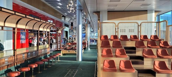
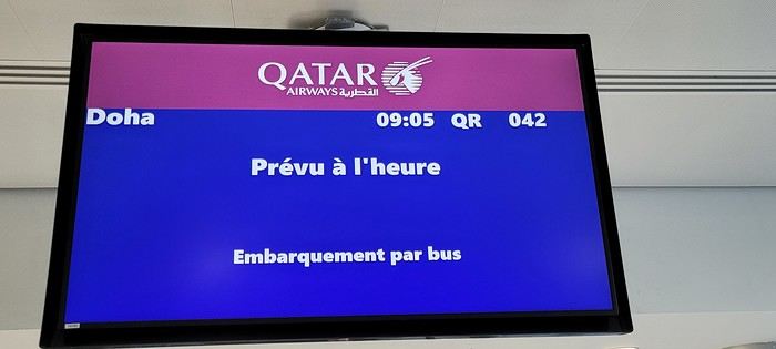
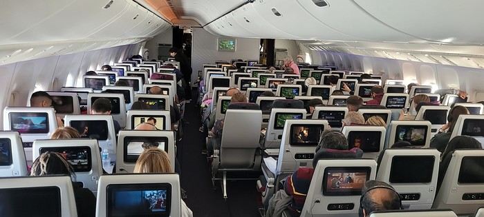
Coming up: Layover in Doha
I’m back from this “mixed” two-week cruise in the Indian Ocean on the Norwegian Sky.
Originally, I had booked a cruise with AIDA (also in the Indian Ocean), but unfortunately, the company decided to cancel it and offered us other options, which we declined because the dates didn’t work for us.
Since my wife really wants to do a cruise in the Indian Ocean, but very few companies offer this destination, it’s a bit complicated—especially when the dates don’t line up. Finding a good compromise between companies and timing is tough. Retirement can’t come soon enough!!!
After some research, I found a really great itinerary with Silversea (a luxury cruise line) for a 19-day cruise from Cape Town to Victoria, stopping in Madagascar (2 days), Praslin, La Digue... But my wife couldn’t get the time off. Not only was the itinerary amazing, but the price was unbeatable (5,200 € per person for a balcony suite, all-inclusive). What a shame—I would’ve loved to try this company, but maybe next time (if we’re lucky enough to have the chance).
My wife tried to take unpaid leave but wasn’t successful... Oh well!
On my end, I have more flexibility with vacation time since I travel a lot for work, so I can accumulate my days off and take them when it suits me.
So, we settled for this cruise (the only one that matched my wife’s vacation dates). Sure, we weren’t thrilled about the ship, but the itinerary wasn’t bad. We figured, why not?
I requested a quote from Logitravel, and after a discount, we paid 2,600 € per person for a balcony cabin (category BA) with the More At Sea package, which includes: 300 minutes of internet, premium drinks, 5 restaurants, and discounts on excursions...
The itinerary:
Day 1 Dubai (UAE) Boarding 11:59 PM Day 2 Abu Dhabi (UAE) 7:00 AM Day 3 Abu Dhabi (UAE) 2:00 PM Day 4 Sea day Day 5 Sea day Day 6 Sea day Day 7 Sea day Day 8 La Digue (Seychelles) 10:00 AM 8:00 PM Day 9 Mahé (Seychelles) 7:00 AM 8:00 PM Day 10 Sea day Day 11 Antsiranana (Madagascar) 7:00 AM 6:00 PM Day 12 Sea day Day 13 Pointe des Galets (Réunion) 8:00 AM 9:00 PM Day 14 Port Louis (Mauritius) 7:00 AM Day 15 Port Louis (Mauritius) 8:00 AM
After booking the cruise, I started looking for flights (Paris/Dubai and Mauritius/Paris). It’s peak Easter vacation time, so tickets are crazy expensive... I ran several simulations on Skyscanner and was shocked by the prices.
A direct flight from Paris to Dubai with Emirates is 1,400 € per person (one way), and the return from Mauritius to Paris (also with Emirates via Dubai) is 1,350 € per person.
Given these outrageous prices, I decided to book a flight with a layover. The best value I found was with Qatar (via Doha) for 650 € per person, with a 2.5-hour layover in Doha, and a direct flight from Mauritius to Paris with Corsair for 750 € per person.
With the More At Sea package, we had a 300 € credit per person for flight tickets (as long as we booked through NCL).
I requested a quote, and they offered: OUTBOUND: April 18, 2025 – Egyptair CDG-CAIRO 10:05 PM-2:30 AM February 19, 2025 – CAIRO-DUBAI 5:30 AM-10:55 AM RETURN: May 3, 2025 – Kenya Airways Port Louis-Nairobi 6:50 PM-10:10 PM, Nairobi-CDG 11:50 PM(+1)-7:30 AM (price: 950 € per person).
Sure, the price was good, but we didn’t want to fly with those airlines, and NCL didn’t have any other options. So, we booked our flights ourselves.
D-Day: Departure from Paris on April 18 with Qatar via Doha:
Two days before leaving, I checked in online and took the opportunity to buy seats near the emergency exits since my wife tends to get swollen legs on long flights. So, she prefers having extra legroom (cost: 132 € per person). It’s a bit pricey, but peace of mind is priceless.
Usually, when I have an early flight from Roissy, I always book a hotel the night before (near the airport) to avoid stress and not miss my flight. But since it was school vacation time and Good Friday, we decided to leave very early from home...
The flight was scheduled for 9:05 AM. We live 70 km from the airport and had to be there by 7:05 AM.
We barely slept... Up at 4:30 AM, and by 5:45 AM, our Uber was outside. We arrived at the airport (Roissy Terminal 1) by 6:50 AM.
Check-in was smooth—less than 10 minutes, and our bags were dropped off with boarding passes in hand.
This was my first time flying out of Roissy Terminal 1 since it was renovated for the Olympics. Wow, it’s a huge improvement—nothing like the old “camembert box” we used to know!
A few photos:
Coming up: Layover in Doha
What to see and do in Chiang Rai and the surrounding area?
Hi there,
I’m finally planning to spend 9 days/9 nights in Chiang Rai. What’s the best area to stay in?
Do you know any interesting spots within a 50–60 km radius? Preferably ones that aren’t overrun by mass tourism (sorry about that).
Thanks!
Joël—I’m reading your latest travel journal on this region...😉
World Cliffs Discussion: January 2025 Contest
So, to start the year off right (Happy New Year!),
This is where we can discuss January’s theme.
With 20,000 km of French coastline (there’s a catch ;)), our beautiful country should be well represented!
Dig out those hard drives! Bruno
Dig out those hard drives! Bruno
République Dominicaine: au fil de la route... et autres souvenirs English translation pending
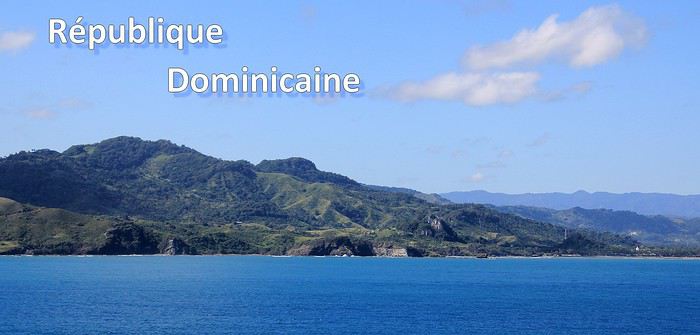
Ce sont mes derniers souvenirs de voyage à l'étranger, c'était avant … avant que la pandémie de la Covid-19 ne s'abatte sur notre planète et contrarie (en autre !) nos désirs de voyages loin de chez nous. Un récit à propos d'une dernière escale dans les Caraïbes, elle date du début mars et c'était donc en République Dominicaine. Ce carnet aborde principalement le souvenir d'une échappée le long d'une « route » hors des sentiers battus, dans le nord de l'île. Une région bien moins fréquentée et donc moins connue que les très courus sites balnéaires de cette grande île tropicale. Un récit qui est également l'occasion pour moi de partager dans une seconde partie quelques autres souvenirs de voyage en Rep. Dom. Ils sont un peu plus anciens et concernent quelques uns des incontournables sites à visiter de la destination.
--
L'escale approche. Peu à peu, la côte se fait plus nette, le soleil a fait disparaître la nébulosité et la plage d'Amber Cove apparaît dans toute sa beauté.
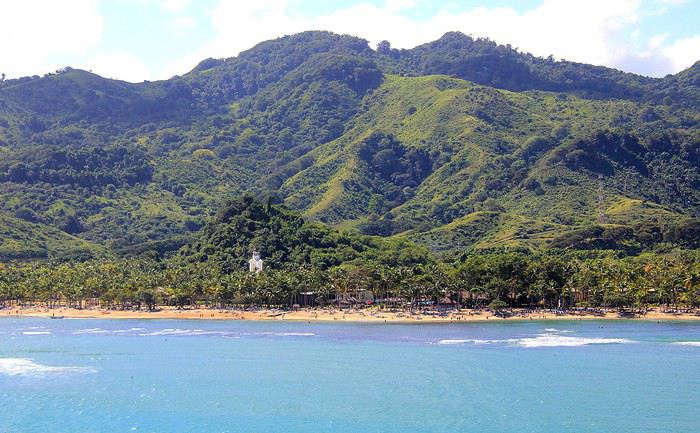
Le trio qui fait le charme des îles tropicales est bien présent sous nos yeux : des eaux bleues, du sable clair bordé d'une palmeraie et un versant verdoyant qui en impose en surplomb du rivage. Un coquet clocher aux tonalités jaune et rose bonbon émerge au-dessus de cette étendue de palmes. Pour afficher la nationalité de l'île, les couleurs sont hissées haut. On reconnaît les carrés rouge et bleu séparés d'une croix blanche du drapeau de la République Dominicaine.
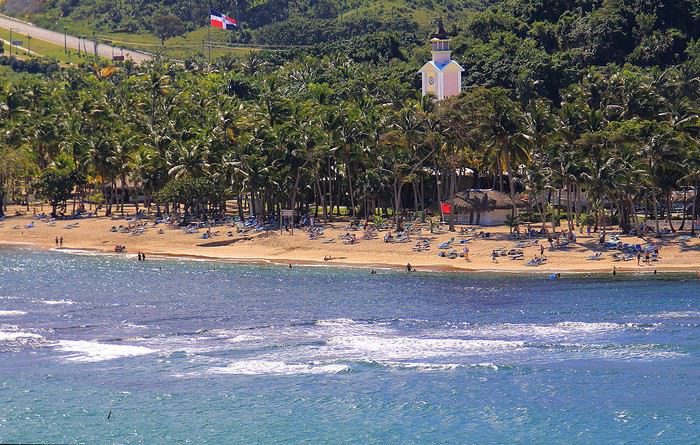
Nous sommes précisément sur la côte nord de l'île, dans la région de l'ancienne ville coloniale espagnole de Puerto Plata.
Un dernier coup d’œil sur la jolie baie encadrée de promontoires rocheux en fond de décor et bordée d'une langue de terre au vert lumineux qui défile juste sous nos yeux.
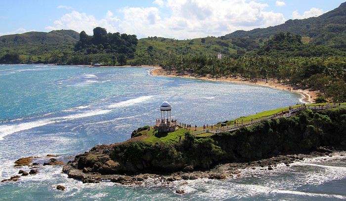
A peine débarqués du navire, on embarque à nouveau … mais sur un tout autre moyen de transport, finie la navigation, on prend place maintenant sur un drôle de véhicule hybride. Un genre de machine à grosses roues, dans un style intermédiaire entre camion et bus d'aventures tout-terrain. De simples banquettes font offices de sièges, quant aux dossiers et aux montants métalliques, ils sont tous rembourrés et capitonnés … On le comprend vite, la route, enfin la piste qui s'annonce pour cette virée risque d'être chaotique. Pas de doute, il ne doit pas s'agir d'un long ruban de bitume très tranquille !
Pour l'instant nous traversons la paisible petite ville de Maimon. Une agglomération sans grand intérêt si ce n'est d'avoir un aperçu de la vie quotidienne locale. Des enfants bruyants jouent dans la cour de l'école et quelques habitantes font leurs achats dans les boutiques, la plupart sont de simples maisons/cases comme d'ailleurs beaucoup d'habitations. En voici deux exemples assez représentatifs du style de l'habitat local. Une simple maison recouverte de tôles ondulées mais dont les murs extérieurs sont agrémentés d'une teinte bleutée. C'est un aspect des plus courants dans la petite cité.
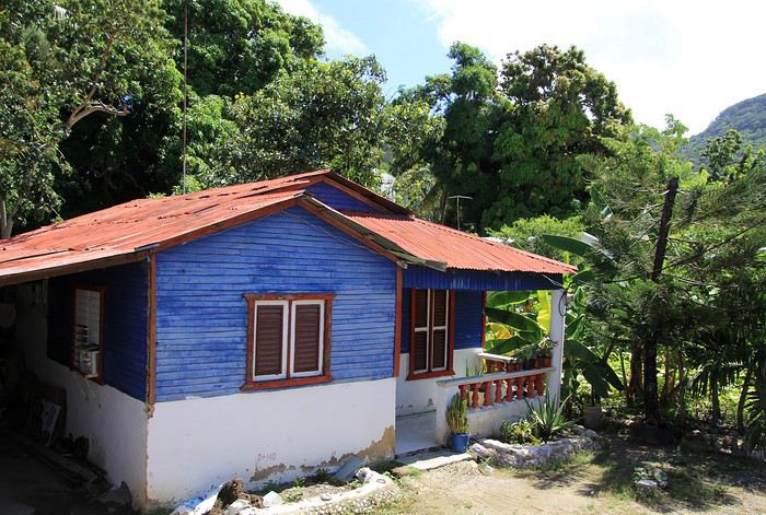
Plus loin, nous passons devant une maison un peu plus cossue : un propret jardinet et des grilles ouvragées entourent cette demeure plus élaborée et dont on imagine le meilleur confort intérieur.
Passons la périphérie urbaine, place à la campagne. On le constate dès le début du trajet, les terrains aux abords de la voie sont détrempés voire inondés. Le chauffeur, sympa, nous informe que de récentes et fortes intempéries ont quelque peu endommagé la piste que nous devons emprunter … Au fond de cette baie, le courant et les torrents ont charrié des quantités de branchages, certains sont encore là, amassés au bord du rivage bordé de mangrove.
Sur ce tronçon, un torrent a emporté une partie de la route, le passage se fait désormais sur une seule voie constituée de terre battue.
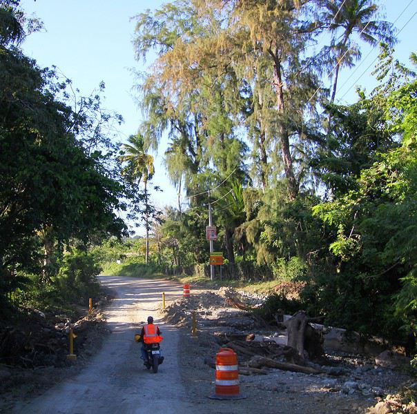
Croisière fluviale sur la Saône et le Rhône du 22 au 29 juillet English translation pending
Bonjour,
Les croisières maritimes de masse ne sont toujours pas reparties, sauf pour faire des ronds dans l’eau sans escales en Europe du nord. Aux dernières informations il est assez peu probable que ça redémarre avant septembre en Europe du sud. Les compagnies américaines quant à elles reportent les unes après les autres, la dernière en date étant NCL qui prévoit novembre 2020.
Nous souvenant du proverbe disant : « fautes de grives on mange des merles », nous nous sommes rabattus sur une fluviale. Avant de revenir sur les escales, je vais parler de l’embarquement et du bateau, Notre décision de partir en dernière minute a été prise en fonction de 3 éléments : les précautions sanitaires indiquées avec en gage le sérieux allemand, la climatisation individuelle des cabines et un prix défiant toute concurrence.
Le Bijou du Rhône de la compagnie Nicko est un bateau de 115 m de long, 11,4 de large et 1,5 de tirant d’eau. Jusqu’à présent cette marque n’était pas commercialisée en France, mais Covid oblige, il fallait trouver des clients et nous avons été les 20 premiers français à bord sur 80 passagers ce total représentant 55 % de sa capacité. Il y a 3 catégories de cabines. Celles du pont inférieur sont petites et mal pratiques. Celles du pont intermédiaire et du pont supérieur sont identiques, seule la taille de la fenêtre (pas de balcon) change. Leur équipement est très proche de ce dont nous avons l’habitude en mer quoi que plus petites, avec beaucoup de rangements.
Il était dit que la compagnie travaille sur l’organisation d’un test rapide à l’embarquement, avec 3 hypothèses selon les résultats. Raté, ils n’ont pas pu finir leur « travail » à temps, personne parmi les français n’a été testé. Les allemands arrivés en bus peut-être au départ, je n’ai pas pensé à poser la question. Il y avait tout de même un questionnaire médical à remplir, mais, bon…. Par prudence, j’avais apporté un résultat de test sanguin, mais datant de 15 jours. Nous avons eu droit à une prise de température c’est tout ! Sur ce coup, le sérieux germanique a été pris en défaut, zéro pointé !! Les masques étaient obligatoires dans les espaces communs (bien respecté), mais pas sur le pont supérieur où le problème n’était pas de trouver une table ou une chaise longue, mais plutôt de savoir laquelle choisir ! Une réunion d’accueil en allemand et une en français ont eu lieu.
Prochaine publication : la vie à bord.
https://photos.app.goo.gl/9w5XjX3mcxoRj8Yi9
Les croisières maritimes de masse ne sont toujours pas reparties, sauf pour faire des ronds dans l’eau sans escales en Europe du nord. Aux dernières informations il est assez peu probable que ça redémarre avant septembre en Europe du sud. Les compagnies américaines quant à elles reportent les unes après les autres, la dernière en date étant NCL qui prévoit novembre 2020.
Nous souvenant du proverbe disant : « fautes de grives on mange des merles », nous nous sommes rabattus sur une fluviale. Avant de revenir sur les escales, je vais parler de l’embarquement et du bateau, Notre décision de partir en dernière minute a été prise en fonction de 3 éléments : les précautions sanitaires indiquées avec en gage le sérieux allemand, la climatisation individuelle des cabines et un prix défiant toute concurrence.
Le Bijou du Rhône de la compagnie Nicko est un bateau de 115 m de long, 11,4 de large et 1,5 de tirant d’eau. Jusqu’à présent cette marque n’était pas commercialisée en France, mais Covid oblige, il fallait trouver des clients et nous avons été les 20 premiers français à bord sur 80 passagers ce total représentant 55 % de sa capacité. Il y a 3 catégories de cabines. Celles du pont inférieur sont petites et mal pratiques. Celles du pont intermédiaire et du pont supérieur sont identiques, seule la taille de la fenêtre (pas de balcon) change. Leur équipement est très proche de ce dont nous avons l’habitude en mer quoi que plus petites, avec beaucoup de rangements.
Il était dit que la compagnie travaille sur l’organisation d’un test rapide à l’embarquement, avec 3 hypothèses selon les résultats. Raté, ils n’ont pas pu finir leur « travail » à temps, personne parmi les français n’a été testé. Les allemands arrivés en bus peut-être au départ, je n’ai pas pensé à poser la question. Il y avait tout de même un questionnaire médical à remplir, mais, bon…. Par prudence, j’avais apporté un résultat de test sanguin, mais datant de 15 jours. Nous avons eu droit à une prise de température c’est tout ! Sur ce coup, le sérieux germanique a été pris en défaut, zéro pointé !! Les masques étaient obligatoires dans les espaces communs (bien respecté), mais pas sur le pont supérieur où le problème n’était pas de trouver une table ou une chaise longue, mais plutôt de savoir laquelle choisir ! Une réunion d’accueil en allemand et une en français ont eu lieu.
Prochaine publication : la vie à bord.
https://photos.app.goo.gl/9w5XjX3mcxoRj8Yi9
Concours photo de juillet 2020: Verticale(s) English translation pending
Bonjour 🙂
Après déjà dix ans depuis la première édition, nous voici au lancement du 120ème concours.
J’aime l'idée de garder la surprise des photos qui pourront être proposées, c’est pourquoi j’ai choisi un thème ouvert : Verticale(s). Il n’y aura pas de contrôle au fil à plomb, ça pourra pencher un peu mais raisonnablement. Pour accompagner le démarrage du concours, vous trouverez quelques pistes en bas de ce message.
Vous pourrez participer jusqu’au samedi 25 juillet à 23h59, heure de Paris. Chaque participant est autorisé à poster jusqu’à trois photos, numérotées de 1 à 3, en précisant le lieu de prise de vue. N’hésitez pas à accompagner vos photos de quelques lignes.
Le vote aura lieu du dimanche 26 juillet 0h01 au jeudi 30 juillet à 22h. Il est accessible à tous, participants ou non, dans la limite d’un vote, et se fera par l’attribution d’un total de six points répartis sur 3 ou 4 photos : Photo n°1 : 3 points Photo n°2 : 2 points Photo n°3 : 1 point - OU - Photo n°3A et photo n°3B : 1/2 point chacune
La photo gagnante sera celle qui aura remporté le plus de points. En cas d’égalité pour la première position, les photos seront départagées par le nombre de votes à 3 points, puis , si l'égalité persiste, par le nombre de votes à 2 points, etc.
Le ou la gagnant(e) aura le privilège d’organiser le concours suivant.
Ce fil est réservé aux photos participantes et aux votes. Pour le blabla ça se passe ici ! Le diaporama arrivera dans quelques jours et figurera dans ma signature.
C’est parti 🙂
Après déjà dix ans depuis la première édition, nous voici au lancement du 120ème concours.
J’aime l'idée de garder la surprise des photos qui pourront être proposées, c’est pourquoi j’ai choisi un thème ouvert : Verticale(s). Il n’y aura pas de contrôle au fil à plomb, ça pourra pencher un peu mais raisonnablement. Pour accompagner le démarrage du concours, vous trouverez quelques pistes en bas de ce message.
Vous pourrez participer jusqu’au samedi 25 juillet à 23h59, heure de Paris. Chaque participant est autorisé à poster jusqu’à trois photos, numérotées de 1 à 3, en précisant le lieu de prise de vue. N’hésitez pas à accompagner vos photos de quelques lignes.
Le vote aura lieu du dimanche 26 juillet 0h01 au jeudi 30 juillet à 22h. Il est accessible à tous, participants ou non, dans la limite d’un vote, et se fera par l’attribution d’un total de six points répartis sur 3 ou 4 photos : Photo n°1 : 3 points Photo n°2 : 2 points Photo n°3 : 1 point - OU - Photo n°3A et photo n°3B : 1/2 point chacune
La photo gagnante sera celle qui aura remporté le plus de points. En cas d’égalité pour la première position, les photos seront départagées par le nombre de votes à 3 points, puis , si l'égalité persiste, par le nombre de votes à 2 points, etc.
Le ou la gagnant(e) aura le privilège d’organiser le concours suivant.
Ce fil est réservé aux photos participantes et aux votes. Pour le blabla ça se passe ici ! Le diaporama arrivera dans quelques jours et figurera dans ma signature.
C’est parti 🙂
Les moyens de transport les plus improbables English translation pending
Revenons en arrière durant cette période critique. Par des souvenirs photographiques, faites nous revivre ces moyens de transport les plus improbables que vous ayez pris ou vu? Avez vous pris vous mêmes des risques ou du moins leurs utilisateurs?
Allez rechercher dans vos archives photographiques, des moments cocasses mais pas tragiques (on en vit actuellement, suffisamment), qui vous ont interpellés.
Je mets le premier sou dans le bastringue !!!
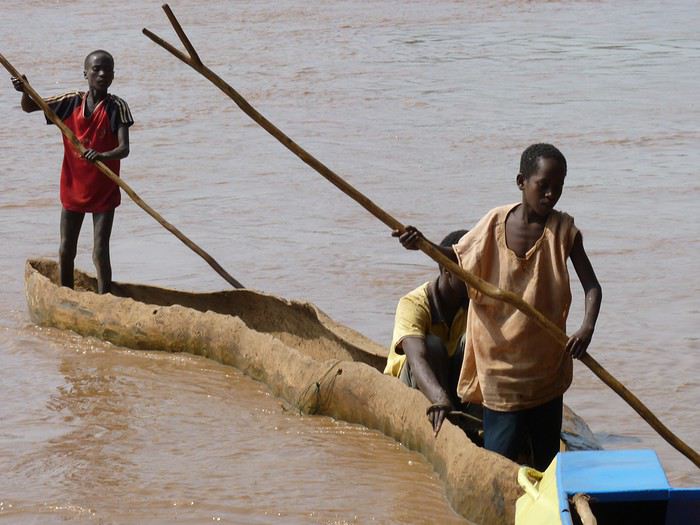
Avis sur parcours 3 semaines au Québec en famille English translation pending
Bonjour a tous,
cela fait bien longtemps que je n'étais pas revenu sur le forum (qui m'avait bien aidé pour organiser mon voyage en Patagonie en 2011 ;-) ). Depuis ce temps, de l'eau a coulé et 3 p'tits bonhommes sont arrivés dans notre vie pour notre plus grand bonheur. nous avons déjà fait des voyages de 7 a 15 jours avec nos 3 enfants mais jamais aussi longtemps ni aussi loin (avec les 3). Ils ont respectivement 8, 5 et 3 ans . Nous sommes une famille "branchée" activités extérieures (observation nature, ballade, pêche, etc.). Nous avions pour projet depuis 2 ans de faire ce voyage au Québec et 2020 sera l'année de la concrétisation ! le voyage se déroulera plus précisément du 25 juillet au 15 aout
j'ai volontairement fait abstraction du détail des activités afin de ne pas surcharger mon post. De plus nous ne passons pas beaucoup de temps à MONTREAL et je n'ai pas mis d’étape obligatoire à QUEBEC car nous reviendrons lors d'un prochain voyage visiter le reste du QUEBEC (ce qui permettra de "compléter" les visites de ces villes ou de les découvrir)
Grâce aux membres du forum (discussion et carnets de voyages) j'ai pu créer un circuit que je vous soumets pour avis :
nous avons prévus de louer une voiture et de privilégier les logements dans les PN (notamment sous les tentes HUTTOPIA 😛)
- J1 : arrivée a MONTREAL début après midi - J2 : visite MONTREAL - J3 : départ pour le PN de la MAURICIE - J4 : activité dans le PN de la MAURICIE - J5 : là j'ai besoin de votre avis : soit s’arrêter en haute mauricie (pourvoyrie du triton?) soit s’arrêter dans la région de Saguenay - J6 : activité sur le lieu décider en J5 (soit haute mauricie soit fjord du saguenay) - J7 : départ pour TADOUSSAC - J8 activité à TADOUSSAC - J9 : départ pour le PN du BIC (en prenant le traversier a ESCOUMINS- TROIS PISTOLES) - J10 : activité au PARC DU BIC - J11 : départ pour le PN DE LA GASPESIE - J12: activité sur le PN de la gaspesie - J13: départ pour le Parc du FORILLON - J14 : activité sur le parc du forillon - J15: départ pour PERCE - j16: activité sur PERCE - J17 : départ pour BAIE DES CHALEURS - J18 : activité sur baie des chaleurs - J19: départ sur QUEBEC? MONTREAL? ou rallonger certaines étapes précédentes - J20: dépendra de la décision précise pour J19 - J21: dépendra de la décision précise pour J19 - J22: avion pour MONTREAL en fin de journée snif snif
des idées pour la destination du J5 et du J19 ? les temps passés sur place vous semble t il bon (trop long ? trop court?)
merci a la communauté VF
cela fait bien longtemps que je n'étais pas revenu sur le forum (qui m'avait bien aidé pour organiser mon voyage en Patagonie en 2011 ;-) ). Depuis ce temps, de l'eau a coulé et 3 p'tits bonhommes sont arrivés dans notre vie pour notre plus grand bonheur. nous avons déjà fait des voyages de 7 a 15 jours avec nos 3 enfants mais jamais aussi longtemps ni aussi loin (avec les 3). Ils ont respectivement 8, 5 et 3 ans . Nous sommes une famille "branchée" activités extérieures (observation nature, ballade, pêche, etc.). Nous avions pour projet depuis 2 ans de faire ce voyage au Québec et 2020 sera l'année de la concrétisation ! le voyage se déroulera plus précisément du 25 juillet au 15 aout
j'ai volontairement fait abstraction du détail des activités afin de ne pas surcharger mon post. De plus nous ne passons pas beaucoup de temps à MONTREAL et je n'ai pas mis d’étape obligatoire à QUEBEC car nous reviendrons lors d'un prochain voyage visiter le reste du QUEBEC (ce qui permettra de "compléter" les visites de ces villes ou de les découvrir)
Grâce aux membres du forum (discussion et carnets de voyages) j'ai pu créer un circuit que je vous soumets pour avis :
nous avons prévus de louer une voiture et de privilégier les logements dans les PN (notamment sous les tentes HUTTOPIA 😛)
- J1 : arrivée a MONTREAL début après midi - J2 : visite MONTREAL - J3 : départ pour le PN de la MAURICIE - J4 : activité dans le PN de la MAURICIE - J5 : là j'ai besoin de votre avis : soit s’arrêter en haute mauricie (pourvoyrie du triton?) soit s’arrêter dans la région de Saguenay - J6 : activité sur le lieu décider en J5 (soit haute mauricie soit fjord du saguenay) - J7 : départ pour TADOUSSAC - J8 activité à TADOUSSAC - J9 : départ pour le PN du BIC (en prenant le traversier a ESCOUMINS- TROIS PISTOLES) - J10 : activité au PARC DU BIC - J11 : départ pour le PN DE LA GASPESIE - J12: activité sur le PN de la gaspesie - J13: départ pour le Parc du FORILLON - J14 : activité sur le parc du forillon - J15: départ pour PERCE - j16: activité sur PERCE - J17 : départ pour BAIE DES CHALEURS - J18 : activité sur baie des chaleurs - J19: départ sur QUEBEC? MONTREAL? ou rallonger certaines étapes précédentes - J20: dépendra de la décision précise pour J19 - J21: dépendra de la décision précise pour J19 - J22: avion pour MONTREAL en fin de journée snif snif
des idées pour la destination du J5 et du J19 ? les temps passés sur place vous semble t il bon (trop long ? trop court?)
merci a la communauté VF
Itinéraire Chicago - les Grands Lacs - chutes du Niagara English translation pending
Bonjour à tous
Nous partons 3 semaines en Juillet aux ETATS UNIS
Nous sommes partis plusieurs fois dans cet immense pays, nous partons visiter Chicago, les grands lacs et pourquoi pas les chutes du Niagara.
J'ai déjà acheté les billets d'avions France-Chicago/Chicago-France.
J'aimerais connaître votre avis sur les 2 circuits ci-dessous
Je n'arrive pas à me décider. Ou m'orienter sur Chicago et la régions des grands ou partir vers Detroit, les chutes du Niagara et remonter vers les lacs. Je sais (en ayant potasser le forum )que la route de Chicago à Détroit est monotone. J'ai vu aussi que la douane entre les USA et le Canada peut être longue. J'ai vu aussi que pour la location de la voiture il faut s'orienter sur les compagnies connues pour avoir le droit de traverser la frontières. Mais, est ce un bon choix de rester sur la région des grands lacs ??? Nous aimons la nature et moins les villes.
Qu'en penses-vous ? merci par avance
CIRCUIT 1 CHICAGO/TORONTO/NIAGARA
Jour 1 France / CHICAGO Jour 2 CHICAGO Jour 3 CHICAGO Jour 4 CHICAGO-INDIANA DUNES (80 km) Jour 5 INDIANA DUNES-DETROIT (400 km) Jour 6 DETROIT (visite du musée Ford) Jour 7 DETROIT-NIAGARA Jour 8 Chutes du NIAGARA Jour 9 NIAGARA-TORONTO (200 km) Jour 10 TORONTO visite de la ville Jour 11 TORONTO-PENINSULE DE BRUCE à TOBERMORY (300km) Jour 12 PENINSULE DE BRUCE Jour 13 : PENINSULE DE BRUCE-ILE DE MANITOULIN en FERRY Jour 14 ILE DE MANITOULIN Jour 15 : ILE DE MANITOULIN-SAULT SAINTE MARINE (350 km) Jour 16 : SAULT SAINTE MARIE-MUNISING (200 km) Jour 17 : VISITE DU PARC PICTURED ROCKS NATIONAL LAKESHORE Jour 18 MUNISING-COMTE DE DOOR à EPHRAIM (350km) Jour 19 COMTE DE DOOR- MILWAUKEE (250 km) Jour 20 MILWAUKEE visite de la ville Jour 21 MILWAUKEE-CHICAGO (150 km) VOL en soirée
CIRCUIT 2 CHICAGO ET LES GRANDS LACS
Jour 1: FRANCE-CHICAGO Jour 2 CHICAGO Jour 3 CHICAGO Jour 4 CHICAGO-MILWAUKEE (150 km) Récupérer la voiture de location Jour 5 MIWAUKEE visite de la ville Jour 6 MILWAUKEE-EPHRAIM (3h de route) Jour 7 EPHRAIM Cave Point County Park et Peninsula State Park Peninsula State Park : Visiter le parc à vélo. Belle piste cyclable à travers la forêt en Bord de lac. Halte au phare Eagle Bluff par le Sunset Bike tour en une heure environ Jour 8 EPHRAIM-MARQUETTE (5h de route) Jour 9 PARC PICTURED ROCKS NATIONAL LAKESHORE Dormir à DULUTH Jour 10 DULUTH-GRAND MARAIS (2h de route) Jour 11 GRAND MARAIS-TERACE BAY (3h) Jour 12 TERACE BAY-SAULT SAINTE MARIE 500 km en 2 jours Jour 13 SAULT SAINTE MARIE-SAINT IGNACE (80 km) Jour 14 SAINT IGNACE-MAKINAC ISLAND Ferry Jour 16 MACKINAC ISLAND Jour17 MACKINAC ISLAND-TRAVERSE CITY ferry retour Jour 18 Sleeping Bear Dunes National Park Jour 19 TRAVERSE CITY-SAUGATUCK (3h30) Jour 20 WARREN DUNES STATE PARK Jour 21 WARREN DUNES-CHICAGO (1h30) VOL EN SOIREE
Je n'arrive pas à me décider. Ou m'orienter sur Chicago et la régions des grands ou partir vers Detroit, les chutes du Niagara et remonter vers les lacs. Je sais (en ayant potasser le forum )que la route de Chicago à Détroit est monotone. J'ai vu aussi que la douane entre les USA et le Canada peut être longue. J'ai vu aussi que pour la location de la voiture il faut s'orienter sur les compagnies connues pour avoir le droit de traverser la frontières. Mais, est ce un bon choix de rester sur la région des grands lacs ??? Nous aimons la nature et moins les villes.
Qu'en penses-vous ? merci par avance
CIRCUIT 1 CHICAGO/TORONTO/NIAGARA
Jour 1 France / CHICAGO Jour 2 CHICAGO Jour 3 CHICAGO Jour 4 CHICAGO-INDIANA DUNES (80 km) Jour 5 INDIANA DUNES-DETROIT (400 km) Jour 6 DETROIT (visite du musée Ford) Jour 7 DETROIT-NIAGARA Jour 8 Chutes du NIAGARA Jour 9 NIAGARA-TORONTO (200 km) Jour 10 TORONTO visite de la ville Jour 11 TORONTO-PENINSULE DE BRUCE à TOBERMORY (300km) Jour 12 PENINSULE DE BRUCE Jour 13 : PENINSULE DE BRUCE-ILE DE MANITOULIN en FERRY Jour 14 ILE DE MANITOULIN Jour 15 : ILE DE MANITOULIN-SAULT SAINTE MARINE (350 km) Jour 16 : SAULT SAINTE MARIE-MUNISING (200 km) Jour 17 : VISITE DU PARC PICTURED ROCKS NATIONAL LAKESHORE Jour 18 MUNISING-COMTE DE DOOR à EPHRAIM (350km) Jour 19 COMTE DE DOOR- MILWAUKEE (250 km) Jour 20 MILWAUKEE visite de la ville Jour 21 MILWAUKEE-CHICAGO (150 km) VOL en soirée
CIRCUIT 2 CHICAGO ET LES GRANDS LACS
Jour 1: FRANCE-CHICAGO Jour 2 CHICAGO Jour 3 CHICAGO Jour 4 CHICAGO-MILWAUKEE (150 km) Récupérer la voiture de location Jour 5 MIWAUKEE visite de la ville Jour 6 MILWAUKEE-EPHRAIM (3h de route) Jour 7 EPHRAIM Cave Point County Park et Peninsula State Park Peninsula State Park : Visiter le parc à vélo. Belle piste cyclable à travers la forêt en Bord de lac. Halte au phare Eagle Bluff par le Sunset Bike tour en une heure environ Jour 8 EPHRAIM-MARQUETTE (5h de route) Jour 9 PARC PICTURED ROCKS NATIONAL LAKESHORE Dormir à DULUTH Jour 10 DULUTH-GRAND MARAIS (2h de route) Jour 11 GRAND MARAIS-TERACE BAY (3h) Jour 12 TERACE BAY-SAULT SAINTE MARIE 500 km en 2 jours Jour 13 SAULT SAINTE MARIE-SAINT IGNACE (80 km) Jour 14 SAINT IGNACE-MAKINAC ISLAND Ferry Jour 16 MACKINAC ISLAND Jour17 MACKINAC ISLAND-TRAVERSE CITY ferry retour Jour 18 Sleeping Bear Dunes National Park Jour 19 TRAVERSE CITY-SAUGATUCK (3h30) Jour 20 WARREN DUNES STATE PARK Jour 21 WARREN DUNES-CHICAGO (1h30) VOL EN SOIREE
Où iriez-vous "sur un coup de tête"? English translation pending
Admettons que vous traversiez une période très difficile de votre vie, et que des fois, pour aller mieux, la solution c'est de partir loin, se ressourcer, etc.
On est l'hiver, donc ça limite.
Vous avez des sous de côté mais c'est pas non plus le Pérou.
Vous iriez où, là comme ça ?
On est l'hiver, donc ça limite.
Vous avez des sous de côté mais c'est pas non plus le Pérou.
Vous iriez où, là comme ça ?
Avis sur itinéraire de 20 jours en voiture / chauffeur en Thaïlande English translation pending
Bonjour à toutes et tous,
de retour sur le forum, cette fois-ci je sollicite de l'aide des pros de la Thailande pour un avis sur un itinéraire.. Pour planter le décor, ce sera notre première dans un pays asiatique, nous sommes plutôt habitués aux voyages en Europe et l'ouest Américain, donc très peu de connaissance sur le "mode" Asie si ce n'est ce que j'ai lu a droite et à gauche dans les carnets de voyage... Nous envisageons ce voyage en janvier 2021 (ou on est pas en retard, mais pour commencer à regarder les prix des billets d'avion sans tarder, il fallait que j'ai une base...)
A priori, les tarifs des billets d'avion sont beaucoup plus intéressants sur du Lyon (aeroport proche de chez nous) Bangkok, mais pour un premier voyage en Thailande, nous n'avons pas envie de visiter cette énorme mégalopole... Et nous ne savons pas trop si sur le secteur Chiang Mai ou dans le centre et sud, nous pouvons louer une voiture, donc j'ai pour l'instant fait 2 options... Donc, l'itinéraire serait le suivant ...
J1+2 : Vol Lyon - Chiang Mai J3 - 4 - 5 : visite du secteur de Chiang Mai avec location voiture ou excursions avec chauffeur En fin de J5, vol pour Surat Thani ou le matin du J6 (selon horaires et tarifs des vols) J6 : Arrivée à Surat Thani la veille au soir ou le matin - Option location de voiture (je crois qu'il y a Budget à l'aeroport) : route pour Prachuak KK Option train pour monter à Prachuap KK J7 - 8 - 9 : Secteur Prachuap KK + Sam Roi Yot (grotte Phraya Nakhon) Jour 9, si location de voiture, on commence à redescendre ... Si train, jour 9 train de nuit à PKK 23h56 pour arriver le matin du J10 à Surat Thani
J10 : Si voiture, selon où on se sera posé la veille, suite de la route jusqu'au parc National de Khao Sok Si on arrive au train à Surat Thani, transfert à Khao Sok, ou prise d'une location de voiture à Surat Thani car je pense que dans se secteur jusqu'à Krabi, ça ne doit pas être trop dangereux car pas de trop grandes distances (contrairement à la route entre Surat et Prachuap qui est peut-être longue...) J11 : excursion Khao Sok et nuit sur le lac... A voir comment on peut organiser cela, on voudrait quand même quelque chose d'assez confortable sur le lac, faire une balade sur le lac où il y a les grandes falaises et une petite rando dans la jungle mais sans forcément visiter des grottes en marchant dans l'eau... On est pas très aventuriers "Koh Lantha"
J12 : Route (si voiture) ou Transfert sur Krabi au retour de notre nuit sur le lac
J13 - 14 - 15 : Installation Krabi (Ao Nang ?) pour 3 jours, repos et excursions baie de Phang Nga Si voiture, nous la rendrons fin de jour 15
J16 : Speed boat pour Koh Lipe J 17 - 18 : Koh Lipe J19 : Speed Boat pour Krabi - J20 : Vol Krabi - Lyon / Selon tarifs des vols, eventuellement faire un vol Krabi / BKK en fin de J19 et Vol BKK - Lyon si plus interessant
Voilà en gros, merci de me dire si cela semble réalisable... De plus, pensez-vous que nous puissions arriverà boucler avec un budget de maxi 2000 € par personne ?? En tenant compte que nous essayerons de choisir des hébergement de moyenne catégorie, pas de 25 € la nuit mais pas non plus des hebergements de luxe... A priori compter un hebergement assez cher pour la nuit sur le lac de Khao Sok, mais bon... J'ai vu qu'il fallait compter environ 20 € par jour pour une location de voiture, ce qui reste assez cher pour la Thailande, mais je suppose que sans voiture, si on additionne le train et les coûts de tranferts, guide (même si dans certains cas, on aura besoin de guide avec une voiture), cela devrait peut-être nous revenir largement plus cher ??? J'ai aussi pensé au système location de voiture avec chauffeur, mais cela veut dire qu'on aurait besoin de quelqu'un du jour 6 à 12, donc je pense assez cher aussi surtout si on veut un chauffeur qui parle Anglais. Dans ce cas là, les chauffeurs font-il guide en même temps, ou juste chauffeur et qu'on doive à chaque endroit prendre un guide si besoin ?? Désolée pour ces questions qui peuvent paraître bêtes, mais l'Asie est pour l'instant un grand mystère pour nous.
Enfin dernière chose, normalement nous partons seulement à 2 : si nous proposons à des amis de se joindre à nous et que nous sommes 4 ou 6, vaudrait-il le coup de demander à une agence française de nous organiser ce circuit avec chauffeur ? J'ai remarqué que les tarifs des agences sont chères pour 2 personnes mais que le prix baisse considérablement si on est plus nombreux : dans ce cas, avez-vous des agences à me conseiller car en tapant sur Google, il y en a à profusion...
Merci d'avance pour votre aide ! Laurence
de retour sur le forum, cette fois-ci je sollicite de l'aide des pros de la Thailande pour un avis sur un itinéraire.. Pour planter le décor, ce sera notre première dans un pays asiatique, nous sommes plutôt habitués aux voyages en Europe et l'ouest Américain, donc très peu de connaissance sur le "mode" Asie si ce n'est ce que j'ai lu a droite et à gauche dans les carnets de voyage... Nous envisageons ce voyage en janvier 2021 (ou on est pas en retard, mais pour commencer à regarder les prix des billets d'avion sans tarder, il fallait que j'ai une base...)
A priori, les tarifs des billets d'avion sont beaucoup plus intéressants sur du Lyon (aeroport proche de chez nous) Bangkok, mais pour un premier voyage en Thailande, nous n'avons pas envie de visiter cette énorme mégalopole... Et nous ne savons pas trop si sur le secteur Chiang Mai ou dans le centre et sud, nous pouvons louer une voiture, donc j'ai pour l'instant fait 2 options... Donc, l'itinéraire serait le suivant ...
J1+2 : Vol Lyon - Chiang Mai J3 - 4 - 5 : visite du secteur de Chiang Mai avec location voiture ou excursions avec chauffeur En fin de J5, vol pour Surat Thani ou le matin du J6 (selon horaires et tarifs des vols) J6 : Arrivée à Surat Thani la veille au soir ou le matin - Option location de voiture (je crois qu'il y a Budget à l'aeroport) : route pour Prachuak KK Option train pour monter à Prachuap KK J7 - 8 - 9 : Secteur Prachuap KK + Sam Roi Yot (grotte Phraya Nakhon) Jour 9, si location de voiture, on commence à redescendre ... Si train, jour 9 train de nuit à PKK 23h56 pour arriver le matin du J10 à Surat Thani
J10 : Si voiture, selon où on se sera posé la veille, suite de la route jusqu'au parc National de Khao Sok Si on arrive au train à Surat Thani, transfert à Khao Sok, ou prise d'une location de voiture à Surat Thani car je pense que dans se secteur jusqu'à Krabi, ça ne doit pas être trop dangereux car pas de trop grandes distances (contrairement à la route entre Surat et Prachuap qui est peut-être longue...) J11 : excursion Khao Sok et nuit sur le lac... A voir comment on peut organiser cela, on voudrait quand même quelque chose d'assez confortable sur le lac, faire une balade sur le lac où il y a les grandes falaises et une petite rando dans la jungle mais sans forcément visiter des grottes en marchant dans l'eau... On est pas très aventuriers "Koh Lantha"
J12 : Route (si voiture) ou Transfert sur Krabi au retour de notre nuit sur le lac
J13 - 14 - 15 : Installation Krabi (Ao Nang ?) pour 3 jours, repos et excursions baie de Phang Nga Si voiture, nous la rendrons fin de jour 15
J16 : Speed boat pour Koh Lipe J 17 - 18 : Koh Lipe J19 : Speed Boat pour Krabi - J20 : Vol Krabi - Lyon / Selon tarifs des vols, eventuellement faire un vol Krabi / BKK en fin de J19 et Vol BKK - Lyon si plus interessant
Voilà en gros, merci de me dire si cela semble réalisable... De plus, pensez-vous que nous puissions arriverà boucler avec un budget de maxi 2000 € par personne ?? En tenant compte que nous essayerons de choisir des hébergement de moyenne catégorie, pas de 25 € la nuit mais pas non plus des hebergements de luxe... A priori compter un hebergement assez cher pour la nuit sur le lac de Khao Sok, mais bon... J'ai vu qu'il fallait compter environ 20 € par jour pour une location de voiture, ce qui reste assez cher pour la Thailande, mais je suppose que sans voiture, si on additionne le train et les coûts de tranferts, guide (même si dans certains cas, on aura besoin de guide avec une voiture), cela devrait peut-être nous revenir largement plus cher ??? J'ai aussi pensé au système location de voiture avec chauffeur, mais cela veut dire qu'on aurait besoin de quelqu'un du jour 6 à 12, donc je pense assez cher aussi surtout si on veut un chauffeur qui parle Anglais. Dans ce cas là, les chauffeurs font-il guide en même temps, ou juste chauffeur et qu'on doive à chaque endroit prendre un guide si besoin ?? Désolée pour ces questions qui peuvent paraître bêtes, mais l'Asie est pour l'instant un grand mystère pour nous.
Enfin dernière chose, normalement nous partons seulement à 2 : si nous proposons à des amis de se joindre à nous et que nous sommes 4 ou 6, vaudrait-il le coup de demander à une agence française de nous organiser ce circuit avec chauffeur ? J'ai remarqué que les tarifs des agences sont chères pour 2 personnes mais que le prix baisse considérablement si on est plus nombreux : dans ce cas, avez-vous des agences à me conseiller car en tapant sur Google, il y en a à profusion...
Merci d'avance pour votre aide ! Laurence
Soyons un peu chauvin, quelle est votre destination préférée dans votre pays? English translation pending
Bonjour à tous les membres !
Je suis encore de retour avec un petite question de voyage pour vous.
Soyons un peu chauvin, quelle est votre destination préférée dans votre pays ?
quant à moi , Facile et ça ne surprendra personne la Bretagne ! j'aime beaucoup son côté sauvage et préservé , c'est un peu ma deuxième maison. Mais pour changer un peu j'aimerais prévoir une escapade en Languedoc-Roussillon, Région dans laquelle j'ai vécu quelques temps et que j'ai beaucoup aimée. Vu que je suis FRANCO-ITALIENNE je tiens aussi à dire mes destination préférée dans mon pays natal. L'Italie est un très beau pays que j'ai passé presque que toute mon enfance et j'y vais de temps en temps. Les régions que je préfère il a Roma là ou j'ai grandit et je garde de très bon souvenir , il a aussi Abruzzes waouh , une très belle région avec ces montagnes et ces parcs nationaux.
Voilà j'attends les réponse
Bonne et excellente weekend à vous
Soyons un peu chauvin, quelle est votre destination préférée dans votre pays ?
quant à moi , Facile et ça ne surprendra personne la Bretagne ! j'aime beaucoup son côté sauvage et préservé , c'est un peu ma deuxième maison. Mais pour changer un peu j'aimerais prévoir une escapade en Languedoc-Roussillon, Région dans laquelle j'ai vécu quelques temps et que j'ai beaucoup aimée. Vu que je suis FRANCO-ITALIENNE je tiens aussi à dire mes destination préférée dans mon pays natal. L'Italie est un très beau pays que j'ai passé presque que toute mon enfance et j'y vais de temps en temps. Les régions que je préfère il a Roma là ou j'ai grandit et je garde de très bon souvenir , il a aussi Abruzzes waouh , une très belle région avec ces montagnes et ces parcs nationaux.
Voilà j'attends les réponse
Bonne et excellente weekend à vous
Compte rendu croisière MSC Meraviglia USA - Canada en octobre 2019 English translation pending
Bonjour,
Tout d’abord, avant de commencer ce compte rendu, je précise que tout ce qui sera écrit ci-dessous, ne concerne que mon ressenti et mon vécu sur cette croisière. Ce sont des infos toutes personnelles.
Autre info, toute aussi importante, nous ne prenons jamais les excursions avec MSC, nous nous débrouillons toujours seuls, en ayant bien pris soin de préparer les escales avant de partir.
Les transports (vols) et transferts ont été aussi gérés seuls, indépendamment de MSC.
Mardi 8 Octobre – embarquement à New York
Nous sommes arrivés la veille sur NY, ce matin nous prenons donc un taxi pour nous rendre au terminal. L’embarquement doit débuter pour 12 h 00. Nous y sommes pour 11 h 00 et l’embarquement a déjà commencé.
Il y a foule, nous laissons les valises sur le trottoir où des dockers se chargent de les répartir par n° de pont du bateau. Et l’on commence alors une queue interminable. Pour nous, ce sera 3 h 20 de queue à l’intérieur du terminal, nous ne sommes pas les pires, nous avons rencontré des français qui auront patienté plus de 4 heures à l’extérieur, dans le vent et dans le froid.
Bref, une désorganisation totale de MSC, tributaire des autorités américaines. Et aucun passe droit, que ce soit pour les personnes handicapées ou les détenteurs de cartes Black.
Au moment de l’embarquement, nous apprenons que l’escale de Québec prévue durer 1 jour et 1 matinée, ne durera qu’1 seul jour. On nous donne alors des explications toutes plus loufoques les unes que les autres. En compensation, on nous offre 50 dollars de crédit à bord par cabine.
Le bateau partira ce soir avec 2 heures de retard, tous les bagages n’ayant pas été chargés dans les délais.
Mercredi 9 – Journée en mer
Jeudi 10 – Sydney en Nouvelle Ecosse de 13 h à 19 h
C’est pendant notre déjeuner à la cafeteria, qu’une annonce sera faite nous prévenant que l’escale de l’après midi est annulée, suite au mauvais temps que nous avons subi au départ de NY. En compensation, on nous offre 300 dollars de crédit à bord par cabine, dépensables ou remboursables en cash.
Vendredi 11 – Corner Brook
Le bateau n’est pas très loin de la ville, la balade à pieds est très agréable surtout sous ce beau soleil.
En ville, pas grand-chose à voir. C’est tout petit. Les locaux ont installé quelques stands pour vendre leur artisanat.
Nous avons prévu de faire le Steam Trail à pieds. C’est une très belle balade dans un très grand parc, avec de nombreux sentiers, points d’eau… Les couleurs d’automne sont magnifiques, on en prend plein les yeux.
Samedi 12 – Charlottetown
Pas de chance, ce matin il pleut des cordes avec un fort vent.
Nous attendons une éclaircie qui ne viendra pas pour sortir. En début d’après midi, bien équipés, on tente une sortie malgré tout. Rien que d’arriver dans le terminal, nous sommes trempés. Beaucoup de boutiques/stands dans ce terminal.
On se décide d’aller jusque l’église, en pataugeant dans les flaques d’eau.
Bref, nous ne resterons pas longtemps dehors.
Côté météo, cette journée aura été la pire de notre croisière.
Dimanche 13 – En mer – on descend le St Laurent – Grand beau temps
Lundi 14 – Québec
Le bateau accoste juste au pied du château Frontenac.
Nous prenons un taxi, direction les chutes de Montmorency.
Il fait beau, c’est magnifique.
Retour à Québec, par le bus de ville.
Visite de la ville, le vieux Québec, le château Frontenac, la terrasse Dufferin, le Quartier du Petit Champlain, le Parlement, la Basilique…..
Une journée bien remplie, avec une très belle météo.
Mardi 15 – En mer – on remonte le St Laurent
Mercredi 16 – En mer
Jeudi 17 – En mer
Vendredi 18 – New York
Finalement, le bateau accoste à Manhattan au milieu de la nuit, sans grand intérêt pour les passagers. C’est la ½ journée perdue à Québec qui nous a permis d’arriver si tôt. Ici se termine la croisière pour celles et ceux qui avaient réservé le 1er tronçon, soit du 8 au 18 Octobre. C’est vrai que pour toutes ces personnes, c’est un peu frustrant d’avoir perdu 2 ½ journées d’escale. Beaucoup de jours de mer pour peu de visites.
Pour nous, l’aventure continue, nous avons également réservé le tronçon suivant.
Donc, pour cela nous devons récupérer une nouvelle Cruise Card, cloturer nos comptes et réouvrir un nouveau compte pour la 2nd partie du voyage. C’est un peu logique puisqu’en fait nous avons bien réservé 2 croisières, même si elles sont consécutives. Par chance, et merci à Azur Croisière, nous ne changeons pas de cabines entre ces 2 croisières.
On nous avait annoncé de grosses difficultés pour passer l’immigration en descendant à l’escale de NY, nous n’avons pas fait de queue pour descendre et on a juste montré nos passeports dans le terminal et à 8 h 45, nous étions dehors. A nous NY !
Apparemment, ce jour-là l’embarquement s’est nettement mieux déroulé que pour le départ de la 1ère croisière. Peut-être avons-nous essuyé les plâtres le 8 Octobre, c’était en effet la 1ère fois que MSC opérait un embarquement à NY !
Samedi 10 – En mer
Dimanche 20 – Bar Harbor – Maine
Débarquement en chaloupes. Comme nous avons une carte Gold, nous sommes prioritaires pour descendre.
Des tickets ont été distribués aux passagers pour l’ordre de priorité de descente. Outre les chaloupes du bateau, des chaloupes locales sont venues en renfort afin que tout le monde puisse descendre rapidement.
Là encore, pour nous, pas d’attente ni à l’aller ni au retour.
Bar Harbor, charmante petite ville, hyper touristique.
Il fait très beau, et la baie de Bar Harbor est magnifique sous le soleil.
Nous avons réservé un tour dans le National Park avec Acadia National Tours.
Les paysages sont là aussi magnifiques. 1er arrêt au sommet de Cadillac d’où l’on a une vue à 360° sur l’ile et la baie. Notre bateau nous parait bien petit tout en bas.
2nd arrêt pour aller voir un souffleur au bord de la mer, pas de chance, aujourd’hui il n’y a pas vagues, et l’effet n’est pas aussi spectaculaire qu’il devrait l’être, c’est néanmoins très beau.
Lundi 21 – Saint John – Nouveau Brunswick
Il fait encore très beau aujourd’hui, presque doux.
Visite de la ville, de ses églises, de ses maisons typiques et de ses jolis parcs.
Mardi 22 – Halifax – Nouvelle Ecosse
Très belle escale sous le soleil une nouvelle fois.
Balade le long du front de mer, très agréable.
Montée à la citadelle, visite du jardin public.
Mercredi 23 – Sydney – Nouvelle Ecosse
Il fait gris, froid et le vent est fort.
Pas grand-chose à voir dans cette ville, à part de jolies maisons typiques, dont certaines arborent de super décos d’Halloween.
Jeudi 24 – En mer
Vendredi 25 – Portland – Maine
En ce jour, comme nous réintégrons les US, il nous faut passer par l’immigration. La veille, MSC a effectué une distribution de tickets, et c’est dans l’ordre des tickets que nous passons directement sur le bateau par les contrôles des autorités américaines. Très bonne organisation de la part de MSC, et tout cela se passe très vite.
Le ciel est couvert mais il ne fait pas froid du tout
Nous avions réservé un tour avec Real Portland Tour, pour un tour de ville et une balade pour aller voir les 3 phares les plus anciens de la région toujours en service.
L’après midi, grande balade à pieds dans la ville. Très belles maisons typiques, la cathédrale, la Mairie, le port, où l’on s’offre une dégustation de homard !
Samedi 26 – Boston
Grand soleil aujourd’hui encore.
Le port est assez loin du centre ville. La veille, MSC a proposé des tickets pour une navette à 16 dollars par personne. A la sortie du bateau, nous avons trouvé un bus de ville qui nous emmènera direct dans le centre ville pour 3 dollars par personne.
Nous avons prévu de faire le Freedom Trail, parcours très sympa dans la ville qui nous permet de voir les monuments et bâtiments les plus importants de la ville.
Nous avons également fait le port et une grande balade sur Beacon Hill, où l’on a pu voir des tas de maisons anciennes, toutes en briques rouges. C’était très beau.
Ville très animée en ce samedi proche d’Halloween.
Retour au bateau avec le bus de la ville.
Dimanche 27 – En mer
Lundi 28 – New York
Pour nous, ce matin c’est le débarquement.
Nous descendons à 10 h 15.
Nous récupérons nos valises dans le terminal.
Nous passons les contrôles comme une lettre à la poste, on ne nous demande même pas nos passeports !
Nous hélons un taxi à la sortie du terminal et direction l’aéroport.
Conclusions
Cette croisière était organisée pour la clientèle Américaine et Asiatique, les Européens étaient en toute petite minorité.
Tout était en anglais sur le bateau, sauf le Daily bien sûr, et les menus au restaurant.
Au théâtre, le Directeur de croisière ne parlait qu’en anglais, racontant des anecdotes qui ne faisaient rire que les américains !
La 1ère partie de la croisière a été plus cahotique que la 2nde. Du fait de l’annulation de certaines escales, des crédits à bord. Tout ceci a généré beaucoup de mécontentement et des queues interminables à la réception. En moyenne, il fallait compter entre 45 mn et 1 heure d’attente.
Plus de queue à la réception lors de la 2nde croisière !
Beaucoup de déceptions pour celles et ceux qui ont pris des excursions avec MSC (tout était en anglais).
Bref, comme nous avons fait tout nous-mêmes, nous n’avons pas subi les déboires d’autres passagers.
Pour nous, le seul point noir aura été l’embarquement à New York, qui fut vraiment très long.
A chaque escale, comme dit plus haut, jamais d’attente que ce soit pour monter ou descendre du bateau.
Pour les repas, les petits déjeuners et déjeuners ont été tous pris à la cafeteria, nous n'avons jamais eu de difficultés pour trouver une table, nous avions pris l'habitude de nous diriger vers le fond du bateau, où il y a moins de monde, où c'est beaucoup plus calme et surtout moins bruyant.
Nous dinions le soir à 20 heures, nous arrivions parfois au restaurant vers 19 h 55, jamais de queue pour entrer au restaurant.
Comme je l’ai dit, tout ceci ne concerne que mon ressenti, je sais que d’autres passagers n’auront pas vécu cette croisière de la même façon que nous.
Je suis à la dispo de celles et ceux qui voudraient des précisions sur certains points.
Je peux aussi bien sûr publier à la demande des photos des escales.
Une fois encore, cette croisière nous aura permis de faire de belles rencontres et nous garderons de bons souvenirs de tous ces bons moments passés.
Merci à toutes celles et ceux qui auront eu la patience de lire ce compte rendu jusqu’au bout.
Cordialement,
Christine
Tout d’abord, avant de commencer ce compte rendu, je précise que tout ce qui sera écrit ci-dessous, ne concerne que mon ressenti et mon vécu sur cette croisière. Ce sont des infos toutes personnelles.
Autre info, toute aussi importante, nous ne prenons jamais les excursions avec MSC, nous nous débrouillons toujours seuls, en ayant bien pris soin de préparer les escales avant de partir.
Les transports (vols) et transferts ont été aussi gérés seuls, indépendamment de MSC.
Mardi 8 Octobre – embarquement à New York
Nous sommes arrivés la veille sur NY, ce matin nous prenons donc un taxi pour nous rendre au terminal. L’embarquement doit débuter pour 12 h 00. Nous y sommes pour 11 h 00 et l’embarquement a déjà commencé.
Il y a foule, nous laissons les valises sur le trottoir où des dockers se chargent de les répartir par n° de pont du bateau. Et l’on commence alors une queue interminable. Pour nous, ce sera 3 h 20 de queue à l’intérieur du terminal, nous ne sommes pas les pires, nous avons rencontré des français qui auront patienté plus de 4 heures à l’extérieur, dans le vent et dans le froid.
Bref, une désorganisation totale de MSC, tributaire des autorités américaines. Et aucun passe droit, que ce soit pour les personnes handicapées ou les détenteurs de cartes Black.
Au moment de l’embarquement, nous apprenons que l’escale de Québec prévue durer 1 jour et 1 matinée, ne durera qu’1 seul jour. On nous donne alors des explications toutes plus loufoques les unes que les autres. En compensation, on nous offre 50 dollars de crédit à bord par cabine.
Le bateau partira ce soir avec 2 heures de retard, tous les bagages n’ayant pas été chargés dans les délais.
Mercredi 9 – Journée en mer
Jeudi 10 – Sydney en Nouvelle Ecosse de 13 h à 19 h
C’est pendant notre déjeuner à la cafeteria, qu’une annonce sera faite nous prévenant que l’escale de l’après midi est annulée, suite au mauvais temps que nous avons subi au départ de NY. En compensation, on nous offre 300 dollars de crédit à bord par cabine, dépensables ou remboursables en cash.
Vendredi 11 – Corner Brook
Le bateau n’est pas très loin de la ville, la balade à pieds est très agréable surtout sous ce beau soleil.
En ville, pas grand-chose à voir. C’est tout petit. Les locaux ont installé quelques stands pour vendre leur artisanat.
Nous avons prévu de faire le Steam Trail à pieds. C’est une très belle balade dans un très grand parc, avec de nombreux sentiers, points d’eau… Les couleurs d’automne sont magnifiques, on en prend plein les yeux.
Samedi 12 – Charlottetown
Pas de chance, ce matin il pleut des cordes avec un fort vent.
Nous attendons une éclaircie qui ne viendra pas pour sortir. En début d’après midi, bien équipés, on tente une sortie malgré tout. Rien que d’arriver dans le terminal, nous sommes trempés. Beaucoup de boutiques/stands dans ce terminal.
On se décide d’aller jusque l’église, en pataugeant dans les flaques d’eau.
Bref, nous ne resterons pas longtemps dehors.
Côté météo, cette journée aura été la pire de notre croisière.
Dimanche 13 – En mer – on descend le St Laurent – Grand beau temps
Lundi 14 – Québec
Le bateau accoste juste au pied du château Frontenac.
Nous prenons un taxi, direction les chutes de Montmorency.
Il fait beau, c’est magnifique.
Retour à Québec, par le bus de ville.
Visite de la ville, le vieux Québec, le château Frontenac, la terrasse Dufferin, le Quartier du Petit Champlain, le Parlement, la Basilique…..
Une journée bien remplie, avec une très belle météo.
Mardi 15 – En mer – on remonte le St Laurent
Mercredi 16 – En mer
Jeudi 17 – En mer
Vendredi 18 – New York
Finalement, le bateau accoste à Manhattan au milieu de la nuit, sans grand intérêt pour les passagers. C’est la ½ journée perdue à Québec qui nous a permis d’arriver si tôt. Ici se termine la croisière pour celles et ceux qui avaient réservé le 1er tronçon, soit du 8 au 18 Octobre. C’est vrai que pour toutes ces personnes, c’est un peu frustrant d’avoir perdu 2 ½ journées d’escale. Beaucoup de jours de mer pour peu de visites.
Pour nous, l’aventure continue, nous avons également réservé le tronçon suivant.
Donc, pour cela nous devons récupérer une nouvelle Cruise Card, cloturer nos comptes et réouvrir un nouveau compte pour la 2nd partie du voyage. C’est un peu logique puisqu’en fait nous avons bien réservé 2 croisières, même si elles sont consécutives. Par chance, et merci à Azur Croisière, nous ne changeons pas de cabines entre ces 2 croisières.
On nous avait annoncé de grosses difficultés pour passer l’immigration en descendant à l’escale de NY, nous n’avons pas fait de queue pour descendre et on a juste montré nos passeports dans le terminal et à 8 h 45, nous étions dehors. A nous NY !
Apparemment, ce jour-là l’embarquement s’est nettement mieux déroulé que pour le départ de la 1ère croisière. Peut-être avons-nous essuyé les plâtres le 8 Octobre, c’était en effet la 1ère fois que MSC opérait un embarquement à NY !
Samedi 10 – En mer
Dimanche 20 – Bar Harbor – Maine
Débarquement en chaloupes. Comme nous avons une carte Gold, nous sommes prioritaires pour descendre.
Des tickets ont été distribués aux passagers pour l’ordre de priorité de descente. Outre les chaloupes du bateau, des chaloupes locales sont venues en renfort afin que tout le monde puisse descendre rapidement.
Là encore, pour nous, pas d’attente ni à l’aller ni au retour.
Bar Harbor, charmante petite ville, hyper touristique.
Il fait très beau, et la baie de Bar Harbor est magnifique sous le soleil.
Nous avons réservé un tour dans le National Park avec Acadia National Tours.
Les paysages sont là aussi magnifiques. 1er arrêt au sommet de Cadillac d’où l’on a une vue à 360° sur l’ile et la baie. Notre bateau nous parait bien petit tout en bas.
2nd arrêt pour aller voir un souffleur au bord de la mer, pas de chance, aujourd’hui il n’y a pas vagues, et l’effet n’est pas aussi spectaculaire qu’il devrait l’être, c’est néanmoins très beau.
Lundi 21 – Saint John – Nouveau Brunswick
Il fait encore très beau aujourd’hui, presque doux.
Visite de la ville, de ses églises, de ses maisons typiques et de ses jolis parcs.
Mardi 22 – Halifax – Nouvelle Ecosse
Très belle escale sous le soleil une nouvelle fois.
Balade le long du front de mer, très agréable.
Montée à la citadelle, visite du jardin public.
Mercredi 23 – Sydney – Nouvelle Ecosse
Il fait gris, froid et le vent est fort.
Pas grand-chose à voir dans cette ville, à part de jolies maisons typiques, dont certaines arborent de super décos d’Halloween.
Jeudi 24 – En mer
Vendredi 25 – Portland – Maine
En ce jour, comme nous réintégrons les US, il nous faut passer par l’immigration. La veille, MSC a effectué une distribution de tickets, et c’est dans l’ordre des tickets que nous passons directement sur le bateau par les contrôles des autorités américaines. Très bonne organisation de la part de MSC, et tout cela se passe très vite.
Le ciel est couvert mais il ne fait pas froid du tout
Nous avions réservé un tour avec Real Portland Tour, pour un tour de ville et une balade pour aller voir les 3 phares les plus anciens de la région toujours en service.
L’après midi, grande balade à pieds dans la ville. Très belles maisons typiques, la cathédrale, la Mairie, le port, où l’on s’offre une dégustation de homard !
Samedi 26 – Boston
Grand soleil aujourd’hui encore.
Le port est assez loin du centre ville. La veille, MSC a proposé des tickets pour une navette à 16 dollars par personne. A la sortie du bateau, nous avons trouvé un bus de ville qui nous emmènera direct dans le centre ville pour 3 dollars par personne.
Nous avons prévu de faire le Freedom Trail, parcours très sympa dans la ville qui nous permet de voir les monuments et bâtiments les plus importants de la ville.
Nous avons également fait le port et une grande balade sur Beacon Hill, où l’on a pu voir des tas de maisons anciennes, toutes en briques rouges. C’était très beau.
Ville très animée en ce samedi proche d’Halloween.
Retour au bateau avec le bus de la ville.
Dimanche 27 – En mer
Lundi 28 – New York
Pour nous, ce matin c’est le débarquement.
Nous descendons à 10 h 15.
Nous récupérons nos valises dans le terminal.
Nous passons les contrôles comme une lettre à la poste, on ne nous demande même pas nos passeports !
Nous hélons un taxi à la sortie du terminal et direction l’aéroport.
Conclusions
Cette croisière était organisée pour la clientèle Américaine et Asiatique, les Européens étaient en toute petite minorité.
Tout était en anglais sur le bateau, sauf le Daily bien sûr, et les menus au restaurant.
Au théâtre, le Directeur de croisière ne parlait qu’en anglais, racontant des anecdotes qui ne faisaient rire que les américains !
La 1ère partie de la croisière a été plus cahotique que la 2nde. Du fait de l’annulation de certaines escales, des crédits à bord. Tout ceci a généré beaucoup de mécontentement et des queues interminables à la réception. En moyenne, il fallait compter entre 45 mn et 1 heure d’attente.
Plus de queue à la réception lors de la 2nde croisière !
Beaucoup de déceptions pour celles et ceux qui ont pris des excursions avec MSC (tout était en anglais).
Bref, comme nous avons fait tout nous-mêmes, nous n’avons pas subi les déboires d’autres passagers.
Pour nous, le seul point noir aura été l’embarquement à New York, qui fut vraiment très long.
A chaque escale, comme dit plus haut, jamais d’attente que ce soit pour monter ou descendre du bateau.
Pour les repas, les petits déjeuners et déjeuners ont été tous pris à la cafeteria, nous n'avons jamais eu de difficultés pour trouver une table, nous avions pris l'habitude de nous diriger vers le fond du bateau, où il y a moins de monde, où c'est beaucoup plus calme et surtout moins bruyant.
Nous dinions le soir à 20 heures, nous arrivions parfois au restaurant vers 19 h 55, jamais de queue pour entrer au restaurant.
Comme je l’ai dit, tout ceci ne concerne que mon ressenti, je sais que d’autres passagers n’auront pas vécu cette croisière de la même façon que nous.
Je suis à la dispo de celles et ceux qui voudraient des précisions sur certains points.
Je peux aussi bien sûr publier à la demande des photos des escales.
Une fois encore, cette croisière nous aura permis de faire de belles rencontres et nous garderons de bons souvenirs de tous ces bons moments passés.
Merci à toutes celles et ceux qui auront eu la patience de lire ce compte rendu jusqu’au bout.
Cordialement,
Christine
En Transsibérien vers la Corée English translation pending
Bonjour
Je reviens d'un voyage qui m'a emmenée de Moscou à Séoul via le transsibérien. Compte-rendu
Pourquoi le transsibérien? C’était un fantasme de vieille routarde : prendre le transsibérien, le vrai, l’historique, celui qui va à Vladivostok en 9250 kilomètres depuis Moscou. L’élément déclencheur a été d’apprendre qu’un ferry permettait d’aller en Corée et au Japon depuis Vladivostok. On peut donc s’enfoncer vers le far east sans prendre l’avion. Le bilan carbone de l’aventure n’est certainement pas impeccable mais c’est la lenteur qui m’a ici séduite. Lenteur relative : je n’avais que quatre semaines pour le tout mais on peut évidemment boucler l’itinéraire russe en beaucoup plus de temps. Voyager, c’est se déplacer et c’est regarder vivre les gens. Et là, j’ai été servie. J’avais tout organisé très facilement avant de partir, en réservant mes billets de train sur le site de la RZD https://pass.rzd.ru/main-pass/public/en C’est nettement moins cher que par agence. 308 € en ce qui me concerne pour des couchettes basses, avec quelques réductions « sénior » (il faut bien avoir quelques avantages au fait d’avoir eu 60 ans) et en tenant compte du fait que j’ai pris quelques billets en seconde. Les billets peuvent se prendre deux mois à l’avance et on ne perd rien à s’organiser : cela m’a permis de me rendre compte qu’on pouvait faire des étapes entre deux trains de nuit. J’ajoute que la 2e classe n’est pas nécessairement plus confortable que la 3e. C’est juste qu’il y a moins de monde. J’ai autant échangé avec les Russes dans l’une et l’autre classe, à ceci près que les passagers de seconde parlaient plus souvent anglais. En chemin, j’ai choisi de m’arrêter à Moscou, Kazan, Ekaterinbourg, Novossibirsk, Irkoutsk et Ulan-Ude. Je ne sais pas si j’ai aimé la Russie mais le train, oui ! Super expérience, qui invite à mesurer de façon très sensible l’immensité du pays et à savourer le temps qui passe.
To be continued
Je reviens d'un voyage qui m'a emmenée de Moscou à Séoul via le transsibérien. Compte-rendu
Pourquoi le transsibérien? C’était un fantasme de vieille routarde : prendre le transsibérien, le vrai, l’historique, celui qui va à Vladivostok en 9250 kilomètres depuis Moscou. L’élément déclencheur a été d’apprendre qu’un ferry permettait d’aller en Corée et au Japon depuis Vladivostok. On peut donc s’enfoncer vers le far east sans prendre l’avion. Le bilan carbone de l’aventure n’est certainement pas impeccable mais c’est la lenteur qui m’a ici séduite. Lenteur relative : je n’avais que quatre semaines pour le tout mais on peut évidemment boucler l’itinéraire russe en beaucoup plus de temps. Voyager, c’est se déplacer et c’est regarder vivre les gens. Et là, j’ai été servie. J’avais tout organisé très facilement avant de partir, en réservant mes billets de train sur le site de la RZD https://pass.rzd.ru/main-pass/public/en C’est nettement moins cher que par agence. 308 € en ce qui me concerne pour des couchettes basses, avec quelques réductions « sénior » (il faut bien avoir quelques avantages au fait d’avoir eu 60 ans) et en tenant compte du fait que j’ai pris quelques billets en seconde. Les billets peuvent se prendre deux mois à l’avance et on ne perd rien à s’organiser : cela m’a permis de me rendre compte qu’on pouvait faire des étapes entre deux trains de nuit. J’ajoute que la 2e classe n’est pas nécessairement plus confortable que la 3e. C’est juste qu’il y a moins de monde. J’ai autant échangé avec les Russes dans l’une et l’autre classe, à ceci près que les passagers de seconde parlaient plus souvent anglais. En chemin, j’ai choisi de m’arrêter à Moscou, Kazan, Ekaterinbourg, Novossibirsk, Irkoutsk et Ulan-Ude. Je ne sais pas si j’ai aimé la Russie mais le train, oui ! Super expérience, qui invite à mesurer de façon très sensible l’immensité du pays et à savourer le temps qui passe.
To be continued
Croisière transatlantique Favolosa du 30 novembre ou 1er décembre 2019 English translation pending
Bonjour,
J'ouvre ce Topic pour que nous puissions échanger nos expériences, nous réunir sur le bateau...
C'est notre septième transatlantique … presque toutes vers les caraïbes .
Nous restons 22 jours .. retour Pointe à pitre .
Les années précédentes... Les échanges sur le forum et bateau ont été très sympa;
Nous connaissons, toutes les escales .. nous n'aimons pas les excursions , nous nous déplaçons en bus ….si vous avez besoin d' informations , ce sera volontiers que je vous les donnerai..
Jean Claude (le mari) joue au tarot …. y a t il des joueurs ?
à bientôt
Jocelyne
Quelques jours dans le Nord: Rabat, Chefchaouen, Tétouan.... English translation pending
Bonjour,
J'ai effectué un petit périple de 4 jours dans le Nord du Maroc fin juin-début juillet , pour le plaisir de redécouvrir cette région qui est assez rarement mise en avant sur le forum . J'étais accompagné d'une de mes filles de 16 ans . Comme à mon habitude, j'ai pris beaucoup de photos, alors pourquoi ne pas en faire profiter les forumeurs ?
Une des portes du Nord du Maroc , par l'ouest, est la capitale Rabat . Sans faire un sujet sur cette belle cité, je vous propose de m'accompagner pour une ballade à Chellah , un magnifique endroit . Chellah est à la fois une cité romaine ( Sala Colonia ) et une nécropole mérinide . On y voit aussi une mosquée, une madrassa ( école coranique ), des anciens hammams mérinides, etc....
Tous les monuments de Rabat font l'objet de travaux de rénovation et de mise en valeur et Chellah en bénéficie bien sûr . Dès l'arrivée, la vue est superbe : on a du mal a imaginer que nous sommes au cœur de la ville . A gauche, les murailles d'enceinte de la ville et à droite la muraille de Chellah .
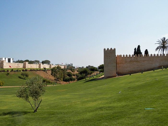
On accède au site par une porte monumentale, une des plus belle du pays .
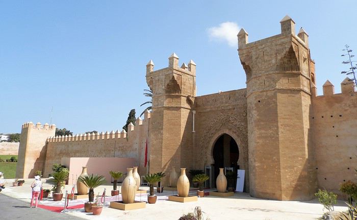
Le site, bien qu'urbain , accueille des colonies imposantes d'aigrettes et de cigognes .
L'entrée au site est désormais de 70 dirhams pour les étrangers . La vue, lorsqu'on descend est très jolie. C'est dit-t-on, le lieu le plus romantique du Maroc .
La cité romaine : seule une petite portion de la ville a fait l'objet de fouilles , comme dans la plupart des sites romains du Maroc . Sala était un port, mais la mer n'y vient plus, l'oued Bou Regreg s'étant envasé .
Pour les latinistes....
Le site est remarquablement préservé car jamais, où que l'on regarde, on ne voit le moindre bâtiment de la ville qui pourtant l'encercle totalement ..
La muraille de la nécropole encercle intégralement le site .
Et un peu partout, des cigognes impassibles ...
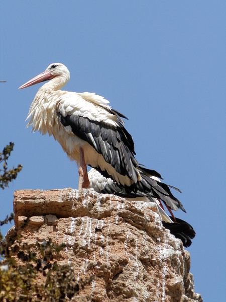
Le tombeau d'un sultan
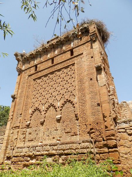
Dans chaque cartouche est écrit, en calligraphie, un des noms de Dieu .
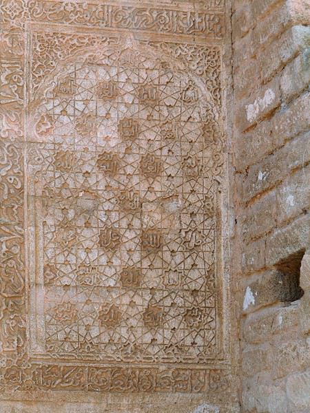
La mosquée est en ruine . On y voit une colonne de marbre romain, en réemploi dans une porte . Accolée à la mosquée se trouve la madrassa ( médersa ) .
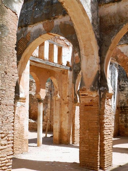
Les tombeaux se cachent dans les bois du site, mais tous ne sont pas accessibles .
La fontaine aux anguilles : j'ai longtemps pensé que cette fontaine ne contenait rien mais une fois, et une seule en 20 ans, j'ai vu les anguilles sortir de je ne sais où . Ce sont des monstres , leur corps étant plus gros qu'un bras . C'est vraiment impressionnant et quand çà arrive, on s'arrête même de respirer . Il s'agit d'un ancien hammam mérinide noyé par l'effondrement d'un aqueduc souterrain .
J'affectionne cet endroit car on y trouve le même rituel que chez moi, en Bretagne, où il convient aussi de laisser une offrande dans certaines fontaines . Ici, faite un vœux et jetez la pièce : si elle tombe sur la pierre, votre vœux sera exaucé .
Près du bassin, le tombeau de Sidi Amor El Mesnaoui , qui semble bien être le protecteur des chats . J'y ai toujours vu des dizaines de chats, un peu faméliques . En ce vendredi, à l'heure de la prière, j'ai eu la surprise de voir qu'on leur amenait de grands plats de nourriture , exactement comme on le fait pour les démunis, à la même heure, dans la médina de Rabat .
Un dernier regard .....
J'ai effectué un petit périple de 4 jours dans le Nord du Maroc fin juin-début juillet , pour le plaisir de redécouvrir cette région qui est assez rarement mise en avant sur le forum . J'étais accompagné d'une de mes filles de 16 ans . Comme à mon habitude, j'ai pris beaucoup de photos, alors pourquoi ne pas en faire profiter les forumeurs ?
Une des portes du Nord du Maroc , par l'ouest, est la capitale Rabat . Sans faire un sujet sur cette belle cité, je vous propose de m'accompagner pour une ballade à Chellah , un magnifique endroit . Chellah est à la fois une cité romaine ( Sala Colonia ) et une nécropole mérinide . On y voit aussi une mosquée, une madrassa ( école coranique ), des anciens hammams mérinides, etc....
Tous les monuments de Rabat font l'objet de travaux de rénovation et de mise en valeur et Chellah en bénéficie bien sûr . Dès l'arrivée, la vue est superbe : on a du mal a imaginer que nous sommes au cœur de la ville . A gauche, les murailles d'enceinte de la ville et à droite la muraille de Chellah .
On accède au site par une porte monumentale, une des plus belle du pays .
Le site, bien qu'urbain , accueille des colonies imposantes d'aigrettes et de cigognes .
L'entrée au site est désormais de 70 dirhams pour les étrangers . La vue, lorsqu'on descend est très jolie. C'est dit-t-on, le lieu le plus romantique du Maroc .
La cité romaine : seule une petite portion de la ville a fait l'objet de fouilles , comme dans la plupart des sites romains du Maroc . Sala était un port, mais la mer n'y vient plus, l'oued Bou Regreg s'étant envasé .
Pour les latinistes....
Le site est remarquablement préservé car jamais, où que l'on regarde, on ne voit le moindre bâtiment de la ville qui pourtant l'encercle totalement ..
La muraille de la nécropole encercle intégralement le site .
Et un peu partout, des cigognes impassibles ...
Le tombeau d'un sultan
Dans chaque cartouche est écrit, en calligraphie, un des noms de Dieu .
La mosquée est en ruine . On y voit une colonne de marbre romain, en réemploi dans une porte . Accolée à la mosquée se trouve la madrassa ( médersa ) .
Les tombeaux se cachent dans les bois du site, mais tous ne sont pas accessibles .
La fontaine aux anguilles : j'ai longtemps pensé que cette fontaine ne contenait rien mais une fois, et une seule en 20 ans, j'ai vu les anguilles sortir de je ne sais où . Ce sont des monstres , leur corps étant plus gros qu'un bras . C'est vraiment impressionnant et quand çà arrive, on s'arrête même de respirer . Il s'agit d'un ancien hammam mérinide noyé par l'effondrement d'un aqueduc souterrain .
J'affectionne cet endroit car on y trouve le même rituel que chez moi, en Bretagne, où il convient aussi de laisser une offrande dans certaines fontaines . Ici, faite un vœux et jetez la pièce : si elle tombe sur la pierre, votre vœux sera exaucé .
Près du bassin, le tombeau de Sidi Amor El Mesnaoui , qui semble bien être le protecteur des chats . J'y ai toujours vu des dizaines de chats, un peu faméliques . En ce vendredi, à l'heure de la prière, j'ai eu la surprise de voir qu'on leur amenait de grands plats de nourriture , exactement comme on le fait pour les démunis, à la même heure, dans la médina de Rabat .
Un dernier regard .....
Retour croisière Écosse - Islande sur le Mediterranea juin 2019 English translation pending
Bonjour à toutes et à tous,
pour changer, je vais commencer le compte rendu de notre croisière par le bateau (en 2 parties). Ça sera d’abord une visite du bateau en 76 photos, et en seconde publication : les menus, les assiettes, le buffet de minuit. Il comporte, comme toujours, sa part de factuel et de subjectif. Nous ne connaissions pas le Mediterranea qui est devenu notre préféré sur les 5 Costa que nous avons essayés. C'est un "petit" bateau : 86 000 tonnes, 2680 lits. S'il était quasi complet, il était loin d'être plein puisque nous étions un peu plus de 2100 à bord Bien que pas vraiment fanatiques de leur décoration d'une façon générale (nobody is Perfect), nous avons bien aimé celle-ci. Il y a beaucoup d'endroits sympas, calmes ou animés selon les désirs du moment. Bonne ambiance à bord mais beaucoup plus seventeen que teenager sur cet itinéraire, avec une majorité d'allemands (+ de 700) calmes, et des italiens minoritaires. Strictement aucune attente ni bousculade nous concernant pour sortir ou revenir à bord pendant ces 14 jours, même à Invergordon avec une arrivée en milieu de matinée pourtant ! Ceci étant les traditionnels défauts Costa demeurent bien ancrés: horaires de la cafétéria peu pratiques avec un assortiment basique, ainsi que la porte d'accès, bête et méchante (pour moi), au balcon de la cabine. Pour la première nous n'y avons pris qu'un seul petit déjeuner et déjeuner, et pour la seconde j'ai toujours dans ma valise une sangle réglable pour la faire tenir ouverte à l'angle qui nous convient. A noter que la salle de spectacle est un peu mieux conçue que les autres avec un plancher en légère déclivité au R d C et des barres beaucoup plus fines au balcon. Très sympathique réunion de débarquement pour une fois que j'y vais car c'était pendant une journée en mer, où Anne Laure nous a parlé du bateau et présenté des membres de beaucoup de catégorie de personnel !!! Le nouveau Diario mini format est assez bien présenté, même si à mon grand regret il n'y a plus aucune indication sur la navigation, hormis les horaires, ni sur les distances parcourues et les caractères sont minuscules. C'est en tout cas avec plaisir que nous retrouverons ce bateau en janvier 2020.
photos.app.goo.gl/wp26CEvJkQufAiXs7
pour changer, je vais commencer le compte rendu de notre croisière par le bateau (en 2 parties). Ça sera d’abord une visite du bateau en 76 photos, et en seconde publication : les menus, les assiettes, le buffet de minuit. Il comporte, comme toujours, sa part de factuel et de subjectif. Nous ne connaissions pas le Mediterranea qui est devenu notre préféré sur les 5 Costa que nous avons essayés. C'est un "petit" bateau : 86 000 tonnes, 2680 lits. S'il était quasi complet, il était loin d'être plein puisque nous étions un peu plus de 2100 à bord Bien que pas vraiment fanatiques de leur décoration d'une façon générale (nobody is Perfect), nous avons bien aimé celle-ci. Il y a beaucoup d'endroits sympas, calmes ou animés selon les désirs du moment. Bonne ambiance à bord mais beaucoup plus seventeen que teenager sur cet itinéraire, avec une majorité d'allemands (+ de 700) calmes, et des italiens minoritaires. Strictement aucune attente ni bousculade nous concernant pour sortir ou revenir à bord pendant ces 14 jours, même à Invergordon avec une arrivée en milieu de matinée pourtant ! Ceci étant les traditionnels défauts Costa demeurent bien ancrés: horaires de la cafétéria peu pratiques avec un assortiment basique, ainsi que la porte d'accès, bête et méchante (pour moi), au balcon de la cabine. Pour la première nous n'y avons pris qu'un seul petit déjeuner et déjeuner, et pour la seconde j'ai toujours dans ma valise une sangle réglable pour la faire tenir ouverte à l'angle qui nous convient. A noter que la salle de spectacle est un peu mieux conçue que les autres avec un plancher en légère déclivité au R d C et des barres beaucoup plus fines au balcon. Très sympathique réunion de débarquement pour une fois que j'y vais car c'était pendant une journée en mer, où Anne Laure nous a parlé du bateau et présenté des membres de beaucoup de catégorie de personnel !!! Le nouveau Diario mini format est assez bien présenté, même si à mon grand regret il n'y a plus aucune indication sur la navigation, hormis les horaires, ni sur les distances parcourues et les caractères sont minuscules. C'est en tout cas avec plaisir que nous retrouverons ce bateau en janvier 2020.
photos.app.goo.gl/wp26CEvJkQufAiXs7
Quelques jours en Andalousie dans LE village le plus pluvieux d’Espagne, Grazalema English translation pending
Cette année en juin , après un séjour Murcien et andalou dans la Sierra de Cazorla nous avons décidé de terminer le séjour dans le village de Grazalema et sa sierra situé dans la province de Cadiz.
Pour ceux qui voudraient se renseigner sur la premier partie du séjour j’ai mis en ligne un carnet l’ année dernière .
https://voyageforum.com/discussion/cahier-vacances-cote-murcienne-andalousie-sierras-jaen-d9088065/
Première surprise ce village est l’endroit le plus pluvieux d’Espagne , et ce n’est pas une fausse nouvelle . En effet, il s’agit de la première zone montagneuse placée sur le parcours des vents humides de l’Atlantique lors de leur entrée dans la Péninsule ibérique et les précipitations annuelles moyennes sont de 817 mm.
Ce village est connu comme l’un des villages blancs cités par les guides touristiques , même si tous les villages sont blancs en Andalousie on ne cite qu’une dizaine d’entre eux mis en valeur par une certaine idée du tourisme .
Tout au long des nombreuses vagues d’invasions qui ont marqué l’histoire de la Péninsule Ibérique : (Carthaginois, en 550 av. J.-C., Romains, en 220 av. J.-C., et Wisigoths, en 419 apr. J.-C.), différentes cultures ont tenté de s’établir dans cette vallée ; le village qui se présente à nous aujourd’hui est cependant le fruit de l’établissement des berbères musulmans originaires des montagnes de l’Afrique du Nord, très similaires à celles qui entourent Grazalema. Nous retrouvons ainsi les différentes fontaines romaines , visigothes , berbères qui amènent de la fraîcheur dans le village .
 les étroites ruelles sont bordées de bâtisses d’un blanc immaculé pourvu de grilles en fer protégeant les fenêtres, vestiges de l’époque musulmane qui s’est étendue sur environ 7 siècles.
Certains en profitent pour prendre le soleil à la fraîche le matin .
les étroites ruelles sont bordées de bâtisses d’un blanc immaculé pourvu de grilles en fer protégeant les fenêtres, vestiges de l’époque musulmane qui s’est étendue sur environ 7 siècles.
Certains en profitent pour prendre le soleil à la fraîche le matin .
Très près de la montagne , la nature est présente partout et nous avons eu la surprise le premier jour d’admirer cette bataille de chèvre hispanique juste au dessus d’une ruelle . Étonnant non ?
 Et ce jeune qui regarde le spectacle ....juché sur l’avance d’une maison .
L’artisanat local perdure de nos jours, transmis de génération en génération : élaboration de tissus de sparte, fromages de chèvre et de brebis, tissus de laine, meubles en liège, savons et produits cosmétiques à base d’huile d’olive, travail du cuir et de la céramique, etc. Je ne saurais vous conseiller de prendre le temps d’aller visiter la fromagerie de la Pastora de Grazalema et d’acheter ces délicieux fromages .
Les ruelles de Grazalema sont fleuries la végétation est luxuriante . A bientôt pour la suite dans la Sierra .
Première surprise ce village est l’endroit le plus pluvieux d’Espagne , et ce n’est pas une fausse nouvelle . En effet, il s’agit de la première zone montagneuse placée sur le parcours des vents humides de l’Atlantique lors de leur entrée dans la Péninsule ibérique et les précipitations annuelles moyennes sont de 817 mm.
Ce village est connu comme l’un des villages blancs cités par les guides touristiques , même si tous les villages sont blancs en Andalousie on ne cite qu’une dizaine d’entre eux mis en valeur par une certaine idée du tourisme .
Tout au long des nombreuses vagues d’invasions qui ont marqué l’histoire de la Péninsule Ibérique : (Carthaginois, en 550 av. J.-C., Romains, en 220 av. J.-C., et Wisigoths, en 419 apr. J.-C.), différentes cultures ont tenté de s’établir dans cette vallée ; le village qui se présente à nous aujourd’hui est cependant le fruit de l’établissement des berbères musulmans originaires des montagnes de l’Afrique du Nord, très similaires à celles qui entourent Grazalema. Nous retrouvons ainsi les différentes fontaines romaines , visigothes , berbères qui amènent de la fraîcheur dans le village .
les étroites ruelles sont bordées de bâtisses d’un blanc immaculé pourvu de grilles en fer protégeant les fenêtres, vestiges de l’époque musulmane qui s’est étendue sur environ 7 siècles.
Certains en profitent pour prendre le soleil à la fraîche le matin .Très près de la montagne , la nature est présente partout et nous avons eu la surprise le premier jour d’admirer cette bataille de chèvre hispanique juste au dessus d’une ruelle . Étonnant non ?
Et ce jeune qui regarde le spectacle ....juché sur l’avance d’une maison .L’artisanat local perdure de nos jours, transmis de génération en génération : élaboration de tissus de sparte, fromages de chèvre et de brebis, tissus de laine, meubles en liège, savons et produits cosmétiques à base d’huile d’olive, travail du cuir et de la céramique, etc. Je ne saurais vous conseiller de prendre le temps d’aller visiter la fromagerie de la Pastora de Grazalema et d’acheter ces délicieux fromages .
Les ruelles de Grazalema sont fleuries la végétation est luxuriante . A bientôt pour la suite dans la Sierra .
Notre projet de voyage en famille au Québec English translation pending
Bonjour à tous,
Nous sommes une famille de 4 personnes, et nous ferons un voyage au Québec, en aout 2020. J’aurais besoin de vos avis.
Oui je sais, je m’y prend tôt, mais tout planifier soi-même ça prend du temps, et il me faudra acheter le billet d’avion le plus tôt possible pour qu’il ne soit pas trop cher… Nous aurons en gros 15 jours de voyage.
Pour l’instant j’ai lu des guides et consulté pas mal de sites internet. J’aimerais vous soumettre mon itinéraire et activités, nous aimons beaucoup la nature et la randonnée, que nous pratiquons à chaque vacances, surtout dans les Alpes.
J’aimerais que vous puissiez me faire des retours si j’oublie des sites très importants ou si des choses que j’ai noté ne sont pas terribles. Le choix de ne pas « visiter » Montréal est arrêté, car nous n’aimons pas les villes, et puis notre temps nous est compté car il y a pas mal de trajet à effectuer.
Voilà, en gros, ce que ça pourrait donner : Jour 1 : arrivée à l’aéroport de Montréal vers 15h.(horaire actuel air transat, depuis Lyon). J’ai vu que l’oratoire St Joseph offrait des hébergements, ce qui serait hyper bien placé pour aller ensuite à pied au Mont Royal, ce qui nous intéresse le plus, car on déteste la ville, surtout que pour nous qui habitons la campagne, Montréal c’est énorme !! Jour 2 : Prendre la voiture de location, puis se diriger vers le parc de la Mauricie. Randonnée « les falaises », puis faire la route panoramique qui traverse le parc. A voir pour l’hébergement. Jour 3 : excursion combinée canot-randonnée au lac Wapizagonke et chutes Waber. Jour 4 : trajet vers Québec (on laisse la voiture à Lévis) et visite de la ville de Québec. Hébergement à Lévis (plus pratique et aussi pour prendre le traversier). Jour 5 : Trajet vers les Chutes Montmorency, puis vers le Parc de la Jacques Cartier, puis randonnée « l’éperon ». Hébergement à définir. Jour 6 : randonnée « le scotora » (Parc J.Cartier) Jour 7 : randonnée « sentier les loups » (Parc J.Cartier) Jour 8 : trajet vers le lac Kénogami, où nous irons voir un ami. Jour 9 : journée avec notre ami. Jour10 : trajet vers le Parc National du Fjord du Saguenay, rando soit « Notre Dame du Saguenay », soit le « point de vue des Géants » à la Baie Eternité, puis Anse St-Jean le soir. J’aimerais loger vers l’Anse St Jean. Jour11 : Trajet vers Tadoussac , visite de la ville, puis « rando sentier de l’islet », puis trajet vers la Baie Ste Marguerite « rando halte des bélugas », et trajet vers le Cap Bon Désir. Visite d’un ou plusieurs centres d’interprétation du parc marin. Logement au camping Paradis Marin (entre les Bergeronnes et les Escoumins) m’a l’air super. Jour 12 : Sortie Zodiac pour les baleines, (compagnie les Escoumins ou Essipit ?), puis trajet vers la Malbaie. Loger idéalement entre les 2 parcs, zone vers St Aimé des lacs ? Jour13 : Parc National des Grands Jardins, randonnée « le mont du lac des Cygnes et Pioui » Jour14 : Parc National des Hautes Gorges, randonnée « Acropole des Draveurs » Jour15 : trajet retour pour Montréal : Environ 400km (+ envol vers la France, horaire actuel Air transat vers 21h), possible en une journée ?
Qu’en pensez-vous ? 3 jours dans le Parc J.Cartier, est-ce trop ? J’ai du mal à choisir entre les différentes randonnées, toutes les 3 sont dites « incontournables » ! J’aimerais aussi faire une soirée d’observation des ours, mais je ne sais pas trop où la caser, peut-être dans le Saguenay ? J’ai vu le centre Okwari qui le propose, est-ce que quelqu’un le connait ? Merci de vos retours, qui m’aideront à peaufiner mon voyage.
Voilà, en gros, ce que ça pourrait donner : Jour 1 : arrivée à l’aéroport de Montréal vers 15h.(horaire actuel air transat, depuis Lyon). J’ai vu que l’oratoire St Joseph offrait des hébergements, ce qui serait hyper bien placé pour aller ensuite à pied au Mont Royal, ce qui nous intéresse le plus, car on déteste la ville, surtout que pour nous qui habitons la campagne, Montréal c’est énorme !! Jour 2 : Prendre la voiture de location, puis se diriger vers le parc de la Mauricie. Randonnée « les falaises », puis faire la route panoramique qui traverse le parc. A voir pour l’hébergement. Jour 3 : excursion combinée canot-randonnée au lac Wapizagonke et chutes Waber. Jour 4 : trajet vers Québec (on laisse la voiture à Lévis) et visite de la ville de Québec. Hébergement à Lévis (plus pratique et aussi pour prendre le traversier). Jour 5 : Trajet vers les Chutes Montmorency, puis vers le Parc de la Jacques Cartier, puis randonnée « l’éperon ». Hébergement à définir. Jour 6 : randonnée « le scotora » (Parc J.Cartier) Jour 7 : randonnée « sentier les loups » (Parc J.Cartier) Jour 8 : trajet vers le lac Kénogami, où nous irons voir un ami. Jour 9 : journée avec notre ami. Jour10 : trajet vers le Parc National du Fjord du Saguenay, rando soit « Notre Dame du Saguenay », soit le « point de vue des Géants » à la Baie Eternité, puis Anse St-Jean le soir. J’aimerais loger vers l’Anse St Jean. Jour11 : Trajet vers Tadoussac , visite de la ville, puis « rando sentier de l’islet », puis trajet vers la Baie Ste Marguerite « rando halte des bélugas », et trajet vers le Cap Bon Désir. Visite d’un ou plusieurs centres d’interprétation du parc marin. Logement au camping Paradis Marin (entre les Bergeronnes et les Escoumins) m’a l’air super. Jour 12 : Sortie Zodiac pour les baleines, (compagnie les Escoumins ou Essipit ?), puis trajet vers la Malbaie. Loger idéalement entre les 2 parcs, zone vers St Aimé des lacs ? Jour13 : Parc National des Grands Jardins, randonnée « le mont du lac des Cygnes et Pioui » Jour14 : Parc National des Hautes Gorges, randonnée « Acropole des Draveurs » Jour15 : trajet retour pour Montréal : Environ 400km (+ envol vers la France, horaire actuel Air transat vers 21h), possible en une journée ?
Qu’en pensez-vous ? 3 jours dans le Parc J.Cartier, est-ce trop ? J’ai du mal à choisir entre les différentes randonnées, toutes les 3 sont dites « incontournables » ! J’aimerais aussi faire une soirée d’observation des ours, mais je ne sais pas trop où la caser, peut-être dans le Saguenay ? J’ai vu le centre Okwari qui le propose, est-ce que quelqu’un le connait ? Merci de vos retours, qui m’aideront à peaufiner mon voyage.
Je vous invite à découvrir l'île d'Antigua English translation pending
NOTRE ARRIVÉE À ANTIGUA
Nous sommes en décembre 2018. Du haut des airs, je scrute l'horizon afin d'apercevoir l'île d'Antigua où nous nous apprêtons à atterrir.
La couleur de l'eau me fait déjà rêver et j'aperçois déjà plusieurs superbes plages de sable blanc que nous aurons le plaisir de découvrir durant notre séjour.
J'observe également les multiples vallons verdoyants qui s'élèvent au-dessus de la vallée et je me demande lesquels de ces sommets nous atteindrons pour bénéficier de vues panoramiques époustouflantes sur le littoral.
L'avion se dirige à l'autre extrémité de l'île, me permettant ainsi de découvrir différentes agglomérations.
Et puis l'avion perd de plus en plus d'altitude, nous rapprochant ainsi de la terre ferme.
Nous voilà rendus à Antigua, une île des Caraïbes qui possède une plage différente pour les 365 jours de l'année.
Bientôt, je vous ferai découvrir quelques-unes de ces plages et bien d'autres attraits touristiques.
youtu.be/oWW6ElOL4-Y
Nous sommes en décembre 2018. Du haut des airs, je scrute l'horizon afin d'apercevoir l'île d'Antigua où nous nous apprêtons à atterrir.
La couleur de l'eau me fait déjà rêver et j'aperçois déjà plusieurs superbes plages de sable blanc que nous aurons le plaisir de découvrir durant notre séjour.
J'observe également les multiples vallons verdoyants qui s'élèvent au-dessus de la vallée et je me demande lesquels de ces sommets nous atteindrons pour bénéficier de vues panoramiques époustouflantes sur le littoral.
L'avion se dirige à l'autre extrémité de l'île, me permettant ainsi de découvrir différentes agglomérations.
Et puis l'avion perd de plus en plus d'altitude, nous rapprochant ainsi de la terre ferme.
Nous voilà rendus à Antigua, une île des Caraïbes qui possède une plage différente pour les 365 jours de l'année.
Bientôt, je vous ferai découvrir quelques-unes de ces plages et bien d'autres attraits touristiques.
youtu.be/oWW6ElOL4-Y
Cyclo-camping English translation pending
Bonjour à tous les cyclos ! J'ai bcp hésité à vous écrire, mais c'est plus fort que moi.... Depuis des années je suis "cloué" à la maison, après l'hôpital, où depuis 2015 j'ai subi de nombreuses et graves opérations chirurgicales ( stents de partout, trépanation, pont ages, etc.....); mon fidèle destrier n'a plus roulé depuis ces années, et tout comme moi, cela commence à faire long.... mais je revis, et j'imagine, je lis "Voyage-Forum", je planifie déjà mes prochains voyages... après le feu vert du chirurgien évidemment. Raison de mon message : je recherche des photos, fonds d'écran, vues de camping, de paysages boisés, montagneux, où trônent la tente et le vélo cyclo-, ça aide ! Merci et bonne route !🙂😉
Retour d'un voyage de rêve aux Seychelles English translation pending
Bonjour à tous
Nous revenons de notre premier séjour aux Seychelles du mardi 12 au samedi 23 février et sommes enchantés. Les paysages nous ont séduits, ainsi que les Seychellois eux-mêmes. Nous avons eu la chance d'échapper à la pluie annoncée : c'est habituellement la saison des pluies en cette période. Voici un petit compte rendu qui sera peut-être utile à certains ou qui vous fera peut-être rêver... Premier jour, mardi : l'arrivée est très matinale et mouvementée. On subit une longue attente à la douane due à l'arrivée de plusieurs avions ainsi que de nombreux croisiéristes. Enfin , on obtient notre sésame ! C'est un beau visa "coco fesse". Puis, nouvelle attente à cause du loueur de voiture Thrithty qui n'avait pas prévu la voiture à conduite manuelle réservée. Quand , enfin, celle-ci arrive, le loueur laisse les clés dans le véhicule.... et claque la portière ! Gag !🤪 Il finit par nous conduire à notre hôtel où nous sera livrée notre voiture un peu plus tard. Direction Anse Takamaka pour découvrir notre jolie guest house, le Takamaka green village
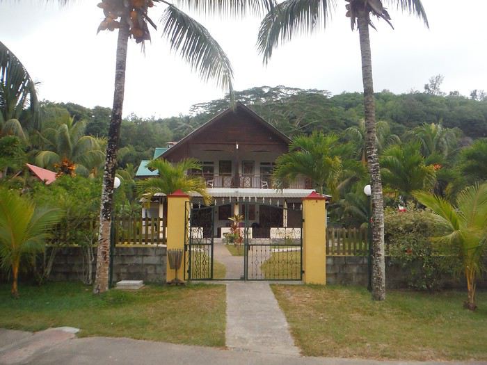 et difficile découverte des routes des Seychelles étroites et bordées de ravins. Pas de chance , en plus, des ouvriers installent des câbles et creusent la chaussée tous les kilomètres. Marc est si concentré sur la route qu'il est au bord de la crise de nerfs !
Après notre installation dans notre très belle chambre, nous partons à la découverte d'Anse Intendance superbe mais dangereuse avec beaucoup de rouleaux . On enchaîne sur la belle anse Takamaka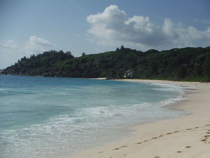
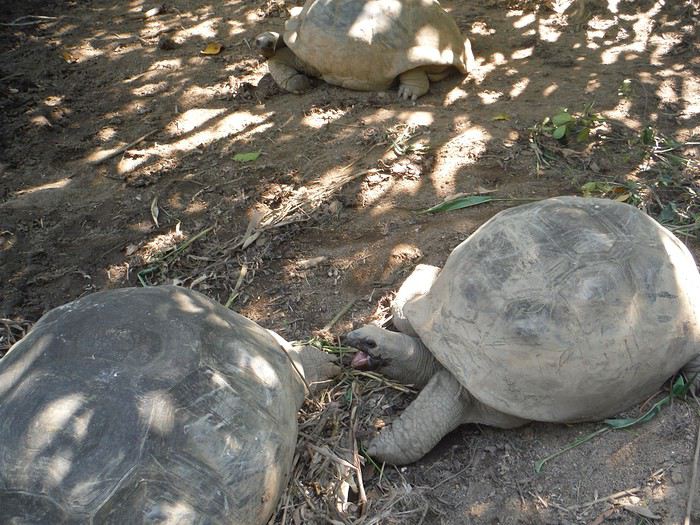
et on admire nos premières tortues géantes. On est quand même circonspects au vu de la taille de l'enclos - minuscule- dans lequel sont entassées pas mal de ces demoiselles. Dîner à l'hôtel de poissons cru et cuit, riz et légumes puis soirée terrasse en admirant le bal des roussettes.. C'est extraordinaire.
Mercredi , nous partons vers la belle Anse Royale . Je conseille ce village comme lieu de séjour car on y trouve pas mal de commodités : distributeur CB et quelques restos sympas: Case Kreol et Les Dauphins Heureux.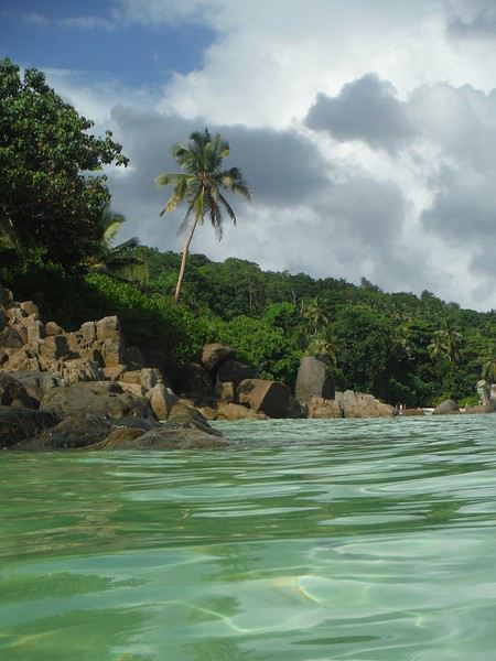
La plage déserte propose un bel ombrage, bien pour de jeunes enfants car bien frais. La mer est calme, pas de vagues grâce à barrière de corail et l'eau est chaude, c'est le bonheur. On prend ensuite le chemin, juste à côté, des Jardins du roi où on fait une pause déjeuner très plaisante: crêpes, salade de crudités.Personnel très aimable et paysage à tomber. C'est un beau parc botanique qui présente les essences typiques de la flore seychelloise. On y verra notre premier cocofesse. Les arbres sont gigantesques et magnifiques. La balade sur les divers sentiers n'est cependant pas recommandée aux personnes qui ont du mal à marcher ni aux parents avec poussettes. Le Sentier "forêt "est notamment assez sportif, surtout au départ. Ça grimpe !
On finit encore la journée à Anse Takamaka mais malgré sa beauté, il est difficile de s'y baigner car les vagues sont vraiment violentes. Quelques bons nageurs s'y risquent mais inutile de préciser qu'un enfant pourrait facilement se noyer. On prend un cocktail au snack Battista, sur la plage en admirant le coucher de soleil et on y dîne. Ca n'est pas fameux cela dit. A plus tard...
Nous revenons de notre premier séjour aux Seychelles du mardi 12 au samedi 23 février et sommes enchantés. Les paysages nous ont séduits, ainsi que les Seychellois eux-mêmes. Nous avons eu la chance d'échapper à la pluie annoncée : c'est habituellement la saison des pluies en cette période. Voici un petit compte rendu qui sera peut-être utile à certains ou qui vous fera peut-être rêver... Premier jour, mardi : l'arrivée est très matinale et mouvementée. On subit une longue attente à la douane due à l'arrivée de plusieurs avions ainsi que de nombreux croisiéristes. Enfin , on obtient notre sésame ! C'est un beau visa "coco fesse". Puis, nouvelle attente à cause du loueur de voiture Thrithty qui n'avait pas prévu la voiture à conduite manuelle réservée. Quand , enfin, celle-ci arrive, le loueur laisse les clés dans le véhicule.... et claque la portière ! Gag !🤪 Il finit par nous conduire à notre hôtel où nous sera livrée notre voiture un peu plus tard. Direction Anse Takamaka pour découvrir notre jolie guest house, le Takamaka green village
et difficile découverte des routes des Seychelles étroites et bordées de ravins. Pas de chance , en plus, des ouvriers installent des câbles et creusent la chaussée tous les kilomètres. Marc est si concentré sur la route qu'il est au bord de la crise de nerfs !Après notre installation dans notre très belle chambre, nous partons à la découverte d'Anse Intendance superbe mais dangereuse avec beaucoup de rouleaux . On enchaîne sur la belle anse Takamaka
et on admire nos premières tortues géantes. On est quand même circonspects au vu de la taille de l'enclos - minuscule- dans lequel sont entassées pas mal de ces demoiselles. Dîner à l'hôtel de poissons cru et cuit, riz et légumes puis soirée terrasse en admirant le bal des roussettes.. C'est extraordinaire.
Mercredi , nous partons vers la belle Anse Royale . Je conseille ce village comme lieu de séjour car on y trouve pas mal de commodités : distributeur CB et quelques restos sympas: Case Kreol et Les Dauphins Heureux.
La plage déserte propose un bel ombrage, bien pour de jeunes enfants car bien frais. La mer est calme, pas de vagues grâce à barrière de corail et l'eau est chaude, c'est le bonheur. On prend ensuite le chemin, juste à côté, des Jardins du roi où on fait une pause déjeuner très plaisante: crêpes, salade de crudités.Personnel très aimable et paysage à tomber. C'est un beau parc botanique qui présente les essences typiques de la flore seychelloise. On y verra notre premier cocofesse. Les arbres sont gigantesques et magnifiques. La balade sur les divers sentiers n'est cependant pas recommandée aux personnes qui ont du mal à marcher ni aux parents avec poussettes. Le Sentier "forêt "est notamment assez sportif, surtout au départ. Ça grimpe !
On finit encore la journée à Anse Takamaka mais malgré sa beauté, il est difficile de s'y baigner car les vagues sont vraiment violentes. Quelques bons nageurs s'y risquent mais inutile de préciser qu'un enfant pourrait facilement se noyer. On prend un cocktail au snack Battista, sur la plage en admirant le coucher de soleil et on y dîne. Ca n'est pas fameux cela dit. A plus tard...