Results for "Recife+|+55+>+126"
3732 results found.
My Australia itinerary: What to do in 3 weeks between Sydney and Cairns?
Discover everything you can do during a three-week road trip between Sydney and Cairns on Australia’s east coast. All the steps for a memorable journey.
3-week road trip between Sydney and Cairns: itinerary tips A three-week stay in Australia is the perfect amount of time to explore part of the country. Just a part, because the territory is so vast that you could spend months there without seeing it all. For a first trip to this Oceanic country, the route between Sydney and Cairns is a classic. It offers a glimpse of what makes so many travelers dream, with legendary beaches, vibrant cities, tropical forests, paradise islands, and the unmissable Great Barrier Reef. This route along the East Coast alternates between natural landscapes and urban atmosphere, scenic roads, and relaxing days. Here’s a realistic itinerary designed for three weeks, with balanced stops and time to enjoy without feeling rushed.
Days 1 to 3 – Sydney, first steps in Australia Even before setting foot on Australian soil, travelers must have a valid passport and a visa. Australia doesn’t mess around with entry formalities, so it’s best to take care of this in advance. To apply for a tourist visa, the site aus-visa.org guides travelers step by step. Once this formality is sorted, it’s time to focus on the most exciting part: the trip itself. Arriving in Sydney is often a memorable step. You discover one of Australia’s most iconic cities and immediately feel far from Europe. The first few days are for adjusting to the time difference while exploring the city’s landmarks. There’s the Opera House, of course, but also the Harbour Bridge, which dominates the bay and gives Sydney its instantly recognizable silhouette. During these three days in Sydney, you can head to Circular Quay to take a ferry to Manly, just for the pleasure of crossing the bay and admiring the city from the water. You can also walk along Bondi Beach or lay out your towel, depending on the time of year. The coastal walk between Bondi and Coogee offers a spectacular view of the Australian coast. Of course, you won’t want to miss strolling through The Rocks district to soak up the buzz of the capital of New South Wales.
Days 4 to 6 – From Sydney to Byron Bay, the road trip begins The road trip kicks off heading north. The Pacific Highway unfolds its kilometers between the ocean and eucalyptus forests. You quickly realize that driving in Australia is a unique experience. Sure, the distances are long, but the landscapes make every stretch enjoyable. A first stop in Port Macquarie or Coffs Harbour lets you rest while discovering wild beaches. Then comes Byron Bay, the beach town often described as Australia’s surfing and alternative lifestyle capital. After Sydney, the vibe slows down. You wake up early to watch the sunrise near the lighthouse, then spend your days swimming, trying surfing, and exploring the tropical hinterland. You can also hike in nearby national parks to discover hidden waterfalls in the heart of wild landscapes. You might plan to spend one night in Byron Bay before hitting the road again, but it’s so nice that you end up staying for three days.
Days 7 to 9 – Gold Coast and Sunshine Coast, between modernity and nature Heading toward the Gold Coast, the contrast is striking again. Here, skyscrapers line the beach, and you stroll along wide avenues. The vibe is more urban. Surfers Paradise is another ideal stop for surfing. You can also enjoy a lively nightlife. Those who prefer tranquility can relax in Burleigh Heads, known for its beautiful beach and more local atmosphere. The hinterland also holds surprises. The lush forests of Springbrook National Park and its waterfalls remind you that Australia’s nature is everywhere, even near big cities. As you head up to the Sunshine Coast, we recommend stopping in Noosa to discover its elegant houses, peaceful beaches, and national park bordering the ocean. The coastal trails reveal exceptional marine landscapes. The locals’ hospitality is also remarkable.
Days 10 to 12 – Fraser Island, adventure on sand Get ready for a magical moment! From Hervey Bay, you board a ferry to Fraser Island—or K’gari—the world’s largest sand island. Once there, you drive a 4x4 on the beach and discover raw, almost surreal landscapes. Lake McKenzie, with its impressively clear water and dazzling white sand, remains one of the trip’s most memorable highlights. You swim, walk barefoot, observe dingoes from a distance, and feel a rare sense of isolation. It’s as if you’re far from civilization. After two intense days, you hit the road north again. The distances get longer, but the excitement grows as you approach the Whitsundays.
Days 13 to 15 – The Whitsundays, a giant postcard Airlie Beach is the gateway to the Whitsundays, a group of islands 55 km off the coast of Queensland. The water turns turquoise, lush green islands emerge on the horizon, and the sand at Whitehaven Beach looks too white to be real. What to do in the archipelago? Well, snorkel for hours over the coral, swim in secluded coves, and spend peaceful evenings watching the sunset. For those who love discovering hidden spots, head to Cedar Creek Falls for a picnic and a refreshing swim. These days at sea often rank among travelers’ favorite moments. You’ll understand why once you’re there.
Days 16 to 18 – Mission Beach, the tropical break After the magical moments in the Whitsundays, Mission Beach offers a quieter pause. Here, you enjoy a long palm-fringed beach and an almost intimate atmosphere. It’s the perfect spot between Sydney and Cairns to take time to do nothing. That means walking along the water at sunrise, then exploring the surroundings between tropical forest and isolated backroads. Thrill-seekers, however, can skydive over the beach. It’s a uniquely Australian experience that offers plenty of wow moments. This stop marks the entry into North Queensland’s tropical region, where many more wonders await travelers.
Days 19 to 21 – Cairns, the Great Barrier Reef, and the ancient rainforest Cairns is a city in Australia that’s loved for its lively markets, cafés, and beautiful beaches. It’s also the gateway to one of the world’s natural jewels: the Great Barrier Reef. A boat excursion lets you dive or snorkel over colorful reefs. Seeing the coral and fish in this crystal-clear water leaves a lasting impression. But you’ll also discover another wonder with the poetic name of Daintree Rainforest. It’s one of the oldest tropical forests on the planet. Walking under its dense canopy lets you feel the power of nature preserved in its original state. At Cape Tribulation, the forest meets the ocean in a spectacular setting. This end of the trip is packed with emotion.
Traveling from Sydney to Cairns in three weeks means exploring a contrasting and exotic Australia. You start in a dynamic metropolis, cross endless beaches, sail between paradise islands, and finish in an ancient tropical forest. Often, as soon as you’re back, you’re already thinking about returning.
3-week road trip between Sydney and Cairns: itinerary tips A three-week stay in Australia is the perfect amount of time to explore part of the country. Just a part, because the territory is so vast that you could spend months there without seeing it all. For a first trip to this Oceanic country, the route between Sydney and Cairns is a classic. It offers a glimpse of what makes so many travelers dream, with legendary beaches, vibrant cities, tropical forests, paradise islands, and the unmissable Great Barrier Reef. This route along the East Coast alternates between natural landscapes and urban atmosphere, scenic roads, and relaxing days. Here’s a realistic itinerary designed for three weeks, with balanced stops and time to enjoy without feeling rushed.
Days 1 to 3 – Sydney, first steps in Australia Even before setting foot on Australian soil, travelers must have a valid passport and a visa. Australia doesn’t mess around with entry formalities, so it’s best to take care of this in advance. To apply for a tourist visa, the site aus-visa.org guides travelers step by step. Once this formality is sorted, it’s time to focus on the most exciting part: the trip itself. Arriving in Sydney is often a memorable step. You discover one of Australia’s most iconic cities and immediately feel far from Europe. The first few days are for adjusting to the time difference while exploring the city’s landmarks. There’s the Opera House, of course, but also the Harbour Bridge, which dominates the bay and gives Sydney its instantly recognizable silhouette. During these three days in Sydney, you can head to Circular Quay to take a ferry to Manly, just for the pleasure of crossing the bay and admiring the city from the water. You can also walk along Bondi Beach or lay out your towel, depending on the time of year. The coastal walk between Bondi and Coogee offers a spectacular view of the Australian coast. Of course, you won’t want to miss strolling through The Rocks district to soak up the buzz of the capital of New South Wales.
Days 4 to 6 – From Sydney to Byron Bay, the road trip begins The road trip kicks off heading north. The Pacific Highway unfolds its kilometers between the ocean and eucalyptus forests. You quickly realize that driving in Australia is a unique experience. Sure, the distances are long, but the landscapes make every stretch enjoyable. A first stop in Port Macquarie or Coffs Harbour lets you rest while discovering wild beaches. Then comes Byron Bay, the beach town often described as Australia’s surfing and alternative lifestyle capital. After Sydney, the vibe slows down. You wake up early to watch the sunrise near the lighthouse, then spend your days swimming, trying surfing, and exploring the tropical hinterland. You can also hike in nearby national parks to discover hidden waterfalls in the heart of wild landscapes. You might plan to spend one night in Byron Bay before hitting the road again, but it’s so nice that you end up staying for three days.
Days 7 to 9 – Gold Coast and Sunshine Coast, between modernity and nature Heading toward the Gold Coast, the contrast is striking again. Here, skyscrapers line the beach, and you stroll along wide avenues. The vibe is more urban. Surfers Paradise is another ideal stop for surfing. You can also enjoy a lively nightlife. Those who prefer tranquility can relax in Burleigh Heads, known for its beautiful beach and more local atmosphere. The hinterland also holds surprises. The lush forests of Springbrook National Park and its waterfalls remind you that Australia’s nature is everywhere, even near big cities. As you head up to the Sunshine Coast, we recommend stopping in Noosa to discover its elegant houses, peaceful beaches, and national park bordering the ocean. The coastal trails reveal exceptional marine landscapes. The locals’ hospitality is also remarkable.
Days 10 to 12 – Fraser Island, adventure on sand Get ready for a magical moment! From Hervey Bay, you board a ferry to Fraser Island—or K’gari—the world’s largest sand island. Once there, you drive a 4x4 on the beach and discover raw, almost surreal landscapes. Lake McKenzie, with its impressively clear water and dazzling white sand, remains one of the trip’s most memorable highlights. You swim, walk barefoot, observe dingoes from a distance, and feel a rare sense of isolation. It’s as if you’re far from civilization. After two intense days, you hit the road north again. The distances get longer, but the excitement grows as you approach the Whitsundays.
Days 13 to 15 – The Whitsundays, a giant postcard Airlie Beach is the gateway to the Whitsundays, a group of islands 55 km off the coast of Queensland. The water turns turquoise, lush green islands emerge on the horizon, and the sand at Whitehaven Beach looks too white to be real. What to do in the archipelago? Well, snorkel for hours over the coral, swim in secluded coves, and spend peaceful evenings watching the sunset. For those who love discovering hidden spots, head to Cedar Creek Falls for a picnic and a refreshing swim. These days at sea often rank among travelers’ favorite moments. You’ll understand why once you’re there.
Days 16 to 18 – Mission Beach, the tropical break After the magical moments in the Whitsundays, Mission Beach offers a quieter pause. Here, you enjoy a long palm-fringed beach and an almost intimate atmosphere. It’s the perfect spot between Sydney and Cairns to take time to do nothing. That means walking along the water at sunrise, then exploring the surroundings between tropical forest and isolated backroads. Thrill-seekers, however, can skydive over the beach. It’s a uniquely Australian experience that offers plenty of wow moments. This stop marks the entry into North Queensland’s tropical region, where many more wonders await travelers.
Days 19 to 21 – Cairns, the Great Barrier Reef, and the ancient rainforest Cairns is a city in Australia that’s loved for its lively markets, cafés, and beautiful beaches. It’s also the gateway to one of the world’s natural jewels: the Great Barrier Reef. A boat excursion lets you dive or snorkel over colorful reefs. Seeing the coral and fish in this crystal-clear water leaves a lasting impression. But you’ll also discover another wonder with the poetic name of Daintree Rainforest. It’s one of the oldest tropical forests on the planet. Walking under its dense canopy lets you feel the power of nature preserved in its original state. At Cape Tribulation, the forest meets the ocean in a spectacular setting. This end of the trip is packed with emotion.
Traveling from Sydney to Cairns in three weeks means exploring a contrasting and exotic Australia. You start in a dynamic metropolis, cross endless beaches, sail between paradise islands, and finish in an ancient tropical forest. Often, as soon as you’re back, you’re already thinking about returning.
Mamoudzou, Mayotte - December 2025
There exists a rare land where life expresses itself, a land where everything is destroyed, patched up, where everything is dirty and faded, yet paradoxically, each passing day is synonymous with light and joy. Seen from the sea, magnified by its translucent waters, the island is splendid; seen from inland, ochre and green dress a landscape one would wish to be pristine. As you approach the coast with the tides, countless boat wrecks never finish dying; returning from a hike, you know you’re nearing the city by the increasingly obvious proliferation of all kinds of trash. Overflowing the towns, makeshift homes made of corrugated iron stand here and there, wherever the eye lands; from a height, looking toward the horizon, you find the calm blue of the ocean and the beauty of infinity.
But where does all this corrugated iron come from? Blue, gray, red, or black, you find it pretty much everywhere—except, of course, on the island’s heights, where the heat is such that all life seems impossible. Yet, a few kilometers from the capital, more than an hour’s walk away, the corrugated iron is very much there, omnipresent, guaranteeing a land registry as hypothetical for us Europeans as it is very real for those who live there, far from civilization and comfort. I keep climbing. I’m precisely looking to meet these people who live on very little, if not nothing.
- Jéjé Mogné (Hello, sir in Shimahorais)! Where do you get water here, in this place? How do you drink, irrigate your plants?
- I wait for the rain. We have tanks that fill up well with each rainfall. But right now, it’s not raining much.
At the top of the next hill, lost in the bushes, it’s easier for me to guess the distant city, Mamoudzou, than the rest of the path, a remnant of a magnificent GR called the Island Tour, abandoned for the most part, sometimes maintained between two lost hamlets. The city, the pulse, water. Below, the ocean, running water, drinking water—despite regular interruptions; here, up high, an hour and a half’s walk away, tanks, arbitrariness. On other slopes, however, during another hike, I saw the water supply network, made of sturdy pipes tangled in the earth, right there by the path. It seems there are places where water climbs. Others not. Each to their own karma. In 2025. In a French department.
A path of misfortune, lost and regained, thanks to a sign, an inscription, or the compass’s directions. No one walks here anymore, except those who live here or come to harvest their crops. I remember that breathtaking hike in 2013, when I connected Bandrélé to Mamoudzou, passing by the peaks of Bénara (660m) and Bépilipili (643m), barely pausing at Tsararano and Vahibé: 34 km of intense effort on a rollercoaster path, along a trail that was still discernible. Today, it’s as if everything had disappeared. By also destroying the paths and vegetation, Chido* broke the last momentum of these cautious hikers: insecurity has made its way across the archipelago, and Sunday strolls are no longer the norm. Me, I keep going. I will have walked here and there during these three weeks to get an idea of the places, the people, the landscapes, and the superhuman effort required to move forward in over 40°C. To tell the truth, during my last hike, I cut my plans short and let myself be carried by a group of young people heading back to the city. The path is now just an inextricable network of small trails, the specter of Providence** comes to mind. True wisdom is knowing when to give up. I leave.
* A cyclone named "desire" (in Shona), which ravaged the island of Mayotte on December 14, 2024. ** June 2023, a very poorly prepared hike on Providence Island (Caribbean) from which I miraculously escaped.
On Petite-Terre, Marie takes me to visit some locals, white people who have lived there for a long time and make a living from their art; jewelry for her, all kinds of objects for him. We love this little shop, this oasis amid the chaos that embodies Dostoevsky’s phrase: "Beauty will save the world." It’s clean and tidy, beautiful, well-kept. Invariably, the question of insecurity resurfaces in the middle of the conversation. The woman says:
- I know someone who slipped in their bathtub. Still, I keep taking baths…
So, is this insecurity a myth or reality? I hear stories that are often true but sometimes seemingly exaggerated through the lens of misunderstanding and one-upmanship. Like that of this midwife assaulted one evening (it gets dark early) on her way home from work. Sometimes she was attacked on the path, dragged by the hair for several meters, sometimes she made it home, but it was her roommate who let the two men in. One version talks about a snatched phone and gratuitous violence, another about violence outright. In short, one thing is certain: walking around at night flaunting your phone isn’t a good idea, no more in Mamoudzou than in the rough neighborhoods of Nantes. Also, I played it safe: nothing flashy, nothing bling-bling, and always something to give if needed. I was never approached. It’s not easy to get a sense of the realities, between the hazy reports from journalists sensationalizing everything and the real lives of real people. But I know I can’t rely on these few ideas I’ve formed: I’m nobody, and above all, I don’t live here. What I do know, however, is that since my last visit to the island in 2017, over 80,000 babies have been born, and tens of thousands of immigrants have reached the archipelago’s shores. What’s also obvious is that poverty, hunger, and—let’s say it—indignity foster delinquency and insecurity. So, without taking journalists’ alarmist speeches at face value, we’ll try to keep in mind that a young person rendered orphaned by circumstances (parents expelled), poor and often hungry, involved more or less against their will in village wars and fueled by synthetic drugs*, will readily turn to violence when they truly have nothing to lose. We can trace the origin of this despair to the fact that in Mayotte, those without legal existence have virtually no hope of accessing anything.
* "Chimique" is a series of synthetic cannabinoids
Meanwhile, in the evening, it’s good to go home before the time of stone-throwing. From time to time, along the roads, gangs throw stones at vehicles and school buses, but mostly at police cars—almost all the white Dusters on the island! In front of the Mamoudzou police station, all parked vehicles—mostly Dusters—bear the scars of these attacks. Maybe it’s only at night that gangs unleash and all the burglaries happen? I saw nothing, heard nothing. I lived three weeks in a sort of bunker with no real access to outside light, protected by a fake wooden door doubled with a real metal door, both locked at all times. You don’t tempt fate. You endure it differently.
Today, extraordinarily, it’s raining. Yet, it’s the rainy season! But with my karma helping (what selfishness to want to walk dry when so many souls live off the rain) or is it climate change? The rain only falls once I’ve put on my horrible green pajamas. In front of the board outlining the program, I’m told that out of the six scheduled C-sections today (sic), they’ll probably only do two, maybe three. Because it’s raining. And when it rains, people don’t move around. Not for lack of will. Rather, for lack of means. And that ties into those sad days when the police patrol around the hospital: patients don’t come. They’ll come back tomorrow. To compensate, I’m happy at the thought of tackling the abscess program, but the sterilization unit is acting up and blocking the instrument trays. When it’s not the rain, it’s the unions. And when both finally quiet down, there’s always someone to find fault with the order of operations. You have to imagine an operating room where the question of urgency reigns supreme. Here, no surgery is scheduled more than 24 hours in advance—only emergencies, nothing but emergencies. So, following that reasonable adage that what’s done is no longer to be done, it’s sheer madness when the rain meets the interests of Force Ouvrière and the bad will of some combines with the laziness of others. To tell the truth, I’ve never seen so much energy expended to… do nothing. Hallucinating. But who am I, a small-time striver, an islander in my spare time, a temporary worker at the end of the world? I came, I saw, I was disappointed? Not really. Here again, I can’t judge a system in so little time. I can barely utter a few bitter words in front of obvious facts. But nothing will take away my joy of being here for three weeks. Here, they heal with somewhat outdated but still functional means. You do what you can with what you have, 8,000 km from the Métropole. Yes, the operating room doors hesitate, and the operating tables stutter, but in this blessed period, we lack neither medicines nor supplies. So we examine, anesthetize, and repair, far more undocumented people than French—if I may play with somewhat borderline statistics here; we deliver babies, dress wounds, and relieve pain in this hospital at the end of the world where neither white women nor Mahorais women would ever consider giving birth or getting treated.
What’s the solution? The obstetrician talks to the woman during a C-section under spinal anesthesia:
- Bouéni! (Madame, in Shimahorais) You need to think about tubal ligation. This is your fourth C-section. Your uterus is like tissue paper. Your next pregnancy will be very risky.
No answer. Culture. It’s all about culture. The funniest thing is that France also gets bogged down with the idea of other cultures’… cultures. The woman in question arrived illegally a few years ago to give birth to her first child. Since then, rejecting the very idea of contraception—her husband, for his part, will invoke God or Allah to refuse a vasectomy—she comes back every 12-14 months. And the obstetrician explains to me how his idea of making information about permanent contraception mandatory was deemed racist by associations. It’s always the same story. I suggest to the associations that they take charge of all these extra births, not only the medical costs but also the entire education, not just financial, of all these children doomed to live a life of misery on this forsaken archipelago. The probability that one of these offspring will emerge as a gifted, sensitive, and fiercely happy individual must truly be weighed against the degradation and abandonment that will invariably afflict the thousands of others living around him. In reality, simply mentioning a very real danger to the mother should be enough to impose sterilization. But we are a country whose greatness of soul is measured by the number of heads cut off to uphold the famous rights of man... Already a proponent at home of ending family allowances after the third child—you can’t subscribe to a certain idea of society and, at the same time, accept that tens of thousands of children are sacrificed on the altar of thoughtlessness and financial interest*—I will weakly advocate here for a controlled right to have children. Well, what will they say about me when I express the idea of imposing sterilization on women in irregular situations after the birth of their third child? National solidarity funds the noblest ideals? In Mayotte? Let’s be serious. It’s so much easier to hide behind the inalienable right of women to control their bodies than to acknowledge one’s own powerlessness to assume the consequences of such a policy. Because after 18 years of struggles as a second-class citizen, the young stateless person will have no choice but to live in hiding: faced with the impossibility of claiming birthright citizenship**, they will be deportable. In Mayotte, there aren’t enough schools, not enough housing, not enough projects for youth, not enough jobs, not enough money, not enough future… In Mayotte, an average of 5 children are born per woman. In reality, we never ask about the right of children to control their own lives.
* Single parent with 4 children: RSA at 1937 € + family allowances… ** Law of May 12, 2025 aiming to strengthen the conditions for accessing French nationality in Mayotte.
I live in the city in a clean apartment where air conditioning eases my aches and sweat, and where water flows abundantly, thanks to huge tanks that fill up between water cuts. On the hills of Koungou, I was struck by this image: there, women (a matriarchal society?) do the dishes in a miserable stream. Upstream of the same stream, the same image as downstream: disgusting water with bits of foam floating on it. A little further, however, there are taps with running water that children play with. Strange. In any case, water is a question. They tell me it’s drinkable; I doubt it. A system that’s regularly cut doesn’t seem reliable to me. In any case, I can’t help but think of the Canary Islands and their chronic water shortage, especially in Lanzarote. Without entering the debate on desalination plants—I’m quite ignorant about environmental repercussions—I’ll just say that in the Canary Islands, you can buy 8 L jugs of purified water for less than 2 €. Here, in Mayotte, the price of water—as is the price of gasoline—is the same everywhere: 0.65 € for a bottle of Cristaline (1 €/L)*. While I was walking up there with a couple of farmers shuttling between two remote spots, I know I hit the mark by offering them one of my two bottles I’d brought for the occasion.
* At home, we find Cristaline at 1.14 € for a 9 L pack, i.e., 0.13 € per liter.
Outside, everything is broken, abandoned, old, worn, torn, faded, heavy, dirty, forsaken. But life goes on. And that’s fascinating. At home, at 5:45 PM, people close their shutters and watch cable TV, sometimes late into the night, emptying the streets of any salutary clamor, unwittingly extinguishing the necessary pulse of life. At home, we die of boredom. In Mamoudzou, between two dying trash cans, metal frames laid on the ground are covered by the elements of a broken garden set. A bare concrete staircase, without railings, provides access to the upper floor of a dwelling. On the steps, you can read: Private space - Please take your trash with you. Metal rods protrude from the said dwelling. On the ground, it’s a festival of screws and nails… A cat passes by. It doesn’t look great. A madwoman crosses the street dancing. A slightly hurried driver brakes. A six- or seven-year-old boy comes out in his underwear from his low house made of corrugated iron. He smiles. He’s having fun doing acrobatic figures over an old mattress on the sidewalk. Forward roll, backward roll. You wonder if he eats enough. Different culture. Different customs.
I will remember for a long time this blinding morning light, a raw, vital, striking light. I almost forgot where I came from, the grayness and boredom of that continental European country where nothing really happens anymore. Here, I could join Camus, contemplating these people placed halfway between misery and the sun, resigned for the most part and, for the other part, not too unhappy with their lot. But the Mahorais discourse is unanimous: "France really screwed us over!" Today, more than half of the island’s inhabitants are undocumented; a tremendous amount of energy is spent expelling 20,000 to 25,000 of them each year; colossal sums are swallowed up to care for all these people, and the island is drifting. I talk with some gendarmes. One of them tells me:
- They intercept one kwassa* out of three… Can you explain to me why they can’t catch everyone? It’s 2025! Can’t they put the necessary boats in place?
Clearly, and this is also my opinion, this whole mess serves interests beyond us. For who can believe for a second that this glaring incompetence isn’t orchestrated? Shared interests between secret France and the Union of the Comoros? A desire to bring insecurity to its peak, either by the Comoros to eventually take back control of Mayotte, or by our own government, in a deliberate effort to see all the white people leave the archipelago and let the Mahorais fend for themselves? At one point, I’m even told about an extraordinary deposit beneath Mayotte’s soil, a promise of infinite wealth**. Not to infringe on human rights, to do some cleaning from time to time, to calm things down to avoid implosion, while waiting to go after this providential bounty? Decidedly, Mayotte hasn’t said its last word!
*What’s paradoxical is that in the early 2010s, to revive traditional fishing activity, the UN financed in Anjouan the construction of a factory to produce these light boats, 7-10m long and 1m wide, which largely served the interests of smugglers. This skiff owes its name to a Congolese dance known for being as rhythmic as it is jerky, much like the navigation experience offered during a crossing to Mayotte. ** A 2025 study revealed the existence of a gigantic magmatic reservoir located 23km beneath the archipelago. If the Icelandic experiment succeeds (Project KMT, see here), Mayotte will then possess almost unlimited energy.
Hell on earth. Paradise at sea. The world’s largest lagoon offering spectacular marine depths, Mayotte’s coral reef suffers less from the abundance of tourists* than from tropical storms**. So, let’s admit that Mayotte is best appreciated when approached from the lagoon. The heights are for old hands like me. The sea spray is rather for the snobs who shun the sun god Ra, risking too much exposure and ending up on sick leave for sunstroke! But I’m not exclusive: I twice don my snob attire and head out to tackle the waves, the seabeds, and the elusive. Because yes, underwater, we leave our landlubber reflexes behind, and flying over corals and other magnificent drop-offs, it’s as if we’re soaring, keeping in memory only what our eyes can store. Multicolored, even phosphorescent fish, sharks, rays, the immensity of the blue, and then, there, dolphins, just a few meters from me, underwater. Incredible.
* 70,000 tourists annually, mostly affinity tourism (links with family or an expatriate). ** Present almost at the water’s surface, the reefs were largely destroyed by Chido.
Paradise at sea? When you think that Mayotte comes from the Arabic Jazirat al Mawet—literally, Island of Death—because of its double coral barrier where many skiffs have run aground and continue to do so… Paradise. Eldorado. The Comoros now face an unprecedented influx of immigrants from the African Great Lakes. And Mayotte, for its part, continues to attract relentlessly, thanks to the evolution of the law*. In reality, whether hidden interests exist or not, France remains bound hand and foot by international, European, and French rules: it can’t do much. Barely has it boarded a kwassa when the one who flees by swimming cries attempted murder; barely has one been sent back to the Comoros when an association will look into their detention conditions and find a loophole; barely has one told a bouéni how her next pregnancy could be fatal when so-called human voices cry scandal.
* Regarding the Métropole, the rights of squatters and other bad payers against the notion of private property, legally violated in favor of the right to housing… ** You can read about France being condemned for its illegal practices of expelling Comorian minors. Inhumane treatment, arbitrary detention, collective expulsion.
Everyone forms their own idea of justice, and no one can claim a monopoly on good thinking. So, as long as I treat without prejudice, as long as my hands are sincerely guided by the love I bear for our humanity, I’ll allow myself to think what I think, understanding that I’m rather open to dialogue and that my opinions evolve with time and events. Today, Mayotte represents for me the failure of a model, a European one in this case, where opulence quickly meets its limits. For it’s not wrong to think that our society can’t share more than it produces, nor is it wrong to think that every human being has a right to their share of the pie; in Mayotte, you’ll find the proven result of our civilization: it doesn’t work. Exclusively financed by the right, the ideas of the left jam in Mayotte more than anywhere else: national solidarity coupled with a sense of guilt creates chaos. Political courage, or true social justice, would be to offer a future to those who have no choice—the one who’s already here, the child to be born—not to offer a present to those who can choose or to whom one can give keys to understanding—the woman of childbearing age, the candidate for exile. Ultimately, the Comoros’ coup d’état over France comes at the cost of many innocent victims, starting with the children*.
* Tens of thousands of deaths by drowning between Anjouan and Mayotte, tens of thousands of children left to fend for themselves and doomed to a non-existent future.
On the evening of the 31st, I go for my usual run and notice near a roundabout a fool in rags pedaling the wrong way. A police car passes by: the guy gets stopped. A rather quick identity check. The guy is taken away. Would he still be among us if he had ridden the right way? In the evening, the line is long in front of the club near the dock. Me, I’m just passing by, greeting my friends of the season, much more inclined to savor rest than to exhaust myself on an overheated dance floor. There, a man, thirty or forty years old, clearly in a world of his own, is searching the trash for something to eat. He’s barefoot. I console myself by thinking that at least he won’t die of cold. Out of ten children born in Mayotte, I can reasonably think that only one will be able to afford an existence that minimally meets any of our criteria.
It’s time to go home. After sweating and thinking so much about this gem of the Mozambique Channel, I spend peaceful hours by the pool at a hotel next to the airport. We checked out at 8 AM, and the flight is at 7 PM. The perfect opportunity to slack off and chat a bit more. I’m happy to get to know one of the co-pilots of tonight’s flight, staying at this hotel, while one of my flight attendant friends from this airline had already recommended me to the crew. But it’s not the captain’s day, who’s in a rather gloomy mood. I’ll travel in the back, up to the vertical of Cairo. Midnight has just struck; it’s January 2nd, my name day. Concerned about solving an unsolvable problem with a passenger, the crew asks me to give up my exit row seat and takes me to the front for the last four hours of the flight. In the end, the captain gave in? I laugh to myself: if there’s one thing I mustn’t forget, it’s that God never abandons me!
But where does all this corrugated iron come from? Blue, gray, red, or black, you find it pretty much everywhere—except, of course, on the island’s heights, where the heat is such that all life seems impossible. Yet, a few kilometers from the capital, more than an hour’s walk away, the corrugated iron is very much there, omnipresent, guaranteeing a land registry as hypothetical for us Europeans as it is very real for those who live there, far from civilization and comfort. I keep climbing. I’m precisely looking to meet these people who live on very little, if not nothing.
- Jéjé Mogné (Hello, sir in Shimahorais)! Where do you get water here, in this place? How do you drink, irrigate your plants?
- I wait for the rain. We have tanks that fill up well with each rainfall. But right now, it’s not raining much.
At the top of the next hill, lost in the bushes, it’s easier for me to guess the distant city, Mamoudzou, than the rest of the path, a remnant of a magnificent GR called the Island Tour, abandoned for the most part, sometimes maintained between two lost hamlets. The city, the pulse, water. Below, the ocean, running water, drinking water—despite regular interruptions; here, up high, an hour and a half’s walk away, tanks, arbitrariness. On other slopes, however, during another hike, I saw the water supply network, made of sturdy pipes tangled in the earth, right there by the path. It seems there are places where water climbs. Others not. Each to their own karma. In 2025. In a French department.
A path of misfortune, lost and regained, thanks to a sign, an inscription, or the compass’s directions. No one walks here anymore, except those who live here or come to harvest their crops. I remember that breathtaking hike in 2013, when I connected Bandrélé to Mamoudzou, passing by the peaks of Bénara (660m) and Bépilipili (643m), barely pausing at Tsararano and Vahibé: 34 km of intense effort on a rollercoaster path, along a trail that was still discernible. Today, it’s as if everything had disappeared. By also destroying the paths and vegetation, Chido* broke the last momentum of these cautious hikers: insecurity has made its way across the archipelago, and Sunday strolls are no longer the norm. Me, I keep going. I will have walked here and there during these three weeks to get an idea of the places, the people, the landscapes, and the superhuman effort required to move forward in over 40°C. To tell the truth, during my last hike, I cut my plans short and let myself be carried by a group of young people heading back to the city. The path is now just an inextricable network of small trails, the specter of Providence** comes to mind. True wisdom is knowing when to give up. I leave.
* A cyclone named "desire" (in Shona), which ravaged the island of Mayotte on December 14, 2024. ** June 2023, a very poorly prepared hike on Providence Island (Caribbean) from which I miraculously escaped.
On Petite-Terre, Marie takes me to visit some locals, white people who have lived there for a long time and make a living from their art; jewelry for her, all kinds of objects for him. We love this little shop, this oasis amid the chaos that embodies Dostoevsky’s phrase: "Beauty will save the world." It’s clean and tidy, beautiful, well-kept. Invariably, the question of insecurity resurfaces in the middle of the conversation. The woman says:
- I know someone who slipped in their bathtub. Still, I keep taking baths…
So, is this insecurity a myth or reality? I hear stories that are often true but sometimes seemingly exaggerated through the lens of misunderstanding and one-upmanship. Like that of this midwife assaulted one evening (it gets dark early) on her way home from work. Sometimes she was attacked on the path, dragged by the hair for several meters, sometimes she made it home, but it was her roommate who let the two men in. One version talks about a snatched phone and gratuitous violence, another about violence outright. In short, one thing is certain: walking around at night flaunting your phone isn’t a good idea, no more in Mamoudzou than in the rough neighborhoods of Nantes. Also, I played it safe: nothing flashy, nothing bling-bling, and always something to give if needed. I was never approached. It’s not easy to get a sense of the realities, between the hazy reports from journalists sensationalizing everything and the real lives of real people. But I know I can’t rely on these few ideas I’ve formed: I’m nobody, and above all, I don’t live here. What I do know, however, is that since my last visit to the island in 2017, over 80,000 babies have been born, and tens of thousands of immigrants have reached the archipelago’s shores. What’s also obvious is that poverty, hunger, and—let’s say it—indignity foster delinquency and insecurity. So, without taking journalists’ alarmist speeches at face value, we’ll try to keep in mind that a young person rendered orphaned by circumstances (parents expelled), poor and often hungry, involved more or less against their will in village wars and fueled by synthetic drugs*, will readily turn to violence when they truly have nothing to lose. We can trace the origin of this despair to the fact that in Mayotte, those without legal existence have virtually no hope of accessing anything.
* "Chimique" is a series of synthetic cannabinoids
Meanwhile, in the evening, it’s good to go home before the time of stone-throwing. From time to time, along the roads, gangs throw stones at vehicles and school buses, but mostly at police cars—almost all the white Dusters on the island! In front of the Mamoudzou police station, all parked vehicles—mostly Dusters—bear the scars of these attacks. Maybe it’s only at night that gangs unleash and all the burglaries happen? I saw nothing, heard nothing. I lived three weeks in a sort of bunker with no real access to outside light, protected by a fake wooden door doubled with a real metal door, both locked at all times. You don’t tempt fate. You endure it differently.
Today, extraordinarily, it’s raining. Yet, it’s the rainy season! But with my karma helping (what selfishness to want to walk dry when so many souls live off the rain) or is it climate change? The rain only falls once I’ve put on my horrible green pajamas. In front of the board outlining the program, I’m told that out of the six scheduled C-sections today (sic), they’ll probably only do two, maybe three. Because it’s raining. And when it rains, people don’t move around. Not for lack of will. Rather, for lack of means. And that ties into those sad days when the police patrol around the hospital: patients don’t come. They’ll come back tomorrow. To compensate, I’m happy at the thought of tackling the abscess program, but the sterilization unit is acting up and blocking the instrument trays. When it’s not the rain, it’s the unions. And when both finally quiet down, there’s always someone to find fault with the order of operations. You have to imagine an operating room where the question of urgency reigns supreme. Here, no surgery is scheduled more than 24 hours in advance—only emergencies, nothing but emergencies. So, following that reasonable adage that what’s done is no longer to be done, it’s sheer madness when the rain meets the interests of Force Ouvrière and the bad will of some combines with the laziness of others. To tell the truth, I’ve never seen so much energy expended to… do nothing. Hallucinating. But who am I, a small-time striver, an islander in my spare time, a temporary worker at the end of the world? I came, I saw, I was disappointed? Not really. Here again, I can’t judge a system in so little time. I can barely utter a few bitter words in front of obvious facts. But nothing will take away my joy of being here for three weeks. Here, they heal with somewhat outdated but still functional means. You do what you can with what you have, 8,000 km from the Métropole. Yes, the operating room doors hesitate, and the operating tables stutter, but in this blessed period, we lack neither medicines nor supplies. So we examine, anesthetize, and repair, far more undocumented people than French—if I may play with somewhat borderline statistics here; we deliver babies, dress wounds, and relieve pain in this hospital at the end of the world where neither white women nor Mahorais women would ever consider giving birth or getting treated.
What’s the solution? The obstetrician talks to the woman during a C-section under spinal anesthesia:
- Bouéni! (Madame, in Shimahorais) You need to think about tubal ligation. This is your fourth C-section. Your uterus is like tissue paper. Your next pregnancy will be very risky.
No answer. Culture. It’s all about culture. The funniest thing is that France also gets bogged down with the idea of other cultures’… cultures. The woman in question arrived illegally a few years ago to give birth to her first child. Since then, rejecting the very idea of contraception—her husband, for his part, will invoke God or Allah to refuse a vasectomy—she comes back every 12-14 months. And the obstetrician explains to me how his idea of making information about permanent contraception mandatory was deemed racist by associations. It’s always the same story. I suggest to the associations that they take charge of all these extra births, not only the medical costs but also the entire education, not just financial, of all these children doomed to live a life of misery on this forsaken archipelago. The probability that one of these offspring will emerge as a gifted, sensitive, and fiercely happy individual must truly be weighed against the degradation and abandonment that will invariably afflict the thousands of others living around him. In reality, simply mentioning a very real danger to the mother should be enough to impose sterilization. But we are a country whose greatness of soul is measured by the number of heads cut off to uphold the famous rights of man... Already a proponent at home of ending family allowances after the third child—you can’t subscribe to a certain idea of society and, at the same time, accept that tens of thousands of children are sacrificed on the altar of thoughtlessness and financial interest*—I will weakly advocate here for a controlled right to have children. Well, what will they say about me when I express the idea of imposing sterilization on women in irregular situations after the birth of their third child? National solidarity funds the noblest ideals? In Mayotte? Let’s be serious. It’s so much easier to hide behind the inalienable right of women to control their bodies than to acknowledge one’s own powerlessness to assume the consequences of such a policy. Because after 18 years of struggles as a second-class citizen, the young stateless person will have no choice but to live in hiding: faced with the impossibility of claiming birthright citizenship**, they will be deportable. In Mayotte, there aren’t enough schools, not enough housing, not enough projects for youth, not enough jobs, not enough money, not enough future… In Mayotte, an average of 5 children are born per woman. In reality, we never ask about the right of children to control their own lives.
* Single parent with 4 children: RSA at 1937 € + family allowances… ** Law of May 12, 2025 aiming to strengthen the conditions for accessing French nationality in Mayotte.
I live in the city in a clean apartment where air conditioning eases my aches and sweat, and where water flows abundantly, thanks to huge tanks that fill up between water cuts. On the hills of Koungou, I was struck by this image: there, women (a matriarchal society?) do the dishes in a miserable stream. Upstream of the same stream, the same image as downstream: disgusting water with bits of foam floating on it. A little further, however, there are taps with running water that children play with. Strange. In any case, water is a question. They tell me it’s drinkable; I doubt it. A system that’s regularly cut doesn’t seem reliable to me. In any case, I can’t help but think of the Canary Islands and their chronic water shortage, especially in Lanzarote. Without entering the debate on desalination plants—I’m quite ignorant about environmental repercussions—I’ll just say that in the Canary Islands, you can buy 8 L jugs of purified water for less than 2 €. Here, in Mayotte, the price of water—as is the price of gasoline—is the same everywhere: 0.65 € for a bottle of Cristaline (1 €/L)*. While I was walking up there with a couple of farmers shuttling between two remote spots, I know I hit the mark by offering them one of my two bottles I’d brought for the occasion.
* At home, we find Cristaline at 1.14 € for a 9 L pack, i.e., 0.13 € per liter.
Outside, everything is broken, abandoned, old, worn, torn, faded, heavy, dirty, forsaken. But life goes on. And that’s fascinating. At home, at 5:45 PM, people close their shutters and watch cable TV, sometimes late into the night, emptying the streets of any salutary clamor, unwittingly extinguishing the necessary pulse of life. At home, we die of boredom. In Mamoudzou, between two dying trash cans, metal frames laid on the ground are covered by the elements of a broken garden set. A bare concrete staircase, without railings, provides access to the upper floor of a dwelling. On the steps, you can read: Private space - Please take your trash with you. Metal rods protrude from the said dwelling. On the ground, it’s a festival of screws and nails… A cat passes by. It doesn’t look great. A madwoman crosses the street dancing. A slightly hurried driver brakes. A six- or seven-year-old boy comes out in his underwear from his low house made of corrugated iron. He smiles. He’s having fun doing acrobatic figures over an old mattress on the sidewalk. Forward roll, backward roll. You wonder if he eats enough. Different culture. Different customs.
I will remember for a long time this blinding morning light, a raw, vital, striking light. I almost forgot where I came from, the grayness and boredom of that continental European country where nothing really happens anymore. Here, I could join Camus, contemplating these people placed halfway between misery and the sun, resigned for the most part and, for the other part, not too unhappy with their lot. But the Mahorais discourse is unanimous: "France really screwed us over!" Today, more than half of the island’s inhabitants are undocumented; a tremendous amount of energy is spent expelling 20,000 to 25,000 of them each year; colossal sums are swallowed up to care for all these people, and the island is drifting. I talk with some gendarmes. One of them tells me:
- They intercept one kwassa* out of three… Can you explain to me why they can’t catch everyone? It’s 2025! Can’t they put the necessary boats in place?
Clearly, and this is also my opinion, this whole mess serves interests beyond us. For who can believe for a second that this glaring incompetence isn’t orchestrated? Shared interests between secret France and the Union of the Comoros? A desire to bring insecurity to its peak, either by the Comoros to eventually take back control of Mayotte, or by our own government, in a deliberate effort to see all the white people leave the archipelago and let the Mahorais fend for themselves? At one point, I’m even told about an extraordinary deposit beneath Mayotte’s soil, a promise of infinite wealth**. Not to infringe on human rights, to do some cleaning from time to time, to calm things down to avoid implosion, while waiting to go after this providential bounty? Decidedly, Mayotte hasn’t said its last word!
*What’s paradoxical is that in the early 2010s, to revive traditional fishing activity, the UN financed in Anjouan the construction of a factory to produce these light boats, 7-10m long and 1m wide, which largely served the interests of smugglers. This skiff owes its name to a Congolese dance known for being as rhythmic as it is jerky, much like the navigation experience offered during a crossing to Mayotte. ** A 2025 study revealed the existence of a gigantic magmatic reservoir located 23km beneath the archipelago. If the Icelandic experiment succeeds (Project KMT, see here), Mayotte will then possess almost unlimited energy.
Hell on earth. Paradise at sea. The world’s largest lagoon offering spectacular marine depths, Mayotte’s coral reef suffers less from the abundance of tourists* than from tropical storms**. So, let’s admit that Mayotte is best appreciated when approached from the lagoon. The heights are for old hands like me. The sea spray is rather for the snobs who shun the sun god Ra, risking too much exposure and ending up on sick leave for sunstroke! But I’m not exclusive: I twice don my snob attire and head out to tackle the waves, the seabeds, and the elusive. Because yes, underwater, we leave our landlubber reflexes behind, and flying over corals and other magnificent drop-offs, it’s as if we’re soaring, keeping in memory only what our eyes can store. Multicolored, even phosphorescent fish, sharks, rays, the immensity of the blue, and then, there, dolphins, just a few meters from me, underwater. Incredible.
* 70,000 tourists annually, mostly affinity tourism (links with family or an expatriate). ** Present almost at the water’s surface, the reefs were largely destroyed by Chido.
Paradise at sea? When you think that Mayotte comes from the Arabic Jazirat al Mawet—literally, Island of Death—because of its double coral barrier where many skiffs have run aground and continue to do so… Paradise. Eldorado. The Comoros now face an unprecedented influx of immigrants from the African Great Lakes. And Mayotte, for its part, continues to attract relentlessly, thanks to the evolution of the law*. In reality, whether hidden interests exist or not, France remains bound hand and foot by international, European, and French rules: it can’t do much. Barely has it boarded a kwassa when the one who flees by swimming cries attempted murder; barely has one been sent back to the Comoros when an association will look into their detention conditions and find a loophole; barely has one told a bouéni how her next pregnancy could be fatal when so-called human voices cry scandal.
* Regarding the Métropole, the rights of squatters and other bad payers against the notion of private property, legally violated in favor of the right to housing… ** You can read about France being condemned for its illegal practices of expelling Comorian minors. Inhumane treatment, arbitrary detention, collective expulsion.
Everyone forms their own idea of justice, and no one can claim a monopoly on good thinking. So, as long as I treat without prejudice, as long as my hands are sincerely guided by the love I bear for our humanity, I’ll allow myself to think what I think, understanding that I’m rather open to dialogue and that my opinions evolve with time and events. Today, Mayotte represents for me the failure of a model, a European one in this case, where opulence quickly meets its limits. For it’s not wrong to think that our society can’t share more than it produces, nor is it wrong to think that every human being has a right to their share of the pie; in Mayotte, you’ll find the proven result of our civilization: it doesn’t work. Exclusively financed by the right, the ideas of the left jam in Mayotte more than anywhere else: national solidarity coupled with a sense of guilt creates chaos. Political courage, or true social justice, would be to offer a future to those who have no choice—the one who’s already here, the child to be born—not to offer a present to those who can choose or to whom one can give keys to understanding—the woman of childbearing age, the candidate for exile. Ultimately, the Comoros’ coup d’état over France comes at the cost of many innocent victims, starting with the children*.
* Tens of thousands of deaths by drowning between Anjouan and Mayotte, tens of thousands of children left to fend for themselves and doomed to a non-existent future.
On the evening of the 31st, I go for my usual run and notice near a roundabout a fool in rags pedaling the wrong way. A police car passes by: the guy gets stopped. A rather quick identity check. The guy is taken away. Would he still be among us if he had ridden the right way? In the evening, the line is long in front of the club near the dock. Me, I’m just passing by, greeting my friends of the season, much more inclined to savor rest than to exhaust myself on an overheated dance floor. There, a man, thirty or forty years old, clearly in a world of his own, is searching the trash for something to eat. He’s barefoot. I console myself by thinking that at least he won’t die of cold. Out of ten children born in Mayotte, I can reasonably think that only one will be able to afford an existence that minimally meets any of our criteria.
It’s time to go home. After sweating and thinking so much about this gem of the Mozambique Channel, I spend peaceful hours by the pool at a hotel next to the airport. We checked out at 8 AM, and the flight is at 7 PM. The perfect opportunity to slack off and chat a bit more. I’m happy to get to know one of the co-pilots of tonight’s flight, staying at this hotel, while one of my flight attendant friends from this airline had already recommended me to the crew. But it’s not the captain’s day, who’s in a rather gloomy mood. I’ll travel in the back, up to the vertical of Cairo. Midnight has just struck; it’s January 2nd, my name day. Concerned about solving an unsolvable problem with a passenger, the crew asks me to give up my exit row seat and takes me to the front for the last four hours of the flight. In the end, the captain gave in? I laugh to myself: if there’s one thing I mustn’t forget, it’s that God never abandons me!
Need advice to finalize Malaysia itinerary
Hey everyone,
I’m over in East Borneo in mid-July.
I’m struggling to wrap up the end of my itinerary, even though it’s pretty straightforward (long but simple).
Last year, we did Malaysia (KL and the mainland + around Kuching).
Day 1 – Arrive in Kota Kinabalu early, stroll around town and hit the must-sees. Day 2 – Excursion to Tunku Abdul Rahman Park, snorkeling at 3 islands. Day 3 – Hike around Mount Kinabalu without summiting (450 per person, no way). Day 4 – Poring Hot Springs + evening flight to Sandakan. Day 5-6-7 – Kinabatangan River (still looking for the right guide). Day 8 – Sepilok for the orangutans, the Sun Bear Centre, and Rainforest Discovery Centre. Day 9 – Selingan, turtle island. Day 10 – Head to Semporna. Day 11-12-13-14 – Sipadan, Mabul, Kapalai. Day 15 – Bohey Dulang. Day 16 to Day 25: I’M STUCK.
I looked into Danum Valley, but for 3 days/2 nights, they’re quoting 650 € per person—come on, that’s ridiculous. I checked out a detour into Indonesia (still East Borneo), but I’m having trouble deciding what would be amazing. I read about Sangalaki + Kakaban (2 islands, 1 base) / Mahakam Delta - Kutai (orangutans and river) / Sungai Boh (Dayak Kayan) – jungle & culture. But honestly, I’m struggling to finalize this itinerary. If we venture that way, we’d head back to KK from Balikpapan.
What do you all think? Thanks in advance!
Day 1 – Arrive in Kota Kinabalu early, stroll around town and hit the must-sees. Day 2 – Excursion to Tunku Abdul Rahman Park, snorkeling at 3 islands. Day 3 – Hike around Mount Kinabalu without summiting (450 per person, no way). Day 4 – Poring Hot Springs + evening flight to Sandakan. Day 5-6-7 – Kinabatangan River (still looking for the right guide). Day 8 – Sepilok for the orangutans, the Sun Bear Centre, and Rainforest Discovery Centre. Day 9 – Selingan, turtle island. Day 10 – Head to Semporna. Day 11-12-13-14 – Sipadan, Mabul, Kapalai. Day 15 – Bohey Dulang. Day 16 to Day 25: I’M STUCK.
I looked into Danum Valley, but for 3 days/2 nights, they’re quoting 650 € per person—come on, that’s ridiculous. I checked out a detour into Indonesia (still East Borneo), but I’m having trouble deciding what would be amazing. I read about Sangalaki + Kakaban (2 islands, 1 base) / Mahakam Delta - Kutai (orangutans and river) / Sungai Boh (Dayak Kayan) – jungle & culture. But honestly, I’m struggling to finalize this itinerary. If we venture that way, we’d head back to KK from Balikpapan.
What do you all think? Thanks in advance!
Three beautiful weeks during the Japanese autumn
I’m sharing our three-week trip to Japan from late October to mid-November 2025. There were four of us—my partner and a couple of friends.
I’ve traveled often with my friend Christian (Bolivia, Argentina, Costa Rica, Namibia, Laos), but this time our partners joined us.
The rough itinerary:
Arrival in Tokyo. Visiting Shinjuku/Shibuya districts + day trip to Kamakura
5 days in the Japanese Alps, from Matsumoto to Kanazawa (via Kamikochi, Hirayu Onsen, and Takayama)
5 days in Kyoto
Nara, Osaka, Koyasan
Return to Tokyo (Asakusa district), with a day trip to Nikko
We booked our flights well in advance (9 months ahead): the flight cost 1086 € per person. Compared to over 2000 € if we’d booked for the same dates just 3 months prior.
For accommodations, we mostly used Booking.com. The onsen was booked via Japanican, and in Kyoto, we stayed in an Airbnb.
We also made 5 train reservations a month in advance on Klook or directly on the train’s website.
Day 1: Departure from Brussels (October 24, 2025) Early morning takeoff at 6 AM to Munich (1.5-hour layover) with Lufthansa, then a 12-hour flight with ANA, arriving the next morning at 7 AM at Tokyo Haneda.
Day 2: Arrival in Tokyo Airport formalities were quick. The eSIM we bought before leaving activated as soon as we landed (10 GB plan with Saily—more than enough for our mobile internet needs, mainly Google Maps and Google Translate). We’d received 4 ICOCA cards from our neighbors, which we loaded with 15000 ¥ each. We took the Keihin train, then the Yamanote Line. It’s easy to navigate since everything is in English, and each station is announced on scrolling displays in English too.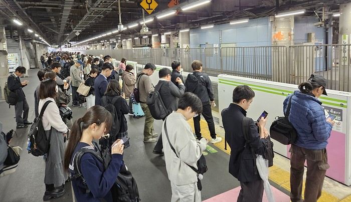
We got off the Yamanote Line at the station just after Shinjuku because it’s easier to exit that massive station with our luggage. So we ended up in Shin-Okubo, right in the Korean district. A 10-minute walk took us to Villa Fontaine Hotel. A great hotel, well-located north of the Kabukichō district. The room even seemed bigger than we’d expected.
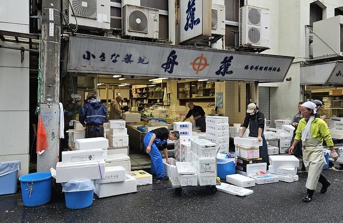 It was 15°C, but it rained—and kept raining on and off all day. Belgian weather, basically.
We went for a walk in Shinjuku Gyoen Park. Not as pretty in the rain, but the big greenhouse was interesting.
It was 15°C, but it rained—and kept raining on and off all day. Belgian weather, basically.
We went for a walk in Shinjuku Gyoen Park. Not as pretty in the rain, but the big greenhouse was interesting.
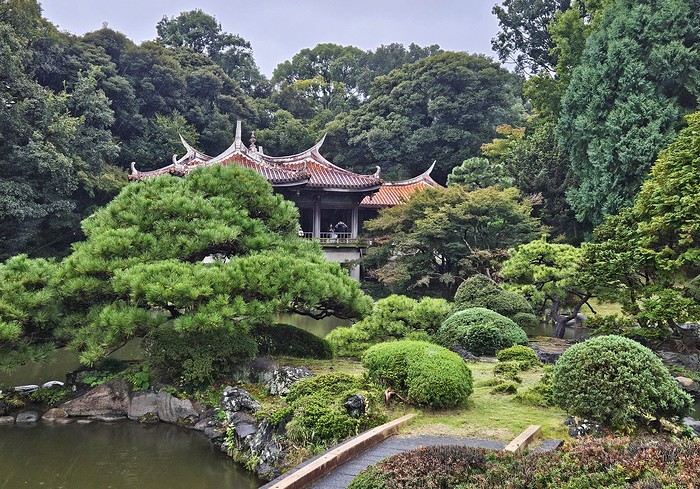
Then our first ramen (hearty and for 1000 ¥—pretty much the price of all our ramen during the trip). We headed back to the hotel since check-in was after 3 PM. Shower and relax before going out for dinner. Dinner was barbecue at Shichirin Yakiniku Anan (1700 ¥ each—good and cheap). Ordering via tablet wasn’t easy, but luckily it was in English.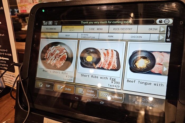
We ended the evening with a stroll through Kabukichō before a well-deserved sleep.
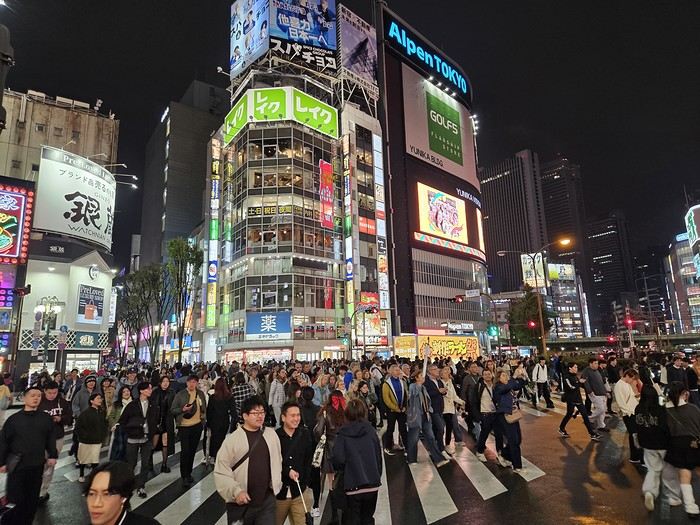
Day 1: Departure from Brussels (October 24, 2025) Early morning takeoff at 6 AM to Munich (1.5-hour layover) with Lufthansa, then a 12-hour flight with ANA, arriving the next morning at 7 AM at Tokyo Haneda.
Day 2: Arrival in Tokyo Airport formalities were quick. The eSIM we bought before leaving activated as soon as we landed (10 GB plan with Saily—more than enough for our mobile internet needs, mainly Google Maps and Google Translate). We’d received 4 ICOCA cards from our neighbors, which we loaded with 15000 ¥ each. We took the Keihin train, then the Yamanote Line. It’s easy to navigate since everything is in English, and each station is announced on scrolling displays in English too.
We got off the Yamanote Line at the station just after Shinjuku because it’s easier to exit that massive station with our luggage. So we ended up in Shin-Okubo, right in the Korean district. A 10-minute walk took us to Villa Fontaine Hotel. A great hotel, well-located north of the Kabukichō district. The room even seemed bigger than we’d expected.
It was 15°C, but it rained—and kept raining on and off all day. Belgian weather, basically.
We went for a walk in Shinjuku Gyoen Park. Not as pretty in the rain, but the big greenhouse was interesting.
Then our first ramen (hearty and for 1000 ¥—pretty much the price of all our ramen during the trip). We headed back to the hotel since check-in was after 3 PM. Shower and relax before going out for dinner. Dinner was barbecue at Shichirin Yakiniku Anan (1700 ¥ each—good and cheap). Ordering via tablet wasn’t easy, but luckily it was in English.
We ended the evening with a stroll through Kabukichō before a well-deserved sleep.
3 weeks in Bali in 2025
We’ve read it all about Bali: mass tourism, non-stop parties, ferry disasters, the kingdom of “Instagrammers,” pollution, “Bali belly”... But luckily, this island isn’t just about Kuta’s beaches and the Lempuyang Temple.
Sure, it’s not as exotic or off-the-beaten-path as other Indonesian islands (the Moluccas, Timor, Flores...), but we spent 3 weeks there and loved it!
Our (planned) itinerary in 7 stops: - Ubud (4 nights) - Sidemen (2 nights) - Gili Meno (3 nights) - Amed (2 nights) - Pemuteran (4 nights) - Munduk (2 nights) - Jatiluwih (2 nights)
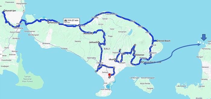
We booked our accommodations in advance, and for the rest (drivers, activities...), we took it day by day with help from the homestays (making sure to contact them a few days ahead via WhatsApp).
In the end, it’s an “easy” destination, very affordable, and one that’s managed to keep a certain authenticity.
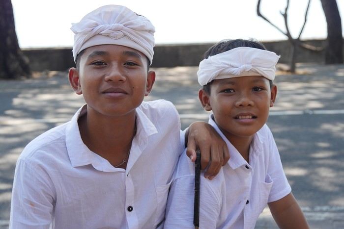
Sure, it’s not as exotic or off-the-beaten-path as other Indonesian islands (the Moluccas, Timor, Flores...), but we spent 3 weeks there and loved it!
Our (planned) itinerary in 7 stops: - Ubud (4 nights) - Sidemen (2 nights) - Gili Meno (3 nights) - Amed (2 nights) - Pemuteran (4 nights) - Munduk (2 nights) - Jatiluwih (2 nights)
We booked our accommodations in advance, and for the rest (drivers, activities...), we took it day by day with help from the homestays (making sure to contact them a few days ahead via WhatsApp).
In the end, it’s an “easy” destination, very affordable, and one that’s managed to keep a certain authenticity.
Review of a Norway cruise on the Emerald Princess in June 2025 (1)
Hello everyone,
I’ve wanted to take this Norway cruise for a very long time. The first time I booked it was in July 2020 with Azamara. Unfortunately, it was canceled, as everyone remembers. When I tried to book it again, the prices (already a bit high with Azamara) had simply doubled. So, since then, I’ve been keeping an eye out every year for any opportunities...
The last time we sailed with Princess was eleven years ago, and things didn’t go very well. I came back pretty unhappy with their service and quite disappointed. Despite the $600 they gave me as credit for a future cruise, I’d never set foot on one of their ships again.
But this time, the opportunity arose—a fantastic itinerary with lots of stops, a reasonable price for 16 nights (I’ll share the details in the conclusion), and a ship that’s not too big, so to speak, with only 3,000 passengers. I’m not expecting much from the cruise line this time and am boarding the ship with low expectations beyond the itinerary.
Princess has introduced an app to download before the cruise. It’s essential because online check-in is no longer available, and the agency doesn’t send a travel journal. Everything is done through the app. After completing the check-in on the app, we only know that we’ll need to pick up our key, the Medallion, at embarkation by following the blue line in the terminal and presenting our passport.
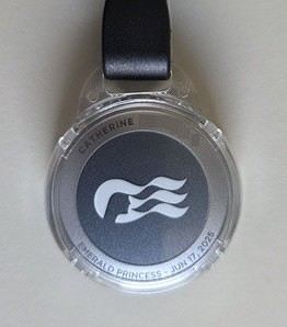
Up until our departure, the weather forecast for the coming week in Norway is disastrous—rain, rain, and more rain. It was pretty much the same two years ago before our Iceland cruise, and in the end, the weather turned out fine.
If you’re ready to embark on the Emerald Princess to discover this beautiful cruise and the stunning landscapes of Norway, let’s go!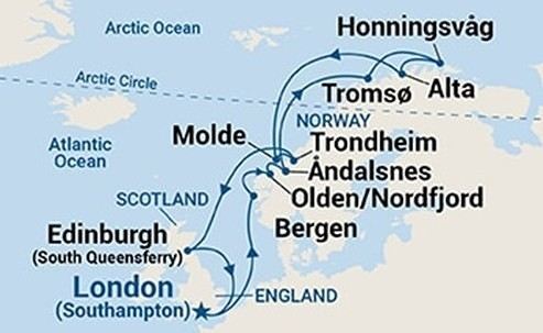
Southampton - Sea day - Bergen - Olden - Åndalsnes - Sea day - Tromsø - Honningsvåg (North Cape) - Alta - Sea day - Molde - Trondheim - Two sea days - Edinburgh - Sea day - Southampton
I’ve wanted to take this Norway cruise for a very long time. The first time I booked it was in July 2020 with Azamara. Unfortunately, it was canceled, as everyone remembers. When I tried to book it again, the prices (already a bit high with Azamara) had simply doubled. So, since then, I’ve been keeping an eye out every year for any opportunities...
The last time we sailed with Princess was eleven years ago, and things didn’t go very well. I came back pretty unhappy with their service and quite disappointed. Despite the $600 they gave me as credit for a future cruise, I’d never set foot on one of their ships again.
But this time, the opportunity arose—a fantastic itinerary with lots of stops, a reasonable price for 16 nights (I’ll share the details in the conclusion), and a ship that’s not too big, so to speak, with only 3,000 passengers. I’m not expecting much from the cruise line this time and am boarding the ship with low expectations beyond the itinerary.
Princess has introduced an app to download before the cruise. It’s essential because online check-in is no longer available, and the agency doesn’t send a travel journal. Everything is done through the app. After completing the check-in on the app, we only know that we’ll need to pick up our key, the Medallion, at embarkation by following the blue line in the terminal and presenting our passport.
Up until our departure, the weather forecast for the coming week in Norway is disastrous—rain, rain, and more rain. It was pretty much the same two years ago before our Iceland cruise, and in the end, the weather turned out fine.
If you’re ready to embark on the Emerald Princess to discover this beautiful cruise and the stunning landscapes of Norway, let’s go!
Southampton - Sea day - Bergen - Olden - Åndalsnes - Sea day - Tromsø - Honningsvåg (North Cape) - Alta - Sea day - Molde - Trondheim - Two sea days - Edinburgh - Sea day - Southampton
Come discover the island of Aruba in the Caribbean
Aruba is a small island in the Dutch Caribbean located off the coast of Venezuela. It’s part of the ABC islands (Aruba, Bonaire, Curaçao).
After visiting the island of Curaçao a few years earlier, we decided to explore Aruba in November 2023.
We stayed for three weeks in an Airbnb-style accommodation and rented a vehicle for the entire period to visit the various tourist attractions on the island.
These are listed below.
You’ll find several supermarkets (Carrefour, Super Food, Jumbo, etc.) as well as a wide variety of restaurants.
*****
Note:
Please be aware that since July 2024, Aruba has implemented a $20 sustainable development tax for visitors arriving by air.
This tax is payable via the online ED Card platform during the ED card application process to enter Aruba.
I invite you to continue reading this travel journal and watch the videos that will help you discover this sunny destination.
*****
Videos are embedded throughout the summary. Click on the image to start the video.
To jump to a specific post, here are the relevant links:
Noord - California Lighthouse Noord - Bubali Bird Sanctuary Paradera - Casibari Rock Formations Santa Cruz - Ayo Rock Formations Bushiribana - New Natural Pool (Cave Pool) Noord - Bushiribana Gold Mill Ruins Santa Cruz - Natural Bridge Oranjestad - Hooiberg San Nicolas - Seroe Colorado Natural Bridge Spanish Lagoon Mangrove Trail Shoco Habitat - Spanish Lagoon Oranjestad - Balashi Gold Mill Ruins San Nicolas - Lourdes Grotto Arikok National Park - Daimari Beach, Boka Keto Beach (Moro), Conchi Natural Pool Arikok National Park - Boca Prins Beach Arikok National Park - Fontein Cave Arikok National Park – Quadirikiri Cave Arikok National Park – Hike to Sero Arikok Oranjestad & Noord - Walking tour San Nicolas and its murals San Nicolas and its mosaic street benches The famous seafood restaurant Zeerover Noord - Snorkeling around the Baboo shipwreck Noord - Arashi Beach Noord - Boca Catalina Beach Noord - Boca Catalina Beach - Snorkeling Noord - Snorkeling at Tres Tapi - Turtle and Ray Noord - Snorkeling at Malmok Beach - Flying gurnards Noord - Hadicurari Beach (Fishermen's Huts) Noord - Palm Beach Noord - Eagle Beach Noord – Manchebo Beach Oranjestad - Divi Beach Oranjestad - Druif Beach Oranjestad - Surfside Beach Pos Chiquito - Mangel Halto Beach Savaneta - Santo Largo Beach Savaneta - Battata Beach San Nicolas - Rodgers Beach San Nicolas - Baby Beach San Nicolas - Baby Beach - Snorkeling San Nicolas - Bachelor’s Beach (Boca Tabla) San Nicolas - Boca Grandi Beach San Nicolas - Colorado Point - Snorkeling at Bachelors Beach San Nicolas - Grapefield Beach Hike - Blackstone Beach via Natural Bridge Noord - Wariruri Beach
After visiting the island of Curaçao a few years earlier, we decided to explore Aruba in November 2023.
We stayed for three weeks in an Airbnb-style accommodation and rented a vehicle for the entire period to visit the various tourist attractions on the island.
These are listed below.
You’ll find several supermarkets (Carrefour, Super Food, Jumbo, etc.) as well as a wide variety of restaurants.
*****
Note:
Please be aware that since July 2024, Aruba has implemented a $20 sustainable development tax for visitors arriving by air.
This tax is payable via the online ED Card platform during the ED card application process to enter Aruba.
I invite you to continue reading this travel journal and watch the videos that will help you discover this sunny destination.
*****
Videos are embedded throughout the summary. Click on the image to start the video.
To jump to a specific post, here are the relevant links:
Noord - California Lighthouse Noord - Bubali Bird Sanctuary Paradera - Casibari Rock Formations Santa Cruz - Ayo Rock Formations Bushiribana - New Natural Pool (Cave Pool) Noord - Bushiribana Gold Mill Ruins Santa Cruz - Natural Bridge Oranjestad - Hooiberg San Nicolas - Seroe Colorado Natural Bridge Spanish Lagoon Mangrove Trail Shoco Habitat - Spanish Lagoon Oranjestad - Balashi Gold Mill Ruins San Nicolas - Lourdes Grotto Arikok National Park - Daimari Beach, Boka Keto Beach (Moro), Conchi Natural Pool Arikok National Park - Boca Prins Beach Arikok National Park - Fontein Cave Arikok National Park – Quadirikiri Cave Arikok National Park – Hike to Sero Arikok Oranjestad & Noord - Walking tour San Nicolas and its murals San Nicolas and its mosaic street benches The famous seafood restaurant Zeerover Noord - Snorkeling around the Baboo shipwreck Noord - Arashi Beach Noord - Boca Catalina Beach Noord - Boca Catalina Beach - Snorkeling Noord - Snorkeling at Tres Tapi - Turtle and Ray Noord - Snorkeling at Malmok Beach - Flying gurnards Noord - Hadicurari Beach (Fishermen's Huts) Noord - Palm Beach Noord - Eagle Beach Noord – Manchebo Beach Oranjestad - Divi Beach Oranjestad - Druif Beach Oranjestad - Surfside Beach Pos Chiquito - Mangel Halto Beach Savaneta - Santo Largo Beach Savaneta - Battata Beach San Nicolas - Rodgers Beach San Nicolas - Baby Beach San Nicolas - Baby Beach - Snorkeling San Nicolas - Bachelor’s Beach (Boca Tabla) San Nicolas - Boca Grandi Beach San Nicolas - Colorado Point - Snorkeling at Bachelors Beach San Nicolas - Grapefield Beach Hike - Blackstone Beach via Natural Bridge Noord - Wariruri Beach
USA 2022 Road Trip
During our first road trip across the United States, we covered 23,000 km and crossed 28 states in 53 days.
Originally, we had planned to drive Route 66 all the way to Oatman in Arizona and visit various national parks in the American West over a two-month period.
This itinerary was planned before our departure, and all the relevant information had been gathered to stick to the schedule.
Everything went so smoothly that we finished visiting the national parks well ahead of our planned return date.
It helped that having a bed, a portable toilet, and a cooler in our vehicle gave us some autonomy since we didn’t have to worry about accommodation.
So, we decided to extend our road trip to the cities of Nashville and Memphis in Tennessee.
We then headed to Louisiana to visit Baton Rouge and New Orleans.
We crossed Mississippi and Alabama before driving along Florida’s west coast all the way to Key West.
We returned via Florida’s east coast and then crossed the eastern U.S. states to get back to Quebec through the Jackman border crossing in Maine.
So, I invite you to keep reading this long recap, which will let you discover the different attractions we visited throughout this amazing journey.
Videos are included throughout the recap. Click on the image to start the video.
To jump to a specific post, here are the relevant links:
Route 66 - Illinois & Missouri Route 66 - St. Louis (Missouri) - Gateway Arch National Park Route 66 - Cuba (Missouri) - City Murals Route 66 - Springfield (Missouri) - Fantastic Caverns Route 66 - Kansas & Oklahoma Route 66 - Texas & Arizona Route 66 - Texas - The Stations of the Cross in Groom Route 66 - Texas - Panhandle - VW Slug Bug Ranch Texas - Palo Duro Canyon State Park - Juniper Trails Texas - Palo Duro Canyon State Park - The Lighthouse Trail Route 66 - Texas - Amarillo - Cadillac Ranch Route 66 - New Mexico - Santa Rosa Blue Hole New Mexico - Bandelier National Monument - Alcove House Trail via Main Loop Trail New Mexico - Bandelier National Monument - Tsankawi Ruins Trail New Mexico - White Rock Overlook Route 66 - New Mexico - Albuquerque - Old Town New Mexico - White Sands National Park New Mexico - White Sands National Park - Dune Life Nature Trail New Mexico - White Sands National Park - Playa Trail New Mexico - White Sands National Park - Interdune Boardwalk New Mexico - Gila Cliff Dwellings National Monument New Mexico - Grants - Ice Cave & Bandera Volcano New Mexico - Gallup - Pyramide Rock Trail & Church Rock Trail Arizona - Holbrook - Painted Desert Arizona - Petrified Forest National Park - Puerco Pueblo & Newspaper Rock Viewpoint Arizona - Petrified Forest National Park - Blue Mesa Arizona - Petrified Forest National Park - The Teepees, Agate Bridge & Jasper Forest Overlook Arizona - Petrified Forest National Park - Crystal Forest Trail Arizona - Petrified Forest National Park - Giant Logs Trail Arizona - Winslow - Two Guns Ghost Town Arizona - Cameron - Little Colorado River Gorge Overlooks Arizona - Grand Canyon National Park - Shoshone Point Trail Arizona - Grand Canyon National Park - Desert View Drive Arizona - Grand Canyon National Park - Rim Route (Orange) & Village Route (Blue) Arizona - Grand Canyon National Park - Hermit Route (Red Line) Route 66 - Arizona - Historic Town of Oatman Arizona - Bullhead City Community Park Nevada - Red Rock Canyon - Calico I & II & Sandstone Quarry Nevada - Red Rock Canyon - Willow Springs Nevada - Red Rock Canyon Lookouts Nevada - Valley of Fire State Park - White Domes Trail Nevada - Valley of Fire State Park - Seven Wonders Trail, Pink Canyon, Fire Wave Nevada - Valley of Fire State Park - Rainbow Vista Trail Nevada - Valley of Fire State Park - Mouse's Tank Trail Nevada - Valley of Fire State Park - Rock Formations Nevada - Valley of Fire State Park - Scenic Routes Nevada - Cathedral Gorge State Park - Slot Canyons Nevada - Cathedral Gorge State Park - Eagle Point & Miller Point Utah - Bryce Canyon National Park - Mossy Cave & Tropic Ditch Waterfall Trail Utah - Bryce Canyon National Park - Scenic Drive Utah - Zion National Park - Pa'rus Trail Utah - Zion National Park - Sand Bench Trail Utah - Zion National Park - Emerald Pools Trail Utah - Zion National Park - West Rim Trail (Trail connecting to Angels Landing) Utah - Zion National Park - Riverside Walk Utah - Zion National Park - Court of The Patriarchs & Big Bend Utah - Zion National Park - Mount Carmel Highway Scenic Drive Utah - Kanab - Jackson Flat Reservoir Utah - Toadstools Trail in Grand Staircase-Escalante National Monument Arizona - Page - Glen Canyon Dam Overlook Arizona - Page - Glen Canyon National Recreation Area Arizona - Page - Horseshoe Bend Overlook Arizona - Page - Upper Antelope Canyon Arizona - Page - Navajo Canyon Boat Tour at Lake Powell Arizona - Page - Antelope Canyon X Arizona - Canyon de Chelly National Monument - Chelly Canyon Arizona - Canyon de Chelly National Monument - Canyon del Muerto Arizona - Monument Valley Navajo Tribal Park Utah - Mexican Hat Utah - Mexican Hat - Goosenecks State Park Utah - Mexican Hat - Valley of the Gods Utah - The Moki Dugway Scenic Backway Utah - Blanding - Natural Bridges National Monument Utah - Lake Powell - Hite Crossing Bridge Utah - Lake Powell - Glen Canyon National Recreation Area - Hite Overlook Utah - Capitol Reef National Park - Chimney Rock Loop Trail Utah - Capitol Reef National Park - Hickman Bridge Trail Utah - Capitol Reef National Park - Grand Wash Trail Utah - Capitol Reef National Park - Sunset Point Trail Utah - Capitol Reef National Park - Goosenecks Trail Utah - Capitol Reef National Park - Viewpoints - Fruita Area Utah - Capitol Reef National Park - Viewpoints - Scenic Drive Utah - Capitol Reef National Park - Cassidy Arch Trail Utah - Capitol Reef National Park - On the way to Capitol Gorge Trailhead Utah - Capitol Reef National Park - Capitol Gorge Trailhead Utah - Monroe - Mystic Hot Springs Utah - Scenic Overlooks on UT-24, UT-119 & I-70 Utah - Arches National Park - Park Avenue Trail Utah - Arches National Park - Courthouse Towers Section's Viewpoints Utah - Arches National Park - Balanced Rock, Pothole Arch, Ham Rock & Garden of Eden Utah - Arches National Park - Double Arch Trail, Cove Arch, Cove of Caves & Panorama Point Utah - Arches National Park - Windows Loop & Turret Arch Trail Utah - Arches National Park - Delicate Arch Trail Utah - Arches National Park - Upper Delicate Arch Viewpoint Trail Utah - Arches National Park - Fiery Furnace Section - Viewpoints Utah - Arches National Park - Sand Dune Arch Trail Utah - Arches National Park - Skyline Arch Trail Utah - Arches National Park - Devils Garden Trail Utah - Dead Horse Point State Park - West Rim Trail Utah - Dead Horse Point State Park - East Rim Trail Utah - Moab - Utah State Route 279 (Potash Road) Utah - Moab - Shafer Trail - Potash Evaporation Ponds Utah - Moab - Potash Road Dinosaur Tracks and Petroglyphs Utah - Moab - Potash Road - Corona, Bowtie & Pinto Arches Trail Utah - Moab - Potash Road - Wall Street Climbing Area Utah - Moab - Kane Springs Road Utah - Moab - Kane Springs Road - Side By Side Adventure Utah - Moab - Kane Springs Road to Moab Utah - Canyonlands National Park - Island in the Sky - Mesa Arch Trail Utah - Canyonlands National Park - Island in the Sky - Aztec Butte Trail Utah - Canyonlands National Park - Island in the Sky - Whale Rock Trail Utah - Canyonlands National Park - Island in the Sky - Upheaval Dome Trail Utah - Canyonlands National Park - Island in the Sky - Grand View Point Overlook Trail Utah - Canyonlands National Park - Island in the Sky - White Rim Overlook Trail Utah - Canyonlands National Park - Island in the Sky - Overlooks Utah - Moab - Wilson Arch Utah - Monticello - Newspaper Rock State Historical Monument Utah - Canyonlands National Park - The Needles - Road Side Ruin Trail Utah - Canyonlands National Park - The Needles - Cave Spring Trail Utah - Canyonlands National Park - The Needles - Pothole Point Trail Utah - Canyonlands National Park - The Needles - Big Spring Canyon Overlook Trail Utah - Canyonlands National Park - The Needles - Overlooks Colorado - Mesa Verde National Park - Mesa Top Ruins Road Colorado - Mesa Verde National Park - Chapin Mesa Road Colorado - Mesa Verde National Park - Mesa Top Loop Colorado - Mesa Verde National Park - Wetherill Mesa Road Colorado - Great Sand Dunes National Park Colorado - Mosca - Zapata Falls Colorado - Colorado Springs - Garden of the Gods Colorado - Black Canyon of the Gunnison National Park Colorado - Gunnison - Curecanti National Recreation Area Colorado - Gunnison - Blue Mesa Dam & Reservoir Colorado - Lake Pueblo State Park (Pueblo Reservoir) Kentucky - Mayfield, 5 months after an EF4 tornado Tennessee - Nashville - Downtown Walking Tour Tennessee - Graceland Mansion - Home of Elvis Presley Tennessee - Graceland - Lisa Marie & Hound Dog II Jets Tennessee - Graceland - Elvis Presley Automobile Museum & Exhibits Tennessee - Exploring Memphis Louisiana - Exploring Baton Rouge Louisiana - Exploring Lafayette Louisiana - Exploring Houma Louisiana - New Orleans - French Quarter Tour Louisiana - New Orleans - Garden District Tour Louisiana - New Orleans - Creole Queen Mississippi River Cruise Florida - Clearwater Beach Florida - Sanibel Island - Bowman's Beach Florida - Siesta Key Beach Florida - Captiva Island - Turner Beach Florida - Key Largo - Sunset Florida - Key West - Smathers Beach Florida - Miami Beach - Art Deco District Florida - Miami Beach South Carolina - Myrtle Beach Virginia - Virginia Beach Maine - Scarborough - Pine Point Beach
Originally, we had planned to drive Route 66 all the way to Oatman in Arizona and visit various national parks in the American West over a two-month period.
This itinerary was planned before our departure, and all the relevant information had been gathered to stick to the schedule.
Everything went so smoothly that we finished visiting the national parks well ahead of our planned return date.
It helped that having a bed, a portable toilet, and a cooler in our vehicle gave us some autonomy since we didn’t have to worry about accommodation.
So, we decided to extend our road trip to the cities of Nashville and Memphis in Tennessee.
We then headed to Louisiana to visit Baton Rouge and New Orleans.
We crossed Mississippi and Alabama before driving along Florida’s west coast all the way to Key West.
We returned via Florida’s east coast and then crossed the eastern U.S. states to get back to Quebec through the Jackman border crossing in Maine.
So, I invite you to keep reading this long recap, which will let you discover the different attractions we visited throughout this amazing journey.
Videos are included throughout the recap. Click on the image to start the video.
To jump to a specific post, here are the relevant links:
Route 66 - Illinois & Missouri Route 66 - St. Louis (Missouri) - Gateway Arch National Park Route 66 - Cuba (Missouri) - City Murals Route 66 - Springfield (Missouri) - Fantastic Caverns Route 66 - Kansas & Oklahoma Route 66 - Texas & Arizona Route 66 - Texas - The Stations of the Cross in Groom Route 66 - Texas - Panhandle - VW Slug Bug Ranch Texas - Palo Duro Canyon State Park - Juniper Trails Texas - Palo Duro Canyon State Park - The Lighthouse Trail Route 66 - Texas - Amarillo - Cadillac Ranch Route 66 - New Mexico - Santa Rosa Blue Hole New Mexico - Bandelier National Monument - Alcove House Trail via Main Loop Trail New Mexico - Bandelier National Monument - Tsankawi Ruins Trail New Mexico - White Rock Overlook Route 66 - New Mexico - Albuquerque - Old Town New Mexico - White Sands National Park New Mexico - White Sands National Park - Dune Life Nature Trail New Mexico - White Sands National Park - Playa Trail New Mexico - White Sands National Park - Interdune Boardwalk New Mexico - Gila Cliff Dwellings National Monument New Mexico - Grants - Ice Cave & Bandera Volcano New Mexico - Gallup - Pyramide Rock Trail & Church Rock Trail Arizona - Holbrook - Painted Desert Arizona - Petrified Forest National Park - Puerco Pueblo & Newspaper Rock Viewpoint Arizona - Petrified Forest National Park - Blue Mesa Arizona - Petrified Forest National Park - The Teepees, Agate Bridge & Jasper Forest Overlook Arizona - Petrified Forest National Park - Crystal Forest Trail Arizona - Petrified Forest National Park - Giant Logs Trail Arizona - Winslow - Two Guns Ghost Town Arizona - Cameron - Little Colorado River Gorge Overlooks Arizona - Grand Canyon National Park - Shoshone Point Trail Arizona - Grand Canyon National Park - Desert View Drive Arizona - Grand Canyon National Park - Rim Route (Orange) & Village Route (Blue) Arizona - Grand Canyon National Park - Hermit Route (Red Line) Route 66 - Arizona - Historic Town of Oatman Arizona - Bullhead City Community Park Nevada - Red Rock Canyon - Calico I & II & Sandstone Quarry Nevada - Red Rock Canyon - Willow Springs Nevada - Red Rock Canyon Lookouts Nevada - Valley of Fire State Park - White Domes Trail Nevada - Valley of Fire State Park - Seven Wonders Trail, Pink Canyon, Fire Wave Nevada - Valley of Fire State Park - Rainbow Vista Trail Nevada - Valley of Fire State Park - Mouse's Tank Trail Nevada - Valley of Fire State Park - Rock Formations Nevada - Valley of Fire State Park - Scenic Routes Nevada - Cathedral Gorge State Park - Slot Canyons Nevada - Cathedral Gorge State Park - Eagle Point & Miller Point Utah - Bryce Canyon National Park - Mossy Cave & Tropic Ditch Waterfall Trail Utah - Bryce Canyon National Park - Scenic Drive Utah - Zion National Park - Pa'rus Trail Utah - Zion National Park - Sand Bench Trail Utah - Zion National Park - Emerald Pools Trail Utah - Zion National Park - West Rim Trail (Trail connecting to Angels Landing) Utah - Zion National Park - Riverside Walk Utah - Zion National Park - Court of The Patriarchs & Big Bend Utah - Zion National Park - Mount Carmel Highway Scenic Drive Utah - Kanab - Jackson Flat Reservoir Utah - Toadstools Trail in Grand Staircase-Escalante National Monument Arizona - Page - Glen Canyon Dam Overlook Arizona - Page - Glen Canyon National Recreation Area Arizona - Page - Horseshoe Bend Overlook Arizona - Page - Upper Antelope Canyon Arizona - Page - Navajo Canyon Boat Tour at Lake Powell Arizona - Page - Antelope Canyon X Arizona - Canyon de Chelly National Monument - Chelly Canyon Arizona - Canyon de Chelly National Monument - Canyon del Muerto Arizona - Monument Valley Navajo Tribal Park Utah - Mexican Hat Utah - Mexican Hat - Goosenecks State Park Utah - Mexican Hat - Valley of the Gods Utah - The Moki Dugway Scenic Backway Utah - Blanding - Natural Bridges National Monument Utah - Lake Powell - Hite Crossing Bridge Utah - Lake Powell - Glen Canyon National Recreation Area - Hite Overlook Utah - Capitol Reef National Park - Chimney Rock Loop Trail Utah - Capitol Reef National Park - Hickman Bridge Trail Utah - Capitol Reef National Park - Grand Wash Trail Utah - Capitol Reef National Park - Sunset Point Trail Utah - Capitol Reef National Park - Goosenecks Trail Utah - Capitol Reef National Park - Viewpoints - Fruita Area Utah - Capitol Reef National Park - Viewpoints - Scenic Drive Utah - Capitol Reef National Park - Cassidy Arch Trail Utah - Capitol Reef National Park - On the way to Capitol Gorge Trailhead Utah - Capitol Reef National Park - Capitol Gorge Trailhead Utah - Monroe - Mystic Hot Springs Utah - Scenic Overlooks on UT-24, UT-119 & I-70 Utah - Arches National Park - Park Avenue Trail Utah - Arches National Park - Courthouse Towers Section's Viewpoints Utah - Arches National Park - Balanced Rock, Pothole Arch, Ham Rock & Garden of Eden Utah - Arches National Park - Double Arch Trail, Cove Arch, Cove of Caves & Panorama Point Utah - Arches National Park - Windows Loop & Turret Arch Trail Utah - Arches National Park - Delicate Arch Trail Utah - Arches National Park - Upper Delicate Arch Viewpoint Trail Utah - Arches National Park - Fiery Furnace Section - Viewpoints Utah - Arches National Park - Sand Dune Arch Trail Utah - Arches National Park - Skyline Arch Trail Utah - Arches National Park - Devils Garden Trail Utah - Dead Horse Point State Park - West Rim Trail Utah - Dead Horse Point State Park - East Rim Trail Utah - Moab - Utah State Route 279 (Potash Road) Utah - Moab - Shafer Trail - Potash Evaporation Ponds Utah - Moab - Potash Road Dinosaur Tracks and Petroglyphs Utah - Moab - Potash Road - Corona, Bowtie & Pinto Arches Trail Utah - Moab - Potash Road - Wall Street Climbing Area Utah - Moab - Kane Springs Road Utah - Moab - Kane Springs Road - Side By Side Adventure Utah - Moab - Kane Springs Road to Moab Utah - Canyonlands National Park - Island in the Sky - Mesa Arch Trail Utah - Canyonlands National Park - Island in the Sky - Aztec Butte Trail Utah - Canyonlands National Park - Island in the Sky - Whale Rock Trail Utah - Canyonlands National Park - Island in the Sky - Upheaval Dome Trail Utah - Canyonlands National Park - Island in the Sky - Grand View Point Overlook Trail Utah - Canyonlands National Park - Island in the Sky - White Rim Overlook Trail Utah - Canyonlands National Park - Island in the Sky - Overlooks Utah - Moab - Wilson Arch Utah - Monticello - Newspaper Rock State Historical Monument Utah - Canyonlands National Park - The Needles - Road Side Ruin Trail Utah - Canyonlands National Park - The Needles - Cave Spring Trail Utah - Canyonlands National Park - The Needles - Pothole Point Trail Utah - Canyonlands National Park - The Needles - Big Spring Canyon Overlook Trail Utah - Canyonlands National Park - The Needles - Overlooks Colorado - Mesa Verde National Park - Mesa Top Ruins Road Colorado - Mesa Verde National Park - Chapin Mesa Road Colorado - Mesa Verde National Park - Mesa Top Loop Colorado - Mesa Verde National Park - Wetherill Mesa Road Colorado - Great Sand Dunes National Park Colorado - Mosca - Zapata Falls Colorado - Colorado Springs - Garden of the Gods Colorado - Black Canyon of the Gunnison National Park Colorado - Gunnison - Curecanti National Recreation Area Colorado - Gunnison - Blue Mesa Dam & Reservoir Colorado - Lake Pueblo State Park (Pueblo Reservoir) Kentucky - Mayfield, 5 months after an EF4 tornado Tennessee - Nashville - Downtown Walking Tour Tennessee - Graceland Mansion - Home of Elvis Presley Tennessee - Graceland - Lisa Marie & Hound Dog II Jets Tennessee - Graceland - Elvis Presley Automobile Museum & Exhibits Tennessee - Exploring Memphis Louisiana - Exploring Baton Rouge Louisiana - Exploring Lafayette Louisiana - Exploring Houma Louisiana - New Orleans - French Quarter Tour Louisiana - New Orleans - Garden District Tour Louisiana - New Orleans - Creole Queen Mississippi River Cruise Florida - Clearwater Beach Florida - Sanibel Island - Bowman's Beach Florida - Siesta Key Beach Florida - Captiva Island - Turner Beach Florida - Key Largo - Sunset Florida - Key West - Smathers Beach Florida - Miami Beach - Art Deco District Florida - Miami Beach South Carolina - Myrtle Beach Virginia - Virginia Beach Maine - Scarborough - Pine Point Beach
Trip report: Coron and Palawan in the Philippines
Hi everyone,
We (two adults, 74 and 70 years old) had already shared a travel journal about our first trip to the Philippines in February/March 2019 on this forum (https://voyageforum.com/v.f?post=9377175;search_string=carnet%20philippines). We had visited Manila, the Banaue rice terraces, Sagada, the Visayas (Bohol, Siquijor, Dumaguette), and on our way back to Luzon, the Taal volcano before returning to France. Delighted by this trip, organized by the French-speaking agency Alizé, we decided to further explore this beautiful country, this time focusing on Coron and Palawan.
Before writing this journal, I should mention that these are personal comments and don’t reflect any differing opinions. Without any literary or photographic talent, I’ll stick to the facts and share a few details about the visits, hotels, and restaurants.
Preparations
We decided to return in mid-January 2025 and consulted three French-speaking tour operators to create a trip based on our wishes (places to visit, type of accommodation) and budget. Comparing three operators helped us weigh their advice and make our choices. Only our first operator respected the budget, a second came close, and the third proposed a slightly more upscale trip. In the end, we chose the agency from our first trip. Our discussions helped refine our itinerary, and when we reviewed it point by point, the document provided was perfect, full of great tips. The most debated point was a 3-day, 2-night cruise between Coron and Palawan. We were tempted but worried about being the only "older" travelers among younger people and feared two uncomfortable nights. Reassured by our tour operator, we finally opted for this "exploration." We’ll come back to that later. Once the choice was made and dates set, we booked our international flights with Cathay Pacific for 750 € per person, which offers the best schedules (short layovers) at an acceptable price for flights arriving in Cebu. Our trip started on February 25 and returned to Paris on March 15.
International flights
The round-trip flights went smoothly. Cathay does the job well, without frills. The service quality seems to have slightly declined compared to our previous trips with them. Hong Kong Airport is huge but very practical. Note that not all airlines serve Cebu. Recommendation: Fill out your Philippine entry form within 72 hours before your flight. This can prevent issues with the airline (possible boarding refusal) and saves a lot of time upon arrival (see the Philippine embassy website).
Domestic flights
For our two domestic flights—Cebu to Coron and Puerto Princesa to Cebu—our tour operator chose Philippine Airlines and their propeller planes. No problems there.
Day 1: We landed around 12 PM (local time) after 17 hours of travel. A driver was waiting for us at the airport exit and took us to our hotel, intentionally chosen near the airport (Mandaue, about 10 minutes away) to help us recover and get a good night’s sleep before our early morning domestic flight the next day. The Mayoo Hotel, reasonably priced, was perfect for this. Large, beautiful room in a new building—clean, comfortable, with a spa. We could relax by the pool on the 16th floor and enjoy the city view. The breakfast was exceptional, and the staff was smiling, attentive, and helpful. An ATM in the lobby allowed for withdrawals. However, the hotel is in a neighborhood with nothing to see or do. We dined at the Korean restaurant K-GOGI across from the hotel—a real attraction and a great discovery.
Day 2: After a restful night, we were driven to the airport around 6:30 AM for an 8:10 AM flight from Cebu to Busuanga (Coron).
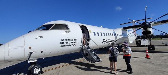
The flight was uneventful. Upon arrival, we paid 200 pesos per person for the Coron tourist fee before a 40-minute transfer to our hotel: Natura Resort, located outside the city in a secluded spot. The setting is stunning—a beautifully maintained tropical garden, a pleasant pool, and the option to book massages. The cottages are tropical-style with thatched roofs, simple and unpretentious.
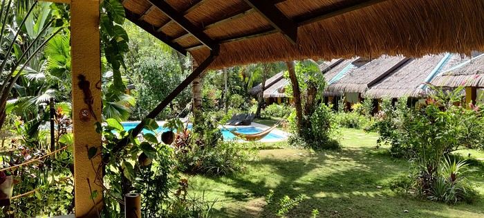
The owner, who speaks French, told us that given the heat and our ages, climbing the 721 steps to the top of Mount Tapyas wasn’t necessary. She gave us a few rooftop recommendations to watch the sunset over Coron Bay. After a good swim in the pool and a meal at the resort’s pleasant restaurant, we hired a tricycle to go into town. We were told it costs 150 pesos one way, and depending on the return time, it could exceed 250 pesos. But our driver gave us his WhatsApp number and charged the same price regardless of the time. He just earned two days’ worth of customers. He dropped us off at the port where bangkas (local boats) gather for day trips. It was the end of the day, so there was a rush. A few shops around the port sold waterproof bags for marine excursions at reasonable prices (compared to back home), after some bargaining. We wandered the town’s alleys looking for the Top Hotel, whose rooftop is famous. Indeed, it’s perfectly located to admire the sunset and enjoy a refreshing drink.
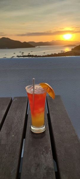
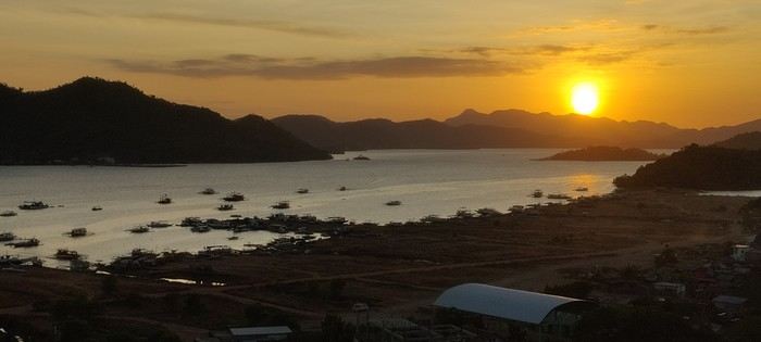
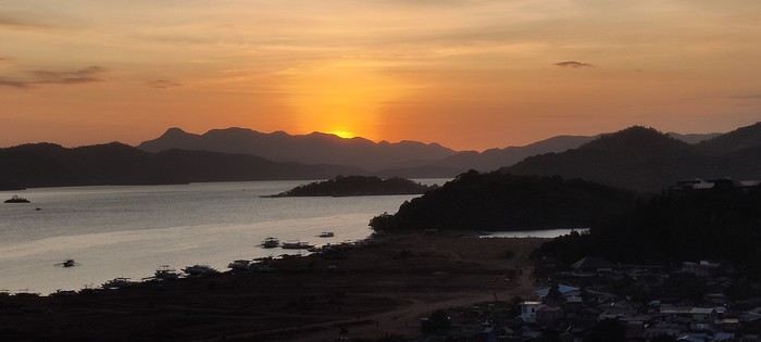
We dined nearby at a small Chinese restaurant, then just had to call our driver to head back. The night wasn’t entirely restful—our hotel had a soundtrack of all the countryside animals, and it seemed they had no set bedtime! :
Preparations
We decided to return in mid-January 2025 and consulted three French-speaking tour operators to create a trip based on our wishes (places to visit, type of accommodation) and budget. Comparing three operators helped us weigh their advice and make our choices. Only our first operator respected the budget, a second came close, and the third proposed a slightly more upscale trip. In the end, we chose the agency from our first trip. Our discussions helped refine our itinerary, and when we reviewed it point by point, the document provided was perfect, full of great tips. The most debated point was a 3-day, 2-night cruise between Coron and Palawan. We were tempted but worried about being the only "older" travelers among younger people and feared two uncomfortable nights. Reassured by our tour operator, we finally opted for this "exploration." We’ll come back to that later. Once the choice was made and dates set, we booked our international flights with Cathay Pacific for 750 € per person, which offers the best schedules (short layovers) at an acceptable price for flights arriving in Cebu. Our trip started on February 25 and returned to Paris on March 15.
International flights
The round-trip flights went smoothly. Cathay does the job well, without frills. The service quality seems to have slightly declined compared to our previous trips with them. Hong Kong Airport is huge but very practical. Note that not all airlines serve Cebu. Recommendation: Fill out your Philippine entry form within 72 hours before your flight. This can prevent issues with the airline (possible boarding refusal) and saves a lot of time upon arrival (see the Philippine embassy website).
Domestic flights
For our two domestic flights—Cebu to Coron and Puerto Princesa to Cebu—our tour operator chose Philippine Airlines and their propeller planes. No problems there.
Day 1: We landed around 12 PM (local time) after 17 hours of travel. A driver was waiting for us at the airport exit and took us to our hotel, intentionally chosen near the airport (Mandaue, about 10 minutes away) to help us recover and get a good night’s sleep before our early morning domestic flight the next day. The Mayoo Hotel, reasonably priced, was perfect for this. Large, beautiful room in a new building—clean, comfortable, with a spa. We could relax by the pool on the 16th floor and enjoy the city view. The breakfast was exceptional, and the staff was smiling, attentive, and helpful. An ATM in the lobby allowed for withdrawals. However, the hotel is in a neighborhood with nothing to see or do. We dined at the Korean restaurant K-GOGI across from the hotel—a real attraction and a great discovery.
Day 2: After a restful night, we were driven to the airport around 6:30 AM for an 8:10 AM flight from Cebu to Busuanga (Coron).
The flight was uneventful. Upon arrival, we paid 200 pesos per person for the Coron tourist fee before a 40-minute transfer to our hotel: Natura Resort, located outside the city in a secluded spot. The setting is stunning—a beautifully maintained tropical garden, a pleasant pool, and the option to book massages. The cottages are tropical-style with thatched roofs, simple and unpretentious.
The owner, who speaks French, told us that given the heat and our ages, climbing the 721 steps to the top of Mount Tapyas wasn’t necessary. She gave us a few rooftop recommendations to watch the sunset over Coron Bay. After a good swim in the pool and a meal at the resort’s pleasant restaurant, we hired a tricycle to go into town. We were told it costs 150 pesos one way, and depending on the return time, it could exceed 250 pesos. But our driver gave us his WhatsApp number and charged the same price regardless of the time. He just earned two days’ worth of customers. He dropped us off at the port where bangkas (local boats) gather for day trips. It was the end of the day, so there was a rush. A few shops around the port sold waterproof bags for marine excursions at reasonable prices (compared to back home), after some bargaining. We wandered the town’s alleys looking for the Top Hotel, whose rooftop is famous. Indeed, it’s perfectly located to admire the sunset and enjoy a refreshing drink.
We dined nearby at a small Chinese restaurant, then just had to call our driver to head back. The night wasn’t entirely restful—our hotel had a soundtrack of all the countryside animals, and it seemed they had no set bedtime! :
Uzbek notes
The Afrosiyob races through a premature twilight, lashed by a blizzard of thick snow. In the endless gray, a monumental industrial complex occasionally emerges, ghostly. Here and there, in the middle of nowhere, a human silhouette appears (a soldier?), standing motionless by the tracks. On the screen mounted in the middle of the ceiling, a dashing Bollywood cat in vibrant colors writhes in all directions, throwing smoldering glances at a dancer on the verge of fainting. A server moves down the central aisle, offering crepes for sale—ones I suspect are stuffed with ground beef. I’m in Central Asia, in Uzbekistan, somewhere between Bukhara and Samarkand.
I chose the title "notes"—scattered thoughts, rough drafts. I’m not sure what I’ll write, but one thing’s certain: this won’t be a linear travel journal.
And a photo... there must be a photo, so here:
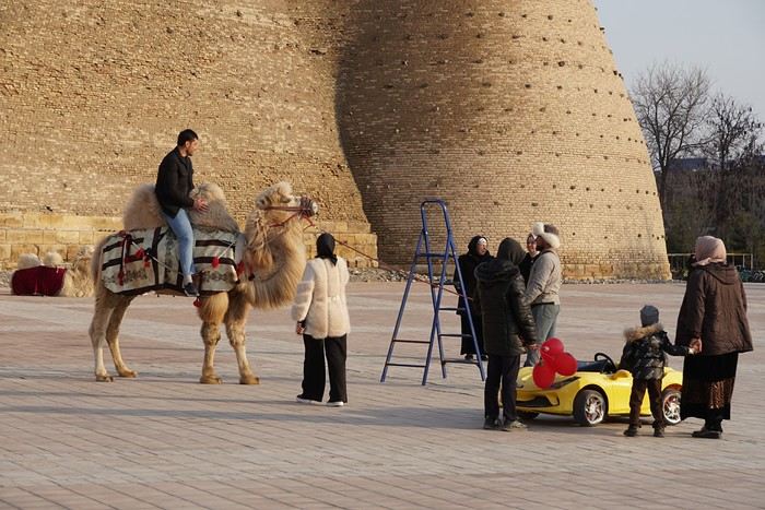
Local tourists between a Bactrian camel and an electric car, in front of ancient walls—it’ll do.
I chose the title "notes"—scattered thoughts, rough drafts. I’m not sure what I’ll write, but one thing’s certain: this won’t be a linear travel journal.
And a photo... there must be a photo, so here:
Local tourists between a Bactrian camel and an electric car, in front of ancient walls—it’ll do.
What are the criteria that make you choose one destination over another?
Hi there,
The title might be a bit long, but I hope it’s completely understandable!
When it comes to choosing your next trip, what tips the scales in favor of Eritrea over Ibiza?
Why pick Canada over French Polynesia?
The price? A magazine or TV report, a travel journal, an Instagram ad? Ease of travel? Minimal time difference? The country that has the most in common with all the trip participants? Activities? Relaxation? The desire to push your limits?
A photo?
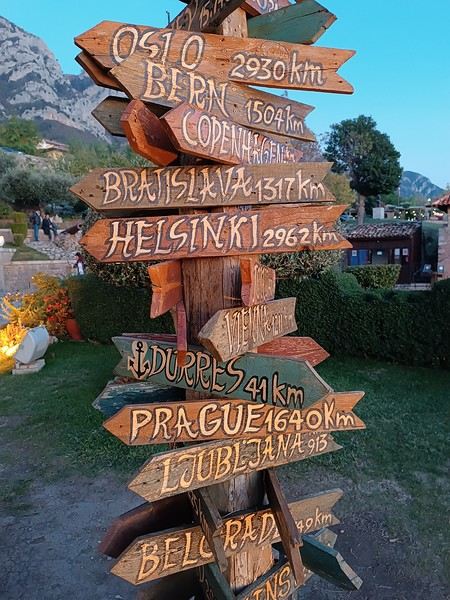
What else, I wonder...
Personally, I often prioritize simple destinations (no administrative hassles), where I’m not at risk (nothing extraordinary like getting kidnapped by Daesh or ending up in a jail cell because the current geopolitics aren’t favorable to my passport, etc.), and where I can drive.
Wide-open natural spaces are more my thing than urban anthills.
Finally, I try not to spend three days on a plane to reach my destination, and I aim for a maximum budget of 3500 € (for 3 weeks) in comfortable conditions—that means charming hotels, good meals, etc.
What about you?🙂
The title might be a bit long, but I hope it’s completely understandable!
When it comes to choosing your next trip, what tips the scales in favor of Eritrea over Ibiza?
Why pick Canada over French Polynesia?
The price? A magazine or TV report, a travel journal, an Instagram ad? Ease of travel? Minimal time difference? The country that has the most in common with all the trip participants? Activities? Relaxation? The desire to push your limits?
A photo?
What else, I wonder...
Personally, I often prioritize simple destinations (no administrative hassles), where I’m not at risk (nothing extraordinary like getting kidnapped by Daesh or ending up in a jail cell because the current geopolitics aren’t favorable to my passport, etc.), and where I can drive.
Wide-open natural spaces are more my thing than urban anthills.
Finally, I try not to spend three days on a plane to reach my destination, and I aim for a maximum budget of 3500 € (for 3 weeks) in comfortable conditions—that means charming hotels, good meals, etc.
What about you?🙂
Sri Lanka Trip Report – December 2024
Hi there,
I just got back from a trip to Sri Lanka from December 18th to January 1st with 2 adults and 2 kids (12 years old).
If it helps, here’s my itinerary.
We left on December 18th from Madrid with Qatar Airways. No complaints. I booked my tickets back in March for 800 € per person. (I flew from Madrid because I live near the Spanish border and was too worried about strikes in France.) We arrived on December 19th at 4 PM (local time). Before leaving France, I’d booked a taxi through MyTransfer for 59 € to Sigiriya. A van was waiting for us at the airport exit. A never-ending 3-hour drive to Sigiriya. We stayed at Samana Guesthouse—very simple, clean, with a pool and an excellent Sri Lankan breakfast. Shower and straight to bed.
Friday, December 20th: Beautiful weather, but very humid and hot. We visited Lion Rock (36 € for adults) and then Pidurangala. I loved both sites—they’re a must-do in my opinion. Spent the late afternoon by the pool.
Saturday, December 21st: Another gorgeous day. The guesthouse manager offered us a free 2-hour tuk-tuk tour. We first visited a lake, rice fields, the temple, and the Sigiriya market, plus the usual tourist trap—the botanical garden (no pressure to buy anything at the end). Then we took a tuk-tuk to Dambulla Temple, the Golden Buddha, and the wholesale market.
Sunday, December 22nd: Still beautiful weather. I’d booked a taxi for 8 AM. We did all the long trips by taxi to save time. I’d ask for prices from 2 or 3 WhatsApp taxi agencies 2 days or the day before—super responsive, always got replies within 5 minutes. We headed to Ella (4-hour drive) for 22,000 LKR. Arrived in the afternoon at Rest Full Homestay—a small, family-run guesthouse. Clean, cozy, and an amazing Sri Lankan breakfast. In the afternoon, we went to Nine Arches Bridge. It was a Sunday, a Sri Lankan holiday, so it was *packed*—mostly locals and very few white tourists! Even though it was crowded, it was cool because it was all Sri Lankans. We waited an hour for the train. It’s worth seeing, but honestly, I didn’t think it was that amazing. Then we headed to the station to check if we needed to book tickets for the train to Haputale—turns out, no.
Monday, December 23rd: Beautiful weather. We hiked Ella Rock—a gorgeous trek. The final stretch is steep but shaded, so it wasn’t as tough as I’d read. The whole hike is stunning from start to finish. We saw the train pass twice (one blue, one red) and lots of women picking tea. After that, we did Little Adam’s Peak. It’s not hard, but it was *packed* with tourists—meh. Luckily, at the top, you can walk a bit farther (down one side and back up) to get some space to yourself. What I *didn’t* like was the commercial vibe at the big café/restaurant with a pool at the entrance of Little Adam’s Peak. Loud music, all that money being made right next to little souvenir stands run by Sri Lankans or tea-picking women. Felt off. Ended the day buying souvenirs at one of the few shops we found during the trip.
Tuesday, December 24th: Beautiful weather. Took the train to Haputale. We got to the station 30 minutes before the 9:30 AM train. We could’ve taken 2nd or 3rd class—I went with 2nd (160 LKR per person). It was crowded, but we managed to get seats—first 2, then 3. Only a 1-hour ride, but I *loved* it—windows and doors open the whole time. Arrived in Haputale around 11 AM, and the mist was already rolling in. We walked to our guesthouse, The Mist Holiday Bungalow. Simple but clean, with a great view of the tea plantations. The owner’s wife is Vietnamese and used to work for French tour operators, so her French is still pretty good—helpful for us since our English is terrible. They booked us a tuk-tuk for 4:45 AM the next day (2,000 LKR) to Lipton’s Seat. Spent the afternoon wandering around Haputale. Not much charm, but there’s a nice fruit and veggie market and a short walk through the tea plantations.
Wednesday, December 25th: Beautiful weather. The tuk-tuk was on time to take us to Lipton’s Seat. We were the first ones there—the sky was just starting to turn pink. In the end, only about ten of us watched the sunrise. The guesthouse had packed us breakfast, and we walked back down (half on the road, half through the plantations). Didn’t see any tea picking since it was Christmas, but the walk was still incredible. We took detours through villages full of kids. After that, we visited the tea factory. The tour was really interesting, and we took the bus back down to Haputale. Such a great moment—whole families were heading to mass, dressed up and made up. All so beautiful.
At noon, we left for Udawalawe National Park. Taxi for 14,000 LKR. Stayed at River Inn Safari Cottage. *Warning*: It’s the same place as Eagle Safari Cottage. I don’t recommend it. We’d always stayed with families before, but here it was just staff—totally different vibe. The pool was nice but not very clean (water was murky). The bungalow was big and fine, but it was brand new—so new the asphalt floor wasn’t fully dry. It’s in the middle of nowhere, so we had to eat on-site. Couldn’t leave a review on Booking because they never confirmed we’d stayed, and they canceled our reservation the next day.
Thursday, December 26th: Beautiful weather. I’d booked a safari through the hotel for 5:30–10 AM for 54 USD. Honestly, yes, there are a lot of jeeps, but it was great. The kids loved it—we saw everything there was to see. Left by taxi at 11:30 AM for Welligama (12,000 LKR). We didn’t stay in Welligama city but at Coconut Beach, between Welligama and Midigama. *Total crush* on the guesthouse: Sky Mountain Café with View. Such a lovely family. The mom makes amazing meals at reasonable prices. The view from the hill over the sea is unreal. Spent the afternoon walking along the beach.
Friday, December 27th: Beautiful weather. My kids are surfers. Unfortunately, there weren’t any boards their size to rent at Coconut, so we took a tuk-tuk to Welligama Bay (1,000 LKR). They surfed from 8 AM to 5 PM—rental was 5,000 LKR for the day. Meanwhile, we walked the beach and swam. Water was 29°C.
Saturday, December 28th: Beautiful weather, rain from 4 PM until midnight. Same surf day. They were so well-behaved the whole trip, so this was their reward.
Sunday, December 29th: Beautiful weather. Beach day at Coconut. *Warning*: It’s a reef break. For surfers, there are three spots (Coconut Left, Middle, and Right). The boys bodysurfed (with fins) all morning, and at 1 PM, we took the bus to Hikkaduwa. Stayed at Hotel Universal Beach. Nothing special—right on the water, but the rooms were dark even though they were clean. The manager was super nice, but the rest was meh, and breakfast was mediocre compared to what we’d had before (2 eggs and 3 slices of toast). Plus, it was late—8 AM. First impression of Hikkaduwa wasn’t great—way too many Russians for our taste.
Monday, December 30th: Beautiful weather. Spent the whole day exploring. Turtle Beach, then the other side of the beach (toward Galle) near the fishing port. The beach there is much wider, with scattered hotels and super quiet. It’s beautiful—I should’ve booked somewhere in that area. Ended up having a great day away from the crowds.
Tuesday, December 31st: Overcast, then beautiful, rain at 4 PM. Had to end the year (and the trip) with some surf. Rented boards for the kids (3,000 LKR per board for the day). Bad luck—the waves were on a reef break but small. Not great for them, but no big deal. They still got out of the water by 2 PM. Walked the beach (which is gorgeous), had a juice, and went for a swim. Then back to surfing in the rain at 4 PM.
Wednesday, January 1st: Left by taxi at 5 AM (18,000 LKR). Flight at 10 AM. Arrived in Madrid at 8 PM.
We left on December 18th from Madrid with Qatar Airways. No complaints. I booked my tickets back in March for 800 € per person. (I flew from Madrid because I live near the Spanish border and was too worried about strikes in France.) We arrived on December 19th at 4 PM (local time). Before leaving France, I’d booked a taxi through MyTransfer for 59 € to Sigiriya. A van was waiting for us at the airport exit. A never-ending 3-hour drive to Sigiriya. We stayed at Samana Guesthouse—very simple, clean, with a pool and an excellent Sri Lankan breakfast. Shower and straight to bed.
Friday, December 20th: Beautiful weather, but very humid and hot. We visited Lion Rock (36 € for adults) and then Pidurangala. I loved both sites—they’re a must-do in my opinion. Spent the late afternoon by the pool.
Saturday, December 21st: Another gorgeous day. The guesthouse manager offered us a free 2-hour tuk-tuk tour. We first visited a lake, rice fields, the temple, and the Sigiriya market, plus the usual tourist trap—the botanical garden (no pressure to buy anything at the end). Then we took a tuk-tuk to Dambulla Temple, the Golden Buddha, and the wholesale market.
Sunday, December 22nd: Still beautiful weather. I’d booked a taxi for 8 AM. We did all the long trips by taxi to save time. I’d ask for prices from 2 or 3 WhatsApp taxi agencies 2 days or the day before—super responsive, always got replies within 5 minutes. We headed to Ella (4-hour drive) for 22,000 LKR. Arrived in the afternoon at Rest Full Homestay—a small, family-run guesthouse. Clean, cozy, and an amazing Sri Lankan breakfast. In the afternoon, we went to Nine Arches Bridge. It was a Sunday, a Sri Lankan holiday, so it was *packed*—mostly locals and very few white tourists! Even though it was crowded, it was cool because it was all Sri Lankans. We waited an hour for the train. It’s worth seeing, but honestly, I didn’t think it was that amazing. Then we headed to the station to check if we needed to book tickets for the train to Haputale—turns out, no.
Monday, December 23rd: Beautiful weather. We hiked Ella Rock—a gorgeous trek. The final stretch is steep but shaded, so it wasn’t as tough as I’d read. The whole hike is stunning from start to finish. We saw the train pass twice (one blue, one red) and lots of women picking tea. After that, we did Little Adam’s Peak. It’s not hard, but it was *packed* with tourists—meh. Luckily, at the top, you can walk a bit farther (down one side and back up) to get some space to yourself. What I *didn’t* like was the commercial vibe at the big café/restaurant with a pool at the entrance of Little Adam’s Peak. Loud music, all that money being made right next to little souvenir stands run by Sri Lankans or tea-picking women. Felt off. Ended the day buying souvenirs at one of the few shops we found during the trip.
Tuesday, December 24th: Beautiful weather. Took the train to Haputale. We got to the station 30 minutes before the 9:30 AM train. We could’ve taken 2nd or 3rd class—I went with 2nd (160 LKR per person). It was crowded, but we managed to get seats—first 2, then 3. Only a 1-hour ride, but I *loved* it—windows and doors open the whole time. Arrived in Haputale around 11 AM, and the mist was already rolling in. We walked to our guesthouse, The Mist Holiday Bungalow. Simple but clean, with a great view of the tea plantations. The owner’s wife is Vietnamese and used to work for French tour operators, so her French is still pretty good—helpful for us since our English is terrible. They booked us a tuk-tuk for 4:45 AM the next day (2,000 LKR) to Lipton’s Seat. Spent the afternoon wandering around Haputale. Not much charm, but there’s a nice fruit and veggie market and a short walk through the tea plantations.
Wednesday, December 25th: Beautiful weather. The tuk-tuk was on time to take us to Lipton’s Seat. We were the first ones there—the sky was just starting to turn pink. In the end, only about ten of us watched the sunrise. The guesthouse had packed us breakfast, and we walked back down (half on the road, half through the plantations). Didn’t see any tea picking since it was Christmas, but the walk was still incredible. We took detours through villages full of kids. After that, we visited the tea factory. The tour was really interesting, and we took the bus back down to Haputale. Such a great moment—whole families were heading to mass, dressed up and made up. All so beautiful.
At noon, we left for Udawalawe National Park. Taxi for 14,000 LKR. Stayed at River Inn Safari Cottage. *Warning*: It’s the same place as Eagle Safari Cottage. I don’t recommend it. We’d always stayed with families before, but here it was just staff—totally different vibe. The pool was nice but not very clean (water was murky). The bungalow was big and fine, but it was brand new—so new the asphalt floor wasn’t fully dry. It’s in the middle of nowhere, so we had to eat on-site. Couldn’t leave a review on Booking because they never confirmed we’d stayed, and they canceled our reservation the next day.
Thursday, December 26th: Beautiful weather. I’d booked a safari through the hotel for 5:30–10 AM for 54 USD. Honestly, yes, there are a lot of jeeps, but it was great. The kids loved it—we saw everything there was to see. Left by taxi at 11:30 AM for Welligama (12,000 LKR). We didn’t stay in Welligama city but at Coconut Beach, between Welligama and Midigama. *Total crush* on the guesthouse: Sky Mountain Café with View. Such a lovely family. The mom makes amazing meals at reasonable prices. The view from the hill over the sea is unreal. Spent the afternoon walking along the beach.
Friday, December 27th: Beautiful weather. My kids are surfers. Unfortunately, there weren’t any boards their size to rent at Coconut, so we took a tuk-tuk to Welligama Bay (1,000 LKR). They surfed from 8 AM to 5 PM—rental was 5,000 LKR for the day. Meanwhile, we walked the beach and swam. Water was 29°C.
Saturday, December 28th: Beautiful weather, rain from 4 PM until midnight. Same surf day. They were so well-behaved the whole trip, so this was their reward.
Sunday, December 29th: Beautiful weather. Beach day at Coconut. *Warning*: It’s a reef break. For surfers, there are three spots (Coconut Left, Middle, and Right). The boys bodysurfed (with fins) all morning, and at 1 PM, we took the bus to Hikkaduwa. Stayed at Hotel Universal Beach. Nothing special—right on the water, but the rooms were dark even though they were clean. The manager was super nice, but the rest was meh, and breakfast was mediocre compared to what we’d had before (2 eggs and 3 slices of toast). Plus, it was late—8 AM. First impression of Hikkaduwa wasn’t great—way too many Russians for our taste.
Monday, December 30th: Beautiful weather. Spent the whole day exploring. Turtle Beach, then the other side of the beach (toward Galle) near the fishing port. The beach there is much wider, with scattered hotels and super quiet. It’s beautiful—I should’ve booked somewhere in that area. Ended up having a great day away from the crowds.
Tuesday, December 31st: Overcast, then beautiful, rain at 4 PM. Had to end the year (and the trip) with some surf. Rented boards for the kids (3,000 LKR per board for the day). Bad luck—the waves were on a reef break but small. Not great for them, but no big deal. They still got out of the water by 2 PM. Walked the beach (which is gorgeous), had a juice, and went for a swim. Then back to surfing in the rain at 4 PM.
Wednesday, January 1st: Left by taxi at 5 AM (18,000 LKR). Flight at 10 AM. Arrived in Madrid at 8 PM.
Texas, Louisiana, and a Touch of Florida
After five trips to the American West, we had planned to switch countries and continents to visit Turkey. However, by the time we made up our minds, flight ticket prices had nearly doubled, reaching 400 € for a round-trip ticket. A bit disappointed, I started looking at transatlantic flight prices and stumbled upon discounted tickets from Basel-Mulhouse to Dallas—at the same price as our tickets to Turkey!
No hesitation needed; we bought the five tickets for a total of 1,860 € excluding baggage!
From Fort Worth Airport, we had two options: - Head west on a loop through Texas, New Mexico, and southern Colorado - Head east to change the scenery and explore East Texas, Louisiana, with a possible detour into Florida.
The latter option won unanimously, so here we are, off to discover new states, mainly Louisiana and Texas.
One of the main post-COVID challenges is finding a reasonably priced car rental. After an initial booking around 1,300 €, we kept an eye on prices a few weeks before departure and managed to snag a better deal at around 900 € for a comfortable sedan.
Yes, this summer will also be a first: no 4x4, no camping, and plenty of restaurants!
As always, I’ve planned a packed itinerary, ready to adjust on the go. A few weeks before departure, we learned we’d be at full capacity—our eldest son, Maxime, got his first-year med school results. By finishing as a top admit, he avoided the mandatory July-August internship that would’ve kept him from joining us. Instead, he wrapped up his internship at the last minute the night before our big departure.
We’ll get to savor these special moments together.
The itinerary: Day 1 - 07/15: Fort Worth Day 2: Dallas Day 3: Jefferson - Caddo Lake Day 4: Black Bayou Lake - Natchez - Stanton Hall and Rosalie Mansion Day 5: St. Francisville - Rosedown Plantation - Cat Island Wildlife Refuge Day 6: Mobile - USS Alabama Battleship Memorial Park Day 7 - 8: Pensacola Beach Day 9: Bellingrath Gardens - New Orleans Day 10 - 11: New Orleans Day 12: Plantation Route Day 13: Jungle Gardens - Tabasco Factory - Vermilionville - Lake Martin Day 14: Baton Rouge - USS Kidd Day 15: Houma - Cajun Man's Swamp Tour Day 16: Galveston, Texas Day 17: Space Center Houston - Painted Churches Day 18: San Antonio Day 19: Texas Hill Country Day 20: Texas Hill Country and evening in San Antonio Day 21: Austin and Waco
Day 0 - 07/14: The departure timing isn’t exactly relaxing. On Thursday late afternoon, we hit the road to Alsace, aiming to drop off our two cockers with family before reaching the airport at 2 AM for a 3-hour power nap. Not exactly fresh, we arrive at the terminal looking for a British Airways counter. None in sight, so we try our luck at a United Airlines counter—who knows, maybe it’ll work out. And bingo! The agent checks us in. We didn’t quite understand why, but maybe there’s some agreement between airlines. For the first time, we’re traveling without checked baggage, so no extra fees. Not a huge feat, given the scorching temperatures awaiting us!
The connecting flight to London goes smoothly.
During the layover, liquid checks get stricter—now requiring small bottles to be in a pre-approved clear bag, with only one bag allowed per passenger. Normally, no big deal, but between deodorant, sunscreen, after-sun lotion, hand sanitizer, contact lens solution, etc., we spend 20 minutes optimizing the arrangement! When we finally succeed, one of the security staff bursts out laughing and congratulates us!
With our stomachs growling, we grab an American breakfast before browsing the airport shops.
We then discover our plane for the long-haul flight and are thrilled to see it’s an A380—a first for Laetitia, though the rest of the family experienced it during our winter getaway. Still just as impressive!
With a hint of uncertainty, we take off for the States—my third trip in barely 12 months. This time, no endless badlands, canyons, slot canyons, hoodoos, or brain rocks, but a journey through five states (Texas, Louisiana, a quick stop in Mississippi, Alabama, and the northwest tip of Florida), where we hope to soak up a unique vibe... with a packed schedule of diverse visits.
Arrival at Fort Worth Airport and customs go smoothly. Since we have no checked baggage, we’re first in line at the Dollar counter. In just 3 minutes, the formalities are done. We decline the Toll Pass, which I don’t think we’ll need based on my "calculations," and head to the Dollar parking lot, where an employee tells us we can pick any car we want!
There are about thirty cars waiting. Too many choices!
After last year’s mishap in Oakland, where our 4x4’s trunk was broken into, we’re looking for a sedan to hide our luggage this time. Unfortunately, there are none—only SUVs. We finally settle on a comfortable 7-seater Ford SUV with a massive trunk when set up for five.
On the road from Fort Worth to Dallas, we accidentally take a toll highway without realizing until it’s too late to exit. Let’s hope Dollar doesn’t charge us a week’s worth of their pricey Toll Pass for a $2 toll. We’ll see... In the meantime, Maxime sets up Google Maps to avoid toll roads.
Since it’s not too late, we stop by the nearest Walmart for groceries before checking into our hotel room for three nights in East Dallas suburb.
No hesitation needed; we bought the five tickets for a total of 1,860 € excluding baggage!
From Fort Worth Airport, we had two options: - Head west on a loop through Texas, New Mexico, and southern Colorado - Head east to change the scenery and explore East Texas, Louisiana, with a possible detour into Florida.
The latter option won unanimously, so here we are, off to discover new states, mainly Louisiana and Texas.
One of the main post-COVID challenges is finding a reasonably priced car rental. After an initial booking around 1,300 €, we kept an eye on prices a few weeks before departure and managed to snag a better deal at around 900 € for a comfortable sedan.
Yes, this summer will also be a first: no 4x4, no camping, and plenty of restaurants!
As always, I’ve planned a packed itinerary, ready to adjust on the go. A few weeks before departure, we learned we’d be at full capacity—our eldest son, Maxime, got his first-year med school results. By finishing as a top admit, he avoided the mandatory July-August internship that would’ve kept him from joining us. Instead, he wrapped up his internship at the last minute the night before our big departure.
We’ll get to savor these special moments together.
The itinerary: Day 1 - 07/15: Fort Worth Day 2: Dallas Day 3: Jefferson - Caddo Lake Day 4: Black Bayou Lake - Natchez - Stanton Hall and Rosalie Mansion Day 5: St. Francisville - Rosedown Plantation - Cat Island Wildlife Refuge Day 6: Mobile - USS Alabama Battleship Memorial Park Day 7 - 8: Pensacola Beach Day 9: Bellingrath Gardens - New Orleans Day 10 - 11: New Orleans Day 12: Plantation Route Day 13: Jungle Gardens - Tabasco Factory - Vermilionville - Lake Martin Day 14: Baton Rouge - USS Kidd Day 15: Houma - Cajun Man's Swamp Tour Day 16: Galveston, Texas Day 17: Space Center Houston - Painted Churches Day 18: San Antonio Day 19: Texas Hill Country Day 20: Texas Hill Country and evening in San Antonio Day 21: Austin and Waco
Day 0 - 07/14: The departure timing isn’t exactly relaxing. On Thursday late afternoon, we hit the road to Alsace, aiming to drop off our two cockers with family before reaching the airport at 2 AM for a 3-hour power nap. Not exactly fresh, we arrive at the terminal looking for a British Airways counter. None in sight, so we try our luck at a United Airlines counter—who knows, maybe it’ll work out. And bingo! The agent checks us in. We didn’t quite understand why, but maybe there’s some agreement between airlines. For the first time, we’re traveling without checked baggage, so no extra fees. Not a huge feat, given the scorching temperatures awaiting us!
The connecting flight to London goes smoothly.
During the layover, liquid checks get stricter—now requiring small bottles to be in a pre-approved clear bag, with only one bag allowed per passenger. Normally, no big deal, but between deodorant, sunscreen, after-sun lotion, hand sanitizer, contact lens solution, etc., we spend 20 minutes optimizing the arrangement! When we finally succeed, one of the security staff bursts out laughing and congratulates us!
With our stomachs growling, we grab an American breakfast before browsing the airport shops.
We then discover our plane for the long-haul flight and are thrilled to see it’s an A380—a first for Laetitia, though the rest of the family experienced it during our winter getaway. Still just as impressive!
With a hint of uncertainty, we take off for the States—my third trip in barely 12 months. This time, no endless badlands, canyons, slot canyons, hoodoos, or brain rocks, but a journey through five states (Texas, Louisiana, a quick stop in Mississippi, Alabama, and the northwest tip of Florida), where we hope to soak up a unique vibe... with a packed schedule of diverse visits.
Arrival at Fort Worth Airport and customs go smoothly. Since we have no checked baggage, we’re first in line at the Dollar counter. In just 3 minutes, the formalities are done. We decline the Toll Pass, which I don’t think we’ll need based on my "calculations," and head to the Dollar parking lot, where an employee tells us we can pick any car we want!
There are about thirty cars waiting. Too many choices!
After last year’s mishap in Oakland, where our 4x4’s trunk was broken into, we’re looking for a sedan to hide our luggage this time. Unfortunately, there are none—only SUVs. We finally settle on a comfortable 7-seater Ford SUV with a massive trunk when set up for five.
On the road from Fort Worth to Dallas, we accidentally take a toll highway without realizing until it’s too late to exit. Let’s hope Dollar doesn’t charge us a week’s worth of their pricey Toll Pass for a $2 toll. We’ll see... In the meantime, Maxime sets up Google Maps to avoid toll roads.
Since it’s not too late, we stop by the nearest Walmart for groceries before checking into our hotel room for three nights in East Dallas suburb.
Bangkok - Chiang Mai - Koh Samui in summer
Hi everyone, I’ve spent two solid months reading the Lonely Planet and pretty much every post about Thailand here, plus French and English blogs. Now I’d love to get your expert opinions on our itinerary.
We’re heading off in August 2025 with our 7-year-old daughter. We only have a maximum of three weeks off, and I’m keeping an eye on flight prices before booking (1400 € per person really stings 😕).
So here’s what I’ve planned—let me know if you spot any major issues or if I’ve been way too "optimistic."
D1 - Arrival in Bangkok / rest, quick visit, overnight stay D2 - More temple visits, etc. D3 - Morning flight to Chiang Mai D4 - More Chiang Mai sightseeing D5 - Day trip to Chiang Rai (guided tour to book: blue and white temple), return to Chiang Mai late in the evening D6 - More Chiang Mai visits / Elephant Nature Park in the afternoon D7 - Morning flight to Koh Samui, sightseeing D8 to D10 - More Koh Samui visits D11 to D13 - Ferry to Koh Phangan D14 to D15 - Ferry to Koh Tao D16 - Return to Koh Samui, then flight to Bangkok D17 - Day trip to Ayutthaya, return to Bangkok in the evening D18 - Flight back to France :(
I know a lot of you recommend heading straight to Chiang Mai to recover from the international flight, but my partner and I NEVER sleep on planes (personally, I’ve been flying to Taiwan since I was little and have never slept more than an hour on a 14-hour flight...), so it’s essential for us to rest upon arrival . That’s also why I opted for domestic flights instead of the sleeper train—I know we’d lose over 10 hours and wouldn’t be able to rest properly in those conditions. And I’m sure you’ll also say BKK > North > South is too much for three weeks, but I really want to see as much as possible. Given how much the flights will cost, I’m not sure when we’ll be able to come back 🏴☠️.
So, questions: 1. Since we’ll only be in Bangkok for a maximum of two nights and need to easily reach the airport with luggage (and a child), which neighborhood should we prioritize? We’d love to experience the evening vibe of Asian night markets, ideally within walking distance of the hotel or just a few metro stops away. I’ve looked at Chinatown, but the BTS seems far... Should we go for somewhere near BTS Saphan Taksin or BTS Krungthonburi? But is the area lively in the evening with food courts, etc.? We’d also like to treat ourselves to a hotel with a pool.
2. Have we planned too many days in the south? Should I skip Koh Tao and just do Koh Samui + Koh Phangan? My partner and daughter aren’t strong swimmers, so we’re looking for beautiful beaches without too much current. Crowded beaches don’t bother us—we just want stunning turquoise waters without killer waves . Going all the way to Koh Tao and then back to Koh Samui to catch the flight to Bangkok seems too stressful. Is it still possible these days (I haven’t seen any recent posts on this) to head to Koh Samui in August and decide on the spot how many nights to spend in Koh Phangan or Koh Tao based on how we feel, booking hotels as we go? Or is that too risky?
If you have any better suggestions for fitting all this in while reducing internal flights, I’m all ears for your great tips
D1 - Arrival in Bangkok / rest, quick visit, overnight stay D2 - More temple visits, etc. D3 - Morning flight to Chiang Mai D4 - More Chiang Mai sightseeing D5 - Day trip to Chiang Rai (guided tour to book: blue and white temple), return to Chiang Mai late in the evening D6 - More Chiang Mai visits / Elephant Nature Park in the afternoon D7 - Morning flight to Koh Samui, sightseeing D8 to D10 - More Koh Samui visits D11 to D13 - Ferry to Koh Phangan D14 to D15 - Ferry to Koh Tao D16 - Return to Koh Samui, then flight to Bangkok D17 - Day trip to Ayutthaya, return to Bangkok in the evening D18 - Flight back to France :(
I know a lot of you recommend heading straight to Chiang Mai to recover from the international flight, but my partner and I NEVER sleep on planes (personally, I’ve been flying to Taiwan since I was little and have never slept more than an hour on a 14-hour flight...), so it’s essential for us to rest upon arrival . That’s also why I opted for domestic flights instead of the sleeper train—I know we’d lose over 10 hours and wouldn’t be able to rest properly in those conditions. And I’m sure you’ll also say BKK > North > South is too much for three weeks, but I really want to see as much as possible. Given how much the flights will cost, I’m not sure when we’ll be able to come back 🏴☠️.
So, questions: 1. Since we’ll only be in Bangkok for a maximum of two nights and need to easily reach the airport with luggage (and a child), which neighborhood should we prioritize? We’d love to experience the evening vibe of Asian night markets, ideally within walking distance of the hotel or just a few metro stops away. I’ve looked at Chinatown, but the BTS seems far... Should we go for somewhere near BTS Saphan Taksin or BTS Krungthonburi? But is the area lively in the evening with food courts, etc.? We’d also like to treat ourselves to a hotel with a pool.
2. Have we planned too many days in the south? Should I skip Koh Tao and just do Koh Samui + Koh Phangan? My partner and daughter aren’t strong swimmers, so we’re looking for beautiful beaches without too much current. Crowded beaches don’t bother us—we just want stunning turquoise waters without killer waves . Going all the way to Koh Tao and then back to Koh Samui to catch the flight to Bangkok seems too stressful. Is it still possible these days (I haven’t seen any recent posts on this) to head to Koh Samui in August and decide on the spot how many nights to spend in Koh Phangan or Koh Tao based on how we feel, booking hotels as we go? Or is that too risky?
If you have any better suggestions for fitting all this in while reducing internal flights, I’m all ears for your great tips
Mexico: The Magic of the Yucatán
Hello everyone,
What a pleasure to be back on VF after a few difficult years 😎 So, before diving into the topic, welcome back to VF and above all... keep going!
Well, I’m finally picking up my old habit of posting a new travel journal.
Before heading to Mexico in the summer of 2023 with my family (my partner and our two boys, aged 18 and 16), I had somehow convinced myself—though I can’t even remember why—that the Yucatán was too touristy, too cliché, too expensive, and overrated!
The country didn’t particularly appeal to me, but faced with my wife’s insistence—she’d been there years ago, before we met, and had promised to show our sons this incredible place—my arguments didn’t hold much weight.
And thank goodness, because I have to admit she was absolutely right to take us there! In the end, we encountered far fewer tourists than we’d feared (except at a few sites), and the prices, which we’d been told were geared toward American neighbors (US), turned out to be quite affordable. In short, it was pure joy on both counts. All that was left was for the trip itself to be beautiful and memorable—and it was...
1st stop: Isla Holbox and the whale sharks
Holbox (pronounced “Hol-bosh”) is a stunning island where you can relax in an enchanting setting.
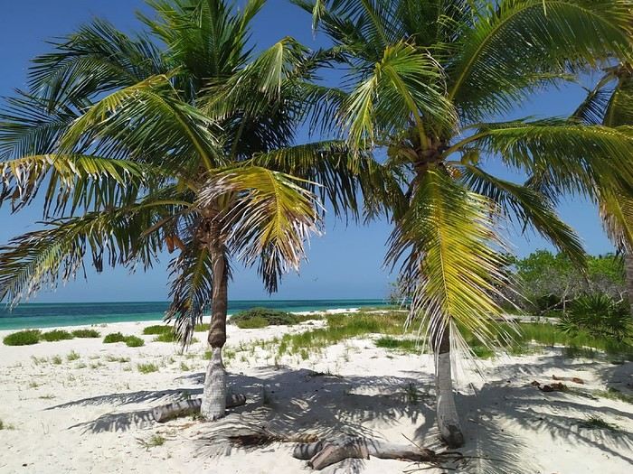
Our main goal in coming to Holbox was to swim with whale sharks. So, the first thing we told our hotel, Los Arcos Holbox, upon arrival was to arrange an excursion with one of the island’s many tour operators: Glendy Tours Holbox. We set off the next morning, bright and early.
The itinerary for this outing is the same for all tour operators (and there are about thirty of them!): roughly two hours by speedboat, then snorkeling with the whale sharks, followed by another boat ride to Cabo Catoche for lunch, then more boating to a fish-filled snorkeling spot before heading back. In total, the excursion can take eight hours—or even longer.
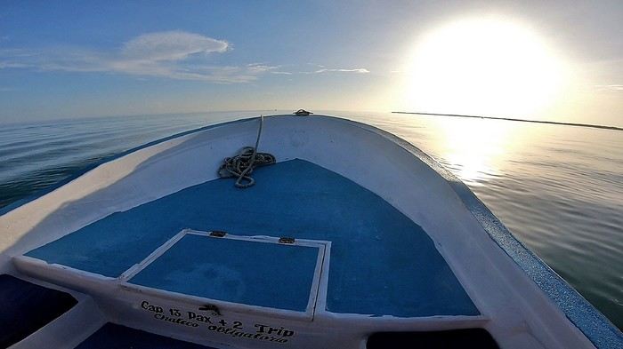
Besides my two sons and me, there were only two other clients on board—a French couple. Our boat was one of the very first to leave, but after ten minutes, the pilot got a radio call. We turned back without any explanation, returning to the departure dock.
There, a young woman who clearly fancied herself a diva was waiting for us. She was Mexican and boarded the boat, snubbing all five of us while flirting with the pilot and guide, who were suddenly all eyes for her. We couldn’t understand how this diva had convinced our tour operator to turn the boat around just to pick her up when she hadn’t even booked and we were already far out. We left 20 minutes late.
The two-hour journey passed surprisingly quickly, and for good reason: we spotted dolphins six times! They were leaping out of the water as they moved. Pure joy. We stopped whenever they were near the boat.
The photo isn’t great—the ultra-wide-angle lens on my GoPro makes the dolphins look smaller—but at least I got a souvenir.
A few flying fish (exocets) also glided a meter or two above the water as we sped along. The false start was forgotten, and the day was off to a fantastic start in this stunning marine environment...
When we reached the area where the whale sharks were supposed to be, the guide explained that we’d now have to scan the sea until we spotted one. It could take five minutes or forty-five, he said, and if we were unlucky, we might not see any at all!
An hour and a half later—still nothing! The captain then headed toward a distant area where about twenty other boats were already gathered.
Sure enough, there was a juvenile whale shark (still a good eight meters long) there, and all the boats were lining up to approach it slowly, one by one, so as not to scare the animal. Each boat got about thirty seconds within a few meters of it, engine idling, before making way for the next. We were allowed to approach three times, but we weren’t permitted to dive in. That’s normal—such a crowd of divers around a single animal would stress it out, and here, whale sharks are protected by regulations: swimming with them is strictly controlled. There was even a coast guard boat with us at all times, monitoring everyone’s behavior.
We were torn between the luck of seeing such a magnificent animal, even from the surface, and the discomfort we felt about the absurd situation. All those boats lined up just to catch a fleeting glimpse of the shark for a few seconds—let’s be honest, it was ridiculous. In short, the whole thing was unpleasant, and probably even more so for the shark than for us, though it did keep gulping down kilos of plankton as if nothing were happening...
When it was our turn to approach, I dipped my GoPro into the water at arm’s length and framed the shot blindly, hoping for a decent image of the shark.
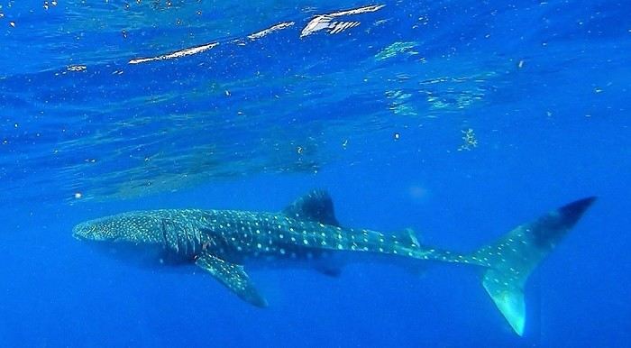
On the third and final approach, the sixth passenger on board—the one we’d had to turn back for ten minutes after departure—quietly spoke to the guide and captain after putting on her flippers (even though, I’ll remind you, no one was allowed to dive). She wanted them to ask the coast guard for permission to dive with the shark—just her! She whispered so we couldn’t hear what she was offering in exchange.
The two lackeys complied and shouted the request to the officials in front of all the other boats, with no shame whatsoever. With so many witnesses, the coast guard had no choice but to refuse. The diva wouldn’t let it go and asked them to insist, which they did, but the refusal was firm and final.
On the nearest boats, everyone had heard and was stunned. They openly mocked this bimbo who clearly had no shame. Hidden behind her star sunglasses, she responded with a dismissive smile. Pathetic.
The encounter with the shark ended, and we set off for Cabo Catoche, a site on Holbox Island where we were to have lunch.
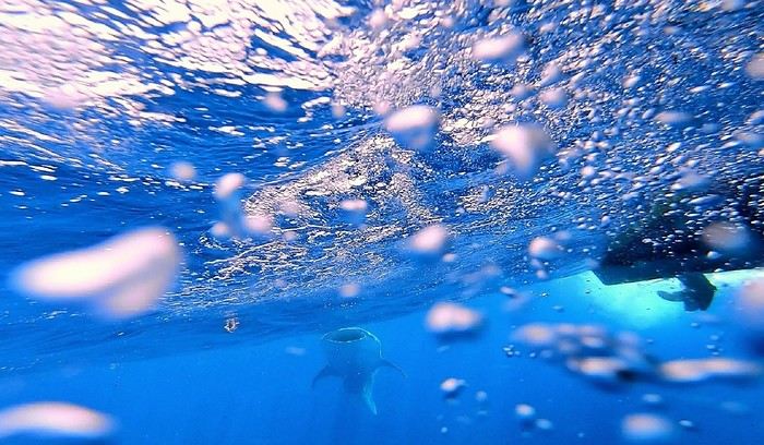
We were a little disappointed not to have had the chance to see the usual school of whale sharks (they’re often dozens swimming together!), but that’s nature’s way, and we knew it.
And then, an unlikely stroke of luck: a boat ahead of us was putting divers in the water with a pair of adult whale sharks. We joined them, and while we were putting on our masks and snorkels, the guide briefed us. He said my sons and I would go first, followed by the French couple and the diva.
But Miss World, clearly unhappy with this order, quietly complained to the guide, who eventually switched the order. It didn’t bother us since we’d only get a minute in the water anyway—what’s a minute more or less?
So the three of them got in the water, and a moment later, they were done. My two sons and I, sitting on the edge of the boat with masks on and snorkels in our mouths, were ready to finally take the plunge. But instead of continuing to follow the shark, the captain was suddenly all eyes for Miss Silicone! He even let go of the wheel for a moment to help her back on board.
One of the two sharks had already left minutes earlier, and the second was swimming farther away. Other boats were arriving, and the captain went to join the queue 100 meters from the shark. Soon, even more boats showed up. There were way too many people, the shark left, and diving was no longer possible.
I was, of course, a little disappointed not to have fulfilled my long-time dream of swimming with a whale shark, even briefly. But I was mostly disgusted for my two boys, who had been so excited about it. I told the guide exactly what I thought and asked for compensation—not for missing out on swimming with the shark (you can never guarantee seeing one, nature isn’t at our beck and call), but for clearly skipping our turn to dive. He promised a refund.
At the end of the day, back on land, he dropped us all off, and as he was about to leave, I reminded him about the refund. He agreed again, calmly got back on board, and sped off as if nothing had happened—just him and the captain, two total cowards. I couldn’t believe it.
Of course, back at our hotel (which had booked this tour operator—Glendy Tours), I explained the situation and asked for my refund again. The receptionist called the manager, who arrived with the guide. Our runaway wasn’t so cocky anymore. Inside, I was fuming, but I kept my cool during the discussion that followed.
Right off the bat, I made a point of looking the so-called guide in the eyes while telling him he’d run off like a coward. I did my best to stay calm, speaking clearly, staring him down the whole time, and repeating several times that he was a coward, in front of the manager, who didn’t say a word. The guide had clearly been told by his boss to keep quiet because he didn’t utter a word during the entire twenty-minute conversation.
Anyway, I’ll spare you the details, but in the end, the manager only offered us another excursion the next day as compensation for the “inconvenience.” It was just snorkeling with fish, not another whale shark trip. He admitted their fault, but since we had to leave early the next morning and had other bookings for the rest of the trip, we couldn’t accept. And he refused to refund us.
On Tripadvisor, Glendy Tours has a mediocre rating (3 out of 5), but more importantly, it ranks 29th out of 36 nautical tour operators rated by customers. I was pretty upset with the hotel for booking such an amateur for us.

If you want to swim with whale sharks in Holbox, you might end up with Glendy Tours. And it might go well—I certainly hope so. But given the price of such an excursion (3,000 pesos per person, about 160 €!), I’d still suggest quickly checking online before you go to see which providers have the best ratings. You’ll have a much better chance of things going smoothly with the top-rated ones than with those as poorly ranked as Glendy Tours.
On the other hand, if you’re a beautiful young woman, you can choose them without worry—you’ll get better treatment than the rest of us...
To wrap up this excursion, I have to mention the “respect for nature” angle that all these tour operators highlight. They tell us they respect the whale sharks: only two or three people can dive at a time, and only for a few minutes, so as not to disturb these gentle giants...
We believed them before we left, but that’s not what we saw. When the sharks are hard to find except for one, everyone rushes it, and only the constant presence of the coast guard prevents the tour operators from putting their clients in the water.
Because for the second shark we saw, when the divers from our boat got out of the water and we left to join the queue while it was our turn to dive, other boats quickly arrived and started swarming the poor shark, which eventually left.
In other words, it’s clear these companies only respect the sharks when they’re being watched.
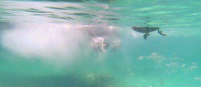 Boat reversing a meter away from a pelican
And for the snorkeling near Cabo Catoche, they attract fish daily by feeding them—a practice that’s normally discouraged. Afterward, these fish can’t feed naturally anymore and become dependent on Glendy Tours and its competitors.
A quick note on the rest of the excursion: Cabo Catoche (the site where we had lunch, on Holbox Island) is the northernmost point of the entire Yucatán. The place is paradise.
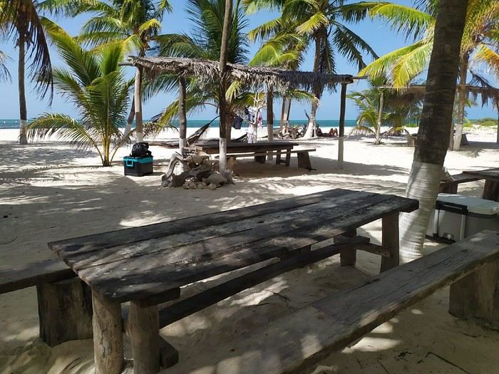
On the way back, we spent half an hour snorkeling at a site that turned out to be fish-filled only because the tour operators had the bad habit of feeding the fish. But this practice, which isn’t respectful of nature, is normally discouraged.
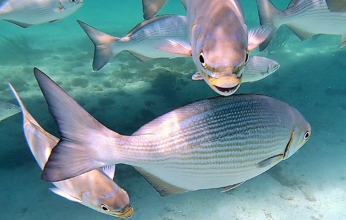
Plus, life jackets—like in many places in the Yucatán—are mandatory!!
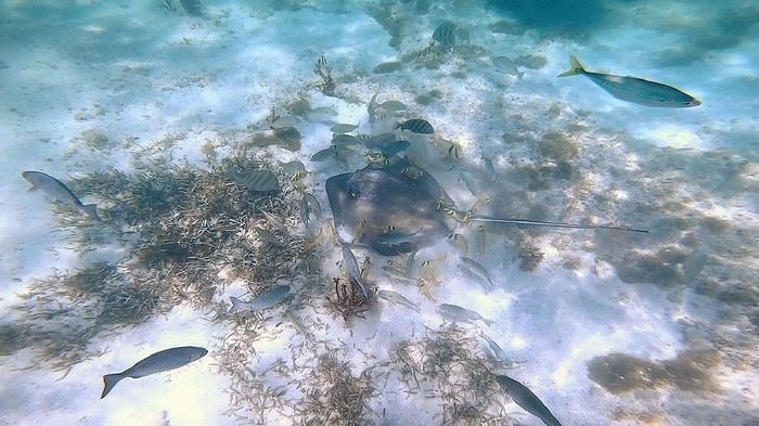
As divers, we didn’t find the site very interesting, but objectively, it should delight those who aren’t used to putting their heads underwater in beautiful dive spots.
We hated feeling trapped in those life jackets, stuck at the surface, and for me, the highlight was swimming next to a pelican that wasn’t too shy—it was paddling right beside me in green water.
Anyway, it seems we can’t post more than 10 photos at once on VF, so I’ll come back with the rest of the journal in another message. Because after these early trip mishaps, the rest of the journey turned out to be magnificent...
What a pleasure to be back on VF after a few difficult years 😎 So, before diving into the topic, welcome back to VF and above all... keep going!
Well, I’m finally picking up my old habit of posting a new travel journal.
Before heading to Mexico in the summer of 2023 with my family (my partner and our two boys, aged 18 and 16), I had somehow convinced myself—though I can’t even remember why—that the Yucatán was too touristy, too cliché, too expensive, and overrated!
The country didn’t particularly appeal to me, but faced with my wife’s insistence—she’d been there years ago, before we met, and had promised to show our sons this incredible place—my arguments didn’t hold much weight.
And thank goodness, because I have to admit she was absolutely right to take us there! In the end, we encountered far fewer tourists than we’d feared (except at a few sites), and the prices, which we’d been told were geared toward American neighbors (US), turned out to be quite affordable. In short, it was pure joy on both counts. All that was left was for the trip itself to be beautiful and memorable—and it was...
1st stop: Isla Holbox and the whale sharks
Holbox (pronounced “Hol-bosh”) is a stunning island where you can relax in an enchanting setting.
Our main goal in coming to Holbox was to swim with whale sharks. So, the first thing we told our hotel, Los Arcos Holbox, upon arrival was to arrange an excursion with one of the island’s many tour operators: Glendy Tours Holbox. We set off the next morning, bright and early.
The itinerary for this outing is the same for all tour operators (and there are about thirty of them!): roughly two hours by speedboat, then snorkeling with the whale sharks, followed by another boat ride to Cabo Catoche for lunch, then more boating to a fish-filled snorkeling spot before heading back. In total, the excursion can take eight hours—or even longer.
Besides my two sons and me, there were only two other clients on board—a French couple. Our boat was one of the very first to leave, but after ten minutes, the pilot got a radio call. We turned back without any explanation, returning to the departure dock.
There, a young woman who clearly fancied herself a diva was waiting for us. She was Mexican and boarded the boat, snubbing all five of us while flirting with the pilot and guide, who were suddenly all eyes for her. We couldn’t understand how this diva had convinced our tour operator to turn the boat around just to pick her up when she hadn’t even booked and we were already far out. We left 20 minutes late.
The two-hour journey passed surprisingly quickly, and for good reason: we spotted dolphins six times! They were leaping out of the water as they moved. Pure joy. We stopped whenever they were near the boat.
The photo isn’t great—the ultra-wide-angle lens on my GoPro makes the dolphins look smaller—but at least I got a souvenir.
A few flying fish (exocets) also glided a meter or two above the water as we sped along. The false start was forgotten, and the day was off to a fantastic start in this stunning marine environment...
When we reached the area where the whale sharks were supposed to be, the guide explained that we’d now have to scan the sea until we spotted one. It could take five minutes or forty-five, he said, and if we were unlucky, we might not see any at all!
An hour and a half later—still nothing! The captain then headed toward a distant area where about twenty other boats were already gathered.
Sure enough, there was a juvenile whale shark (still a good eight meters long) there, and all the boats were lining up to approach it slowly, one by one, so as not to scare the animal. Each boat got about thirty seconds within a few meters of it, engine idling, before making way for the next. We were allowed to approach three times, but we weren’t permitted to dive in. That’s normal—such a crowd of divers around a single animal would stress it out, and here, whale sharks are protected by regulations: swimming with them is strictly controlled. There was even a coast guard boat with us at all times, monitoring everyone’s behavior.
We were torn between the luck of seeing such a magnificent animal, even from the surface, and the discomfort we felt about the absurd situation. All those boats lined up just to catch a fleeting glimpse of the shark for a few seconds—let’s be honest, it was ridiculous. In short, the whole thing was unpleasant, and probably even more so for the shark than for us, though it did keep gulping down kilos of plankton as if nothing were happening...
When it was our turn to approach, I dipped my GoPro into the water at arm’s length and framed the shot blindly, hoping for a decent image of the shark.
On the third and final approach, the sixth passenger on board—the one we’d had to turn back for ten minutes after departure—quietly spoke to the guide and captain after putting on her flippers (even though, I’ll remind you, no one was allowed to dive). She wanted them to ask the coast guard for permission to dive with the shark—just her! She whispered so we couldn’t hear what she was offering in exchange.
The two lackeys complied and shouted the request to the officials in front of all the other boats, with no shame whatsoever. With so many witnesses, the coast guard had no choice but to refuse. The diva wouldn’t let it go and asked them to insist, which they did, but the refusal was firm and final.
On the nearest boats, everyone had heard and was stunned. They openly mocked this bimbo who clearly had no shame. Hidden behind her star sunglasses, she responded with a dismissive smile. Pathetic.
The encounter with the shark ended, and we set off for Cabo Catoche, a site on Holbox Island where we were to have lunch.
We were a little disappointed not to have had the chance to see the usual school of whale sharks (they’re often dozens swimming together!), but that’s nature’s way, and we knew it.
And then, an unlikely stroke of luck: a boat ahead of us was putting divers in the water with a pair of adult whale sharks. We joined them, and while we were putting on our masks and snorkels, the guide briefed us. He said my sons and I would go first, followed by the French couple and the diva.
But Miss World, clearly unhappy with this order, quietly complained to the guide, who eventually switched the order. It didn’t bother us since we’d only get a minute in the water anyway—what’s a minute more or less?
So the three of them got in the water, and a moment later, they were done. My two sons and I, sitting on the edge of the boat with masks on and snorkels in our mouths, were ready to finally take the plunge. But instead of continuing to follow the shark, the captain was suddenly all eyes for Miss Silicone! He even let go of the wheel for a moment to help her back on board.
One of the two sharks had already left minutes earlier, and the second was swimming farther away. Other boats were arriving, and the captain went to join the queue 100 meters from the shark. Soon, even more boats showed up. There were way too many people, the shark left, and diving was no longer possible.
I was, of course, a little disappointed not to have fulfilled my long-time dream of swimming with a whale shark, even briefly. But I was mostly disgusted for my two boys, who had been so excited about it. I told the guide exactly what I thought and asked for compensation—not for missing out on swimming with the shark (you can never guarantee seeing one, nature isn’t at our beck and call), but for clearly skipping our turn to dive. He promised a refund.
At the end of the day, back on land, he dropped us all off, and as he was about to leave, I reminded him about the refund. He agreed again, calmly got back on board, and sped off as if nothing had happened—just him and the captain, two total cowards. I couldn’t believe it.
Of course, back at our hotel (which had booked this tour operator—Glendy Tours), I explained the situation and asked for my refund again. The receptionist called the manager, who arrived with the guide. Our runaway wasn’t so cocky anymore. Inside, I was fuming, but I kept my cool during the discussion that followed.
Right off the bat, I made a point of looking the so-called guide in the eyes while telling him he’d run off like a coward. I did my best to stay calm, speaking clearly, staring him down the whole time, and repeating several times that he was a coward, in front of the manager, who didn’t say a word. The guide had clearly been told by his boss to keep quiet because he didn’t utter a word during the entire twenty-minute conversation.
Anyway, I’ll spare you the details, but in the end, the manager only offered us another excursion the next day as compensation for the “inconvenience.” It was just snorkeling with fish, not another whale shark trip. He admitted their fault, but since we had to leave early the next morning and had other bookings for the rest of the trip, we couldn’t accept. And he refused to refund us.
On Tripadvisor, Glendy Tours has a mediocre rating (3 out of 5), but more importantly, it ranks 29th out of 36 nautical tour operators rated by customers. I was pretty upset with the hotel for booking such an amateur for us.
If you want to swim with whale sharks in Holbox, you might end up with Glendy Tours. And it might go well—I certainly hope so. But given the price of such an excursion (3,000 pesos per person, about 160 €!), I’d still suggest quickly checking online before you go to see which providers have the best ratings. You’ll have a much better chance of things going smoothly with the top-rated ones than with those as poorly ranked as Glendy Tours.
On the other hand, if you’re a beautiful young woman, you can choose them without worry—you’ll get better treatment than the rest of us...
To wrap up this excursion, I have to mention the “respect for nature” angle that all these tour operators highlight. They tell us they respect the whale sharks: only two or three people can dive at a time, and only for a few minutes, so as not to disturb these gentle giants...
We believed them before we left, but that’s not what we saw. When the sharks are hard to find except for one, everyone rushes it, and only the constant presence of the coast guard prevents the tour operators from putting their clients in the water.
Because for the second shark we saw, when the divers from our boat got out of the water and we left to join the queue while it was our turn to dive, other boats quickly arrived and started swarming the poor shark, which eventually left.
In other words, it’s clear these companies only respect the sharks when they’re being watched.
Boat reversing a meter away from a pelicanAnd for the snorkeling near Cabo Catoche, they attract fish daily by feeding them—a practice that’s normally discouraged. Afterward, these fish can’t feed naturally anymore and become dependent on Glendy Tours and its competitors.
A quick note on the rest of the excursion: Cabo Catoche (the site where we had lunch, on Holbox Island) is the northernmost point of the entire Yucatán. The place is paradise.
On the way back, we spent half an hour snorkeling at a site that turned out to be fish-filled only because the tour operators had the bad habit of feeding the fish. But this practice, which isn’t respectful of nature, is normally discouraged.
Plus, life jackets—like in many places in the Yucatán—are mandatory!!
As divers, we didn’t find the site very interesting, but objectively, it should delight those who aren’t used to putting their heads underwater in beautiful dive spots.
We hated feeling trapped in those life jackets, stuck at the surface, and for me, the highlight was swimming next to a pelican that wasn’t too shy—it was paddling right beside me in green water.
Anyway, it seems we can’t post more than 10 photos at once on VF, so I’ll come back with the rest of the journal in another message. Because after these early trip mishaps, the rest of the journey turned out to be magnificent...
4 friends discover a piece of North India
Hello fellow travelers!
I’m adding my small contribution to the reopening celebration by posting this travel journal from India, made in January 2024. We’re 4 friends (2 couples), and we did a 3-week loop in Rajasthan, stopping by Delhi and Agra (which, as everyone knows, aren’t in Rajasthan 😛). Delhi - Agra - Jaipur - Bundi - Udaipur - Jodhpur - Jaisalmer - Delhi
We rented a car with a driver from Agra to Jaisalmer, 550 € for 14 days. https://chauffeurpriveeninde.com/fr/
We took the train from Delhi to Agra and the plane (Spicejet) from Jaisalmer to Delhi.
Most of the accommodations were booked on Booking before we left.
I’m sharing this story written by Richard and illustrated by me. We dedicate it to Nathalie and Bruno, our amazing travel companions.
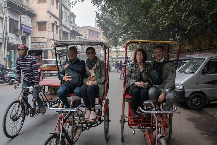
I’m adding my small contribution to the reopening celebration by posting this travel journal from India, made in January 2024. We’re 4 friends (2 couples), and we did a 3-week loop in Rajasthan, stopping by Delhi and Agra (which, as everyone knows, aren’t in Rajasthan 😛). Delhi - Agra - Jaipur - Bundi - Udaipur - Jodhpur - Jaisalmer - Delhi
We rented a car with a driver from Agra to Jaisalmer, 550 € for 14 days. https://chauffeurpriveeninde.com/fr/
We took the train from Delhi to Agra and the plane (Spicejet) from Jaisalmer to Delhi.
Most of the accommodations were booked on Booking before we left.
I’m sharing this story written by Richard and illustrated by me. We dedicate it to Nathalie and Bruno, our amazing travel companions.
How surprising this Sultanate of Oman is
Hey fellow travelers,
We’re a couple in our fifties who’ve been traveling independently for ages—mostly in Asia, a bit in Africa, very little in the Americas, and never ever in West Asia until November 2023, when we discovered the Sultanate of Oman.
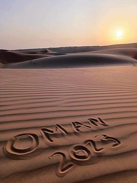
If we waited so long to explore this part of the world, it’s because a few questions were nagging at us, like: Can two Landais party lovers like us survive 15 days without apéro 😄? Or, more seriously: Can a feminist like me enjoy traveling in such a conservative country?
That is the question (and I feel your pain with this unbearable suspense 😅).
Ready to dive in?
PS: Apologies in advance for the casual tone of this travel journal—it’s the one I shared with our loved ones in real time, which explains everything.
We’re a couple in our fifties who’ve been traveling independently for ages—mostly in Asia, a bit in Africa, very little in the Americas, and never ever in West Asia until November 2023, when we discovered the Sultanate of Oman.
If we waited so long to explore this part of the world, it’s because a few questions were nagging at us, like: Can two Landais party lovers like us survive 15 days without apéro 😄? Or, more seriously: Can a feminist like me enjoy traveling in such a conservative country?
That is the question (and I feel your pain with this unbearable suspense 😅).
Ready to dive in?
PS: Apologies in advance for the casual tone of this travel journal—it’s the one I shared with our loved ones in real time, which explains everything.
La Bretagne avec le Jacques Cartier "Ponant" du 18 au 25 juillet 2020 English translation pending
Bonjour
J'avais envisagé d'attendre début Octobre et notre retour à Rennes pour faire le C/R
de notre croisière " La Bretagne : entre côtes sauvages et phares "
Mais tout compte fait , je change d'avis et démarre ce C/R dès maintenant :
Au retour de notre 20 ème croisière , fin Novembre 2019 , ( Transat de Marseille à
Miami sur le MSC Divina ) , nous avions décidé de faire une (petite ) pause pour les
croisières et donc de ne rien réserver avant plusieurs mois .
Sage décision en fait au vu des évènements sanitaires du Printemps puisque nous
avons échappé aux problèmes subis par nombre de touristes qui se sont retrouvés
avec des avoirs qu'il ne pourront utiliser ( au mieux ) que dans plusieurs mois .
A la fin de l'an dernier , je m'étais inscrit à la newsletter de Ponant , plus pour rêver
qu'autre chose .
Mais début Juin , alors que toutes les croisières sont annulées les unes après les autres ,
Ponant , profitant notamment de la capacité réduite de ses navires et du retour en
France métropolitaine de presque tous , met en place 2 itinéraires en Méditerranée et
3 en Manche et Atlantique .
La croisière au départ de Nice pour contourner la Corse nous plaisait bien mais rejoindre
Nice posait , à ce moment là , problème .
Nous décidons donc de nous rabattre sur la croisière au départ de St Malo car là , pas de
souci pour nous y rendre 🙂
Les raisons de notre choix : de mémoire , St Malo est fréquemment une ville d'escale pour
les bateaux de croisière mais quasiment jamais une ville d'embarquement ( et là aussi
de débarquement ) , donc autant en profiter .
De plus l'itinéraire nous plait avec la visite d'iles connues ( mais que nous reverrons avec
plaisir ) et de vraies découvertes dont les Scilly , au large de la Cornouaille britannique .
Mi Juin , nous décidons de réserver la croisière au départ de St Malo du 18 Juillet , sachant
que nous avons la possibilité d'annuler , sans pénalités , jusqu'à 72 heures avant le départ .
L'annulation , nous y avons pensé quand , fin Juin , nous avons appris que l'escale aux
Scilly était supprimée 😠 , remplacée par Ouessant , une escale à Groix se substituant
à celle de Hoëdic .
Toutes les autres croisières étaient aussi affectées par la suppression des escales à l'étranger
pour raisons sanitaires ( jours de quarantaine )
Nous trouverons donc peut-être une autre occasion pour nous rendre aux Scilly
Comme d'habitude , je m'égare avec ce préambule un peu long .
Je vais donc faire une pause avant de vous embarquer sur le Jacques Cartier .
A plus
Jean-Pierre
Retour aux Marquises: les îles méridionales Hiva Oa, Tahuata et Fatu Iva English translation pending
INTRO
En ces temps épidémiques troublés, la Polynésie Française - et en particulier l' archipel des Marquises - ont des atouts exceptionnels en matière de tourisme. A ce jour, l' épidémie de Coronavirus a juste effleuré le Territoire -presque uniquement Tahiti et Moorea - dont les îles éloignées ont été strictement confinées dès le départ, les offres sanitaires et hospitalières sur place étant très limitées. Pour l' instant, la situation est sous contrôle.
Le tourisme retrouve lentement ses marques depuis la mi-juillet. Il s'agit actuellement plus de tourisme local que de tourisme international, bien que la destination Polynésie / Marquises soit attirante : beauté et unicité des paysages, authenticité d'un archipel, certes situé à 4 heures d'avion ATR de Tahiti, mais que l' on peut facilement découvrir en solo et donc en dehors de la très onéreuse croisière sur l' Aranui, sécurité physique mais aussi sanitaire. Les Européens - dont une majorité de Français - arrivent... Ils avaient déjà leurs billets depuis des mois et l' entrée sur le territoire est facilitée.
Nous devions faire ce second voyage aux Marquises en mai dernier, mais il fut annulé jusqu'à la reprise progressive des vols en interne.
Nous avons simplement acheté un billet Air Tahiti en ligne, sans utiliser le Pass Marquises qui ne permet pas de visiter les deux îles les plus méridionales, à savoir Tahuata et Fatu Iva, dépourvues d'aéroport. On ne peut y aller qu' en bateau, en excursion à la journée ( ou plus bien sur ) pour Tahuata et en navette municipale au départ de Hiva Oa pour aller à Fatu Iva.
Les horaires changeant fréquemment, la première chose à faire est de se renseigner sur les jours de passage vers Fatu Iva. En ce moment, il y en a trois : le lundi ( départ à 2 heures du matin ), le mardi ( départ à 6 heures ) et le samedi ( départ à 6 heures également ). Mais tout cela aura peut-être changé dans 3 mois. Il faut donc une stratégie d'approche !
On peut rajouter la visite de ces deux îles à celles qui sont incluses dans le Pass, à savoir Nuku Hiva, Ua Pou, Ua Huka et Hiva Oa. Prévoir alors une extension de 8 jours environ, à partir de Hiva Oa.
Pourquoi vouloir absolument visiter ces deux îles peu accessibles ? Justement parce qu'il faut les mériter ! Elles demeurent très différentes.
L' une, Tahuata, a un lagon, des plages de sable blanc, des falaises abruptes, des baies échancrées ourlées d'une végétation luxuriante, des couleurs uniques dans les bleus et turquoise et culmine à plus de 1000 mètres.
L' autre, Fatu Iva , est une beauté sauvage et altière avec ses à-pics qui dévalent vers l' océan bleu outremer ( ou 'moana' en tahitien ), connue surtout pour sa fameuse baie des Vierges, considérée par beaucoup - en particulier les navigateurs - comme la plus belle île de Polynésie.
Dans mon premier carnet sur les Marquises, j' avais déjà mentionné notre séjour à Hiva Oa, un peu trop court. Cette fois, entre notre arrivée et notre retour, nous passerons 4 nuits à Hiva Oa et 4 nuits à Fatu Iva. Une journée et demie sera consacrée aussi à Hiva Oa.
Avant de partir à la découverte de ces îles polynésiennes lointaines et peu visitées, quelques chiffres édifiants qui montrent que les Marquises ont échappé de peu à l' oubli, à la perte de leur identité singulière et à la disparition de leur culture. L' archipel comptait 20000 habitants en 1842, seulement 2000 en 1920, environ 8000 actuellement en 2020. Au début des années 1920, c'est grâce à la politique nataliste du Dr Rollin, administrateur des Marquises de l' époque, que la situation commença lentement à s' améliorer. Ensuite et paradoxalement, ce fut un évêque, Mgr Lecleac'h, qui s'érigea en animateur engagé du réveil identitaire, via la sauvegarde du patrimoine, la reconnaissance de la langue marquisienne ( et non tahitienne ), les danses ( jugées trop lascives par les missionnaires ), les chants, le tatouage, enfin l' artisanat inspiré des motifs et des symboles de la culture ancienne. L' icône du renouveau marquisien est sans conteste le tiki, demi-dieu et créateur de l' homme. En lui réside la divinité et les ancêtres légendaires.

TAHUATA ou Île Lumière
DANS LA LEGENDE DES MARQUISES C' est la plus petite île habitée des Marquises dont le nom signifie l' aube en marquisien. J' aurai, plus tard, l' occasion de revenir sur la légende de la création des Marquises : dans cette légende, Tahuata représente le dernier acte de la construction avant l' aube. La symbolique de son nom est liée à l' arrivée de la lumière du jour, signifiant la fin de la construction de la 'Grande Maison', alias l' archipel des Marquises.
UN PEU DE GEOLOGIE Tahuata et Fatu Iva sont soeurs géologiquement parlant. Ce sont des îles plus jeunes que celles du nord de l' archipel ( de 5, 5 millions d'années au Nord-Ouest à seulement 1,2 million d'années au Sud-Est ) L' activité volcanique passée s' est matérialisée sous la forme de volcans dits boucliers, différents des volcans hawaiïens ou tahitiens, qui , suite à des secousses sismiques violentes et répétées, se sont peu à peu effondrés, disparaissant sous les flots de la moitié voire davantage des boucliers initiaux. Résultat : les calderas sont imbriquées l'une dans l' autre , la caldeira initiale étant dotée d'un volcan interne plus petit et plus récent. C 'est le cas à Fatu Iva par exemple.
UN PEU DE GEOGRAPHIE
Située à seulement 4 kms de Hiva Oa , on ne peut rejoindre Tahuata que par mer après 40 à 60 mn de navigation selon le temps ( il existe un catamaran communal, le Tahuata Nui mais qui est souvent en panne pour une durée indéterminée... ). On choisira entre l' excursion à la journée ou le passage simple en speedboat privé, assez cher. Ou si l' on doit résider à Tahuata, on s'arrangera au préalable avec la pension de famille choisie pour discuter des modalités et du prix de la course aller-retour entre Tahuata et Hiva Oa. Le canal dit du Bordelais qui est emprunté par les bateaux peut être extrêmement agité par des courants violents et rallonger un peu la course. (Petite digression sur ce fameux canal du Bordelais... Qui est donc ce Bordelais ? Un certain Joseph Capri ( ou Kabri ou Kabris ), originaire de Bordeaux même, initialement matelot de son état sur un bâtiment baleinier qui fait naufrage sur la côte de Nuku Hiva. Kabri , capturé par les guerriers du roi anthropophage de NH, s'apprête à mourir et à finir rôti à la broche, mais est sauvé in extremis par la fille du roi qui demande sa grâce. Celle-ci est accordée, il épouse la belle dans la foulée, le roi tatoue son gendre lui-même, lui offre des parures en tapa et mousse et le nomme grand juge du pays. Il tue, torture, garrotte, découpe en morceaux. Il pacifie à sa manière ! La vie est douce et belle, il a six enfants de sa princesse marquisienne ... Et puis un jour où il sommeille dans la nature, il est kidnappé par le navigateur russe Krunsenstern qui, à coups de knout, le ramène au navire puis à St Petersbourg pour y être interrogé et jugé. Kabri parvient à s' échapper vers Paris, demande à rencontrer Louis XVIII qu'il traite comme son cousin. Ce dernier - contre toute attente - le reçoit et lui donne un peu d'argent, mais la chance a définitivement tourné pour Kabri qui se retrouve à Valenciennes, gagnant son pain comme bête de foire. Il mourra à 42 ans, épuisé et sans avoir pu repartir vers son île marquisienne et vers sa famille nombreuse. Les autorités lui éviteront post mortem l' infamie d'une exhumation et d'un empaillage, son tatouage corporel et facial ayant conquis un amateur !!!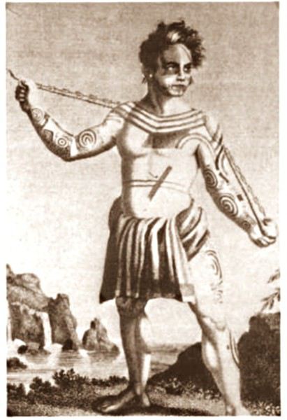 JB Kabri le Tatoué, dessin publié dans le livre de Von Langsdorff
Retour à Tahuata... L' île n'est entourée que partiellement de récifs coralliens ( comme Mangareva aux îles Gambier ) , et est agrémentée de magnifiques plages de sable blanc, en particulier celle de Hanamoenoa. Avec ses versants escarpés se terminant en falaises, des vallées étroites et profondes ouvrant sur des baies échancrées à la végétation dense telles celles jumelles de Iva Iva Nui et de Iva Iva Iti, Tahuata surprend et attire. ' C'est une des rares fois où j' eus le désir de posséder de la terre ', écrivit en son temps le navigateur Alain Gerbault, conquis par une île qu'il qualifiait d'enchanteresse. Son relief est très accidenté et les communications terrestres - sur des pistes improbables - entre les vallées sont difficiles. L' île culmine au Mont Tumu-Mea-Ufa à 1050 m. Sa superficie est de 60 km2, avec une population de 650 à 700 habitants environ. L' île comporte 4 villages : Vaitahu, petit port historique, avec son église aux murs de galets et un magnifique vitrail, son musée d'art et d'histoire, et sa proximité avec des sites archéologiques; Hapatoni, autre village avec sa voie pavée ou ' allée de la reine ', construite sur ordre de la reine Vaekehu II au 19ème siècle, bordée d'arbres centenaires de tamanu plantés par les anciens , et ses ' me'ae ' ( ou ' marae ' en tahitien). Egalement Motopu et Hanatetena, deux plus petits villages. Il y a d'autres chemins pavés dans l' île, à Hapatoni en particulier, et des pétroglyphes à Hanatahua. On peut donc passer plus d'une journée à Tahuata, y séjourner dans l' une de ses pensions. Les chemins et pistes de l' île se prêtent parfaitement à la randonnée pédestre.
UN PEU D HISTOIRE
Plusieurs édifices du village de Vaitahu commémorent un passé souvent tragique. On peut y voir les trois stèles érigées en souvenir de l' arrivée des Espagnols en 1595, puis de celle de militaires français en 1838 et enfin de la prise de possession de l' archipel par l' amiral Abel Dupetit-Thouars en 1842. Alvaro de Mendaña y Neira jeta l' ancre à Vaitahu en 1595, un premier contact avec ceux que l' on appelait à l' époque dans les mers du Sud et ailleurs ' les naturels ' qui tourna rapidement au massacre par les soldats espagnols de 200 villageois, guerriers et civils mélangés. On peut comprendre, dans ce contexte, que l' arrivée d'Occidentaux au 18ème siècle et au début du 19ème siècle ait suscité beaucoup de méfiance, d'animosité et d'hostilité de la part des habitants de Tahuata, et des autres îles également. Les premières tentatives d' évangélisation protestante d'abord en 1797 puis catholique en 1839 se soldèrent par un échec retentissant ( le gouvernement français avait l' habitude d'envoyer les missionnaires en éclaireurs afin de tâter le terrain.. ). Le religieux ayant failli à sa mission, il restait donc le politique et le militaire : l' expédition Dupetit-Thouars arrive en vue de Tahuata mi - avril 1842. Les Français sont dans un premier temps plutôt bien reçus par le chef / roi Iotete qui a récemment subi la pression de la marine américaine et qui se dit que la France le protégera. On attribue donc un terrain en hauteur aux Français pour la construction d'un fortin et d'une garnison. Dupetit-Thouars veut aller vite et propose à Iotete de se mettre sous la protection du roi de France, Louis-Philippe. Iotete accepte et, le 1er mai, est organisée une cérémonie pour la prise de possession officielle des îles Sud de l' archipel des Marquises - et par extension de tout l' archipel - par la France en présence des missionnaires et du neveu de Iotete, Maheono, également chef de Hanatetena. Et puis rapidement, un malaise grandissant s'installe, l' ambiance se dégrade, Iotete devient peu accommodant et versatile, ne supportant pas de se voir privé de son autorité de chef incontesté. Il fugue dans la montagne, organise la résistance aux Français que l' on vient pourtant de fêter, et finit par assiéger le fortin à moitié achevé avec ses guerriers. Résultat : des morts et des blessés des deux côtés et un chaos inattendu. Après palabres et promesses, l' amiral, fidèle à sa stratégie initiale, convainc Iotete - contacté et ramené à la raison par son neveu - de revenir à la table des négociations, et les termes d' une paix durable sont établis définitivement. Iotete a tenté de lutter mais a perdu et la guerre et son pouvoir, son ' mana '. Il mourra l' année suivante, une fin triste et sans avenir pour un chef qui ne sera pas élevé au rang de dieu le jour de ses funérailles.
 Prise de possession officielle de Tahuata
De g. à d. : Maheono, Iotete ( en habit militaire d'apparat à galons d'or époque Louis XV ), le père Baudichon, Abel Dupetit-Thouars
Prise de possession officielle de Tahuata
De g. à d. : Maheono, Iotete ( en habit militaire d'apparat à galons d'or époque Louis XV ), le père Baudichon, Abel Dupetit-Thouars
 Iotete le 1er Mais 1842 ( portrait par Max Radiguet )
 Iotete le 1er mai 1842 ( portrait par Max Radiguet )
 Maheono, neveu de Iotete et son saisissant tatouage facial
 Guerriers marquisiens 19ème siècle
L' amiral repart bientôt sur son navire La Reine Blanche vers Tahiti où il va obtenir le 9 septembre 1842 de la reine Pomaré IV son acceptation formelle de placer son île sous protectorat français. C' est ainsi que Les Marquises alias La Terre des Hommes ( ou Te Fenua Enata en marquisien ) devient la première colonie française dans le Pacifique Sud un peu avant Tahiti.
FAUNE ET FLORE Depuis sa disparition de Hiva Oa, suite à l' introduction malheureuse d'un rapace nocturne, le grand-duc de Virginie ( ou Bubo Virginiasus en latin ), la seule population survivante de ' pahi ' ou martin-chasseur des Marquises, vit à Tahuata, en grand danger d'extinction, car en déclin lent mais constant. il ne resterait que 300 individus au mieux. La destruction du grand-duc est autorisée à cause de son impact fatal sur la faune aviaire locale. Des excursions à pied et à cheval, en excursion à la demi-journée ou à la journée entière, à la découverte du ' pahi ' sont possibles. Contacter le comité de tourisme de Tahuata.
ACTIVITES TRADITIONNELLES
Il y a à Tahuata plusieurs centres d'artisanat et ce dernier est le plus réputé des Marquises, en particulier pour la sculpture sur os. Dans l' île, on est souvent sculpteur de père en fils; les hommes travaillent le bois de rose, l' os de cheval, de chèvre et de mouton et le rostre d'espadon. Dans la vallée d'Hapatoni, ce sont surtout d' expertes sculptrices qui sont à l' oeuvre, souvent depuis des ann��es. Au travail de l' os ou du rostre d'espadon, elles ajoutent la confection de bijoux originaux. La culture du coprah est bien présente à Tahuata et permet aux agriculteurs de gagner un revenu fixe. Les cultures vivrières et les récoltes d'agrumes tels les pamplemousses, très réputés permettent l' autosuffisance alimentaire des habitants de l' île et un peu d'exportation vers le marché et les supermarchés de Papeete ( via la diaspora marquisienne installée à Tahiti ). Pêche et chasse participent également, pleinement, de ce désir d'autosuffisance. La nature est généreuse et tout pousse à profusion et l' on vit simplement mais plutôt bien à Tahuata comme ailleurs aux Marquises, d'autant que désormais, les cargos mixtes apportent régulièrement de Tahiti ce qui manque aux îliens.
Fatu Iva L' île de tous les superlatifs / L'île érotique

Guerrier marquisien tatoué originaire de Fatu Iva 19ème siècle On notera sur sa poitrine les motifs reconstitués d'une tête de tiki, que l' on retrouve aussi sur la crosse du casse-tête ( ou ' u'u ' en marquisien ), arme réservée au guerrier. Cette tête est supposée augmenter le ' mana ' ( alias la puissance ), les yeux en amande évoquent cette puissance surnaturelle tandis que la bouche étirée où apparaissent parfois langue et dents, est censée défier l' adversaire.
SELON LA LEGENDE Dans la légende de la construction de l' archipel des Marquises, selon laquelle chaque île est partie intégrante de la Maison des Dieux, Fatu Iva représente la toiture faite de 9 ( Iva ) tresses ( Fatu ) de feuilles de palmier. Elle s'est aussi appelée Santa Magdalena, nom donné par Alvaro de Mendaña en l' honneur de la sainte du même nom.
UN PEU DE GEOGRAPHIE Fatu Iva est une île située à 75 kms de Hiva Oa, d'une superficie de 84 km2. Longue de 10 kilomètres et large de 4, elle a la forme d'un croissant ou d'un haricot. Elle culmine au Mont Touaouoho à 960 mètres et héberge une population d'environ 600 habitants. C' est l' île la plus australe de l' archipel, la plus isolée aussi car il est impossible d'y construire un aéroport en raison du relief accidenté ou même un aérodrome comme à Ua Pou par exemple. C' est aussi la plus pluvieuse, étant la plus proche du tropique du Capricorne. Les pluies étant abondantes, l' île est recouverte d'une végétation luxuriante en particulier en son centre où prospère une forêt primaire tropicale dense. C' est aussi l'île la plus sauvage et la plus spectaculaire de l' archipel. Géologiquement parlant, elle est constituée de deux caldeiras volcaniques enchâssées l' une dans l' autre. La première date de 2 millions d'années environ, la seconde, deux fois plus petite est née d'une énorme éruption, comme en témoignent les massives chandelles basaltiques qui montent au ciel tout autour de la baie de Hanavave, dite baie des Vierges. Initialement appelée baie des Verges par les Marquisiens, elle a été rebaptisée par de pudibonds missionnaires, effarouchés par l' imagerie locale et ses sous-entendus. Fatu Iva n' a que deux villages situées chacun sur le bord extérieur des deux caldeiras : Hanavave aux colonnes basaltiques et Omoa, chef-lieu de l' île , village surplombé par un piton rocheux qui surprend par son profil rappelant la tête d'un moai de l' île de Pâques.
UN PEU D'HISTOIRE Comme les autres îles de l' archipel, Fatu Iva fut initialement peuplée par des Polynésiens venus de l' ouest. Les rivalités entre tribus étaient au départ incessantes et donnèrent lieu à des batailles sanglantes. C' est en juillet 1595 que l'île - tout comme celle de Tahuata - fut abordée pour la première fois par un occidental, le navigateur espagnol Alvaro de Mendaña de Neira , le premier du genre à avoir établi des contacts avec des populations polynésiennes. Mais il n' y débarqua pas. Il crût tout d'abord avoir découvert les Iles Salomon, le but ultime de son voyage, mais se rendit rapidement compte qu' il avait découvert une nouvelle terre dans un archipel d' îles auxquelles il donna le nom de ' Marquesas de Mendoza ' pour remercier le Vice-Roi du Pérou - alias Garcia Hurtado de Mendoza y Maurique, IV marquis de Cañete - qui l' avait aidé à monter et financer son expédition, et pour honorer en même temps son épouse et ses filles. En 1935, l' anthropologue norvégien Thor Heyerdahl - et futur aventurier du Kon Tiki - aborda Fatu Iva avec l' idée bien ancrée d' en faire son éden. Il y vécut un an avec sa femme, d'abord à Omoa, puis à Ouia, une vallée inconfortablement située sur la côte au vent et désormais retournée à l' état naturel, ayant été abandonnée par ses quelques habitants. Heyerdahl avait à l' époque avancé l' hypothèse erronée que les Maori descendaient des Indiens d'Amérique du Sud alors qu'ils sont originellement arrivés en pirogue de l' Asie du Sud-Est, et plus particulièrement de Taïwan. ( Je vous renvoie à mon carnet sur Taïwan où j' aborde ce sujet )
De 1960 à 1966, une majorité d'hommes de Fatu Iva partirent travailler au CEP de Mururoa, participant ainsi de l' émigration économique ayant commencé à l' époque, et s'étant poursuivie jusqu'à nos jours, les perspectives en termes d' emploi étant plus que limitées si l' on ne veut pas rester ou devenir agriculteur ou coprahculteur comme ses parents ou grands-parents.
FAUNE ET FLORE L' île est une terre d'abondance pour les agrumes, les fruits en général et les fleurs... Tout pousse ou presque. Elle possède une espèce endémique très menacée aujourd'hui : le Monarque ( ou oma'o ke'eke'e en marquisien ', dont il ne restait il y a peu que 6 couples au monde ! Le rat noir et le chat haret ont littéralement décimé cette espèce, dévorant oeufs, oisillons et même femelles en couvaison. Un programme de sauvegarde de l' espèce a été mis en place, avec des résultats encourageants, le nombre de couples ayant augmenté ces dernières années.
ECONOMIE L' île est ravitaillée uniquement par bateau. Une unique route partiellement bétonnée des deux côtés, et partiellement à l' état de piste, et longue de 17 kilomètres relie les deux villages. On peut également aller d'un village à l' autre par la mer en un quart d'heure de navigation. Le secteur primaire prévaut à Fatu Iva, en particulier la culture du coprah, et puis la pêche au thon, à l' espadon et au thazard. On y a cultivé le noni à outrance à une certaine époque mais celle-ci est un peu révolue, les bienfaits miraculeux du noni n' ayant pas vraiment été prouvés scientifiquement. Comme à Rurutu, on a abandonné la culture du café qui était pourtant prometteuse il y a une quarantaine d'années. En revanche, on trouve davantage de vergers et des vanillières. La chasse aux cochons et aux chèvres permet l' auto-suffisance en viande quand le ravitaillement venu de Tahiti vient à manquer ou arrive irrégulièrement. L' artisanat s'est développé grâce au tourisme et aux expositions semestrielles organisées à Papeete. La spécialité - principalement féminine - de Fatu Iva est le tapa dont les dessins s'inspirent des anciens tatouages marquisiens. La sculpture sur bois ou os ou noix de coco est plutôt réservée aux hommes, nourrie des anciennes figures et des symboles centenaires : tikis sculptés en bois de rose ou en bois noir, casse-tête, plats de présentation.
Suivez-moi en page 2.....
TAHUATA ou Île Lumière
DANS LA LEGENDE DES MARQUISES C' est la plus petite île habitée des Marquises dont le nom signifie l' aube en marquisien. J' aurai, plus tard, l' occasion de revenir sur la légende de la création des Marquises : dans cette légende, Tahuata représente le dernier acte de la construction avant l' aube. La symbolique de son nom est liée à l' arrivée de la lumière du jour, signifiant la fin de la construction de la 'Grande Maison', alias l' archipel des Marquises.
UN PEU DE GEOLOGIE Tahuata et Fatu Iva sont soeurs géologiquement parlant. Ce sont des îles plus jeunes que celles du nord de l' archipel ( de 5, 5 millions d'années au Nord-Ouest à seulement 1,2 million d'années au Sud-Est ) L' activité volcanique passée s' est matérialisée sous la forme de volcans dits boucliers, différents des volcans hawaiïens ou tahitiens, qui , suite à des secousses sismiques violentes et répétées, se sont peu à peu effondrés, disparaissant sous les flots de la moitié voire davantage des boucliers initiaux. Résultat : les calderas sont imbriquées l'une dans l' autre , la caldeira initiale étant dotée d'un volcan interne plus petit et plus récent. C 'est le cas à Fatu Iva par exemple.
UN PEU DE GEOGRAPHIE
Située à seulement 4 kms de Hiva Oa , on ne peut rejoindre Tahuata que par mer après 40 à 60 mn de navigation selon le temps ( il existe un catamaran communal, le Tahuata Nui mais qui est souvent en panne pour une durée indéterminée... ). On choisira entre l' excursion à la journée ou le passage simple en speedboat privé, assez cher. Ou si l' on doit résider à Tahuata, on s'arrangera au préalable avec la pension de famille choisie pour discuter des modalités et du prix de la course aller-retour entre Tahuata et Hiva Oa. Le canal dit du Bordelais qui est emprunté par les bateaux peut être extrêmement agité par des courants violents et rallonger un peu la course. (Petite digression sur ce fameux canal du Bordelais... Qui est donc ce Bordelais ? Un certain Joseph Capri ( ou Kabri ou Kabris ), originaire de Bordeaux même, initialement matelot de son état sur un bâtiment baleinier qui fait naufrage sur la côte de Nuku Hiva. Kabri , capturé par les guerriers du roi anthropophage de NH, s'apprête à mourir et à finir rôti à la broche, mais est sauvé in extremis par la fille du roi qui demande sa grâce. Celle-ci est accordée, il épouse la belle dans la foulée, le roi tatoue son gendre lui-même, lui offre des parures en tapa et mousse et le nomme grand juge du pays. Il tue, torture, garrotte, découpe en morceaux. Il pacifie à sa manière ! La vie est douce et belle, il a six enfants de sa princesse marquisienne ... Et puis un jour où il sommeille dans la nature, il est kidnappé par le navigateur russe Krunsenstern qui, à coups de knout, le ramène au navire puis à St Petersbourg pour y être interrogé et jugé. Kabri parvient à s' échapper vers Paris, demande à rencontrer Louis XVIII qu'il traite comme son cousin. Ce dernier - contre toute attente - le reçoit et lui donne un peu d'argent, mais la chance a définitivement tourné pour Kabri qui se retrouve à Valenciennes, gagnant son pain comme bête de foire. Il mourra à 42 ans, épuisé et sans avoir pu repartir vers son île marquisienne et vers sa famille nombreuse. Les autorités lui éviteront post mortem l' infamie d'une exhumation et d'un empaillage, son tatouage corporel et facial ayant conquis un amateur !!!
JB Kabri le Tatoué, dessin publié dans le livre de Von LangsdorffRetour à Tahuata... L' île n'est entourée que partiellement de récifs coralliens ( comme Mangareva aux îles Gambier ) , et est agrémentée de magnifiques plages de sable blanc, en particulier celle de Hanamoenoa. Avec ses versants escarpés se terminant en falaises, des vallées étroites et profondes ouvrant sur des baies échancrées à la végétation dense telles celles jumelles de Iva Iva Nui et de Iva Iva Iti, Tahuata surprend et attire. ' C'est une des rares fois où j' eus le désir de posséder de la terre ', écrivit en son temps le navigateur Alain Gerbault, conquis par une île qu'il qualifiait d'enchanteresse. Son relief est très accidenté et les communications terrestres - sur des pistes improbables - entre les vallées sont difficiles. L' île culmine au Mont Tumu-Mea-Ufa à 1050 m. Sa superficie est de 60 km2, avec une population de 650 à 700 habitants environ. L' île comporte 4 villages : Vaitahu, petit port historique, avec son église aux murs de galets et un magnifique vitrail, son musée d'art et d'histoire, et sa proximité avec des sites archéologiques; Hapatoni, autre village avec sa voie pavée ou ' allée de la reine ', construite sur ordre de la reine Vaekehu II au 19ème siècle, bordée d'arbres centenaires de tamanu plantés par les anciens , et ses ' me'ae ' ( ou ' marae ' en tahitien). Egalement Motopu et Hanatetena, deux plus petits villages. Il y a d'autres chemins pavés dans l' île, à Hapatoni en particulier, et des pétroglyphes à Hanatahua. On peut donc passer plus d'une journée à Tahuata, y séjourner dans l' une de ses pensions. Les chemins et pistes de l' île se prêtent parfaitement à la randonnée pédestre.
UN PEU D HISTOIRE
Plusieurs édifices du village de Vaitahu commémorent un passé souvent tragique. On peut y voir les trois stèles érigées en souvenir de l' arrivée des Espagnols en 1595, puis de celle de militaires français en 1838 et enfin de la prise de possession de l' archipel par l' amiral Abel Dupetit-Thouars en 1842. Alvaro de Mendaña y Neira jeta l' ancre à Vaitahu en 1595, un premier contact avec ceux que l' on appelait à l' époque dans les mers du Sud et ailleurs ' les naturels ' qui tourna rapidement au massacre par les soldats espagnols de 200 villageois, guerriers et civils mélangés. On peut comprendre, dans ce contexte, que l' arrivée d'Occidentaux au 18ème siècle et au début du 19ème siècle ait suscité beaucoup de méfiance, d'animosité et d'hostilité de la part des habitants de Tahuata, et des autres îles également. Les premières tentatives d' évangélisation protestante d'abord en 1797 puis catholique en 1839 se soldèrent par un échec retentissant ( le gouvernement français avait l' habitude d'envoyer les missionnaires en éclaireurs afin de tâter le terrain.. ). Le religieux ayant failli à sa mission, il restait donc le politique et le militaire : l' expédition Dupetit-Thouars arrive en vue de Tahuata mi - avril 1842. Les Français sont dans un premier temps plutôt bien reçus par le chef / roi Iotete qui a récemment subi la pression de la marine américaine et qui se dit que la France le protégera. On attribue donc un terrain en hauteur aux Français pour la construction d'un fortin et d'une garnison. Dupetit-Thouars veut aller vite et propose à Iotete de se mettre sous la protection du roi de France, Louis-Philippe. Iotete accepte et, le 1er mai, est organisée une cérémonie pour la prise de possession officielle des îles Sud de l' archipel des Marquises - et par extension de tout l' archipel - par la France en présence des missionnaires et du neveu de Iotete, Maheono, également chef de Hanatetena. Et puis rapidement, un malaise grandissant s'installe, l' ambiance se dégrade, Iotete devient peu accommodant et versatile, ne supportant pas de se voir privé de son autorité de chef incontesté. Il fugue dans la montagne, organise la résistance aux Français que l' on vient pourtant de fêter, et finit par assiéger le fortin à moitié achevé avec ses guerriers. Résultat : des morts et des blessés des deux côtés et un chaos inattendu. Après palabres et promesses, l' amiral, fidèle à sa stratégie initiale, convainc Iotete - contacté et ramené à la raison par son neveu - de revenir à la table des négociations, et les termes d' une paix durable sont établis définitivement. Iotete a tenté de lutter mais a perdu et la guerre et son pouvoir, son ' mana '. Il mourra l' année suivante, une fin triste et sans avenir pour un chef qui ne sera pas élevé au rang de dieu le jour de ses funérailles.
Prise de possession officielle de Tahuata
De g. à d. : Maheono, Iotete ( en habit militaire d'apparat à galons d'or époque Louis XV ), le père Baudichon, Abel Dupetit-Thouars
Iotete le 1er Mais 1842 ( portrait par Max Radiguet )
Iotete le 1er mai 1842 ( portrait par Max Radiguet )
Maheono, neveu de Iotete et son saisissant tatouage facial
Guerriers marquisiens 19ème siècleL' amiral repart bientôt sur son navire La Reine Blanche vers Tahiti où il va obtenir le 9 septembre 1842 de la reine Pomaré IV son acceptation formelle de placer son île sous protectorat français. C' est ainsi que Les Marquises alias La Terre des Hommes ( ou Te Fenua Enata en marquisien ) devient la première colonie française dans le Pacifique Sud un peu avant Tahiti.
FAUNE ET FLORE Depuis sa disparition de Hiva Oa, suite à l' introduction malheureuse d'un rapace nocturne, le grand-duc de Virginie ( ou Bubo Virginiasus en latin ), la seule population survivante de ' pahi ' ou martin-chasseur des Marquises, vit à Tahuata, en grand danger d'extinction, car en déclin lent mais constant. il ne resterait que 300 individus au mieux. La destruction du grand-duc est autorisée à cause de son impact fatal sur la faune aviaire locale. Des excursions à pied et à cheval, en excursion à la demi-journée ou à la journée entière, à la découverte du ' pahi ' sont possibles. Contacter le comité de tourisme de Tahuata.
ACTIVITES TRADITIONNELLES
Il y a à Tahuata plusieurs centres d'artisanat et ce dernier est le plus réputé des Marquises, en particulier pour la sculpture sur os. Dans l' île, on est souvent sculpteur de père en fils; les hommes travaillent le bois de rose, l' os de cheval, de chèvre et de mouton et le rostre d'espadon. Dans la vallée d'Hapatoni, ce sont surtout d' expertes sculptrices qui sont à l' oeuvre, souvent depuis des ann��es. Au travail de l' os ou du rostre d'espadon, elles ajoutent la confection de bijoux originaux. La culture du coprah est bien présente à Tahuata et permet aux agriculteurs de gagner un revenu fixe. Les cultures vivrières et les récoltes d'agrumes tels les pamplemousses, très réputés permettent l' autosuffisance alimentaire des habitants de l' île et un peu d'exportation vers le marché et les supermarchés de Papeete ( via la diaspora marquisienne installée à Tahiti ). Pêche et chasse participent également, pleinement, de ce désir d'autosuffisance. La nature est généreuse et tout pousse à profusion et l' on vit simplement mais plutôt bien à Tahuata comme ailleurs aux Marquises, d'autant que désormais, les cargos mixtes apportent régulièrement de Tahiti ce qui manque aux îliens.
Fatu Iva L' île de tous les superlatifs / L'île érotique
Guerrier marquisien tatoué originaire de Fatu Iva 19ème siècle On notera sur sa poitrine les motifs reconstitués d'une tête de tiki, que l' on retrouve aussi sur la crosse du casse-tête ( ou ' u'u ' en marquisien ), arme réservée au guerrier. Cette tête est supposée augmenter le ' mana ' ( alias la puissance ), les yeux en amande évoquent cette puissance surnaturelle tandis que la bouche étirée où apparaissent parfois langue et dents, est censée défier l' adversaire.
SELON LA LEGENDE Dans la légende de la construction de l' archipel des Marquises, selon laquelle chaque île est partie intégrante de la Maison des Dieux, Fatu Iva représente la toiture faite de 9 ( Iva ) tresses ( Fatu ) de feuilles de palmier. Elle s'est aussi appelée Santa Magdalena, nom donné par Alvaro de Mendaña en l' honneur de la sainte du même nom.
UN PEU DE GEOGRAPHIE Fatu Iva est une île située à 75 kms de Hiva Oa, d'une superficie de 84 km2. Longue de 10 kilomètres et large de 4, elle a la forme d'un croissant ou d'un haricot. Elle culmine au Mont Touaouoho à 960 mètres et héberge une population d'environ 600 habitants. C' est l' île la plus australe de l' archipel, la plus isolée aussi car il est impossible d'y construire un aéroport en raison du relief accidenté ou même un aérodrome comme à Ua Pou par exemple. C' est aussi la plus pluvieuse, étant la plus proche du tropique du Capricorne. Les pluies étant abondantes, l' île est recouverte d'une végétation luxuriante en particulier en son centre où prospère une forêt primaire tropicale dense. C' est aussi l'île la plus sauvage et la plus spectaculaire de l' archipel. Géologiquement parlant, elle est constituée de deux caldeiras volcaniques enchâssées l' une dans l' autre. La première date de 2 millions d'années environ, la seconde, deux fois plus petite est née d'une énorme éruption, comme en témoignent les massives chandelles basaltiques qui montent au ciel tout autour de la baie de Hanavave, dite baie des Vierges. Initialement appelée baie des Verges par les Marquisiens, elle a été rebaptisée par de pudibonds missionnaires, effarouchés par l' imagerie locale et ses sous-entendus. Fatu Iva n' a que deux villages situées chacun sur le bord extérieur des deux caldeiras : Hanavave aux colonnes basaltiques et Omoa, chef-lieu de l' île , village surplombé par un piton rocheux qui surprend par son profil rappelant la tête d'un moai de l' île de Pâques.
UN PEU D'HISTOIRE Comme les autres îles de l' archipel, Fatu Iva fut initialement peuplée par des Polynésiens venus de l' ouest. Les rivalités entre tribus étaient au départ incessantes et donnèrent lieu à des batailles sanglantes. C' est en juillet 1595 que l'île - tout comme celle de Tahuata - fut abordée pour la première fois par un occidental, le navigateur espagnol Alvaro de Mendaña de Neira , le premier du genre à avoir établi des contacts avec des populations polynésiennes. Mais il n' y débarqua pas. Il crût tout d'abord avoir découvert les Iles Salomon, le but ultime de son voyage, mais se rendit rapidement compte qu' il avait découvert une nouvelle terre dans un archipel d' îles auxquelles il donna le nom de ' Marquesas de Mendoza ' pour remercier le Vice-Roi du Pérou - alias Garcia Hurtado de Mendoza y Maurique, IV marquis de Cañete - qui l' avait aidé à monter et financer son expédition, et pour honorer en même temps son épouse et ses filles. En 1935, l' anthropologue norvégien Thor Heyerdahl - et futur aventurier du Kon Tiki - aborda Fatu Iva avec l' idée bien ancrée d' en faire son éden. Il y vécut un an avec sa femme, d'abord à Omoa, puis à Ouia, une vallée inconfortablement située sur la côte au vent et désormais retournée à l' état naturel, ayant été abandonnée par ses quelques habitants. Heyerdahl avait à l' époque avancé l' hypothèse erronée que les Maori descendaient des Indiens d'Amérique du Sud alors qu'ils sont originellement arrivés en pirogue de l' Asie du Sud-Est, et plus particulièrement de Taïwan. ( Je vous renvoie à mon carnet sur Taïwan où j' aborde ce sujet )
De 1960 à 1966, une majorité d'hommes de Fatu Iva partirent travailler au CEP de Mururoa, participant ainsi de l' émigration économique ayant commencé à l' époque, et s'étant poursuivie jusqu'à nos jours, les perspectives en termes d' emploi étant plus que limitées si l' on ne veut pas rester ou devenir agriculteur ou coprahculteur comme ses parents ou grands-parents.
FAUNE ET FLORE L' île est une terre d'abondance pour les agrumes, les fruits en général et les fleurs... Tout pousse ou presque. Elle possède une espèce endémique très menacée aujourd'hui : le Monarque ( ou oma'o ke'eke'e en marquisien ', dont il ne restait il y a peu que 6 couples au monde ! Le rat noir et le chat haret ont littéralement décimé cette espèce, dévorant oeufs, oisillons et même femelles en couvaison. Un programme de sauvegarde de l' espèce a été mis en place, avec des résultats encourageants, le nombre de couples ayant augmenté ces dernières années.
ECONOMIE L' île est ravitaillée uniquement par bateau. Une unique route partiellement bétonnée des deux côtés, et partiellement à l' état de piste, et longue de 17 kilomètres relie les deux villages. On peut également aller d'un village à l' autre par la mer en un quart d'heure de navigation. Le secteur primaire prévaut à Fatu Iva, en particulier la culture du coprah, et puis la pêche au thon, à l' espadon et au thazard. On y a cultivé le noni à outrance à une certaine époque mais celle-ci est un peu révolue, les bienfaits miraculeux du noni n' ayant pas vraiment été prouvés scientifiquement. Comme à Rurutu, on a abandonné la culture du café qui était pourtant prometteuse il y a une quarantaine d'années. En revanche, on trouve davantage de vergers et des vanillières. La chasse aux cochons et aux chèvres permet l' auto-suffisance en viande quand le ravitaillement venu de Tahiti vient à manquer ou arrive irrégulièrement. L' artisanat s'est développé grâce au tourisme et aux expositions semestrielles organisées à Papeete. La spécialité - principalement féminine - de Fatu Iva est le tapa dont les dessins s'inspirent des anciens tatouages marquisiens. La sculpture sur bois ou os ou noix de coco est plutôt réservée aux hommes, nourrie des anciennes figures et des symboles centenaires : tikis sculptés en bois de rose ou en bois noir, casse-tête, plats de présentation.
Suivez-moi en page 2.....
La meilleure façon d'marcher, c'est de mettre un pied d'vant l'autre... English translation pending
Je déteste toujours autant marcher et pourtant, je recommence.
Comme un sentiment d’urgence pour n’entendre que les battements de mon cœur si secoué de peine qu’il ne me fallait plus entendre ni compréhension, ni compassion de quiconque.
Être seule, vraiment seule.
La terre est vivante, douée de mémoire et je ne voulais que cette mémoire. Je ne voulais m’encombrer de rien.
Homme sceptique un peu goguenard : « Fais-le mais je me souviens bien de ta dernière expédition ! » C’était il y a dix ans ou plus, je ne me souviens plus. « C’est facile, y’en a eu qu’une ! » Des pieds en plomb, les mollets noués, l’estomac creux, les aisselles malodorantes, les bras griffés mais j’avais vécu l’intense sentiment d’avancer malgré toute ma paresse et mon inexpérience. « Où veux-tu aller ? » « Au Mont-Beuvray » « 50 km en voiture, 100 aller-retour, ça va je pourrais aisément te récupérer, tu prévois combien de jours ? » Il rit.
« Chais pas, 10 km par jour, pas plus, et comme j’y vais au pif, je ne saurais pas ce que j’ai parcouru, je m’arrêterai quand j’en aurais marre, je verrai bien ».
La veille du départ, Fils aîné au téléphone, moqueur : « Maman, t’es toujours aussi dingue. Tu ne marches jamais, t’as même pas de bonnes godasses, tu f’rais mieux d’aller chez xxx, là, tu te ressourcerais. Un jour, il t’arrivera des bricoles avec tes idées huluberlues.../... » « Ehh, je ne monte qu’au Mont-Beuvray, tu parles d’une expédition ! » « Ouais mais t’as vu ton âge ? » « Merci mon grand. Tu sais, il y a tellement de gens qui marchent pour de bon, des centaines de kilomètres sur toute la terre. Marcher pour le plaisir, marcher pour aller chercher de l’eau au puits, marcher en compétition, marcher pour aller à l’école, pour tous ceux là, je vais faire une balade, une promenade de santé, ça n’a rien d’une aventure ou d’un exploit, j’vais mettre un pas d’vant l’autre et recommencer, c’est tout. »
Et le 13 juin, j’ai pris le sentier forestier derrière la maison.
Le sac à dos, celui dont je me sers pour le goûter des petits, est rempli avec un kway, un morceau de bâche. J’ai coupé celle qui traînait par terre recouvrant la moto pour la protéger des chiures d’hirondelles, un pull, la gourde, un gant de toilette, un savon, ma brosse à dents, un sac de cacahuètes bien grasses et bien salées, des bananes sèches bien trop sucrées, cinq pommes et mon opinel. Il a une forme bizarre ce sac, comme un ballon accroché à mon dos. Il pèse 2,8 kg. Et dans les poches de mon pantalon en toile, à droite mes clopes et mon briquet, à gauche le-pied-de-biche-à-tiques. J’me demande à quoi il me servira si j’ai une tique dans le dos ou sur la nuque ! J’ai rajouté ma carte d’identité, 40 euros, et concession pour Homme, mon téléphone. Il veut me géolocaliser. C’est qu’il m’aime Homme, à lui tout seul un océan dans lequel je nage avec tant de bonheur. Mais là, pas de nage papillon, des pas.
Et quand le téléphone n’aura plus de batteries ? On verra bien. Je dis toujours -on verra bien - .
Dans le Morvan, les fées laissent leurs empreintes surnaturelles et comme je n’ai aucune carte, je ne sais pas les lire et n’ai pas envie d’apprendre, je vais leur faire confiance. Le soleil se lève à l’est et se couche à l’ouest, je dois aller à l’ouest, je suivrai sa course.
Et le 13 juin, j’ai serré les paupières pour repousser l’aube naissante. Je n’avais plus du tout envie de partir, plus du tout envie de marcher. Mais quand la brûlure salée a piqué derrière les paupières comme tous ces derniers jours, je n’ai pas reculé. J’ai lu un jour que les mauvais souvenirs et les chagrins ont de longues ombres et si on passe notre vie dedans on ne verrait plus jamais le soleil.
Ce 13 juin, le soleil était là alors, j’ai pris le sentier derrière la maison.
J’m’en vais vous raiconter l’ histôère
.../...
Comme un sentiment d’urgence pour n’entendre que les battements de mon cœur si secoué de peine qu’il ne me fallait plus entendre ni compréhension, ni compassion de quiconque.
Être seule, vraiment seule.
La terre est vivante, douée de mémoire et je ne voulais que cette mémoire. Je ne voulais m’encombrer de rien.
Homme sceptique un peu goguenard : « Fais-le mais je me souviens bien de ta dernière expédition ! » C’était il y a dix ans ou plus, je ne me souviens plus. « C’est facile, y’en a eu qu’une ! » Des pieds en plomb, les mollets noués, l’estomac creux, les aisselles malodorantes, les bras griffés mais j’avais vécu l’intense sentiment d’avancer malgré toute ma paresse et mon inexpérience. « Où veux-tu aller ? » « Au Mont-Beuvray » « 50 km en voiture, 100 aller-retour, ça va je pourrais aisément te récupérer, tu prévois combien de jours ? » Il rit.
« Chais pas, 10 km par jour, pas plus, et comme j’y vais au pif, je ne saurais pas ce que j’ai parcouru, je m’arrêterai quand j’en aurais marre, je verrai bien ».
La veille du départ, Fils aîné au téléphone, moqueur : « Maman, t’es toujours aussi dingue. Tu ne marches jamais, t’as même pas de bonnes godasses, tu f’rais mieux d’aller chez xxx, là, tu te ressourcerais. Un jour, il t’arrivera des bricoles avec tes idées huluberlues.../... » « Ehh, je ne monte qu’au Mont-Beuvray, tu parles d’une expédition ! » « Ouais mais t’as vu ton âge ? » « Merci mon grand. Tu sais, il y a tellement de gens qui marchent pour de bon, des centaines de kilomètres sur toute la terre. Marcher pour le plaisir, marcher pour aller chercher de l’eau au puits, marcher en compétition, marcher pour aller à l’école, pour tous ceux là, je vais faire une balade, une promenade de santé, ça n’a rien d’une aventure ou d’un exploit, j’vais mettre un pas d’vant l’autre et recommencer, c’est tout. »
Et le 13 juin, j’ai pris le sentier forestier derrière la maison.
Le sac à dos, celui dont je me sers pour le goûter des petits, est rempli avec un kway, un morceau de bâche. J’ai coupé celle qui traînait par terre recouvrant la moto pour la protéger des chiures d’hirondelles, un pull, la gourde, un gant de toilette, un savon, ma brosse à dents, un sac de cacahuètes bien grasses et bien salées, des bananes sèches bien trop sucrées, cinq pommes et mon opinel. Il a une forme bizarre ce sac, comme un ballon accroché à mon dos. Il pèse 2,8 kg. Et dans les poches de mon pantalon en toile, à droite mes clopes et mon briquet, à gauche le-pied-de-biche-à-tiques. J’me demande à quoi il me servira si j’ai une tique dans le dos ou sur la nuque ! J’ai rajouté ma carte d’identité, 40 euros, et concession pour Homme, mon téléphone. Il veut me géolocaliser. C’est qu’il m’aime Homme, à lui tout seul un océan dans lequel je nage avec tant de bonheur. Mais là, pas de nage papillon, des pas.
Et quand le téléphone n’aura plus de batteries ? On verra bien. Je dis toujours -on verra bien - .
Dans le Morvan, les fées laissent leurs empreintes surnaturelles et comme je n’ai aucune carte, je ne sais pas les lire et n’ai pas envie d’apprendre, je vais leur faire confiance. Le soleil se lève à l’est et se couche à l’ouest, je dois aller à l’ouest, je suivrai sa course.
Et le 13 juin, j’ai serré les paupières pour repousser l’aube naissante. Je n’avais plus du tout envie de partir, plus du tout envie de marcher. Mais quand la brûlure salée a piqué derrière les paupières comme tous ces derniers jours, je n’ai pas reculé. J’ai lu un jour que les mauvais souvenirs et les chagrins ont de longues ombres et si on passe notre vie dedans on ne verrait plus jamais le soleil.
Ce 13 juin, le soleil était là alors, j’ai pris le sentier derrière la maison.
J’m’en vais vous raiconter l’ histôère
.../...
Caraïbes: escales aux Îles Vierges English translation pending
Place au rêve, à l'évasion et au dépaysement … ce sont trois escales dans les Îles des Caraïbes que je vous propose de découvrir avec ce récit de voyage.
Des îles éparpillées dans le nord de l'arc antillais qui finalement ne sont pas totalement vierges, elles possèdent toutes un charme fou.
Des îles diverses, par leurs paysages mais aussi par leur histoire ou leur nationalités.
A « Grand Turk », nous serons en territoire britannique au milieu d'un camaïeu de bleu. Quant à « Saint Thomas », la seconde escale, l'île à tout d'un petit paradis … des USA ! après avoir été à une époque, terre d'un royaume scandinave . Et enfin, nous terminerons le périple à « Virgin Gorda », un île de la Grande Bretagne d'outremer dont on ne peut oublier les plages de rêve parsemées d'impressionnants rochers. Que d'agréables souvenirs !
--__
Grand Turk, entre bleu lagon et or blanc
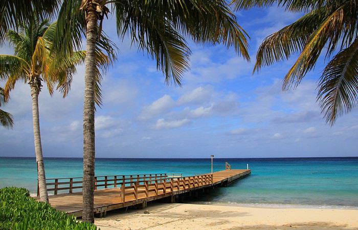
Voilà la vision tant attendue lorsqu'on débarque sur une île des Caraïbes ... A Grand Turk, ce décor de rêve est bien au rendez-vous : des plages de sable blanc et un horizon marin aux fascinantes nuances de bleu, et il y en a tout autour de l'île. Certes, la photo est un peu cliché mais avouons que contempler un tel paysage fait du bien, surtout en cette période où la moindre idée de voyage à l'étranger est à oublier … du moins pour un certain temps ! Sur votre écran, vous avez l'image, à vous de la compléter en imaginant l'environnement sonore. Entendez-vous maintenant le doux bruit des vaguelettes venant lécher ce rivage ?
Comme lors de tout voyage, il y a un temps pour des moments de contemplation et d'autres consacrés à la découverte … à nous à présent, la balade sur Grand Turk.
L'archipel de Grand Turk et Caïcos est situé au nord des Antilles, c'est un chapelet d'îles et d'îlots dans le prolongement des Bahamas et séparé de quelques 160 kilomètres, à vol d'oiseau (marin), du nord de Haïti.
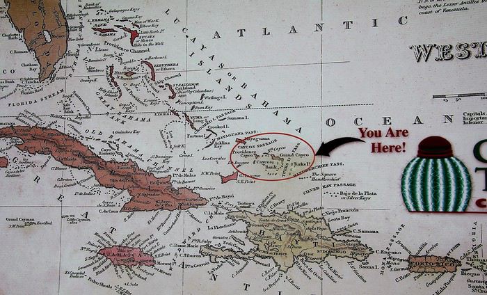
Cette carte apposée sur un mur du port de débarquement permet de mieux localiser l'archipel au milieu d'une myriade d'îles caribéennes. Donc nous voici « Here », facile à repérer notre situation avec ce cercle et cette patine bistre : que de doigts de visiteurs ont du pointer l'archipel ! Une trentaine d'îles dont huit seulement sont habitées constitue Grand Turk & Caïcos. Quant à Grand Turk, l'île n'a de grand que le nom. L'île ne mesure qu'une dizaine de kilomètres pour à peine deux/trois de large, mais c'est sur son territoire qu'est située la capitale du petit État : Cockburn Town.
En bonne place sur cette carte ainsi que sur les drapeaux flottants au vent, on le constate, le cactus est mis en avant. Cette plante a été choisie comme emblème de l'archipel.
Avec toutes ses épines, on ne peut pas dire que l'aspect de ce cactus local soit particulièrement accueillant ... mais si ! il a quand même belle allure avec son drôle de pompon rouge.
Nommé melocactus, ça fait savant, ou plus simplement Turk 's head in english, cette « Tête de Turc » végétale serait à l'origine du nom de l'archipel des Turks & Caïcos, enfin paraît-il ! Au sujet du drapeau, bien sûr on retrouve l'Union Jack, mère patrie oblige mais à côté figure aussi des armoiries aux couleurs plus locales : une conque, une langouste ainsi que l'incontournable cactus.
Quitté les environs du port, c'est à dire le sud de l'île, la route nous fait passer près de l'aéroport international de Grand Turk, il relie le territoire au reste du monde. Un aéroport à la taille modeste, on pouvait s'en douter, dont la piste est tracée sur une des seules parties parfaitement planes de l'île.
Mc Cartney Airport ? Non, ce n'est pas un hommage au célèbre Paul … des Beatles. JJAGS Mc Carney était un homme politique qui a marqué les T&C. Élu à la tête du territoire insulaire à l'âge de 31 ans, il a enthousiasmé les habitants par son charisme et son souhait d'autonomie pour l’administration de ses îles … mais le destin en a voulu autrement. En 1981 et à seulement 34 ans, l'homme trouva la mort lors d'un crash aérien.
Restons dans le domaine aérien et même bien au-delà … Au carrefour de l'aéroport, trône une ancienne capsule spatiale.
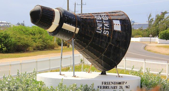
Sur l'île, on est très fier d'évoquer ce souvenir des débuts de la conquête spatiale. En 1962, c'est au large de Grand Turk que l'astronaute John Glenn a effectué son «splashdown », c'est à dire son amerrissage. A bord de Mercury, il venait de faire trois révolutions autour de la terre devenant ainsi le premier américain a effectué un vol en orbite. A l'époque, sur Grand Turk, il y avait une base militaire transformée pour l'occasion en mini NASA. Ainsi les Américains avec cette première avaient rattrapé les Russes dans la course à l'espace … des Russes qui avec Youri Gagarine les avaient devancé dans l'espace dix mois plutôt.
Bienvenue à Cockburn Town, la capitale officielle depuis 1766 des Turks & Caïcos Une capitale de poche avec seulement 3700 habitants sur les quelques 5000 que compte l'ensemble de l'île. Dans la ville, qui s'étire le long du littoral, on y trouve bien entendu quelques bâtiments administratifs. Celui-ci, sur la photo ci-dessous, regroupe dans une même construction la plupart des services administratifs : financiers, juridiques et sans doute encore quelques autres ...
Dans cette capitale-bourgade, on voit surtout des résidences individuelles, un peu dans le style d'un lotissement balnéaire. De simples maisons toutes parées de couleurs aux infinies nuances, les tonalités vont du rose au bleu en passant par le vert …
Sur le front de mer, quelques coquettes villas coloniales semblent particulièrement accueillantes. Leur style architectural est le plus souvent inspiré des maisons bahaméennes.
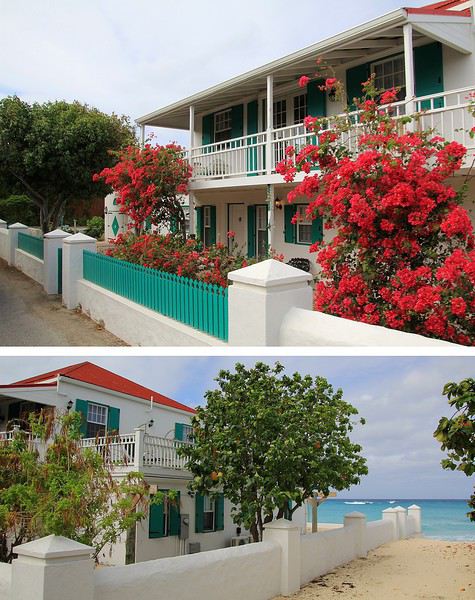
Si plusieurs ont été rénovées et sont ornées d'une profusion de bougainvilliers d'autres semblent presque à l'abandon, celle-ci par exemple.
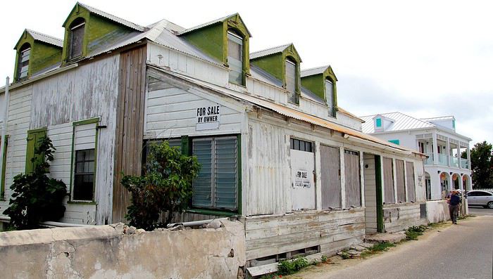
Cette ancienne bâtisse Miramar, autrefois le siège de bureaux est proposée à la vente. A bon entendeur, sachez qu'elle est idéalement située en face de la plage cependant, côté remise en état, bon courage pour le budget des travaux à prévoir !
A « Grand Turk », nous serons en territoire britannique au milieu d'un camaïeu de bleu. Quant à « Saint Thomas », la seconde escale, l'île à tout d'un petit paradis … des USA ! après avoir été à une époque, terre d'un royaume scandinave . Et enfin, nous terminerons le périple à « Virgin Gorda », un île de la Grande Bretagne d'outremer dont on ne peut oublier les plages de rêve parsemées d'impressionnants rochers. Que d'agréables souvenirs !
--__
Grand Turk, entre bleu lagon et or blanc
Voilà la vision tant attendue lorsqu'on débarque sur une île des Caraïbes ... A Grand Turk, ce décor de rêve est bien au rendez-vous : des plages de sable blanc et un horizon marin aux fascinantes nuances de bleu, et il y en a tout autour de l'île. Certes, la photo est un peu cliché mais avouons que contempler un tel paysage fait du bien, surtout en cette période où la moindre idée de voyage à l'étranger est à oublier … du moins pour un certain temps ! Sur votre écran, vous avez l'image, à vous de la compléter en imaginant l'environnement sonore. Entendez-vous maintenant le doux bruit des vaguelettes venant lécher ce rivage ?
Comme lors de tout voyage, il y a un temps pour des moments de contemplation et d'autres consacrés à la découverte … à nous à présent, la balade sur Grand Turk.
L'archipel de Grand Turk et Caïcos est situé au nord des Antilles, c'est un chapelet d'îles et d'îlots dans le prolongement des Bahamas et séparé de quelques 160 kilomètres, à vol d'oiseau (marin), du nord de Haïti.
Cette carte apposée sur un mur du port de débarquement permet de mieux localiser l'archipel au milieu d'une myriade d'îles caribéennes. Donc nous voici « Here », facile à repérer notre situation avec ce cercle et cette patine bistre : que de doigts de visiteurs ont du pointer l'archipel ! Une trentaine d'îles dont huit seulement sont habitées constitue Grand Turk & Caïcos. Quant à Grand Turk, l'île n'a de grand que le nom. L'île ne mesure qu'une dizaine de kilomètres pour à peine deux/trois de large, mais c'est sur son territoire qu'est située la capitale du petit État : Cockburn Town.
En bonne place sur cette carte ainsi que sur les drapeaux flottants au vent, on le constate, le cactus est mis en avant. Cette plante a été choisie comme emblème de l'archipel.
Avec toutes ses épines, on ne peut pas dire que l'aspect de ce cactus local soit particulièrement accueillant ... mais si ! il a quand même belle allure avec son drôle de pompon rouge.
Nommé melocactus, ça fait savant, ou plus simplement Turk 's head in english, cette « Tête de Turc » végétale serait à l'origine du nom de l'archipel des Turks & Caïcos, enfin paraît-il ! Au sujet du drapeau, bien sûr on retrouve l'Union Jack, mère patrie oblige mais à côté figure aussi des armoiries aux couleurs plus locales : une conque, une langouste ainsi que l'incontournable cactus.
Quitté les environs du port, c'est à dire le sud de l'île, la route nous fait passer près de l'aéroport international de Grand Turk, il relie le territoire au reste du monde. Un aéroport à la taille modeste, on pouvait s'en douter, dont la piste est tracée sur une des seules parties parfaitement planes de l'île.
Mc Cartney Airport ? Non, ce n'est pas un hommage au célèbre Paul … des Beatles. JJAGS Mc Carney était un homme politique qui a marqué les T&C. Élu à la tête du territoire insulaire à l'âge de 31 ans, il a enthousiasmé les habitants par son charisme et son souhait d'autonomie pour l’administration de ses îles … mais le destin en a voulu autrement. En 1981 et à seulement 34 ans, l'homme trouva la mort lors d'un crash aérien.
Restons dans le domaine aérien et même bien au-delà … Au carrefour de l'aéroport, trône une ancienne capsule spatiale.
Sur l'île, on est très fier d'évoquer ce souvenir des débuts de la conquête spatiale. En 1962, c'est au large de Grand Turk que l'astronaute John Glenn a effectué son «splashdown », c'est à dire son amerrissage. A bord de Mercury, il venait de faire trois révolutions autour de la terre devenant ainsi le premier américain a effectué un vol en orbite. A l'époque, sur Grand Turk, il y avait une base militaire transformée pour l'occasion en mini NASA. Ainsi les Américains avec cette première avaient rattrapé les Russes dans la course à l'espace … des Russes qui avec Youri Gagarine les avaient devancé dans l'espace dix mois plutôt.
Bienvenue à Cockburn Town, la capitale officielle depuis 1766 des Turks & Caïcos Une capitale de poche avec seulement 3700 habitants sur les quelques 5000 que compte l'ensemble de l'île. Dans la ville, qui s'étire le long du littoral, on y trouve bien entendu quelques bâtiments administratifs. Celui-ci, sur la photo ci-dessous, regroupe dans une même construction la plupart des services administratifs : financiers, juridiques et sans doute encore quelques autres ...
Dans cette capitale-bourgade, on voit surtout des résidences individuelles, un peu dans le style d'un lotissement balnéaire. De simples maisons toutes parées de couleurs aux infinies nuances, les tonalités vont du rose au bleu en passant par le vert …
Sur le front de mer, quelques coquettes villas coloniales semblent particulièrement accueillantes. Leur style architectural est le plus souvent inspiré des maisons bahaméennes.
Si plusieurs ont été rénovées et sont ornées d'une profusion de bougainvilliers d'autres semblent presque à l'abandon, celle-ci par exemple.
Cette ancienne bâtisse Miramar, autrefois le siège de bureaux est proposée à la vente. A bon entendeur, sachez qu'elle est idéalement située en face de la plage cependant, côté remise en état, bon courage pour le budget des travaux à prévoir !
Littérature de voyage, échos du changement English translation pending
Bonjour,
Et si finalement on donnait la parole à d'autres ?
Aux écrivains qui nous sont chers, à tous ceux qui dans leurs livres ont évoqué bien mieux que nous les interrogations, les doutes, le changement, la mue et l'adaptation dans le voyage ?
Et si leur expérience et leurs mots à eux, en quelques paragraphes ou phrases isolées que vous publierez ici, éclairaient un peu notre lanterne pour les mois ou les années à venir ?
L.
--
Nicolas Bouvier. Retour d'Inde. Publié dans " Bleu Immortel. Voyages en Afghanistan ". Editions Zoe. 2003.
--
" Revenir d'Asie pose des problèmes très précis. En Suisse, retour d'Inde et du Japon, je me suis longtemps senti mal à l'aise. Les magasins, les rues m'inspiraient une répulsion irraisonnée. Noël qui approchait, la foule des acheteurs, les farces tartinées de santé, le bruit des sous, la couperose me donnaient le cafard. Le seul endroit où je respirais, où je croisais de vrais regards c'était -- tenez-vous bien -- l'hôpital. Pourtant, c'était mon pays que je m'étais réjoui de revoir, pourtant on m'avait partout accueilli avec une gentillesse qui ne se démentait pas. Alors ? Je crois que c'était l'argent qui me gênait. L'argent engorgeait tout. Et à cause de cet argent, il n'y avait plus de foule ; elle était rompue, divisée comme une étendue de sable par les mailles éparses d'un filet. Il n'y avait que de petites fortunes, de petites coquilles, de petites solitudes meublées, feutrées, équipées, mais solitudes quand même. Dans les salles de billard, dans les autobus, j'entendais souvent cette phrase qui me paraissait stupéfiante : " Moi, je n'ai besoin de personne. " La communauté n'existait plus -- communauté : le sentiment profond que le sort de n'importe lequel de vos semblables vous concerne et vous affecte en quelque façon, la conscience d'une interdépendance -- , et pour qu'elle se recrée il fallait un de ces chocs -- accident mortel sur la route, révolution hongroise -- qui montrent bien que l'argent n'est pas tout et que ce qui nous rapproche le plus des autres est plus fondamental que ce qui nous en éloigne. Autrement, et en temps normal, on n'avait besoin de personne. Ce n'était que trop vrai, et quelle indigence. L'Hindou et le Chinois exposés en permanence à manquer de riz et de galette ont perpétuellement besoin du voisin, et le voisin d'eux. Le paysan du Dekkan a beau avoir l'oeil vide et feindre l'indifférence ; mendier de la farine, prêter de la farine, voir -- à cause d'une rivière qui déborde à 200 kilomètres de là -- sa maison soudain remplie d'inconnus, et pour longtemps, il ne connaît que ça, c'est son ordinaire. Voilà qui fait des foules. La misère se partage, et c'est grâce à cela que les misérables vivent encore. L'égoïsme n'est pas dans leurs moyens, trop coûteux. La prospérité ne se partage pas. Il faut cependant quitter la misère. Les Indiens y travaillent et on leur souhaite de réussir. Je leur souhaite aussi de conserver alors le coeur qu'ils avaient quand ils n'avaient que ça. "
Et si finalement on donnait la parole à d'autres ?
Aux écrivains qui nous sont chers, à tous ceux qui dans leurs livres ont évoqué bien mieux que nous les interrogations, les doutes, le changement, la mue et l'adaptation dans le voyage ?
Et si leur expérience et leurs mots à eux, en quelques paragraphes ou phrases isolées que vous publierez ici, éclairaient un peu notre lanterne pour les mois ou les années à venir ?
L.
--
Nicolas Bouvier. Retour d'Inde. Publié dans " Bleu Immortel. Voyages en Afghanistan ". Editions Zoe. 2003.
--
" Revenir d'Asie pose des problèmes très précis. En Suisse, retour d'Inde et du Japon, je me suis longtemps senti mal à l'aise. Les magasins, les rues m'inspiraient une répulsion irraisonnée. Noël qui approchait, la foule des acheteurs, les farces tartinées de santé, le bruit des sous, la couperose me donnaient le cafard. Le seul endroit où je respirais, où je croisais de vrais regards c'était -- tenez-vous bien -- l'hôpital. Pourtant, c'était mon pays que je m'étais réjoui de revoir, pourtant on m'avait partout accueilli avec une gentillesse qui ne se démentait pas. Alors ? Je crois que c'était l'argent qui me gênait. L'argent engorgeait tout. Et à cause de cet argent, il n'y avait plus de foule ; elle était rompue, divisée comme une étendue de sable par les mailles éparses d'un filet. Il n'y avait que de petites fortunes, de petites coquilles, de petites solitudes meublées, feutrées, équipées, mais solitudes quand même. Dans les salles de billard, dans les autobus, j'entendais souvent cette phrase qui me paraissait stupéfiante : " Moi, je n'ai besoin de personne. " La communauté n'existait plus -- communauté : le sentiment profond que le sort de n'importe lequel de vos semblables vous concerne et vous affecte en quelque façon, la conscience d'une interdépendance -- , et pour qu'elle se recrée il fallait un de ces chocs -- accident mortel sur la route, révolution hongroise -- qui montrent bien que l'argent n'est pas tout et que ce qui nous rapproche le plus des autres est plus fondamental que ce qui nous en éloigne. Autrement, et en temps normal, on n'avait besoin de personne. Ce n'était que trop vrai, et quelle indigence. L'Hindou et le Chinois exposés en permanence à manquer de riz et de galette ont perpétuellement besoin du voisin, et le voisin d'eux. Le paysan du Dekkan a beau avoir l'oeil vide et feindre l'indifférence ; mendier de la farine, prêter de la farine, voir -- à cause d'une rivière qui déborde à 200 kilomètres de là -- sa maison soudain remplie d'inconnus, et pour longtemps, il ne connaît que ça, c'est son ordinaire. Voilà qui fait des foules. La misère se partage, et c'est grâce à cela que les misérables vivent encore. L'égoïsme n'est pas dans leurs moyens, trop coûteux. La prospérité ne se partage pas. Il faut cependant quitter la misère. Les Indiens y travaillent et on leur souhaite de réussir. Je leur souhaite aussi de conserver alors le coeur qu'ils avaient quand ils n'avaient que ça. "
Dans quel pays aimeriez-vous vous expatrier? English translation pending
Je saisis au vol cette remarque d'Attila (que je partage!)
Franchement, je serais le gouvernement, je demanderais l'asile en ...?... et dirais aux français, démerdez vous.
et cette autre :
On fait le coucou dans les discussions mais jamais on n'en entame une...
pour proposer un nouveau post sur un mode très différent de voyager.
Où aimeriez-vous partir vivre?
Bien sûr vous choisissez votre pays ou région d'accueil, on part du principe que ce n'est pas une obligation que l'on vous fait.
Et vous avez besoin de vous éloigner momentanément de votre lieu de vie habituel, pour quelque raison que ce soit.
Quels seraient les atouts locaux importants pour vous de cette nouvelle installation : population, climat, paysages, archéologie, autres .... ?
Franchement, je serais le gouvernement, je demanderais l'asile en ...?... et dirais aux français, démerdez vous.
et cette autre :
On fait le coucou dans les discussions mais jamais on n'en entame une...
pour proposer un nouveau post sur un mode très différent de voyager.
Où aimeriez-vous partir vivre?
Bien sûr vous choisissez votre pays ou région d'accueil, on part du principe que ce n'est pas une obligation que l'on vous fait.
Et vous avez besoin de vous éloigner momentanément de votre lieu de vie habituel, pour quelque raison que ce soit.
Quels seraient les atouts locaux importants pour vous de cette nouvelle installation : population, climat, paysages, archéologie, autres .... ?
Trajet par avion Paris - Papeete puis Papeete - Hiva Oa English translation pending
bonjour,
J'ai fait une simulation vol Paris-Papeete avec french bee pour un départ dans six mois. ça donne la "modique" somme de 1.200 A/R. Vous confirmez pour ceux qui ont fait récemment le trajet ?
Ensuite Papeete-Hiva Oa avec Air Tahiti c'est environ 700 euros A/R. Soit près de 2.000 euros rien que pour les vols.
Avez vous de meilleurs plans ? Je précise que ce serait pour le mois d'octobre, donc pleine saison pour la Polynésie si mes sources sont exactes.
Bonne journée.
J'ai fait une simulation vol Paris-Papeete avec french bee pour un départ dans six mois. ça donne la "modique" somme de 1.200 A/R. Vous confirmez pour ceux qui ont fait récemment le trajet ?
Ensuite Papeete-Hiva Oa avec Air Tahiti c'est environ 700 euros A/R. Soit près de 2.000 euros rien que pour les vols.
Avez vous de meilleurs plans ? Je précise que ce serait pour le mois d'octobre, donc pleine saison pour la Polynésie si mes sources sont exactes.
Bonne journée.
Dix jours autour d'Erevan avec bébé English translation pending
Barev dzez !
Voici le compte-rendu d’un très beau séjour d’une dizaine de jours à Erevan. L’Arménie étant un pays aux dimensions assez restreintes il est possible de rayonner à la journée depuis Erevan pour voir les principaux sites touristiques du pays. C'est ce que nous avons fait avec note petit de 8 mois. Seul le sud et l’extrême Nord nécessitent de partir plusieurs jours loin de la capitale (ainsi que le Karabagh/Artsakh). Par exemple comptez 2h de route pour atteindre Areni à une centaine de kilomètres au sud d’Erevan. Le pays est montagneux et les routes sinueuses 😉
Nous avons donc loué un appartement pour 10 jours. C’est la solution qui nous a paru la plus pratique pour ne pas déménager touts les affaires avec bébé à chaque fois ( et aussi pour profiter à fond de la famille). En plus le centre d’Erevan est dense en sites d’intérêt et de nombreuses balades sont faisables à pied.
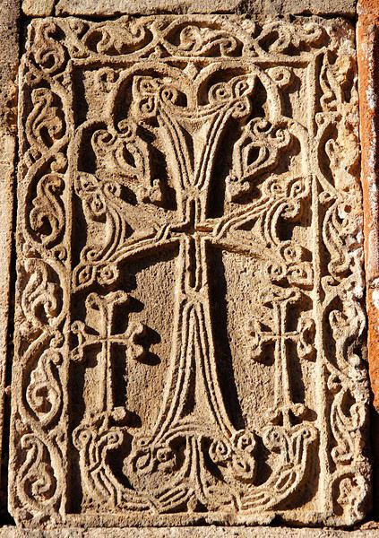
Je vais commencer par le bilan pratique, ensuite les lecteurs les plus assidus auront droit au dessert !
Hébergement Pour louer un appart voire une maison via Air**b, il n’y a que l’embarras du choix. Toute la gamme de prix est présente à Erevan. La principale question est le parking de l’éventuelle voiture de location. En plein centre, entre la Cascade et la place de la République ce n’est pas facile de se garer dans la rue. Dates Côté météo je dois dire que la fin septembre et le début octobre sont parfaits. Ni froid ni trop chaud, entre 22 et 28 degrés tous les jours et du soleil garanti. En fait on a eu un seul jour avec une météo vraiment moche, c’est quand on est allé au lac Sevan, pas de bol ! Vols Aller avec Air France, retour avec Aeroflot via Moscou. 550 euros par personne. Notre compagnie nationale profite de son monopole depuis la France vers l’Arménie. C’est clairement le point noir du budget. Heureusement en dessous de 2 ans bébé ne paye sa part qu’à hauteur de 10% et a droit à son propre bagage en soute et en cabine !
Transports Les taxis sont très bon marché et n’essayent pas de vous arnaquer… sauf à l’aéroport ou les prix s’envolent. Cela dit 10 euros pour un européen ça reste abordable. Une course du centre vers la banlieue coûte 2 ou 3 euros. La plupart des taxis rechignent à faire des petits trajets restants dans le centre. Attention si vous avez beaucoup de bagages ou une grande poussette pour bébé, la plupart des taxis ne peuvent rien mettre dans leur coffre car ils y ont installé un réservoir supplémentaire pour rouler au gaz ! Il vaut donc mieux commander par téléphone et demander un grand coffre si besoin. Cela n’est pas valable pour les taxis de l’aéroport heureusement 😉 La ville est très bien couverte par le réseau de bus mais ceux-ci peuvent être compliqués à prendre. Les bus de ville sont les moins chers et les horaires sont réguliers mais ils circulent dans le centre uniquement. Les mini-bus sont un peu plus chers, ils vont plus loin et vous laissent ou vous voulez sur le chemin pour connaitre la destination il faut demander au chauffeur qui souvent ne parle ni anglais ni français ! Pour sortir de Erevan je voulais louer une voiture mais sous la « pression » de la famille nous nous sommes retrouvés à chaque fois avec un chauffeur et un mini-van pour nous amener ou nous voulions. Souvent c’était un ami d’un ami d’un cousin 😉, parfois ils avaient réservé et payé taxi et guide. Il faut savoir qu’un arménien même modeste financièrement fera tout pour vous aider et rendre votre séjour mémorable.
Pour ceux qui voudraient louer une voiture les tarifs sont abordables sans être pour autant bon marché comparé au coût de la vie en Arménie. S’orienter est assez facile, le réseau de routes goudronnées (souvent en mauvais état) est assez restreint. La conduite est un peu sportive mais reste moins risquée que ce que j’ai vu dans d’autres pays d’Asie ou d’Afrique. Les panneaux de direction sont presque tous en alphabets arménien + latin. Très peu sont encore en cyrillique.
Accueil Faut-il le préciser, les visiteurs sont extrêmement bien reçus dans ce petit pays peu touristique. En dehors des arméniens de la diaspora qui viennent voir la famille et des touristes de l’ex bloc soviétique la destination reste confidentielle. Une culture authentique et un peuple chaleureux à découvrir ! Programme J’avais fait une liste de choses à voir et à faire plus qu’un programme. On s’est adapté à la disponibilité des gens (famille, amis) que l’on voulait voir à Erevan. Finalement le bilan est le suivant :
Erevan : 4 jours de visite + 1 jour consacré à une grande fête de famille Khor Virap + Areni + Noravank : 1 journée Garni + Gherard : 1 journée Etchmiadzine + Zvartnots : ½ journée Lac Sevan : 1 journée Mont Aragats : 1 après-midi
J’aurais voulu aller jusqu’à Dilidjan ou Gyumri mais ça ne s’est pas fait. Ce sera pour la prochaine fois ! 😉
Budget Au moment du voyage la conversion euro-dram était de 1 EUR=500 AMD Quelques prix moyens à Erevan : 1 ticket de bus = 100 AMD 1 taxi du centre à Erebouni = 2000 AMD 1 taxi de l’aéroport au centre = 5000 AMD 1 shawarma (càd de la viande et de la garniture dans un pain) = 1500 AMD 1 bouteille d’eau d’1L = 300 AMD 1 bière dans un bar branché = 3000 AMD
Voici le compte-rendu d’un très beau séjour d’une dizaine de jours à Erevan. L’Arménie étant un pays aux dimensions assez restreintes il est possible de rayonner à la journée depuis Erevan pour voir les principaux sites touristiques du pays. C'est ce que nous avons fait avec note petit de 8 mois. Seul le sud et l’extrême Nord nécessitent de partir plusieurs jours loin de la capitale (ainsi que le Karabagh/Artsakh). Par exemple comptez 2h de route pour atteindre Areni à une centaine de kilomètres au sud d’Erevan. Le pays est montagneux et les routes sinueuses 😉
Nous avons donc loué un appartement pour 10 jours. C’est la solution qui nous a paru la plus pratique pour ne pas déménager touts les affaires avec bébé à chaque fois ( et aussi pour profiter à fond de la famille). En plus le centre d’Erevan est dense en sites d’intérêt et de nombreuses balades sont faisables à pied.
Je vais commencer par le bilan pratique, ensuite les lecteurs les plus assidus auront droit au dessert !
Hébergement Pour louer un appart voire une maison via Air**b, il n’y a que l’embarras du choix. Toute la gamme de prix est présente à Erevan. La principale question est le parking de l’éventuelle voiture de location. En plein centre, entre la Cascade et la place de la République ce n’est pas facile de se garer dans la rue. Dates Côté météo je dois dire que la fin septembre et le début octobre sont parfaits. Ni froid ni trop chaud, entre 22 et 28 degrés tous les jours et du soleil garanti. En fait on a eu un seul jour avec une météo vraiment moche, c’est quand on est allé au lac Sevan, pas de bol ! Vols Aller avec Air France, retour avec Aeroflot via Moscou. 550 euros par personne. Notre compagnie nationale profite de son monopole depuis la France vers l’Arménie. C’est clairement le point noir du budget. Heureusement en dessous de 2 ans bébé ne paye sa part qu’à hauteur de 10% et a droit à son propre bagage en soute et en cabine !
Transports Les taxis sont très bon marché et n’essayent pas de vous arnaquer… sauf à l’aéroport ou les prix s’envolent. Cela dit 10 euros pour un européen ça reste abordable. Une course du centre vers la banlieue coûte 2 ou 3 euros. La plupart des taxis rechignent à faire des petits trajets restants dans le centre. Attention si vous avez beaucoup de bagages ou une grande poussette pour bébé, la plupart des taxis ne peuvent rien mettre dans leur coffre car ils y ont installé un réservoir supplémentaire pour rouler au gaz ! Il vaut donc mieux commander par téléphone et demander un grand coffre si besoin. Cela n’est pas valable pour les taxis de l’aéroport heureusement 😉 La ville est très bien couverte par le réseau de bus mais ceux-ci peuvent être compliqués à prendre. Les bus de ville sont les moins chers et les horaires sont réguliers mais ils circulent dans le centre uniquement. Les mini-bus sont un peu plus chers, ils vont plus loin et vous laissent ou vous voulez sur le chemin pour connaitre la destination il faut demander au chauffeur qui souvent ne parle ni anglais ni français ! Pour sortir de Erevan je voulais louer une voiture mais sous la « pression » de la famille nous nous sommes retrouvés à chaque fois avec un chauffeur et un mini-van pour nous amener ou nous voulions. Souvent c’était un ami d’un ami d’un cousin 😉, parfois ils avaient réservé et payé taxi et guide. Il faut savoir qu’un arménien même modeste financièrement fera tout pour vous aider et rendre votre séjour mémorable.
Pour ceux qui voudraient louer une voiture les tarifs sont abordables sans être pour autant bon marché comparé au coût de la vie en Arménie. S’orienter est assez facile, le réseau de routes goudronnées (souvent en mauvais état) est assez restreint. La conduite est un peu sportive mais reste moins risquée que ce que j’ai vu dans d’autres pays d’Asie ou d’Afrique. Les panneaux de direction sont presque tous en alphabets arménien + latin. Très peu sont encore en cyrillique.
Accueil Faut-il le préciser, les visiteurs sont extrêmement bien reçus dans ce petit pays peu touristique. En dehors des arméniens de la diaspora qui viennent voir la famille et des touristes de l’ex bloc soviétique la destination reste confidentielle. Une culture authentique et un peuple chaleureux à découvrir ! Programme J’avais fait une liste de choses à voir et à faire plus qu’un programme. On s’est adapté à la disponibilité des gens (famille, amis) que l’on voulait voir à Erevan. Finalement le bilan est le suivant :
Erevan : 4 jours de visite + 1 jour consacré à une grande fête de famille Khor Virap + Areni + Noravank : 1 journée Garni + Gherard : 1 journée Etchmiadzine + Zvartnots : ½ journée Lac Sevan : 1 journée Mont Aragats : 1 après-midi
J’aurais voulu aller jusqu’à Dilidjan ou Gyumri mais ça ne s’est pas fait. Ce sera pour la prochaine fois ! 😉
Budget Au moment du voyage la conversion euro-dram était de 1 EUR=500 AMD Quelques prix moyens à Erevan : 1 ticket de bus = 100 AMD 1 taxi du centre à Erebouni = 2000 AMD 1 taxi de l’aéroport au centre = 5000 AMD 1 shawarma (càd de la viande et de la garniture dans un pain) = 1500 AMD 1 bouteille d’eau d’1L = 300 AMD 1 bière dans un bar branché = 3000 AMD
Je vous invite à découvrir l'île de Lanzarote English translation pending
INTRODUCTION
Des vidéos sont insérées tout au long du résumé. Veuillez cliquer sur l'image pour démarrer la vidéo.
En février dernier, nous avons séjourné 2 semaines sur l'île de Lanzarote afin d'en découvrir les différents attraits touristiques.
Comme la plupart de nos précédents voyages, plusieurs semaines ont été consacrées à la création de notre itinéraire afin de pouvoir être en mesure d'atteindre parfaitement nos objectifs.
Lors de notre séjour, nous avons utilisé l'application Maps.me, une application mobile qui fournit des cartes hors ligne. Cette application s'avère très précieuse lors de nos déplacements en voiture, en randonnée et même lors de nos circuits à pied dans les grandes villes.
J'avais préalablement téléchargé les coordonnées GPS de toutes les attractions prévues à notre itinéraire dans l'application Maps.me, ce qui a facilité grandement nos déplacements.
La réservation de l'hébergement ainsi que la location d'une voiture ont été effectuées sur le web avant notre départ.
Nous sommes partis de l'aéroport de Québec et avons eu une escale à Montréal ainsi qu'à Bruxelles en Belgique avant d'atteindre Lanzarote.
Lanzarote fait partie des Îles Canaries qui elles-mêmes sont situées dans l'océan Atlantique, à l'ouest du Maroc. Celles-ci font d'ailleurs partie de l'Espagne.
Nous avions déjà visité l'île de Tenerife et nous avions adoré notre séjour à cet endroit.
Nous avons donc décidé de poursuivre la découverte des Îles Canaries en nous rendant à Lanzarote car cette île offre un paysage volcanique spectaculaire, des plages à faire rêver ainsi que de magnifiques villages aux maisons typiques de l'île qui sont majoritairement blanches.
Les sentiers de randonnée sont nombreux et nous permettent de découvrir une grande diversité de paysages.
Les attraits touristiques sont également fort nombreux et facilement accessibles car les routes de Lanzarote se parcourent aisément en voiture car celles-ci sont dans un état impeccable.
D'ailleurs, c'est un pur plaisir que de se déplacer sur ces routes car les paysages qui défilent sous nos yeux sont sensationnels et présentent une perspective différente selon la lumière du jour.
Des vidéos sont insérées tout au long du résumé. Veuillez cliquer sur l'image pour démarrer la vidéo.
En février dernier, nous avons séjourné 2 semaines sur l'île de Lanzarote afin d'en découvrir les différents attraits touristiques.
Comme la plupart de nos précédents voyages, plusieurs semaines ont été consacrées à la création de notre itinéraire afin de pouvoir être en mesure d'atteindre parfaitement nos objectifs.
Lors de notre séjour, nous avons utilisé l'application Maps.me, une application mobile qui fournit des cartes hors ligne. Cette application s'avère très précieuse lors de nos déplacements en voiture, en randonnée et même lors de nos circuits à pied dans les grandes villes.
J'avais préalablement téléchargé les coordonnées GPS de toutes les attractions prévues à notre itinéraire dans l'application Maps.me, ce qui a facilité grandement nos déplacements.
La réservation de l'hébergement ainsi que la location d'une voiture ont été effectuées sur le web avant notre départ.
Nous sommes partis de l'aéroport de Québec et avons eu une escale à Montréal ainsi qu'à Bruxelles en Belgique avant d'atteindre Lanzarote.
Lanzarote fait partie des Îles Canaries qui elles-mêmes sont situées dans l'océan Atlantique, à l'ouest du Maroc. Celles-ci font d'ailleurs partie de l'Espagne.
Nous avions déjà visité l'île de Tenerife et nous avions adoré notre séjour à cet endroit.
Nous avons donc décidé de poursuivre la découverte des Îles Canaries en nous rendant à Lanzarote car cette île offre un paysage volcanique spectaculaire, des plages à faire rêver ainsi que de magnifiques villages aux maisons typiques de l'île qui sont majoritairement blanches.
Les sentiers de randonnée sont nombreux et nous permettent de découvrir une grande diversité de paysages.
Les attraits touristiques sont également fort nombreux et facilement accessibles car les routes de Lanzarote se parcourent aisément en voiture car celles-ci sont dans un état impeccable.
D'ailleurs, c'est un pur plaisir que de se déplacer sur ces routes car les paysages qui défilent sous nos yeux sont sensationnels et présentent une perspective différente selon la lumière du jour.
Off to explore Jordan!
Well, since the lockdown is dragging on, I’m starting a new travel journal following the one I finished publishing yesterday:
https://voyageforum.com/discussion/voyage-pays-perles-voyage-dans-ouest-americain-d9943984/
This time, after the U.S., we’re heading to the Middle East—Jordan!
And we’re keeping up the good habits: one day’s entry published every day at 5:30 PM! Happy reading, and feel free to leave a comment, question, or remark...
Franck
Franck
Du nord au sud de l'archipel philippin avec un détour par Singapour English translation pending
Bonjour,
Ce carnet qu'en principe je n'aurais pas du faire, il m'a été soufflé par certains membres de VF et en ces temps troublés de Covid-19, nous en avons justement du temps, quoi que pour certains pour une fois ils croulent sous le travail (il se reconnaîtra 😇)
Je vais vous conter (un bien grand mot pour moi, vu que je ne suis pas très à l'aise avec les mots) ce périple vous amènera à Banaue et ses magnifiques rizière en terrasses, au sud sur l'île de Siargao et au centre à sur l'île de Panglao
Il n'y aura pas d'animaux pétrifiés, de rochers à perte de vue et de champignons hallucinogènes (elle se reconnaitra)
Il a commencé par un vol à destination de Manilles via Doha,
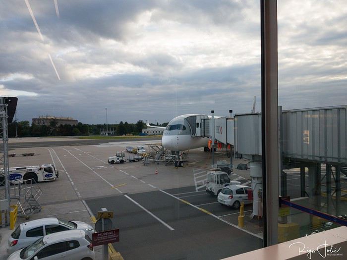
Une photo qui aurait eu sa place sur sans problème sur passenger shaming, ils nous a fait une très grande prestation jusqu'à Doha
On se retrouve bientôt à Manille 🙂
Ce carnet qu'en principe je n'aurais pas du faire, il m'a été soufflé par certains membres de VF et en ces temps troublés de Covid-19, nous en avons justement du temps, quoi que pour certains pour une fois ils croulent sous le travail (il se reconnaîtra 😇)
Je vais vous conter (un bien grand mot pour moi, vu que je ne suis pas très à l'aise avec les mots) ce périple vous amènera à Banaue et ses magnifiques rizière en terrasses, au sud sur l'île de Siargao et au centre à sur l'île de Panglao
Il n'y aura pas d'animaux pétrifiés, de rochers à perte de vue et de champignons hallucinogènes (elle se reconnaitra)
Il a commencé par un vol à destination de Manilles via Doha,
Une photo qui aurait eu sa place sur sans problème sur passenger shaming, ils nous a fait une très grande prestation jusqu'à Doha
On se retrouve bientôt à Manille 🙂
Compte rendu Cuba 2020 English translation pending
🙂
En ces temps difficiles, rien que une bonne lecture évasive à la maison CUBA 2020
>>>14 jours >>>5 villes coloniale >>>1500 kms en Ford 195 >>>4 sites UNESCO >>>8 casas particulares utilisées >>>beaucoup de langoustes
Références : Application MAPS.ME Page FB : Je pars à Cuba Page FB : Les français à Cuba Page FB : Cuba : conseils pour bien préparer son voyage www.cubanoscope.com www.jeparsacuba.com Carte Cuba 1.1000000 BORCH plastifiée Guide du Routard CUBA 2019
JOUR 1 : PARIS>>>LA HAVANE 10h de vol 25° (samedi 18/01/2020) Voilà c’est le départ tant attendu, direction l’aéroport d’Orly pour un vol direct à destination de la Havane, capitale de CUBA. Nous sommes à l’aéroport vers 08h00 pour un décollage à 10h00 sur la compagnie Air Caraïbes que nous testons pour la première fois. Nous sommes dans une boutique DutyFree, pour quelques achats, lorsqu’une annonce retentit et nous concerne. Notre vol est retardé de 2h30 ! Bon bin, il va falloir attendre, on finit nos achats, qui seront gardés à Orly, jusqu’à notre retour (pratique). Nous sommes en salle d’embarquement F21, on nous remet une attestation de retard de la part de la compagnie, et on nous sert un petit piquenique. La raison invoquée par Air Caraïbes, est qu’ils ont dû changer d’appareil, alors que depuis 08h00 que nous sommes là, en porte F21, il y a un avion Air Caraïbes qui est au stationnement, il y restera jusqu’à notre décollage qui sera effectif à 13h20, soit 3h20 de retard au décollage (ce changement d’appareil a-t-il eu lieu>>>mystère….).
J’ai eu le temps de prévenir 2 personnes à La Havane, de notre retard, une qui doit nous donner des réservations faites en ligne, et notre chauffeur Pavel, qui nous attend à l’aéroport. Les 10h30 de vol se passent très bien, on a trouvé les services à bord d’un bon niveau, équipage agréable et divertissements très variés. On se pose donc à 17h30 heure locale au lieu de 14h40. Il y a pas mal de monde aux guichets immigration, mais nous passons assez rapidement la douane munis de notre carte de tourisme (visa) en main, un tampon de plus dans le passeport et nous passons (notre assurance rapatriement ne nous a pas été demandée, mais elle est obligatoire). Nous n’avons pas de bagages en soute, alors nous nous dirigeons vers la sortie, tout en constatant qu’il faudrait un papier bleu rempli, que nous n’avons pas. Une personne récupère ce papier, un papier pour une famille, un peu perdus, on suit un peu tout le monde, la personne est un peu submergée, et nous passons avec d’autres personnes.
Un fois sortis, nous repérons facilement Pavel (notre chauffeur privé pour 2 semaines) avec la pancarte à nos noms. Nous allons directement échanger en espagnol, et cela pour toute la durée du voyage. Voulant faire du change, je lui demande où cela est possible, et il y a un guichet à droite en sortant. Mais, il me propose de le faire avec lui, et au même taux, c’est parfait. Il m’expliquera que cela l’intéresse d’avoir des euros ou des dollars pour acheter des pièces de voitures au cas où, et qu’il paie cela dans une de ces deux monnaies.
FOCUS MONNAIE A CUBA : Bon à savoir, à Cuba il existe 2 monnaies en vigueur, un peso national (CUP) pour les cubains et un peso convertible (CUC) pour les touristes, ces 2 monnaies ne sont pas récupérables en dehors du territoire cubain, donc il faut arriver avec des espèces, attention une commission supplémentaire est prise en cas de change avec des dollars américains. Et avoir sa CB pour des retraits possibles en ville.
Et un des moments tant attendus arrive, nous découvrons notre voiture, une FORD 1953 Customline Sedan bleu, Pavel la tient de son père, et elle a été entièrement refaite. Et nous voici partis vers la ville, on voit déjà énormément de voitures américaines des années 50 et 60, il y en a partout en fait. La nuit tombe maintenant, puisque nous sommes arrivés en retard, et Pavel gentiment nous propose un tour de ville vers les spots illuminés de La Havane, on est vraiment dans le bain, le Capitolio, le théâtre national, nous remontons le Paseo del Prado, on en avait rêvé, on y est !!!
Pavel nous dépose ensuite à notre hébergement, nous sommes chez l’habitant (et cela durera 2 semaines). Nous sommes à la Casa Esperanza, chez Henri, français et Esperanza, cubaine sa femme. Il s’agit d’une maison de 1910 entièrement rénovée en 11 mois !
FOCUS HEBERGEMENT A CUBA : Cuba étant pendant longtemps un pays assez fermé, l’offre en hébergement touristique est restée faible et d’état, l’hôtellerie n’est pas dans le meilleur des états et n’est pas bien rénovée faute d’argent. Ainsi, face à la demande touristique grandissante, dès 1997, Fidel Castro a ainsi autorisé les particuliers à louer deux chambres maximum à des étrangers. En 2011, le régime a dû libéraliser cette location. Il est désormais légal de louer plus de deux chambres par logement voire même une maison entière. (Tarifs moyens 15 à 40 CUC par nuit, environ 13,50 à 36€). Il y a environ aujourd’hui à La Havane plus de 800 casa particular.
Nous laissons Pavel pour ce soir et nous le retrouverons lundi matin. Henri nous indique un petit itinéraire pour aller se restaurer. Notre hébergement est dans le quartier de la vieille Havane, pratique où tout peut se faire à pied. Nous allons donc partir à pied, il fait nuit, les cubains sont très souvent dehors et dans la rue, ce que nous remarquons de suite, c’est l’état déplorable, ou en ruine, de pas mal de maisons coloniales ou début XXème. A pied, on peut vraiment avoir l’impression d’être en insécurité, il fait nuit, on voit de tout, ruines, animaux et cubains, et en fait il n’en est rien du tout, c’est très sécuritaire malgré la vision que nous percevons. A 5mn, nous rejoignons la Plaza Vieja, superbe place coloniale rénovée aux façades authentiques, plusieurs restaurants, et surtout ce que nous rêvions aussi, on est samedi soir, la musique cubaine est là, dans les maisons ou dans la rue, on y est !!! On trouve un petit resto et notre premier mojito ! Retour à l’hébergement, il est 21h30, on commence à absorber le jetlag, bonne nuit.
>>>14 jours >>>5 villes coloniale >>>1500 kms en Ford 195 >>>4 sites UNESCO >>>8 casas particulares utilisées >>>beaucoup de langoustes
Références : Application MAPS.ME Page FB : Je pars à Cuba Page FB : Les français à Cuba Page FB : Cuba : conseils pour bien préparer son voyage www.cubanoscope.com www.jeparsacuba.com Carte Cuba 1.1000000 BORCH plastifiée Guide du Routard CUBA 2019
JOUR 1 : PARIS>>>LA HAVANE 10h de vol 25° (samedi 18/01/2020) Voilà c’est le départ tant attendu, direction l’aéroport d’Orly pour un vol direct à destination de la Havane, capitale de CUBA. Nous sommes à l’aéroport vers 08h00 pour un décollage à 10h00 sur la compagnie Air Caraïbes que nous testons pour la première fois. Nous sommes dans une boutique DutyFree, pour quelques achats, lorsqu’une annonce retentit et nous concerne. Notre vol est retardé de 2h30 ! Bon bin, il va falloir attendre, on finit nos achats, qui seront gardés à Orly, jusqu’à notre retour (pratique). Nous sommes en salle d’embarquement F21, on nous remet une attestation de retard de la part de la compagnie, et on nous sert un petit piquenique. La raison invoquée par Air Caraïbes, est qu’ils ont dû changer d’appareil, alors que depuis 08h00 que nous sommes là, en porte F21, il y a un avion Air Caraïbes qui est au stationnement, il y restera jusqu’à notre décollage qui sera effectif à 13h20, soit 3h20 de retard au décollage (ce changement d’appareil a-t-il eu lieu>>>mystère….).
J’ai eu le temps de prévenir 2 personnes à La Havane, de notre retard, une qui doit nous donner des réservations faites en ligne, et notre chauffeur Pavel, qui nous attend à l’aéroport. Les 10h30 de vol se passent très bien, on a trouvé les services à bord d’un bon niveau, équipage agréable et divertissements très variés. On se pose donc à 17h30 heure locale au lieu de 14h40. Il y a pas mal de monde aux guichets immigration, mais nous passons assez rapidement la douane munis de notre carte de tourisme (visa) en main, un tampon de plus dans le passeport et nous passons (notre assurance rapatriement ne nous a pas été demandée, mais elle est obligatoire). Nous n’avons pas de bagages en soute, alors nous nous dirigeons vers la sortie, tout en constatant qu’il faudrait un papier bleu rempli, que nous n’avons pas. Une personne récupère ce papier, un papier pour une famille, un peu perdus, on suit un peu tout le monde, la personne est un peu submergée, et nous passons avec d’autres personnes.
Un fois sortis, nous repérons facilement Pavel (notre chauffeur privé pour 2 semaines) avec la pancarte à nos noms. Nous allons directement échanger en espagnol, et cela pour toute la durée du voyage. Voulant faire du change, je lui demande où cela est possible, et il y a un guichet à droite en sortant. Mais, il me propose de le faire avec lui, et au même taux, c’est parfait. Il m’expliquera que cela l’intéresse d’avoir des euros ou des dollars pour acheter des pièces de voitures au cas où, et qu’il paie cela dans une de ces deux monnaies.
FOCUS MONNAIE A CUBA : Bon à savoir, à Cuba il existe 2 monnaies en vigueur, un peso national (CUP) pour les cubains et un peso convertible (CUC) pour les touristes, ces 2 monnaies ne sont pas récupérables en dehors du territoire cubain, donc il faut arriver avec des espèces, attention une commission supplémentaire est prise en cas de change avec des dollars américains. Et avoir sa CB pour des retraits possibles en ville.
Et un des moments tant attendus arrive, nous découvrons notre voiture, une FORD 1953 Customline Sedan bleu, Pavel la tient de son père, et elle a été entièrement refaite. Et nous voici partis vers la ville, on voit déjà énormément de voitures américaines des années 50 et 60, il y en a partout en fait. La nuit tombe maintenant, puisque nous sommes arrivés en retard, et Pavel gentiment nous propose un tour de ville vers les spots illuminés de La Havane, on est vraiment dans le bain, le Capitolio, le théâtre national, nous remontons le Paseo del Prado, on en avait rêvé, on y est !!!
Pavel nous dépose ensuite à notre hébergement, nous sommes chez l’habitant (et cela durera 2 semaines). Nous sommes à la Casa Esperanza, chez Henri, français et Esperanza, cubaine sa femme. Il s’agit d’une maison de 1910 entièrement rénovée en 11 mois !
FOCUS HEBERGEMENT A CUBA : Cuba étant pendant longtemps un pays assez fermé, l’offre en hébergement touristique est restée faible et d’état, l’hôtellerie n’est pas dans le meilleur des états et n’est pas bien rénovée faute d’argent. Ainsi, face à la demande touristique grandissante, dès 1997, Fidel Castro a ainsi autorisé les particuliers à louer deux chambres maximum à des étrangers. En 2011, le régime a dû libéraliser cette location. Il est désormais légal de louer plus de deux chambres par logement voire même une maison entière. (Tarifs moyens 15 à 40 CUC par nuit, environ 13,50 à 36€). Il y a environ aujourd’hui à La Havane plus de 800 casa particular.
Nous laissons Pavel pour ce soir et nous le retrouverons lundi matin. Henri nous indique un petit itinéraire pour aller se restaurer. Notre hébergement est dans le quartier de la vieille Havane, pratique où tout peut se faire à pied. Nous allons donc partir à pied, il fait nuit, les cubains sont très souvent dehors et dans la rue, ce que nous remarquons de suite, c’est l’état déplorable, ou en ruine, de pas mal de maisons coloniales ou début XXème. A pied, on peut vraiment avoir l’impression d’être en insécurité, il fait nuit, on voit de tout, ruines, animaux et cubains, et en fait il n’en est rien du tout, c’est très sécuritaire malgré la vision que nous percevons. A 5mn, nous rejoignons la Plaza Vieja, superbe place coloniale rénovée aux façades authentiques, plusieurs restaurants, et surtout ce que nous rêvions aussi, on est samedi soir, la musique cubaine est là, dans les maisons ou dans la rue, on y est !!! On trouve un petit resto et notre premier mojito ! Retour à l’hébergement, il est 21h30, on commence à absorber le jetlag, bonne nuit.
Je vous invite à découvrir l'île de Curaçao English translation pending
INTRODUCTION
Des vidéos sont insérées tout au long du résumé. Veuillez cliquer sur l'image pour démarrer la vidéo.
En novembre dernier, nous avons séjourné 2 semaines sur l'île de Curaçao afin d'en découvrir les différents attraits touristiques.
Comme la plupart de nos précédents voyages, plusieurs semaines ont été consacrées à la création de notre itinéraire afin de pouvoir être en mesure d'atteindre parfaitement nos objectifs.
Lors de notre séjour, nous avons utilisé l'application Maps.me, une application mobile qui fournit des cartes hors ligne. Cette application s'avère très précieuse lors de nos déplacements en voiture, en randonnée et même lors de nos circuits à pied dans les grandes villes.
J'avais préalablement téléchargé les coordonnées GPS de toutes les attractions prévues à notre itinéraire dans l'application Maps.me, ce qui a facilité grandement nos déplacements.
La réservation de l'hébergement ainsi que la location d'une voiture ont été effectuées sur internet avant notre départ.
Pour faire une histoire courte, Curaçao se trouve dans la mer des Caraïbes entre les îles d'Aruba et Bonaire, à une soixantaine de kilomètres des côtes du Vénézuela.
Cette île n'est pas très grande puisqu'elle mesure 60 km de long par 11 km de large. Willemstad, sa magnifique capitale, est inscrite au patrimoine mondial de l'Unesco.
Elle jouit d'un climat tempéré et est reconnue pour ses splendides plages, ses eaux limpides, ses parcs nationaux, ses grottes et ses fameux flamants roses.
Des vidéos sont insérées tout au long du résumé. Veuillez cliquer sur l'image pour démarrer la vidéo.
En novembre dernier, nous avons séjourné 2 semaines sur l'île de Curaçao afin d'en découvrir les différents attraits touristiques.
Comme la plupart de nos précédents voyages, plusieurs semaines ont été consacrées à la création de notre itinéraire afin de pouvoir être en mesure d'atteindre parfaitement nos objectifs.
Lors de notre séjour, nous avons utilisé l'application Maps.me, une application mobile qui fournit des cartes hors ligne. Cette application s'avère très précieuse lors de nos déplacements en voiture, en randonnée et même lors de nos circuits à pied dans les grandes villes.
J'avais préalablement téléchargé les coordonnées GPS de toutes les attractions prévues à notre itinéraire dans l'application Maps.me, ce qui a facilité grandement nos déplacements.
La réservation de l'hébergement ainsi que la location d'une voiture ont été effectuées sur internet avant notre départ.
Pour faire une histoire courte, Curaçao se trouve dans la mer des Caraïbes entre les îles d'Aruba et Bonaire, à une soixantaine de kilomètres des côtes du Vénézuela.
Cette île n'est pas très grande puisqu'elle mesure 60 km de long par 11 km de large. Willemstad, sa magnifique capitale, est inscrite au patrimoine mondial de l'Unesco.
Elle jouit d'un climat tempéré et est reconnue pour ses splendides plages, ses eaux limpides, ses parcs nationaux, ses grottes et ses fameux flamants roses.