Results for "Hambourg+et+(transport+ou+trajet+ou+route+ou+voiture+ou+bus)+|+9+>+196"
1299 results found.
Planning a bike trip?
Who are you? Where are you from? Where are you going?
Like last year at this time, a post about bike travel ideas.
How many of us are preparing a trip planned for this year? Probably a lot.
What’s yours—the one you’ve been dying to do for so long, maybe too long? For us, it’s a modest PARIS-MARATHON by bike, followed by MARATHON-ATHENS on foot in June 2010. And you?
May the passion keep growing before, during, and after! Happy planning and safe travels to everyone.
Like last year at this time, a post about bike travel ideas.
How many of us are preparing a trip planned for this year? Probably a lot.
What’s yours—the one you’ve been dying to do for so long, maybe too long? For us, it’s a modest PARIS-MARATHON by bike, followed by MARATHON-ATHENS on foot in June 2010. And you?
May the passion keep growing before, during, and after! Happy planning and safe travels to everyone.
La honte de prendre l'avion? English translation pending
J'ai trouvé ceci ce matin sur le site du "Figaro" (n'étant pas abonné, je n'ai pu lire tout l'article) : j'en suis resté assez stupéfait, et je me demande bien ce qu'en pensent les lecteurs de ce forum !
www.lefigaro.fr/...port-aerien-20190407 Par souci d’écologie, de plus en plus de voyageurs cèdent à la «honte de prendre l’avion» et privilégient le train, même pour de longs trajets.
Gino, Italien installé depuis sept ans à Stockholm, et Saana, son amie finlandaise, auraient toutes les raisons de choisir un des nombreux vols low-costs pour rejoindre leur famille respective. Une habitude très ancrée chez de nombreux Suédois. Ils prennent cinq fois plus l’avion que la moyenne mondiale, souvent pour des vacances au soleil afin d’oublier leur hiver si long. Mais pas en 2019: «Nous avons décidé cette année de ne pas prendre l’avion, explique Gino. Nous sommes inquiets pour le climat et nous avons voulu faire quelque chose de concret. Alors pour les vacances de Pâques à Turin, ce sera 37 heures de train, rien que pour l’aller.»
www.lefigaro.fr/...port-aerien-20190407 Par souci d’écologie, de plus en plus de voyageurs cèdent à la «honte de prendre l’avion» et privilégient le train, même pour de longs trajets.
Gino, Italien installé depuis sept ans à Stockholm, et Saana, son amie finlandaise, auraient toutes les raisons de choisir un des nombreux vols low-costs pour rejoindre leur famille respective. Une habitude très ancrée chez de nombreux Suédois. Ils prennent cinq fois plus l’avion que la moyenne mondiale, souvent pour des vacances au soleil afin d’oublier leur hiver si long. Mais pas en 2019: «Nous avons décidé cette année de ne pas prendre l’avion, explique Gino. Nous sommes inquiets pour le climat et nous avons voulu faire quelque chose de concret. Alors pour les vacances de Pâques à Turin, ce sera 37 heures de train, rien que pour l’aller.»
On part en vadrouille en Birmanie! English translation pending
Jour 1 (14 février) - Joyeuse Saint-Valentin !
Ma chère bachelorette, cette année, pour la Saint Valentin, je vais te sortir le grand jeu ! Je vais t’emmener dans un restaurant digne de ton standing... Mais non, pourquoi veux-tu toujours aller au Flunch, tu mérites mieux que ça, quand même !?!… Et tu n’auras pas non plus droit à une petite auberge de campagne… Ni même à un resto branché du centre-ville… Non, cette année, je me suis surpassé pour marquer cet événement d’une pierre jaune ! Au menu de la Saint Valentin, ce sera plateau repas made in Ukraine Airlines ! Original, n’est-ce pas ? Et devine quoi ?... Un vol est même compris dans le prix du repas ! Du coup, on en profitera pour rester les trois prochaines semaines là où le commandant de bord décidera de nous parachuter… Je viens de m’entretenir avec lui et attention… roulement de tambourin… ce sera en Birmanie !!! « Alors là, non ! Y en a marre de chez marre de payer des rançons pour des gens comme vous qui voyagent dans des pays qui craignent !… Qu’est-ce que vous allez faire dans ce pays totalitaire, encore ? Tu vas peut-être me dire que c'est pour ses régions encore interdites aux étrangers ? Ou alors pour son conflit tribal ? A moins que ce ne soit pour vivre aux côtés de sa population, une des plus pauvres au monde ? »
Je savais que je n’pouvais pas compter sur toi, lâcheur !… Une personne censée et intelligente m’aurait plutôt dit, la Birmanie, pourquoi pas ??? Déjà, l'Asie est le terrain de jeu idéal en cette ère glaciaire de février. Ensuite, les carnets de route que je me suis injecté depuis plusieurs années en intraveineuse m’ont contraint et forcé à inscrire cette destination sur ma sacrosainte longue liste de souhaits de voyage. Enfin, les yeux pétillants de nos routards d’amis Jérôme et Chloé à l'évocation de leur voyage là-bas ont fait le reste, c’est-à-dire faire gagner au classement les nombreuses et précieuses places à la Birmanie afin qu’elle arrive touuuuut là-haut, en tête de cette liste ! Et puis un repas de Saint Valentin chez Ukraine Airlines à mille sept cents euros pour quatre, ça ne pouvait pas se refuser ! Donc le Myanmar, je valide !
« Alors là, je ne comprends plus rien à ton histoire à dormir debout ! Il y a encore deux minutes, tu disais que c’était en Birmanie que vous partiez, non ? » Ben oui, première info pour toi, la Birmanie est au Myanmar ce qu’est le Ceylan pour le Sri Lanka... Ok, vus tes yeux tout estomaqués, je pense que ma métaphore n’a pas abouti au résultat escompté… Et la Gaule pour la France, tu comprends mieux comme ça ?... En fait, le Myanmar est le nouveau sobriquet de la Birmanie depuis 1989, date à laquelle la junte militaire en place a décidé de rebaptiser le pays pour cause de… Ah non, en fait, ils n’avaient pas vraiment de raison… Mais bon, au final, doit-on dire « Birmanie » ou « Myanmar » ? La célèbre Aung San Suu Kyi a déclaré à ce sujet : « Les militaires ont rebaptisé le pays contre la volonté du peuple, nous continuerons pour notre part à l'appeler Birmanie et nous ne reviendrons pas sur cette décision ». Sauf que comme tu le sais peut-être, la junte a enfermé Aung San Suu Kyi de nombreuses années à cause de son opposition au pouvoir. Du coup, dans ce carnet, j’emploierai les deux termes simplement pour m’éviter des répétitions, mais sur place, fais ce qu’il te plait, mais moi, ce sera Myanmar pour éviter de finir le séjour en taule !
Bon, lorsque tu m’as interrompu, je disais donc que le Myanmar, je valide ! Et plutôt mille fois qu’une ! Donc si tu as d’autres questions, n’hésite pas… : « Quand aura lieu votre petite sauterie ? - En février, mais ça, je l’ai déjà dit ! - Avec qui ? - On prend les mêmes zigotos et on r’commence, soit les personnes à peu près normales que voici : Anna la chieuse (ma fille de 8 ans), Sasha la chieuse (ma seconde fille de 5 ans), Sandrine la chieuse (ma femme), et moi, le tour-opérateur de A comme « Aéroport » jusqu’à Z comme « Z’était drôlement bien ! » Enfin, ça, c’est c’que j’espère… - Où ? - La boucle classique, Mandalay, Bagan, Inle, Rangoon et deux trois aventures par-ci par-là dans des coins moins fréquentés. Mais ça, on aura l’occasion d’en reparler un peu plus tard... - En combien de temps ? - Seulement trois semaines… - Pourquoi dis-tu « seulement trois semaines » ? - Ben à ton avis ?... Parce que Herr Colonel Sandrine n’a pas voulu plus, pardi !!! Et puis tu m’en poses, toi, des questions !!! Allez, au lieu de me faire perdre mon temps avec tes questions, au lieu de déguster ta petite coupe de champagne pour la Saint Valentin, n’as-tu pas plutôt envie d’un petit verre d’alcool de riz, n’as-tu pas plutôt envie de partir avec nous vers de nouvelles aventures pour te réchauffer entre deux perturbations ? Si ? Et bien suis-nous et tais-toi !!! »
La suite bientôt... mais déjà dispo sur mon blog (avec photos)... http://onpartenvadrouille.over-blog.com/2015/02/joyeuse-saint-valentin.html
Ma chère bachelorette, cette année, pour la Saint Valentin, je vais te sortir le grand jeu ! Je vais t’emmener dans un restaurant digne de ton standing... Mais non, pourquoi veux-tu toujours aller au Flunch, tu mérites mieux que ça, quand même !?!… Et tu n’auras pas non plus droit à une petite auberge de campagne… Ni même à un resto branché du centre-ville… Non, cette année, je me suis surpassé pour marquer cet événement d’une pierre jaune ! Au menu de la Saint Valentin, ce sera plateau repas made in Ukraine Airlines ! Original, n’est-ce pas ? Et devine quoi ?... Un vol est même compris dans le prix du repas ! Du coup, on en profitera pour rester les trois prochaines semaines là où le commandant de bord décidera de nous parachuter… Je viens de m’entretenir avec lui et attention… roulement de tambourin… ce sera en Birmanie !!! « Alors là, non ! Y en a marre de chez marre de payer des rançons pour des gens comme vous qui voyagent dans des pays qui craignent !… Qu’est-ce que vous allez faire dans ce pays totalitaire, encore ? Tu vas peut-être me dire que c'est pour ses régions encore interdites aux étrangers ? Ou alors pour son conflit tribal ? A moins que ce ne soit pour vivre aux côtés de sa population, une des plus pauvres au monde ? »
Je savais que je n’pouvais pas compter sur toi, lâcheur !… Une personne censée et intelligente m’aurait plutôt dit, la Birmanie, pourquoi pas ??? Déjà, l'Asie est le terrain de jeu idéal en cette ère glaciaire de février. Ensuite, les carnets de route que je me suis injecté depuis plusieurs années en intraveineuse m’ont contraint et forcé à inscrire cette destination sur ma sacrosainte longue liste de souhaits de voyage. Enfin, les yeux pétillants de nos routards d’amis Jérôme et Chloé à l'évocation de leur voyage là-bas ont fait le reste, c’est-à-dire faire gagner au classement les nombreuses et précieuses places à la Birmanie afin qu’elle arrive touuuuut là-haut, en tête de cette liste ! Et puis un repas de Saint Valentin chez Ukraine Airlines à mille sept cents euros pour quatre, ça ne pouvait pas se refuser ! Donc le Myanmar, je valide !
« Alors là, je ne comprends plus rien à ton histoire à dormir debout ! Il y a encore deux minutes, tu disais que c’était en Birmanie que vous partiez, non ? » Ben oui, première info pour toi, la Birmanie est au Myanmar ce qu’est le Ceylan pour le Sri Lanka... Ok, vus tes yeux tout estomaqués, je pense que ma métaphore n’a pas abouti au résultat escompté… Et la Gaule pour la France, tu comprends mieux comme ça ?... En fait, le Myanmar est le nouveau sobriquet de la Birmanie depuis 1989, date à laquelle la junte militaire en place a décidé de rebaptiser le pays pour cause de… Ah non, en fait, ils n’avaient pas vraiment de raison… Mais bon, au final, doit-on dire « Birmanie » ou « Myanmar » ? La célèbre Aung San Suu Kyi a déclaré à ce sujet : « Les militaires ont rebaptisé le pays contre la volonté du peuple, nous continuerons pour notre part à l'appeler Birmanie et nous ne reviendrons pas sur cette décision ». Sauf que comme tu le sais peut-être, la junte a enfermé Aung San Suu Kyi de nombreuses années à cause de son opposition au pouvoir. Du coup, dans ce carnet, j’emploierai les deux termes simplement pour m’éviter des répétitions, mais sur place, fais ce qu’il te plait, mais moi, ce sera Myanmar pour éviter de finir le séjour en taule !
Bon, lorsque tu m’as interrompu, je disais donc que le Myanmar, je valide ! Et plutôt mille fois qu’une ! Donc si tu as d’autres questions, n’hésite pas… : « Quand aura lieu votre petite sauterie ? - En février, mais ça, je l’ai déjà dit ! - Avec qui ? - On prend les mêmes zigotos et on r’commence, soit les personnes à peu près normales que voici : Anna la chieuse (ma fille de 8 ans), Sasha la chieuse (ma seconde fille de 5 ans), Sandrine la chieuse (ma femme), et moi, le tour-opérateur de A comme « Aéroport » jusqu’à Z comme « Z’était drôlement bien ! » Enfin, ça, c’est c’que j’espère… - Où ? - La boucle classique, Mandalay, Bagan, Inle, Rangoon et deux trois aventures par-ci par-là dans des coins moins fréquentés. Mais ça, on aura l’occasion d’en reparler un peu plus tard... - En combien de temps ? - Seulement trois semaines… - Pourquoi dis-tu « seulement trois semaines » ? - Ben à ton avis ?... Parce que Herr Colonel Sandrine n’a pas voulu plus, pardi !!! Et puis tu m’en poses, toi, des questions !!! Allez, au lieu de me faire perdre mon temps avec tes questions, au lieu de déguster ta petite coupe de champagne pour la Saint Valentin, n’as-tu pas plutôt envie d’un petit verre d’alcool de riz, n’as-tu pas plutôt envie de partir avec nous vers de nouvelles aventures pour te réchauffer entre deux perturbations ? Si ? Et bien suis-nous et tais-toi !!! »
La suite bientôt... mais déjà dispo sur mon blog (avec photos)... http://onpartenvadrouille.over-blog.com/2015/02/joyeuse-saint-valentin.html
Air France considère Emirates une menace English translation pending
Contrairement à son marketing "Emirates (et les compagnies asiatiques) ne sont pas nos concurrents" Air France semble se sentir assez ménacé par les compagnies du Golf. Lire l'article ici: http://www.arabianbusiness.com/air-france-ceo-calls-for-eu-curbs-on-gulf-carriers-expansion-356004.html
Norway to hell English translation pending
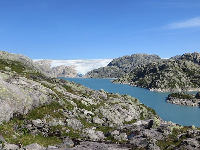
En ces temps coronatroublés, rien ne vaut de se remémorer le dernier voyage touristique que l’on a fait avant le plongeon dans le néant sanitaro-économique. La Norvège, plus précisément sa côte ouest et ses fjords, sera donc le sujet de ce carnet en 31 épisodes dotés chacun d’une bande-son, plutôt rock d’ailleurs. Attention, lecteur, vous vous exposez à un certain nombre de clichés pas du tout exagérés et de blagues pourries. I have nothing to offer but fjord, joy, tears (of the sky) and sweat.
Donc la Norvège, c’est l’apocalypse budgétaire dans votre portefeuille. D’où le titre (c’est tiré par les cheveux mais je ne refuse jamais un jeu de mots). Mais ce n’est pas que cela, c’est aussi fort joli, propre, policé et réellement rempli de charmantes têtes blondes. La Norvège, c’est également une monarchie pétrolière du golfe persique qui s’est égarée sur des terres glacées. Eh oui, c’est tout de suite plus facile d’être riche quand ils ont du pétrole (« mais ils n’ont que ça » aurait ajouté un jaloux), qu’ils sont peu nombreux et pas très partageurs. Allez, quelques détails pour commencer sur un plan aussi bien techeunique que tacqueutique
Le trajet En voiture Simone ! Depuis le Massif Central jusqu’à la Norvège avec une C3. J’avais décrété 2019, année sans avion. Donc c’était la voiture, certes petite mais costaude, où l’on a pu entasser notre matériel de camping. On en a profité pour prendre un covoitureur qui allait se perdre en Norvège pour l’été. Plus on est de fous entassés, plus on rit. Sur place, j'ai limité fortement notre aire d'action géographique. Je le connais le piège de faire une liste longue comme le bras et de courir tout le voyage tel un chien de ferme après un mollet cycliste. Il s'agissait de se cantonner au riz euh pardon à la façade sud-ouest du pays sans aller plus haut qu'Ålesund. Et comme il y avait un certain nombre de lieux qui me faisaient de l’œil, nous avons quand même eu un trajet digne d’une otarie bourrée essayant d’échapper à une orque affamée. On a finalement fait l’essuie-glace obliquement dans l’Ouest : à gauche, à droite, à gauche, à droite, à droite, A DROITE . Il faut dire que les fjords et les montagnes n’arrangent pas les affaires du voyageur adepte des routes rectilignes, et cela malgré la passion tunnelière locale.
Le lien vers la carte du trajet : http://u.osmfr.org/m/434267/
Les Norvégiens Les Norvégiens sont des êtres blonds aux yeux bleus, parfois d’un blond tellement blond qu’on dirait qu’ils ont appliqué de la javel sur leurs cheveux. Effet secondaire qui donne la chair de poule, cela fait disparaître les sourcils… Le Norvégien est réservé et poli. L’été, soit il se balade torse nu, soit il quitte le pays pour des horizons plus propices au rougeoiement de sa peau laiteuse où il pourra faire valoir son pouvoir d’achat dément. La Norvégienne quant à elle a une prédisposition naturelle à se promener en sous-tif ou brassière dès le premier rayon de soleil. Le dimanche, jour du Seigneur et de l’hypocrisie, le Norvégienne ne boit pas (vente d’alcool interdit !) les autres jours, iel se cache pour boire puis déambule cahin-caha entre les maisons de bois à la pelouse verdoyante. La Norvégien apprécie également les sorties familiales du dimanche après-midi où il peut effectuer 1000 mètres de dénivelé en 3,5km avec ses enfants de 7 et 9 ans. Le tout les doigts dans le nez.
Le logement Le logement, c’était principalement notre tente de 2 m² que nous avons montée/démontée dans des campings de qualité très variable pour un prix pas donné. Souvent les sites sont jolis mais plantés en bordure de route malgré l’espace qu’offre le pays. Ca manque quand même d’arbres ou arbustes et d’emplacements un tant soit peu délimités. Ce dernier point permet pendant les nuits les plus chaudes de l’été d’entasser les touristes de passage dans une promiscuité certaine et de rentabiliser un maximum l’espace. Malynx le Norvégynx ! Par contre, les sanitaires sont en général en bon état mais avec douche payante. Bref, le camping c’est le moyen de logement le plus abordable hors camping sauvage mais en général, la qualité est moyennasse au vu des prix. J’ai séché une petite larme en pensant à feus les campings des parcs nationaux et provinciaux canadiens. Requiescat in pace. Pour reprendre notre souffle, nous avons quand même varié les plaisirs avec des logements en b&b, du camping sauvage, des hytter (des petites cabanes souvent présentes dans les campings mais également ailleurs, très pratiques, pas trop chères pour la Norvège et aux prestations variables : électricité, eaux courantes en option par exemple) et une nuit en « refuge ». Les refuges, il y en a partout la plupart sont accessibles à pied, non gardés avec parfois une sorte de self-service payant.
La bouffe Courez en Norvège (ah mince vous êtes confinés) et vous me direz des nouvelles du Brunost . Sinon c’est cher mais pas mauvais globalement, peu porté sur le poisson hors saumon d’élevage et assez roboratif. Et bonne surprise pour moi, il y a quand même une tradition boulangère et même s’il y a peu de boulangeries, on peut trouver pleins de pains et de sorte de viennoiseries dans les supermarchés. Cela égaie les multiples piques-niques.
Avant de commencer le carnet proprement dit, entamons notre hymne norvégien : So many stop signs Speed limit Curves’ gonna slow me down Like a wheel Gonna spin it Tourists’ gonna mess me around Hey, Satan Payin' my tolls Bein’ among sheepin' bands Hey, mamma Look at me I'm on the way to the promised land
Jour 1,5 60 mph – New Order Clermont-Ferrand - Neumünster A nous les petites autoroutes allemandes tant prisées de ce côté du Rhin pour l’absence de limites de vitesse. Parcours Montbéliard – Fribourg – Karlsruhe – Francfort – Kassel – Hannovre – Hambourg – Neumünster. C’est long et pénible avec des travaux publics pas très deutsche Qualität tous les 20 kms, un trafic chargé et des zones limitées sans limite de vitesse qui rendent la conduite dangereuse : à droite ça roule à 90, à gauche à 200 pour les plus fous et comme c’est saturé, ça donne un résultat sportif et désagréable. Je me demande comment ils font pour avoir aussi peu de morts sur les routes en Allemagne. A part ça, le voyage est sans histoire, le colis covoitureur est livré à Fribourg et on arrive entiers et fatigués à Cathédraleneuve.
Jour 2 Seemann – Rammstein Neumünster - Kristiansand
Les autoroutes allemandes c’est rapidement fini, on revient à de la tranquillité avec le Danemark. Nous avons choisi de prendre le ferry Hirtshals-Kristiansand qui permet d'arriver plus rapidement sur la côte ouest Et comme on a beaucoup d’avance sur l’horaire du ferry Hirtshals-Kristiansand, on se permet un détour vers une dune danoise dominant la mer du Nord. Le temps est pas idéal et le coin est assez fréquenté. Bof. Le voyage en ferry est sans histoire, les Norvégiens en profitent pour faire des réserves d’alcool et de legos (les deux produits les plus présents dans les magasins du bateau). Nous voilà enfin en Norvège, 1900 kilomètres plus tard, sur la plage de Christian. Sacré Clavier qui a fait des fidèles un peu partout en Scandinavie.
Jour 3 Why does it always rain on me? - Travis 180 km Kristiansand – Hauge Notre premier jour en Norvège et ça ne s’annonce pas glorieux, plutôt gris tendance pluie. Nous commençons par un rapide passage par un bout de zone payante de Kristiansand juste pour le plaisir et accessoirement quitter cette ville. Je me suis inscrit, par honnêteté, sur le site internet des péages norvégiens (gérés d’ailleurs par une société anglaise) et par la grâce de caméras bien placées, nous allons devoir payer quelques euros pour à peu près 100 mètres dans ladite ville. Pfff. Quant au programme aujourd’hui, nous allons à la conquête de l’ouest, l’ouest de Kristiansand et nos plans capotent très largement. Ca tombe, ça tombe, ça dégouline, dégringole, s’abat, déverse, pleuvoche, tantôt torrentiel, tantôt bruineux. Pas question de faire une rando ou toute autre activité de plein air. Je m’aperçois en plus dans la journée que mon imper n’est plus imperméable et que j’ai oublié mon surpantalon. Prions, mes bien chers Frères, mes bien chères Sœurs pour que la météo soit clémente. Sinon ça va être long. Dans un premier temps, jusqu’à Flekkefjord, nous nous mouvons plus ou moins le long de la côte sans l’apercevoir, d’une parce que c’est complètement bouché, de deux parce qu’il est difficile de distinguer ce qui tient d’un lac ou d’un fjord, de trois parce que la route principale ne suit pas la côte. Nous nous rabattons donc sur la visite sans trop musarder des petites villes blanches du sud de la Norvège, leurs villages blancs andalous à eux mais en différent : avec du bois, de la pluie et de la mer. Premier arrêt à Mandal, un vrai coup dans le cœur. Deuxième arrêt : Flekkefjord, très mignon. Troisième arrêt version hameau, Stornes en entrée de fjord, très, très mignon. Quatrième arrêt : Sognalstranda, très, très, très mignon. C’est le règne de la mignonitude humide. Une maison en bois par ci, un entrepôt en bois par-là, et des garages à bateau à foison.
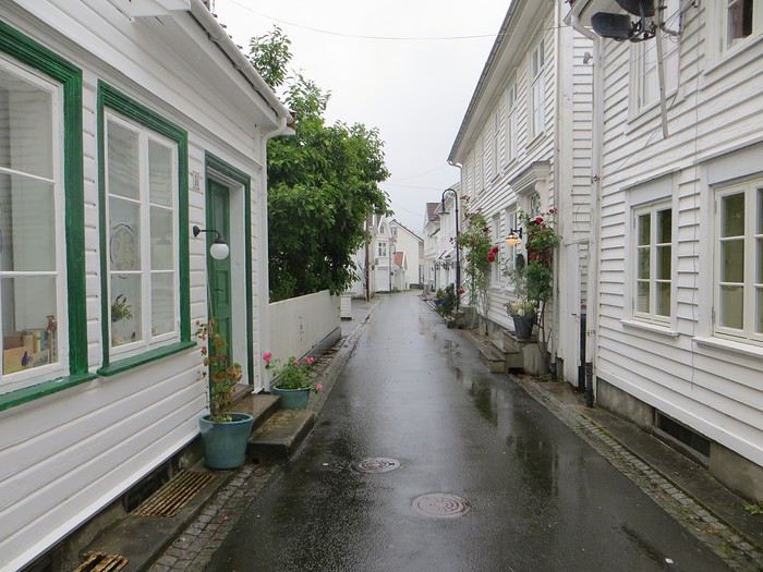 Pas un temps à mettre un chat norvégien dehors (Flekkefjord)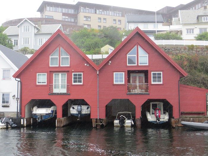
Pas un temps à mettre un bateau norvégien dehors
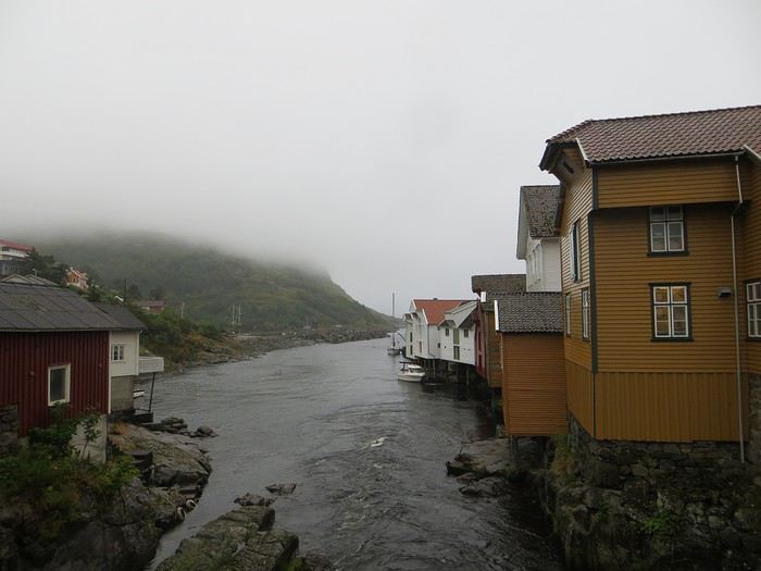 Mais pourquoi on est dehors nous alors ? (Sognalstranda)
Interlude de pipeau très intéressant : ces villes/villages, souvent fondés aux 17ème et 18ème siècle, sont les témoins de la politique mercantiliste du royaume du Danemark. L’État balbutiant entend organiser la production, la commercialisation et l’exportation des ressources comme le bois, les poissons et certains métaux de Norvège. Cette politique passe par la mise en place d’exploitations/manufactures à tendance monopolistique et la spécialisation des ports avec monopole des marchands d’abord hanséatiques (16ème siècle) puis néerlandais (17ème siècle) et enfin danois (17-18ème siècle). C’est d’ailleurs pour cela que le vieux centre de Flekkefjord est surnommé la ville hollandaise. Ce système mercantiliste fera par ailleurs les malheurs de l’Islande forcée de se soumettre pendant deux siècles à une compagnie royale danoise monopolistique à même d’imposer ses tarifs et ses conditions d’échange de marchandise. Les siècles sombres comme les appellent les Islandais ont en grande partie comme origine cette organisation économique très profitable pour la royauté danoise, beaucoup moins pour les habitants de l’île. La route 44 après Flekkefjord vaut par ailleurs son pesant de cacahuètes même si les conditions ne sont pas optimales pour en profiter. Tout le coin a été nommé magma geopark (patrimoine de l’UNESCO) dans une poussée de marketing touristique, des roches de la croûte terrestre d’une zone de subduction ayant fini par apparaître sous l’effet de l’érosion si j’ai bien compris. Point de volcan donc mais des effleurements d’anorthosites qui forment des paysage rocailleux arrondis et stériles comme autour d’Helleren et d’Åna Sira où devait se dérouler notre première randonnée norvégienne, projet qui tombe à l’eau (ahahah), noyé sous les larmes du ciel (ahahah). La partie la plus spectaculaire du trajet se trouve entre Åna Sira et Hauge où la route serpente tant bien mal entre les rochers. Nous goûtons le soir venu à la douceur des campings norvégiens : une espèce de carrière dans un espace réduit entre deux collines, un sol gravillonneux, pas de végétation et roule ma poule. Le seul avantage réside dans la vue en bout de carrière sur la côte. Pas vraiment de cuisine aménagée, des douches payantes : prometteur ! Le coupable aujourd’hui est le Vågan camping (garanti sans viande).
Jour 4 Sous le soleil exactement – Serge Gainsbourg 186km Hauge – Lysebotn Nuit et brouillard ce matin sur la Norvège et pourtant nous gardons espoir, le soleil vaincra. Nous continuons la route côtière pour faire une petite balade (4km aller-retour) jusqu’au Hådyr. C’est humide, boueux, bourbeux, fangeux, marécageux, tourbeux, machineux. C’est également l’occasion de compter la deuxième victime du voyage : le terrain a raison de mes chaussures de marche basses. Flap flap, bain de pieds et macération. Décidément, je suis équipé pour affronter l’humidité scandinave ! Arrivés au rocher censé donner un point de vue sympa sur la côte, c’est la douche froide (avec beaucoup de vapeur d’eau, la douche) : à gauche, du brouillard, à droite, du brouillard, droit devant, du brouillard, derrière, du brouillard et un bruit de ressac à nos pieds. Comme on est patient et qu’on croit en dame météo, nous nous asseyons pour attendre la percée du soleil. Une heure et quelques hésitations plus tard, ça se déchire (très) petit à petit, de quoi entrapercevoir une côte que je qualifierai de dantesque. J’adore ces rochers granitiques usés par les siècles, qui forment des forêts de sentinelles face à la mer.
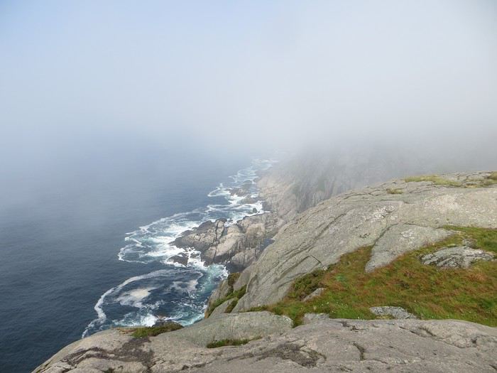 Les portes de l'Hådyr s'ouvrent et pas de cerbères à l'horizon
Et ça tombe bien que j’adore ce paysage puisque pour l’étape suivante (décidément le gentil organisateur a tout prévu !), nous traversons sans s’arrêter Egersund, autre petite ville en bois, pour Eigerøya, son phare et son paysage rocailleux sous le soleil exactement, un soleil de plomb je dirais même plus. La baladounette de l’après-midi de 4 km est sans difficulté sur une autoroute pédestre et permet d’accéder à un point de vue maousse costaud sur l’île d’Eiger et son phare.
Les portes de l'Hådyr s'ouvrent et pas de cerbères à l'horizon
Et ça tombe bien que j’adore ce paysage puisque pour l’étape suivante (décidément le gentil organisateur a tout prévu !), nous traversons sans s’arrêter Egersund, autre petite ville en bois, pour Eigerøya, son phare et son paysage rocailleux sous le soleil exactement, un soleil de plomb je dirais même plus. La baladounette de l’après-midi de 4 km est sans difficulté sur une autoroute pédestre et permet d’accéder à un point de vue maousse costaud sur l’île d’Eiger et son phare.
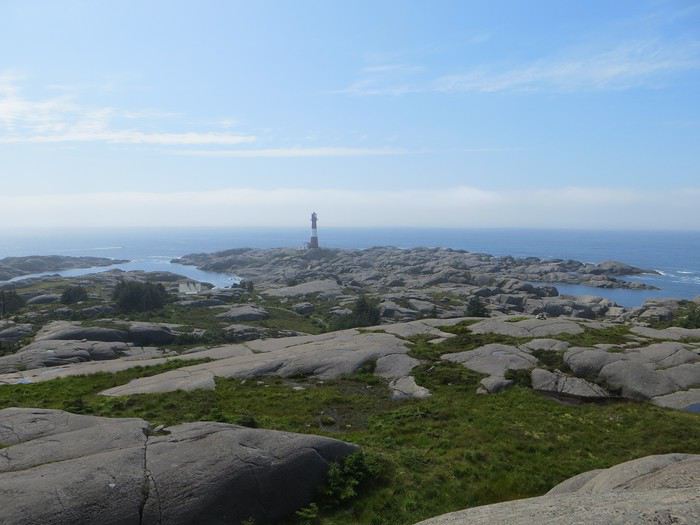 C'est un roc ! C'est un pic ! C'est un cap ! Que dis-je c'est une péninsule !
 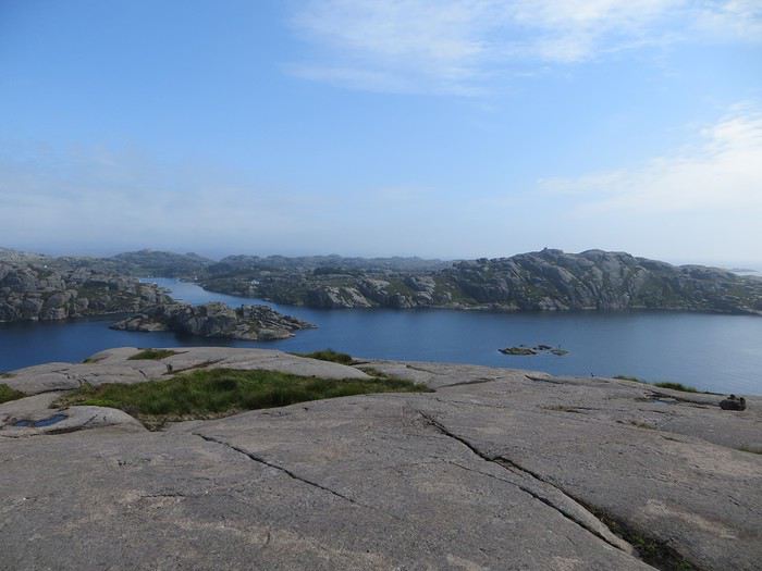 Eigerøya en beauté
Si j’ai bien compris le norvégien, øy est le suffixe pour île et a celui pour « la » en général, même si la langue se scinde en deux types distincts nynorsk et bokmål et en de nombreuses variantes dialectiques locales qui provoquent des orthographes changeantes des panneaux et des cartes. Par exemple, kirke (église en bokmål) s’écrit aussi kyrkje en nynorsk, voire a d’autres déclinaisons locales plus obscures. Le nynorsk, pour ceux qui ne connaissent pas, est issu d’une (re)création linguistique du 19ème siècle type occitan ou breton en France : pour donner à la Norvège une langue pure de toute saleté étrangère, danoise plus particulièrement, des linguistes ont construit une langue sur un mélange des dialectes considérés comme les moins viciés par l’outre-Skagerrak, c’est-à-dire ceux du Telemark et des fjords du sud-ouest. A contrario, le bokmål est un dérivé dédanoiïsé de la langue parlée (du danois grosso modo) dans les villes comme Oslo au début du 19ème siècle. De nos jours, il y a donc deux langues officielles et le nynorsk est très connoté nationaliste et perd du terrain : 13% des Norvégiens, principalement dans l’ouest, le parlent comme langue maternelle. Nous nous dirigeons ensuite vers l’intérieur des terres en direction de Lysebotn, le paysage change, pâturage, forêt et lacs avant de rentrer dans des zones à l’environnement plus âpre et tourmenté. Gloppedalsura (à vos souhaits) est l’occasion d’un arrêt bienvenu pour un point de vue sur un chaos de rochers impressionnant et son lac attenant.
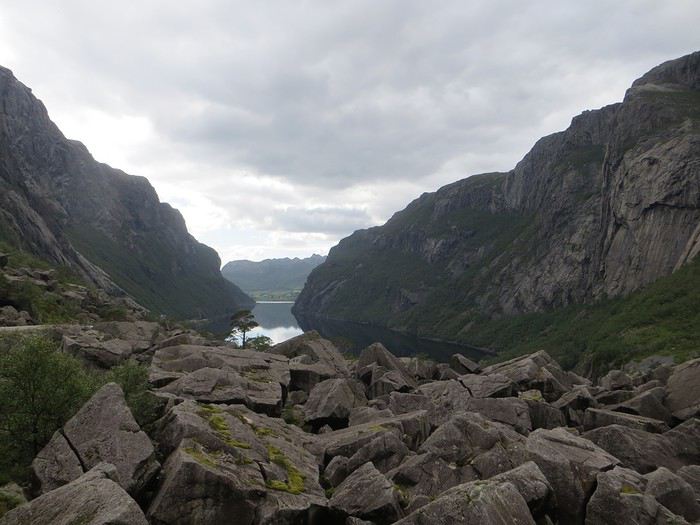 Gloppedalsura, lieu de franche rigolade entre Allemands et Norvégiens pendant la Seconde Guerre Mondiale
Nous remontons ensuite la Øvstabødalen, vallée glaciaire à citer dans toute conférence de géologie de bon niveau pour la perfection de sa forme en auge. Le parcours est varié, peu fréquenté et plaisant avant de plonger sur une zone moins sympa bien dotée en stations de ski et en habitat folklorico-traditionnel, ici des immeubles/chalets en bois sombre et toit végétalisé. L’avantage, au-delà du côté très artificiel des stations, c’est que les bâtiments se fondent dans la végétation.
Gloppedalsura, lieu de franche rigolade entre Allemands et Norvégiens pendant la Seconde Guerre Mondiale
Nous remontons ensuite la Øvstabødalen, vallée glaciaire à citer dans toute conférence de géologie de bon niveau pour la perfection de sa forme en auge. Le parcours est varié, peu fréquenté et plaisant avant de plonger sur une zone moins sympa bien dotée en stations de ski et en habitat folklorico-traditionnel, ici des immeubles/chalets en bois sombre et toit végétalisé. L’avantage, au-delà du côté très artificiel des stations, c’est que les bâtiments se fondent dans la végétation.La dernière partie du trajet, très belle mais pas très agréable à conduire tant la petite route est saturée par la circulation, traverse un plateau rocailleux avant de plonger vers le Lysefjord. Malheureusement, la route de descente, assez connue (elle est le lieu d’une compétition estivale de ski sur route très cotée) une fois passée le restaurant et bien que sûrement impressionnante vue d’un drone, n’offre quasiment aucune vue sur la vallée et le fjord. Ce qu’elle offre par contre, c’est un tunnel en épingle à cheveux, un classique que l’on retrouvera à plusieurs reprises dans les fantaisies souterraines norvégiennes. Le camping du soir, bonsoir, le Kjerag Lysebotn camping, jouit d’un site splendide et est bien équipé (cuisine, sanitaire). Malheureusement, comme on est en Norvège, il n’y a aucun arbre/arbuste et une promiscuité assez forte et accentuée par l’affluence d’un jour de juillet ensoleillé. Bref on se marche dessus comme des manchots en période de reproduction dans leur colonie.
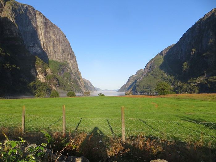 Quand je vous dis que le site est splendide...
Jour 5 Highway song – System of a Down 78km Lysebotn - Hjelmeland Aujourd’hui, c’est notre journée rando de masse dit trek pour ceux qui se sentent une âme d’aventurier, juste une âme, il ne faut pas trop abuser de l’aventure. Donc aujourd’hui, c’est le Kjeragbolten, concession faite à la liste des randonnées obligatoires. La Norvège fait partie de ces pays où la randonnée est l’une des activités touristiques obligatoires y compris pour des personnes qui ne marchent jamais par ailleurs. Pour la Norvège, l’activité s’effectue bien sûr en masse sur les mêmes chemins en cochant les fameuses cases de la to do list comprenant dans l’Ouest Preikestolen, Trolltunga, Kjeragbolten, Bessegen et Aurlandsdalen. Nous nous sommes contentés du rocher suspendu Kjerag, choisi car dans mon esprit, moins facilement accessible au commun du touriste (et moi je suis un touriste hors du commun, un tourista). C’est sûrement vrai mais cela n’empêche pas le monde… Je le savais, je le savais, j’étais prévenu, j’ai râlé avant, j’ai râlé pendant, je râle encore après et pourtant je n’ai pas d’oiseau dans la gorge et il n’y avait pas de genêts dans la balade (cf le râle des genêts pour comprendre la blagounette). La randonnée commence par un parking gigantesque au tarif prohibitif. Nous payons sans moufter nos 30 euros (un repas dans un resto semi gastro en France pour ceux qui n’ont pas le sens des valeurs). J’espère que personne ne s’arrête juste pour voir la vue car de vue il n’y en a point : le point de vue est occupé par un restaurant qui met un point d’honneur à boucher accessoirement la vue. Et pour accéder à sa terrasse/point de vue, il faut payer. Bon, nous, on a du pain sur la planche et quelques montées raidasses en attente. Dont acte. Trafic fluide en ce début de matinée, quelques problèmes de surchauffe moteur pour la première montée puis la vitesse de croisière est atteinte pour une arrivée prévue à 10h30. Ce n’est pas encore un bouchon au niveau du rocher mais la circulation est déjà dense à l’approche. Au retour, le trafic est extrêmement chargé et les comportements touristico-idiots se multiplient (équipement inadéquat, coupage des routes à travers champs, ralentissements dus aux selfies intempestifs. Ne pas utiliser votre téléphone en conduisant, que la sécurité routière vous dit !).
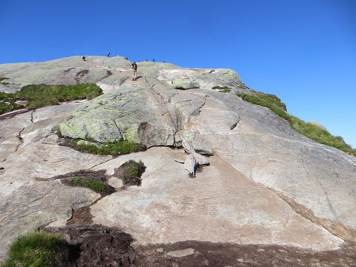
Pas un coin où amener sa traban
Sur le fond, la rando, 12 km et 700 mètres de dénivelée, est très chouette avec de belles vues sur le fjord et Lysebotn en particulier au début de la 3ème montée et tout au bout.
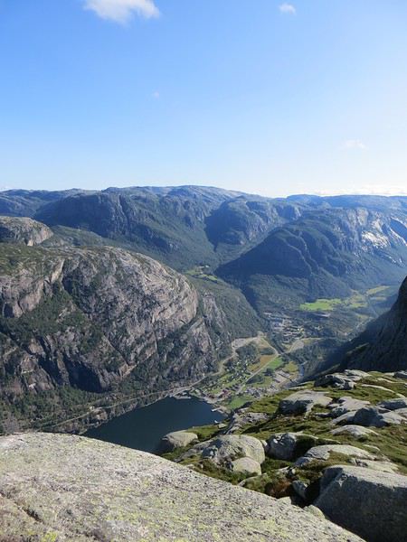
Le Lysefjord
Le caillou est flippant et spectaculaire tout comme la plateforme juste à côté. Une queue au bord d'un à pic de 1000 mètres se forme pour monter dessus (même pas en rêve, je fais un truc pareil).
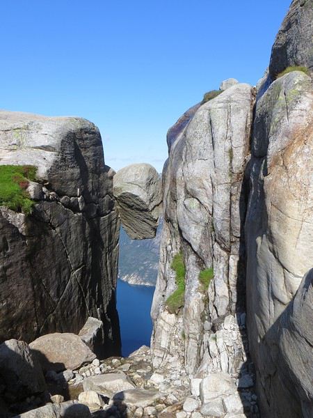 Le mythe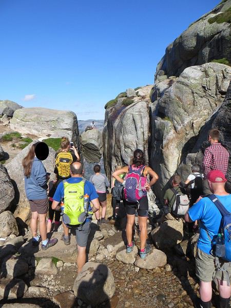
La réalité
Il est loisible d’explorer les environs du Kjeragbolten pour profiter d’un peu de la tranquillité des avancées rocheuses spectaculaires et des vues majestueuses sur le fjord. Bref ça claque grave.
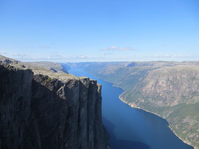 Le Lysefjord n'a pas bougé
On redescend à Lysebotn pour prendre un ferry réservé à l’avance. Et quand on voit le « ferry » arriver, on se dit que la réservation était une bonne idée. Rentrée en marche arrière et tassage de voitures dans un espace réduit pour notre mini-croisière sur le Lysefjord. Très bien la mini-croisière qui permet de s’apercevoir de la hauteur des falaises entourant le Kjeragbolten et d’apercevoir le Preikestolen où nous n’irons pas.
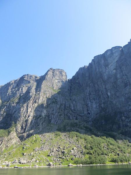
Le Kjeragbolten vu d'en bas. Les 1000 mètres de vide y sont bien
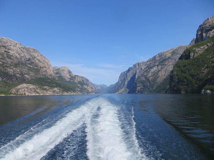 La croisière s'amuse
Le camping du soir se trouve à Hjelmeland et est ingénieusement intitulé Hjelmeland camping. Celui-ci fait dans l’original puisque nous avons planté notre tente dans le parc arboré d’une sorte de manoir qui sert de dortoir. Une chouette vue, une cuisine bien équipée et assez d’espace pour ne pas se marcher dessus (en principe, avec les Norvégiens, on ne sait jamais, ils pourraient parquer votre tente ou votre van à 50 cm du voisin), voilà pour les avantages. Pour les inconvénients, les sanitaires sont peu nombreux, peu pratiques et se salissent vite (forcément).
La Norvège c'est top, la croisière c'est flop (19 au 30 mai 2016) English translation pending
Bonjour,
Je reviens d'une croisière au Cap Nord avec MSC intitulée "soleil de minuit et fjords" qui s'est déroulée du 19 au 30 mai 2016 au départ de Hambourg. Ceci est un bref compte-rendu du déroulé de la croisière, suivi d'une discussion sur les mérites et les limites de cette formule de voyage en général et pour découvrir la Norvège en particulier. J'expliquerai en conclusion pourquoi je ne referai sans doute jamais de croisière.
NB n'étant pas expérimenté dans l'écriture de messages sur ce forum, vous trouverez un échantillon de photos du voyage en fin de message. Vous verrez à quel point la Norvège est un beau pays.
19 mai Embarquement Hambourg Nous n'avons pas pris le transfert MSC (onéreux) et préférer prendre des vols Air France par nous même, mais tout bien réfléchi, j'aurais du prendre une nuit d'hôtel en route (du côté de Wüppertal) et joindre Hambourg en voiture. La croisière s'embarque au terminal de Steinwerden, desservi par les corbeaux, loin au sud de Hambourg.
20 mai, navigation en mer, RAS
21 mai, escale à Aalesund, une ville très chouette construite sur un archipel.
22 mai, journée de navigation, nous franchissons le cercle polaire et avons notre seul aperçu du soleil de minuit depuis le pont, en effet, une perturbation nous empêchera de l'admirer le lendemain depuis le cap nord.
23 mai, nous arrivons enfin au port de Hoenningsvaag, non sans avoir préalablement doublé le fameux Cap Nord (lat. 71°10'N) sous le soleil. Le transfert au Cap Nord pour admirer le soleil de minuit est un fiasco, le temps s'est couvert, le plafond nuageux s'est abaissé à moins de 200 mètres d'altitude, et nous nous retrouvons sur le fameux site avec moins de 3 mètres de visibilité...
24 mai, escale à Tromsoe, pluie et pagaille pour l'embarquement dans le bateau au terme de l'excursion...
25 mai, navigation, RAS
26 mai, escale à Molde et excursion vers l'Atlanterhavsveien sous un soleil radieux.
27 mai, Geirangerfjord, site classé au patrimoine mondial de l'UNESCO, très chanceux d'avoir gardé un soleil radieux toute cette journée. Incontestablement, cette navigation a marqué l'apogée de ce voyage.
J'ai particulièrement apprécié la cascade des Sept Sœurs que j'ai longuement et patiemment contemplée le matin dans la remontée du fjord jusqu'à capter ces moments magiques où le soleil à 180° révèle l'arc en ciel. On dit que les trolls ont caché un trésor à la base de l'arc en ciel... 😉
Au fond du fjord, nous avons eu droit à une excursion en autocar qui a consisté à nous monter aux deux panoramas routiers qui surplombent le fjord, sur l'Oerneveien à l'ouest et sur la route à l'est, d'où la carte postale du fjord avec notre paquebot au fond.
28 mai escale à Bergen, excursion qui commence bien au Bryggen sous un pâle soleil, mais qui se termine en fiasco, le bateau prévu est tombé en panne et nous sommes rapatriés sur la ville en autocar. J'attends toujours le remboursement de 50% promis par la compagnie MSC...
29 mai, navigation en mer, RAS
30 mai Hambourg, pour ne plus galérer avec nos grosses valises dans Hambourg entre l'aéroport et le terminal maritime de Steinwerder, nous avions pris l'excursion/transfert Hambourg qui nous a valu un tour panoramique très classique de la ville.
Conclusion, la Norvège c'est TOP! 😎... mais...
On a pas vu grand chose, en 11 jours, 6 petites escales, et maigres excursions en bus de 2 à 4h, avec à chaque fois 2 ou 3 arrêts de 15 minutes à 30 minutes sur chaque site, nous n'avons rencontré aucun Norvégien en dehors des vendeurs des boutiques de souvenir. En fait, nous avons passé le plus clair de notre temps à bord du paquebot, en compagnie de 4300 autres pélerins, 50% d'Allemands, âge médian 70 ans.
Il existe deux archétypes des vacances, la villégiature consiste à se poser quelque part et à se reposer. Issue de la tradition aristocratique de la résidence d'été, c'est la forme de tourisme la plus populaire. Au 20e siècle, le Club Med et ses épigones ont acclimaté cette formule de vacances-séjour à des contrées éloignées, introduisant une certaine forme d'industrialisation de cette forme de tourisme. Je devine que le succès actuel des croisières tient en partie à ce qu'elles ont été capables d'industrialiser encore davantage la formule du village vacances tout en vendant des visites dans différentes régions issues de la formule circuit. Le circuit est en effet le 2e grand type de vacances. Il découle de l'archétype du "grand tour" initié par les fils de l'aristocratie britannique au 18e siècle. Il s'agissait d'un voyage initiatique sur les traces du patrimoine et de la culture classique en France et en Italie destiné à parfaire l'éducation de ces jeunes aristocrates (et à les déniaiser au passage sans que cela risque de compromettre l'honneur des jeunes filles de bonne famille) 😉. Le 20è siècle a vu l'industrialisation de cette formule avec le circuit organisé. Le coup de génie de l'industrie de la croisière est d'avoir combiné le Club Med et le circuit organisé, on ne porte plus les valises, c'est l'hôtel flottant qui s'en charge, et on se déplace de site remarquable en site remarquable pour avoir un aperçu des régions visitées. En attendant, la croisière s'amuse, animations, activités sportives, bars, restaurants (on bouffe à toute heure), spectacles, dîners costumés, soirées dansantes, etc... Tout est proposé pour occuper 4300 clients qui autrement s'emm... 😮 copieusement dans les longues heures de navigation.
Voilà le décor. Maintenant, l'expérience. Trois choses essentielles à savoir : 1. La tarification est assez opaque. Prévoyez un budget double de celui qui est affiché à la réservation. Je me suis laissé allécher par une pub sur le site AB Croisières à moins de 800 € par personne le 03 janvier. Je réserve et d'entrée de jeu, le conseiller AB Croisière me contacte et m'explique que ce tarif n'est plus disponible, le site n'a pas été bien mis à jour, mais il me propose une formule de substitution, un poil plus chère, mais avec une meilleure cabine (balcon) et un "forfait" boissons "cheers" durant les déjeuners (en fait je découvrirai durant le voyage que ce n'est absolument pas une ristourne mais un forfait de dépenses maximales si vous voulez vous saoûler). Groumph! j'aurais dû jeter l'éponge, mais j'ai vraiment envie d'aller admirer le soleil de minuit, et cette année est la seule où j'ai l'opportunité de prendre un congé en mai, l'occasion ne se reproduira pas, j'accepte, bilan, 2465 € croisière sèche sans le pré-et le post acheminement avec une assurance annulation, on ne sait jamais que qui peut nous arriver entre janvier et mai. J'ajoute un vol Air France aller-retour CDG-HAM avec assurance annulation 280 €. Mais ce n'est pas tout,
Le voyage nous aura coûté 4300 € sans compter les souvenirs. En effet, il a fallu ajouter les frais de pré et post acheminement à l'aéroport, les frais de transport pour rallier Steinwerder (S-Banh + Taxi) à Hambourg et 200 € de frais de parking à Roissy-CDG 🤪 ! Dans le bateau, nous avons payé une facture complémentaire de 1015 € pour les excursions (950 €), l'Internet, les boissons (café, eau minérale et 2 misérables vers de vin), 1 coiffeur et de menus souvenirs. Nous avons résisté à la plupart des tentations, les boissons alcoolisées et les sodas sont hors de prix, de même que le spa, le sauna et le hammam, sans parler des massages. Tout à bord est en supplément, même la buanderie à 50 €! Ces bateaux sont une pompe à fric qui servent à plumer consciencieusement leur clientèle captive tant qu'elle est à bord. N'oublions pas pour finir, 9 € de "frais de service" par personne et par jour qui apparaissent sur la facture en remplacement de la tradition des pourboires, soit 200 € au final pour 2 personnes sur l'ensemble de la croisière. 2. L'essentiel du voyage est une forme de "Club Med" flottant. Si vous aimez le cours de Zumba de 10h et si faire la chenille sur l'air du "Petit bonhomme en mousse" avec cotillons et langues de belle-mère à 22h quand vous serez bien imbibés d'alcool peut vous amuser, alors cette formule de voyage peut vous plaire. Si comme moi vous trouvez cela pathétique, alors abstenez vous de faire une croisière. Des artistes de 3e zone assurent des spectacles médiocres, les conférences sont assurées par une gentille mamy qui en sait moins que le guide "Lonely Planet" et vous passe un diaporama de photos pompées sur Internet. Quand aux restaus assis, aux dîners de galas en costard et au bal du capitaine, je ne peux pas en parler, nous n'avons même pas essayé, et n'avions de toute façon pas mis de smoking dans la valise... C'est la grande leçon de ce voyage où j'ai passé des heures à lire dans ma cabine (un des rares endroits silencieux dans le bateau) et à faire des réussites sur ma tablette. 3. Quand on trimballe 4300 pèlerins, la gestion des flux nécessite une logistique irréprochable, et quand ça coince, c'est vite la pagaille. Les pires moments de la croisière ont été pour moi les buffets de petit déjeuner et de dîner à l'heure de pointe, bousculade éhontée aux différents comptoirs, vacarme de hall de gare aggravé par une musique d'ascenseur omniprésente. Au passage, mentionnons que la bouffe est archi-salée, sans doute pour pousser la clientèle à consommer des boissons payantes... Enfin, la promiscuité avec 5500 personnes (en comptant l'équipage) cela se paye comptant, ma femme puis moi-même avons contracté un méchant virus ORL qui nous a couché sur le flanc une semaine... Quand nous avons quitté le bateau, nous avons constatait que la croisière s'était amusée peut-être, mais qu'elle toussait aussi beaucoup...
Quelques points-forts pour la croisière tout de même. Je ne voudrai pas de méprise, j'ai beau ne PAS être sociable, je n'ai pas un esprit hyper-critique, beaucoup de choses trouvent grâce à mes yeux en temps ordinaire. Le service de cabine est attentionné et irréprochable, le personnel est souriant (mais la réception n'est pas très efficace et les files d'attente très longues), la cabine est confortable...
Je rappelle enfin (mais je l'ai déjà écrit) que la partie "circuit organisé" du voyage offre un très mauvais rapport qualité-prix, et j'ai terminé de dresser le portrait de ce qui a été pour moi un fiasco majeur, le pire que j'ai jamais connu sur les 20 voyages que j'ai entrepris ces 10 dernières années. Comme je l'ai indiqué en introduction, je suis un adepte du Roadtrip individuel, dont la préparation est une part importante du plaisir qu'il procure. J'ai visité à peu près toute l'Europe occidentale et centrale, ainsi qu'une grande partie des États-Unis d'Amérique et du Canada par ce moyen. J'ai eu un accès de faiblesse en prenant cette croisière. Maintenant que j'ai testé, je sais que cette formule de voyage ne me convient pas. Il m'a semblé utile de partager cette expérience sur ce forum pour que des gens qui n'ont jamais fait de croisière et hésitent encore sachent à quoi s'attendre. Je pense que les croisières sont adaptés à des voyageurs à l'esprit sociable qui ne veulent s'occuper de rien organiser et qui ont surtout envie de s'amuser en société avec des inconnus. Pour des voyageurs à l'esprit indépendant qui aiment organiser leur propre voyage, veulent vraiment découvrir leur destination et rencontrer ses habitants, la croisière n'est pas du tout une formule appropriée. Pour terminer sur une note positive, un mot sur la Norvège, c'est magnifique, j'y retournerai certainement... en indépendant !
Voici un aperçu de ce voyage;

Hambourg

Premier aperçu de la Norvège

Aalesund
 Aalesund
 Soleil de minuit
 Cap Nord à midi
 Cap Nord à minuit
 Troms
Troms
 Troms
Troms
 Cathédrale Arctique, Tromsoe
 Moere og Romsdal
 Atlanterhavsveien

Bud

Molde

Geirangerfjord (matin)
 Hellesylt
 Geirangerfjord
 Cascade des sept soeurs
 zoom sur l'arc-en-ciel
 panorama de l'Oerneveien
Je reviens d'une croisière au Cap Nord avec MSC intitulée "soleil de minuit et fjords" qui s'est déroulée du 19 au 30 mai 2016 au départ de Hambourg. Ceci est un bref compte-rendu du déroulé de la croisière, suivi d'une discussion sur les mérites et les limites de cette formule de voyage en général et pour découvrir la Norvège en particulier. J'expliquerai en conclusion pourquoi je ne referai sans doute jamais de croisière.
NB n'étant pas expérimenté dans l'écriture de messages sur ce forum, vous trouverez un échantillon de photos du voyage en fin de message. Vous verrez à quel point la Norvège est un beau pays.
19 mai Embarquement Hambourg Nous n'avons pas pris le transfert MSC (onéreux) et préférer prendre des vols Air France par nous même, mais tout bien réfléchi, j'aurais du prendre une nuit d'hôtel en route (du côté de Wüppertal) et joindre Hambourg en voiture. La croisière s'embarque au terminal de Steinwerden, desservi par les corbeaux, loin au sud de Hambourg.
20 mai, navigation en mer, RAS
21 mai, escale à Aalesund, une ville très chouette construite sur un archipel.
22 mai, journée de navigation, nous franchissons le cercle polaire et avons notre seul aperçu du soleil de minuit depuis le pont, en effet, une perturbation nous empêchera de l'admirer le lendemain depuis le cap nord.
23 mai, nous arrivons enfin au port de Hoenningsvaag, non sans avoir préalablement doublé le fameux Cap Nord (lat. 71°10'N) sous le soleil. Le transfert au Cap Nord pour admirer le soleil de minuit est un fiasco, le temps s'est couvert, le plafond nuageux s'est abaissé à moins de 200 mètres d'altitude, et nous nous retrouvons sur le fameux site avec moins de 3 mètres de visibilité...
24 mai, escale à Tromsoe, pluie et pagaille pour l'embarquement dans le bateau au terme de l'excursion...
25 mai, navigation, RAS
26 mai, escale à Molde et excursion vers l'Atlanterhavsveien sous un soleil radieux.
27 mai, Geirangerfjord, site classé au patrimoine mondial de l'UNESCO, très chanceux d'avoir gardé un soleil radieux toute cette journée. Incontestablement, cette navigation a marqué l'apogée de ce voyage.
J'ai particulièrement apprécié la cascade des Sept Sœurs que j'ai longuement et patiemment contemplée le matin dans la remontée du fjord jusqu'à capter ces moments magiques où le soleil à 180° révèle l'arc en ciel. On dit que les trolls ont caché un trésor à la base de l'arc en ciel... 😉
Au fond du fjord, nous avons eu droit à une excursion en autocar qui a consisté à nous monter aux deux panoramas routiers qui surplombent le fjord, sur l'Oerneveien à l'ouest et sur la route à l'est, d'où la carte postale du fjord avec notre paquebot au fond.
28 mai escale à Bergen, excursion qui commence bien au Bryggen sous un pâle soleil, mais qui se termine en fiasco, le bateau prévu est tombé en panne et nous sommes rapatriés sur la ville en autocar. J'attends toujours le remboursement de 50% promis par la compagnie MSC...
29 mai, navigation en mer, RAS
30 mai Hambourg, pour ne plus galérer avec nos grosses valises dans Hambourg entre l'aéroport et le terminal maritime de Steinwerder, nous avions pris l'excursion/transfert Hambourg qui nous a valu un tour panoramique très classique de la ville.
Conclusion, la Norvège c'est TOP! 😎... mais...
On a pas vu grand chose, en 11 jours, 6 petites escales, et maigres excursions en bus de 2 à 4h, avec à chaque fois 2 ou 3 arrêts de 15 minutes à 30 minutes sur chaque site, nous n'avons rencontré aucun Norvégien en dehors des vendeurs des boutiques de souvenir. En fait, nous avons passé le plus clair de notre temps à bord du paquebot, en compagnie de 4300 autres pélerins, 50% d'Allemands, âge médian 70 ans.
Il existe deux archétypes des vacances, la villégiature consiste à se poser quelque part et à se reposer. Issue de la tradition aristocratique de la résidence d'été, c'est la forme de tourisme la plus populaire. Au 20e siècle, le Club Med et ses épigones ont acclimaté cette formule de vacances-séjour à des contrées éloignées, introduisant une certaine forme d'industrialisation de cette forme de tourisme. Je devine que le succès actuel des croisières tient en partie à ce qu'elles ont été capables d'industrialiser encore davantage la formule du village vacances tout en vendant des visites dans différentes régions issues de la formule circuit. Le circuit est en effet le 2e grand type de vacances. Il découle de l'archétype du "grand tour" initié par les fils de l'aristocratie britannique au 18e siècle. Il s'agissait d'un voyage initiatique sur les traces du patrimoine et de la culture classique en France et en Italie destiné à parfaire l'éducation de ces jeunes aristocrates (et à les déniaiser au passage sans que cela risque de compromettre l'honneur des jeunes filles de bonne famille) 😉. Le 20è siècle a vu l'industrialisation de cette formule avec le circuit organisé. Le coup de génie de l'industrie de la croisière est d'avoir combiné le Club Med et le circuit organisé, on ne porte plus les valises, c'est l'hôtel flottant qui s'en charge, et on se déplace de site remarquable en site remarquable pour avoir un aperçu des régions visitées. En attendant, la croisière s'amuse, animations, activités sportives, bars, restaurants (on bouffe à toute heure), spectacles, dîners costumés, soirées dansantes, etc... Tout est proposé pour occuper 4300 clients qui autrement s'emm... 😮 copieusement dans les longues heures de navigation.
Voilà le décor. Maintenant, l'expérience. Trois choses essentielles à savoir : 1. La tarification est assez opaque. Prévoyez un budget double de celui qui est affiché à la réservation. Je me suis laissé allécher par une pub sur le site AB Croisières à moins de 800 € par personne le 03 janvier. Je réserve et d'entrée de jeu, le conseiller AB Croisière me contacte et m'explique que ce tarif n'est plus disponible, le site n'a pas été bien mis à jour, mais il me propose une formule de substitution, un poil plus chère, mais avec une meilleure cabine (balcon) et un "forfait" boissons "cheers" durant les déjeuners (en fait je découvrirai durant le voyage que ce n'est absolument pas une ristourne mais un forfait de dépenses maximales si vous voulez vous saoûler). Groumph! j'aurais dû jeter l'éponge, mais j'ai vraiment envie d'aller admirer le soleil de minuit, et cette année est la seule où j'ai l'opportunité de prendre un congé en mai, l'occasion ne se reproduira pas, j'accepte, bilan, 2465 € croisière sèche sans le pré-et le post acheminement avec une assurance annulation, on ne sait jamais que qui peut nous arriver entre janvier et mai. J'ajoute un vol Air France aller-retour CDG-HAM avec assurance annulation 280 €. Mais ce n'est pas tout,
Le voyage nous aura coûté 4300 € sans compter les souvenirs. En effet, il a fallu ajouter les frais de pré et post acheminement à l'aéroport, les frais de transport pour rallier Steinwerder (S-Banh + Taxi) à Hambourg et 200 € de frais de parking à Roissy-CDG 🤪 ! Dans le bateau, nous avons payé une facture complémentaire de 1015 € pour les excursions (950 €), l'Internet, les boissons (café, eau minérale et 2 misérables vers de vin), 1 coiffeur et de menus souvenirs. Nous avons résisté à la plupart des tentations, les boissons alcoolisées et les sodas sont hors de prix, de même que le spa, le sauna et le hammam, sans parler des massages. Tout à bord est en supplément, même la buanderie à 50 €! Ces bateaux sont une pompe à fric qui servent à plumer consciencieusement leur clientèle captive tant qu'elle est à bord. N'oublions pas pour finir, 9 € de "frais de service" par personne et par jour qui apparaissent sur la facture en remplacement de la tradition des pourboires, soit 200 € au final pour 2 personnes sur l'ensemble de la croisière. 2. L'essentiel du voyage est une forme de "Club Med" flottant. Si vous aimez le cours de Zumba de 10h et si faire la chenille sur l'air du "Petit bonhomme en mousse" avec cotillons et langues de belle-mère à 22h quand vous serez bien imbibés d'alcool peut vous amuser, alors cette formule de voyage peut vous plaire. Si comme moi vous trouvez cela pathétique, alors abstenez vous de faire une croisière. Des artistes de 3e zone assurent des spectacles médiocres, les conférences sont assurées par une gentille mamy qui en sait moins que le guide "Lonely Planet" et vous passe un diaporama de photos pompées sur Internet. Quand aux restaus assis, aux dîners de galas en costard et au bal du capitaine, je ne peux pas en parler, nous n'avons même pas essayé, et n'avions de toute façon pas mis de smoking dans la valise... C'est la grande leçon de ce voyage où j'ai passé des heures à lire dans ma cabine (un des rares endroits silencieux dans le bateau) et à faire des réussites sur ma tablette. 3. Quand on trimballe 4300 pèlerins, la gestion des flux nécessite une logistique irréprochable, et quand ça coince, c'est vite la pagaille. Les pires moments de la croisière ont été pour moi les buffets de petit déjeuner et de dîner à l'heure de pointe, bousculade éhontée aux différents comptoirs, vacarme de hall de gare aggravé par une musique d'ascenseur omniprésente. Au passage, mentionnons que la bouffe est archi-salée, sans doute pour pousser la clientèle à consommer des boissons payantes... Enfin, la promiscuité avec 5500 personnes (en comptant l'équipage) cela se paye comptant, ma femme puis moi-même avons contracté un méchant virus ORL qui nous a couché sur le flanc une semaine... Quand nous avons quitté le bateau, nous avons constatait que la croisière s'était amusée peut-être, mais qu'elle toussait aussi beaucoup...
Quelques points-forts pour la croisière tout de même. Je ne voudrai pas de méprise, j'ai beau ne PAS être sociable, je n'ai pas un esprit hyper-critique, beaucoup de choses trouvent grâce à mes yeux en temps ordinaire. Le service de cabine est attentionné et irréprochable, le personnel est souriant (mais la réception n'est pas très efficace et les files d'attente très longues), la cabine est confortable...
Je rappelle enfin (mais je l'ai déjà écrit) que la partie "circuit organisé" du voyage offre un très mauvais rapport qualité-prix, et j'ai terminé de dresser le portrait de ce qui a été pour moi un fiasco majeur, le pire que j'ai jamais connu sur les 20 voyages que j'ai entrepris ces 10 dernières années. Comme je l'ai indiqué en introduction, je suis un adepte du Roadtrip individuel, dont la préparation est une part importante du plaisir qu'il procure. J'ai visité à peu près toute l'Europe occidentale et centrale, ainsi qu'une grande partie des États-Unis d'Amérique et du Canada par ce moyen. J'ai eu un accès de faiblesse en prenant cette croisière. Maintenant que j'ai testé, je sais que cette formule de voyage ne me convient pas. Il m'a semblé utile de partager cette expérience sur ce forum pour que des gens qui n'ont jamais fait de croisière et hésitent encore sachent à quoi s'attendre. Je pense que les croisières sont adaptés à des voyageurs à l'esprit sociable qui ne veulent s'occuper de rien organiser et qui ont surtout envie de s'amuser en société avec des inconnus. Pour des voyageurs à l'esprit indépendant qui aiment organiser leur propre voyage, veulent vraiment découvrir leur destination et rencontrer ses habitants, la croisière n'est pas du tout une formule appropriée. Pour terminer sur une note positive, un mot sur la Norvège, c'est magnifique, j'y retournerai certainement... en indépendant !
Voici un aperçu de ce voyage;
Hambourg
Premier aperçu de la Norvège
Aalesund
Aalesund
Soleil de minuit
Cap Nord à midi
Cap Nord à minuit
Troms
Troms
Cathédrale Arctique, Tromsoe
Moere og Romsdal
AtlanterhavsveienBud
Molde
Geirangerfjord (matin)
Hellesylt
Geirangerfjord
Cascade des sept soeurs
zoom sur l'arc-en-ciel
panorama de l'OerneveienAvec les enfants dans la fournaise de l’Ouest: un voyage en juillet 2016 aux USA English translation pending
Avant toute chose, je tiens à remercier les participants de VoyageForum qui postent régulièrement dans la rubrique Etats-Unis. Je ne vais pas tenter de tous les énumérer, je serais sûr d’en oublier! C’est grâce à vous que j’ai trouvé ces lieux intéressants, qui sortent un peu des sentiers battus. Je vous rend hommage avec ce carnet et j’espère qu’il inspirera d’autres à aller découvrir cette superbe région.
Aussi, veuillez m’excuser d’avance pour mes tournures de phrases bizarres et autres fautes de français. Je ne suis pas très doué avec les mots; je préfère écrire avec la lumière :-)
Pour les présentations, nous sommes 4: ma femme, nos 2 filles de 8 et 11 ans, et moi-même. Nous sommes des citadins, mais on aime beaucoup la nature… enfin, moi surtout! Ma femme et les filles aiment bien les villes et le shopping; il en faut donc pour tout le monde. Si ça ne tenait qu’à moi, j’aurais prévu que des randos dans des sites de rêve, de préférence tôt le matin ou tard le soir pour prendre de magnifiques photos. Je suis fan de photo, et surtout de paysages.
En juillet 2015, nous avons réalisé un vieux rêve: parcourir quelques parcs nationaux de l’ouest des USA en camping car (appelé RV là-bas). Ne cherchez pas le carnet, il n’a pas encore été écrit…
Au retour de ce voyage (nous avions fait les grands classiques), nous étions tellement tous enchantés par ces beautés de la nature, qu’il fallait absolument retourner pour voir d’autres choses. Mais comme le budget n’est pas illimité (surtout pour les vols à 4 pendant les vacances d’été), j’avais mis ce projet de côté, en attendant de remplir la tirelire.
Pour l’été 2016, on s’était dit qu’on resterait en Europe. Mais secrètement, je regardais régulièrement pour des billets d’avion bon marché pour les Etats-Unis. L’an dernier on était arrivé/parti de San Francisco (via Istanbul avec Turkish Airlines), donc je visais une autre ville cette fois. Et un beau jour d’avril, voilà que je tombe sur une offre qu’on ne refuse pas: 430€ pour Las Vegas en juillet. Le seul souci: il faut partir de Francfort. Après (brève) discussion, on réserve. Petit conseil d’ailleurs: si vous trouvez ce genre de prix, foncez! L’offre n’était plus disponible 3 jours plus tard.
Et là c’est le stress! On a moins de 3 mois pour tout planifier (j’aime bien savoir ou on va, et être sûr d’avoir un hôtel). Camping car ou pas camping car? Choix difficile; tout le monde avait bien aimé le camping car, mais c’est quand même très contraignant pour les emplacements. On ne peut pas s’arrêter n’importe où; et les réservations de campings, c’est comme les hôtels dans les parcs: ça part très rapidement. Je vérifie quelques campings dans Yellowstone: tous complets. Pareil dans Bryce Canyon. Bon, voilà, le choix par défaut est fait: pas de camping car cette année.
Du coup je me dis qu’on pourrait bien louer un 4x4 et faire des pistes. Visiter des lieux hors des sentiers battus. En lisant les carnets et les sites webs, je note des endroits sympas à voir… mais il y en a tellement! Il faut faire des choix. Ma femme voudrait aller à Yellowstone. Je regarde sur la carte, mais c’est bien loin de Las Vegas! Sans compter qu’elle veut aussi aller à San Diego… le grand-écart quoi :-) On n’a pas 3 mois sur place, seulement un peu moins de 3 semaines… les choix sont cornéliens…
Le parcours final ressemble à une boucle dans le sens des aiguilles d’une montre. Au programme:
-Las Vegas -Kanarra Creek -Bryce Canyon NP -Willis Creek -Hole In the Rock Road -Burr Trail Road -Strike Valley Overlook -Cathedral Valley -Capitol Reef NP -Little Wild Horse -Goblin Valley SP -Arches NP -Canyonlands NP -Dead Horse Point SP -Sedona -Imperial Sand Dunes -San Diego -Knott’s Berry Farm -Las Vegas
..ça c’était le programme initial. On verra que la réalité sera légèrement différente 😉
Je vous mets une petite photo pour patienter. Une classique, mais qui demande de se lever tôt en été.

Aussi, veuillez m’excuser d’avance pour mes tournures de phrases bizarres et autres fautes de français. Je ne suis pas très doué avec les mots; je préfère écrire avec la lumière :-)
Pour les présentations, nous sommes 4: ma femme, nos 2 filles de 8 et 11 ans, et moi-même. Nous sommes des citadins, mais on aime beaucoup la nature… enfin, moi surtout! Ma femme et les filles aiment bien les villes et le shopping; il en faut donc pour tout le monde. Si ça ne tenait qu’à moi, j’aurais prévu que des randos dans des sites de rêve, de préférence tôt le matin ou tard le soir pour prendre de magnifiques photos. Je suis fan de photo, et surtout de paysages.
En juillet 2015, nous avons réalisé un vieux rêve: parcourir quelques parcs nationaux de l’ouest des USA en camping car (appelé RV là-bas). Ne cherchez pas le carnet, il n’a pas encore été écrit…
Au retour de ce voyage (nous avions fait les grands classiques), nous étions tellement tous enchantés par ces beautés de la nature, qu’il fallait absolument retourner pour voir d’autres choses. Mais comme le budget n’est pas illimité (surtout pour les vols à 4 pendant les vacances d’été), j’avais mis ce projet de côté, en attendant de remplir la tirelire.
Pour l’été 2016, on s’était dit qu’on resterait en Europe. Mais secrètement, je regardais régulièrement pour des billets d’avion bon marché pour les Etats-Unis. L’an dernier on était arrivé/parti de San Francisco (via Istanbul avec Turkish Airlines), donc je visais une autre ville cette fois. Et un beau jour d’avril, voilà que je tombe sur une offre qu’on ne refuse pas: 430€ pour Las Vegas en juillet. Le seul souci: il faut partir de Francfort. Après (brève) discussion, on réserve. Petit conseil d’ailleurs: si vous trouvez ce genre de prix, foncez! L’offre n’était plus disponible 3 jours plus tard.
Et là c’est le stress! On a moins de 3 mois pour tout planifier (j’aime bien savoir ou on va, et être sûr d’avoir un hôtel). Camping car ou pas camping car? Choix difficile; tout le monde avait bien aimé le camping car, mais c’est quand même très contraignant pour les emplacements. On ne peut pas s’arrêter n’importe où; et les réservations de campings, c’est comme les hôtels dans les parcs: ça part très rapidement. Je vérifie quelques campings dans Yellowstone: tous complets. Pareil dans Bryce Canyon. Bon, voilà, le choix par défaut est fait: pas de camping car cette année.
Du coup je me dis qu’on pourrait bien louer un 4x4 et faire des pistes. Visiter des lieux hors des sentiers battus. En lisant les carnets et les sites webs, je note des endroits sympas à voir… mais il y en a tellement! Il faut faire des choix. Ma femme voudrait aller à Yellowstone. Je regarde sur la carte, mais c’est bien loin de Las Vegas! Sans compter qu’elle veut aussi aller à San Diego… le grand-écart quoi :-) On n’a pas 3 mois sur place, seulement un peu moins de 3 semaines… les choix sont cornéliens…
Le parcours final ressemble à une boucle dans le sens des aiguilles d’une montre. Au programme:
-Las Vegas -Kanarra Creek -Bryce Canyon NP -Willis Creek -Hole In the Rock Road -Burr Trail Road -Strike Valley Overlook -Cathedral Valley -Capitol Reef NP -Little Wild Horse -Goblin Valley SP -Arches NP -Canyonlands NP -Dead Horse Point SP -Sedona -Imperial Sand Dunes -San Diego -Knott’s Berry Farm -Las Vegas
..ça c’était le programme initial. On verra que la réalité sera légèrement différente 😉
Je vous mets une petite photo pour patienter. Une classique, mais qui demande de se lever tôt en été.
Informations/idées pour les escales dans la croisière des Antilles 2013/2014 English translation pending
Jour 1 : Fort de France (Martinique) - Au port Départ 22:00
Jour 2 : Pointe à Pitre (Guadeloupe) - Arrivée: 08:00 - Départ: 20:00
*une location de voiture avec une agence qui viens vous déposé et reprendre la voiture au port avec un super rapport/qualité/prix
*superbe sites des plage de la gouadeloupe :*la plage saint anne a ne pas rater voyer vous meme:
Jour 3 : Philipsburg (St Martin, Antilles néerlandaises) - Arrivée: 09:00 - Départ: 18:00
*les plages de saint martin a ne pas louper regroupement de toutes les plages : *mao beach pour voir atterir les avions assez impressionnant : https://www.youtube.com/...R=1&feature=fvwp
Jour 4 : Roadtown (Iles Vierges Britanniques) - Arrivée: 08:00 - Départ: 15:00 *le site virgin gorda pour ces baths avec le ferry speedy's : *nage avec les dauphins : Jour 5 : St Domingue (République Dominicaine) - Arrivée: 09:00 - Départ: 23:00
*ne pas louper la plage de boca chica : Jour 6 : La Romana (République Dominicaine) - Arrivée: 07:00 - Départ: 16:00
*l'ile de saona Jour 7 : St John's (Antigua et Barbuda) - Arrivée: 14:00 - Départ: 20:00
*le site stingray pour nager avec les raie allez voir la vidéo : http://www.stingraycityantigua.com/stingraycity-video Jour 8 : Fort de France (Martinique) - Arrivée: 09:00
Jour 2 : Pointe à Pitre (Guadeloupe) - Arrivée: 08:00 - Départ: 20:00
*une location de voiture avec une agence qui viens vous déposé et reprendre la voiture au port avec un super rapport/qualité/prix
*superbe sites des plage de la gouadeloupe :*la plage saint anne a ne pas rater voyer vous meme:
Jour 3 : Philipsburg (St Martin, Antilles néerlandaises) - Arrivée: 09:00 - Départ: 18:00
*les plages de saint martin a ne pas louper regroupement de toutes les plages : *mao beach pour voir atterir les avions assez impressionnant : https://www.youtube.com/...R=1&feature=fvwp
Jour 4 : Roadtown (Iles Vierges Britanniques) - Arrivée: 08:00 - Départ: 15:00 *le site virgin gorda pour ces baths avec le ferry speedy's : *nage avec les dauphins : Jour 5 : St Domingue (République Dominicaine) - Arrivée: 09:00 - Départ: 23:00
*ne pas louper la plage de boca chica : Jour 6 : La Romana (République Dominicaine) - Arrivée: 07:00 - Départ: 16:00
*l'ile de saona Jour 7 : St John's (Antigua et Barbuda) - Arrivée: 14:00 - Départ: 20:00
*le site stingray pour nager avec les raie allez voir la vidéo : http://www.stingraycityantigua.com/stingraycity-video Jour 8 : Fort de France (Martinique) - Arrivée: 09:00
Elles voyagent seules... English translation pending
Elles voyagent seules .
Pour le plaisir pour certaines , par obligation pour d’autres .
Vous les avez peut être rencontrées au cours de vos voyages .
Un homme qui voyage seul ça se fond dans le paysage , une femme ça intrigue souvent , ça interroge , en avez vous rencontré ? Quelles interrogations , envie , peur , perplexité ont émergé de ces rencontres .
Si vous voyagez seule quelles sont vos motifs , vos expériences , vos conseils , vos motivations . Précision , je voyage seule et en couple chaque année . Le voyage en solitaire est pour moi source de plaisir et de liberté depuis plus de quarante ans et je ne saurais m’en passer .
A vos claviers d’ete 😎😎😎
Si vous voyagez seule quelles sont vos motifs , vos expériences , vos conseils , vos motivations . Précision , je voyage seule et en couple chaque année . Le voyage en solitaire est pour moi source de plaisir et de liberté depuis plus de quarante ans et je ne saurais m’en passer .
A vos claviers d’ete 😎😎😎
Fragments de voyage I/II: d'Istanbul à Jakarta par la route English translation pending
J'entreprends un périple de 3 mois et plus jusqu'aux portes de l'Asie. Je vous livrerai en vrac mes impressions sous forme de carnet de bord, d'anecdotes, d'émotions brutes et aussi des informations pratiques. J'essaierai autant que possible d'écrire sur le vif et de vous envoyer quelques photos.
Pour passer directement au chapitre II des fragments de voyage le 21 février 2012 c'est ici : Fragments de voyage II : Istanbul-Téhéran-Lahore-Chengdu-Bangkok-Jakarta par la route
fraternellement Eric mosquée de Soleyman le Magnifique

PARFUMS D'ORIENT ISTANBOULIOTES
19-20-21-22-23-24 octobre Lyon-Strasbourg-Bâle-Istanbul
Des rues bruyantes et bigarrées. Des gens partout qui s'affairent, un ballet continu ponctué de coups de klaxons et des sirenes des bateaux, rythmé par l'appel du Muezzin, répercuté tel un écho dans toutes les mosquées majestueuses de la cité. Quel meilleur endroit pour commencer ce voyage si ce n'est Istanbul, carrefour et porte de l'Orient. C'est ma 4eme fois ici et je m'y sens bien, une ville attachante. Le soleil est de la partie. Je me balade dans le vieil Istanbul. A Eminonu, des gens qui pêchent, le pont de Galata est hérissé de cannes à pêche. Sur des bateaux amarrés le long des quais, des hommes font frire le poisson que l'on peut déguster dans des pains avec des oignons au bord de la Corne d'Or. Je me perds dans les ruelles qui remontent vers le grand bazar. Bain de foule. Des tas de drapeaux turcs pendent aux fenêtres, d'autres recouvrent des pans entiers de murs. Tout cela se passe dans tout le pays. Des manifs se déroulent un peu partout. Hommage aux soldats martyrs tombés au combat dans l'est. A la TV, des images passent en boucle, des généraux revanchards sont propulsés sur le devant de la scene. A qui profite cette inflation de violence ? une chose est sûre, pas à la population kurde de Turquie. Pêcheurs sur les quais d'Eminonu au fond la mosquée de Suleiman le Magnifique
Infos pratiques
Arrivée à l'aéroport Ataturk
prendre le métro (jeton 1, 30 YTL) jusqu'à Aksaray, puis le Tramway (jeton 1, 30 YTL) direction Sultanahmet ou Taksim
Arrivée à l'aéroport de Sabiha Gocken
prendre la navette ( à droite en sortant 3 YTL) E10 jusqu'à l'embarcadère de Kadikoy, puis le ferry (jeton 1, 10 YTL) jusqu'à Eminonu. Ensuite prendre le Tramway, soit direction Taksim (de l'autre coté du pont de Galata) soit direction Aksaray/Sultanahmet
Pour se loger, pléthore d'hôtels bon marché du coté de Sultanahmet derriere la Mosquée Bleue.
Pour manger : Eviter le quartier de Sultanahmet
Pour le change : changer le strict minimum a l'aéroport, taux plus avantageux autour du Grand Bazar
Pour aller au bord de la Mer Noire
Prendre un bus (du coté d'Eminonu) direction Sariyer sur le Bosphore, ensuite prendre un Dolmus direction Kilyos
Pêcheurs sur les quais d'Eminonu au fond la mosquée de Suleiman le Magnifique
Infos pratiques
Arrivée à l'aéroport Ataturk
prendre le métro (jeton 1, 30 YTL) jusqu'à Aksaray, puis le Tramway (jeton 1, 30 YTL) direction Sultanahmet ou Taksim
Arrivée à l'aéroport de Sabiha Gocken
prendre la navette ( à droite en sortant 3 YTL) E10 jusqu'à l'embarcadère de Kadikoy, puis le ferry (jeton 1, 10 YTL) jusqu'à Eminonu. Ensuite prendre le Tramway, soit direction Taksim (de l'autre coté du pont de Galata) soit direction Aksaray/Sultanahmet
Pour se loger, pléthore d'hôtels bon marché du coté de Sultanahmet derriere la Mosquée Bleue.
Pour manger : Eviter le quartier de Sultanahmet
Pour le change : changer le strict minimum a l'aéroport, taux plus avantageux autour du Grand Bazar
Pour aller au bord de la Mer Noire
Prendre un bus (du coté d'Eminonu) direction Sariyer sur le Bosphore, ensuite prendre un Dolmus direction Kilyos
SUR LA ROUTE DE LA SOIE...QUELQUE PART ENTRE SIVAS ET TERCAN
Istanbul-Erzurum 24-25 octobre
Aujourd'hui, je trace sur Erzurum. Il pleut légerement. Je me rend à l'immense otogar au nord d'Istanbul et je prend le bus de 16h. Cela m'arrange car j'ai ma demande de visa iranien à déposer au plus vite et ensuite, sachant qu'il faut 10 jours pour l'obtenir, je compte visiter l'est. Bus de nuit. 1375 kms à parcourir. Mon voisin ne parle pas Anglais, nous communiquons par gestes et par bribes de mots turcs pris dans mon lexique🙂. La TV diffuse le match de foot Besiktas-Liverpool, les Turcs sont fondus de football, ca tombe bien moi aussi.😏 A l'aube, en consultant ma carte, je réalise que nous empruntons la route de la Soie, route mythique pour bien des voyageurs, Nicolas Bouvier et Thierry Vernet étaient passés par ici en 1953. Nous roulons au milieu d'une vallée entourée de puissantes montagnes, la végétation est rare, quelques troupeaux de moutons paissent. Le climat doit être rude en hiver. Et premiere émotion : nous croisons l'Euphrate (en Turc : Firat). Depuis mon enfance, je suis fasciné par les grands fleuves, mon voyage qui s'annonce en sera parsemé. Et hop🙂 une photo pour immortaliser l'instant. Arrivée à Erzurum fin de matinée. Il fait beau, une chance car la température peut descendre très bas en cette période de l'année. Il y a une station de ski pas loin d'ici. Je me rend au consulat en marchant😎. Accueil austere mais correct, j'avais préparé les formulaires mais il n'en veut pas et je dois m'y coller une nouvelle fois. Puis il faut aller courir jusque dans le centre à la banque Oyak pour payer les frais de visa, heureusement un chauffeur de taxi qui m'avait vu poirauter devant le bureau, m'attend et m'amène sans hésiter à la banque puis fait le retour. Apparemment, il a l'habitude de la procédure😉
Passage éclair dans cette ville, je prendrai plus de temps dans 10 jours pour la visiter. Maintenant, je file sur Malatya. Bus de nuit. Jamais bu autant de thé et autant les mains parfumées d'eau de cologne🙂🙂.
Otogar de Malatya à 2h du matin, je décide de finir la nuit ici, il y a des sièges confortables😉. J'irai chercher un hôtel le matin.
Mes 4 premieres nuits
1 à l'aéroport/1 à l'hôtel /1 dans le bus/1 dans l'otogar de Malatya, vive les voyages😎
Arrivée à Erzurum fin de matinée. Il fait beau, une chance car la température peut descendre très bas en cette période de l'année. Il y a une station de ski pas loin d'ici. Je me rend au consulat en marchant😎. Accueil austere mais correct, j'avais préparé les formulaires mais il n'en veut pas et je dois m'y coller une nouvelle fois. Puis il faut aller courir jusque dans le centre à la banque Oyak pour payer les frais de visa, heureusement un chauffeur de taxi qui m'avait vu poirauter devant le bureau, m'attend et m'amène sans hésiter à la banque puis fait le retour. Apparemment, il a l'habitude de la procédure😉
Passage éclair dans cette ville, je prendrai plus de temps dans 10 jours pour la visiter. Maintenant, je file sur Malatya. Bus de nuit. Jamais bu autant de thé et autant les mains parfumées d'eau de cologne🙂🙂.
Otogar de Malatya à 2h du matin, je décide de finir la nuit ici, il y a des sièges confortables😉. J'irai chercher un hôtel le matin.
Mes 4 premieres nuits
1 à l'aéroport/1 à l'hôtel /1 dans le bus/1 dans l'otogar de Malatya, vive les voyages😎
Infos pratiques Trajet Istanbul-Erzurum 55 YTL par la compagnie Esadas Trajet Erzurum-Malatya 40YTL par la compagnie Bingol 1 Bouteille d'eau 1l : 0, 50YTL 1 pide ou galette : 0, 30 YTL Demande de visa iranien : 2 photos/2 formulaires remplis a la main/copies des pages importantes du passeport/60 euros ou 103 YTL payables a la banque Oyak
Pour passer directement au chapitre II des fragments de voyage le 21 février 2012 c'est ici : Fragments de voyage II : Istanbul-Téhéran-Lahore-Chengdu-Bangkok-Jakarta par la route
fraternellement Eric mosquée de Soleyman le Magnifique
PARFUMS D'ORIENT ISTANBOULIOTES
19-20-21-22-23-24 octobre Lyon-Strasbourg-Bâle-Istanbul
Des rues bruyantes et bigarrées. Des gens partout qui s'affairent, un ballet continu ponctué de coups de klaxons et des sirenes des bateaux, rythmé par l'appel du Muezzin, répercuté tel un écho dans toutes les mosquées majestueuses de la cité. Quel meilleur endroit pour commencer ce voyage si ce n'est Istanbul, carrefour et porte de l'Orient. C'est ma 4eme fois ici et je m'y sens bien, une ville attachante. Le soleil est de la partie. Je me balade dans le vieil Istanbul. A Eminonu, des gens qui pêchent, le pont de Galata est hérissé de cannes à pêche. Sur des bateaux amarrés le long des quais, des hommes font frire le poisson que l'on peut déguster dans des pains avec des oignons au bord de la Corne d'Or. Je me perds dans les ruelles qui remontent vers le grand bazar. Bain de foule. Des tas de drapeaux turcs pendent aux fenêtres, d'autres recouvrent des pans entiers de murs. Tout cela se passe dans tout le pays. Des manifs se déroulent un peu partout. Hommage aux soldats martyrs tombés au combat dans l'est. A la TV, des images passent en boucle, des généraux revanchards sont propulsés sur le devant de la scene. A qui profite cette inflation de violence ? une chose est sûre, pas à la population kurde de Turquie.
Pêcheurs sur les quais d'Eminonu au fond la mosquée de Suleiman le Magnifique
Infos pratiques
Arrivée à l'aéroport Ataturk
prendre le métro (jeton 1, 30 YTL) jusqu'à Aksaray, puis le Tramway (jeton 1, 30 YTL) direction Sultanahmet ou Taksim
Arrivée à l'aéroport de Sabiha Gocken
prendre la navette ( à droite en sortant 3 YTL) E10 jusqu'à l'embarcadère de Kadikoy, puis le ferry (jeton 1, 10 YTL) jusqu'à Eminonu. Ensuite prendre le Tramway, soit direction Taksim (de l'autre coté du pont de Galata) soit direction Aksaray/Sultanahmet
Pour se loger, pléthore d'hôtels bon marché du coté de Sultanahmet derriere la Mosquée Bleue.
Pour manger : Eviter le quartier de Sultanahmet
Pour le change : changer le strict minimum a l'aéroport, taux plus avantageux autour du Grand Bazar
Pour aller au bord de la Mer Noire
Prendre un bus (du coté d'Eminonu) direction Sariyer sur le Bosphore, ensuite prendre un Dolmus direction KilyosSUR LA ROUTE DE LA SOIE...QUELQUE PART ENTRE SIVAS ET TERCAN
Istanbul-Erzurum 24-25 octobre
Aujourd'hui, je trace sur Erzurum. Il pleut légerement. Je me rend à l'immense otogar au nord d'Istanbul et je prend le bus de 16h. Cela m'arrange car j'ai ma demande de visa iranien à déposer au plus vite et ensuite, sachant qu'il faut 10 jours pour l'obtenir, je compte visiter l'est. Bus de nuit. 1375 kms à parcourir. Mon voisin ne parle pas Anglais, nous communiquons par gestes et par bribes de mots turcs pris dans mon lexique🙂. La TV diffuse le match de foot Besiktas-Liverpool, les Turcs sont fondus de football, ca tombe bien moi aussi.😏 A l'aube, en consultant ma carte, je réalise que nous empruntons la route de la Soie, route mythique pour bien des voyageurs, Nicolas Bouvier et Thierry Vernet étaient passés par ici en 1953. Nous roulons au milieu d'une vallée entourée de puissantes montagnes, la végétation est rare, quelques troupeaux de moutons paissent. Le climat doit être rude en hiver. Et premiere émotion : nous croisons l'Euphrate (en Turc : Firat). Depuis mon enfance, je suis fasciné par les grands fleuves, mon voyage qui s'annonce en sera parsemé. Et hop🙂 une photo pour immortaliser l'instant.
Arrivée à Erzurum fin de matinée. Il fait beau, une chance car la température peut descendre très bas en cette période de l'année. Il y a une station de ski pas loin d'ici. Je me rend au consulat en marchant😎. Accueil austere mais correct, j'avais préparé les formulaires mais il n'en veut pas et je dois m'y coller une nouvelle fois. Puis il faut aller courir jusque dans le centre à la banque Oyak pour payer les frais de visa, heureusement un chauffeur de taxi qui m'avait vu poirauter devant le bureau, m'attend et m'amène sans hésiter à la banque puis fait le retour. Apparemment, il a l'habitude de la procédure😉
Passage éclair dans cette ville, je prendrai plus de temps dans 10 jours pour la visiter. Maintenant, je file sur Malatya. Bus de nuit. Jamais bu autant de thé et autant les mains parfumées d'eau de cologne🙂🙂.
Otogar de Malatya à 2h du matin, je décide de finir la nuit ici, il y a des sièges confortables😉. J'irai chercher un hôtel le matin.
Mes 4 premieres nuits
1 à l'aéroport/1 à l'hôtel /1 dans le bus/1 dans l'otogar de Malatya, vive les voyages😎Infos pratiques Trajet Istanbul-Erzurum 55 YTL par la compagnie Esadas Trajet Erzurum-Malatya 40YTL par la compagnie Bingol 1 Bouteille d'eau 1l : 0, 50YTL 1 pide ou galette : 0, 30 YTL Demande de visa iranien : 2 photos/2 formulaires remplis a la main/copies des pages importantes du passeport/60 euros ou 103 YTL payables a la banque Oyak
Namibia Travel Journal: May 2025 - Trip Review
NAMIBIA TRIP 2025: April 24 to May 20: Feel free to comment or ask us any questions about this amazing journey.
>> Find all our photos and videos for each day on our website here: www.montagne-aventure.net
**DAY 1: Thursday, April 24, 2025: Outbound Flights from Lyon to Windhoek via Munich - Visit to Munich:**

Off we go on a new adventure. The alarm rings at 6:30 AM, the travel bags are packed, and we head to Lyon Airport. We booked our flight tickets with Lufthansa. The first leg to Munich, Germany, is operated by AirBaltic. Departure at 1:05 PM for a 1-hour and 20-minute flight. We arrive at 2:30 PM.
**We now have a 7-hour layover, so we take the opportunity to get some fresh air and explore Munich.** We quickly exit Terminal 2 of the airport and head towards the subway. We buy a group day ticket "Airport-city Day Zone M-5," valid for 2 to 5 people at a price of 30.50 € (instead of 16.30 € per person). We take the S8 line to **Marienplatz** in 35 minutes. **This is the heart of the city.** The weather is overcast, quite cool, but dry. Perfect for a little city trip between two flights while leaving our large luggage in transit at the airport. **Munich is the third-largest German city after Berlin and Hamburg, in the Bavaria region.** **The center has a lot of charm and brings together several religious buildings, easy to explore on foot.** We are impressed by the number of people enjoying these 100% pedestrian streets, which are very pleasant. After Marienplatz, the most famous square with the town hall, we head to the Cathedral of Our Lady, a Gothic church, then continue to **Karlsplatz** and move on to **the food market offering a wide selection of high-end food products in an atmosphere where a certain art of living prevails.** We also visit St. Peter's Church before grabbing a bite to eat. Two good hours were enough for this 10 km city walk. It's time to take the subway back: by 6:30 PM, we are back at the airport. Now, it's time for a bit of waiting and rest. Our second flight is scheduled for 9:35 PM for a 9-hour and 30-minute journey to our final destination in Namibia: **Windhoek.**
> Round-trip flight tickets with Lufthansa from Lyon: 2029 €, or 1,014.50 € per person.
> Lyon Airport parking: 120 €
> Today's expenses: 7 € for 2 pizzas in France / 14 € for the restaurant in Munich / 30.50 € for the daily subway ticket in Munich.
**DAY 2: Friday, April 25, 2024: Arrival in Windhoek, Visit to the Namibian Capital:**
After a 9-hour and 30-minute overnight flight with Discover Airlines, we finally land on Namibian soil just before 7:30 AM. The day is breaking, and the colors are already stunning. We are eager despite the usual fatigue from the flight. The airline was punctual, with friendly staff and good meals, though a bit light. We are the first flight of the day to land, with no more than 15 flights per day here, from 7 AM to 8 PM. We disembark on the tarmac at this airport located in the middle of nowhere, **I finally set foot on African soil for the first time.** We exit among the first from the aircraft to go through the long formalities at the front of the line, as the wait can quickly become endless. Allow at least 5 minutes per person for e-visas. We still wait 45 minutes despite only about twenty people ahead of us. Phew, it's done. We collect our luggage and then withdraw money from an ATM. We make 4 withdrawals of the maximum amount, 2000 NAD $ per withdrawal, for a total of 380 €, or 95.33 € per withdrawal.
Our driver arrives at the same time, perfect timing, we were quick.
We leave the airport at 8:45 AM. By 9:30 AM, we arrive at the **Gracious Whisp vehicle rental agency**, located at the entrance of Windhoek, small and human-sized with a fleet of recent vehicles. More formalities, then a short wait as our vehicle is not yet ready. Time to decompress, catch our breath, and enjoy the very pleasant morning temperature. Not a cloud in sight. Next, a briefing on the vehicle, always with a bit of apprehension due to our approximate English. Allow 45 minutes of explanations, including setting up the roof tent, camping equipment, technical information in case of a flat tire, driving tips in Namibia, and a tour of the 4x4. We have all the necessary equipment for camping: mattresses, sleeping bags, pillows, table, chairs, gas stove, BBQ grill... as well as 2 spare tires, a compressor, a dual tank, and accessories for removing wheels. Off we go, it's time to muster our courage and get behind the wheel. **Heading to SuperSpar Maerua**, fortunately located less than 10 minutes away. We park with the help of a parking attendant; it's very crowded, the space is narrow, but everything goes well despite the cursed right-hand drive. Today's new mission: stock up on groceries. The store is well-stocked with local and imported products, catering to all tastes. We spend 114 € on groceries, from pasta to meat, BBQ lighters to dishwashing products. Two people load our groceries into two carts and transfer them to our vehicle; we feel compelled to leave a tip, 50 NAD $, as we don't have change yet. Now, we head to the hotel, 15 minutes away. Traffic is difficult at a complicated intersection; this will likely be the only traffic jam in Namibia. **We arrive at Kate's Nest Guesthouse & Backpackers around 1:15 PM, quite tired.** We take some well-deserved rest at this recent establishment, quite calm with secure private parking. After a short nap, we enjoy the quiet by the hotel pool. Night falls between 6:30 PM and 7 PM. We eat quietly in our room tonight before starting this long 4x4 road trip in camping mode in the heart of Namibia.
> Today's grocery expenses: 114 € at Super Spar Marua (2395.21 NAD $).
> Round-trip flight tickets with Lufthansa from Lyon: 2029 €, or 1,014.50 € per person.
> Vehicle rental: 4x4 Toyota with roof tent for 24 days: Gracious Whisp Car Rentals: 2,638 € (N$50,640) or **1,319 €** per person - (https://gwcarrentals.com/)
> Distance driven today: 15 km.
> Accommodation: Kate's Nest Guesthouse & Backpackers - 4 Aristotles Street Academia, 9000 Windhoek - 36 € for two for one night.
> Windhoek International Airport website: (https://www.airports.com.na/)
**DAY 3: Saturday, April 26, 2025: Windhoek to Hardap: Mariental Region - Kalahari Desert:**
After a good, restful night, we wake up leisurely around 7 AM. We enjoy the comfort provided by this first and last hotel before 24 nights under the tent.
**We leave Kate's Nest Guesthouse at 8:30 AM to tackle the Namibian roads.** We quickly leave the capital; in just 30 minutes, we find ourselves almost alone in the world. The landscape is dotted with small domes. We leave the **paved B1** quickly to turn left onto the **C15**. **From there, we won't see more than 10 vehicles all day.** After passing through the few houses of **Lekkerwaterpoort**, we tackle our first gravel road. These road sections are limited to 100 km/h, but even at 70 km/h, I find it already challenging. However, I quickly get used to it and gradually pick up speed to reach my cruising speed of around 80 to 90 km/h. **We are on immense straight lines crossing wild expanses as far as the eye can see.** **We come across two baboons, a few ostriches, and numerous cattle and sheep farms.** We pass through the charming village of **Uhlenhorst** with its typical houses and children with broad smiles waving at us. Life here is already very different from Windhoek. **The thermometer rises quickly from 16°C at 8:30 AM to over 28°C in the early afternoon.**
**We arrive at the Hardap Dam reserve at 2 PM.** We stop at the toll booth at the park entrance to pay the entrance fee: 250 NAD $ for 2 people and 1 vehicle. We continue to the dam and then the camp entrance, located a bit further. We had booked in advance, but this place remains little frequented by foreigners.
We take advantage of the hottest hours to rest by the large pool overlooking the immense lake, a very enjoyable moment. Would this be a bit of a vacation?
Around 4:30 PM, we head to the campsite. We overlook this vast water reserve. We arrive first; we will be only 3 vehicles spending the night here. It's time to get to work and set up our equipment for the first time. It takes us a good 20 minutes to set everything up, with a slight apprehension about unfolding the tent. Once this task is done, which we will have to repeat for almost a month, we will become much more efficient over time. Time for rest and contemplation in total silence. The sun gradually sets, and the heat quickly becomes bearable again. Bliss! **This dam is located 20 km northwest of Mariental in an area dotted with conical hills topped with dolerite buttons (Hardap means "hillock" in Nama). It captures the Fish River, which flows south, creating a large lake in the middle of an arid environment. The contrast is striking.** We enjoy our first sunset facing this 360° otherworldly landscape.
Around 7 PM, we start our first BBQ, or "braai" as it's called here. The temperature is perfect. The sun sets, giving way to a star-filled sky of incredible beauty thanks to the absence of any light pollution. The Milky Way will lull us throughout the evening. After some good sausages and potatoes on the BBQ, we head to our roof tent around 9:30 PM with a complete change of scenery in just 24 hours. France already seems so far away...
This campsite has shared showers and toilets, quite clean and functional, as well as a central area with several BBQs and tables. The sites are arranged in a semicircle, each with an electrical outlet. The sites are close to each other but spacious, some slightly shaded. We are only three vehicles tonight, so it's perfectly comfortable and quiet. Not to mention the large pool near the restaurant. Our trip is off to a great start.
> Today's road itinerary: Windhoek > Head south on the B1 to Rehoboth > Turn left onto the C25 then C15 to Stampriet > C20 to Hardap > Full north on the B1 > Then turn left onto the M93 - 5 hours of driving.
> Distance driven today: 354 km.
> Accommodation: Hardap Recreation Resort - 23.3 € for two - Large pool - GR6W+3M2, Hardap Game Reserve, Mariental, Namibia - (http://www.nwr.com.na/resorts/hardap-resort/)
**DAY 4: Sunday, April 27, 2025: Hardap - Brukkaros Volcano - Keetmanshoop - Quivertree Forest Rest Camp**
Our first night under the tent was very pleasant; the little wind quickly calmed down, giving way to absolute silence. The mattress is decent, more comfortable than some nights in Nepal. The length and width give us enough space for maximum comfort, despite my height (1.91 m). We wake up a little before 7 AM as the sun rises, and the lights dazzle us from the start of the day. We pack up the equipment in 30 minutes, quite easily. Then we enjoy the sun, which warms up quickly while we keep our light fleece on.
At 8:30 AM, **we hit the road again, heading south** to our first stop in **Mariental**. We want to do some shopping at SuperSpar, but once we arrive in the parking lot, a young local is fighting with the supermarket security guards and then threatens to throw stones. We don't want to take any risks right at the start, so despite the baton blows he receives, he doesn't stop. We leave empty-handed but fill up with fuel at the Shell station 1 km further. The price per liter is 21.33 NAD $, we fill our 107-liter tank for 107 €. In Namibia, you get served, and they bring the card machine to the window to pay. It's then customary to leave a tip.
We then take the B1 heading due south on a recently renovated road. Around 11:30 AM, we leave it on our right to take **a wild gravel road, the M98**. Just before **Berseba**, we turn right onto a small track, the **D3904 towards Brukkaros Crater up to a camp at 1588 m altitude**. The track then becomes too bumpy. We stop on the counter-slopes where **a wide panorama unfolds over these immense plains as far as the eye can see**. It's 12:15 PM, time for us to eat a rice and tuna salad facing this landscape.
**We are alone in the world until a vehicle arrives and parks next to us.** A bit of apprehension, 4 men head towards us. It turns out to be 4 shepherds looking for a lost foal. The conversation is pleasant, lost in the middle of nowhere. We find ourselves alone again in this absolute silence. **The heat becomes stifling with a good 30°C**. We get back on the road around 1 PM. Back on the B1, **we continue due south to Keetmanshoop**, which we reach around 3 PM. We stop there to do some shopping for 262 NAD $ (12 eggs, a can of tuna, a can of corn, bread, a soda, and a 5-liter water container), or 12.48 €. Two quite insistent children ask us for money or candy at the store exit, yet we give them a small tip, but they continue to cling to the car. Locals parked next to us tell them to leave us alone. Anyway, we finish the trip to **Quivertree Forest**, 15 km away. We will spend the night in this **pleasant farm run by a German**. Upon arrival, as the day before, and as I suppose in the future, we dive straight into the cool pool to relax after all these kilometers. A bliss. Then we take our 4x4 and choose a spot near these famous trees. After the 33°C this afternoon, once 4 PM passed, the temperature drops again and becomes very pleasant. **We are in the middle of the Kokerboom, one of the most interesting and characteristic plants of hot and arid regions. It's not really a tree but a variant of the aloe plant whose botanical name is Aloe Dichotoma. This Kokerboom has a smooth and thick trunk reaching up to 1 m in thickness and 9 m in height. They bloom for the first time at the age of 20 to 30 years.** The flowers are yellow and reach about thirty centimeters during the season between June and July. **They grow mainly in an environment with a high concentration of black rocks absorbing a large amount of heat (38°C). The rocks also serve to anchor the tree with its tentacle-like roots. It also resists frost. Each is between 200 and 300 years old.**
Around 5 PM, we walk to the farm reception to watch the feeding of **two cheetahs**. Magnificent carnivores taking their time to savor their piece of meat. **Then we return near our campsite to enjoy the sunset among these trees. The colors are sublime, as every evening apparently. A magnificent spectacle with colors evolving from yellow to orange then to pink, before giving way once again to a sky filled with thousands of stars.** Our campsite at Quiver Tree Forest Camp is very comfortable; we have a water supply, a stone table, a small lamp, an electrical outlet, a small tree for shade, and a BBQ that we won't use tonight; we'll cook on gas. The sites are far apart, with some shared facilities scattered around, a very beautiful setting. No reservation possible, no need, just show up directly. **The campsite accommodation for 2 people costs 28 €, including the reserve entrance fee of 5 €**. We finish this second bivouac evening around 9:30 PM, time for some reading and sleep in peaceful silence without wind.
> Today's road itinerary: Mariental > B1 heading south to Brukkaros > At Tses turn right towards Berseba via the M98 > Turn right onto the D3904 > 8 km > Brukkaros Volcano (stop at the lower camp as the track is difficult for 1 hour) > Keetmanshoop > Turn left onto the M29 > Quivertree Forest - 4 hours of driving.
> Distance driven today: 371 km.
> Distance walked today: 6 km.
> Today's expenses: Groceries for 12.48 € (262 NAD $) / Fuel for 107 € (1 liter of diesel for 21.33 NAD $).
> Accommodation: Quivertree Forest Rest Camp, P.O. Box 262, Keetmanshoop, Namibia - BBQ, hot showers, toilets, and electricity - No reservation - Pool - 18 €/Person (N$ 340.00 with park entrance) - (http://www.quivertreeforest.com/)
**DAY 5: Monday, April 28, 2025: Quivertree Forest Rest Camp - Giant's Playground - Keetmanshoop - Fish River Canyon - Canyon Roadhouse:**
After an excellent start to the night, we are woken up by the wind shortly before 6 AM, but the sunrise is not far off. We get up at 6:30 AM to enjoy it. The atmosphere is a bit cooler this morning, but the reward is already here.
The adventure continues. At 7:45 AM, we head towards **Giant's Playground**, 4 km away. We take a 3-kilometer walk through this expanse of blocks and igneous rocks.
We continue south at 8:45 AM, passing through Keetmanshoop again where we do some shopping for 25 €, a big stock-up for a good part of the trip: meats, canned goods, pasta, fruits... At 9:30 AM, we take the B4 to Fish River Canyon.
At 11:30 AM, we arrive at the entrance to the NWR park (350 NAD $ entrance for 2 people and 1 vehicle). The track becomes bumpy immediately upon entering the park. After about ten kilometers, we come upon this landscape carved by nature. In the end, it's well worth the detour. We were at the Grand Canyon in the USA exactly (https://www.montagne-aventure.net/2024/04/29/j21-3-juin-2024-grand-canyon-et-lac-powell/) and can thus confirm that this Fish River Canyon is comparable. We make several stops along the southern flank. **Here, nothing is developed; nature is almost in the wild state.** **With 160 km in length, up to 27 km in width, and a depth of 150 m, it is indeed the second-largest canyon in the world.** The history of the canyon is apparent in its different earth layers and stratification: the antiquity of the place is tangible, and the absence of vegetation is surprising. **It consists of two nested canyons, formed at distinct periods. The first distinct layer of schist, sandstone, and eruptive material surrounding the canyon was formed a few two billion years ago, then transformed due to heat and pressure into more solid rock such as gneiss. The inner canyon, carved more recently by the Fish River, has a depth of 270 m.**
We have a picnic once again alone in the world facing this grand panorama at the **Sulphur Spring View Point**. This is where the hiking trail begins, plunging into this narrow canyon, but it is forbidden to venture there alone without a guide. It's 30°C, but a slight wind makes the atmosphere bearable. At 1 PM, we retrace our steps and continue to the **Main View Point** then to the **Hikers View Point**.
In the south of Namibia, the Fish River Canyon, 160 km long, is a true geological wonder: a canyon nested within another canyon, one of the largest in the world. The first sedimentary layers formed two billion years ago; 500 million years ago, a period of tectonic activity caused these layers to crack and tilt, opening a vast canyon in the Earth's crust. The second canyon, with a depth of 270 m, was carved over time by the passage of the Fish River in this new valley.
At 3 PM, we arrive at our very charming camp for the evening, the **Canyon Road House**. We fill up with fuel right away because tomorrow we have a long day of isolated driving: 55 liters for 1240 NAD $. Then we settle into the campsite we had previously reserved in France. We are assigned site 2, very well set up under a tree with its BBQ and stone table just steps from the pool. We quickly set up the tent and jump straight into the pool for the relaxation moment of the day. As usual, the water is quite cool, but it's a real pleasure. Then we stroll around this Canyon Road House, which recreates the atmosphere of the roadside inns of the 1950s with old car wrecks and vintage gas pumps in a bygone era. **Around 5:45 PM, we start a short walk leading us to the top of a hill overlooking the wide plateau where we are to watch the sunset.**
And finally, to end this beautiful day, it's time for the braai, with grilled sausages and white beans on the evening menu.
> Park entrance: 150 DN/person + 50 DN/vehicle (18 € for two). It is possible to enter at two access points: Hobas in the north and Ai-Ais in the south.
> Today's road itinerary: M29 > Keetmanshoop > B1 > B4 > C12 (track) > After Holoog turn right onto the D601 (C37 track) > Accommodation on our right (stop just to check in before 6 PM) > Continue 30 km (30 minutes of track) to the viewpoints after Hobas where you must pay the entrance fee. Sunset View Point to the left > Return before sunset as the park closes (best lights at sunrise). 3 hours.
> Distance driven today: 228 km.
> Distance walked today: 10 km.
> Today's expenses: 25 € for groceries / 17 € for the Fish River Canyon park entrance / 58 € for fuel.
> Accommodation: Canyon Roadhouse, Gondwana Collection Namibia – 34.4 € for two - Pool - Near Hobas - (http://www.gondwana-collection.com/fr/accommodation/canyon-road-campsite)
**DAY 6: Tuesday, April 29, 2025: Canyon Roadhouse - Orange River - South African Border - Vista Trail - Gondwana Sperrgebiet Park - Aus:**
The night was excellent in this very comfortable campsite. **We wake up to the sound of birds** before the alarm at 6:45 AM. Our little morning routine starts as the sun rises. **A big day of driving awaits us to the South African border. This will be the southernmost point of our journey.** We hit the road at 8 AM via the C37, pass through **Hobas**, then turn onto the D207 to **Aussenkehr.** **We cross a mountainous barrier with some high peaks and perfect cones. The rock varies from orange to pink to black.**
We then cross a lunar desert as far as the eye can see on a giant dome; the track winds through nowhere without meeting anyone for hours. The landscapes are surprising. **We spot several ostriches and a gemsbok.** In the middle of this endless expanse, we come to an improbable intersection and continue right onto the D278.
In the middle of these arid lands, we come across a green zone: a vast vineyard. At 10:30 AM, **we come across a "Road closed" sign, fortunately, a local resident waves us to continue; a bit stressed, we proceed.** We start to follow the beautiful Orange River. On the other side of the bank, just a few meters away, South Africa is there. It is the second-longest river in Southern Africa, after the Zambezi. It flows over 2,000 km to the Atlantic. After passing through narrow gorges, we regain altitude before starting the descent, gently heading back north.
**We now cross and follow the Fish River, which joins the Orange River further south** **along this gorge dating back millennia.** At exactly noon, we take a lunch break by the Fish River, still without meeting a soul in this landscape between greenery and aridity. The temperature here is cooler with a pleasant 23°C on the banks, the perfect spot. **We continue on the track to Rosh Pinah**, where we find a paved road again. **The section along the Orange River and the Fish River was officially closed, but we were able to pass without any issues, avoiding a detour of at least 3 hours.** Phew. We now drive at high speed (limited to 120 km/h) through these vast spaces. We come across many ostriches after the **dozens of monkeys along the Fish River**. Around 3 PM, 3 km after the very small town of **Aus**, we reach **our campsite for the evening at Klein Aus Vista**. A new **small peaceful haven very well set up**. As usual, after checking in at reception, we jump straight into the beautiful pool to get our well-deserved dose of coolness, another good thermal shock that our bodies appreciate. Once this moment of relaxation is over, we take our 4x4 to reach the campsite located a bit higher, set apart at the foot of a hill that overlooks us.
After setting up, **around 5 PM, we head to the Vista Trail to climb to the top of a mountain overlooking the vast plain that surrounds us at 360°**. It takes about 30 minutes to climb. The place is just magical, **the perfect viewpoint to admire the sunset**. **We fully savor the moment. We also spot one of the few wild horses in the world capable of living in the desert.** Their numbers have decreased in recent years due to predation and drought (around 100 to 150). At 7 PM, we return to the camp, time for the braai and preparing the meal in this peaceful little camp.
In the south of Namibia, the Fish River Canyon, 160 km long, is a true geological wonder: a canyon nested within another canyon, one of the largest in the world. The first sedimentary layers formed two billion years ago; 500 million years ago, a period of tectonic activity caused these layers to crack and tilt, opening a vast canyon in the Earth's crust. The second canyon, with a depth of 270 m, was carved over time by the passage of the Fish River in this new valley.
> Today's road itinerary: 5 hours of driving: D324 heading south (track) > turn right onto the C10 (track) > D316 heading south > turn right onto the C13 > In Aus turn left onto the B4 > Campsite via a track on the left.
> Fuel station: Solitaire or Aus.
> Distance driven today: 398 km.
> Distance walked today: 7 km.
> Accommodation: Klein-Aus Vista Desert Horse Campsite - Farm Klein-Aus No 8 on the B4 main road to Luederitz Aus 9000, Aus, Namibia - (http://www.klein-aus-vista.com/accommodation/desert-horse-campsite/) 17908 420 DN - Water + Shared shower (hot water). No electricity.
**DAY 7: Wednesday, April 30, 2025: Aus - Kolmanskop - Diaz Point - Luderitz - Kanaan Desert:**
We wake up around 6:45 AM, with partly cloudy weather for once; we feel the ocean's influence gradually. But the sun isn't far off. At 7 AM, we leave the campsite heading west towards Luderitz via the B4. **First stop of the day: Kolmanskop, the ghost town we reach at 8:30 AM**, entry costs 180 NAD $ per person. We discover this **timeless place** in 1.5 hours, moving from building to building amidst violent sand-laden gusts of wind. There's a lot of charm in these different living spaces. **The sand quickly reclaimed the place after this mining town was abandoned.** This was once the headquarters of Consolidated Diamond Mines. It's hard to believe that this former town, where the diamond industry once flourished, had a hospital, a bowling alley, and a theater. The decline in diamond sales after World War II and the discovery of richer deposits put an end to this golden age. By 1956, the town was already completely deserted, and the sand had reclaimed its rights. **These dilapidated buildings swallowed by shifting dunes have something surreal about them.**
At 10:15 AM, we hit the road again **heading to Luderitz, 22 km away**, and first to **Diaz Point** **facing the Atlantic Ocean**. It's a wind-swept peninsula with its characteristic red and white lighthouse. There's a campsite and a coffee shop on site, but the place doesn't inspire rest without shade or shelter from the wind. We return to the city via the D701 track that runs along the ocean, be careful at low tide. We come across **a few fishermen and a fox as well as flamingos.**
We walk through the few streets of the city, much smaller than I imagined, then climb to the **famous little Lutheran church that overlooks the city, the Felsenkirchr.** **The wind blows very strongly here, and the sand is omnipresent, surrounded by the Namib Desert and the southern Atlantic coast.** **A German colonial relic barely touched by the 21st century, Luderitz seems frozen in the past, giving it both a gloomy and a certain charm. In short, it's certainly one of the most incongruous places in Africa.**
At 1:15 PM, just before leaving Luderitz, we do some shopping for 20.50 € and fill up with fuel: 61.50 €, 1290 NAD $ for 61 liters (21.18 $ per liter).
**We return via the B4 to Aus** (paved), **then via rougher tracks**, the C13 then the D707, magnificent as it runs along a mountain range with multiple colors on our right and an endless flat desert on the other side.
To access our campsite for the evening, we must take a **narrow private track for 7 km** on our right to emerge, in this total vastness, at the **isolated Kanaan Desert Retreat on a small hill**. I don't have time today to jump into the pool near the reception; we arrive at 5 PM at 8 small, isolated, and unique sites with a small kitchen, a shower, and a private toilet under a small tarp shelter. **A crazy charm with a unique view...** **This will be my favorite accommodation of this trip. The photos speak for themselves.** We jump into the outdoor shower while savoring the landscape, then prepare our evening braai while enjoying the colors fading, facing this plateau with bushes turning a vivid orange. **A moment that will remain etched for life.** **Savanna atmosphere under a thin emerging moon. Every minute offers different colors. Facing our meal, we have a natural giant screen.**
We end this day contemplating the stars and admire this thin orange moon setting on the horizon (8:42 PM).
**Ghost town just before Luderitz: Kolmanskop** (open from 8 AM to 3 PM - N$ 180 p.p – 9 €). Once, Kolmanskoppe was organized around diamond mining. After finding new, more prolific spots, the town was abandoned and is now a ghost town. The sand and dunes have reclaimed their rights and buried everything humans had built. Houses, train station, bakery, everything has been covered by sand, which passes through the windows, even though they are 1 meter high.
> Today's road itinerary: 5h30: B4 to Luderitz (paved) > Round trip > Kolmanskop on the left > Return via the previous campsite > Then C13 (track) > Turn left D707 (track) > Then track to the right to the campsite.
> Distance driven today: 438 km.
> Distance walked today: 8 km.
> Today's expenses: Groceries at the Spar in Luderitz for 20.50 € / Fuel fill-up in Luderitz for 61.50 €.
> Official Kolmanskop website: (https://kolmanskuppe.com) (open from 8 AM to 1 PM - N$ 180 p.p – 9 €).
> Accommodation: Night at the south of the Namibrand Nature Reserve: Kanaan Desert Retreat – 26.5 € for two - (http://www.kanaannamibia.com/) - Farm 104 Karas 9000 - Sanitary facilities + BBQ + Water + Pool - No electricity - My favorite accommodation of this trip.
**DAY 8: Thursday, May 1, 2025: Kanaan Desert Retreat - Namib Desert - Crossing the Namibrand Nature Reserve – Sesriem Canyon - Elim Dune - Little Sossus Lodge**
After a cooler night than the previous ones with about 10°C, we wake up around 7 AM. We admire, as usual, the sunrise between the desert and the mountains. **The spot from last night was truly perfect, isolated from the world, in total serenity, with a wake-up call to the sound of birds.**
We hit the road a little after 8 AM, heading north via the D707 to Spes Bona, then the gravel road C27 via Betta to Sesriem. **The landscapes roll by and dazzle us.** **We are right in the heart of the Namibrand reserve**, coming across numerous **zebras**, **impalas**, **ruminants that reproduce in large numbers**, and **gemsboks**. At noon, we stop in the shade of a tree to eat. The spot is so romantic facing orange arid mountains and a vast green plateau. **A landscape full of contrasts, timeless and silent.**
**The Namib Desert is the oldest on the planet; its name means "vast arid plain," and it also gave its name to the entire country: Namibia.** The majority of these arid and semi-arid lands dotted with viewpoints are part of the Namib-Naukluft National Park, which covers 23,000 km².
At 1 PM, we enter the Sossusvlei park. We start with the **Sesriem Canyon**, which is 3 km long and 30 m deep. We enter it with a short 1-hour hike into its depths. **It was carved by the Tsauchab River in an agglomerate of sand and pebbles over 15 million years old.** We retrace our steps back to Sesriem, which means "six belts," referring to the number of leather belts (from ox wagons) needed to draw water from the canyon. This remote locality is mainly the gateway to Sossusvlei but offers a gas station and some accommodations. For our part, we sleep 40 km away tonight.
**We then move on to Elim Dune.** It takes about 45 minutes of walking to reach its summit, and the climb is very breath-taking as we progress in the sand where we almost slide back with each step. **A first grand 360° panorama unfolds. The ochre color of the sand contrasts completely with the yellow plain and the brown and black mountains in the distance.**
At 3:15 PM, we start the descent facing Sesriem. We were completely alone once again on this dune. **These Namib dunes are composed of colored quartzite sand, presenting hues ranging from cream to orange and from red to purple. Unlike the ancient dunes of the Kalahari, these move with the wind and adopt distinct, ever-changing shapes.** Star dunes resemble stars seen from above, while transverse dunes, like those on the coast south of Walvis Bay, stand perpendicular to the prevailing southwest wind. The most stable dunes, which thus have the most vegetation, are parabolic dunes, due to the variability of the winds. Longitudinal (seif) dunes measure up to 100 m in height, while barchan dunes, crescent-shaped and predominant at the extreme north of the Skeleton Coast and south of Luderitz, are the most mobile, created by unidirectional winds.
**We get back on the road for 45 minutes to our campsite for the evening, Little Sossus, which we reach at 5 PM**, via C27 then right onto C19. As often upon our arrival, I jump into the cool pool to relax after all this driving, then we proceed to set up the camp. As the day before, the campsite consists of 10 fairly distant sites, with private sanitary facilities and a small roof. We are delighted with this crazy charm. The hot water for our shower is wood-heated: a Namibian lights it every evening around 5 PM.
For a change, or not, the menu features a small BBQ with pork ribs and pasta, facing another sunset, this time with partial cloud cover giving equally splendid colors. Time for a well-deserved rest after long corrugated tracks covered in our 4x4 today.
> Today's road itinerary: 4h45 of driving: Find the D707 and head north (track) > At Spesbona turn left onto the C27 (track) > At Sesriem after entering the park, turn left following View Point Sesriem > Continue 4.5 km to the Sesriem Canyon Parking > Return then head towards Elim Dune > Exit the park then take the D826 > Turn right onto the C19 heading SE > Turn right facing the D854 to the campsite (campsite closes at 7 PM).
> Distance driven today: 272 km.
> Distance walked today: 8 km.
> Today's expenses: Entry to the Sossusvlei Namib-Naukluft Park: 17 € for two (with one car).
> Accommodation: Little Sossus Lodge – 35 € for two - At the junction of the C19 and D854 roads Maltahohe 9000, Maltahohe, Namibia - (http://www.littlesossus.net/) - Pool + Private bathroom + Hot water + Electricity + BBQ + Grocery store (bread to order the day before).
**DAY 9: Friday, May 2, 2025: Little Sossus Lodge - Namib-Naukluft National Park – Sesriem - Sossusvlei - Big Daddy – Deadvlei - Tsauchab River Camp**
Today we start the day early to tackle **the famous dunes of Sossusvlei at first light**. The alarm goes off at 6 AM to leave the camp at 6:45 AM. The wind is blowing quite strongly in gusts this morning, but it only woke us up a quarter of an hour before sunrise. The park opens at 7:15 AM. We start with a small encounter: a friendly **jackal lounging by the roadside.**
We first have to cover the 40 km of track to Sesriem, pay the entrance fee (350 NAD $), and drive 65 km on a paved road this time to reach the **vast salt pan (a lake whose sediments are made of salts) of Sossusvlei**. **It appears amidst the gigantic red dunes that rise on either side. The wind constantly changes the shape of the dunes, as well as their colors, which vary with the light. The setting is breathtaking, giving an impression of immensity and timeless grandeur.**
The paved road ends; the last 4 kilometers become technical and are reserved for 4x4s. Phew, I pass without any problems, though not without stress, switching to L4 mode. **We start the ascent to Big Daddy at 8:45 AM, 325 m of elevation gain in the sand nonetheless.** We climb at an excellent speed despite the strong wind, in exactly 1 hour. At 9:45 AM, we are at the summit of what will remain etched for a long time. The 360° view is simply unimaginable; you have to experience it to believe it. The wind blows violently up there, **it feels like being in the high mountains, on a snow ridge, with a strong transport of sand. The atmosphere is magical.** We start the descent running barefoot in the steep sand.
**We then move on to its neighbor, Deadvlei.** **Here, petrified trees stand in the "vlei" (basin) with their dried branches casting desolate shadows on the white ground. The juxtaposition of the deep blue sky and the towering dunes is captivating.**
We return to the 4x4 parking at 11 AM, the stress rises again for the sandy track passage. We retrace our steps and stop at **Dune 45**.
At noon, we take the opportunity to picnic at the foot of **the beautiful Dune 40**, where there is already no one left. We enjoy the quiet again, well, almost, as the wind remains omnipresent.
At 1 PM, we return to **Sesriem**, where we fill up with fuel (21.15 NAD $ per liter), totaling 1630 for 77 liters (78 €), and do some shopping for 245 NAD $ (two nice pieces of pork, 2 cans, 2 sandwiches for tomorrow, and 1 soda), which is 12.48 €. It's 27°C. We hit the road again, heading to a new destination at 2 PM. We take the C19 back to Little Sossus where we spent the night, then turn left onto the gravel road D854 for about 40 km to **Tsauchab River camp**. Finally, we won't be sleeping here; we are redirected 7 km downstream to **Naukluft View Camp**, which also belongs to Tsauchab River Camp.
We arrive at 4 PM, and thankfully, the fatigue was starting to set in. **Our campsite is located under a small forest, providing some protection from the wind that blew strongly all day. The calm does us a world of good. Once again, a lot of charm**, with very spaced-out sites without any visibility. We can't wait to take our shower. It will be possible from 5 PM with, as the day before, water heated by a wood fire. Time to prepare the campsite for the night. And on the menu, a braai with two superb pieces of pork bought in Sesriem and fries!!!!
**The Namib Desert**
An impressive coastal desert stretching from the Atlantic to a high plateau inland, the narrow Namib Desert runs along the southwest African coast for about 1,300 km. **Considered one of the oldest deserts in the world**, it is bordered to the north by the Kaokoland Desert, which extends into Angola, and to the south by South Africa's Karoo. The narrow Namib is mostly less than 160 km wide. Despite this, it is considered to consist of three sections: the coastal strip influenced by the Atlantic; the Outer Namib, occupying what remains of the western half; and the Inner Namib, comprising the eastern half of the desert. Generally called the Skeleton Coast, the coastal Namib receives almost no rain and depends on regular marine fogs for moisture. From sea level, the terrain rises to 900 m, where the desert meets the base of the Great Escarpment to the east. In the Inner Namib, average annual rainfall is only about 50 mm.
The dryness is such a characteristic of the Namib that it is thought to have been in this arid state for at least 55 million years. It is all the more surprising to learn that animals such as vipers, geckos, zebras, and elephants live in this desert. Some areas of the Namib are also rich in flora, including Welwitschia mirabilis, which grows near the ground with seemingly exhausted leaves, extracting moisture from marine fogs and can live over 1,000 years. In the southern Namib, some dunes are up to 32 km long and 240 m high.
**The frequent fog of the Skeleton Coast:** Driving north along the coast of Namibia, the cold Benguela Current in the Atlantic cools the moist air above the ocean, which, upon meeting the warm desert air, leads to the formation of thick fog banks that drift up to 100 km into the center of the Namib before evaporating under the sun.
> Today's road itinerary: 4 hours of driving: C19 towards Sesriem (track) > D826 (paved) > Foot of Big Daddy via a technical sandy track > Return via the same route > D854 to Tsauchab.
> Gas station: Sesriem.
> Distance driven today: 254 km.
> Distance walked today: 12 km.
> Today's expenses: Park entry at Sesriem for 2 people: 17 € / Fuel fill-up: 78 € / Groceries at Sesriem gas station: 12 € (245 NAD $).
> Accommodation: Tsauchab River Camp - Naukluft View Camp - D054 & D850 GPS: S24 26' 37" E16 10' 11" Sossusvlei 22007, Maltahohe, Namibia - BBQ + Private sanitary facilities + Water - www.tsauchab.com
**DAY 10: Saturday, May 3, 2025: Tsauchab River Camp - Naukluft National Park - Olive Trail Hike (10 km) - Ababis Guest Farm**
We pack up the camp at 8 AM and continue our road trip north via the D854, a bumpy track with many corrugated sections. It's cool this morning, 12°C.
**We enter the Naukluft massif, discovering landscapes with very different terrain than before.** We first need to check in at the campsite, 13 km from the entrance at the end of the track: 350 NAD $ for 2 people and 1 vehicle, then return 4 km back. **On the agenda is the lovely Olive Trail, a 10 km hiking loop that starts 4 km northwest of the park office**, along the D854 that we follow. At 9:45 AM, the hike begins with a fairly steep ascent (about 45 minutes) among the **wild olive trees** from which the trail gets its name. **At the summit, we enjoy a view that embraces the Naukluft Valley.** We then turn east and gradually descend into a deep valley, passing over sometimes slippery rocks. We have a snack around 11:30 AM in these small gorges. **Further on, to cross the wall of a canyon in front of us, some chains are fixed to the rock to help us pass.** We finish this superb loop clockwise at 1:15 PM, taking 3.5 hours including 30 minutes of breaks. We only crossed a small group of 3 people on this wild adventure far from everything. At 1:45 PM, we exit the park and take the **D854 track north to Bullsport**. From there, we turn left and take the C14, which **runs along the bed of the Tsondab River.**
**We arrive at our campsite for the evening, Ababis Guest Farm, at 3 PM.** Quite early for once, allowing us to rest a bit in this peaceful farm where many sheep wander around us. We also enjoy the pool under a magnificent sun, less hot than the previous days, it's 22°C. The camp has only 4 spaced-out sites around shared sanitary facilities. **We are in the middle of a vast plain facing the Naukluft massif mountains.** We will have another beautiful sunset on these mountains. For the first time on this trip, **we will be completely alone at this campsite.** **We haven't encountered many people today**, just 3 during the hike and fewer than 10 vehicles all day.
> Today's road itinerary: Head north on the D854 (track) > Turn left to enter the Naukfluft National Park > Continue on the track then turn right to the Olive Trail hike parking lot (1 hour for 45 km). Return to the D854 and continue north > At Bullsport turn left onto the C14 to Ababis (still a track) > The camp is located on the left facing the D1261 (1 hour for 60 km from Olive Trail). Total: 2 hours of driving for 100 km.
> Gas station: No gas station on the route, except in Solitaire.
> Distance driven today: 115 km.
> Distance walked today: 13 km.
> Accommodation: Ababis Gaestefarm - Night booked by email – payment on site: (https://www.ababis-gaestefarm.de/) - P.O.Box 1004, Maltahöhe - N$ 300.00 per person
**DAY 11: Sunday, May 4, 2025: Ababis Gaestefarm - Namib-Naukluft National Park – Solitaire - Gaub Pass - Kuiseb Canyon - Moon Landscape - Walvis Bay**
The night was, for the first time since the start of this road trip, quite difficult. A strong wind accompanied us all night, making the tent flap constantly. A racket that drove us crazy. We still managed to sleep a few hours. The morning sun brings back our smiles. We hit the road for this new stage a little before 7:45 AM.
We start the day with a first stop less than 15 km away **on the C14 in Solitaire** at 8:15 AM. **This town is lost in the middle of nowhere with its small gas station with a western atmosphere adorned with rusted and sand-covered car wrecks.** After a quick supply stop: 86 NAD $, or 4 € for 1 water container and a box of cookies, we continue north still on the C14, **crossing the Tropic of Capricorn** then devouring this **magnificent track up to Gaub Pass**. **A succession of narrow gorges, turns, climbs, and descents breaking the monotony of the previous long straight lines.** We are right in the heart of no man's land for 200 km. We then start the descent to the **Kuiseb Canyon. It houses the wide bed of the eponymous river, dry almost all year.** Even when it flows for 2 to 3 weeks during the rainy season, it doesn't go beyond Gobabeb and then seeps into the sand. **The drinking water that supplies Walvis Bay is pumped at Rooibank from this underground water table.** **We now cross the Kuiseb Desert where impressive dunes roll down.** We make a short stop at a **natural rock arch** reminding us of our (https://www.montagne-aventure.net/2024/04/29/j19-1-juin-2024-canyonlands-national-park-et-arches-national-park/). Then we gradually descend towards **Walvis Bay** where we will spend the night. At noon, we enter the **Dorob National Park**. The thermometer drops 10°C in 10 minutes as we get closer to the Atlantic Ocean.
At 12:45 PM, much earlier than initially planned, we arrive at the **Moon Landscape** (View Point 4, free) to have a snack, via a very recent surprising dual carriageway in the middle of nowhere, then via the C28. We are again in the hinterlands, the temperature has soared: 30°C without a bit of shade. Even if the colors and the panorama must be exceptional at sunrise or sunset, the detour for this 360° panorama is still worth it. Extreme aridity as far as the eye can see. The place lives up to its name; it really feels like being on the moon. We get back on the road at 1:30 PM via the D1991, C28, then again the A2, which is very new. The latter runs along the beautiful dunes up to the **Dune 7**, where we make another stop.
Then we head towards our final destination of the day, **Walvis Bay. Its port is sheltered by a sand spit, a natural breakwater that protects the city from the powerful assaults of the ocean. Its port was long a strategic place: claimed by the Cape Colony in 1795, it was officially annexed by the British in 1878 to counter Germany's ambitions in the region. A colony of fur seals, pelicans, flamingos, and whale terns have made it their home.**
We do a big grocery shopping at the Spar located in the center for 66 €; it's very easy to park there. Then we fill up with fuel at an Engen station right across for 1117 NAD $ for 54 liters (20.6 NAD $ per liter), which is 54 €. We then **enjoy the seaside in the Lagoon neighborhood**, where it's also easy to park. After kilometers in the desert, **this cool break is more than welcome. The outside temperature is 22°C. In the distance, we can clearly see the clouds lingering over Swakopmund.**
We take the 4x4 one last time to the **Lagoon Chalets where we will spend the night**. The spot is well set up and surprising in the heart of a residential neighborhood. The sites are quite large, separated by fences around very comfortable shared sanitary facilities. BBQ, electricity, and shaded area. We settle in quietly before going out on foot to watch the **sunset over the Pacific Ocean along Lagoon Promenade Road**. We can still see this impressive persistent mist in the distance. The neighborhood is very peaceful, certainly without much charm, but with a very well-developed seafront that inspires relaxation after kilometers without meeting anyone in inhospitable lands. We end the day with our traditional braai: grilled chicken thighs and sautéed potatoes in the coolness of a starry sky.
> Today's road itinerary: 5h30 of driving (or 3h30 of driving for 250 km without the Moon Landscape): Head north on the C14 > Cross the Tropic of Capricorn > Gaub Pass > Kuiseb Canyon on our left in a round trip > Continue to Green Valley and leave the C14 to the right on the D1984 > Turn right on the C28 > Then left D1991 to Moon Landscape D1991 View Point 4 > Return via the same road and stop at Dune 7 for sunset > Walvis Bay.
> Gas station: Solitaire or Walvis Bay.
> Distance driven today: 372 km.
> Distance walked today: 5 km.
> Today's expenses: Fuel fill-up for 54 € + Groceries for 66 € at Spar.
> Accommodation: Walvis Bay: Lagoon Chalets – 36.6 € for two - (http://www.lagoonchaletswb.com/) - 8th Road West, Meersig Meersig 9000, Walvis Bay, Namibia - BBQ – Electricity – Shared sanitary facilities.

**DAY 12: Monday, May 5, 2025: Walvis Bay - Swakopmund - Round Trip to Cape Cross (seals) - Wreck of the Zeila en route - Henties Bay - Spitzkoppe Tented Camp & Campsite**
After an excellent night, a bit cooler and more humid than usual, we wake up around 7 AM and leave the camp at 7:45 AM to **follow the Atlantic coast heading north**. We thus leave **Walvis Bay**, a very pleasant stopover town, and follow the ocean via the B2. **We enter the mist and Swakopmund** at 8:40 AM, parking **near the lighthouse**. The atmosphere is very quiet, the streets seem dead with large empty parking lots and very little traffic, but the few open shops are filled with expatriates enjoying their breakfasts, French bakeries, cafes, travel agencies... **We are in this Benguela Current, a fast cold ocean current that flows from South Africa, up the coasts of Namibia and Angola, towards the northwest to join a warm equatorial current. Hence the supply of very fish-rich waters and this tenacious mist depending on the seasons. In the northern part of the Namib Desert, fogs are frequent during the southern winter. It's almost the only source of moisture since the city of Swakopmund receives, on average, only 11 liters of water per m² in December and January.**
**Swakopmund is wedged between the dunes and the Atlantic rollers. It is the Namibian capital of adventure activities and has a ghostly colonial remnant. With its German architecture, its seaside promenade, it resembles a seaside town of the North Sea or the Baltic.** It is also a bustling African city. **Nearly two-thirds of Swakopmund's population live in Mondesa, a township created during apartheid, northeast of the city center, a legacy of the South African mandate.** The heart of the city is located in the area of the pier, at the foot of the lighthouse, better known as the Mole. During the South African occupation of Swakopmund, the port took a back seat to Walvis Bay.
Continuing on this C34, sometimes on salt, we come across the famous **wreck of the Zeila, stranded in 2008**, on our left. We can see it through the thick fog, being very close to the beach. It's 10:15 AM. Further on, Henties Bay is a bay that attracts many fishermen; it's teeming with vehicles equipped with fishing rods. Besides its fish-rich waters, it enjoys a relaxed atmosphere and a large beach suitable for walks.
We continue further north, heading to Cape Cross, this time a round trip because we will turn off later here in Henties Bay to reach Spitzkoppe via good gravel roads that are quiet alternatives to the very busy paved B2 further south. **Henties Bay is part of the Dorob National Park, a multi-purpose park protecting coastal ecosystems and hosting the many renowned recreational activities of the region. The part of the coast north of Swakopmund up to the Ugab is particularly popular with fishermen who come in droves to fish for saltwater fish.** The small concrete buildings spaced at regular intervals are actually toilets for fishermen and campers. The coastline is also dotted with world-renowned surf spots.
Even before arriving, we can already smell it before we come across thousands of seals (population in 2021: 1.5 million). **The Cape Cross Seal Reserve, the most renowned on the Namibian coast, is home to the most famous breeding colony of fur seals, which seems to take full advantage of the high concentrations of fish present in the icy waters of the Benguela Current. We are impressed by the sight of these 100,000 pinnipeds lounging on the beach and frolicking in the waves.** We have a picnic a little away from the smells facing the ocean in the sun.
At 12:45 PM, it's time to hit the road again. We retrace our steps back to Henties Bay. We stop there to do another big grocery run before not encountering any big cities for many days. We will only buy fresh items day by day until the end of the trip; we have 23 € worth. **In the space of 30 minutes, we go from 15 to 36°C. The thermal shock with an amplitude of more than 20°C.** At 1:45 PM, we hit the road again via the D1918, then we try a very small track on our left, the D1925. It becomes narrow and rough; I have a bit of apprehension. We arrive at a gate to open in the middle of nowhere, then young children run up to us asking for water or food... We then drive to **Spitzkoppe. The arrival right in front of the mountains is majestic, off the beaten path. This mountain appears in the distance like a mirage above the dusty plains of southern Damaraland.** We come across a second gate held by a guard. We enter the "Community Camp" campsite without realizing it through the west entrance. We are given a small paper, then we go to the reception passing **at the foot of these gigantic, magnificent rocks.** Once at the reception, we are informed that this is not the camp we had booked. Ours is located just a little further, and in the end, it's better because the latter was packed. We were able to cross the park very close to these rocks without paying. We exit through the main entrance; 5 Himba children cling to our doors and trunk asking for bread and food again. We continue despite them staying attached, worried about hurting them. Phew, more fear than harm. We cross the few houses and arrive at the right camp at 4:30 PM, the Spitzkoppe Tented & Campsite. The spot is much quieter and well set up. We have site C12, cozy to perfection with its sink, a private shower and toilet, as well as electricity, under the shade of a tree and facing the mountains. The sunset and sunrise will be perfect. We set up the tent and, without delay, head to the pool for a big dose of coolness. Then it's time to prepare the BBQ and **contemplate the fading lights on the Spitzkoppe massif.**
> Today's road itinerary: 5 hours of driving: Head north on the B2 (paved) along the ocean > Swakopmund > C34 (paved) still heading north > On the left, the wreck of the Zeila before Henties Bay > Cape Cross round trip > Henties Bay > D1916 heading east (track) > Turn left onto D3716 > Turn left to the campsite.
> Gas station: Swakopmund or Henties Bay.
> Distance driven today: 344 km.
> Distance walked today: 6 km.
> Today's expenses: Groceries in Henties Bay: 23 € + Cape Cross park entry: 17 €.
> Accommodation: Spitzkoppe Tented Camp & Campsite - Spitzkoppe River Valley 00000, Spitzkoppe river valley, Namibia - (http://spitzkoppemountaincamp.com/) - 26 € - Pool - BBQ - Shower and toilet.
**DAY 13: Tuesday, May 6, 2025: Spitzkoppe - Rock Pools - Uis**
It's 6:45 AM, **we wake up at the foot of one of the most emblematic landscapes of the country, Spitzkoppe, which towers over the valley at 1,728 m.** **The Spitzkoppe massif, "pointed hat" in Afrikaans, is actually a set of three rock formations: Big Spitzkoppe, the granite domes of the Pontok Mountains that surround it, and Little Spitzkoppe, to the southwest. It was first climbed in 1946 and has never stopped attracting experienced climbers; it remains one of the most challenging ascents in the country. The climate in the region is hot**, so try to visit during the cooler months, as it can quickly reach 36°C in the sun in the afternoon. **Spitzkoppe is particularly striking at dusk, as it was last night, and at dawn this morning when the low light sets the rocks ablaze with red and orange hues. The spectacle is unique.**
We re-enter the park managed by the local community (160 NAD $ per person), then start with the **arch sector**. We quietly enjoy all the viewpoints under perfect orange colors. We leave this magnificent spot, reminding us of (https://www.montagne-aventure.net/2024/04/29/j19-1-juin-2024-canyonlands-national-park-et-arches-national-park/), but with much less crowding here. Around 10 AM, we head closer to these mythical peaks, including the main one nicknamed the Matterhorn of Namibia. Then we finish with the **ascent of the rock above Rock Pool. The 360° view of the park is a must-see. Small natural pools carved into the rock bring a bit of water to this arid and rocky landscape.** The wind blows strongly up there, and during a photo shoot with a tripod, it falls forward right onto the lens glass, cracking it... Frustration and shouts, these will be the last quality photos of this trip, and a new bill to pay when we return to replace it... Disgusted.
We continue to **Bushmans Paradise**, have a lunch break in the shade of a rock before hitting the road again around 12:30 PM after thoroughly exploring the park, feeling weakened and sad about my passion: photography...
We fill up with fuel as soon as we arrive in Uis at the price of 21 NAD $ per liter, a total of 1021 NAD $ for 50 liters (52 € by card). **Uis is a former mining town. Tin mining ceased in the early 1990s, but the high white mountain where the ore was dumped is clearly visible. The region is rich in amethysts, Brandberg crystals, and other semi-precious stones; we come across many vendors on the roadside.**
We then head to our final destination of the day, the **Daureb Isib Restcamp**. We arrive quite early for once at 2:45 PM in the heat, but the camp is just perfectly set up, surely the most upscale we will have during this trip. We are in a fortunately shaded area under palm leaves, with a table, chairs with cushions, a sink, a hot shower, toilets, a beautiful pool, and of course our private BBQ. Perfect for regaining a bit of a smile after the fall of my DSLR camera. **We are facing the Brandberg massif, the "fire mountain" in Afrikaans, dominated by Königstein (2,573 m), the highest peak in Namibia.** **The Brandberg owes its name to the reddish-orange glow that forms on its slopes at dawn and dusk, when the sun's rays awaken its red granite faces studded with crystals. It also hides a real treasure inside, as it contains an exceptional concentration of prehistoric rock art**, mainly paintings and some petroglyphs, including the most famous of them, the **White Lady in the Tsisab Gorge**. There are over 43,000 in total, dating back 2,000 to 4,000 years, scattered in hundreds of crevices around the mountain.
Time for the usual swim, laundry, and evening cooking. On the braai menu, local sausages with cheese pasta and leftovers for a good salad the next day.
> Today's road itinerary: 1h45: Head north on the D3716 > Then D1930 (gravel and sand track) to Uis.
> Gas station: Uis.
> Distance driven today: 113 km.
> Distance walked today: 6 km.
> Today's expenses: Fuel fill-up in Uis for 52 € (1,021 NAD $).

> Accommodation: Daureb Isib Restcamp - Erf 672 C/O 3rd & 4th Avenue Uis 9000, Uis, Namibia - (http://www.daurebisib.com/) – 31 € - Pool. Comfort with private bathroom + electricity + Wi-Fi at the restaurant. Clear sky for a beautiful starry night.
**DAY 14: Wednesday, May 7, 2025: Brandberg (Namibia's Highest Mountain) - Damaraland:**
**The Brandberg massif is an isolated, dome-shaped mountain, an inselberg, that towers over the gravel plains scorched by the sun of the Namib Desert to the northwest. It measures 23 km long and 20 km wide. It is the highest point in Namibia at 2,573 meters.**
This massif formed about 130 million years ago when a gigantic viscous mass of magma from deep within the Earth's crust rose through the surrounding rock layers before solidifying. Later, the granite mass was exposed by the erosion of the surrounding rocks.
**The Brandberg is the highest mountain in Namibia, peaking at an altitude of 2,573 m. The indigenous San people call it the "burning mountain," as it appears to glow with a red light at sunset. With its considerable height and width, this massif influences the local climate, attracting more rain on its slopes than the desert below.** The rain seeps through the springs. Unique animal and plant species thrive in this high-altitude environment, and prehistoric paintings adorn the rock faces hidden in the ravines around the base of the mountain.
The first night was also hot since the start of this trip, the thermometer did not drop below 20°C. We wake up gently around 8 AM, a pleasant sleep-in, the sun is already out. After a quick morning cleanup of the 4x4, we have time today, we hit the road at 9:30 AM, getting lost in the Brandberg massif. We are now in the **Damaraland, which stretches from the majestic rock formations of the Brandberg in the south, where we are today, to the bushy expanses at the foot of the rugged mountains of Sesfontein in the north, where we will be tomorrow. It is the perfect destination for wildlife and flora observation.**
We take the track heading towards the **White Lady**, but we want an alternative to this guided visit only. So, just before arriving, we turn right towards a viewpoint named on Google Maps **Rastplatz**. We come across **small Himba villages, living in extreme poverty with no natural resources; the inhabitants ask for water with every passing vehicle...** A bit further, we encounter about ten **ostriches** in the middle of the track, magnificent, as we get closer to the mountains in the background, and a few meters further, **a herd of Oryx**. Then we approach the **bed of the Ugab River**. We then go back and have a snack in the middle of nowhere, under the shade of our 4x4, facing the mountainous massif. We get back on the road around noon, while the temperature is at its peak in this very hot region, 35°C on the gauge with very dry air. We go up the C35 slightly then turn left onto the small track D2319 until we reach the Ugab bed again. Back to Uis in the mid-afternoon.
We did not book the same campsite as the previous night; today we are at the Brandberg Rest Camp. Unfortunately, the camp is not at the same level as the previous one, which was perfect. But the price is also much lower. The sites are next to each other, separated by small fences behind the main building. But it will do just fine. We have our BBQ and electricity, the shared sanitary facilities are decent. We then lounge in the large pool. We will then buy some water for 10 € at the supermarket located right across.
> Gas station: Uis.
> Distance driven today: 118 km.
> Today's expenses: Groceries in Uis: 10 €.
> Accommodation: Brandberg Rest Camp Uis - No 3 Uis Street Namibia 9000, Damaraland, Namibia - (http://www.brandbergrestcamp.com/) - Large pool – Shower – Electricity
**DAY 15: Thursday, May 8, 2025: Damaraland: Petrified Forest - Ugab Valley - Palmwag**
The night was excellent and slightly cooler than the previous one. We wake up around 7 AM and hit the road just before 7:45 AM heading to a new destination as we continue this Namibian road trip. **We cross Damaraland today from south to north.** First via the C35 to **Khorixas**, then turning left onto the C39. **We come across some villagers walking kilometers under the scorching sun with only a small water container in their hand... What a tough life, light-years away from ours.** About 40 km west of this town, we arrive at the **Petrified Forest National Monument**. It is a vast expanse of veld (open vegetation area), dotted with petrified tree trunks that can reach 34 m in length and 6 m in circumference, estimated to be over 260 million years old. These trees belonged to the Gymnospermae family, conifers among which we find today's cycads and welwitschias. The absence of roots and branches suggests that the trunks were deposited here during a significant flood. The site has about fifty trees, some half-buried in sandstone, others perfectly petrified in silica with their bark and growth rings. A guide is mandatory at the entrance to visit the site.
We then continue on this C39 due west to the junction of the D2612. We make a round trip to the south to **Twyfelfontein, which means "uncertain spring" or "bubbling spring" in Damara**. The site is a UNESCO World Heritage site, located at the entrance of the grassy Aba Huab Valley and houses one of the largest collections of rock art on the continent. More than **2,500 petroglyphs** have been discovered on over 200 stones, as well as some rock paintings. They date back about 6,000 years and others 2,500 years. Many engravings depict species that have since disappeared from the region, such as elephants, rhinoceroses, giraffes, and lions. The presence of a seal attests to the existence of links with the coastline at the time, now over 100 km away. It is here, as well as at Brandberg, that the human history of Namibia began with these testimonies of ritual and economic practices among hunter-gatherer peoples.
We continue a bit further south on the D3214 then D3254 to visit the **Organ Pipes, "organ pipes"**. The entrance is also paid, much to our regret... 500 NAD $ for two. We take a well-marked trail leading to a small gorge containing dolerite (coarse-grained basalt) columns 4 m high and aligned on an astonishing 100 m long wall. We are in a volcanic chain stretching over a dozen kilometers, a pile of scoria that seems to have been exposed to fire, the Burnt Mountain "burnt mountain" stands in a bleak and desolate landscape where almost nothing grows.
We head back north and return to the C39 then the C43 to **Palmwag where we will spend the night**. **This concession, covering an area of 5,500 km², is a region of red hills and plains, remarkable for its rolling landscapes as well as its rich fauna and flora**. The region serves as a **buffer zone between Etosha and the Skeleton Coast**. We have a good chance of encountering black rhinos, desert elephants, and lions, as well as spotted hyenas, giraffes, gemsboks, and other antelopes.
We pass the sanitary control barrier at 4 PM, just before entering Palmwag. In our direction, from south to north, we are simply asked about our future destinations and to present my French driver's license. A few meters further, there is a small gas station, then on our left our final destination of the day: the Palmwag Lodge Campsites. We are happy to arrive after this long journey. The welcome is very pleasant, and the site is very comfortable with a real brick shelter housing our shower and toilet, as well as water and electricity. We always have a BBQ available, but today we unfortunately no longer have meat due to concerns about the sanitary control, but we were not sure if it was rather in the other direction that the transport of fresh meat and dairy products is prohibited. We now cross our fingers to be able to observe some different animals, as the place is renowned for elephants, giraffes, and rhinos. We first take some time to relax in the pool before going for a walk around the reserve, without encountering anything unfortunately this evening, but the wake-up will be up to par... Time for the sunset, which is always one of the highlights of the day.
> Today's road itinerary: 5h30 of driving: C35 heading north > Then turn left onto the C39 > Petrified Forest > Go down on the D3612 in a round trip to Twyfelfontain (rock paintings and Organ Pipes) > Go back up on the C39 then C43 to Palmwag > Round trip on the C40 to Mount Grootberg Pass.
For info on the C43, there is a sanitary control at the entrance and exit (transporting raw meat is prohibited).
Palmwag: black rhinos (guided or free visit? at sunrise or sunset).
> Gas station: Twyfelfontain or Palmwag (07:00 – 19:00) – Tire repair in Palmwag.
> Distance driven today: 349 km.
> Distance walked today: km.
> Accommodation: North of Palmwag Lodge Campsites - GPS Coordinates -19.88556°, 13.93694° - Pool – Water and electricity – 34 € - (https://gondwana-collection.com/accommodation/palmwag-campsite?LodgeName=PALMWAG%20CAMPSITE)
**DAY 16: Friday, May 9, 2025: Palmwag - Sesfontein - Entry into Kaokoland - Opuwo**
This morning, we take our time watching for wildlife. We can finally observe our first **kudus** as the sun begins to illuminate the plain in front of us (see video and time-lapse of the day). A few minutes later, we also spot **a couple of giraffes with their calf**, moving calmly and serenely.
**We leave Palmwag** at 9 AM, heading to the northernmost point of Damaraland via the C43 to Sesfontein.
A few kilometers on the track, and we come across **a herd of zebras**, 11 to be exact, in the middle of green hills. Even further, it's more than twenty that cross right in front of us, a treat for our eyes. Their gait is majestic; they are very sensitive to noise. Some are more curious than others and don't hesitate to stay close if we remain quiet. We then cross numerous rough riverbeds. We must always stay very attentive at the wheel because we can drive at over 80 km/h on straight lines and then suddenly have to brake to cross these small streams, usually already dry at this time of year. Many antelopes are still present by the side of the track; the heat is already rising, and they are often lying on the ground at this hour.
**We arrive in Sesfontein at 11:15 AM**, just as the children are leaving school. Transportation is done by donkey-drawn carts. The villagers spend their time in the shade of the trees and in front of the few small shops. The atmosphere of its streets is dusty with a laid-back pace; this town has the feel of an oasis located **by the Hoanib River**, the town of six springs from which it gets its name. Founded in 1896, it was a military outpost built after a cattle plague epidemic. This page of its history is reflected in Fort Sesfontein, erected in 1905 to fight cattle diseases, arms smuggling, and poaching.
We take a lunch break at the exit of the village around 11:30 AM in the shade of a tree, so peaceful, it's 32°C. We continue further north, away from the usual tourist routes, and **enter the Kunene region, also called Kaokoland**. The track becomes narrower and more winding. **These are now vast solitary spaces largely devoid of roads, simply crossed by sandy tracks opened by the South African army just a few decades ago.** The fauna and flora have managed to adapt to this harsh and dry environment, like the desert elephant, an endangered species whose slender legs are perfectly suited to the long journeys the animal must make to find water, a rare resource. This region is also the territory of the Himba people, emblematic of the country. Its name comes from the Kunene River, which marks a narrow belt of vegetation at the Angolan border.
**We arrive in Opuwo at 3 PM**, **this town is the capital of the Kunene region**. Its name means "the end" in the Herero language, a fitting term for this dusty collection of commercial buildings surrounded by traditional huts with round thatched roofs.
**Opuwo is a strong cultural moment of this trip in Himba territory, this semi-nomadic people traditionally settles in an onganda (small village), moving if necessary to find access to water. Himba women are known for their ochre-colored cream, otjize, a mixture of butterfat and ochre powder, applied to protect and moisturize the skin and hair. Fire and smoke play an important role in their culture.** Smoke, often scented with herbs, is used by women for purification. It can also convey prayers to the supreme being, Muluru. In traditional celebrations, there is always a sacred fire that remains lit between the main hut and the animal enclosure, to maintain ties with the ancestors.
Right upon arrival, we fill up with fuel at the Shell station at the price of 21.48 NAD $ per liter, or 67 liters for 1454 NAD $ (72 €) by card. We then quickly stock up on meat at the Spar **where Himba women with bare breasts mix with us, the only white people shopping in the aisles**. **Since the beginning of this trip, this is where life is most bustling**. There are many people on these dusty streets, after kilometers without seeing anyone, the shock is brutal. There are small markets, poverty but also wealth. The town is quite spread out. There are no white people left, **we finally discover the true, harsh African life.**
We arrive at the **Opuwo Country Lodge at 3:30 PM**, located slightly on the heights. We have site 9 at the end of the property for maximum isolation as we like. Once again, we have private sanitary facilities, a BBQ, and electricity. Once settled, we walk 10 minutes to the reception where the pool is located to cool off. An infinity pool that is just magnificent facing the vast landscape before us. But this contrast between this little comfort and the town below makes us uneasy. The employees walk back down. A guard is present at the entrance of the lodge to ensure security; the park where we are is fenced. We enjoy a good braai, then enjoy the few lights of the town gradually lighting up. The night will be quite noisy for once with very loud music rising from a party below until 2:30 AM... And yet it comes from far away... Maybe a bar? In any case, we rule out what we thought was just a party during our visit here on Friday.
> Today's road itinerary: 4 hours of track: Return via the C43 heading south to Opuwo.
> Gas station: Okangwati or Opuwo
> Distance driven today: 261 km.
> Today's expenses: Fuel fill-up in Opuwo for 72 € + Groceries in Opuwo for 21 €.
> Accommodation: Opuwo Country Hotel - Opuwo Hilltop Opuwo 9000, Opuwo, Namibia - -18.044682 / 13.833861 - (http://www.opuwolodge.com/) - N$600.00 - Pool / Water / Private sanitary facilities / Electricity / BBQ.
**DAY 17: Saturday, May 10, 2025: Opuwo to Epupa Falls:**
We take our time this morning by the **Kunene River**, then we hit the road at 8:45 AM. This is our return trip to Opuwo.
After 4 good hours of driving, **we return to the bustling life of Opuwo**. We refill with fuel at the Shell station (21.48 NAD $ per liter) 820 NAD $ (40 €) for 38 liters and do a quick grocery run at the Spar for 488 NAD $ (24 €). We don't take any meat because we have the **sanitary barrier** to cross tomorrow before entering Etosha Park. We pay for these two expenses in cash for the first time; until now, the credit card was always accepted, so we now have to use the cash we withdrew at the airport. Then we head back to the Opuwo Country Lodge, arriving at the campsite at 2 PM. We are the first to arrive, we rest for a moment before heading to the pool and then end the day around our traditional BBQ with sausages and sautéed potatoes. The full moon accompanies us, perfect for nighttime observations in Etosha starting tomorrow.
The campsite's location should be avoided because we again have infernal music that gets louder from 7 PM to 2:30 AM... And yet it comes from far away... Maybe a bar? In any case, we eliminate what we thought was just a party during our visit here on Friday.
> Today's road itinerary: 4 hours of track: Return via the C43 heading south to Opuwo.
> Gas station: Okangwati or Opuwo
> Distance driven today: 180 km.
> Accommodation: Opuwo Country Hotel - Opuwo Hilltop Opuwo 9000, Opuwo, Namibia - -18.044682 / 13.833861 - (http://www.opuwolodge.com/) - N$600.00 - Pool / Water / Electricity / BBQ
**DAY 18: Sunday, May 11, 2025: Epupa Falls:**
Time for a "vacation" day; we wake up leisurely at 8 AM and take our time this morning. Breakfast and even coffee. The night was good, lulled by the sound of the waterfalls.
In the late morning, we head out on the small path along the banks of the Kunene River, which offers magnificent landscapes. We have a beautiful view of Angola from the opposite bank. The falls extend over about 1.5 km and flow over a series of promontories, the highest of which reaches 37 m.
At noon, we return to our campsite to eat in the shade of the palm trees. On the menu: fried eggs and pasta. We take advantage of this afternoon to rest before the last part of this road trip, with reading, writing, and pool time on the agenda.
In the late afternoon, we return to one of the viewpoints overlooking Epupa Falls to once again enjoy the sunset colors from a different angle. We are over the moon; our thoughts wander in all directions. We discuss future trips, adventures, reminisce about our memories, and think about the world around us... We savor the luck of being here. On the way back, a Himba woman asks if we can give her a ride in our 4x4 to Opuwo tomorrow.
Tonight, we dine on our traditional braai with white beans by the Kunene River. We are lulled by the sound of this powerful river flowing under the song of insects. The coolness sets in, and we fall asleep under the stars.
> Distance driven today: 0 km.
> Distance walked today: 10 km.
> Accommodation: Omarunga Lodge Campsites - 68 € for two nights - Site by the river - (https://gondwana-collection.com/fr/accommodation/omarunga-epupa-falls-campsite?LodgeName=OMARUNGA%20EPUPA-FALLS%20CAMPSITE&hsLang=en)

**DAY 19: Monday, May 12, 2025: Epupa to Opuwo**
We enjoy the morning a bit more by the **Kunene River**, then we hit the road at 8:45 AM. This is our return trip to Opuwo.
After 4 good hours on the road, **we return to the bustling life of Opuwo**. We refill with fuel at the Shell station (21.48 NAD $ per liter) for 820 NAD $ (40 €) for 38 liters and do a quick grocery run at the Spar for 488 NAD $ (24 €). We don't take any meat because we have the **sanitary barrier** to cross tomorrow before entering Etosha Park. We pay in cash for these two expenses for the first time; until now, the credit card was always accepted, so we have to use the cash we withdrew at the airport. Then we head back to the Opuwo Country Lodge, arriving at the campsite at 2:30 PM. We are the first to arrive, rest for a moment before heading to the pool, and then end the day with our traditional BBQ: sausages and sautéed potatoes. The full moon accompanies us, perfect for nighttime observations in Etosha starting tomorrow.
The campsite's location should be avoided, as we again have loud music until 2:30 AM... And it comes from far away... Maybe a bar? In any case, we rule out what we thought was just a party during our visit here on Friday.
> Today's road itinerary: 4 hours of track: Return via the C43 heading south to Opuwo.
> Gas station: Okangwati or Opuwo
> Distance driven today: 180 km.
> Accommodation: Opuwo Country Hotel - Opuwo Hilltop Opuwo 9000, Opuwo, Namibia - -18.044682 / 13.833861 - (http://www.opuwolodge.com/) - N$600.00 - Pool / Water / Private sanitary facilities / Electricity / BBQ
**DAY 20: Tuesday, May 13, 2025: Opuwo – Etosha - Olifantsrus**
We wake up before dawn around 6:30 AM. We pack up the camp at 7:15 AM heading to a first waterhole to watch the sunrise and start our day of observations and discoveries. It's 11°C, and as soon as we leave the campsite, we come across numerous zebras, foxes, and springboks with the sun rising on the horizon. Magnificent images.
**At 8:30 AM, we are still alone**, we witness **one of the most beautiful scenes of this trip: 3 lionesses hunting springboks**. It's thanks to the latter, slowing down, that we manage to spot 4 lionesses' heads barely above the tall grass. They hide, stand up, move slowly... We wait without moving. This is their perfect terrain for camouflage. **We are on the lookout and try to be discreet during this hunting scene**. We leave the area to let them finish their remarkable work and continue the track towards the East. The terrain becomes completely flat. It's now been 3 hours since we left the campsite without noticing the time passing, and especially without meeting anyone. Around 10 AM, near a waterhole, we come across a solitary elephant mixed with zebras, buffaloes, and springboks.
Around 11 AM, we take a lunch break; here, it's us who are enclosed in enclosures. Whether in the campsites or the few small equipped areas, we are fenced in by a gate. The animals are free on their territory. The wind has picked up again, just like the sun. We eat alone in absolute calm in the heart of this incredible, unique park; there are no words to describe what nature offers us here, far from any human activity. We start to see some safari vehicles arriving, but the attendance remains much lower than I had imagined. At most, a total of fifteen throughout the day.
Etosha is also a wonderful reserve of vegetation; you can find multiple mopane groves. But also acacias and other trees appreciated by ruminants. The south and east of the park have the most waterholes, which is where most animals gather. In the West, the vegetation is denser, and the wildlife is harder to spot, but it is well present, especially the black-faced impala and Hartmann's mountain zebra, which are found almost nowhere else. The area being less frequented, the bush feeling is more pronounced.
30 minutes of track after eating, **we come across a solitary male lion. The build compared to the females this morning is noticeable from afar**, even though this one is quite far from us unfortunately, unlike this morning when they were right on top of us.
**Etosha is the preferred habitat of lions in Namibia, with about 330 individuals roaming the park's plains, nearly half of the country's wild lions.** The big cats rest under the trees near waterholes, especially the one at Okaukuejo where we arrive today, but it's also a good spot for elephants and rhinos.
We then enter the territory of buffaloes, which we come across by the dozens now. Wow, the encounters keep coming. Then around 2 PM, we follow this immense **Etosha Pan** for the first time, which we will follow for a good part of tomorrow's day.
We arrive at our campsite at 3:30 PM after more than 8 hours of self-safari filled with discoveries. We sleep tonight at the **Olifantsrus Camp**, which we had previously booked in France. We had to wait and click several times for a spot to open up, as the camp has very few sites, and that's a good thing. It is located in one of the wildest areas of Etosha and has a practical observation tower overlooking a waterhole, offering us great opportunities to spot wildlife after nightfall (see photos). **The sunset is once again memorable.** In the guestbook at the reception, where each visitor can note their observations, 3 lions were seen the day before just a few steps from here (1 male, 1 female, and their cub), on a part of the track we didn't cover today; it will be on tomorrow morning's program. We cross our fingers for these predators.
> Today's road itinerary: 6 hours of driving: Leave Opuwo via the C41 (paved road) > Turn right onto the C35 (paved road) to the Galton Gate > Enter Etosha Park.
> Gas station: Opuwo.
> Distance driven today: 369 km.
> Accommodation: Olifantsrus Camping site - 53.4 € for two – Shared sanitary facilities – Electricity – BBQ – No grocery store - (https://www.etoshanationalpark.org/fr/accommodation/olifantsrus-camp)

**DAY 21: Wednesday, May 14, 2025: Etosha National Park: From Olifantsrus to Okaukuejo:**
We wake up before dawn around 6:30 AM. We pack up the camp at 7:15 AM as the gates open, heading to a first waterhole to watch the sunrise and start our day of observations. It's 11°C, and just outside the campsite, we come across numerous zebras, foxes, and springboks with the sun rising on the horizon. Magnificent scenes.
**At 8:30 AM, we are still alone**, and we witness **one of the most beautiful moments of this trip: three lionesses hunting springboks**. Thanks to the springboks slowing down, we manage to spot four lionesses' heads barely above the tall grass. They hide, stand up, and move slowly... We wait without moving. This is their perfect terrain for camouflage. **We stay alert and try to be discreet during this hunting scene**. We leave the area to let them finish their remarkable work and continue the track towards the east. The terrain becomes completely flat. It's been 3 hours since we left the campsite without noticing the time, and especially without meeting anyone. Around 10 AM, near a waterhole, we come across a solitary elephant mixed with zebras, buffaloes, and springboks.
Around 11 AM, we take a lunch break; here, it's us who are enclosed in enclosures. Whether in the campsites or the few small equipped areas, we are fenced in by a gate. The animals are free on their territory. The wind has picked up again, just like the sun. We eat alone in absolute calm in the heart of this incredible, unique park; there are no words to describe what nature offers us here, far from any human activity. We start to see some safari vehicles arriving, but the attendance remains much lower than I had imagined. At most, a total of fifteen throughout the day.
Etosha is also a wonderful reserve of vegetation; you can find multiple mopane groves. But also acacias and other trees appreciated by ruminants. The south and east of the park have the most waterholes, which is where most animals gather. In the west, the vegetation is denser, and the wildlife is harder to spot, but it is well present, especially the black-faced impala and Hartmann's mountain zebra, which are found almost nowhere else. The area being less frequented, the bush feeling is more pronounced.
Thirty minutes of track after eating, **we come across a solitary male lion. The build compared to the females this morning is noticeable from afar**, even though this one is quite far from us unfortunately, unlike this morning when they were right on top of us.
**Etosha is the preferred habitat of lions in Namibia, with about 330 individuals roaming the park's plains, nearly half of the country's wild lions.** The big cats rest under the trees near waterholes, especially the one at Okaukuejo where we arrive today, but it's also a good spot for elephants and rhinos.
We then enter the territory of buffaloes, which we come across by the dozens now. Wow, the encounters keep coming. Then around 2 PM, we follow this immense **Etosha Pan** for the first time, which we will follow for a good part of tomorrow's day.
We arrive at our campsite at 3:30 PM after more than 8 hours of self-safari filled with discoveries. We sleep tonight at the **Okaukuejo Resort**. Upon arrival, this impression of a small town in the middle of hundreds of kilometers without infrastructure remains shocking. **The atmosphere is quite different from last night in our small wild campsite**. However, even though the attendance is higher, we are lucky to get a site in a corner (number 46). **The lit waterhole will also be a reward**. After checking in, we take advantage of the small grocery store to buy two meats for our next BBQs in the park, 3 pork chops and sausages, as well as a cold drink for 252 NAD $. This locality also offers a gas station, a restaurant, and a nice pool, but our goal during this park stay remains focused on the wildlife, so I won't give in this time. Time to set up, followed by a short rest, then our toilette before heading to the "waterhole" for the sunset around 6 PM. **A new grand spectacle unfolds before us, a hundred zebras come to hydrate right before our eyes at the water reserve facing the sunset in a cloud of dust. Then a couple of lions approach stealthily without managing to fill their stomachs. A third guest arrives, a second male lion also comes to drink. The waterhole now becomes the territory of the lions... We are speechless facing what nature offers us, we savor for over an hour scrutinizing the smallest details. What an intense day, images that will remain forever etched in our minds.** It's our turn to have our meal with three beautiful pork chops on the BBQ accompanied by curry vegetables.
At 9 PM, we decide to return to the waterhole, a wonderful idea because we find **an elephant and two black rhinos courting in the water. The male has a hard time seducing his sweetheart and eventually leaves, but a third rhino appears out of nowhere to join her. The scenes unfold under the spotlights** accompanied by a sky full of stars. We eventually go to bed. Looking forward to the rest of the story tomorrow.
> Today's road itinerary: Camp Olifantsrus > Camp Okaukuejo.
> Gas station: Okaukuejo camp.
> Distance driven today: 229 km. > Today's expenses: Groceries for 12 €.
> Accommodation: Okaukuejo Camping Site - 48.12 € for two - Pool - Gas station - Lit waterhole - Grocery store - (https://www.etoshanationalpark.org/fr/accommodation/okaukuejo)

**DAY 22: Thursday, May 15, 2025: Etosha National Park: From Okaukuejo to Halali:**
We wake up around 5:30 AM to a strange noise getting closer, a few thunderclaps, then heavy rain pours down on us! The first since the start of this trip, we had forgotten its sound and smell. We leave the campsite quickly at 7:13 AM as the gates open, the rain stops just in time!
We are right in the heart of the park today. We arrive at the Etosha Pan, an immense flat salt desert that, a few days a year, transforms into a shallow expanse teeming with flamingos and pelicans. At the end of the dry season, everything, from elephants to grasslands, is covered in the white, chalky dust of Etosha.
Around noon, at the Riedfontein waterhole, we spot two male lions in this picturesque savannah. As we've noticed, the females hunt while the males protect the territory. The males and cubs will benefit first.
The day was less emotional than the previous one. We encounter far fewer animals, often at a greater distance. Is it because of the stormy rain we had at dawn this morning, or is it the area? The tracks were also more exhausting, especially the Rhino Drive without meeting a soul. But the view over the immense salt pan as far as the eye can see is worth seeing. Maybe the waterhole at the campsite will surprise us tonight as it did yesterday?
We arrive at 4 PM at the Halali Resort for our last night in the park. We still have a lit waterhole, more intimate than yesterday's, and we can walk around the park thanks to a hiking trail. The sanitary facilities are shared and quite recent, with each site offering its own BBQ and electrical outlet. After setting up and a quick wash, we head on foot to the Halali waterhole for sunset. Tonight's menu features local sausages (beef and pork) with curry pasta.
> Today's road itinerary: Camp Okaukuejo > Camp Halali.
> Gas station: Halali Camp.
> Distance driven today: 242 km.
> Accommodation: Halali Camping Site - 48.12 € for two - Pool - Gas station - Lit waterhole - Grocery store - (https://www.nwr.com.na/resorts/halali-resort/)

**DAY 23: Friday, May 16, 2025: Etosha National Park: From Halali to Namutoni - Waterberg Park:**
We pack up the camp at 7:15 AM as the gates open. It's 17°C, and the sun is out as usual. **We follow the Etosha Pan, still quite wet at this time of year.** The small track offers different viewpoints under a sun gradually rising higher.
The further east we go, the more we encounter gnus, kudus, and impalas. **We are once again spoiled and delighted by everything we discover this morning.** A majestic **giraffe** appears before our eyes just before arriving at **Namutoni** around 9:45 AM, quickly followed by 4 other companions. From there, we change plans, do the **Fischer's Pan** loop, and then decide to exit through the northern gate, allowing us to cover the entire park. Our last encounters will be with these tallest animals, the giraffes, and what a spectacle to see them spread their legs to hydrate, followed by gnus.
Just before the exit, we take a lunch break at an equipped area at 11:30 AM.
**We leave Etosha National Park with a touch of nostalgia through the King Nehale Iya Mpingana gate** at 12:30 PM. We find the beautiful paved B1 road, which is a great relief. Cows and goats take over; driving at 120 km/h on these single-lane, two-way roads with these animals we brush past requires constant vigilance. We fill up with fuel at 1:30 PM in **Oshivelo** (21.33 $ per liter), 93 liters for 99 € by card. Since we hadn't planned to go so far north out of Etosha, we are surprised to go through a **sanitary check** at the exit of the town, but it turns out to be even quicker than the previous one, a simple glance in the fridge by very smiling women, much more pleasant than the staff at the Etosha entrances and exits.
We pass **near Lake Otjikoto** ("deep hole" in Herero), which is **one of the only two natural lakes in Namibia along with its neighbor Lake Guinas**. In 1851, explorers Charles Andersson and Francis Galton came across this karst lake occupying a limestone cauldron 100 m long, 150 m wide, and 55 m deep. Its steep walls, about 20 m high, are the result of the collapse of the rock roof of the sinkhole under water pressure. This lake is also known for the large quantity of weapons and ammunition found in its depths. Remnants of the region's violent past, they were dumped there in 1915 by the retreating German army, refusing to let South African troops get their hands on them. Unfortunately, it's paid entry, and given the late hour, we continue on our way. To our great surprise, there is a lot of traffic on this B1, including many trucks, the first time we've seen so many people in this country. The landscapes change; we even discover deciduous trees taking on their autumn colors.
We pass through **Tsumeb**, and the road continues to **Otjiwarongo**, which means "pleasant place" in the Herero language, and the town lives up to its name. Prosperous and peaceful, with wide avenues and a relaxed atmosphere, we stop there to do some shopping. We buy some local meat to treat ourselves during these last two remaining camping nights: skewers, pork, and sausages, as well as biscuits, a last water tank, and yogurt for Mimi; 388 NAD $ - 20 €. We get back on the road heading south via the B1 for 15 minutes, then turn left onto the C42, still paved, for 30 minutes and 41 km, then left again onto the D2512, a wavy sandy track for 15 minutes.
**We enter the Waterberg National Park this evening.** The arrival facing this mountainous massif in the middle of the plains under the end-of-day lights of a deep red makes us even more eager to discover it. **Composed of impressive sandstone cliffs, tangles of vines, a canopy teeming with birds, elusive wildlife, and improbable dinosaur footprints. The Waterberg occupies a large sandstone plateau 50 km long and 16 km wide, at an altitude of 150 m above the plain.** It is possible to encounter elands, black wildebeests, roan antelopes, buffaloes, and red hartebeests, and with luck, leopards, as well as 200 identified bird species.
We arrive at the NWR campsite at 6 PM, the first time we arrive so late, just before nightfall. It's from here that various hiking trails start for tomorrow's day, including the **Mountain View Trail** that climbs to the edge of the plateau. We quickly settle into this peaceful camp where calm reigns, no more than 5 vehicles tonight. The place is shaded, with fairly recent shared sanitary facilities, electricity, and a BBQ for each. We savor our second-to-last braai under the stars, hearing our plane that brought us to Frankfurt fly over, every day at the same time over the Waterberg then Etosha. Very rare, as there are very few flights that land or fly over Namibian skies.
> Today's road itinerary: 10 hours of driving: B1 then C42 then D2512.
> Gas station: Exit of Etosha Park, Tsumeb, Otavi, or Waterberg Park.
> Distance driven today: 616 km.
> Accommodation: NWR Waterberg Camping Site - Pool - Water - 45 € for two - (https://www.nwr.com.na/resorts/waterberg-resort/#1577510913112-8f243e49-35a647e7-1997)

**DAY 24: Saturday, May 17, 2025: Waterberg Park - Otjiwa:**
We wake up around 7 AM after a very cool night.
**At sunrise, the cliffs appear even redder, and the cries of baboons echo around us.** We come across about thirty of them. We start the hike around 8:15 AM. **The Mountain View Trail will take us to the Waterberg Plateau.** The temperature is pleasant for walking. **The trail starts in a thick forest where the song of birds resonates.** The path is little frequented, so progress is slow and irregular; we regularly have to duck, step over, and climb rocks. However, in 35 minutes, we reach the top of the plateau. We are once again alone in the world in this Namibian nature. **The 360° panorama extends over a wide plain of green shrubs below, then over these steep red cliffs** giving access to this suspended plateau of the Waterberg. To enter, unfortunately, a special permit is required, and you must be accompanied by a guide. We savor the moment under the already hot sun at 9 AM. After an hour reminiscing about our journey on our rocky promontory, we start the descent at 10 AM, completing a loop back to our starting point. **At 10:30 AM, we pass by the small cemetery of German fighters who died in 1904**, then we hit the road back to the B1. We take a lunch break at noon at one of the tables scattered regularly along the paved roads. We are watched by **baboons** perched in their tree. We then decide to make a **detour through the town of Otjiwarongo**, which we didn't have time to explore properly yesterday. **A quick visit to the train station is a must to see locomotive No. 41, built in 1912 by the German company Henschel. It was transported to Namibia to carry ore between the mines of Tsumeb and the port of Swakopmund before being decommissioned in 1960 when the tracks were modified.**
We return to do some shopping and bring back some souvenirs for 300 NAD $ (14 €). We then take the road south on the B1. I start to feel the end of this immense loop through Namibia. Morale is gradually dropping. But we still have plenty of beautiful things to discover. We arrive at 3 PM at the **Otjiwa Safari Lodge. This will be our last night camping after 22 nights sleeping in the wild to the sound of animals.** The nostalgia is palpable. We enter this high-end private park; we don't really feel at home upon arrival. The reception, the pool, the restaurant, everything is very upscale, unlike anything we've experienced during this road trip. However, the reserve has its charm; we come across our beautiful antelopes again. The 10 sites are very comfortable, spaced apart under some bushes. Each has, of course, its BBQ, electricity, lighting, and sink. Before enjoying our last evening, we need to do a thorough dusting of the 4x4 and a good cleaning and organizing of our belongings. Then it's time for our last perfect braai: chicken and pork skewers, as well as tomato-flavored white beans.
> Today's road itinerary: 1h30 of driving: Waterberg > Otjiwarongo > Okonjima wildlife reserve - D2512 then C22 then B1 then turn right onto a 3 km track.
> Gas station: Waterberg Park.
> Distance driven today: 135 km.
> Distance walked today: 6 km.
> Today's expenses: Souvenirs for 14 €.
> Accommodation: Otjiwa Safari Lodge - B1 main road, west side Otjiwarongo 12001, Otjiwarongo, Namibia - (http://www.otjiwa.com.na/) – 40 € for two – From 3 PM.
**DAY 25: Sunday, May 18, 2025: Otjiwa - Windhoek:**
For this last leg of our Namibian journey, we complete the loop back to our starting point, Windhoek. We leave our last campsite at Otjiwa, later than usual, at 10 AM. We head due south on the B1 in less than 3 hours to the country's capital, not without a touch of nostalgia after all these kilometers traveled through Namibia. The landscapes roll by with a lot of melancholy. We make a stop 60 km north, in Okahandja. We take the opportunity to fill up with fuel (21.10 $ per liter), 500 NAD $ for 23 liters; the card machine wasn't working, so we had to withdraw from an ATM at the next gas station. A local was quite insistent at my window, asking for food or money. Anyway, after 15 minutes, we get back on the road.
From here, we take the new A1, a 2x2 lane highway limited, like the previous roads, to 120 km/h. Then we gradually see some of the country's industries before entering the capital in the blink of an eye. We arrive at 1:45 PM at Chameleon Backpackers. It's a small hostel-style hotel with a central pool, a shared kitchen, secure indoor parking, and a restaurant. They also organize tours (3 Day Express, 3 Day Link, 4 Days Etosha, 7 Day Norbert Adventure), very different from everything we've encountered so far, a kind of atmosphere like in Thailand. There are dormitories, rooms with shared bathrooms, and our little cocoon, the Love Bird, a room located alone on the upper floor with its small balcony, a swing, its bathroom, and its large bed with a thatched roof. A lot of charm while overlooking the pool. We eat before setting off to explore the capital.
Windhoek is a modern and well-maintained city, contrasting completely with the rest of the country. It is heavily influenced by its German colonial heritage, still very present in some streets of the capital. The architecture is colorful and surprising. The skyline is shared between the spires of a neo-baroque cathedral, the unusual silhouette of three castles from the German colonial era, and glass and steel skyscrapers. Office workers head to Zoo Park at lunchtime.
We enjoy the smell of grills at some street corners lined with small single-story houses with zinc roofs.
We first head to Windhoek's emblematic monument, its unofficial symbol: Christuskirche, just a 10-minute walk away. This German Lutheran church rises above the traffic at the center of an intersection. Built in 1907 with local sandstone. The roof and other elements were imported from Europe. The result evokes a gingerbread house.
We then walk along the pedestrian shopping street of **Post Street Mall** to admire African crafts, but on this Sunday, most shops are closed; we'll come back tomorrow. We return via the Wernhil shopping center.
> Today's road itinerary: Return to Windhoek in 3 hours via the B1 then the A1. In the capital, turn left onto Florence Nightingale, then right onto Beethoven Street then C28 then B6, then Bismarck Street. Take Church Street and Trift Street towards Voight Street.
> Gas station: Okahandja or Windhoek.
> Distance driven today: 245 km.
> Accommodation: Chameleon Backpackers & Guesthouse – 49 € for two - 5-7 Voigt St, North Windhoek Central, 9000 Windhoek
**DAY 26: Monday, May 19, 2025: Windhoek, Visit to the Namibian Capital:**
Our last sleep in Namibia... The wake-up is a bit sad; we still enjoy this return to comfort in a real bed. After a hearty breakfast, we check out of our little cocoon at 10 AM. We leave our vehicle in the secure parking lot and return for a walk in the center of Windhoek. On this Monday, the center is immediately livelier while still remaining extremely calm for a capital. The pace of life is slow; employees move slowly without rushing, each task is performed with a slowness that is almost surprising. A few skyscrapers further on, we quickly leave the hyper-center. We retrace our steps to the shopping gallery where we linger for a while. We eat around noon with African music in the background, making us even more nostalgic. Then the trip will gradually come to an end, unfortunately, until the moment when we will have to, not without regret, return our rental vehicle around 3 PM... We stop by the hotel again and then head to the rental agency and then to the airport by shuttle, included in our contract.
At 4:20 PM, we are back at the airport. We see ourselves upon arrival as if it were yesterday... Tears are not far off; we wait, the formalities are much quicker than upon arrival. **We board by walking across the tarmac on foot, escorted by about fifteen Namibians, facing the sunset. It will be there until the end, beautifully drawn on the horizon, to say goodbye to Namibia...**
> Round-trip flight tickets with Lufthansa from Lyon: 2029 €, or **1,014.50 €** per person.
> Vehicle rental: 4x4 Toyota with roof tent for 24 days: Gracious Whisp Car Rentals: 2,638 € (N$50,640) or **1,319 €** per person - (https://gwcarrentals.com/)
**DAY 27: Tuesday, May 20, 2025:** Flight FRA 8:15 AM -> 9:35 AM LYS (Air Dolomite No. 1074)
Total expenses including flight tickets + vehicle rental + visa + Lyon parking + food + fuel:
Cost per person: 3467 € Cost for two: 6935 €
>> All our photos and videos for each day on our website here: (https://www.montagne-aventure.net/voyages-découvertes/namibie-2025/)
>> Find all our photos and videos for each day on our website here: www.montagne-aventure.net
**DAY 1: Thursday, April 24, 2025: Outbound Flights from Lyon to Windhoek via Munich - Visit to Munich:**
Off we go on a new adventure. The alarm rings at 6:30 AM, the travel bags are packed, and we head to Lyon Airport. We booked our flight tickets with Lufthansa. The first leg to Munich, Germany, is operated by AirBaltic. Departure at 1:05 PM for a 1-hour and 20-minute flight. We arrive at 2:30 PM.
**We now have a 7-hour layover, so we take the opportunity to get some fresh air and explore Munich.** We quickly exit Terminal 2 of the airport and head towards the subway. We buy a group day ticket "Airport-city Day Zone M-5," valid for 2 to 5 people at a price of 30.50 € (instead of 16.30 € per person). We take the S8 line to **Marienplatz** in 35 minutes. **This is the heart of the city.** The weather is overcast, quite cool, but dry. Perfect for a little city trip between two flights while leaving our large luggage in transit at the airport. **Munich is the third-largest German city after Berlin and Hamburg, in the Bavaria region.** **The center has a lot of charm and brings together several religious buildings, easy to explore on foot.** We are impressed by the number of people enjoying these 100% pedestrian streets, which are very pleasant. After Marienplatz, the most famous square with the town hall, we head to the Cathedral of Our Lady, a Gothic church, then continue to **Karlsplatz** and move on to **the food market offering a wide selection of high-end food products in an atmosphere where a certain art of living prevails.** We also visit St. Peter's Church before grabbing a bite to eat. Two good hours were enough for this 10 km city walk. It's time to take the subway back: by 6:30 PM, we are back at the airport. Now, it's time for a bit of waiting and rest. Our second flight is scheduled for 9:35 PM for a 9-hour and 30-minute journey to our final destination in Namibia: **Windhoek.**
> Round-trip flight tickets with Lufthansa from Lyon: 2029 €, or 1,014.50 € per person.
> Lyon Airport parking: 120 €
> Today's expenses: 7 € for 2 pizzas in France / 14 € for the restaurant in Munich / 30.50 € for the daily subway ticket in Munich.
**DAY 2: Friday, April 25, 2024: Arrival in Windhoek, Visit to the Namibian Capital:**
After a 9-hour and 30-minute overnight flight with Discover Airlines, we finally land on Namibian soil just before 7:30 AM. The day is breaking, and the colors are already stunning. We are eager despite the usual fatigue from the flight. The airline was punctual, with friendly staff and good meals, though a bit light. We are the first flight of the day to land, with no more than 15 flights per day here, from 7 AM to 8 PM. We disembark on the tarmac at this airport located in the middle of nowhere, **I finally set foot on African soil for the first time.** We exit among the first from the aircraft to go through the long formalities at the front of the line, as the wait can quickly become endless. Allow at least 5 minutes per person for e-visas. We still wait 45 minutes despite only about twenty people ahead of us. Phew, it's done. We collect our luggage and then withdraw money from an ATM. We make 4 withdrawals of the maximum amount, 2000 NAD $ per withdrawal, for a total of 380 €, or 95.33 € per withdrawal.
Our driver arrives at the same time, perfect timing, we were quick.
We leave the airport at 8:45 AM. By 9:30 AM, we arrive at the **Gracious Whisp vehicle rental agency**, located at the entrance of Windhoek, small and human-sized with a fleet of recent vehicles. More formalities, then a short wait as our vehicle is not yet ready. Time to decompress, catch our breath, and enjoy the very pleasant morning temperature. Not a cloud in sight. Next, a briefing on the vehicle, always with a bit of apprehension due to our approximate English. Allow 45 minutes of explanations, including setting up the roof tent, camping equipment, technical information in case of a flat tire, driving tips in Namibia, and a tour of the 4x4. We have all the necessary equipment for camping: mattresses, sleeping bags, pillows, table, chairs, gas stove, BBQ grill... as well as 2 spare tires, a compressor, a dual tank, and accessories for removing wheels. Off we go, it's time to muster our courage and get behind the wheel. **Heading to SuperSpar Maerua**, fortunately located less than 10 minutes away. We park with the help of a parking attendant; it's very crowded, the space is narrow, but everything goes well despite the cursed right-hand drive. Today's new mission: stock up on groceries. The store is well-stocked with local and imported products, catering to all tastes. We spend 114 € on groceries, from pasta to meat, BBQ lighters to dishwashing products. Two people load our groceries into two carts and transfer them to our vehicle; we feel compelled to leave a tip, 50 NAD $, as we don't have change yet. Now, we head to the hotel, 15 minutes away. Traffic is difficult at a complicated intersection; this will likely be the only traffic jam in Namibia. **We arrive at Kate's Nest Guesthouse & Backpackers around 1:15 PM, quite tired.** We take some well-deserved rest at this recent establishment, quite calm with secure private parking. After a short nap, we enjoy the quiet by the hotel pool. Night falls between 6:30 PM and 7 PM. We eat quietly in our room tonight before starting this long 4x4 road trip in camping mode in the heart of Namibia.
> Today's grocery expenses: 114 € at Super Spar Marua (2395.21 NAD $).
> Round-trip flight tickets with Lufthansa from Lyon: 2029 €, or 1,014.50 € per person.
> Vehicle rental: 4x4 Toyota with roof tent for 24 days: Gracious Whisp Car Rentals: 2,638 € (N$50,640) or **1,319 €** per person - (https://gwcarrentals.com/)
> Distance driven today: 15 km.
> Accommodation: Kate's Nest Guesthouse & Backpackers - 4 Aristotles Street Academia, 9000 Windhoek - 36 € for two for one night.
> Windhoek International Airport website: (https://www.airports.com.na/)
**DAY 3: Saturday, April 26, 2025: Windhoek to Hardap: Mariental Region - Kalahari Desert:**
After a good, restful night, we wake up leisurely around 7 AM. We enjoy the comfort provided by this first and last hotel before 24 nights under the tent.
**We leave Kate's Nest Guesthouse at 8:30 AM to tackle the Namibian roads.** We quickly leave the capital; in just 30 minutes, we find ourselves almost alone in the world. The landscape is dotted with small domes. We leave the **paved B1** quickly to turn left onto the **C15**. **From there, we won't see more than 10 vehicles all day.** After passing through the few houses of **Lekkerwaterpoort**, we tackle our first gravel road. These road sections are limited to 100 km/h, but even at 70 km/h, I find it already challenging. However, I quickly get used to it and gradually pick up speed to reach my cruising speed of around 80 to 90 km/h. **We are on immense straight lines crossing wild expanses as far as the eye can see.** **We come across two baboons, a few ostriches, and numerous cattle and sheep farms.** We pass through the charming village of **Uhlenhorst** with its typical houses and children with broad smiles waving at us. Life here is already very different from Windhoek. **The thermometer rises quickly from 16°C at 8:30 AM to over 28°C in the early afternoon.**
**We arrive at the Hardap Dam reserve at 2 PM.** We stop at the toll booth at the park entrance to pay the entrance fee: 250 NAD $ for 2 people and 1 vehicle. We continue to the dam and then the camp entrance, located a bit further. We had booked in advance, but this place remains little frequented by foreigners.
We take advantage of the hottest hours to rest by the large pool overlooking the immense lake, a very enjoyable moment. Would this be a bit of a vacation?
Around 4:30 PM, we head to the campsite. We overlook this vast water reserve. We arrive first; we will be only 3 vehicles spending the night here. It's time to get to work and set up our equipment for the first time. It takes us a good 20 minutes to set everything up, with a slight apprehension about unfolding the tent. Once this task is done, which we will have to repeat for almost a month, we will become much more efficient over time. Time for rest and contemplation in total silence. The sun gradually sets, and the heat quickly becomes bearable again. Bliss! **This dam is located 20 km northwest of Mariental in an area dotted with conical hills topped with dolerite buttons (Hardap means "hillock" in Nama). It captures the Fish River, which flows south, creating a large lake in the middle of an arid environment. The contrast is striking.** We enjoy our first sunset facing this 360° otherworldly landscape.
Around 7 PM, we start our first BBQ, or "braai" as it's called here. The temperature is perfect. The sun sets, giving way to a star-filled sky of incredible beauty thanks to the absence of any light pollution. The Milky Way will lull us throughout the evening. After some good sausages and potatoes on the BBQ, we head to our roof tent around 9:30 PM with a complete change of scenery in just 24 hours. France already seems so far away...
This campsite has shared showers and toilets, quite clean and functional, as well as a central area with several BBQs and tables. The sites are arranged in a semicircle, each with an electrical outlet. The sites are close to each other but spacious, some slightly shaded. We are only three vehicles tonight, so it's perfectly comfortable and quiet. Not to mention the large pool near the restaurant. Our trip is off to a great start.
> Today's road itinerary: Windhoek > Head south on the B1 to Rehoboth > Turn left onto the C25 then C15 to Stampriet > C20 to Hardap > Full north on the B1 > Then turn left onto the M93 - 5 hours of driving.
> Distance driven today: 354 km.
> Accommodation: Hardap Recreation Resort - 23.3 € for two - Large pool - GR6W+3M2, Hardap Game Reserve, Mariental, Namibia - (http://www.nwr.com.na/resorts/hardap-resort/)
**DAY 4: Sunday, April 27, 2025: Hardap - Brukkaros Volcano - Keetmanshoop - Quivertree Forest Rest Camp**
Our first night under the tent was very pleasant; the little wind quickly calmed down, giving way to absolute silence. The mattress is decent, more comfortable than some nights in Nepal. The length and width give us enough space for maximum comfort, despite my height (1.91 m). We wake up a little before 7 AM as the sun rises, and the lights dazzle us from the start of the day. We pack up the equipment in 30 minutes, quite easily. Then we enjoy the sun, which warms up quickly while we keep our light fleece on.
At 8:30 AM, **we hit the road again, heading south** to our first stop in **Mariental**. We want to do some shopping at SuperSpar, but once we arrive in the parking lot, a young local is fighting with the supermarket security guards and then threatens to throw stones. We don't want to take any risks right at the start, so despite the baton blows he receives, he doesn't stop. We leave empty-handed but fill up with fuel at the Shell station 1 km further. The price per liter is 21.33 NAD $, we fill our 107-liter tank for 107 €. In Namibia, you get served, and they bring the card machine to the window to pay. It's then customary to leave a tip.
We then take the B1 heading due south on a recently renovated road. Around 11:30 AM, we leave it on our right to take **a wild gravel road, the M98**. Just before **Berseba**, we turn right onto a small track, the **D3904 towards Brukkaros Crater up to a camp at 1588 m altitude**. The track then becomes too bumpy. We stop on the counter-slopes where **a wide panorama unfolds over these immense plains as far as the eye can see**. It's 12:15 PM, time for us to eat a rice and tuna salad facing this landscape.
**We are alone in the world until a vehicle arrives and parks next to us.** A bit of apprehension, 4 men head towards us. It turns out to be 4 shepherds looking for a lost foal. The conversation is pleasant, lost in the middle of nowhere. We find ourselves alone again in this absolute silence. **The heat becomes stifling with a good 30°C**. We get back on the road around 1 PM. Back on the B1, **we continue due south to Keetmanshoop**, which we reach around 3 PM. We stop there to do some shopping for 262 NAD $ (12 eggs, a can of tuna, a can of corn, bread, a soda, and a 5-liter water container), or 12.48 €. Two quite insistent children ask us for money or candy at the store exit, yet we give them a small tip, but they continue to cling to the car. Locals parked next to us tell them to leave us alone. Anyway, we finish the trip to **Quivertree Forest**, 15 km away. We will spend the night in this **pleasant farm run by a German**. Upon arrival, as the day before, and as I suppose in the future, we dive straight into the cool pool to relax after all these kilometers. A bliss. Then we take our 4x4 and choose a spot near these famous trees. After the 33°C this afternoon, once 4 PM passed, the temperature drops again and becomes very pleasant. **We are in the middle of the Kokerboom, one of the most interesting and characteristic plants of hot and arid regions. It's not really a tree but a variant of the aloe plant whose botanical name is Aloe Dichotoma. This Kokerboom has a smooth and thick trunk reaching up to 1 m in thickness and 9 m in height. They bloom for the first time at the age of 20 to 30 years.** The flowers are yellow and reach about thirty centimeters during the season between June and July. **They grow mainly in an environment with a high concentration of black rocks absorbing a large amount of heat (38°C). The rocks also serve to anchor the tree with its tentacle-like roots. It also resists frost. Each is between 200 and 300 years old.**
Around 5 PM, we walk to the farm reception to watch the feeding of **two cheetahs**. Magnificent carnivores taking their time to savor their piece of meat. **Then we return near our campsite to enjoy the sunset among these trees. The colors are sublime, as every evening apparently. A magnificent spectacle with colors evolving from yellow to orange then to pink, before giving way once again to a sky filled with thousands of stars.** Our campsite at Quiver Tree Forest Camp is very comfortable; we have a water supply, a stone table, a small lamp, an electrical outlet, a small tree for shade, and a BBQ that we won't use tonight; we'll cook on gas. The sites are far apart, with some shared facilities scattered around, a very beautiful setting. No reservation possible, no need, just show up directly. **The campsite accommodation for 2 people costs 28 €, including the reserve entrance fee of 5 €**. We finish this second bivouac evening around 9:30 PM, time for some reading and sleep in peaceful silence without wind.
> Today's road itinerary: Mariental > B1 heading south to Brukkaros > At Tses turn right towards Berseba via the M98 > Turn right onto the D3904 > 8 km > Brukkaros Volcano (stop at the lower camp as the track is difficult for 1 hour) > Keetmanshoop > Turn left onto the M29 > Quivertree Forest - 4 hours of driving.
> Distance driven today: 371 km.
> Distance walked today: 6 km.
> Today's expenses: Groceries for 12.48 € (262 NAD $) / Fuel for 107 € (1 liter of diesel for 21.33 NAD $).
> Accommodation: Quivertree Forest Rest Camp, P.O. Box 262, Keetmanshoop, Namibia - BBQ, hot showers, toilets, and electricity - No reservation - Pool - 18 €/Person (N$ 340.00 with park entrance) - (http://www.quivertreeforest.com/)
**DAY 5: Monday, April 28, 2025: Quivertree Forest Rest Camp - Giant's Playground - Keetmanshoop - Fish River Canyon - Canyon Roadhouse:**
After an excellent start to the night, we are woken up by the wind shortly before 6 AM, but the sunrise is not far off. We get up at 6:30 AM to enjoy it. The atmosphere is a bit cooler this morning, but the reward is already here.
The adventure continues. At 7:45 AM, we head towards **Giant's Playground**, 4 km away. We take a 3-kilometer walk through this expanse of blocks and igneous rocks.
We continue south at 8:45 AM, passing through Keetmanshoop again where we do some shopping for 25 €, a big stock-up for a good part of the trip: meats, canned goods, pasta, fruits... At 9:30 AM, we take the B4 to Fish River Canyon.
At 11:30 AM, we arrive at the entrance to the NWR park (350 NAD $ entrance for 2 people and 1 vehicle). The track becomes bumpy immediately upon entering the park. After about ten kilometers, we come upon this landscape carved by nature. In the end, it's well worth the detour. We were at the Grand Canyon in the USA exactly (https://www.montagne-aventure.net/2024/04/29/j21-3-juin-2024-grand-canyon-et-lac-powell/) and can thus confirm that this Fish River Canyon is comparable. We make several stops along the southern flank. **Here, nothing is developed; nature is almost in the wild state.** **With 160 km in length, up to 27 km in width, and a depth of 150 m, it is indeed the second-largest canyon in the world.** The history of the canyon is apparent in its different earth layers and stratification: the antiquity of the place is tangible, and the absence of vegetation is surprising. **It consists of two nested canyons, formed at distinct periods. The first distinct layer of schist, sandstone, and eruptive material surrounding the canyon was formed a few two billion years ago, then transformed due to heat and pressure into more solid rock such as gneiss. The inner canyon, carved more recently by the Fish River, has a depth of 270 m.**
We have a picnic once again alone in the world facing this grand panorama at the **Sulphur Spring View Point**. This is where the hiking trail begins, plunging into this narrow canyon, but it is forbidden to venture there alone without a guide. It's 30°C, but a slight wind makes the atmosphere bearable. At 1 PM, we retrace our steps and continue to the **Main View Point** then to the **Hikers View Point**.
In the south of Namibia, the Fish River Canyon, 160 km long, is a true geological wonder: a canyon nested within another canyon, one of the largest in the world. The first sedimentary layers formed two billion years ago; 500 million years ago, a period of tectonic activity caused these layers to crack and tilt, opening a vast canyon in the Earth's crust. The second canyon, with a depth of 270 m, was carved over time by the passage of the Fish River in this new valley.
At 3 PM, we arrive at our very charming camp for the evening, the **Canyon Road House**. We fill up with fuel right away because tomorrow we have a long day of isolated driving: 55 liters for 1240 NAD $. Then we settle into the campsite we had previously reserved in France. We are assigned site 2, very well set up under a tree with its BBQ and stone table just steps from the pool. We quickly set up the tent and jump straight into the pool for the relaxation moment of the day. As usual, the water is quite cool, but it's a real pleasure. Then we stroll around this Canyon Road House, which recreates the atmosphere of the roadside inns of the 1950s with old car wrecks and vintage gas pumps in a bygone era. **Around 5:45 PM, we start a short walk leading us to the top of a hill overlooking the wide plateau where we are to watch the sunset.**
And finally, to end this beautiful day, it's time for the braai, with grilled sausages and white beans on the evening menu.
> Park entrance: 150 DN/person + 50 DN/vehicle (18 € for two). It is possible to enter at two access points: Hobas in the north and Ai-Ais in the south.
> Today's road itinerary: M29 > Keetmanshoop > B1 > B4 > C12 (track) > After Holoog turn right onto the D601 (C37 track) > Accommodation on our right (stop just to check in before 6 PM) > Continue 30 km (30 minutes of track) to the viewpoints after Hobas where you must pay the entrance fee. Sunset View Point to the left > Return before sunset as the park closes (best lights at sunrise). 3 hours.
> Distance driven today: 228 km.
> Distance walked today: 10 km.
> Today's expenses: 25 € for groceries / 17 € for the Fish River Canyon park entrance / 58 € for fuel.
> Accommodation: Canyon Roadhouse, Gondwana Collection Namibia – 34.4 € for two - Pool - Near Hobas - (http://www.gondwana-collection.com/fr/accommodation/canyon-road-campsite)
**DAY 6: Tuesday, April 29, 2025: Canyon Roadhouse - Orange River - South African Border - Vista Trail - Gondwana Sperrgebiet Park - Aus:**
The night was excellent in this very comfortable campsite. **We wake up to the sound of birds** before the alarm at 6:45 AM. Our little morning routine starts as the sun rises. **A big day of driving awaits us to the South African border. This will be the southernmost point of our journey.** We hit the road at 8 AM via the C37, pass through **Hobas**, then turn onto the D207 to **Aussenkehr.** **We cross a mountainous barrier with some high peaks and perfect cones. The rock varies from orange to pink to black.**
We then cross a lunar desert as far as the eye can see on a giant dome; the track winds through nowhere without meeting anyone for hours. The landscapes are surprising. **We spot several ostriches and a gemsbok.** In the middle of this endless expanse, we come to an improbable intersection and continue right onto the D278.
In the middle of these arid lands, we come across a green zone: a vast vineyard. At 10:30 AM, **we come across a "Road closed" sign, fortunately, a local resident waves us to continue; a bit stressed, we proceed.** We start to follow the beautiful Orange River. On the other side of the bank, just a few meters away, South Africa is there. It is the second-longest river in Southern Africa, after the Zambezi. It flows over 2,000 km to the Atlantic. After passing through narrow gorges, we regain altitude before starting the descent, gently heading back north.
**We now cross and follow the Fish River, which joins the Orange River further south** **along this gorge dating back millennia.** At exactly noon, we take a lunch break by the Fish River, still without meeting a soul in this landscape between greenery and aridity. The temperature here is cooler with a pleasant 23°C on the banks, the perfect spot. **We continue on the track to Rosh Pinah**, where we find a paved road again. **The section along the Orange River and the Fish River was officially closed, but we were able to pass without any issues, avoiding a detour of at least 3 hours.** Phew. We now drive at high speed (limited to 120 km/h) through these vast spaces. We come across many ostriches after the **dozens of monkeys along the Fish River**. Around 3 PM, 3 km after the very small town of **Aus**, we reach **our campsite for the evening at Klein Aus Vista**. A new **small peaceful haven very well set up**. As usual, after checking in at reception, we jump straight into the beautiful pool to get our well-deserved dose of coolness, another good thermal shock that our bodies appreciate. Once this moment of relaxation is over, we take our 4x4 to reach the campsite located a bit higher, set apart at the foot of a hill that overlooks us.
After setting up, **around 5 PM, we head to the Vista Trail to climb to the top of a mountain overlooking the vast plain that surrounds us at 360°**. It takes about 30 minutes to climb. The place is just magical, **the perfect viewpoint to admire the sunset**. **We fully savor the moment. We also spot one of the few wild horses in the world capable of living in the desert.** Their numbers have decreased in recent years due to predation and drought (around 100 to 150). At 7 PM, we return to the camp, time for the braai and preparing the meal in this peaceful little camp.
In the south of Namibia, the Fish River Canyon, 160 km long, is a true geological wonder: a canyon nested within another canyon, one of the largest in the world. The first sedimentary layers formed two billion years ago; 500 million years ago, a period of tectonic activity caused these layers to crack and tilt, opening a vast canyon in the Earth's crust. The second canyon, with a depth of 270 m, was carved over time by the passage of the Fish River in this new valley.
> Today's road itinerary: 5 hours of driving: D324 heading south (track) > turn right onto the C10 (track) > D316 heading south > turn right onto the C13 > In Aus turn left onto the B4 > Campsite via a track on the left.
> Fuel station: Solitaire or Aus.
> Distance driven today: 398 km.
> Distance walked today: 7 km.
> Accommodation: Klein-Aus Vista Desert Horse Campsite - Farm Klein-Aus No 8 on the B4 main road to Luederitz Aus 9000, Aus, Namibia - (http://www.klein-aus-vista.com/accommodation/desert-horse-campsite/) 17908 420 DN - Water + Shared shower (hot water). No electricity.
**DAY 7: Wednesday, April 30, 2025: Aus - Kolmanskop - Diaz Point - Luderitz - Kanaan Desert:**
We wake up around 6:45 AM, with partly cloudy weather for once; we feel the ocean's influence gradually. But the sun isn't far off. At 7 AM, we leave the campsite heading west towards Luderitz via the B4. **First stop of the day: Kolmanskop, the ghost town we reach at 8:30 AM**, entry costs 180 NAD $ per person. We discover this **timeless place** in 1.5 hours, moving from building to building amidst violent sand-laden gusts of wind. There's a lot of charm in these different living spaces. **The sand quickly reclaimed the place after this mining town was abandoned.** This was once the headquarters of Consolidated Diamond Mines. It's hard to believe that this former town, where the diamond industry once flourished, had a hospital, a bowling alley, and a theater. The decline in diamond sales after World War II and the discovery of richer deposits put an end to this golden age. By 1956, the town was already completely deserted, and the sand had reclaimed its rights. **These dilapidated buildings swallowed by shifting dunes have something surreal about them.**
At 10:15 AM, we hit the road again **heading to Luderitz, 22 km away**, and first to **Diaz Point** **facing the Atlantic Ocean**. It's a wind-swept peninsula with its characteristic red and white lighthouse. There's a campsite and a coffee shop on site, but the place doesn't inspire rest without shade or shelter from the wind. We return to the city via the D701 track that runs along the ocean, be careful at low tide. We come across **a few fishermen and a fox as well as flamingos.**
We walk through the few streets of the city, much smaller than I imagined, then climb to the **famous little Lutheran church that overlooks the city, the Felsenkirchr.** **The wind blows very strongly here, and the sand is omnipresent, surrounded by the Namib Desert and the southern Atlantic coast.** **A German colonial relic barely touched by the 21st century, Luderitz seems frozen in the past, giving it both a gloomy and a certain charm. In short, it's certainly one of the most incongruous places in Africa.**
At 1:15 PM, just before leaving Luderitz, we do some shopping for 20.50 € and fill up with fuel: 61.50 €, 1290 NAD $ for 61 liters (21.18 $ per liter).
**We return via the B4 to Aus** (paved), **then via rougher tracks**, the C13 then the D707, magnificent as it runs along a mountain range with multiple colors on our right and an endless flat desert on the other side.
To access our campsite for the evening, we must take a **narrow private track for 7 km** on our right to emerge, in this total vastness, at the **isolated Kanaan Desert Retreat on a small hill**. I don't have time today to jump into the pool near the reception; we arrive at 5 PM at 8 small, isolated, and unique sites with a small kitchen, a shower, and a private toilet under a small tarp shelter. **A crazy charm with a unique view...** **This will be my favorite accommodation of this trip. The photos speak for themselves.** We jump into the outdoor shower while savoring the landscape, then prepare our evening braai while enjoying the colors fading, facing this plateau with bushes turning a vivid orange. **A moment that will remain etched for life.** **Savanna atmosphere under a thin emerging moon. Every minute offers different colors. Facing our meal, we have a natural giant screen.**
We end this day contemplating the stars and admire this thin orange moon setting on the horizon (8:42 PM).
**Ghost town just before Luderitz: Kolmanskop** (open from 8 AM to 3 PM - N$ 180 p.p – 9 €). Once, Kolmanskoppe was organized around diamond mining. After finding new, more prolific spots, the town was abandoned and is now a ghost town. The sand and dunes have reclaimed their rights and buried everything humans had built. Houses, train station, bakery, everything has been covered by sand, which passes through the windows, even though they are 1 meter high.
> Today's road itinerary: 5h30: B4 to Luderitz (paved) > Round trip > Kolmanskop on the left > Return via the previous campsite > Then C13 (track) > Turn left D707 (track) > Then track to the right to the campsite.
> Distance driven today: 438 km.
> Distance walked today: 8 km.
> Today's expenses: Groceries at the Spar in Luderitz for 20.50 € / Fuel fill-up in Luderitz for 61.50 €.
> Official Kolmanskop website: (https://kolmanskuppe.com) (open from 8 AM to 1 PM - N$ 180 p.p – 9 €).
> Accommodation: Night at the south of the Namibrand Nature Reserve: Kanaan Desert Retreat – 26.5 € for two - (http://www.kanaannamibia.com/) - Farm 104 Karas 9000 - Sanitary facilities + BBQ + Water + Pool - No electricity - My favorite accommodation of this trip.
**DAY 8: Thursday, May 1, 2025: Kanaan Desert Retreat - Namib Desert - Crossing the Namibrand Nature Reserve – Sesriem Canyon - Elim Dune - Little Sossus Lodge**
After a cooler night than the previous ones with about 10°C, we wake up around 7 AM. We admire, as usual, the sunrise between the desert and the mountains. **The spot from last night was truly perfect, isolated from the world, in total serenity, with a wake-up call to the sound of birds.**
We hit the road a little after 8 AM, heading north via the D707 to Spes Bona, then the gravel road C27 via Betta to Sesriem. **The landscapes roll by and dazzle us.** **We are right in the heart of the Namibrand reserve**, coming across numerous **zebras**, **impalas**, **ruminants that reproduce in large numbers**, and **gemsboks**. At noon, we stop in the shade of a tree to eat. The spot is so romantic facing orange arid mountains and a vast green plateau. **A landscape full of contrasts, timeless and silent.**
**The Namib Desert is the oldest on the planet; its name means "vast arid plain," and it also gave its name to the entire country: Namibia.** The majority of these arid and semi-arid lands dotted with viewpoints are part of the Namib-Naukluft National Park, which covers 23,000 km².
At 1 PM, we enter the Sossusvlei park. We start with the **Sesriem Canyon**, which is 3 km long and 30 m deep. We enter it with a short 1-hour hike into its depths. **It was carved by the Tsauchab River in an agglomerate of sand and pebbles over 15 million years old.** We retrace our steps back to Sesriem, which means "six belts," referring to the number of leather belts (from ox wagons) needed to draw water from the canyon. This remote locality is mainly the gateway to Sossusvlei but offers a gas station and some accommodations. For our part, we sleep 40 km away tonight.
**We then move on to Elim Dune.** It takes about 45 minutes of walking to reach its summit, and the climb is very breath-taking as we progress in the sand where we almost slide back with each step. **A first grand 360° panorama unfolds. The ochre color of the sand contrasts completely with the yellow plain and the brown and black mountains in the distance.**
At 3:15 PM, we start the descent facing Sesriem. We were completely alone once again on this dune. **These Namib dunes are composed of colored quartzite sand, presenting hues ranging from cream to orange and from red to purple. Unlike the ancient dunes of the Kalahari, these move with the wind and adopt distinct, ever-changing shapes.** Star dunes resemble stars seen from above, while transverse dunes, like those on the coast south of Walvis Bay, stand perpendicular to the prevailing southwest wind. The most stable dunes, which thus have the most vegetation, are parabolic dunes, due to the variability of the winds. Longitudinal (seif) dunes measure up to 100 m in height, while barchan dunes, crescent-shaped and predominant at the extreme north of the Skeleton Coast and south of Luderitz, are the most mobile, created by unidirectional winds.
**We get back on the road for 45 minutes to our campsite for the evening, Little Sossus, which we reach at 5 PM**, via C27 then right onto C19. As often upon our arrival, I jump into the cool pool to relax after all this driving, then we proceed to set up the camp. As the day before, the campsite consists of 10 fairly distant sites, with private sanitary facilities and a small roof. We are delighted with this crazy charm. The hot water for our shower is wood-heated: a Namibian lights it every evening around 5 PM.
For a change, or not, the menu features a small BBQ with pork ribs and pasta, facing another sunset, this time with partial cloud cover giving equally splendid colors. Time for a well-deserved rest after long corrugated tracks covered in our 4x4 today.
> Today's road itinerary: 4h45 of driving: Find the D707 and head north (track) > At Spesbona turn left onto the C27 (track) > At Sesriem after entering the park, turn left following View Point Sesriem > Continue 4.5 km to the Sesriem Canyon Parking > Return then head towards Elim Dune > Exit the park then take the D826 > Turn right onto the C19 heading SE > Turn right facing the D854 to the campsite (campsite closes at 7 PM).
> Distance driven today: 272 km.
> Distance walked today: 8 km.
> Today's expenses: Entry to the Sossusvlei Namib-Naukluft Park: 17 € for two (with one car).
> Accommodation: Little Sossus Lodge – 35 € for two - At the junction of the C19 and D854 roads Maltahohe 9000, Maltahohe, Namibia - (http://www.littlesossus.net/) - Pool + Private bathroom + Hot water + Electricity + BBQ + Grocery store (bread to order the day before).
**DAY 9: Friday, May 2, 2025: Little Sossus Lodge - Namib-Naukluft National Park – Sesriem - Sossusvlei - Big Daddy – Deadvlei - Tsauchab River Camp**
Today we start the day early to tackle **the famous dunes of Sossusvlei at first light**. The alarm goes off at 6 AM to leave the camp at 6:45 AM. The wind is blowing quite strongly in gusts this morning, but it only woke us up a quarter of an hour before sunrise. The park opens at 7:15 AM. We start with a small encounter: a friendly **jackal lounging by the roadside.**
We first have to cover the 40 km of track to Sesriem, pay the entrance fee (350 NAD $), and drive 65 km on a paved road this time to reach the **vast salt pan (a lake whose sediments are made of salts) of Sossusvlei**. **It appears amidst the gigantic red dunes that rise on either side. The wind constantly changes the shape of the dunes, as well as their colors, which vary with the light. The setting is breathtaking, giving an impression of immensity and timeless grandeur.**
The paved road ends; the last 4 kilometers become technical and are reserved for 4x4s. Phew, I pass without any problems, though not without stress, switching to L4 mode. **We start the ascent to Big Daddy at 8:45 AM, 325 m of elevation gain in the sand nonetheless.** We climb at an excellent speed despite the strong wind, in exactly 1 hour. At 9:45 AM, we are at the summit of what will remain etched for a long time. The 360° view is simply unimaginable; you have to experience it to believe it. The wind blows violently up there, **it feels like being in the high mountains, on a snow ridge, with a strong transport of sand. The atmosphere is magical.** We start the descent running barefoot in the steep sand.
**We then move on to its neighbor, Deadvlei.** **Here, petrified trees stand in the "vlei" (basin) with their dried branches casting desolate shadows on the white ground. The juxtaposition of the deep blue sky and the towering dunes is captivating.**
We return to the 4x4 parking at 11 AM, the stress rises again for the sandy track passage. We retrace our steps and stop at **Dune 45**.
At noon, we take the opportunity to picnic at the foot of **the beautiful Dune 40**, where there is already no one left. We enjoy the quiet again, well, almost, as the wind remains omnipresent.
At 1 PM, we return to **Sesriem**, where we fill up with fuel (21.15 NAD $ per liter), totaling 1630 for 77 liters (78 €), and do some shopping for 245 NAD $ (two nice pieces of pork, 2 cans, 2 sandwiches for tomorrow, and 1 soda), which is 12.48 €. It's 27°C. We hit the road again, heading to a new destination at 2 PM. We take the C19 back to Little Sossus where we spent the night, then turn left onto the gravel road D854 for about 40 km to **Tsauchab River camp**. Finally, we won't be sleeping here; we are redirected 7 km downstream to **Naukluft View Camp**, which also belongs to Tsauchab River Camp.
We arrive at 4 PM, and thankfully, the fatigue was starting to set in. **Our campsite is located under a small forest, providing some protection from the wind that blew strongly all day. The calm does us a world of good. Once again, a lot of charm**, with very spaced-out sites without any visibility. We can't wait to take our shower. It will be possible from 5 PM with, as the day before, water heated by a wood fire. Time to prepare the campsite for the night. And on the menu, a braai with two superb pieces of pork bought in Sesriem and fries!!!!
**The Namib Desert**
An impressive coastal desert stretching from the Atlantic to a high plateau inland, the narrow Namib Desert runs along the southwest African coast for about 1,300 km. **Considered one of the oldest deserts in the world**, it is bordered to the north by the Kaokoland Desert, which extends into Angola, and to the south by South Africa's Karoo. The narrow Namib is mostly less than 160 km wide. Despite this, it is considered to consist of three sections: the coastal strip influenced by the Atlantic; the Outer Namib, occupying what remains of the western half; and the Inner Namib, comprising the eastern half of the desert. Generally called the Skeleton Coast, the coastal Namib receives almost no rain and depends on regular marine fogs for moisture. From sea level, the terrain rises to 900 m, where the desert meets the base of the Great Escarpment to the east. In the Inner Namib, average annual rainfall is only about 50 mm.
The dryness is such a characteristic of the Namib that it is thought to have been in this arid state for at least 55 million years. It is all the more surprising to learn that animals such as vipers, geckos, zebras, and elephants live in this desert. Some areas of the Namib are also rich in flora, including Welwitschia mirabilis, which grows near the ground with seemingly exhausted leaves, extracting moisture from marine fogs and can live over 1,000 years. In the southern Namib, some dunes are up to 32 km long and 240 m high.
**The frequent fog of the Skeleton Coast:** Driving north along the coast of Namibia, the cold Benguela Current in the Atlantic cools the moist air above the ocean, which, upon meeting the warm desert air, leads to the formation of thick fog banks that drift up to 100 km into the center of the Namib before evaporating under the sun.
> Today's road itinerary: 4 hours of driving: C19 towards Sesriem (track) > D826 (paved) > Foot of Big Daddy via a technical sandy track > Return via the same route > D854 to Tsauchab.
> Gas station: Sesriem.
> Distance driven today: 254 km.
> Distance walked today: 12 km.
> Today's expenses: Park entry at Sesriem for 2 people: 17 € / Fuel fill-up: 78 € / Groceries at Sesriem gas station: 12 € (245 NAD $).
> Accommodation: Tsauchab River Camp - Naukluft View Camp - D054 & D850 GPS: S24 26' 37" E16 10' 11" Sossusvlei 22007, Maltahohe, Namibia - BBQ + Private sanitary facilities + Water - www.tsauchab.com
**DAY 10: Saturday, May 3, 2025: Tsauchab River Camp - Naukluft National Park - Olive Trail Hike (10 km) - Ababis Guest Farm**
We pack up the camp at 8 AM and continue our road trip north via the D854, a bumpy track with many corrugated sections. It's cool this morning, 12°C.
**We enter the Naukluft massif, discovering landscapes with very different terrain than before.** We first need to check in at the campsite, 13 km from the entrance at the end of the track: 350 NAD $ for 2 people and 1 vehicle, then return 4 km back. **On the agenda is the lovely Olive Trail, a 10 km hiking loop that starts 4 km northwest of the park office**, along the D854 that we follow. At 9:45 AM, the hike begins with a fairly steep ascent (about 45 minutes) among the **wild olive trees** from which the trail gets its name. **At the summit, we enjoy a view that embraces the Naukluft Valley.** We then turn east and gradually descend into a deep valley, passing over sometimes slippery rocks. We have a snack around 11:30 AM in these small gorges. **Further on, to cross the wall of a canyon in front of us, some chains are fixed to the rock to help us pass.** We finish this superb loop clockwise at 1:15 PM, taking 3.5 hours including 30 minutes of breaks. We only crossed a small group of 3 people on this wild adventure far from everything. At 1:45 PM, we exit the park and take the **D854 track north to Bullsport**. From there, we turn left and take the C14, which **runs along the bed of the Tsondab River.**
**We arrive at our campsite for the evening, Ababis Guest Farm, at 3 PM.** Quite early for once, allowing us to rest a bit in this peaceful farm where many sheep wander around us. We also enjoy the pool under a magnificent sun, less hot than the previous days, it's 22°C. The camp has only 4 spaced-out sites around shared sanitary facilities. **We are in the middle of a vast plain facing the Naukluft massif mountains.** We will have another beautiful sunset on these mountains. For the first time on this trip, **we will be completely alone at this campsite.** **We haven't encountered many people today**, just 3 during the hike and fewer than 10 vehicles all day.
> Today's road itinerary: Head north on the D854 (track) > Turn left to enter the Naukfluft National Park > Continue on the track then turn right to the Olive Trail hike parking lot (1 hour for 45 km). Return to the D854 and continue north > At Bullsport turn left onto the C14 to Ababis (still a track) > The camp is located on the left facing the D1261 (1 hour for 60 km from Olive Trail). Total: 2 hours of driving for 100 km.
> Gas station: No gas station on the route, except in Solitaire.
> Distance driven today: 115 km.
> Distance walked today: 13 km.
> Accommodation: Ababis Gaestefarm - Night booked by email – payment on site: (https://www.ababis-gaestefarm.de/) - P.O.Box 1004, Maltahöhe - N$ 300.00 per person
**DAY 11: Sunday, May 4, 2025: Ababis Gaestefarm - Namib-Naukluft National Park – Solitaire - Gaub Pass - Kuiseb Canyon - Moon Landscape - Walvis Bay**
The night was, for the first time since the start of this road trip, quite difficult. A strong wind accompanied us all night, making the tent flap constantly. A racket that drove us crazy. We still managed to sleep a few hours. The morning sun brings back our smiles. We hit the road for this new stage a little before 7:45 AM.
We start the day with a first stop less than 15 km away **on the C14 in Solitaire** at 8:15 AM. **This town is lost in the middle of nowhere with its small gas station with a western atmosphere adorned with rusted and sand-covered car wrecks.** After a quick supply stop: 86 NAD $, or 4 € for 1 water container and a box of cookies, we continue north still on the C14, **crossing the Tropic of Capricorn** then devouring this **magnificent track up to Gaub Pass**. **A succession of narrow gorges, turns, climbs, and descents breaking the monotony of the previous long straight lines.** We are right in the heart of no man's land for 200 km. We then start the descent to the **Kuiseb Canyon. It houses the wide bed of the eponymous river, dry almost all year.** Even when it flows for 2 to 3 weeks during the rainy season, it doesn't go beyond Gobabeb and then seeps into the sand. **The drinking water that supplies Walvis Bay is pumped at Rooibank from this underground water table.** **We now cross the Kuiseb Desert where impressive dunes roll down.** We make a short stop at a **natural rock arch** reminding us of our (https://www.montagne-aventure.net/2024/04/29/j19-1-juin-2024-canyonlands-national-park-et-arches-national-park/). Then we gradually descend towards **Walvis Bay** where we will spend the night. At noon, we enter the **Dorob National Park**. The thermometer drops 10°C in 10 minutes as we get closer to the Atlantic Ocean.
At 12:45 PM, much earlier than initially planned, we arrive at the **Moon Landscape** (View Point 4, free) to have a snack, via a very recent surprising dual carriageway in the middle of nowhere, then via the C28. We are again in the hinterlands, the temperature has soared: 30°C without a bit of shade. Even if the colors and the panorama must be exceptional at sunrise or sunset, the detour for this 360° panorama is still worth it. Extreme aridity as far as the eye can see. The place lives up to its name; it really feels like being on the moon. We get back on the road at 1:30 PM via the D1991, C28, then again the A2, which is very new. The latter runs along the beautiful dunes up to the **Dune 7**, where we make another stop.
Then we head towards our final destination of the day, **Walvis Bay. Its port is sheltered by a sand spit, a natural breakwater that protects the city from the powerful assaults of the ocean. Its port was long a strategic place: claimed by the Cape Colony in 1795, it was officially annexed by the British in 1878 to counter Germany's ambitions in the region. A colony of fur seals, pelicans, flamingos, and whale terns have made it their home.**
We do a big grocery shopping at the Spar located in the center for 66 €; it's very easy to park there. Then we fill up with fuel at an Engen station right across for 1117 NAD $ for 54 liters (20.6 NAD $ per liter), which is 54 €. We then **enjoy the seaside in the Lagoon neighborhood**, where it's also easy to park. After kilometers in the desert, **this cool break is more than welcome. The outside temperature is 22°C. In the distance, we can clearly see the clouds lingering over Swakopmund.**
We take the 4x4 one last time to the **Lagoon Chalets where we will spend the night**. The spot is well set up and surprising in the heart of a residential neighborhood. The sites are quite large, separated by fences around very comfortable shared sanitary facilities. BBQ, electricity, and shaded area. We settle in quietly before going out on foot to watch the **sunset over the Pacific Ocean along Lagoon Promenade Road**. We can still see this impressive persistent mist in the distance. The neighborhood is very peaceful, certainly without much charm, but with a very well-developed seafront that inspires relaxation after kilometers without meeting anyone in inhospitable lands. We end the day with our traditional braai: grilled chicken thighs and sautéed potatoes in the coolness of a starry sky.
> Today's road itinerary: 5h30 of driving (or 3h30 of driving for 250 km without the Moon Landscape): Head north on the C14 > Cross the Tropic of Capricorn > Gaub Pass > Kuiseb Canyon on our left in a round trip > Continue to Green Valley and leave the C14 to the right on the D1984 > Turn right on the C28 > Then left D1991 to Moon Landscape D1991 View Point 4 > Return via the same road and stop at Dune 7 for sunset > Walvis Bay.
> Gas station: Solitaire or Walvis Bay.
> Distance driven today: 372 km.
> Distance walked today: 5 km.
> Today's expenses: Fuel fill-up for 54 € + Groceries for 66 € at Spar.
> Accommodation: Walvis Bay: Lagoon Chalets – 36.6 € for two - (http://www.lagoonchaletswb.com/) - 8th Road West, Meersig Meersig 9000, Walvis Bay, Namibia - BBQ – Electricity – Shared sanitary facilities.
**DAY 12: Monday, May 5, 2025: Walvis Bay - Swakopmund - Round Trip to Cape Cross (seals) - Wreck of the Zeila en route - Henties Bay - Spitzkoppe Tented Camp & Campsite**
After an excellent night, a bit cooler and more humid than usual, we wake up around 7 AM and leave the camp at 7:45 AM to **follow the Atlantic coast heading north**. We thus leave **Walvis Bay**, a very pleasant stopover town, and follow the ocean via the B2. **We enter the mist and Swakopmund** at 8:40 AM, parking **near the lighthouse**. The atmosphere is very quiet, the streets seem dead with large empty parking lots and very little traffic, but the few open shops are filled with expatriates enjoying their breakfasts, French bakeries, cafes, travel agencies... **We are in this Benguela Current, a fast cold ocean current that flows from South Africa, up the coasts of Namibia and Angola, towards the northwest to join a warm equatorial current. Hence the supply of very fish-rich waters and this tenacious mist depending on the seasons. In the northern part of the Namib Desert, fogs are frequent during the southern winter. It's almost the only source of moisture since the city of Swakopmund receives, on average, only 11 liters of water per m² in December and January.**
**Swakopmund is wedged between the dunes and the Atlantic rollers. It is the Namibian capital of adventure activities and has a ghostly colonial remnant. With its German architecture, its seaside promenade, it resembles a seaside town of the North Sea or the Baltic.** It is also a bustling African city. **Nearly two-thirds of Swakopmund's population live in Mondesa, a township created during apartheid, northeast of the city center, a legacy of the South African mandate.** The heart of the city is located in the area of the pier, at the foot of the lighthouse, better known as the Mole. During the South African occupation of Swakopmund, the port took a back seat to Walvis Bay.
Continuing on this C34, sometimes on salt, we come across the famous **wreck of the Zeila, stranded in 2008**, on our left. We can see it through the thick fog, being very close to the beach. It's 10:15 AM. Further on, Henties Bay is a bay that attracts many fishermen; it's teeming with vehicles equipped with fishing rods. Besides its fish-rich waters, it enjoys a relaxed atmosphere and a large beach suitable for walks.
We continue further north, heading to Cape Cross, this time a round trip because we will turn off later here in Henties Bay to reach Spitzkoppe via good gravel roads that are quiet alternatives to the very busy paved B2 further south. **Henties Bay is part of the Dorob National Park, a multi-purpose park protecting coastal ecosystems and hosting the many renowned recreational activities of the region. The part of the coast north of Swakopmund up to the Ugab is particularly popular with fishermen who come in droves to fish for saltwater fish.** The small concrete buildings spaced at regular intervals are actually toilets for fishermen and campers. The coastline is also dotted with world-renowned surf spots.
Even before arriving, we can already smell it before we come across thousands of seals (population in 2021: 1.5 million). **The Cape Cross Seal Reserve, the most renowned on the Namibian coast, is home to the most famous breeding colony of fur seals, which seems to take full advantage of the high concentrations of fish present in the icy waters of the Benguela Current. We are impressed by the sight of these 100,000 pinnipeds lounging on the beach and frolicking in the waves.** We have a picnic a little away from the smells facing the ocean in the sun.
At 12:45 PM, it's time to hit the road again. We retrace our steps back to Henties Bay. We stop there to do another big grocery run before not encountering any big cities for many days. We will only buy fresh items day by day until the end of the trip; we have 23 € worth. **In the space of 30 minutes, we go from 15 to 36°C. The thermal shock with an amplitude of more than 20°C.** At 1:45 PM, we hit the road again via the D1918, then we try a very small track on our left, the D1925. It becomes narrow and rough; I have a bit of apprehension. We arrive at a gate to open in the middle of nowhere, then young children run up to us asking for water or food... We then drive to **Spitzkoppe. The arrival right in front of the mountains is majestic, off the beaten path. This mountain appears in the distance like a mirage above the dusty plains of southern Damaraland.** We come across a second gate held by a guard. We enter the "Community Camp" campsite without realizing it through the west entrance. We are given a small paper, then we go to the reception passing **at the foot of these gigantic, magnificent rocks.** Once at the reception, we are informed that this is not the camp we had booked. Ours is located just a little further, and in the end, it's better because the latter was packed. We were able to cross the park very close to these rocks without paying. We exit through the main entrance; 5 Himba children cling to our doors and trunk asking for bread and food again. We continue despite them staying attached, worried about hurting them. Phew, more fear than harm. We cross the few houses and arrive at the right camp at 4:30 PM, the Spitzkoppe Tented & Campsite. The spot is much quieter and well set up. We have site C12, cozy to perfection with its sink, a private shower and toilet, as well as electricity, under the shade of a tree and facing the mountains. The sunset and sunrise will be perfect. We set up the tent and, without delay, head to the pool for a big dose of coolness. Then it's time to prepare the BBQ and **contemplate the fading lights on the Spitzkoppe massif.**
> Today's road itinerary: 5 hours of driving: Head north on the B2 (paved) along the ocean > Swakopmund > C34 (paved) still heading north > On the left, the wreck of the Zeila before Henties Bay > Cape Cross round trip > Henties Bay > D1916 heading east (track) > Turn left onto D3716 > Turn left to the campsite.
> Gas station: Swakopmund or Henties Bay.
> Distance driven today: 344 km.
> Distance walked today: 6 km.
> Today's expenses: Groceries in Henties Bay: 23 € + Cape Cross park entry: 17 €.
> Accommodation: Spitzkoppe Tented Camp & Campsite - Spitzkoppe River Valley 00000, Spitzkoppe river valley, Namibia - (http://spitzkoppemountaincamp.com/) - 26 € - Pool - BBQ - Shower and toilet.
**DAY 13: Tuesday, May 6, 2025: Spitzkoppe - Rock Pools - Uis**
It's 6:45 AM, **we wake up at the foot of one of the most emblematic landscapes of the country, Spitzkoppe, which towers over the valley at 1,728 m.** **The Spitzkoppe massif, "pointed hat" in Afrikaans, is actually a set of three rock formations: Big Spitzkoppe, the granite domes of the Pontok Mountains that surround it, and Little Spitzkoppe, to the southwest. It was first climbed in 1946 and has never stopped attracting experienced climbers; it remains one of the most challenging ascents in the country. The climate in the region is hot**, so try to visit during the cooler months, as it can quickly reach 36°C in the sun in the afternoon. **Spitzkoppe is particularly striking at dusk, as it was last night, and at dawn this morning when the low light sets the rocks ablaze with red and orange hues. The spectacle is unique.**
We re-enter the park managed by the local community (160 NAD $ per person), then start with the **arch sector**. We quietly enjoy all the viewpoints under perfect orange colors. We leave this magnificent spot, reminding us of (https://www.montagne-aventure.net/2024/04/29/j19-1-juin-2024-canyonlands-national-park-et-arches-national-park/), but with much less crowding here. Around 10 AM, we head closer to these mythical peaks, including the main one nicknamed the Matterhorn of Namibia. Then we finish with the **ascent of the rock above Rock Pool. The 360° view of the park is a must-see. Small natural pools carved into the rock bring a bit of water to this arid and rocky landscape.** The wind blows strongly up there, and during a photo shoot with a tripod, it falls forward right onto the lens glass, cracking it... Frustration and shouts, these will be the last quality photos of this trip, and a new bill to pay when we return to replace it... Disgusted.
We continue to **Bushmans Paradise**, have a lunch break in the shade of a rock before hitting the road again around 12:30 PM after thoroughly exploring the park, feeling weakened and sad about my passion: photography...
We fill up with fuel as soon as we arrive in Uis at the price of 21 NAD $ per liter, a total of 1021 NAD $ for 50 liters (52 € by card). **Uis is a former mining town. Tin mining ceased in the early 1990s, but the high white mountain where the ore was dumped is clearly visible. The region is rich in amethysts, Brandberg crystals, and other semi-precious stones; we come across many vendors on the roadside.**
We then head to our final destination of the day, the **Daureb Isib Restcamp**. We arrive quite early for once at 2:45 PM in the heat, but the camp is just perfectly set up, surely the most upscale we will have during this trip. We are in a fortunately shaded area under palm leaves, with a table, chairs with cushions, a sink, a hot shower, toilets, a beautiful pool, and of course our private BBQ. Perfect for regaining a bit of a smile after the fall of my DSLR camera. **We are facing the Brandberg massif, the "fire mountain" in Afrikaans, dominated by Königstein (2,573 m), the highest peak in Namibia.** **The Brandberg owes its name to the reddish-orange glow that forms on its slopes at dawn and dusk, when the sun's rays awaken its red granite faces studded with crystals. It also hides a real treasure inside, as it contains an exceptional concentration of prehistoric rock art**, mainly paintings and some petroglyphs, including the most famous of them, the **White Lady in the Tsisab Gorge**. There are over 43,000 in total, dating back 2,000 to 4,000 years, scattered in hundreds of crevices around the mountain.
Time for the usual swim, laundry, and evening cooking. On the braai menu, local sausages with cheese pasta and leftovers for a good salad the next day.
> Today's road itinerary: 1h45: Head north on the D3716 > Then D1930 (gravel and sand track) to Uis.
> Gas station: Uis.
> Distance driven today: 113 km.
> Distance walked today: 6 km.
> Today's expenses: Fuel fill-up in Uis for 52 € (1,021 NAD $).
> Accommodation: Daureb Isib Restcamp - Erf 672 C/O 3rd & 4th Avenue Uis 9000, Uis, Namibia - (http://www.daurebisib.com/) – 31 € - Pool. Comfort with private bathroom + electricity + Wi-Fi at the restaurant. Clear sky for a beautiful starry night.
**DAY 14: Wednesday, May 7, 2025: Brandberg (Namibia's Highest Mountain) - Damaraland:**
**The Brandberg massif is an isolated, dome-shaped mountain, an inselberg, that towers over the gravel plains scorched by the sun of the Namib Desert to the northwest. It measures 23 km long and 20 km wide. It is the highest point in Namibia at 2,573 meters.**
This massif formed about 130 million years ago when a gigantic viscous mass of magma from deep within the Earth's crust rose through the surrounding rock layers before solidifying. Later, the granite mass was exposed by the erosion of the surrounding rocks.
**The Brandberg is the highest mountain in Namibia, peaking at an altitude of 2,573 m. The indigenous San people call it the "burning mountain," as it appears to glow with a red light at sunset. With its considerable height and width, this massif influences the local climate, attracting more rain on its slopes than the desert below.** The rain seeps through the springs. Unique animal and plant species thrive in this high-altitude environment, and prehistoric paintings adorn the rock faces hidden in the ravines around the base of the mountain.
The first night was also hot since the start of this trip, the thermometer did not drop below 20°C. We wake up gently around 8 AM, a pleasant sleep-in, the sun is already out. After a quick morning cleanup of the 4x4, we have time today, we hit the road at 9:30 AM, getting lost in the Brandberg massif. We are now in the **Damaraland, which stretches from the majestic rock formations of the Brandberg in the south, where we are today, to the bushy expanses at the foot of the rugged mountains of Sesfontein in the north, where we will be tomorrow. It is the perfect destination for wildlife and flora observation.**
We take the track heading towards the **White Lady**, but we want an alternative to this guided visit only. So, just before arriving, we turn right towards a viewpoint named on Google Maps **Rastplatz**. We come across **small Himba villages, living in extreme poverty with no natural resources; the inhabitants ask for water with every passing vehicle...** A bit further, we encounter about ten **ostriches** in the middle of the track, magnificent, as we get closer to the mountains in the background, and a few meters further, **a herd of Oryx**. Then we approach the **bed of the Ugab River**. We then go back and have a snack in the middle of nowhere, under the shade of our 4x4, facing the mountainous massif. We get back on the road around noon, while the temperature is at its peak in this very hot region, 35°C on the gauge with very dry air. We go up the C35 slightly then turn left onto the small track D2319 until we reach the Ugab bed again. Back to Uis in the mid-afternoon.
We did not book the same campsite as the previous night; today we are at the Brandberg Rest Camp. Unfortunately, the camp is not at the same level as the previous one, which was perfect. But the price is also much lower. The sites are next to each other, separated by small fences behind the main building. But it will do just fine. We have our BBQ and electricity, the shared sanitary facilities are decent. We then lounge in the large pool. We will then buy some water for 10 € at the supermarket located right across.
> Gas station: Uis.
> Distance driven today: 118 km.
> Today's expenses: Groceries in Uis: 10 €.
> Accommodation: Brandberg Rest Camp Uis - No 3 Uis Street Namibia 9000, Damaraland, Namibia - (http://www.brandbergrestcamp.com/) - Large pool – Shower – Electricity
**DAY 15: Thursday, May 8, 2025: Damaraland: Petrified Forest - Ugab Valley - Palmwag**
The night was excellent and slightly cooler than the previous one. We wake up around 7 AM and hit the road just before 7:45 AM heading to a new destination as we continue this Namibian road trip. **We cross Damaraland today from south to north.** First via the C35 to **Khorixas**, then turning left onto the C39. **We come across some villagers walking kilometers under the scorching sun with only a small water container in their hand... What a tough life, light-years away from ours.** About 40 km west of this town, we arrive at the **Petrified Forest National Monument**. It is a vast expanse of veld (open vegetation area), dotted with petrified tree trunks that can reach 34 m in length and 6 m in circumference, estimated to be over 260 million years old. These trees belonged to the Gymnospermae family, conifers among which we find today's cycads and welwitschias. The absence of roots and branches suggests that the trunks were deposited here during a significant flood. The site has about fifty trees, some half-buried in sandstone, others perfectly petrified in silica with their bark and growth rings. A guide is mandatory at the entrance to visit the site.
We then continue on this C39 due west to the junction of the D2612. We make a round trip to the south to **Twyfelfontein, which means "uncertain spring" or "bubbling spring" in Damara**. The site is a UNESCO World Heritage site, located at the entrance of the grassy Aba Huab Valley and houses one of the largest collections of rock art on the continent. More than **2,500 petroglyphs** have been discovered on over 200 stones, as well as some rock paintings. They date back about 6,000 years and others 2,500 years. Many engravings depict species that have since disappeared from the region, such as elephants, rhinoceroses, giraffes, and lions. The presence of a seal attests to the existence of links with the coastline at the time, now over 100 km away. It is here, as well as at Brandberg, that the human history of Namibia began with these testimonies of ritual and economic practices among hunter-gatherer peoples.
We continue a bit further south on the D3214 then D3254 to visit the **Organ Pipes, "organ pipes"**. The entrance is also paid, much to our regret... 500 NAD $ for two. We take a well-marked trail leading to a small gorge containing dolerite (coarse-grained basalt) columns 4 m high and aligned on an astonishing 100 m long wall. We are in a volcanic chain stretching over a dozen kilometers, a pile of scoria that seems to have been exposed to fire, the Burnt Mountain "burnt mountain" stands in a bleak and desolate landscape where almost nothing grows.
We head back north and return to the C39 then the C43 to **Palmwag where we will spend the night**. **This concession, covering an area of 5,500 km², is a region of red hills and plains, remarkable for its rolling landscapes as well as its rich fauna and flora**. The region serves as a **buffer zone between Etosha and the Skeleton Coast**. We have a good chance of encountering black rhinos, desert elephants, and lions, as well as spotted hyenas, giraffes, gemsboks, and other antelopes.
We pass the sanitary control barrier at 4 PM, just before entering Palmwag. In our direction, from south to north, we are simply asked about our future destinations and to present my French driver's license. A few meters further, there is a small gas station, then on our left our final destination of the day: the Palmwag Lodge Campsites. We are happy to arrive after this long journey. The welcome is very pleasant, and the site is very comfortable with a real brick shelter housing our shower and toilet, as well as water and electricity. We always have a BBQ available, but today we unfortunately no longer have meat due to concerns about the sanitary control, but we were not sure if it was rather in the other direction that the transport of fresh meat and dairy products is prohibited. We now cross our fingers to be able to observe some different animals, as the place is renowned for elephants, giraffes, and rhinos. We first take some time to relax in the pool before going for a walk around the reserve, without encountering anything unfortunately this evening, but the wake-up will be up to par... Time for the sunset, which is always one of the highlights of the day.
> Today's road itinerary: 5h30 of driving: C35 heading north > Then turn left onto the C39 > Petrified Forest > Go down on the D3612 in a round trip to Twyfelfontain (rock paintings and Organ Pipes) > Go back up on the C39 then C43 to Palmwag > Round trip on the C40 to Mount Grootberg Pass.
For info on the C43, there is a sanitary control at the entrance and exit (transporting raw meat is prohibited).
Palmwag: black rhinos (guided or free visit? at sunrise or sunset).
> Gas station: Twyfelfontain or Palmwag (07:00 – 19:00) – Tire repair in Palmwag.
> Distance driven today: 349 km.
> Distance walked today: km.
> Accommodation: North of Palmwag Lodge Campsites - GPS Coordinates -19.88556°, 13.93694° - Pool – Water and electricity – 34 € - (https://gondwana-collection.com/accommodation/palmwag-campsite?LodgeName=PALMWAG%20CAMPSITE)
**DAY 16: Friday, May 9, 2025: Palmwag - Sesfontein - Entry into Kaokoland - Opuwo**
This morning, we take our time watching for wildlife. We can finally observe our first **kudus** as the sun begins to illuminate the plain in front of us (see video and time-lapse of the day). A few minutes later, we also spot **a couple of giraffes with their calf**, moving calmly and serenely.
**We leave Palmwag** at 9 AM, heading to the northernmost point of Damaraland via the C43 to Sesfontein.
A few kilometers on the track, and we come across **a herd of zebras**, 11 to be exact, in the middle of green hills. Even further, it's more than twenty that cross right in front of us, a treat for our eyes. Their gait is majestic; they are very sensitive to noise. Some are more curious than others and don't hesitate to stay close if we remain quiet. We then cross numerous rough riverbeds. We must always stay very attentive at the wheel because we can drive at over 80 km/h on straight lines and then suddenly have to brake to cross these small streams, usually already dry at this time of year. Many antelopes are still present by the side of the track; the heat is already rising, and they are often lying on the ground at this hour.
**We arrive in Sesfontein at 11:15 AM**, just as the children are leaving school. Transportation is done by donkey-drawn carts. The villagers spend their time in the shade of the trees and in front of the few small shops. The atmosphere of its streets is dusty with a laid-back pace; this town has the feel of an oasis located **by the Hoanib River**, the town of six springs from which it gets its name. Founded in 1896, it was a military outpost built after a cattle plague epidemic. This page of its history is reflected in Fort Sesfontein, erected in 1905 to fight cattle diseases, arms smuggling, and poaching.
We take a lunch break at the exit of the village around 11:30 AM in the shade of a tree, so peaceful, it's 32°C. We continue further north, away from the usual tourist routes, and **enter the Kunene region, also called Kaokoland**. The track becomes narrower and more winding. **These are now vast solitary spaces largely devoid of roads, simply crossed by sandy tracks opened by the South African army just a few decades ago.** The fauna and flora have managed to adapt to this harsh and dry environment, like the desert elephant, an endangered species whose slender legs are perfectly suited to the long journeys the animal must make to find water, a rare resource. This region is also the territory of the Himba people, emblematic of the country. Its name comes from the Kunene River, which marks a narrow belt of vegetation at the Angolan border.
**We arrive in Opuwo at 3 PM**, **this town is the capital of the Kunene region**. Its name means "the end" in the Herero language, a fitting term for this dusty collection of commercial buildings surrounded by traditional huts with round thatched roofs.
**Opuwo is a strong cultural moment of this trip in Himba territory, this semi-nomadic people traditionally settles in an onganda (small village), moving if necessary to find access to water. Himba women are known for their ochre-colored cream, otjize, a mixture of butterfat and ochre powder, applied to protect and moisturize the skin and hair. Fire and smoke play an important role in their culture.** Smoke, often scented with herbs, is used by women for purification. It can also convey prayers to the supreme being, Muluru. In traditional celebrations, there is always a sacred fire that remains lit between the main hut and the animal enclosure, to maintain ties with the ancestors.
Right upon arrival, we fill up with fuel at the Shell station at the price of 21.48 NAD $ per liter, or 67 liters for 1454 NAD $ (72 €) by card. We then quickly stock up on meat at the Spar **where Himba women with bare breasts mix with us, the only white people shopping in the aisles**. **Since the beginning of this trip, this is where life is most bustling**. There are many people on these dusty streets, after kilometers without seeing anyone, the shock is brutal. There are small markets, poverty but also wealth. The town is quite spread out. There are no white people left, **we finally discover the true, harsh African life.**
We arrive at the **Opuwo Country Lodge at 3:30 PM**, located slightly on the heights. We have site 9 at the end of the property for maximum isolation as we like. Once again, we have private sanitary facilities, a BBQ, and electricity. Once settled, we walk 10 minutes to the reception where the pool is located to cool off. An infinity pool that is just magnificent facing the vast landscape before us. But this contrast between this little comfort and the town below makes us uneasy. The employees walk back down. A guard is present at the entrance of the lodge to ensure security; the park where we are is fenced. We enjoy a good braai, then enjoy the few lights of the town gradually lighting up. The night will be quite noisy for once with very loud music rising from a party below until 2:30 AM... And yet it comes from far away... Maybe a bar? In any case, we rule out what we thought was just a party during our visit here on Friday.
> Today's road itinerary: 4 hours of track: Return via the C43 heading south to Opuwo.
> Gas station: Okangwati or Opuwo
> Distance driven today: 261 km.
> Today's expenses: Fuel fill-up in Opuwo for 72 € + Groceries in Opuwo for 21 €.
> Accommodation: Opuwo Country Hotel - Opuwo Hilltop Opuwo 9000, Opuwo, Namibia - -18.044682 / 13.833861 - (http://www.opuwolodge.com/) - N$600.00 - Pool / Water / Private sanitary facilities / Electricity / BBQ.
**DAY 17: Saturday, May 10, 2025: Opuwo to Epupa Falls:**
We take our time this morning by the **Kunene River**, then we hit the road at 8:45 AM. This is our return trip to Opuwo.
After 4 good hours of driving, **we return to the bustling life of Opuwo**. We refill with fuel at the Shell station (21.48 NAD $ per liter) 820 NAD $ (40 €) for 38 liters and do a quick grocery run at the Spar for 488 NAD $ (24 €). We don't take any meat because we have the **sanitary barrier** to cross tomorrow before entering Etosha Park. We pay for these two expenses in cash for the first time; until now, the credit card was always accepted, so we now have to use the cash we withdrew at the airport. Then we head back to the Opuwo Country Lodge, arriving at the campsite at 2 PM. We are the first to arrive, we rest for a moment before heading to the pool and then end the day around our traditional BBQ with sausages and sautéed potatoes. The full moon accompanies us, perfect for nighttime observations in Etosha starting tomorrow.
The campsite's location should be avoided because we again have infernal music that gets louder from 7 PM to 2:30 AM... And yet it comes from far away... Maybe a bar? In any case, we eliminate what we thought was just a party during our visit here on Friday.
> Today's road itinerary: 4 hours of track: Return via the C43 heading south to Opuwo.
> Gas station: Okangwati or Opuwo
> Distance driven today: 180 km.
> Accommodation: Opuwo Country Hotel - Opuwo Hilltop Opuwo 9000, Opuwo, Namibia - -18.044682 / 13.833861 - (http://www.opuwolodge.com/) - N$600.00 - Pool / Water / Electricity / BBQ
**DAY 18: Sunday, May 11, 2025: Epupa Falls:**
Time for a "vacation" day; we wake up leisurely at 8 AM and take our time this morning. Breakfast and even coffee. The night was good, lulled by the sound of the waterfalls.
In the late morning, we head out on the small path along the banks of the Kunene River, which offers magnificent landscapes. We have a beautiful view of Angola from the opposite bank. The falls extend over about 1.5 km and flow over a series of promontories, the highest of which reaches 37 m.
At noon, we return to our campsite to eat in the shade of the palm trees. On the menu: fried eggs and pasta. We take advantage of this afternoon to rest before the last part of this road trip, with reading, writing, and pool time on the agenda.
In the late afternoon, we return to one of the viewpoints overlooking Epupa Falls to once again enjoy the sunset colors from a different angle. We are over the moon; our thoughts wander in all directions. We discuss future trips, adventures, reminisce about our memories, and think about the world around us... We savor the luck of being here. On the way back, a Himba woman asks if we can give her a ride in our 4x4 to Opuwo tomorrow.
Tonight, we dine on our traditional braai with white beans by the Kunene River. We are lulled by the sound of this powerful river flowing under the song of insects. The coolness sets in, and we fall asleep under the stars.
> Distance driven today: 0 km.
> Distance walked today: 10 km.
> Accommodation: Omarunga Lodge Campsites - 68 € for two nights - Site by the river - (https://gondwana-collection.com/fr/accommodation/omarunga-epupa-falls-campsite?LodgeName=OMARUNGA%20EPUPA-FALLS%20CAMPSITE&hsLang=en)
**DAY 19: Monday, May 12, 2025: Epupa to Opuwo**
We enjoy the morning a bit more by the **Kunene River**, then we hit the road at 8:45 AM. This is our return trip to Opuwo.
After 4 good hours on the road, **we return to the bustling life of Opuwo**. We refill with fuel at the Shell station (21.48 NAD $ per liter) for 820 NAD $ (40 €) for 38 liters and do a quick grocery run at the Spar for 488 NAD $ (24 €). We don't take any meat because we have the **sanitary barrier** to cross tomorrow before entering Etosha Park. We pay in cash for these two expenses for the first time; until now, the credit card was always accepted, so we have to use the cash we withdrew at the airport. Then we head back to the Opuwo Country Lodge, arriving at the campsite at 2:30 PM. We are the first to arrive, rest for a moment before heading to the pool, and then end the day with our traditional BBQ: sausages and sautéed potatoes. The full moon accompanies us, perfect for nighttime observations in Etosha starting tomorrow.
The campsite's location should be avoided, as we again have loud music until 2:30 AM... And it comes from far away... Maybe a bar? In any case, we rule out what we thought was just a party during our visit here on Friday.
> Today's road itinerary: 4 hours of track: Return via the C43 heading south to Opuwo.
> Gas station: Okangwati or Opuwo
> Distance driven today: 180 km.
> Accommodation: Opuwo Country Hotel - Opuwo Hilltop Opuwo 9000, Opuwo, Namibia - -18.044682 / 13.833861 - (http://www.opuwolodge.com/) - N$600.00 - Pool / Water / Private sanitary facilities / Electricity / BBQ
**DAY 20: Tuesday, May 13, 2025: Opuwo – Etosha - Olifantsrus**
We wake up before dawn around 6:30 AM. We pack up the camp at 7:15 AM heading to a first waterhole to watch the sunrise and start our day of observations and discoveries. It's 11°C, and as soon as we leave the campsite, we come across numerous zebras, foxes, and springboks with the sun rising on the horizon. Magnificent images.
**At 8:30 AM, we are still alone**, we witness **one of the most beautiful scenes of this trip: 3 lionesses hunting springboks**. It's thanks to the latter, slowing down, that we manage to spot 4 lionesses' heads barely above the tall grass. They hide, stand up, move slowly... We wait without moving. This is their perfect terrain for camouflage. **We are on the lookout and try to be discreet during this hunting scene**. We leave the area to let them finish their remarkable work and continue the track towards the East. The terrain becomes completely flat. It's now been 3 hours since we left the campsite without noticing the time passing, and especially without meeting anyone. Around 10 AM, near a waterhole, we come across a solitary elephant mixed with zebras, buffaloes, and springboks.
Around 11 AM, we take a lunch break; here, it's us who are enclosed in enclosures. Whether in the campsites or the few small equipped areas, we are fenced in by a gate. The animals are free on their territory. The wind has picked up again, just like the sun. We eat alone in absolute calm in the heart of this incredible, unique park; there are no words to describe what nature offers us here, far from any human activity. We start to see some safari vehicles arriving, but the attendance remains much lower than I had imagined. At most, a total of fifteen throughout the day.
Etosha is also a wonderful reserve of vegetation; you can find multiple mopane groves. But also acacias and other trees appreciated by ruminants. The south and east of the park have the most waterholes, which is where most animals gather. In the West, the vegetation is denser, and the wildlife is harder to spot, but it is well present, especially the black-faced impala and Hartmann's mountain zebra, which are found almost nowhere else. The area being less frequented, the bush feeling is more pronounced.
30 minutes of track after eating, **we come across a solitary male lion. The build compared to the females this morning is noticeable from afar**, even though this one is quite far from us unfortunately, unlike this morning when they were right on top of us.
**Etosha is the preferred habitat of lions in Namibia, with about 330 individuals roaming the park's plains, nearly half of the country's wild lions.** The big cats rest under the trees near waterholes, especially the one at Okaukuejo where we arrive today, but it's also a good spot for elephants and rhinos.
We then enter the territory of buffaloes, which we come across by the dozens now. Wow, the encounters keep coming. Then around 2 PM, we follow this immense **Etosha Pan** for the first time, which we will follow for a good part of tomorrow's day.
We arrive at our campsite at 3:30 PM after more than 8 hours of self-safari filled with discoveries. We sleep tonight at the **Olifantsrus Camp**, which we had previously booked in France. We had to wait and click several times for a spot to open up, as the camp has very few sites, and that's a good thing. It is located in one of the wildest areas of Etosha and has a practical observation tower overlooking a waterhole, offering us great opportunities to spot wildlife after nightfall (see photos). **The sunset is once again memorable.** In the guestbook at the reception, where each visitor can note their observations, 3 lions were seen the day before just a few steps from here (1 male, 1 female, and their cub), on a part of the track we didn't cover today; it will be on tomorrow morning's program. We cross our fingers for these predators.
> Today's road itinerary: 6 hours of driving: Leave Opuwo via the C41 (paved road) > Turn right onto the C35 (paved road) to the Galton Gate > Enter Etosha Park.
> Gas station: Opuwo.
> Distance driven today: 369 km.
> Accommodation: Olifantsrus Camping site - 53.4 € for two – Shared sanitary facilities – Electricity – BBQ – No grocery store - (https://www.etoshanationalpark.org/fr/accommodation/olifantsrus-camp)
**DAY 21: Wednesday, May 14, 2025: Etosha National Park: From Olifantsrus to Okaukuejo:**
We wake up before dawn around 6:30 AM. We pack up the camp at 7:15 AM as the gates open, heading to a first waterhole to watch the sunrise and start our day of observations. It's 11°C, and just outside the campsite, we come across numerous zebras, foxes, and springboks with the sun rising on the horizon. Magnificent scenes.
**At 8:30 AM, we are still alone**, and we witness **one of the most beautiful moments of this trip: three lionesses hunting springboks**. Thanks to the springboks slowing down, we manage to spot four lionesses' heads barely above the tall grass. They hide, stand up, and move slowly... We wait without moving. This is their perfect terrain for camouflage. **We stay alert and try to be discreet during this hunting scene**. We leave the area to let them finish their remarkable work and continue the track towards the east. The terrain becomes completely flat. It's been 3 hours since we left the campsite without noticing the time, and especially without meeting anyone. Around 10 AM, near a waterhole, we come across a solitary elephant mixed with zebras, buffaloes, and springboks.
Around 11 AM, we take a lunch break; here, it's us who are enclosed in enclosures. Whether in the campsites or the few small equipped areas, we are fenced in by a gate. The animals are free on their territory. The wind has picked up again, just like the sun. We eat alone in absolute calm in the heart of this incredible, unique park; there are no words to describe what nature offers us here, far from any human activity. We start to see some safari vehicles arriving, but the attendance remains much lower than I had imagined. At most, a total of fifteen throughout the day.
Etosha is also a wonderful reserve of vegetation; you can find multiple mopane groves. But also acacias and other trees appreciated by ruminants. The south and east of the park have the most waterholes, which is where most animals gather. In the west, the vegetation is denser, and the wildlife is harder to spot, but it is well present, especially the black-faced impala and Hartmann's mountain zebra, which are found almost nowhere else. The area being less frequented, the bush feeling is more pronounced.
Thirty minutes of track after eating, **we come across a solitary male lion. The build compared to the females this morning is noticeable from afar**, even though this one is quite far from us unfortunately, unlike this morning when they were right on top of us.
**Etosha is the preferred habitat of lions in Namibia, with about 330 individuals roaming the park's plains, nearly half of the country's wild lions.** The big cats rest under the trees near waterholes, especially the one at Okaukuejo where we arrive today, but it's also a good spot for elephants and rhinos.
We then enter the territory of buffaloes, which we come across by the dozens now. Wow, the encounters keep coming. Then around 2 PM, we follow this immense **Etosha Pan** for the first time, which we will follow for a good part of tomorrow's day.
We arrive at our campsite at 3:30 PM after more than 8 hours of self-safari filled with discoveries. We sleep tonight at the **Okaukuejo Resort**. Upon arrival, this impression of a small town in the middle of hundreds of kilometers without infrastructure remains shocking. **The atmosphere is quite different from last night in our small wild campsite**. However, even though the attendance is higher, we are lucky to get a site in a corner (number 46). **The lit waterhole will also be a reward**. After checking in, we take advantage of the small grocery store to buy two meats for our next BBQs in the park, 3 pork chops and sausages, as well as a cold drink for 252 NAD $. This locality also offers a gas station, a restaurant, and a nice pool, but our goal during this park stay remains focused on the wildlife, so I won't give in this time. Time to set up, followed by a short rest, then our toilette before heading to the "waterhole" for the sunset around 6 PM. **A new grand spectacle unfolds before us, a hundred zebras come to hydrate right before our eyes at the water reserve facing the sunset in a cloud of dust. Then a couple of lions approach stealthily without managing to fill their stomachs. A third guest arrives, a second male lion also comes to drink. The waterhole now becomes the territory of the lions... We are speechless facing what nature offers us, we savor for over an hour scrutinizing the smallest details. What an intense day, images that will remain forever etched in our minds.** It's our turn to have our meal with three beautiful pork chops on the BBQ accompanied by curry vegetables.
At 9 PM, we decide to return to the waterhole, a wonderful idea because we find **an elephant and two black rhinos courting in the water. The male has a hard time seducing his sweetheart and eventually leaves, but a third rhino appears out of nowhere to join her. The scenes unfold under the spotlights** accompanied by a sky full of stars. We eventually go to bed. Looking forward to the rest of the story tomorrow.
> Today's road itinerary: Camp Olifantsrus > Camp Okaukuejo.
> Gas station: Okaukuejo camp.
> Distance driven today: 229 km. > Today's expenses: Groceries for 12 €.
> Accommodation: Okaukuejo Camping Site - 48.12 € for two - Pool - Gas station - Lit waterhole - Grocery store - (https://www.etoshanationalpark.org/fr/accommodation/okaukuejo)
**DAY 22: Thursday, May 15, 2025: Etosha National Park: From Okaukuejo to Halali:**
We wake up around 5:30 AM to a strange noise getting closer, a few thunderclaps, then heavy rain pours down on us! The first since the start of this trip, we had forgotten its sound and smell. We leave the campsite quickly at 7:13 AM as the gates open, the rain stops just in time!
We are right in the heart of the park today. We arrive at the Etosha Pan, an immense flat salt desert that, a few days a year, transforms into a shallow expanse teeming with flamingos and pelicans. At the end of the dry season, everything, from elephants to grasslands, is covered in the white, chalky dust of Etosha.
Around noon, at the Riedfontein waterhole, we spot two male lions in this picturesque savannah. As we've noticed, the females hunt while the males protect the territory. The males and cubs will benefit first.
The day was less emotional than the previous one. We encounter far fewer animals, often at a greater distance. Is it because of the stormy rain we had at dawn this morning, or is it the area? The tracks were also more exhausting, especially the Rhino Drive without meeting a soul. But the view over the immense salt pan as far as the eye can see is worth seeing. Maybe the waterhole at the campsite will surprise us tonight as it did yesterday?
We arrive at 4 PM at the Halali Resort for our last night in the park. We still have a lit waterhole, more intimate than yesterday's, and we can walk around the park thanks to a hiking trail. The sanitary facilities are shared and quite recent, with each site offering its own BBQ and electrical outlet. After setting up and a quick wash, we head on foot to the Halali waterhole for sunset. Tonight's menu features local sausages (beef and pork) with curry pasta.
> Today's road itinerary: Camp Okaukuejo > Camp Halali.
> Gas station: Halali Camp.
> Distance driven today: 242 km.
> Accommodation: Halali Camping Site - 48.12 € for two - Pool - Gas station - Lit waterhole - Grocery store - (https://www.nwr.com.na/resorts/halali-resort/)
**DAY 23: Friday, May 16, 2025: Etosha National Park: From Halali to Namutoni - Waterberg Park:**
We pack up the camp at 7:15 AM as the gates open. It's 17°C, and the sun is out as usual. **We follow the Etosha Pan, still quite wet at this time of year.** The small track offers different viewpoints under a sun gradually rising higher.
The further east we go, the more we encounter gnus, kudus, and impalas. **We are once again spoiled and delighted by everything we discover this morning.** A majestic **giraffe** appears before our eyes just before arriving at **Namutoni** around 9:45 AM, quickly followed by 4 other companions. From there, we change plans, do the **Fischer's Pan** loop, and then decide to exit through the northern gate, allowing us to cover the entire park. Our last encounters will be with these tallest animals, the giraffes, and what a spectacle to see them spread their legs to hydrate, followed by gnus.
Just before the exit, we take a lunch break at an equipped area at 11:30 AM.
**We leave Etosha National Park with a touch of nostalgia through the King Nehale Iya Mpingana gate** at 12:30 PM. We find the beautiful paved B1 road, which is a great relief. Cows and goats take over; driving at 120 km/h on these single-lane, two-way roads with these animals we brush past requires constant vigilance. We fill up with fuel at 1:30 PM in **Oshivelo** (21.33 $ per liter), 93 liters for 99 € by card. Since we hadn't planned to go so far north out of Etosha, we are surprised to go through a **sanitary check** at the exit of the town, but it turns out to be even quicker than the previous one, a simple glance in the fridge by very smiling women, much more pleasant than the staff at the Etosha entrances and exits.
We pass **near Lake Otjikoto** ("deep hole" in Herero), which is **one of the only two natural lakes in Namibia along with its neighbor Lake Guinas**. In 1851, explorers Charles Andersson and Francis Galton came across this karst lake occupying a limestone cauldron 100 m long, 150 m wide, and 55 m deep. Its steep walls, about 20 m high, are the result of the collapse of the rock roof of the sinkhole under water pressure. This lake is also known for the large quantity of weapons and ammunition found in its depths. Remnants of the region's violent past, they were dumped there in 1915 by the retreating German army, refusing to let South African troops get their hands on them. Unfortunately, it's paid entry, and given the late hour, we continue on our way. To our great surprise, there is a lot of traffic on this B1, including many trucks, the first time we've seen so many people in this country. The landscapes change; we even discover deciduous trees taking on their autumn colors.
We pass through **Tsumeb**, and the road continues to **Otjiwarongo**, which means "pleasant place" in the Herero language, and the town lives up to its name. Prosperous and peaceful, with wide avenues and a relaxed atmosphere, we stop there to do some shopping. We buy some local meat to treat ourselves during these last two remaining camping nights: skewers, pork, and sausages, as well as biscuits, a last water tank, and yogurt for Mimi; 388 NAD $ - 20 €. We get back on the road heading south via the B1 for 15 minutes, then turn left onto the C42, still paved, for 30 minutes and 41 km, then left again onto the D2512, a wavy sandy track for 15 minutes.
**We enter the Waterberg National Park this evening.** The arrival facing this mountainous massif in the middle of the plains under the end-of-day lights of a deep red makes us even more eager to discover it. **Composed of impressive sandstone cliffs, tangles of vines, a canopy teeming with birds, elusive wildlife, and improbable dinosaur footprints. The Waterberg occupies a large sandstone plateau 50 km long and 16 km wide, at an altitude of 150 m above the plain.** It is possible to encounter elands, black wildebeests, roan antelopes, buffaloes, and red hartebeests, and with luck, leopards, as well as 200 identified bird species.
We arrive at the NWR campsite at 6 PM, the first time we arrive so late, just before nightfall. It's from here that various hiking trails start for tomorrow's day, including the **Mountain View Trail** that climbs to the edge of the plateau. We quickly settle into this peaceful camp where calm reigns, no more than 5 vehicles tonight. The place is shaded, with fairly recent shared sanitary facilities, electricity, and a BBQ for each. We savor our second-to-last braai under the stars, hearing our plane that brought us to Frankfurt fly over, every day at the same time over the Waterberg then Etosha. Very rare, as there are very few flights that land or fly over Namibian skies.
> Today's road itinerary: 10 hours of driving: B1 then C42 then D2512.
> Gas station: Exit of Etosha Park, Tsumeb, Otavi, or Waterberg Park.
> Distance driven today: 616 km.
> Accommodation: NWR Waterberg Camping Site - Pool - Water - 45 € for two - (https://www.nwr.com.na/resorts/waterberg-resort/#1577510913112-8f243e49-35a647e7-1997)
**DAY 24: Saturday, May 17, 2025: Waterberg Park - Otjiwa:**
We wake up around 7 AM after a very cool night.
**At sunrise, the cliffs appear even redder, and the cries of baboons echo around us.** We come across about thirty of them. We start the hike around 8:15 AM. **The Mountain View Trail will take us to the Waterberg Plateau.** The temperature is pleasant for walking. **The trail starts in a thick forest where the song of birds resonates.** The path is little frequented, so progress is slow and irregular; we regularly have to duck, step over, and climb rocks. However, in 35 minutes, we reach the top of the plateau. We are once again alone in the world in this Namibian nature. **The 360° panorama extends over a wide plain of green shrubs below, then over these steep red cliffs** giving access to this suspended plateau of the Waterberg. To enter, unfortunately, a special permit is required, and you must be accompanied by a guide. We savor the moment under the already hot sun at 9 AM. After an hour reminiscing about our journey on our rocky promontory, we start the descent at 10 AM, completing a loop back to our starting point. **At 10:30 AM, we pass by the small cemetery of German fighters who died in 1904**, then we hit the road back to the B1. We take a lunch break at noon at one of the tables scattered regularly along the paved roads. We are watched by **baboons** perched in their tree. We then decide to make a **detour through the town of Otjiwarongo**, which we didn't have time to explore properly yesterday. **A quick visit to the train station is a must to see locomotive No. 41, built in 1912 by the German company Henschel. It was transported to Namibia to carry ore between the mines of Tsumeb and the port of Swakopmund before being decommissioned in 1960 when the tracks were modified.**
We return to do some shopping and bring back some souvenirs for 300 NAD $ (14 €). We then take the road south on the B1. I start to feel the end of this immense loop through Namibia. Morale is gradually dropping. But we still have plenty of beautiful things to discover. We arrive at 3 PM at the **Otjiwa Safari Lodge. This will be our last night camping after 22 nights sleeping in the wild to the sound of animals.** The nostalgia is palpable. We enter this high-end private park; we don't really feel at home upon arrival. The reception, the pool, the restaurant, everything is very upscale, unlike anything we've experienced during this road trip. However, the reserve has its charm; we come across our beautiful antelopes again. The 10 sites are very comfortable, spaced apart under some bushes. Each has, of course, its BBQ, electricity, lighting, and sink. Before enjoying our last evening, we need to do a thorough dusting of the 4x4 and a good cleaning and organizing of our belongings. Then it's time for our last perfect braai: chicken and pork skewers, as well as tomato-flavored white beans.
> Today's road itinerary: 1h30 of driving: Waterberg > Otjiwarongo > Okonjima wildlife reserve - D2512 then C22 then B1 then turn right onto a 3 km track.
> Gas station: Waterberg Park.
> Distance driven today: 135 km.
> Distance walked today: 6 km.
> Today's expenses: Souvenirs for 14 €.
> Accommodation: Otjiwa Safari Lodge - B1 main road, west side Otjiwarongo 12001, Otjiwarongo, Namibia - (http://www.otjiwa.com.na/) – 40 € for two – From 3 PM.
**DAY 25: Sunday, May 18, 2025: Otjiwa - Windhoek:**
For this last leg of our Namibian journey, we complete the loop back to our starting point, Windhoek. We leave our last campsite at Otjiwa, later than usual, at 10 AM. We head due south on the B1 in less than 3 hours to the country's capital, not without a touch of nostalgia after all these kilometers traveled through Namibia. The landscapes roll by with a lot of melancholy. We make a stop 60 km north, in Okahandja. We take the opportunity to fill up with fuel (21.10 $ per liter), 500 NAD $ for 23 liters; the card machine wasn't working, so we had to withdraw from an ATM at the next gas station. A local was quite insistent at my window, asking for food or money. Anyway, after 15 minutes, we get back on the road.
From here, we take the new A1, a 2x2 lane highway limited, like the previous roads, to 120 km/h. Then we gradually see some of the country's industries before entering the capital in the blink of an eye. We arrive at 1:45 PM at Chameleon Backpackers. It's a small hostel-style hotel with a central pool, a shared kitchen, secure indoor parking, and a restaurant. They also organize tours (3 Day Express, 3 Day Link, 4 Days Etosha, 7 Day Norbert Adventure), very different from everything we've encountered so far, a kind of atmosphere like in Thailand. There are dormitories, rooms with shared bathrooms, and our little cocoon, the Love Bird, a room located alone on the upper floor with its small balcony, a swing, its bathroom, and its large bed with a thatched roof. A lot of charm while overlooking the pool. We eat before setting off to explore the capital.
Windhoek is a modern and well-maintained city, contrasting completely with the rest of the country. It is heavily influenced by its German colonial heritage, still very present in some streets of the capital. The architecture is colorful and surprising. The skyline is shared between the spires of a neo-baroque cathedral, the unusual silhouette of three castles from the German colonial era, and glass and steel skyscrapers. Office workers head to Zoo Park at lunchtime.
We enjoy the smell of grills at some street corners lined with small single-story houses with zinc roofs.
We first head to Windhoek's emblematic monument, its unofficial symbol: Christuskirche, just a 10-minute walk away. This German Lutheran church rises above the traffic at the center of an intersection. Built in 1907 with local sandstone. The roof and other elements were imported from Europe. The result evokes a gingerbread house.
We then walk along the pedestrian shopping street of **Post Street Mall** to admire African crafts, but on this Sunday, most shops are closed; we'll come back tomorrow. We return via the Wernhil shopping center.
> Today's road itinerary: Return to Windhoek in 3 hours via the B1 then the A1. In the capital, turn left onto Florence Nightingale, then right onto Beethoven Street then C28 then B6, then Bismarck Street. Take Church Street and Trift Street towards Voight Street.
> Gas station: Okahandja or Windhoek.
> Distance driven today: 245 km.
> Accommodation: Chameleon Backpackers & Guesthouse – 49 € for two - 5-7 Voigt St, North Windhoek Central, 9000 Windhoek
**DAY 26: Monday, May 19, 2025: Windhoek, Visit to the Namibian Capital:**
Our last sleep in Namibia... The wake-up is a bit sad; we still enjoy this return to comfort in a real bed. After a hearty breakfast, we check out of our little cocoon at 10 AM. We leave our vehicle in the secure parking lot and return for a walk in the center of Windhoek. On this Monday, the center is immediately livelier while still remaining extremely calm for a capital. The pace of life is slow; employees move slowly without rushing, each task is performed with a slowness that is almost surprising. A few skyscrapers further on, we quickly leave the hyper-center. We retrace our steps to the shopping gallery where we linger for a while. We eat around noon with African music in the background, making us even more nostalgic. Then the trip will gradually come to an end, unfortunately, until the moment when we will have to, not without regret, return our rental vehicle around 3 PM... We stop by the hotel again and then head to the rental agency and then to the airport by shuttle, included in our contract.
At 4:20 PM, we are back at the airport. We see ourselves upon arrival as if it were yesterday... Tears are not far off; we wait, the formalities are much quicker than upon arrival. **We board by walking across the tarmac on foot, escorted by about fifteen Namibians, facing the sunset. It will be there until the end, beautifully drawn on the horizon, to say goodbye to Namibia...**
> Round-trip flight tickets with Lufthansa from Lyon: 2029 €, or **1,014.50 €** per person.
> Vehicle rental: 4x4 Toyota with roof tent for 24 days: Gracious Whisp Car Rentals: 2,638 € (N$50,640) or **1,319 €** per person - (https://gwcarrentals.com/)
**DAY 27: Tuesday, May 20, 2025:** Flight FRA 8:15 AM -> 9:35 AM LYS (Air Dolomite No. 1074)
Total expenses including flight tickets + vehicle rental + visa + Lyon parking + food + fuel:
Cost per person: 3467 € Cost for two: 6935 €
>> All our photos and videos for each day on our website here: (https://www.montagne-aventure.net/voyages-découvertes/namibie-2025/)
Partir en Suède aux mois de juillet-août 2011 English translation pending
Bonjour à vous tous,
Avec mon épouse et notre fils de 15 mois, nous souhaitons partir en Suède cet été, pour environ 2 à 3 semaines. Nous partirions de Suisse ; par contre, nous ne savons pas encore si nous "montons" en voiture ou en avion... Au moment de planifier le voyage, beaucoup de questions se posent... Je vais essayer d'être court!
1. Est-avantageux de traverser l'Allemagne par le train pour éviter la traversée en voiture?
2. Quelques jours à Malmö semblent s'imposer : des idées de visite? des bons plans?
3. Faut-il vraiment aller jusqu'à Stockholm (environ 900km depuis Malmö)? 3 bis. Et si on prenait le ferry depuis le Nord de l'Allemagne jusqu'à Stockholm (permet de s'économiser un trajet de conduite...) pour resdescendre par la côte sud-est de la Suède?
4. Visite de la Scanie : quelques endroits chouettes à visiter pour profiter de la nature, de la culture, de la gastronomie, etc? Cette région a l'air bien sympathique.
5. Location de camping-car : connaissez-vous des sites internet, des agences? J'ai lu que c'était plus avantageux de louer le CC en Allemagne?
6. Restant sur la côte Sud Ouest, la ville de Gotteborg vaut-elle le coup?
7. Au niveau hébergement : camping avec stuga? BB? auberge de jeunesse?
Merci pour vos réponses. Au plaisir du voyage!
Avec mon épouse et notre fils de 15 mois, nous souhaitons partir en Suède cet été, pour environ 2 à 3 semaines. Nous partirions de Suisse ; par contre, nous ne savons pas encore si nous "montons" en voiture ou en avion... Au moment de planifier le voyage, beaucoup de questions se posent... Je vais essayer d'être court!
1. Est-avantageux de traverser l'Allemagne par le train pour éviter la traversée en voiture?
2. Quelques jours à Malmö semblent s'imposer : des idées de visite? des bons plans?
3. Faut-il vraiment aller jusqu'à Stockholm (environ 900km depuis Malmö)? 3 bis. Et si on prenait le ferry depuis le Nord de l'Allemagne jusqu'à Stockholm (permet de s'économiser un trajet de conduite...) pour resdescendre par la côte sud-est de la Suède?
4. Visite de la Scanie : quelques endroits chouettes à visiter pour profiter de la nature, de la culture, de la gastronomie, etc? Cette région a l'air bien sympathique.
5. Location de camping-car : connaissez-vous des sites internet, des agences? J'ai lu que c'était plus avantageux de louer le CC en Allemagne?
6. Restant sur la côte Sud Ouest, la ville de Gotteborg vaut-elle le coup?
7. Au niveau hébergement : camping avec stuga? BB? auberge de jeunesse?
Merci pour vos réponses. Au plaisir du voyage!
Retour de tour du monde: donne informations English translation pending
Bonjour à tous les voyageurs et voyageuses!
Je viens de faire le tour du monde dont une partie en Renault 4L et en solo. Je suis aller jusque la frontière chinoise avec ma voiture et je suis passé par les pays et les villes suivantes :
France : Pointe du Raz (départ symbolique), Paris, Lille
Belgique : Brugges, Brussel
Pays Bas : Rotterdam, Amsterdam
Allemagne : Breme, Hambourg, berlin et le chateau de Postdam
Pologne : Poznan, Varsovie et Gysisko
Lithuanie : Vilnius
Lettonie : Riga
Estonie : Tallinn, Narva
Russie : Saint Pétersbourg, Novgorod, Tver, Moscou, Volgograd, Vulsky, Engels
Kazakhstan : Ouralsk, Atubinsk, Aralsk, Kysylorda, Turkestan, Symkent
Ouzbékistan : Tashkent, Samarcande, Buchara, Kokand, Margilan
Kirghizstan : Osh, Bishkek, Koshgor, Karakol, Cholpon Ata
Kazakhstan : Almata, poste frontière chinois de Dostyk/Drouzba
Puis j'ai visité la chine par les moyens locaux : Urumqi, Turfan, Dunhuang, Jiaguhuang, Langzuo, Xi'an Guilin, Yangshuo Hangshuo, Ninbo et l'île de Putuoshan Shaolin Si Beijing
Enfin j'ai pris l'avion pour San Francisco où un ami m'a rejoins. De là nous avons visité les parcs de l'ouest pendant un mois, puis nous sommes resté du coté de Milwaukee dans le Middlewest pendant deux semaines avant de visiter l'Est : Chicago, Detroit, Cleveland, les Chutes du Niagara, Toronto, Ottawa, Montréal et Québec city, Boston et le cap cod et enfin New York.
Pour tout ce trajet, si vous avez des questions n'hésitez pas. Je vous aiderai à préparer votre voyage du mieux possible. Je vous donnerai quelques tuyaux ou essaierai d'enlever vos craintes quand on voyage vers l'inconnu Beaucoup m'ont aidé avant de partir alors je souhaite rendre l'appareil.
Bon préparatif et à bientôt
Cromagnon
Puis j'ai visité la chine par les moyens locaux : Urumqi, Turfan, Dunhuang, Jiaguhuang, Langzuo, Xi'an Guilin, Yangshuo Hangshuo, Ninbo et l'île de Putuoshan Shaolin Si Beijing
Enfin j'ai pris l'avion pour San Francisco où un ami m'a rejoins. De là nous avons visité les parcs de l'ouest pendant un mois, puis nous sommes resté du coté de Milwaukee dans le Middlewest pendant deux semaines avant de visiter l'Est : Chicago, Detroit, Cleveland, les Chutes du Niagara, Toronto, Ottawa, Montréal et Québec city, Boston et le cap cod et enfin New York.
Pour tout ce trajet, si vous avez des questions n'hésitez pas. Je vous aiderai à préparer votre voyage du mieux possible. Je vous donnerai quelques tuyaux ou essaierai d'enlever vos craintes quand on voyage vers l'inconnu Beaucoup m'ont aidé avant de partir alors je souhaite rendre l'appareil.
Bon préparatif et à bientôt
Cromagnon
En direct d'une croisière sur le neoRomantica English translation pending
Bonsoir à tous !
Il est 22 heures 30, et nous voici à bord du Costa neoRomantica, depuis plus de 10 heures à bord et près de quatre heures de croisière… et dix heures d’enchantement…🙂 J’arrive pas à trouver ce qu’on pourrait dire de mal sur ce fantastique bateau… Madame PAP me dit que je vais y arriver, et comme elle a toujours raison 😇, on va trouver des choses... microscopiques… voire pas si microscopiques que ça, puisqu’elle a eu beaucoup de mal à vider les valises ou tout au moins à les transvaser dans les zones de rangements de notre cabine pourtant immense… Mais comme il faut un commencement à tout, revenons à hier…
PROLOGUE
Dimanche maussade sur Poitiers… Nous n’avons pas une très longue route à faire, puisque Tomtom a dit 5 heures… Du coup, pas de réveil aux aurores, nous ne partirons qu’en début d’après-midi… Autant grignoter à la maison avant de partir, et faire ce « long »😮 trajet d’un coup… Ce n’est donc que vers midi que Madame PAP, fidèle à elle-même termine nos valises en y incorporant toutes les vestes 😉... Et ce n’est qu’après notre petite collation que nous chargeons la 5008… Voiture de location que je suis allé chercher hier, et que nous abandonnerons au Havre… Eh bien je la recommande, cette voiture ! Elle a du coffre ! 5 de nos valises y tiennent, dont les 4 grosses… La Vel Satis n’en admettait que 3… Du coup, il n’y aura plus aux places arrière que ma valisette ordinateur, avec tous ses accessoires, et le grand sac photo (appareil, flash, 4 objectifs, batteries, chargeur… et les « porte-monnaie Londres », de vieux porte-monnaie qui ont été remplis chacun de 60 livres et quelques pences, souvenirs de séjours linguistiques des enfants, pour notre excursion à Londres…)
C’est comme aux jeux olympiques, ça commence par un faux départ 😮, vu que Madame PAP s’aperçoit au moment de rejoindre l’autoroute qu’elle a oublié de prendre son « plip » Liber-T sur sa voiture, vous savez, ce truc qui permet de passer avant tout le monde aux péages d’autoroutes, avec en plus l’impression jubilatoire qu’on ne paie rien…😎 Et paf… Comme aurait dit E.T., retour maison… (oui, oui, je sais, on aurait pu s’en passer, et prendre un ticket, comme « tout le monde »… mais bon, après, ça complique la comptabilité, toutes ces petites facturettes…)
Du coup, vrai départ à 13 heures, et ça démarre doucement, Poitiers-Tours, sur la A10, à 60 de moyenne… Figurez vous que des tas de gens qui rentrent de vacances ont eu l’idée de prendre la même autoroute que nous… 😎 Heureusement, beaucoup doivent ignorer l’existence de la A28, plus récente, et c’est ainsi que tout va mieux après Tours, et que nous rejoignons le Havre vers 17 heures 30… Etape au Novotel local (qui a l’avantage d’être à 300 mètres de l’agence où rendre la voiture demain matin…), non sans avoir refait le plein de la voiture…
Très calme, ce dimanche soir à Novotel… On est quatre tables, dans le restaurant… Retour en chambre, télé, dodo… la routine, quoi…
Lundi 3 septembre : LE HAVRE
Marrant comme y a pas besoin de réveil pour se réveiller à l’heure, les jours où quelque chose d’important et motivant doit se passer… 🙂
A huit heures, on est sur pieds, direction petit déjeuner… A 9 heures, direction l’agence AVIS, restitution de la 5008 (une bonne voiture, mais une boite manuelle pilotée, c’est *pas* une boite automatique ! 😠), et retour à pieds (au moins 200 mètres) au Novotel. Là, on va prendre notre temps et notre douche, et vers 10h 30, check-out et appel de taxi pour le port… Le temps est bien gris, mais c’est bien connu que " les gens du Havre, Ont dans le cœur, Le soleil qu’ils n’ont pas dehors…" 😊
Bon, le gars du taxi ne connaît pas Le Havre, il a commencé avant-hier… 😠
Mais il finit par nous trouver la gare maritime… Immense, le port du Havre, mais surtout pour les marchandises, la partie « humains » est finalement très petite, même si sont là aujourd’hui un bateau Aïda, dont on n’a pas vu le nom, le Grand Princess, et au bout du bout, le Costa neoRomantica… Sûrement lavé avec une nouvelle lessive, car il fait plus blanc que les deux autres… Hou… fait petit, vu de loin, mais super beau ! 🙂
Nous voici à la gare maritime, il est 11 heures… à cette heure là, le Palacrociere grouille, ailleurs aussi, on a toujours vu plein de monde à nos embarquements Costa… Ici, rien… neuf Costamen et Costawoman qui rongent leur frein… C’est tout juste si ils acceptent de prendre en charge nos valises, « l’embarquement » ne commence qu’à 14 heures prétendent-ils, alors je leur explique que j’entends bien embarquer vers midi…😇
C’est surtout qu’il faut la Police, avant, et qu’ils ne savent pas quand elle va arriver, on est dimanche…🤪
Il est midi, Domireig et mini-Domireig sont arrivées, et la Police les suit de peu (non, non, ce n’est pas elles qu’ils poursuivent ! 😎), du coup, l’embarquement commence à midi… Et à midi 10 nous sommes à bord… non sans avoir constaté que toutes les valises présentes ont des étiquettes en papier… sauf les nôtres, que nous avons extraites de notre carnet… c’est, diront certains, un favoritisme scandaleux, mais bon, on va pas bouder notre plaisir… 🙂😇
Whaooo ! 😮😮
alors ce n’est pas le même « whaooo » que le jour de notre montée sur le Fantasia… Mais c’est « super beau »… Le hall d’entrée, de décoration violette d’une très belle sobriété, s’offre à nous… Ce n’est pas du tout le « Las Vagas » Costa habituel… Frédéric Mathieu (ah, l’animal, il n’a pas pris un gramme depuis notre croisière de 2007 sur le Victoria, mais quelle assurance il a pris, en 5 ans…😛) nous accueille en expliquant que les cabines ne sont pas encore prêtes, il nous invite donc à rejoindre la cafétéria du pont 10, le restaurant Giardino…
Moi, vous me connaissez, procédure PAPale numéro 1 😇 : rejoindre d’abord la cabine pour y déposer les bagages à mains et y prendre les cartes… il nous faut donc rejoindre la colonne d’ascenseurs avant… Rhhha ! les bougres, ils ont mis un malabar dans chacun des couloirs qui vont vers cette colonne avant (la bleue, ils ont gardé les deux couleurs du Romantica) qui nous indiquent la colonne arrière (la rouge) en faisant « 10 » avec leurs doigts…😕 Boooon ! ce n’est pas aux vieux PAP qu’on apprend à ruser… OK pour la colonne arrière, mais « 6 » (oups, j’ai oublié de prévenir Domireig, qu'on allait sortir au 6 en catastrophe, et elle reste dans l’ascenseur qui continue vers le pont 10), sortie, et retour par le couloir, vide celui-là 😎, jusqu’à la colonne avant (la bleue)… le temps de voir que sur les 4 ascenseurs, seuls les 2 du milieu desservent le pont 14 (ce que j’avais déjà vu sur les plans), de monter au 14 et nous voilà dans notre grande suite Samsara... splendide… immense… spectaculaire… J’y reviendrai… on fait un tour rapide, on prend nos cartes Costa (tiens, ils ont complètement changé le look de ces cartes, plus de bateau, mais une peinture classique et une couleur pastel variable bleu, rose, gris, doré, selon le niveau Costa-Club, ou un tableau aux couleurs vives pour les non membres du Costa-Club) on laisse nos bagages à main, et on file au restaurant Giardino, qui le midi fait office de cafétéria…
A notre retour on mettra des photos, mais… comment dire… on n’a jamais vu ça ailleurs chez Costa ! C’est beau, c’est blanc, c’est sobre, c’est lumineux… Et puis ce buffet ressemble à ceux de Celebrity… Pas de « trucs linéaires », pas de « chemin de fer » sur lequel glissent des plateaux ou des grandes assiettes ovales que les goinfres emplissent de tas de chose que souvent, ils ne mangeront pas…🤪
Là, ce sont des ilots avec des entrées, ou des plats principaux, ou des fromages (bon, c’est pas le bar à fromages, là, juste les « traditionnels Costa »), ou des desserts… Il y a même des *vraies* glaces, comme sur le Solstice, et après test, aussi bonnes 😛, avec un serveur qui préparent les boules au fur et à mesure des demandes… Un vrai bonheur… Bon, pour le reste, je serais mauvais juge, j’ai pris une francfort et trois frites, j’avais pas très faim… Mais Mme PAP a trouvé très bon ce qu’elle avait pris (surtout des salades)…
Ce n’est que plus tard, en lisant de Today, que nous avons pu apprendre qu’un déjeuner de bienvenue était organisé de 12 heures à 13 heures 30 au restaurant Samsara pour les cabine Samsara… Contrairement 😕 au mail que m’avait envoyé Monsieur Tchangoum (directeur commercial et de la comm Costa), ce qui prouve sans doute qu’il reste sur les bateaux Costa une petite marge de libre initiative…😏 Ca nous apprendra à ne pas lire le Today le plus tôt possible… Mais bon, si nous avions déjeuné au Samsara, on n’aurait jamais testé la caféteria…
Retour en cabine vers 13 heures 30, pour le déballage des valises qui viennent d’arriver… Au passage petit tour de découverte au pont 9 avec le restaurant Samsara, le bar arrière, dit « Tango Night Club », juste à côté, puis le cabaret Vienna, la galerie marchande, le restaurant-club, la chocolaterie… puis au pont 8 le restaurant Boticelli, le bar à vin et à fromages, le Casino (tout petit) le grand bar Piazza Italia (disparu le bar sur deux étages du Romantica !)… Il restera a découvrir le SPA, qui occupe ces deux étages, à l’avant… Et il n’y a pas assez de mots, pas assez de superlatifs, pour dire à quel point on aime la décoration de ces deux ponts publics… Fan-tas-ti-que ! 🙂
Nous voici donc en cabine, pour constater que l’accueil est infiniment sympathique, ça rappelle un peu celui de novembre 2007… Superbe gerbe de fleurs, bouteille de Veuve Cliquot dans son seau à glace, assiette de petits fours salés, assiette de fraises au chocolat… Et la télé interactive de bord (là, Costa a super évolué, on y reveindra) nous informe dans la messagerie que « quelqu’un (sic) nous a offert un crédit de bord, et que nous pourrons l’utiliser pour tout achat à bord »… Décidément, on va finir par se prendre pour de vrais VIP 😊… mais bon, jouons pas les faux-modestes, c’est très très agréable de trouver tout ça, pas prévu, en arrivant en cabine, et nous remercions comme il se doit ce « quelqu’un » (encore une fois, ce sont les mots exacts de la messagerie) 🙂
Très grande, la grande suite Samsara, plus grande que toutes les grandes suites Costa, même celle de l’Europa, avec son entrée qui doit déjà dépasser les 5 m², qui dessert la chambre et la très grande salle de bains avec double vasque, baignoire, grande douche où l’on peut tenir à deux 😊 (pas des sumos, quand même), son grand salon avec véranda sur l’avant du navire, face à la mer, avec canapé, face à une télé écran plat de 104 cm, table basse et deux fauteuils « bas », et aussi table haute et deux fauteuils hauts, lequel salon est prolongé sur la gauche d’une petite alcôve sous véranda, face à la mer, isolée du reste du salon, avec un canapé, et puis donc, la chambre, qui contient un coin bureau, et la zone du lit, avec une Télé écran plat de 82 cm, avec un mur entier en « baies vitrées donnant sur un immense balcon, qui donne à la fois sur l’avant et sur le côté, un peu comme celui de la suite royale du Fantasia, mais beaucoup plus « logeable », avec deux relax et deux petites tables, ainsi qu’une table ronde haute en rottin et 4 fauteuils assortis…
Bon, le premier des « couacs microscopiques » 😉: Mme PAP a du mal à retrouver ses marques dans les zones de rangements… C’est pas qu’il y en ait moins que dans les autres grandes suites Costa, mais c’est complètement différent, de grands placards, mais très peu de tiroirs… Des penderies pas assez hautes pour les robes longues ou les pantalons (si on ne veut pas les plier en deux), parce qu’elles ont toutes des étagères dans le bas… Et un coffre-fort ridiculement petit… la plus petite des tablettes n’y tiendrait pas, et avec simplement nos portefeuilles, les passeports, et les bijoux de Mme PAP, il est plein comme un oeuf… difficile d’y faire tenir notre fameuse « enveloppe de survie », qui devrait contenir en plus nos smartphones et nos médicaments usuels… Va falloir réfléchir…
Bref il aura fallu deux fois plus de temps que d’habitude pour tout ranger… et pour que toutes nos valises aient définitivement disparu sous le lit… Courte pause dans cet après-midi rangement, pour répondre au rendez-vous que nous a donné à 15h 30 Gustavo Garcia, le Responsable Comm et Costa-Club ! Ceux qui suivent nos aventures assidûment 😉 savent qu’il m’avait sauvé la vie à Saint Petersbourg, l’été dernier, en nous trouvant en dernière minute deux places pour le spectacle de danses folkloriques, alors que j’avais coché par erreur « danse classique ». Très heureux de le retrouver, d’autant qu’il nous offre une invitation supplémentaire au restaurant-Club… Décidément, on est choyé…😛 Juste le temps ensuite d’enregistrer ma carte VISA, et retour cabine pour finir de ranger…
Il est alors 18 heures et il est temps de se rendre à la réunion d’exercice d’alerte… Ce n’est pas la « principale », qui aura lieu au départ de Hambourg, c’est une réunion organisée pour être « dans les clous » des nouvelles directives Costa (obligation pour tous d’un « exercice d’alerte » *avant* le départ). C’est-à-dire qu’il n’y a pas eu de sirène, pas de « 71 », rendez vous pour tous les embarquants du Havre (en gros 300 français et quelques autres) au salon Vienna, pour une réunion exclusivement francophone. Frédéric Matthieu nous accueille, et explique que nous allons voir une petite vidéo (en fait celle qui tourne en boucle sur toutes les télés depuis l’embarquement, et qu’on a donc dû déjà entendre depuis midi une quinzaine de fois à défaut de l’avoir vraiment vue, pendant nos rangements 🤪). Après quoi, les 5 groupes de « Muster Station » , tous correctement équipés de leur gilet de sauvetage (et c’est pas triste de voir comment certains les mettent…) après éventuelle rectification, sont conduits par des membres d’équipages à leur « Muster station » et puis… c’est fini, chacun rentre chez soi… On nous a bien aussi expliqué que l’exercice des jours à venir à Harvich, Amsterdam et Hambourg ne nous concernait pas et qu’on n’avait pas à y venir…
Bref, l’impression quand même que si la forme est mise (opération réalisée avant le départ, contrôle des « cartes rouges », chacun sait en principe à la fin enfiler correctement un gilet, et est censé se souvenir de son point de rendez-vous), sur le fond, pas grand-chose de changé… Autrement dit, je ne parierais pas sur le simple résultat du jeu suivant : 200 passagers sont tirés au sort et amenés dans le salon Vienna. Là on leur donne un gilet de sauvetage, et ils ont trois minutes pour l’enfiler tout à fait correctement et rejoindre leur « Muster station »…
19 heures, retour en cabine… Nous invitons Domireig et Mini-Domireig à venir partager avec nous la bouteille de Veuve Cliquot… parce que du Prosecco, on finit pas la bouteille, c’est pas trop grave, mais du Champagne, ça fait quand même mal au coeur… Et Mme PAP, quand elle a bu une demi-bouteille de Champagne, eh bien je peux vous dire que…😊😊 hou, mais y a peut-être des enfants qui lisent, alors je vais en rester là… Alors autant vider cette bouteille au cours d’un premier « demi-apéro VF » (à l’heure où j’écris, on n’a pas encore rencontré Tgvlent ni Avionsol… ou on les a croisés à l’exercice sans savoir que c’était eux…) fort sympathique…
20 heures 15… Nous allons écouter le début du speech de Frédéric Mathieu, qui spécifie bien que les conviés au second service auront le droit d’être en retard, mais que les gens affectés (sans horaire fixe) au Giardino le soir doivent y être avant 21 heures et pourront donc partir « avant la fin »… Il ne parle pas du Samsara, mais nous sommes concernés aussi, donc vers 20h 45, nous allons dîner… Très peu de monde… On nous propose une table pour deux, près d’une fenêtre… Je dis à notre serveuse que nous viendrons tous les soirs vers 20h 30, et souhaitons garder cette table, réponse OK… Excellent dîner, et très sympathique visite du maître d’hôtel italien (mais bon francophone) qui vient nous expliquer qu’il nous est permis si nous le souhaitons d’aller un soir au Boticelli, mais nous expliquons que si nous irons deux fois au restaurant Club, le restaurant Samsara nous suffit tout à fait, puisque de toutes façons, on peut y manger les plats proposés dans l’autre restaurant…😛
Nous n’avons pris certes que « entrée-plat-dessert », mais le service a été à la fois excellent et rapide, sans être trop accéléré… en moins d’une heure, nous avons terminé. Passage au Tango-night Club, juste à côté pour un petit digestif, et retour cabine… Mme PAP gagne rapidement le lit et s’endort… Je profite de l’heure de retard que nous prenons demain en passant à l’heure anglaise pour mettre ce C/R à jour… Avec un sentiment vraiment globalement très très positif… ça reste à étoffer, à conforter, mais ce soir très très positif…🙂
Et puis grande première !!! Je vais dormir, pour la première fois depuis plus de 30 ans, sur la côté gauche du lit (c’est beaucoup plus pratique, de par la position du « coin bureau », et on en a décidé ainsi)… Mais j’ai l’impression qu’au réveil ça doit faire drôle… 😊
Il est 22 heures 30, et nous voici à bord du Costa neoRomantica, depuis plus de 10 heures à bord et près de quatre heures de croisière… et dix heures d’enchantement…🙂 J’arrive pas à trouver ce qu’on pourrait dire de mal sur ce fantastique bateau… Madame PAP me dit que je vais y arriver, et comme elle a toujours raison 😇, on va trouver des choses... microscopiques… voire pas si microscopiques que ça, puisqu’elle a eu beaucoup de mal à vider les valises ou tout au moins à les transvaser dans les zones de rangements de notre cabine pourtant immense… Mais comme il faut un commencement à tout, revenons à hier…
PROLOGUE
Dimanche maussade sur Poitiers… Nous n’avons pas une très longue route à faire, puisque Tomtom a dit 5 heures… Du coup, pas de réveil aux aurores, nous ne partirons qu’en début d’après-midi… Autant grignoter à la maison avant de partir, et faire ce « long »😮 trajet d’un coup… Ce n’est donc que vers midi que Madame PAP, fidèle à elle-même termine nos valises en y incorporant toutes les vestes 😉... Et ce n’est qu’après notre petite collation que nous chargeons la 5008… Voiture de location que je suis allé chercher hier, et que nous abandonnerons au Havre… Eh bien je la recommande, cette voiture ! Elle a du coffre ! 5 de nos valises y tiennent, dont les 4 grosses… La Vel Satis n’en admettait que 3… Du coup, il n’y aura plus aux places arrière que ma valisette ordinateur, avec tous ses accessoires, et le grand sac photo (appareil, flash, 4 objectifs, batteries, chargeur… et les « porte-monnaie Londres », de vieux porte-monnaie qui ont été remplis chacun de 60 livres et quelques pences, souvenirs de séjours linguistiques des enfants, pour notre excursion à Londres…)
C’est comme aux jeux olympiques, ça commence par un faux départ 😮, vu que Madame PAP s’aperçoit au moment de rejoindre l’autoroute qu’elle a oublié de prendre son « plip » Liber-T sur sa voiture, vous savez, ce truc qui permet de passer avant tout le monde aux péages d’autoroutes, avec en plus l’impression jubilatoire qu’on ne paie rien…😎 Et paf… Comme aurait dit E.T., retour maison… (oui, oui, je sais, on aurait pu s’en passer, et prendre un ticket, comme « tout le monde »… mais bon, après, ça complique la comptabilité, toutes ces petites facturettes…)
Du coup, vrai départ à 13 heures, et ça démarre doucement, Poitiers-Tours, sur la A10, à 60 de moyenne… Figurez vous que des tas de gens qui rentrent de vacances ont eu l’idée de prendre la même autoroute que nous… 😎 Heureusement, beaucoup doivent ignorer l’existence de la A28, plus récente, et c’est ainsi que tout va mieux après Tours, et que nous rejoignons le Havre vers 17 heures 30… Etape au Novotel local (qui a l’avantage d’être à 300 mètres de l’agence où rendre la voiture demain matin…), non sans avoir refait le plein de la voiture…
Très calme, ce dimanche soir à Novotel… On est quatre tables, dans le restaurant… Retour en chambre, télé, dodo… la routine, quoi…
Lundi 3 septembre : LE HAVRE
Marrant comme y a pas besoin de réveil pour se réveiller à l’heure, les jours où quelque chose d’important et motivant doit se passer… 🙂
A huit heures, on est sur pieds, direction petit déjeuner… A 9 heures, direction l’agence AVIS, restitution de la 5008 (une bonne voiture, mais une boite manuelle pilotée, c’est *pas* une boite automatique ! 😠), et retour à pieds (au moins 200 mètres) au Novotel. Là, on va prendre notre temps et notre douche, et vers 10h 30, check-out et appel de taxi pour le port… Le temps est bien gris, mais c’est bien connu que " les gens du Havre, Ont dans le cœur, Le soleil qu’ils n’ont pas dehors…" 😊
Bon, le gars du taxi ne connaît pas Le Havre, il a commencé avant-hier… 😠
Mais il finit par nous trouver la gare maritime… Immense, le port du Havre, mais surtout pour les marchandises, la partie « humains » est finalement très petite, même si sont là aujourd’hui un bateau Aïda, dont on n’a pas vu le nom, le Grand Princess, et au bout du bout, le Costa neoRomantica… Sûrement lavé avec une nouvelle lessive, car il fait plus blanc que les deux autres… Hou… fait petit, vu de loin, mais super beau ! 🙂
Nous voici à la gare maritime, il est 11 heures… à cette heure là, le Palacrociere grouille, ailleurs aussi, on a toujours vu plein de monde à nos embarquements Costa… Ici, rien… neuf Costamen et Costawoman qui rongent leur frein… C’est tout juste si ils acceptent de prendre en charge nos valises, « l’embarquement » ne commence qu’à 14 heures prétendent-ils, alors je leur explique que j’entends bien embarquer vers midi…😇
C’est surtout qu’il faut la Police, avant, et qu’ils ne savent pas quand elle va arriver, on est dimanche…🤪
Il est midi, Domireig et mini-Domireig sont arrivées, et la Police les suit de peu (non, non, ce n’est pas elles qu’ils poursuivent ! 😎), du coup, l’embarquement commence à midi… Et à midi 10 nous sommes à bord… non sans avoir constaté que toutes les valises présentes ont des étiquettes en papier… sauf les nôtres, que nous avons extraites de notre carnet… c’est, diront certains, un favoritisme scandaleux, mais bon, on va pas bouder notre plaisir… 🙂😇
Whaooo ! 😮😮
alors ce n’est pas le même « whaooo » que le jour de notre montée sur le Fantasia… Mais c’est « super beau »… Le hall d’entrée, de décoration violette d’une très belle sobriété, s’offre à nous… Ce n’est pas du tout le « Las Vagas » Costa habituel… Frédéric Mathieu (ah, l’animal, il n’a pas pris un gramme depuis notre croisière de 2007 sur le Victoria, mais quelle assurance il a pris, en 5 ans…😛) nous accueille en expliquant que les cabines ne sont pas encore prêtes, il nous invite donc à rejoindre la cafétéria du pont 10, le restaurant Giardino…
Moi, vous me connaissez, procédure PAPale numéro 1 😇 : rejoindre d’abord la cabine pour y déposer les bagages à mains et y prendre les cartes… il nous faut donc rejoindre la colonne d’ascenseurs avant… Rhhha ! les bougres, ils ont mis un malabar dans chacun des couloirs qui vont vers cette colonne avant (la bleue, ils ont gardé les deux couleurs du Romantica) qui nous indiquent la colonne arrière (la rouge) en faisant « 10 » avec leurs doigts…😕 Boooon ! ce n’est pas aux vieux PAP qu’on apprend à ruser… OK pour la colonne arrière, mais « 6 » (oups, j’ai oublié de prévenir Domireig, qu'on allait sortir au 6 en catastrophe, et elle reste dans l’ascenseur qui continue vers le pont 10), sortie, et retour par le couloir, vide celui-là 😎, jusqu’à la colonne avant (la bleue)… le temps de voir que sur les 4 ascenseurs, seuls les 2 du milieu desservent le pont 14 (ce que j’avais déjà vu sur les plans), de monter au 14 et nous voilà dans notre grande suite Samsara... splendide… immense… spectaculaire… J’y reviendrai… on fait un tour rapide, on prend nos cartes Costa (tiens, ils ont complètement changé le look de ces cartes, plus de bateau, mais une peinture classique et une couleur pastel variable bleu, rose, gris, doré, selon le niveau Costa-Club, ou un tableau aux couleurs vives pour les non membres du Costa-Club) on laisse nos bagages à main, et on file au restaurant Giardino, qui le midi fait office de cafétéria…
A notre retour on mettra des photos, mais… comment dire… on n’a jamais vu ça ailleurs chez Costa ! C’est beau, c’est blanc, c’est sobre, c’est lumineux… Et puis ce buffet ressemble à ceux de Celebrity… Pas de « trucs linéaires », pas de « chemin de fer » sur lequel glissent des plateaux ou des grandes assiettes ovales que les goinfres emplissent de tas de chose que souvent, ils ne mangeront pas…🤪
Là, ce sont des ilots avec des entrées, ou des plats principaux, ou des fromages (bon, c’est pas le bar à fromages, là, juste les « traditionnels Costa »), ou des desserts… Il y a même des *vraies* glaces, comme sur le Solstice, et après test, aussi bonnes 😛, avec un serveur qui préparent les boules au fur et à mesure des demandes… Un vrai bonheur… Bon, pour le reste, je serais mauvais juge, j’ai pris une francfort et trois frites, j’avais pas très faim… Mais Mme PAP a trouvé très bon ce qu’elle avait pris (surtout des salades)…
Ce n’est que plus tard, en lisant de Today, que nous avons pu apprendre qu’un déjeuner de bienvenue était organisé de 12 heures à 13 heures 30 au restaurant Samsara pour les cabine Samsara… Contrairement 😕 au mail que m’avait envoyé Monsieur Tchangoum (directeur commercial et de la comm Costa), ce qui prouve sans doute qu’il reste sur les bateaux Costa une petite marge de libre initiative…😏 Ca nous apprendra à ne pas lire le Today le plus tôt possible… Mais bon, si nous avions déjeuné au Samsara, on n’aurait jamais testé la caféteria…
Retour en cabine vers 13 heures 30, pour le déballage des valises qui viennent d’arriver… Au passage petit tour de découverte au pont 9 avec le restaurant Samsara, le bar arrière, dit « Tango Night Club », juste à côté, puis le cabaret Vienna, la galerie marchande, le restaurant-club, la chocolaterie… puis au pont 8 le restaurant Boticelli, le bar à vin et à fromages, le Casino (tout petit) le grand bar Piazza Italia (disparu le bar sur deux étages du Romantica !)… Il restera a découvrir le SPA, qui occupe ces deux étages, à l’avant… Et il n’y a pas assez de mots, pas assez de superlatifs, pour dire à quel point on aime la décoration de ces deux ponts publics… Fan-tas-ti-que ! 🙂
Nous voici donc en cabine, pour constater que l’accueil est infiniment sympathique, ça rappelle un peu celui de novembre 2007… Superbe gerbe de fleurs, bouteille de Veuve Cliquot dans son seau à glace, assiette de petits fours salés, assiette de fraises au chocolat… Et la télé interactive de bord (là, Costa a super évolué, on y reveindra) nous informe dans la messagerie que « quelqu’un (sic) nous a offert un crédit de bord, et que nous pourrons l’utiliser pour tout achat à bord »… Décidément, on va finir par se prendre pour de vrais VIP 😊… mais bon, jouons pas les faux-modestes, c’est très très agréable de trouver tout ça, pas prévu, en arrivant en cabine, et nous remercions comme il se doit ce « quelqu’un » (encore une fois, ce sont les mots exacts de la messagerie) 🙂
Très grande, la grande suite Samsara, plus grande que toutes les grandes suites Costa, même celle de l’Europa, avec son entrée qui doit déjà dépasser les 5 m², qui dessert la chambre et la très grande salle de bains avec double vasque, baignoire, grande douche où l’on peut tenir à deux 😊 (pas des sumos, quand même), son grand salon avec véranda sur l’avant du navire, face à la mer, avec canapé, face à une télé écran plat de 104 cm, table basse et deux fauteuils « bas », et aussi table haute et deux fauteuils hauts, lequel salon est prolongé sur la gauche d’une petite alcôve sous véranda, face à la mer, isolée du reste du salon, avec un canapé, et puis donc, la chambre, qui contient un coin bureau, et la zone du lit, avec une Télé écran plat de 82 cm, avec un mur entier en « baies vitrées donnant sur un immense balcon, qui donne à la fois sur l’avant et sur le côté, un peu comme celui de la suite royale du Fantasia, mais beaucoup plus « logeable », avec deux relax et deux petites tables, ainsi qu’une table ronde haute en rottin et 4 fauteuils assortis…
Bon, le premier des « couacs microscopiques » 😉: Mme PAP a du mal à retrouver ses marques dans les zones de rangements… C’est pas qu’il y en ait moins que dans les autres grandes suites Costa, mais c’est complètement différent, de grands placards, mais très peu de tiroirs… Des penderies pas assez hautes pour les robes longues ou les pantalons (si on ne veut pas les plier en deux), parce qu’elles ont toutes des étagères dans le bas… Et un coffre-fort ridiculement petit… la plus petite des tablettes n’y tiendrait pas, et avec simplement nos portefeuilles, les passeports, et les bijoux de Mme PAP, il est plein comme un oeuf… difficile d’y faire tenir notre fameuse « enveloppe de survie », qui devrait contenir en plus nos smartphones et nos médicaments usuels… Va falloir réfléchir…
Bref il aura fallu deux fois plus de temps que d’habitude pour tout ranger… et pour que toutes nos valises aient définitivement disparu sous le lit… Courte pause dans cet après-midi rangement, pour répondre au rendez-vous que nous a donné à 15h 30 Gustavo Garcia, le Responsable Comm et Costa-Club ! Ceux qui suivent nos aventures assidûment 😉 savent qu’il m’avait sauvé la vie à Saint Petersbourg, l’été dernier, en nous trouvant en dernière minute deux places pour le spectacle de danses folkloriques, alors que j’avais coché par erreur « danse classique ». Très heureux de le retrouver, d’autant qu’il nous offre une invitation supplémentaire au restaurant-Club… Décidément, on est choyé…😛 Juste le temps ensuite d’enregistrer ma carte VISA, et retour cabine pour finir de ranger…
Il est alors 18 heures et il est temps de se rendre à la réunion d’exercice d’alerte… Ce n’est pas la « principale », qui aura lieu au départ de Hambourg, c’est une réunion organisée pour être « dans les clous » des nouvelles directives Costa (obligation pour tous d’un « exercice d’alerte » *avant* le départ). C’est-à-dire qu’il n’y a pas eu de sirène, pas de « 71 », rendez vous pour tous les embarquants du Havre (en gros 300 français et quelques autres) au salon Vienna, pour une réunion exclusivement francophone. Frédéric Matthieu nous accueille, et explique que nous allons voir une petite vidéo (en fait celle qui tourne en boucle sur toutes les télés depuis l’embarquement, et qu’on a donc dû déjà entendre depuis midi une quinzaine de fois à défaut de l’avoir vraiment vue, pendant nos rangements 🤪). Après quoi, les 5 groupes de « Muster Station » , tous correctement équipés de leur gilet de sauvetage (et c’est pas triste de voir comment certains les mettent…) après éventuelle rectification, sont conduits par des membres d’équipages à leur « Muster station » et puis… c’est fini, chacun rentre chez soi… On nous a bien aussi expliqué que l’exercice des jours à venir à Harvich, Amsterdam et Hambourg ne nous concernait pas et qu’on n’avait pas à y venir…
Bref, l’impression quand même que si la forme est mise (opération réalisée avant le départ, contrôle des « cartes rouges », chacun sait en principe à la fin enfiler correctement un gilet, et est censé se souvenir de son point de rendez-vous), sur le fond, pas grand-chose de changé… Autrement dit, je ne parierais pas sur le simple résultat du jeu suivant : 200 passagers sont tirés au sort et amenés dans le salon Vienna. Là on leur donne un gilet de sauvetage, et ils ont trois minutes pour l’enfiler tout à fait correctement et rejoindre leur « Muster station »…
19 heures, retour en cabine… Nous invitons Domireig et Mini-Domireig à venir partager avec nous la bouteille de Veuve Cliquot… parce que du Prosecco, on finit pas la bouteille, c’est pas trop grave, mais du Champagne, ça fait quand même mal au coeur… Et Mme PAP, quand elle a bu une demi-bouteille de Champagne, eh bien je peux vous dire que…😊😊 hou, mais y a peut-être des enfants qui lisent, alors je vais en rester là… Alors autant vider cette bouteille au cours d’un premier « demi-apéro VF » (à l’heure où j’écris, on n’a pas encore rencontré Tgvlent ni Avionsol… ou on les a croisés à l’exercice sans savoir que c’était eux…) fort sympathique…
20 heures 15… Nous allons écouter le début du speech de Frédéric Mathieu, qui spécifie bien que les conviés au second service auront le droit d’être en retard, mais que les gens affectés (sans horaire fixe) au Giardino le soir doivent y être avant 21 heures et pourront donc partir « avant la fin »… Il ne parle pas du Samsara, mais nous sommes concernés aussi, donc vers 20h 45, nous allons dîner… Très peu de monde… On nous propose une table pour deux, près d’une fenêtre… Je dis à notre serveuse que nous viendrons tous les soirs vers 20h 30, et souhaitons garder cette table, réponse OK… Excellent dîner, et très sympathique visite du maître d’hôtel italien (mais bon francophone) qui vient nous expliquer qu’il nous est permis si nous le souhaitons d’aller un soir au Boticelli, mais nous expliquons que si nous irons deux fois au restaurant Club, le restaurant Samsara nous suffit tout à fait, puisque de toutes façons, on peut y manger les plats proposés dans l’autre restaurant…😛
Nous n’avons pris certes que « entrée-plat-dessert », mais le service a été à la fois excellent et rapide, sans être trop accéléré… en moins d’une heure, nous avons terminé. Passage au Tango-night Club, juste à côté pour un petit digestif, et retour cabine… Mme PAP gagne rapidement le lit et s’endort… Je profite de l’heure de retard que nous prenons demain en passant à l’heure anglaise pour mettre ce C/R à jour… Avec un sentiment vraiment globalement très très positif… ça reste à étoffer, à conforter, mais ce soir très très positif…🙂
Et puis grande première !!! Je vais dormir, pour la première fois depuis plus de 30 ans, sur la côté gauche du lit (c’est beaucoup plus pratique, de par la position du « coin bureau », et on en a décidé ainsi)… Mais j’ai l’impression qu’au réveil ça doit faire drôle… 😊
Préparation d'une croisière sur le MSC Meraviglia de Norvège jusqu'au Svalbard English translation pending
Tous d'abord je tiens à remercier tous les participants du forum (notamment claud05 et malapine et Mdr83.…) qui on fait des comptes rendu sur lesquels je m’appuyée pour préparer ma croisière ainsi que les blogs.
Il ne faut pas oublier le guide Michelin, le guide du routard, tripadvisor et le site www.visit norway.com entre autre je suis sûr d’en oublier plein !
Cette préparation sera un récapitulatif de TOUS ce que j’ai pu lire et que je vais essayer d’alimenter au fur et à mesure.
1/ date de la croisière Nous partons du 10 juin au 24juin 2018 Pour moi c’est une grande première de préparer un voyage aussi longtemps à l’avance d’habitude c’est plutôt 6 mois avant. Donc mon mari et mes amis appréhende un peu car ils ont peur que je leur rabâche un peu trop les oreilles, mais c’est un peu les pré-vacances et on commence à rêver.
2/ voici le trajet et les escales
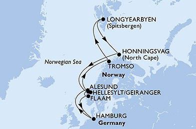
JOUR DATE ESCALE ARRIVÉE DÉPART AGENDA STATUT* 1 dimanche, 10 juin 2018 Hambourg, Allemagne - 20:00 à quai 2 lundi, 11 juin 2018 En mer - - - 3 mardi, 12 juin 2018 Alesund, Norvège 10:00 18:00 à quai 4 mercredi, 13 juin 2018 En mer - - - 5 jeudi, 14 juin 2018 Tromso, Norvège 13:00 21:00 à quai 6 vendredi, 15 juin 2018 En mer - - - 7 samedi, 16 juin 2018 Longyearbyen, Norvege 08:00 22:00 à quai 8 dimanche, 17 juin 2018 En mer - - - 9 lundi, 18 juin 2018 Honningsvag, Norvège 14:00 - en rade 10 mardi, 19 juin 2018 Honningsvag, Norvège - 02:00 en rade 11 mercredi, 20 juin 2018 En mer - - - 12 jeudi, 21 juin 2018 Hellesylt/Geiranger, Norvège 07:00 17:00 en rade 13 vendredi, 22 juin 2018 Flåm, Norvège 08:00 18:00 en rade 14 samedi, 23 juin 2018 En mer - - - 15 dimanche, 24 juin 2018 Hambourg, Allemagne 06:00 - à quai
3/ le préacheminement sur Hambourg Après réflexion et vu les prix aérien d’air France (compagnie que je n’aime pas en plus) Nous avons décidé de faire l’Oise – Hambourg soit 870km en voiture soit environ 9heure de route (ça reste moins que lorsqu’on va voir la famille sur la côte d’azur ou égale à Lausanne). Nous partirions le vendredi 08 juin afin de ce laissé une journée avant pour découvrir cette ville. Donc on va réserver 2 nuits d’hôtel sur place. J’ai pensé au mercure hôtel d’Hambourg city ? J’aime bien le groupe accord et en plus on a la carte, mais si vous avez des suggestions, seul impératif un parking pour titine !
4/ Hambourg Du vendredi 08 juin au dimanche 10 juin 2018 J’ai pratiquement tous listé et mis en gras et italique ce qu’on est sur (oups que je suis sûr de vouloir faire, monsieur me laisse toute latitude dans la préparation de nos voyage, il dit préféré les surprise et voir sur place) - Les arcades de l'Alster : Une image emblématique d'Hambourg. Bâties au bord du canal Alster en face du Rathausmarkt, juste avant le Jungernstieg, elles abritent cafés et boutiques. - le parc d'Altona (Altonaer Volkspark) : Le plus grand parc d'Hambourg - Les entrepôts de la Speicherstadt : Située dans le port de Hambourg (dans le quartier HafenCity), les bâtiments ont été construits entre 1883 et 1927 pour une surface d'environ 370 000 m2. Zone franche à l'origine, elle est l'un des plus vastes complexes d'entrepôts au monde.La zone est notable pour le matériau de construction, la brique, et son architecture de style néogothique. La Speicherstadt est classée monument historique depuis 1991 et classée au patrimoine mondial de l'UNESCO depuis 2015. - Excursion en bateau sur l'Alster (Départ à Jungernstieg / Anleger 3 et 4 / de 10h à18h / A partir de 9€50) Ce magnifique lac au centre de la ville est bordé de parcs et de superbes villas. C'est là qu'habitent les Hambourgeois les plus aisés. La promenade autour de l'Alster constitue une promenade dominicale très appréciée. - Tour en Barkasse dans le port et les canaux : A bord des barkasses, un bar composé d'un casier avec des canettes, un ouvre-bouteille et une corbeille pour la monnaie. Servez-vous vous-même, payez, reprenez votre monnaie. Cette coutume basée sur la confiance est très répandue en Europe du Nord. En ce qui concerne le port proprement dit, vous ferez une très jolie balade sur l'Elbe, le port comme celui de Duisburg, est immense. - Tour en bateau dans le port de l'Elbe - Kapitän Prüsse : Départs de St. Pauli Landungsbrücken - Le marché aux poissons, Fischmarkt : Fonctionne tous les dimanches d'avril à octobre de 5h à 11h du matin et de 7h à 11h de novembre à mars. Fête dans la halle aux poissons : Entrée gratuite mais brunch payant - L'église st Pierre et son panorama à 360° sur la ville (St. Peter’s Church, en allemand: Petrikirche). 544 marches pour monter au sommet du clocher (132 mètres) pour apercevoir : Vers l'Ouest, on peut observer le grand Hôtel de ville tout proche. Vers le Nord, les lacs (Alster) Vers l'Est, les rues commerçantes qui relient l'hôtel de ville à la gare (Haupt-bahnhof) Vers le sud, Speicherstadt, le vieux quartier des entrepôts, puis les anciens docks en reconstruction, Hafencity et en toile de fond l'Elbe et la zone portuaire. -miniature wunderland (acheter les billets avant sur le net) - L’hôtel de ville - Quartier st pauli pour une balade - Le jardin planten und blömen - Quartier krameramtsgame qui serait du 17ème siècle - L’église st michel
Si vous avez des suggestions où des choses qu’il ne faut pas louper absolument où des restaurants sympas pour y diner ou déjeuner je suis preneuse
1/ date de la croisière Nous partons du 10 juin au 24juin 2018 Pour moi c’est une grande première de préparer un voyage aussi longtemps à l’avance d’habitude c’est plutôt 6 mois avant. Donc mon mari et mes amis appréhende un peu car ils ont peur que je leur rabâche un peu trop les oreilles, mais c’est un peu les pré-vacances et on commence à rêver.
2/ voici le trajet et les escales
JOUR DATE ESCALE ARRIVÉE DÉPART AGENDA STATUT* 1 dimanche, 10 juin 2018 Hambourg, Allemagne - 20:00 à quai 2 lundi, 11 juin 2018 En mer - - - 3 mardi, 12 juin 2018 Alesund, Norvège 10:00 18:00 à quai 4 mercredi, 13 juin 2018 En mer - - - 5 jeudi, 14 juin 2018 Tromso, Norvège 13:00 21:00 à quai 6 vendredi, 15 juin 2018 En mer - - - 7 samedi, 16 juin 2018 Longyearbyen, Norvege 08:00 22:00 à quai 8 dimanche, 17 juin 2018 En mer - - - 9 lundi, 18 juin 2018 Honningsvag, Norvège 14:00 - en rade 10 mardi, 19 juin 2018 Honningsvag, Norvège - 02:00 en rade 11 mercredi, 20 juin 2018 En mer - - - 12 jeudi, 21 juin 2018 Hellesylt/Geiranger, Norvège 07:00 17:00 en rade 13 vendredi, 22 juin 2018 Flåm, Norvège 08:00 18:00 en rade 14 samedi, 23 juin 2018 En mer - - - 15 dimanche, 24 juin 2018 Hambourg, Allemagne 06:00 - à quai
3/ le préacheminement sur Hambourg Après réflexion et vu les prix aérien d’air France (compagnie que je n’aime pas en plus) Nous avons décidé de faire l’Oise – Hambourg soit 870km en voiture soit environ 9heure de route (ça reste moins que lorsqu’on va voir la famille sur la côte d’azur ou égale à Lausanne). Nous partirions le vendredi 08 juin afin de ce laissé une journée avant pour découvrir cette ville. Donc on va réserver 2 nuits d’hôtel sur place. J’ai pensé au mercure hôtel d’Hambourg city ? J’aime bien le groupe accord et en plus on a la carte, mais si vous avez des suggestions, seul impératif un parking pour titine !
4/ Hambourg Du vendredi 08 juin au dimanche 10 juin 2018 J’ai pratiquement tous listé et mis en gras et italique ce qu’on est sur (oups que je suis sûr de vouloir faire, monsieur me laisse toute latitude dans la préparation de nos voyage, il dit préféré les surprise et voir sur place) - Les arcades de l'Alster : Une image emblématique d'Hambourg. Bâties au bord du canal Alster en face du Rathausmarkt, juste avant le Jungernstieg, elles abritent cafés et boutiques. - le parc d'Altona (Altonaer Volkspark) : Le plus grand parc d'Hambourg - Les entrepôts de la Speicherstadt : Située dans le port de Hambourg (dans le quartier HafenCity), les bâtiments ont été construits entre 1883 et 1927 pour une surface d'environ 370 000 m2. Zone franche à l'origine, elle est l'un des plus vastes complexes d'entrepôts au monde.La zone est notable pour le matériau de construction, la brique, et son architecture de style néogothique. La Speicherstadt est classée monument historique depuis 1991 et classée au patrimoine mondial de l'UNESCO depuis 2015. - Excursion en bateau sur l'Alster (Départ à Jungernstieg / Anleger 3 et 4 / de 10h à18h / A partir de 9€50) Ce magnifique lac au centre de la ville est bordé de parcs et de superbes villas. C'est là qu'habitent les Hambourgeois les plus aisés. La promenade autour de l'Alster constitue une promenade dominicale très appréciée. - Tour en Barkasse dans le port et les canaux : A bord des barkasses, un bar composé d'un casier avec des canettes, un ouvre-bouteille et une corbeille pour la monnaie. Servez-vous vous-même, payez, reprenez votre monnaie. Cette coutume basée sur la confiance est très répandue en Europe du Nord. En ce qui concerne le port proprement dit, vous ferez une très jolie balade sur l'Elbe, le port comme celui de Duisburg, est immense. - Tour en bateau dans le port de l'Elbe - Kapitän Prüsse : Départs de St. Pauli Landungsbrücken - Le marché aux poissons, Fischmarkt : Fonctionne tous les dimanches d'avril à octobre de 5h à 11h du matin et de 7h à 11h de novembre à mars. Fête dans la halle aux poissons : Entrée gratuite mais brunch payant - L'église st Pierre et son panorama à 360° sur la ville (St. Peter’s Church, en allemand: Petrikirche). 544 marches pour monter au sommet du clocher (132 mètres) pour apercevoir : Vers l'Ouest, on peut observer le grand Hôtel de ville tout proche. Vers le Nord, les lacs (Alster) Vers l'Est, les rues commerçantes qui relient l'hôtel de ville à la gare (Haupt-bahnhof) Vers le sud, Speicherstadt, le vieux quartier des entrepôts, puis les anciens docks en reconstruction, Hafencity et en toile de fond l'Elbe et la zone portuaire. -miniature wunderland (acheter les billets avant sur le net) - L’hôtel de ville - Quartier st pauli pour une balade - Le jardin planten und blömen - Quartier krameramtsgame qui serait du 17ème siècle - L’église st michel
Si vous avez des suggestions où des choses qu’il ne faut pas louper absolument où des restaurants sympas pour y diner ou déjeuner je suis preneuse
MSC Splendida croisière en Islande juin et juillet 2015 English translation pending
Bonjour à tous
J'ai ouvert ce post pour préparer et discuter de cette croisière en Islande sur le MSC Splendida Deux départs, un le 21 juin l'autre le 17 juillet. Je pars le 17 juillet Merci de donner votre avis pour ceux qui l'ont déjà faite cette année par exemple
A bientôt 🙂 Roger
J'ai ouvert ce post pour préparer et discuter de cette croisière en Islande sur le MSC Splendida Deux départs, un le 21 juin l'autre le 17 juillet. Je pars le 17 juillet Merci de donner votre avis pour ceux qui l'ont déjà faite cette année par exemple
A bientôt 🙂 Roger
Oslo - Bâle en train avec un vélo: un exemple à ne pas suivre English translation pending
Bonjour,
Je rentre d'un Oslo-Bâle en train avec un vélo.
Le voyage m'a pris 7 jours et m'a coûté dans les 1'000 euros en comptant 2 nuits d'hôtel à Copenhague et 3 nuits à Hambourg.
Tout commence le 28 juillet à Oslo, au guichet donc. On vous grifonne un numéro de téléphone à 8 chiffres sur un billet et on vous dit : appelez. Evidemment, l'automate répond en norvégien : tapez 1, tapez 2, etc. Mon grand oncle Jules avait raison quand il disait qu'il fallait bien étudier les langues. Bref, vous comprenez qu'il faut y aller morceau par morceau.
Oslo-Göteborg, ok. Pas de réservation pour les vélos. Pas d'encaissement non plus.
Göteborg-Copenhague : pas de réservation. Paiement pour le vélo. Voiture spéciale vélos/bagages/poussettes. Seule une compagnie privée transporte les vélos. Heureux sur le quai de constater la présence d'une voiture vélos sauf qu'à l'ouverture des portes, j'ai un café à la main et que 2 minutes plus tard, elle est pleine. Facile à se caser quand même.
A Copenhague, ça se corse : 2 guichets seulement pour les billets internationaux. Humeur massacrante de la femme qui délivre les billets ( et pourtant je fais très gaffe à mon comportement quand j'aborde ces professionnels). Elle déteste ça, faire des billets avec vélo. Nous sommes le 29 et rien avant le 31. Ok! Je trouve un hôtel abordable à 40 mn de la gare (ceux qui ont déjà cherché un hôtel à Copenhague savent ce que cela signifie...). Je retourne le lendemain en vélo à la gare comme dans une répétition générale. Je repère l'ascenseur vélo pour mon quai et je me fais expliquer les différentes étapes de mon voyage jusqu'à Hambourg (quais, changements), choses que je n'ai pas osé demander à la personne énervée la veille.
Première étape : Copenhague-Fredericia où il y a 9 minutes pour changer de train à 6 vélos en prenant le lift. C'est assez juste... Ensuite Fredericia-Flensbourg. 3ème étape : Flensbourg-Hambourg. Le wagon vélos est déjà plein mais je peux me caser dans le sas d'entrée. A l'arrêt suivant 2 vélos arrivent. Au suivant, 2 autres qui forcent littéralement le passage. A compter du deuxième arrêt après Flensbourg, au moins 30 vélos sont restés sur le quai... Un arrêt avant Hambourg, une femme doit sortir avec poussette et enfant. Discussion et plans 2 arrêts avant. 4 vélos sortent pour laisser passer et ils rentrent ensuite. Je ne décrirai pas le b... à Hambourg.
Au guichet à Hambourg, les choses se passent toujours mal : guichetière au contact fort désagréable ( et pourtant je fais gaffe). Départ dans 3 jours : rien avant. Je trouve un hôtel en face de la gare à prix correct pour 3 nuits ( 270 euros). Ouf qu'à Hambourg, il y a plein d'hôtels autour de la gare!
Mercredi 3 août, départ 10h46 de Hambourg pour Stuttgart ( et oui, rien en ligne directe Hambourg-Bâle). Le système des réservations fait que normalement vous devriez trouver une place pour votre vélo. Ce fut le cas. Pendu au clou. 30 minutes de retard. Changement à Stuttgart. Ouf, la gare est sur un niveau. Pas d'ascenseur à prendre et ma correspondance a 20 mn de retard. Tout s'arrange. Sauf que normalement à la fin, vous finissez par tomber sur un train qui n'a pas de retard... Arrivée à Basel Bad presque dans les temps. Je vous fais grâce de la suite de mon voyage à l'intérieur de la Suisse pour rentrer chez moi finalement le 4 à 04h57 du matin.
Remarques : les chemins de fer danois ne peuvent évacuer qu'une vingtaine de vélos par jour en direction de l'Allemagne. La guichetière m'a montré l'écran, il n'y a que 4 trains par jour. Le mien contenait 6 vélos. Le calcul est vite fait. Pour l'Allemagne, mon train comportait 2 voitures de 10 vélos chacune. J'ignore combien de trains quotidiens mais cela ne fait pas non plus des masses...
Un conseil? Avion, avion, avion!
En fait, ce voyage m'a pris 2 semaines : 7 jours effectifs et une semaine de perte d'espérance de vie due au stress et à l'angoisse. Au départ de Hambourg quand j'ai lu que la composition du train avait été modifiée, j'ai failli avoir un malaise...
Comment? Par internet? Je ne sais. Il y a 2 ans, il était rigoureusement impossible de réserver une place pour un vélo par internet et vu la difficulté que rencontrent les professionnels, il me semblerait étonnant que les choses aient changé.
Si c'était à refaire? Non.
Beaucoup de bonheur sur les routes, amis randonneurs cyclistes.
Je rentre d'un Oslo-Bâle en train avec un vélo.
Le voyage m'a pris 7 jours et m'a coûté dans les 1'000 euros en comptant 2 nuits d'hôtel à Copenhague et 3 nuits à Hambourg.
Tout commence le 28 juillet à Oslo, au guichet donc. On vous grifonne un numéro de téléphone à 8 chiffres sur un billet et on vous dit : appelez. Evidemment, l'automate répond en norvégien : tapez 1, tapez 2, etc. Mon grand oncle Jules avait raison quand il disait qu'il fallait bien étudier les langues. Bref, vous comprenez qu'il faut y aller morceau par morceau.
Oslo-Göteborg, ok. Pas de réservation pour les vélos. Pas d'encaissement non plus.
Göteborg-Copenhague : pas de réservation. Paiement pour le vélo. Voiture spéciale vélos/bagages/poussettes. Seule une compagnie privée transporte les vélos. Heureux sur le quai de constater la présence d'une voiture vélos sauf qu'à l'ouverture des portes, j'ai un café à la main et que 2 minutes plus tard, elle est pleine. Facile à se caser quand même.
A Copenhague, ça se corse : 2 guichets seulement pour les billets internationaux. Humeur massacrante de la femme qui délivre les billets ( et pourtant je fais très gaffe à mon comportement quand j'aborde ces professionnels). Elle déteste ça, faire des billets avec vélo. Nous sommes le 29 et rien avant le 31. Ok! Je trouve un hôtel abordable à 40 mn de la gare (ceux qui ont déjà cherché un hôtel à Copenhague savent ce que cela signifie...). Je retourne le lendemain en vélo à la gare comme dans une répétition générale. Je repère l'ascenseur vélo pour mon quai et je me fais expliquer les différentes étapes de mon voyage jusqu'à Hambourg (quais, changements), choses que je n'ai pas osé demander à la personne énervée la veille.
Première étape : Copenhague-Fredericia où il y a 9 minutes pour changer de train à 6 vélos en prenant le lift. C'est assez juste... Ensuite Fredericia-Flensbourg. 3ème étape : Flensbourg-Hambourg. Le wagon vélos est déjà plein mais je peux me caser dans le sas d'entrée. A l'arrêt suivant 2 vélos arrivent. Au suivant, 2 autres qui forcent littéralement le passage. A compter du deuxième arrêt après Flensbourg, au moins 30 vélos sont restés sur le quai... Un arrêt avant Hambourg, une femme doit sortir avec poussette et enfant. Discussion et plans 2 arrêts avant. 4 vélos sortent pour laisser passer et ils rentrent ensuite. Je ne décrirai pas le b... à Hambourg.
Au guichet à Hambourg, les choses se passent toujours mal : guichetière au contact fort désagréable ( et pourtant je fais gaffe). Départ dans 3 jours : rien avant. Je trouve un hôtel en face de la gare à prix correct pour 3 nuits ( 270 euros). Ouf qu'à Hambourg, il y a plein d'hôtels autour de la gare!
Mercredi 3 août, départ 10h46 de Hambourg pour Stuttgart ( et oui, rien en ligne directe Hambourg-Bâle). Le système des réservations fait que normalement vous devriez trouver une place pour votre vélo. Ce fut le cas. Pendu au clou. 30 minutes de retard. Changement à Stuttgart. Ouf, la gare est sur un niveau. Pas d'ascenseur à prendre et ma correspondance a 20 mn de retard. Tout s'arrange. Sauf que normalement à la fin, vous finissez par tomber sur un train qui n'a pas de retard... Arrivée à Basel Bad presque dans les temps. Je vous fais grâce de la suite de mon voyage à l'intérieur de la Suisse pour rentrer chez moi finalement le 4 à 04h57 du matin.
Remarques : les chemins de fer danois ne peuvent évacuer qu'une vingtaine de vélos par jour en direction de l'Allemagne. La guichetière m'a montré l'écran, il n'y a que 4 trains par jour. Le mien contenait 6 vélos. Le calcul est vite fait. Pour l'Allemagne, mon train comportait 2 voitures de 10 vélos chacune. J'ignore combien de trains quotidiens mais cela ne fait pas non plus des masses...
Un conseil? Avion, avion, avion!
En fait, ce voyage m'a pris 2 semaines : 7 jours effectifs et une semaine de perte d'espérance de vie due au stress et à l'angoisse. Au départ de Hambourg quand j'ai lu que la composition du train avait été modifiée, j'ai failli avoir un malaise...
Comment? Par internet? Je ne sais. Il y a 2 ans, il était rigoureusement impossible de réserver une place pour un vélo par internet et vu la difficulté que rencontrent les professionnels, il me semblerait étonnant que les choses aient changé.
Si c'était à refaire? Non.
Beaucoup de bonheur sur les routes, amis randonneurs cyclistes.
Coût d'un voyage en Norvège en voiture? English translation pending
Bonjour,
Voila j'ai besoin d 'un renseignement. Je pars en norvege cet été avec des amis (on sera trois au total) on hésite encore entre avion + train ou voiture pour ce voyage de 3 semaines. Si vous êtes allez en norvège dernièrement combien couté le litre de gasoil ? Les ferry ? Et tout autres choses en rapport avec la voiture.
Merci d'avance pour vos réponses.
A bientot
Voila j'ai besoin d 'un renseignement. Je pars en norvege cet été avec des amis (on sera trois au total) on hésite encore entre avion + train ou voiture pour ce voyage de 3 semaines. Si vous êtes allez en norvège dernièrement combien couté le litre de gasoil ? Les ferry ? Et tout autres choses en rapport avec la voiture.
Merci d'avance pour vos réponses.
A bientot
On the Silk Road: Chronicles of a Sixty-Something Traveling Completely Independently
From Beijing to Khiva: China, Kyrgyzstan, Tajikistan, Uzbekistan
Chronicle of anecdotes, highlights, and other adventures that marked this eight-week journey in 2018.
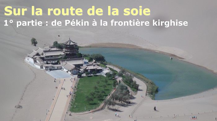
The Chinese Far West More than 30 years after my first trip to eastern China, I finally fulfilled an old dream: traveling solo from Beijing to the far west, discovering Xinjiang, the Uyghur people and the oppression they endure, the oases of Turpan and Kashgar, the Taklamakan Desert, the end of the Great Wall... The route was covered by train.
MENU PART 1: CHINA
1- Beijing (Jiankou) : the authentic Great Wall, without tourists 2- Cycling in Beijing, the best way to get around 3- Beijing : departure for the far west 4- Jiayuguan : getting by without English 5- Jiayuguan : scams and heritage 6- Dunhuang : abundance in the middle of the desert 7- Turpan : the Uyghurs under heavy surveillance 8- Kashgar : love at first sight for the old city 9- Kashgar : China’s recipe for controlling the populace 10- Tashkurgan : what on earth was I thinking going there! Kyrgyz border: a surreal epic Photo album from the 80s, contributions from other travelers (page 2)
1- JIANKOU Finding the authentic Great Wall, without tourists or a guide Friday, August 24, 2018 Thirty years later, I didn’t feel like revisiting the Great Wall at Badaling or any other overcrowded site. I chose to explore it at Jiankou, in its wildest, most authentic, and unrestored section, starting from a lost village deep in a valley—though it wasn’t *that* lost, since it had everything for communication.
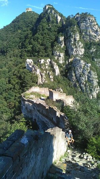
No need to pay for a taxi to get there—by timing it right, you can take the bus for just a few yuan. You have to get off at Xizhazi, the bus terminus. Be careful, there are only two buses a day in each direction. At the Xizhazi bus stop, I met a young couple who’d arrived with zero information about what to expect. We hiked the three of us toward the restored section of Mutianyu.
Still, be cautious With GPS and a topographic map (OpenTopoMap), you can set off without a problem or guide. The trail up to Jiankou is easy and well-marked. The trails down are too. But be careful—once you’re on the Wall, it’s real mountain hiking, with easy but dangerous climbing sections (over sheer drops). Not for amateurs or those afraid of heights! But what a reward. The Wall all to yourself, where it’s at its most daring. Truly mesmerizing.
More photos...
2- BEIJING The best way to get around the capital Sunday, August 26 The best way to explore the city is still by bike. Most are in a bike-share system, but you need to use an app—WeChat, the app that does everything, like monitoring your every move. No way I was installing that.
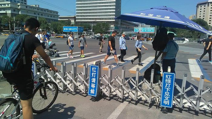
I found one at a rental shop near the hostel. The key is to quickly learn local traffic customs to minimize risks. Bike lanes are wide along the avenues.
But you still have to: - Watch out for anything parked on the bike paths—the most annoying are people napping or talking on the phone in their cars - Keep an eye on everything coming the wrong way—the list is long - The worst is right turns on red, which in Chinese traffic rules seem to have priority Once you get the hang of it, it’s fine. The city is huge but flat, so you can just wing it.
3- BEIJING By train to the far west Sunday, August 26 Beijing West Station is the size and operates like an airport. With your e-ticket from the agency, you first have to pick up your ticket at the special "English" counter, after passing through security. With your ticket in hand, you have to exit and enter through the boarding waiting area—not the platform—after a second security check.
 Then you find the right hall and wait for the sign to finally access the platform. In the end, it works pretty well given the incredible number of passengers to manage. Everywhere in Beijing, I saw that the Chinese have mastered crowd flow management.
Nice surprise: second-class carriages are clean, air-conditioned, and bright. Perfect, since I was in for 20 hours. One uniformed attendant per carriage, mobile meal service—luxury! Small downside: no luggage space. Hauling your suitcase up to the top bunk is quite a workout. I was in the middle, so it wasn’t too bad. The landscape, though, whether rural or urban, is pretty bleak. That should change once we leave the eastern plains.
Of course, I got my first police visit, with a thorough passport check and bag search. I was warned—going to the Chinese far west exposes you to this kind of hassle. But they were polite and respectful.
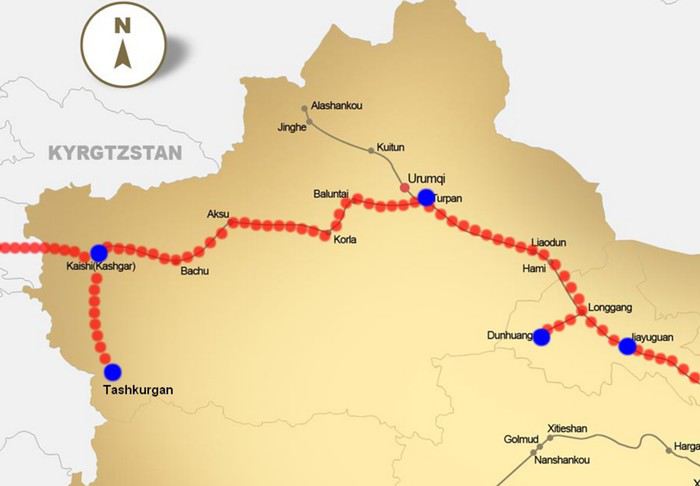 The Chinese Far West
4- JIAYUGUAN Getting by without English Monday, August 27 At the gates of two deserts (Gobi and Taklamakan) and at the foot of the Tibetan highlands, the Great Wall ends at Jiayuguan. Here, I found the deeper China I’d somewhat rediscovered during my bike ride, even if now everyone gets around on electric bikes and I’m no longer stared at like an alien.
Prices are nothing like Beijing: you can find a full meal for 2 €, and my bike cost 7 € for two days. Plus, few people speak English—neither the owner of the HI hostel where I stayed, nor the ticket sellers at the sites, let alone the servers at the small eateries where I ate. Everything is written in Chinese. So I had to use the little Chinese I know to communicate about essentials. It makes the locals laugh to see a European trying to speak their language, but it earns respect. With Google Translate’s help, I managed.
Rant: With their avenues blocked for construction for kilometers without warning, and new roads not yet on maps, I must’ve taken 15 km of detours. More photos...
5- JIAYUGUAN Scams and heritage Tuesday, August 28 The Great Wall doesn’t exactly end at the fort I visited yesterday but 10 km further, at the entrance to a river gorge at the foot of the mountains. All that’s left is a badly damaged tower (more like a mound of earth) and a section of clay wall, similar to the one I biked yesterday.
This morning, I hopped on my bike, determined to venture into the desert to see this highly symbolic site. First, you access it via a wide, brand-new road with not a soul in sight. Just before the site, I came across a grand welcome gate, very period-style, but it’s actually the inevitable toll booth.
Behind the gate, the road continues straight to the site, which you can see in the distance—at least 2 km away—the remains of the tower and wall. I had to leave my bike here. Fine. I went to the ticket counter and asked the price: 120 yuan! I couldn’t believe it—over 15 € for a simple mound of earth.
I showed my displeasure to the attendant, who couldn’t care less, and immediately turned back. 120 yuan—that’s the price for a new road, a fancy gate planted 2 km before the site just to force you to take a shuttle, and employees with nothing to do all day... Now I understand why I didn’t meet anyone!
Heritage China is a bit pricey Generally, sites are expensive for the country’s standard of living, but travelers are supposed to have money, so why hold back? I even gave up on the Forbidden City—reservations required days in advance (or on the black market at an impossible price). I prefer to keep the memory of my first visit, when entry must’ve cost a few dozen cents, and there were only a handful of visitors.
This morning, I took a taxi to see remarkable tombs of common people from the 3rd to 6th centuries. They’re small vaulted caves made of painted bricks, depicting scenes of daily life. Very pretty and moving. But even here, though the price was more reasonable, I was left wanting—only one of the 16 tombs is open to visitors, and it’s apparently not the most beautiful.
The authentic China—at least what’s left of it... Wandering the impersonal avenues of the city, you stumble upon a market. There, you still find traditional China—small shops with questionable hygiene, Go players, musicians, and even a dental prosthetist. The last refuge for those untouched by modernity. More photos...
6- DUNHUANG Abundance in the middle of the desert Wednesday, August 29 Well, I thought the landscape would be less bleak as I headed west. Nope. The only distraction in this expanse of dark, clayey sand is the forests of pylons and wind turbines, plus wild camels racing each other.
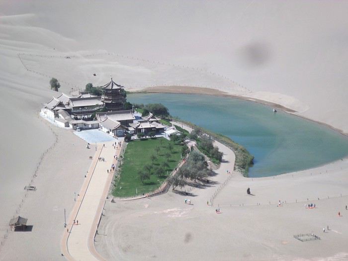 However, Dunhuang, the gateway to the Taklamakan, is by far the most pleasant Chinese city I know. There’s a real city center you can explore on foot. It’s hot but not unbearable, with a light, dry breeze. Much nicer than Beijing. The Han Chinese are still the majority, but the Muslim Uyghurs are more numerous, and the muezzin’s call to prayer echoes around the mosque.
The most surprising thing is the abundance and diversity of fruits and vegetables. You wonder how it all grows here. Well-irrigated, the desert sands are very fertile. Here, raisins have subtle, mysterious flavors, and the lamb really tastes like lamb.
Today, I visited the must-see Mingshashan, a dune complex next to which Pila is a molehill. The Basque Country, but covered in sand... More photos...
7- TURPAN The Uyghurs under heavy surveillance Friday, August 31 Surveillance cameras everywhere in the city, armed police stationed at intersections, in front of public buildings, at the entrance and inside tourist sites, police stations on every corner, patrols on foot or by car, khaki uniforms even for middle schoolers... here, the Han Chinese are in the minority, and you can feel it. Turpan feels like a city under siege.
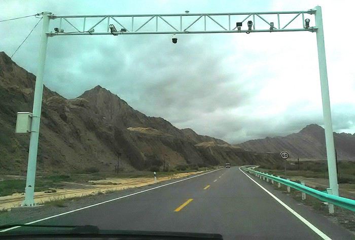
To enter the youth hostel where I stayed, there’s even a security gate, and the receptionist (a Han, like everyone in tourism) wears a bulletproof vest! Reassuring. Still, you don’t feel particularly threatened here, especially as a European. The troublemakers are the Chinese, not the Uyghurs. Generally, China is a very safe country for visitors.
Smile, you’re on camera! I was biking on an avenue when the car in front of me got flashed for driving slowly. I quickly understood why when I got flashed too.
Here, the official time is Beijing time, but it gets dark two hours later. It’ll be even worse in Kashgar. Trickier to manage: everything is displayed in Chinese and Arabic. Nothing in English. Choosing a menu is a shot in the dark. Apart from a few young Chinese, no one here speaks English, and my Chinese doesn’t seem very understandable...
Mogao, the end of the road for the Han Yesterday, near Dunhuang, I went to Mogao, a complex of decorated caves with Buddha sculptures and paintings. Stunning, but so crowded! Luckily, here in Turpan, Chinese tourists barely venture out. So I visited a Silk Road ghost town with only a handful of other visitors and under a howling wind.
The modern Chinese city is swallowing up the old Uyghur neighborhoods—only a museum-like district remains in the center, and pockets of resistance on the outskirts are doomed to disappear soon. More photos...
8- KASHGAR A (relative) love at first sight for the old city Sunday, September 2 After three overnight trains, here I am in the far west of China, nearly 4,000 km from the capital. Despite the omnipresent police and an old city preserved UNESCO-style, Kashgar is my Chinese love at first sight.
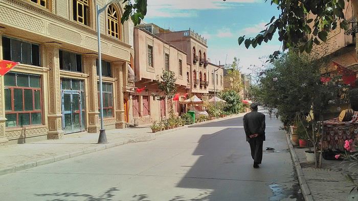
Finally, Chinese... well, sort of, because we’re in Uyghur territory here—a Turkic people with nothing culturally in common with the Han, the eastern Chinese. It started badly yesterday at Turfan station, where after three security gate passes, at least five passport checks, and a bag search, three adorable policewomen confiscated my antibacterial lotion because it had a flammable logo...
Then came the welcoming committee of armed cops at Kashgar station. Once all that was over, they left me alone—except you still have to go through security checks like everyone else to enter the old city, the bazaar, the livestock market... The further west you go, the more the siege mentality is evident. Luckily, the border isn’t far...
Despite the inevitable destruction-reconstruction, the city center has been well preserved. Thankfully, because it’s a very original style, a mix of local and colonial. I love it, even if it’s a bit too artificial, sanitized, and watered-down, and rather empty of residents. On the Silk Road, the city was famous for its great food. And it still is—rarely have I seen such richness and abundance of food! And not just scorpions or snakes. More photos...
9- KASHGAR China’s recipe for controlling the populace Saturday, September 1 Xinjiang, along with Tibet, is a "sensitive" area of rebellion in the eyes of Chinese authorities. As a result, the state has these regions and their populations under total control. Tourists also feel the consequences, even if they’re not at risk of re-education camps.
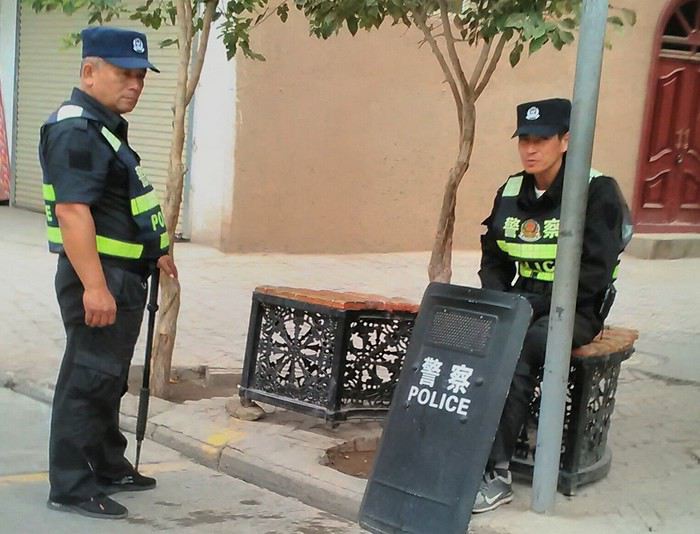 - Putting barbed wire and anti-ramming barriers around sensitive sites (schools, big hotels, government buildings...)
- Installing traffic surveillance gates with cameras and photo flashes (for all vehicles passing, including bikes) throughout the city and even in the countryside
- Posting uniformed guards with tasers, batons, or huge baseball bats every 100 meters
- Training the Han population (ethnic Chinese) in self-defense with sticks, preferably in the morning on the street. Men and women of all ages
- Starting school with the national anthem, doing military exercises, and receiving political indoctrination, all neatly lined up in the courtyard. (The dream school for any teacher)
- Placing a snitch in uniform (a pseudo-guard) in public gathering places, like youth hostels. Mine spends the day loafing around the courtyard
- Putting Chinese flags everywhere on the streets to remind everyone who’s in charge
- Installing security gates at every entrance to areas frequented by tourists (thanks for that) but not just there
- Never photographing cops, or else! I tried, but it’s not easy...
- Putting barbed wire and anti-ramming barriers around sensitive sites (schools, big hotels, government buildings...)
- Installing traffic surveillance gates with cameras and photo flashes (for all vehicles passing, including bikes) throughout the city and even in the countryside
- Posting uniformed guards with tasers, batons, or huge baseball bats every 100 meters
- Training the Han population (ethnic Chinese) in self-defense with sticks, preferably in the morning on the street. Men and women of all ages
- Starting school with the national anthem, doing military exercises, and receiving political indoctrination, all neatly lined up in the courtyard. (The dream school for any teacher)
- Placing a snitch in uniform (a pseudo-guard) in public gathering places, like youth hostels. Mine spends the day loafing around the courtyard
- Putting Chinese flags everywhere on the streets to remind everyone who’s in charge
- Installing security gates at every entrance to areas frequented by tourists (thanks for that) but not just there
- Never photographing cops, or else! I tried, but it’s not easy...
With all that, you can stroll around safely Not much crime! As for the amount the Chinese state spends to maintain such a system, it’s staggering! A third of the Han living in Xinjiang work in security. Today, I wandered freely around old Kashgar, which is quite large after all. More photos...
10- TASHKURGAN What on earth was I thinking going there! Wednesday, September 5 First, there’s the taxi—pretty crappy, with a driver who doesn’t speak a word of English and won’t stop smoking. Over six hours in that... shared with a completely out-of-it American.
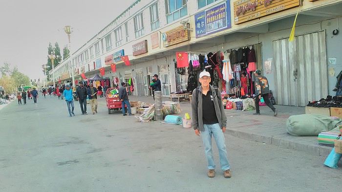
Then there are all the checkpoints along the way. I won’t go on—you know the drill by now.
After that, there’s Tashkurgan—a town with nothing to see, nothing to do. Deserted as soon as night falls. There’s this huge youth hostel and a few lost Chinese tapping away on their smartphones, chain-smoking. This lost American-European crowd, swapping tips on how to enter Pakistan or Tajikistan.
Luckily, there’s the Chinese Pamir Highway, lined with peaks over 7,000m. There’s the feeling of no longer being in China, with a population whose features are Middle Eastern. And these Tajik women with their stunning hairstyles and vibrant costumes. There’s the fact of having reached the westernmost Chinese city, far from crowds and tourist sites. A sort of end of the world. More photos...
11- KYRGYZ BORDER A surreal epic Thursday, September 6 The road from Kashgar to the Kyrgyzstan border is a little over 200 km and passes through beautiful landscapes of colorful, desert-like mountains with acrobatic folds. That’s the bucolic part of the trip.
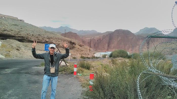 Yesterday, I managed to gather four people to rent a minibus to reach the border more easily: a Spaniard and an Argentine I’d already met in Turpan, and two New Zealanders who responded to the ad left at the hostel.
Absurdity and paranoia of Chinese authorities The highlight was crossing the town of Wuqia, 50 km past Kashgar. After tallying up with my fellow sufferers, we must’ve passed about ten checkpoints with: - Passport checks: 14 times, sometimes by two cops side by side - Bag checks: 4 times - Smartphone checks: 2 times, with deletion of "non-compliant" photos, and registration of your IMEI in the exit log!... Absurd and surreal at the same time, since my camera stayed in my bag, my apps are in French, and my photos have been online for ages...
With all that, we arrived just as the last checkpoint before the no man’s land marking the border between the two countries was on lunch break. And bam! Another 1.5-hour wait, alongside truckers who were much more used to this than we were.
What to think? The cops themselves aren’t fooled. They play the role they’re asked to, but sometimes you can coax a smile out of them—they realize how ridiculous the situation is.
What’s the point? That’s the big question my companions and I were tempted to answer with "to piss people off." To show you your place isn’t here, but with the other tourists, over there in the east, in Shanghai, Xi’an, or Guangzhou.
As for you, a traveler from a democratic country, you really experience this as aggression, humiliation, a violation of your private space. And yet, I’m respected, they speak to me properly. Today, I better understand what a Palestinian or a citizen of an occupied country might feel daily. A unique experience! Thanks, China.
And to top it off, the cherry on the cake! It’s still this glowing button you press to rate your passage after clearing the last obstacle before the exit stamp. I was so surprised it turned off before I could react. The Spaniard, with great humor and irony, had time to vote "excellent." In the end, he wasn’t wrong—you can hardly do better!
PS: I ditched my buddies at the border. They didn’t want to pay for a taxi to continue. So I took a direct taxi to Osh. The first 100 km are fabulous. I couldn’t take many photos, but I’ll be back on Monday to go to Tajikistan.
More photos...
The rest of the Silk Road, Part 2, in these travel journals: Kyrgyzstan, Tajikistan, Uzbekistan.
The Chinese Far West More than 30 years after my first trip to eastern China, I finally fulfilled an old dream: traveling solo from Beijing to the far west, discovering Xinjiang, the Uyghur people and the oppression they endure, the oases of Turpan and Kashgar, the Taklamakan Desert, the end of the Great Wall... The route was covered by train.
MENU PART 1: CHINA
1- Beijing (Jiankou) : the authentic Great Wall, without tourists 2- Cycling in Beijing, the best way to get around 3- Beijing : departure for the far west 4- Jiayuguan : getting by without English 5- Jiayuguan : scams and heritage 6- Dunhuang : abundance in the middle of the desert 7- Turpan : the Uyghurs under heavy surveillance 8- Kashgar : love at first sight for the old city 9- Kashgar : China’s recipe for controlling the populace 10- Tashkurgan : what on earth was I thinking going there! Kyrgyz border: a surreal epic Photo album from the 80s, contributions from other travelers (page 2)
1- JIANKOU Finding the authentic Great Wall, without tourists or a guide Friday, August 24, 2018 Thirty years later, I didn’t feel like revisiting the Great Wall at Badaling or any other overcrowded site. I chose to explore it at Jiankou, in its wildest, most authentic, and unrestored section, starting from a lost village deep in a valley—though it wasn’t *that* lost, since it had everything for communication.
No need to pay for a taxi to get there—by timing it right, you can take the bus for just a few yuan. You have to get off at Xizhazi, the bus terminus. Be careful, there are only two buses a day in each direction. At the Xizhazi bus stop, I met a young couple who’d arrived with zero information about what to expect. We hiked the three of us toward the restored section of Mutianyu.
Still, be cautious With GPS and a topographic map (OpenTopoMap), you can set off without a problem or guide. The trail up to Jiankou is easy and well-marked. The trails down are too. But be careful—once you’re on the Wall, it’s real mountain hiking, with easy but dangerous climbing sections (over sheer drops). Not for amateurs or those afraid of heights! But what a reward. The Wall all to yourself, where it’s at its most daring. Truly mesmerizing.
More photos...
2- BEIJING The best way to get around the capital Sunday, August 26 The best way to explore the city is still by bike. Most are in a bike-share system, but you need to use an app—WeChat, the app that does everything, like monitoring your every move. No way I was installing that.
I found one at a rental shop near the hostel. The key is to quickly learn local traffic customs to minimize risks. Bike lanes are wide along the avenues.
But you still have to: - Watch out for anything parked on the bike paths—the most annoying are people napping or talking on the phone in their cars - Keep an eye on everything coming the wrong way—the list is long - The worst is right turns on red, which in Chinese traffic rules seem to have priority Once you get the hang of it, it’s fine. The city is huge but flat, so you can just wing it.
3- BEIJING By train to the far west Sunday, August 26 Beijing West Station is the size and operates like an airport. With your e-ticket from the agency, you first have to pick up your ticket at the special "English" counter, after passing through security. With your ticket in hand, you have to exit and enter through the boarding waiting area—not the platform—after a second security check.
Then you find the right hall and wait for the sign to finally access the platform. In the end, it works pretty well given the incredible number of passengers to manage. Everywhere in Beijing, I saw that the Chinese have mastered crowd flow management.Nice surprise: second-class carriages are clean, air-conditioned, and bright. Perfect, since I was in for 20 hours. One uniformed attendant per carriage, mobile meal service—luxury! Small downside: no luggage space. Hauling your suitcase up to the top bunk is quite a workout. I was in the middle, so it wasn’t too bad. The landscape, though, whether rural or urban, is pretty bleak. That should change once we leave the eastern plains.
Of course, I got my first police visit, with a thorough passport check and bag search. I was warned—going to the Chinese far west exposes you to this kind of hassle. But they were polite and respectful.
The Chinese Far West4- JIAYUGUAN Getting by without English Monday, August 27 At the gates of two deserts (Gobi and Taklamakan) and at the foot of the Tibetan highlands, the Great Wall ends at Jiayuguan. Here, I found the deeper China I’d somewhat rediscovered during my bike ride, even if now everyone gets around on electric bikes and I’m no longer stared at like an alien.
Prices are nothing like Beijing: you can find a full meal for 2 €, and my bike cost 7 € for two days. Plus, few people speak English—neither the owner of the HI hostel where I stayed, nor the ticket sellers at the sites, let alone the servers at the small eateries where I ate. Everything is written in Chinese. So I had to use the little Chinese I know to communicate about essentials. It makes the locals laugh to see a European trying to speak their language, but it earns respect. With Google Translate’s help, I managed.
Rant: With their avenues blocked for construction for kilometers without warning, and new roads not yet on maps, I must’ve taken 15 km of detours. More photos...
5- JIAYUGUAN Scams and heritage Tuesday, August 28 The Great Wall doesn’t exactly end at the fort I visited yesterday but 10 km further, at the entrance to a river gorge at the foot of the mountains. All that’s left is a badly damaged tower (more like a mound of earth) and a section of clay wall, similar to the one I biked yesterday.
This morning, I hopped on my bike, determined to venture into the desert to see this highly symbolic site. First, you access it via a wide, brand-new road with not a soul in sight. Just before the site, I came across a grand welcome gate, very period-style, but it’s actually the inevitable toll booth.
Behind the gate, the road continues straight to the site, which you can see in the distance—at least 2 km away—the remains of the tower and wall. I had to leave my bike here. Fine. I went to the ticket counter and asked the price: 120 yuan! I couldn’t believe it—over 15 € for a simple mound of earth.
I showed my displeasure to the attendant, who couldn’t care less, and immediately turned back. 120 yuan—that’s the price for a new road, a fancy gate planted 2 km before the site just to force you to take a shuttle, and employees with nothing to do all day... Now I understand why I didn’t meet anyone!
Heritage China is a bit pricey Generally, sites are expensive for the country’s standard of living, but travelers are supposed to have money, so why hold back? I even gave up on the Forbidden City—reservations required days in advance (or on the black market at an impossible price). I prefer to keep the memory of my first visit, when entry must’ve cost a few dozen cents, and there were only a handful of visitors.
This morning, I took a taxi to see remarkable tombs of common people from the 3rd to 6th centuries. They’re small vaulted caves made of painted bricks, depicting scenes of daily life. Very pretty and moving. But even here, though the price was more reasonable, I was left wanting—only one of the 16 tombs is open to visitors, and it’s apparently not the most beautiful.
The authentic China—at least what’s left of it... Wandering the impersonal avenues of the city, you stumble upon a market. There, you still find traditional China—small shops with questionable hygiene, Go players, musicians, and even a dental prosthetist. The last refuge for those untouched by modernity. More photos...
6- DUNHUANG Abundance in the middle of the desert Wednesday, August 29 Well, I thought the landscape would be less bleak as I headed west. Nope. The only distraction in this expanse of dark, clayey sand is the forests of pylons and wind turbines, plus wild camels racing each other.
However, Dunhuang, the gateway to the Taklamakan, is by far the most pleasant Chinese city I know. There’s a real city center you can explore on foot. It’s hot but not unbearable, with a light, dry breeze. Much nicer than Beijing. The Han Chinese are still the majority, but the Muslim Uyghurs are more numerous, and the muezzin’s call to prayer echoes around the mosque.The most surprising thing is the abundance and diversity of fruits and vegetables. You wonder how it all grows here. Well-irrigated, the desert sands are very fertile. Here, raisins have subtle, mysterious flavors, and the lamb really tastes like lamb.
Today, I visited the must-see Mingshashan, a dune complex next to which Pila is a molehill. The Basque Country, but covered in sand... More photos...
7- TURPAN The Uyghurs under heavy surveillance Friday, August 31 Surveillance cameras everywhere in the city, armed police stationed at intersections, in front of public buildings, at the entrance and inside tourist sites, police stations on every corner, patrols on foot or by car, khaki uniforms even for middle schoolers... here, the Han Chinese are in the minority, and you can feel it. Turpan feels like a city under siege.
To enter the youth hostel where I stayed, there’s even a security gate, and the receptionist (a Han, like everyone in tourism) wears a bulletproof vest! Reassuring. Still, you don’t feel particularly threatened here, especially as a European. The troublemakers are the Chinese, not the Uyghurs. Generally, China is a very safe country for visitors.
Smile, you’re on camera! I was biking on an avenue when the car in front of me got flashed for driving slowly. I quickly understood why when I got flashed too.
Here, the official time is Beijing time, but it gets dark two hours later. It’ll be even worse in Kashgar. Trickier to manage: everything is displayed in Chinese and Arabic. Nothing in English. Choosing a menu is a shot in the dark. Apart from a few young Chinese, no one here speaks English, and my Chinese doesn’t seem very understandable...
Mogao, the end of the road for the Han Yesterday, near Dunhuang, I went to Mogao, a complex of decorated caves with Buddha sculptures and paintings. Stunning, but so crowded! Luckily, here in Turpan, Chinese tourists barely venture out. So I visited a Silk Road ghost town with only a handful of other visitors and under a howling wind.
The modern Chinese city is swallowing up the old Uyghur neighborhoods—only a museum-like district remains in the center, and pockets of resistance on the outskirts are doomed to disappear soon. More photos...
8- KASHGAR A (relative) love at first sight for the old city Sunday, September 2 After three overnight trains, here I am in the far west of China, nearly 4,000 km from the capital. Despite the omnipresent police and an old city preserved UNESCO-style, Kashgar is my Chinese love at first sight.
Finally, Chinese... well, sort of, because we’re in Uyghur territory here—a Turkic people with nothing culturally in common with the Han, the eastern Chinese. It started badly yesterday at Turfan station, where after three security gate passes, at least five passport checks, and a bag search, three adorable policewomen confiscated my antibacterial lotion because it had a flammable logo...
Then came the welcoming committee of armed cops at Kashgar station. Once all that was over, they left me alone—except you still have to go through security checks like everyone else to enter the old city, the bazaar, the livestock market... The further west you go, the more the siege mentality is evident. Luckily, the border isn’t far...
Despite the inevitable destruction-reconstruction, the city center has been well preserved. Thankfully, because it’s a very original style, a mix of local and colonial. I love it, even if it’s a bit too artificial, sanitized, and watered-down, and rather empty of residents. On the Silk Road, the city was famous for its great food. And it still is—rarely have I seen such richness and abundance of food! And not just scorpions or snakes. More photos...
9- KASHGAR China’s recipe for controlling the populace Saturday, September 1 Xinjiang, along with Tibet, is a "sensitive" area of rebellion in the eyes of Chinese authorities. As a result, the state has these regions and their populations under total control. Tourists also feel the consequences, even if they’re not at risk of re-education camps.
- Putting barbed wire and anti-ramming barriers around sensitive sites (schools, big hotels, government buildings...)
- Installing traffic surveillance gates with cameras and photo flashes (for all vehicles passing, including bikes) throughout the city and even in the countryside
- Posting uniformed guards with tasers, batons, or huge baseball bats every 100 meters
- Training the Han population (ethnic Chinese) in self-defense with sticks, preferably in the morning on the street. Men and women of all ages
- Starting school with the national anthem, doing military exercises, and receiving political indoctrination, all neatly lined up in the courtyard. (The dream school for any teacher)
- Placing a snitch in uniform (a pseudo-guard) in public gathering places, like youth hostels. Mine spends the day loafing around the courtyard
- Putting Chinese flags everywhere on the streets to remind everyone who’s in charge
- Installing security gates at every entrance to areas frequented by tourists (thanks for that) but not just there
- Never photographing cops, or else! I tried, but it’s not easy...With all that, you can stroll around safely Not much crime! As for the amount the Chinese state spends to maintain such a system, it’s staggering! A third of the Han living in Xinjiang work in security. Today, I wandered freely around old Kashgar, which is quite large after all. More photos...
10- TASHKURGAN What on earth was I thinking going there! Wednesday, September 5 First, there’s the taxi—pretty crappy, with a driver who doesn’t speak a word of English and won’t stop smoking. Over six hours in that... shared with a completely out-of-it American.
Then there are all the checkpoints along the way. I won’t go on—you know the drill by now.
After that, there’s Tashkurgan—a town with nothing to see, nothing to do. Deserted as soon as night falls. There’s this huge youth hostel and a few lost Chinese tapping away on their smartphones, chain-smoking. This lost American-European crowd, swapping tips on how to enter Pakistan or Tajikistan.
Luckily, there’s the Chinese Pamir Highway, lined with peaks over 7,000m. There’s the feeling of no longer being in China, with a population whose features are Middle Eastern. And these Tajik women with their stunning hairstyles and vibrant costumes. There’s the fact of having reached the westernmost Chinese city, far from crowds and tourist sites. A sort of end of the world. More photos...
11- KYRGYZ BORDER A surreal epic Thursday, September 6 The road from Kashgar to the Kyrgyzstan border is a little over 200 km and passes through beautiful landscapes of colorful, desert-like mountains with acrobatic folds. That’s the bucolic part of the trip.
Yesterday, I managed to gather four people to rent a minibus to reach the border more easily: a Spaniard and an Argentine I’d already met in Turpan, and two New Zealanders who responded to the ad left at the hostel.Absurdity and paranoia of Chinese authorities The highlight was crossing the town of Wuqia, 50 km past Kashgar. After tallying up with my fellow sufferers, we must’ve passed about ten checkpoints with: - Passport checks: 14 times, sometimes by two cops side by side - Bag checks: 4 times - Smartphone checks: 2 times, with deletion of "non-compliant" photos, and registration of your IMEI in the exit log!... Absurd and surreal at the same time, since my camera stayed in my bag, my apps are in French, and my photos have been online for ages...
With all that, we arrived just as the last checkpoint before the no man’s land marking the border between the two countries was on lunch break. And bam! Another 1.5-hour wait, alongside truckers who were much more used to this than we were.
What to think? The cops themselves aren’t fooled. They play the role they’re asked to, but sometimes you can coax a smile out of them—they realize how ridiculous the situation is.
What’s the point? That’s the big question my companions and I were tempted to answer with "to piss people off." To show you your place isn’t here, but with the other tourists, over there in the east, in Shanghai, Xi’an, or Guangzhou.
As for you, a traveler from a democratic country, you really experience this as aggression, humiliation, a violation of your private space. And yet, I’m respected, they speak to me properly. Today, I better understand what a Palestinian or a citizen of an occupied country might feel daily. A unique experience! Thanks, China.
And to top it off, the cherry on the cake! It’s still this glowing button you press to rate your passage after clearing the last obstacle before the exit stamp. I was so surprised it turned off before I could react. The Spaniard, with great humor and irony, had time to vote "excellent." In the end, he wasn’t wrong—you can hardly do better!
PS: I ditched my buddies at the border. They didn’t want to pay for a taxi to continue. So I took a direct taxi to Osh. The first 100 km are fabulous. I couldn’t take many photos, but I’ll be back on Monday to go to Tajikistan.
More photos...
The rest of the Silk Road, Part 2, in these travel journals: Kyrgyzstan, Tajikistan, Uzbekistan.
3 semaines de Calgary vers Yellowstone, Glacier, Waterton, Banff et Jasper, juillet 2014 English translation pending
Bonjour,
A mon tour d'apporter ma contribution à VF 😉. Et de remercier ceux et celles qui m'ont conseillé : en particulier Laure(Calisson94), Christine(Krikri6792), Christine (Hiacinthe) et Thibaud(Itat)
Au début, le projet était d'aller en Norvège...c'est finalement au Canada et Etats-Unis que nous sommes partis.
La Norvège...on ira mais pas maintenant, plusieurs raisons expliquent ce choix :
- le coût de la vie en Norvège
- le coût très élevé de la location d'un camping-car dans les pays nordiques. J'avais trouvé une location 30% moins chère à partir de Hambourg en Allemagne, mais le loueur ne m'inspirait pas confiance (location de camping-car appartenant à des particuliers?), et puis cette solution ajoutait pas mal de km !
- la météo qui risquait d'être très humide, ce qui ne faisait pas rêver Madame
- l'intérêt d'un tel voyage pour les enfants ne semblait pas évident
On voulait refaire les Rocheuses Canadiennes (visitées en 1999), mais avec les enfants... alors pourquoi attendre? Là, la source de motivation était facile à trouver : la faune !
Comme on ne voulait pas refaire le même circuit qu'il y a 15 ans, on a pensé que ce serait bien d'aller également à Yellowstone.
La décision était prise : achat des billets d'avion en Octobre, et réservation du camping-car dans la foulée pour avoir un prix intéressant. Pour comparer : 2 semaines en Norvège=3 semaines en Amérique du nord ! Certes, le billet d'avion est lui beaucoup plus cher...
A mon tour d'apporter ma contribution à VF 😉. Et de remercier ceux et celles qui m'ont conseillé : en particulier Laure(Calisson94), Christine(Krikri6792), Christine (Hiacinthe) et Thibaud(Itat)
Au début, le projet était d'aller en Norvège...c'est finalement au Canada et Etats-Unis que nous sommes partis.
La Norvège...on ira mais pas maintenant, plusieurs raisons expliquent ce choix :
- le coût de la vie en Norvège
- le coût très élevé de la location d'un camping-car dans les pays nordiques. J'avais trouvé une location 30% moins chère à partir de Hambourg en Allemagne, mais le loueur ne m'inspirait pas confiance (location de camping-car appartenant à des particuliers?), et puis cette solution ajoutait pas mal de km !
- la météo qui risquait d'être très humide, ce qui ne faisait pas rêver Madame
- l'intérêt d'un tel voyage pour les enfants ne semblait pas évident
On voulait refaire les Rocheuses Canadiennes (visitées en 1999), mais avec les enfants... alors pourquoi attendre? Là, la source de motivation était facile à trouver : la faune !
Comme on ne voulait pas refaire le même circuit qu'il y a 15 ans, on a pensé que ce serait bien d'aller également à Yellowstone.
La décision était prise : achat des billets d'avion en Octobre, et réservation du camping-car dans la foulée pour avoir un prix intéressant. Pour comparer : 2 semaines en Norvège=3 semaines en Amérique du nord ! Certes, le billet d'avion est lui beaucoup plus cher...
Voyage en Europe avec Eurolines English translation pending
Bonjour à tous j'ai une idée de parcours en Europe avec la compagnie de car Eurolines et leur pass illimité de 30 jours et j'aimerais avoir votre avis sur le trajet et bien sur la durée du séjour et transport, donc voici:
Départ de Clermont Fd ===> Lisbonne3 jours sur place
Lisbonne ===> Londres5 jours sur place
Londres ===> Oslo3 jours sur place
Oslo ===> Hambourg3 jours sur place
Hambourg ===> Amsterdam3 jours sur place
Amsterdam===> Venise4 jours sur place
Venise===> Lyon..............je connais déjà Lyon je la choisis pour rentrer en co voiturage ou en train jusqu'à Clermont Ferrand c'est seulement 01h30 de trajet.
Avec les temps de route on est quasi à 28 jours de voyage soit presque l'intégralité du Pass illimité . Pensez vous ça raisonnable? Les temps de séjour dans chaque ville sont définis en fonction des correspondances qui ne sont pas quotidiennes pour la plupart des trajets.
Crdlt.
Départ de Clermont Fd ===> Lisbonne3 jours sur place
Lisbonne ===> Londres5 jours sur place
Londres ===> Oslo3 jours sur place
Oslo ===> Hambourg3 jours sur place
Hambourg ===> Amsterdam3 jours sur place
Amsterdam===> Venise4 jours sur place
Venise===> Lyon..............je connais déjà Lyon je la choisis pour rentrer en co voiturage ou en train jusqu'à Clermont Ferrand c'est seulement 01h30 de trajet.
Avec les temps de route on est quasi à 28 jours de voyage soit presque l'intégralité du Pass illimité . Pensez vous ça raisonnable? Les temps de séjour dans chaque ville sont définis en fonction des correspondances qui ne sont pas quotidiennes pour la plupart des trajets.
Crdlt.
Raid à vélo, été 2011, en Scandinavie English translation pending
Voila je suis nouveau sur voyageforum. Mon arrivé est surtout, il faut que je l'avoue pour préparer mon voyage de cet été.
Donc je compte partir cet été en scandinavie pour faire un voyage en vélo. tente, duvet et conserve dans le sac pour rester indépendant.
J'aimerai savoir tout d'abord combien de temps me faut-il? Est ce que 2 mois font trop ou pas?
J'aimerai également savoir comment me rendre en Scandinavie. Cela me parait difficile de remonter jusqu'en Scandinavie en velo pour des vacances de deux mois... mais est-il possible de prendre le train avec le vélo? Je compte partir avec seulement 2 ou 3 amis, pour plus de facilité et de convivialité. Maintenant, rentrons dans le vif du sujet: quels parcours me conseillez vous? que voir absolument, quelles villes? quel budget prévoir? combien de Km puis je prévoir faire en un jour, sans passer ma journée assis sur la selle...? Sachant que nous sommes raisonnablement sportif et motivés mais que nous voulons avoir le temps de découvrir ce qui nous entoure. enfin, il me reste pleins de trucs à apprendre mais cela commence à faire déjà pas mal.
Merci de vos réponses à venir...
J'aimerai savoir tout d'abord combien de temps me faut-il? Est ce que 2 mois font trop ou pas?
J'aimerai également savoir comment me rendre en Scandinavie. Cela me parait difficile de remonter jusqu'en Scandinavie en velo pour des vacances de deux mois... mais est-il possible de prendre le train avec le vélo? Je compte partir avec seulement 2 ou 3 amis, pour plus de facilité et de convivialité. Maintenant, rentrons dans le vif du sujet: quels parcours me conseillez vous? que voir absolument, quelles villes? quel budget prévoir? combien de Km puis je prévoir faire en un jour, sans passer ma journée assis sur la selle...? Sachant que nous sommes raisonnablement sportif et motivés mais que nous voulons avoir le temps de découvrir ce qui nous entoure. enfin, il me reste pleins de trucs à apprendre mais cela commence à faire déjà pas mal.
Merci de vos réponses à venir...
Croisière sur le MSC Splendida de Shanghai à Dubaï du 14 février au 13 mars 2020 English translation pending
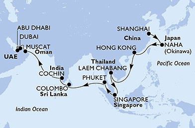
Bonjour
Je reviens sur le forum après quelques mois de "pause " .
J'ai réservé cette croisière pour fêter mon départ à la retraite .
En dehors des toutes dernières escales , Mascate , Abu Dhabi et Dubai , toutes les autres sont des grandes premières .
J'espère que certains membres du forum qui ont déjà fait ces escales pourront m'aider à les préparer .
Personne n'est inscrit sur le calendrier pour cette croisière mais cette discussion va peut être stimuler certains participants à se faire connaître .
Bien cordialement Claudine
Qui part pour les Caraïbes à bord du Musica le 3 décembre 2013? English translation pending
Bonsoir à tous, je fais ce post pour savoir qui partira pour les Caraibes le 3 décembre 2013 afin de préparer ce voyage au mieux et si possible discuter ensembles de nos futures escales et apporter vos expériences du MSC MUSICA que je ne connais pas encore.
Les autres départs sont les bienvenus bien-sur.
Amitiés à tous les croisiéristes.
😛 😎
Calendrier des départs en croisière des membres VF 2015 English translation pending
LANCEMENT CALENDRIER DEPARTS CROISIERES 2015
Comme certains le demandent déjà, je lance le calendrier pour 2015.
AVIS aux membres VF : ne jamais citer une mise à jour !!! Cela créé une confusion pour tous les membres !!!
· Regardez TOUJOURS la dernière mise à jour !!! Comme je suis de plus en plus sollicitée pour la raison que des membres ne retrouventpas la dernière mise à jour, en plus des mises à jour misent en ligne içi comme d'habitude, je ferai une sauvegarde internet dans quelques temps sur mon blog de préparatifs de croisière à cette adresse (rubrique : calendrier des départs en croisière) : http://partir.blog.free.fr.blog.free.fr/index.php?
· Echangez vos infos en MP et pas sur ce post SVPmerci !!! · Mais vous pouvez signalez votre croisière sur cepost ou en MP bien sûr en respectant au possible le format du calendrier lorsde votre inscription (date – pseudo (nationalité) / compagnie + nom dubateau / nombre de jours / secteur de la croisière (départ de la croisière). Merci par avance de me faciliter le travail !!! DernièresInformations: Ø -Total actuel de croisières/membres = 1 !!! Ø - 1 nouvelle(s) information(s) en gras dans la liste(N’hésitez pas à échanger vos infos) !!!
JANVIER (0 Croisière(s)de membre(s))
FEVRIER (1 Croisière(s)de membre(s))
15 - Ericat1505 (FR) / COSTA Diadema / 8 jours / Méditerranée(Marseille)
MARS (0 Croisière(s)de membre(s))
AVRIL (0 Croisière(s)de membre(s))
MAI (0 Croisière(s)de membre(s))
JUIN (0 Croisière(s)de membre(s))
JUILLET (0 Croisière(s)de membre(s))
AOUT (0 Croisière(s)de membre(s))
SEPTEMBRE (0 Croisière(s)de membre(s))
OCTOBRE (0 Croisière(s)de membre(s))
NOVEMBRE (0 Croisière(s)de membre(s))
DECEMBRE (0 Croisière(s)de membre(s))
Comme certains le demandent déjà, je lance le calendrier pour 2015.
AVIS aux membres VF : ne jamais citer une mise à jour !!! Cela créé une confusion pour tous les membres !!!
· Regardez TOUJOURS la dernière mise à jour !!! Comme je suis de plus en plus sollicitée pour la raison que des membres ne retrouventpas la dernière mise à jour, en plus des mises à jour misent en ligne içi comme d'habitude, je ferai une sauvegarde internet dans quelques temps sur mon blog de préparatifs de croisière à cette adresse (rubrique : calendrier des départs en croisière) : http://partir.blog.free.fr.blog.free.fr/index.php?
· Echangez vos infos en MP et pas sur ce post SVPmerci !!! · Mais vous pouvez signalez votre croisière sur cepost ou en MP bien sûr en respectant au possible le format du calendrier lorsde votre inscription (date – pseudo (nationalité) / compagnie + nom dubateau / nombre de jours / secteur de la croisière (départ de la croisière). Merci par avance de me faciliter le travail !!! DernièresInformations: Ø -Total actuel de croisières/membres = 1 !!! Ø - 1 nouvelle(s) information(s) en gras dans la liste(N’hésitez pas à échanger vos infos) !!!
JANVIER (0 Croisière(s)de membre(s))
FEVRIER (1 Croisière(s)de membre(s))
15 - Ericat1505 (FR) / COSTA Diadema / 8 jours / Méditerranée(Marseille)
MARS (0 Croisière(s)de membre(s))
AVRIL (0 Croisière(s)de membre(s))
MAI (0 Croisière(s)de membre(s))
JUIN (0 Croisière(s)de membre(s))
JUILLET (0 Croisière(s)de membre(s))
AOUT (0 Croisière(s)de membre(s))
SEPTEMBRE (0 Croisière(s)de membre(s))
OCTOBRE (0 Croisière(s)de membre(s))
NOVEMBRE (0 Croisière(s)de membre(s))
DECEMBRE (0 Croisière(s)de membre(s))
Qui fait la croisière de Dubaï à Yokohama sur le MSC Splendida le 31 mars 2018? English translation pending
qui fait la croisière de Dubai à Yokohama sur le MSC Splendida le 31 mars 2018??
Compte rendu de croisière sur le MSC Musica aux Caraïbes en décembre 2013 English translation pending
Bonjour a tous , je vais commencé mon CR sur la croisière sur le MSC musica aux caraïbes et être le plus précis possible, j'ai regroupée les journées pour ouvrir un post et l’avoir en 1 seule fois pour une meilleur lecture pour tout le monde. bonne lecture...
Le 17 décembre :
Jour de départ, levé à 4h30, petit déjeuner express pour être à l’aéroport de saint Exupéry de Lyon a 5h30, notre vol de pré acheminement décolle 7H40 de Lyon pour Orly. Notre avion est un avion canadien...le Bombardier CRJ 700 de air France connu avec son logo HOP ! sur l’avion, petit d’extérieur mais très bien a l’intérieur avec 2 rangés de 2 places , spacieux moi qui pensait être serré a l’intérieur, j’ai été agréablement surpris et pour 1 heure de vol jusqu'à Pari Orly nous avons eu en plus un petit déjeuner super !!!
Arrivée a Orly a 8h 40, on ne s’occupe pas de nos valises en soute , elles vont être transféré automatiquement dans l’avion pour Fort de France. Nous occupons le temps comme nous le pouvons car notre avion est a 13h20 donc shopping et librairie et nous achetons des casse croute pour midi mais comme nous tournons en rond, le repas de midi est avalé a 10h30 mdrrr pour passé le temps.
Nous passons la porte pour attendre notre avion qui est un boeing 777-300 ER de 468 places a 11h45 et a l’intérieur Dutty Free et même des console PS3 pour patienter super je n’avais jamais vu cela dans un aéroport. J’achète une cartouche de mon tabac dans le Dutty Free et a 13h20 l’avion a 30 minutes de retard sur l’horaire prévu mais a 14h00 nous décollons enfin d’Orly. Après 1 h de vol, le personnel commence a servir un déjeuner qui a mon gout a été super : Entrée, plat chaud, fromage, désert, vin, boisson fraiche, petite bouteille de rhum vieux ambrée de 4 cl et café vraiment très bien. Je me met un film sur l’écran ou il y a un grand choix de musique, reportages et films et après 3 heures de vol je dois me levé car je dois dégourdir mes jambes et la une petite anecdote commence ou je fais connaissance de 2 martiniquais très sympa qui travaille sur Orly et connaissent tous le personnel a bord et m’invite a boire avec eux un peu de whisky puis de verre en verre nous avons passé 4 h ensemble dans une super ambiance que je vous laisse imaginé après 4 h a siroté des whisky mdrrr, le temps est passé très vite car super ambiance et une collation aussi est servi avant d’atterrir environ 1h avant. Arrivée a l’heure a l’aéroport de Fort de France a 17h05, nous attendons environ 30 minutes nos valises et enfin dans le car ou nous attendons encore 30 minutes avant de partir pour le port ou nous avons laissez nos valises que nous avons retrouvé plus tard devant notre porte de chambre.
Il fait déjà nuit et au port, serpentin MSC et après passé a la validation de la carte MSC de bord que je n’est pas fait a l’intérieur du bateau mais a l’extérieur formalité habituelle , nous sommes enfin sur le MUSICA ou nous nous retrouvons avec Armelle et Christophe a notre point de RDV que nous nous étions fixé a la réception, nous commençons a discuté de leur croisière qu’ils avait passé car eux finissent la croisière le lendemain a Pointe a Pitre.
Un Antillais s’approche de moi pour me vendre des tickets d’eau qu’il n’avait pas consommé et comme il partait le lendemain il voulait s’en séparé pour 10 euros mais après m’être informé ça ne pouvait pas fonctionnée car pas le même numéro de chambre sois disant. Ok donc il repart et revient 10 minutes plus tard et me dit de toute façon je vous les donne je ne sais pas quoi en faire moi comme je ne paye rien, je les prend on verra bien et 10 tickets de bouteilles d’eau je n’est eu aucun soucis a les passé, surtout au buffet de midi jusqu'à épuisement du carnet.
Super la croisière commence bien pourvue que ça dur puis nous allons boire un Cocktail avec Armelle et Christophe qui était super sympa et je leur passe le bonjour, s’il lisent ces lignes dommage qu’il quittent le bateaux le lendemain(mais nous aurons encore beaucoup a parlé ensemble car nous faisons la même croisière cet été sur le MSC fantasia pour les île grecques mais a 2 semaines d’intervalle lol). Puis nous allons a notre chambre et nous n’irons pas au diner nous sommes trop fatigué donc une douche et au lit pour le lendemain être en forme.
Le 17 décembre :
Jour de départ, levé à 4h30, petit déjeuner express pour être à l’aéroport de saint Exupéry de Lyon a 5h30, notre vol de pré acheminement décolle 7H40 de Lyon pour Orly. Notre avion est un avion canadien...le Bombardier CRJ 700 de air France connu avec son logo HOP ! sur l’avion, petit d’extérieur mais très bien a l’intérieur avec 2 rangés de 2 places , spacieux moi qui pensait être serré a l’intérieur, j’ai été agréablement surpris et pour 1 heure de vol jusqu'à Pari Orly nous avons eu en plus un petit déjeuner super !!!
Arrivée a Orly a 8h 40, on ne s’occupe pas de nos valises en soute , elles vont être transféré automatiquement dans l’avion pour Fort de France. Nous occupons le temps comme nous le pouvons car notre avion est a 13h20 donc shopping et librairie et nous achetons des casse croute pour midi mais comme nous tournons en rond, le repas de midi est avalé a 10h30 mdrrr pour passé le temps.
Nous passons la porte pour attendre notre avion qui est un boeing 777-300 ER de 468 places a 11h45 et a l’intérieur Dutty Free et même des console PS3 pour patienter super je n’avais jamais vu cela dans un aéroport. J’achète une cartouche de mon tabac dans le Dutty Free et a 13h20 l’avion a 30 minutes de retard sur l’horaire prévu mais a 14h00 nous décollons enfin d’Orly. Après 1 h de vol, le personnel commence a servir un déjeuner qui a mon gout a été super : Entrée, plat chaud, fromage, désert, vin, boisson fraiche, petite bouteille de rhum vieux ambrée de 4 cl et café vraiment très bien. Je me met un film sur l’écran ou il y a un grand choix de musique, reportages et films et après 3 heures de vol je dois me levé car je dois dégourdir mes jambes et la une petite anecdote commence ou je fais connaissance de 2 martiniquais très sympa qui travaille sur Orly et connaissent tous le personnel a bord et m’invite a boire avec eux un peu de whisky puis de verre en verre nous avons passé 4 h ensemble dans une super ambiance que je vous laisse imaginé après 4 h a siroté des whisky mdrrr, le temps est passé très vite car super ambiance et une collation aussi est servi avant d’atterrir environ 1h avant. Arrivée a l’heure a l’aéroport de Fort de France a 17h05, nous attendons environ 30 minutes nos valises et enfin dans le car ou nous attendons encore 30 minutes avant de partir pour le port ou nous avons laissez nos valises que nous avons retrouvé plus tard devant notre porte de chambre.
Il fait déjà nuit et au port, serpentin MSC et après passé a la validation de la carte MSC de bord que je n’est pas fait a l’intérieur du bateau mais a l’extérieur formalité habituelle , nous sommes enfin sur le MUSICA ou nous nous retrouvons avec Armelle et Christophe a notre point de RDV que nous nous étions fixé a la réception, nous commençons a discuté de leur croisière qu’ils avait passé car eux finissent la croisière le lendemain a Pointe a Pitre.
Un Antillais s’approche de moi pour me vendre des tickets d’eau qu’il n’avait pas consommé et comme il partait le lendemain il voulait s’en séparé pour 10 euros mais après m’être informé ça ne pouvait pas fonctionnée car pas le même numéro de chambre sois disant. Ok donc il repart et revient 10 minutes plus tard et me dit de toute façon je vous les donne je ne sais pas quoi en faire moi comme je ne paye rien, je les prend on verra bien et 10 tickets de bouteilles d’eau je n’est eu aucun soucis a les passé, surtout au buffet de midi jusqu'à épuisement du carnet.
Super la croisière commence bien pourvue que ça dur puis nous allons boire un Cocktail avec Armelle et Christophe qui était super sympa et je leur passe le bonjour, s’il lisent ces lignes dommage qu’il quittent le bateaux le lendemain(mais nous aurons encore beaucoup a parlé ensemble car nous faisons la même croisière cet été sur le MSC fantasia pour les île grecques mais a 2 semaines d’intervalle lol). Puis nous allons a notre chambre et nous n’irons pas au diner nous sommes trop fatigué donc une douche et au lit pour le lendemain être en forme.
Tour du monde austral 2013-2014 en croisière sur le Costa neoRomantica English translation pending
Bonjour à tous,
Voilà c'est fait, nous avons réservé notre billet pour le tour du monde austral du NeoRomantica qui partira le 21 Septembre 2013 pour un retour le 21 Janvier 2014.
Si nous avons encore en tête les moments enchanteurs que nous avons vécu lors du précédent tour du monde, l'appel au large et à la découverte a été le plus fort.
L'originalité du circuit totalement différent a fini de nous convaincre (s"il en était tant soit peu nécessaire).
Nous rêvons déjà aux principaux temps forts qui vont marquer ce voyage:
La remontée du fleuve Amazone jusqu'à Manaus, Les îles Malouines, Ushuaia, Le cap Horn, L'île de Pâques, Tahiti, Bora Bora, et Moorea, La Nouvelle Zélande et l'Australie que nous retrouverons avec plaisir, Maurice et la Réunion, L'Afrique l'île de Sainte Hélène, etc.
123 jours, mais avec la ligne de changement de date cela fera 122 au final.
Le bateau est quasiment complet, il le sera d'ici quelques jours. Après seuls les désistements permettront à certains de partir.
Ce fil a pour but essentiel d'échanger sur le programme à venir, et en particulier au niveau des excursions.
Je garde un excellent souvenir de notre bande de copains Voyage Forum, que nous avions formé lors du précédent TDM sur le Costa Deliziosa. Cela a contribué très largement à la réussite de notre croisière au long cours, et aux bons souvenirs que nous en gardons.
Si d'autres membres VF ont effectué la même réservation, je serai ravi de pouvoir échanger avec eux.
À bientôt, j'espère
Christian
Voilà c'est fait, nous avons réservé notre billet pour le tour du monde austral du NeoRomantica qui partira le 21 Septembre 2013 pour un retour le 21 Janvier 2014.
Si nous avons encore en tête les moments enchanteurs que nous avons vécu lors du précédent tour du monde, l'appel au large et à la découverte a été le plus fort.
L'originalité du circuit totalement différent a fini de nous convaincre (s"il en était tant soit peu nécessaire).
Nous rêvons déjà aux principaux temps forts qui vont marquer ce voyage:
La remontée du fleuve Amazone jusqu'à Manaus, Les îles Malouines, Ushuaia, Le cap Horn, L'île de Pâques, Tahiti, Bora Bora, et Moorea, La Nouvelle Zélande et l'Australie que nous retrouverons avec plaisir, Maurice et la Réunion, L'Afrique l'île de Sainte Hélène, etc.
123 jours, mais avec la ligne de changement de date cela fera 122 au final.
Le bateau est quasiment complet, il le sera d'ici quelques jours. Après seuls les désistements permettront à certains de partir.
Ce fil a pour but essentiel d'échanger sur le programme à venir, et en particulier au niveau des excursions.
Je garde un excellent souvenir de notre bande de copains Voyage Forum, que nous avions formé lors du précédent TDM sur le Costa Deliziosa. Cela a contribué très largement à la réussite de notre croisière au long cours, et aux bons souvenirs que nous en gardons.
Si d'autres membres VF ont effectué la même réservation, je serai ravi de pouvoir échanger avec eux.
À bientôt, j'espère
Christian
Voyage en autostop et camping sauvage au Danemark English translation pending
Bonjour à tous !
J'aurais besoin de conseils pour un futur voyage lowcost au Danemark ! Après mon stage, mon copain me rejoint dans le Nord de l'Allemagne et on se prévoit 8-10 jours à partir du 18 juillet pour aller de Brême jusque Skagen, tout au Nord de la partie continentale du pays. On ne prévoit que deux arrêts en Allemagne (Hambourg et peut-être Kiel) puis directement la côte Est du Danemark ! On a bien envie de faire ça en auto-stop, camping sauvage et Couchsurfing en ville. Est-ce que le pays s'y prête bien ? Y a-t-il des coins à conseiller ou déconseiller ? Des adresses (auberges, hôtels) à recommander ? Des alternatives niveau transport au cas où le stop ne fonctionne pas, comme des bus ? Est-ce que ma vie y est si chère qu'on le dit, même pour les voyageurs comme nous ?
Je précise qu'on a déjà voyagé comme ça au Québec et en Italie.
Merci d'avance !
Alexandra
J'aurais besoin de conseils pour un futur voyage lowcost au Danemark ! Après mon stage, mon copain me rejoint dans le Nord de l'Allemagne et on se prévoit 8-10 jours à partir du 18 juillet pour aller de Brême jusque Skagen, tout au Nord de la partie continentale du pays. On ne prévoit que deux arrêts en Allemagne (Hambourg et peut-être Kiel) puis directement la côte Est du Danemark ! On a bien envie de faire ça en auto-stop, camping sauvage et Couchsurfing en ville. Est-ce que le pays s'y prête bien ? Y a-t-il des coins à conseiller ou déconseiller ? Des adresses (auberges, hôtels) à recommander ? Des alternatives niveau transport au cas où le stop ne fonctionne pas, comme des bus ? Est-ce que ma vie y est si chère qu'on le dit, même pour les voyageurs comme nous ?
Je précise qu'on a déjà voyagé comme ça au Québec et en Italie.
Merci d'avance !
Alexandra
Danemark: transporter son vélo en train English translation pending
Bonjour😏,
Je souhaiterais faire une escapade de 5 jours à vélo au Danemark avec ma fille de 13 ans au mois de mai 2013. Nous devons rejoindre Copenhague en train depuis la Belgique. J'ai un vélo de randonnée Koga (non-pliable) et ma fille prendra un brompton (pliable). Je ne veux pas démonter mon Koga, car je serai incapable de le remonter correctement ... Est-ce possible de prendre ces vélos sur le train ? Si vous avez déjà fait le trajet Liège ou Bruxelles-Copenhague en train avec des vélo, votre expérience m'intéresse vraiment, quel type de train avez-vous pris ? Merci d'avance pour vos réponses 🙂!
Gene
Je souhaiterais faire une escapade de 5 jours à vélo au Danemark avec ma fille de 13 ans au mois de mai 2013. Nous devons rejoindre Copenhague en train depuis la Belgique. J'ai un vélo de randonnée Koga (non-pliable) et ma fille prendra un brompton (pliable). Je ne veux pas démonter mon Koga, car je serai incapable de le remonter correctement ... Est-ce possible de prendre ces vélos sur le train ? Si vous avez déjà fait le trajet Liège ou Bruxelles-Copenhague en train avec des vélo, votre expérience m'intéresse vraiment, quel type de train avez-vous pris ? Merci d'avance pour vos réponses 🙂!
Gene