Alpine loop road entre Ouray et Silverton par Animas Forks n'est-elle seulement praticables que par des 4x4?
L'Alpine Loop comporte plusieurs sections : pour aller de Ouray à Animas Fork il faut un 4x4 pour aller de Silverton à Animas Fork, une voiture classique peut sufffire en faisant attention. de Animas Fork à Lake City, pour faite le loop que ce soit par le nord (Engineer pass) ou le sud (Cinnamon Pass) il faut un 4x4, seules les parties à l'Est du côté de lake City étant goudronnées ou "graded" donc passables par des voitures classiques.Philippe
www.phschuler.com et www.ouestusa.fr, pour une vision de l'Ouest en dehors des sentiers battus.
Carnet de voyage Ouest USA 2009
Sur certains sites du Colorado, ils laissent supposer que tout véhicule peut circuler entre Ouray et Silverton.
Sur Photographing The Southwest vol 3, Laurent Martrès est beaucoup plus restrictif.
Quant aux vidéos de " You tube ", je suis restée dans l'expectative.
Sur certains sites du Colorado, ils laissent supposer que tout véhicule peut circuler entre Ouray et Silverton.
Bien sûr... mais par la route goudronnée 550 car en réalié pas mal de gens font le loop d'Animas Fork (d'où on peut à la fois se rendre à Engineer Pass par une piste moins difficile que celle venant de Ouray, et également à Cinnamon Pass). Ensuite, ils vont à Silverton par la bonne piste puis à Ouray par la route.
Sur Photographing The Southwest vol 3, Laurent Martrès est beaucoup plus restrictif.
Oui, c'est clair : de la page 148 à 150 il conseille bien un SUV 4x4 pour l'Alpine Loop car si c'est surtout le "high clearance" qui compte davantage que la fonction 4x4, celle ci peut être utile si tu patines par exemple dans une côte sur la piste mouillée ou avec des restes de neige ou sur une section rocheuse avec des caillous tombés de la montagne...
Pour les pistes dans le secteur Silverton / Ouray décrites à la page 142 (que je connais bien car c'est moi qui ait écrit cette page), c'est la même chose je ne le ferai pas sans 4x4 (pour les raisons précédemment évoquées et parce que dans le bas des pistes côté Ouray il y a des ornières pouvant être boueuses).
Philippe
www.phschuler.com et www.ouestusa.fr, pour une vision de l'Ouest en dehors des sentiers battus.
Carnet de voyage Ouest USA 2009
L'Alpine Road me tente beaucoup et de plus nous traverserons cette région au moment de la pleine floraison ( les photos de Ice lake Basin font rêver les botanistes), je suis persuadée aussi de la richesse de la faune.
En fonction des conditions météorologiques, nous aviserons.
Autre question: où puis-je trouver les cartes "National Geographic"dont tout le forum parle? Possèdent-elles des courbes de niveaux comme les IGN?
A part le site Trail.com, où pourrais-je trouver des cartes détaillées de" randonnées hors parcs nationaux" aux USA et au Canada ?
En août 2007, nous avons fait la boucle Durango, Silverton, Hurricane Pass, Anima's Fork, Cinnamon Pass, nuit au Miller Creek campground. (Le lendemain, Lake City, Creede, Grand Sand Dunes, piste de Medano Pass et nuit au Hill Side Campground). Nous avions une Jeep Grand Cherokee V6. C'est le 4x4 de location qui offre la garde au sol la plus confortable avec la Jeep Liberty (appelée Cherokee en France). Ce n'était pas de trop dans quelques passages rocheux de la descente de Cinnamon Pass... La difficulté provient surtout de l'altitude exceptionnelle de ces cols (3800 m !) qui essouffle même les gros moteurs américains. Il n'y avait pas de gamme courte sur notre 4x4 et nous avons fini les derniers mètres à l'agonie ! En cas de doute, les bureaux des National Forest peuvent vous conseiller utilement. C'était le cas à Silverton où le Ranger de service nous à conseillé pour notre itinéraire jusqu'à Grand Sand Dunes en nous recommandant les prairies de Cinnamon Pass, malheureusement un peu " fanées" aussi tard dans la saison...
Bonsoir Oldcruiser.
On envisage de faire un peu comme toi, mais dans le désordre!
Quid de la piste de Medano Pass? Le sable est-il vraiment profond?
Je ne vois pas où est le Hillside campground.
Jusqu'où avez-vous suivi la piste de Medano Pass?
A propos du Miller Creek campground, y avait-il du monde? Peut-on espérer y trouver de la place en n'arrivant pas très tôt?
Tout d'abord les références d'un site excellent sur les pistes de l'ouest www.Damage.com
Le départ de Medano Pass est effectivement assez ensablé pendant un à deux kilomètres. Avec un peu d'expérience et un 4x4 puissant il n'y a pas de difficulté notable. Ensuite, la piste se faufile dans la forêt avec une demi douzaine de gués à franchir, le premier étant le plus profond : environ 60 cm en août. Sur l'autre versant, on sort rapidement de la forêt pour longer d'immenses parcs à bisons ! Hill Side se trouve sur la highway 69 entre Westcliffe et Texas Creek. Une région vraiment perdue où 3 maisons suffisent à faire un village noté sur la carte des USA !
Le Miller Creek campground offre une vingtaine d'emplacements au bord du ruisseau avec une cabane WC chimique et quelques pompes à main pour pomper l'eau dans la nappe phréatique. Une demi douzaine d'emplacements étaient occupés par des randonneurs motorisés. Nous avons mangé le soir, entourés de cerfs et de biches ! Nos voisins, impressionnés par notre cuisine "élaborée" (selon les standards américains 😏) nous ont gentiment mis en garde au sujet des ours qui visitent régulièrement le camping et nous ont recommandé d'enfermer la nourriture ( comme presque partout dans les montagnes rocheuses).
Je vous recommande de vous trouver à Silverton en fin de matinée, à l'arrivée du train à vapeur historique. Un décor de Western en live !
nous traverserons cette région au moment de la pleine floraison ( les photos de Ice lake Basin font rêver les botanistes), je suis persuadée aussi de la richesse de la faune.
Tu as raison de vouloir y aller en pleine floraison, c'est magnifique.
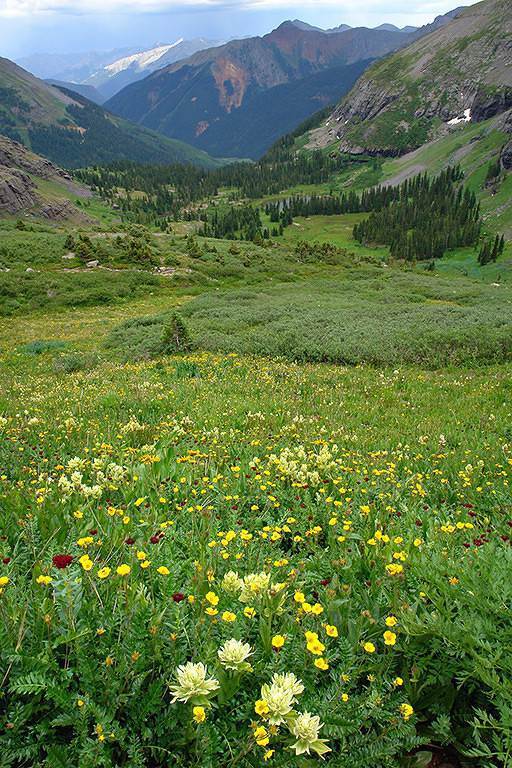
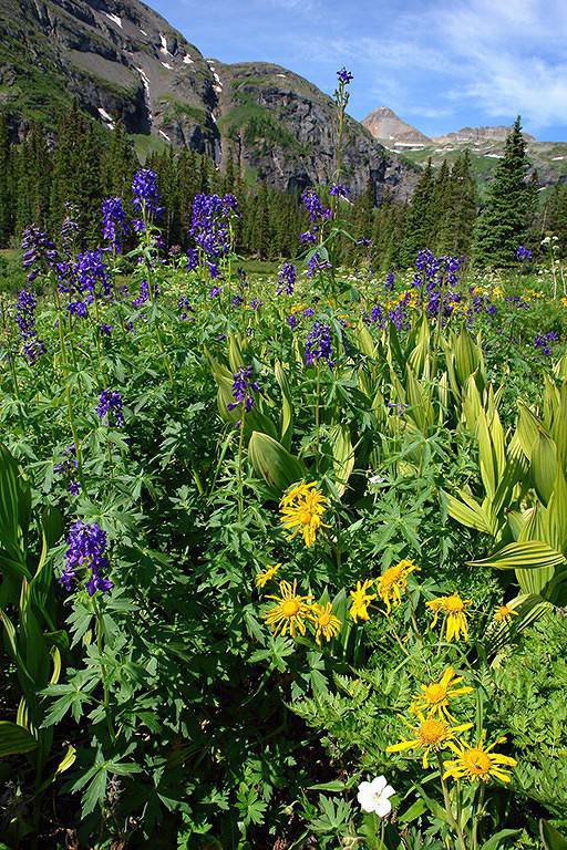
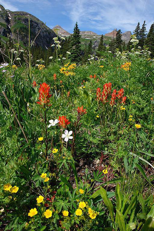
Nous avons randonné à Ice Lake Basin en juillet 2006 et je t'ai mis ci dessous quelques photos sur l'aspact flore / faune que je n'ai pas encore mises sur mon site web.
Sur l'Alpine loop c'est American Basin qui est l'endroit le plus réputé pour la flore.
J'en ai quelques photos ici sur la première ligne (également prises en juillet 2006).
Une majorité des photos de flore ici et là ont également été prises à Ice lake Basin ou à American Basin.
Autre question: où puis-je trouver les cartes "National Geographic"dont tout le forum parle? Possèdent-elles des courbes de niveaux comme les IGN?
Oui ce sont des cartes topographiques au 1/24000 avec courbes de niveau et relief comme les cartes IGN. En voila un exemple ici pris au hasard sur OuestUsa.fr.
Voici un lien sur le produit concernant le Colorado tel qu'il est vendu sur Amazon.com. Je ne sais pas où l'acheter en France, ceux de mes amis qui en disposent les ont achetées sur place aux USA.
A part le site Trail.com, où pourrais-je trouver des cartes détaillées de" randonnées hors parcs nationaux" aux USA et au Canada ?
Le site principal (malheureusement payant) est effectivement Trails.com mais on trouve des cartes détaillées au hasard des sites web où des passionnés décrivent les randonnées qu'ils ont faites : sur OuestUsa.fr nous avons mis un certain nombre, on en trouve sur des sites américains comme par exemple celui ci pour l'Utah et aussi sur des sites allemands comme celui ci.
Philippe
www.phschuler.com et www.ouestusa.fr, pour une vision de l'Ouest en dehors des sentiers battus.
Carnet de voyage Ouest USA 2009
Nous n'avions pas prévu de nous attarder car c'était une "simple étape de liaison" à la fin du voyage. Un grand triangle Denver-Yellowstone- Las Vegas-Denver en 4 semaines et pour un premier séjour ! Nous avions particulièrement apprécié la verdure et la fraîcheur du Colorado aprés 2 semaines "à la dure" dans les déserts de l'Utah.
Il s'agit bien sûr de traildamage 😊
Au sujet des cartes, des amis américains nous avaient recommandé la librairie Mapsco à Denver. Information non testée ni validée...
Le petit camping dont je parle se trouve au Sud Ouest Lake City. Sur la carte Google Earth, on peut le voir au Sud Ouest de San Cristobal Lake, c'est la petite boucle au sud de la piste vers Anima's Fork par le Cinnamon Pass. Le camping est accessible par un pont sur le torrent.
Je vois que tu es un adepte de 4x4 et pas uniquement aux US...
J'ai également conduit un SUV 4x4 sur les pistes autour de Silverton (Silverton à Animas Fork via Hurricane Pass et California Pass, Silverton à Ouray via red Mountain / Corscrew gulch, Alpine loop sud via Cinnamon Pass). Finalement le Chervrolet Trailblazer 4x4 (avec vitesses courtes) ne s'est pas essouflé dans les hauteurs et malgré sa médiocre garde au sol je n'ai frotté qu'une seule fois.
De mon côté je ne trouve pas que la "Jeep Grand Cherokee de location offre la garde au sol la plus confortable" car depuis le modèle 2005 la garde au sol n'est plus que de 20cm (heureusement compensée par des bons angles et un bon débattement de suspension) alors que sur les Nissan XTerra et Toyota 4Runner (également proposés par certains loueurs) elle est d'environ 3cm supplémentaire (ce qui peut compter). Le problème de la Jeep Grand Cherokee est que c'est un véhicule plus cher que les 4x4 Japonais cités précédemment et que pour faire des économies les loueurs ne prennent quasiment jamais l'option 4x4 avec vitesses courtes (Quadratrac II) "trailrated" (je n'ai réussi à l'avoir qu'une seule fois alors qu'à chaque fois je regarde si ce modèle est disponible sur tout le parking du loueur, avec les Nissan Xterra et Toyota 4Runner elle y est systématiquement) et ils ne proposent que le modèle AWD (Quadratrac 1). Comme maintenant le modèle Laredo de base (sans option) est purement 2WD (même pas AWD), il faudra faire attention que ce ne soit pas ce modèle qui soit désormais proposé par économie si on veut prendre des pistes autres que très faciles. Dommage, car la Jeep Grand Cherokee est un très bon véhicule si on ne lui retire pas les options nécessaires pour des pistes avec quelques difficultés (dans le cas où on souhaite les prendre bien sûr).
Philippe
www.phschuler.com et www.ouestusa.fr, pour une vision de l'Ouest en dehors des sentiers battus.
Carnet de voyage Ouest USA 2009
Tes photographies ne peuvent que nous inciter à aller randonner dans cet endroit paradisiaque.
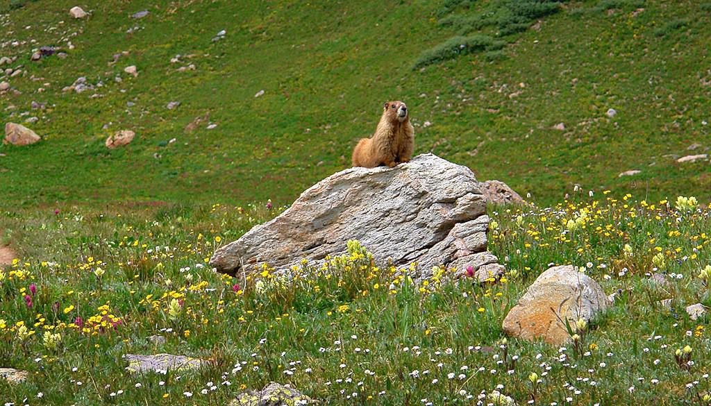
Ta marmotte, aux aguets, me rappelle une de ses congénères pyrénéennes que nous avons photographiée lors d'une de nos ballades, mais la morphologie de la tienne me surprend par sa taille et sa grosseur.
Quant aux fleurs, quel bonheur !!!
Pour le lien des cartes, encore merci, je vais étudier cela demain.
alors tu vas descendre dans les San Juan Mountains,
est-ce les splendides photos de nos amis Sedonax et Wavemaster qui te donnent envie d'affronter ces pistes caillouteuses ou as-tu découvert des ghosttowns dans le voisinage?
Salut Anne,
Eh bien.... c'est difficile de faire des choix avec tous ces endroits que Philippe et Thierry nous donnent envie de découvrir!
Disons que j'ai bien envie de voir un peu à quoi ressemblent les Rocheuses et aussi d'introduire un peu de variété dans notre circuit par ailleurs très orienté "cailloux"!
Et... en effet il y a aussi des ghosttowns dans le coin, ce qui ne gâche rien!
Mais je pense qu'on ira par là que s'il fait beau, croisons les doigts!
C'est une très belle région, photogénique en été à la saison des wildflowers mais également à l'automne dans les secteurs avec des futaies d'aspens.
J'en ai des centaines de photos prises à l'été 2006 et à l'automne 2007, à trier puis à sélectionner et traiter pour les mettre sur le web... mais je me demande bien quand j'aurai le temps de le faire. Au moins ta question m'a poussé à le faire pour 5 d'entre elles 😛.
Philippe
www.phschuler.com et www.ouestusa.fr, pour une vision de l'Ouest en dehors des sentiers battus.
Carnet de voyage Ouest USA 2009
Hier, je n'avais pas eu le temps de regarder tes liens .
Merci pour les renseignements sur les cartes, effectivement c'est ce que je recherche;
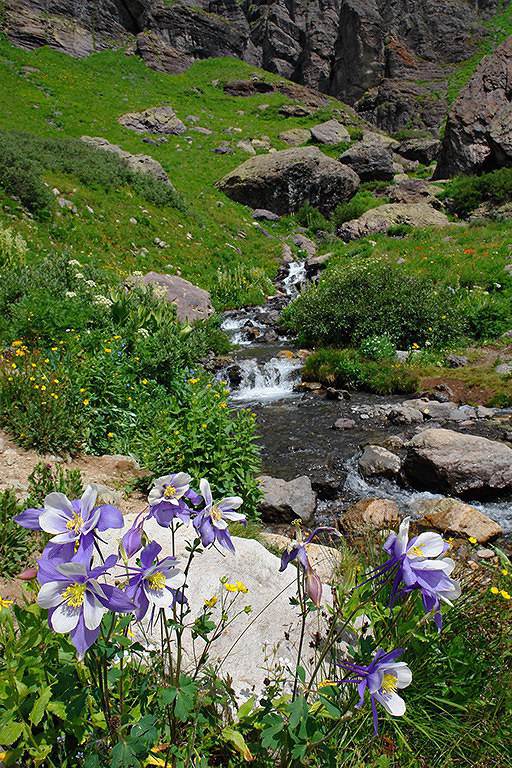
Quant à tes photos de fleurs, tu vas faire pâlir beaucoup de photographes, j'ai reconnu un certain nombre de fleurs qui fleurissent en juillet dans nos vallées alpines : les colombines font partie de la famille des renonculacées, connues en France sous le nom latin Aquilegia ( Ancolie), les fleurs au bleu si intense semblent être du delphinium, j'ai admiré aussi tes asters bleu-violet et aussi tes pieds d'arnica des montagnes.
Ce weed-end, je vais essayer d'identifier trois plantes que je n'ai jamais rencontrées, peut-être ce sont des plantes endémiques.
Jeudi soir, je n'ai pas eu le temps de te répondre.
Moi aussi, je croise les doigts pour San Juan mountains et les parcs du Wyoming, car la montagne perd beaucoup de charme sous la pluie sauf si on lit un bon bouquin près d'un feu de bois.
Je pense à Grisemote lorsqu'elle a passé une journée, à bord du ferry de l'Inside Passage : pluie et aucune vue, c'est rageant !!!
Avec tous vos carnets, et nos amis baroudeurs, nous ne sommes pas prêts à nous arrêter de voyager et surtout de rêver.
A propos, prépares-tu ta ballade dans le grand nord européen?
Salut Anne,
Eh bien je virevolte entre les USA et la Suède, au fil des idées qui me passent par la tête!
Je viens de me dire que ce serait super de voir la mer baltique gelée alors je cogite car j'ai loué un chalet pour 10 jours mais... dans les montagnes!
Je crois qu'on va faire une petite virée à la mer et là aussi j'espère qu'on aura un temps corrrect!
Je crois qu'on se décidera le plus tard possible en fonction de la météo...
Bonjour,
Voici ce que j'ai trouve pour remplacer Topozone qui a ete rachete par Trail . com et qui est maintenant payant comme vous le disez.
http://mapper.acme.com/
C'est encore mieux!!!
Attention aux cates USGA (topographiques)). Elles datent parfois des annees 50 ou meme avant? et donc ne sont pas actuelles. Il y a maintenant beaucoup plus de pistes du moins pour le sud de l'Arizona.
J'ai aussi note des erreurs pour les noms de lieux pour la section Terrain.(qui pourtant est bien jolie)
Bonne promenade virtuelle,
Francoise
Voici ce que j'ai trouve pour remplacer Topozone qui a ete rachete par Trail . com et qui est maintenant payant comme vous le disez.
http://mapper.acme.com/ C'est encore mieux!!!
Effectivement, je pense aussi que c'est le meilleur site pour explorer la topographie des US et c'est mieux que Topozone. Mais il est dommage qu'à l'mpression il n'ait pas la possibilité de voir apparaitre l'echelle et le point GPS des points marqués sur la carte, ce serait alors parfait quand on est en randonnée sur le terrain !
Pour ceux qui utilisent Google Earth et qui veulent y surafficher une carte topographique, il faut d'abord lancer Google Earth sur son poste puis se connecter à ce lien et cliquer sur "USGS topographic overlays". A certains niveaux de zoom, la carte topographique apparait par dessus les photos de Google Earth et on règle sa transparence par le curseur dans la fenêtre Lieux (si on ne veut plus de la carte topo on décoche la case USGS Topographic overlays). Par rapport à mapper.acme.com cela permet d'avoir accès à tous les objets affichables dans Google Earth, dont les photos et vidéos des internautes prises à des endroits précis (mais quelquefois placées à des endroits erronés).
Attention aux cates USGA (topographiques)). Elles datent parfois des annees 50 ou meme avant? et donc ne sont pas actuelles. Il y a maintenant beaucoup plus de pistes du moins pour le sud de l'Arizona.
Tu as raison, la majorité des cartes topo date des années 1980, il y a des pistes en plus et également des pistes qui ne sont plus praticables. Quand j'ai un doute, je vérifie toujours sur Google Maps ou Earth (si c'est une région avec un niveau de détail suffisant).
Bonne soirée
Philippe
www.phschuler.com et www.ouestusa.fr, pour une vision de l'Ouest en dehors des sentiers battus.
Carnet de voyage Ouest USA 2009
Hello! The itinerary is pretty much set for August 2026. Yeah, I know it’s gonna be *super* hot. But it’s the only time we can get away.
So, here’s the plan: Montpellier-CDG-Dallas.
Stay from July 31 to August 26, 2026:
Car rental – check,
Hotels – check,
Itinerary – almost check,
Photo gear – check,
Budget – check, 🤪
Meal planning – meh, we’ll see...
Walmart, of course, for the cooler when we arrive.
And now, without too much detail...
Fort Worth:
The Longhorns and the Stockyards;
JR’s ranch (for the missus);
Medal of Honor Museum – Arlington.
Houston and NASA Space Center:
See the Gulf of Mexico/America.
San Antonio and the missions.
Fort Stockton for an overnight stop.
El Paso via Guadalupe Mountains:
El Paso and White Sands.
Tucson and the Pima Air & Space Museum:
Tombstone, Bisbee.
Phoenix:
Still working on the program.
Sedona:
Round trip around the area via Flagstaff and Williams, or the Grand Canyon (already done) – we’ll decide on the spot.
Albuquerque:
Santa Fe,
Turquoise Trail,
Los Alamos.
Amarillo via Route 66:
Old Route 66 in the city;
Big Texas Ranch Steak 😏.
Dallas:
JFK Museum;
Perot Museum;
West End district.
And through it all – the road, the road, and more road!!!
We’ll adapt day by day based on our mental and physical state (we’re not exactly spring chickens).
hi everyone
I’m planning a world trip and I’m looking for great tips on accommodation in the United States.
Do you have any good deals to share, please?
thanks
Hello everyone! Really damaged due to flooding caused by runoff after forest fires (a total mess!), does anyone in this friendly forum have any updates on the Apache Trail between Apache Junction and Roosevelt Dam? Is there still a section of the road that’s tough to navigate?
We're leaving at the end of June and will be driving the route between Buffalo and Cody. We’ve already booked our accommodations and a rodeo in Cody, but during the day, we’ll be driving between the two and I’m unsure about the itinerary.
Which route do you think is the most pleasant, interesting, or scenic between:
- The northern route via Highway 14 with Sheridan, Lowell, etc.
- The southern route with Highways 16/20/14, passing by Loaf Mountain Overlook, Powder River Pass, Ten Sleep Canyon...
We’ll be in a car, so we should be able to drive on any road.
Thanks for your input!
I’m almost done planning our September road trip. After our 3-night visit to Sequoia, we’ll have a stopover night in Coalinga (to break up the drive). We’ll be staying two nights in Monterey and would like to stop along the way to visit one side of Pinnacles National Park. We’re torn between the West entrance and the East entrance, and we’d like to do a short hike of no more than 2 hours since we don’t want to arrive too late in Monterey.
This park is split into two distinct zones with no connection between them, and the mileage from Coalinga to Monterey is pretty much the same for both. Which area do you recommend visiting—east or west? And which route is the most scenic?
I’ve spotted two short hikes:
- East: Moses Spring to Rim Trail Loop
- West: Balconies Cliffs Cave Loop
Has anyone been there, or do you have another hike to suggest?
Thanks in advance, and have a great afternoon!
Marcalamar 🙂
After our first trip as a young couple to the West in 2007 (yes, that doesn’t make us any younger!), we’re planning to go back in 2028, but this time as a family of four! (We have two boys who’ll be 5½ and 13 years old in the summer of 2028.)
Our plan is to combine a few big cities (SF and LA, maybe San Diego) with national parks and state parks, mostly!
Ideally, we’d like to leave at the end of June and head back to France around July 19–20, so we can enjoy the first week of the Olympic Games in Los Angeles.
Since we already did the "loop" in 2007, there are must-see places we absolutely want to revisit—and especially share with our kids: Bryce Canyon, Yosemite, and above all, the Grand Canyon, which is still the most incredible thing I’ve ever seen on Earth!
On the other hand, some places didn’t leave a big impression on us for various reasons, so we’re not making them a priority: Antelope Canyon, Monument Valley, for example.
We’re planning ahead, but might as well be smart about it😏
Do you have any tips for a fun and doable itinerary over about 20–25 days with kids, without rushing?
Hi everyone! 🙂
Just a quick question about King Canyon and Sequoia National Park.
Before our night in Miramonte, we plan to visit King Canyon. The next stop will be two nights in Three Rivers to explore Sequoia National Park. I wanted to go all the way to Roaring River Falls on the King Canyon Scenic Byway and then turn back to head to Miramonte. Since we’re coming from Oakhurst, Google Maps says it’s 300 km and 5 hours of driving. Since we also want to hike to see the sequoias (Big Stump Area and Grand Grove) before tackling the King Canyon Scenic Byway, the timing’s going to be tight. How far do you recommend going before turning back to miss as few points of interest as possible on the King Canyon Scenic Byway? Thanks for your advice, and have a great evening!
Marcalamar 🙂
Hi everyone!
After years of hoping, waiting, planning, then changing, saving, and searching for the best possible route... we're FINALLY off this summer for a 5-week road trip in the West.
I had planned a trip to Colorado in 2021 but canceled due to COVID, so with time passing and my eldest’s high school graduation approaching fast, I figured it was now or never!
Anyway, the itinerary has been modified and extended to please everyone (I’m no longer the only one making decisions!!)
Here’s our final route:
Day 1 - 7/12/2026 - Brussels / Los Angeles
Day 2 - 7/13/2026 - Los Angeles
Day 3 - 7/14/2026 - Los Angeles
Day 4 - 7/15/2026 - Los Angeles
Day 5 - 7/16/2026 - Los Angeles
Day 6 - 7/17/2026 - Los Angeles / Kingman
Day 7 - 7/18/2026 - Kingman / Grand Canyon
Day 8 - 7/19/2026 - Grand Canyon / Page
Day 9 - 7/20/2026 - Page
Day 10 - 7/21/2026 - Page / Monument Valley
Day 11 - 7/22/2026 - Monument Valley / Durango
Day 12 - 7/23/2026 - Durango
Day 13 - 7/24/2026 - Durango
Day 14 - 7/25/2026 - Durango
Day 15 - 7/26/2026 - Durango / Glenwood Springs
Day 16 - 7/27/2026 - Glenwood Springs
Day 17 - 7/28/2026 - Glenwood Springs / Moab
Day 18 - 7/29/2026 - Moab
Day 19 - 7/30/2026 - Moab
Day 20 - 7/31/2026 - Moab
Day 21 - 8/1/2026 - Moab
Day 22 - 8/2/2026 - Moab / Vernal
Day 23 - 8/3/2026 - Vernal / Grand Teton
Day 24 - 8/4/2026 - Grand Teton
Day 25 - 8/5/2026 - Grand Teton / Cody
Day 26 - 8/6/2026 - Cody / Yellowstone
Day 27 - 8/7/2026 - Yellowstone
Day 28 - 8/8/2026 - Yellowstone
Day 29 - 8/9/2026 - Yellowstone
Day 30 - 8/10/2026 - Yellowstone / Salt Lake City
Day 31 - 8/11/2026 - Salt Lake City / Bryce Canyon
Day 32 - 8/12/2026 - Bryce Canyon / Zion
Day 33 - 8/13/2026 - Zion
Day 34 - 8/14/2026 - Zion
Day 35 - 8/15/2026 - Zion / Las Vegas
Day 36 - 8/16/2026 - Las Vegas
Day 37 - 8/17/2026 - Las Vegas / Los Angeles
Day 38 - 8/18/2026 - Los Angeles
Day 39 - 8/19/2026 - Los Angeles / Brussels
Day 40 - 8/20/2026 - Brussels / Home
We’ll be alternating between house swaps, motels, and campgrounds. I’ve booked all the accommodations (except the campground at Bryce since sunset bookings open only 14 days in advance) and the first activities, as well as the most touristy ones.
I’m currently putting together my day-by-day roadbook and having some trouble planning certain days, like in LA or Las Vegas. Choosing hikes isn’t easy either—it’s tough to decide!
We’re really excited but could definitely use your help with choices and optimizations!!
Hello.
I’d like to travel along I-15N from San Diego to Las Vegas with my mom, who’s 67. We’ve explored Northern California and the California Coast over the past two years and now want to continue through the desert.
There are several attractions along the way:
- Mormon Rocks
- Desert Discovery Center and visit the Old Woman meteorite
- Joshua Tree National Park
- Mojave Desert
- Mojave National Preserve
- Anza-Borrego Desert State Park
- Silverwood Lake
My mom has back issues that prevent her from hiking or walking on trails with elevation changes. Is it possible to visit these places by car, or are the routes flat enough?
I’d love for her to experience the desert with an itinerary adapted to her condition. I’m also open to other points of interest that aren’t mentioned. We have 3-4 days for the trip, so we’re not in a rush—just want to explore.
I’d love to take a road trip and visit Nova Scotia. I’d appreciate some info on the best cities to see and the most interesting spots. The trip should last about 10 to 15 days, staying in hotels or motels. Thanks in advance!
We’re being relocated to Saint Pierre and Miquelon.
We’ll be taking the flight from Nantes to Montreal and then from Montreal to Saint Pierre.
Could you recommend a hotel near the departure terminal that allows dogs?
Hi,
My 16-year-old son is flying to Grand Rapids with other kids his age. There’s a layover in Detroit. There’s no unaccompanied minor service available. Is it pretty easy to navigate Detroit Airport to catch the connecting flight to Grand Rapids (domestic flight)? There are several of them who speak English well.
Thanks for your replies,
Good evening, everyone! 🙂
Just a few last questions to wrap up our Lake Tahoe visit plans.
**Parking:**
We’d like to walk to Eagle Falls and then Eagle Lake. I’ve spotted two parking lots that seem close to each other and give access to the trailhead. Where and how do we pay for entry to Emerald Bay State Park and Inspiration Point?
**Viewpoints on the East Side:**
Are most of the viewpoints (Balancing Rock, Granite Cave, Bonsai Rock, etc.) right by the road, or do you have to hike to reach them?
**Donner Memorial State Park:**
Is it worth making a detour to Truckee to visit this park and the Truckee historic downtown?
Hi there. I'm shocked by the price of the Upper Antelope Canyon tour—$175 for less than an hour… You might say, "if you can’t afford it…" But the real question is whether it’s really worth it, because $350 for two makes me feel like I’m getting ripped off. For those who’ve done both Lower and Upper, can you tell me if the price difference is really justified? Thanks
Hi everyone! 🙂
As you can see, we're heading back from September 6th to the 27th.
Everything’s booked for September—flights, accommodations, and the car. As I plan, I’ll be asking the experts for help. This is our second trip to California, but most of the stops are new to us.
We’ll start directly from San Francisco to our first overnight stop, Davis, before heading to Lassen Volcanic Park for 4 nights. Our flight lands at 12:50 PM.
Here’s our itinerary:
Day 1: Davis – overnight stop
Day 2: Red Bluff – exploring Lassen Volcanic Park (scenic drive to Lake Helen)
Day 3: Susanville – scenic drive through the park via the South Entrance, points of interest, and hikes
Day 4: Susanville – Cinder Cone and Painted Dunes hike
Day 5: Susanville – Warner Valley (hikes)
Day 6: South Lake Tahoe
Day 7: South Lake Tahoe
Day 8: Mammoth Lake
Day 9: Mammoth Lake
Day 10: El Portal via Tioga Road
Day 11: El Portal
Day 12: El Portal
Day 13: Oakhurst
Day 14: Miramonte
Day 15: Three Rivers
Day 16: Three Rivers
Day 17: Coalinga
Day 18: Monterey
Day 19: Monterey
Day 20: San Francisco
Day 21: San Francisco
Day 22: Departure
For hikes in Lassen Volcanic Park, I’ve planned:
Bumpass Hell, Cold Boiling Lake (Day 2)
Paradise Meadow (maybe not going all the way), Devastated Area, and the loop around Reflection and Manzanita Lakes (Day 3)
Cinder Cone and Painted Dunes (Day 4)
Devil’s Kitchen and Boiling Spring Lake (Day 5)
I’ve read there are trails to access the trailheads for Cinder Cone (11 km) and Warner Valley. Are these easy trails for an SUV?
Are there any other must-see spots or things we shouldn’t miss?
That’s where I’m at for now. Thanks for your replies, and have a great evening!
Marcalamar 🙂
I’m a total USA addict. I’ve already done several road trips, including the East Coast and West Coast.
I’m here today because I’m planning to go back for another road trip on the West Coast. Possibly with one of my sisters and a couple of friends. It’s still just a plan for now, but I’m working on an itinerary in the meantime. Ideally, I’d leave in 2026, but I don’t have the exact dates yet—maybe April-May or September-October.
My last trip to the West Coast was in September 2014. We went for 2 weeks, but this time it’d be 3 weeks. What made me want to go back was simply a colleague who just left today. As I’m writing this, he’s on the plane. I’m so happy for him, but now all I can think about is going back.
Since I recently went to NY, I noticed that prices have really gone up. I assume the same is true for the West Coast? For 2 people over 3 weeks, what budget should I expect? We’re the type to watch our spending and find great tips.
I think we’ll arrive in San Francisco like the first time and leave from either Los Angeles or Las Vegas.
Thanks for advising me on the booking—should I reserve a room in the hotel or go for a cabin for the best view?
Should I get breakfast or not?
What do you think of the restaurant?
Hello, if the off-the-beaten-path enthusiasts are still around 😉, I’d love some info on tackling these trails. I’m not super familiar with the rules, risks, or what to expect—I’m looking for firsthand experience from folks who’ve done it on their own once or multiple times.
Hi everyone!
I’m planning a week-long family trip to NYC in October 2026. The focus is on museums and soaking up the New York vibe. I’ve been checking Airbnb, but the prices in Manhattan are through the roof. Since I don’t know NYC well, is it "wise" to look outside Manhattan? Any neighborhoods you’d recommend?
After our first trip to the West, we’d love to go back to see other must-see spots!
The stay would be from May 11 to 20, 2026—it’s short, but hey...
M11: Lyon to Las Vegas (overnight in Vegas)
T12: Route 66 – overnight in Grand Canyon (GC)
W13: Visit GC – overnight in Page
Th14: Visit Antelope Canyon / Horseshoe Bend – overnight in Monument Valley (MV)
F15: Visit MV – overnight in Moab
Sa16: Visit Arches / Dead Horse Point – overnight in Bryce
Su17: Visit Bryce – overnight in Zion
M18: Visit Zion / Valley of Fire – overnight in Vegas
Tu19: Return flight
What do you think? Could we add one more night somewhere? We’re not big hikers, so we’ll mostly explore the parks using shuttles.
Also, we’re all set—passports are good. Do you think one classic Visa card and one premium Visa card will be enough for coverage?
Thanks so much for your feedback, and happy holidays!
Hi North America forum crew,
Just a little post that might interest some of you:
Travelers to the United States | Photo Now Mandatory Upon Entry and Exit | La Presse
I assume many of you already know, but the America the Beautiful annual pass, which was $80, will increase to $250 starting January 1, 2026.
So if you're planning to travel before the end of December 2026, it's in your best interest to buy your pass in December 2025, since it will still cost $80 and be valid until the end of December 2026 if you purchase it in December 2025.
This price increase only applies to non-U.S. residents.
Additionally, for those who planned to visit just one park, a $100 surcharge per person will apply to access a list of 11 national parks...
For example, if there are 4 of you in a car, you’ll have to pay $35 + $400,
which comes to $435 to visit one of the 11 parks on the list (I don’t have all of them... Bryce, Zion, Grand Canyon, Yellowstone, Grand Teton, etc.).
Total madness.
The goal is to push people who only visit one park into buying the annual pass.
Last point: free entry days are over for non-residents!
Hi everyone, I’m traveling to Los Angeles and would like to rent a vehicle at the airport. However, I have a Boursobank Ultim deferred debit card, so I’d love to know if it’s possible for those who’ve experienced this recently. Thanks for the info!
I’m planning a week in S.F. in April 2026 and I can’t figure out how to tell the cable cars—of which I understand there are three lines—apart from the trams, which I think number seven. I can’t find their individual numbers or routes anywhere.
Could someone shed some light on this for me? Thanks in advance.
Wishing you all a Merry Christmas and a wonderful 2026 full of amazing travels.
Cheers,
Régine
Hi,
I’m planning a road trip through the American national parks starting from Denver in June 2026.
The price of the pass is jumping from 80 € to 250 € on January 1st, 2026!!!
Is it possible to buy the pass online before the end of the year to lock in the 80 € rate? If so, where and how do I go about it?
Thanks for your tips.
Arnale
I’m planning a road trip for July 2026 in northern Florida. Could you let me know if my itinerary makes sense?
Day 1: Orlando
Day 2: Amelia Island
Day 3: Amelia Island
Day 4: Tallahassee
Day 5: Panama City Beach
Day 6: Panama City Beach (visit to Destin)
Day 7: Crystal River (stop in Cedar Key on the way)
Day 8: Crystal River
Day 9: Anna Maria (stop in Clearwater)
Day 10: Anna Maria (St. Pete)
Day 11: Anna Maria
Day 12: Orlando
Day 13: Orlando
Day 14: Orlando
Day 15: Departure
We just finished 9 days in the American West and wanted to share our experience because we had an amazing time.
I know some of you might ask, why use an agency? Honestly, we didn’t really feel like doing all the driving and planning, especially since we didn’t know the area at all. And since our English isn’t great, having French-speaking guides was a big comfort.
We found Emmanuelle and Isabelle, and wow, they were fantastic. It was just the two of us with them, so it was a truly VIP, ultra-personalized experience. They treated us like royalty from start to finish. These two live in Las Vegas and know the region like the back of their hand. They told us they’ve spent over 15 years exploring every corner of the American West, and it really shows. Their knowledge of geology, park history, and local anecdotes is just impressive. It’s nothing like someone reciting a memorized script. They answer all your questions and really adapt to what you want to see or do.
What we really loved: the vehicle was super comfortable, and the little details made a difference—like snacks and even a homemade cake! Though, to be fair, we devoured the cake right away, so that counts.
Since they know the sites inside out, they took us at the right times to avoid crowds. So we could enjoy peaceful picnics at Grand Canyon viewpoints without being packed in with 200 people. Plus, on top of the must-see spots, they showed us some hidden gems that were absolutely stunning—places we never would’ve found on our own. They’re true locals who know all the best tips.
The service was really personalized. They adapted to our pace and preferences, and we could stop whenever we wanted to take photos. It’s the luxury of being in a small private group—you’re not just a number on a big bus.
In short, we really felt like we were traveling with friends rather than professional guides. Everything’s included in the price (hotel pickup, meals, park entries, etc.), so the value for money is fair.
We loved it so much that we’re already planning to come back next year to explore other areas with them. I think we’ve caught the American West bug—it’s all we can think about, and we can’t wait to return.
If you’re looking for a French-speaking tour with real personalized service and guides who know the region like no one else, we highly recommend them. We had unforgettable moments. They also design road trips for those who don’t want a guide. And they handled our hotel reservations in Las Vegas too. If you want genuine advice from friendly locals, we’re giving them a 200% recommendation!