Le tour du Manaslu
by Mcjb
This discussion is in French, the community’s main language.
Original post
Lorsque le rêve devient réalité !
Depuis très longtemps j'y pensais, mais mon activité professionnelle m'en empêchait ; aussi je m’étais promis que des ma retraite je partirais marcher au Népal, et depuis 5 ans c'etait mon unique objectif !
La destination final n’était pas choisie mais je souhaitais trecker loin des grands axes, alors avec un ami nous avons décidé de partir faire le tour du Manaslu.
Malheureusement en 2015 un terrible séisme est venu anéantir ce projet car l'epi-centre se trouvait en plein sur le circuit. Impossible de passer, la plupart des ponts n'existent plus, les villages sont dévastés, et donc les structures d'accueil non plus.
Aucune autre destination ne me tente aussi je décide d'attendre pour voir si........
Et en mars 2016 les premiers trecks reprennent ! Sauvé et heureux "je vais pouvoir réaliser mon rêve !"
Marcheur depuis longtemps je mets toutes les chances de mon coté et pars régulièrement faire des randos de plusieurs jours dans les Pyrénées en prenant soin de faire un maximum de dénivelé sur des les sommets autour de 3000 m.
Pour compléter le tout, entrainement en VTT et natation ! Et oui j'ai le temps maintenant alors j'en profite.
Apres de nombreuses peripeties pour trouver le bon voyagiste, la plupart (en dehors des gros porteurs) refusent car le gouvernement français "déconseille le voyage sauf nécessité absolue" je me tourne donc vers une agence locale (que l'on m'avais indiquée comme tout a fait sérieuse)
Les derniers jours sont longs, faire , défaire le sac, le refaire, supprimer, ajouter pour en définitif changer de sac d'un 50L passer à un 70L car il faut tout rentrer (3 semaines de treck, 1 semaine entre Pokara et le Chitwan, et après 15 jours en Inde !!)
Et le 9 novembre 2016 nous voila dans l'avion destination Katmandou.
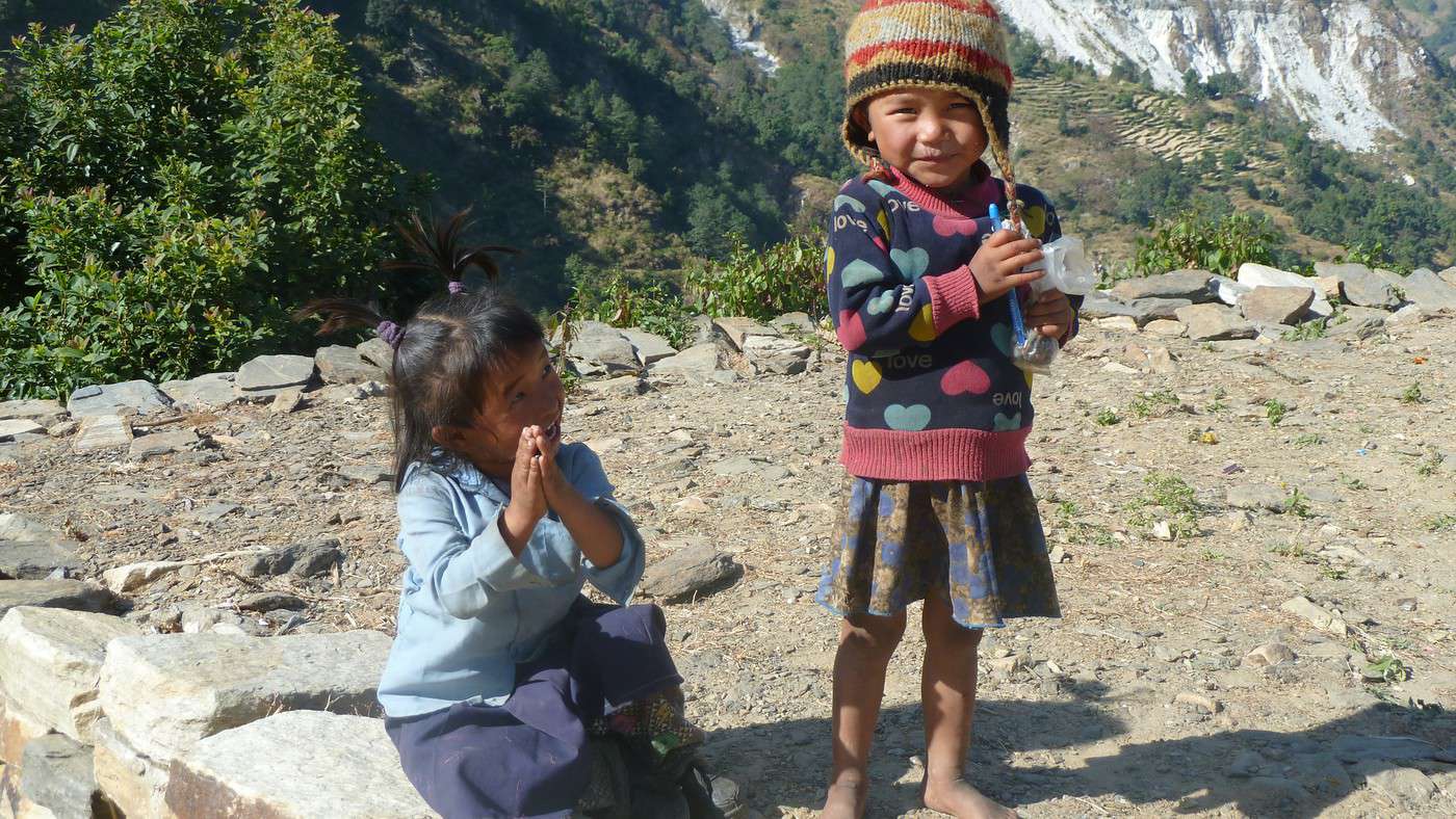
Notre guide nous attend comme convenu et c'est rassurant, choc de culture, de vie, enfin tout est différent, mais les gens sont d'une gentillesse exceptionnelle.
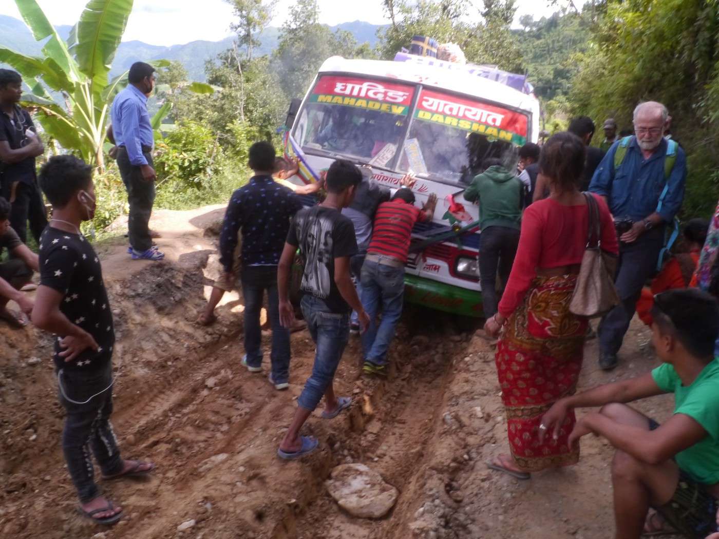
1/2 journée d'adaptation a la vie Népalaise et le 11 novembre nous voilà partis en voiture pour Balawa lieu du départ de notre treck. Il faut savoir que nous mettrons plus de 7 h (dont 3 h de piste) pour faire les 200/250 km qui nous sépare de Katmandou car il n'y a qu'un seul axe principal qui traverse de long en large le Népal et donc tout le trafic se fait par là (camions, voitures, 4 x 4 de touristes, etc.....)
Nous commençons a voir les effets du séisme (ce n'est que le début) mais la population est très fataliste (religion oblige) et les phrases qui reviendront régulièrement tout au long de notre aventure sont "que pouvons nous y faire", et "c'est comme ça".
Changement de rythme, car nous vivons avec le soleil et donc le jour se lève vers 6h et il fait nuit à 18h, donc les repas du soir sont vers 18h30 et nous sommes au lit vers 20h, ce qui les 2/3 premiers jours nous parait tôt mais qui ensuite sera tout a fait normal (le besoin de récupérer étant nécessaire).
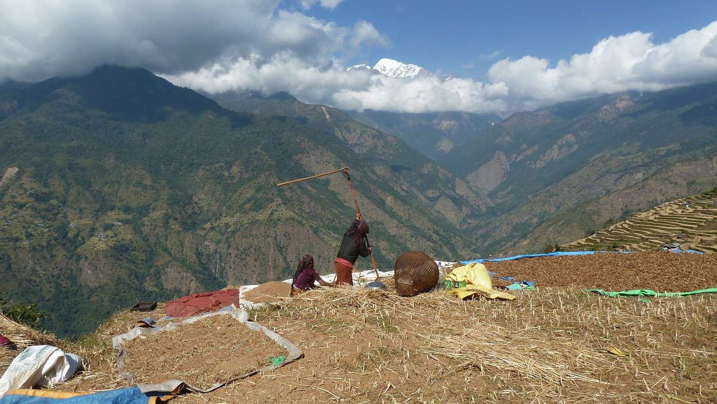
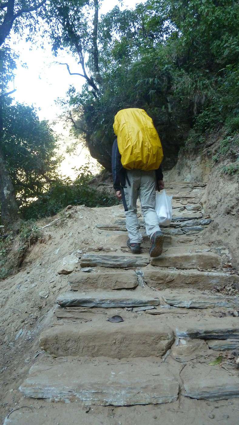
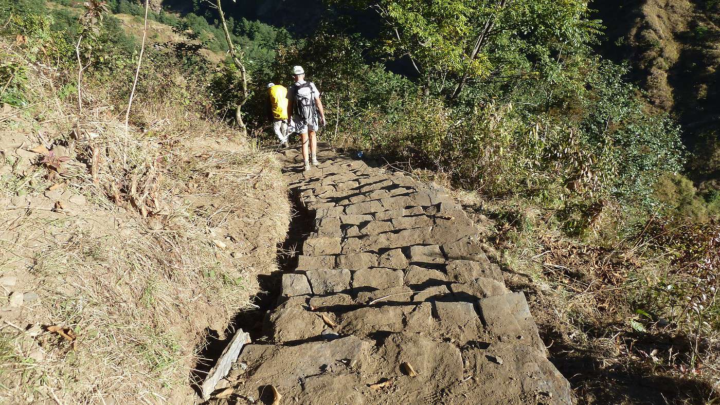
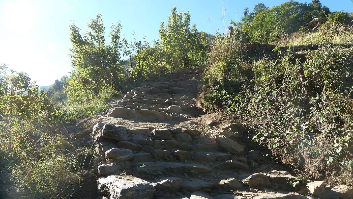
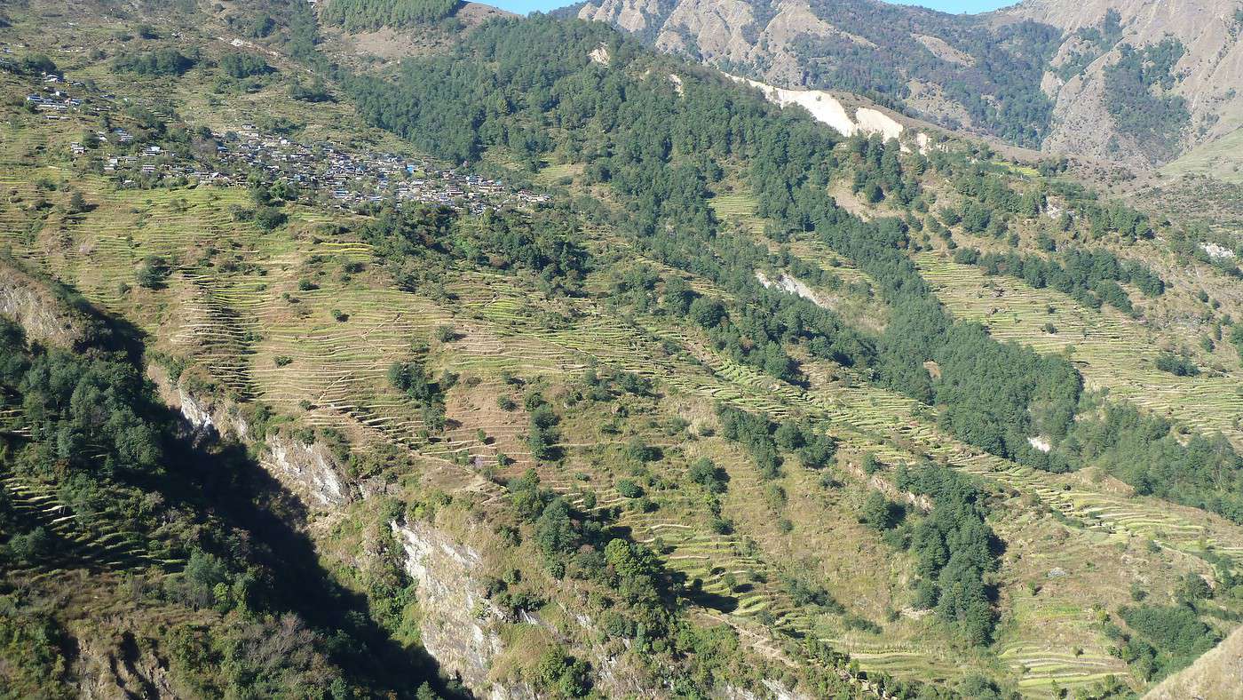
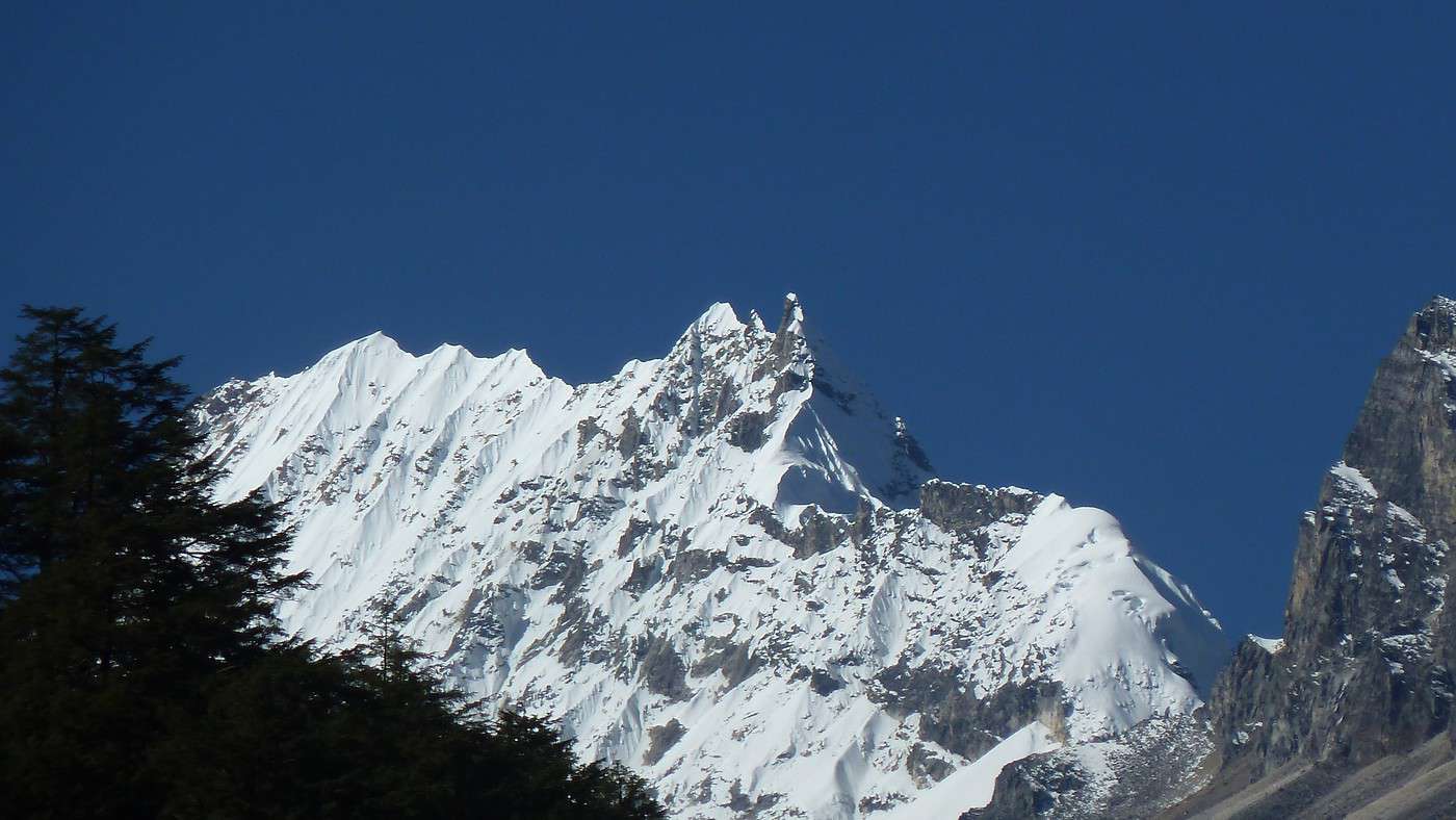
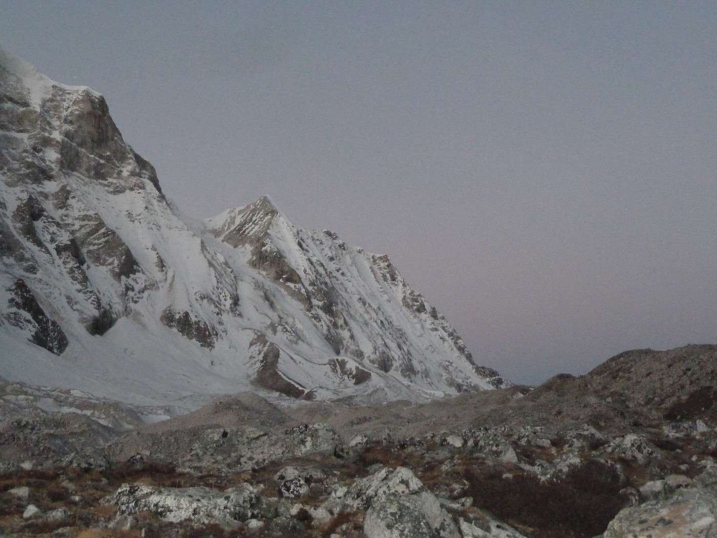
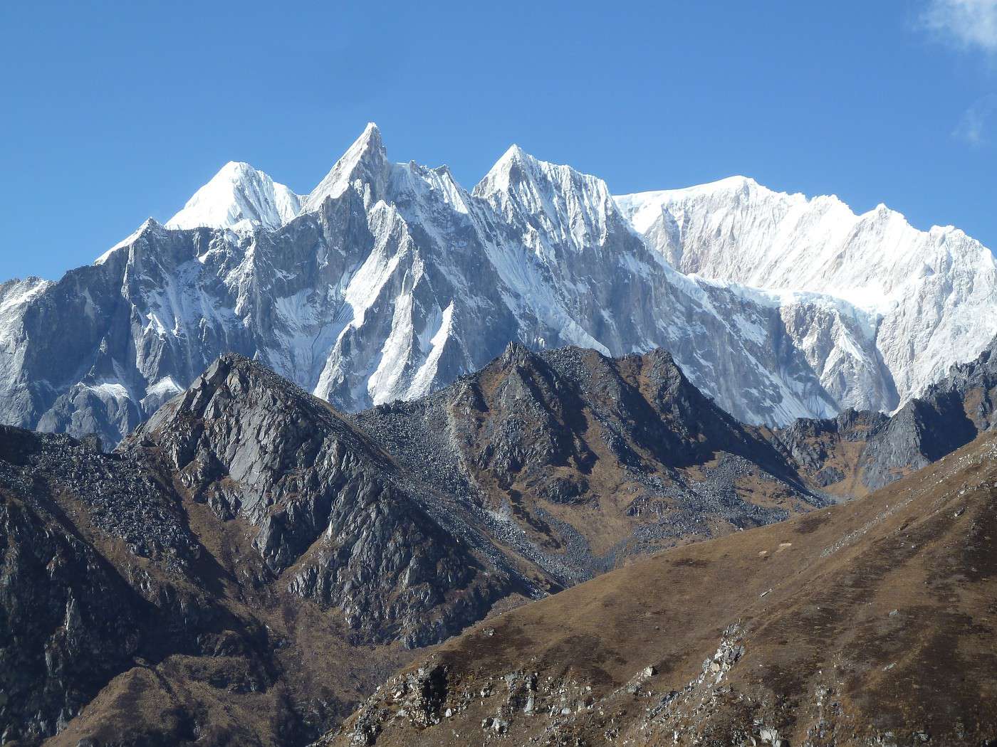
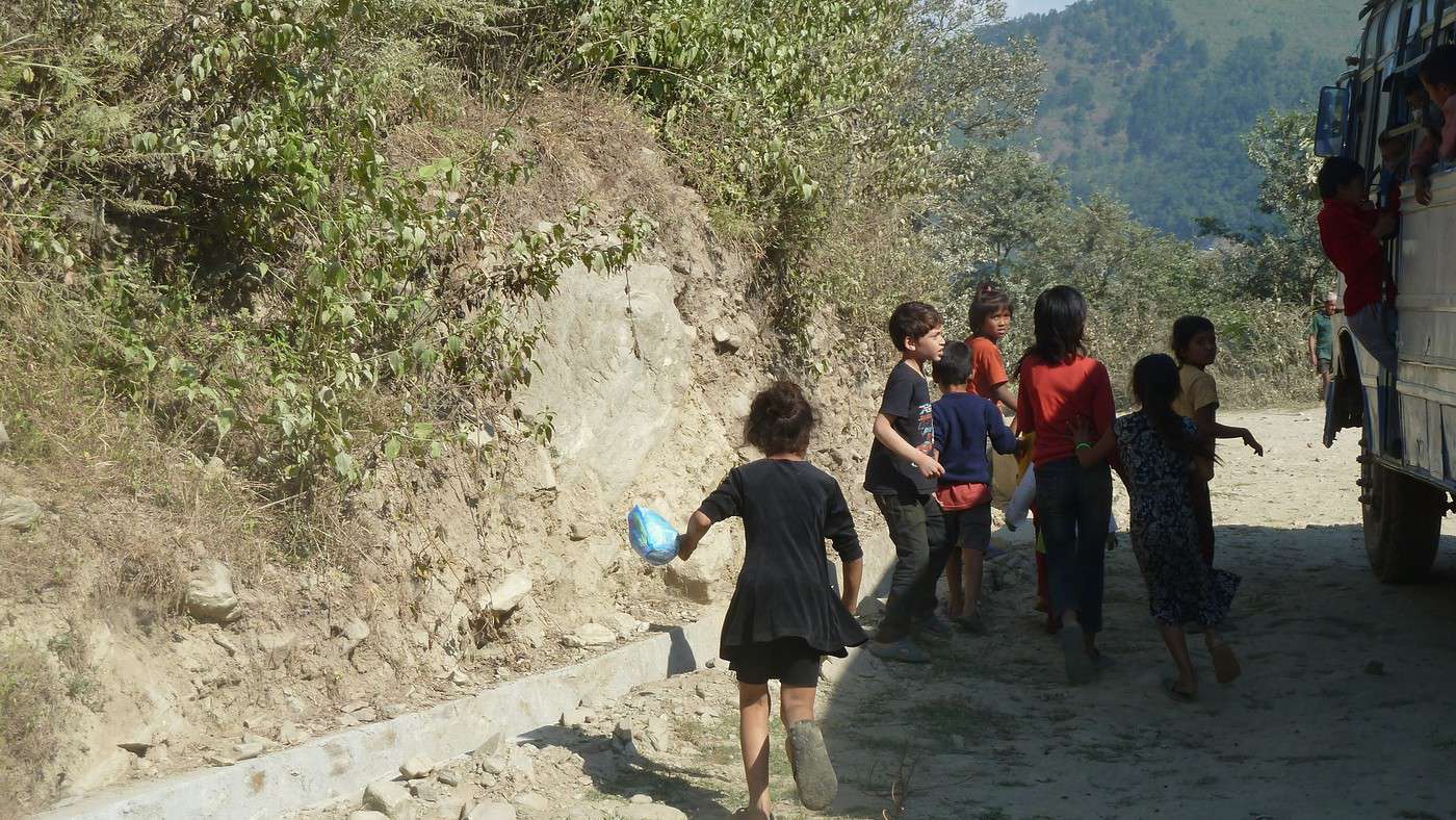
12/11 départ pour Barpak avec 1150 m de dénivelé mais 4h de marche pour le 1er jour avec des marches, des marches et encore des marches !! Épuisant mais les paysages sont tellement beaux et nouveaux que nous oublions la difficulté et regardons les champs de millets, les femmes en train de le battre, de nombreuses rizières qui donnent à ces lieux une impression de bien être avec de magnifiques couleurs . Ce sera notre dernier jour avec de électricité !! Nous profitons de la vue dégagée (ce sera comme cela pendant tout notre parcours) pour voir notre premier sommet à plus de 6000m le Bouddha Moutain.
La suite dans notre prochain épisode !
bonsoir Jean Bernard
merci pour ce bon début.
le Népal , c'est beau j'y suis allée deux fois mais je ne connais pas cet endroit.
J'ai donc hâte de lire la suite accompagnée de beaux paysages
merci
mariejo
Qui a l'habitude de voyager sait qu'il vient toujours un moment où il faut partir...
Paulo Coelho
Lorsque le rêve devient réalité (suite 1)
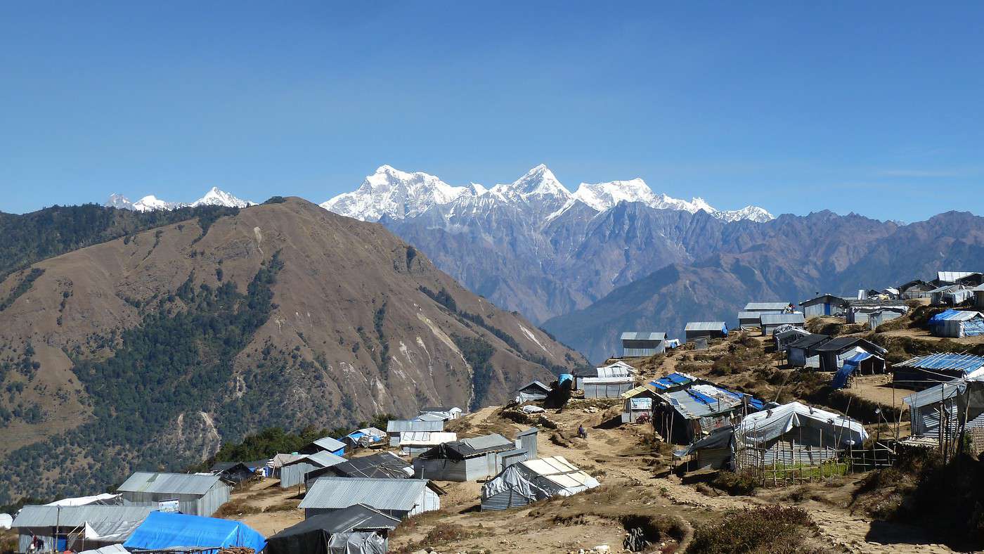
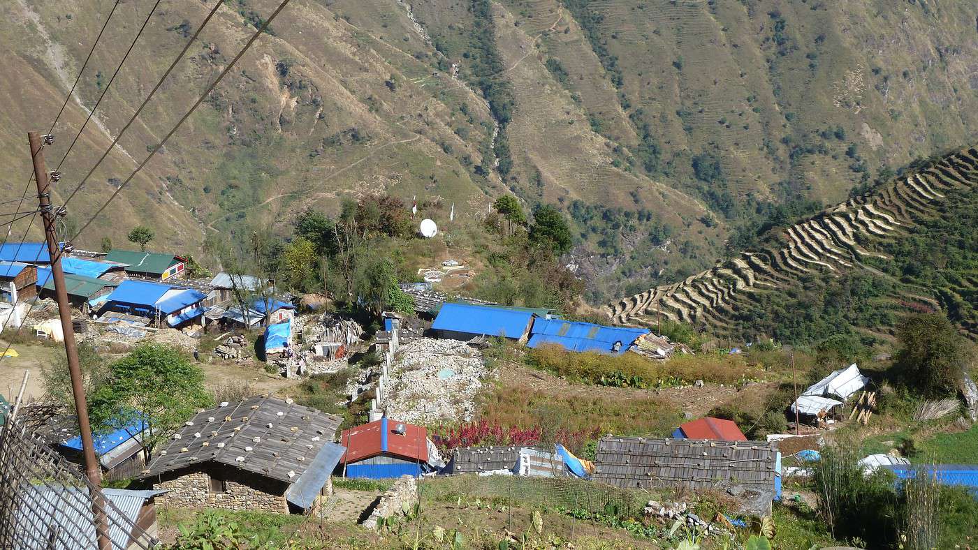
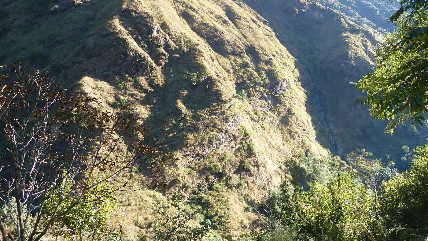
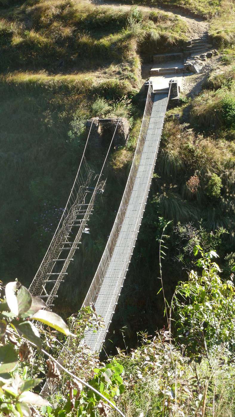
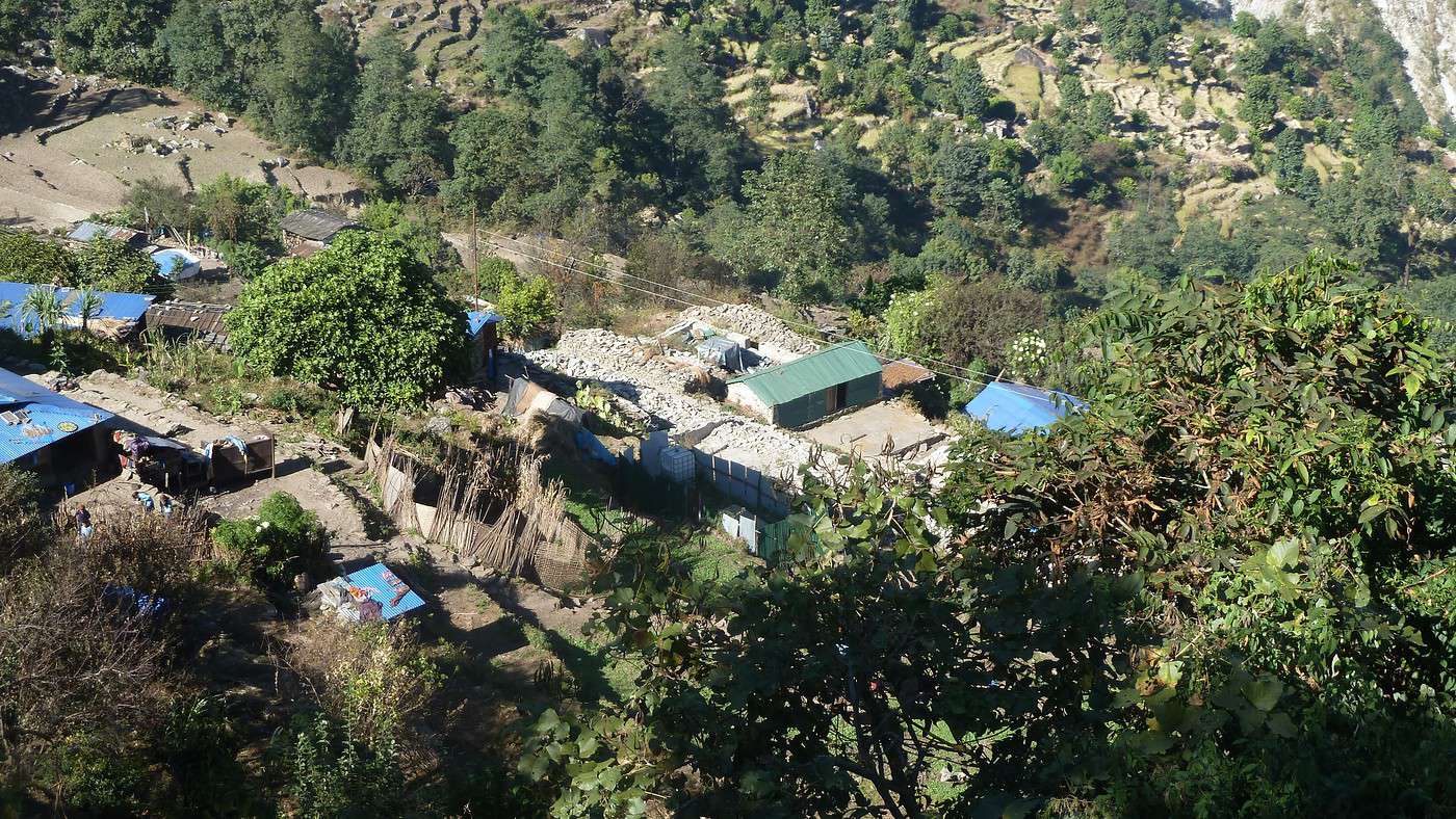
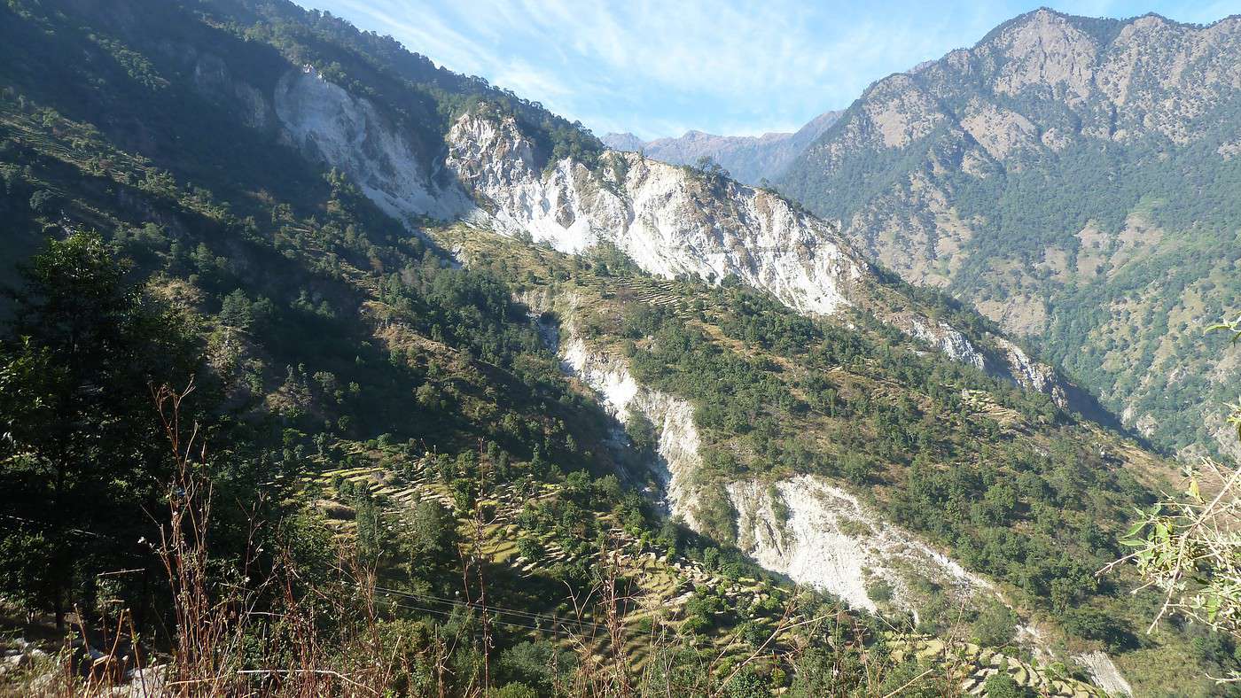
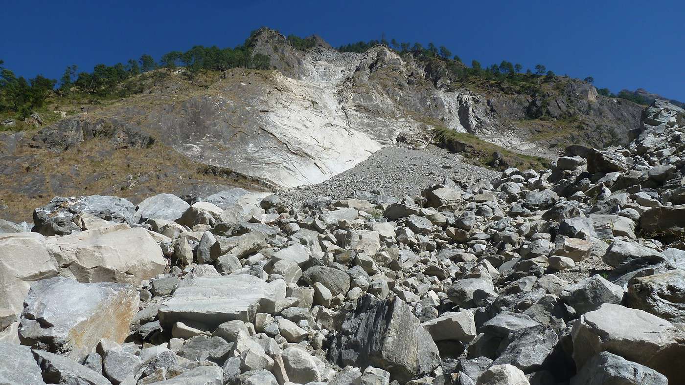
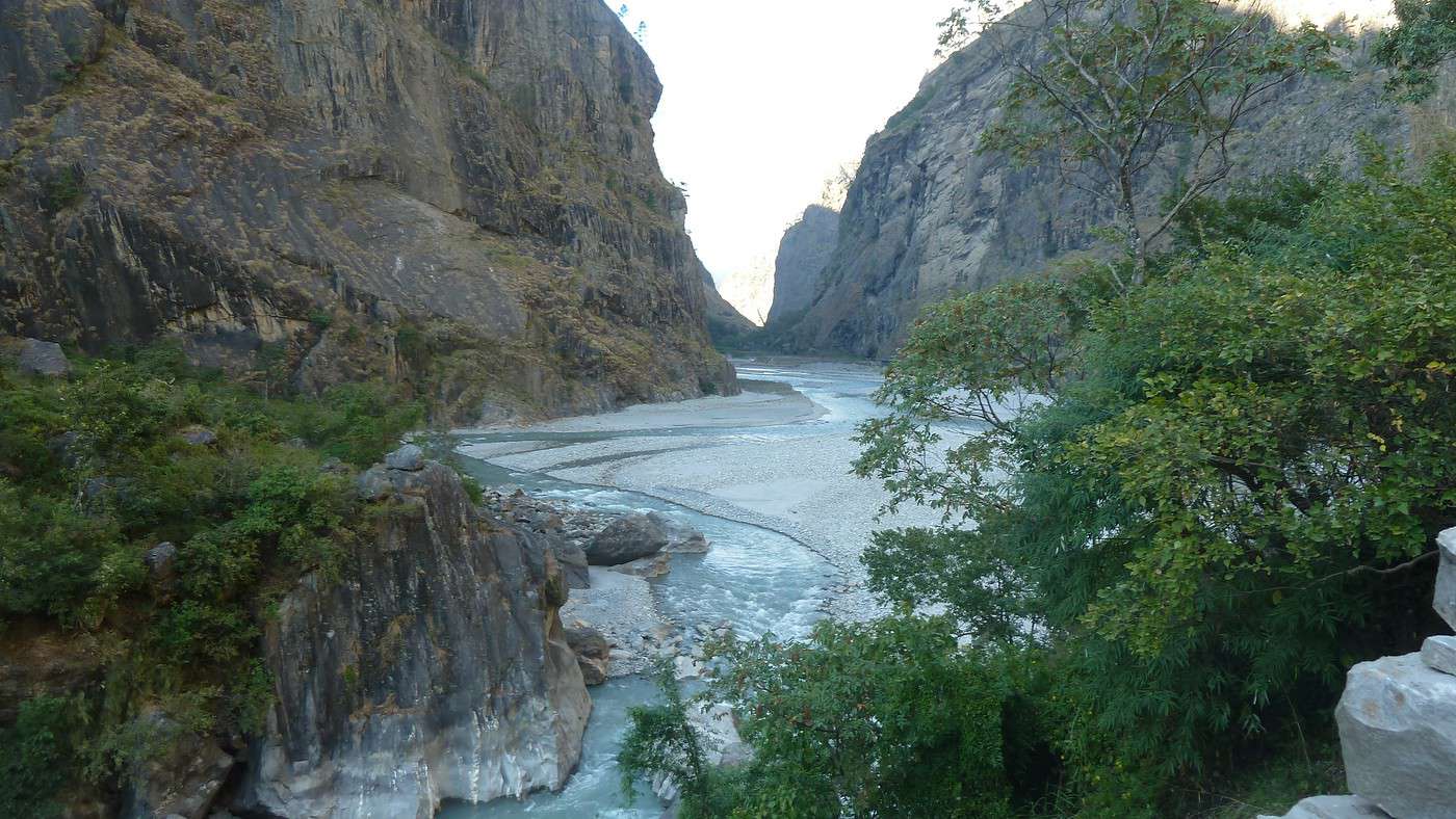
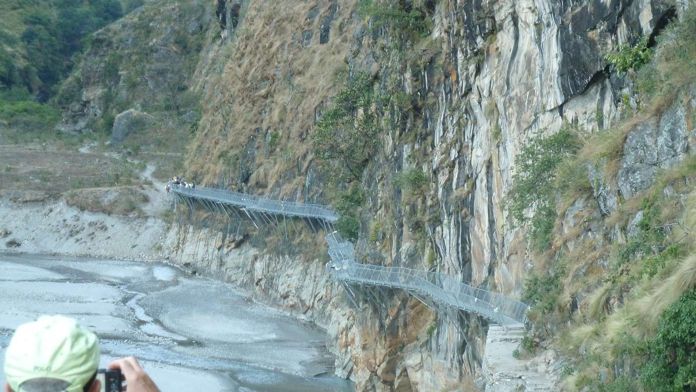
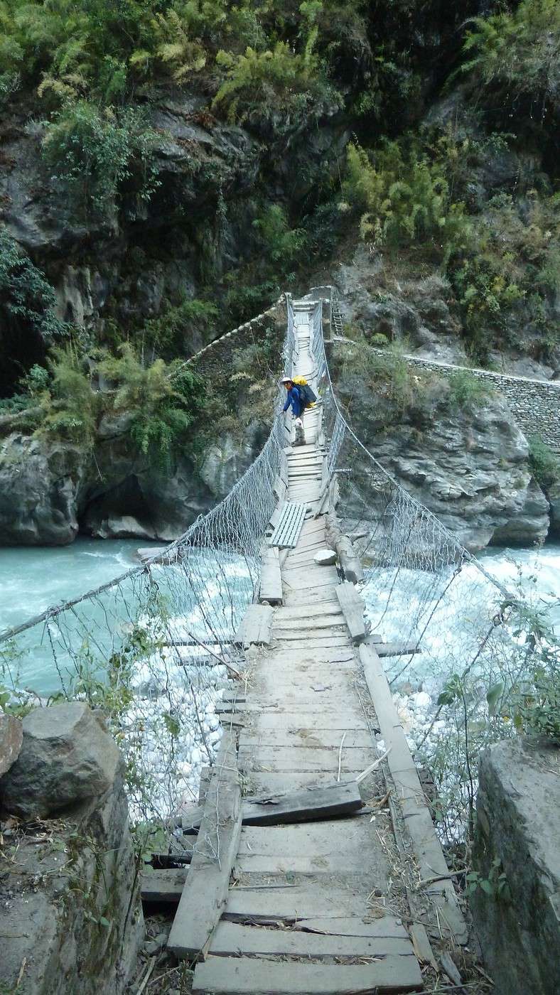
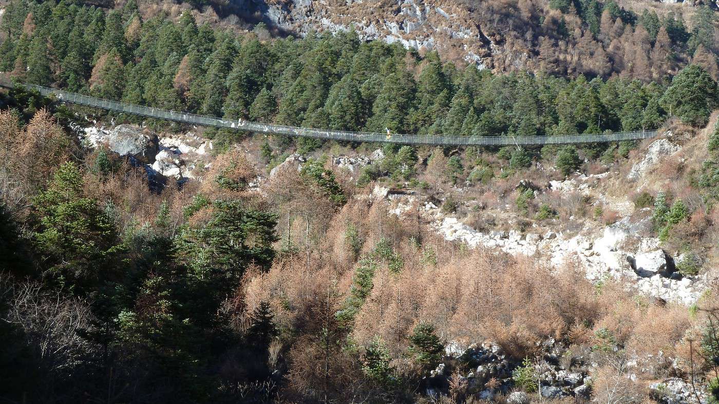
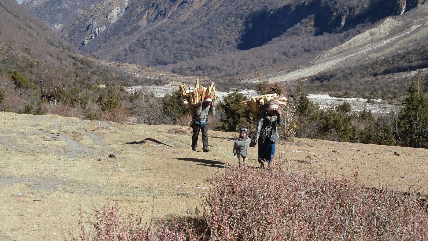
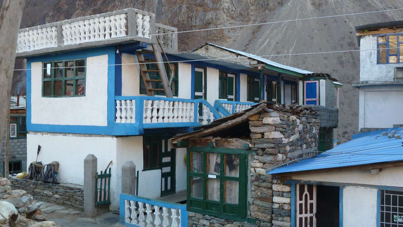
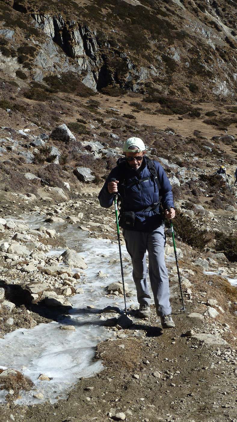
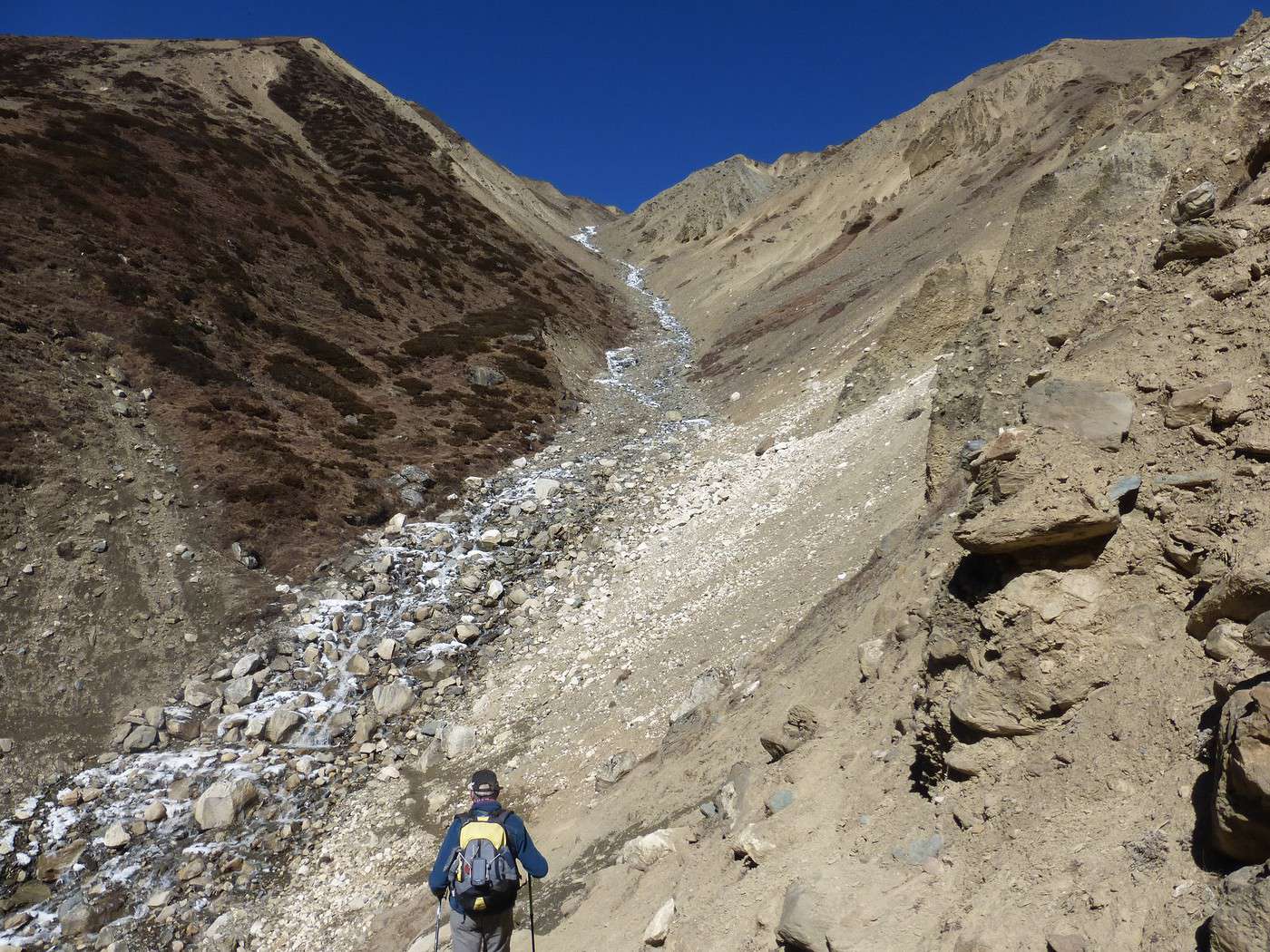
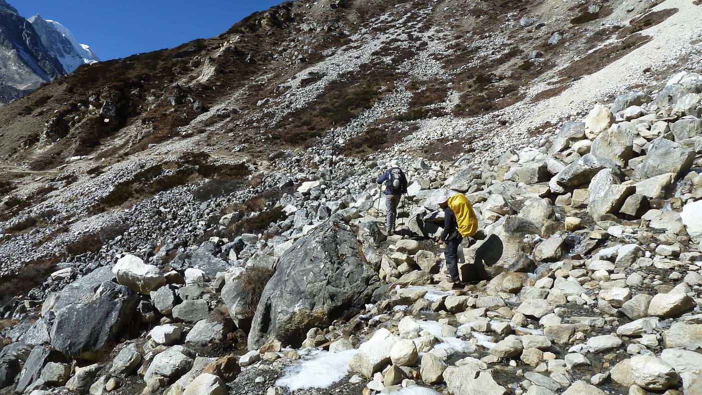
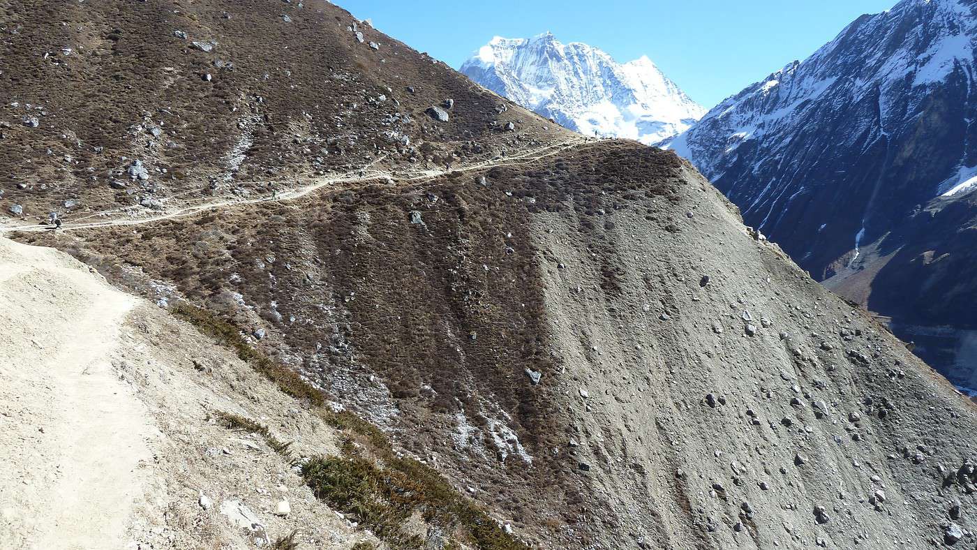
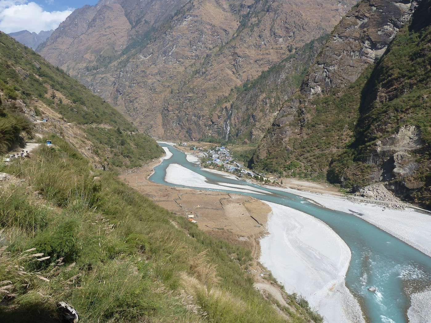
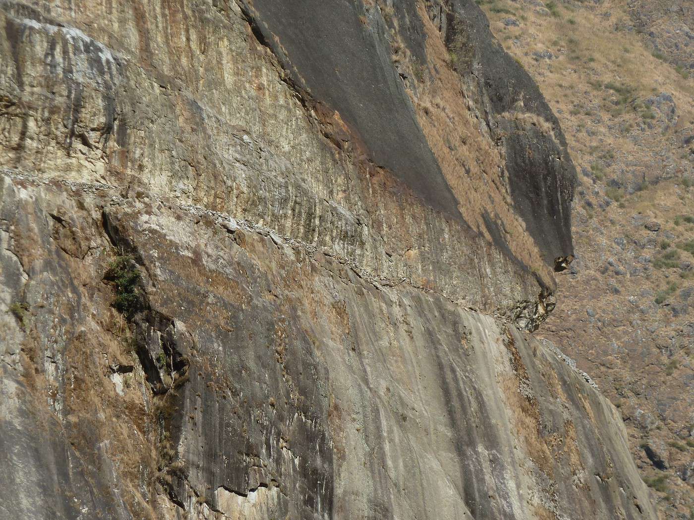
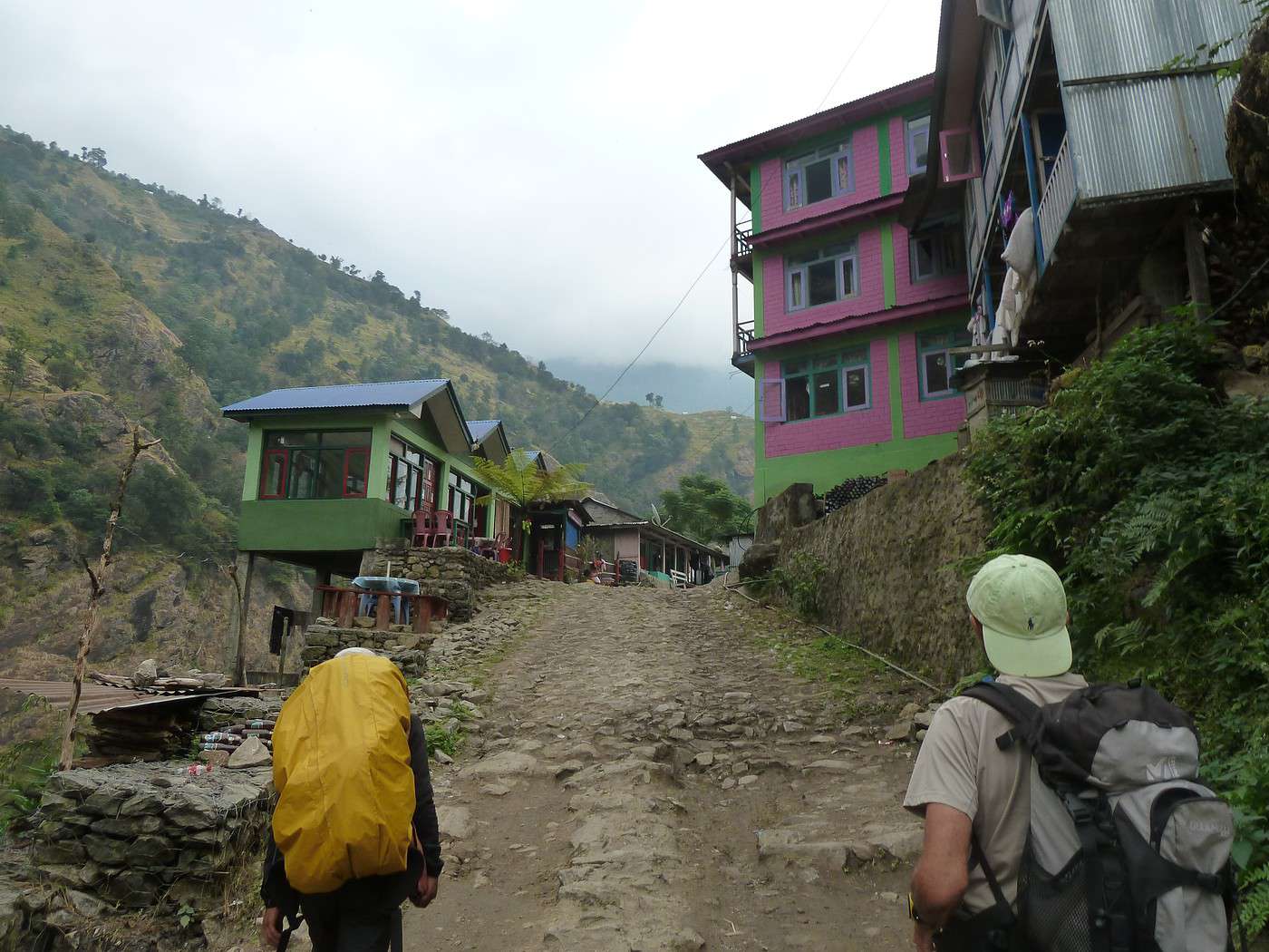
Nous sommes le 13/11 et plus aucun véhicule ne peut circuler à partir de maintenant, tout le ravitaillement se fait à dos de mulets ou d'hommes. Notre destination du jour est Laprack (2200m) que nous atteignons en 4h après 1000m de dénivelé et un passage à 3000 avec en face de nous les Ganesh Himal (au nombre de 7 !). encore des marches et toujours des marches pendant cette journée tant à la montée qu'à la descente ; la température commence a changer, 25/28 le jour et 5° la nuit et les paysage aussi : toutes les cultures sont maintenant en espaliers très verts ce qui donne un air de Vietnam ! 14/11 départ à 7h30 pour une longue journée, l'adaptation est terminée, nous rentrons dans le vif du sujet 800 m de dénivelé positif mais 1880 de négatif fait uniquement de marches pour + de 6h !! E P O U V A N TA B L E !! le final se fait comme un zombie, les jambes ne répondant plus !! Heureusement les vues sont magnifiques, cela nous fait un peu oublier la difficulté, avec un sentier tout en balcon à la montée, agrémenté d'un pique nique sur le plateau à 2300/2400m. Enfin la délivrance et une bonne douche (froide bien sur) tellement bonne !! Nous avons traversé de nombreux villages dévastés, mais déjà en passe d’être reconstruits soit sur place soit un peu plus ou un peut plus bas dès qu'un plateau se présente. 15/11Nous traversons l'épicentre du seime et des pans entiers de montagne se sont décrochés écrasant tout sur leur passage et laissant des blocs énormes en guise de chemin que nous franchissons souvent difficilement. Les premiers ponts de singes se présentent ! Moi qui ai le vertige, j'ai du prendre sur moi pour arriver à franchir les 1ers et puis on s'habitue car j'en rencontrerai une trentaine je pense, certains dans un triste état !! Il y a même un endroit ou le chemin n'existe plus, il a donc été construit une sentier suspendu à la paroi rocheuse pour passer !! L'on se rend compte à ce moment là que le tourisme est indispensable à la survie de cette population. Nous suivons la vallée de la Boudhi Gandaki pour cette journée avec 1000m de positif et 600 de négatif pour arriver à Korlha Bensi (970m) 16/11 Ce jour c'est une longue marche qui nous attend pour aller a Jagat-1470m-(pas celui du treck des Annapurna) que nous atteindrons en 7h après 1700m de positif et 1050 de négatif ! Nous avons rencontré des convois de mules par dizaines car de nombreux villages se trouvent à 5 voir 8 jours de marche du centre de ravitaillement ! Si elles passent, nous passons me suis-je dit au regard de certain points délicats !! Une vallée très large, ensoleillée au maximum et une végétation totalement différente, genre altiplano.
Lorsque le rêve devient réalité (suite 2)
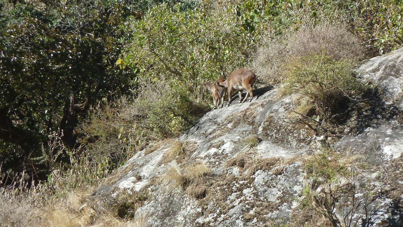
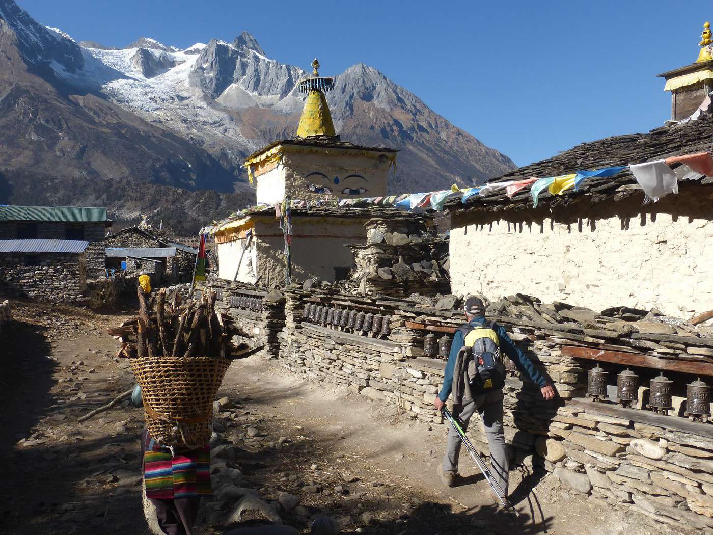
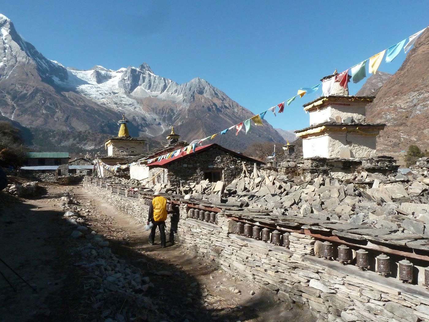
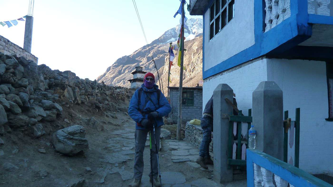
17/11 Aujourd'hui, notre étape nous amènera à Namrung (2540m) en plein pays Tibetain, que nous atteignons en presque 7h pour 1550m de positif et 850 de négatif. Le lodge se trouve a coté d'un monastère en construction (qui servira également à l'accueil des touristes) une bonne douche bien fraîche (5° dehors et l'eau doit être a la même température !) et nous pouvons prendre un "black tea" mérité. Cette étape plus long que la veille nous a offert des paysages encore plus beaux, nous avons aperçu de nombreux singes ainsi que des bouquetins qui nous rappelle que nous sommes en montagne !! La nuit a été fraîche dans la chambre pas plus de 2° !!
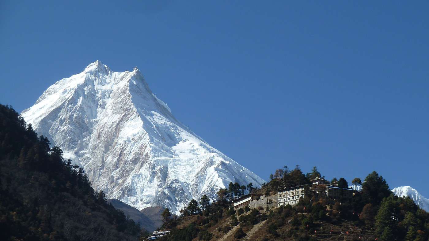
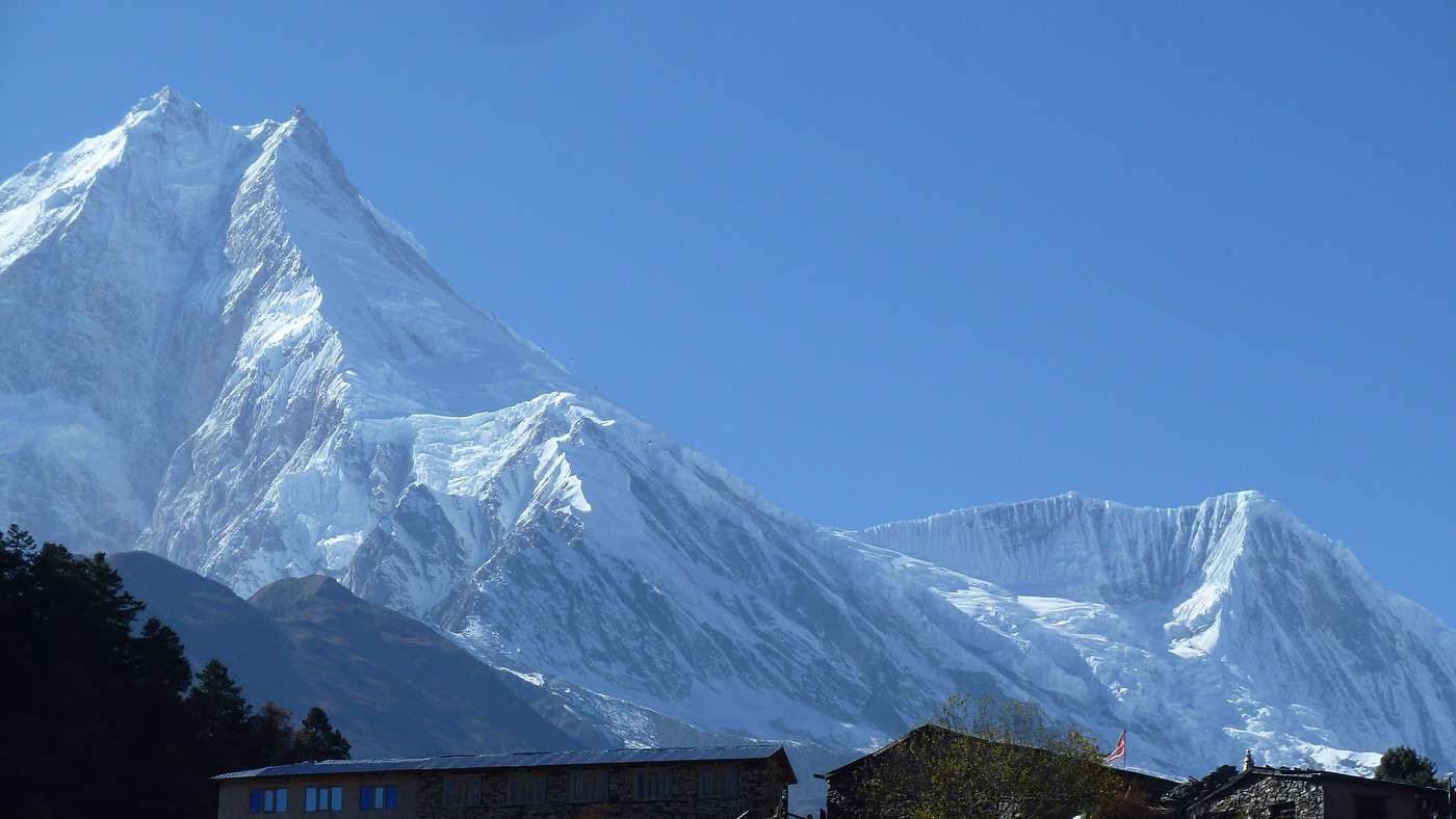
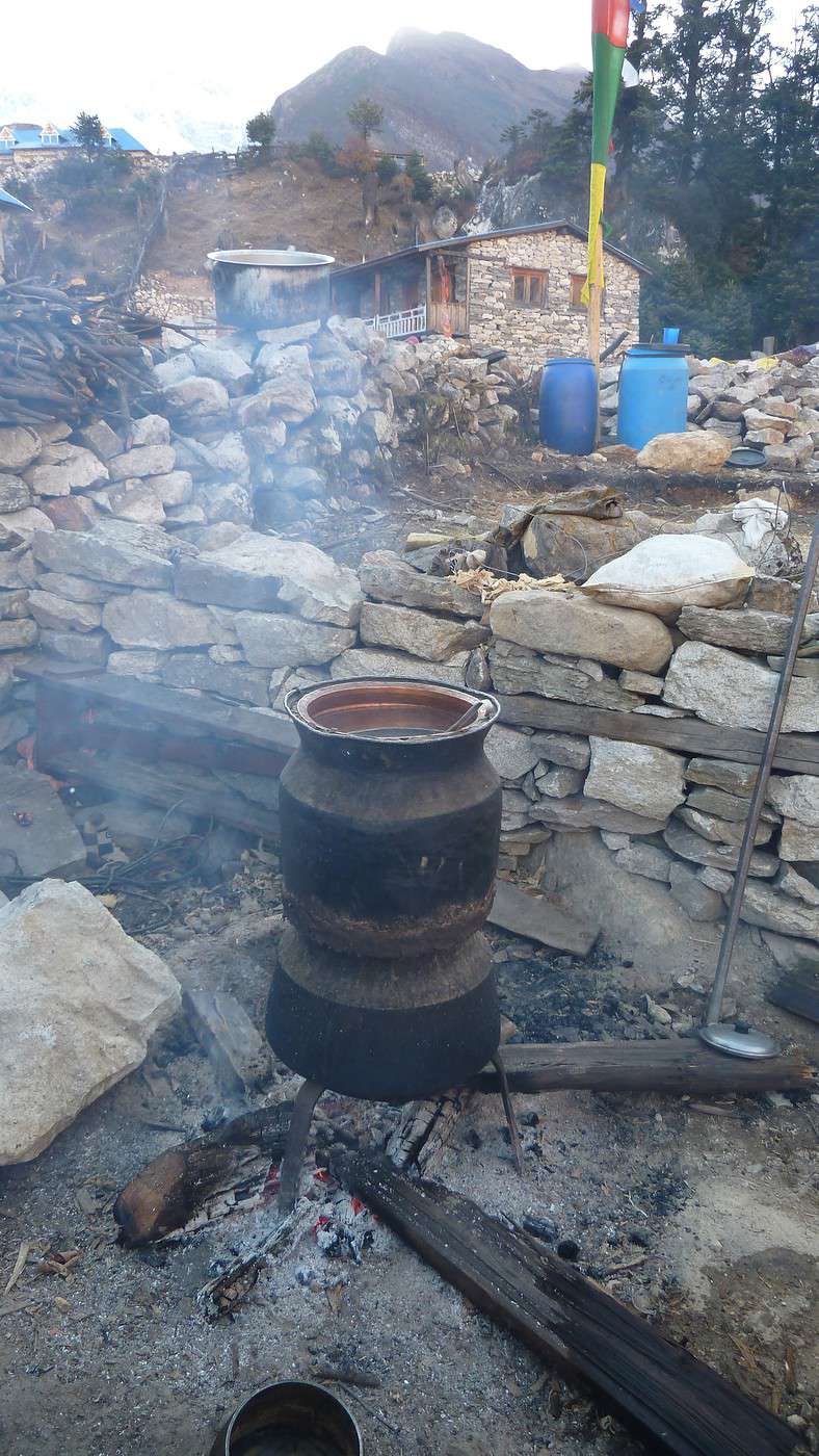
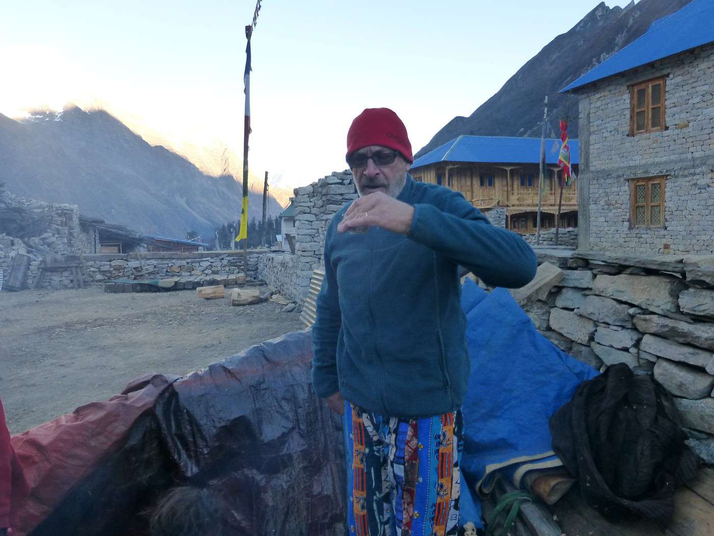
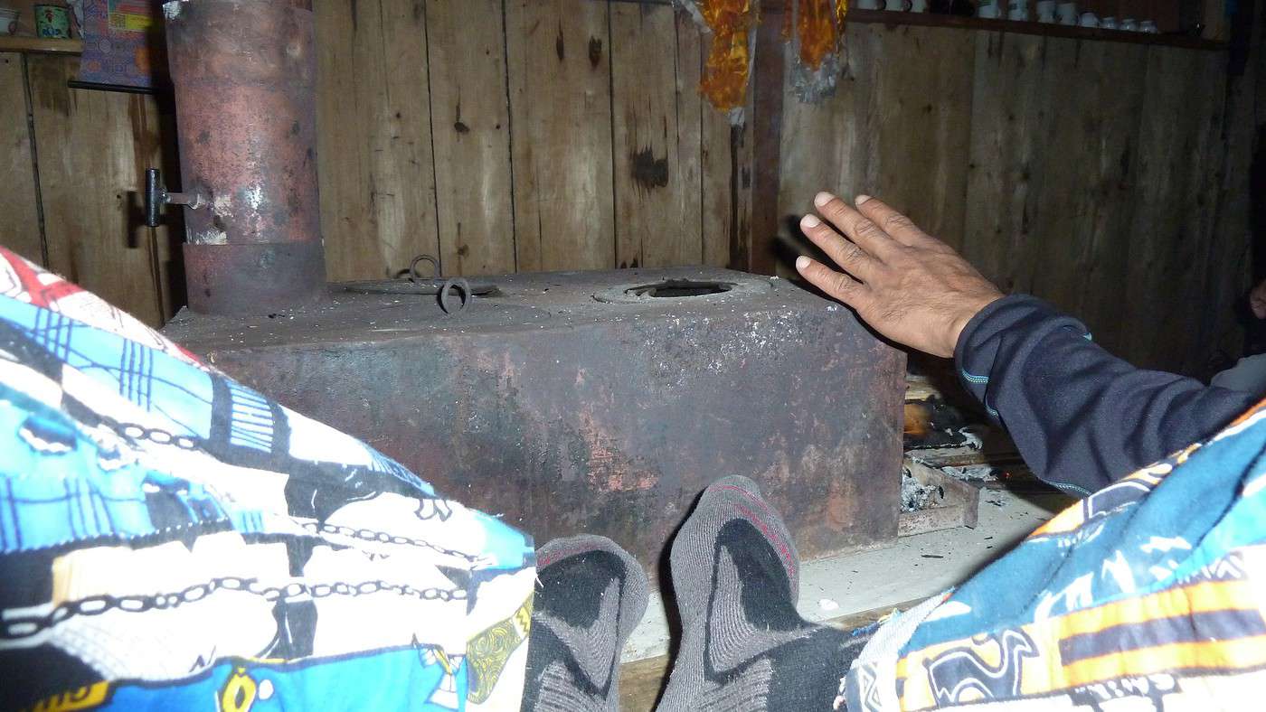
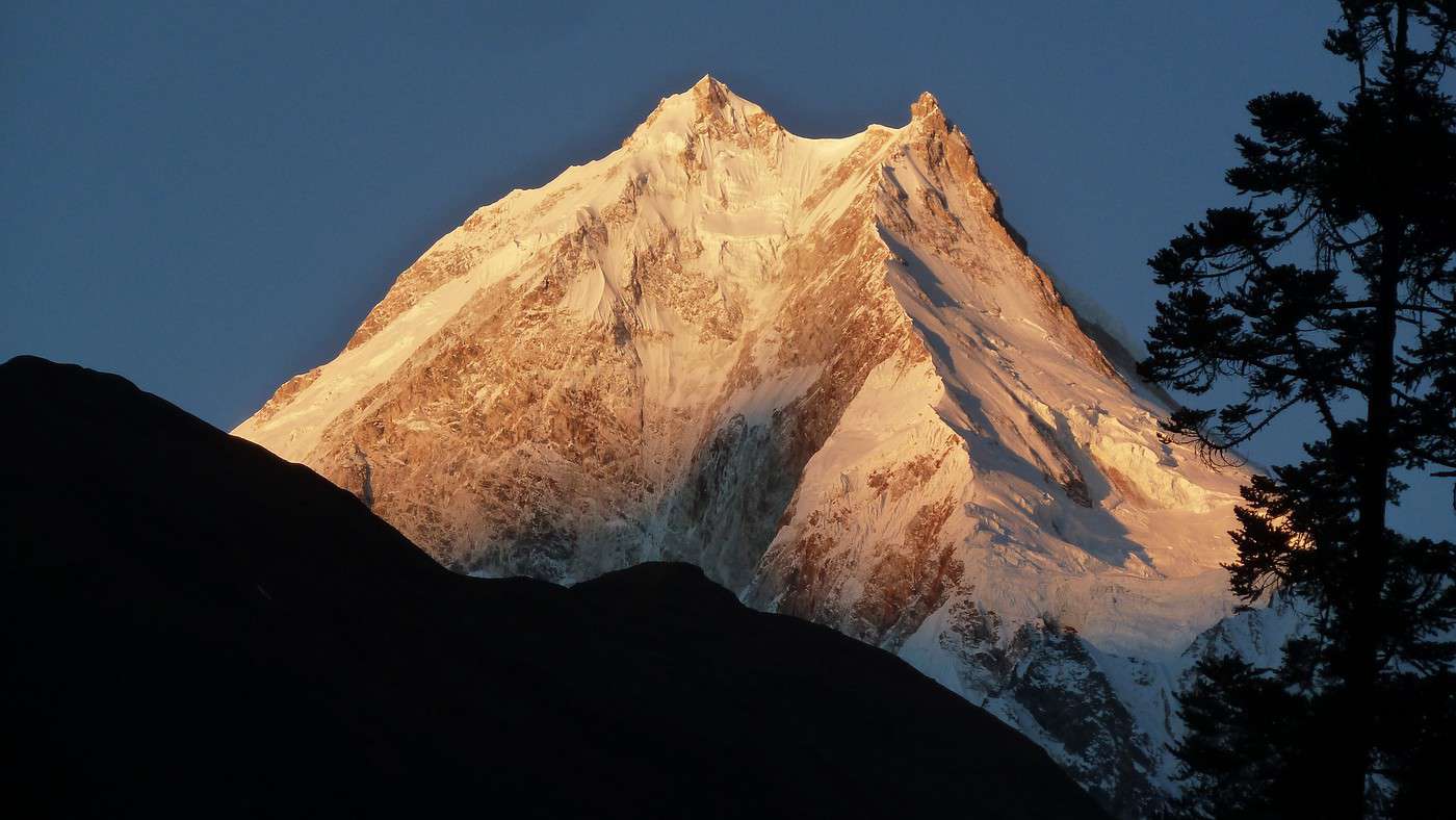
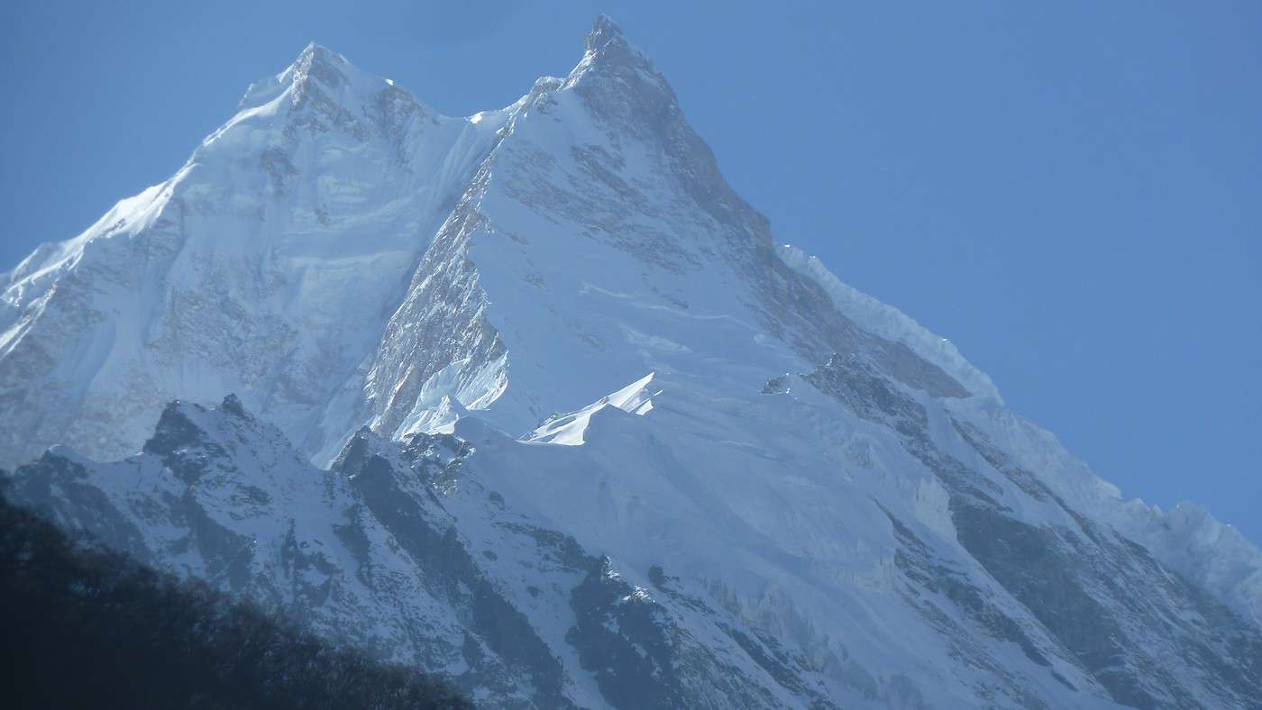
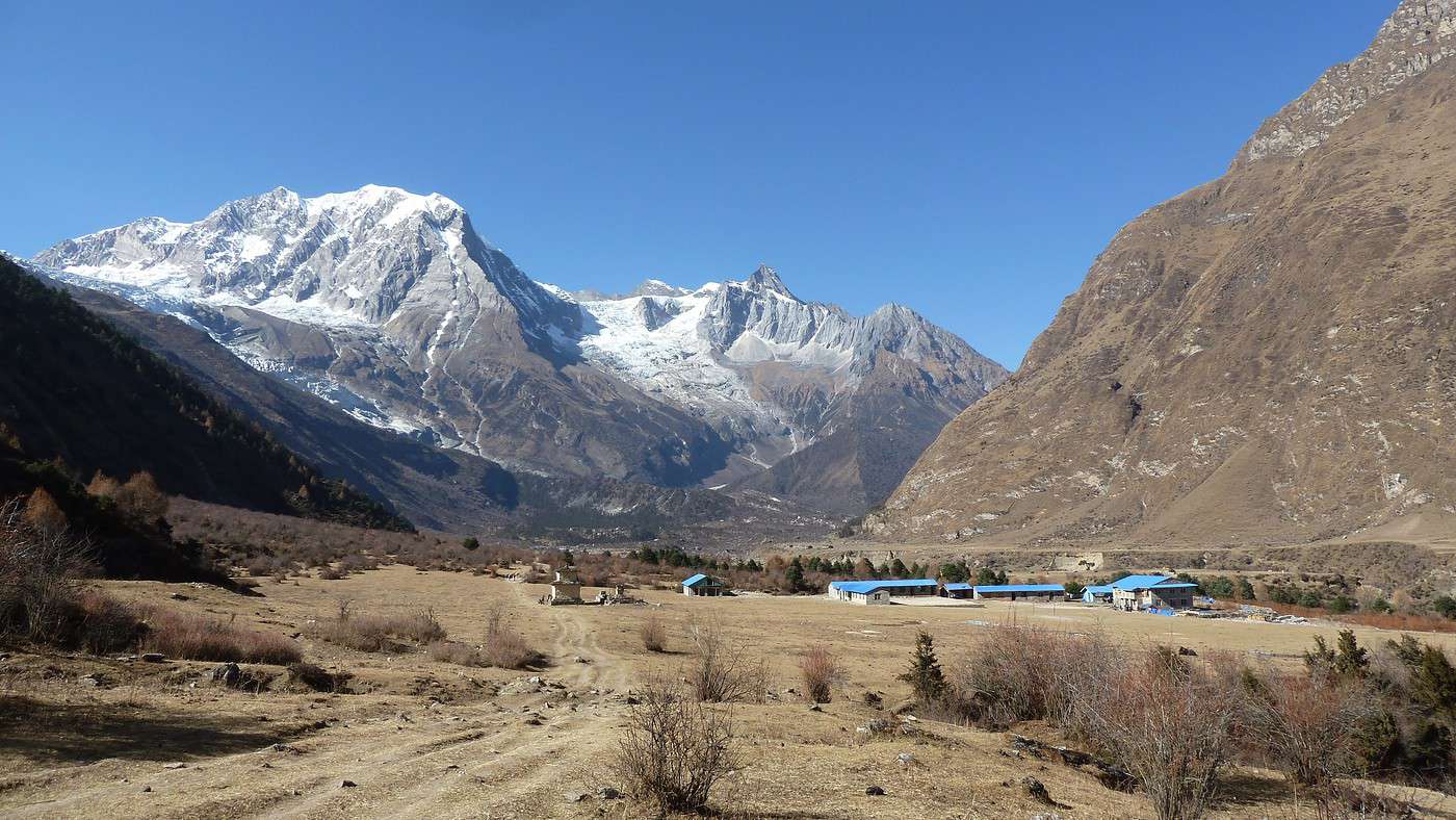
18/11 Nous partons pour Shyala qui est à 3330m avec un passage à 3500m pour 1200m de positif et 271m de négatif (nous descendons de moins en moins!). Nous avons coupé et recoupé le torrent et traversé une très belle foret. Un pique nique à plus de 3200, face à sa Majesté le Manaslu que nous voyons pour la 1ere fois. Quelle pure merveille, depuis le temps que l'on en parlait, il nous apparaît grand, très grand (8163m, huitième sommet le plus haut du monde) ; d’après notre guide, en français c'est "le tueur d'hommes" ! En effet une ascension sur deux se termine en désastre, c'est un des sommet le plus difficile a conquérir car il est couvert de glace éternelle entre autre)! Shyala est un petit village typique Tibetain (comme de nombreux autres que nous traverserons) avec une population plus mat de peau. En arrivant au lodge, nos hôtes nous ont fait profiter de la distillation du Raksi, alcool local a base de riz qui plus il est distillé moins il est fort et se boit chaud !! Agréable à boire après 6 ou 7 passages !! La chaleur du lodge n’était pas présente !! (comme tous les soirs) et nous avons profité d'un agréable poêle en fonte qui nous réchauffait les pieds ! Première soupe à l'ail que nous allons dorénavant trouver et consommer tous les jours car elle est très nourrissante, et permet de limiter le MAM (mal de montagne) au maximum. La nuit risque d’être froide, car a 19h il fait deja 0°.
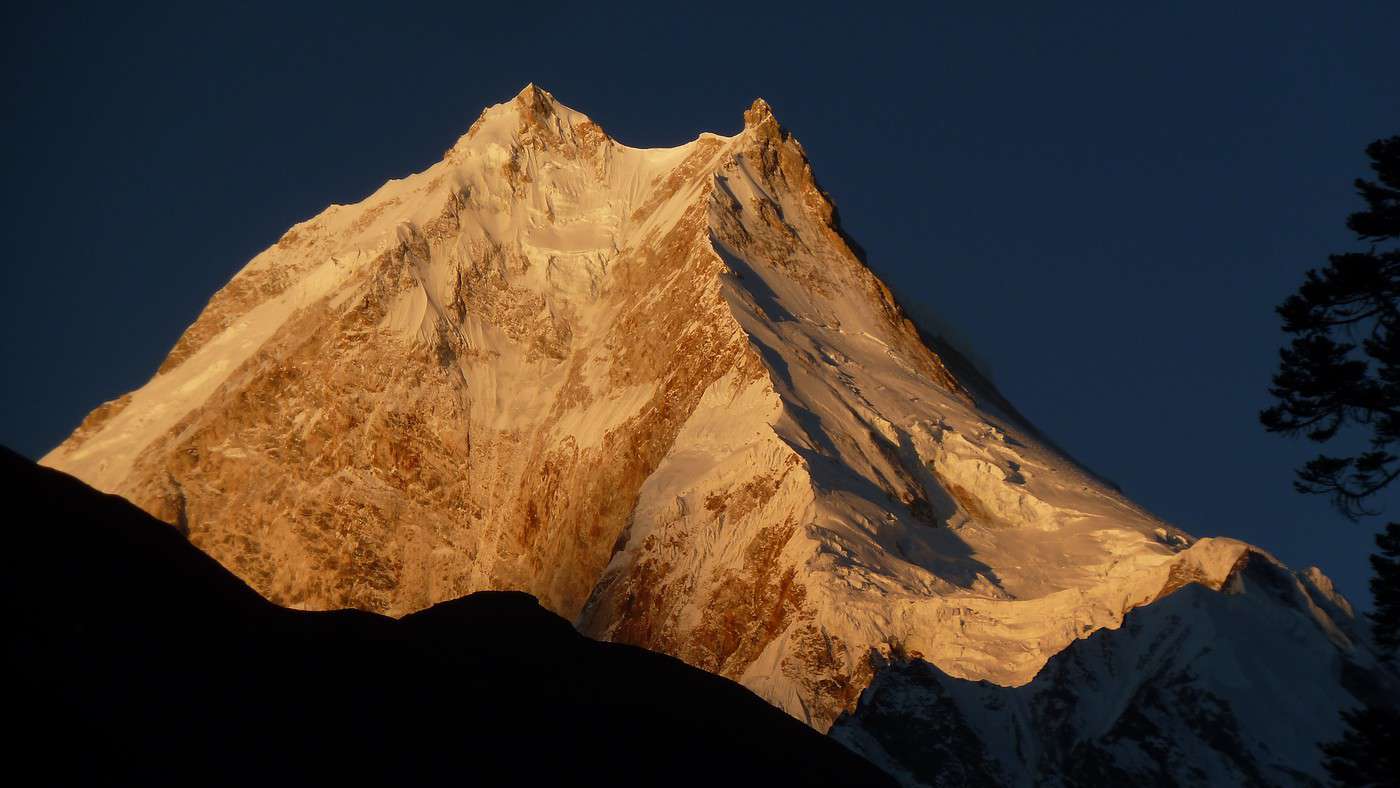
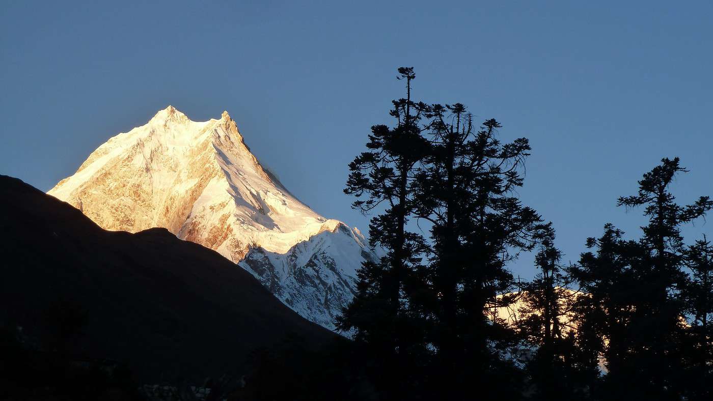
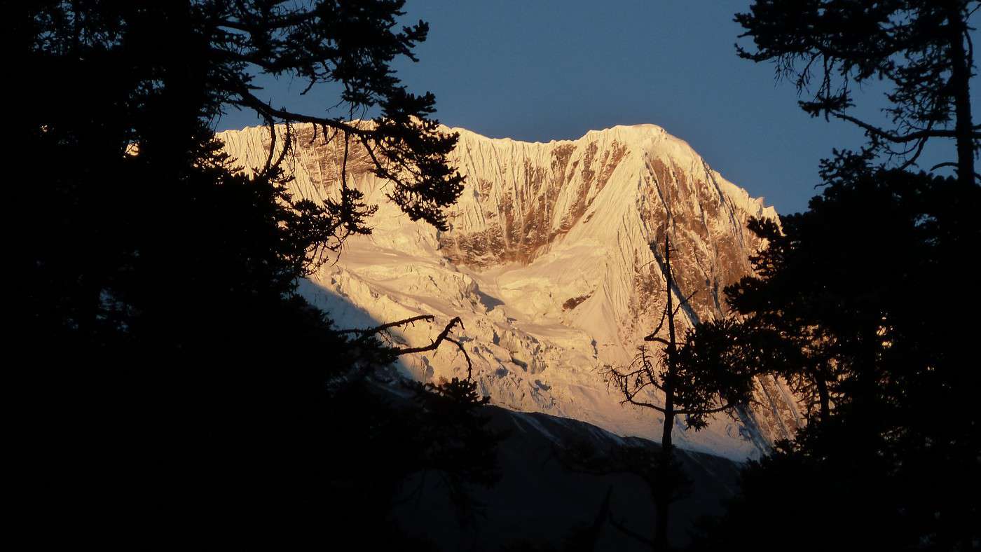
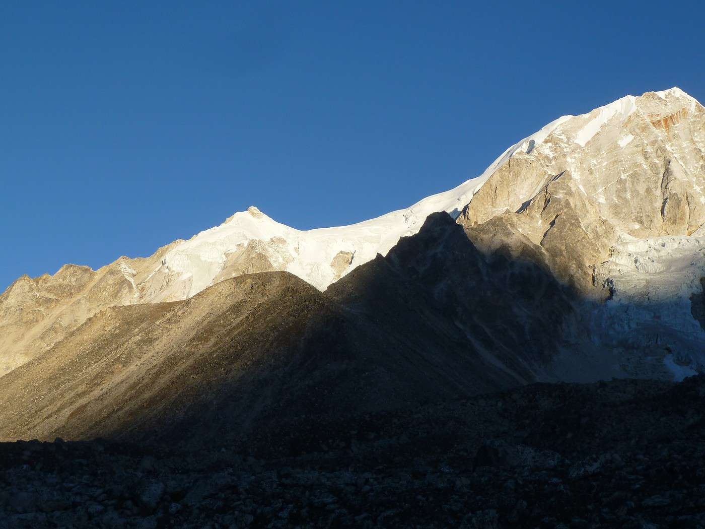
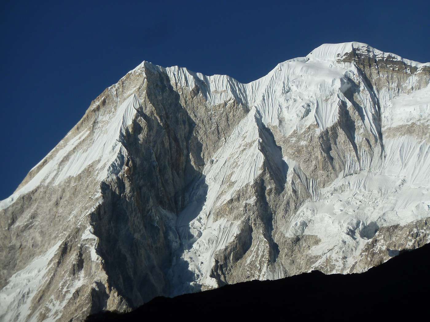
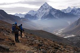
19/11 Et oui la nuit a certainement été très froide, je pense, car ce matin nous avions 0° dans la chambre, et d'ailleurs hier soir j'ai fini d’écrire ce carnet de voyage avec les gants de soie et le bonnet sur la tête pour me réchauffer un peu ; Reveil 6h pour admirer le lever du soleil sur sa Majesté ! Et quel spectacle ! Le Manaslu est passé par toutes les couleurs orangées jusqu'à devenir blanc immaculé ; je n'imaginais pas un seul instant pourvoir admirer un tel spectacle lors de la préparation de ce trek. Se lever tôt (je ne suis pas un adepte en temps normal) était tout a fait justifié.
17/11 Aujourd'hui, notre étape nous amènera à Namrung (2540m) en plein pays Tibetain, que nous atteignons en presque 7h pour 1550m de positif et 850 de négatif.
Je n'ai pas encore été dans cette région, mais, en venant de Jagat (cf. 16/11), il me semble qu'il y a un "bug". Sans doute l'oubli d'une étape, par exemple à Deng.
A moins que : - tapis volant, - dopage transformant en sur-marcheur.
Parce que Jagat -> Namrung en une unique journée, je n'y ai même pas pensé dans mes rêves les plus fous.
Fabrice, projetant un Tour du Manaslu pour novembre 2017.
Je n'ai pas encore été dans cette région, mais, en venant de Jagat (cf. 16/11), il me semble qu'il y a un "bug". Sans doute l'oubli d'une étape, par exemple à Deng.
A moins que : - tapis volant, - dopage transformant en sur-marcheur.
Parce que Jagat -> Namrung en une unique journée, je n'y ai même pas pensé dans mes rêves les plus fous.
Fabrice, projetant un Tour du Manaslu pour novembre 2017.
S'exposer à l'Etranger lointain amène à mieux connaître et comprendre sa propre Culture.
16/11 Ce jour c'est une longue marche qui nous attend pour aller a Jagat-1470m- (pas celui du treck des Annapurna) que nous atteindrons en 7h
A vous comprendre, il s'agit de l'étape Khorla Besi -> Jagat.
Les 7 h incluent-elles le repas ou s'agit-il de 7 h de temps de marche ? Par ailleurs, merci d'indiquer s'il y a un portage de vos affaires (classique en agence), car cela peut influer sur les temps de marche...
Par ailleurs, à 1 h de marche après Khorla Besi (et quelque 3,8 km), vous avez dû passer par un petit hameau dénommé Tatopani et doté de sources d'eau chaude (comme son nom l'indique). Il me semble que c'est avant le segment nouvellement équipé de passerelles métalliques en rive gauche illustré par l'une de vos photos.
Avez-vous remarqué si les teahouses ont repris leur activité à Tatopani ? (car elles avaient grandement souffert du tremblement de terre et avaient été désertées)
Si je viens de Soti Khola en autonome (autorisé jusqu'à Jagat), cela m'arrangerait pour éventuellement coucher à Tatopani. A défaut, c'est soit Khorla Besi (étape raisonnable), soit Dhoban (1 h de plus, pour une étape sans doute trop longue).
D'avance merci pour votre retour d'information.
J'attends les prochains épisodes avec grand intérêt.
Fabrice
A vous comprendre, il s'agit de l'étape Khorla Besi -> Jagat.
Les 7 h incluent-elles le repas ou s'agit-il de 7 h de temps de marche ? Par ailleurs, merci d'indiquer s'il y a un portage de vos affaires (classique en agence), car cela peut influer sur les temps de marche...
Par ailleurs, à 1 h de marche après Khorla Besi (et quelque 3,8 km), vous avez dû passer par un petit hameau dénommé Tatopani et doté de sources d'eau chaude (comme son nom l'indique). Il me semble que c'est avant le segment nouvellement équipé de passerelles métalliques en rive gauche illustré par l'une de vos photos.
Avez-vous remarqué si les teahouses ont repris leur activité à Tatopani ? (car elles avaient grandement souffert du tremblement de terre et avaient été désertées)
Si je viens de Soti Khola en autonome (autorisé jusqu'à Jagat), cela m'arrangerait pour éventuellement coucher à Tatopani. A défaut, c'est soit Khorla Besi (étape raisonnable), soit Dhoban (1 h de plus, pour une étape sans doute trop longue).
D'avance merci pour votre retour d'information.
J'attends les prochains épisodes avec grand intérêt.
Fabrice
S'exposer à l'Etranger lointain amène à mieux connaître et comprendre sa propre Culture.
Tu as raison, il s'agit en fait de l'etape Jagat-Sirdibas-Dyang ! je revois donc mon descriptif car j'ai du raté un episode en reprenant mes notes. Merci de l'avoir remarqué
Tout a fait pour l’étape
Je ne mentionne jamais les temps de repos mais uniquement les temps de marches pures.
Nous etions 2 + un guide et un sherpa.
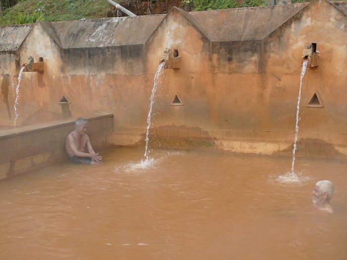
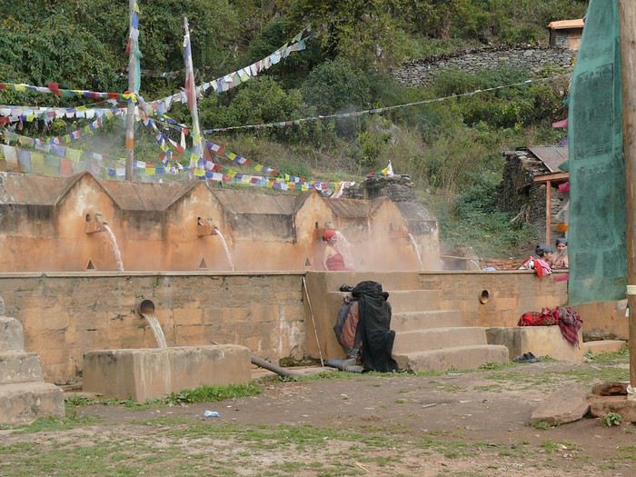
Les sources d'eau chaude se résume a deux tuyaux qui sortent d'un muret d'ou coule ces eaux qui servent bien sur aux locaux (pour l’histoire j'avais pris mon maillot en pensant pouvoir me détendre !!!!)
Pas de soucis pour les teahouses, elles sont toutes en service ou presque.
Voila les réponses a vos premières questions, n’hésitez pas à en poser d'autres si nécessaire.
en fin de récit je donnerai toute indication sur l'organisation complète de ce voyage.
je suis passée en 2010 à Tatopani (je ne sais pas s'il y en a plusieurs ) , je revenais de Langtang.
Cette région a beaucoup souffert avec le tremblement de terre

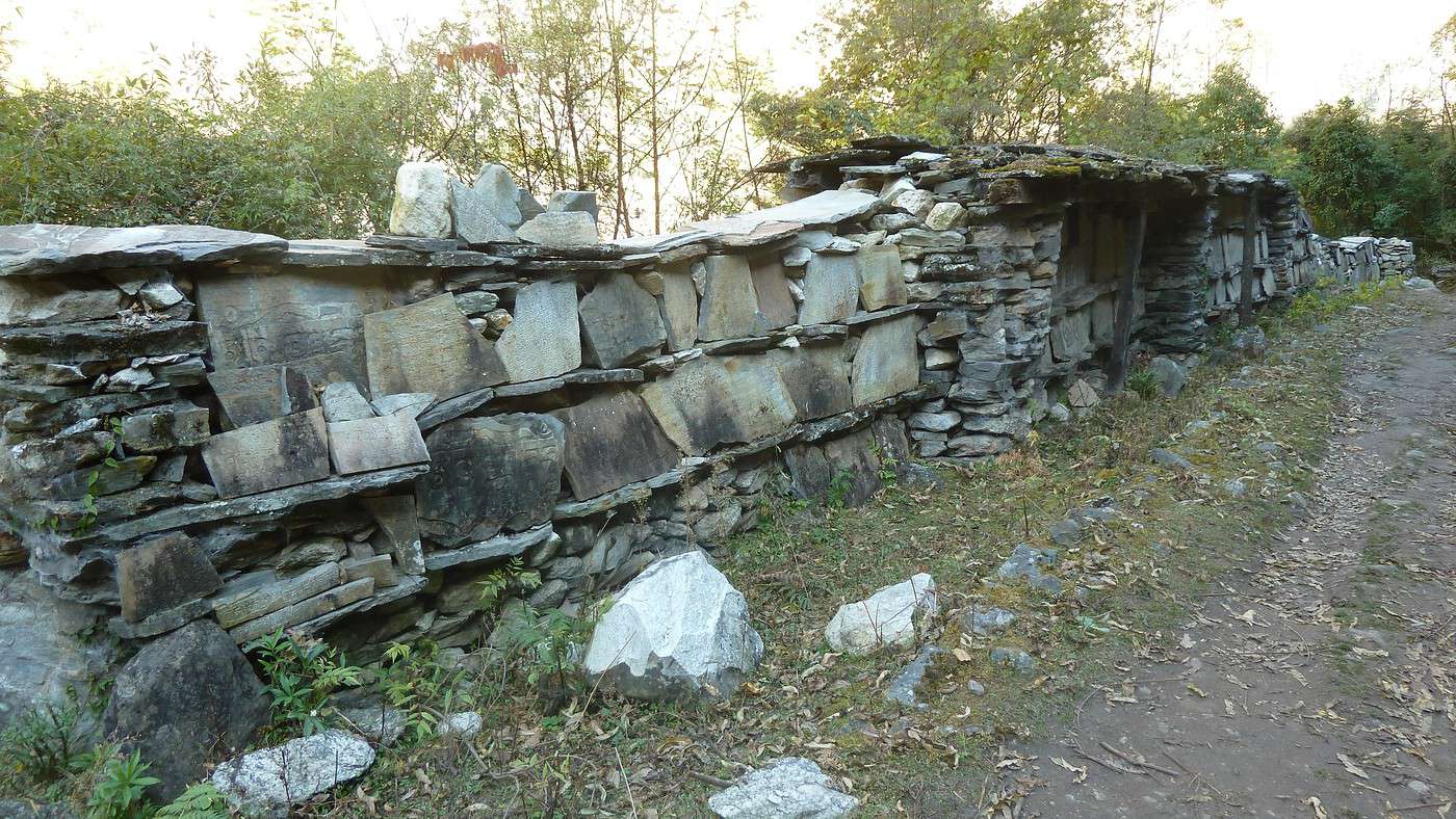
le soir les habitants venaient se baigner et j'ai partagé avec les femmes un bon moment dans ces bains..... de beaux souvenirs
mariejo

le soir les habitants venaient se baigner et j'ai partagé avec les femmes un bon moment dans ces bains..... de beaux souvenirs
mariejoQui a l'habitude de voyager sait qu'il vient toujours un moment où il faut partir...
Paulo Coelho
Salut
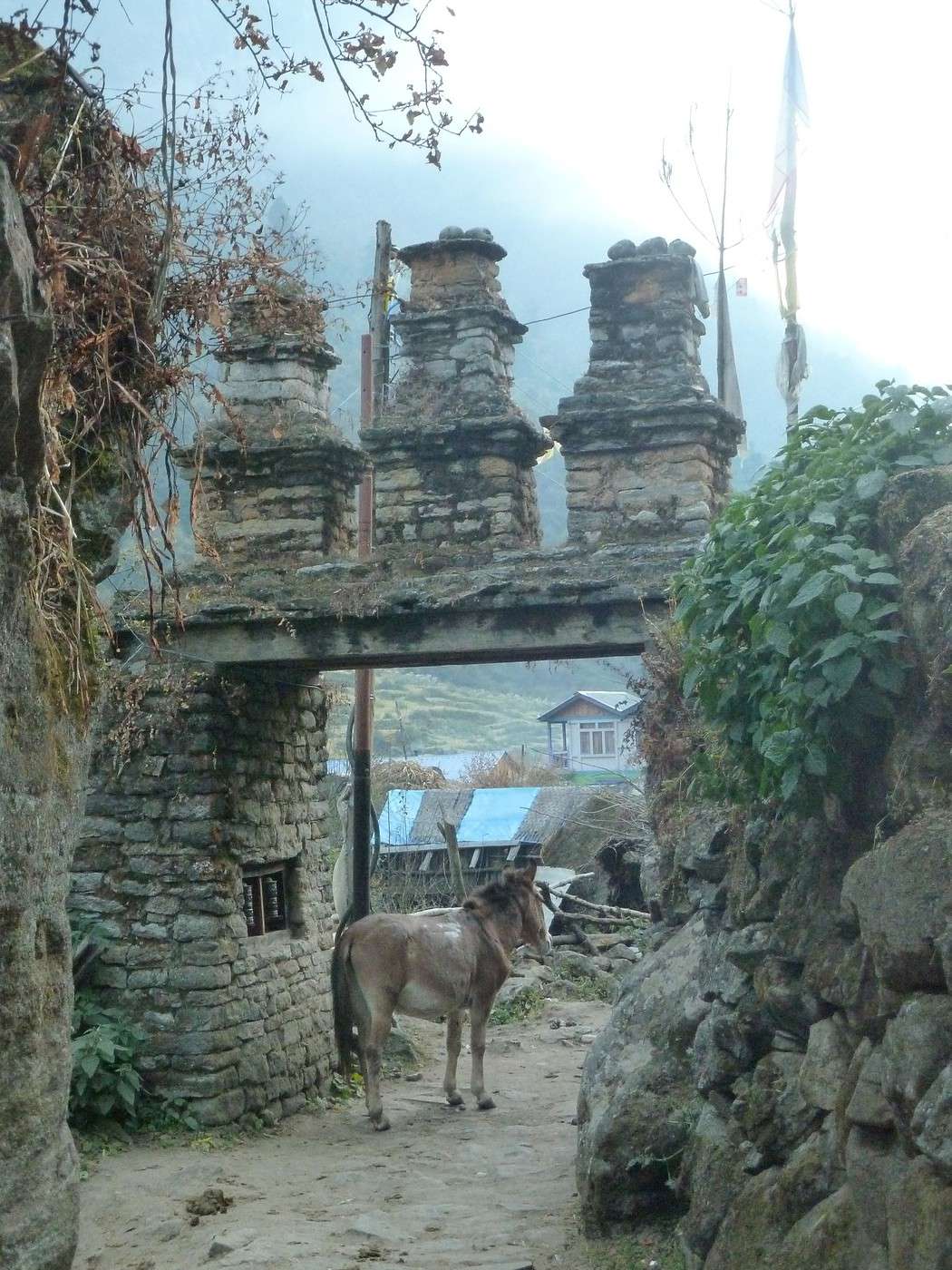
Des Tatopani ( sources d'eau chaude) il en existe beaucoup au Népal ( Tatopani= eau chaude en Népalais)
Les 3 plus connues des trekkers: Celle située dans le classique tour des Annapurnas au sud de Jomsom avant de monter à Ghorepani/Poon Hill ; celle sur le Tamang trail ( Langtang) au nord de Gatlang ( c'est là où tu as pris ta photo). et celle du tour du Manaslu dans les gorges de la Buddhi Gandaki.Mais il en existe encore bien d'autres ( au Gurja Himal, au Rolpa, Proche de Jumla, au Kangchenjungha etc..)
Des Tatopani ( sources d'eau chaude) il en existe beaucoup au Népal ( Tatopani= eau chaude en Népalais)
Les 3 plus connues des trekkers: Celle située dans le classique tour des Annapurnas au sud de Jomsom avant de monter à Ghorepani/Poon Hill ; celle sur le Tamang trail ( Langtang) au nord de Gatlang ( c'est là où tu as pris ta photo). et celle du tour du Manaslu dans les gorges de la Buddhi Gandaki.Mais il en existe encore bien d'autres ( au Gurja Himal, au Rolpa, Proche de Jumla, au Kangchenjungha etc..)
ok merci je comprends mieux😉
Qui a l'habitude de voyager sait qu'il vient toujours un moment où il faut partir...
Paulo Coelho
Si je viens de Soti Khola en autonome (autorisé jusqu'à Jagat), cela m'arrangerait pour éventuellement coucher à Tatopani. A défaut, c'est soit Khorla Besi (étape raisonnable), soit Dhoban (1 h de plus, pour une étape sans doute trop longue).
Tatopani est une étape presque obligée du tour du Manaslu.Même si les sources d'eau chaude n'ont rien d'exceptionnelles à mon avis il est intéressant de s'y arrêter... Je ne connais pas ton projet mais j'ai cru comprendre que tu voulais aller jusqu'au check point de Jagat ( accès autorisé sans permis) et ne pas poursuivre pour le tour du Manaslu. Si tu as suffisamment de temps et un esprit aventureux tu peux rejoindre le Langtang en 7 jours à partir de la vallée de la Buddhi gandaki ( Khorla besi) en direction des Ganesh Himal vers Yarsa, Lapa gaon, Tipling, Somdang, Gatlang et Syabru besi...pas besoin de permis et le TIMS suffit là tu ne rencontreras pas grand monde mais des villages traditionnels... Plus classique ( variante du départ pour le tour du Manaslu) tu peux aussi quitter la vallée vers l'est et monter aux villages Gurung de Laprak et Barpak en faisant un stop à Singla ( rudes étapes!) et de là rentrer à Gorkha en 2 jours Ps: Khorla besi/ Jagat se fait en principe en 5heures de marche
Merci Jean-Michel.
Nous allons poursuivre en messagerie privée pour ne pas perturber plus ce carnet de trek.
Fabrice
Nous allons poursuivre en messagerie privée pour ne pas perturber plus ce carnet de trek.
Fabrice
S'exposer à l'Etranger lointain amène à mieux connaître et comprendre sa propre Culture.
Pas de soucis pour les teahouses, elles sont toutes en service ou presque.
Si cela concerne bien les quelques teahouses de Tatopani, cela m'arrange bien pour mon projet de circuit en "accéléré" (je suis un marcheur endurant).
Au plaisir de lire la suite. Tout particulièrement si vous avez pu faire quelques escapades autour de l'itinéraire central, par exemple le Pung Gyen Gompa ou l'un des cols tibétains après Samdo.
Fabrice
P.S. : très nombreuses informations sur le Tour du Manaslu in manaslucircuittrek.com , régulièrement mis à jour.
Si cela concerne bien les quelques teahouses de Tatopani, cela m'arrange bien pour mon projet de circuit en "accéléré" (je suis un marcheur endurant).
Au plaisir de lire la suite. Tout particulièrement si vous avez pu faire quelques escapades autour de l'itinéraire central, par exemple le Pung Gyen Gompa ou l'un des cols tibétains après Samdo.
Fabrice
P.S. : très nombreuses informations sur le Tour du Manaslu in manaslucircuittrek.com , régulièrement mis à jour.
S'exposer à l'Etranger lointain amène à mieux connaître et comprendre sa propre Culture.
Je viens de terminer ce tour du Manaslu en novembre 2016 et le circuit n'a été rouvert qu'en avril 2016 car cette region était dans l’Épicentre du séisme et a énormément souffert ; du coup nous ne nous sommes pas arrêtés a Tatoponi pour cette raison.
Cordialement
Ne sachant comment supprimer ma version précédente, je mets en ligne celle ci :
Lorsque le rêve devient réalité (suite 2, revue)
16/11Aujourd'hui, notre étape nous amènera à Dyang (1860m) en plein pays Tibetain, que nous atteignons en presque 7h pour 1700m de positif et 1050 de négatif. une bonne douche bien fraîche (5° dehors et l'eau doit être a la même température !) et nous pouvons prendre un "black tea" mérité. Cette étape plus long que la veille nous a offert des paysages encore plus beaux, nous avons aperçu de nombreux singes ainsi que des bouquetins qui nous rappelle que nous sommes en montagne !! La nuit a été fraîche dans la chambre pas plus de 2° !!
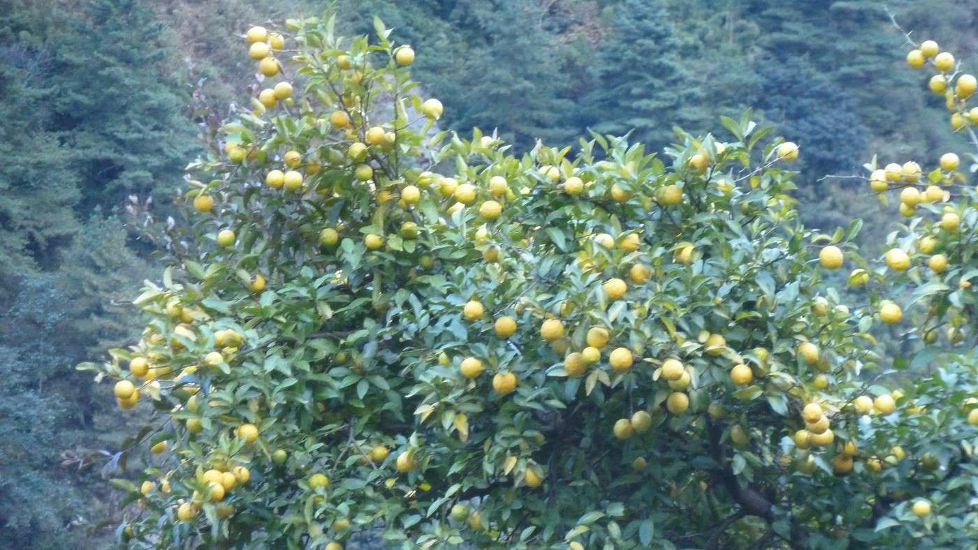
17/11 Destination du jour Namrung (2540m). C’est une étape moyenne faite en 6h45 (comme la veille mais plus de dénivelé) pour 1600 m de positif et 850 de négatif après un passage à 2700m sous un soleil bien chaud + de 27° malgré l’altitude, que c’est bon ! Par contre des que le soleil passe derrière la montagne la température descend d’un seul coup pour arriver a 0° vers 19h ! Une végétation toujours plus luxuriante avec des mandariniers, des bananiers et des citronniers par dizaine ! Le lodge se trouve a coté d'un monastère en construction (qui servira également à l'accueil des touristes).
18/11Aujourd’hui les affaires se corsent, car nous allons à Shyala qui est à 3330m pour 1200m de positif et 271m de négatif (nous descendons de moins en moins!), pour 5h30 de marche. Nous avons coupé et recoupé le torrent et traversé une très belle foret. Un pique nique à plus de 3200, face à sa Majesté le Manaslu que nous voyons pour la 1ere fois. Quelle pure merveille, depuis le temps que l'on en parlait, il nous apparaît grand, très grand (8163m, huitième sommet le plus haut du monde) ; d’après notre guide, en français c'est "le tueur d'hommes" ! En effet une ascension sur deux se termine en désastre, c'est un des sommet le plus difficile a conquérir car il est couvert de glace éternelle entre autre)! Shyala est un petit village typique Tibetain (comme de nombreux autres que nous traverserons) avec une population plus mat de peau. En arrivant au lodge, nos hôtes nous ont fait profiter de la distillation du Raksi, alcool local a base de riz qui, plus il est distillé moins il est fort et se boit chaud !! Agréable à boire après 6 ou 7 passages !! La chaleur du lodge n’était pas présente !! (comme tous les soirs) et nous avons profité d'un agréable poêle en fonte qui nous réchauffait les pieds ! Première soupe à l'ail que nous allons dorénavant trouver et consommer tous les jours car elle est très nourrissante, et permet de limiter le MAM (mal de montagne) au maximum.
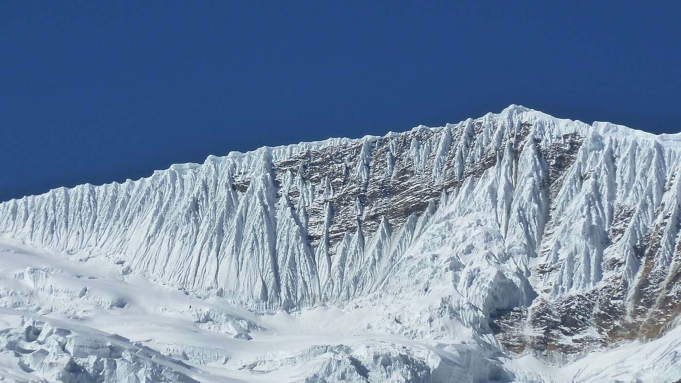
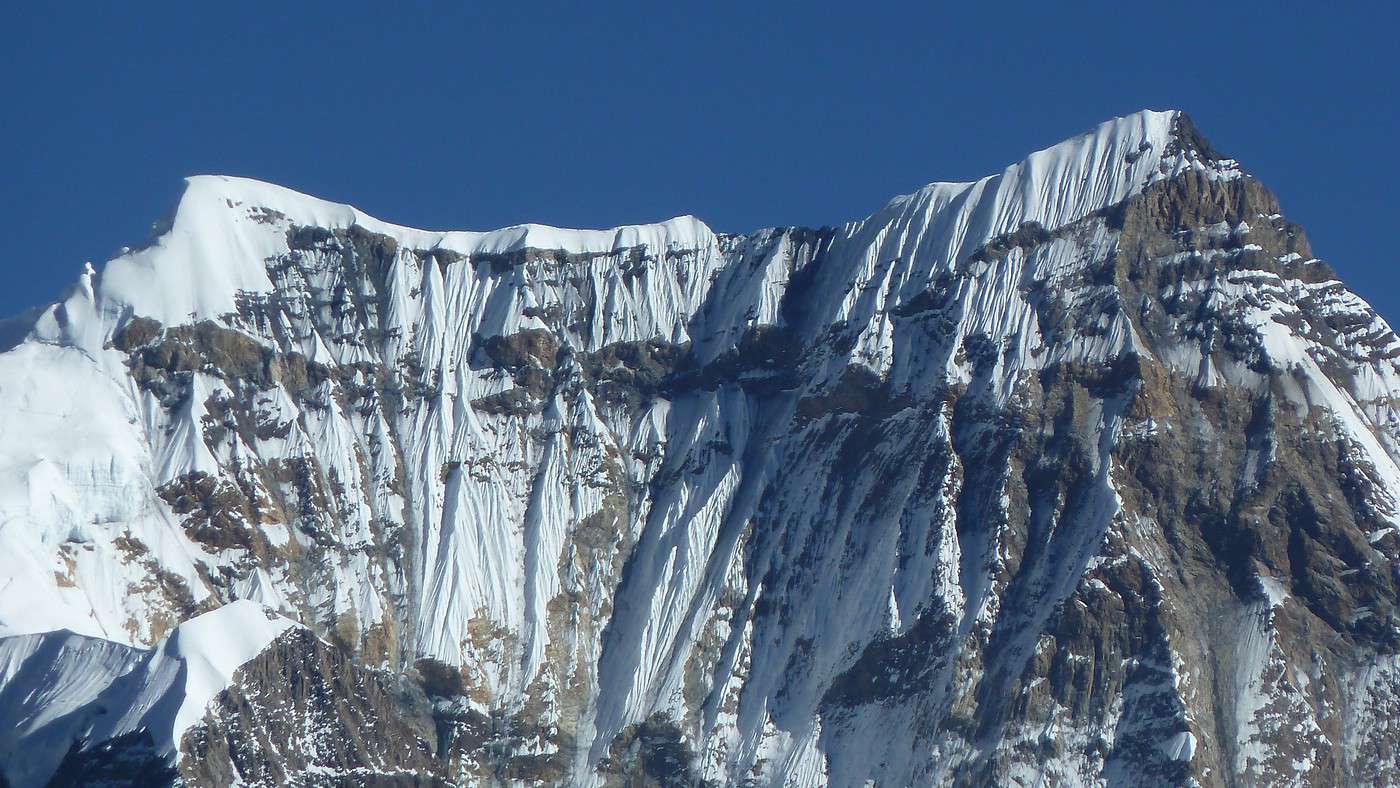
19/11 La nuit a été très froide, je pense, car ce matin nous avions 0° dans la chambre, et d'ailleurs hier soir j'ai fini d’écrire ce carnet de voyage avec les gants de soie et le bonnet sur la tête pour me réchauffer un peu ; Reveil 6h pour admirer le lever du soleil sur sa Majesté ! Et quel spectacle ! Le Manaslu est passé par toutes les couleurs orangées jusqu'à devenir blanc immaculé ; je n'imaginais pas un seul instant pourvoir admirer un tel spectacle lors de la préparation de ce trek. Se lever tôt (je ne suis pas un adepte en temps normal) était tout à fait justifié. Apres le passage du chek-point nous poursuivons notre marche Vers Samagaun (ou Sama Gaoun) qui se trouve a 3390m mais nous faisant un détour pour aller au monastère de Pung Gyen (3900m) qui malheureusement était inoccupé (dixit une équipe qui en redescendait) ; nous n'avons donc pas vu de près ce monastère mais nous avons profité d'une vue grandiose sur le Manaslu et avons nous essayé d'imaginer les difficultés de l'ascension sans vraiment savoir l'effort que ça demande. Notre pic nique c'est donc fait a cette altitude sous un soleil bien chaud au bord d'un petit torrent qui dégelait juste et qui se frayait un chemin a travers les pierres. Petite marche quant à la longueur avec juste 600 m de dénivelé. Un lodge tres accueillant avec un patio qui nous rappelait notre Sud !
Lorsque le rêve devient réalité (suite 3)
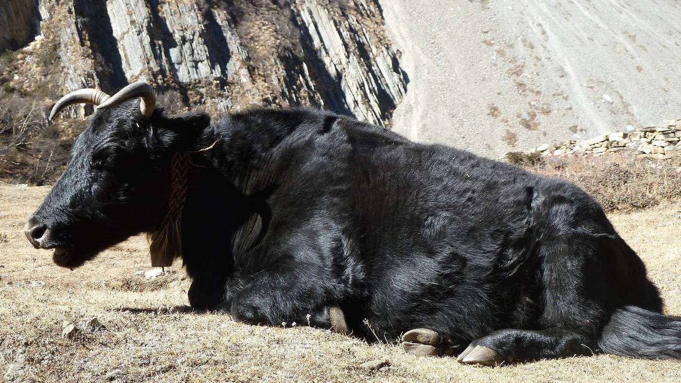
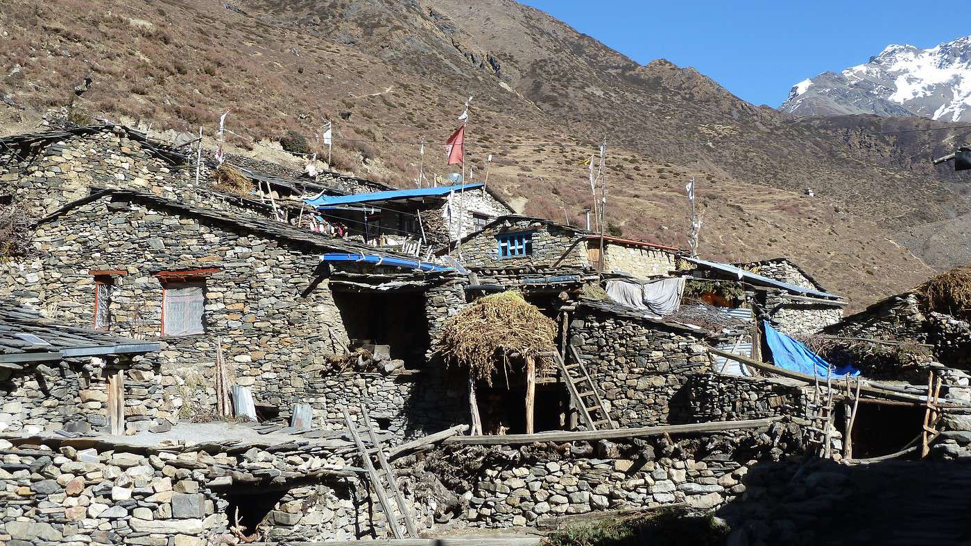
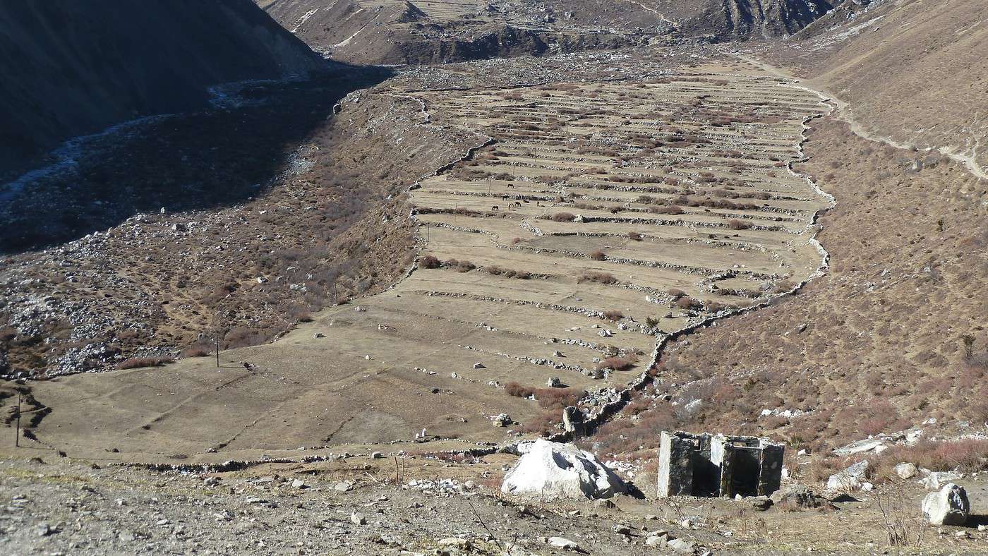
20/11 Une marche de courte durée nous permet de partir plus tard que d'habitude c'est à dire 9h !! Et oui nous n'aurons que 3 petites heures avec seulement 450m de dénivelé positif et 94m de négatif !!! Il faut dire que nous avons besoin d'une adaptation à l'altitude et notre étape est a 3900m et s'appelle Samdo. Pour nous mettre dans l'ambiance, en arrivant, un hélicoptère venait chercher une femme qui avait eu un problème important avec l'altitude. Certaines personnes m'avaient dit que les secours ne viendraient pas me chercher si je rencontrait ces soucis! Que nenni !! j' avais quand même pris une assurance couvrant ce genre de secours quand même. Joli petit village coincé entre les montagnes avec une multitude d’hébergements. Bien sur déjeuner sur place d'une soupe à l'ail et balade en début d’après midi sous le soleil ; village très agricole et authentique avec de petites parcelles et des quantités de Yaks que nous avons commencé à voir depuis 2 jours. Le soir grande animation dans le lodge car de nombreuses équipes que nous n'avions pas rencontrées encore se trouvaient être au même endroit. attention le mot lodge ne correspond pas à ce que nous imaginons dans notre vocabulaire ! Il s'agit tout simplement de refuge plus ou moins grands avec des chambres a deux lits le reste (sanitaires) étant sur les coursives ou dehors carrément. La nuit a été tres froide -2° dehors et + 1 dans la chambre. Nous avions la possibilité soit d'aller au lac Birendra (+3h) ou au camp de base du Manaslu (+5h), mais nous n'avons pas tenté car les deux prochaines journées sont solides donc nous réservons nos forces (peut être aurions nous du mais c'est comme cela).
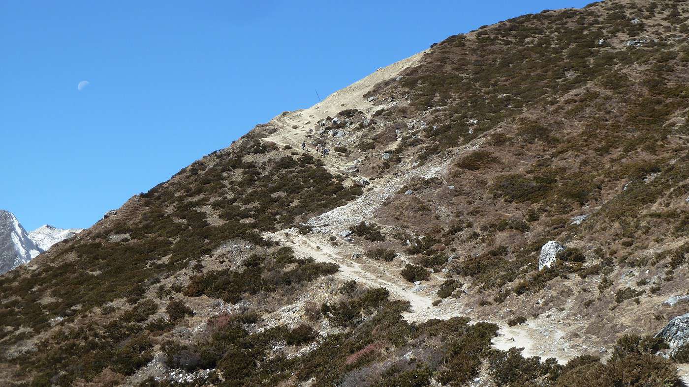
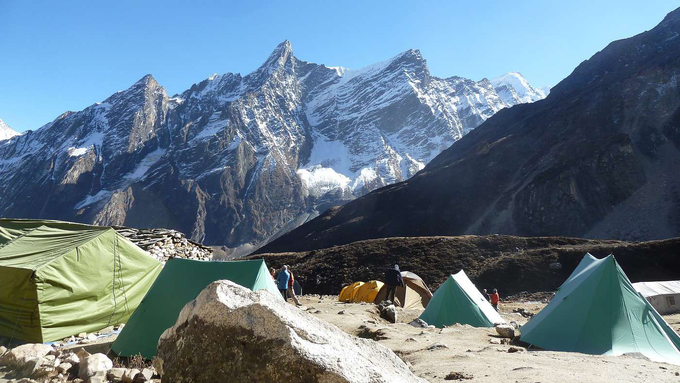
21/11 c'est l'avant dernière montée avant le col. Cette étape s'appelle Dharamsala (4460m) avec simplement 670 m de dénivelé positif mais nous sommes au dessus de 4000m et les efforts se sentent très vite ; malgré cela je suis en grande forme et ne ressens aucune gêne, ni physique ni respiratoire, par contre mon camarade, migraineux en temps normal n'est pas très bien depuis 2 jours, maux de tête, pas faim et donc pas de force malgré le Diamox ; cela ne l’empêchera pas de montée peut être avec un peu moins de tonus mais beaucoup de volonté. Ce soir pas de lodge juste des toiles de tentes !!! Et oui ça va changer un peu, mais ce n'est pas grave tant qu'il ne pleut ou ne neige !! C'est l'unique lieu d’étape avant le col donc 70 personnes se partagent l'espace resto et les tentes ! Et encore c'est très peu car nous sommes en fin de saison ; en pleine période c'est + de 200 personnes!!! Malheureusement l'étape n'est pas à la hauteur ! WC sale et bouché, salle de repas trop petite (en saison il y a des tentes en plus) ici tout se paye très cher (ce qui est normal puisque il faut monter le ravitaillement) nous sommes a 4460m et la note pour nous deux est de 4500 roupies ! la bière est a 600 roupies, la place sous la tente a 300 et une couverture à 200 !! Apres le déjeuner (ou plutôt après le bol de soupe a l'ail) repos au soleil ou nous sommes en tee shirt et il fait 30° !! Il est très difficile d'avoir de l'eau chaude pour mettre dans les thermos ! Enfin ce n'est pas grave nous nous couchons vers 20h tout habillé pour la 1ere fois et ce sera justifié car au lever nous aurons -5°. Le départ est prévu pour 4h 30 car il faut passer le col avant 9h ensuite le vent peut se lever est devenir tres glacial!
A suivre
En effet ca fera parti de mes plus beaux souvenirs de trek
Le suite ne va pas tarder mais je manque un peu de temps
Lorsque le rêve devient réalité (suite 4)
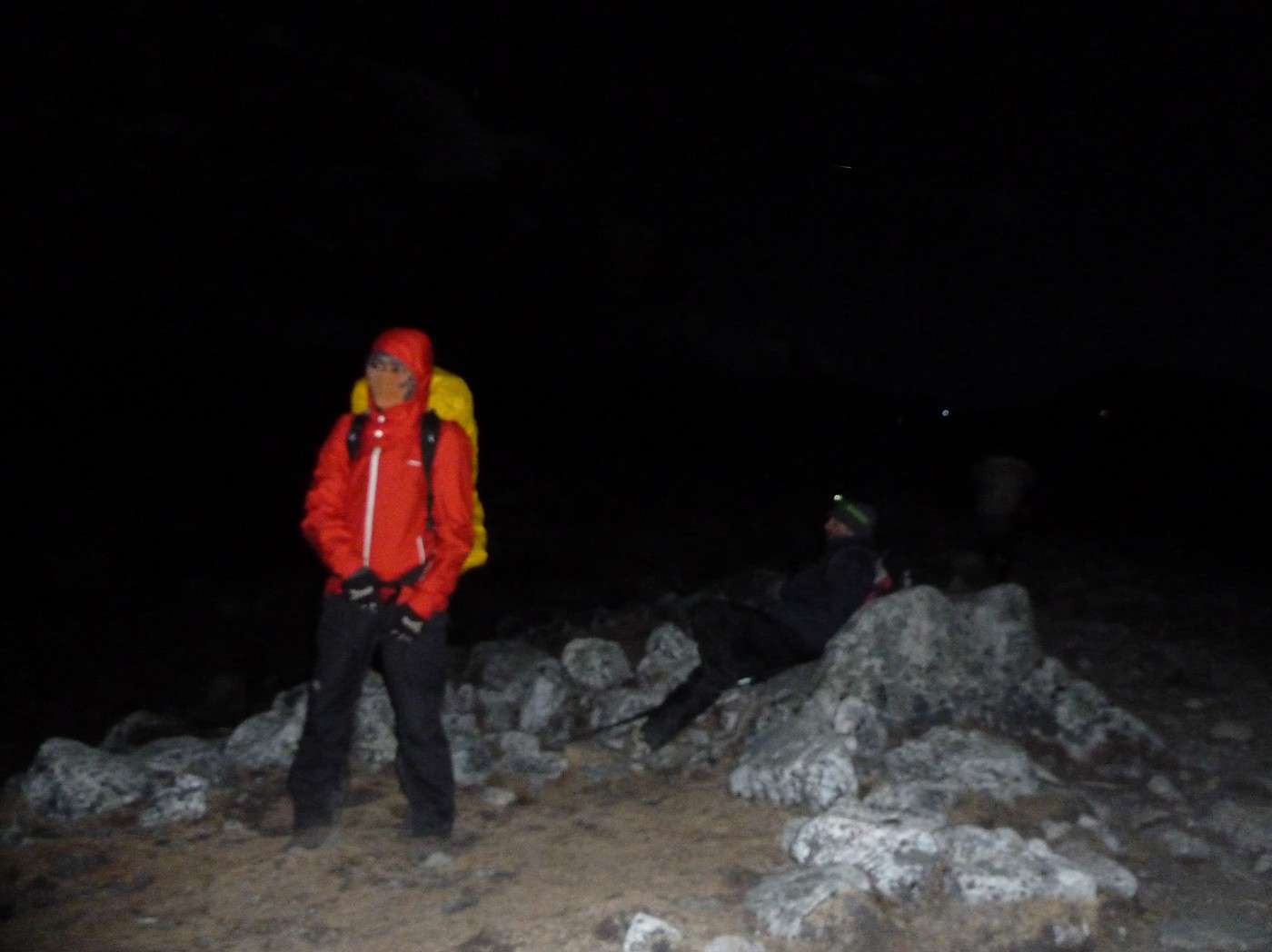
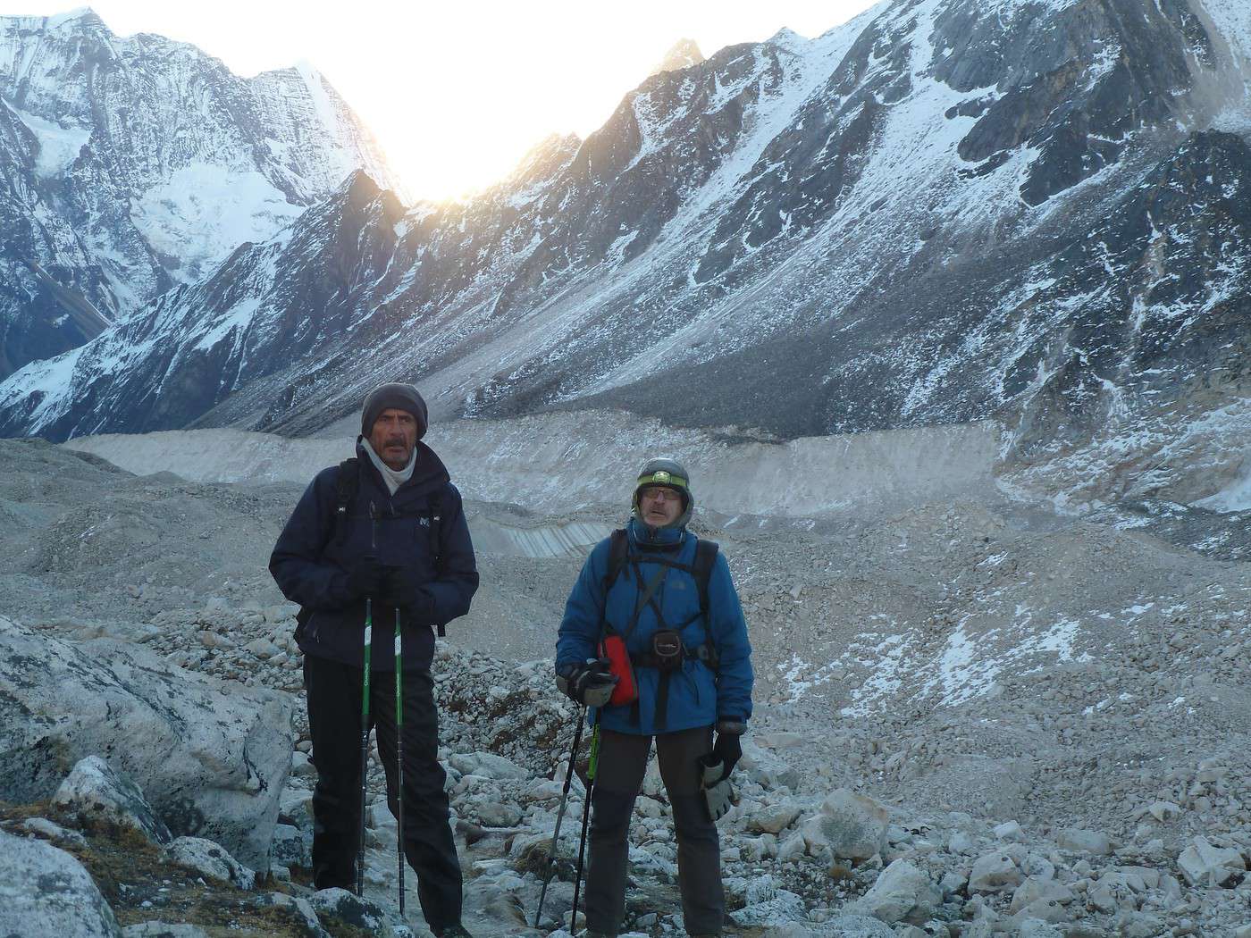
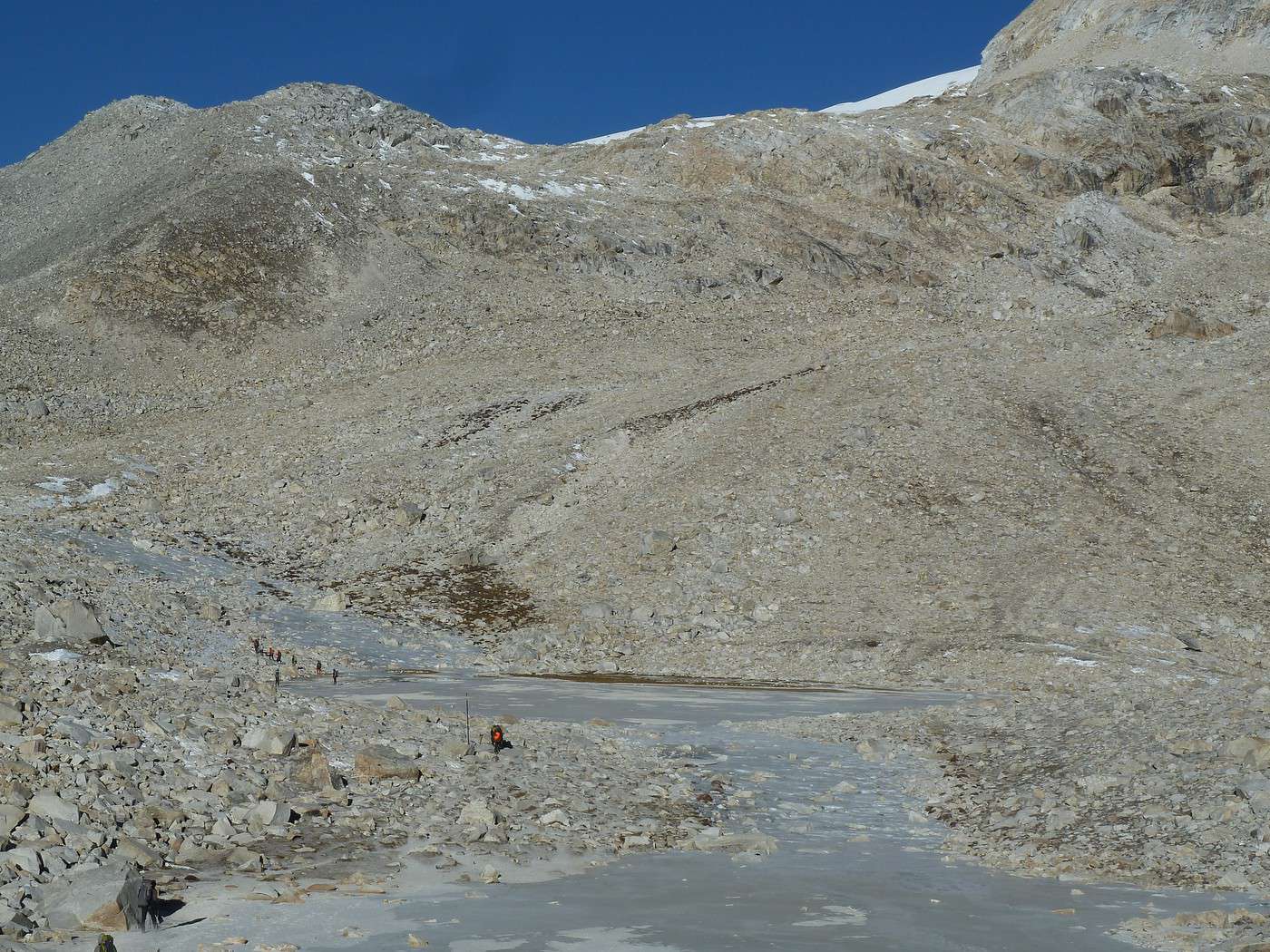
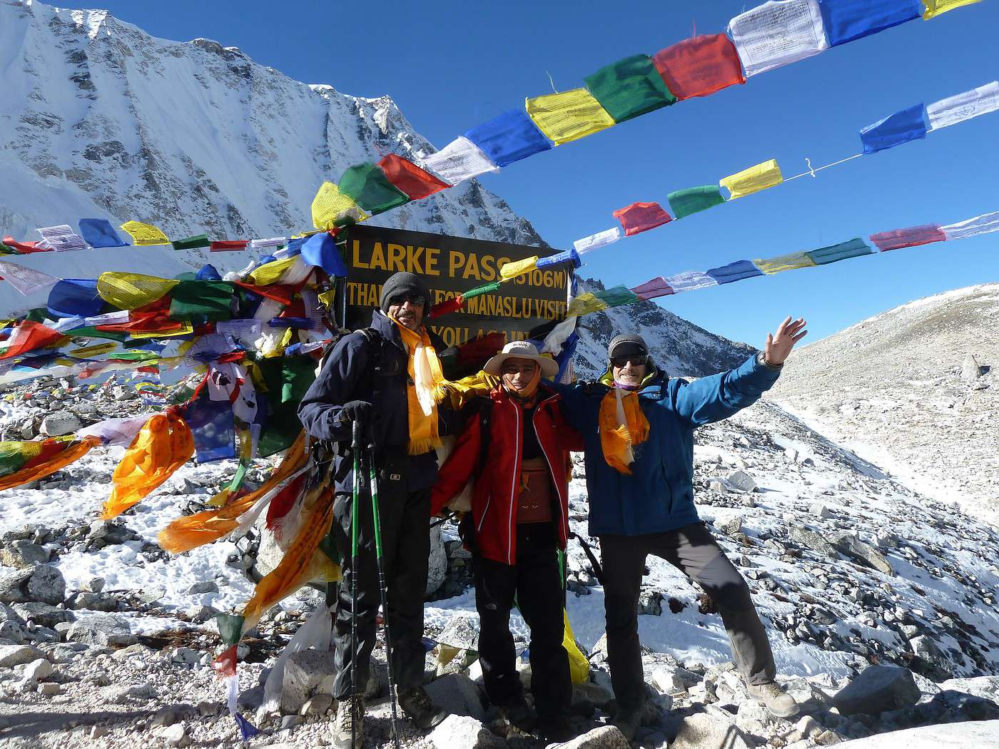
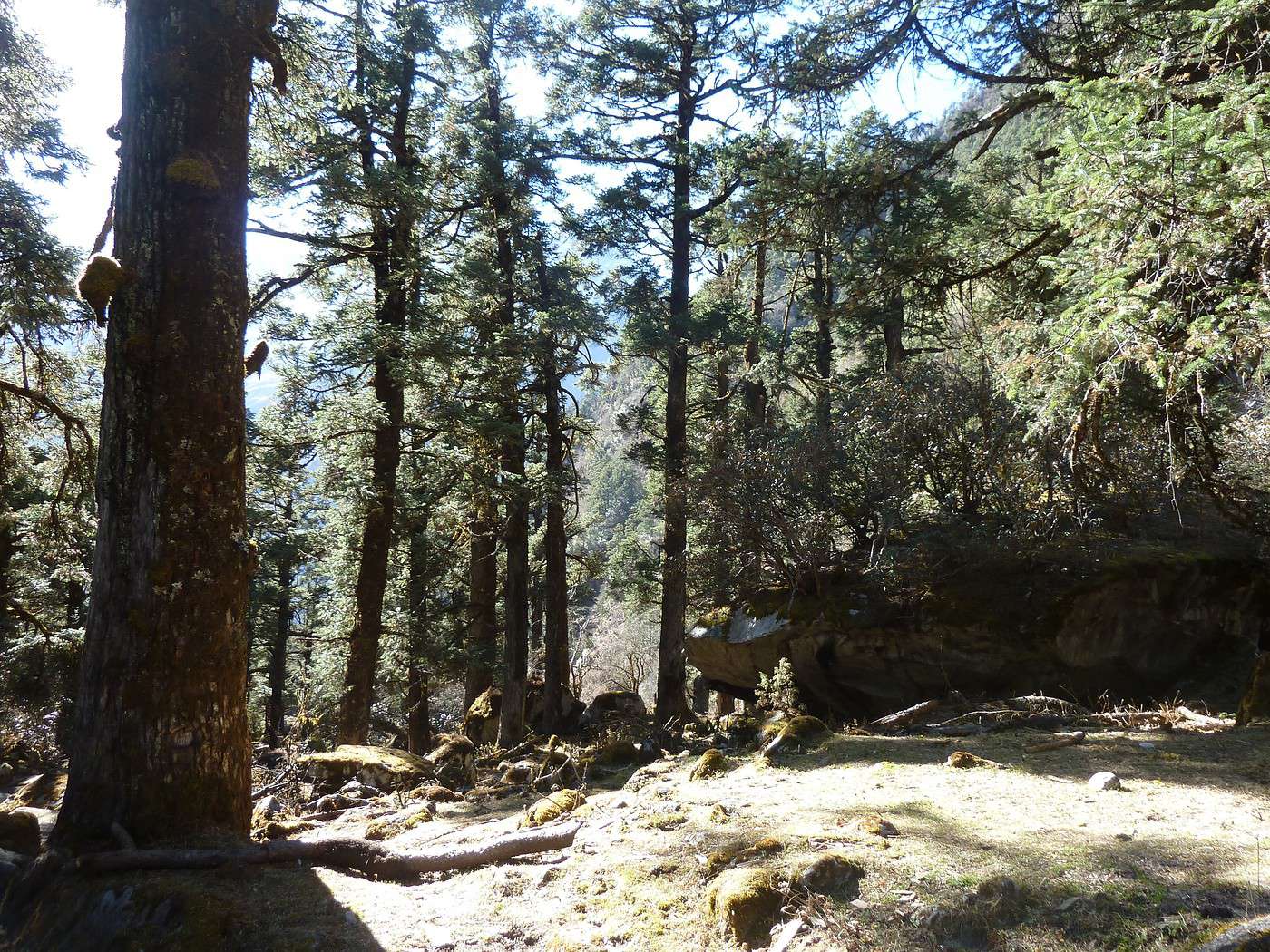
Réveil 3h15 il fait la même température sous la toile que dehors, car en plus la fermeture eclair ne fonctionnait pas donc le vent s'engouffrait ! Heureusement que nous avons dormi tout habillé, je ne sais pas si j'aurais eu le courage de me changer !!! Apres avoir avalé 2 chapatis avec du miel et un "black tea" bien sucré nous nous apprêtons a partir il est exactement 4h 00 !! Il fait -5° et nous attaquons la montée vers le col à la lueur des frontales-; que c'est beau toutes ces petites lumières dans la nuit encore très noire ! Mais qu'il est difficile de marcher avec juste ce faisceau lumineux et surtout sans voir le paysage ni les trous ni les bosses !!! Malgré ma paire de gants de moto (et oui car en principe ils sont très efficaces sous le froid) avec en dessous des gants de soie j'ai froid aux mains ; le reste du corps ne pose pas de problème, pas plus que les pieds. La montée est difficile, le souffle est court nous avançons doucement car le terrain est très accidenté. Je m’arrete souvent le souffle me manque, et j'en profite a chaque fois pour frictionner mes mains et boire. Le ciel s’éclaire doucement, le soleil est derrière nous et va bientôt passer par dessus la montagne. Les couleurs sont bizarres on se croirait dans un film noir et blanc !! Enfin les premiers rayons commencent à se sentir, nous découvrons un paysage lunaire (j’imagine que ça ressemble a çà !), blanc comme la plage (non ce n'ai pas le "cat" qui me fait de l'effet !) mais c'est magnifique. Nous sautons, si je peux dire ca, de blocs en blocs et en contre bas un lac dont les bords sont gelés. Nous longeons ce lac avant la dernière ascension vers le col. Ça y est nous sommes à Larke Pass 5106m il est 9h exactement et le vent est déjà présent et en plus il est très froid. Nous avons enfin atteint ce sommet, mon rêve est accompli et dans des conditions parfaites. après les photos d'usage, l'accrochage des drapeaux de prières, du fanion de Mon club de rugby, nous grimpons encore les 14 m qui nous séparent du point le plus haut et après avoir marché pendant quelques temps sur la ligne de crête et une pose pour un casse croûte mérité, nous attaquons la descente Mais là cela se complique sacrement : en effet la descente est raide, mais surtout dans un énorme pierrier avec en dessous du sable donc a chaque pas l'on descend de deux !! Les gens en bas sont tous petits et encore très loin, il nous faut beaucoup d'attention pour ne pas glisser car la chute pourrait être compliquée ! enfin après 3 bonnes heures de descente dans cet enfer (on peut dire ça) nous voila sur le plat avec en face de nous les Annapurnas au loin. Nous marchons encore une bonne heure pour arriver à une halte constituée d'une grande tente qui sert de magasin !! Nous faisons notre halte pic nic et une petite sieste au soleil pour réchauffer nos vieux os n'est pas de trop. 14h nous repartons et longeons la rivière que nous traversons de temps en temps. Nous arrivons vers 15h 30 a Bhimthang (+2°seulement) dans un petit lodge très sympa et coloré. La douche n’étant toujours pas chaude la patronne nous a fait bouillir de l'eau dans une grande bassine et nous avons pu nous laver avec un broc en guise de douche et ça vraiment du bien après cette journée très poussiéreuse !! Nous sommes a 3600 m et nous avons parcouru 15.5km en 8h45 de marche pure avec 795m de dénivelé positif et 1517 de négatif ! Les genoux et les cuisses ont fumé !! Petit somme réparateur en attendant le repas. nous nous mettons autour du poêle et arrosons notre journée inoubliable avec une bière locale. Nous sommes 8 dans la salle et une dizaine de porteurs, ça change d'hier soir. Notre guide Chakra est au petit soin depuis le départ, attentif, a l’écoute de chacun, c'est un garçon formidable, En consultant le calendrier Nepalais en place je m’aperçois que nous sommes en 2066. 23/11 Notre étape du jour n'est que descente, toujours le long de la rivière et très souvent dans une magnifique foret de sapins géants, dans de superbes paysages pour arriver a Tilchi 2600m apres 7 bonnes heures de marche. Aujourd'hui en panne de GPS car je n'ai pas pu recharger et mon chargeur solaire ne fonctionne plus (il a pris un choc lors d'une chute certainement), mais je pense que nous avons fait au moins 1200/1300 de dénivelé négatif . Nous avons surtout été obliges de trouver une trace dans la montagne car suite a un éboulis le chemin n’existe plus !! Et pour cause en arrivant plus haut un sentier très large et un peu plus bas une pelleteuse !! Et oui a cette altitude elle est en train de tracer une route pour rejoindre la Chine dans quelque années en passant par le Tibet, travaux financés par les chinois !! nous terminons notre journée presque dans les nuages signe (d’après notre guide) de l'arrivée de la neige dans quelques jours Les lodges sont de plus en plus beaux (l'on se rapproche de la civilisation), celui ci est équipé d'une belle salle de bains et d'une salle de repas, tout en bois, magnifique. Le Wifi marche pour la 1ere fois depuis 10 jours !! Nous apprenons la victoire surprise a la primaire de la droite !! Ce soir le repas sera frugal : bière-pizza végétarienne népalaise et dessert !!
Lorsque le rêve devient réalité ! (suite 5)
24/11 Avant dernière étape de notre aventure passionnante.
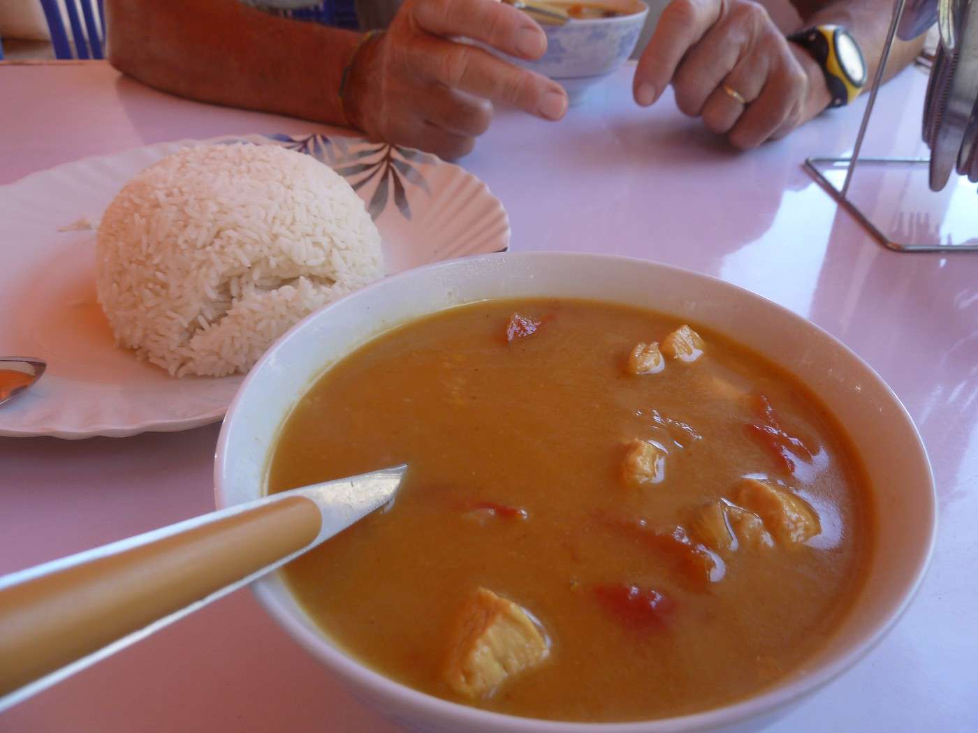
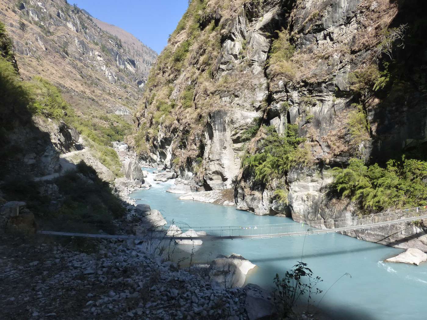
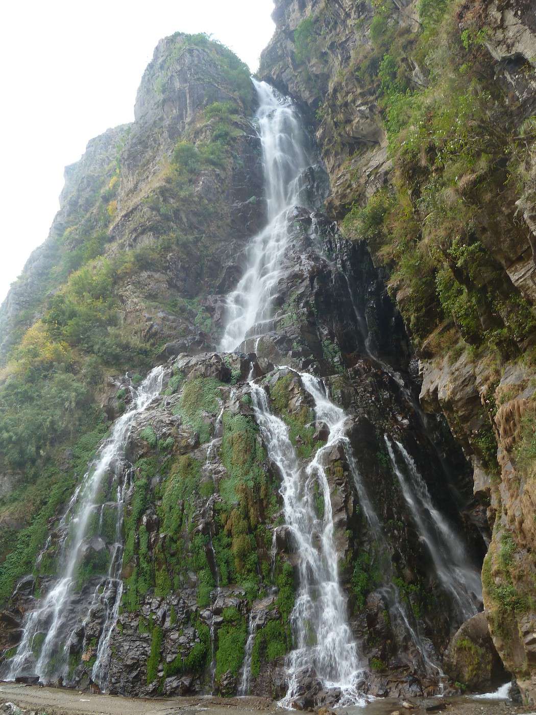
Certainement la plus longue (en temps mais aussi moralement car le chemin n'est pas très intéressant) 25km - 1100 de dénivelé positif et surtout 2500 de négatif en 6h !! Et oui nous ne faisons que descendre, descendre et encore descendre !! En première partie nous sommes encore sur un sentier et nous passons à Dharapani carrefour des treks pour les Annapurnas. Nous faisons une pose au chek point puis après en avoir décidé ainsi nous prenons le route forestière qui descend à Jagat -1300m-(nous aurions pu y aller par les sentiers, mais le terrain était très humide à l'ombre et dangereux!) Le chemin suit la rivière qui est d'ailleurs d'une couleur comme la mer des Caraïbes !! Retour à la civilisation un peu bruyante (nous avions oublié !!), voitures, motos, enfin tous ces mouvements que nous avions complètement perdus. Un arrêt pour déjeuner dans une petite "gargote" (ce n'est pas péjoratif) ou pour la première fois depuis 15 jours nous mangeons de la viande : un poulet au curry comme l'on avait jamais mangé ! Preparé a la commande (plus d'une heure) et je vous assure qu'il était succulent, le tout avec une vue sur la rivière, extraordinaire. Nous reprenons notre marche et suivons cette piste ou à certain moment, nous nous demandons comment font les véhicules pour se croiser car il y a un précipice coté rivière, vertigineux. Un passage près d'une superbe cascade avec une pose "black tea"
Enfin nous arrivons au terme de notre marche dans ce joli village de Jagat et demain, un 4 x 4 nous transportera jusqu'à Besisahar.
Notre lodge est accueillant, le propriétaire très sympa, nous ne sommes que 2 et notre guide, notre porteur de l’ethnie sherpa rentre chez lui.
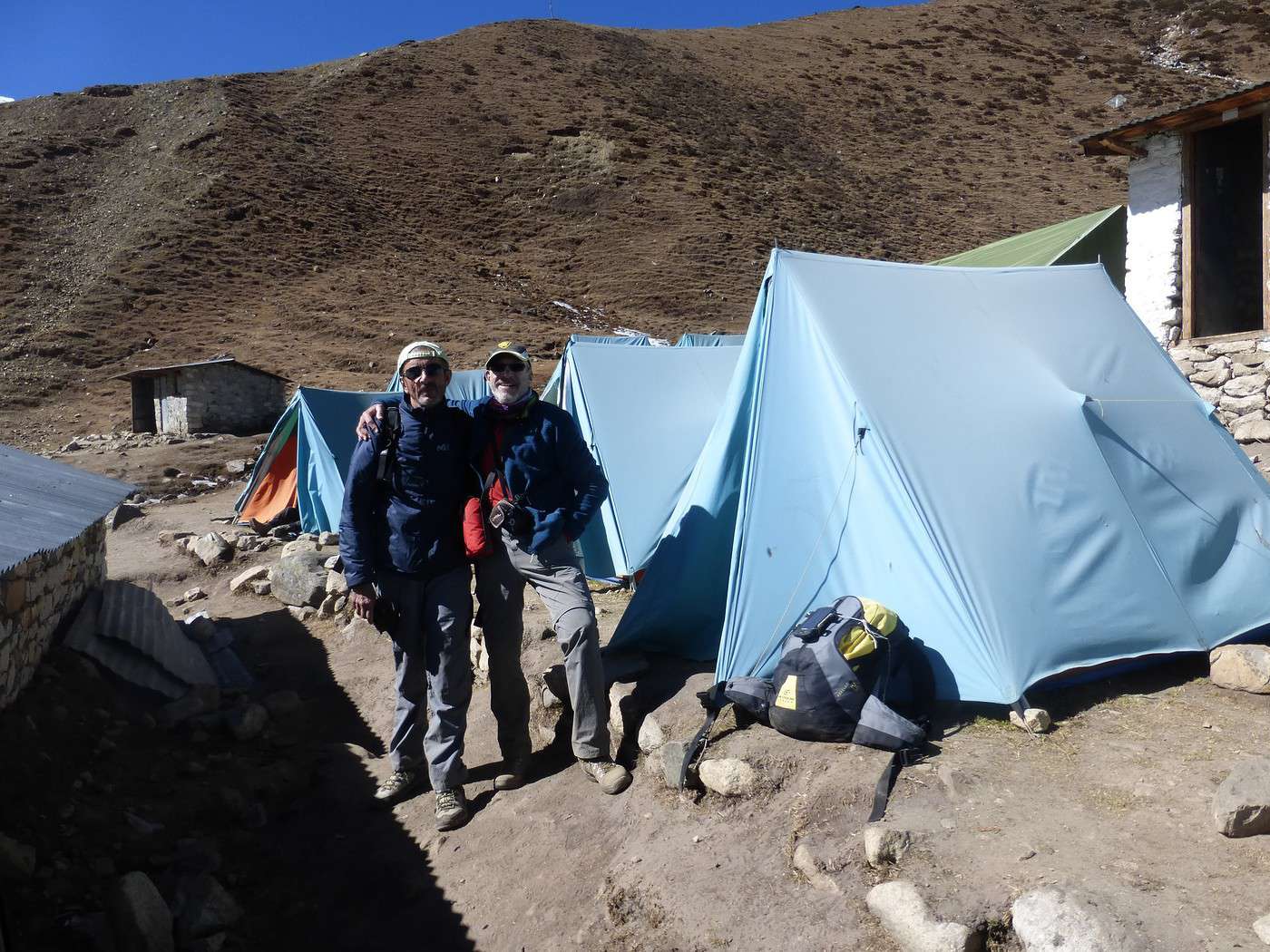
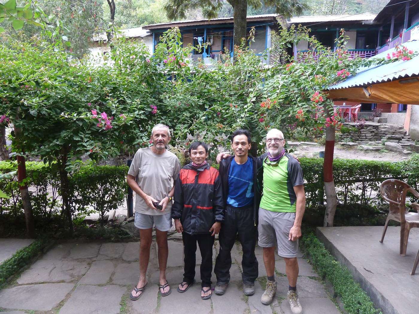
Ça y est nous l'avons fait, ce périple tant attendu, un rêve se réalise, j'ai plein d'images dans ma tête encore aujourd'hui et pour longtemps je pense. Apres avoir fait les photos de fin de parcours avec Chakra et Gantsa (guide et porteur), nous nous installons.
Pour ma part je continue l'aventure seul vers Pokhara quelques jours puis ensuite direction la Réserve National du Chitwan pour quelques autre jours, mon camarade rentre a Kathmandu pour prendre un avion pour Paris le 26.
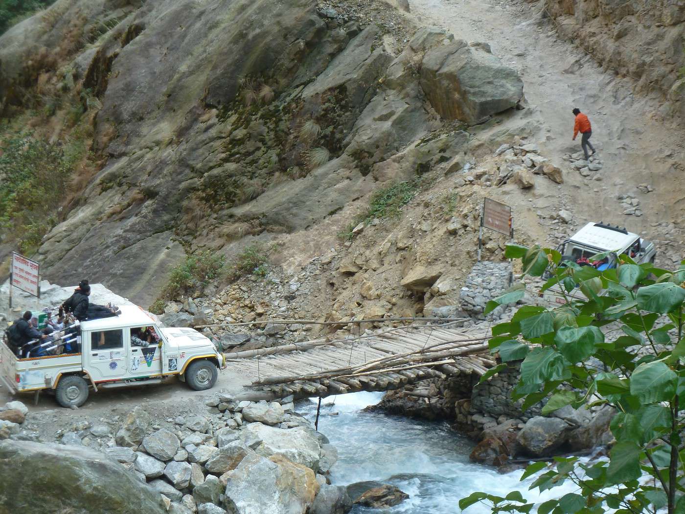
25/11 Il est 7h du matin, c'est le départ en véhicule tout terrain (et ce sera nécessaire) pour aller jusqu'à Besisahar ou nous nous séparerons. Toute une aventure, il y a 25/30 km mais nous mettons plus de 3h pour les parcourir car la piste est à peine carrossable ! La banquette est tellement dure que j'ai l'impression d'avoir passé une journée à cheval !! Nous passons devant plusieurs grosses centrales hydro-électriques construites par les Chinois et flambants neuves, et nous passons également sous le premier tunnel construit au Népal !! j'attrape au vol un bus local pour Pokhara et mon aventure en solitaire débute ici (elle fera l'objet d'un autre recit).
Pour clore cette expédition, nous avons parcouru 180 km en 13 jours, avec une moyenne de 5h30 de marche par jour pour un dénivelé positif de 12700 et négatif de 12000.
J'ai utilisé pour suivre mon périple le site de Wikiloc ; pour le mettre à l’écran il suffit d'aller sur le site et de taper la destination de chaque étape pour voir les infos correspondantes.
Nous avons utilisé les services d'une agence locale a Kathmandu qui nous a pleinement satisfait (j'avais eu leur coordonnée par mon frère qui est déjà parti 2 fois avec eux)
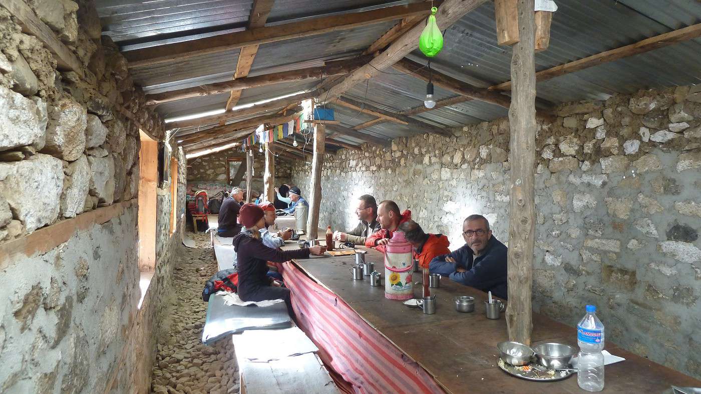
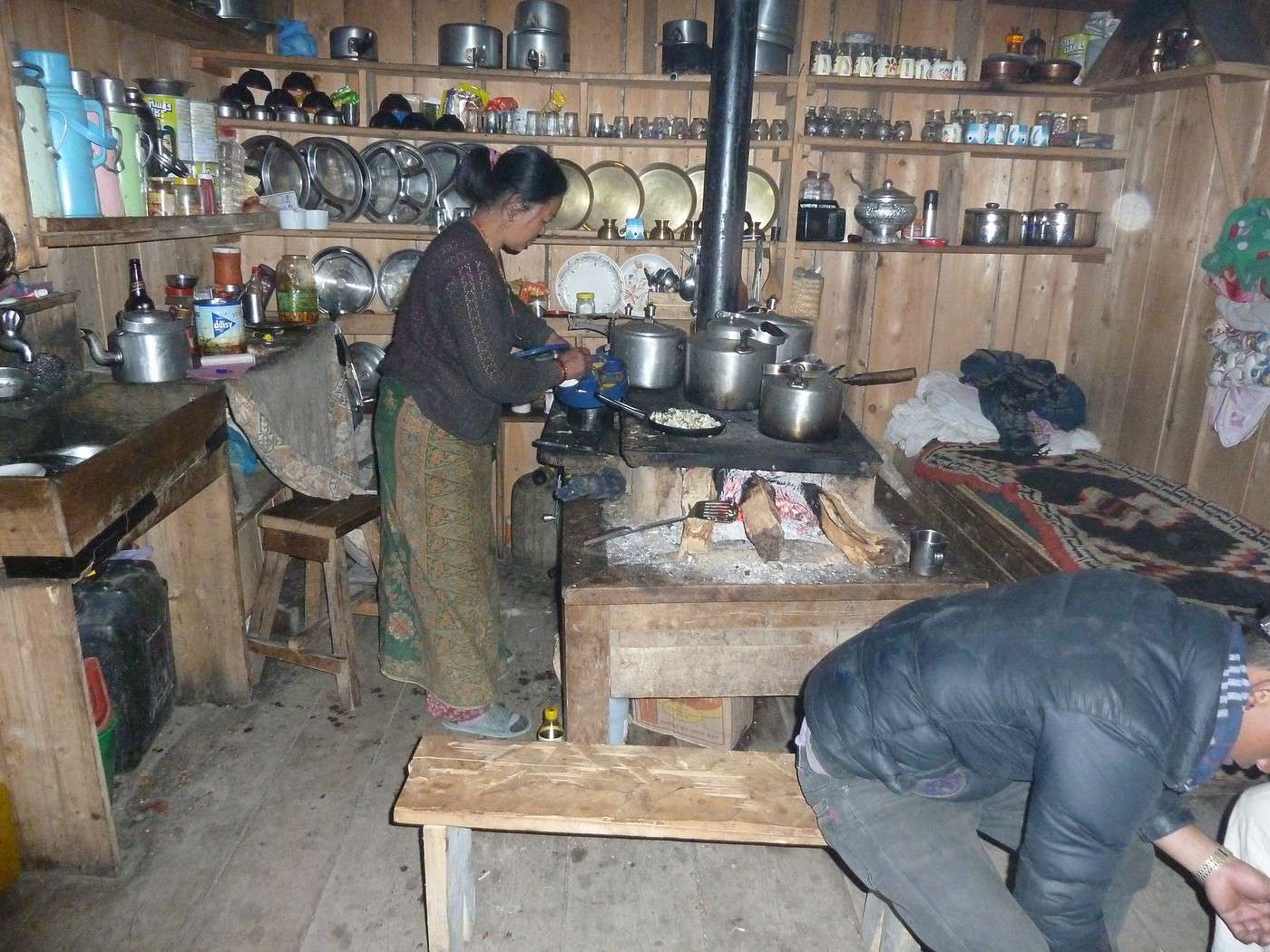
Le terme lodge correspond plutôt à Maison de Thé, car il y a le confort minimum mais tout à fait suffisant avec toujours une bonne literie et souvent des couvertures, les repas étant toujours très simples mais très bons.
Merci pour ce récit avec de très belles photos.
Hello,
J arrive du Népal, c est la deuxième fois. Et j ai fait les Annapurnas du sud, en partant de Pokara, pour me retrouver a Gorepani, poon hill, en venant de Gandruk, l inverse du circuit.
J aime le Nepal et j y retourne fin d année. .
Y a le Laddack à faire aussi
L Inde et le Nepal sont deux fantastiques..
A recommander, on en redemande. ...
Amicalement
Francine
Bravo et contente de savoir que vous aimez le Nepal
Amitiés
Francine
Bonjour!
Serait-il possible d'avoir le nom de votre agence que vous recommandez et le prix de ton trek sur 13 jours svp? Je pars en octobre au Népal et cherche un beau trek avec ce genre de dénivelé, cela me conviendrait bien. Merci bcp!!!
halfmooneyes
Bonsoir, je vais me mêler de ce qui me regarde pas, mais sur place, vous trouvez facilement des guides, et si vous allez à kathmandou guest house , à Thamel, vous aurez droit a des conseils de un français qui fait des très depuis 10 ans et qui n utilise que très peu de guides, car c est facile de ne pas se perdre.
Un bon conseil ne veut pas dire qu on peut les suivre.
Bonne soiree
vous aurez droit a des conseils de un français qui fait des très depuis 10 ans et qui n utilise que très peu de guides, car c est facile de ne pas se perdre.
Tiens donc tu en as fait beaucoup des treks au Népal pour dire ça?( A part les "Annapurnas du sud!") Quand tu te seras trompé de chemin et qu'a à la tombée de la nuit tu t'apercevras que tu vas droit vers la frontière Tibétaine ( ça m'est arrivé) tu verras les choses différemment . Par ailleurs si tu es un vrai pro de l'orientation et que tu possèdes tout le matos nécessaire pour cela et pour être totalement autonome il te restera encore à passer au travers des check points! Si tu veux faire le tour du Manaslu sans guide faudra, sur le parcours éviter les check post et si tu y parviens jusqu'au bout tu nous expliqueras ça en détail. 😏
Merci pour ce récit.
C'était mon 7ème grand trek (le 5ème au Népal).
Par contre, nous sommes passés par Arughat Bazar et avons marché de Sothi Khola à Jagat (avant Besisahar) soit environ 150 km en 11 jours de marche.
Accès à Arughat: http://gypgypvoyage.wixsite.com/gypgypvoyage/single-post/2016/11/21/NEPAL-TREK-le-tour-du-Manaslu
C'était mon 7ème grand trek (le 5ème au Népal).
Par contre, nous sommes passés par Arughat Bazar et avons marché de Sothi Khola à Jagat (avant Besisahar) soit environ 150 km en 11 jours de marche.
Accès à Arughat: http://gypgypvoyage.wixsite.com/gypgypvoyage/single-post/2016/11/21/NEPAL-TREK-le-tour-du-Manaslu
VW T4 Font Vendôme 2.4D 1993 (307.200km)
https://gypgypvoyages.forumactif.com (43 ans de voyages, 75 destinations)
Bonjour
il s'agit d'Altai Nepal A Kathmandu tel 01 4427198 mail info@altainepal.com web www.altainepal.com
ils ont un guide et un patron francophone et le portage s'effectue avec un porteur
Pour info je ne crois pas qu'il soit possible de voyager seul sur les trecks comme le dis un des voyageur
J'ai payé 940 euro /pers hotel, guide et porteur compris auquel il faut ajouter le prix de voyage (par air china environ 450 euro depuis lyon) moi j'ai pris air india car je faisais un stop a delhi pour 620 euro depuis paris
a ta dispo pur d'autres infos
Bonjour
il s'agit d'Altai Nepal A Kathmandu tel 01 4427198 mail info@altainepal.com web www.altainepal.com
Il semble que cette adresse web soit inconnue ou erronée actuellement, auriez vous plus de precision pour la retrouver exactement puisque google donne plusieurs réponses ? Merci
il s'agit d'Altai Nepal A Kathmandu tel 01 4427198 mail info@altainepal.com web www.altainepal.com
Il semble que cette adresse web soit inconnue ou erronée actuellement, auriez vous plus de precision pour la retrouver exactement puisque google donne plusieurs réponses ? Merci
bonjour
je viens de verifier tout me semble correct je vous donne un cellulaire : 985 10 83934
j'ai cherche et elle a pris le nom de https://nepal.altaibasecamp.com
toujours gerer par les memes Dont Buddhi le directeur
Cordialement
Sympa ;) merci, je me doutais que cela devait etre basecamp ...
Log in first, then come back to this page.
You might also like
More discussions
Wednesday, April 1st
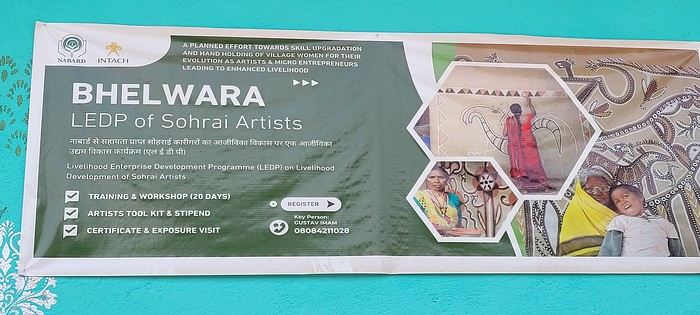
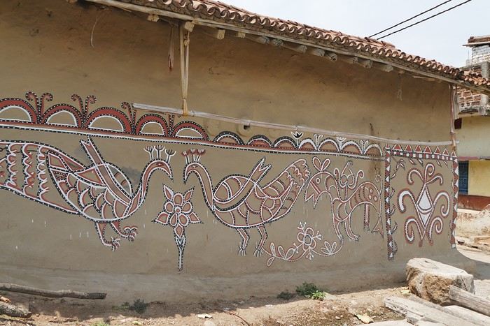
Hazaribagh I’ve got a meet-up with Adam Iman, a guide and painter. He picks me up from the hotel at 10 AM. Another traveler from Bangalore is supposed to join us, but while we wait for him to arrive, Adam takes me to see the paintings his mother and sister created at Hazaribagh station. The town became famous thanks to these murals, which can also be found in several surrounding villages. This art form has earned recognition and is now protected, a sign of its cultural importance. Once the visit is over, we go to pick up the other traveler and then head to our first village: Belwara, where Sohrai art is practiced. At the entrance, a sign proudly announces that we’re entering an artists’ village, where this art is created by women organized into micro-enterprises. Some even offer workshops for those who’d like to learn this tradition.

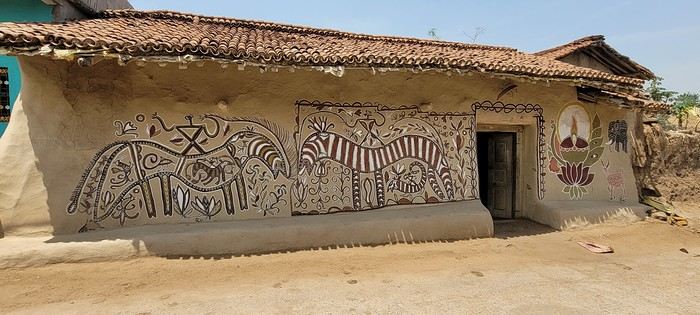
Sohrai art is tied to the harvest season, from October to mid-November. The motifs, in natural colors, celebrate fertility and abundance. The artists use pigments from the earth: red oxides, ochre, white kaolin, and black manganese. On the walls, you’ll see animals, fish, birds—all symbols of life and prosperity. As I look closer at the murals, I start to realize that each motif tells a story. Large animals like cows or bulls often take center stage. Their bodies are filled with intricate, almost hypnotic patterns. They symbolize wealth and prosperity for the household, as well as the deep respect for cattle, which are essential to daily life. On some facades, elephants stand out—massive and decorated with the same precision. They evoke quiet strength and protection. But it’s when I stop in front of one of the houses that I really take the time to look. The wall, a soft ochre, is entirely covered in murals. Two large animals stretch out on either side of the door, their elongated bodies fitting the length of the wall. Their silhouettes are filled with geometric patterns and incredibly fine curved lines, as if every space was patiently filled. Around them, stylized plants, flowers, and small decorative elements fill every gap. The door, dark and worn, becomes almost the silent center of the composition, framed by these living, protective forms. To the right, a more colorful motif catches the eye—a flower or a stylized lamp—like a touch of light on the earth. The whole thing gives an impression of perfect balance, between the rigor of the patterns and the freedom of the gesture.

Elsewhere, birds and freer forms bring movement. Peacocks, recognizable by their stylized silhouettes, embody beauty and vitality, while fish symbolize water, fertility, and the continuity of life.
On some paintings, the scenes become almost narrative: you can make out figures, everyday gestures, like a memory of the village inscribed in the walls. The decorative frames around the doors aren’t left to chance either—they symbolically protect the house, like a boundary between the inside and the outside world.
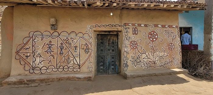
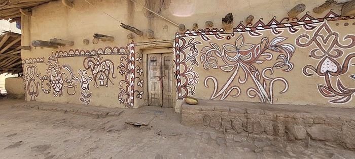
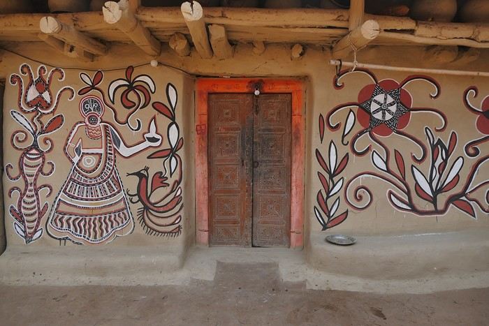
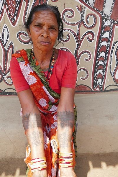
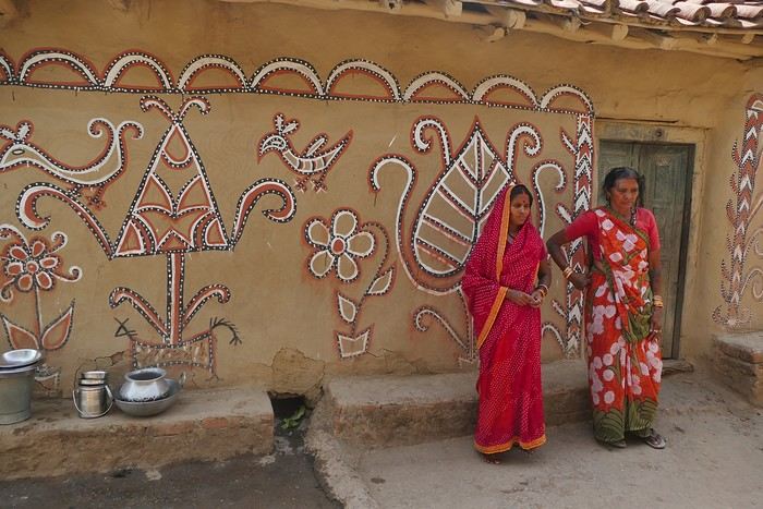
During the Sohrai festival, cattle are led into the jungle in the morning. Meanwhile, the women finish the *aripans*—these floor paintings—and continue the wall murals. Around noon, the animals return to the village, and the bulls’ horns are anointed with oil and vermilion in a gesture of gratitude, amid the vibrant colors adorning the houses. We visit several artists, including Parvat Devi, a well-known woman who has received many awards. Her arms are adorned with intriguing tattoos, which I’ll talk about in more detail later.

On another wall, the style changes completely. Here, no massive animals—just birds occupying the space, light and graceful, as if caught in mid-movement. Two silhouettes face each other, their long necks arched almost like mirrors, while their outstretched wings seem to vibrate with the patterns that compose them.

The design is more graphic, almost airy. The lines are smoother, more fluid, as if drawn in one confident stroke. The birds’ bodies aren’t solid—they’re filled with repetitive motifs like scales, stylized feathers, and spirals, giving a sense of continuous movement. Around them, everything comes to life: flowers burst open, arabesques swirl, and even the simplest shapes seem alive. What strikes me here is the sense of lightness. Where the large animals evoked stability and grounding, these birds bring something freer, almost joyful. They seem to embody movement, the circulation of life, like a breath flowing through the village.

The colors remain the same—deep reds, intense blacks, and chalky white—but the rhythm is different. Faster, more spontaneous. As if each wall had its own personality, while still speaking the same language.
That’s probably why I’m so moved. I’d heard about these paintings from my friend Raja, and last year, I saw an exhibition in a village near my home. That first encounter made me want to come here. But seeing them in person is a whole different experience. These paintings are unique. This ancient art is passed down from mother to daughter, or mother-in-law to daughter-in-law, in a quiet, deeply living continuity. At first glance, it might seem almost childlike in its simplicity and pared-down forms. And yet, everything is thought out, balanced, mastered. Nothing is left to chance.

That apparent simplicity, combined with such rich symbolism, touches me deeply. There’s something sincere and essential in these walls—and that’s what moves me.
Hazaribagh I’ve got a meet-up with Adam Iman, a guide and painter. He picks me up from the hotel at 10 AM. Another traveler from Bangalore is supposed to join us, but while we wait for him to arrive, Adam takes me to see the paintings his mother and sister created at Hazaribagh station. The town became famous thanks to these murals, which can also be found in several surrounding villages. This art form has earned recognition and is now protected, a sign of its cultural importance. Once the visit is over, we go to pick up the other traveler and then head to our first village: Belwara, where Sohrai art is practiced. At the entrance, a sign proudly announces that we’re entering an artists’ village, where this art is created by women organized into micro-enterprises. Some even offer workshops for those who’d like to learn this tradition.

Sohrai art is tied to the harvest season, from October to mid-November. The motifs, in natural colors, celebrate fertility and abundance. The artists use pigments from the earth: red oxides, ochre, white kaolin, and black manganese. On the walls, you’ll see animals, fish, birds—all symbols of life and prosperity. As I look closer at the murals, I start to realize that each motif tells a story. Large animals like cows or bulls often take center stage. Their bodies are filled with intricate, almost hypnotic patterns. They symbolize wealth and prosperity for the household, as well as the deep respect for cattle, which are essential to daily life. On some facades, elephants stand out—massive and decorated with the same precision. They evoke quiet strength and protection. But it’s when I stop in front of one of the houses that I really take the time to look. The wall, a soft ochre, is entirely covered in murals. Two large animals stretch out on either side of the door, their elongated bodies fitting the length of the wall. Their silhouettes are filled with geometric patterns and incredibly fine curved lines, as if every space was patiently filled. Around them, stylized plants, flowers, and small decorative elements fill every gap. The door, dark and worn, becomes almost the silent center of the composition, framed by these living, protective forms. To the right, a more colorful motif catches the eye—a flower or a stylized lamp—like a touch of light on the earth. The whole thing gives an impression of perfect balance, between the rigor of the patterns and the freedom of the gesture.

Elsewhere, birds and freer forms bring movement. Peacocks, recognizable by their stylized silhouettes, embody beauty and vitality, while fish symbolize water, fertility, and the continuity of life.
On some paintings, the scenes become almost narrative: you can make out figures, everyday gestures, like a memory of the village inscribed in the walls. The decorative frames around the doors aren’t left to chance either—they symbolically protect the house, like a boundary between the inside and the outside world.
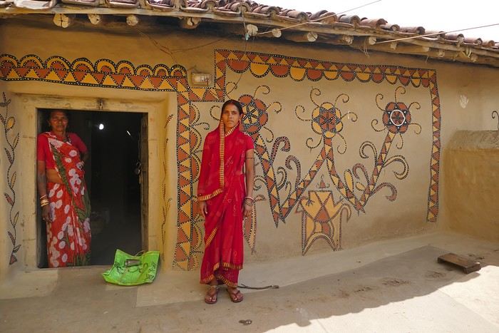

During the Sohrai festival, cattle are led into the jungle in the morning. Meanwhile, the women finish the *aripans*—these floor paintings—and continue the wall murals. Around noon, the animals return to the village, and the bulls’ horns are anointed with oil and vermilion in a gesture of gratitude, amid the vibrant colors adorning the houses. We visit several artists, including Parvat Devi, a well-known woman who has received many awards. Her arms are adorned with intriguing tattoos, which I’ll talk about in more detail later.

On another wall, the style changes completely. Here, no massive animals—just birds occupying the space, light and graceful, as if caught in mid-movement. Two silhouettes face each other, their long necks arched almost like mirrors, while their outstretched wings seem to vibrate with the patterns that compose them.

The design is more graphic, almost airy. The lines are smoother, more fluid, as if drawn in one confident stroke. The birds’ bodies aren’t solid—they’re filled with repetitive motifs like scales, stylized feathers, and spirals, giving a sense of continuous movement. Around them, everything comes to life: flowers burst open, arabesques swirl, and even the simplest shapes seem alive. What strikes me here is the sense of lightness. Where the large animals evoked stability and grounding, these birds bring something freer, almost joyful. They seem to embody movement, the circulation of life, like a breath flowing through the village.

The colors remain the same—deep reds, intense blacks, and chalky white—but the rhythm is different. Faster, more spontaneous. As if each wall had its own personality, while still speaking the same language.
That’s probably why I’m so moved. I’d heard about these paintings from my friend Raja, and last year, I saw an exhibition in a village near my home. That first encounter made me want to come here. But seeing them in person is a whole different experience. These paintings are unique. This ancient art is passed down from mother to daughter, or mother-in-law to daughter-in-law, in a quiet, deeply living continuity. At first glance, it might seem almost childlike in its simplicity and pared-down forms. And yet, everything is thought out, balanced, mastered. Nothing is left to chance.

That apparent simplicity, combined with such rich symbolism, touches me deeply. There’s something sincere and essential in these walls—and that’s what moves me.
Bonjour je suis en vacances du 31/10 au 7/11, je veux aller quelque part ou il fait beau, je pars de Toulouse maxi 5h de vol.
Avez vous des idées ?
Merci pour votre aide
Here we go!!!
I left home at 4 AM on October 31st and headed to Barcelona. Driving through Barcelona on the ring road stresses me out a bit, but at 6 AM the traffic is smooth, and I arrive at the airport without any issues. I call the valet, who quickly comes to pick up my car. He takes photos of it from all angles before letting me go.
Baggage check-in hasn’t started yet, and there are already several of us waiting.
Once free, everything happens very quickly. The flight to Abu Dhabi is on time and goes smoothly. I’ve never had any problems with this airline, which I’ve been using for several years.
The flight to Bangkok arrives at 7 AM as scheduled. This is my first time in Thailand and Bangkok. I’m used to traveling in India, and I notice that everything here is well organized—the customs process is quick, and the luggage is already on the carousel.
I booked a taxi on Booking. All I have to do is find the right exit and door based on the agency’s instructions. A large sign with the names of people who booked is posted on a wall. A hostess greets me and calls the taxi, which arrives 5 minutes later. I booked one night at the Lost Inn BKK hotel in the Phra Nakhon district, and we arrive at 9 AM. The welcome isn’t warm, and I have to wait until noon, sitting on a chair, before I can check into my room. I’m exhausted, and sleeping sitting up isn’t ideal. Noon finally arrives—the room is small but clean, which is fine for one night. I quickly take a shower to wake up because I plan to spend the afternoon visiting the Grand Palace. First, I need to exchange some money, and the banks are all close together on the same street, which is very convenient. When I enter one, a hostess gives me a ticket and invites me to sit down. There are about twenty counters, and I wait quietly until my number is called. The exchange is quick, so I can head out to find the Royal Palace. It’s actually very easy, and the walk is pleasant.
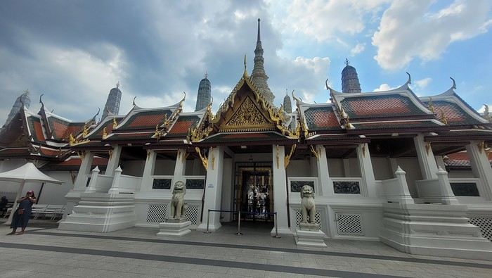
Entry to the Royal Palace (500 baht).

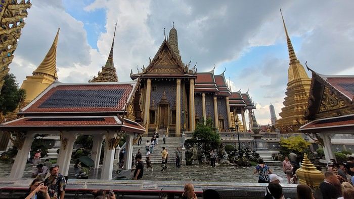
It’s magnificent and grand, and there are quite a few of us visiting. The sky is gray, it’s very humid, and a shower interrupts the visit. It’s a vast complex of temples and palaces. The buildings are colorful and sparkling, with a great sense of serenity (without the tourists, of course). I quietly enjoy the place and try to take photos without tourists, which isn’t easy.

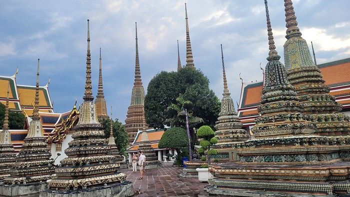
Very close to the Grand Palace is Wat Pho, one of the oldest Buddhist temples in the capital.

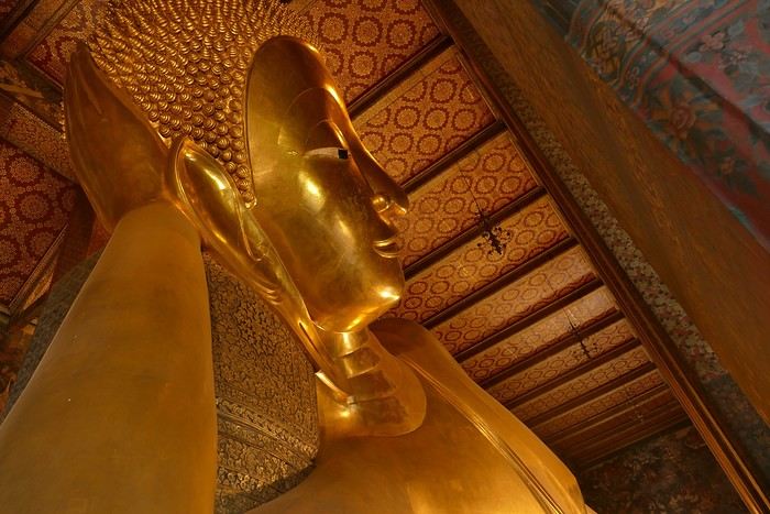
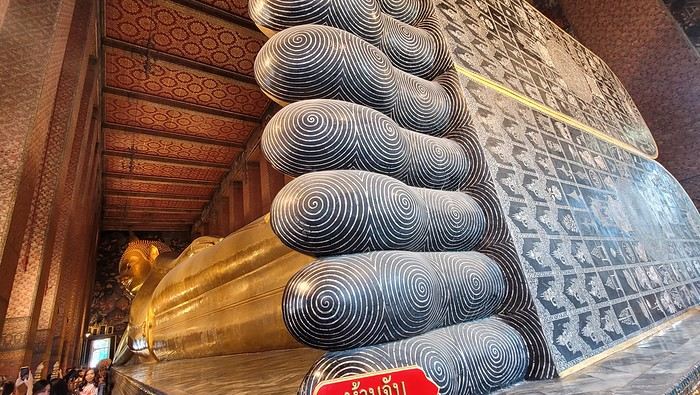
It’s very famous for its 46-meter-long reclining Buddha statue.


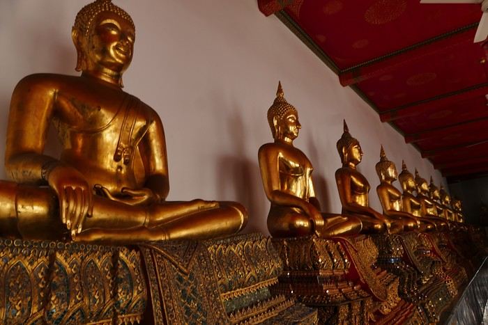
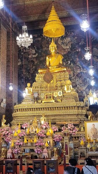
Walking around the temple, you can see different representations of Buddha, all covered in gold leaf.

Inside the temple, on one side, monks recite their prayers, while the other side is reserved for tourists who come to meditate in silence.

Before returning to the hotel, I have dinner at an Indian restaurant. I go to bed early because tomorrow’s wake-up call will be very early again.
Saturday, November 2nd Wake-up at 4 AM, departure from the hotel at 4:30 AM. The taxi I booked via Booking is waiting for me and takes me to the airport. The trip is fairly quick—he takes small roads, and at this hour, there’s no traffic.
The flight to Phnom Penh is on time. Before boarding, I realize I left my fleece jacket on the carousel, but it’s too late to go back for it.
The flight goes well, and customs is quick.
At the exit, I take a tuk-tuk to Julieka’s GH near the museum. The welcome is friendly. I won’t be able to check into my room until noon, so I take the opportunity to exchange some euros on the market street. The street is lined with restaurants, and I’ll have my first meal there.
The museum is right across the street, so I don’t waste any time visiting it.

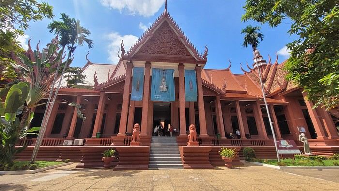
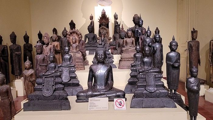
The representations of Hindu deities are very different from those in India, and I don’t recognize them. Many beautiful Buddhas are on display.

The museum is very pleasant, and there aren’t too many people, which is a plus.
At the exit, I return to the GH, settle into my room—which is decent and clean.
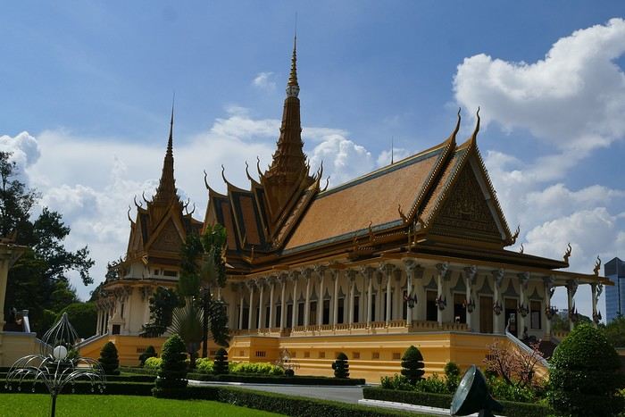
The Royal Palace is 1 km away. I walk along a garden, and at the end of the street is the Tonlé Sap, but I turn right. I arrive at a large esplanade and see the buildings with tiered roofs and glazed tiles. The entrance to the palace is a little further away.
At the entrance, I notice there isn’t the same crowd as at the one in BKK.
Khmer architecture is magnificent. The complex consists of gardens, palaces, pagodas with golden roofs, and slender spires.

The Silver Pagoda houses the small Emerald Buddha, which is actually made of jade. The silver flooring is covered with carpets. Photos are not allowed.
The walls surrounding the pagoda are covered with frescoes depicting scenes from the Ramayana.
Baggage check-in hasn’t started yet, and there are already several of us waiting.
Once free, everything happens very quickly. The flight to Abu Dhabi is on time and goes smoothly. I’ve never had any problems with this airline, which I’ve been using for several years.
The flight to Bangkok arrives at 7 AM as scheduled. This is my first time in Thailand and Bangkok. I’m used to traveling in India, and I notice that everything here is well organized—the customs process is quick, and the luggage is already on the carousel.
I booked a taxi on Booking. All I have to do is find the right exit and door based on the agency’s instructions. A large sign with the names of people who booked is posted on a wall. A hostess greets me and calls the taxi, which arrives 5 minutes later. I booked one night at the Lost Inn BKK hotel in the Phra Nakhon district, and we arrive at 9 AM. The welcome isn’t warm, and I have to wait until noon, sitting on a chair, before I can check into my room. I’m exhausted, and sleeping sitting up isn’t ideal. Noon finally arrives—the room is small but clean, which is fine for one night. I quickly take a shower to wake up because I plan to spend the afternoon visiting the Grand Palace. First, I need to exchange some money, and the banks are all close together on the same street, which is very convenient. When I enter one, a hostess gives me a ticket and invites me to sit down. There are about twenty counters, and I wait quietly until my number is called. The exchange is quick, so I can head out to find the Royal Palace. It’s actually very easy, and the walk is pleasant.
Entry to the Royal Palace (500 baht).

It’s magnificent and grand, and there are quite a few of us visiting. The sky is gray, it’s very humid, and a shower interrupts the visit. It’s a vast complex of temples and palaces. The buildings are colorful and sparkling, with a great sense of serenity (without the tourists, of course). I quietly enjoy the place and try to take photos without tourists, which isn’t easy.

Very close to the Grand Palace is Wat Pho, one of the oldest Buddhist temples in the capital.

It’s very famous for its 46-meter-long reclining Buddha statue.


Walking around the temple, you can see different representations of Buddha, all covered in gold leaf.

Inside the temple, on one side, monks recite their prayers, while the other side is reserved for tourists who come to meditate in silence.

Before returning to the hotel, I have dinner at an Indian restaurant. I go to bed early because tomorrow’s wake-up call will be very early again.
Saturday, November 2nd Wake-up at 4 AM, departure from the hotel at 4:30 AM. The taxi I booked via Booking is waiting for me and takes me to the airport. The trip is fairly quick—he takes small roads, and at this hour, there’s no traffic.
The flight to Phnom Penh is on time. Before boarding, I realize I left my fleece jacket on the carousel, but it’s too late to go back for it.
The flight goes well, and customs is quick.
At the exit, I take a tuk-tuk to Julieka’s GH near the museum. The welcome is friendly. I won’t be able to check into my room until noon, so I take the opportunity to exchange some euros on the market street. The street is lined with restaurants, and I’ll have my first meal there.
The museum is right across the street, so I don’t waste any time visiting it.

The representations of Hindu deities are very different from those in India, and I don’t recognize them. Many beautiful Buddhas are on display.

The museum is very pleasant, and there aren’t too many people, which is a plus.
At the exit, I return to the GH, settle into my room—which is decent and clean.
The Royal Palace is 1 km away. I walk along a garden, and at the end of the street is the Tonlé Sap, but I turn right. I arrive at a large esplanade and see the buildings with tiered roofs and glazed tiles. The entrance to the palace is a little further away.
At the entrance, I notice there isn’t the same crowd as at the one in BKK.
Khmer architecture is magnificent. The complex consists of gardens, palaces, pagodas with golden roofs, and slender spires.

The Silver Pagoda houses the small Emerald Buddha, which is actually made of jade. The silver flooring is covered with carpets. Photos are not allowed.
The walls surrounding the pagoda are covered with frescoes depicting scenes from the Ramayana.
March 2nd — Departure by bus from Latour at 6:50 AM. The journey isn’t direct: we pass through Elne then Corneilla. In Perpignan, I switch to a BlablaBus heading to Barcelona’s northern bus station. Before reaching Le Perthus, French police stop us to check IDs. Several people aren’t in order, but after about fifteen minutes, we’re on our way again. We’re checked again at La Jonquera: this time, the wait lasts almost forty-five minutes while police identify those in violation and wait for a vehicle to pick them up. The driver then tries to make up for lost time; we finally arrive at our destination half an hour late.
I quickly head to the Arc de Triomphe metro station, located 200 meters away: you have to cross the bridge along the bus parking lot, then walk through a large garden; the station is on the right before the garden entrance. The trip to the airport isn’t direct: I have to change at Tomasso and take the line to the airport, where I arrive at 1 PM.
At the Emirates counter, I learn my flight was just canceled due to the war in Iran; they offer me another flight for the next day. I have to wait at the airport until 7 PM before being taken to a hotel; the next morning, I’ll take a flight to Vienna (with an 8-hour layover), then an Air India flight to Delhi, and finally a flight to Kolkata. I agree: I don’t know Vienna, so it’ll be an unexpected discovery.
At 7 PM, a small group is taken to the hotel, 35 minutes from the airport, where we’re served a light dinner upon arrival.
March 3rd — A taxi picks me up at 6:30 AM; the flight to Vienna takes off at 9:30 AM and arrives at noon. I’m free until 7 PM; the metro is direct to the city center. The weather is pleasant and not too cold, luckily, since my clothes are light.
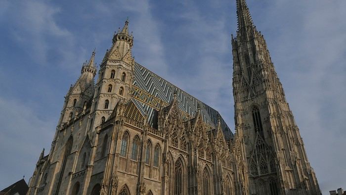
When I exit the metro, I spot the St. Stephen’s Cathedral tower in the distance and approach it: the roof, made of glazed tiles, is remarkable.

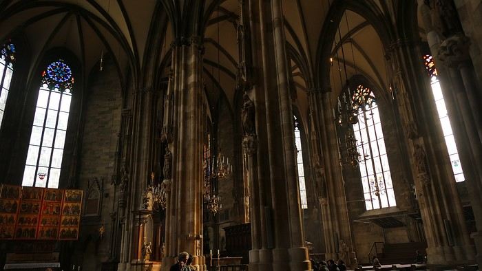
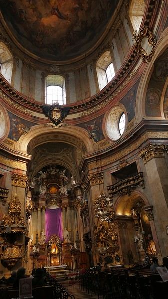
Entry is free, and the interior, a mix of Gothic and Baroque styles in the center, is stunning.

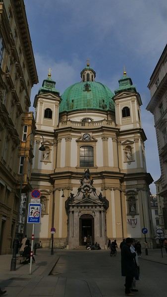
Not far from there is St. Anne’s Church

, also Baroque, adorned with beautiful frescoes

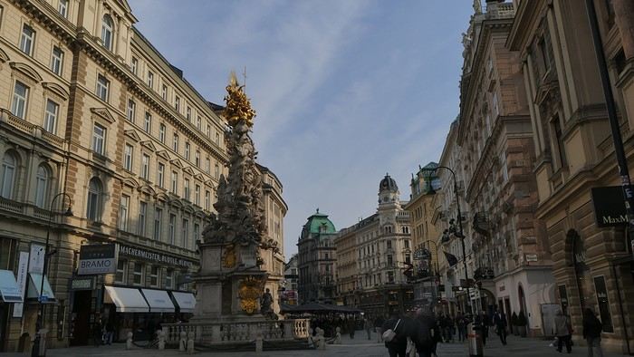
—a music concert adds an enchanting atmosphere to the visit. I continue my walk at random through the pedestrian streets lined with magnificent buildings: I’m charmed by the city.


Before heading back to the airport, I stop at a lovely tea salon. My flight will eventually leave with a delay.
Wednesday, March 4th — Delhi and a little luggage scare We arrive in Delhi shortly after noon. Immigration is quick, and good news: my bag was checked through from Barcelona to Kolkata. I head to the connecting terminal and arrive half an hour before boarding: the flight goes smoothly. Upon arrival, the luggage comes out quickly… except mine. After filing a report, I’m told my bag is in Delhi—I have to retrieve it before taking another flight. I didn’t know (or had forgotten): with the delays, I wouldn’t have had time to pick it up and make the connection.
I take a taxi to the Ichamati Hotel. The welcome is warm, and the room is clean but very small. Without my bag, I feel a bit lost—I have nothing to change into.
Tonight, I’m dining with Raja and his friends at a beautiful restaurant, an old colonial house turned into a hotel.


We’re happy to see each other and have a comforting evening together.
I quickly head to the Arc de Triomphe metro station, located 200 meters away: you have to cross the bridge along the bus parking lot, then walk through a large garden; the station is on the right before the garden entrance. The trip to the airport isn’t direct: I have to change at Tomasso and take the line to the airport, where I arrive at 1 PM.
At the Emirates counter, I learn my flight was just canceled due to the war in Iran; they offer me another flight for the next day. I have to wait at the airport until 7 PM before being taken to a hotel; the next morning, I’ll take a flight to Vienna (with an 8-hour layover), then an Air India flight to Delhi, and finally a flight to Kolkata. I agree: I don’t know Vienna, so it’ll be an unexpected discovery.
At 7 PM, a small group is taken to the hotel, 35 minutes from the airport, where we’re served a light dinner upon arrival.
March 3rd — A taxi picks me up at 6:30 AM; the flight to Vienna takes off at 9:30 AM and arrives at noon. I’m free until 7 PM; the metro is direct to the city center. The weather is pleasant and not too cold, luckily, since my clothes are light.
When I exit the metro, I spot the St. Stephen’s Cathedral tower in the distance and approach it: the roof, made of glazed tiles, is remarkable.

Entry is free, and the interior, a mix of Gothic and Baroque styles in the center, is stunning.

Not far from there is St. Anne’s Church

, also Baroque, adorned with beautiful frescoes

—a music concert adds an enchanting atmosphere to the visit. I continue my walk at random through the pedestrian streets lined with magnificent buildings: I’m charmed by the city.


Before heading back to the airport, I stop at a lovely tea salon. My flight will eventually leave with a delay.
Wednesday, March 4th — Delhi and a little luggage scare We arrive in Delhi shortly after noon. Immigration is quick, and good news: my bag was checked through from Barcelona to Kolkata. I head to the connecting terminal and arrive half an hour before boarding: the flight goes smoothly. Upon arrival, the luggage comes out quickly… except mine. After filing a report, I’m told my bag is in Delhi—I have to retrieve it before taking another flight. I didn’t know (or had forgotten): with the delays, I wouldn’t have had time to pick it up and make the connection.
I take a taxi to the Ichamati Hotel. The welcome is warm, and the room is clean but very small. Without my bag, I feel a bit lost—I have nothing to change into.
Tonight, I’m dining with Raja and his friends at a beautiful restaurant, an old colonial house turned into a hotel.


We’re happy to see each other and have a comforting evening together.
Day 1 – February 14
We all have two lives. And the second one kicks off the day you realize you only have one, with the determination to spend the time you have left on what truly adds sparkle to your life, Kevin! I like to elegantly introduce a trip with a philosophical quote. First, it gives you the illusion that I’m some kind of deep thinker, and second, it lets me fill up the first few lines of my blank page when I don’t know how to tell you I’m diving back into what really lights up my life: another adventure beyond the horizon! And nearly every other year, like a toxic relationship, my horizon tends to take shape in Uncle Sam’s backyard. And this, despite his cousin Donald calling the shots. Speaking of which, it was partly that impulsive guy who pushed us to be just as impulsive and snag our four flight tickets at a ridiculously low price—a direct result of foreign tourism taking a hit from BetaMax’s repeated antics... Four tickets? Who are the other lucky ones? In this case, our lucky ones are actually lucky ladies: My Flo, always up for exploring the world with me on foot, camelback, or scooter, is obviously in on the fun. The other two seats went to our daughters, Sasha and Luna, both thrilled to be part of this new American adventure...
But what’s the American West like in February?... A gamble. Let’s call it Russian roulette since we’re not landing during peak weather season. That’s why we encouraged our transportation and accommodation to get cozy and produce a little camper van, so we can stay ultra-flexible in the face of any weather tantrums. We’ll be roaming in Kara the van with the motto "Follow the sun!" Bad weather? We bolt. Snow? We speed up. Sunny? We act like it was the plan all along and soak it up.
"Okay, but why keep coming back to the same corner of the globe? After ten American adventures, you must be tired of seeing the same things, right?" But I’m not crazy, you know!... The American West is like making love to your gorgeous wife over and over, always enjoying it just as much. And contrary to what you might think, the American West isn’t just the Grand Canyon, Monument Valley, Las Vegas, and Bryce Canyon. Proof is, after ten trips to the U.S., my retinas are still untouched by three-quarters of the places I scribbled on a napkin for this adventure... Oh, and add to that my wife, who I’ve easily converted to my religion, and boom... relapse is even easier! Because yes, we’ve landed in Los Angeles after a sunny flight over Greenland, still under Danish flag for now. And we’re already heading east through the XXL traffic of L.A.’s eight-lane highways, eager to dive into our first discoveries. But first, night is taking over the sky, and second, we’ve been officially awake for 24 hours, so I suggest wrapping up this intro. I’ll tell you more tomorrow morning. Sound good?


We all have two lives. And the second one kicks off the day you realize you only have one, with the determination to spend the time you have left on what truly adds sparkle to your life, Kevin! I like to elegantly introduce a trip with a philosophical quote. First, it gives you the illusion that I’m some kind of deep thinker, and second, it lets me fill up the first few lines of my blank page when I don’t know how to tell you I’m diving back into what really lights up my life: another adventure beyond the horizon! And nearly every other year, like a toxic relationship, my horizon tends to take shape in Uncle Sam’s backyard. And this, despite his cousin Donald calling the shots. Speaking of which, it was partly that impulsive guy who pushed us to be just as impulsive and snag our four flight tickets at a ridiculously low price—a direct result of foreign tourism taking a hit from BetaMax’s repeated antics... Four tickets? Who are the other lucky ones? In this case, our lucky ones are actually lucky ladies: My Flo, always up for exploring the world with me on foot, camelback, or scooter, is obviously in on the fun. The other two seats went to our daughters, Sasha and Luna, both thrilled to be part of this new American adventure...
But what’s the American West like in February?... A gamble. Let’s call it Russian roulette since we’re not landing during peak weather season. That’s why we encouraged our transportation and accommodation to get cozy and produce a little camper van, so we can stay ultra-flexible in the face of any weather tantrums. We’ll be roaming in Kara the van with the motto "Follow the sun!" Bad weather? We bolt. Snow? We speed up. Sunny? We act like it was the plan all along and soak it up.
"Okay, but why keep coming back to the same corner of the globe? After ten American adventures, you must be tired of seeing the same things, right?" But I’m not crazy, you know!... The American West is like making love to your gorgeous wife over and over, always enjoying it just as much. And contrary to what you might think, the American West isn’t just the Grand Canyon, Monument Valley, Las Vegas, and Bryce Canyon. Proof is, after ten trips to the U.S., my retinas are still untouched by three-quarters of the places I scribbled on a napkin for this adventure... Oh, and add to that my wife, who I’ve easily converted to my religion, and boom... relapse is even easier! Because yes, we’ve landed in Los Angeles after a sunny flight over Greenland, still under Danish flag for now. And we’re already heading east through the XXL traffic of L.A.’s eight-lane highways, eager to dive into our first discoveries. But first, night is taking over the sky, and second, we’ve been officially awake for 24 hours, so I suggest wrapping up this intro. I’ll tell you more tomorrow morning. Sound good?


Hi everyone, I’m Patrick, 67 years old, a seasoned traveler (already 22 trips outside Europe).
In autumn 2025, I took my first 3-week trip to Japan, with stops in Tokyo, Kamakura, Matsumoto, Kamikochi, Takayama, Kanazawa, Kyoto, Nara, Osaka, Koyasan, Tokyo again, and Nikko.
I wanted to go back in May 2026 and explore some lesser-known places to complement my first trip.
Last year, there were four of us traveling together to discover Japan (a fairly classic itinerary). This time, I’ll be traveling solo for part of the trip and with a couple of French friends for the rest.
The weather was gorgeous in May, averaging around 25°C, with two very hot days in Kyoto and only two rainy days.
As usual, I organized everything myself, gathering plenty of information from various sites, including this one.
Transportation: An ICOCA card is essential. I got a 5-day Kansai-Hiroshima pass because I took the shinkansen between Hiroshima and Osaka three times, and it paid for itself quickly.
Accommodations: Mostly through Booking. No issues at all. Average cost was 46 € per night.
Meals: For breakfast, I alternated between buying food at a konbini to eat in my room or on the train and grabbing something at local cafés. For lunch and dinner, I tried to vary my meals as much as possible—lots of sashimi, sushi, and ramen. Okonomiyaki in Osaka and Hiroshima. Oysters in every form (raw, grilled, fried) in Onomichi and Hiroshima. A variety of seafood (shrimp, shellfish) in Hiroshima and Matsumoto. Fish whose names often escaped me, but notably mackerel and eel (unagi). Tempura and gyoza. Chicken skewers (yakitori) and one teppanyaki meal. One omakase meal (9 different dishes). In the end, not much meat aside from a few yakitori skewers. No splurges on super expensive wagyu or Kobe beef. Average dinner cost: 4,800 yen, drinks included.
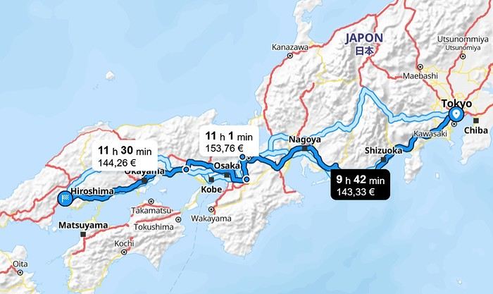
The Itinerary: Day 1: Departure from Brussels Day 2: Arrival in Osaka Day 3: To Himeji, then Kurashiki Day 4: To Fukuyama, then Tomo no Ura, then Onomichi Day 5: Cycling the Shimanami Kaido Day 6: To Takahara, then Hiroshima Day 7: To Kyoto to attend the Aoi Matsuri parade Day 8: To Miyajima Day 9: Hiroshima, then Kyoto Day 10: Southern Kyoto Day 11: Northern Kyoto Day 12: Final day in Kyoto, then to Nagatsugawa Day 13: Start of the Nakasendo Trail (Magome to Tsumago) Day 14: Second day of the trail (Kiso Fukushima) Day 15: Third day of the trail (Narai), then Matsumoto Day 16: To Mt. Fuji (Kawaguchiko) Day 17: To Tokyo Day 18: Excursion to Enoshima and Kamakura Day 19: Flight home, with a 10-hour layover in Hong Kong Day 20: Arrival in Brussels
Transportation: An ICOCA card is essential. I got a 5-day Kansai-Hiroshima pass because I took the shinkansen between Hiroshima and Osaka three times, and it paid for itself quickly.
Accommodations: Mostly through Booking. No issues at all. Average cost was 46 € per night.
Meals: For breakfast, I alternated between buying food at a konbini to eat in my room or on the train and grabbing something at local cafés. For lunch and dinner, I tried to vary my meals as much as possible—lots of sashimi, sushi, and ramen. Okonomiyaki in Osaka and Hiroshima. Oysters in every form (raw, grilled, fried) in Onomichi and Hiroshima. A variety of seafood (shrimp, shellfish) in Hiroshima and Matsumoto. Fish whose names often escaped me, but notably mackerel and eel (unagi). Tempura and gyoza. Chicken skewers (yakitori) and one teppanyaki meal. One omakase meal (9 different dishes). In the end, not much meat aside from a few yakitori skewers. No splurges on super expensive wagyu or Kobe beef. Average dinner cost: 4,800 yen, drinks included.
The Itinerary: Day 1: Departure from Brussels Day 2: Arrival in Osaka Day 3: To Himeji, then Kurashiki Day 4: To Fukuyama, then Tomo no Ura, then Onomichi Day 5: Cycling the Shimanami Kaido Day 6: To Takahara, then Hiroshima Day 7: To Kyoto to attend the Aoi Matsuri parade Day 8: To Miyajima Day 9: Hiroshima, then Kyoto Day 10: Southern Kyoto Day 11: Northern Kyoto Day 12: Final day in Kyoto, then to Nagatsugawa Day 13: Start of the Nakasendo Trail (Magome to Tsumago) Day 14: Second day of the trail (Kiso Fukushima) Day 15: Third day of the trail (Narai), then Matsumoto Day 16: To Mt. Fuji (Kawaguchiko) Day 17: To Tokyo Day 18: Excursion to Enoshima and Kamakura Day 19: Flight home, with a 10-hour layover in Hong Kong Day 20: Arrival in Brussels
I’m sharing our three-week trip to Japan from late October to mid-November 2025. There were four of us—my partner and a couple of friends.
I’ve traveled often with my friend Christian (Bolivia, Argentina, Costa Rica, Namibia, Laos), but this time our partners joined us.
The rough itinerary:
Arrival in Tokyo. Visiting Shinjuku/Shibuya districts + day trip to Kamakura
5 days in the Japanese Alps, from Matsumoto to Kanazawa (via Kamikochi, Hirayu Onsen, and Takayama)
5 days in Kyoto
Nara, Osaka, Koyasan
Return to Tokyo (Asakusa district), with a day trip to Nikko
We booked our flights well in advance (9 months ahead): the flight cost 1086 € per person. Compared to over 2000 € if we’d booked for the same dates just 3 months prior.
For accommodations, we mostly used Booking.com. The onsen was booked via Japanican, and in Kyoto, we stayed in an Airbnb.
We also made 5 train reservations a month in advance on Klook or directly on the train’s website.
Day 1: Departure from Brussels (October 24, 2025) Early morning takeoff at 6 AM to Munich (1.5-hour layover) with Lufthansa, then a 12-hour flight with ANA, arriving the next morning at 7 AM at Tokyo Haneda.
Day 2: Arrival in Tokyo Airport formalities were quick. The eSIM we bought before leaving activated as soon as we landed (10 GB plan with Saily—more than enough for our mobile internet needs, mainly Google Maps and Google Translate). We’d received 4 ICOCA cards from our neighbors, which we loaded with 15000 ¥ each. We took the Keihin train, then the Yamanote Line. It’s easy to navigate since everything is in English, and each station is announced on scrolling displays in English too.
We got off the Yamanote Line at the station just after Shinjuku because it’s easier to exit that massive station with our luggage. So we ended up in Shin-Okubo, right in the Korean district. A 10-minute walk took us to Villa Fontaine Hotel. A great hotel, well-located north of the Kabukichō district. The room even seemed bigger than we’d expected.
It was 15°C, but it rained—and kept raining on and off all day. Belgian weather, basically.
We went for a walk in Shinjuku Gyoen Park. Not as pretty in the rain, but the big greenhouse was interesting.
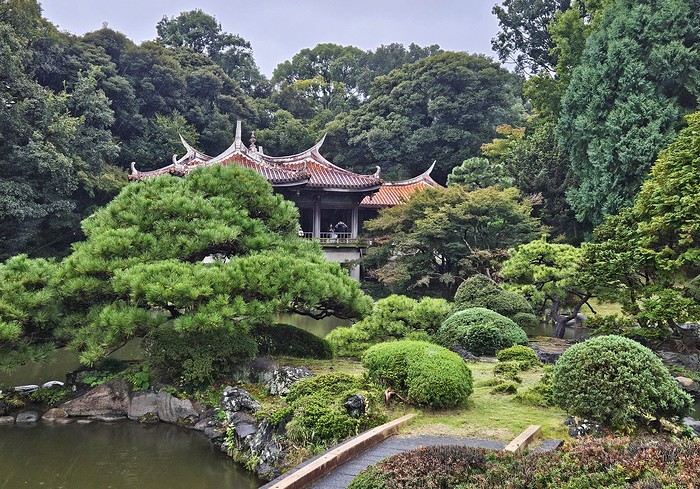
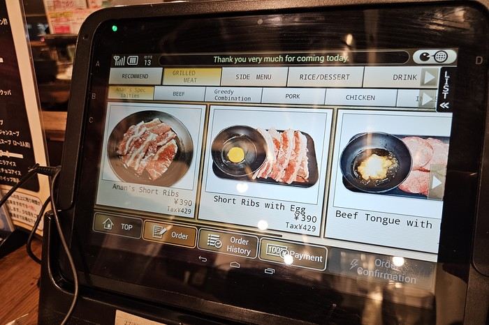
Then our first ramen (hearty and for 1000 ¥—pretty much the price of all our ramen during the trip). We headed back to the hotel since check-in was after 3 PM. Shower and relax before going out for dinner. Dinner was barbecue at Shichirin Yakiniku Anan (1700 ¥ each—good and cheap). Ordering via tablet wasn’t easy, but luckily it was in English.
We ended the evening with a stroll through Kabukichō before a well-deserved sleep.

Day 1: Departure from Brussels (October 24, 2025) Early morning takeoff at 6 AM to Munich (1.5-hour layover) with Lufthansa, then a 12-hour flight with ANA, arriving the next morning at 7 AM at Tokyo Haneda.
Day 2: Arrival in Tokyo Airport formalities were quick. The eSIM we bought before leaving activated as soon as we landed (10 GB plan with Saily—more than enough for our mobile internet needs, mainly Google Maps and Google Translate). We’d received 4 ICOCA cards from our neighbors, which we loaded with 15000 ¥ each. We took the Keihin train, then the Yamanote Line. It’s easy to navigate since everything is in English, and each station is announced on scrolling displays in English too.

We got off the Yamanote Line at the station just after Shinjuku because it’s easier to exit that massive station with our luggage. So we ended up in Shin-Okubo, right in the Korean district. A 10-minute walk took us to Villa Fontaine Hotel. A great hotel, well-located north of the Kabukichō district. The room even seemed bigger than we’d expected.

It was 15°C, but it rained—and kept raining on and off all day. Belgian weather, basically.
We went for a walk in Shinjuku Gyoen Park. Not as pretty in the rain, but the big greenhouse was interesting.
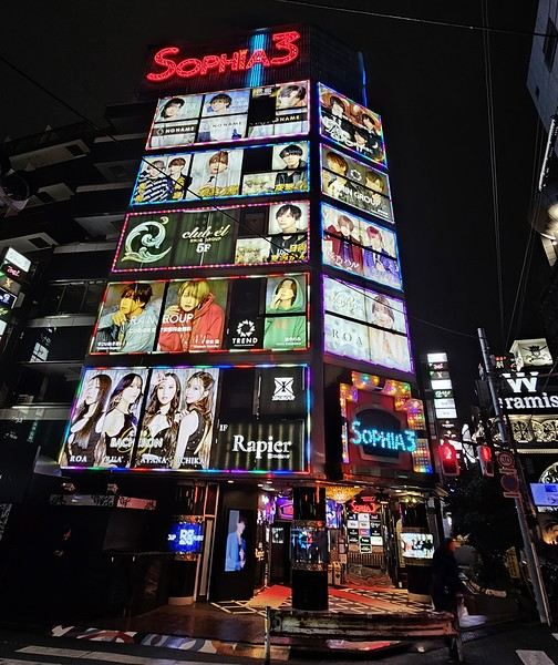
Then our first ramen (hearty and for 1000 ¥—pretty much the price of all our ramen during the trip). We headed back to the hotel since check-in was after 3 PM. Shower and relax before going out for dinner. Dinner was barbecue at Shichirin Yakiniku Anan (1700 ¥ each—good and cheap). Ordering via tablet wasn’t easy, but luckily it was in English.

We ended the evening with a stroll through Kabukichō before a well-deserved sleep.


Namaste!
Here I am live from Delhi, past midnight, at least 30 degrees....
I wanted to post the start of this France travel journal but couldn’t find the time, so here it is live!
Off we go for a third trip, but this time for double the duration—6 weeks with the goal of discovering Ladakh and Spiti, starting with a detour to Varanasi to meet up with Babeli and her family.
Phir milenge for the rest of the adventures...
This trip had been on my mind for about fifteen years.
But the discomfort of overnight stays, the difficulty of communication, and the prices of the few car rentals kept making me postpone the project.
And then, everything fell into place—I told myself, now’s the time!
Preparations took longer than usual; the destination is still far from mainstream.
A bit of Kazakhstan? Not in the end.
The south or not? Yes, in the end.
Pre-book or play it by ear? Only two stops were a leap into the unknown.
To help me find the ideal route, I made great use of this forum (thanks to everyone for patiently answering my questions!), pored over travel journals and blogs (Christian, Jeff), zoomed in on Google Maps and Yandex, and bought the guide published by OunTravela on this destination (the guide has been updated since).
---/---
You’ve got your passport, international driver’s license, bank cards, and euros?
Off we go to Lyon—just one night left before our early morning flight.
Tomorrow night, we’ll be sleeping in Bishkek! (‘Beefsteak’ for my partner’s mischievous nephews...)

You’ll find here a post with some practical info.
But the discomfort of overnight stays, the difficulty of communication, and the prices of the few car rentals kept making me postpone the project.
And then, everything fell into place—I told myself, now’s the time!
Preparations took longer than usual; the destination is still far from mainstream.
A bit of Kazakhstan? Not in the end.
The south or not? Yes, in the end.
Pre-book or play it by ear? Only two stops were a leap into the unknown.
To help me find the ideal route, I made great use of this forum (thanks to everyone for patiently answering my questions!), pored over travel journals and blogs (Christian, Jeff), zoomed in on Google Maps and Yandex, and bought the guide published by OunTravela on this destination (the guide has been updated since).
---/---
You’ve got your passport, international driver’s license, bank cards, and euros?
Off we go to Lyon—just one night left before our early morning flight.
Tomorrow night, we’ll be sleeping in Bishkek! (‘Beefsteak’ for my partner’s mischievous nephews...)

You’ll find here a post with some practical info.
I'm starting my first travel journal since VF reopened!
This will mostly be to share my impressions and some photos, with a few days' delay, but I'm starting this journal while I'm still here.
First, I'd like to thank those who helped me prepare for this trip.
I was able to organize this stay in one of the most expensive countries in the world thanks to the home-exchange principle. Not necessarily a direct swap, but through a points system, which is more practical for choosing where you want to go without it having to be a reciprocal exchange.
For this trip, there will already be two different accommodations. We'll see how it goes after that.
The first place is near Yverdon-les-Bains, close to Lake Neuchâtel.
So, we're going to explore this area!
We arrived under capricious weather that won’t leave us for the next few days!
We had dinner at a pizzeria recommended by *Le Routard* in Yverdon, then took a little nighttime stroll through the town center before heading inland to settle into our accommodation.
We discovered a very large, quiet house—and especially the cat that stayed behind! Funny for a couple of mice! He’ll be sleeping with us 😹
This will mostly be to share my impressions and some photos, with a few days' delay, but I'm starting this journal while I'm still here.
First, I'd like to thank those who helped me prepare for this trip.
I was able to organize this stay in one of the most expensive countries in the world thanks to the home-exchange principle. Not necessarily a direct swap, but through a points system, which is more practical for choosing where you want to go without it having to be a reciprocal exchange.
For this trip, there will already be two different accommodations. We'll see how it goes after that.
The first place is near Yverdon-les-Bains, close to Lake Neuchâtel.
So, we're going to explore this area!
We arrived under capricious weather that won’t leave us for the next few days!
We had dinner at a pizzeria recommended by *Le Routard* in Yverdon, then took a little nighttime stroll through the town center before heading inland to settle into our accommodation.
We discovered a very large, quiet house—and especially the cat that stayed behind! Funny for a couple of mice! He’ll be sleeping with us 😹
Hi everyone!
If you're looking for great tips and offbeat spots, if you love exploring uncharted parts of a country, if the exotic is your adrenaline, then move along!
Our 15 days in early May in this part of Turkey (a country I first discovered during a city trip to Istanbul in 2017) will only tread well-worn paths and revisit popular routes. Simply because I kept hoping until the very end that our flight to Jordan wouldn’t be canceled. Events in the Gulf proved me wrong, so we left with: Zero preparation. Not a single hotel booked (well, except the first one), no visits planned, just a flight ticket bought three weeks earlier. No guidebook, no app—just the desire to explore southern Turkey and Cappadocia, whose images and the chance to stretch our legs had caught my eye.
Oh, wait—I did bring along a new guide: Gemini! Yes, my friends, generative AI was my chief advisor throughout the trip for sites to visit, accommodations, routes, and even restaurants! An experiment I wanted to try to form my own opinion on using this new technology. And what better way to test it than a Turkish getaway?
The verdict? You’ll have to wait for the trip recap to find out!
The main idea of the trip is also relaxation.
So, the plan is Antalya for a few days, the Turkish Riviera for a few more, Cappadocia as the highlight, and a return via Antalya to wrap up the trip. And it was all planned by AI!
So, if you're ready, fasten your seatbelts—cabin crew, doors to automatic and cross check—boarding for Turkey now!
A little sneak peek?

If you're looking for great tips and offbeat spots, if you love exploring uncharted parts of a country, if the exotic is your adrenaline, then move along!
Our 15 days in early May in this part of Turkey (a country I first discovered during a city trip to Istanbul in 2017) will only tread well-worn paths and revisit popular routes. Simply because I kept hoping until the very end that our flight to Jordan wouldn’t be canceled. Events in the Gulf proved me wrong, so we left with: Zero preparation. Not a single hotel booked (well, except the first one), no visits planned, just a flight ticket bought three weeks earlier. No guidebook, no app—just the desire to explore southern Turkey and Cappadocia, whose images and the chance to stretch our legs had caught my eye.
Oh, wait—I did bring along a new guide: Gemini! Yes, my friends, generative AI was my chief advisor throughout the trip for sites to visit, accommodations, routes, and even restaurants! An experiment I wanted to try to form my own opinion on using this new technology. And what better way to test it than a Turkish getaway?
The verdict? You’ll have to wait for the trip recap to find out!
The main idea of the trip is also relaxation.
So, the plan is Antalya for a few days, the Turkish Riviera for a few more, Cappadocia as the highlight, and a return via Antalya to wrap up the trip. And it was all planned by AI!
So, if you're ready, fasten your seatbelts—cabin crew, doors to automatic and cross check—boarding for Turkey now!
A little sneak peek?We did the Langtang trek (hike) from September 10th to 17th, with the first and last days being the trip from Kathmandu and back—so 6 days of actual walking. It’s a fairly well-known trek but certainly not as famous or crowded as those in the Annapurna or Everest regions, which is why we chose it.
In theory, it’s mandatory to have a guide for this trek. In reality, it seems there are ways to bypass the regulations: we met at least two people hiking without a guide—a South Korean, a New Zealander, and possibly also a couple of English women and an American couple, though we’re not sure if they had a guide.
The agency we booked with had told us it was an affordable trek for relatively older people in good shape—which is our case (I’m 72 myself). I have to say upfront that we found it quite challenging, maybe because we didn’t have good weather—it was the end of the monsoon season. To be clear, no matter your fitness level, I’d say doing this trek in the middle of the monsoon season would be suicidal.
Day 1 – Journey from Kathmandu to Syapru Besi
On Monday, September 8th, there had been violent protests in Kathmandu against the government, which had, among other things, blocked access to social media and been accused of nepotism and corruption. There were 19 deaths. The situation was very tense on the day of our departure, Wednesday the 10th. The agency warned us that public transport was very unreliable. So, we decided to take a jeep, at an additional cost of $100 ($160 minus what was already budgeted for the bus).
We left a little before 7 a.m. and it took us a good hour just to reach the outskirts of Kathmandu. Along the way, we saw several houses and vehicles set on fire by protesters.
The road to Syapru Besi is only 120 km, but it’s frankly awful. It’s always narrow, winds through endless mountains, and the shoulders range from bad to confusing to nonexistent. Several sections are just dirt tracks. We didn’t regret opting for the jeep, as we could stop several times at our convenience—if only to let Y (my Thai partner) throw up everything she had. She’d taken her usual motion sickness medication, but the constant turns, accelerations, and braking eventually made her terribly carsick.
In Nuwakot, we stopped for breakfast at a nice little restaurant, Jimbu. It was around 8:30 a.m., and we’d barely covered 60 km. The restaurant has a lovely garden overlooking the Trishuli Ganga, the river flowing down from Syapru Besi. First photo: the river in the bottom right corner, mist and clouds over the mountain on the other side.
An hour later, my second photo: the hills along the Trishuli Ganga. You can see the different crops—lush green rice paddies in the lower right and corn, already yellowed and likely harvested, in the foreground on the left. And of course, the mist and clouds through which you can glimpse the mountain on the other side of the river.
In theory, it’s mandatory to have a guide for this trek. In reality, it seems there are ways to bypass the regulations: we met at least two people hiking without a guide—a South Korean, a New Zealander, and possibly also a couple of English women and an American couple, though we’re not sure if they had a guide.
The agency we booked with had told us it was an affordable trek for relatively older people in good shape—which is our case (I’m 72 myself). I have to say upfront that we found it quite challenging, maybe because we didn’t have good weather—it was the end of the monsoon season. To be clear, no matter your fitness level, I’d say doing this trek in the middle of the monsoon season would be suicidal.
Day 1 – Journey from Kathmandu to Syapru Besi
On Monday, September 8th, there had been violent protests in Kathmandu against the government, which had, among other things, blocked access to social media and been accused of nepotism and corruption. There were 19 deaths. The situation was very tense on the day of our departure, Wednesday the 10th. The agency warned us that public transport was very unreliable. So, we decided to take a jeep, at an additional cost of $100 ($160 minus what was already budgeted for the bus).
We left a little before 7 a.m. and it took us a good hour just to reach the outskirts of Kathmandu. Along the way, we saw several houses and vehicles set on fire by protesters.
The road to Syapru Besi is only 120 km, but it’s frankly awful. It’s always narrow, winds through endless mountains, and the shoulders range from bad to confusing to nonexistent. Several sections are just dirt tracks. We didn’t regret opting for the jeep, as we could stop several times at our convenience—if only to let Y (my Thai partner) throw up everything she had. She’d taken her usual motion sickness medication, but the constant turns, accelerations, and braking eventually made her terribly carsick.
In Nuwakot, we stopped for breakfast at a nice little restaurant, Jimbu. It was around 8:30 a.m., and we’d barely covered 60 km. The restaurant has a lovely garden overlooking the Trishuli Ganga, the river flowing down from Syapru Besi. First photo: the river in the bottom right corner, mist and clouds over the mountain on the other side.
An hour later, my second photo: the hills along the Trishuli Ganga. You can see the different crops—lush green rice paddies in the lower right and corn, already yellowed and likely harvested, in the foreground on the left. And of course, the mist and clouds through which you can glimpse the mountain on the other side of the river.
Summer 2022 left me with a sense of unfinished business, so here I am back in Swedish Lapland for summer 2024, ready to attempt the Sarek crossing again—and this time, tackle part of the Kungsleden too.
After much hesitation, my partner Jean Marie and I decided to start with the Kungsleden, which is, from what we’ve read, stunning but very busy (and it really is!!), and finish with the wilder option: SAREK! This park is known as Europe’s last true wilderness—sounds like a dream, right?! The downside of this plan is that there’s no way to resupply in Sarek, and the Kungsleden isn’t exactly set up for long-distance trekking either, so we’ll have to carry a lot of food for the first part of the trip with Sarek in mind. Oh well, we’re motivated!
Our plan is to start in Abisko (the classic route), head to Vakkotavare (also classic, but with some variations to avoid the official trail and the crowds), then continue the Kungsleden from Saltoluokta. Before reaching Aktse, we’ll set off on an east-to-west crossing of Sarek (weather-dependent, since aside from the Skarja hut in the center of the park, there’s no shelter if conditions turn bad). At least we’ll be on the right side of the park to climb Skierfe and enjoy the jaw-dropping view of Rappaladen if we have to bail on Sarek.
All in all, that’s 17 days of trekking, including 1 rest day and 1 buffer day for weather delays.
So if you’re interested, I invite you to follow our fully packed backpacks!
08/03 - Abisko – 5km before Abiskojaure Some info (guides we used for prep, SFT map, sending food to Saltoluokta) 08/04 – 5km before Abiskojaure - on the east shore of Lake Alisjavri 08/05 – East shore of Lake Alisjavri – just before Tjaktja 08/06 – Just before Tjaktja – above the Salka hut via Nallo 08/07 - Salka – just past Singi + side trip to Djalson Lake 08/08 - Singi – Teusajaure 08/09 - Teusajaure - Vakkotavare (end of the first section of the Kungsleden) 08/10 – rest day in Saltoluokta + round trip to the Sámi village of Pietjaure 08/11 – Saltoluokta – Sitojaure 08/12 - Sitojaure - Skierfe - Sarek or no Sarek? 08/13 – Skierfe – somewhere above Rapadalen 08/14 – Somewhere above Rapadalen – above the Skarki hut 08/15 – Above the Skarki hut - Skarja 08/16 – Camping at Skarja 08/17 – Ruohtesvagge 08/18 – Ruohtesvagge - Padjelantaleden 08/19 – Padjelantaleden - Ritsem – End of the trek 08/20–24 - End of the trip (Lullea - Stockholm) And of course, the recap
After much hesitation, my partner Jean Marie and I decided to start with the Kungsleden, which is, from what we’ve read, stunning but very busy (and it really is!!), and finish with the wilder option: SAREK! This park is known as Europe’s last true wilderness—sounds like a dream, right?! The downside of this plan is that there’s no way to resupply in Sarek, and the Kungsleden isn’t exactly set up for long-distance trekking either, so we’ll have to carry a lot of food for the first part of the trip with Sarek in mind. Oh well, we’re motivated!
Our plan is to start in Abisko (the classic route), head to Vakkotavare (also classic, but with some variations to avoid the official trail and the crowds), then continue the Kungsleden from Saltoluokta. Before reaching Aktse, we’ll set off on an east-to-west crossing of Sarek (weather-dependent, since aside from the Skarja hut in the center of the park, there’s no shelter if conditions turn bad). At least we’ll be on the right side of the park to climb Skierfe and enjoy the jaw-dropping view of Rappaladen if we have to bail on Sarek.
All in all, that’s 17 days of trekking, including 1 rest day and 1 buffer day for weather delays.
So if you’re interested, I invite you to follow our fully packed backpacks!
08/03 - Abisko – 5km before Abiskojaure Some info (guides we used for prep, SFT map, sending food to Saltoluokta) 08/04 – 5km before Abiskojaure - on the east shore of Lake Alisjavri 08/05 – East shore of Lake Alisjavri – just before Tjaktja 08/06 – Just before Tjaktja – above the Salka hut via Nallo 08/07 - Salka – just past Singi + side trip to Djalson Lake 08/08 - Singi – Teusajaure 08/09 - Teusajaure - Vakkotavare (end of the first section of the Kungsleden) 08/10 – rest day in Saltoluokta + round trip to the Sámi village of Pietjaure 08/11 – Saltoluokta – Sitojaure 08/12 - Sitojaure - Skierfe - Sarek or no Sarek? 08/13 – Skierfe – somewhere above Rapadalen 08/14 – Somewhere above Rapadalen – above the Skarki hut 08/15 – Above the Skarki hut - Skarja 08/16 – Camping at Skarja 08/17 – Ruohtesvagge 08/18 – Ruohtesvagge - Padjelantaleden 08/19 – Padjelantaleden - Ritsem – End of the trek 08/20–24 - End of the trip (Lullea - Stockholm) And of course, the recap
Preamble
June 2024. While hiking with my brother on the GR 36 Tour du Morvan, I catch sight now and then of strange rectangular markers fixed to tree trunks. Against a bright orange background, a deep black Greek tau topped with a white dove. My first encounter with the Assisi Way. The Way of St. Francis: a pilgrimage route linking Vézelay in Burgundy to Assisi in Italy, covering nearly 1,800 km. It felt like an obvious next step—I immediately knew I’d take it on, attempt the adventure solo.

In the months that followed, I talked about my project to everyone—family, friends, my partner. An avalanche of comments, more or less the same but varying depending on each person’s character and life experiences. But deep down, it all boiled down to one legitimate question: why?
And the answers? Hesitant, awkward, partial, even confused. I quickly realized they weren’t so easy to find. It was as if my project seemed more like a whim, a kind of intimate caprice, rather than a well-thought-out plan. Of course, I knew the reasons that pushed me to leave—you always have to give some. Loved ones need to understand to feel reassured, and that’s understandable. But I fear that when I list them, they’ll sound like the same old checklist anyone embarking on this kind of journey might give. Of all the reasons I could mention, I’ll highlight just one here: the call of the road, the solo adventure that brings a powerful sense of freedom. A bit like Monsieur Seguin’s goat, who from her comfortable pen gazes longingly at the unconstrained horizon of the mountain. But if I’m being honest, I think I didn’t really know what I was looking for—or, more importantly, what I’d find. Deep down, when I reflect on it, one word keeps coming up that explains nothing and everything at once: desire.
Now well past sixty, I know that when I ask myself who I am or where I’m going, two things bring me fully back to myself: hiking and writing. And my intention was also to anchor this adventure through words, day by day. Writing down my feelings, emotions, discoveries, and reflections each evening. The famous travel journal that grounds the daily experience in reality. When I discovered the app "Polarstep," which was initially just meant to keep my loved ones updated and reassured, inform them of my progress, and maintain a connection, I found an opportunity to do it a little differently than usual. No retrospective notes polished up after returning, but spontaneous writing—recounting everything that crossed my mind during the day and publishing it immediately. A journey lived in real time.
This text is the exact transcription of my daily writings. Rereading them, I didn’t change a thing—just corrected a few mistakes and tweaked some awkward phrasing here and there. Short texts, fitting the format imposed by this kind of app. Writing as if addressing others.
Now, all that was left was to walk. April 18, 2026 – Vézelay.

June 2024. While hiking with my brother on the GR 36 Tour du Morvan, I catch sight now and then of strange rectangular markers fixed to tree trunks. Against a bright orange background, a deep black Greek tau topped with a white dove. My first encounter with the Assisi Way. The Way of St. Francis: a pilgrimage route linking Vézelay in Burgundy to Assisi in Italy, covering nearly 1,800 km. It felt like an obvious next step—I immediately knew I’d take it on, attempt the adventure solo.

In the months that followed, I talked about my project to everyone—family, friends, my partner. An avalanche of comments, more or less the same but varying depending on each person’s character and life experiences. But deep down, it all boiled down to one legitimate question: why?
And the answers? Hesitant, awkward, partial, even confused. I quickly realized they weren’t so easy to find. It was as if my project seemed more like a whim, a kind of intimate caprice, rather than a well-thought-out plan. Of course, I knew the reasons that pushed me to leave—you always have to give some. Loved ones need to understand to feel reassured, and that’s understandable. But I fear that when I list them, they’ll sound like the same old checklist anyone embarking on this kind of journey might give. Of all the reasons I could mention, I’ll highlight just one here: the call of the road, the solo adventure that brings a powerful sense of freedom. A bit like Monsieur Seguin’s goat, who from her comfortable pen gazes longingly at the unconstrained horizon of the mountain. But if I’m being honest, I think I didn’t really know what I was looking for—or, more importantly, what I’d find. Deep down, when I reflect on it, one word keeps coming up that explains nothing and everything at once: desire.
Now well past sixty, I know that when I ask myself who I am or where I’m going, two things bring me fully back to myself: hiking and writing. And my intention was also to anchor this adventure through words, day by day. Writing down my feelings, emotions, discoveries, and reflections each evening. The famous travel journal that grounds the daily experience in reality. When I discovered the app "Polarstep," which was initially just meant to keep my loved ones updated and reassured, inform them of my progress, and maintain a connection, I found an opportunity to do it a little differently than usual. No retrospective notes polished up after returning, but spontaneous writing—recounting everything that crossed my mind during the day and publishing it immediately. A journey lived in real time.
This text is the exact transcription of my daily writings. Rereading them, I didn’t change a thing—just corrected a few mistakes and tweaked some awkward phrasing here and there. Short texts, fitting the format imposed by this kind of app. Writing as if addressing others.
Now, all that was left was to walk. April 18, 2026 – Vézelay.

You can post your personal photos in the following thread: https://voyageforum.com/forum/quelque-part-en-thailande-d10655574/
This travel journal is therefore intended solely for my photos, to present a consistent style. All the shots were taken with a simple Samsung Galaxy smartphone and with whatever was at hand.
All stays combined, I’ve spent the equivalent of a year at most in Thailand, and I’m no great expert. However, after many trips, lots of reading on VoyageForum and other sites, and conversations with many locals as well as expats, my view of the country is becoming clearer, though it’s constantly evolving. You never stop discovering and learning.
I guess I wanted to deliver a puzzle, mainly for those who want to get an idea of the country here and for those who feel nostalgic about it. I don’t know if this minimalist sharing will interest anyone, but it’ll do me good to put it together. After so many months without traveling and then these other long months with VF closed, there’s plenty of material available.
There’ll be a mix of places, periods, and subjects, but it might well be intentional.

I suspect many Thais have dogs because they make excellent guardians for the home. Nothing better to deter burglars or to signal the presence of a snake. You’ll often see Thais tapping the top of their dog’s head, but don’t be fooled: it’s a sign of affection from them. Judging by the dogs’ reactions, they’re used to it.
Thailand is one of the countries on the planet where rabies is still present, so keep that in mind. It’s not just bites that can be dangerous, so don’t let just any dog lick you. Especially on a wound, of course. Even though dogs often fear humans—this dangerous and unpredictable predator—we still need to stay cautious. Be careful when walking into alleys because the dog will defend its master’s big yard. Be careful at night, and be careful when they’re in packs. It sometimes crosses our minds that Thailand isn’t all that made for walking around, and dogs are one of the reasons. That said, it’s not uncommon to see them chasing bikes or scooters. Cars, though? Much rarer—they’re too big.
It seems Thais prefer to give their dogs freedom by not locking them behind gates. Though sometimes the gate is closed, the little side door is wide open. Oh, and sometimes there’s no gate in front of the property, or it’s been full of holes for years.
You’ll often see dogs sleeping on the roadside, sometimes right on the road. When you approach, they move aside nonchalantly—or not at all. It’s less funny when they suddenly appear from thick vegetation, reminding visitors not to drive too fast. As a result, you’ll notice that dogs with injuries or missing legs aren’t that rare.
Since they believe in reincarnation and respect for all forms of life, they don’t chase dog packs away too much, and they don’t sterilize them enough. When you see a small pack roaming freely in the countryside, you think twice about running into them at the edge of a field. A darker side of this is that euthanasia isn’t often practiced. Twice, we saw dogs at death’s door in temples, enduring terrible suffering with no one to help. The image (and the smell) of one of them, agonizing and exuding the stench of death, still comes back to me sometimes.
Some of you may have seen the YouTube vlog of a French woman living in Phuket who was given a little pig by her Thai friends. The animal, well-fed, quickly became a happy and enormous beast with its own garden. Yet it didn’t take long for it to fall seriously ill and become incurable. In her video, the French woman described how difficult it was to find a vet willing to perform euthanasia.
You’ll often see bowls by the side of the road. Thais leave food and water there for stray cats and dogs. Overall, they have a big heart for animals.
If you ever pop into a shopping mall, you might see people pushing their small dogs in strollers. It’s not just for fun—these strollers are provided for customers to put their pets in, otherwise you can’t bring them inside. It looks a bit odd when you expect to see a baby.
This travel journal is therefore intended solely for my photos, to present a consistent style. All the shots were taken with a simple Samsung Galaxy smartphone and with whatever was at hand.
All stays combined, I’ve spent the equivalent of a year at most in Thailand, and I’m no great expert. However, after many trips, lots of reading on VoyageForum and other sites, and conversations with many locals as well as expats, my view of the country is becoming clearer, though it’s constantly evolving. You never stop discovering and learning.
I guess I wanted to deliver a puzzle, mainly for those who want to get an idea of the country here and for those who feel nostalgic about it. I don’t know if this minimalist sharing will interest anyone, but it’ll do me good to put it together. After so many months without traveling and then these other long months with VF closed, there’s plenty of material available.
There’ll be a mix of places, periods, and subjects, but it might well be intentional.

I suspect many Thais have dogs because they make excellent guardians for the home. Nothing better to deter burglars or to signal the presence of a snake. You’ll often see Thais tapping the top of their dog’s head, but don’t be fooled: it’s a sign of affection from them. Judging by the dogs’ reactions, they’re used to it.
Thailand is one of the countries on the planet where rabies is still present, so keep that in mind. It’s not just bites that can be dangerous, so don’t let just any dog lick you. Especially on a wound, of course. Even though dogs often fear humans—this dangerous and unpredictable predator—we still need to stay cautious. Be careful when walking into alleys because the dog will defend its master’s big yard. Be careful at night, and be careful when they’re in packs. It sometimes crosses our minds that Thailand isn’t all that made for walking around, and dogs are one of the reasons. That said, it’s not uncommon to see them chasing bikes or scooters. Cars, though? Much rarer—they’re too big.
It seems Thais prefer to give their dogs freedom by not locking them behind gates. Though sometimes the gate is closed, the little side door is wide open. Oh, and sometimes there’s no gate in front of the property, or it’s been full of holes for years.
You’ll often see dogs sleeping on the roadside, sometimes right on the road. When you approach, they move aside nonchalantly—or not at all. It’s less funny when they suddenly appear from thick vegetation, reminding visitors not to drive too fast. As a result, you’ll notice that dogs with injuries or missing legs aren’t that rare.
Since they believe in reincarnation and respect for all forms of life, they don’t chase dog packs away too much, and they don’t sterilize them enough. When you see a small pack roaming freely in the countryside, you think twice about running into them at the edge of a field. A darker side of this is that euthanasia isn’t often practiced. Twice, we saw dogs at death’s door in temples, enduring terrible suffering with no one to help. The image (and the smell) of one of them, agonizing and exuding the stench of death, still comes back to me sometimes.
Some of you may have seen the YouTube vlog of a French woman living in Phuket who was given a little pig by her Thai friends. The animal, well-fed, quickly became a happy and enormous beast with its own garden. Yet it didn’t take long for it to fall seriously ill and become incurable. In her video, the French woman described how difficult it was to find a vet willing to perform euthanasia.
You’ll often see bowls by the side of the road. Thais leave food and water there for stray cats and dogs. Overall, they have a big heart for animals.
If you ever pop into a shopping mall, you might see people pushing their small dogs in strollers. It’s not just for fun—these strollers are provided for customers to put their pets in, otherwise you can’t bring them inside. It looks a bit odd when you expect to see a baby.
This travel journal summarizes a trip I took in March to Argentine and Chilean Patagonia. It starts in El Calafate and ends in Ushuaia. During my planning, I considered looking into the Australis cruise from Punta Arenas to Ushuaia, as well as the W trek in Torres del Paine National Park. In both cases, I was put off by the prices. Instead of the cruise, I found two interesting wildlife excursions from Punta Arenas: whale watching in the Strait of Magellan and observing king penguins in Tierra del Fuego. The journey to Ushuaia was by bus. For Torres del Paine, things were a bit confusing, so I reached out to two agencies. In the end, I went with a rental car option, overnight stays on-site, and day hikes. I shared my full itinerary with the agency and ended up being taken care of by a local Argentine agency and a Chilean one.
So, here we go...
From Southern Shikoku, between land and sea, to the blue waters of Miyakojima and finally Tokyo’s megacity
Hi everyone,
I have to admit, I really hesitated before deciding to write this travel journal... Writing one takes a lot of time and energy, and since this is my 4th trip, I wondered if it would even interest anyone other than myself (both for the discovery and the writing). But after a few people asked, "Are you going to write a journal?" and especially after rediscovering the joy of reading other travelers’ journals about Japan or elsewhere on this forum, I’ve decided to share my 4th installment in the Land of the Rising Sun here.
The itinerary: 27 full days, from late May to late June 2025, right in the middle of the rainy season, including:
-->13 days in Shikoku, from Kochi (Kochi Prefecture) to Matsuyama (Ehime Prefecture)

-->7 days in Miyakojima (Okinawa Prefecture)

-->7 days in Tokyo

The trip was decided on fairly last-minute again this year.
Since I regularly check flight prices to track fluctuations for this destination even without concrete plans, stumbling upon a slightly cheaper direct flight (900 €) than what I’d seen in previous months (around 1,200–1,400 € on average) for a Paris-Tokyo route with Japanese airline ANA was too tempting to resist the urge to return to this enchanting country. After much hesitation between exploring the San’in region (Matsue, Tottori, Yamaguchi) and Southern Shikoku, the decision was made—I took the plunge! The ticket is booked: Paris to Kochi with a layover in Tokyo, all with ANA, the airline I’d been dreaming of... for 1,120 € per person. Okay, it’s not cheap, but it’s better than in 2023.
Departure in 2 weeks! Now I just have to get everything ready!
Intense prep work over these next 2 weeks to:
finalize a more precise itinerary and reach an agreement—yep, because even though we both love Japan, our preferences differ slightly, and we have to choose between exploring new places or revisiting beloved spots... decide how much time to spend in each area without rushing while still exploring research places that might interest us and watch videos about Japan book accommodations: yes, it’s possible to do this on the spot, but last year, we realized that last-minute options were pretty expensive, so we’re booking ahead—though we’ll keep a few options open in case better deals pop up later reserve rental cars order yen check the weather regularly and wonder if choosing the *tsuyu* (rainy season) was really a good idea—are we going to be drenched the whole time???
"What hard work," you might say! Going to Japan for a month—what a tough life! Despite this being my 4th trip, the excitement is just as intense as the first time.
The only small downside is that when we booked the flight, there weren’t many seats left, so we’re only sitting together on the international return flight. Plus, on the way there, we have middle seats. Another lingering question: what French-language films will be available? According to the internet, the selection seems limited. Oh well, these are just minor details—it’s already time to fly! PS: I’ll be posting slowly and irregularly... so for those interested, be patient, and maybe set an alert...
Hi everyone,
I have to admit, I really hesitated before deciding to write this travel journal... Writing one takes a lot of time and energy, and since this is my 4th trip, I wondered if it would even interest anyone other than myself (both for the discovery and the writing). But after a few people asked, "Are you going to write a journal?" and especially after rediscovering the joy of reading other travelers’ journals about Japan or elsewhere on this forum, I’ve decided to share my 4th installment in the Land of the Rising Sun here.
The itinerary: 27 full days, from late May to late June 2025, right in the middle of the rainy season, including:
-->13 days in Shikoku, from Kochi (Kochi Prefecture) to Matsuyama (Ehime Prefecture)

-->7 days in Miyakojima (Okinawa Prefecture)

-->7 days in Tokyo

The trip was decided on fairly last-minute again this year.
Since I regularly check flight prices to track fluctuations for this destination even without concrete plans, stumbling upon a slightly cheaper direct flight (900 €) than what I’d seen in previous months (around 1,200–1,400 € on average) for a Paris-Tokyo route with Japanese airline ANA was too tempting to resist the urge to return to this enchanting country. After much hesitation between exploring the San’in region (Matsue, Tottori, Yamaguchi) and Southern Shikoku, the decision was made—I took the plunge! The ticket is booked: Paris to Kochi with a layover in Tokyo, all with ANA, the airline I’d been dreaming of... for 1,120 € per person. Okay, it’s not cheap, but it’s better than in 2023.
Departure in 2 weeks! Now I just have to get everything ready!
Intense prep work over these next 2 weeks to:
finalize a more precise itinerary and reach an agreement—yep, because even though we both love Japan, our preferences differ slightly, and we have to choose between exploring new places or revisiting beloved spots... decide how much time to spend in each area without rushing while still exploring research places that might interest us and watch videos about Japan book accommodations: yes, it’s possible to do this on the spot, but last year, we realized that last-minute options were pretty expensive, so we’re booking ahead—though we’ll keep a few options open in case better deals pop up later reserve rental cars order yen check the weather regularly and wonder if choosing the *tsuyu* (rainy season) was really a good idea—are we going to be drenched the whole time???
"What hard work," you might say! Going to Japan for a month—what a tough life! Despite this being my 4th trip, the excitement is just as intense as the first time.
The only small downside is that when we booked the flight, there weren’t many seats left, so we’re only sitting together on the international return flight. Plus, on the way there, we have middle seats. Another lingering question: what French-language films will be available? According to the internet, the selection seems limited. Oh well, these are just minor details—it’s already time to fly! PS: I’ll be posting slowly and irregularly... so for those interested, be patient, and maybe set an alert...
Kattegat isn’t just the name of the village in the TV series *Vikings*—it’s also the stretch of water separating Denmark from Sweden... the sea, basically! And further north, you’ve got Norway and its fjords!
Originally, I’d planned to just do a loop around Kattegat, with the *Under* restaurant in Lindesnes as our anniversary treat... but along the way, we thought, why not "push" a little further north, keeping an eye on the budget since we’d chosen to travel by car in June 2025 through Scandinavia.

Why by car when most travelers opt for a camper van, while others prefer the comfort of cruises? Well, because we don’t own a camper van, renting one is pricey, and then you’ve got to add fuel costs (those things guzzle gas!), ferry fees, and other "tolls." All things considered, we went for mostly rentals—especially since there were four of us at the start of the trip. We spent the first week in Denmark with our daughter and son-in-law. Then they flew back to Belgium, and we continued our adventure as a couple. For accommodation, we mainly booked Airbnb apartments, which helped keep costs down and, most importantly, let us prepare our own meals (diet, diet!). In this travel journal, you’ll discover (or rediscover, for those who followed my older ones) our unbridled love for theme parks, museums, unique experiences, and—especially in Denmark—Legos! Unfortunately, we didn’t do any hikes this year because the unpredictable weather had made the trails slippery, and since I’d already taken three tumbles during the trip, I didn’t want to risk another! In the end, we traveled for 32 days, covered 6,200 km, and most importantly, discovered the charming country of Denmark, marveled at Norway’s breathtaking fjords—all without suffering the heatwave that hit France and Belgium that June! If you’ve got any questions, don’t hesitate to ask!

Why by car when most travelers opt for a camper van, while others prefer the comfort of cruises? Well, because we don’t own a camper van, renting one is pricey, and then you’ve got to add fuel costs (those things guzzle gas!), ferry fees, and other "tolls." All things considered, we went for mostly rentals—especially since there were four of us at the start of the trip. We spent the first week in Denmark with our daughter and son-in-law. Then they flew back to Belgium, and we continued our adventure as a couple. For accommodation, we mainly booked Airbnb apartments, which helped keep costs down and, most importantly, let us prepare our own meals (diet, diet!). In this travel journal, you’ll discover (or rediscover, for those who followed my older ones) our unbridled love for theme parks, museums, unique experiences, and—especially in Denmark—Legos! Unfortunately, we didn’t do any hikes this year because the unpredictable weather had made the trails slippery, and since I’d already taken three tumbles during the trip, I didn’t want to risk another! In the end, we traveled for 32 days, covered 6,200 km, and most importantly, discovered the charming country of Denmark, marveled at Norway’s breathtaking fjords—all without suffering the heatwave that hit France and Belgium that June! If you’ve got any questions, don’t hesitate to ask!

Hi there,
Here’s our account of our trip to Malaysia from September 11th to 27th. I hope our tips can help others as much as this forum has helped us!
Day 0:
Departure from Nantes with a transfer in Amsterdam via KLM (720 €).
Day 1:
We arrive at KLIA1 in the early afternoon. First challenge: figuring out where to pick up our luggage. Turns out the answer is right under our noses—we need to take the airport’s internal metro! Once we’ve got our bags, we withdraw some cash from a Maybank ATM right there. Next up: SIM card! Just outside the arrivals hall, several kiosks offer them. We go for a Celcom 5 GB card (70 RM). Then it’s taxi time to get to KL, in the Bukit Bintang area—about 85 RM in a slightly old taxi with weak air conditioning. We check into our Airbnb apartment, which is clean, more spacious than a hotel room, and—best of all—has a charming balcony with a gorgeous nighttime view!

We end up hanging out on that balcony, reviewing our plans for the next day. After dark, we take the monorail just a short walk away to enjoy our first evening on a rooftop at the 34th floor: Hélipad (Raja Chulan station—you have to enter the Menara Tower at the base of the station) with a panoramic view of the city and its iconic towers.


Finally, we head to Jalan Alor to grab a bite in this super busy street. Big sleep ahead! 😴
Here’s our account of our trip to Malaysia from September 11th to 27th. I hope our tips can help others as much as this forum has helped us!
Day 0:
Departure from Nantes with a transfer in Amsterdam via KLM (720 €).
Day 1:
We arrive at KLIA1 in the early afternoon. First challenge: figuring out where to pick up our luggage. Turns out the answer is right under our noses—we need to take the airport’s internal metro! Once we’ve got our bags, we withdraw some cash from a Maybank ATM right there. Next up: SIM card! Just outside the arrivals hall, several kiosks offer them. We go for a Celcom 5 GB card (70 RM). Then it’s taxi time to get to KL, in the Bukit Bintang area—about 85 RM in a slightly old taxi with weak air conditioning. We check into our Airbnb apartment, which is clean, more spacious than a hotel room, and—best of all—has a charming balcony with a gorgeous nighttime view!

We end up hanging out on that balcony, reviewing our plans for the next day. After dark, we take the monorail just a short walk away to enjoy our first evening on a rooftop at the 34th floor: Hélipad (Raja Chulan station—you have to enter the Menara Tower at the base of the station) with a panoramic view of the city and its iconic towers.


Finally, we head to Jalan Alor to grab a bite in this super busy street. Big sleep ahead! 😴
After a pretty disastrous weather-wise trip to Gran Canaria, we’re hoping this time the sun will shine in Puglia.
It’s not a sure thing, though—the weather’s been awful all over Europe in early May.
For those who’d like to (re)read the story without the digressions, it’s here.
Saturday, May 16: This time we’re flying out of Charleroi (Brussels South): the ticket prices, flight times, and proximity all worked for us. The airport (Ryanair) was recently renovated... but it’s still not very well organized. There are hardly any seats in the boarding areas, and... the restrooms cost money!!! The flight goes smoothly, though, and we land in Bari a little late.
We quickly pick up our rental car, a very local-looking Pandina (even more so than the Fiat 500 in this region), and hit the Italian roads... and their unique driving quirks (like the fact that the countless road signs along the streets and in towns are purely decorative 😏, and that Italian cars don’t have turn signals 😮... except for rental cars).
About an hour later, we arrive at our first accommodation, right in the middle of the countryside near Monopoli. The owner isn’t there, but they’ve left us a ton of info via messages and even turned on the space heater, which is a nice touch. We explore the property:

And the next morning before breakfast, its immediate surroundings:


Sunday, May 17: After our "seaside" experience in Gran Canaria last weekend (packed with people and locals), we decide to start inland. After a hearty breakfast,

we head toward Alberobello, a super touristy village famous for its trulli—those stone houses with conical roofs. We easily find a free parking spot on a street near the Aia Piccola district, where some trulli are still lived in year-round.


We almost immediately come across the Trullo Sovrano (the only two-story one), which you can visit (but we skip it—it’s opening time, and there’s already a line).

From there, we head down toward the Basilica of Cosma e Damiano... but we don’t go in because there’s a mass.

Now we’re on the main Piazza del Popolo, which connects the two districts of Alberobello: Rione Aia Piccola and Rione Monti, the more touristy one.
For those who’d like to (re)read the story without the digressions, it’s here.
Saturday, May 16: This time we’re flying out of Charleroi (Brussels South): the ticket prices, flight times, and proximity all worked for us. The airport (Ryanair) was recently renovated... but it’s still not very well organized. There are hardly any seats in the boarding areas, and... the restrooms cost money!!! The flight goes smoothly, though, and we land in Bari a little late.
We quickly pick up our rental car, a very local-looking Pandina (even more so than the Fiat 500 in this region), and hit the Italian roads... and their unique driving quirks (like the fact that the countless road signs along the streets and in towns are purely decorative 😏, and that Italian cars don’t have turn signals 😮... except for rental cars).
About an hour later, we arrive at our first accommodation, right in the middle of the countryside near Monopoli. The owner isn’t there, but they’ve left us a ton of info via messages and even turned on the space heater, which is a nice touch. We explore the property:

And the next morning before breakfast, its immediate surroundings:


Sunday, May 17: After our "seaside" experience in Gran Canaria last weekend (packed with people and locals), we decide to start inland. After a hearty breakfast,

we head toward Alberobello, a super touristy village famous for its trulli—those stone houses with conical roofs. We easily find a free parking spot on a street near the Aia Piccola district, where some trulli are still lived in year-round.


We almost immediately come across the Trullo Sovrano (the only two-story one), which you can visit (but we skip it—it’s opening time, and there’s already a line).

From there, we head down toward the Basilica of Cosma e Damiano... but we don’t go in because there’s a mass.

Now we’re on the main Piazza del Popolo, which connects the two districts of Alberobello: Rione Aia Piccola and Rione Monti, the more touristy one.

Come along, I'm taking you to this country where it's so nice to wander and slow down...This trip was in 2023, but when I wanted to write my travel journal, VF was still closed to contributions... So, now that I've just finished my Japan travel journal here, I figured it was high time to honor this destination we came back from so enchanted. Disclaimer 1: This is a written travel journal. There’ll be text! Too much, for some! Disclaimer 2: This is an illustrated travel journal. There’ll be photos! Too many, for some!

I have to say, every time I try to discipline myself, to keep it shorter, to include fewer photos... I end up adding more. It feels like my dear Aunt Nicole, who exhausted us with her slide-show evenings in the 70s/80s, decided to take her revenge. The upside for you, readers, is that you can slip away anytime without offending Aunt Nicole. I won’t even notice!
Anyway, since I love maps, here’s one to give you an idea of where I’m taking you. As you can see, we only saw a tiny part of Laos (the areas circled in red); we only had 3 weeks for ourselves (my husband’s newly retired, I still work), and we prefer taking our time over rushing around like crazy.

In broad strokes, it was very classic:
First, we “settled in” at Luang Prabang (8 days), because we wanted and needed to. From there, we took three days to venture a little further north—not far in kilometers, but as we know, distances aren’t just about km! Then we flew south to Paksé, letting ourselves drift down to the 4,000 Islands while stopping by the pre-Angkorian archaeological sites. We wrapped up with the Bolaven Plateau.
A few practical notes: We arrived via Bangkok, then took a Bangkok-Luang Prabang flight, having picked up our luggage in Bangkok to check it in for Luang Prabang. No issues—the Bangkok airport, which many of you know, is very well organized. We got our visas on arrival in Luang Prabang. Quick, but to be fair, we were on a “small” plane, and the big flights had arrived earlier, so we weren’t too crowded in line! At the end of our trip, we didn’t fly out of Paksé but from the nearby airport in Thailand, Ubon Ratchathani (a 2.5-hour drive from Paksé), then Bangkok and Paris. You’ll notice we skipped Vientiane to stay longer in Luang Prabang. That said, there’s now a high-speed train between Vientiane and Luang Prabang—good to know—and soon the (Chinese) train will go all the way to Bangkok and even Kuala Lumpur!
With that intro out of the way, let’s dive into the heart of the matter. To be continued: Slowing down the pace... in Luang Prabang
Here’s a little story about my first trip to Japan with my partner.
We went for our first visit from October 29 to November 13, 2024.
I had planned this entire trip back in November 2020, but given the health situation at the time, I had to cancel...
Here’s the classic route we took:
We booked everything ourselves and got a regional pass for the area from Kyoto to Hiroshima. The hotels were reserved 3 months in advance on Book... and Agod... (1030 € for 2 people for 13 nights = 80 €/night). For the flight, we chose a Qatar Airways flight with a layover to break up the long journey (950 € per person). We also got a pass on the same site (Japan-Experience) to take the train connecting Narita Airport to Shibuya Station (the N'EX Narita Express). Since the airport is 75 km from central Tokyo, we opted for this mode of transport, even though there are cheaper alternatives. After reading various posts on VoyageForum, I understood how important it was to have a Welcome Suica card to pay for public transport (subway, tram, bus, boat throughout the country), and we were able to buy one at Narita Airport. It turned out to be super useful! After a long but smooth journey, we found ourselves at Narita Airport in the evening. Even though we had a pass for the Narita Express, we had to go to a counter to make a reservation for the train (mandatory). Then, once we arrived at Shibuya Station, we took the subway for 2 stops and finally reached our hotel, exhausted (Hotel Asia Center of Japan – 270 € for 3 nights with breakfast included).
I had planned this entire trip back in November 2020, but given the health situation at the time, I had to cancel...
Here’s the classic route we took:

We booked everything ourselves and got a regional pass for the area from Kyoto to Hiroshima. The hotels were reserved 3 months in advance on Book... and Agod... (1030 € for 2 people for 13 nights = 80 €/night). For the flight, we chose a Qatar Airways flight with a layover to break up the long journey (950 € per person). We also got a pass on the same site (Japan-Experience) to take the train connecting Narita Airport to Shibuya Station (the N'EX Narita Express). Since the airport is 75 km from central Tokyo, we opted for this mode of transport, even though there are cheaper alternatives. After reading various posts on VoyageForum, I understood how important it was to have a Welcome Suica card to pay for public transport (subway, tram, bus, boat throughout the country), and we were able to buy one at Narita Airport. It turned out to be super useful! After a long but smooth journey, we found ourselves at Narita Airport in the evening. Even though we had a pass for the Narita Express, we had to go to a counter to make a reservation for the train (mandatory). Then, once we arrived at Shibuya Station, we took the subway for 2 stops and finally reached our hotel, exhausted (Hotel Asia Center of Japan – 270 € for 3 nights with breakfast included).

Hi there!
I’m inviting you on a stroll through my drawings—a completely subjective, far from exhaustive, and totally personal take, since it’s based on my own sketches. I put this travel journal together after returning in late 2024, mostly using felt-tip pens and pencils, with a few collages thrown in. I worked from our personal photos.


Let’s start with the shotengai...

Our first "wow" moment came as we stepped out of the subway in Asakusa, the Tokyo neighborhood where we’d booked our hotel for our first five nights. Exhausted after our long flight, we finally arrived and took an exit that led straight into a shotengai—one of those covered shopping streets that pop up in city centers and flourished between the 1950s and 1980s.
It was an instant aesthetic shock, like a close encounter of the third kind between the modern city, a typical Asian market with its street stalls, the vintage vibe of the arcade, the sheer abundance of goods, and the bustling crowd—a mix of tourists, pilgrims (thanks to nearby Senso-ji Temple), and locals (it’s a very working-class area). In the end, it set the tone for a feeling we’d experience throughout the trip. Wherever we went, shotengai turned out to be fantastic spots for finding little restaurants, shops, or even fresh produce. Some are like real mazes, like in Kyoto, where we spent ages trying to relocate a restaurant we’d loved ;-)
In Kanazawa, the Omicho Market:
And in Kyoto, Nishiki Market:

To be continued...
I’m inviting you on a stroll through my drawings—a completely subjective, far from exhaustive, and totally personal take, since it’s based on my own sketches. I put this travel journal together after returning in late 2024, mostly using felt-tip pens and pencils, with a few collages thrown in. I worked from our personal photos.Let’s start with the shotengai...

Our first "wow" moment came as we stepped out of the subway in Asakusa, the Tokyo neighborhood where we’d booked our hotel for our first five nights. Exhausted after our long flight, we finally arrived and took an exit that led straight into a shotengai—one of those covered shopping streets that pop up in city centers and flourished between the 1950s and 1980s.
It was an instant aesthetic shock, like a close encounter of the third kind between the modern city, a typical Asian market with its street stalls, the vintage vibe of the arcade, the sheer abundance of goods, and the bustling crowd—a mix of tourists, pilgrims (thanks to nearby Senso-ji Temple), and locals (it’s a very working-class area). In the end, it set the tone for a feeling we’d experience throughout the trip. Wherever we went, shotengai turned out to be fantastic spots for finding little restaurants, shops, or even fresh produce. Some are like real mazes, like in Kyoto, where we spent ages trying to relocate a restaurant we’d loved ;-)
In Kanazawa, the Omicho Market:
And in Kyoto, Nishiki Market:

To be continued...
Hi everyone,
With my girlfriend Christelle, we’ve chosen South Africa for our first trip to Southern Africa, focusing on safaris—after a long debate with a Cape Town/Kruger combo. But that would’ve meant cutting out St Lucia, which would’ve been harder to fit into another trip. And St Lucia—thanks to Michel and all those travel journals—we really wanted to go there.
So our 11-night itinerary ended up like this, mostly shaped by school holidays: - 3 nights in St Lucia - 1 night in Hluhluwe - 1 night at Mkhaya Game Reserve (Eswatini) - 1 night at Hlane Royal National Park (Eswatini) - 3 nights in Kruger (Berg en Dal / Satara / Tamboti) - 1 night at Shindzela Tented Camp in the Timbavati private reserve - 1 final night in Kruger at Lower Sabie
All of this in the off-season and rainy season, just a month after catastrophic floods that killed over 150 people and seriously damaged Kruger’s infrastructure.
I’ll jump straight to St Lucia and skip the loooong journey to get there (with a layover in Frankfurt, landing in Johannesburg, a domestic flight to Durban, and the rest by rental SUV—First Car Rental, perfect, no complaints).
To motivate readers—especially some familiar faces here—I’ll drop in a first photo.

With my girlfriend Christelle, we’ve chosen South Africa for our first trip to Southern Africa, focusing on safaris—after a long debate with a Cape Town/Kruger combo. But that would’ve meant cutting out St Lucia, which would’ve been harder to fit into another trip. And St Lucia—thanks to Michel and all those travel journals—we really wanted to go there.
So our 11-night itinerary ended up like this, mostly shaped by school holidays: - 3 nights in St Lucia - 1 night in Hluhluwe - 1 night at Mkhaya Game Reserve (Eswatini) - 1 night at Hlane Royal National Park (Eswatini) - 3 nights in Kruger (Berg en Dal / Satara / Tamboti) - 1 night at Shindzela Tented Camp in the Timbavati private reserve - 1 final night in Kruger at Lower Sabie
All of this in the off-season and rainy season, just a month after catastrophic floods that killed over 150 people and seriously damaged Kruger’s infrastructure.
I’ll jump straight to St Lucia and skip the loooong journey to get there (with a layover in Frankfurt, landing in Johannesburg, a domestic flight to Durban, and the rest by rental SUV—First Car Rental, perfect, no complaints).
To motivate readers—especially some familiar faces here—I’ll drop in a first photo.

We went to Albania in August 2025.
Our itinerary included adventure (sporty activities, site visits), naps on the beach interspersed with swims, incredible natural sites, and a bit of culture.
I booked all our accommodations on Booking.com. Note: almost all places ask to be paid in cash!! You can obviously withdraw from banks, but the fees are pretty high. Luckily, we had plenty of cash, and the country is very safe. You can pay in euros most of the time, which avoids exchange fees. We started in Tirana. I’d read a really interesting post about Albania’s bunkers (link in my profile). We chose to visit Bunk’Art with a guide from the agency that wrote the post. It was fascinating—not only to better understand the country’s history but also because her grandfather was repressed by the regime, and she shared her family’s experience with us.
Bunkers are everywhere! In Tirana, Bunk’Art is the most interesting and largest. You’ll see the dictator Enver Hoxha’s office, where he would’ve taken refuge in case of an attack on the country. Bring a sweater—it’s really cold in the underground tunnels and their huge corridors. You can visit other bunkers around the country, in Tirana and elsewhere. Almost all are just abandoned. The cable car up Mount Dajti is right next to Bunk’Art. The view is stunning—you realize Tirana is so close to the mountains and the sea... But otherwise, it’s not that exciting for older teens (17 and 19) and their parents. We picked up a rental car in Tirana—it’d be ours for the next three weeks. We used Goalbania’s agency to avoid any hassles. First, there aren’t many cars available in Albania in summer. Second, French credit cards can be a nightmare abroad. So we preferred to sort that out in advance. After Tirana, we headed to Permet. Just a heads-up: the roads are in great condition except in the mountains. And Albanian drivers aren’t stressful to deal with. Though you might suddenly encounter a herd of goats crossing the road—haha—but if you’re not going too fast, it’s fine. In Permet, I’d been dreaming of rafting on the Vjosa, one of Europe’s last wild rivers. And we did it with a local agency! It’s beautiful, accessible to everyone, not too physical but still a bit lively—just how we like it. You can even jump into the river in some spots. In Permet, we also hiked through a canyon and visited a lovely little church.

And we took a workshop to make their local culinary pride: gliko. It’s a jam with whole fruits inside. We’d seen it on Goalbania’s site, and it was really fun. We were with a family where the secret to making gliko has been passed down for generations... Next, we headed to Gjirokastër. A city we loved: its old traditional houses (Skendulli and Zekate), its grand castle, the Ali Pasha Bridge. Along the way, we stopped for artisanal ice cream at a little shop run by a grandmother who’s been making it herself for ages.

One afternoon, my husband *had* to go to the coast in the south, to Ksamil (he’d read it was better than Sarandë). Verdict: we didn’t like it. Parking is a nightmare, the beaches are super noisy and crowded. The sea is packed with jet skis, boats, pedalos, and ropes. Avoid it.
On the other hand, we really liked Himarë, where we went next. We stayed at a campsite where we rented tents with mattresses and sheets inside. Right by the sea, on a low cliff (about 2 meters high). You can hear the waves at night... Magical!! To swim, you either jump straight into the sea (almost from the tent) or climb down a ladder, which you’ll need to climb back up to get out.

I was a little worried the campsite wouldn’t be very comfortable, so afterward, I’d booked a small place in Gjilek. Turns out, the place was really tiny (one room for four, no kitchen) and pretty expensive (over 100 € a night). We’d drive to the beach or restaurants—it’s on a steep slope, so not very accessible. Parking near the sea is tricky. But the (private) beaches were nice—we’d rent an umbrella not too close to the music and spend the day there. We also went to a wilder beach, harder to reach, via a long path. Behind the beach, there’s an amazing canyon where we’d sometimes climb using ropes (already in place, no need to bring your own) over big boulders rolled around by the stream, which must swell a lot in spring. So, the sea in Albania: it’s nice if you like swimming and relaxing, but it’s not the most interesting part of the country. There are so many other amazing things to see and discover—so many stunning sites! Maybe an agency could’ve helped us find more practical accommodations and avoid Ksamil and its surroundings. We left the coast to head to the beautiful city of Berat and its "thousand windows." We explored the city, its fortress, and its icon museum.

Then we discovered the Osum Canyon—it’s incredible. The view from the top is breathtaking. And at the bottom, it’s magical. There’s little water in summer, so rafting isn’t an option. We weren’t tempted by the big-tube descent offered by an agency—it looked fun, but the group had 40 people. We preferred hiking on our own as a family of four. We scouted the area on Google Maps... and found where to descend. We walked in the water, then it rose to our waists, then our shoulders... We weren’t moving fast. And how to get back up?? Eventually, we followed a group with a guide—the path was hard to find.

After that unforgettable hike, we visited the Bogovë Waterfalls. It’s pretty, and we swam, but the water was *really* cold. We passed through Tirana again and then headed to Shkodër. We explored a bit—its charming little streets, the Rozafa Fortress. There’s a tiny museum where you can see *huge* Ottoman stone cannonballs. And they tell you the (charming) story of the young woman who was walled alive in the castle’s foundations to ensure its strength... Shkodër is mostly a stopover to head into the mountains and discover Theth. Our goal: hiking in the Valbona Valley, from Valbona to Theth. We organized the trip ourselves, without an agency, but it took some time to figure everything out. So I’ll save you the trouble—haha. Book your tickets on the Komanilakeferry website. The ticket includes: 🙂 minibus transfer from downtown Shkodër to Koman 🙂 ferry ticket from Koman to Fierze. This ferry ride is *gorgeous*—between mountain slopes covered in pine trees, and sometimes a little house with a few fields...

🙂 minibus ticket from Fierze to Valbona. Now you’re in the mountains! The minibus drops you off near your accommodation—pick one as close as possible to the start of the hike (if that’s your goal!). The ones at the far end of the village add up to 1.5 hours of walking. Our choice: Guesthouse Dioni. The host is really lovely, it’s in the woods, and it’s basic but great. After a day of hiking, we arrived in Theth. What beautiful mountains! Then we explored Theth and the surrounding area. It’s pretty busy, but you can still enjoy the Blue Eye of Theth and its swim. It’s *so* cold! But so beautiful!

🙂 minibus ticket from Theth back to Shkodër. After a night in Shkodër, we drove to Kepi i Rodonit. A guidebook (I forget which one) raved about its beauty. And it *is* beautiful!

But the view is ruined by plastic bottles and other trash in the bushes, along the paths, and of course on the beaches. The only peaceful spot: the private beach at Kepi i Rodonit, which is cleaned. You can rent an umbrella and have lunch there. That’s where we spent our last few days—very relaxing. In short... Albania turned out to be perfect for us and our teens!
I booked all our accommodations on Booking.com. Note: almost all places ask to be paid in cash!! You can obviously withdraw from banks, but the fees are pretty high. Luckily, we had plenty of cash, and the country is very safe. You can pay in euros most of the time, which avoids exchange fees. We started in Tirana. I’d read a really interesting post about Albania’s bunkers (link in my profile). We chose to visit Bunk’Art with a guide from the agency that wrote the post. It was fascinating—not only to better understand the country’s history but also because her grandfather was repressed by the regime, and she shared her family’s experience with us.

Bunkers are everywhere! In Tirana, Bunk’Art is the most interesting and largest. You’ll see the dictator Enver Hoxha’s office, where he would’ve taken refuge in case of an attack on the country. Bring a sweater—it’s really cold in the underground tunnels and their huge corridors. You can visit other bunkers around the country, in Tirana and elsewhere. Almost all are just abandoned. The cable car up Mount Dajti is right next to Bunk’Art. The view is stunning—you realize Tirana is so close to the mountains and the sea... But otherwise, it’s not that exciting for older teens (17 and 19) and their parents. We picked up a rental car in Tirana—it’d be ours for the next three weeks. We used Goalbania’s agency to avoid any hassles. First, there aren’t many cars available in Albania in summer. Second, French credit cards can be a nightmare abroad. So we preferred to sort that out in advance. After Tirana, we headed to Permet. Just a heads-up: the roads are in great condition except in the mountains. And Albanian drivers aren’t stressful to deal with. Though you might suddenly encounter a herd of goats crossing the road—haha—but if you’re not going too fast, it’s fine. In Permet, I’d been dreaming of rafting on the Vjosa, one of Europe’s last wild rivers. And we did it with a local agency! It’s beautiful, accessible to everyone, not too physical but still a bit lively—just how we like it. You can even jump into the river in some spots. In Permet, we also hiked through a canyon and visited a lovely little church.

And we took a workshop to make their local culinary pride: gliko. It’s a jam with whole fruits inside. We’d seen it on Goalbania’s site, and it was really fun. We were with a family where the secret to making gliko has been passed down for generations... Next, we headed to Gjirokastër. A city we loved: its old traditional houses (Skendulli and Zekate), its grand castle, the Ali Pasha Bridge. Along the way, we stopped for artisanal ice cream at a little shop run by a grandmother who’s been making it herself for ages.

One afternoon, my husband *had* to go to the coast in the south, to Ksamil (he’d read it was better than Sarandë). Verdict: we didn’t like it. Parking is a nightmare, the beaches are super noisy and crowded. The sea is packed with jet skis, boats, pedalos, and ropes. Avoid it.
On the other hand, we really liked Himarë, where we went next. We stayed at a campsite where we rented tents with mattresses and sheets inside. Right by the sea, on a low cliff (about 2 meters high). You can hear the waves at night... Magical!! To swim, you either jump straight into the sea (almost from the tent) or climb down a ladder, which you’ll need to climb back up to get out.

I was a little worried the campsite wouldn’t be very comfortable, so afterward, I’d booked a small place in Gjilek. Turns out, the place was really tiny (one room for four, no kitchen) and pretty expensive (over 100 € a night). We’d drive to the beach or restaurants—it’s on a steep slope, so not very accessible. Parking near the sea is tricky. But the (private) beaches were nice—we’d rent an umbrella not too close to the music and spend the day there. We also went to a wilder beach, harder to reach, via a long path. Behind the beach, there’s an amazing canyon where we’d sometimes climb using ropes (already in place, no need to bring your own) over big boulders rolled around by the stream, which must swell a lot in spring. So, the sea in Albania: it’s nice if you like swimming and relaxing, but it’s not the most interesting part of the country. There are so many other amazing things to see and discover—so many stunning sites! Maybe an agency could’ve helped us find more practical accommodations and avoid Ksamil and its surroundings. We left the coast to head to the beautiful city of Berat and its "thousand windows." We explored the city, its fortress, and its icon museum.

Then we discovered the Osum Canyon—it’s incredible. The view from the top is breathtaking. And at the bottom, it’s magical. There’s little water in summer, so rafting isn’t an option. We weren’t tempted by the big-tube descent offered by an agency—it looked fun, but the group had 40 people. We preferred hiking on our own as a family of four. We scouted the area on Google Maps... and found where to descend. We walked in the water, then it rose to our waists, then our shoulders... We weren’t moving fast. And how to get back up?? Eventually, we followed a group with a guide—the path was hard to find.

After that unforgettable hike, we visited the Bogovë Waterfalls. It’s pretty, and we swam, but the water was *really* cold. We passed through Tirana again and then headed to Shkodër. We explored a bit—its charming little streets, the Rozafa Fortress. There’s a tiny museum where you can see *huge* Ottoman stone cannonballs. And they tell you the (charming) story of the young woman who was walled alive in the castle’s foundations to ensure its strength... Shkodër is mostly a stopover to head into the mountains and discover Theth. Our goal: hiking in the Valbona Valley, from Valbona to Theth. We organized the trip ourselves, without an agency, but it took some time to figure everything out. So I’ll save you the trouble—haha. Book your tickets on the Komanilakeferry website. The ticket includes: 🙂 minibus transfer from downtown Shkodër to Koman 🙂 ferry ticket from Koman to Fierze. This ferry ride is *gorgeous*—between mountain slopes covered in pine trees, and sometimes a little house with a few fields...

🙂 minibus ticket from Fierze to Valbona. Now you’re in the mountains! The minibus drops you off near your accommodation—pick one as close as possible to the start of the hike (if that’s your goal!). The ones at the far end of the village add up to 1.5 hours of walking. Our choice: Guesthouse Dioni. The host is really lovely, it’s in the woods, and it’s basic but great. After a day of hiking, we arrived in Theth. What beautiful mountains! Then we explored Theth and the surrounding area. It’s pretty busy, but you can still enjoy the Blue Eye of Theth and its swim. It’s *so* cold! But so beautiful!

🙂 minibus ticket from Theth back to Shkodër. After a night in Shkodër, we drove to Kepi i Rodonit. A guidebook (I forget which one) raved about its beauty. And it *is* beautiful!

But the view is ruined by plastic bottles and other trash in the bushes, along the paths, and of course on the beaches. The only peaceful spot: the private beach at Kepi i Rodonit, which is cleaned. You can rent an umbrella and have lunch there. That’s where we spent our last few days—very relaxing. In short... Albania turned out to be perfect for us and our teens!
A new work assignment means our vacation dates can't stay the same.
We had planned to go to the Canary Islands, but flight prices are skyrocketing with this new holiday schedule.
So, I’m looking for an alternative to Gran Canaria and El Hierro and found two round-trip flights with Wizz Air to Tirana.
398 €, including baggage and seats—perfect!
Plus, the departure and return times are great, which is pretty rare for a low-cost flight!
All that’s left is to rent a car, plan the route, and book accommodations.
With two weeks, we’ll have to make some choices!
Here’s the final itinerary: Shkodra (2 nights), Valbonë (3 nights), Tirana (1 night), Lake Ohrid (1 night), Korçë (1 night), Përmet (1 night), Gjirokastër (1 night), Himarë (2 nights), Berat (2 nights), and Krujë (1 night).
A mix of countryside and small towns, a bit of the Mediterranean, and some mountains!
Late October isn’t the best season, so let’s keep our fingers crossed for the rest...

We had planned to go to the Canary Islands, but flight prices are skyrocketing with this new holiday schedule.
So, I’m looking for an alternative to Gran Canaria and El Hierro and found two round-trip flights with Wizz Air to Tirana.
398 €, including baggage and seats—perfect!
Plus, the departure and return times are great, which is pretty rare for a low-cost flight!
All that’s left is to rent a car, plan the route, and book accommodations.
With two weeks, we’ll have to make some choices!
Here’s the final itinerary: Shkodra (2 nights), Valbonë (3 nights), Tirana (1 night), Lake Ohrid (1 night), Korçë (1 night), Përmet (1 night), Gjirokastër (1 night), Himarë (2 nights), Berat (2 nights), and Krujë (1 night).
A mix of countryside and small towns, a bit of the Mediterranean, and some mountains!
Late October isn’t the best season, so let’s keep our fingers crossed for the rest...

Hi there,
I’m diving into a recap of our loop—pretty classic, really—Denver-Yellowstone-Denver this past summer, from July 24 to August 17. Given the sheer number of trip reports already out there (or in the works), and since I don’t have the writing chops or the photography skills of many of you, I’ll keep it practical—well, I’ll try, at least—to share our take on some of the less-visited parks and spots.
First off, a huge thank you to everyone whose trip reports, blogs, websites, comments, and more helped us put together this itinerary. Looking back, it could’ve been even better optimized: a few disappointments when we missed out on some great discoveries, often because we were short on time. Plenty of reasons to come back to the area!
We’re traveling with our four (almost) teens—18, 16, 14, and nearly 12 years old. To keep the trip enjoyable for everyone, we had to make compromises on both sides: cutting a visit short to spend more time swimming, waking up at dawn, and so on. But logistics also played a big role—things like laundry, grocery shopping, and keeping luggage organized could’ve quickly become time-consuming without a little planning. And honestly, I think we visited every Walmart along the way! Blame it on the lack of fridges in some accommodations and, more importantly, the *very* limited space in the car, which made it impossible to bring a proper cooler. I’ll come back to the car saga later.
For accommodations, this year we alternated between basic cabins in KOA campgrounds and Yellowstone (when staying more than one night in the same place) and hotels. Always with a pool (except in Yellowstone, of course), which let the kids burn off energy—because they always have reserves, even after packed days!—and, let’s be honest, gave us a chance to relax. No Wi-Fi issues either; we all had plans with 25 GB of data (a big thanks to Gilles for the amazing deal at 0.99 €). It worked perfectly, even for texts and calls between phones—no extra charges.
Now, onto our route: as I mentioned, a classic Denver-Yellowstone-Denver loop. To avoid rushing through the parks or spending all our time on the road, we prioritized staying as close to them as possible, with at least two nights in each place. And I’ve got to say, it’s really nice to settle in, even if it’s just for two nights. It also helped us deal with the weather, which wasn’t always great during this trip. The trade-off? With vacation time being limited, some driving days ended up being long. We knew that going in, but since we kept a relaxed pace with no time constraints (don’t ask me for timings—I don’t keep track of the clock on vacation, except in the morning to get everyone up before noon!), we sometimes ended up with marathon days.
With that said, I’ll dive into the trip itself in the next post.
I’m diving into a recap of our loop—pretty classic, really—Denver-Yellowstone-Denver this past summer, from July 24 to August 17. Given the sheer number of trip reports already out there (or in the works), and since I don’t have the writing chops or the photography skills of many of you, I’ll keep it practical—well, I’ll try, at least—to share our take on some of the less-visited parks and spots.
First off, a huge thank you to everyone whose trip reports, blogs, websites, comments, and more helped us put together this itinerary. Looking back, it could’ve been even better optimized: a few disappointments when we missed out on some great discoveries, often because we were short on time. Plenty of reasons to come back to the area!
We’re traveling with our four (almost) teens—18, 16, 14, and nearly 12 years old. To keep the trip enjoyable for everyone, we had to make compromises on both sides: cutting a visit short to spend more time swimming, waking up at dawn, and so on. But logistics also played a big role—things like laundry, grocery shopping, and keeping luggage organized could’ve quickly become time-consuming without a little planning. And honestly, I think we visited every Walmart along the way! Blame it on the lack of fridges in some accommodations and, more importantly, the *very* limited space in the car, which made it impossible to bring a proper cooler. I’ll come back to the car saga later.
For accommodations, this year we alternated between basic cabins in KOA campgrounds and Yellowstone (when staying more than one night in the same place) and hotels. Always with a pool (except in Yellowstone, of course), which let the kids burn off energy—because they always have reserves, even after packed days!—and, let’s be honest, gave us a chance to relax. No Wi-Fi issues either; we all had plans with 25 GB of data (a big thanks to Gilles for the amazing deal at 0.99 €). It worked perfectly, even for texts and calls between phones—no extra charges.
Now, onto our route: as I mentioned, a classic Denver-Yellowstone-Denver loop. To avoid rushing through the parks or spending all our time on the road, we prioritized staying as close to them as possible, with at least two nights in each place. And I’ve got to say, it’s really nice to settle in, even if it’s just for two nights. It also helped us deal with the weather, which wasn’t always great during this trip. The trade-off? With vacation time being limited, some driving days ended up being long. We knew that going in, but since we kept a relaxed pace with no time constraints (don’t ask me for timings—I don’t keep track of the clock on vacation, except in the morning to get everyone up before noon!), we sometimes ended up with marathon days.
With that said, I’ll dive into the trip itself in the next post.
15 days across Gran Canaria, El Hierro, and a dash of Tenerife under the storm Thérèse!
The planned itinerary will be slightly disrupted...
(The version without discussions is here)
The planned itinerary will be slightly disrupted...
(The version without discussions is here)
And we still haven’t seen everything!
Before setting off for new horizons at the end of this year, it’s time for me to share my trip to Cape Verde this summer 2025.
I particularly love these spontaneous trips, and our stay in Cape Verde is one of those because it was only at the beginning of April that we decided on this getaway, which had been catching our eye for a while, given our love for the mountains.
As always—well, when it’s open—I turned to VF, and I want to immediately thank Marie, aka ptitortue, who helped me a lot in planning this trip through her travel journals and our exchanges!
Because Cape Verde is both small and vast! We decided not to rush from one airport to another, to enjoy the places and the people, but also to relax, since the work backlog from being stuck in May (see my previous travel journal 😅) had to be caught up on in June.
So, 4 islands will be our winners from 06/28 to 07/19:
Santiago first for logistical reasons, as round-trip flights from the capital Praia were the cheapest (650 €/person from Lyon via Lisbon with TAP, still!)
São Vicente, because it’s the gateway to the next one but ultimately more than that...
Santo Antão, pretty much the main goal of the trip since Marie (and the photos) had really sold it to me.
And finally, Sal Island, for some rest—a non-negotiable condition for my other half—and we’ll see that I should’ve listened to Marie...
That said, what a chatterbox I am—buckle up, flight attendants at the doors, off we go on new beautiful escapes! (Thanks to Sophie for the easy loan)
Last note for my eager fan club 😏: yes, there will be alcohol—how could there not be in the land of grogue!
It starts here:
https://voyageforum.com/v.f?post=10790234;a=10790234

I particularly love these spontaneous trips, and our stay in Cape Verde is one of those because it was only at the beginning of April that we decided on this getaway, which had been catching our eye for a while, given our love for the mountains.
As always—well, when it’s open—I turned to VF, and I want to immediately thank Marie, aka ptitortue, who helped me a lot in planning this trip through her travel journals and our exchanges!
Because Cape Verde is both small and vast! We decided not to rush from one airport to another, to enjoy the places and the people, but also to relax, since the work backlog from being stuck in May (see my previous travel journal 😅) had to be caught up on in June.
So, 4 islands will be our winners from 06/28 to 07/19:
Santiago first for logistical reasons, as round-trip flights from the capital Praia were the cheapest (650 €/person from Lyon via Lisbon with TAP, still!)
São Vicente, because it’s the gateway to the next one but ultimately more than that...
Santo Antão, pretty much the main goal of the trip since Marie (and the photos) had really sold it to me.
And finally, Sal Island, for some rest—a non-negotiable condition for my other half—and we’ll see that I should’ve listened to Marie...
That said, what a chatterbox I am—buckle up, flight attendants at the doors, off we go on new beautiful escapes! (Thanks to Sophie for the easy loan)
Last note for my eager fan club 😏: yes, there will be alcohol—how could there not be in the land of grogue!
It starts here:
https://voyageforum.com/v.f?post=10790234;a=10790234

Hello,
Since I enjoy not only the countryside but also everything related to rail travel, I’m starting this photo thread dedicated to trains in Thailand (I’d guess most of us have taken one at some point...).
Feel free to post your pictures here as long as they fit the theme: rolling stock**, stations**, platforms, tracks (even without a train on them), technical equipment, engineering structures (bridges, viaducts), etc.—all in Thailand.
For each photo, I’ll (or you can) note the station or line where it was taken.
Comments and questions are welcome.
* train ** interiors or exteriors
All aboard!
* train ** interiors or exteriors
All aboard!