Je compte partir en avril 2010 pour un tour d'europe de 6 mois. Bon je fais un peu de vélo, mais à la cool... Et je me demandais si il fallait que j'achète des cartes de chaque pays à traverser et quel type de carte (est-ce qu'une grande carte routière d'europe suffit ?...) et s'il fallait que je les achète en France... Je n'ai pas l'intention de prendre un GPS et je pensais faire le tour tranquillement, sans trop me poser de questions avec une moyenne de 80 km par jours. Est-ce que vous préparez toutes vos étapes (et comment) avant de partir ou vous vous laisser porter en fonction des rencontres, des paysages...
Les grandes cartes routières vont te donner les nationales, et routes principales
exit les routes sympas secondaires, communales , pittoresques ...
Bref pour moi inutilisables ce genre de cartes > 1/150 000ème
Sinon j'utilise le Gps pour mon orientation (gros travail de préparation
de mon itinéraire) et uniquement les cartes au cas où le Gps lâche
.... alors je n'en dirai pas plus 😉
A ta place, je prendrais une petite carte d'europe, facilement transportable, qui te sert de récap.
Puis j'achèterais au fur et à mesure les cartes nécessaires, 1/200000 ca va pas mal je trouve.
Et une boussole, ça peut servir parfois.
Comme ça sur la carte d'europe, tu traces ta route prévue, à la louche. Et sur les cartes plus précises tu traces ta route du jour pour le lendemain.
"La parfaite raison fuit toute extrémité, et veut que l'on soit sage avec sobriété".
Perso , je préfère partir avec déjà dans les sacoches : une carte générale , et les cartes régionales .
ça me permets de faire le parcours très global par avance ( quitte à le modifier par la suite ) , d'en mesurer les endroits difficiles en les comparant aux cartes de Google ou autres ; ça permets aussi d'avoir une idée des dénivelés et des endroits que je veux voir ( de rêver un peu quoi 😉 ) et d'autre que je veux éviter 🤪.
Je suis revenu la semaine dernière de mon petit tour d'Europe (20 jours) et je complète mon blog petit à petit... je me suis guidé exclusivement grâce au GPS. J'explique comment j'ai fait mes parcours et comment je me suis servit du GPS... si ça peut t'aider...
Bonsoir
je viens de parcourir ton blog...super...
bon courage pour finir sa mise à jour j'ai hate de lire la suite...
bravo pour ton périple...
je pense que pendant ton voyage tu as déjà préparé celui de l'année prochaine...
@micalement
A mon retour de vacances (le 20 septembre) , j'ai fait la découverte de ton blog que j'ai parcouru avec beaucoup d'intérêt.
Je tiens tout d'abord à te féliciter pour ce voyage de 20 jours en autonomie.
Je viens de lire le récit de tes deux premières étapes. J'attend avec impatience les suivantes.
Salut
Pour nous, avant de partir, c'est Google Eart + cartes générales pour avoir un aperçu puis, achat de cartes plus détaillées dans les librairies ou aux Points Informations au fur et à mesure
@+
En lisant tous vos messages je me dis qu'acheter un bon vieil atlas routier de l'Europe type michelin devrait être l'idéal, ça m'évite de m'encombrer avec des milliers de cartes, ça devrait être assez précis et j'aurai tout sous la main, non ? Certains d'entre vous en ont-ils déjà fait l'expérience ?
Sur les cartes Michelin, j aime bien suivre les petites routes bordees d un trait vert qui indique leures cote bucolique... Rien que pour cela je les adore 😎
Un atlas routier c'est un peu lourd, non ?
Personnellement, c'est 0 préparation. Tu fixes une ville de départ et une ville d'arrivée, quelques villes étapes que tu veux à tout prix visiter, et basta. Ensuite tu achète des cartes au 1/200 000 au fur et à mesure. Quand tu en as fini une, tu la donne ou tu l'envoie à ton domicile par la poste (j'aime ce genre de souvenir) et tu achètes la suivante.
"Un atlas routier c'est un peu lourd, non "
Perso je fais ça aussi ... (sécurité en cas de panne GPS)
par contre je manipule le cutter 😊
pour garder les pages intéressantes ...
(tout finira en poussière 😉 de toute façon)
Pour l'atlas routier, j'ai déjà fait ça une fois, sur mon tout premier voyage.
Au delà du poids, qui se discute (tout dépend si tu es BUL ou Mule😉), c'est la praticité de la chose que je remettrais en question... il faut le sortir, l'ouvrir, c'est encombrant, trouver la page, etc, et le ranger.
Bref tout ça pour savoir s'il faut prendre à droite où à gauche! Ca ne vaut pas un porte-carte avec la carte dessus.
J'en ai un pour la France, qui ne me sert qu'à faire des photocopies des cartes dont j'ai besoin.Et après, zou! Porte-carte.
T'encombrer avec des milliers de cartes, bof je les achèterais plûtot au fur et à mesure. Tu reste en Europe, ça devrait aller pour trouver des cartes (et ce sera plus simple sur place qu'en France).Qui plus est tu voyages en Europe où justement le réseau routier est dense (donc facile de se tromper). Tu auras besoin de carte au 1/300000 mini (Testé le 1/400 en Allemagne, me suis perdu). Ce n'est plus un Atlas, mais une encyclopédie que tu vas prendre...
D'autres avis?
"La parfaite raison fuit toute extrémité, et veut que l'on soit sage avec sobriété".
Sujet très important, je ne trouve pas beaucoup de post dessus.
Alors je suis un gros naze en "smartphone", j'en ai jamais eu, mais je pense qu'il est possible de télécharger des cartes et de s'en servir comme GPS, par contre j'imagine qu'on est obligé d'avoir un forfait data a l'étranger et ca c'est pas cool, enfin, si quelqu'un a opté pour cette technique, qu'il nous éclaire.
Pour ne pas avoir a trimballer toutes les cartes, je me suis acheté une tablette galaxy tab 3 a 100e qui a 8 heures d'autonomie. J'ai acheté une petite batterie pour la recharger donc théoriquement 16 heures.
On peut télécharger des cartes google map qui "fonctionnent" 1 mois.
Si je ne passe pas plus de 2-3 heures par jours avec la tablette allumée pour m'orienter, je devrais pouvoir l'utiliser 5 jours.
Donc pour moi tablette + boussole, je donnerai des retours quand j'aurai testé tout ca !
pour ma part j'ai testé le logiciel ORUXMAP sur android (gratuit si je me souviens bien ou quelques euros). Avec ça il est possible lorsqu'on est chez soi en wifi de se créer les cartes dont on besoin sur un fond de carte openstreetmap qui est bien plus précis que google dans certains endroits du monde (par exemple en Amérique du sud). La manipe n'est pas très compliquée, on définit le coin supérieur gauche, le coin inférieur droit et le niveau de détail qu'on souhaite (de 1 à 14). Ben évidemment si on choisit 14 on tombe vite sur des cartes très grosses. Le niveau 7à8 est suffisant (toutes les petites routes y sont et les villes sont déjà pas mal détaillées). Le logiciel télécharge alors la carte sur le smartphone, et on peut ensuite l'utiliser sans réseau. On peut ainsi créer autant de cartes que l'on veut, il choisira celle nécessaire lorsqu'on est sur place.
Par exemple on peu créer une carte générale de la patagonie, une plus précise de la carretera austral, et enfin quelques cartes très précises des villes ou villages que l'on souhaite aller.
Bonne route
Thierry
Pourquoi vouloir absolument soulever des montagnes alors qu'il est si simple de passer par dessus.
Merci Thierry, j'ai perdu 2 heures de temps a essayer de télécharger une carte sur google map sans réussir. J'ai donc téléchargé ton logiciel (gratuit), et il est vraiment génial. J'ai fais 42 km hier pour m'entrainer et aucun soucis, en plus il y a plusieurs types de cartes, c'est exactement ce qu'il me fallait.
Voyager à vélo › France › Paris - Île de France · 4 replies
Existe-t-il des clubs vélo en ile de France orientés vélocamping? je m'explique nous avons un vtc pour Noëlle et un vtt pour moi-même. On a fait cette été le…
🇷🇼 Le Rwanda à vélo : 4 épisodes, une aventure hors des sentiers battus
Après 3 semaines et près de 1 200 km à vélo à travers le Rwanda, j’ai réalisé 4 vidéos pour partager cette aventure autrement : les paysages, les rencontres, les villages… mais surtout toutes ces scènes incroyables de la vie quotidienne.
Les 4 épisodes sont à découvrir ici :
👉 https://www.youtube.com/playlist?list=PLGnfbxjccWAg
Le 4ᵉ épisode est consacré à la vie rurale rwandaise : des scènes simples, authentiques et parfois surprenantes, que l’on ne découvre vraiment qu’en prenant le temps de voyager à vélo.
Si vous avez quelques minutes, laissez-vous embarquer au Rwanda…
Encore un vieux phantasme du claudio depuis des Z-années : le col du Petit Mont cenis et le barrage lac Éponyme.
Lieu où travaillaient de nombreux Italiens dont mon père dans les années 1950-60
faverges .. Lanslebourg petit mont cenis retour 315 km 3 j ; Bivouac à St Michel de M Lien B routeur
Etaoe Une : Faverges st Michel de Maurienne
Etaoe Deux st Michel Lanslebourg lac de Mont Cenis saint Michel
Etape Trois : st Michel Faverges
Et bien ce fut réalisé en Aout 2026 : en vallée de maurienne au sujet de la Fameuse Vélo-route dite V67
Looking for a female travel companion for a cycling trip (arriving by plane in Porto Alegre, Brazil, and cycling toward Montevideo, Uruguay, returning by plane to France from Buenos Aires, Argentina) – 1,500 km
Hello everyone!
I’m planning a cycling trip across Brazil, Uruguay, and Argentina, with a departure set for late October, November, or December. I’m looking for a travel companion to share this long-distance adventure with.
Experience:
I already have solid experience in bicycle touring in Georgia, Kazakhstan, and Kyrgyzstan. Currently, I maintain excellent physical condition by cycling an average of 250 km over 3 days per week (4 hours a day at 20 km/h).
The trip & the pace:
Daily pace: Between 50 and 80 km per day, to make steady progress while taking time to explore.
Accommodation: Flexible and authentic. We’ll alternate between wild camping, campsites, Warmshowers, small guesthouses, and budget hotels depending on opportunities and the weather.
Looking forward to reading your message and planning this amazing journey together!
Hi everyone,
In early April, I’m redoing the Vélo Francette (La Rochelle to Ouistreham), and then I’d like to cycle along the Cotentin Peninsula (which I don’t know at all), follow the coast up to Cherbourg, and then head back down to at least Saint-Malo. I’d love to know if it’s pleasant for cycling—are the roads nice? Not too windy? What are the must-see spots? Any great campsites? All your tips and advice are more than welcome, and I thank you in advance.
Hi there,
I’m planning to bike to meet some friends in Côte d’Ivoire in early November.
I’ll be starting in Abidjan and heading to Abengourou, which is close to the Ghana border.
I’d like to take the trails. Does anyone have recent info on eastern Côte d’Ivoire?
Any tips, safety advice, or must-see stops? I’m open to all suggestions.
Thanks in advance for your help!
Fx
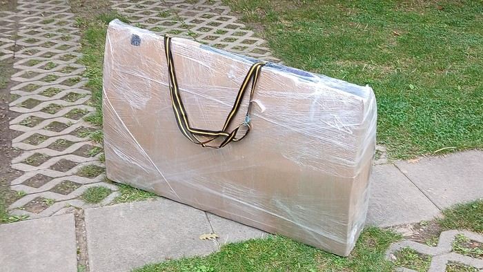
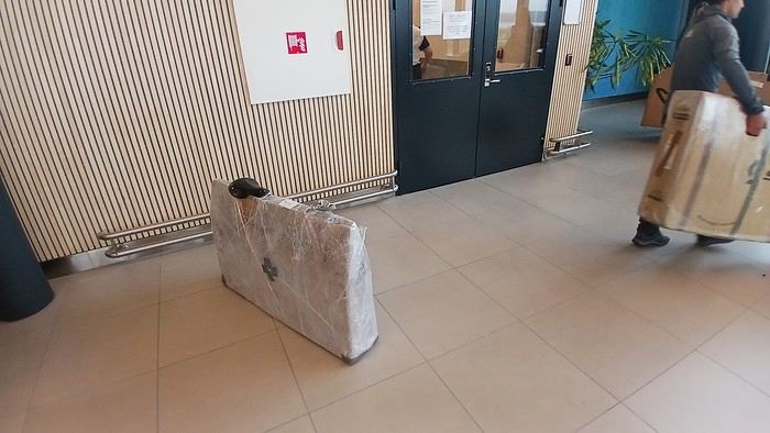
After testing it for three years across various modes of transport, I’m sharing this video of a bike packing case. It’s made from recycled cardboard and shrink-wrapped, with adjustable thickness and added bubble wrap depending on the level of protection you want.
Installing spacers at the fork and chainstays makes the packaging compact. With the fifteen-odd euros for shrink-wrapping at the airport, this case travels really well.
https://youtu.be/_GDJi-GqmkM
- Low bulk (1.10m x 0.70m x 0.25m for a large frame), it fits vertically in train luggage compartments and the total dimensions (x+y+z) don’t exceed 2.40m.
- Two carrying solutions for public transport and easy handling by airport staff (no more tears in the cardboard from openings).
- Discreet packaging when dealing with bus drivers and train conductors, as it looks like an ordinary parcel.
- No need to return to the starting point to retrieve the case from your outbound trip, which you’d otherwise have to store somewhere, or deal with a bulky cover to pack in your panniers.
- You can still check tire pressure through the plastic film without damaging the packaging too much.
Drawbacks: Around 3 hours for this lengthy and meticulous process—removing the wheels, pedals, handlebars, and derailleur without misaligning them, then securing all components to the frame.
If you get a chance to test it, send me your feedback for future improvements.
I just took a trip in Tunisia from Tozeur to Douz, skirting Chott el Jerid to the south. I’m back with the urge to keep going further south via the 4x4 tracks to connect Douz to Ksar Ghilane. Has anyone driven this route recently or explored southern Tunisia?
Thanks for your tips!
fix
😎Fellow traveling cyclists or not, all of you who love travel, the pleasure of physical effort, nature, beautiful machines, people with true passions they seek to fulfill, and who also enjoy reading great literature about all this—the *200* magazine is for you just as it is for me. I should mention I have no financial or other interest in this (in an era where we accuse our politicians of all sorts of vile interests, I prefer to take precautions). I’ve been subscribed since the beginning, and every three months, I get my 130 pages of dreams (the magazine just went from 110 to 130 pages).
It covers everything from the trans-America route to the TCR (Trans Continental Race) from Belgium to a small town in Turkey, with mind-blowing averages—4,000 km and 80,000 m of elevation gain in 8 days and 15 hours for the winner. Let that sink in, and all of it without assistance—accepting a patch could penalize you. There’s also a story about crossing Iran, encountering one of the world’s most welcoming populations, following in the footsteps of Nicolas Bouvier, as well as retirees leisurely traversing France. The common thread in all these stories? Beautiful writing. Take, for example, a stunning article: *"Passengers of the Cold: From Edinburgh to Thurso, at the very north of Scotland, 550 km of moors, coasts, and icy wind. In Thurso, the road ends at a quay, facing the Orkney Islands. We wanted a November trip, off-season. We wanted to surprise winter. Just before the snow."* A sublime piece on the experience of facing adversity and the chance encounters along the road and in the elements.
Before I embarked on my own bike trips, I dreamed a lot about them—from the Atacama to the Gobi, along the Mekong, and not forgetting France. And now, these 130 pages every quarter keep those dreamy vibes alive through stories written in the most beautiful prose.
I’ll stop here because it might sound like I’m advertising, but if you don’t know *200*, I invite you to discover it. It’ll give you wings for the most incredible challenges or simply reinforce your desire for slow rides with your eyes open to others and nature.
A little news to wrap up: Axel Carion and a friend just broke the record for crossing South America from Colombia to Ushuaia in 59 days. On its own, that doesn’t mean much, but I can’t help it—it makes me dream. You should see how he talks about it, the flashes of that wild nature he’s stored away: a snowstorm at Paso Jama and the surreal sight of the suddenly snow-covered Licancabur!
Luc
PS: The magazine is called *200* because a day’s ride starts at 200 km—well, I’ve never done a ride like that since my longest was 167 km (with 18 kg of luggage, mind you), but why not one day? The magazine will explain how to tackle your first 200, and then the question in conclusion: when will you do your first 300?😏
I’ve got my flight ticket sorted—departing in mid-November and returning in mid-March. I’ll arrive in Santiago and leave from Buenos Aires.
I’ve already been to southern Argentina, specifically Torres del Paine National Park, and I’d love to go back to do the full W trek (I only did the shorter version last time).
I also want to do some hiking and maybe even tackle a summit. I climb and occasionally do some mountaineering, so I’ll definitely be going with a guide.
I plan to start around Temuco in Chile, with the idea of heading toward the lakes, then taking the Carretera Austral.
I’m not sure if I’ll go all the way to Ushuaia—it’s supposed to not be *that* worth it, except for the bragging rights of saying you’ve been to the end of the world.
I saw there are lakes in Argentina too.
I don’t have a precise itinerary, but what I’d love is, once I reach the southernmost point of my trip, to take a mini-cruise to see some wildlife. Any tips for that?
What kind of sleeping bag did you take? Is a 0°C (32°F) one enough?
And one last question: white gas stove or can I get by with my gas stove?
I'm developing a free and open-source web app for planning walking and cycling trips (and even car trips). You can create a route by clicking directly on the map to add waypoints, and it can consist of multiple stages. The app provides tools to edit the stages and the overall route, and to display useful information (distances, altitudes, and elevation changes). A relief profile can be shown as a graph for a specific stage or the entire route.
Once the route is ready, it can be exported as a GPX file, which can then be used with a GPS or a mobile navigation app.
The app is built in JavaScript and runs entirely in the web browser. It uses the Leaflet library and several OpenStreetMap-based services. Initially developed for my personal needs (I enjoy hiking and cycle touring), I’d be happy to share it with anyone who might find it useful. It’s free to use, doesn’t require an account, and the source code is available.
hello fellow cycling enthusiasts
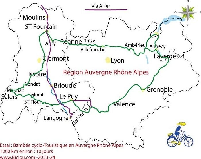
here’s a travel journal of the cycling tour through the Rhône-Alpes Auvergne region by Claudio
zouli
it was the plan
http://cbandiera.free.fr/parcours/auvergne-Ralpes/
the trip was completed
story being posted online soon
1100 km in 11 days
beautiful and varied regions
Hello,
We’d like to go on a 3- to 4-month bike trip starting in December, crossing from Assam (northeast India) to New Delhi via Nepal.
Are there routes with light traffic along the Brahmaputra and through Nepal?
We’re also looking for any info on accommodations, wild camping, local interactions, etc.
Thanks,
Michel
Hello,
Has anyone here had experience using a gas stove in Sardinia and Sicily? I’m wondering if screw-on gas canisters (not the blue Campingaz ones, but brands like Coleman, Primus, etc.) are easy to find.
I’m planning to cycle from Morlaix to Brest (via Roscoff and the V45 coastal route). We’ll start riding on August 16th for 13 days (with stops for island visits, surfing, etc.). Is there a lot of traffic at this time of year? I’ve got two kids, 11 and 13, and we don’t like riding in the middle of cars (we’ve already done the Vélomaritime—Caen to Cherbourg—the Loire route from Orléans to Saumur, the Vélodyssée from Nantes to Royans, and the canals like the Nivernais and Bourgogne, where there were plenty of bike-only lanes, which isn’t the case on this route).
Thanks for your help if you’ve already done this route in late August!
Virginie
Hi there,
I’ve been road cycling for several years, and I’m about to switch to gravel in the next few days—I’m waiting for my bike, which should arrive this week.
I’m planning a bikepacking trip in a few weeks along the Véloroute V81, also known as the Vélosud, from Biarritz to Le Barcarès.
Has anyone here already done this route? Any info is welcome, whether it’s about the route itself, gear, or accommodation. I’ll prioritize staying with locals as much as possible. On that note, I just signed up for the brand-new site *Guidon et Couette* ((www.guidon-et-couette.fr)), which offers free accommodation between cyclists across the country, but there’s almost no one listed along my route!
Thanks in advance.
Laurent.
Hi there, I’m planning a cross-Canada bike trip, and I’ve got a question that might seem silly, but could someone tell me how to pack a bike (in a box, with a fragile sticker... I don’t know) for a flight? Thanks in advance!
This summer, we’re planning to cycle along the EV 19 that follows the Meuse River from Langres all the way to Rotterdam.
My question is about getting back to Nantes.
Do any of you know what the best return option might be? I’d love to hear about your experiences.
I saw that FlixBus doesn’t take bikes.
By train, I think it’s possible but would involve multiple local trains.
We were also wondering if there’s a boat from Rotterdam to Saint-Nazaire that could take passengers with bikes.
Any tips or experiences you can share would be really helpful—thanks in advance!
Have a great evening
I’ve gotten used to crossing Europe by bus to return by bike.
It was really convenient to take the bike without having to disassemble it.
But FlixBus no longer accepts bikes...
What alternatives do you know about?
Thanks.
Hi there,
I’m planning to ride the Dutch section of the EuroVelo 19, from Maastricht to Rotterdam.
Since it’s too complicated to bring my bike on the train, I’m looking to rent one locally.
I’d love any tips or bike rental shop recommendations—I’m struggling to find options even in Rotterdam.
The plan is to rent in Rotterdam, take the train to Maastricht with the bike, then cycle back to Rotterdam.
Thanks in advance for any advice or suggestions!
Nath
I’m planning to build a new touring bike.
I want to prioritize lightness.
That said, I’m tempted by a suspension fork that could offer some comfort on rougher roads.
The recent appearance of gravel suspension forks on the market might meet my needs—at least on paper.
I’m particularly considering the RockShox Rudy Ultimate XPLR fork.
Unlike MTB forks, its travel is short: either 30 mm or 40 mm.
It weighs 1400 g, which is 400/500 g more than a steel fork.
Any thoughts or real-world feedback on this?
I’m also wondering about the durability of magnesium (lower leg) for long-distance bike touring.
And what’s the impact of skipping the manufacturer-recommended maintenance every 50 and 200 hours? That’s bound to happen on a long trip unless you carry extra gear.
More generally, how reliable are these kinds of forks?
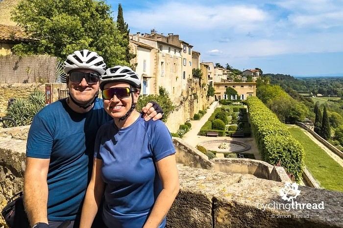
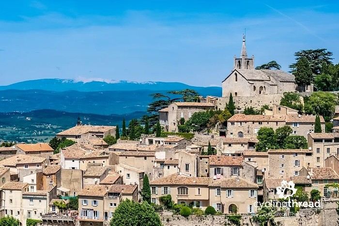
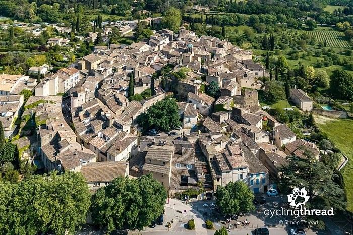
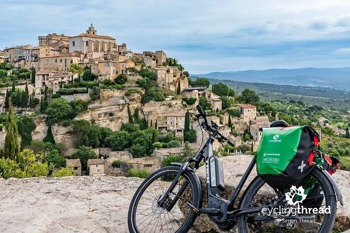
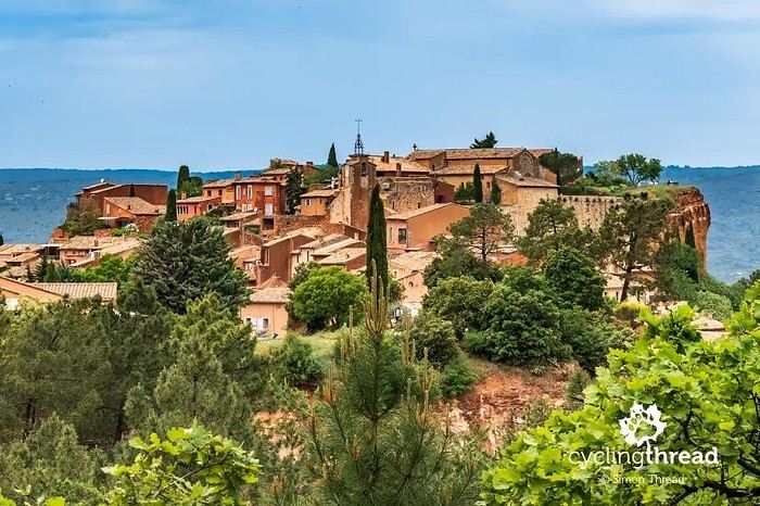
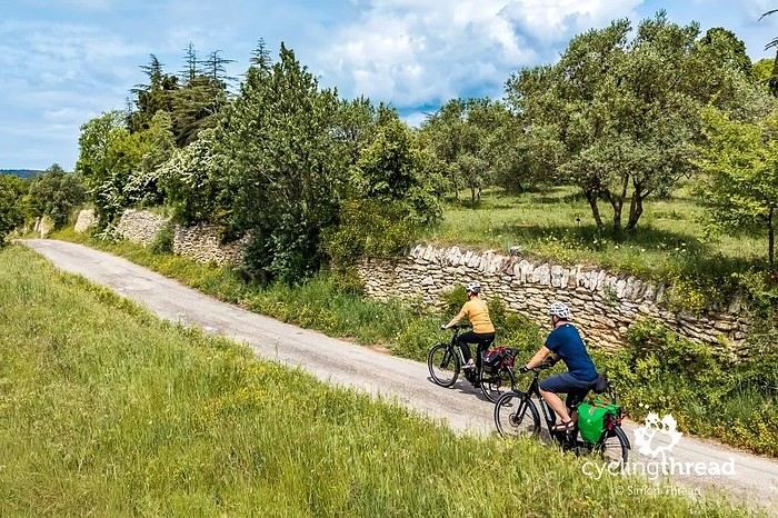
I’m making an exception and creating a separate post this time, since it’s all about France. In May, we spent a week in Provence, specifically in the Luberon, exploring the cycling routes *Autour du Luberon à Vélo*, the *Véloroute du Calavon* (part of EuroVelo 8), and the shorter *Les Ocres à Vélo* route. Together, they gave us an amazing journey through rolling hills, vineyards, lavender fields still green in spring, and some of the most stunning landscapes in southern France.
It was, of course, the perched villages that impressed us the most. We visited Gordes, Roussillon, Bonnieux, Lacoste, Lourmarin, Ménerbes, Oppède-le-Vieux, Cucuron, and Lauris. Many of them are among the most beautiful villages in Provence, and it’s hard not to agree with that reputation.
One interesting point is the route of EuroVelo 8 in this part of the region. The official path mainly follows the old railway line of the *Véloroute du Calavon*, which is very comfortable and safe. But in our opinion, cyclists traveling EuroVelo 8 around the Mediterranean would discover even more treasures if the route passed through villages like Bonnieux, Lacoste, or Oppède-le-Vieux.
We were also pleasantly surprised by how safe cycling felt. Most of the route takes small local roads, but traffic is light, drivers are respectful, and road design really takes cyclists into account. It’s one of those places where you can ride peacefully even without separated bike lanes.
Our full story:
Around Luberon by bicycle - the most beautiful villages of Provence
You can also find all our cycling travel stories on the forum:
Cycling Thread - Europe’s most beautiful bike routes
Hi there, we’re a group of 4 cyclists looking to get from Treviso in Italy to Munich with our 4 non-folding bikes. It seems complicated! Are there any solutions? Thanks so much.
Hi there, we’re planning a Munich to Venice bike trip at the end of June 2026. Getting back from Venice to Toulouse by train with 4 bikes isn’t straightforward. What return options have others who’ve done this trip chosen? Any tips or great deals would be much appreciated. Thanks a bunch! !
Hi everyone,
Happy owner of a Pegasus Estremo bike with a Rohloff hub, which is giving me trouble with the SF11-NCX-FT-E-LITE 700C TS 300/0 fork (serial number TD01329060). It’s starting to show its age, and I’d like to repair it to extend the life of my beloved bike.
The suspension is gone, and there’s an oil leak from the seals.
Does anyone know how to repair it? Where can I find parts that are about fifteen years old? Or where to find an identical replacement fork? Just to clarify, the Magura HS11 brakes are mounted using Firm Tech, meaning they’re on pivots behind the fork, facing the frame.
Hi, I'd like to know if anyone has done this route recently or has reliable info.
Does the track exist, and most importantly, is there sand (for biking)?
Any info is welcome.
Cheers,
diego ambilobe: mangaoka, manondro, ramena
vohemar sambava: masondrono, tanambao
Hi there,
New to bike touring,
I’d love to start with a section of the Via Rhona to explore and share (route to be decided).
Looking forward to exchanging tips!