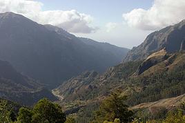
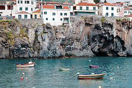
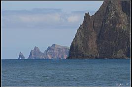
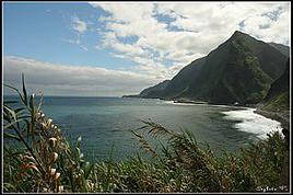
Come discover the island of Madeira with me
FR

Translated into English.

Original post
PI
Introduction

We arrived on the island of Madeira (Portugal) at the beginning of May 2023 and stayed for 5 weeks.

This island is renowned for its rich cultural heritage, its famous hikes through lush landscapes, and its seaside resorts. It offers an unforgettable experience for nature lovers.

In this travel journal, you’ll find a list of the many activities we did during our stay to explore the different attractions of this magnificent island.

These attractions are categorized to make it easier to search based on your interests, if needed.

Videos are included throughout the summary. Please click on the image to start the video.

To jump to a specific post, here are the appropriate links:

HIKES:

Calheta - PR19 Caminho Real do Paúl do Mar Santana - Ribeiro Frio - PR11 Vereda dos Balcões Sao Vicente - Gingas - PR16 Levada Fajã do Rodrigues Rabaçal - PR6.1 Levada do Risco & PR6 Levada das 25 fontes Rabaçal - PR6.2 Levada do Alecrim & PR6.3 Vereda da Lagoa do Vento Caniçal - PR8 Vereda da Ponta de São Lourenço São Jorge - PR18 Levada do Rei Ponta do Sol - PR7 modified - Levada Nova & Levada do Moinho Machico - PR5 Vereda das Funduras Funchal - PR1 Vereda do Areeiro (Pico do Areeiro to Pico Ruivo) Funchal - PR1 Vereda do Areeiro (Pico Ruivo to Pico do Areeiro) Funchal - PR1.2 Vereda do Pico Ruivo (outbound) Funchal - PR1.2 Vereda do Pico Ruivo (return) Porto Moniz - Fanal Forest Porto Moniz - PR14 Levada dos Cedros Ribeira Brava - PR17 Caminho do Pináculo e Folhadal (Encumeada) Ribeira Brava - PR17 Caminho do Pináculo e Folhadal (Lombo do Mouro) Ribeira Brava - PR17 Caminho do Pináculo e Folhadal (Bica da Cana) Santana - PR9 Levada do Caldeirão Verde Lamaceiros - Levada Ribeira da Janela Ribeiro Frio - PR10 Levada do Furado Tabua - Levada da Nova (Eastern Sector) Tabua - Levada da Nova (Western Sector) Boa Morte - Levada do Norte Verada da Levada do Facho - Levada do Norte (South) Vale Paraiso - Levada da Serra do Faial Porto Moniz - PR13 Vereda do Fanal Referta - Levada do Castelejo Porto da Cruz - Levada do Castelejo Estanquinhos - Pico Ruivo do Paul da Serra Boaventura - Levada de Cima & Levada da Acha Grande

SEASIDE RESORTS & NATURAL POOLS:

Natural pools of Seixal Seixal Naval Club Seaside Resort - Natural pool Natural pools of Porto Moniz Funchal - Lido Seaside Resort Santana - Foz da Ribeira do Faial Seaside Resort Câmara de Lobos - Salinas Seaside Resort Porto Moniz - Aquário/Cachalote Natural Pools Funchal - Doca do Cavacas Seaside Resort Funchal - Ponta Gorda Seaside Resort Caniço - Roca Mar Hotel Seaside Resort Caniço - Lido Galoma Seaside Resort Calhau de São Jorge Seaside Resort Ribeira Brava Seaside Resort

BEACHES:

São Jorge Beach Calheta Beach Seixal - Laje Beach (Jamaica) Porto de Seixal Beach Caniço - Reis Magos Beach Machico - Machico Beach (Banda d'Além) Machico - São Roque Beach Machico - Ribeira Natal Beach Caniçal - Prainha Beach Porto da Cruz - Alagoa Beach

TOWNS:

Stroll through the town of Ponta do Sol Stroll through the town of Câmara de Lobos Stroll through the town of Ribeira Brava Stroll through the town of Funchal Funchal - Wicker toboggan ride Stroll through the town of Machico Stroll through the town of Santana Stroll through the town of São Vicente São Vicente Caves Park

VIEWPOINTS:

Calheta Region Ponta do Sol Region Ribeira Brava Region Câmara de Lobos Region Funchal Region Santa Cruz Region Porto Moniz Region São Vicente Region Santana Region Machico Region On the road in Madeira

WATERFALLS ALONG THE WAY

Ponta do Sol - Anjos Waterfall Sao Vicente - Água d'Alto Waterfall Seixal - Córrego da Furna Waterfall
Anne Blogue: https://deuxnomades.blogspot.com/ YouTube: https://www.youtube.com/c/SouthAngelVideo?sub_confirmation=1
PI Pinacoladada Globetrotter ·
CALHETA - PR19 CAMINHO REAL DO PAÚL DO MAR

GPS coordinates: 32.75204, -17.21746 Start of the trail GPS coordinates: 32.75267, -17.22386 End of the trail

The PR19 trail, starting from Prazeres, is 1.8 km long (one way only). It begins near the Jardim do Atlântico hotel and leads to Paúl do Mar along the ocean.

It’s actually a path that was once used by locals to travel from the sea to the mountains for their commercial activities.

The trail is short. However, it’s winding and very steep. The descent is extremely steep—we felt the effects on our knees for a few days afterward!

Along the way, there are many viewpoints offering stunning views of beautiful waterfalls, farmland, and the coastline.

When we reached the pier in Paúl do Mar, we took the opportunity to look around and then took a taxi (16 €) back to our starting point.

https://youtu.be/EnYmFwjDb74
Anne Blogue: https://deuxnomades.blogspot.com/ YouTube: https://www.youtube.com/c/SouthAngelVideo?sub_confirmation=1
PI Pinacoladada Globetrotter ·
SANTANA - RIBEIRO FRIO - PR11 VEREDA DOS BALCÕES

32.73536, -16.88629 Start of the trail 32.74156, -16.89031 Balcões Viewpoint 32.73422, -16.88706 Fish hatchery

This linear trail, 1.5 km long (one way only), is very easy to walk. The path is clearly marked and has practically no elevation gain.

Starting on the regional road ER 103 in Ribeiro Frio, it follows the levada of Serra do Faial through a beautiful forest and leads to the Balcões viewpoint.

The Balcões viewpoint offers stunning panoramic views of the lush Ribeira da Metade valley and the village of Faial.

You can spot several bird species here, and you can even feed them right from your hand.

In Ribeiro Frio, there are several shops, restaurants, cafés, restrooms, and a fish hatchery. You can also admire beautiful streams and small waterfalls.

Since Ribeiro Frio is very popular, parking can sometimes be a challenge.

https://youtu.be/XYou4w8gIQ0
Anne Blogue: https://deuxnomades.blogspot.com/ YouTube: https://www.youtube.com/c/SouthAngelVideo?sub_confirmation=1
PI Pinacoladada Globetrotter ·
SAO VICENTE - GINGAS - PR16 LEVADA FAJÃ DO RODRIGUES

32.77979, -17.04822 Parking 32.77914, -17.04938 Start of the trail 32.78254, -17.06028 Start of tunnel 1 (50 m) 32.78254, -17.06027 Start of tunnel 2 (120 m) 32.78478, -17.06438 Start of tunnel 3 (1.1 km) 32.78835, -17.07713 End of the trail

This one-way linear trail, 3.9 km long (outbound only), is easy to walk. There’s practically no elevation gain.

The trail follows the Levada Fajã do Rodrigues, which is home to many trout, and passes through a lush forest of laurel and eucalyptus trees. You’ll come across numerous waterfalls along the way.

The first waterfall is just a few hundred meters from the start of the trail. It’s actually an artificial waterfall that’s part of the levada system.

A few clearings in the forest offer lovely viewpoints over a village below and the towering ridges ahead.

There are several tunnels to cross. Some are short, while others are much longer. A headlamp—or any other light—is essential for navigating inside some of these tunnels.

Some sections of the tunnels are narrower, so it’s best to have your hands free to move through them.

Just before reaching the longest tunnel, you’ll spot two stunning waterfalls. The first, on the left side of the levada, flows into a small pool, while the second, on the right side of the trail, cascades into a small canyon.

When walking through the 1.1 km tunnel, watch your head—the ceiling isn’t very high, and trust me, it hurts if you accidentally bump into the rocky wall!

At the end of the trail, another waterfall appears, surrounded by incredibly lush vegetation. The scenery is truly enchanting.

https://youtu.be/he4wNS2lTNU
Anne Blogue: https://deuxnomades.blogspot.com/ YouTube: https://www.youtube.com/c/SouthAngelVideo?sub_confirmation=1
PI Pinacoladada Globetrotter ·
RABAÇAL - PR6.1 LEVADA DO RISCO & PR6 LEVADA DAS 25 FONTES

GPS Coordinates: 32.75490, -17.13386 Parking GPS Coordinates: 32.76165, -17.13533 Start of Levada Do Risco trail GPS Coordinates: 32.76026, -17.12341 Risco Waterfall viewpoint GPS Coordinates: 32.76119, -17.12844 Junction to join the Levada das 25 Fontes GPS Coordinates: 32.76244, -17.12792 Right turn GPS Coordinates: 32.76563, -17.12513 Lagoon of the 25 Fontes GPS Coordinates: 32.76525, -17.12729 Left turn for the return

The "Levada das 25 Fontes" is undoubtedly the most popular hike on the island of Madeira. For our part, we added the "Levada do Risco" to this route to make an 8.6 km loop.

The parking area offers stunning views of the Rabaçal valley where we’re about to hike.

Near the parking, there’s a large sign with information about the route to follow.

The hike starts on a 2 km paved road leading to the Rabaçal Nature Spot Café. From there, we first take the Levada do Risco trail.

This trail is only 800 meters one way, but it’s definitely worth it.

The Risco waterfall, 100 meters high, cascades down the side of a steep, colorful cliff. The scenery is breathtaking.

Previously, there was a path that went under the waterfall, but landslides forced its closure, and the entrance is now padlocked.

We then backtracked and took a small trail connecting the Levada do Risco to the Levada das 25 Fontes.

The Levada das 25 Fontes trail is very pretty and is probably the best part of the hike, with lots of colorful flowers and numerous small waterfalls. It also offers some viewpoints over the valley.

What really catches your eye, though—the ultimate goal of this hike—are the multiple waterfalls flowing down a lush green wall into a beautiful turquoise lagoon: the Lagoa das 25 Fontes. The landscape is truly enchanting.

We retraced our steps and followed the Levada das 25 Fontes trail back to the Rabaçal Nature Spot Café, where we had lunch: an excellent tomato cream soup with an egg added, plus a Bolo do Caco, a culinary specialty of the Madeira archipelago.

Bolo do Caco is a bread made from wheat flour and sweet potato. It’s simply served with garlic butter, but you can also add ham, cheese, or any other ingredient. It’s really delicious.

In summary, this trail is easy to follow as it’s very well marked. However, there are still several steps to climb up and down, which increases the difficulty level of this hike.

If you’d like to shorten the hike, there’s a shuttle that runs from the parking lot to the Rabaçal Nature Spot Café. That’s what we did for the return trip. It costs 3 € per person, both ways.

https://youtu.be/nb7nd-9w3WY
Anne Blogue: https://deuxnomades.blogspot.com/ YouTube: https://www.youtube.com/c/SouthAngelVideo?sub_confirmation=1
PI Pinacoladada Globetrotter ·
RABAÇAL - PR6.2 LEVADA DO ALECRIM & PR6.3 VEREDA DA LAGOA DO VENTO

32.75490, -17.13386 Parking 32.75216, -17.13105 Start of the trail 32.75685, -17.11190 Lagoa da Dona Beja 32.75892, -17.12121 Pico do Vento viewpoint 32.76017, -17.12229 Lagoa do Vento 32.76019, -17.12262 Top of Risco waterfall 32.76151, -17.13474 Rabaçal Nature Spot Café

The hike that includes the Levada do Alecrim and the Vereda da Lagoa do Vento is 7 km long and lets us discover some stunning waterfalls.

The trail is easy to walk and starts near the parking lot in the Rabaçal valley, which is also used for the Levada das 25 Fontes hike, among others.

The trail first follows the Levada do Alecrim. You’ll need to be careful in some spots since large rocks line the levada.

There’s also a long rocky staircase to climb, alongside which the levada flows down as a waterfall. It’s really pretty.

Two viewpoints offer a magnificent panorama of the Rabaçal valley.

This trail takes you to Lagoa da Dona Beja, where a beautiful waterfall cascades into a circular pool.

This spot is part of a canyoning route. During our visit, we saw a few people jumping into the pool from the top of the waterfall.

That gave us the idea to climb to the top of the waterfall for a different perspective of the place.

We then backtracked and turned right onto a trail leading to Pico do Vento, which offers a nice viewpoint over the valley.

We continued our hike toward Lagoa do Vento to see more waterfalls. The trail has several steps to descend.

Lagoa do Vento is a river basin formed by water falling from the top of the cliff, coming from Ribeira do Lajeado and heading toward the Risco waterfall. The landscape, made up of waterfalls and pools, is truly breathtaking.

It’s also possible to take a small trail to the left of the stream. This leads to the top of the Risco waterfall, where we had a fantastic view of the valley.

We then headed to the Rabaçal Nature Spot Café and took the shuttle (3 € per person) back to the parking lot, which saved us from walking an extra 2 km.

https://youtu.be/oRVEhnWVlWk
Anne Blogue: https://deuxnomades.blogspot.com/ YouTube: https://www.youtube.com/c/SouthAngelVideo?sub_confirmation=1
PI Pinacoladada Globetrotter ·
CANIÇAL - PR8 VEREDA DA PONTA DE SÃO LOURENÇO

32.74308, -16.70141 Parking 32.74197, -16.68587 Cais do Sardinha (pier) 32.74219, -16.68567 Praia do Sardinha (beach) 32.74217, -16.68339 Casa do Sardinha Nature Spot Café 32.73898, -16.68097 Miradouro Ponta do Furado (viewpoint)

There’s a parking lot at the end of ER 109, but since this hike is really popular, it fills up quickly.

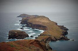
This 3.6 km one-way hike lets you explore the long, narrow Ponta de São Lourenço peninsula at the eastern tip of Madeira.

The trail is a series of ups and downs and leads to Pico do Furado, a peak at the end of the peninsula with an amazing view of the entire route and two small volcanic islands.

Here, the semi-arid landscape is extraordinary and completely different from the rest of the island, where the vegetation is lush. It’s also the sunniest and hottest spot on the island.

Several viewpoints along the way offer stunning views of the high cliffs shaped by volcanic erosion that has continued for millions of years along the coastline.

Near the end of the hike, you can take a dip at Praia do Sardinha, a beach close to the pier of the same name.

The Casa do Sardinha Nature Spot Café also offers hikers sandwiches made with traditional bolo do caco, quiches, and pastries.

If you don’t want to hike back the same way, you can take a boat back to Marina da Quinta do Lorde, which is 1.5 km from the parking lot. Just note that the road is uphill.

There’s a fee, and you’ll need to book in advance with an agent near the Casa do Sardinha Nature Spot Café.

https://youtu.be/renuCna58Hc
Anne Blogue: https://deuxnomades.blogspot.com/ YouTube: https://www.youtube.com/c/SouthAngelVideo?sub_confirmation=1
PI Pinacoladada Globetrotter ·
SÃO JORGE - PR18 LEVADA DO REI

32.81687, -16.92461 Parking and start of the trail 32.80453, -16.93570 Waterfall 32.79857, -16.93713 Waterfall 32.79574, -16.93687 End of the trail 32.79603, -16.93708 Small 160 m path crossing the levada

This linear trail, 5.3 km long (one way only), starts right next to the Quinta Levada do Rei café. You’ll find a large information board at the beginning of the trail.

From this point, the trail is very easy to follow—just walk alongside the levada. It begins at the Quebradas water treatment plant in São Jorge and leads to the source of the levada at Ribeiro Bonito stream.

The walk is really pleasant, set in a beautiful forest with lush vegetation. You’ll also spot some gorgeous flowers along the way.

Stunning waterfalls flow directly onto the path, so come prepared!

At the end of the route, there’s a small waterfall next to a little concrete platform—perfect for a picnic.

You can venture a bit further into this gorgeous gorge to see more small waterfalls and natural pools. That’s what we did, taking a small dirt path up to the top of the hill on the right side of the levada.

https://youtu.be/JO5_SBaqXi4
Anne Blogue: https://deuxnomades.blogspot.com/ YouTube: https://www.youtube.com/c/SouthAngelVideo?sub_confirmation=1
PI Pinacoladada Globetrotter ·
PONTA DO SOL - MODIFIED PR7 - LEVADA NOVA & LEVADA DO MOINHO

32.69422, -17.08767 Start of Levada Nova trail 32.71152, -17.08464 Tunnel entrance (± 200 m) 32.71380, -17.08373 Waterfall 1 32.71674, -17.08397 Staircase to Levada do Moinho 32.71782, -17.08383 Waterfall 2 32.71709, -17.08443 Return via the Levada do Moinho trail

This 8.5 km loop offers stunning panoramic views of the Ponta do Sol valley and lets us admire beautiful waterfalls as well as the local flora.

The start of the Levada Nova allows us to observe a multitude of terraced farmlands. The scenery is really pretty.

For hikers who are afraid of heights or prone to vertigo, it’s important to mention that in some places, the trail along the Levada Nova is narrow and close to a ravine with no protection. However, if you’re careful, these sections are manageable.

We also have to cross a tunnel about 200 m long with a fairly low ceiling. It’s dark inside, so a headlamp or your phone’s flashlight is necessary to get through it.

A pleasant surprise awaits at the end of this tunnel. The trail has been carved into the side of a cliff, and a magnificent waterfall flows above it, allowing us to walk behind the cascade. This spot is truly picturesque.

A little further on, we descended a steep staircase leading to the Levada do Moinho. Before starting the return along this levada, we headed toward a gravel road that leads to a picnic area where we could see another beautiful waterfall.

We then followed the Levada do Moinho back to our starting point. It’s located at a lower level and also offers stunning views of the narrow valley. The scenery is breathtaking.

While walking along this levada, we spotted countless brightly colored lizards basking in the sun.

Just before reaching the village, we climbed the steps of a staircase to reach the uphill road we walked to return to the start of the trail.

https://youtu.be/BMaBy9mq1gM
Anne Blogue: https://deuxnomades.blogspot.com/ YouTube: https://www.youtube.com/c/SouthAngelVideo?sub_confirmation=1
PI Pinacoladada Globetrotter ·
MACHICO - PR5 VEREDA DAS FUNDURAS

32.74652, -16.82614 Parking Miradouro da Portela 32.74718, -16.82434 Trail Estrada Florestal da Serra das Funduras 32.74840, -16.79531 Casa das Funduras (+/-6 km) 32.73749, -16.79781 End of the trail

The Vereda das Funduras hike is 8 km long (one way) and starts near the Portela viewpoint (Miradouro da Portela).

We took the opportunity to admire the Penha d'Águia geological formation, nearly 600 meters high, which towers over the town of Porto da Cruz.

The hike begins on the road called "Estrada Florestal da Serra das Funduras," which crosses the Laurisilva Forest of Madeira, a UNESCO World Heritage site.

We enjoyed some viewpoints overlooking the valley surrounding Porto da Cruz.

We continued our hike on the PR5 pedestrian trail, leading to the Casa das Funduras, which supports forestry activities.

We took a break there to have a snack.

Then, we started our descent toward the village of Maroços, allowing us to discover a landscape of terraced farmland that characterizes Madeira’s agricultural scenery.

When we reached the main road, we were lucky to spot a taxi coming our way. Since it was available, we took it back to our starting point for 10 €.

It would also have been possible to take the bus for the return trip.

https://youtu.be/oThGO6bbS98
Anne Blogue: https://deuxnomades.blogspot.com/ YouTube: https://www.youtube.com/c/SouthAngelVideo?sub_confirmation=1
PI Pinacoladada Globetrotter ·
FUNCHAL - PR1 VEREDA DO AREEIRO (PICO DO AREEIRO TO PICO RUIVO)

32.73546, -16.92873 Start of the trail 32.73921, -16.93357 Ninho da Manta viewpoint 32.73908, -16.93672 Pedra Rija viewpoint 32.76043, -16.94154 Casa de Abrigo do Pico Ruivo 32.75887, -16.94275 Pico Ruivo 32.75839, -16.94192 End of the trail

There are several parking spaces at Pico do Arieiro. However, given the site's immense popularity, it's best to arrive early to secure one, as they fill up very quickly.

This is undoubtedly one of the most beautiful hikes we've done, but also the toughest, as it includes several steep climbs and descents. Plus, we did the round trip.

This route, which is 6.1 km long (one way), connects two of Madeira’s highest peaks, Pico do Areeiro (1817 m) and Pico Ruivo (1862 m), and offers breathtaking views of the heart of the central massif.

We started this hike at Pico do Arieiro and were truly amazed by the extreme beauty of the landscape.

About 700 m into the trail, you’ll find the Ninho da Manta (buzzard’s nest) viewpoint. From this platform, where birds of prey nest, we had a magnificent view of the Fajã da Nogueira valley, São Roque do Faial, and a large part of the central mountain range.

The second viewpoint, Pedra Rija, is located 400 m from Ninho da Manta. It offers excellent vantage points over the rugged peaks. It’s also one of the most famous stops on this hike due to the very photogenic staircase we have to climb.

There are tunnels along this route, so a headlamp or your phone’s flashlight is necessary to get through some of them.

Throughout the trail, you can spot various birds and different species of flowers.

The final climb to the Casa de Abrigo do Pico Ruivo is the toughest part of the hike, as you have to ascend several very steep metal staircases.

Fortunately, at the top of these stairs, we got a little break, as the trail is flat or downhill for about twenty minutes.

We were on the other side of the mountain, and the scenery was completely different. Unlike the start of the hike, where we walked through a lush green valley, here, dead trees stretched out as far as the eye could see. But the landscape was just as spectacular.

The trail then begins to climb gradually. It’s not that this section is difficult, but fatigue had set in, and the path to the refuge felt endless.

Fog surrounded the refuge when we arrived. We took the opportunity to take a well-deserved break and enjoy a very comforting tomato soup.

Afterward, I went alone to the summit of Pico Ruivo. This last section of the trail involves a steep climb of about ten minutes, but it was nothing compared to the metal staircases we had just tackled.

At the summit of Pico Ruivo, we have stunning panoramic views of the entire region... as long as the fog isn’t around—and it was very much there during our visit.

I stayed at the summit for a little while, hoping the fog would lift, but it didn’t.

However, we returned a few days later during our hike on the PR1.2 trail and enjoyed clear skies, which allowed us to admire the truly sensational landscape from that spot.

https://youtu.be/KY0d9ap7dLY
Anne Blogue: https://deuxnomades.blogspot.com/ YouTube: https://www.youtube.com/c/SouthAngelVideo?sub_confirmation=1
PI Pinacoladada Globetrotter ·
FUNCHAL - PR1 VEREDA DO AREEIRO (PICO RUIVO TO PICO DO AREEIRO)

32.76043, -16.94154 Casa de Abrigo do Pico Ruivo 32.73908, -16.93672 Belvédère Pedra Rija 32.73921, -16.93357 Belvédère Ninho da Manta 32.73546, -16.92873 End of the trail - Pico do Areeiro

We did both the outbound and return trip on this same trail, covering a total distance of 12.2 km.

Here’s our return journey, which started at Pico Ruivo and ended at Pico do Areeiro.

The return trip let us see the landscape from a different angle. However, we’d already spent a lot of energy on the way there, and fatigue was ever-present. We kept pushing our limits because the route is uphill with lots of stairs, making it quite challenging.

The beauty of the scenery gives us wings...

The first section of the trail has steps and metal staircases, all downhill.

This part is manageable, but you’ve got to be careful—the stairs are very steep, and the stone steps are uneven.
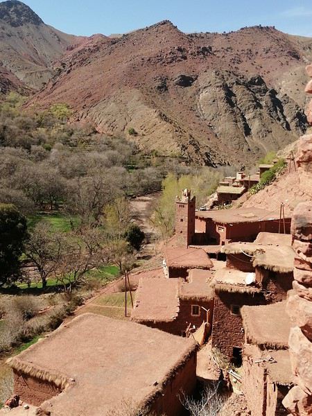
The trail then crosses a section with bare trees, creating an otherworldly landscape. This part gives you a breather since it’s relatively flat.

But the break doesn’t last long—a long series of steps to climb follows.

The views of the sheer cliffs are truly exceptional. The scenery is breathtaking!

Flowers in all colors brighten the path. We also spotted several bird species along the way.

https://youtu.be/nHDzWw_xWrs
Anne Blogue: https://deuxnomades.blogspot.com/ YouTube: https://www.youtube.com/c/SouthAngelVideo?sub_confirmation=1
PI Pinacoladada Globetrotter ·
FUNCHAL - PR1.2 VEREDA DO PICO RUIVO (ONE WAY)

32.76502, -16.92093 Start of the trail 32.76043, -16.94154 Casa de Abrigo do Pico Ruivo 32.75887, -16.94275 Pico Ruivo 32.75839, -16.94192 End of the trail

This moderate-difficulty trail, 2.8 km long (one way only), starts at Achada do Teixeira and ends at Pico Ruivo, the highest peak on the island of Madeira (1,862 m above sea level).

It’s the most popular trail to reach Pico Ruivo because it’s the shortest route and is very well marked. Plus, most of the trail is paved.

It offers stunning views of the steep mountains and deep valleys formed by ancient volcanoes.

A few shelters have been built along the trail, allowing you to stop, rest, grab a snack, or take cover in case of sudden weather changes, which can happen at any time in this region.
The end of the hike requires a bit more effort as the trail climbs the northern slope of the mountain.
We were lucky enough to reach the summit of Pico Ruivo under clear skies, which let us enjoy the breathtaking panoramic view all around.

The Casa de Abrigo do Pico Ruivo, found at the top of the mountain, is a small café that sells hot and cold drinks as well as snacks.

We stopped there to enjoy an excellent tomato soup.

https://youtu.be/8zzPU1m8gqY
Anne Blogue: https://deuxnomades.blogspot.com/ YouTube: https://www.youtube.com/c/SouthAngelVideo?sub_confirmation=1
PI Pinacoladada Globetrotter ·
FUNCHAL - PR1.2 VEREDA DO PICO RUIVO (RETURN)

32.75887, -16.94275 Pico Ruivo 32.76043, -16.94154 Casa de Abrigo do Pico Ruivo 32.76502, -16.92093 Achada do Teixeira

This moderate-difficulty trail, 2.8 km long (one way), starts at Achada do Teixeira and ends at Pico Ruivo, the highest peak on the island of Madeira (1,862 m above sea level).

The return trip is along the same trail, but it lets you enjoy stunning viewpoints from different angles.

I also went to a viewpoint behind the Casa de Abrigo, which offers a breathtaking panoramic view of the steep mountains and deep valleys.

The first section of the trail is downhill, making the walk easier, while the end has a gradual uphill slope that’s not too strenuous.

Near the parking lot, there’s the "Mountain Spot Cafe" where we took a midday break. That’s where we enjoyed our lunch while soaking in the incredible views of Madeira’s highest peaks.

https://youtu.be/IS-sqqHGm20
Anne Blogue: https://deuxnomades.blogspot.com/ YouTube: https://www.youtube.com/c/SouthAngelVideo?sub_confirmation=1
PI Pinacoladada Globetrotter ·
PORTO MONIZ - FANAL FOREST

32.80907, -17.14146 Fanal Forest Parking 32.81412, -17.15029 Lagoa do Fanal Parking 32.81370, -17.14930 Lagoa do Fanal

Fanal Forest is an astonishing laurel forest often shrouded in mist, creating an eerie and otherworldly landscape.

It’s one of the largest laurel forests in Madeira and is located in the northwest of the island. It’s been a UNESCO World Heritage Site since 1999 and is recognized as a Natural Heritage of Humanity.

Lush vegetation covers deep valleys entirely, and the fog that wraps around the twisted trunks and branches of this magnificent forest sparks the imagination.

Lagoa do Fanal, on the other hand, is a volcanic crater that fills with rainwater. As a result, it’s seasonal. When we visited, it was dry. However, the spot is still very pretty.

You can also explore Fanal Forest more thoroughly by hiking trails like PR14 - Levada dos Cedros and PR13 - Vereda do Fanal.

https://youtu.be/USIBwjA-LOk
Anne Blogue: https://deuxnomades.blogspot.com/ YouTube: https://www.youtube.com/c/SouthAngelVideo?sub_confirmation=1
PI Pinacoladada Globetrotter ·
PORTO MONIZ - PR14 LEVADA DOS CEDROS

32.82594, -17.15844 Parking 32.82585, -17.15793 Start of the trail 32.79940, -17.14410 End of the trail (waterfall) 32.79967, -17.14471 Stairs

This trail, which is 5.6 km long (one way), starts on regional road 209, near the famous Fanal area located on the Paul da Serra plateau.

It follows the Levada dos Cedros, which runs through this famous laurel forest—a UNESCO World Heritage site—and leads to a stunning waterfall.

This levada is actually one of the oldest on the island, built in the 17th century.

The vegetation is lush, and the twisted trees lining the levada add a touch of mystery to the landscape.

There are also a few viewpoints where you can admire the majestic mountains towering over the area.

The highlight of this trail is at the end, where you reach a river with several small waterfalls cascading into a small canyon.

On the other side of the river, there’s an incredible waterfall flowing down from the top of a high cliff covered in vines and moss.

You can get to the base of the waterfall by following the small trail to the right of the cascade. It leads to the river, which you cross by stepping on the rocks.

On the other side of the river, follow the trail toward the waterfall (to the left).

For the return trip, we chose to go back the same way. However, it would have been possible to take the stairs near the waterfall and return via the road.

That said, the stairs are very steep with many steps, so it’s highly recommended to do the round trip on the same shaded trail.

https://youtu.be/WYFg0pnLuo0
Anne Blogue: https://deuxnomades.blogspot.com/ YouTube: https://www.youtube.com/c/SouthAngelVideo?sub_confirmation=1
PI Pinacoladada Globetrotter ·
RIBEIRA BRAVA - PR17 CAMINHO DO PINÁCULO E FOLHADAL (ENCUMEADA)

32.75454, -17.02013 Parking 32.75432, -17.01958 Start of the trail 32.75132, -17.02826 Tunnel 1 (+/- 500 m) 32.75233, -17.03503 Waterfall 1 32.75224, -17.04106 Waterfall 2 and Tunnel 2 (+/- 900 m) 32.75619, -17.04817 Waterfall 3 (Folhadal Waterfall) 32.76029, -17.04932 Waterfall 4 We retrace our steps

The PR17 Caminho do Pináculo e Folhadal hiking trail is 15 km long (one way only). That’s why we split this trail into three segments.

The first section we hiked starts at Encumeada and ends at the fourth waterfall, located about 350 m from Tunnel 2. The distance is 4.2 km (one way only). We’ll do a round trip.

The trail is easy to hike since it mainly follows the levada, which is lined with beautiful flowers. There are also a few viewpoints offering lovely views of the surrounding mountains.

The elevation gain is practically zero, except for the stretch leading to Folhadal Waterfall. It’s accessible via a cement staircase at the exit of Tunnel 2. Then, just follow the trail uphill through the forest and cross a stream to reach the base of the waterfall, which is truly spectacular.

You can also see other beautiful waterfalls along the way.

There are tunnels, so a headlamp or your phone’s flashlight is necessary to get through them.

https://youtu.be/GaPM-f8Z83s
Anne Blogue: https://deuxnomades.blogspot.com/ YouTube: https://www.youtube.com/c/SouthAngelVideo?sub_confirmation=1
PI Pinacoladada Globetrotter ·
RIBEIRA BRAVA - PR17 CAMINHO DO PINÁCULO E FOLHADAL (LOMBO DO MOURO)

32.74184, -17.04644 Lombo do Mouro parking 32.74273, -17.04474 Start of the trail 32.75357, -17.04603 Pináculo 32.75567, -17.05349 End of the trail We retrace our steps

The PR17 Caminho do Pináculo e Folhadal hiking trail is 15 km long (one way only). That’s why we split this trail into three segments.

The second section we hiked starts at Lombo do Mouro and is 3.4 km long (one way only). We’ll do a round trip.

The trail begins at the edge of regional road 105 and follows the levada da Serra. However, about 750 m from the start, there’s a long steep staircase that takes us to a higher level, offering lovely panoramic views of the surrounding mountains.

We also spot a few villages at the foot of these stunning mountains.

We come across several waterfalls flowing directly onto the trail. The vegetation is lush, and there are lots of pretty flowers.

During this hike, we can also see a pinnacle, a tall rock formation towering over the plateau.

https://youtu.be/0t_3qJVzQ9w
Anne Blogue: https://deuxnomades.blogspot.com/ YouTube: https://www.youtube.com/c/SouthAngelVideo?sub_confirmation=1
PI Pinacoladada Globetrotter ·
RIBEIRA BRAVA - PR17 CAMINHO DO PINÁCULO E FOLHADAL (BICA DA CANA)

Option 1: Round trip (11.6 km total)

32.75754, -17.05940 Trailhead 32.76542, -17.06046 Viewpoint 1 32.77155, -17.06488 Right onto ER 208 32.77219, -17.06466 Right onto PR17 32.77252, -17.06251 Camping Caramujo 32.77088, -17.06130 Lagoa do Caramujo 32.76963, -17.05582 Right onto Levada da Ribeira do Inferno 32.76394, -17.05075 PR17 32.76456, -17.04894 Viewpoint 2 We backtrack from here

Option 2: Continue to Encumeada (11.2 km total) 32.76515, -17.04458 PR17 to the right 32.76134, -17.04881 PR17 to the left 32.75420, -17.01944 End of trail at Encumeada

The PR17 Caminho do Pináculo e Folhadal hiking trail is 15 km long (one way). That’s why we hiked it in three segments.

The third section we covered starts at Bica da Cana and varies in length depending on the route you choose (see options above).

It begins alongside regional road 105. An informational sign marks the trailhead.

The trail descends through a dense forest. Many rocks and roots litter the ground, which can be slippery when it’s rained.

Pretty flowers line the path, and the vegetation is lush. A few viewpoints offer stunning views of the valley and mountains when the weather cooperates. Don’t forget this area is often shrouded in a sea of clouds.

The trail briefly leaves the forest as you walk a short distance on regional road 208 (a rocky dirt path).

It re-enters the forest and passes near Camping Caramujo, now abandoned. Old colorful buildings still stand, making the scenery truly picturesque.

As we continued, we crossed a beautiful forest of twisted trees. We passed by Lagoa do Caramujo, a pond that was dry during our visit.

We had to cross a small tunnel carved into the cliff. It’s best to have a light for this part since the ground is covered in rocks.

We were delighted to see a long, beautiful waterfall cascading down a vegetation-covered wall.

Next, we found ourselves at the top of a narrow ridge, offering lovely views (Viewpoint 2) of the area.

From this viewpoint, we considered taking a trail called "Paredes." However, we were advised against it since it’s not an official trail and is overgrown with brush.

We had the option to return the same way but wanted to avoid the long uphill climb back to the parking lot at the end of the trail.

That’s why we decided to head to Encumeada (Option 2) and try hitchhiking back to Bica da Cana.

We continued along the ridge and then began a very long descent down what felt like endless stairs. Thankfully, we weren’t hiking it in the opposite direction!

We then started a final ascent to join the trail along the Levada do Norte, which leads to Encumeada.

This last section isn’t shown in this video since we’d already covered it in a previous one. It’s easy to hike with no elevation change, but there are a few tunnels to cross. Bring a light.

When we arrived, we tried hitchhiking but had no luck. Few cars were heading toward Bica da Cana, and there’s no public transport in this area.

We ended up taking a taxi back to our starting point. The fare for the trip was 45 €.

https://youtu.be/nkIOw9Vm9uo
Anne Blogue: https://deuxnomades.blogspot.com/ YouTube: https://www.youtube.com/c/SouthAngelVideo?sub_confirmation=1
PI Pinacoladada Globetrotter ·
SANTANA - PR9 LEVADA DO CALDEIRÃO VERDE

32.78409, -16.90558 Parking 32.78371, -16.90597 Trailhead 32.77451, -16.93529 Caldeirão Verde 32.78415, -16.90877 Lake

There are several parking spaces at the trailhead. Parking costs 1 euro per hour, with a maximum of 3 euros.

There’s a small café and picnic areas at the start of the trail, as well as enclosures where you can watch ducks waddling near typical Madeira cottages.

This hike, which is 5.8 km one way, follows the Levada do Caldeirão Verde and leads to a stunning waterfall that cascades into an emerald-green lagoon.

The trail winds through a lush forest, lined with beautiful flowers and majestic trees. However, be cautious as there are many rocks and roots along the path.

There are lovely waterfalls flowing near the trail, as well as a few viewpoints offering scenic views of the valley and the verdant mountains.

The trail includes tunnels, so a headlamp or your phone’s flashlight is necessary to navigate them.

The highlight of this hike is a waterfall that plunges vertically into the Caldeirão Verde lagoon from about 100 m high. The scenery is truly enchanting.

On the way back, we took the "Caminho dos Vinháticos" trail, which leads to a park featuring a charming little lake. You can spot various bird species in this area.

https://youtu.be/hJNcoTpi0-8
Anne Blogue: https://deuxnomades.blogspot.com/ YouTube: https://www.youtube.com/c/SouthAngelVideo?sub_confirmation=1
PI Pinacoladada Globetrotter ·
LAMACEIROS - LEVADA RIBEIRA DA JANELA

32.85143, -17.16659 Parking 32.85119, -17.16651 Start of the trail 32.82446, -17.18071 Waterfall and end of the trail 32.85152, -17.16638 Picnic Park

The hike along the Levada Ribeira da Janela is 13 km one way. For our part, we decided to head to the waterfall just before the first tunnel and turn back, making it a 10.4 km round trip in total.

The trail is easy to walk since there’s no elevation gain. At the start, the path is lined with beautiful flowers and offers stunning panoramic views of the island.

As you go further, the landscape changes, and you find yourself in Madeira’s laurel forest, with lush and abundant vegetation.

Some sections are narrow and run alongside high rocky cliffs. In fact, a few rocks fell in front of us during our walk.

After that incident, we waited a bit before continuing to make sure the path was safe. Let’s just say we walked pretty quickly to get away from that area.

We went through a tunnel of about 300 m that’s very dark. A headlamp or your phone’s flashlight is necessary because the inside is pitch black.

The waterfall we were supposed to see is located after this first tunnel. Unfortunately, it was dry when we passed by.

When it’s flowing, it cascades over a small cement wall above the trail and then spills into a canyon, which is actually quite pretty.

On the way back from this hike, we took a small trail leading to the Picnic Park. This park is well-equipped (toilets and picnic areas) and also offers magnificent viewpoints of the island.

https://youtu.be/x2bs4uTWigs
Anne Blogue: https://deuxnomades.blogspot.com/ YouTube: https://www.youtube.com/c/SouthAngelVideo?sub_confirmation=1
PI Pinacoladada Globetrotter ·
RIBEIRO FRIO - PR10 LEVADA DO FURADO

32.73510, -16.88629 Start of the trail 32.73496, -16.88617 Waterfall 32.73689, -16.87677 Waterfall 32.73207, -16.86709 Small lagoon and waterfall 32.73949, -16.84695 End of the trail

The hike along the Levada do Furado is 11 km one way. It starts at Ribeiro Frio and ends at Portela.

For our part, we decided to go as far as the water distribution post, where this levada ends, and then turn back, making a total round-trip distance of 16.2 km.

If we had continued toward Portela, we would have had to take a dirt path leading to the trail along the Levada da Portela and descend a very long series of steps. Plus, we would have needed transportation to get back to our starting point.

This hike, which has very little elevation gain, lets us explore Madeira’s laurel forest and several waterfalls, including one that flows into a stunning emerald-green lagoon.

It offers beautiful views of the Ribeiro Frio valley, the farmlands of Faial, São Roque do Faial, and Porto da Cruz, as well as the Penha d'Águia rock formation.

Some sections of the trail are truly picturesque, as the path goes through small tunnels carved into the rock. There’s even a narrow passage through a crevice.

The route is very well secured in areas where the trail is bordered by deep ravines.

https://youtu.be/K5sDGuqn1II
Anne Blogue: https://deuxnomades.blogspot.com/ YouTube: https://www.youtube.com/c/SouthAngelVideo?sub_confirmation=1
PI Pinacoladada Globetrotter ·
TABUA - LEVADA DA NOVA (EASTERN SECTION)

32.68889, -17.07906 Start of the trail 32.70368, -17.06261 End of the trail

The starting point for this hike is in the village of Tabua, in the municipality of Ribeira Brava on Madeira.

Parking is along the side of the road, which is quite narrow.

There’s a small picnic table at the beginning of the trail. It’s the perfect spot to take a break and admire the landscape, which is simply stunning here.

The trail, which is 3.5 km long (one way), follows the Levada da Nova (Eastern Section) and offers gorgeous panoramic views of the valleys and mountains in this area.

Along the way, you can see small villages nestled in the valleys and terraced farmland.

Beautiful flowers line the trail, and we even spotted some vineyards.

This trail is easy to walk since there’s practically no elevation gain. Some sections run alongside ravines, but safety barriers have been installed to protect hikers.

We got caught in a quick rain shower during the hike, but it didn’t last long.

We crossed a small pedestrian bridge with a river flowing underneath—its waters were chocolate-colored.

After that, a short staircase led us to the road "Caminho da Madagua," where we saw a small waterfall.

We then retraced our steps back to the starting point.

We took a break for dinner before exploring the Levada da Nova (Western Section).

https://youtu.be/mwaESVc8S3w
Anne Blogue: https://deuxnomades.blogspot.com/ YouTube: https://www.youtube.com/c/SouthAngelVideo?sub_confirmation=1
PI Pinacoladada Globetrotter ·
TABUA - LEVADA DA NOVA (WESTERN SECTION)

32.68946, -17.07979 Start of the trail 32.69564, -17.07979 Waterfall 32.69239, -17.08542 End of the trail

The starting point for this hike is in the village of Tabua, in the municipality of Ribeira Brava on Madeira.

Parking is along the roadside, which is quite narrow.

We first hiked the Levada da Nova trail (eastern section), which is actually very pleasant to walk.

The trail (western section) is 1.7 km long (one way only) and runs alongside the Levada da Nova, offering stunning panoramic views of the valleys and mountains in this region.

It allows you to see small villages nestled in the valleys, as well as terraced farmland.

Beautiful flowers line the trail, which is also secured in several places with protective barriers since it runs along deep ravines.

You can also spot a lovely waterfall cascading beneath a pedestrian bridge in a small canyon. The vegetation is lush.

We saw lots of lizards along the way.

There’s also a small tunnel carved into the cliff with a very low ceiling. We didn’t need a light, but you have to duck to get through it to avoid bumping your head.

At the end of this section of the trail, located at "Caminho do Tornadouro da Lombada," we retraced our steps to return to our starting point.

https://youtu.be/R7lvU5W7Un0
Anne Blogue: https://deuxnomades.blogspot.com/ YouTube: https://www.youtube.com/c/SouthAngelVideo?sub_confirmation=1
PI Pinacoladada Globetrotter ·
BOA MORTE - LEVADA DO NORTE

32.67913, -17.03987 Start of the trail 32.68942, -17.03779 Waterfall 32.69589, -17.03690 End of the trail

We were supposed to go to Túnel do Espigão (6.3 km one way), but after 4 km of hiking, the levada was closed for maintenance. We had to turn back.

However, we really enjoyed this trail, which starts in a rural area where you can see many fruit trees and then continues through a very peaceful forest setting.

The trail is lined with beautiful flowers and offers multiple viewpoints over the many cultivated lands as well as small villages built on the lush mountainsides.

We also saw a lovely, long waterfall cascading down a vegetal wall.

We crossed a street (Estrada da Eira do Neto) to continue our hike toward Túnel do Espigão. However, signs on a board informed us that this section of the trail was closed. There were even several workers repairing that part of the levada.

We kept walking along the levada but were eventually told we couldn’t go any further.

So, we turned back to return to our starting point. Too bad, because this section of the trail had breathtaking viewpoints.

Still, the spot where we had to turn back allowed us to discover some amazing landscapes.

https://youtu.be/z9yyArdYjEA
Anne Blogue: https://deuxnomades.blogspot.com/ YouTube: https://www.youtube.com/c/SouthAngelVideo?sub_confirmation=1
PI Pinacoladada Globetrotter ·
VERADA DA LEVADA DO FACHO - LEVADA DO NORTE (SOUTH)

32.65766, -17.00171 Parking 32.65755, -17.00136 Start of the trail 32.66324, -17.00212 Tunnel 32.66767, -17.00464 We turn back 32.66650, -16.99864 End of the trail Return to parking

There are a few parking spaces near the trail. What’s more, this spot offers a stunning viewpoint over Funchal and the coastline.

The trail, with a total length of 4.5 km, starts to the left of the parking area. A staircase that we have to descend leads to the Levada do Norte.

Beautiful flowers line this path, which also offers breathtaking views of the many cultivated lands and the numerous houses built on the mountainside.

You can also see the tunnels of the VR1 highway, which is Madeira’s main route. Did you know there are over a hundred tunnels on the island of Madeira? The longest ones are just over 3 km long.

The trail is partly secured with a guardrail. However, in other places, it isn’t. Caution is essential as the trail sometimes runs alongside deep ravines.

About 750 m from the start of the trail, the levada splits into two sections: the first continues straight ahead, and the second enters a tunnel located to the left of the current levada.

We decided to enter the tunnel, which took us to the other side of the mountainside, allowing us to discover this area from a different angle.

This section of the trail ends at road ER 229. We could have continued the hike on the other side of this street, where the Levada do Norte continues.

However, we chose to turn back, crossed the tunnel again, and continued our hike along the levada, turning left at the tunnel exit.

The landscapes are magnificent throughout the route.

We went as far as the trail exit, also located on road ER 229, then turned back to return to our starting point.

Here too, we could have continued our hike along the Levada do Norte, as the trail extends on the other side of this road. It’s worth noting that this levada stretches over more than ten kilometers.

https://youtu.be/pVsNyV4lHVI
Anne Blogue: https://deuxnomades.blogspot.com/ YouTube: https://www.youtube.com/c/SouthAngelVideo?sub_confirmation=1
PI Pinacoladada Globetrotter ·
VALE PARAISO - LEVADA DA SERRA DO FAIAL

32.67808, -16.86389 Parking 32.67793, -16.86371 Start of the trail 32.68277, -16.85527 We take the road 32.68329, -16.85183 Continuation of the levada 32.68584, -16.85318 Continuation on the other side of the street 32.68821, -16.85322 End of the trail - Snack-Bar Flor de Rochão

This route, with a total length of 8.4 km (round trip), is accessible to everyone since it has no elevation gain.

However, we found that this trail was very busy as we encountered several groups of hikers along the way.

The island of Madeira is nicknamed the Island of Flowers. And it lives up to its name. We found several species of flowers along the levadas, and we even spotted some very beautiful ones along this particular levada.

The trail crosses a forest of eucalyptus and oak trees. The vegetation is lush. There are numerous viewpoints over the village of Camacha and the surrounding landscape.

The trail crosses a road twice, allowing us to discover some original decorations that adorn certain residences.

We went as far as the Snack-Bar Flor de Rochão and then retraced our steps back to the parking lot.

https://youtu.be/3AvBQ4BeNAQ
Anne Blogue: https://deuxnomades.blogspot.com/ YouTube: https://www.youtube.com/c/SouthAngelVideo?sub_confirmation=1
PI Pinacoladada Globetrotter ·
PORTO MONIZ - PR13 VEREDA DO FANAL

32.80907, -17.14146 Parking 32.80961, -17.14103 Start of the trail (staircase steps) 32.81036, -17.13894 Viewpoint 1 32.80892, -17.12544 Viewpoint 2 32.80264, -17.13010 Viewpoint 3 32.79211, -17.12858 Viewpoint 4 and end of the trail 32.79164, -17.12885 Exit onto Route 209

The PR13 - Vereda do Fanal trail is 10.8 km one way. It’s suggested to start this hike from Assobiadores and finish at Fanal due to the elevation gain.

For our part, we chose to walk the trail starting from Fanal and only covered a distance of 4.5 km before turning back.

The Fanal forest is a UNESCO World Heritage site and offers an unparalleled experience when shrouded in fog (see video https://youtu.be/USIBwjA-LOk).

The PR13 trail begins with a long staircase climbing a lush hill dotted with centuries-old laurels. The scenery is undeniably stunning.

The trail first crosses a plateau before entering the forest, which is filled with lush vegetation and spectacular trees, making the setting enchanting.

Some trees even have long, twisted branches that seem to want to embrace you.

There are several viewpoints along this trail. Unfortunately, we couldn’t enjoy them because the fog rising in the valley made visibility impossible.

Also, note that this trail includes many steps to climb or descend. Nothing too difficult, though.

We didn’t make it to the fourth viewpoint because we knew the fog would block the view. Instead, we turned back to return to the parking lot.

However, we could have returned via Route 209, which would have shortened the distance by a kilometer.

https://youtu.be/Rd5PUfv8pzo
Anne Blogue: https://deuxnomades.blogspot.com/ YouTube: https://www.youtube.com/c/SouthAngelVideo?sub_confirmation=1
PI Pinacoladada Globetrotter ·
REFERTA - LEVADA DO CASTELEJO

32.75588, -16.83677 Start of the trail 32.76726, -16.85073 End of the trail

The Levada do Castelejo trail starts in Refertas, in the municipality of Porto da Cruz.

It’s a trail of about 20 km round trip. You can break it up to do shorter hikes, which is what we did.

The first section we walked starts in Refertas and ends at the "Cabeço do Moinho" road. We then retraced our steps, covering a total distance of 10 km.

This part of the trail lets you discover many species of flowers, vineyards, fruit trees, and unique landscapes, including the Penha d’Águia rock, terraced farms, and picturesque houses nestled in a lush green valley at the foot of majestic mountains.

It was on this stretch that we saw the most flowers along a levada.

There’s a small tunnel we have to go through, but no light is needed.

https://youtu.be/ic-qs55Plkk
Anne Blogue: https://deuxnomades.blogspot.com/ YouTube: https://www.youtube.com/c/SouthAngelVideo?sub_confirmation=1
PI Pinacoladada Globetrotter ·
PORTO DA CRUZ - LEVADA DO CASTELEJO

32.76672, -16.84497 Start of the trail 32.74407, -16.86199 End of the trail

The trail along the Levada do Castelejo is about 20 km round-trip. It’s possible to split this trail to do shorter hikes, which is what we did.

The first section of this hike was covered in the previous post.

The second section we walked starts at the side of the "Cabeço do Moinho" road (where the first section ends). The total distance is 11.4 km round-trip.

There are plenty of stunning viewpoints over the mountains and valleys along this trail, which is lined with beautiful flowers.

It’s important to note that the trail sometimes runs alongside a cliff. In some places, protective barriers have been installed, while in others, there’s no protection at all.

We spotted a long, beautiful waterfall flowing down a tall cliff and emptying into a lagoon.

https://youtu.be/f3bT_RfKyic

The trail leads into a lush forest and takes you to a little haven of peace—perfect for a picnic. There’s a small lagoon with crystal-clear water, little waterfalls, and a suspension bridge.

This is where our hike ends. We return to our starting point along the same trail.
Anne Blogue: https://deuxnomades.blogspot.com/ YouTube: https://www.youtube.com/c/SouthAngelVideo?sub_confirmation=1
PI Pinacoladada Globetrotter ·
ESTANQUINHOS - PICO RUIVO DO PAUL DA SERRA

32.76995, -17.07811 Parking 32.77149, -17.07811 Right turn 32.77460, -17.07872 Left turn 32.77665, -17.07939 Viewpoint 1 32.77704, -17.07995 Viewpoint 2 32.77834, -17.08488 Left turn 32.77285, -17.08397 Fontes Ruivas Back to parking

This hike, a 3.1 km loop, takes you to the summit of Pico Ruivo do Paul da Serra, the highest mountain in western Madeira.

It starts on a dirt track near the Estanquinhos parking area. After walking 200 meters on this road, you’ll need to turn right and walk another 375 meters on a different dirt track before turning left to follow the trail leading to the mountain’s summit.

The trail is slippery as it’s made of sand and rocks. The climb isn’t very long, but it requires more effort because the ground is unstable.

Additionally, you’ll have to push through bushes that overgrow the trail.

At the summit, two viewpoints offer panoramic views—on clear days—of Paul da Serra and São Vicente.

The trail then descends and turns back into a wide dirt track that enters a forest, where you’ll find a picnic area (Fontes Ruivas).

Continuing along this road brings you back to the starting point.

https://youtu.be/YfsT_QtAnWE
Anne Blogue: https://deuxnomades.blogspot.com/ YouTube: https://www.youtube.com/c/SouthAngelVideo?sub_confirmation=1
PI Pinacoladada Globetrotter ·
BOAVENTURA - LEVADA DE CIMA & LEVADA DA ACHA GRANDE

32.82107, -16.98227 Parking 32.82055, -16.98213 Start of the trail 32.81917, -16.98190 Waterfall viewpoint 32.80895, -16.98201 Waterfall 32.80846, -16.98156 Waterfall 32.80465, -16.97960 Levada da Acha Grande 32.81115, -16.97294 Achada do Pereiro - End of the trail

We were able to park our vehicle in a parking area near the start of the trail. It’s actually a viewpoint that offers a stunning panoramic view of the coastline and the Boaventura region.

A cement staircase to the right of the parking lot leads to the trail. The route we’re taking today along the Levada de Cima and the Levada da Acha Grande is 8 km long in total. It’s a linear trail, so we’re doing an out-and-back hike.

The trail along the Levada de Cima is often bordered by deep ravines and has no safety barriers, so caution is essential.

There are some really pretty flowers and plenty of viewpoints along the way.

We also spotted a few waterfalls, with the last one located at the end of the Levada de Cima.

To continue our hike toward the Levada da Acha Grande, we had to cross the river by walking on a low wall above it.

When we passed through, it was covered with a thin layer of water.

The trail leading to the Levada da Acha Grande is more challenging. It first crosses a field, follows a stone wall, and then heads into the jungle.

From there, you have to climb a long, steep slope covered with large, vegetation-covered rocks that can be slippery if wet. Again, caution is key.

After putting in a lot of effort to reach the top of that never-ending slope, we finally arrived at the start of the Levada da Acha Grande.

Even though we only walked part of it—up to Achada do Pereiro—it was still really enjoyable.

There are two small tunnels carved into the cliff that we had to pass through. The first one doesn’t require a light, but the second one does because it’s much darker inside.

In summary, if you want to avoid the challenges of the climb toward the Levada da Acha Grande, I’d recommend turning back once you reach the end of the Levada de Cima.

https://youtu.be/hwcqWLco2wA
Anne Blogue: https://deuxnomades.blogspot.com/ YouTube: https://www.youtube.com/c/SouthAngelVideo?sub_confirmation=1
PI Pinacoladada Globetrotter ·
NATURAL POOLS OF SEIXAL

GPS coordinates: 32.82712, -17.11042

The natural pools of Seixal are located on the north coast of the island of Madeira in Portugal. Access is free.

There are a few parking spaces near the natural pools. However, you have to go down a very narrow and steep slope. That’s why most visitors park their vehicle on the main road and make the round trip on foot.

The natural pools, with their crystal-clear waters, were formed in volcanic rocks.

There’s a huge arch at the entrance of one of the main pools. The scenery is truly enchanting. It’s actually one of the most photographed spots in Madeira.

https://youtu.be/YL5BvjGQ6so
Anne Blogue: https://deuxnomades.blogspot.com/ YouTube: https://www.youtube.com/c/SouthAngelVideo?sub_confirmation=1
PI Pinacoladada Globetrotter ·
SEIXAL NAVAL CLUB SWIMMING COMPLEX - NATURAL POOL

GPS coordinates: 32.82321, -17.10241

The Seixal Naval Club Swimming Complex is located on the north coast of Madeira Island in Portugal. It features a natural volcanic pool with free access.

It includes a solarium area with sun loungers, a bar with a terrace, showers, and restroom facilities.

Kayak rentals and diving equipment are also available here.

It’s the perfect spot to enjoy the tranquility and natural beauty of this part of the island.

From the dock, you can catch a glimpse of the stunning waterfall called "Bridal Veil."

Nearby is Seixal’s black sand beach, which will be featured in another video.

https://youtu.be/HJvGgg_KkxI
Anne Blogue: https://deuxnomades.blogspot.com/ YouTube: https://www.youtube.com/c/SouthAngelVideo?sub_confirmation=1
PI Pinacoladada Globetrotter ·
NATURAL POOLS OF PORTO MONIZ

GPS coordinates: 32.86864, -17.17063

Porto Moniz is a town located on the north coast of the island of Madeira in Portugal. Its natural saltwater pools, situated along the Atlantic Ocean, are paid entry.

These pools are actually one of Madeira’s most famous attractions. Many visitors come to enjoy the well-designed and secure pools.

The site has changing rooms with lockers for your personal belongings, a first-aid station, and a snack bar open in the summer. Sun loungers and parasols are available for rent.

The beauty of this place is undoubtedly the key to its success. The surrounding landscape is breathtaking.

https://youtu.be/kM5yaAfOZw8
Anne Blogue: https://deuxnomades.blogspot.com/ YouTube: https://www.youtube.com/c/SouthAngelVideo?sub_confirmation=1
PI Pinacoladada Globetrotter ·
FUNCHAL - LIDO SWIMMING COMPLEX

GPS coordinates: 32.63580, -16.93247

The Lido Swimming Complex is located in Funchal on the island of Madeira. It’s right next to the seaside promenade.

It has two seawater pools—one for adults and another with slides for kids.

You can also access the sea via staircases located at different spots around the complex.

Facilities include a bar, a beach-gear shop, a diving center, changing rooms with lockers, a kids’ play area, and ping-pong tables.

Sun loungers and parasols are available for rent.

https://youtu.be/DAT_OcLAJm8
Anne Blogue: https://deuxnomades.blogspot.com/ YouTube: https://www.youtube.com/c/SouthAngelVideo?sub_confirmation=1
PI Pinacoladada Globetrotter ·
SANTANA - FOZ DA RIBEIRA DO FAIAL SWIMMING COMPLEX

GPS coordinates: 32.79286, -16.84928

The Foz da Ribeira do Faial Swimming Complex is located on the north coast of Madeira Island in Portugal. It features a small pebble beach with a natural pool.

It also offers a dining area, changing rooms, a first-aid station, a large solarium, a saltwater pool for children, and a playground.

The natural landscape here is fantastic. The mountains are lush and green, and you can even spot some very interesting geological formations.

https://youtu.be/275iRMmu0d4
Anne Blogue: https://deuxnomades.blogspot.com/ YouTube: https://www.youtube.com/c/SouthAngelVideo?sub_confirmation=1
PI Pinacoladada Globetrotter ·
CÂMARA DE LOBOS - SALINAS BATHING COMPLEX

GPS coordinates: 32.64623, -16.97326

The Salinas Bathing Complex is located in Câmara de Lobos bay on the southern coast of Madeira Island, Portugal. There’s a fee to enter, but it’s very reasonable.

This complex has two saltwater pools—one for adults and one for kids—as well as restrooms, changing rooms, sun loungers, and umbrellas.

https://youtu.be/kDCSUKhwEik
Anne Blogue: https://deuxnomades.blogspot.com/ YouTube: https://www.youtube.com/c/SouthAngelVideo?sub_confirmation=1
PI Pinacoladada Globetrotter ·
PORTO MONIZ - NATURAL POOLS AQUÁRIO/CACHALOTE

GPS coordinates: 32.86691, -17.167880 Free parking GPS coordinates: 32.86797, -17.166430

Porto Moniz is a town located on the north coast of the island of Madeira in Portugal. Its natural saltwater pools, situated along the Atlantic Ocean, are paid. The Aquário/Cachalote natural pools are located at the entrance of Porto Moniz, a town on the north coast of the island of Madeira in Portugal.

They’re also among the most beautiful and iconic spots on this part of the island.

These saltwater pools are volcanic in origin, and access is free. There are no restroom facilities, but the site does have an outdoor shower and is monitored during the summer season.

The crystal-clear waters come straight from the Atlantic Ocean, and the scenery is truly enchanting. It’s the perfect spot for a swim in a stunning natural setting.

https://youtu.be/Yy3w9jI_vW4
Anne Blogue: https://deuxnomades.blogspot.com/ YouTube: https://www.youtube.com/c/SouthAngelVideo?sub_confirmation=1
PI Pinacoladada Globetrotter ·
FUNCHAL - DOCA DO CAVACAS SWIMMING COMPLEX

GPS coordinates: 32.63527, -16.94804

Better known as Doca do Cavacas, this small swimming complex is located in Funchal on the southern coast of Madeira, Portugal. There’s a fee to enter. You can get there via the Lido Promenade.

Here, you’ll find beautiful natural pools of volcanic origin filled with seawater, along with changing rooms, showers, restrooms, a restaurant, and a bar. Sun loungers and parasols are also available for rent.

Nearby, there’s a tunnel connecting the Lido Promenade to Formosa Beach, which is actually the largest beach on Madeira.

In the middle of this tunnel, there are three openings that let you admire a sea cave.

https://youtu.be/zsZjhtaRT88
Anne Blogue: https://deuxnomades.blogspot.com/ YouTube: https://www.youtube.com/c/SouthAngelVideo?sub_confirmation=1
PI Pinacoladada Globetrotter ·
FUNCHAL - PONTA GORDA SWIMMING COMPLEX

GPS coordinates: 32.63446, -16.94031

This magnificent swimming complex at Ponta Gorda is located near the seaside promenade in Funchal on the southern coast of Madeira Island, Portugal. Access is paid.

It features two saltwater pools—one for adults and one for children—as well as a large natural pool.

Additionally, it offers a wide range of services such as changing rooms, umbrella and sun lounger rentals, a first-aid station, a bar, and a terrace.

What’s more, it’s accessible to people with reduced mobility.

https://youtu.be/M8xuSoE_sMc
Anne Blogue: https://deuxnomades.blogspot.com/ YouTube: https://www.youtube.com/c/SouthAngelVideo?sub_confirmation=1
PI Pinacoladada Globetrotter ·
CANIÇO - ROCA MAR BEACH RESORT

GPS coordinates: 32.64210, -16.83011

The Roca Mar Beach Resort, awarded the Blue Flag, is located at the foot of a cliff in the town of Caniço on the southern coast of Madeira Island, Portugal.

This multi-level resort features a saltwater pool, solarium, sun loungers and umbrellas, showers, and direct access to the sea via stairs.

https://youtu.be/6fOCTLT0p_E
Anne Blogue: https://deuxnomades.blogspot.com/ YouTube: https://www.youtube.com/c/SouthAngelVideo?sub_confirmation=1
PI Pinacoladada Globetrotter ·
CANIÇO - LIDO GALOMAR SEASIDE COMPLEX

GPS coordinates: 32.64103, -16.83263

The Lido Galomar seaside complex is located in Caniço on the southern coast of Madeira Island, Portugal. Access is paid.

It offers various facilities such as a saltwater pool and a children’s pool, direct ocean access via stairs and a ladder, changing rooms, bathrooms, a dive center, a medical station, and a bar.

https://youtu.be/ZczqJk51gx8
Anne Blogue: https://deuxnomades.blogspot.com/ YouTube: https://www.youtube.com/c/SouthAngelVideo?sub_confirmation=1
PI Pinacoladada Globetrotter ·
CALHAU DE SÃO JORGE SWIMMING COMPLEX

GPS coordinates: 32.82874, -16.89734

The Calhau de São Jorge Swimming Complex is located at the mouth of the São Jorge River on the island of Madeira in Portugal.

Its location offers stunning views of the lush valley and the coastline. The scenery is truly picturesque.

It features three swimming pools, a bar, a restaurant, bathrooms, showers, and changing rooms.

There’s also a pebble beach and a small freshwater lagoon.

While there is access to the sea, it’s best not to swim there, especially when the sea is rough.

https://youtu.be/F-7wUpT4OEU
Anne Blogue: https://deuxnomades.blogspot.com/ YouTube: https://www.youtube.com/c/SouthAngelVideo?sub_confirmation=1
PI Pinacoladada Globetrotter ·
CANIÇO - RIBEIRA BRAVA SWIMMING COMPLEX

GPS coordinates: 32.67108, -17.06666

The Ribeira Brava Swimming Complex is located on the southwest coast of Madeira Island in Portugal. Access is free.

It offers excellent facilities, including two swimming pools—one for adults and one for children—as well as changing rooms, showers, restrooms, a bar, snack bar, and restaurant.

Sun loungers are available for rent.

There’s also a beach made of pebbles and black sand, protected from the waves by a breakwater.

It’s well-known for the excellent quality of its waters.

The site is accessible to people with reduced mobility.

We visited this swimming complex several times during our stay since it was close to our accommodation. We really loved this place.

https://youtu.be/m5Vddqe4l2g
Anne Blogue: https://deuxnomades.blogspot.com/ YouTube: https://www.youtube.com/c/SouthAngelVideo?sub_confirmation=1
PI Pinacoladada Globetrotter ·
SÃO JORGE BEACH

GPS coordinates: 32.82990, -16.89765

São Jorge Beach is a small pebble beach located at the end of a lush valley. It’s surrounded by high cliffs and is a very photogenic spot.

Near this beach, there once stood old sugar cane mills built in the late 15th century. Today, only ruins remain, including a stone archway by the coastline. The site has been classified as a Municipal Interest Monument since 2003.

https://youtu.be/KGYQquoKIn4
Anne Blogue: https://deuxnomades.blogspot.com/ YouTube: https://www.youtube.com/c/SouthAngelVideo?sub_confirmation=1
PI Pinacoladada Globetrotter ·
CALHETA BEACH

GPS coordinates: 32.72035, -17.17830

Calheta Beach, located on the south coast of Madeira, is an artificial beach with soft sand imported directly from Morocco and Portugal. It opened in 2004. Access is free.

Actually, it’s a lagoon created with dikes, and a sandy beach was built at each end. Swimming is safe here.

The site has a restaurant and offers sun loungers and parasols ($).

There are several paid parking areas near the beach.

For thrill-seekers, you’ll find a bungee jump just a few steps away. It lets you take a leap over the ocean.

https://youtu.be/zF5J4yP5CdE
Anne Blogue: https://deuxnomades.blogspot.com/ YouTube: https://www.youtube.com/c/SouthAngelVideo?sub_confirmation=1
PI Pinacoladada Globetrotter ·
SEIXAL - LAJE BEACH (JAMAICA)

GPS coordinates: 32.82682, -17.11490

Laje Beach is located in the municipality of Seixal on the north coast of Madeira Island. Access is free.

Palm trees have been planted along the promenade, which stretches for several hundred meters, earning it the nickname "Jamaica Beach."

There is no lifeguard on this pebble beach. That’s why it’s recommended to swim only when the waters are calm due to waves and currents.

Its waters are crystal clear, and you can even see a waterfall on the right side of the beach that flows into the ocean.

https://youtu.be/fHaOSY9SZos
Anne Blogue: https://deuxnomades.blogspot.com/ YouTube: https://www.youtube.com/c/SouthAngelVideo?sub_confirmation=1
PI Pinacoladada Globetrotter ·
PORTO DE SEIXAL BEACH

Location: 32.82280, -17.10248 Parking 32.82198, -17.10313 Beach

Porto de Seixal Beach is a small black sand beach that has formed in recent years near the port of Seixal.

Since 2023, the beach has been lifeguarded during the summer season.

At this beach, you can enjoy a stunning view of the northern coast of Madeira Island along the Atlantic Ocean, a landscape that instantly transports you to Hawaii—it’s that strikingly similar.

On the cliff side, there’s a small waterfall that cascades onto the beach.

Next to the beach, you’ll find the Clube Naval do Seixal with its seawater pool. There are showers, restrooms, and a small restaurant.

https://youtu.be/mQmGO1OeuqE
Anne Blogue: https://deuxnomades.blogspot.com/ YouTube: https://www.youtube.com/c/SouthAngelVideo?sub_confirmation=1
PI Pinacoladada Globetrotter ·
CANIÇO - REIS MAGOS BEACH

Location: 32.64721, -16.82423

Located in Caniço, Reis Magos Beach has clear and clean water, a quality certified by the Blue Flag. This small, unassuming beach is supervised by two lifeguards and has a first-aid station.

The beach offers several facilities, including parking, a sports area, accessible restrooms, a restaurant, and a bar.

https://youtu.be/D0_PGjEu94k
Anne Blogue: https://deuxnomades.blogspot.com/ YouTube: https://www.youtube.com/c/SouthAngelVideo?sub_confirmation=1

Similar discussions

You might also like