Skip to content
Massif Central

Travel guide

Massif Central

★ 4 · last edited Dec 11, 2019

In the heart of the country, Limousin and Auvergne invite discovery with their forests, countryside, and ancient mountain ranges. Far from the summer bustle of the coast or big cities, this is a peaceful, rural France that will delight nature lovers and those seeking a restful holiday.
Chemins de Saint-Jacques-de-Compostelle, Haute-Loire, France
Chemins de Saint-Jacques-de-Compostelle, Haute-Loire, France · © VoyageForum

Covers the former regions of Auvergne and Limousin.

Further reading on VoyageForum

Introducing the Massif Central

Overview

Key Facts

  • Type of place: tourist region.
  • Location: in the heart of the country, in the Massif Central.
  • Local time: Heure : 12836
  • Administrative regions: Auvergne-Rhône-Alpes (for Auvergne) and Nouvelle-Aquitaine (for Limousin).
  • Departments: Allier (03), Cantal (15), Haute-Loire (43), and Puy-de-Dôme (63) for Auvergne. Corrèze (19), Creuse (23), and Haute-Vienne (87) for Limousin.
  • Main cities: Aurillac, Brive, Clermont-Ferrand, Limoges, Montluçon, Vichy...
  • Population:
  • Area:
  • Highest point:
  • Lowest point:
  • Coastline: 0 km; no maritime access.

Tourism

In the heart of the country, Limousin and Auvergne reveal their forests, countryside, and ancient mountain ranges. Far from the summer bustle of the coast or big cities, this is a peaceful, rural France that will appeal to nature lovers and those seeking a restful holiday.

Where to get information?

Departmental Tourism Committees

Travel Essentials

  • Backpacker daily budget:
  • Best for accommodation:
  • Best for getting around:
  • Best time for climate/crowds/prices:
  • Highlights (out of ): Nature / ; Adventure ; Culture ; Relaxation-holidays /
  • Website:
View guide page: Introducing the Massif Central

Geography and Environment of the Massif Central

Geography of the Region

Natural Areas, Wildlife and Flora

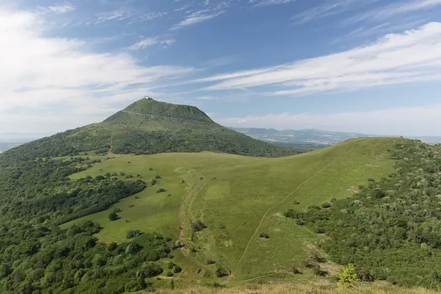
Massif des Monts Dore, Puy-de-Dôme, France
Massif des Monts Dore, Puy-de-Dôme, France · © VoyageForum
View guide page: Geography and Environment of the Massif Central

Climate and Weather in the Massif Central

Climate Overview

Parc naturel Livradois-Forez, Puy-de-Dôme, France
Parc naturel Livradois-Forez, Puy-de-Dôme, France · © VoyageForum

Best Time to Visit the Massif Central

Jan.Feb.Mar.Apr.MayJun.Jul.Aug.Sep.Oct.Nov.Dec.
Climate

: very favorable | : favorable | : moderately favorable | : unfavorable.

Climate and Weather by Region

Auvergne (Clermont-Ferrand)

Limousin (Limoges)

Additional Information

View guide page: Climate and Weather in the Massif Central

What to See in the Massif Central

The Massif Central has two sites inscribed on the UNESCO World Heritage list: Ways of Saint-Jacques-de-Compostela ★★★ (1998) This legendary UNESCO-listed pilgrimage route connects various European cities to Santiago de Compostela in Spain. Beyond its…

Read the full guide: What to See in the Massif Central

Things to Do in the Massif Central

Interests (out of ★★★★ ) : Nature ★★★ / ★★★★ ; Culture ★★ ; Relaxation-holidays ★ Interest level for each department: Nature Culture Relaxation-holidays Allier ★ ★ / ★★ ★ Cantal ★★★★ ★★ ★ / ★★ Corrèze ★★ ★★ ★ Creuse ★ / ★★ ★ ★ Haute-Loire ★★ ★ / ★★ ★…

Read the full guide: Things to Do in the Massif Central

Other practical information for the Massif Central

Luggage and equipment to bring

Budget

Precautions

Opening hours

Laundromats

Local tourist offices

View guide page: Other practical information for the Massif Central

Corrèze

On the doorstep of the Massif Central, Corrèze is a rural department ideal for those seeking "quiet holidays," with the discovery of the Millevaches plateau and its range of nature activities, both in summer and winter. It also boasts some old and "beautiful villages of France," mainly in the south of the department, the most famous—and remarkable—of which is Collonges-la-Rouge.

Overview

Château des Tours de Merle, Corrèze, France
Château des Tours de Merle, Corrèze, France · © VoyageForum

Key facts

  • Type of place: department.
  • Location: west of the Massif Central, roughly between Toulouse and Limoges.
  • Department code: 19.
  • Bordering departments: Cantal, Creuse, Dordogne, Haute-Vienne, Lot, and Puy-de-Dôme.
  • Number of communes: 283.
  • Population: 241,340 inhabitants (2014).
  • Area: 5,857 km².
  • Density: 41 inhabitants/km².
  • Highest point: Mont Bessou (976 m).
  • Lowest point: 82 m (Saint-Pantaléon).
  • Coastline: 0 km; no maritime access.
  • Highlights (out of ): Nature ; Culture ; Relaxation-holidays

History of Corrèze

Geography and environment

Culture and economy

What to see in Corrèze

On the doorstep of the Massif Central, Corrèze is a rural department ideal for those seeking "quiet holidays," with the discovery of the Plateau des Millevaches and its range of nature activities, both in summer and winter. It also boasts some old and "beautiful villages of France," mainly in the south of the department, the most famous—and remarkable—of which is Collonges-la-Rouge.

What to do in Corrèze

Climate and weather

Transport

Getting there

Getting around

Accommodation

Food

Further reading

View guide page: Corrèze

Aubazine Abbey

A 12th-century Cistercian abbey located in the commune of the same name.

Overview of the Abbey

This is a 12th-century Cistercian abbey located in the commune of the same name.

  • Tourist interest: (worth a stop if you are in the area).

History of the Abbey

What to See and Do

Practical Information

  • Location:
  • Address: Le Bourg, 19190 Aubazine.
  • Opening hours:
  • Price:
  • How to get there:

What to See Nearby

  1. == En complément
View guide page: Aubazine Abbey

Allassac

A small town with several historic monuments (bridge, churches, tower, manors).

Overview of Allassac

Allassac is a small town with several historic monuments (bridge, churches, tower, manors).

Key Details

  • Type of place: small town.
  • Tourist interest: (worth a stop if you are in the area).
  • Location: in the Corrèze department, about twelve kilometers from Brive.
  • Distances:
  • Local time: Heure : 18854.
  • Population: 3,882 inhabitants (2014).
  • Area: 39 km².
  • Altitude: from 103 to 387 m.

History of Allassac

What to See and Do in Allassac

Houses built from black schist and topped with slate, a few manors, chapels, and a fortified 14th-century church, an old bridge, and the Tour César—the last remnant of the town’s medieval walls—all contribute to the charm of this commune.

In the Surrounding Area

Climate and Weather in Allassac

Transportation

Getting There

Getting Around

Accommodation

Dining

Useful Addresses

Additional Information

View guide page: Allassac

Beaulieu-sur-Dordogne

Built on the banks of the Dordogne, this village has a castle and a 9th-century abbey church.

Overview of Beaulieu

Built on the banks of the Dordogne, Beaulieu has a castle and a 9th-century abbey church.

Key facts

  • Type of place: village.
  • Tourist interest: (worth a stop if you are in the area).
  • Location: at the southernmost tip of the Corrèze department, on the edge of the Dordogne.
  • Distances:
  • Local time: Heure : 18855.
  • Population: 1,184 inhabitants (2014).
  • Area: 8.65 km².
  • Altitude: from 125 to 387 m.
  • Website:

History of Beaulieu-sur-Dordogne

What to see and do in Beaulieu

The Saint-Pierre abbey church (9th century), some beautiful medieval houses around the market square, and the Château d'Estresse (open during Heritage Days) are the main attractions in the town. Not to mention the opportunities for walks along the Dordogne.

In the surrounding area

Climate and weather

Transport

Getting there

Getting around

Accommodation

Food

Useful addresses

Further information

View guide page: Beaulieu-sur-Dordogne

Brive

The largest city in the Corrèze department and the second-largest in the Limousin region. Brive, officially Brive-la-Gaillarde, is the largest city in the Corrèze department and the second-largest in the Limousin region. Type de lieu: city. Intérêt…

Read the full guide: Brive

Sédières Castle

In the commune of Clergoux. It is a beautiful medieval castle surrounded by ponds and forests where you can hike.

Overview of the castle

In the commune of Clergoux. It is a beautiful medieval castle surrounded by ponds and forests where you can hike.

  • Tourist interest: (worth a stop if you are in the area).

History of the castle

What to see and do

Practical information

  • Location:
  • Address: Sedières, 19320 Clergoux.
  • Opening hours:
  • Price:
  • Website:
  • How to get there:

What to see nearby

  1. == In addition
View guide page: Sédières Castle

Tours de Merle Castle

These are the vegetation-covered ruins of a medieval fortress located in Saint-Geniez ô Merle. The setting is what makes the site particularly interesting.

Overview of the castle

These are the vegetation-covered ruins of a medieval fortress located in Saint-Geniez ô Merle. The setting is what makes the site particularly interesting.

  • Tourist interest: (worth seeing).

History of the castle

What to see and do

Practical information

  • Location:
  • Address: 19220 Saint-Geniez-ô-Merle.
  • Opening hours:
  • Price:
  • How to get there:

What to see nearby

  1. == In addition
View guide page: Tours de Merle Castle

Collonges-la-Rouge

A stunning small village ranked among the "Most Beautiful Villages of France". It owes its name to the use of red sandstone in its construction and is one of the most visited sites in Limousin.

Overview of Collonges-la-Rouge

Collonges-la-Rouge is a stunning small village ranked among the "Most Beautiful Villages of France". It owes its name to the use of red sandstone in its construction and is one of the most visited sites in Limousin.

Key details

  • Type of place: village.
  • Tourist interest: (must-see or highly recommended).
  • Location: southeast of Brive, in the Corrèze department.
  • Distances:
  • Local time: Heure : 18859.
  • Population: 490 inhabitants (2014).
  • Area: 14.3 km².
  • Altitude: from 144 to 493 m.

History of Collonges-la-Rouge

What to see and do

The blend of red (the red sandstone of houses, small castles, and other historic buildings) and green (the surrounding forest) makes this site a unique place that fully deserves its ranking among the "Most Beautiful Villages of France".

Mermaid's House
This is the local history museum, housed in a typical building of the town.

In the surrounding area

Climate and weather

Getting around

Getting there

Getting around

Where to stay

Where to eat

Useful addresses

Further information

View guide page: Collonges-la-Rouge

Mermaid's House

Preview temporarily unavailable.

Curemonte

With its three churches and three castles perched on a ridge overlooking the surrounding valleys, it is one of the "most beautiful villages in France".

Overview of Curemonte

With its three churches and three castles perched on a ridge overlooking the surrounding valleys, Curemonte is one of the "most beautiful villages in France".

Key facts

  • Type of place: village.
  • Tourist interest: (worth a stop if you are in the area).
  • Location: at the southern tip of the Corrèze department, not far from Lot.
  • Distances:
  • Local time: Heure : 18860.
  • Population: 216 inhabitants (2014).
  • Area: 8.83 km².
  • Altitude:

History of Curemonte

What to see and do in Curemonte

This village, stretching along a ridge overlooking the surrounding valleys, boasts three (small) castles and three churches.

In the surrounding area

Climate and weather in Curemonte

Transport

Getting there

Getting around

Accommodation

Eating

Useful addresses

Further information

View guide page: Curemonte

Donzenac

Built on a hillside, the commune has preserved some traces of its medieval past.

Overview of Donzenac

Built on a hillside, the commune of Donzenac has preserved some traces of its medieval past.

Key Facts

  • Type of place: small town.
  • Tourist interest: (worth a stop if you are in the area).
  • Location: about ten kilometres north of Brive, in the Corrèze department.
  • Distances:
  • Local time: Heure : 18861.
  • Population: 2,620 inhabitants (2014).
  • Area: 24.12 km².
  • Altitude: from 112 to 388 m.

History of Donzenac

What to See and Do in Donzenac

In the Surrounding Area

Climate and Weather in Donzenac

Transportation

Getting There

Getting Around

Accommodation

Dining

Useful Addresses

Further Information

View guide page: Donzenac

Gimel-les-Cascades

Although primarily known for its surrounding waterfalls, the village also boasts a beautiful architectural ensemble, including the remains of a fortified castle.

Introduction to Gimel

Although primarily known for its surrounding waterfalls, the village of Gimel also boasts a beautiful architectural ensemble, including the remains of a fortified castle.

Key Information

  • Type de lieu: village.
  • Intérêt touristique: (worth seeing).
  • Localisation: in the Corrèze department, right next to Tulle.
  • Distances:
  • Heure locale: Heure : 18862.
  • Population: 763 inhabitants (2014).
  • Superficie: 20.86 km².
  • Altitude: from 220 m to 606 m.

History of Gimel-les-Cascades

What to See and Do

The remains of a fortified castle, a mill, a chapel, and a 15th-century church, along with distinctive granite houses, are the main attractions of the village of Gimel.

Gimel Waterfalls
The commune is known for its three waterfalls. The tallest one plunges 60 m into the river.

In the Surrounding Area

Climate and Weather

Transportation

Getting There

Getting Around

Accommodation

Dining

Useful Addresses

Further Information

View guide page: Gimel-les-Cascades

Gimel Waterfalls

Preview temporarily unavailable.

Meymac

A gateway to the Millevaches, the town also features a few interesting historic buildings, such as its abbey, market hall, and belfry.

Overview of Meymac

A gateway to the Millevaches, the town of Meymac also boasts a few interesting historic buildings, such as its abbey, market hall, and belfry.

Key Facts

  • Type de lieu: small town.
  • Intérêt touristique: (worth a stop if you are in the area).
  • Localisation: in the heart of the Corrèze department, on the southern foothills of the Millevaches plateau
  • Distances:
  • Heure locale: Heure : 18863.
  • Population: 2,428 inhabitants (2014).
  • Superficie: 87.15 km².
  • Altitude: from 593 to 976 m
  • Site internet:

History of Meymac

What to See and Do in Meymac

The village features several interesting historic buildings, including its abbey, market hall, and belfry.

Marius Vazeilles Museum
Housed in the abbey adjoining the church, the museum features collections of prehistoric tools, Gallo-Roman funerary furniture, and everyday objects from the Millevaches plateau.

In the Surrounding Area

Parc naturel de Millevaches en Limousin, Corrèze, France
Millevaches Regional Nature Park in Limousin
Spanning three departments, this is an area of meadows, peat bogs, and forests. You can hike or enjoy various outdoor sports here (especially around Vassivière). It’s also home to the region’s three cross-country ski resorts (Bonnefond, Gentioux, Saint-Setiers).

Climate and Weather in Meymac

Transportation

Getting There

Getting Around

Accommodation

Dining

Useful Addresses

Further Information

View guide page: Meymac

Marius Vazeilles Museum

Preview temporarily unavailable.

Ségur-le-Château

Built along a river, Ségur is one of the many communes in the region awarded the "Most Beautiful Villages of France" label, thanks in particular to its historic old houses.

Overview of Ségur-le-Château

Built along a river, Ségur is one of the many communes in the region awarded the "Most Beautiful Villages of France" label, thanks in particular to its historic old houses.

Key Facts

  • Type of place: village.
  • Tourist interest: (worth seeing).
  • Distances:
  • Local time: Heure : 18865.
  • Population: 205 inhabitants (2014).
  • Area: 9.48 km².
  • Altitude: from 270 to 397 m.

History of Ségur-le-Château

What to See and Do

Between the ruins of its perched fortress and the Auvézère River, the village is home to many old houses, dating from the 15th to the 18th century, some with half-timbered facades.

In the Surrounding Area

Climate and Weather

Transport

Getting There

Getting Around

Accommodation

Food

Useful Addresses

Further Information

View guide page: Ségur-le-Château

Treignac

A commune featuring a beautiful covered market, three churches or chapels, and several old houses.

Overview of Treignac

Treignac is a commune featuring a beautiful covered market, three churches or chapels, and several old houses.

Key details

  • Type of place: village.
  • Tourist interest: (worth a stop if you are in the area).
  • Location: in the Corrèze department, on the Millevaches plateau.
  • Distances:
  • Local time: Heure : 18866.
  • Population: 1,362 inhabitants (2014).
  • Area: 36.73 km².
  • Altitude: from 375 to 765 m.

History of Treignac

What to see and do in Treignac

A beautiful covered market, three churches or chapelles, and several old houses make up the attractions of this town, which was once among the "Most Beautiful Villages of France."

Lake of Bariousses
This is a 99-hectare man-made body of water, designed especially for swimming.

In the surrounding area

Parc naturel de Millevaches en Limousin, Corrèze, France
Millevaches Regional Nature Park in Limousin
Spanning three departments, this is an area of meadows, peat bogs, and forests. You can hike or enjoy various outdoor sports here (especially around Vassivière). It’s also home to the region’s three cross-country ski resorts (Bonnefond, Gentioux, Saint-Setiers).

Climate and weather in Treignac

Transport

Getting there

Getting around

Accommodation

Food

Useful addresses

Further information

View guide page: Treignac

Lake of Bariousses

Preview temporarily unavailable.

Tulle

The prefecture of Corrèze offers a cathedral and a few old quarters for visitors.

Overview of Tulle

The prefecture of Corrèze offers a cathedral and a few old quarters for visitors.

Key facts

  • Type of place: small town.
  • Tourist interest: (worth a stop if you are in the area).
  • Location:
  • Distances:
  • Local time: Heure : 18867.
  • Population: 14,325 inhabitants (2014).
  • Area: 24.44 km².
  • Altitude: from 185 to 460 m.

History of Tulle

What to see and do in Tulle

In the surrounding area

Climate and weather in Tulle

Transport

Getting there

Getting around

Accommodation

Food

Useful addresses

Further information

View guide page: Tulle

Turenne

This hilltop village is listed among the "most beautiful in France", with its old houses built around its castle.

Overview of Turenne

The hilltop village of Turenne is listed among the "most beautiful in France", with its old houses built around its castle.

Key facts

  • Type of place: village.
  • Tourist interest: (worth seeing).
  • Distances:
  • Local time: Heure : 18868.
  • Population: 822 inhabitants (2014).
  • Area: 28 km².
  • Altitude: from 140 to 408 m.

History of Turenne

What to see and do in Turenne

The village’s tourist appeal lies in its collegiate church, former townhouses, and houses with roofs covered in stone slabs or slate along narrow lanes climbing toward the remains of the imposing castle overlooking the valley.

In the surrounding area

Climate and weather in Turenne

Transport

Getting there

Getting around

Accommodation

Food

Useful addresses

Further information

View guide page: Turenne

Ussel

This sub-prefecture, the third-largest town in the department, has a few old quarters.

Overview of Ussel

Ussel is the sub-prefecture and third-largest town in the department. It has a few old quarters.

Key Facts

  • Type of place: small town.
  • Tourist interest: (worth a stop if you are in the area).
  • Distances:
  • Local time: Heure : 18869.
  • Population: 9,772 inhabitants (2014).
  • Area: 50.37 km².
  • Altitude: 685 m.

History of Ussel

What to See and Do in Ussel

Ussel Museum
A place dedicated to the history, arts, and traditions of the Ussel region.

In the Surrounding Area

Climate and Weather in Ussel

Transport

Getting There

Getting Around

Accommodation

Eating Out

Useful Addresses

Further Information

View guide page: Ussel

Ussel Museum

Preview temporarily unavailable.

Uzerche

The small town boasts several large and beautiful historic houses in its centre.

Overview of Uzerche

The small town of Uzerche boasts several large and beautiful historic houses in its centre.

Key Facts

  • Type of place: small town.
  • Tourist interest: (worth a stop if you are in the area).
  • Location: in the Corrèze department, between Brive and Limoges.
  • Distances:
  • Local time: Heure : 18870.
  • Population: 2,933 inhabitants (2014).
  • Area: 23.85 km².
  • Altitude: from 270 to 441 m.

History of Uzerche

What to See and Do in Uzerche

In the Surrounding Area

Climate and Weather in Uzerche

Transport

Getting There

Getting Around

Accommodation

Eating Out

Useful Addresses

Further Information

View guide page: Uzerche

Vézère Gorge

This river, which rises in Corrèze before flowing on to the Dordogne, offers rafting and canoeing opportunities, particularly around Uzerche. You can also hike along the gorge.

Overview of the Gorge

This river, which rises in Corrèze before flowing on to the Dordogne, offers rafting and canoeing opportunities, particularly around Uzerche. You can also hike along the gorge.

Key Facts

  • Tourist interest: (worth seeing).
  • Features:
  • Length: 48 km.
  • Depth:
  • Altitude:

Environment

Wildlife and Flora

Precautions

Climate and Weather

What to See and Do

Practical Information

  • Location:
  • Website:
  • How to get there:
  • Distances:

Accommodation and Dining

What to See Nearby

  1. == En complément
View guide page: Vézère Gorge

Gouffre de la Fage

This is a cave open to the public near Brive.

Overview of the cave

This is a cave open to the public near Brive.

  • Tourist interest: (worth a stop if you are in the area).
  • Features:
  • Area:

Cave layout

What to see and do

Practical information

  • Location:
  • Address: La Fage, 19600 Noailles.
  • Opening hours:
  • Price:
  • How to get there:
  • Distances:

Sleeping and eating

Nearby attractions

  1. == En complément
View guide page: Gouffre de la Fage

Millevaches Regional Nature Park in Limousin

Spanning three departments, this is an area of meadows, peat bogs, and forests. You can hike or enjoy various outdoor sports here (especially around Vassivière). It’s also home to the region’s three cross-country ski resorts (Bonnefond, Gentioux, Saint-Setiers).

Overview of the park

Spanning the three departments of the region, this is an area of meadows, peat bogs, and forests. You can hike or enjoy various outdoor sports here (especially around Vassivière). It’s also within this park that the region’s three cross-country ski resorts are located (Bonnefond, Gentioux, Saint-Setiers).

Key details

  • Tourist interest: (worth seeing).
  • Features:
  • Area: 3,143 km².
  • Altitude:

Environment

Landscape

Wildlife and flora

Precautions

Climate and weather

What to see and do

Practical information

  • Location:
  • Opening period:
  • How to get there:
  • Distances:

Accommodation and dining

Nearby attractions

Additional information

View guide page: Millevaches Regional Nature Park in Limousin

Saint-Robert (19)

One of the "most beautiful villages in France", with its old houses, small châteaux, and its 12th-century church.

Overview of Saint-Robert

Saint-Robert is one of the "most beautiful villages in France", with its old houses, small châteaux, and its 12th-century church.

Key facts

  • Type of place: village.
  • Tourist interest: (worth seeing).
  • Location: in the Corrèze department, not far from Brive and bordering Dordogne.
  • Distances:
  • Local time: Heure : 18904.
  • Population: 335 inhabitants (2014).
  • Area: 6.1 km².
  • Altitude: from 158 to 354 m.

History of Saint-Robert

What to see and do in Saint-Robert

Old buildings, a beautiful fortified Romanesque church, and stately stone mansions are worth seeing in this "most beautiful village in France", set in rolling countryside.

In the surrounding area

Climate and weather in Saint-Robert

Transport

Getting there

Getting around

Accommodation

Eating

Useful addresses

Further information

View guide page: Saint-Robert (19)

Longéroux Bog

A vast bog on the Millevaches plateau at 900 m altitude. Educational trails have been set up here.

Overview of the bog

This is a vast marshy bog on the Millevaches plateau at 900 m altitude. Educational trails have been set up here.

Key details

  • Type of place: marsh.
  • Tourist interest: (worth a stop if you are in the area).
  • Features:
  • Location:
  • Area: 2.6 km².
  • Altitude: 900 m.
  • Website:

Site environment

Wildlife and flora

What to see and do

Nearby

Climate and weather

Precautions

Getting there

Sleeping and eating

  1. == Additional information
View guide page: Longéroux Bog

Gallo-Roman Ruins of Les Cars

Fairly isolated in the heart of the Millevaches, the site consists of a funerary complex and a villa dating from the 2nd century AD.

Overview of the Site

Fairly isolated in the heart of the Millevaches, the site consists of a funerary complex and a villa dating from the 2nd century AD.

Key Details

  • Tourist interest: (worth a stop if you are in the area).
  • Features: Gallo-Roman ruins.
  • Area:
  • Altitude:

History of the Ruins of Les Cars

What to See and Do

Practical Information

  • Location:
  • Address: 19170 Saint-Merd-les-Oussines.
  • Opening hours:
  • Price:
  • Website:
  • How to get there:

What to See Nearby

  1. == En complément
View guide page: Gallo-Roman Ruins of Les Cars

Puy-de-Dôme

This is the "land" of the Auvergne volcanoes, the Monts Dore, and several puys, along with numerous lakes and gorges like those of the Sioule. In short, the department is a nature destination par excellence, offering a wide range of outdoor activities in both…

Read the full guide: Puy-de-Dôme

Haute-Vienne

This is a nature-focused department with parks and lakes that will delight ecotourism enthusiasts. However, Haute-Vienne also boasts a rich heritage, including Limoges, which is well worth a visit, several medieval castles (Chalucet, Coussac...), Mortemart,…
Read the full guide: Haute-Vienne

Cantal

Cantal remains a top destination for nature lovers. Just with the Monts du Cantal, the Regional Volcano Park of Auvergne, and a few "puys" (Griou, Mary...), there is plenty to see and do—especially when you add in some medieval castles and villages (Salers, Tournemire...).

Overview

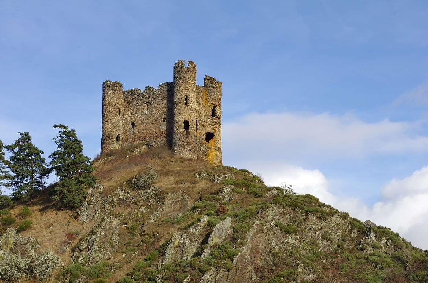
Château d'Alleuze, Cantal, France
Château d'Alleuze, Cantal, France · © VoyageForum

Key Facts

  • Type of place: department.
  • Location:
  • Department code: 15.
  • Bordering departments: Aveyron, Corrèze, Haute-Loire, Lot, Lozère and Puy-de-Dôme.
  • Sub-prefectures: Mauriac, Saint-Flour.
  • Number of communes: 247.
  • Population: 145,143 inhabitants (2017).
  • Area: 5,726 km².
  • Highest point: 1,855 m (Saint-Jacques).
  • Lowest point: 180 m (Cassaniouze).
  • Coastline: 0 km; no maritime access.
  • Highlights (out of ): Nature ; Culture ; Relaxation-holidays /

History of Cantal

Geography and Environment

Culture and Economy

What to See in Cantal

Easily associated with the Massif Central, its landscapes, countryside, and ancient volcanoes, Cantal remains the top destination for nature lovers in this part of France. Just with the Cantal Mountains, the Auvergne Volcanoes Regional Nature Park, and a few "puys" (Griou, Mary...), there is plenty to see and do—especially when you add in some medieval castles and villages (Salers, Tournemire...).

What to Do in Cantal

Climate and Weather

Cantal is divided into three climatic zones: the west has a sub-oceanic climate with heavy rainfall, the mountainous center also has high rainfall and heavy snowfall in winter, and the east of the department is drier and more southern.

Transport

Getting There

Getting Around

Accommodation

Food

Additional Information

View guide page: Cantal

Aurillac

It is the capital of the Cantal department. It has several monuments of historical value.

Overview of Aurillac

Aurillac is the capital of the Cantal department. It has several monuments of historical value.

Key facts

  • Type of place: small town.
  • Tourist interest: (worth a stop if you are in the area).
  • Location: at the foot of the Cantal Mountains, in the department of the same name.
  • Distances:
  • Local time: Heure : 18797.
  • Population: 26,135 inhabitants (2014).
  • Area: 28.76 km².
  • Altitude: from 573 to 867 m.

History of Aurillac

What to see and do in Aurillac

In the surrounding area

Monts du Cantal, Cantal, France
Cantal Mountains
A very pretty, sparsely populated region with numerous valleys connected by passes and extinct volcanoes (the puys: Mary, Griou, etc.). It's an ideal spot for outdoor sports, located within the Auvergne Volcanoes Park.

Climate and weather in Aurillac

Transport

Getting there

Getting around

Accommodation

Food

Useful addresses

Further information

View guide page: Aurillac

Alleuze Castle

These are the remains of a medieval hilltop fortress with a rather pretty setting in the village of the same name.

Overview of the castle

These are the remains of a medieval hilltop fortress with a rather pretty setting in the village of the same name.

  • Tourist interest: (worth seeing).

History of the castle

What to see and do

Practical information

  • Location:
  • Opening hours:
  • Admission fee:
  • Website:
  • How to get there:

What to see nearby

  1. == In addition
View guide page: Alleuze Castle

Auzers Castle

This castle, built between 1470 and 1510, is highly characteristic of the architecture of Haute Auvergne in the region.

Overview of the castle

This castle, built between 1470 and 1510, is highly characteristic of the architecture of Haute Auvergne in the region.

  • Tourist interest: (worth a stop if you are in the area).

History of the castle

What to see and do

Practical information

  • Location:
  • Opening hours:
  • Admission:
  • How to get there:

What to see nearby

  1. == In addition
View guide page: Auzers Castle

Conros Castle

This is a large medieval castle dating from the 13th century, located in Arpajon-sur-Cère.

Overview of the castle

This is a large medieval castle dating from the 13th century, located in Arpajon-sur-Cère.

  • Tourist interest: (worth a stop if you are in the area).

History of the castle

What to see and do

Practical information

  • Location:
  • Address: 15130 Arpajon-sur-Cère.
  • Opening hours:
  • Price:
  • How to get there:

What to see nearby

  1. == In addition
View guide page: Conros Castle

La Trémolière Castle

La Trémolière is a 15th-century castle-museum in Anglards-de-Salers.

Overview of the castle

La Trémolière is a 15th-century castle-museum in Anglards-de-Salers.

  • Tourist interest: (worth a stop if you are in the area).

History of the castle

What to see and do

Practical information

  • Location:
  • Address: 15380 Anglards-de-Salers.
  • Opening hours:
  • Admission:
  • Website:
  • How to get there:

What to see nearby

  1. == In addition
View guide page: La Trémolière Castle

La Vigne Castle

This is a medieval castle located in Ally. Built facing a beautiful panorama, it consists of living quarters and towers, with the whole topped by a walkway on machicolations.

Overview of the castle

This is a medieval castle located in Ally. Built facing a beautiful panorama, it consists of living quarters and towers, with the whole topped by a walkway on machicolations.

  • Tourist interest: (worth a stop if you are in the area).

History of the castle

What to see and do

Practical information

  • Location:
  • Address: 15700 Ally.
  • Opening hours:
  • Price:
  • How to get there:

What to see nearby

  1. == In addition
View guide page: La Vigne Castle

Pesteils Castle

With its grounds, this is a charming castle-museum—and one of the most beautiful in the region—located in Polminhac.

Overview of the castle

With its grounds, this is a charming castle-museum—and one of the most beautiful in the region—located in Polminhac.

  • Tourist interest: (worth seeing).

History of the castle

What to see and do

Practical information

  • Location:
  • Address: 15800 Polminhac.
  • Opening hours:
  • Price:
  • How to get there:

What to see nearby

  1. == En complément
View guide page: Pesteils Castle

Val Castle

This beautiful fortified castle sits on the edge of an (artificial) lake, giving it a certain charm. Though located in the Cantal department, in the commune of Lanobre, it is owned by the commune of Bort-les-Orgues in Corrèze.

Overview of the castle

This beautiful fortified castle sits on the edge of an (artificial) lake, giving it a certain charm. Though located in the Cantal department, in the commune of Lanobre, it is owned by the commune of Bort-les-Orgues in Corrèze.

  • Tourist interest: (worth seeing).

History of the castle

What to see and do

Practical information

  • Location:
  • Address: Les Fontilles, 15270 Lanobre.
  • Opening hours:
  • Admission:
  • How to get there:

What to see nearby

  1. == En complément
View guide page: Val Castle

Lioran

Lioran is the largest ski area in the entire Massif Central.

Overview of the resort

Lioran is the largest ski area in the entire Massif Central.

  • Tourist interest: (worth a stop if you are in the area).
  • Mountain range: Massif Central.
  • Associated resorts:
  • Altitude: from 1,152 to 1,820 m.

Environment

Climate and weather

Precautions

Facilities and activities

Ski area

  • Opening period:
  • Number of slopes: 45.
  • Length of slopes: 60 km.
  • Cross-country ski trails: 90 km.

Other winter activities

Summer activities

Practical information

  • Location:
  • How to get there:
  • Distances:

Accommodation and dining

Events

What to see and do nearby

Additional information

View guide page: Lioran

Marcolès

Marcolès is a charming medieval village in southern Cantal. It is part of the "Petites Cités de Caractère" network.

Overview of Marcolès

Marcolès is a charming medieval village in southern Cantal. It is part of the "Petites Cités de Caractère" network.

Key details

  • Type of place: village.
  • Tourist interest: (worth a stop if you are in the area).
  • Location: in the southern part of the Cantal department.
  • Distances:
  • Local time: Heure : 18806.
  • Population: 583 inhabitants (2014).
  • Area: 52.89 km².
  • Altitude: from 427 to 828 m.

History of Marcolès

What to see and do in Marcolès

Typical of southern Cantal, the village of Marcolès features granite buildings topped with canal tiles or stone slabs. Two medieval gates provide access to the main street.

In the surrounding area

Climate and weather in Marcolès

Transport

Getting there

Getting around

Where to stay

Where to eat

Useful addresses

Further information

View guide page: Marcolès

Saint-Flour

This sub-prefecture has a charming hilltop old town with ramparts and a 15th-century cathedral.

Overview of Saint-Flour

Saint-Flour, a sub-prefecture, has a charming hilltop old town with ramparts and a 15th-century cathedral.

Key Facts

  • Type de lieu: small town.
  • Intérêt touristique: (worth seeing).
  • Distances:
  • Heure locale: Heure : 18807.
  • Population: 6,504 inhabitants (2016).
  • Superficie: 27.14 km².
  • Altitude: from 757 to 1,040 m.

History of Saint-Flour

What to See and Do in Saint-Flour

With its charming hilltop old town, ramparts, Place d'Armes, and a 15th-century cathedral, Saint-Flour has a certain appeal.

Alfred Douët Museum of Art and History
The fine and decorative art works collected by Alfred Douët (1875–1952), a local collector.
Haute Auvergne Museum
In the former episcopal palace dating from the 17th century. It houses diverse collections reflecting the history of a highland region.

In the Surrounding Area

Climate and Weather in Saint-Flour

Transportation

Getting There

Getting Around

Accommodation

Dining

Useful Addresses

Further Information

View guide page: Saint-Flour

Alfred Douët Museum of Art and History

Preview temporarily unavailable.

Haute Auvergne Museum

Preview temporarily unavailable.

Salers

Beyond being known for the cattle breed that bears its name, this commune is also labeled "Most Beautiful Villages of France" for its architecture largely built from black volcanic stone, typical of the region.

Overview of Salers

Beyond being known for the cattle breed that bears its name, the commune of Salers is also labeled "Most Beautiful Villages of France" for its architecture largely built from black volcanic stone, typical of the region.

Key Facts

  • Type de lieu: village.
  • Intérêt touristique: (worth seeing).
  • Distances:
  • Heure locale: Heure : 18808.
  • Population: 341 inhabitants (2014).
  • Superficie: 4.85 km².
  • Altitude: from 830 to 1,207 m.

History of Salers

What to See and Do in Salers

The village of Salers forms a beautiful 16th-century ensemble with its grand townhouses and turreted houses built from volcanic stone, giving it a distinct charm.

Templars' House
This former Commander’s residence of the Order is the museum of the history and folk traditions of Salers and its region.

In the Surrounding Area

Parc naturel des volcans d'Auvergne, Puy-de-Dôme, France
Auvergne Volcanoes Regional Nature Park
France’s largest regional park offers stunning landscapes, lakes, charming villages, a few ski resorts, and above all, countless hiking opportunities. Since 2018, the "Chaîne des Puys" it encompasses has been inscribed on the UNESCO World Heritage list.

Climate and Weather in Salers

Transportation

Getting There

Getting Around

Accommodation

Dining

Useful Addresses

Further Information

View guide page: Salers

Templars' House

Preview temporarily unavailable.

Garabit Viaduct

An impressive railway viaduct with a metal structure built by Gustave Eiffel in the late 19th century. It spans the Truyère Gorge.

Overview of the Viaduct

An impressive railway viaduct with a metal structure built by Gustave Eiffel in the late 19th century. It spans the Truyère Gorge.

  • Tourist interest: (worth a stop if you are in the area).

History of the Garabit Viaduct

What to see and do

Practical information

  • Location:
  • Address: Garabit Viaduct, 15320 Ruynes-en-Margeride.
  • Opening hours:
  • Price:
  • How to get there:

What to see nearby

Additional information

View guide page: Garabit Viaduct

Cantal Mountains

A very pretty, sparsely populated region with numerous valleys connected by passes and extinct volcanoes (the puys: Mary, Griou, etc.). It's an ideal spot for outdoor sports, located within the Auvergne Volcanoes Park.

Overview of the Cantal Mountains

A very pretty, sparsely populated region with numerous valleys connected by passes and extinct volcanoes (the puys: Mary, Griou, etc.). It's an ideal spot for outdoor sports, located within the Auvergne Volcanoes Park.

Key Facts

  • Tourist interest: (must-see or highly recommended).
  • Characteristics: volcanic massif.
  • Mountain range: Massif Central.
  • Length: 70 km.
  • Width: 60 km.

Environment

Wildlife and flora

Precautions

Climate and weather

What to see and do

Practical information

  • Location:
  • Website:
  • How to get there:
  • Distances:

Getting around

Accommodation and dining

What to see nearby

Further reading

View guide page: Cantal Mountains

Puy Mary (Plomb du Cantal)

This is the second-highest peak in the Massif Central (1,855 m). You can reach it on foot or by cable car.

Overview

This is the second-highest peak in the Massif Central (1,855 m). You can reach it on foot or by cable car.

Key details

  • Tourist interest: (recommended).
  • Features:
  • Massif: Massif Central.
  • Summit: 1,855 m.

Environment

Wildlife and flora

Precautions

Climate and weather

What to see and do

Practical information

  • Location:
  • How to get there:
  • Distances:

Sleeping and eating

Nearby attractions

  1. == En complément
View guide page: Puy Mary (Plomb du Cantal)

Puy Griou

An ancient volcano in the Cantal mountains that you can hike to.

Overview of Puy Griou

It’s an ancient volcano in the Cantal Mountains that you can hike to.

Key details

  • Tourist interest: (worth seeing).
  • Features:
  • Massif: Massif Central.
  • Summit: 1,690 m.

Environment

Wildlife and flora

Precautions

Climate and weather

What to see and do

Practical information

  • Location:
  • Website:
  • How to get there:
  • Distances:

Sleeping and eating

Nearby attractions

  1. == In addition
View guide page: Puy Griou

Puy Mary

One of the best-known and most visited "puys" in Auvergne. It's also a classic hiking destination.

Overview of Puy Mary

One of the best-known and most visited "puys" in Auvergne. It's also a classic hiking destination.

Key Facts

  • Tourist interest: (recommended).
  • Features:
  • Massif: Massif Central.
  • Summit: 1,783 m.

Environment

Wildlife and flora

Precautions

Climate and weather

What to see and do

Practical information

  • Location:
  • How to get there:
  • Distances:

Sleeping and eating

What to see nearby

Further information

View guide page: Puy Mary

Tournemire (15)

With its castle, 12th-century church, and old houses, the village is listed among the "Most Beautiful Villages of France".

Overview of Tournemire

With its castle, 12th-century church, and old houses, Tournemire is listed among the "Most Beautiful Villages of France".

Key facts

  • Type of place: village.
  • Tourist interest: (worth seeing).
  • Location: in the Cantal department, north of Aurillac.
  • Distances:
  • Local time: Heure : 18886.
  • Population: 125 inhabitants (2016).
  • Area: 9.68 km².
  • Altitude: from 708 to 1,046 m.
  • Website:

History of Tournemire

What to see and do in Tournemire

The village of Tournemire boasts typical medieval architecture that visitors appreciate. Its castle, 12th-century church, and old houses give it a distinct charm and earn it a place among the "Most Beautiful Villages of France".
In the surrounding area

Parc naturel des volcans d'Auvergne, Puy-de-Dôme, France
Auvergne Volcanoes Regional Nature Park
France’s largest regional park offers stunning landscapes, lakes, charming villages, a few ski resorts, and above all, countless hiking opportunities. Since 2018, the "Chaîne des Puys" it encompasses has been inscribed on the UNESCO World Heritage list.

Climate and weather in Tournemire

Transport

Getting there

Getting around

Accommodation

Food

Useful addresses

Further information

View guide page: Tournemire (15)

Allier

Allier is a department of rivers, hedgerows, and low mountains, perfect for those who love the countryside. It also offers historical remnants (castles, churches) and interesting urban centers (Moulins, Montluçon, etc.). Allier is also a spa destination, with Vichy as its foremost town.

Overview of Allier

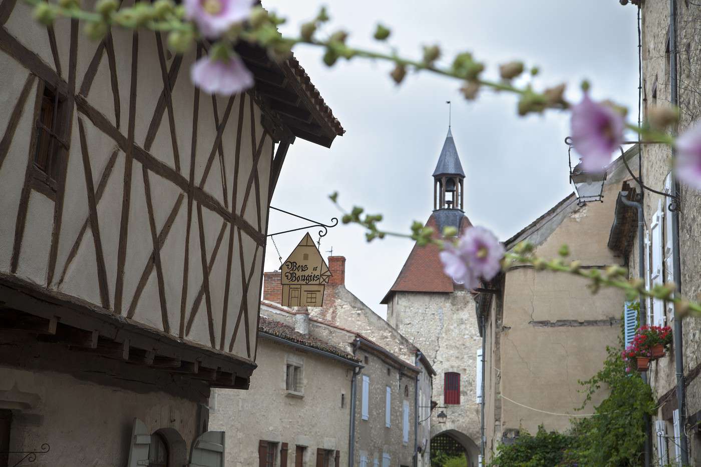
Charroux, Allier, France
Charroux, Allier, France · © VoyageForum

Key Facts

  • Type of place: department.
  • Tourist interest: (worth a stop if you are in the area).
  • Location:
  • Local time: Heure : 22491
  • Department code: 03.
  • Bordering departments:
  • Sub-prefectures: Montluçon, Vichy.
  • Number of communes: 317.
  • Population: 343,062 inhabitants (2014).
  • Area: 7,340 km².
  • Highest point: Puy de Montoncel (1,287 m).
  • Lowest point:
  • Coastline: 0 km; no maritime access.
  • Highlights (out of ): Nature ; Culture / ; Relaxation-holidays

Climate and Weather

Tourism

Allier is a department of rivers, hedgerows, and low mountains, perfect for those who love the countryside. It also offers historical remnants (castles, churches) and interesting urban centers (Moulins, Montluçon, etc.). Allier is also a spa destination, with Vichy as its foremost town.

View guide page: Allier

Charroux

Thanks in particular to its old half-timbered houses, Charroux is listed among the "Most Beautiful Villages of France".

Overview of Charroux

Thanks in particular to its old half-timbered houses, Charroux is listed among the "Most Beautiful Villages of France".

Key facts

  • Tourist interest: (worth a stop if you are in the area).
  • Location:
  • Distances:
  • Local time: Heure : 18789.
  • Population: 374 inhabitants (2014).
  • Area: 10.43 km².
  • Altitude: from 291 to 426 m.

History of Charroux

What to see and do in Charroux

In the surrounding area

Climate and weather in Charroux

Transport

Getting there

Getting around

Accommodation

Food

Useful addresses

Further information

View guide page: Charroux

Château de Chareil-Cintrat

A 16th-century Renaissance château listed as a historic monument.

Overview of the château

Listed as a historic monument, this is a 16th-century Renaissance château.

  • Tourist interest: (worth a stop if you are in the area).

History of the château

What to see and do

Practical information

  • Location:
  • Address: Bellevue, 03140 Chareil-Cintrat.
  • Opening hours:
  • Admission:
  • How to get there:

Nearby attractions

  1. == In addition
View guide page: Château de Chareil-Cintrat

La Palice Castle

In the town of Lapalisse, a blend of medieval and Renaissance styles for this castle, enhanced by beautiful gardens.

Overview of the castle

In the town of Lapalisse, a blend of medieval and Renaissance styles for this castle, enhanced by beautiful gardens.

  • Tourist interest: (worth seeing).

History of the castle

What to see and do

Practical information

  • Location:
  • Address: Boulevard de L'Hôtel de ville, 03120 Lapalisse.
  • Opening hours:
  • Price:
  • Website:
  • How to get there:

What to see nearby

  1. == As a supplement
View guide page: La Palice Castle

Montluçon

The largest municipality in the Allier department has old quarters and a certain religious heritage.

Overview of Montluçon

The largest municipality in the Allier department has old quarters and a certain religious heritage.

Key facts

  • Type of place: small town.
  • Tourist interest: (worth a stop if you are in the area).
  • Location:
  • Distances:
  • Local time: Heure : 18792.
  • Population: 37,289 inhabitants (2014).
  • Area: 20.67 km².
  • Altitude: from 194 to 364 m.

History of Montluçon

What to see and do in Montluçon

In the surrounding area

Climate and weather in Montluçon

Transport

Getting there

Getting around

Accommodation

Food

Useful addresses

Further information

View guide page: Montluçon

Moulins

The prefecture of Allier has a rather pretty town centre, predominantly medieval and Renaissance in style, with many half-timbered houses from the 15th and 16th centuries.

Overview of Moulins

The prefecture of Allier has a rather pretty town centre, predominantly medieval and Renaissance in style, with many half-timbered houses from the 15th and 16th centuries.

Key facts

  • Type of place: small town.
  • Tourist interest: (worth seeing).
  • Location:
  • Distances:
  • Local time: Heure : 18793.
  • Population: 19,762 inhabitants (2014).
  • Area: 8.61 km².
  • Altitude: from 202 to 240 m.

History of Moulins

What to see and do in Moulins

In the surrounding area

Climate and weather in Moulins

Transport

Getting there

Getting around

Accommodation

Eating

Useful addresses

Further information

View guide page: Moulins

Souvigny Priory

A very beautiful priory located in the commune of Souvigny, not far from Moulins.

Overview of the monastery

This is a very beautiful priory located in the commune of Souvigny, not far from Moulins.

  • Tourist interest: (worth a stop if you are in the area).

History of the monastery

What to see and do

Practical information

  • Location:
  • Address: Place Aristide Briand, 03210 Souvigny.
  • Opening hours:
  • Price:
  • Website:
  • How to get there:

What to see nearby

  1. == In addition
View guide page: Souvigny Priory

Vichy

It is one of the main cities in Auvergne and, above all, a spa town.

Overview of Vichy

It is one of the main cities in Auvergne and, above all, a spa town.

Key Facts

  • Type of place: small town.
  • Tourist interest: (worth a stop if you are in the area).
  • Location:
  • Distances:
  • Local time: Heure : 18795.
  • Population: 25,279 inhabitants (2014).
  • Area: 5.85 km².
  • Altitude: from 243 to 317 m.

History of Vichy

What to See and Do in Vichy

In the Surrounding Area

Climate and Weather in Vichy

Transport

Getting There

Getting Around

Accommodation

Eating Out

Useful Addresses

Further Information

View guide page: Vichy

Sioule Gorges

These are pretty gorges overlooking the Sioule River, which flows through Puy de Dôme and Allier. You can go climbing, canoeing, and admire some old medieval castles and churches along the way.

Overview of the gorges

These are pretty gorges overlooking the Sioule River, which flows through Puy de Dôme and Allier. You can go climbing, canoeing, and admire some old medieval castles and churches along the way.

Key details

  • Tourist interest: (worth seeing).
  • Features:
  • Length:
  • Depth:
  • Altitude:

Site environment

Wildlife and flora

Climate and weather

Precautions

What to see and do

Practical information

  • Location:
  • Website:
  • How to get there:
  • Distances:

Accommodation and dining

Nearby attractions

  1. == En complément
View guide page: Sioule Gorges

Creuse

Very sparsely populated, Creuse is a "countryside" department like its neighbours, ideal for green tourism, with Lake Vassivière as the most visited site. A few abbeys and castles are also worth seeing for their cultural value.

Overview of Creuse

Aubusson, Creuse, France
Aubusson, Creuse, France · © VoyageForum

Key facts

  • Type of place: department.
  • Tourist interest: (worth seeing).
  • Location:
  • Local time: Heure : 22492
  • Department code: 23.
  • Bordering departments:
  • Sub-prefectures: Aubusson.
  • Number of municipalities: 258.
  • Population: 120,581 inhabitants (2014).
  • Area: 5,565 km².
  • Density: 22 inhabitants/km².
  • Highest point:
  • Lowest point:
  • Coastline: 0 km; no maritime access.
  • Highlights (out of ): Nature / ; Culture ; Relaxation-holidays

Climate and weather

Tourism

Very sparsely populated, Creuse is a "countryside" department like its neighbours, ideal for green tourism, with Lake Vassivière as the most visited site. A few abbeys and castles are also worth seeing for their cultural value.

View guide page: Creuse

Moutier-d'Ahun Abbey

Preview temporarily unavailable.

Aubusson

Preview temporarily unavailable.

Chambon-sur-Voueize

Preview temporarily unavailable.

Boussac Castle

Preview temporarily unavailable.

Crozant Castle

Preview temporarily unavailable.

Villemonteix Castle

Preview temporarily unavailable.

Guéret

Preview temporarily unavailable.

La Souterraine

Preview temporarily unavailable.

Jarrauds Waterfall

Preview temporarily unavailable.

Jaumâtres Rocks

Preview temporarily unavailable.

Landes Pond Nature Reserve

Preview temporarily unavailable.

Haute-Loire

It is one of many rural departments in central France. In terms of tourism, it attracts a primarily French and family-oriented clientele. While nature is very much present in Haute-Loire, offering a range of specific activities, there is also a certain cultural heritage, notably reflected in several municipalities labeled "Most Beautiful Villages of France."

Overview of Haute-Loire

Abbaye de La Chaise-Dieu, Haute-Loire, France
Abbaye de La Chaise-Dieu, Haute-Loire, France · © VoyageForum

Key Facts

  • Type of place: department.
  • Tourist interest: (worth seeing).
  • Location:
  • Local time: Heure : 22493
  • Department code: 43.
  • Bordering departments:
  • Prefecture: Le Puy-en-Velay.
  • Sub-prefectures: Brioude, Yssingeaux.
  • Number of municipalities: 257.
  • Population: 226,565 inhabitants (2014).
  • Area: 4,977 km².
  • Density: 46 inhabitants/km².
  • Highest point:
  • Lowest point:
  • Coastline: 0 km; no maritime access.
  • Highlights (out of ): Nature ; Culture /; Relaxation-holidays

Climate and Weather

Tourism

It is one of many rural departments in central France. In terms of tourism, it attracts a primarily French and family-oriented clientele. While nature is very much present in Haute-Loire, offering a range of specific activities, there is also a certain cultural heritage, notably reflected in several municipalities labeled "Most Beautiful Villages of France."

View guide page: Haute-Loire

Ways of Saint-Jacques-de-Compostela

This legendary UNESCO-listed pilgrimage route connects various European cities to Santiago de Compostela in Spain. Beyond its religious significance, it has become a classic hiking trail. One of the main French routes starts in Le Puy-en-Velay.

Overview of the Ways of Saint-Jacques

This legendary UNESCO-listed pilgrimage route connects various European cities to Santiago de Compostela in Spain. Beyond its religious significance, it has become a classic hiking trail. One of the main French routes starts in Le Puy-en-Velay.

Key details

  • Type of place: trek or hike.
  • Tourist interest: (recommended).
  • Features:
  • Location:
  • Local time: Heure : 18788

Environment

Wildlife and flora

What to see and do

Nearby

Treks and hikes

Characteristics

  • Endpoints:
  • Length:
  • Duration:
  • Minimum altitude:
  • Maximum altitude:
  • Elevation gain:
  • Difficulties:
  • Best season:

Routes

Climate and weather

Precautions

Getting there

Accommodation

Food

Further reading

View guide page: Ways of Saint-Jacques-de-Compostela

La Chaise-Dieu Abbey

This is one of the best-known Benedictine abbeys in Auvergne and its main Gothic structure.

Overview of the Abbey

This is one of the best-known Benedictine abbeys in Auvergne and its main Gothic structure.

  • Tourist interest: (worth seeing).

History of the Abbey

What to See and Do

Practical Information

  • Location:
  • Address: 140 place de la Mairie, 43160 La Chaise-Dieu.
  • Opening hours:
  • Price:
  • How to get there:

What to See Nearby

  1. == In addition
View guide page: La Chaise-Dieu Abbey

Arlempdes

In a very pretty setting, at the source of the Loire River, this is one of the region’s most beautiful villages, featuring its old fortified castle.

Overview of Arlempdes

In a very pretty setting, at the source of the Loire River, this is one of the region’s most beautiful villages, notably featuring its old fortified castle.

Key Facts

  • Tourist interest: (worth seeing).
  • Location:
  • Distances:
  • Local time: Heure : 18817.
  • Population: 133 inhabitants (2014).
  • Area: 13.74 km².
  • Altitude: from 769 to 1,166 m.

History of Arlempdes

What to See and Do in Arlempdes

In the Surrounding Area

Climate and Weather in Arlempdes

Transportation

Getting There

Getting Around

Where to Stay

Where to Eat

Useful Addresses

Further Information

View guide page: Arlempdes

Blesle

With its narrow streets and old houses, this village is listed among the "Most Beautiful Villages of France".

Introduction to Blesle

With its narrow streets and old houses, this village is listed among the "Most Beautiful Villages of France".

Key Facts

  • Tourist interest: (worth seeing).
  • Location:
  • Distances:
  • Local time: Heure : 18818.
  • Population: 622 inhabitants (2014).
  • Area: 29.8 km².
  • Altitude: from 472 to 875 m.

History of Blesle

What to See and Do in Blesle

In the Surrounding Area

Climate and Weather in Blesle

Transport

Getting There

Getting Around

Accommodation

Eating Out

Useful Addresses

Further Information

View guide page: Blesle

Brioude

This sub-prefecture of Haute-Loire has a rather pretty town centre, featuring first and foremost an old and imposing Romanesque basilica.

Overview of Brioude

This sub-prefecture of Haute-Loire has a rather pretty town centre, featuring first and foremost an old and imposing Romanesque basilica.

Key Facts

  • Type of place: small town.
  • Tourist interest: (worth a stop if you are in the area).
  • Location:
  • Distances:
  • Local time: Heure : 18819.
  • Population: 6,700 inhabitants (2014).
  • Area: 13.52 km².
  • Altitude: from 414 to 622 m.

History of Brioude

What to See and Do in Brioude

In the Surrounding Area

Climate and Weather in Brioude

Transport

Getting There

Getting Around

Accommodation

Eating Out

Useful Addresses

Further Information

View guide page: Brioude

Rochebaron Castle

Perched on a rocky outcrop in the Monts du Forez, these are the remains of a medieval fortress dating from the 12th century.

Overview of the castle

Perched on a rocky outcrop in the Monts du Forez, these are the remains of a medieval fortress dating from the 12th century.

  • Tourist interest: (worth a stop if you are in the area).

History of the castle

What to see and do

Practical information

  • Location:
  • Address: 43210 Bas-en-Basset.
  • Opening hours:
  • Price:
  • How to get there:

What to see nearby

  1. == In addition
View guide page: Rochebaron Castle

Saint-Michel d'Aiguilhe Church

It’s an astonishing chapel perched atop a narrow volcanic pinnacle in the commune of Aiguilhe, on the outskirts of Le Puy-en-Velay.

Overview of the Church

It’s an astonishing chapel perched atop a narrow volcanic pinnacle in the commune of Aiguilhe, on the outskirts of Le Puy-en-Velay.

  • Tourist interest: (worth seeing).

History of Saint-Michel Church

What to See and Do

Practical Information

  • Location:
  • Address: Rue Crozatier, 43000 Aiguilhe.
  • Opening hours:
  • Admission fee:
  • How to get there:

Nearby Attractions

  1. == In addition
View guide page: Saint-Michel d'Aiguilhe Church

Lavaudieu

It is one of the villages in Haute-Loire classified as one of the "Most Beautiful Villages of France". It is home to a 12th-century abbey.

Overview of Lavaudieu

It is one of the villages in Haute-Loire classified as one of the "Most Beautiful Villages of France". It is home to a 12th-century abbey.

Key Facts

  • Tourist interest: (worth seeing).
  • Location:
  • Distances:
  • Local time: Heure : 18822.
  • Population: 234 inhabitants (2014).
  • Area: 17.54 km².
  • Altitude: from 438 to 727 m.
  • Website:

History of Lavaudieu

What to See and Do in Lavaudieu

In the Surrounding Area

Climate and Weather in Lavaudieu

Transportation

Getting There

Getting Around

Accommodation

Dining

Useful Addresses

Further Information

View guide page: Lavaudieu

Le Puy-en-Velay

It is the prefecture of Haute-Loire with an interesting city centre. However, Le Puy is best known as the starting point for one of the four main routes of the Way of St. James. It is the prefecture of Haute-Loire with an interesting city centre. However, Le…

Read the full guide: Le Puy-en-Velay

Monistrol-sur-Loire

This small town has a few medieval remnants, including a keep and several small châteaux.

Overview of Monistrol-sur-Loire

This small town has a few medieval remnants, including a keep and several small châteaux.

Key details

  • Type of place: small town.
  • Tourist interest: (worth a stop if you are in the area).
  • Location:
  • Distances:
  • Local time: Heure : 18824.
  • Population: 8,808 inhabitants (2014).
  • Area: 48.25 km².
  • Altitude: from 434 to 874 m.

History of Monistrol-sur-Loire

What to see and do in Monistrol-sur-Loire

In the surrounding area

Climate and weather in Monistrol-sur-Loire

Transport

Getting there

Getting around

Accommodation

Food

Useful addresses

Further information

View guide page: Monistrol-sur-Loire

Pradelles

With its buildings dating from the Middle Ages, the village is one of the "most beautiful villages in France".

Overview of Pradelles

With its buildings dating from the Middle Ages, the village is one of the "most beautiful villages in France".

Key facts

  • Tourist interest: (worth seeing).
  • Location:
  • Distances:
  • Local time: Heure : 18825.
  • Population: 580 inhabitants (2014).
  • Area: 17.48 km².
  • Altitude: from 880 to 1,302 m.

History of Pradelles

What to see and do in Pradelles

In the surrounding area

Climate and weather in Pradelles

Transport

Getting there

Getting around

Accommodation

Eating

Useful addresses

Further information

View guide page: Pradelles

Lake Bouchet

Preview temporarily unavailable.

Something wrong or out of date? Report this page