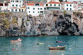
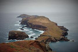
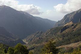
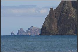
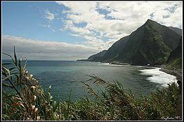
Come discover the island of Madeira with me
FR

Translated into English.

PI Pinacoladada Globetrotter ·
MACHICO - MACHICO BEACH (BANDA D'ALÉM)

Location: 32.71846, -16.76238

Banda d'Além Beach, located in Machico Bay, is an artificial yellow sand beach with facilities to support swimmers.

This area has a few amenities, including changing rooms, toilets, showers, and a parking lot.

https://youtu.be/RXtnnP9Ahag
Anne Blogue: https://deuxnomades.blogspot.com/ YouTube: https://www.youtube.com/c/SouthAngelVideo?sub_confirmation=1
PI Pinacoladada Globetrotter ·
MACHICO - SÃO ROQUE BEACH

Location: 32.71681, -16.76433

São Roque Beach takes up a large part of Machico Bay. It's a pebble beach. For vacationers' comfort, during the swimming season, this beach has showers and restrooms.

On this beach, you'll find restaurants and bars, lifeguards during the swimming season, a parasol area, a first-aid station, and changing rooms.

When we visited, we saw several surfers having fun in the waves.

https://youtu.be/7g6ndDjNHcs
Anne Blogue: https://deuxnomades.blogspot.com/ YouTube: https://www.youtube.com/c/SouthAngelVideo?sub_confirmation=1
PI Pinacoladada Globetrotter ·
MACHICO - RIBEIRA NATAL BEACH

Location: 32.73553, -16.74378

Ribeira de Natal Beach, located along the promenade of the same name, is a public beach along Ribeira de Natal in Machico.

This beach is not well-known, but it has good facilities, plenty of space for sunbathing, with sun loungers and fixed parasols, lifeguard supervision during the bathing season, a support bar, and parking. Here, you’ll find a long promenade connecting this beach to Caniçal, where you can enjoy a pleasant seaside stroll.

https://youtu.be/gUaljH-QTPE
Anne Blogue: https://deuxnomades.blogspot.com/ YouTube: https://www.youtube.com/c/SouthAngelVideo?sub_confirmation=1
PI Pinacoladada Globetrotter ·
CANIÇAL - PRAINHA BEACH

Location: 32.74293, -16.71545

Prainha, near Ponta de São Lourenço, is a natural copper-colored sandy beach of volcanic origin that offers a different beach day experience.

This is where you’ll find the Dunes da Piedade, which are limestone fossils of geomorphological interest.

The landscape surrounding this beach contrasts with what we typically see on most of the island. Here, the usual green is replaced by an arid setting painted in yellows, browns, and oranges.

This beach area has a restaurant, changing rooms, parasols, sun loungers, and a parking lot.

https://youtu.be/S7vPeHf37Hk
Anne Blogue: https://deuxnomades.blogspot.com/ YouTube: https://www.youtube.com/c/SouthAngelVideo?sub_confirmation=1
PI Pinacoladada Globetrotter ·
PORTO DA CRUZ - ALAGOA BEACH

Location: 32.77463, -16.82903

Alagoa Beach is located on the northwest coast of the island, in the municipality of Porto da Cruz. This small black sand beach is characterized by its grand mountain that overlooks the sea.

This beach has good sea access and features a solarium, a dining area, changing rooms, restrooms, a support bar, sun loungers, and fixed parasols for rent, as well as public parking.

https://youtu.be/aQgoovRd8cM
Anne Blogue: https://deuxnomades.blogspot.com/ YouTube: https://www.youtube.com/c/SouthAngelVideo?sub_confirmation=1
PI Pinacoladada Globetrotter ·
WALKING AROUND PONTA DO SOL

Location: 32.67919, -17.10409

Ponta do Sol is a village located on the southern coast of Madeira Island. It enjoys a particularly mild climate all year round.

It’s one of the most photogenic villages on the island, thanks to its colorful buildings, narrow valley, and the incredible view from the pier.

https://youtu.be/TlzFV0qT9SY
Anne Blogue: https://deuxnomades.blogspot.com/ YouTube: https://www.youtube.com/c/SouthAngelVideo?sub_confirmation=1
PI Pinacoladada Globetrotter ·
WALKING THROUGH THE TOWN OF CÂMARA DE LOBOS

Location: 32.64859, -16.97513

The town of Câmara de Lobos is located west of the capital, Funchal, on the southern coast of the island. It's a fishing village.

People go there to admire its colorful boats and white houses nestled at the foot of lush green hills.

It's a very picturesque spot.

https://youtu.be/fIjSKu_L1Eg
Anne Blogue: https://deuxnomades.blogspot.com/ YouTube: https://www.youtube.com/c/SouthAngelVideo?sub_confirmation=1
PI Pinacoladada Globetrotter ·
WALKING AROUND RIBEIRA BRAVA

Location: 32.669515, -17.064501

Ribeira Brava is a charming town located in the middle of the southern coast of Madeira Island. It’s the perfect spot not only for exploring the South but also for heading to the northern coast at São Vicente.

The town has a relaxing vibe and offers all the amenities you need for a great stay.

https://youtu.be/XQg_f-ufTig
Anne Blogue: https://deuxnomades.blogspot.com/ YouTube: https://www.youtube.com/c/SouthAngelVideo?sub_confirmation=1
PI Pinacoladada Globetrotter ·
WALKING THROUGH FUNCHAL

Location: 32.64957, -16.90876

Perched on a broad hill facing the Atlantic Ocean, on the southern coast of Madeira Island, Funchal is not only the capital of Madeira but also the tourist, cultural, and commercial hub of the archipelago.

This city is packed with historic monuments, museums, stunning gardens, leisure spaces, and several viewpoints.

https://youtu.be/wmh0ViVz7_E
Anne Blogue: https://deuxnomades.blogspot.com/ YouTube: https://www.youtube.com/c/SouthAngelVideo?sub_confirmation=1
PI Pinacoladada Globetrotter ·
FUNCHAL - WICKER SLEIGH RIDE

A famous tourist attraction in Funchal involves descending the streets of the village of Monte down to Funchal in a wicker sleigh pulled by two men, the *carreiros*, traditionally dressed in white cotton clothes and straw hats.

These wicker sleighs, called *Carrinhos*, first appeared around 1850. The ride lasts about 10 minutes over a distance of 2 km, and speeds can reach up to 50 km/h.

With no brakes or steering wheel, the *carreiros* use their rubber-soled boots to steer and slow down the sleigh.

We didn’t try the experience ourselves, but we watched a few descents. Here’s a glimpse in this video.

https://youtu.be/N5A2FK6-arw
Anne Blogue: https://deuxnomades.blogspot.com/ YouTube: https://www.youtube.com/c/SouthAngelVideo?sub_confirmation=1
PI Pinacoladada Globetrotter ·
WALKING THROUGH THE CITY OF MACHICO

The city of Machico is located in the southeast of Madeira Island, very close to Cristiano Ronaldo International Airport.

It sits in a lush forested valley.

This municipality has many viewpoints, historic monuments, beaches, and green spaces.

https://youtu.be/t6Ow71vp4DE
Anne Blogue: https://deuxnomades.blogspot.com/ YouTube: https://www.youtube.com/c/SouthAngelVideo?sub_confirmation=1
PI Pinacoladada Globetrotter ·
WALKING THROUGH THE TOWN OF SANTANA

Santana is a town located in the north of Madeira Island. It’s particularly famous for its traditional thatched-roof houses called "palheiros."

The few remaining thatched-roof houses are no longer lived in, but they now house small artisan shops.

The Santana region was also declared a UNESCO Biosphere Reserve on June 29, 2011.

https://youtu.be/HupUr18vMIU
Anne Blogue: https://deuxnomades.blogspot.com/ YouTube: https://www.youtube.com/c/SouthAngelVideo?sub_confirmation=1
PI Pinacoladada Globetrotter ·
WALKING THROUGH THE TOWN OF SÃO VICENTE

São Vicente is a small town located on the north coast of the island of Madeira in Portugal.

Nestled at the foot of a cliff, it was built at the mouth of a river that flows into the sea a kilometer further on.

It’s lovely to stroll through its pedestrian streets lined with palm trees, where you can discover its traditional whitewashed houses with colorful balconies and shutters, its shops, and its cafés.

Its church is richly decorated with magnificent frescoes.

https://youtu.be/FlN1_qHg06g
Anne Blogue: https://deuxnomades.blogspot.com/ YouTube: https://www.youtube.com/c/SouthAngelVideo?sub_confirmation=1
PI Pinacoladada Globetrotter ·
SÃO VICENTE CAVES PARK

Location: 32.79842, -17.0415 Parking 32.79790 -17.04172 Park

The São Vicente Caves were closed when we visited. However, we took the opportunity to stroll through the park, which is actually very well laid out.

At the entrance to the site, there’s a series of beautiful waterfalls that you can view from a footbridge above the river.

The park features many gardens with pretty flowers and several species of trees.

The site is truly picturesque.

https://youtu.be/2pnQ9T8dZ0U
Anne Blogue: https://deuxnomades.blogspot.com/ YouTube: https://www.youtube.com/c/SouthAngelVideo?sub_confirmation=1
PI Pinacoladada Globetrotter ·
CALHETA REGION - VIEWPOINTS

32.81432, -17.26277 Miradouro do Farol da Ponta do Pargo

Located at an altitude of 312 m, you can observe the vast landscape around the westernmost cape of the island.

The Ponta do Pargo Lighthouse viewpoint, situated at Ponta Vigia on the westernmost cape of the island, rises 312 meters above sea level and offers breathtaking views of the vast ocean and the rugged landscape, from the Ponta do Pargo lighthouse to the area known as Achadas da Cruz.

32.80958, -17.25654 Miradouro do Fio

At the southwestern tip of Madeira, there’s a lighthouse. The view from there isn’t exceptional. But nearby, there’s the Miradouro do Fio, close to a restaurant. The view is truly inspiring—no towns in sight, just cliffs, pebble beaches, and the sea.

32.72094, -17.17399 Miradouro do Piarro

Located at the top of the cliff above Calheta Beach, you can see the beach, the town’s marina, and the Casa das Mudas Arts Center from here.

The Piarro viewpoint is situated in the area known as Lombo do Doutor, perched on this cliff overlooking Calheta Beach and its marina, offering an almost aerial perspective. You can also spot the Casa das Mudas Arts Center in the distance to the west, at the same elevation.

32.70781, -17.13991 Miradouro do Farol Verde

The Farol Verde viewpoint is located at the top of the Achada de Santo Antão cliff, in the parish of Arco da Calheta.

It offers a stunning view of the parishes of Madalena do Mar and Arco da Calheta.

32.70762, -17.13989 Miradouro da Achada de Santo Antão

Located at the top of the Achada de Santo Antão cliff, it has a superb view of Madalena do Mar and Arco da Calheta.

The Farol Verde or Santo Antão viewpoint is situated at the top of the Achada de Santo Antão cliff, in the parish of Arco da Calheta. It offers a superb view of the parishes of Madalena do Mar and Arco da Calheta and is an excellent spot for paragliding.

32.75486, -17.13398 Miradouro do Rabaçal

Starting point for the PR 6 hikes.

Located on Pico da Urze, in Paul da Serra, this viewpoint enjoys a panoramic view of the island’s largest valley, covered in laurel forest vegetation.

The Rabaçal viewpoint, located on Pico da Urze in the Paul da Serra plateau, offers unforgettable views of a vast forested area. From this point, you can see the Rabaçal Valley, one of Madeira’s most beautiful, surrounded by the lush vegetation of the laurel forest, a UNESCO World Natural Heritage site.

Rabaçal is part of the Madeira Natural Park, a place of rest and silence, and belongs to the Natura 2000 network.

https://youtu.be/2N3rqaSl9nk
Anne Blogue: https://deuxnomades.blogspot.com/ YouTube: https://www.youtube.com/c/SouthAngelVideo?sub_confirmation=1
PI Pinacoladada Globetrotter ·
PONTA DO SOL REGION - VIEWPOINTS

Miradouro do Cascalho

GPS coordinates: 32.68306, -17.09237

The Cascalho Viewpoint offers a panoramic view from Lugar de Baixo to Ribeira Brava.

The Cascalho Viewpoint, located between Tabua and Ponta do Sol, at Sítio da Lombada, overlooks the Lugar de Baixo marina.

Miradouro da Bica da Cana

GPS coordinates for parking: 32.75745, -17.05931 GPS coordinates for viewpoint: 32.75657, -17.05778 GPS coordinates for belvedere (about a 500 m walk): 32.75637, -17.05454

The Bica da Cana viewpoint is located at an altitude of 1,580 m, in the parish of Canhas, Ponta do Sol. On clear days, it offers stunning views of the São Vicente valley.

https://youtu.be/lFqVISNLpoU
Anne Blogue: https://deuxnomades.blogspot.com/ YouTube: https://www.youtube.com/c/SouthAngelVideo?sub_confirmation=1
PI Pinacoladada Globetrotter ·
RIBEIRA BRAVA REGION - VIEWPOINTS

32.73438, -17.06174 Miradouro Molinas

Excellent viewpoint over the mountains, which were covered in flowers when we visited.

32.73333, -17.05257 Miradouro Lombo do Mouro

This viewpoint is located on a small hill near a very sharp bend. It offers stunning panoramic views of the surrounding landscape.

32.73480, -17.02418 Miradouro da Pousada dos Vinháticos

The Pousada dos Vinháticos viewpoint, in Serra d’Água, Ribeira Brava, is situated high in the mountains of Madeira, with a panoramic view of the island and access to famous walks.

32.73092, -17.02425 Miradouro da Terra Grande 1 32.73361, -17.02315 Miradouro da Terra Grande 2

It’s easy to stop and park here. From this spot, you can enjoy a 180° view.

Inland, you can see peaks and valleys, and to the right, you can take in the view of the narrow valley leading to Ribeira Brava.

32.66971, -17.06274 Miradouro de São Sebastião

It offers a beautiful panoramic view of the town and valley of Ribeira Brava, as well as the coastline between Quinta Grande and Ponta do Sol.

32.70729, -17.03127 Miradouro do Espigão

Located at the São Paulo site, it offers a lovely view of the Ribeira Brava valley, Serra de Água, and Encumeada.

32.66808, -17.03353 Miradouro do Campanário

The Campanário viewpoint is situated in the center of the parish of the same name and offers a panoramic view from the sea to the mountains.

32.66146, -17.03104 Miradouro da Partilha

This viewpoint offers a beautiful view of the coastline and the islet shaped like a "bell tower" (Campanário), which gave the parish its name.

On the left side, you can see Praia da Fajã dos Padres with its organic garden and cable car, while on the right, you can see Campanário.

https://youtu.be/HHxf4txiOcQ
Anne Blogue: https://deuxnomades.blogspot.com/ YouTube: https://www.youtube.com/c/SouthAngelVideo?sub_confirmation=1
PI Pinacoladada Globetrotter ·
CÂMARA DE LOBOS REGION - VIEWPOINTS

32.65689, -17.00478 Miradouro do Cabo Girão

At 580 m high, this is the tallest cape in Europe, famous for its suspended glass platform.

It offers magnificent panoramic views of Cabo Girão as well as the ocean and the municipalities of Câmara de Lobos and Funchal.

GPS coordinates: 32.711000, -16.98670 Parking GPS coordinates: 32.710595, -16.98607 Miradouro da Boca da Corrida GPS coordinates: 32.713030, -16.98833 Another viewpoint

Located at about 1,000 m altitude, it offers a stunning view of Val do Curral das Freiras, Eira do Serrado, and the central massif.

32.69550, -16.97827 Miradouro da Boca dos Namorados

Located in Jardim da Serra, it offers a view of the landscape of Curral das Freiras and the island’s central massif.

32.65200, -16.97362 Miradouro do Pico da Torre

It offers a 360° panoramic view of the municipality of Câmara de Lobos and part of Funchal.

32.64799, -16.97411 Miradouro Winston Churchill

At the entrance of Câmara de Lobos, it’s named after the British Prime Minister who painted a picture alluding to the bay here.

It offers a panoramic view of the pebble beach, the bay, and the islet.

32.64557, -16.97208 Miradouro do Salão Ideal

It offers a beautiful view of the promenade, Câmara de Lobos bay, and the Cabo Girão promontory.

Miradouro da Eira do Serrado

GPS coordinates: 32.71043, -16.96425 Miradouro da Eira do Serrado GPS coordinates: 32.71030, -16.96580 Another viewpoint

Located at 1,095 m altitude, it offers a fantastic panoramic view of the valley where the picturesque village of Curral das Freiras is nestled, surrounded by the tall mountains of the central massif.

Miradouro do Paredão

GPS coordinates: 32.71652, -16.95363 Parking GPS coordinates: 32.71607, -16.95549 Viewpoint 1 GPS coordinates: 32.71396, -16.95472 Viewpoint 2

Two viewpoints offering panoramic views of the municipality of Funchal (right side) and the village of Curral das Freiras (left side).

32.72285, -16.93358 Miadouro da Negra

A viewpoint at the top of a mountain that offers superb views of the valley covered in flowers in spring. Gorgeous!

https://youtu.be/Tt3vAM5NQKU
Anne Blogue: https://deuxnomades.blogspot.com/ YouTube: https://www.youtube.com/c/SouthAngelVideo?sub_confirmation=1
PI Pinacoladada Globetrotter ·
FUNCHAL REGION - VIEWPOINTS

32.73582, -16.92868 Miradouro do Pico do Areeiro

The Pico do Areeiro viewpoint is located on the second-highest peak of Madeira Island, at 1,818 meters above sea level.

From this viewpoint, you can enjoy an exceptional panoramic view of Madeira’s central massif.

This is where one of the most spectacular hiking trails begins, leading to the archipelago’s highest point, Pico Ruivo (PR1 Vereda do Areeiro), at 1,862 meters.

32.73641, -16.92472 Miradouro do Juncal

This viewpoint is located about 300 meters from the Pico do Arieiro parking lot.

It offers stunning views of the Fajã da Nogueira valley, the surrounding peaks, and, on clear days, even the sea in the background.

It’s also a very popular spot to watch the sunrise.

https://youtu.be/qttxjsQpuaA

32.73210, -16.92280 Miradouro Boca do Buraco

This viewpoint is located near Pico do Arieiro. It also offers beautiful views of the Fajã da Nogueira valley.

https://youtu.be/94pgs1GKEFs

32.65878, -16.93950 Miradouro do Pico dos Barcelos

The Pico dos Barcelos viewpoint is situated at about 355 meters above sea level. From here, you get a panoramic view of Funchal Bay and the city, with the Desertas Islands in the distance.

32.65738, -16.91971 Miradouro do Achada

The Achada viewpoint is located at an altitude of 100 meters, where you can enjoy views to the east of Funchal.

This viewpoint features a garden with various trees, shrubs, and several plants.

32.65044, -16.91397 Miradouro das Cruzes

This is one of the oldest viewpoints in Funchal. It’s located near Quinta das Cruzes and offers a privileged view of Funchal’s city center.

32.66923, -16.90928 Miradouro dos Marmeleiros

Located at an altitude of 500 meters, the Marmeleiros viewpoint offers a view of Funchal.

32.68030, -16.89063 Miradouro do Curral dos Romeiros

The Curral dos Romeiros viewpoint is situated at an altitude of 600 meters and offers a view of the Cabo Girão promontory and the Ribeira de João Gomes.

32.66009, -16.87471 Miradouro do Lombo da Quinta

Located in São Gonçalo, the Lombo da Quinta viewpoint offers a panoramic view of Funchal Bay.

32.64998, -16.87382 Miradouro das Neves

The Neves viewpoint, also known as the Pináculo viewpoint, offers one of the most beautiful views of Funchal Bay.

https://youtu.be/Oa7CV7Giwek
Anne Blogue: https://deuxnomades.blogspot.com/ YouTube: https://www.youtube.com/c/SouthAngelVideo?sub_confirmation=1
PI Pinacoladada Globetrotter ·
VIEWPOINTS - SANTA CRUZ REGION

Cristo Rei Viewpoint

GPS coordinates: 32.63978, -16.85154 Parking GPS coordinates: 32.63857, -16.85068 Statue GPS coordinates: 32.63707, -16.85010 Ponta do Garajau

The Cristo Rei viewpoint in Garajau offers an excellent view of Garajau, part of Funchal Bay, Caniço de Baixo, and the Atlantic Ocean.

Located in Garajau, the Cristo Rei viewpoint is named after the construction of the Christ the King statue, which was erected to fulfill a promise made by councilor Aires de Ornelas.

The majestic statue stands at the top of a hill that plunges into a ravine toward the sea.

https://youtu.be/yKaKiBPVsC8

3267890, -16.79899 Rosário Viewpoint

The Rosário viewpoint in Santa Cruz is located on the old regional road 101.

This small viewpoint offers a great view of the center of Santa Cruz, the runway of Madeira Airport, and the Desertas Islands, which lie just opposite.

32.69010, -16.79301 Lombinho Viewpoint

The Lombinho viewpoint is located at the top of Rochinha.

This viewpoint offers a panoramic view of the western side of Madeira Airport's runway all the way to the urban and central area of Santa Cruz.

https://youtu.be/gNfeP8GoUGs
Anne Blogue: https://deuxnomades.blogspot.com/ YouTube: https://www.youtube.com/c/SouthAngelVideo?sub_confirmation=1
PI Pinacoladada Globetrotter ·
VIEWPOINTS - PORTO MONIZ REGION

32.86253, -17.17329 Miradouro da Santinha

The Santinha Viewpoint offers a fantastic view of Porto Moniz town, perfect for observing the natural pools and the Mole islet.

To reach the Santa Viewpoint in Porto Moniz, simply follow the road that spirals up to Santa do Porto Moniz.

32.86363, -17.17600 Miradouro da Pedra Mole

The Pedra Mole Viewpoint also offers a superb view of Porto Moniz.

Miradouro dos Ilhéus da Ribeira da Janela

GPS coordinates: 32.85473, -17.15356 GPS coordinates: 32.85636, -17.15265 Rock formations

The Ilhéus da Ribeira da Janela Viewpoint is a fascinating spot on Madeira’s north coast. It offers breathtaking views of unique rock formations and the Atlantic Ocean.

There are two ways to get there: follow the promenade along the river that flows into the ocean or take the stairs leading to a tunnel carved into the cliff.

This tunnel leads to a viewpoint that provides an excellent vantage point over these rock formations.

https://youtu.be/tHkqtATzz24

32.84905, -17.15404 Miradouro Caminho do Lombo

It offers a partial view of Ilhéus da Ribeira da Janela and the coastline.

Miradouro Eira da Achada

GPS coordinates: 32.84813, -17.15305 Parking GPS coordinates: 32.84792, -17.15273 Viewpoint

The Eira da Achada Viewpoint offers stunning views of Madeira’s north coast.

This viewpoint features restrooms, children’s areas, picnic spots, and parking.

32.84682, -17.15894 Miradouro Francisco Rodrigues Jardim

A viewpoint located along the R209 road, next to the Ribeira da Janela church.

From here, you can admire the Ribeira da Janela valley.

Miradouro de Seixal

This viewpoint offers a beautiful view of the ocean framed by high cliffs covered in lush vegetation.

Miradouro do Véu da Noiva

GPS coordinates: 32.81627, -17.09644 Parking GPS coordinates: 32.81608, -17.09512 Viewpoint

This viewpoint, located between Seixal and São Vicente, lets you see the Véu da Noiva waterfall and Madeira’s north coast.

Its name comes from its resemblance to a bride’s veil.

https://youtu.be/ccg9yd_2pfM
Anne Blogue: https://deuxnomades.blogspot.com/ YouTube: https://www.youtube.com/c/SouthAngelVideo?sub_confirmation=1
PI Pinacoladada Globetrotter ·
VIEWPOINTS - SÃO VICENTE REGION

32.77429, -17.02748 Miradouro de Lombo Garcês-Rosario

This viewpoint offers an enchanting panoramic view of the island’s picturesque landscape, with its valleys and lush vegetation.

32.79252, -17.03862 Miradouro do Teatro

This viewpoint provides a breathtaking perspective on the mountains covered in dense forest, as well as the Chapel of Our Lady of Fatima perched atop a hill.

32.79717, -17.04173 Miradouro do Passo

Located just above the entrance to the São Vicente Caves, this viewpoint offers a stunning view of the river valley and the ocean.

32.80422, -17.04389 Miradouro dos Cardais

Situated on the right bank of the stream and the village of São Vicente, it provides an excellent view of the village center and the São Vicente Valley.

Miradouro da Antena

GPS Coordinates: 32.82344, -16.98442 Miradouro da Antena

This viewpoint offers a lovely view along the north coast to Seixal and São Vicente. It’s very well-maintained and surrounded by beautiful gardens.

32.82389, -16.98421 Miradouro da Roça

Nestled in the heart of Boaventura, this viewpoint offers a superb view of the lush valleys and rugged coastline.

32.82750, -16.97714 Miradouro do Bom Jesus

Located in the parish of Boaventura, this viewpoint is an excellent spot to see Ponta Delgada and its seaside complex on the left, and Boaventura on the right.

32.82716, -16.97284 Miradouro de São Cristóvão

Perched on one of the highest slopes in the region, this viewpoint offers a breathtaking perspective on the Boaventura Valley, the green terraces carved into the mountains, and the ocean.

32.82272, -16.97375 Miradouro do Cemitério da Boaventura

Stunning views along the rugged coastline, as well as Ilhéu Preto and Ilhéu Vermelho.

32.81538, -16.96813 Miradouro da Vista

A lovely view of the Ribeira do Porço Valley and Boaventura stretching to the Atlantic. Miradouro da Encumeada

GPS Coordinates: 32.75433, -17.019461 GPS Coordinates: 32.75256, -17.015680 Another viewpoint

At 1007 m above sea level, this viewpoint offers superb views of the island’s north and south coasts, as well as the Ribeira Brava and São Vicente Valleys.

This is also where the PR 17 hiking trail begins.

https://youtu.be/SVUAX8JIyq4
Anne Blogue: https://deuxnomades.blogspot.com/ YouTube: https://www.youtube.com/c/SouthAngelVideo?sub_confirmation=1
PI Pinacoladada Globetrotter ·
VIEWPOINTS - SANTANA REGION

Location: 32.80479, -17.04685 Vigia Viewpoint

The Vigia Viewpoint, located in São Jorge, lets us observe Arco de São Jorge, Ponta Delgada, Seixal, and Porto Moniz.

32.82894, -16.95248 Arco de São Jorge Viewpoint

The Arco de São Jorge Viewpoint has a picnic area where you can see the ocean as well as the Calhau de São Jorge.

32.82646, -16.93880 Beira da Quinta Viewpoint

The Beira da Quinta Viewpoint is situated between São Jorge and Arco de São Jorge. On clear days, we can spot the neighboring island of Porto Santo.

This is one of the greenest areas on the island. The mountain slopes are lush and vibrant.

32.82608, -16.93913 Pipa Viewpoint

A beautiful viewpoint offering essentially the same view as the Beira da Quinta Viewpoint over the island’s north coast.

32.82273, -16.90247 Lombo do Pico Viewpoint

The Pico Viewpoint in São Jorge offers excellent views of the mountains surrounding the Ilha area, as well as Santana and São Jorge.

You can also catch a glimpse of part of the São Jorge Bathing Complex.

32.81226, -16.91311 Eiras Viewpoint

The Eiras Viewpoint is located in Sítio da Ilha. This observation point offers a breathtaking view of the mountains on the north coast and the valleys covered in the lush vegetation of the laurel forest, a UNESCO World Heritage site.

32.80634, -16.91014 Cabeço do Resto Viewpoint

The Cabeço do Resto Viewpoint, in the Ilha area, lets us enjoy the landscape of São Jorge, Ilha, and Santana.

There are a few stone benches and tables where you can stop for a picnic while taking in the surrounding scenery.

32.81470, -16.87656 Rocha do Navio Viewpoint

The Rocha do Navio Viewpoint in Santana offers a fantastic view of the ocean, the islet of Viúva, and the surrounding area.

32.79047, -16.86001 Nossa Senhora do Bom Caminho Viewpoint

The Nossa Senhora dos Bons Caminhos Viewpoint, located on regional road 101, offers a stunning view of the picturesque parish of Faial, surrounded by green slopes, as well as the Penha d'Águia, a geological formation that, at about 600 meters high, marks the boundary between the municipalities of Santana and Machico.

You can also see the Faial go-kart track.

There’s a statue representing a religious figure: Nossa Senhora dos Bons Caminhos.

32.79480, -16.86261 Cortado Viewpoint

The Cortado Viewpoint, located on the old regional road 103, enjoys a particularly high position that lets us admire the rugged coastline of the Faial area.

You can see not only the Penha d'Águia but also part of the Fajã do Mar bay, a small pebble beach bathed by the crystal-clear waters of the north coast.

Guindaste Viewpoint

GPS Coordinates: 32.79401, -16.84962 Parking GPS Coordinates: 32.79432, -16.84896 Viewpoint GPS Coordinates: 32.79388, -16.84842 Viewpoint GPS Coordinates: 32.79408, -16.84936 Staircase GPS Coordinates: 32.79385, -16.85120 Viewpoint

The Guindaste Viewpoint offers an excellent vantage point over the Atlantic Ocean, which borders the island’s north coast from Faial to Ponta de São Lourenço, as well as the pebble beach of Foz da Ribeira do Faial.

https://youtu.be/bf-KmpYnAfA
Anne Blogue: https://deuxnomades.blogspot.com/ YouTube: https://www.youtube.com/c/SouthAngelVideo?sub_confirmation=1
PI Pinacoladada Globetrotter ·
VIEWPOINTS - MACHICO REGION

32.77467, -16.82729 Miradouro do Fortim do Pico

The Fortim do Pico viewpoint is located in the parish of Porto da Cruz. It offers a stunning view of the western part of the island, including Ponta de São Lourenço and Penha d'Águia, as well as the seaside promenade of Porto da Cruz and Alagoa beach.

32.74680, -16.82640 Miradouro da Portela

The Portela Viewpoint offers one of the most breathtaking landscapes on the island, where you can see Porto da Cruz, Penha d'Águia, and part of Santana.

32.75085, -16.70809 Miradouro da Ponta do Rosto

The Ponta do Rosto Viewpoint in Caniçal lets you glimpse both the north and south coasts of Madeira. On sunny days, you can also see Porto Santo.

The Ponta do Rosto Viewpoint, located in the northern area of the São Lourenço peninsula, offers views of both the north and south coasts of Madeira.

On clear days, you can also see Porto Santo from here.

32.72408, -16.75870 Miradouro do Pico do Facho

The Pico do Facho Viewpoint offers a splendid panoramic view of the Machico valley, the peaks of the central part of the island, the Desertas islands, and Ponta de São Lourenço.

32.72093, -16.76235 Miradouro do Senhor dos Milagres

The Senhor dos Milagres Viewpoint also offers a view of the bay and Machico valley, but at a lower level.

Miradouro Francisco Alvares Nobrega

GPS coordinates: 32.71250, -16.76419 Parking GPS coordinates: 32.71306, -16.76485 Viewpoint

The Francisco Alvares Nóbrega Viewpoint offers excellent views of the Machico valley and Ponta de São Lourenço, as well as the golden sandy beach and marina.

32.71543, -16.77353 Miradouro da Portelinha

The Portelinha Viewpoint, located on regional road 101, offers a spectacular view of Machico and Caniçal, as well as Madeira Airport.

https://youtu.be/e0JlGWXRrNo
Anne Blogue: https://deuxnomades.blogspot.com/ YouTube: https://www.youtube.com/c/SouthAngelVideo?sub_confirmation=1
PI Pinacoladada Globetrotter ·
PONTA DO SOL - ANJOS WATERFALL

GPS coordinates: 32.68670, -17.11395

The Anjos Waterfall is located in Ponta do Sol on the south coast of Madeira. It's spectacular because it flows right onto the regional road ER 101.

We went there twice because on our first attempt, the road was closed to cars due to a recent landslide.

You can drive directly under the waterfall and even take a shower by positioning yourself underneath it for that famous photo.

However, be aware that there’s always a risk of a rock or debris carried by the water falling to the ground.

https://youtu.be/L7godRWLM5o
Anne Blogue: https://deuxnomades.blogspot.com/ YouTube: https://www.youtube.com/c/SouthAngelVideo?sub_confirmation=1
PI Pinacoladada Globetrotter ·
SAO VICENTE - ÁGUA D'ALTO WATERFALL

GPS coordinates: 32.80968, -17.05968

The Água d’Alto waterfall is located in São Vicente on the north coast of Madeira. It’s easily accessible since it’s right by the VE 2 road.

There’s a small parking area nearby, but be careful—it’s at the exit of a tunnel.

The waterfall cascades down from a height of about 100 meters over a steep cliff, offering a stunning sight.

You can actually see it from far away when driving on the VE 2 toward Seixal.

https://youtu.be/3kv2pUUPIcQ
Anne Blogue: https://deuxnomades.blogspot.com/ YouTube: https://www.youtube.com/c/SouthAngelVideo?sub_confirmation=1
PI Pinacoladada Globetrotter ·
SEIXAL - CÓRREGO DA FURNA WATERFALL

GPS coordinates: 32.81541, -17.08179

The Córrego da Furna waterfall is located in Seixal on the north coast of Madeira. It’s easily accessible since it’s right by the VE 2 road.

You can park your vehicle on the side of the road to get a better view of it.

However, since it’s at the exit of the Ladeira da Vinha tunnel, be cautious.

It flows down from a height of about 100 meters over a steep cliff and offers just as stunning a spectacle as its neighbor, the Água d’Alto waterfall.

https://youtu.be/-Z8o8aslm7o
Anne Blogue: https://deuxnomades.blogspot.com/ YouTube: https://www.youtube.com/c/SouthAngelVideo?sub_confirmation=1
PI Pinacoladada Globetrotter ·
ON THE ROAD IN MADEIRA

Other picturesque landscapes we saw while traveling around Madeira’s roads.

https://youtu.be/Kyc9VZCrY24

*************************************** E N D *************************************
Anne Blogue: https://deuxnomades.blogspot.com/ YouTube: https://www.youtube.com/c/SouthAngelVideo?sub_confirmation=1

Similar discussions

You might also like