Le 1e jour nous avons croisé un buggy avec 2 personnes en allant au bout de la piste.
Le 2e jour nous n'avons vu personne de la journée.
Ton récit et tes photos font déjà rêver, imaginer être totalement seul donne encore plus envie de faire le même genre de chose.
Par contre, le stress de la crevaison possible sur la partie finale de Poison Spring... Ca fatigue !
Mais justement, jusqu'à maintenant, je n'ai jamais rien fait qui soit aussi isolé que ce que tu nous décris, et je me demande toujours "comment fait-on en cas de problème mécanique sur la voiture ?"
Bon, une crevaison, ça ne fait pas plaisir, mais ça reste gérable, mais en cas de problème plus important ? Sans couverture réseau, sans croiser personne ?
Bien sûr, prévoir de quoi beaucoup boire, de quoi manger, de quoi bien se couvrir, mais comment prévenir les secours en cas de pépin, si on reste coincés au milieu de nulle part ?
En tout cas bravo et merci pour ton fabuleux carnet, j'ai hâte de lire la suite :)
"comment fait-on en cas de problème mécanique sur la voiture ?"
Bon, une crevaison, ça ne fait pas plaisir, mais ça reste gérable, mais en cas de problème plus important ? Sans couverture réseau, sans croiser personne ?
Bien sûr, prévoir de quoi beaucoup boire, de quoi manger, de quoi bien se couvrir, mais comment prévenir les secours en cas de pépin, si on reste coincés au milieu de nulle part ?
A vrai dire, je ne vois pas d'autre solution que d'attendre et se prendre une énorme facture pour le remorquage. On part toujours avec de l'eau et des provisions pour au moins 1 semaine.
En général, on prévient presque toujours le BLM ou le visitor center quand on s'engage sur une piste compliquée ou un endroit vraiment isolé. Et puis on convient d'appeler nos proches aux dates prévues de sortie sinon ils appellent le BLM. Ensuite, on part toujours avec un compresseur et des mèches.
Le vrai risque me semble de crever 2 pneus avec l'impossibilité de les réparer avec les mèches. Pour l'instant cela ne nous est jamais arrivé malgré de grosses galères (on a déjà eu 6 crevaisons me semble t il).
Cela ne nous empêche pas de tenter des pistes pour lesquelles, avec le recul, on se dit qu'on était un peu inconscients. Je me remémore cette nuit passée sur la lippincott road (death Valley) après avoir crevé et sans savoir si on allait pouvoir s'en sortir le lendemain avec notre SUV 2 roues motrices. Un vrai cauchemar !
Mais bon c'est quand même l'esprit qu'on recherche là-bas : la solitude, la découverte et l'aventure. Quand tu lis les histoires des pionniers de l'Ouest Américains, on fait quand même pâle figure à côté.😏
Si tu veux te lancer dans la visite de lieux reculés, le plus important est de bien préparer et de viser ce qui t'est possible selon ton expérience actuel. Ensuite, tu pousses un peu plus loin à chaque fois.
Quand on part en backpacking sur plusieurs jours en sachant qu'on risque de ne croiser personne, je me dis presque toujours avant de partir que s'il arrive un truc grave (fracture, morsure de crotale, chute...), il va falloir compter sur la chance pour s'en sortir !
Mercredi 20 Avril 2016 ou l'erreur qui s'est propagée sur le net !
Cassidy arch, Upper Calf Creek Falls
La journée s'annonce tranquille puisque c'est plus une journée de transition qui doit nous emmener dans les environs d'Escalante.
Le matin est consacré à la petite balade qui mène à Cassidy Arch dans le parc de Capitol Reef. Nous apprenons à cette occasion que c'est la National Park week du 16 au 24 avril et que tous les parcs nationaux sont gratuits cette semaine ! Ca fait donc quelques euros de gagné.
Cassidy Arch est assez impressionnante notamment par le vide qu'il faut approcher pour faire une bonne photo. Il y a bien sûr un peu plus de personnes que la veille mais cela reste quand même agréable. Nous regardons quelques alpinistes monter jusqu'à la base de l'arche.
Les environs de Cassidy Arch sont à l'image du parc : colorés.
2e étape pour cette journée : Upper Calf Creek Falls
Là il y a un truc qui nous a vraiment pas plus. Tous les sites et livres indiquent que le trailhead se situe entre les miles 81 et 82 de la route 12. Nous avons donc suivi ce chemin et tenté de trouver le moyen de descendre dans le canyon. Au bout de 45 minutes de tentatives infructueuses et grâce à un accès internet, nous nous sommes rendus compte que le trailhead était situé bien plus loin sur la route 12 ! 😠
Comme quoi il suffit qu'une info soit fausse au départ pour que tout le monde la recopie sans vérifier !
On a failli abandonner cette balade tellement nous étions énervés d'avoir cherché pour rien et perdu tout ce temps.
Mais bon je finis quand même par convaincre Virginie d'y aller quand même car la balade n'est pas très longue.
Après une descente qui se fait sur du slikrock nous arrivons rapidement à la partie haute de la chute d'eau
Puis nous repartons légèrement en arrière pour prendre le sentier qui conduit au bassin situé en bas de la chute d'eau
Nous sommes tentés par une baignade mais l'eau est vraiment très froide !!
Retour à la voiture. Tiens la montée nous semble quand même un peu plus fatigante !
Nous arriverons trop tard à Escalante pour prendre les permis pour le backpacking des deux prochains jours. Tant pis, nous les prendrons demain à l'ouverture du BLM.
Je continue la découverte hors des sentiers battus 🙂 Gros coup de coeur pour le Happy canyon, même si ce n'est pas Antelope canyon, il est très beau et sa situation (loin de tout et méconnu) le rend à mes yeux exceptionnel !
L'arche à Capitol Reef est magnifique également, je ne cesserais d'être étonnée de toutes ces merveilles que regorge l'ouest Américain...
Je peux faire un pronostic sur les deux jours de backpacking à venir ? Je mise sur... Coyote Gulch (?!) 😊
Val a fait Upper et Lower Calf Creed mais ne m'a pas dit avoir eu de difficultés pour trouver l'un ou l'autre.
Nous avions nous-même mis Upper au programme mais Francesco avait un souci aux pieds les derniers jours et le dénivelé est important même si pas très long. il avait peur de se faire encore plus mal. Du coup, on a laissé tomber. Je regrette un peu parce que le site est superbe.
J'avais pris les infos sur Roadtrippin qui donne comme info : à 6 miles de Boulder, près du mile 81 N37° 51'32 149" W111° 26'10.149" une piste partant à gauche sans panneau. se garer puis descendre à l'ouest mais mal balisé (juste quelques cairns à chercher) et slick rock bien pentu sur 150m. On arrive au bout de 2km environ. Le trail officiel lui ne ferait que dominer la piscine naturelle.
Bref, peut-être que nous aurions bien galéré aussi...
Pour voir mes carnets Ouest USA, cliquez sur mon pseudo puis cliquez celui désiré dans la rubrique "carnets" : Vous avez le choix avec 2009, 2011, 2012, 2013, 2014, 2015 et 2016 : ça en fait de la lecture ! Et maintenant : la Chine !
Merci pour toutes ces informations pour préparer et ces conseils de prudence au cas où. Avec des enfants c'est encore différent: quand ils sont petits, on s'aventure certes moins loin mais on est doublement prudents, il faut même penser au "doudou", c'est dire 😉
Puis quand ils grandissent, on lache du lest. Parfois, on se dit qu'on est un peu inconscient. Puis, avec des ados, on redevient plus prudents dans un esprit pédagogique.
Bravo pour vos aventures, je vous en souhaite encore beaucoup !
Armelle
Carnets de voyage : voir mon profil (Lanzarote - New York - Namibie - Vietnam - Angkor - Ouest USA)
Notre trip dans Death Hollow l'année dernière nous avait enchanté et nous souhaitions donc recommencer un backpacking dans la région d'Escalante.
Notre choix s'était porté sur 3 possibilités : la boucle 40 mile creek - Willow Creek, reflection Point dont Veileen a fait un excellent retour et enfin la boucle Little Death Hollow - Wolverine Canyon.
Nous gardions donc en tête ces 3 possibilités avant de partir et ce n'est seulement qu'il y a quelques jours que nous avons pris notre décision.
- les passages étroits de 40 mile nous paraissaient trop compliqués à franchir avec trop d'eau dans le canyon (ce qui était fort probable avec le temps subi depuis le début du voyage).
- Reflection Point nous paraissait trop dur pour aller faire juste une photo et il y avait le problème du manque d'eau sur le trajet, ce qui obligeait à prendre beaucoup d'eau (et qui dit beaucoup d'eau dit un sac lourd et inconfortable)
Nous nous sommes donc décidés pour Little Death Hollow (LDH) avec le retour par Wolverine Canyon.
A 8h nous sommes devant le visitor center d'Escalante pour récupérer les permis. Pas besoin de réserver ni de se soucier du nombre de places, ils les donnent automatiquement et sont gratuits. Ces permis servent surtout pour savoir qui rentrent dans la zone en cas de problème de sécurité.
Nous partons donc en direction de Boulder afin d'emprunter la Burr Trail Road. Puis peu de temps après avoir traversé les Betanite Hills, nous prenons la piste de Wolverine Road qui part vers le Sud.
Nous n'avons aucune difficulté pour rejoindre le trailhead qui se situe près d'un corral. Nous sommes surpris de voir qu'il y a une dizaine de voitures déjà garées ! Nous pensions que nous serions seuls et nous avons l'impression que c'est The Place to Be !
En signant le registre, nous voyons qu'il est possible de prendre le permis directement ici car il y a quelques formulaires dans la boîte en fer. Nous n'avions donc pas besoin d'attendre l'ouverture du visitor center...tant pis !
On remarque qu'il y a deux groupes de 10 et 2 personnes qui nous devancent pour un trip sur 2 jours aussi.
Voici sa situation par rapport à Escalante
Ainsi que le parcours
Il est 10h30 quand nous entamons la marche dans un canyon assez large dominé sur la droite par Little Bown Bench.
Au bout de 35 minutes et peu de temps avant que le canyon commence à devenir plus étroit, nous arrivons aux pictogrammes qui sont situés tout en bas d'un gros rocher. Il est assez facile de passer à côté.
Leur position à moitié enfouis dans le sable fait débat : soit le rocher s'est déplacé d'une position plus haute, soit le sol s'est comblé.
je prend le train en marche, avec un peu de retatd 😇.
Quand j'ai vu ta photo d'accroche, je me suis dit :"Tiens, je ne connais pas cette vue d'Havasupai !" et j'ai aussitôt appelé Isabelle pour qu'elle regarde avec moi. Mais, que nenni, tu nous fais saliver 😉.
heureusement déjà en tête sa trame générale
Heureusement oui car je ne vois pas préparer ce type de voyage en un mois sans biscuits au préalable. Bravo !
Là ils nous prennent vraiment pour des jambons !
Don't bullshit me! 😉
nous avions prévu la balade dans Rattlesnake Canyon
Fait partie de notre wish-list 2021. Dommage que vous n'ayez pu la faire ni à l'aller ni au retour.
Sego Canyon - Le site est à voir !
Tout à fait ; très facile d'accès, même en berline. Nous avons dormi dans la vieille ville abandonnée.
Arches National Park
Comme toujours, de belles photos.
Jeep Arch
Jolie balade et belle arche.
Difficile d’imaginer qu’un local a traversé cette arche avec son avion !
J'imagine qu'il s'agit de Tim avec qui nous avons eu la chance de survoler la région.
j’entends un « tsss tsss »
J'imagine bien la poussée d'adrénaline 😉. Jamais rencontré mais, malgré tout, j'aurais aimé en voir un (pas de trop près quand même 😇).
Nous nous promettons de retourner un jour à Delta Pool
Jolie description, même si la météo était maussade.
Pritchett Canyon
Que de noms d'arches dont je n'ai jamais entendu parler ; et quelle belle balade, bravo à tous les 2.
Poison Springs Road
Nous sommes passés par loin l'année dernière, mais sur le plateau, pour aller à Burr Point ; la piste était très roulante. Belles vues sur la Dirty Devil river.
Vu nom prénom (AP), j'aime bien Happy Canyon 😉 et tes photos donnent envie d'y aller.
Quand j'ai vu ta photo d'accroche, je me suis dit :"Tiens, je ne connais pas cette vue d'Havasupai !" et j'ai aussitôt appelé Isabelle pour qu'elle regarde avec moi. Mais, que nenni, tu nous fais saliver 😉.
En effet, il y a un petit air d'Havasupai mais l'eau a une couleur légèrement différente (moins claire et plus laiteuse) 😉
Fait partie de notre wish-list 2021. Dommage que vous n'ayez pu la faire ni à l'aller ni au retour.
As tu prévu d'aller à West Rim Arch qui est située un peu plus au Sud ?
Nous sommes passés par loin l'année dernière, mais sur le plateau, pour aller à Burr Point ; la piste était très roulante. Belles vues sur la Dirty Devil river.
Je suis un grand fan de la vue depuis Burr Point. Les deux autres chemins d'accès pour Happy Canyon partent de Burr Point
Nous reprenons notre route alors que la largeur du canyon ne dépasse plus les 80 mètres.
Au détour d'un méandre, nous tombons sur le corps sans vie d'une petite chauve souris
L'endroit est réputé pour avoir une concentration de bois pétrifié très importante, surtout dans Wolverine Canyon.
Après environ 6km, la végétation disparaît totalement au fond du canyon laissant place à un environnement purement minéral.
La hauteur des falaises augmentent et celles-ci deviennent verticales
Nous traversons de très beaux passages colorés avec des parois sculptées par l'eau mais malheureusement, ce n'est pas la bonne heure pour faire des photos.
Cela fait maintenant un peu plus de 2h que nous sommes partis et nous nous délectons des passages à l'ombre offrant des couleurs chaudes.
Au 8e km, un amas rocheux en dessous duquel il faut se faufiler marque le début des narrows de Little Death Hollow. Nous croisons à ce moment là un photographe allemand qui semble ravi des photos qu'il vient de faire.
Il a du profiter de l'ombre de la matinée et on regrette à ce moment-là d'avoir du attendre l'ouverture du visitor center pour prendre les permis. L'idéal aurait été de commencer 2 heures plus tôt la randonnée.
Il fait bon dans le canyon car ce sont les journées les plus chaudes de notre voyage (environ 30 degrés)
Il y a par moment de l'eau stagnante qui nous oblige pour l'instant à nous aider des mains pour l'éviter.
Un petit bonjour de page ou nous revenons de hackberry canyon. la vue du bas de gemini bridges par bull canyon est bien meilleure mais la piste est pourrie (mais avec un rubicon surélévée de twisted jeeps, aucun pb). apparemment un jeune garcon est aussi mort en ratant le saut entre les deux ponts plus recemment
Envie de découvrir l'ouest autrement, de sortir des sentiers battus: c'est maintenant sur www.ouestusa.fr où vous attendent itinéraires, cartes topo, photos, moteur de recherche et de nombreux renseignements
My friend après avoir fais cette de poison spring road il y a une semaine, je partage qu'il ne faut pas s'y engager a moins d'avoir un sérieux véhicule et avec une vrai roue de secours. sincèrement même avec un x-terra de loc, a ta place je n'aurais pas pris le risque (peut être pas assez téméraire !!!) . même si tu dis que les pneus sont bons cela reste des pneus à 2 ou 3 plis alors que les pneux concus pour rouler sur des rochers sont des 10 plis mais tu n'en a jamais sur des voitures de loc. au mieux tu as des pneux "all terrain" qui sont pas trop mauvais pour le sable ou la boue mais pas plus costaux que les autres. avec la rubicon de Twisted jeep, je l'ai fait en 1H10
nous pour le camping c'était infesté de nuts -> je suppose que tu n'en avais pas en avril ?
Envie de découvrir l'ouest autrement, de sortir des sentiers battus: c'est maintenant sur www.ouestusa.fr où vous attendent itinéraires, cartes topo, photos, moteur de recherche et de nombreux renseignements
a voir la photo de ta tente sur le point de vue sur la dirty devil river, j'ai l'impression qu'on a mis la notre exactement au même endroit 😉 coucher de soleil top à ce point de vue qui m'a beaucoup évoqué certaines vues dans island in the sky
Envie de découvrir l'ouest autrement, de sortir des sentiers battus: c'est maintenant sur www.ouestusa.fr où vous attendent itinéraires, cartes topo, photos, moteur de recherche et de nombreux renseignements
pour Happy canyon pour nous il y a une semaine c'était plutot 35° donc assez pénible mais on est parti tot. a voir des photos et ton tracé que tu m'avais donné, je pense qu'on est allé a peu près aussi loin dans le canyon mais il y avait plus de lumière ce qui est logique car en juin le soleil monte très vite. je ne regrette pas d'avoir campé car c'est le seul moyen de voir ce canyon à la bonne heure pour la reflected light. par contre même si le point de vue pour le camping est top je trouve au final le rapport effort/plaisir assez moyen a cause de la piste.
tu n'as pas loupé grand chose pour arsenic arch😉
Envie de découvrir l'ouest autrement, de sortir des sentiers battus: c'est maintenant sur www.ouestusa.fr où vous attendent itinéraires, cartes topo, photos, moteur de recherche et de nombreux renseignements
pour reflection canyon je confirme tu as fait le bon choix et moi le mauvais 🙁. Le backpacking de reflection canyon a été un cauchemar: trop chaud (env 35°), sac trop lourd a cause de l'eau (env 20kg ) et rando pénible et sans aucun intéret. au final je n'ai pas assez bu pour économiser l'eau et j'ai eu un début de désyhdratation le soir: envie de vomlir, crampes, impossible de manger, vertiges. même pas eu la froce d'aller au bon point de vue et on est arrivé trop tard. au départ on a rencontrer 4 jeunes qui revenaient du backaping et ils n'avaient ppolus d'eau et étaient très mal. on leur a dit qu'ils étaient à 30min de leur voiture et du coup cela les a reboosté. haureusement que ma femme m'a boosté le matin car je suis revenu à la voiture le lendemain au mental. j'aurais mieux fait de faire bement arch et hole in the rock.... ce sera la prochaine fois
Envie de découvrir l'ouest autrement, de sortir des sentiers battus: c'est maintenant sur www.ouestusa.fr où vous attendent itinéraires, cartes topo, photos, moteur de recherche et de nombreux renseignements
Ah...il est sympa ce Happy Canyon Olivier ! Et puis en plus pas un chat dedans, ça compense largement le fait qu'il est sûrement moins beau qu'Antelope. Il a quelques faux airs avec Buckskin Gulch, je trouve.
je suis d'accord que cela rappelle buckskin gulch surtout à cause des logs coincés par les flashs floods mais buckskin gulch, à mon sens, est incomparablement plus beau et impressionant même si j'ai apprécié Happy canyon sur les conseils de Olivier
Tu dis ne pas avoir poussé plus loin, il y avait un passage qui nécessitait de l'équipement ou bien vous avez tout simplement fait demi tour pris par le temps et la fatigue du jour ?
Envie de découvrir l'ouest autrement, de sortir des sentiers battus: c'est maintenant sur www.ouestusa.fr où vous attendent itinéraires, cartes topo, photos, moteur de recherche et de nombreux renseignements
Le début d'un beau pack packing.
J'aime beaucoup les parois "travaillées" du canyon. Même si l'heure n'était pas idéale pour les photos, on a tout de même un bon aperçu et ça donne envie.
Pour voir mes carnets Ouest USA, cliquez sur mon pseudo puis cliquez celui désiré dans la rubrique "carnets" : Vous avez le choix avec 2009, 2011, 2012, 2013, 2014, 2015 et 2016 : ça en fait de la lecture ! Et maintenant : la Chine !
Wolverine était aussi à notre programme 2015 pour les troncs d'arbres pétrifiés mais, tout ce que nous avons réussi à faire, c'est à prendre en photo la pancarte indiquant la route, et ce sous des trombes d'eau 😠.
En tout cas, jolie balade même si l'horaire n'était pas le meilleur. Cela ressemble un peu à Crack Canyon, non ?
As tu prévu d'aller à West Rim Arch qui est située un peu plus au Sud ?
Non, seulement la vue de la piste d'approche (il doit y avoir un Overlook).
Ton expérience est vraiment la bienvenue pour Reflection Point. Cela permet de ne pas sous-estimer les risques d'une rando totalement hors des sentiers battus quand le temps ne s'y prête pas forcément. Surtout que je sais que tu prépares tes randos à fond donc cela peut laisser à réfléchir avant de s'aventurer là-bas !
Non, seulement la vue de la piste d'approche (il doit y avoir un Overlook).
Je ne savais pas qu'il y avait un overlook. On avait prévu d'y aller à pied à partir de la piste qui part a gauche avant d'arriver au TH de Rattlesnake.
Wolverine était aussi à notre programme 2015 pour les troncs d'arbres pétrifiés mais, tout ce que nous avons réussi à faire, c'est à prendre en photo la pancarte indiquant la route, et ce sous des trombes d'eau 😠.
C'est vrai qu'il y a une concentration plus importante de petrified wood dans Wolverine que dans LDH. Dommage pour le temps car Wolverine, bien que très différent de LDH, est intéressant à visiter.
Cela ressemble un peu à Crack Canyon, non ?
J'ai fait Crack Canyon il y a 8 ans alors je ne me souviens pas très bien mais oui, je crois que cela ressemble un peu.
Par contre, il y a des passages où il faut marcher dans de l'eau croupie dans LDH (à voir dans la suite du carnet) ainsi que des passages de gros blocs de rochers (il faut le faire dans ce sens la d'ailleurs LDH -> Wolverine). C'est du canyoning soft.
Cela fait maintenant 4h que nous sommes partis et nous continuons à progresser assez facilement dans LDH
Un peu plus loin quelques passages sont plus acrobatiques.
Encore un peu plus loin, il faut sauter de 2 mètres. Il y aura au total 3 ou 4 passages de blocs de rochers où il est nécessaire de sauter. ll est donc préférable de faire la boucle dans ce sens.
Nous nous délectons de ces parois colorées et très travaillées par l'érosion.
En tous cas, il ne faut absolument pas s'y aventurer en cas d'orages violents car il y a très peu échappatoires sur plusieurs kilomètres de slot canyon
Nous arrivons au 1e long passage d'eau stagnante. Avec un peu de souplesse dans les jambes, nous arrivons à le passer sans goûter à l'eau
Par contre le 2e passage délicat se situe après un amas rocheux qui nécessite de s'aventurer dans l'eau. Celle-ci est vraiment froide et monte jusqu'à la taille. Nous rencontrons à ce moment là un couple de jeunes américains qui nous sert de guide en testant pour nous la profondeur de l'eau 😏
Sur le 3e passage, rebelote pour faire le grand écart !
Puis nous enchaînons encore quelques passages délicats qui sans être vraiment techniques nous obligent de patauger un peu. Mais bon au point où nous en sommes maintenant...
Au final nous avons trouver le canyon plutôt ludique (c'est un backpacking qui peut plaire aux enfants)
Quelques logs de bois assez photogéniques
Et puis enfin un dernier amas rocheux sous lequel où il faut se faufiler
Et le canyon s'élargit avant d'arriver à l'intersection avec Horse Canyon. Nous avons mis un peu moins de 3 heures (avec pas mal de pause pour les photos) pour faire les 6 km de slot Canyo de LDH
C'est donc au bout de 6 heures que nous arrivons à Horse Canyon. Il y a de l'eau qui coule à l'intersection et en remontant sur 1 kilomètre. Par la suite, l'eau disparaît sous terre. S'il n'y a pas d'eau dans Horse Canyon, il faut alors redescendre et faire l'aller retour jusqu'à l'Escalante River.
En remontant le cours d'eau nous apercevons de longues lignes de têtard qui sortent de crapauds. C'est la 1e fois que nous voyons cela (nous sommes de la ville 😉)
Puis nous arrivons à Line Cabin dont l'aspect historique m'a échappé.
Nous remontons encore un peu Horse Canyon avant de poser le camp.
C'est clair qu'en 1H10 je ne me posais pas beaucoup de question mais sur les 5 derniers miles j'y allais très doucement
bien sur je voulais diure gnats, ces tout petits insectes qui parfois piquent et parfois pas. c'en était infesté
Envie de découvrir l'ouest autrement, de sortir des sentiers battus: c'est maintenant sur www.ouestusa.fr où vous attendent itinéraires, cartes topo, photos, moteur de recherche et de nombreux renseignements
Ton expérience est vraiment la bienvenue pour Reflection Point. Cela permet de ne pas sous-estimer les risques d'une rando totalement hors des sentiers battus quand le temps ne s'y prête pas forcément. Surtout que je sais que tu prépares tes randos à fond donc cela peut laisser à réfléchir avant de s'aventurer là-bas !
Bientôt le retour ?
le retour c'est pour demain. pour les derniers jours on a
- pas fait arch canyon car infesté de deer flies. je n'avais jamais vu cela
- fait keet seel: le top de la rando a tout points de vue. même pas vu le temps passé le long des 18 miles
- fait birthday arch et stud horse point
- fait lower hackberry canyon mais bloqué au pour off a 1 mile de sam polock arch
- fait 13 miles dans buckskin gulch
- fait pine park et cathedral gorge car temps orageux donc je n'ai pas refais les virgin narrows sur les premiers miles
- dernier jour avec red mountain trail et ce soir détente avec rock of ages à Vegas
a+
Envie de découvrir l'ouest autrement, de sortir des sentiers battus: c'est maintenant sur www.ouestusa.fr où vous attendent itinéraires, cartes topo, photos, moteur de recherche et de nombreux renseignements
2e jour Little Death Hollow/Wolverine Loop, Hidden Lake, Red Canyon
Distance parcourue : 16 km
Durée : 4 h
La nuit fut excellente malgré que le groupe de 10 personnes se soit installé juste en face de nous alors que ce n'est pas l'espace qui manquait !
Heureusement pour nous, ils n'ont pas été bruyants.
Nous sommes d'attaque à 7h45 pour une deuxième journée qui s'annonce bien plus facile que la première. Si la distance est plus longue que la première journée, le parcours est lui bien plus simple car il n'y a pas de narrows, ou alors très peu et sans aucune difficulté.
Attention à bien faire le plein d'eau avant que l'eau disparaisse sous le sol de Horse Canyon (peu de temps après la cabine pour nous en Avril).
Nous commençons par remonter Horse Canyon.
Au bout d'une demie heure et 2 km parcourus nous atteignons le début de Wolverine Canyon.
Le début du canyon est le royaume du Swiss Cheese. Les falaises sont trouées de partout ! L'ambiance est donc totalement différente par rapport à LDH qui n'avait pas de swiss cheese.
Le canyon est aussi entouré d'imposantes falaises verticales qui commencent à s'éclairer au soleil
Il y a quelques passages de narrows (environ sur 400 mètres) mais qui n'ont rien à voir avec ceux de LDH
Par contre, il y a du bois pétrifié partout et on imagine des meubles qu'on pourrait faire avec tout ce bois pétrifié. Ici des pieds pour une table, ici des sièges... on a jamais vu autant de bois pétrifié !
Certaines formations rocheuses très travaillées par l'eau nous font penser à Sculpture rock trail en Namibie
La marche est vraiment facile et nous progressons rapidement.
Le soleil commence à effleurer le haut des falaises et à inonder le canyon
Au bout de 4 km dans Wolverine Canyon nous retrouvons de l'eau qui coule très légèrement par endroit. Cela permet de faire quelques réflexions
Ce passage avec cette énorme falaise de 150 mètres est un des plus beaux de Wolverine Canyon. On se sent tout petit
Quelques arbres illuminés par le soleil
Le chemin est assez simple à suivre puisqu'il suffit de remonter Wolverine Canyon et de prendre aux deux intersections à droite (Wolverine Canyon se subdivise deux fois) après 6.8 km et 10 km depuis Horse Canyon.
1 km avant la 1e intersection, il y a une alcôve massive qui a le potentiel pour faire une sacrée arche !
Passée la 1e intersection, le fond du canyon commence à s'élever progressivement alors qu'un vent de face se lève. Nous en profitons pour faire notre seule pause de la matinée.
Mais comme nous avons prévu de faire une ou deux excursions près de Kanab cet après-midi, nous reprenons rapidement la marche jusqu'à ce que le canyon s'élargisse vraiment.
Nous coupons à travers des champs de bois pétrifiés et de badlands en passant près du bout de Little Bown Bench
C'est sur cette image colorée que notre backpacking de 2 jours s'achève puisque nous sommes de retour à la voiture à 11h45.
Que penser de la boucle Little Death Hollow / Wolverine Loop ?
C'est un backpacking qui est à la portée de tous ceux qui n'ont pas peur de se mouiller un peu dans LDH.
Les deux canyons sont très différents.
LDH ce sont des narrows ludiques, proche d'un canyoning très simple par moment (il faut passer sous des rochers, traverser quelques pools d'eau, descendre des amas rocheux). Je crois vraiment que ces narrows sont un MUST de l'ouest américain et que les possibilités photographiques sont très nombreuses. Il ne faut absolument pas s'y aventurer par temps orageux car les narrows font 5 km avec très peu d'échappatoires.
Wolverine Canyon est un canyon plus classique dont les parties les plus intéressantes sont situées vers Horse Canyon (narrows, hautes falaises, swiss cheese). La concentration de petrified wood y est exceptionnelle. Difficile d'imaginer qu'il y avait autant de forêt !
Direction maintenant Kanab car nous comptons bien tenter notre chance au tirage au sort de The Wave ! Surtout qu l'on se dit qu'il n'y a pas grand monde en ce moment dans l'Ouest à part des américains.
La route qui relie Escalante à Kanab est toujours aussi belle et nous ne voyons pas vraiment le temps passer. Nous sommes donc sans s'en rendre vraiment compte à Kanab où nous prenons possession de la chambre.
Le temps est au beau fixe et nous avons pas mal de plans B dans la région de Kanab donc nous repartons vers 15h en direction du premier : Kanab Canyon, partie Nord.
Nous passons donc devant le site de Best Friends Animal Sanctuary qui est assez étonnant, notamment avec son cimetière pour animaux qui offre un cadre zen et idyllique.
Le site est vaste et occupe différentes zones du canyon que ce soit sur sa partie Est ou Ouest. Nous apercevons depuis la piste des barrières protégeant l'entrée d'alcoves sur la partie Est du canyon et nous sommes donc tentés d'y aller.
La piste qui y mène est un peu sablonneuse mais en position 4*4 nous n'avons pas vraiment de soucis (ce qui n'est pas le cas de la voiture qui nous précédait).
Nous découvrons un site composé de pierres disposées pour former des petits cercles. Il y a quelques artefacts comme des morceaux de poterie.
Un peu plus loin les artistes ont signé les maigres pictogrammes situés sur la paroi de l'alcove
Un peu plus loin vers le Sud la piste remonte presque jusqu'au bord du plateau surplombant Kanab Canyon. Nous ne savons pas vraiment ce que nous allons découvrir en nous garant.
Au bout de quelques mètres, une paroi très compressée laisse apparaître une ouverture.
En nous approchant près de l'entrée de la grotte, nous sommes surpris de voir ce qui semble être de l'eau. Comme nous ne voyons pas grand chose, je décide de faire une photo en pose longue (un peu floue). Difficile de savoir s'il y a un siphon ou s'il y a des poissons...
Nous apprendrons par la suite que cet endroit s’appelait Hidden Lake.
Nous prenons maintenant la direction d'une petite pépite située sur la partie Ouest de Kanab Canyon : Peek-a-boo Canyon, appelé aussi Red Canyon par certains.
L'accès au site est très difficile car il faut rouler sur 5 km de piste extrêmement sablonneuse. Ensuite, il faut remonter le fond du canyon sur environ 1.5 km jusqu'au "parking"mais cette partie est beaucoup plus facile.
L'autre possibilité est d'y aller à pied mais le temps de trajet est donc beaucoup plus long dans ce cas là.
Pour notre part le X terra va montrer ses excellentes qualités dans le sable (nous dégonflerons quand même les pneus). On doit bien avouer cependant que nous avons eu très chaud par moment et que nous avons serré les fesses plus d'une fois (j'entends encore Virginie me demander ce qu'on était allé faire ici à la vue de certains passages).
Arrivés au parking nous sommes d'ailleurs surpris de voir un véhicule au "parking". Nous les croiserons plus tard dans le canyon. Il m'a semblé que c'était une famille d'américains accompagné d'un outfitter local.
Dès le premier passage dans Peek-a-boo, nous sommes surpris par les couleurs très vives des parois.
Au niveau des changements de couleur, j'ai trouvé qu'il n'avait pas grand chose à envier à Antelope Canyon même si ce dernier est plus long et avec des parois plus finement érodées.
Quelques logs de bois photogéniques me font penser à Little Death Hollow que nous avons parcouru la veille.
Il existe dans la région de Kanab quelques slot canyons un peu similaires, notamment upper et lower Red Cave près de Mt Carmel, ainsi que Diana's throne mais je ne sais s'ils offrent des couleurs aussi chaudes.
Nous resterons environ 1 heure pour faire le km aller-retour. Le canyon est infranchissable au bout de 600 mètres mais il est possible de faire le tour et aller explorer les 5 autres zones de narrows situées plus à l'Ouest. Malheureusement pour nous, le temps nous manque et nous devons retourner à Kanab.
Heureux de découvrir un nouveau "Peek a boo Canyon" (après celui sur la HITRR) ! 🙂
Les photos sont magnifiques et donnent envie d'y aller, et même aller jeter un coup d’œil aux autres zones que tu mentionnes ! 😇 (si ce n'était l'accès...)
En attendant la nouvelle politique concernant l'accès à The Wave, voilà de quoi donner un nouveau plan B autour de Kanab ! 😉
Cela faisait aussi 2-3 ans que je l'avais sur ma liste mais c'était strictement impossible avec les 4*4 de location précédents.
On a tenté le coup cette année car on ne pouvait avoir mieux comme véhicule et donc c'était l'année ou jamais !
effectivement il y a plusieurs outfitters locaux qui proposent maintenant des sorties dans Red canyon. nous avons croisés deux groupes lors de notre visite 1 mois après vous après vous. vu ce que tu m'avais dis sur la piste je n'ai fais que le premier mile mais je suis allé un poil trop loin dans la première descente et j'ai du dégonfler les pneus de la patriot 4wd pour sortir de là au retour et remonter la pente. nous avons donc fait la piste à pied. pour ceux qui veulent le faire c'est pénible par endroit mais j'ai vu pire et vous n'en avez que pour une heure aller jusqu'au wash max donc cà va et le jeu en vaut la chandelle....
bon il faut bien aussi que j'écrive de mon côté donc ci joint lien vers le début de mon carnet 2016:
http://voyageforum.com/v.f?post=7529734;live=1;#7529734
Envie de découvrir l'ouest autrement, de sortir des sentiers battus: c'est maintenant sur www.ouestusa.fr où vous attendent itinéraires, cartes topo, photos, moteur de recherche et de nombreux renseignements
Distance parcourue : environ 20 km
Durée : 6 heures
Snake Gulch, dont le nom il est vrai n'est pas très attirant pour y faire une balade, se situe au Sud de Fredonia, dans la région de Kanab Creek Wilderness. La piste pour y aller est assez facile et n'importe quel SUV permet de s'y rendre.
Au départ, nous avions prévu d'aller voir Sam Pollock Arch mais Virginie n'avait pas le courage de faire la longue marche d'approche dans Hackberry Canyon (je ne lui avais d'ailleurs pas dit qu'il y avait un passage assez dangereux sur le chemin pour ne pas la décourager 😏)
Cependant, malgré tous mes efforts pour la convaincre, il fallait trouver un plan B et snake Gulch allait nous permettre de faire quelque chose d'un peu différent (le voyage était pour l'instant très orienté Arches et Slot Canyon).
Les 2.5 premiers miles sont sans intérêt mais ils ont le mérite d'être tout à fait plat et ils sont donc très vite avalés.
Voilà à quoi ressemble le Canyon de Snake Gulch. Le paysage ne changera pas du tout pendant toute la randonnée.
Au bout de 3.5 km nous apercevons les premiers pictogrammes assez simples puis un tout petit peu plus loin dans une cavité se trouve une centaine de pictogrammes avec des scènes de chasse
A partir de ce point là, il faut faire bien attention car le canyon est très riches en pictogrammes.
Nous regardons donc en permanence sur la face Nord du Canyon (nous finirons par avoir mal au cou à force de tourner la tête).
Au bout de 5km, nous faisons une pause déjeuner à l'ombre d'un surplomb rocheux richement décoré de pictogrammes colorés
Puis un petit peu plus loin ce sont quelques personnages qui nous attendent.
Celui là est le premier que je vois qui représente une personne en train de dormir (on dirait un clown !)
Certains sont malheureusement en voie de disparition. Ici les corps ont presque disparu mais il reste les coiffes et les boucles d'oreille !
Il faut bien faire attention à sortir du chemin principal pour aller explorer et longer le bas de la falaise et ne pas passer à côté de belles découvertes. Voici une série de pictogrammes que nous avons trouvé intéressants
Puis nous arrivons aux pictogrammes parmi les plus connus du canyon que nous appellerons les jumeaux.
Un peu plus loin et tout en continuant à longer la falaise, il me vient l'idée de passer un peu plus à gauche à l'ombre. En me retournant quelques mètres plus loin, je suis surpris de voir un crotale en train de lézarder au soleil pile à l'endroit où nous devions passer.
Sans ce détour, nous serions donc passer à quelques centimètres de lui alors que nous passions notre temps la tête en l'air à regarder les pictogrammes. Pfffiouuu ça fait froid dans le dos ! C'est le 2e crotale depuis le début du voyage alors que je n'en avais jamais vu en 7 voyages précédents.
En m'approchant un peu du serpent (sans non plus être trop près), je remarque que celui-ci nous observe du coin de l’œil et subitement il se dresse sur sa queue en se gonflant et en activant sa sonnette. Il se met en position d'attaque !
Nous reculons de suite et le laissons tranquille. A partir de ce moment là, on va faire très attention en regardant où l'on met nos pieds. Le canyon porte donc bien son nom !
Nous approchons maintenant de l'endroit appelé Table Rock qui a la plus forte concentration de pictogrammes du Canyon et c'est vrai qu'il y en a partout !
Ils sont surtout très colorés à base de vert, jaune, orange et rouge principalement
Il est difficile de s'arrêter de progresser car on l'impression qu'on va découvrir une nouvelle merveille à chaque coin de rocher. Je dis à Virginie "encore 5 minutes" puis "dans 5 minutes on repart !"
Malheureusement, il nous faut bien repartir en arrière car nous dormons à Page ce soir et il y a bien 2 à 3 heures de route depuis le trailhead.
Nous mettrons seulement 2 heures pour faire les 10 km du retour car cette fois pas d'arrêt photo !
Snake Gulch est un endroit pour passionnés d'art rupestre indien. La balade en soit ne présente aucun intérêt. Il n'y a pas de ruine dans la partie que nous avons exploré (à part des restes d'un grenier) mais il y a par contre une concentration exceptionnelle de pictogrammes dont certains sont vraiment exceptionnelles par leurs couleurs.
Au départ, nous avions prévu d'aller voir Sam Pollock Arch mais Virginie n'avait pas le courage de faire la longue marche d'approche dans Hackberry Canyon (je ne lui avais d'ailleurs pas dit qu'il y avait un passage assez dangereux sur le chemin pour ne pas la décourager 😏)
tu as bien fait car on s'est cassé les dents sur le pouroff de sam pollock canyon: le chemin était trop dangereux sans même voir un passage clair pour passer cet obstacle....
Il faut bien que snake gucl justifie son nom... cela dit que j'ai pas vu un seul rattlesnake dans rattlesnake canyon lorsque j'y étais allé et encore mon de coyote dans Coyote gulch.....
Envie de découvrir l'ouest autrement, de sortir des sentiers battus: c'est maintenant sur www.ouestusa.fr où vous attendent itinéraires, cartes topo, photos, moteur de recherche et de nombreux renseignements
Très joli le swiss cheese à Wolverine canyon. J'adore la photo ou la roche ressemble même à de la mousse.
Le slot canyon près de Kanab est intéressant : à garder en tête malgré l'accès sablonneux (mais bon, on pourrait le faire à pied si nous n'avons pas le véhicule adapté : 1h c'est réalisable).
Très beaux, les pictogrammes de Snake gulch : ça donne envie de les voir, notamment le "dormeur" et ceux en vert et rouge. 😮
C'est sympa de voir toutes ces nouvelles (pour nous) possibilités autour de Kanab.
Pour voir mes carnets Ouest USA, cliquez sur mon pseudo puis cliquez celui désiré dans la rubrique "carnets" : Vous avez le choix avec 2009, 2011, 2012, 2013, 2014, 2015 et 2016 : ça en fait de la lecture ! Et maintenant : la Chine !
"Before you judge me take a look at yourself"
Children of Bodom
"On ne voit bien qu'avec le coeur, l'essentiel est invisible pour les yeux" (St Exupéry)
http://palomino34.blogspot.fr/ (blog encore au tout début...)
tu as bien fait car on s'est cassé les dents sur le pouroff de sam pollock canyon: le chemin était trop dangereux sans même voir un passage clair pour passer cet obstacle....
Vous avez essayé par la parie Nord du pouroff ? C'est vrai que les photos sur internet ne mettent pas très en confiance 😏
possibilités qui valent vraiment le coup quand on n'a pas la chance d'être tiré au sort pour The Wave 😎
Oui, tu l'as dit !
Je crois qu'en fait, je vais faire la loterie tous les mois et prendre des billets si un jour ça marche ! 😏
Pour voir mes carnets Ouest USA, cliquez sur mon pseudo puis cliquez celui désiré dans la rubrique "carnets" : Vous avez le choix avec 2009, 2011, 2012, 2013, 2014, 2015 et 2016 : ça en fait de la lecture ! Et maintenant : la Chine !
Kayak sur le Lac Powell, Antelope Canyon (partie Nord), Stud Horse Point
Aujourd'hui est censé être le début de notre principale aventure du séjour. Nous avons en effet prévu de bivouaquer ce soir en haut de Hopi Salt trail, point de départ de la randonnée menant à la confluence du Little Colorado et du Colorado.
Cependant, il est prévu beaucoup de vent à Cameron avec des rafales de 85 km/h pour aujourd'hui et demain. La randonnée étant déjà assez difficile en temps normal, nous préférons revoir notre trip initialement prévu sur 3 jours et le commencer avec un jour de retard, ce qui veut dire aussi le faire sur 2 jours seulement... Adieu la Confluence ! Nous nous contenterons d'aller jusqu'au Sipapu.
Aujourd'hui sera donc une journée de repos et on décide d'aller faire un tour à la marina d'Antelope Point. En voyant des kayaks sur le bord de la route, nous changeons un peu d'avis et décidons au final de louer des kayaks pour la demi-journée.
La location est très simple et les formalités vite remplies, si bien qu'à 9h30 nous sommes déjà en train de pagayer. La location coûte 25$ pour 5h.
Notre idée est de remonter Antelope Canyon jusqu'à la partie sèche et de finir la remontée à pied jusqu'au premiers narrows. Bon à vrai dire, c'est un peu la même idée que tout le monde car il est pratiquement impossible de visiter d'autres endroits sur le Lac Powell sur une demi-journée tant les distances sont importantes.
Il nous faut 30 min pour rejoindre le début d'Antelope Canyon depuis la marina. Il y a peu de bateaux à cette époque de l'année. La fraîcheur de l'eau (13 degrés) explique peut être cela.
Nous remontons donc Antelope Canyon en faisant bien attention aux vagues des bateaux à moteur qui remontent le canyon car les vagues rebondissent sur les parois des falaises, ce qui peut les faire grossir. Heureusement, à part un seul bateau qui a slalomé à fond dans le canyon, tous les autres ont fait attention à nous.
Il nous a fallu 40 minutes pour rejoindre la fin de la partie navigable du canyon.
Nous préparons le sac et partons explorer Antelope Canyon. Nous retrouvons très rapidement l'ambiance d'Antelope Canyon avec des couleurs chaudes et une roche fine
Malgré que nous soyons à l'heure la pire pour visiter un canyon qui n'est pas vraiment slot (aux environ de midi), nous trouvons quand même des bons spots photos
Nous arrivons enfin à des narrows qui ne sont pas si faciles que cela à photographier (je dis cela parce que c'est bien plus beau en vrai)
Puis au bout d'1 heure d'exploration, nous décidons de revenir en arrière
De retour au kayak nous en profitons pour pique niquer alors que des dizaines de kayak commencent à arriver ! Nous sommes contents de l'avoir fait avant que la foule arrive (nous sommes Dimanche) et d'avoir été seuls.
A 13h, nous repartons alors que le vent commence à se lever et qu'une petite houle se forme sur le lac. Il nous faudra 1h20 pour rentrer, soit un peu moins de 5h au total. Chouette balade qui change de la randonnée.
Vous avez essayé par la parie Nord du pouroff ? C'est vrai que les photos sur internet ne mettent pas très en confiance 😏
qu'entends tu par partir nord. on arrive par le sud donc il faut contourner par la droite mais le passage est instable au possible et pentu vers le vide donc j'ai testé mais jugé trop risqué
Envie de découvrir l'ouest autrement, de sortir des sentiers battus: c'est maintenant sur www.ouestusa.fr où vous attendent itinéraires, cartes topo, photos, moteur de recherche et de nombreux renseignements
sympa ton incursion dans la partie nord de antelope canyon. autre possiblité à la journée même si c'est plus cher, louer un jet ski et explorer west canyon dont nous n'avions exploré que le début en 2009 mais qui est l'un des plus beaux canyons avec narrows dans glen canyon.
Envie de découvrir l'ouest autrement, de sortir des sentiers battus: c'est maintenant sur www.ouestusa.fr où vous attendent itinéraires, cartes topo, photos, moteur de recherche et de nombreux renseignements
"Before you judge me take a look at yourself"
Children of Bodom
"On ne voit bien qu'avec le coeur, l'essentiel est invisible pour les yeux" (St Exupéry)
http://palomino34.blogspot.fr/ (blog encore au tout début...)
qu'entends tu par partir nord. on arrive par le sud donc il faut contourner par la droite mais le passage est instable au possible et pentu vers le vide donc j'ai testé mais jugé trop risqué
Oui c'est cela, par la droite. Bon bah faut oublier Sam Pollock Arch alors 🤪
De retour à Page on recheck encore une fois la météo au cas où .... mais cela n'a pas bougé : toujours des rafales de vent de 85 km/h à Cameron...
Je parle alors à Virginie de Hoodoos que j'avais déjà vu il y a quelques années et que j'avais beaucoup appréciés : Stud Horse Point.
N'ayant pas préparer cette balade, on se connecte à ouestusa et on fait une copie d'écran du parcours car je me souviens que j'avais beaucoup galéré pour trouver l'endroit.
Virginie fait la copilote et à un Y nous prenons à droite (alors qu'il fallait prendre à gauche), et nous retrouvons en bas de l'endroit où se situe les hoodoos. Nous remarquons à ce moment la un hanging garden situé au fond d'une cavité et obstrué par un arbre. Nous allons voir s'il n'y a pas quelques gravures sur les parois mais au final il n'y a rien. Je serai surpris de voir une fois à Paris sur le dernier carnet de Veileen que cet endroit s'appelle "Cathedral"
Ca me semble plus dans mes cordes, Antelope à l'envers.
Je te conseille alors d'y aller tôt le matin pour éviter la foule, somme toute relative quand on connait ce qui se passe à l'autre bout d'Antelope Canyon, mais c'est quand même plus sympa de se sentir seuls et que c'est pour cette raison qu'on y va en kayak !
Nous sommes partis cet été pour un road trip dans l'Est Américain. Nous avons très vite renoncé à descendre en-dessous de Washington car nous voulions éviter…
Carnets de voyage › États-Unis / Canada · 26 replies
Bien que cela commence a faire quelques mois, je n'avais pas pu prendre le temps de faire mon résumé de voyage... Le voici donc. Note: Le texte dans un premier…
En ces temps difficiles qui nous obligent à trouver des occupations, je vous soumets ici un carnet que j'avais rédigé il y a quelques années et que je n'ai…
Alors je mets en pratique une idée que j'ai eu voici deux ans... j'invite tous ceux qui le veulent à construire ensemble un bel objet participatif, un carnet…
Sur la suggestion de Kashtin je reprends son post à mon compte pour poursuivre les récits de petites histoires vécues près de la nature en invitant tous ceux…
June 2024.
While hiking with my brother on the GR 36 Tour du Morvan, I catch sight now and then of strange rectangular markers fixed to tree trunks. Against a bright orange background, a deep black Greek tau topped with a white dove. My first encounter with the Assisi Way.
The Way of St. Francis: a pilgrimage route linking Vézelay in Burgundy to Assisi in Italy, covering nearly 1,800 km.
It felt like an obvious next step—I immediately knew I’d take it on, attempt the adventure solo.
In the months that followed, I talked about my project to everyone—family, friends, my partner. An avalanche of comments, more or less the same but varying depending on each person’s character and life experiences. But deep down, it all boiled down to one legitimate question: why?
And the answers?
Hesitant, awkward, partial, even confused. I quickly realized they weren’t so easy to find. It was as if my project seemed more like a whim, a kind of intimate caprice, rather than a well-thought-out plan.
Of course, I knew the reasons that pushed me to leave—you always have to give some. Loved ones need to understand to feel reassured, and that’s understandable.
But I fear that when I list them, they’ll sound like the same old checklist anyone embarking on this kind of journey might give.
Of all the reasons I could mention, I’ll highlight just one here: the call of the road, the solo adventure that brings a powerful sense of freedom.
A bit like Monsieur Seguin’s goat, who from her comfortable pen gazes longingly at the unconstrained horizon of the mountain.
But if I’m being honest, I think I didn’t really know what I was looking for—or, more importantly, what I’d find. Deep down, when I reflect on it, one word keeps coming up that explains nothing and everything at once: desire.
Now well past sixty, I know that when I ask myself who I am or where I’m going, two things bring me fully back to myself: hiking and writing.
And my intention was also to anchor this adventure through words, day by day. Writing down my feelings, emotions, discoveries, and reflections each evening. The famous travel journal that grounds the daily experience in reality.
When I discovered the app "Polarstep," which was initially just meant to keep my loved ones updated and reassured, inform them of my progress, and maintain a connection, I found an opportunity to do it a little differently than usual.
No retrospective notes polished up after returning, but spontaneous writing—recounting everything that crossed my mind during the day and publishing it immediately. A journey lived in real time.
This text is the exact transcription of my daily writings. Rereading them, I didn’t change a thing—just corrected a few mistakes and tweaked some awkward phrasing here and there. Short texts, fitting the format imposed by this kind of app. Writing as if addressing others.
Now, all that was left was to walk.
April 18, 2026 – Vézelay.
March 2nd — Departure by bus from Latour at 6:50 AM. The journey isn’t direct: we pass through Elne then Corneilla. In Perpignan, I switch to a BlablaBus heading to Barcelona’s northern bus station. Before reaching Le Perthus, French police stop us to check IDs. Several people aren’t in order, but after about fifteen minutes, we’re on our way again. We’re checked again at La Jonquera: this time, the wait lasts almost forty-five minutes while police identify those in violation and wait for a vehicle to pick them up. The driver then tries to make up for lost time; we finally arrive at our destination half an hour late.
I quickly head to the Arc de Triomphe metro station, located 200 meters away: you have to cross the bridge along the bus parking lot, then walk through a large garden; the station is on the right before the garden entrance. The trip to the airport isn’t direct: I have to change at Tomasso and take the line to the airport, where I arrive at 1 PM.
At the Emirates counter, I learn my flight was just canceled due to the war in Iran; they offer me another flight for the next day. I have to wait at the airport until 7 PM before being taken to a hotel; the next morning, I’ll take a flight to Vienna (with an 8-hour layover), then an Air India flight to Delhi, and finally a flight to Kolkata. I agree: I don’t know Vienna, so it’ll be an unexpected discovery.
At 7 PM, a small group is taken to the hotel, 35 minutes from the airport, where we’re served a light dinner upon arrival.
March 3rd — A taxi picks me up at 6:30 AM; the flight to Vienna takes off at 9:30 AM and arrives at noon. I’m free until 7 PM; the metro is direct to the city center. The weather is pleasant and not too cold, luckily, since my clothes are light.
When I exit the metro, I spot the St. Stephen’s Cathedral tower in the distance and approach it: the roof, made of glazed tiles, is remarkable.
Entry is free, and the interior, a mix of Gothic and Baroque styles in the center, is stunning.
Not far from there is St. Anne’s Church
, also Baroque, adorned with beautiful frescoes
—a music concert adds an enchanting atmosphere to the visit.
I continue my walk at random through the pedestrian streets lined with magnificent buildings: I’m charmed by the city.
Before heading back to the airport, I stop at a lovely tea salon. My flight will eventually leave with a delay.
Wednesday, March 4th — Delhi and a little luggage scare
We arrive in Delhi shortly after noon. Immigration is quick, and good news: my bag was checked through from Barcelona to Kolkata. I head to the connecting terminal and arrive half an hour before boarding: the flight goes smoothly. Upon arrival, the luggage comes out quickly… except mine. After filing a report, I’m told my bag is in Delhi—I have to retrieve it before taking another flight. I didn’t know (or had forgotten): with the delays, I wouldn’t have had time to pick it up and make the connection.
I take a taxi to the Ichamati Hotel. The welcome is warm, and the room is clean but very small. Without my bag, I feel a bit lost—I have nothing to change into.
Tonight, I’m dining with Raja and his friends at a beautiful restaurant, an old colonial house turned into a hotel.
We’re happy to see each other and have a comforting evening together.
This travel journal summarizes a trip I took in March to Argentine and Chilean Patagonia. It starts in El Calafate and ends in Ushuaia. During my planning, I considered looking into the Australis cruise from Punta Arenas to Ushuaia, as well as the W trek in Torres del Paine National Park. In both cases, I was put off by the prices. Instead of the cruise, I found two interesting wildlife excursions from Punta Arenas: whale watching in the Strait of Magellan and observing king penguins in Tierra del Fuego. The journey to Ushuaia was by bus. For Torres del Paine, things were a bit confusing, so I reached out to two agencies. In the end, I went with a rental car option, overnight stays on-site, and day hikes. I shared my full itinerary with the agency and ended up being taken care of by a local Argentine agency and a Chilean one.
So, here we go...
This trip had been on my mind for about fifteen years.
But the discomfort of overnight stays, the difficulty of communication, and the prices of the few car rentals kept making me postpone the project.
And then, everything fell into place—I told myself, now’s the time!
Preparations took longer than usual; the destination is still far from mainstream.
A bit of Kazakhstan?
Not in the end.
The south or not?
Yes, in the end.
Pre-book or play it by ear?
Only two stops were a leap into the unknown.
To help me find the ideal route, I made great use of this forum (thanks to everyone for patiently answering my questions!), pored over travel journals and blogs (Christian, Jeff), zoomed in on Google Maps and Yandex, and bought the guide published by OunTravela on this destination (the guide has been updated since).
---/---
You’ve got your passport, international driver’s license, bank cards, and euros?
Off we go to Lyon—just one night left before our early morning flight.
Tomorrow night, we’ll be sleeping in Bishkek!
(‘Beefsteak’ for my partner’s mischievous nephews...)
After a pretty disastrous weather-wise trip to Gran Canaria, we’re hoping this time the sun will shine in Puglia.
It’s not a sure thing, though—the weather’s been awful all over Europe in early May.
For those who’d like to (re)read the story without the digressions, it’s here.
Saturday, May 16:
This time we’re flying out of Charleroi (Brussels South): the ticket prices, flight times, and proximity all worked for us.
The airport (Ryanair) was recently renovated... but it’s still not very well organized. There are hardly any seats in the boarding areas, and... the restrooms cost money!!!
The flight goes smoothly, though, and we land in Bari a little late.
We quickly pick up our rental car, a very local-looking Pandina (even more so than the Fiat 500 in this region), and hit the Italian roads... and their unique driving quirks (like the fact that the countless road signs along the streets and in towns are purely decorative 😏, and that Italian cars don’t have turn signals 😮... except for rental cars).
About an hour later, we arrive at our first accommodation, right in the middle of the countryside near Monopoli.
The owner isn’t there, but they’ve left us a ton of info via messages and even turned on the space heater, which is a nice touch.
We explore the property:
And the next morning before breakfast, its immediate surroundings:
Sunday, May 17:
After our "seaside" experience in Gran Canaria last weekend (packed with people and locals), we decide to start inland.
After a hearty breakfast,
we head toward Alberobello, a super touristy village famous for its trulli—those stone houses with conical roofs.
We easily find a free parking spot on a street near the Aia Piccola district, where some trulli are still lived in year-round.
We almost immediately come across the Trullo Sovrano (the only two-story one), which you can visit (but we skip it—it’s opening time, and there’s already a line).
From there, we head down toward the Basilica of Cosma e Damiano... but we don’t go in because there’s a mass.
Now we’re on the main Piazza del Popolo, which connects the two districts of Alberobello: Rione Aia Piccola and Rione Monti, the more touristy one.
Come along, I'm taking you to this country where it's so nice to wander and slow down...
This trip was in 2023, but when I wanted to write my travel journal, VF was still closed to contributions...
So, now that I've just finished my Japan travel journal here, I figured it was high time to honor this destination we came back from so enchanted.
Disclaimer 1: This is a written travel journal. There’ll be text! Too much, for some!
Disclaimer 2: This is an illustrated travel journal. There’ll be photos! Too many, for some!
I have to say, every time I try to discipline myself, to keep it shorter, to include fewer photos... I end up adding more. It feels like my dear Aunt Nicole, who exhausted us with her slide-show evenings in the 70s/80s, decided to take her revenge. The upside for you, readers, is that you can slip away anytime without offending Aunt Nicole. I won’t even notice!
Anyway, since I love maps, here’s one to give you an idea of where I’m taking you. As you can see, we only saw a tiny part of Laos (the areas circled in red); we only had 3 weeks for ourselves (my husband’s newly retired, I still work), and we prefer taking our time over rushing around like crazy.
In broad strokes, it was very classic:
First, we “settled in” at Luang Prabang (8 days), because we wanted and needed to.
From there, we took three days to venture a little further north—not far in kilometers, but as we know, distances aren’t just about km!
Then we flew south to Paksé, letting ourselves drift down to the 4,000 Islands while stopping by the pre-Angkorian archaeological sites.
We wrapped up with the Bolaven Plateau.
A few practical notes: We arrived via Bangkok, then took a Bangkok-Luang Prabang flight, having picked up our luggage in Bangkok to check it in for Luang Prabang. No issues—the Bangkok airport, which many of you know, is very well organized.
We got our visas on arrival in Luang Prabang. Quick, but to be fair, we were on a “small” plane, and the big flights had arrived earlier, so we weren’t too crowded in line!
At the end of our trip, we didn’t fly out of Paksé but from the nearby airport in Thailand, Ubon Ratchathani (a 2.5-hour drive from Paksé), then Bangkok and Paris.
You’ll notice we skipped Vientiane to stay longer in Luang Prabang. That said, there’s now a high-speed train between Vientiane and Luang Prabang—good to know—and soon the (Chinese) train will go all the way to Bangkok and even Kuala Lumpur!
With that intro out of the way, let’s dive into the heart of the matter.
To be continued: Slowing down the pace... in Luang Prabang
Here’s a little story about my first trip to Japan with my partner.
We went for our first visit from October 29 to November 13, 2024.
I had planned this entire trip back in November 2020, but given the health situation at the time, I had to cancel...
Here’s the classic route we took:
We booked everything ourselves and got a regional pass for the area from Kyoto to Hiroshima.
The hotels were reserved 3 months in advance on Book... and Agod... (1030 € for 2 people for 13 nights = 80 €/night).
For the flight, we chose a Qatar Airways flight with a layover to break up the long journey (950 € per person).
We also got a pass on the same site (Japan-Experience) to take the train connecting Narita Airport to Shibuya Station (the N'EX Narita Express).
Since the airport is 75 km from central Tokyo, we opted for this mode of transport, even though there are cheaper alternatives.
After reading various posts on VoyageForum, I understood how important it was to have a Welcome Suica card to pay for public transport (subway, tram, bus, boat throughout the country), and we were able to buy one at Narita Airport.
It turned out to be super useful!
After a long but smooth journey, we found ourselves at Narita Airport in the evening.
Even though we had a pass for the Narita Express, we had to go to a counter to make a reservation for the train (mandatory).
Then, once we arrived at Shibuya Station, we took the subway for 2 stops and finally reached our hotel, exhausted (Hotel Asia Center of Japan – 270 € for 3 nights with breakfast included).
I’m inviting you on a stroll through my drawings—a completely subjective, far-from-exhaustive, and totally personal take, since it’s based on my own sketches. I put this travel journal together after returning in late 2024, mostly using felt-tip pens and pencils, with a few collages thrown in. I worked from our personal photos.
Let’s start with the shotengai...
Our first "wow" moment came as we stepped out of the subway in Asakusa, the Tokyo neighborhood where we’d booked our hotel for our first five nights. Exhausted after our long flight, we finally arrived and took an exit that led straight into a shotengai—one of those covered shopping streets that dot city centers and flourished between the 1950s and 1980s.
It was an instant aesthetic shock, like a close encounter of the third kind between the modern city, a typical Asian market with its street stalls, the "vintage" vibe of the arcade, the sheer abundance of goods, and the bustling crowd—a colorful mix of tourists, pilgrims (thanks to the nearby Asakusa Temple), and locals (it’s a very working-class area).
In the end, it set the tone for a feeling we’d experience throughout the trip. Wherever we went, shotengai turned out to be fantastic spots for finding little restaurants, shops, or even fresh produce. Some are real mazes, like in Kyoto, where we spent ages trying to relocate a restaurant we’d loved ;-)
In Kanazawa, the Omicho Market:
And in Kyoto, the Nishiki Market:
With my girlfriend Christelle, we’ve chosen South Africa for our first trip to Southern Africa, focusing on safaris—after a long debate with a Cape Town/Kruger combo.
But that would’ve meant cutting out St Lucia, which would’ve been harder to fit into another trip.
And St Lucia—thanks to Michel and all those travel journals—we really wanted to go there.
So our 11-night itinerary ended up like this, mostly shaped by school holidays:
- 3 nights in St Lucia
- 1 night in Hluhluwe
- 1 night at Mkhaya Game Reserve (Eswatini)
- 1 night at Hlane Royal National Park (Eswatini)
- 3 nights in Kruger (Berg en Dal / Satara / Tamboti)
- 1 night at Shindzela Tented Camp in the Timbavati private reserve
- 1 final night in Kruger at Lower Sabie
All of this in the off-season and rainy season, just a month after catastrophic floods that killed over 150 people and seriously damaged Kruger’s infrastructure.
I’ll jump straight to St Lucia and skip the loooong journey to get there (with a layover in Frankfurt, landing in Johannesburg, a domestic flight to Durban, and the rest by rental SUV—First Car Rental, perfect, no complaints).
To motivate readers—especially some familiar faces here—I’ll drop in a first photo.
If you're looking for great tips and offbeat spots, if you love exploring uncharted parts of a country, if the exotic is your adrenaline, then move along!
Our 15 days in early May in this part of Turkey (a country I first discovered during a city trip to Istanbul in 2017) will only tread well-worn paths and revisit popular routes. Simply because I kept hoping until the very end that our flight to Jordan wouldn’t be canceled. Events in the Gulf proved me wrong, so we left with:
Zero preparation.
Not a single hotel booked (well, except the first one), no visits planned, just a flight ticket bought three weeks earlier. No guidebook, no app—just the desire to explore southern Turkey and Cappadocia, whose images and the chance to stretch our legs had caught my eye.
Oh, wait—I did bring along a new guide: Gemini! Yes, my friends, generative AI was my chief advisor throughout the trip for sites to visit, accommodations, routes, and even restaurants! An experiment I wanted to try to form my own opinion on using this new technology. And what better way to test it than a Turkish getaway?
The verdict? You’ll have to wait for the trip recap to find out!
The main idea of the trip is also relaxation.
So, the plan is Antalya for a few days, the Turkish Riviera for a few more, Cappadocia as the highlight, and a return via Antalya to wrap up the trip. And it was all planned by AI!
So, if you're ready, fasten your seatbelts—cabin crew, doors to automatic and cross check—boarding for Turkey now!
After summer 2022 left me with a sense of unfinished business, here I am back in Swedish Lapland in summer 2024, ready to attempt the Sarek crossing again—and this time, to tackle part of the Kungsleden trail too.
After much hesitation, my companion Jean Marie and I decided to start with the Kungsleden, which is, from what we’ve read, stunning but very crowded (and it really is!!), and finish with the wilder option: Sarek! This park is known as Europe’s last true wilderness—sounds like a dream, right?!
The downside of this choice is that there’s no way to resupply in Sarek, and the Kungsleden isn’t exactly set up for long treks either, so we’ll have to carry a lot of food for the first part with the Sarek in mind.
Oh well, we’re motivated!
Our plan is to start in Abisko (classic), head to Vakkotavare (also classic, but with some variations to avoid the official route and the crowds), then continue the Kungsleden from Saltoluokta. Before Aktse, we’ll set off on an east-to-west crossing of Sarek (weather-dependent, since aside from the Skarja hut in the center of the park, there’s no shelter if conditions turn bad).
But at least we’ll be on the right side of the park to climb Skierfe and enjoy the jaw-dropping view of Rappaladen if we have to bail on Sarek.
That adds up to 17 days of trekking, including 1 rest day + 1 buffer day for weather hiccups.
So if you’re interested, come follow our overstuffed backpacks!
08/03 - Abisko – 5km before Abiskojaure
Some info (guides we used for prep, SFT map, sending food to Saltoluokta)
08/04 – 5km before Abiskojaure - on the east shore of Lake Alisjavri
08/05 – East shore of Lake Alisjavri – just before Tjaktja
08/06 – just before Tjaktja – above the Salka hut via Nallo
08/07 - Salka – just past Singi + round trip to Djalson Lake
08/08 - Singi – Teusajaure
08/09 - Teusajaure - Vakkotavare (end of the first section of the Kungsleden)
08/10 – rest day in Saltoluokta + round trip to the Sámi village of Pietjaure
08/11 – Saltoluokta – Sitojaure
08/12 - Sitojaure - Skierfe - Sarek or no Sarek?
08/13 – Skierfe – somewhere above Rapadalen
Coming up:
08/13 – Somewhere above Rapadalen – Above the Skarki hut
We went to Albania in August 2025.
Our itinerary included adventure (sporty activities, site visits), naps on the beach interspersed with swims, incredible natural sites, and a bit of culture.
I booked all our accommodations on Booking.com. Note: almost all places ask to be paid in cash!! You can obviously withdraw from banks, but the fees are pretty high. Luckily, we had plenty of cash, and the country is very safe. You can pay in euros most of the time, which avoids exchange fees.
We started in Tirana. I’d read a really interesting post about Albania’s bunkers (link in my profile). We chose to visit Bunk’Art with a guide from the agency that wrote the post. It was fascinating—not only to better understand the country’s history but also because her grandfather was repressed by the regime, and she shared her family’s experience with us.
Bunkers are everywhere! In Tirana, Bunk’Art is the most interesting and largest. You’ll see the dictator Enver Hoxha’s office, where he would’ve taken refuge in case of an attack on the country. Bring a sweater—it’s really cold in the underground tunnels and their huge corridors.
You can visit other bunkers around the country, in Tirana and elsewhere. Almost all are just abandoned.
The cable car up Mount Dajti is right next to Bunk’Art. The view is stunning—you realize Tirana is so close to the mountains and the sea... But otherwise, it’s not that exciting for older teens (17 and 19) and their parents.
We picked up a rental car in Tirana—it’d be ours for the next three weeks. We used Goalbania’s agency to avoid any hassles. First, there aren’t many cars available in Albania in summer. Second, French credit cards can be a nightmare abroad. So we preferred to sort that out in advance.
After Tirana, we headed to Permet. Just a heads-up: the roads are in great condition except in the mountains. And Albanian drivers aren’t stressful to deal with. Though you might suddenly encounter a herd of goats crossing the road—haha—but if you’re not going too fast, it’s fine.
In Permet, I’d been dreaming of rafting on the Vjosa, one of Europe’s last wild rivers. And we did it with a local agency! It’s beautiful, accessible to everyone, not too physical but still a bit lively—just how we like it. You can even jump into the river in some spots.
In Permet, we also hiked through a canyon and visited a lovely little church.
And we took a workshop to make their local culinary pride: gliko. It’s a jam with whole fruits inside. We’d seen it on Goalbania’s site, and it was really fun. We were with a family where the secret to making gliko has been passed down for generations...
Next, we headed to Gjirokastër. A city we loved: its old traditional houses (Skendulli and Zekate), its grand castle, the Ali Pasha Bridge. Along the way, we stopped for artisanal ice cream at a little shop run by a grandmother who’s been making it herself for ages.
One afternoon, my husband *had* to go to the coast in the south, to Ksamil (he’d read it was better than Sarandë). Verdict: we didn’t like it. Parking is a nightmare, the beaches are super noisy and crowded. The sea is packed with jet skis, boats, pedalos, and ropes. Avoid it.
On the other hand, we really liked Himarë, where we went next. We stayed at a campsite where we rented tents with mattresses and sheets inside. Right by the sea, on a low cliff (about 2 meters high). You can hear the waves at night... Magical!! To swim, you either jump straight into the sea (almost from the tent) or climb down a ladder, which you’ll need to climb back up to get out.
I was a little worried the campsite wouldn’t be very comfortable, so afterward, I’d booked a small place in Gjilek. Turns out, the place was really tiny (one room for four, no kitchen) and pretty expensive (over 100 € a night). We’d drive to the beach or restaurants—it’s on a steep slope, so not very accessible. Parking near the sea is tricky. But the (private) beaches were nice—we’d rent an umbrella not too close to the music and spend the day there. We also went to a wilder beach, harder to reach, via a long path. Behind the beach, there’s an amazing canyon where we’d sometimes climb using ropes (already in place, no need to bring your own) over big boulders rolled around by the stream, which must swell a lot in spring.
So, the sea in Albania: it’s nice if you like swimming and relaxing, but it’s not the most interesting part of the country. There are so many other amazing things to see and discover—so many stunning sites! Maybe an agency could’ve helped us find more practical accommodations and avoid Ksamil and its surroundings.
We left the coast to head to the beautiful city of Berat and its "thousand windows." We explored the city, its fortress, and its icon museum.
Then we discovered the Osum Canyon—it’s incredible. The view from the top is breathtaking. And at the bottom, it’s magical. There’s little water in summer, so rafting isn’t an option. We weren’t tempted by the big-tube descent offered by an agency—it looked fun, but the group had 40 people. We preferred hiking on our own as a family of four. We scouted the area on Google Maps... and found where to descend. We walked in the water, then it rose to our waists, then our shoulders... We weren’t moving fast. And how to get back up?? Eventually, we followed a group with a guide—the path was hard to find.
After that unforgettable hike, we visited the Bogovë Waterfalls. It’s pretty, and we swam, but the water was *really* cold.
We passed through Tirana again and then headed to Shkodër. We explored a bit—its charming little streets, the Rozafa Fortress. There’s a tiny museum where you can see *huge* Ottoman stone cannonballs. And they tell you the (charming) story of the young woman who was walled alive in the castle’s foundations to ensure its strength...
Shkodër is mostly a stopover to head into the mountains and discover Theth. Our goal: hiking in the Valbona Valley, from Valbona to Theth. We organized the trip ourselves, without an agency, but it took some time to figure everything out. So I’ll save you the trouble—haha. Book your tickets on the Komanilakeferry website. The ticket includes:
🙂 minibus transfer from downtown Shkodër to Koman
🙂 ferry ticket from Koman to Fierze. This ferry ride is *gorgeous*—between mountain slopes covered in pine trees, and sometimes a little house with a few fields...
🙂 minibus ticket from Fierze to Valbona. Now you’re in the mountains! The minibus drops you off near your accommodation—pick one as close as possible to the start of the hike (if that’s your goal!). The ones at the far end of the village add up to 1.5 hours of walking. Our choice: Guesthouse Dioni. The host is really lovely, it’s in the woods, and it’s basic but great.
After a day of hiking, we arrived in Theth. What beautiful mountains! Then we explored Theth and the surrounding area. It’s pretty busy, but you can still enjoy the Blue Eye of Theth and its swim. It’s *so* cold! But so beautiful!
🙂 minibus ticket from Theth back to Shkodër.
After a night in Shkodër, we drove to Kepi i Rodonit. A guidebook (I forget which one) raved about its beauty. And it *is* beautiful!
But the view is ruined by plastic bottles and other trash in the bushes, along the paths, and of course on the beaches. The only peaceful spot: the private beach at Kepi i Rodonit, which is cleaned. You can rent an umbrella and have lunch there. That’s where we spent our last few days—very relaxing.
In short... Albania turned out to be perfect for us and our teens!
I’m diving into a recap of our loop—pretty classic, really—Denver-Yellowstone-Denver this past summer, from July 24 to August 17. Given the sheer number of trip reports already out there (or in the works), and since I don’t have the writing chops or the photography skills of many of you, I’ll keep it practical—well, I’ll try, at least—to share our take on some of the less-visited parks and spots.
First off, a huge thank you to everyone whose trip reports, blogs, websites, comments, and more helped us put together this itinerary. Looking back, it could’ve been even better optimized: a few disappointments when we missed out on some great discoveries, often because we were short on time. Plenty of reasons to come back to the area!
We’re traveling with our four (almost) teens—18, 16, 14, and nearly 12 years old. To keep the trip enjoyable for everyone, we had to make compromises on both sides: cutting a visit short to spend more time swimming, waking up at dawn, and so on. But logistics also played a big role—things like laundry, grocery shopping, and keeping luggage organized could’ve quickly become time-consuming without a little planning.
And honestly, I think we visited every Walmart along the way! Blame it on the lack of fridges in some accommodations and, more importantly, the *very* limited space in the car, which made it impossible to bring a proper cooler. I’ll come back to the car saga later.
For accommodations, this year we alternated between basic cabins in KOA campgrounds and Yellowstone (when staying more than one night in the same place) and hotels. Always with a pool (except in Yellowstone, of course), which let the kids burn off energy—because they always have reserves, even after packed days!—and, let’s be honest, gave us a chance to relax. No Wi-Fi issues either; we all had plans with 25 GB of data (a big thanks to Gilles for the amazing deal at 0.99 €). It worked perfectly, even for texts and calls between phones—no extra charges.
Now, onto our route: as I mentioned, a classic Denver-Yellowstone-Denver loop. To avoid rushing through the parks or spending all our time on the road, we prioritized staying as close to them as possible, with at least two nights in each place. And I’ve got to say, it’s really nice to settle in, even if it’s just for two nights. It also helped us deal with the weather, which wasn’t always great during this trip. The trade-off? With vacation time being limited, some driving days ended up being long. We knew that going in, but since we kept a relaxed pace with no time constraints (don’t ask me for timings—I don’t keep track of the clock on vacation, except in the morning to get everyone up before noon!), we sometimes ended up with marathon days.
With that said, I’ll dive into the trip itself in the next post.
We all have two lives. And the second one kicks off the day you realize you only have one, with the determination to spend the time you have left on what truly adds sparkle to your life, Kevin! I like to elegantly introduce a trip with a philosophical quote. First, it gives you the illusion that I’m some kind of deep thinker, and second, it lets me fill up the first few lines of my blank page when I don’t know how to tell you I’m diving back into what really lights up my life: another adventure beyond the horizon! And nearly every other year, like a toxic relationship, my horizon tends to take shape in Uncle Sam’s backyard. And this, despite his cousin Donald calling the shots. Speaking of which, it was partly that impulsive guy who pushed us to be just as impulsive and snag our four flight tickets at a ridiculously low price—a direct result of foreign tourism taking a hit from BetaMax’s repeated antics... Four tickets? Who are the other lucky ones? In this case, our lucky ones are actually lucky ladies: My Flo, always up for exploring the world with me on foot, camelback, or scooter, is obviously in on the fun. The other two seats went to our daughters, Sasha and Luna, both thrilled to be part of this new American adventure...
But what’s the American West like in February?... A gamble. Let’s call it Russian roulette since we’re not landing during peak weather season. That’s why we encouraged our transportation and accommodation to get cozy and produce a little camper van, so we can stay ultra-flexible in the face of any weather tantrums. We’ll be roaming in Kara the van with the motto "Follow the sun!" Bad weather? We bolt. Snow? We speed up. Sunny? We act like it was the plan all along and soak it up.
"Okay, but why keep coming back to the same corner of the globe? After ten American adventures, you must be tired of seeing the same things, right?" But I’m not crazy, you know!... The American West is like making love to your gorgeous wife over and over, always enjoying it just as much. And contrary to what you might think, the American West isn’t just the Grand Canyon, Monument Valley, Las Vegas, and Bryce Canyon. Proof is, after ten trips to the U.S., my retinas are still untouched by three-quarters of the places I scribbled on a napkin for this adventure... Oh, and add to that my wife, who I’ve easily converted to my religion, and boom... relapse is even easier! Because yes, we’ve landed in Los Angeles after a sunny flight over Greenland, still under Danish flag for now. And we’re already heading east through the XXL traffic of L.A.’s eight-lane highways, eager to dive into our first discoveries. But first, night is taking over the sky, and second, we’ve been officially awake for 24 hours, so I suggest wrapping up this intro. I’ll tell you more tomorrow morning. Sound good?
And we still haven’t seen everything!
Before setting off for new horizons at the end of this year, it’s time for me to share my trip to Cape Verde this summer 2025.
I particularly love these spontaneous trips, and our stay in Cape Verde is one of those because it was only at the beginning of April that we decided on this getaway, which had been catching our eye for a while, given our love for the mountains.
As always—well, when it’s open—I turned to VF, and I want to immediately thank Marie, aka ptitortue, who helped me a lot in planning this trip through her travel journals and our exchanges!
Because Cape Verde is both small and vast! We decided not to rush from one airport to another, to enjoy the places and the people, but also to relax, since the work backlog from being stuck in May (see my previous travel journal 😅) had to be caught up on in June.
So, 4 islands will be our winners from 06/28 to 07/19:
Santiago first for logistical reasons, as round-trip flights from the capital Praia were the cheapest (650 €/person from Lyon via Lisbon with TAP, still!)
São Vicente, because it’s the gateway to the next one but ultimately more than that...
Santo Antão, pretty much the main goal of the trip since Marie (and the photos) had really sold it to me.
And finally, Sal Island, for some rest—a non-negotiable condition for my other half—and we’ll see that I should’ve listened to Marie...
That said, what a chatterbox I am—buckle up, flight attendants at the doors, off we go on new beautiful escapes! (Thanks to Sophie for the easy loan)
Last note for my eager fan club 😏: yes, there will be alcohol—how could there not be in the land of grogue!
Hello,
Since I enjoy not only the countryside but also everything related to rail travel, I’m starting this photo thread dedicated to trains in Thailand (I’d guess most of us have taken one at some point...).
Feel free to post your pictures here as long as they fit the theme: rolling stock**, stations**, platforms, tracks (even without a train on them), technical equipment, engineering structures (bridges, viaducts), etc.—all in Thailand.
For each photo, I’ll (or you can) note the station or line where it was taken.
Comments and questions are welcome.
As I’ve mentioned elsewhere, I inherited my love of travel from my parents and some of my grandparents. A strong passion, but one that was unfortunately limited by our family’s modest resources. Back then, living in northern Alsace, a simple trip to the southern part of the region—with the Wine Route as our destination—felt like an extraordinary journey to a land of plenty for the little boy I was in the late 60s and early 70s.
Everything seemed so huge when you were still just a kid.
Back then, I was overwhelmed by countless sensations—I was already highly sensitive, with a keen mind and a nose and taste buds that were developing like a pro’s. Which, as I’d later realize, wasn’t always an advantage.
Those magical days always began with a gentle late-spring or midsummer morning. The interior of the white Peugeot 404, license plate 210 LZ 67, had already soaked up the sun before the engine purred to life, and the cabin gave off a scent I could still recognize today—a fragrance I found so pleasant. Back then, I had no idea it was just the smell of warm plastic from the car’s interior.
Yes, the scents of the 404 on sunny days became my madeleine de Proust...
What’s more, the whole family was unusually cheerful because those moments of relaxation and leisure were rare. Everyone worked, and no one had an easy job or was well paid. Without the *Trente Glorieuses*, these experiences might never have happened.
Once we crossed the canton’s borders, I felt like I was light-years away from my everyday surroundings, and every kilometer plunged me deeper into *terra incognita*. It was thrilling. Far from my so-called "medium-sized" town, wheat fields, cornfields, and cabbage patches stretched out, punctuated by tall poles connected by long wires and topped with vegetation—like giant clotheslines without laundry, where magical beanstalks might grow to touch the sky. Back then, I was still far from tasting their product, which was simply beer. At the time, there was still a significant local hop production. Fun fact: it wasn’t until 2002 that Anglo-Saxon scientists proved hops and cannabis belong to the same biological family.
After the fields, the landscape took another step up as it rolled past the little boy’s eyes, often glued to the windows. First came modest hills, then a succession of rolling slopes that soon formed an unbroken chain. Their 700 meters in altitude felt like Himalayan peaks to me—impressive, inert giants, a whole new world. Gazing at them, an intense emotion welled up somewhere between my stomach and lungs, nearly taking my breath away. What mysteries, what treasures did these heights hold?
And then there were the cherries on top—the crowning touch that made the scene even more magical: proud, majestic castles perched on the summits like impassive sentinels. Monuments from the past, yet firmly rooted in the present on their rocky spurs.
The little boy’s eyes sparkled—he’d been given a castle for Christmas, complete with battlements, towers, a drawbridge, and fully armed knights. He’d watched and lived *Ivanhoe* on the only French TV channel that existed back then.
Only once did my paternal grandfather join us on one of these trips. A tall, intelligent man with a face that could shift from stern to mischievous, clearly full of humor and charisma. Sadly, his relationship with alcohol had taken a toll on his life and, by extension, those of his loved ones. He had a strong personality—if his boss crossed the line, he wouldn’t hesitate to punch him, which meant he went through a lot of different jobs. Back then, you could quit one job and easily find another. It was quite something to see him in his final stages, hallucinating pink elephants and even drinking perfume when he had nothing else left. The last time I saw him, he’d slipped away from the doctors and nurses while hospitalized in pretty bad shape—at least, I assume his liver was the issue. We were sitting down for a family lunch when the door burst open, and there he stood in his pajamas, eyes twinkling with mischief, clearly pleased with the dramatic entrance. That theatrical moment didn’t spare us from burying him a few months later at the age of 71. One day, my mother told me the family doctor had quietly remarked that it was a shame—with his robust constitution, he could’ve lived to be a hundred. Yes, the family doctor—this was the man who’d come treat you any day, at almost any hour, just for a phone call. It really existed, it’s not a myth!
That day, his wife—my paternal grandmother—was also along for the ride. Everyone agreed that Jeannette was a good woman. She worked as a waitress at *Le Tigre*, the biggest brasserie in town, right in the center. Most customers preferred to be served by her, including local dignitaries and even the mayor. As a kid, I didn’t find her very fun, open, or warm—she seemed a bit stern. Back then, women in their fifties already had the face and build of grandmothers. Same went for men, don’t get me wrong. I had no idea about the struggles she faced because of her husband. I didn’t know that 30 years earlier, she’d had to flee Alsace while pregnant, under threat from Nazi fighter-bombers. I didn’t know she’d had several miscarriages, and that my father—her only surviving child, born prematurely in March 1940 at the other end of France—weighed less than a kilo at birth and was so tiny he could fit in a shoebox. Hard to imagine he’d grow into a strapping man nearly 1.80 meters tall, tipping the scales at 100 kilos.
When you come back from summer camp in early August and ask why she didn’t pick you up with your parents, and they gently tell you she’s "in heaven," you don’t realize she passed away at 54 after suffering greatly from stomach cancer that had spread.
Back to that family outing, that enchanted parenthesis. I even remembered where we’d had lunch when I passed through Dambach-la-Ville decades later. One of those charming, flower-filled towns Alsace produces in abundance—and preserves so well. This one sits high on a hill, and I was a bit stunned on the parking lot because the view stretched far, revealing the Alsace plain below—its fields, villages, hills, and forests. The world seemed so vast and enticing that day, even though I was only glimpsing a tiny fraction of it.
The region was already very touristy, but I wouldn’t notice the downsides until much later. That Sunday noon, I discovered a large restaurant filled with diners. I can still see the enormous piece of meat they served me, decorated with a little wooden skewer topped with a flag. I kept that one for a long time. Those were the golden days of rich, flowing, thick sauces—so flavorful—and the era of the world’s best fries, made on the spot with the best potatoes. To top it off, I was *exceptionally* allowed a small bottle of apple juice, Orangina, or—even better if possible—Sinalco. Yes, Sinalco—like Orangina, but better. A brand that must’ve disappeared in the 70s, but why, and what a shame! Since then, Orangina’s little bubbles have taken the brand to the other side of the planet—it’s now Japanese.
Year after year, I’d eagerly await that ecstatic moment when the most beautiful castle in Alsace, the Haut-Koenigsbourg, appeared in my field of vision. The perfect model, the archetype that blended into the landscape at the height of a child’s dreams.
The trip home always felt like a reality check—less jarring than an alarm clock, but more diffuse and melancholic. From then on, there was only one wish: *When do we leave again?*
Hi there,
Here’s a recap of a trek through the Balkans covering three countries: Albania, Montenegro, and Kosovo. I was with a friend, and we didn’t do the full route (only one day in Kosovo).
It was a wonderful trek through snow-capped mountains and vast flower-filled meadows, meeting incredibly welcoming people.
At the end of the travel journal, I’ll share what I loved and what I liked less.
Day 1: Flight from Paris-Beauvais to Tirana with Wizz Air.
Since Albania isn’t part of Europe when it comes to phone service (at least not yet! :-)), we had to buy a physical SIM card—otherwise, the bill would’ve been sky-high if we’d used our French plan! We got one from Vodafone AL at the airport. You can buy online before leaving with a virtual SIM (e-SIM) for compatible phones, so you don’t have to swap cards. But given the uncertainty about choosing a plan online, we preferred buying one directly at Tirana Airport. Cost: 31 € for 100 GB. That’s way too much—100 GB is overkill. For 40 GB, it’s 27 €, and the plan lasts 21 days. The price difference isn’t huge, and it was cheaper than online. This plan covers all the countries along the Balkan range.
Money tip: All guesthouses and accommodations accept euros. The local currency in Albania is the LEK. In Montenegro, it’s the euro. Bank fees for withdrawing money from an ATM in Albania are pretty steep: 8 € for a withdrawal of 600–700 LEK (about 200 €)! So it’s better to withdraw cash (euros) in France. Oh, and we booked all our accommodations before leaving, but payment is always in cash. Budget around 400–500 € for 9 days of trekking.
Then, a transfer the same day to Shköder, about a 2-hour bus ride. Cost: 10 € per person. Tickets bought directly on the bus. We spent the night in Shköder at a very clean guesthouse, Open Doors B&B. It had a small balcony overlooking the city.
I really liked Shköder, especially its pedestrian street lined with restaurants and lit up at night. It’s a great place to stroll and eat. The food isn’t expensive—two big salads and two beers: 14 € :-) . Fruit prices are also very reasonable: 3 € for a kilo of cherries, compared to 9–10 € in France.
Religions coexist peacefully in these countries—Catholics and Muslims. From our balcony, my friend heard the call to prayer for the first time, coming from one of the city’s mosques.
Day 2: Bus ride to Theth, about 1,100 meters in elevation gain, the starting point for our hike the next day.
The trip took 2 hours and 40 minutes with a break in the middle. The bus was affordable, but taxis also make the trip—though they’re very expensive.
We slept in the heights of Theth at a new guesthouse, "Mountain Vista Shkafi," with an amazing view.
The family was adorable. The husband is a handyman and built almost everything himself. Their baby is named "Sky"—such a cute name, right? :-) Throughout the trek, I found the guesthouses very clean, and the hosts think of everything—no need to bring soap or shampoo; they provide it.
Lunch in Theth at a traditional restaurant on the main road. We tried "Tave Dheu," an Albanian dish with beef, cabbage (very common), and cottage cheese. Delicious but not quite filling enough. For dessert, a honey cake that was perfectly moist—such a treat! Desserts like this are rare; sometimes they serve watermelon instead.
We took a small private bus for 5 € to the "Blue Eye" parking lot, then walked for about 45 minutes to reach a stunning natural site—a kind of lagoon with incredibly blue water. The bravest can swim, but the water’s freezing!
That evening, we dined at "La Montagne Blanche"—excellent! A delightful mix of grilled meats with potatoes and grilled peppers. Some watermelon slices (which I’m not a fan of) and the famous Raki, a brandy served in Turkey and the Balkans! It was my first time drinking brandy "bottoms up." 😉
I’d like to share my family trip to Colombia with kids aged 8. After spending hours browsing the forum and only having two weeks there, we decided to focus on two regions: the Coffee Zone for one week and the Caribbean coast for another. We traveled from August 8 to 23.
Day 1 – First stop: Bogotá
We arrived in Bogotá in the evening on an Air France flight—nothing to complain about, decent service, comfortable, and on time. However, the first night was a miss. We’d booked a hotel near the airport (Abitel Prime) for convenience, but the soundproofing was almost nonexistent; we heard planes as if we were on the runway. Luckily, exhaustion helped us sleep well anyway.
Day 2 – Off to the Coffee Zone and Salento
The next morning, we headed to the airport for a domestic flight to Pereira with LATAM. No issues: punctual and efficient, and in 30 minutes, we landed in Pereira. The landing already set a different mood: lush valleys, endless plantations, and humid air.
We picked up our rental car from Localiza. Unfortunately, the experience wasn’t smooth—the paperwork took forever, and the wait tested our patience. Finally free, we hit the road to Salento, one of Quindío’s gems.
We arrived in the late afternoon and discovered a colorful village bustling with artisan shops and cafés. Our first stroll helped us soak in the atmosphere before dinner at Bambú restaurant—a great surprise with careful cooking and local flavors. We spent the night at Casa Serafín, a charming little hotel, nicely decorated and well-located… but unfortunately very noisy.
Day 3 – The magic of Cocora Valley
This was one of the trip’s highlights. We set off early for Cocora Valley, famous for its giant wax palms, Colombia’s emblem. We chose the 12 km loop recommended by the *Routard*. The landscapes were spectacular: towering palms, rivers, suspension bridges. It felt like walking through a postcard. The weather was perfect.
That evening, we dined at Barnabé restaurant—pleasant setting, decent food, but the bill was a bit steep for what it was. Back to Casa Serafín.
Day 4 – Coffee and panoramic views
The plan was a visit to Finca El Ocaso. For 1.5 hours, we followed a passionate guide who explained the entire coffee process, from harvest to cup. Very educational, accessible for both kids and adults, all in a stunning setting. The tour was in English for us, and we translated for our kids, who aren’t bilingual yet.
In the afternoon, we climbed to Salento’s viewpoint. The valley view was superb. That evening, we ate at Veggie Garden, a simple and pleasant spot that was a nice change from the heavier meals of previous days.
Day 5 – Horseback ride to Santa Rita Waterfall
We booked a horseback ride with Cocora Magic. It was a real success: calm horses, a beautiful trail, mountain and meadow landscapes, and finally the refreshing and wild Santa Rita Waterfall. Without a doubt, one of the best moments of our time in the region. We even got a bonus ride up a 300-meter hill.
We then headed to Filandia, less known than Salento but just as charming. We spent the late afternoon enjoying the pool at MuchoSur Filandia. The hotel is beautiful, in an idyllic setting. However, we also had soundproofing issues and could hear our neighbors.
Day 6 – Rainy detour through Filandia and Manizales
Rain caught up with us in the early morning: torrents of water made it impossible to go out. We stayed at the hotel, reading quietly. By noon, the rain let up: a quick walk in Filandia, a quick lunch, then off to Manizales. We chose to stay at El Otoño hot springs. Great choice: as soon as we arrived, we plunged into the hot pools, perfect after hours on the road.
Day 7 – Hiking and hot springs
In the morning, we hiked the Camino de Super Coco (found somewhat randomly on Google). A pleasant trail with mountain views and a peaceful atmosphere. The afternoon was spent in the hotel’s thermal pools, with a short marked hike down to the river. Dinner on-site at the hot springs’ restaurant. A simple but very relaxing day.
Day 8 – Rain, jacuzzi, and games
We continued to Finca Los Alpes. The rain greeted us again, but this time it turned into an asset: nothing like a steaming jacuzzi with a view of the misty mountains. The kids enjoyed the facilities too: mini-golf, ping-pong, billiards. Dinner and night at the hotel, cozy vibes.
Day 9 – Off to the Caribbean coast
Back to the airport to return the car (still a bit long). Flight to Cartagena with Avianca: punctual and comfortable. Upon arrival, we picked up another car and headed straight to the Hyatt Regency, a modern hotel with a pool. That evening, we dined at the hotel—practical after a travel day.
Day 10 – Colonial Cartagena
We set off to explore Cartagena’s old town. It was enchanting: colorful facades, flowered balconies, colonial charm—just magical. However, the heat was stifling and very humid. Afternoon relaxation by the pool. Dinner at Gestlani, a good restaurant in town.
Day 11 – Road to Barú
A hearty breakfast, then one last swim in the pool before heading to Barú. We checked into Las Islas Hotel. The setting was enchanting: wooden cabins nestled in the vegetation, a private beach, turquoise sea, impeccable service. Dinner at the hotel’s restaurant.
Day 12 – Beach and relaxation
A full beach day in Barú. Warm water, white sand, coconut trees, peace and quiet. A real postcard scene with iguanas and birds.
Day 13 – On to Santa Marta
Another morning at the beach before hitting the road to Santa Marta. The drive was a bit long (6 hours), especially with traffic jams in Barranquilla. It was the longest car ride of the trip. We spent the night at Villa María Tayrona, a beautiful place near the park.
Day 14 – Tayrona Park
We left early for Tayrona Park. We entered through **El Zaino**, parked the car, and set off on a hike to La Piscina (about 2 hours). We stopped along the way at Playa Arenilla, a stunning little beach, to rest. Lunch on-site, a swim, then back by 4 PM. The hike was a bit tiring, but the nature was spectacular: dense jungle, the sound of waves, and even a monkey encounter along the way. Evening and dinner at the hotel.
Day 15 – Last swim and return flight to Bogotá
Our last morning was split between the pool and the beach (the hotel has direct access via a 7-minute trail through vegetation and flowers)—hard to leave this paradise. We drove to Santa Marta’s airport to return the car, then flew back to Bogotá. We spent the night at Casa Dann Carlton, a comfortable hotel. We simply ordered room service, arriving too late to go out.
Day 16 – Bogotá and the end of the trip
Our last day in Colombia. After a good breakfast, we explored La Candelaria. Its cobbled streets and colorful houses were worth the visit. We visited the Botero Museum (free) and the Gold Museum, both fascinating. Back to the airport for our 11:55 PM Air France flight.
That’s a wrap on a varied trip—lush mountains, colorful villages, dream beaches, and tropical jungle.
The pace was pretty relaxed, well-suited for our kids. They absolutely loved the trip to Colombia.
Driving in Colombia was very easy, and we didn’t regret renting a car at all—it gave us more freedom to get around.
If I were to do it again, here’s what I’d change:
- I’d spend less time in the Coffee Zone to stay a bit longer on the Caribbean coast, which was more relaxing for the kids. Or I’d head to Medellín, but I didn’t think the city was very kid-friendly.
- Bogotá is a city that deserves a day’s visit, but it’s not a must-see. Maybe I’d have taken the KLM flight from Cartagena to Amsterdam instead.
Since I didn’t have time to write a proper travel journal, I thought I’d share a few photos of Bologna—a really lovely city I discovered in 2017 while stopping on my way to Tuscany.
Around Piazza Maggiore, which was packed with a stage and chairs for a show, stands the Basilica of San Petronio, massive and Gothic in style, with an unfinished façade (a common sight in Italy).
Another building near the square:
But Bologna’s real charm lies in its porticoes, which were added to the UNESCO World Heritage list in 2021: 62 km of arcades running along buildings, letting you walk sheltered from the sun or rain. Back in 1288, the city required houses to include private arcades for public use. In the city center, you can stroll under 32 km of porticoes in all sorts of styles—some plain, some ornate—with a strong presence of red tones.
Okay, it wasn’t a total disaster either. Actually, I hesitated before starting this travel journal: is it even worth writing about a holiday that won’t leave an unforgettable memory?
In the end, I went for it (there aren’t many recent travel journals about this destination).
So, read on... or don’t .
Every time we’ve been to the Canary Islands, it’s been by default (basically: where can we go in winter or early spring when we only have a week—so not too far, not too much jet lag, but with decent weather?).
This time, we had two weeks, but the winter plan kept changing: first Thailand (dropped for personal reasons), then Martinique (dropped because of work leave dates that weren’t up to me), and finally, the Canary Islands.
We’ve already been to Tenerife (which we really liked) and Lanzarote (which we liked a little less).
This year, two options: Gran Canaria or one of the smaller islands west of Tenerife (La Palma, or even La Gomera or El Hierro).
We chose Gran Canaria... not sure it was the right call!
Whose fault is it?
Storm Thérèse’s!
Yes, Storm Thérèse followed us on arrival, and its effects lasted quite a while. We had to adapt, cancel visits, change activities...
But even without Thérèse...
Saturday 21/03
Departure from Orly at 6:10 AM with Transavia.
The plane took off on time and landed a little early, tossed around by strong winds before touching down.
It had just rained, but it was (almost) no longer raining.
We quickly picked up our luggage and then the car at the Cicar counter.
We got a Seat Arona instead of the Corsa we’d booked. Well, while the driving position didn’t feel great at first (I got used to it), the engine’s smoothness and power were much appreciated on the island’s winding and sometimes steep roads.
It was only 10 AM, and we couldn’t theoretically check into our accommodation until 3 PM (the owner promised to message me if it was ready earlier).
So, we headed to the (big) *Jardín Botánico Viera y Clavijo*, where we planned to spend a few hours.
We found a huge parking lot... empty.
The passenger in the car in front of us (yes, we weren’t the only ones at the closed gate—there was a car in front and one behind) went to ask for info: it was closed due to the storm 😕.
So, we calmly headed toward Puerto de las Nieves, on the northwest coast of the island.
The plan: go to a restaurant, visit the village, and do some shopping while waiting for early afternoon.
As soon as we got out of the car, it started raining... we took shelter under the awning of a shop, waiting for it to pass. But the rain turned into a downpour, and within minutes, awning or not, Gore-Tex or not, we were soaked!
Since we were already wet, we might as well go to the restaurant—they weren’t far! But here’s the thing: contrary to what Google Maps said, they all opened at 1 PM, not noon!
Back to the car, wading through 5 cm of water because all the village streets were flooded .
The rain let up, we did some shopping, went to eat, and I got a message from the owner saying the accommodation was ready 🙂.
So, off we went to La Suerte, a few kilometers north of Agaete.
The downside of the place, especially with luggage, is that you have to climb several flights of stairs via an outdoor staircase (after parking more or less far away on a steep street) to get there 😛).
Of course, on the way from the car to the apartment, it started pouring again—the bags got soaked!
Enough rain for today! We settled in quietly, and by late afternoon, we could (finally!) go admire the view from the terrace.
Trip Planning
My partner and I are heading to the Canary Islands for a week at the end of September, specifically to Lanzarote. We chose this island over the more crowded ones for its volcanic landscape and the variety of hikes it offers.
I booked everything through Expedia: our hotel stay, car rental, and Ryanair flight tickets departing from Marseille. It was the only way to get a direct flight. To make getting around easier during our stay, I picked a hotel located in the center of the island from the wide selection available. It’s part of the Barceló chain, specifically the "Barceló Teguise Beach Adults Only" in Teguise Beach, which turned out to be an excellent choice.
The Trip
Sunday, September 21 - Monday, September 22
Departure
It’s 2:15 PM, and we’re at the Avignon TGV station. Danielle picked us up earlier due to the weather—thunderstorms and heavy rain all the way to the station. The TGV was on time, and it only took 30 minutes to reach Marseille Saint-Charles. The shuttle to the airport is quick and convenient, right behind the station.
The bus leaves for the airport in the middle of the storm, with flooded roads and cars stuck in some spots.
We get soaked making our way to the terminal. Two hours to wait before the flight. The plane finally takes off at midnight, but just before landing, the pilot announces that the destination airport is closed, and we’re being diverted to Tenerife. Ryanair will re-route us as soon as possible.
We end up waiting 2 hours, and Ryanair kindly gives us a 4 € voucher.
We re-board around 5:15 AM and take off at 6:00 AM. About 45 minutes to reach Lanzarote. After collecting our luggage, we head to the car rental desk. The counter in the terminal is closed, and we’re directed to parking lot P4—it takes us a while to find it.
I’m a bit worried about the rental company’s reaction since the car was supposed to be picked up 7 hours earlier, but it’s not a problem. A woman next to us is furious because she’s in the same situation, and her rental was canceled. Anne-Marie translates for her, but nothing changes.
We pick up a brand-new Toyota Aigo and head to the hotel.
After checking in, we cross the garden, walking alongside the large pool to reach our room.
A lovely first-floor room with a jacuzzi and a sea view.
It’s early, so we head to breakfast—a generously stocked and varied buffet with everything you could want.
Afterward, we drive to Cueva de los Verdes, but it’s packed with people and a long wait. We decide to come back another day.
Next, we visit Mirador Del Rio. This rocky viewpoint at the edge of the island has breathtaking cliffs plunging 500 meters into the ocean. The view is stunning and impressive.
A panoramic bar lets you cool off while enjoying the scenery.
We return to the hotel for a short walk around the neighborhood and enjoy the beautiful pool with its pleasant water temperature. Relaxing by the pool, sun loungers, and all.
In the evening, a very varied buffet at the restaurant. Then early to bed to recover from the sleepless night before.
Tuesday, September 23
After a restful night, we enjoy another varied and hearty breakfast. The terrace seating is very pleasant. We take an inland road leading to Timanfaya National Park.
The road near the park runs alongside vineyards where the vines are surrounded by lava stone walls to protect them from the prevailing winds.
Our first stop is at the visitor center, where the island’s volcanic activity is well-documented. Next, we stop at an area where you can take a short camel ride—two seats are installed on either side of the camel’s hump. This little ride offers a great view of the volcanic landscape from a higher vantage point. A fair price of 11 € per seat for a 20-minute ride.
We then head to the park entrance via the road leading to the parking lot, where only authorized buses can take the winding route inside the park.
It’s crowded, and we wait about 45 minutes with several stops before reaching the parking lot.
We board the bus, and the route offers beautiful views of this volcanic area and its many craters. The journey is very interesting, with several stops for photos.
At the parking lot, a guide shows us how the heat from the rocks beneath the surface can ignite dry vegetation. Water poured into holes in the ground immediately creates geysers and jets of steam.
The building next to the parking lot has a restaurant where meat is cooked using the heat from a well dug into the volcanic rock.
On our way back, we drive to Playa Blanca, a seaside town with a small sandy beach.
Back at the hotel in the late afternoon for dinner.
Wednesday, September 24
We wake up early and have a quick breakfast—few people are around at this hour. Two days ago, we booked a 10:00 AM visit to Los Verdes, lava tunnels created by eruptions and lava flows from the La Corona volcano, which extended all the way to the coast.
When the lava came into contact with the air, it solidified on the surface while continuing to flow underneath. The lava tunnels stretch for 8 kilometers to the volcano, but we only walk one kilometer.
The inside of the tunnel is impressive, with narrow passages and larger chambers.
You can see traces left by the flowing liquid lava—varied colors and twisted shapes.
At the end of the path, a large chamber has been turned into a concert hall with perfect acoustics.
Next, we visit Jameo Del Agua.
This is a continuation of the lava tunnel, developed by Manrique.
There are beautifully designed bar and restaurant areas, as well as an underground lake where you can see small blind white crabs—a protected species in this very pure water.
Higher up, there’s a lovely space with a central pool that could double as a swimming area, surrounded by beautifully designed white pathways that contrast with the blue water.
Further on, you reach a large space inside the lava tunnel, set up as a performance hall with perfect acoustics.
Stairs let you view this beautiful space from above. A gap in the lava landscape reveals the ocean on the horizon.
We head back toward the village of Yé, at the foot of the La Corona volcano.
A 160-meter walk from the church, a path crosses vineyard plots and then climbs to the top of the volcano’s crater in about 30 minutes. It’s the island’s highest volcano.
When you reach the edge of the crater, you see how deep it is, with steep slopes inside forming a large circular opening. The place is breathtaking and awe-inspiring.
We drive back to the hotel via a road that climbs quickly, offering a beautiful view of the island’s northern part.
Thursday, September 25
After another enjoyable and varied breakfast, we head to the center of the island toward the volcano park and stop at a roadside parking lot where a path leads to the Montana Cuervo volcano.
This is a crater that opened on one side. During an eruption, an explosion created a breach in the crater.
Huge blocks of rock were thrown dozens of meters away. The path goes through the breach and descends into the crater, allowing you to walk around it. It’s impressive, and you really feel small and fragile in this environment.
The crater walls, with their different colors, highlight the rock formations. The crater is surrounded by a sea of lava with sharp, jagged rocks.
You can walk around the outside of the crater, but it’s not very interesting. We then head to the west coast, stopping at a spot with a small green lake next to a beautiful black sand beach.
Next, we stop at Salinas de Janubio, a lovely viewpoint overlooking the salt marshes with different water colors. A small shop sells various local products.
We then head to the famous Papagayo beach.
The road ends at a booth where they charge 3 € to continue.
From here, the land is private, and you have to pay to drive down a 3-kilometer rocky dirt road.
Quite a few cars are driving along it, kicking up clouds of dust. The car gets a dusty makeover.
We arrive at a large parking area, with several paths leading to different small beaches.
We go to Papagayo, a small blonde sand beach surrounded by red rocks.
The beach slopes gently into the water, which is a pleasant temperature. The setting is charming and peaceful.
We stay for a while before heading back to the hotel.
Friday, September 26
We start with a visit to the César Manrique Foundation in Tahiche. This was originally one of his homes. The modern construction spans several levels and is integrated into the lava flow, using the gaps to create living spaces. Large windows make the rooms bright and open to the scenery. The place is pleasant, with flower-filled gardens outside. It’s well worth a visit.
Next, we drive to Las Grietas, where a path leads to a narrow crack in the volcanic rock, forming a tight passage where only one person can walk at a time.
The passage isn’t very long, but progress is slow due to the endless selfies being taken here.
We then stop at Casa Del Camposino, a renovated farm that houses several artisan shops.
We taste a local wine recommended by a charming woman and buy two bottles of Lanzarote red wine on her advice.
Now, we head to Tamara beach, a beautiful and wide beach at the foot of high cliffs. There are always great waves here, making it a surfer’s paradise.
On the way back to the hotel, we stop at the cactus garden, César Manrique’s final creation. Designed with a great sense of aesthetics around an old windmill, it features 4,500 varieties of cacti in various shapes, all in a beautiful setting.
We return to the hotel in the late afternoon for the evening.
Saturday, September 27
After another hearty breakfast, we head north to Haria. We stumble upon another of César Manrique’s homes, where he lived for a long time. This house is more traditional than the previous one but still has large, modern, and very pleasant rooms. At the back of the garden is his large studio, where he created his works.
Next, we visit the craft market—this was our original plan. Various stalls offer local items, and it’s very crowded. No room at the café terraces to sit down.
We then return to Famara beach for a long stay. There are always great waves here, much to the surfers’ delight. The water temperature is pleasant, and we enjoy it.
On the way back to the hotel, we stop at a gas station to refill the car, which has been very fuel-efficient. Gas is also much cheaper here than in France—1.16 € per liter of SP95.
We also wash the car, which was very dusty after the long dirt road to Papagayo beach.
At the hotel, we enjoy a farewell cocktail before dinner.
Sunday, September 28
We spend the morning by the hotel pool before checking out at noon. For lunch, we go to a restaurant called "Dona Lola," near the hotel, with a terrace offering a view of the coast. We order tuna carpaccio, which is delicious.
We then head to the airport, just 15 minutes away.
We return the rental car and go to the airport.
A long line to check in our luggage.
The return flight is on time.
A shuttle bus takes us to Saint-Charles station.
We then head to our overnight rental. The boulevard slopes down, making it easier with the suitcases.
The rental is between the old port and the train station.
Once there, we pick up the keys and make one last effort to carry the luggage up to the third floor.
The studio is nice, clean, and simply equipped—perfect for one night.
This travel journal is therefore intended solely for my photos, to present a consistent style.
All the shots were taken with a simple Samsung Galaxy smartphone and with whatever was at hand.
All stays combined, I’ve spent the equivalent of a year at most in Thailand, and I’m no great expert.
However, after many trips, lots of reading on VoyageForum and other sites, and conversations with many locals as well as expats, my view of the country is becoming clearer, though it’s constantly evolving. You never stop discovering and learning.
I guess I wanted to deliver a puzzle, mainly for those who want to get an idea of the country here and for those who feel nostalgic about it.
I don’t know if this minimalist sharing will interest anyone, but it’ll do me good to put it together. After so many months without traveling and then these other long months with VF closed, there’s plenty of material available.
There’ll be a mix of places, periods, and subjects, but it might well be intentional.
I suspect many Thais have dogs because they make excellent guardians for the home. Nothing better to deter burglars or to signal the presence of a snake. You’ll often see Thais tapping the top of their dog’s head, but don’t be fooled: it’s a sign of affection from them. Judging by the dogs’ reactions, they’re used to it.
Thailand is one of the countries on the planet where rabies is still present, so keep that in mind. It’s not just bites that can be dangerous, so don’t let just any dog lick you. Especially on a wound, of course.
Even though dogs often fear humans—this dangerous and unpredictable predator—we still need to stay cautious.
Be careful when walking into alleys because the dog will defend its master’s big yard. Be careful at night, and be careful when they’re in packs.
It sometimes crosses our minds that Thailand isn’t all that made for walking around, and dogs are one of the reasons.
That said, it’s not uncommon to see them chasing bikes or scooters. Cars, though? Much rarer—they’re too big.
It seems Thais prefer to give their dogs freedom by not locking them behind gates. Though sometimes the gate is closed, the little side door is wide open. Oh, and sometimes there’s no gate in front of the property, or it’s been full of holes for years.
You’ll often see dogs sleeping on the roadside, sometimes right on the road. When you approach, they move aside nonchalantly—or not at all. It’s less funny when they suddenly appear from thick vegetation, reminding visitors not to drive too fast. As a result, you’ll notice that dogs with injuries or missing legs aren’t that rare.
Since they believe in reincarnation and respect for all forms of life, they don’t chase dog packs away too much, and they don’t sterilize them enough. When you see a small pack roaming freely in the countryside, you think twice about running into them at the edge of a field.
A darker side of this is that euthanasia isn’t often practiced. Twice, we saw dogs at death’s door in temples, enduring terrible suffering with no one to help. The image (and the smell) of one of them, agonizing and exuding the stench of death, still comes back to me sometimes.
Some of you may have seen the YouTube vlog of a French woman living in Phuket who was given a little pig by her Thai friends. The animal, well-fed, quickly became a happy and enormous beast with its own garden. Yet it didn’t take long for it to fall seriously ill and become incurable. In her video, the French woman described how difficult it was to find a vet willing to perform euthanasia.
You’ll often see bowls by the side of the road. Thais leave food and water there for stray cats and dogs. Overall, they have a big heart for animals.
If you ever pop into a shopping mall, you might see people pushing their small dogs in strollers. It’s not just for fun—these strollers are provided for customers to put their pets in, otherwise you can’t bring them inside. It looks a bit odd when you expect to see a baby.
I’m a newbie to this forum, passionate about wildlife, the landscapes of East Africa, and Tanzania in particular.
This June 2024 trip/safari is our 7th visit to Tanzania and our 5th in the south, which has drawn us more than the north ever since we discovered it in 2015.
In 2024, the entrance fees for the reserves and services have gone up again since our last visit.
I chose to return first to Mikumi Reserve, which was the very first one we visited in the south. Then, we’ll head to Selous (J. Nyerere N. P.) as usual.
Initially, we wanted to spend 2/3 days on Mafia Island at the end of the trip, but it made the total cost too high, so we gave up...
We usually go to Ruaha and Selous, but I wanted to mix it up a bit—also to save some money...
As for the timing, June is a new experience for us. I thought it might be interesting to come just after the lodges reopen... hoping for some great wildlife encounters??
The trip starts in Marseille with our first flight on Ethiopian Airlines to Addis Ababa, then continues to Dar es Salaam, where we’ll finally set foot on Tanzanian soil again.
In Addis... "our" A-350.
.....
After arriving in Dar, we spent one night at a hotel near the airport. The next morning, we headed to the domestic flights terminal, which hasn’t changed in years.
By mid-morning, we boarded a Cessna 208B Caravan with Safari Air Link, heading to the Kikoboga bush airstrip in Mikumi, which we reached 45 minutes later.
Fun fact: the pilot was the same one as on our return flight two years ago.
Welcome on board:
Of course, a driver/guide team from our chosen lodge was waiting for us upon arrival:
I was surprised to see so many aircraft parked there... even twin-engine Embraer Brasilias??
As a fan of vintage planes, I loved it...
On the other hand, the light was incredibly harsh.....!!
Our guides only speak English. We knew that in advance. In the south, it’s very rare to find someone who speaks French. This’ll force us to dig into our high school English memories... from 60 years ago... at least.
It’s noon, and we head toward the lodge.
Near the airstrip, next to the Mikumi rangers’ base, there are quite a few herbivores. They find a bit more peace here—the big cats don’t venture this way...
Our first encounter was a group of Masai giraffes.
Rarer (for us), a savanna monitor lizard basking in the sun right in the middle of the track...??
A large gathering of impalas (mostly males) along with a few blue wildebeest:
Also unusual: a African crowned hornbill taking a dust bath in the middle of the track...!!
When it comes to identifying mammals or birds, I don’t know everything... so I might make mistakes. Please forgive me.
I’m counting on my friend Blesl’s active participation... 😉
Last February, I made a trip using "public transport" from France to southern Senegal via Spain, Morocco, Western Sahara, and Mauritania.
It’s a journey of about 5,000 km, where I took trains (as far as Marrakech), ferries (to cross Gibraltar and then to reach Casamance from Dakar), and mostly buses on the long desert straightaways. I hadn’t planned any stops in advance or booked any hotels, except for the very first train to Spain, which left plenty of room for the unexpected.
Why travel by land and sea? In recent years, flight-free travel has been gaining popularity. On social media, posts explaining how to cross Europe by train as quickly as possible go viral. Traveling without flying—and making sure people know about it—has become a great way to earn a badge of eco-responsibility: an essential totem for anyone wanting to prove both their dedication to the ecological cause and the wisdom of slow travel.
I haven’t flown in years, and this journey to West Africa could easily be filed under "responsible travel." But it wouldn’t be honest to say that: in reality, it wasn’t really my aversion to flying that motivated this long trek. I see overland travel primarily as a way to experience the world’s geography at a grounded, earthly pace—the pace of the locals. Besides, I’ll be flying back, which disqualifies any claim to being a model of sustainability.
So no eco-badge, and no adventurer’s badge either: you won’t find any heroic tales of camel rides in lost lands or mineral train wagons in this account (popular with influencers, the Mauritania iron ore train now attracts tourists from all over the world, turning "the experience" into something you "have to do at least once in your life"). This five-part story, written on the road, has no other ambition than to recount a journey through places and people, and to share the thoughts they inspire in me. As simply and, I hope, as humbly as possible.
I’m posting the episodes here, which you can also find on my blog (with more photos) at the following links:
Episode 1: Spain, from Avignon to Algeciras
Episode 2: Morocco, from Tangier to Tarfaya
Episode 3: Western Sahara, from Tarfaya to Guerguerat
Episode 4: Mauritania, from Guerguerat to Nouakchott
Episode 5: Senegal, from Rosso to Saloulou
To help those who might want to make the same trip, I’ve also put together a summary of the route with recommendations—you can read it at the end of the story and on the blog:
From France to Senegal Without Flying: Route and Itinerary Recommendations
This time, I landed in Monastir on a direct flight from Nice, again with Tunisair. We left about ten minutes late, and the flight lasted around 1 hour 30 minutes. A meal was served on board (cucumber salad with Edam-like cheese, carrots, and two small portions of dishes I couldn’t identify—semolina with peppers, olives, and parsley, two small rolls, a square of processed cheese, and a chocolate cake). It’s worth noting because it’s not common on flights this short.
In February, France and Tunisia were in the same time zone, but now Tunisia is one hour behind. This time difference and the flight duration work perfectly for a short 15-day trip since it takes me a few days to adjust to jet lag.
Luckily, I’d asked my hotel about the taxi fare from the airport because the drivers (there were several around me) didn’t hesitate to quote outrageous prices. The actual fare is 20 dinars, but one asked for 120 dinars. I refused, and another offered 60 dinars. I replied, "That’s too expensive—I’ll take the metro!" (Having tried the Tunis metro, I had no desire to repeat the experience in Monastir with a suitcase!). I started walking toward the metro, and one of the drivers caught up with me, saying, "20 dinars is fine!" I’ll skip the details, but the negotiation took a little while.
When I arrived at the hotel, I told the receptionist someone had asked for 120 dinars. He put his hands to his head and said, "They’re awful!" He remembered our phone call two days earlier when I’d booked (he’s the one who told me I could take the metro).
The Mezri Hotel isn’t expensive. I got a sea-view room for 75 dinars (22 €). (I’d booked a balcony room for 90 dinars but wouldn’t have had time to enjoy it.) It’s well-located but noisy because there’s no double glazing.
The receptionist is a very kind older gentleman. He called a friend whose wife is from Tozeur to find out if I should take a bus or a *louage* tomorrow and what time.
I arrived at the hotel around 7:00 PM and had time to stroll along the corniche to the ribat. Despite some run-down buildings, the seaside seemed livelier and cheerier than Sousse’s.
Monastir is the hometown of former president Bourguiba. I passed his mausoleum by taxi. There are Tunisian flags along the avenue by the sea because every year on April 6—the anniversary of Habib Bourguiba’s death—the president of the Republic visits the Bourguiba Mausoleum in Monastir to pay respects.
The taxi driver mentioned other Tunisian presidents. He complained about rising prices and insecurity, blaming President Kaïs Saïed (I’d already heard that security was better under Ben Ali).
At the end of my stay, I’ll take time to explore Monastir, but tomorrow morning, I’m off to Tozeur—a long bus ride awaits me.
Just back from two weeks in Andalusia, and I wanted to share this experience with you—maybe it’ll help with planning a trip. I’ll start with a quick recap in this post and try to add photos and day-by-day details later (still sorting through them). Hope I don’t bore you too much! 😎
Trip details:
April 20 to May 4, 2019:
7 days on the Costa de la Luz (El Puerto de Santa María) in an Airbnb,
4 days at the junction of the Costa del Sol and Costa Tropical (Salobreña) in an Airbnb,
3 days at Cabo de Gata for some rest at a campsite in Los Escullos.
Two families of four, each with our own car: three 9-year-old boys and a 6-year-old girl. One family was more into city exploration (not us, but we’re working on it), and the other preferred relaxation and nature (that’s us). We speak a little Spanish.
Over 5,000 km, including 2,500 km for the round trip from Carcassonne.
The weather: Variable, but we expected better for this region in late April. The first week on the Costa de la Luz was sometimes chilly (< 20°C), and the second week was warmer but not excessive (< 25°C). At least we didn’t get much rain!
Our budget: Around 2600 € per family:
700 € for accommodations, about 50 € per night,
1000 € for meals and restaurants. We usually spent around 50 € per family at restaurants—we ate out for lunch (except for 2–3 picnics) and cooked at home in the evenings, trying to be back by 6 PM.
600 € for activities: Río Tinto, a flamenco show, visits to the Alhambra, Giralda, and Alcázar, Oasis Park with meals, and a kayaking trip.
300 € for gas and tolls.
Preparation: A few months ahead with bookings for accommodations and tickets for the Alhambra, Giralda, and Alcázar. We used a few travel guides—I like the *Évasion* guide for initial planning. *Géoguide* was okay, but our friends’ *Routard* was the most useful. We also spent three months brushing up on Spanish with Mosalingua (a great spaced-repetition method, max 10 minutes a day). Downloaded Maps.me and the Andalusia map in advance—essential. And we used Tricount to track shared expenses with friends—super handy.
What we did/saw:
3 city visits (Seville, Granada, and Cádiz) + Málaga for our friends (we vetoed Córdoba—too many cities for us).
4 white villages (Vejer de la Frontera, Arcos de la Frontera, Grazalema, Ronda) + Tarifa for our friends.
Beaches (Tarifa and Bolonia, Matalascañas, Nerja, Cabo de Gata).
Nature and fun moments: Doñana National Park, a kayaking trip along the rocky coast near Nerja, and the Wild West/animal park in the Tabernas Desert.
A little culture: Río Tinto mines, the archaeological site of Itálica, Columbus’s caravels, Nerja Cave for us, and the Picasso Museum in Málaga for our friends. Plus, seeing the ham-drying process in the Alpujarras (for our friends).
Our highlights
Nerja and the surrounding villages: The rocky coast was amazing, and we loved the kayaking trip, even if the water was freezing for snorkeling. The beaches are sheltered from the wind, the town is charming, and the cave is incredible.
El Rocío and Doñana National Park. El Rocío has a timeless, almost Wild West vibe—we could’ve stayed a day or two. The quiet and pine scents reminded us of the Landes region.
What we didn’t love as much:
Río Tinto mines: Not super exciting, and the guides’ nonstop chatter kind of ruined the "nature" experience.
Our little regrets (for next time):
Forgetting our passports and missing a day trip to Tangier from Tarifa.
Not having an extra day around Nerja to go snowboarding in the Sierra Nevada—just 1.5 hours away (the kayak guide suggested it).
Not spending at least one night in El Rocío to explore Doñana National Park at dawn.
Antequera with the Guadalhorce reservoir and the Caminito del Rey (but it would’ve meant 2 more hours of driving, and we didn’t have the energy).
My general impressions of Andalusia and Spain
Landscapes: A feeling of extreme concentration of a single activity in some areas—endless olive groves, wind farms on the Costa de la Luz (which I thought were well-integrated), rows of buildings along the Costa del Sol (yikes, glad we didn’t stop there), greenhouses around Almería (a shame to have frozen the coast for so many kilometers), and the massive industrial port of Huelva.
What surprised us compared to France was the lack of small hamlets—villages are clearly defined, and people cluster there, leaving vast landscapes without human presence. In France, you find houses scattered everywhere.
Roads: Relatively few tolls. Sure, rest areas aren’t as nice as in France, but the roads are in good condition, and our wallet was happy. The roads are pretty straight with countless bridges and tunnels—the upside (besides fast travel) is that there aren’t many secondary roads disrupting the scenery.
Tourism and activities: A huge variety and richness. Feels like everyone can find something they like, and 15 days barely scratched the surface. It’s amazing how quickly you go from the coast to snow-capped peaks (Sierra Nevada) or from farmland to desert (Tabernas). And the mix of European and Arabic architecture in the same city is really special.
One small regret: Not interacting more with locals. We didn’t luck out with our Airbnbs. But shopkeepers were great—very patient with my broken Spanish! :-)
Overall, I think our choice to stay on the Costa de la Luz and then near Nerja worked well. We could explore pretty easily (even if we logged a lot of kilometers), and the settings were fantastic. The 3 days of total relaxation at Cabo de Gata were perfect.
If you prefer shorter stops, you could try staying in El Rocío (easy access to Seville and great for an early visit to Doñana National Park) or maybe Grazalema for a hike in the mountains (weather-dependent). And of course, Tarifa for a day trip to Tangier or Gibraltar.
Sometimes fantasy and a change of scenery are right near home! I love exploring the four corners of the planet, but there can also be a whole world just a little farther than the end of your street—or even the tip of your nose! So I’ll share with you in pictures the beautiful kermesse of Ath, which we only discovered last August, even though we’re neighbors (we live in Lille).
I could have subtitled this travel journal: "Ferme eut’bouc tin nez va quer eud’dans"; it’s an expression in Picard language, literally “Close your mouth or your nose will fall in,” said to someone who’s amazed—and amazed I was!!!
Ooooooooh, giants!
Oh, how I love them! In the North, we have lots of these giants, like Reuze Papa and Reuze Maman in Cassel, or Gayant, Marie, and their children Binbin, Jacquot, and Fillon in Douai, and many more.
Huh? What? You don’t know what a Géant du Nord is?
Well, it’s a benevolent hero, a legendary figure, a protector, a symbol tied to a city that parades through it, walking and dancing during carnival or the local festival. The tradition is said to have originated in Portugal in the 13th century (at least that’s where we have the first records), then we see them in the Netherlands starting in the 15th century. In the North, the oldest are Gayant and Marie of Douai (16th century), but many new ones have appeared since the 1980s with the revival of carnivals. In practice, it’s a large character (or animal figure) several meters tall; the structure is made of wicker, the body is often papier-mâché, but the head can be wood, as in Ath (lime wood), and the clothes and accessories are made of fabric, leather, and wood. The flared robe (for both male and female giants) allows one or more carriers to slip underneath to move it using only their arms, shoulders, and legs—and even make it dance! There are over 1,500 giants in Belgium and 450 in Hauts-de-France, mostly in the Nord and Pas-de-Calais departments.
In Ath, there are giants—LOTS of them! I’ve never seen so many at once. And each one is carried by only one man at a time (except for Bayard, you’ll see why later), even though the structure weighs over 100 kilos—so the carriers take turns quickly! The Ducasse of Ath and its giants have been inscribed on the UNESCO Intangible Cultural Heritage list since 2008, as part of the "Processional Giants and Dragons of Belgium and France."
What’s more, the Ducasse of Ath is remarkable for its age and local roots; a procession was first mentioned in 1399, and today the many musical groups are still local (Ath and surrounding towns). The event is extremely popular: a good part of the population is there, all generations mixed together. Everyone knows the groups, floats, and giants, and each has their favorite! Originally, religious groups paraded, illustrating episodes from the Bible or the Golden Legend. Gradually, the parade became secular and kept evolving by adding new giants, historical figures, or allegories linked to local history (Ath, Belgian Hainaut, Belgium).
Finally, the beautiful floats are all pulled by magnificent draft horses, and that’s extraordinary! The town council itself rides in fine carriages that close the parade.
To wrap up this long introduction, know that the Ducasse of Ath lasts several days, but the highlight is the highly codified procession that takes place on the 4th Sunday of August (actually, the procession passes twice, once in the morning and once in the afternoon).
So, let’s go!
On this Sunday, August 26th, we’re in Ath in the early afternoon to see the procession. What a popular enthusiasm! Everyone is wearing the city’s colors (purple, yellow, and white), often with a twisted fabric necklace. Everyone is happy, smiling, from the giggling toddler to the sprightly centenarian sipping beer with her rosy-cheeked cousin and the pretty freckled blonde niece. People call out to each other, laugh, hum, and congratulate each other all around.
People start positioning themselves at strategic spots along the route—wider areas where the giants stop to perform a dance to the tunes of the brass bands accompanying them. And there are brass bands—at least one per giant and float!
The wait passes quickly in this joyful atmosphere. Suddenly, the music grows louder, and here comes the first giant at last! It’s the "two-headed eagle," with a child (a real one) sitting safely on a little chair.
Present in the procession since the late 17th century, it originally had only one head (normal, right?) and accompanied the tailors’ guild. It gained a second head during the royal visit of 1854 (go figure why!). It’s 3.30 meters tall and weighs 115 kilos (without the child). All the men you see in white are carriers taking turns.
Its dance consists of spinning the bird around—you’d think that little kid up there must be getting dizzy!
Next is the "Neapolitan fishermen’s boat." It’s a magnificent float representing a ship, with handsome sailors clinging to its rigging. This float first appeared in the parade in 1856.
It’s followed by a human giant on stilts: "Saint Christopher of Flobecq," holding a flowered staff and carrying Christ on his shoulders (this time, not a real child!). It appeared in the 19th century, then disappeared from the procession before being reintroduced in 1976.
Now here come the "Blues," dressed in French uniforms. This group is the heir of the former cannon-arquebusier company, and they punctuate their parade with gun salutes!



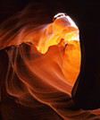


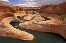


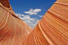








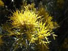


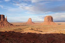
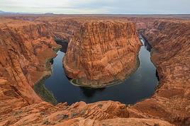

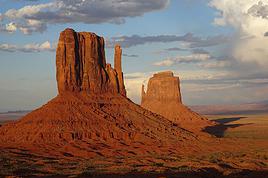
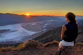

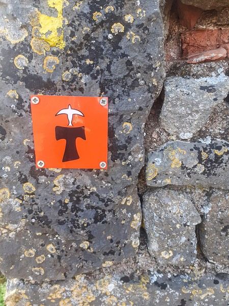
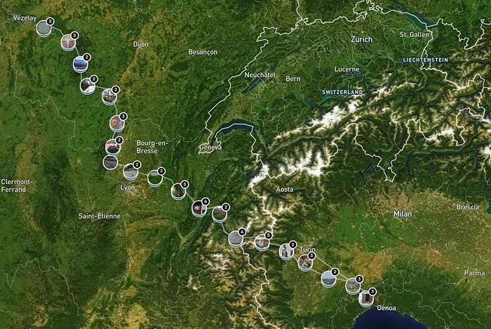

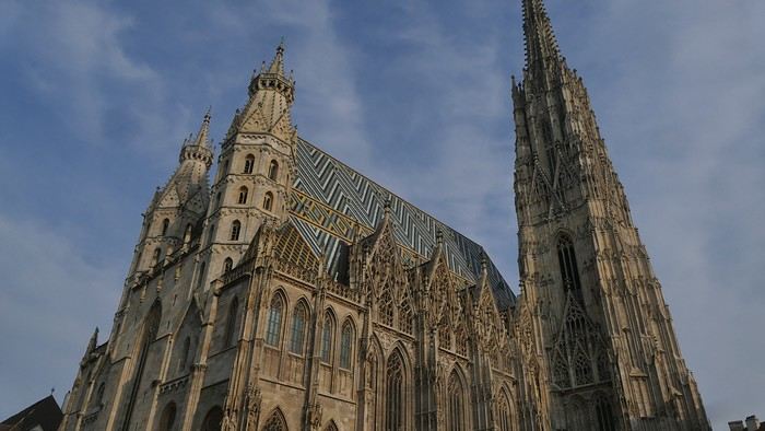
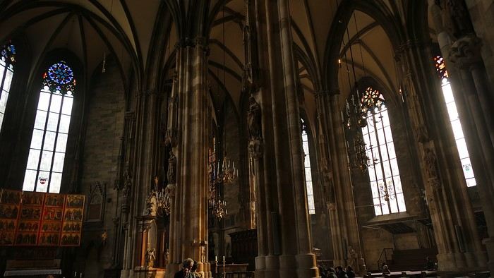
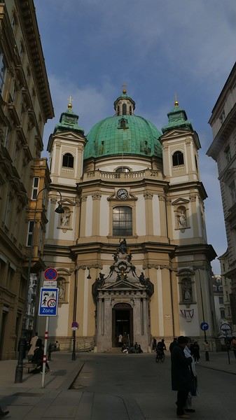
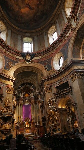
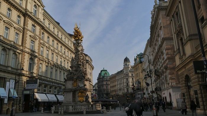














 Come along, I'm taking you to this country where it's so nice to wander and slow down...
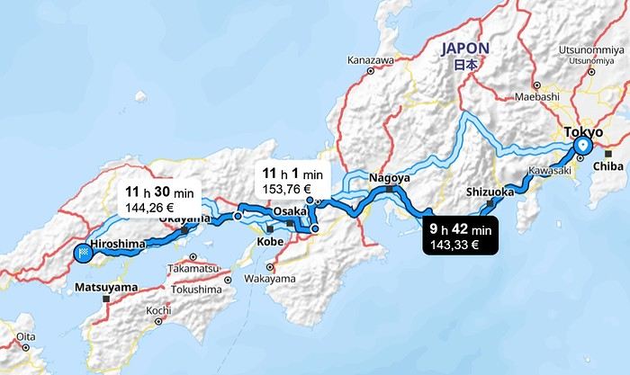
 I’m inviting you on a stroll through my drawings—a completely subjective, far-from-exhaustive, and totally personal take, since it’s based on my own sketches. I put this travel journal together after returning in late 2024, mostly using felt-tip pens and pencils, with a few collages thrown in. I worked from our personal photos.
 And in Kyoto, the Nishiki Market:




 A little sneak peek?
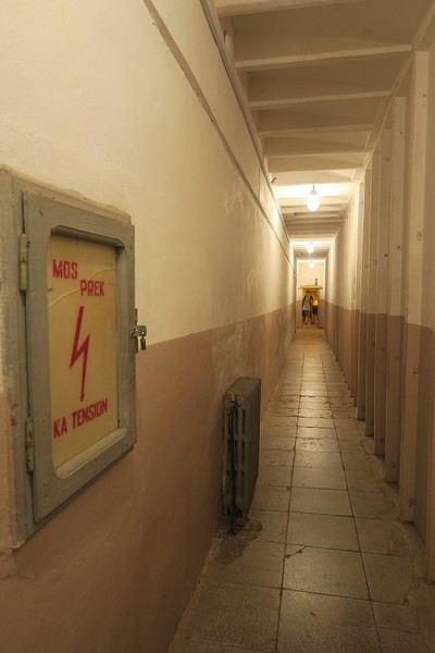
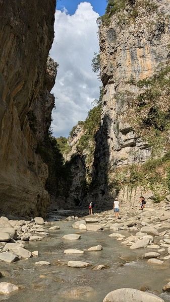
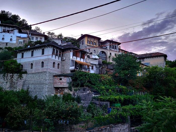
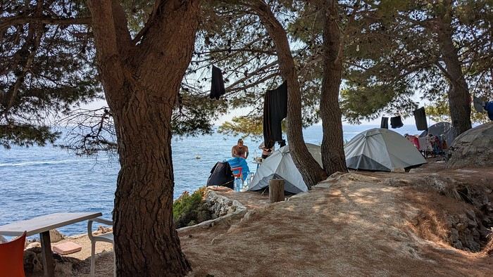
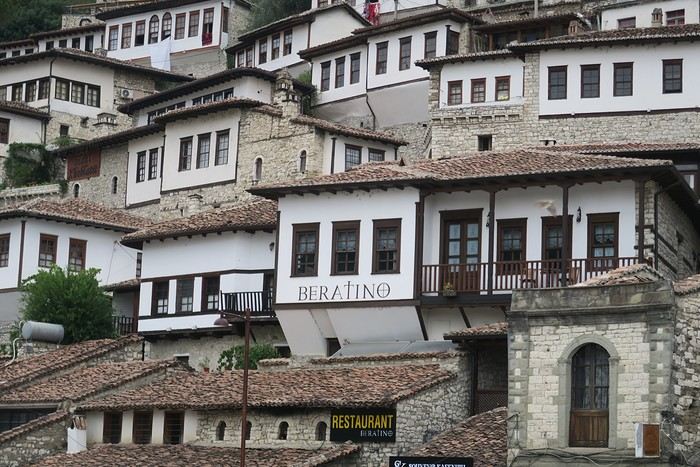
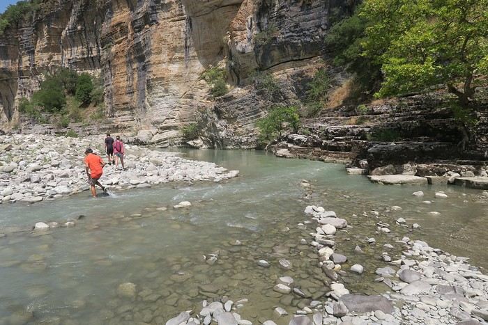
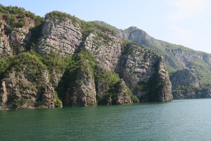
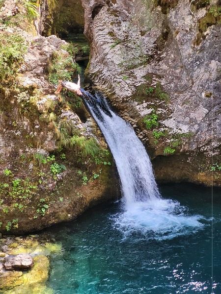
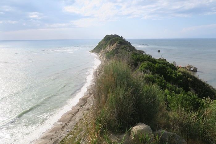
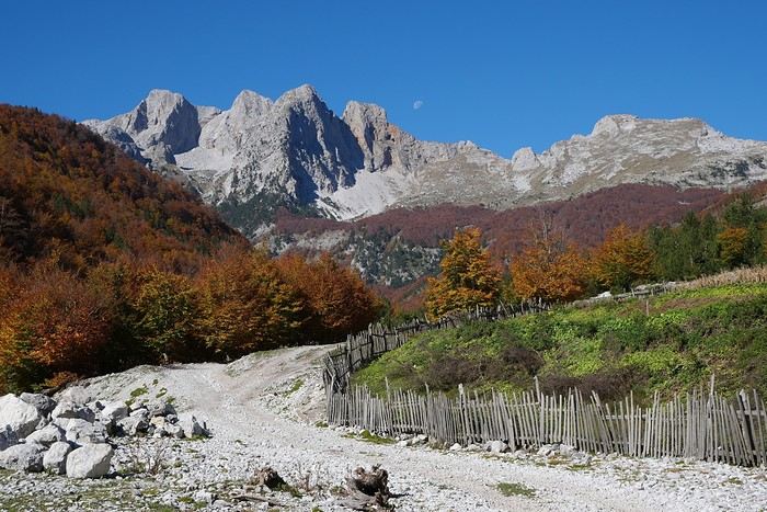





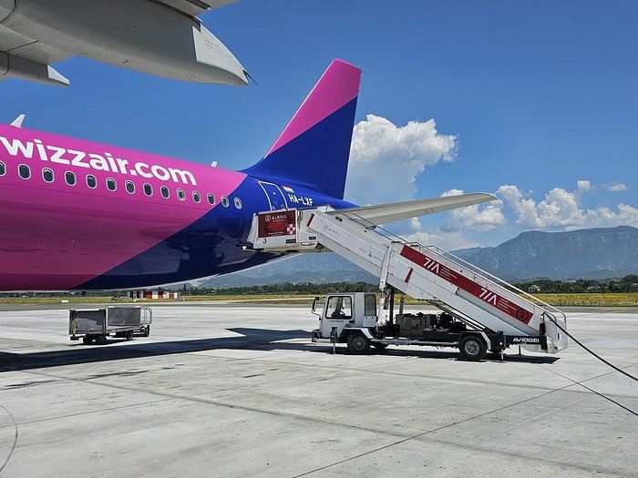 Since Albania isn’t part of Europe when it comes to phone service (at least not yet! :-)), we had to buy a physical SIM card—otherwise, the bill would’ve been sky-high if we’d used our French plan! We got one from Vodafone AL at the airport. You can buy online before leaving with a virtual SIM (e-SIM) for compatible phones, so you don’t have to swap cards. But given the uncertainty about choosing a plan online, we preferred buying one directly at Tirana Airport. Cost: 31 € for 100 GB. That’s way too much—100 GB is overkill. For 40 GB, it’s 27 €, and the plan lasts 21 days. The price difference isn’t huge, and it was cheaper than online. This plan covers all the countries along the Balkan range.
Money tip: All guesthouses and accommodations accept euros. The local currency in Albania is the LEK. In Montenegro, it’s the euro. Bank fees for withdrawing money from an ATM in Albania are pretty steep: 8 € for a withdrawal of 600–700 LEK (about 200 €)! So it’s better to withdraw cash (euros) in France. Oh, and we booked all our accommodations before leaving, but payment is always in cash. Budget around 400–500 € for 9 days of trekking.
Since Albania isn’t part of Europe when it comes to phone service (at least not yet! :-)), we had to buy a physical SIM card—otherwise, the bill would’ve been sky-high if we’d used our French plan! We got one from Vodafone AL at the airport. You can buy online before leaving with a virtual SIM (e-SIM) for compatible phones, so you don’t have to swap cards. But given the uncertainty about choosing a plan online, we preferred buying one directly at Tirana Airport. Cost: 31 € for 100 GB. That’s way too much—100 GB is overkill. For 40 GB, it’s 27 €, and the plan lasts 21 days. The price difference isn’t huge, and it was cheaper than online. This plan covers all the countries along the Balkan range.
Money tip: All guesthouses and accommodations accept euros. The local currency in Albania is the LEK. In Montenegro, it’s the euro. Bank fees for withdrawing money from an ATM in Albania are pretty steep: 8 € for a withdrawal of 600–700 LEK (about 200 €)! So it’s better to withdraw cash (euros) in France. Oh, and we booked all our accommodations before leaving, but payment is always in cash. Budget around 400–500 € for 9 days of trekking. I really liked Shköder, especially its pedestrian street lined with restaurants and lit up at night. It’s a great place to stroll and eat. The food isn’t expensive—two big salads and two beers: 14 € :-) . Fruit prices are also very reasonable: 3 € for a kilo of cherries, compared to 9–10 € in France.
Religions coexist peacefully in these countries—Catholics and Muslims. From our balcony, my friend heard the call to prayer for the first time, coming from one of the city’s mosques.
I really liked Shköder, especially its pedestrian street lined with restaurants and lit up at night. It’s a great place to stroll and eat. The food isn’t expensive—two big salads and two beers: 14 € :-) . Fruit prices are also very reasonable: 3 € for a kilo of cherries, compared to 9–10 € in France.
Religions coexist peacefully in these countries—Catholics and Muslims. From our balcony, my friend heard the call to prayer for the first time, coming from one of the city’s mosques.
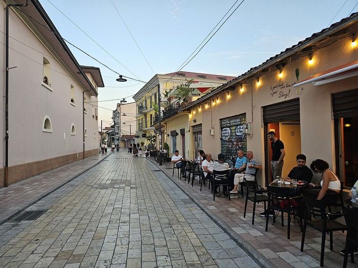
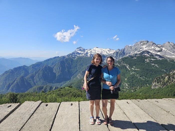
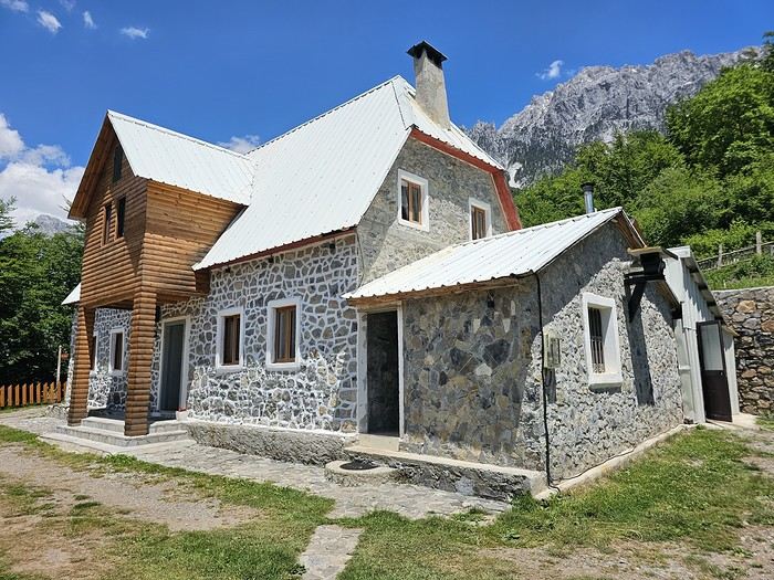 We slept in the heights of Theth at a new guesthouse, "Mountain Vista Shkafi," with an amazing view.
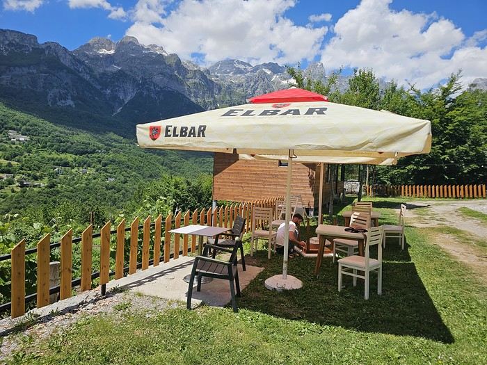
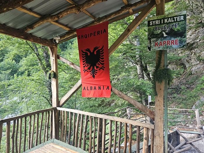
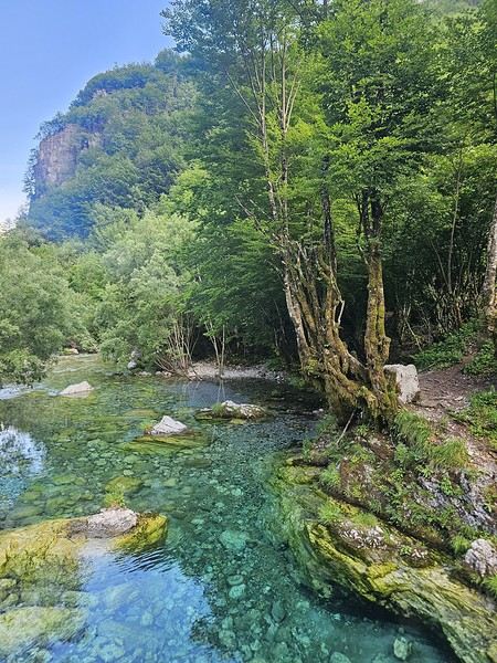
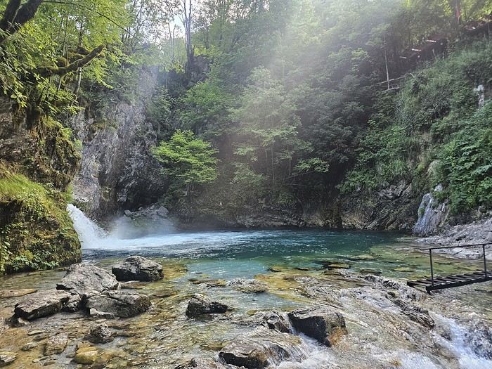


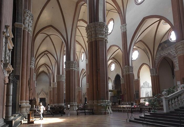
 But Bologna’s real charm lies in its porticoes, which were added to the UNESCO World Heritage list in 2021: 62 km of arcades running along buildings, letting you walk sheltered from the sun or rain. Back in 1288, the city required houses to include private arcades for public use. In the city center, you can stroll under 32 km of porticoes in all sorts of styles—some plain, some ornate—with a strong presence of red tones.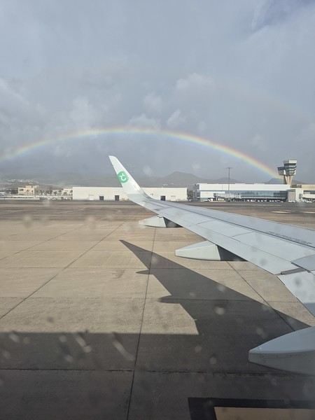
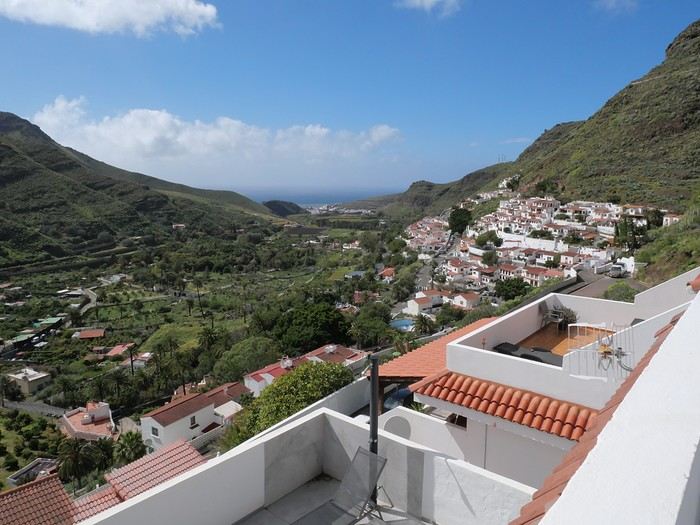


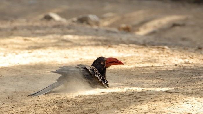

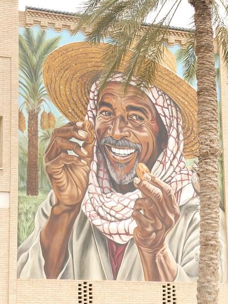

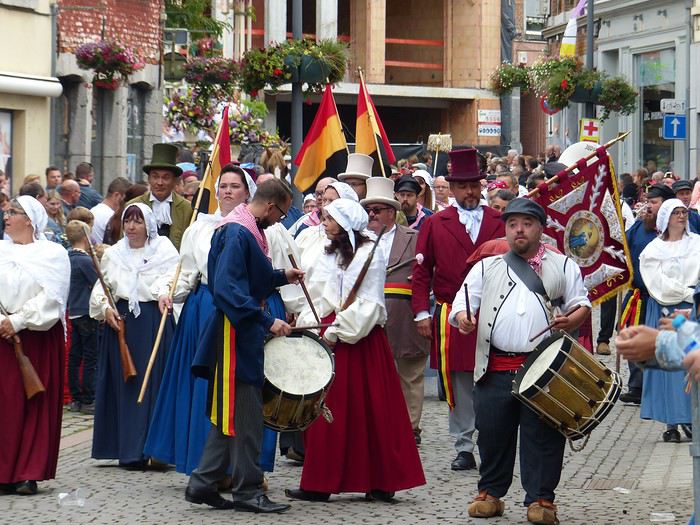
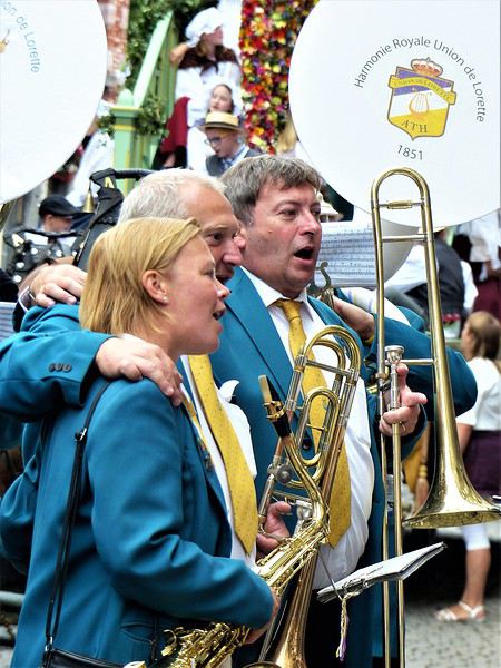
 Ooooooooh, giants!
Oh, how I love them! In the North, we have lots of these giants, like Reuze Papa and Reuze Maman in Cassel, or Gayant, Marie, and their children Binbin, Jacquot, and Fillon in Douai, and many more.
Ooooooooh, giants!
Oh, how I love them! In the North, we have lots of these giants, like Reuze Papa and Reuze Maman in Cassel, or Gayant, Marie, and their children Binbin, Jacquot, and Fillon in Douai, and many more. What’s more, the Ducasse of Ath is remarkable for its age and local roots; a procession was first mentioned in 1399, and today the many musical groups are still local (Ath and surrounding towns). The event is extremely popular: a good part of the population is there, all generations mixed together. Everyone knows the groups, floats, and giants, and each has their favorite! Originally, religious groups paraded, illustrating episodes from the Bible or the Golden Legend. Gradually, the parade became secular and kept evolving by adding new giants, historical figures, or allegories linked to local history (Ath, Belgian Hainaut, Belgium).
 To wrap up this long introduction, know that the Ducasse of Ath lasts several days, but the highlight is the highly codified procession that takes place on the 4th Sunday of August (actually, the procession passes twice, once in the morning and once in the afternoon).
 It’s followed by a human giant on stilts: "Saint Christopher of Flobecq," holding a flowered staff and carrying Christ on his shoulders (this time, not a real child!). It appeared in the 19th century, then disappeared from the procession before being reintroduced in 1976.