The "Must-Sees" of the American West
FR

Translated into English.

Original post
MA
This adventure began during Covid... Yep, Covid turned a lot of things upside down, but most of all, it kept us cooped up for a few months and stopped us from traveling for a while—even longer for a die-hard fan of the American West like me.

While borders were closed, I started imagining what an ideal itinerary might look like—one that would string together all the Southwest must-sees in just two weeks, during the best time of year: September and October. When the U.S. announced in September 2021 that borders would reopen in the coming weeks, I regained hope and began scouting flight tickets for a departure in September 2022.

But here’s the thing: tackling solo hikes, each one tougher than the last, right in the heart of the Wilderness, could be a risky—even reckless—endeavor for a father of three. After a quick chat with some virtual friends who are just as passionate about the Southwest as I am, with good physical condition and nearly the same list of must-visit spots, Franck and his brother Sullivan were in! 🙂

In November, we snagged flight tickets from Nice to San Francisco for the modest sum of 400 €, and a few days later, I booked a Toyota Tacoma pickup for 840 € !

It’s not cheap for just 15 days, and a pickup isn’t exactly ideal for luggage, but the prices for full-size 4x4s have become totally outrageous! Due to border closures, rental companies had to offload a lot of these big 4x4s, which tourists love. Then, supply and demand did the rest !

Franck and I spent the winter and spring trying to cram the equivalent of three weeks of hikes into two. But even with physical limits, we had to stay reasonable! Three to four months before departure, we entered the lotteries for different must-see spots: The Subway, Coyote Buttes North (home to the famous Wave), and Coyote Buttes South (CBS).

The Wave is the holy grail for any Southwest enthusiast. Since 2015, we’ve tried our luck with the online and on-site lotteries about ten times, but the spots are unfortunately limited: just 20 per day. A glimmer of hope, though—since early 2022, that number has increased to 64 people allowed per day, with 48 spots awarded via the online lottery.

After all three of us tried our luck for The Wave, on June 1st at exactly 5 PM, I got an email that started with, "Congratulations! You were successful in the Coyote Buttes North (The Wave) September 2022 Permit Lottery at Coyote Buttes North (The Wave)...". At 5:01 PM, I called Franck, whose dream it’s been for over 20 years—ever since the first photos were published in a travel magazine! He didn’t believe me when I told him, and I had to forward the email for him to finally accept the unbelievable: we were going to The Wave and all the incredible spots scattered across the protected area of Coyote Buttes North.

I’ve already been to Coyote Buttes South twice, but there are areas I couldn’t explore in the middle of summer because they were too remote. So, I had no trouble letting my buddies convince me to go back for a third time. Plus, given how hard it is to access, we had no trouble securing a permit online as long as we logged in at exactly 8 PM on the dot!

For The Subway, all three of us struck out. No big deal—we won at CBN and CBS!

Among the sites to visit, there are two that I’m particularly attached to because I know my chances of wanting to see them again are slim. The first is Angel Arch, one of the most legendary arches in the Southwest, due to its remoteness from any trace of civilization. To get there, the recommended hike is Upper Salt Creek, and you’re looking at a 50 km round-trip in an area with no water (in September) and populated by bears.

The second site is the Hopi Salt Trail, in Navajo land, which, after a very tough hike, lets you marvel at the turquoise-blue waters of the Little Colorado before it meets the Colorado River. The Hopi Salt Trail is, like The Wave, the holy grail for any Southwest enthusiast, and the windows of opportunity to see the water in that magical color are very short each year. For this, you have to monitor the Little Colorado’s gauges downstream from Cameron: if the level stays at its lowest for 10 consecutive days—meaning no rain—you can hope for turquoise water. The ideal period rarely exceeds 30 days a year, and it’s usually in June that all the stars align.

But unfortunately, one month before departure, while the flow rate at Cameron looked promising, several storms in September dashed our hopes of doing the Hopi Salt Trail, even at the end of the road trip.

We still had two consolation prizes, though:

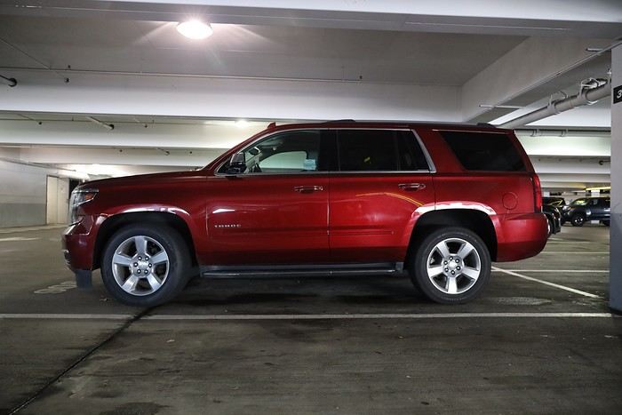
After a last-minute cancellation, while keeping an eye out for available spots for The Subway, it turned out that three spots opened up exactly on the day we’d planned to go—so we rushed to grab them!! Regarding the 4x4 rental, the prices for full-size models dropped by several hundred dollars, and we ended up finding a Chevrolet Tahoe for less than $1000. A steal and a serious boost in comfort, so we could store all our gear and food without worry!

Here’s the initial plan in a perfect world: D1 The White Domes - Camping D2 Sunrise at The White Domes - The Subway D3 Coyote Buttes North D4 Coyote Buttes South - White Pocket D5 Wahweap Hoodoos - Sidestep Canyon - Colourful Canyon - White Rocks - Sunset at Yellow Rock D6 Broken Bow Arch - Reflection Canyon D7 Coyote Gulch D8 The Volcano (or The Oasis - Zebra Slot Canyon if the weather’s good) - North Caineville Mesa D9 The Needles: Squaw Canyon - Lost Canyon combo - Druid Arch - Chesler Park D10 Upper Salt Creek Day 1 - Camping D11 Upper Salt Creek Day 2 D12 Hopi-Navajo Territory: Ha Ho No Geh Canyon, Coal Mine Canyon, Bends of the Little Colorado D13 Grand Canyon: South Kaibab Trail and Bright Angel Trail D14 Upper East Zion: East Temple Loop, Jughandle Arch, Center of the Universe, and Checkerboard Mesa Summit And several backup options in case of bad weather, including Spencer Trail, West Cove, and Buffington Pockets.

Enough talking—time for action!
MA Marati Globetrotter ·
Day 0 - 09/23 While my buddies are taking a flight from Paris to San Francisco, I leave Nice super early at 6:30 AM, and we’ve planned to meet up in San Francisco with an hour’s difference. Barely has the plane landed on the tarmac at noon, and with my data turned on, I get a text from Franck telling me the flight from Paris is running a good hour late. So here I am, two hours ahead of Franck and Sullivan at the Thrifty rental agency. There’s a huge crowd waiting, and it’s only after an hour and a half in line that I finally reach the counter. No issues with the vehicle or the insurance policies the agents usually try to push on exhausted travelers after long flights. However, since Franck isn’t physically present, the agent refuses to add him as a second driver without seeing his license in hand. That’s pretty annoying, considering the number of miles we’ll have to cover during this road trip! It’s finally at 3 PM that I’m face-to-face with our Tahoe, which will become our faithful companion for the next two weeks! It still took me 3 hours just to clear customs and pick up an SUV!!


A few minutes later, I stop at the drop-off zone to pick up Franck and Sullivan, who’ve just cleared customs! Instead of spending several nights in San Francisco like most tourists, we decided to spend our first night in St. George, Utah—about 9.5 hours from the airport! Theoretically, leaving the airport at 2 PM made it seem totally doable. But we hadn’t accounted for the hour lost in the Thrifty line, the heavy traffic in and around San Francisco that cost us an extra 2 hours, and a detour to an REI store north of Oakland, where I picked up a Bear Canister I’d ordered online before the trip. What’s a Bear Canister? It’s a simple plastic box with a special lid that makes it completely bear-proof. Without this special container, you can’t get a permit for backpacking in Canyonlands—Needles section! And no permit means no Angel Arch! Once we got past the traffic, picked up the Bear Canister, and did our shopping at a mega Walmart, we still had to cover the 620 miles to St. George. So we took turns driving to try and arrive as fresh as possible! On the road, we got a glimpse of Las Vegas by night, which we’ll see again at the end of the trip.


After losing another hour virtually due to the time change, we finally reach our hotel at 6 AM instead of the originally planned 3 AM... When the front desk guy sees us walk in, he asks if we’re *actually* going to spend the night here!! We naturally answer YES! Once in the room, we wish each other a good nap, since obviously, there’s no way we’re changing our meticulously planned itinerary that we’ve been preparing for months—we’ve got breakfast scheduled for 8 AM! And that’s the story of our first travel day, which lasted 30 hours...!
FA Fabienne65 ·
Wow!!! Now *that’s* a comeback!!! Alright, I’m settling in to follow your adventures!! Thanks for this new travel journal!
MI Milenka67 Regular ·
Oh awesome, I’m literally planning the West Coast trip too! I’m settling in and already have my first question—what site did you use to book the Tahoe, and do you recommend it (for 4 people)?
RJ Rjulie95 Globetrotter ·
Hi Guillaume

I’m also hitting the road in the 4x4 🙂
SC Scot2021 Regular ·
Hi Guillaume,

We’re going to write and follow our concert journals! That’s cool—new journals for traveling, reminiscing, or even planning for some. ;)

Sylvain
MA Marati Globetrotter ·
Welcome aboard, Fabienne, Milena, Régis, and Sylvain!

@ Milena

which site did you book the Tahoe through? And do you recommend it (for 4 people)?

I usually go through Autoeurope with the zero-excess option. I got a rate of 980 € a month before departure, when prices were much higher before. For 4 people, the Tahoe is perfect. The V6 drinks a fair bit, but the comfort and space are great, especially if you're traveling in camping mode. Its only major downside is the front bumper scraping in some spots, particularly on steep fords, but it handled sandy tracks just fine. That said, I wouldn’t risk it on rough trails with rocky sections that require off-road tires and a shorter wheelbase.
MY MycoVtt Veteran ·
Hey! Cool, there’s gonna be some reading to do... ;)

I don’t quite get the J6 to J7 flow—since the best thing at RC is sunrise... For Angel Arch, having done both Upper and Lower now, I’d way more recommend Lower Salt Creek starting from Cave Springs, even if there’s a bit less "stuff to see" (ruins, petroglyphs, and arches). In the end, apart from two or three closer arches, all the ones you see from Upper are far away, and unless you’re really into petroglyphs, I think Lower is prettier once you’ve passed Peekaboo. That said, the first sandy section is a pain, true. But the climb back up from Upper is a drag too ;)

I consider myself a "Southwest enthusiast" after nearly a year spent there in total, but the Little Colorado isn’t a must-see for me at all—I’m not tempted in the slightest! 😏😛

Glad for you about CBN! !
MA Marati Globetrotter ·
Hey Yves! For Reflection Canyon, Franck and I hesitated for a long time. Catching the sunrise there meant sacrificing the next day, since we couldn’t follow up with Coyote Gulch right after. Plus, with the water level so low based on recent reports, we figured our photos wouldn’t compare to the ones just before Covid, like the ones you got.

For Angel Arch, the feedback I read about Lower Salt Creek said there wasn’t much to see along the way. So, why not try the northern route instead...

I’m surprised the Hopi Salt Trail doesn’t tempt you! The rarity of the turquoise water makes this spot even more desirable. It was Oliv2019’s trip report and story that really inspired me... and I’m hoping to make that dream a reality someday while I’m still in good enough shape!
MY MycoVtt Veteran ·
Yeah, I remember Olivier’s story well. But nah... even Havasupai was meh. Besides, I’ve never had any falls or anything in the West, except for The Subway (but that was on my 15th trip).

Seriously, water... (so you can imagine how much I enjoyed Brimhall Bridge ;) ) And I’ve also postponed Neon Canyon countless times... yeah, because there’s water... And to think I even have my scuba diving certification! !
MA Marati Globetrotter ·
Staying motionless for more than 15 minutes in freezing water at Golden Cathedral, just to get a perfectly still surface—wow, your passion for photography is *way* stronger than your fear of cold water! 😎 !! And I can’t even imagine crossing that infamous icy pool practically naked to reach Brimhall Bridge
MY MycoVtt Veteran ·
Yeah, but those are arches 😂😂
AT Attila Globetrotter ·
Oh no! I’m not rereading a travel journal that already made me want to go back to the U.S.! 😉
MA Marati Globetrotter ·
Oh really? I'm in the middle of writing it... You must be mixing it up, or are you talking about the daily Facebook posts?
DI Disneydiddl Veteran ·
Hi Guillaume, What a pleasure to discover a new travel journal and to (re)visit these magnificent places by proxy (many are inaccessible to me). Maybe I’ll get around to writing another journal about our return to the West in 2023. Thanks for sharing!
AT Attila Globetrotter ·
Or are you talking about the daily Facebook posts?

Yeah.[;]
MA Marati Globetrotter ·
Hi Françoise, It really makes me happy to hear from you and to share these amazing places I’ve dreamed of visiting—most of them, anyway—or rediscovering in more detail for others...
MA Marati Globetrotter ·
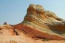
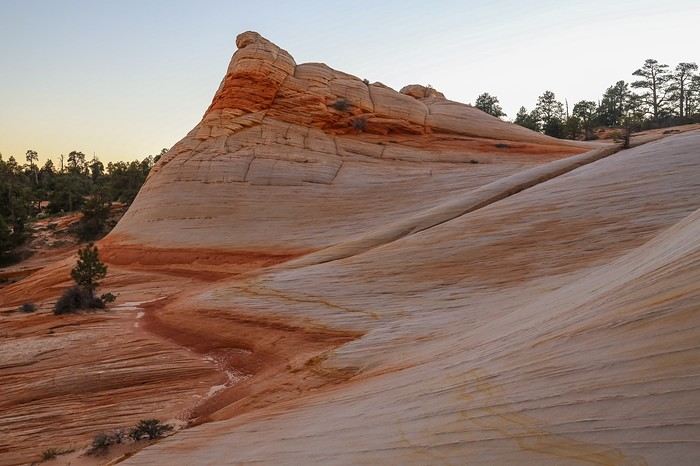
09/24/2022: Day 1 - White Domes Our alarms go off at 7:30 AM, after a 1.5-hour nap. Tough, you might say! Not really, because with the time difference, it's already 3:30 PM in France and in our biological clocks. After a basic, typical US motel breakfast—pastries, waffles, and neon-colored cereals—we leave St. George, a Mormon stronghold, to head to Hildale where the trailhead for our first big hike of the trip is located. The White Domes are a dream for Franck and me. Featured in the 3rd edition of *Photographing the Southwest Utah* (published around 2015 or 2016), these white sandstone buttes, with an orange base, are especially photogenic. They attract Southwest enthusiasts because they’re off the beaten path, require some effort, and you have to camp overnight to capture the best light, either at sunrise or sunset. For me, this hike has a little taste of revenge after my failed attempt in February 2019 due to too much snow at the top. There are two ways to access them: Water Canyon, shorter but steeper, and Squirrel Canyon, which adds 2 km to the hike but offers a gentler, more linear climb. Loaded up like pack mules with 6L of water, tents, sleeping bags, and food for a day and a half, we wisely choose the steeper ascent—Water Canyon! The hike is easy for the first 2 kilometers. We even run into some local families enjoying the water and coolness at the bottom of the gorges, taking a refreshing dip.

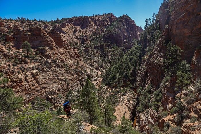
For us, though, the real challenge is just beginning. After backtracking a few dozen meters, we continue to the left of the canyon to start climbing. The ascent is really steep, the packs are heavy, and our calves are burning. Halfway up, we spot a horse a few meters below us, in a state of decomposition. The poor thing must have slipped during the climb, gotten hurt, and slowly perished. After what feels like an endless climb, the views are breathtaking. In the background:


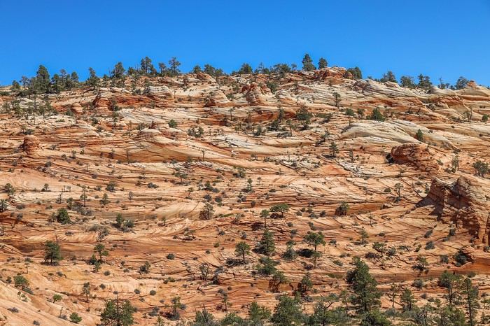
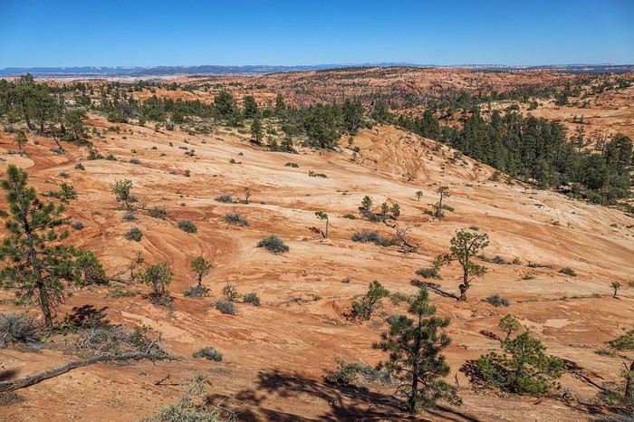
Ahead, a view of the Top Rock plateau in hues we already love!


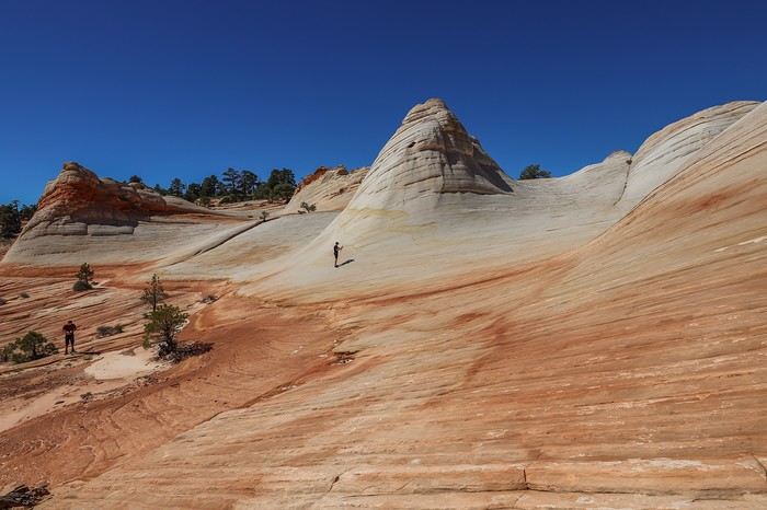
I had noted to explore this area, called Orange Rock if I remember correctly, but the terrain is pretty intimidating, so we decide to prioritize other spots for this day’s hike. Around 1 PM, after 3 hours of walking, we reach the White Domes, and the photo frenzy begins!


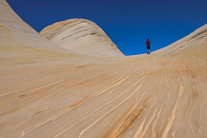
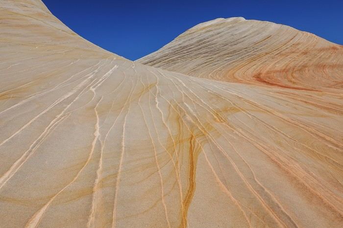
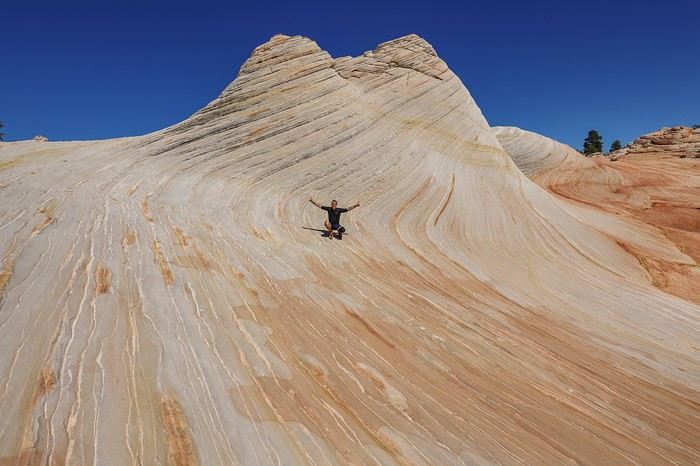
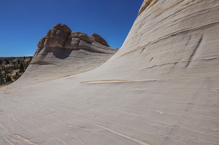
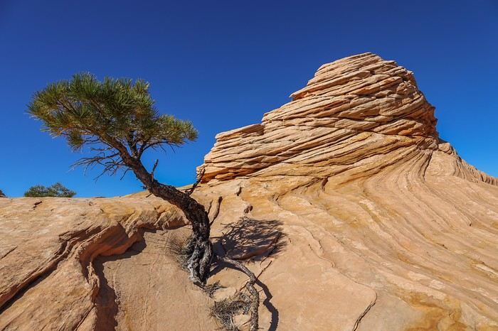
The sun is at its peak, and the rocks appear almost pure white. The base of the domes sometimes shows off orange or even reddish hues—absolutely stunning! It’s magnificent! The smooth areas alternate with more undulating rock formations.
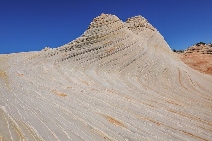


We hunt for the best angles to take photos and have a blast like kids.


Enough playing around—it’s time to explore the northern area. Since we’ll be coming back to camp tonight, we only take part of our gear and stash the rest in some bushes. We haven’t seen anyone, but you never know—maybe others will wander here during the day... Here’s the plateau we’re about to cross:

The terrain is trickier than it looks—it keeps pulling us east instead of heading straight north. At one point, we even wonder if the GPS is acting up...
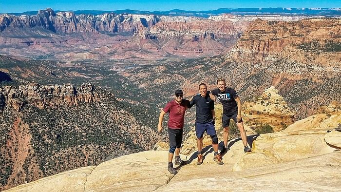

At the end of the plateau, we’re rewarded with a first-class gift: a stunning view of Zion National Park!!

RO Rouquine38 Globetrotter ·
Hello Guillaume, I’m also heading into the Tahoe—glad you switched vehicles, it’s way more comfortable than the pickup truck’s ride 😉 Like Agnès, I’d already followed your adventures on FB, and I’m thrilled to relive your exploits 🙂
MA Marati Globetrotter ·
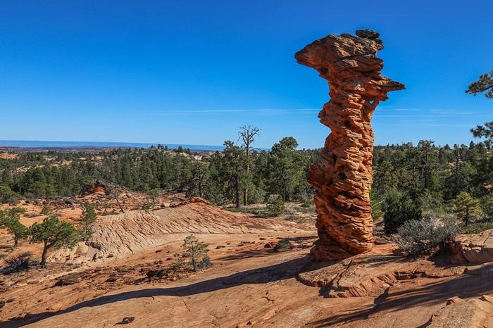
Okay, enough chit-chat—the sun won’t wait for us to catch the sunset, so we continue our loop toward The Notch. Along the way, we spot some special rocks and shrubs.


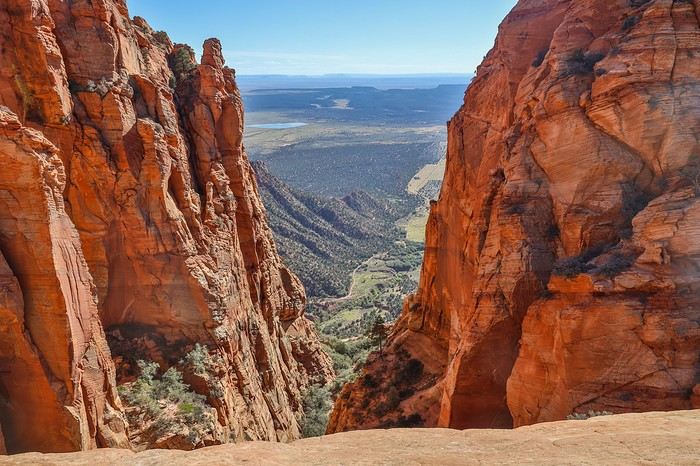
After passing through an amphitheater and a few unique hoodoos, we reach The Notch, a narrow passage between two rock walls offering a distant view of the plains. Well, I have to admit I was expecting something a little more impressive...


It’s 5 PM, and we need to get to the Domes without dawdling too much since we want to set up our tents before sunset. Along the way, we pass a spot called Black Rocks—no mystery why it’s named that!

Back at the Domes, we grab our gear and hurry to pitch our tent in one of the few sandy spots. Then, we take advantage of the softer light to admire the White Domes with new hues and deeper contrasts!
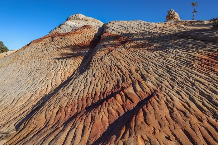
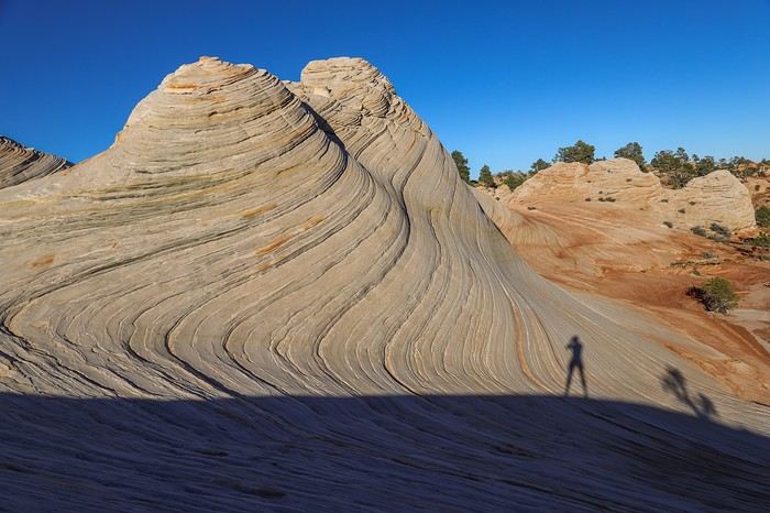
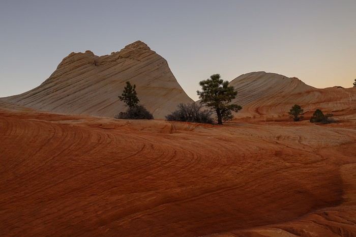
We quickly realize the shadows aren’t exactly where we’d want them for the sunset, which makes us even more hopeful for the sunrise!


As the sun races toward the horizon, the three of us soak in these precious moments. After sunset, we can’t bring ourselves to leave. No big deal—we’ll just make dinner by headlamp if we have to!

Without the sun, the Domes aren’t quite so "white" anymore. And with the sunrise still to come, there’s a real reason to camp here and enjoy all the different colors and moods the site offers!
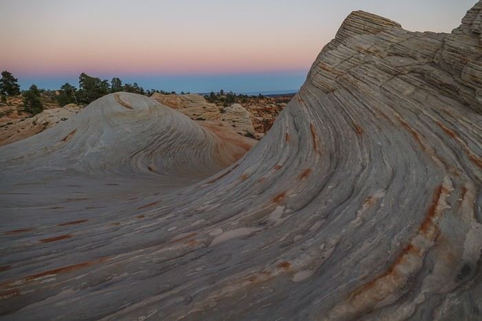
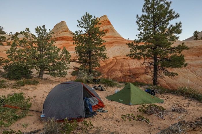
After a delicious Chinese soup—which doesn’t quite make up for the day’s calorie burn—we fall asleep easily at the foot of the massif, in a dreamlike setting!



Final tally: 18 km of hiking, absolute tranquility, and a stunning site that lives up to its reputation. So glad we decided to camp here to experience the changing colors and enjoy the softer light of the late afternoon!

Similar discussions

You might also like