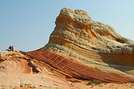

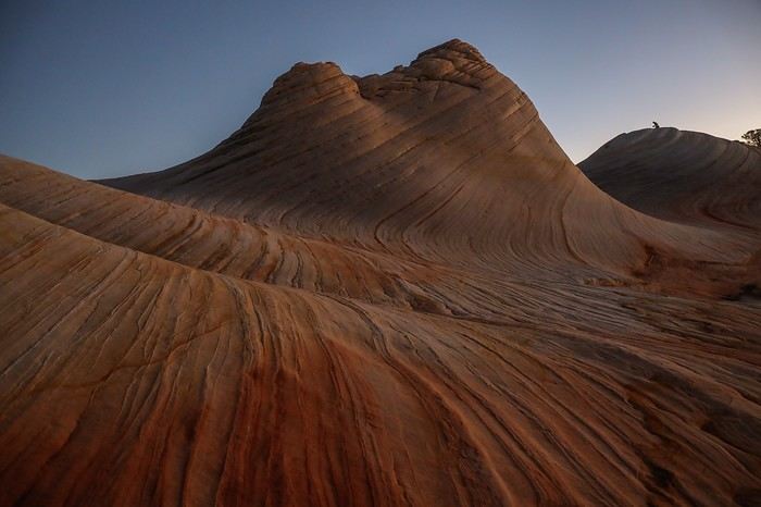
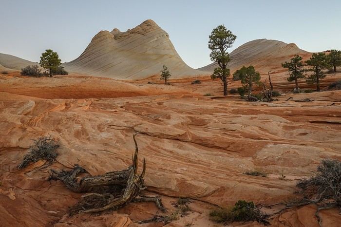
 The sun finally peeks out at 7:30 a.m.
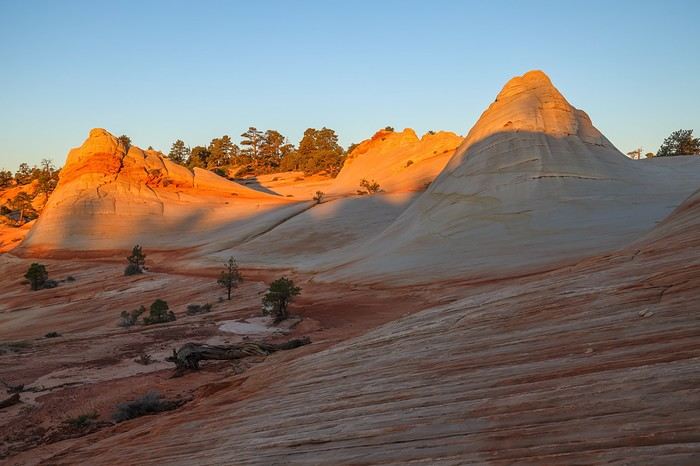 Sullivan takes the chance to fly his drone from the top of a hill, while Franck and I explore the site in every direction.
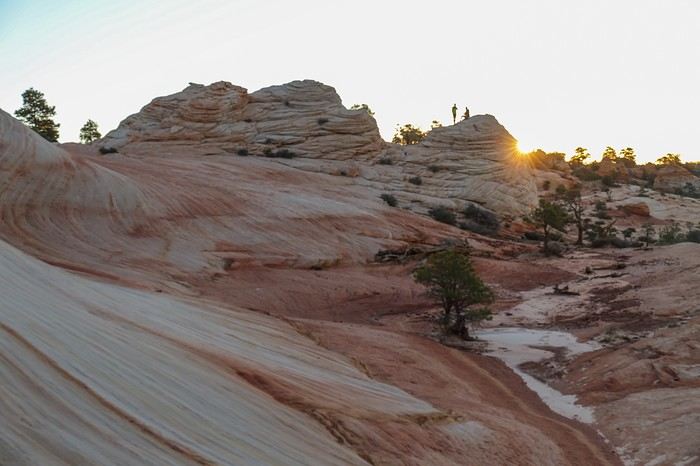
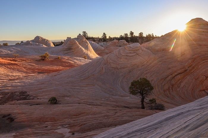 Our intuition from the day before was right... The contrasts, colors, and the overall vibe leave us speechless this morning! What an amazing feeling 😇😇!!
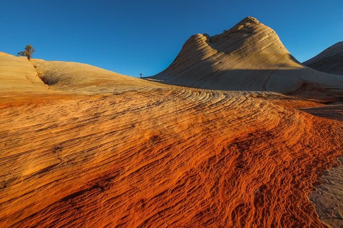 We move through different angles and corners of the site, soaking up every wave of rock.
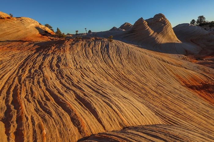
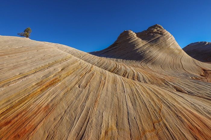 Contrary to what you might think, the site is pretty spread out and isn’t just limited to the most famous Dome.
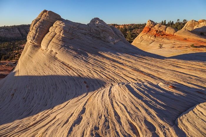
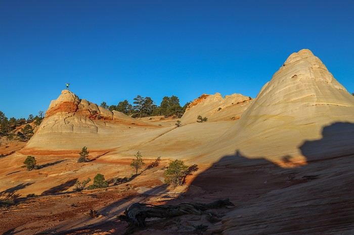 Spotting Franck at the top of the highest hill, I decide to head up there too !
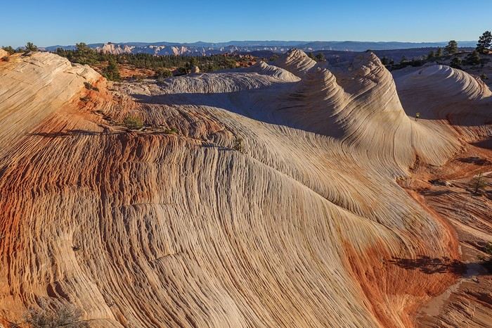
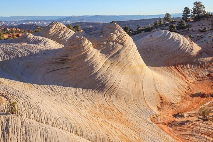 As the minutes pass, the stone hues lighten, and they’ll soon match the colors from yesterday’s midday!
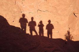
The most beautiful part is definitely the central section with its different ripples, and even a bush playing hide-and-seek depending on the angle.
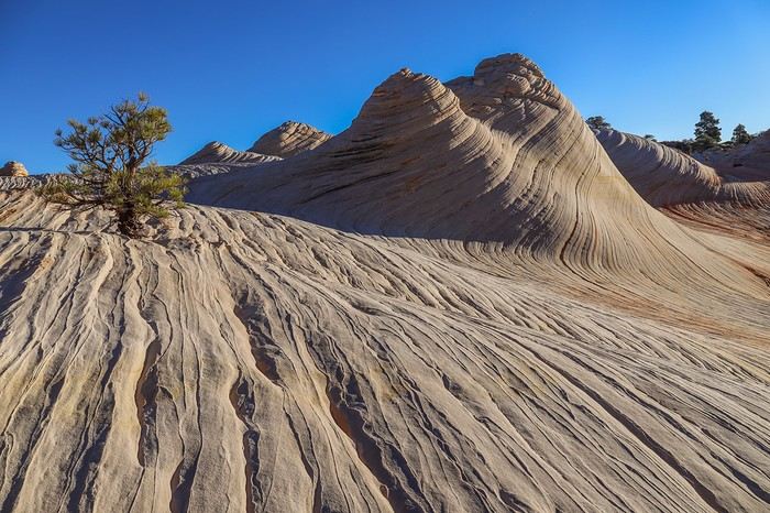 After a solid hour, we gather our things to head back down to civilization—other adventures await us today!
One last glance at this exceptional, unjustly overlooked site. We really made the most of this first visit—certainly not the last...
For the return trip, which is 100% downhill, we don’t dawdle! We even take a more direct route than yesterday and quickly reach the entrance to Water Canyon, which we race down in just a few dozen minutes. A quick refreshing drink stop at the bottom of Water Canyon,
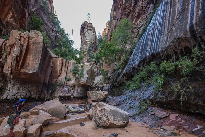 and we’re already back at the car. 8 km of downhill with a few steep sections in just 1h45—we’re not bad at all 😛...
From Hildale, we head back to civilization and make our way to Zion’s Visitor Center to pick up our permits for Left Fork of North Creek, which we lucked into securing a few days before our departure after a last-minute cancellation!
After a good half-hour wait, we get the usual lecture about risking our lives in hostile terrain, needing warm clothes, and how we could die if we get lost... The goal of all these warnings is to discourage tourists from going in flip-flops, which is far from our case.
After an hour wasted on talk, we head out on Kolob Terrace Road and reach The Subway’s parking lot. Darn, it’s packed, and we even have to park on the side of the road... But a full parking lot won’t cool us down or stop us from discovering our second must-see of the trip 😎!!
This 8 km hike along the river—or even *in* the Left Fork of North Creek—is known for being uninteresting for the first... 7 km. Oh, come on! Walking just for the sake of walking isn’t really our thing, so the final spot better be worth it !
Just a few hundred meters in, we reach the start of a steep canyon we have to descend into. We’re already thinking about the climb back up that’ll make our calves burn...
And there we are on a super well-marked trail (impossible to get lost) that we follow on a slight incline without difficulty—except for the length. The trail alternates between sections right by the river, river crossings, and a few rocky stretches farther from the water that slow us down.
I can confirm the first 6 km are boring unless you’re a fan of river water. The only distraction is all the groups of hikers we pass heading back. They must’ve had nothing else to do today. Our schedule was packed—we had Sunrise at White Domes this morning!
And it’s only after 1h15 that we see our first mini waterfall. Twenty minutes later, we come across another one worth the detour.
Then, as the minutes pass, we slow down because the scenery is stunning!
Even this late in the season, the river with its succession of mini waterfalls is super photogenic and worth the hike on its own. Given how fragile the site is, it makes sense why access to The Subway is limited in terms of visitors!
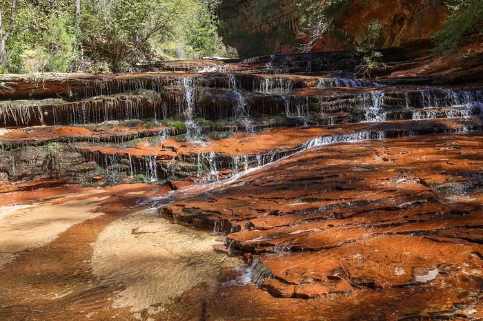
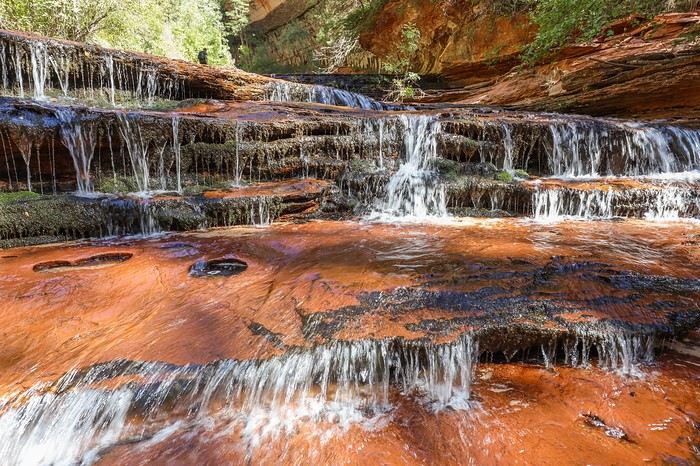 Then we reach the series of bends that mark the entrance to The Subway. We pass a group, hoping they’re the last.
Then we arrive at the entrance to The Subway—unmistakable!
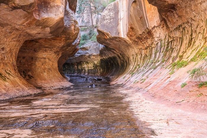 We discover a multitude of icy pools, and we have to move very carefully because the ground is *super* slippery!
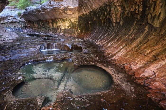 At the very end, we spot hikers descending the canyon doing canyoning. Lucky them!!
We settle for turning around, and then—visual shock! There it is, the famous view of The Subway that we’ve all seen on Windows wallpapers!
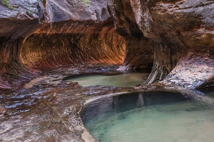 It’s gorgeous, but I have to admit the luminous halo of The Subway is prettier in photos than in person. A bit like Antelope Canyon!
But we’re not going to complain—we shoot this exceptional spot as it deserves! Franck even risks a skinny-dip in an icy pool that’s barely 10°C! I’ll avoid censorship and won’t post the photos...
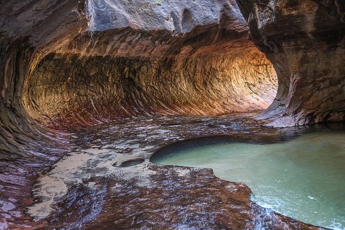 It’s time to head back because, without realizing it, we’ve already covered 16 km, and we still have 8 km to go to reach the car.
For the return trip, we decide to skip the trail with its slightly steep sections and go straight through the river. In math, we’ve always been taught that the shortest distance between two points is a straight line, so we stuff everything from our pockets into our backpacks, and when the sides get too tricky, we make quick progress in the river. The water’s cold, reaching up to our waists at most, but it’s refreshing, especially since we’re still moving at an average of 5 km/h. We pass quite a few people we’d seen on the way in, and on the super steep climb, it’s even worse—we leave them in the dust. Thanks to Sullivan’s military pace at the front, it only takes us 1h30 to cover those 8 km, including the river sections and the steep climb out of the canyon.







In the summer of 2026, we packed our backpacks again to wander around Jotunheimen National Park in Norway.
We’d never heard of this park just a few months earlier—we discovered it by following threads online.
It’s billed as the most mountainous park in the country, which really appealed to us after scrapping our original plan further north.
Unfortunately, it’s also the most crowded, which immediately made it less appealing! The presence of the highest peak in the Scandinavian Alps and the "famous" Bessengen ridge (famous because it’s apparently well-known across the country) probably has a lot to do with that.
Since we’d managed to avoid the crowds on the Kungsleden trails by camping away from the huts and timing our hike to miss the biggest groups of walkers, we figured we had the formula down and gave in to the call of the Norwegian mountains.
It’s the most mountainous park, sure, but also quite challenging in terms of progress, as we’d soon discover during the trek. And with uncooperative weather, we got the winning combo of a demanding hike. But I’m getting ahead of myself...
For the end of the trip, we planned a few days in Dovrefjell National Park—these two parks are easily connected by public transport—to see something different and, most importantly, to try and spot the musk oxen that live there.
My 04/08 - Arrival in Oslo Wed 05/08 - Bygdin – Torfinsbu Thu 06/08 - Torfinsbu - Gjendebu Fri 07/08 - Gjendebu - Fondsbu Sat 08/08 - Day hike to Slotafjellet Sun 09/08 - Day hike to Lake Kvitevatnet Mon 10/08 - Fondsbu - Gjendebu Tue 11/08 - Gjendebu - Before the Bessengen ridge Wed 12/08 - Bessengen ridge – Maurvangen campsite Thu 13/08 - Knutshoe ridge Fri 14/08 - Bus transfer to Spiterstulen hut via Lom Sat 15/08 - Day hike to Galdhøpiggen Sun 16/08 to Wed 19/08: Dovrefjell End of the trip and wrap-up
We’d never heard of this park just a few months earlier—we discovered it by following threads online.
It’s billed as the most mountainous park in the country, which really appealed to us after scrapping our original plan further north.
Unfortunately, it’s also the most crowded, which immediately made it less appealing! The presence of the highest peak in the Scandinavian Alps and the "famous" Bessengen ridge (famous because it’s apparently well-known across the country) probably has a lot to do with that.
Since we’d managed to avoid the crowds on the Kungsleden trails by camping away from the huts and timing our hike to miss the biggest groups of walkers, we figured we had the formula down and gave in to the call of the Norwegian mountains.
It’s the most mountainous park, sure, but also quite challenging in terms of progress, as we’d soon discover during the trek. And with uncooperative weather, we got the winning combo of a demanding hike. But I’m getting ahead of myself...
For the end of the trip, we planned a few days in Dovrefjell National Park—these two parks are easily connected by public transport—to see something different and, most importantly, to try and spot the musk oxen that live there.
My 04/08 - Arrival in Oslo Wed 05/08 - Bygdin – Torfinsbu Thu 06/08 - Torfinsbu - Gjendebu Fri 07/08 - Gjendebu - Fondsbu Sat 08/08 - Day hike to Slotafjellet Sun 09/08 - Day hike to Lake Kvitevatnet Mon 10/08 - Fondsbu - Gjendebu Tue 11/08 - Gjendebu - Before the Bessengen ridge Wed 12/08 - Bessengen ridge – Maurvangen campsite Thu 13/08 - Knutshoe ridge Fri 14/08 - Bus transfer to Spiterstulen hut via Lom Sat 15/08 - Day hike to Galdhøpiggen Sun 16/08 to Wed 19/08: Dovrefjell End of the trip and wrap-up








































 Roundabouts are particularly interesting because they feature emblems of Turkmen culture, like the dog, a carpet, the Ahal Teke horse, or Muslim symbols, even though the presence of Islamic artifacts is quite limited.





 Why this country?
After visiting Hungary, Slovenia, Romania, and Poland in recent years, I’ve fallen in love with Eastern European countries. I adore the Slavic soul, its Austro-Hungarian villages, the gentle landscapes, the Carpathian Mountains, and that slightly mysterious atmosphere.
Slovakia evokes a certain imagination with its deep forests, medieval castles, and cobbled villages.
After seeing photos of the High Tatras—especially Lake Štrbské Pleso and Spiš Castle—I thought, "Let’s do it! We’re going!"
So, will Slovakia live up to what I imagine?
We’ll find out together.
We decided to travel as a group of six (five adults and a six-year-old child), by car (we needed two).
Here’s the day-by-day itinerary for this family trip, which started with a 3-day stay in Vienna (see the dedicated travel journal):















 When it comes to the Caribbean island of Saint-Martin, it's customary to praise its coastline and dreamy beaches—and they certainly deserve it.
But in this story, I’d like to highlight other memories, aspects, and impressions for a slightly different change of scenery.
Enjoy the read—some text and, above all, lots of photos.
« Byenveni sou zile Sen Maten! » (Welcome to the island of Saint-Martin)















































 Come along, I'm taking you to this country where it's so nice to wander and slow down...











