
Wednesday, September 30 – Kyoto (1)
A train ride to Kyoto, along the narrow plain between Lake Biwa to the west and a mountain range to the east. This country is really made of mountains! Several small towns and villages, fields, often charming houses—modern or in a traditional wooden style. The mountains close in south of Lake Biwa, and the train passes through a short tunnel before emerging into the Kyoto valley, southwest of the lake.
I almost forgot: the trip is about 70 km, and the ticket only costs 2,720 yen, or 15 € for two people.
From the station, we walk the 2 km to the hotel. Our luggage is pretty light, and I like to scope out the area right away when I arrive somewhere. We pass by the Nishi Hongan-ji Temple, an imposing Buddhist temple, on Horikawa Street. It’s worth visiting if we get the chance.
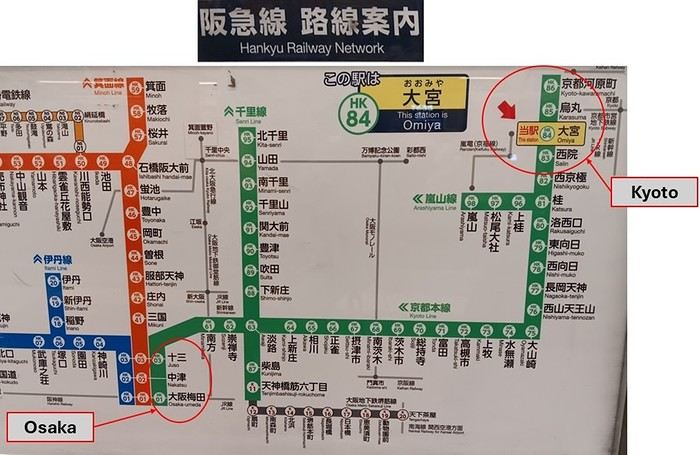
Along the way, we notice that many people get around by bicycle, switching between the roadside and the pedestrian path on a whim. We drop off our bags at the hotel, located on Gojo-Ōmiya Avenue. Across the intersection, a ramen restaurant looks perfect for lunch. In the evening, we walk to Ōmiya-Goji Station, 1 km away on Shijo-Ōmiya Avenue.
The names of these east-west avenues: ‘go’ = 5, ‘shi’ = 4. And sure enough, there’s a Sanjo-dori and a Nijo-dori further north—‘san’ = 3, ‘ni’ = 2. Central Kyoto, west of the Kamo River, is laid out in an American-style grid. But of course, it has nothing to do with Americans!
From Ōmiya-Goji Station, we head east toward the Kamo River but only walk about a hundred meters before being drawn into a Chinese restaurant. We’re not disappointed—the dishes are excellent!
That’s it for now—very brief and probably not very informative. Just jotting this down so I don’t lose track of our trip!



Hello,
Following our trip on the Great Divide Mountain Bike Route this summer, we’re sharing our experience in this travel journal.
We’re Richard and Bernadette, both 64 years old, and we’re gravel bike-packing cyclists.
We’ve completed several gravel bike trips in France and neighboring countries, and Richard has also done some in South America.
We left on July 22, 2026, from Geneva to Calgary via Frankfurt with our bikes carefully packed in boxes, and we returned on October 8 from El Paso to Geneva via Chicago and Frankfurt.
The GDMBR is a mountain route that closely follows the Pacific/Atlantic continental divide, starting in Banff, Canada, and ending at the Mexican border in Antelope Wells, New Mexico. This crossing of the American West is one of the longest mountain biking routes in the world, winding through wild valleys, mountain ranges, and desert plateaus. It stretches about 4,400 km with a total elevation gain of around 60,000 m. The average altitude is 2,000 m, and the highest point reaches 3,600 m. The route is 80% off-pavement (gravel roads, dirt, and a few trail segments). It’s also known for the annual Tour Divide race, which brings together the best riders in the discipline every June and follows roughly the same route.
We prepared for this trip over several months, using a few websites and an older guidebook (the 2013 English edition).

With this, we were able to organize our journey with as much information as possible, a GPS track, and gear suited to the weather conditions, terrain, and sparse resupply points in remote areas.
Once we arrived in Banff, we picked up bear spray to handle a particular challenge: the wildlife we weren’t familiar with.

After landing in Calgary, we assembled and equipped our bikes at the airport. That first evening, we were welcomed by Mike, who invited us to his place when we were looking for a spot to pitch our tent. Then we made our way to Banff over two days, taking a fairly quiet road to Canmore and then a bike path.

A visit to Banff, a charming tourist town in the national park. Its famous Fairmont Hotel.

The starting point of the GDMBR at the arch of this hotel complex.

Here we are, immersed in the wilderness—just a few pedal strokes away from the town, the contrast is striking. Powerful rivers, vast landscapes, and our first encounter with a mule deer.

Spray Lake, our first basic campsite: no showers, dry toilets, no water fountain—we filter lake water. Most GDMBR campsites are like this.


We took the west side of the lake—a longer and wilder route. A few fallen trees blocked the path, forcing us to carry our bikes. But the stunning landscapes made it all worth it!

Our first single track through a forest marked by past wildfires.


Most campgrounds have tables and metal fire rings for safe campfires, which makes setting up camp much easier—especially nice after a long, tiring day! During this trip, we mostly slept in our tent, either in established campgrounds or wild bivouacs.
To be continued...
The GDMBR is a mountain route that closely follows the Pacific/Atlantic continental divide, starting in Banff, Canada, and ending at the Mexican border in Antelope Wells, New Mexico. This crossing of the American West is one of the longest mountain biking routes in the world, winding through wild valleys, mountain ranges, and desert plateaus. It stretches about 4,400 km with a total elevation gain of around 60,000 m. The average altitude is 2,000 m, and the highest point reaches 3,600 m. The route is 80% off-pavement (gravel roads, dirt, and a few trail segments). It’s also known for the annual Tour Divide race, which brings together the best riders in the discipline every June and follows roughly the same route.
We prepared for this trip over several months, using a few websites and an older guidebook (the 2013 English edition).
With this, we were able to organize our journey with as much information as possible, a GPS track, and gear suited to the weather conditions, terrain, and sparse resupply points in remote areas.
Once we arrived in Banff, we picked up bear spray to handle a particular challenge: the wildlife we weren’t familiar with.
After landing in Calgary, we assembled and equipped our bikes at the airport. That first evening, we were welcomed by Mike, who invited us to his place when we were looking for a spot to pitch our tent. Then we made our way to Banff over two days, taking a fairly quiet road to Canmore and then a bike path.
A visit to Banff, a charming tourist town in the national park. Its famous Fairmont Hotel.
The starting point of the GDMBR at the arch of this hotel complex.
Here we are, immersed in the wilderness—just a few pedal strokes away from the town, the contrast is striking. Powerful rivers, vast landscapes, and our first encounter with a mule deer.
Spray Lake, our first basic campsite: no showers, dry toilets, no water fountain—we filter lake water. Most GDMBR campsites are like this.
We took the west side of the lake—a longer and wilder route. A few fallen trees blocked the path, forcing us to carry our bikes. But the stunning landscapes made it all worth it!
Our first single track through a forest marked by past wildfires.
Most campgrounds have tables and metal fire rings for safe campfires, which makes setting up camp much easier—especially nice after a long, tiring day! During this trip, we mostly slept in our tent, either in established campgrounds or wild bivouacs.
To be continued...







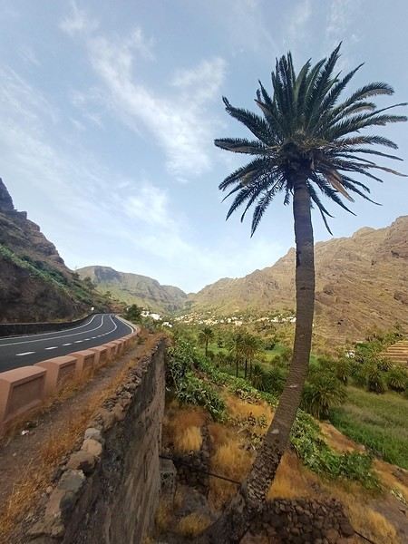
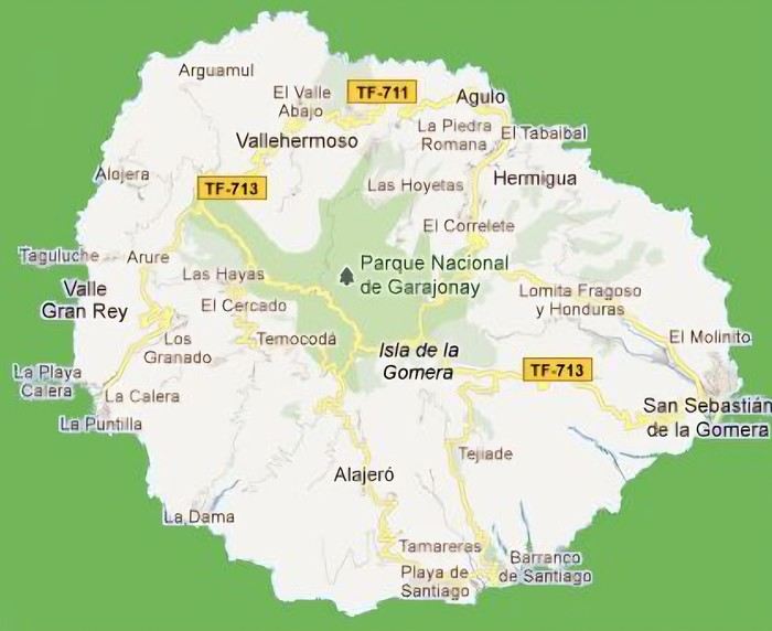 The large solidified magma massifs that shape the heart of the island have created a large depression more protected from the sun at its center, allowing the growth of a vast laurel forest, today grouped within the Garajonay National Park, La Gomera’s green lung, which has earned it the status of a World Biosphere Reserve. Its completely European appearance contrasts sharply with the rocky and tropical landscapes of the rest of the island. Thus, the climate varies greatly from one point to another on the island: in summer, you can quickly go from a dry and sunny valley at 35°C to a humid forest area at altitude at 18°C.































 Roundabouts are particularly interesting because they feature emblems of Turkmen culture, like the dog, a carpet, the Ahal Teke horse, or Muslim symbols, even though the presence of Islamic artifacts is quite limited.



 Why this country?
After visiting Hungary, Slovenia, Romania, and Poland in recent years, I’ve fallen in love with Eastern European countries. I adore the Slavic soul, its Austro-Hungarian villages, the gentle landscapes, the Carpathian Mountains, and that slightly mysterious atmosphere.
Slovakia evokes a certain imagination with its deep forests, medieval castles, and cobbled villages.
After seeing photos of the High Tatras—especially Lake Štrbské Pleso and Spiš Castle—I thought, "Let’s do it! We’re going!"
So, will Slovakia live up to what I imagine?
We’ll find out together.
We decided to travel as a group of six (five adults and a six-year-old child), by car (we needed two).
Here’s the day-by-day itinerary for this family trip, which started with a 3-day stay in Vienna (see the dedicated travel journal):















 When it comes to the Caribbean island of Saint-Martin, it's customary to praise its coastline and dreamy beaches—and they certainly deserve it.
But in this story, I’d like to highlight other memories, aspects, and impressions for a slightly different change of scenery.
Enjoy the read—some text and, above all, lots of photos.
« Byenveni sou zile Sen Maten! » (Welcome to the island of Saint-Martin)






































 Come along, I'm taking you to this country where it's so nice to wander and slow down...










