Traversées vers la nouvelle Ecosse
Journée de transition, journée "bateaux". Aujourd'hui nous disons adieu aux îles de la Madeleine, traversons l'île du Prince Edward et prenons un second bateau de Wood Island vers PICTOU en nouvelle Ecosse, soit 6h15 de bateau en tout !
C'est par une belle matinée que nous quittons les îles, non sans une pointe de nostalgie. La mer est calme. Nous n'aurons pas besoin d'avaler des pilules contre le mal de mer !
Arrivés à Souris, il nous faut encore traverser l'île du Prince Edouard afin de gagner Wood Island pour prendre un autre traversier vers la nouvelle Ecosse.
J'avais réservé le traversier de 16h30 mais nous arrivons plus tôt que prévu si bien que nous demandons à changer pour le traversier de 14h45. Chouette, on peut embarquer... Le traversier est en retard et nous ne partons qu'à 15h20. Ca fait tout de même 1h10 d'attente de gagnée !
PICTOU est un petit port de la nouvelle Ecosse reconnu comme étant le lieu de naissance de la Nouvelle-Écosse qui s'appelle NOVA SCOTIA...en anglais !
J'ai demandé à une dame du coin pourquoi Nova scotia et pas New Scotland... elle n'a pas su me répondre autrement que "Nova Scotia" est le nom latin mais pourquoi avoir choisi le latin, ça elle n'en savait rien...
PICTOU est donc reconnu comme le berceau de la Nouvelle Ecosse et fondé par les premiers colons écossais arrivés à 200 sur l'Hector le 15 septembre 1773 dont une réplique occupe fièrement le port de la petite ville.
Le STONE CORNER B & B est une charmante maison blanche à la déco soignée. Il est situé à 500 mètres du port.
Nous sommes reçu par le propriétaire, un type de notre age un peu bobo, un musicien qui joue de la guitare électrique.
Je dois tout de même dire que entre la maison et le port, beaucoup d'endroits sont à l'bandon. Bref, c'est un peu la « zone » dans le coin... J'imaginais cette ville de Pictou ayant plus de charme.
Cette impression, nous l'avons déjà eu à SOURIS, sur l'île du prince Edward. Des maisons abandonnées, des terrains en friche avec du bazar dessus... cela ne ressemble pas trop à l'Ecosse par exemple.
Nous n'avons pas eu cette impression de « laisser aller » au Québec ou aux îles... Les îles que nous avons tous aimées... Séquence nostalgie...
Sur le port nous retrouvons l'Hector (ou plutot sa copie). Le bateau est visitable. Nous sommes seuls maîtres à bord !
Le SALT WATER CAFE situé en front de mer fait face à l'Hector. La cuisine est familiale et l'ambiance amicale. On se prend du homard "avec carapace"... Le seul endroit on l'on pouvait en trouver entier sur les îles était le restaurant "La factrie" situé au dessus d'une poissonerie à Cap aux Meules car la saison était terminée depuis 15 jours. Malheureusement il était fermé lorsque nous avons voulu y aller lundi. Nous nous étions alors rabattus sur le restau "les pas perdus".
Nous nous attaquons donc chacun (Patrick et moi car les enfants n'en veulent pas) à notre bestiole... Bon, c'est en voulant casser la première patte que j'ai « ripé » et envoyé le pot de sauce en beurre sur mon pantalon...
Pour terminer la patte j'ai ensuite brisé en deux la fourchette à homard... Faut dire que le plastique n'est pas forcément adapté !
Bref ce n'était pas mon jour mais la bête y est passée. Il y avait pas mal à manger là dedans !
La voiture du Shériff de la ville. Les 2 photos ensemble : Homard + Sheriff
Jour 21 - En route vers le cap Breton – Musée Graham Bell et Chéticamp
Le parcours d'aujourd'hui nous emmène vers Baddeck, une petite ville animée où vécu Graham Bell, l'inventeur du téléphone. Un musée y est d'ailleurs consacré...
Le petit déjeuner au stone Corner est des plus agréable. Notre hôte est disponible et nous fait la conversation ainsi qu'une autre cliente américaine.
Nous prenons la route vers Baddeck où se trouve le musée GRAHAM BELL, l'inventeur du téléphone. Avant la visite, nous profitons du site idéalement aménager pour le pique-nique.
Le musée n'est pas très grand mais bien aménagé avec de nombreuses vidéos.
Nous voici maintenant sur le fameux " Cabot trail ", une route qui fait le tour du Cap Breton, l'endroit le plus au nord de la Nouvelle-Ecosse et considéré un peu à la manière des hautes terres d'Ecosse. Nous aperçevons un aigle à tête blanche juché au sommet d'un arbre mort mais c'est trop tard pour la photo.
CHETICAMP est un bastion acadien, donc francophone. Cela se remarque de suite par son église imposante. La ville est sympathique et les gens y parlent un français avec un accent plus proche du notre que les québécois.
Nous avons retenu au OCEAN VIEW MOTEL . Cet hébergement nous réconcilie avec les motel (voir notre déconvenue à Souris). L'accueil est agréable, la chambre coquette et bien équipée avec en plus des DVD en prêt à l'accueil et belle vue sur la mer.
Nous jetons notre dévolu que le restaurant familial " LE GABRIEL ", situé en centre ville . Il y a un bon choix de mets et la facture est allégée. Patrick et moi prenons une assiette du capitaine : Divers poissons, coquille St Jacques, crevettes + homard pour lui et crabe des neiges pour moi. Très copieux et bien gouteux !
Jour 22 - Découverte du cap Breton – Cabot trail & Randonnée du skyline
Il faut parcourir beaucoup de kilomètres avant d'atteindre les hautes terres du Cap Breton et il faudrait plusieurs jours pour découvrir tous les chemins du parc national. Le plus célèbre d'entre eux est certainement celui qui surplombe l'océan, le majestueux sentier dit du " Skyline "…
Ce matin à CHETICAMP est dans la brume mais on sent bien que ça ne demande qu'à se lever comme on dit !
Nous voilà donc partis pour la randonnée du SKYLINE au parc national du cap breton. Le départ se fait donc dans la brume, où plutôt dans un nuage car nous sommes en hauteur.
Nous entrons sur le sentier dans une ambiance à la Harry Potter d'après mon fils, seuls dans la nature, l'aventure peut commencer ...
Puis le temps se dégage lorsque nous atteignons la pointe du skyline c'est à dire la vue sur la mer, d'une hauteur impressionnante ! Ici bizarrement la mer est bleue, très bleue !!!
Ensuite nous empruntons le chemin qui n'est pas aménagé, une sorte de "primitive trail", très long mais pas très beau car les arbres sont en mauvais état.
Cela est du, parait-il, aux orignaux qui mangeraient leurs racines car ici nous sommes en plein territoire des orignaux... et là, nous apercevons un, ou plutôt une...une grosse femelle orignal (élan)!!!
Nous sommes ravis !!! Cette randonnée est vraiment magnifique. Si on a la chance, on peut voir des orignaux, des ours, des coyotes et des tas de petits animaux...
Une de nos plus belles balades !
Nous avons eu de la chance en haut du " Skyline " car le ciel se couvre à nouveau. Nous déjeunons d'un sandwich dans un snack sur le bord de la route près de Pleasant Bay, à la sortie du parc, avant de faire une petite balade en forêt près d'une habitation ancestrale de bucheron.
Pour revenir au temps, ici c'est incroyable ce que ça peut changer vite... mais il ne fait pas froid, c'est le principal.
Ce soir nous dormons dans un minuscule petit port, WHITE POINT, situé au nord du parc national du cap breton, un vrai trou perdu mais plein de charme
Le TWO TITTLE B&B est une tout petite maison tenue par un couple de retraités. Les enfants dorment dans le " cottage ", c'est à dire " la cabane au fond du jardin... " !.
Le chien de la maison d'en face : Je l'ai trouvé comique avec son oreille droite et l'autre cassée.
Nous dinons à la " chowder house " à NEIL'S HARBOR, autre petit port voisin. Il n'y a pas beaucoup de choix de restos dans le coin. Il s'agit d'une sorte de snack de fruits de mer. La commande se passe au comptoir et on vient nous livrer les plats à table. Bon, on oublie car peu convivial et vraiment moyen.
Jour 23 - En route vers Louisbourg
Il y a bien peu de touristes dans ce coin de monde perdu. Seules quelques automobilistes se risquent sur le Cabot trail qui fait le tour du parc national du Cap Breton...
Il fait beau soleil ce matin et je m'autorise une balade matinale à 6h30 vu que nous nous sommes couchés hier soir " comme les poules!! "
Un petit tour sur le chemin qui jouxte le B&B, une montée au sommet de la colline et derrière il y a un magnifique cap avec des colonies d'oiseaux.
Je recommande cette balade. La marche est courte pour arriver au bout de ce WHITE POINT. A posteriori, je regrette de ne pas être allée jusqu'au bout à pied pour observer les oiseaux...
Le petit port est baigné de soleil ! Un vrai plaisir pour les photographes.
Nous voyageons maintenant vers la partie atlantique du Cabot trail.
Ouvrez l'oeil : J'ai vu une baleine car la mer longe la route ! Malheureusement je n'ai pas été assez rapide pour la photo et il n'y avait pas moyen de s'arrêter là !
La randonnée près de Keltic lodge : Un long chemin ardu (beaucoup de racines d'arbres) serpente le long des falaises pour arriver à un cap avec quelques mouettes. Beaucoup de marche pour un paysage au bout qui ne vaut pas tant que ça.
Nous prenons le dejeuner sur la route, au CLOAKING HEN, une boulangerie patisserie qui fait aussi café. Bonne pioche : Les sandwichs sont délicieux et le service aimable.
Le B&B FOGHORN à LITTLE LORRAINE est situé à environ 15' de LOUISBOURG. Cette maison tenue par une vieille dame charmante se trouve dans un petit village perdu au milieu de nulle part, près d'un tout petit port naturel.
Ce joli gîte dispose de jolies chambres décorées avec goût, d'un salon de télévision pour les clients ainsi que d'une TV et petite cuisine.
Le LOBSTER KETTLE à LOUISBOURG est un resto sympa dans une ville bien animée. Bon accueil, prix doux et beaucoup de légumes !
Merci de partager encore une fois ce magnifique carnet de voyage. Néanmoins, la partie préparation est tout autant (voire plus) intéressante et j'ai hate de découvrir celle concernant votre prochaine destination (je me rend régulièrement sur ton site pour voir la publication...).
🙂 Merci beaucoup.
Le prochain voyage n'est pas du tout dans le même secteur puisqu'il s'agit du Vietnam. Il y a moins de préparation puisque nous ferons un tour guidé, mais privé, dans le nord du pays à la rencontre des ethnies minoritaires des montagnes du Tonquin. Nous terminerons par une semaine de repos au bord de la mer, à Hoi An.
Voici la suite avec des photos de cette ville reconstituée au bout du monde ....
Jour 24
Forteresse de Louisbourg : Une immersion en plein XVIIIème siècle.
Qui aurait pu croire que dans ce bout du monde livré à l'océan, se trouvait un des plus beau joyaux du Canada ? La forteresse de Louisbourg est plus qu'une attraction. C'est un monde rude et venteux où le temps s'est arrêté et où les habitants, tout comme leurs ancêtres, paraissent devoir survivre avec un sentiment d'abandon et de grande solitude... Pathétique !
Je vais encore profiter d'un réveil matinal et d'un beau soleil pour aller me promener du côté du petit port de Little Lorraine consacré à la pêche au homard... encore et toujours !
Après un bon petit dej au Foghorn B&B avec du yaourt, des fraises et des pannecakes aux bleuets, nous prenons la route vers la forteresse de Louisbourg car c'est ici que nous allons passer la journée.
Mais pourquoi avoir restauré un tel site touristique au fin fond de la Nouvelle-Ecosse ?
Un regard sur l'histoire s'impose :
Les Français débarquent à Louisbourg en 1713, à la fin de la guerre de la Succession d'Espagne, après avoir cédé l'Acadie et Terre-Neuve aux Britanniques aux termes du traité d'Utrecht. Il ne reste plus à la France, dans ce qui est aujourd'hui le Canada atlantique, que le Cap-Breton et l'Île-du-Prince-Édouard, appelés à l'époque l'Isle Royale et l'Isle Saint-Jean. Ces dernières servent de base de pêche aux Français, qui continuent la pêche de la morue dans les Grands Bancs, activité alors fort lucrative. C'est en 1719 que les Français entreprennent la construction à Louisbourg d'une place forte, qui ne sera vraiment terminée qu'à la veille du siège de 1745. La ville et l'établissement qui s'est développé le long du port deviennent rapidement une colonie florissante.
L'Isle Royale tire sa prospérité de la pêche de la morue. Avant d'être exporté, le poisson est salé puis séché sur des claies, sur les plages de Louisbourg et de ses alentours. La colonie devient un important centre d'activité commerciale, recevant des produits fabriqués et des matériaux divers de la France, du Québec, des Antilles et de la Nouvelle-Angleterre.
Tout laisse à penser que la place forte serait prête à soutenir le moindre assaut. Pourtant, si le port est bien protégé, il en est autrement à l'intérieur des terres où les principales défenses dominent une série de collines de faible altitude, dont certaines sont dangereusement proches des fortifications. Toutes offrent un emplacement stratégique idéal pour l'installation de batteries de siège.
Le premier assaut survient en 1745, après la déclaration de la guerre entre la France et la Grande-Bretagne. Poussés par leur ferveur religieuse et informés de la situation désespérée dans laquelle se trouve la forteresse dont les troupes, mal approvisionnées, menacent de se mutiner, des soldats de la Nouvelle-Angleterre partent à l'assaut de Louisbourg. La place forte est conquise au bout de 46 jours de siège. Au grand dam des soldats de la Nouvelle-Angleterre, la ville passe de nouveau aux mains des Français aux termes du traité d'Aix-la-Chapelle, trois ans seulement après le siège. La ville est de nouveau assiégée en 1758. Il est impossible de défendre Louisbourg sans la présence d'une marine forte pour patrouiller les eaux au-delà des défenses du port. Les forces anglaises, composées de 13 100 soldats, appuyées de 14 000 marins sur 150 navires, capturent la forteresse en sept semaines. Pour que Louisbourg ne redevienne jamais plus une ville fortifiée française, les Britanniques démolissent les remparts de la forteresse.
La reconstruction :
Le gouvernement du Canada entreprend en 1961 un vaste projet, d'une valeur de 25 millions de dollars, de reconstruction d'un quart de la ville et des fortifications originales. À l'intérieur de la zone reconstruite, soit seulement un quart de la ville initiale, on a reconstitué les bâtiments, les rues, les courettes et les jardins tels qu'ils étaient dans les années 1740, juste avant le premier siège de la place forte.
Le travail accompli à Louisbourg est le fruit d'une recherche pluridisciplinaire. Les fouilles archéologiques ont permis de mettre au jour, outre les vestiges des fortifications et des bâtiments de l'époque, des milliers d'objets façonnés. On a également copié quelque 750 000 pages de documents et 500 cartes et plans d'archives en France, en Angleterre, en Écosse, aux États-Unis et au Canada. Les témoignages de l'histoire que nous possédons nous apprennent beaucoup sur la vie à Louisbourg et servent de fondement à l'étude de la présence française en Amérique du Nord.
* **
Revenons à notre visite.
Le ciel de ce matin, avec ses gros nuages noirs, joue avec le soleil, ce qui donne une ambiance très particulière. C'est beauuuuuuuuuuuuuuu !
A l'entrée du site nous devons laisser la voiture au parking et embarquer à bord d'un autobus. Il n'y a pas de voiture dans la forteresse.
L'autobus nous laisse près d'une maison de pêcheurs au toit recouvert d'herbe, située à l'extérieur de la ville. La dame nous accueille de suite car nous sommes ses premiers touristes de la journée. A l'intérieur de la bâtisse, sur la table, sont exposés les principaux ingrédients alimentaires de l'époque...
A l'entrée de la forteresse la coutume veut que le soldat de garde questionne les visiteurs afin de détecter les éventuels espions anglais. Nous n'échappons pas à la règle.
Pour l'instant les rues sont presque désertes, en tout cas les touristes ne sont pas nombreux ce qui fait notre bonheur ! Le vent agite les costumes des habitants...
Dans le groupe de la visite guidée une acadienne me fait remarquer que « quand ce sont des bilingues, ce sont des francophones... les anglophones ne sont quasiment pas bilingues ».... Tout le contraire de la Belgique où l'on trouve beaucoup plus de néerlandophone bilingues que de francophones ! Le tour guidé est un peu longuet surtout qu'on entre nulle part. On reste juste dans les rues et ce matin c'était venteux, très venteux !!!
Dans le bastion on va tirer des coups de canon !
Poste de garde :
En présence de Monsieur le gouverneur !
Dans le bastion, les appartements du gouverneur sont luxueux...
... et les chambres des soldats, nettement moins luxueuses !
On entre dans les maisons et les personnages interprètent des personnages ayant réellement existé et vécu à Louisbourg. Ils vous racontent l'histoire des lieux, montre des objets, tout comme au village acadien de Caraquet.
Monsieur l'architecte dans sa maison
Nous prenons le repas dans une auberge où une charmante jeune fille nous sert une cuisine d'époque (beaucoup de légumes) dans des assiettes en etain.
Le trombadour pousse la chansonnette...une chanson sur St Malo qui se termine par « ..Vive le roi de France ...et merde pour le roi d'Angleterre qui nous a déclaré la guerre »...Oh, mais il est parfaitement bilingue!...Normal, « je suis de Cheticamp ».. Encore un fier musicien acadien !! Très sympa tout ça !
Dans un bâtiment éloigné se trouve les maquettes et archives du site.
le magasin général
Cette forteresse de Louisbourg est un superbe endroit qui vaut bien qu'on lui consacre la journée. Il y a vraiment beaucoup de personnages en costumes d'époque réalisés entièrement à la main.
C'est encore un endroit où l'on remonte le temps et l'on se retrouve face à des " tableaux du XVIIème ".
Ici plus qu'ailleurs, on a ce sentiment indescriptible de solitude et de survie dans un monde hostile que pouvait connaître les courageux colons et les malheureux soldats qui s'étaient installés ici.
Les figurants sont tous bilingues.. enfin sont sensés l'être, histoire de rappeler qu'au XIIIème siècle, LOUISBOURG etait bel et bien une ville française !
Après avoir quitté la forteresse de Louisbourg et cette sensation de ce trouver au bout du monde, sans doute un peu comme les colons qui débarquaient ici au XVIIIème siècle, nous amorçons notre "remontée de la nouvelle Ecosse.
Sur notre route, le B&B CANAL HOUSE à ST PETER'S sera notre étape pour la nuit.
Le gîte a été récemment rénové par un jeune couple. Nous sommes accueillis par le patron, un jeune allemand fort sympathique. Les chambres sont petites mais "nickel chrome" et tout confort.
Nous dinons au LAKE BRAS D'OR INN, un restaurant indiqué par notre hôte.
Le chef est français et les plats sont un peu plus cher qu'ailleurs mais valent leur prix.
Cela fait 3 soirs de suite que je commande des coquilles St Jacques (enfin plutot des pétoncles car je trouve les coquillles St Jacques de chez nous beaucoup plus gouteuses) dans l'espoir d'en trouver de mieux cuisinée. Avant hier elles étaient juste poêlées mais fades. Hier soir il y avait une bonne petite sauce un peu crémeuse. Ce soir elles étaient flambées au brandy (genre de cognac) c'était relevé avec des tomates, un bon petit risotto... quelques légumes grillés...Parfait.!
Jour 25 - Halifax, reine de la nouvelle Ecosse.
La ville de Halifax n'est pas vraiment jolie car son urbanisation est loin d'être homogène et elle paraît toute petite pour une capitale de province, coincée entre la colline de la citadelle et l'océan.
L'océan ! c'est justement de là que vient toute son animation qui la rend accueillante et chaleureuse : Elle est un port de pêche, de plaisance, de commerce et militaire de surcroit...
Après un bon petit dej au Canal House, nous traversons la Nouvelle Ecosse : Bof, l'autoroute est longue et monotone avant d'arriver à HALIFAX, la capitale de la nouvelle Ecosse
Le WAVERLEY INN à HALIFAX est le genre d'hotel que j'aime bien. Le style est résolument antique, un peu victorien. La chambre est décorée avec 2 hauts lits monumentaux et de vieux meubles.
Ca ne plait pas trop à Patrick ni aux enfants qui y voient une sorte de manoir hanté, surtout qu'il y a des portraits au mur datant du XIXeme siècle !
Bref cela est peut être un peu trop impressionnant pour eux !
Comme nous sommes arrivés à midi, après un déjeuner sur le pouce nous partons visiter la CITADELLE de HALIFAX
Le monument est animé avec des soldats en costume fin XIXeme. Ce sont des étudiants pour la plupart qui font là un job d'été.
La Citadelle n'est pas très grande et nous assistons à des exercices militaires ainsi qu'au traditionnel air de cornemuse.
Très sympa !
Les canonniers
La poudrière :
Le maniement des armes à feu
A partir de là nous nous séparons en 2 groupes car Caroline veut faire du shopping.
Pour les filles ce sera shopping
Pour les garçons ce sera musée maritime. Apparemment un endroit très instructif où je n'ai malheureusement pas pu me rendre. On y apprend beaucoup sur le rôle du port et des bateaux à Halifax mais aussi sur le naufrage du Titanic, cette ville était la plus proche du lieu où repose l'épave du navire.
Il y a pas mal d'objet exposés qui proviennent du bateau.
Après avoir cherché vainement les boutiques (pas grand chose en centre ville), nous atterrissons finalement sur les quais pour notre plus grand plaisir car là il y a des tas de boutiques de tee shirts originaux.
Les quais sont également très animés. On y trouve des restaurants, des terrasses, des musiciens de rue et c'est de là que partent les tours du port en bateau.
Nous retrouvons les hommes et decidons d'entrer au SALTYS. Il y a beaucoup de monde et c'est plutôt bon signe, d'ailleurs la nourriture et le service sont très correct. De plus, nous bénéficions d'une superbe vue sur le port.
La dernière balade sur les quais avant de rentrer à l'hotel nous donne le sentiment qu'on se sent bien à HALIFAX et que cette ville doit bien "bouger" avec tous ses étudiants, ses pubs et son ambiance sympathique.
Jour 26 - La route des acadiens
Ils sont arrivés ici, ont cultivé la terre mais les anglais les ont chassés. Ils se disaient neutres, mais comment peut-on résister quand les grandes nations se querellent pour se diviser le monde ? Nous poursuivons notre route avec un détour par GRAND PRE, l'endroit où la déportation des acadiens a commencé.
Notre route nous conduit aujour'hui de la Nouvelle-Ecosse au Nouveau-Brunswick.
Nous quittons Halifax et le Waverley Inn. Le petit déjeuner est correct sans plus. On a beau dire, le petit déjeuner dans les hotels ne vaut pas les petits déjeuners personnalisés des B&B …
Le site historique de GRAND PRE rend hommage aux acadiens déportés à travers le monde. C'est d'ici qu'ont été déportés les premiers acadiens.
Une vidéo nous est tout d'abord présentée. Elle comporte surtout des extraits de films. Le montage est très bien fait.
On y apprend que les acadiens se déclaraient neutres c'est à dire qu'en tant que fermiers ils ne voulaient être ni assimilés à des français, ni à des anglais.
Jusqu'à présent je ne connaissais pas bien cette histoire, sauf la partie "larmoyante" où l'on voit les familles séparées puis expulsées sur des navires vers l'inconnu...
Dans la video, les français sont présentés comme des méchants qui "obligent" les acadiens à rester à leurs côtés.... et les anglais sont aussi des méchants puisqu'il assimilent les acadiens à des français et les expulsent.
S'affranchir de la France à cette époque en se déclarant neutre était donc bien risqué. Je comprends mieux pourquoi on parle peu de l'Acadie en France.
Mais que dit l'histoire acadienne ?
Extrait du site "cyberacadie" :
La plus importante migration de Port-Royal s'est produite en 1680 et en 1690. Pierre Melanson et sa jeune femme, Marguerite Minus d'Entremont, ont fondé le village de Grand-Pré en 1682. Les colonies de la région du bassin de Minas ont connu une croissance rapide, la population étant composée de jeunes couples féconds.
Les Acadiens avaient avantage à s'établir dans des endroits qui, comme Grand-Pré, garantissaient l'accès au marché de la fourrure et aux voies de transport. Ils y ont été à l'abri des interventions des autorités.
Sur la Rivière Canard, les Acadiens ont construit des digues pour éviter que les eaux n'inondent leurs petits villages. On peut encore aujourd'hui voir des vestiges de leur œuvre en certains endroits.
La population en pleine croissance a accueilli avec plaisir son premier missionnaire à Grand-Pré, soit le père Claude Mireau. En 1693, la population continuait de croître, on avait atteint 297 colons, qui habitaient sur 360 acres de terre cultivée et possédaient 461 bêtes à cornes, 390 moutons et 314 cochons.
Dès 1730, les Acadiens sont reconnus comme un peuple neutre au plan politique. C'était un fait connu des premiers Lieutenant général britanique qui ont tenté de leur faire prêter serment d'allégeance aux Acadiens, au nom de la couronne britannique.
Pendant plusieurs années, la couronne britannique a tenté de faire signer aux Acadiens le serment d'allégeance. Les Acadiens n'ont pas signé et sont demeurés sur les terres qu'ils avaient colonisées.
La déportation est sans aucun doute l'événement le plus tragique de l'histoire des Acadiens. Puisque Grand-Pré était l'établissement le plus peuplé en 1755, c'est là que la déportation des Acadiens a commencé.C'est le colonel John Winslow qui a ordonné aux hommes de la communauté de se rassembler à l'église Saint-Charles des Mines le 5 septembre 1755 à 15 heures. À Piziquit (Windsor), c'est le capitaine Alexander Murray qui a donné les ordres, au Fort Edward. C'est là qu'on a dit aux hommes de Grand-Pré que leurs terres, leurs maisons et leurs animaux allaient être confisqués et leurs familles chassées de la province.
Plus de familles ont été déportées de Grand-Pré que des autres régions acadiennes, non seulement parce qu’il s'agissait de la région la plus peuplée, mais aussi parce qu'il s'agissait du centre agricole et commercial le plus important. La population de la paroisse de Saint-Charles a été déportée dans un endroit situé entre les villages de Horton Landing et de Wolfville.
Environ 2 200 Acadiens ont été déportés de Grand-Pré entre les mois d'octobre et de décembre 1755. Peu de temps après, les maisons et les granges étaient brûlées.
On estime que 6 000 Acadiens ont été déportés de la péninsule de la Nouvelle-Écosse en 1755. Beaucoup sont morts sur les navires. Les survivants de la déportation ont été répartis par groupes dans les colonies anglo-américaines, du Massachusetts à la Caroline du Sud: 900 au Massachusetts, 675 au Connecticut, 200 dans l’état de New York, 700 en Pennsylvania, 860 au Maryland, 1150 en Virginie, 290 en Caroline du Nord et 320 en Caroline du Sud.
Les déportés qui sont revenus plus tard dans les Maritimes n'ont pu s'établir de nouveau sur leur ancienne terre. Dès le milieu des années 1760, le gouvernement avait déjà redistribué toutes les terres acadiennes fertiles de Grand-Pré et de la vallée d'Annapolis aux colons protestants de la Nouvelle-Angleterre, connus sous le nom de Planters. Les Acadiens ont dû s'établir sur des terres moins fertiles et ont dû apprendre à pêcher au lieu de cultiver.
En l'espace d'une dizaine d'années, la région la plus prospère de la Nouvelle-Écosse a été vidée de sa population et repeuplée par une autre population.
Aujourd'hui, une grosse croix de fer forgé indique l'endroit où les Acadiens de Grand-Pré ont été embarqués sur les navires et emportés sur le bassin Minas. Au parc national historique de Grand-Pré, on trouve également une réplique de l'église St-Charles.
***
Reprenons notre visite de Grand Pré
Statue d'Evangéline, symbole du drame Acadien
La déportation des acadiens
HOPEWELL ROCKS est le fameux "Etretat" canadien où les marées à forte amplitude de la baie de Fundy ont façonné les falaises en éparpillant les roches.
Ce qui est amusant c'est que ces hauts rochers conservent leur Flore en surface et surtout des arbres, ce qui leur fait un chapeau de verdure.
Des employés du parc sont présents en bas sur la plage (dire plutôt les fonds marins lorsque l'on parle de ce site) pour veiller à faire remonter les touristes dès que la mer devient trop haute.
Il y a beaucoup plus à voir en marchant sur le sable que la traditionnelle photo que l'on nous présente souvent. C'est donc une bonne surprise même si le temps n'est pas de la partie !
Non loin de là, nous avons réservé au MAPLEGROVE INN, un très beau B&B tout jaune vif, charmant. La chambre est vraiment jolie et décorée avec goût. L'accueil est très chaleureux. Nous avons pris la table d'hôte et c'est bon et soigné. Un endroit à recommander.
Jour 27 - Retour vers le Québec
Ce qui est bien quand on a une journée de transition avec une très longue route sans visites de prévues c'est de pouvoir se dire que de toute façon la météo n'yaurait pas été favorable !
Aujourd'hui c'est une journée de transition vers le Québec, un retour à travers le Nouveau-Brunswick et environ 700 km de route et autoroute où il n'y a vraiment pas grand chose à voir !
Alors ce matin, s'il tombe des cordes, ce n'est pas bien grave sauf pour le chauffeur ! Mais avant cela c'est dans le brouillard que nous traversons le parc de Fundy. Il faut bien varier les plaisirs !
J'ai tout de même prévu une petite pose casse-croute en route, à Hartland, petit village situé au milieu du pays des pommes de terres et qui possède le plus long pont couvert du monde.
J'ai dû mal regarder le plan sur Googlemap. Nous arrivons du mauvais côté du pont pour nous restaurer. Allez hop, nous voilà traversant le pont !
Pas grand chose de l'autre côté pour se restaurer. Nous essayons le Tim Hortons... No comment...
A 16h30 nous sommes à Rivière du loup pour prendre posséssion de notre chambre au DAY INN, un hotel de chaine, sans âme mais confortable.
A notre grande surprise, nous passons une excellente soirée dans un resto de la ville. Il y a beaucoup de monde et l'endroit est chaleureux, même s'il est bruyant car la musique est au max. Il y a beaucoup de choix de plats. Au beau milieu du repas, une coupure d'électricité plonge l'établissement dans le calme et accessoirement dans le noir. Nous terminons notre plat principal à la lueur des bougies.
Jour 28 - Belle journée dans Charlevoix
On dit que Charlevoix est une des plus jolies régions du Québec. Avec une météo parfaite, comment pourrait-on ne pas apprécier ces charmants villages adossés à des collines de bonne hauteur ?
A partir de Rivière du Loup, nous prenons le traversier de 8h. Aussitôt arrivés de l'autre côté du fleuve, nous nous rendons dans le joli petit village (minuscule village) de PORT AU PERSIL. Malheureusement il n'y a pas grand chose à voir. Nous descendons à pied jusqu'au quai depuis le parking mais l'église n'est pas accessible, en tout cas nous n'avons pas trouvé l'accès. Nous n'étions pas les seuls !
Sur la route : Jolie triplette bleu/blanc/rouge. Des acadiens, des français ou tout simplement le fruit du hasard ??? !!
Sur la route j'ai prévu une visite des jardins du CAP A L'AIGLE. C'est le FLOP de la journée. Heureusement qu'il fait beau et que la petite rivière « cascadante » chante car côté fleurs il n'y a rien à voir ! C'est plutôt "plate" comme disent les cousins québécois.
La visite de la maison du BOOTLEGGER rattrape la déconvenue du matin. Elle se trouve non pas au bord du fleuve, mais plutôt en forêt, à l'intérieur des terres. Elle fut démontée et reconstruite ici en 1939 puis transformée en un véritable laryrinthe à une époque ou l'alocool était interdit. Nous arrivons dans cet endroit très particulier, un café installé dans le grenier de cette maison forestière. Ici tout est de bric et de broc. Il y a des tas de détails à observer.
Tout est prêt pour la fête !
Veillez à bien emjamber la grosse poutre au milieu de la pièce !
Nous faisons la visite guidée de la maison "labyrinthe" où il ne faut pas être trop "large" pour pouvoir passer...
A l'époque de la prohibition de l'alcool, tout est prévu pour se cacher
...et frauder le fisc puisque l'on est dans une maison de contrebandier
Tout ceci est étonnant et amusant. Nous terminons par une bonne grillade au restaurant (c'est leur spécialité). Vraiment un endroit qui nous plait beaucoup et à en croire les photos et les accessoires pour faire la fête, il doit y avoir une sacrée ambiance ici en soirée !!!!
Sur la route en allant vers le traversier :
La file d'attente pour le traversier de l'ïle aux coudres est impressionnante. Nous avons bien fait de nous y prendre à l'avance.
Nous atteignons la file à 14h50 mais ne pouvons prendre que le traversier de 15h30, soit le 2ème, ce qui n'est parait-il pas trop mal pour la saison.
Sur le fleuve, côté Charlevoix :
Auberge des EGLANTIERS B&B :La maison est charmante avec une jolie vue sur le fleuve. La maitresse de maison nous fait mille recommandations. La chambre est impeccable et chaleureuse. Sur le terrain, les chaises et autres meubles bleus invitent à la relaxation.
Ce soir nous recherchons quelque chose de simple et rapide, vu que le repas du midi était assez "chargé". La propriétaire du B&B nous conseille le casse croute du camping Leclerc. C'est proche et sur la route de notre spectacle du soir.
Bonne pioche. Ce sera poutine pour 3 d'entre nous sauf moi car j'ai pris des kg depuis que je suis ici !. La poutine est apparemment excellente et le fromage fait bien "couic couic", j'ai gouté !!
Sur l'île au coudres se jouent 2 spectacles : Une pièce de théatre de boulevard à l'auberge de la coudrière et une comédie musicale rock'n roll des années 60 à la Roche pleureuse. Les enfants ayant opté pour la 2ème, nous voici installés sous le chapiteau pour assister à la représentation de "un mariage rock'n roll".
Les comédiens amateurs sont tous des jeunes et malgré quelques petites imperfections, l'ambiance est survoltée dans un spectacle qui bouge beaucoup et où l'on ne s'ennuie pas une minute ! Vraiment un très bon moment !
Jour 29 - En remontant le fleuve
Les villages s'étirent paisiblement le long du fleuve, coquets et paisibles, faisant écho aux petites îles, jusqu'à la grande ville. Nous remontons le fleuve, comme le firent les premiers colons, à la différence près qu'ils le faisaient en bateau...
Nous ne sommes pas très en avance car nous prenons de plus en plus notre temps le matin... Nous avons surtout profité du super petit déjeuner de l'auberge des églantiers et avons gouté à tous les produits faits maison.
Nous partons faire le tour de l'île au coudres par l'ouest histoire de voir le moulin et ses environs.
Il nous faut ensuite re-traverser le fleuve. Chouette, il n'y a pas trop de file pour le traversier.
Rue de Baie-Saint-Paul :
Rue d'un autre village en bordure de fleuve. On remarque en haut que, comme souvent, les fils électriques gâchent le paysage. En bas, ils ont été enterrés. Question esthétisme, on se croirait à Wisteria Lane (pour les connaisseurs , c'est la rue des "Desperates housewifes")
Nous décidons donc de filer directement vers la chute de Montmorency, les enfants n'étant pas trop intéressés par les galeries d'art de la Baie St Paul et encore moins par une visite de la basilique Notre Dame de Beaupré.
Les québecois parlent souvent de la chute de MONTMORENCY, situé à proximité de la ville de Québec, comme d'un monument national. Lorsque nous arrivons, il fait très lourd mais il n'y a pas de soleil. Nous avons perdu l'habitude de ces températures. Nous faisons un tour à côté et au dessus de la chute sans autre forme d'enthousiasme. Est-ce à cause du temps ou du cadre plus dégagé, mais nous avons préféré la chute de Val Jalbert.
Ici c'est beaucoup plus "touristique", peut-être trop aménagé et cela dénature le site.
La chute vue du pont :
Donc pour nous cette fameuse chute c'est plutôt "bof".
En revanche il fait tellement chaud que la terrasse du manoir de Montmorency nous attire.
Même en évitant la partie "restaurant", le café est assez "dispendieux" comme disent les québécois mais nous sommes bien installés et la nourriture est bonne. Je n'ai pas très faim (vu le petit déjeuner copieux du matin) et je prend juste une assiette de fromage, croutons et fruits. C'est suffisant et excellent car j'ai droit à 3 morceaux de fromages qui ont du goût (un bleu, un cendré et une sorte de fromage à pâte brossée genre "pont Lévêque" !
En bonne normande, je remarque une fois de plus que les fromages du Québec ont du goût ! C'est vraiment à souligner et à recommander ! Bravo aux cousins pour leurs fromages !!!!!
Nous restons un bon moment à profiter du calme, des fleurs des jardins et de la fraîcheur à cet endroit.
Nous n'avons pas prévu nous rendre de suite au coeur de la ville de Québec car j'ai souhaité assisté au POW WOW de WENDAKE, une réserve amérindienne située en banlieue. En fait toute l'organisation de notre circuit c'est articulé autour de cette date.
Nous atteignons notre gite dans l'après midi. Nous avons réservé une chambre d'hôte au Gite de la HURONNIERE.
Le quartier de la réserve des hurons est très cossu ce qui tranche singulièrement avec les réserves américaines !
L'accueil est chaleureux et notre hotesse nous indique plein de trucs utiles. Merci Claire !
Ici il y a aussi un chien sympa, 2 chats ronronnants et calins... et dans un autre registre, une piscine pour ceux qui veulent se mouiller.
Notre chambre est en sous-sol et un peu étroite pour 4 mais l'équipement et la gentillesse de l'hotesse compensent.
En attendant l'arrivée de notre amie Marielle et de son conjoint, nous partons à la découverte du Pow wow qui débute officiellement aujourd'hui.
Les vraies compétitions de danseurs débuteront demain. Nous en profitons pour faire le tour des stands et rencontrer les vendeurs pendant que le site est calme.
Nous assistons également aux allocutions des notables de la réserve et de l'évêque avant d'assister à une démonstration des danseurs hurons.
Nous retournons au gite attendre nos amis québécois. Ils arrivent enfin, grandes retrouvailles après 10ans, ... séquence émotion !....
Nous partons en quête d'un restaurant mais malheureusement à cause du Pow wow, le Sagamité, resto traditionnel huron ainsi que le resto de l'hotel des premières nations sont complets pour ce soir et demain !
TomTom nous propose un choix de restos proches.. Nous atterissons dans un Normandin (chaine québécoise). Reprenons la fameuse expression québécoise « C'est correct » !
Moins de préparation peut-être mais ça ne veut pas dire que c'est moins intéressant pour nous.
Exposer pourquoi le nord du vietnam, pourquoi tel opérateur (local/pas local), comment tu as construit ton projet de voyage est, à mon avis, quelquechose qui peut aider d'autres voyageurs à faire des choix...
Un voyage comme ça, j'en ai l'eau à la bouche :)
Ok, je vais essayer de faire ça.
Mais permettez que je termine tout d'abord mes albums (papier et web) de ce voyage au Canada 🙂
D'ailleurs, voici la suite avec l'événement que j'attendais et des photos dont je suis assez satisfaite 😉
Jour 30 - Samedi 30 juillet - Le jour du POW WOW
Assiter à un POW WOW au Québec quand on vient d'Europe est une occasion à ne pas manquer. Assister à un POW WOW sous un soleil radieux est une grande chance, une explosion de couleurs, une aubaine pour les photographes amateurs que nous sommes...
Après un petit déjeuner roboratif, nous voilà partis, sur les conseils de notre hotesse, faire la visite du site traditionnel huron.
Le site lui même ne nous impressionne pas vraiment. Les habitats sont un peu défraichis. En revanche les commentaires de la jeune guide sont vraiment très instructifs. Nous apprenons beaucoup durant cette visite et il n'y a pas de langue de bois. Elle aborde autant les aspects culturels, les croyances, les traditions des autochtones dans la vie quotidienne d'antan que dans la réalité d'aujourd'hui avec les problèmes des populations isolées, dont l'échec scolaire et ses dérives.
Danse d'accueil :
Notre guide :
La spiritualité
Les règles des réserves
La maison haute
Les hurons quant à eux ne connaissent pas le problème des villages isolés car il bénéficient de la proximité de la ville de Québec et ont fait le choix de l'intégration et de l'ouverture au tourisme en se dotant d'infrastructures. Elle nous explique également pourquoi les hurons ont perdu leurs traits améridiens. La guide quant à elle n'est pas huronne mais atikamek et vient d'un village isolé.
La boutique est fabuleuse et bien achalandée en objets artisanaux de qualité!!!
J'avais lu des commentaires pas toujours élogieux sur ce site. Il me semble que le guide fait beaucoup pour l'impression que l'on en retire. Pour notre part, nous avons été très satisfaits.
Le POW WOW : Même si le site et la cérémonie d'ouverture du site a eu lieu la veille, c'est aujourd'hui que commencent officiellement les compétitions de danse, notamment avec la traditionnelle entrée des danseurs. L'attente est pénible car il y a un soleil de plomb et pas une once d'ombre. En plus on nous annonce qu'il est impossible de prendre des photos durant cette cérémonie. Nous devrons donc attendre un peu plus tard.
Nous profitons donc rien qu'avec nos yeux de cette déferlante de couleurs et de plumes, de costumes tous plus beaux les uns que les autres.
Puis vient le temps des danses, des enfants, des fillettes, des garçonnets, des champions.
Ils sont magnifiques !!!!!
Le Pow wow se déroule sous la statue de sable protectrice
Impressions du Pow wow de WENDAKE : J'attendais beaucoup de cet événement et mon itinéraire a été construit autour de cette date. Je ne suis pas déçue du tout. Les danseurs nous offrent un merveilleux spectacle, joyeux et haut en couleur, un vrai bonheur pour les yeux et les photographes qui sont d'ailleurs fort nombreux ici. Les costumes sont magnifiques !
Quel soin apportés aux détails.
De plus il y a ici des tas de stands proposant surtout des bijoux et des objets d'artisanat autochtone. C'est bien organisé. Le seul hic : aucune place à l'ombre et une tribune bien trop petite pour le monde présent ici.
Les restaurants de Wendake étant toujours aussi bondés, notre hotesse nous conseille d'aller « Chez Victor » un resto branché qui fait dans le Hamburger de haut vol. Les enfants sont contents ! Nous voici donc partis dans la banlieue nouvelle de Québec, au milieu de nouveaux immeubles. Le restau est parfait et les hamburgers sont originaux et gouteux. Je teste une bière de microbrasserie qui est tout à fait correcte. De plus il ont d'excellent desserts et expresso. Bref ici tout est bon pour une addition raisonnable.
Jour 31 - Dimanche 31 juillet
Découverte de la ville de Québec
On nous l'avait dit : Québec est une belle ville, une ville ancienne, la seule ville fortifiée du Nord de l'Amérique. Nous n'avons pas été déçus. Québec est vraiment une ville sympathique avec des petites rues , des petites boutiques et des restaurants comme on aime !...
Encore un excellent petit déjeuner chez Claire, " petit " déjeuner est une façon de parler car ici la maitresse de maison nous prépare un véritable gratin et je peux vous assurer qu'en partant de là vous n'avez pas faim !
Nous quittons Marielle et Rosaire ainsi que le gîte, Claire, ses chien Vanille et chats Cadeau et pupuce pour QUEBEC CITY.
Enfin nous voici à QUEBEC et il fait beau temps. J'ai trouvé un parking à côté du parlement et près des remparts de la vieille ville. C'est parfait pour visiter la citadelle.
A la différence de celle de Halifax, la citadelle de la ville de Québec est toujours occupée par des militaires.
Voici ce que l'on peut lire sur le site officiel :
Construite entre 1820 et 1850, selon le système de défense de l'ingénieur français Vauban, La Citadelle de Québec a été bâtie sous la direction du lieutenant-colonel Elais Walker Dumford, officier de l'armée britannique. La Citadelle est donc une garnison militaire active. D'abord occupée par des troupes britanniques et l'artillerie canadienne, depuis 1920, elle est la résidence officielle du Royal 22e Régiment, unique régiment d'infanterie francophone au sein de la Force régulière des Forces canadiennes. Elle a la forme d'un polygone à quatre angles représentant une étoile et s'étale sur une superficie de 37 acres (2,3 km2).
La relève de la garde de 10h est réputée comme étant un temps fort de la journée. D'une durée de 45 minutes, elle rassemble sur le terrain de parade la garde montante qui prend la relève et la garde descendante. Les inspections des officiers, la musique régimentaire et la mascotte du régiment, le bouc Batisse, rythment la cérémonie haute en couleur.
Lorsque nous arrivons, elle vient juste de commencer.
La relève de la garde de la citadelle est réglée comme du papier à musique (d'ailleurs il y a aussi la musique). Nous avons donc le temps d'admirer les costumes d'inspiration « britannique» avec le célèbre chapeau en poil d'ours, bien chaud l'hiver mais certainement insupportable par un beau temps comme aujourd'hui...
Les militaires exécutent plein de figures et des pas... même de tout petits pas de côté rigolos puis il énumèrent un à un leur « numéro » respectif... amusant !
Enfin, et c'est la principale curiosité de la scène, la mascotte, un gros bouc blanc de l'Himalaya, est présent pendant toute la cérémonie. Il reste stoïc et c'est tout juste s'il ne marche pas au pas lui aussi....
Pour avoir vu passer la garde de très près plus tard dans la matinée, je peux vous assurer que, fidèle à la réputation de son espèce, il pue bien le bouc !!!!!
La citadelle étant un domaine militaire, il est défendu de s'y promener seuls. Nous n'avons donc pas le choix et malgré le nombre de personnes présentes nous devons intgégrer un grand groupe de touristes pour une visite guidée.
La visite est menée au pas de charge par de jeunes étudiants. Nous sommes dans un groupe de 70 personnes (et oui il y a bien du monde). Néanmoins le jeune homme qui nous entraine a une bonne voix et nous rappelle brièvement l'histoire du Canada à l'aide d'une frise. Nous retiendront que la fameuse bataille des plaines d'Abraham ou l'armée française fut battue par l'armée britannique, ne dura que 20 minutes ! et les 2 généraux des 2 camps(MONTCALM et WOLF) y perdirent la vie !
La visite est aussi l'occasion d'avoir une très belle vue sur toute la ville.
Intérieur du musée
Nous déjeunons rapidement au Grand Café, sur la grande allée, un endroit touristique et dispendieux dont nous apprécierons surtout la jolie terrasse et le plaisir de passer devant le très beau parlement pour retourner dans les murs de la vieille ville.
Nous nous rendons alors près des remparts, là où les chevaux se " restaurent " pour faire un tour en calèche. Là, nous nous faisons " jeter " en beauté par un type que visiblement nous avons l'air d'ennuyer. Il nous envoie sans ménagement prendre les calèches " ailleurs " mais comme nous ne comprenons pas bien où....
C'est là que nous avons le sentiment d'être comme à Paris, des vaches à lait de touristes traités avec bien peu de ménagement... Nous prenons alors la direction du château FRONTENAC, l'hotel qui domine la ville.
La visite guidée nous surprend en grand bien et fait oublier la déconvenue de la calèche. Nous sommes un petit groupe de 7 personnes seulement et sommes guidés par une jeune fille vêtue d'un très beau costume qui joue le rôle d'une ancienne cliente de l'hotel de la fin du XIXème siècle.
Le Château Frontenac, qui est en fait un hotel, fut construit pour la compagnie ferroviaire Canadien Pacific selon les plans de l'architecte américain Bruce Price. Ouvert en 1893, il fut nommé ainsi en l'honneur de Louis de Baude, comte de Frontenac qui fut gouverneur de la Nouvelle France de 1672 à1682 et de 1689 à 1698.
Cette guide est adorable et joue très bien son rôle si bien que la visite est des plus agréable. Nous avons l'occasion, en plus d'en apprendre sur la construction de l'édifice, de pénétrer dans divers salons, dans une suite et de voir les petits jardins surélevés qui servent à cultiver les herbes des jardiniers mais qui possèdent également des ruches.
Depuis les fenêtres de cette salle nous avons une jolie vue sur la ville basse, le fleuve et la statue de Samuel de Champlain
Autres guides du chateau hotel :
Un très bon moment passé au château.
J'avais envie de voir l'exposition sur le « chemin des francophones » au MUSEE DE L'AMERIQUE FRANCAISE. Ici nous sommes bien loin de l'agitation de la rue. L'exposition n'est pas très grande et nous n'apprenons pas grand chose de nouveau. Elle se veut « nouvelle tendance » avec beaucoup de vidéos mais qui ne donnent pas toutes envie de les écouter. Peut être frisons nous l'overdose.
L'accueil est à la hauteur de la réputation de ce L'AUBERGE LE VINCENT, petit hotel cossu du quartier St Roch. Nous disposons d'une jolie chambre avec des murs anciens en pierres et en briques. Petite salle de bain avec une jolie douche moderne possédant une grande pomme « de pluie »... Notre chambre est située au rez de chaussée, et nous avons une porte pour sortir directement dans la rue... super pour les bagages.
Nous repartons ensuite à pied pour aller flâner dans les rues du vieux Québec. C'est vraiment très animé et tout mignon.
Tiens, des drapeaux belges ! ...
Il était impossible d'obtenir une réservation pour le lapin sauté, ni ce soir ni demain (snif). Je me suis rabatue sur le plan B, le cochon dingue... Bonne pioche....
Ce restaurant est super pour un diner en famille.
L'accueil est excellent et il y a beaucoup de choix... De plus au cochon, tout est bon !!!!
Je prends une crème brulée au canard et canneberges, une escalope de veau au bleu (une tendresse) et une tarte aux fraises. Partrick prend une soupe crèmeuse à souhait, un filet mignon et le Paris-brest version cochon c'est à dire un « Québec -Montréal »...Nicolas quant à lui opte pour les côtes levées au sirop d'érable complétées de salade césar, de pommes de terre et mayonnaise à l'harissa... alors que Caroline goute à la soupe de poissons suivie d'une poutine (Caroline sera bientôt surnommée « miss poutine ») et des biscuits sablés en forme de petits lapins.
Dans les rues et escaliers du vieux Québec
J'ai retenu des places assises pour la projection en 3 D donnée sur le vieux port :LE MOULIN A IMAGES. Les différents tableaux relatent l'histoire du Québec. Il est cependant nécessaire de la connaître avant pour pouvoir saisir les références à cette histoire car il n'y a pas de commentaires, seulement des musiques modernes et dissonantes parfois.
Les visuels sont de qualité et la 3D donne de bons effets. Cependant la musique gagnerait à être plus « dynamique ». Je n'est pas été transportée par ce spectacle... Je me suis même....endormie !
LA VILLE QUEBEC est vraiment une ville agréable et animée. Il y a de la vie partout avec des musiciens des rues, des spectacles pour nous divertir, et des tas de touristes partout... bref un maximum de vie.
Avec cette chaleur c'est aussi une ville fatigante car il faut monter... descendre... et nous sommes rapidement vidés . C'est pourquoi, ce soir, nous nous endormons très vite !
Vive le vieux Québec !
Les villes dont on garde un bon souvenir sont souvent des villes qui invitent à la flânerie et qui réservent des surprises à ceux qui prennent le temps de les découvrir. A Québec il y a des tas de petits trésors dans la vieille ville sans compter les animations de rue et il est particulièrement plaisant de s'y attarder, surtout par un beau soir d'été...
Le petit déjeuner à l'hotel est très au dessus de la moyenne des autres hotels où nous sommes passés. Nous partons dans la ville car nous avons prévu de visiter le célèbre musée des civilisations.
Beaucoup de bâtiments sont inspirés du style de l'hotel Frontenac
Inévitable dans toute ville, même touristique !
Tiens, une fontaine Wallace. Il y en a surtout beaucoup à Paris dont elles sont un des symboles... et que voyez-vous derrière ??? Encore un bistro...belge !
LE MUSEE DE LA CIVILISATION est un grand bâtiment dont certains départements se veulent très " tendance " , c'est à dire avec de nombreux visuels sous forme de toiles tendues (exemple "les territoires ")...
Pas sur que ce soit l'entrée principale ...
Il y a aussi beaucoup d'écrans qui invitent à suivre des vidéos... et quand on visite à 4, tout le monde n'a pas forcément envie de regarder els mêmes. C'est souvent très intéressant et bien construit, comme par exemple dans le département sur les québécois, mais nous frisons l'overdose ! Alors nous repartons vers les coins les plus animés de la vielle ville...
LE CAFE DU PAPE ST GEORGES, situé dans le cadre assez sombre d'une vieille auberge de la rue du cul de sac, est un petit café qui offre une carte assez limitée mais avec des fromages et sandwichs. J'ai envie de gouter des fromages qui ont du goût et je partage une assiette avec ma fille (sauf mon verre de vin). C'est tout de même assez " dispendieux " (cher en français) pour ce que c'est !
Quel plaisir de se balader dans cette ville très « européenne » pour une ville d'Amérique du nord vue qu'elle n'est pas construite en damier à cause du relief.
De jolies fresques murales :
Il y a des tas de petites boutiques sympathiques, des café et restos. Il y a aussi beaucoup de musiciens et spectacles de rue... Bref il y a de la vie dans cette cité au caractère bien trempé.
Le seul point négatif c'est que si le relief fait justement son charme, la balade oblige à monter et descendre sans cesse, d'où une fatigue récurrente surtout pour les jambes en cette journée où de plus, le temps est lourd et orageux ....
Au moment ou nous décidons d'entrer en bas du château Frontenac pour siroter un café glacé au Starbucks, il se met justement à pleuvoir....
Cela ne dure heureusement pas très longtemps.
A la sortie, nous apercevons des calèches... vides et capotées.... Nous ne voulons pas rester sur une mauvaise impression et retentons donc notre cahnce. Cette fois nous sommes plutôt bien reçus. C'est parti pour une balade agréable de 45 m' qui nous permet aussi de nous reposer.
Cela nous permet de découvrir les plaines d'Abraham que nous n'avions pas encore vues à pied et aussi de découvrir avec étonnement, les statues de Jeanne d'Arc et du Général de Gaulle, 2 personnes qui symbolisent plutôt, en France, la résistance aux anglais !!!
Quand nous sommes de retour, la pluie a cessé et notre cocher demande de l'aide à Patrick pour décapoter.
Devant la statue de Champlain, sur la terrasse Dufferin près du chateau Frontenac
Oeuvre de Nicole TAILLON
Pour avoir une jolie vue du vieux Québec il est conseillé d'aller sur le fleuve. Le traversier pour Levis, la ville se trouvant sur l'autre rive, fait très bien l'affaire. Malheureusement en cette fin d'après-midi, le soleil est situé en arrière du château si bien que la ville est à contre jour ….
Comme nous n'avons pas envie d'aller faire la file pour diner au lapin sauté et que nous n'avons pas envie de tester un autre resto au risque d'être déçu, ce soir nous " repiquons " au COCHON DINGUE, c'est dingue non
Je prends les côtes levées à l'érable...hum... trop bonnes !!
Il est vraiment très agréable de se balader dans la vieux Québec par ce beau soir d'été.
Il se passe toujours quelque chose dans un coin de rue de la vieille ville. Ce soir nous décidons de remonter vers la haute ville pour revenir à l'hotel. En chemin nous nous arrêtons pour profiter du spectacle donne place de la cathédrale par 2 jeunes québécois jongleurs équilibristes. Un joli numéro d'adresse et d'humour !
Jour 33
Chemin du roy et village d'Antan de Drummondville
Pour remonter le fleuve, les ancêtres de notre amie Marielle empruntaient le chemin du roy quand ils n'étaient pas en bateau. Très proche de l'esprit du village historique de Caraquet, le village d'antan de Drumondville nous fait partager leur quotidien...
Pour rejoindre Marielle au village d'antan de Drummondville, nous empruntons le chemin du roy ou plutôt des " portions " de cette ancienne et première route crée pour relier Québec à Montréal.
En effet les pancartes ne sont pas toujours bien explicites et nous nous retrouvons parfois sur la nationale qui est aussi partie du " chemin ".
Qu'importe, les paysages sont beaux et les villages traversés sont paisibles et fleuris, un vrai plaisir.
Nous retrouvons Marielle, son fils et sa belle fille ainsi que ses petits enfants dans le village d'antan de Drummonville.
C'est joli et animé, il y a des " personnages hauts en couleurs ", des acteurs et des musiciens.
Marielle
Les maisons sont " habitées " par des figurants en costumes mais il y a des cordes et barrières qui empêchent le public d'accéder partout, comme à Caraquet.
Chez le photographe. Il n'y a que les chaussures qui font "tâche"
Et maintenant, de quel côté ?
Pour avoir vu les autres villages précédemment, notre impression est un peu moins bonne car les figurants ne sont pas aussi disponibles.
Nous prenons ensuite la route de Brigham pour retrouver la maison de Marielle et Rosaire, son conjoint.
La région de Marielle rappelle certains coins de Normandie, notamment l'Orne avec des vallons verdoyants et de jolis arbres, si ce n'est que le style des maisons est d'inspiration britanique...
Ce matin c'est relax à la maison de Marielle. Il fait beau temps. Nous sommes en pleine campagne. La maison est située au fond du grand jardin qui longe une jolie rivière.
Rosaire a même creusé un petit étang où les canards viennent se baigner.
Devant la salle à manger, Marielle a installé des mangeoires à oiseaux qu'elle recharge régulièrement. A chaque espèce sa pitance et c'est un défilé de pics, de chardonnerets, de cardinaux, de geais bleus et de colibris tout mimi....
Cet après midi nous partons découvrir les environs et surtout les petits villages typiques de la région.
Cette partie du Québec ayant été occupée par les loyalistes anglais qui ne voulaient pas devenir américains, un fort caractère « british » se dégage des constructions. Les églises anglicanes bien proprettes trônent au milieu des villages bien fleuris.
A KNOWLTON, un petit pont enjambe une rivière près d'un petit lac. Les boutiques d'antiquités sont légion dans cette région. Nous pénétrons à l'intérieur de l'une d'entre elle. C'est un vrai capharnaüm. Je n'ai jamais vu une chose pareille ! Il faut se frayer un chemin entre les bouquins pour pouvoir avancer !
A FRELIGHBURG nous nous arrêtons pour prendre un verre au magasin général dont le décor est bien typique.
A DUNHAM, nous savourons un instant le calme du parvis de la petit église anglicane.
Sur la route ...
Nous terminons la visite par un passage à travers COWANSVILLE, villa plus importante et qui donne le sentiment d'être cossue et prospère.
Enfin, alors que nous passons un pont couvert, Marielle se propose d'en passer 2 autres car c'est quelque chose qui nous étonne encore !
Nous terminons la journée par un feu de camp dans le jardin avec guimauves grillées... et moustiques.
Bonjour.
Ah, les ponts couverts du Québec, ça me rappelle un grand moment vécu lors de notre premier voyage là-bas.
Nous étions près d'un de ces ponts et nous nous demandions pourquoi ils étaient couverts. Nous avions alors posé la question à un jeune qui passait par là : "Vous pouvez nous dire à quoi ça sert, un pont couvert ?".
Réponse immédiate, avec l'accent inimitable du Québec : "Ben, tiens, à passer de l'autre côté !".
Evidemment ! Mais on n'a jamais su pourquoi les ponts étaient couverts.
Alors, si quelqu'un a la réponse, je suis preneur ...
I love islands. So it’s no surprise that the Azores have been catching my eye for a few years now. The first time I suggested them to my dear partner back in 2021, he preferred the Lofoten Islands—an excellent choice, as it turned out, since we got to visit them with hardly any crowds. But for various reasons, the opportunity didn’t come up again in the following years. Until last year, that is. But by then, we’d left it too late—too late for the Azores, I mean—and the choice of accommodations on Flores and São Jorge was extremely limited. We decided to skip it without even looking at car rentals. So this year, we booked our flights, lodgings, and cars well in advance (between December of last year and early this year).
The Azores consist of nine islands, so you have to make choices. I quickly ruled out São Miguel, which deserves a week all to itself: from reading various blogs, some travelers seemed disappointed after visiting the other islands, even feeling it lacked the charm unique to the Azores. True or not, that was reason enough to leave it out.
In the end, we wanted to go to Flores for its lush nature (and because it’s reputed to be the most breathtaking), to São Jorge for its rural/nature vibe, and to Terceira for its cultural side and its *impérios* (more on that later). With the time we had, we could add another island without rushing. We like to take our time and wander a bit. Generally, whether it’s a viewpoint or a hike, we always spend more time than everyone else. Pico won out over Faial thanks to its wine culture. And of course, there’s Corvo, which is usually visited as a day trip from Flores. I thought it’d be nice to spend the night there to experience the atmosphere once most tourists had left. I hesitated between one or two nights and ultimately went with two (so we wouldn’t be rushed by the boat schedule). It was an excellent decision.
Here’s how it all panned out:
August 25: departure for Terceira via Lisbon at 7:40 AM;
August 25–29: Terceira;
August 29: flight to Corvo. It was supposed to take half a day, and we were meant to arrive in the early afternoon, but between schedule changes and delays, it ended up taking almost the whole day;
August 29–31: Corvo;
August 31: boat to Flores around 8:30 AM;
August 31–September 5: Flores;
September 5: flight to Faial in the early afternoon (originally scheduled for the morning, but the times changed)—visit to Horta;
September 6: boat to São Jorge around 9:00 AM;
September 6–11: São Jorge;
September 11: boat to Pico at 11:15 AM;
September 11–16: Pico;
September 16: flight to Paris via Lisbon from Pico around 10:30 AM.
We had to juggle a bit to optimize the prices of our flight tickets from Paris and the inter-island travel.
I’m sharing a little recap of this new 4-week trip to China—nothing fancy, just my experience.
We’re taking advantage of the extended visa exemption to return to China for the 4th time. I loved last summer’s trip so much that I’m a bit worried about being disappointed this year. Plus, I’ve had a few hiccups before this departure: my WeChat account got blocked, and I couldn’t recover it (luckily, Alipay still works fine); I couldn’t verify my 12306 account for weeks; Trip.com failed to book our second train; and I’ve got an injury that’ll slow me down during the trip... Ugh, I hate starting a trip with these kinds of issues. Then, oh surprise! Just before leaving, my 12306 account got verified! Super easy to use from that point on—I could book a few train tickets without fees.
We’re sticking with Free’s e-SIMs, which work great in China.
August 2–3
Anyway, on the morning of August 2nd, we took the RER to CDG. As usual, we couldn’t check in online. It’s always a bit frustrating, especially since we didn’t have any checked luggage. We flew with Air China. We arrived at the check-in counter at 9:50 AM, 2 hours and 40 minutes before the flight. The line for our check-in stretched 300 meters across the airport in both directions. What a joke!! We spent 1 hour and 45 minutes in that line just to reach the counter and get our boarding passes. By then, it was 11:35 AM, and boarding had already started at 11:20 AM. The screens showed a 25-minute walk to our gate—on the other side of the airport, of course—plus we had to go through passport control and security... Long story short, the plane didn’t leave without us 🙂 We boarded among the last passengers, and we took off at 12:30 PM. We’d flown Air China four times before, but this time, it felt *really* low-cost. The check-in chaos, the cramped seats (12 seats per row), no music by artists known outside China, mediocre food, and a boarding area at Beijing Airport with only 10 seats—worthy of Ryanair or EasyJet. And yet, the price was sky-high. Again, D.’s vacation requests were denied outside of July and August, so we’re traveling from August 2nd to 30th. We couldn’t have picked a worse time for inflated prices, and with the situation in Iran, we got hit with a 390 € fuel surcharge. I’ve never paid so much for flights—I felt like I’d bought business class, but nope, far from it!!
We landed in Beijing around 4:15 AM. It was 28°C with thick fog. We drove and drove and drove for 20 minutes, as usual in Beijing. Then we went through a first check, a second check, a third check, and waited for our connecting flight at 6:40 AM. A small Airbus A320, but way more space than in the Boeing 777 from the first flight. We landed in Kunming, Yunnan, around 10:15 AM in the rain.
We headed to the subway. You can’t pay at the machines with Alipay here either, so we set up the transport QR code directly in Alipay to scan at the subway gates. The process is a bit long the first time if you haven’t entered your info before, but once it’s done, it’s *so* much easier! We took Line 6 to the terminus for 6 yuan each.
We’d booked a hotel nearby, on the 16th floor. It’s actually studios on different floors of a huge residential building. The view’s pretty nice from here. We settled in quickly—back to those wooden beds, or rather, mattresses as hard as wood, which we *hadn’t* missed...
Then we went out for our first bowl of noodles of the trip and wandered through the shopping streets of the old town.
It was crowded, and the weather was cool—around 19–20°C. We tried a local specialty: milk skin, thick, dried, then grilled with rose jam. Yeah... we won’t be having that again. The taste and texture of the milk skin... no thanks.
We saw a lot of wild mushroom hotpot too. It’s on our list for later. We also passed through the Jinma and Biji gates, where I played with reflections in puddles. I *love* doing that 🙂
At the end of the day, we headed to a temple advertised as open 24/7 on Amap. Of course, when we got there, it was closed. We’ll go back tomorrow. That was the first of many disappointments with Amap this trip—I hadn’t had that issue on previous visits.
We were exhausted after that sleepless flight. Night was falling, and we decided to grab a quick bite without much appetite. We shared a delicious vegetable fried rice for 12 yuan—we even left half of it. The portions are *huge*.
After a couple of small purchases, we headed back at 9 PM, wiped out, after walking 17 km between the airports and these first steps in Kunming. I expected to see quite a few Western travelers here, but we didn’t spot a single one. Instead, we met lots of curious Chinese people, many of them super friendly and helpful—almost *too* eager, like when they’d run to serve us as fast as possible. It’s a bit much, but it’s great to be back!
I’m inviting you on a stroll through my drawings—a completely subjective, far from exhaustive, and totally personal take, since it’s based on my own sketches. I put this travel journal together after returning in late 2024, mostly using felt-tip pens and pencils, with a few collages thrown in. I worked from our personal photos.
Let’s start with the shotengai...
Our first "wow" moment came as we stepped out of the subway in Asakusa, the Tokyo neighborhood where we’d booked our hotel for our first five nights. Exhausted after our long flight, we finally arrived and took an exit that led straight into a shotengai—one of those covered shopping streets that pop up in city centers and flourished between the 1950s and 1980s.
It was an instant aesthetic shock, like a close encounter of the third kind between the modern city, a typical Asian market with its street stalls, the vintage vibe of the arcade, the sheer abundance of goods, and the bustling crowd—a mix of tourists, pilgrims (thanks to nearby Senso-ji Temple), and locals (it’s a very working-class area).
In the end, it set the tone for a feeling we’d experience throughout the trip. Wherever we went, shotengai turned out to be fantastic spots for finding little restaurants, shops, or even fresh produce. Some are like real mazes, like in Kyoto, where we spent ages trying to relocate a restaurant we’d loved ;-)
In Kanazawa, the Omicho Market:
And in Kyoto, Nishiki Market:
Here we go with this second travel journal dedicated to the American West! It’s a must when you love it! 😊
We had left off in the charming town of Bisbee, which once thrived thanks to its copper mines. Today, mining is a thing of the past, and the town seems a bit sleepy.
Unfortunately, I didn’t dig deep enough on-site to answer all the questions my observations raised. Guess I’ll have to *dig* into the subject a bit more... no pun intended! 😊
Let’s hop back in the car and head a little further south to check out the esplanade that offers a view—if you can call it that—of the impressive open-pit mine.
Then, it’s off to the Lowell neighborhood.
Preserved almost exactly as it was, this area must’ve been bustling in its heyday. The vintage cars are still around, storefronts and signs look like they’re straight out of another era, and the whole place has a pretty amazing vibe. You’d almost think you were on Route 66!
Here, we’re not just discovering an old neighborhood—it’s a little slice of American history. And, a detail that’s great for my physical health: the area isn’t too spread out.
Lucky me! 😊
I won’t post too many photos here since I think I can turn them into a future photo exhibit. Between these and some shots from Route 66, I should have more than enough material! So, let’s keep a few under wraps... to preserve the surprise. 😊
"So, my little wanderers, back at the decks? What’s this mystery destination you’ve got in store for us at the start of the year?"
Yes, the schoolyard bell’s ringing again! We’re hitting the road... or rather, the skies! At first glance, our destination might surprise more than a few. First off, simply because I was here exactly twenty years ago, and I don’t usually like retracing my own footsteps. Secondly, because the name of this place screams mass tourism—basically the opposite of what Flo and I look for.
Despite that, in this land of backsheesh, I’d promised myself I’d come back one day to experience it my way. And since Flo told me, during our wanderer chats, that this destination straddling Africa and the Middle East was in her top 2 travel dreams, the stars aligned for this roots-style trip to quickly make it onto our pharaonic festivities program! Unless you’re totally clueless in general knowledge, you’ve probably guessed by now—we’re off to Egypt! Of course, a few classics will be on our itinerary, but above all, we want to soak up a culture that can’t be appreciated in four-star resorts or on a Nile cruise boat. And let’s be clear, these next two weeks won’t be a walk in the park—neither for our two daughters who are joining us, nor for our bodies!
And that’s clear from the get-go: after our first flight, eight hours of trying (and failing) to sleep on Milan airport’s metal seats, our second flight, landing, passport stamps, our Uber ride, and our first Cairo kilometers, we finally drop our exhaustion at the little guesthouse we booked in Giza. Doesn’t all that energy deserve a little reward?
Oh, absolutely! And here it is: a full-on slap in the face for everyone! But just look at this view from our hotel terrace? For 20 € a night for four, even with this incredible view, I figured the room must be pretty shabby, right? Nope... Is the staff rude, then? Nope... Okay, so what’s the catch? You’re gonna tell me breakfast is included too? Well, yes! Honestly, this Egypt trip is off to a great start.
And the rest of the afternoon, spent rubbing shoulders with locals, only confirmed this vibe. After digesting our pyramid view, we dove into the hustle and bustle of our neighborhood with the goal of exchanging money, eating at street stalls, and testing the hospitality of the locals. Ten out of ten!
Eight little sun breads with baba ganoush and falafel? 80 pounds, or 1.5 €. A dozen Middle Eastern pastries? Same! 80 pounds! Two hawawshis, those little pita breads stuffed with meat and spices? 10 pounds each, or about twenty cents! Not to mention all those smiles and free "welcomes" left and right!!!
What a welcome! We end this first day with a sunset over the three sisters of Giza—where we’ll obviously be gawking tomorrow...
This travel journal is therefore intended solely for my photos, to present a consistent style.
All the shots were taken with a simple Samsung Galaxy smartphone and with whatever was at hand.
All stays combined, I’ve spent the equivalent of three years at most in Thailand, and I’m not a big expert on the country.
However, after many trips, lots of reading on VoyageForum and other sites, and conversations with many locals as well as expats, my view of the country is becoming clearer, though it’s constantly evolving. You never stop discovering and learning.
I guess I wanted to piece together a puzzle, mainly for those who want to get an idea of the country here and for those who miss it.
I don’t know if this minimalist sharing will interest anyone, but it’ll do me good to put it together. After so many months without traveling and then these other long months with VF closed, there’s plenty of material available.
There’ll be a mix of places, periods, and subjects, but it might well be intentional.
I suspect many Thais have dogs because they make excellent guards for the home. Nothing better to deter burglars or to signal the presence of a snake. You’ll often see Thais tapping the top of their dog’s head, but don’t be fooled: it’s a sign of affection from them. Judging by the dogs’ reactions, they’re used to it.
Thailand is one of the countries on the planet where rabies is still present, so keep that in mind. It’s not just bites that can be dangerous, so don’t let just any dog lick you. Especially on a wound, of course.
Even though dogs often fear humans—this dangerous and unpredictable predator—we still need to stay cautious.
Be careful when walking into alleys because the dog will defend its master’s big property, be careful at night, and be careful when they’re in packs.
It sometimes crosses our minds that Thailand isn’t really made for walking around, and dogs are one of the reasons.
That said, it’s not uncommon to see them chasing bikes or scooters. Cars, though, are much rarer—they’re too big.
It seems Thais prefer to give their dogs freedom by not locking them behind gates. Though sometimes the gate is closed, the little side door is wide open. Oh, and sometimes there’s no gate in front of the property, or it’s been broken for years.
You’ll often see dogs sleeping on the side of the road, sometimes right on the road. When you arrive, they move aside nonchalantly—or not at all. It’s less funny when they suddenly appear from thick vegetation, which reminds visitors not to drive too fast. As a result, you’ll notice that dogs with injuries or missing legs aren’t that rare.
Since they believe in reincarnation and respect for all forms of life, they don’t chase dog packs away too much, and they don’t sterilize them enough. Seeing a small pack roaming freely in the countryside, you might think it’s best not to cross paths with them at the edge of a field.
A darker side of this is that euthanasia isn’t often practiced. Twice, we saw dogs at temples on the brink of death, enduring terrible suffering. No one did anything about it. The image (and the smell) of one of them, dying and emitting the stench of death, still comes back to me sometimes.
Some of you may have seen the YouTube vlog of a French woman living in Phuket who was given a little pig by her Thai friends. The well-fed animal quickly became a happy, enormous beast with its own garden. Yet, it didn’t take long for it to fall seriously ill and become incurable. In her video, the French woman described how difficult it was to find a vet willing to perform euthanasia.
You’ll often see bowls by the side of the road. Thais leave food and water in them for stray cats and dogs. Overall, they have a big heart for animals.
If you ever pop into a shopping mall, you might see people pushing their small dogs in strollers. It’s not a gimmick—it’s just that these strollers are provided for customers to put their pets in, otherwise you can’t bring them inside. It looks a bit odd when you expect to see a baby.
For those planning a trip to Kerala, here’s a quick, practical summary.
For the most part: the stunning landscapes, the natural kindness of the locals, their cuisine, and their culture—you’ll get to enjoy all of that once you’re there...
Flight (arrival and departure to/from Cochin)
Avoid Air India and opt for flights via the Middle East: Saudi Arabia, Qatar, United Arab Emirates, Oman, etc.
Price: between 500 € and 600 €
Accommodations
Average price: 20 € per night for a couple (max: 40 €, min: 10 €, often including breakfast), via the usual booking sites.
Homestays (staying in the owner’s house) are of a higher standard.
Only 2 nights were spent in questionable cleanliness. The rest were good, even very good, or even *very* very good.
Car with Driver
All-inclusive daily price: tolls, fuel, driver’s lodging and meals... and of course, we often shared our meals with our driver too.
Toyota sedan (e.g., Corolla) for 4 travelers (1 in front, 3 in the back): 50 € / day,
Toyota SUV (e.g., Innova) for up to 6 travelers: 60 € / day
DM me if you’d like more details.
Overall budget (excluding flights and shopping)
Around 1500 € for 1 couple for the 3 weeks... in "2-couple mode"!
(i.e., sharing the driver’s cost).
Itinerary
Night 1: Arrival in Cochin in the morning, departure for Attirappily
Beautiful waterfalls
Night 2: Thrissur
Via Vallachira, not much tourist interest, a stop to ease into the trip and shorten the journey to Wayanad
Nights 3, 4, 5: Wayanad, staying in Sultan Battery
Coffee and tea plantations, dam lake, URAVU (bamboo craft workshop), ...
Night 6: Ooty
Botanical garden, then a really fun tourist train the next afternoon to Metupalaiyam
Night 7: Toward Coimbatore
Nights 8, 9, 10: Munnar
City visit, stunning tea plantations
Nights 11, 12: Thekkady/Kumilly
Amazing tea plantations, sightseeing, Jeep ride, not-so-interesting boat tour on Periyar Lake, trekking options
Night 13: Marari Beach (near Alleppey)
4-hour backwaters tour, then beach (swimming, dinner)
Nights 14, 15, 16: Munroe Island
Super chill, walks around the island (small coir rope factory), sunrise by boat or canoe, sunset
Night 17: Varkala
Gorgeous beaches, shopping
Night 18: Trivandrum
City center visit, then train back to Cochin the next day in 3 hours.
Night 19: Cochin
Fort Kochi is a lovely way to wrap up the trip
Have a great trip in this incredible region, so unique in India!
And we still haven’t seen everything!
Before setting off for new horizons at the end of this year, it’s time for me to share my trip to Cape Verde this summer 2025.
I particularly love these spontaneous trips, and our stay in Cape Verde is one of those because it was only at the beginning of April that we decided on this getaway, which had been catching our eye for a while, given our love for the mountains.
As always—well, when it’s open—I turned to VF, and I want to immediately thank Marie, aka ptitortue, who helped me a lot in planning this trip through her travel journals and our exchanges!
Because Cape Verde is both small and vast! We decided not to rush from one airport to another, to enjoy the places and the people, but also to relax, since the work backlog from being stuck in May (see my previous travel journal 😅) had to be caught up on in June.
So, 4 islands will be our winners from 06/28 to 07/19:
Santiago first for logistical reasons, as round-trip flights from the capital Praia were the cheapest (650 €/person from Lyon via Lisbon with TAP, still!)
São Vicente, because it’s the gateway to the next one but ultimately more than that...
Santo Antão, pretty much the main goal of the trip since Marie (and the photos) had really sold it to me.
And finally, Sal Island, for some rest—a non-negotiable condition for my other half—and we’ll see that I should’ve listened to Marie...
That said, what a chatterbox I am—buckle up, flight attendants at the doors, off we go on new beautiful escapes! (Thanks to Sophie for the easy loan)
Last note for my eager fan club 😏: yes, there will be alcohol—how could there not be in the land of grogue!
Hi everyone, I’m Patrick, 67 years old, a seasoned traveler (already 22 trips outside Europe).
In autumn 2025, I took my first 3-week trip to Japan, with stops in Tokyo, Kamakura, Matsumoto, Kamikochi, Takayama, Kanazawa, Kyoto, Nara, Osaka, Koyasan, Tokyo again, and Nikko.
I wanted to go back in May 2026 and explore some lesser-known places to complement my first trip.
Last year, there were four of us traveling together to discover Japan (a fairly classic itinerary). This time, I’ll be traveling solo for part of the trip and with a couple of French friends for the rest.
The weather was gorgeous in May, averaging around 25°C, with two very hot days in Kyoto and only two rainy days.
As usual, I organized everything myself, gathering plenty of information from various sites, including this one.
Transportation:
An ICOCA card is essential.
I got a 5-day Kansai-Hiroshima pass because I took the shinkansen between Hiroshima and Osaka three times, and it paid for itself quickly.
Accommodations:
Mostly through Booking. No issues at all. Average cost was 46 € per night.
Meals:
For breakfast, I alternated between buying food at a konbini to eat in my room or on the train and grabbing something at local cafés.
For lunch and dinner, I tried to vary my meals as much as possible—lots of sashimi, sushi, and ramen.
Okonomiyaki in Osaka and Hiroshima.
Oysters in every form (raw, grilled, fried) in Onomichi and Hiroshima.
A variety of seafood (shrimp, shellfish) in Hiroshima and Matsumoto.
Fish whose names often escaped me, but notably mackerel and eel (unagi).
Tempura and gyoza.
Chicken skewers (yakitori) and one teppanyaki meal.
One omakase meal (9 different dishes).
In the end, not much meat aside from a few yakitori skewers. No splurges on super expensive wagyu or Kobe beef.
Average dinner cost: 4,800 yen, drinks included.
The Itinerary:
Day 1: Departure from Brussels
Day 2: Arrival in Osaka
Day 3: To Himeji, then Kurashiki
Day 4: To Fukuyama, then Tomo no Ura, then Onomichi
Day 5: Cycling the Shimanami Kaido
Day 6: To Takahara, then Hiroshima
Day 7: To Kyoto to attend the Aoi Matsuri parade
Day 8: To Miyajima
Day 9: Hiroshima, then Kyoto
Day 10: Southern Kyoto
Day 11: Northern Kyoto
Day 12: Final day in Kyoto, then to Nagatsugawa
Day 13: Start of the Nakasendo Trail (Magome to Tsumago)
Day 14: Second day of the trail (Kiso Fukushima)
Day 15: Third day of the trail (Narai), then Matsumoto
Day 16: To Mt. Fuji (Kawaguchiko)
Day 17: To Tokyo
Day 18: Excursion to Enoshima and Kamakura
Day 19: Flight home, with a 10-hour layover in Hong Kong
Day 20: Arrival in Brussels
Alright, this year, we're heading back to South America!
The initial plan was to retrace the route we imagined in the summer of 2020: a trip to northern Argentina starting from Córdoba.
Unfortunately, the flight to Córdoba no longer exists, and airfares to Javier Milei’s country are both outrageously priced and involve multiple layovers.
So, I tweaked Google Flights every which way and finally found a flight within my budget—departing from Clermont-Ferrand!
Not to Argentina, though...
Our transatlantic flight will cross the snow-capped Andes, landing in Santiago, Chile, with a return from Lima!
In between, two domestic flights and a big road trip loop starting from the coastal city of Arica to explore the treasures of northern Chile.
Our mode of transport: a pseudo 4x4 that won’t take us through sand dunes or devilish tracks but will let us tackle the entire secondary network, including unpaved main roads, while still being insured.
Is the suitcase packed with all-season clothes?
Are the driver’s license and passport ready?
Bank cards and a few euros too?
Off we go for just over 3 weeks of southern wanderings!
--/--
To keep all my esteemed readers on track, here are a few maps outlining the Arica-Arica loop!
1- From Arica to San Pedro de Atacama via Pica and the Salar de Huasco
2- Around San Pedro
3- From San Pedro to Cariquima
4- From Cariquima to Putre
5 - From Putre to Arica
Gas stations in this part of Chile are located in Arica, Iquique, Pozo Almonte, Pica, Calama, and San Pedro de Atacama.
It was winter, a winter with beautiful weather,
A season that only exists in the southwest of America,
I remember very well what I told you that morning
A month ago... A century ago, an eternity ago...
We’ll go... wherever you want, whenever you want...
Well, yeah, back from our adventure in our enchanting American West just a month ago, we’re already taking a bite out of one of its lesser-known competitors. "Flo, if you had to pick just one reason to justify your love for the U.S., what would it be?" The greasy, dripping burgers? No, I don’t think I’m going out on a limb by saying it’d be the wide-open spaces... And that’s exactly what our new quest is taking us to—a land on the other side of the globe where the horizon also seems endless, where silence tastes like salty wind and sand, where freedom is measured in kilometers of desert tracks, where the GPS is mostly there to confirm you’re lost in the middle of nowhere... Add to that magic formula the fact that you’ll see more zebras, giraffes, wildebeest, and elephants than people per square kilometer, and you can imagine us setting foot in Southern Africa for the first time, more precisely at the small airport in Windhoek, capital of... of...? Brush up on your geography, damn it! We’re landing in Namibia!!!
To be honest, Namibian landscapes have been flirting with me for ages. So how did I resist this island of temptation for so long? First, the budget. Let’s just say that for the same amount of effort (and kidneys), the bank lets you choose two other adventures almost anywhere else on the planet. Then there were my girls. Yeah, back then, they were too little to dose up on Malarone, the only malaria remedy at the time... Long story short, ten years later, all the planets have aligned. First, I won the Euromillions! Well, almost... Let’s just say my girls are now old enough... not to take Malarone, but to stop following me on all my adventures! Jackpot! "Flo, how about a little two-person caprice, just the two of us, tackling the Namibian tracks?"
As we landed on the runway, first wow effect: The horizon is immense. It’s flat as can be, incredibly flat... So much flat space! Did I mention it was flat?... Looking into the distance, it feels like your gaze could circle the Earth without hitting a single obstacle—until you end up staring at your own backside. "Oh, what a nice view!" Well, it’s the first time I’ve seen my butt from this angle! Touching moment... Sorry, I’m rambling—must be the exhaustion from the three-flight marathon we just powered through via Ethiopia and South Africa... And yet, no time to philosophize about my anatomy. As usual, we want to rack up our first kilometers to be front and center at dawn tomorrow. After wrapping up the tedious Namibian immigration formalities and meeting the 4x4 that’ll be our companion day and night for the next fifteen days, we’re off! We’re not exactly fresh, but we’re ready to tackle the next five hundred kilometers in night mode, cruise control set due south! Just outside Windhoek, the local wildlife—a jackal—welcomes us with a smile: "Welcome to Namibia!" That’s what it said! Honest... Okay, first endless straight road, first flaming sunset, first corrugated dirt track, first Milky Way with zero light pollution... You get it—it’s definitely the day of firsts... First night camping, too, in the big trunk of our Toyota Fortuner parked by the side of the track... The real adventure, the kind that smells under the arms, can finally begin...
I’m reposting here a travel journal originally published on the Routard forum in 2022 during VoyageForum’s hiatus. Without altering its content, I’ll try to streamline it. The few comments on the political situation reflect my feelings at the time and don’t account for events since then! I’d rather avoid debates on the topic. The photos are nothing fancy—just illustrative.
The context: we’re coming out of COVID. We’re looking for a not-too-distant destination, and Jordan has been catching our eye for a while. After some thought, we wonder if we shouldn’t take advantage of the geography to hop over to Israel. After all, Jerusalem is less than 100 km from Amman. Plus, Transavia lets you combine both destinations.
To plan our trip (February 19 to March 4, 2022), we contacted three French-speaking agencies in Amman. Their itinerary proposals were pretty similar, but the prices varied significantly. Given the many positive reviews we read on travel forums and a very attractive rate compared to competitors, we quickly settled on Ahmad Ababseh’s agency. Still, deep down, we had a slight worry—so many glowing reviews seemed a bit over the top, but we took the chance.
During the preparation, which happened in a very short timeframe (less than 10 days), Ahmad didn’t provide detailed roadbooks, and we made do with brief email or phone exchanges. Few details were shared either. We discussed hotels, with Ahmad preferring the ones he knew. We picked our hotel for our arrival in Amman, but before agreeing, Ahmad insisted on inspecting the rooms.
For payment, Ahmad only asked for a 500 € deposit and trusted our word for the balance, which we paid upon arrival. He also committed in writing to refund the full deposit if our trip was canceled due to COVID.
Finally, for the Israeli part, Ahmad contacted an agency in Jerusalem to handle the logistics. He didn’t take a commission.
Off to Southern Africa again! This time, the trip wasn’t just about wildlife—it was also about the local cultures and the breathtaking landscapes Mother Nature has to offer. It was an emotional rollercoaster in every way, as you’ll see.
We visited two countries: Zambia, known for its reserves, and Malawi, which is less well-known but absolutely worth a visit. Our flight landed in Lilongwe, Malawi’s capital, where our vehicle was waiting—though with a 3-hour delay. It was a 4x4 without the rooftop tent this time, since we stayed in lodges (prices are very reasonable in Malawi). Just a heads-up: don’t exchange money at the airport or banks—the official rate was 1,750 Malawian kwacha to $1. On the black market, the rate was between 3,000 and 3,500 kwacha, making the cost of living much cheaper.
With that out of the way, our first stop was South Luangwa National Park in Zambia. The first hiccup came at the Malawi-Zambia border: we were missing a document the rental company had forgotten. After some back-and-forth, they sent it via WhatsApp ($20 to get it validated by the police). But things got worse—the car’s chassis number was off by one digit from the registered one. I thought our trip was over before it even started! After what felt like forever, we got through with a "tip" of $200. Total border crossing time: 3 hours, costing nearly $400. We arrived in South Luangwa after dark.
Thankfully, the next day made up for it with an incredible day in the park (check out the photos).
We spent two full days in South Luangwa before heading to Katete for the Kulamba ceremony.
Kulamba is an annual event held at the end of August, celebrating the Chewa people, who live across Zambia, Malawi, and Mozambique. The Chewa king attends, and representatives from neighboring nations bring offerings. Thousands gather for dances, speeches, and a massive market. There are few tourists, making it a truly authentic experience.
After a few days in Zambia, we returned to Malawi (the border crossing this time was smooth—just 45 minutes). Next stop: Lake Malawi.
Lake Malawi covers over 20% of the country and stretches 580 km. It’s home to a family of fish called cichlids, some of which are endemic to the lake. I recommend taking a day trip from Cape Maclear for snorkeling and to watch the fishing eagles swoop down to catch fish.
We hit the road again to visit Liwonde Reserve, where we had a few surprises. The lodge was on the other side of the river that borders the park, and the elephants didn’t seem to care. On the way from reception to our rooms, elephants blocked our path, and one even charged just before the stairs leading to our treehouse-style rooms.
To top it off, monkeys ransacked our rooms, tearing through plastic bags for food. A mixed experience, but no real harm done.
Next up: the mountains, specifically the Mulanje Massif. This is where Malawi’s tea is grown, and it’s also a great spot for day hikes or multi-day treks. The scenery is stunning, though sometimes the mist rolls in and hides it.
After the mountains, we visited another reserve: Majete. The park is growing and now has more wildlife. We saw lions and even caught a fleeting glimpse of a leopard. And of course, the elephants got involved again—this time giving us a real scare.
During the morning game drive with a guide, we stopped to watch a herd of elephants feeding. Everything was fine until, for some reason, a female got spooked—probably for her calf—and positioned herself in front of us on the track. After a few minutes, we thought the elephants would move on, but then a young one started provoking us. The problem? We had females and calves in front of us, but also two large adult males—one behind us and one to the side.
We were trapped, and even our guide looked nervous. After what felt like an eternity (though it was only a few minutes), the herd finally moved on, freeing the track. That afternoon, we did a self-drive safari and—you guessed it—we had zero interest in running into elephants again.
The next day, we headed back to Lilongwe for our flight home. It was a fantastic, varied trip with some intense moments (sometimes *too* intense). Malawi offers amazing opportunities for those who want more than just wildlife reserves.
Preamble:
Africa was calling to me, so a year ago, with our usual travel companions, we decided to return to the continent we love so much.
Where to go?
Uganda quickly caught our attention—wildlife we’re used to seeing, plus gorillas and the shoebill we missed in Zambia.
We got in touch with Paul, who’s been mentioned several times on the forum back in September, booked our flight tickets, secured the gorilla permits, and by early October, the most important things were done.
We still had plenty of time to hold our "prep meetings" for the final itinerary.
Three days before departure, I sprained my ankle (my weak spot, as you’ll recall from our Colombia trip).
I wasn’t in great spirits, but after a year of waiting, nothing was going to stop me.
We’d see how it goes!
Off we went for our new adventures
After as many weeks as I have fingers on my right hand, we're hitting the road again, fully recovered from our pharaonic adventure. Back in France to drop off our daughters (sorry, girls!), this time it's just the two of us, ready to be welcomed by a new destination. They say it offers one of the richest cultural heritages in the world for those willing to put in the effort. It's the land of the ancient Silk Road, where we'll follow a journey steeped in history and discoveries straight out of *One Thousand and One Nights*. A former Soviet bloc region independent only since 1991, we'll be walking in the footsteps of Genghis Khan, Tamerlane, Alexander the Great, Marco Polo...
Another fun fact about this country: it's strictly forbidden to import porn on your phone. True story. The same goes for painkillers! Unless it's about sodomy—though the two don’t seem connected, that’s just how it is. Don’t ask me why! Anyway, I’m getting off track. Here’s the big question: Where do you think we’ve just landed?... To give you a hint, the locals are known for being incredibly welcoming. No sooner said than done—our first taxi driver, proud to transport French travelers, refused to let us pay for the ride. Great vibes for these two weeks ahead. So, any guesses?
Uzbekistan!!!
So, a new year has begun. It’s time to reconnect with the VF buddies and wish you all my best for 2026—a year I hope is obviously full of travel, since, as I just made up:
"If travel’s good, everything’s good" 😄.
To celebrate, I’m inviting you into my new "travel journal," the one from our latest trip in November 2025, a little two-week adventure.
This time, we headed to The Gambia, a tiny country tucked right in the middle of Senegal, before making our way to Casamance.
The Gambia is English-speaking, Senegal is French-speaking, but the locals? They couldn’t care less—because in this part of the world, they mostly speak Wolof, Fula, Jola, or Mandinka.
Hence the title: Senegambia 😉.
As usual, I’m sharing the live updates I sent to friends and family—super casual, of course.
I know this isn’t the kind of destination that draws crowds, but if you love adventure, laughter, and emotion, it might just be your thing 😊.
I hope this travel journal might interest some people, but since we were completely self-sufficient (tent, sleeping bag, pot, cooking over a wood fire…) almost every day, I don’t have many hotel addresses or great restaurant tips to share! Sorry!
We used the Maio map at 1:50,000 scale. It’s part of the Boa Vista/Sal/Maio map. Bought on Amazon, but currently unavailable as of the latest news.
The people of Maio are extremely welcoming and warm, and we were always more than well received in the villages where we pitched our tent!
We’re usually big hikers, but since Maio is a beach island (gorgeous ones, at that!), we alternated a few hours of walking in the morning with some relaxation in the afternoon: beach, reading, fishing, resting…
1 euro = 110 escudos
Day 1 (Friday) Transfers by plane: Fogo-Praia-Maio
We opted for the plane to save some time on transfers, as the boat connections between Fogo and Praia take a while, and those between Praia and Maio are almost nonexistent.
You should budget around 40-50 euros per flight per person.
There are 2 flights per week between Praia and Maio—on Tuesdays and Fridays when we were there (January 2016), but currently on Mondays and Fridays.
A bit of a delay leaving Praia, but we arrived on Maio without any problems around 4 PM.
We took an *aluguer* (shared transport, 200 escudos per person) to the center of Vila do Maio, but it’s totally doable on foot with a backpack.
Since it was already a bit late, for this first night, we dropped our bags at Big Game Maio. A standard European-style hotel run by a very nice Italian family. It’s a bit pricey for us (5500 escudos for 2 people with breakfast), but after our 2 weeks in a tent on Fogo, we were happy to find a little comfort. And the breakfast is ultra-generous, with fresh products (cured ham, fruit, cheese, bread) and top quality. The hotel restaurant offers dishes that are a clever mix of Italian and Cape Verdean cuisine. Excellent!
Little tip: We didn’t try it, but Big Game Maio offers big-game fishing trips, diving, and quad rentals.
The hotel is 2 minutes from Vila’s beautiful beach, and we went for a dip at sunset and took a stroll around town. They’re redeveloping the waterfront with pretty sidewalks and light stone walls.
Vila beach
Sunset behind Santiago
Day 2 (Saturday): rest day + fishing
After 2 weeks of hiking and since Vila is such a peaceful place where it’s nice to take your time, we decided to spend an extra day there. We took the path heading south along the coast to reach Ponta Preta beach in 20 minutes. The path isn’t very pretty because there’s quite a bit of construction going on, which prevents you from really walking along the shore. Lots of real estate agencies, especially Italian ones, have taken over the land. But Ponta Preta beach is a stunning black-sand beach where we had the whole place to ourselves. We decided to go fishing from the rocks.
At 1 PM, the sun was blazing, so we headed back to Vila and dried the fish for the following days.
At 6 PM, we went fishing again, but this time at night from the rocks at the end of Vila beach.
8:30 PM: back to shower and eat at the restaurant.
The rocks and sea at Ponta Preta
Day 3 (Sunday): from Vila do Maio to Calheta de Baixo, via Monte Batalha (path 101) Hiking time: 5h
Since there aren’t many “summits” on Maio, we decided to head to Calheta de Baixo but via Monte Batalha. We left at 8:20 AM and somehow made it to Monte Batalha by 11 AM (2h40 of hiking). But the path is really hard to find in the middle of the dry grass and acacia trees. We kind of cut through randomly, aiming for the summit. Even though it’s not very high (around 300 m), the view is amazing—you can see all of Maio at 360°!
Short 30-minute break. The descent through the “forest” of acacias is even worse for finding your way. We oriented ourselves a bit by the sun to find the road connecting Vila to Calheta. We arrived around 1:30 PM at Calheta de Baixo. A very pretty little seaside village with colorful houses. An idyllic beach, a newly renovated square, and super-friendly people. We pitched our tent facing the sea on the terrace of an abandoned house (after asking the locals for permission).
We cooked some of the dried fish we’d caught the day before, along with fresh beans we’d brought from Fogo (and were still carrying!).
At the summit of Monte Batalha
Calheta
Calheta de Baixo
Day 4 (Monday): From Calheta de Baixo to Morrinho on foot. Hiking time: 3h. Then hitching a bus to Cascabulho, and a car to Pedro Vaz.
We left around 9:30 AM heading north (path 201), following the coastline where the beaches just keep coming—each one wilder and more beautiful than the last: Praia de Soca, Calheta Braca, Ponta de Pau Seco, Calhetina. We reached the dunes of Baia de Santana. There’s no real path, so you have to follow the coast, then go around the dunes, and when you spot the 3 coconut trees, head east toward them to find the track leading to Morrinho. Again, we discovered a village with a Wild West vibe, with colorful houses lined up on either side of a paved road. Just enough time to accept a drink offered by a local before jumping onto the passing school bus that took us to Cascabulho. There, we waited for a ride. A political delegation of 10 cars drove right past us without stopping. Luckily, one of the cars had a flat tire and came by 30 minutes later—and that one, thankfully, gave us a lift! They were heading to the inauguration of a water pump in Pedro Vaz. So that’s where we stopped too. After getting permission from the school principal, we pitched our tent in front of the village school… and became the attraction for all the kids who kept us company until nightfall! A woman gave us 2 jugs of water, but with all that company, it was tough to take a peaceful shower!!
Dinner: pasta with beans.
We were woken up by rain during the night and had to rush to bring all our stuff inside the tent!
The beaches just keep coming...
The dunes
The 3 coconut trees, a landmark to find the track
Day 5 (Tuesday): Rest day and fishing at Boca da Ribeira beach
We packed up at 8 AM because the kids had school. We filled the 2 water jugs that the woman lent us and headed down to camp at Boca da Ribeira beach, which is a bit further east of Pedro Vaz. It took less than an hour to get there. This time, we really were alone in the world! We pitched the tent and spent the day fishing, reading, playing, and swimming regularly because the sun was beating down hard!!! We caught a nice fish that we grilled over the fire in the evening. With the crabs and shellfish we gathered, we made a seafood rice! Yum! What a feast!
That night, once the tent was zipped up, we felt something like rain on the tent fabric. I decided to go out and gather our things, and then—shock!!! It wasn’t raindrops we were feeling and hearing, but bugs attracted by the light!! Not just a few bugs—a huge swarm of them!!! Thousands of bugs covering the whole tent, the ropes, slipping into the seams and hems! Everywhere! The blue tent had turned green!!! After that, it was a real struggle to get back inside without letting any in! A real challenge, and there were always 3 or 4 that managed to sneak in anyway. Total war!!!
Boca da Ribeira beach
Day 6 (Wednesday): From Boca da Ribeira to Ribeira Dom João. Hiking time: 3h30
We woke up leisurely and waited for the sun to dry our things, damp from the dew. A man passed by, and we gave him the water jugs we’d borrowed, which saved us a trip back to Pedro Vaz to return them to the woman.
We left around 10 AM. We followed the sea to Alcatraz, then headed toward Pilão Cão. The path runs alongside the small hills on our right, and we passed above Lagoa Cimidor. The terrain is arid, and the path is hard to find among the many goat tracks.
After 3h30 of hiking, we reached Ribeira Dom João with 2 young people we’d met along the way.
Since it was a public holiday in Cape Verde, the kids didn’t have school, and with the principal’s permission, we pitched our tent in the kindergarten. She even kindly opened the school toilets for us. The neighbor gave us the water we needed to wash up and cook. We cooked beef steaks on charcoal. A nice change from fish!! Charcoal is a widespread artisanal product on the island. People almost never cook directly over wood but always with these big chunks of charcoal.
The hills on our right
Ribeira Dom João
Day 7 (Thursday): From Ribeira Dom João to Vila do Maio. Hiking time: 3h30
We woke up at 6:30 AM to clear out of the school by 8 AM. The neighbor made us coffee to save time. It took us 2 hours to reach Barreiro, another Wild West-style town! Since we didn’t want to walk on the road, we took the old track and reached Vila do Maio in 1h30.
Last night before taking the plane back to Praia the next day.
Barreiro
The old track
The church in Vila do Maio
That’s where this trip ends!
Maio is truly a magical island! A remote, isolated place with incredible, wild beaches and villages with a Wild West feel—colorful houses on either side of well-paved, well-maintained, and decorated streets. And the locals are so warm and welcoming.
Even for hikers like us, it was a great discovery, and we were able to alternate hiking and relaxation with great pleasure! Too bad the area around Vila do Maio is being overrun by real estate construction—ongoing, unfinished, abandoned…
Hi everyone, we're back from a DIY USA road trip we organized from July 31, 2026, to August 26, 2026.
The destination: The Southwest USA, including Texas, Arizona, and New Mexico. Roughly 7,000 kilometers covered.
The car: A Chevrolet Equinox for two, rented through BSP Auto and Avis. Inside, we had 2 suitcases, a travel bag, two carry-on bags, a Walmart cooler, photo gear, and water bottles (a 40-pack).
The route: Dallas DFW, Fort Worth, Houston, Austin, San Antonio, Alpine, El Paso, Tucson, Sedona, Albuquerque, Amarillo, and back to Dallas to finish with a departure from DFW.
The travelers: Two seniors well advanced in years (73 and 75) but still active (nothing too physically demanding—to stay alive and fund our trips), fully independent physically, though a bit less so mentally. Big USA fans, a country where anything is possible. More walkers than hikers, preferring 3-star hotels over roadside motels, Italian restaurants over US food, frequent stops for photos, museums over nothing, naps over forced marches. Not too whiny, just enough to stay French in the land of the "great Satan," as they say.
Not great with languages—street English (but handy), and my Spanish is non-existent except for: "Hola! Una cerveza por favor!" That’s about it. My wife understands everything but refuses to speak.
The cost of the road trip: Around 12,000 €, including AF flights, the car, gas, gifts, visits, and everything else. Well managed, since we’d budgeted 13,500 € initially.
The positive side: A delight, with those endless open roads. Museums to discover. The realization of the Hispanic presence and its important history in this part of America. Lovely locals. Tourists who were more or less friendly. A terrible Texan accent that was hard to understand. Gas stations that were like real stores, with prepared food, alcohol sold in Arizona and New Mexico, and employees who were always up for a laugh!
The negative side: The heat throughout the trip... 43°C in Dallas at the end. Impossible to walk the streets. Lots of homeless people in downtown Dallas. Hotel breakfasts that were always the same. You get used to it.
So, it was positive overall, but the concept is starting to wear us out. We might rethink the DIY road trip model for next time. If the man upstairs grants us more time.
Next up, we’ll wait for the first batch of sorted photos to go through the wringer.
Traveling with just one spare pair of underwear, considering a hot shower a miracle, never staying in the same place too long by sleeping wherever night catches us, taking whatever local, improbable, and rickety transport we can find—this is the DNA of us wanderers. Except this time, the script for our movie is going to be a whole different genre. On paper, the destination doesn’t exactly scream epic adventure: Réunion! And what’s more... we won’t be two, or four, or even ten. We’ll be a solid thirty. All from the same family. Yes, thirty. At this point, it’s not just a trip—it’s a summer camp on the move! Why inflict this on such a peaceful island? Because my brother decided to get married there with his lovely bride. A great idea, you might say... especially when it involves relocating the equivalent of a small Ardennes village 10,000 kilometers from home for three weeks! So who’s stepping up to be the guide and wave the little flag?
So, for an exceptional trip, exceptional stories! Don’t worry, the debates at the supermarket over whether to choose plain chips or roast chicken chips, the beach picnics washed down with ti’ punch, and other rougail sausages to digest by the pool will only make it into the family archives. Here, I’ll stick to the tales of our beautiful escapes, the ones where we explore the wild corners of this little volcanic rock planted in the middle of the Indian Ocean. So where exactly are we headed?
For the first week—the subject of this first installment—we’re taking it easy. We’ll start by rediscovering the coastline, from the Souffleur in Saint-Leu to the Hermitage lagoon, before a little trip to the Cirque de Cilaos and its legendary road with 400 turns, just to get our legs warmed up.
"How about a Christmas market this year, huh? A little romantic weekend getaway...
- Yes! That’d be cool! Strasbourg? Colmar?
- Feels a bit déjà vu, doesn’t it? Plus, slim chance of snow there... And I’d love something a bit more exotic with a touch of originality..."
"Okay, Google, give me the list of the five most beautiful Christmas markets in Europe.
- In fifth place, the Christmas market in Vilnius, the capital of Lithuania.
- Save your breath! Lithuania, here we come!"
We wanted cold, and cold is exactly what we got the moment we set foot in this new, unknown land. As for landscapes, forests and lakes stretch as far as the eye can see across this vast plain, its vegetation scorched by the frost of a winter that’s clearly already well underway here.
Lakes, in fact, set the scene for our first visit to Trakai Castle, whose brick-red towers and walls rise proudly against the azure sky of our first day. Lakes, because this castle was built on an island and is only accessible on foot via a series of walkways spanning half-frozen lake offshoots. I couldn’t have picked a better spot to build my castle! Translation: We’re totally sold! Proof is we spend two hours hiking around the area, alternating between forests, reeds, and cozy houses tastefully decorated for Christmas.
With my girlfriend Christelle, we’ve chosen South Africa for our first trip to Southern Africa, focusing on safaris—after a long debate with a Cape Town/Kruger combo.
But that would’ve meant cutting out St Lucia, which would’ve been harder to fit into another trip.
And St Lucia—thanks to Michel and all those travel journals—we really wanted to go there.
So our 11-night itinerary ended up like this, mostly shaped by school holidays:
- 3 nights in St Lucia
- 1 night in Hluhluwe
- 1 night at Mkhaya Game Reserve (Eswatini)
- 1 night at Hlane Royal National Park (Eswatini)
- 3 nights in Kruger (Berg en Dal / Satara / Tamboti)
- 1 night at Shindzela Tented Camp in the Timbavati private reserve
- 1 final night in Kruger at Lower Sabie
All of this in the off-season and rainy season, just a month after catastrophic floods that killed over 150 people and seriously damaged Kruger’s infrastructure.
I’ll jump straight to St Lucia and skip the loooong journey to get there (with a layover in Frankfurt, landing in Johannesburg, a domestic flight to Durban, and the rest by rental SUV—First Car Rental, perfect, no complaints).
To motivate readers—especially some familiar faces here—I’ll drop in a first photo.
When we started looking for a summer destination a few months ago, our first criterion was to avoid extreme heat and heatwaves. We had already been to Norway two years ago and are considering going back in the future for other occasions. So, we had some fun asking ChatGPT which destinations enjoyed a mild climate during the summer without going too far. Among the list provided by the AI were the Canary Islands... The idea of a place we wouldn’t have thought of first, both not too far away and exotic enough, appealed to us: “Hmm, why not?”
This destination had never really attracted me, though Magali was a bit more interested. Five years earlier, COVID had caused a short break in my professional activity, and I had planned a trip because the flight price was attractive, and I was looking for a destination different from what usually appeals to me, more than out of deep interest. From a distance and with a social judgment I acknowledge (it’s not great, but it’s not completely wrong), I had the image of a destination for party-goers enjoying the sun without the slightest interest in local culture, with concrete coastlines and denatured landscapes—everything I detest the most. Still, I had done some quick research on the different islands and spotted Lanzarote for its beautiful volcanic landscapes, hiking trails, beaches, and the impression of a good balance between activity and fewer crowds than Tenerife or Gran Canaria. Then I dropped the idea of going, without ever reconsidering traveling to the Canaries...
Until now! Because we started researching the different islands of the archipelago to see which ones might appeal to us the most. It was La Gomera, the third smallest island of the archipelago, more praised for its hiking trails and preserved nature than for its beaches, away from mass tourism (fifty times fewer tourists than Tenerife) but still a bit more developed than its wild neighbor El Hierro, that caught our attention. Contrary to what might be suggested later, I’m not at all addicted to AI, but I use it from time to time to synthesize quick research or simply for experimentation. Since ChatGPT had started anticipating my tastes lately as if it had become my buddy (often successfully, sometimes off the mark), I asked which Canary Island would suit me best for a trip with my family. The tool answered first with... La Gomera. So, I tested it and teased it a bit to see if this suggestion was well-founded, as the method sometimes makes it contradict itself. But no luck: “You’d appreciate the wild nature of El Hierro, but with family, you’ll find little activity for the kids. You won’t like the touristy vibe of the big islands like Tenerife, Gran Canaria, Lanzarote, and Fuerteventura. You could consider La Palma, but it’s really La Gomera that will suit you best, based on your interests and the criteria given.” So, we dug deeper into our research and were convinced without a shadow of a doubt that this island was the one waiting for us.
Without knowing it, we had Canarians in our circle who revealed their origins when they heard about our travel plans. One from Tenerife insisted we’d be better off choosing Tenerife (obviously...) because it also has preserved spots and that La Gomera, “you can explore it in two or three days, you’ll get bored quickly...” The other, a colleague from Gran Canaria who had never visited La Gomera, still recommended it without hesitation because it turned out her parents had just gone there on vacation: they loved it and had encountered few tourists. She also tended to think this destination was usually the subject of short stays, but according to what her parents told her, taking your time there was also a great idea. However, in our research, the idea that La Gomera is an island you can explore in three or four days max kept coming up. So, we considered combining its visit with La Palma or El Hierro, the other two that caught our eye. But hopping between islands by ferry represents a significant budget for non-Canarians, even more so for a family of four. Then, scrutinizing Google Maps, it seemed obvious that two weeks were too short to discover two islands as they deserve, and that there seemed to be plenty to see in La Gomera, given its very unique culture. After all, we read that some people spend several months a year there, others never even leave... Finally, these landscapes and this atmosphere, which seemed to us a mix of Europe, North Africa, and Latin America, tempted us. So, it would be two weeks in La Gomera, deal!
La Gomera is therefore the second... well, the third smallest island of the Canaries since La Graciosa was recently recognized as a fully inhabited island. It has the shape of a rough circle about 20 to 25 kilometers in diameter and has just over 20,000 inhabitants, half of them in its capital, San Sebastián de la Gomera, the only real town. Like its Canarian sisters, La Gomera is a volcanic formation that rose about 10 million years ago. The island is very mountainous and rugged, covered with red and black rocky landscapes. Geological activity has shaped, between the sprawling massifs that end in steep cliffs in the ocean, six coastal valleys with tropical vegetation that have favored human settlement. They divide the island like slices of a cake; from the north clockwise: the agricultural Vallehermoso, the rustic Agulo, the green, humid, and fertile Hermigua, the sunny capital San Sebastián de la Gomera, the southern and isolated Alajeró-Santiago, and the seaside Valle Gran Rey. They constitute the six municipalities (more like cantons to our French understanding) of the territory.
The large solidified magma massifs that shape the heart of the island have created a large depression more protected from the sun at its center, allowing the growth of a vast laurel forest, today grouped within the Garajonay National Park, La Gomera’s green lung, which has earned it the status of a World Biosphere Reserve. Its completely European appearance contrasts sharply with the rocky and tropical landscapes of the rest of the island. Thus, the climate varies greatly from one point to another on the island: in summer, you can quickly go from a dry and sunny valley at 35°C to a humid forest area at altitude at 18°C.
La Gomera was populated late. As with the rest of the Canaries, human presence is thought to have begun about 2,000 years ago. Groups of animist Berbers, probably fleeing persecution, gradually populated the archipelago, especially the western islands and La Gomera, becoming its small aboriginal population: the Guanches (or later Gomeros). The animist and pastoral civilization of the Guanches thrived until the Spanish takeover in the 15th century, which, after a short period of harmony and mixing with the indigenous people, suddenly ended in bloodshed... La Gomera later became the “Columbus Island” after Christopher Columbus’s stopover, increasing the blending of populations. In the 20th century, many Gomeros emigrated to Cuba and other Latin American countries in search of a better life, bringing back a mix of cultures and traits quite palpable in today’s Gomeran culture. It is, however, in La Gomera that the vestiges of Guanche culture seem to have left the most traces, in the language, gastronomy, social practices... Moreover, most Gomeros, especially in remote villages, have a particular identifiable type and proudly claim their ancestral roots, even making La Gomera a bit exotic in the eyes of other Canarians.
Perhaps that’s why it has never really wanted to develop its tourist infrastructure too much. If we set aside the tourists who visit for the day by bus or boat from Tenerife on a marked itinerary (and whom we ultimately rarely encounter), La Gomera has remained a hidden gem, a destination focused on nature discovery that attracts hikers, nature-loving divers, and scientists for its fauna and flora, and to a lesser extent, beachgoers who don’t seek overly developed coastlines. Tourist activity is therefore limited. Roughly speaking, you’ll find a majority of Spaniards, including a substantial number of residents from other Canary Islands, many Germans who have a particular fondness for La Gomera and spend long stays there or own second homes, to the point that the German cultural footprint is clearly noticeable in some places (it’s said to be Angela Merkel’s favorite holiday spot), and still quite a few French. The presence of other nationalities seemed negligible to us. Most travelers come mainly for hiking, but it’s also a prime spot for whale watching. Additionally, the seaside resorts of La Gomera—San Sebastián, Santiago, and especially Valle Gran Rey—are well-known destinations for hippies, especially German ones, ranging from chic boho hippies to old-school hippies who’ve been there for decades, quite similar to those you’d meet in India in Goa, Rishikesh, or Paharganj. Thus, practices like naturism, vegetarianism, and local organic production are quite well established in some areas.
Some practical info:
- The round-trip flight from Paris to Tenerife cost us 365 € per person (outbound with Transavia, return with EasyJet), including checked luggage and three seats reserved side by side.
- We chose two bases to explore the island: one week in Valle Gran Rey, reputed to be the most pleasant of the three seaside resorts, and one week in Hermigua, more mountainous and close to the natural park. We booked two houses with balconies and views: the first at 120 € per night, the second at 99 €.
- The round-trip ferry between Tenerife and La Gomera cost us 270 € with the company Baleària Canarias, including discounts for children aged 4 and 12, but I don’t have the exact details. It was a bit cheaper than with the other company, Fred Olsen.
- Finally, we rented a car through the agency Cicar for 360 € for 16 days, which comes to 22.50 € per day.
- Apart from that, we didn’t plan anything and decided the day before or even the morning of what we wanted to do. We didn’t invest in any paper guide on the Canaries, as information on La Gomera was scarce, but we used the very comprehensive site La Gomera Travel, a travel guide published by the Canary Islands Tourism Council, a real goldmine of almost exhaustive information on the island.
Alright, off we go for 16 days of adventure discovering La Gomera!
If I close my eyes and think of the Sultanate of Oman, I first smell a light scent of incense, feel the warmth of a sunbeam on my skin, before sand slips through my fingers. I taste the sweetness of a date, a real candy, then the flavor of coffee with a hint of cardamom and rosewater... I hear the desert wind whistling in my ears, the distant call of a muezzin, then the murmur of water. I open my eyes to see smiles, welcoming gestures, a turquoise sea, rocks ranging from ochre to purple, deep wadis where torrents burst forth, orange dunes, white sandy beaches where tiny crabs scurry at full speed. I see incredible oases emerging between arid mountains. I see abandoned villages that I’d dream were full of life, imposing fortresses overlooking valleys, and lively souks where offers are delicate and negotiation is a mutual courtesy.
All that, and so much more.
This is what I tried to capture in my illustrated travel journal, which I’ll fill in here and there with photos.
I drew this journal “cold,” after my return (actually, I made it this summer, while our trip was last winter). It’s a pretty special format—I bought it in Japan without really knowing what I’d do with it. Well, it found its purpose! Below is a photo of this accordion-style journal: here, it’s only partially open, because when fully unfolded, it’s 5 meters long!
For drawing enthusiasts: The accordion format is both a constraint (each sheet is 9 cm x 27 cm) and a freedom (you can create a fresco). The paper is also a bit special: it doesn’t allow for fine lines, but it takes ink well (liner pen). However, everything has to be done almost in one go (with a very light pencil sketch) because it erases poorly. It absorbs too much water for coloring with markers or watercolors (unless you avoid soaking it), but it works well with oil pastels and their use with a brush and solvent. Since it’s yellowish, it allowed me to create contrasts even with white pastel.
On the right, the "welcome marker"—those dates offered everywhere as a sign of hospitality. On the left, a tribute to those stunning doors worn by time, admired all over the old quarters, including the abandoned ones.
Oman is one of the world’s largest producers of frankincense resin. Incense burners are everywhere, from the simplest clay ones to the most precious handcrafted silver ones...
Hospitality will often lead you to accept a small coffee, an "Omani coffee," very light, subtly flavored with cardamom, maybe a touch of saffron, and occasionally rosewater.
Here, I’ve depicted a man in the common everyday attire of Omanis: the dishdasha, mostly white (during the week and daytime; colors are more common in the evening or on Fridays and Saturdays). While you’ll see some men dressed in Western clothes, they’re very few. The white dishdasha is truly the shared attire of all men. The dishdasha, which has no hood, is distinguished by a small pom-pom attached to the collar, the furakha, which is soaked in perfume. And believe me, Omanis go overboard with it! "It smells like the pom-pom" is an expression that’s now part of our shared language, my husband and I.
Another must of men’s attire is the kuma, a small round head covering, usually white with brightly colored patterns. The keffiyeh is also worn (but without the cord called an agal in Arab countries), and it’s mostly worn by those with roots in the desert, from what I understood.
And what about the women, you might ask? Some are veiled, some in full black (but not a burka—more like a chador + abaya), due to the influence of Saudi Arabia and the United Arab Emirates, whereas the traditional outfit used to be a layering of very colorful dresses. Most of the women we saw wore neutral clothing, a plain veil over their hair, but with their faces uncovered. We also saw many saris and colorful veils—don’t forget that 40% of the population consists of Indian, Nepalese, and Bangladeshi immigrants, who work a lot in tourism, hospitality, restaurants, services, and construction.
Just to clarify, as a tourist, there’s no pressure to wear a veil, and never any disapproving looks. Of course, you’ll save the mini shorts, plunging necklines, bare shoulders, and midriffs for the hotel terrace—but I’d say that’s the same for men and women, and with the sun being strong, it’s better for your skin too.
Here’s the introduction! In the next post, I’ll tell you about my itinerary, and we can dive in!
My buddy Christian and I (Patrick) are off for 28 days in Argentina in March.
We’ve already shared several trips as a duo (Bolivia Peru, Namibia, Laos, Costa Rica).
Since we’re starting from the idea that at our age (65) we won’t be coming back here—there are just too many other corners of the world to discover—we did the "grand tour" of Argentina, with 6 domestic flights to make the most of our 28 days.
Here are our stops:
1) Departure from Brussels to Buenos Aires via Madrid
2) Arrival and first contact with Buenos Aires
3) Early morning flight to Ushuaia. Boat trip on the Beagle Channel
4) Ushuaia: hikes in Tierra del Fuego National Park
5) Ushuaia: last hike and flight to El Calafate
6) El Calafate to El Chaltén by bus. First hike
7) El Chaltén: hike
8) El Chaltén: hike
9) El Chaltén: hike and bus back to El Calafate
10) El Calafate: Perito Moreno Glacier
11) Flight to Bariloche. Car rental and surrounding areas
12) Seven Lakes Region
13) Nahuel Huapi National Park region
14) Flight to Salta. Car rental
15) To Tilcara
16) To Humahuaca
17) To Purmamarca
18) To Jujuy via the salt flats
19) To Cafayate
20) Around Cafayate
21) To Cachi
22) Back to Salta
23) Flight to Iguazu
24) Waterfalls on the Argentine side
25) Waterfalls on the Brazilian side and flight to Buenos Aires
26) Buenos Aires
27) Return flight
28) Morning arrival
Happy reading!..
We landed in Victoria Falls, Zimbabwe, and headed straight to Kasane in Botswana to pick up our car.
Our vehicle is a 4x4 because in Zambia, it's practically impossible to use anything else, especially in the national parks. I’ve already had the pleasure of visiting South Luangwa National Park—it’s one of the reasons for this trip, the main one being to travel in Africa with one of my sons.
First stop: Livingstone on the banks of the Zambezi River. Along the way, we discovered a lovely restaurant at Socrates with a super-friendly owner (we’ll actually stop there again on our way back). We spent our first night in the rooftop tent after a stunning sunset, accompanied by the grunting of hippos in the river.
The next day, we set off early, heading to Kafue NP. In fact, we’ll always leave early—waking up between 5:00 and 5:30 AM and hitting the road an hour later. Kafue is a lesser-known park, mostly forested, and the animals are skittish because they’re not used to human presence. We crossed the park from south to north and came across various antelopes. Near Lake Itezhi-Tezhi, there are plains where wildlife is easier to spot.
After Kafue, we headed to South Luangwa. This journey requires stops in Mumbwa and Petauke. Two pleasant stops where we found lodges (a nice change from the rooftop tent) at affordable prices and met welcoming people.
For me, South Luangwa is Zambia’s most beautiful park—the river is stunning, the landscapes are gorgeous, and there’s a wide variety of wildlife, including, of course, big cats. A tip for those, like us, who aren’t with a guide: if you’re staying near the park for several days, don’t hesitate to do a "game drive" to scout out where the animals are so you can return the next day with your own vehicle. Of course, in the dry season, you’ll want to focus on waterholes to see the animals—and you’ll need a bit of luck too. The elephant population is growing, and we were lucky enough to see around sixty elephants crossing the Luangwa at dawn, spread across several groups. South Luangwa is the westernmost point of our trip, and we’re now heading east to Lower Zambezi.
Lower Zambezi is Zambia’s side of Mana Pools on the Zimbabwe side. We took a boat ride on the Zambezi to see elephants, hippos, crocodiles, and a multitude of birds living along the water and on the river’s islands. The sunset there is also magnificent.
To explore the park, we followed the waterways parallel to the Zambezi, mostly on the western side (see our route). Lower Zambezi is the last park we visit, and the final leg of our trip will be Victoria Falls.
Victoria Falls—or Mosi-Oa-Tunya ("The Smoke That Thunders")—are truly impressive, even during the dry season. We saw the falls from both countries: in Zambia for the overall view and the bridge that serves as the border, and in Zimbabwe to get as close as possible to the most spectacular parts of the falls.
This marks the end of our trip, which, despite a blown tire on the road, went off without any major issues. Zambia is a beautiful country that immerses you in wild, still-preserved nature.
The latest travel journal about Turkmenistan dates back to 2019. Here’s a quick update on this vast desert country, which is now a bit easier to visit than before.
This is my first travel journal. If you have any questions, don’t hesitate to ask. The country is slowly opening up, but it’s still possible to visit sites where you’ll be completely alone. In five days, I saw two Hongkongers, a few Germans, and a Chilean at the crater, ten Chinese people in a capital bazaar, and that’s it!
It’s possible to visit Turkmenistan from Uzbekistan. The easiest and most economical way is to take a taxi to the border from Bukhara. The trip takes a little over an hour.
Crossing the border takes quite a while because many Turkmen bring back items bought in Uzbekistan to resell in Turkmenistan. For example, diapers, baby products, or beauty products.
It took me over 2.5 hours to cross the border. To visit Turkmenistan, it’s mandatory to have a guide and go through a travel agency. British agencies often offer three-, five-, or seven-day trips for over 1,500 or 2,000 €.
But if your budget is more limited, you can contact a few Turkmen agencies directly by email, and they’ll make you an offer between 700 and 1,300 € for three to seven days. I took a five-day trip from Turkmenabat in the northeast of the country to Dashoguz in the north. The goal was to visit the main UNESCO-listed sites, including Merv, and archaeological sites like Nisa or Gonur Tepe.
Your guide will also be your driver. They’ll pick you up at the border. The formalities are very long because customs officers have to stamp multiple documents, and obtaining the visa you previously requested from your travel agency requires several checks. But the process goes relatively smoothly, even if each step takes a while.
Once on the other side, the first surprise is the brand-new highway all the way to Turkmenabat. A very long line of trucks stretches for several kilometers on the Turkmen side to cross the border into Uzbekistan. According to my guide, Turkmen trucks transport gas and cotton (though not this season, since the harvest is in September), but they mainly fill up their tanks because fuel is much cheaper in Turkmenistan. A full tank for a car costs about 3 €, which is unbeatable.
From the Farap border post, the goal is to reach the city of Mary, which is home to the UNESCO-listed site of Merv in its suburbs, about thirty kilometers away. This city is known as a foundation by Alexander the Great in the 4th century BC under the name Alexandria of Margiana. Several fortresses are visible.
After more than three hours on the road, we have lunch at a Turkish restaurant called Aladdin. Several quotes from the president are visible along the highway, but the road is in good condition, and we move along easily. This will be by far the best road in the country—things will get much worse later.
Roundabouts are particularly interesting because they feature emblems of Turkmen culture, like the dog, a carpet, the Ahal Teke horse, or Muslim symbols, even though the presence of Islamic artifacts is quite limited.
This time, I landed in Monastir on a direct flight from Nice, again with Tunisair. We left about ten minutes late, and the flight lasted around 1 hour 30 minutes. A meal was served on board (cucumber salad with Edam-like cheese, carrots, and two small portions of dishes I couldn’t identify—semolina with peppers, olives, and parsley, two small rolls, a square of processed cheese, and a chocolate cake). It’s worth noting because it’s not common on flights this short.
In February, France and Tunisia were in the same time zone, but now Tunisia is one hour behind. This time difference and the flight duration work perfectly for a short 15-day trip since it takes me a few days to adjust to jet lag.
Luckily, I’d asked my hotel about the taxi fare from the airport because the drivers (there were several around me) didn’t hesitate to quote outrageous prices. The actual fare is 20 dinars, but one asked for 120 dinars. I refused, and another offered 60 dinars. I replied, "That’s too expensive—I’ll take the metro!" (Having tried the Tunis metro, I had no desire to repeat the experience in Monastir with a suitcase!). I started walking toward the metro, and one of the drivers caught up with me, saying, "20 dinars is fine!" I’ll skip the details, but the negotiation took a little while.
When I arrived at the hotel, I told the receptionist someone had asked for 120 dinars. He put his hands to his head and said, "They’re awful!" He remembered our phone call two days earlier when I’d booked (he’s the one who told me I could take the metro).
The Mezri Hotel isn’t expensive. I got a sea-view room for 75 dinars (22 €). (I’d booked a balcony room for 90 dinars but wouldn’t have had time to enjoy it.) It’s well-located but noisy because there’s no double glazing.
The receptionist is a very kind older gentleman. He called a friend whose wife is from Tozeur to find out if I should take a bus or a *louage* tomorrow and what time.
I arrived at the hotel around 7:00 PM and had time to stroll along the corniche to the ribat. Despite some run-down buildings, the seaside seemed livelier and cheerier than Sousse’s.
Monastir is the hometown of former president Bourguiba. I passed his mausoleum by taxi. There are Tunisian flags along the avenue by the sea because every year on April 6—the anniversary of Habib Bourguiba’s death—the president of the Republic visits the Bourguiba Mausoleum in Monastir to pay respects.
The taxi driver mentioned other Tunisian presidents. He complained about rising prices and insecurity, blaming President Kaïs Saïed (I’d already heard that security was better under Ben Ali).
At the end of my stay, I’ll take time to explore Monastir, but tomorrow morning, I’m off to Tozeur—a long bus ride awaits me.
Here we go!!!
I left home at 4 AM on October 31st and headed to Barcelona. Driving through Barcelona on the ring road stresses me out a bit, but at 6 AM the traffic is smooth, and I arrive at the airport without any issues. I call the valet, who quickly comes to pick up my car. He takes photos of it from all angles before letting me go.
Baggage check-in hasn’t started yet, and there are already several of us waiting.
Once free, everything happens very quickly. The flight to Abu Dhabi is on time and goes smoothly. I’ve never had any problems with this airline, which I’ve been using for several years.
The flight to Bangkok arrives at 7 AM as scheduled. This is my first time in Thailand and Bangkok. I’m used to traveling in India, and I notice that everything here is well organized—the customs process is quick, and the luggage is already on the carousel.
I booked a taxi on Booking. All I have to do is find the right exit and door based on the agency’s instructions. A large sign with the names of people who booked is posted on a wall. A hostess greets me and calls the taxi, which arrives 5 minutes later. I booked one night at the Lost Inn BKK hotel in the Phra Nakhon district, and we arrive at 9 AM. The welcome isn’t warm, and I have to wait until noon, sitting on a chair, before I can check into my room. I’m exhausted, and sleeping sitting up isn’t ideal. Noon finally arrives—the room is small but clean, which is fine for one night. I quickly take a shower to wake up because I plan to spend the afternoon visiting the Grand Palace. First, I need to exchange some money, and the banks are all close together on the same street, which is very convenient. When I enter one, a hostess gives me a ticket and invites me to sit down. There are about twenty counters, and I wait quietly until my number is called. The exchange is quick, so I can head out to find the Royal Palace. It’s actually very easy, and the walk is pleasant.
Entry to the Royal Palace (500 baht).
It’s magnificent and grand, and there are quite a few of us visiting. The sky is gray, it’s very humid, and a shower interrupts the visit. It’s a vast complex of temples and palaces. The buildings are colorful and sparkling, with a great sense of serenity (without the tourists, of course). I quietly enjoy the place and try to take photos without tourists, which isn’t easy.
Very close to the Grand Palace is Wat Pho, one of the oldest Buddhist temples in the capital.
It’s very famous for its 46-meter-long reclining Buddha statue.
Walking around the temple, you can see different representations of Buddha, all covered in gold leaf.
Inside the temple, on one side, monks recite their prayers, while the other side is reserved for tourists who come to meditate in silence.
Before returning to the hotel, I have dinner at an Indian restaurant. I go to bed early because tomorrow’s wake-up call will be very early again.
Saturday, November 2nd
Wake-up at 4 AM, departure from the hotel at 4:30 AM. The taxi I booked via Booking is waiting for me and takes me to the airport. The trip is fairly quick—he takes small roads, and at this hour, there’s no traffic.
The flight to Phnom Penh is on time. Before boarding, I realize I left my fleece jacket on the carousel, but it’s too late to go back for it.
The flight goes well, and customs is quick.
At the exit, I take a tuk-tuk to Julieka’s GH near the museum. The welcome is friendly. I won’t be able to check into my room until noon, so I take the opportunity to exchange some euros on the market street. The street is lined with restaurants, and I’ll have my first meal there.
The museum is right across the street, so I don’t waste any time visiting it.
The representations of Hindu deities are very different from those in India, and I don’t recognize them. Many beautiful Buddhas are on display.
The museum is very pleasant, and there aren’t too many people, which is a plus.
At the exit, I return to the GH, settle into my room—which is decent and clean.
The Royal Palace is 1 km away. I walk along a garden, and at the end of the street is the Tonlé Sap, but I turn right. I arrive at a large esplanade and see the buildings with tiered roofs and glazed tiles. The entrance to the palace is a little further away.
At the entrance, I notice there isn’t the same crowd as at the one in BKK.
Khmer architecture is magnificent. The complex consists of gardens, palaces, pagodas with golden roofs, and slender spires.
The Silver Pagoda houses the small Emerald Buddha, which is actually made of jade. The silver flooring is covered with carpets. Photos are not allowed.
The walls surrounding the pagoda are covered with frescoes depicting scenes from the Ramayana.
My partner and I traveled from Sunday, July 5, 2026, to Wednesday, July 22, 2026.
We spent a long time debating whether to rent a car or use public transportation. In the end, after reading so many posts about travelers getting scammed by police or rental companies—even those recommended by blogs and reviews—we decided to stick with public transport. It worked out really well. Sure, we had a little less freedom to go where we wanted, but it was way less stressful for us.
Sunday, July 5:
Arrived at Cancun Airport. Withdrew cash from the ATM in the terminal just before exiting. The ADO bus counter (they pronounce it "A-Jee-O") is right behind you when you're facing the ATM. Bus to downtown Cancun cost 145 pesos per person.
Stayed at "Rose 5," booked on Booking. The studio was super clean and perfect for one night. The owner’s instructions for accessing the place were very precise, with photos included. Check-in was self-service with a code. The ADO bus terminal isn’t far, and there are shops and restaurants nearby. We really appreciated that the AC was already on when we arrived. By the way, I’d recommend always booking places with AC—it’s *really* hot in Mexico.
Monday, July 6:
Bought a SIM card with data from a TELCEL store. My partner, who’s on Free Mobile, was able to use her regular plan. Just so you know, I found the network pretty unstable. As soon as we left the cities, neither of us—me with TELCEL or her with Free—had any signal.
Another thing to watch out for: roaming charges. I had to turn my SIM back on for less than 30 seconds to get a bank SMS code, and my phone apparently connected to the internet—resulting in an 8-euro roaming fee.
Left on an ADO bus to Chiquila for 278 pesos per person. During our trip, ADO buses were always on time, comfortable, and clean. The AC is *cranked* though, so bring something to cover up with—it gets cold. Some routes were fully booked even in the low season, so try to reserve 1 or 2 days in advance either via the app (when it works) or at the counter.
When we arrived at the ADO terminal in Chiquila, the ferry company counters were right next to it. Ferries leave every 30 minutes, alternating between companies, so no need to book ahead. Just take whichever one is leaving next (330 pesos per person).
When we got to Holbox (pronounced "Hol-bosh"), we’d booked a place via Booking called "Casa de Nana." It was a huge studio with a fridge, cooking plate, and utensils. The best part? The *location*. It was 100 meters from the beach and 200 meters from a Chedraui supermarket. They provided bath towels and beach towels, and the AC worked perfectly. There’s a key box so you can leave your keys inside when you go out. The only downside was that no one was there to let us in when we arrived, so we had to wait a while. The Wi-Fi was good, which was lucky because during our 4-day stay in Holbox, the phone network *never* worked. According to locals, that’s pretty common in Holbox, along with water outages.
Luckily, I’d had the good idea to download an offline map, which helped us find our way back to the place more easily. You can walk there from the dock.
The restaurant next to our place (La Barracuda) was great if you like seafood—I’d recommend their octopus dishes.
Tuesday, July 7:
We did a kayak tour in Holbox’s mangroves at 6 AM. We were looking for a sunrise kayak tour with a French-speaking guide. That’s exactly what we got with "Kayaking Holbox," where Diego, the owner, speaks English and French. He was joined by Gustavo, another guide.
We’d booked for a group tour, but we were the only ones. Diego still went ahead with it instead of canceling due to lack of participants, so we got a private tour at the group rate—really professional of him. They showed us this amazing ecosystem for over 3 hours. We saw all kinds of birds: pink flamingos, pelicans, egrets, frigatebirds... rays, a horseshoe crab, and a little crocodile that was *so* well hidden. Diego and Gustavo have a real eye for spotting animals—I could’ve passed by the crocodile 100 times and never seen it, it blended in so well. Their explanations about the flora and fauna were super interesting. We also got a little break where we tasted mangoes and bananas that taste *nothing* like the ones in France. A real treat—those little Mexican yellow mangoes! I’d definitely recommend Diego and his agency for a French-language kayak tour (1000 pesos per person).
In the evening, we walked to Punta Coco to see the bioluminescence. No need for a guided tour—if you really don’t want to walk, you can take a taxi. At Punta Coco, you have to pass the beach bar/restaurant and then go left into a kind of inlet that forms a lagoon. You have to wiggle your feet or move your hands in the water to create movement, which makes the light appear. Just don’t expect the kind of photos you’ve seen online—they’re all edited! It’s fun to see, but you won’t be dazzled by the light...
Wednesday, July 8:
Whale shark tour with "My Holbox Tours." Why recommend this agency over others for swimming with whale sharks? Simply because Valérie surrounds herself with top professionals to make your experience unforgettable. We were with Captain Fernando, who does everything to position the boat perfectly and make your swim easier. In the water, we were with Humberto, who also goes above and beyond to make sure you have an incredible time. He doesn’t just "supervise" like some guides from other companies who leave you on your own. No, Humberto reads the whale shark’s trajectory and guides you—all you have to do is follow him. He really puts in the effort, even holding your hand to guide you through this quick but intense encounter. Humberto also films the moment and will offer to show you the videos and sell them to you. His footage is really high quality.
Fernando and Humberto also prepared food for us. Special mention for their guacamole! Valérie is there to make sure everything goes smoothly on the boat and to answer your questions in French, English, or Spanish about these animals. If you choose My Holbox Tours, you can be sure you’ll get a top-notch experience.
About the tour itself: before you go, you should know that the sharks can be *really* far away. The day we went, it took 3.5 hours by boat to reach them. The boats are small, and let me tell you—on the way there, when we weren’t going with the waves, it was *rough*. Out of 9 passengers, 4 got seasick. But once you’re face-to-face with the shark, you forget all about that. Even if swimming with a whale shark isn’t exactly a walk in the park—they swim pretty fast, so you need some endurance to keep up. You’ll usually get 2 turns. Our first swim lasted a little over 4 minutes, and the second about 2 minutes because the shark was moving fast and we were still tired from the first swim. It might seem short, but when you’re swimming, it feels *long*. Either way, it’s an experience you *have* to do—but choose your company wisely. On the way back, there’s a stop at Cabo Catoche. Honestly, the snorkeling is pretty disappointing if you’ve done it elsewhere in the world. But the lunch stop at Cabo Catoche is really nice for relaxing (white sand and hammocks).
Thursday, July 9:
Short morning walk to Punta Mosquito at 6 AM. Really nice.
Ferry to Chiquila (330 pesos per person) + ADO bus to Valladolid (300 pesos per person).
In Valladolid, we booked "Casa Lucia" via Booking. The hotel is gorgeous, with a colonial style, and very close to the ADO bus terminal and downtown. It’s super quiet and clean. There’s a shared kitchen you can use with a fridge, microwave, and water dispenser, plus a big table by the pool and a nice indoor terrace. Breakfast was simple but included. The only small downsides were the tiny room and bathroom, no mirror in the room, and a noisy fan.
Friday, July 10:
Not far from the ADO bus terminal is the colectivo station for Chichen Itza. They offer a round-trip to Chichen Itza with an option to stop at Ik Kil cenote on the way back and then drop you off in Valladolid for 370 pesos per person (Ik Kil entrance included).
For the Chichen Itza visit, we’d booked a tour with a guide often mentioned in groups—his name is Juan Pat. He’s a Maya who lives near the site and speaks excellent French. He reserves spots in advance for you and queues up to be the first on-site. It cost 500 pesos per person + entrance fees. His tour lasts 2 hours and focuses mainly on the main pyramid and the ball court. He’s passionate and fascinating, even if some of his claims, as a Maya, might be a little biased. I think it’s *really* important to have a guide—otherwise, you’ll miss so much. You can contact Juan Pat on WhatsApp at +52 985 121 2381.
Afterward, we went to Ik Kil cenote (showers and life jackets mandatory, lockers available). It’s *very* crowded, but still really beautiful with its lush vegetation.
Saturday, July 11:
Since we didn’t have a car but still wanted to visit other cenotes that seemed hard to reach by public transport, we decided to book a taxi for the day. We agreed on 1200 pesos to take us to 3 different cenotes and wait for us at each one. (To find taxis, just look where they park near the ADO bus station.)
He picked us up at Zaci cenote, which we’d walked to. We got there at opening time and were the first ones there—had the place to ourselves for a while! 150 pesos per person. A pretty cenote in the city center with lush vegetation. It’s a bit like Ik Kil but without the deep cylindrical effect.
Cenote Xcanahaltun: the most beautiful cenote we visited. Entry 250 pesos per person. It’s a closed cenote with a hole that lets light in—a cave-like setting. You can kayak inside. There are little fish at the edge that nibble dead skin off your feet. Since it’s closed, the water is *freezing*!
Cenote Palomitas: entry 250 pesos per person. Another stunning closed cenote, even more enclosed than Xcanahaltun. The hole in the ceiling is smaller, so it was pretty dark when we arrived—kind of an eerie vibe. But when the staff turned on the lights, it looked like a "Gothic cathedral" full of bright stalactites.
Cenote Sac Aua: entry 290 pesos per person. The ticket includes a guided cave tour (tip-based). This cenote is really unique with its central island and way less crowded than Suytun. Just so you know, the water is *really* cold in cenotes. In these three, in July, we had the place to ourselves for a while and never saw more than 2 families at once—so peaceful!
Sunday, July 12:
ADO bus to Bacalar (536 pesos per person).
In Bacalar, we stayed via Airbnb with a host named Luli, who offers several rooms with shared bathroom and kitchen.
The room is nicely decorated in a pleasant setting. It’s ideally located near the lagoon and downtown. The shared kitchen is handy. The mosquito net over the bed is useful because there are *a lot* of mosquitoes in Bacalar. Luli provides a water jug, which is really nice. The only big downside is the lack of water pressure in the shower—we had to rinse off by filling a bucket. Also, there’s no real door separating the room from the bathroom. We never met Luli in person, but she was very responsive via messages. The terrace in the middle of the vegetation is lovely.
From the ADO terminal to the place, we took a taxi for 40 pesos. Since this driver was honest about the price (we’d checked beforehand), we decided to use him every time we needed a taxi in Bacalar. Here’s his WhatsApp: +52 983 184 3585.
Monday, July 13:
We did a boat tour on the lagoon with "Bacalar Francophone Activities." Since we were just the two of us, it cost 3500 pesos. If we’d managed to be 4 people, it would’ve been 1000 pesos per person.
We had a private 4-hour tour on the lagoon with Steeve and his very comfortable boat. He’s from Quebec, so his French is perfect. During those 4 hours, Steeve showed us the lagoon’s iconic spots *and* places other boats don’t go. He told us about the lagoon’s history and gave great tips on where to go and where to eat. As a little bonus, he gave us a video taken with his drone during our swimming break.
Tuesday, July 14:
We went to Los Rapidos by taxi (400 pesos round trip) and entry was 225 pesos per person. It’s *very* touristy but really beautiful. You can eat there (expensive), relax, and go down the "rapids" as many times as you want. It’s worth it if you spend a few hours there. You can’t bring in food or drinks—you leave them at the entrance and pick them up on the way out.
Wednesday, July 15:
On Wednesdays, navigation is banned on Bacalar Lagoon, so we’d planned another excursion.
Visit to Calakmul from Bacalar with ABCtours (WhatsApp +52 983 319 8359).
This agency organized a trip from Bacalar to Calakmul with a French-speaking guide. Communication beforehand via WhatsApp was smooth. Mr. Checo, the driver, and Fernando, the guide (who spoke great French), picked us up on the day. Mr. Checo drove very carefully on the long road and always made sure we were comfortable. Fernando is passionate about flora and fauna—he’s a biologist with a degree in ornithology, so he knows *everything* about animals. The slightest sound or song, and he knows what it is. He’s got an eye for spotting them, from the biggest to the smallest.
During the trip, we stopped at km 27 for a short forest walk, then went to see the two main pyramids on the site. On the way back, we stopped at the bat cave for the magical spectacle of millions of bats flying out at dusk. In the end, we saw or glimpsed (some briefly) spider monkeys, howler monkeys, a toucan, 2 tapirs, turkeys, 2 deer, and lots of birds. If, like us, you’re more into flora and fauna than archaeology, I’d *highly* recommend this agency and tour with Fernando.
It’s not cheap, but the road between Bacalar and the site is *long* (3.5 hours). Price: 3900 pesos per person for 2 (3500 for 3, 3200 for 4).
Thursday, July 16:
ADO bus to Playa del Carmen (614 pesos per person).
In Playa del Carmen, we stayed in an Airbnb. The building is on the town hall square, next to the casino.
The best thing about this place is the *location*—super close to Fifth Avenue (La Quinta). The kitchen is pretty basic, but the fridge works well. There are supermarkets nearby. The rooftop pool is really nice. The two big downsides, though, are the soundproofing (you can *hear* the neighbor’s alarm and all the events on the square) and the *total* lack of water pressure in the shower. We had to fill a trash can with water to pour over ourselves. When we told the owner, he said it wasn’t normal and someone would come fix it, but we never heard back. Based on previous reviews, this seems to be a known issue that never gets resolved.
Playa del Carmen is *very* touristy on Fifth Avenue, but in a fun, musical vibe—we never felt unsafe. There are *tons* of little souvenir shops for tourists on this street. There’s a beautiful monumental sculpture on the beach (the two figures meeting in the air), next to which you can see the Voladores show (men climbing a pole, tying themselves with ropes, and descending headfirst while "flying" around the pole). The show is tip-based and happens several times a day. In our opinion, Calle 38 is prettier than Fifth Avenue—it’s lush, green, and quieter, with the sea at the end. Great for an early evening stroll. We had really good meals at great prices at "El Tio Noy" tacos, just a few meters from Fifth Avenue in a side street.
For souvenirs, we’d recommend going to Walmart instead of Fifth Avenue—you’ll find skulls, tequila, mezcal, keychains, mugs, glasses... at good, fixed prices.
Friday, July 17:
We did the excursion to Isla Contoy. Isla Contoy is an uninhabited, highly protected island. Only 200 people are allowed to land per day on a rotating basis, so only a few companies have permission to dock there. Most agencies subcontract the day to a third-party company.
We booked through VRM (Viviendo Riviera Maya), but it was Ocean Tours Mexico that handled the tour. Contoy is a little paradise. We were accompanied by multilingual guides, including French speakers, throughout the day. Steffy gave us info about the island during a short walk on the marked trails, and Leño Tlatemoa kept the mood up on the boat rides with music and dancing. Isla Contoy is *truly* stunning, and the lunch was delicious: grilled fish and chicken, guacamole and tortilla chips, rice, fruit, drinks (everything is brought and taken back by the guides). The snorkeling part was pretty disappointing if you’ve done it in Cozumel, though. The stop at Isla Mujeres isn’t very interesting either—it’s too short to explore, and the island is *extremely* touristy. Still, the excursion was very well organized, and we had a great day (2970 pesos per person).
Saturday, July 18:
We wanted to go snorkeling in Cozumel but thought the prices from French-speaking agencies were too high. Plus, for snorkeling, we figured we didn’t *need* a French-speaking guide.
So we found a much cheaper solution by taking the ferry from Playa del Carmen ourselves and choosing an agency in Playa. The round-trip ferry cost 663.50 pesos per person. Then we took a taxi to the snorkeling boat (100 pesos). The agency we chose is called Mystic Snorkel—they don’t have a physical office. The tour cost 1400 pesos per person. It was a small boat, but that day we were the only ones, so we got a private tour at the group rate. We stopped at 4 different sites, all very different and beautiful. We saw all kinds of fish, corals, a nurse shark, and turtles. El Cielo, with its huge starfish, is *exceptional*. If you’re going snorkeling in the Yucatan Peninsula, this is *the* tour to do—the other sites are pretty "poor" in comparison.
Sunday, July 19:
Morning dive with Triton Diving. I chose the Cozumel dive option. Great experience.
Booking via WhatsApp was easy. On the day of the dive, Selene, who speaks French, was our guide. She’s *very* attentive to the group’s safety. The briefings are clear and precise. In Cozumel, we did 2 very different sites: the first was a drift dive with lots of life—beautiful corals and fish. The second was a wreck, the C53, a 56-meter boat you can enter. Not much marine life, but a beautiful wreck intentionally sunk for divers—still in great condition. An unforgettable moment. Selene even took videos during the dive, which the club sends you for free afterward. I’d *highly* recommend this club.
Just so you know, in Playa del Carmen, the beaches were full of sargassum during our stay, despite barriers and daily cleanup. Locals told us the problem is getting worse and the sargassum is arriving earlier in the season. Tourism has taken a *big* hit this summer, and they’re wondering if tourism can even survive the sargassum season anymore. A lot of tourists are heading to the islands—Isla Mujeres and Cozumel—to enjoy the beaches, as the west side of those islands is sargassum-free.
Monday, July 20:
Colectivo to Puerto Morelos. First, a colectivo toward Cancun that drops you off between Puerto Morelos town and Puerto Morelos beach (40 pesos per person), then another from that junction to the beach (10 pesos per person).
In Puerto Morelos, we’d booked a room via Airbnb at "Piedra del Caribe." *Best* place we stayed in Mexico. It’s an aparthotel. Our room was ready before check-in, so they let us in early. The place matched the description—spacious, with a comfortable king-size bed. The shower had *great* pressure, which isn’t a given in Mexico. The staff was super friendly and welcoming. They let us use the pool, restrooms, and rooftop shower after check-out while we waited for our ride to Cancun Airport. They even kept our luggage. I *highly* recommend this place.
In Puerto Morelos, there was *way* less sargassum than in Playa del Carmen—it was actually swimmable.
We did the snorkeling tour with the fishermen’s cooperative for 450 pesos per person for 2 hours. The reef is close to the beach (you’re not allowed to swim there), so the boat ride is short. It’s not as pretty as Cozumel, but it’s nice and affordable. On Puerto Morelos’s page, you can also access a small, not-very-well-preserved reef. There’s also a cenote in the sea where fresh water mixes with saltwater—the water is murky there. We had a great dinner and excellent cocktails at "La Choza del Puerto."
Tuesday, July 21:
Wandered around Puerto Morelos (check out the church and read everything—it’s entertaining!), relaxed by the hotel pool, and left for Cancun Airport by taxi (400 pesos) booked via InDrive to head back to France.
Our highlights:
- Holbox
- The whale shark tour
- The cenotes
- The local flora and fauna (so present!)
- Isla Contoy
- Cabo Catoche (except for the snorkeling)
What we liked least:
- The bioluminescence (barely visible despite good conditions)
- The food—we found it not very diverse in taquerias
- The constant tipping
- The lack of water pressure in showers (fixed, wall-mounted, no hose or showerhead)
Don’t hesitate to ask if you have any questions while it’s still fresh in our minds.
Here we go—finally, the big day has arrived! A trip the whole family (my two kids, my husband, and me) had been looking forward to for so long.
To keep it short, we left from Nice, arrived in Namibia on June 25, 2025, and left again on the 21st—four weeks later.
We used an agency for all the camping reservations, activities, and the car rental. At least that side of things was taken care of. Michaël was our contact throughout the planning and the trip itself.
We spent our first night at Londiningi BB. A bit out of the city center but very quiet. The rooms were spacious and clean, and we could eat on-site that evening. Perfect for recovering from the flight.



 La voiture du Shériff de la ville. Les 2 photos ensemble : Homard + Sheriff
 Personnages locaux
 Nous sommes bien en Nouvelle-Ecosse


 Monsieur l'architecte dans sa maison


 Intérieur du musée


 Depuis les fenêtres de cette salle nous avons une jolie vue sur la ville basse, le fleuve et la statue de Samuel de Champlain


 LE MUSEE DE LA CIVILISATION est un grand bâtiment dont certains départements se veulent très " tendance " , c'est à dire avec de nombreux visuels sous forme de toiles tendues (exemple "les territoires ")...
Pas sur que ce soit l'entrée principale ...
LE MUSEE DE LA CIVILISATION est un grand bâtiment dont certains départements se veulent très " tendance " , c'est à dire avec de nombreux visuels sous forme de toiles tendues (exemple "les territoires ")...
Pas sur que ce soit l'entrée principale ...


 Oeuvre de Nicole TAILLON


 Marielle


 Chez le photographe. Il n'y a que les chaussures qui font "tâche"


 Et maintenant, de quel côté ?











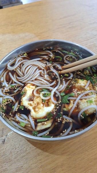
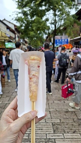
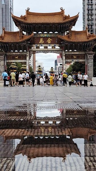

 I’m inviting you on a stroll through my drawings—a completely subjective, far from exhaustive, and totally personal take, since it’s based on my own sketches. I put this travel journal together after returning in late 2024, mostly using felt-tip pens and pencils, with a few collages thrown in. I worked from our personal photos.
 And in Kyoto, Nishiki Market:


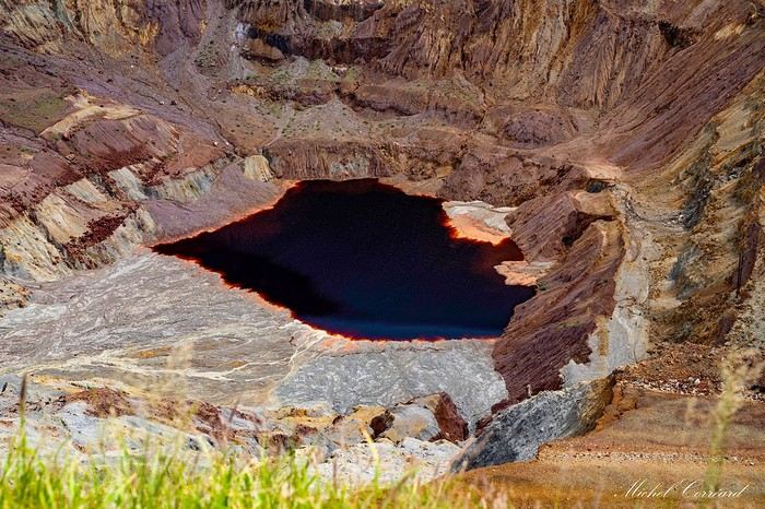
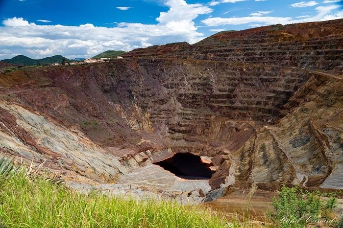
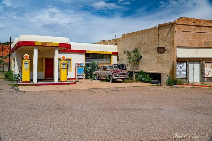
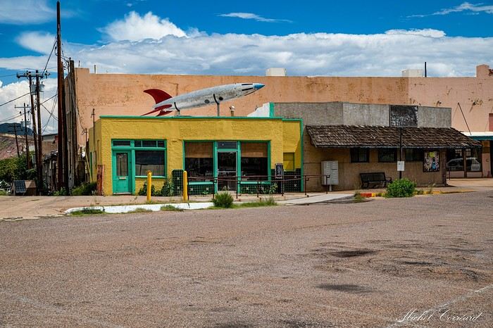
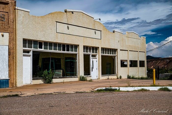
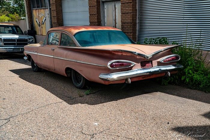
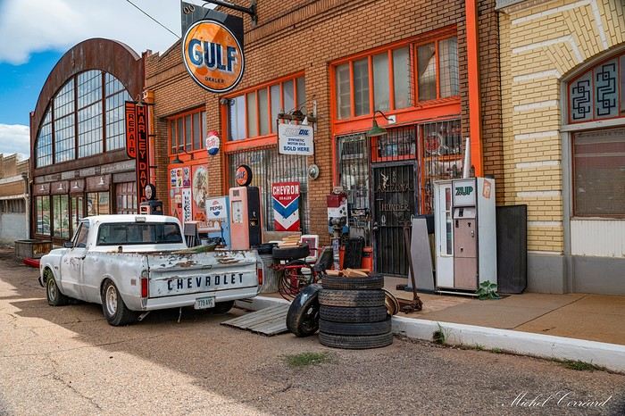
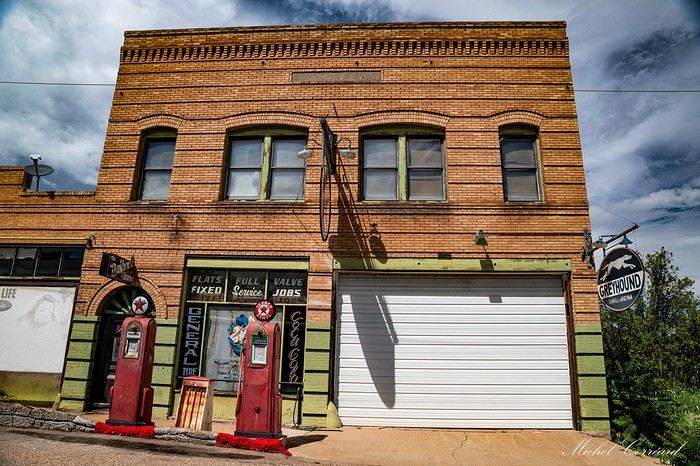
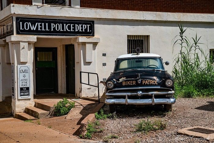

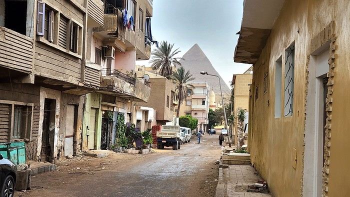
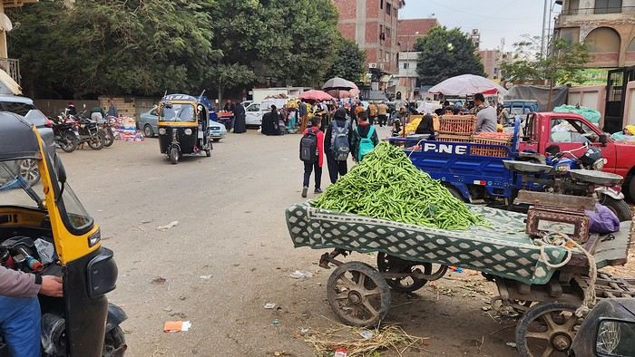
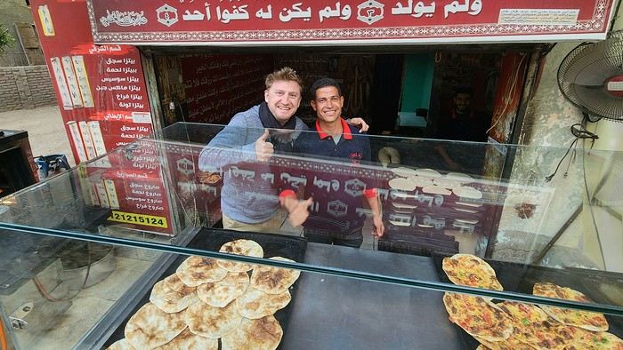
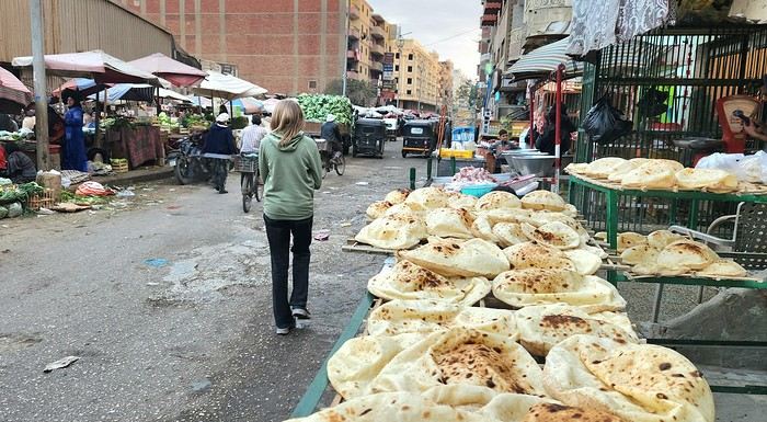
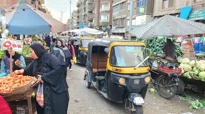
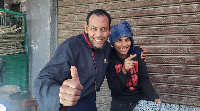
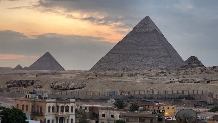
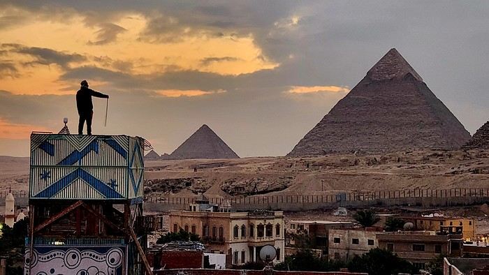
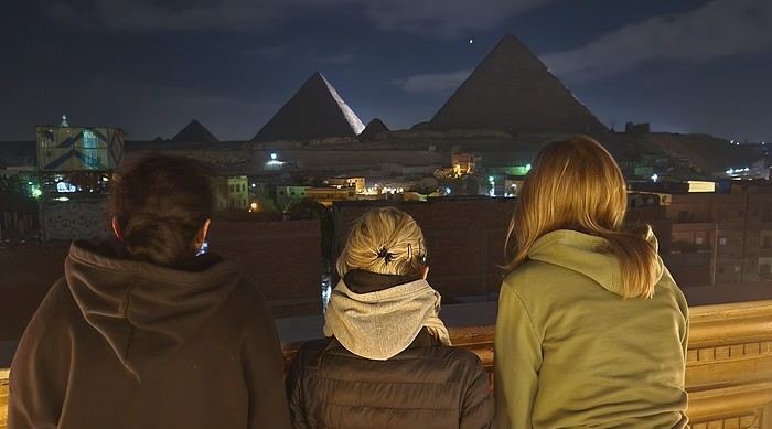







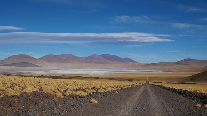
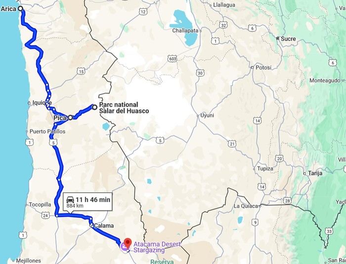 2- Around San Pedro

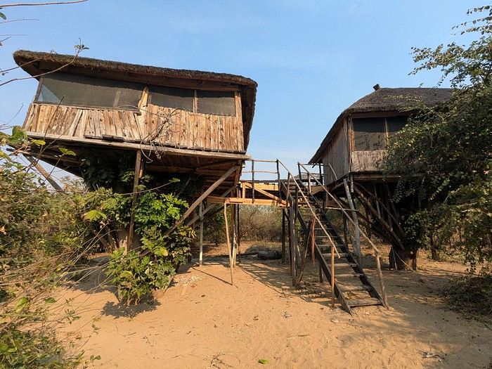
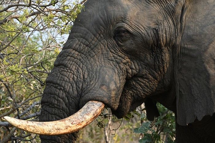 We were trapped, and even our guide looked nervous. After what felt like an eternity (though it was only a few minutes), the herd finally moved on, freeing the track. That afternoon, we did a self-drive safari and—you guessed it—we had zero interest in running into elephants again.
The next day, we headed back to Lilongwe for our flight home. It was a fantastic, varied trip with some intense moments (sometimes *too* intense). Malawi offers amazing opportunities for those who want more than just wildlife reserves.
We were trapped, and even our guide looked nervous. After what felt like an eternity (though it was only a few minutes), the herd finally moved on, freeing the track. That afternoon, we did a self-drive safari and—you guessed it—we had zero interest in running into elephants again.
The next day, we headed back to Lilongwe for our flight home. It was a fantastic, varied trip with some intense moments (sometimes *too* intense). Malawi offers amazing opportunities for those who want more than just wildlife reserves.

 Vila beach
 Sunset behind Santiago
 The rocks and sea at Ponta Preta
 At the summit of Monte Batalha
 Calheta
 Calheta de Baixo
 The beaches just keep coming...
 The dunes
 The 3 coconut trees, a landmark to find the track
 Boca da Ribeira beach
 The hills on our right
 Ribeira Dom João
 Barreiro
 The old track
 The church in Vila do Maio
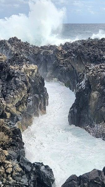
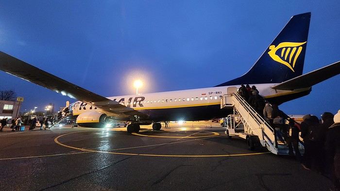
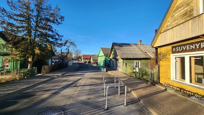
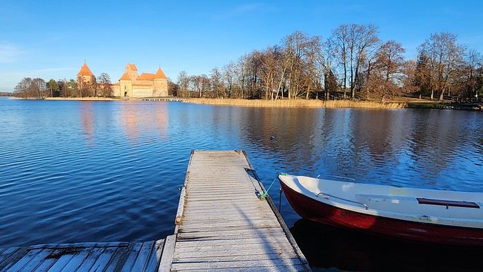



 The large solidified magma massifs that shape the heart of the island have created a large depression more protected from the sun at its center, allowing the growth of a vast laurel forest, today grouped within the Garajonay National Park, La Gomera’s green lung, which has earned it the status of a World Biosphere Reserve. Its completely European appearance contrasts sharply with the rocky and tropical landscapes of the rest of the island. Thus, the climate varies greatly from one point to another on the island: in summer, you can quickly go from a dry and sunny valley at 35°C to a humid forest area at altitude at 18°C.

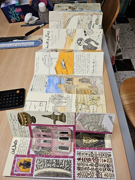
 On the right, the "welcome marker"—those dates offered everywhere as a sign of hospitality. On the left, a tribute to those stunning doors worn by time, admired all over the old quarters, including the abandoned ones.
 Hospitality will often lead you to accept a small coffee, an "Omani coffee," very light, subtly flavored with cardamom, maybe a touch of saffron, and occasionally rosewater.
Here, I’ve depicted a man in the common everyday attire of Omanis: the dishdasha, mostly white (during the week and daytime; colors are more common in the evening or on Fridays and Saturdays). While you’ll see some men dressed in Western clothes, they’re very few. The white dishdasha is truly the shared attire of all men. The dishdasha, which has no hood, is distinguished by a small pom-pom attached to the collar, the furakha, which is soaked in perfume. And believe me, Omanis go overboard with it! "It smells like the pom-pom" is an expression that’s now part of our shared language, my husband and I.
Another must of men’s attire is the kuma, a small round head covering, usually white with brightly colored patterns. The keffiyeh is also worn (but without the cord called an agal in Arab countries), and it’s mostly worn by those with roots in the desert, from what I understood.
And what about the women, you might ask? Some are veiled, some in full black (but not a burka—more like a chador + abaya), due to the influence of Saudi Arabia and the United Arab Emirates, whereas the traditional outfit used to be a layering of very colorful dresses. Most of the women we saw wore neutral clothing, a plain veil over their hair, but with their faces uncovered. We also saw many saris and colorful veils—don’t forget that 40% of the population consists of Indian, Nepalese, and Bangladeshi immigrants, who work a lot in tourism, hospitality, restaurants, services, and construction.
Just to clarify, as a tourist, there’s no pressure to wear a veil, and never any disapproving looks. Of course, you’ll save the mini shorts, plunging necklines, bare shoulders, and midriffs for the hotel terrace—but I’d say that’s the same for men and women, and with the sun being strong, it’s better for your skin too.
Here’s the introduction! In the next post, I’ll tell you about my itinerary, and we can dive in!
Hospitality will often lead you to accept a small coffee, an "Omani coffee," very light, subtly flavored with cardamom, maybe a touch of saffron, and occasionally rosewater.
Here, I’ve depicted a man in the common everyday attire of Omanis: the dishdasha, mostly white (during the week and daytime; colors are more common in the evening or on Fridays and Saturdays). While you’ll see some men dressed in Western clothes, they’re very few. The white dishdasha is truly the shared attire of all men. The dishdasha, which has no hood, is distinguished by a small pom-pom attached to the collar, the furakha, which is soaked in perfume. And believe me, Omanis go overboard with it! "It smells like the pom-pom" is an expression that’s now part of our shared language, my husband and I.
Another must of men’s attire is the kuma, a small round head covering, usually white with brightly colored patterns. The keffiyeh is also worn (but without the cord called an agal in Arab countries), and it’s mostly worn by those with roots in the desert, from what I understood.
And what about the women, you might ask? Some are veiled, some in full black (but not a burka—more like a chador + abaya), due to the influence of Saudi Arabia and the United Arab Emirates, whereas the traditional outfit used to be a layering of very colorful dresses. Most of the women we saw wore neutral clothing, a plain veil over their hair, but with their faces uncovered. We also saw many saris and colorful veils—don’t forget that 40% of the population consists of Indian, Nepalese, and Bangladeshi immigrants, who work a lot in tourism, hospitality, restaurants, services, and construction.
Just to clarify, as a tourist, there’s no pressure to wear a veil, and never any disapproving looks. Of course, you’ll save the mini shorts, plunging necklines, bare shoulders, and midriffs for the hotel terrace—but I’d say that’s the same for men and women, and with the sun being strong, it’s better for your skin too.
Here’s the introduction! In the next post, I’ll tell you about my itinerary, and we can dive in!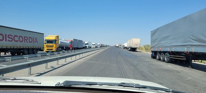
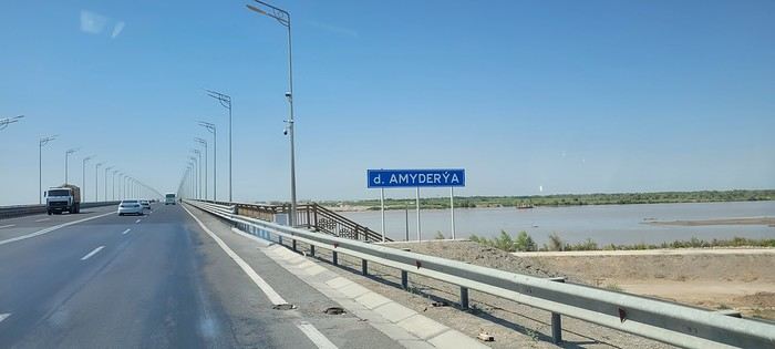
 Roundabouts are particularly interesting because they feature emblems of Turkmen culture, like the dog, a carpet, the Ahal Teke horse, or Muslim symbols, even though the presence of Islamic artifacts is quite limited.