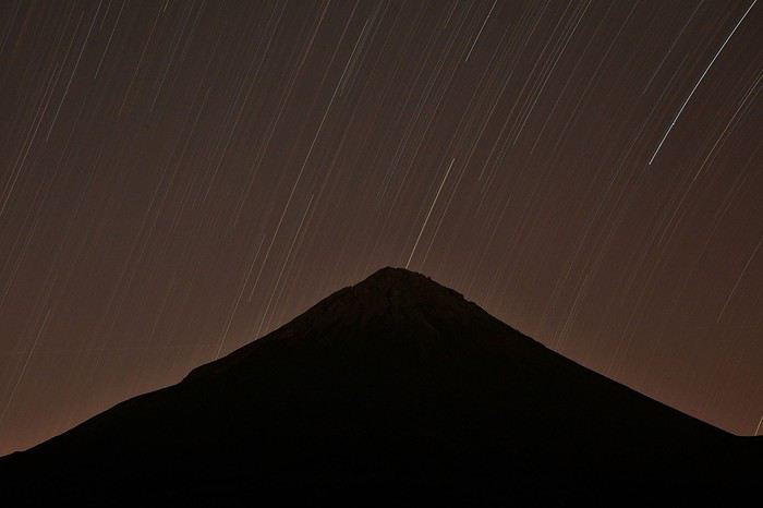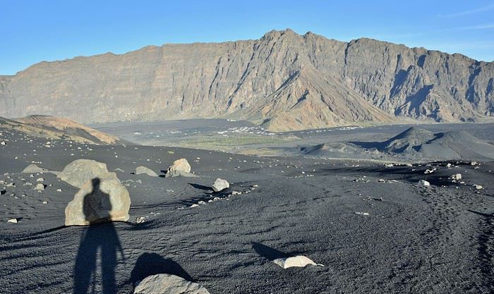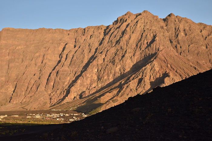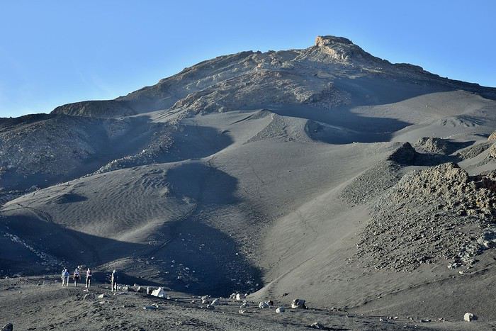
An Off-the-Beaten-Path Destination? Cape Verde!
FR

Translated into English.

Original post
LH


It’s been a month and a half since our family returned from Cape Verde, and I’ve finally found the time to write this travel journal about this beautiful yet little-known destination.

Cape Verde is a small volcanic archipelago made up of ten isolated islands in the middle of the Atlantic Ocean. At the crossroads of maritime routes between three continents—Africa, the Americas, and Europe—its name is tied to the history of slavery.

But today, this little piece of Africa with Creole influences has a lot to offer travelers craving a change of scenery and adventures off the beaten path.

We visited three of these ten lovely islands rising from the ocean: Maio, the wild and authentic island; Fogo, the volcanic one; and Santiago, the cosmopolitan hub.

MAIO: THE SMALL, WILD, AND AUTHENTIC ISLAND

To travel between the neighboring islands of Santiago, where we landed from France, and Maio, the first stop on our trip, there are two options: plane or boat. To avoid the risk of the boat being canceled due to rough seas—and to save time—we chose to fly. The flight takes just fifteen minutes, while the boat ride lasts three hours. Since our stay was only fifteen days, saving that half-day was a big deal.
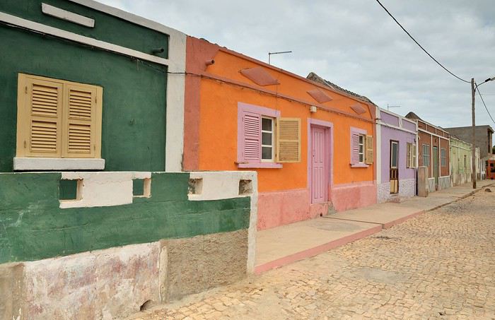
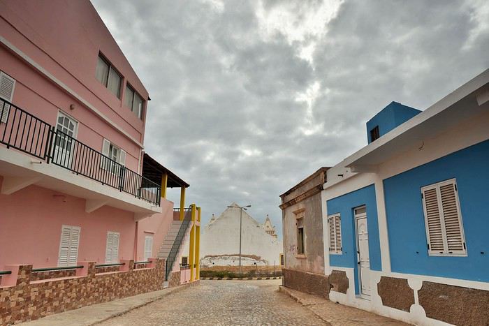
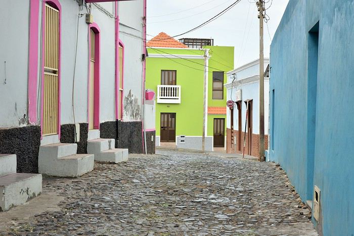
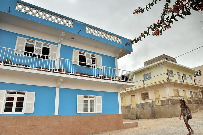
The colorful houses of Vila de Maio

Our first day on the island didn’t let us see the sun. It’s mid-August, the very start of the rainy season—which should really be called the cloudy season. This “rainy” period has nothing to do with what happens in other parts of the world, like Southeast Asia, where the monsoon can be devastating. Here, locals hadn’t seen a drop of rain in nearly a year, and for them, it’s a tragedy. That’s why the ground is so dry and the vegetation so sparse.

As a result, fruits and vegetables are scarce, and livestock are suffering so much that some farmers are forced to cull their herds. Ironically, back in France, we’d just come out of a miserable winter with nearly five months of nonstop gray skies and frequent rain, especially in some regions. Is our climate out of whack?...
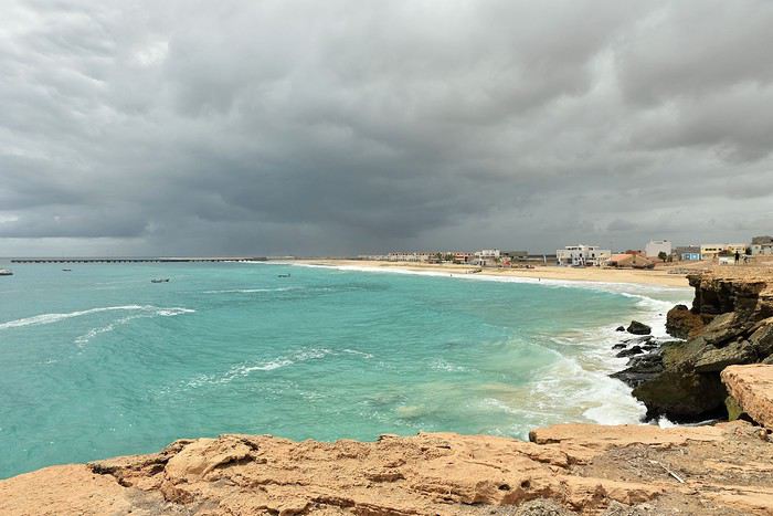
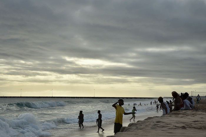
The beach bordering the village of Vila de Maio

We stayed a week on Maio. We were lodged at Stella Maris Village, a small residence at the edge of Vila. A shared pool, perched on a small cliff, overlooks the deep blue sea.

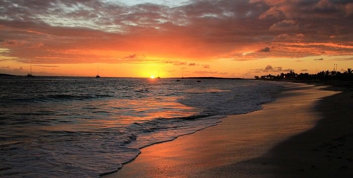
Sunset at Stella Maris Village

The cliff isn’t very high, but it offers a nice view of the surroundings.


From the residence, it’s just a ten-minute walk through the village to reach the beach.

> The beach and the fishermen

We didn’t choose Maio just for its calm, wild, and authentic vibe. It was also so Victor and Arthur, our two sons, could earn their Level 1 scuba certification in Cape Verde’s beautiful waters, known for their abundant marine life but still relatively untouched by divers—for now...

On the first day, we met Bernard, who runs AAA Maio Plongée, to plan the five dives needed for their certification.

The dive sites are accessible by boat, but to reach it, you have to cross the surf. The waves vary in strength, and while they were gentle for our first snorkeling trip, getting past them with scuba tanks on our backs was a bit more of a workout for the later dives.
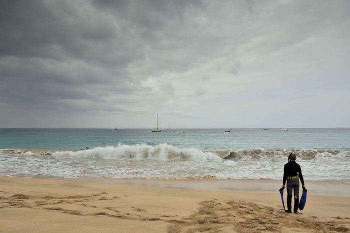


Snorkeling trip: this time, the waves were gentle...

The week of diving with Bernard went perfectly, in Cape Verde’s surprisingly fish-rich waters. On the morning of the last dive, while checking the sea to cross the surf safely, we even spotted a pod of dolphins swimming across the bay in the distance. Always a magical moment...

In a week, the beach at Vila, where the dive club is located, was the liveliest spot we saw on the whole island. All day long, fishing boats returned loaded with fish of all sizes.
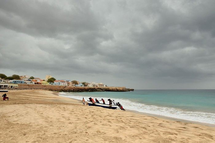
Return from fishing

Here, fishermen have a strong sense of solidarity because they can’t pull their boats out of the water alone, especially when the waves are rough.

So, all day long, whenever a boat comes in, the fishermen on the beach rush to help drag it ashore and secure it higher up on the sand, away from the sea.
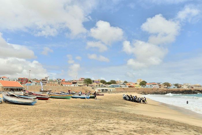


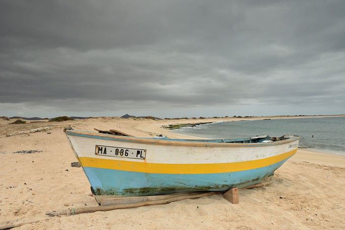
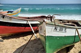
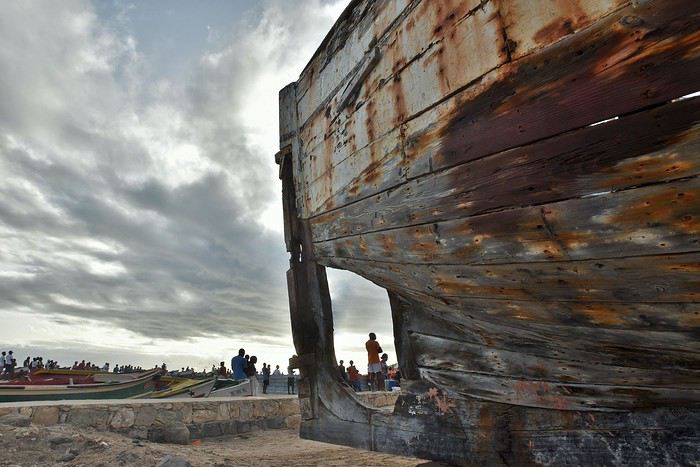
The sight of these colorful fishing boats on the beach is something we saw everywhere in Cape Verde.

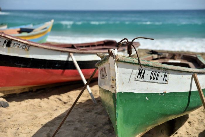


Sometimes, the fishermen bring back impressive catches. Instead of carrying the fish by hand to a proper spot, they clean them right on the beach.
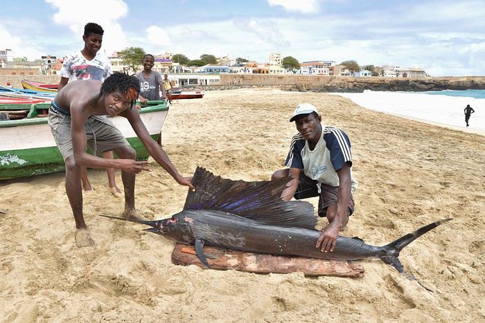


Sailfish

But every evening during our stay, this beach also hosted Maio’s annual soccer tournament. Residents from villages across the island gathered here at the end of the day to compete, including a few women’s teams.

Players were cheered on by hundreds of spectators—which is a lot for a small island with barely 8,000 inhabitants.


The beach doubled as a stadium: sand replaced grass, and the fishermen’s colorful boats served as seats and bleachers. The celebration had a laid-back vibe, with loudspeakers blasting music and the smell of grilled fish in the air.
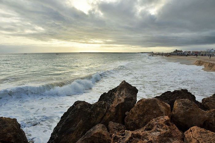


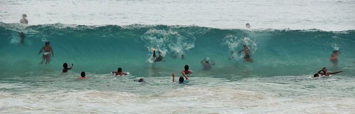
Meanwhile, kids splashed around in the sea, which could sometimes be dangerous. The waves could be strong, but the currents were the real concern.
LH Lhorizon Veteran ·
Read on...

> The "capital": Vila de Maio and its inhabitants

During our week in Maio, not a single day went by without us heading to that beach. Yet, as pleasant as it is, there are fortunately other places to discover on the island. Starting with its main town: Vila de Maio.


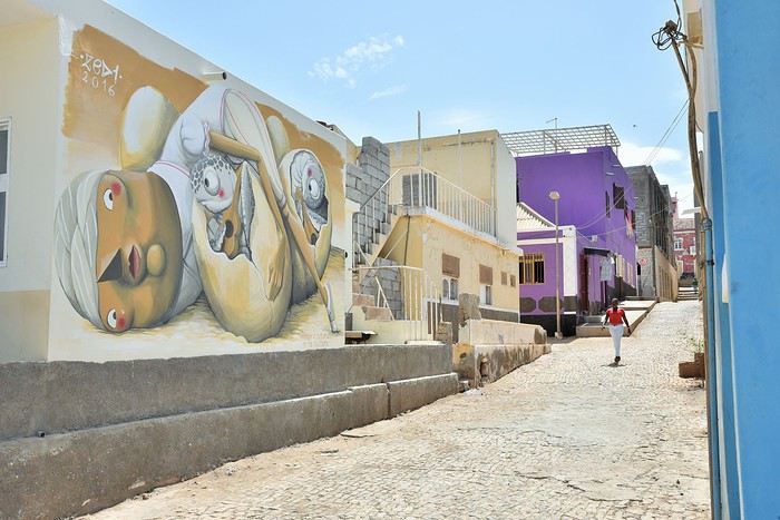
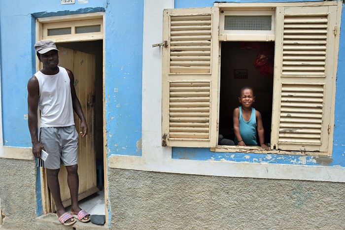
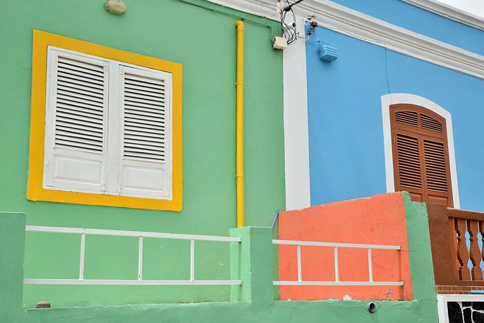
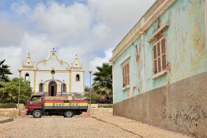
In Maio, just like almost everywhere in Cape Verde, the houses share something in common with the fishing boats: they’re cheerful and colorful.


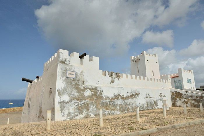
Overlooking the sea, the small Fort San José and its old cannons remind us that two or three hundred years ago, it was vital to fight against the pirates who sailed these waters.


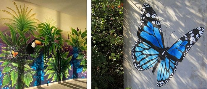
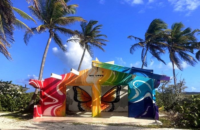
Times change, and so does the decor! Today, some houses are tagged by artists (see the recap at the end of the article).


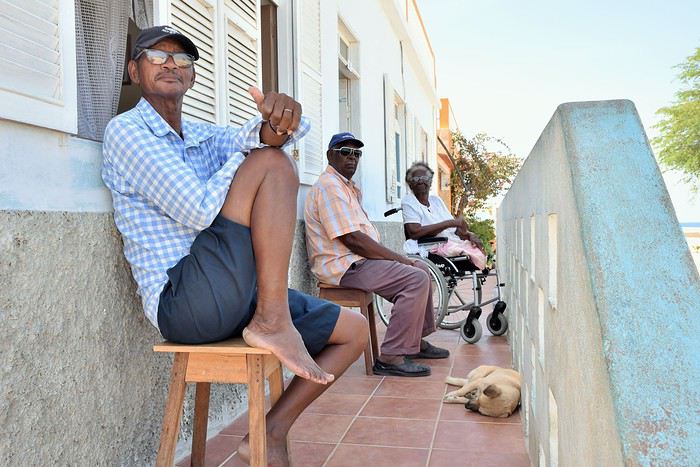
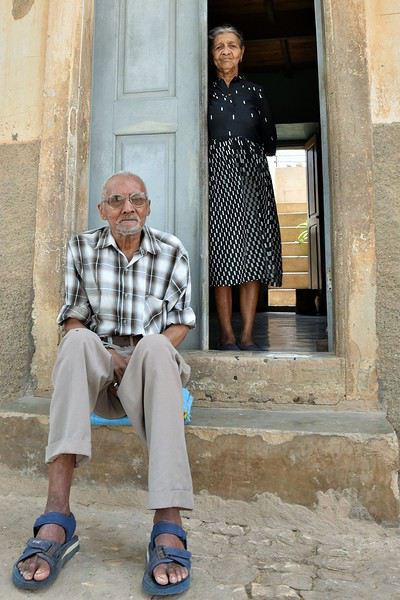
Vila has barely 3,000 inhabitants, and when you stroll through its streets, you quickly get the feeling that everyone knows everyone.


That’s why we greet every local we pass in Portuguese, the local language. In return, it’s rare for them not to reward us with a big smile.


They don’t seem to pay much attention to us, but as soon as we greet them and try to start a conversation, they always respond with great kindness. For someone like me who loves chatting with the people I meet while traveling—and then taking their photo when they agree—this island is pure bliss.


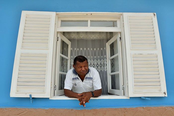
One morning, while wandering through the colorful streets, I greet a man who’s calmly enjoying the breeze at his window. He replies in English and immediately strikes up a conversation. His name is Mario, and he proudly tells me he’s visited many far-off countries like Sweden, Russia, and even Canada. Now retired, he spent his entire career as a long-haul sailor, which took him all over the globe. This well-traveled Cape Verdean is friendly and open, and I’ll thoroughly enjoy chatting with him almost every day, since I’ll run into him regularly in Vila’s streets.

Mario, retired long-haul sailor
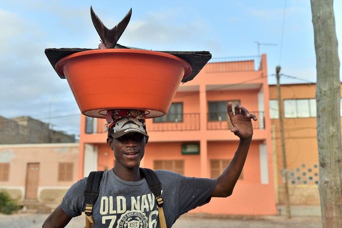
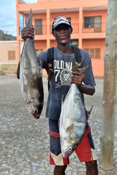
The day after this encounter, while turning another corner, I get reeled in by a fisherman named Manuel: he’s spotted my camera and asks me to take his picture.

Manuel

Cheerful and theatrical, he dares a few dance steps with the day’s catch balanced precariously on his head, nearly dropping everything several times. Then he proudly shows off the beautiful dorado he’s caught in front of my lens.


Then Manuel leaves as suddenly as he arrived, humming quietly, his basin of dorado more or less balanced on his head...


I head off too, and as I wander through the streets and meet people, I capture the places and the locals.

Isandra and her mischievous eye

Kalao
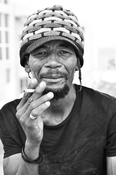
Branco
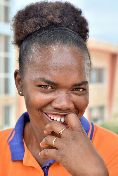
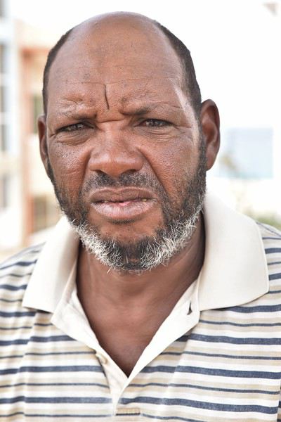
When I take portraits of the locals, the best moment is always when I show them the photos I’ve taken. And with Sandra, Kalao, and Branco, as always, the comments fly and so do the bursts of laughter. Isandra gives me her email address so I can send her the three photos, which I’ll actually do once I’m back in France.
LH Lhorizon Veteran ·
Continued...

> Sea turtle nesting

Cape Verde is one of those places in the world where every year, sea turtles come to lay their eggs. And this spot isn’t just any place—despite being tiny, this country is the third most important nesting site in the entire Atlantic for these peaceful reptiles.

To witness this nighttime spectacle, we reached out to the Maio Biodiversity Foundation, whose mission includes protecting marine turtles.

It was Dennis, a young member of the foundation, who took us out at dusk to a beach on the island where turtles usually come ashore. A French couple we met in Vila had been here three days earlier—they’d seen six turtles laying eggs! We were full of hope, especially since the window seemed long: the outing would last four hours.

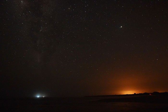
And yet, we spent a very long time without spotting a single turtle on the horizon, even though we kept scanning the dark sea. The only show nature put on for us was the starry sky above our heads.


To pass the time, Dennis shared tons of info about turtles. For example, he explained that one of the most surprising things about these animals is their ability to return to the exact beach where they were born to lay their eggs, despite traveling thousands of kilometers across the oceans in the meantime. You’d think turtles invented GPS long before humans did...

After nearly three hours of waiting, a foundation member signaled us with a red headlamp from at least two hundred meters away: that meant they’d spotted a turtle about to lay eggs.

Why a red light? Simply because if a turtle sees a white light, it’ll turn right back around. Red light, however, doesn’t disturb them.

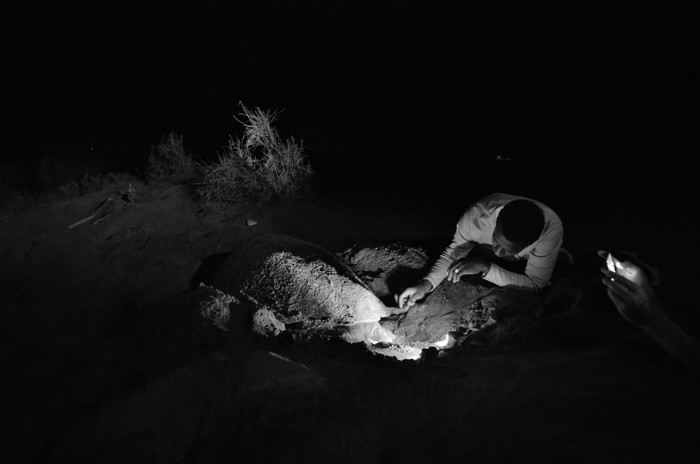
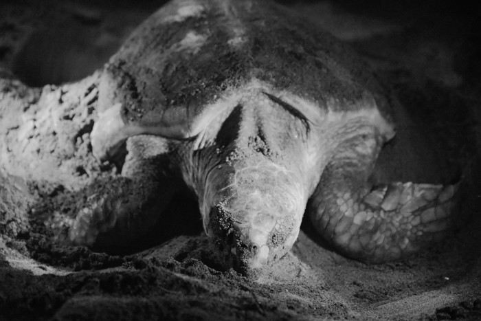
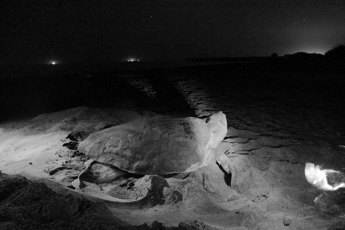
When we reached the turtle, she’d already started her work. The contrast was striking between this large, clumsy animal and the incredibly delicate way she dug: the turtle scooped sand with precision, using her flipper like a shovel!

N.B. Red light means red photos, so weird-looking ones—that’s why I’m showing them in black and white here. It’s not artistic black-and-white photography, just a practical choice!


A Maio Biodiversity Foundation member observing a turtle digging

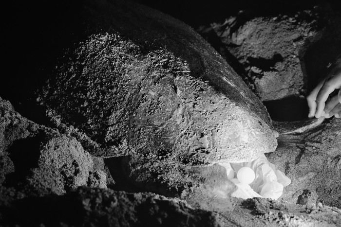
As soon as the turtle seemed to have finished her hole, a foundation member placed an open plastic bag inside it. That’s where the turtle would lay her eggs—not directly in the sand.

The goal was to collect the eggs (60 to 80 on average per nest) and move them to what’s called a nursery: another hole in the sand, but this one dug by foundation members. This hole would be protected from natural predators (crabs, rats, stray dogs, even birds) and human carelessness.

The nursery’s purpose is to give the eggs the best conditions so as many baby turtles as possible hatch and survive.


For now, we still had to stay behind the turtle so as not to disturb her: during egg-laying, even red light shouldn’t shine directly on the animal’s face. So we’d see her head later...

When the laying was done, foundation members quickly measured the length of her shell. Verdict: 90 centimeters—without even counting her head!

Then they hurried to collect the bag of eggs because the soon-to-be mom, guided by instinct, had already started covering the hole! She didn’t know it was empty, but we watched her fill it in anyway—it was important to let her complete her instinctive process from start to finish. The eggs would be counted later.


Filling in the empty hole seemed to take a lot of effort. We were just centimeters away and could hear her breathing clearly. Once she’d finished, she headed back to the sea—pretty quickly, considering her size and aquatic nature.

Back to the sea

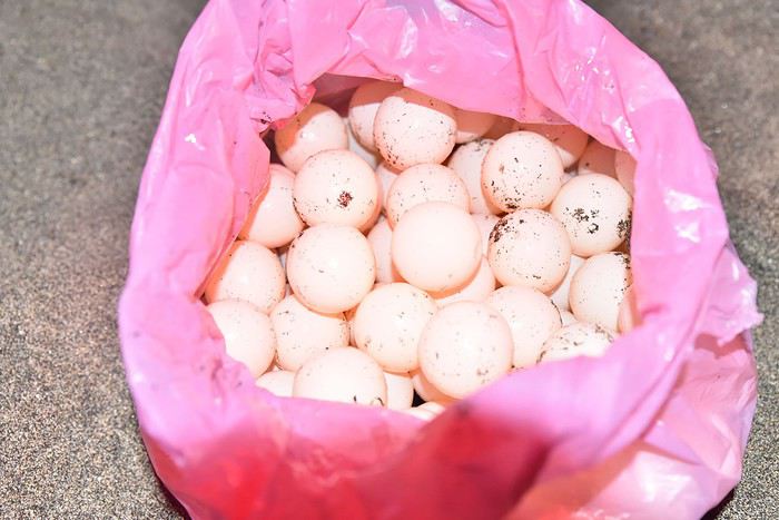
Once she’d disappeared into her natural element, it was time to count the eggs, which looked exactly like ping-pong balls—just stickier. And it turned out our friend hadn’t been lazy: she’d laid a whopping 101 eggs!

Nesting results: 101 eggs!

> Deserted beaches and wild dunes

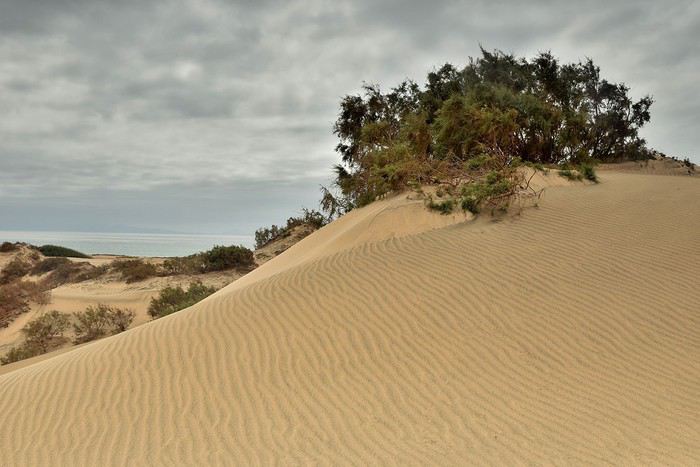
Maio is also famous for its deserted beaches and wild dunes, so we decided to see what these typical island landscapes looked like. To do that, we headed to Morinho, a small village in the northwest of Maio. We’d thought about going by quad, but since we hadn’t bothered to bring our driver’s licenses from France, we had to call a taxi instead.

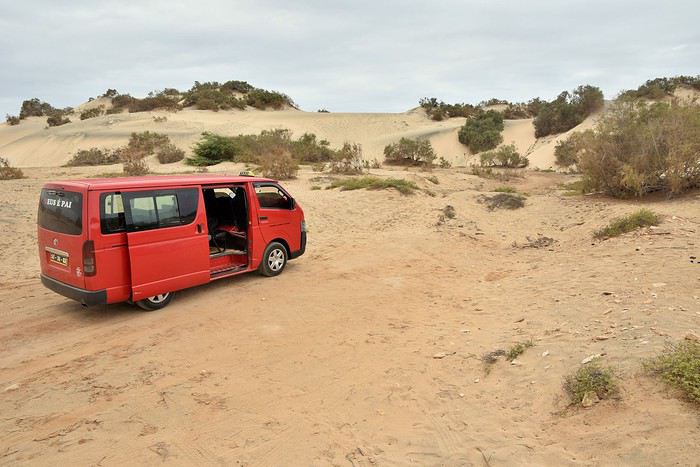
That’s how we met Neal, a young Cape Verdean who drove us in his bright red van to the foot of the dunes.


From there, we had a fifteen-minute hike through the dunes. The ups and downs kept coming while the sun... well, it was nowhere to be seen.


At the end of this little walk, we found a beautiful, wild, and completely deserted beach.


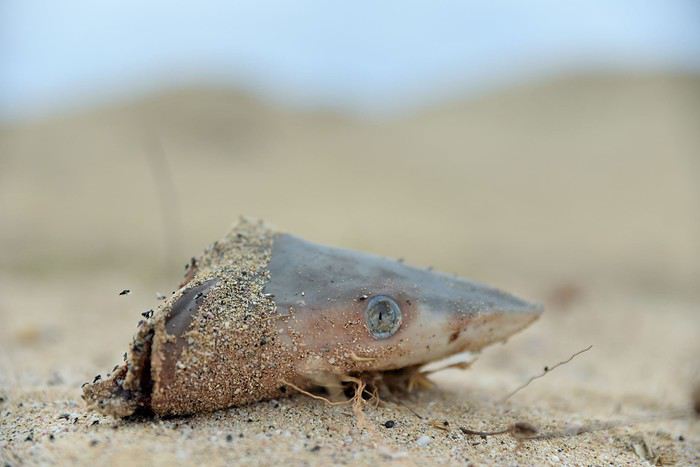
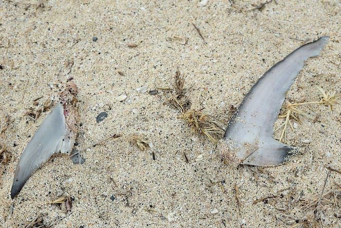
Around the only fishing boat decorating the shore, some fish remains had been left—but not just any fish: two juvenile sharks. What stood out compared to fishing practices in many other countries was that here, they discarded the shark fins and ate pretty much the rest. Elsewhere, sharks are overfished specifically for their fins, which fetch a high price, and the rest of the shark is often thrown back into the water—still alive—to suffer. The Cape Verdean way reassured us: here, fishermen only took what they’d eat.


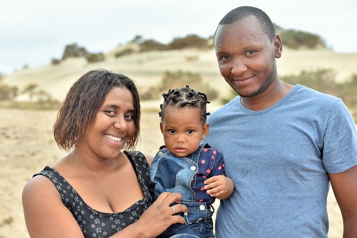
After a quick swim alone in the warm water, we left the beach to meet Neal again. He was waiting at the foot of the dunes with his wife and their little girl, Nilsa, who’d joined him.

Little Nilsa and her parents

That evening, we ran into them at a small beachside shack in Vila: it was in this cozy little restaurant that they’d spend part of the escudos they’d earned that afternoon with us. As for us, it would be our last night on Maio, a place we’d remember fondly.

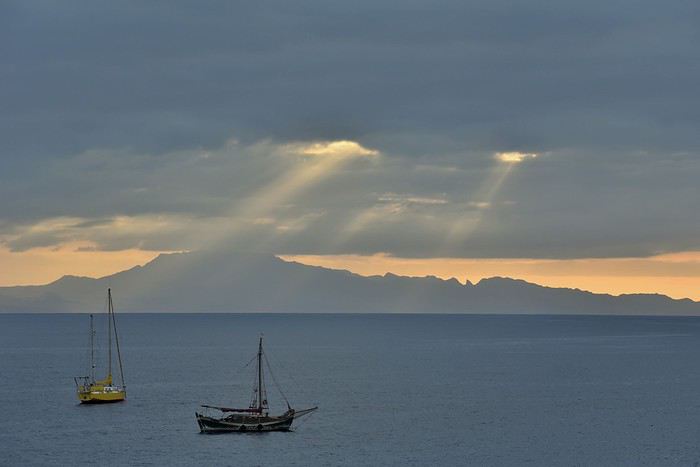
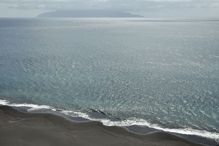
The island of Santiago seen from Maio

That’s it for Maio. Before moving on to the small island of Fogo and its volcano—which erupted in 2014, swallowing the villages thriving on its slopes with little foreign attention—here’s a short video of the most beautiful spots we were lucky enough to discover in Cape Verde. https://youtu.be/pm3boTbNGmI
PT Ptitortue Veteran ·
aaahhh! Cool!! Finally a travel journal about Maio Island to keep mine company! Thanks a bunch+++ It brings back such good memories! Saudade! Maio is one of my top 3 favorite spots in Cape Verde out of the 10 islands, along with Santo Antão and Fogo. Even though I also love São Nicolau and Brava. But wild Maio enchanted me!

So, you’ll have to go back to Cape Verde for your next trip to explore the Barlavento islands!
LH Lhorizon Veteran ·
Hi Marie,

aaahhh! That brings back such good memories! Saudade!

😉

aaahhh! Wild Maio enchanted me!

I have to admit, we feel the same way—Cape Verde in general, really. Maio isn’t just beautiful and peaceful; the people there are genuinely lovely too. And to top it off, there were almost no tourists in August. It’s such a change from those much more popular spots where you’re constantly bumping into crowds.

Well then, you’ll have to go back to Cape Verde for your next trip to explore the Barlavento islands!!

I don’t know if we’ll ever return, but if we do, it’ll be a real pleasure. It’s such an underrated destination that’s absolutely worth it.
PT Ptitortue Veteran ·
No matter the month, Maio is almost tourist-free. The only thing that "spoils" it a bit is all the construction by real estate companies (mostly Italian) building like crazy... for no reason, with no clients... huge houses that stay empty. It's a shame. But Maio is magical despite everything! I hope you get a chance to return to Cape Verde and explore Santo Antão, São Nicolau, and... it's so different from what you've already seen! Have a great weekend! Marie
LH Lhorizon Veteran ·
I hope you get a chance to return to Cape Verde and discover Santo Antão, São Nicolau, and... it's so different from what you've already seen!

Thanks Marie, it’s making my mouth water!

Tomorrow, I’ll post about Fogo and its volcano. Speaking of volcanoes, I’ve been lucky enough to see them on all five continents, but I have to say, this one—with its recent history and the 2014 eruption that swallowed everything—really blew me away. It’s now in my top 3!

By the way, I think it just disappeared from Ptitortue’s profile picture, didn’t it? 😉
PT Ptitortue Veteran ·
Nice one! Yeah, I changed my photo! ;o) The new one is from Santo Antão... but in the more arid and volcanic part of the island.
AN Annachris Veteran ·
Thanks for your travel journal and those amazing photos—you’ve really made me want to go with my kids and my husband, all of us divers and wildlife lovers!
PT Ptitortue Veteran ·
small clarification: there’s quite a bit of marine wildlife and some birds. However, don’t expect any wild land animals—there are only domestic animals (goats, cows, sheep, chickens, dogs, etc.).
LH Lhorizon Veteran ·
Thanks Anna, that’s cool. Okay, I’ll continue then...

To be continued...

FOGO: THE VOLCANO ISLAND

Rising 2,829 meters above sea level, Pico do Fogo ("Peak of Fire") is the highest point in Cape Verde and the country’s only active volcano.

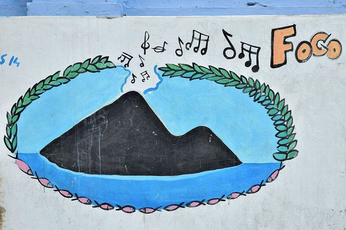
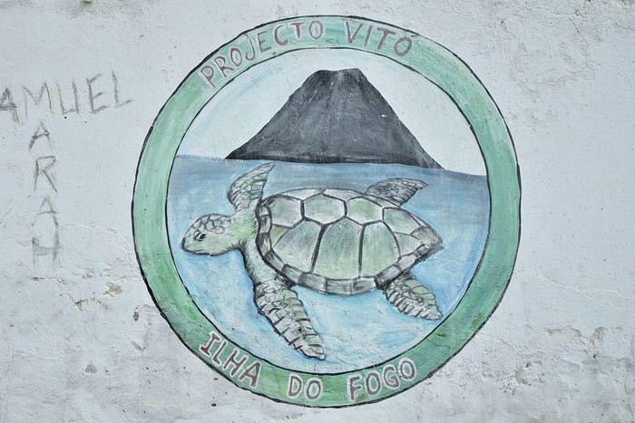
Expressive graffiti (São Filipe)

Our stay on Fogo will unfold in two parts: first, we’ll spend three days in what feels like another planet—exploring the surreal landscapes of the caldera—before wrapping up with a visit to São Filipe, the island’s main town.

Graffiti (São Filipe)

> Living inside an active volcano!

What makes Pico do Fogo famous is that it’s one of the few active volcanoes in the world that’s still inhabited.

- The 2014 eruption

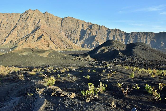
Inside this nine-kilometer-wide caldera, where craters have sprouted like mushrooms over time and eruptions, about a thousand people lived until November 23, 2014.

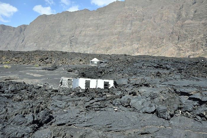
That day, the volcano erupted. Lava spread across much of the caldera over the following days and weeks, slowly but surely swallowing every home in its path. Though there were no casualties—thanks to a timely evacuation—the small hamlets there were nearly wiped off the map.

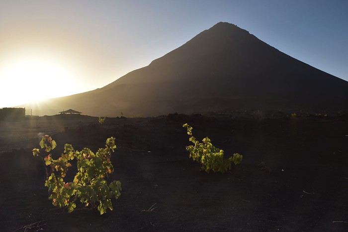
Photo: Pico do Fogo between two eruptions—the devastating 2014 one and the next to come...
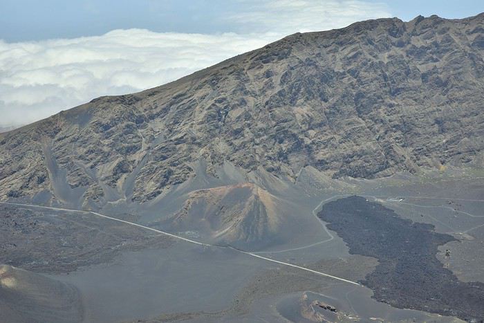
But let’s start from the beginning. To reach the crater from São Filipe, you take an *aluguer* (a shared minibus taxi). Since its daily schedule didn’t align with our flight’s arrival, we had to take a "private" taxi, arranged by José, who runs a guesthouse in the heart of the caldera, right at the foot of the Grand Pico, the main crater. We shared the ride with Leïla, a Moroccan traveler we quickly bonded with and spent the next three days exploring alongside.

First, we drove for an hour on a winding road, climbing from sea-level São Filipe up to the caldera, perched at around 2,000 meters. There, we entered the vast crater via a poorly maintained paved road.

But soon after entering the caldera, the road was cut off by a three- or four-meter-high lava flow. We had to take a detour—a secondary track carved out in the weeks following the eruption.

Photo: Arrival in the caldera, seen from the Grand Pico—the white line is the road blocked by lava; the gray one is the detour track.
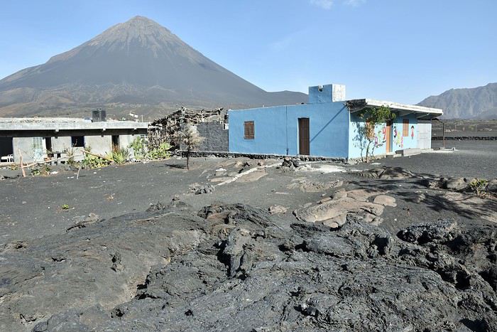
The landscape was both lunar and mesmerizing, so much so that we barely noticed the 45-minute drive to the village. The place is called Chã das Caldeiras. In theory, that’s the caldera’s name, but in practice, it’s what everyone calls the village—or rather, the hamlets rebuilt at the bottom of the caldera.

When we arrived at *Pensão Casa José Doce*, where we’d be lucky enough to spend three unforgettable days and nights, we were greeted by Carole. French, she’s also José’s wife, the Cape Verdean owner of the place.

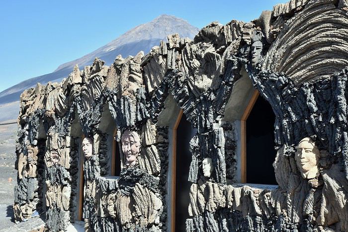
For the guesthouse’s construction and decor, they didn’t have to look far: volcanic rocks and hardened lava pieces were used, their colors varying depending on the eruption’s date.


Photo: *Pensão Casa José Doce*—the guesthouse at the foot of the volcano.

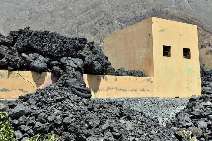
In 2014, José was incredibly lucky: out of the 22 guesthouses in the crater at the time, his was one of only two that weren’t buried under lava. It stopped just ten meters from his walls.


Photo: In 2014, the lava (foreground) stopped ten meters from José’s guesthouse (the gray building on the left).

José explained that during the two-and-a-half months the 2014 eruption lasted, residents had to live temporarily in São Filipe and couldn’t return to the crater. They scoured satellite images online, trying to see if their homes had been swallowed. The waiting—and above all, the helplessness they felt in the face of nature’s fury—was unbearable.


Sometimes, the lava would stop just meters from a house and stall. People thought their home was saved. But a few days later, it would inexorably resume its advance, devouring everything in its path.


Here, the landscape is one of total desolation. Yet after the eruption, the inhabitants of this surreal place, armed with extraordinary courage, decided to return and rebuild everything. Without any help, because the authorities consider that in case of another eruption...

José then shared how he feels: he was born here, grew up here, has always lived here, and there’s no way he’d let himself be uprooted. Everyone here thinks the same. So these people, who’d been forced from their homes by nature, decided to rebuild everything. Through patience, perseverance, and sheer hard work, they pulled off the impossible. Alone. Without help.


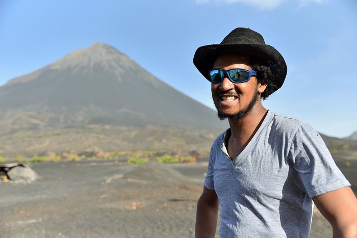
José

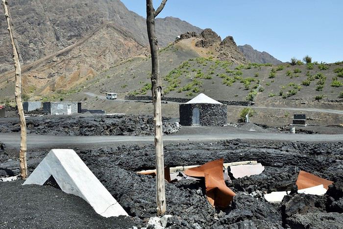
José couldn’t stop telling us the story of his village—his story. He went on to explain that the church had also been submerged by the lava flow. Here’s all that’s left of it.


Photo: In the foreground, the engulfed church; on the left, the top of its pediment.

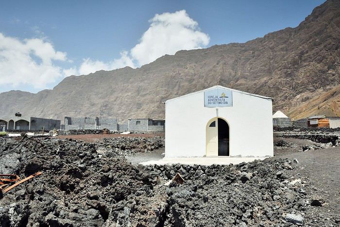
Since then, a small Adventist church has been rebuilt on the lava, at the foot of the caldera’s walls.


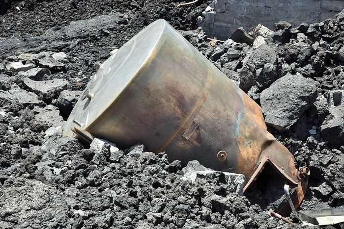
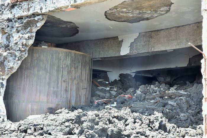
A little further on, the wine cooperative suffered the same fate as the church.


When José told me he’d seen the wine burn, I struggled to picture the scene. But standing in front of the disaster’s remnants, I suddenly understood much better what happened here.


Photo: A wine vat carried away by the lava.

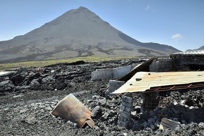
As for the cellar, there’s not much left of it either.

Photo: The cellar’s interior was completely devastated by the lava.
In 2014, no Western country covered this eruption or its impact on the locals. Except for Portugal, which still has ties to its former Cape Verdean colony. The silence was baffling to us after seeing this wasteland—and to some volcanologists, who called it "the forgotten eruption."

If this story feels eye-opening, such adversity hasn’t embittered the people here. They see rebuilding everything as normal.


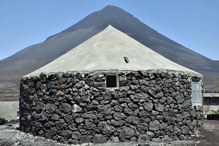
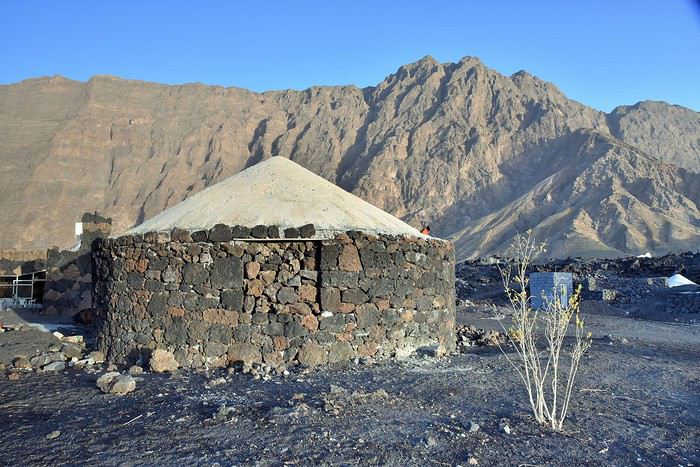
What’s more, the reconstruction followed local traditions. You can see many typical circular houses, built with stones spewed by the volcano, which even inspired the roofs’ shape.

Photo: Chã das Caldeiras—a traditional house.

Today, life has returned to normal, though the uniqueness of this place makes daily life challenging, as Carole explained. For example, there’s no running water: it has to be delivered by truck and stored in tanks so you can still take a shower.

There’s barely any electricity either: a few solar panels only heat shower water or recharge cameras for passing travelers. At night, candles are the only light.

Also, to get supplies, you have to leave the crater and shop in São Filipe—not exactly a quick trip to the corner store, but a three- or four-hour round trip.

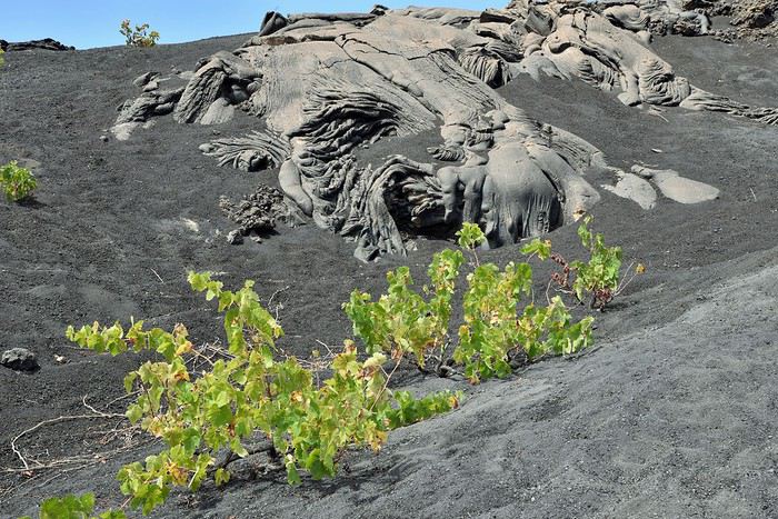
Still, the locals have adapted. They know their volcanic soil is surprisingly fertile for plants, vegetables, and fruit trees. It might seem odd, but everything grows here—and grows well.


Photo: A pomegranate tree at the foot of the volcano.

Pomegranates, quinces, figs, mangoes, potatoes, beans, etc.—fruits and vegetables thrive here. So do coffee and, of course, grapes, since the volcano’s specialty is *Manecom*, the famous local wine.

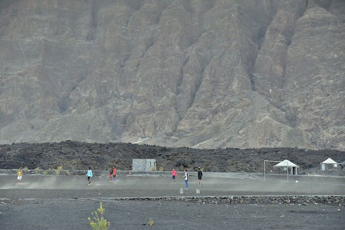
Our first evening in this incredible place was approaching. The sun wasn’t quite ready to set, but as it dipped, it quickly cast the caldera’s interior into shadow beneath its towering walls. A few locals were enjoying the last light of day, playing soccer in the volcanic dust next to the latest lava flow.


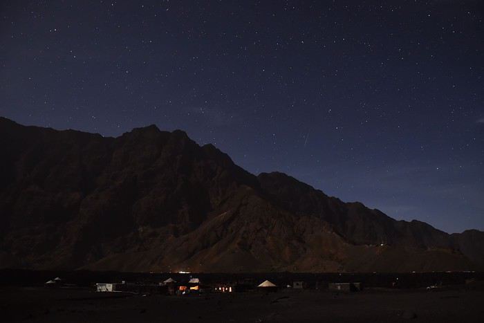
After a day of emotional stories and visits, it was time for us to turn in—especially since we’d be climbing the Grand Pico at dawn, a notoriously strenuous hike. Still, I couldn’t resist capturing the place at night before going to bed.

The caldera’s walls.


To be continued: The Grand Pico ascent...
PT Ptitortue Veteran ·
Since I already knew Cape Verde and Fogo and had friends there before 2014, I managed to follow the updated news every day on Facebook or Cape Verdean TV. Otherwise, here in Europe, we didn’t hear much about it... though it did make a quick appearance on the France 2 news, but only once and about two weeks after the eruption.

PS: Your photos are amazing! Thanks for sharing!
AN Annachris Veteran ·
Thanks Marie for this clarification 🙂 We’re marine wildlife enthusiasts, and witnessing turtle nesting would be an amazing experience for us—especially if it’s done with respect for the animals. We’d already be thrilled 😏
PT Ptitortue Veteran ·
hehehe! For the turtles, you’ll want to aim between July and September, roughly. On every island where nesting happens, there are associations that protect them and organize visits in a respectful setting.
RO Rouquine38 Globetrotter ·
Hi, I’m really happy to follow this travel journal. We spent a week in Cape Verde last winter, and we were left with an amazing impression of Fogo. We didn’t make it to Maio due to lack of time, but your photos make me want to go check it out. Looking forward to the Grand Pico ascent 😉. Isabelle
LH Lhorizon Veteran ·
- The ascent of Grand Pico and descent via Petit Pico

To make everything clear, let’s start with a brief description of the places:

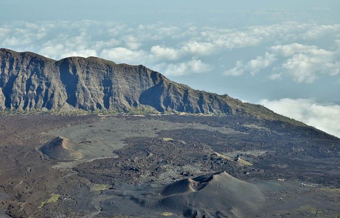
The caldera: It resembles a vast volcanic crater but isn’t one. During a mega-eruption tens of thousands of years ago, the magma chamber beneath the volcano emptied, causing a gigantic collapse—this is how the caldera was born. Its diameter is nine kilometers. At the bottom of this vast circular depression, lava spreads during each eruption, and this is also where the inhabitants of Chã das Caldeiras live. The interior of the caldera is dotted with numerous craters, including Grand Pico and Petit Pico. Grand Pico: This is the famous volcanic cone whose summit reaches 2,829 meters, the highest point in Cape Verde. Eruptions occurred at its summit until 1769. Petit Pico: Located on one of Grand Pico’s flanks, this is the crater from which the devastating 2014 eruption occurred. The other craters: Eruptions after 1769 took place from the flanks of Grand Pico, forming several craters of relatively modest sizes.


The classic ascent of Grand Pico takes an average of six to seven hours. Once at the top, you descend on the other side, allowing you to discover Petit Pico, which is truly worth the detour. To get a guide, just ask José the day before.

Theoretically, the departure is at 6:00 AM, but for us, it was 6:20! Meaning we started in the dim light. Our guide is Dony, also a resident of the caldera—a true local, just like José. He’s always in a good mood and laughs a lot, which is really nice. Finally, Leïla, whom we met the day before in the car that brought us here from São Filipe, joins our group.

So, we set off as a group of six, and after twenty minutes of fairly easy walking (since the incline is gentle so far), the rising sun suddenly warms the colors of the caldera behind us.


As for the volcano, it stands majestically before us. The few hikers we spot far ahead on the slopes seem tiny, even though they’re nowhere near the top. It quickly becomes clear that the summit is much farther away than it appears. And even though the sun is still low, it’s already starting to get hot.


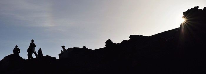
Photo: Our little team tackling the volcano

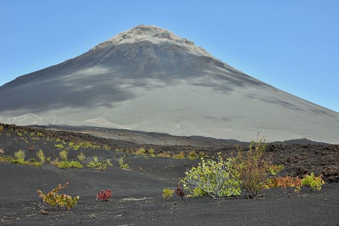
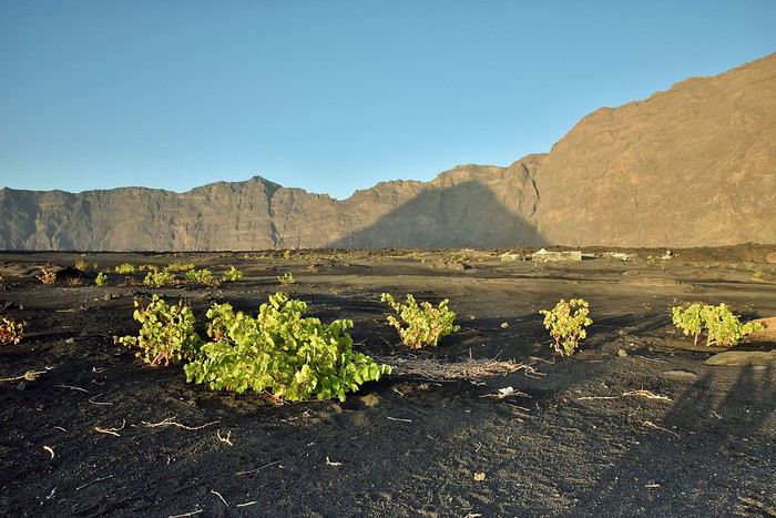
We leave behind the last vines used to make the famous Manecom, sometimes nicknamed "lava wine." This means that for the harvest, the villagers-winegrowers still have quite a trek to come and pick the grapes here.


Photo: A few vines amid the craters

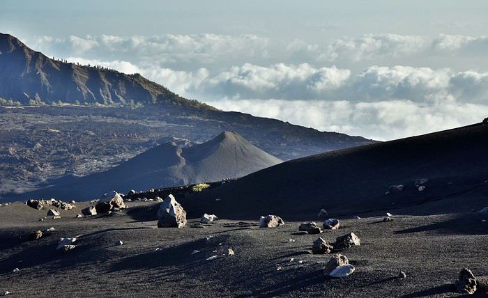
Then we dive into the heart of the matter, finding ourselves in the middle of endless lunar landscapes.


The blazing sun forces us to take a few breaks, during which we try not to waste our water supply.


Below us, we spot several craters, each responsible for eruptions of varying importance since the 18th century. Behind them, the caldera’s walls mark its boundaries, and beyond, a sea of clouds stretches endlessly over the ocean.


After four hours of climbing, we finally reach the summit. 2,928 meters above sea level: here, we’re geographically at the country’s highest point, but this volcano also marks the highlight of our trip in terms of landscapes and emotions.

We had warned Dony before departure that we wanted to take our time to stop for photos and "rest breaks." Very attentive, he perfectly adapted to our pace.

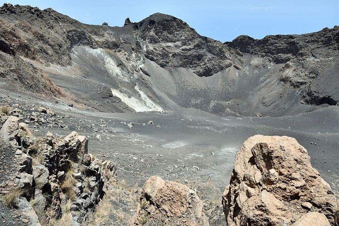
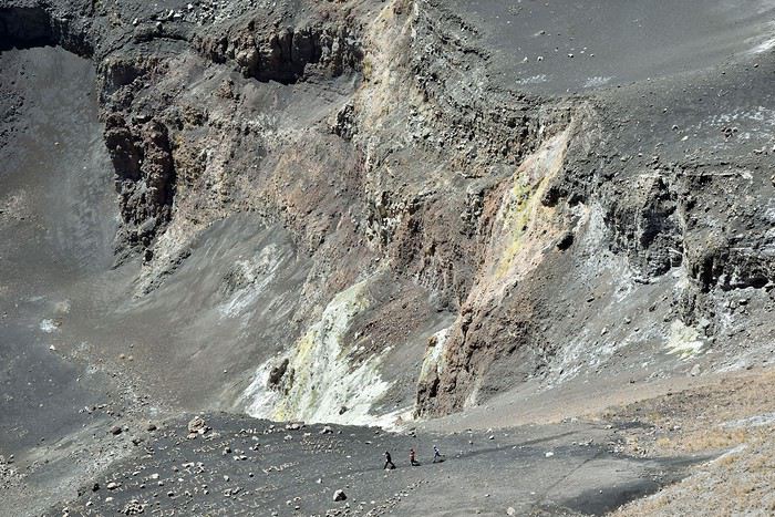
We take a long break on the small summit ridge, which offers two different views. On one side, the crater of Grand Pico.

Photo: Inside the Grand Pico crater
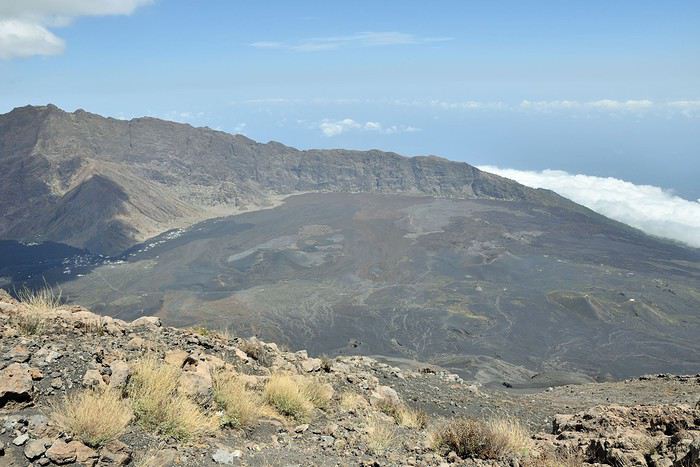
On the other side, the view of the caldera and its contents: houses, craters, lava flows...


Dony then suggests descending to the bottom of the crater. My wife Marie, Leïla, and I aren’t too keen and prefer to stay and admire the landscape, unlike Victor and Arthur, our sons, who don’t seem tired at all. So Dony takes them a few hundred meters lower, into a breathtaking setting.


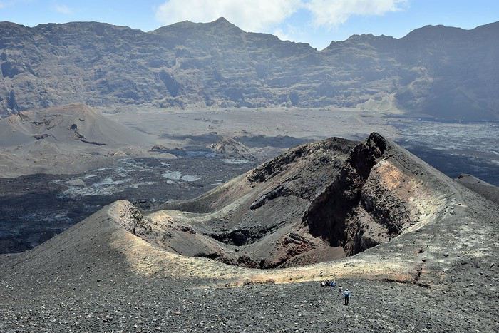
When we look at Petit Pico from the start of this memorable descent, it seems so close that we think we’ll reach it in just a couple of minutes. In reality, it takes us twenty—even though we run the whole way.


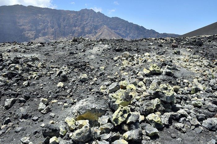
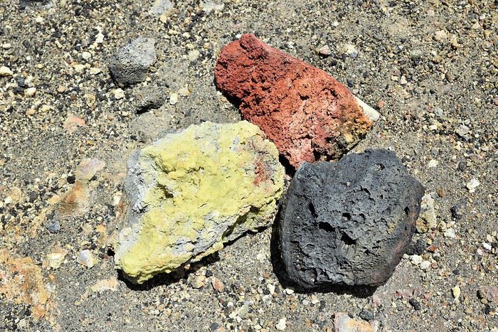
This crater lives up to its name—it’s tiny compared to its big brother we just came from. And yet, it was this Petit Pico that devastated everything below in 2014–2015.

Photo: Sulfur deposits around Petit Pico
A little lower down, we reunite with vegetation. We’re dying of heat, and the grapes Dony lets us taste—picked from the vines around us—are pure bliss. Some are ripe and juicy, others older and dried out, but they all do us a world of good.

Near these first vines, the old lava flows take on tortured shapes.


Just before reaching the guesthouse, we take one last look at the sleeping giant (for now) that we spent most of the day climbing and descending.


In total, it took us eight hours instead of the average six to seven. Back at José’s, we rush for the fridge’s cold drinks before heading to the shower. Then I go to add to my collection of images before the restorative evening meal.


Since there’s no electricity at the guesthouse, we light candles in the evening. The amazing consequence is that it creates an extremely warm atmosphere during meals shared with other travelers. Each of the three dinners we had there was particularly convivial with everyone we met. Even our son Arthur, at just twelve years old, told us how much he loved and felt that special vibe.

We spend our last night in this magical place, and the next morning, I take advantage of the early light to capture my final images before leaving.

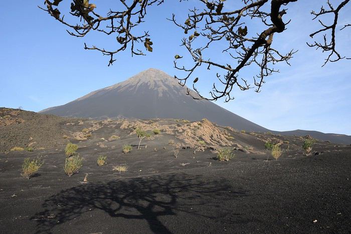
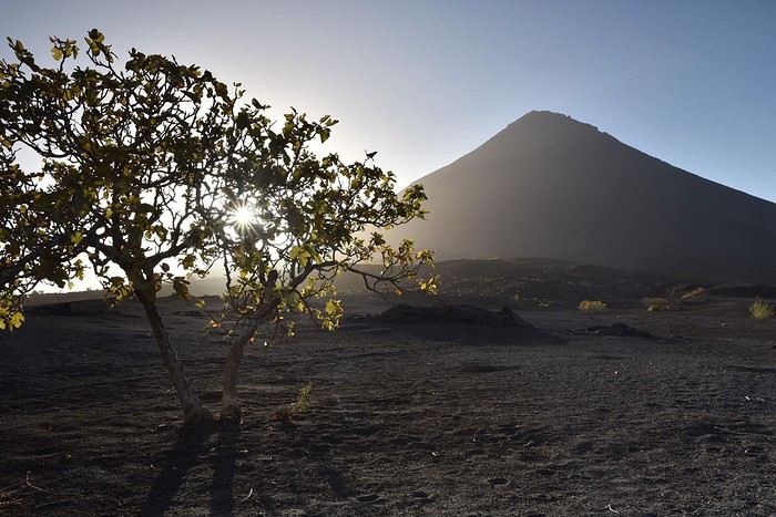
A fig tree thriving in volcanic soil The volcano’s shadow looms over the caldera
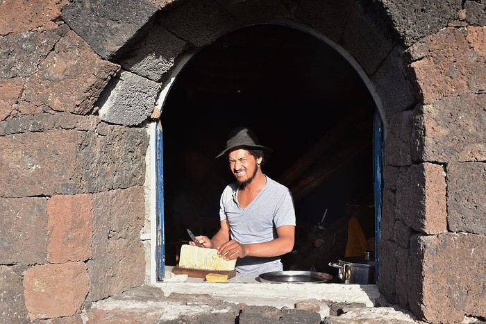
José preparing breakfast bread
Then comes the time to leave this unique place, as well as Carole, José, and Dony, thanks to whom we’ve just lived unforgettable moments. We thank them warmly, and just like on the way here, we have to take a private taxi since it’s Sunday and there are no *aluguers* that day. Off to Fogo’s main town: São Filipe.

For those interested who haven’t seen it yet, here’s a short video (3 min) I already posted a few days ago in VF’s "travel photos and videos" section, which sums up this (too) brief stay in Chã das Caldeiras... https://youtu.be/ZoEGJQljBQ4
LH Lhorizon Veteran ·
Hi Isabelle,

I’m happy to help bring back some great memories!

I only have a few posts left: São Filipe at the foot of Pico, then our brief stop in Santiago, and finally some practical info for anyone who might be interested...
XE Xeta Veteran ·
Hi there! 🙂 Thanks for this lovely travel journal! So, you're into volcanoes, huh? 😉 Well done, your story is a delight once again, and your photos are stunning. The light is so often gorgeous!
LH Lhorizon Veteran ·
Hi Anne, thanks! Yeah, I admit, volcanoes fascinate me, and Pico didn’t disappoint! See you soon.
LH Lhorizon Veteran ·
> São Filipe

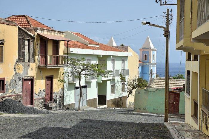
With a population of 8,000, São Filipe is the main town on Fogo. It’s best known for its famous "sobrados," the grand houses where the Portuguese lived during the colonial era. Here, like almost everywhere in Cape Verde, the streets are full of color.


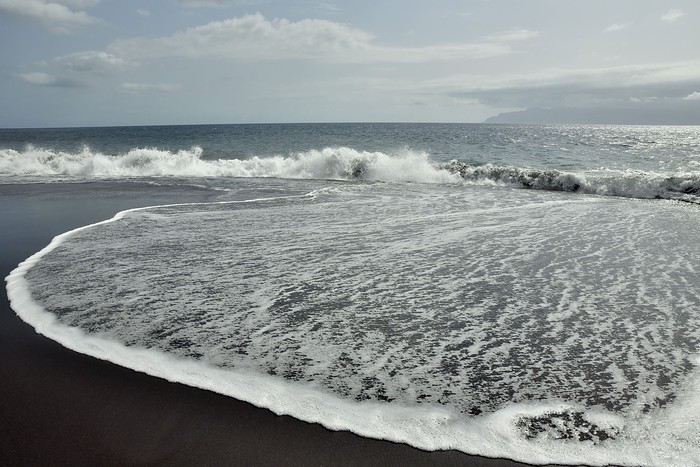
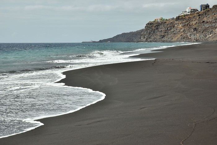
As we stroll through these charming streets toward the sea, we stumble upon the Presidio garden by chance. While it’s nothing extraordinary, it does offer two perks: it overlooks a beautiful black-sand beach and provides a view of Brava Island, 25 kilometers away.


Photo: São Filipe’s volcanic beach facing the small island of Brava

We decide to check out the beach. On the way, following the coastline more or less, we spot a small, colorful church.

Our Lady of the Conception Church
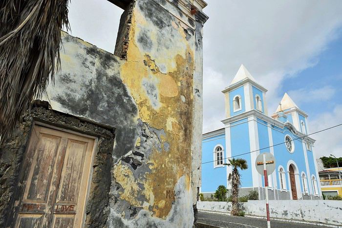
A little further on, we find the long staircase that leads us down to the famous black-sand beach, which clearly reveals its volcanic origins.


Apparently, swimming here is very dangerous due to strong currents. We were even warned that every year, drownings are reported. Sure enough, despite the heat and a strong urge to cool off in the water, the beach and sea are deserted.

Photo: São Filipe perched on the cliff, facing the ocean
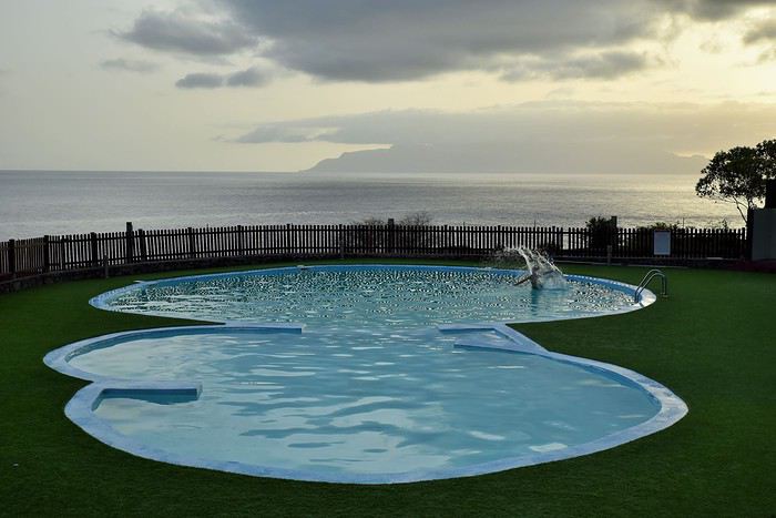
We end the day at a hotel with a pool. It’s a bit pricey compared to the average here, but we’d planned to relax after three amazing but exhausting days hiking in the caldera and on the slopes of Pico do Fogo.

Photo: The pool at Casas do Sol hotel

The next day, we’ll fly to Santiago Island, two days before our return flight to France. We’d have preferred to visit another island, but we always leave a little buffer when traveling between islands—just in case something unexpected happens. If there’s any issue causing inter-island flights to be canceled, we won’t be affected and won’t miss our flight back to France since we’ll already be on Santiago.

Similar discussions

You might also like