Croatia
October 2024
Hi everyone, I wanted to share our family week in Croatia. Alex and I, with Apolline (6), Olympe (4), and Artémis (18 months).
Itinerary
Planning the itinerary was complicated, but in the end, I wouldn’t change a thing. Since we had a round-trip flight from Dubrovnik, I preferred to prioritize proximity, so we skipped Plitvice, which I’d really love to visit—but that’ll be for next time. We had time to... take our time, and it was really nice.
Day 1: Marseille-Dubrovnik flight. Night in Ston.
Day 2: Visit to Ston and Mali Ston. Ferry to Mljet. Night in Pomena (3 nights total).
Days 3 & 4: Walks in Mljet National Park and swimming.
Day 5: Return ferry. Visit to the Trsteno Arboretum. Night in Dubrovnik (3 nights total).
Day 6: Visit to Dubrovnik’s city walls and Old Town.
Day 7: Lokrum.
Day 8: Morning in Dubrovnik, then Cavtat and overnight flight back to Marseille.
Our visits
Ston area:
Ston village, small but charming. We walked the walls from Ston to Mali Ston. It’s a steep climb, but the views over Ston and then Mali Ston are stunning. Easy return by road, and we visited the fort. Stroller impossible on the walls.
Pratpano Beach before taking the ferry. A beautiful beach and our first swim!
Mljet
Everything is beautiful on Mljet—the villages, landscapes, beaches... There are plenty of hiking and biking trails of varying difficulty. We saw lots of bike rental shops (Pomena, Polače, at the dock for St. Mary’s...), with some bikes equipped with child seats (though no baby trailers). In Pomena, there’s a small national park office that provides maps, sells entry tickets, and gives info on possible routes. The trails are well-marked. The boat to St. Mary’s Island is included in the park entry fee.
On the first day, from Pomena, we were 20 minutes’ walk from the small saltwater lake and the dock for St. Mary’s Monastery. We visited the little island, but the monastery interior was closed. We swam in Malo Jezero Lake (but there are plenty of spots to swim in both lakes).
The next day, we did a big loop starting from Pomena, walking through the forest (with beautiful sea views) to Janik (across from the monastery), then returning along the shore paths for a swim. An easy hike with little elevation—Olympe did it without any problems. The route is clearly marked on the bike trail map from the park office.
On our last day before the 3 PM ferry, we swam and had a picnic on one of Saplunara’s gorgeous sandy beaches—we had the whole place to ourselves!
Trsteno Arboretum (30 minutes from Dubrovnik). A stunning botanical garden overlooking the sea, which we visited in the late afternoon. Stroller accessible.
Dubrovnik:
City walls. Very expensive, but worth it! Lets you see the whole Old Town and the port from above. Stroller impossible.
Old Town: lots of beautiful, narrow alleys where laundry dries between buildings. Stroller possible but not practical. We visited the two monasteries and the cathedral inside but skipped the Rector’s Palace and St. Lawrence Fort.
Lokrum: deserves a full day. A beautiful walk circles the island, alternating between coves, historic buildings, and botanical gardens. We were short on time before the last boat left, but there are plenty of great spots to swim. You can’t do the full loop with a stroller, but I think the main sights near the dock are accessible.
Cavtat: a great surprise—I’d recommend it if, like us, you have a late flight. Just 15 minutes from the airport, it’s a charming seaside village with a lovely waterfront promenade (stroller-friendly), several swimming coves, and a cute center with things to see if you have extra time (museum, mausoleum, church...), plus restaurants, gelato shops, and boutiques...
Even though the girls walked a lot and enjoyed the walks, they *loved* swimming almost every day.
Transportation
Flight with Volotea. 1-hour delay on the way back.
Rental car with Goldcar. Office 100m outside the airport (it’s small, so about a 10-minute walk from arrivals). We were first in line, and luckily so—the employee was alone, and the queue behind us got really long, so budget extra time.
Don’t plan on driving in central Dubrovnik—the parking is outrageously expensive (over 5 €/hour near the walls), so book accommodation with parking and be ready for some walking.
Ferry: punctual. This time of year, we didn’t need to be at the dock more than 30 minutes before departure. Booked online.
Accommodation
I won’t talk about our place in Ston—it wasn’t very comfortable—or the one in Pomena, where we were really poorly received. But both locations were great for sightseeing. In Dubrovnik, we spent 3 nights at Natasa’s Airbnb (Apt Kalea), which was well-equipped, comfortable, and well-located—20 minutes’ walk from the center, with parking, a garden, and... a washing machine. All right across from a supermarket and a great bakery. For those with bigger budgets, the Art Deco Hilton in the center had me dreaming for 3 days!
Food
We didn’t eat out much because of the prices, but when we did, the food was great. The cuisine blends Italian and Slavic influences, so expect amazing seafood dishes, cuttlefish ink risotto, and big mixed grilled meats, not to mention pepper sauce. Despite the price, I’d recommend the restaurant in Mali Ston, *Kapetanova Kuća*. The food was great, and the service was friendly. If you have a late flight like we did, don’t hesitate to eat at the bistro almost across from the airport, *Pod Dubom*—good, affordable menu and a smiling waiter!
A great local picnic specialty: *burek*, a delicious savory pie (meat or cheese) you’ll find in bakeries or supermarkets. Also, good dry sheep’s cheese.
For picnics in Dubrovnik, I’d recommend the pine grove at St. Lawrence Fort or the benches above the port (at the end of Dominika Street). Both have amazing views.
Weather
We had beautiful weather—perfect for swimming *and* hiking. A light sweater for mornings and late afternoons, T-shirt and swimsuit during the day. In this part of Croatia, I’d say it’s comparable to southeastern France, so ideal for a fall break.
Gear
We like taking our stroller (Yoyo) for airport trips, but it wasn’t much use otherwise. If you have to choose, a baby carrier is better—between the cobblestones and hiking trails, it’s often the only way to carry a little one. We have the Deuter Pro hiking carrier, and Artémis loves it. We had high chairs in the few restaurants we went to, but not in our accommodations, so I brought a foldable fabric seat that fits on any chair. We had a crib in Ston and Pomena but not in Dubrovnik—Artémis slept on the floor on a folded duvet.
I invested in a Minimax *cabin-sized* suitcase for Apolline for this trip—she was so proud to have her first rolling suitcase! It turned out to be practical and seems sturdy. It let us take just one checked bag for all five of us for the first time.
Good and bad impressions
The swims in Mljet’s stunning, nearly empty nature.
Unfortunately, we felt unwelcome. The guidebook mentioned that Croatians can be standoffish at first, but we never got past that first impression. The constant feeling of being in the way—even though we weren’t there in peak season—was a bit unsettling. On the way back, I found out everyone I talked to (with or without kids) felt the same. Of course, it’s not universal—some people were polite, even warm (yes, really!).
No major issues, but a few things to note:
The car rental company only accepted debit cards, not credit cards. It was clearly stated in the contract, but I didn’t take it seriously. Luckily, Alexandre had a professional debit card, but *double-check yours before you go*.
For the car, despite the super-low rental price, you’ll have to add fees if you plan to take a ferry (50 to 80 € depending on the agency).
On Mljet, the only supermarket in Pomena was closed. We had to drive 10 minutes to Polače for basics. For diapers, we had to go even farther. I only saw formula for newborns in small supermarkets—maybe you can find more in Dubrovnik or at a pharmacy. I ended up using regular milk for Artémis.
Health
No issues, and no one got sick. We swam in very accessible spots given the girls’ ages, but if you’re eyeing a gorgeous little cove, watch out for sea urchins—we saw a lot!
Portable DVD players for the plane and car, but we barely used them. The girls watched cartoons in English on TV.
Kidizoom cameras.
A few toys for Artémis.
Budget
We found Croatia expensive, and I imagine it’s even worse in summer. For restaurants, sightseeing, and groceries, expect to pay the same as—or more than—in France. On the other hand, flights were low-cost, and accommodations were reasonable. The rental car was almost a steal, even with the extra ferry fees.
Round-trip flight from Marseille: 583 €
Car for 8 days: 56 € (+50 € for ferry fees)
Accommodations (7 nights): 509 €
Sightseeing:
Mljet National Park entry: 15 €/adult for 2 days (boat to St. Mary’s included)
Arboretum: 10 €/adult
Dubrovnik walls: 35 €/adult
Ferry Pratpano-Mljet: 60 € round-trip
278 similar discussions in English
Why not Malta? We thought it was an original, off-the-beaten-path destination...
The advantage is there’s a direct flight from Toulouse, our departure city. That’s what convinced us to take a week-long couple’s trip to Malta.
I had booked the accommodations (breakfast included) + an airport/hotel transfer on Booking.
First stop: VILLA DEL PORTO, a very pleasant guest house in a great location. We were welcomed by the owner, who gave us all the info we needed to get around. How to get to Valletta? By ferry shuttle. Valletta Ferry Service - Cospicua.
And for everything else, a brilliant app for the buses that crisscross the island: TALLINJA. I highly recommend this app. We traveled by bus all week without any issues.
The next day, we spent the day in Valletta, the capital. That’s when we realized this destination is actually very popular—streets packed with thousands of tourists! Luckily, we managed to navigate through parallel alleys and find small hostels or bars to eat or grab a drink. The city is stunning and steeped in history.
On the third day, we took the bus to the south of the island: MARSAXLOKK. A charming, authentic fishing port with plenty of waterfront restaurants and souvenir shops. We ate at CAFÉ DE PARIS—a delicious fresh fish, perfectly prepared.
On the way back, we wandered through the beautiful town of Senglea. Then we ordered takeout from D VIRI'S TAKE AWAY near the guest house via email. It was delicious!
On the fourth day, we left Villa del Porto and headed to Valletta by ferry to catch the GOZO FAST FERRY—a 45-minute catamaran ride to the island of Gozo.
After a good lunch by the port, we took the bus to our destination: XLENDI.
A village at the end of a gorgeous bay. We stayed at the San Andrea Hotel—a small room with a balcony and sea view.
Fifth day: Bus to Victoria. A magnificent citadel, a meal at a small bar in Piazza San Frangisk, then we continued by bus to the north, stopping in Marsalforn for coffee by the sea and a short walk to the natural salt pans carved into the rock. Back to the hotel by bus.
Sixth day: A short walk to Xlendi Tower, a watchtower at the entrance of the bay, beautifully restored. Then we set off on a sea excursion in a small boat for six passengers. Honestly, I recommend it! Two hours cruising along the breathtaking coastline and turquoise sea—20 € per person. www.gozoboathire.com
Delicious lunch on the terrace at "The Boathouse Restaurant."
Seventh day: We packed our bags again and returned to Malta by ferry to Cirkewwa. The terminal isn’t very welcoming—you have to take a bus to find a town.
We had lunch in Mellieha, then continued our journey, still using local buses, to RABAT, next to the ancient fortified city of MDINA. Another stunning city we explored at our own pace once the tourists had left.
Eighth day: Bus to the airport.
In conclusion, we’re thrilled with our trip. Of course, we didn’t see all the sites recommended by guidebooks, but we wandered at our own rhythm and came back with a head full of memories, images, and great moments spent in Malta and Gozo.
Villa Del Porto Address: Marina Street 1, KKR 1521 Kalkara, Malta Phone: +356 2166 8420 GPS Coordinates: N 035° 53.399, E 14° 31.557
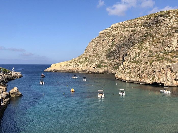 Xlendi Bay
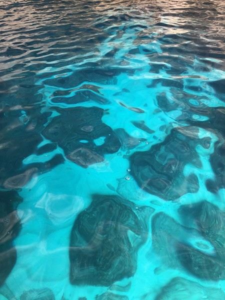 the seabeds in the coves
Villa Del Porto Address: Marina Street 1, KKR 1521 Kalkara, Malta Phone: +356 2166 8420 GPS Coordinates: N 035° 53.399, E 14° 31.557
Xlendi Bay
the seabeds in the coves
Hi everyone,
There haven’t been many recent stories about Norway in winter, and since I had trouble finding info on winter hikes, I thought I’d share a little travel journal.
Back in September 2024, while planning our summer 2025 trip to Norway, I joined some Facebook groups dedicated to travel in Scandinavia and started reading travel blogs. Since winter trips were being planned at the time, I came across posts with stunning photos of northern Norway in winter. I’d always pictured monotonous landscapes of pine forests and frozen lakes, so I was pleasantly surprised to see fjords, mountain ranges, and charming colorful cabins—just like in the Lofoten Islands. Turns out, the vast pine forests are more typical of Finnish Lapland. Norway, north of the Arctic Circle, is actually much more diverse. That was all it took to suggest this destination to my three guys for our winter vacation. After some research, early March seemed ideal—good weather, long enough daylight, and great chances for northern lights. A direct flight from Paris to Tromsø sealed the deal. The only downside? The cost of cars, accommodations, and activities nearly made us back out! Everything except flights is really expensive.
Since our oldest son had an important school deadline in June, he decided to skip the trip, so we ended up going as a trio. We took a Transavia round-trip flight from Orly to Tromsø for an amazing trip from March 1st to 8th.
Want to come along?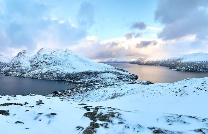
There haven’t been many recent stories about Norway in winter, and since I had trouble finding info on winter hikes, I thought I’d share a little travel journal.
Back in September 2024, while planning our summer 2025 trip to Norway, I joined some Facebook groups dedicated to travel in Scandinavia and started reading travel blogs. Since winter trips were being planned at the time, I came across posts with stunning photos of northern Norway in winter. I’d always pictured monotonous landscapes of pine forests and frozen lakes, so I was pleasantly surprised to see fjords, mountain ranges, and charming colorful cabins—just like in the Lofoten Islands. Turns out, the vast pine forests are more typical of Finnish Lapland. Norway, north of the Arctic Circle, is actually much more diverse. That was all it took to suggest this destination to my three guys for our winter vacation. After some research, early March seemed ideal—good weather, long enough daylight, and great chances for northern lights. A direct flight from Paris to Tromsø sealed the deal. The only downside? The cost of cars, accommodations, and activities nearly made us back out! Everything except flights is really expensive.
Since our oldest son had an important school deadline in June, he decided to skip the trip, so we ended up going as a trio. We took a Transavia round-trip flight from Orly to Tromsø for an amazing trip from March 1st to 8th.
Want to come along?
Hi everyone,
We (two adults, 74 and 70 years old) had already shared a travel journal about our first trip to the Philippines in February/March 2019 on this forum (https://voyageforum.com/v.f?post=9377175;search_string=carnet%20philippines). We had visited Manila, the Banaue rice terraces, Sagada, the Visayas (Bohol, Siquijor, Dumaguette), and on our way back to Luzon, the Taal volcano before returning to France. Delighted by this trip, organized by the French-speaking agency Alizé, we decided to further explore this beautiful country, this time focusing on Coron and Palawan.
Before writing this journal, I should mention that these are personal comments and don’t reflect any differing opinions. Without any literary or photographic talent, I’ll stick to the facts and share a few details about the visits, hotels, and restaurants.
Preparations
We decided to return in mid-January 2025 and consulted three French-speaking tour operators to create a trip based on our wishes (places to visit, type of accommodation) and budget. Comparing three operators helped us weigh their advice and make our choices. Only our first operator respected the budget, a second came close, and the third proposed a slightly more upscale trip. In the end, we chose the agency from our first trip. Our discussions helped refine our itinerary, and when we reviewed it point by point, the document provided was perfect, full of great tips. The most debated point was a 3-day, 2-night cruise between Coron and Palawan. We were tempted but worried about being the only "older" travelers among younger people and feared two uncomfortable nights. Reassured by our tour operator, we finally opted for this "exploration." We’ll come back to that later. Once the choice was made and dates set, we booked our international flights with Cathay Pacific for 750 € per person, which offers the best schedules (short layovers) at an acceptable price for flights arriving in Cebu. Our trip started on February 25 and returned to Paris on March 15.
International flights
The round-trip flights went smoothly. Cathay does the job well, without frills. The service quality seems to have slightly declined compared to our previous trips with them. Hong Kong Airport is huge but very practical. Note that not all airlines serve Cebu. Recommendation: Fill out your Philippine entry form within 72 hours before your flight. This can prevent issues with the airline (possible boarding refusal) and saves a lot of time upon arrival (see the Philippine embassy website).
Domestic flights
For our two domestic flights—Cebu to Coron and Puerto Princesa to Cebu—our tour operator chose Philippine Airlines and their propeller planes. No problems there.
Day 1: We landed around 12 PM (local time) after 17 hours of travel. A driver was waiting for us at the airport exit and took us to our hotel, intentionally chosen near the airport (Mandaue, about 10 minutes away) to help us recover and get a good night’s sleep before our early morning domestic flight the next day. The Mayoo Hotel, reasonably priced, was perfect for this. Large, beautiful room in a new building—clean, comfortable, with a spa. We could relax by the pool on the 16th floor and enjoy the city view. The breakfast was exceptional, and the staff was smiling, attentive, and helpful. An ATM in the lobby allowed for withdrawals. However, the hotel is in a neighborhood with nothing to see or do. We dined at the Korean restaurant K-GOGI across from the hotel—a real attraction and a great discovery.
Day 2: After a restful night, we were driven to the airport around 6:30 AM for an 8:10 AM flight from Cebu to Busuanga (Coron).
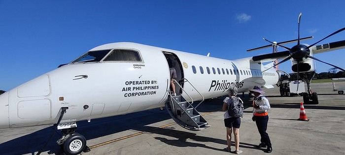
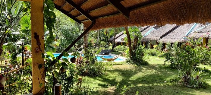
The flight was uneventful. Upon arrival, we paid 200 pesos per person for the Coron tourist fee before a 40-minute transfer to our hotel: Natura Resort, located outside the city in a secluded spot. The setting is stunning—a beautifully maintained tropical garden, a pleasant pool, and the option to book massages. The cottages are tropical-style with thatched roofs, simple and unpretentious.
The owner, who speaks French, told us that given the heat and our ages, climbing the 721 steps to the top of Mount Tapyas wasn’t necessary. She gave us a few rooftop recommendations to watch the sunset over Coron Bay. After a good swim in the pool and a meal at the resort’s pleasant restaurant, we hired a tricycle to go into town. We were told it costs 150 pesos one way, and depending on the return time, it could exceed 250 pesos. But our driver gave us his WhatsApp number and charged the same price regardless of the time. He just earned two days’ worth of customers. He dropped us off at the port where bangkas (local boats) gather for day trips. It was the end of the day, so there was a rush. A few shops around the port sold waterproof bags for marine excursions at reasonable prices (compared to back home), after some bargaining. We wandered the town’s alleys looking for the Top Hotel, whose rooftop is famous. Indeed, it’s perfectly located to admire the sunset and enjoy a refreshing drink.
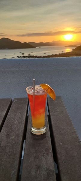
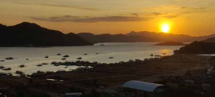
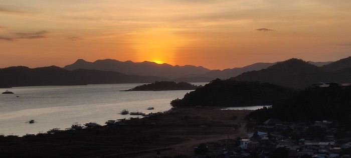
We dined nearby at a small Chinese restaurant, then just had to call our driver to head back. The night wasn’t entirely restful—our hotel had a soundtrack of all the countryside animals, and it seemed they had no set bedtime! :
Preparations
We decided to return in mid-January 2025 and consulted three French-speaking tour operators to create a trip based on our wishes (places to visit, type of accommodation) and budget. Comparing three operators helped us weigh their advice and make our choices. Only our first operator respected the budget, a second came close, and the third proposed a slightly more upscale trip. In the end, we chose the agency from our first trip. Our discussions helped refine our itinerary, and when we reviewed it point by point, the document provided was perfect, full of great tips. The most debated point was a 3-day, 2-night cruise between Coron and Palawan. We were tempted but worried about being the only "older" travelers among younger people and feared two uncomfortable nights. Reassured by our tour operator, we finally opted for this "exploration." We’ll come back to that later. Once the choice was made and dates set, we booked our international flights with Cathay Pacific for 750 € per person, which offers the best schedules (short layovers) at an acceptable price for flights arriving in Cebu. Our trip started on February 25 and returned to Paris on March 15.
International flights
The round-trip flights went smoothly. Cathay does the job well, without frills. The service quality seems to have slightly declined compared to our previous trips with them. Hong Kong Airport is huge but very practical. Note that not all airlines serve Cebu. Recommendation: Fill out your Philippine entry form within 72 hours before your flight. This can prevent issues with the airline (possible boarding refusal) and saves a lot of time upon arrival (see the Philippine embassy website).
Domestic flights
For our two domestic flights—Cebu to Coron and Puerto Princesa to Cebu—our tour operator chose Philippine Airlines and their propeller planes. No problems there.
Day 1: We landed around 12 PM (local time) after 17 hours of travel. A driver was waiting for us at the airport exit and took us to our hotel, intentionally chosen near the airport (Mandaue, about 10 minutes away) to help us recover and get a good night’s sleep before our early morning domestic flight the next day. The Mayoo Hotel, reasonably priced, was perfect for this. Large, beautiful room in a new building—clean, comfortable, with a spa. We could relax by the pool on the 16th floor and enjoy the city view. The breakfast was exceptional, and the staff was smiling, attentive, and helpful. An ATM in the lobby allowed for withdrawals. However, the hotel is in a neighborhood with nothing to see or do. We dined at the Korean restaurant K-GOGI across from the hotel—a real attraction and a great discovery.
Day 2: After a restful night, we were driven to the airport around 6:30 AM for an 8:10 AM flight from Cebu to Busuanga (Coron).
The flight was uneventful. Upon arrival, we paid 200 pesos per person for the Coron tourist fee before a 40-minute transfer to our hotel: Natura Resort, located outside the city in a secluded spot. The setting is stunning—a beautifully maintained tropical garden, a pleasant pool, and the option to book massages. The cottages are tropical-style with thatched roofs, simple and unpretentious.
The owner, who speaks French, told us that given the heat and our ages, climbing the 721 steps to the top of Mount Tapyas wasn’t necessary. She gave us a few rooftop recommendations to watch the sunset over Coron Bay. After a good swim in the pool and a meal at the resort’s pleasant restaurant, we hired a tricycle to go into town. We were told it costs 150 pesos one way, and depending on the return time, it could exceed 250 pesos. But our driver gave us his WhatsApp number and charged the same price regardless of the time. He just earned two days’ worth of customers. He dropped us off at the port where bangkas (local boats) gather for day trips. It was the end of the day, so there was a rush. A few shops around the port sold waterproof bags for marine excursions at reasonable prices (compared to back home), after some bargaining. We wandered the town’s alleys looking for the Top Hotel, whose rooftop is famous. Indeed, it’s perfectly located to admire the sunset and enjoy a refreshing drink.
We dined nearby at a small Chinese restaurant, then just had to call our driver to head back. The night wasn’t entirely restful—our hotel had a soundtrack of all the countryside animals, and it seemed they had no set bedtime! :
Lanzarote Travel Journal
Trip Planning My partner and I are heading to the Canary Islands for a week at the end of September, specifically to Lanzarote. We chose this island over the more crowded ones for its volcanic landscape and the variety of hikes it offers. I booked everything through Expedia: our hotel stay, car rental, and Ryanair flight tickets departing from Marseille. It was the only way to get a direct flight. To make getting around easier during our stay, I picked a hotel located in the center of the island from the wide selection available. It’s part of the Barceló chain, specifically the "Barceló Teguise Beach Adults Only" in Teguise Beach, which turned out to be an excellent choice.
The Trip
Sunday, September 21 - Monday, September 22 Departure It’s 2:15 PM, and we’re at the Avignon TGV station. Danielle picked us up earlier due to the weather—thunderstorms and heavy rain all the way to the station. The TGV was on time, and it only took 30 minutes to reach Marseille Saint-Charles. The shuttle to the airport is quick and convenient, right behind the station. The bus leaves for the airport in the middle of the storm, with flooded roads and cars stuck in some spots. We get soaked making our way to the terminal. Two hours to wait before the flight. The plane finally takes off at midnight, but just before landing, the pilot announces that the destination airport is closed, and we’re being diverted to Tenerife. Ryanair will re-route us as soon as possible. We end up waiting 2 hours, and Ryanair kindly gives us a 4 € voucher. We re-board around 5:15 AM and take off at 6:00 AM. About 45 minutes to reach Lanzarote. After collecting our luggage, we head to the car rental desk. The counter in the terminal is closed, and we’re directed to parking lot P4—it takes us a while to find it. I’m a bit worried about the rental company’s reaction since the car was supposed to be picked up 7 hours earlier, but it’s not a problem. A woman next to us is furious because she’s in the same situation, and her rental was canceled. Anne-Marie translates for her, but nothing changes. We pick up a brand-new Toyota Aigo and head to the hotel. After checking in, we cross the garden, walking alongside the large pool to reach our room. A lovely first-floor room with a jacuzzi and a sea view. It’s early, so we head to breakfast—a generously stocked and varied buffet with everything you could want. Afterward, we drive to Cueva de los Verdes, but it’s packed with people and a long wait. We decide to come back another day. Next, we visit Mirador Del Rio. This rocky viewpoint at the edge of the island has breathtaking cliffs plunging 500 meters into the ocean. The view is stunning and impressive. A panoramic bar lets you cool off while enjoying the scenery. We return to the hotel for a short walk around the neighborhood and enjoy the beautiful pool with its pleasant water temperature. Relaxing by the pool, sun loungers, and all. In the evening, a very varied buffet at the restaurant. Then early to bed to recover from the sleepless night before.
Tuesday, September 23 After a restful night, we enjoy another varied and hearty breakfast. The terrace seating is very pleasant. We take an inland road leading to Timanfaya National Park. The road near the park runs alongside vineyards where the vines are surrounded by lava stone walls to protect them from the prevailing winds. Our first stop is at the visitor center, where the island’s volcanic activity is well-documented. Next, we stop at an area where you can take a short camel ride—two seats are installed on either side of the camel’s hump. This little ride offers a great view of the volcanic landscape from a higher vantage point. A fair price of 11 € per seat for a 20-minute ride. We then head to the park entrance via the road leading to the parking lot, where only authorized buses can take the winding route inside the park. It’s crowded, and we wait about 45 minutes with several stops before reaching the parking lot. We board the bus, and the route offers beautiful views of this volcanic area and its many craters. The journey is very interesting, with several stops for photos. At the parking lot, a guide shows us how the heat from the rocks beneath the surface can ignite dry vegetation. Water poured into holes in the ground immediately creates geysers and jets of steam. The building next to the parking lot has a restaurant where meat is cooked using the heat from a well dug into the volcanic rock. On our way back, we drive to Playa Blanca, a seaside town with a small sandy beach.
Back at the hotel in the late afternoon for dinner.
Wednesday, September 24 We wake up early and have a quick breakfast—few people are around at this hour. Two days ago, we booked a 10:00 AM visit to Los Verdes, lava tunnels created by eruptions and lava flows from the La Corona volcano, which extended all the way to the coast. When the lava came into contact with the air, it solidified on the surface while continuing to flow underneath. The lava tunnels stretch for 8 kilometers to the volcano, but we only walk one kilometer. The inside of the tunnel is impressive, with narrow passages and larger chambers. You can see traces left by the flowing liquid lava—varied colors and twisted shapes. At the end of the path, a large chamber has been turned into a concert hall with perfect acoustics. Next, we visit Jameo Del Agua. This is a continuation of the lava tunnel, developed by Manrique. There are beautifully designed bar and restaurant areas, as well as an underground lake where you can see small blind white crabs—a protected species in this very pure water. Higher up, there’s a lovely space with a central pool that could double as a swimming area, surrounded by beautifully designed white pathways that contrast with the blue water. Further on, you reach a large space inside the lava tunnel, set up as a performance hall with perfect acoustics. Stairs let you view this beautiful space from above. A gap in the lava landscape reveals the ocean on the horizon. We head back toward the village of Yé, at the foot of the La Corona volcano. A 160-meter walk from the church, a path crosses vineyard plots and then climbs to the top of the volcano’s crater in about 30 minutes. It’s the island’s highest volcano. When you reach the edge of the crater, you see how deep it is, with steep slopes inside forming a large circular opening. The place is breathtaking and awe-inspiring. We drive back to the hotel via a road that climbs quickly, offering a beautiful view of the island’s northern part.
Thursday, September 25 After another enjoyable and varied breakfast, we head to the center of the island toward the volcano park and stop at a roadside parking lot where a path leads to the Montana Cuervo volcano. This is a crater that opened on one side. During an eruption, an explosion created a breach in the crater. Huge blocks of rock were thrown dozens of meters away. The path goes through the breach and descends into the crater, allowing you to walk around it. It’s impressive, and you really feel small and fragile in this environment. The crater walls, with their different colors, highlight the rock formations. The crater is surrounded by a sea of lava with sharp, jagged rocks. You can walk around the outside of the crater, but it’s not very interesting. We then head to the west coast, stopping at a spot with a small green lake next to a beautiful black sand beach. Next, we stop at Salinas de Janubio, a lovely viewpoint overlooking the salt marshes with different water colors. A small shop sells various local products. We then head to the famous Papagayo beach. The road ends at a booth where they charge 3 € to continue. From here, the land is private, and you have to pay to drive down a 3-kilometer rocky dirt road. Quite a few cars are driving along it, kicking up clouds of dust. The car gets a dusty makeover. We arrive at a large parking area, with several paths leading to different small beaches. We go to Papagayo, a small blonde sand beach surrounded by red rocks. The beach slopes gently into the water, which is a pleasant temperature. The setting is charming and peaceful. We stay for a while before heading back to the hotel.
Friday, September 26 We start with a visit to the César Manrique Foundation in Tahiche. This was originally one of his homes. The modern construction spans several levels and is integrated into the lava flow, using the gaps to create living spaces. Large windows make the rooms bright and open to the scenery. The place is pleasant, with flower-filled gardens outside. It’s well worth a visit. Next, we drive to Las Grietas, where a path leads to a narrow crack in the volcanic rock, forming a tight passage where only one person can walk at a time. The passage isn’t very long, but progress is slow due to the endless selfies being taken here. We then stop at Casa Del Camposino, a renovated farm that houses several artisan shops. We taste a local wine recommended by a charming woman and buy two bottles of Lanzarote red wine on her advice. Now, we head to Tamara beach, a beautiful and wide beach at the foot of high cliffs. There are always great waves here, making it a surfer’s paradise. On the way back to the hotel, we stop at the cactus garden, César Manrique’s final creation. Designed with a great sense of aesthetics around an old windmill, it features 4,500 varieties of cacti in various shapes, all in a beautiful setting. We return to the hotel in the late afternoon for the evening.
Saturday, September 27 After another hearty breakfast, we head north to Haria. We stumble upon another of César Manrique’s homes, where he lived for a long time. This house is more traditional than the previous one but still has large, modern, and very pleasant rooms. At the back of the garden is his large studio, where he created his works. Next, we visit the craft market—this was our original plan. Various stalls offer local items, and it’s very crowded. No room at the café terraces to sit down. We then return to Famara beach for a long stay. There are always great waves here, much to the surfers’ delight. The water temperature is pleasant, and we enjoy it. On the way back to the hotel, we stop at a gas station to refill the car, which has been very fuel-efficient. Gas is also much cheaper here than in France—1.16 € per liter of SP95. We also wash the car, which was very dusty after the long dirt road to Papagayo beach. At the hotel, we enjoy a farewell cocktail before dinner.
Sunday, September 28 We spend the morning by the hotel pool before checking out at noon. For lunch, we go to a restaurant called "Dona Lola," near the hotel, with a terrace offering a view of the coast. We order tuna carpaccio, which is delicious. We then head to the airport, just 15 minutes away. We return the rental car and go to the airport. A long line to check in our luggage. The return flight is on time. A shuttle bus takes us to Saint-Charles station. We then head to our overnight rental. The boulevard slopes down, making it easier with the suitcases. The rental is between the old port and the train station. Once there, we pick up the keys and make one last effort to carry the luggage up to the third floor. The studio is nice, clean, and simply equipped—perfect for one night.
Trip Planning My partner and I are heading to the Canary Islands for a week at the end of September, specifically to Lanzarote. We chose this island over the more crowded ones for its volcanic landscape and the variety of hikes it offers. I booked everything through Expedia: our hotel stay, car rental, and Ryanair flight tickets departing from Marseille. It was the only way to get a direct flight. To make getting around easier during our stay, I picked a hotel located in the center of the island from the wide selection available. It’s part of the Barceló chain, specifically the "Barceló Teguise Beach Adults Only" in Teguise Beach, which turned out to be an excellent choice.
The Trip
Sunday, September 21 - Monday, September 22 Departure It’s 2:15 PM, and we’re at the Avignon TGV station. Danielle picked us up earlier due to the weather—thunderstorms and heavy rain all the way to the station. The TGV was on time, and it only took 30 minutes to reach Marseille Saint-Charles. The shuttle to the airport is quick and convenient, right behind the station. The bus leaves for the airport in the middle of the storm, with flooded roads and cars stuck in some spots. We get soaked making our way to the terminal. Two hours to wait before the flight. The plane finally takes off at midnight, but just before landing, the pilot announces that the destination airport is closed, and we’re being diverted to Tenerife. Ryanair will re-route us as soon as possible. We end up waiting 2 hours, and Ryanair kindly gives us a 4 € voucher. We re-board around 5:15 AM and take off at 6:00 AM. About 45 minutes to reach Lanzarote. After collecting our luggage, we head to the car rental desk. The counter in the terminal is closed, and we’re directed to parking lot P4—it takes us a while to find it. I’m a bit worried about the rental company’s reaction since the car was supposed to be picked up 7 hours earlier, but it’s not a problem. A woman next to us is furious because she’s in the same situation, and her rental was canceled. Anne-Marie translates for her, but nothing changes. We pick up a brand-new Toyota Aigo and head to the hotel. After checking in, we cross the garden, walking alongside the large pool to reach our room. A lovely first-floor room with a jacuzzi and a sea view. It’s early, so we head to breakfast—a generously stocked and varied buffet with everything you could want. Afterward, we drive to Cueva de los Verdes, but it’s packed with people and a long wait. We decide to come back another day. Next, we visit Mirador Del Rio. This rocky viewpoint at the edge of the island has breathtaking cliffs plunging 500 meters into the ocean. The view is stunning and impressive. A panoramic bar lets you cool off while enjoying the scenery. We return to the hotel for a short walk around the neighborhood and enjoy the beautiful pool with its pleasant water temperature. Relaxing by the pool, sun loungers, and all. In the evening, a very varied buffet at the restaurant. Then early to bed to recover from the sleepless night before.
Tuesday, September 23 After a restful night, we enjoy another varied and hearty breakfast. The terrace seating is very pleasant. We take an inland road leading to Timanfaya National Park. The road near the park runs alongside vineyards where the vines are surrounded by lava stone walls to protect them from the prevailing winds. Our first stop is at the visitor center, where the island’s volcanic activity is well-documented. Next, we stop at an area where you can take a short camel ride—two seats are installed on either side of the camel’s hump. This little ride offers a great view of the volcanic landscape from a higher vantage point. A fair price of 11 € per seat for a 20-minute ride. We then head to the park entrance via the road leading to the parking lot, where only authorized buses can take the winding route inside the park. It’s crowded, and we wait about 45 minutes with several stops before reaching the parking lot. We board the bus, and the route offers beautiful views of this volcanic area and its many craters. The journey is very interesting, with several stops for photos. At the parking lot, a guide shows us how the heat from the rocks beneath the surface can ignite dry vegetation. Water poured into holes in the ground immediately creates geysers and jets of steam. The building next to the parking lot has a restaurant where meat is cooked using the heat from a well dug into the volcanic rock. On our way back, we drive to Playa Blanca, a seaside town with a small sandy beach.
Back at the hotel in the late afternoon for dinner.
Wednesday, September 24 We wake up early and have a quick breakfast—few people are around at this hour. Two days ago, we booked a 10:00 AM visit to Los Verdes, lava tunnels created by eruptions and lava flows from the La Corona volcano, which extended all the way to the coast. When the lava came into contact with the air, it solidified on the surface while continuing to flow underneath. The lava tunnels stretch for 8 kilometers to the volcano, but we only walk one kilometer. The inside of the tunnel is impressive, with narrow passages and larger chambers. You can see traces left by the flowing liquid lava—varied colors and twisted shapes. At the end of the path, a large chamber has been turned into a concert hall with perfect acoustics. Next, we visit Jameo Del Agua. This is a continuation of the lava tunnel, developed by Manrique. There are beautifully designed bar and restaurant areas, as well as an underground lake where you can see small blind white crabs—a protected species in this very pure water. Higher up, there’s a lovely space with a central pool that could double as a swimming area, surrounded by beautifully designed white pathways that contrast with the blue water. Further on, you reach a large space inside the lava tunnel, set up as a performance hall with perfect acoustics. Stairs let you view this beautiful space from above. A gap in the lava landscape reveals the ocean on the horizon. We head back toward the village of Yé, at the foot of the La Corona volcano. A 160-meter walk from the church, a path crosses vineyard plots and then climbs to the top of the volcano’s crater in about 30 minutes. It’s the island’s highest volcano. When you reach the edge of the crater, you see how deep it is, with steep slopes inside forming a large circular opening. The place is breathtaking and awe-inspiring. We drive back to the hotel via a road that climbs quickly, offering a beautiful view of the island’s northern part.
Thursday, September 25 After another enjoyable and varied breakfast, we head to the center of the island toward the volcano park and stop at a roadside parking lot where a path leads to the Montana Cuervo volcano. This is a crater that opened on one side. During an eruption, an explosion created a breach in the crater. Huge blocks of rock were thrown dozens of meters away. The path goes through the breach and descends into the crater, allowing you to walk around it. It’s impressive, and you really feel small and fragile in this environment. The crater walls, with their different colors, highlight the rock formations. The crater is surrounded by a sea of lava with sharp, jagged rocks. You can walk around the outside of the crater, but it’s not very interesting. We then head to the west coast, stopping at a spot with a small green lake next to a beautiful black sand beach. Next, we stop at Salinas de Janubio, a lovely viewpoint overlooking the salt marshes with different water colors. A small shop sells various local products. We then head to the famous Papagayo beach. The road ends at a booth where they charge 3 € to continue. From here, the land is private, and you have to pay to drive down a 3-kilometer rocky dirt road. Quite a few cars are driving along it, kicking up clouds of dust. The car gets a dusty makeover. We arrive at a large parking area, with several paths leading to different small beaches. We go to Papagayo, a small blonde sand beach surrounded by red rocks. The beach slopes gently into the water, which is a pleasant temperature. The setting is charming and peaceful. We stay for a while before heading back to the hotel.
Friday, September 26 We start with a visit to the César Manrique Foundation in Tahiche. This was originally one of his homes. The modern construction spans several levels and is integrated into the lava flow, using the gaps to create living spaces. Large windows make the rooms bright and open to the scenery. The place is pleasant, with flower-filled gardens outside. It’s well worth a visit. Next, we drive to Las Grietas, where a path leads to a narrow crack in the volcanic rock, forming a tight passage where only one person can walk at a time. The passage isn’t very long, but progress is slow due to the endless selfies being taken here. We then stop at Casa Del Camposino, a renovated farm that houses several artisan shops. We taste a local wine recommended by a charming woman and buy two bottles of Lanzarote red wine on her advice. Now, we head to Tamara beach, a beautiful and wide beach at the foot of high cliffs. There are always great waves here, making it a surfer’s paradise. On the way back to the hotel, we stop at the cactus garden, César Manrique’s final creation. Designed with a great sense of aesthetics around an old windmill, it features 4,500 varieties of cacti in various shapes, all in a beautiful setting. We return to the hotel in the late afternoon for the evening.
Saturday, September 27 After another hearty breakfast, we head north to Haria. We stumble upon another of César Manrique’s homes, where he lived for a long time. This house is more traditional than the previous one but still has large, modern, and very pleasant rooms. At the back of the garden is his large studio, where he created his works. Next, we visit the craft market—this was our original plan. Various stalls offer local items, and it’s very crowded. No room at the café terraces to sit down. We then return to Famara beach for a long stay. There are always great waves here, much to the surfers’ delight. The water temperature is pleasant, and we enjoy it. On the way back to the hotel, we stop at a gas station to refill the car, which has been very fuel-efficient. Gas is also much cheaper here than in France—1.16 € per liter of SP95. We also wash the car, which was very dusty after the long dirt road to Papagayo beach. At the hotel, we enjoy a farewell cocktail before dinner.
Sunday, September 28 We spend the morning by the hotel pool before checking out at noon. For lunch, we go to a restaurant called "Dona Lola," near the hotel, with a terrace offering a view of the coast. We order tuna carpaccio, which is delicious. We then head to the airport, just 15 minutes away. We return the rental car and go to the airport. A long line to check in our luggage. The return flight is on time. A shuttle bus takes us to Saint-Charles station. We then head to our overnight rental. The boulevard slopes down, making it easier with the suitcases. The rental is between the old port and the train station. Once there, we pick up the keys and make one last effort to carry the luggage up to the third floor. The studio is nice, clean, and simply equipped—perfect for one night.
After a first trip in 2009 (already!) where we roughly did a circuit passing through Hazyview, a private reserve in Sabi Sands, St. Lucia and Isimangaliso, Hluhluwe, and the South African part of Kgalagadi Transfrontier Park, plus a quick stop in 2013 to visit Lesotho, we really wanted to come back to this country.
Why not the Cape region this time? But there was no way we’d return to this part of the world without going on a safari. Mountain Zebra or the Karoo seem more about landscapes than animals, and Addo doesn’t excite me much either... So, it’ll be Kruger.
Flight prices, schedules, and durations led us to book Paris-Cape Town, returning Johannesburg-Paris with British Airways, via Heathrow.
Now, we just had to figure out how to fit in a lot without driving too many kilometers or changing accommodations every day—at least in the Cape region. Here’s what we ended up with:
Arrival in Cape Town on Saturday, October 10 at 11 AM
2 nights in Hermanus
1 night in Franschhoek
2 nights in Mountceder in the Cederberg
3 nights in Hout Bay
Sunday: transition day—flight to Johannesburg, drive toward Kruger, overnight in Lydenburg.
Kruger: 1 night in Letaba, 2 in Satara, 1 in Lower Sabie.
Final night in Mbombela (formerly Nelspruit) before heading back to the airport for an early evening return flight.
For those who want to read the full story without interruptions, it’s here.
Friday, 10/9
A pretty stressful departure.
First, I woke up in the middle of the night convinced I’d swapped my first and last names during check-in 🤪... Couldn’t fall back asleep, even though I knew British Airways wouldn’t answer before 9 AM.
Well, for them, everything was fine... but then they started talking about ETA... an ETA for England 😮? ?? Yes, it’s new. Apparently, you don’t need one for an air-to-air transit... but you never know—better to have it just in case. No one could give me a clear answer that it wasn’t necessary. In the end, we didn’t get it... and we didn’t need it.
But here’s the thing: our flight ended up leaving Paris 45 minutes late (10 minutes due to a schedule change and 35 minutes of actual delay), so our 2-hour layover shrank to 1 hour and 15 minutes. That should be doable, right? The board showed our flight at Gate B—great, it’s right next door! But at Gate B, three employees were just there to tell everyone who showed up that security was at Gate A... and off we went, sprinting through the terminals, up and down endless escalators, a quick shuttle ride, security at Gate A ("You’re cutting it close!" Oh really? 😠), then almost the same route back—only to end up just a few dozen meters from where we started! 😠
Boarding was already well underway, and after all that running, we were hot and thirsty—but phew! We made it onto the plane!
Saturday, 10/10 On the other hand, nothing to complain about on the London-Cape Town flight—it arrived early!
I’d booked a (small) Suzuki S-Presso because it seemed to have a higher ground clearance than its competitors. Unfortunately, we ended up with a Tata Tiago (yes, it exists), which was lower (and also smaller, with an even more sluggish engine... we got to compare because in Johannesburg, we *did* get an S-Presso). Somehow, we managed to fit everything in the trunk ("Whatever you do, don’t leave anything visible!") and set off for our first accommodation in Hermanus, under glorious sunshine.
Nikki welcomed us warmly, explained what there was to see in the area, and advised us to book a restaurant for that evening.
After dropping off our bags, we headed straight to the "cliff path," just a 3-minute walk from our place. This stretch of coast is famous for its southern right whales from June to November. Let’s cut to the chase: yes, there were whales, but they were far away and very sleepy 😕. At best, we saw (photos taken at 600mm): A few ripples or a faint spout,

a bit of tail...

...or a head.

Too bad—the owner of our next place said she’d seen about thirty whales up close here in early September.
Without whales, the rock hyraxes (or dassies) were everywhere... and fun to watch.
The other local star (when there are no whales 😏)

Why not the Cape region this time? But there was no way we’d return to this part of the world without going on a safari. Mountain Zebra or the Karoo seem more about landscapes than animals, and Addo doesn’t excite me much either... So, it’ll be Kruger.
Flight prices, schedules, and durations led us to book Paris-Cape Town, returning Johannesburg-Paris with British Airways, via Heathrow.
Now, we just had to figure out how to fit in a lot without driving too many kilometers or changing accommodations every day—at least in the Cape region. Here’s what we ended up with:
Arrival in Cape Town on Saturday, October 10 at 11 AM
2 nights in Hermanus
1 night in Franschhoek
2 nights in Mountceder in the Cederberg
3 nights in Hout Bay
Sunday: transition day—flight to Johannesburg, drive toward Kruger, overnight in Lydenburg.
Kruger: 1 night in Letaba, 2 in Satara, 1 in Lower Sabie.
Final night in Mbombela (formerly Nelspruit) before heading back to the airport for an early evening return flight.
For those who want to read the full story without interruptions, it’s here.
Friday, 10/9
A pretty stressful departure.
First, I woke up in the middle of the night convinced I’d swapped my first and last names during check-in 🤪... Couldn’t fall back asleep, even though I knew British Airways wouldn’t answer before 9 AM.
Well, for them, everything was fine... but then they started talking about ETA... an ETA for England 😮? ?? Yes, it’s new. Apparently, you don’t need one for an air-to-air transit... but you never know—better to have it just in case. No one could give me a clear answer that it wasn’t necessary. In the end, we didn’t get it... and we didn’t need it.
But here’s the thing: our flight ended up leaving Paris 45 minutes late (10 minutes due to a schedule change and 35 minutes of actual delay), so our 2-hour layover shrank to 1 hour and 15 minutes. That should be doable, right? The board showed our flight at Gate B—great, it’s right next door! But at Gate B, three employees were just there to tell everyone who showed up that security was at Gate A... and off we went, sprinting through the terminals, up and down endless escalators, a quick shuttle ride, security at Gate A ("You’re cutting it close!" Oh really? 😠), then almost the same route back—only to end up just a few dozen meters from where we started! 😠
Boarding was already well underway, and after all that running, we were hot and thirsty—but phew! We made it onto the plane!
Saturday, 10/10 On the other hand, nothing to complain about on the London-Cape Town flight—it arrived early!
I’d booked a (small) Suzuki S-Presso because it seemed to have a higher ground clearance than its competitors. Unfortunately, we ended up with a Tata Tiago (yes, it exists), which was lower (and also smaller, with an even more sluggish engine... we got to compare because in Johannesburg, we *did* get an S-Presso). Somehow, we managed to fit everything in the trunk ("Whatever you do, don’t leave anything visible!") and set off for our first accommodation in Hermanus, under glorious sunshine.
Nikki welcomed us warmly, explained what there was to see in the area, and advised us to book a restaurant for that evening.
After dropping off our bags, we headed straight to the "cliff path," just a 3-minute walk from our place. This stretch of coast is famous for its southern right whales from June to November. Let’s cut to the chase: yes, there were whales, but they were far away and very sleepy 😕. At best, we saw (photos taken at 600mm): A few ripples or a faint spout,
a bit of tail...
...or a head.
Too bad—the owner of our next place said she’d seen about thirty whales up close here in early September.
Without whales, the rock hyraxes (or dassies) were everywhere... and fun to watch.
The other local star (when there are no whales 😏)
Hey fellow travelers,
I'm back in the "travel journal" section to share our 15-day adventure in Kenya in November 2024. It was pretty much our first time in East Africa (since Zanzibar doesn’t really count 😜).
As usual, I’m sharing the journal I made for our loved ones—still as casual and cheerful as ever, just to give them a little break from their tough workdays 😄.
We organized the whole trip ourselves, and to be original here LOL, we took some *very* well-trodden paths: Naivasha, Tsavo, and Diani. But what I loved about this country is that it’s so easy to go off the beaten track—even on the "tourist highways" 😉.
So, if you're a safari fanatic or after stunning wildlife photos, you might be disappointed. But if you want to discover other sides of Kenya, you might just find what you're looking for 😉.
Looking forward to sharing this fun journey with you all 😊.
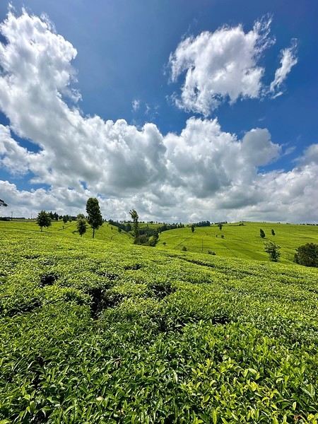
I'm back in the "travel journal" section to share our 15-day adventure in Kenya in November 2024. It was pretty much our first time in East Africa (since Zanzibar doesn’t really count 😜).
As usual, I’m sharing the journal I made for our loved ones—still as casual and cheerful as ever, just to give them a little break from their tough workdays 😄.
We organized the whole trip ourselves, and to be original here LOL, we took some *very* well-trodden paths: Naivasha, Tsavo, and Diani. But what I loved about this country is that it’s so easy to go off the beaten track—even on the "tourist highways" 😉.
So, if you're a safari fanatic or after stunning wildlife photos, you might be disappointed. But if you want to discover other sides of Kenya, you might just find what you're looking for 😉.
Looking forward to sharing this fun journey with you all 😊.
It was the start of winter; I was freezing, and the mood wasn’t exactly joyful—Ukraine, 49.3...
So I self-medicated: a week in Italy to hear laughter and that melodic language, and of course, to immerse myself in beauty for a while.
I was looking for a destination: Florence. The choice was biased because I wanted to revisit *Primavera* and *The Birth of Venus*.
Then came the choice of airline: Vueling flies directly to Florence, but you’ve got to know how to handle Vueling—sometimes you make it to your destination, sometimes you’re left at the gate. It’s not expensive, but that’s about all it’s worth. Best to know their rules of the game. Plus, Vueling leaves from Orly, which is super easy to get to by metro.
The gods were with me that day—Vueling actually got me to Florence. On arrival, the temperature was better than forecast, and I knew the days were slightly longer in Italy (and shorter in Stockholm). And the Italian language was floating in the air...
I took the new tram that takes you to the heart of the city, near the great "cheesecake" that’s said to mark the superiority of the Renaissance over Europe’s sublime Gothic cathedrals. I walked around the big pastry and turned onto *my* street, Via dei Servi. Along the way, I stewed over my guilt for not admiring the sublime *Duomo*; I hoped no police had detected my rebellious, deviant mindset.
I’d chosen a hotel on the stunning Piazza della Santissima Annunziata—I’ll even share its name, that’s the VF spirit: it’s the Hotel Due Fontane.
And that’s the real point of this post: until Easter, you can treat yourself to a room in a very charming hotel for around 60 €, breakfast buffet included! To do this, book on Booking.com and make it clear you’ll return the next day with a new reservation at that price. You’ll have left your things in the luggage room to move into a new room in the evening. I didn’t have to play that game since the reception gave me a long-term stay at a reduced rate.
The next day, the kind barista drew a perfect, beautiful flower on my cappuccino. That man was the smile and good cheer of Italy.
Florence had more to offer, and this time I wasn’t being picky like I was with the big white pastry: I had a date with *Primavera* and Venus. Off to the Uffizi; the weather was decent, much warmer than Paris, and the girls were laughing.
Arriving at the Uffizi: had I bought a skip-the-line ticket? What for? I walked in subito and even got the winter discount rate. You’ll agree that when visiting a museum, it doesn’t matter if it’s hot or not. When I got to Botticelli’s room, I love being alone—I have the illusion of owning two of the most beautiful paintings in the world. There was one tourist there that day. We admired *Primavera* and *The Birth of Venus* without getting in each other’s way; those young women painted so long ago show such beauty and radiate such elegance, especially in their faces.
I hesitated about going to the Accademia, but David is worth a revisit. If a skip-the-line ticket is ever needed, it’s here. But no! I walked in subito! Usually, women don’t openly show their attraction, but you might hear "He’s cute" about a man. Around David, it’s amusing to see they’re not immune to the sight.
Off to the Medici Chapels; entrance subita. I felt humbled by the princes’ munificence and the master’s works.
Then it was time for a stroll—maybe a Mannerist painting at Santa Felicita (oh, miracle, it was open), or playing the game of comparing the two crucifixes, including Donatello’s, sipping a Spritz in a little bar with a view of the Ponte Vecchio, wandering Via Roma in the evening among the cheerful crowd and shops decked out for Christmas. Seeing the Church of Santa Maria del Carmine for its frescoes and the Italian Pantheon at Santa Croce (Napoleon’s first girlfriend is buried there). Italy, land of frescoes!
Every evening, until I exhausted my pasta card, I enjoyed spaghetti on *my* Via dei Servi.
The point of this post: you can visit Florence at a very low cost, without impossible queues, and without tourist pressure, in reasonably warm weather until Easter. In May, the Due Fontane charges 220 to 250 €! For the rest, I may have rambled a bit. PS: Vueling stranded me on the way back; my punishment was staying an extra day in this incredibly welcoming city.
The point of this post: you can visit Florence at a very low cost, without impossible queues, and without tourist pressure, in reasonably warm weather until Easter. In May, the Due Fontane charges 220 to 250 €! For the rest, I may have rambled a bit. PS: Vueling stranded me on the way back; my punishment was staying an extra day in this incredibly welcoming city.
It's been 39 years since we last came back to Andalusia...
For this last week of March, we waited until the end of the "votes" in France to go soak up some sun in southern Spain. And spring is the ideal season.
Our itinerary was a very (very) classic loop: Seville / Granada / Ronda and the white villages / Seville (with the start of Holy Week as a bonus gift!).
We flew from Lyon with Transavia (no issues) and landed in Seville on Monday. We rented a car (Goldcar), drove for 3 hours, and there we were in Granada, charmed by its ZTL (limited traffic zone) that Waze made us discover in detail (a nightmare!). Our hotel: Hotel Monjas del Carmen (perfectly located and with parking).
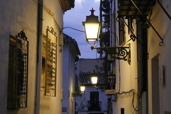
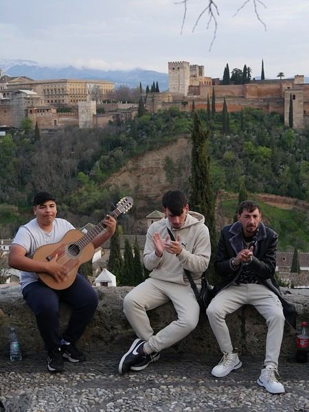
The weather was overcast, but a little stroll through the Albaicín district was a must. In the evening, we had dinner at "Restaurant Arabe Ambar" to get into the Nasrid atmosphere—we recommend it!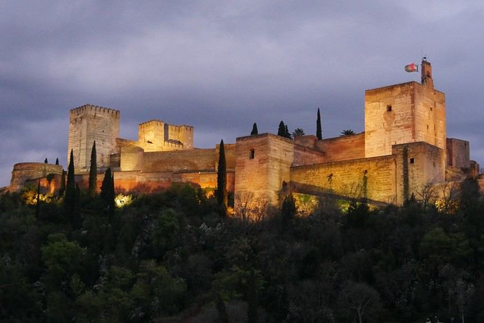
For this last week of March, we waited until the end of the "votes" in France to go soak up some sun in southern Spain. And spring is the ideal season.
Our itinerary was a very (very) classic loop: Seville / Granada / Ronda and the white villages / Seville (with the start of Holy Week as a bonus gift!).
We flew from Lyon with Transavia (no issues) and landed in Seville on Monday. We rented a car (Goldcar), drove for 3 hours, and there we were in Granada, charmed by its ZTL (limited traffic zone) that Waze made us discover in detail (a nightmare!). Our hotel: Hotel Monjas del Carmen (perfectly located and with parking).
The weather was overcast, but a little stroll through the Albaicín district was a must. In the evening, we had dinner at "Restaurant Arabe Ambar" to get into the Nasrid atmosphere—we recommend it!
Hello there!
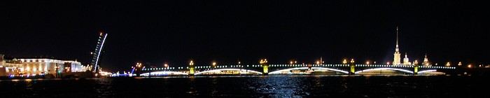
Here’s the recap of a little week we spent as a couple in Saint Petersburg in early May 2019, just before the *annus horribilis* of Covid. Since then, there’s also been the war in Ukraine, which has made things quite complicated, but tourist stays in Russia are still possible (see the discussion thread for the post-2022 situation). Looking back, early May was a bit too soon in the season—the trees were just starting to bud, and the wind was pretty chilly. It’s better to go at the end of May to enjoy the gardens.
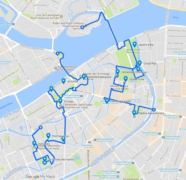
Below is our 5-day itinerary. I’d brought along the inevitable Lonely Planet and the Blue Guide to Saint Petersburg, just to get a basic understanding of the architecture of the buildings I’d be admiring. I’d prepared two complementary routes on G**gle Maps in advance to cover the essentials of the city center in two days. That left the other days completely free for the big highlights: the Hermitage Museum and Peterhof Palace. We tried to adapt based on the weather, visiting Peterhof and its gardens on what was *supposed* to be the nicest day. We’d saved the Hermitage for a day when the weather was really bad, but in the end, we had more or less the same weather every day (sunny but windy and chilly).
Itinerary:
Day 1: City center north of Nevsky Prospect, up to the fortress (Route 1 on the map) Day 2: Peterhof Day 3: City center south of Nevsky Prospect up to Mariinsky (Route 2) Day 4: Canal boat tour during the day + nighttime boat ride on the Neva Day 5: Hermitage
Evening activities:
On the 3rd day, we saw an opera at the Mariinsky I, On the 4th day, we saw a ballet at the Mariinsky II, then headed back to the embankments at half past midnight for a nighttime cruise on the Neva—magical!
Here’s the recap of a little week we spent as a couple in Saint Petersburg in early May 2019, just before the *annus horribilis* of Covid. Since then, there’s also been the war in Ukraine, which has made things quite complicated, but tourist stays in Russia are still possible (see the discussion thread for the post-2022 situation). Looking back, early May was a bit too soon in the season—the trees were just starting to bud, and the wind was pretty chilly. It’s better to go at the end of May to enjoy the gardens.
Below is our 5-day itinerary. I’d brought along the inevitable Lonely Planet and the Blue Guide to Saint Petersburg, just to get a basic understanding of the architecture of the buildings I’d be admiring. I’d prepared two complementary routes on G**gle Maps in advance to cover the essentials of the city center in two days. That left the other days completely free for the big highlights: the Hermitage Museum and Peterhof Palace. We tried to adapt based on the weather, visiting Peterhof and its gardens on what was *supposed* to be the nicest day. We’d saved the Hermitage for a day when the weather was really bad, but in the end, we had more or less the same weather every day (sunny but windy and chilly).
Itinerary:
Day 1: City center north of Nevsky Prospect, up to the fortress (Route 1 on the map) Day 2: Peterhof Day 3: City center south of Nevsky Prospect up to Mariinsky (Route 2) Day 4: Canal boat tour during the day + nighttime boat ride on the Neva Day 5: Hermitage
Evening activities:
On the 3rd day, we saw an opera at the Mariinsky I, On the 4th day, we saw a ballet at the Mariinsky II, then headed back to the embankments at half past midnight for a nighttime cruise on the Neva—magical!
Hello,
We got back from Tanzania a month ago, on March 5th. I’ve started this trip report at the link the moderator asked me to use:
https://voyageforum.com/forum/decouverte-ruaha-nyerere-ex-selous-en-fevrier-mars-2026-d11466010/
You’ll find a video of our trip on my YouTube channel there.
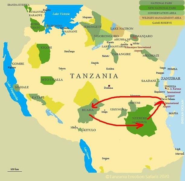
Now I’ll tell you about our 10-night trip in Tanzania, with 8 nights spent in two parks we didn’t know. Tanzania isn’t new to us—it was even our first African safari destination back in 2012. https://www.youtube.com/@lolodetoul54 Since then, we’ve visited several East and Southern African countries: Kenya, South Africa, Namibia, Botswana, some of them multiple times. We usually travel in September during the dry season. We tried March 2024 for nine nights in the Okavango and loved it, except everything was dry, which wasn’t normal for the rainy season.
So for this second March trip during the wet season, we really got what we asked for… rain. But before that, we had to fight just to get to Tanzania.
Saturday, February 21, 2026:
It’s D-Day—the departure. What a hassle to organize flights to and within Tanzania! I’ll tell you all about it in another post: https://voyageforum.com/forum/toutes-compagnies-aeriennes-tanzaniennes-interdites-d10758360/ On top of that, Rwandair canceled our outbound flight a month before departure. They offered to reschedule us 3-4 days later—ridiculous for a 10-night trip we’d already booked. We had to cancel our tickets and buy new ones with Kenya Airways. We’re still waiting for our refund from Rwandair!!!!!!! So on Saturday, February 1st, our bags were packed. We headed to the Lorraine TGV station, about 30 km from home.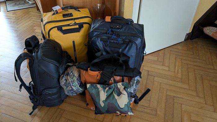 Direct train to Roissy—just 1h15. Quick and efficient.
All that was left was to wait for our overnight flight. We took off on time, just before 11 PM. Smooth flight, nothing unusual. Arrived in Nairobi around 9 AM. A few hours’ wait, then a flight to Dar es Salaam, landing at our first destination around 12:45 PM.
Our local contact, Anne from Asanterra agency, picked us up at the airport. It was hot and humid—it was raining.
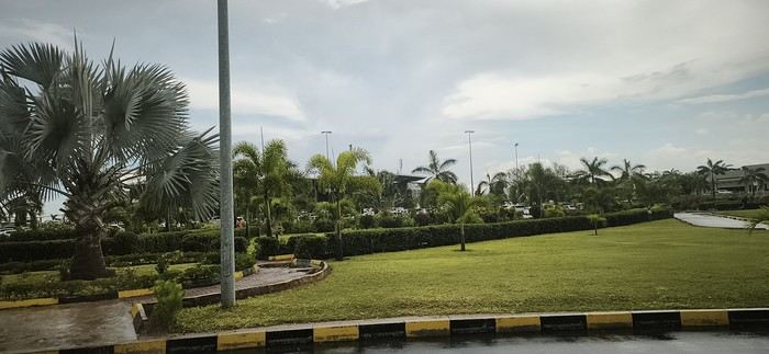
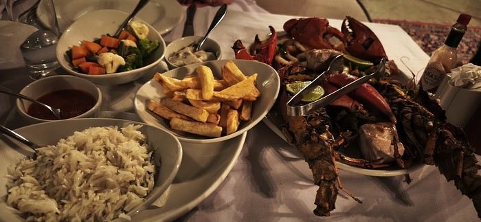
Our first night was at the Alexander Hotel. That evening, we treated ourselves to fish and shellfish at the hotel restaurant:
Sunday, February 22, 2026:
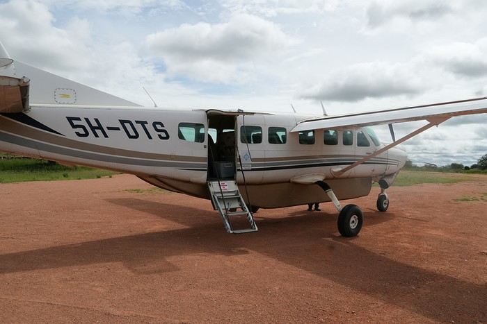
A driver picked us up at dawn to take us to the domestic airport so we could finally head to our first destination: Ruaha National Park. We flew with Auric.air for a 2-hour flight with two stops (Nyerere and Zkima airstrips).
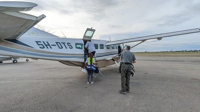
I’m always amazed at how easily these Cessnas take off and land on dirt runways—especially when they’re wet:
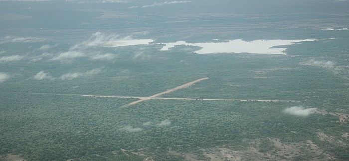
Aerial view of Zkima airstrip, where we’d landed just minutes earlier:
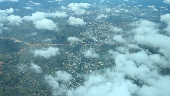
Flyover of Iringa, a "big" city in the country near Ruaha National Park:
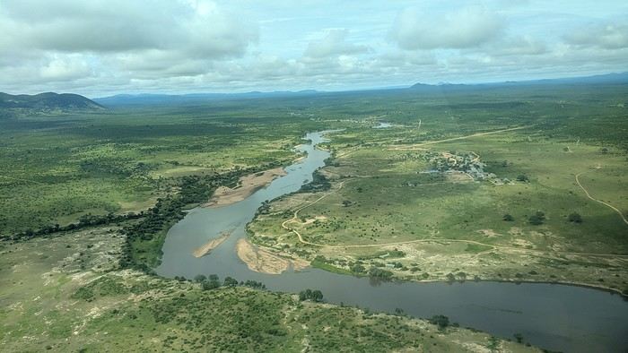
We’re getting close. The plane descends and flies over the Ruaha River, which gave the park its name:
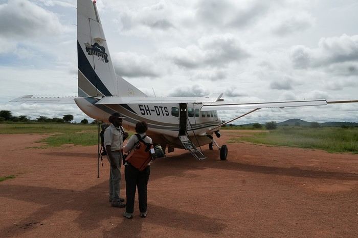
We land for the third and final time that day, reaching our destination: Msembe airstrip, the gateway to Ruaha.
We got back from Tanzania a month ago, on March 5th. I’ve started this trip report at the link the moderator asked me to use:
https://voyageforum.com/forum/decouverte-ruaha-nyerere-ex-selous-en-fevrier-mars-2026-d11466010/
You’ll find a video of our trip on my YouTube channel there.
Now I’ll tell you about our 10-night trip in Tanzania, with 8 nights spent in two parks we didn’t know. Tanzania isn’t new to us—it was even our first African safari destination back in 2012. https://www.youtube.com/@lolodetoul54 Since then, we’ve visited several East and Southern African countries: Kenya, South Africa, Namibia, Botswana, some of them multiple times. We usually travel in September during the dry season. We tried March 2024 for nine nights in the Okavango and loved it, except everything was dry, which wasn’t normal for the rainy season.
So for this second March trip during the wet season, we really got what we asked for… rain. But before that, we had to fight just to get to Tanzania.
Saturday, February 21, 2026:
It’s D-Day—the departure. What a hassle to organize flights to and within Tanzania! I’ll tell you all about it in another post: https://voyageforum.com/forum/toutes-compagnies-aeriennes-tanzaniennes-interdites-d10758360/ On top of that, Rwandair canceled our outbound flight a month before departure. They offered to reschedule us 3-4 days later—ridiculous for a 10-night trip we’d already booked. We had to cancel our tickets and buy new ones with Kenya Airways. We’re still waiting for our refund from Rwandair!!!!!!! So on Saturday, February 1st, our bags were packed. We headed to the Lorraine TGV station, about 30 km from home.
Direct train to Roissy—just 1h15. Quick and efficient.
All that was left was to wait for our overnight flight. We took off on time, just before 11 PM. Smooth flight, nothing unusual. Arrived in Nairobi around 9 AM. A few hours’ wait, then a flight to Dar es Salaam, landing at our first destination around 12:45 PM.
Our local contact, Anne from Asanterra agency, picked us up at the airport. It was hot and humid—it was raining.Our first night was at the Alexander Hotel. That evening, we treated ourselves to fish and shellfish at the hotel restaurant:
Sunday, February 22, 2026:
A driver picked us up at dawn to take us to the domestic airport so we could finally head to our first destination: Ruaha National Park. We flew with Auric.air for a 2-hour flight with two stops (Nyerere and Zkima airstrips).
I’m always amazed at how easily these Cessnas take off and land on dirt runways—especially when they’re wet:
Aerial view of Zkima airstrip, where we’d landed just minutes earlier:
Flyover of Iringa, a "big" city in the country near Ruaha National Park:
We’re getting close. The plane descends and flies over the Ruaha River, which gave the park its name:
We land for the third and final time that day, reaching our destination: Msembe airstrip, the gateway to Ruaha.
I'm starting a new travel journal in Italy.
It's about a month-long trip (from September 3, 2025, to October 4, 2025), or rather a part of it. This section matches the title: an opera festival in Verona (one evening) and the Dolomites in the Veneto region.
I'm posting the part of the trip I think will interest French-speaking readers the most (since this is where I saw the most French travelers).
Here’s a quick summary:
- Trip in September 2025
- Solo travel with camping (caravan)
- Small geographic area: besides Verona, the surroundings of the Marmolada massif and Cortina d'Ampezzo.
- Main but not exclusive activity: hiking.
Since I have limited internet access where I am now, I’ll be writing slowly. Here we go!
Day 1: Thursday, September 4, 2025
I arrived in Veneto under the sun and with warm weather. I drove to Verona and tried to find a spot at the campsite (Verona Village) located south of the city. Unfortunately, it was full. Booking on the website was mandatory, but when I tried to reserve a few days ago, the site never moved from the "reservation" step to the "payment" step (I don’t know why—it’s always like that in these cases). I found another solution over the phone; the drive from southern Verona to the northeast was a bit long, but I finally settled at the "Oro Verde" campsite. It’s an "agricampeggio" (farm camping or rural campsite) on the outskirts of the city, and its name (green gold) suggests they produce olives there. Since it wasn’t late, I biked to the Adige River, following the recommended route into the city.
Since I have limited internet access where I am now, I’ll be writing slowly. Here we go!
Day 1: Thursday, September 4, 2025
I arrived in Veneto under the sun and with warm weather. I drove to Verona and tried to find a spot at the campsite (Verona Village) located south of the city. Unfortunately, it was full. Booking on the website was mandatory, but when I tried to reserve a few days ago, the site never moved from the "reservation" step to the "payment" step (I don’t know why—it’s always like that in these cases). I found another solution over the phone; the drive from southern Verona to the northeast was a bit long, but I finally settled at the "Oro Verde" campsite. It’s an "agricampeggio" (farm camping or rural campsite) on the outskirts of the city, and its name (green gold) suggests they produce olives there. Since it wasn’t late, I biked to the Adige River, following the recommended route into the city.
Monday, August 21, 2023 - Rochefort - Marans
No journal for the first two days. Day 1 - CARCANS-ROYAN Day 2 - ROYAN - ROCHEFORT Tonight I'm in MARANS in the "dry marsh" according to the campsite manager—it’s the first time I’ve heard of a "dry marsh"?!
Photos from the first two days
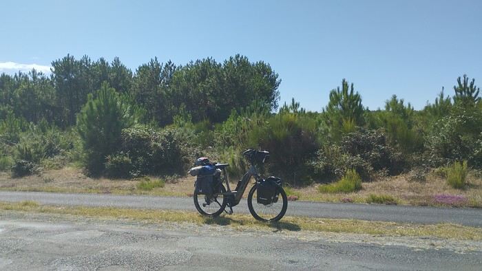 My gear
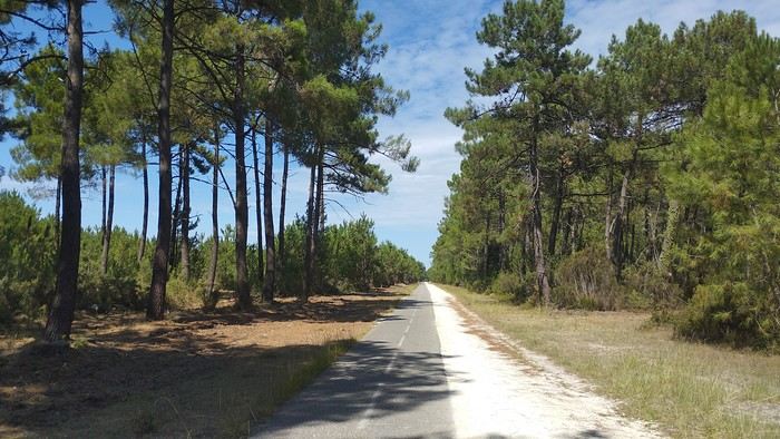
The Landes region—nothing extraordinary, but the calm and serenity are nice.

Le Verdon
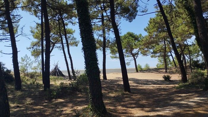
The wild coast
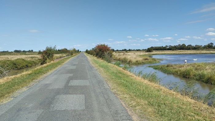
This marsh isn’t dry, though.
Today is the third day of my trip, and I’m writing to you from a campsite in Marans. I’ve set out to bike from Carcans Maubuisson back to Plaisir. Why Carcans? Because we spent a week there as a family—a great week that lets everyone reconnect for a long stretch. Also, on Saturday, we all headed home—some by car, and me by bike. This journey is about 850 km via bike paths and small cycling roads. It’s not a sporting feat, just a nice long ride for fun. As the old Chinese sage says, "The destination doesn’t matter—it’s the journey that counts." But he also told me, "Traveling is great, but what’s the point if you don’t share it?" You see, this old sage has told me a lot of things—he often keeps me company when I’m biking. Of course, he doesn’t pedal, but we travel in harmony. Sure, he can be a bit annoying sometimes, but we still get along. All this to say I’ve created a group to share my story. I’d be happy to share this experience with you—it’s an adventure for me. On Saturday, I wasn’t sure I’d even leave because I’d been dealing with sciatica for days. Luckily, Juliette, a friend of the old Chinese sage, recommended a lifesaving remedy: Alternately stretching your legs with an elastic band under your foot. Obviously, a jam jar rubber band won’t cut it.
From Marans - The mosquitoes are attacking; time to head back to shelter.
The first two legs took me to Royan and then Rochefort. The Sèvre Niortaise flows nearby, and I followed a canal from La Rochelle. You could say the area is as dry as the marsh, judging by the state of the crops.
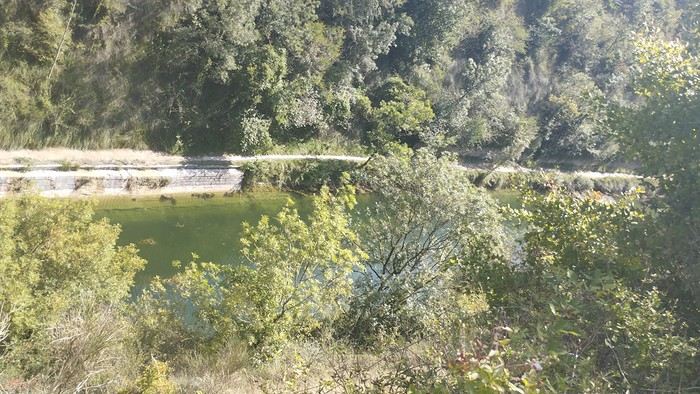
As I mentioned, it’s the third day, and if Jesus rose again on this day, for me it was more like the crucifixion. The scorching heat—only bearable when you’re moving—combined with rough trail conditions, and the old Chinese sage says, "Terrible roads, slow speed, and watch your limbs." I set out to do 60 km but ended up doing 80, and the last 20 were tough. I kept checking the GPS to see how much farther until the campsite. Today: Rochefort to Marans, sticking to the coast until La Rochelle, then no notable towns after that—just a constant canal. But since the sky isn’t too low, it hasn’t gotten lost. I’ve still got plenty of anecdotes to share, but it’s pitch black out, and the mosquitoes are still around. This morning, I counted ten in my tent, all full of my blood. Yesterday, at the end of the leg to Rochefort, I was really looking forward to crossing the Charente using the transporter bridge, but a sneaky GPS conspiracy led me far from it. I ended up crossing the Charente on a completely ordinary bridge, watching the transporter bridge in the distance with disappointment.
End of the first episode. Until tomorrow, if you’d like!
No journal for the first two days. Day 1 - CARCANS-ROYAN Day 2 - ROYAN - ROCHEFORT Tonight I'm in MARANS in the "dry marsh" according to the campsite manager—it’s the first time I’ve heard of a "dry marsh"?!
Photos from the first two days
My gearThe Landes region—nothing extraordinary, but the calm and serenity are nice.
Le Verdon
The wild coast
This marsh isn’t dry, though.
Today is the third day of my trip, and I’m writing to you from a campsite in Marans. I’ve set out to bike from Carcans Maubuisson back to Plaisir. Why Carcans? Because we spent a week there as a family—a great week that lets everyone reconnect for a long stretch. Also, on Saturday, we all headed home—some by car, and me by bike. This journey is about 850 km via bike paths and small cycling roads. It’s not a sporting feat, just a nice long ride for fun. As the old Chinese sage says, "The destination doesn’t matter—it’s the journey that counts." But he also told me, "Traveling is great, but what’s the point if you don’t share it?" You see, this old sage has told me a lot of things—he often keeps me company when I’m biking. Of course, he doesn’t pedal, but we travel in harmony. Sure, he can be a bit annoying sometimes, but we still get along. All this to say I’ve created a group to share my story. I’d be happy to share this experience with you—it’s an adventure for me. On Saturday, I wasn’t sure I’d even leave because I’d been dealing with sciatica for days. Luckily, Juliette, a friend of the old Chinese sage, recommended a lifesaving remedy: Alternately stretching your legs with an elastic band under your foot. Obviously, a jam jar rubber band won’t cut it.
From Marans - The mosquitoes are attacking; time to head back to shelter.
The first two legs took me to Royan and then Rochefort. The Sèvre Niortaise flows nearby, and I followed a canal from La Rochelle. You could say the area is as dry as the marsh, judging by the state of the crops.
As I mentioned, it’s the third day, and if Jesus rose again on this day, for me it was more like the crucifixion. The scorching heat—only bearable when you’re moving—combined with rough trail conditions, and the old Chinese sage says, "Terrible roads, slow speed, and watch your limbs." I set out to do 60 km but ended up doing 80, and the last 20 were tough. I kept checking the GPS to see how much farther until the campsite. Today: Rochefort to Marans, sticking to the coast until La Rochelle, then no notable towns after that—just a constant canal. But since the sky isn’t too low, it hasn’t gotten lost. I’ve still got plenty of anecdotes to share, but it’s pitch black out, and the mosquitoes are still around. This morning, I counted ten in my tent, all full of my blood. Yesterday, at the end of the leg to Rochefort, I was really looking forward to crossing the Charente using the transporter bridge, but a sneaky GPS conspiracy led me far from it. I ended up crossing the Charente on a completely ordinary bridge, watching the transporter bridge in the distance with disappointment.
End of the first episode. Until tomorrow, if you’d like!
Hello everyone,
I’m happy to be back at my keyboard to share a few adventures. 😉
Right now, two more trips are in the works for 2025, but for the moment, I’d rather share than ask questions.
Like many of you, Iceland has been a longtime love of mine. My first trip there was in February 2016, when we went as a family of five—including our three daughters, who were 1, 6, and 5 at the time. It was a very short stay with just one place to stay, north of the capital. We explored the south, from Vik to Grindavik, and of course, I was left wanting more. We returned in April 2018 during a stopover on our way back from New York. We spent three days near Borgarnes, but fatigue and the weather kept me from doing everything I’d planned. After my mom passed away in January 2023, I decided to go back to Iceland for a full week. Just to clear my head... I thought I’d go alone, but in the end, my 8-year-old daughter (at the time) is a huge horseback riding fan, so I decided to take her along. This road trip came together quickly thanks to another well-known French-speaking forum for Iceland lovers. As usual, I quickly checked availability on Booking and flights with Icelandair. Booked the flight, then the accommodations—with quite a few changes right up until departure. Goals for this trip:
Go where I haven’t been yet. Do a road trip because I love them. Go horseback riding with my daughter.
Icelandair was booked for May 6–13, 2023. Accommodations were reserved on Booking, and once again, I rented a 4x4 from Blue Car Rental, which I really like. Not wanting to deal with boredom while there, I got all the insurance and the option to skip the counter. My English isn’t great…
I’m happy to be back at my keyboard to share a few adventures. 😉
Right now, two more trips are in the works for 2025, but for the moment, I’d rather share than ask questions.
Like many of you, Iceland has been a longtime love of mine. My first trip there was in February 2016, when we went as a family of five—including our three daughters, who were 1, 6, and 5 at the time. It was a very short stay with just one place to stay, north of the capital. We explored the south, from Vik to Grindavik, and of course, I was left wanting more. We returned in April 2018 during a stopover on our way back from New York. We spent three days near Borgarnes, but fatigue and the weather kept me from doing everything I’d planned. After my mom passed away in January 2023, I decided to go back to Iceland for a full week. Just to clear my head... I thought I’d go alone, but in the end, my 8-year-old daughter (at the time) is a huge horseback riding fan, so I decided to take her along. This road trip came together quickly thanks to another well-known French-speaking forum for Iceland lovers. As usual, I quickly checked availability on Booking and flights with Icelandair. Booked the flight, then the accommodations—with quite a few changes right up until departure. Goals for this trip:
Go where I haven’t been yet. Do a road trip because I love them. Go horseback riding with my daughter.
Icelandair was booked for May 6–13, 2023. Accommodations were reserved on Booking, and once again, I rented a 4x4 from Blue Car Rental, which I really like. Not wanting to deal with boredom while there, I got all the insurance and the option to skip the counter. My English isn’t great…
Hi there!
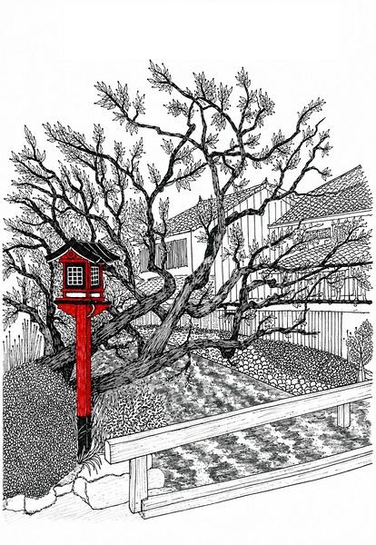 I’m inviting you on a stroll through my drawings—a completely subjective, far from exhaustive, and totally personal take, since it’s based on my own sketches. I put this travel journal together after returning in late 2024, mostly using felt-tip pens and pencils, with a few collages thrown in. I worked from our personal photos.
Let’s start with the shotengai...
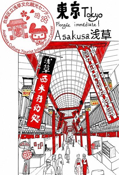
Our first "wow" moment came as we stepped out of the subway in Asakusa, the Tokyo neighborhood where we’d booked our hotel for our first five nights. Exhausted after our long flight, we finally arrived and took an exit that led straight into a shotengai—one of those covered shopping streets that pop up in city centers and flourished between the 1950s and 1980s.
It was an instant aesthetic shock, like a close encounter of the third kind between the modern city, a typical Asian market with its street stalls, the vintage vibe of the arcade, the sheer abundance of goods, and the bustling crowd—a mix of tourists, pilgrims (thanks to nearby Senso-ji Temple), and locals (it’s a very working-class area). In the end, it set the tone for a feeling we’d experience throughout the trip. Wherever we went, shotengai turned out to be fantastic spots for finding little restaurants, shops, or even fresh produce. Some are like real mazes, like in Kyoto, where we spent ages trying to relocate a restaurant we’d loved ;-)
In Kanazawa, the Omicho Market: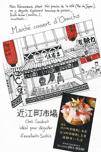 And in Kyoto, Nishiki Market:
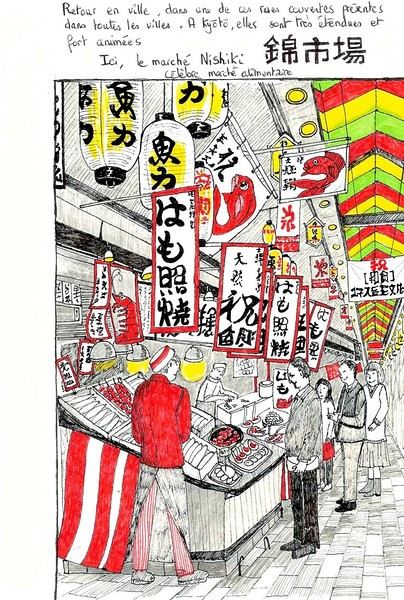
To be continued...
I’m inviting you on a stroll through my drawings—a completely subjective, far from exhaustive, and totally personal take, since it’s based on my own sketches. I put this travel journal together after returning in late 2024, mostly using felt-tip pens and pencils, with a few collages thrown in. I worked from our personal photos.Let’s start with the shotengai...
Our first "wow" moment came as we stepped out of the subway in Asakusa, the Tokyo neighborhood where we’d booked our hotel for our first five nights. Exhausted after our long flight, we finally arrived and took an exit that led straight into a shotengai—one of those covered shopping streets that pop up in city centers and flourished between the 1950s and 1980s.
It was an instant aesthetic shock, like a close encounter of the third kind between the modern city, a typical Asian market with its street stalls, the vintage vibe of the arcade, the sheer abundance of goods, and the bustling crowd—a mix of tourists, pilgrims (thanks to nearby Senso-ji Temple), and locals (it’s a very working-class area). In the end, it set the tone for a feeling we’d experience throughout the trip. Wherever we went, shotengai turned out to be fantastic spots for finding little restaurants, shops, or even fresh produce. Some are like real mazes, like in Kyoto, where we spent ages trying to relocate a restaurant we’d loved ;-)
In Kanazawa, the Omicho Market:
And in Kyoto, Nishiki Market:
To be continued...
A travel journal—it’s been a while!
I must say, my personal situation has "changed a bit" since my last journals (my 3 kids are grown up + a divorce finalized in early 2021). So, no more long-haul family trips; now I’m focusing on multi-day hikes for my vacations. I found a hiking buddy in 2021 to join me on the Laugavegur trek in Iceland, but this year, no one was available.
That’s how the idea of a solo trek in Lapland took root—a region I’ve been dreaming about ever since I read Marie Lefevre’s 2012 journal on the topic.
Marie, who I hiked with for the first time in 2015 during my very first multi-day trek, and whom I can never thank enough for sharing her knowledge and saving me so much time.
To build my confidence for this solo trek, I hiked around Cantal in May (okay, I’m capable of spending nights alone in the middle of nowhere without being overly terrified) and camped in the Mercantour in July, where a massive storm made me realize I still had room for improvement in managing wet conditions...
After some research, I bought 2 Nylofume bags—large, ultra-lightweight ones to protect my gear in my backpack—and a set of 4 Aloksak bags in different sizes for my passport, camera, battery, etc. (and I’m so glad I did!!)
Well, I think I’m all set...
My 16/08 - Day 1 - Ritsem – Gisuris (well, almost) Wed 17/08 – Day 2 - Partly in the tent + minimal progress toward Gisuris Thu 18/08 – Day 3 - Gisuris – Laddejakha (23 km) Fri 19/08 – Day 4 – Laddejakha – Arasluokta (13 km) Sat 20/08 - Day 5 - Arasluokta – Staloluokta (12 km) Sun 21/08 – Day 6 - Staloluokta – Duottar (18 km) Mon 22/08 Day 7 - Duottar – Dareluoppal (10 km) Sammarlappa (15.3 km) Tue 23/08 - Day 8 - Sammarlappa – Tarrekaise (12 km) + halfway to Tarrekaise-Nunjes (approx. 3 km) Wed 24/08 – Day 9 – Finish Tarrekaise-Nunjes (approx. 4 km) Kvikkjokk (12.6 km) Thu 25/08 and Fri 26/08 – Around Kvikkjokk Food and gear summary
I must say, my personal situation has "changed a bit" since my last journals (my 3 kids are grown up + a divorce finalized in early 2021). So, no more long-haul family trips; now I’m focusing on multi-day hikes for my vacations. I found a hiking buddy in 2021 to join me on the Laugavegur trek in Iceland, but this year, no one was available.
That’s how the idea of a solo trek in Lapland took root—a region I’ve been dreaming about ever since I read Marie Lefevre’s 2012 journal on the topic.
Marie, who I hiked with for the first time in 2015 during my very first multi-day trek, and whom I can never thank enough for sharing her knowledge and saving me so much time.
To build my confidence for this solo trek, I hiked around Cantal in May (okay, I’m capable of spending nights alone in the middle of nowhere without being overly terrified) and camped in the Mercantour in July, where a massive storm made me realize I still had room for improvement in managing wet conditions...
After some research, I bought 2 Nylofume bags—large, ultra-lightweight ones to protect my gear in my backpack—and a set of 4 Aloksak bags in different sizes for my passport, camera, battery, etc. (and I’m so glad I did!!)
Well, I think I’m all set...
My 16/08 - Day 1 - Ritsem – Gisuris (well, almost) Wed 17/08 – Day 2 - Partly in the tent + minimal progress toward Gisuris Thu 18/08 – Day 3 - Gisuris – Laddejakha (23 km) Fri 19/08 – Day 4 – Laddejakha – Arasluokta (13 km) Sat 20/08 - Day 5 - Arasluokta – Staloluokta (12 km) Sun 21/08 – Day 6 - Staloluokta – Duottar (18 km) Mon 22/08 Day 7 - Duottar – Dareluoppal (10 km) Sammarlappa (15.3 km) Tue 23/08 - Day 8 - Sammarlappa – Tarrekaise (12 km) + halfway to Tarrekaise-Nunjes (approx. 3 km) Wed 24/08 – Day 9 – Finish Tarrekaise-Nunjes (approx. 4 km) Kvikkjokk (12.6 km) Thu 25/08 and Fri 26/08 – Around Kvikkjokk Food and gear summary
Another fresh travel journal!
The context: For my 60th birthday, I had planned to take my family (kids + partners) for a week in Gran Canaria, at an all-inclusive hotel, but with the firm intention of exploring and hiking. The deal was to meet up at least in the evenings to spend time together, if my pace didn’t suit them. Personally, I’m not into beaches and lazing around, but my daughter-in-law is pretty cool. We were going to be together, do what we liked, and all would be well. Unfortunately, five days before departure, my mother-in-law passed away, and of course, we had to cancel everything. I was able to get a refund for a lot of things, including the hotel despite missing the free cancellation deadline (really cool of them), and I got a one-year credit for the full price of the flight tickets. So, we tried to plan the same thing for my kids, but with their schedules, we couldn’t find a date. I had to find a destination served by Iberia, far enough to use up my credit. We don’t know the Caribbean, we needed sun and a bit of rest, so the Dominican Republic won out. But no way were we going to mess up by staying in an all-inclusive hotel and only visiting the island’s paradise beaches… (we’ll get back to that). So, as usual, I put together a little road trip with a rental car.
Here we go!!!!
Day 1: Crossing the Atlantic Super early departure for Lyon-Saint Exupéry Airport. A 3-hour layover in Madrid (my wife’s had enough of flight delays, so I played it safe). Flight to Santo Domingo without any issues. The luggage arrived, the driver I’d booked was there, everything went smoothly. We got to our hotel in the Zona Colonial around 4 PM. Bad luck—it’s on a cute little square where there was supposed to be neighborhood activity in the evening. It’s completely under construction! Too bad! We decided to head to the Malecón, a sort of local Promenade des Anglais, except there are no English people. It’s nice, safe, spacious, and by the ocean. We walked for a while, and as happy hour rolled around, I started my training as an intern in rum-based cocktails. A mojito, classic, but it’s amazing to be sipping the drink in the warmth, right by the big blue. On the way back to the hotel, we grabbed some bananas, ate them in the room, and then bedtime.
The plus: We actually left! The minus: There isn’t one
The context: For my 60th birthday, I had planned to take my family (kids + partners) for a week in Gran Canaria, at an all-inclusive hotel, but with the firm intention of exploring and hiking. The deal was to meet up at least in the evenings to spend time together, if my pace didn’t suit them. Personally, I’m not into beaches and lazing around, but my daughter-in-law is pretty cool. We were going to be together, do what we liked, and all would be well. Unfortunately, five days before departure, my mother-in-law passed away, and of course, we had to cancel everything. I was able to get a refund for a lot of things, including the hotel despite missing the free cancellation deadline (really cool of them), and I got a one-year credit for the full price of the flight tickets. So, we tried to plan the same thing for my kids, but with their schedules, we couldn’t find a date. I had to find a destination served by Iberia, far enough to use up my credit. We don’t know the Caribbean, we needed sun and a bit of rest, so the Dominican Republic won out. But no way were we going to mess up by staying in an all-inclusive hotel and only visiting the island’s paradise beaches… (we’ll get back to that). So, as usual, I put together a little road trip with a rental car.
Here we go!!!!
Day 1: Crossing the Atlantic Super early departure for Lyon-Saint Exupéry Airport. A 3-hour layover in Madrid (my wife’s had enough of flight delays, so I played it safe). Flight to Santo Domingo without any issues. The luggage arrived, the driver I’d booked was there, everything went smoothly. We got to our hotel in the Zona Colonial around 4 PM. Bad luck—it’s on a cute little square where there was supposed to be neighborhood activity in the evening. It’s completely under construction! Too bad! We decided to head to the Malecón, a sort of local Promenade des Anglais, except there are no English people. It’s nice, safe, spacious, and by the ocean. We walked for a while, and as happy hour rolled around, I started my training as an intern in rum-based cocktails. A mojito, classic, but it’s amazing to be sipping the drink in the warmth, right by the big blue. On the way back to the hotel, we grabbed some bananas, ate them in the room, and then bedtime.
The plus: We actually left! The minus: There isn’t one
TREN MAYA in Yucatán
We’re just back from our 7th or 8th trip to the Yucatán since 1971, and it’ll probably be our last (a little tear). We’ve crisscrossed the peninsula many times, but this post isn’t about listing the countless wonders to visit—there are already plenty of articles on that part of Mexico. For this trip, we chose to travel by train to try out this new way of getting around.
The TREN MAYA routes roughly follow the coast in a loop: Cancún – Valladolid – Mérida – Campeche – Escárcega – Chetumal – Tulum – Playa del Carmen – Cancún, with the main stations listed here and usually 2 or 3 stops in between. A branch line runs from Escárcega to Palenque. We only traveled the Cancún – Mérida – Escárcega – Palenque section, as the loop via Chetumal wasn’t open when we planned our trip. Besides, Chetumal itself isn’t very interesting. However, the Escárcega–Chetumal route has lots of Maya sites worth visiting.
The tracks, stations, and rolling stock are all brand new. The Tulum–Mérida section opened in early 2024, and the full loop was inaugurated at the end of 2024. The trains currently consist of 4 tourist-class cars and 2 first-class cars. I imagine this setup might change, since first class was nearly empty while tourist class was between 25% and 70% full, depending on the time and route.
The cars are designed by Alstom and built in Mexico, with the same seating layout as in France: 2+2 in tourist class and 2+1 in first class. The seats are a bit more comfortable than in France for tourist class and slightly firmer in first class.
The track is very well laid on the Cancún–Mérida–Escárcega section we traveled: no jolts at all. However, the Escárcega–Palenque branch is likely built with short rails, so I don’t think it’ll support very high speeds. The line is single-track except for the Cancún–Valladolid–Mérida stretch, which is double-track, and electrification is underway. Signaling is also being installed—the targets are in place but not yet operational. Given the current low traffic, we weren’t too worried.
The trains are diesel-electric hybrids and very quiet in diesel mode. I clocked a speed of 140 km/h, and they say it’ll reach 200 km/h once electrified.
Now, the stations: *grand* is the word that comes to mind. The architects did an amazing job aesthetically—it reminds us of Canfranc, with the same spirit 150 years apart, using marble (?) for the flooring. Technically, though, at least in Valladolid station, it’s a miss—they’ve already added unattractive metal reinforcements to the concrete framework barely a year after the inauguration.
Practical info: Tickets can be bought online on the Tren Maya website.
But contrary to what the *Routard* guide says, you can only book about a week in advance. So, we bought our tickets for the first leg, Cancún–Valladolid, from France, and then got the rest at the station a few days ahead. It seems there’s no ticket sales in travel agencies.
Arrive at the station about 20–30 minutes early, as there are airport-style security checks. Right now, the staff are still getting the hang of the baggage scanners and metal detectors, which can be a bit amusing.
Important note: This is a completely new rail network, so the tracks—and especially the stations—are far from city centers. To get downtown, you’ll need to take a shuttle or a taxi.
Here’s the breakdown for station-to-downtown travel: - **Cancún**: There are shuttles between the airports and the station (35 MXN/person). Taxis are pricier than in NYC: 50 € (1000 MXN) for a 10-minute ride—it’s an organized scam, but at least it’s clean, which is more than you can say for Cancún. If you’re staying at a hotel in Cancún or Playa del Carmen, make sure to arrange the hotel shuttle in advance. - **Valladolid**: 15 minutes from downtown, 150 MXN by taxi, or 36 MXN/person by shuttle, which drops you 3 *cuadras* (a *cuadra* = a block ≈ 100 m) from the center. - **Mérida**: 30 minutes from downtown, 300 MXN by taxi, or 50 MXN/person by shuttle, which drops you 7 or 8 *cuadras* from the center. The ticket agent told us it was just 1 *cuadra* (and we’re perfectly bilingual, so no confusion), but dragging suitcases over broken sidewalks in 33°C heat with no taxis in sight? Not great. So, for Mérida, just take a taxi. - **Campeche**: 10 minutes from downtown, 50 MXN by shuttle, which drops you right in the center (at the *Malecón*, across from the Gamma Hotel). We didn’t see any taxis at the station. - **Palenque**: Most hotels are outside the city center, so a taxi is a must—around 150 to 250 MXN.
Don’t forget to agree on the taxi fare with the driver before getting in.
For Tren Maya fares, there’s a rate for non-Mexican residents and several others for residents based on income. Here are the non-resident fares per person: - Cancún – Valladolid: 472 MXN (539 MXN on the return) - Valladolid – Mérida: 505.50 MXN (553 MXN on the return) - Mérida – Campeche: 574 MXN - Campeche – Palenque: 1300 MXN - Escárcega – Palenque: 789 MXN
The main reason we chose the train over renting a car (our usual go-to) was that on our last trip, just before COVID in 2020, the rental company refused to insure us in Chiapas due to safety concerns. So, we had to skip Palenque—but with the Tren Maya, it became possible again. The big downside of the train is that you need shuttles or taxis to visit all the Maya sites, which adds up in cost and time.
**Conclusion**: If you add up the train fares, taxis, etc., it might be better to rent a car for the whole trip and leave it in a hotel parking lot in Campeche or Escárcega for a couple of days if you want to visit Palenque. Then, take the train for a round trip between Campeche–Palenque or Escárcega–Palenque.
Safe travels! *
The TREN MAYA routes roughly follow the coast in a loop: Cancún – Valladolid – Mérida – Campeche – Escárcega – Chetumal – Tulum – Playa del Carmen – Cancún, with the main stations listed here and usually 2 or 3 stops in between. A branch line runs from Escárcega to Palenque. We only traveled the Cancún – Mérida – Escárcega – Palenque section, as the loop via Chetumal wasn’t open when we planned our trip. Besides, Chetumal itself isn’t very interesting. However, the Escárcega–Chetumal route has lots of Maya sites worth visiting.
The tracks, stations, and rolling stock are all brand new. The Tulum–Mérida section opened in early 2024, and the full loop was inaugurated at the end of 2024. The trains currently consist of 4 tourist-class cars and 2 first-class cars. I imagine this setup might change, since first class was nearly empty while tourist class was between 25% and 70% full, depending on the time and route.
The cars are designed by Alstom and built in Mexico, with the same seating layout as in France: 2+2 in tourist class and 2+1 in first class. The seats are a bit more comfortable than in France for tourist class and slightly firmer in first class.
The track is very well laid on the Cancún–Mérida–Escárcega section we traveled: no jolts at all. However, the Escárcega–Palenque branch is likely built with short rails, so I don’t think it’ll support very high speeds. The line is single-track except for the Cancún–Valladolid–Mérida stretch, which is double-track, and electrification is underway. Signaling is also being installed—the targets are in place but not yet operational. Given the current low traffic, we weren’t too worried.
The trains are diesel-electric hybrids and very quiet in diesel mode. I clocked a speed of 140 km/h, and they say it’ll reach 200 km/h once electrified.
Now, the stations: *grand* is the word that comes to mind. The architects did an amazing job aesthetically—it reminds us of Canfranc, with the same spirit 150 years apart, using marble (?) for the flooring. Technically, though, at least in Valladolid station, it’s a miss—they’ve already added unattractive metal reinforcements to the concrete framework barely a year after the inauguration.
Practical info: Tickets can be bought online on the Tren Maya website.
But contrary to what the *Routard* guide says, you can only book about a week in advance. So, we bought our tickets for the first leg, Cancún–Valladolid, from France, and then got the rest at the station a few days ahead. It seems there’s no ticket sales in travel agencies.
Arrive at the station about 20–30 minutes early, as there are airport-style security checks. Right now, the staff are still getting the hang of the baggage scanners and metal detectors, which can be a bit amusing.
Important note: This is a completely new rail network, so the tracks—and especially the stations—are far from city centers. To get downtown, you’ll need to take a shuttle or a taxi.
Here’s the breakdown for station-to-downtown travel: - **Cancún**: There are shuttles between the airports and the station (35 MXN/person). Taxis are pricier than in NYC: 50 € (1000 MXN) for a 10-minute ride—it’s an organized scam, but at least it’s clean, which is more than you can say for Cancún. If you’re staying at a hotel in Cancún or Playa del Carmen, make sure to arrange the hotel shuttle in advance. - **Valladolid**: 15 minutes from downtown, 150 MXN by taxi, or 36 MXN/person by shuttle, which drops you 3 *cuadras* (a *cuadra* = a block ≈ 100 m) from the center. - **Mérida**: 30 minutes from downtown, 300 MXN by taxi, or 50 MXN/person by shuttle, which drops you 7 or 8 *cuadras* from the center. The ticket agent told us it was just 1 *cuadra* (and we’re perfectly bilingual, so no confusion), but dragging suitcases over broken sidewalks in 33°C heat with no taxis in sight? Not great. So, for Mérida, just take a taxi. - **Campeche**: 10 minutes from downtown, 50 MXN by shuttle, which drops you right in the center (at the *Malecón*, across from the Gamma Hotel). We didn’t see any taxis at the station. - **Palenque**: Most hotels are outside the city center, so a taxi is a must—around 150 to 250 MXN.
Don’t forget to agree on the taxi fare with the driver before getting in.
For Tren Maya fares, there’s a rate for non-Mexican residents and several others for residents based on income. Here are the non-resident fares per person: - Cancún – Valladolid: 472 MXN (539 MXN on the return) - Valladolid – Mérida: 505.50 MXN (553 MXN on the return) - Mérida – Campeche: 574 MXN - Campeche – Palenque: 1300 MXN - Escárcega – Palenque: 789 MXN
The main reason we chose the train over renting a car (our usual go-to) was that on our last trip, just before COVID in 2020, the rental company refused to insure us in Chiapas due to safety concerns. So, we had to skip Palenque—but with the Tren Maya, it became possible again. The big downside of the train is that you need shuttles or taxis to visit all the Maya sites, which adds up in cost and time.
**Conclusion**: If you add up the train fares, taxis, etc., it might be better to rent a car for the whole trip and leave it in a hotel parking lot in Campeche or Escárcega for a couple of days if you want to visit Palenque. Then, take the train for a round trip between Campeche–Palenque or Escárcega–Palenque.
Safe travels! *
Hello everyone, I’m happy to welcome you to this new travel journal.
We’re heading to Costa Rica together—a Central American destination that dreams are made of for many French travelers and attracts crowds from France.
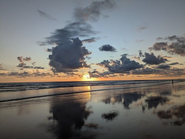
It was the country’s wild nature and safety that convinced us to go, since we’re traveling with our 7-year-old little one. We didn’t have much vacation time in February 2026 (only 12 days), so we optimized as much as possible.
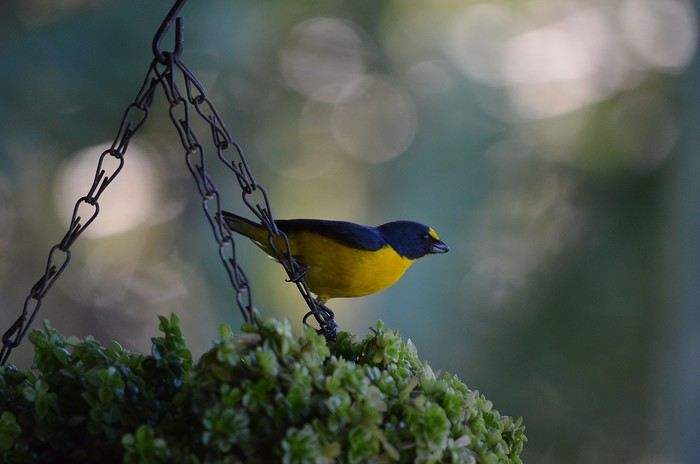
Here’s the itinerary: Wednesday, February 11: Flight from Marseille to San Jose via Paris and Atlanta Thursday, February 12: Pick up the car, drive to Poas Volcano, visit La Paz Waterfall Gardens Friday, February 13: Poas Volcano and drive to Manuel Antonio Saturday, February 14: Manuel Antonio National Park Sunday, February 15: Nauyaca Waterfall and Playa Linda Monday, February 16: Drive to Monte Verde and Santa Elena Reserve Tuesday, February 17: El Tigre Waterfall Reserve and Treetopia Park Wednesday, February 18: Monte Verde Reserve with a guide and drive to La Fortuna Thursday, February 19: Sloth guided tour, Observatory Lodge Park Friday, February 20: Arenal Volcano National Park, Termalistas del Arenal hot springs, and night tour Saturday, February 21: Return to San Jose, flight to Paris via Atlanta Sunday, February 22: Arrival in Paris and flight to Marseille. That gives us a solid 9 days in the country.
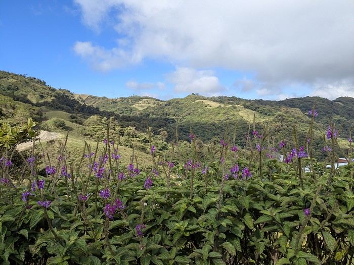
Budget breakdown: Costa Rica is an expensive country, but no more so than France. However, almost all hikes and waterfalls are paid entry, which can really add up. For meals, sodas (6–10 €) are cheaper than restaurants (10–20 € per dish).
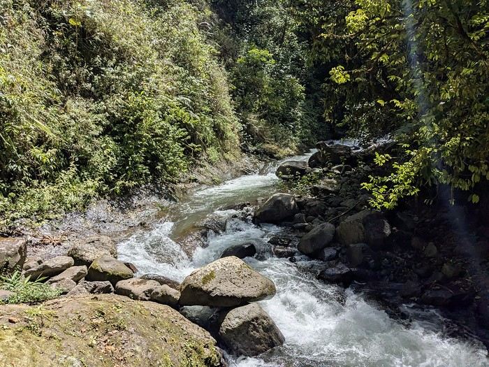
Flights: We chose Delta Airlines for the price: Marseille to San Jose was 740 € per person (modifiable, with checked baggage and seat selection included). Other direct flights from Europe were priced between 1200 € and 1600 € with more restrictive conditions. That’s 2220 € for the family.
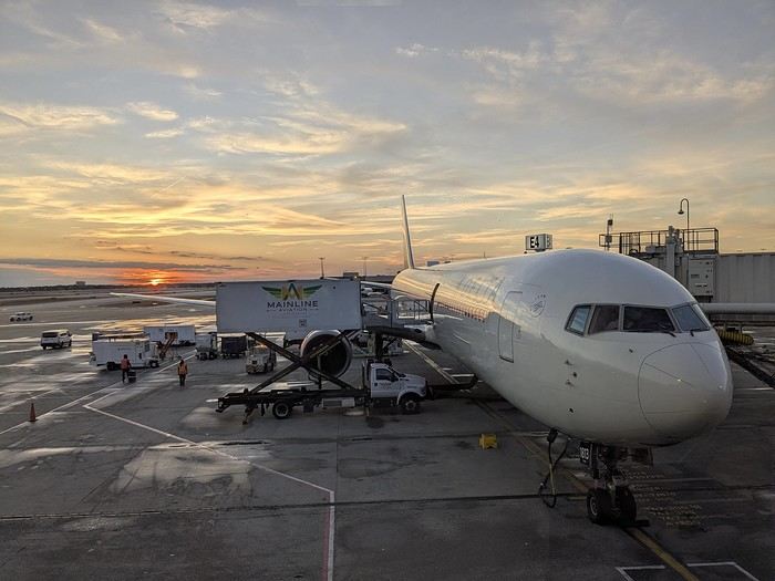
Accommodations: Alajuela, first night: 139 € (1 night) at Rodeo Estancia Boutique Hotel, with personalized airport pickup, transfer to the hotel, and a briefing from Vert Costa Rica agency the next day. Poas: 66 € (1 night) at Cabañas Tierra Fértil (entire apartment). Manuel Antonio: 394 € (3 nights) at La Palapa Ecolodge (hotel in the jungle). Monte Verde: Chalet Aloha Monteverde Cloud Forest (2 bedrooms): 125 € (2 nights). La Fortuna: Arenal Dream Garden (1 bedroom): 217 € (3 nights). Total: 941 €.
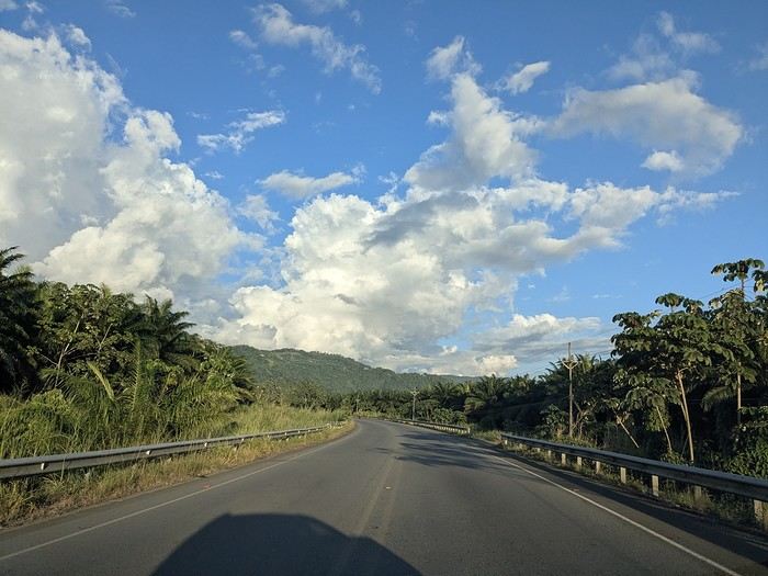
Car rental: I went through Vert Costa Rica agency (Vincent is a French expat who set up the agency in Costa Rica and makes great YouTube videos with useful tips). I rented a 4x4 that was delivered to the hotel the day after arrival and returned at the airport before the flight. The total was 772 €, including full insurance (zero deductible), a child seat, and a phone with a Costa Rican SIM and WhatsApp. The rental company was Poas Rent a Car. The vehicle was well-maintained—no complaints. Gas: 100 € for the whole trip (3 fill-ups).
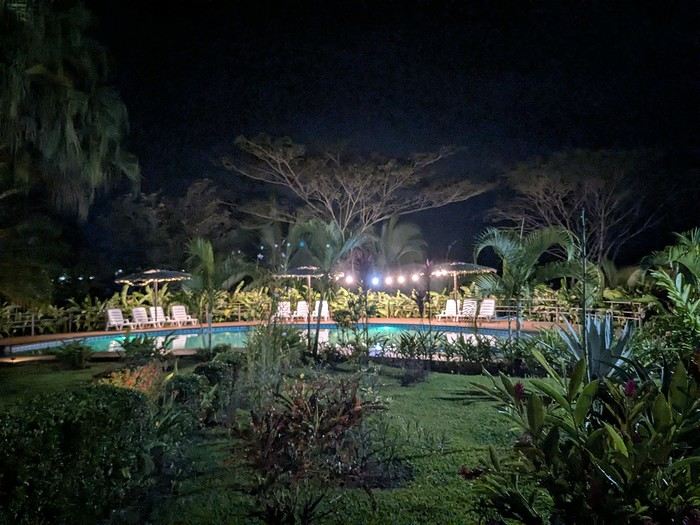
Activities: To get discounts, I bought the pass offered by Vincent, which paid for itself after just one activity. It cost me 30 € (promo since I rented the car through him). Prices are for 3 people. I’ve added stars to rate them: La Paz Waterfall Gardens ****: 112 € Poas Volcano National Park *: 33 € Manuel Antonio National Park ****: 35 € Nauyaca Waterfall ***: 25 € Santa Elena Reserve **: 45 € El Tigre Waterfall Reserve ****: 141 € (with meal) Treetopia (ziplining, suspension bridges) **: 250 € Guided tour of Monte Verde Reserve ***: 113 € Sloth guided tour (with breakfast) ***: 115 € Arenal Observatory Lodge (with meal) ****: 102 € Arenal Volcano National Park *: 34 € Termalistas del Arenal ****: 20 € Night tour ***: 116 € Total: 1171 €.
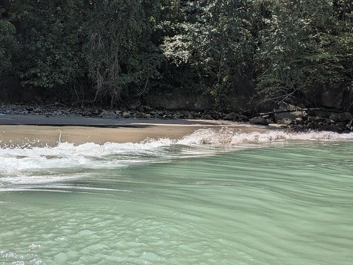
Meals: 600 € My favorite restaurants: Poas: Food court Mercaditas in Fraijanes Manuel Antonio (near La Palapa): La Langosta and also El Patio Near Nauyaca Waterfall: Ricar2 el Avión Between Manuel Antonio and Monte Verde: Soda D’Calle Santa Elena: HG’s Food Guadalupe (between Monte Verde and La Fortuna): Soda Río Piedras Arenal Observatory Lodge restaurant Arenal Oasis Ecolodge restaurant
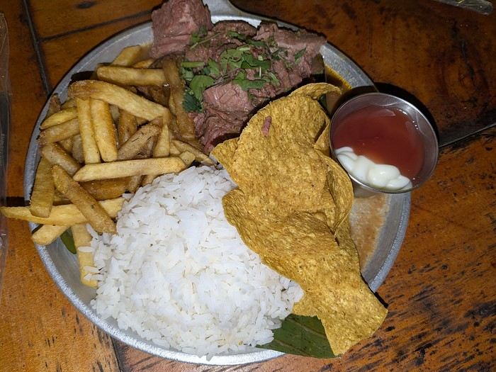
Other expenses: 300 € (groceries for breakfast, drinks, ice cream, souvenirs, etc.) Total overall: 6065 € (about 2020 € per person).
Now, here’s the day-by-day account of this beautiful trip.
https://voyageforum.com/images/posts/small/1772295011-z8mILBEUXHU8Ajz.jpg
It was the country’s wild nature and safety that convinced us to go, since we’re traveling with our 7-year-old little one. We didn’t have much vacation time in February 2026 (only 12 days), so we optimized as much as possible.
Here’s the itinerary: Wednesday, February 11: Flight from Marseille to San Jose via Paris and Atlanta Thursday, February 12: Pick up the car, drive to Poas Volcano, visit La Paz Waterfall Gardens Friday, February 13: Poas Volcano and drive to Manuel Antonio Saturday, February 14: Manuel Antonio National Park Sunday, February 15: Nauyaca Waterfall and Playa Linda Monday, February 16: Drive to Monte Verde and Santa Elena Reserve Tuesday, February 17: El Tigre Waterfall Reserve and Treetopia Park Wednesday, February 18: Monte Verde Reserve with a guide and drive to La Fortuna Thursday, February 19: Sloth guided tour, Observatory Lodge Park Friday, February 20: Arenal Volcano National Park, Termalistas del Arenal hot springs, and night tour Saturday, February 21: Return to San Jose, flight to Paris via Atlanta Sunday, February 22: Arrival in Paris and flight to Marseille. That gives us a solid 9 days in the country.
Budget breakdown: Costa Rica is an expensive country, but no more so than France. However, almost all hikes and waterfalls are paid entry, which can really add up. For meals, sodas (6–10 €) are cheaper than restaurants (10–20 € per dish).
Flights: We chose Delta Airlines for the price: Marseille to San Jose was 740 € per person (modifiable, with checked baggage and seat selection included). Other direct flights from Europe were priced between 1200 € and 1600 € with more restrictive conditions. That’s 2220 € for the family.
Accommodations: Alajuela, first night: 139 € (1 night) at Rodeo Estancia Boutique Hotel, with personalized airport pickup, transfer to the hotel, and a briefing from Vert Costa Rica agency the next day. Poas: 66 € (1 night) at Cabañas Tierra Fértil (entire apartment). Manuel Antonio: 394 € (3 nights) at La Palapa Ecolodge (hotel in the jungle). Monte Verde: Chalet Aloha Monteverde Cloud Forest (2 bedrooms): 125 € (2 nights). La Fortuna: Arenal Dream Garden (1 bedroom): 217 € (3 nights). Total: 941 €.
Car rental: I went through Vert Costa Rica agency (Vincent is a French expat who set up the agency in Costa Rica and makes great YouTube videos with useful tips). I rented a 4x4 that was delivered to the hotel the day after arrival and returned at the airport before the flight. The total was 772 €, including full insurance (zero deductible), a child seat, and a phone with a Costa Rican SIM and WhatsApp. The rental company was Poas Rent a Car. The vehicle was well-maintained—no complaints. Gas: 100 € for the whole trip (3 fill-ups).
Activities: To get discounts, I bought the pass offered by Vincent, which paid for itself after just one activity. It cost me 30 € (promo since I rented the car through him). Prices are for 3 people. I’ve added stars to rate them: La Paz Waterfall Gardens ****: 112 € Poas Volcano National Park *: 33 € Manuel Antonio National Park ****: 35 € Nauyaca Waterfall ***: 25 € Santa Elena Reserve **: 45 € El Tigre Waterfall Reserve ****: 141 € (with meal) Treetopia (ziplining, suspension bridges) **: 250 € Guided tour of Monte Verde Reserve ***: 113 € Sloth guided tour (with breakfast) ***: 115 € Arenal Observatory Lodge (with meal) ****: 102 € Arenal Volcano National Park *: 34 € Termalistas del Arenal ****: 20 € Night tour ***: 116 € Total: 1171 €.
Meals: 600 € My favorite restaurants: Poas: Food court Mercaditas in Fraijanes Manuel Antonio (near La Palapa): La Langosta and also El Patio Near Nauyaca Waterfall: Ricar2 el Avión Between Manuel Antonio and Monte Verde: Soda D’Calle Santa Elena: HG’s Food Guadalupe (between Monte Verde and La Fortuna): Soda Río Piedras Arenal Observatory Lodge restaurant Arenal Oasis Ecolodge restaurant
Other expenses: 300 € (groceries for breakfast, drinks, ice cream, souvenirs, etc.) Total overall: 6065 € (about 2020 € per person).
Now, here’s the day-by-day account of this beautiful trip.
https://voyageforum.com/images/posts/small/1772295011-z8mILBEUXHU8Ajz.jpg
Hi everyone,
In late February to early March 2025, we were lucky enough to spend about ten days in Mexico—heading to Cancún. We then embarked on a 9-day road trip to explore the Yucatán Peninsula! Since planning a trip isn’t always easy, we’re sharing our original itinerary (different from the "classic" loop) and our feedback on the places we visited.
With a few photos to illustrate each day, we hope to wow you 🙂! Here’s our loop itinerary starting from Cancún (a packed schedule, but it let us see so much): Day 1 - Cancún’s beach and Holbox Island
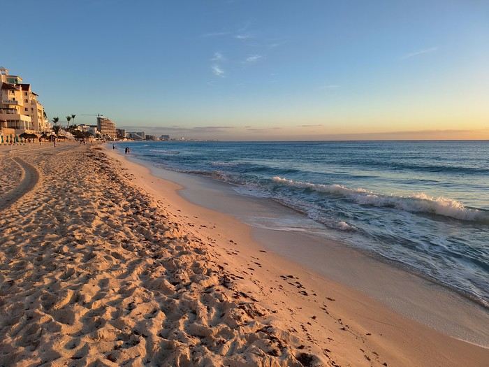
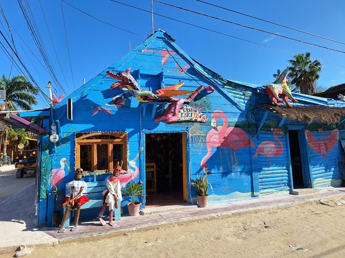
×768 214 KB
Day 2 - Holbox Island and the fishing village of Río Lagartos
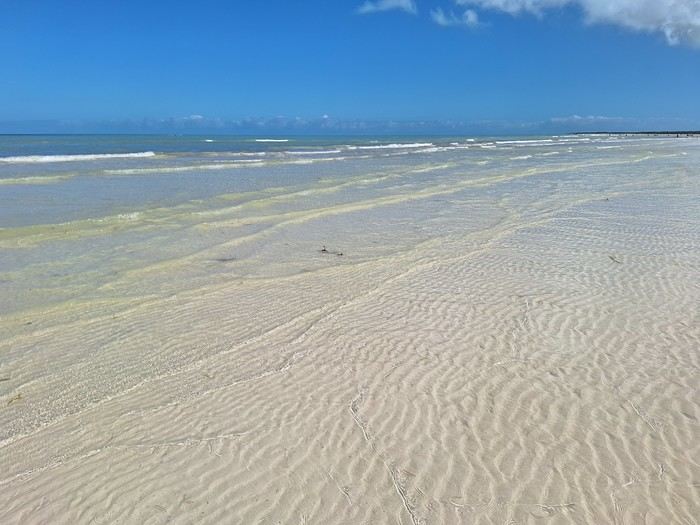
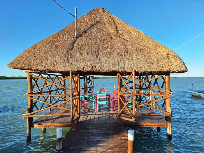
6 KB
Day 3 - The Río Lagartos nature reserve, Las Coloradas salt flats, the Ek'Balam Mayan site, the church of Uayma, and the colonial city of Valladolid
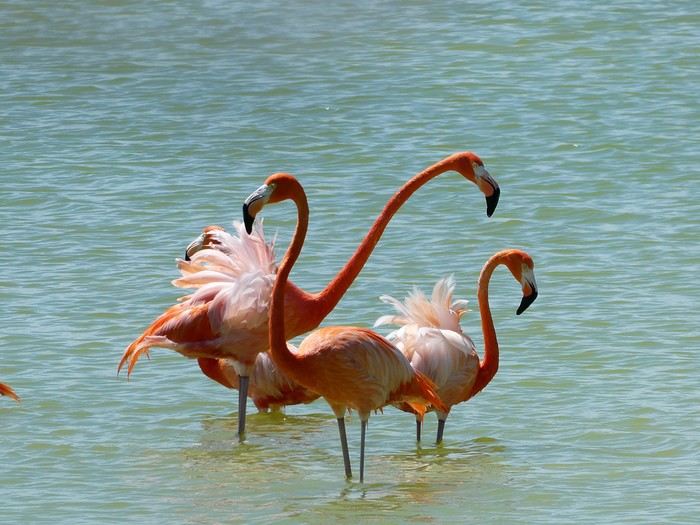
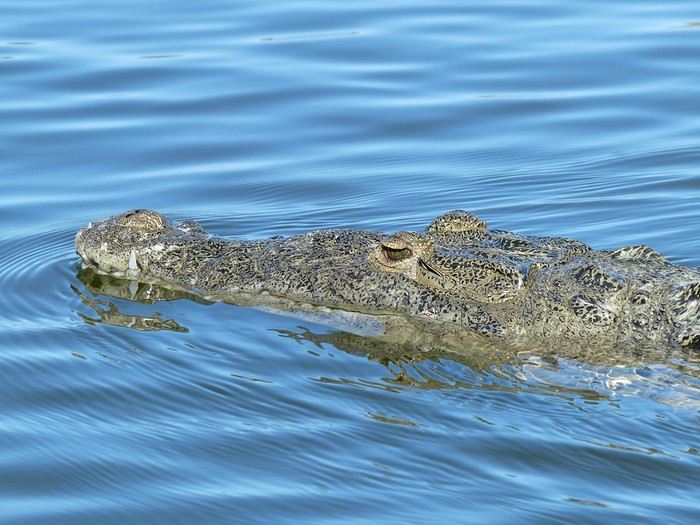
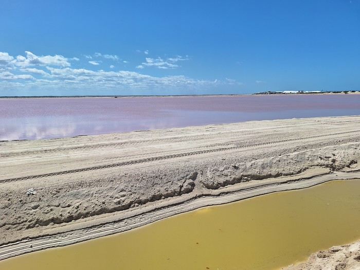
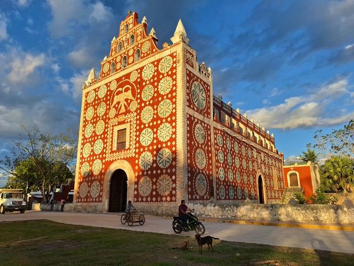
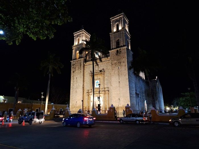
With a few photos to illustrate each day, we hope to wow you 🙂! Here’s our loop itinerary starting from Cancún (a packed schedule, but it let us see so much): Day 1 - Cancún’s beach and Holbox Island
×768 214 KB
Day 2 - Holbox Island and the fishing village of Río Lagartos
6 KB
Day 3 - The Río Lagartos nature reserve, Las Coloradas salt flats, the Ek'Balam Mayan site, the church of Uayma, and the colonial city of Valladolid
Hi everyone,
We traveled between Christmas and New Year’s to visit our son in San Francisco. We’d already seen the parks during a 2008 vacation but hadn’t had time to drive Highway 1 between San Francisco and Los Angeles, so we decided to do it this time. At this time of year, the days are short—it gets dark by 5 PM, which limits sightseeing time. Weather-wise, we had temperatures between 11°C and 20°C (52°F and 68°F) during the week, so it was pretty pleasant. There was a bit of rain one day and some gray skies or fog in the mornings. Financially, California is *very* expensive! Prices listed don’t include tax or tips. Taxes are automatically added to restaurant bills or supermarket receipts, but *you* add the tip. Americans always leave a tip, no matter if they’re happy with the service or not (except at self-service places). The absolute minimum is 15%, but 20% is more common. Here’s how it works: First, the server brings the bill with the tax already added, then takes your card and the bill. They come back after charging your card, leaving you a new bill and a pen. You write down the tip (tips) you want to leave, add it up, and sign. You leave the paper and pen on the table and go. In some restaurants, the server brings the card reader to your table, and there are preset tip percentages to choose from. On your bank statement, the total amount (including tax) shows up as “pending.” A few days later, the transaction is finalized with the tip included. The 9-hour time difference isn’t trivial, especially as we get older 😉. Keep it in mind when planning—don’t overdo it in the first few days.
Here’s our itinerary: 12/25/2024: Flight from Lyon (7 AM) to San Francisco (11:50 AM): 1-hour layover in Amsterdam—way too tight. The airport is huge, and flights to the U.S. are at the far end. You also have to go through customs. We had to run! Luckily, there’s a special line for tight connections, and our flight was delayed! Reunited with our son and walked to the Painted Ladies (Victorian houses) and then through Alamo Square. Return trip via Waymo—a driverless Uber. Surprising, but the ride was super smooth, and we felt safe.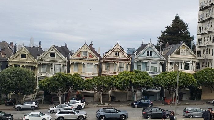
12/26/2024: San Francisco Walking tour of the city: Lombard Street, Pier 39 (sea lions), Coit Tower via the Filbert Steps (great view of the city), Chinatown, and Union Square (ice rink and Christmas tree).
12/27/2024: Monterey It took us about 2.5 hours to drive straight from SF to Monterey (to save time, we skipped the start of Highway 1). The goal for this stop was visiting the aquarium. It’s in an old sardine cannery, and there’s an interesting room showing the machinery and explaining the process. The aquarium features all the local fish and plant species, plus a stunning jellyfish exhibit. We spent about 2.5 hours there. Entry is pricey at $65, and it was packed when we went. For parking, you can use meters or day lots. The cheapest we found was $25 for the day, with in-and-out privileges. We saw some closer lots charging $80, so it’s worth shopping around before parking and walking a bit more. Afterward, we stopped by the Monarch Butterfly Sanctuary—a small, free park where these butterflies land, along with some wild deer. We ended the day at Lover’s Point, a park with an ocean view and surfers. That evening, we tried clam chowder in a sourdough bread bowl. Stayed overnight in Monterey.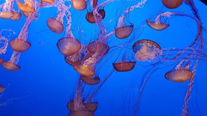
12/28/2024: Big Sur Parks The Big Sur area has many state parks. Entry is $10 per car for the day (valid for any number of parks visited that same day). Pro tip: If you park outside and walk in, you don’t pay. We chose to visit Point Lobos Reserve. We hiked the trails along the ocean. Two must-do (short and easy) trails: “Sea Lion Point,” where massive waves crash onto the rocks, and “Bird Island Lookout,” where you can see thousands of pelicans and cormorants on the rocks, plus a few elephant seals. It’s truly stunning. We spent about 3 hours there. After driving along Garrapata State Park and crossing the famous Bixby Bridge, we went to Pfeiffer Big Sur State Park to do the short Valley View Trail + Pfeiffer Falls hike. It was nice being among the redwoods, but the waterfall was underwhelming. Maybe it’s more impressive in the summer when the river is flowing better. We ended the day at McWay Falls, a waterfall that flows directly into the ocean—super photogenic, especially at sunset. Returned to Monterey for the night.
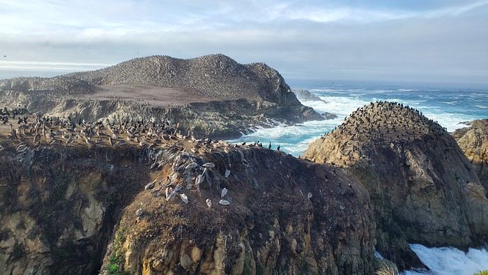
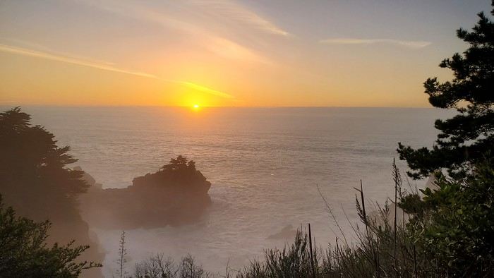
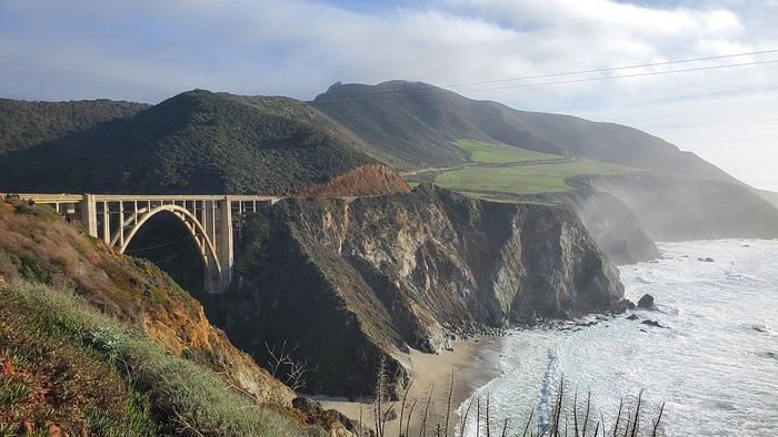
12/29/2024: Drive to Morro Bay Highway 1 is currently closed near Gorda, so we had to take the inland route from Monterey, adding extra miles. It was raining, so we skipped the planned stop at Carmel-by-the-Sea. Instead, we detoured to Mission San Antonio de Padua, the 3rd mission (out of 21) built by the Spanish in 1773 to evangelize the region. It’s less famous than others, so there were fewer people, and it felt more “authentic” (free to visit). With fog adding to the rain, we headed straight to Morro Bay, our stop for the day, instead of continuing up Highway 1 to San Simeon. Took a short evening walk to Morro Rock—saw a few otters in the harbor. Stayed overnight in Morro Bay.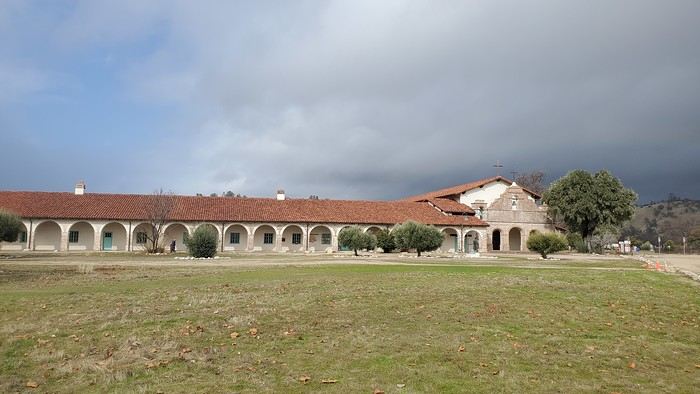
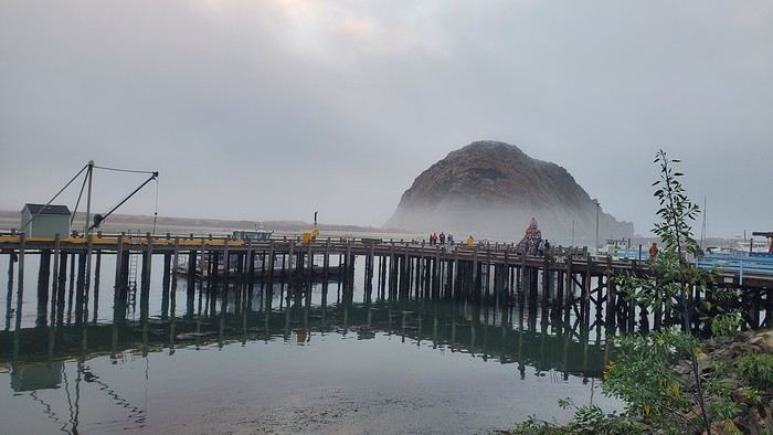
12/30/2024: Elephant Seals at Piedras Blancas The sun came back! We took a quick walk on the pier to see the otters in daylight, then drove back up Highway 1 to Piedras Blancas (near San Simeon), a famous spot for elephant seals. It’s birthing season, so there were lots of pups, plus males fighting for the females’ attention—what a show! We couldn’t get enough. We walked to the Piedras Blancas Lighthouse, with a few viewpoints of beaches where elephant seals were lounging (though far fewer than at the beach near the parking lot). We continued to Santa Barbara, our stop for the day. Stopped in San Luis Obispo for lunch and a quick city tour (Bubblegum Alley, the theater facade, and the mission). Since it was getting late, we skipped Los Alamos and went straight to Solvang, a charming Danish-style town (windmills, typical Danish houses) with lots of holiday lights (it’s their Julefest). Stayed overnight in Santa Barbara.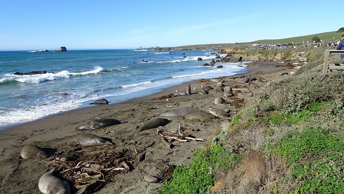
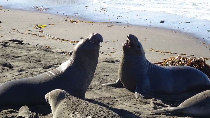
We traveled between Christmas and New Year’s to visit our son in San Francisco. We’d already seen the parks during a 2008 vacation but hadn’t had time to drive Highway 1 between San Francisco and Los Angeles, so we decided to do it this time. At this time of year, the days are short—it gets dark by 5 PM, which limits sightseeing time. Weather-wise, we had temperatures between 11°C and 20°C (52°F and 68°F) during the week, so it was pretty pleasant. There was a bit of rain one day and some gray skies or fog in the mornings. Financially, California is *very* expensive! Prices listed don’t include tax or tips. Taxes are automatically added to restaurant bills or supermarket receipts, but *you* add the tip. Americans always leave a tip, no matter if they’re happy with the service or not (except at self-service places). The absolute minimum is 15%, but 20% is more common. Here’s how it works: First, the server brings the bill with the tax already added, then takes your card and the bill. They come back after charging your card, leaving you a new bill and a pen. You write down the tip (tips) you want to leave, add it up, and sign. You leave the paper and pen on the table and go. In some restaurants, the server brings the card reader to your table, and there are preset tip percentages to choose from. On your bank statement, the total amount (including tax) shows up as “pending.” A few days later, the transaction is finalized with the tip included. The 9-hour time difference isn’t trivial, especially as we get older 😉. Keep it in mind when planning—don’t overdo it in the first few days.
Here’s our itinerary: 12/25/2024: Flight from Lyon (7 AM) to San Francisco (11:50 AM): 1-hour layover in Amsterdam—way too tight. The airport is huge, and flights to the U.S. are at the far end. You also have to go through customs. We had to run! Luckily, there’s a special line for tight connections, and our flight was delayed! Reunited with our son and walked to the Painted Ladies (Victorian houses) and then through Alamo Square. Return trip via Waymo—a driverless Uber. Surprising, but the ride was super smooth, and we felt safe.
12/26/2024: San Francisco Walking tour of the city: Lombard Street, Pier 39 (sea lions), Coit Tower via the Filbert Steps (great view of the city), Chinatown, and Union Square (ice rink and Christmas tree).
12/27/2024: Monterey It took us about 2.5 hours to drive straight from SF to Monterey (to save time, we skipped the start of Highway 1). The goal for this stop was visiting the aquarium. It’s in an old sardine cannery, and there’s an interesting room showing the machinery and explaining the process. The aquarium features all the local fish and plant species, plus a stunning jellyfish exhibit. We spent about 2.5 hours there. Entry is pricey at $65, and it was packed when we went. For parking, you can use meters or day lots. The cheapest we found was $25 for the day, with in-and-out privileges. We saw some closer lots charging $80, so it’s worth shopping around before parking and walking a bit more. Afterward, we stopped by the Monarch Butterfly Sanctuary—a small, free park where these butterflies land, along with some wild deer. We ended the day at Lover’s Point, a park with an ocean view and surfers. That evening, we tried clam chowder in a sourdough bread bowl. Stayed overnight in Monterey.
12/28/2024: Big Sur Parks The Big Sur area has many state parks. Entry is $10 per car for the day (valid for any number of parks visited that same day). Pro tip: If you park outside and walk in, you don’t pay. We chose to visit Point Lobos Reserve. We hiked the trails along the ocean. Two must-do (short and easy) trails: “Sea Lion Point,” where massive waves crash onto the rocks, and “Bird Island Lookout,” where you can see thousands of pelicans and cormorants on the rocks, plus a few elephant seals. It’s truly stunning. We spent about 3 hours there. After driving along Garrapata State Park and crossing the famous Bixby Bridge, we went to Pfeiffer Big Sur State Park to do the short Valley View Trail + Pfeiffer Falls hike. It was nice being among the redwoods, but the waterfall was underwhelming. Maybe it’s more impressive in the summer when the river is flowing better. We ended the day at McWay Falls, a waterfall that flows directly into the ocean—super photogenic, especially at sunset. Returned to Monterey for the night.
12/29/2024: Drive to Morro Bay Highway 1 is currently closed near Gorda, so we had to take the inland route from Monterey, adding extra miles. It was raining, so we skipped the planned stop at Carmel-by-the-Sea. Instead, we detoured to Mission San Antonio de Padua, the 3rd mission (out of 21) built by the Spanish in 1773 to evangelize the region. It’s less famous than others, so there were fewer people, and it felt more “authentic” (free to visit). With fog adding to the rain, we headed straight to Morro Bay, our stop for the day, instead of continuing up Highway 1 to San Simeon. Took a short evening walk to Morro Rock—saw a few otters in the harbor. Stayed overnight in Morro Bay.
12/30/2024: Elephant Seals at Piedras Blancas The sun came back! We took a quick walk on the pier to see the otters in daylight, then drove back up Highway 1 to Piedras Blancas (near San Simeon), a famous spot for elephant seals. It’s birthing season, so there were lots of pups, plus males fighting for the females’ attention—what a show! We couldn’t get enough. We walked to the Piedras Blancas Lighthouse, with a few viewpoints of beaches where elephant seals were lounging (though far fewer than at the beach near the parking lot). We continued to Santa Barbara, our stop for the day. Stopped in San Luis Obispo for lunch and a quick city tour (Bubblegum Alley, the theater facade, and the mission). Since it was getting late, we skipped Los Alamos and went straight to Solvang, a charming Danish-style town (windmills, typical Danish houses) with lots of holiday lights (it’s their Julefest). Stayed overnight in Santa Barbara.
PAKSE AND THE BOLAVENS PLATEAU
Bolavens (or "Bolovens" – "the region of the Lavens," an old tribe).
PAKSE
A sleepy town, but packed with backpackers in transit between Laos and Cambodia. The streets are numbered, but since there are no signs, you just have to figure it out (rumor has it the signs have been planned for years; luckily, the center isn’t big). Tons of small hotels, including the well-known Sabaidy 2 on Street 20, a big bazaar catering to all budgets, from dark dorms with shared bathrooms to real rooms with terraces or balconies. Since it’s so popular, booking ahead is recommended. My favorite: the Sala Champa, pricier but with two large terraces, one with a bar, and especially a terrace restaurant I consider the best in Pakse (try the divine steamed fish with lemongrass + Lao Gold beer, a rare delight; ask for room 100, with a big terrace). More upscale, the lovely Résidence Sisouk, run by the very classy and French-speaking Mme Sisouk, from the wealthy Lao Sisouk family, the country’s top coffee producer and one of those francophone families you encounter here and there around the world, where class and culture reign – and perfect French. Delicious pastries and, of course, extraordinary coffee tastings. Similar prices at the Pakse Hotel, run by French owners and famous for its rooftop bar-restaurant (great view!).
Tons of restaurants besides those at Sala Champa and Pakse Hotel: from Dao Lin and Sabaidee at the corner of Street 20 and 13, to a decent Indian place (Hassan) and a nice, cheap spot, the Lao Restaurant & Bar, where you can enjoy Lao cuisine for just a few kips, both also on Street 20. You can feast on grilled fish at the countless riverside stalls along the Mekong.
Pakse is home to the famous Yves, a Belgian married to a Lao woman, Noy, who opened the travel agency Miss Noy. He’ll go out of his way to help tourists; he’s incredible, the real tourism office for the region, with maps, endless advice, and every weekday at 6 PM, a full-blown lecture on the Bolavens and the 4000 Islands. A bunch of young travelers listen intently to his explanations about the whole area (he hands out a well-made photocopied map). He also rents bikes and has an internet café with computers that, miraculously, work perfectly. He’s so popular that in high season, you need to book a motorbike 2-3 days in advance (but if he’s out – and he has 40 – he’ll find one for you).
THE BOLAVENS PLATEAU
Plateaus just aren’t my thing – flat-lands! There are some relatively high peaks in the middle, but they’re only accessible by trekking. You can do a small loop from Pakse-Tad Lo-Thateng-Pakson-Pakse, or a big one from Tad Lo to Sekong, then head south to join the Paksong-Pakse road. Starting in the north, the Phu Xam waterfalls are okay (interesting local minority village-museum to the right of the parking lot, and a terrace restaurant above the small falls). Well, they’re on the way, so you might as well see them! After that, a boring road leads to the Tad Lo waterfalls, with tons of small hotels. I chose the big blue house by the river at the right corner of the bridge, the Sipaseth GH, with cute little bungalows in the garden, 4 rooms with balconies overlooking the river, and great food on the terrace facing the falls. **Avoid at all costs**: the Saisee GH, once nice with its little stilt houses by the falls, but now a monument to filth, indifference, and rudeness (confirmed by several people, unanimous on the issue). Luckily, the lovely Tad Lo Lodge, with its bungalows by the falls and gourmet restaurant right above them – not cheap at all – finally built small houses in the woods on the other side for $25.
The next morning, I’d had enough of plateaus, so I took a small loop heading south from Tad Lo to Thateng, and there, a wonder 5 km south of town: the Sinouk Resort. It’s like stepping into *Gone with the Wind* or the Chevalier de Leyritz’s Martinique. In the middle of the Sisouk family’s 34-hectare coffee plantation, a huge garden with three large colonial-style houses: one by the river and pond with a suite + 3 luxury rooms + a small, cozy one for $40 (that’s where I stayed), one with 4 superior rooms for $60, and a very large one overlooking everything with 6 luxury rooms ($60) + 2 huge suites for $90. Of course, it’s all decorated with antique furniture, local knick-knacks, and antiques; there’s a pool, a beautiful restaurant with two terraces, one overlooking a large pond and one by its edge. The food and service are impeccable, and the coffee: from espresso with whipped cream to green tea or wild honey cappuccino… too bad it keeps you up, or you’d sip it all evening (and morning, and afternoon, and in between). In short, a dream!
Back to Pakse via Paksong (what a dump!) and the Tad Fane waterfalls, those are spectacular – twin sisters plunging 200 meters. You can hike down to swim at the bottom (1-hour jungle trek round trip). Across the way, the nice Tad Fane Resort (small houses and a big terrace-restaurant facing the falls).
I think I missed the Katamkok waterfalls, but I don’t believe it – all these falls can’t compare to Ban Gioc Falls in northern Vietnam!!!
CHAMPASAK AND THE 4000 ISLANDS
CHAMPASAK
Even sleepier than Pakse! To avoid the ferry, cross the new Mekong bridge in Pakse, and after about 10 km, turn left at the big "Phaphinoy" sign (the first village in town). When you arrive, turn at the "River Resort" sign. A sumptuous resort on the Mekong, developed with American capital – pure luxury (they even have their own rice field and vegetable garden for the restaurant). Continuing on, you’ll come across the very pleasant Anouxa GH, where I had dinner and stayed. Small bungalows facing the river, garden rooms, and two large wooden houses with huge family rooms + a big terrace on the Mekong, and the food is great! They rent bikes and motorbikes. Further to the right, the pricey Inthira Hotel, which I found uninteresting since it’s on the road instead of by the Mekong. There’s also a Folie Lodge on Don Daeng Island, which I didn’t visit (the word "Folie" is justified: crazy prices, up to $200 and more).
A few nice wats and, of course, Wat Phou, Laos’ most important archaeological site, 10 km south of Champassak in the plains and on the mountainside (the stairs are a killer!). Watch out for the scorching heat, and it closes at 4:30 PM. It’s not Angkor Wat, but it’s still worth the detour. Plan for 2 hours. Entry is 50,000 kips + 5,000 to park your motorbike.
KHIET NGON
To continue south to the 4000 Islands, you have to take the "ferry" (actually fun little things – two canoes joined by a platform; better not mess up when loading your motorbike!). Once on the other side, turn left, and you’ll hit National Road 13 (Pakse-Siphandone, the 4000 Islands), the most boring road I’ve ever been on, like Phnom Penh-Siem Reap – flat and nothing to see. BUT there’s a real gem worth checking out: Kiet Ngon. At Km 48, take the laterite road toward Attapeu (big sign: "Attapeu 155 km") and eat red dust for 8 km (toll: 20,000 kips), then turn right (signposted) onto a good track. You enter the beautiful Xe Pian National Park, where you can still find wild elephants, leopards, and tigers. You arrive at the entrance of the small village of Ban Khiet Ngon. On your right, a small concrete building with 4 decent, cheap rooms (60,000 kips), facing an old wooden house that serves as the tourism office and its "elephant parking" garden. This village is where you can go on an elephant ride (20,000 kips) to the top of Phou Asa, one of the most unusual places I’ve ever seen. You climb through the jungle and emerge onto a flat slate summit, completely bare – it really feels like the Moon! In the distance, an astonishing site built to commemorate a victory by Lao nationalists over Siamese invaders in the 19th century (so the site isn’t 1,000 years old, as the locals claim). A vast archaeological site with an enclosure 180 m by 50 m, marked by 2-meter-high walls and columns made of slate stacked without mortar. At the back, a ruined temple and a tower. Beautiful views of the whole region. Popular with tourists arriving by minibus from Pakse. The elephant rides in a line aren’t my thing, so they tell you it’s forbidden to ride a motorbike, but I did it anyway without any issues – except for the unhappy looks from the mahouts (turn right at the village entrance, sign for "Phou Asa").
If you’ve got the funds, follow the signs for "Kingfisher Lodge" and arrive at Laos’ first ecolodge, developed by a Lao-Italian family. Lovely stilt houses (750,000 kips with breakfast) and 2 bungalows with just fans (250,000 kips). A small two-story wooden building with a restaurant and a terrace by a pond – the bonus: in the evening, wild elephants and buffalo come to drink with you. Booking ahead is recommended since it’s popular with groups from Pakse.
Paper guides also mention the more remote village of Ban Papho, deep in the jungle. There used to be elephant rides, but they’ve stopped. However, there are great treks in the national park (check with the Green Discovery agency in Pakse, which specializes in treks all over Laos).
THE 4000 ISLANDS
You continue on the mind-numbing Road 13 from Pakse and arrive at a brand-new bridge leading to Don Khong Island, where there’s nothing to see except two wats, so if you skip it, you’re not missing much. Next, the Nakasang sign, a small port with mini-ferries crossing the Mekong to Don Det Island. A celebrity, that one – one of those trashy spots for young people who think you can only have fun if you’re wasted on alcohol and drugs. A small street along the river, lined with guesthouses, restaurants, and bars – total chaos! Plus, there’s nothing to see on the island. So, take a tuk-tuk from the jetty, cross the dump, and arrive in a little paradise: Don Khone Island. I planned to stay 2 days but had to be dragged away after 6. A small main village with a dirt road, tons of guesthouses and great restaurants, and lots of beautiful things to see.
For lodging on Don Khone, it’s usually wooden bungalows with river-view terraces. Options range from the elegant and pricey Sala Done Hotel to Somphamit, Pan’s, Pakha GH, and many others. I found my haven away from everything: the little Phonvilay, 3 small bamboo buildings with 2 simple rooms each, terraces above a branch of the Mekong, and a big plus – a small path just to the right that goes down the riverbank, so 3-4 nice swims a day. All for 60,000 kips. To get there, turn right at the end of the bridge until you reach the wat, then take the small path to the river on the right of the wat’s wall.
For food, you’re spoiled for choice. I had all my dinners at the Cordon Bleu of the Fleur du Mékong. I don’t know how she does it, but even the simplest dishes have something extra. She’s famous for her curry (more like a mild stew) of duck or chicken with potatoes and sweet potatoes – a hearty treat. Go for the chicken; Asian ducks are all skin and bones. Her grilled fish is divine!
The island has quite a history: the Mekong upstream is over a kilometer wide (it’s said to reach 14 km during high water) and "falls" onto a rocky barrier. It splits into countless small branches, flowing wherever there’s a crack – hence the 4000 Islands and the impressive rapids. The French discovered this while trying to navigate the Mekong from Saigon to Luang Prabang and China – and bam, impassable! So they built a narrow-gauge railway starting from the south of the island, bypassing the rapids, and ending at the north of Don Det Island. You can see two rusted locomotives, discovered in the jungle in 1990 by a French explorer: one in the southern extension of the bridge and the other in Ban Hang Khone village at the southern tip of the island, both with large English signs and fascinating old photos explaining the whole history of the railway, abandoned when Road 13 was built along the 4000 Islands (the rails were removed, and the railway track is now an excellent trail).
Somphamit Rapids (Li Phi)
Locals call them Li Phi, meaning "the abyss of evil spirits" (the "phi" that Lao people still believe in), because they think the falls and rapids trap spirits, to the point that no one would ever swim there. It’s very dramatic. Entry fee: 35,000 kips. Small beach and a big restaurant with a terrace and thatched-roof tables.
Khon Pa Sai Rapids
A completely different kind, just as spectacular, and less crowded. Turn left at the bridge exit and go to the northern end of the island (Ban Khon Nua village), then continue south until you see a big yellow sign "Khon Pa Sai Waterfalls" pointing to a small path on the left. You arrive at a small suspension bridge with a corner restaurant and terrace where the food is great (I had most of my lunches there). Cross the bridge and follow the path to a spectacular site of falls and rapids. In the middle, you’ll see unique structures – gigantic fish traps over 10 meters long. During high water, each trap can catch up to 500 kg of fish (yes, five hundred) per day.
Ban Hang Khone
This is the "French port" at the southern tip of the island, where the Mekong, after its rapids, spreads out for kilometers – a real inland sea. This is where you can see the famous Irrawaddy dolphins in the morning or late afternoon (boat excursions). To get there, take the trail that was the old railway track, or continue south on the path past the Khon Pa Sai falls (but not by motorbike – the bridge is out). A huge concrete terrace, part of the old port facilities, with a magnificent panoramic view of the Mekong stretching into the distance. Just before, a small path leads to a big beach (with restaurants).
If you go back to Road 13 (or take a pirogue from Don Khone), further south are the Pha Peng Falls, Asia’s highest river falls (15 m). I didn’t go, but they’re said to be spectacular.
Bolavens (or "Bolovens" – "the region of the Lavens," an old tribe).
PAKSE
A sleepy town, but packed with backpackers in transit between Laos and Cambodia. The streets are numbered, but since there are no signs, you just have to figure it out (rumor has it the signs have been planned for years; luckily, the center isn’t big). Tons of small hotels, including the well-known Sabaidy 2 on Street 20, a big bazaar catering to all budgets, from dark dorms with shared bathrooms to real rooms with terraces or balconies. Since it’s so popular, booking ahead is recommended. My favorite: the Sala Champa, pricier but with two large terraces, one with a bar, and especially a terrace restaurant I consider the best in Pakse (try the divine steamed fish with lemongrass + Lao Gold beer, a rare delight; ask for room 100, with a big terrace). More upscale, the lovely Résidence Sisouk, run by the very classy and French-speaking Mme Sisouk, from the wealthy Lao Sisouk family, the country’s top coffee producer and one of those francophone families you encounter here and there around the world, where class and culture reign – and perfect French. Delicious pastries and, of course, extraordinary coffee tastings. Similar prices at the Pakse Hotel, run by French owners and famous for its rooftop bar-restaurant (great view!).
Tons of restaurants besides those at Sala Champa and Pakse Hotel: from Dao Lin and Sabaidee at the corner of Street 20 and 13, to a decent Indian place (Hassan) and a nice, cheap spot, the Lao Restaurant & Bar, where you can enjoy Lao cuisine for just a few kips, both also on Street 20. You can feast on grilled fish at the countless riverside stalls along the Mekong.
Pakse is home to the famous Yves, a Belgian married to a Lao woman, Noy, who opened the travel agency Miss Noy. He’ll go out of his way to help tourists; he’s incredible, the real tourism office for the region, with maps, endless advice, and every weekday at 6 PM, a full-blown lecture on the Bolavens and the 4000 Islands. A bunch of young travelers listen intently to his explanations about the whole area (he hands out a well-made photocopied map). He also rents bikes and has an internet café with computers that, miraculously, work perfectly. He’s so popular that in high season, you need to book a motorbike 2-3 days in advance (but if he’s out – and he has 40 – he’ll find one for you).
THE BOLAVENS PLATEAU
Plateaus just aren’t my thing – flat-lands! There are some relatively high peaks in the middle, but they’re only accessible by trekking. You can do a small loop from Pakse-Tad Lo-Thateng-Pakson-Pakse, or a big one from Tad Lo to Sekong, then head south to join the Paksong-Pakse road. Starting in the north, the Phu Xam waterfalls are okay (interesting local minority village-museum to the right of the parking lot, and a terrace restaurant above the small falls). Well, they’re on the way, so you might as well see them! After that, a boring road leads to the Tad Lo waterfalls, with tons of small hotels. I chose the big blue house by the river at the right corner of the bridge, the Sipaseth GH, with cute little bungalows in the garden, 4 rooms with balconies overlooking the river, and great food on the terrace facing the falls. **Avoid at all costs**: the Saisee GH, once nice with its little stilt houses by the falls, but now a monument to filth, indifference, and rudeness (confirmed by several people, unanimous on the issue). Luckily, the lovely Tad Lo Lodge, with its bungalows by the falls and gourmet restaurant right above them – not cheap at all – finally built small houses in the woods on the other side for $25.
The next morning, I’d had enough of plateaus, so I took a small loop heading south from Tad Lo to Thateng, and there, a wonder 5 km south of town: the Sinouk Resort. It’s like stepping into *Gone with the Wind* or the Chevalier de Leyritz’s Martinique. In the middle of the Sisouk family’s 34-hectare coffee plantation, a huge garden with three large colonial-style houses: one by the river and pond with a suite + 3 luxury rooms + a small, cozy one for $40 (that’s where I stayed), one with 4 superior rooms for $60, and a very large one overlooking everything with 6 luxury rooms ($60) + 2 huge suites for $90. Of course, it’s all decorated with antique furniture, local knick-knacks, and antiques; there’s a pool, a beautiful restaurant with two terraces, one overlooking a large pond and one by its edge. The food and service are impeccable, and the coffee: from espresso with whipped cream to green tea or wild honey cappuccino… too bad it keeps you up, or you’d sip it all evening (and morning, and afternoon, and in between). In short, a dream!
Back to Pakse via Paksong (what a dump!) and the Tad Fane waterfalls, those are spectacular – twin sisters plunging 200 meters. You can hike down to swim at the bottom (1-hour jungle trek round trip). Across the way, the nice Tad Fane Resort (small houses and a big terrace-restaurant facing the falls).
I think I missed the Katamkok waterfalls, but I don’t believe it – all these falls can’t compare to Ban Gioc Falls in northern Vietnam!!!
CHAMPASAK AND THE 4000 ISLANDS
CHAMPASAK
Even sleepier than Pakse! To avoid the ferry, cross the new Mekong bridge in Pakse, and after about 10 km, turn left at the big "Phaphinoy" sign (the first village in town). When you arrive, turn at the "River Resort" sign. A sumptuous resort on the Mekong, developed with American capital – pure luxury (they even have their own rice field and vegetable garden for the restaurant). Continuing on, you’ll come across the very pleasant Anouxa GH, where I had dinner and stayed. Small bungalows facing the river, garden rooms, and two large wooden houses with huge family rooms + a big terrace on the Mekong, and the food is great! They rent bikes and motorbikes. Further to the right, the pricey Inthira Hotel, which I found uninteresting since it’s on the road instead of by the Mekong. There’s also a Folie Lodge on Don Daeng Island, which I didn’t visit (the word "Folie" is justified: crazy prices, up to $200 and more).
A few nice wats and, of course, Wat Phou, Laos’ most important archaeological site, 10 km south of Champassak in the plains and on the mountainside (the stairs are a killer!). Watch out for the scorching heat, and it closes at 4:30 PM. It’s not Angkor Wat, but it’s still worth the detour. Plan for 2 hours. Entry is 50,000 kips + 5,000 to park your motorbike.
KHIET NGON
To continue south to the 4000 Islands, you have to take the "ferry" (actually fun little things – two canoes joined by a platform; better not mess up when loading your motorbike!). Once on the other side, turn left, and you’ll hit National Road 13 (Pakse-Siphandone, the 4000 Islands), the most boring road I’ve ever been on, like Phnom Penh-Siem Reap – flat and nothing to see. BUT there’s a real gem worth checking out: Kiet Ngon. At Km 48, take the laterite road toward Attapeu (big sign: "Attapeu 155 km") and eat red dust for 8 km (toll: 20,000 kips), then turn right (signposted) onto a good track. You enter the beautiful Xe Pian National Park, where you can still find wild elephants, leopards, and tigers. You arrive at the entrance of the small village of Ban Khiet Ngon. On your right, a small concrete building with 4 decent, cheap rooms (60,000 kips), facing an old wooden house that serves as the tourism office and its "elephant parking" garden. This village is where you can go on an elephant ride (20,000 kips) to the top of Phou Asa, one of the most unusual places I’ve ever seen. You climb through the jungle and emerge onto a flat slate summit, completely bare – it really feels like the Moon! In the distance, an astonishing site built to commemorate a victory by Lao nationalists over Siamese invaders in the 19th century (so the site isn’t 1,000 years old, as the locals claim). A vast archaeological site with an enclosure 180 m by 50 m, marked by 2-meter-high walls and columns made of slate stacked without mortar. At the back, a ruined temple and a tower. Beautiful views of the whole region. Popular with tourists arriving by minibus from Pakse. The elephant rides in a line aren’t my thing, so they tell you it’s forbidden to ride a motorbike, but I did it anyway without any issues – except for the unhappy looks from the mahouts (turn right at the village entrance, sign for "Phou Asa").
If you’ve got the funds, follow the signs for "Kingfisher Lodge" and arrive at Laos’ first ecolodge, developed by a Lao-Italian family. Lovely stilt houses (750,000 kips with breakfast) and 2 bungalows with just fans (250,000 kips). A small two-story wooden building with a restaurant and a terrace by a pond – the bonus: in the evening, wild elephants and buffalo come to drink with you. Booking ahead is recommended since it’s popular with groups from Pakse.
Paper guides also mention the more remote village of Ban Papho, deep in the jungle. There used to be elephant rides, but they’ve stopped. However, there are great treks in the national park (check with the Green Discovery agency in Pakse, which specializes in treks all over Laos).
THE 4000 ISLANDS
You continue on the mind-numbing Road 13 from Pakse and arrive at a brand-new bridge leading to Don Khong Island, where there’s nothing to see except two wats, so if you skip it, you’re not missing much. Next, the Nakasang sign, a small port with mini-ferries crossing the Mekong to Don Det Island. A celebrity, that one – one of those trashy spots for young people who think you can only have fun if you’re wasted on alcohol and drugs. A small street along the river, lined with guesthouses, restaurants, and bars – total chaos! Plus, there’s nothing to see on the island. So, take a tuk-tuk from the jetty, cross the dump, and arrive in a little paradise: Don Khone Island. I planned to stay 2 days but had to be dragged away after 6. A small main village with a dirt road, tons of guesthouses and great restaurants, and lots of beautiful things to see.
For lodging on Don Khone, it’s usually wooden bungalows with river-view terraces. Options range from the elegant and pricey Sala Done Hotel to Somphamit, Pan’s, Pakha GH, and many others. I found my haven away from everything: the little Phonvilay, 3 small bamboo buildings with 2 simple rooms each, terraces above a branch of the Mekong, and a big plus – a small path just to the right that goes down the riverbank, so 3-4 nice swims a day. All for 60,000 kips. To get there, turn right at the end of the bridge until you reach the wat, then take the small path to the river on the right of the wat’s wall.
For food, you’re spoiled for choice. I had all my dinners at the Cordon Bleu of the Fleur du Mékong. I don’t know how she does it, but even the simplest dishes have something extra. She’s famous for her curry (more like a mild stew) of duck or chicken with potatoes and sweet potatoes – a hearty treat. Go for the chicken; Asian ducks are all skin and bones. Her grilled fish is divine!
The island has quite a history: the Mekong upstream is over a kilometer wide (it’s said to reach 14 km during high water) and "falls" onto a rocky barrier. It splits into countless small branches, flowing wherever there’s a crack – hence the 4000 Islands and the impressive rapids. The French discovered this while trying to navigate the Mekong from Saigon to Luang Prabang and China – and bam, impassable! So they built a narrow-gauge railway starting from the south of the island, bypassing the rapids, and ending at the north of Don Det Island. You can see two rusted locomotives, discovered in the jungle in 1990 by a French explorer: one in the southern extension of the bridge and the other in Ban Hang Khone village at the southern tip of the island, both with large English signs and fascinating old photos explaining the whole history of the railway, abandoned when Road 13 was built along the 4000 Islands (the rails were removed, and the railway track is now an excellent trail).
Somphamit Rapids (Li Phi)
Locals call them Li Phi, meaning "the abyss of evil spirits" (the "phi" that Lao people still believe in), because they think the falls and rapids trap spirits, to the point that no one would ever swim there. It’s very dramatic. Entry fee: 35,000 kips. Small beach and a big restaurant with a terrace and thatched-roof tables.
Khon Pa Sai Rapids
A completely different kind, just as spectacular, and less crowded. Turn left at the bridge exit and go to the northern end of the island (Ban Khon Nua village), then continue south until you see a big yellow sign "Khon Pa Sai Waterfalls" pointing to a small path on the left. You arrive at a small suspension bridge with a corner restaurant and terrace where the food is great (I had most of my lunches there). Cross the bridge and follow the path to a spectacular site of falls and rapids. In the middle, you’ll see unique structures – gigantic fish traps over 10 meters long. During high water, each trap can catch up to 500 kg of fish (yes, five hundred) per day.
Ban Hang Khone
This is the "French port" at the southern tip of the island, where the Mekong, after its rapids, spreads out for kilometers – a real inland sea. This is where you can see the famous Irrawaddy dolphins in the morning or late afternoon (boat excursions). To get there, take the trail that was the old railway track, or continue south on the path past the Khon Pa Sai falls (but not by motorbike – the bridge is out). A huge concrete terrace, part of the old port facilities, with a magnificent panoramic view of the Mekong stretching into the distance. Just before, a small path leads to a big beach (with restaurants).
If you go back to Road 13 (or take a pirogue from Don Khone), further south are the Pha Peng Falls, Asia’s highest river falls (15 m). I didn’t go, but they’re said to be spectacular.
Hi there,
Here’s a quick summary of six trips across Southern Africa, covering South Africa, Namibia, Botswana, Zimbabwe, and more. I traveled for a total of 23 months, over 100,000 km, and crossed 9 countries from South Africa to Tanzania. To do this, I bought an old Land Cruiser—a 1989 BJ 75 with a long chassis and a 3.4L turbo engine—which I converted into a bush camper set up for self-sufficiency in Africa: dual fuel tanks (235 L total) plus 2 x 20-liter jerry cans of diesel, 2 spare tires, a compressor, a toolbox with repair gear, a 50-liter water tank plus 2 x 30-liter and 2 x 10-liter jerry cans, a roof tent, multiple storage boxes, a sturdy roof rack, and even a paramotor. I also packed a first-aid kit and shipped the camper to South Africa by freight. My son joined me for part of the journey.
Key countries and highlights: South Africa in every direction, including its wildlife parks; in Namibia, the classics like Etosha, Fish River, Sossusvlei, Kaudum, but especially Damaraland and Kaokoland; in Botswana, a full loop of the Okavango, crossing the Makgadikgadi Pan, Moremi Park, the Linyanti River; and a tour of Zimbabwe with its national parks. During the last trip in 2020, due to COVID, we found refuge on a 250 km² Namibian farm with its own wildlife reserve. While crossing Damaraland and Kaokoland, we were completely self-sufficient, with supplies for over a month and 130 L of water.
In South Africa and Namibia, one issue that surprised us was the fences stretching for millions of kilometers along the tracks. Namibia is one and a half times the size of France but has a population of only about 2.5 million, mostly concentrated in a dozen small towns of 10,000 to 50,000 people—except for the capital, Windhoek (296,000). Paradoxically, compared to France, the space for freedom is extremely limited. Everything is private and requires payment. Even the Namib Desert is fenced... and you need a permit just to pick up a rock! For someone used to wild camping, it can get frustrating. Sometimes we ignored the rules, but the best solution is to ask a farmer (a real one, like a sheep or cattle rancher—not the ones with 3-meter electrified fences, which are lodges or private reserves) if you can camp on their land.
To truly enjoy freedom in Namibia, you need to venture into the northwest, along the Skeleton Coast, in Damaraland and Kaokoland. However, it’s essential to know your vehicle inside out, be a good mechanic, bring spare parts, and plan for potential breakdowns. Take care of your ride because a major issue out there can be a matter of survival. My motto: "Don’t break down, don’t break down, don’t break down..." Safari pros only venture into this region with two 4x4s. In Messum Crater, we met a couple waiting for rescue (thanks to a satellite device from their rental company) after their driveshaft broke. Keep in mind that in these areas, you’ll cover about 80 km in 8 hours.
Here are some of the issues we faced: a broken rear suspension leaf, several broken bolts on the front leaf springs, the spare tire mount breaking multiple times (replaced on the spot), a cracked water radiator in 1998 causing overheating and a seized valve stem in its guide, plus a bent rocker arm (field repair, valve adjustment, damaged head gasket, daily radiator refills, and a scratched cylinder—engine fully rebuilt upon return). Five roof rack mounts broke and were repaired at a technical high school in South Africa. The battery mount also broke (fixed with a steel plate found on the trail). The fuel filter clogged several times (changed or cleaned on the spot). A huge impact on the windshield from a piece of coal falling from a power plant supply truck (temporary repair with Araldite). The brake master cylinder failed in Marienfluss (repaired, seals replaced in Tsumeb). Multiple flat tires from acacia thorns. The rear door latch broke (homemade aluminum rod repair in Franschhoek). The voltmeter and ammeter failed (repaired on the spot). During the freight trip, despite locking the doors and having a partition between the front and back, someone managed to get in through the small side window, forced open the locks on two accessible storage boxes, and stole my tools (replaced later). A ball joint on the paramotor frame came loose mid-flight, damaging the wing and propeller (propeller shipped from France, homemade repair).
Health issues on the way to Tanzania: a painful sciatica and many sleepless nights (cortisone injection in Dodoma).
Kaokoland, Namibia—the northwest region: https://youtu.be/DzGepFsrnZs
Damaraland: https://youtu.be/DITQj8NvLZ4
Botswana: https://youtu.be/TEvDG0S62hg
Kaudom and Mohembo Parks: https://youtu.be/wq_Yf7jNLhw
Here’s a quick summary of six trips across Southern Africa, covering South Africa, Namibia, Botswana, Zimbabwe, and more. I traveled for a total of 23 months, over 100,000 km, and crossed 9 countries from South Africa to Tanzania. To do this, I bought an old Land Cruiser—a 1989 BJ 75 with a long chassis and a 3.4L turbo engine—which I converted into a bush camper set up for self-sufficiency in Africa: dual fuel tanks (235 L total) plus 2 x 20-liter jerry cans of diesel, 2 spare tires, a compressor, a toolbox with repair gear, a 50-liter water tank plus 2 x 30-liter and 2 x 10-liter jerry cans, a roof tent, multiple storage boxes, a sturdy roof rack, and even a paramotor. I also packed a first-aid kit and shipped the camper to South Africa by freight. My son joined me for part of the journey.
Key countries and highlights: South Africa in every direction, including its wildlife parks; in Namibia, the classics like Etosha, Fish River, Sossusvlei, Kaudum, but especially Damaraland and Kaokoland; in Botswana, a full loop of the Okavango, crossing the Makgadikgadi Pan, Moremi Park, the Linyanti River; and a tour of Zimbabwe with its national parks. During the last trip in 2020, due to COVID, we found refuge on a 250 km² Namibian farm with its own wildlife reserve. While crossing Damaraland and Kaokoland, we were completely self-sufficient, with supplies for over a month and 130 L of water.
In South Africa and Namibia, one issue that surprised us was the fences stretching for millions of kilometers along the tracks. Namibia is one and a half times the size of France but has a population of only about 2.5 million, mostly concentrated in a dozen small towns of 10,000 to 50,000 people—except for the capital, Windhoek (296,000). Paradoxically, compared to France, the space for freedom is extremely limited. Everything is private and requires payment. Even the Namib Desert is fenced... and you need a permit just to pick up a rock! For someone used to wild camping, it can get frustrating. Sometimes we ignored the rules, but the best solution is to ask a farmer (a real one, like a sheep or cattle rancher—not the ones with 3-meter electrified fences, which are lodges or private reserves) if you can camp on their land.
To truly enjoy freedom in Namibia, you need to venture into the northwest, along the Skeleton Coast, in Damaraland and Kaokoland. However, it’s essential to know your vehicle inside out, be a good mechanic, bring spare parts, and plan for potential breakdowns. Take care of your ride because a major issue out there can be a matter of survival. My motto: "Don’t break down, don’t break down, don’t break down..." Safari pros only venture into this region with two 4x4s. In Messum Crater, we met a couple waiting for rescue (thanks to a satellite device from their rental company) after their driveshaft broke. Keep in mind that in these areas, you’ll cover about 80 km in 8 hours.
Here are some of the issues we faced: a broken rear suspension leaf, several broken bolts on the front leaf springs, the spare tire mount breaking multiple times (replaced on the spot), a cracked water radiator in 1998 causing overheating and a seized valve stem in its guide, plus a bent rocker arm (field repair, valve adjustment, damaged head gasket, daily radiator refills, and a scratched cylinder—engine fully rebuilt upon return). Five roof rack mounts broke and were repaired at a technical high school in South Africa. The battery mount also broke (fixed with a steel plate found on the trail). The fuel filter clogged several times (changed or cleaned on the spot). A huge impact on the windshield from a piece of coal falling from a power plant supply truck (temporary repair with Araldite). The brake master cylinder failed in Marienfluss (repaired, seals replaced in Tsumeb). Multiple flat tires from acacia thorns. The rear door latch broke (homemade aluminum rod repair in Franschhoek). The voltmeter and ammeter failed (repaired on the spot). During the freight trip, despite locking the doors and having a partition between the front and back, someone managed to get in through the small side window, forced open the locks on two accessible storage boxes, and stole my tools (replaced later). A ball joint on the paramotor frame came loose mid-flight, damaging the wing and propeller (propeller shipped from France, homemade repair).
Health issues on the way to Tanzania: a painful sciatica and many sleepless nights (cortisone injection in Dodoma).
Kaokoland, Namibia—the northwest region: https://youtu.be/DzGepFsrnZs
Damaraland: https://youtu.be/DITQj8NvLZ4
Botswana: https://youtu.be/TEvDG0S62hg
Kaudom and Mohembo Parks: https://youtu.be/wq_Yf7jNLhw
CORSICA From September 24, 2024 to October 9, 2024
Thank you, thank you, thank you for reactivating my favorite forum, which has given me so many ideas for my trips since... 2008—it’s been ages, as they say!
So, to celebrate its return, I’m sharing this little travel journal from our latest road trip, not too long ago, since it was Corsica in the autumn.
Autumn is the ideal season to visit Corsica: fewer tourists, perfect temperatures around 25°C, and, most importantly, less stress on the roads. You can feel it everywhere. Servers and shopkeepers are more relaxed and have time to chat (yes, Corsicans do talk... but not all of them!)
09/24 Arrival in Erbalunga Whether you're from northern France or Belgium, like us, the easiest way to reach the Isle of Beauty is by flying from Lille-Lesquin Airport. Volotea offers two destinations: Bastia and Ajaccio. Be careful, though—while the ticket prices are attractive, the airline makes up for it with baggage fees. A 25kg suitcase for 212 €—that really drives up the cost of transportation! For us, it’ll be Bastia. After this short flight and an arrival that lets you clearly see the east coast of Cap Corse, we’re welcomed by our friend Jean-Claude, who’s kindly hosting us for a few days. We met this Corsican and his wife during our four-year stay in French Guiana, and I have to say, he completely changed my opinion of Corsicans and even made me want to visit his island. The house, clinging to the rock above the sea, is stunning and offers a breathtaking view of the island of Elba. I’d always heard of Elba but must admit I wouldn’t have known where to place it before. We’ll stay here for five nights, long enough to explore the north of the island.
Since we’ve just arrived, Jean-Claude wants to show us his village, ERLALUNGA, a quiet little port, and the small village of CASTELLO above it, where he spent a lot of time in his childhood...
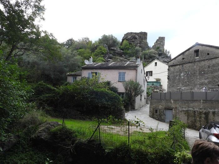
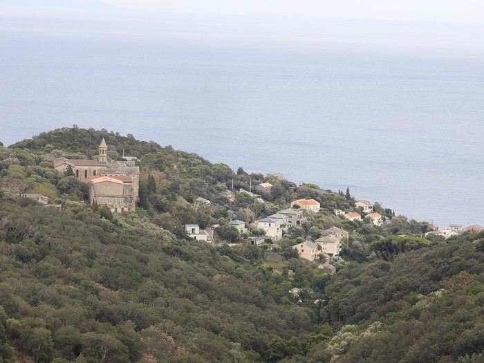

09/24 Arrival in Erbalunga Whether you're from northern France or Belgium, like us, the easiest way to reach the Isle of Beauty is by flying from Lille-Lesquin Airport. Volotea offers two destinations: Bastia and Ajaccio. Be careful, though—while the ticket prices are attractive, the airline makes up for it with baggage fees. A 25kg suitcase for 212 €—that really drives up the cost of transportation! For us, it’ll be Bastia. After this short flight and an arrival that lets you clearly see the east coast of Cap Corse, we’re welcomed by our friend Jean-Claude, who’s kindly hosting us for a few days. We met this Corsican and his wife during our four-year stay in French Guiana, and I have to say, he completely changed my opinion of Corsicans and even made me want to visit his island. The house, clinging to the rock above the sea, is stunning and offers a breathtaking view of the island of Elba. I’d always heard of Elba but must admit I wouldn’t have known where to place it before. We’ll stay here for five nights, long enough to explore the north of the island.
Since we’ve just arrived, Jean-Claude wants to show us his village, ERLALUNGA, a quiet little port, and the small village of CASTELLO above it, where he spent a lot of time in his childhood...

If I close my eyes and think of the Sultanate of Oman, I first smell a light scent of incense, feel the warmth of a sunbeam on my skin, before sand slips through my fingers. I taste the sweetness of a date, a real candy, then the flavor of coffee with a hint of cardamom and rosewater... I hear the desert wind whistling in my ears, the distant call of a muezzin, then the murmur of water. I open my eyes to see smiles, welcoming gestures, a turquoise sea, rocks ranging from ochre to purple, deep wadis where torrents burst forth, orange dunes, white sandy beaches where tiny crabs scurry at full speed. I see incredible oases emerging between arid mountains. I see abandoned villages that I’d dream were full of life, imposing fortresses overlooking valleys, and lively souks where offers are delicate and negotiation is a mutual courtesy.
All that, and so much more.
This is what I tried to capture in my illustrated travel journal, which I’ll fill in here and there with photos. I drew this journal “cold,” after my return (actually, I made it this summer, while our trip was last winter). It’s a pretty special format—I bought it in Japan without really knowing what I’d do with it. Well, it found its purpose! Below is a photo of this accordion-style journal: here, it’s only partially open, because when fully unfolded, it’s 5 meters long!
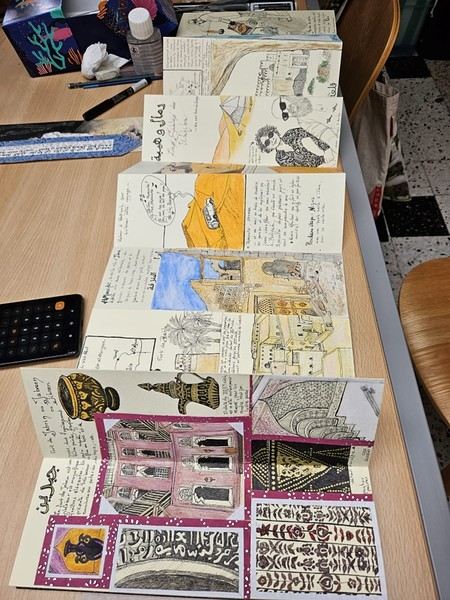
For drawing enthusiasts: The accordion format is both a constraint (each sheet is 9 cm x 27 cm) and a freedom (you can create a fresco). The paper is also a bit special: it doesn’t allow for fine lines, but it takes ink well (liner pen). However, everything has to be done almost in one go (with a very light pencil sketch) because it erases poorly. It absorbs too much water for coloring with markers or watercolors (unless you avoid soaking it), but it works well with oil pastels and their use with a brush and solvent. Since it’s yellowish, it allowed me to create contrasts even with white pastel.
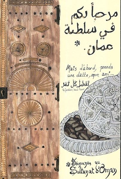 On the right, the "welcome marker"—those dates offered everywhere as a sign of hospitality. On the left, a tribute to those stunning doors worn by time, admired all over the old quarters, including the abandoned ones.
Oman is one of the world’s largest producers of frankincense resin. Incense burners are everywhere, from the simplest clay ones to the most precious handcrafted silver ones...
 Hospitality will often lead you to accept a small coffee, an "Omani coffee," very light, subtly flavored with cardamom, maybe a touch of saffron, and occasionally rosewater.
Here, I’ve depicted a man in the common everyday attire of Omanis: the dishdasha, mostly white (during the week and daytime; colors are more common in the evening or on Fridays and Saturdays). While you’ll see some men dressed in Western clothes, they’re very few. The white dishdasha is truly the shared attire of all men. The dishdasha, which has no hood, is distinguished by a small pom-pom attached to the collar, the furakha, which is soaked in perfume. And believe me, Omanis go overboard with it! "It smells like the pom-pom" is an expression that’s now part of our shared language, my husband and I.
Another must of men’s attire is the kuma, a small round head covering, usually white with brightly colored patterns. The keffiyeh is also worn (but without the cord called an agal in Arab countries), and it’s mostly worn by those with roots in the desert, from what I understood.
And what about the women, you might ask? Some are veiled, some in full black (but not a burka—more like a chador + abaya), due to the influence of Saudi Arabia and the United Arab Emirates, whereas the traditional outfit used to be a layering of very colorful dresses. Most of the women we saw wore neutral clothing, a plain veil over their hair, but with their faces uncovered. We also saw many saris and colorful veils—don’t forget that 40% of the population consists of Indian, Nepalese, and Bangladeshi immigrants, who work a lot in tourism, hospitality, restaurants, services, and construction.
Just to clarify, as a tourist, there’s no pressure to wear a veil, and never any disapproving looks. Of course, you’ll save the mini shorts, plunging necklines, bare shoulders, and midriffs for the hotel terrace—but I’d say that’s the same for men and women, and with the sun being strong, it’s better for your skin too.
Here’s the introduction! In the next post, I’ll tell you about my itinerary, and we can dive in!
Hello,
Following our trip on the Great Divide Mountain Bike Route this summer, we’re sharing our experience in this travel journal.
We’re Richard and Bernadette, both 64 years old, and we’re gravel bike-packing cyclists.
We’ve completed several gravel bike trips in France and neighboring countries, and Richard has also done some in South America.
We left on July 22, 2026, from Geneva to Calgary via Frankfurt with our bikes carefully packed in boxes, and we returned on October 8 from El Paso to Geneva via Chicago and Frankfurt.
The GDMBR is a mountain route that closely follows the Pacific/Atlantic continental divide, starting in Banff, Canada, and ending at the Mexican border in Antelope Wells, New Mexico. This crossing of the American West is one of the longest mountain biking routes in the world, winding through wild valleys, mountain ranges, and desert plateaus. It stretches about 4,400 km with a total elevation gain of around 60,000 m. The average altitude is 2,000 m, and the highest point reaches 3,600 m. The route is 80% off-pavement (gravel roads, dirt, and a few trail segments). It’s also known for the annual Tour Divide race, which brings together the best riders in the discipline every June and follows roughly the same route.
We prepared for this trip over several months, using a few websites and an older guidebook (the 2013 English edition).

With this, we were able to organize our journey with as much information as possible, a GPS track, and gear suited to the weather conditions, terrain, and sparse resupply points in remote areas.
Once we arrived in Banff, we picked up bear spray to handle a particular challenge: the wildlife we weren’t familiar with.

After landing in Calgary, we assembled and equipped our bikes at the airport. That first evening, we were welcomed by Mike, who invited us to his place when we were looking for a spot to pitch our tent. Then we made our way to Banff over two days, taking a fairly quiet road to Canmore and then a bike path.

A visit to Banff, a charming tourist town in the national park. Its famous Fairmont Hotel.

The starting point of the GDMBR at the arch of this hotel complex.

Here we are, immersed in the wilderness—just a few pedal strokes away from the town, the contrast is striking. Powerful rivers, vast landscapes, and our first encounter with a mule deer.

Spray Lake, our first basic campsite: no showers, dry toilets, no water fountain—we filter lake water. Most GDMBR campsites are like this.


We took the west side of the lake—a longer and wilder route. A few fallen trees blocked the path, forcing us to carry our bikes. But the stunning landscapes made it all worth it!

Our first single track through a forest marked by past wildfires.


Most campgrounds have tables and metal fire rings for safe campfires, which makes setting up camp much easier—especially nice after a long, tiring day! During this trip, we mostly slept in our tent, either in established campgrounds or wild bivouacs.
To be continued...
The GDMBR is a mountain route that closely follows the Pacific/Atlantic continental divide, starting in Banff, Canada, and ending at the Mexican border in Antelope Wells, New Mexico. This crossing of the American West is one of the longest mountain biking routes in the world, winding through wild valleys, mountain ranges, and desert plateaus. It stretches about 4,400 km with a total elevation gain of around 60,000 m. The average altitude is 2,000 m, and the highest point reaches 3,600 m. The route is 80% off-pavement (gravel roads, dirt, and a few trail segments). It’s also known for the annual Tour Divide race, which brings together the best riders in the discipline every June and follows roughly the same route.
We prepared for this trip over several months, using a few websites and an older guidebook (the 2013 English edition).
With this, we were able to organize our journey with as much information as possible, a GPS track, and gear suited to the weather conditions, terrain, and sparse resupply points in remote areas.
Once we arrived in Banff, we picked up bear spray to handle a particular challenge: the wildlife we weren’t familiar with.
After landing in Calgary, we assembled and equipped our bikes at the airport. That first evening, we were welcomed by Mike, who invited us to his place when we were looking for a spot to pitch our tent. Then we made our way to Banff over two days, taking a fairly quiet road to Canmore and then a bike path.
A visit to Banff, a charming tourist town in the national park. Its famous Fairmont Hotel.
The starting point of the GDMBR at the arch of this hotel complex.
Here we are, immersed in the wilderness—just a few pedal strokes away from the town, the contrast is striking. Powerful rivers, vast landscapes, and our first encounter with a mule deer.
Spray Lake, our first basic campsite: no showers, dry toilets, no water fountain—we filter lake water. Most GDMBR campsites are like this.
We took the west side of the lake—a longer and wilder route. A few fallen trees blocked the path, forcing us to carry our bikes. But the stunning landscapes made it all worth it!
Our first single track through a forest marked by past wildfires.
Most campgrounds have tables and metal fire rings for safe campfires, which makes setting up camp much easier—especially nice after a long, tiring day! During this trip, we mostly slept in our tent, either in established campgrounds or wild bivouacs.
To be continued...
Hi everyone,
We traveled to Norway in the summer of 2025, from July 17 to 29, to visit Senja Island and the Lofoten archipelago with a rental car. The common thread of these twelve days was clearly hiking, along with a few visits and experiences, and nights spent in a tent or in the car (which made it possible). We chose Narvik Airport for both arrival and departure for several complementary reasons: the desire to visit nearby Senja Island, slightly more affordable airfare, and finally, the rental price of the vehicle—especially the car model we were looking for. We only made one reservation, for the first campsite, as sleeping in a tent made things much easier. But we had the whole structure of the trip planned, a flexible outline that could adapt to the weather conditions we’d encounter. Senja Island isn’t part of the Lofoten archipelago, and during the early stages of planning this trip, we hadn’t planned to visit it. But its relative proximity to Narvik Airport and, above all, its unique geography definitely made us change our minds. We arrived in Evenes, where Narvik Airport is located, nearly 60 km from the city itself. Our first stop was 40 km further in Bjerkvik on the way to Senja, where there’s a Rema 1000 (a very common supermarket chain in Norway). We needed to buy some food and a gas cartridge for our stove. I’d emailed the store manager beforehand, who told me they didn’t sell them but that the two gas stations in the village were likely to have some in stock.
It was only at the Esso station that I found what I needed, but unfortunately, only one cartridge. Luckily, we quickly realized that most campsites (like in Iceland) have a shared kitchen with hotplates. That single small cartridge was just enough for the few nights we spent outside of campsites... We got our first taste of Norway’s characteristic landscapes:
When we arrived at the Senja campsite, it was already 9:30 PM. A sign announced it was full, but luckily, I’d booked it 10 days earlier. By 10:30 PM, as we settled in to eat, it was still broad daylight, and the thermometer read 25°C—despite being at a latitude of 69° North! We went to bed around midnight, exhausted but under the light of a sun that was still very much present. Thanks to Earth’s tilted axis. We’d anticipated this by buying opaque sleep masks because, yes, at this time of year, it’s daylight all the time.
Friday, July 18:
Today, we planned two hikes on the island and a few stops along the way. The map clearly shows that the deepest fjords are in the north and west. Due to time and accessibility, we focused on the northern part of the island. Our first stop was at the viewing platform in Bergbotn:

Then we headed toward Skaland, the starting point for our first hike. Along the way, we found plenty of reasons to stop—especially since, on this first day of travel, our thirst for Nordic landscapes was far from quenched.

The town of Skaland is very practical: free parking, picnic tables for after the hike, and a Joker convenience store right next door. Our goal was the summit of Husfjellet: 670 m of elevation gain, between 8 and 9 km in length, and an estimated 4 hours and 30 minutes.
This hike offers two major viewpoints. The first overlooks the Bergsoyan islands to the west:

At the summit, the view shifts to the Steinfjorden fjord:

You can even clearly see the "Devil’s Teeth," which we’d see from below later:

In total, the hike took us 4 hours and 30 minutes, including all the breaks. We treated ourselves to an ice cream in Skaland to recharge for the next hike. We hit the road again and stopped at Tungeneset to get a closer look at the Devil’s Teeth:

We continued to Fjordgard, the starting point for our second hike. Fjordgard isn’t very welcoming. There was a time when you could park right at the start of the hike up Mount Segla. Now, everything’s blocked off, and locals have even taken to blocking all possible parking spots nearby. You now have to park outside the town at a paid parking lot (90 NOK for 3 hours), adding an extra 2 km (round trip) of walking. Still, that was just a minor inconvenience because the hike that followed quickly made us forget all about it. The hike is fairly short (2 hours) but still has 520 m of elevation gain. This hike was a stark contrast to the first. This morning, we had sweeping views of the vast landscape. Here, Mount Segla, perched on the edge of the cliff, dominates the foreground:


For those prone to vertigo, it might be best to stay at the foot of the mountain, as the trail climbs right along the cliff edge. And from that point on, you quickly understand what verticality really means...

In total, we took 2 hours and 50 minutes, including breaks and the extra walk to the parking lot. The day was already well underway, and with 1,200 m of cumulative elevation gain, it was time to find a spot to eat and sleep. Since we hadn’t made any reservations, we’d planned to bivouac for the night. We weren’t too picky—just practical—so we decided to sleep in the car at the parking lot for tomorrow morning’s hike, just 5 km from Fjordgard.
We traveled to Norway in the summer of 2025, from July 17 to 29, to visit Senja Island and the Lofoten archipelago with a rental car. The common thread of these twelve days was clearly hiking, along with a few visits and experiences, and nights spent in a tent or in the car (which made it possible). We chose Narvik Airport for both arrival and departure for several complementary reasons: the desire to visit nearby Senja Island, slightly more affordable airfare, and finally, the rental price of the vehicle—especially the car model we were looking for. We only made one reservation, for the first campsite, as sleeping in a tent made things much easier. But we had the whole structure of the trip planned, a flexible outline that could adapt to the weather conditions we’d encounter. Senja Island isn’t part of the Lofoten archipelago, and during the early stages of planning this trip, we hadn’t planned to visit it. But its relative proximity to Narvik Airport and, above all, its unique geography definitely made us change our minds. We arrived in Evenes, where Narvik Airport is located, nearly 60 km from the city itself. Our first stop was 40 km further in Bjerkvik on the way to Senja, where there’s a Rema 1000 (a very common supermarket chain in Norway). We needed to buy some food and a gas cartridge for our stove. I’d emailed the store manager beforehand, who told me they didn’t sell them but that the two gas stations in the village were likely to have some in stock.
It was only at the Esso station that I found what I needed, but unfortunately, only one cartridge. Luckily, we quickly realized that most campsites (like in Iceland) have a shared kitchen with hotplates. That single small cartridge was just enough for the few nights we spent outside of campsites... We got our first taste of Norway’s characteristic landscapes:
When we arrived at the Senja campsite, it was already 9:30 PM. A sign announced it was full, but luckily, I’d booked it 10 days earlier. By 10:30 PM, as we settled in to eat, it was still broad daylight, and the thermometer read 25°C—despite being at a latitude of 69° North! We went to bed around midnight, exhausted but under the light of a sun that was still very much present. Thanks to Earth’s tilted axis. We’d anticipated this by buying opaque sleep masks because, yes, at this time of year, it’s daylight all the time.
Friday, July 18:
Today, we planned two hikes on the island and a few stops along the way. The map clearly shows that the deepest fjords are in the north and west. Due to time and accessibility, we focused on the northern part of the island. Our first stop was at the viewing platform in Bergbotn:
Then we headed toward Skaland, the starting point for our first hike. Along the way, we found plenty of reasons to stop—especially since, on this first day of travel, our thirst for Nordic landscapes was far from quenched.
The town of Skaland is very practical: free parking, picnic tables for after the hike, and a Joker convenience store right next door. Our goal was the summit of Husfjellet: 670 m of elevation gain, between 8 and 9 km in length, and an estimated 4 hours and 30 minutes.
This hike offers two major viewpoints. The first overlooks the Bergsoyan islands to the west:
At the summit, the view shifts to the Steinfjorden fjord:
You can even clearly see the "Devil’s Teeth," which we’d see from below later:
In total, the hike took us 4 hours and 30 minutes, including all the breaks. We treated ourselves to an ice cream in Skaland to recharge for the next hike. We hit the road again and stopped at Tungeneset to get a closer look at the Devil’s Teeth:
We continued to Fjordgard, the starting point for our second hike. Fjordgard isn’t very welcoming. There was a time when you could park right at the start of the hike up Mount Segla. Now, everything’s blocked off, and locals have even taken to blocking all possible parking spots nearby. You now have to park outside the town at a paid parking lot (90 NOK for 3 hours), adding an extra 2 km (round trip) of walking. Still, that was just a minor inconvenience because the hike that followed quickly made us forget all about it. The hike is fairly short (2 hours) but still has 520 m of elevation gain. This hike was a stark contrast to the first. This morning, we had sweeping views of the vast landscape. Here, Mount Segla, perched on the edge of the cliff, dominates the foreground:
For those prone to vertigo, it might be best to stay at the foot of the mountain, as the trail climbs right along the cliff edge. And from that point on, you quickly understand what verticality really means...
In total, we took 2 hours and 50 minutes, including breaks and the extra walk to the parking lot. The day was already well underway, and with 1,200 m of cumulative elevation gain, it was time to find a spot to eat and sleep. Since we hadn’t made any reservations, we’d planned to bivouac for the night. We weren’t too picky—just practical—so we decided to sleep in the car at the parking lot for tomorrow morning’s hike, just 5 km from Fjordgard.
While planning a trip to the LOFOTEN for summer 2023 using the excellent guide *Hiking in the Lofoten*, we discovered this trek.
Sure, it’s rated as difficult, but it lets you cross the LOFOTEN on foot from north to south in 11 stages, covering 160 km and 9,193 m of elevation gain (or the reverse, of course).
So, it’s a multi-day hike, with wild camping, and no need to rent a car. Perfect...
What’s making us hesitate a bit are the island transfers (okay, I’ll admit, the difficulty is also a factor for me). These transfers require taking public transport and/or hitchhiking. But the stages are designed with this in mind, and the transfers are well explained. Plus, water isn’t an issue, and you can resupply several times, which helps keep the pack weight down.
For Jean Marie, my partner, this will be his first multi-day trek, but he’s an experienced and hardy hiker. As for me, even though I’m not as tough, I’ve already done some multi-day hikes. So, we should complement each other well.
So, are we going for it? Sold!!
Here’s the trek map: HERE
03/08 – Day 1 - Delp – Sandsletta 04/08 - Day 2 – Sandsletta – Svolvaer 05/08 - Day 3 – Svolvaer – Kleppstad + transfer to the start of Day 4 06/08 – Day 4 – Vikjorda hamlet – Store Lake 07/08 – Day 5 – Store Lake – Leknes - Transfer to Napp on Flakstadøya Island 08/08 – Day 6 – Napp – Nusfjord 09/08 – Day 7 – Nusfjord – Ramberg 10/08 – Day 8 – Ramberg – Selfjord Bay (Moskenesøya Island) 11/08 – Day 9 - Selfjord – Bunes Beach 12/08 – Day 10 - Bunes Beach - Krokvatnet Lake 13/08 – Day 11 - Krokvatnet Lake – Moskenes (campsite) and round trip to Å by bus 14/08 – Day 12 – Hike up Reinebringen – Reine – Tour of Agvatnet Lake 15/08 – Return to Bodø - flight back to France on 16/08 And here’s the inevitable recap
Sure, it’s rated as difficult, but it lets you cross the LOFOTEN on foot from north to south in 11 stages, covering 160 km and 9,193 m of elevation gain (or the reverse, of course).
So, it’s a multi-day hike, with wild camping, and no need to rent a car. Perfect...
What’s making us hesitate a bit are the island transfers (okay, I’ll admit, the difficulty is also a factor for me). These transfers require taking public transport and/or hitchhiking. But the stages are designed with this in mind, and the transfers are well explained. Plus, water isn’t an issue, and you can resupply several times, which helps keep the pack weight down.
For Jean Marie, my partner, this will be his first multi-day trek, but he’s an experienced and hardy hiker. As for me, even though I’m not as tough, I’ve already done some multi-day hikes. So, we should complement each other well.
So, are we going for it? Sold!!
Here’s the trek map: HERE
03/08 – Day 1 - Delp – Sandsletta 04/08 - Day 2 – Sandsletta – Svolvaer 05/08 - Day 3 – Svolvaer – Kleppstad + transfer to the start of Day 4 06/08 – Day 4 – Vikjorda hamlet – Store Lake 07/08 – Day 5 – Store Lake – Leknes - Transfer to Napp on Flakstadøya Island 08/08 – Day 6 – Napp – Nusfjord 09/08 – Day 7 – Nusfjord – Ramberg 10/08 – Day 8 – Ramberg – Selfjord Bay (Moskenesøya Island) 11/08 – Day 9 - Selfjord – Bunes Beach 12/08 – Day 10 - Bunes Beach - Krokvatnet Lake 13/08 – Day 11 - Krokvatnet Lake – Moskenes (campsite) and round trip to Å by bus 14/08 – Day 12 – Hike up Reinebringen – Reine – Tour of Agvatnet Lake 15/08 – Return to Bodø - flight back to France on 16/08 And here’s the inevitable recap
In January 2023, we started our second road trip across the United States. We stayed from January to mid-March, which gave us plenty of time to visit several cities, attractions, and parks in multiple states.
This travel journal will be split into two parts due to the considerable number of places we visited.
This first journal covers the following states: Ohio, Indiana, Missouri, Oklahoma, Texas, New Mexico, Arizona, Nevada, and California, and takes you through the outbound leg of our road trip.
The second journal will showcase the attractions we visited on the return trip, which mainly follows the famous Highway 1 along the Pacific coast.
So, I invite you to keep reading this first journal, which serves as a long recap to help you discover the various attractions we explored throughout this road trip.
Videos are included throughout the recap. Please click on the image to start the video.
Here are the links to jump to a specific post:
OHIO:
WinterLand - Christmas Lights at Cleveland Public Square Lake View Cemetery - Cleveland - Part 1 Lake View Cemetery - Cleveland - Part 2 Stroll through Columbus Upper Falls to Lower Falls via Buckeye Trail - Hocking Hills State Park – Logan Cedar Falls & Whispering Falls Hiking Trail - Hocking Hills State Park – Logan Ash Cave Hiking Trail - Hocking Hills State Park – Logan Exploring Cincinnati
INDIANA:
Visiting Indianapolis
MISSOURI:
Exploring St. Louis
OKLAHOMA:
Catoosa Blue Whale Discovering Tulsa Exploring Oklahoma City
TEXAS:
Exploring Shamrock Discovering McLean Exploring Amarillo
NEW MEXICO:
Ancestral Sites Trail - Pecos National Historical Park Discovering Santa Fe The Santuario de Chimayó Stroll through Los Cerrillos Walk through the village of Madrid San Francisco de Asis Catholic Church & The Bottle House - Golden Albuquerque Murals 66 Diner - Albuquerque Stroll through Old Town (Albuquerque) Rinconada Canyon Trail - Petroglyph National Monument Mesa Point Trail - Boca Negra Canyon - Petroglyph National Monument Macaw Trail - Boca Negra Canyon - Petroglyph National Monument Cliff Base Trail - Boca Negra Canyon - Petroglyph National Monument Piedras Marcadas Canyon - Petroglyph National Monument Sandstone Bluffs & Ventana Natural Arch - El Malpais National Monument
ARIZONA:
Stewart's Petrified Wood Shop – Holbrook Stroll through Holbrook Discovering Joseph City Exploring Winslow Grand Falls (The "Chocolate Falls") – Leupp Island Trail - Walnut Canyon National Monument Rim Trail - Walnut Canyon National Monument Wukoki Pueblo Trail – Wupatki National Monument Wupatki Pueblo Trail – Wupatki National Monument Doney Mountain Trail – Wupatki National Monument Citadel & Nalakihu Pueblos Trail – Wupatki National Monument Lomaki & Box Canyon Pueblos Trail – Wupatki National Monument Discovering Flagstaff On the way to Sedona Slide Rock State Park – Sedona Midgley Bridge Trail – Wilson Canyon – Sedona Tlaquepaque Arts & Shopping Village Walking Tour - Sedona Chapel of the Holy Cross - Sedona Hiking at Cathedral Rock - Sedona Hiking the Bell Rock Trail - Sedona Hiking the Airport Loop Trail - Sedona Amitabha Stupa and Peace Park - Sedona Hiking the Boynton Canyon Vortex Trail - Sedona Hiking the Devil's Bridge Trail - Sedona Hiking the Birthing Cave Trail - Sedona Bell Rock Inn - Sedona On the roads of Sedona - Part 1 On the roads of Sedona - Part 2 Keyhole Sink Hiking Trail - Kaibab National Forest Discovering Williams Exploring Ash Fork Discovering Kingman Ramada by Wyndham Kingman Davis Camp Park - Bullhead City Discovering Yucca Lake Havasu Boardwalk Tour A duck catches a lobster – Lake Havasu Boardwalk
CALIFORNIA:
Exploring Needles Discovering Goffs Discovering Amboy Visiting the famous Bagdad Cafe - Newberry Springs Exploring Barstow Vehicles from Hell (Mad Max Cars) - Barstow Peggy Sue's 50's Diner - Yermo Liberty Sculpture Park - Yermo Lake Dolores Water Park - Newberry Springs ZZYZX Road - Mojave National Preserve Alien Fresh Jerky - Baker Kelso Dunes Trail - Mojave National Preserve Hole-in-the-Wall Rings Trail - Mojave National Preserve Visiting Mitchell Caverns - Mojave National Preserve Dante's View - Death Valley National Park Zabriskie Point - Death Valley National Park Golden Canyon - Death Valley National Park Artists Drive & Artists Palette - Death Valley National Park Devil's Golf Course - Death Valley National Park Natural Bridge Trail - Death Valley National Park Badwater Basin - Death Valley National Park Harmony Borax Works - Death Valley National Park Devil's Cornfield - Death Valley National Park Mesquite Flat Sand Dunes - Death Valley National Park Mosaic Canyon Trail - Death Valley National Park On the road - Death Valley National Park
NEVADA:
Cleveland Clinic Lou Ruvo Center for Brain Health - Las Vegas Exploring Downtown Las Vegas SlotZilla Zipline - Fremont Street Experience – Downtown Las Vegas Viva Vision Light Show 1 - Fremont Street Experience - Downtown Las Vegas Viva Vision Light Show 2 - Fremont Street Experience - Downtown Las Vegas Viva Vision Light Show 3 - Fremont Street Experience - Downtown Las Vegas Viva Vision Light Show 4 - Fremont Street Experience - Downtown Las Vegas Free Live Music – Fremont Street Experience - Downtown Las Vegas Chucky – Fremont Street Experience - Downtown Las Vegas Las Vegas Strip - Part 1 Las Vegas Strip - Part 2 Las Vegas Strip - Part 3 Las Vegas Strip - Part 4 Las Vegas Strip - Part 5 Tom Devlin's Monster Museum - Boulder City Hoover Dam Lake Mead - Lakeview Overlook - Boulder City Nelson Ghost Town - Searchlight
CALIFORNIA:
Scenic Route through Joshua Tree National Park via the North Entrance Hidden Valley Trail - Joshua Tree National Park Barker Dam Trail - Joshua Tree National Park Cap Rock Trail - Joshua Tree National Park Keys View Trail - Joshua Tree National Park Hall of Horrors Trail - Joshua Tree National Park Skull Rock Trail - Joshua Tree National Park Arch Rock Trail - Joshua Tree National Park Cholla Cactus Garden Trail - Joshua Tree National Park Lone Pine - Owens Valley Miss Alabama & Shark Fin - Alabama Hills - Owens Valley Lone Ranger Canyon - Alabama Hills - Owens Valley Mobius Arch Loop Trail (Heart Arch & Lathe Arch) - Alabama Hills - Owens Valley Eye of the Alabama Hills Arch - Alabama Hills - Owens Valley Boot & Cyclops Arches - Alabama Hills - Owens Valley One Mile Arch, Bowling Ball and Pins & Gunga Din Area - Alabama Hills - Owens Valley Whitney Portal Arch Trailhead - Alabama Hills - Owens Valley Fish Rocks & Trona Pinnacles - Mojave Desert Red Cliffs Trail - Red Rock Canyon State Park Hagen Canyon Nature Trail - Red Rock Canyon State Park Tour of Historic Downtown Tehachapi View of the Tehachapi Loop – Monolith César E. Chávez National Monument – Keene Discovering Bakersfield Kern County Museum – Bakersfield Bravo Farms, Tree House & Petting Zoo - Traver Walking Tour of Kingsburg Exploring Fresno Simonian Farms & Soul Consoling Japanese Internment Tower - Fresno Duncan Ceramic Products (iLoveToCreate) - Fresno Walking Tour of Modesto Wat Dhammararam Buddhist Temple - Stockton Walking Tour of Stockton Discovering Stockton University of the Pacific - Stockton Visiting Lodi Sutter's Fort State Historic Park - Sacramento California State Capitol - Sacramento Walking Tour - Sacramento Walking Tour - Winters Walking Tour - Napa The Chandelier Tree In Drive-Thru Tree Park - Leggett One Log House - Garberville Grandfather Tree - Piercy The Living Chimney Tree - Avenue of the Giants Stephens Grove Loop Trail - Avenue of the Giants Gould Grove Nature Loop Trail - Avenue of the Giants Fleishmann Grove Trail - Avenue of the Giants Mahan Plaque Trail - Avenue of the Giants Founders Grove Nature Loop Trail - Avenue of the Giants Eternal Tree House & Immortal Tree - Avenue of the Giants Drury-Chaney Loop Trail - Avenue of the Giants Walking Tour - Redcrest
COMING UP NEXT:
USA Road Trip 2023 - Part 2
This travel journal will be split into two parts due to the considerable number of places we visited.
This first journal covers the following states: Ohio, Indiana, Missouri, Oklahoma, Texas, New Mexico, Arizona, Nevada, and California, and takes you through the outbound leg of our road trip.
The second journal will showcase the attractions we visited on the return trip, which mainly follows the famous Highway 1 along the Pacific coast.
So, I invite you to keep reading this first journal, which serves as a long recap to help you discover the various attractions we explored throughout this road trip.
Videos are included throughout the recap. Please click on the image to start the video.
Here are the links to jump to a specific post:
OHIO:
WinterLand - Christmas Lights at Cleveland Public Square Lake View Cemetery - Cleveland - Part 1 Lake View Cemetery - Cleveland - Part 2 Stroll through Columbus Upper Falls to Lower Falls via Buckeye Trail - Hocking Hills State Park – Logan Cedar Falls & Whispering Falls Hiking Trail - Hocking Hills State Park – Logan Ash Cave Hiking Trail - Hocking Hills State Park – Logan Exploring Cincinnati
INDIANA:
Visiting Indianapolis
MISSOURI:
Exploring St. Louis
OKLAHOMA:
Catoosa Blue Whale Discovering Tulsa Exploring Oklahoma City
TEXAS:
Exploring Shamrock Discovering McLean Exploring Amarillo
NEW MEXICO:
Ancestral Sites Trail - Pecos National Historical Park Discovering Santa Fe The Santuario de Chimayó Stroll through Los Cerrillos Walk through the village of Madrid San Francisco de Asis Catholic Church & The Bottle House - Golden Albuquerque Murals 66 Diner - Albuquerque Stroll through Old Town (Albuquerque) Rinconada Canyon Trail - Petroglyph National Monument Mesa Point Trail - Boca Negra Canyon - Petroglyph National Monument Macaw Trail - Boca Negra Canyon - Petroglyph National Monument Cliff Base Trail - Boca Negra Canyon - Petroglyph National Monument Piedras Marcadas Canyon - Petroglyph National Monument Sandstone Bluffs & Ventana Natural Arch - El Malpais National Monument
ARIZONA:
Stewart's Petrified Wood Shop – Holbrook Stroll through Holbrook Discovering Joseph City Exploring Winslow Grand Falls (The "Chocolate Falls") – Leupp Island Trail - Walnut Canyon National Monument Rim Trail - Walnut Canyon National Monument Wukoki Pueblo Trail – Wupatki National Monument Wupatki Pueblo Trail – Wupatki National Monument Doney Mountain Trail – Wupatki National Monument Citadel & Nalakihu Pueblos Trail – Wupatki National Monument Lomaki & Box Canyon Pueblos Trail – Wupatki National Monument Discovering Flagstaff On the way to Sedona Slide Rock State Park – Sedona Midgley Bridge Trail – Wilson Canyon – Sedona Tlaquepaque Arts & Shopping Village Walking Tour - Sedona Chapel of the Holy Cross - Sedona Hiking at Cathedral Rock - Sedona Hiking the Bell Rock Trail - Sedona Hiking the Airport Loop Trail - Sedona Amitabha Stupa and Peace Park - Sedona Hiking the Boynton Canyon Vortex Trail - Sedona Hiking the Devil's Bridge Trail - Sedona Hiking the Birthing Cave Trail - Sedona Bell Rock Inn - Sedona On the roads of Sedona - Part 1 On the roads of Sedona - Part 2 Keyhole Sink Hiking Trail - Kaibab National Forest Discovering Williams Exploring Ash Fork Discovering Kingman Ramada by Wyndham Kingman Davis Camp Park - Bullhead City Discovering Yucca Lake Havasu Boardwalk Tour A duck catches a lobster – Lake Havasu Boardwalk
CALIFORNIA:
Exploring Needles Discovering Goffs Discovering Amboy Visiting the famous Bagdad Cafe - Newberry Springs Exploring Barstow Vehicles from Hell (Mad Max Cars) - Barstow Peggy Sue's 50's Diner - Yermo Liberty Sculpture Park - Yermo Lake Dolores Water Park - Newberry Springs ZZYZX Road - Mojave National Preserve Alien Fresh Jerky - Baker Kelso Dunes Trail - Mojave National Preserve Hole-in-the-Wall Rings Trail - Mojave National Preserve Visiting Mitchell Caverns - Mojave National Preserve Dante's View - Death Valley National Park Zabriskie Point - Death Valley National Park Golden Canyon - Death Valley National Park Artists Drive & Artists Palette - Death Valley National Park Devil's Golf Course - Death Valley National Park Natural Bridge Trail - Death Valley National Park Badwater Basin - Death Valley National Park Harmony Borax Works - Death Valley National Park Devil's Cornfield - Death Valley National Park Mesquite Flat Sand Dunes - Death Valley National Park Mosaic Canyon Trail - Death Valley National Park On the road - Death Valley National Park
NEVADA:
Cleveland Clinic Lou Ruvo Center for Brain Health - Las Vegas Exploring Downtown Las Vegas SlotZilla Zipline - Fremont Street Experience – Downtown Las Vegas Viva Vision Light Show 1 - Fremont Street Experience - Downtown Las Vegas Viva Vision Light Show 2 - Fremont Street Experience - Downtown Las Vegas Viva Vision Light Show 3 - Fremont Street Experience - Downtown Las Vegas Viva Vision Light Show 4 - Fremont Street Experience - Downtown Las Vegas Free Live Music – Fremont Street Experience - Downtown Las Vegas Chucky – Fremont Street Experience - Downtown Las Vegas Las Vegas Strip - Part 1 Las Vegas Strip - Part 2 Las Vegas Strip - Part 3 Las Vegas Strip - Part 4 Las Vegas Strip - Part 5 Tom Devlin's Monster Museum - Boulder City Hoover Dam Lake Mead - Lakeview Overlook - Boulder City Nelson Ghost Town - Searchlight
CALIFORNIA:
Scenic Route through Joshua Tree National Park via the North Entrance Hidden Valley Trail - Joshua Tree National Park Barker Dam Trail - Joshua Tree National Park Cap Rock Trail - Joshua Tree National Park Keys View Trail - Joshua Tree National Park Hall of Horrors Trail - Joshua Tree National Park Skull Rock Trail - Joshua Tree National Park Arch Rock Trail - Joshua Tree National Park Cholla Cactus Garden Trail - Joshua Tree National Park Lone Pine - Owens Valley Miss Alabama & Shark Fin - Alabama Hills - Owens Valley Lone Ranger Canyon - Alabama Hills - Owens Valley Mobius Arch Loop Trail (Heart Arch & Lathe Arch) - Alabama Hills - Owens Valley Eye of the Alabama Hills Arch - Alabama Hills - Owens Valley Boot & Cyclops Arches - Alabama Hills - Owens Valley One Mile Arch, Bowling Ball and Pins & Gunga Din Area - Alabama Hills - Owens Valley Whitney Portal Arch Trailhead - Alabama Hills - Owens Valley Fish Rocks & Trona Pinnacles - Mojave Desert Red Cliffs Trail - Red Rock Canyon State Park Hagen Canyon Nature Trail - Red Rock Canyon State Park Tour of Historic Downtown Tehachapi View of the Tehachapi Loop – Monolith César E. Chávez National Monument – Keene Discovering Bakersfield Kern County Museum – Bakersfield Bravo Farms, Tree House & Petting Zoo - Traver Walking Tour of Kingsburg Exploring Fresno Simonian Farms & Soul Consoling Japanese Internment Tower - Fresno Duncan Ceramic Products (iLoveToCreate) - Fresno Walking Tour of Modesto Wat Dhammararam Buddhist Temple - Stockton Walking Tour of Stockton Discovering Stockton University of the Pacific - Stockton Visiting Lodi Sutter's Fort State Historic Park - Sacramento California State Capitol - Sacramento Walking Tour - Sacramento Walking Tour - Winters Walking Tour - Napa The Chandelier Tree In Drive-Thru Tree Park - Leggett One Log House - Garberville Grandfather Tree - Piercy The Living Chimney Tree - Avenue of the Giants Stephens Grove Loop Trail - Avenue of the Giants Gould Grove Nature Loop Trail - Avenue of the Giants Fleishmann Grove Trail - Avenue of the Giants Mahan Plaque Trail - Avenue of the Giants Founders Grove Nature Loop Trail - Avenue of the Giants Eternal Tree House & Immortal Tree - Avenue of the Giants Drury-Chaney Loop Trail - Avenue of the Giants Walking Tour - Redcrest
COMING UP NEXT:
USA Road Trip 2023 - Part 2
Preamble:
.
This isn’t about drumming up business for a new professional venture—just sharing, under pressure from eager Vf members hungry for juicy anecdotes, my 10-day trip to Marrakech with 10 friends.
I’d mentioned during the planning discussion for this trip ((https://voyageforum.com/forum/questions-excursions-autour-marrakech-d10685703/)) that there wouldn’t be a travel journal... And since I’m a man of my word—but also stuck with a nasty calf muscle tear at the end of the trip that’s keeping me immobile for 15 days (more on that later)—I’ve got some time to dedicate to this. So, after this preamble, off we go to the Medina!
 .
Day 1: Friday, May 2nd – The Day the Group Split
Before we dive in, let’s talk about the trip prep. Among my friends, I’ve got a rep as the go-to independent travel expert (thanks to a few trips, some with this same crew). So, naturally, the task of planning this one fell to me—and I took it on gladly (you’re never better served than by yourself, right?). The prep and itinerary were hashed out over multiple meet-ups (excuses?) during shared meals at one another’s places, guided by yours truly. Travel style, accommodation, sightseeing—all decisions were made together, trying to balance everyone’s wishes over a good bottle (generic term, not numerical!)
So, a group of five—including me and my girlfriend—set off for Geneva at 3 AM that Friday, while the rest would join us on Sunday due to family or work commitments. We’ll skip the EasyJet flight—it was nothing special, just a means to get us there safely (which, in itself, is already a win). We landed in Marrakech at 9 AM local time. There, a spotless Dacia Logan was waiting for us, chartered by MEDLOC, whose impeccable service I’ll praise here (thanks, friends, for the tip!). My first challenge, after loading the suitcases into the trunk: reaching the riad booked for our first two nights as the advance team. https://www.astradamusmarrakesh.top/fr/
I was a little nervous about driving here—Marrakech’s driving reputation precedes it. The hiccup? While setting up Google Maps for the route, I accidentally added a level-5 difficulty and enabled pedestrian mode... Imagine a rental car stubbornly trying for over half an hour to navigate the Medina (the riad was in the north), cursing all the pedestrians in streets too narrow for the car, and having to reverse multiple times because “it won’t fit,” ignoring the many Marrakechis waving to signal the street was impassable (but what are they trying to sell me now? 🤪)... Until my co-pilot, holding my phone, asked if it was “normal for the route to be dotted on Google Maps?” Yes, it’s normal—pedestrian mode was on.... We’ll still be laughing about this in the nursing home in 40 years, but at the time, I was genuinely surprised by what driving in Morocco had in store for me—and for good reason! After fixing the Google Maps settings, we arrived more calmly at the private parking lot (90 dirhams per night) and then at the riad, where we received a warm welcome while our rooms were being prepared.
After freshening up, we crossed the souks for the first time to have lunch at Jemaa el-Fna Square, at Zeitoun Café, where we enjoyed our first couscous or tagine on its terrace. We’d return to Jemaa el-Fna that evening after a restorative nap at the riad, another late afternoon in the souk, and an evening at this famous UNESCO World Heritage site. This time, it was the restaurant Lafarmacie (you can’t make this up!) that won us over, despite the lack of a rooftop. I recommend this place to everyone—the prices are great, the welcome is extraordinary, and the food is excellent...
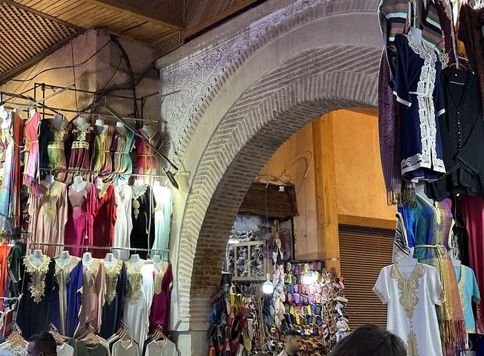
Returning after 11 PM, we learned the hard way that the souk has its own entry points and hours, and the path to our beds was full of detours and closed doors. Fortunately, we were guided by friendly locals who showed us the right way (in exchange for a fiercely negotiated tip each time...)
.Day 1: Friday, May 2nd – The Day the Group Split
Before we dive in, let’s talk about the trip prep. Among my friends, I’ve got a rep as the go-to independent travel expert (thanks to a few trips, some with this same crew). So, naturally, the task of planning this one fell to me—and I took it on gladly (you’re never better served than by yourself, right?). The prep and itinerary were hashed out over multiple meet-ups (excuses?) during shared meals at one another’s places, guided by yours truly. Travel style, accommodation, sightseeing—all decisions were made together, trying to balance everyone’s wishes over a good bottle (generic term, not numerical!)
So, a group of five—including me and my girlfriend—set off for Geneva at 3 AM that Friday, while the rest would join us on Sunday due to family or work commitments. We’ll skip the EasyJet flight—it was nothing special, just a means to get us there safely (which, in itself, is already a win). We landed in Marrakech at 9 AM local time. There, a spotless Dacia Logan was waiting for us, chartered by MEDLOC, whose impeccable service I’ll praise here (thanks, friends, for the tip!). My first challenge, after loading the suitcases into the trunk: reaching the riad booked for our first two nights as the advance team. https://www.astradamusmarrakesh.top/fr/
I was a little nervous about driving here—Marrakech’s driving reputation precedes it. The hiccup? While setting up Google Maps for the route, I accidentally added a level-5 difficulty and enabled pedestrian mode... Imagine a rental car stubbornly trying for over half an hour to navigate the Medina (the riad was in the north), cursing all the pedestrians in streets too narrow for the car, and having to reverse multiple times because “it won’t fit,” ignoring the many Marrakechis waving to signal the street was impassable (but what are they trying to sell me now? 🤪)... Until my co-pilot, holding my phone, asked if it was “normal for the route to be dotted on Google Maps?” Yes, it’s normal—pedestrian mode was on.... We’ll still be laughing about this in the nursing home in 40 years, but at the time, I was genuinely surprised by what driving in Morocco had in store for me—and for good reason! After fixing the Google Maps settings, we arrived more calmly at the private parking lot (90 dirhams per night) and then at the riad, where we received a warm welcome while our rooms were being prepared.
After freshening up, we crossed the souks for the first time to have lunch at Jemaa el-Fna Square, at Zeitoun Café, where we enjoyed our first couscous or tagine on its terrace. We’d return to Jemaa el-Fna that evening after a restorative nap at the riad, another late afternoon in the souk, and an evening at this famous UNESCO World Heritage site. This time, it was the restaurant Lafarmacie (you can’t make this up!) that won us over, despite the lack of a rooftop. I recommend this place to everyone—the prices are great, the welcome is extraordinary, and the food is excellent...
Returning after 11 PM, we learned the hard way that the souk has its own entry points and hours, and the path to our beds was full of detours and closed doors. Fortunately, we were guided by friendly locals who showed us the right way (in exchange for a fiercely negotiated tip each time...)