Hi there,
Have you ever traveled with this airline?
It seems like they have a real monopoly on some destinations and are also much cheaper.
Thank youuuu.
480 similar discussions in English
I find myself feeling more and more jaded when I travel these days.
Boredom sets in. I’m not saying I don’t like boredom, but long-term...
So, I end up thinking traveling doesn’t really make much sense anymore.
Do you ever feel this way?
Nat
Nat
Hello everyone!
This travel journal aims to help future travelers (well, I hope so!), since there’s so little information available about this remote archipelago. Big thanks to Lolodesiles and Ayis for answering my questions while I planned this trip!
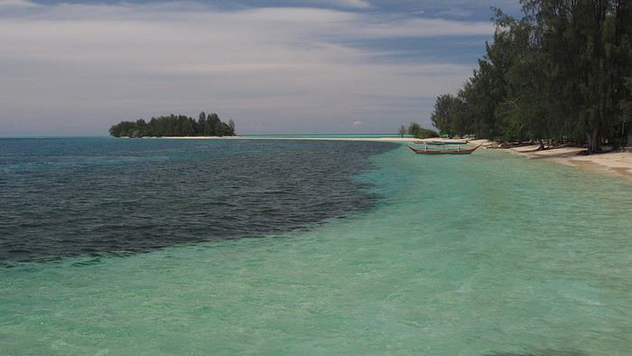
Context This is our fourth trip to Indonesia as a couple—after Java-Bali in 2011, Flores-Komodo in 2013, and Sulawesi in 2016—each time for three weeks. It’s also our tenth trip to Southeast Asia overall.
We’re traveling like we have in previous years: with a rough itinerary that often changes based on who we meet, tips from other travelers, how tired we are, or what we’re feeling in the moment. In the Moluccas, it’ll change constantly, mostly depending on transportation.
Our only accommodation booking: the first few nights in Ambon when we arrive.
Planned route (to be refined on the spot): Ambon - Banda Islands - Lease Islands - Ternate - Tidore - Halmahera (between Sofifi and Tobelo) - Morotai and the neighboring unnamed archipelago.
Flights: Lyon-Paris-Singapore on Air France (428 € round-trip), with good meals, champagne, and wine (we like our little comforts when going on vacation 😏). Then Singapore-Jakarta-Ambon on Air Asia and Garuda. Return flight: Ternate-Jakarta-Singapore on Lion Air, with a 3-day stopover in Singapore before heading home.
Episode 1: Ambon to Banda Our guesthouse, booked two days before departure, is 45 minutes from Ambon Airport, near Natsepa Beach (northeast of Leihitu). It’s a pretty average beach—quiet on weekdays but packed on Sundays (we saw the difference). It’s lined with warungs. This rainy day helps us readjust to the atmosphere of this country we love so much.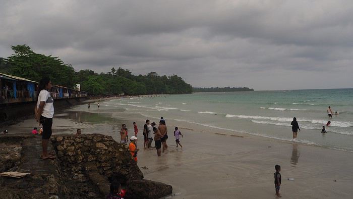
Our “Solim Guesthouse” is a lovely house with a living/dining room and garden, costing 15 € per night for two, including a hearty breakfast. Dinner is at Gaba Gaba, a great restaurant just a short walk away, right by the water, recommended by our host. Fun fact: it’s in the Lonely Planet, and it might be the only LP-listed spot in the Moluccas that actually matches the description (the others either don’t exist or have nothing to do with what’s advertised 😠).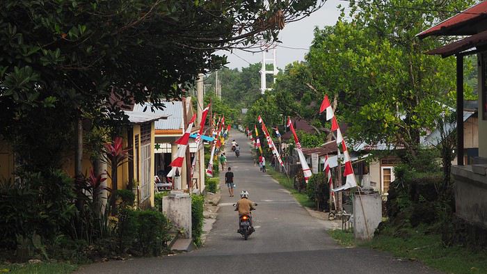
For the next two days, the super-friendly owner lends us his scooter. We set off to explore the coastal villages in northern Leihitu (the western part of Ambon Island, which has a weird shape).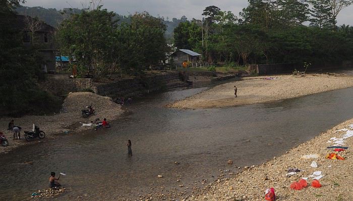 Laundry and trucks washed in the same stream.
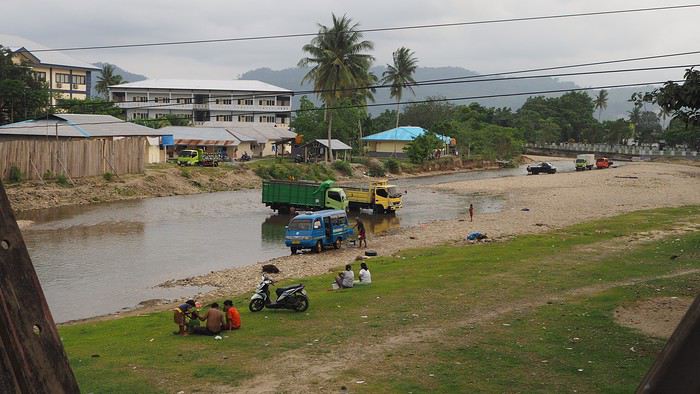
Liang Beach, described as the island’s most beautiful, is almost gone (climate change or something else?), but the colors are magical.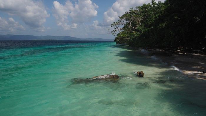
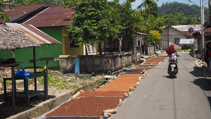
We continue 25 km toward a snorkeling spot our host recommended, taking a gorgeous, deserted little road through tiny villages in clove plantations (oh, those unforgettable scents!), stunning coves, and dense forest.
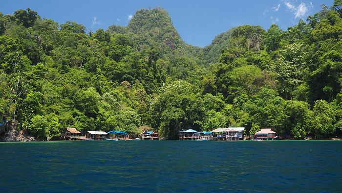 We’re greeted dozens of times with “Hello Mister”—a daily routine in the Moluccas. Every time we stop, we pose for photos to be saved on locals’ smartphones. They don’t see tourists often.
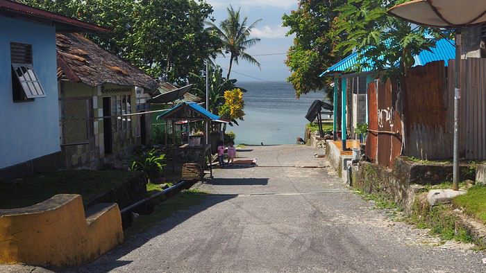
We ask for directions to the snorkeling spot (not easy—we only know basic Indonesian like *Selamat pagi*, *siang*, *sore*, and other polite phrases). Not many people know where it is (especially since we never know which village we’re in), but we eventually reach a small village that seems to be the right place. 🙂
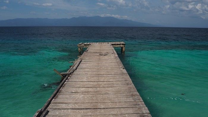
We ask a local to take us there by boat (it’s not reachable by land).
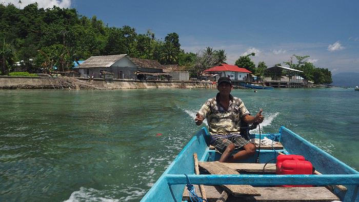
The spot is at most 100 meters long, but the coral is in good condition (apparently not dynamited by fishermen, unlike in other parts of this beautiful country where fishing methods are destructive and nature pays the price 😠). The fish are plentiful and diverse. It’s a great start before heading to Banda. We’re happy to have the place to ourselves… though we don’t yet realize we won’t see a single tourist for the rest of the trip!
After two days of rest, we head to Tulehu Port in the morning, aiming for the Banda Islands. We know the journey is often tricky: the Pelni ferry runs twice a month but doesn’t match our dates, the 10-seat Suzi Air plane is always full (you can’t book—you have to show up on Mondays and Fridays), and it’s often canceled due to weather. So we opt for the Tuesday speedboat (which also gets canceled if there are waves or wind), with the next one on Saturday. We’re used to Indonesian ports—crowded, rusty boats, no English speakers—but we still feel lost. When I ask about the speedboat to Bandaneira, people gesture wildly, someone takes me to the “harbor office,” then tells me there’s no boat, others try to sell me tickets, and some just say, “No boat.”
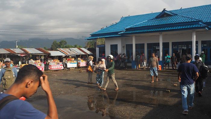
Luckily, an English-speaking local approaches us and confirms the speedboat is broken. The next one will be Saturday *if* it’s fixed—otherwise, even later. 🤪 😠 We’re crushed. We came here for the Banda Islands… 🙁 We decide waiting five days for a maybe-boat isn’t an option, so we decide to head straight to North Moluccas, which was planned for later. We’re so disappointed we don’t even want to stay in the area. The Lease Islands don’t appeal to us despite what we’ve read, and Seram would deserve its own trip with its remote mountain tribes. Huge disappointment—we’d been dreaming of Banda for months, with its incredible drop-offs like Bunaken, its islands covered in nutmeg trees, etc. I’d read that Banda is in the world’s top 5, alongside Bunaken (amazing—we went in 2016), Komodo (incredible—we went in 2013), Sipadan, and another spot I’ve forgotten.
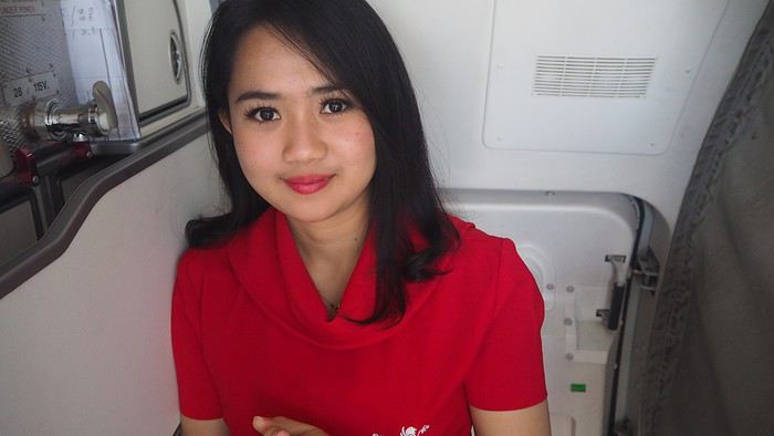
We take a taxi back to Ambon (45 minutes) to a travel agency to buy plane tickets to Ternate. There’s a daily ATR72 flight at noon—perfect timing. Ambon is the capital of South Moluccas (or Central, depending on who you ask!) with 300,000 people. The city doesn’t seem unpleasant, but we don’t stop. On the plane, there are only about ten passengers for 72 seats. The flight attendants are stunning, as always with Wings Air—clearly, they’re hired for their looks. 😊
Stopover in Bacan—a runway in the middle of coconut trees serving a tiny town—then we fly over countless volcanoes, the last one towering over Ternate.
Next episode coming soon: Ternate.
This travel journal aims to help future travelers (well, I hope so!), since there’s so little information available about this remote archipelago. Big thanks to Lolodesiles and Ayis for answering my questions while I planned this trip!
Context This is our fourth trip to Indonesia as a couple—after Java-Bali in 2011, Flores-Komodo in 2013, and Sulawesi in 2016—each time for three weeks. It’s also our tenth trip to Southeast Asia overall.
We’re traveling like we have in previous years: with a rough itinerary that often changes based on who we meet, tips from other travelers, how tired we are, or what we’re feeling in the moment. In the Moluccas, it’ll change constantly, mostly depending on transportation.
Our only accommodation booking: the first few nights in Ambon when we arrive.
Planned route (to be refined on the spot): Ambon - Banda Islands - Lease Islands - Ternate - Tidore - Halmahera (between Sofifi and Tobelo) - Morotai and the neighboring unnamed archipelago.
Flights: Lyon-Paris-Singapore on Air France (428 € round-trip), with good meals, champagne, and wine (we like our little comforts when going on vacation 😏). Then Singapore-Jakarta-Ambon on Air Asia and Garuda. Return flight: Ternate-Jakarta-Singapore on Lion Air, with a 3-day stopover in Singapore before heading home.
Episode 1: Ambon to Banda Our guesthouse, booked two days before departure, is 45 minutes from Ambon Airport, near Natsepa Beach (northeast of Leihitu). It’s a pretty average beach—quiet on weekdays but packed on Sundays (we saw the difference). It’s lined with warungs. This rainy day helps us readjust to the atmosphere of this country we love so much.
Our “Solim Guesthouse” is a lovely house with a living/dining room and garden, costing 15 € per night for two, including a hearty breakfast. Dinner is at Gaba Gaba, a great restaurant just a short walk away, right by the water, recommended by our host. Fun fact: it’s in the Lonely Planet, and it might be the only LP-listed spot in the Moluccas that actually matches the description (the others either don’t exist or have nothing to do with what’s advertised 😠).
For the next two days, the super-friendly owner lends us his scooter. We set off to explore the coastal villages in northern Leihitu (the western part of Ambon Island, which has a weird shape).
Laundry and trucks washed in the same stream.
Liang Beach, described as the island’s most beautiful, is almost gone (climate change or something else?), but the colors are magical.
We continue 25 km toward a snorkeling spot our host recommended, taking a gorgeous, deserted little road through tiny villages in clove plantations (oh, those unforgettable scents!), stunning coves, and dense forest.
We’re greeted dozens of times with “Hello Mister”—a daily routine in the Moluccas. Every time we stop, we pose for photos to be saved on locals’ smartphones. They don’t see tourists often.We ask for directions to the snorkeling spot (not easy—we only know basic Indonesian like *Selamat pagi*, *siang*, *sore*, and other polite phrases). Not many people know where it is (especially since we never know which village we’re in), but we eventually reach a small village that seems to be the right place. 🙂
We ask a local to take us there by boat (it’s not reachable by land).
The spot is at most 100 meters long, but the coral is in good condition (apparently not dynamited by fishermen, unlike in other parts of this beautiful country where fishing methods are destructive and nature pays the price 😠). The fish are plentiful and diverse. It’s a great start before heading to Banda. We’re happy to have the place to ourselves… though we don’t yet realize we won’t see a single tourist for the rest of the trip!
After two days of rest, we head to Tulehu Port in the morning, aiming for the Banda Islands. We know the journey is often tricky: the Pelni ferry runs twice a month but doesn’t match our dates, the 10-seat Suzi Air plane is always full (you can’t book—you have to show up on Mondays and Fridays), and it’s often canceled due to weather. So we opt for the Tuesday speedboat (which also gets canceled if there are waves or wind), with the next one on Saturday. We’re used to Indonesian ports—crowded, rusty boats, no English speakers—but we still feel lost. When I ask about the speedboat to Bandaneira, people gesture wildly, someone takes me to the “harbor office,” then tells me there’s no boat, others try to sell me tickets, and some just say, “No boat.”
Luckily, an English-speaking local approaches us and confirms the speedboat is broken. The next one will be Saturday *if* it’s fixed—otherwise, even later. 🤪 😠 We’re crushed. We came here for the Banda Islands… 🙁 We decide waiting five days for a maybe-boat isn’t an option, so we decide to head straight to North Moluccas, which was planned for later. We’re so disappointed we don’t even want to stay in the area. The Lease Islands don’t appeal to us despite what we’ve read, and Seram would deserve its own trip with its remote mountain tribes. Huge disappointment—we’d been dreaming of Banda for months, with its incredible drop-offs like Bunaken, its islands covered in nutmeg trees, etc. I’d read that Banda is in the world’s top 5, alongside Bunaken (amazing—we went in 2016), Komodo (incredible—we went in 2013), Sipadan, and another spot I’ve forgotten.
We take a taxi back to Ambon (45 minutes) to a travel agency to buy plane tickets to Ternate. There’s a daily ATR72 flight at noon—perfect timing. Ambon is the capital of South Moluccas (or Central, depending on who you ask!) with 300,000 people. The city doesn’t seem unpleasant, but we don’t stop. On the plane, there are only about ten passengers for 72 seats. The flight attendants are stunning, as always with Wings Air—clearly, they’re hired for their looks. 😊
Stopover in Bacan—a runway in the middle of coconut trees serving a tiny town—then we fly over countless volcanoes, the last one towering over Ternate.
Next episode coming soon: Ternate.
Can you tell me if the site promocroisières is reliable, since that's where I got the (great) deal? Thanks so much!
🙂
Hi everyone,
After several trips and meetings in Morocco, I’d like to take the plunge and go work there.
I’m French and currently a Project Manager for an IT consulting firm. I’m primarily looking at Casablanca.
Could you share any advice or experiences? Is it better to go there and look for opportunities on the spot, and if so, who should I reach out to?
Alternatively, do you know of any French companies looking for someone with my profile for a position in Morocco?
I’m open to any great tips or potential contacts.
Thanks in advance, everyone!!
After several trips and meetings in Morocco, I’d like to take the plunge and go work there.
I’m French and currently a Project Manager for an IT consulting firm. I’m primarily looking at Casablanca.
Could you share any advice or experiences? Is it better to go there and look for opportunities on the spot, and if so, who should I reach out to?
Alternatively, do you know of any French companies looking for someone with my profile for a position in Morocco?
I’m open to any great tips or potential contacts.
Thanks in advance, everyone!!
Introduction:
As has become a habit, I’ve organized a trip for late October—a surprise trip for my poor wife, who follows along without saying much (or almost nothing).
She knows she’s going away, when, but not where!
Our friends and family keep bombarding me with questions to get the info, but I’m holding strong.
The guesses are flying, the best one being, “Knowing him, he’s definitely heading somewhere sunny, even if all the southern destinations have already been done for a short stay.”
It makes me laugh because there are still a few places I haven’t discovered yet.
So yes, choosing to go to Belgium at the end of October—especially for someone as sensitive to the cold as I am—is bold.
I’m not quite at Philippe Abrams’ level, but still, heading *Noooorth* from me is pretty daring.
So, contrary to my friends’ predictions, I’m not flying south but taking my car, turning the wheel north, and off we go!
Day 1: The outbound trip When I say I’m not flying, it’s only half true because we’re leaving the day French media—with their signature doom-and-gloom—announce a terrible storm. While Storm Austen is indeed forecasted, the Belgians are reporting it as the first storm of the year with a bit more restraint. The drive won’t be entirely smooth as we reach the Hauts-de-France region: the wind is strong, the rain is heavy, but it’s not the apocalypse. Just drive carefully and slow down—sounds like a road safety message! We left Lyon at 8 AM and arrived in Bruges at 4 PM, “...and that’s even with the trucks at the entrance to Angoulême!” What’s he talking about—going through Angoulême? French cinephiles will get the reference. We got a warm welcome at our B&B, and since it was barely drizzling, we took a quick stroll around town to stretch our legs. Headed to the Markt, visited the Prinsenhof, the Palace of the Dukes of Flanders. We actually went in because it started pouring. It’s free, a first taste of Flemish culture, and it’s great.
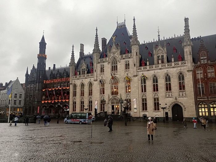
A little tired, we headed back to our B&B, mostly because the heavy rain forced us to. We got soaked (some people must be laughing). After drying off, we went to the nearest restaurant, Parazzar, typically Bruges-style, and my wife tried her first beer. Personally, I don’t like beer—*What the heck was I thinking?*—so I had a red wine, a Tinto, which would’ve been local back in Charles V’s time. First fries—because I *love* them—and it’s time to call it a night. A good night’s sleep awaits.
The +: We made it! The -: It’s raining, it’s windy, it’s wet—party at the...
Day 1: The outbound trip When I say I’m not flying, it’s only half true because we’re leaving the day French media—with their signature doom-and-gloom—announce a terrible storm. While Storm Austen is indeed forecasted, the Belgians are reporting it as the first storm of the year with a bit more restraint. The drive won’t be entirely smooth as we reach the Hauts-de-France region: the wind is strong, the rain is heavy, but it’s not the apocalypse. Just drive carefully and slow down—sounds like a road safety message! We left Lyon at 8 AM and arrived in Bruges at 4 PM, “...and that’s even with the trucks at the entrance to Angoulême!” What’s he talking about—going through Angoulême? French cinephiles will get the reference. We got a warm welcome at our B&B, and since it was barely drizzling, we took a quick stroll around town to stretch our legs. Headed to the Markt, visited the Prinsenhof, the Palace of the Dukes of Flanders. We actually went in because it started pouring. It’s free, a first taste of Flemish culture, and it’s great.
A little tired, we headed back to our B&B, mostly because the heavy rain forced us to. We got soaked (some people must be laughing). After drying off, we went to the nearest restaurant, Parazzar, typically Bruges-style, and my wife tried her first beer. Personally, I don’t like beer—*What the heck was I thinking?*—so I had a red wine, a Tinto, which would’ve been local back in Charles V’s time. First fries—because I *love* them—and it’s time to call it a night. A good night’s sleep awaits.
The +: We made it! The -: It’s raining, it’s windy, it’s wet—party at the...
After a pretty disastrous weather-wise trip to Gran Canaria, we’re hoping this time the sun will shine in Puglia.
It’s not a sure thing, though—the weather’s been awful all over Europe in early May.
For those who’d like to (re)read the story without the digressions, it’s here.
Saturday, May 16: This time we’re flying out of Charleroi (Brussels South): the ticket prices, flight times, and proximity all worked for us. The airport (Ryanair) was recently renovated... but it’s still not very well organized. There are hardly any seats in the boarding areas, and... the restrooms cost money!!! The flight goes smoothly, though, and we land in Bari a little late.
We quickly pick up our rental car, a very local-looking Pandina (even more so than the Fiat 500 in this region), and hit the Italian roads... and their unique driving quirks (like the fact that the countless road signs along the streets and in towns are purely decorative 😏, and that Italian cars don’t have turn signals 😮... except for rental cars).
About an hour later, we arrive at our first accommodation, right in the middle of the countryside near Monopoli. The owner isn’t there, but they’ve left us a ton of info via messages and even turned on the space heater, which is a nice touch. We explore the property:
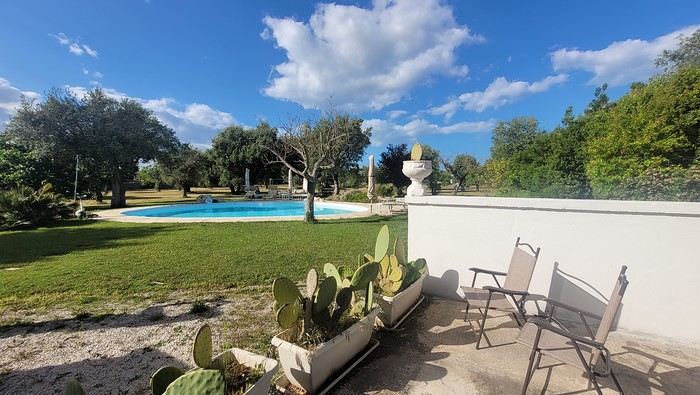
And the next morning before breakfast, its immediate surroundings:
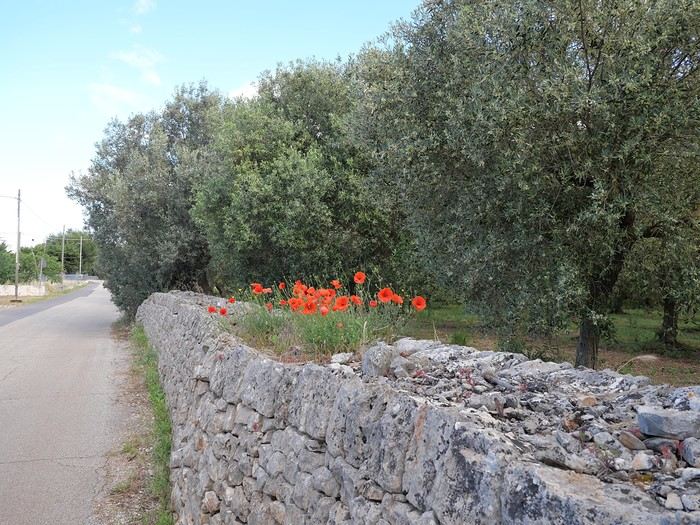
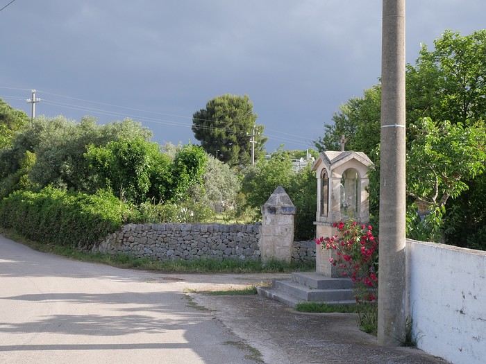
Sunday, May 17: After our "seaside" experience in Gran Canaria last weekend (packed with people and locals), we decide to start inland. After a hearty breakfast,
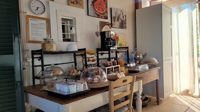
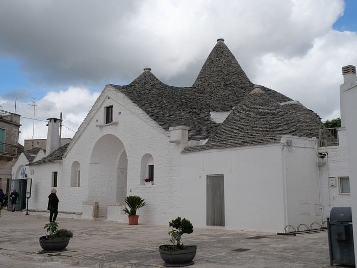
we head toward Alberobello, a super touristy village famous for its trulli—those stone houses with conical roofs. We easily find a free parking spot on a street near the Aia Piccola district, where some trulli are still lived in year-round.
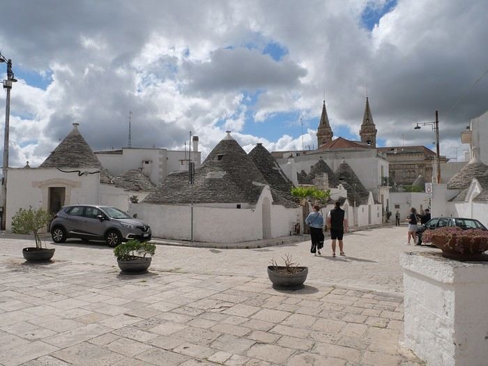
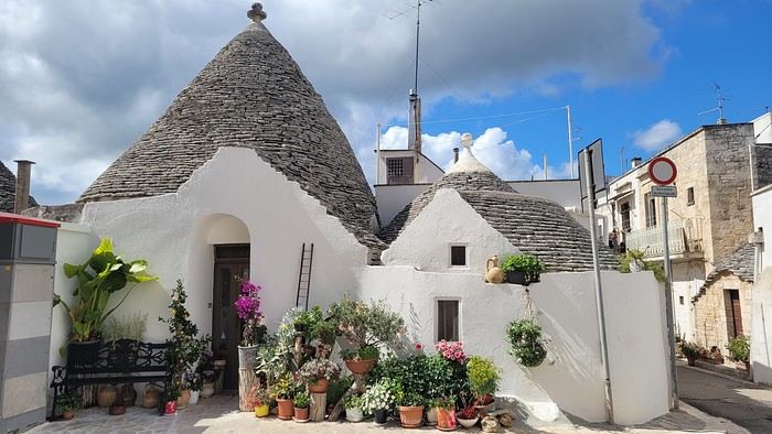
We almost immediately come across the Trullo Sovrano (the only two-story one), which you can visit (but we skip it—it’s opening time, and there’s already a line).
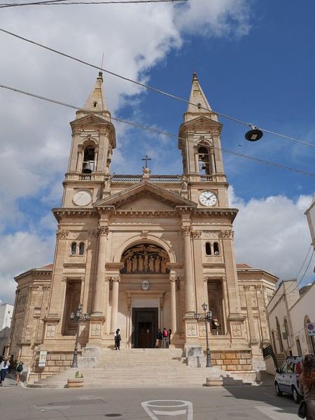
From there, we head down toward the Basilica of Cosma e Damiano... but we don’t go in because there’s a mass.
Now we’re on the main Piazza del Popolo, which connects the two districts of Alberobello: Rione Aia Piccola and Rione Monti, the more touristy one.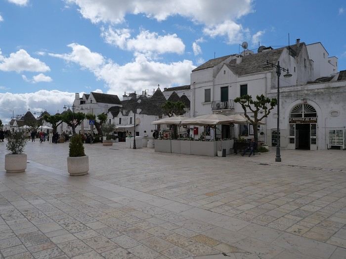
For those who’d like to (re)read the story without the digressions, it’s here.
Saturday, May 16: This time we’re flying out of Charleroi (Brussels South): the ticket prices, flight times, and proximity all worked for us. The airport (Ryanair) was recently renovated... but it’s still not very well organized. There are hardly any seats in the boarding areas, and... the restrooms cost money!!! The flight goes smoothly, though, and we land in Bari a little late.
We quickly pick up our rental car, a very local-looking Pandina (even more so than the Fiat 500 in this region), and hit the Italian roads... and their unique driving quirks (like the fact that the countless road signs along the streets and in towns are purely decorative 😏, and that Italian cars don’t have turn signals 😮... except for rental cars).
About an hour later, we arrive at our first accommodation, right in the middle of the countryside near Monopoli. The owner isn’t there, but they’ve left us a ton of info via messages and even turned on the space heater, which is a nice touch. We explore the property:
And the next morning before breakfast, its immediate surroundings:
Sunday, May 17: After our "seaside" experience in Gran Canaria last weekend (packed with people and locals), we decide to start inland. After a hearty breakfast,
we head toward Alberobello, a super touristy village famous for its trulli—those stone houses with conical roofs. We easily find a free parking spot on a street near the Aia Piccola district, where some trulli are still lived in year-round.
We almost immediately come across the Trullo Sovrano (the only two-story one), which you can visit (but we skip it—it’s opening time, and there’s already a line).
From there, we head down toward the Basilica of Cosma e Damiano... but we don’t go in because there’s a mass.
Now we’re on the main Piazza del Popolo, which connects the two districts of Alberobello: Rione Aia Piccola and Rione Monti, the more touristy one.
Day 1 – February 14
We all have two lives. And the second one kicks off the day you realize you only have one, with the determination to spend the time you have left on what truly adds sparkle to your life, Kevin! I like to elegantly introduce a trip with a philosophical quote. First, it gives you the illusion that I’m some kind of deep thinker, and second, it lets me fill up the first few lines of my blank page when I don’t know how to tell you I’m diving back into what really lights up my life: another adventure beyond the horizon! And nearly every other year, like a toxic relationship, my horizon tends to take shape in Uncle Sam’s backyard. And this, despite his cousin Donald calling the shots. Speaking of which, it was partly that impulsive guy who pushed us to be just as impulsive and snag our four flight tickets at a ridiculously low price—a direct result of foreign tourism taking a hit from BetaMax’s repeated antics... Four tickets? Who are the other lucky ones? In this case, our lucky ones are actually lucky ladies: My Flo, always up for exploring the world with me on foot, camelback, or scooter, is obviously in on the fun. The other two seats went to our daughters, Sasha and Luna, both thrilled to be part of this new American adventure...
But what’s the American West like in February?... A gamble. Let’s call it Russian roulette since we’re not landing during peak weather season. That’s why we encouraged our transportation and accommodation to get cozy and produce a little camper van, so we can stay ultra-flexible in the face of any weather tantrums. We’ll be roaming in Kara the van with the motto "Follow the sun!" Bad weather? We bolt. Snow? We speed up. Sunny? We act like it was the plan all along and soak it up.
"Okay, but why keep coming back to the same corner of the globe? After ten American adventures, you must be tired of seeing the same things, right?" But I’m not crazy, you know!... The American West is like making love to your gorgeous wife over and over, always enjoying it just as much. And contrary to what you might think, the American West isn’t just the Grand Canyon, Monument Valley, Las Vegas, and Bryce Canyon. Proof is, after ten trips to the U.S., my retinas are still untouched by three-quarters of the places I scribbled on a napkin for this adventure... Oh, and add to that my wife, who I’ve easily converted to my religion, and boom... relapse is even easier! Because yes, we’ve landed in Los Angeles after a sunny flight over Greenland, still under Danish flag for now. And we’re already heading east through the XXL traffic of L.A.’s eight-lane highways, eager to dive into our first discoveries. But first, night is taking over the sky, and second, we’ve been officially awake for 24 hours, so I suggest wrapping up this intro. I’ll tell you more tomorrow morning. Sound good?

We all have two lives. And the second one kicks off the day you realize you only have one, with the determination to spend the time you have left on what truly adds sparkle to your life, Kevin! I like to elegantly introduce a trip with a philosophical quote. First, it gives you the illusion that I’m some kind of deep thinker, and second, it lets me fill up the first few lines of my blank page when I don’t know how to tell you I’m diving back into what really lights up my life: another adventure beyond the horizon! And nearly every other year, like a toxic relationship, my horizon tends to take shape in Uncle Sam’s backyard. And this, despite his cousin Donald calling the shots. Speaking of which, it was partly that impulsive guy who pushed us to be just as impulsive and snag our four flight tickets at a ridiculously low price—a direct result of foreign tourism taking a hit from BetaMax’s repeated antics... Four tickets? Who are the other lucky ones? In this case, our lucky ones are actually lucky ladies: My Flo, always up for exploring the world with me on foot, camelback, or scooter, is obviously in on the fun. The other two seats went to our daughters, Sasha and Luna, both thrilled to be part of this new American adventure...
But what’s the American West like in February?... A gamble. Let’s call it Russian roulette since we’re not landing during peak weather season. That’s why we encouraged our transportation and accommodation to get cozy and produce a little camper van, so we can stay ultra-flexible in the face of any weather tantrums. We’ll be roaming in Kara the van with the motto "Follow the sun!" Bad weather? We bolt. Snow? We speed up. Sunny? We act like it was the plan all along and soak it up.
"Okay, but why keep coming back to the same corner of the globe? After ten American adventures, you must be tired of seeing the same things, right?" But I’m not crazy, you know!... The American West is like making love to your gorgeous wife over and over, always enjoying it just as much. And contrary to what you might think, the American West isn’t just the Grand Canyon, Monument Valley, Las Vegas, and Bryce Canyon. Proof is, after ten trips to the U.S., my retinas are still untouched by three-quarters of the places I scribbled on a napkin for this adventure... Oh, and add to that my wife, who I’ve easily converted to my religion, and boom... relapse is even easier! Because yes, we’ve landed in Los Angeles after a sunny flight over Greenland, still under Danish flag for now. And we’re already heading east through the XXL traffic of L.A.’s eight-lane highways, eager to dive into our first discoveries. But first, night is taking over the sky, and second, we’ve been officially awake for 24 hours, so I suggest wrapping up this intro. I’ll tell you more tomorrow morning. Sound good?
Is hitchhiking in Thailand a good idea? A bad one? Safe or not?
Instead of sharing my thoughts on the subject, I’ll tell you about my four short hitchhiking "adventures" over 40 years of traveling there. Hopefully, this will help you form your own opinion.
First, a general rule I always follow in Southeast Asia: whether you're a woman or a man, in the city or the countryside, if you're a foreigner—even in a small group—never let yourself get completely isolated once night falls.
Okay, here we go.
My first time:
This happened in the late 80s in Kanchanaburi province, on route 3272/4088, somewhere between the charming Thong Pha Phum and that spot on the Burmese border where a gas pipeline—owned at the time by a major French company—crosses. I don’t remember why or how I ended up on that remote road, but since I love getting lost, it was fine. Except that it was already mid-afternoon, no songthaew had shown up after an hour of waiting, and I wanted to get back to T.P. Phum before dark. So I started walking, keeping an ear out for any approaching engine to flag down (hand flat, palm down, waving as if saying goodbye). Soon after, a slightly upscale car stopped—a high-end Japanese model. Inside was a couple in their thirties. "You guys headin’ to Thong Pha Phum?" "Sure, no problem, my good farang, hop in." I was saved. We drove for 20-30 kilometers, then the guy pulled over: "Come on, let’s grab a drink..." Later, I’d learn we were near the spot where they were spending a short vacation, south of the reservoir stretching from T.P.P. to Sangkhlaburi—a place (that part of the lake) known for its waterfront resorts for couples, families (next stop...), and other Thais out for a good time (I’d stay there myself a weekend a few years later, in a dorm room with about thirty Thai friends). We had a drink. The woman barely sipped hers. We had a second. She didn’t say anything, but I could read in her eyes what she was thinking (no language barrier for that kind of communication). Then he ordered a third. She shot her husband a disapproving, embarrassed look. As for me, aware I was still far from "home" and that night was falling, I started pretending to drink too. You can guess the rest: the guy kept ordering, got drunker and drunker, and his wife didn’t dare scold him in front of me, but the looks she gave him—and her discomfort around the other people in the roadside joint—spoke volumes.
After a (very) long while, the woman couldn’t take it anymore and finally reminded him, I assume, that they still had to take me to T.P.P. But given his state, it was unanimously decided—by both of us—that there was no way he was driving. I felt stuck, especially since I don’t drive. And her? Oh, she could. I helped the guy as best I could, and the joint’s owner, taking pity on me, lent a hand. We got him into the back seat, where he fell asleep almost immediately. It was around 8 PM when, with her husband still snoring in the back, she dropped me off at the entrance of the guesthouse in Thong Pha Phum, near the market square. I thanked her, feeling a pang of sympathy for the moment she’d have to haul her husband from the car to their room. They drove off. I was hungry. At the far end of the market square was a great restaurant with a direct view of the Mae Nam Khwae. I headed that way.
Instead of sharing my thoughts on the subject, I’ll tell you about my four short hitchhiking "adventures" over 40 years of traveling there. Hopefully, this will help you form your own opinion.
First, a general rule I always follow in Southeast Asia: whether you're a woman or a man, in the city or the countryside, if you're a foreigner—even in a small group—never let yourself get completely isolated once night falls.
Okay, here we go.
My first time:
This happened in the late 80s in Kanchanaburi province, on route 3272/4088, somewhere between the charming Thong Pha Phum and that spot on the Burmese border where a gas pipeline—owned at the time by a major French company—crosses. I don’t remember why or how I ended up on that remote road, but since I love getting lost, it was fine. Except that it was already mid-afternoon, no songthaew had shown up after an hour of waiting, and I wanted to get back to T.P. Phum before dark. So I started walking, keeping an ear out for any approaching engine to flag down (hand flat, palm down, waving as if saying goodbye). Soon after, a slightly upscale car stopped—a high-end Japanese model. Inside was a couple in their thirties. "You guys headin’ to Thong Pha Phum?" "Sure, no problem, my good farang, hop in." I was saved. We drove for 20-30 kilometers, then the guy pulled over: "Come on, let’s grab a drink..." Later, I’d learn we were near the spot where they were spending a short vacation, south of the reservoir stretching from T.P.P. to Sangkhlaburi—a place (that part of the lake) known for its waterfront resorts for couples, families (next stop...), and other Thais out for a good time (I’d stay there myself a weekend a few years later, in a dorm room with about thirty Thai friends). We had a drink. The woman barely sipped hers. We had a second. She didn’t say anything, but I could read in her eyes what she was thinking (no language barrier for that kind of communication). Then he ordered a third. She shot her husband a disapproving, embarrassed look. As for me, aware I was still far from "home" and that night was falling, I started pretending to drink too. You can guess the rest: the guy kept ordering, got drunker and drunker, and his wife didn’t dare scold him in front of me, but the looks she gave him—and her discomfort around the other people in the roadside joint—spoke volumes.
After a (very) long while, the woman couldn’t take it anymore and finally reminded him, I assume, that they still had to take me to T.P.P. But given his state, it was unanimously decided—by both of us—that there was no way he was driving. I felt stuck, especially since I don’t drive. And her? Oh, she could. I helped the guy as best I could, and the joint’s owner, taking pity on me, lent a hand. We got him into the back seat, where he fell asleep almost immediately. It was around 8 PM when, with her husband still snoring in the back, she dropped me off at the entrance of the guesthouse in Thong Pha Phum, near the market square. I thanked her, feeling a pang of sympathy for the moment she’d have to haul her husband from the car to their room. They drove off. I was hungry. At the far end of the market square was a great restaurant with a direct view of the Mae Nam Khwae. I headed that way.
Hello,
We’re planning our second trip to South Africa in July 2026. In 2023, we did a loop from Joburg, Golden Gate, Drakensberg, Hluhluwe, St Lucia, Eswatini, Kruger, Blyde River Canyon, and back to Joburg. This time, we’d like to go to Cape Town and do a road trip to Port Elizabeth, then fly back to Joburg to return to Kruger. At this stage of my planning, here’s what it could look like:
D1 to D4: Cape Town and Cape of Good Hope (Table Mountain, Lion’s Head, Waterfront, Bo-Kaap, Boulders, Cape Point, Chapman’s Peak Drive). I’ve spotted a few places to stay between Camps Bay and Hout Bay (3 nights). D5 and D6: Either Karoo NP or Hermanus and De Hoop. Any opinions to tip the scales? I’ll admit I’m already leaning toward Karoo (the "wild" vibe of the landscapes and wildlife encounters appeal to me much more than the seaside, which feels less exotic). If we go for Karoo, where should we stay? Inside the park or in Beaufort West? I’ve seen good reviews for Ko-ka Tsara Bush Camp, but maybe it’s better to stay in the Sanparks cottages to make the most of the park? (2 nights) Option B is to do Stellenbosch (though vineyards aren’t great in winter) and/or the Whale Route—Betty’s Bay, Hermanus, De Hoop (2 nights near Gansbaai). D7 and D8: Klein Karoo, Oudtshoorn. Staying at De Cango Guest Farm (2 nights). D9 and D10: Knysna, Robberg Nature Reserve, Tsitsikamma (2 nights in Plettenberg Bay and 1 night in PE). D11: Flight from Port Elizabeth to Joburg at 7 AM and drive to Marloth Park.
For Kruger, I’ve booked 2 nights in Marloth Park, 1 night in Skukuza, 2 nights in Satara, and 1 night in Talamati, which we loved. I’ll book the last night in Graskop later since we want to revisit the Blyde Canyon area.
I’d love all the feedback you can give on my itinerary, especially for days 5 and 6. If you have recommendations for accommodations for 4 people, I’d appreciate those too. Thanks! 🙂
We’re planning our second trip to South Africa in July 2026. In 2023, we did a loop from Joburg, Golden Gate, Drakensberg, Hluhluwe, St Lucia, Eswatini, Kruger, Blyde River Canyon, and back to Joburg. This time, we’d like to go to Cape Town and do a road trip to Port Elizabeth, then fly back to Joburg to return to Kruger. At this stage of my planning, here’s what it could look like:
D1 to D4: Cape Town and Cape of Good Hope (Table Mountain, Lion’s Head, Waterfront, Bo-Kaap, Boulders, Cape Point, Chapman’s Peak Drive). I’ve spotted a few places to stay between Camps Bay and Hout Bay (3 nights). D5 and D6: Either Karoo NP or Hermanus and De Hoop. Any opinions to tip the scales? I’ll admit I’m already leaning toward Karoo (the "wild" vibe of the landscapes and wildlife encounters appeal to me much more than the seaside, which feels less exotic). If we go for Karoo, where should we stay? Inside the park or in Beaufort West? I’ve seen good reviews for Ko-ka Tsara Bush Camp, but maybe it’s better to stay in the Sanparks cottages to make the most of the park? (2 nights) Option B is to do Stellenbosch (though vineyards aren’t great in winter) and/or the Whale Route—Betty’s Bay, Hermanus, De Hoop (2 nights near Gansbaai). D7 and D8: Klein Karoo, Oudtshoorn. Staying at De Cango Guest Farm (2 nights). D9 and D10: Knysna, Robberg Nature Reserve, Tsitsikamma (2 nights in Plettenberg Bay and 1 night in PE). D11: Flight from Port Elizabeth to Joburg at 7 AM and drive to Marloth Park.
For Kruger, I’ve booked 2 nights in Marloth Park, 1 night in Skukuza, 2 nights in Satara, and 1 night in Talamati, which we loved. I’ll book the last night in Graskop later since we want to revisit the Blyde Canyon area.
I’d love all the feedback you can give on my itinerary, especially for days 5 and 6. If you have recommendations for accommodations for 4 people, I’d appreciate those too. Thanks! 🙂
Hi,
I’m planning a trip to Australia—Paris to Melbourne.
I’m flying with Etihad and have a 1-hour connection in Abu Dhabi.
Does that seem doable to you?
Thanks for your feedback and experiences!
Hi everyone,
I have a Ryanair flight scheduled for 10/14 (outbound, returning on the 16th) from Charleroi in Belgium. A strike is confirmed, and the airport will be closed on the 14th. But Ryanair is still saying the flight is confirmed. I get that they’re trying to make us change and pay extra fees rather than wait for the free compensation.
If I make a new booking, can I still claim a refund for the first one?
Thanks in advance for your help—this is the first time I’ve faced this situation.
I have a Ryanair flight scheduled for 10/14 (outbound, returning on the 16th) from Charleroi in Belgium. A strike is confirmed, and the airport will be closed on the 14th. But Ryanair is still saying the flight is confirmed. I get that they’re trying to make us change and pay extra fees rather than wait for the free compensation.
If I make a new booking, can I still claim a refund for the first one?
Thanks in advance for your help—this is the first time I’ve faced this situation.
Hi,
Many of us have noticed that bugs have been making it difficult to navigate the forum lately.
I’ll let Kate and Ticapi explain the issue:
I went to your profile to check out the Thailand travel journal, and when I clicked on it, it brought me back here again. All week, I’ve been dealing with bugs like this—it’s really discouraging from continuing on VF.🙁
I had the same thing happen, and multiple times. For me, it was Montagnard’s latest journal that kept coming up no matter which discussion I clicked on.
Hopefully, a solution will be found soon.🙂
Many of us have noticed that bugs have been making it difficult to navigate the forum lately.
I’ll let Kate and Ticapi explain the issue:
I went to your profile to check out the Thailand travel journal, and when I clicked on it, it brought me back here again. All week, I’ve been dealing with bugs like this—it’s really discouraging from continuing on VF.🙁
I had the same thing happen, and multiple times. For me, it was Montagnard’s latest journal that kept coming up no matter which discussion I clicked on.
Hopefully, a solution will be found soon.🙂
 Hello everyone!
This trip dates back to late 2021, but since Voyage Forum reopened for writing, I haven’t seen many travel journals about Tanzania, so I decided to repost this one, which I originally shared on another well-known travelers’ site—even though I prefer Voyage Forum’s user experience.
It’s also a chance for me to relive this exhilarating trip... So, if you’re up for it, let me take you on a classic adventure: Tarangire - Ngorongoro - Serengeti, plus a little bonus—the small Arusha Park.
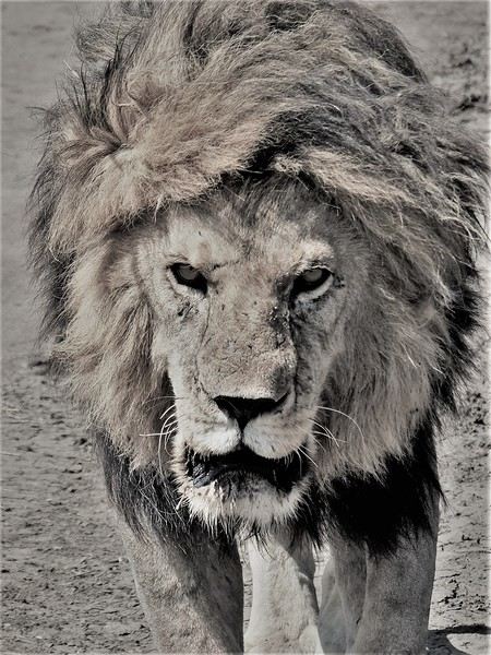
First off, yes, as the title of this journal suggests, we were lucky enough to spot *tons* of lions. The power they exude is incredible, even if most of the time they just look like big cats napping or strolling around. But lock eyes with one, and you’ll be glad you’re in the jeep.
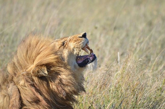
But let’s not forget the rest of the wildlife—and the landscapes, which are absolutely stunning, with those iconic tree silhouettes.
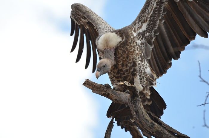
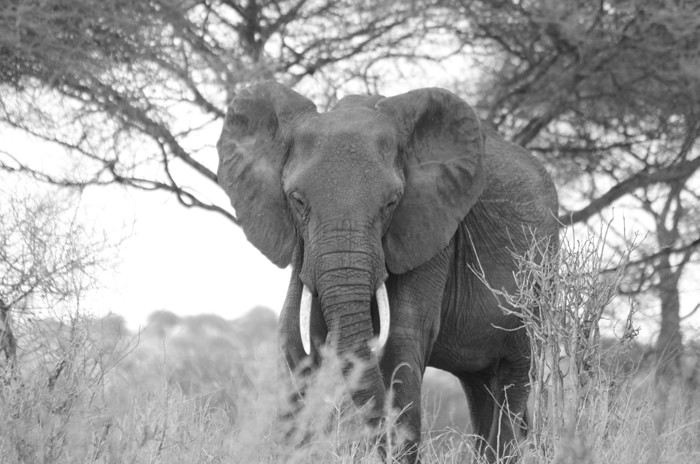
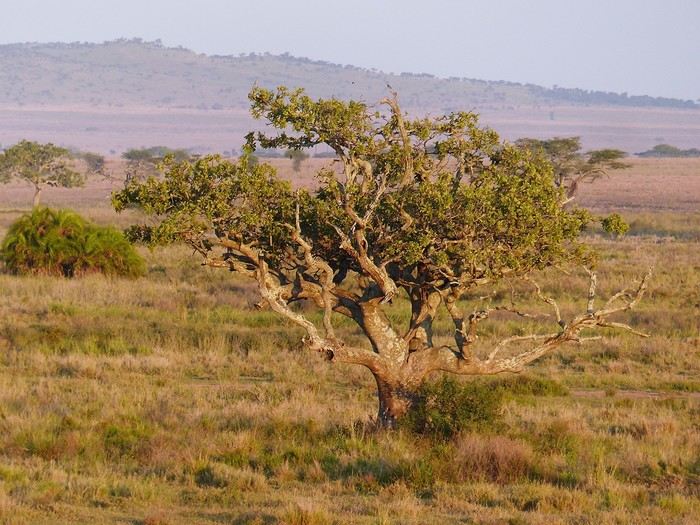
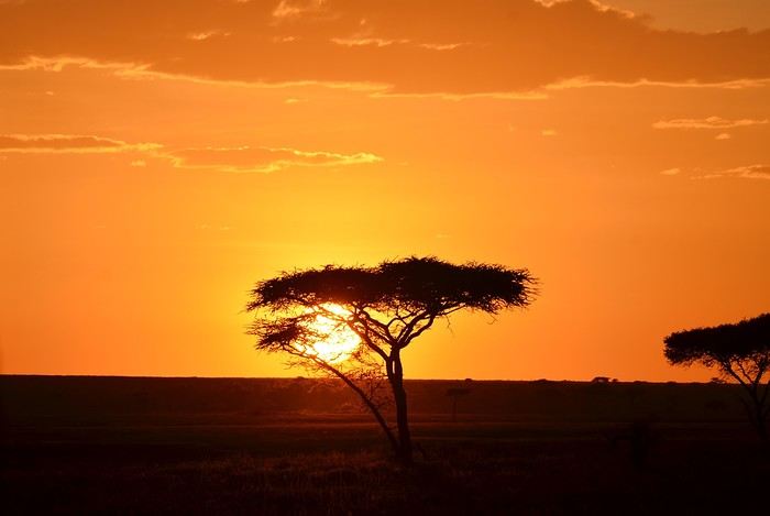
I remember before leaving, I was a little worried I wouldn’t feel that same sense of wonder I’d experienced two years earlier in Botswana (see my travel journal). That fear was unfounded—the magic worked its charm once again! Note: Since we had limited time, we focused our trip entirely on safari, so this journal is 100% animals and landscapes—and 0% Maasai. Next post: TARANGIRE
Hi fellow travelers!
I arrive in New Delhi on January 5th, and this is the third time I’ve come across what turns out to be a scam (after some research outside of booking.com): dirty places, fake reviews, etc.
So I’m starting to distrust booking.com because it really doesn’t seem like a reliable site (at least when it comes to booking hotels in New Delhi).
If you have a good place to stay (max 1500 € per night, and I don’t want a dorm) in New Delhi, I’d love to hear about it! :)
Looking forward to your replies!
If you have a good place to stay (max 1500 € per night, and I don’t want a dorm) in New Delhi, I’d love to hear about it! :)
Looking forward to your replies!
In this time of general travel-journal scarcity, I’m stepping up to tell you about a far-too-short getaway to the Top West End, a local term for the very northern part of Western Australia, right on the border ( ;) ) with the Northern Territory.
As usual, I didn’t manage to keep it short, but this time I’ve got photos to go with it!
August 2020. Since the opportunities to explore the world are extremely limited right now, all we (R&X) can do is explore our own island! Well, just a part of it, because with the state borders still closed, we’re stuck in Western Australia (WA).
Luckily, we’re pretty fortunate because this state is huge: over 2.5 million km² (that’s more than four times the size of France or 1.5 times Quebec). What’s more, stretching over 20 degrees of latitude between the Antarctic Ocean and the Timor Sea, you’ll find climates ranging from Mediterranean to arid to tropical. That’s actually why we decided to head as far north as possible. Sick of the endless rainy winter in Perth, bring on the heat of the Kimberley... way up Nooorth!
Friday. At the airport, the main terminal was closed (not enough flights), so we ended up in the annex (where flights to the various mines usually depart from). There was no crowd at the gate, and in this huge, single departure lounge, empty seats were plentiful. Only three flights were listed on the screens for the rest of the morning: the first to Coondewanna (?), the second to Darwin, and ours to Kununurra (code KNX).
A cool breeze swept through the half-open corridors along the runways. At the top of the walkway leading to the Fokker 100 (the Airbuses and Boeings are now parked!), a flight attendant greeted us with a basket full of sanitary masks. We were actually the only masked passengers (the staff weren’t wearing them either). With zero Covid-19 cases in WA at the time, the only rule was to maintain social distancing—something pretty hard to do on a full plane!
It was also my first time wearing a mask—it felt weird, pretty uncomfortable, and after a while, painful behind the ears. I really feel for those who have to wear one all day, every day. The flight lasted three long hours, but luckily, I had a good book. From the window, I watched an endless expanse of salt lakes in all shapes and sizes—round, elongated, gray, white, sometimes blue and green—and an infinity of winding, capricious meanders, along with long straight lines that led nowhere. The last half-hour got more interesting as rocky, swollen formations and long, sloping plateaus appeared. Against the vast ochre landscape, green patches became more frequent.
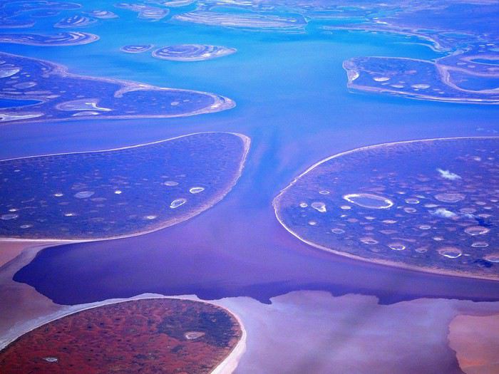
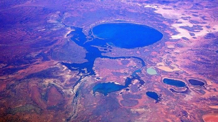
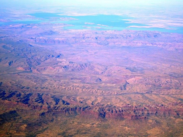
Just before landing, rows of green fields briefly appeared, along with an surprisingly wide river—but we were already rolling down the tarmac. A few hangars, a myriad of small, stationary planes, and a tiny terminal topped with a sign: “Welcome to Kununurra.”
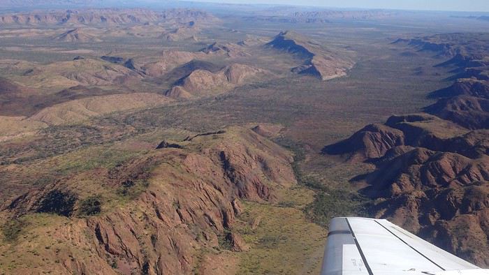
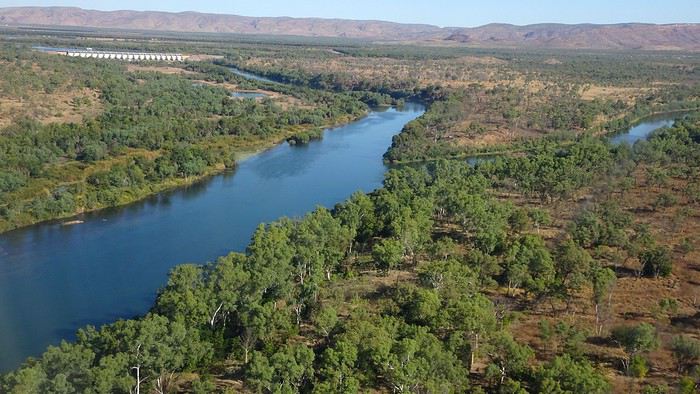
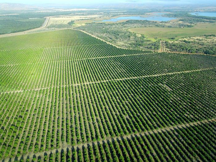
We wanted heat, and here it was—34°C the moment we stepped off the plane! We felt alive again and totally ridiculous in our jeans and sweaters. We quickly grabbed our suitcase and picked up the 4x4 we’d rented—more out of necessity, since only that type of vehicle can access the national parks we planned to visit.
Just four kilometers separated us from Kununurra, a town of 5,000 people founded in 1961 during the construction of the Lake Argyle Dam and the development of the Ord River Irrigation Area Scheme (more on that later). On the horizon, mountain ranges (a bit of an exaggeration, since we know Mt. Meharry, WA’s highest ‘mountain,’ doesn’t even reach 1,250 meters!) and closer to the road, a few irrigation canals cutting through stretches of bush, then a huge park overlooking a small lake lined with reeds.
A row of baobabs (yes, there are baobabs in Australia too!), a series of motels with immaculate lawns, a gas station, and there’s the main street leading to the town center—that is, the parking lots of the two supermarkets, the bottleshop, the pub, the Town Hall, the municipal pool, and the Tourist Office (already closed!), and at the next roundabout, another park, the Presbyterian church, and a few other shops. In short, two or three green blocks that you can explore in no time.
One road leads to the small industrial area and one of the town’s three or four campgrounds, while another heads toward the residential neighborhoods, which look just like the typical suburbs you find in any Australian city—except with tropical vegetation. We stocked up at Coles, an identical copy of the one near our place, and—surprise—the prices were practically the same.
We checked into one of the motels. The receptionist listed the town’s three or four restaurants, insisting that it’s always better to book a table. She recommended the Pump House, a bit outside town on the lake’s edge. “Best spot to watch the sunset, but hurry up.” she told us. It was only 5:00 PM!
When we got there half an hour later, the place was packed, and the sun had already disappeared behind a row of trees! Sure enough, we’d see a few days later that the sunset can be a stunning spectacle—if you wait a bit for the sky (especially if it’s cloudy) to blaze and reflect in the lake’s calm waters. A little disappointed, we headed back into town, where we easily found the other lively spot in town: the pub (nothing like an old English pub). Above the long L-shaped bar, several giant screens (thankfully muted) were broadcasting live footy, rugby league, etc. In one corner, players circled the pool table, while in another, customers were digging into plates of the day’s special. Instead of rooms, there were various patios where groups of friends and coworkers (easily recognizable by the fluoro vests they were still wearing) were gathered. We found a table under a mango tree—unfortunately, a little too close to the guitarist strumming his entire Country Music repertoire, complete with Keith Urban-style tremolos. Guaranteed culture shock!
Since it’s the custom here, we called the Country Club to book a table before the kitchen closed! The CC is the town’s—and even the region’s—fancy spot. Dark decor, modern furniture, dim lighting, and the air conditioning blasting. The twenty or so customers had taken refuge on the vast terrace, lit by torches. The view of the tall eucalyptus trees, illuminated by spotlights shifting from red to blue, was breathtaking.
The menu was minimal, but the grilled salmon was excellent, and the Pavlova (the meringue dessert Kiwis and Aussies have been arguing over since 1906) with melon and watermelon was absolutely divine.
It wasn’t even 9:00 PM, and we were already in bed. Had we already adopted the Top West End’s chicken schedule?!
To be continued... Journal dedicated to Attila
As usual, I didn’t manage to keep it short, but this time I’ve got photos to go with it!
August 2020. Since the opportunities to explore the world are extremely limited right now, all we (R&X) can do is explore our own island! Well, just a part of it, because with the state borders still closed, we’re stuck in Western Australia (WA).
Luckily, we’re pretty fortunate because this state is huge: over 2.5 million km² (that’s more than four times the size of France or 1.5 times Quebec). What’s more, stretching over 20 degrees of latitude between the Antarctic Ocean and the Timor Sea, you’ll find climates ranging from Mediterranean to arid to tropical. That’s actually why we decided to head as far north as possible. Sick of the endless rainy winter in Perth, bring on the heat of the Kimberley... way up Nooorth!
Friday. At the airport, the main terminal was closed (not enough flights), so we ended up in the annex (where flights to the various mines usually depart from). There was no crowd at the gate, and in this huge, single departure lounge, empty seats were plentiful. Only three flights were listed on the screens for the rest of the morning: the first to Coondewanna (?), the second to Darwin, and ours to Kununurra (code KNX).
A cool breeze swept through the half-open corridors along the runways. At the top of the walkway leading to the Fokker 100 (the Airbuses and Boeings are now parked!), a flight attendant greeted us with a basket full of sanitary masks. We were actually the only masked passengers (the staff weren’t wearing them either). With zero Covid-19 cases in WA at the time, the only rule was to maintain social distancing—something pretty hard to do on a full plane!
It was also my first time wearing a mask—it felt weird, pretty uncomfortable, and after a while, painful behind the ears. I really feel for those who have to wear one all day, every day. The flight lasted three long hours, but luckily, I had a good book. From the window, I watched an endless expanse of salt lakes in all shapes and sizes—round, elongated, gray, white, sometimes blue and green—and an infinity of winding, capricious meanders, along with long straight lines that led nowhere. The last half-hour got more interesting as rocky, swollen formations and long, sloping plateaus appeared. Against the vast ochre landscape, green patches became more frequent.
Just before landing, rows of green fields briefly appeared, along with an surprisingly wide river—but we were already rolling down the tarmac. A few hangars, a myriad of small, stationary planes, and a tiny terminal topped with a sign: “Welcome to Kununurra.”
We wanted heat, and here it was—34°C the moment we stepped off the plane! We felt alive again and totally ridiculous in our jeans and sweaters. We quickly grabbed our suitcase and picked up the 4x4 we’d rented—more out of necessity, since only that type of vehicle can access the national parks we planned to visit.
Just four kilometers separated us from Kununurra, a town of 5,000 people founded in 1961 during the construction of the Lake Argyle Dam and the development of the Ord River Irrigation Area Scheme (more on that later). On the horizon, mountain ranges (a bit of an exaggeration, since we know Mt. Meharry, WA’s highest ‘mountain,’ doesn’t even reach 1,250 meters!) and closer to the road, a few irrigation canals cutting through stretches of bush, then a huge park overlooking a small lake lined with reeds.
A row of baobabs (yes, there are baobabs in Australia too!), a series of motels with immaculate lawns, a gas station, and there’s the main street leading to the town center—that is, the parking lots of the two supermarkets, the bottleshop, the pub, the Town Hall, the municipal pool, and the Tourist Office (already closed!), and at the next roundabout, another park, the Presbyterian church, and a few other shops. In short, two or three green blocks that you can explore in no time.
One road leads to the small industrial area and one of the town’s three or four campgrounds, while another heads toward the residential neighborhoods, which look just like the typical suburbs you find in any Australian city—except with tropical vegetation. We stocked up at Coles, an identical copy of the one near our place, and—surprise—the prices were practically the same.
We checked into one of the motels. The receptionist listed the town’s three or four restaurants, insisting that it’s always better to book a table. She recommended the Pump House, a bit outside town on the lake’s edge. “Best spot to watch the sunset, but hurry up.” she told us. It was only 5:00 PM!
When we got there half an hour later, the place was packed, and the sun had already disappeared behind a row of trees! Sure enough, we’d see a few days later that the sunset can be a stunning spectacle—if you wait a bit for the sky (especially if it’s cloudy) to blaze and reflect in the lake’s calm waters. A little disappointed, we headed back into town, where we easily found the other lively spot in town: the pub (nothing like an old English pub). Above the long L-shaped bar, several giant screens (thankfully muted) were broadcasting live footy, rugby league, etc. In one corner, players circled the pool table, while in another, customers were digging into plates of the day’s special. Instead of rooms, there were various patios where groups of friends and coworkers (easily recognizable by the fluoro vests they were still wearing) were gathered. We found a table under a mango tree—unfortunately, a little too close to the guitarist strumming his entire Country Music repertoire, complete with Keith Urban-style tremolos. Guaranteed culture shock!
Since it’s the custom here, we called the Country Club to book a table before the kitchen closed! The CC is the town’s—and even the region’s—fancy spot. Dark decor, modern furniture, dim lighting, and the air conditioning blasting. The twenty or so customers had taken refuge on the vast terrace, lit by torches. The view of the tall eucalyptus trees, illuminated by spotlights shifting from red to blue, was breathtaking.
The menu was minimal, but the grilled salmon was excellent, and the Pavlova (the meringue dessert Kiwis and Aussies have been arguing over since 1906) with melon and watermelon was absolutely divine.
It wasn’t even 9:00 PM, and we were already in bed. Had we already adopted the Top West End’s chicken schedule?!
To be continued... Journal dedicated to Attila
New, seen on TV, you won't believe it. Click here.
During my recent trek, I found that my bike—and my luggage—were heavy. Until now, the weight of my gear hadn’t been an issue. Maybe I’m getting old, or maybe I just can’t handle the SNCF’s stairs anymore.
It hit me in Toulouse. A 3-minute stop turned into a 6-hour delay because of a fire that was hard to control between Toulouse and Montauban. Eventually, our train was canceled, and we were told to take another train that was also waiting for the same destination. It was my fourth train of the day. It was 9:30 PM, and I’d left at 9:30 AM that morning. Suddenly, exhaustion took over.
That’s when I met two bike-packers who, without hesitation, lifted their bikes with all their gear attached, carried them down the steps of the Corail train, and then down the stairs to the underground passage. They were young and fit (they smelled like warm sand), and I definitely wasn’t. It was in that scorching heat, struggling up and down all those stairs (Oh Toulouse, as Nougaro would say, may you be cursed for seven generations), that I decided to go on a diet.
It’s a diet anyone can do, it works, and it’s free. So I’m sharing it right away.
No need to exercise or restrict yourself. No, all you have to do is think and do some research. You need a chair, a table, a scale, a computer, and a spreadsheet. Make a list of everything you’ve brought and weigh it all. Set a goal based on the type of trek and your comfort level. Remove everything that doesn’t help you reach that goal.
My goal: - Trekking in France from May to September, in the plains or at most on a plateau like Mont Aubrac, where at 800 m altitude, it can drop to 10 °C at night even in the middle of summer.
- Sleeping in a tent on a good mattress in a sleeping bag (I’m not changing that). Someone suggested I could sleep under the stars on bubble wrap. No way, are you crazy?
- Not cooking. I buy lunch on the way in the morning and dinner on the way in the afternoon (I’m not changing that either). Someone suggested Ducasse delivers everywhere in France. Uh, have you been smoking lemon weed?
That’s how I lost 5 kg, going from 17.7 kg to 12.8 kg, including luggage but not food or water. But I also reduced the volume and quantity of my gear.
Here are the before photos:
https://photos.app.goo.gl/XDfKaoVvHFNxDXrq5
And after:
https://photos.app.goo.gl/STRVKaWuVcNVeCfS9
of my bike.
You can see that a duffel bag is gone, as well as the extra bags behind the panniers. I don’t even use the mesh pockets at the bottom of each pannier anymore. You can also see I’m still carrying my 1 kg U-lock. I know, it’s unforgivable. I’m on the verge of being banned.
So I might do another trek in September to validate my choices.
For the rear panniers, I can save between 1 and 1.5 kg depending on the solution: Arkel Dry-lites (28 L pair, 0.540 kg) or Vaude Aqua Light (38 L pair, 1.080 kg).
I also need to cut down on the tools I bring. I should be able to shave off about 0.5 kg.
And the bike? I’m thinking about it. Someone suggested the folding Savadeck Z2, which only weighs 10 kg. Carbon? Oh, don’t spread the word—it’s even more taboo than aluminum in some circles, and I won’t even mention the belt drive.
During my recent trek, I found that my bike—and my luggage—were heavy. Until now, the weight of my gear hadn’t been an issue. Maybe I’m getting old, or maybe I just can’t handle the SNCF’s stairs anymore.
It hit me in Toulouse. A 3-minute stop turned into a 6-hour delay because of a fire that was hard to control between Toulouse and Montauban. Eventually, our train was canceled, and we were told to take another train that was also waiting for the same destination. It was my fourth train of the day. It was 9:30 PM, and I’d left at 9:30 AM that morning. Suddenly, exhaustion took over.
That’s when I met two bike-packers who, without hesitation, lifted their bikes with all their gear attached, carried them down the steps of the Corail train, and then down the stairs to the underground passage. They were young and fit (they smelled like warm sand), and I definitely wasn’t. It was in that scorching heat, struggling up and down all those stairs (Oh Toulouse, as Nougaro would say, may you be cursed for seven generations), that I decided to go on a diet.
It’s a diet anyone can do, it works, and it’s free. So I’m sharing it right away.
No need to exercise or restrict yourself. No, all you have to do is think and do some research. You need a chair, a table, a scale, a computer, and a spreadsheet. Make a list of everything you’ve brought and weigh it all. Set a goal based on the type of trek and your comfort level. Remove everything that doesn’t help you reach that goal.
My goal: - Trekking in France from May to September, in the plains or at most on a plateau like Mont Aubrac, where at 800 m altitude, it can drop to 10 °C at night even in the middle of summer.
- Sleeping in a tent on a good mattress in a sleeping bag (I’m not changing that). Someone suggested I could sleep under the stars on bubble wrap. No way, are you crazy?
- Not cooking. I buy lunch on the way in the morning and dinner on the way in the afternoon (I’m not changing that either). Someone suggested Ducasse delivers everywhere in France. Uh, have you been smoking lemon weed?
That’s how I lost 5 kg, going from 17.7 kg to 12.8 kg, including luggage but not food or water. But I also reduced the volume and quantity of my gear.
Here are the before photos:
https://photos.app.goo.gl/XDfKaoVvHFNxDXrq5
And after:
https://photos.app.goo.gl/STRVKaWuVcNVeCfS9
of my bike.
You can see that a duffel bag is gone, as well as the extra bags behind the panniers. I don’t even use the mesh pockets at the bottom of each pannier anymore. You can also see I’m still carrying my 1 kg U-lock. I know, it’s unforgivable. I’m on the verge of being banned.
So I might do another trek in September to validate my choices.
For the rear panniers, I can save between 1 and 1.5 kg depending on the solution: Arkel Dry-lites (28 L pair, 0.540 kg) or Vaude Aqua Light (38 L pair, 1.080 kg).
I also need to cut down on the tools I bring. I should be able to shave off about 0.5 kg.
And the bike? I’m thinking about it. Someone suggested the folding Savadeck Z2, which only weighs 10 kg. Carbon? Oh, don’t spread the word—it’s even more taboo than aluminum in some circles, and I won’t even mention the belt drive.
We’ve been back for a month now, so it’s high time I posted the story of our adventures! 😉 I’d also like to thank everyone who shared their own experiences on this forum (or elsewhere) and gave us tips—it really helped us plan our trip.
14/09/2019: Johannesburg - Vryburg After months of waiting and reading other travelers’ journals, it’s finally our turn! We arrived in Johannesburg from Nantes and Paris in the morning. We looked for the Bushlore rep—we’d rented our 4x4 from them—but there was no sign with our name! « Bushlore? She’s a woman, I saw her a few minutes ago, » someone told us. A minute later, the Bushlore employee showed up: a man! 🤪 He sped onto the highway, and just 30 minutes later, we arrived at the rental place. It’s a big operation with good organization and lots of vehicles—pretty reassuring. Our 4x4 was there, a classic Toyota Hilux fully equipped for safari: rooftop tent, dual diesel tanks, 60-liter water reserve, two batteries, two spare tires, all the camping gear, plus everything needed for *désensablement* (getting unstuck from sand). Speaking of which, is it "désensablage" or "désensablement"? Best to just avoid getting stuck in the first place! 😏 Good news… or not: the vehicle was brand new, with barely 100 kilometers on the odometer. On one hand, we figured we wouldn’t have mechanical issues or a fridge breakdown, but on the other, we knew it wouldn’t be easy to return it without a single scratch. Either way, it was our first time renting a 4x4, and we were impressed.
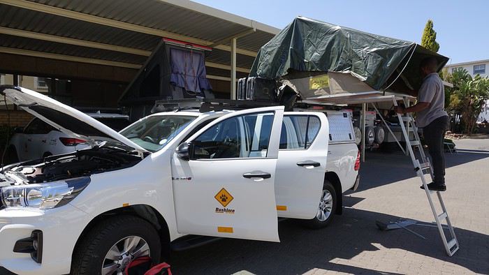
We set off toward Kgalagadi Transfrontier Park—it’s not exactly around the corner! In 1994 (when Mandela had just become President) and 2007, during our two previous trips to South Africa, we loved this park, so we couldn’t imagine going to Botswana without returning. The road was pretty monotonous, with not much to see except a few ostriches.
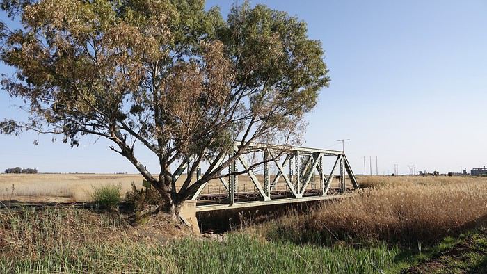
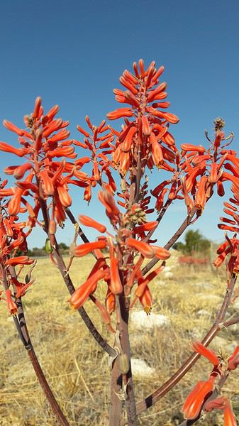
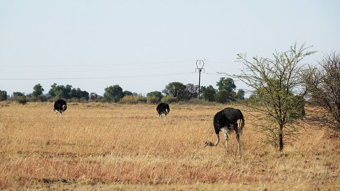
We stopped for the night in Vryburg at the Kameelboom Lodge campsite. It was a bit noisy since it’s close to the road, and the facilities weren’t great, but it was fine for one night.
14/09/2019: Johannesburg - Vryburg After months of waiting and reading other travelers’ journals, it’s finally our turn! We arrived in Johannesburg from Nantes and Paris in the morning. We looked for the Bushlore rep—we’d rented our 4x4 from them—but there was no sign with our name! « Bushlore? She’s a woman, I saw her a few minutes ago, » someone told us. A minute later, the Bushlore employee showed up: a man! 🤪 He sped onto the highway, and just 30 minutes later, we arrived at the rental place. It’s a big operation with good organization and lots of vehicles—pretty reassuring. Our 4x4 was there, a classic Toyota Hilux fully equipped for safari: rooftop tent, dual diesel tanks, 60-liter water reserve, two batteries, two spare tires, all the camping gear, plus everything needed for *désensablement* (getting unstuck from sand). Speaking of which, is it "désensablage" or "désensablement"? Best to just avoid getting stuck in the first place! 😏 Good news… or not: the vehicle was brand new, with barely 100 kilometers on the odometer. On one hand, we figured we wouldn’t have mechanical issues or a fridge breakdown, but on the other, we knew it wouldn’t be easy to return it without a single scratch. Either way, it was our first time renting a 4x4, and we were impressed.
We set off toward Kgalagadi Transfrontier Park—it’s not exactly around the corner! In 1994 (when Mandela had just become President) and 2007, during our two previous trips to South Africa, we loved this park, so we couldn’t imagine going to Botswana without returning. The road was pretty monotonous, with not much to see except a few ostriches.
We stopped for the night in Vryburg at the Kameelboom Lodge campsite. It was a bit noisy since it’s close to the road, and the facilities weren’t great, but it was fine for one night.
Hi everyone,
Well, the time to head back has come, so it’s time to share the 3 weeks we spent in Norway this year 🙂
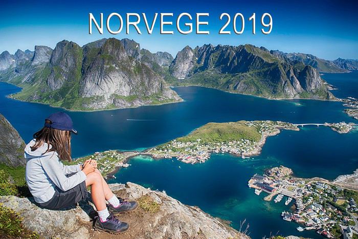
Right, here are a few details before we dive in!
Who: My husband, me, and our daughter, who turned 8 during the trip
When: From July 5 to 28, 2019—three full weeks there
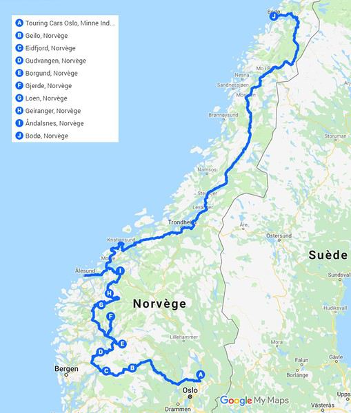
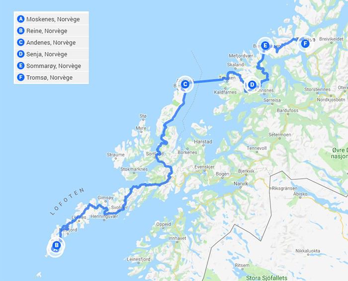
What: A one-way trip from Oslo to Tromsø, with fjords, the Lofoten Islands, and so much more on the itinerary! Since you have to make choices—and because the country is huge—we decided to skip the south around Stavanger (we thought the hikes there might be too tough for us). We also chose not to go all the way to Bergen. Our goal was to spend time in the northern islands.
The route to Bodø:
The route from Lofoten to Tromsø
How: By camper van. Even though it’s not exactly budget-friendly, it’s really the ideal way to explore this country—especially for wild camping and adapting your route based on the weather and your mood. I’d recommend it 200%. It was our first time, and we loved it. Being able to wait out a downpour in warmth or shower after a long hike was super practical!! That said, we did have a few hiccups. The auxiliary battery (which powers the back) died, so we had to find a garage to replace it. And the biggest issue: on a narrow road, I smashed the mirror while passing another camper van 🏴☠️
Budget: Oh boy, that’s a big topic! To be honest, I didn’t tally it all up… because I didn’t want to! Everything is more expensive there, obviously. At the supermarket, for example. So I didn’t keep track—this was a vacation, we weren’t there to count every cent, even if we’re not exactly rolling in money! Ferries are pretty pricey, especially with a camper van, but there’s not much choice. Lots of toll roads too. Basically, when you go there, be prepared to open your wallet!!!
The weather: We weren’t sure what to expect before leaving—or rather, we were expecting bad weather. We were pleasantly surprised: we had almost nothing but great weather, with just a bit of rain toward the end. So the hiking trails weren’t muddy (at all?). Otherwise, it would’ve been a real pain and super slippery! Temperature-wise, we were lucky. It hovered between 15 and 21°C. Sounds chilly, but honestly, with the sun, it warms up nicely, and it was enough to wear shorts and a T-shirt almost the whole time—something I didn’t expect before we left. That said, the water temperature is freezing. The Arctic Ocean lives up to its name!! We could barely keep our feet in the water, even though those turquoise beaches were so tempting!!!
A few tips for preparation:
For wild camping: Use Park4Night—the app is amazing for finding spots and sharing our discoveries. We never would’ve dared to venture down some of those roads or trails without it.
For hikes: It’s not always easy to find hikes in the fjords that are manageable in terms of elevation, difficulty, and time. We still found some through blogs and tourist office websites. But we mostly focused on hikes in the Lofoten Islands, thanks to sites like rando-lofoten, 68north, and outt. Unsurprisingly, the level is pretty challenging. But by sticking to the “easy” ones, we managed just fine without being super trained, and we saw some incredible views!
Alright, no more waiting—let’s go! Follow me!
For those who want the "moving version," check out the video here, on page 3: https://voyageforum.com/v.f?post=9817074;live=1;#9817074
Well, the time to head back has come, so it’s time to share the 3 weeks we spent in Norway this year 🙂
Right, here are a few details before we dive in!
Who: My husband, me, and our daughter, who turned 8 during the trip
When: From July 5 to 28, 2019—three full weeks there
What: A one-way trip from Oslo to Tromsø, with fjords, the Lofoten Islands, and so much more on the itinerary! Since you have to make choices—and because the country is huge—we decided to skip the south around Stavanger (we thought the hikes there might be too tough for us). We also chose not to go all the way to Bergen. Our goal was to spend time in the northern islands.
The route to Bodø:
The route from Lofoten to Tromsø
How: By camper van. Even though it’s not exactly budget-friendly, it’s really the ideal way to explore this country—especially for wild camping and adapting your route based on the weather and your mood. I’d recommend it 200%. It was our first time, and we loved it. Being able to wait out a downpour in warmth or shower after a long hike was super practical!! That said, we did have a few hiccups. The auxiliary battery (which powers the back) died, so we had to find a garage to replace it. And the biggest issue: on a narrow road, I smashed the mirror while passing another camper van 🏴☠️
Budget: Oh boy, that’s a big topic! To be honest, I didn’t tally it all up… because I didn’t want to! Everything is more expensive there, obviously. At the supermarket, for example. So I didn’t keep track—this was a vacation, we weren’t there to count every cent, even if we’re not exactly rolling in money! Ferries are pretty pricey, especially with a camper van, but there’s not much choice. Lots of toll roads too. Basically, when you go there, be prepared to open your wallet!!!
The weather: We weren’t sure what to expect before leaving—or rather, we were expecting bad weather. We were pleasantly surprised: we had almost nothing but great weather, with just a bit of rain toward the end. So the hiking trails weren’t muddy (at all?). Otherwise, it would’ve been a real pain and super slippery! Temperature-wise, we were lucky. It hovered between 15 and 21°C. Sounds chilly, but honestly, with the sun, it warms up nicely, and it was enough to wear shorts and a T-shirt almost the whole time—something I didn’t expect before we left. That said, the water temperature is freezing. The Arctic Ocean lives up to its name!! We could barely keep our feet in the water, even though those turquoise beaches were so tempting!!!
A few tips for preparation:
For wild camping: Use Park4Night—the app is amazing for finding spots and sharing our discoveries. We never would’ve dared to venture down some of those roads or trails without it.
For hikes: It’s not always easy to find hikes in the fjords that are manageable in terms of elevation, difficulty, and time. We still found some through blogs and tourist office websites. But we mostly focused on hikes in the Lofoten Islands, thanks to sites like rando-lofoten, 68north, and outt. Unsurprisingly, the level is pretty challenging. But by sticking to the “easy” ones, we managed just fine without being super trained, and we saw some incredible views!
Alright, no more waiting—let’s go! Follow me!
For those who want the "moving version," check out the video here, on page 3: https://voyageforum.com/v.f?post=9817074;live=1;#9817074
Hello,
Today is January 7th, Orthodox Christmas Day.
It’s the perfect occasion to share on VF a religious site that left a lasting impression on us.
For a long time, we’d admired photos of the Makaryevo Women’s Monastery on Russian websites. They’re always taken from cruise hydrofoils that, in season, depart from Nizhny Novgorod.
This gave us the idea for a crazy challenge: to visit the monastery during a river cruise, with our little plumber’s van that’s become the common thread of our travels!
This challenge seemed impossible to pull off.
The equation was indeed impossible to solve
1. Find a dock 2. Load the van onto a boat 3. Cross the Volga 4. Arrive at sunset 5. Sail past the monastery 6. All with no reliable information. NONE!
Incredibly, every obstacle fell into place one after another! Gifting us unforgettable moments.
The photos follow our exact journey.
1. We arrive on the southern bank of the Volga, searching for a ferry to Makaryevo. First attempt, first failure—we’re way too far east. We find a second ferry, but it serves a different town on the northern bank.
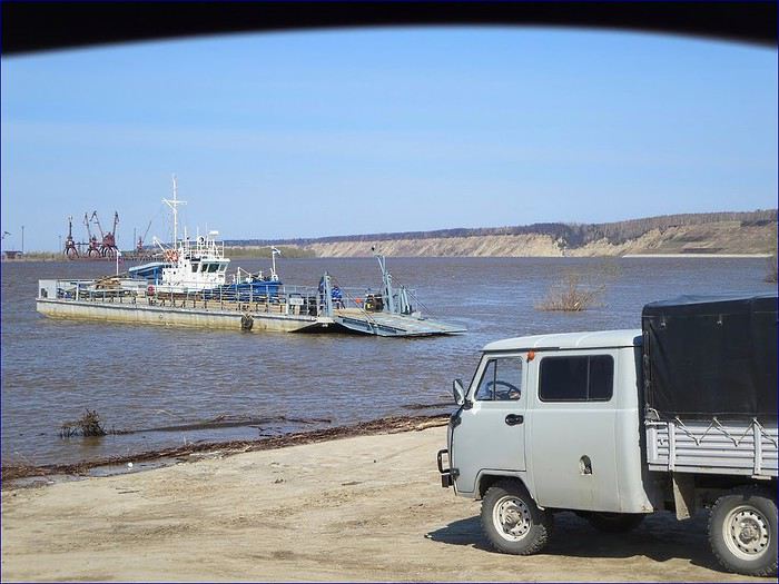
2. We keep going and meet some fishermen. But even they don’t know where to board a vehicle for the monastery.
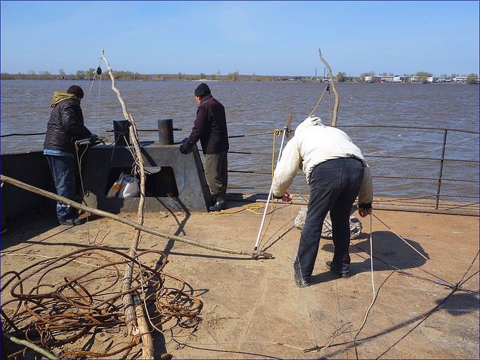
3. After several fruitless searches, a young man who speaks a few words of English points us to a dock where, in summer, boats *might* serve the monastery. Miraculously, at the end of a rough track, we find an old ferry moored. But no one’s on board, and a chain blocks the entrance.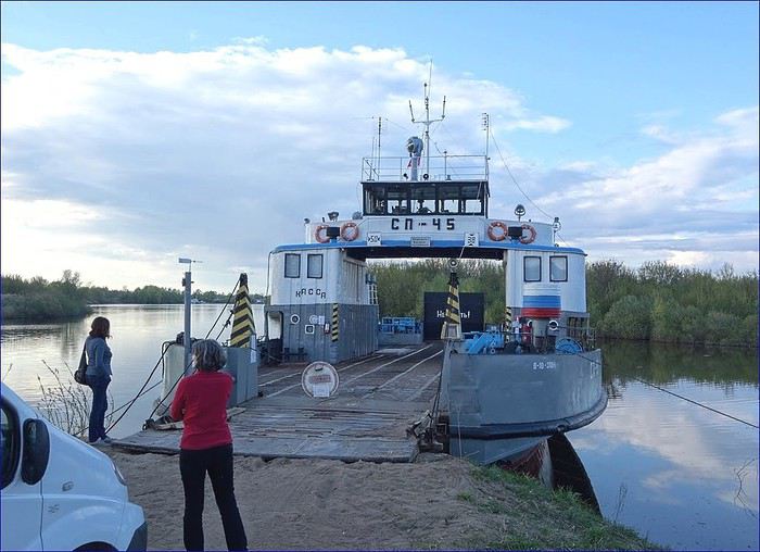 After an hour of waiting, a worker arrives and tells us they *will* cross the Volga tonight,
but the exit ramp at Makaryevo isn’t accessible for our vehicle.
The captain joins him, and seeing our disappointed faces, they confer, discuss,
and load some planks to raise the ramp!
Another miracle!
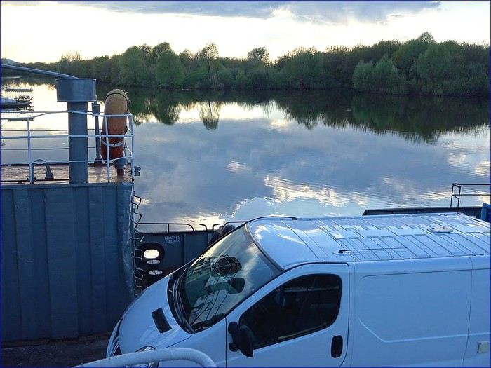
4. We board, with just one passenger accompanying us— the Trafic is the only vehicle on board.

5. The crossing was magical. And longer than expected, since the Volga here is several kilometers wide, and we’re navigating between countless islands!
6. Under a sky that gradually clears, we discover there are homes on the river— invisible from the banks—that form small communities where people get around by boat!
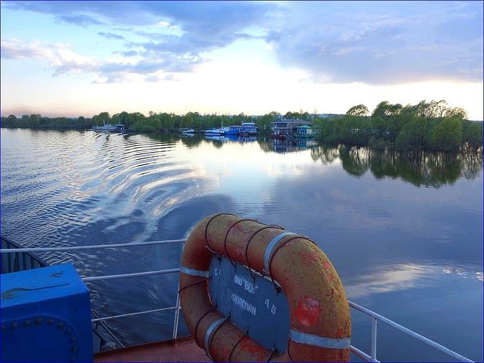
7. Then, suddenly, around a bend in the channel, the monastery appears in the distance on the northern bank.
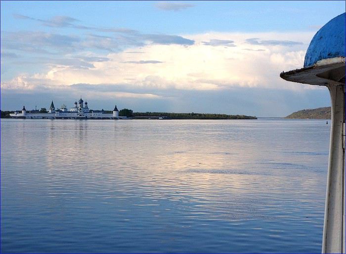
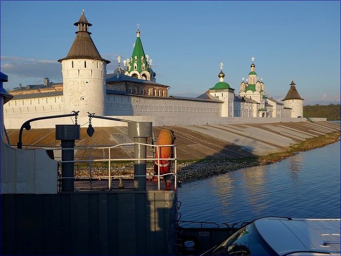
8. At the exact moment our boat rounds the buoy and nears the monastery, the sun breaks through the clouds!
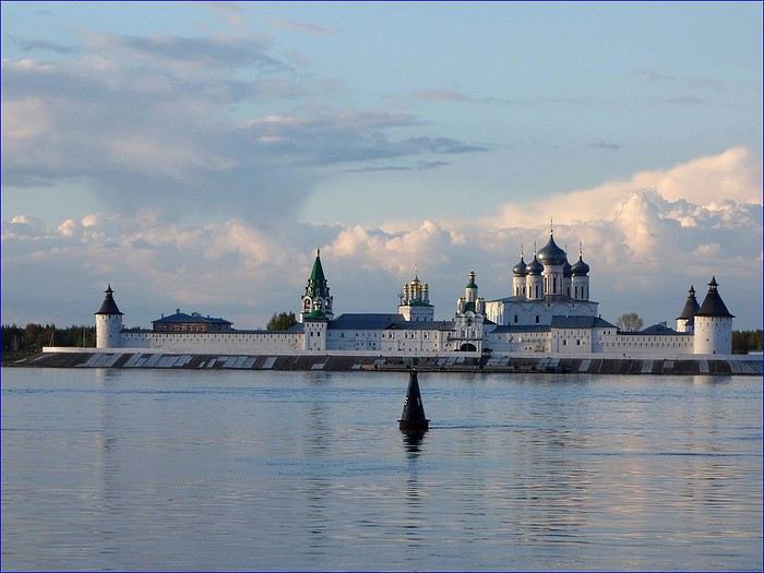
9. A breathtaking sight, with our boat gliding along the monastery walls in absolute silence.
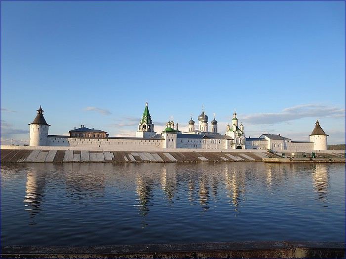
10. The sky, now a deep blue, makes the vibrant colors of the onion domes pop.
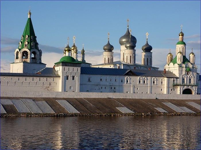
11. We sail slowly past the monastery under extraordinary light— something our little compact camera can’t fully capture.
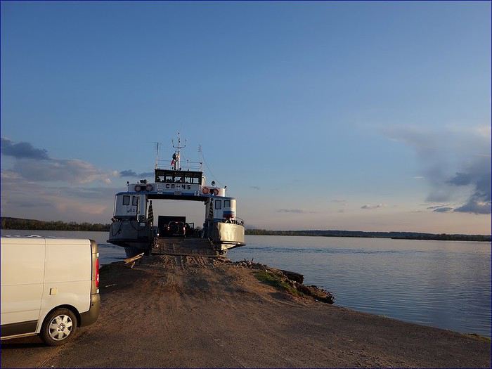
12. As promised, the captain and his crew adjust the exit ramp. You can’t tell from the photo, but even with the planks, it was a close call— the van’s chassis barely cleared the ramp. We thanked them warmly.
13. By the end of the day, the monastery is, of course, closed. But another miracle happens! It turns out the passenger who crossed with us is the mayor’s wife. When Sylvie told her we were from France, she called her husband, who immediately contacted the Mother Superior. Like in a dream, the monastery opens just for us. A nun and a guard come to meet us and take us through the chapels and gardens!
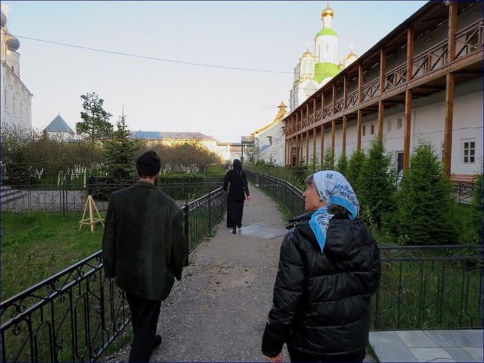
14. A visit all the more intimate since only the silent nuns, deep in prayer, are present in these sacred spaces.
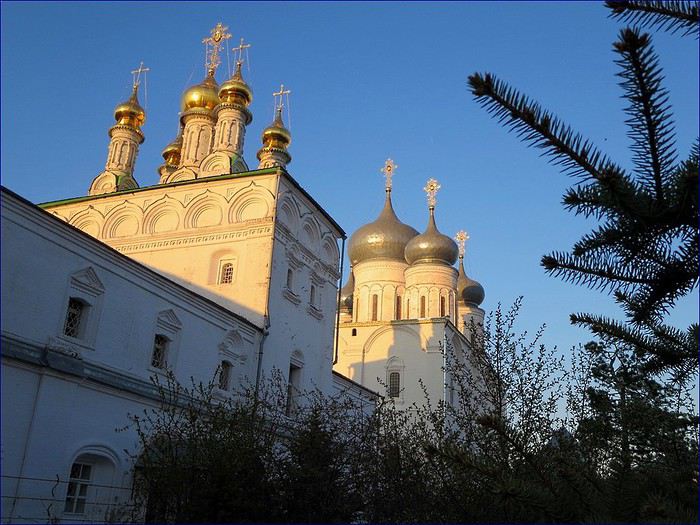
15. After dinner in our little van, we enjoy the exceptional light illuminating the now-closed monastery. We’re the only visitors, and the site feels like a massive ship anchored on the Volga.
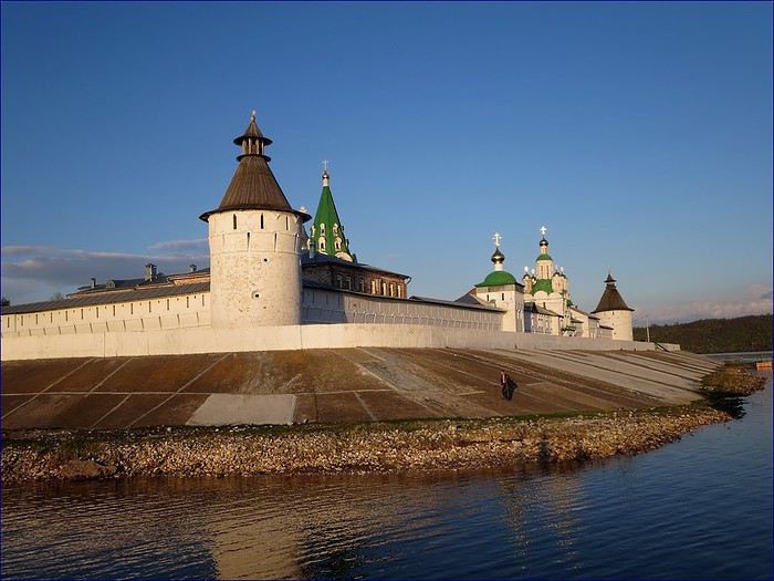
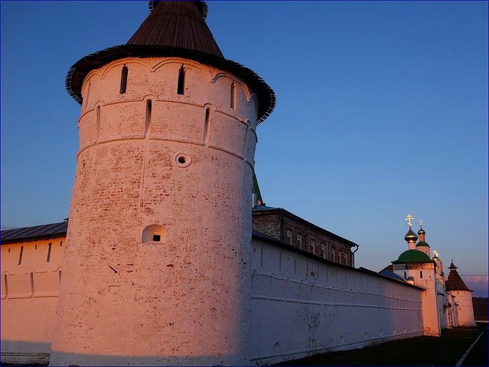
16. The setting sun now bathes the monastery walls in gorgeous pink hues!
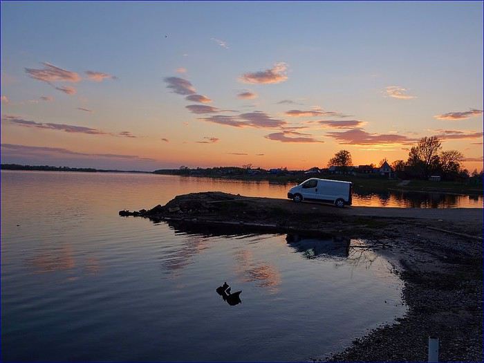
17. Gradually, the legendary Volga itself takes on magical colors! For the night, I’ll just back the van up to level it. It’ll take us a while to fall asleep after such intense moments.
18. Just as inexplicably, the magic continues the next morning! Seeing I’m struggling with my knee, the guard lets us drive slowly along the monastery’s perimeter path. So there we are at dawn, solitary wanderers between the Volga and the monastery walls.
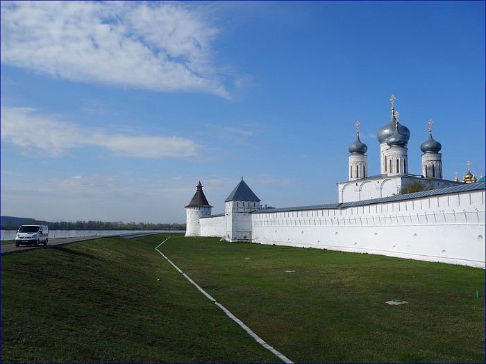
19. The morning light now illuminates the monastery’s eastern façade, which we hadn’t admired yesterday. An exceptional moment.
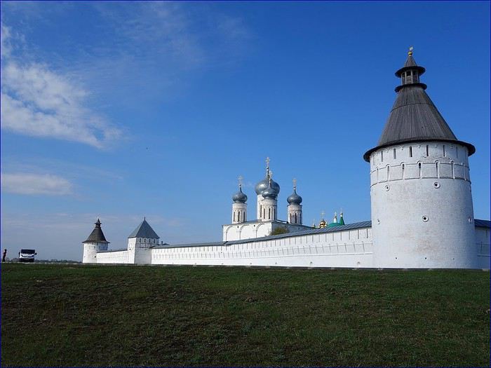
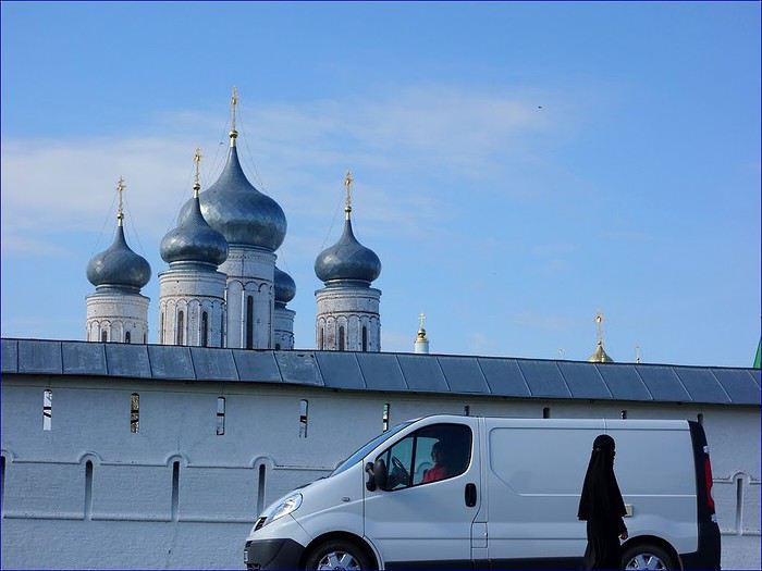
20. Even more impressive when we realize we’re on the nuns’ prayer path. We cross paths with them—tall, silent, black-clad figures, fully covered.
We leave Makaryevo with regret, following the Volga toward Kostroma on the Golden Ring. That’s about all there is to add.
We’ve already taken three long trips through Russia in our little van. The travel journals are shared in the link in our signature.
Best regards, Sylvie & Bernard
Today is January 7th, Orthodox Christmas Day.
It’s the perfect occasion to share on VF a religious site that left a lasting impression on us.
For a long time, we’d admired photos of the Makaryevo Women’s Monastery on Russian websites. They’re always taken from cruise hydrofoils that, in season, depart from Nizhny Novgorod.
This gave us the idea for a crazy challenge: to visit the monastery during a river cruise, with our little plumber’s van that’s become the common thread of our travels!
This challenge seemed impossible to pull off.
The equation was indeed impossible to solve
1. Find a dock 2. Load the van onto a boat 3. Cross the Volga 4. Arrive at sunset 5. Sail past the monastery 6. All with no reliable information. NONE!
Incredibly, every obstacle fell into place one after another! Gifting us unforgettable moments.
The photos follow our exact journey.
1. We arrive on the southern bank of the Volga, searching for a ferry to Makaryevo. First attempt, first failure—we’re way too far east. We find a second ferry, but it serves a different town on the northern bank.
2. We keep going and meet some fishermen. But even they don’t know where to board a vehicle for the monastery.
3. After several fruitless searches, a young man who speaks a few words of English points us to a dock where, in summer, boats *might* serve the monastery. Miraculously, at the end of a rough track, we find an old ferry moored. But no one’s on board, and a chain blocks the entrance.
After an hour of waiting, a worker arrives and tells us they *will* cross the Volga tonight,
but the exit ramp at Makaryevo isn’t accessible for our vehicle.
The captain joins him, and seeing our disappointed faces, they confer, discuss,
and load some planks to raise the ramp!Another miracle!
4. We board, with just one passenger accompanying us— the Trafic is the only vehicle on board.
5. The crossing was magical. And longer than expected, since the Volga here is several kilometers wide, and we’re navigating between countless islands!
6. Under a sky that gradually clears, we discover there are homes on the river— invisible from the banks—that form small communities where people get around by boat!
7. Then, suddenly, around a bend in the channel, the monastery appears in the distance on the northern bank.
8. At the exact moment our boat rounds the buoy and nears the monastery, the sun breaks through the clouds!
9. A breathtaking sight, with our boat gliding along the monastery walls in absolute silence.
10. The sky, now a deep blue, makes the vibrant colors of the onion domes pop.
11. We sail slowly past the monastery under extraordinary light— something our little compact camera can’t fully capture.
12. As promised, the captain and his crew adjust the exit ramp. You can’t tell from the photo, but even with the planks, it was a close call— the van’s chassis barely cleared the ramp. We thanked them warmly.
13. By the end of the day, the monastery is, of course, closed. But another miracle happens! It turns out the passenger who crossed with us is the mayor’s wife. When Sylvie told her we were from France, she called her husband, who immediately contacted the Mother Superior. Like in a dream, the monastery opens just for us. A nun and a guard come to meet us and take us through the chapels and gardens!
14. A visit all the more intimate since only the silent nuns, deep in prayer, are present in these sacred spaces.
15. After dinner in our little van, we enjoy the exceptional light illuminating the now-closed monastery. We’re the only visitors, and the site feels like a massive ship anchored on the Volga.
16. The setting sun now bathes the monastery walls in gorgeous pink hues!
17. Gradually, the legendary Volga itself takes on magical colors! For the night, I’ll just back the van up to level it. It’ll take us a while to fall asleep after such intense moments.
18. Just as inexplicably, the magic continues the next morning! Seeing I’m struggling with my knee, the guard lets us drive slowly along the monastery’s perimeter path. So there we are at dawn, solitary wanderers between the Volga and the monastery walls.
19. The morning light now illuminates the monastery’s eastern façade, which we hadn’t admired yesterday. An exceptional moment.
20. Even more impressive when we realize we’re on the nuns’ prayer path. We cross paths with them—tall, silent, black-clad figures, fully covered.
We leave Makaryevo with regret, following the Volga toward Kostroma on the Golden Ring. That’s about all there is to add.
We’ve already taken three long trips through Russia in our little van. The travel journals are shared in the link in our signature.
Best regards, Sylvie & Bernard
This trip is a more budget-friendly—and shorter—alternative to the 14-day Aranui 5 cruise, which includes a few days at sea and a detour to Bora Bora in the Leeward Islands on the way back. The advantage of the cruise is that it lets you see and visit (though far too quickly) the two islands of Tahuata and Fatu Hiva, which don’t have airports. By plane, you’ll only be able to land on 4 of the 6 islands. However, Tahuata is accessible from Hiva Oa via a day trip (or two-day trip) shuttle. Plan for two extra days in your total time dedicated to the Marquesas Islands (called *Fenua Enata* in Marquesan language).
Our itinerary is perfect for those who aren’t excited by cruises and prefer to get closer to the local communities. This 9-day trip cost us around 2500 € all-inclusive. For a 14-day cruise on the Aranui, expect to pay 2300 € per person for a basic cabin for four, or 3800 € per person for a superior double cabin.
Air Tahiti offers a 4-island Marquesas Pass (Nuku Hiva, Ua Pou, Ua Huka, and Hiva Oa) for 86,000 XPF (about 700 €). The journey is made on an ATR 72 from Tahiti to Nuku Hiva or Hiva Oa, and on a 19-seat Twin Otter between the islands (often only 13 or 15 seats are available due to cargo, so book well in advance). We’re traveling as a couple. We booked our family-run guesthouse stays at the Tourism Fair in early February, where you can meet the owners and make your choice. Stays are almost always half-board or breakfast-only. Transfers are usually included, but you can always book a car or taxi.
**NUKU HIVA**
**A LITTLE GEOGRAPHY** Nuku Hiva (NH) is located about 1,500 km from Tahiti, in the north of French Polynesia. At 387 km², it’s the second-largest island in French Polynesia after Tahiti. It was formed by incredible volcanic phenomena and cataclysms between 1 and 6 million years ago, which lifted the island thousands of meters above the sea. Even after millennia of slow erosion, collapses, and settling, NH remains the most majestic of the Marquesas, with its sheer cliffs, deep valleys featuring immense waterfalls, and black walls that were once the inner walls of enormous volcanoes.
**A LITTLE HISTORY** The first contact between NH’s inhabitants and Europeans was in 1595 with Spanish navigators who only stayed briefly. It wasn’t until the late 18th century that Europeans arrived in greater numbers on NH (and the other Marquesas Islands), disrupting a very fragile social and cultural balance. It’s believed that nearly 100,000 people lived on Nuku Hiva at that time—a population decimated over the decades by epidemics, diseases brought by Europeans, and alcohol used for barter. The disastrous result: by the 1930s, only 2,500 people remained, having largely lost their identity and living in poverty. Today, the island has about 2,600 inhabitants spread across several villages, with Taiohae as the main one.
**NUKU HIVA IN LITERATURE**
1 / One of the famous writers who visited NH and stayed there was Herman Melville, who arrived in July 1842, the author of *Moby Dick*. The island had just come under French protectorate. Seduced by the enchanting *vahinés* and dazzled by his paradisiacal vision of the place, Melville deserted his ship. He ended up a prisoner of a local tribe, the Taipi, in Taipivai, where he stayed for a month and a half until an Australian ship captain secured his release in exchange for a musket and a roll of cotton fabric! Melville wrote a novel about this tumultuous episode in his life, considered a classic of travel literature. The book, *Typee: A Peep at Polynesian Life*, published in 1846 in the United States, was a huge success.
2 / Another famous Scottish writer, Robert Louis Stevenson, arrived in NH aboard a yacht that anchored in Anaho Bay, the island’s most beautiful, in July 1888. Stevenson was already known for two magnificent novels that marked their era: *Treasure Island* and *Dr. Jekyll & Mr. Hyde*. Stevenson, too, was captivated by the island’s natural beauty, though he also noted the devastating decline in identity, socio-cultural life, and physical health of a population ravaged by disease and alcohol. His account of his stay, *In the South Seas: An Account of Experiences and Observations in the Marquesas, Paumotus, and Gilbert Islands During Two Cruises on the Yacht Casco (1888) and the Schooner Equator (1889)*, was published in 1896 in New York, four years after his death in Apia, Western Samoa, where he had settled. It was also published in London in 1900.
3 / In August 1903, Victor Segalen, a French naval doctor, ethnologist, and archaeologist, landed in NH from the ship *La Durance*, sent to Polynesia to recover the possessions of the painter Paul Gauguin, who had died in April of that year. He, too, was enthralled by the Marquesas but lamented the loss of identity, dignity, and pride of the Māori, alienated by a Christianization that destroyed their culture and customs, denied their gods, and erased their past. He wrote about his experience, doubts, and fears in *Les Immémoriaux*.
4 / In December 1907, Jack London arrived in NH aboard the sailboat *Stark*, following in the footsteps of his illustrious predecessor, Herman Melville. London was in poor physical condition, exhausted from his relentless travels that had taken him from the Klondike in Canada to Japan, Australia, and London in Europe. He was appalled and shocked by Nuku Hiva’s degraded health situation: where Melville had encountered over 2,000 vigorous and healthy Marquesan warriors, London found only 12 suffering from various diseases—the rest had been wiped out by tuberculosis! His approach remained humanistic, and he maintained a sharp geopolitical awareness of these traditional Polynesian cultures, weakened by the inexorable advance of modernity in the early 20th century. He continued his journey to the Tuamotu Islands and Tahiti, publishing *Martin Eden*, the moving account of his initiatory voyage in the South Pacific, in 1911.
5 / Finally, Alain Gerbault, a writer, linguist, ethnologist, and tireless traveler, arrived in the Marquesas via the Panama Canal in December 1933. He was completely exhausted after an endless crossing on a small sailboat, the *Firecrest*. Enthralled by his stay in the Marquesas, he continued to the Tuamotu Islands in 1934, then Tahiti in 1935. Gerbault fought for the preservation of traditions, as well as the songs and dances banned by the Churches and the French Administration (these bans lasted over 50 years, mind you...!!!). Bora Bora remained his favorite island. A staunch Pétainist during World War II, he was forced to flee Bora Bora for Samoa, then Tonga, and finally Timor, a half-Portuguese island and thus neutral during the war. His travel accounts, *In Pursuit of the Sun: Logbook from New York to Tahiti* and *A Paradise Is Dying*, were published in the late 1940s. He died in Timor in 1941, and his ashes were repatriated to Bora Bora.
Back to our trip and stay.
**Day 1: April 27**
Departure from Papeete at 6:30 AM—we had to wake up two hours earlier and reach the airport in the dark. Takeoff at dawn, good weather en route, flight duration: 4 hours.
Arrival around 10:30 AM in Nuku Hiva, the first stop of this trip. We booked two nights in half-board at Pension Koku’u, transfers included. Maybe not such a great idea, those included transfers, especially on this unique island where the airport is located on *Terre Déserte*, on the other side of the mountain, opposite and about 45 km from the main village of Taiohae. They’re charged at a steep price. Expect 6,000 XPF round-trip by taxi, but 15,000 XPF charged by guesthouses or hotels. The difference is notable. It wasn’t the best idea, but we can’t go back. Even for residents like us who know how to travel in Polynesia, the Air Tahiti employee who sold me the Pass couldn’t give any useful advice about the stay itself—probably because he’d never been to the Marquesas. It’s really annoying! In short, the good idea to remember is renting a car (like a Suzuki) to be free to manage your time and stop at leisure. The road signage is a bit basic, but you’ll manage just fine. Our host Alvane waits for us—without a sign (sic!)—and after searching for each other for 5 minutes, we’re off on a journey of over an hour (with photo stops) in a Land Rover with smooth tires (luckily, it’s not raining!). The recently paved and marked mountain road is impeccable. No time to catch our breath at the guesthouse; we leave immediately (not a great idea after waking up at dawn plus 4 hours on a plane) for a half-day hike that was also included in the prepaid stay. A sandwich was provided (really pathetic for the physical effort required), we have water, and we fill a few bottles at the spring near the ceremonial site of Taipivai, our first stop. Then the hike begins in the Hanaheu Valley, descending toward Anaho Bay and its namesake beach. A magnificent and wild spot, a few sailboats anchored, we swim—the water is really warm, over 30°C at the shore. That warm is rare and not necessarily pleasant. We then have to climb a very steep slope; this hike is actually quite tough. The air is still, humid, and stifling under the foliage, there’s a bit of mud, and tiny ants (which don’t bite, I’ll have you know), locally called *fofolles*, running over shoes, ankles, and calves. Not very pleasant...! On top of that, there are mosquitoes to protect against! In hindsight, it seems wise to bring energy bars from Papeete if you plan to hike on the afternoon of your arrival day. We weren’t careful... Result: a moment of weakness for me and a hyperventilation attack climbing back up from Anaho Bay!!! We return to the guesthouse at night. There we find Claudine and her four children—Marquesan-style atmosphere, friendly and casual. We share family life. Very simple room with a bathroom, no mosquitoes, we can sleep with the window open, but the night will be noisy, as is often the case in Polynesia. Roosters are everywhere and don’t sleep, dogs bark or whine. So we end up waking up early... like everyone else.
**Day 2: April 28**
We booked a full-day excursion with Thierry: it starts with a 45-minute boat ride to reach Hakatea Beach, hidden in a small secret bay like many along Nuku Hiva’s coasts. From there, the hike lasts all day—11 km round-trip on flat but also rugged terrain (ancient paved and elevated paths over 1,000 years old)—and river crossings. Bring the right shoes (like plastic Crocs with high socks—not very stylish but practical). We cross the former village of Hakaui, walk along the foundations of dwellings, and there are still weathered tikis in the lush vegetation. The ultimate goal of this hike is to reach the tall Vaipo waterfall. The place is magical, with openings in the vegetation and immense trees allowing photos of the treetops and caves where funeral canoes containing the bones of chiefs or great warriors were once placed. We return the same way to the beach and take another boat ride to reach Taihoae’s port. Back at the guesthouse after a glimpse of Taihoae’s waterfront.
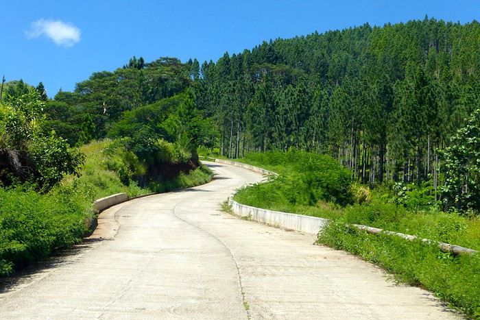
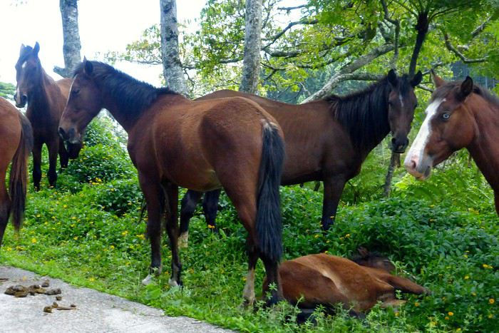
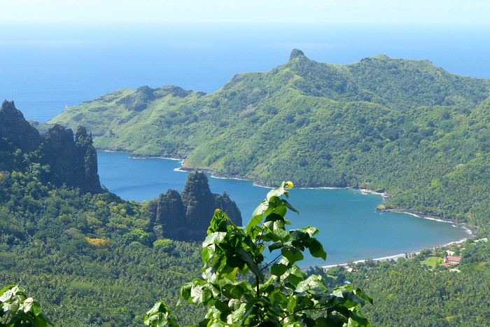
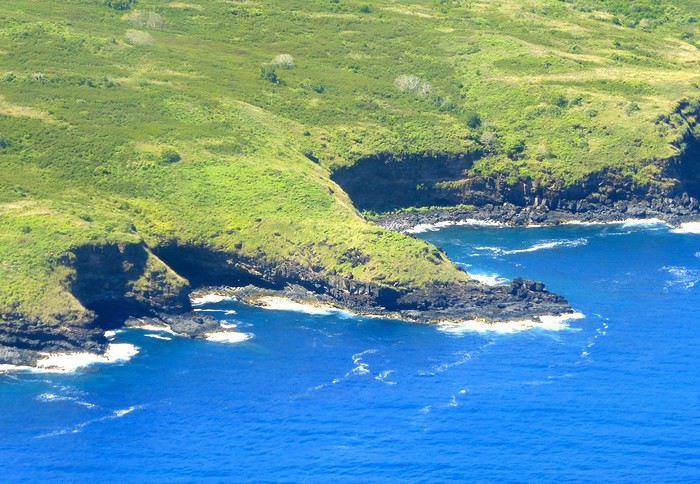
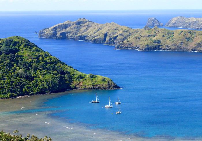
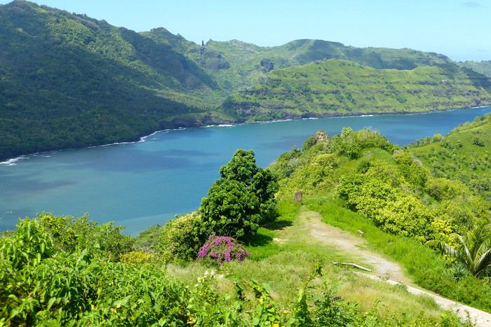
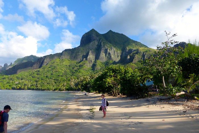
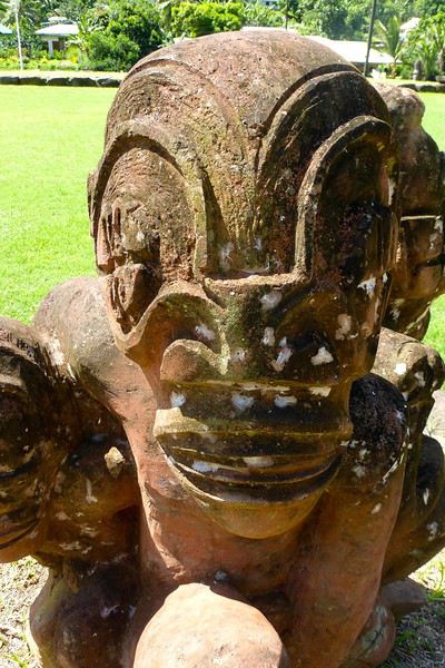
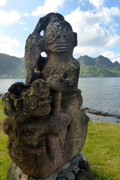
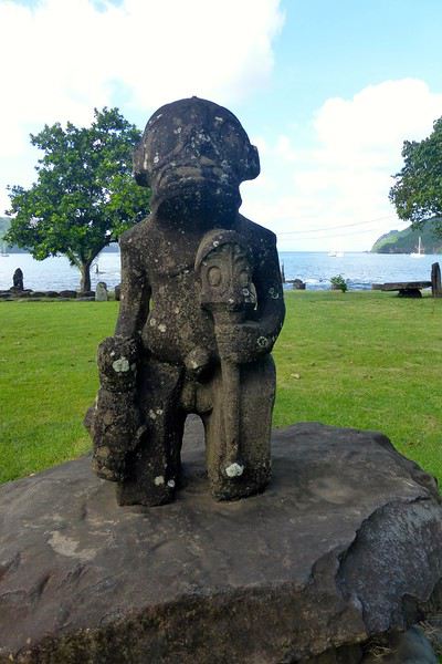
**UA POU**
**Day 3: April 29**
Back to the airport in the late morning for the second flight of the trip to Ua Pou. 20-minute crossing in a Twin Otter (18 seats but only 13 occupied due to cargo between the islands). Beautiful weather, blue sea, nice photos to take upon departure from NH and arrival in UP. We’re greeted by Jérôme, a former military man turned tourism professional, who runs Pension Pukue’e with his wife Elisa, a native of UP. We’re in for two exceptional days. The guesthouse is comfortable, Jérôme and Elisa are very professional and pleasant. Jérôme is also a professional hiker, and Elisa is an excellent cook. We leave quickly for a half-day excursion to Hohoi, after a stop at the archaeological, cultural, and religious site of Maui’a, the Tavaka tribe’s territory. Jérôme is there to explain how Marquesan society functioned at the time and the events that took place on a site still largely buried under vegetation. Then we visit a flower-stone sculptor he knows—the only place in the Marquesas where you’ll find these stones. They’re collected in the river flowing into the sea at Hohoi, sometimes on the beach itself. Back to the guesthouse.
**Day 4: April 30**
A nature hike in the mountains—moderately difficult—toward the Vaiea waterfall is on our program for a good 4 hours. It’s hot, there are mosquitoes, and the dip in the pool under the waterfall (24°C water) is a rare pleasure. Lunch at a friend of Jérôme’s, a former chef for French minister François Fillon, who prepares delicious food. Elisa picks us up by car to return to the guesthouse. Ua Pou is a beautiful and elegant island with its sharp peaks and wild nature. Our favorite, thanks to Jérôme and his wife.
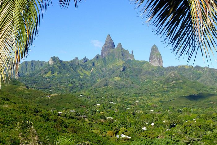
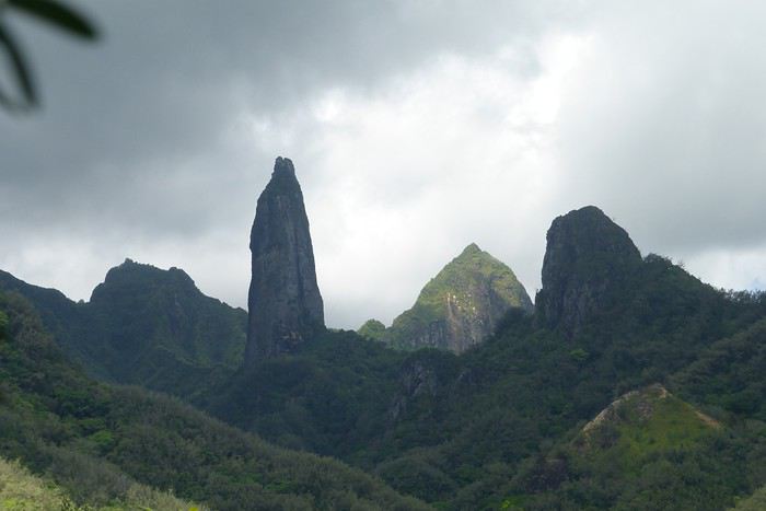
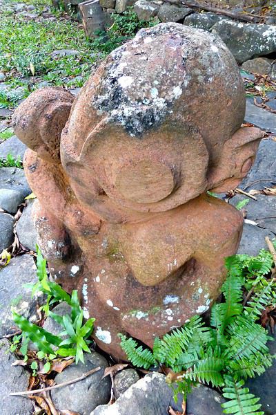
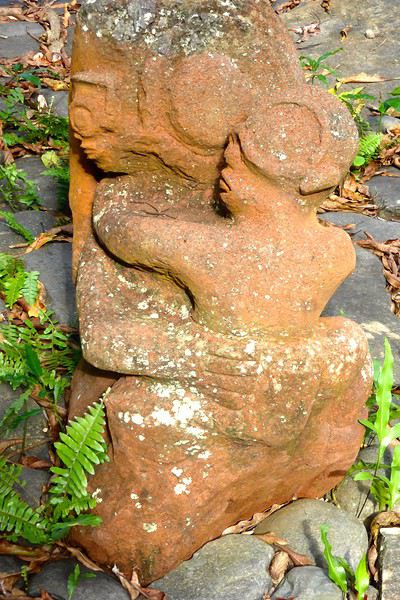
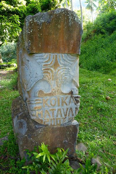
**UA HUKA**
**Day 4: May 1**
Departure for Ua Huka, the smallest inhabited island in the northern group of the Marquesas, located about 1,300 km northeast of Tahiti. Landing is at the oldest airfield in the Marquesas, built in 1972, between the villages of Vaipaee and Hane. Ua Huka has about 680 inhabitants, according to the last census, spread across 3 villages (since the 1870s): Vaipaee, Hane, and Hokatu. The island peaks at Mount Hitikau at only 884 meters. Its origin: a Hawaiian-type shield volcano that—over a few million years—collapsed to become a caldera (or elliptical depression) in which two small volcanoes appeared, the craters of Tahoatikiau and Teepoepo, now part of the Vaikivi Park. The island is rugged and wild, lower than the others, so less cloud-covered and drier. The bays are jagged, the coastline in ochre tones above the intense blue of the sea, and the beaches are constantly disturbed by the powerful surf. The village of Hokatu is only a few kilometers away (just 14 km of road on the island), but Maurice, our host, drives slowly, and it takes time to go up and down. The road is entirely paved or concreted, which isn’t the case on Ua Pou, for example. The guesthouse is disappointing, perched above the village and thus isolated. Beautiful view of the famous Hane motu and the sparkling sea under the bright sun. Apart from that, there are mosquitoes and cockroaches, the bungalow isn’t clean. Meals are taken with Maurice and Delphine in the village—fine dining isn’t on the menu! Ouch!!! We didn’t luck out...
**Day 5: May 2**
Early in the morning, after breakfast, Delphine takes us to the craft center, which turns out to be a letdown—the items for sale are, in my opinion, crude and poorly carved. Nothing like what’s offered at the Marquesas Fair, held twice a year in Papeete, where you can admire and buy small wonders: wood carvings, flower stone, and coral. Delphine is disappointed we’re not interested, and it shows... She’s a bit sulky! These are items meant for Aranui cruise passengers who land on Ua Huka once every two weeks... Solo travelers like us don’t seem to interest her much. The rest of the day—spent with Maurice—is dedicated to visiting cultural centers and small museums, like the Sea Museum in Hane with its ancient canoes, the municipal archaeological museum on the Te Tumu site above the airfield, the petroglyph house near Hokatu Beach, and finally the Papuakeikaraa arboretum, which gathers endemic plants from all over Polynesia and an impressive citrus collection. No excursion planned to Vaikivi Park, toward the previously mentioned craters that recall the island’s volcanic past. Also missing are the viewpoints, the unique endemic vegetation, and especially the petroglyphs. Too bad... at that price!!! Still, in the evening, we go fishing—with sandwiches and drinks in coolers—with other villagers from the dock at the end of the paved road. It’s cool, windy, no mosquitoes, lots of fish caught, and a great atmosphere. Plus, magnificently starry skies.
Ua Huka is one of the rare islands not invaded by the black rat, which has preserved its birdlife, particularly the ultramarine lorikeet (or *pihiti* in Marquesan), which feeds almost exclusively on flower nectar (banana, coconut, hibiscus, mango, guava trees). A dog imported from New Zealand has been specially trained to detect rats: it inspects cargo unloaded from boats and the docks.
I recommend spending two full days on the island—one for visiting the various museums, the other for hiking in the island’s center park, where the archaeological sites are in their raw state: foundations of agricultural terrace walls, gathering places (or *tohua*), dwelling pavements (or *paepae*), sacred sites (or *me’ae* in Marquesan, *marae* in Tahitian) with their tikis and petroglyphs.
To finish, a bit of info on the island’s name, tied to Marquesan oral culture: according to the legend of the creation of the six Marquesas Islands, Ua Huka is the one that puts the finishing touch on the construction of the god Oatea’s house, each island having a defined architectural function. Ua Huka represents the hole (*ua*) where the god deposits what’s left (*huka* in Marquesan) of the unused materials during construction.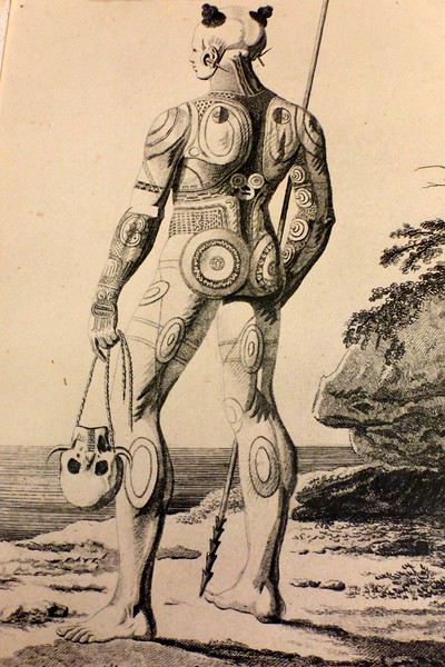
**HIVA OA**
**Day 6: May 3**
Departure in the late morning for Hiva Oa. Maurice—who had other things to do—dropped us off at the airfield 3 hours early... so this stop is a bit of a flop, even if we decided to stay positive! Hiva Oa is the third-largest island in French Polynesia after Tahiti and Nuku Hiva, and before Raiatea in the Leeward Islands. The island is beautiful, lush, verdant, and jagged. The mountains soar into the sky, the sea views are grand, the light is sublime—we’re lucky. Beautiful weather. Tania from Pension Kanahau waits for us at the airport. We’re in for two wonderful days with her. Tania is welcoming, smiling, and dynamic. What a pleasure to be with her, at her place—she cooks divinely and serves the best tuna in the world (the Big Eye reserved for the Japanese) and croquettes made with lobster, shrimp, and crab with breadfruit cubes, for example. Comfortable bungalow, no mosquitoes at night, we can sleep with the window open. It’s fantastic! After settling in, Tania takes us to town in Atuona, a pleasant and well-laid-out little village. We start with lunch—a delicious raw fish in coconut milk—then continue with the must-see attractions: the Catholic cemetery where Paul Gauguin and Jacques Brel’s graves are, overlooking the town; the abandoned Protestant cemetery, reclaimed by the bush, with impressive Marquesan warrior tombs made of huge coral slabs and adorned with a tiki head (harder to find, as no one goes there... ask for directions!); the craft center; the Gauguin Museum (and the Jacques Brel Museum); and the waterfront. While we stroll peacefully, Tania organizes an excursion for the next day, May 4, a full day with Pifa O’Connor, a 36-year-old who knows his island inside out, is passionate about local history, and with whom we’ll hit it off.
**Day 7: May 4**
Pifa arrives at 8 AM sharp at the guesthouse, and we immediately buy sandwiches and water at a small supermarket in Atuona. First, we make a brief stop by the roadside at an unmarked spot, from which we descend a small path through dense vegetation leading to the famous smiling tiki—the only one of its kind in the Marquesas and Polynesia. The place is improbable, the tiki isn’t huge, but it’s beautiful and impressive. Then we’re off on the road that, dizzyingly, runs along and overlooks the island’s northern coast, at the edge of the ancient volcano. Few vehicles pass, the road—now a rocky track—is full of potholes, and we proceed slowly. (Note that this road has been fully paved since 2018.) The panoramas are majestic, with every shade of green against the blue sea. We stop again at the top of a cliff adorned with a huge stone, the *sacrifice stone*, from which young virgin girls were once thrown into the sea to appease angry gods. Another pause for lunch this time, at a small restaurant near the exceptional archaeological site of Puamau. We’ll experience the highlights of this trip during this excursion with our guide, Pifa, who spares no explanations. We discover, on a vast esplanade, the ceremonial complexes of Ta’a Oa and Meae Te I’Ipona, the latter featuring superb tikis, particularly the reclining tiki—or *Maki Taua Pepe*—representing Motherhood, a woman giving birth in a squatting position, as was often the case in many civilizations. Also notable is the *Takaii*, the largest tiki recorded in Polynesia to date. There’s also a huge stone with a now-blunt edge, on which the circumcision of chiefs’ and notables’ pre-adolescent sons was performed. A tough ordeal! But that’s not all! It seems there are more on the mountainside rising steeply behind the archaeological site—overturned tikis, platforms, and, apparently, a giant tiki at the top, which must have fallen but was visible from afar on the sea 30 or 40 years ago, according to the island’s elders. This meeting, worship, and living place—it was actually a small town—is immense. Thousands of people once lived in this part of the island. The site—a religious, social, and cultural sanctuary—would be the size of the largest Mayan sites in Yucatán, but the few concerned owners—two or three families who own the mountainside—don’t want to hear about intensive clearing or tree cutting for now. UNESCO rightly asks for some compliance efforts to grant special treatment to Hiva Oa in particular and the Marquesas in general. We’re not there yet, unfortunately, due to insurmountable local rigidities! This kind of attitude is quite typical in Polynesia: people are afraid to uncover *marae* buried under vegetation—they’re taboo and sometimes said to emit negative and deadly waves, so it’s better not to disturb or anger the ancient spirits or gods who might take revenge. The old religion is never far away in Polynesia, despite the successes of the missionaries.
We return to the guesthouse in the late afternoon. Last night in the Marquesas with Tania, who prepares a fine and delicious meal. Note that dinner costs 2,500 XPF per person.
**Day 8: May 5**
We take the plane as planned, via Nuku Hiva (short stopover). Arrival on time in Papeete.
May this travel journal inspire many of you to visit the Marquesas one day. It’s far, it’s expensive, it’s the trip of a lifetime—it’s unforgettable and unmissable.
Our itinerary is perfect for those who aren’t excited by cruises and prefer to get closer to the local communities. This 9-day trip cost us around 2500 € all-inclusive. For a 14-day cruise on the Aranui, expect to pay 2300 € per person for a basic cabin for four, or 3800 € per person for a superior double cabin.
Air Tahiti offers a 4-island Marquesas Pass (Nuku Hiva, Ua Pou, Ua Huka, and Hiva Oa) for 86,000 XPF (about 700 €). The journey is made on an ATR 72 from Tahiti to Nuku Hiva or Hiva Oa, and on a 19-seat Twin Otter between the islands (often only 13 or 15 seats are available due to cargo, so book well in advance). We’re traveling as a couple. We booked our family-run guesthouse stays at the Tourism Fair in early February, where you can meet the owners and make your choice. Stays are almost always half-board or breakfast-only. Transfers are usually included, but you can always book a car or taxi.
**NUKU HIVA**
**A LITTLE GEOGRAPHY** Nuku Hiva (NH) is located about 1,500 km from Tahiti, in the north of French Polynesia. At 387 km², it’s the second-largest island in French Polynesia after Tahiti. It was formed by incredible volcanic phenomena and cataclysms between 1 and 6 million years ago, which lifted the island thousands of meters above the sea. Even after millennia of slow erosion, collapses, and settling, NH remains the most majestic of the Marquesas, with its sheer cliffs, deep valleys featuring immense waterfalls, and black walls that were once the inner walls of enormous volcanoes.
**A LITTLE HISTORY** The first contact between NH’s inhabitants and Europeans was in 1595 with Spanish navigators who only stayed briefly. It wasn’t until the late 18th century that Europeans arrived in greater numbers on NH (and the other Marquesas Islands), disrupting a very fragile social and cultural balance. It’s believed that nearly 100,000 people lived on Nuku Hiva at that time—a population decimated over the decades by epidemics, diseases brought by Europeans, and alcohol used for barter. The disastrous result: by the 1930s, only 2,500 people remained, having largely lost their identity and living in poverty. Today, the island has about 2,600 inhabitants spread across several villages, with Taiohae as the main one.
**NUKU HIVA IN LITERATURE**
1 / One of the famous writers who visited NH and stayed there was Herman Melville, who arrived in July 1842, the author of *Moby Dick*. The island had just come under French protectorate. Seduced by the enchanting *vahinés* and dazzled by his paradisiacal vision of the place, Melville deserted his ship. He ended up a prisoner of a local tribe, the Taipi, in Taipivai, where he stayed for a month and a half until an Australian ship captain secured his release in exchange for a musket and a roll of cotton fabric! Melville wrote a novel about this tumultuous episode in his life, considered a classic of travel literature. The book, *Typee: A Peep at Polynesian Life*, published in 1846 in the United States, was a huge success.
2 / Another famous Scottish writer, Robert Louis Stevenson, arrived in NH aboard a yacht that anchored in Anaho Bay, the island’s most beautiful, in July 1888. Stevenson was already known for two magnificent novels that marked their era: *Treasure Island* and *Dr. Jekyll & Mr. Hyde*. Stevenson, too, was captivated by the island’s natural beauty, though he also noted the devastating decline in identity, socio-cultural life, and physical health of a population ravaged by disease and alcohol. His account of his stay, *In the South Seas: An Account of Experiences and Observations in the Marquesas, Paumotus, and Gilbert Islands During Two Cruises on the Yacht Casco (1888) and the Schooner Equator (1889)*, was published in 1896 in New York, four years after his death in Apia, Western Samoa, where he had settled. It was also published in London in 1900.
3 / In August 1903, Victor Segalen, a French naval doctor, ethnologist, and archaeologist, landed in NH from the ship *La Durance*, sent to Polynesia to recover the possessions of the painter Paul Gauguin, who had died in April of that year. He, too, was enthralled by the Marquesas but lamented the loss of identity, dignity, and pride of the Māori, alienated by a Christianization that destroyed their culture and customs, denied their gods, and erased their past. He wrote about his experience, doubts, and fears in *Les Immémoriaux*.
4 / In December 1907, Jack London arrived in NH aboard the sailboat *Stark*, following in the footsteps of his illustrious predecessor, Herman Melville. London was in poor physical condition, exhausted from his relentless travels that had taken him from the Klondike in Canada to Japan, Australia, and London in Europe. He was appalled and shocked by Nuku Hiva’s degraded health situation: where Melville had encountered over 2,000 vigorous and healthy Marquesan warriors, London found only 12 suffering from various diseases—the rest had been wiped out by tuberculosis! His approach remained humanistic, and he maintained a sharp geopolitical awareness of these traditional Polynesian cultures, weakened by the inexorable advance of modernity in the early 20th century. He continued his journey to the Tuamotu Islands and Tahiti, publishing *Martin Eden*, the moving account of his initiatory voyage in the South Pacific, in 1911.
5 / Finally, Alain Gerbault, a writer, linguist, ethnologist, and tireless traveler, arrived in the Marquesas via the Panama Canal in December 1933. He was completely exhausted after an endless crossing on a small sailboat, the *Firecrest*. Enthralled by his stay in the Marquesas, he continued to the Tuamotu Islands in 1934, then Tahiti in 1935. Gerbault fought for the preservation of traditions, as well as the songs and dances banned by the Churches and the French Administration (these bans lasted over 50 years, mind you...!!!). Bora Bora remained his favorite island. A staunch Pétainist during World War II, he was forced to flee Bora Bora for Samoa, then Tonga, and finally Timor, a half-Portuguese island and thus neutral during the war. His travel accounts, *In Pursuit of the Sun: Logbook from New York to Tahiti* and *A Paradise Is Dying*, were published in the late 1940s. He died in Timor in 1941, and his ashes were repatriated to Bora Bora.
Back to our trip and stay.
**Day 1: April 27**
Departure from Papeete at 6:30 AM—we had to wake up two hours earlier and reach the airport in the dark. Takeoff at dawn, good weather en route, flight duration: 4 hours.
Arrival around 10:30 AM in Nuku Hiva, the first stop of this trip. We booked two nights in half-board at Pension Koku’u, transfers included. Maybe not such a great idea, those included transfers, especially on this unique island where the airport is located on *Terre Déserte*, on the other side of the mountain, opposite and about 45 km from the main village of Taiohae. They’re charged at a steep price. Expect 6,000 XPF round-trip by taxi, but 15,000 XPF charged by guesthouses or hotels. The difference is notable. It wasn’t the best idea, but we can’t go back. Even for residents like us who know how to travel in Polynesia, the Air Tahiti employee who sold me the Pass couldn’t give any useful advice about the stay itself—probably because he’d never been to the Marquesas. It’s really annoying! In short, the good idea to remember is renting a car (like a Suzuki) to be free to manage your time and stop at leisure. The road signage is a bit basic, but you’ll manage just fine. Our host Alvane waits for us—without a sign (sic!)—and after searching for each other for 5 minutes, we’re off on a journey of over an hour (with photo stops) in a Land Rover with smooth tires (luckily, it’s not raining!). The recently paved and marked mountain road is impeccable. No time to catch our breath at the guesthouse; we leave immediately (not a great idea after waking up at dawn plus 4 hours on a plane) for a half-day hike that was also included in the prepaid stay. A sandwich was provided (really pathetic for the physical effort required), we have water, and we fill a few bottles at the spring near the ceremonial site of Taipivai, our first stop. Then the hike begins in the Hanaheu Valley, descending toward Anaho Bay and its namesake beach. A magnificent and wild spot, a few sailboats anchored, we swim—the water is really warm, over 30°C at the shore. That warm is rare and not necessarily pleasant. We then have to climb a very steep slope; this hike is actually quite tough. The air is still, humid, and stifling under the foliage, there’s a bit of mud, and tiny ants (which don’t bite, I’ll have you know), locally called *fofolles*, running over shoes, ankles, and calves. Not very pleasant...! On top of that, there are mosquitoes to protect against! In hindsight, it seems wise to bring energy bars from Papeete if you plan to hike on the afternoon of your arrival day. We weren’t careful... Result: a moment of weakness for me and a hyperventilation attack climbing back up from Anaho Bay!!! We return to the guesthouse at night. There we find Claudine and her four children—Marquesan-style atmosphere, friendly and casual. We share family life. Very simple room with a bathroom, no mosquitoes, we can sleep with the window open, but the night will be noisy, as is often the case in Polynesia. Roosters are everywhere and don’t sleep, dogs bark or whine. So we end up waking up early... like everyone else.
**Day 2: April 28**
We booked a full-day excursion with Thierry: it starts with a 45-minute boat ride to reach Hakatea Beach, hidden in a small secret bay like many along Nuku Hiva’s coasts. From there, the hike lasts all day—11 km round-trip on flat but also rugged terrain (ancient paved and elevated paths over 1,000 years old)—and river crossings. Bring the right shoes (like plastic Crocs with high socks—not very stylish but practical). We cross the former village of Hakaui, walk along the foundations of dwellings, and there are still weathered tikis in the lush vegetation. The ultimate goal of this hike is to reach the tall Vaipo waterfall. The place is magical, with openings in the vegetation and immense trees allowing photos of the treetops and caves where funeral canoes containing the bones of chiefs or great warriors were once placed. We return the same way to the beach and take another boat ride to reach Taihoae’s port. Back at the guesthouse after a glimpse of Taihoae’s waterfront.
**UA POU**
**Day 3: April 29**
Back to the airport in the late morning for the second flight of the trip to Ua Pou. 20-minute crossing in a Twin Otter (18 seats but only 13 occupied due to cargo between the islands). Beautiful weather, blue sea, nice photos to take upon departure from NH and arrival in UP. We’re greeted by Jérôme, a former military man turned tourism professional, who runs Pension Pukue’e with his wife Elisa, a native of UP. We’re in for two exceptional days. The guesthouse is comfortable, Jérôme and Elisa are very professional and pleasant. Jérôme is also a professional hiker, and Elisa is an excellent cook. We leave quickly for a half-day excursion to Hohoi, after a stop at the archaeological, cultural, and religious site of Maui’a, the Tavaka tribe’s territory. Jérôme is there to explain how Marquesan society functioned at the time and the events that took place on a site still largely buried under vegetation. Then we visit a flower-stone sculptor he knows—the only place in the Marquesas where you’ll find these stones. They’re collected in the river flowing into the sea at Hohoi, sometimes on the beach itself. Back to the guesthouse.
**Day 4: April 30**
A nature hike in the mountains—moderately difficult—toward the Vaiea waterfall is on our program for a good 4 hours. It’s hot, there are mosquitoes, and the dip in the pool under the waterfall (24°C water) is a rare pleasure. Lunch at a friend of Jérôme’s, a former chef for French minister François Fillon, who prepares delicious food. Elisa picks us up by car to return to the guesthouse. Ua Pou is a beautiful and elegant island with its sharp peaks and wild nature. Our favorite, thanks to Jérôme and his wife.
**UA HUKA**
**Day 4: May 1**
Departure for Ua Huka, the smallest inhabited island in the northern group of the Marquesas, located about 1,300 km northeast of Tahiti. Landing is at the oldest airfield in the Marquesas, built in 1972, between the villages of Vaipaee and Hane. Ua Huka has about 680 inhabitants, according to the last census, spread across 3 villages (since the 1870s): Vaipaee, Hane, and Hokatu. The island peaks at Mount Hitikau at only 884 meters. Its origin: a Hawaiian-type shield volcano that—over a few million years—collapsed to become a caldera (or elliptical depression) in which two small volcanoes appeared, the craters of Tahoatikiau and Teepoepo, now part of the Vaikivi Park. The island is rugged and wild, lower than the others, so less cloud-covered and drier. The bays are jagged, the coastline in ochre tones above the intense blue of the sea, and the beaches are constantly disturbed by the powerful surf. The village of Hokatu is only a few kilometers away (just 14 km of road on the island), but Maurice, our host, drives slowly, and it takes time to go up and down. The road is entirely paved or concreted, which isn’t the case on Ua Pou, for example. The guesthouse is disappointing, perched above the village and thus isolated. Beautiful view of the famous Hane motu and the sparkling sea under the bright sun. Apart from that, there are mosquitoes and cockroaches, the bungalow isn’t clean. Meals are taken with Maurice and Delphine in the village—fine dining isn’t on the menu! Ouch!!! We didn’t luck out...
**Day 5: May 2**
Early in the morning, after breakfast, Delphine takes us to the craft center, which turns out to be a letdown—the items for sale are, in my opinion, crude and poorly carved. Nothing like what’s offered at the Marquesas Fair, held twice a year in Papeete, where you can admire and buy small wonders: wood carvings, flower stone, and coral. Delphine is disappointed we’re not interested, and it shows... She’s a bit sulky! These are items meant for Aranui cruise passengers who land on Ua Huka once every two weeks... Solo travelers like us don’t seem to interest her much. The rest of the day—spent with Maurice—is dedicated to visiting cultural centers and small museums, like the Sea Museum in Hane with its ancient canoes, the municipal archaeological museum on the Te Tumu site above the airfield, the petroglyph house near Hokatu Beach, and finally the Papuakeikaraa arboretum, which gathers endemic plants from all over Polynesia and an impressive citrus collection. No excursion planned to Vaikivi Park, toward the previously mentioned craters that recall the island’s volcanic past. Also missing are the viewpoints, the unique endemic vegetation, and especially the petroglyphs. Too bad... at that price!!! Still, in the evening, we go fishing—with sandwiches and drinks in coolers—with other villagers from the dock at the end of the paved road. It’s cool, windy, no mosquitoes, lots of fish caught, and a great atmosphere. Plus, magnificently starry skies.
Ua Huka is one of the rare islands not invaded by the black rat, which has preserved its birdlife, particularly the ultramarine lorikeet (or *pihiti* in Marquesan), which feeds almost exclusively on flower nectar (banana, coconut, hibiscus, mango, guava trees). A dog imported from New Zealand has been specially trained to detect rats: it inspects cargo unloaded from boats and the docks.
I recommend spending two full days on the island—one for visiting the various museums, the other for hiking in the island’s center park, where the archaeological sites are in their raw state: foundations of agricultural terrace walls, gathering places (or *tohua*), dwelling pavements (or *paepae*), sacred sites (or *me’ae* in Marquesan, *marae* in Tahitian) with their tikis and petroglyphs.
To finish, a bit of info on the island’s name, tied to Marquesan oral culture: according to the legend of the creation of the six Marquesas Islands, Ua Huka is the one that puts the finishing touch on the construction of the god Oatea’s house, each island having a defined architectural function. Ua Huka represents the hole (*ua*) where the god deposits what’s left (*huka* in Marquesan) of the unused materials during construction.
**HIVA OA**
**Day 6: May 3**
Departure in the late morning for Hiva Oa. Maurice—who had other things to do—dropped us off at the airfield 3 hours early... so this stop is a bit of a flop, even if we decided to stay positive! Hiva Oa is the third-largest island in French Polynesia after Tahiti and Nuku Hiva, and before Raiatea in the Leeward Islands. The island is beautiful, lush, verdant, and jagged. The mountains soar into the sky, the sea views are grand, the light is sublime—we’re lucky. Beautiful weather. Tania from Pension Kanahau waits for us at the airport. We’re in for two wonderful days with her. Tania is welcoming, smiling, and dynamic. What a pleasure to be with her, at her place—she cooks divinely and serves the best tuna in the world (the Big Eye reserved for the Japanese) and croquettes made with lobster, shrimp, and crab with breadfruit cubes, for example. Comfortable bungalow, no mosquitoes at night, we can sleep with the window open. It’s fantastic! After settling in, Tania takes us to town in Atuona, a pleasant and well-laid-out little village. We start with lunch—a delicious raw fish in coconut milk—then continue with the must-see attractions: the Catholic cemetery where Paul Gauguin and Jacques Brel’s graves are, overlooking the town; the abandoned Protestant cemetery, reclaimed by the bush, with impressive Marquesan warrior tombs made of huge coral slabs and adorned with a tiki head (harder to find, as no one goes there... ask for directions!); the craft center; the Gauguin Museum (and the Jacques Brel Museum); and the waterfront. While we stroll peacefully, Tania organizes an excursion for the next day, May 4, a full day with Pifa O’Connor, a 36-year-old who knows his island inside out, is passionate about local history, and with whom we’ll hit it off.
**Day 7: May 4**
Pifa arrives at 8 AM sharp at the guesthouse, and we immediately buy sandwiches and water at a small supermarket in Atuona. First, we make a brief stop by the roadside at an unmarked spot, from which we descend a small path through dense vegetation leading to the famous smiling tiki—the only one of its kind in the Marquesas and Polynesia. The place is improbable, the tiki isn’t huge, but it’s beautiful and impressive. Then we’re off on the road that, dizzyingly, runs along and overlooks the island’s northern coast, at the edge of the ancient volcano. Few vehicles pass, the road—now a rocky track—is full of potholes, and we proceed slowly. (Note that this road has been fully paved since 2018.) The panoramas are majestic, with every shade of green against the blue sea. We stop again at the top of a cliff adorned with a huge stone, the *sacrifice stone*, from which young virgin girls were once thrown into the sea to appease angry gods. Another pause for lunch this time, at a small restaurant near the exceptional archaeological site of Puamau. We’ll experience the highlights of this trip during this excursion with our guide, Pifa, who spares no explanations. We discover, on a vast esplanade, the ceremonial complexes of Ta’a Oa and Meae Te I’Ipona, the latter featuring superb tikis, particularly the reclining tiki—or *Maki Taua Pepe*—representing Motherhood, a woman giving birth in a squatting position, as was often the case in many civilizations. Also notable is the *Takaii*, the largest tiki recorded in Polynesia to date. There’s also a huge stone with a now-blunt edge, on which the circumcision of chiefs’ and notables’ pre-adolescent sons was performed. A tough ordeal! But that’s not all! It seems there are more on the mountainside rising steeply behind the archaeological site—overturned tikis, platforms, and, apparently, a giant tiki at the top, which must have fallen but was visible from afar on the sea 30 or 40 years ago, according to the island’s elders. This meeting, worship, and living place—it was actually a small town—is immense. Thousands of people once lived in this part of the island. The site—a religious, social, and cultural sanctuary—would be the size of the largest Mayan sites in Yucatán, but the few concerned owners—two or three families who own the mountainside—don’t want to hear about intensive clearing or tree cutting for now. UNESCO rightly asks for some compliance efforts to grant special treatment to Hiva Oa in particular and the Marquesas in general. We’re not there yet, unfortunately, due to insurmountable local rigidities! This kind of attitude is quite typical in Polynesia: people are afraid to uncover *marae* buried under vegetation—they’re taboo and sometimes said to emit negative and deadly waves, so it’s better not to disturb or anger the ancient spirits or gods who might take revenge. The old religion is never far away in Polynesia, despite the successes of the missionaries.
We return to the guesthouse in the late afternoon. Last night in the Marquesas with Tania, who prepares a fine and delicious meal. Note that dinner costs 2,500 XPF per person.
**Day 8: May 5**
We take the plane as planned, via Nuku Hiva (short stopover). Arrival on time in Papeete.
May this travel journal inspire many of you to visit the Marquesas one day. It’s far, it’s expensive, it’s the trip of a lifetime—it’s unforgettable and unmissable.
After a first trip to South Africa in 2009 that enchanted us, we decided to return to this part of the world this year.
Given how much I enjoy reading others' travel journals, I'm mustering up the courage to try my hand at this kind of exercise (which I'm not used to at all 😕). Thanks, of course, to everyone who answered my questions and helped finalize this trip...
So, it's decided—it'll be Southern Africa... but where, with only two weeks of vacation? Victoria Falls, which we had to cancel in 2009 due to turbulent Zimbabwean elections, was automatically back on the itinerary (yes, I know some say "the falls, meh," but I wanted to see them 😛!). We added South Luangwa and ultimately swapped Chobe and Hwange for Lesotho. We have no experience driving a 4x4, which limited our routes in both countries, especially since it's not yet the dry season... but that didn’t stop us from bringing back amazing memories.
Sunday, April 14: After a smooth flight (and even quite comfortable in BA’s brand-new 747), we land early in the morning in Johannesburg. We pick up the car (a little Micra) and off we go toward Clarens, our first stop. We get back into the swing of driving (moving over to the right—sorry, to the left—to let others pass, flashing lights, hazard signals, "thank you," "you’re welcome"...).
I was expecting a small town, but Clarens looks more like a village: a large grassy square,
a few cars,

and dirt roads as soon as you leave the main street.

Still, we found the same quality of South African B&Bs here. We stayed at Patcham Place (the little white speck in the photo above is our Micra!).

We end the afternoon with a walk around Clarens and its surroundings. No doubt about it—it’s autumn...
Monday, April 15: We set off for Lesotho on nearly deserted roads, heading toward Malealea.

We quickly cross the border at Caledon Poort, and the atmosphere changes: more people on the roadside, animals, scattered huts... and lots of traffic police! We still managed to get stopped four times! Mostly, after checking our driver’s license, it was just to chat for ten minutes or so (police aren’t like that back home!). Well, one officer wanted to fine us for not waiting for him to wave us through after I stopped at a stop sign. After some tough negotiations, he let us go 😇.
We leave the main road and find ourselves in wilder landscapes.

The road narrows until it becomes a dirt track. A short climb to the gates of paradise:
... and then it’s just a matter of descending toward Malealea.
Malealea is like a village within a village. You’ll find different types of accommodations, a canteen-style restaurant (no menu choices, but the food is great, and it’s a fun way to chat with others around big tables), and lots of activities offered in partnership with the locals. We’re shown different rondavels to choose from... we pick this one:

Simple but clean and functional, with a private bathroom. On the bed, "real" Basotho blankets.
We decided to stay two nights to have a full day there.
Tuesday, April 16: We opted for a four-hour pony trek to the waterfall—nothing difficult, everything is done at a walking pace, with just a few "slightly" steep climbs and descents where you have to trust the Basotho ponies (no worries, they’re sure-footed 😏). The landscapes are truly stunning:


We walk down to the waterfall (which isn’t anything special—it’s the trek itself that’s worth it) and take the return path...

... crossing through Malealea village again.

We spend the rest of the day exploring the area, reading in the sun, and sipping marula coffee on the bar terrace. We really loved the family atmosphere in Malealea and how the locals were involved in the activities.
Wednesday, April 17: We hit the road again toward Katse. The owner of Malealea advised us against taking our car through Theba Tseka (I know Chris did it last year around the same time, but since we’re not very adventurous, we’ll go back through Maseru and Leribe—oh well, we’ll just take the same route back from Katse).
Quick aside unrelated to the story: putting together a travel journal is taking even longer than I thought 🤪... so, the rest will come a little later...
Given how much I enjoy reading others' travel journals, I'm mustering up the courage to try my hand at this kind of exercise (which I'm not used to at all 😕). Thanks, of course, to everyone who answered my questions and helped finalize this trip...
So, it's decided—it'll be Southern Africa... but where, with only two weeks of vacation? Victoria Falls, which we had to cancel in 2009 due to turbulent Zimbabwean elections, was automatically back on the itinerary (yes, I know some say "the falls, meh," but I wanted to see them 😛!). We added South Luangwa and ultimately swapped Chobe and Hwange for Lesotho. We have no experience driving a 4x4, which limited our routes in both countries, especially since it's not yet the dry season... but that didn’t stop us from bringing back amazing memories.
Sunday, April 14: After a smooth flight (and even quite comfortable in BA’s brand-new 747), we land early in the morning in Johannesburg. We pick up the car (a little Micra) and off we go toward Clarens, our first stop. We get back into the swing of driving (moving over to the right—sorry, to the left—to let others pass, flashing lights, hazard signals, "thank you," "you’re welcome"...).
I was expecting a small town, but Clarens looks more like a village: a large grassy square,
a few cars,
and dirt roads as soon as you leave the main street.
Still, we found the same quality of South African B&Bs here. We stayed at Patcham Place (the little white speck in the photo above is our Micra!).
We end the afternoon with a walk around Clarens and its surroundings. No doubt about it—it’s autumn...
Monday, April 15: We set off for Lesotho on nearly deserted roads, heading toward Malealea.
We quickly cross the border at Caledon Poort, and the atmosphere changes: more people on the roadside, animals, scattered huts... and lots of traffic police! We still managed to get stopped four times! Mostly, after checking our driver’s license, it was just to chat for ten minutes or so (police aren’t like that back home!). Well, one officer wanted to fine us for not waiting for him to wave us through after I stopped at a stop sign. After some tough negotiations, he let us go 😇.
We leave the main road and find ourselves in wilder landscapes.
The road narrows until it becomes a dirt track. A short climb to the gates of paradise:
... and then it’s just a matter of descending toward Malealea.
Malealea is like a village within a village. You’ll find different types of accommodations, a canteen-style restaurant (no menu choices, but the food is great, and it’s a fun way to chat with others around big tables), and lots of activities offered in partnership with the locals. We’re shown different rondavels to choose from... we pick this one:
Simple but clean and functional, with a private bathroom. On the bed, "real" Basotho blankets.
We decided to stay two nights to have a full day there.
Tuesday, April 16: We opted for a four-hour pony trek to the waterfall—nothing difficult, everything is done at a walking pace, with just a few "slightly" steep climbs and descents where you have to trust the Basotho ponies (no worries, they’re sure-footed 😏). The landscapes are truly stunning:
We walk down to the waterfall (which isn’t anything special—it’s the trek itself that’s worth it) and take the return path...
... crossing through Malealea village again.
We spend the rest of the day exploring the area, reading in the sun, and sipping marula coffee on the bar terrace. We really loved the family atmosphere in Malealea and how the locals were involved in the activities.
Wednesday, April 17: We hit the road again toward Katse. The owner of Malealea advised us against taking our car through Theba Tseka (I know Chris did it last year around the same time, but since we’re not very adventurous, we’ll go back through Maseru and Leribe—oh well, we’ll just take the same route back from Katse).
Quick aside unrelated to the story: putting together a travel journal is taking even longer than I thought 🤪... so, the rest will come a little later...
Lombok, Indonesia: A Forgotten Paradise?
We’ve just returned from 3 weeks (yes, only that!) in Lombok, an island next to Bali, just a few miles away. Since I found very little information before leaving—except about the Gili Islands and organized Rinjani treks—I’ve tried to gather some details that might be useful for a Voyage Forum member looking to explore the area. Nothing exhaustive, but maybe a few great tips.
For those considering a Lonely Planet *Bali & Lombok* guide, be aware that the prices are wrong (expect a 30% increase, especially due to rising fuel costs), much of the info is outdated (the latest edition must be at least 2 or 3 years old), and the real good deals aren’t included. In short, don’t bother weighing down your bag (we already had 17kg of luggage for two—we’re getting soft!). A good map will be far more useful.
Climate: We went in late August to mid-September, so the weather was ideal in this region (best from June to September). It was pleasant, not too hot, with a light breeze keeping the Bintang cold in the evening—pure bliss!
Getting There: The cheapest way is to fly to Kuala Lumpur (Malaysia Airlines), then switch airports (getting to the LCC terminal costs 1.5 ringgit by bus) and take an AirAsia flight to Bali (booked in advance online). Once in Bali, to reach Lombok: either another flight—around 30 €—on a small propeller plane (probably a Dutch legacy); or by boat, but since you have to get to Padangbai in eastern Bali to catch the ferry, you “lose” (a very relative term when traveling) a lot of time (at least 6 hours total) to save a few euros. Since we were already mid-afternoon and didn’t want to spend a night in Bali, we opted for the “tuk-tuk with propellers” 😉. It was the first time I was weighed with my bag before boarding a plane! I know I’ve put on weight lately, but still…
After arriving in the late afternoon in Mataram, Lombok, we decided to find a bed nearby. Headed to Senggigi, Lombok’s main beach resort. We ended up at the first guesthouse, “Lina Cottages,” for 75,000 IDR a night. Exhausted, we headed straight to dreamland. I woke up around midnight, thinking I heard Massimo!??!! I hadn’t even had too much Bintang—was the jet lag giving me hallucinations ? No, I really did hear Massimo belting out a song! After a few seconds of “lost in translation,” I realized the Marina, Senggigi’s trendy bar, had—like every night—a live band playing, and these guys were covering that French classic (sic) you’ve probably heard at least once. Coming all this way just to hear “Massiiiimooooo, Massiiimmoooo, Massiiimmooomooooo…” blasting in your ears like you’re at a campsite in Juan-les-Pins—enough to depress anyone! Anyway, we left ASAP. Just enough time to check out Senggigi: its 4 or 5 bars, 10 restaurants, 3 or 4 luxury hotels—still far from Kuta Bali, but not really our scene anyway. We quickly realized there’s very little organized transport (except for a few Perama bus routes, almost all passing through Senggigi) in Lombok. To avoid spending our 3 weeks in bemos, we quickly opted to rent a car (too old for a two-person motorbike, though we’d done it in Bali… Turns out we made the right call—the roads in Lombok are way too rough for bikes). Senggigi is one of the few places on the island where you can rent a car and withdraw cash. After some tough negotiation, I got a Suzuki Katana for 120,000 IDR/day (instead of the usual 200,000 IDR). I was a bit frustrated—thought it was expensive. A local on vacation in Lombok (he’s lived in Australia for years) later told me he couldn’t even get that rate, saying prices had jumped with the fuel hike (from 2,500 IDR/liter two years ago to 5,000 IDR now).
Anyway, we left Massimo to his interplanetary success and headed south. I was curious to see if we could stay on a small island off Lombok’s southwest peninsula. After 60km and 1.5 hours, we arrived in Taun, where we found a “captain” willing to take us to Gili Nanggu. There seemed to be a guesthouse on the island. After some *very* tough negotiation, we got a round-trip price of 150,000 IDR for two days later (a guide taking tourists to the island for the day later told me he pays 185,000 IDR for the same trip). The island is barely a few hundred meters across, and the only guesthouse, “Gili Nanggu Cottages” (165,000 IDR/night), offered us a charming bungalow in traditional Lombok style. No negotiating possible—we were stuck on the island anyway! By mid-afternoon, the day-trippers (often from Senggigi) left. There were about ten of us staying overnight. The sand was white, the water crystal-clear with fish, and the sunsets stunning… but the coral was pretty damaged.
Next, we headed south to Kuta Lombok. The most direct route via Sepi was marked as “small” on the map… mmm… The Lonely Planet—this was the *only* time it was “useful” (sic)—had a special warning saying many readers had been robbed in the area. Wanting to clear this up for my Voyage Forum friends, we took the plunge! The road was *completely* wrecked—potholes everywhere, and if you ignore the rain-carved ravines, it was like a pothole per square meter! I was searching for tarmac to park my wheels! After 80km and 3 hours of bone-rattling driving, with stunning views of Lombok’s arid southern countryside and deserted turquoise bays, we arrived in Kuta Lombok. On the way, instead of robbers and thieves, we only met schoolchildren with big smiles shouting cheerful “hellloooo’s.” We didn’t see a single other car the whole trip.
Kuta is nothing like its Balinese namesake. It stretches just a few hundred meters along a beautiful round-sand bay (yes, round—it rolls under your feet). About ten deserted restaurants and just as many guesthouses (5% occupancy, I was told—we only saw about ten Westerners in 3 days). No guesthouses face the beach; they’re all on the other side of the road in an inner garden. A bit of a shame. Still, the bay is gorgeous, and a few fishing families live in very basic huts on the beach. We decided to check out the Novotel to get a feel for the area. The lush vegetation contrasted with the surrounding aridity, two pools… all that fresh water being used, plus the Accor flag, made me want to head back to the fishermen’s huts. Finally, we found a guesthouse on the beach at the eastern end of Kuta Bay, just before the Novotel: “Lombok Baru.” It’s the only one on the beach. The bungalow was spotless, right by the sea, for 105,000 IDR/night. The Chinese-Indonesian family running the place told me they’d only been open for 3 years and were growing slowly as they saved up. A new bungalow was under construction, and the “garden” was still a work in progress.
The Tanjung Aan bay, a few kilometers east of Kuta, is stunning—huge, white sand, and almost no one except a few persistent sarong sellers. The bay is definitely worth a visit (if not a sunburn). A toothless old man even tried to sell us a coconut, improvising a song (after my girlfriend started singing to ignore them 😉). With his three words of broken English, he sang: “Coconut mist’errrr… mister coconuttttee… If no coconut, no monyyyy… Coconut mister…” for at least 10 minutes! A rare moment, a beautiful encounter. The song stuck with us for the rest of the trip—even now, I hum it to avoid getting too depressed about being back home. One evening, a Balinese waiter who’d been living in Lombok for 7 years gave us lots of info about the area, the culture, and the people. He talked about the security issues in Kuta—yes, there are frequent thefts (money, cars, etc.). For him, it’s due to the lack of education among many locals, who don’t see beyond their immediate needs and risk scaring tourists away (which is why Kuta is so deserted). After a few days there, you do get the sense that you shouldn’t tempt fate by flashing money or jewelry amid such poverty in southern Lombok. But calling it a “dangerous area” is a stretch! That won’t stop me from going back, though!
Next, we headed east—northeast, actually. I was curious about the small islands on my map, and I hadn’t found *anyone* who’d been there to give me tips. So we drove to Labu Pandan (115km, 3 hours—I may have pushed the Katana a bit…). What looked like a small village was actually just a guesthouse and a few fishing boats on the beach. The “Pondok Gili Lampu” guesthouse also sold basic supplies to locals and had a simple restaurant with 5 or 6 basic bungalows (60,000 IDR/night) and a beautiful deserted black-sand beach. They offered snorkeling trips to Gili Lampu and camping there (organized by the guesthouse), but there were no facilities or water on the island. The strong wind made us decide to stay on the beach—poor visibility for snorkeling and sand in the sleeping bags didn’t sound appealing… The owner, Yanto, didn’t speak a word of English but was absolutely lovely. Another heartwarming encounter that did us so much good. Life was sweet, and we let ourselves drift to the rhythm of faraway relaxation.
Then we headed to Sembalun Lawang, the least crowded starting point for the Rinjani trek (most people start from Senaru). The southern route was fine—we crossed a 1,700m pass. The only person we met was an ice cream vendor on a motorbike overtaking us on the climb—he must’ve been in a hurry, which is ironic for an ice cream seller! After 65km and 1h15 of winding roads, we arrived in Sembalun Lawang and parked our trusty Katana at “Sembalun Nauli,” which had 4 standalone bungalows (90,000 IDR/night) in the middle of nowhere. There was nothing around—just the Rinjani looming ahead, our goal for the next 3 days. The guesthouse arranged our gear (sleeping bags, tent), hired two porters, and bought food. I got a price of 1,400,000 IDR for 2 people for 3 days. I think you could get it down to 1,000,000 or 1,200,000 if you did it yourself, but we hadn’t seen a single person in SL (not a restaurant in sight—even the Rinjani Trekking Center was closed, the guy was supposedly napping…). I didn’t feel like stressing over it. It was a far cry from the 170 USD/person quoted in Senggigi!
The 3-Day Rinjani Trek was a unique experience—not just for the scenery but also for the (relative) “sharing” with the porters: Mister Adi (who spoke a little English) and Mister An (who only spoke Sasak and Indonesian). On the first day, we went from Sembalun to base camp: 1,700m elevation gain under the sun, 6 solid hours of hiking (not counting breaks). My shared backpack, weighing around 10kg, felt heavy on the climb. We took breaks to drink, while our porters smoked!! I don’t know how they did it! The next day, we left at 2:30 AM to reach the summit (1,500m elevation gain) by 6 AM for sunrise. The last 300 meters were brutal—a 35/40° slope, straight up in sand and small stones. Those who say you move a meter forward and slide 50cm back haven’t seen the slope! It’s more like 20cm forward and sometimes 20cm back… tough stuff. But we made it to the summit (3,726m)—not everyone does. A word to the wise: you’d better be in good shape and, above all, have the right mindset! More beautiful than the sunrise was the moonrise—almost full and reddish—around 4 AM. It was stunning! As for vertigo, sure, you’re walking along a ridge, but even for someone like me who’s not a fan of heights, it was fine. Back at base camp, Mister An had made delicious banana pancakes—a local ritual, apparently, and a treat for us! Then we descended to Segara Anak Lake in the crater. It was steep, and with our legs like telephone poles, it wasn’t easy: “Adeng adeng, Mister An!!!” We enjoyed the hot springs (40°C!) and I even swam in the lake itself—the water must’ve been around 20°C, incredibly pure. I was alone facing Gunung Baru, the active volcanic cone: unforgettable! On the third day, we climbed back out of the crater, then descended 2,000m to Senaru, where ojek (motorcycle taxis) were waiting to take us back to Sembalun to retrieve our car, still parked at Sembalun Nauli. Then we drove to Senggigi (2 hours, flat out), where this time we stayed at Dharmarie (150,000 IDR instead of 300,000 IDR)—spotless room, nice bathroom, much quieter than Lina! We returned our Suzuki Katana 3 days late (I thought they’d have a heart attack—they’d been looking for us everywhere, even going to Kuta!). Anyway, I paid for 2 extra days out of the 3, and we headed to catch the Perama boat directly to Gili Air from Senggigi (70,000 IDR/person).
We chose Gili Air based on the posts I’d read on Voyage Forum (thanks 😉). Somehow, we ended up with a French friend at Hotel Gili Air (yes, I know—after our Rinjani adventure, we treated ourselves…) on the north side of the island, where we negotiated the room down to 225,000 IDR/night from the listed 38 USD. The included breakfast was huge, and the seawater pool was a nice touch (if not the hotel staff…). The island was pretty nice—white sand, pretty fish, turtles—but the coral was damaged in many places. Hammock, snorkeling, grilled fish, and Bintang—a simple pleasure
After 3 days, the travel bug bit us again. We wanted to reach Komodo by boat. Two agencies offered 4-day one-way trips to Flores: Perama (1,400,000 IDR/person for deck sleeping) and another (name forgotten) for 850,000 IDR. Couldn’t negotiate with Perama—the next departure was in 5 days (every 6 days, I think). We went with the other one. Everything seemed fine (the boat actually left from Labuhan Lombok, east of Lombok, which we reached by bus from Gili Air) until the agency told us there were only 2 flights a week from Labuan Bajo in Flores back to Bali, which would leave us stuck for 3 days in Flores and make us miss our return flight to Kuala Lumpur. To top it off, the agency lady said we were only 6 people signed up, and the boat wouldn’t leave with fewer than 8… so it fell through. We decided to end our trip with a few days in Bali to see how the island had changed since our last visit in 2003.
I won’t go on about Bali—it’s much better known than Lombok—but here are 3 great spots: - Ubud: So much construction since 2003! You’d think you were in a French city center with all the shops! “Nick’s Pension,” near the top of Monkey Forest—take a small alley to the left as you go up, all the way to the end. A green paradise in the middle of rice fields, quiet, just 50m from Monkey Forest. Nice pool. 300,000 IDR/night, negotiated down to 150,000 IDR. - Amed: “Wa Wa We We II” (120,000 IDR/night)—gorgeous infinity pool, charming bungalows, “relax” vibe. - Jimbaran: “Villa Puri Royan” (from 120,000 IDR)—like a hacienda on 3 levels with a pool in the middle. Right next to the beach warungs. *The* good deal in Jimbaran.
When you go from Lombok to Bali, you notice a clear difference. First, in terms of development. In Lombok, cars are rare outside Mataram/Senggigi. Development is far behind Bali—probably what Bali was like 20 years ago! I heard that construction on an international airport in Praya, central Lombok, started on August 1, 2006… Even if it takes 5 or 10 years to build, maybe it’s time to go. Then there’s the “people” factor—culture or religion plays a role. It’s true that it’s less easy than in Bali (which is so unique…), and relationships can be tougher, even tense at times. Maybe it’s just less accessible for “whirlwind travelers” like us. The car also saved us from many hassles (negotiating bemos, ferry arrivals, etc.). Still, we had some amazing encounters and never felt unsafe. I imagine other experiences could be different, especially if you’re easily intimidated.
I hope you’ll find some useful info in this post. When you visit this part of the world, try to get off the beaten path of the Gili Islands or Senggigi. Lombok and its people are well worth a detour.
Selamat Jalan
We’ve just returned from 3 weeks (yes, only that!) in Lombok, an island next to Bali, just a few miles away. Since I found very little information before leaving—except about the Gili Islands and organized Rinjani treks—I’ve tried to gather some details that might be useful for a Voyage Forum member looking to explore the area. Nothing exhaustive, but maybe a few great tips.
For those considering a Lonely Planet *Bali & Lombok* guide, be aware that the prices are wrong (expect a 30% increase, especially due to rising fuel costs), much of the info is outdated (the latest edition must be at least 2 or 3 years old), and the real good deals aren’t included. In short, don’t bother weighing down your bag (we already had 17kg of luggage for two—we’re getting soft!). A good map will be far more useful.
Climate: We went in late August to mid-September, so the weather was ideal in this region (best from June to September). It was pleasant, not too hot, with a light breeze keeping the Bintang cold in the evening—pure bliss!
Getting There: The cheapest way is to fly to Kuala Lumpur (Malaysia Airlines), then switch airports (getting to the LCC terminal costs 1.5 ringgit by bus) and take an AirAsia flight to Bali (booked in advance online). Once in Bali, to reach Lombok: either another flight—around 30 €—on a small propeller plane (probably a Dutch legacy); or by boat, but since you have to get to Padangbai in eastern Bali to catch the ferry, you “lose” (a very relative term when traveling) a lot of time (at least 6 hours total) to save a few euros. Since we were already mid-afternoon and didn’t want to spend a night in Bali, we opted for the “tuk-tuk with propellers” 😉. It was the first time I was weighed with my bag before boarding a plane! I know I’ve put on weight lately, but still…
After arriving in the late afternoon in Mataram, Lombok, we decided to find a bed nearby. Headed to Senggigi, Lombok’s main beach resort. We ended up at the first guesthouse, “Lina Cottages,” for 75,000 IDR a night. Exhausted, we headed straight to dreamland. I woke up around midnight, thinking I heard Massimo!??!! I hadn’t even had too much Bintang—was the jet lag giving me hallucinations ? No, I really did hear Massimo belting out a song! After a few seconds of “lost in translation,” I realized the Marina, Senggigi’s trendy bar, had—like every night—a live band playing, and these guys were covering that French classic (sic) you’ve probably heard at least once. Coming all this way just to hear “Massiiiimooooo, Massiiimmoooo, Massiiimmooomooooo…” blasting in your ears like you’re at a campsite in Juan-les-Pins—enough to depress anyone! Anyway, we left ASAP. Just enough time to check out Senggigi: its 4 or 5 bars, 10 restaurants, 3 or 4 luxury hotels—still far from Kuta Bali, but not really our scene anyway. We quickly realized there’s very little organized transport (except for a few Perama bus routes, almost all passing through Senggigi) in Lombok. To avoid spending our 3 weeks in bemos, we quickly opted to rent a car (too old for a two-person motorbike, though we’d done it in Bali… Turns out we made the right call—the roads in Lombok are way too rough for bikes). Senggigi is one of the few places on the island where you can rent a car and withdraw cash. After some tough negotiation, I got a Suzuki Katana for 120,000 IDR/day (instead of the usual 200,000 IDR). I was a bit frustrated—thought it was expensive. A local on vacation in Lombok (he’s lived in Australia for years) later told me he couldn’t even get that rate, saying prices had jumped with the fuel hike (from 2,500 IDR/liter two years ago to 5,000 IDR now).
Anyway, we left Massimo to his interplanetary success and headed south. I was curious to see if we could stay on a small island off Lombok’s southwest peninsula. After 60km and 1.5 hours, we arrived in Taun, where we found a “captain” willing to take us to Gili Nanggu. There seemed to be a guesthouse on the island. After some *very* tough negotiation, we got a round-trip price of 150,000 IDR for two days later (a guide taking tourists to the island for the day later told me he pays 185,000 IDR for the same trip). The island is barely a few hundred meters across, and the only guesthouse, “Gili Nanggu Cottages” (165,000 IDR/night), offered us a charming bungalow in traditional Lombok style. No negotiating possible—we were stuck on the island anyway! By mid-afternoon, the day-trippers (often from Senggigi) left. There were about ten of us staying overnight. The sand was white, the water crystal-clear with fish, and the sunsets stunning… but the coral was pretty damaged.
Next, we headed south to Kuta Lombok. The most direct route via Sepi was marked as “small” on the map… mmm… The Lonely Planet—this was the *only* time it was “useful” (sic)—had a special warning saying many readers had been robbed in the area. Wanting to clear this up for my Voyage Forum friends, we took the plunge! The road was *completely* wrecked—potholes everywhere, and if you ignore the rain-carved ravines, it was like a pothole per square meter! I was searching for tarmac to park my wheels! After 80km and 3 hours of bone-rattling driving, with stunning views of Lombok’s arid southern countryside and deserted turquoise bays, we arrived in Kuta Lombok. On the way, instead of robbers and thieves, we only met schoolchildren with big smiles shouting cheerful “hellloooo’s.” We didn’t see a single other car the whole trip.
Kuta is nothing like its Balinese namesake. It stretches just a few hundred meters along a beautiful round-sand bay (yes, round—it rolls under your feet). About ten deserted restaurants and just as many guesthouses (5% occupancy, I was told—we only saw about ten Westerners in 3 days). No guesthouses face the beach; they’re all on the other side of the road in an inner garden. A bit of a shame. Still, the bay is gorgeous, and a few fishing families live in very basic huts on the beach. We decided to check out the Novotel to get a feel for the area. The lush vegetation contrasted with the surrounding aridity, two pools… all that fresh water being used, plus the Accor flag, made me want to head back to the fishermen’s huts. Finally, we found a guesthouse on the beach at the eastern end of Kuta Bay, just before the Novotel: “Lombok Baru.” It’s the only one on the beach. The bungalow was spotless, right by the sea, for 105,000 IDR/night. The Chinese-Indonesian family running the place told me they’d only been open for 3 years and were growing slowly as they saved up. A new bungalow was under construction, and the “garden” was still a work in progress.
The Tanjung Aan bay, a few kilometers east of Kuta, is stunning—huge, white sand, and almost no one except a few persistent sarong sellers. The bay is definitely worth a visit (if not a sunburn). A toothless old man even tried to sell us a coconut, improvising a song (after my girlfriend started singing to ignore them 😉). With his three words of broken English, he sang: “Coconut mist’errrr… mister coconuttttee… If no coconut, no monyyyy… Coconut mister…” for at least 10 minutes! A rare moment, a beautiful encounter. The song stuck with us for the rest of the trip—even now, I hum it to avoid getting too depressed about being back home. One evening, a Balinese waiter who’d been living in Lombok for 7 years gave us lots of info about the area, the culture, and the people. He talked about the security issues in Kuta—yes, there are frequent thefts (money, cars, etc.). For him, it’s due to the lack of education among many locals, who don’t see beyond their immediate needs and risk scaring tourists away (which is why Kuta is so deserted). After a few days there, you do get the sense that you shouldn’t tempt fate by flashing money or jewelry amid such poverty in southern Lombok. But calling it a “dangerous area” is a stretch! That won’t stop me from going back, though!
Next, we headed east—northeast, actually. I was curious about the small islands on my map, and I hadn’t found *anyone* who’d been there to give me tips. So we drove to Labu Pandan (115km, 3 hours—I may have pushed the Katana a bit…). What looked like a small village was actually just a guesthouse and a few fishing boats on the beach. The “Pondok Gili Lampu” guesthouse also sold basic supplies to locals and had a simple restaurant with 5 or 6 basic bungalows (60,000 IDR/night) and a beautiful deserted black-sand beach. They offered snorkeling trips to Gili Lampu and camping there (organized by the guesthouse), but there were no facilities or water on the island. The strong wind made us decide to stay on the beach—poor visibility for snorkeling and sand in the sleeping bags didn’t sound appealing… The owner, Yanto, didn’t speak a word of English but was absolutely lovely. Another heartwarming encounter that did us so much good. Life was sweet, and we let ourselves drift to the rhythm of faraway relaxation.
Then we headed to Sembalun Lawang, the least crowded starting point for the Rinjani trek (most people start from Senaru). The southern route was fine—we crossed a 1,700m pass. The only person we met was an ice cream vendor on a motorbike overtaking us on the climb—he must’ve been in a hurry, which is ironic for an ice cream seller! After 65km and 1h15 of winding roads, we arrived in Sembalun Lawang and parked our trusty Katana at “Sembalun Nauli,” which had 4 standalone bungalows (90,000 IDR/night) in the middle of nowhere. There was nothing around—just the Rinjani looming ahead, our goal for the next 3 days. The guesthouse arranged our gear (sleeping bags, tent), hired two porters, and bought food. I got a price of 1,400,000 IDR for 2 people for 3 days. I think you could get it down to 1,000,000 or 1,200,000 if you did it yourself, but we hadn’t seen a single person in SL (not a restaurant in sight—even the Rinjani Trekking Center was closed, the guy was supposedly napping…). I didn’t feel like stressing over it. It was a far cry from the 170 USD/person quoted in Senggigi!
The 3-Day Rinjani Trek was a unique experience—not just for the scenery but also for the (relative) “sharing” with the porters: Mister Adi (who spoke a little English) and Mister An (who only spoke Sasak and Indonesian). On the first day, we went from Sembalun to base camp: 1,700m elevation gain under the sun, 6 solid hours of hiking (not counting breaks). My shared backpack, weighing around 10kg, felt heavy on the climb. We took breaks to drink, while our porters smoked!! I don’t know how they did it! The next day, we left at 2:30 AM to reach the summit (1,500m elevation gain) by 6 AM for sunrise. The last 300 meters were brutal—a 35/40° slope, straight up in sand and small stones. Those who say you move a meter forward and slide 50cm back haven’t seen the slope! It’s more like 20cm forward and sometimes 20cm back… tough stuff. But we made it to the summit (3,726m)—not everyone does. A word to the wise: you’d better be in good shape and, above all, have the right mindset! More beautiful than the sunrise was the moonrise—almost full and reddish—around 4 AM. It was stunning! As for vertigo, sure, you’re walking along a ridge, but even for someone like me who’s not a fan of heights, it was fine. Back at base camp, Mister An had made delicious banana pancakes—a local ritual, apparently, and a treat for us! Then we descended to Segara Anak Lake in the crater. It was steep, and with our legs like telephone poles, it wasn’t easy: “Adeng adeng, Mister An!!!” We enjoyed the hot springs (40°C!) and I even swam in the lake itself—the water must’ve been around 20°C, incredibly pure. I was alone facing Gunung Baru, the active volcanic cone: unforgettable! On the third day, we climbed back out of the crater, then descended 2,000m to Senaru, where ojek (motorcycle taxis) were waiting to take us back to Sembalun to retrieve our car, still parked at Sembalun Nauli. Then we drove to Senggigi (2 hours, flat out), where this time we stayed at Dharmarie (150,000 IDR instead of 300,000 IDR)—spotless room, nice bathroom, much quieter than Lina! We returned our Suzuki Katana 3 days late (I thought they’d have a heart attack—they’d been looking for us everywhere, even going to Kuta!). Anyway, I paid for 2 extra days out of the 3, and we headed to catch the Perama boat directly to Gili Air from Senggigi (70,000 IDR/person).
We chose Gili Air based on the posts I’d read on Voyage Forum (thanks 😉). Somehow, we ended up with a French friend at Hotel Gili Air (yes, I know—after our Rinjani adventure, we treated ourselves…) on the north side of the island, where we negotiated the room down to 225,000 IDR/night from the listed 38 USD. The included breakfast was huge, and the seawater pool was a nice touch (if not the hotel staff…). The island was pretty nice—white sand, pretty fish, turtles—but the coral was damaged in many places. Hammock, snorkeling, grilled fish, and Bintang—a simple pleasure
After 3 days, the travel bug bit us again. We wanted to reach Komodo by boat. Two agencies offered 4-day one-way trips to Flores: Perama (1,400,000 IDR/person for deck sleeping) and another (name forgotten) for 850,000 IDR. Couldn’t negotiate with Perama—the next departure was in 5 days (every 6 days, I think). We went with the other one. Everything seemed fine (the boat actually left from Labuhan Lombok, east of Lombok, which we reached by bus from Gili Air) until the agency told us there were only 2 flights a week from Labuan Bajo in Flores back to Bali, which would leave us stuck for 3 days in Flores and make us miss our return flight to Kuala Lumpur. To top it off, the agency lady said we were only 6 people signed up, and the boat wouldn’t leave with fewer than 8… so it fell through. We decided to end our trip with a few days in Bali to see how the island had changed since our last visit in 2003.
I won’t go on about Bali—it’s much better known than Lombok—but here are 3 great spots: - Ubud: So much construction since 2003! You’d think you were in a French city center with all the shops! “Nick’s Pension,” near the top of Monkey Forest—take a small alley to the left as you go up, all the way to the end. A green paradise in the middle of rice fields, quiet, just 50m from Monkey Forest. Nice pool. 300,000 IDR/night, negotiated down to 150,000 IDR. - Amed: “Wa Wa We We II” (120,000 IDR/night)—gorgeous infinity pool, charming bungalows, “relax” vibe. - Jimbaran: “Villa Puri Royan” (from 120,000 IDR)—like a hacienda on 3 levels with a pool in the middle. Right next to the beach warungs. *The* good deal in Jimbaran.
When you go from Lombok to Bali, you notice a clear difference. First, in terms of development. In Lombok, cars are rare outside Mataram/Senggigi. Development is far behind Bali—probably what Bali was like 20 years ago! I heard that construction on an international airport in Praya, central Lombok, started on August 1, 2006… Even if it takes 5 or 10 years to build, maybe it’s time to go. Then there’s the “people” factor—culture or religion plays a role. It’s true that it’s less easy than in Bali (which is so unique…), and relationships can be tougher, even tense at times. Maybe it’s just less accessible for “whirlwind travelers” like us. The car also saved us from many hassles (negotiating bemos, ferry arrivals, etc.). Still, we had some amazing encounters and never felt unsafe. I imagine other experiences could be different, especially if you’re easily intimidated.
I hope you’ll find some useful info in this post. When you visit this part of the world, try to get off the beaten path of the Gili Islands or Senggigi. Lombok and its people are well worth a detour.
Selamat Jalan
Are you a wine lover?
Do you drink wine with your meal, and how often—every day, just on weekends, or only occasionally for special events?
What are your favorite wines, from which country, and what grape variety? I drink wine with my evening meal every day. I’m particularly fond of wines from Australia and Spain—I really like grape varieties like Cabernet Sauvignon and Shiraz.
Do you drink wine with your meal, and how often—every day, just on weekends, or only occasionally for special events?
What are your favorite wines, from which country, and what grape variety? I drink wine with my evening meal every day. I’m particularly fond of wines from Australia and Spain—I really like grape varieties like Cabernet Sauvignon and Shiraz.
I had to leave Thailand as my 60-day visa was coming to an end, and this time I opted for a 14-day visit to Japan. I’d already spent 3 days in Tokyo a few years ago on a business trip, which left me with a great impression. Y, my Thai partner, had never been there. That’s why we chose a fairly classic itinerary, including a few castles and Kyoto among other things.
Before diving into the details of our trip, I’d like to recap the expenses we incurred. This will be useful for some of you, and it’ll help us prepare for our next trip to Japan.
I’ve categorized our expenses into 5 groups: - Hotels: 1150 € (breakfast included) - Transportation: 278 € (trains, buses) - Big expenses: 487 € (souvenirs and a few necessary items) - Excursions: 116 € (museum visits, temples, castles) - Daily expenses: 1125 € (meals, small purchases) Total = 3194 €, or 228 € per day on average. I’m excluding flights, as those depend on everyone’s arrangements (departure location, travel dates, etc.).
Jpeg below: apologies for “hotel” without a circumflex—my software isn’t French!

For hotels, we always chose decent but not luxurious places, well-located to let us walk to and from transportation hubs. We systematically avoided taxis, which are notoriously expensive in Japan. We’ve also gotten into the habit over several trips of traveling with minimal luggage: one duffel bag each (7-8 kg) plus the small carry-on allowed on planes (2-3 kg). This lets us travel with three sets of clothes (what we’re wearing plus two changes). We add a checked bag for the return trip to accommodate the things we buy along the way.
‘Transportation’ and ‘Big expenses’: I’ll give more details in the day-by-day account.
We didn’t do any extravagant excursions, like safaris or sports activities.
Meals and food make up the bulk of our daily expenses. We often ate at izakayas, which offer great value—between 2000 and 6000 yen for two (about 11-12 to 33-34 € for two, usually around 20-25 €). We didn’t hold back, but we also didn’t go to high-end restaurants.
More to come while I gather my photos: General Remarks.
Before diving into the details of our trip, I’d like to recap the expenses we incurred. This will be useful for some of you, and it’ll help us prepare for our next trip to Japan.
I’ve categorized our expenses into 5 groups: - Hotels: 1150 € (breakfast included) - Transportation: 278 € (trains, buses) - Big expenses: 487 € (souvenirs and a few necessary items) - Excursions: 116 € (museum visits, temples, castles) - Daily expenses: 1125 € (meals, small purchases) Total = 3194 €, or 228 € per day on average. I’m excluding flights, as those depend on everyone’s arrangements (departure location, travel dates, etc.).
Jpeg below: apologies for “hotel” without a circumflex—my software isn’t French!
For hotels, we always chose decent but not luxurious places, well-located to let us walk to and from transportation hubs. We systematically avoided taxis, which are notoriously expensive in Japan. We’ve also gotten into the habit over several trips of traveling with minimal luggage: one duffel bag each (7-8 kg) plus the small carry-on allowed on planes (2-3 kg). This lets us travel with three sets of clothes (what we’re wearing plus two changes). We add a checked bag for the return trip to accommodate the things we buy along the way.
‘Transportation’ and ‘Big expenses’: I’ll give more details in the day-by-day account.
We didn’t do any extravagant excursions, like safaris or sports activities.
Meals and food make up the bulk of our daily expenses. We often ate at izakayas, which offer great value—between 2000 and 6000 yen for two (about 11-12 to 33-34 € for two, usually around 20-25 €). We didn’t hold back, but we also didn’t go to high-end restaurants.
More to come while I gather my photos: General Remarks.
Hi everyone,
I’m currently working on a 30-day itinerary for May/June 2027.
10 days in eastern Java (Malang, Bromo, waterfalls, Meru Beriti Park, Banyuwangi, and Ijen), a short transit in Ubud for a few days, then Flores before heading back to Jakarta.
We’ll spend 15 days in Flores (the classic route: Moni, Bajawa, Riung, Ruteng, ending in Labuan Bajo).
I’d love some firsthand feedback on flights to Maumere or Ende from Bali Denpasar. I know there are no direct routes and that you have to connect through Labuan Bajo or Timor (I think), which isn’t an issue in itself.
But I’ve read here and there that flights to these destinations can be delayed—or worse, canceled—and that it’s better to fly in and out of Labuan Bajo, which isn’t exactly ideal...
Thanks for any tips or experiences you can share!
Travel Journal: 21 Days in La Gomera and La Palma
From February 6 to February 26, 2024
Tuesday, February 6 We left around 9 AM with our car, along with Pierre-Paul and Patricia, heading to the Bluepark parking lot in Bartenheim. As expected, we were awaited and left promptly for EuroAirport Basel. Took off at 12:25 PM for a 4-hour-15-minute flight under excellent conditions. Beautiful arrival in Tenerife with Teide in sight under a clear blue sky. Fifteen minutes later, we waited for bus No. 40 to Los Cristianos with quite a few other tourists, but we managed to find four seats. From the bus station, it was a 20-minute walk to our hotel. We checked into a lovely apartment for the four of us, complete with all the comforts. Outside, it was quite warm—at least 25°C! After dropping off our luggage, we went for a stroll. The immediate surroundings of the hotel held no interest for us: a modern, concrete area filled with hotels, bars, tourist agencies, and unappealing restaurants all offering the same bland international cuisine. Pat went to cool off at the pool, unfortunately overrun by loud, drunk English tourists. I took a walk to the paseo maritimo that leads to the port, skirting the seafront. The promenade was pleasant, but it could have been any seaside resort in the world—same old scene: a succession of bars with blaring music where many elderly people sipped cold beers waiting for the sunset, the backdrop a wall of resort-style hotels resembling rabbit hutches! Upon reaching the port, I scouted the route we’d take the next day to the Fred Olsen ferry. Back at the apartment, in the early evening, we looked for a non-touristy restaurant for dinner. Monique stopped a woman to ask her opinion! In this area, she told us, there’s no restaurant that serves Canarian or Spanish cuisine! The only place with decent restaurants is at the port. Off we went to the port, where we sat down at Al Bordo restaurant and ordered a seafood paella for four. Excellent, and at a very reasonable price (36 € for two). We returned to the hotel along the seafront.
Wednesday, February 7
Woke up at 6 AM. Had breakfast in the apartment with what we’d bought the day before at a supermarket. It was still dark when we left on foot toward the port, walking along the calm seafront at this early hour. Forty minutes later, we arrived and waited 10 minutes before the ferry docked. At 9:30 AM, we left the port of Los Cristianos for a 50-minute crossing on a calm sea under a beautiful blue sky. There were quite a few people on this large ferry, but many had no luggage, meaning they were visiting La Gomera for the day and would take the ferry back in the evening. Upon disembarking, we went straight to our rental car agency to pick up the car we’d booked online a few months earlier. It was a nice Peugeot 2008, spacious enough for the four of us and our luggage. We immediately took the beautiful road from San Sebastián that climbs directly into the mountains toward our rental in Vallehermoso. The road was in perfect condition—it seemed brand new, like all the others we’d take on this island later. This side of the island is very arid with little vegetation, and the terrain is particularly rugged, as it is throughout the island. We stopped at our first miradors, which would be followed by many more throughout our Canarian trip. Our first visit was to the small village of Agulo, perched on a promontory above the sea and at the foot of a high cliff. The village features typical Canarian houses with windows flush with the façade and black volcanic stone masonry on white or reddish-brown walls. The first recommended restaurant was already booked for a group, so we settled for the shaded terrace of the excellent El Alameda bar-restaurant. From Agulo, you can access the Abrante viewpoint via a winding road, where the view of Agulo, 600 meters below, is exceptional. A glass ledge over the void lets you test your fear of heights!
We drove to Vallehermoso to do our grocery shopping at the supermarket—a habit that would continue until the end of the trip. Our little house, "Casa rural El Encatadora," is located in a beautiful flower-filled valley a few kilometers west of Vallehermoso. Each of us had a bedroom with an en-suite bathroom, plus a living room, kitchen, and a small terrace overlooking the quiet street at the valley’s end, which didn’t bother us at all.
Thursday, February 8 The good weather seemed to follow us since our arrival in the Canary Islands. This morning, we took the road—still as beautiful and new—toward Arure, high up to the west. The landscape was magnificent, with breathtaking glimpses of the sea far below. In Arure, we parked in front of Conchita’s bar, where a hike (Rother No. 30) starts toward two viewpoints: Alojera, which we reached after 45 minutes on a lovely path. Monique, tired from the first steep climb, stopped at the first viewpoint and hitchhiked back to Arure. Meanwhile, we continued toward the second viewpoint, Los Barranquillos, where the view of the surroundings was partially hidden by misty clouds rising from the sea. The entire mountain is sculpted by ancient, endless terraces climbing until the slope becomes too steep for construction—visible traces of the hard work of past inhabitants trying to survive in a harsh environment. We had a decent lunch at La Conchita bar, then drove to the small seaside town of Puerto la Caleta, sheltered by an immense cliff plunging into the sea. Black sand beach, rough sea—despite our encouragement, Pat didn’t dare to swim! As for the old village of Caleta, it’s perched on the mountainside, and visiting it requires climbing steep, stair-filled alleys to discover a few traditional houses. Back at the casa, dinner in, and card games...
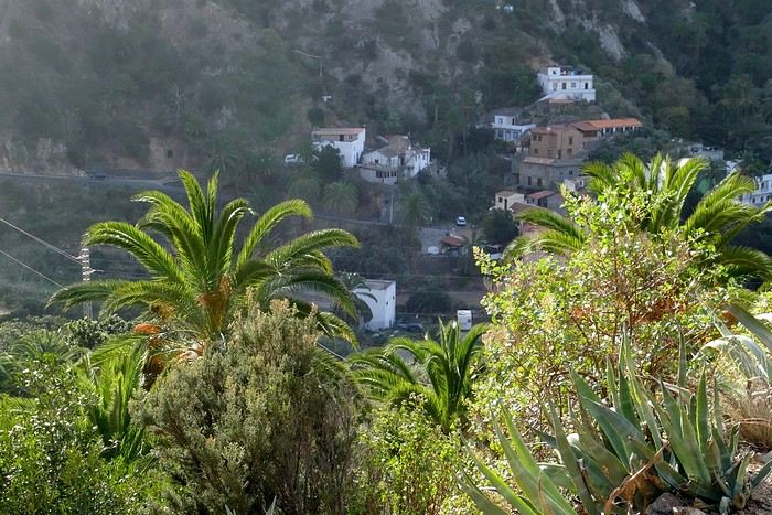 Vallehermoso
Friday, February 9 This morning, the sky was overcast, and the peaks around us were shrouded in clouds. We took the same road as yesterday to hike Las Creces. Quickly gaining altitude, we entered a thick fog—visibility was very limited. We stopped at the Las Creces parking lot; visibility improved, and the sun wasn’t far off. The hike is entirely within a beautiful laurel forest, with the sun playing hide-and-seek, but it wasn’t cold despite the altitude. After finishing the loop trail, we decided to picnic—not there, as it was too chilly—but on Vallehermoso’s beach, where we found a nice picnic area sheltered by large black rocks. A short digestive walk on the surrounding hill to admire the little beach from above. Back in Vallehermoso, we did some grocery shopping, then tried to return to the casa—only to find ourselves locked out because we’d left the key in the lock inside! After several attempts and with the help of Yéli, a relative of the owner we called for help, we were finally able to get back in!
Saturday, February 10
It rained last night, and the sky remained overcast. Monique decided to rest this morning. PP, Pat, and I set off on the hike that starts from the house toward the Marichal reservoir. The sun wasn’t far off, and by 11 AM, it was fully out. The pleasant hike passed by many flower-filled gardens and orchards—orange, lemon, and mandarin trees in fruit. The path climbed gently toward the reservoir, where the view of the Cano rock dominating the landscape was magnificent. The last part of the climb was a bit tough, overgrown with lush vegetation, and the trail was slippery from last night’s rain. We descended via a different, much more pleasant path and returned to the casa just in time for lunch, prepared by Monique. This valley is rich with its many farmers and market gardeners who’ve cultivated the entire valley, taking advantage of the water flowing down from the mountain, captured upstream and redistributed through countless pipes snaking along the paths. Numerous tanks also store water during dry periods. The houses are scattered across both sides of the valley, and these colorful little homes add a beautiful touch to the landscape. The many palm trees give this valley a distinctly tropical feel—you could almost imagine yourself in the Caribbean. Add to that some salsa music drifting from a hut where farmers were working, and the picture is complete. A well-chilled beer apéro capped off a lovely morning. The afternoon was dedicated to rest, relaxation, reading, and games.
Sunday, February 11 The blue sky returned, though a few clouds still capped the highest peaks. Today, we visited Garajonay National Park, which covers the highest central mountains. Up there, we were above the clouds, and the panoramas from the various viewpoints were stunning: first, Cherelepin, accessible from the Laguna Grande parking lot, then Alto de Garajonay, offering an exceptional view of Teide—over 3,000 meters high—emerging from the clouds on Tenerife, far in the distance. We continued to the Los Roques viewpoints, then stopped for lunch at the Degollada de Peraza restaurant, where the view of the barranco was impressive. We descended toward San Sebastián and checked into our new lodging, La Cabezada, located in the countryside about 3 km above San Sebastián. It’s a small apartment adjacent to the owner’s, with a lovely terrace overlooking the surrounding mountains and surrounded by a beautiful garden. Apéro, then dinner on our beautiful terrace.
Monday, February 12 This morning, we went down to visit San Sebastián de La Gomera: its old tower, main street with some beautiful traditional houses, and the Church of the Assumption. Back at the casa for lunch. In the afternoon, Pat, PP, and I set off on the short hike from San Sebastián beach to La Guancha beach. We drove down and parked on the beach. The path climbs along the hill overlooking San Sebastián, passes by the tall Christ statue dominating the landscape, and roughly follows the coast down to the isolated Guancha beach. A beautiful hike under a hot sun, and a swim was welcome, even if the beach and sea access weren’t very comfortable due to large pebbles and quickly deepening water. Apart from two nudist bathers, there was no one on this beach. We returned the same way.
Tuesday, February 13 Rest day. We went down to town to stroll and do some shopping. I took the opportunity to visit the parador, beautifully situated above the city in a lovely garden overlooking the port and town. Together, we went for a cuba libre at the "Cuba Libre" bar, then had lunch at Breñusca (mediocre paella!). Back at the casa, then we went back down to town to see a carnival parade, a "passacalles," which actually passed an hour earlier than scheduled. Oh well.
Wednesday, February 14 Each to their own program this morning. Pat went swimming at San Sebastián beach, Monique rested at the casa, and PP and I set off on the hike from Playa de Avalos to the Ermita de Guadalupe on Playa del Cangrejo. It wasn’t easy to find the right road or the parking spot, but we managed. The path seemed to have suffered landslides, according to a sign at the trailhead! We decided to check it out, ready to turn back if it seemed too dangerous. In the end, apart from one or two slightly tricky spots where we had to climb a pile of rocks, the trail remained passable, though a bit vertigo-inducing in places. The narrow path clings to very vertical cliffs nearly 300 meters above sea level! But what a magnificent view. At one point, the trail runs alongside a wall of basaltic pipes. We returned via the drivable track that parallels the trail a bit lower. Back at the house for lunch. In the late afternoon, we returned to town to attend the "Entierro de las Sardinas" (Burial of the Sardine), which closes the Canarian carnival festivities. While waiting, we strolled through the parador’s gardens and had mojitos in town. Around 9 PM, we heard the noise and cries of the mourners. The procession advanced, led by a large papier-mâché sardine on a float, surrounded by wailing mourners. The procession headed toward the sea, where the sardine was burned, and a mini fireworks display ended the procession. It was all very good-natured, and everyone had fun. We ended the evening with dinner at a good fish restaurant, El Pajar.
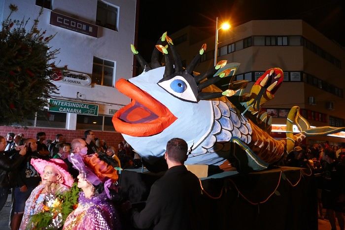 Entierro de la Sardina in San Sebastián de La Gomera
Thursday, February 15
Woke up at 5:15 AM. The only suitable ferry was at 7 AM, which would get us to La Palma by late morning rather than evening. We packed our bags, had breakfast, then headed to the port, left our rental car, and boarded the ferry to Tenerife, from where we’d continue to La Palma. Calm sea, beautiful sun—by 10:30 AM, we disembarked in La Palma. We picked up our car and immediately headed to our new apartment in Breña Alta. It’s a large apartment with a superb terrace facing the sea, fully equipped and very comfortable. The hosts recommended Casa Goyo restaurant, near the airport and close to us. It’s a restaurant with many small rooms, some of which can be reserved for families. The fish-based cuisine (chipirones, pulpo) was excellent, hearty, and reasonably priced. Since it’s in the airport’s flight path, we occasionally heard planes landing. Quick and efficient service. Afterward, we visited Santa Cruz de La Palma, which reminded us of the historic quarters of La Orotava in Tenerife or the capital of Gran Canaria.
Friday, February 16
Beautiful weather, blue sky. We headed to the San Bartolo viewpoint toward the northeast coast, then to the lovely village of San Andrés, which we explored. From there, we walked along the shore to the natural pools of Charco Azul, where we swam in the cool but "swimmable" sea. Back in San Andrés for lunch at the "San Andrés" restaurant on the beautiful church square. Very good fish-based meal. We got back in the car and continued along the north coast to the port of Espindola and the natural pools of Fajana near the Cumplida lighthouse. A fairly strong wind whipped up beautiful waves crashing onto the rocky coast in bursts of foam. Back in Santa Cruz, we stopped at the Mercadona supermarket to buy fresh shrimp for dinner.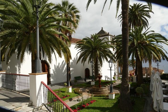 San Andrés
Saturday, February 17
Uniform blue sky, even on the heights. We took the beautiful road that winds up to the summit of the Caldera de Taburiente. Several viewpoints offer 360° views of the entire island and beyond: you can make out La Gomera, El Hierro, and, of course, Tenerife with the perfect triangle of Teide. We parked at the Los Andes viewpoint parking lot and started our hike to Pico de la Cruz along a trail following the ridge, offering superb views into the caldera. We got back in the car and passed by the Roque de los Muchachos astronomical complex, composed of numerous observatories, some with very aesthetic mirror telescopes. We hiked from the Roque de los Muchachos parking lot to the various viewpoints, always as impressive. Picnic on site, then back to Santa Cruz. We stopped by our car dealer because the oil warning light came on—better safe than sorry. The representative reassured us but preferred to give us a Fiat Cross SUV instead.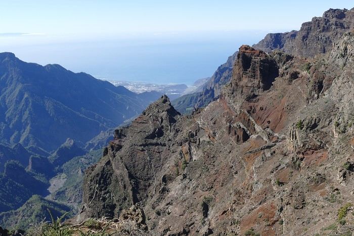 The Caldera de Taburiente
Sunday, February 18 The weather was a bit mixed, with cloudy patches. We set off to hike the Barranco de la Cuba de Galga. Unfortunately, the Los Tilos trail had been closed for several months due to a major landslide. The parking lot by the road was already quite full, and indeed, we crossed paths with many hikers along the way—it’s an easy hike with little elevation gain, which is rare here in La Palma! The beautiful path winds through a very narrow, deep gorge covered in lush tropical vegetation—you’d think you were in a Southeast Asian forest, especially with the humidity in the gorge bringing out earthy and floral scents. Halfway through, Monique turned back while the rest of us continued to the Cuba de Galga. A light drizzle accompanied us on the return. For lunch, we went to Chipi Chipi restaurant in the heights of Santa Cruz. The cool air forced us to leave the lovely terrace for the slightly noisy dining room. The meal was very good and hearty. Afternoon spent resting at our house.
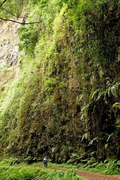 La Cuba de la Galga
Monday, February 19 A few clouds still clung to the nearby mountain peaks. We headed south to Los Canarios. We stopped in front of the small San Antonio Abad church, where a path leads to the viewpoint in 15 minutes. Then we visited the San Antonio Volcano Interpretation Center and climbed to the viewpoint via the trail along the crater’s edge, offering a plunging view into the crater. Then PP, Pat, and I headed toward the Teneguía volcano but turned back given the remaining distance and the intense heat bearing down on us! Plus, the landscape was rather arid and not very interesting. We got back in the car and drove down to the salt flats at the island’s southern tip. The ocean crashes here in large waves, exploding against the volcanic rocks and feeding a "blowhole" carved into the rock. We stopped for drinks at the salt flats restaurant, then headed home.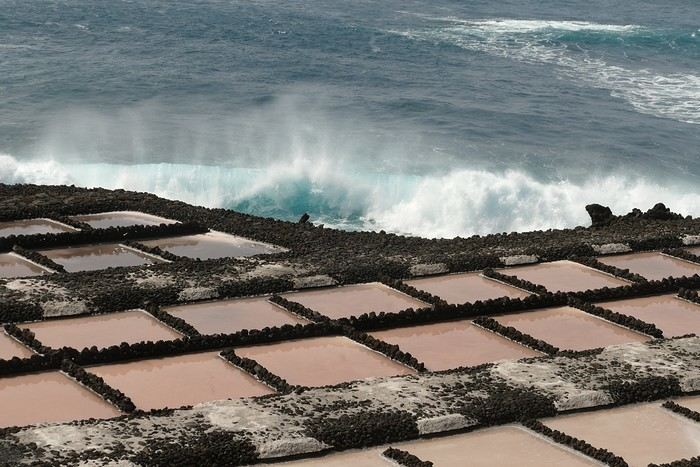 The salt flats in Fuencaliente
Tuesday, February 20 Beautiful weather with a few clouds clinging to the mountains, as usual. A relaxed morning since my parking reservation at La Cumbrecita didn’t start until 1 PM. It takes about 30 minutes from Santa Cruz to reach the valley floor via a beautiful but narrow road toward the end, though there’s very little traffic. Meanwhile, the clouds had disappeared, and the view from the La Cumbrecita viewpoint was superb. We recognized Pico de la Cruz in the distance, where we’d been a few days earlier. We then took the path leading to the Las Chozas viewpoint through a magnificent Canarian pine forest. We picnicked on site, then took the path to the Los Roques viewpoint. We returned the same way since the direct route was closed for construction. Back in Santa Cruz, we visited the Sanctuary of Las Nieves, with its beautiful golden Baroque altar.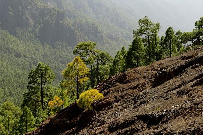 Hike from La Cumbrecita
Wednesday, February 21 After packing our things and loading the car, we left Santa Cruz under a very blue sky for Los Llanos de Aridane, where we stopped to visit this lovely town. The Church of Nuestra Señora de los Remedios has a beautiful coffered ceiling and an original papier-mâché Christ statue from the 16th century. Around it, colorful old Canarian houses brighten the streets of the town center. We took the opportunity to stroll, do some shopping, and finally sat down at La Pergola restaurant for a mediocre lunch. We got back in the car to check into our new house in Arecida. On the way, we stopped at the Mirador del Time, which once again offered an impressive panorama, allowing us—for the first time—to see the damage caused by the Tajogaite volcano eruption in 2021. You can clearly see the still-smoking crater and the large black lava flow covering the landscape down to the sea. We really liked our new accommodation: a local house that’s been renovated on the heights of Arecida, not far from the Canarian pine forest. From several terraces, we have a 360° view of the sea and mountains. We even have a private pool! There are two beautiful, brand-new bedrooms, each with its own bathroom—the best. Plus, we’re on the GR 131 trail that runs along the Barranco de las Angustias toward the northeast.
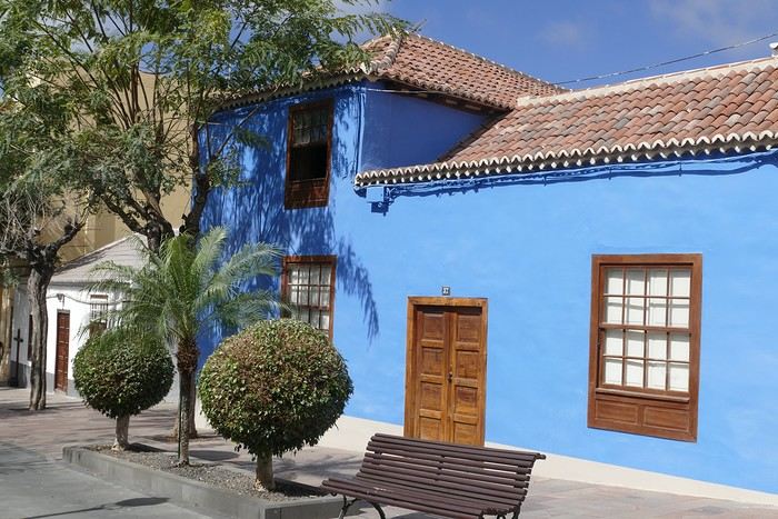 Los Llanos de Aridane
Thursday, February 22 Once again, beautiful weather greeted us when we woke up. We started the GR 131 with the goal of reaching the Torre del Time viewpoint—about 400 meters of elevation gain. The path, quite steep at first, winds through a superb Canarian pine forest. A few viewpoints let you appreciate the sheer drop of the Barranco de las Angustias—watch out for vertigo! At the Torre del Time viewpoint, there’s a nearly 1,000-meter vertical drop. We returned via another path, the PLP1, which meanders first through this beautiful forest, then along lovely flower-filled gardens adjacent to beautiful properties that cascade from the forest down to the road serving these neighborhoods. This afternoon, we tried to get closer to the area devastated by the 2021 lava flows. Several roads are still closed or reserved for residents, while others—brand new—have been rebuilt to open up this densely populated and cultivated region. In some places, the lava flow slightly diverted, sparing some properties that logically should have disappeared. Now, they’re encircled by a massive cooled lava field. In other spots, twisted and charred metal scraps or greenhouse remains protrude from the lava—all that’s left of the former banana plantations. A little higher up, you can see the slightly smoking crater of Tajogaite, responsible for this disaster. Back to Casa Barreros.
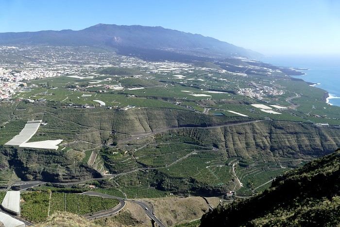 View of Los Llanos and, in the background, the 2021 lava flow
Friday, February 23
Though the sky was still blue, the temperature had dropped due to a chilly wind. By midday, it still rose to 22°C. Today, we headed north, specifically to the town of Tijarafe, where a very narrow road descends to the small port, Porís de Candelaria. The 3.7-kilometer road drops 700 meters in elevation, with gradients up to 30%—it was going to be intense! Indeed, the descent was scary, with the void right next to the very narrow road where passing was impossible except at a few rare spots. Everything went well—there was little traffic at this early hour. From the parking lot at the bottom, a path leads to Porís de Candelaria. It’s surprising to see this small fishing hamlet nestled in the shelter of an immense cave opening onto the sea, which was quite rough today. The sun, at this time of year, would appear late in the cave, which remained in shadow for much of the day. We returned via the same road, strolled through the small town of Puntagorda, and had lunch at El Jardín de los Naranjos restaurant—excellent meal.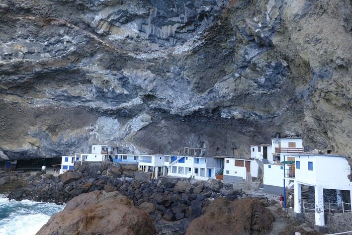 Fishing hamlet of Candelaria
Saturday, February 24 The air was still cool, but the sun was beautiful. While Monique stayed home to rest, the three of us headed to the village of Las Tricias to hike the Buracas Caves trail. We left the car parked on the LP1 road and took the small paved road down to the sign marking the trail’s start. The signage for all the trails we took here, as in La Gomera, was very well done. The path descended steadily, then more steeply toward the caves where the island’s first inhabitants lived—some petroglyphs are still visible in certain caves. The path then climbed back up, passing magnificent dragon trees and more or less elaborate huts occupied by Germans who’ve lived here for many years. Back at Casa Barreros for some rest.
Sunday, February 25 The weather once again blessed us with a beautiful day. This morning, we visited the local produce market held on weekends in Puntagorda. You’ll find agricultural products, crafts, and food to keep you going. A little further on, there’s a glass viewpoint overlooking the barranco plunging toward the sea, with a view of the thrill-seekers trying the zip line right next to it. Lunch at Naranjos—definitely a good spot—with their shrimp and spice tagliatelle. Back home for an afternoon of relaxation.
Monday, February 26 We left Arecida under a cloudy sky. Driving up from Los Llanos de Aridane toward the east, an enormous cascade of clouds poured from the mountain peaks into the Los Llanos plain—very impressive. Arriving in Santa Cruz, we went for a stroll, did some last-minute shopping, then had a final good-quality paella at La Chalana on the paseo maritimo. We left the car in the parking lot and took the 5 PM Olsen ferry to Tenerife on a slightly choppy sea, but the ferry didn’t rock too much. Arriving at 7:15 PM, we dropped off our things near the port in our reserved apartment and went for dinner at Abordo—rubbery chipirones. A digestive stroll among the ever-increasing number of tourists in Los Cristianos—restaurants were packed to the brim, the season is in full swing here. Gone is the calm of La Gomera and La Palma, and the laid-back tourism of German hikers among whom a few French were hiding!
Tuesday, February 27 To make our homemade breakfast more enjoyable, we went to buy pastries at the local bakery, then took one last walk on the paseo along the beaches, mingling with the many mobility scooters driven by elderly or disabled people, joggers, and tourists. Last apéro near the bus station, then off to the airport. After a smooth 4-hour-30-minute flight, we arrived in Basel-Mulhouse at 10:20 PM.
THE END
Conclusion A fantastic trip to two islands with magnificent and diverse nature, where landscapes range from desert-like to tropical depending on exposure to winds and clouds. Thanks to the many beautiful viewpoints, you can truly appreciate these exceptionally dynamic reliefs. A hiker’s paradise, the trails are all very well marked, though the choice of easy or moderate paths for "casual walkers" is quite limited. Another notable advantage, in our opinion, is that these islands are very lightly developed—you’ll hardly see any of those ugly hotel blocks that spoil the landscapes of some other Canary Islands. It’s true that the beaches on these two islands don’t meet traditional international tourism criteria: they’re small, with black sand, and often difficult to access. Special mention for the quality of the road network (except for a few small local roads), which seems brand new, well-paved, and well-signposted. We also enjoyed exceptional weather for February, with fewer than three days of gray or rainy weather out of 21.
Almost all the accommodations we chose met or exceeded our expectations, often at reasonable prices: an average of 98 € per night for an apartment or house with two bedrooms for four people.
All photos can be viewed by clicking this link: https://photos.app.goo.gl/G44pPk4g9PW1rNzg8
Tuesday, February 6 We left around 9 AM with our car, along with Pierre-Paul and Patricia, heading to the Bluepark parking lot in Bartenheim. As expected, we were awaited and left promptly for EuroAirport Basel. Took off at 12:25 PM for a 4-hour-15-minute flight under excellent conditions. Beautiful arrival in Tenerife with Teide in sight under a clear blue sky. Fifteen minutes later, we waited for bus No. 40 to Los Cristianos with quite a few other tourists, but we managed to find four seats. From the bus station, it was a 20-minute walk to our hotel. We checked into a lovely apartment for the four of us, complete with all the comforts. Outside, it was quite warm—at least 25°C! After dropping off our luggage, we went for a stroll. The immediate surroundings of the hotel held no interest for us: a modern, concrete area filled with hotels, bars, tourist agencies, and unappealing restaurants all offering the same bland international cuisine. Pat went to cool off at the pool, unfortunately overrun by loud, drunk English tourists. I took a walk to the paseo maritimo that leads to the port, skirting the seafront. The promenade was pleasant, but it could have been any seaside resort in the world—same old scene: a succession of bars with blaring music where many elderly people sipped cold beers waiting for the sunset, the backdrop a wall of resort-style hotels resembling rabbit hutches! Upon reaching the port, I scouted the route we’d take the next day to the Fred Olsen ferry. Back at the apartment, in the early evening, we looked for a non-touristy restaurant for dinner. Monique stopped a woman to ask her opinion! In this area, she told us, there’s no restaurant that serves Canarian or Spanish cuisine! The only place with decent restaurants is at the port. Off we went to the port, where we sat down at Al Bordo restaurant and ordered a seafood paella for four. Excellent, and at a very reasonable price (36 € for two). We returned to the hotel along the seafront.
Wednesday, February 7
Woke up at 6 AM. Had breakfast in the apartment with what we’d bought the day before at a supermarket. It was still dark when we left on foot toward the port, walking along the calm seafront at this early hour. Forty minutes later, we arrived and waited 10 minutes before the ferry docked. At 9:30 AM, we left the port of Los Cristianos for a 50-minute crossing on a calm sea under a beautiful blue sky. There were quite a few people on this large ferry, but many had no luggage, meaning they were visiting La Gomera for the day and would take the ferry back in the evening. Upon disembarking, we went straight to our rental car agency to pick up the car we’d booked online a few months earlier. It was a nice Peugeot 2008, spacious enough for the four of us and our luggage. We immediately took the beautiful road from San Sebastián that climbs directly into the mountains toward our rental in Vallehermoso. The road was in perfect condition—it seemed brand new, like all the others we’d take on this island later. This side of the island is very arid with little vegetation, and the terrain is particularly rugged, as it is throughout the island. We stopped at our first miradors, which would be followed by many more throughout our Canarian trip. Our first visit was to the small village of Agulo, perched on a promontory above the sea and at the foot of a high cliff. The village features typical Canarian houses with windows flush with the façade and black volcanic stone masonry on white or reddish-brown walls. The first recommended restaurant was already booked for a group, so we settled for the shaded terrace of the excellent El Alameda bar-restaurant. From Agulo, you can access the Abrante viewpoint via a winding road, where the view of Agulo, 600 meters below, is exceptional. A glass ledge over the void lets you test your fear of heights!
We drove to Vallehermoso to do our grocery shopping at the supermarket—a habit that would continue until the end of the trip. Our little house, "Casa rural El Encatadora," is located in a beautiful flower-filled valley a few kilometers west of Vallehermoso. Each of us had a bedroom with an en-suite bathroom, plus a living room, kitchen, and a small terrace overlooking the quiet street at the valley’s end, which didn’t bother us at all.
Thursday, February 8 The good weather seemed to follow us since our arrival in the Canary Islands. This morning, we took the road—still as beautiful and new—toward Arure, high up to the west. The landscape was magnificent, with breathtaking glimpses of the sea far below. In Arure, we parked in front of Conchita’s bar, where a hike (Rother No. 30) starts toward two viewpoints: Alojera, which we reached after 45 minutes on a lovely path. Monique, tired from the first steep climb, stopped at the first viewpoint and hitchhiked back to Arure. Meanwhile, we continued toward the second viewpoint, Los Barranquillos, where the view of the surroundings was partially hidden by misty clouds rising from the sea. The entire mountain is sculpted by ancient, endless terraces climbing until the slope becomes too steep for construction—visible traces of the hard work of past inhabitants trying to survive in a harsh environment. We had a decent lunch at La Conchita bar, then drove to the small seaside town of Puerto la Caleta, sheltered by an immense cliff plunging into the sea. Black sand beach, rough sea—despite our encouragement, Pat didn’t dare to swim! As for the old village of Caleta, it’s perched on the mountainside, and visiting it requires climbing steep, stair-filled alleys to discover a few traditional houses. Back at the casa, dinner in, and card games...
VallehermosoFriday, February 9 This morning, the sky was overcast, and the peaks around us were shrouded in clouds. We took the same road as yesterday to hike Las Creces. Quickly gaining altitude, we entered a thick fog—visibility was very limited. We stopped at the Las Creces parking lot; visibility improved, and the sun wasn’t far off. The hike is entirely within a beautiful laurel forest, with the sun playing hide-and-seek, but it wasn’t cold despite the altitude. After finishing the loop trail, we decided to picnic—not there, as it was too chilly—but on Vallehermoso’s beach, where we found a nice picnic area sheltered by large black rocks. A short digestive walk on the surrounding hill to admire the little beach from above. Back in Vallehermoso, we did some grocery shopping, then tried to return to the casa—only to find ourselves locked out because we’d left the key in the lock inside! After several attempts and with the help of Yéli, a relative of the owner we called for help, we were finally able to get back in!
Saturday, February 10
It rained last night, and the sky remained overcast. Monique decided to rest this morning. PP, Pat, and I set off on the hike that starts from the house toward the Marichal reservoir. The sun wasn’t far off, and by 11 AM, it was fully out. The pleasant hike passed by many flower-filled gardens and orchards—orange, lemon, and mandarin trees in fruit. The path climbed gently toward the reservoir, where the view of the Cano rock dominating the landscape was magnificent. The last part of the climb was a bit tough, overgrown with lush vegetation, and the trail was slippery from last night’s rain. We descended via a different, much more pleasant path and returned to the casa just in time for lunch, prepared by Monique. This valley is rich with its many farmers and market gardeners who’ve cultivated the entire valley, taking advantage of the water flowing down from the mountain, captured upstream and redistributed through countless pipes snaking along the paths. Numerous tanks also store water during dry periods. The houses are scattered across both sides of the valley, and these colorful little homes add a beautiful touch to the landscape. The many palm trees give this valley a distinctly tropical feel—you could almost imagine yourself in the Caribbean. Add to that some salsa music drifting from a hut where farmers were working, and the picture is complete. A well-chilled beer apéro capped off a lovely morning. The afternoon was dedicated to rest, relaxation, reading, and games.
Sunday, February 11 The blue sky returned, though a few clouds still capped the highest peaks. Today, we visited Garajonay National Park, which covers the highest central mountains. Up there, we were above the clouds, and the panoramas from the various viewpoints were stunning: first, Cherelepin, accessible from the Laguna Grande parking lot, then Alto de Garajonay, offering an exceptional view of Teide—over 3,000 meters high—emerging from the clouds on Tenerife, far in the distance. We continued to the Los Roques viewpoints, then stopped for lunch at the Degollada de Peraza restaurant, where the view of the barranco was impressive. We descended toward San Sebastián and checked into our new lodging, La Cabezada, located in the countryside about 3 km above San Sebastián. It’s a small apartment adjacent to the owner’s, with a lovely terrace overlooking the surrounding mountains and surrounded by a beautiful garden. Apéro, then dinner on our beautiful terrace.
Monday, February 12 This morning, we went down to visit San Sebastián de La Gomera: its old tower, main street with some beautiful traditional houses, and the Church of the Assumption. Back at the casa for lunch. In the afternoon, Pat, PP, and I set off on the short hike from San Sebastián beach to La Guancha beach. We drove down and parked on the beach. The path climbs along the hill overlooking San Sebastián, passes by the tall Christ statue dominating the landscape, and roughly follows the coast down to the isolated Guancha beach. A beautiful hike under a hot sun, and a swim was welcome, even if the beach and sea access weren’t very comfortable due to large pebbles and quickly deepening water. Apart from two nudist bathers, there was no one on this beach. We returned the same way.
Tuesday, February 13 Rest day. We went down to town to stroll and do some shopping. I took the opportunity to visit the parador, beautifully situated above the city in a lovely garden overlooking the port and town. Together, we went for a cuba libre at the "Cuba Libre" bar, then had lunch at Breñusca (mediocre paella!). Back at the casa, then we went back down to town to see a carnival parade, a "passacalles," which actually passed an hour earlier than scheduled. Oh well.
Wednesday, February 14 Each to their own program this morning. Pat went swimming at San Sebastián beach, Monique rested at the casa, and PP and I set off on the hike from Playa de Avalos to the Ermita de Guadalupe on Playa del Cangrejo. It wasn’t easy to find the right road or the parking spot, but we managed. The path seemed to have suffered landslides, according to a sign at the trailhead! We decided to check it out, ready to turn back if it seemed too dangerous. In the end, apart from one or two slightly tricky spots where we had to climb a pile of rocks, the trail remained passable, though a bit vertigo-inducing in places. The narrow path clings to very vertical cliffs nearly 300 meters above sea level! But what a magnificent view. At one point, the trail runs alongside a wall of basaltic pipes. We returned via the drivable track that parallels the trail a bit lower. Back at the house for lunch. In the late afternoon, we returned to town to attend the "Entierro de las Sardinas" (Burial of the Sardine), which closes the Canarian carnival festivities. While waiting, we strolled through the parador’s gardens and had mojitos in town. Around 9 PM, we heard the noise and cries of the mourners. The procession advanced, led by a large papier-mâché sardine on a float, surrounded by wailing mourners. The procession headed toward the sea, where the sardine was burned, and a mini fireworks display ended the procession. It was all very good-natured, and everyone had fun. We ended the evening with dinner at a good fish restaurant, El Pajar.
Entierro de la Sardina in San Sebastián de La GomeraThursday, February 15
Woke up at 5:15 AM. The only suitable ferry was at 7 AM, which would get us to La Palma by late morning rather than evening. We packed our bags, had breakfast, then headed to the port, left our rental car, and boarded the ferry to Tenerife, from where we’d continue to La Palma. Calm sea, beautiful sun—by 10:30 AM, we disembarked in La Palma. We picked up our car and immediately headed to our new apartment in Breña Alta. It’s a large apartment with a superb terrace facing the sea, fully equipped and very comfortable. The hosts recommended Casa Goyo restaurant, near the airport and close to us. It’s a restaurant with many small rooms, some of which can be reserved for families. The fish-based cuisine (chipirones, pulpo) was excellent, hearty, and reasonably priced. Since it’s in the airport’s flight path, we occasionally heard planes landing. Quick and efficient service. Afterward, we visited Santa Cruz de La Palma, which reminded us of the historic quarters of La Orotava in Tenerife or the capital of Gran Canaria.
Friday, February 16
Beautiful weather, blue sky. We headed to the San Bartolo viewpoint toward the northeast coast, then to the lovely village of San Andrés, which we explored. From there, we walked along the shore to the natural pools of Charco Azul, where we swam in the cool but "swimmable" sea. Back in San Andrés for lunch at the "San Andrés" restaurant on the beautiful church square. Very good fish-based meal. We got back in the car and continued along the north coast to the port of Espindola and the natural pools of Fajana near the Cumplida lighthouse. A fairly strong wind whipped up beautiful waves crashing onto the rocky coast in bursts of foam. Back in Santa Cruz, we stopped at the Mercadona supermarket to buy fresh shrimp for dinner.
San AndrésSaturday, February 17
Uniform blue sky, even on the heights. We took the beautiful road that winds up to the summit of the Caldera de Taburiente. Several viewpoints offer 360° views of the entire island and beyond: you can make out La Gomera, El Hierro, and, of course, Tenerife with the perfect triangle of Teide. We parked at the Los Andes viewpoint parking lot and started our hike to Pico de la Cruz along a trail following the ridge, offering superb views into the caldera. We got back in the car and passed by the Roque de los Muchachos astronomical complex, composed of numerous observatories, some with very aesthetic mirror telescopes. We hiked from the Roque de los Muchachos parking lot to the various viewpoints, always as impressive. Picnic on site, then back to Santa Cruz. We stopped by our car dealer because the oil warning light came on—better safe than sorry. The representative reassured us but preferred to give us a Fiat Cross SUV instead.
The Caldera de TaburienteSunday, February 18 The weather was a bit mixed, with cloudy patches. We set off to hike the Barranco de la Cuba de Galga. Unfortunately, the Los Tilos trail had been closed for several months due to a major landslide. The parking lot by the road was already quite full, and indeed, we crossed paths with many hikers along the way—it’s an easy hike with little elevation gain, which is rare here in La Palma! The beautiful path winds through a very narrow, deep gorge covered in lush tropical vegetation—you’d think you were in a Southeast Asian forest, especially with the humidity in the gorge bringing out earthy and floral scents. Halfway through, Monique turned back while the rest of us continued to the Cuba de Galga. A light drizzle accompanied us on the return. For lunch, we went to Chipi Chipi restaurant in the heights of Santa Cruz. The cool air forced us to leave the lovely terrace for the slightly noisy dining room. The meal was very good and hearty. Afternoon spent resting at our house.
La Cuba de la GalgaMonday, February 19 A few clouds still clung to the nearby mountain peaks. We headed south to Los Canarios. We stopped in front of the small San Antonio Abad church, where a path leads to the viewpoint in 15 minutes. Then we visited the San Antonio Volcano Interpretation Center and climbed to the viewpoint via the trail along the crater’s edge, offering a plunging view into the crater. Then PP, Pat, and I headed toward the Teneguía volcano but turned back given the remaining distance and the intense heat bearing down on us! Plus, the landscape was rather arid and not very interesting. We got back in the car and drove down to the salt flats at the island’s southern tip. The ocean crashes here in large waves, exploding against the volcanic rocks and feeding a "blowhole" carved into the rock. We stopped for drinks at the salt flats restaurant, then headed home.
The salt flats in FuencalienteTuesday, February 20 Beautiful weather with a few clouds clinging to the mountains, as usual. A relaxed morning since my parking reservation at La Cumbrecita didn’t start until 1 PM. It takes about 30 minutes from Santa Cruz to reach the valley floor via a beautiful but narrow road toward the end, though there’s very little traffic. Meanwhile, the clouds had disappeared, and the view from the La Cumbrecita viewpoint was superb. We recognized Pico de la Cruz in the distance, where we’d been a few days earlier. We then took the path leading to the Las Chozas viewpoint through a magnificent Canarian pine forest. We picnicked on site, then took the path to the Los Roques viewpoint. We returned the same way since the direct route was closed for construction. Back in Santa Cruz, we visited the Sanctuary of Las Nieves, with its beautiful golden Baroque altar.
Hike from La CumbrecitaWednesday, February 21 After packing our things and loading the car, we left Santa Cruz under a very blue sky for Los Llanos de Aridane, where we stopped to visit this lovely town. The Church of Nuestra Señora de los Remedios has a beautiful coffered ceiling and an original papier-mâché Christ statue from the 16th century. Around it, colorful old Canarian houses brighten the streets of the town center. We took the opportunity to stroll, do some shopping, and finally sat down at La Pergola restaurant for a mediocre lunch. We got back in the car to check into our new house in Arecida. On the way, we stopped at the Mirador del Time, which once again offered an impressive panorama, allowing us—for the first time—to see the damage caused by the Tajogaite volcano eruption in 2021. You can clearly see the still-smoking crater and the large black lava flow covering the landscape down to the sea. We really liked our new accommodation: a local house that’s been renovated on the heights of Arecida, not far from the Canarian pine forest. From several terraces, we have a 360° view of the sea and mountains. We even have a private pool! There are two beautiful, brand-new bedrooms, each with its own bathroom—the best. Plus, we’re on the GR 131 trail that runs along the Barranco de las Angustias toward the northeast.
Los Llanos de AridaneThursday, February 22 Once again, beautiful weather greeted us when we woke up. We started the GR 131 with the goal of reaching the Torre del Time viewpoint—about 400 meters of elevation gain. The path, quite steep at first, winds through a superb Canarian pine forest. A few viewpoints let you appreciate the sheer drop of the Barranco de las Angustias—watch out for vertigo! At the Torre del Time viewpoint, there’s a nearly 1,000-meter vertical drop. We returned via another path, the PLP1, which meanders first through this beautiful forest, then along lovely flower-filled gardens adjacent to beautiful properties that cascade from the forest down to the road serving these neighborhoods. This afternoon, we tried to get closer to the area devastated by the 2021 lava flows. Several roads are still closed or reserved for residents, while others—brand new—have been rebuilt to open up this densely populated and cultivated region. In some places, the lava flow slightly diverted, sparing some properties that logically should have disappeared. Now, they’re encircled by a massive cooled lava field. In other spots, twisted and charred metal scraps or greenhouse remains protrude from the lava—all that’s left of the former banana plantations. A little higher up, you can see the slightly smoking crater of Tajogaite, responsible for this disaster. Back to Casa Barreros.
View of Los Llanos and, in the background, the 2021 lava flowFriday, February 23
Though the sky was still blue, the temperature had dropped due to a chilly wind. By midday, it still rose to 22°C. Today, we headed north, specifically to the town of Tijarafe, where a very narrow road descends to the small port, Porís de Candelaria. The 3.7-kilometer road drops 700 meters in elevation, with gradients up to 30%—it was going to be intense! Indeed, the descent was scary, with the void right next to the very narrow road where passing was impossible except at a few rare spots. Everything went well—there was little traffic at this early hour. From the parking lot at the bottom, a path leads to Porís de Candelaria. It’s surprising to see this small fishing hamlet nestled in the shelter of an immense cave opening onto the sea, which was quite rough today. The sun, at this time of year, would appear late in the cave, which remained in shadow for much of the day. We returned via the same road, strolled through the small town of Puntagorda, and had lunch at El Jardín de los Naranjos restaurant—excellent meal.
Fishing hamlet of CandelariaSaturday, February 24 The air was still cool, but the sun was beautiful. While Monique stayed home to rest, the three of us headed to the village of Las Tricias to hike the Buracas Caves trail. We left the car parked on the LP1 road and took the small paved road down to the sign marking the trail’s start. The signage for all the trails we took here, as in La Gomera, was very well done. The path descended steadily, then more steeply toward the caves where the island’s first inhabitants lived—some petroglyphs are still visible in certain caves. The path then climbed back up, passing magnificent dragon trees and more or less elaborate huts occupied by Germans who’ve lived here for many years. Back at Casa Barreros for some rest.
Sunday, February 25 The weather once again blessed us with a beautiful day. This morning, we visited the local produce market held on weekends in Puntagorda. You’ll find agricultural products, crafts, and food to keep you going. A little further on, there’s a glass viewpoint overlooking the barranco plunging toward the sea, with a view of the thrill-seekers trying the zip line right next to it. Lunch at Naranjos—definitely a good spot—with their shrimp and spice tagliatelle. Back home for an afternoon of relaxation.
Monday, February 26 We left Arecida under a cloudy sky. Driving up from Los Llanos de Aridane toward the east, an enormous cascade of clouds poured from the mountain peaks into the Los Llanos plain—very impressive. Arriving in Santa Cruz, we went for a stroll, did some last-minute shopping, then had a final good-quality paella at La Chalana on the paseo maritimo. We left the car in the parking lot and took the 5 PM Olsen ferry to Tenerife on a slightly choppy sea, but the ferry didn’t rock too much. Arriving at 7:15 PM, we dropped off our things near the port in our reserved apartment and went for dinner at Abordo—rubbery chipirones. A digestive stroll among the ever-increasing number of tourists in Los Cristianos—restaurants were packed to the brim, the season is in full swing here. Gone is the calm of La Gomera and La Palma, and the laid-back tourism of German hikers among whom a few French were hiding!
Tuesday, February 27 To make our homemade breakfast more enjoyable, we went to buy pastries at the local bakery, then took one last walk on the paseo along the beaches, mingling with the many mobility scooters driven by elderly or disabled people, joggers, and tourists. Last apéro near the bus station, then off to the airport. After a smooth 4-hour-30-minute flight, we arrived in Basel-Mulhouse at 10:20 PM.
THE END
Conclusion A fantastic trip to two islands with magnificent and diverse nature, where landscapes range from desert-like to tropical depending on exposure to winds and clouds. Thanks to the many beautiful viewpoints, you can truly appreciate these exceptionally dynamic reliefs. A hiker’s paradise, the trails are all very well marked, though the choice of easy or moderate paths for "casual walkers" is quite limited. Another notable advantage, in our opinion, is that these islands are very lightly developed—you’ll hardly see any of those ugly hotel blocks that spoil the landscapes of some other Canary Islands. It’s true that the beaches on these two islands don’t meet traditional international tourism criteria: they’re small, with black sand, and often difficult to access. Special mention for the quality of the road network (except for a few small local roads), which seems brand new, well-paved, and well-signposted. We also enjoyed exceptional weather for February, with fewer than three days of gray or rainy weather out of 21.
Almost all the accommodations we chose met or exceeded our expectations, often at reasonable prices: an average of 98 € per night for an apartment or house with two bedrooms for four people.
All photos can be viewed by clicking this link: https://photos.app.goo.gl/G44pPk4g9PW1rNzg8
Hi everyone,
I bought a new apartment in Pattaya that will be finished at the end of 2013, and I’d like to buy more later...
I think it’s a good investment idea, but I’d love to hear from those of you with experience—what do you think? I’d also like to know how to handle rentals... Should I go through agencies, or are they usually rented out directly by the building management companies?
Thanks in advance for your replies! 🙂
Hey everyone,
Next year, we’re celebrating 20 years of marriage (and travel 🙂), and we’re looking for something new, pretty legendary, and something the teens will enjoy too.
The family council has settled on Japan for now. And it’d have to be a summer trip—no choice there.
The catch: I keep reading that August isn’t the right season for southern Japan. It’s hot, humid, and there’s a risk of typhoons… Okay, but what does that *actually* mean in practice? Are there any travelers who’ve been there during this time? Is it *that* unbearable? We’re pretty familiar with Southeast Asia—last year, we dealt with scorching heat in Vietnam and insane humidity, plus a typhoon we experienced from a distance, and visiting Angkor in the blazing sun. Is it worse than that?
Thanks for your feedback 😉
Next year, we’re celebrating 20 years of marriage (and travel 🙂), and we’re looking for something new, pretty legendary, and something the teens will enjoy too.
The family council has settled on Japan for now. And it’d have to be a summer trip—no choice there.
The catch: I keep reading that August isn’t the right season for southern Japan. It’s hot, humid, and there’s a risk of typhoons… Okay, but what does that *actually* mean in practice? Are there any travelers who’ve been there during this time? Is it *that* unbearable? We’re pretty familiar with Southeast Asia—last year, we dealt with scorching heat in Vietnam and insane humidity, plus a typhoon we experienced from a distance, and visiting Angkor in the blazing sun. Is it worse than that?
Thanks for your feedback 😉
Recent information about this country is scarce, so I’m starting this post in addition to my travel journal to help fill the gap.
- Which airline from Europe?
Turkish Airlines seems like an excellent option. The price is very reasonable (just over 500 €), the layover isn’t too long, the in-flight comfort is decent (great movie selection), and the planes are modern. Plus, the price automatically includes 30 kilos of luggage, which is perfect for campers.
The downside: the outrageous prices at Istanbul Airport.
- Bishkek Airport
The airport is under full reconstruction. It’s chaotic. There are SIM card vendors upon arrival, but no currency exchange or ATMs in the baggage claim area. You’ll find those in the departures section, which means you have to exit and re-enter under the current setup.
Personally, I pre-booked a VTC with my hotel for the transfer to the city. (Prices vary depending on the hotel’s standard—1200 soms for mine.)
There are taxis and a bus available.
- Entry Requirements
No visa is required for French citizens for stays of up to 30 days.
- Currency
The currency is the som, and the conversion is easy—just divide by 100...
You can get soms by exchanging euros (dollars are useless) or by withdrawing from an ATM. Some ATMs charge fees. Those from Mbank and Optimabank are fee-free.
The maximum withdrawal is usually 20,000 soms.
Bills come in 5000, 1000, 500, 200, 100, 50, and 20 soms.
Coins: 10, 5, 3, and 1 som.
- Paying
Card payments are accepted in supermarkets like Globus, some restaurants, gas stations of major chains (Bishkek Petroleum, Partner Neft, Red Petroleum), some hotels, national park entrances, tolls, etc.
But it doesn’t always work.
So always carry cash with you!
If the card works, great—otherwise, it’s back to the old days of wads of bills.
- Cost of Living
It’s really cheap (gas, affordable restaurants even at a decent standard, hotels, souvenirs, fruits, vegetables, water, bread...). For example, a lagman costs only 3.20 €, fixing a flat tire is 3.5 €, a full hour-long wash for a filthy 4x4 is 6 €, washing a big bag of laundry is 3 €, and a liter of 95-octane gas is 0.86 €...
On the pricier side: guesthouses and meals in guesthouses. The value for money is poor. I paid 40 € for a mediocre room with a very basic shared bathroom, while a double with AC, private bathroom, and fridge in a non-touristy hotel cost 20 €... Meals in guesthouses are the worst I’ve eaten and often the most expensive. Plus, they’re very light—don’t expect to fill up after a long day of hiking!
Car rentals are also quite expensive (70 $ per day for a RAV4 in my case).
In short, for two people, excluding accommodation and car rental, we spent an average of 45 € per day (groceries, restaurants, guesthouse dinners, souvenirs, paid activities, gas).
The trip cost us 2200 € per person all-inclusive for 3 weeks on the ground. Roughly 1/4 for the flight, 1/4 for the car, 1/4 for accommodation, and 1/4 for everything else.
- Getting Around
I’ve met cyclists, motorcyclists, people renting cars, those who drove their own vehicles from Europe, and others using public transport and taxis.
Personally, I chose to rent a car.
If you’re not planning long hikes or multi-day horse treks, it’s a great option for exploring the country.
Each car rental company has its own list of forbidden tracks. Make sure your planned route is allowed! Don’t think about ignoring this—vehicles are equipped with GPS trackers...
An international driver’s permit is required.
Police and speed cameras are everywhere, so it’s best to respect the signs (daytime running lights, seatbelts, 40-60 km/h in populated areas, 90 km/h on roads, zero tolerance for alcohol).
Locals have a unique driving style, and it can be dangerous on main roads (they overtake recklessly...). Like in Greece, South Africa, or Malta, a two-lane road is treated as a three-lane one. You pull over to let others pass or to let oncoming traffic overtake.
Without a car (at least a pseudo-4x4), you won’t be able to go everywhere. This country is a nature destination, but nature isn’t always accessible by public transport.
If a spot is near a road, great—the bus will get you almost to the door. Otherwise, you’ll need to hire an agency or take a taxi.
Cyclists will face steep climbs and dust. I’d advise avoiding main roads as much as possible—traffic isn’t on your side...
Motorcyclists will also eat a lot of dust and should research gas stations along their route (this advice also applies to vehicles running on 95-octane).
There’s a 95-octane pump in Kazarman and Gulcha.
Bikes and motorcycles have an advantage over cars, even 4x4s, as they can access some very remote tracks that other vehicles can’t (hikers and horses can obviously take them too!).
Be careful: some areas require a permit (border zones). Research this well in advance—the formalities don’t take an hour or even a day!
Be warned: Google Maps is completely unreliable (it shows roads that don’t exist, routes you through difficult tracks instead of paved roads, etc.). It’s essential to download Maps.me in advance. This app is much more reliable for this country, works offline, and is handy for hiking navigation.
A reminder: horseback riding is like cycling... If you’re not used to it or naturally padded in the right places, your backside will suffer in no time!
Think carefully before embarking on a multi-day trek!
Finally, this country is a kingdom of construction... The Chinese have taken over the market to improve truck circulation and are paving everywhere. (Good news: the Kazarman-Osh section via the tunnel is finally open in summer, even if the road isn’t quite finished.)
- Eating
I had prejudices about Kyrgyz food.
I was both wrong and right.
Supermarkets don’t offer much that’s appealing for picnics. It’s cheap, filling food, full of junk, and not gourmet. If you follow Yuka, I think you’ll be on a diet the whole trip. Bringing some pâté, sausages, or freeze-dried meals for certain nights is a good idea...
Guesthouse dinners consist of the eternal cucumber-tomato salad, a soup, and a light noodle or rice dish where you’ll be searching for the meat... Usually tough and unidentifiable. Beef? The bread is stale, and there’s no dessert or fruit.
Breakfasts always revolve around eggs or porridge... The homemade jam is usually good.
Tea is the number one drink, followed by kompot (a fruit-based drink), Coke, and Fanta.
If you want real coffee, bring your own—it’s very rare.
On the other hand, you eat well in restaurants. Lagman (homemade noodles, vegetables, spices, and usually beef), crispy eggplant, kuurdak (a kind of lamb stew with potatoes), kebabs, plov (pilaf rice with onions, carrots, and meat), and rainbow trout... For dessert? Nada!
And alcohol?
It’s available in all Globus stores: beer, wine, spirits, and you can consume your purchases in some guesthouses (depending on the owner’s religious tolerance). It’s also available in some restaurants (Bishkek, Karakol, Osh...).
The deadly specialty?
White fermented milk balls called kurut. If you think a raw-milk camembert is strong, steer clear! This is more like an old, dry, spicy goat cheese.
- Accommodation
In remote areas, it’s better to check availability on Booking a few days in advance rather than showing up last minute with high hopes.
Booking and Airbnb only offer a small portion of what’s available.
Not necessarily guesthouses, but mostly accommodations aimed at locals (business or leisure travel).
These places are generally more comfortable. There’s even some upscale options.
So it’s necessary to scour Google Maps or Yandex Maps... These accommodations are usually found on Instagram, and WhatsApp is handy for booking!
Prices are a bit of a lottery. So is the comfort. From 20 to 80 € for a double, usually with a private bathroom. (Average around 40 €). These rates are for mid-range options.
Otherwise, this country is a paradise for wild camping. In a camper van, rooftop tent, or ground tent... There are beautiful spots everywhere!
- Climate
I thought it would be quite cool/cold at altitude.
I packed too many warm clothes...
If you’re not doing high-altitude treks or sleeping in a tent, there’s no need to overload yourself with winter gear.
A good fleece, a windproof rain jacket, and technical base layers will be enough.
It only got really cold in the evenings at Song Kul Lake and Tash Rabat, and the yurts are equipped with thick blankets and a stove.
Elsewhere, temperatures ranged from 15 to 30 °C.
In short, I used the AC more than the heater! (It’s hard to drive with the windows open unless you want to be covered in dust in no time...)
- Communication
I bought an eSIM before the trip with a data plan for Kyrgyzstan (Beeline network). Perfect for communicating via WhatsApp right after landing, but this network isn’t the best in Kyrgyzstan.
We then got a physical SIM card with an unlimited one-month plan (less than 4 € including the SIM) at a Mega store downtown. This network is much better, and you get coverage in all cities and most villages. Usually in the mountain passes too.
To make yourself understood, it’s essential to download Google Translate with French, Kyrgyz, Russian, and English options.
Very useful for translating menus, signs, and communicating with locals.
Hosts and other tourism professionals will even pull out their phones to communicate with non-Russian speakers.
The police too...
- Religion
There’s a noticeable difference between the north and the southwest of the country.
In the north, it’s a bit like Albania. People are Muslim by culture but not really by religion.
In the southwest, radical Islam is growing. Mosques are more numerous and imposing. Men are more bearded, women more veiled.
For travelers, religion isn’t an issue except for the near-total absence of pork.
There’s Russian sausage, but reading the ingredient list, it’s more like a one-way ticket to cancer than an Auvergne dry sausage...
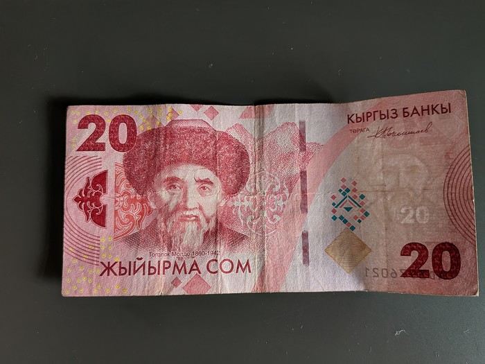
You can find the detailed account of the trip here.
- Which airline from Europe?
Turkish Airlines seems like an excellent option. The price is very reasonable (just over 500 €), the layover isn’t too long, the in-flight comfort is decent (great movie selection), and the planes are modern. Plus, the price automatically includes 30 kilos of luggage, which is perfect for campers.
The downside: the outrageous prices at Istanbul Airport.
- Bishkek Airport
The airport is under full reconstruction. It’s chaotic. There are SIM card vendors upon arrival, but no currency exchange or ATMs in the baggage claim area. You’ll find those in the departures section, which means you have to exit and re-enter under the current setup.
Personally, I pre-booked a VTC with my hotel for the transfer to the city. (Prices vary depending on the hotel’s standard—1200 soms for mine.)
There are taxis and a bus available.
- Entry Requirements
No visa is required for French citizens for stays of up to 30 days.
- Currency
The currency is the som, and the conversion is easy—just divide by 100...
You can get soms by exchanging euros (dollars are useless) or by withdrawing from an ATM. Some ATMs charge fees. Those from Mbank and Optimabank are fee-free.
The maximum withdrawal is usually 20,000 soms.
Bills come in 5000, 1000, 500, 200, 100, 50, and 20 soms.
Coins: 10, 5, 3, and 1 som.
- Paying
Card payments are accepted in supermarkets like Globus, some restaurants, gas stations of major chains (Bishkek Petroleum, Partner Neft, Red Petroleum), some hotels, national park entrances, tolls, etc.
But it doesn’t always work.
So always carry cash with you!
If the card works, great—otherwise, it’s back to the old days of wads of bills.
- Cost of Living
It’s really cheap (gas, affordable restaurants even at a decent standard, hotels, souvenirs, fruits, vegetables, water, bread...). For example, a lagman costs only 3.20 €, fixing a flat tire is 3.5 €, a full hour-long wash for a filthy 4x4 is 6 €, washing a big bag of laundry is 3 €, and a liter of 95-octane gas is 0.86 €...
On the pricier side: guesthouses and meals in guesthouses. The value for money is poor. I paid 40 € for a mediocre room with a very basic shared bathroom, while a double with AC, private bathroom, and fridge in a non-touristy hotel cost 20 €... Meals in guesthouses are the worst I’ve eaten and often the most expensive. Plus, they’re very light—don’t expect to fill up after a long day of hiking!
Car rentals are also quite expensive (70 $ per day for a RAV4 in my case).
In short, for two people, excluding accommodation and car rental, we spent an average of 45 € per day (groceries, restaurants, guesthouse dinners, souvenirs, paid activities, gas).
The trip cost us 2200 € per person all-inclusive for 3 weeks on the ground. Roughly 1/4 for the flight, 1/4 for the car, 1/4 for accommodation, and 1/4 for everything else.
- Getting Around
I’ve met cyclists, motorcyclists, people renting cars, those who drove their own vehicles from Europe, and others using public transport and taxis.
Personally, I chose to rent a car.
If you’re not planning long hikes or multi-day horse treks, it’s a great option for exploring the country.
Each car rental company has its own list of forbidden tracks. Make sure your planned route is allowed! Don’t think about ignoring this—vehicles are equipped with GPS trackers...
An international driver’s permit is required.
Police and speed cameras are everywhere, so it’s best to respect the signs (daytime running lights, seatbelts, 40-60 km/h in populated areas, 90 km/h on roads, zero tolerance for alcohol).
Locals have a unique driving style, and it can be dangerous on main roads (they overtake recklessly...). Like in Greece, South Africa, or Malta, a two-lane road is treated as a three-lane one. You pull over to let others pass or to let oncoming traffic overtake.
Without a car (at least a pseudo-4x4), you won’t be able to go everywhere. This country is a nature destination, but nature isn’t always accessible by public transport.
If a spot is near a road, great—the bus will get you almost to the door. Otherwise, you’ll need to hire an agency or take a taxi.
Cyclists will face steep climbs and dust. I’d advise avoiding main roads as much as possible—traffic isn’t on your side...
Motorcyclists will also eat a lot of dust and should research gas stations along their route (this advice also applies to vehicles running on 95-octane).
There’s a 95-octane pump in Kazarman and Gulcha.
Bikes and motorcycles have an advantage over cars, even 4x4s, as they can access some very remote tracks that other vehicles can’t (hikers and horses can obviously take them too!).
Be careful: some areas require a permit (border zones). Research this well in advance—the formalities don’t take an hour or even a day!
Be warned: Google Maps is completely unreliable (it shows roads that don’t exist, routes you through difficult tracks instead of paved roads, etc.). It’s essential to download Maps.me in advance. This app is much more reliable for this country, works offline, and is handy for hiking navigation.
A reminder: horseback riding is like cycling... If you’re not used to it or naturally padded in the right places, your backside will suffer in no time!
Think carefully before embarking on a multi-day trek!
Finally, this country is a kingdom of construction... The Chinese have taken over the market to improve truck circulation and are paving everywhere. (Good news: the Kazarman-Osh section via the tunnel is finally open in summer, even if the road isn’t quite finished.)
- Eating
I had prejudices about Kyrgyz food.
I was both wrong and right.
Supermarkets don’t offer much that’s appealing for picnics. It’s cheap, filling food, full of junk, and not gourmet. If you follow Yuka, I think you’ll be on a diet the whole trip. Bringing some pâté, sausages, or freeze-dried meals for certain nights is a good idea...
Guesthouse dinners consist of the eternal cucumber-tomato salad, a soup, and a light noodle or rice dish where you’ll be searching for the meat... Usually tough and unidentifiable. Beef? The bread is stale, and there’s no dessert or fruit.
Breakfasts always revolve around eggs or porridge... The homemade jam is usually good.
Tea is the number one drink, followed by kompot (a fruit-based drink), Coke, and Fanta.
If you want real coffee, bring your own—it’s very rare.
On the other hand, you eat well in restaurants. Lagman (homemade noodles, vegetables, spices, and usually beef), crispy eggplant, kuurdak (a kind of lamb stew with potatoes), kebabs, plov (pilaf rice with onions, carrots, and meat), and rainbow trout... For dessert? Nada!
And alcohol?
It’s available in all Globus stores: beer, wine, spirits, and you can consume your purchases in some guesthouses (depending on the owner’s religious tolerance). It’s also available in some restaurants (Bishkek, Karakol, Osh...).
The deadly specialty?
White fermented milk balls called kurut. If you think a raw-milk camembert is strong, steer clear! This is more like an old, dry, spicy goat cheese.
- Accommodation
In remote areas, it’s better to check availability on Booking a few days in advance rather than showing up last minute with high hopes.
Booking and Airbnb only offer a small portion of what’s available.
Not necessarily guesthouses, but mostly accommodations aimed at locals (business or leisure travel).
These places are generally more comfortable. There’s even some upscale options.
So it’s necessary to scour Google Maps or Yandex Maps... These accommodations are usually found on Instagram, and WhatsApp is handy for booking!
Prices are a bit of a lottery. So is the comfort. From 20 to 80 € for a double, usually with a private bathroom. (Average around 40 €). These rates are for mid-range options.
Otherwise, this country is a paradise for wild camping. In a camper van, rooftop tent, or ground tent... There are beautiful spots everywhere!
- Climate
I thought it would be quite cool/cold at altitude.
I packed too many warm clothes...
If you’re not doing high-altitude treks or sleeping in a tent, there’s no need to overload yourself with winter gear.
A good fleece, a windproof rain jacket, and technical base layers will be enough.
It only got really cold in the evenings at Song Kul Lake and Tash Rabat, and the yurts are equipped with thick blankets and a stove.
Elsewhere, temperatures ranged from 15 to 30 °C.
In short, I used the AC more than the heater! (It’s hard to drive with the windows open unless you want to be covered in dust in no time...)
- Communication
I bought an eSIM before the trip with a data plan for Kyrgyzstan (Beeline network). Perfect for communicating via WhatsApp right after landing, but this network isn’t the best in Kyrgyzstan.
We then got a physical SIM card with an unlimited one-month plan (less than 4 € including the SIM) at a Mega store downtown. This network is much better, and you get coverage in all cities and most villages. Usually in the mountain passes too.
To make yourself understood, it’s essential to download Google Translate with French, Kyrgyz, Russian, and English options.
Very useful for translating menus, signs, and communicating with locals.
Hosts and other tourism professionals will even pull out their phones to communicate with non-Russian speakers.
The police too...
- Religion
There’s a noticeable difference between the north and the southwest of the country.
In the north, it’s a bit like Albania. People are Muslim by culture but not really by religion.
In the southwest, radical Islam is growing. Mosques are more numerous and imposing. Men are more bearded, women more veiled.
For travelers, religion isn’t an issue except for the near-total absence of pork.
There’s Russian sausage, but reading the ingredient list, it’s more like a one-way ticket to cancer than an Auvergne dry sausage...
You can find the detailed account of the trip here.