Who are you? Where are you from? Where are you going?
Like last year at this time, a post about bike travel ideas.
How many of us are preparing a trip planned for this year? Probably a lot.
What’s yours—the one you’ve been dying to do for so long, maybe too long? For us, it’s a modest PARIS-MARATHON by bike, followed by MARATHON-ATHENS on foot in June 2010. And you?
May the passion keep growing before, during, and after! Happy planning and safe travels to everyone.
945 similar discussions in English
I'm currently converting a DAF/HEULIEZ MB205 bus.
Cheaper and more spacious than a regular vehicle, the paperwork (in France) isn't too difficult for approval.
I'm ready to help anyone who wants to tackle this kind of project. Those who know, help those who want to....
Cheaper and more spacious than a regular vehicle, the paperwork (in France) isn't too difficult for approval.
I'm ready to help anyone who wants to tackle this kind of project. Those who know, help those who want to....
After nearly 2 years of waiting (yeah, like many of you, we wanted to hit the road again as soon as we got back to France... but first, we had to fill up the piggy bank!), here we are at last—July, the month we’ve been waiting for!
We’ve got 30 days of exploring new places ahead of us, as well as revisiting some spots we loved back in 2012.
Here’s the plan: - Joshua Tree NP - Las Vegas - Valley of Fire SP - Yant Flat - Zion NP (Angel’s Landing) - Bryce Canyon NP (Fairyland Loop trail) - Devils Garden on the HITTR - Capitol Reef NP - Grand Teton NP - Yellowstone NP: Old Faithful - Yellowstone NP: Norris Geyser Basin and Mammoth Hot Springs - Yellowstone NP: Grand Canyon of the Yellowstone - West Thumb and Grand Teton NP - Flaming Gorge - Colorado NM and Fisher Towers - Moab: Arches - Moab: Canyonlands and Corona Arch - Moab: Canyonlands - Moab: rafting and Dead Horse Point SP - Natural Bridges NM and Valley of the Gods - Monument Valley and Horseshoe Bend - Coyote Buttes South - Grand Canyon NP (North Rim) - Grand Canyon NP (North Rim) and Navajo Bridge - Sedona - From Sedona to Tucson - Arizona-Sonora Desert Museum and Saguaro NP - Tombstone
Practical details:
- I’d read that it was better to book flight tickets directly on an airline’s website rather than through a comparison site. So, I spent months searching for reasonably priced tickets for two adults and two kids from Paris to Las Vegas for the outbound trip and from Tucson to Paris for the return. I mostly checked Air France, KLM, and British Airways, but prices were always around 4600 €. Not finding anything, we eventually went through a comparison site: Ebookers. We bought our tickets in mid-December: Paris/Atlanta with Air France, then Atlanta/Los Angeles with Delta for the outbound trip, and Tucson/Atlanta with Delta, then Atlanta/Paris with Air France for the return. Total cost: 4300 €. The layover on the outbound trip made me a little nervous because it was only 2 hours and 15 minutes. A month later, we got an email from Ebookers saying the layover had been reduced to 1 hour and 40 minutes! And a few months after that, it was down to just 1 hour and 30 minutes... So, we called Air France directly (we didn’t go through Ebookers, and it wasn’t a problem), and they put us on different flights. The new layover was 2 hours and 10 minutes—still not a ton of time, but I felt better than with 1 hour and 30 minutes. And anyway, we figured we’d see how it went!
- For the car, we tried several comparison sites, and in the end, AutoEurope won this year: 808 € for a 30-day rental of a Chevrolet Impala through Thrifty. The second driver was free for the entire trip since we picked up the car in California.
- We didn’t rent a GPS or buy one—we just downloaded Sygic on our two phones and bought the US map. I don’t remember the exact amount, but it cost us around 30 €.
- For hotels, I either booked directly on the sites (Xanterra, Grand Canyon Lodge, etc.) or used Hotels.com (to earn nights through their Welcome Rewards program) or Booking.com (when hotels weren’t available on Hotels.com). I always compared the price on Hotels.com with the hotel’s direct rate, but they were usually the same. So, for the same price, I’d rather earn a night with Welcome Rewards! We’d set a budget of 100 € per night on average, and we stuck to it pretty well—the final average came out to 101.20 € when including everything (nights + taxes + any nightly fees + parking fees + bank fees).
- As for luggage, we didn’t want to overpack! So, we left with one medium suitcase for Calista, one for me, one large suitcase for Hugo and Yannick, and a sports bag with Calista’s booster seat (we could’ve taken it on the plane with us, but I didn’t want to lug it around the airport during the layover). That sports bag came in handy on the way back, too—because, as everyone knows, you always come back with more than you left with! Each of us also had a backpack as a carry-on.
Before wrapping up this intro and getting into the real details, I’d like to thank everyone who contributed to my discussions and helped me improve our itinerary!
Quick intro for those who don’t know us: Yannick (36), Peggy (36), Hugo (11), and Calista (8).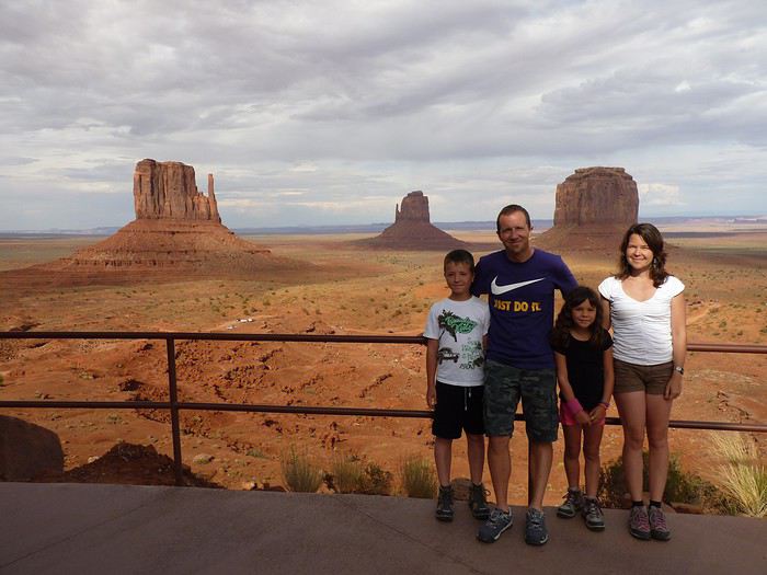
Here’s the plan: - Joshua Tree NP - Las Vegas - Valley of Fire SP - Yant Flat - Zion NP (Angel’s Landing) - Bryce Canyon NP (Fairyland Loop trail) - Devils Garden on the HITTR - Capitol Reef NP - Grand Teton NP - Yellowstone NP: Old Faithful - Yellowstone NP: Norris Geyser Basin and Mammoth Hot Springs - Yellowstone NP: Grand Canyon of the Yellowstone - West Thumb and Grand Teton NP - Flaming Gorge - Colorado NM and Fisher Towers - Moab: Arches - Moab: Canyonlands and Corona Arch - Moab: Canyonlands - Moab: rafting and Dead Horse Point SP - Natural Bridges NM and Valley of the Gods - Monument Valley and Horseshoe Bend - Coyote Buttes South - Grand Canyon NP (North Rim) - Grand Canyon NP (North Rim) and Navajo Bridge - Sedona - From Sedona to Tucson - Arizona-Sonora Desert Museum and Saguaro NP - Tombstone
Practical details:
- I’d read that it was better to book flight tickets directly on an airline’s website rather than through a comparison site. So, I spent months searching for reasonably priced tickets for two adults and two kids from Paris to Las Vegas for the outbound trip and from Tucson to Paris for the return. I mostly checked Air France, KLM, and British Airways, but prices were always around 4600 €. Not finding anything, we eventually went through a comparison site: Ebookers. We bought our tickets in mid-December: Paris/Atlanta with Air France, then Atlanta/Los Angeles with Delta for the outbound trip, and Tucson/Atlanta with Delta, then Atlanta/Paris with Air France for the return. Total cost: 4300 €. The layover on the outbound trip made me a little nervous because it was only 2 hours and 15 minutes. A month later, we got an email from Ebookers saying the layover had been reduced to 1 hour and 40 minutes! And a few months after that, it was down to just 1 hour and 30 minutes... So, we called Air France directly (we didn’t go through Ebookers, and it wasn’t a problem), and they put us on different flights. The new layover was 2 hours and 10 minutes—still not a ton of time, but I felt better than with 1 hour and 30 minutes. And anyway, we figured we’d see how it went!
- For the car, we tried several comparison sites, and in the end, AutoEurope won this year: 808 € for a 30-day rental of a Chevrolet Impala through Thrifty. The second driver was free for the entire trip since we picked up the car in California.
- We didn’t rent a GPS or buy one—we just downloaded Sygic on our two phones and bought the US map. I don’t remember the exact amount, but it cost us around 30 €.
- For hotels, I either booked directly on the sites (Xanterra, Grand Canyon Lodge, etc.) or used Hotels.com (to earn nights through their Welcome Rewards program) or Booking.com (when hotels weren’t available on Hotels.com). I always compared the price on Hotels.com with the hotel’s direct rate, but they were usually the same. So, for the same price, I’d rather earn a night with Welcome Rewards! We’d set a budget of 100 € per night on average, and we stuck to it pretty well—the final average came out to 101.20 € when including everything (nights + taxes + any nightly fees + parking fees + bank fees).
- As for luggage, we didn’t want to overpack! So, we left with one medium suitcase for Calista, one for me, one large suitcase for Hugo and Yannick, and a sports bag with Calista’s booster seat (we could’ve taken it on the plane with us, but I didn’t want to lug it around the airport during the layover). That sports bag came in handy on the way back, too—because, as everyone knows, you always come back with more than you left with! Each of us also had a backpack as a carry-on.
Before wrapping up this intro and getting into the real details, I’d like to thank everyone who contributed to my discussions and helped me improve our itinerary!
Quick intro for those who don’t know us: Yannick (36), Peggy (36), Hugo (11), and Calista (8).
From Southern Shikoku, between land and sea, to the blue waters of Miyakojima and finally Tokyo’s megacity
Hi everyone,
I have to admit, I really hesitated before deciding to write this travel journal... Writing one takes a lot of time and energy, and since this is my 4th trip, I wondered if it would actually interest anyone other than myself (both for the discovery and the writing). But after a few "Are you going to write a journal?" requests and especially the renewed pleasure from reading other travelers’ travel journals about Japan or elsewhere on this forum or elsewhere, I’ve decided to share this 4th installment in the Land of the Rising Sun here.
The itinerary: 27 full days, from late May to late June 2025, right in the middle of the rainy season, including:
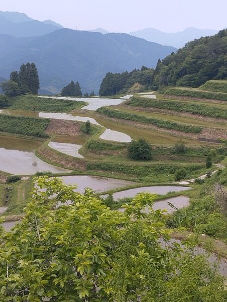
-->13 days in Shikoku, from Kochi (Kochi Prefecture) to Matsuyama (Ehime Prefecture)
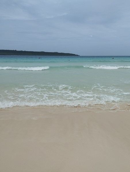
-->7 days in Miyakojima (Okinawa Prefecture)
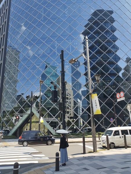
-->7 days in Tokyo
The trip was decided on fairly last-minute this year, as usual.
I regularly check flight prices to track fluctuations for this destination, even without concrete plans. Finding a slightly cheaper direct flight (900 €) than what I’d seen in previous months (around 1,200–1,400 € on average) for a Paris-Tokyo route with Japanese airline ANA was too tempting to resist the urge to return to this enchanting country. After long hesitations between exploring the San’in region (Matsue, Tottori, Yamaguchi) and southern Shikoku, the decision was made—I took the plunge! The tickets are booked: Paris to Kochi with a layover in Tokyo, all with ANA, the airline I’d been dreaming of... for 1,120 € per person. Okay, it’s not cheap, but it’s still better than in 2023.
We leave in 2 weeks!! Now it’s just a matter of getting everything ready!
Intense work ahead in these 2 weeks to:
finalize a more precise itinerary and reach an agreement—yep, because even though we both love Japan, our preferences differ slightly, and we have to choose between exploring new places or taking time to revisit beloved spots... decide how much time to spend in each selected area without rushing while still exploring research places that might interest us and watch videos about Japan book accommodations: yes, it’s possible to do this on the spot as we go, but last year, we noticed that last-minute options were pretty expensive, so we’re booking ahead—even if it means keeping a few options open while we decide or see if better deals pop up later reserve rental cars order yen check the weather regularly and wonder if choosing the *tsuyu* (rainy season) was really a good idea—and whether we’ll be stuck in non-stop rain???
What a tough job, right? Traveling to Japan for a month—such a hard life! Despite this being my 4th trip, the excitement is just as intense as the first time.
The only small downside is that when we booked the flight tickets, there were only a few seats left, so we’re only sitting together on the international return flight. Plus, on the outbound flight, we’ve got the middle seats. Another lingering question: what French-language films will be available? According to the internet, the selection seems limited. Oh well, these are just minor details—it’s almost time to fly!
PS: I’ll be posting slowly and irregularly... so for those interested, be patient or maybe set an alert...
Hi everyone,
I have to admit, I really hesitated before deciding to write this travel journal... Writing one takes a lot of time and energy, and since this is my 4th trip, I wondered if it would actually interest anyone other than myself (both for the discovery and the writing). But after a few "Are you going to write a journal?" requests and especially the renewed pleasure from reading other travelers’ travel journals about Japan or elsewhere on this forum or elsewhere, I’ve decided to share this 4th installment in the Land of the Rising Sun here.
The itinerary: 27 full days, from late May to late June 2025, right in the middle of the rainy season, including:
-->13 days in Shikoku, from Kochi (Kochi Prefecture) to Matsuyama (Ehime Prefecture)
-->7 days in Miyakojima (Okinawa Prefecture)
-->7 days in Tokyo
The trip was decided on fairly last-minute this year, as usual.
I regularly check flight prices to track fluctuations for this destination, even without concrete plans. Finding a slightly cheaper direct flight (900 €) than what I’d seen in previous months (around 1,200–1,400 € on average) for a Paris-Tokyo route with Japanese airline ANA was too tempting to resist the urge to return to this enchanting country. After long hesitations between exploring the San’in region (Matsue, Tottori, Yamaguchi) and southern Shikoku, the decision was made—I took the plunge! The tickets are booked: Paris to Kochi with a layover in Tokyo, all with ANA, the airline I’d been dreaming of... for 1,120 € per person. Okay, it’s not cheap, but it’s still better than in 2023.
We leave in 2 weeks!! Now it’s just a matter of getting everything ready!
Intense work ahead in these 2 weeks to:
finalize a more precise itinerary and reach an agreement—yep, because even though we both love Japan, our preferences differ slightly, and we have to choose between exploring new places or taking time to revisit beloved spots... decide how much time to spend in each selected area without rushing while still exploring research places that might interest us and watch videos about Japan book accommodations: yes, it’s possible to do this on the spot as we go, but last year, we noticed that last-minute options were pretty expensive, so we’re booking ahead—even if it means keeping a few options open while we decide or see if better deals pop up later reserve rental cars order yen check the weather regularly and wonder if choosing the *tsuyu* (rainy season) was really a good idea—and whether we’ll be stuck in non-stop rain???
What a tough job, right? Traveling to Japan for a month—such a hard life! Despite this being my 4th trip, the excitement is just as intense as the first time.
The only small downside is that when we booked the flight tickets, there were only a few seats left, so we’re only sitting together on the international return flight. Plus, on the outbound flight, we’ve got the middle seats. Another lingering question: what French-language films will be available? According to the internet, the selection seems limited. Oh well, these are just minor details—it’s almost time to fly!
PS: I’ll be posting slowly and irregularly... so for those interested, be patient or maybe set an alert...
Hi,
We're leaving in 5 months for a 10-month family trip, and I'd love to hear from families who've lived this experience—what tips and lessons you took away. How did the adaptation go? It must feel really strange not having a... structured day, I can't find the right words. Thanks for your feedback! celine
We're leaving in 5 months for a 10-month family trip, and I'd love to hear from families who've lived this experience—what tips and lessons you took away. How did the adaptation go? It must feel really strange not having a... structured day, I can't find the right words. Thanks for your feedback! celine
Hi everyone!
I'm one of the future round-the-world travelers, leaving on July 2, 2012.
This is my first time gearing up, and I don’t want to make a mistake with my backpack. I’ve already done quite a bit of research, but I was wondering if you could help me refine my choice.
Needs: - Around 50L backpack - Comfort as a priority - Lightweight - Designed for a woman’s back (I’ve read on other forums that this really makes a difference) - Durable fabric (water-repellent is a bonus) - Max load of 7/8 kg
> I don’t need gadgets for experienced hikers (spots for trekking poles, ice axes, etc. = useless for me and just drives up the price)
A salesperson had me try two models in-store with weights—they’re very comfortable (though I don’t have anything to compare them to).
These models don’t have small front pockets—are those essential? They don’t come with a rain cover, but I’ll buy one if I go with either of these.
What do you think?
http://www.sports-aventure.fr/boutique/fiche_produit.cfm?ref=osprey_aura_50_12&type=131&code_lg=lg_fr&num=2 http://www.sports-aventure.fr/boutique/fiche_produit.cfm?ref=osprey_aura_50&type=131&code_lg=lg_fr&num=2 (same bag, older model, cheaper)
http://www.sports-aventure.fr/boutique/fiche_produit.cfm?ref=osprey_exos_46&type=131&code_lg=lg_fr&num=2 http://www.sports-aventure.fr/boutique/fiche_produit.cfm?ref=osprey_exos_58&type=131&code_lg=lg_fr&num=2 (the best, but expensive...)
Thanks! 🙂
I'm one of the future round-the-world travelers, leaving on July 2, 2012.
This is my first time gearing up, and I don’t want to make a mistake with my backpack. I’ve already done quite a bit of research, but I was wondering if you could help me refine my choice.
Needs: - Around 50L backpack - Comfort as a priority - Lightweight - Designed for a woman’s back (I’ve read on other forums that this really makes a difference) - Durable fabric (water-repellent is a bonus) - Max load of 7/8 kg
> I don’t need gadgets for experienced hikers (spots for trekking poles, ice axes, etc. = useless for me and just drives up the price)
A salesperson had me try two models in-store with weights—they’re very comfortable (though I don’t have anything to compare them to).
These models don’t have small front pockets—are those essential? They don’t come with a rain cover, but I’ll buy one if I go with either of these.
What do you think?
http://www.sports-aventure.fr/boutique/fiche_produit.cfm?ref=osprey_aura_50_12&type=131&code_lg=lg_fr&num=2 http://www.sports-aventure.fr/boutique/fiche_produit.cfm?ref=osprey_aura_50&type=131&code_lg=lg_fr&num=2 (same bag, older model, cheaper)
http://www.sports-aventure.fr/boutique/fiche_produit.cfm?ref=osprey_exos_46&type=131&code_lg=lg_fr&num=2 http://www.sports-aventure.fr/boutique/fiche_produit.cfm?ref=osprey_exos_58&type=131&code_lg=lg_fr&num=2 (the best, but expensive...)
Thanks! 🙂
Kattegat isn’t just the name of the village in the TV series *Vikings*—it’s also the stretch of water separating Denmark from Sweden... the sea, basically! And further north, you’ve got Norway and its fjords!
Originally, I’d planned to just do a loop around Kattegat, with the *Under* restaurant in Lindesnes as our anniversary treat... but along the way, we thought, why not "push" a little further north, keeping an eye on the budget since we’d chosen to travel by car in June 2025 through Scandinavia.
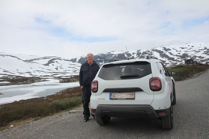
Why by car when most travelers opt for a camper van, while others prefer the comfort of cruises? Well, because we don’t own a camper van, renting one is pricey, and then you’ve got to add fuel costs (those things guzzle gas!), ferry fees, and other "tolls." All things considered, we went for mostly rentals—especially since there were four of us at the start of the trip. We spent the first week in Denmark with our daughter and son-in-law. Then they flew back to Belgium, and we continued our adventure as a couple. For accommodation, we mainly booked Airbnb apartments, which helped keep costs down and, most importantly, let us prepare our own meals (diet, diet!). In this travel journal, you’ll discover (or rediscover, for those who followed my older ones) our unbridled love for theme parks, museums, unique experiences, and—especially in Denmark—Legos! Unfortunately, we didn’t do any hikes this year because the unpredictable weather had made the trails slippery, and since I’d already taken three tumbles during the trip, I didn’t want to risk another! In the end, we traveled for 32 days, covered 6,200 km, and most importantly, discovered the charming country of Denmark, marveled at Norway’s breathtaking fjords—all without suffering the heatwave that hit France and Belgium that June! If you’ve got any questions, don’t hesitate to ask!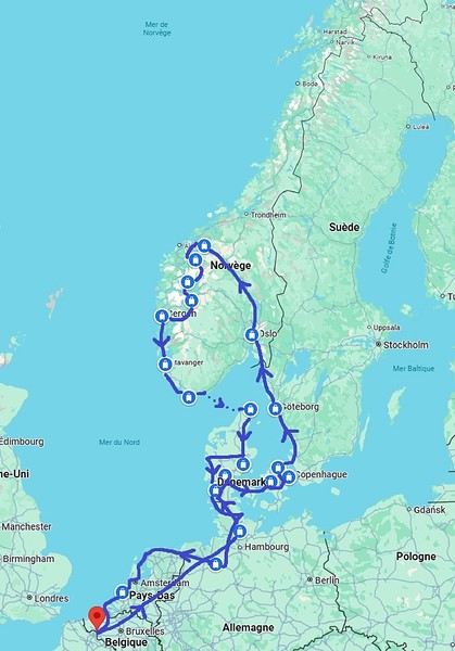
Why by car when most travelers opt for a camper van, while others prefer the comfort of cruises? Well, because we don’t own a camper van, renting one is pricey, and then you’ve got to add fuel costs (those things guzzle gas!), ferry fees, and other "tolls." All things considered, we went for mostly rentals—especially since there were four of us at the start of the trip. We spent the first week in Denmark with our daughter and son-in-law. Then they flew back to Belgium, and we continued our adventure as a couple. For accommodation, we mainly booked Airbnb apartments, which helped keep costs down and, most importantly, let us prepare our own meals (diet, diet!). In this travel journal, you’ll discover (or rediscover, for those who followed my older ones) our unbridled love for theme parks, museums, unique experiences, and—especially in Denmark—Legos! Unfortunately, we didn’t do any hikes this year because the unpredictable weather had made the trails slippery, and since I’d already taken three tumbles during the trip, I didn’t want to risk another! In the end, we traveled for 32 days, covered 6,200 km, and most importantly, discovered the charming country of Denmark, marveled at Norway’s breathtaking fjords—all without suffering the heatwave that hit France and Belgium that June! If you’ve got any questions, don’t hesitate to ask!
An 80-Day Tour of Southern Africa
Back in South Africa
January 12, 2013, 5:30 AM, Flight BA043 London-Cape Town
Directly below, Windhoek glittered like a tangle of fairy lights still lit and tossed into a box.
The horizon, edged in purple, was setting up a backup fireworks display, and suddenly, like a cherry on the platter and with unbearable intensity, in less than two minutes the entire sun revealed a gray dam and then a vast, untouched massif.
A few more minutes and the glare to the east of the plane was total. In Africa, the sun is swift.
We still had a France to cross before landing, but it felt as if we were already there. To the west, the raking light revealed what looked like acne and long, swollen scars in a desert region that might be the Swartkloofberg. Further still, straight as far as the eye could see, the two parallel tracks of a dirt road.
At 11,500 meters altitude and 940 km/h, we had a sense of stillness until the Orange River appeared, an incongruous serpent, gray edged with green.
The first South African settlements were dotted with trees providing shade, then rivers highlighted by continuous lines of vegetation.
Water and shade that make life possible.
We’ll return here by the backroads.
Half an hour from Cape Town, the plane tilted toward the sea, crossing plantations (likely citrus) and then an explosion of cultivated greenery in circles on either side of an unruly river. Finally, the coastline was no longer just sand and water—a frothy hem, a suture?
A peninsula came into view, forming two magnificent bays, and... a flight attendant firmly instructed me to return to my seat: we’d arrived!
The Colors of Cape Town
The city was dressed up as I like them—deserted, fluid, free of its vendors.
In the parking lot of the endless beach next to the commercial port north of the city, about two hundred people were unloading their goods in front of their pickups or combis, none of which were from this century: mixed-race, ageless Black people, and white folks who looked like they’d stepped out of another era.
After a few minutes, intrigued, I played a game: first looking at the merchandise, then imagining who was selling it, and finally looking at who was actually manning the stall. Tall Black vendors were selling what they often sell in Europe—leather, sunglasses, watches; mixed-race folks offered discount bundles, and the tanned older white people seemed to have emptied their attics.
We left with an antique tin kettle for morning tea over an open fire, a pack of five exercise books (that’s 600 pages to fill), Bill Bryson’s earliest stories in English, some snoek rillettes (a local fish), and—never seen before—tuna biltong and snoek biltong.
In so-called advanced countries, Sunday is for sports: white cyclists dressed like pros sweating diligently, Black street vendors running in loops at red lights to sell trash bags that day; white golfers losing their balls, which a scantily clad Black man retrieves from the water; under the sails of kite surf boards, it’s all blondes, and in the foam, joyful splashes from a bunch of Black kids.
Searching for an unusual spot for lunch, we drove through the fishing port looking for a dive and, at the end of a dead-end road with no warning, we arrived at the Shimmy Beach Club—quite the program.
The place, open for just three weeks, aims to be ultra-trendy. You could be in San Francisco, Lisbon’s docks, or St. Barth. This time, the "visible" staff was diverse, but the clientele was exclusively white, except for one mixed-race couple.
For this Sunday lunch, the women had pulled out all the stops, and local starlets—who’d make ours look tame—were turning the terrace into a frenzy.
At Cape Town’s port, the girls have *port*. The trend seems to be crochet dresses over swimsuits.
For two hours, a team of employees watered and raked the sand, starting over when they finished. A child in a floaty pink dress and a gold headband, but a future adventurer, stepped onto the freshly raked artificial beach sand for the first time.
A lanky mixed-race man dragged a hose across the ground, followed by a white woman—enchanted?—who then started watering the sand herself, carelessly splashing the glass terrace her colleague had just swept. I suspect a tacit work arrangement to keep everyone employed.
A galleon packed with tourists (are there any in the hold? Does it take tourists to Robben Island?) left the port. A helicopter took off in its wake. Trawlers returned, cutting through a ballet of catamarans, their waterlines well above the water: a bad catch.
If there’s one country where you can’t pretend to ignore skin color, it’s this one. The question is in everyone’s mind, and here more than anywhere else, it’s a decisive economic and political factor.
Columbine of Brittany
200 km north of Cape Town and 9,000 km south of the Breton coast, but on the same cold ocean, we camped on the shore of the Columbine Cape Nature Reserve, sheltered by a rocky chaos that, at first light tomorrow, would transport us to Perros-Guirec.
Our first encounter with wild animals wouldn’t end well for them: it was crayfish season, and they were the size of lobsters at Lorient’s fish market. Bought for R60 (5.5 €) a pair from kids in Pater Noster, they’d end up between two rocks, over a fire. But first, we had to pair the Chenin blanc with some snoek biltong.
With no wood, I lit a fire at dawn with dried seaweed and kelp, as if petrified; it gave off a smell of court-bouillon and... tires. Two hundred fathoms away, on an outpost, an army of cormorants stood at attention, unmoved among the frolicking seals.
At the reserve’s exit, the guard spoke French; Patrick Mwanba had arrived from Congo three years earlier to study, but the cost of living here forced him to drop out. He’d like to return home because life is cheaper there, but the war made him hesitate.
Ding ding dong! Vroom! Arf arf, Woof! Buzz! (A night from hell!)
I’d long planned to visit Calvinia, the center of a region known for extensive sheep farming. An excellent provincial museum, run by an enthusiastic curator, kept us too late to start the drive north.
So we camped in a tiny, charming campsite set up in the garden of a house. A few trees, a patch of resilient grass, and a view of a pretty lit-up steeple—what else?
Well, it turned out to be a sound-and-light show, with the pretty steeple chiming the hours and half-hours. Then suddenly, we were in the VIP stands of the Karoo-Kalahari Truck Race: roaring trucks paraded under our canvas windows, and we realized we were on the main road through town. To top it off, we enjoyed an uninterrupted canine cacophony, from the *arf arf* of little dogs to the *woof* of a mastiff. Oh, and some mosquitoes—the first ones—insisted on keeping us company in the tent, and we hadn’t yet bought the arsenal to neutralize them.
I walked through Calvinia at night; the house gardens weren’t fenced, nor did they have the «Armed Response» signs so common in the country.
The Kalahari Trails
(No, no, I haven’t converted to hiking.)
North of Calvinia, in the south of the Northern Cape, small towns follow one another up to Upington, about a hundred kilometers apart—welcome havens. Between them, with no trees in sight, we stopped in the shade of a motionless cloud: the temperature exceeded 40°C in mid-January.
We were almost out of the High Karoo and into a region of pans drying up, until the first red dunes appeared, precursors of the Kalahari. In the sparse veld vegetation, gatherings of quiver trees in the kopjes, and a caravan of camels without a handler or packs, marching in perfect formation across a pan (no, I hadn’t overdone the Windhoek at the last stop, and no, I wasn’t dehydrated enough to hallucinate).
The historic part of these towns, European in style, was built on the same plans as those in the American Midwest or the Australian Outback: a grid of streets wide enough to turn a wagon pulled by eight pairs of oxen. The architecture was Dutch-inspired, tropicalized with awnings.
Then came more recent housing, functional in style, where the wealthier mixed-race people—who make up the majority of this state—lived, and further on, the township, an assemblage of corrugated iron and plastic, like everywhere else.
Orange, Right Bank
North of Augrabies Falls National Park, on the other side of the Orange River, stretches a rugged and wild territory the size of fifty Groix islands, crisscrossed by a few tracks—the Riemvasmaak.
The inhabitants were driven out half a century ago for a military base, and as soon as President Mandela was elected, he made it a symbol by allowing the exiled populations to return. Several ethnic groups live here on almost nothing, in government-built shacks.
A community camp is set up in a small cirque at the end of a canyon that, while not in the history books, offers a good descent. By mid-afternoon, the air was at 44°C, but luckily there was a spring... except it was a hot spring, with water at 38°C. And they haven’t invented a reversible spring yet. Once the birds and baboons had settled in, in absolute silence and far from any light pollution, we enjoyed the stars like nowhere else (well, that’s what they claim in the region).
The Orange didn’t choose the easy path: arriving from Lesotho, it was almost at the ocean. The terrain to the south and north of this massif seemed easier to cross. Was it to avoid the curse of the Okavango, whose waters disappear into the sands without ever seeing the sea, that it chose this rocky route, thinking that at least the granite wouldn’t steal its water?
I Love You, I Eat You
In the dry bed of the Auob, it lay panting, head raised, alert, between its paws but head-to-tail, a tawny springbok, motionless.
A few minutes earlier, their story had been written in a lightning-fast chase, captured in photos by the driver of the car that alerted us.
It would be a long time before it started eating at the groin without breaking its surveillance.
Earlier, there was a lion lounging in the shade and hundreds of antelopes: springboks and gemsboks (oryx) in herds, hartebeests and steenboks alone. Strange pairs, apart several times, formed by a springbok and a gemsbok.
A few solitary jackals moved slightly sideways, looking furtive. Ostriches, alone, looking a bit dazed.
It was a lucky morning in the Kgalagadi (KTP).
In and Out
Kgalagadi, Nossob Camp.
We were at the very end of the almost-empty camp, ten meters from the fence, whose structure wouldn’t resist an elephant (though there aren’t any here), but it was electrified.
At dusk, on the other side, ten meters away, three lions passed in a row, as if on parade, seemingly focused on their goal and indifferent to the camp, though they glanced at it.
A jackal had gotten into the camp and was trying to get out without success while scavenging. I offered it two pieces of snoek biltong (Don’t feed the animals!) from three meters away—it smelled strong and had bones (bones in biltong!). When it passed by again, it sniffed but didn’t dare approach. Curled up in the chair, motionless, by the faint moonlight, I finally saw it come closer, grab the nearest piece, and move ten meters away to enjoy it (how many jackals know the finer points of sea biltong?). A little reassured, it came back for the second piece.
Another Morning
By morning, the jackal was gone, but our luck hadn’t left us. Two cheetahs again, who found me in the way and slowly moved toward a calmer shadow. Enough birds of prey to form a squadron, but they’re solitary hunters. Two ostriches busy with their dozen unruly chicks. And while we’re at it, a group of four Kalahari lions, sprawled under a thorny bush. Lots of oryx crossing the dunes and herds of red hartebeest. Kori bustards and secretary birds.
It was the first time the Kgalagadi had spoiled us so much.
Back in South Africa
January 12, 2013, 5:30 AM, Flight BA043 London-Cape Town
Directly below, Windhoek glittered like a tangle of fairy lights still lit and tossed into a box.
The horizon, edged in purple, was setting up a backup fireworks display, and suddenly, like a cherry on the platter and with unbearable intensity, in less than two minutes the entire sun revealed a gray dam and then a vast, untouched massif.
A few more minutes and the glare to the east of the plane was total. In Africa, the sun is swift.
We still had a France to cross before landing, but it felt as if we were already there. To the west, the raking light revealed what looked like acne and long, swollen scars in a desert region that might be the Swartkloofberg. Further still, straight as far as the eye could see, the two parallel tracks of a dirt road.
At 11,500 meters altitude and 940 km/h, we had a sense of stillness until the Orange River appeared, an incongruous serpent, gray edged with green.
The first South African settlements were dotted with trees providing shade, then rivers highlighted by continuous lines of vegetation.
Water and shade that make life possible.
We’ll return here by the backroads.
Half an hour from Cape Town, the plane tilted toward the sea, crossing plantations (likely citrus) and then an explosion of cultivated greenery in circles on either side of an unruly river. Finally, the coastline was no longer just sand and water—a frothy hem, a suture?
A peninsula came into view, forming two magnificent bays, and... a flight attendant firmly instructed me to return to my seat: we’d arrived!
The Colors of Cape Town
The city was dressed up as I like them—deserted, fluid, free of its vendors.
In the parking lot of the endless beach next to the commercial port north of the city, about two hundred people were unloading their goods in front of their pickups or combis, none of which were from this century: mixed-race, ageless Black people, and white folks who looked like they’d stepped out of another era.
After a few minutes, intrigued, I played a game: first looking at the merchandise, then imagining who was selling it, and finally looking at who was actually manning the stall. Tall Black vendors were selling what they often sell in Europe—leather, sunglasses, watches; mixed-race folks offered discount bundles, and the tanned older white people seemed to have emptied their attics.
We left with an antique tin kettle for morning tea over an open fire, a pack of five exercise books (that’s 600 pages to fill), Bill Bryson’s earliest stories in English, some snoek rillettes (a local fish), and—never seen before—tuna biltong and snoek biltong.
In so-called advanced countries, Sunday is for sports: white cyclists dressed like pros sweating diligently, Black street vendors running in loops at red lights to sell trash bags that day; white golfers losing their balls, which a scantily clad Black man retrieves from the water; under the sails of kite surf boards, it’s all blondes, and in the foam, joyful splashes from a bunch of Black kids.
Searching for an unusual spot for lunch, we drove through the fishing port looking for a dive and, at the end of a dead-end road with no warning, we arrived at the Shimmy Beach Club—quite the program.
The place, open for just three weeks, aims to be ultra-trendy. You could be in San Francisco, Lisbon’s docks, or St. Barth. This time, the "visible" staff was diverse, but the clientele was exclusively white, except for one mixed-race couple.
For this Sunday lunch, the women had pulled out all the stops, and local starlets—who’d make ours look tame—were turning the terrace into a frenzy.
At Cape Town’s port, the girls have *port*. The trend seems to be crochet dresses over swimsuits.
For two hours, a team of employees watered and raked the sand, starting over when they finished. A child in a floaty pink dress and a gold headband, but a future adventurer, stepped onto the freshly raked artificial beach sand for the first time.
A lanky mixed-race man dragged a hose across the ground, followed by a white woman—enchanted?—who then started watering the sand herself, carelessly splashing the glass terrace her colleague had just swept. I suspect a tacit work arrangement to keep everyone employed.
A galleon packed with tourists (are there any in the hold? Does it take tourists to Robben Island?) left the port. A helicopter took off in its wake. Trawlers returned, cutting through a ballet of catamarans, their waterlines well above the water: a bad catch.
If there’s one country where you can’t pretend to ignore skin color, it’s this one. The question is in everyone’s mind, and here more than anywhere else, it’s a decisive economic and political factor.
Columbine of Brittany
200 km north of Cape Town and 9,000 km south of the Breton coast, but on the same cold ocean, we camped on the shore of the Columbine Cape Nature Reserve, sheltered by a rocky chaos that, at first light tomorrow, would transport us to Perros-Guirec.
Our first encounter with wild animals wouldn’t end well for them: it was crayfish season, and they were the size of lobsters at Lorient’s fish market. Bought for R60 (5.5 €) a pair from kids in Pater Noster, they’d end up between two rocks, over a fire. But first, we had to pair the Chenin blanc with some snoek biltong.
With no wood, I lit a fire at dawn with dried seaweed and kelp, as if petrified; it gave off a smell of court-bouillon and... tires. Two hundred fathoms away, on an outpost, an army of cormorants stood at attention, unmoved among the frolicking seals.
At the reserve’s exit, the guard spoke French; Patrick Mwanba had arrived from Congo three years earlier to study, but the cost of living here forced him to drop out. He’d like to return home because life is cheaper there, but the war made him hesitate.
Ding ding dong! Vroom! Arf arf, Woof! Buzz! (A night from hell!)
I’d long planned to visit Calvinia, the center of a region known for extensive sheep farming. An excellent provincial museum, run by an enthusiastic curator, kept us too late to start the drive north.
So we camped in a tiny, charming campsite set up in the garden of a house. A few trees, a patch of resilient grass, and a view of a pretty lit-up steeple—what else?
Well, it turned out to be a sound-and-light show, with the pretty steeple chiming the hours and half-hours. Then suddenly, we were in the VIP stands of the Karoo-Kalahari Truck Race: roaring trucks paraded under our canvas windows, and we realized we were on the main road through town. To top it off, we enjoyed an uninterrupted canine cacophony, from the *arf arf* of little dogs to the *woof* of a mastiff. Oh, and some mosquitoes—the first ones—insisted on keeping us company in the tent, and we hadn’t yet bought the arsenal to neutralize them.
I walked through Calvinia at night; the house gardens weren’t fenced, nor did they have the «Armed Response» signs so common in the country.
The Kalahari Trails
(No, no, I haven’t converted to hiking.)
North of Calvinia, in the south of the Northern Cape, small towns follow one another up to Upington, about a hundred kilometers apart—welcome havens. Between them, with no trees in sight, we stopped in the shade of a motionless cloud: the temperature exceeded 40°C in mid-January.
We were almost out of the High Karoo and into a region of pans drying up, until the first red dunes appeared, precursors of the Kalahari. In the sparse veld vegetation, gatherings of quiver trees in the kopjes, and a caravan of camels without a handler or packs, marching in perfect formation across a pan (no, I hadn’t overdone the Windhoek at the last stop, and no, I wasn’t dehydrated enough to hallucinate).
The historic part of these towns, European in style, was built on the same plans as those in the American Midwest or the Australian Outback: a grid of streets wide enough to turn a wagon pulled by eight pairs of oxen. The architecture was Dutch-inspired, tropicalized with awnings.
Then came more recent housing, functional in style, where the wealthier mixed-race people—who make up the majority of this state—lived, and further on, the township, an assemblage of corrugated iron and plastic, like everywhere else.
Orange, Right Bank
North of Augrabies Falls National Park, on the other side of the Orange River, stretches a rugged and wild territory the size of fifty Groix islands, crisscrossed by a few tracks—the Riemvasmaak.
The inhabitants were driven out half a century ago for a military base, and as soon as President Mandela was elected, he made it a symbol by allowing the exiled populations to return. Several ethnic groups live here on almost nothing, in government-built shacks.
A community camp is set up in a small cirque at the end of a canyon that, while not in the history books, offers a good descent. By mid-afternoon, the air was at 44°C, but luckily there was a spring... except it was a hot spring, with water at 38°C. And they haven’t invented a reversible spring yet. Once the birds and baboons had settled in, in absolute silence and far from any light pollution, we enjoyed the stars like nowhere else (well, that’s what they claim in the region).
The Orange didn’t choose the easy path: arriving from Lesotho, it was almost at the ocean. The terrain to the south and north of this massif seemed easier to cross. Was it to avoid the curse of the Okavango, whose waters disappear into the sands without ever seeing the sea, that it chose this rocky route, thinking that at least the granite wouldn’t steal its water?
I Love You, I Eat You
In the dry bed of the Auob, it lay panting, head raised, alert, between its paws but head-to-tail, a tawny springbok, motionless.
A few minutes earlier, their story had been written in a lightning-fast chase, captured in photos by the driver of the car that alerted us.
It would be a long time before it started eating at the groin without breaking its surveillance.
Earlier, there was a lion lounging in the shade and hundreds of antelopes: springboks and gemsboks (oryx) in herds, hartebeests and steenboks alone. Strange pairs, apart several times, formed by a springbok and a gemsbok.
A few solitary jackals moved slightly sideways, looking furtive. Ostriches, alone, looking a bit dazed.
It was a lucky morning in the Kgalagadi (KTP).
In and Out
Kgalagadi, Nossob Camp.
We were at the very end of the almost-empty camp, ten meters from the fence, whose structure wouldn’t resist an elephant (though there aren’t any here), but it was electrified.
At dusk, on the other side, ten meters away, three lions passed in a row, as if on parade, seemingly focused on their goal and indifferent to the camp, though they glanced at it.
A jackal had gotten into the camp and was trying to get out without success while scavenging. I offered it two pieces of snoek biltong (Don’t feed the animals!) from three meters away—it smelled strong and had bones (bones in biltong!). When it passed by again, it sniffed but didn’t dare approach. Curled up in the chair, motionless, by the faint moonlight, I finally saw it come closer, grab the nearest piece, and move ten meters away to enjoy it (how many jackals know the finer points of sea biltong?). A little reassured, it came back for the second piece.
Another Morning
By morning, the jackal was gone, but our luck hadn’t left us. Two cheetahs again, who found me in the way and slowly moved toward a calmer shadow. Enough birds of prey to form a squadron, but they’re solitary hunters. Two ostriches busy with their dozen unruly chicks. And while we’re at it, a group of four Kalahari lions, sprawled under a thorny bush. Lots of oryx crossing the dunes and herds of red hartebeest. Kori bustards and secretary birds.
It was the first time the Kgalagadi had spoiled us so much.
We're planning a round-the-world trip in a 4x4 with a roof tent and all the gear.
We're wondering which African country allows tourists to buy a vehicle (left-hand drive)?
Thanks for any tips—they’ll be super helpful!
Hi everyone,
The idea of traveling to Bolivia came to me after seeing Jean-François (Max68)’s photos on his website. I thought we *had* to see those stunning landscapes with the colorful lagoons for ourselves. But a self-drive trip didn’t seem doable at first. A few years ago, everyone advised against going to the South Lipez with just one car.
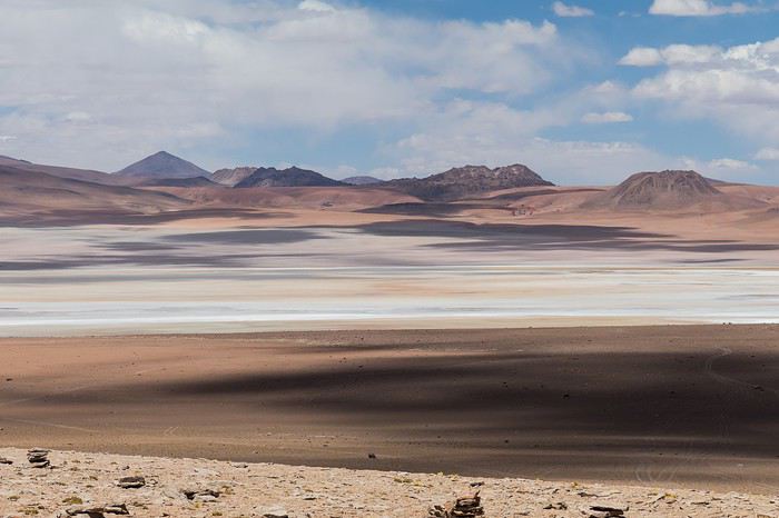 Laguna Kara
It was only after reading Laurent (Lolobe) and Pascal (Pepe874)’s travel journals—who explored the South Lipez solo with a car from Biz Rent a Car—that I thought we might be able to do the same. Meanwhile, we’d already contacted a local agency to organize a trip with a driver and guide. But the idea of a self-drive adventure really appealed to us. With encouragement and tips from Thierry (Tbernay) and Jean-François (Max68), we decided to plan our own self-drive trip. I’d like to thank them for their advice—it was *super* helpful. And a big thanks to all the other forum members for the info shared during our prep!
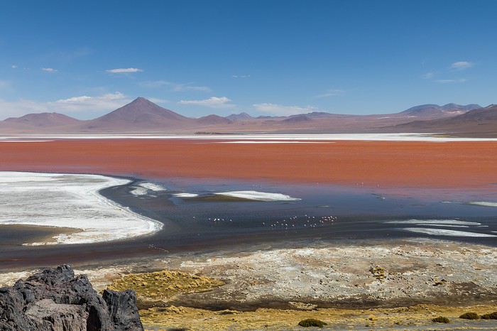 Laguna Colorada
Planning this trip happened during a tough time for our family. My mother-in-law’s illness and passing, plus a few health issues of my own, made us doubt the trip multiple times and nearly scrap the whole thing.
We booked our international flights in February with Swiss. They offered the best balance of travel time and price from Switzerland. Swiss operates Zurich–São Paulo with their own fleet, and São Paulo–Santa Cruz with GOL. In June, GOL canceled the Saturday flight and rebooked us on Sunday. Spending over 24 hours in that huge Brazilian city didn’t work for us at all, so we asked Swiss to put us on the next Zurich–São Paulo flight. Too bad—we lost a day in Bolivia and had to skip the Tarabucco market on Sunday.
Right after, we also booked the car in February. After contacting Imbex and Biz, we went with Biz. Not speaking Spanish, we were relieved to communicate with Alejandra in French. The contact was great—she answered all our questions patiently. Sometimes it took a few days to get a reply, but we could also reach her on WhatsApp. After our trip, we can *only* recommend Biz for rentals in Bolivia. The cars are well-prepped for the South Lipez tracks. The agency is reliable, and the vehicles are new and well-maintained.
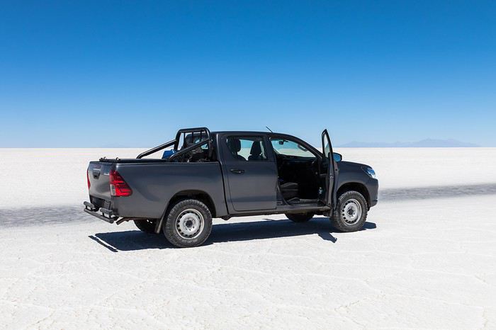 “Our” car, a Toyota Hilux
While planning, we realized the presidential elections would happen while we were in Bolivia. The risk of *bloqueos* (roadblocks and protests) was very real. But in Bolivia, *bloqueos* seem common—you always have to account for that kind of hassle. In late August/early September, Uyuni and the Salar region were blocked for days, leading to food, fuel, and cash shortages. Worried about a blockade in Uyuni and missing the Salar, we decided to visit it first *just in case*.
On election day, the whole country shut down. Planes were grounded, buses and taxis couldn’t circulate, and private cars were banned. There were a few exceptions—ambulances, police, or certain professions—but as tourists, we couldn’t get permission to drive. We asked the embassy, and Biz even requested a permit from the electoral office. So we had to plan to be somewhere with things to do *without* the car.
We decided not to book any accommodations in advance—a first for us. Usually, we plan our stops and reserve lodges, hotels, or campgrounds well ahead. This time, only the room in Sucre was booked, so we’d have a base when we arrived.
In July, Alex (Delhenry) reached out to propose joining part of the trip. He didn’t realize we were leaving in October. Still, we got fresh updates when he returned from the South Lipez. Thanks, Alex—your tips, especially about the Guadalupe–Tupiza stretch, were *super* useful.
In September, we connected with Jean-Louis (Avx) and Anne (Xeta), who were also heading to Bolivia in October, one and two weeks after us. We had dinner with Jean-Louis and his friend after our South Lipez trip and stayed in touch with Anne. It was great to chat with them! Unfortunately, Anne and her husband had a much rockier trip—they got hit hard by post-election issues.
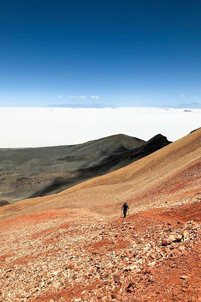 Climbing Volcán Tunupa
Our itinerary wasn’t set in stone—we decided to wing it on the spot. Two weeks before departure, I reconnected with Alejandra at Biz to move the car rental up by a day. With the elections, we wanted to leave Sucre ASAP and focus on the South Lipez. Outside Uyuni and Tupiza, the risk of blockades was zero. We also planned a two-night buffer in Sucre before our flights, just in case. It might sound overcautious, but in hindsight, we made the right call. If we’d left Sucre a day later, we wouldn’t have made it to Potosí—it was completely blocked. On the way back, we *just* dodged blockades in Potosí and elsewhere. Sometimes, you’ve gotta trust your gut.
Here’s our route—only the first two nights in Sucre were booked ahead:
D1 Departure from Switzerland
D2 Sucre (La Selenita)
D3 Sucre (La Selenita)
D4 Colchani (Hotel de Sal Luna Salada)
D5 Jirira (Auberge Doña Lupe)
D6 On the Salar (in the car)
D7 A few kilometers from Estancia Catal (in the car)
D8 Laguna Hedionda (Hotel Los Flamencos)
D9 Laguna Colorada (Lodge by the lagoon)
D10 Middle of nowhere, en route Laguna Verde–Mina Horsu–Quetena Chico (in the car)
D11 Quetena Chico (Lamphaya Lodge Andino)
D12 Quetena Chico (Lamphaya Lodge Andino)
D13 Guadalupe (Guest room at Celia’s)
D14 Along the Rio Grande (in the car)
D15 Tupiza (Hotel Mitru)
D16 Tupiza (Hotel Mitru)
D17 Sucre (La Selenita)
D18 Sucre (La Selenita)
D19 Santa Cruz (Hotel Sun)
D20 Departure from Santa Cruz
D21 Arrival in Switzerland
As you can see, we spent 13 nights in the South Lipez. Initially, we’d planned for nine, but Jean-François (Max68) suggested staying longer. Great advice—we didn’t regret it one bit. We could’ve even added 2–3 more days without getting bored.
Self-driving in the South Lipez takes some prep and a good GPS. We kept it simple and used maps.me to navigate. It’s a solid app—just save your waypoints ahead of time. For some stretches, I used Google Earth to visualize the tracks and sites. If you stick to the tour operator routes, you *almost* can’t get lost. But we often veered off the beaten path and took different routes. Some days, we didn’t see another car. So in case of a breakdown, it’s key to have water and food for several days. In some spots, there’s *zero* signal—your phone won’t work. Another must: it gets *cold* in the South Lipez, and a good sleeping bag is essential. We brought down sleeping bags rated for -10°C and didn’t regret it during our car nights.
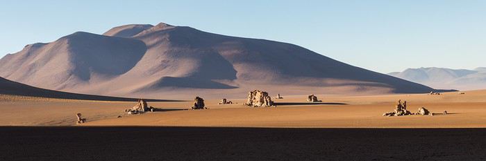 The Dalí Desert
Some tracks are *super* rocky—flat tires are a real risk. On those stretches, maps.me’s estimated travel time was way off. Some sections barely let us go over 15 km/h.
Lots of forum members recommend doing the South Lipez “loop” from Tupiza to Uyuni—ending with the Salar—to avoid Uyuni’s crowds. That might work for organized tours, but for self-drive, the direction *doesn’t* matter. I’ll say this: the few vehicles we saw mostly came from Tupiza and Chile, not Uyuni. So if starting from Uyuni works better for you, go for it! Ending in Tupiza means heading toward warmer weather. For our planned stops and climbs, starting in Uyuni helped with acclimatization. Spending a few nights between 3,600–3,800 m before going over 4,000 m is a smart move.
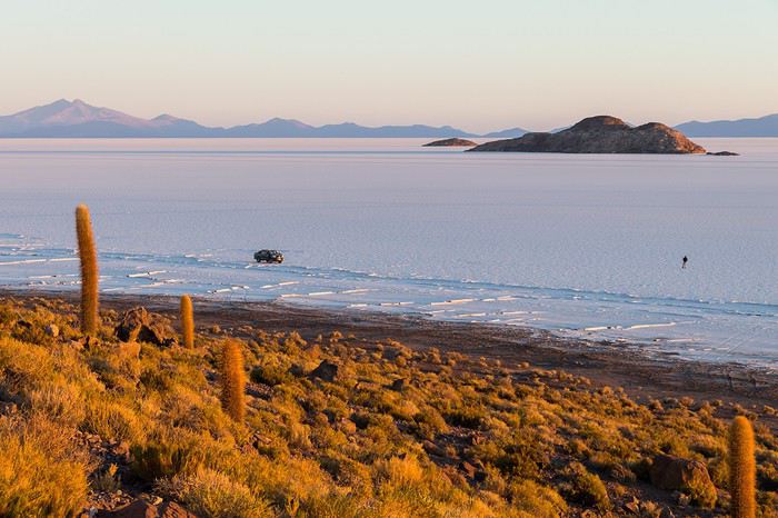 Uyuni Salt Flats in the morning
Overall, we barely saw anyone—except at Laguna Hedionda and Chalviri. There were several tour groups at Hotel Los Flamencos (Laguna Hedionda), but we didn’t cross paths during the day. Hardly anyone on the Salar, on the roads, or at the lodges in the evenings. The *only* place that shocked us was Chalviri. We’d planned to stay there, but it was fully booked—and we counted *forty* tour jeeps on-site. This was around noon! At the Polques hot springs (Chalviri), it was *packed*—we quickly nixed the idea of a dip. Plus, the vibe wasn’t great: soaking right by the road with lodges and restaurants in the background? Meh. Still, lots of tourists love it, so it’s up to you.
For the photos, I kept the colors and mood we saw. The lagoons’ hues are often stunning, but some online photos are *way* over-edited and oversaturated. The South Lipez’s landscapes are breathtaking—no need for excessive retouching.
If you don’t want to read all the details, the start of the travel journal is here: https://voyageforum.com/v.f?post=9888761;a=9888761
The idea of traveling to Bolivia came to me after seeing Jean-François (Max68)’s photos on his website. I thought we *had* to see those stunning landscapes with the colorful lagoons for ourselves. But a self-drive trip didn’t seem doable at first. A few years ago, everyone advised against going to the South Lipez with just one car.
Laguna KaraIt was only after reading Laurent (Lolobe) and Pascal (Pepe874)’s travel journals—who explored the South Lipez solo with a car from Biz Rent a Car—that I thought we might be able to do the same. Meanwhile, we’d already contacted a local agency to organize a trip with a driver and guide. But the idea of a self-drive adventure really appealed to us. With encouragement and tips from Thierry (Tbernay) and Jean-François (Max68), we decided to plan our own self-drive trip. I’d like to thank them for their advice—it was *super* helpful. And a big thanks to all the other forum members for the info shared during our prep!
Laguna ColoradaPlanning this trip happened during a tough time for our family. My mother-in-law’s illness and passing, plus a few health issues of my own, made us doubt the trip multiple times and nearly scrap the whole thing.
We booked our international flights in February with Swiss. They offered the best balance of travel time and price from Switzerland. Swiss operates Zurich–São Paulo with their own fleet, and São Paulo–Santa Cruz with GOL. In June, GOL canceled the Saturday flight and rebooked us on Sunday. Spending over 24 hours in that huge Brazilian city didn’t work for us at all, so we asked Swiss to put us on the next Zurich–São Paulo flight. Too bad—we lost a day in Bolivia and had to skip the Tarabucco market on Sunday.
Right after, we also booked the car in February. After contacting Imbex and Biz, we went with Biz. Not speaking Spanish, we were relieved to communicate with Alejandra in French. The contact was great—she answered all our questions patiently. Sometimes it took a few days to get a reply, but we could also reach her on WhatsApp. After our trip, we can *only* recommend Biz for rentals in Bolivia. The cars are well-prepped for the South Lipez tracks. The agency is reliable, and the vehicles are new and well-maintained.
“Our” car, a Toyota HiluxWhile planning, we realized the presidential elections would happen while we were in Bolivia. The risk of *bloqueos* (roadblocks and protests) was very real. But in Bolivia, *bloqueos* seem common—you always have to account for that kind of hassle. In late August/early September, Uyuni and the Salar region were blocked for days, leading to food, fuel, and cash shortages. Worried about a blockade in Uyuni and missing the Salar, we decided to visit it first *just in case*.
On election day, the whole country shut down. Planes were grounded, buses and taxis couldn’t circulate, and private cars were banned. There were a few exceptions—ambulances, police, or certain professions—but as tourists, we couldn’t get permission to drive. We asked the embassy, and Biz even requested a permit from the electoral office. So we had to plan to be somewhere with things to do *without* the car.
We decided not to book any accommodations in advance—a first for us. Usually, we plan our stops and reserve lodges, hotels, or campgrounds well ahead. This time, only the room in Sucre was booked, so we’d have a base when we arrived.
In July, Alex (Delhenry) reached out to propose joining part of the trip. He didn’t realize we were leaving in October. Still, we got fresh updates when he returned from the South Lipez. Thanks, Alex—your tips, especially about the Guadalupe–Tupiza stretch, were *super* useful.
In September, we connected with Jean-Louis (Avx) and Anne (Xeta), who were also heading to Bolivia in October, one and two weeks after us. We had dinner with Jean-Louis and his friend after our South Lipez trip and stayed in touch with Anne. It was great to chat with them! Unfortunately, Anne and her husband had a much rockier trip—they got hit hard by post-election issues.
Climbing Volcán TunupaOur itinerary wasn’t set in stone—we decided to wing it on the spot. Two weeks before departure, I reconnected with Alejandra at Biz to move the car rental up by a day. With the elections, we wanted to leave Sucre ASAP and focus on the South Lipez. Outside Uyuni and Tupiza, the risk of blockades was zero. We also planned a two-night buffer in Sucre before our flights, just in case. It might sound overcautious, but in hindsight, we made the right call. If we’d left Sucre a day later, we wouldn’t have made it to Potosí—it was completely blocked. On the way back, we *just* dodged blockades in Potosí and elsewhere. Sometimes, you’ve gotta trust your gut.
Here’s our route—only the first two nights in Sucre were booked ahead:
D1 Departure from Switzerland
D2 Sucre (La Selenita)
D3 Sucre (La Selenita)
D4 Colchani (Hotel de Sal Luna Salada)
D5 Jirira (Auberge Doña Lupe)
D6 On the Salar (in the car)
D7 A few kilometers from Estancia Catal (in the car)
D8 Laguna Hedionda (Hotel Los Flamencos)
D9 Laguna Colorada (Lodge by the lagoon)
D10 Middle of nowhere, en route Laguna Verde–Mina Horsu–Quetena Chico (in the car)
D11 Quetena Chico (Lamphaya Lodge Andino)
D12 Quetena Chico (Lamphaya Lodge Andino)
D13 Guadalupe (Guest room at Celia’s)
D14 Along the Rio Grande (in the car)
D15 Tupiza (Hotel Mitru)
D16 Tupiza (Hotel Mitru)
D17 Sucre (La Selenita)
D18 Sucre (La Selenita)
D19 Santa Cruz (Hotel Sun)
D20 Departure from Santa Cruz
D21 Arrival in Switzerland
As you can see, we spent 13 nights in the South Lipez. Initially, we’d planned for nine, but Jean-François (Max68) suggested staying longer. Great advice—we didn’t regret it one bit. We could’ve even added 2–3 more days without getting bored.
Self-driving in the South Lipez takes some prep and a good GPS. We kept it simple and used maps.me to navigate. It’s a solid app—just save your waypoints ahead of time. For some stretches, I used Google Earth to visualize the tracks and sites. If you stick to the tour operator routes, you *almost* can’t get lost. But we often veered off the beaten path and took different routes. Some days, we didn’t see another car. So in case of a breakdown, it’s key to have water and food for several days. In some spots, there’s *zero* signal—your phone won’t work. Another must: it gets *cold* in the South Lipez, and a good sleeping bag is essential. We brought down sleeping bags rated for -10°C and didn’t regret it during our car nights.
The Dalí DesertSome tracks are *super* rocky—flat tires are a real risk. On those stretches, maps.me’s estimated travel time was way off. Some sections barely let us go over 15 km/h.
Lots of forum members recommend doing the South Lipez “loop” from Tupiza to Uyuni—ending with the Salar—to avoid Uyuni’s crowds. That might work for organized tours, but for self-drive, the direction *doesn’t* matter. I’ll say this: the few vehicles we saw mostly came from Tupiza and Chile, not Uyuni. So if starting from Uyuni works better for you, go for it! Ending in Tupiza means heading toward warmer weather. For our planned stops and climbs, starting in Uyuni helped with acclimatization. Spending a few nights between 3,600–3,800 m before going over 4,000 m is a smart move.
Uyuni Salt Flats in the morningOverall, we barely saw anyone—except at Laguna Hedionda and Chalviri. There were several tour groups at Hotel Los Flamencos (Laguna Hedionda), but we didn’t cross paths during the day. Hardly anyone on the Salar, on the roads, or at the lodges in the evenings. The *only* place that shocked us was Chalviri. We’d planned to stay there, but it was fully booked—and we counted *forty* tour jeeps on-site. This was around noon! At the Polques hot springs (Chalviri), it was *packed*—we quickly nixed the idea of a dip. Plus, the vibe wasn’t great: soaking right by the road with lodges and restaurants in the background? Meh. Still, lots of tourists love it, so it’s up to you.
For the photos, I kept the colors and mood we saw. The lagoons’ hues are often stunning, but some online photos are *way* over-edited and oversaturated. The South Lipez’s landscapes are breathtaking—no need for excessive retouching.
If you don’t want to read all the details, the start of the travel journal is here: https://voyageforum.com/v.f?post=9888761;a=9888761
Why bike (MTB) along the canal between the Two Seas: the lateral canal of the Garonne from Bordeaux to Toulouse, and the Midi Canal from Toulouse to the Mediterranean?
This canal was created to connect the Mediterranean to the Atlantic without going around Spain, and along its entire length, there’s an old towpath (used to pull barges). Since this path is closed to traffic (except for service vehicles from Voies Navigables de France), no cars drive on it—it’s dangerous, noisy, and polluting. The Canal between the Two Seas was built for transporting goods, so it passes through many towns you can explore without dealing with traffic. You can stock up on supplies or spend the night. You’ll discover the varied landscapes of the countryside, always in the serenity brought by the calm and slow flow of the canal’s water. Most of the time, you’ll be in the shade of trees planted to stabilize the banks with their roots. All you have to do is follow this blue—or rather green—ribbon without needing to consult a map. But the biggest advantage is that it’s flat! Of course, on the Canal du Midi, water flows from the watershed divide at Naurouze eastward to the Mediterranean and westward to Toulouse. On the lateral canal of the Garonne, water flows toward Bordeaux. But this slope is almost imperceptible, which is a huge plus when you want to travel by bike for several days with luggage.
When I say "bike," I really mean MTB because, while the towpath has been replaced in some places by a paved bike path, it mostly resembles a dirt trail—sometimes smooth, sometimes rocky, and often cluttered with roots from the magnificent trees lining it. Since the canal was classified as a UNESCO World Heritage site, improvements have been underway, but it won’t be tomorrow that you’ll be able to ride from Bordeaux to Sète on a road bike. And I’m afraid the first sections of the path will be worn out before the rest is finished. You might even run into construction work for this bike path. That’s what happened to me during the spring of 2007.
Sunday, 03/11 – Valence d'Agen 08:15 to Toulouse (Rangueil) 16:30 97 km in 8h15 (6h on the bike) I started on the recently paved path along the lateral canal of the Garonne. The first locks appeared, and as I approached Moissac, the path turned into a billiard table until Castelsarrasin. After the Cousteau port, I was back on the classic dirt towpath with its rocks, roots, and nutria holes. But not for long—soon, I hit ruts left by backhoes and bulldozers, which, fortunately, were resting for the Sunday. A pile of rubble taller than me blocked the entire width of the path. I didn’t want to turn back to find the previous bridge and ride on the other bank, which was just as impassable (dense grass). It wasn’t easy to carry a bike with full panniers, so I lifted it over several mounds. I kept going, sometimes on foot, unsure how far the construction extended. Another bulldozer—luckily, the ground was dry. The work went all the way to Montech, making the path impassable. I recommend taking the N113, which runs parallel (that’s what I did on the way back). In Montech, the famous water slope was at rest, waiting for tourists. For many kilometers, I was back on the traditional towpath. The closer I got to Toulouse, the better the surface became, and the more cyclists and pedestrians I saw—until the city center, where there was nonstop bike traffic, especially students heading to Rangueil.
Monday, 03/12 – Rangueil 09:10 to Revel 16:30 86 km in 7h20 (5h30 on the bike) As soon as you reach Toulouse, you make a 90° turn to follow the connection between the lateral canal and the Canal du Midi. Heading east, you pass the barge selling the famous Toulouse violet souvenirs. A real bike path has been built for 50 km to Port Lauragais. It’s a true joy for Toulousains and travelers. Restrooms have been installed or shared with highway rest areas, allowing you to refill water (of course, bikes are banned from ASF rest areas, but cleverly placed racks let you secure your bike and walk in). At Port Lauragais, it’s another rest area shared by highway users, cyclists, and boaters. You’ll find a cafeteria, restaurant, hotel, and a shop selling regional souvenirs. But the real pleasure is reaching the watershed divide at Naurouze, where water flows toward the Mediterranean on one side and the Atlantic on the other. There, I decided to leave the Canal du Midi, which continues toward Castelnaudary with a much rougher towpath, to follow the *Rigole* that feeds the canal with water from the Saint-Ferréol basin. For me, it was like returning to the source—a bit like a pilgrimage in honor of the brilliant Pierre-Paul Riquet, the designer of this magnificent work. I followed the service trail along the *Rigole*. It’s actually a variant of the GR 653, leading to Revel alongside this artificial waterway. It’s fed by water from the Montagne Noire, and I was worried about a steep climb. But that wasn’t the case—the *Rigole* winds for 40 km, flowing gently under the trees. It was better than a dream: a smooth dirt path with the crunch of pine needles under the wheels, where I only crossed paths with a few fishermen... And to soothe sore buns, the last kilometers were on packed earth—a paradise (ATVs, stay away!). More walkers and cyclists appeared there.
Tuesday, 03/13 After a restful night in Revel, I started the morning with a walk around Lake Saint-Ferréol. A very pleasant 10 km hike, but I don’t recommend it for mountain bikers unless you’re used to mountain terrain and have strong calves. Otherwise, you can take the road—there are at least two hotels near the lake. In the afternoon, I began the return trip to Tarn-et-Garonne via the same path, with the same pleasure.
Total: 378 km of suffering and bliss, for which I must thank the departmental and regional councils for their funding, Voies Navigables de France for maintenance, and the volunteers who mark the hiking trails. And don’t you think you’re exaggerating a bit with your 378 km of bliss and the paradise of the *Rigole*?
Okay, fine—it wasn’t always idyllic. Sometimes the path was downright *pierrique*... but I had great weather, and the landscapes were so beautiful (water, sun, vegetation). In the rain or mud, it would’ve been less fun. What does *pierrique* even mean?
*Pierrique* is worse than rocky. I know a Pierrick, and he’s tough. And why *Facteur4*?
It’s France’s goal to reduce greenhouse gas emissions by a factor of 4 by 2050. I’m doing my part by biking to work 3 out of 4 times. And your cassoulet?
Guilty as charged. I ate the best cassoulet of my life at the Hôtel du Midi in Revel. But it was very productive in methane. My stomach hurt so much I couldn’t sleep and ended up writing my postcards between 3 and 4 AM. So many great memories!
This canal was created to connect the Mediterranean to the Atlantic without going around Spain, and along its entire length, there’s an old towpath (used to pull barges). Since this path is closed to traffic (except for service vehicles from Voies Navigables de France), no cars drive on it—it’s dangerous, noisy, and polluting. The Canal between the Two Seas was built for transporting goods, so it passes through many towns you can explore without dealing with traffic. You can stock up on supplies or spend the night. You’ll discover the varied landscapes of the countryside, always in the serenity brought by the calm and slow flow of the canal’s water. Most of the time, you’ll be in the shade of trees planted to stabilize the banks with their roots. All you have to do is follow this blue—or rather green—ribbon without needing to consult a map. But the biggest advantage is that it’s flat! Of course, on the Canal du Midi, water flows from the watershed divide at Naurouze eastward to the Mediterranean and westward to Toulouse. On the lateral canal of the Garonne, water flows toward Bordeaux. But this slope is almost imperceptible, which is a huge plus when you want to travel by bike for several days with luggage.
When I say "bike," I really mean MTB because, while the towpath has been replaced in some places by a paved bike path, it mostly resembles a dirt trail—sometimes smooth, sometimes rocky, and often cluttered with roots from the magnificent trees lining it. Since the canal was classified as a UNESCO World Heritage site, improvements have been underway, but it won’t be tomorrow that you’ll be able to ride from Bordeaux to Sète on a road bike. And I’m afraid the first sections of the path will be worn out before the rest is finished. You might even run into construction work for this bike path. That’s what happened to me during the spring of 2007.
Sunday, 03/11 – Valence d'Agen 08:15 to Toulouse (Rangueil) 16:30 97 km in 8h15 (6h on the bike) I started on the recently paved path along the lateral canal of the Garonne. The first locks appeared, and as I approached Moissac, the path turned into a billiard table until Castelsarrasin. After the Cousteau port, I was back on the classic dirt towpath with its rocks, roots, and nutria holes. But not for long—soon, I hit ruts left by backhoes and bulldozers, which, fortunately, were resting for the Sunday. A pile of rubble taller than me blocked the entire width of the path. I didn’t want to turn back to find the previous bridge and ride on the other bank, which was just as impassable (dense grass). It wasn’t easy to carry a bike with full panniers, so I lifted it over several mounds. I kept going, sometimes on foot, unsure how far the construction extended. Another bulldozer—luckily, the ground was dry. The work went all the way to Montech, making the path impassable. I recommend taking the N113, which runs parallel (that’s what I did on the way back). In Montech, the famous water slope was at rest, waiting for tourists. For many kilometers, I was back on the traditional towpath. The closer I got to Toulouse, the better the surface became, and the more cyclists and pedestrians I saw—until the city center, where there was nonstop bike traffic, especially students heading to Rangueil.
Monday, 03/12 – Rangueil 09:10 to Revel 16:30 86 km in 7h20 (5h30 on the bike) As soon as you reach Toulouse, you make a 90° turn to follow the connection between the lateral canal and the Canal du Midi. Heading east, you pass the barge selling the famous Toulouse violet souvenirs. A real bike path has been built for 50 km to Port Lauragais. It’s a true joy for Toulousains and travelers. Restrooms have been installed or shared with highway rest areas, allowing you to refill water (of course, bikes are banned from ASF rest areas, but cleverly placed racks let you secure your bike and walk in). At Port Lauragais, it’s another rest area shared by highway users, cyclists, and boaters. You’ll find a cafeteria, restaurant, hotel, and a shop selling regional souvenirs. But the real pleasure is reaching the watershed divide at Naurouze, where water flows toward the Mediterranean on one side and the Atlantic on the other. There, I decided to leave the Canal du Midi, which continues toward Castelnaudary with a much rougher towpath, to follow the *Rigole* that feeds the canal with water from the Saint-Ferréol basin. For me, it was like returning to the source—a bit like a pilgrimage in honor of the brilliant Pierre-Paul Riquet, the designer of this magnificent work. I followed the service trail along the *Rigole*. It’s actually a variant of the GR 653, leading to Revel alongside this artificial waterway. It’s fed by water from the Montagne Noire, and I was worried about a steep climb. But that wasn’t the case—the *Rigole* winds for 40 km, flowing gently under the trees. It was better than a dream: a smooth dirt path with the crunch of pine needles under the wheels, where I only crossed paths with a few fishermen... And to soothe sore buns, the last kilometers were on packed earth—a paradise (ATVs, stay away!). More walkers and cyclists appeared there.
Tuesday, 03/13 After a restful night in Revel, I started the morning with a walk around Lake Saint-Ferréol. A very pleasant 10 km hike, but I don’t recommend it for mountain bikers unless you’re used to mountain terrain and have strong calves. Otherwise, you can take the road—there are at least two hotels near the lake. In the afternoon, I began the return trip to Tarn-et-Garonne via the same path, with the same pleasure.
Total: 378 km of suffering and bliss, for which I must thank the departmental and regional councils for their funding, Voies Navigables de France for maintenance, and the volunteers who mark the hiking trails. And don’t you think you’re exaggerating a bit with your 378 km of bliss and the paradise of the *Rigole*?
Okay, fine—it wasn’t always idyllic. Sometimes the path was downright *pierrique*... but I had great weather, and the landscapes were so beautiful (water, sun, vegetation). In the rain or mud, it would’ve been less fun. What does *pierrique* even mean?
*Pierrique* is worse than rocky. I know a Pierrick, and he’s tough. And why *Facteur4*?
It’s France’s goal to reduce greenhouse gas emissions by a factor of 4 by 2050. I’m doing my part by biking to work 3 out of 4 times. And your cassoulet?
Guilty as charged. I ate the best cassoulet of my life at the Hôtel du Midi in Revel. But it was very productive in methane. My stomach hurt so much I couldn’t sleep and ended up writing my postcards between 3 and 4 AM. So many great memories!
Preamble
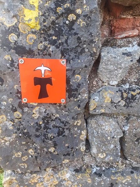
June 2024. While hiking with my brother on the GR 36 Tour du Morvan, I catch sight now and then of strange rectangular markers fixed to tree trunks. Against a bright orange background, a deep black Greek tau topped with a white dove. My first encounter with the Assisi Way. The Way of St. Francis: a pilgrimage route linking Vézelay in Burgundy to Assisi in Italy, covering nearly 1,800 km. It felt like an obvious next step—I immediately knew I’d take it on, attempt the adventure solo.
In the months that followed, I talked about my project to everyone—family, friends, my partner. An avalanche of comments, more or less the same but varying depending on each person’s character and life experiences. But deep down, it all boiled down to one legitimate question: why?
And the answers? Hesitant, awkward, partial, even confused. I quickly realized they weren’t so easy to find. It was as if my project seemed more like a whim, a kind of intimate caprice, rather than a well-thought-out plan. Of course, I knew the reasons that pushed me to leave—you always have to give some. Loved ones need to understand to feel reassured, and that’s understandable. But I fear that when I list them, they’ll sound like the same old checklist anyone embarking on this kind of journey might give. Of all the reasons I could mention, I’ll highlight just one here: the call of the road, the solo adventure that brings a powerful sense of freedom. A bit like Monsieur Seguin’s goat, who from her comfortable pen gazes longingly at the unconstrained horizon of the mountain. But if I’m being honest, I think I didn’t really know what I was looking for—or, more importantly, what I’d find. Deep down, when I reflect on it, one word keeps coming up that explains nothing and everything at once: desire.
Now well past sixty, I know that when I ask myself who I am or where I’m going, two things bring me fully back to myself: hiking and writing. And my intention was also to anchor this adventure through words, day by day. Writing down my feelings, emotions, discoveries, and reflections each evening. The famous travel journal that grounds the daily experience in reality. When I discovered the app "Polarstep," which was initially just meant to keep my loved ones updated and reassured, inform them of my progress, and maintain a connection, I found an opportunity to do it a little differently than usual. No retrospective notes polished up after returning, but spontaneous writing—recounting everything that crossed my mind during the day and publishing it immediately. A journey lived in real time.
This text is the exact transcription of my daily writings. Rereading them, I didn’t change a thing—just corrected a few mistakes and tweaked some awkward phrasing here and there. Short texts, fitting the format imposed by this kind of app. Writing as if addressing others.
Now, all that was left was to walk. April 18, 2026 – Vézelay.
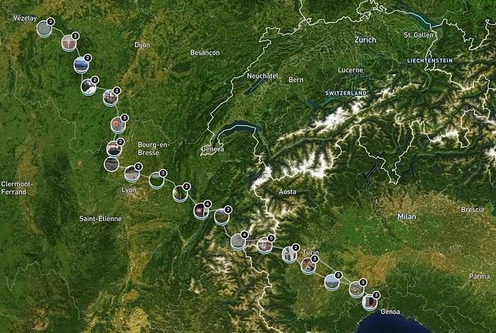
June 2024. While hiking with my brother on the GR 36 Tour du Morvan, I catch sight now and then of strange rectangular markers fixed to tree trunks. Against a bright orange background, a deep black Greek tau topped with a white dove. My first encounter with the Assisi Way. The Way of St. Francis: a pilgrimage route linking Vézelay in Burgundy to Assisi in Italy, covering nearly 1,800 km. It felt like an obvious next step—I immediately knew I’d take it on, attempt the adventure solo.
In the months that followed, I talked about my project to everyone—family, friends, my partner. An avalanche of comments, more or less the same but varying depending on each person’s character and life experiences. But deep down, it all boiled down to one legitimate question: why?
And the answers? Hesitant, awkward, partial, even confused. I quickly realized they weren’t so easy to find. It was as if my project seemed more like a whim, a kind of intimate caprice, rather than a well-thought-out plan. Of course, I knew the reasons that pushed me to leave—you always have to give some. Loved ones need to understand to feel reassured, and that’s understandable. But I fear that when I list them, they’ll sound like the same old checklist anyone embarking on this kind of journey might give. Of all the reasons I could mention, I’ll highlight just one here: the call of the road, the solo adventure that brings a powerful sense of freedom. A bit like Monsieur Seguin’s goat, who from her comfortable pen gazes longingly at the unconstrained horizon of the mountain. But if I’m being honest, I think I didn’t really know what I was looking for—or, more importantly, what I’d find. Deep down, when I reflect on it, one word keeps coming up that explains nothing and everything at once: desire.
Now well past sixty, I know that when I ask myself who I am or where I’m going, two things bring me fully back to myself: hiking and writing. And my intention was also to anchor this adventure through words, day by day. Writing down my feelings, emotions, discoveries, and reflections each evening. The famous travel journal that grounds the daily experience in reality. When I discovered the app "Polarstep," which was initially just meant to keep my loved ones updated and reassured, inform them of my progress, and maintain a connection, I found an opportunity to do it a little differently than usual. No retrospective notes polished up after returning, but spontaneous writing—recounting everything that crossed my mind during the day and publishing it immediately. A journey lived in real time.
This text is the exact transcription of my daily writings. Rereading them, I didn’t change a thing—just corrected a few mistakes and tweaked some awkward phrasing here and there. Short texts, fitting the format imposed by this kind of app. Writing as if addressing others.
Now, all that was left was to walk. April 18, 2026 – Vézelay.
Welcome everyone!
It’s been a while since I last wrote a travel journal, but this recent trip to Iceland reignited my urge to write—both for the breathtaking landscapes we discovered and our adventure full of twists and turns!
This Iceland trip is part of our world tour, which we started back in August 2019. We (Sandrine and Flo) left by plane with our baby, Lena, who was barely 5 months old at the time. We backpacked around the Pacific for 5 months before returning home for a short break to see family. That was just before COVID hit, in late January 2020.
What followed was a bit chaotic... For the second part of our world tour, we were supposed to pick up a new vehicle: a brand-new pickup with a camper cell we planned to live in for several years. Due to lockdown, we received the cell weeks late, and with borders closing, we had to rethink all our plans.
So, we postponed our Iceland departure by over a month and a half, jumping on the first ferry accessible to French travelers after lockdown! Our goal is to spend 3 months there, from early July to late September, in our new camper cell. Our base vehicle is a Toyota Hilux we bought new, fitted with a flatbed where the cell sits, and we’ve prepped it for this trip (reinforced springs + airbags, snorkel, chassis protection, and off-road tires...). The aim is to tackle as many off-road tracks in Iceland as possible, knowing this is already our 3rd trip there (3 weeks in summer 2016 with a Durango, then 1 week in winter 2018).
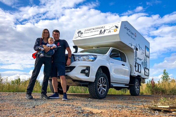
I’m kicking off our travel journal here! Along with photos, I’ll also include our vlogs, which we’ve been posting weekly since our departure in June—hope you enjoy them too! :-)
TRAVEL JOURNAL SUMMARY The journey up to Denmark The horrible ferry crossing The south of the Eastern Fjords
It’s been a while since I last wrote a travel journal, but this recent trip to Iceland reignited my urge to write—both for the breathtaking landscapes we discovered and our adventure full of twists and turns!
This Iceland trip is part of our world tour, which we started back in August 2019. We (Sandrine and Flo) left by plane with our baby, Lena, who was barely 5 months old at the time. We backpacked around the Pacific for 5 months before returning home for a short break to see family. That was just before COVID hit, in late January 2020.
What followed was a bit chaotic... For the second part of our world tour, we were supposed to pick up a new vehicle: a brand-new pickup with a camper cell we planned to live in for several years. Due to lockdown, we received the cell weeks late, and with borders closing, we had to rethink all our plans.
So, we postponed our Iceland departure by over a month and a half, jumping on the first ferry accessible to French travelers after lockdown! Our goal is to spend 3 months there, from early July to late September, in our new camper cell. Our base vehicle is a Toyota Hilux we bought new, fitted with a flatbed where the cell sits, and we’ve prepped it for this trip (reinforced springs + airbags, snorkel, chassis protection, and off-road tires...). The aim is to tackle as many off-road tracks in Iceland as possible, knowing this is already our 3rd trip there (3 weeks in summer 2016 with a Durango, then 1 week in winter 2018).
I’m kicking off our travel journal here! Along with photos, I’ll also include our vlogs, which we’ve been posting weekly since our departure in June—hope you enjoy them too! :-)
TRAVEL JOURNAL SUMMARY The journey up to Denmark The horrible ferry crossing The south of the Eastern Fjords
Well, since the lockdown is dragging on, I’m starting a new travel journal following the one I finished publishing yesterday:
https://voyageforum.com/discussion/voyage-pays-perles-voyage-dans-ouest-americain-d9943984/
This time, after the U.S., we’re heading to the Middle East—Jordan!
And we’re keeping up the good habits: one day’s entry published every day at 5:30 PM! Happy reading, and feel free to leave a comment, question, or remark...
Franck
Franck
This three-week trip to Namibia was a big first for us:
- Visiting a country in winter, for someone who starts feeling comfortable at 25°C (77°F).
- Camping, when we usually feel at home in a starred hotel.
- Sleeping on the roof of a car—what an idea... when a comfy bed is waiting just a bit further.
- Grocery shopping, cooking, doing the dishes... all the things we usually avoid to fully enjoy our vacation.
- Washing up when and how we can, when we can’t imagine going a day without a shower.
- Driving a big 4x4 on the left, with a manual transmission, when we usually opt for an automatic for more comfort.
Yep! You guessed it—we stepped way out of our comfort zone during this trip.
I had quite a few doubts while planning this adventure, but the more I read travel journals about Namibia, the more I wanted to go.
Personally, without this forum, I never would’ve dared to hit the Namibian roads in a 4x4. I was really anxious during the planning, so I want to thank everyone who contributed with their journals and forum discussions for helping me leave more peacefully.
At first, I wasn’t even considering sleeping in a tent. But after my husband’s persuasion—and my own curiosity to experience what I’d read in those travel journals—I gave in. So off we went in a double-cab Hilux with a rooftop tent.
And of course, let’s talk about me—the big cold-weather wimp. One of the biggest pre-trip challenges was choosing a sleeping bag. After a while, sleeping bags had no more secrets for me: temperature ratings (comfort, limit, extreme), shapes (mummy, rectangular), fillings (synthetic, down), compression rate, and weight... all these factors were a real puzzle. In the end, to make sure I wouldn’t be put off camping in winter (Australian winter, mind you), I went for a sleeping bag with a comfort rating of -10°C. And just to be *extra* sure I wouldn’t get cold, I bought a liner (never knew what that was before) in Thermolite, which boosts the sleeping bag’s temperature by 11°C. There are liners that add up to 15°C, but let’s not exaggerate—we’re not heading to the North Pole! My husband, on the other hand, got a sleeping bag with a -5°C comfort rating and a silk liner.
Was it enough? You’ll find out soon. In the meantime, another big thank you to everyone who helped me make this choice with their advice and experience.
Over a year in advance, we planned a three-week itinerary for our first trip to Namibia—classic route, nothing too out there. We chose to do the circuit clockwise because we wanted to finish on a high note in Etosha and its wildlife. They say it’s like Noah’s Ark out there! And why not, the cherry on top... some big cats.
We used Tourmaline’s services to book our accommodations and the 4x4.
Here’s our planned itinerary with campsites and lodgings—yes, there are a few solid roofs in there; we didn’t want to push it too far.
Day 1: Windhoek – Windhoek Gardens Guesthouse Day 2: Kalahari Anib Campsite Day 3: Namibrand Family Hideout Day 4: Sesriem Camp Day 5: Sesriem Camp Day 6: Rostock Ritz Camp Day 7: Swakopmund - Sea Breeze Guesthouse Day 8: Swakopmund - Sea Breeze Guesthouse Day 9: Spitzkoppe Camp Tented Day 10: Brandberg White Lady Campsite Day 11: Grootberg Lodge Day 12: Opuwo Country Campsite Day 13: Epupa Camp Day 14: Hobatere Lodge Day 15: Etosha Olifantsrus Camp Day 16: Etosha Okaukuejo Camp Day 17: Etosha Halali Camp Day 18: Etosha Namutoni Camp Day 19: Cheetah Eco Lodge Day 20: Windhoek – Londiningi B&B
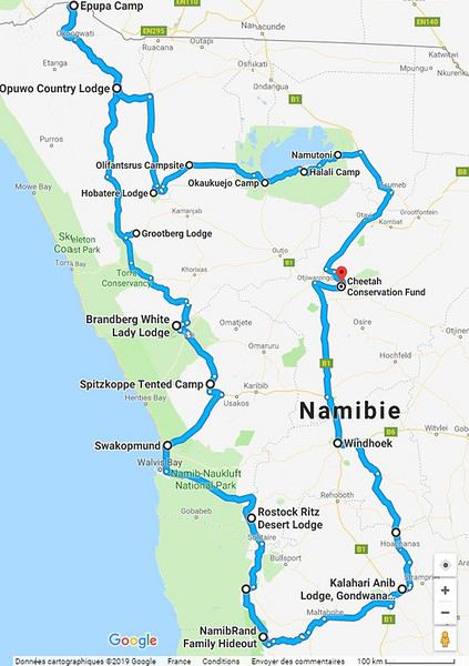
Alright! Are you ready to follow this adventure with us in our Hilux?
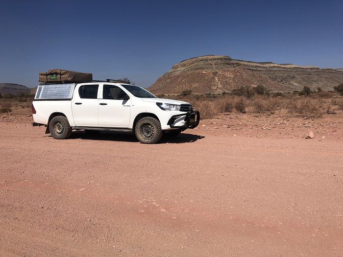
Yep! You guessed it—we stepped way out of our comfort zone during this trip.
I had quite a few doubts while planning this adventure, but the more I read travel journals about Namibia, the more I wanted to go.
Personally, without this forum, I never would’ve dared to hit the Namibian roads in a 4x4. I was really anxious during the planning, so I want to thank everyone who contributed with their journals and forum discussions for helping me leave more peacefully.
At first, I wasn’t even considering sleeping in a tent. But after my husband’s persuasion—and my own curiosity to experience what I’d read in those travel journals—I gave in. So off we went in a double-cab Hilux with a rooftop tent.
And of course, let’s talk about me—the big cold-weather wimp. One of the biggest pre-trip challenges was choosing a sleeping bag. After a while, sleeping bags had no more secrets for me: temperature ratings (comfort, limit, extreme), shapes (mummy, rectangular), fillings (synthetic, down), compression rate, and weight... all these factors were a real puzzle. In the end, to make sure I wouldn’t be put off camping in winter (Australian winter, mind you), I went for a sleeping bag with a comfort rating of -10°C. And just to be *extra* sure I wouldn’t get cold, I bought a liner (never knew what that was before) in Thermolite, which boosts the sleeping bag’s temperature by 11°C. There are liners that add up to 15°C, but let’s not exaggerate—we’re not heading to the North Pole! My husband, on the other hand, got a sleeping bag with a -5°C comfort rating and a silk liner.
Was it enough? You’ll find out soon. In the meantime, another big thank you to everyone who helped me make this choice with their advice and experience.
Over a year in advance, we planned a three-week itinerary for our first trip to Namibia—classic route, nothing too out there. We chose to do the circuit clockwise because we wanted to finish on a high note in Etosha and its wildlife. They say it’s like Noah’s Ark out there! And why not, the cherry on top... some big cats.
We used Tourmaline’s services to book our accommodations and the 4x4.
Here’s our planned itinerary with campsites and lodgings—yes, there are a few solid roofs in there; we didn’t want to push it too far.
Day 1: Windhoek – Windhoek Gardens Guesthouse Day 2: Kalahari Anib Campsite Day 3: Namibrand Family Hideout Day 4: Sesriem Camp Day 5: Sesriem Camp Day 6: Rostock Ritz Camp Day 7: Swakopmund - Sea Breeze Guesthouse Day 8: Swakopmund - Sea Breeze Guesthouse Day 9: Spitzkoppe Camp Tented Day 10: Brandberg White Lady Campsite Day 11: Grootberg Lodge Day 12: Opuwo Country Campsite Day 13: Epupa Camp Day 14: Hobatere Lodge Day 15: Etosha Olifantsrus Camp Day 16: Etosha Okaukuejo Camp Day 17: Etosha Halali Camp Day 18: Etosha Namutoni Camp Day 19: Cheetah Eco Lodge Day 20: Windhoek – Londiningi B&B
Alright! Are you ready to follow this adventure with us in our Hilux?
It's all in the title—I'm 70, and I've been traveling by bike (tent and camp stove) for five years now. Statistically, how many more years do I have left to plan my destinations and see (almost) everything?
Question is half realistic, half humorous.
To keep it simple: how old are you, fellow senior cyclists still on the road? And what are your biggest challenges?
Personally, I'm in good physical shape, though my cruising speed has dropped from 3–4 km/h over the past five years.
But arthritis (hip) is starting to make it tricky to swing my leg over the frame.
Hi there,
I’m currently looking for a bike to do my first bike trip across France, with the ultimate goal of cycling through Latin America. I’ve got a lot of questions and I’d love to hear if you have any answers or advice to share. First off, I’ve been through this before with hiking. I want to get top-quality gear right away. When I started hiking, I ended up buying everything three times—first beginner gear, then intermediate, then expert, etc. For biking, I’d prefer to skip that process and invest right now in a bike that could ideally handle Latin America. I’ve set a total max budget of around 5000 € (roughly 4000–4500 € for the bike and the rest for accessories: panniers, helmet, cycling shorts, etc.).
So, I’ve got quite a few questions:
* I’ve read in several places that some people recommend buying the bike directly in Latin America. Since I need a first bike to train in Europe, would it be better to buy an entry-level bike in France (and sell it before the big departure)? Or is it preferable to start right away with my final bike to get used to it? Is buying it there just to save a bit of money?
* For a long-term trip (around six months) in Latin America, is it better to go for a gravel bike or a mountain bike?
* Should I buy a new bike or a refurbished one? Even more so given that I’m planning a long trip—could a refurbished bike end up causing more breakdowns?
If you have any advice on models, technical features to prioritize, or recommended sellers or resellers, I’d love to hear it. I’m a total beginner—I’ve only just started watching videos and reading up on the subject, and all the technical specs are new to me!
Thanks in advance for your help!
I’m currently looking for a bike to do my first bike trip across France, with the ultimate goal of cycling through Latin America. I’ve got a lot of questions and I’d love to hear if you have any answers or advice to share. First off, I’ve been through this before with hiking. I want to get top-quality gear right away. When I started hiking, I ended up buying everything three times—first beginner gear, then intermediate, then expert, etc. For biking, I’d prefer to skip that process and invest right now in a bike that could ideally handle Latin America. I’ve set a total max budget of around 5000 € (roughly 4000–4500 € for the bike and the rest for accessories: panniers, helmet, cycling shorts, etc.).
So, I’ve got quite a few questions:
* I’ve read in several places that some people recommend buying the bike directly in Latin America. Since I need a first bike to train in Europe, would it be better to buy an entry-level bike in France (and sell it before the big departure)? Or is it preferable to start right away with my final bike to get used to it? Is buying it there just to save a bit of money?
* For a long-term trip (around six months) in Latin America, is it better to go for a gravel bike or a mountain bike?
* Should I buy a new bike or a refurbished one? Even more so given that I’m planning a long trip—could a refurbished bike end up causing more breakdowns?
If you have any advice on models, technical features to prioritize, or recommended sellers or resellers, I’d love to hear it. I’m a total beginner—I’ve only just started watching videos and reading up on the subject, and all the technical specs are new to me!
Thanks in advance for your help!
Hey there, it's me again—back with my usual travel journal share for our loved ones, from our 15-day trip in October 2019.
"Ah, here it is at last—that sweet scent of elsewhere so dear to Cricri and Lulu’s noses, that mix of apprehension and desire when facing the unknown.
We’re really diving into the unknown this time, taking you to the island of SAO TOMÉ... also known as the island: *‘Wait, what did you say?’* 😄. Because apparently, no one’s heard of Sao Tomé—except our Portuguese friends.
It’s an archipelago of three islands smack in the middle of the world, right on the equator, off the coast of Gabon.
No, these aren’t the sun-soaked, Polynesian lagoon islands. Here, *‘it rains, it pours...’* pretty much all the time, it seems.
There’s not much to *‘see’* in the traditional tourist sense—EXCEPT for stunning landscapes, lush vegetation, a few beaches with golden or black sand, colonial buildings still in their original state, a single main road, and plenty of *‘tracks’* that are more or less drivable. All this surrounded by an African population that speaks Portuguese and is known for its warm welcome.
Well, that should be enough for our happiness—and hopefully yours too! 😊
Ready for landing?
"Ah, here it is at last—that sweet scent of elsewhere so dear to Cricri and Lulu’s noses, that mix of apprehension and desire when facing the unknown.
We’re really diving into the unknown this time, taking you to the island of SAO TOMÉ... also known as the island: *‘Wait, what did you say?’* 😄. Because apparently, no one’s heard of Sao Tomé—except our Portuguese friends.
It’s an archipelago of three islands smack in the middle of the world, right on the equator, off the coast of Gabon.
No, these aren’t the sun-soaked, Polynesian lagoon islands. Here, *‘it rains, it pours...’* pretty much all the time, it seems.
There’s not much to *‘see’* in the traditional tourist sense—EXCEPT for stunning landscapes, lush vegetation, a few beaches with golden or black sand, colonial buildings still in their original state, a single main road, and plenty of *‘tracks’* that are more or less drivable. All this surrounded by an African population that speaks Portuguese and is known for its warm welcome.
Well, that should be enough for our happiness—and hopefully yours too! 😊
Ready for landing?
Hello everyone,
It’s been a little over a year and a half since we first set foot in South Africa, and ever since, we’ve been dreaming of returning to explore Southern Africa.
First of all, a big thank you to all the forum members—there are so many on this VoyageForum section, some of whom are unconditional and indispensable experts on the destination—for the amazing travel journals that only make you want one thing: to go and discover these stunning lands. The first journal I read was Bruno’s (Montagnard74), and I was completely captivated by the face in the colors of the rainbow nation.
Now it’s my turn to add my small contribution by recounting our two-week trip during the Christmas period in South Africa.
Even though Attila strongly advised against visiting South Africa during the South African summer holidays, we still gave it a try since my husband doesn’t have the option to choose his vacation dates.
So we went during the peak tourist season, with all its drawbacks: difficulties finding accommodations, crowds at certain sites... But on the bright side, it’s the beautiful season in South Africa while it’s gray and cold back home.
For this trip, we wanted to explore Cape Town and its surroundings, which are already packed with things to see. As a result, we didn’t have time to head north without rushing too much. So we planned the following itinerary, staying in the south:
J1: Lyon/Dubai J2: Dubai/Cape Town J3: Table Mountain – Cape Town J4: Botanic Garden - Robben Island J5: Cape Peninsula J6: Cape Agulhas - Gansbaai J7: De Hoop - Swellendam J8: Garden Route - Knysna J9: Garden Route - Addo NP J10: Addo NP J11: Oudtshoorn J12: Little Karoo J13: Wine Route - Cape Town/Dubai J14: Dubai/Lyon
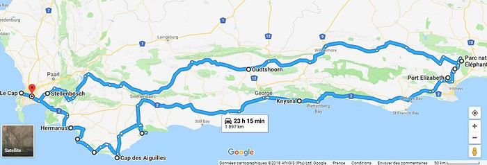
To give you a taste of what we experienced on the South African roads, here’s a little preview of the wildlife and flora we encountered, as well as the beaches and mountains we glimpsed.
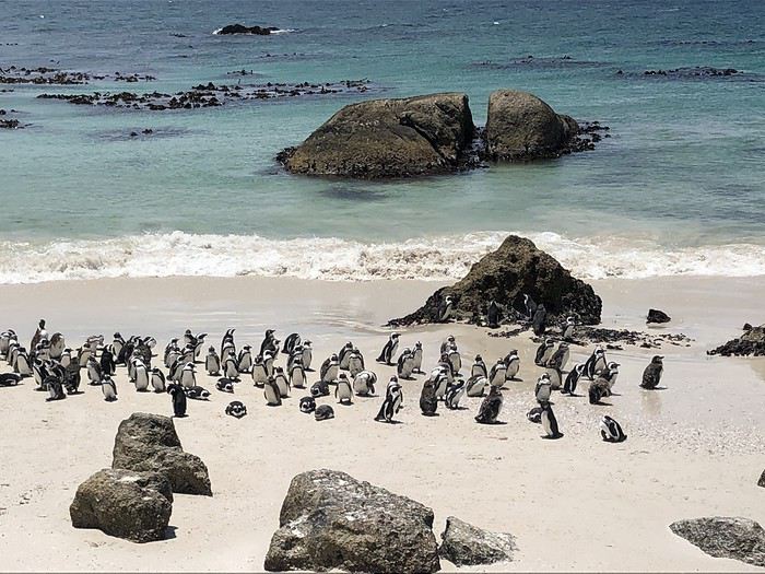
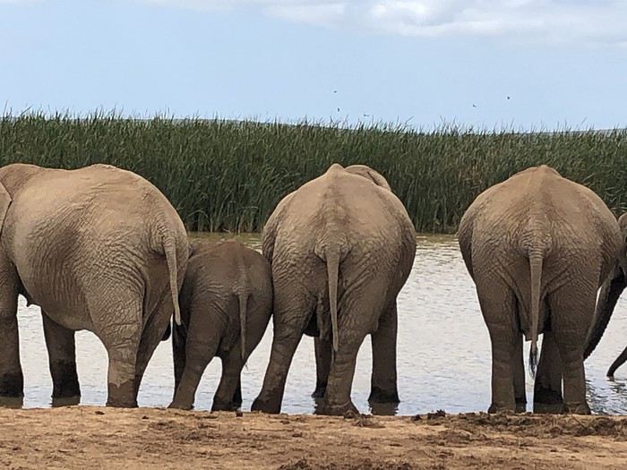
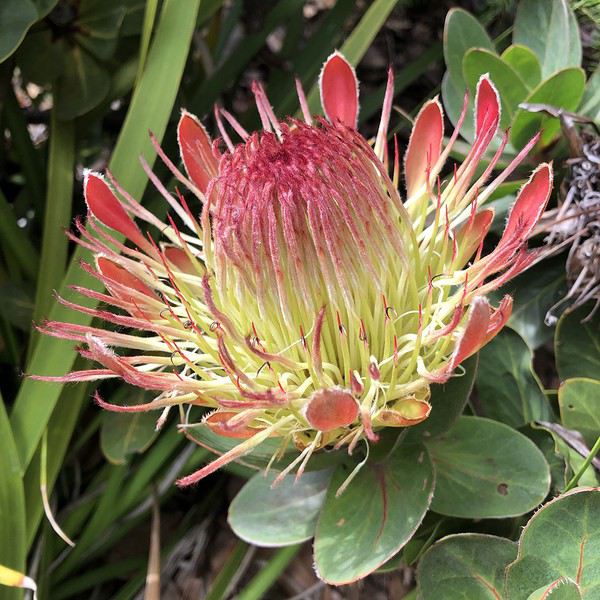
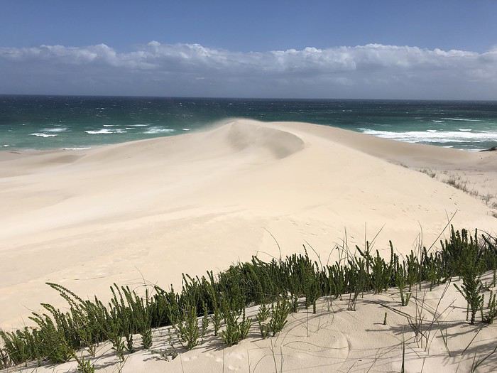
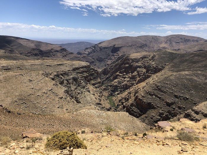
The rest here
First of all, a big thank you to all the forum members—there are so many on this VoyageForum section, some of whom are unconditional and indispensable experts on the destination—for the amazing travel journals that only make you want one thing: to go and discover these stunning lands. The first journal I read was Bruno’s (Montagnard74), and I was completely captivated by the face in the colors of the rainbow nation.
Now it’s my turn to add my small contribution by recounting our two-week trip during the Christmas period in South Africa.
Even though Attila strongly advised against visiting South Africa during the South African summer holidays, we still gave it a try since my husband doesn’t have the option to choose his vacation dates.
So we went during the peak tourist season, with all its drawbacks: difficulties finding accommodations, crowds at certain sites... But on the bright side, it’s the beautiful season in South Africa while it’s gray and cold back home.
For this trip, we wanted to explore Cape Town and its surroundings, which are already packed with things to see. As a result, we didn’t have time to head north without rushing too much. So we planned the following itinerary, staying in the south:
J1: Lyon/Dubai J2: Dubai/Cape Town J3: Table Mountain – Cape Town J4: Botanic Garden - Robben Island J5: Cape Peninsula J6: Cape Agulhas - Gansbaai J7: De Hoop - Swellendam J8: Garden Route - Knysna J9: Garden Route - Addo NP J10: Addo NP J11: Oudtshoorn J12: Little Karoo J13: Wine Route - Cape Town/Dubai J14: Dubai/Lyon
To give you a taste of what we experienced on the South African roads, here’s a little preview of the wildlife and flora we encountered, as well as the beaches and mountains we glimpsed.
The rest here
Hi everyone,
A quick introduction. I'm 27, I live in Picardy, and I'm getting married in 2017. We'd like to spend our honeymoon in French Polynesia for 3 weeks.
I'm open to all kinds of advice!!!
I think we'll use a travel agency because our work schedules don't leave us much time to organize the trip... Unless I change my mind! ;-)
But we don’t want our trip to turn into tourist clichés—we really don’t like that. That said, we *do* want to see those postcard-perfect beaches and landscapes!
We don’t dive, but I think we’ll try a beginner’s dive, and maybe even get our Level 1 certification, depending on how it goes (I read some comments about it on this forum).
Anyway, I’m looking for any information and internet links to make this trip a success.
This is THE trip of a lifetime, and it has to be perfect!
Thanks for your help!
I’m also checking out the different threads about Polynesia on this forum ;-)
Cycling Through Provence's Big Climbs
In the autumn of 2011, Provence was hit by apocalyptic weather—torrential rain and a particularly violent east wind, reaching 130 kilometers per hour, whipping up waves as high as seven meters. It wasn’t the best time to venture outside. Yet, I told myself that after the storm, calm would return. I kept an eye on the weather forecast and noticed that starting November 10th, a favorable window should open for a little 600-kilometer cycling trip across Provence. The weather reports promised a high-pressure system that would keep the bad weather at bay over these highlands. That was all I needed to decide to set off. The planned route would take me through Provence’s biggest climbs: Mont Ventoux, Montagne de Lure, the Verdon Gorge, the Massif des Maures, and Sainte-Baume.
And so, despite my doubts, the call of adventure was stronger. The train pulled away, and once again, a journey began at Part-Dieu station. This time, I headed toward Haute-Provence for a cycling adventure. It would be my first solo bike trip. I was a little nervous—cycling with panniers makes you feel vulnerable to theft. I’d already been robbed while traveling in a group in Peru, and that experience left me deeply shaken. Alone, I hesitated. But no need to panic—I’d read accounts from long-distance cyclists who hadn’t been robbed, even if it does happen sometimes. I was particularly thinking of a young schoolteacher who had taken a sabbatical to cycle around the world. Her students had remarked, "Teacher, you’re not sporty—how will you manage to cycle around the world?" This young woman was full of resourcefulness. In South America, before flying to China, she locked her bike to a post to take care of a natural need. When she returned, the post had been torn out, and her bike—along with all her gear—was gone. It was a shock for many, but not for her. She boarded her flight to the Middle Kingdom, bought the essentials (including a new bike) once there, and continued her journey! Remembering this story, I almost felt ashamed of my cowardice. These were the thoughts running through my mind as the Rhône Valley rolled by toward Orange, the starting point of my Provençal adventure through the big climbs.
Day One: Orange to Sault via Mont Ventoux – 90 km
9:30 AM, I stepped off the train. With all my gear, I had to navigate the underground passage—no easy feat, given that my bike and luggage weighed 35 kilos. At this time of year, I expected some areas to be deserted, so I’d packed enough to bivouac comfortably. Once outside the station, the southern light flooded over me. I understood why people dream of retiring in these sun-drenched regions. As always, after disembarking from public transport, I had to get my bearings and decide which way to go. The sun, still low on the horizon, pointed east. The roar of fighter jet engines helped me locate the Air Base 115. That was all I needed to "reset the gyros."
As soon as I started pedaling, all my apprehensions vanished. The joy of discovery and physical effort took over, and euphoria washed over me. It’s amazing how emotions can shift from one moment to the next based on seemingly minor circumstances.
The weather was splendid—the forecast had predicted continuous showers, but it was completely wrong. I quickly left the city behind. Mont Ventoux loomed mysteriously, its dimensions hard to gauge. It was even more enigmatic with its summit hidden beneath swirling, mottled clouds clinging to the ridges. It reminded me of a great South American volcano. I struggled to imagine that in a few hours, I’d be up there under that blanket of mist.
The countryside was shaking off its autumnal nighttime dampness. The vineyards, interspersed with tall cypress hedges, confirmed I was in the magnificent Côtes du Rhône wine region. The distinctive Dentelles de Montmirail were very much in evidence. The air force base wasn’t far. I passed the runway’s end markers. A Mirage 2000 flew overhead in a tight turn, followed by another roaring into takeoff. It came straight at me before climbing sharply with a thunderous roar. Thirty years spent in that captivating world came rushing back. I recalled countless extraordinary human and technical experiences from my time in the service. But the purpose of this post isn’t to promote the air force—though I might post some articles one day about travels among men at war.
I continued on my way, leaving my past loves behind. As I pedaled, delightful names rolled by: Violès, Vacqueyras, Gigondas, Beaumes-de-Venise—the crème de la crème of the Côtes du Rhône Villages appellation. I let myself be enchanted by the vineyards and the little paths crisscrossing them. I started to doubt my route, though the imposing mass of Mont Ventoux in the distance acted like a giant beacon. At a crossroads, a car appeared. I approached to ask the driver for directions, but she didn’t even look at me and sped off, clearly frightened. I’d almost forgotten what a fearful world we live in, no doubt traumatized by all the horrors we see in the news and on TV.
The kilometers started adding up, but was my day’s goal too ambitious? It had been two months since I’d last ridden my bike. True, my last trip had been good training—the Route des Grandes Alpes—but that was two months ago. I can’t just take my bike out for a day trip; I need that sense of adventure to find the courage to exercise.
Two cyclists overtook me. Intrigued by my load, they struck up a conversation. They were skeptical when I told them I planned to cross Mont Ventoux that day. One of them pointed out a small chapel near the summit where I could bivouac sheltered. That motivated me even more to reach the top on this first stage. The chapel also had a mythical name for me—Sainte-Anne, the name of my parents’ villa. It was already noon, and I’d covered 50 kilometers. Malaucène appeared—the sacred village of Ventoux’s mad cyclists. Surprisingly, I didn’t see any other cyclists today. I remembered this place in June, teeming with aspirants for the king of summits. Before tackling the climb ahead, I needed to refuel. I enjoyed a pleasant gastronomic break at Max’s. At 1 PM, I started the most famous climb in cycling—21 kilometers, which would actually be 23. I knew it would be tough, especially with two handicaps: 50 kilometers already in my legs and 20 kilos of luggage. But I was counting on my tiny chainring, which let me climb trees to tackle the steep ramps.
I set off at a brisk pace along a deserted road. My speed held up for the first few kilometers. I quickly rose above the valley, the horizon widening. I was surprised to see no one on this world-renowned route among cycling enthusiasts. During the climb and descent, I’d only see five cyclists—but I’ll come back to that. I passed a sign explaining that the effort would be roughly equivalent to climbing the Col de la Bonnette. Having done the latter in September, I figured I’d be fine. I crossed paths with my first cyclist—a woman speeding downhill. After 12 kilometers, I hit slopes averaging 12%. I don’t know if the number 12 is cursed, but I got such a "bamboo" hit that I’d never experienced before. I thought I wouldn’t make it to the summit today. I stopped. My thighs burned so much I could barely walk—lactic acid overload. I looked for a relatively flat spot to pitch my tent. It was 3:30 PM, with two hours of daylight left. But I found nothing.
I got back on my bike, intending to stop as soon as I found a good bivouac spot. But nothing came up. However, my strength slowly returned, perhaps because the slope eased, though it remained around 10%. I entered the summit mists. A cyclist overtook me. I was in the zone where I had to pass the summit. Dusk caught me in the final difficulties. The atmosphere was downright austere. In the twilight, a kilometer from the summit, a cyclist was fixing his bike. I asked if he needed help. He made it clear he didn’t understand. So I asked, "Do you need some help?" His answer was clear: "No, thank you." He showed me his new inner tube. Inside, I thought, "Phew!" If I’d had to stop, sweating in the falling night with the cold intensifying, I’d have struggled to get going again. But he managed, and I continued into the twilight fog. I could barely make out the summit’s large antennas in the clouds, like immense ghosts trying to evade sight. The bike delivered sensations worthy of mountain racing. My goal was to quickly find the famous chapel in the descent to take shelter. As I glided down the southern slope, two cyclists without lights crossed my path in the night—probably heading to the station above, its lights visible in the fog.
I scanned the roadside in the dark for the chapel but saw nothing. After a kilometer or two, I lost all hope. I stopped to put on more clothes as the cold became intense. I had no idea where I could stop on these steep slopes to set up camp. Between the swirls of mist, I could intermittently see the Rhône Valley below, dotted with illuminated towns and villages. The sight was striking. What was I doing on this mountain at night? Then the miracle happened—the clouds parted, and from the ridge above me to the east, a beautiful full moon emerged, casting enough light to consider a nighttime descent to Sault, 26 kilometers away.
In this eerie atmosphere between the moon’s pale rays and patches of fog, I began my descent through a hazy, almost unreal world. The Ventoux’s characteristic white scree reflected the moonlight faintly, dimmed by the mist. In places, entire mountainsides were plunged into complete darkness, and I lost all sense of the road’s path. Then, around a tight bend caused by a land shift, the light returned. It seemed extreme compared to the darkness I’d left behind. I could once again clearly see the road’s contours, though not its potholes or gravel patches. Still, I let the slope carry me, and the speed felt significant, though the low light prevented me from reading my speedometer. In these moments, concentration was at its peak—all senses alert, reflexes ready to react to the slightest incident that could lead to a fall.
I was relieved to see Sault’s lights growing closer. In less than an hour, I reached it, considering the final little climb that required one last push. This village, bustling in summer, was deserted at this time of year—almost dead. The first hotel I came across was closed. A quick shadow passed in a small sloping street. Before it disappeared into the darkness at a house corner, I chased after it and asked about accommodation options. Very kindly, I was directed to what was probably the only hotel open in November. I quickly found it, and the reception was open. I entered wearing my black balaclava, bought in the Ayacucho region—the birthplace of Peru’s Shining Path. At this late hour, I saw questioning glances directed at me. I prefaced, "This isn’t a hold-up." Clearly, the owners had a sense of humor—they started smiling. I took off my balaclava and asked for a room. No problem, and from that moment, the pressure eased. I really didn’t feel like going back out to find a spot to pitch my tent in the biting cold.
The stage had been nearly 100 kilometers, and it was the first. It had been two months since I’d touched my bike, and I probably lacked even minimal training, even though my last bike trip had been crossing the French Alps. I really had to dig deep to overcome my weakness on Ventoux’s steep section. I don’t remember ever having to search so deeply for the energy to keep going. I knew the stage I’d set for tomorrow was significant, with the climb up Montagne de Lure’s northern slope—Ventoux’s little sister, whose ascent is reputed to be endless, over 25 kilometers. I hoped this first day wouldn’t leave me too sore to avoid suffering excessively tomorrow.
For now, relaxation—a hot shower did me a world of good, followed by a good meal. I ate a delicious andouillette from Troyes, very fine, with a particularly successful herb seasoning. I loved it, and yet I’m from Lyon and pride myself on knowing a thing or two about andouillette—not just a sausage but a whole category! A bit chauvinistic, I had to admit, though reluctantly, that I found it better than the ones I usually eat in the Lyon region!
Day Two: Sault to Forcalquier via Montagne de Lure – 116 km
This morning, the weather was magnificent—the air clear, still, very fresh, and invigorating, as only the late season can offer on these Provençal highlands. In summer, they’re known for their scorching heat and drought, but often overlooked is how harsh they can be with cold and storms. Authors like Giono or Bosco described them and their inhabitants wonderfully in books like "Les Âmes Fortes."
The miracle of the night had worked. I wasn’t sore anywhere and felt in great shape. I set off well-equipped, but the effort and sun soon made me sweat. It was time to shed some layers—hat and gloves. A gentle warmth replaced the cold, making for excellent cycling conditions. On the road to Trinit, there was no traffic—only the occasional hunters’ cars parked in the distance. These vehicles were recognizable by their large cages, used to transport hunting dogs. Sometimes, the silence was broken by a distant gunshot. The deciduous forests were losing their foliage, taking on that dull brown hue of late autumn, though here and there, a tree or shrub still resisted, displaying vivid yellow or red. The meadows, their grass already scorched by the cold, were damp from the night’s heavy humidity. The low sun highlighted thousands of spider webs that had trapped insects during the warm season.
Behind me, Mont Ventoux dominated these vast spaces. As often, its imposing, stony summit was crowned with a blanket of clouds. What an impressive mountain—it’s always so hard to gauge its dimensions. I struggled to realize that last night I’d been at the summit and descended its immense southern ridge in the dark. I hoped to return one day in favorable conditions—daylight and no clouds—to enjoy the vast panorama from this unique summit.
Leaving the very Provençal village of Trinit, I tackled my first climb of the day—the Col de l’Homme Mort. The road rose moderately for five kilometers in gentle warmth. The view over the region widened, and I felt the sheer joy of pedaling. At a good pace, I overcame this first little challenge. Once at the pass, I couldn’t resist the ritual of photographing my bike in front of the sign, giving the name and altitude—1,213 meters.
The northern slope was austere and still in shadow. The cold bit again. The road was wet and covered with leaves in places. It wasn’t impossible that some treacherous patches of black ice lurked around a bend. I descended toward the Jabron Valley with caution. Suddenly, around a bend in a forest clearing, the freshly snow-covered Alps, gleaming in the sun, leapt into view, blocking the horizon. I thought I recognized the distinctive silhouette of the Écrins’ south face above a multitude of jagged peaks.
This snow and these mountains awakened a flood of memories of great joys, but I also thought of the guide and his client who had just lost their lives on the Grandes Jorasses’ north face, at the top of a route called the Linceul. The name comes from the face’s appearance—a great ice slope bordering the Grandes Jorasses’ north wall. It was first climbed by René Desmaison in 1968. He passed away a few years ago and, in his final wishes, asked that his ashes be scattered in the Dévoluy Massif at the foot of Pic de Bure, not far from here in these immense pre-Alpine folds.
At my feet, the Jabron Valley stretched almost endlessly east toward Sisteron. In the distance, the dark mass of Montagne de Lure’s north face loomed. This mountain shares similarities with Mont Ventoux. It has the same summit scree of bright limestone, the same forests climbing up to the final rocky stretch, and that blanket of clouds adding a secretive, austere touch to the scene.
I turned left past the town of Séderon and headed toward the little Col de la Pigière, which in a few kilometers allowed me to truly plunge into the beautiful Jabron Valley. I passed through several villages with charming local names—Saint-Vincent, Noyer-sur-Jabron. The river offered lovely views of its narrow gorges with clear, cold water. Autumn seemed less advanced here than on the plateau I’d just left. Many trees still wore brilliant colors, some revealing extraordinary hues—mixes of crimson, pink, and bright red.
Arriving in Noyer-sur-Jabron, I took a tiny road on the river’s right bank, leading in a few kilometers to the foot of Montagne de Lure. In the village of Valbelle, I picnicked on leftovers I’d brought from home—an old cheese and a somewhat stale loaf of bread. It was 1:30 PM. I began the long climb of about 25 kilometers. According to a friend who’s a cycling expert in the region, this section is tough. No wonder it’s called Ventoux’s little sister—the Mont Blanc of cyclists. The elevation gain on this side is still 1,200 meters, while Ventoux via Malaucène is nearly 1,600 meters.
I hoped to reach the summit before nightfall and avoid reliving a nighttime descent. The route wound through a vast forest, following the terrain’s folds. There was activity—mushroom hunters were busy searching for the coveted chanterelle. The climb, though never very steep (only one kilometer at 9%), was interminable. Though traffic was practically nonexistent, I was overtaken by a group of Harley bikers—I counted about forty. Perched high on their machines, hands in the air on wildly shaped handlebars, some with their feet nearly in the sky due to the high footpegs, they didn’t even glance my way. What’s this idiot doing, unable to ride a motorcycle and forced to climb these mountains on a bike with big bags! I wasn’t offended—real Harley purists often see other motorcyclists as renegades, so bikes are even lower on the totem pole! But I didn’t want to start a debate about motorcycles. In my youth, when I was a wild motorcyclist (22 accidents on two wheels), clans were divided into Japanese, German, Italian, and British bike owners. The latter, on their vibrating, oil-leaking machines, considered themselves the purest. But let’s not fight—there’s a statute of limitations, and it’s been nearly forty years.
As yesterday, a few kilometers below the summit, I entered the fog, and the light dropped suddenly. What a hostile mountain in these conditions! It heightened the sense of living an incredible experience. The conditions we encounter play a major role in how the adventure imprints on our memory. I realized once again that in France, you can feel like you’re very far away. Finally, after this very long climb, the Pas de Graille sign suddenly appeared out of the grayness. Strange! Below the sign, a kilometer marker indicated this same pass was over three kilometers away. Clearly, the climb continued. In these final kilometers through the scree, I gained another 130 meters of elevation. Finally, the road’s high point was reached—1,720 meters. It was cold and damp. I quickly covered up, added my balaclava under my helmet, and put on warm gloves. As I was about to start the descent, a car stopped at the summit, and one of the passengers was surprised to find a bike there in these chilly, twilight conditions.
A 20-kilometer descent led me to the village of Saint-Étienne-les-Orgues. I hoped to find a place to stay for the night. No such luck! Everything was clearly closed—no chance of finding shelter. Tonight was getting complicated. I already had exactly 100 kilometers in my legs and didn’t feel like pedaling anymore, especially at night. But I had even less desire to sleep outside. What to do to avoid it? The town of Forcalquier was 16 kilometers away—I hoped the road would descend. I set off in that direction. The first third was along a beautiful, lightly trafficked departmental road with a slight downhill—I pedaled hard. But it got tougher. I joined a busier road, and night had fallen. A several-kilometer climb finished the journey. I knew my magnetic lights weren’t very powerful—hence the danger. They were even less so on the climb because the slower I went, the less they illuminated. Cars coming the opposite way often saw me late and blinded me with their high beams. After passing, I was plunged into total darkness for a few seconds while my pupils readjusted to the night. I imagined those coming up behind me saw me with little warning, despite my slightly fluorescent jacket. When the roadside was clear, I always positioned myself to quickly jump off the road. But unfortunately, in this long final climb, a guardrail prevented any escape to the right in case of sudden braking behind me. That was even more anxiety-inducing since I was stuck at a snail’s pace. Time seemed long. I pedaled as hard as I could, on the verge of asphyxiation, trying to escape this dangerous situation as quickly as possible. My only reference point was the vehicles in front of me, letting me know the climb wasn’t over. Then suddenly, the ordeal ended—the road’s high point was reached. The town and its lights emerged from the void, and clarity returned. Phew! I glided down toward this little town bathed in light. On November 11th, I hoped to find an open hotel since I’d clearly exceeded 100 kilometers, and the idea of having to leave town to find a bivouac spot somewhat frightened me.
I arrived in the town center. Activity was low. The first hotel was closed, but I spotted a lit sign for another establishment further on. I headed there, got off my bike, and entered. The welcome was immediately friendly—a big cat came to rub against me. For me, that was a very good sign, and the first impression was confirmed. I still had to go out to eat. I covered the minimum distance. A restaurant advertised "Mom’s Cooking." I expected Provençal specialties, but they were Moroccan. I chose a delicious tagine with lime and olives, followed by almond and honey ice cream. Exhausted after this 116-kilometer stage, I returned to my room. As often after intense efforts, it was hard to fall asleep.
Day Three: Forcalquier to Moustiers-Sainte-Marie – 58 km
On this third day, due to the progress made yesterday, the stage would be short. I’d call it a transition between two mountain ranges. Indeed, the next big climb is the Verdon Gorge. I planned to position myself at its foot this evening in preparation for a tough stage tomorrow. I made a few purchases—bread, bananas, and medicine for stomach burns (the midday sausage wasn’t always kind to me). The weather was still perfect. The route began with a long descent toward the Durance. It’s always nice to start a cycling day with a downhill—it boosts morale and allows for a gentle warm-up.
I quickly reached the town of Oraison. Just at its entrance, I crossed the Durance, which still bore traces of last week’s heavy rains along its sandbanks. Indeed, numerous stumps and trunks were scattered along its vast gravel bed, along with less ecological debris like old tires.
A little south of Oraison, I took the D907, a small road heading due east between scrubland and meadows. There it was—the Provence we imagine. This stable autumn weather, with still air, neither hot nor cold, just a fresh feeling when emerging from a shaded valley or a slight warmth under the sun, was ideal for a cyclist. After about ten kilometers at the bottom of a small valley I quickly passed through, the village of Le Brunet appeared on the right. It clung to the slopes leading to the Valensole Plateau. A few steep kilometers along a tiny winding road, and suddenly a vast panorama unfolded as the climb ended.
What a magnificent plateau! Though known for its wind, luckily today was completely calm. Far to the east, the Verdon’s great cliffs blocked the horizon. This allowed me to contemplate part of tomorrow’s stage. This place is full of mysteries—many UFO and extraterrestrial encounter stories are associated with it. Moreover, for about thirty years, France hid its ground-to-ground nuclear ballistic missiles here, grouped in the 1st GMS (Ballistic Missile Group), under the air force. Naturally, these rockets fueled fantasies, and pacifist groups settled in the region to protest this type of armament. This gives many reasons to shroud this austere, deserted land in mystery.
I took a dirt path leading to the heart of this zone and stopped at the forest’s edge for lunch. The silence was total, the view stretched very far. But nothing strange or bizarre manifested. No Martian came to share my frankly moldy cheese, very peppery sausage, or bruised banana—sniff! I resumed my route, and as often when crossing places with strong character, I tended to slow down to enjoy them longer. The immense lavender fields stretched endlessly, not very fragrant at this season. I arrived at a group of truffle oaks protected by a fence, with large red signs warning "Firearm." Clearly, the war for the black diamond was raging in this region. I remembered a novel where an old farmer made buyers believe nothing grew on his land. Every year, he secretly stole the mushrooms from the unsuspecting owners. Then one day, they discovered the truth, catching this "polite" neighbor trying to hide a basket full of beautiful, large truffles!
In these vast spaces, I felt good—a sense of plenitude. It’s strange that I only conceive of cycling through wandering. I struggle to plan a day trip. And if I do, it’s highly likely I won’t get up. I need that sense of adventure to fully appreciate my physical effort. Maybe one day I should get psychoanalyzed, but at my age, it’s probably too late! Today, I had all the time in the world—the stage was half as long as yesterday’s, with very little elevation gain. Not a sound, an impressive calm, a beautiful landscape—I pedaled in a wonderful place. That’s probably happiness!
I reached the village of Puimoisson on the plateau’s eastern edge—only 12 kilometers left to Moustiers. I took my time, sat at a café terrace in the sun, and leisurely enjoyed a coffee while listening to the village come to life. I was delighted by these melodious southern voices, bursting into great laughter. There are places where, despite the anxieties caused by our debt-ridden, dysfunctional societies, some have decided to take life on the bright side and show a saving insouciance.
The rest of the journey was a simple formality—I let the slope carry me toward the pretty little town of Moustiers-Sainte-Marie, clinging to the cliff and famous for its faïence. Arriving early for once, I went to the tourist office to choose a comfortable hotel. Indeed, the Hôtel des Restanques was very comfortable and admirably well-located. But at this time of year, I’d have to return to the village center for dinner. The very kind receptionist reserved a table for me at La Treille Muscate, a restaurant with a magnificently arranged room on the church square. It was only 3:30 PM—I continued to take my time, showering and relaxing in front of the TV. Then I set off to explore—or rather, re-explore—this village I’d visited several times before. But I’d never climbed to its chapel perched in the middle of the great cliff towering over the houses. A stony, aerial path led there. The first mentions of the Notre-Dame de Beauvoir chapel, known in ancient times as Notre-Dame d’Entre-Roches, date back to the 9th century. It’s one of the rare "respite" chapels found in Provence. These are chapels where stillborn children were brought to be revived for a few moments, just long enough to baptize them. They could then be buried religiously, ensuring the salvation of their souls. I was also very moved by reading some ex-votos, like the one from "A mother for her three children returned from the war."
The place was impressive, especially as night fell. I was alone and watched the shadows fill the great cliffs above me. With an old climber’s reflex, I looked for possible climbing routes among these slabs and cracks. But climbing is probably forbidden here, too close to the houses. Then I descended to stroll through the village, admiring the magnificent, finely crafted faïence patterns found in many shops. Finally, dinnertime arrived, and I joined my restaurant, which had been highly recommended. I was delighted by the foie gras ravioli and the pieds et paquets—the chef’s specialty. I’ll come back with family.
Day Four: Moustiers to Fréjus via the Verdon – 122 km
A hearty breakfast prepared me for the day’s tough efforts. Next to me, four Chinese people chatted animatedly. Of course, I didn’t understand a word—it was a language with strange intonations and sounds. I left the dining room and prepared my bike on the terrace. Seeing the volume of my luggage, my Chinese friends rushed over and asked to take turns having their photo taken in front of this funny setup. All laughing, they took photos in front of what they probably considered a French coolie off on some trading business! When they show these photos to their relatives, they’ll likely be perplexed about what motivates some to travel by bike rather than car. For them, the car is a symbol of success—according to an article I read last year, 14,000 cars are registered in China every day!
This morning, the air was fresh. As yesterday, I started with a long descent, this time leading to the edge of Lac de Sainte-Croix. A strong, biting headwind slowed me down. It wouldn’t last, as it was generated by the gorge’s outlet, which I’d reach in a few kilometers. On this cold morning, the lake’s shores exuded great tranquility. The sun was still hidden behind the Verdon’s mountainous mass. Trees with yellow leaves stood out against the water’s pale blue. The bridge marking the gorge’s beginning at the lake’s edge was an ideal spot to admire this natural splendor. At this early hour, the play of light and shadow on the water and the immense cliffs delivered a grandiose spectacle in beautiful harmony. This first contact with the gorges, which I knew well, amazed me.
Once past the bridge, the wind calmed. A little further on, I began the long climb that would take me to the top of this immense natural gash, which water had taken millions of years to carve. I was in good shape and highly motivated by the splendors to come. First, I reached the village of Aiguines, which offered a magnificent viewpoint over the lake. Then I continued toward the Corniche Sublime, where countless breathtaking panoramas unfolded as I progressed. But the climb was sustained and long, requiring effort—though my small chainring worked miracles. I first passed the Col d’Illoire, already 500 meters above the lake. Seeing all these great cliffs, countless climbing memories came flooding back. The classic routes of the Escalès cliff, over 300 meters high, flashed by. Routes with legendary names—La Demande, Les Écureuils, Luna-Bong, and many others. The one that left me with the best memory was ULA—a crack, vertical or even overhanging, of sheer beauty rising above a 40-meter slab in one go for 280 meters of sustained, beautiful climbing on extraordinary rock. It made me want to return to climb there, to immerse myself in the atmosphere of those past times. But climbing habits have changed—now routes are accessed from above by rappel, and people don’t always bother to do these great climbs in their entirety, focusing instead on shorter but technically much more difficult enterprises.
At almost every bend, I stopped and scanned these great cliffs, searching for memories of past experiences and emotions in these secret rock folds. The road climbed well above the pass, exceeding 1,200 meters. It was cool, especially since I was sweating. Finally reaching the high point of the Corniche Sublime, I couldn’t gain speed on the descent—my gaze was always drawn to this astonishing canyon. Around a bend, two cyclists with funny small-wheeled bikes. Wow! It was a couple of Australians doing a year-long tour of France. We chatted passionately about our two-wheeled experiences for a moment. But time was passing, and if I wanted to reach Fréjus before nightfall, I’d have to pedal seriously.
I stopped at the Pont de l’Artuby, where bungee jumping was in full swing. But I quickly set off again toward Comps. The wind was against me, and it was climbing. I started to doubt whether I’d make it to the coast that evening. At 2 PM, I was in Comps-sur-Artuby. I didn’t stop, knowing that before reaching the coast, I’d have no alternative to bivouacking, and I had 70 kilometers left to cover. Sure, it should be downhill, but a few climbs were on the program. After a descent out of the village, I crossed the Artuby River again on the Canjuers military camp. A several-kilometer climb followed, fortunately not too steep. I took the D19 toward Barjols. From there, despite the late hour, I opted for a tiny road passing through Claviers, a small perched village. Time passed quickly, but the kilometers added up. I regained hope. Fifteen kilometers after this last village, I reached Saint-Paul-en-Forêt via a magnificent forested route. I had plenty of time to observe mushroom hunters. I asked one who clearly had some in a plastic bag. He gave me this hilarious answer with a magnificent southern accent: "I only picked the bad ones." No reply was possible. I moved on with a smile. A little further on, another hunter carried a basket. As soon as he saw me, he quickly hid it—just in case I saw what it contained. Arriving at the village involved a steep climb, and I was close to 100 kilometers. I still had a little over 20 kilometers to go before reaching Fréjus. The race against nightfall had begun. Over there to my right, I saw the sun setting behind Roquebrune-sur-Argens’ distinctive rock. The sea appeared. There it was—I was in Fréjus’ industrial zone. On this Sunday evening, traffic was heavy. Indeed, many had taken advantage of the return of good weather after very heavy storms to go for a walk. After quite a few detours, I arrived at the seaside just as night fell. My odometer showed 122 km for the day. I quickly found a simple hotel, ate just as quickly, and went to bed.
Day Five: Fréjus to Solliès-Pont – 92 km
Once again, the night had done its restorative work, and I prepared to cross the Massif des Maures feeling quite fresh. The weather forecast was still favorable for today, but a deterioration was expected tomorrow. I tended to trust it because the east wind was blowing, and in the region, that’s a sign of rain. For now, in the short term, this wind would be very useful—it would push me generously throughout the day.
I started calmly along the harbor quays, looking at the boats. Then I joined the road to Saint-Aygulf and followed the coast for forty kilometers to Port-Grimaud. All these seaside resorts—Saint-Aygulf, Les Issambres, Sainte-Maxime—reminded me of my youth when we spent all our vacations fishing, whether from shore, underwater, or by boat. Looking at the sea roll by, I knew what the seabeds looked like under that surface hiding them. The marine areas we knew best were now under the parking lots and commercial zones of Saint-Raphaël’s new port. In our youth, these infrastructures didn’t exist, and their construction came at the expense of coastal marine areas. Our wonderful fishing spots were permanently buried. I remember seeing the first big trucks that came to dump their loads of earth and rubble, destroying all those wonderful places—sandbanks, seaweed beds, groups of rocky holes teeming with fish that enchanted our youth. Over forty years later, I can still visualize them in my imagination under those parking lots and stores, with the names we gave them—my brothers and I: le casse-croûte, le casse-pipe, les montagnes, la digue, la grille, la mare à mulets, la petite-plage, le trou, etc.
Let’s not be overwhelmed by nostalgia. I left the coast and took the little road through the Maures to Collobrières. The route led from ridge to ridge following the terrain’s movements. At this time of year, the region was admirable. Due to the heavy storms of recent weeks, water was streaming everywhere. Waterfalls and streams murmured all along the way. I didn’t recognize the Maures, which I knew for their dryness causing apocalyptic fires. Indeed, around a bend, I came across a small rest area where a memorial had been erected for three firefighters who lost their lives here while fighting one of those gigantic fires fanned by the mistral.
This forest holds treasures—first, the cork oak, then the arbutus, chestnut trees, and of course, mushrooms that love this granitic soil:
The cork oak can be found all along the road. It’s the forest’s essential element. You can recognize it by its light bark (before exploitation), which forms large bulges along the trunk. But after exploitation, the trunks are much smoother, less voluminous, and dark in color. The arbutus is a large berry with red skin covered in small protuberances, growing on the arbutus tree. This fruit, common in Mediterranean areas, ripens in November. That means today, there were plenty around me. Its flesh is orange, with the consistency of firm purée, and it crushes softly in the mouth. The taste of this berry is sweet and excellent. I didn’t hold back—I gorged myself on them, which served as my midday meal. Sometimes I had to climb embankments to get them.
The chestnut tree, a true industry of the region, brings wealth to the surrounding villages. They make candied chestnuts, ice cream, and other products derived from chestnut flour. Be careful not to stop just anywhere to pick this fruit, as the tree owners might not agree. They even make this clear with signs and surround their chestnut trees with fences. Mushrooms—saffron milk caps and porcini—are highly prized in the area. I saw a few hunters, but it clearly wasn’t miraculous. Supposedly, there had been too much rain?
There’s no time to get bored along this little road, from which you can sometimes see the sea. I passed the Col de Taillude at over 400 meters. I began the descent to Collobrières, the chestnut capital, whose festival attracts many people. Before entering, about a hundred meters from the first houses, a cyclist—probably an agricultural worker—came toward me. As he passed, he cheerfully called out, "Go on, little guy! It’s almost there!" We both smiled. At the end of November, the village was cold and almost deserted. Dead leaves swept the wet streets of the town. You could feel winter on the way. I continued my route to Pierrefeu-du-Var, on the western edge of the Massif des Maures. So I gave my last pedal strokes in this pretty little massif so characteristic of Provence.
I looked for a hotel in Cuers but without success. I descended toward Toulon and finally found one on the outskirts of Solliès-Pont. It catered to people coming to work in the region, so nothing very bucolic. But if the weather were to deteriorate tomorrow and turn to rain, I could quickly reach Hyères or Toulon station, which was a significant advantage. Indeed, November rains aren’t usually very pleasant on a bike.
Day Six: Solliès-Pont to Cassis via Sainte-Baume – 85 km
This morning, contrary to the weather forecast, the weather was beautiful, and the latest bulletin seemed to contradict yesterday’s. So no escape to Toulon—I resumed my route toward Sainte-Baume. I left the hotel via a tiny road that, through ups and downs, led me via shortcuts to the road to Belgentier. My body had gotten used to intense daily efforts, and I felt in Olympic form. At a good pace, I launched into a long climb with a moderate slope. The road was busy, but fortunately, the side lane for cyclists often made the exercise more pleasant. The villages rolled by—Méounes, La Roquebrussanne. Near the latter, I observed a Tiger combat helicopter in training. It hovered motionless for long periods—perhaps the pilots were training to master their increasingly sophisticated weapon systems, requiring even more learning?
I left the busy road and headed via an almost deserted route toward the village of Mazaugues. The climbs became steeper. A long descent, and there I was in this pretty village. A grocery store, which besides selling a few ingredients also served as a café. I sat near the electric heater—it was cold, and I was sweaty. I watched customers come and go and listened to the shopkeeper tell me about village life. The name Mazaugues comes from "water mass," which is why drought doesn’t usually affect this area. Apparently, you can even find mushrooms here in summer! I had a good time, and as I was leaving, a local cyclist started a conversation and told me about her dreams of long bike trips, currently limited by her situation as a mother of terrible children. She settled for day trips with her club, which was already good in this very hilly region. I told her the story of a man who, at 73, cycled solo around Morocco. So no panic—she still had thirty or forty years to realize her wildest dreams!
I was warned that it would be a tough climb to reach Sainte-Baume’s northern slope. Indeed, over eight kilometers, the average slope was sustained, but the landscape was wonderful. Here too, water was streaming everywhere. I passed one of those famous icehouses that used to supply Marseille with ice throughout the year. This northern slope of Sainte-Baume is very cold, and this characteristic was exploited in previous centuries to produce ice. Large cylindrical structures, well-protected to the north and semi-buried, received large quantities of water in late autumn, which froze during winter and was kept cool for months until the following winter. Ice blocks were cut and delivered by cart to the city. That’s how, in ancient times, ice was available in summer to keep fish fresh in Marseille. Did pastis exist at that time? If not, the ice cubes must have been bored!
Once the climb was over, the long ridge of Sainte-Baume appeared, and I could see its characteristic antennas. Nestled at the foot of the cliffs, the magnificent millennial forest revealed itself with its autumn colors. I stopped at the monastery. I’d been there several times before and had even slept there during a long walking trip. The welcome had been first-rate by the Dominicans, especially the sisters in their long immaculate robes. They radiated a serenity that was very contagious. Don’t hesitate to stop there for the night. I struggled to get back on my way—some places have a special spirit.
I was soon at the end of my journey. I continued along this magnificent mountain to the Col de l’Espigoulier. To the north, another immense wave of white limestone rose—Montagne Sainte-Victoire, a high place in Provence that painter Cézanne made world-famous. Once at the pass, the entire city of Marseille spread out at my feet, the Mediterranean coast revealed itself from the Calanques to La Ciotat, passing by the famous Cap Canaille, Europe’s highest sea cliff. Above me, bathed in sunlight, Bartagne’s northwest face, very popular among climbers, showed all its reliefs. With an old climber’s reflex, I spotted the many climbs I’d done there. I let myself be carried into a steep, winding descent toward the village of Gémenos in a beautiful setting full of cliffs.
A few more kilometers of climbing toward the Col de l’Ange, then toward Roquefort-la-Bédoule. In this last climb, I raced with two cyclists, admittedly not very young. Then, in a six-kilometer descent, I reached Cassis station, the endpoint of my six-day journey through this wild Provençal land between sea and mountain. I experienced great pleasure during these 570 kilometers through these renowned yet wild French massifs. As always, when a beautiful project comes to an end, you feel a bit orphaned by a beautiful dream come true. You have to quickly envision the next one to avoid a vague sense of emptiness taking over. My next adventure is already taking shape in my mind, but that’s another story.
In the autumn of 2011, Provence was hit by apocalyptic weather—torrential rain and a particularly violent east wind, reaching 130 kilometers per hour, whipping up waves as high as seven meters. It wasn’t the best time to venture outside. Yet, I told myself that after the storm, calm would return. I kept an eye on the weather forecast and noticed that starting November 10th, a favorable window should open for a little 600-kilometer cycling trip across Provence. The weather reports promised a high-pressure system that would keep the bad weather at bay over these highlands. That was all I needed to decide to set off. The planned route would take me through Provence’s biggest climbs: Mont Ventoux, Montagne de Lure, the Verdon Gorge, the Massif des Maures, and Sainte-Baume.
And so, despite my doubts, the call of adventure was stronger. The train pulled away, and once again, a journey began at Part-Dieu station. This time, I headed toward Haute-Provence for a cycling adventure. It would be my first solo bike trip. I was a little nervous—cycling with panniers makes you feel vulnerable to theft. I’d already been robbed while traveling in a group in Peru, and that experience left me deeply shaken. Alone, I hesitated. But no need to panic—I’d read accounts from long-distance cyclists who hadn’t been robbed, even if it does happen sometimes. I was particularly thinking of a young schoolteacher who had taken a sabbatical to cycle around the world. Her students had remarked, "Teacher, you’re not sporty—how will you manage to cycle around the world?" This young woman was full of resourcefulness. In South America, before flying to China, she locked her bike to a post to take care of a natural need. When she returned, the post had been torn out, and her bike—along with all her gear—was gone. It was a shock for many, but not for her. She boarded her flight to the Middle Kingdom, bought the essentials (including a new bike) once there, and continued her journey! Remembering this story, I almost felt ashamed of my cowardice. These were the thoughts running through my mind as the Rhône Valley rolled by toward Orange, the starting point of my Provençal adventure through the big climbs.
Day One: Orange to Sault via Mont Ventoux – 90 km
9:30 AM, I stepped off the train. With all my gear, I had to navigate the underground passage—no easy feat, given that my bike and luggage weighed 35 kilos. At this time of year, I expected some areas to be deserted, so I’d packed enough to bivouac comfortably. Once outside the station, the southern light flooded over me. I understood why people dream of retiring in these sun-drenched regions. As always, after disembarking from public transport, I had to get my bearings and decide which way to go. The sun, still low on the horizon, pointed east. The roar of fighter jet engines helped me locate the Air Base 115. That was all I needed to "reset the gyros."
As soon as I started pedaling, all my apprehensions vanished. The joy of discovery and physical effort took over, and euphoria washed over me. It’s amazing how emotions can shift from one moment to the next based on seemingly minor circumstances.
The weather was splendid—the forecast had predicted continuous showers, but it was completely wrong. I quickly left the city behind. Mont Ventoux loomed mysteriously, its dimensions hard to gauge. It was even more enigmatic with its summit hidden beneath swirling, mottled clouds clinging to the ridges. It reminded me of a great South American volcano. I struggled to imagine that in a few hours, I’d be up there under that blanket of mist.
The countryside was shaking off its autumnal nighttime dampness. The vineyards, interspersed with tall cypress hedges, confirmed I was in the magnificent Côtes du Rhône wine region. The distinctive Dentelles de Montmirail were very much in evidence. The air force base wasn’t far. I passed the runway’s end markers. A Mirage 2000 flew overhead in a tight turn, followed by another roaring into takeoff. It came straight at me before climbing sharply with a thunderous roar. Thirty years spent in that captivating world came rushing back. I recalled countless extraordinary human and technical experiences from my time in the service. But the purpose of this post isn’t to promote the air force—though I might post some articles one day about travels among men at war.
I continued on my way, leaving my past loves behind. As I pedaled, delightful names rolled by: Violès, Vacqueyras, Gigondas, Beaumes-de-Venise—the crème de la crème of the Côtes du Rhône Villages appellation. I let myself be enchanted by the vineyards and the little paths crisscrossing them. I started to doubt my route, though the imposing mass of Mont Ventoux in the distance acted like a giant beacon. At a crossroads, a car appeared. I approached to ask the driver for directions, but she didn’t even look at me and sped off, clearly frightened. I’d almost forgotten what a fearful world we live in, no doubt traumatized by all the horrors we see in the news and on TV.
The kilometers started adding up, but was my day’s goal too ambitious? It had been two months since I’d last ridden my bike. True, my last trip had been good training—the Route des Grandes Alpes—but that was two months ago. I can’t just take my bike out for a day trip; I need that sense of adventure to find the courage to exercise.
Two cyclists overtook me. Intrigued by my load, they struck up a conversation. They were skeptical when I told them I planned to cross Mont Ventoux that day. One of them pointed out a small chapel near the summit where I could bivouac sheltered. That motivated me even more to reach the top on this first stage. The chapel also had a mythical name for me—Sainte-Anne, the name of my parents’ villa. It was already noon, and I’d covered 50 kilometers. Malaucène appeared—the sacred village of Ventoux’s mad cyclists. Surprisingly, I didn’t see any other cyclists today. I remembered this place in June, teeming with aspirants for the king of summits. Before tackling the climb ahead, I needed to refuel. I enjoyed a pleasant gastronomic break at Max’s. At 1 PM, I started the most famous climb in cycling—21 kilometers, which would actually be 23. I knew it would be tough, especially with two handicaps: 50 kilometers already in my legs and 20 kilos of luggage. But I was counting on my tiny chainring, which let me climb trees to tackle the steep ramps.
I set off at a brisk pace along a deserted road. My speed held up for the first few kilometers. I quickly rose above the valley, the horizon widening. I was surprised to see no one on this world-renowned route among cycling enthusiasts. During the climb and descent, I’d only see five cyclists—but I’ll come back to that. I passed a sign explaining that the effort would be roughly equivalent to climbing the Col de la Bonnette. Having done the latter in September, I figured I’d be fine. I crossed paths with my first cyclist—a woman speeding downhill. After 12 kilometers, I hit slopes averaging 12%. I don’t know if the number 12 is cursed, but I got such a "bamboo" hit that I’d never experienced before. I thought I wouldn’t make it to the summit today. I stopped. My thighs burned so much I could barely walk—lactic acid overload. I looked for a relatively flat spot to pitch my tent. It was 3:30 PM, with two hours of daylight left. But I found nothing.
I got back on my bike, intending to stop as soon as I found a good bivouac spot. But nothing came up. However, my strength slowly returned, perhaps because the slope eased, though it remained around 10%. I entered the summit mists. A cyclist overtook me. I was in the zone where I had to pass the summit. Dusk caught me in the final difficulties. The atmosphere was downright austere. In the twilight, a kilometer from the summit, a cyclist was fixing his bike. I asked if he needed help. He made it clear he didn’t understand. So I asked, "Do you need some help?" His answer was clear: "No, thank you." He showed me his new inner tube. Inside, I thought, "Phew!" If I’d had to stop, sweating in the falling night with the cold intensifying, I’d have struggled to get going again. But he managed, and I continued into the twilight fog. I could barely make out the summit’s large antennas in the clouds, like immense ghosts trying to evade sight. The bike delivered sensations worthy of mountain racing. My goal was to quickly find the famous chapel in the descent to take shelter. As I glided down the southern slope, two cyclists without lights crossed my path in the night—probably heading to the station above, its lights visible in the fog.
I scanned the roadside in the dark for the chapel but saw nothing. After a kilometer or two, I lost all hope. I stopped to put on more clothes as the cold became intense. I had no idea where I could stop on these steep slopes to set up camp. Between the swirls of mist, I could intermittently see the Rhône Valley below, dotted with illuminated towns and villages. The sight was striking. What was I doing on this mountain at night? Then the miracle happened—the clouds parted, and from the ridge above me to the east, a beautiful full moon emerged, casting enough light to consider a nighttime descent to Sault, 26 kilometers away.
In this eerie atmosphere between the moon’s pale rays and patches of fog, I began my descent through a hazy, almost unreal world. The Ventoux’s characteristic white scree reflected the moonlight faintly, dimmed by the mist. In places, entire mountainsides were plunged into complete darkness, and I lost all sense of the road’s path. Then, around a tight bend caused by a land shift, the light returned. It seemed extreme compared to the darkness I’d left behind. I could once again clearly see the road’s contours, though not its potholes or gravel patches. Still, I let the slope carry me, and the speed felt significant, though the low light prevented me from reading my speedometer. In these moments, concentration was at its peak—all senses alert, reflexes ready to react to the slightest incident that could lead to a fall.
I was relieved to see Sault’s lights growing closer. In less than an hour, I reached it, considering the final little climb that required one last push. This village, bustling in summer, was deserted at this time of year—almost dead. The first hotel I came across was closed. A quick shadow passed in a small sloping street. Before it disappeared into the darkness at a house corner, I chased after it and asked about accommodation options. Very kindly, I was directed to what was probably the only hotel open in November. I quickly found it, and the reception was open. I entered wearing my black balaclava, bought in the Ayacucho region—the birthplace of Peru’s Shining Path. At this late hour, I saw questioning glances directed at me. I prefaced, "This isn’t a hold-up." Clearly, the owners had a sense of humor—they started smiling. I took off my balaclava and asked for a room. No problem, and from that moment, the pressure eased. I really didn’t feel like going back out to find a spot to pitch my tent in the biting cold.
The stage had been nearly 100 kilometers, and it was the first. It had been two months since I’d touched my bike, and I probably lacked even minimal training, even though my last bike trip had been crossing the French Alps. I really had to dig deep to overcome my weakness on Ventoux’s steep section. I don’t remember ever having to search so deeply for the energy to keep going. I knew the stage I’d set for tomorrow was significant, with the climb up Montagne de Lure’s northern slope—Ventoux’s little sister, whose ascent is reputed to be endless, over 25 kilometers. I hoped this first day wouldn’t leave me too sore to avoid suffering excessively tomorrow.
For now, relaxation—a hot shower did me a world of good, followed by a good meal. I ate a delicious andouillette from Troyes, very fine, with a particularly successful herb seasoning. I loved it, and yet I’m from Lyon and pride myself on knowing a thing or two about andouillette—not just a sausage but a whole category! A bit chauvinistic, I had to admit, though reluctantly, that I found it better than the ones I usually eat in the Lyon region!
Day Two: Sault to Forcalquier via Montagne de Lure – 116 km
This morning, the weather was magnificent—the air clear, still, very fresh, and invigorating, as only the late season can offer on these Provençal highlands. In summer, they’re known for their scorching heat and drought, but often overlooked is how harsh they can be with cold and storms. Authors like Giono or Bosco described them and their inhabitants wonderfully in books like "Les Âmes Fortes."
The miracle of the night had worked. I wasn’t sore anywhere and felt in great shape. I set off well-equipped, but the effort and sun soon made me sweat. It was time to shed some layers—hat and gloves. A gentle warmth replaced the cold, making for excellent cycling conditions. On the road to Trinit, there was no traffic—only the occasional hunters’ cars parked in the distance. These vehicles were recognizable by their large cages, used to transport hunting dogs. Sometimes, the silence was broken by a distant gunshot. The deciduous forests were losing their foliage, taking on that dull brown hue of late autumn, though here and there, a tree or shrub still resisted, displaying vivid yellow or red. The meadows, their grass already scorched by the cold, were damp from the night’s heavy humidity. The low sun highlighted thousands of spider webs that had trapped insects during the warm season.
Behind me, Mont Ventoux dominated these vast spaces. As often, its imposing, stony summit was crowned with a blanket of clouds. What an impressive mountain—it’s always so hard to gauge its dimensions. I struggled to realize that last night I’d been at the summit and descended its immense southern ridge in the dark. I hoped to return one day in favorable conditions—daylight and no clouds—to enjoy the vast panorama from this unique summit.
Leaving the very Provençal village of Trinit, I tackled my first climb of the day—the Col de l’Homme Mort. The road rose moderately for five kilometers in gentle warmth. The view over the region widened, and I felt the sheer joy of pedaling. At a good pace, I overcame this first little challenge. Once at the pass, I couldn’t resist the ritual of photographing my bike in front of the sign, giving the name and altitude—1,213 meters.
The northern slope was austere and still in shadow. The cold bit again. The road was wet and covered with leaves in places. It wasn’t impossible that some treacherous patches of black ice lurked around a bend. I descended toward the Jabron Valley with caution. Suddenly, around a bend in a forest clearing, the freshly snow-covered Alps, gleaming in the sun, leapt into view, blocking the horizon. I thought I recognized the distinctive silhouette of the Écrins’ south face above a multitude of jagged peaks.
This snow and these mountains awakened a flood of memories of great joys, but I also thought of the guide and his client who had just lost their lives on the Grandes Jorasses’ north face, at the top of a route called the Linceul. The name comes from the face’s appearance—a great ice slope bordering the Grandes Jorasses’ north wall. It was first climbed by René Desmaison in 1968. He passed away a few years ago and, in his final wishes, asked that his ashes be scattered in the Dévoluy Massif at the foot of Pic de Bure, not far from here in these immense pre-Alpine folds.
At my feet, the Jabron Valley stretched almost endlessly east toward Sisteron. In the distance, the dark mass of Montagne de Lure’s north face loomed. This mountain shares similarities with Mont Ventoux. It has the same summit scree of bright limestone, the same forests climbing up to the final rocky stretch, and that blanket of clouds adding a secretive, austere touch to the scene.
I turned left past the town of Séderon and headed toward the little Col de la Pigière, which in a few kilometers allowed me to truly plunge into the beautiful Jabron Valley. I passed through several villages with charming local names—Saint-Vincent, Noyer-sur-Jabron. The river offered lovely views of its narrow gorges with clear, cold water. Autumn seemed less advanced here than on the plateau I’d just left. Many trees still wore brilliant colors, some revealing extraordinary hues—mixes of crimson, pink, and bright red.
Arriving in Noyer-sur-Jabron, I took a tiny road on the river’s right bank, leading in a few kilometers to the foot of Montagne de Lure. In the village of Valbelle, I picnicked on leftovers I’d brought from home—an old cheese and a somewhat stale loaf of bread. It was 1:30 PM. I began the long climb of about 25 kilometers. According to a friend who’s a cycling expert in the region, this section is tough. No wonder it’s called Ventoux’s little sister—the Mont Blanc of cyclists. The elevation gain on this side is still 1,200 meters, while Ventoux via Malaucène is nearly 1,600 meters.
I hoped to reach the summit before nightfall and avoid reliving a nighttime descent. The route wound through a vast forest, following the terrain’s folds. There was activity—mushroom hunters were busy searching for the coveted chanterelle. The climb, though never very steep (only one kilometer at 9%), was interminable. Though traffic was practically nonexistent, I was overtaken by a group of Harley bikers—I counted about forty. Perched high on their machines, hands in the air on wildly shaped handlebars, some with their feet nearly in the sky due to the high footpegs, they didn’t even glance my way. What’s this idiot doing, unable to ride a motorcycle and forced to climb these mountains on a bike with big bags! I wasn’t offended—real Harley purists often see other motorcyclists as renegades, so bikes are even lower on the totem pole! But I didn’t want to start a debate about motorcycles. In my youth, when I was a wild motorcyclist (22 accidents on two wheels), clans were divided into Japanese, German, Italian, and British bike owners. The latter, on their vibrating, oil-leaking machines, considered themselves the purest. But let’s not fight—there’s a statute of limitations, and it’s been nearly forty years.
As yesterday, a few kilometers below the summit, I entered the fog, and the light dropped suddenly. What a hostile mountain in these conditions! It heightened the sense of living an incredible experience. The conditions we encounter play a major role in how the adventure imprints on our memory. I realized once again that in France, you can feel like you’re very far away. Finally, after this very long climb, the Pas de Graille sign suddenly appeared out of the grayness. Strange! Below the sign, a kilometer marker indicated this same pass was over three kilometers away. Clearly, the climb continued. In these final kilometers through the scree, I gained another 130 meters of elevation. Finally, the road’s high point was reached—1,720 meters. It was cold and damp. I quickly covered up, added my balaclava under my helmet, and put on warm gloves. As I was about to start the descent, a car stopped at the summit, and one of the passengers was surprised to find a bike there in these chilly, twilight conditions.
A 20-kilometer descent led me to the village of Saint-Étienne-les-Orgues. I hoped to find a place to stay for the night. No such luck! Everything was clearly closed—no chance of finding shelter. Tonight was getting complicated. I already had exactly 100 kilometers in my legs and didn’t feel like pedaling anymore, especially at night. But I had even less desire to sleep outside. What to do to avoid it? The town of Forcalquier was 16 kilometers away—I hoped the road would descend. I set off in that direction. The first third was along a beautiful, lightly trafficked departmental road with a slight downhill—I pedaled hard. But it got tougher. I joined a busier road, and night had fallen. A several-kilometer climb finished the journey. I knew my magnetic lights weren’t very powerful—hence the danger. They were even less so on the climb because the slower I went, the less they illuminated. Cars coming the opposite way often saw me late and blinded me with their high beams. After passing, I was plunged into total darkness for a few seconds while my pupils readjusted to the night. I imagined those coming up behind me saw me with little warning, despite my slightly fluorescent jacket. When the roadside was clear, I always positioned myself to quickly jump off the road. But unfortunately, in this long final climb, a guardrail prevented any escape to the right in case of sudden braking behind me. That was even more anxiety-inducing since I was stuck at a snail’s pace. Time seemed long. I pedaled as hard as I could, on the verge of asphyxiation, trying to escape this dangerous situation as quickly as possible. My only reference point was the vehicles in front of me, letting me know the climb wasn’t over. Then suddenly, the ordeal ended—the road’s high point was reached. The town and its lights emerged from the void, and clarity returned. Phew! I glided down toward this little town bathed in light. On November 11th, I hoped to find an open hotel since I’d clearly exceeded 100 kilometers, and the idea of having to leave town to find a bivouac spot somewhat frightened me.
I arrived in the town center. Activity was low. The first hotel was closed, but I spotted a lit sign for another establishment further on. I headed there, got off my bike, and entered. The welcome was immediately friendly—a big cat came to rub against me. For me, that was a very good sign, and the first impression was confirmed. I still had to go out to eat. I covered the minimum distance. A restaurant advertised "Mom’s Cooking." I expected Provençal specialties, but they were Moroccan. I chose a delicious tagine with lime and olives, followed by almond and honey ice cream. Exhausted after this 116-kilometer stage, I returned to my room. As often after intense efforts, it was hard to fall asleep.
Day Three: Forcalquier to Moustiers-Sainte-Marie – 58 km
On this third day, due to the progress made yesterday, the stage would be short. I’d call it a transition between two mountain ranges. Indeed, the next big climb is the Verdon Gorge. I planned to position myself at its foot this evening in preparation for a tough stage tomorrow. I made a few purchases—bread, bananas, and medicine for stomach burns (the midday sausage wasn’t always kind to me). The weather was still perfect. The route began with a long descent toward the Durance. It’s always nice to start a cycling day with a downhill—it boosts morale and allows for a gentle warm-up.
I quickly reached the town of Oraison. Just at its entrance, I crossed the Durance, which still bore traces of last week’s heavy rains along its sandbanks. Indeed, numerous stumps and trunks were scattered along its vast gravel bed, along with less ecological debris like old tires.
A little south of Oraison, I took the D907, a small road heading due east between scrubland and meadows. There it was—the Provence we imagine. This stable autumn weather, with still air, neither hot nor cold, just a fresh feeling when emerging from a shaded valley or a slight warmth under the sun, was ideal for a cyclist. After about ten kilometers at the bottom of a small valley I quickly passed through, the village of Le Brunet appeared on the right. It clung to the slopes leading to the Valensole Plateau. A few steep kilometers along a tiny winding road, and suddenly a vast panorama unfolded as the climb ended.
What a magnificent plateau! Though known for its wind, luckily today was completely calm. Far to the east, the Verdon’s great cliffs blocked the horizon. This allowed me to contemplate part of tomorrow’s stage. This place is full of mysteries—many UFO and extraterrestrial encounter stories are associated with it. Moreover, for about thirty years, France hid its ground-to-ground nuclear ballistic missiles here, grouped in the 1st GMS (Ballistic Missile Group), under the air force. Naturally, these rockets fueled fantasies, and pacifist groups settled in the region to protest this type of armament. This gives many reasons to shroud this austere, deserted land in mystery.
I took a dirt path leading to the heart of this zone and stopped at the forest’s edge for lunch. The silence was total, the view stretched very far. But nothing strange or bizarre manifested. No Martian came to share my frankly moldy cheese, very peppery sausage, or bruised banana—sniff! I resumed my route, and as often when crossing places with strong character, I tended to slow down to enjoy them longer. The immense lavender fields stretched endlessly, not very fragrant at this season. I arrived at a group of truffle oaks protected by a fence, with large red signs warning "Firearm." Clearly, the war for the black diamond was raging in this region. I remembered a novel where an old farmer made buyers believe nothing grew on his land. Every year, he secretly stole the mushrooms from the unsuspecting owners. Then one day, they discovered the truth, catching this "polite" neighbor trying to hide a basket full of beautiful, large truffles!
In these vast spaces, I felt good—a sense of plenitude. It’s strange that I only conceive of cycling through wandering. I struggle to plan a day trip. And if I do, it’s highly likely I won’t get up. I need that sense of adventure to fully appreciate my physical effort. Maybe one day I should get psychoanalyzed, but at my age, it’s probably too late! Today, I had all the time in the world—the stage was half as long as yesterday’s, with very little elevation gain. Not a sound, an impressive calm, a beautiful landscape—I pedaled in a wonderful place. That’s probably happiness!
I reached the village of Puimoisson on the plateau’s eastern edge—only 12 kilometers left to Moustiers. I took my time, sat at a café terrace in the sun, and leisurely enjoyed a coffee while listening to the village come to life. I was delighted by these melodious southern voices, bursting into great laughter. There are places where, despite the anxieties caused by our debt-ridden, dysfunctional societies, some have decided to take life on the bright side and show a saving insouciance.
The rest of the journey was a simple formality—I let the slope carry me toward the pretty little town of Moustiers-Sainte-Marie, clinging to the cliff and famous for its faïence. Arriving early for once, I went to the tourist office to choose a comfortable hotel. Indeed, the Hôtel des Restanques was very comfortable and admirably well-located. But at this time of year, I’d have to return to the village center for dinner. The very kind receptionist reserved a table for me at La Treille Muscate, a restaurant with a magnificently arranged room on the church square. It was only 3:30 PM—I continued to take my time, showering and relaxing in front of the TV. Then I set off to explore—or rather, re-explore—this village I’d visited several times before. But I’d never climbed to its chapel perched in the middle of the great cliff towering over the houses. A stony, aerial path led there. The first mentions of the Notre-Dame de Beauvoir chapel, known in ancient times as Notre-Dame d’Entre-Roches, date back to the 9th century. It’s one of the rare "respite" chapels found in Provence. These are chapels where stillborn children were brought to be revived for a few moments, just long enough to baptize them. They could then be buried religiously, ensuring the salvation of their souls. I was also very moved by reading some ex-votos, like the one from "A mother for her three children returned from the war."
The place was impressive, especially as night fell. I was alone and watched the shadows fill the great cliffs above me. With an old climber’s reflex, I looked for possible climbing routes among these slabs and cracks. But climbing is probably forbidden here, too close to the houses. Then I descended to stroll through the village, admiring the magnificent, finely crafted faïence patterns found in many shops. Finally, dinnertime arrived, and I joined my restaurant, which had been highly recommended. I was delighted by the foie gras ravioli and the pieds et paquets—the chef’s specialty. I’ll come back with family.
Day Four: Moustiers to Fréjus via the Verdon – 122 km
A hearty breakfast prepared me for the day’s tough efforts. Next to me, four Chinese people chatted animatedly. Of course, I didn’t understand a word—it was a language with strange intonations and sounds. I left the dining room and prepared my bike on the terrace. Seeing the volume of my luggage, my Chinese friends rushed over and asked to take turns having their photo taken in front of this funny setup. All laughing, they took photos in front of what they probably considered a French coolie off on some trading business! When they show these photos to their relatives, they’ll likely be perplexed about what motivates some to travel by bike rather than car. For them, the car is a symbol of success—according to an article I read last year, 14,000 cars are registered in China every day!
This morning, the air was fresh. As yesterday, I started with a long descent, this time leading to the edge of Lac de Sainte-Croix. A strong, biting headwind slowed me down. It wouldn’t last, as it was generated by the gorge’s outlet, which I’d reach in a few kilometers. On this cold morning, the lake’s shores exuded great tranquility. The sun was still hidden behind the Verdon’s mountainous mass. Trees with yellow leaves stood out against the water’s pale blue. The bridge marking the gorge’s beginning at the lake’s edge was an ideal spot to admire this natural splendor. At this early hour, the play of light and shadow on the water and the immense cliffs delivered a grandiose spectacle in beautiful harmony. This first contact with the gorges, which I knew well, amazed me.
Once past the bridge, the wind calmed. A little further on, I began the long climb that would take me to the top of this immense natural gash, which water had taken millions of years to carve. I was in good shape and highly motivated by the splendors to come. First, I reached the village of Aiguines, which offered a magnificent viewpoint over the lake. Then I continued toward the Corniche Sublime, where countless breathtaking panoramas unfolded as I progressed. But the climb was sustained and long, requiring effort—though my small chainring worked miracles. I first passed the Col d’Illoire, already 500 meters above the lake. Seeing all these great cliffs, countless climbing memories came flooding back. The classic routes of the Escalès cliff, over 300 meters high, flashed by. Routes with legendary names—La Demande, Les Écureuils, Luna-Bong, and many others. The one that left me with the best memory was ULA—a crack, vertical or even overhanging, of sheer beauty rising above a 40-meter slab in one go for 280 meters of sustained, beautiful climbing on extraordinary rock. It made me want to return to climb there, to immerse myself in the atmosphere of those past times. But climbing habits have changed—now routes are accessed from above by rappel, and people don’t always bother to do these great climbs in their entirety, focusing instead on shorter but technically much more difficult enterprises.
At almost every bend, I stopped and scanned these great cliffs, searching for memories of past experiences and emotions in these secret rock folds. The road climbed well above the pass, exceeding 1,200 meters. It was cool, especially since I was sweating. Finally reaching the high point of the Corniche Sublime, I couldn’t gain speed on the descent—my gaze was always drawn to this astonishing canyon. Around a bend, two cyclists with funny small-wheeled bikes. Wow! It was a couple of Australians doing a year-long tour of France. We chatted passionately about our two-wheeled experiences for a moment. But time was passing, and if I wanted to reach Fréjus before nightfall, I’d have to pedal seriously.
I stopped at the Pont de l’Artuby, where bungee jumping was in full swing. But I quickly set off again toward Comps. The wind was against me, and it was climbing. I started to doubt whether I’d make it to the coast that evening. At 2 PM, I was in Comps-sur-Artuby. I didn’t stop, knowing that before reaching the coast, I’d have no alternative to bivouacking, and I had 70 kilometers left to cover. Sure, it should be downhill, but a few climbs were on the program. After a descent out of the village, I crossed the Artuby River again on the Canjuers military camp. A several-kilometer climb followed, fortunately not too steep. I took the D19 toward Barjols. From there, despite the late hour, I opted for a tiny road passing through Claviers, a small perched village. Time passed quickly, but the kilometers added up. I regained hope. Fifteen kilometers after this last village, I reached Saint-Paul-en-Forêt via a magnificent forested route. I had plenty of time to observe mushroom hunters. I asked one who clearly had some in a plastic bag. He gave me this hilarious answer with a magnificent southern accent: "I only picked the bad ones." No reply was possible. I moved on with a smile. A little further on, another hunter carried a basket. As soon as he saw me, he quickly hid it—just in case I saw what it contained. Arriving at the village involved a steep climb, and I was close to 100 kilometers. I still had a little over 20 kilometers to go before reaching Fréjus. The race against nightfall had begun. Over there to my right, I saw the sun setting behind Roquebrune-sur-Argens’ distinctive rock. The sea appeared. There it was—I was in Fréjus’ industrial zone. On this Sunday evening, traffic was heavy. Indeed, many had taken advantage of the return of good weather after very heavy storms to go for a walk. After quite a few detours, I arrived at the seaside just as night fell. My odometer showed 122 km for the day. I quickly found a simple hotel, ate just as quickly, and went to bed.
Day Five: Fréjus to Solliès-Pont – 92 km
Once again, the night had done its restorative work, and I prepared to cross the Massif des Maures feeling quite fresh. The weather forecast was still favorable for today, but a deterioration was expected tomorrow. I tended to trust it because the east wind was blowing, and in the region, that’s a sign of rain. For now, in the short term, this wind would be very useful—it would push me generously throughout the day.
I started calmly along the harbor quays, looking at the boats. Then I joined the road to Saint-Aygulf and followed the coast for forty kilometers to Port-Grimaud. All these seaside resorts—Saint-Aygulf, Les Issambres, Sainte-Maxime—reminded me of my youth when we spent all our vacations fishing, whether from shore, underwater, or by boat. Looking at the sea roll by, I knew what the seabeds looked like under that surface hiding them. The marine areas we knew best were now under the parking lots and commercial zones of Saint-Raphaël’s new port. In our youth, these infrastructures didn’t exist, and their construction came at the expense of coastal marine areas. Our wonderful fishing spots were permanently buried. I remember seeing the first big trucks that came to dump their loads of earth and rubble, destroying all those wonderful places—sandbanks, seaweed beds, groups of rocky holes teeming with fish that enchanted our youth. Over forty years later, I can still visualize them in my imagination under those parking lots and stores, with the names we gave them—my brothers and I: le casse-croûte, le casse-pipe, les montagnes, la digue, la grille, la mare à mulets, la petite-plage, le trou, etc.
Let’s not be overwhelmed by nostalgia. I left the coast and took the little road through the Maures to Collobrières. The route led from ridge to ridge following the terrain’s movements. At this time of year, the region was admirable. Due to the heavy storms of recent weeks, water was streaming everywhere. Waterfalls and streams murmured all along the way. I didn’t recognize the Maures, which I knew for their dryness causing apocalyptic fires. Indeed, around a bend, I came across a small rest area where a memorial had been erected for three firefighters who lost their lives here while fighting one of those gigantic fires fanned by the mistral.
This forest holds treasures—first, the cork oak, then the arbutus, chestnut trees, and of course, mushrooms that love this granitic soil:
The cork oak can be found all along the road. It’s the forest’s essential element. You can recognize it by its light bark (before exploitation), which forms large bulges along the trunk. But after exploitation, the trunks are much smoother, less voluminous, and dark in color. The arbutus is a large berry with red skin covered in small protuberances, growing on the arbutus tree. This fruit, common in Mediterranean areas, ripens in November. That means today, there were plenty around me. Its flesh is orange, with the consistency of firm purée, and it crushes softly in the mouth. The taste of this berry is sweet and excellent. I didn’t hold back—I gorged myself on them, which served as my midday meal. Sometimes I had to climb embankments to get them.
The chestnut tree, a true industry of the region, brings wealth to the surrounding villages. They make candied chestnuts, ice cream, and other products derived from chestnut flour. Be careful not to stop just anywhere to pick this fruit, as the tree owners might not agree. They even make this clear with signs and surround their chestnut trees with fences. Mushrooms—saffron milk caps and porcini—are highly prized in the area. I saw a few hunters, but it clearly wasn’t miraculous. Supposedly, there had been too much rain?
There’s no time to get bored along this little road, from which you can sometimes see the sea. I passed the Col de Taillude at over 400 meters. I began the descent to Collobrières, the chestnut capital, whose festival attracts many people. Before entering, about a hundred meters from the first houses, a cyclist—probably an agricultural worker—came toward me. As he passed, he cheerfully called out, "Go on, little guy! It’s almost there!" We both smiled. At the end of November, the village was cold and almost deserted. Dead leaves swept the wet streets of the town. You could feel winter on the way. I continued my route to Pierrefeu-du-Var, on the western edge of the Massif des Maures. So I gave my last pedal strokes in this pretty little massif so characteristic of Provence.
I looked for a hotel in Cuers but without success. I descended toward Toulon and finally found one on the outskirts of Solliès-Pont. It catered to people coming to work in the region, so nothing very bucolic. But if the weather were to deteriorate tomorrow and turn to rain, I could quickly reach Hyères or Toulon station, which was a significant advantage. Indeed, November rains aren’t usually very pleasant on a bike.
Day Six: Solliès-Pont to Cassis via Sainte-Baume – 85 km
This morning, contrary to the weather forecast, the weather was beautiful, and the latest bulletin seemed to contradict yesterday’s. So no escape to Toulon—I resumed my route toward Sainte-Baume. I left the hotel via a tiny road that, through ups and downs, led me via shortcuts to the road to Belgentier. My body had gotten used to intense daily efforts, and I felt in Olympic form. At a good pace, I launched into a long climb with a moderate slope. The road was busy, but fortunately, the side lane for cyclists often made the exercise more pleasant. The villages rolled by—Méounes, La Roquebrussanne. Near the latter, I observed a Tiger combat helicopter in training. It hovered motionless for long periods—perhaps the pilots were training to master their increasingly sophisticated weapon systems, requiring even more learning?
I left the busy road and headed via an almost deserted route toward the village of Mazaugues. The climbs became steeper. A long descent, and there I was in this pretty village. A grocery store, which besides selling a few ingredients also served as a café. I sat near the electric heater—it was cold, and I was sweaty. I watched customers come and go and listened to the shopkeeper tell me about village life. The name Mazaugues comes from "water mass," which is why drought doesn’t usually affect this area. Apparently, you can even find mushrooms here in summer! I had a good time, and as I was leaving, a local cyclist started a conversation and told me about her dreams of long bike trips, currently limited by her situation as a mother of terrible children. She settled for day trips with her club, which was already good in this very hilly region. I told her the story of a man who, at 73, cycled solo around Morocco. So no panic—she still had thirty or forty years to realize her wildest dreams!
I was warned that it would be a tough climb to reach Sainte-Baume’s northern slope. Indeed, over eight kilometers, the average slope was sustained, but the landscape was wonderful. Here too, water was streaming everywhere. I passed one of those famous icehouses that used to supply Marseille with ice throughout the year. This northern slope of Sainte-Baume is very cold, and this characteristic was exploited in previous centuries to produce ice. Large cylindrical structures, well-protected to the north and semi-buried, received large quantities of water in late autumn, which froze during winter and was kept cool for months until the following winter. Ice blocks were cut and delivered by cart to the city. That’s how, in ancient times, ice was available in summer to keep fish fresh in Marseille. Did pastis exist at that time? If not, the ice cubes must have been bored!
Once the climb was over, the long ridge of Sainte-Baume appeared, and I could see its characteristic antennas. Nestled at the foot of the cliffs, the magnificent millennial forest revealed itself with its autumn colors. I stopped at the monastery. I’d been there several times before and had even slept there during a long walking trip. The welcome had been first-rate by the Dominicans, especially the sisters in their long immaculate robes. They radiated a serenity that was very contagious. Don’t hesitate to stop there for the night. I struggled to get back on my way—some places have a special spirit.
I was soon at the end of my journey. I continued along this magnificent mountain to the Col de l’Espigoulier. To the north, another immense wave of white limestone rose—Montagne Sainte-Victoire, a high place in Provence that painter Cézanne made world-famous. Once at the pass, the entire city of Marseille spread out at my feet, the Mediterranean coast revealed itself from the Calanques to La Ciotat, passing by the famous Cap Canaille, Europe’s highest sea cliff. Above me, bathed in sunlight, Bartagne’s northwest face, very popular among climbers, showed all its reliefs. With an old climber’s reflex, I spotted the many climbs I’d done there. I let myself be carried into a steep, winding descent toward the village of Gémenos in a beautiful setting full of cliffs.
A few more kilometers of climbing toward the Col de l’Ange, then toward Roquefort-la-Bédoule. In this last climb, I raced with two cyclists, admittedly not very young. Then, in a six-kilometer descent, I reached Cassis station, the endpoint of my six-day journey through this wild Provençal land between sea and mountain. I experienced great pleasure during these 570 kilometers through these renowned yet wild French massifs. As always, when a beautiful project comes to an end, you feel a bit orphaned by a beautiful dream come true. You have to quickly envision the next one to avoid a vague sense of emptiness taking over. My next adventure is already taking shape in my mind, but that’s another story.
Hi everyone,
What great news to read that Voyage Forum is back up and running—I’m so happy! 🙂 I need some advice for a trip we’re planning in 2025: New Caledonia and Australia.
We’ll arrive in Australia on September 1, 2025, and the plan is to spend 2 nights in Melbourne to explore the city, then rent a car to drive from Melbourne to Sydney, where we’ll arrive on September 12. Unfortunately, we won’t have time for the Great Ocean Road
I’ve checked several blogs for this route and here’s the itinerary I’ve put together:
9/4: Melbourne to Philip Island (140 km) – 1 night 9/5: Philip Island to Wilsons Promontory National Park – 2 nights 9/7: Raymond Island (free ferry to cross a 200 m sea channel) – Lakes Entrance – 1 night 9/8: Drive to Narooma (stop at Quarry Beach) – 1 night at "Bodalla Park Forest Rest Area" 9/9: Batemans Bay – Pebbly Beach – Dolphin Point – Jervis Bay – 1 night (to be found) 9/10: Jervis Bay and surroundings – 1 night at Bendeela Picnic Area 9/11: Blue Mountains National Park (1 hour from Sydney) – 1 night (to be found) 9/12: Arrival in Sydney
I know we won’t be able to see everything, and this 9-day route is just a starting point. The goal is to avoid rushing—if we see a place we like, we’ll stop, even if it means seeing less. A vacation where we don’t watch the clock too much! 🙂 Does this route (a mix of several blogs where not all stops are noted) seem realistic or too ambitious? Are there certain spots that are more worth prioritizing over the ones I’ve listed? For example, in one of the blogs I read, travelers skipped Blue Mountains National Park because they chose another site (which I’ve forgotten 😎).
For accommodation, we’ll likely be camping (free or paid), so if you have any suggestions, I’d love to hear them! 😎
Our arrival in Sydney on September 12 depends on my hope to participate in the marathon on September 15, 2025. After that, we’ll leave Sydney on September 17 for Ayers Rock.
Thanks in advance for your tips and ideas—it’s always tricky to plan a route from a distance when time is limited.
And long live this site, which I’ve missed so much since 2020! 😎🙂
We’ll arrive in Australia on September 1, 2025, and the plan is to spend 2 nights in Melbourne to explore the city, then rent a car to drive from Melbourne to Sydney, where we’ll arrive on September 12. Unfortunately, we won’t have time for the Great Ocean Road
I’ve checked several blogs for this route and here’s the itinerary I’ve put together:
9/4: Melbourne to Philip Island (140 km) – 1 night 9/5: Philip Island to Wilsons Promontory National Park – 2 nights 9/7: Raymond Island (free ferry to cross a 200 m sea channel) – Lakes Entrance – 1 night 9/8: Drive to Narooma (stop at Quarry Beach) – 1 night at "Bodalla Park Forest Rest Area" 9/9: Batemans Bay – Pebbly Beach – Dolphin Point – Jervis Bay – 1 night (to be found) 9/10: Jervis Bay and surroundings – 1 night at Bendeela Picnic Area 9/11: Blue Mountains National Park (1 hour from Sydney) – 1 night (to be found) 9/12: Arrival in Sydney
I know we won’t be able to see everything, and this 9-day route is just a starting point. The goal is to avoid rushing—if we see a place we like, we’ll stop, even if it means seeing less. A vacation where we don’t watch the clock too much! 🙂 Does this route (a mix of several blogs where not all stops are noted) seem realistic or too ambitious? Are there certain spots that are more worth prioritizing over the ones I’ve listed? For example, in one of the blogs I read, travelers skipped Blue Mountains National Park because they chose another site (which I’ve forgotten 😎).
For accommodation, we’ll likely be camping (free or paid), so if you have any suggestions, I’d love to hear them! 😎
Our arrival in Sydney on September 12 depends on my hope to participate in the marathon on September 15, 2025. After that, we’ll leave Sydney on September 17 for Ayers Rock.
Thanks in advance for your tips and ideas—it’s always tricky to plan a route from a distance when time is limited.
And long live this site, which I’ve missed so much since 2020! 😎🙂
We’ve been back for a month now, so it’s high time I posted the story of our adventures! 😉 I’d also like to thank everyone who shared their own experiences on this forum (or elsewhere) and gave us tips—it really helped us plan our trip.
14/09/2019: Johannesburg - Vryburg After months of waiting and reading other travelers’ journals, it’s finally our turn! We arrived in Johannesburg from Nantes and Paris in the morning. We looked for the Bushlore rep—we’d rented our 4x4 from them—but there was no sign with our name! « Bushlore? She’s a woman, I saw her a few minutes ago, » someone told us. A minute later, the Bushlore employee showed up: a man! 🤪 He sped onto the highway, and just 30 minutes later, we arrived at the rental place. It’s a big operation with good organization and lots of vehicles—pretty reassuring. Our 4x4 was there, a classic Toyota Hilux fully equipped for safari: rooftop tent, dual diesel tanks, 60-liter water reserve, two batteries, two spare tires, all the camping gear, plus everything needed for *désensablement* (getting unstuck from sand). Speaking of which, is it "désensablage" or "désensablement"? Best to just avoid getting stuck in the first place! 😏 Good news… or not: the vehicle was brand new, with barely 100 kilometers on the odometer. On one hand, we figured we wouldn’t have mechanical issues or a fridge breakdown, but on the other, we knew it wouldn’t be easy to return it without a single scratch. Either way, it was our first time renting a 4x4, and we were impressed.
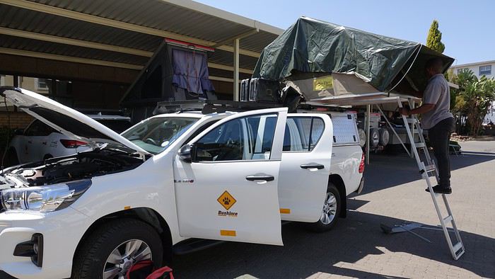
We set off toward Kgalagadi Transfrontier Park—it’s not exactly around the corner! In 1994 (when Mandela had just become President) and 2007, during our two previous trips to South Africa, we loved this park, so we couldn’t imagine going to Botswana without returning. The road was pretty monotonous, with not much to see except a few ostriches.
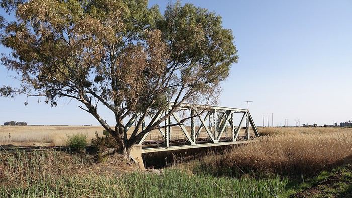
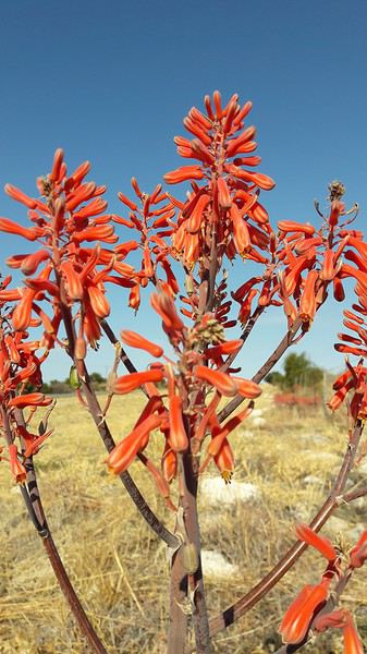
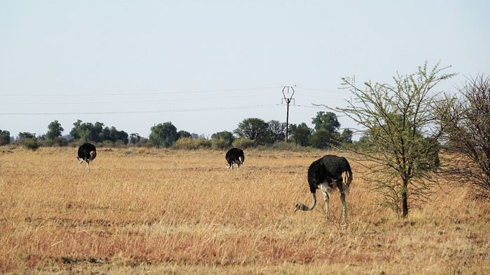
We stopped for the night in Vryburg at the Kameelboom Lodge campsite. It was a bit noisy since it’s close to the road, and the facilities weren’t great, but it was fine for one night.
14/09/2019: Johannesburg - Vryburg After months of waiting and reading other travelers’ journals, it’s finally our turn! We arrived in Johannesburg from Nantes and Paris in the morning. We looked for the Bushlore rep—we’d rented our 4x4 from them—but there was no sign with our name! « Bushlore? She’s a woman, I saw her a few minutes ago, » someone told us. A minute later, the Bushlore employee showed up: a man! 🤪 He sped onto the highway, and just 30 minutes later, we arrived at the rental place. It’s a big operation with good organization and lots of vehicles—pretty reassuring. Our 4x4 was there, a classic Toyota Hilux fully equipped for safari: rooftop tent, dual diesel tanks, 60-liter water reserve, two batteries, two spare tires, all the camping gear, plus everything needed for *désensablement* (getting unstuck from sand). Speaking of which, is it "désensablage" or "désensablement"? Best to just avoid getting stuck in the first place! 😏 Good news… or not: the vehicle was brand new, with barely 100 kilometers on the odometer. On one hand, we figured we wouldn’t have mechanical issues or a fridge breakdown, but on the other, we knew it wouldn’t be easy to return it without a single scratch. Either way, it was our first time renting a 4x4, and we were impressed.
We set off toward Kgalagadi Transfrontier Park—it’s not exactly around the corner! In 1994 (when Mandela had just become President) and 2007, during our two previous trips to South Africa, we loved this park, so we couldn’t imagine going to Botswana without returning. The road was pretty monotonous, with not much to see except a few ostriches.
We stopped for the night in Vryburg at the Kameelboom Lodge campsite. It was a bit noisy since it’s close to the road, and the facilities weren’t great, but it was fine for one night.
Hey there, fellow travelers 😎
We’re back from 15 days in northern India.
For our 6th visit to this country, we traveled between Uttar Pradesh and Madhya Pradesh, and let’s just say it was an emotional rollercoaster!!
So if you’re up for it, we’re taking you to Varanasi, Chitrakoot, Khajuraho, Orchha, and Agra.
Ready for takeoff??
WELCOME TO VARANASI

When you leave your sanitized, rigid Western world behind, there’s nothing like diving back into the Indian chaos. And we nailed it—because when it comes to monumental madness, we couldn’t have picked a better place to start than Varanasi 😉!!
Here’s a little recap of our first day in this insane city.
It all starts with landing at the city’s airport.
As soon as we step out, hundreds of Indians stare at us like they’ve never seen white people before (I’d forgotten how intense that is!). There are lots of women covered in black fabric, only their eyes visible—pretty striking, I must say. Turns out they’re Indians working in the Middle East, heading back to "work" after a month’s vacation.
We hop in a taxi, but after a few kilometers, we’re stopped… by the passage of the "state minister." The roads are freshly paved and spotless for his convoy (you can *totally* tell the difference with the roads he didn’t use 😛). We didn’t manage to spot him in the middle of the 25 cars surrounding him, though!!
Then we arrive in front of the mythical Ganges—a peaceful spot, except for a boat full of Indian pilgrims who, once again, stare at us and take our pictures (the mutual curiosity is hilarious!!).
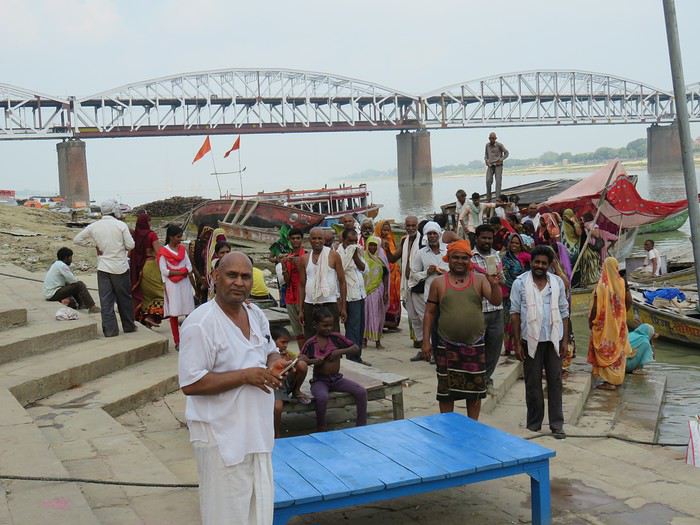
We board a boat, and almost immediately, we pass a cremation ghat!! Oh crap, I wasn’t expecting that so soon—it hits me hard (like, *really* hard 🤪)!! Huge piles of wood, eight massive fires with families gathered around. It lasts as long as the boat ride, and you think you must’ve imagined it… but no!!
You dock and wander through the tiny alleys.
It’s 36°C (97°F) with 90% humidity—you’re dripping.
Cows block the way sometimes. The air smells like incense, then urine, then a woman’s perfume, then rotten fruit, then amazing street food—all within two meters, and *everywhere*!!
Then you step into the main street where pilgrims arrive (60,000 a day—Varanasi is the country’s holiest city!!). The chaos ramps up as you head toward the main road: nonstop honking, a bike whizzing past on your right, a scooter on your left, people brushing against you from all sides, air thick with dust and smoke (diesel *or* cremation!!), beggars of all kinds (kids, elderly, disabled) lined up to appeal to the pilgrims, the suffocating heat, and noise—*so much* noise…
In some areas, people constantly approach you: "Come see my shop," "Need a taxi?" "Want to exchange money?" And then there’s the woman with her baby in her arms, following you for meters, repeating, "No money, milk; no money, milk…" And you’re *dying* inside, but you can’t stop. If you give in, ten more will come running!! You grit your teeth, keep walking, even talk to yourself out loud!!
After half an hour, it feels like you’ve run a marathon, and you don’t even know where you live anymore!
In the evening, you head to the PUJA (public prayers for all the pilgrims) on a boat in the middle of hundreds of others. Two ghats are competing—who can make the most noise. One side is singing, the other chanting, then they switch. They wave flames, the ghats are packed.
After dinner, you head back to your room around 9 PM and see hundreds of people sleeping on the scorching stones—with cows, dogs, and goats!!!!
A huge thank-you to our parents for giving us the mental balance to handle this, because *India drives you crazy*—and we’re right in the thick of it!!!
It’s an ex.tra.or.di.nary place in the truest sense of the word, with incredible beauty—especially in its human diversity—if you can look past what shocks you.
We stayed for 3 days—3 days of unmatched intensity, where the spectacle is *constant*.
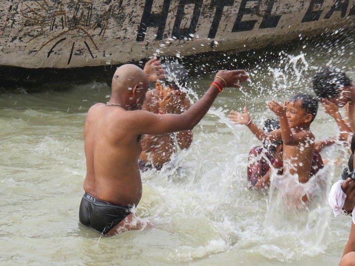
So I *highly* recommend it to all travel lovers, those who embrace difference, and the strange (for us, at least). But definitely *not* for anyone looking for a relaxing vacation!!
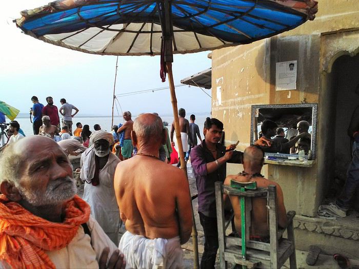
More to come soon if you’re interested!!
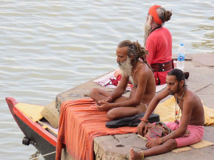
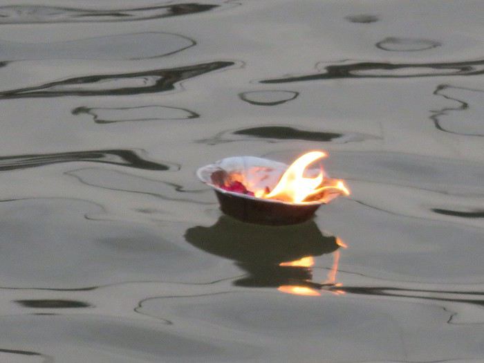
We’re back from 15 days in northern India.
For our 6th visit to this country, we traveled between Uttar Pradesh and Madhya Pradesh, and let’s just say it was an emotional rollercoaster!!
So if you’re up for it, we’re taking you to Varanasi, Chitrakoot, Khajuraho, Orchha, and Agra.
Ready for takeoff??
WELCOME TO VARANASI
When you leave your sanitized, rigid Western world behind, there’s nothing like diving back into the Indian chaos. And we nailed it—because when it comes to monumental madness, we couldn’t have picked a better place to start than Varanasi 😉!!
Here’s a little recap of our first day in this insane city.
It all starts with landing at the city’s airport.
As soon as we step out, hundreds of Indians stare at us like they’ve never seen white people before (I’d forgotten how intense that is!). There are lots of women covered in black fabric, only their eyes visible—pretty striking, I must say. Turns out they’re Indians working in the Middle East, heading back to "work" after a month’s vacation.
We hop in a taxi, but after a few kilometers, we’re stopped… by the passage of the "state minister." The roads are freshly paved and spotless for his convoy (you can *totally* tell the difference with the roads he didn’t use 😛). We didn’t manage to spot him in the middle of the 25 cars surrounding him, though!!
Then we arrive in front of the mythical Ganges—a peaceful spot, except for a boat full of Indian pilgrims who, once again, stare at us and take our pictures (the mutual curiosity is hilarious!!).
We board a boat, and almost immediately, we pass a cremation ghat!! Oh crap, I wasn’t expecting that so soon—it hits me hard (like, *really* hard 🤪)!! Huge piles of wood, eight massive fires with families gathered around. It lasts as long as the boat ride, and you think you must’ve imagined it… but no!!
You dock and wander through the tiny alleys.
It’s 36°C (97°F) with 90% humidity—you’re dripping.
Cows block the way sometimes. The air smells like incense, then urine, then a woman’s perfume, then rotten fruit, then amazing street food—all within two meters, and *everywhere*!!
Then you step into the main street where pilgrims arrive (60,000 a day—Varanasi is the country’s holiest city!!). The chaos ramps up as you head toward the main road: nonstop honking, a bike whizzing past on your right, a scooter on your left, people brushing against you from all sides, air thick with dust and smoke (diesel *or* cremation!!), beggars of all kinds (kids, elderly, disabled) lined up to appeal to the pilgrims, the suffocating heat, and noise—*so much* noise…
In some areas, people constantly approach you: "Come see my shop," "Need a taxi?" "Want to exchange money?" And then there’s the woman with her baby in her arms, following you for meters, repeating, "No money, milk; no money, milk…" And you’re *dying* inside, but you can’t stop. If you give in, ten more will come running!! You grit your teeth, keep walking, even talk to yourself out loud!!
After half an hour, it feels like you’ve run a marathon, and you don’t even know where you live anymore!
In the evening, you head to the PUJA (public prayers for all the pilgrims) on a boat in the middle of hundreds of others. Two ghats are competing—who can make the most noise. One side is singing, the other chanting, then they switch. They wave flames, the ghats are packed.
After dinner, you head back to your room around 9 PM and see hundreds of people sleeping on the scorching stones—with cows, dogs, and goats!!!!
A huge thank-you to our parents for giving us the mental balance to handle this, because *India drives you crazy*—and we’re right in the thick of it!!!
It’s an ex.tra.or.di.nary place in the truest sense of the word, with incredible beauty—especially in its human diversity—if you can look past what shocks you.
We stayed for 3 days—3 days of unmatched intensity, where the spectacle is *constant*.
So I *highly* recommend it to all travel lovers, those who embrace difference, and the strange (for us, at least). But definitely *not* for anyone looking for a relaxing vacation!!
More to come soon if you’re interested!!
Hi there!
After scouring the forum, reading several guides, and browsing websites, here are a few questions about our upcoming trip to Ecuador this summer.
We’re planning to travel with our 16-month-old son (he’s already been to Russia, Argentina, and Uruguay in his first three months), and here are some questions we have.
The big question: What type of baby carrier would you recommend? (We have a JPMBB, but I’ve never really been able to use it—it digs into my shoulders and isn’t comfortable. For short walks or strolls with the baby, we need something solid!)
Roughly, we’d arrive in Quito and return from Guayaquil (with the end of the trip in the Galápagos). The route would be something like this: Quito, Quilotoa, Papallacta, Cotopaxi, Baños, Riobamba, Chimborazo, Cuenca, Guayaquil, and the Galápagos.
For the Galápagos, we were thinking of 8 days—does that seem reasonable?
Regarding transportation, what are the buses like in Ecuador? (More like Argentina/Chile or more like Bolivia/Nicaragua?) How manageable is it with a baby?
Does the itinerary seem doable, and how much time would you roughly spend in each place? It’s clear we won’t be doing any major ascents, but we enjoy walking—a 2-3 hour hike to see the wildlife and flora at the foot of Chimborazo doesn’t scare us.
Without a baby, what do you think of the Baños-Puyo route? Some recommend the Chimborazo descent instead. With a baby, is the Baños-Puyo route doable? Is it possible to have a baby carrier on the bike?
Thanks so much! :)
After scouring the forum, reading several guides, and browsing websites, here are a few questions about our upcoming trip to Ecuador this summer.
We’re planning to travel with our 16-month-old son (he’s already been to Russia, Argentina, and Uruguay in his first three months), and here are some questions we have.
The big question: What type of baby carrier would you recommend? (We have a JPMBB, but I’ve never really been able to use it—it digs into my shoulders and isn’t comfortable. For short walks or strolls with the baby, we need something solid!)
Roughly, we’d arrive in Quito and return from Guayaquil (with the end of the trip in the Galápagos). The route would be something like this: Quito, Quilotoa, Papallacta, Cotopaxi, Baños, Riobamba, Chimborazo, Cuenca, Guayaquil, and the Galápagos.
For the Galápagos, we were thinking of 8 days—does that seem reasonable?
Regarding transportation, what are the buses like in Ecuador? (More like Argentina/Chile or more like Bolivia/Nicaragua?) How manageable is it with a baby?
Does the itinerary seem doable, and how much time would you roughly spend in each place? It’s clear we won’t be doing any major ascents, but we enjoy walking—a 2-3 hour hike to see the wildlife and flora at the foot of Chimborazo doesn’t scare us.
Without a baby, what do you think of the Baños-Puyo route? Some recommend the Chimborazo descent instead. With a baby, is the Baños-Puyo route doable? Is it possible to have a baby carrier on the bike?
Thanks so much! :)
During the 60s and 70s, thousands of travelers hit the road to India. Some were backpackers or hippies, but not all. In this collective anthology featuring around twenty contributors (including GeorgesOz), you’ll also find truth-seekers, a couple who went on their honeymoon to get married in Bengal... and "crazy" folks who set off on VéloSolex bikes...
Worth noting: all contributors donated their royalties to support the Céline Hegron clinic in a poor neighborhood of Varanasi.
Worth noting: all contributors donated their royalties to support the Céline Hegron clinic in a poor neighborhood of Varanasi.
As soon as I return to France, I catch myself thinking, "it’s better elsewhere."
Wherever we’ve been, I feel this lightness of living—less restriction, less pressure, less sadness—and I start dreaming of somewhere else, of living somewhere else, a simpler life, more authentic, with colors everywhere: markets, clothes, homes...!!! Meeting kindred spirits, genuine people, gentle and kind, and letting go of all this modernism, this technological rat race, the indifference toward others, the confinement, the racism against the elderly in France, against the poor, the weak, the beautiful... fleeing the news, politics, jealousy, meanness, stupidity, greed... And in my moments of clarity, I tell myself that every country, every city has its pros and cons, and that maybe the best of all worlds isn’t down here. But I also remind myself that you have to know how to COME BACK in order to LEAVE again... yet still...!!! IS IT REALLY BETTER ELSEWHERE?😏😏😏
Hello everyone,
I’m not really a regular contributor to VoyageForum, but every time Kate and I travel, she encourages me to write a travel journal and publish it. And I must admit, it’s a very enjoyable intellectual exercise, though not always easy. As a VF contributor whose journals I’ve read once said, this retrospective work not only helps preserve memories but also provides a fruitful moment of introspection by bringing back emotions and feelings.
Kate and I spent a week in Istanbul. For her, who had already visited, it was a return; for me, it was a discovery.
As we’ve now made a habit of, I write the texts, and she posts her photos. We hope this illustrated story, crafted together, will revive beautiful sensations for those who know the city and inspire others to discover it. Here we go!
I’m not really a regular contributor to VoyageForum, but every time Kate and I travel, she encourages me to write a travel journal and publish it. And I must admit, it’s a very enjoyable intellectual exercise, though not always easy. As a VF contributor whose journals I’ve read once said, this retrospective work not only helps preserve memories but also provides a fruitful moment of introspection by bringing back emotions and feelings.
Kate and I spent a week in Istanbul. For her, who had already visited, it was a return; for me, it was a discovery.
As we’ve now made a habit of, I write the texts, and she posts her photos. We hope this illustrated story, crafted together, will revive beautiful sensations for those who know the city and inspire others to discover it. Here we go!
Four days of beach relaxation in this truly curious place let me unwind 15 years ago after trekking through Asia or Africa: swimming in clear, clean water and easing jet lag was my goal; seeing that mirage in the middle of the desert also piqued my curiosity... And then Dubai developed, and now I go there once a year for 15 days without ever getting bored!! My backpacker budget doesn’t stop me from enjoying what I love about travel: discovering cultures, architecture, and beaches with turquoise waters.
I’m sharing my favorite spots here for those who love simplicity and the thrill of being amazed! Dubai stretches over 50 km long. I stay in the historic Bur Dubai neighborhood, which is very "Indian" and separated from Deira (the more "Arab/African" district) by a creek.
You cross from one side to the other on abras, small traditional wooden boats that run all day. My hotel is 4 minutes from the Al Ghubaiba bus station, 5 minutes from the Al Ghubaiba metro, and 6 minutes from the Al Ghubaiba boat station!!! It’s easy to get around from here, and at night, it’s lively—safe to go out, with few tourists but mostly the local middle class who built (and are still building) Dubai. It’s simple and very international.
- **Transport:** ...**Getting there:** I fly with Emirates from Paris. Taking the 9:30 PM flight, I sleep on the plane, land at 6:35 AM, exchange 200 euros once I’ve picked up my luggage, change in the restroom, grab a taxi to the hotel, drop off my suitcase, and head straight to the beach! ...**On the ground:** I buy a silver NOL card, which works for buses, metro, and boats. I top it up as needed—it’s valid for 2 years. ...**Taxis:** They have reliable meters. Pink ones are driven by women. Airport-to-hotel fare: 12 €. You’ll find them everywhere, and they don’t complain about short trips. Between 3 PM and 4 PM, it’s trickier because of shift changes.
- **Best times to visit:** For me, it’s April-May and October-November: not too hot for walking but warm enough to swim! Watch out for air conditioning—your worst enemy. It’s everywhere, even at bus stops. Bring a big scarf or sarong to cover your throat and head—going from 32°C to 16°C when you enter a mall, bus, or taxi is pretty harsh!
- **Hotel:** I stay at the Grand Astoria (Fahidi Street) because the value for price and location is great. It’s very clean, and I skip breakfast because near the bus station, there’s a big Carrefour hypermarket where I buy breakfast supplies, water, camel milk, and picnic snacks. There are two nightclubs downstairs—bring earplugs if you want to sleep before 2 AM. Wi-Fi is spotty; you have to change the password every two days. The staff is lovely. Rooms have a TV (4 Indian channels + BBC), a kettle with tea/coffee sachets, and a mini-fridge you fill yourself.
- **Bur Dubai: "My neighborhood"** In the morning, you can see kids in uniforms waiting for the school bus with their parents—second-generation migrants who’ve settled here. They speak English, Arabic, and their mother tongue, have great education, and are in high demand (I see job ads in the local newspapers in the hotel lobby). From the U.S. to the Middle East, Singapore to South Africa, they have bright futures. In the evenings, families stroll along the creek, and it’s common for bench neighbors to ask where you’re from. The whole world crosses paths here. Even with basic English, it’s friendly and warm—the "take care" as people go their separate ways is a nice touch.
Bur Dubai has plenty to explore if you don’t feel like going far: along the creek, there’s a cluster of reconstructed houses forming the Al Shindagha Museum. One ticket lets you visit all the houses, each with a theme tied to the history of the seven emirates (Dubai is one). It takes a full day, but if you stop for lunch, there are tons of restaurants for all budgets, some right by the water.
Walking in the opposite direction, you reach Al Seef, a reconstruction of old Dubai as a small pearl-fishing port. The architecture is lovely, with souvenir shops. My favorite is the Iranian grocery store, where you’ll find camel milk chocolate, black lemon, and sweets with rose, pistachio, and candied apricot. It’s peaceful to walk around here, even as a solo woman. There are free restrooms everywhere, wooden or stone benches, and a nice breeze in the evening. Plenty of waterfront restaurants or places to grab a drink, plus a few towers across the way—nothing spectacular, but they’re prettily lit. There’s a souk with souvenir shops for those who like that!
- **Restaurants:** Bur Dubai has restaurants representing regions of India and the Indian subcontinent. My favorites: Across from the hotel, Paklyari—a Pakistani spot with excellent mutton biryani for 5 €. At Al Seef, Nablus has a great setting by the water. Across in Deira, the Italian restaurant on the 18th floor of the Rotana—go half an hour before sunset for an amazing view of the creek and skyline. The truffle pizza is 24 €. You can take a taxi from Bur, and after dinner, get dropped off at Al Seef to walk back along the creek. For a great thali, Kathhiyawadi is a 10-minute walk from Burjuman metro. My latest discovery: Bordomavi (near the Rashid Al Hadees Masjid 1 bus stop). One of the servers is Algerian and speaks French. You can swim at the small beach with showers/toilets, then have lunch at the restaurant (57 € for two, with starter, main, dessert, and drinks). The setting is peaceful, in a little fishing port with a cool photo op—traditional boats with the modern skyline in the background!
- **Sunset drinks:** The terrace at Concorde Creek View (Bur Dubai) has a creek view, and Canopy by Hilton (Al Seef) overlooks the creek and skyline. You can get a day pass for the pool, including meals and drinks.
- **Lassi:** Near the hotel, SreeRaj Lassi Bar has great ice cream and lassi. *Tip: Everything is takeout-friendly, including leftovers—great for a picnic the next day.
- **Market:** Don’t miss the Waterfront Market—a huge hall where locals buy fish, meat, fruits, and vegetables from all over the world. I love buying fish, shrimp, and cuttlefish, then having it prepared at Yahya’s waterfront restaurant (grilled, in sauce, fried, etc.) with salad, hummus, tabbouleh, and rice. It’s on the way between "my" beach and the hotel, so I stop by easily. I stock up on fruit, and at the Lulu supermarket upstairs, I grab yogurt, water, etc. No need to carry everything—a taxi (available at the main exit) will drop me right at the hotel!
- **Beach:** My favorite: Al Mamzar Park (15-minute taxi ride, 9 €). It has four lifeguarded beaches with showers and restrooms. Opens at 8 AM, but note: Mondays and Wednesdays are for women and young children only! Entry is 1.50 €. On Beach #2, you can rent sun loungers and umbrellas. Beach #3 (the prettiest) has stone tables with benches under big umbrellas—free! I arrive at 8 AM, set up, and walk for an hour along the water, spotting starfish, colorful fish, birds, and occasionally small jellyfish. From bikinis to burkinis, everyone swims as they like! Dubai is judgment-free—no side-eye, just smiles and greetings. I love seeing joyful, full-figured women on women-only days, playing darbuka and singing. Indian women do yoga (even headstands!), Chinese women practice tai chi... I read a lot and swim far out to the buoy limits. Lifeguards keep watch. It’s safe on land too. Once, a 4x4 driver gave me a dirty look for "serving whisky" to my mom from a plastic bottle—until I made him smell it. It was mint tea! Embarrassed, he immediately called his brother, a gym teacher in Poitiers, to apologize in French! People in Dubai are smiley, polite, and very respectful of elders. On weekends, the park is packed with groups and families barbecuing—joyful chaos in every language!
By 1:30 PM, depending on my mood, I’ll get dropped off at the Waterfront Market for fish or a thali restaurant. Sometimes I take the bus—it stops near the abras on the Deira side. Just cross by boat, then it’s a 3-minute walk to the hotel. Takes 45 minutes (vs. 15 by taxi).
For a treat, try Kite Beach (Abu Manara Masjid bus stop). The SoleMio section offers comfy sun loungers, fluffy towels, and umbrellas for 80 € for two in the front row. Go early—you’ll feel like you have the place to yourself, with the Burj Al Arab in the background. It gets busy on weekends.
From there, you can take a taxi to Dubai Mall (not far) to check out the dancing fountains at sunset, for example.
You can also buy day passes at some hotels with sun loungers, towels, pool access, and lunch credit. I tried the Ritz-Carlton—decent (170 € for two, including meals). Lunch was fine, and the view of the lit-up towers at sunset, with the giant wheel, was stunning. I took the metro back in the evening.
There are plenty of free beaches too, like La Mer—worth seeing more for the decor than the beach itself.
- **Even though my main "sightseeing" involves walking around with my head up, admiring the towers in DIFC (amazing), visiting the stunning Mohammed bin Rashid Library (near Creek metro), wandering the souks (including Little India in Bur and the Iranian mosque), or the spice souks in Deira (go early when it’s quiet),** A day trip to Abu Dhabi is worth it. Take the Bur Dubai-Abu Dhabi bus (pay with your NOL card). If you leave early, you’ll see the sunrise over the desert. At the station, buy a bus ticket to the Louvre, cross the footbridge over the highway, and wait for the bus. After the museum, take a taxi to the Grand Mosque, then another taxi back to the bus station. A full but doable day—no need to stay overnight!
In the evening, I love taking the metro (mostly above ground) and passing between the towering, lit-up skyscrapers—it feels like a sci-fi movie. Just missing flying taxis (they’re in the works!)
Sharjah, the closest emirate, has a fantastic Orientalist museum. From Bur Dubai’s maritime station, boats go to Sharjah in 30 minutes, near the aquarium and maritime museum.
- **Shopping:** I buy Indian chai tea spices, incense, camel milk chocolate, Iranian sweets, and fabric from Indian shops selling saris and fabric by the meter. I have a tailor make shirts, tunics, etc. Some shops sell buttons and trimmings to jazz things up.
- **Malls:** To attract customers, mall owners come up with wild ideas: a ski slope at Dubai Mall (worth seeing once), pretty wooden souks at Madinat, and a giant aquarium at Dubai Mall. At sunset, you can watch the dancing fountains to popular global tunes at the foot of the world’s tallest tower. At its base, there’s an excellent Iraqi restaurant, Samad Al Iraki, where the tea server is Tunisian and speaks French! The Ibn Battuta Mall is unique—you can go there straight from Abu Dhabi by bus, for example. Malls have plenty of dining options and are a place to (finally) see locals... though they’re not that interesting. Malls are served by the metro, while buses run along the coast. In Burjuman Mall, there’s a cybercafé on the ground floor where you can print.
A few helpful sites: Visit Dubai - Official Tourism Site RTA (Roads and Transport Authority) - RTA Services
"But what do *you* do in Dubai?" my friends ask, surprised... Yes, I love traveling to countries where I ride on bumpy roads in buses that break down, sleep in places with mosquitoes and cockroaches, and swelter in heat and humidity. But even far from that kind of travel, Dubai has an exotic charm. There’s something for every taste and budget—once you get past the flight ticket (around 680 €, probably cheaper with a layover). Dubai is about relaxing, swimming, being amazed, chatting, and tasting... A safe, clean vacation with no rudeness, and as a woman, it’s a relief to let your guard down. You come back refreshed and at peace!
Hope my experience helps... Next trip: March 2026, with plans to visit the Guggenheim in Abu Dhabi and whatever other curiosities pop up like magic...
Feel free to add to my experience with your own! Happy travels, Laurence
I’m sharing my favorite spots here for those who love simplicity and the thrill of being amazed! Dubai stretches over 50 km long. I stay in the historic Bur Dubai neighborhood, which is very "Indian" and separated from Deira (the more "Arab/African" district) by a creek.
You cross from one side to the other on abras, small traditional wooden boats that run all day. My hotel is 4 minutes from the Al Ghubaiba bus station, 5 minutes from the Al Ghubaiba metro, and 6 minutes from the Al Ghubaiba boat station!!! It’s easy to get around from here, and at night, it’s lively—safe to go out, with few tourists but mostly the local middle class who built (and are still building) Dubai. It’s simple and very international.
- **Transport:** ...**Getting there:** I fly with Emirates from Paris. Taking the 9:30 PM flight, I sleep on the plane, land at 6:35 AM, exchange 200 euros once I’ve picked up my luggage, change in the restroom, grab a taxi to the hotel, drop off my suitcase, and head straight to the beach! ...**On the ground:** I buy a silver NOL card, which works for buses, metro, and boats. I top it up as needed—it’s valid for 2 years. ...**Taxis:** They have reliable meters. Pink ones are driven by women. Airport-to-hotel fare: 12 €. You’ll find them everywhere, and they don’t complain about short trips. Between 3 PM and 4 PM, it’s trickier because of shift changes.
- **Best times to visit:** For me, it’s April-May and October-November: not too hot for walking but warm enough to swim! Watch out for air conditioning—your worst enemy. It’s everywhere, even at bus stops. Bring a big scarf or sarong to cover your throat and head—going from 32°C to 16°C when you enter a mall, bus, or taxi is pretty harsh!
- **Hotel:** I stay at the Grand Astoria (Fahidi Street) because the value for price and location is great. It’s very clean, and I skip breakfast because near the bus station, there’s a big Carrefour hypermarket where I buy breakfast supplies, water, camel milk, and picnic snacks. There are two nightclubs downstairs—bring earplugs if you want to sleep before 2 AM. Wi-Fi is spotty; you have to change the password every two days. The staff is lovely. Rooms have a TV (4 Indian channels + BBC), a kettle with tea/coffee sachets, and a mini-fridge you fill yourself.
- **Bur Dubai: "My neighborhood"** In the morning, you can see kids in uniforms waiting for the school bus with their parents—second-generation migrants who’ve settled here. They speak English, Arabic, and their mother tongue, have great education, and are in high demand (I see job ads in the local newspapers in the hotel lobby). From the U.S. to the Middle East, Singapore to South Africa, they have bright futures. In the evenings, families stroll along the creek, and it’s common for bench neighbors to ask where you’re from. The whole world crosses paths here. Even with basic English, it’s friendly and warm—the "take care" as people go their separate ways is a nice touch.
Bur Dubai has plenty to explore if you don’t feel like going far: along the creek, there’s a cluster of reconstructed houses forming the Al Shindagha Museum. One ticket lets you visit all the houses, each with a theme tied to the history of the seven emirates (Dubai is one). It takes a full day, but if you stop for lunch, there are tons of restaurants for all budgets, some right by the water.
Walking in the opposite direction, you reach Al Seef, a reconstruction of old Dubai as a small pearl-fishing port. The architecture is lovely, with souvenir shops. My favorite is the Iranian grocery store, where you’ll find camel milk chocolate, black lemon, and sweets with rose, pistachio, and candied apricot. It’s peaceful to walk around here, even as a solo woman. There are free restrooms everywhere, wooden or stone benches, and a nice breeze in the evening. Plenty of waterfront restaurants or places to grab a drink, plus a few towers across the way—nothing spectacular, but they’re prettily lit. There’s a souk with souvenir shops for those who like that!
- **Restaurants:** Bur Dubai has restaurants representing regions of India and the Indian subcontinent. My favorites: Across from the hotel, Paklyari—a Pakistani spot with excellent mutton biryani for 5 €. At Al Seef, Nablus has a great setting by the water. Across in Deira, the Italian restaurant on the 18th floor of the Rotana—go half an hour before sunset for an amazing view of the creek and skyline. The truffle pizza is 24 €. You can take a taxi from Bur, and after dinner, get dropped off at Al Seef to walk back along the creek. For a great thali, Kathhiyawadi is a 10-minute walk from Burjuman metro. My latest discovery: Bordomavi (near the Rashid Al Hadees Masjid 1 bus stop). One of the servers is Algerian and speaks French. You can swim at the small beach with showers/toilets, then have lunch at the restaurant (57 € for two, with starter, main, dessert, and drinks). The setting is peaceful, in a little fishing port with a cool photo op—traditional boats with the modern skyline in the background!
- **Sunset drinks:** The terrace at Concorde Creek View (Bur Dubai) has a creek view, and Canopy by Hilton (Al Seef) overlooks the creek and skyline. You can get a day pass for the pool, including meals and drinks.
- **Lassi:** Near the hotel, SreeRaj Lassi Bar has great ice cream and lassi. *Tip: Everything is takeout-friendly, including leftovers—great for a picnic the next day.
- **Market:** Don’t miss the Waterfront Market—a huge hall where locals buy fish, meat, fruits, and vegetables from all over the world. I love buying fish, shrimp, and cuttlefish, then having it prepared at Yahya’s waterfront restaurant (grilled, in sauce, fried, etc.) with salad, hummus, tabbouleh, and rice. It’s on the way between "my" beach and the hotel, so I stop by easily. I stock up on fruit, and at the Lulu supermarket upstairs, I grab yogurt, water, etc. No need to carry everything—a taxi (available at the main exit) will drop me right at the hotel!
- **Beach:** My favorite: Al Mamzar Park (15-minute taxi ride, 9 €). It has four lifeguarded beaches with showers and restrooms. Opens at 8 AM, but note: Mondays and Wednesdays are for women and young children only! Entry is 1.50 €. On Beach #2, you can rent sun loungers and umbrellas. Beach #3 (the prettiest) has stone tables with benches under big umbrellas—free! I arrive at 8 AM, set up, and walk for an hour along the water, spotting starfish, colorful fish, birds, and occasionally small jellyfish. From bikinis to burkinis, everyone swims as they like! Dubai is judgment-free—no side-eye, just smiles and greetings. I love seeing joyful, full-figured women on women-only days, playing darbuka and singing. Indian women do yoga (even headstands!), Chinese women practice tai chi... I read a lot and swim far out to the buoy limits. Lifeguards keep watch. It’s safe on land too. Once, a 4x4 driver gave me a dirty look for "serving whisky" to my mom from a plastic bottle—until I made him smell it. It was mint tea! Embarrassed, he immediately called his brother, a gym teacher in Poitiers, to apologize in French! People in Dubai are smiley, polite, and very respectful of elders. On weekends, the park is packed with groups and families barbecuing—joyful chaos in every language!
By 1:30 PM, depending on my mood, I’ll get dropped off at the Waterfront Market for fish or a thali restaurant. Sometimes I take the bus—it stops near the abras on the Deira side. Just cross by boat, then it’s a 3-minute walk to the hotel. Takes 45 minutes (vs. 15 by taxi).
For a treat, try Kite Beach (Abu Manara Masjid bus stop). The SoleMio section offers comfy sun loungers, fluffy towels, and umbrellas for 80 € for two in the front row. Go early—you’ll feel like you have the place to yourself, with the Burj Al Arab in the background. It gets busy on weekends.
From there, you can take a taxi to Dubai Mall (not far) to check out the dancing fountains at sunset, for example.
You can also buy day passes at some hotels with sun loungers, towels, pool access, and lunch credit. I tried the Ritz-Carlton—decent (170 € for two, including meals). Lunch was fine, and the view of the lit-up towers at sunset, with the giant wheel, was stunning. I took the metro back in the evening.
There are plenty of free beaches too, like La Mer—worth seeing more for the decor than the beach itself.
- **Even though my main "sightseeing" involves walking around with my head up, admiring the towers in DIFC (amazing), visiting the stunning Mohammed bin Rashid Library (near Creek metro), wandering the souks (including Little India in Bur and the Iranian mosque), or the spice souks in Deira (go early when it’s quiet),** A day trip to Abu Dhabi is worth it. Take the Bur Dubai-Abu Dhabi bus (pay with your NOL card). If you leave early, you’ll see the sunrise over the desert. At the station, buy a bus ticket to the Louvre, cross the footbridge over the highway, and wait for the bus. After the museum, take a taxi to the Grand Mosque, then another taxi back to the bus station. A full but doable day—no need to stay overnight!
In the evening, I love taking the metro (mostly above ground) and passing between the towering, lit-up skyscrapers—it feels like a sci-fi movie. Just missing flying taxis (they’re in the works!)
Sharjah, the closest emirate, has a fantastic Orientalist museum. From Bur Dubai’s maritime station, boats go to Sharjah in 30 minutes, near the aquarium and maritime museum.
- **Shopping:** I buy Indian chai tea spices, incense, camel milk chocolate, Iranian sweets, and fabric from Indian shops selling saris and fabric by the meter. I have a tailor make shirts, tunics, etc. Some shops sell buttons and trimmings to jazz things up.
- **Malls:** To attract customers, mall owners come up with wild ideas: a ski slope at Dubai Mall (worth seeing once), pretty wooden souks at Madinat, and a giant aquarium at Dubai Mall. At sunset, you can watch the dancing fountains to popular global tunes at the foot of the world’s tallest tower. At its base, there’s an excellent Iraqi restaurant, Samad Al Iraki, where the tea server is Tunisian and speaks French! The Ibn Battuta Mall is unique—you can go there straight from Abu Dhabi by bus, for example. Malls have plenty of dining options and are a place to (finally) see locals... though they’re not that interesting. Malls are served by the metro, while buses run along the coast. In Burjuman Mall, there’s a cybercafé on the ground floor where you can print.
A few helpful sites: Visit Dubai - Official Tourism Site RTA (Roads and Transport Authority) - RTA Services
"But what do *you* do in Dubai?" my friends ask, surprised... Yes, I love traveling to countries where I ride on bumpy roads in buses that break down, sleep in places with mosquitoes and cockroaches, and swelter in heat and humidity. But even far from that kind of travel, Dubai has an exotic charm. There’s something for every taste and budget—once you get past the flight ticket (around 680 €, probably cheaper with a layover). Dubai is about relaxing, swimming, being amazed, chatting, and tasting... A safe, clean vacation with no rudeness, and as a woman, it’s a relief to let your guard down. You come back refreshed and at peace!
Hope my experience helps... Next trip: March 2026, with plans to visit the Guggenheim in Abu Dhabi and whatever other curiosities pop up like magic...
Feel free to add to my experience with your own! Happy travels, Laurence
We took this trip from September 12 to October 7, 2022. I didn’t post this travel journal earlier in Voyage Forum because the site wasn’t back up yet (and also because I was short on time).
Then, at the end of 2024, I made a promise to a friend: to publish my travel journal on VF. So here it is!
 We took off from Paris in the late afternoon on September 12 and arrived in Tashkent around 7:15 AM on the 13th.
This trip was the result of long contemplation and preparation (it was originally planned for the year of the lockdown (2020) and was prepared with the help and advice of Nasrullo Jumanov from Turquoise Travel.
Stages and Itinerary
Stage 1: Tashkent - September 13 and 14
Stage 2: Ferghana Valley – September 15 to 17
Stage 3: Nukus and Moynaq - September 18 and 19
Stage 4: Mysterious Khiva - September 20 to 22
Stage 5: Holy Bukhara - September 23 to 26
Stage 6: Asraf - September 27 and 28
Stage 7: Mythical Samarkand - September 29 to October 2
Stage 8: Tersak (via Shakhrisabz and Urgut) – October 3 and 4
Stage 9: Samarkand – October 5 and 6
Stage 10: Tashkent/Istanbul/Paris – October 6 and 7
Stage 1: Tashkent
September 13
At the airport exit, we were greeted by the owner of our B&B (B&B Gulnara).
Today was all about recovery and our first steps in the capital. Our first currency exchange made us feel like sudden millionaires.
Our first stroll down the avenue leading to Chorsu Market introduced us to the fact that 80 to 90% of the cars here are white Chevrolets.
A walk under the arcades facing Chorsu: hardware stores, cabinetmakers, lute makers (one of them gave me a little concert/demo of a few string instruments).
As we entered the market, many vendors called out to us, including this florist who asked where we were from: ‘France? Ah! Macron! PSG!’ He then recited a list of players from the Parisian team as well as past (Platini, Zidane, etc.) and current (Giroud, Griezmann, Mbappé, etc.) French national team players. Since we’re more into rugby (we live near Toulouse), he knew more players than I did!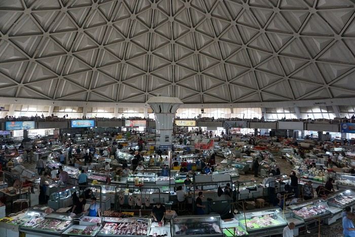
The market sprawls outside around the large circular, multi-story hall. We bought some grapes and bottles of freshly squeezed pomegranate juice for just a few sums. This evening, we had a meet-up with Nasrullo. The reunion was very warm: we’d been exchanging messages for over two years, and I’d been ‘torturing’ him with changes to our itinerary and trip duration. We were finally eager to meet, and honestly, I wasn’t disappointed—in fact, it was the opposite. Nasrullo was very attentive throughout our trip and always made sure, even from a distance (and most often from a distance!), that everything went smoothly. His goal was for us to leave delighted with our trip and, why not, indirectly become ambassadors for this destination. September 14 Breakfast with Nasrullo, then we set off with him by taxi to explore some of the capital’s sites.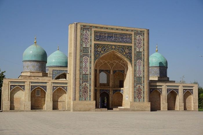
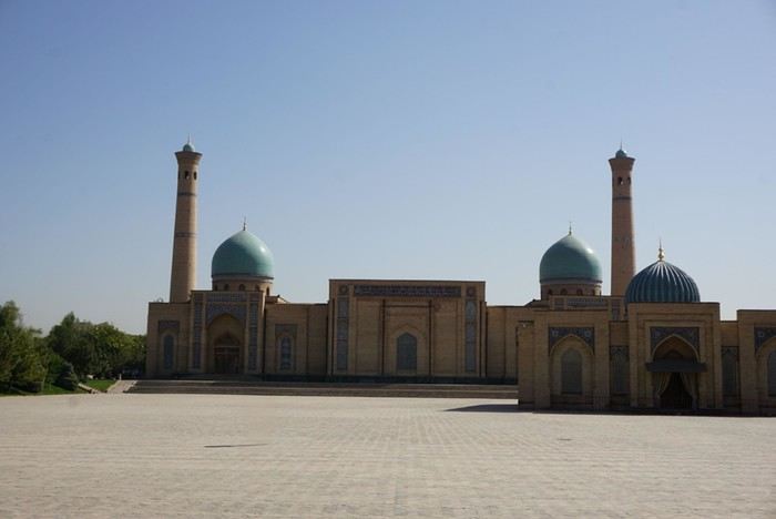
We started by visiting the Khazrati Imam complex, which includes the mausoleum of Kaffal Shashi, the Barak Khan and Muyi Muborak madrasas, and the great Khazrati Imam Mosque with its immense prayer hall.
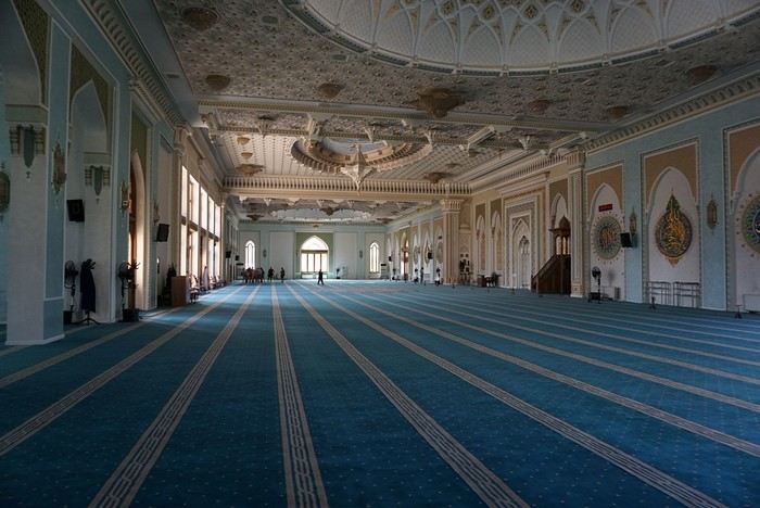
In the Muyi Muborak madrasa, now a museum, you can see the oldest Quran in the world. It was written by three religious scholars, including the secretary of the Prophet Muhammad, on large ‘pages’ made of antelope skin. Next, we explored Soviet-era Tashkent, discovering its parks, canals, and squares: Independence Square with its storks and phoenixes, Amir Temur Square with its large statue and, in the background, the massive Soviet-era hotel that has become one of Tashkent’s iconic buildings. Nasrullo took us through Broadway Boulevard and along what he calls ‘Tashkent’s Montmartre’… Well, it’s far, very far from Montmartre (in every sense of the word!). Then we took the metro to Chorsu station. Rush hour is pretty much the same everywhere in the metro… When we arrived at Chorsu, it was time to say goodbye. Nasrullo had to head back to Samarkand. Before leaving, he recommended some chaikhanas at the end of the galleries facing the market. We ate there for just a few euros (2 or 3 € for two people). After eating, we headed back to our room to cool off (our B&B is about a 10-minute walk away).
Around 4 PM, we set off to visit the Kokeldash Madrasa, which is still active. On the way, we stopped to watch some bread vendors and take a few photos. We were hesitating about buying some for our evening picnic when a young woman approached us. In perfect English, she asked: ‘Are you looking for something? Do you want to buy bread? Which one? How much?’ She then spoke to one of the vendors and negotiated the price. ‘Do you want one?’ And she took two. She paid directly. I took out my wallet to reimburse her, but she refused. It’s on the house! Then the vendor asked where we were from. And off we went again: Macron, PSG, football players… We’ll have to get used to it. The young woman smiled at the questions and comments, barely gave us time to thank her, and left as quickly as she had approached us.
We continued our walk. Visited the madrasa. Then we crossed the boulevard to see the Tashkent Circus. I would’ve loved to go in and visit, but the ticket seller wouldn’t hear of it. We carried on around what should’ve been a park with old-fashioned rides and attractions. All we found was a construction site. Oh well! Back at our hotel, a message from Nasrullo was waiting for us. He had managed to change our train ticket for the next day. Instead of taking the 6:00 AM train, we’d take the 8:00 AM one. And instead of second class, we’d be in first class! Great! This evening, we had a picnic at one of the breakfast tables in the B&B courtyard. Under a shelter, the owner and his family were celebrating a birthday. The owner started by offering us some tea. Then they brought us some fruit (watermelon and melon). Finally, after the song, candles, and cake cutting, they brought us two generous slices of that beautiful birthday cake. Delicious!
We took off from Paris in the late afternoon on September 12 and arrived in Tashkent around 7:15 AM on the 13th.
This trip was the result of long contemplation and preparation (it was originally planned for the year of the lockdown (2020) and was prepared with the help and advice of Nasrullo Jumanov from Turquoise Travel.
Stages and Itinerary
Stage 1: Tashkent - September 13 and 14
Stage 2: Ferghana Valley – September 15 to 17
Stage 3: Nukus and Moynaq - September 18 and 19
Stage 4: Mysterious Khiva - September 20 to 22
Stage 5: Holy Bukhara - September 23 to 26
Stage 6: Asraf - September 27 and 28
Stage 7: Mythical Samarkand - September 29 to October 2
Stage 8: Tersak (via Shakhrisabz and Urgut) – October 3 and 4
Stage 9: Samarkand – October 5 and 6
Stage 10: Tashkent/Istanbul/Paris – October 6 and 7
Stage 1: Tashkent
September 13
At the airport exit, we were greeted by the owner of our B&B (B&B Gulnara).
Today was all about recovery and our first steps in the capital. Our first currency exchange made us feel like sudden millionaires.
Our first stroll down the avenue leading to Chorsu Market introduced us to the fact that 80 to 90% of the cars here are white Chevrolets.
A walk under the arcades facing Chorsu: hardware stores, cabinetmakers, lute makers (one of them gave me a little concert/demo of a few string instruments).As we entered the market, many vendors called out to us, including this florist who asked where we were from: ‘France? Ah! Macron! PSG!’ He then recited a list of players from the Parisian team as well as past (Platini, Zidane, etc.) and current (Giroud, Griezmann, Mbappé, etc.) French national team players. Since we’re more into rugby (we live near Toulouse), he knew more players than I did!
The market sprawls outside around the large circular, multi-story hall. We bought some grapes and bottles of freshly squeezed pomegranate juice for just a few sums. This evening, we had a meet-up with Nasrullo. The reunion was very warm: we’d been exchanging messages for over two years, and I’d been ‘torturing’ him with changes to our itinerary and trip duration. We were finally eager to meet, and honestly, I wasn’t disappointed—in fact, it was the opposite. Nasrullo was very attentive throughout our trip and always made sure, even from a distance (and most often from a distance!), that everything went smoothly. His goal was for us to leave delighted with our trip and, why not, indirectly become ambassadors for this destination. September 14 Breakfast with Nasrullo, then we set off with him by taxi to explore some of the capital’s sites.
We started by visiting the Khazrati Imam complex, which includes the mausoleum of Kaffal Shashi, the Barak Khan and Muyi Muborak madrasas, and the great Khazrati Imam Mosque with its immense prayer hall.
In the Muyi Muborak madrasa, now a museum, you can see the oldest Quran in the world. It was written by three religious scholars, including the secretary of the Prophet Muhammad, on large ‘pages’ made of antelope skin. Next, we explored Soviet-era Tashkent, discovering its parks, canals, and squares: Independence Square with its storks and phoenixes, Amir Temur Square with its large statue and, in the background, the massive Soviet-era hotel that has become one of Tashkent’s iconic buildings. Nasrullo took us through Broadway Boulevard and along what he calls ‘Tashkent’s Montmartre’… Well, it’s far, very far from Montmartre (in every sense of the word!). Then we took the metro to Chorsu station. Rush hour is pretty much the same everywhere in the metro… When we arrived at Chorsu, it was time to say goodbye. Nasrullo had to head back to Samarkand. Before leaving, he recommended some chaikhanas at the end of the galleries facing the market. We ate there for just a few euros (2 or 3 € for two people). After eating, we headed back to our room to cool off (our B&B is about a 10-minute walk away).
Around 4 PM, we set off to visit the Kokeldash Madrasa, which is still active. On the way, we stopped to watch some bread vendors and take a few photos. We were hesitating about buying some for our evening picnic when a young woman approached us. In perfect English, she asked: ‘Are you looking for something? Do you want to buy bread? Which one? How much?’ She then spoke to one of the vendors and negotiated the price. ‘Do you want one?’ And she took two. She paid directly. I took out my wallet to reimburse her, but she refused. It’s on the house! Then the vendor asked where we were from. And off we went again: Macron, PSG, football players… We’ll have to get used to it. The young woman smiled at the questions and comments, barely gave us time to thank her, and left as quickly as she had approached us.
We continued our walk. Visited the madrasa. Then we crossed the boulevard to see the Tashkent Circus. I would’ve loved to go in and visit, but the ticket seller wouldn’t hear of it. We carried on around what should’ve been a park with old-fashioned rides and attractions. All we found was a construction site. Oh well! Back at our hotel, a message from Nasrullo was waiting for us. He had managed to change our train ticket for the next day. Instead of taking the 6:00 AM train, we’d take the 8:00 AM one. And instead of second class, we’d be in first class! Great! This evening, we had a picnic at one of the breakfast tables in the B&B courtyard. Under a shelter, the owner and his family were celebrating a birthday. The owner started by offering us some tea. Then they brought us some fruit (watermelon and melon). Finally, after the song, candles, and cake cutting, they brought us two generous slices of that beautiful birthday cake. Delicious!