I'm currently converting a DAF/HEULIEZ MB205 bus.
Cheaper and more spacious than a regular vehicle, the paperwork (in France) isn't too difficult for approval.
I'm ready to help anyone who wants to tackle this kind of project. Those who know, help those who want to....
795 similar discussions in English
Monday, August 21, 2023 - Rochefort - Marans
No journal for the first two days. Day 1 - CARCANS-ROYAN Day 2 - ROYAN - ROCHEFORT Tonight I'm in MARANS in the "dry marsh" according to the campsite manager—it’s the first time I’ve heard of a "dry marsh"?!
Photos from the first two days
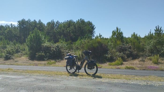 My gear
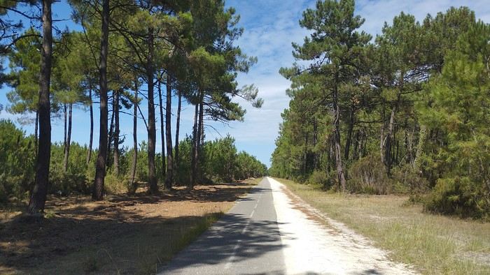
The Landes region—nothing extraordinary, but the calm and serenity are nice.

Le Verdon
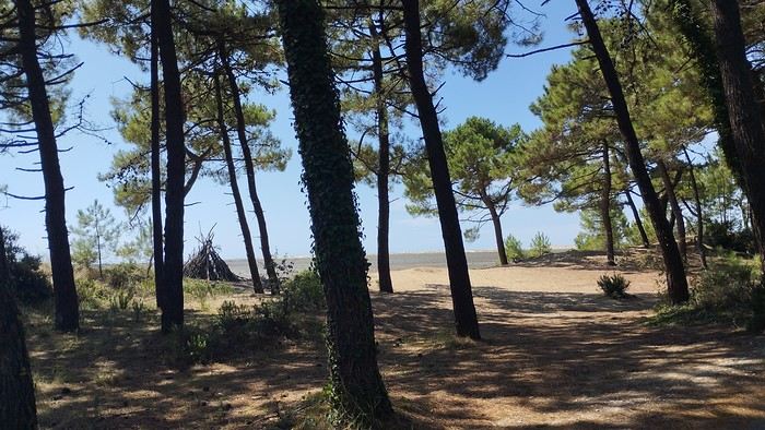
The wild coast
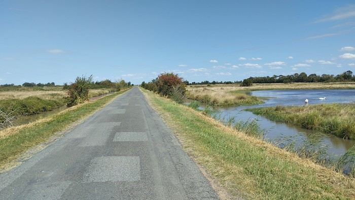
This marsh isn’t dry, though.
Today is the third day of my trip, and I’m writing to you from a campsite in Marans. I’ve set out to bike from Carcans Maubuisson back to Plaisir. Why Carcans? Because we spent a week there as a family—a great week that lets everyone reconnect for a long stretch. Also, on Saturday, we all headed home—some by car, and me by bike. This journey is about 850 km via bike paths and small cycling roads. It’s not a sporting feat, just a nice long ride for fun. As the old Chinese sage says, "The destination doesn’t matter—it’s the journey that counts." But he also told me, "Traveling is great, but what’s the point if you don’t share it?" You see, this old sage has told me a lot of things—he often keeps me company when I’m biking. Of course, he doesn’t pedal, but we travel in harmony. Sure, he can be a bit annoying sometimes, but we still get along. All this to say I’ve created a group to share my story. I’d be happy to share this experience with you—it’s an adventure for me. On Saturday, I wasn’t sure I’d even leave because I’d been dealing with sciatica for days. Luckily, Juliette, a friend of the old Chinese sage, recommended a lifesaving remedy: Alternately stretching your legs with an elastic band under your foot. Obviously, a jam jar rubber band won’t cut it.
From Marans - The mosquitoes are attacking; time to head back to shelter.
The first two legs took me to Royan and then Rochefort. The Sèvre Niortaise flows nearby, and I followed a canal from La Rochelle. You could say the area is as dry as the marsh, judging by the state of the crops.
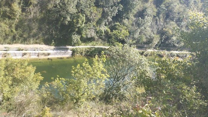
As I mentioned, it’s the third day, and if Jesus rose again on this day, for me it was more like the crucifixion. The scorching heat—only bearable when you’re moving—combined with rough trail conditions, and the old Chinese sage says, "Terrible roads, slow speed, and watch your limbs." I set out to do 60 km but ended up doing 80, and the last 20 were tough. I kept checking the GPS to see how much farther until the campsite. Today: Rochefort to Marans, sticking to the coast until La Rochelle, then no notable towns after that—just a constant canal. But since the sky isn’t too low, it hasn’t gotten lost. I’ve still got plenty of anecdotes to share, but it’s pitch black out, and the mosquitoes are still around. This morning, I counted ten in my tent, all full of my blood. Yesterday, at the end of the leg to Rochefort, I was really looking forward to crossing the Charente using the transporter bridge, but a sneaky GPS conspiracy led me far from it. I ended up crossing the Charente on a completely ordinary bridge, watching the transporter bridge in the distance with disappointment.
End of the first episode. Until tomorrow, if you’d like!
No journal for the first two days. Day 1 - CARCANS-ROYAN Day 2 - ROYAN - ROCHEFORT Tonight I'm in MARANS in the "dry marsh" according to the campsite manager—it’s the first time I’ve heard of a "dry marsh"?!
Photos from the first two days
My gearThe Landes region—nothing extraordinary, but the calm and serenity are nice.
Le Verdon
The wild coast
This marsh isn’t dry, though.
Today is the third day of my trip, and I’m writing to you from a campsite in Marans. I’ve set out to bike from Carcans Maubuisson back to Plaisir. Why Carcans? Because we spent a week there as a family—a great week that lets everyone reconnect for a long stretch. Also, on Saturday, we all headed home—some by car, and me by bike. This journey is about 850 km via bike paths and small cycling roads. It’s not a sporting feat, just a nice long ride for fun. As the old Chinese sage says, "The destination doesn’t matter—it’s the journey that counts." But he also told me, "Traveling is great, but what’s the point if you don’t share it?" You see, this old sage has told me a lot of things—he often keeps me company when I’m biking. Of course, he doesn’t pedal, but we travel in harmony. Sure, he can be a bit annoying sometimes, but we still get along. All this to say I’ve created a group to share my story. I’d be happy to share this experience with you—it’s an adventure for me. On Saturday, I wasn’t sure I’d even leave because I’d been dealing with sciatica for days. Luckily, Juliette, a friend of the old Chinese sage, recommended a lifesaving remedy: Alternately stretching your legs with an elastic band under your foot. Obviously, a jam jar rubber band won’t cut it.
From Marans - The mosquitoes are attacking; time to head back to shelter.
The first two legs took me to Royan and then Rochefort. The Sèvre Niortaise flows nearby, and I followed a canal from La Rochelle. You could say the area is as dry as the marsh, judging by the state of the crops.
As I mentioned, it’s the third day, and if Jesus rose again on this day, for me it was more like the crucifixion. The scorching heat—only bearable when you’re moving—combined with rough trail conditions, and the old Chinese sage says, "Terrible roads, slow speed, and watch your limbs." I set out to do 60 km but ended up doing 80, and the last 20 were tough. I kept checking the GPS to see how much farther until the campsite. Today: Rochefort to Marans, sticking to the coast until La Rochelle, then no notable towns after that—just a constant canal. But since the sky isn’t too low, it hasn’t gotten lost. I’ve still got plenty of anecdotes to share, but it’s pitch black out, and the mosquitoes are still around. This morning, I counted ten in my tent, all full of my blood. Yesterday, at the end of the leg to Rochefort, I was really looking forward to crossing the Charente using the transporter bridge, but a sneaky GPS conspiracy led me far from it. I ended up crossing the Charente on a completely ordinary bridge, watching the transporter bridge in the distance with disappointment.
End of the first episode. Until tomorrow, if you’d like!
This year, we hadn’t planned on going to the United States. After two trips in 2012 and 2014, we needed to refill the piggy bank...
But we didn’t count on luck: one late September afternoon in 2014, while randomly browsing the web, I stumbled upon flight tickets for $753 per person for July 2015! After some calculations and hesitation, we decided to shorten the trip compared to the previous year (22 days this time), cut down on hotel costs (80 € per night on average), and skip expensive activities (no helicopter rides, rafting, or guided tours with outfitters, etc.), but we couldn’t pass up such a great opportunity!
Here’s the budget breakdown: - Flight tickets: 3,012 € for 4 (booked directly on AA’s website). One layover on the way out (CDG / Charlotte / Phoenix) and one on the way back (LAX / London / CDG). - Hotels: 1,685 € for 22 nights, averaging 76.60 € per night. We stuck to our budget (and even did better!), thanks to affordable hotels in NM, bookings made when the exchange rate was still favorable, and 2 free nights used on Hotels.com. - Car: 952 € for 22 days renting a standard SUV (Jeep Grand Cherokee). We went through AutoEurope, and the rental company was Dollar. - Gas: Around $20 per day on average (for 5,440 km). - Food: Just under $70 per day on average (for 4 people). We did a lot of grocery shopping for picnics, ate a lot of fast food, and only went to restaurants a few times. - America the Beautiful Pass: Free (the one we bought in July 2014 was still valid until the end of July 2015). - Not covered by the pass: $175 (entry fees for State Parks, a guided tour at Mesa Verde, Pow Wow entry, etc.).
In total, we spent 7,760 € for 4 people over 22 days. On top of that, we added $50 for the NYNY roller coaster (a gift for Hugo) and $135 for the *Mystère* show (a gift for Calista and me).
Here’s the itinerary: - Lost Dutchman SP, Goldfield Ghost Town, and Apache Trail - Chiricahua NM - White Sands NM - White Sands NM, Valley of Fires SP, and Old Town Albuquerque - Taos Pueblo, Pow Wow, and Chimayo - Bandelier NM and Santa Fe - Kasha Katuwe Tent Rocks NM - Shiprock and Mesa Verde NP - Bluff, Gooseneck SP, Road Canyon, and UT95 - Little Wild Horse Canyon and Goblin Valley SP - Capitol Reef NP (Cohab Canyon and Sulphur Creek) - Burr Trail - Zebra Slot Canyon and Lower Calf Creek Falls - Mossy Cave and Cedar Breaks NM - Kanarra Creek and Zion NP (Kolob Canyons) - Coyote Buttes South (Paw Hole) - Zion NP (Progeny Peak) - Snow Canyon SP - Lake Mead and Las Vegas - Las Vegas - Las Vegas - Los Angeles and the trip back
Hello everyone,
After sharing some safari photos from southern Tanzania, I’d like to show you those from our latest safari in Kenya in October 2025.
First, I’d like to thank Sylvie56, whose previous travel journals about this country inspired our trip choices. Thanks also for the info you sent us via PM. THANK YOU!
The following account is from a simple wildlife enthusiast. You won’t find anything here but images of landscapes, mammals, and birds. The stated purpose of this trip was purely and solely wildlife-focused. (It was in no way a discovery of the country or its people).
This stay/safari began (and ended) in Nairobi, with flights between France and Kenya operated by Qatar Airways departing from Nice.
Over two weeks, we first visited the reserves of Tsavo West and Tsavo East, then after a long road trip, the two reserves of Buffalo Springs and Samburu.
= Please wait until the end of the journal to ask any specific questions (or send them via PM) to keep the story flowing without interruptions or off-topic comments.
Thanks for your understanding.
...
Previous Kenya safari trip in 2017, here:
http://www.image-nature.com/forum/viewtopic.php?f=162&t=61119
...
After my trip to Oregon in 2018 (see Travel Journal "Oregon and Only Oregon"), I vaguely intended to return to the West (the western USA, of course—the west of France is where I almost live) someday, later... with no specific date or plan.
November 2018, I stumbled upon a promotion for round-trip flights from Paris to San Francisco. Well, I *stumbled*—they must’ve collected some "data" on me to make sure this deal crossed my path. And it worked! My ESTA was still valid, and two days later, it was decided: May 13, 2019 (departure from Paris) to June 15, 2019 (return to Paris).
The travel style? Just like last year: low-budget trip, rental car, and accommodation only in campgrounds, with no reservations to stay as free as possible.
Exceptions? 3 nights in a youth hostel upon arrival in downtown San Francisco, and 1 night on the way back (right before flying) in Montara, near Pacifica—a spot that seemed well-located for driving back to the airport in the middle of the night.
Now, to sketch out the rough itinerary. Here’s what it looked like after the trip:
Westernmost point: Montara Lighthouse on the coast, 30 km south of San Francisco (California); Easternmost point: Zion National Park (Utah). Northernmost point: Reno (Nevada). Southernmost point: Spring Mountain Ranch State Park in Blue Diamond, near Las Vegas (Nevada).
Another view:
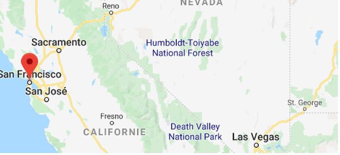
I’ll be spending 33 days in this little area! I’m a slow traveler.
Meanwhile, I realized that in some places I wanted to visit (Las Vegas and National Parks), it was better to book ahead. So, I added to my reservations: - 2 nights in a hostel in Las Vegas - 6 nights of camping in the national parks (2 at Zion NP, 2 at Yosemite NP, 2 at Sequoia-Kings Canyon NP). Between all these dated stops, it’s a choose-your-own-adventure from the ideas I found.
I’m also a slow writer—slow writer, slow traveler—so it’ll take me a while to wrap this up. I’ll start tomorrow.
November 2018, I stumbled upon a promotion for round-trip flights from Paris to San Francisco. Well, I *stumbled*—they must’ve collected some "data" on me to make sure this deal crossed my path. And it worked! My ESTA was still valid, and two days later, it was decided: May 13, 2019 (departure from Paris) to June 15, 2019 (return to Paris).
The travel style? Just like last year: low-budget trip, rental car, and accommodation only in campgrounds, with no reservations to stay as free as possible.
Exceptions? 3 nights in a youth hostel upon arrival in downtown San Francisco, and 1 night on the way back (right before flying) in Montara, near Pacifica—a spot that seemed well-located for driving back to the airport in the middle of the night.
Now, to sketch out the rough itinerary. Here’s what it looked like after the trip:
Westernmost point: Montara Lighthouse on the coast, 30 km south of San Francisco (California); Easternmost point: Zion National Park (Utah). Northernmost point: Reno (Nevada). Southernmost point: Spring Mountain Ranch State Park in Blue Diamond, near Las Vegas (Nevada).
Another view:
I’ll be spending 33 days in this little area! I’m a slow traveler.
Meanwhile, I realized that in some places I wanted to visit (Las Vegas and National Parks), it was better to book ahead. So, I added to my reservations: - 2 nights in a hostel in Las Vegas - 6 nights of camping in the national parks (2 at Zion NP, 2 at Yosemite NP, 2 at Sequoia-Kings Canyon NP). Between all these dated stops, it’s a choose-your-own-adventure from the ideas I found.
I’m also a slow writer—slow writer, slow traveler—so it’ll take me a while to wrap this up. I’ll start tomorrow.
Preamble
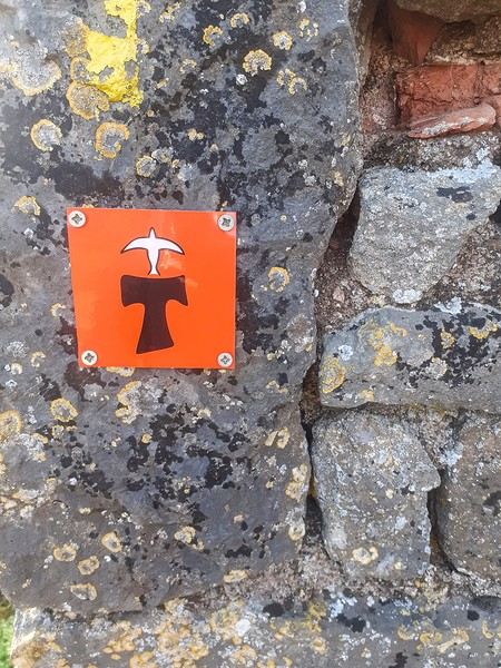
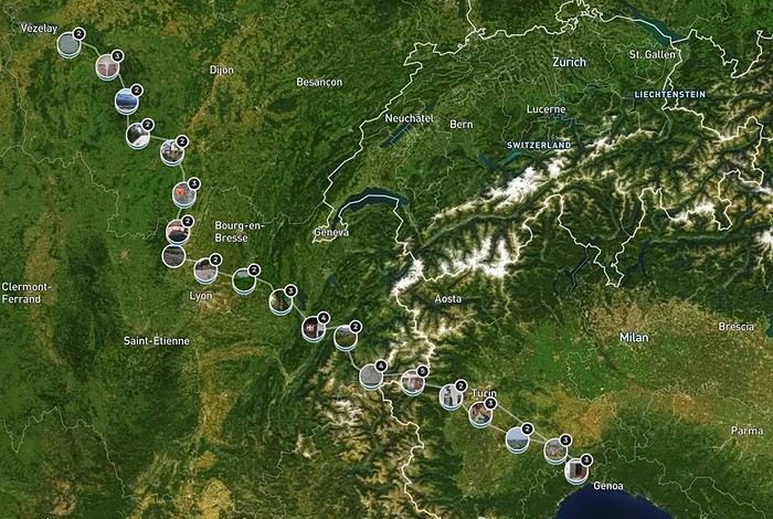
June 2024. While hiking with my brother on the GR 36 Tour du Morvan, I catch sight now and then of strange rectangular markers fixed to tree trunks. Against a bright orange background, a deep black Greek tau topped with a white dove. My first encounter with the Assisi Way. The Way of St. Francis: a pilgrimage route linking Vézelay in Burgundy to Assisi in Italy, covering nearly 1,800 km. It felt like an obvious next step—I immediately knew I’d take it on, attempt the adventure solo.
In the months that followed, I talked about my project to everyone—family, friends, my partner. An avalanche of comments, more or less the same but varying depending on each person’s character and life experiences. But deep down, it all boiled down to one legitimate question: why?
And the answers? Hesitant, awkward, partial, even confused. I quickly realized they weren’t so easy to find. It was as if my project seemed more like a whim, a kind of intimate caprice, rather than a well-thought-out plan. Of course, I knew the reasons that pushed me to leave—you always have to give some. Loved ones need to understand to feel reassured, and that’s understandable. But I fear that when I list them, they’ll sound like the same old checklist anyone embarking on this kind of journey might give. Of all the reasons I could mention, I’ll highlight just one here: the call of the road, the solo adventure that brings a powerful sense of freedom. A bit like Monsieur Seguin’s goat, who from her comfortable pen gazes longingly at the unconstrained horizon of the mountain. But if I’m being honest, I think I didn’t really know what I was looking for—or, more importantly, what I’d find. Deep down, when I reflect on it, one word keeps coming up that explains nothing and everything at once: desire.
Now well past sixty, I know that when I ask myself who I am or where I’m going, two things bring me fully back to myself: hiking and writing. And my intention was also to anchor this adventure through words, day by day. Writing down my feelings, emotions, discoveries, and reflections each evening. The famous travel journal that grounds the daily experience in reality. When I discovered the app "Polarstep," which was initially just meant to keep my loved ones updated and reassured, inform them of my progress, and maintain a connection, I found an opportunity to do it a little differently than usual. No retrospective notes polished up after returning, but spontaneous writing—recounting everything that crossed my mind during the day and publishing it immediately. A journey lived in real time.
This text is the exact transcription of my daily writings. Rereading them, I didn’t change a thing—just corrected a few mistakes and tweaked some awkward phrasing here and there. Short texts, fitting the format imposed by this kind of app. Writing as if addressing others.
Now, all that was left was to walk. April 18, 2026 – Vézelay.
June 2024. While hiking with my brother on the GR 36 Tour du Morvan, I catch sight now and then of strange rectangular markers fixed to tree trunks. Against a bright orange background, a deep black Greek tau topped with a white dove. My first encounter with the Assisi Way. The Way of St. Francis: a pilgrimage route linking Vézelay in Burgundy to Assisi in Italy, covering nearly 1,800 km. It felt like an obvious next step—I immediately knew I’d take it on, attempt the adventure solo.
In the months that followed, I talked about my project to everyone—family, friends, my partner. An avalanche of comments, more or less the same but varying depending on each person’s character and life experiences. But deep down, it all boiled down to one legitimate question: why?
And the answers? Hesitant, awkward, partial, even confused. I quickly realized they weren’t so easy to find. It was as if my project seemed more like a whim, a kind of intimate caprice, rather than a well-thought-out plan. Of course, I knew the reasons that pushed me to leave—you always have to give some. Loved ones need to understand to feel reassured, and that’s understandable. But I fear that when I list them, they’ll sound like the same old checklist anyone embarking on this kind of journey might give. Of all the reasons I could mention, I’ll highlight just one here: the call of the road, the solo adventure that brings a powerful sense of freedom. A bit like Monsieur Seguin’s goat, who from her comfortable pen gazes longingly at the unconstrained horizon of the mountain. But if I’m being honest, I think I didn’t really know what I was looking for—or, more importantly, what I’d find. Deep down, when I reflect on it, one word keeps coming up that explains nothing and everything at once: desire.
Now well past sixty, I know that when I ask myself who I am or where I’m going, two things bring me fully back to myself: hiking and writing. And my intention was also to anchor this adventure through words, day by day. Writing down my feelings, emotions, discoveries, and reflections each evening. The famous travel journal that grounds the daily experience in reality. When I discovered the app "Polarstep," which was initially just meant to keep my loved ones updated and reassured, inform them of my progress, and maintain a connection, I found an opportunity to do it a little differently than usual. No retrospective notes polished up after returning, but spontaneous writing—recounting everything that crossed my mind during the day and publishing it immediately. A journey lived in real time.
This text is the exact transcription of my daily writings. Rereading them, I didn’t change a thing—just corrected a few mistakes and tweaked some awkward phrasing here and there. Short texts, fitting the format imposed by this kind of app. Writing as if addressing others.
Now, all that was left was to walk. April 18, 2026 – Vézelay.
Hi everyone,
We were offered a visit to the Renaissance by the new CFC cruise line through Croisiland. After reading all the reviews—some very harsh, others glowing—I wanted to form my own opinion without having to book a full cruise to test it out. This visit to the ship at the port of Le Havre for 49 € per person came at the perfect time, even if I’m a bit put off by having to pay for a ship tour. That’s not how it usually works with other cruise lines, as far as I know.
The Renaissance is a former Holland America Line ship, built in 1993 and renovated in 2023. We’re familiar with this style of ship since we took a long cruise in Polynesia in 2014 on one of its sister ships, the MS Statendam. We remember it as a charming small ship with a lovely pool terrace at the very back.
Off we went this morning for a relaxing day on a ship—always a nice change!
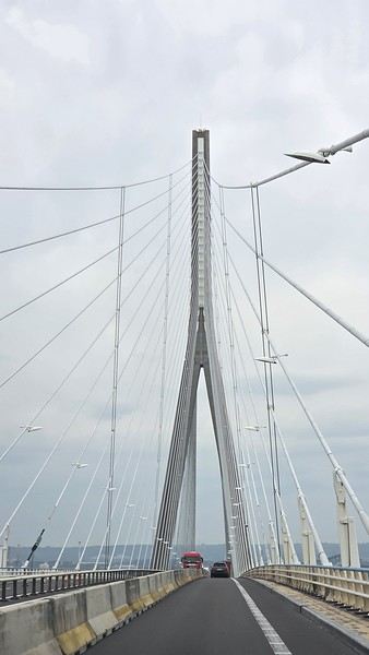
The Pont de Normandie is the last elegant structure you see before entering the vast and rather smelly port area of Le Havre.
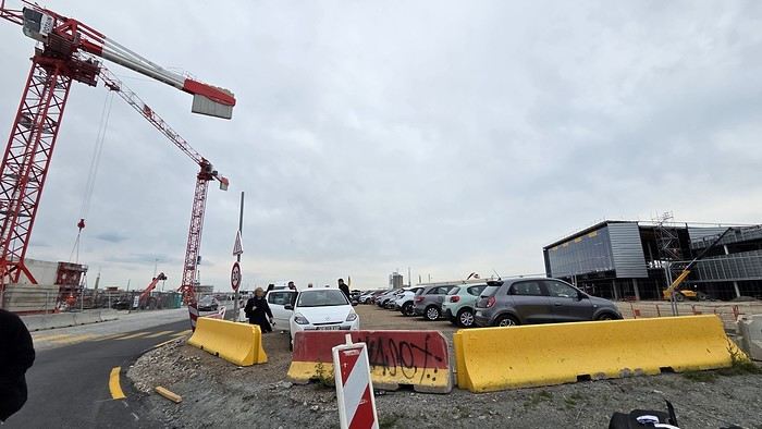
The area around the port where the Renaissance is docked is total chaos—cars everywhere and only a handful of taxis. We were supposed to have a reserved parking spot in front of the terminal (we’d even given them our car model and license plate), but we were denied entry. There’s no paved public parking, so we left the car on a vacant lot.
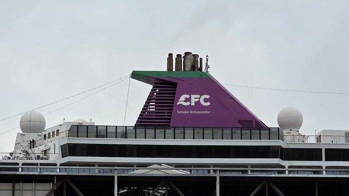
CFC was officially acquired by the British cruise line Ambassador Cruise Line in January 2025. Ambassador Cruise Line, launched in 2010, already owns two ships of the same type and age. They wasted no time repainting the funnel in their new colors.
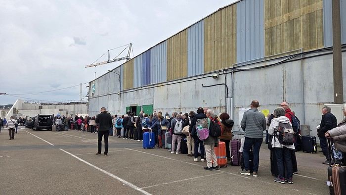
The line of passengers disembarking and waiting for taxis is endless... and taxis are trickling in. Is this the aftermath of yesterday’s strike, or is this the norm in this port? Either way, I feel bad for the poor travelers waiting—it’s going to be a long haul. Many are leaving on foot, dragging their suitcases. Compared to the port of Marseille, this is pretty dismal.
Forty spots were available for this visit organized by Croisiland, but we ran into a good hundred people at the meet-up. A group from the AVF (Accueil des Villes Françaises) of Le Havre will be joining us. Our Croisiland group consists of twelve people, if I counted right.
Security clearance is done alphabetically, and we quickly board the ship. Now we’re getting to the heart of the matter.
To be continued...
We were offered a visit to the Renaissance by the new CFC cruise line through Croisiland. After reading all the reviews—some very harsh, others glowing—I wanted to form my own opinion without having to book a full cruise to test it out. This visit to the ship at the port of Le Havre for 49 € per person came at the perfect time, even if I’m a bit put off by having to pay for a ship tour. That’s not how it usually works with other cruise lines, as far as I know.
The Renaissance is a former Holland America Line ship, built in 1993 and renovated in 2023. We’re familiar with this style of ship since we took a long cruise in Polynesia in 2014 on one of its sister ships, the MS Statendam. We remember it as a charming small ship with a lovely pool terrace at the very back.
Off we went this morning for a relaxing day on a ship—always a nice change!
The Pont de Normandie is the last elegant structure you see before entering the vast and rather smelly port area of Le Havre.
The area around the port where the Renaissance is docked is total chaos—cars everywhere and only a handful of taxis. We were supposed to have a reserved parking spot in front of the terminal (we’d even given them our car model and license plate), but we were denied entry. There’s no paved public parking, so we left the car on a vacant lot.
CFC was officially acquired by the British cruise line Ambassador Cruise Line in January 2025. Ambassador Cruise Line, launched in 2010, already owns two ships of the same type and age. They wasted no time repainting the funnel in their new colors.
The line of passengers disembarking and waiting for taxis is endless... and taxis are trickling in. Is this the aftermath of yesterday’s strike, or is this the norm in this port? Either way, I feel bad for the poor travelers waiting—it’s going to be a long haul. Many are leaving on foot, dragging their suitcases. Compared to the port of Marseille, this is pretty dismal.
Forty spots were available for this visit organized by Croisiland, but we ran into a good hundred people at the meet-up. A group from the AVF (Accueil des Villes Françaises) of Le Havre will be joining us. Our Croisiland group consists of twelve people, if I counted right.
Security clearance is done alphabetically, and we quickly board the ship. Now we’re getting to the heart of the matter.
To be continued...
Hey fellow travelers!
So, a new year has begun. It’s time to reconnect with the VF buddies and wish you all my best for 2026—a year I hope is obviously full of travel, since, as I just made up: "If travel’s good, everything’s good" 😄.
To celebrate, I’m inviting you into my new "travel journal," the one from our latest trip in November 2025, a little two-week adventure.
This time, we headed to The Gambia, a tiny country tucked right in the middle of Senegal, before making our way to Casamance.
The Gambia is English-speaking, Senegal is French-speaking, but the locals? They couldn’t care less—because in this part of the world, they mostly speak Wolof, Fula, Jola, or Mandinka. Hence the title: Senegambia 😉.
As usual, I’m sharing the live updates I sent to friends and family—super casual, of course.
I know this isn’t the kind of destination that draws crowds, but if you love adventure, laughter, and emotion, it might just be your thing 😊.
Hugs 😘
Aruba is a small island in the Dutch Caribbean located off the coast of Venezuela. It’s part of the ABC islands (Aruba, Bonaire, Curaçao).
After visiting the island of Curaçao a few years earlier, we decided to explore Aruba in November 2023.
We stayed for three weeks in an Airbnb-style accommodation and rented a vehicle for the entire period to visit the various tourist attractions on the island.
These are listed below.
You’ll find several supermarkets (Carrefour, Super Food, Jumbo, etc.) as well as a wide variety of restaurants.
*****
Note:
Please be aware that since July 2024, Aruba has implemented a $20 sustainable development tax for visitors arriving by air.
This tax is payable via the online ED Card platform during the ED card application process to enter Aruba.
I invite you to continue reading this travel journal and watch the videos that will help you discover this sunny destination.
*****
Videos are embedded throughout the summary. Click on the image to start the video.
To jump to a specific post, here are the relevant links:
Noord - California Lighthouse Noord - Bubali Bird Sanctuary Paradera - Casibari Rock Formations Santa Cruz - Ayo Rock Formations Bushiribana - New Natural Pool (Cave Pool) Noord - Bushiribana Gold Mill Ruins Santa Cruz - Natural Bridge Oranjestad - Hooiberg San Nicolas - Seroe Colorado Natural Bridge Spanish Lagoon Mangrove Trail Shoco Habitat - Spanish Lagoon Oranjestad - Balashi Gold Mill Ruins San Nicolas - Lourdes Grotto Arikok National Park - Daimari Beach, Boka Keto Beach (Moro), Conchi Natural Pool Arikok National Park - Boca Prins Beach Arikok National Park - Fontein Cave Arikok National Park – Quadirikiri Cave Arikok National Park – Hike to Sero Arikok Oranjestad & Noord - Walking tour San Nicolas and its murals San Nicolas and its mosaic street benches The famous seafood restaurant Zeerover Noord - Snorkeling around the Baboo shipwreck Noord - Arashi Beach Noord - Boca Catalina Beach Noord - Boca Catalina Beach - Snorkeling Noord - Snorkeling at Tres Tapi - Turtle and Ray Noord - Snorkeling at Malmok Beach - Flying gurnards Noord - Hadicurari Beach (Fishermen's Huts) Noord - Palm Beach Noord - Eagle Beach Noord – Manchebo Beach Oranjestad - Divi Beach Oranjestad - Druif Beach Oranjestad - Surfside Beach Pos Chiquito - Mangel Halto Beach Savaneta - Santo Largo Beach Savaneta - Battata Beach San Nicolas - Rodgers Beach San Nicolas - Baby Beach San Nicolas - Baby Beach - Snorkeling San Nicolas - Bachelor’s Beach (Boca Tabla) San Nicolas - Boca Grandi Beach San Nicolas - Colorado Point - Snorkeling at Bachelors Beach San Nicolas - Grapefield Beach Hike - Blackstone Beach via Natural Bridge Noord - Wariruri Beach
Hello everyone,
Here’s the story of our two-week trip—13 nights, actually—in the national parks of northern and southeastern Kenya, which we took last September at the end of summer. My wife and I planned this trip with a French agency (Bel Africa, Paris), which worked with a local operator in Nairobi (Nadhy Travels & Tours). The latter provided a driver-guide and vouchers, but no aperitif🙁! Our all-inclusive package included animal safaris exclusively in a customized 4x4 vehicle (with a pop-up roof) and accommodations in high-quality lodges that we selected ourselves. It’s great for comfort, but not so much for the wallet. The cost was obviously astronomical for the services provided. But that’s just my usual take on lodging in East and Southern Africa! Our itinerary was a loop starting and ending in Nairobi, passing through Ol Pejeta, Buffalo Springs-Samburu, Meru NP, Amboseli, and Tsavo West.
Trip breakdown:
Day 1 to 3: Ol Pejeta Day 3 to 7: Buffalo Springs Day 7 to 8: Meru NP-Nairobi Day 9 to 11: Nairobi-Amboseli Day 11 to 14: Tsavo West
Photo gear we brought:
- 1 bridge camera - 2 DSLR bodies - 2 telephoto lenses: 70-200mm f/2.8 and 200-500mm f/5.6 - 2 pairs of 10x42 binoculars
What motivated this trip? We wanted to recharge and were looking for a certain tranquility that would be ideal for wildlife observation and photography—our hobbies. That immediately ruled out the parks in the southwest, which are too crowded. Plus, those would have likely been a repeat of what we experienced in Tanzania a few years earlier (see my travel journal "The Great Migration"). Buffalo Springs particularly appealed to us because of the unique animal species it’s home to. It was really their existence that drove our choices. We wanted to see animals we’d never seen before in their natural habitats.
So, on a beautiful late-summer evening, we took off from Paris-CDG for Nairobi. The overnight flight was uneventful, and we landed early in the morning at Jomo Kenyatta International Airport (NBO). But our driver-guide wasn’t waiting for us. Judging by the number of signs being held up, we must have been the only travelers in that situation. Good grief, why wasn’t he there like all the others?
Ah, Iceland and us—it’s quite the story, or rather, a long wait... The first time we considered going was already 7-8 years ago, after reading travel journals describing breathtaking landscapes, countless active and dormant volcanoes, glaciers, and waterfalls with extraordinary flows. In short, this island, made of fire and ice, right at Europe’s doorstep with its own unique culture, had nothing but advantages, and it was urgent to visit without delay 😇
My *Routard* guidebook is actually from 2016. So why did Iceland make us wait so long before we finally gave in to its charms? Yes, why indeed?
Simply because reading other travel journals revealed the cost of living there—and especially the harsh climate, even in the middle of July 🤪! Some journals described entire weeks of rain and foggy weather, making it tricky to explore the island. The budget wasn’t spared either, because in the most touristy areas, especially in the south and around Myvatn, accommodation prices are downright indecent—even outright robbery. 😕
Plus, in the Highlands, there’s literally no permanent lodging, and the only way to spend several nights there is to camp. And camping in winter conditions wasn’t exactly part of our plans... 😄
So, year after year, this trip kept getting postponed...
until August 2023, when prices for Southern Africa, North or South America, or even Asia were all way too high for summer 2024!
That’s when I turned my attention back to the Land of Fire and Ice and scoured all the comparison sites for the best accommodation deals across the country. Planning for 20 nights, I found 13 nights in "proper" lodging for 5 people at an average cost of under 200 €! A miracle, considering that in the southern glacier region, around Vik or Myvatn, prices range from 300 to 1000 € per night 😮 😮!
Still, that means we’ll have to camp for 7 nights, mostly in the Highlands, near Askja or Landmannalaugar. 😎
For once, I built the daily itinerary entirely around the decently priced lodgings I found 11 months in advance! The shortage of places to stay in some areas forced me to plan a few long transition days and make some tough choices. No big deal, though—there’s so much to do on this island 🙂!
Once the main itinerary was set, everyone agreed to the plan: 2/3 in proper lodging and 1/3 camping, even the most camping-averse among us! *Follow my gaze...*
By the time we bought the flight tickets, I had to tweak the itinerary a bit because one or two places were already booked! Plus, it was impossible to wait for a more refined plan to adjust reservations, since almost all bookings are non-refundable!! The harsh law of supply and demand...
For the car rental, we booked a Hyundai Tucson, approved for the Highlands, from Lava Car Rental—a company I’d read good reviews about in a Facebook group—for a cool 2500 € with full insurance. A real 4x4, like a Defender, would’ve been more than double...! Welcome to Iceland 😕...
Activities and excursions also required some tough choices. We had two must-dos: whale watching in Húsavík (60 € pp on Getyourguide) and a Glacier and Summer Treasure Glacier Walk with BlueIceland (165 € pp with discount codes on Getyourguide).
For the baths, we skipped the Blue Lagoon—too expensive—in favor of the Secret Lagoon and the Myvatn Baths, the Blue Lagoon’s equivalent but half the price.
Two baths for the price of one... and even more, since I spotted several free hot-water swimming spots.
Itinerary: Day 1: Arrival in Reykjavik - Hraunfossar Waterfall - Surtshellir Cave Day 2: Grábrók Crater - Snæfellsnes Peninsula Day 3: Stykkishólmur - Sturlungalaug Hot Springs Day 4: Northwest Coast - Akureyri - Goðafoss Day 5: Myvatn Day 6: Myvatn - Dettifoss - Selfoss - Rauðhólar Day 7: Húsavík Whale Watching - Dettifoss - Selfoss Day 8: Stuðlagil Canyon - Seyðisfjörður Day 9: Puffin colony - Störurð Hike Day 10: Hengifoss - East Fjords, Mjóifjörður Day 11: Viking Village - Jökulsárlón - Fjallsárlón Day 12: Glacier Excursion - Svartifoss Day 13: Fjaðrárgljúfur Canyon - Vík Day 14: Þakgil - Lava Show Vík Day 15: Southern Waterfalls Day Day 16: Landmannalaugar - Skalli Hike Day 17: Landmannalaugar - Bláhnjúkur - Brennisteinsalda Day 18: Secret Lagoon, Kerlingarfjöll, and Gullfoss Day 19: Geysir - Reykjavik Day 20: Bruarfoss - Þingvellir - Kerid Crater - Krýsuvík Geothermal Area Day 21: Reykjanes Peninsula
Friday, July 5, 2024, is our last workday before driving up to Alsace overnight to leave the cockers at Grandpa’s for boarding. Then, at 1:30 AM, we’ll head to Frankfurt, where a direct flight to Iceland awaits.
We arrive at 4 AM. Since we leave at 7 AM, the "night" will only last the equivalent of a 30-minute nap 🤪... just enough to get us in the road-trip mood 😏!!
Preamble: Why La Gomera?
When we started looking for a summer destination a few months ago, our first criterion was to avoid extreme heat and heatwaves. We had already been to Norway two years ago and are considering going back in the future for other occasions. So, we had some fun asking ChatGPT which destinations enjoyed a mild climate during the summer without going too far. Among the list provided by the AI were the Canary Islands... The idea of a place we wouldn’t have thought of first, both not too far away and exotic enough, appealed to us: “Hmm, why not?”
This destination had never really attracted me, though Magali was a bit more interested. Five years earlier, COVID had caused a short break in my professional activity, and I had planned a trip because the flight price was attractive, and I was looking for a destination different from what usually appeals to me, more than out of deep interest. From a distance and with a social judgment I acknowledge (it’s not great, but it’s not completely wrong), I had the image of a destination for party-goers enjoying the sun without the slightest interest in local culture, with concrete coastlines and denatured landscapes—everything I detest the most. Still, I had done some quick research on the different islands and spotted Lanzarote for its beautiful volcanic landscapes, hiking trails, beaches, and the impression of a good balance between activity and fewer crowds than Tenerife or Gran Canaria. Then I dropped the idea of going, without ever reconsidering traveling to the Canaries...
Until now! Because we started researching the different islands of the archipelago to see which ones might appeal to us the most. It was La Gomera, the third smallest island of the archipelago, more praised for its hiking trails and preserved nature than for its beaches, away from mass tourism (fifty times fewer tourists than Tenerife) but still a bit more developed than its wild neighbor El Hierro, that caught our attention. Contrary to what might be suggested later, I’m not at all addicted to AI, but I use it from time to time to synthesize quick research or simply for experimentation. Since ChatGPT had started anticipating my tastes lately as if it had become my buddy (often successfully, sometimes off the mark), I asked which Canary Island would suit me best for a trip with my family. The tool answered first with... La Gomera. So, I tested it and teased it a bit to see if this suggestion was well-founded, as the method sometimes makes it contradict itself. But no luck: “You’d appreciate the wild nature of El Hierro, but with family, you’ll find little activity for the kids. You won’t like the touristy vibe of the big islands like Tenerife, Gran Canaria, Lanzarote, and Fuerteventura. You could consider La Palma, but it’s really La Gomera that will suit you best, based on your interests and the criteria given.” So, we dug deeper into our research and were convinced without a shadow of a doubt that this island was the one waiting for us.
Without knowing it, we had Canarians in our circle who revealed their origins when they heard about our travel plans. One from Tenerife insisted we’d be better off choosing Tenerife (obviously...) because it also has preserved spots and that La Gomera, “you can explore it in two or three days, you’ll get bored quickly...” The other, a colleague from Gran Canaria who had never visited La Gomera, still recommended it without hesitation because it turned out her parents had just gone there on vacation: they loved it and had encountered few tourists. She also tended to think this destination was usually the subject of short stays, but according to what her parents told her, taking your time there was also a great idea. However, in our research, the idea that La Gomera is an island you can explore in three or four days max kept coming up. So, we considered combining its visit with La Palma or El Hierro, the other two that caught our eye. But hopping between islands by ferry represents a significant budget for non-Canarians, even more so for a family of four. Then, scrutinizing Google Maps, it seemed obvious that two weeks were too short to discover two islands as they deserve, and that there seemed to be plenty to see in La Gomera, given its very unique culture. After all, we read that some people spend several months a year there, others never even leave... Finally, these landscapes and this atmosphere, which seemed to us a mix of Europe, North Africa, and Latin America, tempted us. So, it would be two weeks in La Gomera, deal!
La Gomera is therefore the second... well, the third smallest island of the Canaries since La Graciosa was recently recognized as a fully inhabited island. It has the shape of a rough circle about 20 to 25 kilometers in diameter and has just over 20,000 inhabitants, half of them in its capital, San Sebastián de la Gomera, the only real town. Like its Canarian sisters, La Gomera is a volcanic formation that rose about 10 million years ago. The island is very mountainous and rugged, covered with red and black rocky landscapes. Geological activity has shaped, between the sprawling massifs that end in steep cliffs in the ocean, six coastal valleys with tropical vegetation that have favored human settlement. They divide the island like slices of a cake; from the north clockwise: the agricultural Vallehermoso, the rustic Agulo, the green, humid, and fertile Hermigua, the sunny capital San Sebastián de la Gomera, the southern and isolated Alajeró-Santiago, and the seaside Valle Gran Rey. They constitute the six municipalities (more like cantons to our French understanding) of the territory.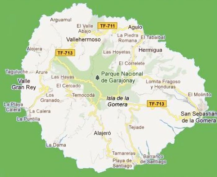 The large solidified magma massifs that shape the heart of the island have created a large depression more protected from the sun at its center, allowing the growth of a vast laurel forest, today grouped within the Garajonay National Park, La Gomera’s green lung, which has earned it the status of a World Biosphere Reserve. Its completely European appearance contrasts sharply with the rocky and tropical landscapes of the rest of the island. Thus, the climate varies greatly from one point to another on the island: in summer, you can quickly go from a dry and sunny valley at 35°C to a humid forest area at altitude at 18°C.
La Gomera was populated late. As with the rest of the Canaries, human presence is thought to have begun about 2,000 years ago. Groups of animist Berbers, probably fleeing persecution, gradually populated the archipelago, especially the western islands and La Gomera, becoming its small aboriginal population: the Guanches (or later Gomeros). The animist and pastoral civilization of the Guanches thrived until the Spanish takeover in the 15th century, which, after a short period of harmony and mixing with the indigenous people, suddenly ended in bloodshed... La Gomera later became the “Columbus Island” after Christopher Columbus’s stopover, increasing the blending of populations. In the 20th century, many Gomeros emigrated to Cuba and other Latin American countries in search of a better life, bringing back a mix of cultures and traits quite palpable in today’s Gomeran culture. It is, however, in La Gomera that the vestiges of Guanche culture seem to have left the most traces, in the language, gastronomy, social practices... Moreover, most Gomeros, especially in remote villages, have a particular identifiable type and proudly claim their ancestral roots, even making La Gomera a bit exotic in the eyes of other Canarians.
Perhaps that’s why it has never really wanted to develop its tourist infrastructure too much. If we set aside the tourists who visit for the day by bus or boat from Tenerife on a marked itinerary (and whom we ultimately rarely encounter), La Gomera has remained a hidden gem, a destination focused on nature discovery that attracts hikers, nature-loving divers, and scientists for its fauna and flora, and to a lesser extent, beachgoers who don’t seek overly developed coastlines. Tourist activity is therefore limited. Roughly speaking, you’ll find a majority of Spaniards, including a substantial number of residents from other Canary Islands, many Germans who have a particular fondness for La Gomera and spend long stays there or own second homes, to the point that the German cultural footprint is clearly noticeable in some places (it’s said to be Angela Merkel’s favorite holiday spot), and still quite a few French. The presence of other nationalities seemed negligible to us. Most travelers come mainly for hiking, but it’s also a prime spot for whale watching. Additionally, the seaside resorts of La Gomera—San Sebastián, Santiago, and especially Valle Gran Rey—are well-known destinations for hippies, especially German ones, ranging from chic boho hippies to old-school hippies who’ve been there for decades, quite similar to those you’d meet in India in Goa, Rishikesh, or Paharganj. Thus, practices like naturism, vegetarianism, and local organic production are quite well established in some areas.
Some practical info: - The round-trip flight from Paris to Tenerife cost us 365 € per person (outbound with Transavia, return with EasyJet), including checked luggage and three seats reserved side by side. - We chose two bases to explore the island: one week in Valle Gran Rey, reputed to be the most pleasant of the three seaside resorts, and one week in Hermigua, more mountainous and close to the natural park. We booked two houses with balconies and views: the first at 120 € per night, the second at 99 €. - The round-trip ferry between Tenerife and La Gomera cost us 270 € with the company Baleària Canarias, including discounts for children aged 4 and 12, but I don’t have the exact details. It was a bit cheaper than with the other company, Fred Olsen. - Finally, we rented a car through the agency Cicar for 360 € for 16 days, which comes to 22.50 € per day. - Apart from that, we didn’t plan anything and decided the day before or even the morning of what we wanted to do. We didn’t invest in any paper guide on the Canaries, as information on La Gomera was scarce, but we used the very comprehensive site La Gomera Travel, a travel guide published by the Canary Islands Tourism Council, a real goldmine of almost exhaustive information on the island.
Alright, off we go for 16 days of adventure discovering La Gomera!
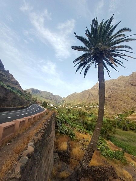
And we start the trip with music!
We start the trip with music!
When we started looking for a summer destination a few months ago, our first criterion was to avoid extreme heat and heatwaves. We had already been to Norway two years ago and are considering going back in the future for other occasions. So, we had some fun asking ChatGPT which destinations enjoyed a mild climate during the summer without going too far. Among the list provided by the AI were the Canary Islands... The idea of a place we wouldn’t have thought of first, both not too far away and exotic enough, appealed to us: “Hmm, why not?”
This destination had never really attracted me, though Magali was a bit more interested. Five years earlier, COVID had caused a short break in my professional activity, and I had planned a trip because the flight price was attractive, and I was looking for a destination different from what usually appeals to me, more than out of deep interest. From a distance and with a social judgment I acknowledge (it’s not great, but it’s not completely wrong), I had the image of a destination for party-goers enjoying the sun without the slightest interest in local culture, with concrete coastlines and denatured landscapes—everything I detest the most. Still, I had done some quick research on the different islands and spotted Lanzarote for its beautiful volcanic landscapes, hiking trails, beaches, and the impression of a good balance between activity and fewer crowds than Tenerife or Gran Canaria. Then I dropped the idea of going, without ever reconsidering traveling to the Canaries...
Until now! Because we started researching the different islands of the archipelago to see which ones might appeal to us the most. It was La Gomera, the third smallest island of the archipelago, more praised for its hiking trails and preserved nature than for its beaches, away from mass tourism (fifty times fewer tourists than Tenerife) but still a bit more developed than its wild neighbor El Hierro, that caught our attention. Contrary to what might be suggested later, I’m not at all addicted to AI, but I use it from time to time to synthesize quick research or simply for experimentation. Since ChatGPT had started anticipating my tastes lately as if it had become my buddy (often successfully, sometimes off the mark), I asked which Canary Island would suit me best for a trip with my family. The tool answered first with... La Gomera. So, I tested it and teased it a bit to see if this suggestion was well-founded, as the method sometimes makes it contradict itself. But no luck: “You’d appreciate the wild nature of El Hierro, but with family, you’ll find little activity for the kids. You won’t like the touristy vibe of the big islands like Tenerife, Gran Canaria, Lanzarote, and Fuerteventura. You could consider La Palma, but it’s really La Gomera that will suit you best, based on your interests and the criteria given.” So, we dug deeper into our research and were convinced without a shadow of a doubt that this island was the one waiting for us.
Without knowing it, we had Canarians in our circle who revealed their origins when they heard about our travel plans. One from Tenerife insisted we’d be better off choosing Tenerife (obviously...) because it also has preserved spots and that La Gomera, “you can explore it in two or three days, you’ll get bored quickly...” The other, a colleague from Gran Canaria who had never visited La Gomera, still recommended it without hesitation because it turned out her parents had just gone there on vacation: they loved it and had encountered few tourists. She also tended to think this destination was usually the subject of short stays, but according to what her parents told her, taking your time there was also a great idea. However, in our research, the idea that La Gomera is an island you can explore in three or four days max kept coming up. So, we considered combining its visit with La Palma or El Hierro, the other two that caught our eye. But hopping between islands by ferry represents a significant budget for non-Canarians, even more so for a family of four. Then, scrutinizing Google Maps, it seemed obvious that two weeks were too short to discover two islands as they deserve, and that there seemed to be plenty to see in La Gomera, given its very unique culture. After all, we read that some people spend several months a year there, others never even leave... Finally, these landscapes and this atmosphere, which seemed to us a mix of Europe, North Africa, and Latin America, tempted us. So, it would be two weeks in La Gomera, deal!
La Gomera is therefore the second... well, the third smallest island of the Canaries since La Graciosa was recently recognized as a fully inhabited island. It has the shape of a rough circle about 20 to 25 kilometers in diameter and has just over 20,000 inhabitants, half of them in its capital, San Sebastián de la Gomera, the only real town. Like its Canarian sisters, La Gomera is a volcanic formation that rose about 10 million years ago. The island is very mountainous and rugged, covered with red and black rocky landscapes. Geological activity has shaped, between the sprawling massifs that end in steep cliffs in the ocean, six coastal valleys with tropical vegetation that have favored human settlement. They divide the island like slices of a cake; from the north clockwise: the agricultural Vallehermoso, the rustic Agulo, the green, humid, and fertile Hermigua, the sunny capital San Sebastián de la Gomera, the southern and isolated Alajeró-Santiago, and the seaside Valle Gran Rey. They constitute the six municipalities (more like cantons to our French understanding) of the territory.
The large solidified magma massifs that shape the heart of the island have created a large depression more protected from the sun at its center, allowing the growth of a vast laurel forest, today grouped within the Garajonay National Park, La Gomera’s green lung, which has earned it the status of a World Biosphere Reserve. Its completely European appearance contrasts sharply with the rocky and tropical landscapes of the rest of the island. Thus, the climate varies greatly from one point to another on the island: in summer, you can quickly go from a dry and sunny valley at 35°C to a humid forest area at altitude at 18°C.La Gomera was populated late. As with the rest of the Canaries, human presence is thought to have begun about 2,000 years ago. Groups of animist Berbers, probably fleeing persecution, gradually populated the archipelago, especially the western islands and La Gomera, becoming its small aboriginal population: the Guanches (or later Gomeros). The animist and pastoral civilization of the Guanches thrived until the Spanish takeover in the 15th century, which, after a short period of harmony and mixing with the indigenous people, suddenly ended in bloodshed... La Gomera later became the “Columbus Island” after Christopher Columbus’s stopover, increasing the blending of populations. In the 20th century, many Gomeros emigrated to Cuba and other Latin American countries in search of a better life, bringing back a mix of cultures and traits quite palpable in today’s Gomeran culture. It is, however, in La Gomera that the vestiges of Guanche culture seem to have left the most traces, in the language, gastronomy, social practices... Moreover, most Gomeros, especially in remote villages, have a particular identifiable type and proudly claim their ancestral roots, even making La Gomera a bit exotic in the eyes of other Canarians.
Perhaps that’s why it has never really wanted to develop its tourist infrastructure too much. If we set aside the tourists who visit for the day by bus or boat from Tenerife on a marked itinerary (and whom we ultimately rarely encounter), La Gomera has remained a hidden gem, a destination focused on nature discovery that attracts hikers, nature-loving divers, and scientists for its fauna and flora, and to a lesser extent, beachgoers who don’t seek overly developed coastlines. Tourist activity is therefore limited. Roughly speaking, you’ll find a majority of Spaniards, including a substantial number of residents from other Canary Islands, many Germans who have a particular fondness for La Gomera and spend long stays there or own second homes, to the point that the German cultural footprint is clearly noticeable in some places (it’s said to be Angela Merkel’s favorite holiday spot), and still quite a few French. The presence of other nationalities seemed negligible to us. Most travelers come mainly for hiking, but it’s also a prime spot for whale watching. Additionally, the seaside resorts of La Gomera—San Sebastián, Santiago, and especially Valle Gran Rey—are well-known destinations for hippies, especially German ones, ranging from chic boho hippies to old-school hippies who’ve been there for decades, quite similar to those you’d meet in India in Goa, Rishikesh, or Paharganj. Thus, practices like naturism, vegetarianism, and local organic production are quite well established in some areas.
Some practical info: - The round-trip flight from Paris to Tenerife cost us 365 € per person (outbound with Transavia, return with EasyJet), including checked luggage and three seats reserved side by side. - We chose two bases to explore the island: one week in Valle Gran Rey, reputed to be the most pleasant of the three seaside resorts, and one week in Hermigua, more mountainous and close to the natural park. We booked two houses with balconies and views: the first at 120 € per night, the second at 99 €. - The round-trip ferry between Tenerife and La Gomera cost us 270 € with the company Baleària Canarias, including discounts for children aged 4 and 12, but I don’t have the exact details. It was a bit cheaper than with the other company, Fred Olsen. - Finally, we rented a car through the agency Cicar for 360 € for 16 days, which comes to 22.50 € per day. - Apart from that, we didn’t plan anything and decided the day before or even the morning of what we wanted to do. We didn’t invest in any paper guide on the Canaries, as information on La Gomera was scarce, but we used the very comprehensive site La Gomera Travel, a travel guide published by the Canary Islands Tourism Council, a real goldmine of almost exhaustive information on the island.
Alright, off we go for 16 days of adventure discovering La Gomera!
And we start the trip with music!
We start the trip with music!
Hi there,
My name’s Emilie, and my view of travel has changed. I used to travel just to tick off the "places and things to do/see" boxes. But lately, I’ve realized that encounters have become really important to me while traveling. In fact, the people I’ve met and what they’ve brought to my life are now my best travel memories. What do you think? Have you had a similar shift in perspective? Are you more interested in meeting people while traveling now?
To be totally honest, I’m training to become a travel planner (a trip organizer), and I was thinking of focusing on organizing trips that are more centered around encounters. So I’d love to know if this makes sense—if travelers are interested in this kind of experience. Just to be clear, I’m not selling anything; I just want to chat and hear your thoughts.
Have a lovely evening, everyone! :)
...
After Southern Tanzania, I’m sharing a travel story about the Cantal region with you...
...
For us, at the start of 2025, Le CANTAL was a true “Terra Incognita”!!
After seeing some tempting TV reports, we decided to fill this gap—especially in terms of landscapes. On the same trip, we’ll also head to the Arcachon Basin, the International Seaplane Gathering in Biscarrosse, and my native Landes region...
So, on May 20th, we left Marseille in the rain and thunder, heading toward Nîmes, Saint-Hippolyte, Mont Aigoual, Florac, and stopping in Marvejols to give my arthritic back a break for the night.
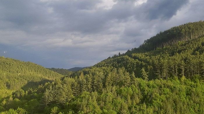
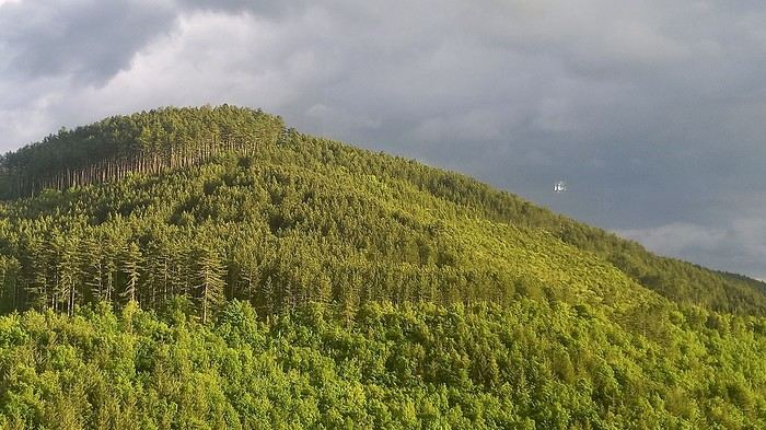
The next morning, we decided to revisit the Parc aux Loups du Gévaudan (Europe’s largest wolf park). As someone used to photo safaris in the wilds of East Africa, I’m not a fan of zoos at all—but I *do* have a deep admiration for wolves!!
Since it’s pretty unlikely I’ll ever see one in the wild, I’ll settle for this Parc aux Loups in Marvejols. This will be our third visit to this incredible gathering of these fascinating canines.
Some are still finishing their chilly night...
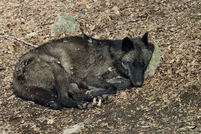
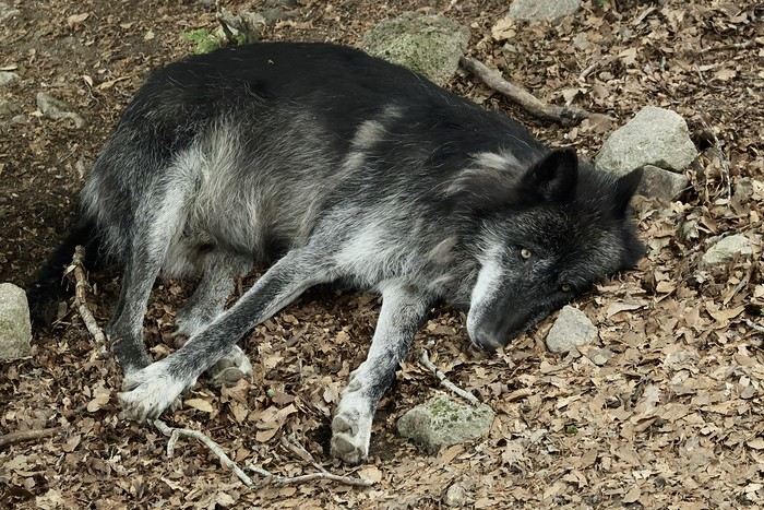
...
After Southern Tanzania, I’m sharing a travel story about the Cantal region with you...
...
For us, at the start of 2025, Le CANTAL was a true “Terra Incognita”!!
After seeing some tempting TV reports, we decided to fill this gap—especially in terms of landscapes. On the same trip, we’ll also head to the Arcachon Basin, the International Seaplane Gathering in Biscarrosse, and my native Landes region...
So, on May 20th, we left Marseille in the rain and thunder, heading toward Nîmes, Saint-Hippolyte, Mont Aigoual, Florac, and stopping in Marvejols to give my arthritic back a break for the night.
The next morning, we decided to revisit the Parc aux Loups du Gévaudan (Europe’s largest wolf park). As someone used to photo safaris in the wilds of East Africa, I’m not a fan of zoos at all—but I *do* have a deep admiration for wolves!!
Since it’s pretty unlikely I’ll ever see one in the wild, I’ll settle for this Parc aux Loups in Marvejols. This will be our third visit to this incredible gathering of these fascinating canines.
Some are still finishing their chilly night...
...
Here’s our third travel journal with photos, following Vietnam in 2012 and Southern Thailand + Angkor in 2013.
Once again, we’d like to thank everyone who brightens up this site with their experiences and tips. Every year, some parts of our itinerary are made easier or richer thanks to your contributions.
We hope our own story will do the same for other travelers.
**10 JULY 2014**
We booked our flight tickets back in September to get a better deal than last year. We were happy with the 1291 € price for two people from Paris—until mid-January, when several airlines started offering promotions we hadn’t expected for our travel dates. Next year, we’ll take the gamble and wait longer, hoping to fly with Qatar Airways, for example. Fate had us flying with Indian Airlines. The Paris-to-Delhi leg was on a brand-new Boeing Dreamliner—obviously fresh off the assembly line. After a quick four-hour layover to stretch our legs, we boarded an Airbus A321 that looked prehistoric for the Delhi-to-Bangkok flight. Honestly, if the outside of the plane had matched the inside, we’d never have made it. Broken screens, shattered armrests—you name it. As for the meal trays, we would’ve devoured them only after a week stranded on a desert island. The cabin crew didn’t win us over either. And we really didn’t appreciate the behavior, attitudes, or stares from most of the people we encountered during our layovers in Delhi. This year’s experience has definitely put us off flying with this airline again—or even setting foot in India ever again. That’s just our personal take, but it’s clear.
Stepping onto Thai soil was an immense relief. After exchanging just a few euros, we took a taxi from the designated spot and had a completely different experience from last year: the driver was normal and efficient. So efficient, in fact, that we arrived at our destination much earlier than expected. A well-deserved tip, and it seemed to make his day.
We dropped our bags at reception and rushed to Harmonique restaurant, just 300 meters away, just in time for the last dinner service. We’d talked about this place at length last year. We’d been looking forward to it for a year, but we only managed to nibble on some spring rolls because what we really wanted was a good night’s sleep. While quite a few customers were still around, four staff members walked through the dining area with two large trash bins from the day’s service. They were clearly pleased with themselves and having a good laugh. It made us chuckle too—seeing something like that done so naturally, when back home, some people would’ve been outraged to witness it in a similar establishment!
A quick word about the Swan Hotel: we’re grateful to those who recommended it on this site and on their blogs. It’s quietly located in the Silom district, just steps from the river. We have fond memories of the giant, ultra-comfortable bed and the well-maintained pool. It was very peaceful, though we were there during a quieter season. At 30 € with breakfast when we booked (and around 20 € without breakfast now), we can’t imagine finding a better-suited hotel in Bangkok.
**11 JULY**
We couldn’t find an open bank and had to withdraw cash from an ATM. Now we know: July 11 is a public holiday in Thailand. It suddenly occurred to us that next year, we’ll keep some baht from our return trip to save time at the airport and avoid little hiccups like this.
We decided not to head straight to Laos and instead spent the day visiting Muang Boran, also known as Ancient City, about 30 km southeast of Bangkok.
There are plenty of ways to get there. We ruled out taxis—too expensive. Besides, we enjoy using local transport; it’s more fun. We took a taxi to Democracy Monument, then found the bus stop about 100 meters from the roundabout, on one of the avenues leading to it. Someone always points you in the right direction. We hopped on bus 511 for a long ride, with two major slowdowns at red lights. The same happened on the way back, as our route crossed busier roads. We told the driver our destination, and he let us know when to get off. No problem—someone already flagged us down 20 meters later to put us in a *songthaew* (a shared taxi-van) that took us straight to the site. The bus and *songthaew* fares were minimal. Already, the people around us were smiling, and we were smiling back.
The entrance fee has gone up: 700 baht. That includes bike rental, a tour minibus, and a boat ride on the river. We still hadn’t fully recovered from the flight, and with the heavy, humid heat, we opted for the electric cart instead—no regrets. Still, 150 baht per hour.
We had an amazing day, beyond our expectations. The park features full-scale or scaled-down replicas of Thailand’s main landmarks, along with countless statues and landscaped gardens. There are also reconstructions of a typical Thai village, a northern Thai village, a farm with animals, and a floating village.
Almost everything we saw was well-made and aesthetically pleasing. The whole place is absolutely worth the trip. We spent six solid hours there without dawdling.
Here’s a very incomplete sample of what we admired:


Visitors will find restrooms, restaurants, and a few shops scattered throughout the site. On the way back, just cross the road using the pedestrian bridge about 250 meters to the left of the exit. Flag down a *songthaew* as it passes.
The whole day flew by between the visit and the commute. We still had time to return to Harmonique to try their famous crab curry. Once you’ve finished it, you think—life isn’t so bad after all.
**10 JULY 2014**
We booked our flight tickets back in September to get a better deal than last year. We were happy with the 1291 € price for two people from Paris—until mid-January, when several airlines started offering promotions we hadn’t expected for our travel dates. Next year, we’ll take the gamble and wait longer, hoping to fly with Qatar Airways, for example. Fate had us flying with Indian Airlines. The Paris-to-Delhi leg was on a brand-new Boeing Dreamliner—obviously fresh off the assembly line. After a quick four-hour layover to stretch our legs, we boarded an Airbus A321 that looked prehistoric for the Delhi-to-Bangkok flight. Honestly, if the outside of the plane had matched the inside, we’d never have made it. Broken screens, shattered armrests—you name it. As for the meal trays, we would’ve devoured them only after a week stranded on a desert island. The cabin crew didn’t win us over either. And we really didn’t appreciate the behavior, attitudes, or stares from most of the people we encountered during our layovers in Delhi. This year’s experience has definitely put us off flying with this airline again—or even setting foot in India ever again. That’s just our personal take, but it’s clear.
Stepping onto Thai soil was an immense relief. After exchanging just a few euros, we took a taxi from the designated spot and had a completely different experience from last year: the driver was normal and efficient. So efficient, in fact, that we arrived at our destination much earlier than expected. A well-deserved tip, and it seemed to make his day.
We dropped our bags at reception and rushed to Harmonique restaurant, just 300 meters away, just in time for the last dinner service. We’d talked about this place at length last year. We’d been looking forward to it for a year, but we only managed to nibble on some spring rolls because what we really wanted was a good night’s sleep. While quite a few customers were still around, four staff members walked through the dining area with two large trash bins from the day’s service. They were clearly pleased with themselves and having a good laugh. It made us chuckle too—seeing something like that done so naturally, when back home, some people would’ve been outraged to witness it in a similar establishment!
A quick word about the Swan Hotel: we’re grateful to those who recommended it on this site and on their blogs. It’s quietly located in the Silom district, just steps from the river. We have fond memories of the giant, ultra-comfortable bed and the well-maintained pool. It was very peaceful, though we were there during a quieter season. At 30 € with breakfast when we booked (and around 20 € without breakfast now), we can’t imagine finding a better-suited hotel in Bangkok.
**11 JULY**
We couldn’t find an open bank and had to withdraw cash from an ATM. Now we know: July 11 is a public holiday in Thailand. It suddenly occurred to us that next year, we’ll keep some baht from our return trip to save time at the airport and avoid little hiccups like this.
We decided not to head straight to Laos and instead spent the day visiting Muang Boran, also known as Ancient City, about 30 km southeast of Bangkok.
There are plenty of ways to get there. We ruled out taxis—too expensive. Besides, we enjoy using local transport; it’s more fun. We took a taxi to Democracy Monument, then found the bus stop about 100 meters from the roundabout, on one of the avenues leading to it. Someone always points you in the right direction. We hopped on bus 511 for a long ride, with two major slowdowns at red lights. The same happened on the way back, as our route crossed busier roads. We told the driver our destination, and he let us know when to get off. No problem—someone already flagged us down 20 meters later to put us in a *songthaew* (a shared taxi-van) that took us straight to the site. The bus and *songthaew* fares were minimal. Already, the people around us were smiling, and we were smiling back.
The entrance fee has gone up: 700 baht. That includes bike rental, a tour minibus, and a boat ride on the river. We still hadn’t fully recovered from the flight, and with the heavy, humid heat, we opted for the electric cart instead—no regrets. Still, 150 baht per hour.
We had an amazing day, beyond our expectations. The park features full-scale or scaled-down replicas of Thailand’s main landmarks, along with countless statues and landscaped gardens. There are also reconstructions of a typical Thai village, a northern Thai village, a farm with animals, and a floating village.
Almost everything we saw was well-made and aesthetically pleasing. The whole place is absolutely worth the trip. We spent six solid hours there without dawdling.
Here’s a very incomplete sample of what we admired:
Visitors will find restrooms, restaurants, and a few shops scattered throughout the site. On the way back, just cross the road using the pedestrian bridge about 250 meters to the left of the exit. Flag down a *songthaew* as it passes.
The whole day flew by between the visit and the commute. We still had time to return to Harmonique to try their famous crab curry. Once you’ve finished it, you think—life isn’t so bad after all.
Why bike (MTB) along the canal between the Two Seas: the lateral canal of the Garonne from Bordeaux to Toulouse, and the Midi Canal from Toulouse to the Mediterranean?
This canal was created to connect the Mediterranean to the Atlantic without going around Spain, and along its entire length, there’s an old towpath (used to pull barges). Since this path is closed to traffic (except for service vehicles from Voies Navigables de France), no cars drive on it—it’s dangerous, noisy, and polluting. The Canal between the Two Seas was built for transporting goods, so it passes through many towns you can explore without dealing with traffic. You can stock up on supplies or spend the night. You’ll discover the varied landscapes of the countryside, always in the serenity brought by the calm and slow flow of the canal’s water. Most of the time, you’ll be in the shade of trees planted to stabilize the banks with their roots. All you have to do is follow this blue—or rather green—ribbon without needing to consult a map. But the biggest advantage is that it’s flat! Of course, on the Canal du Midi, water flows from the watershed divide at Naurouze eastward to the Mediterranean and westward to Toulouse. On the lateral canal of the Garonne, water flows toward Bordeaux. But this slope is almost imperceptible, which is a huge plus when you want to travel by bike for several days with luggage.
When I say "bike," I really mean MTB because, while the towpath has been replaced in some places by a paved bike path, it mostly resembles a dirt trail—sometimes smooth, sometimes rocky, and often cluttered with roots from the magnificent trees lining it. Since the canal was classified as a UNESCO World Heritage site, improvements have been underway, but it won’t be tomorrow that you’ll be able to ride from Bordeaux to Sète on a road bike. And I’m afraid the first sections of the path will be worn out before the rest is finished. You might even run into construction work for this bike path. That’s what happened to me during the spring of 2007.
Sunday, 03/11 – Valence d'Agen 08:15 to Toulouse (Rangueil) 16:30 97 km in 8h15 (6h on the bike) I started on the recently paved path along the lateral canal of the Garonne. The first locks appeared, and as I approached Moissac, the path turned into a billiard table until Castelsarrasin. After the Cousteau port, I was back on the classic dirt towpath with its rocks, roots, and nutria holes. But not for long—soon, I hit ruts left by backhoes and bulldozers, which, fortunately, were resting for the Sunday. A pile of rubble taller than me blocked the entire width of the path. I didn’t want to turn back to find the previous bridge and ride on the other bank, which was just as impassable (dense grass). It wasn’t easy to carry a bike with full panniers, so I lifted it over several mounds. I kept going, sometimes on foot, unsure how far the construction extended. Another bulldozer—luckily, the ground was dry. The work went all the way to Montech, making the path impassable. I recommend taking the N113, which runs parallel (that’s what I did on the way back). In Montech, the famous water slope was at rest, waiting for tourists. For many kilometers, I was back on the traditional towpath. The closer I got to Toulouse, the better the surface became, and the more cyclists and pedestrians I saw—until the city center, where there was nonstop bike traffic, especially students heading to Rangueil.
Monday, 03/12 – Rangueil 09:10 to Revel 16:30 86 km in 7h20 (5h30 on the bike) As soon as you reach Toulouse, you make a 90° turn to follow the connection between the lateral canal and the Canal du Midi. Heading east, you pass the barge selling the famous Toulouse violet souvenirs. A real bike path has been built for 50 km to Port Lauragais. It’s a true joy for Toulousains and travelers. Restrooms have been installed or shared with highway rest areas, allowing you to refill water (of course, bikes are banned from ASF rest areas, but cleverly placed racks let you secure your bike and walk in). At Port Lauragais, it’s another rest area shared by highway users, cyclists, and boaters. You’ll find a cafeteria, restaurant, hotel, and a shop selling regional souvenirs. But the real pleasure is reaching the watershed divide at Naurouze, where water flows toward the Mediterranean on one side and the Atlantic on the other. There, I decided to leave the Canal du Midi, which continues toward Castelnaudary with a much rougher towpath, to follow the *Rigole* that feeds the canal with water from the Saint-Ferréol basin. For me, it was like returning to the source—a bit like a pilgrimage in honor of the brilliant Pierre-Paul Riquet, the designer of this magnificent work. I followed the service trail along the *Rigole*. It’s actually a variant of the GR 653, leading to Revel alongside this artificial waterway. It’s fed by water from the Montagne Noire, and I was worried about a steep climb. But that wasn’t the case—the *Rigole* winds for 40 km, flowing gently under the trees. It was better than a dream: a smooth dirt path with the crunch of pine needles under the wheels, where I only crossed paths with a few fishermen... And to soothe sore buns, the last kilometers were on packed earth—a paradise (ATVs, stay away!). More walkers and cyclists appeared there.
Tuesday, 03/13 After a restful night in Revel, I started the morning with a walk around Lake Saint-Ferréol. A very pleasant 10 km hike, but I don’t recommend it for mountain bikers unless you’re used to mountain terrain and have strong calves. Otherwise, you can take the road—there are at least two hotels near the lake. In the afternoon, I began the return trip to Tarn-et-Garonne via the same path, with the same pleasure.
Total: 378 km of suffering and bliss, for which I must thank the departmental and regional councils for their funding, Voies Navigables de France for maintenance, and the volunteers who mark the hiking trails. And don’t you think you’re exaggerating a bit with your 378 km of bliss and the paradise of the *Rigole*?
Okay, fine—it wasn’t always idyllic. Sometimes the path was downright *pierrique*... but I had great weather, and the landscapes were so beautiful (water, sun, vegetation). In the rain or mud, it would’ve been less fun. What does *pierrique* even mean?
*Pierrique* is worse than rocky. I know a Pierrick, and he’s tough. And why *Facteur4*?
It’s France’s goal to reduce greenhouse gas emissions by a factor of 4 by 2050. I’m doing my part by biking to work 3 out of 4 times. And your cassoulet?
Guilty as charged. I ate the best cassoulet of my life at the Hôtel du Midi in Revel. But it was very productive in methane. My stomach hurt so much I couldn’t sleep and ended up writing my postcards between 3 and 4 AM. So many great memories!
NAMASTE NEPAL! PRACTICAL INFO AND EXPERIENCE FEEDBACK
Stay from March 25 to April 16, 2025
· Flight tickets Air India (via Delhi) (via Skyscanner) = 1130 € per person · Planned budget (and respected without too many restrictions and while buying a few small gifts) = 2000 € for the stay for two. Buses, taxis, and entrance fees to various sites represent a budget to consider. Meals are cheap. Drinks like beer/Coke, however, are not cheap and cost the equivalent of a meal. · Exchange rate of the rupee during our stay = 0.0064 € (the exchange rate is almost identical everywhere, including at the airport). · At the airport, purchase of two SIM cards (phone) = 1000 NPR x 2 for 28 days. · Kathmandu: we had booked the hotel upon arrival: Kathmandu Boutique Hotel (+977 015 357 446 – email: booking@kathmanduboutiquehotel.com), very well located in a quiet alley off the street, south of Thamel, a 10-minute walk from Durbar Square. A hotel like Nepal knows how to do, where tall people will have to duck. Night + breakfast = 18 € for two. Very warm welcome, great location, excellent value for money. · Bhaktapur: we had also booked a hotel for the end of our stay because the chance of the year 2025 made the Nepali New Year and Bisket Jatra particularly festive in Bhaktapur: Manju Baha Hotel School (+977 976 7234014 – email: manjubahahotel@gmail.com) located in an old monastery. "A social enterprise transforming an old monastery into a charming hotel, offering professional hospitality training to underprivileged Nepali youth." Night + breakfast = 32 € for two. Beautifully decorated room. Very warm welcome. Don’t miss the Changunarayan site (near Bhaktapur), it’s amazing. And if you’re lucky enough to be in Bhaktapur in mid-April for 3 days, there’s the Bisket Jatra festivities (Newari festival), joyful, noisy, fun, and wild… · Pokhara (hotel recommended by the Kathmandu hotel): Hotel Green Tara, Lakeside, 10th street, set back, quiet (Tel. +977 61 462698 – email: greentara_67@hotmail.com) · Trek permit (Lower Mustang, no need for an agency or guide, permits checked at Ghasa and Jomsom) = 2000 NPR per person (2 ID photos) · Bus Kathmandu/Pokhara and return = 2000 NPR per person · Bus Pokhara/Jomsom, 2 one-way tickets = 2800 NPR. · Taxi: negotiation with a driver we recommend, Vicky (+977 984 075 599). You explain what you want, negotiate the price, and he waits for you during the visit. Very charming, we used him several times. For example: departure from our hotel at 10 AM -> Boudhanath/Pashupatinath/Patan return at 5 PM to the hotel = 6500 NPR – Swayambhunath (round trip) = 1200 NPR · Site prices: https://ntb.gov.np/plan-your-trip/before-you-come/heritage-site-entry-fees o Visitor Pass for Kathmandu Durbar Square (for the duration of the stay, show your visa) = 1000 NPR per person (1 ID photo) o Bhaktapur Durbar Square (old town) = 1800 NPR per person o Patan = 1000 NPR per person o Swayambhu Stupa = 200 NPR per person o Boudha Stupa = 200 NPR per person o Pashupatinath Temple = 1000 NPR per person (interesting to take a guide) o Changunarayan Temple (6 km north of Bhaktapur) = 400 NPR per person o Mountain Museum in Pokhara = 750 NPR per person · E-cigarettes: e-cigarettes are banned in India and confiscated whether they’re in carry-on or checked luggage. On the way there, we had kept them in our carry-on, they were confiscated in Delhi. On the way back, learning from our previous experience, we put them in our checked luggage. Someone came to get us to take them out of our bags and confiscate them… You can find e-cigarettes and products in Kathmandu.
* * *
I’m 74 years old. I went to Nepal in 1982, 1983, and the last time in 1986. I wanted to introduce this beautiful and endearing country to my husband, and it was… now or never. So we decided it was now.
I knew the trek starting from Pokhara: Naudanda/Birethanti/Ghorepani/Tatopani/Kalopani. There was no way I was going to do that trek, especially the 1000-meter staircase to reach Ghorepani… You have to stay humble with age.
Back then, the road didn’t exist. I didn’t consider, with the construction of this road (NH48) along the western bank of the Kali Gandaki, doing a trek along a windy and dusty road. Was there an alternative hiking trail on the eastern bank? No one answered my question on VoyageForum, so I did my research online. And I found this site: "Andrées de Ruiter and Prem Rai - Trekking the Annapurna Circuit, including the new NATT trails that avoid the road - A guide to one of the most beautiful trekking regions in Nepal and the world (2011) - NATT = New Annapurna Trekking Trail".
Phew! A solution was emerging. This circuit from 2011 wasn’t fully marked. The idea was to go from Jomsom to Tatopani, so we needed to make sure the path was well-marked all the way, which we did, and the path exists, marked in red and white!
So, with the walking times information, we built our 8-day circuit:
· Jomsom/Thinigaon · Thinigaon/Chimang · Chimang/Saura · Saura/Kokhetanti · Rest day or, if in good shape: loop to Sekong Lake · Kokhetanti/Jhipra Deurali · Jhipra Deurali/Kopchepani · Kopchepani/Tatopani
It’s a senior trek, after all. So the walking times noted on the sites indicated 3 hours or even 4 hours for the two longest stages. That pace suited us fine.
On March 29, we left Kathmandu (1400m), after visiting the must-see sites, by bus to Pokhara: 200 km and 8.5 hours on a chaotic road under construction. I had a memory of Pokhara where it was the first city where you could see the Himalayan range, especially Machhapuchhare. But the pollution is such, the dust raised by traffic and construction, that no horizon is visible except the first hills around Pokhara.
We stayed 24 hours in Pokhara (820m), and on March 31, we left our luggage at the hotel and set off with our lightest backpacks: change of clothes, toiletries, first aid kit, anti-chafing cream, water bottle, sleeping bag liner, and light shoes for the stages.
We took the bus to Jomsom: 160 km/7.5 hours including stops for bathroom breaks, tea, and lunch. The road is nothing but a chaos of potholes, landslides, construction, dust, rebuilding, and mudslides. In Ghasa, the bus stops, and we’re told we’re at a checkpoint and that the two foreigners in the bus, my husband and I, need to have our permits checked, which takes a few minutes. The driving is rock-and-roll, surprising, and courteous. The drivers have their codes, and on these improbable roads, they’re virtuosos.
We could have chosen the plane, but several reasons dissuaded us: if there’s too much wind, the planes don’t take off; personally, I wasn’t reassured about landing in Jomsom, and this transport has a cost.
We arrived around 2 PM in Jomsom (2720m), and despite the early wake-up, the nearly 8 hours on the bus, and the altitude, we decided to head straight to Thinigaon (2840m). At the Jomsom checkpoint, they told us it was a 30-minute walk. Great! Except we took an hour and a half on an uphill road, bent over to fight a strong wind. But the Himalayan range is there! The Dhaulagiri, the Nilgiri, the Annapurnas as a reward.
In Thinigaon, we found a room at the "Nilgiri View Hotel" run by a didi (big sister in Nepali). From the lodge’s roof, she proudly showed us the different peaks surrounding the village and told us, worried, that it hadn’t snowed here for 3 years. She said there are very few tourists, that the season is rather in September/October/November. It seems there’s not a soul in this village, yet mules pass through the narrow street paved with large flat stones, their bells ringing. We dine at 6 PM and go to bed… Room = 1200 NPR and dinner, breakfast, and drinks = 2560 NPR.
On April 1, we set off at 9 AM, not for Chimang as planned but for Marpha! The didi from the Thinigaon lodge had said it was a 3-hour walk. The first part of this stage is attractive, the mountains are magnificent and imposing, the landscape is superb, there’s no one around, a feeling of being "alone in the world." We follow Dhumbra Tal, this small green lake. The path is a rocky track that climbs steeply. Then, around a hill, we start the big descent that joins the Kali Gandaki. We face the wind head-on, and the violent gusts take our breath away, throw us off balance, and envelop us in dust. We see the road on the other side of the Kali Gandaki. We arrive in the village of Chhairo at 2 PM, completely exhausted and with blistered feet, after 5 hours of walking instead of the planned 3.5 hours.
We’re welcomed by the village nurse, who tells us there’s a lodge in the village. Chhairo is a Tibetan village, a 20-minute walk from Marpha (according to the locals, multiply by 2 or even 3 for us…). We’re going to revise our trek plan and, first of all, spend the night in Chhairo.
The lodge is quite pleasant, and Karma, the hostess, is very friendly. She asks about our plans and suggests we stay in Chhairo the next day, from where we can visit Marpha and also Chimang, a 1-hour walk away, in light mode, meaning without backpacks. She invites us to participate in a village ceremony the next evening.
We immediately accept the proposal, as our feet need rest and the welcome is so warm… Dinner and bed!
We reworked our trek plan, which was too ambitious for our untrained bodies and, let’s face it… no longer in our first youth. In the initial plan, we thought there wouldn’t be too much elevation gain following the Kali Gandaki, but checking the map, we realize there might be significant elevation changes between Sauru and Sirkung. So we plan:
· Tomorrow: visit Marpha (2670m) and Chimang (2744m) · April 3: bus from Chhairo (2700m) to Kalopani (2530m) and continue on foot to Ghasa (2010m) · April 4: Ghasa/Pairataplo (1940m) · April 5: Pairatapla/Gadpar (1580m) · April 6: Gadpar/Narchyang (1510m) · April 7: Narchyang/Tatopani (1190m) · April 8: return to Pokhara.
Normally, it’s all downhill…
April 2, a rest day then… We set off in the morning to explore Marpha. We have to take a temporary bridge because the suspension bridge is closed due to road construction. We join the road and arrive in Marpha, a village famous for its apple orchards, brandy, cider, and apple juice production. This village is magnificent with its stone houses and monastery clinging to the hillside. The road construction spared it. There are people, but very few Western tourists.
We have lunch in Marpha and go back through Chhairo to take the path to Chimang. We cross a fragrant pine forest and find the rocky path; the landscape is splendid. We walk quietly, passing peaceful buffaloes and cows, and arrive at the foot of a stone staircase… 275 steps (which we counted on the way back) leading us to the village of Chimang. Chimang is an isolated Newari village that seems a bit desolate. Despite the slopes, there are crops on every little bit of land. Thankfully, we changed our initial program because there’s no lodge in this village, contrary to what we saw on a map… We wander through the village, which seems very deserted, have coffee in a house from another world, and then head back to Chhairo.
A rest day? = 5 hours of walking!!
Dinner and village ceremony. From what we understand, this ceremony is in honor of the Dalai Lama. Men, women, and children in traditional costumes gather twice a month; they dance, make, and offer small sweet cakes with Tibetan tea (made from tea, yak butter—often rancid—water, and salt). Surprising for first-timers…
Around 10 PM, we leave the ceremony; tomorrow morning, we need to be on the roadside by 7 AM to catch the bus to Kalopani…
This village of Chhairo is very pleasant and welcoming, no tourists, just two motorcyclists who arrived in the evening, one of whom participated in the ceremony and discreetly poured his Tibetan tea outside.
Lodge: "Norsang Tibetan Guesthouse and Restaurant". Total bill for 2 nights, 2 dinners, 2 breakfasts, and drinks = 8000 NPR.
April 3: bus from Chhairo to Kalopani, about 1.5 hours for the 20 km (200 NPR per person). We descend on the right bank of the Kali Gandaki. We find the red and white markings to resume the trek toward Ghasa. We’re in a fragrant pine forest, the Dhaulagiri on one side and the Annapurnas on the other, magnificent, and the path is pleasant and easy. We get a bit lost in this forest, always looking for the markings. Near Lete, two trekkers pass us, and we meet them again a little further on with two very young children, to whom we give the 2 hard-boiled eggs I didn’t eat this morning. They accepted them without hesitation.
We arrive in a village and ask for directions to Ghasa. The young girls point the way. But we come across a forest being logged, trees cut in all directions. We turn back and ask for confirmation. They confirm… But the two young girls catch up with us and clear the way. We have to step over, go around, and cross the felled trees, with no indication at all. Through this pick-up sticks of felled trees, the girls lead us to the top of a stone staircase, indicating that was the path. It’s the only place where we saw rhododendrons in bloom.
We descend the staircase. At the bottom, to the left, there’s a bridge to go toward Choyo, and to the right, a path to Ghasa. We take the right path and join the road. We should normally find the red and white markings, but we don’t… So we continue on the western bank road of the Kali Gandaki.
A little before the village of Misi, we see fumaroles on the opposite bank that seem to come from the ground. We don’t understand. We stopped to eat in the village of Misi (noodle soup = 600 NPR), but it’s hard to communicate with the elderly people running the guesthouse.
We continued on the road, not finding the marked path parallel to the road. Landslides, both on the left and right banks, seem to have taken over the marked routes. It’s a place where the Kali Gandaki gorge narrows, and on the opposite bank, the mountain smokes more and more, and we now hear the crackling of fire. Across from us, the mountain is burning… Our initial plan had us passing on that burning bank right now…
We arrive in Ghasa at 3:30 PM, a 6.5-hour stage but with a 1-hour stop at noon. We’re at the "Florida Guesthouse and Restaurant." From our room, we see the mountain smoking on the other side of the river, and at night, we see the flames. In this village, posters show Himalayan eagles and vultures that seem to be protected species. Indeed, we saw (and heard) 3 eagles circling today.
April 4 – Today, heading to Pairothapla or Kopchepani depending on our feet, accommodation options, and simply our desires.
No more smoke on the mountain this morning. It’s chilly, 7:45 AM, the sky is clear, just a smell of smoke outside.
Price of the lodge = 1000 NPR for the night + 3580 NPR for meals.
We cross Ghasa, which stretches over more than a kilometer. We have a drink at the last guesthouse in the village, and the didi, when she learns our destination, tells us to be careful because the villages we’re going to aren’t safe. Should we distribute our rupees in different pockets? Nah, we kept going.
At the exit of Ghasa, we find the red and white markings and take the suspension bridge to cross the boiling waters of the Kali Gandaki. The passage is impressive because the river is tumultuous. Lots of climbs and even more descents. We’re back on the eastern bank. It’s hot! On the narrow path, we meet a group of buffaloes. Who has the right of way? We decide to stick as close as possible to the rock wall and move forward calmly. The buffaloes look at us, chewing placidly, with no intention of jumping on us. Phew!
After a 5-hour stage (including stops), we arrive in Pairothapla, with hot feet and firm thighs, and decide we won’t go any further. It’s a good thing because there’s a lodge, the most basic so far, but with a great welcome. We have a meal and a short nap. The buffaloes we met on the way belong to this house. They come to drink at the fountain by the path.
Our host, very pleasant, doesn’t know what to do to please us and is very attentive. He wants to chat. He has two children, a 4-year-old girl and a 7-year-old boy. Where do they go to school? Do they go? He tells us that the fires in the mountain are caused by people, but for what reason? We won’t find out, but it’s illegal. From here, we can still see smoke rising in the distance. The wife is a bit less friendly. Corn kernels dry on a woven straw mat on the ground, and the mom sorts them.
From where we are, we overlook the valley and see the road under construction winding along the mountainside on the other bank.
Dinner on the terrace of the house overlooking the path, windbreaker and fleece on: dal bhat chicken for me and chicken curry for my husband: "organic" products, at least local production. There are small vegetable gardens everywhere with all sorts of vegetables.
April 5 – While we’re having breakfast on the terrace of our lodge, 5 porters, straps on their foreheads, heavily loaded, pass by on the path. A few minutes later, a group of 9 people appears. It must be said that since the beginning of our journey, we’ve met very few hikers. Two backpackers in Chhairo, the two hikers near Lete, two female hikers passed us before Pairothapla, a solo female hiker passed us…
The lodge in Pairothapla is called "Bimala Lodge & Thakali Kitchen" – Price for night + 4 meals + 2 breakfasts = 3000 NPR.
The descent toward the Kali Gandaki involves climbs whose steps we didn’t count. Clearly, the landslides on the mountain cause changes to the official ACAP trek marked in red and white, and the marking updates can’t keep up with the pace of these landslides. It’s almost always by chance that we find the markings. Fortunately, we can follow the power line that guides us somewhat.
Drink stop in Kopchepani, the legs are fine, but the feet don’t like being tightly enclosed. A group of trekkers with porters passes on the path. We met buffaloes that we kindly let pass; the path was wide enough, but it was a staircase going up, and we didn’t want to take any risks.
Across, a view of the magnificent Rupse Waterfall on the other bank of the Kali Gandaki, at the bottom, lots of vehicles and people.
Arrival in Gadpar after crossing a rather unwelcoming small village and cultivated gardens between dry stone walls, each better built than the last.
First lodge spotted, first lodge adopted to answer the call of our feet, and a very warm welcome from the owner. Since we hadn’t eaten at noon, we had Tibetan bread/jam. 6-hour stage including 1 hour of stops. Night + dinner + breakfast + drinks = 5060 NPR
April 6 – Today, heading to Narchyang.
For several days, we’ve seen banana trees with their bunches of fruit and even a prickly pear with large fruits ripening.
This stage is quite peaceful and pleasant. We take a suspension bridge to cross a tributary of the Kali Gandaki. While we’re resting for a moment before crossing the bridge, a couple of porters, a man and a woman, arrive and start across the bridge with their wood load in a basket held by a strap on their forehead, making them bend. We set off too… lighter than them.
On the other side of the bridge… a stone staircase, and it climbs steeply. The porter couple didn’t take this staircase; they went right on the path.
At the top of the staircase, we arrive in Narchyang after a 4-hour stage. A magnificent waterfall overlooks the village. We get lost in this fairly large village looking for a lodge. After wandering around for a while, we ask for directions, and an 84-year-old man takes us through the whole village and accompanies us to a very nice lodge run by a woman.
We chat with our hostess, who asks where we’re from and where we’re going. We explain that we want to reach Tatopani the next day and then return to Pokhara. She tells us there are 4x4s going directly to Pokhara and that it would probably be easier than taking a bus that might be full in Tatopani. After a quick consultation, we decide to return to Pokhara the next day by 4x4. She finds us a 4x4 with 2 seats left, departure at 8 AM – 5 hours on the road and 1500 NPR per person. A charming didi who does everything to be pleasant and helpful.
Narchyang community lodge = night + snacks + dinner + breakfast = 3000 NPR.
There you go, our trek ends tomorrow. Many necessary changes and adaptations to our initial trek, but no regrets, it was superb and a great experience that, for my part, I won’t be able to repeat. Always this encounter with the endearing, welcoming, curious, and very kind Nepali people. It was now or never, and we did it!
* * *
In conclusion, 3 full weeks in Nepal is a duration that allows visiting Kathmandu, Patan, and Bhaktapur, enjoying the various sites, and soaking in the atmosphere and urban Nepali life.
The trek, even revised and corrected, allowed us to get close to the impressive Annapurna and Dhaulagiri peaks. One or two acclimatization days might be necessary to get the body in tune with this magical and extraordinary land.
Introduction
We stayed on the island of Gran Canaria during the first three months of 2024. It’s the third Canary Island we’ve visited, after Tenerife and Lanzarote.
We rented an apartment in Temisas. By staying in the same place for such a long period, the total price dropped by 50%.
We also rented a vehicle to make getting around the island easier.
Why the Canary Islands, and Gran Canaria in particular? For its pleasant climate, the nature and diversity of its landscapes, the charming villages, and especially the beauty of its many beaches.
In this travel journal, you’ll find a list of the many activities we did during our stay to explore the different attractions of this island.
These attractions are categorized to make it easier to find what interests you.
Videos are included throughout the summary. Click on the image to start the video.
To jump to a specific post, here are the relevant links:
HIKES:
Roque Nublo Maspalomas Dunes - Part 1 Maspalomas Dunes - Part 2 Los Azulejos de Veneguera Barranco de Las Vacas Ventana del Bentayga (Arco del Aserrador) Caves of the King Ventana de Morro (Ventana de la Ganifa) The Dog of Bentayga Cave of the Four Doors Ventana del Nublo Artenera - Caves of Acusa Seca Temisas - El Gigante Cave Fortress of Ansite Puerto de Las Nieves - Roque de Las Nieves Temisas - Cuevas de la Audiencia Roque Bentayga Guayadeque Ravine (Guayadeque Hermitage) Guayadeque Ravine (Cueva de Bartalo) El Zumacal - Barranco Tauco Casablanca Dam (Los Dolores Dam) Ayagaures - La Angostura Dam & Gambuesa Dam Santa Brígida - Alonso Ravine & Centennial Dragon Tree Pino Santo Hike in the Azuaje Ravine Gáldar - Red Lands of Samarrita Tejeda - Charco de La Paloma Bandama Boiler (Camino Borde de Caldera Bandama) Teror - Alamo Ravine Trail – SL-4 Telde - Calasio Caves Special Natural Reserve of Los Tilos de Moya Los Azulejos - Charco de Las Aneas Fataga Ravine Arinaga Military Battery Trail Maspalomas - Las Fuentes and del Canizo Ravines Mogán - Tauro Mountain Trail Tamabada - Llanos de La Mimbre & Sobre la Cueva Viewpoints Trail Hike to the Coronadero Arch via Barranco Hondo Barranco de Silva - Hike to the Jerez Caves Gáldar - Samson Cave - La Atalaya Peak Agaete - Roque Guayedra and Guayedra Ravine Artenara - Caballero Caves Arucas - Bufadero Salt Flats Barranco de Pino Gordo - Natural Pools Telde - Los Cernícalos Ravine Las Cruces - Toba Caves & Picón Puerto de Las Nieves - Moro Cave Agüimes - Morros de Ávila Caves Juncalillo del Sur - Laguna & Salinas de Abajo Caves of Camino de San Felipe Cruz de Tejeda, Cruz Chico and Degollada Viewpoint Hike on the Patalavaca Circuit Motor Grande - Puerto Rico Arch El Montañón - Los Hornos Dam Seafront Walk - Amadores Beach – Puerto Rico Beach Las Niñas Dam El Hornillo - Omega & Omicron Caves Arteara Necropolis Mogán - El Mulato Dam Las Garzas - El Regante Dam La Plata Route - Cho Flores Dam & El Charco Hondo Vega de Acusa - La Candelaria Dam Candelaria Hermitage – Acusa Seca Viewpoint Valsequillo de Gran Canaria – Roque La Vela Ayagaures Dam – GC-602 Lomo del Palo - Monte Pavón Trail Lugar La Laguna - Levada Fataga Dam & Ravine
BEACHES:
Mogán Beach Taurito Beach Tauro Beach Amadores Beach Puerto Rico Beach Anfi del Mar Beach Patalavaca Beach Meloneras Beach Maspalomas Beach English Beach (Playa del Inglés) Las Burras Beach San Agustin Beach Las Alcaravaneras Beach Las Canteras Beach (La Cicer) Las Canteras Beach (La Puntilla) Las Canteras Beach (Santa Catalina) Aquamarina Beach El Agujero - Bocabarranco Beach Hoya Del Pozo Beach Hoya Del Pozo Beach - Lizard with amputated tail El Cabron Beach Ojos de Garza Beach El Burrero Beach
NATURAL POOLS:
Charco Azul - El Risco Agaete Salt Flats Charco de Los Espejos - Sardina del Norte Natural Pools of Punta de Gáldar Snorkeling in the natural pool of Punta de Gáldar Natural Pool La Furnia o El Clavo - Gáldar Natural Pool of Los Dos Roques Emiliano Natural Pool - El Agujero Natural Pool of El Agujero Natural Pools of Roque Prieto Natural Pool El Altillo Los Charcones de Bañaderos – Arucas Natural Pools of El Charco de Las Palomas – Arucas Natural Pools of La Laja - Las Palmas de Gran Canaria Cueva de la Reina Mora - La Garita Natural Pools of Castillo del Romeral
TOWNS:
Center
Santa Brigida Vega de San Mateo Tejeda Artenara Vallesco Teror
Southwest
Santa Lucia de Tirajana Fataga San Bartolomé de Tirajana Puerto de Mogán La Aldea de San Nicolas
North
Arucas Firgas Moya Santa Maria de Guia Gáldar Agaete Puerto de Las Nieves
East
Vegueta - Las Palmas de Gran Canaria Triana - Las Palmas de Gran Canaria Ciudad Jardin - Las Palmas de Gran Canaria Canteras - Las Palmas de Gran Canaria Telde Valsequillo de Gran Canaria Ingenio Agüimes Temisas
VIEWPOINTS:
GC-60 Route (or nearby) GC-210 Route (or nearby) GC-210 Route between the tunnel and La Aldea de San Nicolás GC-215 & GC-65 Routes (or nearby) GC-200 Route (or nearby) GC-130 Route (or nearby) & GC-605 GC-70 Route (or nearby) & GC-21 Sheep herd on GC-70 Route GC-150, GC-240, GC-305, GC-350 & GC-301 Routes GC-606, GC-295, GC-231 and GC-41 Routes (or nearby) Viewpoints – GC-1 Route (or nearby) Viewpoints - Las Palmas de Gran Canaria Viewpoints - GC-2, GC-21, GC-15, GC-216 and GC-132 Routes (or nearby) Viewpoints - GC-503 & GC-217 Routes Viewpoints - GC-604, GC-505, GC-132, GC-42 and GC-802 Routes
MISCELLANEOUS:
San Rafael Aqueduct - Telde Abandoned San Rafael Estate - La Higuera Cenobio de Valerón La Cesta - Tejeda Puerto de la Aldea Scenic Route GC-671 to El Espinillo Scenic Route GC-607 to El Chorrillo The Galdar Cube (Santiago Quarry) Scenic Route GC-504 to Ayagaures Abandoned seaside resort in the Azuaje Ravine El Bufadero de La Garita – Telde GC-505 Route Abandoned Finca Las Haciendas (Los Mocanes) – Las Vegas de Valsequillo Ruins of San Juan Battery - Las Palmas de Gran Canaria Viera y Clavijo Canarian Botanical Garden - Las Palmas de Gran Canaria Tenefé Salt Flats Los Pérez, Lugarejos & Las Hoyas Dams Monte Pavón, Gran Canaria’s little Ireland Valleseco Lagoon Recreational Area Climbing - Fataga Ravine Surfing – El Agujero El Cairete Restaurant - Carrizal de Tejeda Paragliding flight observation - Los Giles La Cuevita Ayagaures Restaurant Statues and Murals - Cruce de Arinaga Aviation Monument (Las Majoreras) & Murals – Carrizal Artistic recycling by Antonio Peñita - Ojos de Garza Rainbows
Introduction
We arrived on the island of Madeira (Portugal) at the beginning of May 2023 and stayed for 5 weeks.
This island is renowned for its rich cultural heritage, its famous hikes through lush landscapes, and its seaside resorts. It offers an unforgettable experience for nature lovers.
In this travel journal, you’ll find a list of the many activities we did during our stay to explore the different attractions of this magnificent island.
These attractions are categorized to make it easier to search based on your interests, if needed.
Videos are included throughout the summary. Please click on the image to start the video.
To jump to a specific post, here are the appropriate links:
HIKES:
Calheta - PR19 Caminho Real do Paúl do Mar Santana - Ribeiro Frio - PR11 Vereda dos Balcões Sao Vicente - Gingas - PR16 Levada Fajã do Rodrigues Rabaçal - PR6.1 Levada do Risco & PR6 Levada das 25 fontes Rabaçal - PR6.2 Levada do Alecrim & PR6.3 Vereda da Lagoa do Vento Caniçal - PR8 Vereda da Ponta de São Lourenço São Jorge - PR18 Levada do Rei Ponta do Sol - PR7 modified - Levada Nova & Levada do Moinho Machico - PR5 Vereda das Funduras Funchal - PR1 Vereda do Areeiro (Pico do Areeiro to Pico Ruivo) Funchal - PR1 Vereda do Areeiro (Pico Ruivo to Pico do Areeiro) Funchal - PR1.2 Vereda do Pico Ruivo (outbound) Funchal - PR1.2 Vereda do Pico Ruivo (return) Porto Moniz - Fanal Forest Porto Moniz - PR14 Levada dos Cedros Ribeira Brava - PR17 Caminho do Pináculo e Folhadal (Encumeada) Ribeira Brava - PR17 Caminho do Pináculo e Folhadal (Lombo do Mouro) Ribeira Brava - PR17 Caminho do Pináculo e Folhadal (Bica da Cana) Santana - PR9 Levada do Caldeirão Verde Lamaceiros - Levada Ribeira da Janela Ribeiro Frio - PR10 Levada do Furado Tabua - Levada da Nova (Eastern Sector) Tabua - Levada da Nova (Western Sector) Boa Morte - Levada do Norte Verada da Levada do Facho - Levada do Norte (South) Vale Paraiso - Levada da Serra do Faial Porto Moniz - PR13 Vereda do Fanal Referta - Levada do Castelejo Porto da Cruz - Levada do Castelejo Estanquinhos - Pico Ruivo do Paul da Serra Boaventura - Levada de Cima & Levada da Acha Grande
SEASIDE RESORTS & NATURAL POOLS:
Natural pools of Seixal Seixal Naval Club Seaside Resort - Natural pool Natural pools of Porto Moniz Funchal - Lido Seaside Resort Santana - Foz da Ribeira do Faial Seaside Resort Câmara de Lobos - Salinas Seaside Resort Porto Moniz - Aquário/Cachalote Natural Pools Funchal - Doca do Cavacas Seaside Resort Funchal - Ponta Gorda Seaside Resort Caniço - Roca Mar Hotel Seaside Resort Caniço - Lido Galoma Seaside Resort Calhau de São Jorge Seaside Resort Ribeira Brava Seaside Resort
BEACHES:
São Jorge Beach Calheta Beach Seixal - Laje Beach (Jamaica) Porto de Seixal Beach Caniço - Reis Magos Beach Machico - Machico Beach (Banda d'Além) Machico - São Roque Beach Machico - Ribeira Natal Beach Caniçal - Prainha Beach Porto da Cruz - Alagoa Beach
TOWNS:
Stroll through the town of Ponta do Sol Stroll through the town of Câmara de Lobos Stroll through the town of Ribeira Brava Stroll through the town of Funchal Funchal - Wicker toboggan ride Stroll through the town of Machico Stroll through the town of Santana Stroll through the town of São Vicente São Vicente Caves Park
VIEWPOINTS:
Calheta Region Ponta do Sol Region Ribeira Brava Region Câmara de Lobos Region Funchal Region Santa Cruz Region Porto Moniz Region São Vicente Region Santana Region Machico Region On the road in Madeira
WATERFALLS ALONG THE WAY
Ponta do Sol - Anjos Waterfall Sao Vicente - Água d'Alto Waterfall Seixal - Córrego da Furna Waterfall
During our first road trip across the United States, we covered 23,000 km and crossed 28 states in 53 days.
Originally, we had planned to drive Route 66 all the way to Oatman in Arizona and visit various national parks in the American West over a two-month period.
This itinerary was planned before our departure, and all the relevant information had been gathered to stick to the schedule.
Everything went so smoothly that we finished visiting the national parks well ahead of our planned return date.
It helped that having a bed, a portable toilet, and a cooler in our vehicle gave us some autonomy since we didn’t have to worry about accommodation.
So, we decided to extend our road trip to the cities of Nashville and Memphis in Tennessee.
We then headed to Louisiana to visit Baton Rouge and New Orleans.
We crossed Mississippi and Alabama before driving along Florida’s west coast all the way to Key West.
We returned via Florida’s east coast and then crossed the eastern U.S. states to get back to Quebec through the Jackman border crossing in Maine.
So, I invite you to keep reading this long recap, which will let you discover the different attractions we visited throughout this amazing journey.
Videos are included throughout the recap. Click on the image to start the video.
To jump to a specific post, here are the relevant links:
Route 66 - Illinois & Missouri Route 66 - St. Louis (Missouri) - Gateway Arch National Park Route 66 - Cuba (Missouri) - City Murals Route 66 - Springfield (Missouri) - Fantastic Caverns Route 66 - Kansas & Oklahoma Route 66 - Texas & Arizona Route 66 - Texas - The Stations of the Cross in Groom Route 66 - Texas - Panhandle - VW Slug Bug Ranch Texas - Palo Duro Canyon State Park - Juniper Trails Texas - Palo Duro Canyon State Park - The Lighthouse Trail Route 66 - Texas - Amarillo - Cadillac Ranch Route 66 - New Mexico - Santa Rosa Blue Hole New Mexico - Bandelier National Monument - Alcove House Trail via Main Loop Trail New Mexico - Bandelier National Monument - Tsankawi Ruins Trail New Mexico - White Rock Overlook Route 66 - New Mexico - Albuquerque - Old Town New Mexico - White Sands National Park New Mexico - White Sands National Park - Dune Life Nature Trail New Mexico - White Sands National Park - Playa Trail New Mexico - White Sands National Park - Interdune Boardwalk New Mexico - Gila Cliff Dwellings National Monument New Mexico - Grants - Ice Cave & Bandera Volcano New Mexico - Gallup - Pyramide Rock Trail & Church Rock Trail Arizona - Holbrook - Painted Desert Arizona - Petrified Forest National Park - Puerco Pueblo & Newspaper Rock Viewpoint Arizona - Petrified Forest National Park - Blue Mesa Arizona - Petrified Forest National Park - The Teepees, Agate Bridge & Jasper Forest Overlook Arizona - Petrified Forest National Park - Crystal Forest Trail Arizona - Petrified Forest National Park - Giant Logs Trail Arizona - Winslow - Two Guns Ghost Town Arizona - Cameron - Little Colorado River Gorge Overlooks Arizona - Grand Canyon National Park - Shoshone Point Trail Arizona - Grand Canyon National Park - Desert View Drive Arizona - Grand Canyon National Park - Rim Route (Orange) & Village Route (Blue) Arizona - Grand Canyon National Park - Hermit Route (Red Line) Route 66 - Arizona - Historic Town of Oatman Arizona - Bullhead City Community Park Nevada - Red Rock Canyon - Calico I & II & Sandstone Quarry Nevada - Red Rock Canyon - Willow Springs Nevada - Red Rock Canyon Lookouts Nevada - Valley of Fire State Park - White Domes Trail Nevada - Valley of Fire State Park - Seven Wonders Trail, Pink Canyon, Fire Wave Nevada - Valley of Fire State Park - Rainbow Vista Trail Nevada - Valley of Fire State Park - Mouse's Tank Trail Nevada - Valley of Fire State Park - Rock Formations Nevada - Valley of Fire State Park - Scenic Routes Nevada - Cathedral Gorge State Park - Slot Canyons Nevada - Cathedral Gorge State Park - Eagle Point & Miller Point Utah - Bryce Canyon National Park - Mossy Cave & Tropic Ditch Waterfall Trail Utah - Bryce Canyon National Park - Scenic Drive Utah - Zion National Park - Pa'rus Trail Utah - Zion National Park - Sand Bench Trail Utah - Zion National Park - Emerald Pools Trail Utah - Zion National Park - West Rim Trail (Trail connecting to Angels Landing) Utah - Zion National Park - Riverside Walk Utah - Zion National Park - Court of The Patriarchs & Big Bend Utah - Zion National Park - Mount Carmel Highway Scenic Drive Utah - Kanab - Jackson Flat Reservoir Utah - Toadstools Trail in Grand Staircase-Escalante National Monument Arizona - Page - Glen Canyon Dam Overlook Arizona - Page - Glen Canyon National Recreation Area Arizona - Page - Horseshoe Bend Overlook Arizona - Page - Upper Antelope Canyon Arizona - Page - Navajo Canyon Boat Tour at Lake Powell Arizona - Page - Antelope Canyon X Arizona - Canyon de Chelly National Monument - Chelly Canyon Arizona - Canyon de Chelly National Monument - Canyon del Muerto Arizona - Monument Valley Navajo Tribal Park Utah - Mexican Hat Utah - Mexican Hat - Goosenecks State Park Utah - Mexican Hat - Valley of the Gods Utah - The Moki Dugway Scenic Backway Utah - Blanding - Natural Bridges National Monument Utah - Lake Powell - Hite Crossing Bridge Utah - Lake Powell - Glen Canyon National Recreation Area - Hite Overlook Utah - Capitol Reef National Park - Chimney Rock Loop Trail Utah - Capitol Reef National Park - Hickman Bridge Trail Utah - Capitol Reef National Park - Grand Wash Trail Utah - Capitol Reef National Park - Sunset Point Trail Utah - Capitol Reef National Park - Goosenecks Trail Utah - Capitol Reef National Park - Viewpoints - Fruita Area Utah - Capitol Reef National Park - Viewpoints - Scenic Drive Utah - Capitol Reef National Park - Cassidy Arch Trail Utah - Capitol Reef National Park - On the way to Capitol Gorge Trailhead Utah - Capitol Reef National Park - Capitol Gorge Trailhead Utah - Monroe - Mystic Hot Springs Utah - Scenic Overlooks on UT-24, UT-119 & I-70 Utah - Arches National Park - Park Avenue Trail Utah - Arches National Park - Courthouse Towers Section's Viewpoints Utah - Arches National Park - Balanced Rock, Pothole Arch, Ham Rock & Garden of Eden Utah - Arches National Park - Double Arch Trail, Cove Arch, Cove of Caves & Panorama Point Utah - Arches National Park - Windows Loop & Turret Arch Trail Utah - Arches National Park - Delicate Arch Trail Utah - Arches National Park - Upper Delicate Arch Viewpoint Trail Utah - Arches National Park - Fiery Furnace Section - Viewpoints Utah - Arches National Park - Sand Dune Arch Trail Utah - Arches National Park - Skyline Arch Trail Utah - Arches National Park - Devils Garden Trail Utah - Dead Horse Point State Park - West Rim Trail Utah - Dead Horse Point State Park - East Rim Trail Utah - Moab - Utah State Route 279 (Potash Road) Utah - Moab - Shafer Trail - Potash Evaporation Ponds Utah - Moab - Potash Road Dinosaur Tracks and Petroglyphs Utah - Moab - Potash Road - Corona, Bowtie & Pinto Arches Trail Utah - Moab - Potash Road - Wall Street Climbing Area Utah - Moab - Kane Springs Road Utah - Moab - Kane Springs Road - Side By Side Adventure Utah - Moab - Kane Springs Road to Moab Utah - Canyonlands National Park - Island in the Sky - Mesa Arch Trail Utah - Canyonlands National Park - Island in the Sky - Aztec Butte Trail Utah - Canyonlands National Park - Island in the Sky - Whale Rock Trail Utah - Canyonlands National Park - Island in the Sky - Upheaval Dome Trail Utah - Canyonlands National Park - Island in the Sky - Grand View Point Overlook Trail Utah - Canyonlands National Park - Island in the Sky - White Rim Overlook Trail Utah - Canyonlands National Park - Island in the Sky - Overlooks Utah - Moab - Wilson Arch Utah - Monticello - Newspaper Rock State Historical Monument Utah - Canyonlands National Park - The Needles - Road Side Ruin Trail Utah - Canyonlands National Park - The Needles - Cave Spring Trail Utah - Canyonlands National Park - The Needles - Pothole Point Trail Utah - Canyonlands National Park - The Needles - Big Spring Canyon Overlook Trail Utah - Canyonlands National Park - The Needles - Overlooks Colorado - Mesa Verde National Park - Mesa Top Ruins Road Colorado - Mesa Verde National Park - Chapin Mesa Road Colorado - Mesa Verde National Park - Mesa Top Loop Colorado - Mesa Verde National Park - Wetherill Mesa Road Colorado - Great Sand Dunes National Park Colorado - Mosca - Zapata Falls Colorado - Colorado Springs - Garden of the Gods Colorado - Black Canyon of the Gunnison National Park Colorado - Gunnison - Curecanti National Recreation Area Colorado - Gunnison - Blue Mesa Dam & Reservoir Colorado - Lake Pueblo State Park (Pueblo Reservoir) Kentucky - Mayfield, 5 months after an EF4 tornado Tennessee - Nashville - Downtown Walking Tour Tennessee - Graceland Mansion - Home of Elvis Presley Tennessee - Graceland - Lisa Marie & Hound Dog II Jets Tennessee - Graceland - Elvis Presley Automobile Museum & Exhibits Tennessee - Exploring Memphis Louisiana - Exploring Baton Rouge Louisiana - Exploring Lafayette Louisiana - Exploring Houma Louisiana - New Orleans - French Quarter Tour Louisiana - New Orleans - Garden District Tour Louisiana - New Orleans - Creole Queen Mississippi River Cruise Florida - Clearwater Beach Florida - Sanibel Island - Bowman's Beach Florida - Siesta Key Beach Florida - Captiva Island - Turner Beach Florida - Key Largo - Sunset Florida - Key West - Smathers Beach Florida - Miami Beach - Art Deco District Florida - Miami Beach South Carolina - Myrtle Beach Virginia - Virginia Beach Maine - Scarborough - Pine Point Beach
Hello!

I invite you to share our wonderful discovery of Saint-Louis and its surroundings: Djoudj Park and the Langue de Barbarie... Daily life, heritage, landscapes, and wildlife (birds)...
We stayed in Senegal for 10 days in April/May 2018, specifically in Saint-Louis, Senegal, since we were there for the Jazz Festival held every year. But we took the opportunity to explore this country we didn’t know!
In this travel journal, you’ll find: - A short stop in Gorée, which we visited before heading to Saint-Louis - The different faces of Saint-Louis, especially the vibrant fishermen’s district - Djoudj Park, with its many birds - The Langue de Barbarie ... and much more!
Before going to Senegal, I did some research on this forum and others. So many strong opinions about Senegal—you either love it or hate it! If it hadn’t been for the festival, we might not have gone... What a shame that would’ve been, because we loved it!
Of course, I saw poverty, idleness, and litter, especially plastic bags—a global scourge. A bit of harassment from street vendors, especially at first when you don’t know how to deflect it and accidentally encourage it. The privileges of a social class and inequalities, though that’s something you encounter in many poor countries, not just in Africa.
But when I close my eyes and remember our trip, what stays with me is the youth, the beauty of so many boys and girls, the elegance of the women, and the sparkle in their eyes and smiles. The light and colors, the smell of grilled fish, the taste of freshly roasted peanuts and baobab fruit. The honking horns, the call of the muezzins, the music, the bursts of laughter.

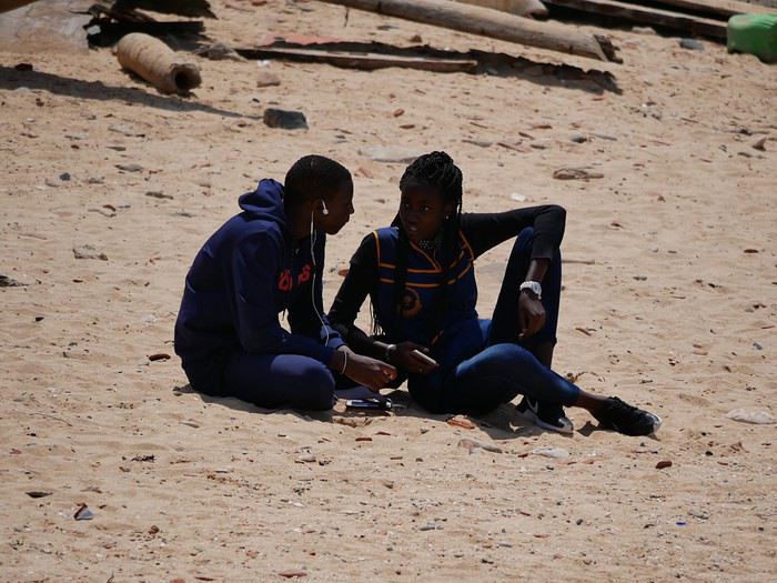
To be continued...
I invite you to share our wonderful discovery of Saint-Louis and its surroundings: Djoudj Park and the Langue de Barbarie... Daily life, heritage, landscapes, and wildlife (birds)...
We stayed in Senegal for 10 days in April/May 2018, specifically in Saint-Louis, Senegal, since we were there for the Jazz Festival held every year. But we took the opportunity to explore this country we didn’t know!
In this travel journal, you’ll find: - A short stop in Gorée, which we visited before heading to Saint-Louis - The different faces of Saint-Louis, especially the vibrant fishermen’s district - Djoudj Park, with its many birds - The Langue de Barbarie ... and much more!
Before going to Senegal, I did some research on this forum and others. So many strong opinions about Senegal—you either love it or hate it! If it hadn’t been for the festival, we might not have gone... What a shame that would’ve been, because we loved it!
Of course, I saw poverty, idleness, and litter, especially plastic bags—a global scourge. A bit of harassment from street vendors, especially at first when you don’t know how to deflect it and accidentally encourage it. The privileges of a social class and inequalities, though that’s something you encounter in many poor countries, not just in Africa.
But when I close my eyes and remember our trip, what stays with me is the youth, the beauty of so many boys and girls, the elegance of the women, and the sparkle in their eyes and smiles. The light and colors, the smell of grilled fish, the taste of freshly roasted peanuts and baobab fruit. The honking horns, the call of the muezzins, the music, the bursts of laughter.
To be continued...
Please, "HELP ME".
Hello everyone, and especially to the regulars of the MADA forum that I read every day. This time, I’m asking you not to argue and to try to help me with my problem.
A week ago, I submitted a visa application for France where I was supposed to meet a family who was going to help me with medical exams and host me on a short-stay tourist visa. My application was put together with the help of my friends over the past two months, and we checked everything multiple times—nothing was missing, and everything was in order. Last Friday, I picked up a visa refusal from the embassy in Tana with the reason: your intention to leave the territory of the member states before the visa expires could not be established. Yet, I had handwritten a letter committing to return to my country.
I went to the embassy twice because the first time they couldn’t find my file, and the second time I still wasn’t registered in their computer. After a while, the person came back from another room with my passport and this refusal slip. I’m starting to wonder if my application was even reviewed. I’m completely desperate, and even though my friends in France have filed an appeal in Nantes, I’m forced to leave Tana because my savings are running out fast. We have very little hope for the appeal in France since there must be hundreds of applications. So I’m open to any information or advice, but please "HELP ME".
Hi everyone,
With my girlfriend Christelle, we’ve chosen South Africa for our first trip to Southern Africa, focusing on safaris—after a long debate with a Cape Town/Kruger combo. But that would’ve meant cutting out St Lucia, which would’ve been harder to fit into another trip. And St Lucia—thanks to Michel and all those travel journals—we really wanted to go there.
So our 11-night itinerary ended up like this, mostly shaped by school holidays: - 3 nights in St Lucia - 1 night in Hluhluwe - 1 night at Mkhaya Game Reserve (Eswatini) - 1 night at Hlane Royal National Park (Eswatini) - 3 nights in Kruger (Berg en Dal / Satara / Tamboti) - 1 night at Shindzela Tented Camp in the Timbavati private reserve - 1 final night in Kruger at Lower Sabie
All of this in the off-season and rainy season, just a month after catastrophic floods that killed over 150 people and seriously damaged Kruger’s infrastructure.
I’ll jump straight to St Lucia and skip the loooong journey to get there (with a layover in Frankfurt, landing in Johannesburg, a domestic flight to Durban, and the rest by rental SUV—First Car Rental, perfect, no complaints).
To motivate readers—especially some familiar faces here—I’ll drop in a first photo.
With my girlfriend Christelle, we’ve chosen South Africa for our first trip to Southern Africa, focusing on safaris—after a long debate with a Cape Town/Kruger combo. But that would’ve meant cutting out St Lucia, which would’ve been harder to fit into another trip. And St Lucia—thanks to Michel and all those travel journals—we really wanted to go there.
So our 11-night itinerary ended up like this, mostly shaped by school holidays: - 3 nights in St Lucia - 1 night in Hluhluwe - 1 night at Mkhaya Game Reserve (Eswatini) - 1 night at Hlane Royal National Park (Eswatini) - 3 nights in Kruger (Berg en Dal / Satara / Tamboti) - 1 night at Shindzela Tented Camp in the Timbavati private reserve - 1 final night in Kruger at Lower Sabie
All of this in the off-season and rainy season, just a month after catastrophic floods that killed over 150 people and seriously damaged Kruger’s infrastructure.
I’ll jump straight to St Lucia and skip the loooong journey to get there (with a layover in Frankfurt, landing in Johannesburg, a domestic flight to Durban, and the rest by rental SUV—First Car Rental, perfect, no complaints).
To motivate readers—especially some familiar faces here—I’ll drop in a first photo.
Good evening everyone! 🙂
We’re back from our September 2025 road trip, this time to explore Arizona and New Mexico, and it’s time for me to start my travel journal—especially since everything’s already booked for another trip in September 2026 (to California), and I need to get started on the planning.
I was a little worried this new visit to Uncle Sam’s country might not be as "wow" as the others, but we still discovered some incredible places.
For those who don’t know us, we’re a couple in our seventies who speak very little English, but that didn’t stop us from fully enjoying our stay.
For this 6th road trip in the U.S., we spent 21 nights there, drove 4,160 km by car, and walked nearly 160 km in a loop starting from Phoenix.
We’d been to Arizona before (but not this side) and never to New Mexico. This whole road trip was a huge discovery for us.
In the prices mentioned (some in euros, others in dollars), bank fees and exchange charges are included. The flights, car rental, and parking were all paid for in December 2024 when we booked.
We’d downloaded the MPC (Mobile Passport Control) app, but there wasn’t a dedicated line at Phoenix Airport. Still, we got through quickly with friendly, smiling agents.
I don’t drive at all (I hate it), so the stops were chosen based on activities but also, for some, to limit daily mileage for the sole driver. The kilometers listed in the itinerary are the daily distances.
We traveled from September 9th to 22nd, unfortunately once again without our dear friends Mimi and Maumau.
The itinerary
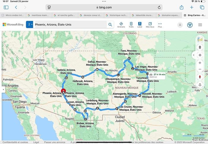
Day 1: Flight Marseille-Paris-Phoenix, then Gold Canyon (133 km) Day 2: Tucson (271 km) Lost Dutchman State Park Day 3: Tucson (155 km) Day 4: Tucson (34 km) Day 5: Bisbee (182 km) Day 6: Lordsburg (345 km) Day 7: Las Cruces (253 km) Day 8: Alamogordo (162 km) Day 9: Roswell (264 km) Day 10: Tucumcari (369 km) Day 11: Las Vegas (281 km) – the one in New Mexico Day 12: Taos (213 km) Day 13: Santa Fe (224 km) Day 14: Albuquerque (123 km) Day 15: Gallup (246 km) Day 16: Holbrook (224 km) Day 17: Flagstaff (179 km) Day 18: Sedona (118 km) Day 19: Sedona (48 km) Day 20: Sedona (41 km) Day 21: Phoenix (256 km) Day 22: Phoenix Airport (35 km)
📊 **Budget**: A little over 7,500 € for both of us, all included. The exchange rate was in our favor (1.17 dollars to 1 €). 📊 **Flights**: Marseille-Paris Charles de Gaulle-Phoenix: 1,787 € for two, with one checked bag each (Air France) 📊 **ESTA**: $42 📊 **America the Beautiful Pass**: $80 📊 **Parking**: 134 € (super eco at Marseille) 📊 **Car rental (Hertz)**: 865 €. Since there were no SUVs left in the reserved category (Nissan Rogue), we got an upgrade (4x4 Ford Explorer). We booked through Air France (15% discount). We’d originally reserved it in December for 1,140 €, but since prices dropped in March, we canceled and rebooked for 865 €. Hertz offers a free Hertz Gold Plus Rewards program, which gives you priority counter service when picking up the car. 📊 **Accommodation**: 2,400 € We stayed in hotels and motels of varying standards (from 60 to 203 € per night, depending on the city), all booked through Booking.com or Hotels.com. Out of 21 nights, only two didn’t include breakfast in the price. Booking.com sometimes offers slightly cheaper rates if you book by phone using the mobile app, and our Genius 3 status on the site also got us some preferential rates. 📊 **Supplementary insurance**: AVA 200 € for medical care if needed 📊 **Cash**: $2,078. We left with 1,000 € exchanged before departure and made two withdrawals of $500. This cash covered: - Evening restaurants and tips - Midday picnics - Gas: $298 for 4,160 km - Museum and private park entries (per person): - Lost Dutchman: $10 - Arizona-Sonora Desert Museum: $28 - Bird Cage Theater: $16 - Tombstone Shootout: $8 - New Mexico Farm & Ranch Museum: $12 - Roswell International UFO Museum: $5 - Billy the Kid Museum: $7 - Rancho de Taos: $22 - West Fork Oak Creek Trail entry: $15 We got a few discounts thanks to our senior age (+65). - Souvenirs and little treats
Like on our previous road trips, we didn’t rent a GPS. We got around using offline GPS apps Here WeGo and Organic Maps, with maps of the states we visited downloaded before we left (on our phones).
❤️❤️❤️ **Highlights** (there are so many!) 📍 Goldfield Ghost Town (even if it’s a reconstruction) 📍 The standing army of Saguaro cacti at Saguaro National Park West 📍 Diving into the cowboy universe of Tombstone 📍 The welcome from Rick and Henry at our guesthouse in Bisbee (Garden at Mile High Ranch) 📍 The tangled rocks of Chiricahua National Monument 📍 The flavored pistachios from Dwayne’s Fresh Jerky and Mac Ginnis Pistachioland 📍 Restaurants: La Posta (Las Cruces), Diner 66 (Albuquerque), and the Haunted Hamburger (Jerome) 📍 The old plazas of New Mexico 📍 The solitude and beauty of the white dunes at White Sands National Park 📍 Stepping back in time at the Billy the Kid Museum (Fort Stanton) 📍 Sections of historic Route 66 and the old motels of Tucumcari, especially at night when all the neon lights are on 📍 Taos Pueblo and diving into Native American culture 📍 After the Rio Grande Bridge, the descent via NM 567 to the very bottom of the Rio Grande Gorge, then the road along the riverbanks to Taos 📍 The tranquility of the Chimayo Sanctuary 📍 Discovering the ingenious native dwellings at Bandelier National Monument and Walnut Canyon National Park 📍 The small towns along the Turquoise Trail 📍 The red rocks of Red Rock Park and the Painted Desert 📍 The extraordinary colors of the petrified trees at Petrified Forest National Park 📍 Sedona, its red rocks, and the reward of the viewpoints at the end of hikes (Devil’s Bridge, The Subway, and West Fork Oak Creek) 📍 The immersion in Mexico when visiting Tlaquepaque 📍 The almost-ghost town of Jerome and its terraced streets 📍 The incredible kindness of Americans, always ready to help and up for a chat ❤️
☹️☹️☹️ **Flops** (there are very few) 📍 Several museums and churches being closed, so we couldn’t visit them 📍 Some museums and visitor centers opening late (10 AM) and closing early (4 PM) 📍 A 64 € phone roaming charge because we got near the Mexican border and picked up their cell tower 📍 The outrageous price ($5.99) for a gallon of gas at the Shell near Phoenix Airport
I hope this helps! Anyway, thanks for reading my long post. Don’t hesitate to reach out, even via PM, if you see I haven’t replied and you’d like more details. Have a great evening, everyone! 🙂
We’re back from our September 2025 road trip, this time to explore Arizona and New Mexico, and it’s time for me to start my travel journal—especially since everything’s already booked for another trip in September 2026 (to California), and I need to get started on the planning.
I was a little worried this new visit to Uncle Sam’s country might not be as "wow" as the others, but we still discovered some incredible places.
For those who don’t know us, we’re a couple in our seventies who speak very little English, but that didn’t stop us from fully enjoying our stay.
For this 6th road trip in the U.S., we spent 21 nights there, drove 4,160 km by car, and walked nearly 160 km in a loop starting from Phoenix.
We’d been to Arizona before (but not this side) and never to New Mexico. This whole road trip was a huge discovery for us.
In the prices mentioned (some in euros, others in dollars), bank fees and exchange charges are included. The flights, car rental, and parking were all paid for in December 2024 when we booked.
We’d downloaded the MPC (Mobile Passport Control) app, but there wasn’t a dedicated line at Phoenix Airport. Still, we got through quickly with friendly, smiling agents.
I don’t drive at all (I hate it), so the stops were chosen based on activities but also, for some, to limit daily mileage for the sole driver. The kilometers listed in the itinerary are the daily distances.
We traveled from September 9th to 22nd, unfortunately once again without our dear friends Mimi and Maumau.
The itinerary
Day 1: Flight Marseille-Paris-Phoenix, then Gold Canyon (133 km) Day 2: Tucson (271 km) Lost Dutchman State Park Day 3: Tucson (155 km) Day 4: Tucson (34 km) Day 5: Bisbee (182 km) Day 6: Lordsburg (345 km) Day 7: Las Cruces (253 km) Day 8: Alamogordo (162 km) Day 9: Roswell (264 km) Day 10: Tucumcari (369 km) Day 11: Las Vegas (281 km) – the one in New Mexico Day 12: Taos (213 km) Day 13: Santa Fe (224 km) Day 14: Albuquerque (123 km) Day 15: Gallup (246 km) Day 16: Holbrook (224 km) Day 17: Flagstaff (179 km) Day 18: Sedona (118 km) Day 19: Sedona (48 km) Day 20: Sedona (41 km) Day 21: Phoenix (256 km) Day 22: Phoenix Airport (35 km)
📊 **Budget**: A little over 7,500 € for both of us, all included. The exchange rate was in our favor (1.17 dollars to 1 €). 📊 **Flights**: Marseille-Paris Charles de Gaulle-Phoenix: 1,787 € for two, with one checked bag each (Air France) 📊 **ESTA**: $42 📊 **America the Beautiful Pass**: $80 📊 **Parking**: 134 € (super eco at Marseille) 📊 **Car rental (Hertz)**: 865 €. Since there were no SUVs left in the reserved category (Nissan Rogue), we got an upgrade (4x4 Ford Explorer). We booked through Air France (15% discount). We’d originally reserved it in December for 1,140 €, but since prices dropped in March, we canceled and rebooked for 865 €. Hertz offers a free Hertz Gold Plus Rewards program, which gives you priority counter service when picking up the car. 📊 **Accommodation**: 2,400 € We stayed in hotels and motels of varying standards (from 60 to 203 € per night, depending on the city), all booked through Booking.com or Hotels.com. Out of 21 nights, only two didn’t include breakfast in the price. Booking.com sometimes offers slightly cheaper rates if you book by phone using the mobile app, and our Genius 3 status on the site also got us some preferential rates. 📊 **Supplementary insurance**: AVA 200 € for medical care if needed 📊 **Cash**: $2,078. We left with 1,000 € exchanged before departure and made two withdrawals of $500. This cash covered: - Evening restaurants and tips - Midday picnics - Gas: $298 for 4,160 km - Museum and private park entries (per person): - Lost Dutchman: $10 - Arizona-Sonora Desert Museum: $28 - Bird Cage Theater: $16 - Tombstone Shootout: $8 - New Mexico Farm & Ranch Museum: $12 - Roswell International UFO Museum: $5 - Billy the Kid Museum: $7 - Rancho de Taos: $22 - West Fork Oak Creek Trail entry: $15 We got a few discounts thanks to our senior age (+65). - Souvenirs and little treats
Like on our previous road trips, we didn’t rent a GPS. We got around using offline GPS apps Here WeGo and Organic Maps, with maps of the states we visited downloaded before we left (on our phones).
❤️❤️❤️ **Highlights** (there are so many!) 📍 Goldfield Ghost Town (even if it’s a reconstruction) 📍 The standing army of Saguaro cacti at Saguaro National Park West 📍 Diving into the cowboy universe of Tombstone 📍 The welcome from Rick and Henry at our guesthouse in Bisbee (Garden at Mile High Ranch) 📍 The tangled rocks of Chiricahua National Monument 📍 The flavored pistachios from Dwayne’s Fresh Jerky and Mac Ginnis Pistachioland 📍 Restaurants: La Posta (Las Cruces), Diner 66 (Albuquerque), and the Haunted Hamburger (Jerome) 📍 The old plazas of New Mexico 📍 The solitude and beauty of the white dunes at White Sands National Park 📍 Stepping back in time at the Billy the Kid Museum (Fort Stanton) 📍 Sections of historic Route 66 and the old motels of Tucumcari, especially at night when all the neon lights are on 📍 Taos Pueblo and diving into Native American culture 📍 After the Rio Grande Bridge, the descent via NM 567 to the very bottom of the Rio Grande Gorge, then the road along the riverbanks to Taos 📍 The tranquility of the Chimayo Sanctuary 📍 Discovering the ingenious native dwellings at Bandelier National Monument and Walnut Canyon National Park 📍 The small towns along the Turquoise Trail 📍 The red rocks of Red Rock Park and the Painted Desert 📍 The extraordinary colors of the petrified trees at Petrified Forest National Park 📍 Sedona, its red rocks, and the reward of the viewpoints at the end of hikes (Devil’s Bridge, The Subway, and West Fork Oak Creek) 📍 The immersion in Mexico when visiting Tlaquepaque 📍 The almost-ghost town of Jerome and its terraced streets 📍 The incredible kindness of Americans, always ready to help and up for a chat ❤️
☹️☹️☹️ **Flops** (there are very few) 📍 Several museums and churches being closed, so we couldn’t visit them 📍 Some museums and visitor centers opening late (10 AM) and closing early (4 PM) 📍 A 64 € phone roaming charge because we got near the Mexican border and picked up their cell tower 📍 The outrageous price ($5.99) for a gallon of gas at the Shell near Phoenix Airport
I hope this helps! Anyway, thanks for reading my long post. Don’t hesitate to reach out, even via PM, if you see I haven’t replied and you’d like more details. Have a great evening, everyone! 🙂
Alright, this year, we're heading back to South America!
The initial plan was to retrace the route we imagined in the summer of 2020: a trip to northern Argentina starting from Córdoba.
Unfortunately, the flight to Córdoba no longer exists, and airfares to Javier Milei’s country are both outrageously priced and involve multiple layovers.
So, I tweaked Google Flights every which way and finally found a flight within my budget—departing from Clermont-Ferrand!
Not to Argentina, though...
Our transatlantic flight will cross the snow-capped Andes, landing in Santiago, Chile, with a return from Lima!
In between, two domestic flights and a big road trip loop starting from the coastal city of Arica to explore the treasures of northern Chile.
Our mode of transport: a pseudo 4x4 that won’t take us through sand dunes or devilish tracks but will let us tackle the entire secondary network, including unpaved main roads, while still being insured.
Is the suitcase packed with all-season clothes?
Are the driver’s license and passport ready?
Bank cards and a few euros too?
Off we go for just over 3 weeks of southern wanderings!
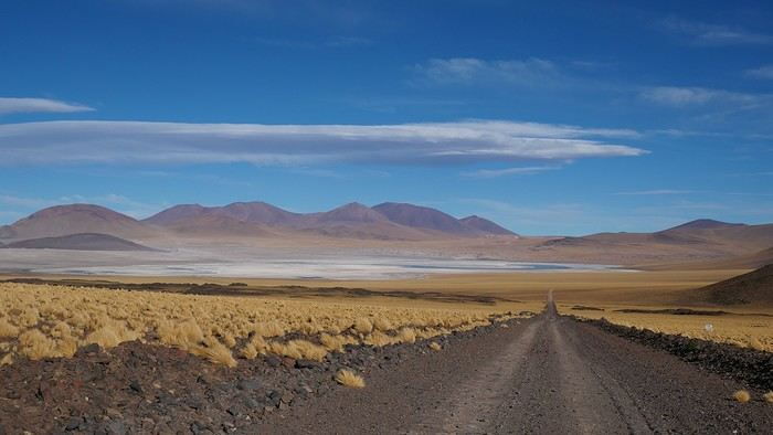
--/--
To keep all my esteemed readers on track, here are a few maps outlining the Arica-Arica loop!
1- From Arica to San Pedro de Atacama via Pica and the Salar de Huasco
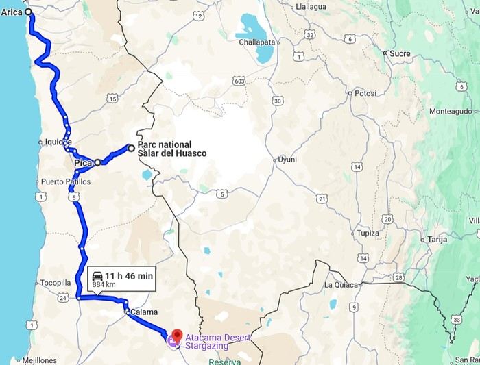 2- Around San Pedro
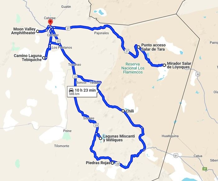
3- From San Pedro to Cariquima
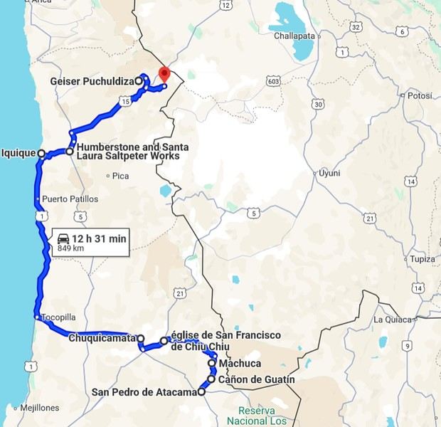
4- From Cariquima to Putre
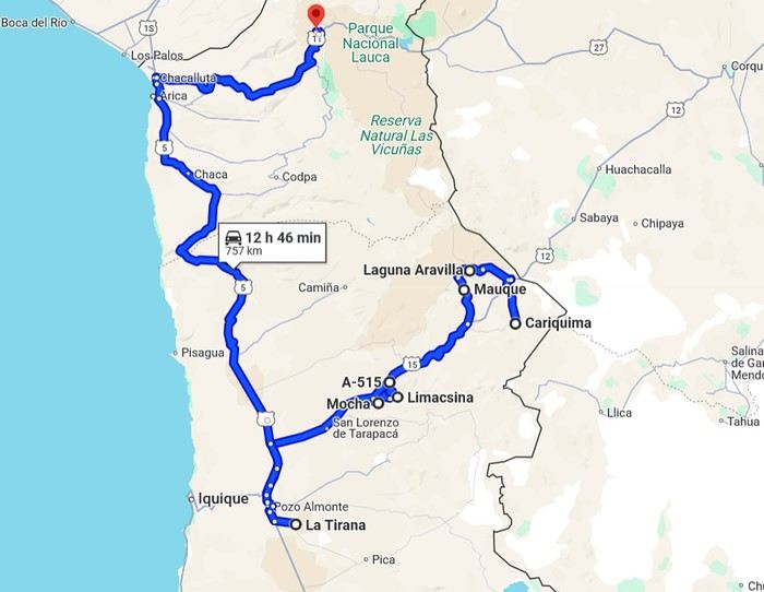
5 - From Putre to Arica
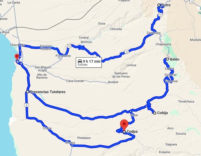
Gas stations in this part of Chile are located in Arica, Iquique, Pozo Almonte, Pica, Calama, and San Pedro de Atacama.
The initial plan was to retrace the route we imagined in the summer of 2020: a trip to northern Argentina starting from Córdoba.
Unfortunately, the flight to Córdoba no longer exists, and airfares to Javier Milei’s country are both outrageously priced and involve multiple layovers.
So, I tweaked Google Flights every which way and finally found a flight within my budget—departing from Clermont-Ferrand!
Not to Argentina, though...
Our transatlantic flight will cross the snow-capped Andes, landing in Santiago, Chile, with a return from Lima!
In between, two domestic flights and a big road trip loop starting from the coastal city of Arica to explore the treasures of northern Chile.
Our mode of transport: a pseudo 4x4 that won’t take us through sand dunes or devilish tracks but will let us tackle the entire secondary network, including unpaved main roads, while still being insured.
Is the suitcase packed with all-season clothes?
Are the driver’s license and passport ready?
Bank cards and a few euros too?
Off we go for just over 3 weeks of southern wanderings!
--/--
To keep all my esteemed readers on track, here are a few maps outlining the Arica-Arica loop!
1- From Arica to San Pedro de Atacama via Pica and the Salar de Huasco
2- Around San Pedro3- From San Pedro to Cariquima
4- From Cariquima to Putre
5 - From Putre to Arica
Gas stations in this part of Chile are located in Arica, Iquique, Pozo Almonte, Pica, Calama, and San Pedro de Atacama.
This adventure began during Covid... Yep, Covid turned a lot of things upside down, but most of all, it kept us cooped up for a few months and stopped us from traveling for a while—even longer for a die-hard fan of the American West like me.
While borders were closed, I started imagining what an ideal itinerary might look like—one that would string together all the Southwest must-sees in just two weeks, during the best time of year: September and October. When the U.S. announced in September 2021 that borders would reopen in the coming weeks, I regained hope and began scouting flight tickets for a departure in September 2022.
But here’s the thing: tackling solo hikes, each one tougher than the last, right in the heart of the Wilderness, could be a risky—even reckless—endeavor for a father of three. After a quick chat with some virtual friends who are just as passionate about the Southwest as I am, with good physical condition and nearly the same list of must-visit spots, Franck and his brother Sullivan were in! 🙂
In November, we snagged flight tickets from Nice to San Francisco for the modest sum of 400 €, and a few days later, I booked a Toyota Tacoma pickup for 840 € !
It’s not cheap for just 15 days, and a pickup isn’t exactly ideal for luggage, but the prices for full-size 4x4s have become totally outrageous! Due to border closures, rental companies had to offload a lot of these big 4x4s, which tourists love. Then, supply and demand did the rest !
Franck and I spent the winter and spring trying to cram the equivalent of three weeks of hikes into two. But even with physical limits, we had to stay reasonable! Three to four months before departure, we entered the lotteries for different must-see spots: The Subway, Coyote Buttes North (home to the famous Wave), and Coyote Buttes South (CBS).
The Wave is the holy grail for any Southwest enthusiast. Since 2015, we’ve tried our luck with the online and on-site lotteries about ten times, but the spots are unfortunately limited: just 20 per day. A glimmer of hope, though—since early 2022, that number has increased to 64 people allowed per day, with 48 spots awarded via the online lottery.
After all three of us tried our luck for The Wave, on June 1st at exactly 5 PM, I got an email that started with, "Congratulations! You were successful in the Coyote Buttes North (The Wave) September 2022 Permit Lottery at Coyote Buttes North (The Wave)...". At 5:01 PM, I called Franck, whose dream it’s been for over 20 years—ever since the first photos were published in a travel magazine! He didn’t believe me when I told him, and I had to forward the email for him to finally accept the unbelievable: we were going to The Wave and all the incredible spots scattered across the protected area of Coyote Buttes North.
I’ve already been to Coyote Buttes South twice, but there are areas I couldn’t explore in the middle of summer because they were too remote. So, I had no trouble letting my buddies convince me to go back for a third time. Plus, given how hard it is to access, we had no trouble securing a permit online as long as we logged in at exactly 8 PM on the dot!
For The Subway, all three of us struck out. No big deal—we won at CBN and CBS!
Among the sites to visit, there are two that I’m particularly attached to because I know my chances of wanting to see them again are slim. The first is Angel Arch, one of the most legendary arches in the Southwest, due to its remoteness from any trace of civilization. To get there, the recommended hike is Upper Salt Creek, and you’re looking at a 50 km round-trip in an area with no water (in September) and populated by bears.
The second site is the Hopi Salt Trail, in Navajo land, which, after a very tough hike, lets you marvel at the turquoise-blue waters of the Little Colorado before it meets the Colorado River. The Hopi Salt Trail is, like The Wave, the holy grail for any Southwest enthusiast, and the windows of opportunity to see the water in that magical color are very short each year. For this, you have to monitor the Little Colorado’s gauges downstream from Cameron: if the level stays at its lowest for 10 consecutive days—meaning no rain—you can hope for turquoise water. The ideal period rarely exceeds 30 days a year, and it’s usually in June that all the stars align.
But unfortunately, one month before departure, while the flow rate at Cameron looked promising, several storms in September dashed our hopes of doing the Hopi Salt Trail, even at the end of the road trip.
We still had two consolation prizes, though:
After a last-minute cancellation, while keeping an eye out for available spots for The Subway, it turned out that three spots opened up exactly on the day we’d planned to go—so we rushed to grab them!! Regarding the 4x4 rental, the prices for full-size models dropped by several hundred dollars, and we ended up finding a Chevrolet Tahoe for less than $1000. A steal and a serious boost in comfort, so we could store all our gear and food without worry!
Here’s the initial plan in a perfect world: D1 The White Domes - Camping D2 Sunrise at The White Domes - The Subway D3 Coyote Buttes North D4 Coyote Buttes South - White Pocket D5 Wahweap Hoodoos - Sidestep Canyon - Colourful Canyon - White Rocks - Sunset at Yellow Rock D6 Broken Bow Arch - Reflection Canyon D7 Coyote Gulch D8 The Volcano (or The Oasis - Zebra Slot Canyon if the weather’s good) - North Caineville Mesa D9 The Needles: Squaw Canyon - Lost Canyon combo - Druid Arch - Chesler Park D10 Upper Salt Creek Day 1 - Camping D11 Upper Salt Creek Day 2 D12 Hopi-Navajo Territory: Ha Ho No Geh Canyon, Coal Mine Canyon, Bends of the Little Colorado D13 Grand Canyon: South Kaibab Trail and Bright Angel Trail D14 Upper East Zion: East Temple Loop, Jughandle Arch, Center of the Universe, and Checkerboard Mesa Summit And several backup options in case of bad weather, including Spencer Trail, West Cove, and Buffington Pockets.
Enough talking—time for action!
Hi there,
I’m diving into a recap of our loop—pretty classic, really—Denver-Yellowstone-Denver this past summer, from July 24 to August 17. Given the sheer number of trip reports already out there (or in the works), and since I don’t have the writing chops or the photography skills of many of you, I’ll keep it practical—well, I’ll try, at least—to share our take on some of the less-visited parks and spots.
First off, a huge thank you to everyone whose trip reports, blogs, websites, comments, and more helped us put together this itinerary. Looking back, it could’ve been even better optimized: a few disappointments when we missed out on some great discoveries, often because we were short on time. Plenty of reasons to come back to the area!
We’re traveling with our four (almost) teens—18, 16, 14, and nearly 12 years old. To keep the trip enjoyable for everyone, we had to make compromises on both sides: cutting a visit short to spend more time swimming, waking up at dawn, and so on. But logistics also played a big role—things like laundry, grocery shopping, and keeping luggage organized could’ve quickly become time-consuming without a little planning. And honestly, I think we visited every Walmart along the way! Blame it on the lack of fridges in some accommodations and, more importantly, the *very* limited space in the car, which made it impossible to bring a proper cooler. I’ll come back to the car saga later.
For accommodations, this year we alternated between basic cabins in KOA campgrounds and Yellowstone (when staying more than one night in the same place) and hotels. Always with a pool (except in Yellowstone, of course), which let the kids burn off energy—because they always have reserves, even after packed days!—and, let’s be honest, gave us a chance to relax. No Wi-Fi issues either; we all had plans with 25 GB of data (a big thanks to Gilles for the amazing deal at 0.99 €). It worked perfectly, even for texts and calls between phones—no extra charges.
Now, onto our route: as I mentioned, a classic Denver-Yellowstone-Denver loop. To avoid rushing through the parks or spending all our time on the road, we prioritized staying as close to them as possible, with at least two nights in each place. And I’ve got to say, it’s really nice to settle in, even if it’s just for two nights. It also helped us deal with the weather, which wasn’t always great during this trip. The trade-off? With vacation time being limited, some driving days ended up being long. We knew that going in, but since we kept a relaxed pace with no time constraints (don’t ask me for timings—I don’t keep track of the clock on vacation, except in the morning to get everyone up before noon!), we sometimes ended up with marathon days.
With that said, I’ll dive into the trip itself in the next post.
Hello everyone,
As usual, I’m posting a new travel journal about our trip to Norway last September. This one will span several months, with a day-by-day account of our adventure. I won’t be posting many photos on the forum (the publishing rules have become even more complicated since my last journal), but you can find all the shots on my blog (address in my signature).
We’ve just returned from a truly extraordinary, unforgettable trip. Planning this trip wasn’t easy, and I’ll admit I struggled to decide on the itinerary… Should we take the Hurtigruten all the way from the south to the north? But a whole trip by boat didn’t really appeal to us. Or focus on the south in the fjord region? But that would mean missing out on the Lofoten Islands… In the end, we chose to concentrate on southern Norway, exploring the coast and fjords, while including a stop in Oslo and mixing train, boat, and car travel. I also opted for a trip where we’d drive less than in previous years (1,650 km compared to 2,000 km in Portugal and 3,800 km in the American West), but we’d still move around a bit and do some hikes. Here’s the itinerary we followed:

This trip was absolutely amazing and introduced us to so many things we’d never seen or done before—fjords, a night on a boat, glaciers, stave churches, snow in summer (…and the high cost of living!).
If we had to sum up our top highlights, here’s our top 3: Mr.:
the variety of landscapes the colors, especially the colors of the water—from crystal clear to light blue and turquoise in some spots eating good fish
Mrs.:
the roads: the ones in the area we explored were truly stunning Geirangerfjord, especially in the late afternoon, when it was quiet and free of cruise ships the Trolltunga hike: a challenging trek and a little personal achievement for us
What we liked less:
the sometimes inconsistent signage on hikes the cost of living (everything costs money, and even food is expensive) the tunnels: there are so many, and they’re not much fun (except for one with a roundabout inside…!)
That’s it for this first summary/overview, and I can already tell that choosing photos is going to be tough!!! Here’s a little preview of what we discovered:

To see the photos in full size on my blog: check it out here
As usual, I’m posting a new travel journal about our trip to Norway last September. This one will span several months, with a day-by-day account of our adventure. I won’t be posting many photos on the forum (the publishing rules have become even more complicated since my last journal), but you can find all the shots on my blog (address in my signature).
We’ve just returned from a truly extraordinary, unforgettable trip. Planning this trip wasn’t easy, and I’ll admit I struggled to decide on the itinerary… Should we take the Hurtigruten all the way from the south to the north? But a whole trip by boat didn’t really appeal to us. Or focus on the south in the fjord region? But that would mean missing out on the Lofoten Islands… In the end, we chose to concentrate on southern Norway, exploring the coast and fjords, while including a stop in Oslo and mixing train, boat, and car travel. I also opted for a trip where we’d drive less than in previous years (1,650 km compared to 2,000 km in Portugal and 3,800 km in the American West), but we’d still move around a bit and do some hikes. Here’s the itinerary we followed:
This trip was absolutely amazing and introduced us to so many things we’d never seen or done before—fjords, a night on a boat, glaciers, stave churches, snow in summer (…and the high cost of living!).
If we had to sum up our top highlights, here’s our top 3: Mr.:
the variety of landscapes the colors, especially the colors of the water—from crystal clear to light blue and turquoise in some spots eating good fish
Mrs.:
the roads: the ones in the area we explored were truly stunning Geirangerfjord, especially in the late afternoon, when it was quiet and free of cruise ships the Trolltunga hike: a challenging trek and a little personal achievement for us
What we liked less:
the sometimes inconsistent signage on hikes the cost of living (everything costs money, and even food is expensive) the tunnels: there are so many, and they’re not much fun (except for one with a roundabout inside…!)
That’s it for this first summary/overview, and I can already tell that choosing photos is going to be tough!!! Here’s a little preview of what we discovered:
To see the photos in full size on my blog: check it out here
In this time of general travel-journal scarcity, I’m stepping up to tell you about a far-too-short getaway to the Top West End, a local term for the very northern part of Western Australia, right on the border ( ;) ) with the Northern Territory.
As usual, I didn’t manage to keep it short, but this time I’ve got photos to go with it!
August 2020. Since the opportunities to explore the world are extremely limited right now, all we (R&X) can do is explore our own island! Well, just a part of it, because with the state borders still closed, we’re stuck in Western Australia (WA).
Luckily, we’re pretty fortunate because this state is huge: over 2.5 million km² (that’s more than four times the size of France or 1.5 times Quebec). What’s more, stretching over 20 degrees of latitude between the Antarctic Ocean and the Timor Sea, you’ll find climates ranging from Mediterranean to arid to tropical. That’s actually why we decided to head as far north as possible. Sick of the endless rainy winter in Perth, bring on the heat of the Kimberley... way up Nooorth!
Friday. At the airport, the main terminal was closed (not enough flights), so we ended up in the annex (where flights to the various mines usually depart from). There was no crowd at the gate, and in this huge, single departure lounge, empty seats were plentiful. Only three flights were listed on the screens for the rest of the morning: the first to Coondewanna (?), the second to Darwin, and ours to Kununurra (code KNX).
A cool breeze swept through the half-open corridors along the runways. At the top of the walkway leading to the Fokker 100 (the Airbuses and Boeings are now parked!), a flight attendant greeted us with a basket full of sanitary masks. We were actually the only masked passengers (the staff weren’t wearing them either). With zero Covid-19 cases in WA at the time, the only rule was to maintain social distancing—something pretty hard to do on a full plane!
It was also my first time wearing a mask—it felt weird, pretty uncomfortable, and after a while, painful behind the ears. I really feel for those who have to wear one all day, every day. The flight lasted three long hours, but luckily, I had a good book. From the window, I watched an endless expanse of salt lakes in all shapes and sizes—round, elongated, gray, white, sometimes blue and green—and an infinity of winding, capricious meanders, along with long straight lines that led nowhere. The last half-hour got more interesting as rocky, swollen formations and long, sloping plateaus appeared. Against the vast ochre landscape, green patches became more frequent.
Just before landing, rows of green fields briefly appeared, along with an surprisingly wide river—but we were already rolling down the tarmac. A few hangars, a myriad of small, stationary planes, and a tiny terminal topped with a sign: “Welcome to Kununurra.”
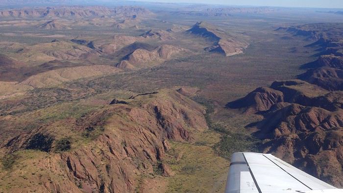
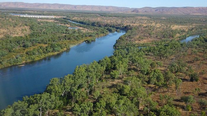
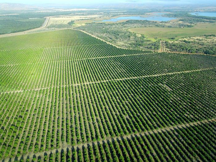
We wanted heat, and here it was—34°C the moment we stepped off the plane! We felt alive again and totally ridiculous in our jeans and sweaters. We quickly grabbed our suitcase and picked up the 4x4 we’d rented—more out of necessity, since only that type of vehicle can access the national parks we planned to visit.
Just four kilometers separated us from Kununurra, a town of 5,000 people founded in 1961 during the construction of the Lake Argyle Dam and the development of the Ord River Irrigation Area Scheme (more on that later). On the horizon, mountain ranges (a bit of an exaggeration, since we know Mt. Meharry, WA’s highest ‘mountain,’ doesn’t even reach 1,250 meters!) and closer to the road, a few irrigation canals cutting through stretches of bush, then a huge park overlooking a small lake lined with reeds.
A row of baobabs (yes, there are baobabs in Australia too!), a series of motels with immaculate lawns, a gas station, and there’s the main street leading to the town center—that is, the parking lots of the two supermarkets, the bottleshop, the pub, the Town Hall, the municipal pool, and the Tourist Office (already closed!), and at the next roundabout, another park, the Presbyterian church, and a few other shops. In short, two or three green blocks that you can explore in no time.
One road leads to the small industrial area and one of the town’s three or four campgrounds, while another heads toward the residential neighborhoods, which look just like the typical suburbs you find in any Australian city—except with tropical vegetation. We stocked up at Coles, an identical copy of the one near our place, and—surprise—the prices were practically the same.
We checked into one of the motels. The receptionist listed the town’s three or four restaurants, insisting that it’s always better to book a table. She recommended the Pump House, a bit outside town on the lake’s edge. “Best spot to watch the sunset, but hurry up.” she told us. It was only 5:00 PM!
When we got there half an hour later, the place was packed, and the sun had already disappeared behind a row of trees! Sure enough, we’d see a few days later that the sunset can be a stunning spectacle—if you wait a bit for the sky (especially if it’s cloudy) to blaze and reflect in the lake’s calm waters. A little disappointed, we headed back into town, where we easily found the other lively spot in town: the pub (nothing like an old English pub). Above the long L-shaped bar, several giant screens (thankfully muted) were broadcasting live footy, rugby league, etc. In one corner, players circled the pool table, while in another, customers were digging into plates of the day’s special. Instead of rooms, there were various patios where groups of friends and coworkers (easily recognizable by the fluoro vests they were still wearing) were gathered. We found a table under a mango tree—unfortunately, a little too close to the guitarist strumming his entire Country Music repertoire, complete with Keith Urban-style tremolos. Guaranteed culture shock!
Since it’s the custom here, we called the Country Club to book a table before the kitchen closed! The CC is the town’s—and even the region’s—fancy spot. Dark decor, modern furniture, dim lighting, and the air conditioning blasting. The twenty or so customers had taken refuge on the vast terrace, lit by torches. The view of the tall eucalyptus trees, illuminated by spotlights shifting from red to blue, was breathtaking.
The menu was minimal, but the grilled salmon was excellent, and the Pavlova (the meringue dessert Kiwis and Aussies have been arguing over since 1906) with melon and watermelon was absolutely divine.
It wasn’t even 9:00 PM, and we were already in bed. Had we already adopted the Top West End’s chicken schedule?!
To be continued... Journal dedicated to Attila
As usual, I didn’t manage to keep it short, but this time I’ve got photos to go with it!
August 2020. Since the opportunities to explore the world are extremely limited right now, all we (R&X) can do is explore our own island! Well, just a part of it, because with the state borders still closed, we’re stuck in Western Australia (WA).
Luckily, we’re pretty fortunate because this state is huge: over 2.5 million km² (that’s more than four times the size of France or 1.5 times Quebec). What’s more, stretching over 20 degrees of latitude between the Antarctic Ocean and the Timor Sea, you’ll find climates ranging from Mediterranean to arid to tropical. That’s actually why we decided to head as far north as possible. Sick of the endless rainy winter in Perth, bring on the heat of the Kimberley... way up Nooorth!
Friday. At the airport, the main terminal was closed (not enough flights), so we ended up in the annex (where flights to the various mines usually depart from). There was no crowd at the gate, and in this huge, single departure lounge, empty seats were plentiful. Only three flights were listed on the screens for the rest of the morning: the first to Coondewanna (?), the second to Darwin, and ours to Kununurra (code KNX).
A cool breeze swept through the half-open corridors along the runways. At the top of the walkway leading to the Fokker 100 (the Airbuses and Boeings are now parked!), a flight attendant greeted us with a basket full of sanitary masks. We were actually the only masked passengers (the staff weren’t wearing them either). With zero Covid-19 cases in WA at the time, the only rule was to maintain social distancing—something pretty hard to do on a full plane!
It was also my first time wearing a mask—it felt weird, pretty uncomfortable, and after a while, painful behind the ears. I really feel for those who have to wear one all day, every day. The flight lasted three long hours, but luckily, I had a good book. From the window, I watched an endless expanse of salt lakes in all shapes and sizes—round, elongated, gray, white, sometimes blue and green—and an infinity of winding, capricious meanders, along with long straight lines that led nowhere. The last half-hour got more interesting as rocky, swollen formations and long, sloping plateaus appeared. Against the vast ochre landscape, green patches became more frequent.
Just before landing, rows of green fields briefly appeared, along with an surprisingly wide river—but we were already rolling down the tarmac. A few hangars, a myriad of small, stationary planes, and a tiny terminal topped with a sign: “Welcome to Kununurra.”
We wanted heat, and here it was—34°C the moment we stepped off the plane! We felt alive again and totally ridiculous in our jeans and sweaters. We quickly grabbed our suitcase and picked up the 4x4 we’d rented—more out of necessity, since only that type of vehicle can access the national parks we planned to visit.
Just four kilometers separated us from Kununurra, a town of 5,000 people founded in 1961 during the construction of the Lake Argyle Dam and the development of the Ord River Irrigation Area Scheme (more on that later). On the horizon, mountain ranges (a bit of an exaggeration, since we know Mt. Meharry, WA’s highest ‘mountain,’ doesn’t even reach 1,250 meters!) and closer to the road, a few irrigation canals cutting through stretches of bush, then a huge park overlooking a small lake lined with reeds.
A row of baobabs (yes, there are baobabs in Australia too!), a series of motels with immaculate lawns, a gas station, and there’s the main street leading to the town center—that is, the parking lots of the two supermarkets, the bottleshop, the pub, the Town Hall, the municipal pool, and the Tourist Office (already closed!), and at the next roundabout, another park, the Presbyterian church, and a few other shops. In short, two or three green blocks that you can explore in no time.
One road leads to the small industrial area and one of the town’s three or four campgrounds, while another heads toward the residential neighborhoods, which look just like the typical suburbs you find in any Australian city—except with tropical vegetation. We stocked up at Coles, an identical copy of the one near our place, and—surprise—the prices were practically the same.
We checked into one of the motels. The receptionist listed the town’s three or four restaurants, insisting that it’s always better to book a table. She recommended the Pump House, a bit outside town on the lake’s edge. “Best spot to watch the sunset, but hurry up.” she told us. It was only 5:00 PM!
When we got there half an hour later, the place was packed, and the sun had already disappeared behind a row of trees! Sure enough, we’d see a few days later that the sunset can be a stunning spectacle—if you wait a bit for the sky (especially if it’s cloudy) to blaze and reflect in the lake’s calm waters. A little disappointed, we headed back into town, where we easily found the other lively spot in town: the pub (nothing like an old English pub). Above the long L-shaped bar, several giant screens (thankfully muted) were broadcasting live footy, rugby league, etc. In one corner, players circled the pool table, while in another, customers were digging into plates of the day’s special. Instead of rooms, there were various patios where groups of friends and coworkers (easily recognizable by the fluoro vests they were still wearing) were gathered. We found a table under a mango tree—unfortunately, a little too close to the guitarist strumming his entire Country Music repertoire, complete with Keith Urban-style tremolos. Guaranteed culture shock!
Since it’s the custom here, we called the Country Club to book a table before the kitchen closed! The CC is the town’s—and even the region’s—fancy spot. Dark decor, modern furniture, dim lighting, and the air conditioning blasting. The twenty or so customers had taken refuge on the vast terrace, lit by torches. The view of the tall eucalyptus trees, illuminated by spotlights shifting from red to blue, was breathtaking.
The menu was minimal, but the grilled salmon was excellent, and the Pavlova (the meringue dessert Kiwis and Aussies have been arguing over since 1906) with melon and watermelon was absolutely divine.
It wasn’t even 9:00 PM, and we were already in bed. Had we already adopted the Top West End’s chicken schedule?!
To be continued... Journal dedicated to Attila
We arrive in the evening in Marrakesh, and a taxi arranged by our friendly Riad is waiting for us. The driver takes us to the door, where we’re briefly greeted by our hosts. The room is heated—phew—because it’s really cold on this January 17th for our arrival. Riad Alisma, where we’re staying for 2 nights. The next morning, it’s pouring rain when we wake up, but after a good breakfast, the rain has calmed down. Off we go to the medersa, which allows for a relatively sheltered visit. We’d visited this palace 15 years ago—it’s been renovated since then.
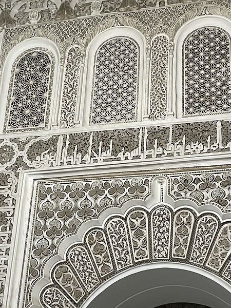
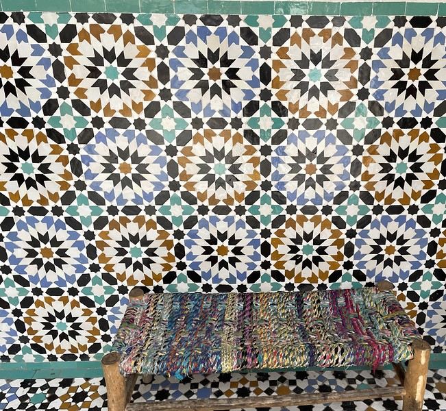
From there, without the rain, we wander aimlessly and eventually end up near the tanneries, but it’s Sunday, and there’s very little activity. Of course, we get hassled by a tout.
Here, the hides after being treated with lime—I love the colors.
We part ways a bit annoyed. He gets a little revenge by giving us bad directions, and we end up outside the city walls. We decide to take a taxi to the new modern art museum—60 dirhams for the 5 km, which is nothing when you think about it. That tout, who we didn’t ask for anything and made it clear we weren’t buying anything, dragged us into a shop supposedly only open that day and demanded 50 dirhams for his "services"! Let’s forget that bad moment and enjoy the exhibition at the MACAL.
The taxi on the way back drops us off at Place des Ferblantiers, not far from our Riad. We’re a little peckish—it’s worth mentioning that at lunchtime, we only ate a plate of beans from a street vendor. So, we buy a bunch of little sweets, each more delicious than the last, at Ajar. We snack while sipping mint tea and watching life go by around us. A final visit to the Museum of Moroccan Cuisine on our way back helps us dodge a few more showers. Then it’s back to the Riad. The atmosphere in the city is heating up—it’s the AFCON final tonight. The temperatures, though? Not so much. We ordered a meal at the Riad, and it was a good call—not only was it really tasty, but the rain also picked up again. Our day in Marrakesh ends under the covers with a good book and some photo sorting. Still, we managed 10,750 steps. View of our Riad
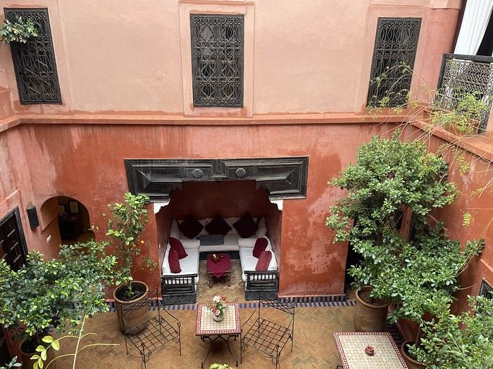
Tomorrow, we’ll pick up our rental car from Medloc and head to Essaouira.
From there, without the rain, we wander aimlessly and eventually end up near the tanneries, but it’s Sunday, and there’s very little activity. Of course, we get hassled by a tout.
Here, the hides after being treated with lime—I love the colors.
We part ways a bit annoyed. He gets a little revenge by giving us bad directions, and we end up outside the city walls. We decide to take a taxi to the new modern art museum—60 dirhams for the 5 km, which is nothing when you think about it. That tout, who we didn’t ask for anything and made it clear we weren’t buying anything, dragged us into a shop supposedly only open that day and demanded 50 dirhams for his "services"! Let’s forget that bad moment and enjoy the exhibition at the MACAL.
The taxi on the way back drops us off at Place des Ferblantiers, not far from our Riad. We’re a little peckish—it’s worth mentioning that at lunchtime, we only ate a plate of beans from a street vendor. So, we buy a bunch of little sweets, each more delicious than the last, at Ajar. We snack while sipping mint tea and watching life go by around us. A final visit to the Museum of Moroccan Cuisine on our way back helps us dodge a few more showers. Then it’s back to the Riad. The atmosphere in the city is heating up—it’s the AFCON final tonight. The temperatures, though? Not so much. We ordered a meal at the Riad, and it was a good call—not only was it really tasty, but the rain also picked up again. Our day in Marrakesh ends under the covers with a good book and some photo sorting. Still, we managed 10,750 steps. View of our Riad
Tomorrow, we’ll pick up our rental car from Medloc and head to Essaouira.