Results for "Est+de+la+France+itinéraire"
About 526,377 results.
More options
Many results are in French, the community’s main language. English translations are added over time.
Search results
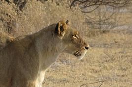
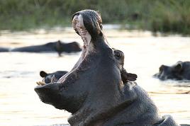
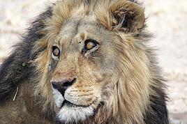
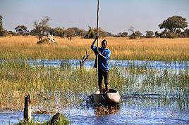
Dons de stylos, carnets et t-shirt au Botswana
Bonjour à tous !
Apres les conseils avisés de nombreux participants au forum, nous partons jeudi soir avec Vie Sauvage pour un voyage de 20 jours au Botswana.
Nous allons arriver à Johannesbourg, passer la fin de l'apres-midi là-bas, puis repartir le lendemain à l'aube pour une journée de route vers Nata, au Botswana. A partir de la, nous passerons un peu à Maun, mais surtout beaucoup de temps en bivouac dans les réserves. Nous finissons par les chutes Victoria coté Zimbabwe, puis à nouveau une journée de route pour revenir à Johannebourg (on y passera à nouveau une soirée et une petite partie de la matinée).
Tous ces détails pour vous poser une question : on a faire une récolte assez conséquentes de stylos, crayons à papier, t-shirts, carnets, qui sont des restes d'opérations promotionnels de divers fournisseurs, et on se demande si, dans les conditions d'un voyage organisé, on aura beaucoup l'occasion de distribuer ces petites choses. En effet, nous n'avons pas la liberté d'un voyage en solo, et je ne suis pas sure que l'on croise beaucoup de villages. Nous faisons bien une visite d'un village près de Maun, mais est-ce que les populations de la savane ont besoin de ce genre de choses (pardonnez mon ignorance).
Je me dis que l'Afrique du Sud est peut-être plus sujette à ce genre de dons ? Du coup, il existe une autre solution : si une personne du forum, résidant à Jobourg ou environ, et qui pourra faire bon usage de ces objets (evidemment pas du trafic de revente, ...) veut passer nous voir à notre hotel pour que nous lui remettions les affaires...
Des idées, des infos ? (je n'ai pas encore appelé Vie Sauvage, mais je vais le faire demain !)
A bientot, Cew
Apres les conseils avisés de nombreux participants au forum, nous partons jeudi soir avec Vie Sauvage pour un voyage de 20 jours au Botswana.
Nous allons arriver à Johannesbourg, passer la fin de l'apres-midi là-bas, puis repartir le lendemain à l'aube pour une journée de route vers Nata, au Botswana. A partir de la, nous passerons un peu à Maun, mais surtout beaucoup de temps en bivouac dans les réserves. Nous finissons par les chutes Victoria coté Zimbabwe, puis à nouveau une journée de route pour revenir à Johannebourg (on y passera à nouveau une soirée et une petite partie de la matinée).
Tous ces détails pour vous poser une question : on a faire une récolte assez conséquentes de stylos, crayons à papier, t-shirts, carnets, qui sont des restes d'opérations promotionnels de divers fournisseurs, et on se demande si, dans les conditions d'un voyage organisé, on aura beaucoup l'occasion de distribuer ces petites choses. En effet, nous n'avons pas la liberté d'un voyage en solo, et je ne suis pas sure que l'on croise beaucoup de villages. Nous faisons bien une visite d'un village près de Maun, mais est-ce que les populations de la savane ont besoin de ce genre de choses (pardonnez mon ignorance).
Je me dis que l'Afrique du Sud est peut-être plus sujette à ce genre de dons ? Du coup, il existe une autre solution : si une personne du forum, résidant à Jobourg ou environ, et qui pourra faire bon usage de ces objets (evidemment pas du trafic de revente, ...) veut passer nous voir à notre hotel pour que nous lui remettions les affaires...
Des idées, des infos ? (je n'ai pas encore appelé Vie Sauvage, mais je vais le faire demain !)
A bientot, Cew
Cycling Through Provence's Big Climbs
Cycling Through Provence's Big Climbs
In the autumn of 2011, Provence was hit by apocalyptic weather—torrential rain and a particularly violent east wind, reaching 130 kilometers per hour, whipping up waves as high as seven meters. It wasn’t the best time to venture outside. Yet, I told myself that after the storm, calm would return. I kept an eye on the weather forecast and noticed that starting November 10th, a favorable window should open for a little 600-kilometer cycling trip across Provence. The weather reports promised a high-pressure system that would keep the bad weather at bay over these highlands. That was all I needed to decide to set off. The planned route would take me through Provence’s biggest climbs: Mont Ventoux, Montagne de Lure, the Verdon Gorge, the Massif des Maures, and Sainte-Baume.
And so, despite my doubts, the call of adventure was stronger. The train pulled away, and once again, a journey began at Part-Dieu station. This time, I headed toward Haute-Provence for a cycling adventure. It would be my first solo bike trip. I was a little nervous—cycling with panniers makes you feel vulnerable to theft. I’d already been robbed while traveling in a group in Peru, and that experience left me deeply shaken. Alone, I hesitated. But no need to panic—I’d read accounts from long-distance cyclists who hadn’t been robbed, even if it does happen sometimes. I was particularly thinking of a young schoolteacher who had taken a sabbatical to cycle around the world. Her students had remarked, "Teacher, you’re not sporty—how will you manage to cycle around the world?" This young woman was full of resourcefulness. In South America, before flying to China, she locked her bike to a post to take care of a natural need. When she returned, the post had been torn out, and her bike—along with all her gear—was gone. It was a shock for many, but not for her. She boarded her flight to the Middle Kingdom, bought the essentials (including a new bike) once there, and continued her journey! Remembering this story, I almost felt ashamed of my cowardice. These were the thoughts running through my mind as the Rhône Valley rolled by toward Orange, the starting point of my Provençal adventure through the big climbs.
Day One: Orange to Sault via Mont Ventoux – 90 km
9:30 AM, I stepped off the train. With all my gear, I had to navigate the underground passage—no easy feat, given that my bike and luggage weighed 35 kilos. At this time of year, I expected some areas to be deserted, so I’d packed enough to bivouac comfortably. Once outside the station, the southern light flooded over me. I understood why people dream of retiring in these sun-drenched regions. As always, after disembarking from public transport, I had to get my bearings and decide which way to go. The sun, still low on the horizon, pointed east. The roar of fighter jet engines helped me locate the Air Base 115. That was all I needed to "reset the gyros."
As soon as I started pedaling, all my apprehensions vanished. The joy of discovery and physical effort took over, and euphoria washed over me. It’s amazing how emotions can shift from one moment to the next based on seemingly minor circumstances.
The weather was splendid—the forecast had predicted continuous showers, but it was completely wrong. I quickly left the city behind. Mont Ventoux loomed mysteriously, its dimensions hard to gauge. It was even more enigmatic with its summit hidden beneath swirling, mottled clouds clinging to the ridges. It reminded me of a great South American volcano. I struggled to imagine that in a few hours, I’d be up there under that blanket of mist.
The countryside was shaking off its autumnal nighttime dampness. The vineyards, interspersed with tall cypress hedges, confirmed I was in the magnificent Côtes du Rhône wine region. The distinctive Dentelles de Montmirail were very much in evidence. The air force base wasn’t far. I passed the runway’s end markers. A Mirage 2000 flew overhead in a tight turn, followed by another roaring into takeoff. It came straight at me before climbing sharply with a thunderous roar. Thirty years spent in that captivating world came rushing back. I recalled countless extraordinary human and technical experiences from my time in the service. But the purpose of this post isn’t to promote the air force—though I might post some articles one day about travels among men at war.
I continued on my way, leaving my past loves behind. As I pedaled, delightful names rolled by: Violès, Vacqueyras, Gigondas, Beaumes-de-Venise—the crème de la crème of the Côtes du Rhône Villages appellation. I let myself be enchanted by the vineyards and the little paths crisscrossing them. I started to doubt my route, though the imposing mass of Mont Ventoux in the distance acted like a giant beacon. At a crossroads, a car appeared. I approached to ask the driver for directions, but she didn’t even look at me and sped off, clearly frightened. I’d almost forgotten what a fearful world we live in, no doubt traumatized by all the horrors we see in the news and on TV.
The kilometers started adding up, but was my day’s goal too ambitious? It had been two months since I’d last ridden my bike. True, my last trip had been good training—the Route des Grandes Alpes—but that was two months ago. I can’t just take my bike out for a day trip; I need that sense of adventure to find the courage to exercise.
Two cyclists overtook me. Intrigued by my load, they struck up a conversation. They were skeptical when I told them I planned to cross Mont Ventoux that day. One of them pointed out a small chapel near the summit where I could bivouac sheltered. That motivated me even more to reach the top on this first stage. The chapel also had a mythical name for me—Sainte-Anne, the name of my parents’ villa. It was already noon, and I’d covered 50 kilometers. Malaucène appeared—the sacred village of Ventoux’s mad cyclists. Surprisingly, I didn’t see any other cyclists today. I remembered this place in June, teeming with aspirants for the king of summits. Before tackling the climb ahead, I needed to refuel. I enjoyed a pleasant gastronomic break at Max’s. At 1 PM, I started the most famous climb in cycling—21 kilometers, which would actually be 23. I knew it would be tough, especially with two handicaps: 50 kilometers already in my legs and 20 kilos of luggage. But I was counting on my tiny chainring, which let me climb trees to tackle the steep ramps.
I set off at a brisk pace along a deserted road. My speed held up for the first few kilometers. I quickly rose above the valley, the horizon widening. I was surprised to see no one on this world-renowned route among cycling enthusiasts. During the climb and descent, I’d only see five cyclists—but I’ll come back to that. I passed a sign explaining that the effort would be roughly equivalent to climbing the Col de la Bonnette. Having done the latter in September, I figured I’d be fine. I crossed paths with my first cyclist—a woman speeding downhill. After 12 kilometers, I hit slopes averaging 12%. I don’t know if the number 12 is cursed, but I got such a "bamboo" hit that I’d never experienced before. I thought I wouldn’t make it to the summit today. I stopped. My thighs burned so much I could barely walk—lactic acid overload. I looked for a relatively flat spot to pitch my tent. It was 3:30 PM, with two hours of daylight left. But I found nothing.
I got back on my bike, intending to stop as soon as I found a good bivouac spot. But nothing came up. However, my strength slowly returned, perhaps because the slope eased, though it remained around 10%. I entered the summit mists. A cyclist overtook me. I was in the zone where I had to pass the summit. Dusk caught me in the final difficulties. The atmosphere was downright austere. In the twilight, a kilometer from the summit, a cyclist was fixing his bike. I asked if he needed help. He made it clear he didn’t understand. So I asked, "Do you need some help?" His answer was clear: "No, thank you." He showed me his new inner tube. Inside, I thought, "Phew!" If I’d had to stop, sweating in the falling night with the cold intensifying, I’d have struggled to get going again. But he managed, and I continued into the twilight fog. I could barely make out the summit’s large antennas in the clouds, like immense ghosts trying to evade sight. The bike delivered sensations worthy of mountain racing. My goal was to quickly find the famous chapel in the descent to take shelter. As I glided down the southern slope, two cyclists without lights crossed my path in the night—probably heading to the station above, its lights visible in the fog.
I scanned the roadside in the dark for the chapel but saw nothing. After a kilometer or two, I lost all hope. I stopped to put on more clothes as the cold became intense. I had no idea where I could stop on these steep slopes to set up camp. Between the swirls of mist, I could intermittently see the Rhône Valley below, dotted with illuminated towns and villages. The sight was striking. What was I doing on this mountain at night? Then the miracle happened—the clouds parted, and from the ridge above me to the east, a beautiful full moon emerged, casting enough light to consider a nighttime descent to Sault, 26 kilometers away.
In this eerie atmosphere between the moon’s pale rays and patches of fog, I began my descent through a hazy, almost unreal world. The Ventoux’s characteristic white scree reflected the moonlight faintly, dimmed by the mist. In places, entire mountainsides were plunged into complete darkness, and I lost all sense of the road’s path. Then, around a tight bend caused by a land shift, the light returned. It seemed extreme compared to the darkness I’d left behind. I could once again clearly see the road’s contours, though not its potholes or gravel patches. Still, I let the slope carry me, and the speed felt significant, though the low light prevented me from reading my speedometer. In these moments, concentration was at its peak—all senses alert, reflexes ready to react to the slightest incident that could lead to a fall.
I was relieved to see Sault’s lights growing closer. In less than an hour, I reached it, considering the final little climb that required one last push. This village, bustling in summer, was deserted at this time of year—almost dead. The first hotel I came across was closed. A quick shadow passed in a small sloping street. Before it disappeared into the darkness at a house corner, I chased after it and asked about accommodation options. Very kindly, I was directed to what was probably the only hotel open in November. I quickly found it, and the reception was open. I entered wearing my black balaclava, bought in the Ayacucho region—the birthplace of Peru’s Shining Path. At this late hour, I saw questioning glances directed at me. I prefaced, "This isn’t a hold-up." Clearly, the owners had a sense of humor—they started smiling. I took off my balaclava and asked for a room. No problem, and from that moment, the pressure eased. I really didn’t feel like going back out to find a spot to pitch my tent in the biting cold.
The stage had been nearly 100 kilometers, and it was the first. It had been two months since I’d touched my bike, and I probably lacked even minimal training, even though my last bike trip had been crossing the French Alps. I really had to dig deep to overcome my weakness on Ventoux’s steep section. I don’t remember ever having to search so deeply for the energy to keep going. I knew the stage I’d set for tomorrow was significant, with the climb up Montagne de Lure’s northern slope—Ventoux’s little sister, whose ascent is reputed to be endless, over 25 kilometers. I hoped this first day wouldn’t leave me too sore to avoid suffering excessively tomorrow.
For now, relaxation—a hot shower did me a world of good, followed by a good meal. I ate a delicious andouillette from Troyes, very fine, with a particularly successful herb seasoning. I loved it, and yet I’m from Lyon and pride myself on knowing a thing or two about andouillette—not just a sausage but a whole category! A bit chauvinistic, I had to admit, though reluctantly, that I found it better than the ones I usually eat in the Lyon region!
Day Two: Sault to Forcalquier via Montagne de Lure – 116 km
This morning, the weather was magnificent—the air clear, still, very fresh, and invigorating, as only the late season can offer on these Provençal highlands. In summer, they’re known for their scorching heat and drought, but often overlooked is how harsh they can be with cold and storms. Authors like Giono or Bosco described them and their inhabitants wonderfully in books like "Les Âmes Fortes."
The miracle of the night had worked. I wasn’t sore anywhere and felt in great shape. I set off well-equipped, but the effort and sun soon made me sweat. It was time to shed some layers—hat and gloves. A gentle warmth replaced the cold, making for excellent cycling conditions. On the road to Trinit, there was no traffic—only the occasional hunters’ cars parked in the distance. These vehicles were recognizable by their large cages, used to transport hunting dogs. Sometimes, the silence was broken by a distant gunshot. The deciduous forests were losing their foliage, taking on that dull brown hue of late autumn, though here and there, a tree or shrub still resisted, displaying vivid yellow or red. The meadows, their grass already scorched by the cold, were damp from the night’s heavy humidity. The low sun highlighted thousands of spider webs that had trapped insects during the warm season.
Behind me, Mont Ventoux dominated these vast spaces. As often, its imposing, stony summit was crowned with a blanket of clouds. What an impressive mountain—it’s always so hard to gauge its dimensions. I struggled to realize that last night I’d been at the summit and descended its immense southern ridge in the dark. I hoped to return one day in favorable conditions—daylight and no clouds—to enjoy the vast panorama from this unique summit.
Leaving the very Provençal village of Trinit, I tackled my first climb of the day—the Col de l’Homme Mort. The road rose moderately for five kilometers in gentle warmth. The view over the region widened, and I felt the sheer joy of pedaling. At a good pace, I overcame this first little challenge. Once at the pass, I couldn’t resist the ritual of photographing my bike in front of the sign, giving the name and altitude—1,213 meters.
The northern slope was austere and still in shadow. The cold bit again. The road was wet and covered with leaves in places. It wasn’t impossible that some treacherous patches of black ice lurked around a bend. I descended toward the Jabron Valley with caution. Suddenly, around a bend in a forest clearing, the freshly snow-covered Alps, gleaming in the sun, leapt into view, blocking the horizon. I thought I recognized the distinctive silhouette of the Écrins’ south face above a multitude of jagged peaks.
This snow and these mountains awakened a flood of memories of great joys, but I also thought of the guide and his client who had just lost their lives on the Grandes Jorasses’ north face, at the top of a route called the Linceul. The name comes from the face’s appearance—a great ice slope bordering the Grandes Jorasses’ north wall. It was first climbed by René Desmaison in 1968. He passed away a few years ago and, in his final wishes, asked that his ashes be scattered in the Dévoluy Massif at the foot of Pic de Bure, not far from here in these immense pre-Alpine folds.
At my feet, the Jabron Valley stretched almost endlessly east toward Sisteron. In the distance, the dark mass of Montagne de Lure’s north face loomed. This mountain shares similarities with Mont Ventoux. It has the same summit scree of bright limestone, the same forests climbing up to the final rocky stretch, and that blanket of clouds adding a secretive, austere touch to the scene.
I turned left past the town of Séderon and headed toward the little Col de la Pigière, which in a few kilometers allowed me to truly plunge into the beautiful Jabron Valley. I passed through several villages with charming local names—Saint-Vincent, Noyer-sur-Jabron. The river offered lovely views of its narrow gorges with clear, cold water. Autumn seemed less advanced here than on the plateau I’d just left. Many trees still wore brilliant colors, some revealing extraordinary hues—mixes of crimson, pink, and bright red.
Arriving in Noyer-sur-Jabron, I took a tiny road on the river’s right bank, leading in a few kilometers to the foot of Montagne de Lure. In the village of Valbelle, I picnicked on leftovers I’d brought from home—an old cheese and a somewhat stale loaf of bread. It was 1:30 PM. I began the long climb of about 25 kilometers. According to a friend who’s a cycling expert in the region, this section is tough. No wonder it’s called Ventoux’s little sister—the Mont Blanc of cyclists. The elevation gain on this side is still 1,200 meters, while Ventoux via Malaucène is nearly 1,600 meters.
I hoped to reach the summit before nightfall and avoid reliving a nighttime descent. The route wound through a vast forest, following the terrain’s folds. There was activity—mushroom hunters were busy searching for the coveted chanterelle. The climb, though never very steep (only one kilometer at 9%), was interminable. Though traffic was practically nonexistent, I was overtaken by a group of Harley bikers—I counted about forty. Perched high on their machines, hands in the air on wildly shaped handlebars, some with their feet nearly in the sky due to the high footpegs, they didn’t even glance my way. What’s this idiot doing, unable to ride a motorcycle and forced to climb these mountains on a bike with big bags! I wasn’t offended—real Harley purists often see other motorcyclists as renegades, so bikes are even lower on the totem pole! But I didn’t want to start a debate about motorcycles. In my youth, when I was a wild motorcyclist (22 accidents on two wheels), clans were divided into Japanese, German, Italian, and British bike owners. The latter, on their vibrating, oil-leaking machines, considered themselves the purest. But let’s not fight—there’s a statute of limitations, and it’s been nearly forty years.
As yesterday, a few kilometers below the summit, I entered the fog, and the light dropped suddenly. What a hostile mountain in these conditions! It heightened the sense of living an incredible experience. The conditions we encounter play a major role in how the adventure imprints on our memory. I realized once again that in France, you can feel like you’re very far away. Finally, after this very long climb, the Pas de Graille sign suddenly appeared out of the grayness. Strange! Below the sign, a kilometer marker indicated this same pass was over three kilometers away. Clearly, the climb continued. In these final kilometers through the scree, I gained another 130 meters of elevation. Finally, the road’s high point was reached—1,720 meters. It was cold and damp. I quickly covered up, added my balaclava under my helmet, and put on warm gloves. As I was about to start the descent, a car stopped at the summit, and one of the passengers was surprised to find a bike there in these chilly, twilight conditions.
A 20-kilometer descent led me to the village of Saint-Étienne-les-Orgues. I hoped to find a place to stay for the night. No such luck! Everything was clearly closed—no chance of finding shelter. Tonight was getting complicated. I already had exactly 100 kilometers in my legs and didn’t feel like pedaling anymore, especially at night. But I had even less desire to sleep outside. What to do to avoid it? The town of Forcalquier was 16 kilometers away—I hoped the road would descend. I set off in that direction. The first third was along a beautiful, lightly trafficked departmental road with a slight downhill—I pedaled hard. But it got tougher. I joined a busier road, and night had fallen. A several-kilometer climb finished the journey. I knew my magnetic lights weren’t very powerful—hence the danger. They were even less so on the climb because the slower I went, the less they illuminated. Cars coming the opposite way often saw me late and blinded me with their high beams. After passing, I was plunged into total darkness for a few seconds while my pupils readjusted to the night. I imagined those coming up behind me saw me with little warning, despite my slightly fluorescent jacket. When the roadside was clear, I always positioned myself to quickly jump off the road. But unfortunately, in this long final climb, a guardrail prevented any escape to the right in case of sudden braking behind me. That was even more anxiety-inducing since I was stuck at a snail’s pace. Time seemed long. I pedaled as hard as I could, on the verge of asphyxiation, trying to escape this dangerous situation as quickly as possible. My only reference point was the vehicles in front of me, letting me know the climb wasn’t over. Then suddenly, the ordeal ended—the road’s high point was reached. The town and its lights emerged from the void, and clarity returned. Phew! I glided down toward this little town bathed in light. On November 11th, I hoped to find an open hotel since I’d clearly exceeded 100 kilometers, and the idea of having to leave town to find a bivouac spot somewhat frightened me.
I arrived in the town center. Activity was low. The first hotel was closed, but I spotted a lit sign for another establishment further on. I headed there, got off my bike, and entered. The welcome was immediately friendly—a big cat came to rub against me. For me, that was a very good sign, and the first impression was confirmed. I still had to go out to eat. I covered the minimum distance. A restaurant advertised "Mom’s Cooking." I expected Provençal specialties, but they were Moroccan. I chose a delicious tagine with lime and olives, followed by almond and honey ice cream. Exhausted after this 116-kilometer stage, I returned to my room. As often after intense efforts, it was hard to fall asleep.
Day Three: Forcalquier to Moustiers-Sainte-Marie – 58 km
On this third day, due to the progress made yesterday, the stage would be short. I’d call it a transition between two mountain ranges. Indeed, the next big climb is the Verdon Gorge. I planned to position myself at its foot this evening in preparation for a tough stage tomorrow. I made a few purchases—bread, bananas, and medicine for stomach burns (the midday sausage wasn’t always kind to me). The weather was still perfect. The route began with a long descent toward the Durance. It’s always nice to start a cycling day with a downhill—it boosts morale and allows for a gentle warm-up.
I quickly reached the town of Oraison. Just at its entrance, I crossed the Durance, which still bore traces of last week’s heavy rains along its sandbanks. Indeed, numerous stumps and trunks were scattered along its vast gravel bed, along with less ecological debris like old tires.
A little south of Oraison, I took the D907, a small road heading due east between scrubland and meadows. There it was—the Provence we imagine. This stable autumn weather, with still air, neither hot nor cold, just a fresh feeling when emerging from a shaded valley or a slight warmth under the sun, was ideal for a cyclist. After about ten kilometers at the bottom of a small valley I quickly passed through, the village of Le Brunet appeared on the right. It clung to the slopes leading to the Valensole Plateau. A few steep kilometers along a tiny winding road, and suddenly a vast panorama unfolded as the climb ended.
What a magnificent plateau! Though known for its wind, luckily today was completely calm. Far to the east, the Verdon’s great cliffs blocked the horizon. This allowed me to contemplate part of tomorrow’s stage. This place is full of mysteries—many UFO and extraterrestrial encounter stories are associated with it. Moreover, for about thirty years, France hid its ground-to-ground nuclear ballistic missiles here, grouped in the 1st GMS (Ballistic Missile Group), under the air force. Naturally, these rockets fueled fantasies, and pacifist groups settled in the region to protest this type of armament. This gives many reasons to shroud this austere, deserted land in mystery.
I took a dirt path leading to the heart of this zone and stopped at the forest’s edge for lunch. The silence was total, the view stretched very far. But nothing strange or bizarre manifested. No Martian came to share my frankly moldy cheese, very peppery sausage, or bruised banana—sniff! I resumed my route, and as often when crossing places with strong character, I tended to slow down to enjoy them longer. The immense lavender fields stretched endlessly, not very fragrant at this season. I arrived at a group of truffle oaks protected by a fence, with large red signs warning "Firearm." Clearly, the war for the black diamond was raging in this region. I remembered a novel where an old farmer made buyers believe nothing grew on his land. Every year, he secretly stole the mushrooms from the unsuspecting owners. Then one day, they discovered the truth, catching this "polite" neighbor trying to hide a basket full of beautiful, large truffles!
In these vast spaces, I felt good—a sense of plenitude. It’s strange that I only conceive of cycling through wandering. I struggle to plan a day trip. And if I do, it’s highly likely I won’t get up. I need that sense of adventure to fully appreciate my physical effort. Maybe one day I should get psychoanalyzed, but at my age, it’s probably too late! Today, I had all the time in the world—the stage was half as long as yesterday’s, with very little elevation gain. Not a sound, an impressive calm, a beautiful landscape—I pedaled in a wonderful place. That’s probably happiness!
I reached the village of Puimoisson on the plateau’s eastern edge—only 12 kilometers left to Moustiers. I took my time, sat at a café terrace in the sun, and leisurely enjoyed a coffee while listening to the village come to life. I was delighted by these melodious southern voices, bursting into great laughter. There are places where, despite the anxieties caused by our debt-ridden, dysfunctional societies, some have decided to take life on the bright side and show a saving insouciance.
The rest of the journey was a simple formality—I let the slope carry me toward the pretty little town of Moustiers-Sainte-Marie, clinging to the cliff and famous for its faïence. Arriving early for once, I went to the tourist office to choose a comfortable hotel. Indeed, the Hôtel des Restanques was very comfortable and admirably well-located. But at this time of year, I’d have to return to the village center for dinner. The very kind receptionist reserved a table for me at La Treille Muscate, a restaurant with a magnificently arranged room on the church square. It was only 3:30 PM—I continued to take my time, showering and relaxing in front of the TV. Then I set off to explore—or rather, re-explore—this village I’d visited several times before. But I’d never climbed to its chapel perched in the middle of the great cliff towering over the houses. A stony, aerial path led there. The first mentions of the Notre-Dame de Beauvoir chapel, known in ancient times as Notre-Dame d’Entre-Roches, date back to the 9th century. It’s one of the rare "respite" chapels found in Provence. These are chapels where stillborn children were brought to be revived for a few moments, just long enough to baptize them. They could then be buried religiously, ensuring the salvation of their souls. I was also very moved by reading some ex-votos, like the one from "A mother for her three children returned from the war."
The place was impressive, especially as night fell. I was alone and watched the shadows fill the great cliffs above me. With an old climber’s reflex, I looked for possible climbing routes among these slabs and cracks. But climbing is probably forbidden here, too close to the houses. Then I descended to stroll through the village, admiring the magnificent, finely crafted faïence patterns found in many shops. Finally, dinnertime arrived, and I joined my restaurant, which had been highly recommended. I was delighted by the foie gras ravioli and the pieds et paquets—the chef’s specialty. I’ll come back with family.
Day Four: Moustiers to Fréjus via the Verdon – 122 km
A hearty breakfast prepared me for the day’s tough efforts. Next to me, four Chinese people chatted animatedly. Of course, I didn’t understand a word—it was a language with strange intonations and sounds. I left the dining room and prepared my bike on the terrace. Seeing the volume of my luggage, my Chinese friends rushed over and asked to take turns having their photo taken in front of this funny setup. All laughing, they took photos in front of what they probably considered a French coolie off on some trading business! When they show these photos to their relatives, they’ll likely be perplexed about what motivates some to travel by bike rather than car. For them, the car is a symbol of success—according to an article I read last year, 14,000 cars are registered in China every day!
This morning, the air was fresh. As yesterday, I started with a long descent, this time leading to the edge of Lac de Sainte-Croix. A strong, biting headwind slowed me down. It wouldn’t last, as it was generated by the gorge’s outlet, which I’d reach in a few kilometers. On this cold morning, the lake’s shores exuded great tranquility. The sun was still hidden behind the Verdon’s mountainous mass. Trees with yellow leaves stood out against the water’s pale blue. The bridge marking the gorge’s beginning at the lake’s edge was an ideal spot to admire this natural splendor. At this early hour, the play of light and shadow on the water and the immense cliffs delivered a grandiose spectacle in beautiful harmony. This first contact with the gorges, which I knew well, amazed me.
Once past the bridge, the wind calmed. A little further on, I began the long climb that would take me to the top of this immense natural gash, which water had taken millions of years to carve. I was in good shape and highly motivated by the splendors to come. First, I reached the village of Aiguines, which offered a magnificent viewpoint over the lake. Then I continued toward the Corniche Sublime, where countless breathtaking panoramas unfolded as I progressed. But the climb was sustained and long, requiring effort—though my small chainring worked miracles. I first passed the Col d’Illoire, already 500 meters above the lake. Seeing all these great cliffs, countless climbing memories came flooding back. The classic routes of the Escalès cliff, over 300 meters high, flashed by. Routes with legendary names—La Demande, Les Écureuils, Luna-Bong, and many others. The one that left me with the best memory was ULA—a crack, vertical or even overhanging, of sheer beauty rising above a 40-meter slab in one go for 280 meters of sustained, beautiful climbing on extraordinary rock. It made me want to return to climb there, to immerse myself in the atmosphere of those past times. But climbing habits have changed—now routes are accessed from above by rappel, and people don’t always bother to do these great climbs in their entirety, focusing instead on shorter but technically much more difficult enterprises.
At almost every bend, I stopped and scanned these great cliffs, searching for memories of past experiences and emotions in these secret rock folds. The road climbed well above the pass, exceeding 1,200 meters. It was cool, especially since I was sweating. Finally reaching the high point of the Corniche Sublime, I couldn’t gain speed on the descent—my gaze was always drawn to this astonishing canyon. Around a bend, two cyclists with funny small-wheeled bikes. Wow! It was a couple of Australians doing a year-long tour of France. We chatted passionately about our two-wheeled experiences for a moment. But time was passing, and if I wanted to reach Fréjus before nightfall, I’d have to pedal seriously.
I stopped at the Pont de l’Artuby, where bungee jumping was in full swing. But I quickly set off again toward Comps. The wind was against me, and it was climbing. I started to doubt whether I’d make it to the coast that evening. At 2 PM, I was in Comps-sur-Artuby. I didn’t stop, knowing that before reaching the coast, I’d have no alternative to bivouacking, and I had 70 kilometers left to cover. Sure, it should be downhill, but a few climbs were on the program. After a descent out of the village, I crossed the Artuby River again on the Canjuers military camp. A several-kilometer climb followed, fortunately not too steep. I took the D19 toward Barjols. From there, despite the late hour, I opted for a tiny road passing through Claviers, a small perched village. Time passed quickly, but the kilometers added up. I regained hope. Fifteen kilometers after this last village, I reached Saint-Paul-en-Forêt via a magnificent forested route. I had plenty of time to observe mushroom hunters. I asked one who clearly had some in a plastic bag. He gave me this hilarious answer with a magnificent southern accent: "I only picked the bad ones." No reply was possible. I moved on with a smile. A little further on, another hunter carried a basket. As soon as he saw me, he quickly hid it—just in case I saw what it contained. Arriving at the village involved a steep climb, and I was close to 100 kilometers. I still had a little over 20 kilometers to go before reaching Fréjus. The race against nightfall had begun. Over there to my right, I saw the sun setting behind Roquebrune-sur-Argens’ distinctive rock. The sea appeared. There it was—I was in Fréjus’ industrial zone. On this Sunday evening, traffic was heavy. Indeed, many had taken advantage of the return of good weather after very heavy storms to go for a walk. After quite a few detours, I arrived at the seaside just as night fell. My odometer showed 122 km for the day. I quickly found a simple hotel, ate just as quickly, and went to bed.
Day Five: Fréjus to Solliès-Pont – 92 km
Once again, the night had done its restorative work, and I prepared to cross the Massif des Maures feeling quite fresh. The weather forecast was still favorable for today, but a deterioration was expected tomorrow. I tended to trust it because the east wind was blowing, and in the region, that’s a sign of rain. For now, in the short term, this wind would be very useful—it would push me generously throughout the day.
I started calmly along the harbor quays, looking at the boats. Then I joined the road to Saint-Aygulf and followed the coast for forty kilometers to Port-Grimaud. All these seaside resorts—Saint-Aygulf, Les Issambres, Sainte-Maxime—reminded me of my youth when we spent all our vacations fishing, whether from shore, underwater, or by boat. Looking at the sea roll by, I knew what the seabeds looked like under that surface hiding them. The marine areas we knew best were now under the parking lots and commercial zones of Saint-Raphaël’s new port. In our youth, these infrastructures didn’t exist, and their construction came at the expense of coastal marine areas. Our wonderful fishing spots were permanently buried. I remember seeing the first big trucks that came to dump their loads of earth and rubble, destroying all those wonderful places—sandbanks, seaweed beds, groups of rocky holes teeming with fish that enchanted our youth. Over forty years later, I can still visualize them in my imagination under those parking lots and stores, with the names we gave them—my brothers and I: le casse-croûte, le casse-pipe, les montagnes, la digue, la grille, la mare à mulets, la petite-plage, le trou, etc.
Let’s not be overwhelmed by nostalgia. I left the coast and took the little road through the Maures to Collobrières. The route led from ridge to ridge following the terrain’s movements. At this time of year, the region was admirable. Due to the heavy storms of recent weeks, water was streaming everywhere. Waterfalls and streams murmured all along the way. I didn’t recognize the Maures, which I knew for their dryness causing apocalyptic fires. Indeed, around a bend, I came across a small rest area where a memorial had been erected for three firefighters who lost their lives here while fighting one of those gigantic fires fanned by the mistral.
This forest holds treasures—first, the cork oak, then the arbutus, chestnut trees, and of course, mushrooms that love this granitic soil:
The cork oak can be found all along the road. It’s the forest’s essential element. You can recognize it by its light bark (before exploitation), which forms large bulges along the trunk. But after exploitation, the trunks are much smoother, less voluminous, and dark in color. The arbutus is a large berry with red skin covered in small protuberances, growing on the arbutus tree. This fruit, common in Mediterranean areas, ripens in November. That means today, there were plenty around me. Its flesh is orange, with the consistency of firm purée, and it crushes softly in the mouth. The taste of this berry is sweet and excellent. I didn’t hold back—I gorged myself on them, which served as my midday meal. Sometimes I had to climb embankments to get them.
The chestnut tree, a true industry of the region, brings wealth to the surrounding villages. They make candied chestnuts, ice cream, and other products derived from chestnut flour. Be careful not to stop just anywhere to pick this fruit, as the tree owners might not agree. They even make this clear with signs and surround their chestnut trees with fences. Mushrooms—saffron milk caps and porcini—are highly prized in the area. I saw a few hunters, but it clearly wasn’t miraculous. Supposedly, there had been too much rain?
There’s no time to get bored along this little road, from which you can sometimes see the sea. I passed the Col de Taillude at over 400 meters. I began the descent to Collobrières, the chestnut capital, whose festival attracts many people. Before entering, about a hundred meters from the first houses, a cyclist—probably an agricultural worker—came toward me. As he passed, he cheerfully called out, "Go on, little guy! It’s almost there!" We both smiled. At the end of November, the village was cold and almost deserted. Dead leaves swept the wet streets of the town. You could feel winter on the way. I continued my route to Pierrefeu-du-Var, on the western edge of the Massif des Maures. So I gave my last pedal strokes in this pretty little massif so characteristic of Provence.
I looked for a hotel in Cuers but without success. I descended toward Toulon and finally found one on the outskirts of Solliès-Pont. It catered to people coming to work in the region, so nothing very bucolic. But if the weather were to deteriorate tomorrow and turn to rain, I could quickly reach Hyères or Toulon station, which was a significant advantage. Indeed, November rains aren’t usually very pleasant on a bike.
Day Six: Solliès-Pont to Cassis via Sainte-Baume – 85 km
This morning, contrary to the weather forecast, the weather was beautiful, and the latest bulletin seemed to contradict yesterday’s. So no escape to Toulon—I resumed my route toward Sainte-Baume. I left the hotel via a tiny road that, through ups and downs, led me via shortcuts to the road to Belgentier. My body had gotten used to intense daily efforts, and I felt in Olympic form. At a good pace, I launched into a long climb with a moderate slope. The road was busy, but fortunately, the side lane for cyclists often made the exercise more pleasant. The villages rolled by—Méounes, La Roquebrussanne. Near the latter, I observed a Tiger combat helicopter in training. It hovered motionless for long periods—perhaps the pilots were training to master their increasingly sophisticated weapon systems, requiring even more learning?
I left the busy road and headed via an almost deserted route toward the village of Mazaugues. The climbs became steeper. A long descent, and there I was in this pretty village. A grocery store, which besides selling a few ingredients also served as a café. I sat near the electric heater—it was cold, and I was sweaty. I watched customers come and go and listened to the shopkeeper tell me about village life. The name Mazaugues comes from "water mass," which is why drought doesn’t usually affect this area. Apparently, you can even find mushrooms here in summer! I had a good time, and as I was leaving, a local cyclist started a conversation and told me about her dreams of long bike trips, currently limited by her situation as a mother of terrible children. She settled for day trips with her club, which was already good in this very hilly region. I told her the story of a man who, at 73, cycled solo around Morocco. So no panic—she still had thirty or forty years to realize her wildest dreams!
I was warned that it would be a tough climb to reach Sainte-Baume’s northern slope. Indeed, over eight kilometers, the average slope was sustained, but the landscape was wonderful. Here too, water was streaming everywhere. I passed one of those famous icehouses that used to supply Marseille with ice throughout the year. This northern slope of Sainte-Baume is very cold, and this characteristic was exploited in previous centuries to produce ice. Large cylindrical structures, well-protected to the north and semi-buried, received large quantities of water in late autumn, which froze during winter and was kept cool for months until the following winter. Ice blocks were cut and delivered by cart to the city. That’s how, in ancient times, ice was available in summer to keep fish fresh in Marseille. Did pastis exist at that time? If not, the ice cubes must have been bored!
Once the climb was over, the long ridge of Sainte-Baume appeared, and I could see its characteristic antennas. Nestled at the foot of the cliffs, the magnificent millennial forest revealed itself with its autumn colors. I stopped at the monastery. I’d been there several times before and had even slept there during a long walking trip. The welcome had been first-rate by the Dominicans, especially the sisters in their long immaculate robes. They radiated a serenity that was very contagious. Don’t hesitate to stop there for the night. I struggled to get back on my way—some places have a special spirit.
I was soon at the end of my journey. I continued along this magnificent mountain to the Col de l’Espigoulier. To the north, another immense wave of white limestone rose—Montagne Sainte-Victoire, a high place in Provence that painter Cézanne made world-famous. Once at the pass, the entire city of Marseille spread out at my feet, the Mediterranean coast revealed itself from the Calanques to La Ciotat, passing by the famous Cap Canaille, Europe’s highest sea cliff. Above me, bathed in sunlight, Bartagne’s northwest face, very popular among climbers, showed all its reliefs. With an old climber’s reflex, I spotted the many climbs I’d done there. I let myself be carried into a steep, winding descent toward the village of Gémenos in a beautiful setting full of cliffs.
A few more kilometers of climbing toward the Col de l’Ange, then toward Roquefort-la-Bédoule. In this last climb, I raced with two cyclists, admittedly not very young. Then, in a six-kilometer descent, I reached Cassis station, the endpoint of my six-day journey through this wild Provençal land between sea and mountain. I experienced great pleasure during these 570 kilometers through these renowned yet wild French massifs. As always, when a beautiful project comes to an end, you feel a bit orphaned by a beautiful dream come true. You have to quickly envision the next one to avoid a vague sense of emptiness taking over. My next adventure is already taking shape in my mind, but that’s another story.
In the autumn of 2011, Provence was hit by apocalyptic weather—torrential rain and a particularly violent east wind, reaching 130 kilometers per hour, whipping up waves as high as seven meters. It wasn’t the best time to venture outside. Yet, I told myself that after the storm, calm would return. I kept an eye on the weather forecast and noticed that starting November 10th, a favorable window should open for a little 600-kilometer cycling trip across Provence. The weather reports promised a high-pressure system that would keep the bad weather at bay over these highlands. That was all I needed to decide to set off. The planned route would take me through Provence’s biggest climbs: Mont Ventoux, Montagne de Lure, the Verdon Gorge, the Massif des Maures, and Sainte-Baume.
And so, despite my doubts, the call of adventure was stronger. The train pulled away, and once again, a journey began at Part-Dieu station. This time, I headed toward Haute-Provence for a cycling adventure. It would be my first solo bike trip. I was a little nervous—cycling with panniers makes you feel vulnerable to theft. I’d already been robbed while traveling in a group in Peru, and that experience left me deeply shaken. Alone, I hesitated. But no need to panic—I’d read accounts from long-distance cyclists who hadn’t been robbed, even if it does happen sometimes. I was particularly thinking of a young schoolteacher who had taken a sabbatical to cycle around the world. Her students had remarked, "Teacher, you’re not sporty—how will you manage to cycle around the world?" This young woman was full of resourcefulness. In South America, before flying to China, she locked her bike to a post to take care of a natural need. When she returned, the post had been torn out, and her bike—along with all her gear—was gone. It was a shock for many, but not for her. She boarded her flight to the Middle Kingdom, bought the essentials (including a new bike) once there, and continued her journey! Remembering this story, I almost felt ashamed of my cowardice. These were the thoughts running through my mind as the Rhône Valley rolled by toward Orange, the starting point of my Provençal adventure through the big climbs.
Day One: Orange to Sault via Mont Ventoux – 90 km
9:30 AM, I stepped off the train. With all my gear, I had to navigate the underground passage—no easy feat, given that my bike and luggage weighed 35 kilos. At this time of year, I expected some areas to be deserted, so I’d packed enough to bivouac comfortably. Once outside the station, the southern light flooded over me. I understood why people dream of retiring in these sun-drenched regions. As always, after disembarking from public transport, I had to get my bearings and decide which way to go. The sun, still low on the horizon, pointed east. The roar of fighter jet engines helped me locate the Air Base 115. That was all I needed to "reset the gyros."
As soon as I started pedaling, all my apprehensions vanished. The joy of discovery and physical effort took over, and euphoria washed over me. It’s amazing how emotions can shift from one moment to the next based on seemingly minor circumstances.
The weather was splendid—the forecast had predicted continuous showers, but it was completely wrong. I quickly left the city behind. Mont Ventoux loomed mysteriously, its dimensions hard to gauge. It was even more enigmatic with its summit hidden beneath swirling, mottled clouds clinging to the ridges. It reminded me of a great South American volcano. I struggled to imagine that in a few hours, I’d be up there under that blanket of mist.
The countryside was shaking off its autumnal nighttime dampness. The vineyards, interspersed with tall cypress hedges, confirmed I was in the magnificent Côtes du Rhône wine region. The distinctive Dentelles de Montmirail were very much in evidence. The air force base wasn’t far. I passed the runway’s end markers. A Mirage 2000 flew overhead in a tight turn, followed by another roaring into takeoff. It came straight at me before climbing sharply with a thunderous roar. Thirty years spent in that captivating world came rushing back. I recalled countless extraordinary human and technical experiences from my time in the service. But the purpose of this post isn’t to promote the air force—though I might post some articles one day about travels among men at war.
I continued on my way, leaving my past loves behind. As I pedaled, delightful names rolled by: Violès, Vacqueyras, Gigondas, Beaumes-de-Venise—the crème de la crème of the Côtes du Rhône Villages appellation. I let myself be enchanted by the vineyards and the little paths crisscrossing them. I started to doubt my route, though the imposing mass of Mont Ventoux in the distance acted like a giant beacon. At a crossroads, a car appeared. I approached to ask the driver for directions, but she didn’t even look at me and sped off, clearly frightened. I’d almost forgotten what a fearful world we live in, no doubt traumatized by all the horrors we see in the news and on TV.
The kilometers started adding up, but was my day’s goal too ambitious? It had been two months since I’d last ridden my bike. True, my last trip had been good training—the Route des Grandes Alpes—but that was two months ago. I can’t just take my bike out for a day trip; I need that sense of adventure to find the courage to exercise.
Two cyclists overtook me. Intrigued by my load, they struck up a conversation. They were skeptical when I told them I planned to cross Mont Ventoux that day. One of them pointed out a small chapel near the summit where I could bivouac sheltered. That motivated me even more to reach the top on this first stage. The chapel also had a mythical name for me—Sainte-Anne, the name of my parents’ villa. It was already noon, and I’d covered 50 kilometers. Malaucène appeared—the sacred village of Ventoux’s mad cyclists. Surprisingly, I didn’t see any other cyclists today. I remembered this place in June, teeming with aspirants for the king of summits. Before tackling the climb ahead, I needed to refuel. I enjoyed a pleasant gastronomic break at Max’s. At 1 PM, I started the most famous climb in cycling—21 kilometers, which would actually be 23. I knew it would be tough, especially with two handicaps: 50 kilometers already in my legs and 20 kilos of luggage. But I was counting on my tiny chainring, which let me climb trees to tackle the steep ramps.
I set off at a brisk pace along a deserted road. My speed held up for the first few kilometers. I quickly rose above the valley, the horizon widening. I was surprised to see no one on this world-renowned route among cycling enthusiasts. During the climb and descent, I’d only see five cyclists—but I’ll come back to that. I passed a sign explaining that the effort would be roughly equivalent to climbing the Col de la Bonnette. Having done the latter in September, I figured I’d be fine. I crossed paths with my first cyclist—a woman speeding downhill. After 12 kilometers, I hit slopes averaging 12%. I don’t know if the number 12 is cursed, but I got such a "bamboo" hit that I’d never experienced before. I thought I wouldn’t make it to the summit today. I stopped. My thighs burned so much I could barely walk—lactic acid overload. I looked for a relatively flat spot to pitch my tent. It was 3:30 PM, with two hours of daylight left. But I found nothing.
I got back on my bike, intending to stop as soon as I found a good bivouac spot. But nothing came up. However, my strength slowly returned, perhaps because the slope eased, though it remained around 10%. I entered the summit mists. A cyclist overtook me. I was in the zone where I had to pass the summit. Dusk caught me in the final difficulties. The atmosphere was downright austere. In the twilight, a kilometer from the summit, a cyclist was fixing his bike. I asked if he needed help. He made it clear he didn’t understand. So I asked, "Do you need some help?" His answer was clear: "No, thank you." He showed me his new inner tube. Inside, I thought, "Phew!" If I’d had to stop, sweating in the falling night with the cold intensifying, I’d have struggled to get going again. But he managed, and I continued into the twilight fog. I could barely make out the summit’s large antennas in the clouds, like immense ghosts trying to evade sight. The bike delivered sensations worthy of mountain racing. My goal was to quickly find the famous chapel in the descent to take shelter. As I glided down the southern slope, two cyclists without lights crossed my path in the night—probably heading to the station above, its lights visible in the fog.
I scanned the roadside in the dark for the chapel but saw nothing. After a kilometer or two, I lost all hope. I stopped to put on more clothes as the cold became intense. I had no idea where I could stop on these steep slopes to set up camp. Between the swirls of mist, I could intermittently see the Rhône Valley below, dotted with illuminated towns and villages. The sight was striking. What was I doing on this mountain at night? Then the miracle happened—the clouds parted, and from the ridge above me to the east, a beautiful full moon emerged, casting enough light to consider a nighttime descent to Sault, 26 kilometers away.
In this eerie atmosphere between the moon’s pale rays and patches of fog, I began my descent through a hazy, almost unreal world. The Ventoux’s characteristic white scree reflected the moonlight faintly, dimmed by the mist. In places, entire mountainsides were plunged into complete darkness, and I lost all sense of the road’s path. Then, around a tight bend caused by a land shift, the light returned. It seemed extreme compared to the darkness I’d left behind. I could once again clearly see the road’s contours, though not its potholes or gravel patches. Still, I let the slope carry me, and the speed felt significant, though the low light prevented me from reading my speedometer. In these moments, concentration was at its peak—all senses alert, reflexes ready to react to the slightest incident that could lead to a fall.
I was relieved to see Sault’s lights growing closer. In less than an hour, I reached it, considering the final little climb that required one last push. This village, bustling in summer, was deserted at this time of year—almost dead. The first hotel I came across was closed. A quick shadow passed in a small sloping street. Before it disappeared into the darkness at a house corner, I chased after it and asked about accommodation options. Very kindly, I was directed to what was probably the only hotel open in November. I quickly found it, and the reception was open. I entered wearing my black balaclava, bought in the Ayacucho region—the birthplace of Peru’s Shining Path. At this late hour, I saw questioning glances directed at me. I prefaced, "This isn’t a hold-up." Clearly, the owners had a sense of humor—they started smiling. I took off my balaclava and asked for a room. No problem, and from that moment, the pressure eased. I really didn’t feel like going back out to find a spot to pitch my tent in the biting cold.
The stage had been nearly 100 kilometers, and it was the first. It had been two months since I’d touched my bike, and I probably lacked even minimal training, even though my last bike trip had been crossing the French Alps. I really had to dig deep to overcome my weakness on Ventoux’s steep section. I don’t remember ever having to search so deeply for the energy to keep going. I knew the stage I’d set for tomorrow was significant, with the climb up Montagne de Lure’s northern slope—Ventoux’s little sister, whose ascent is reputed to be endless, over 25 kilometers. I hoped this first day wouldn’t leave me too sore to avoid suffering excessively tomorrow.
For now, relaxation—a hot shower did me a world of good, followed by a good meal. I ate a delicious andouillette from Troyes, very fine, with a particularly successful herb seasoning. I loved it, and yet I’m from Lyon and pride myself on knowing a thing or two about andouillette—not just a sausage but a whole category! A bit chauvinistic, I had to admit, though reluctantly, that I found it better than the ones I usually eat in the Lyon region!
Day Two: Sault to Forcalquier via Montagne de Lure – 116 km
This morning, the weather was magnificent—the air clear, still, very fresh, and invigorating, as only the late season can offer on these Provençal highlands. In summer, they’re known for their scorching heat and drought, but often overlooked is how harsh they can be with cold and storms. Authors like Giono or Bosco described them and their inhabitants wonderfully in books like "Les Âmes Fortes."
The miracle of the night had worked. I wasn’t sore anywhere and felt in great shape. I set off well-equipped, but the effort and sun soon made me sweat. It was time to shed some layers—hat and gloves. A gentle warmth replaced the cold, making for excellent cycling conditions. On the road to Trinit, there was no traffic—only the occasional hunters’ cars parked in the distance. These vehicles were recognizable by their large cages, used to transport hunting dogs. Sometimes, the silence was broken by a distant gunshot. The deciduous forests were losing their foliage, taking on that dull brown hue of late autumn, though here and there, a tree or shrub still resisted, displaying vivid yellow or red. The meadows, their grass already scorched by the cold, were damp from the night’s heavy humidity. The low sun highlighted thousands of spider webs that had trapped insects during the warm season.
Behind me, Mont Ventoux dominated these vast spaces. As often, its imposing, stony summit was crowned with a blanket of clouds. What an impressive mountain—it’s always so hard to gauge its dimensions. I struggled to realize that last night I’d been at the summit and descended its immense southern ridge in the dark. I hoped to return one day in favorable conditions—daylight and no clouds—to enjoy the vast panorama from this unique summit.
Leaving the very Provençal village of Trinit, I tackled my first climb of the day—the Col de l’Homme Mort. The road rose moderately for five kilometers in gentle warmth. The view over the region widened, and I felt the sheer joy of pedaling. At a good pace, I overcame this first little challenge. Once at the pass, I couldn’t resist the ritual of photographing my bike in front of the sign, giving the name and altitude—1,213 meters.
The northern slope was austere and still in shadow. The cold bit again. The road was wet and covered with leaves in places. It wasn’t impossible that some treacherous patches of black ice lurked around a bend. I descended toward the Jabron Valley with caution. Suddenly, around a bend in a forest clearing, the freshly snow-covered Alps, gleaming in the sun, leapt into view, blocking the horizon. I thought I recognized the distinctive silhouette of the Écrins’ south face above a multitude of jagged peaks.
This snow and these mountains awakened a flood of memories of great joys, but I also thought of the guide and his client who had just lost their lives on the Grandes Jorasses’ north face, at the top of a route called the Linceul. The name comes from the face’s appearance—a great ice slope bordering the Grandes Jorasses’ north wall. It was first climbed by René Desmaison in 1968. He passed away a few years ago and, in his final wishes, asked that his ashes be scattered in the Dévoluy Massif at the foot of Pic de Bure, not far from here in these immense pre-Alpine folds.
At my feet, the Jabron Valley stretched almost endlessly east toward Sisteron. In the distance, the dark mass of Montagne de Lure’s north face loomed. This mountain shares similarities with Mont Ventoux. It has the same summit scree of bright limestone, the same forests climbing up to the final rocky stretch, and that blanket of clouds adding a secretive, austere touch to the scene.
I turned left past the town of Séderon and headed toward the little Col de la Pigière, which in a few kilometers allowed me to truly plunge into the beautiful Jabron Valley. I passed through several villages with charming local names—Saint-Vincent, Noyer-sur-Jabron. The river offered lovely views of its narrow gorges with clear, cold water. Autumn seemed less advanced here than on the plateau I’d just left. Many trees still wore brilliant colors, some revealing extraordinary hues—mixes of crimson, pink, and bright red.
Arriving in Noyer-sur-Jabron, I took a tiny road on the river’s right bank, leading in a few kilometers to the foot of Montagne de Lure. In the village of Valbelle, I picnicked on leftovers I’d brought from home—an old cheese and a somewhat stale loaf of bread. It was 1:30 PM. I began the long climb of about 25 kilometers. According to a friend who’s a cycling expert in the region, this section is tough. No wonder it’s called Ventoux’s little sister—the Mont Blanc of cyclists. The elevation gain on this side is still 1,200 meters, while Ventoux via Malaucène is nearly 1,600 meters.
I hoped to reach the summit before nightfall and avoid reliving a nighttime descent. The route wound through a vast forest, following the terrain’s folds. There was activity—mushroom hunters were busy searching for the coveted chanterelle. The climb, though never very steep (only one kilometer at 9%), was interminable. Though traffic was practically nonexistent, I was overtaken by a group of Harley bikers—I counted about forty. Perched high on their machines, hands in the air on wildly shaped handlebars, some with their feet nearly in the sky due to the high footpegs, they didn’t even glance my way. What’s this idiot doing, unable to ride a motorcycle and forced to climb these mountains on a bike with big bags! I wasn’t offended—real Harley purists often see other motorcyclists as renegades, so bikes are even lower on the totem pole! But I didn’t want to start a debate about motorcycles. In my youth, when I was a wild motorcyclist (22 accidents on two wheels), clans were divided into Japanese, German, Italian, and British bike owners. The latter, on their vibrating, oil-leaking machines, considered themselves the purest. But let’s not fight—there’s a statute of limitations, and it’s been nearly forty years.
As yesterday, a few kilometers below the summit, I entered the fog, and the light dropped suddenly. What a hostile mountain in these conditions! It heightened the sense of living an incredible experience. The conditions we encounter play a major role in how the adventure imprints on our memory. I realized once again that in France, you can feel like you’re very far away. Finally, after this very long climb, the Pas de Graille sign suddenly appeared out of the grayness. Strange! Below the sign, a kilometer marker indicated this same pass was over three kilometers away. Clearly, the climb continued. In these final kilometers through the scree, I gained another 130 meters of elevation. Finally, the road’s high point was reached—1,720 meters. It was cold and damp. I quickly covered up, added my balaclava under my helmet, and put on warm gloves. As I was about to start the descent, a car stopped at the summit, and one of the passengers was surprised to find a bike there in these chilly, twilight conditions.
A 20-kilometer descent led me to the village of Saint-Étienne-les-Orgues. I hoped to find a place to stay for the night. No such luck! Everything was clearly closed—no chance of finding shelter. Tonight was getting complicated. I already had exactly 100 kilometers in my legs and didn’t feel like pedaling anymore, especially at night. But I had even less desire to sleep outside. What to do to avoid it? The town of Forcalquier was 16 kilometers away—I hoped the road would descend. I set off in that direction. The first third was along a beautiful, lightly trafficked departmental road with a slight downhill—I pedaled hard. But it got tougher. I joined a busier road, and night had fallen. A several-kilometer climb finished the journey. I knew my magnetic lights weren’t very powerful—hence the danger. They were even less so on the climb because the slower I went, the less they illuminated. Cars coming the opposite way often saw me late and blinded me with their high beams. After passing, I was plunged into total darkness for a few seconds while my pupils readjusted to the night. I imagined those coming up behind me saw me with little warning, despite my slightly fluorescent jacket. When the roadside was clear, I always positioned myself to quickly jump off the road. But unfortunately, in this long final climb, a guardrail prevented any escape to the right in case of sudden braking behind me. That was even more anxiety-inducing since I was stuck at a snail’s pace. Time seemed long. I pedaled as hard as I could, on the verge of asphyxiation, trying to escape this dangerous situation as quickly as possible. My only reference point was the vehicles in front of me, letting me know the climb wasn’t over. Then suddenly, the ordeal ended—the road’s high point was reached. The town and its lights emerged from the void, and clarity returned. Phew! I glided down toward this little town bathed in light. On November 11th, I hoped to find an open hotel since I’d clearly exceeded 100 kilometers, and the idea of having to leave town to find a bivouac spot somewhat frightened me.
I arrived in the town center. Activity was low. The first hotel was closed, but I spotted a lit sign for another establishment further on. I headed there, got off my bike, and entered. The welcome was immediately friendly—a big cat came to rub against me. For me, that was a very good sign, and the first impression was confirmed. I still had to go out to eat. I covered the minimum distance. A restaurant advertised "Mom’s Cooking." I expected Provençal specialties, but they were Moroccan. I chose a delicious tagine with lime and olives, followed by almond and honey ice cream. Exhausted after this 116-kilometer stage, I returned to my room. As often after intense efforts, it was hard to fall asleep.
Day Three: Forcalquier to Moustiers-Sainte-Marie – 58 km
On this third day, due to the progress made yesterday, the stage would be short. I’d call it a transition between two mountain ranges. Indeed, the next big climb is the Verdon Gorge. I planned to position myself at its foot this evening in preparation for a tough stage tomorrow. I made a few purchases—bread, bananas, and medicine for stomach burns (the midday sausage wasn’t always kind to me). The weather was still perfect. The route began with a long descent toward the Durance. It’s always nice to start a cycling day with a downhill—it boosts morale and allows for a gentle warm-up.
I quickly reached the town of Oraison. Just at its entrance, I crossed the Durance, which still bore traces of last week’s heavy rains along its sandbanks. Indeed, numerous stumps and trunks were scattered along its vast gravel bed, along with less ecological debris like old tires.
A little south of Oraison, I took the D907, a small road heading due east between scrubland and meadows. There it was—the Provence we imagine. This stable autumn weather, with still air, neither hot nor cold, just a fresh feeling when emerging from a shaded valley or a slight warmth under the sun, was ideal for a cyclist. After about ten kilometers at the bottom of a small valley I quickly passed through, the village of Le Brunet appeared on the right. It clung to the slopes leading to the Valensole Plateau. A few steep kilometers along a tiny winding road, and suddenly a vast panorama unfolded as the climb ended.
What a magnificent plateau! Though known for its wind, luckily today was completely calm. Far to the east, the Verdon’s great cliffs blocked the horizon. This allowed me to contemplate part of tomorrow’s stage. This place is full of mysteries—many UFO and extraterrestrial encounter stories are associated with it. Moreover, for about thirty years, France hid its ground-to-ground nuclear ballistic missiles here, grouped in the 1st GMS (Ballistic Missile Group), under the air force. Naturally, these rockets fueled fantasies, and pacifist groups settled in the region to protest this type of armament. This gives many reasons to shroud this austere, deserted land in mystery.
I took a dirt path leading to the heart of this zone and stopped at the forest’s edge for lunch. The silence was total, the view stretched very far. But nothing strange or bizarre manifested. No Martian came to share my frankly moldy cheese, very peppery sausage, or bruised banana—sniff! I resumed my route, and as often when crossing places with strong character, I tended to slow down to enjoy them longer. The immense lavender fields stretched endlessly, not very fragrant at this season. I arrived at a group of truffle oaks protected by a fence, with large red signs warning "Firearm." Clearly, the war for the black diamond was raging in this region. I remembered a novel where an old farmer made buyers believe nothing grew on his land. Every year, he secretly stole the mushrooms from the unsuspecting owners. Then one day, they discovered the truth, catching this "polite" neighbor trying to hide a basket full of beautiful, large truffles!
In these vast spaces, I felt good—a sense of plenitude. It’s strange that I only conceive of cycling through wandering. I struggle to plan a day trip. And if I do, it’s highly likely I won’t get up. I need that sense of adventure to fully appreciate my physical effort. Maybe one day I should get psychoanalyzed, but at my age, it’s probably too late! Today, I had all the time in the world—the stage was half as long as yesterday’s, with very little elevation gain. Not a sound, an impressive calm, a beautiful landscape—I pedaled in a wonderful place. That’s probably happiness!
I reached the village of Puimoisson on the plateau’s eastern edge—only 12 kilometers left to Moustiers. I took my time, sat at a café terrace in the sun, and leisurely enjoyed a coffee while listening to the village come to life. I was delighted by these melodious southern voices, bursting into great laughter. There are places where, despite the anxieties caused by our debt-ridden, dysfunctional societies, some have decided to take life on the bright side and show a saving insouciance.
The rest of the journey was a simple formality—I let the slope carry me toward the pretty little town of Moustiers-Sainte-Marie, clinging to the cliff and famous for its faïence. Arriving early for once, I went to the tourist office to choose a comfortable hotel. Indeed, the Hôtel des Restanques was very comfortable and admirably well-located. But at this time of year, I’d have to return to the village center for dinner. The very kind receptionist reserved a table for me at La Treille Muscate, a restaurant with a magnificently arranged room on the church square. It was only 3:30 PM—I continued to take my time, showering and relaxing in front of the TV. Then I set off to explore—or rather, re-explore—this village I’d visited several times before. But I’d never climbed to its chapel perched in the middle of the great cliff towering over the houses. A stony, aerial path led there. The first mentions of the Notre-Dame de Beauvoir chapel, known in ancient times as Notre-Dame d’Entre-Roches, date back to the 9th century. It’s one of the rare "respite" chapels found in Provence. These are chapels where stillborn children were brought to be revived for a few moments, just long enough to baptize them. They could then be buried religiously, ensuring the salvation of their souls. I was also very moved by reading some ex-votos, like the one from "A mother for her three children returned from the war."
The place was impressive, especially as night fell. I was alone and watched the shadows fill the great cliffs above me. With an old climber’s reflex, I looked for possible climbing routes among these slabs and cracks. But climbing is probably forbidden here, too close to the houses. Then I descended to stroll through the village, admiring the magnificent, finely crafted faïence patterns found in many shops. Finally, dinnertime arrived, and I joined my restaurant, which had been highly recommended. I was delighted by the foie gras ravioli and the pieds et paquets—the chef’s specialty. I’ll come back with family.
Day Four: Moustiers to Fréjus via the Verdon – 122 km
A hearty breakfast prepared me for the day’s tough efforts. Next to me, four Chinese people chatted animatedly. Of course, I didn’t understand a word—it was a language with strange intonations and sounds. I left the dining room and prepared my bike on the terrace. Seeing the volume of my luggage, my Chinese friends rushed over and asked to take turns having their photo taken in front of this funny setup. All laughing, they took photos in front of what they probably considered a French coolie off on some trading business! When they show these photos to their relatives, they’ll likely be perplexed about what motivates some to travel by bike rather than car. For them, the car is a symbol of success—according to an article I read last year, 14,000 cars are registered in China every day!
This morning, the air was fresh. As yesterday, I started with a long descent, this time leading to the edge of Lac de Sainte-Croix. A strong, biting headwind slowed me down. It wouldn’t last, as it was generated by the gorge’s outlet, which I’d reach in a few kilometers. On this cold morning, the lake’s shores exuded great tranquility. The sun was still hidden behind the Verdon’s mountainous mass. Trees with yellow leaves stood out against the water’s pale blue. The bridge marking the gorge’s beginning at the lake’s edge was an ideal spot to admire this natural splendor. At this early hour, the play of light and shadow on the water and the immense cliffs delivered a grandiose spectacle in beautiful harmony. This first contact with the gorges, which I knew well, amazed me.
Once past the bridge, the wind calmed. A little further on, I began the long climb that would take me to the top of this immense natural gash, which water had taken millions of years to carve. I was in good shape and highly motivated by the splendors to come. First, I reached the village of Aiguines, which offered a magnificent viewpoint over the lake. Then I continued toward the Corniche Sublime, where countless breathtaking panoramas unfolded as I progressed. But the climb was sustained and long, requiring effort—though my small chainring worked miracles. I first passed the Col d’Illoire, already 500 meters above the lake. Seeing all these great cliffs, countless climbing memories came flooding back. The classic routes of the Escalès cliff, over 300 meters high, flashed by. Routes with legendary names—La Demande, Les Écureuils, Luna-Bong, and many others. The one that left me with the best memory was ULA—a crack, vertical or even overhanging, of sheer beauty rising above a 40-meter slab in one go for 280 meters of sustained, beautiful climbing on extraordinary rock. It made me want to return to climb there, to immerse myself in the atmosphere of those past times. But climbing habits have changed—now routes are accessed from above by rappel, and people don’t always bother to do these great climbs in their entirety, focusing instead on shorter but technically much more difficult enterprises.
At almost every bend, I stopped and scanned these great cliffs, searching for memories of past experiences and emotions in these secret rock folds. The road climbed well above the pass, exceeding 1,200 meters. It was cool, especially since I was sweating. Finally reaching the high point of the Corniche Sublime, I couldn’t gain speed on the descent—my gaze was always drawn to this astonishing canyon. Around a bend, two cyclists with funny small-wheeled bikes. Wow! It was a couple of Australians doing a year-long tour of France. We chatted passionately about our two-wheeled experiences for a moment. But time was passing, and if I wanted to reach Fréjus before nightfall, I’d have to pedal seriously.
I stopped at the Pont de l’Artuby, where bungee jumping was in full swing. But I quickly set off again toward Comps. The wind was against me, and it was climbing. I started to doubt whether I’d make it to the coast that evening. At 2 PM, I was in Comps-sur-Artuby. I didn’t stop, knowing that before reaching the coast, I’d have no alternative to bivouacking, and I had 70 kilometers left to cover. Sure, it should be downhill, but a few climbs were on the program. After a descent out of the village, I crossed the Artuby River again on the Canjuers military camp. A several-kilometer climb followed, fortunately not too steep. I took the D19 toward Barjols. From there, despite the late hour, I opted for a tiny road passing through Claviers, a small perched village. Time passed quickly, but the kilometers added up. I regained hope. Fifteen kilometers after this last village, I reached Saint-Paul-en-Forêt via a magnificent forested route. I had plenty of time to observe mushroom hunters. I asked one who clearly had some in a plastic bag. He gave me this hilarious answer with a magnificent southern accent: "I only picked the bad ones." No reply was possible. I moved on with a smile. A little further on, another hunter carried a basket. As soon as he saw me, he quickly hid it—just in case I saw what it contained. Arriving at the village involved a steep climb, and I was close to 100 kilometers. I still had a little over 20 kilometers to go before reaching Fréjus. The race against nightfall had begun. Over there to my right, I saw the sun setting behind Roquebrune-sur-Argens’ distinctive rock. The sea appeared. There it was—I was in Fréjus’ industrial zone. On this Sunday evening, traffic was heavy. Indeed, many had taken advantage of the return of good weather after very heavy storms to go for a walk. After quite a few detours, I arrived at the seaside just as night fell. My odometer showed 122 km for the day. I quickly found a simple hotel, ate just as quickly, and went to bed.
Day Five: Fréjus to Solliès-Pont – 92 km
Once again, the night had done its restorative work, and I prepared to cross the Massif des Maures feeling quite fresh. The weather forecast was still favorable for today, but a deterioration was expected tomorrow. I tended to trust it because the east wind was blowing, and in the region, that’s a sign of rain. For now, in the short term, this wind would be very useful—it would push me generously throughout the day.
I started calmly along the harbor quays, looking at the boats. Then I joined the road to Saint-Aygulf and followed the coast for forty kilometers to Port-Grimaud. All these seaside resorts—Saint-Aygulf, Les Issambres, Sainte-Maxime—reminded me of my youth when we spent all our vacations fishing, whether from shore, underwater, or by boat. Looking at the sea roll by, I knew what the seabeds looked like under that surface hiding them. The marine areas we knew best were now under the parking lots and commercial zones of Saint-Raphaël’s new port. In our youth, these infrastructures didn’t exist, and their construction came at the expense of coastal marine areas. Our wonderful fishing spots were permanently buried. I remember seeing the first big trucks that came to dump their loads of earth and rubble, destroying all those wonderful places—sandbanks, seaweed beds, groups of rocky holes teeming with fish that enchanted our youth. Over forty years later, I can still visualize them in my imagination under those parking lots and stores, with the names we gave them—my brothers and I: le casse-croûte, le casse-pipe, les montagnes, la digue, la grille, la mare à mulets, la petite-plage, le trou, etc.
Let’s not be overwhelmed by nostalgia. I left the coast and took the little road through the Maures to Collobrières. The route led from ridge to ridge following the terrain’s movements. At this time of year, the region was admirable. Due to the heavy storms of recent weeks, water was streaming everywhere. Waterfalls and streams murmured all along the way. I didn’t recognize the Maures, which I knew for their dryness causing apocalyptic fires. Indeed, around a bend, I came across a small rest area where a memorial had been erected for three firefighters who lost their lives here while fighting one of those gigantic fires fanned by the mistral.
This forest holds treasures—first, the cork oak, then the arbutus, chestnut trees, and of course, mushrooms that love this granitic soil:
The cork oak can be found all along the road. It’s the forest’s essential element. You can recognize it by its light bark (before exploitation), which forms large bulges along the trunk. But after exploitation, the trunks are much smoother, less voluminous, and dark in color. The arbutus is a large berry with red skin covered in small protuberances, growing on the arbutus tree. This fruit, common in Mediterranean areas, ripens in November. That means today, there were plenty around me. Its flesh is orange, with the consistency of firm purée, and it crushes softly in the mouth. The taste of this berry is sweet and excellent. I didn’t hold back—I gorged myself on them, which served as my midday meal. Sometimes I had to climb embankments to get them.
The chestnut tree, a true industry of the region, brings wealth to the surrounding villages. They make candied chestnuts, ice cream, and other products derived from chestnut flour. Be careful not to stop just anywhere to pick this fruit, as the tree owners might not agree. They even make this clear with signs and surround their chestnut trees with fences. Mushrooms—saffron milk caps and porcini—are highly prized in the area. I saw a few hunters, but it clearly wasn’t miraculous. Supposedly, there had been too much rain?
There’s no time to get bored along this little road, from which you can sometimes see the sea. I passed the Col de Taillude at over 400 meters. I began the descent to Collobrières, the chestnut capital, whose festival attracts many people. Before entering, about a hundred meters from the first houses, a cyclist—probably an agricultural worker—came toward me. As he passed, he cheerfully called out, "Go on, little guy! It’s almost there!" We both smiled. At the end of November, the village was cold and almost deserted. Dead leaves swept the wet streets of the town. You could feel winter on the way. I continued my route to Pierrefeu-du-Var, on the western edge of the Massif des Maures. So I gave my last pedal strokes in this pretty little massif so characteristic of Provence.
I looked for a hotel in Cuers but without success. I descended toward Toulon and finally found one on the outskirts of Solliès-Pont. It catered to people coming to work in the region, so nothing very bucolic. But if the weather were to deteriorate tomorrow and turn to rain, I could quickly reach Hyères or Toulon station, which was a significant advantage. Indeed, November rains aren’t usually very pleasant on a bike.
Day Six: Solliès-Pont to Cassis via Sainte-Baume – 85 km
This morning, contrary to the weather forecast, the weather was beautiful, and the latest bulletin seemed to contradict yesterday’s. So no escape to Toulon—I resumed my route toward Sainte-Baume. I left the hotel via a tiny road that, through ups and downs, led me via shortcuts to the road to Belgentier. My body had gotten used to intense daily efforts, and I felt in Olympic form. At a good pace, I launched into a long climb with a moderate slope. The road was busy, but fortunately, the side lane for cyclists often made the exercise more pleasant. The villages rolled by—Méounes, La Roquebrussanne. Near the latter, I observed a Tiger combat helicopter in training. It hovered motionless for long periods—perhaps the pilots were training to master their increasingly sophisticated weapon systems, requiring even more learning?
I left the busy road and headed via an almost deserted route toward the village of Mazaugues. The climbs became steeper. A long descent, and there I was in this pretty village. A grocery store, which besides selling a few ingredients also served as a café. I sat near the electric heater—it was cold, and I was sweaty. I watched customers come and go and listened to the shopkeeper tell me about village life. The name Mazaugues comes from "water mass," which is why drought doesn’t usually affect this area. Apparently, you can even find mushrooms here in summer! I had a good time, and as I was leaving, a local cyclist started a conversation and told me about her dreams of long bike trips, currently limited by her situation as a mother of terrible children. She settled for day trips with her club, which was already good in this very hilly region. I told her the story of a man who, at 73, cycled solo around Morocco. So no panic—she still had thirty or forty years to realize her wildest dreams!
I was warned that it would be a tough climb to reach Sainte-Baume’s northern slope. Indeed, over eight kilometers, the average slope was sustained, but the landscape was wonderful. Here too, water was streaming everywhere. I passed one of those famous icehouses that used to supply Marseille with ice throughout the year. This northern slope of Sainte-Baume is very cold, and this characteristic was exploited in previous centuries to produce ice. Large cylindrical structures, well-protected to the north and semi-buried, received large quantities of water in late autumn, which froze during winter and was kept cool for months until the following winter. Ice blocks were cut and delivered by cart to the city. That’s how, in ancient times, ice was available in summer to keep fish fresh in Marseille. Did pastis exist at that time? If not, the ice cubes must have been bored!
Once the climb was over, the long ridge of Sainte-Baume appeared, and I could see its characteristic antennas. Nestled at the foot of the cliffs, the magnificent millennial forest revealed itself with its autumn colors. I stopped at the monastery. I’d been there several times before and had even slept there during a long walking trip. The welcome had been first-rate by the Dominicans, especially the sisters in their long immaculate robes. They radiated a serenity that was very contagious. Don’t hesitate to stop there for the night. I struggled to get back on my way—some places have a special spirit.
I was soon at the end of my journey. I continued along this magnificent mountain to the Col de l’Espigoulier. To the north, another immense wave of white limestone rose—Montagne Sainte-Victoire, a high place in Provence that painter Cézanne made world-famous. Once at the pass, the entire city of Marseille spread out at my feet, the Mediterranean coast revealed itself from the Calanques to La Ciotat, passing by the famous Cap Canaille, Europe’s highest sea cliff. Above me, bathed in sunlight, Bartagne’s northwest face, very popular among climbers, showed all its reliefs. With an old climber’s reflex, I spotted the many climbs I’d done there. I let myself be carried into a steep, winding descent toward the village of Gémenos in a beautiful setting full of cliffs.
A few more kilometers of climbing toward the Col de l’Ange, then toward Roquefort-la-Bédoule. In this last climb, I raced with two cyclists, admittedly not very young. Then, in a six-kilometer descent, I reached Cassis station, the endpoint of my six-day journey through this wild Provençal land between sea and mountain. I experienced great pleasure during these 570 kilometers through these renowned yet wild French massifs. As always, when a beautiful project comes to an end, you feel a bit orphaned by a beautiful dream come true. You have to quickly envision the next one to avoid a vague sense of emptiness taking over. My next adventure is already taking shape in my mind, but that’s another story.
Botswana: de Kasane à Windhoek
Bonjour,
Je fais un nouveau post, les données changeants, je ne veux pas embrouiller encore plus.🙂
Compte tenu du coût de l'avion additionné au prix du one way (environ 1.600 € en tout pour nous 4) on se demande s'il ne vaut pas mieux rentrer en voiture à Windhoek. Pour ce faire on a regardé, on pourrait tirer 2 jours de vacances en plus ... dire qu'on avait commencé à 18 sur place et là on en est à 23 😊.
On a très peu de temps pour se décider (ce week-end), seulement on ne connait absolument pas ce secteur 🤪. Voici les principales directions possibles:
1- faire Kasane -Windhoek en 3 jours, comment composer ces 3 jours ?
2- "sacrifier" le nord du Kaokoland: Opuwo, Epupa, Kunene River soit 2 jours et dans ce cas on aurait 5 jours pour faire Kasane - Windhoek: qu'en pensez-vous ?, ça vaut le sacrifice ? et si oui comment agencer ces journees ?
par avance merci
Merci
Je fais un nouveau post, les données changeants, je ne veux pas embrouiller encore plus.🙂
Compte tenu du coût de l'avion additionné au prix du one way (environ 1.600 € en tout pour nous 4) on se demande s'il ne vaut pas mieux rentrer en voiture à Windhoek. Pour ce faire on a regardé, on pourrait tirer 2 jours de vacances en plus ... dire qu'on avait commencé à 18 sur place et là on en est à 23 😊.
On a très peu de temps pour se décider (ce week-end), seulement on ne connait absolument pas ce secteur 🤪. Voici les principales directions possibles:
1- faire Kasane -Windhoek en 3 jours, comment composer ces 3 jours ?
2- "sacrifier" le nord du Kaokoland: Opuwo, Epupa, Kunene River soit 2 jours et dans ce cas on aurait 5 jours pour faire Kasane - Windhoek: qu'en pensez-vous ?, ça vaut le sacrifice ? et si oui comment agencer ces journees ?
par avance merci
Merci
Recherche une aventure de 4 à 6 semaines à la "roots"
bonjours à tous et à toutes.
je prévois de partir 4 à 6 semaines à l'aventure avec sac à dos et tente afin de profiter au maximun d'un trek 100% sauvage.
Il y a de forte chance que je partes seul dans mon périple donc j'aimerais éviter au maximun les pays politiquement instable afin de revenir entier chez moi..
je vous remercie d'avance de prendre un peu de votre temps à la lecture de ma requète.
cordialement. Gaël.
Préparer son aventure de quatre mois (Chine - Vietnam - Cambodge - Thaïlande)
Bonjour à tous 😉
Le mois prochain débutera mon premier grand voyage en solitaire; que j'ai décidé de placer sous le signe de l'aventure (en ne préparant pas trop à l'avance), mais dont j'aimerais tout de même parler à des gens connaissant l'Asie du Sud-Est.
Dans les grandes lignes :
- Mon voyage commencera à Hong Kong, où j'arriverai début Juin. J'y passerai une dizaine de jours (le temps de faire mon visa pour la Chine et de voir des amis hong-kongais) puis de là je partirai pour la Chine. J'ai l'intention de passer de 20 à 30 jours pour rejoindre la frontière qui me mènera au pays suivant et découvrir le sud de la Chine... et c'est là que commencent mes questions !
Mon seul impératif est la date de retour : je DOIS être à Bangkok le 6 octobre.
Ce qui me donne 120 jours entre Hong Kong et Bangkok.
Entre deux, c'est aujourd'hui encore un grand mystère!^^ Il y a tout un tas d'endroits que j'ai envie de visiter mais dont je n'ai en fait aucune connaissance précise : Chine, Vietnam, Cambodge, Laos, Thaïlande... J'avais pensé à faire une grosse boucle suivant cet itinéraire :
HK -> Chine (Guangdong, Guandxin, Yunnan) -> Vietnam (traversée du pays du nord au sud) -> Cambodge -> Thailande vers Bangkok.
Le problème est que c'est un itinéraire finalement basé sur rien de solide, j'ai pris un jour une carte et me suis dit qu'en partant de HK pour BKK, ça semblait cohérent de faire cette boucle (bêtement).
J'aimerais revoir avec vous mon itinéraire pour rendre le trajet plus riche, plus intéressant, pour ne pas passer à côté de certains endroits parce que j'ai pas réfléchi un minimum à mon itinéraire.
Pour vous aider à m'aider ( 😎 ), voici quelques infos sur mon périple :
- je vais voyager en mode "musicien itinérant". Itinérant parce que je ne veux pas me poser 2 mois dans une même ville: j'ai vraiment envie de voir du pays, de rencontrer beaucoup de gens différents, d'aller d'opportunité en opportunité... sans pousser non plus à l'extrême en ne dormant jamais deux nuits de suite au même endroit. Ça me dérange pas de me poser quelques jours à un endroit si je m'y sens bien. Et musicien car j'embarque une guitare avec moi et que j'aimerais me servir de la musique pour créer un contact avec les gens, si cela est possible !
- je vais voyager avec un budget relativement restreint, cad que j'aimerais dépenser environ 300 - 400€ par mois, l'équivalent du loyer que je ne paierais plus en france pendant cette période en fait ! (donc pas d'hotels chers, pas de zones touristiques ou les prix sont "alignés" sur les ressources des touristes, etc.)
- l'un des objectifs de ce voyage est pour moi de prendre une grosse claque dans la tronche, d'être émerveillé comme on l'est rarement quand on est dans un mode de vie qui fait que tous les jours sont plus ou moins les mêmes, et de revenir un peu (beaucoup ?) changé. Sur place, je veux me mettre un peu au défi, dans le sens ou je devrais me prendre en charge seul pendant ces quatre mois. Pas question de prendre des risques démesurés et de jouer au casse-cou, ça ne m'intéresse pas. Par contre, gagner en autonomie, vivre des expériences nouvelles, me démerder seul, aller au contact des gens, voila ce qui m'intéresse.
- si cela est possible, j'aimerais aussi pouvoir découvrir davantage certains traits culturels d'Asie en lien avec la spiritualité. Cela est bien sûr très vague, et je ne sais pas comment ça pourrait concrètement se traduire, mais j'ai par exemple toujours été intrigué par la médecine chinoise, le taoïsme, la conception de la vie dans le bouddhisme, etc. Donc s'il était possible pour moi de passer dans une région dans laquelle je pourrais vivre une expérience lié à ce que je viens d'évoquer, ça m'intéresserait grandement.
Mon message est un peu long, et j'espère sincèrement que ceux l'ayant lu voudront bien partager avec moi un peu de leur expérience de voyageur ! Si vous voulez en savoir plus, n'hésitez pas à me demander !
Merci d'avance et bonne soirée ! ;-)
Le mois prochain débutera mon premier grand voyage en solitaire; que j'ai décidé de placer sous le signe de l'aventure (en ne préparant pas trop à l'avance), mais dont j'aimerais tout de même parler à des gens connaissant l'Asie du Sud-Est.
Dans les grandes lignes :
- Mon voyage commencera à Hong Kong, où j'arriverai début Juin. J'y passerai une dizaine de jours (le temps de faire mon visa pour la Chine et de voir des amis hong-kongais) puis de là je partirai pour la Chine. J'ai l'intention de passer de 20 à 30 jours pour rejoindre la frontière qui me mènera au pays suivant et découvrir le sud de la Chine... et c'est là que commencent mes questions !
Mon seul impératif est la date de retour : je DOIS être à Bangkok le 6 octobre.
Ce qui me donne 120 jours entre Hong Kong et Bangkok.
Entre deux, c'est aujourd'hui encore un grand mystère!^^ Il y a tout un tas d'endroits que j'ai envie de visiter mais dont je n'ai en fait aucune connaissance précise : Chine, Vietnam, Cambodge, Laos, Thaïlande... J'avais pensé à faire une grosse boucle suivant cet itinéraire :
HK -> Chine (Guangdong, Guandxin, Yunnan) -> Vietnam (traversée du pays du nord au sud) -> Cambodge -> Thailande vers Bangkok.
Le problème est que c'est un itinéraire finalement basé sur rien de solide, j'ai pris un jour une carte et me suis dit qu'en partant de HK pour BKK, ça semblait cohérent de faire cette boucle (bêtement).
J'aimerais revoir avec vous mon itinéraire pour rendre le trajet plus riche, plus intéressant, pour ne pas passer à côté de certains endroits parce que j'ai pas réfléchi un minimum à mon itinéraire.
Pour vous aider à m'aider ( 😎 ), voici quelques infos sur mon périple :
- je vais voyager en mode "musicien itinérant". Itinérant parce que je ne veux pas me poser 2 mois dans une même ville: j'ai vraiment envie de voir du pays, de rencontrer beaucoup de gens différents, d'aller d'opportunité en opportunité... sans pousser non plus à l'extrême en ne dormant jamais deux nuits de suite au même endroit. Ça me dérange pas de me poser quelques jours à un endroit si je m'y sens bien. Et musicien car j'embarque une guitare avec moi et que j'aimerais me servir de la musique pour créer un contact avec les gens, si cela est possible !
- je vais voyager avec un budget relativement restreint, cad que j'aimerais dépenser environ 300 - 400€ par mois, l'équivalent du loyer que je ne paierais plus en france pendant cette période en fait ! (donc pas d'hotels chers, pas de zones touristiques ou les prix sont "alignés" sur les ressources des touristes, etc.)
- l'un des objectifs de ce voyage est pour moi de prendre une grosse claque dans la tronche, d'être émerveillé comme on l'est rarement quand on est dans un mode de vie qui fait que tous les jours sont plus ou moins les mêmes, et de revenir un peu (beaucoup ?) changé. Sur place, je veux me mettre un peu au défi, dans le sens ou je devrais me prendre en charge seul pendant ces quatre mois. Pas question de prendre des risques démesurés et de jouer au casse-cou, ça ne m'intéresse pas. Par contre, gagner en autonomie, vivre des expériences nouvelles, me démerder seul, aller au contact des gens, voila ce qui m'intéresse.
- si cela est possible, j'aimerais aussi pouvoir découvrir davantage certains traits culturels d'Asie en lien avec la spiritualité. Cela est bien sûr très vague, et je ne sais pas comment ça pourrait concrètement se traduire, mais j'ai par exemple toujours été intrigué par la médecine chinoise, le taoïsme, la conception de la vie dans le bouddhisme, etc. Donc s'il était possible pour moi de passer dans une région dans laquelle je pourrais vivre une expérience lié à ce que je viens d'évoquer, ça m'intéresserait grandement.
Mon message est un peu long, et j'espère sincèrement que ceux l'ayant lu voudront bien partager avec moi un peu de leur expérience de voyageur ! Si vous voulez en savoir plus, n'hésitez pas à me demander !
Merci d'avance et bonne soirée ! ;-)
Location de voiture en Afrique du Sud à l'aéroport de Johannesburg?
Bonjour a tous,
nous partons en juillet-août en afrique du sud avec notre bébé.
Nous voulons louer une voiture en arrivant à l'aéroport de johannesburg pour après aller du côté du kruger.
Les sites de loueur sont-ils tous fiable? Y a t-il des choses au niveau assurance à savoir? Faut-il prendre une assurance complémentaire? Où trouver le meilleur tarif? A quoi faut-il faire attention quand on loue?
Peut-on louer une petite voiture pour aller au kruger? Je ne sais pas comment sont les routes.
Merci a tous par avance.
greg
Voyage gagné en Afrique du Sud et A380
Bonjour à tous,
Après avoir lu pleins de choses intéressantes sur ce forum, je me lance pour vous demander des info et votre avis sur un voyage que nous avons gagné en Afrique du Sud.
Commençons par le commencement, nous allons prendre L'A380 à Paris à 23H20 pour atterir à Johannesburg à 10H45 ( je précise que c'est la 1ère fois que je prends l'avion et je n'en mène pas large, mon mari et ma fille sont plus cool ). A tout ceux qui ont déjà fait ce vol, y-a-t'il un repas à bord même aussi tard ? comment se passe les choses ( je sais qu'il y a pleins d'occupations à bord ) ? Quelles sont les places à privilégier ?
Quant à l'itinéraire, nous sommes accueillis à l'aéroport et on nous donne la voiture de location et on est attendu au Kapama River Lodge pour 3 nuits ( avec 2 activités par jour comprises et les repas ). Nous "déménageons" pour le Swaziland au Forrest Arms pour une nuit puis pour le Ghost Mountain Inn ( Mkuze ) pour 2 nuits et enfin retour à Johannesburg au Garden Court Sandton pour la dernière nuit avant le retour pour la France. Avez-vous des idées sur les activités à faire près des 3 derniers hôtels car au kapama tout est inclus ?
Nous sommes preneur de toutes info qui nous aideraient à profiter au mieux de ce séjour. De plus, nous avons un anglais disons "scolaire", j'espère qu'on n'aura pas trop de problème pour se faire comprendre dans les hôtels et ailleurs ! Est-ce que certains d'entre vous êtes allés en AFS avec un niveau d'anglais disons moyen ? Comment ça s'est passé ?
Merci infiniment pour vos réponses ( nous partons le 2/03/11 )
Quant à l'itinéraire, nous sommes accueillis à l'aéroport et on nous donne la voiture de location et on est attendu au Kapama River Lodge pour 3 nuits ( avec 2 activités par jour comprises et les repas ). Nous "déménageons" pour le Swaziland au Forrest Arms pour une nuit puis pour le Ghost Mountain Inn ( Mkuze ) pour 2 nuits et enfin retour à Johannesburg au Garden Court Sandton pour la dernière nuit avant le retour pour la France. Avez-vous des idées sur les activités à faire près des 3 derniers hôtels car au kapama tout est inclus ?
Nous sommes preneur de toutes info qui nous aideraient à profiter au mieux de ce séjour. De plus, nous avons un anglais disons "scolaire", j'espère qu'on n'aura pas trop de problème pour se faire comprendre dans les hôtels et ailleurs ! Est-ce que certains d'entre vous êtes allés en AFS avec un niveau d'anglais disons moyen ? Comment ça s'est passé ?
Merci infiniment pour vos réponses ( nous partons le 2/03/11 )
Avis sur parcours de quinze jours aux Philippines?
bonjour à tous
voila nous sommes 4 à partir ce vendredi 18 fevrier destination les philippines pour 15 jours.
nous avons dégrossi notre parcours , mais nous aurions voulu avoir vos avis pour savoir déja si c'est réalisable ce que nous avons prévue .
Donc arrivée à Manille LE 19 à 9h35 , depart 13H15 pour BAGUIO ( ont hésite, on aurait aimer visiter le mont pinatubo en passant ) cela vaut il le coup de s'y arreter ?si oui, ou se loger ?sinon arrivé à BAGUIO 19h30
le 20 Départ le lendemain pour SAGADA nuit à SAGADA,
le 21 trek à SAGADA (journée) nuit à SAGADA
LE 22 départ pour BANAUE via BONTOC retour pour passer la nuit à BANAUE
le 23 trek à BATAD nuit à BATAD
LE 24 trek à BANGAAN bus de nuit direction MANILLE
le 25 MANILLE aeroport destination BOHOL nuit à NUTSHUTS
le 26 CHOCOLATE HILLS +voir les TARSIERS nuit à NUTSHUTS
le 27 retour aeroport via manille puis destination via EL NIDO
le 28 EL NIDO farniente
le 1,2 visite PALAWAN
le 3 retour sur manille
le 4 depart pour la france
Voila notre périple !
D'aprés vos connaissances cela est il faisable ? pensez vous que nous allons passer trop de temps à un endroit ou pas assez a un autre ?
Toutes vos réponses seront les bienvenues
Merci à tous
Votre avis sur notre parcours de trois semaines aux Philippines?
Bonjour,
Nous sommes un couple et nous avons programmé un voyage au philippines de mi-Novembre au début Décembre 2010.(Env 3/sem) Nos intérêts principaux sont la beauté des sites, la rencontre avec les habitants, le snorkeling, la tranquillité, la marche et un peu de plongée. Ce message pour vous faire part de 2 parcours que nous envisageons afin d'avoir vos avis ou idée nouvelle.
1er Parcours:
Semaine 1: Départ de Manille pour le Nord en BUS direction les rizieres et la cordillières (Bontoc, Banaue, Mont Pulag Etc...) Trek de 2 Jours dans les rizieres et retour en fin de semaines en Bus sur Manille.(Vaut il mieux faire le Nord de Luzon mi-novembre ou en fin de parcours pour la météo?) Semaine 2: Départ en voiture de Loc vers Donsol en visitant les lacs en dessous Manille et Les camarines.(Cette région vos t'il le coup à passer du temps?) A cette période peut on essayer de nager avec les Baleines-Requin à Donsol. Retour Legaspi-Manille en avion en fin de semaine. Semaine 3: Départ de Manille en Avion pour Bohol à Tagbilaran, visite de l'iles et de Siquijor, Apo, Pangalo. Retour en avion sur Manille en fin de semaine.
2èmes Parcours:
Semaine 1: Pareil Semaine 2: Départ en Avion pour Palawan à Puerto Princesa afin de vister l'iles (Plutot le nord ou le sud? Ou tout peut se faire en une semaine?) Retour Puerto Princesa-Dumaguete en avion en fin de semaine. Semaine 3: De Dumaguete visite du sud de Négros, Bohol et Siquijor. Retour en avion à Manille.
Voila nos idée, mais si vous avez des suggestions ou que le timming ne vous semble pas bon, merci de bien vouloir nous donnez vos avis afin de préparer se voyage!
Merci Ju et Nat
Nous sommes un couple et nous avons programmé un voyage au philippines de mi-Novembre au début Décembre 2010.(Env 3/sem) Nos intérêts principaux sont la beauté des sites, la rencontre avec les habitants, le snorkeling, la tranquillité, la marche et un peu de plongée. Ce message pour vous faire part de 2 parcours que nous envisageons afin d'avoir vos avis ou idée nouvelle.
1er Parcours:
Semaine 1: Départ de Manille pour le Nord en BUS direction les rizieres et la cordillières (Bontoc, Banaue, Mont Pulag Etc...) Trek de 2 Jours dans les rizieres et retour en fin de semaines en Bus sur Manille.(Vaut il mieux faire le Nord de Luzon mi-novembre ou en fin de parcours pour la météo?) Semaine 2: Départ en voiture de Loc vers Donsol en visitant les lacs en dessous Manille et Les camarines.(Cette région vos t'il le coup à passer du temps?) A cette période peut on essayer de nager avec les Baleines-Requin à Donsol. Retour Legaspi-Manille en avion en fin de semaine. Semaine 3: Départ de Manille en Avion pour Bohol à Tagbilaran, visite de l'iles et de Siquijor, Apo, Pangalo. Retour en avion sur Manille en fin de semaine.
2èmes Parcours:
Semaine 1: Pareil Semaine 2: Départ en Avion pour Palawan à Puerto Princesa afin de vister l'iles (Plutot le nord ou le sud? Ou tout peut se faire en une semaine?) Retour Puerto Princesa-Dumaguete en avion en fin de semaine. Semaine 3: De Dumaguete visite du sud de Négros, Bohol et Siquijor. Retour en avion à Manille.
Voila nos idée, mais si vous avez des suggestions ou que le timming ne vous semble pas bon, merci de bien vouloir nous donnez vos avis afin de préparer se voyage!
Merci Ju et Nat
Faire la boucle Hanoï - Sapa - Bac Ha - Dien Bien Phu - Hanoï avec une agence, un chauffeur ou seul?
Bonjour honorables routards🙁
J'aimerai faire la boucle ci-dessus. Quelle est selon vous la meilleure option : s'en remettre à une agence à Hanoï? prendre contact avec un chauffeur indépendant fiable et prendre son temps? se démerder seul? Par avance merci pour vos conseils.
J'aimerai faire la boucle ci-dessus. Quelle est selon vous la meilleure option : s'en remettre à une agence à Hanoï? prendre contact avec un chauffeur indépendant fiable et prendre son temps? se démerder seul? Par avance merci pour vos conseils.
Voyage en Europe: l'Italie, l'Espagne ou la Corse?
Bonjour à tous
Je suis nouvelle sur le site. J'aimerais des conseils sur un voyage que nous voulons faire le printemps prochain.Nous avons fait trois semaines en France en 2008 et maintenant nous hésitons ente l'Italie. l'Espagne ou la Corse.Vos idées seraient très appréciées. Merci.
Christine
Itinéraire d'un mois au Japon en juillet 2010
Bonjour à tous,
Je compte partir un mois cet été au japon et j'aimerais avoir vos conseils sur mon itinéraire, et quel moyen de transport le moins cher utiliser (train ou bus). J'hésite à prendre un japan rail pass de 3 semaines, 15 jours ou seulement des pass plus petits+bus. J'ai un budget de 2500euros donc je ne veux pas trop dépenser. Voici ce que je compte faire: Tokyo Mont fuji Tokyo-nagoya Nagoya-Takayama Nagoya-Kyoto Kyoto-Nara Nara-Fukuoka Fukuoka-Nagasaki Nagasaki-Kumanoto Kumamoto-Aso-san Aso-san- Beppu Beppu-Hiroshima Hiroshima-himeji Himeji-Tokyo.
J'attends vos conseils, merci d'avance! 🙂
Je compte partir un mois cet été au japon et j'aimerais avoir vos conseils sur mon itinéraire, et quel moyen de transport le moins cher utiliser (train ou bus). J'hésite à prendre un japan rail pass de 3 semaines, 15 jours ou seulement des pass plus petits+bus. J'ai un budget de 2500euros donc je ne veux pas trop dépenser. Voici ce que je compte faire: Tokyo Mont fuji Tokyo-nagoya Nagoya-Takayama Nagoya-Kyoto Kyoto-Nara Nara-Fukuoka Fukuoka-Nagasaki Nagasaki-Kumanoto Kumamoto-Aso-san Aso-san- Beppu Beppu-Hiroshima Hiroshima-himeji Himeji-Tokyo.
J'attends vos conseils, merci d'avance! 🙂
Entrer dans le KTP (parc de Kgalagadi) par la Namibie et Mata Mata (Afrique du Sud) en camping-car
Bonjour, je pars au mois d'août en Namibie en famille, nous avons reservé un camping car à Cape Town, nous comptions ( au départ) remonter jusqu'à la frontière namibienne à Vioolsdrif, passer à Keetmanshoop (le tout en 2 jours), puis en empruntant les pistes C17 et C15 rejoindre le poste frontière de Mata Mata pour rentrer dans le KTP puis rester dans le camp pour 2 nuits avant de ressortir par la Mata Mata gate. Je dis que nous avions planifié cet itinéraire car nous venons de lire dans les conditions générales de vente de notre loueur qu'il refusait que ses véhicules non 4x4 roule sur les pistes du KTP...
Je leur ai écrit que nous souhaitions seulement rester à Mata Mata rest camp pour prendre des game drives à la journée, mais apparemment ils n'acceptent pas non plus.
Est-ce que ce sont les pistes C17 et C15 de Keetmanshoop à Mata Mata qui sont en mauvais état, ou est-ce que c'est la piste qui mène au camp, si quelqu'un est déjà entré dans le KTP par Mata Mata ?
Quel risque j'encourt si je ne respecte pas leur exigence, est-ce que c'est à l'entrée du parc que je vais me faire refouler ?
Merci d'avance pour vos réponses.
Thomas.
Merci d'avance pour vos réponses.
Thomas.
Croisière expédition de Tao? (Philippines)
Bonjour,
Je pars pour les Philippines en février pour 1 mois.
J'aimerais avoir des feedback de personnes ayant fait les croisières expéditions de Tao Philippines....
Quels sont les meilleurs endroits à visiter sur Davao et environs?
Merci
Vos avis sur mon ébauche de circuit de la côte pacifique aux Rocheuses (États-Unis)
Bonsoir à tous !
Je suis ravie de revenir à nouveau vous solliciter pour cette ébauche de circuit dans l'Ouest (après 2004 et 2007, pour ce dernier Sedonax m'a d'ailleurs été d'excellent conseil), les grands espaces nous appellent à nouveau pour 2010 on dirait^^
J'ai déjà suivi avec attention le topic lancé par Lanfeust77, mais aussi le dernier circuit de Vazyvite (je m'étais déjà inspiré de son site en 2004 et 2007, voire même pour mes escapades new yorkaises ... et j'ai même repris le chemin du site de Thierry...), mais je m'égare là... Juste pour vous remercier à nouveau et vous dire combien vos conseils m'ont été précieux !
Voici l'ébauche du circuit (une vingtaine de jours environ) que nous souhaiterions tenter pour fin avril- début mai 2010 :
- Arrivée à Seattle - 3 nuits : je ne compte pas le premier jour, où nous n' arriverons probablement pas très tôt dans la journée... 2 jours pleins pour visiter Seattle et en avoir un aperçu me paraissait correct, tout en faisant l'impasse sur Vancouver (on ne peut pas tout faire !!). Quelles sont les visites à privilégier pour Seattle ?
- Direction Olympic S.P. : Port Townsed - Port Angeles - Hurricane Ridge. 1 Nuit à Forks avec si possible un coucher de soleil sur Rialto Beach avec ou sans les tuyaux (en priant fort le dieu de la météo ?) ...
- Hoh Rain Forest , Lake Quinault puis direction Long Beach en longeant la côte pacifique... (Nous faisons l'impasse sur Mont Rainier) - Nuit à Long Beach Seaview ??? ou avant à Lake Quinault... je m'interroge encore, d'autant qu'à Long Beach il n'a pas l'air d'avoir des tonnes d'hôtels ?
- Embouchure de la Columbia River, Astoria, rte 101 jusque Cannon Beach ou Tillamook (Cape Mears) puis retour vers le Nord , puis vers l'est longe la rivière Columbia, et nuit à Long View (WA).
- Journée au Mont St Helens - trajet classique jusqu'au Johnston Ridge Observatory - nuit à Portland (OR)
- Journée à Portland (on pourra toujours se noyer dans la bière locale si la météo est déprimante ??), nuit à Portland,
- On longe la Columbia River par l'Interstate 84, puis continuation jusque Boise (Idaho) - nuit à Boise (ne pas oublier d'y goûter les pommes de terre !!) . Je n'ai encore regardé tous les centres d'intérêt sur le secteur de la Columbia River...
- Vallée de la Snake River de Boise à Idaho Falls : Bruneau Dunes SP, Twin Falls, Craters of the Moon NM, nuit à Idaho Falls
- Direction Yellowstone via l'entrée Ouest (si elle est ouverte ^^) : Yellowstone 3 nuits (je commence seulement à potasser ma carte du site... et les conseils sont les bienvenus aussi ) ?
- Direction Grand Teton par la route sud de Yellowstone, nuit à Jackson ?
- Direction Salt Lake City, 2 nuits et retour pour la France....
Comme pour tous nos circuits aux USA, nous louerons un 4x4 (depuis que l'on a traversé Grand Escalante Staircaise en berline nous sommes vaccinés...), et nous réserverons la plus grande partie des hôtels via Expedia ou directement sur le site de l'hôtel ou motel (2 fois sur 3, même avec un $ assez bas, c'était meilleur marché chez Expedia... de plus je trouve l'outil pour localiser les hôtels plutot bien fait..) à l'avance (un souvenir aussi d'une semaine de la Jeep à Moab....).
Quant à Yellowstone, j'ai vu que c'était Xanterra (comme à Grand Canyon) qui gérait l'hébergement... Je suis à l'affût de tous vos conseils concernant l'hébergement en hôtel à Yellowstone !
J'espère ne pas avoir été trop confuse dans le descriptif rapide de cette ébauche d'itinéraire et comme d'habitude j'attends avec impatience vos remarques 🙂
Mariga.
Je suis ravie de revenir à nouveau vous solliciter pour cette ébauche de circuit dans l'Ouest (après 2004 et 2007, pour ce dernier Sedonax m'a d'ailleurs été d'excellent conseil), les grands espaces nous appellent à nouveau pour 2010 on dirait^^
J'ai déjà suivi avec attention le topic lancé par Lanfeust77, mais aussi le dernier circuit de Vazyvite (je m'étais déjà inspiré de son site en 2004 et 2007, voire même pour mes escapades new yorkaises ... et j'ai même repris le chemin du site de Thierry...), mais je m'égare là... Juste pour vous remercier à nouveau et vous dire combien vos conseils m'ont été précieux !
Voici l'ébauche du circuit (une vingtaine de jours environ) que nous souhaiterions tenter pour fin avril- début mai 2010 :
- Arrivée à Seattle - 3 nuits : je ne compte pas le premier jour, où nous n' arriverons probablement pas très tôt dans la journée... 2 jours pleins pour visiter Seattle et en avoir un aperçu me paraissait correct, tout en faisant l'impasse sur Vancouver (on ne peut pas tout faire !!). Quelles sont les visites à privilégier pour Seattle ?
- Direction Olympic S.P. : Port Townsed - Port Angeles - Hurricane Ridge. 1 Nuit à Forks avec si possible un coucher de soleil sur Rialto Beach avec ou sans les tuyaux (en priant fort le dieu de la météo ?) ...
- Hoh Rain Forest , Lake Quinault puis direction Long Beach en longeant la côte pacifique... (Nous faisons l'impasse sur Mont Rainier) - Nuit à Long Beach Seaview ??? ou avant à Lake Quinault... je m'interroge encore, d'autant qu'à Long Beach il n'a pas l'air d'avoir des tonnes d'hôtels ?
- Embouchure de la Columbia River, Astoria, rte 101 jusque Cannon Beach ou Tillamook (Cape Mears) puis retour vers le Nord , puis vers l'est longe la rivière Columbia, et nuit à Long View (WA).
- Journée au Mont St Helens - trajet classique jusqu'au Johnston Ridge Observatory - nuit à Portland (OR)
- Journée à Portland (on pourra toujours se noyer dans la bière locale si la météo est déprimante ??), nuit à Portland,
- On longe la Columbia River par l'Interstate 84, puis continuation jusque Boise (Idaho) - nuit à Boise (ne pas oublier d'y goûter les pommes de terre !!) . Je n'ai encore regardé tous les centres d'intérêt sur le secteur de la Columbia River...
- Vallée de la Snake River de Boise à Idaho Falls : Bruneau Dunes SP, Twin Falls, Craters of the Moon NM, nuit à Idaho Falls
- Direction Yellowstone via l'entrée Ouest (si elle est ouverte ^^) : Yellowstone 3 nuits (je commence seulement à potasser ma carte du site... et les conseils sont les bienvenus aussi ) ?
- Direction Grand Teton par la route sud de Yellowstone, nuit à Jackson ?
- Direction Salt Lake City, 2 nuits et retour pour la France....
Comme pour tous nos circuits aux USA, nous louerons un 4x4 (depuis que l'on a traversé Grand Escalante Staircaise en berline nous sommes vaccinés...), et nous réserverons la plus grande partie des hôtels via Expedia ou directement sur le site de l'hôtel ou motel (2 fois sur 3, même avec un $ assez bas, c'était meilleur marché chez Expedia... de plus je trouve l'outil pour localiser les hôtels plutot bien fait..) à l'avance (un souvenir aussi d'une semaine de la Jeep à Moab....).
Quant à Yellowstone, j'ai vu que c'était Xanterra (comme à Grand Canyon) qui gérait l'hébergement... Je suis à l'affût de tous vos conseils concernant l'hébergement en hôtel à Yellowstone !
J'espère ne pas avoir été trop confuse dans le descriptif rapide de cette ébauche d'itinéraire et comme d'habitude j'attends avec impatience vos remarques 🙂
Mariga.
Safari au Kenya avec agence
Bonjour
nous partons au kenya en février.
Quelqu'un aurait-il fait le safari avec "jean petit prix" qui nous propose un tarif intéressant.
Merci pour votre réponse.
Laurence
nous partons au kenya en février.
Quelqu'un aurait-il fait le safari avec "jean petit prix" qui nous propose un tarif intéressant.
Merci pour votre réponse.
Laurence
Endroits et villes à visiter sur un circuit en France, Suisse, Allemagne, Autriche, Belgique et aux Pays-Bas?
Bonjour
J’arrive à Paris en provenance de Montréal et, après 7 jours à Paris, je loue un voiture pour faire petit tour dans Suisse, Allemagne, Autriche. Je pense également aller un peu vers le nord, Belgique et Pays-Bas. J’aimerais avoir de suggestions des endroits ou des villes à visiter par exemple en Suisse, en Autriche, en Belgique et aux Pays-Bas. Je pense a Berne, Zurich, Vienne, Bruges, Brussels et Amsterdam. J’aime les montagnes avec des beaux panoramas et les villes avec beaucoup des monuments et musées à visiter. Aussi, avez-vous des suggestions pour des hôtels a utiliser dans unes de ces villes ou endroits? J
Merci.
J’arrive à Paris en provenance de Montréal et, après 7 jours à Paris, je loue un voiture pour faire petit tour dans Suisse, Allemagne, Autriche. Je pense également aller un peu vers le nord, Belgique et Pays-Bas. J’aimerais avoir de suggestions des endroits ou des villes à visiter par exemple en Suisse, en Autriche, en Belgique et aux Pays-Bas. Je pense a Berne, Zurich, Vienne, Bruges, Brussels et Amsterdam. J’aime les montagnes avec des beaux panoramas et les villes avec beaucoup des monuments et musées à visiter. Aussi, avez-vous des suggestions pour des hôtels a utiliser dans unes de ces villes ou endroits? J
Merci.
Partir en Roumanie avec sa voiture?
Bonjour à tous !
Nous partons cet été en Roumanie. Nous avons besoin d'avoir des avis sur le fait de prendre sa voiture ou pas pour s'y rendre. Evidemment, nous faisons appel à tous le monde pour nous éclairer nos lanternes. Les critiques des personne ayant visiter le pays par les transport en commun et à pieds sont les bienvenus !!! Est-ce que cela vaut le coup ? ou pas ;)
A la prochaine,
CaroBen
Nous partons cet été en Roumanie. Nous avons besoin d'avoir des avis sur le fait de prendre sa voiture ou pas pour s'y rendre. Evidemment, nous faisons appel à tous le monde pour nous éclairer nos lanternes. Les critiques des personne ayant visiter le pays par les transport en commun et à pieds sont les bienvenus !!! Est-ce que cela vaut le coup ? ou pas ;)
A la prochaine,
CaroBen
Moyens de transport Surabaya-Kawa Ijen-Mont Bromo, réservation des hôtels? (Indonésie)
Bonjour à tous, 😉
Partant de Surabaya, pourriez-vous me dire quel sera le moyen de transport le plus adapté pour nous rendre au Kawa Ijen, puis du Kawa Ijen pour aller vers le Mont Bromo, sachant que nous passerons la nuit vers le Kawa Ijen, avant de repartir pour le Bromo ??? et aussi en juin, pourriez vous nous dire s'il y a nécessité de réserver les hotels ?🤪 bonne journée à tous et merci
Partant de Surabaya, pourriez-vous me dire quel sera le moyen de transport le plus adapté pour nous rendre au Kawa Ijen, puis du Kawa Ijen pour aller vers le Mont Bromo, sachant que nous passerons la nuit vers le Kawa Ijen, avant de repartir pour le Bromo ??? et aussi en juin, pourriez vous nous dire s'il y a nécessité de réserver les hotels ?🤪 bonne journée à tous et merci
Itinéraire Java-Sumatra-Sulawesi: dans quel ordre?
Coucou à tous😉, bonne soirée à vous tous
Alors voila, les billets sont achetés via Kuala Lumpur pour démarrer, en fait c'est pour aller à Java puis Sumatra ou Sulawesi,
mes questions : Vaut-il mieux commencer par Java puis Sumatra ou Sulawesi ? ou par Sumatra ou Sulawesi puis Java ?🤪 Si nous commençons par Java comme je l'ai imaginé, je pensais carrément prendre des billets d'avion Kuala- Surabaya et ensuite remonter jusqu'à Jakarta ( en visitant tout ce qui pourra nous intéresser en route bien-sûr) et puis prendre l'avion à Jakarta via Sumatra ou Sulawesi, 😄 alors questions, cela vaut - il le coup d'aller vers Surabaya ? pour la 1ère nuit, sachant que nous arriverions vers 20h à l'aéroport de Surabaya, vaut-il mieux dormir dans la ville même et s'accorder ensuite une journée pour la visiter, ( j'ai lu que c'était un peu Jakarta en second), mais vous, vous savez peut-être s'il y a des choses sympas à voir ou s'il faut passer son chemin, 😐, ou alors vaut-il mieux directement se diriger ailleurs et dormir sur un autre endroit plus sympa ?🤪 merci d'avance et à +
Alors voila, les billets sont achetés via Kuala Lumpur pour démarrer, en fait c'est pour aller à Java puis Sumatra ou Sulawesi,
mes questions : Vaut-il mieux commencer par Java puis Sumatra ou Sulawesi ? ou par Sumatra ou Sulawesi puis Java ?🤪 Si nous commençons par Java comme je l'ai imaginé, je pensais carrément prendre des billets d'avion Kuala- Surabaya et ensuite remonter jusqu'à Jakarta ( en visitant tout ce qui pourra nous intéresser en route bien-sûr) et puis prendre l'avion à Jakarta via Sumatra ou Sulawesi, 😄 alors questions, cela vaut - il le coup d'aller vers Surabaya ? pour la 1ère nuit, sachant que nous arriverions vers 20h à l'aéroport de Surabaya, vaut-il mieux dormir dans la ville même et s'accorder ensuite une journée pour la visiter, ( j'ai lu que c'était un peu Jakarta en second), mais vous, vous savez peut-être s'il y a des choses sympas à voir ou s'il faut passer son chemin, 😐, ou alors vaut-il mieux directement se diriger ailleurs et dormir sur un autre endroit plus sympa ?🤪 merci d'avance et à +