Results for "Sierra+Leone"
About 5,129 results.
More options
Many results are in French, the community’s main language. English translations are added over time.
Search results
Thai Massage School in Thailand
Hi! It was totally by chance that I stumbled upon VoyageForum (an ad online and a story lol), and I’ve been reading some really old posts from 2011 about Thai massage schools—discussions on how to get by, accommodation, prices, etc. It reminded me of my own experience: I kept things simple by staying with a local family during my entire trip. I only shared all the expenses with them, which, I’ll admit, was super cheap… and I often traveled with them, which naturally opened a lot of doors for me. To start, at the school in Salaya, my Thai friend immediately connected me with Teacher Phong (the school’s mentor and teacher of teachers, a former monk). I was supposed to join a group session with other foreigners, but for some reason I don’t know, I got two days of private lessons for free with this expert… incredible! And on top of that, he loved France! It was an amazing experience. I "discovered" massage by chance—the Thai family just told me: "Try it, you’ll see!" (I’d had a pretty intense massage in the capital before 😅… but the next day, I felt unbelievably great!))
Every morning, I’d take a taxi (chosen by the Thai family at prices that beat all the competition) to this school—I’ve forgotten the name of the little village now… right in the heart of the countryside. Then, in the evenings, I’d keep practicing massage on all the family members… and they’d teach me Thai at the same time!))
Since then, I’ve practiced a bit, with lots of positive feedback. Following Teacher Phong’s advice—he thought my pressure was deep, firm, and precise—he strongly encouraged me to take this seriously.
I love Thailand so much. It’s a whole different way of living… and it’s a real blessing, even if I couldn’t live there full-time. Anyway, that was an unforgettable memory, and sometimes the Thai family and I still say hi—from 2011, 2013… right up to today!
Take care, everyone! !
Every morning, I’d take a taxi (chosen by the Thai family at prices that beat all the competition) to this school—I’ve forgotten the name of the little village now… right in the heart of the countryside. Then, in the evenings, I’d keep practicing massage on all the family members… and they’d teach me Thai at the same time!))
Since then, I’ve practiced a bit, with lots of positive feedback. Following Teacher Phong’s advice—he thought my pressure was deep, firm, and precise—he strongly encouraged me to take this seriously.
I love Thailand so much. It’s a whole different way of living… and it’s a real blessing, even if I couldn’t live there full-time. Anyway, that was an unforgettable memory, and sometimes the Thai family and I still say hi—from 2011, 2013… right up to today!
Take care, everyone! !
Ideas for a one-week Andalusia itinerary
Hi everyone,
I’m sharing my draft itinerary with you because I just booked our flight tickets, and I feel like it’s quite late in the season. So, I’d like to be sure about my stops before reserving the hotels. I’ll be traveling alone with my two adult children. We want to prioritize outdoor walks, avoid too many indoor visits (both for budget and preference), and not spend too much time on the road.
D1: Arrival at 9 AM in Malaga, day in Malaga and overnight stay D2: Head straight to Nerja (1-hour drive) and spend the night there D3: Head straight to Granada (1.5-hour drive), spend the day and night there D4: Granada. Visit the Alhambra (Nasrid Palaces tour at 5 PM) and spend the night D5: Head to Ronda (2.5-hour drive) and spend the night D6: White Villages and overnight in Ronda D7: Head straight to the Costa del Sol (e.g., Estepona), spend the day and night there D8: Return to Malaga to catch our flight
There you go! This itinerary takes into account that we’d like to do a circuit starting from Seville in a few years. That said, it’d be a shame to miss something doable from Malaga.
Questions: Since the Alhambra visit is only at 5 PM, and we’d already have the day to explore Granada, would arriving the day before be a mistake? Or should we skip this day and dedicate it elsewhere (Costa del Sol? Head toward Tabernas?)? The old town appeals to me, but maybe the Sacromonte neighborhood isn’t essential... Same question for Ronda: should we dedicate a full day to it, or combine Ronda and the White Villages in one day? Note that we love wandering around villages outside, so that might answer my question! :)
Final question: Is it better to rent the car at Malaga Airport or in the city? If we rent at the airport, we’d need a hotel with parking, which doesn’t seem easy. Or stay outside the city and park for free near the center if possible? I’ve read comments about taking a taxi to Malaga and then picking up the rental car at the airport the next morning. The taxi would really need to be affordable...
Thanks so much for your feedback and suggestions for visits during this little circuit. Have a great day, everyone! Christine
D1: Arrival at 9 AM in Malaga, day in Malaga and overnight stay D2: Head straight to Nerja (1-hour drive) and spend the night there D3: Head straight to Granada (1.5-hour drive), spend the day and night there D4: Granada. Visit the Alhambra (Nasrid Palaces tour at 5 PM) and spend the night D5: Head to Ronda (2.5-hour drive) and spend the night D6: White Villages and overnight in Ronda D7: Head straight to the Costa del Sol (e.g., Estepona), spend the day and night there D8: Return to Malaga to catch our flight
There you go! This itinerary takes into account that we’d like to do a circuit starting from Seville in a few years. That said, it’d be a shame to miss something doable from Malaga.
Questions: Since the Alhambra visit is only at 5 PM, and we’d already have the day to explore Granada, would arriving the day before be a mistake? Or should we skip this day and dedicate it elsewhere (Costa del Sol? Head toward Tabernas?)? The old town appeals to me, but maybe the Sacromonte neighborhood isn’t essential... Same question for Ronda: should we dedicate a full day to it, or combine Ronda and the White Villages in one day? Note that we love wandering around villages outside, so that might answer my question! :)
Final question: Is it better to rent the car at Malaga Airport or in the city? If we rent at the airport, we’d need a hotel with parking, which doesn’t seem easy. Or stay outside the city and park for free near the center if possible? I’ve read comments about taking a taxi to Malaga and then picking up the rental car at the airport the next morning. The taxi would really need to be affordable...
Thanks so much for your feedback and suggestions for visits during this little circuit. Have a great day, everyone! Christine
Renting a car in the USA and driver's civil liability.
Hi everyone.
I’ve been wondering: Is it still reasonable to rent a car in the U.S.?
Apparently, since early January 2025—and very quietly—the most important insurance coverage, namely the driver’s civil liability, has seen its coverage amount drop from $1 million to just $300,000. This coverage is supposed to protect us from damages we might be responsible for while driving. We can go decades without a single scrape (especially if it’s our fault), but anything can happen in a split second. A motorcycle appearing out of nowhere, a misjudgment at one of those huge intersections with staggered traffic lights, and suddenly we could be deemed at fault for the accident. We’d then have to pay out of pocket for the other party’s medical expenses. Given what hospitals charge... it can easily exceed $300,000 and turn into a nightmare in no time!!! Plus, anyone who’s driven on American roads has seen those billboards for lawyers offering their services to accident victims. So on top of the sky-high medical bill, the lawyer will demand compensation worthy of a Hollywood movie!!!! So, is it even worth getting behind the wheel in America anymore? Well... that’s just my take! And on top of that, I haven’t found any insurance company that offers such high civil liability coverage. Chapka and others do offer coverage in the millions, but motor vehicles are excluded.... So here’s the thing... Unless I’ve "missed something," I’ve come to this conclusion: Renting a car in the U.S. is like playing Russian roulette! But maybe I’m being too pessimistic? What do you think?
I’ve been wondering: Is it still reasonable to rent a car in the U.S.?
Apparently, since early January 2025—and very quietly—the most important insurance coverage, namely the driver’s civil liability, has seen its coverage amount drop from $1 million to just $300,000. This coverage is supposed to protect us from damages we might be responsible for while driving. We can go decades without a single scrape (especially if it’s our fault), but anything can happen in a split second. A motorcycle appearing out of nowhere, a misjudgment at one of those huge intersections with staggered traffic lights, and suddenly we could be deemed at fault for the accident. We’d then have to pay out of pocket for the other party’s medical expenses. Given what hospitals charge... it can easily exceed $300,000 and turn into a nightmare in no time!!! Plus, anyone who’s driven on American roads has seen those billboards for lawyers offering their services to accident victims. So on top of the sky-high medical bill, the lawyer will demand compensation worthy of a Hollywood movie!!!! So, is it even worth getting behind the wheel in America anymore? Well... that’s just my take! And on top of that, I haven’t found any insurance company that offers such high civil liability coverage. Chapka and others do offer coverage in the millions, but motor vehicles are excluded.... So here’s the thing... Unless I’ve "missed something," I’ve come to this conclusion: Renting a car in the U.S. is like playing Russian roulette! But maybe I’m being too pessimistic? What do you think?
USA Road Trip 2023 - Part 1
In January 2023, we started our second road trip across the United States. We stayed from January to mid-March, which gave us plenty of time to visit several cities, attractions, and parks in multiple states.
This travel journal will be split into two parts due to the considerable number of places we visited.
This first journal covers the following states: Ohio, Indiana, Missouri, Oklahoma, Texas, New Mexico, Arizona, Nevada, and California, and takes you through the outbound leg of our road trip.
The second journal will showcase the attractions we visited on the return trip, which mainly follows the famous Highway 1 along the Pacific coast.
So, I invite you to keep reading this first journal, which serves as a long recap to help you discover the various attractions we explored throughout this road trip.
Videos are included throughout the recap. Please click on the image to start the video.
Here are the links to jump to a specific post:
OHIO:
WinterLand - Christmas Lights at Cleveland Public Square Lake View Cemetery - Cleveland - Part 1 Lake View Cemetery - Cleveland - Part 2 Stroll through Columbus Upper Falls to Lower Falls via Buckeye Trail - Hocking Hills State Park – Logan Cedar Falls & Whispering Falls Hiking Trail - Hocking Hills State Park – Logan Ash Cave Hiking Trail - Hocking Hills State Park – Logan Exploring Cincinnati
INDIANA:
Visiting Indianapolis
MISSOURI:
Exploring St. Louis
OKLAHOMA:
Catoosa Blue Whale Discovering Tulsa Exploring Oklahoma City
TEXAS:
Exploring Shamrock Discovering McLean Exploring Amarillo
NEW MEXICO:
Ancestral Sites Trail - Pecos National Historical Park Discovering Santa Fe The Santuario de Chimayó Stroll through Los Cerrillos Walk through the village of Madrid San Francisco de Asis Catholic Church & The Bottle House - Golden Albuquerque Murals 66 Diner - Albuquerque Stroll through Old Town (Albuquerque) Rinconada Canyon Trail - Petroglyph National Monument Mesa Point Trail - Boca Negra Canyon - Petroglyph National Monument Macaw Trail - Boca Negra Canyon - Petroglyph National Monument Cliff Base Trail - Boca Negra Canyon - Petroglyph National Monument Piedras Marcadas Canyon - Petroglyph National Monument Sandstone Bluffs & Ventana Natural Arch - El Malpais National Monument
ARIZONA:
Stewart's Petrified Wood Shop – Holbrook Stroll through Holbrook Discovering Joseph City Exploring Winslow Grand Falls (The "Chocolate Falls") – Leupp Island Trail - Walnut Canyon National Monument Rim Trail - Walnut Canyon National Monument Wukoki Pueblo Trail – Wupatki National Monument Wupatki Pueblo Trail – Wupatki National Monument Doney Mountain Trail – Wupatki National Monument Citadel & Nalakihu Pueblos Trail – Wupatki National Monument Lomaki & Box Canyon Pueblos Trail – Wupatki National Monument Discovering Flagstaff On the way to Sedona Slide Rock State Park – Sedona Midgley Bridge Trail – Wilson Canyon – Sedona Tlaquepaque Arts & Shopping Village Walking Tour - Sedona Chapel of the Holy Cross - Sedona Hiking at Cathedral Rock - Sedona Hiking the Bell Rock Trail - Sedona Hiking the Airport Loop Trail - Sedona Amitabha Stupa and Peace Park - Sedona Hiking the Boynton Canyon Vortex Trail - Sedona Hiking the Devil's Bridge Trail - Sedona Hiking the Birthing Cave Trail - Sedona Bell Rock Inn - Sedona On the roads of Sedona - Part 1 On the roads of Sedona - Part 2 Keyhole Sink Hiking Trail - Kaibab National Forest Discovering Williams Exploring Ash Fork Discovering Kingman Ramada by Wyndham Kingman Davis Camp Park - Bullhead City Discovering Yucca Lake Havasu Boardwalk Tour A duck catches a lobster – Lake Havasu Boardwalk
CALIFORNIA:
Exploring Needles Discovering Goffs Discovering Amboy Visiting the famous Bagdad Cafe - Newberry Springs Exploring Barstow Vehicles from Hell (Mad Max Cars) - Barstow Peggy Sue's 50's Diner - Yermo Liberty Sculpture Park - Yermo Lake Dolores Water Park - Newberry Springs ZZYZX Road - Mojave National Preserve Alien Fresh Jerky - Baker Kelso Dunes Trail - Mojave National Preserve Hole-in-the-Wall Rings Trail - Mojave National Preserve Visiting Mitchell Caverns - Mojave National Preserve Dante's View - Death Valley National Park Zabriskie Point - Death Valley National Park Golden Canyon - Death Valley National Park Artists Drive & Artists Palette - Death Valley National Park Devil's Golf Course - Death Valley National Park Natural Bridge Trail - Death Valley National Park Badwater Basin - Death Valley National Park Harmony Borax Works - Death Valley National Park Devil's Cornfield - Death Valley National Park Mesquite Flat Sand Dunes - Death Valley National Park Mosaic Canyon Trail - Death Valley National Park On the road - Death Valley National Park
NEVADA:
Cleveland Clinic Lou Ruvo Center for Brain Health - Las Vegas Exploring Downtown Las Vegas SlotZilla Zipline - Fremont Street Experience – Downtown Las Vegas Viva Vision Light Show 1 - Fremont Street Experience - Downtown Las Vegas Viva Vision Light Show 2 - Fremont Street Experience - Downtown Las Vegas Viva Vision Light Show 3 - Fremont Street Experience - Downtown Las Vegas Viva Vision Light Show 4 - Fremont Street Experience - Downtown Las Vegas Free Live Music – Fremont Street Experience - Downtown Las Vegas Chucky – Fremont Street Experience - Downtown Las Vegas Las Vegas Strip - Part 1 Las Vegas Strip - Part 2 Las Vegas Strip - Part 3 Las Vegas Strip - Part 4 Las Vegas Strip - Part 5 Tom Devlin's Monster Museum - Boulder City Hoover Dam Lake Mead - Lakeview Overlook - Boulder City Nelson Ghost Town - Searchlight
CALIFORNIA:
Scenic Route through Joshua Tree National Park via the North Entrance Hidden Valley Trail - Joshua Tree National Park Barker Dam Trail - Joshua Tree National Park Cap Rock Trail - Joshua Tree National Park Keys View Trail - Joshua Tree National Park Hall of Horrors Trail - Joshua Tree National Park Skull Rock Trail - Joshua Tree National Park Arch Rock Trail - Joshua Tree National Park Cholla Cactus Garden Trail - Joshua Tree National Park Lone Pine - Owens Valley Miss Alabama & Shark Fin - Alabama Hills - Owens Valley Lone Ranger Canyon - Alabama Hills - Owens Valley Mobius Arch Loop Trail (Heart Arch & Lathe Arch) - Alabama Hills - Owens Valley Eye of the Alabama Hills Arch - Alabama Hills - Owens Valley Boot & Cyclops Arches - Alabama Hills - Owens Valley One Mile Arch, Bowling Ball and Pins & Gunga Din Area - Alabama Hills - Owens Valley Whitney Portal Arch Trailhead - Alabama Hills - Owens Valley Fish Rocks & Trona Pinnacles - Mojave Desert Red Cliffs Trail - Red Rock Canyon State Park Hagen Canyon Nature Trail - Red Rock Canyon State Park Tour of Historic Downtown Tehachapi View of the Tehachapi Loop – Monolith César E. Chávez National Monument – Keene Discovering Bakersfield Kern County Museum – Bakersfield Bravo Farms, Tree House & Petting Zoo - Traver Walking Tour of Kingsburg Exploring Fresno Simonian Farms & Soul Consoling Japanese Internment Tower - Fresno Duncan Ceramic Products (iLoveToCreate) - Fresno Walking Tour of Modesto Wat Dhammararam Buddhist Temple - Stockton Walking Tour of Stockton Discovering Stockton University of the Pacific - Stockton Visiting Lodi Sutter's Fort State Historic Park - Sacramento California State Capitol - Sacramento Walking Tour - Sacramento Walking Tour - Winters Walking Tour - Napa The Chandelier Tree In Drive-Thru Tree Park - Leggett One Log House - Garberville Grandfather Tree - Piercy The Living Chimney Tree - Avenue of the Giants Stephens Grove Loop Trail - Avenue of the Giants Gould Grove Nature Loop Trail - Avenue of the Giants Fleishmann Grove Trail - Avenue of the Giants Mahan Plaque Trail - Avenue of the Giants Founders Grove Nature Loop Trail - Avenue of the Giants Eternal Tree House & Immortal Tree - Avenue of the Giants Drury-Chaney Loop Trail - Avenue of the Giants Walking Tour - Redcrest
COMING UP NEXT:
USA Road Trip 2023 - Part 2
This travel journal will be split into two parts due to the considerable number of places we visited.
This first journal covers the following states: Ohio, Indiana, Missouri, Oklahoma, Texas, New Mexico, Arizona, Nevada, and California, and takes you through the outbound leg of our road trip.
The second journal will showcase the attractions we visited on the return trip, which mainly follows the famous Highway 1 along the Pacific coast.
So, I invite you to keep reading this first journal, which serves as a long recap to help you discover the various attractions we explored throughout this road trip.
Videos are included throughout the recap. Please click on the image to start the video.
Here are the links to jump to a specific post:
OHIO:
WinterLand - Christmas Lights at Cleveland Public Square Lake View Cemetery - Cleveland - Part 1 Lake View Cemetery - Cleveland - Part 2 Stroll through Columbus Upper Falls to Lower Falls via Buckeye Trail - Hocking Hills State Park – Logan Cedar Falls & Whispering Falls Hiking Trail - Hocking Hills State Park – Logan Ash Cave Hiking Trail - Hocking Hills State Park – Logan Exploring Cincinnati
INDIANA:
Visiting Indianapolis
MISSOURI:
Exploring St. Louis
OKLAHOMA:
Catoosa Blue Whale Discovering Tulsa Exploring Oklahoma City
TEXAS:
Exploring Shamrock Discovering McLean Exploring Amarillo
NEW MEXICO:
Ancestral Sites Trail - Pecos National Historical Park Discovering Santa Fe The Santuario de Chimayó Stroll through Los Cerrillos Walk through the village of Madrid San Francisco de Asis Catholic Church & The Bottle House - Golden Albuquerque Murals 66 Diner - Albuquerque Stroll through Old Town (Albuquerque) Rinconada Canyon Trail - Petroglyph National Monument Mesa Point Trail - Boca Negra Canyon - Petroglyph National Monument Macaw Trail - Boca Negra Canyon - Petroglyph National Monument Cliff Base Trail - Boca Negra Canyon - Petroglyph National Monument Piedras Marcadas Canyon - Petroglyph National Monument Sandstone Bluffs & Ventana Natural Arch - El Malpais National Monument
ARIZONA:
Stewart's Petrified Wood Shop – Holbrook Stroll through Holbrook Discovering Joseph City Exploring Winslow Grand Falls (The "Chocolate Falls") – Leupp Island Trail - Walnut Canyon National Monument Rim Trail - Walnut Canyon National Monument Wukoki Pueblo Trail – Wupatki National Monument Wupatki Pueblo Trail – Wupatki National Monument Doney Mountain Trail – Wupatki National Monument Citadel & Nalakihu Pueblos Trail – Wupatki National Monument Lomaki & Box Canyon Pueblos Trail – Wupatki National Monument Discovering Flagstaff On the way to Sedona Slide Rock State Park – Sedona Midgley Bridge Trail – Wilson Canyon – Sedona Tlaquepaque Arts & Shopping Village Walking Tour - Sedona Chapel of the Holy Cross - Sedona Hiking at Cathedral Rock - Sedona Hiking the Bell Rock Trail - Sedona Hiking the Airport Loop Trail - Sedona Amitabha Stupa and Peace Park - Sedona Hiking the Boynton Canyon Vortex Trail - Sedona Hiking the Devil's Bridge Trail - Sedona Hiking the Birthing Cave Trail - Sedona Bell Rock Inn - Sedona On the roads of Sedona - Part 1 On the roads of Sedona - Part 2 Keyhole Sink Hiking Trail - Kaibab National Forest Discovering Williams Exploring Ash Fork Discovering Kingman Ramada by Wyndham Kingman Davis Camp Park - Bullhead City Discovering Yucca Lake Havasu Boardwalk Tour A duck catches a lobster – Lake Havasu Boardwalk
CALIFORNIA:
Exploring Needles Discovering Goffs Discovering Amboy Visiting the famous Bagdad Cafe - Newberry Springs Exploring Barstow Vehicles from Hell (Mad Max Cars) - Barstow Peggy Sue's 50's Diner - Yermo Liberty Sculpture Park - Yermo Lake Dolores Water Park - Newberry Springs ZZYZX Road - Mojave National Preserve Alien Fresh Jerky - Baker Kelso Dunes Trail - Mojave National Preserve Hole-in-the-Wall Rings Trail - Mojave National Preserve Visiting Mitchell Caverns - Mojave National Preserve Dante's View - Death Valley National Park Zabriskie Point - Death Valley National Park Golden Canyon - Death Valley National Park Artists Drive & Artists Palette - Death Valley National Park Devil's Golf Course - Death Valley National Park Natural Bridge Trail - Death Valley National Park Badwater Basin - Death Valley National Park Harmony Borax Works - Death Valley National Park Devil's Cornfield - Death Valley National Park Mesquite Flat Sand Dunes - Death Valley National Park Mosaic Canyon Trail - Death Valley National Park On the road - Death Valley National Park
NEVADA:
Cleveland Clinic Lou Ruvo Center for Brain Health - Las Vegas Exploring Downtown Las Vegas SlotZilla Zipline - Fremont Street Experience – Downtown Las Vegas Viva Vision Light Show 1 - Fremont Street Experience - Downtown Las Vegas Viva Vision Light Show 2 - Fremont Street Experience - Downtown Las Vegas Viva Vision Light Show 3 - Fremont Street Experience - Downtown Las Vegas Viva Vision Light Show 4 - Fremont Street Experience - Downtown Las Vegas Free Live Music – Fremont Street Experience - Downtown Las Vegas Chucky – Fremont Street Experience - Downtown Las Vegas Las Vegas Strip - Part 1 Las Vegas Strip - Part 2 Las Vegas Strip - Part 3 Las Vegas Strip - Part 4 Las Vegas Strip - Part 5 Tom Devlin's Monster Museum - Boulder City Hoover Dam Lake Mead - Lakeview Overlook - Boulder City Nelson Ghost Town - Searchlight
CALIFORNIA:
Scenic Route through Joshua Tree National Park via the North Entrance Hidden Valley Trail - Joshua Tree National Park Barker Dam Trail - Joshua Tree National Park Cap Rock Trail - Joshua Tree National Park Keys View Trail - Joshua Tree National Park Hall of Horrors Trail - Joshua Tree National Park Skull Rock Trail - Joshua Tree National Park Arch Rock Trail - Joshua Tree National Park Cholla Cactus Garden Trail - Joshua Tree National Park Lone Pine - Owens Valley Miss Alabama & Shark Fin - Alabama Hills - Owens Valley Lone Ranger Canyon - Alabama Hills - Owens Valley Mobius Arch Loop Trail (Heart Arch & Lathe Arch) - Alabama Hills - Owens Valley Eye of the Alabama Hills Arch - Alabama Hills - Owens Valley Boot & Cyclops Arches - Alabama Hills - Owens Valley One Mile Arch, Bowling Ball and Pins & Gunga Din Area - Alabama Hills - Owens Valley Whitney Portal Arch Trailhead - Alabama Hills - Owens Valley Fish Rocks & Trona Pinnacles - Mojave Desert Red Cliffs Trail - Red Rock Canyon State Park Hagen Canyon Nature Trail - Red Rock Canyon State Park Tour of Historic Downtown Tehachapi View of the Tehachapi Loop – Monolith César E. Chávez National Monument – Keene Discovering Bakersfield Kern County Museum – Bakersfield Bravo Farms, Tree House & Petting Zoo - Traver Walking Tour of Kingsburg Exploring Fresno Simonian Farms & Soul Consoling Japanese Internment Tower - Fresno Duncan Ceramic Products (iLoveToCreate) - Fresno Walking Tour of Modesto Wat Dhammararam Buddhist Temple - Stockton Walking Tour of Stockton Discovering Stockton University of the Pacific - Stockton Visiting Lodi Sutter's Fort State Historic Park - Sacramento California State Capitol - Sacramento Walking Tour - Sacramento Walking Tour - Winters Walking Tour - Napa The Chandelier Tree In Drive-Thru Tree Park - Leggett One Log House - Garberville Grandfather Tree - Piercy The Living Chimney Tree - Avenue of the Giants Stephens Grove Loop Trail - Avenue of the Giants Gould Grove Nature Loop Trail - Avenue of the Giants Fleishmann Grove Trail - Avenue of the Giants Mahan Plaque Trail - Avenue of the Giants Founders Grove Nature Loop Trail - Avenue of the Giants Eternal Tree House & Immortal Tree - Avenue of the Giants Drury-Chaney Loop Trail - Avenue of the Giants Walking Tour - Redcrest
COMING UP NEXT:
USA Road Trip 2023 - Part 2
From Caño Cristales to Tayrona Park
After about 12 hours of flying from Toulouse (via Paris), we landed in Bogotá six years after our first trip to Colombia. This time, our journey will be very different, with only this stop in the Colombian capital in common.
Our travel itinerary
Bogotá / La Macarena (Caño Cristales) / Villa de Leyva / Barichara / San Gil / Girón / Mompox / Ciénaga and the Santa Marta lagoon / Minca / Los Naranjos (Tayrona Park) / Bogotá.
Step 1: Bogotá (and Nemecon)
Bogotá (1/3)
This morning, we had a meet-up with Flora from Aventure Colombia, who helped me organize one of our stops, a few transfers, and tomorrow’s day trip, the program of which I changed at the last minute after deciding to skip the visit to the Salt Cathedral of Zipaquirá. Flora is a kind and lovely person, always available, and she did everything to answer my questions and give me advice.
She’s a local contact I highly recommend. Flora can help you plan your trip, whether you want a fully organized tour or, like us, just need assistance with a specific stop or one or more transfers between cities.
We left Flora after setting a meet-up for our return to Bogotá in a month. As we walked out of her agency, we headed to the wonderful Gold Museum, located just a hundred meters away. I was excited to revisit this amazing museum.
Note: Free entry for those over 60, regardless of nationality. Just show your passport.
Like six years ago, I was amazed by its museography, the beauty of the pieces on display, and that breathtaking shamanic room.
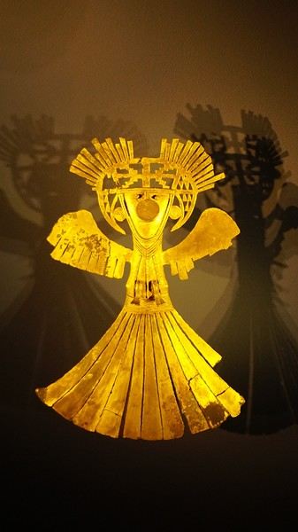
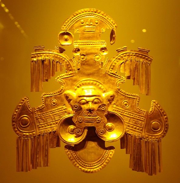
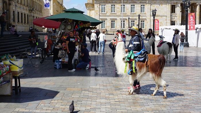
About two hours later, we decided to walk (careful, it’s a climb!) to the Monserrate cable car (3152m). Long wait to buy tickets and board the cable car! Once we arrived, a few raindrops, an impressive panoramic view of Bogotá’s vastness, a quick visit to the basilica (a pilgrimage site for Colombians), a walk through the tourist market, and at the top, plenty of small restaurants where we had our first Colombian meal. After our hearty lunch, we were lucky to see the sun return! No line for the descent. We then headed back to the hotel because Justine wanted to rest and recover from the trip. As for me, I continued my walk. I discovered a really nice craft market recommended by Flora, Pasaje Rivas, returned to Bolívar Square, and wandered through different streets, including the main pedestrian avenue (Calle 7), where there’s always something to see.
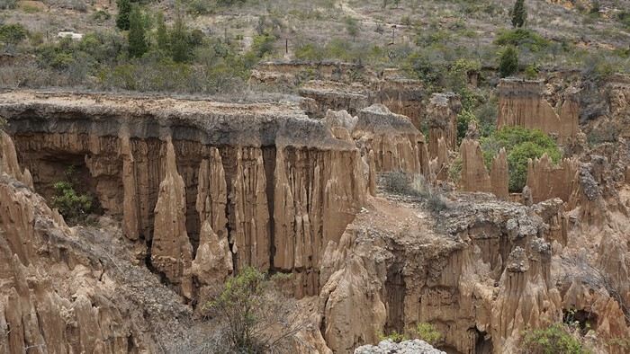
Tomorrow, a change of scenery as we head out for a hike in a small desert (Desierto de Chueca), located about 2 hours from Bogotá in the village of Nemecon. For this outing from Bogotá, with Flora’s help, we booked a car with a driver for the day. Flora also took care of booking the guide (since the site can only be visited with one). Nemecon (2/3) Today, we went to Nemecon to hike about 7.5 km in the ‘Desert of Checua.’ It’s nothing like sandy deserts! Instead, it’s geological formations sculpted by time, wind, and water. After two hours on the road—almost one of them spent navigating traffic jams with cars, trucks, buses, and a continuous flow of motorcycles on either side of our taxi—we reached Nemecon! The village center is really (too?) quiet. We met up with Deisy and headed toward the ‘desert,’ about twenty minutes away on a bumpy dirt road. Once there, a quick briefing, and off we went! Deisy didn’t stop talking (in Spanish) for over 3 hours!!! She told us so much about her region (flower farming, water management, traditions, songs, etc.), the origin of the site, and even mentioned Antonio Banderas, who filmed *The 33* in the village’s salt mine (the story of the survival of 33 Chilean miners after a collapse in their copper and gold mine). One hour of walking to reach the site, one hour to explore it, and one hour to return.
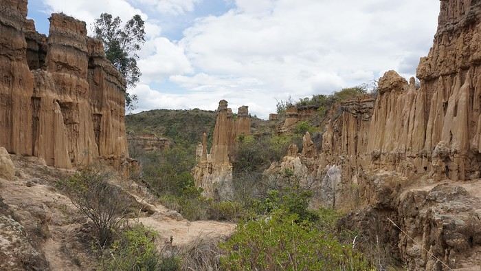
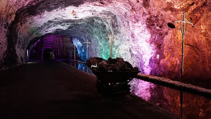
The advantage of this non-stop chatter was that it forced us to brush up on our Spanish at lightning speed. I even wondered if the effort to concentrate wasn’t more exhausting than the physical effort! Especially since on the way back, I got an oral quiz. Deisy wanted to make sure I remembered some of the information she’d given me during the visit: why is this rock white, that one red, and that one black? Back in the village, we had lunch at a restaurant recommended by Deisy before visiting the Nemecon salt mine. Before entering, a guide spent a good half-hour explaining the origin of the salt and the presence of many fossils in the area. Again, concentrating was tough because all the comments were exclusively in Spanish! An hour and a half wandering through the tunnels with a ‘lovely miner’s helmet’ on our heads!
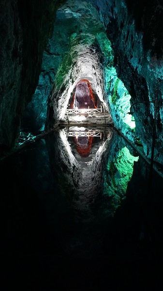
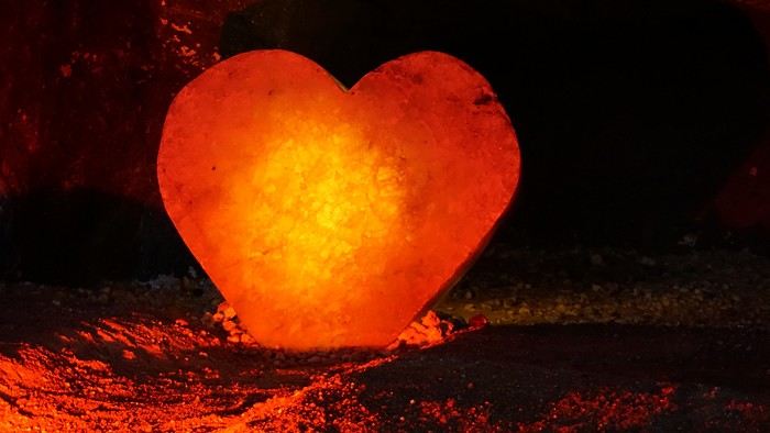
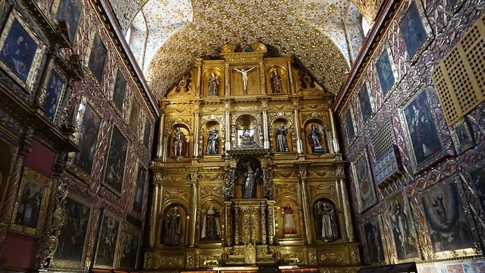
We met our driver at the mine entrance. The return to Bogotá was a bit faster, but traffic in the city center was still heavy! We arrived in front of our hotel between 8:00 and 8:30 PM. It’s been a pretty intense start to the trip! Tonight, our legs are tired. Hopefully, tomorrow will be a bit more relaxed! Bogotá (3/3) We started the day by visiting the Santa Clara Church Museum, located next to the presidential palace. Alejandra (from the local agency ‘Gaia Tours Colombia,’ which organized our stay in Caño Cristales (La Macarena)) had recommended this visit for its rich mural paintings.
A few hundred meters further, after crossing the Plaza Mayor again, we visited the cultural complex housing the Botero Museum, the Mint Museum, and the Bank of the Republic Art Museum. Note that entry is free for all three museums. Botero Museum: There are fewer works by Botero here than in the Medellín museum, but more paintings and sculptures by other artists, all from Botero’s private collection (donated to Colombia). Mint Museum: We limited ourselves to visiting one room (on Flora’s advice) where three gold and gemstone monstrances and a Christ with a crown of emerald thorns are displayed. Photos are not allowed. Art Museum: We visited two temporary exhibitions. Lunchtime came quickly. We had a good meal at a reasonably priced small restaurant in the La Candelaria micro-district, near the Chorro de Quevedo square. We decided to spend the afternoon wandering the streets and alleys of the historic center to discover local street art.
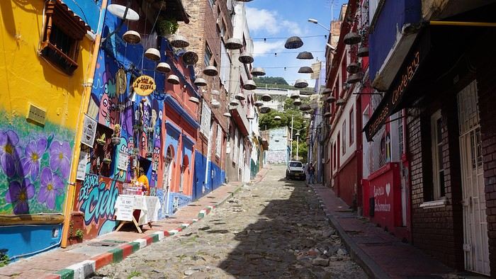
We also passed through very lively pedestrian streets. I also decided to revisit Pasaje Rivas to show Justine all the shops selling more or less artisanal products. Tomorrow morning, we fly to La Macarena at 10:30 AM. Not to dance (you’d be surprised if I told you we were going to take a South American dance class, right?!), but to visit the fabulous Caño Cristales, a river naturally colored by aquatic plants. The planned program includes hiking, horseback riding, canoeing, and swimming among these plants. This site was long inaccessible because the area was controlled by the FARC. Access and tourism development became possible after agreements and amnesty measures between the Colombian government and paramilitary groups. As in other regions, former FARC members have been able to transition into various tourism-related activities.
About two hours later, we decided to walk (careful, it’s a climb!) to the Monserrate cable car (3152m). Long wait to buy tickets and board the cable car! Once we arrived, a few raindrops, an impressive panoramic view of Bogotá’s vastness, a quick visit to the basilica (a pilgrimage site for Colombians), a walk through the tourist market, and at the top, plenty of small restaurants where we had our first Colombian meal. After our hearty lunch, we were lucky to see the sun return! No line for the descent. We then headed back to the hotel because Justine wanted to rest and recover from the trip. As for me, I continued my walk. I discovered a really nice craft market recommended by Flora, Pasaje Rivas, returned to Bolívar Square, and wandered through different streets, including the main pedestrian avenue (Calle 7), where there’s always something to see.
Tomorrow, a change of scenery as we head out for a hike in a small desert (Desierto de Chueca), located about 2 hours from Bogotá in the village of Nemecon. For this outing from Bogotá, with Flora’s help, we booked a car with a driver for the day. Flora also took care of booking the guide (since the site can only be visited with one). Nemecon (2/3) Today, we went to Nemecon to hike about 7.5 km in the ‘Desert of Checua.’ It’s nothing like sandy deserts! Instead, it’s geological formations sculpted by time, wind, and water. After two hours on the road—almost one of them spent navigating traffic jams with cars, trucks, buses, and a continuous flow of motorcycles on either side of our taxi—we reached Nemecon! The village center is really (too?) quiet. We met up with Deisy and headed toward the ‘desert,’ about twenty minutes away on a bumpy dirt road. Once there, a quick briefing, and off we went! Deisy didn’t stop talking (in Spanish) for over 3 hours!!! She told us so much about her region (flower farming, water management, traditions, songs, etc.), the origin of the site, and even mentioned Antonio Banderas, who filmed *The 33* in the village’s salt mine (the story of the survival of 33 Chilean miners after a collapse in their copper and gold mine). One hour of walking to reach the site, one hour to explore it, and one hour to return.
The advantage of this non-stop chatter was that it forced us to brush up on our Spanish at lightning speed. I even wondered if the effort to concentrate wasn’t more exhausting than the physical effort! Especially since on the way back, I got an oral quiz. Deisy wanted to make sure I remembered some of the information she’d given me during the visit: why is this rock white, that one red, and that one black? Back in the village, we had lunch at a restaurant recommended by Deisy before visiting the Nemecon salt mine. Before entering, a guide spent a good half-hour explaining the origin of the salt and the presence of many fossils in the area. Again, concentrating was tough because all the comments were exclusively in Spanish! An hour and a half wandering through the tunnels with a ‘lovely miner’s helmet’ on our heads!
We met our driver at the mine entrance. The return to Bogotá was a bit faster, but traffic in the city center was still heavy! We arrived in front of our hotel between 8:00 and 8:30 PM. It’s been a pretty intense start to the trip! Tonight, our legs are tired. Hopefully, tomorrow will be a bit more relaxed! Bogotá (3/3) We started the day by visiting the Santa Clara Church Museum, located next to the presidential palace. Alejandra (from the local agency ‘Gaia Tours Colombia,’ which organized our stay in Caño Cristales (La Macarena)) had recommended this visit for its rich mural paintings.
A few hundred meters further, after crossing the Plaza Mayor again, we visited the cultural complex housing the Botero Museum, the Mint Museum, and the Bank of the Republic Art Museum. Note that entry is free for all three museums. Botero Museum: There are fewer works by Botero here than in the Medellín museum, but more paintings and sculptures by other artists, all from Botero’s private collection (donated to Colombia). Mint Museum: We limited ourselves to visiting one room (on Flora’s advice) where three gold and gemstone monstrances and a Christ with a crown of emerald thorns are displayed. Photos are not allowed. Art Museum: We visited two temporary exhibitions. Lunchtime came quickly. We had a good meal at a reasonably priced small restaurant in the La Candelaria micro-district, near the Chorro de Quevedo square. We decided to spend the afternoon wandering the streets and alleys of the historic center to discover local street art.
We also passed through very lively pedestrian streets. I also decided to revisit Pasaje Rivas to show Justine all the shops selling more or less artisanal products. Tomorrow morning, we fly to La Macarena at 10:30 AM. Not to dance (you’d be surprised if I told you we were going to take a South American dance class, right?!), but to visit the fabulous Caño Cristales, a river naturally colored by aquatic plants. The planned program includes hiking, horseback riding, canoeing, and swimming among these plants. This site was long inaccessible because the area was controlled by the FARC. Access and tourism development became possible after agreements and amnesty measures between the Colombian government and paramilitary groups. As in other regions, former FARC members have been able to transition into various tourism-related activities.
Une semaine au départ de San Francisco
Bonjour , nous somme une famille de 4 : parents et 2 enfants de 13 et 9 ans. Théoriquement nous irons à San Francisco fin avril. Nous avons avons de la famille sur place ( les enfants sont plus jeunes). Premier séjour aux États-Unis. Pour cause professionnelle la durée sur place est limitée.
les vols sont achetés aux horaires qui nous conviennent:
arrivée à SF dimanche 13h35 , départ le mardi 23h00. Après un road trip Nous souhaitons être de retour à SF le samedi soir: visites avec les 2 familles le dimanche, puis entre nous le lundi et mardi
j'envisage cet esquisse de programme:
dimanche soir :nuit à Midpines
Lundi visite de Yosemite park , nuit à Fresno
mardi visite de Sequoia park nuit à Three Rivers
mercredi route et visite de Trona Pinnacles nuit à Ridgecrest
jeudi visite Death Valley Furnace Creek nuit à Las Végas
pour le vendredi : le Grand Canyon donne vraiment envie d''être visité , nuit au Grand Canyon?
samedi retour vers Las Vegas puis vol vers SF en fin d’après-midi ( je ne prends pas le risque de réserver ce vol plusieurs semaines à l'avance) ou route toute la journée vers SF.
votre avis trop chargé , je supprime soit Death Valley , soit le Grand Canyon , les 2 ?
j'ai regardé pour arriver directement à Las Vegas plutôt que San Francisco le premier jour mais il faut ajouté presque 600€ ( j'ai eu les 4 aller-retour Paris SF à 1240€). Si le premier jour je vais à LV en avion en partant de SF quelle marge prendre entre le départ du 2eme vol et l'arrivée du premier? Pour les hébergements j'essaie de trouver sur hotel.com car j'ai un programme fidélité lors de mes déplacements pro. Merci pour vos conseils William
j'ai regardé pour arriver directement à Las Vegas plutôt que San Francisco le premier jour mais il faut ajouté presque 600€ ( j'ai eu les 4 aller-retour Paris SF à 1240€). Si le premier jour je vais à LV en avion en partant de SF quelle marge prendre entre le départ du 2eme vol et l'arrivée du premier? Pour les hébergements j'essaie de trouver sur hotel.com car j'ai un programme fidélité lors de mes déplacements pro. Merci pour vos conseils William
Un choix de vos trois destinations préferées
A cette question si personnelle et difficile je vous propose de choisir 3 destinations que vous conseilleriez.
Si possible en ajoutant quelques mots ouvrant la porte à des questions .
L'idée est une sélection mais pas un classement .
Mon choix : Nouvelle Zélande - Ile du Sud et Australie Probablement un art de vivre et des espaces diversifiés . Polynesie Des paysages exceptionnels , une simplicité de vie aux couleurs chantantes De San Francisco à Los Angeles (route du Grand Canyon- Road trip - Route mythiqueextraordinaire et variété de culture
Mon choix : Nouvelle Zélande - Ile du Sud et Australie Probablement un art de vivre et des espaces diversifiés . Polynesie Des paysages exceptionnels , une simplicité de vie aux couleurs chantantes De San Francisco à Los Angeles (route du Grand Canyon- Road trip - Route mythiqueextraordinaire et variété de culture
American Airlines rajoute des escales à mon vol pour le Pérou
Bonjour a tous
Nous avons reservé il y a quelques des billets d'avions pour le Perou au mois de septembre avec la compagnie America Airlines. Nous avions choisi un départ de Paris avec une escale a Miami puis vol Lima. Maintenant on me modifie mon vol avec une escale a Londre puis a Miami.
-Les compagnies ont t'elle le droit de faire ce genre de chose sans modifier ses tarifs vu que c'est pas ce que j'avais choisi dans la multitude de proposition?
-Les liaisons entre le France et les USA étant surrement supendue en septembre, c'est pas un risque d'accepter de partir dans ses conditions?
Merci d'avance pour vos conseils
Nous avons reservé il y a quelques des billets d'avions pour le Perou au mois de septembre avec la compagnie America Airlines. Nous avions choisi un départ de Paris avec une escale a Miami puis vol Lima. Maintenant on me modifie mon vol avec une escale a Londre puis a Miami.
-Les compagnies ont t'elle le droit de faire ce genre de chose sans modifier ses tarifs vu que c'est pas ce que j'avais choisi dans la multitude de proposition?
-Les liaisons entre le France et les USA étant surrement supendue en septembre, c'est pas un risque d'accepter de partir dans ses conditions?
Merci d'avance pour vos conseils
Adventures of a Bygone Era: The Philippines in 1984
After several discussions on VF about travel journals from the Philippines, I decided to write this curiosity: a trip report from a journey made in 1984, when traveling to the Philippines was still an adventure.
A curiosity because writing a travel journal about a trip 35 years later isn’t common, but also (mostly?) because exploring the Philippines at that time had little in common with traveling there today.
Obviously, I’ve forgotten a number of facts, most of the details, but with the help of a few notes from that time and a stack of slides (yes, there was life before digital 😊), many memories came back and added to the highlights I’d never forgotten. The scanned slides aren’t always great quality, but there are still quite a few to brighten up this chatter. Back then, we didn’t snap photos like we do now—film was too expensive—so I don’t have pictures of every place we visited... too bad, comparing some of those spots to how they look today would’ve been interesting.
Why "Adventures"? Why call it "Adventures" in the Philippines in 1984, a word so often used for a simple exotic trip? - Because the lack of information (no *Guide du Routard*, no *Lonely Planet*, no *Michelin Guide*, nothing, and obviously no internet) gave this trip what’s at the heart of adventure: the unknown. - Because the political situation made the stay sometimes dangerous. - Because transportation conditions were always epic, often perilous. - Because the question of where we’d spend the night came up almost every evening. - And for... quite a few other reasons.
That said, we weren’t exactly explorers!
Why the Philippines? First of all, why go to the Philippines in 1984—a country not exactly set up for tourism and about which we knew very little? How could we get an idea of the beauty of the Philippines and its points of interest when we had no guides or photos?
The idea came to us from Thailand a year earlier, during our first long-haul trip. After touring the north of the country, we met a Frenchman living in Phuket, where there were only a few tourists in Patong, with just a few small hotels and guesthouses. Kata and Karon had no buildings or roads, Rawai only had three palm-thatched bungalows, including ours, and the other islands were unknown to tourists. There was plenty to discover, and we wanted to return to this beautiful country... but the Frenchman made us dream about the Philippines—a country to explore, with wild landscapes.
Long evenings of discussion over multiple Sprite-Mekong cocktails (what memories of those headaches!) finally convinced us we had to go to the Philippines.
Episode 0: Before Departure The decision was made: we’d go to the Philippines in May 1984. Our friends and family were surprised when we announced we were going on vacation to the Philippines (a bit like saying today we were going paddleboarding in the Kerguelen Islands 🤪).
These days, preparing for each of our trips takes long evenings of research, planning, and noting down good addresses... etc. But for the Philippines in 1984, preparation was quick: we had very little information about the country, we were leaving almost at random, and the discovery would only be more exciting.
We still had a few bits of info gathered here and there: the rice terraces in northern Luzon, volcanoes, Negros where we were supposed to visit an acquaintance, Cebu and its marine life (we ended up going elsewhere), and absolutely avoid Mindanao, which was practically at war with the regime. That was about it, but it was already a great itinerary.
Nothing was organized in advance; we’d see day by day. We had no idea about travel times or even the existence of transportation options. The main (and sometimes only) way to connect two islands was by overloaded, rusty ferry. Only the big cities had airports.
Let’s Go: Episode 1: Paris to Manila My travel journals always start after arriving at the airport—the Europe-to-“Other Continent” trip isn’t interesting—but the flight to the Philippines was already an adventure, so I’ll make an exception.
This was the era when only a few Asian airlines were on par with Western ones: Thai, Singapore Airlines, and Philippine Airlines. They had beautiful, brand-new planes, and to attract customers (almost exclusively “businessmen”) from the usual airlines (Air France, Lufthansa, British Airways), there was opulence on board: unlimited champagne, all sorts of cocktails... Compared to today’s long-haul flights, there was still one small difference: no personal screens, just one screen at the front of the cabin with one mandatory movie. And I don’t know why, but we only got James Bond films, both ways... that must’ve been the trend at the time.
The tourism boom to Southeast Asia hadn’t started yet, and the “Asian Tigers” weren’t a thing, so there weren’t many business trips. That meant long-haul flights made stops everywhere to fill the planes. Our Philippine Airlines Boeing 747 left London, picked us up in Paris, then stopped in Frankfurt to take on a few Germans. I don’t know why we then made a stop in Dubai—a totally exotic place at the time. There was nothing to do there... things have changed a lot since. It was a small town lost in the desert. The airport was tiny, with just one or two buildings and a supermarket. During the stopover, everyone had to get off the plane and walk to the supermarket. Photo and electronic equipment were dirt cheap—I guess that was the only reason for the stop. Maybe it was their first commercial move. Emirates didn’t exist yet, as I checked online, but anyway, the idea that such a remote place could have its own airline was unthinkable.
Online, I found this photo of Dubai Airport in 1980. Anyone who’s transited through today’s massive airport with its rows of A380s will appreciate it: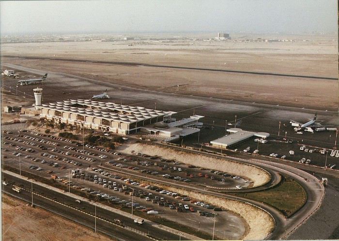
Next stop: New Delhi to drop off some Europeans and pick up a few Indians, and finally, the terminus: Manila. I don’t remember how long the trip took with its five stops—an unimaginable journey today. Despite all those stops to fill the plane, there was still enough space to stretch out on the four center seats of the 747, something that never happens these days despite all the flights in every direction.
So here we are, finally at Manila Airport around midnight.
Episode 1: Manila and Baguio To start, a quick note on the political and economic situation in the Philippines in 1984, which had consequences for us as tourists, as we’d soon realize upon arrival.
After several centuries of Spanish colonization, the Philippines became American at the start of the 20th century, then independent. In 1966, Marcos took power, and little by little, his regime sank into corruption and mismanagement, becoming a dictatorship with martial law, all for the benefit of his family and friends, who enriched themselves endlessly. The peak was the assassination of opposition leader Benigno Aquino in August 1983, which triggered harshly repressed protests. So we arrived a few months later in a very poor country, with omnipresent corruption and an extremely tense political situation, as we’d soon see for ourselves. Major protests took place in the main cities during our trip—I’ll come back to that. Two years later, Marcos fled to Hawaii after being forced out of power following rigged elections. This historical context explains a lot of the situations we found ourselves in over the following weeks.
Arriving in the middle of the night isn’t very cheerful. Manila was already a huge city with many slums, where you could find a few business hotels like the Hilton or Intercontinental—way out of our budget—and plenty of run-down hotels. Luckily, two Indians we’d chatted with on the plane offered to take us to their usual hotel. They came to Manila twice a year for business. We accepted their offer, relieved not to have to look for a place to stay in the middle of the night, figuring the address must be good since they came back every time... we were wrong 🙁
We left the airport and immediately got a taste of the local vibe when we got into the taxi: the police asked for our passports. We thought: what’s more normal than police in a dictatorship?
But that wasn’t it at all. Our two Indian friends explained that the police were noting our names along with the taxi number and time. Crime in Manila was so bad that the taxi driver would be held responsible if anything happened to us... welcome to the Philippines 😎 😎
Historically, the Philippines was a very violent country, where everything was settled with guns or machetes. Previous governments had banned carrying weapons, but Marcos later allowed the free sale and carrying of guns, and disputes were settled with pistols again (or worse, as we’d discover later). Since he’d released most of the criminals from prison to form a paramilitary militia at his service (I’ll talk about our encounter with these “heroes” later), it was pretty dangerous to go into many parts of Manila, where these “tonton macoutes” ruled.
We arrived at our hotel without incident... and then things started badly. The room was infested with big cockroaches—exactly what I hate most in those kinds of countries. No way to find another hotel at that hour. After the long flight, the urge to take a shower was so strong that we squeezed into the bathroom as best we could. After that, I don’t remember—I guess we must’ve fallen asleep exhausted under the sheets in the heat... air conditioning wasn’t widespread yet.
The next day, we just wanted to leave that dump as soon as possible. So we decided to head north right away, stopping in Baguio, and we’d visit Manila a bit on the way back.
When we stepped outside, we discovered a pretty run-down neighborhood with potholed streets. But we also discovered the jeepneys. They were everywhere, flooding the streets.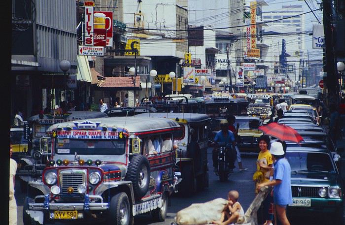
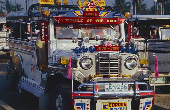
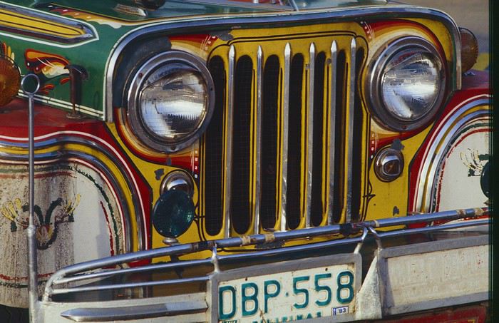
They had crazy sound systems, each one blasting louder than the last. The interiors were kitschy but fun. There weren’t many private cars—almost all transportation was by jeepney, with buses reserved for intercity trips.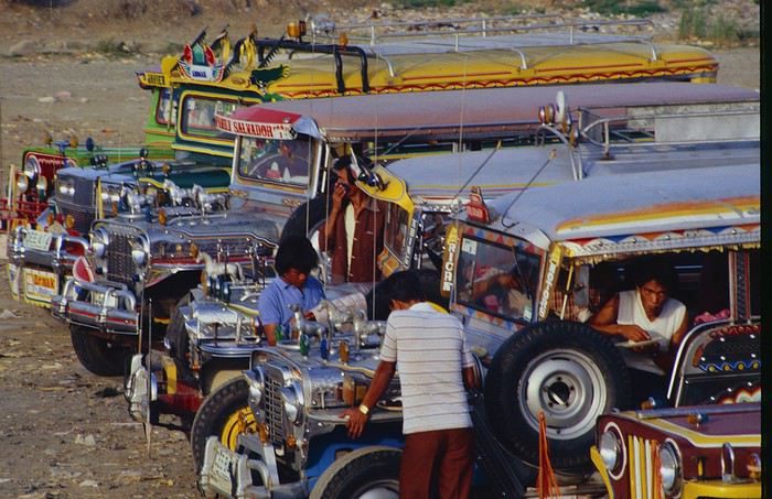
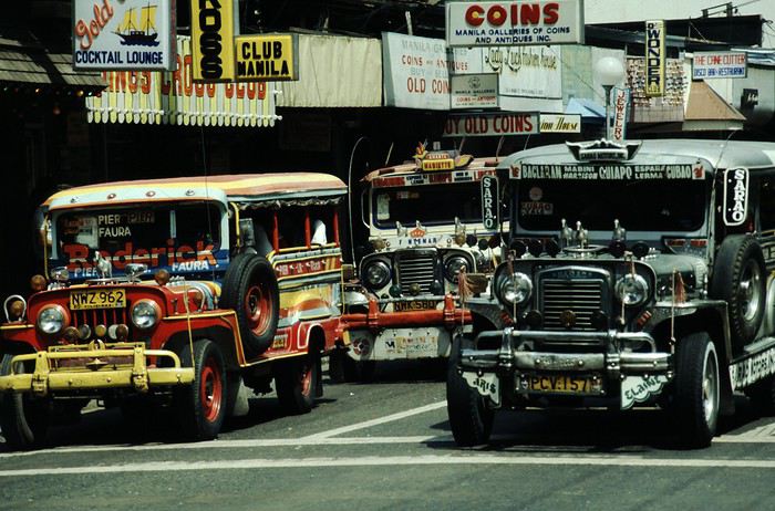
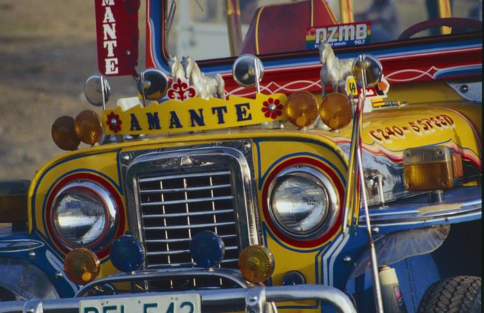
Before heading to the bus terminal for the north, somewhere on the outskirts of the city, we needed to exchange some money. I don’t remember how we ended up in a policeman’s jeep who offered his services: - Exchange money on the black market at a better rate than the banks. - Take us wherever we wanted, in this case, the bus terminal.
We accepted both offers (we’d still checked the official exchange rate from dollars to pesos). So we found ourselves in his jeep. After exchanging money, we left in his vehicle and stopped for gas. Without turning off the engine, he calmly smoked a cigarette while filling up. Since we were in a jeep with no doors or roof, we were ready to jump out if things went south, our travel bag in hand.
But we weren’t done with surprises yet. Once we left the small streets, we ended up in a neighborhood with wide avenues and not much traffic, which didn’t justify his incredible behavior. At every intersection, he made the sign of the cross, closed his eyes, and crossed without looking. I was more stunned than terrified! It wasn’t until we got out of the car later that I told Anne-Marie what had happened. I’d seen everything because the cop had put me in the front seat. Luckily, A-Marie hadn’t noticed anything from the back. Crossing Manila by trusting God rather than the rules of the road was ultimately effective. We were lucky—the trip was off to a good start. 🙂 🙂
We then passed through a neighborhood where slums stretched on for a while, and we left our policeman—friendly but a bit crazy—with relief.
A few hours by bus later, here we are in Baguio, cool in the mountains. My memories of Baguio are pretty fuzzy. I remember a small town. After some research while writing this journal, I found that the population was 120,000 in 1980. Given the population density in each home, that confirms my memory of a smallish town. Outside the “official” district with the president’s summer residence and government buildings, there were two or three paved streets with nice houses. The rest was very dirty and very poor, with lots of slums and dirt roads.
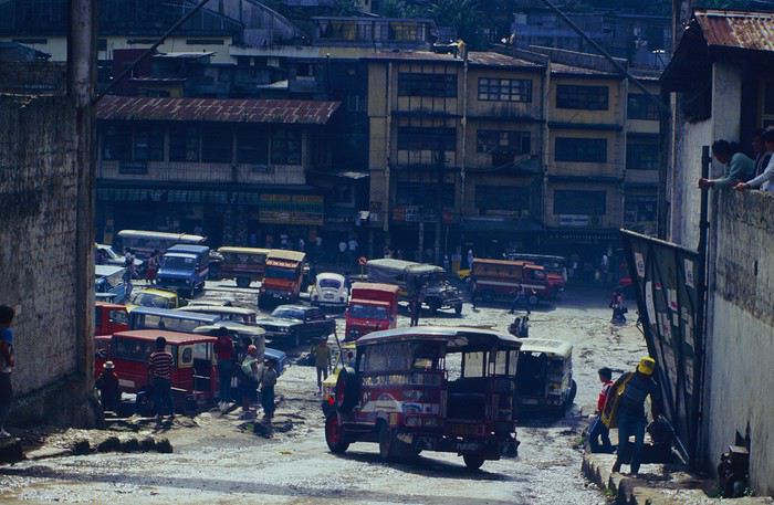
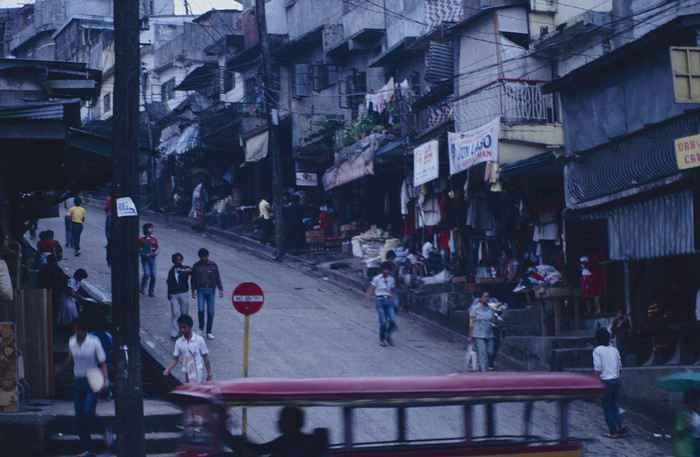
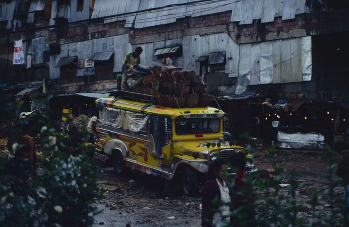
People we met on the street invited us to stay with them. These days, we wouldn’t just show up at strangers’ houses, which we should’ve done in Baguio—it would’ve saved us from an unimaginable and dangerous situation... which I won’t say anything about... !😊
The simple wooden house was on stilts at the edge of a hill with a view of the mountains. Since it was the start of the rainy season in a city that gets a lot of rain, we saw a lot of water. Our outings in town happened between downpours.
View from our lodging: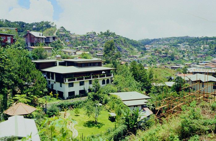
Episode 2: Baguio to Bontoc Aside from the situation briefly mentioned above, it was on the next leg to Bontoc that the adventure really began: an endless and dangerous road, a bus from another era, breathtaking landscapes, and surprising people.
We didn’t know the distance or how long it would take to get to Bontoc. When we arrived after about ten hours, we learned that Baguio to Bontoc was 140 km.
We got on a bus with wooden seats and settled in, two to a seat meant for two. As the bus filled up, passengers squeezed in three or four per seat, with chickens and baskets full of all sorts of things in the aisle. A little embarrassed, we didn’t know if we should squeeze in three on our seat. The seats were super tight (luckily, Filipinos are small), and I didn’t know where to put my legs given my height. I don’t remember if we stayed alone on our bench or if we ended up sharing with others.
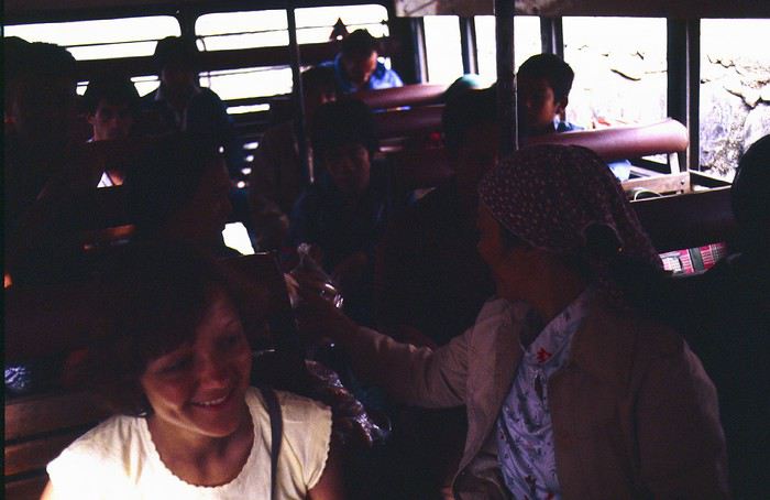
The “road” was a dirt track (or rather, a mud track) with endless turns. We held on as best we could to our slippery wooden seats—it was shaking in every direction. The woman behind us was carsick and throwing up... gross... but what were we doing there? Then we plunged into the Sierra Madre... just the name is dreamy!
Rice terraces started to appear: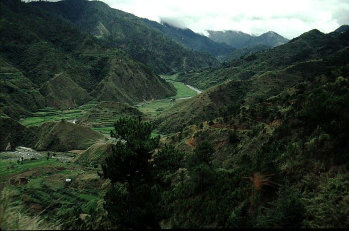
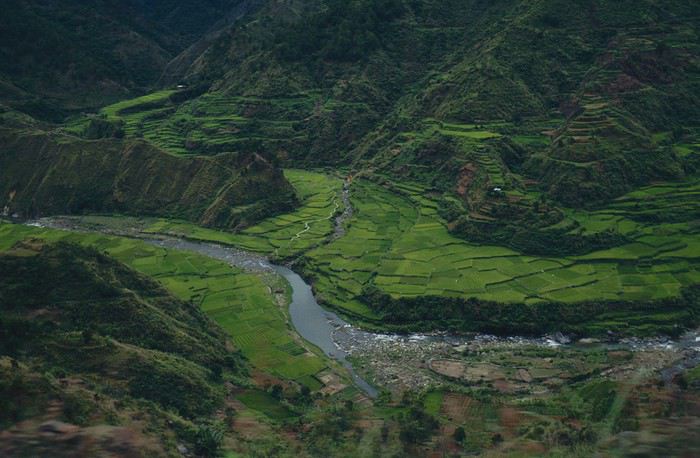
they took up more and more space along cliffs where we weren’t always reassured,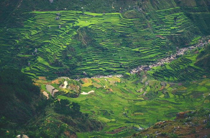
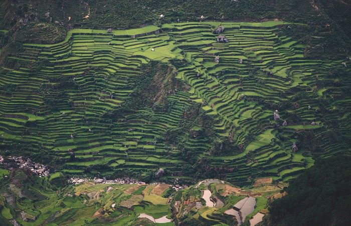
with lots of waterfalls (all that water had to go somewhere).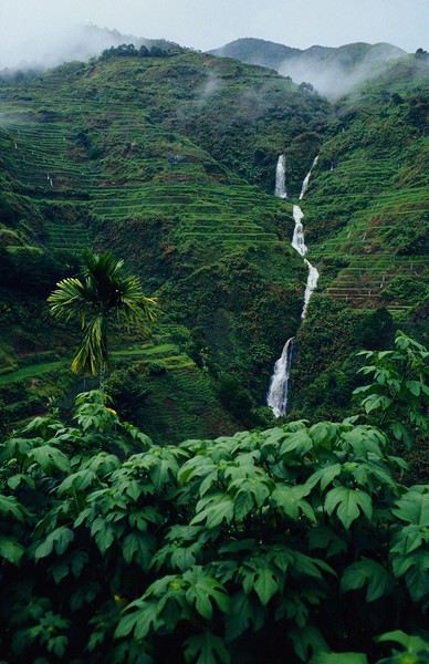
A few miserable villages stretched along the track, most often just a few houses balancing between the road and the drop. The bus stopped in every village—people got on or off and settled inside or on the roof. Street vendors offered their products to the bus passengers—a common sight in Asia, even today.
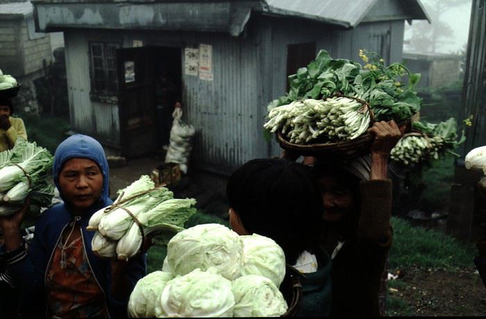
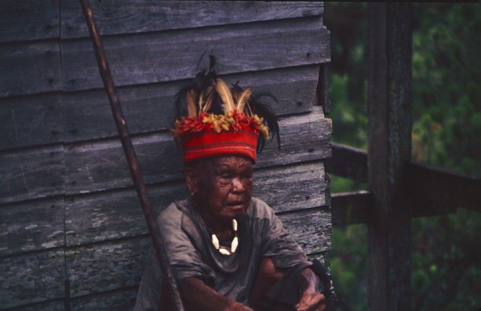
We were in another world—villagers were in loincloths, others had spears. The atmosphere was strange... but all good, we wanted exoticism, and we got it: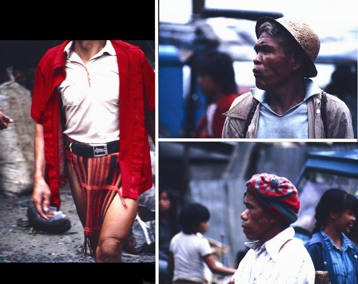
This so-called traditional outfit was everyday wear—it wasn’t for tourists since there weren’t any.
A curiosity because writing a travel journal about a trip 35 years later isn’t common, but also (mostly?) because exploring the Philippines at that time had little in common with traveling there today.
Obviously, I’ve forgotten a number of facts, most of the details, but with the help of a few notes from that time and a stack of slides (yes, there was life before digital 😊), many memories came back and added to the highlights I’d never forgotten. The scanned slides aren’t always great quality, but there are still quite a few to brighten up this chatter. Back then, we didn’t snap photos like we do now—film was too expensive—so I don’t have pictures of every place we visited... too bad, comparing some of those spots to how they look today would’ve been interesting.
Why "Adventures"? Why call it "Adventures" in the Philippines in 1984, a word so often used for a simple exotic trip? - Because the lack of information (no *Guide du Routard*, no *Lonely Planet*, no *Michelin Guide*, nothing, and obviously no internet) gave this trip what’s at the heart of adventure: the unknown. - Because the political situation made the stay sometimes dangerous. - Because transportation conditions were always epic, often perilous. - Because the question of where we’d spend the night came up almost every evening. - And for... quite a few other reasons.
That said, we weren’t exactly explorers!
Why the Philippines? First of all, why go to the Philippines in 1984—a country not exactly set up for tourism and about which we knew very little? How could we get an idea of the beauty of the Philippines and its points of interest when we had no guides or photos?
The idea came to us from Thailand a year earlier, during our first long-haul trip. After touring the north of the country, we met a Frenchman living in Phuket, where there were only a few tourists in Patong, with just a few small hotels and guesthouses. Kata and Karon had no buildings or roads, Rawai only had three palm-thatched bungalows, including ours, and the other islands were unknown to tourists. There was plenty to discover, and we wanted to return to this beautiful country... but the Frenchman made us dream about the Philippines—a country to explore, with wild landscapes.
Long evenings of discussion over multiple Sprite-Mekong cocktails (what memories of those headaches!) finally convinced us we had to go to the Philippines.
Episode 0: Before Departure The decision was made: we’d go to the Philippines in May 1984. Our friends and family were surprised when we announced we were going on vacation to the Philippines (a bit like saying today we were going paddleboarding in the Kerguelen Islands 🤪).
These days, preparing for each of our trips takes long evenings of research, planning, and noting down good addresses... etc. But for the Philippines in 1984, preparation was quick: we had very little information about the country, we were leaving almost at random, and the discovery would only be more exciting.
We still had a few bits of info gathered here and there: the rice terraces in northern Luzon, volcanoes, Negros where we were supposed to visit an acquaintance, Cebu and its marine life (we ended up going elsewhere), and absolutely avoid Mindanao, which was practically at war with the regime. That was about it, but it was already a great itinerary.
Nothing was organized in advance; we’d see day by day. We had no idea about travel times or even the existence of transportation options. The main (and sometimes only) way to connect two islands was by overloaded, rusty ferry. Only the big cities had airports.
Let’s Go: Episode 1: Paris to Manila My travel journals always start after arriving at the airport—the Europe-to-“Other Continent” trip isn’t interesting—but the flight to the Philippines was already an adventure, so I’ll make an exception.
This was the era when only a few Asian airlines were on par with Western ones: Thai, Singapore Airlines, and Philippine Airlines. They had beautiful, brand-new planes, and to attract customers (almost exclusively “businessmen”) from the usual airlines (Air France, Lufthansa, British Airways), there was opulence on board: unlimited champagne, all sorts of cocktails... Compared to today’s long-haul flights, there was still one small difference: no personal screens, just one screen at the front of the cabin with one mandatory movie. And I don’t know why, but we only got James Bond films, both ways... that must’ve been the trend at the time.
The tourism boom to Southeast Asia hadn’t started yet, and the “Asian Tigers” weren’t a thing, so there weren’t many business trips. That meant long-haul flights made stops everywhere to fill the planes. Our Philippine Airlines Boeing 747 left London, picked us up in Paris, then stopped in Frankfurt to take on a few Germans. I don’t know why we then made a stop in Dubai—a totally exotic place at the time. There was nothing to do there... things have changed a lot since. It was a small town lost in the desert. The airport was tiny, with just one or two buildings and a supermarket. During the stopover, everyone had to get off the plane and walk to the supermarket. Photo and electronic equipment were dirt cheap—I guess that was the only reason for the stop. Maybe it was their first commercial move. Emirates didn’t exist yet, as I checked online, but anyway, the idea that such a remote place could have its own airline was unthinkable.
Online, I found this photo of Dubai Airport in 1980. Anyone who’s transited through today’s massive airport with its rows of A380s will appreciate it:
Next stop: New Delhi to drop off some Europeans and pick up a few Indians, and finally, the terminus: Manila. I don’t remember how long the trip took with its five stops—an unimaginable journey today. Despite all those stops to fill the plane, there was still enough space to stretch out on the four center seats of the 747, something that never happens these days despite all the flights in every direction.
So here we are, finally at Manila Airport around midnight.
Episode 1: Manila and Baguio To start, a quick note on the political and economic situation in the Philippines in 1984, which had consequences for us as tourists, as we’d soon realize upon arrival.
After several centuries of Spanish colonization, the Philippines became American at the start of the 20th century, then independent. In 1966, Marcos took power, and little by little, his regime sank into corruption and mismanagement, becoming a dictatorship with martial law, all for the benefit of his family and friends, who enriched themselves endlessly. The peak was the assassination of opposition leader Benigno Aquino in August 1983, which triggered harshly repressed protests. So we arrived a few months later in a very poor country, with omnipresent corruption and an extremely tense political situation, as we’d soon see for ourselves. Major protests took place in the main cities during our trip—I’ll come back to that. Two years later, Marcos fled to Hawaii after being forced out of power following rigged elections. This historical context explains a lot of the situations we found ourselves in over the following weeks.
Arriving in the middle of the night isn’t very cheerful. Manila was already a huge city with many slums, where you could find a few business hotels like the Hilton or Intercontinental—way out of our budget—and plenty of run-down hotels. Luckily, two Indians we’d chatted with on the plane offered to take us to their usual hotel. They came to Manila twice a year for business. We accepted their offer, relieved not to have to look for a place to stay in the middle of the night, figuring the address must be good since they came back every time... we were wrong 🙁
We left the airport and immediately got a taste of the local vibe when we got into the taxi: the police asked for our passports. We thought: what’s more normal than police in a dictatorship?
But that wasn’t it at all. Our two Indian friends explained that the police were noting our names along with the taxi number and time. Crime in Manila was so bad that the taxi driver would be held responsible if anything happened to us... welcome to the Philippines 😎 😎
Historically, the Philippines was a very violent country, where everything was settled with guns or machetes. Previous governments had banned carrying weapons, but Marcos later allowed the free sale and carrying of guns, and disputes were settled with pistols again (or worse, as we’d discover later). Since he’d released most of the criminals from prison to form a paramilitary militia at his service (I’ll talk about our encounter with these “heroes” later), it was pretty dangerous to go into many parts of Manila, where these “tonton macoutes” ruled.
We arrived at our hotel without incident... and then things started badly. The room was infested with big cockroaches—exactly what I hate most in those kinds of countries. No way to find another hotel at that hour. After the long flight, the urge to take a shower was so strong that we squeezed into the bathroom as best we could. After that, I don’t remember—I guess we must’ve fallen asleep exhausted under the sheets in the heat... air conditioning wasn’t widespread yet.
The next day, we just wanted to leave that dump as soon as possible. So we decided to head north right away, stopping in Baguio, and we’d visit Manila a bit on the way back.
When we stepped outside, we discovered a pretty run-down neighborhood with potholed streets. But we also discovered the jeepneys. They were everywhere, flooding the streets.
They had crazy sound systems, each one blasting louder than the last. The interiors were kitschy but fun. There weren’t many private cars—almost all transportation was by jeepney, with buses reserved for intercity trips.
Before heading to the bus terminal for the north, somewhere on the outskirts of the city, we needed to exchange some money. I don’t remember how we ended up in a policeman’s jeep who offered his services: - Exchange money on the black market at a better rate than the banks. - Take us wherever we wanted, in this case, the bus terminal.
We accepted both offers (we’d still checked the official exchange rate from dollars to pesos). So we found ourselves in his jeep. After exchanging money, we left in his vehicle and stopped for gas. Without turning off the engine, he calmly smoked a cigarette while filling up. Since we were in a jeep with no doors or roof, we were ready to jump out if things went south, our travel bag in hand.
But we weren’t done with surprises yet. Once we left the small streets, we ended up in a neighborhood with wide avenues and not much traffic, which didn’t justify his incredible behavior. At every intersection, he made the sign of the cross, closed his eyes, and crossed without looking. I was more stunned than terrified! It wasn’t until we got out of the car later that I told Anne-Marie what had happened. I’d seen everything because the cop had put me in the front seat. Luckily, A-Marie hadn’t noticed anything from the back. Crossing Manila by trusting God rather than the rules of the road was ultimately effective. We were lucky—the trip was off to a good start. 🙂 🙂
We then passed through a neighborhood where slums stretched on for a while, and we left our policeman—friendly but a bit crazy—with relief.
A few hours by bus later, here we are in Baguio, cool in the mountains. My memories of Baguio are pretty fuzzy. I remember a small town. After some research while writing this journal, I found that the population was 120,000 in 1980. Given the population density in each home, that confirms my memory of a smallish town. Outside the “official” district with the president’s summer residence and government buildings, there were two or three paved streets with nice houses. The rest was very dirty and very poor, with lots of slums and dirt roads.
People we met on the street invited us to stay with them. These days, we wouldn’t just show up at strangers’ houses, which we should’ve done in Baguio—it would’ve saved us from an unimaginable and dangerous situation... which I won’t say anything about... !😊
The simple wooden house was on stilts at the edge of a hill with a view of the mountains. Since it was the start of the rainy season in a city that gets a lot of rain, we saw a lot of water. Our outings in town happened between downpours.
View from our lodging:
Episode 2: Baguio to Bontoc Aside from the situation briefly mentioned above, it was on the next leg to Bontoc that the adventure really began: an endless and dangerous road, a bus from another era, breathtaking landscapes, and surprising people.
We didn’t know the distance or how long it would take to get to Bontoc. When we arrived after about ten hours, we learned that Baguio to Bontoc was 140 km.
We got on a bus with wooden seats and settled in, two to a seat meant for two. As the bus filled up, passengers squeezed in three or four per seat, with chickens and baskets full of all sorts of things in the aisle. A little embarrassed, we didn’t know if we should squeeze in three on our seat. The seats were super tight (luckily, Filipinos are small), and I didn’t know where to put my legs given my height. I don’t remember if we stayed alone on our bench or if we ended up sharing with others.
The “road” was a dirt track (or rather, a mud track) with endless turns. We held on as best we could to our slippery wooden seats—it was shaking in every direction. The woman behind us was carsick and throwing up... gross... but what were we doing there? Then we plunged into the Sierra Madre... just the name is dreamy!
Rice terraces started to appear:
they took up more and more space along cliffs where we weren’t always reassured,
with lots of waterfalls (all that water had to go somewhere).
A few miserable villages stretched along the track, most often just a few houses balancing between the road and the drop. The bus stopped in every village—people got on or off and settled inside or on the roof. Street vendors offered their products to the bus passengers—a common sight in Asia, even today.
We were in another world—villagers were in loincloths, others had spears. The atmosphere was strange... but all good, we wanted exoticism, and we got it:
This so-called traditional outfit was everyday wear—it wasn’t for tourists since there weren’t any.
Mais où qu'il est ce truc là (4)
Voyage 5 mois et 3 semaines en Amérique du Sud
Bonjour,
Il n'est jamais trop tard pour rendre compte de son voyage. Le confinement me laisse enfin du temps pour le faire.
Je suis parti le 17 août 2017 et je suis rentré le 7 février 2018. Entre temps, je suis allé en Argentine par cargo puis une fois sur ce continent, j'ai visité l'Uruguay, l'Argentine et le Chili.
Durant tout ce voyage, j'ai tenu un carnet journalier.
Je me propose de vous le livrer.
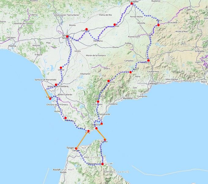
L'Andalousie à vélo, le top c'est au printemps
Printemps 2019 : De Séville à Séville par les villes et villages blancs, une Andalousie encore verte et vide de touristes. Séville, Cordoue, Gibraltar, Maroc (Tétouan, Tanger), Cadix, plus de 1500 km sur les pistes blanches de la vallée du Guadalquivir et les belles routes bosselées de montagne. Chroniques d'un sexagénaire en totale liberté.
Californie en mars 2020: qui veut une part de désert?
Hello à toutes et à tous,
De retour cette semaine, voici le carnet de nos dernières aventures, majoritairement dans le désert californien (petites incursions dans le Nevada et en Arizona). Nous avons eu la chance de pouvoir partir. Cela s'est joué à quelques jours mais on passera sur la phase d'incertitude et de stress les semaines et jours précédant le départ, car bien d'autres sont davantage impactés par ce coronavirus....
Au programme théorique, boucle de 15 jours depuis Los Angeles avec les alentours de Ridgecrest, Alabama Hills, Death Valley approfondie sur 3/4 jours, des belles randos autour de Las Vegas, les désert de Mojave et d'Anza Borrego, Joshua NP et Palm Springs.
Los Angeles n'est pas une ville que nous aimons, mais c'est une destination sur laquelle les compagnies (y compris les low cost long courrier) se livrent une bataille avec des prix compétitifs. Et nous voulions du soleil et ne pouvant partir qu'en dehors de la saison touristique, c'était le meilleur choix pour la rando aux states...
C'est parti pour le départ!
Jour 1: Jeudi 5 mars 2020
Après une nuit à Roissy, trajet en bus pour l'aéroport sous une forte pluie, vol Air France direct CDG LAX sans encombre. Même si le vol est long (11h30), nous avons apprécié le confort d'un vol direct et les prestations de la compagnie Air France (vol réservé au prix compétitif de 330€ hors supplément bagages et autres, tout compris 760€ / 2 avec sièges choisis et un bagage en soute / pers). L'A380 est vraiment confortable.
Arrivée à l'heure prévue (13h heure locale), il fait beau et bon (20°C). Passage de l'immigration hyper rapide, nous voyons beaucoup d'évolutions année après année: le personnel est remplacé par les machines. Tout se fait désormais par les bornes. Seul un passage rapide pour le coup de tampon. En 10 minutes, tout est plié! Récupération des bagages puis attente de la navette Alamo.
Une vingtaine de minutes plus tard, nous voici au parking Alamo. Toujours un moment de "stress" sur le type de véhicule qu'il y aura de dispo. Sans surprise, très peu de choix en Suv 4x4. Seulement un et il y a quelqu'un dedans. On prend un Ford Escape 2wd, la garde au sol est correcte, il est neuf (4000 miles au compteur), spacieux et les pneus Michelin sont bons (résa plusieurs mois à l'avance, 443 € pour 15 jours). Pour la première fois, il n'a pas été possible de valider le "Skip the counter" permettant d'éviter l'étape réputée très chiante de l'attente au guichet. Et je confirme c'est très chiant. Attente interminable, le vendeur essaie de fourguer toutes sortes d'options. Il me dit que je suis "Mr No", refusant chacune de ses propositions.
Il était prévu d'aller se balader l'après-midi au bord du Pacifique à Los Angeles, vers 3rd St, Palisades Park, Venice beach et un sunset éventuel vers Santa Monica. Mais la fatigue, le détour (par rapport à la situation de notre hôtel situé à l'Est) et la circulation très dense dans l'agglo tentaculaire de L.A nous font renoncer. Et nous avons bien fait! Nous allons mettre 1h30 pour rejoindre notre hôtel Days Inn à Artesia (choisi pour position pour la route de demain et petit dej inclus) alors qu'il n'y a que 37 km! toutes les routes sont encombrées, y compris en rusant en quittant les freeway et highway...
Bien contents d'arriver, quartier calme, parking gratuit. Quelques achats à pied au supermarché tout proche Stater Bross pour le diner de ce soir. Hôtel classique (88$), chambre spacieuse avec frigo, M-O, coin table, piscine extérieure non chauffée (et froide). Nous avons trouvé les hôtels chers cette année comparativement à l'Arizona l'année dernière à la même période.
Sunset à 17h49, c'est tôt! Diner dans la chambre et au lit à 19h30! La première nuit est toujours un moment spécial...
Jour 2: Vendredi 6 mars 2020
Le road-trip commence!! réveil évidemment très tôt, on fait l'ouverture du p'tit dèj à 6h30 (avec notre gel désinfectant en poche) et route pour Barstow pour la première rando du voyage peu connue et.. normalement peu fréquentée... Il nous faut 2 bonnes heures pour rejoindre le départ dans le secteur de Rainbow basin, au nord de Barstow. La piste après Irwin Rd est bonne, en tôle ondulée. Quelques passages sablonneux mais ok avec tout type de véhicule si temps sec (et c'est le cas). On traverse le camping de Owl canyon, chaque campeur nous salue.
Aucune voiture au trailhead (😉 !), j'aime. C'est indiqué. Il est déjà presque 10h, le soleil est levé depuis plusieurs heures (sunrise 6h14) et la luminosité n'est déjà plus optimale pour des photographes. Pour nous randonneurs, on est au top ! Il fait beau et on retrouve le plaisir des randos en tenue estivale (65° F, soit 17°C au départ)
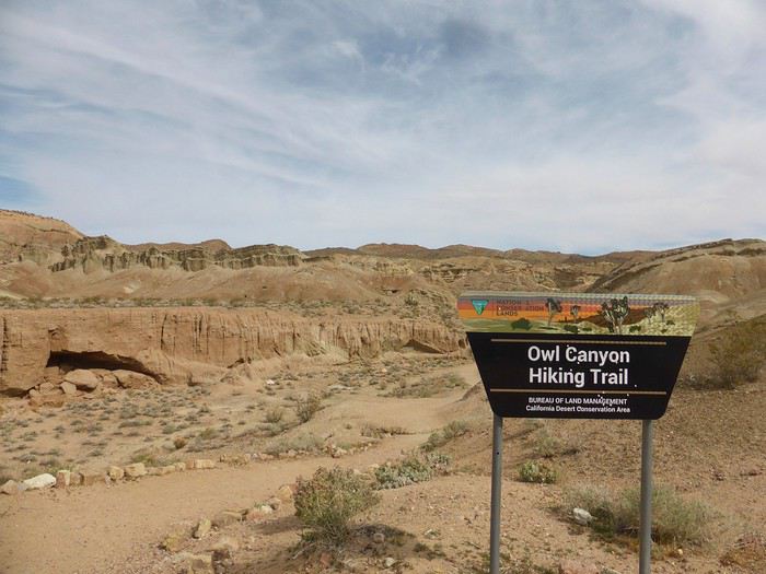
Le parking est tout au bout de la piste. J'ai repéré 2 canyons qui semblent intéressants, peu d'infos sur le net sur ce secteur. J'ai envie de faire une boucle plutôt que 2 A/R pour chaque canyon mais je ne sais pas ce que nous allons trouvé comme type de terrain pour faire la boucle. Au programme, une assez longue boucle pour un début de voyage avec 13km mais peu de dénivelé (380m d'après ma trace gpx théorique).
Nous partons par le canyon le plus à l'est, facile à suivre.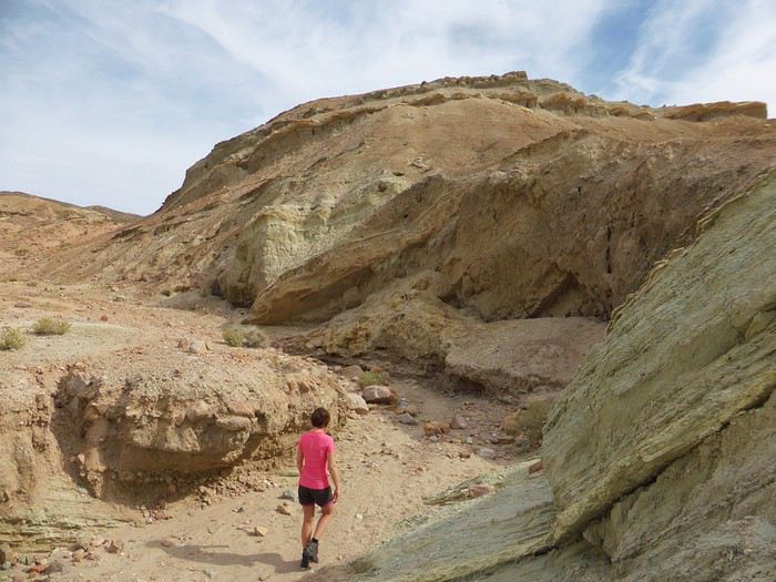
C'est rapidement très joli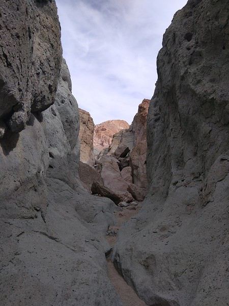
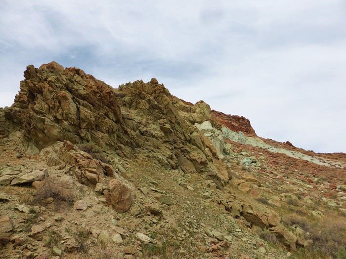
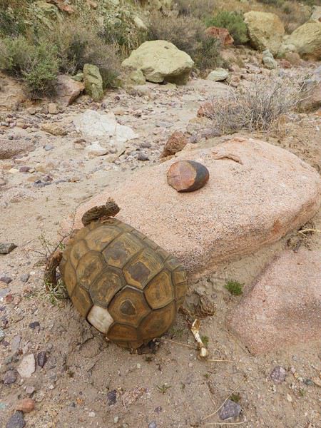
Une grande diversité, la solitude. Une tortue (morte), des belles pierres
Il nous faut une heure pour parcourir ce premier canyon, qui va vers le nord. Nous galérons à trouver un chemin qui connecte les 2 canyons. C'est un peu casse gueule par endroits (on aperçoit le sentier à droite sur la photo du dessous)
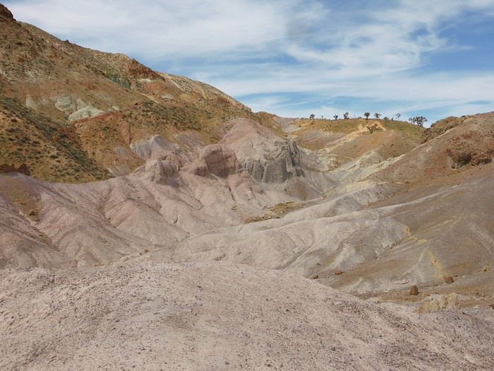
La portion qui suit est moins intéressante (après les arbres en haut de la photo). Deux belles remontées et nous piquons à gauche pour retrouver le second canyon qui va nous ramener à la piste puis à la voiture. Je n'attendais rien de cette seconde partie et nous l'avons préféré, plus ludique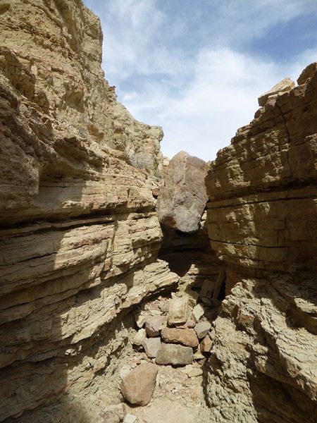
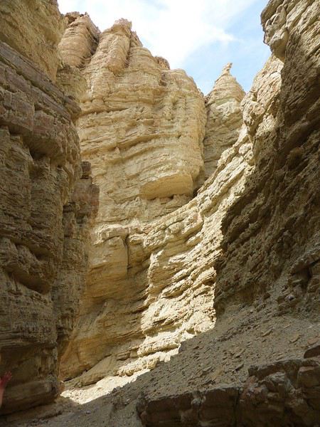
Attention il y a une grosse "marche" à descendre" d'environ 4 mètres puis une seconde de 2/3 mètres. Après quelques hésitations et études des environs, nous "désescaladons" cette partie avec précaution. Il serait plus facile de faire la boucle dans l'autre sens mais ce serait moins joli...
Vers 12h, nous sortons du canyon et remontons sur la piste (faisable en voiture, en sens unique). Nous prenons donc cette (jolie) piste aux belles couleurs malgré une lumière devenue trop crue. La piste a des airs de Death Valley, c'est le désert et plus c'est désert. Personne de près ni de loin...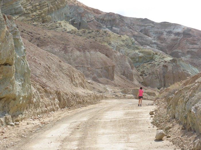
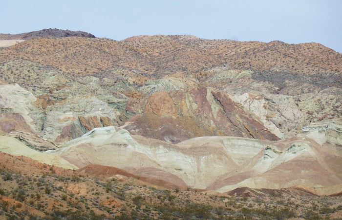
La dernière partie est commune à notre arrivée en voiture, sur la piste puis au travers du camping de Owl canyon (6$ / jour pour les campeurs, dépaysement garanti!) . Les jambes commencent à être lourdes et ce secteur n'est pas passionnant mais c'est le prix à payer pour faire la boucle... On est en mode automatique, bonne cadence. Il fait désormais très chaud (75°F).
Cette première rando Owl canyon / rainbow canyon nous a vraiment plu. 2h50 de rando, 13,5km et 400m de D+.
Petit rafraichissement à l'espace aménagé sur la piste du retour (picnic area pour les groupes)
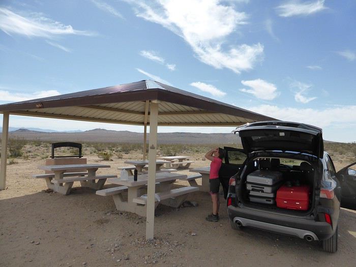
Retour vers Barstow qui essaie de revivre (sans véritable succès) en utilisant son emplacement sur la route 66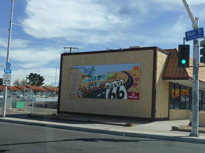
Arrêt aux outlets de Barstow que nous avions fait en 2014. Aucun achat ici, vraiment pas terrible.
Route pour Ridgecrest. Au passage, arrêt à la ghost town de Randsburg. Petite bourgade sympatique, très Old West. Tout est fermé sauf un bar. C'est sympa. L'arrêt ne nous prend que quelques minutes.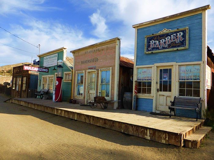
Pas de touristes ici à cette saison. Seuls quelques bikers et pilotes de quads et des locaux.
Check-in au Best western China Lake Inn de Ridecrest en fin de journée (181$ pour 2 nuits, PDJ inclus). Bel hôtel. Ridgerest est une ville où l'on trouve tout pour se ravitailler avant la Vallée de la mort (Walmart, Albertsons) à des prix abordables. Accueil charmant à l'hôtel, soirée relax ici. Jacuzzi extérieur, piscine non chauffée et glaciale. On prend plaisir à retrouver un Walmart avec nos achats pour les prochains jours. Bière, burrito salade dans la chambre. Première journée sympa. Belle entrée en matière avec la rando
A suivre...
De retour cette semaine, voici le carnet de nos dernières aventures, majoritairement dans le désert californien (petites incursions dans le Nevada et en Arizona). Nous avons eu la chance de pouvoir partir. Cela s'est joué à quelques jours mais on passera sur la phase d'incertitude et de stress les semaines et jours précédant le départ, car bien d'autres sont davantage impactés par ce coronavirus....
Au programme théorique, boucle de 15 jours depuis Los Angeles avec les alentours de Ridgecrest, Alabama Hills, Death Valley approfondie sur 3/4 jours, des belles randos autour de Las Vegas, les désert de Mojave et d'Anza Borrego, Joshua NP et Palm Springs.
Los Angeles n'est pas une ville que nous aimons, mais c'est une destination sur laquelle les compagnies (y compris les low cost long courrier) se livrent une bataille avec des prix compétitifs. Et nous voulions du soleil et ne pouvant partir qu'en dehors de la saison touristique, c'était le meilleur choix pour la rando aux states...
C'est parti pour le départ!
Jour 1: Jeudi 5 mars 2020
Après une nuit à Roissy, trajet en bus pour l'aéroport sous une forte pluie, vol Air France direct CDG LAX sans encombre. Même si le vol est long (11h30), nous avons apprécié le confort d'un vol direct et les prestations de la compagnie Air France (vol réservé au prix compétitif de 330€ hors supplément bagages et autres, tout compris 760€ / 2 avec sièges choisis et un bagage en soute / pers). L'A380 est vraiment confortable.
Arrivée à l'heure prévue (13h heure locale), il fait beau et bon (20°C). Passage de l'immigration hyper rapide, nous voyons beaucoup d'évolutions année après année: le personnel est remplacé par les machines. Tout se fait désormais par les bornes. Seul un passage rapide pour le coup de tampon. En 10 minutes, tout est plié! Récupération des bagages puis attente de la navette Alamo.
Une vingtaine de minutes plus tard, nous voici au parking Alamo. Toujours un moment de "stress" sur le type de véhicule qu'il y aura de dispo. Sans surprise, très peu de choix en Suv 4x4. Seulement un et il y a quelqu'un dedans. On prend un Ford Escape 2wd, la garde au sol est correcte, il est neuf (4000 miles au compteur), spacieux et les pneus Michelin sont bons (résa plusieurs mois à l'avance, 443 € pour 15 jours). Pour la première fois, il n'a pas été possible de valider le "Skip the counter" permettant d'éviter l'étape réputée très chiante de l'attente au guichet. Et je confirme c'est très chiant. Attente interminable, le vendeur essaie de fourguer toutes sortes d'options. Il me dit que je suis "Mr No", refusant chacune de ses propositions.
Il était prévu d'aller se balader l'après-midi au bord du Pacifique à Los Angeles, vers 3rd St, Palisades Park, Venice beach et un sunset éventuel vers Santa Monica. Mais la fatigue, le détour (par rapport à la situation de notre hôtel situé à l'Est) et la circulation très dense dans l'agglo tentaculaire de L.A nous font renoncer. Et nous avons bien fait! Nous allons mettre 1h30 pour rejoindre notre hôtel Days Inn à Artesia (choisi pour position pour la route de demain et petit dej inclus) alors qu'il n'y a que 37 km! toutes les routes sont encombrées, y compris en rusant en quittant les freeway et highway...
Bien contents d'arriver, quartier calme, parking gratuit. Quelques achats à pied au supermarché tout proche Stater Bross pour le diner de ce soir. Hôtel classique (88$), chambre spacieuse avec frigo, M-O, coin table, piscine extérieure non chauffée (et froide). Nous avons trouvé les hôtels chers cette année comparativement à l'Arizona l'année dernière à la même période.
Sunset à 17h49, c'est tôt! Diner dans la chambre et au lit à 19h30! La première nuit est toujours un moment spécial...
Jour 2: Vendredi 6 mars 2020
Le road-trip commence!! réveil évidemment très tôt, on fait l'ouverture du p'tit dèj à 6h30 (avec notre gel désinfectant en poche) et route pour Barstow pour la première rando du voyage peu connue et.. normalement peu fréquentée... Il nous faut 2 bonnes heures pour rejoindre le départ dans le secteur de Rainbow basin, au nord de Barstow. La piste après Irwin Rd est bonne, en tôle ondulée. Quelques passages sablonneux mais ok avec tout type de véhicule si temps sec (et c'est le cas). On traverse le camping de Owl canyon, chaque campeur nous salue.
Aucune voiture au trailhead (😉 !), j'aime. C'est indiqué. Il est déjà presque 10h, le soleil est levé depuis plusieurs heures (sunrise 6h14) et la luminosité n'est déjà plus optimale pour des photographes. Pour nous randonneurs, on est au top ! Il fait beau et on retrouve le plaisir des randos en tenue estivale (65° F, soit 17°C au départ)
Le parking est tout au bout de la piste. J'ai repéré 2 canyons qui semblent intéressants, peu d'infos sur le net sur ce secteur. J'ai envie de faire une boucle plutôt que 2 A/R pour chaque canyon mais je ne sais pas ce que nous allons trouvé comme type de terrain pour faire la boucle. Au programme, une assez longue boucle pour un début de voyage avec 13km mais peu de dénivelé (380m d'après ma trace gpx théorique).
Nous partons par le canyon le plus à l'est, facile à suivre.
C'est rapidement très joli
Une grande diversité, la solitude. Une tortue (morte), des belles pierres
Il nous faut une heure pour parcourir ce premier canyon, qui va vers le nord. Nous galérons à trouver un chemin qui connecte les 2 canyons. C'est un peu casse gueule par endroits (on aperçoit le sentier à droite sur la photo du dessous)
La portion qui suit est moins intéressante (après les arbres en haut de la photo). Deux belles remontées et nous piquons à gauche pour retrouver le second canyon qui va nous ramener à la piste puis à la voiture. Je n'attendais rien de cette seconde partie et nous l'avons préféré, plus ludique
Attention il y a une grosse "marche" à descendre" d'environ 4 mètres puis une seconde de 2/3 mètres. Après quelques hésitations et études des environs, nous "désescaladons" cette partie avec précaution. Il serait plus facile de faire la boucle dans l'autre sens mais ce serait moins joli...
Vers 12h, nous sortons du canyon et remontons sur la piste (faisable en voiture, en sens unique). Nous prenons donc cette (jolie) piste aux belles couleurs malgré une lumière devenue trop crue. La piste a des airs de Death Valley, c'est le désert et plus c'est désert. Personne de près ni de loin...
La dernière partie est commune à notre arrivée en voiture, sur la piste puis au travers du camping de Owl canyon (6$ / jour pour les campeurs, dépaysement garanti!) . Les jambes commencent à être lourdes et ce secteur n'est pas passionnant mais c'est le prix à payer pour faire la boucle... On est en mode automatique, bonne cadence. Il fait désormais très chaud (75°F).
Cette première rando Owl canyon / rainbow canyon nous a vraiment plu. 2h50 de rando, 13,5km et 400m de D+.
Petit rafraichissement à l'espace aménagé sur la piste du retour (picnic area pour les groupes)
Retour vers Barstow qui essaie de revivre (sans véritable succès) en utilisant son emplacement sur la route 66
Arrêt aux outlets de Barstow que nous avions fait en 2014. Aucun achat ici, vraiment pas terrible.
Route pour Ridgecrest. Au passage, arrêt à la ghost town de Randsburg. Petite bourgade sympatique, très Old West. Tout est fermé sauf un bar. C'est sympa. L'arrêt ne nous prend que quelques minutes.
Pas de touristes ici à cette saison. Seuls quelques bikers et pilotes de quads et des locaux.
Check-in au Best western China Lake Inn de Ridecrest en fin de journée (181$ pour 2 nuits, PDJ inclus). Bel hôtel. Ridgerest est une ville où l'on trouve tout pour se ravitailler avant la Vallée de la mort (Walmart, Albertsons) à des prix abordables. Accueil charmant à l'hôtel, soirée relax ici. Jacuzzi extérieur, piscine non chauffée et glaciale. On prend plaisir à retrouver un Walmart avec nos achats pour les prochains jours. Bière, burrito salade dans la chambre. Première journée sympa. Belle entrée en matière avec la rando
A suivre...
Compte rendu Cuba 2020
🙂
En ces temps difficiles, rien que une bonne lecture évasive à la maison CUBA 2020
>>>14 jours >>>5 villes coloniale >>>1500 kms en Ford 195 >>>4 sites UNESCO >>>8 casas particulares utilisées >>>beaucoup de langoustes
Références : Application MAPS.ME Page FB : Je pars à Cuba Page FB : Les français à Cuba Page FB : Cuba : conseils pour bien préparer son voyage www.cubanoscope.com www.jeparsacuba.com Carte Cuba 1.1000000 BORCH plastifiée Guide du Routard CUBA 2019
JOUR 1 : PARIS>>>LA HAVANE 10h de vol 25° (samedi 18/01/2020) Voilà c’est le départ tant attendu, direction l’aéroport d’Orly pour un vol direct à destination de la Havane, capitale de CUBA. Nous sommes à l’aéroport vers 08h00 pour un décollage à 10h00 sur la compagnie Air Caraïbes que nous testons pour la première fois. Nous sommes dans une boutique DutyFree, pour quelques achats, lorsqu’une annonce retentit et nous concerne. Notre vol est retardé de 2h30 ! Bon bin, il va falloir attendre, on finit nos achats, qui seront gardés à Orly, jusqu’à notre retour (pratique). Nous sommes en salle d’embarquement F21, on nous remet une attestation de retard de la part de la compagnie, et on nous sert un petit piquenique. La raison invoquée par Air Caraïbes, est qu’ils ont dû changer d’appareil, alors que depuis 08h00 que nous sommes là, en porte F21, il y a un avion Air Caraïbes qui est au stationnement, il y restera jusqu’à notre décollage qui sera effectif à 13h20, soit 3h20 de retard au décollage (ce changement d’appareil a-t-il eu lieu>>>mystère….).
J’ai eu le temps de prévenir 2 personnes à La Havane, de notre retard, une qui doit nous donner des réservations faites en ligne, et notre chauffeur Pavel, qui nous attend à l’aéroport. Les 10h30 de vol se passent très bien, on a trouvé les services à bord d’un bon niveau, équipage agréable et divertissements très variés. On se pose donc à 17h30 heure locale au lieu de 14h40. Il y a pas mal de monde aux guichets immigration, mais nous passons assez rapidement la douane munis de notre carte de tourisme (visa) en main, un tampon de plus dans le passeport et nous passons (notre assurance rapatriement ne nous a pas été demandée, mais elle est obligatoire). Nous n’avons pas de bagages en soute, alors nous nous dirigeons vers la sortie, tout en constatant qu’il faudrait un papier bleu rempli, que nous n’avons pas. Une personne récupère ce papier, un papier pour une famille, un peu perdus, on suit un peu tout le monde, la personne est un peu submergée, et nous passons avec d’autres personnes.
Un fois sortis, nous repérons facilement Pavel (notre chauffeur privé pour 2 semaines) avec la pancarte à nos noms. Nous allons directement échanger en espagnol, et cela pour toute la durée du voyage. Voulant faire du change, je lui demande où cela est possible, et il y a un guichet à droite en sortant. Mais, il me propose de le faire avec lui, et au même taux, c’est parfait. Il m’expliquera que cela l’intéresse d’avoir des euros ou des dollars pour acheter des pièces de voitures au cas où, et qu’il paie cela dans une de ces deux monnaies.
FOCUS MONNAIE A CUBA : Bon à savoir, à Cuba il existe 2 monnaies en vigueur, un peso national (CUP) pour les cubains et un peso convertible (CUC) pour les touristes, ces 2 monnaies ne sont pas récupérables en dehors du territoire cubain, donc il faut arriver avec des espèces, attention une commission supplémentaire est prise en cas de change avec des dollars américains. Et avoir sa CB pour des retraits possibles en ville.
Et un des moments tant attendus arrive, nous découvrons notre voiture, une FORD 1953 Customline Sedan bleu, Pavel la tient de son père, et elle a été entièrement refaite. Et nous voici partis vers la ville, on voit déjà énormément de voitures américaines des années 50 et 60, il y en a partout en fait. La nuit tombe maintenant, puisque nous sommes arrivés en retard, et Pavel gentiment nous propose un tour de ville vers les spots illuminés de La Havane, on est vraiment dans le bain, le Capitolio, le théâtre national, nous remontons le Paseo del Prado, on en avait rêvé, on y est !!!
Pavel nous dépose ensuite à notre hébergement, nous sommes chez l’habitant (et cela durera 2 semaines). Nous sommes à la Casa Esperanza, chez Henri, français et Esperanza, cubaine sa femme. Il s’agit d’une maison de 1910 entièrement rénovée en 11 mois !
FOCUS HEBERGEMENT A CUBA : Cuba étant pendant longtemps un pays assez fermé, l’offre en hébergement touristique est restée faible et d’état, l’hôtellerie n’est pas dans le meilleur des états et n’est pas bien rénovée faute d’argent. Ainsi, face à la demande touristique grandissante, dès 1997, Fidel Castro a ainsi autorisé les particuliers à louer deux chambres maximum à des étrangers. En 2011, le régime a dû libéraliser cette location. Il est désormais légal de louer plus de deux chambres par logement voire même une maison entière. (Tarifs moyens 15 à 40 CUC par nuit, environ 13,50 à 36€). Il y a environ aujourd’hui à La Havane plus de 800 casa particular.
Nous laissons Pavel pour ce soir et nous le retrouverons lundi matin. Henri nous indique un petit itinéraire pour aller se restaurer. Notre hébergement est dans le quartier de la vieille Havane, pratique où tout peut se faire à pied. Nous allons donc partir à pied, il fait nuit, les cubains sont très souvent dehors et dans la rue, ce que nous remarquons de suite, c’est l’état déplorable, ou en ruine, de pas mal de maisons coloniales ou début XXème. A pied, on peut vraiment avoir l’impression d’être en insécurité, il fait nuit, on voit de tout, ruines, animaux et cubains, et en fait il n’en est rien du tout, c’est très sécuritaire malgré la vision que nous percevons. A 5mn, nous rejoignons la Plaza Vieja, superbe place coloniale rénovée aux façades authentiques, plusieurs restaurants, et surtout ce que nous rêvions aussi, on est samedi soir, la musique cubaine est là, dans les maisons ou dans la rue, on y est !!! On trouve un petit resto et notre premier mojito ! Retour à l’hébergement, il est 21h30, on commence à absorber le jetlag, bonne nuit.
>>>14 jours >>>5 villes coloniale >>>1500 kms en Ford 195 >>>4 sites UNESCO >>>8 casas particulares utilisées >>>beaucoup de langoustes
Références : Application MAPS.ME Page FB : Je pars à Cuba Page FB : Les français à Cuba Page FB : Cuba : conseils pour bien préparer son voyage www.cubanoscope.com www.jeparsacuba.com Carte Cuba 1.1000000 BORCH plastifiée Guide du Routard CUBA 2019
JOUR 1 : PARIS>>>LA HAVANE 10h de vol 25° (samedi 18/01/2020) Voilà c’est le départ tant attendu, direction l’aéroport d’Orly pour un vol direct à destination de la Havane, capitale de CUBA. Nous sommes à l’aéroport vers 08h00 pour un décollage à 10h00 sur la compagnie Air Caraïbes que nous testons pour la première fois. Nous sommes dans une boutique DutyFree, pour quelques achats, lorsqu’une annonce retentit et nous concerne. Notre vol est retardé de 2h30 ! Bon bin, il va falloir attendre, on finit nos achats, qui seront gardés à Orly, jusqu’à notre retour (pratique). Nous sommes en salle d’embarquement F21, on nous remet une attestation de retard de la part de la compagnie, et on nous sert un petit piquenique. La raison invoquée par Air Caraïbes, est qu’ils ont dû changer d’appareil, alors que depuis 08h00 que nous sommes là, en porte F21, il y a un avion Air Caraïbes qui est au stationnement, il y restera jusqu’à notre décollage qui sera effectif à 13h20, soit 3h20 de retard au décollage (ce changement d’appareil a-t-il eu lieu>>>mystère….).
J’ai eu le temps de prévenir 2 personnes à La Havane, de notre retard, une qui doit nous donner des réservations faites en ligne, et notre chauffeur Pavel, qui nous attend à l’aéroport. Les 10h30 de vol se passent très bien, on a trouvé les services à bord d’un bon niveau, équipage agréable et divertissements très variés. On se pose donc à 17h30 heure locale au lieu de 14h40. Il y a pas mal de monde aux guichets immigration, mais nous passons assez rapidement la douane munis de notre carte de tourisme (visa) en main, un tampon de plus dans le passeport et nous passons (notre assurance rapatriement ne nous a pas été demandée, mais elle est obligatoire). Nous n’avons pas de bagages en soute, alors nous nous dirigeons vers la sortie, tout en constatant qu’il faudrait un papier bleu rempli, que nous n’avons pas. Une personne récupère ce papier, un papier pour une famille, un peu perdus, on suit un peu tout le monde, la personne est un peu submergée, et nous passons avec d’autres personnes.
Un fois sortis, nous repérons facilement Pavel (notre chauffeur privé pour 2 semaines) avec la pancarte à nos noms. Nous allons directement échanger en espagnol, et cela pour toute la durée du voyage. Voulant faire du change, je lui demande où cela est possible, et il y a un guichet à droite en sortant. Mais, il me propose de le faire avec lui, et au même taux, c’est parfait. Il m’expliquera que cela l’intéresse d’avoir des euros ou des dollars pour acheter des pièces de voitures au cas où, et qu’il paie cela dans une de ces deux monnaies.
FOCUS MONNAIE A CUBA : Bon à savoir, à Cuba il existe 2 monnaies en vigueur, un peso national (CUP) pour les cubains et un peso convertible (CUC) pour les touristes, ces 2 monnaies ne sont pas récupérables en dehors du territoire cubain, donc il faut arriver avec des espèces, attention une commission supplémentaire est prise en cas de change avec des dollars américains. Et avoir sa CB pour des retraits possibles en ville.
Et un des moments tant attendus arrive, nous découvrons notre voiture, une FORD 1953 Customline Sedan bleu, Pavel la tient de son père, et elle a été entièrement refaite. Et nous voici partis vers la ville, on voit déjà énormément de voitures américaines des années 50 et 60, il y en a partout en fait. La nuit tombe maintenant, puisque nous sommes arrivés en retard, et Pavel gentiment nous propose un tour de ville vers les spots illuminés de La Havane, on est vraiment dans le bain, le Capitolio, le théâtre national, nous remontons le Paseo del Prado, on en avait rêvé, on y est !!!
Pavel nous dépose ensuite à notre hébergement, nous sommes chez l’habitant (et cela durera 2 semaines). Nous sommes à la Casa Esperanza, chez Henri, français et Esperanza, cubaine sa femme. Il s’agit d’une maison de 1910 entièrement rénovée en 11 mois !
FOCUS HEBERGEMENT A CUBA : Cuba étant pendant longtemps un pays assez fermé, l’offre en hébergement touristique est restée faible et d’état, l’hôtellerie n’est pas dans le meilleur des états et n’est pas bien rénovée faute d’argent. Ainsi, face à la demande touristique grandissante, dès 1997, Fidel Castro a ainsi autorisé les particuliers à louer deux chambres maximum à des étrangers. En 2011, le régime a dû libéraliser cette location. Il est désormais légal de louer plus de deux chambres par logement voire même une maison entière. (Tarifs moyens 15 à 40 CUC par nuit, environ 13,50 à 36€). Il y a environ aujourd’hui à La Havane plus de 800 casa particular.
Nous laissons Pavel pour ce soir et nous le retrouverons lundi matin. Henri nous indique un petit itinéraire pour aller se restaurer. Notre hébergement est dans le quartier de la vieille Havane, pratique où tout peut se faire à pied. Nous allons donc partir à pied, il fait nuit, les cubains sont très souvent dehors et dans la rue, ce que nous remarquons de suite, c’est l’état déplorable, ou en ruine, de pas mal de maisons coloniales ou début XXème. A pied, on peut vraiment avoir l’impression d’être en insécurité, il fait nuit, on voit de tout, ruines, animaux et cubains, et en fait il n’en est rien du tout, c’est très sécuritaire malgré la vision que nous percevons. A 5mn, nous rejoignons la Plaza Vieja, superbe place coloniale rénovée aux façades authentiques, plusieurs restaurants, et surtout ce que nous rêvions aussi, on est samedi soir, la musique cubaine est là, dans les maisons ou dans la rue, on y est !!! On trouve un petit resto et notre premier mojito ! Retour à l’hébergement, il est 21h30, on commence à absorber le jetlag, bonne nuit.
Idées circuit et étapes dans l'Ouest américain et ses parcs
Bonjour,
Je prépare notre futur voyage (3 couples) pour septembre prochain (16 Sept - 15 Oct).
Il se déroulera en 2 temps, un couple rentrant en France le 3 Oct.
J'ai beaucoup lu posts et carnets de voyages (Merci à tous 🙂🙂) et je commence à y voir plus clair.
Une idée est un circuit "lent" avec des étapes courtes et du temps pour explorer les parcs (Las Vegas- Grand Canyon- Page- Monument Valley- Mesa Verde- Moab- Capitol Reef- Bryce Canyon- Zion- Death Valley- Las Vegas) J'ai un doc détaillé avec ce circuit établi à la lecture de vos expériences, mais cela serait trop long. Si c'est vers celui-ci que notre choix se porte, je reviendrai vers vous ;-)
L'autre idée est d'alléger ce circuit en supprimant certaines étapes et en passant moins de temps sur certains lieux afin d'intégrer Yellowstone (loin, mais si beau) pour compléter la découverte de l'Ouest pour nos amis qui partent le 3. Plus de route bien sûr. J'aimerai beaucoup avoir votre avis. Est-ce réalisable ? Des suggestions ?
Nous sommes prêts à faire quelques étapes longues mais pas tous les jours. Nous ferons des randonnées dans les parcs, mais pas trop et surtout des pas trop longues ni trop difficiles pour s'adapter à tout le monde. Merci beaucoup de votre aide
J1 arrivée Las Vegas J2 Las Vegas - Grand Canyon nuit Tusayane J3 Grand Canyon - Page J4 Antelope canyon, etc... Monument Valley nuit Mexican Hat J5Mexican Hat - Moab J6 Moab J7 Moab - direction Grand teton, arrêt à Evanston ou Rock Springs J8 Evanston ou Rock Springs - Jackson Hole le 23/09 J9 Grand Teton - Yellowstone nuit parc ou West Yellowstone J10 Yellowstone nuit West ou Gardiner J11 Yellowstone nuit West Yellowstone (mieux pour par vers SLC ?) J12 Yellowstone - Salt Lake City nuit SLC J13 SLC - Capitol Reef nuit Torrey J14 Torrey - Bryce Canyon nuit tropic J15 Journée Bryce Canyon nuit tropic J16 Tropic - Zion nuit Springdale ou Kanarraville J17 Zion - Las Vegas probablement via Valley of fire nuit Las Vegas J18 Vol Retour pour 1 couple
Une idée est un circuit "lent" avec des étapes courtes et du temps pour explorer les parcs (Las Vegas- Grand Canyon- Page- Monument Valley- Mesa Verde- Moab- Capitol Reef- Bryce Canyon- Zion- Death Valley- Las Vegas) J'ai un doc détaillé avec ce circuit établi à la lecture de vos expériences, mais cela serait trop long. Si c'est vers celui-ci que notre choix se porte, je reviendrai vers vous ;-)
L'autre idée est d'alléger ce circuit en supprimant certaines étapes et en passant moins de temps sur certains lieux afin d'intégrer Yellowstone (loin, mais si beau) pour compléter la découverte de l'Ouest pour nos amis qui partent le 3. Plus de route bien sûr. J'aimerai beaucoup avoir votre avis. Est-ce réalisable ? Des suggestions ?
Nous sommes prêts à faire quelques étapes longues mais pas tous les jours. Nous ferons des randonnées dans les parcs, mais pas trop et surtout des pas trop longues ni trop difficiles pour s'adapter à tout le monde. Merci beaucoup de votre aide
J1 arrivée Las Vegas J2 Las Vegas - Grand Canyon nuit Tusayane J3 Grand Canyon - Page J4 Antelope canyon, etc... Monument Valley nuit Mexican Hat J5Mexican Hat - Moab J6 Moab J7 Moab - direction Grand teton, arrêt à Evanston ou Rock Springs J8 Evanston ou Rock Springs - Jackson Hole le 23/09 J9 Grand Teton - Yellowstone nuit parc ou West Yellowstone J10 Yellowstone nuit West ou Gardiner J11 Yellowstone nuit West Yellowstone (mieux pour par vers SLC ?) J12 Yellowstone - Salt Lake City nuit SLC J13 SLC - Capitol Reef nuit Torrey J14 Torrey - Bryce Canyon nuit tropic J15 Journée Bryce Canyon nuit tropic J16 Tropic - Zion nuit Springdale ou Kanarraville J17 Zion - Las Vegas probablement via Valley of fire nuit Las Vegas J18 Vol Retour pour 1 couple
Voyage en Espagne (Madrid, Séville, Valence...)
Bonjour à tous,
Pour l'été prochain nous envisageons, ma femme et moi, une petite virée en Espagne. Ayant déjà fait la Sicile et le Portugal en plein été, on peut dire qu'on ne craint pas trop la chaleur. En tout cas on fait avec... Voila donc ce que l'on a prévu. Qu'en pensez-vous ? Est ce réaliste ? D'autres suggestions ? Nous ne passons ni à Tarragone, ni à Barcelone que nous connaissons déjà. Merci pour vos contributions !
dimanche 2 août 2020 Montpellier - Saragosse lundi 3 août 2020 Saragosse mardi 4 août 2020 Saragosse - Madrid mercredi 5 août 2020 Madrid jeudi 6 août 2020 Madrid vendredi 7 août 2020 Madrid - Tolede samedi 8 août 2020 Tolede dimanche 9 août 2020 Tolede - Cordoue lundi 10 août 2020 Cordoue mardi 11 août 2020 Cordoue - Seville mercredi 12 août 2020 Seville jeudi 13 août 2020 Seville vendredi 14 août 2020 Sevile - Cadix samedi 15 août 2020 Cadix - Malaga via Ronda dimanche 16 août 2020 Malaga lundi 17 août 2020 Malaga - Grenade mardi 18 août 2020 Grenade mercredi 19 août 2020 Grenade jeudi 20 août 2020 Grenade - Valence vendredi 21 août 2020 Valence samedi 22 août 2020 Valence dimanche 23 août 2020 Valence - Montpellier
Pour l'été prochain nous envisageons, ma femme et moi, une petite virée en Espagne. Ayant déjà fait la Sicile et le Portugal en plein été, on peut dire qu'on ne craint pas trop la chaleur. En tout cas on fait avec... Voila donc ce que l'on a prévu. Qu'en pensez-vous ? Est ce réaliste ? D'autres suggestions ? Nous ne passons ni à Tarragone, ni à Barcelone que nous connaissons déjà. Merci pour vos contributions !
dimanche 2 août 2020 Montpellier - Saragosse lundi 3 août 2020 Saragosse mardi 4 août 2020 Saragosse - Madrid mercredi 5 août 2020 Madrid jeudi 6 août 2020 Madrid vendredi 7 août 2020 Madrid - Tolede samedi 8 août 2020 Tolede dimanche 9 août 2020 Tolede - Cordoue lundi 10 août 2020 Cordoue mardi 11 août 2020 Cordoue - Seville mercredi 12 août 2020 Seville jeudi 13 août 2020 Seville vendredi 14 août 2020 Sevile - Cadix samedi 15 août 2020 Cadix - Malaga via Ronda dimanche 16 août 2020 Malaga lundi 17 août 2020 Malaga - Grenade mardi 18 août 2020 Grenade mercredi 19 août 2020 Grenade jeudi 20 août 2020 Grenade - Valence vendredi 21 août 2020 Valence samedi 22 août 2020 Valence dimanche 23 août 2020 Valence - Montpellier
Quels vêtements en rapport avec la météo en Espagne en février?
Bonjour!
Nous allons en espagne du 9 février au 1mars 2020. Je regarde les prévisions meteo et ça indique entre 5 et 15 degrés celcius. Cependant, quand je regarde des photos prises en hiver, il y a de la neige! Est-ce qu'il y en a souvent? (Je comprend qu'en montagne il y en aura mais sinon pour ailleurs..)
Villes visitées :
Valence
Barcelone
Ainsa
San sebastian
(Porto portugal)
(Lisbonne portugal)
Séville
Tolede
En bref, a quoi on peut s'attendre ? Merci bcp!
En bref, a quoi on peut s'attendre ? Merci bcp!
Hiking in Arizona, just Arizona
Les mois ont passé….
Ma demande en mariage à Dirty Devil Overlook (vers Hanksville, au fin fond de l’Utah) un soir de juin 2017, s’est concrétisée.... "Chérie", ma dame est devenue Madame.
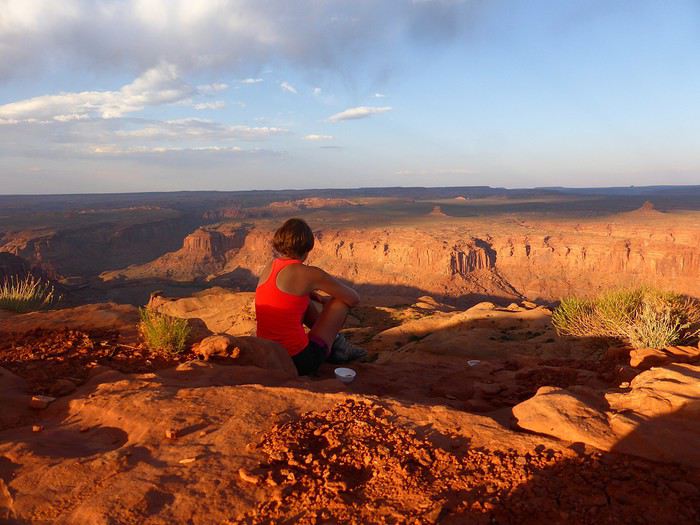 ..
..
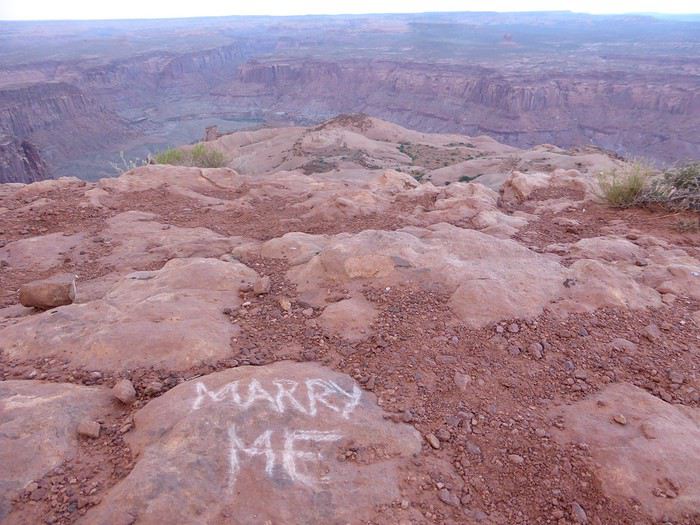
C'était un voyage sensationnel, le meilleur. A peine rentrés, on savait qu'on repartirait...et le plus rapidement possible. Un mariage à organiser, la vente de la maison, l'acquisition d'une autre, un an de travaux et l'arrivée d'Utah notre Border Collie.... Voilà le contexte... (ce qui explique la longue absence sur VF et le délai pour s'occuper du carnet 😉)
Mais premier point noir: Au moment du peaufinage du roadbook, les USA sont plongés en plein Shutdown. Et ça dure, ça dure. …On suit alors ça de ‘’près’’. Le shutdown le plus long de l’histoire à ce jour s’est terminé 5 semaines avant le départ… Or le programme était de partir de Phoenix/ Tucson Saguaro NP/ Organ mountain / White Sands / Bisti Badlands / Canyon de Chelly / Painted desert / Walnut canyon / Grand Canyon avec boucle South kaibab Bright Angel / Sedona 4 nuits / puis retour Phoenix. Donc une grosse dominante de parcs nationaux cette année et peu de Wilderness; donc des coins potentiellement fermés et peu de plan B proches. Pas envie de prendre le risque si l’épisode reprend.
Deuxième point noir : quelques semaines avant le départ, double ernie discale et méchant lumbago lors des travaux dans la nouvelle maison. Arrêt de travail, kiné, ostéo, massages, etc. Grosse incertitude sur la capacité de partir, à tenir 10 heures dans l’avion, à pouvoir randonner… bref le doute domine.
Troisième point noir : Il nous est désormais impossible pour des raisons professionnelles de partir entre avril et septembre. Or en vérifiant la météo avant le départ (longtemps avant !!), la météo est détraquée dans le Southwest. Il fait anormalement froid….. et ça dure. Sauf vers Phoenix et Tucson où la météo est correcte.
Tous ces éléments nous font modifier le parcours peu de temps avant de partir. D’autres hôtels sont alors réservés, tout en gardant le plan A au cas où une éclaircie pointerait le bout de son nez…
Une chose est sûre, on part pour une boucle au départ de Phoenix, pour randonner en Arizona... A suivre ...
..
C'était un voyage sensationnel, le meilleur. A peine rentrés, on savait qu'on repartirait...et le plus rapidement possible. Un mariage à organiser, la vente de la maison, l'acquisition d'une autre, un an de travaux et l'arrivée d'Utah notre Border Collie.... Voilà le contexte... (ce qui explique la longue absence sur VF et le délai pour s'occuper du carnet 😉)
Mais premier point noir: Au moment du peaufinage du roadbook, les USA sont plongés en plein Shutdown. Et ça dure, ça dure. …On suit alors ça de ‘’près’’. Le shutdown le plus long de l’histoire à ce jour s’est terminé 5 semaines avant le départ… Or le programme était de partir de Phoenix/ Tucson Saguaro NP/ Organ mountain / White Sands / Bisti Badlands / Canyon de Chelly / Painted desert / Walnut canyon / Grand Canyon avec boucle South kaibab Bright Angel / Sedona 4 nuits / puis retour Phoenix. Donc une grosse dominante de parcs nationaux cette année et peu de Wilderness; donc des coins potentiellement fermés et peu de plan B proches. Pas envie de prendre le risque si l’épisode reprend.
Deuxième point noir : quelques semaines avant le départ, double ernie discale et méchant lumbago lors des travaux dans la nouvelle maison. Arrêt de travail, kiné, ostéo, massages, etc. Grosse incertitude sur la capacité de partir, à tenir 10 heures dans l’avion, à pouvoir randonner… bref le doute domine.
Troisième point noir : Il nous est désormais impossible pour des raisons professionnelles de partir entre avril et septembre. Or en vérifiant la météo avant le départ (longtemps avant !!), la météo est détraquée dans le Southwest. Il fait anormalement froid….. et ça dure. Sauf vers Phoenix et Tucson où la météo est correcte.
Tous ces éléments nous font modifier le parcours peu de temps avant de partir. D’autres hôtels sont alors réservés, tout en gardant le plan A au cas où une éclaircie pointerait le bout de son nez…
Une chose est sûre, on part pour une boucle au départ de Phoenix, pour randonner en Arizona... A suivre ...
Le Caminito del Rey entre Malaga et Séville et météo en février (randonnée)
Hola
je vais passer une semaine en Andalousie en février et j'ai repéré le Caminito del Rey entre Malaga et Seville :
https://goo.gl/maps/rtNjoP2HbUnkDzkH8
quelqu'un l'a t'il fait et qu'en est il des difficultés réelles et de la météo à cette période . je vais voyager avec une personne qui a des problèmes de mobilité mais à part la fin du parcours où il y a des escaliers ( desfiladero de los gaitanes ) ça ne me semble pas infaisable ; d'autant plus qu'il y a apparemment trés peu de dénivelé ? le site donne des indications mais souvent et à juste titre ils sont TRES prudents et les cartes ou photos ne sont pas trés explicites .
merci pour les retours
je vais passer une semaine en Andalousie en février et j'ai repéré le Caminito del Rey entre Malaga et Seville :
https://goo.gl/maps/rtNjoP2HbUnkDzkH8
quelqu'un l'a t'il fait et qu'en est il des difficultés réelles et de la météo à cette période . je vais voyager avec une personne qui a des problèmes de mobilité mais à part la fin du parcours où il y a des escaliers ( desfiladero de los gaitanes ) ça ne me semble pas infaisable ; d'autant plus qu'il y a apparemment trés peu de dénivelé ? le site donne des indications mais souvent et à juste titre ils sont TRES prudents et les cartes ou photos ne sont pas trés explicites .
merci pour les retours
18 days of bliss in Morocco!
And there you have it—promise made, promise kept. Here I go! I’m going to try and share our adventure under the Moroccan sun. I’ll do my best to capture how we felt during this trip. And I hope you’ll be kind to a newbie at this!
We planned this trip with the tips we got from this forum, so thank you to everyone who helped us prepare. Thanks to you, we had unforgettable moments.
Here’s our itinerary, which let us see the Atlas Mountains, the oases of the South, the sandy desert, and the Atlantic coast. We landed in Marrakech early in the morning, and our rental car agent was waiting for us at the airport. After sorting out the formalities, we left Marrakech heading toward Ouarzazate.
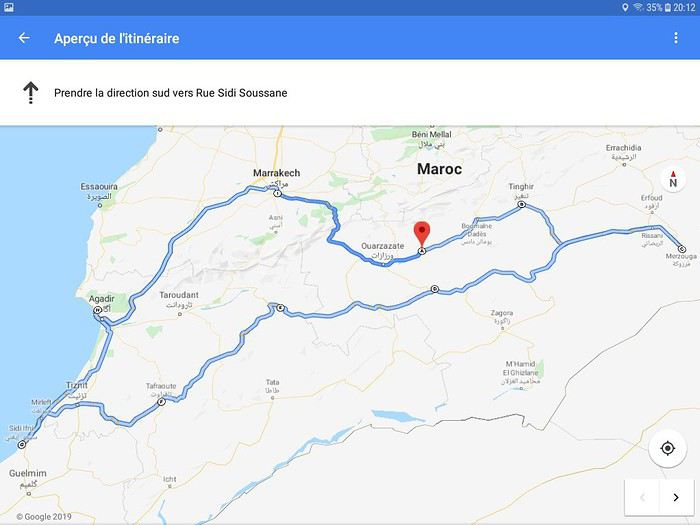
The heavy traffic in Marrakech quickly gave way to smooth driving. As soon as we left the city, it was calm. And right outside the city, we came across shepherds grazing their sheep by the roadside... It’s definitely a surprise at first! But yes... We’re in Morocco... No doubt about it... We’re in the thick of it! As we started gaining altitude, vendors waved at us, offering dried morels. At first, we weren’t sure what they were selling, but we stopped for tea on a terrace to admire the mountain scenery, and they offered us those famous morels again.
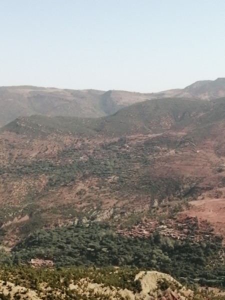
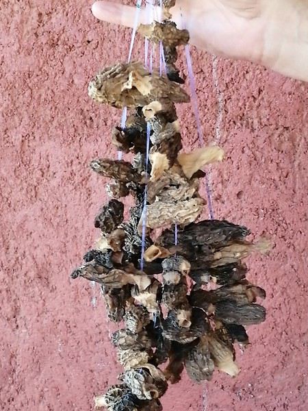
We continued our climb toward Tizi N Tichka... Gigantic valleys stretched out before us. With every turn, we discovered breathtaking landscapes.
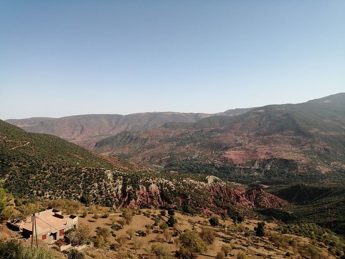
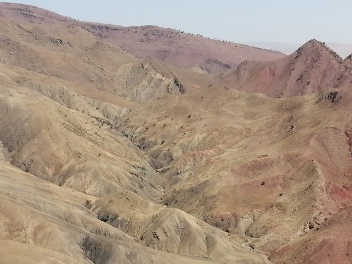
Villages built into the hillsides blended into the earth. It was strikingly simple yet harmonious.
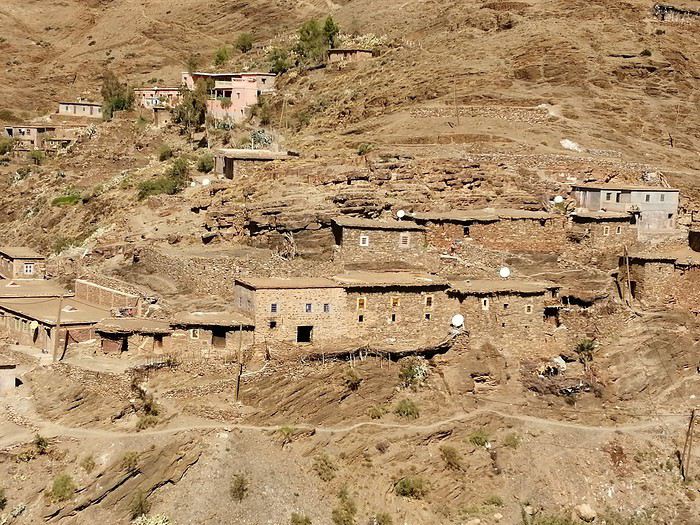
At the top of the pass, 2200m up, we stopped to soak in the moment, the fresh air, and the view.
And we carried on toward Ouarzazate. The road was under construction. Mechanical giants were tackling the mountain. But the mountain was enormous. We were impressed by the scale of the work.
Then, we left the main road to head left toward Telouet... It was stunning. The colors changed. Maybe we felt less overwhelmed by the imposing Atlas. Just a personal impression!
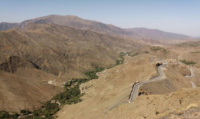
Right after passing through Telouet (maybe we’ll shock history buffs—we didn’t visit the kasbah), we went to see the salt mine. It was unexpected. Salt was everywhere. The stream water wound its way between salt crystals and waterfalls. It was really pretty. And then there was the cave. We had a guide for the visit. Stalactites and stalagmites crisscrossed here and there. At the back of the cave, we saw a small lake surrounded by crystals. It was beautiful.
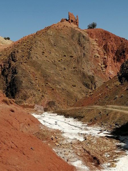
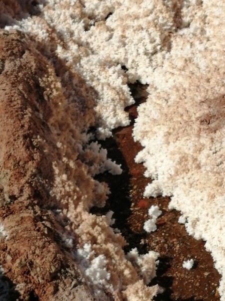
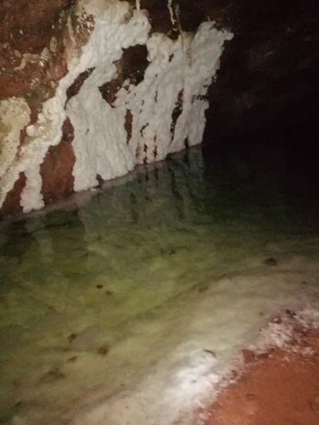
We hit the road again. We drove through stunning landscapes: vast plains for grazing herds, rivers nestled deep in the valleys.
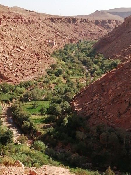
We proudly drove past the ksar Ait Benhaddou without stopping—just long enough to snap a quick photo and keep going so we’d arrive before nightfall.
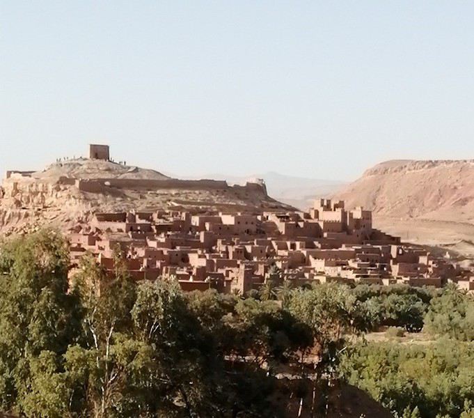
We made a few small purchases in Ouarzazate and headed straight for the Skoura palm grove, where we’d booked three nights at the guesthouse Kasbah La Palmeraie. Mohamed, the owner, welcomed us warmly, and we shared tea with the family. We felt right at home. We were made to feel welcome.
Dinner was a hit—a real Moroccan meal, a sweet-and-savory dish with steamed vermicelli and chicken. Delicious! A great surprise for us—we’d never tried it before.
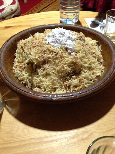
After such a long day that started so early, we were happy to crawl into bed. But we felt like the trip was off to the best possible start.
Until tomorrow, if you’d like!
We planned this trip with the tips we got from this forum, so thank you to everyone who helped us prepare. Thanks to you, we had unforgettable moments.
Here’s our itinerary, which let us see the Atlas Mountains, the oases of the South, the sandy desert, and the Atlantic coast. We landed in Marrakech early in the morning, and our rental car agent was waiting for us at the airport. After sorting out the formalities, we left Marrakech heading toward Ouarzazate.
The heavy traffic in Marrakech quickly gave way to smooth driving. As soon as we left the city, it was calm. And right outside the city, we came across shepherds grazing their sheep by the roadside... It’s definitely a surprise at first! But yes... We’re in Morocco... No doubt about it... We’re in the thick of it! As we started gaining altitude, vendors waved at us, offering dried morels. At first, we weren’t sure what they were selling, but we stopped for tea on a terrace to admire the mountain scenery, and they offered us those famous morels again.
We continued our climb toward Tizi N Tichka... Gigantic valleys stretched out before us. With every turn, we discovered breathtaking landscapes.
Villages built into the hillsides blended into the earth. It was strikingly simple yet harmonious.
At the top of the pass, 2200m up, we stopped to soak in the moment, the fresh air, and the view.
And we carried on toward Ouarzazate. The road was under construction. Mechanical giants were tackling the mountain. But the mountain was enormous. We were impressed by the scale of the work.
Then, we left the main road to head left toward Telouet... It was stunning. The colors changed. Maybe we felt less overwhelmed by the imposing Atlas. Just a personal impression!
Right after passing through Telouet (maybe we’ll shock history buffs—we didn’t visit the kasbah), we went to see the salt mine. It was unexpected. Salt was everywhere. The stream water wound its way between salt crystals and waterfalls. It was really pretty. And then there was the cave. We had a guide for the visit. Stalactites and stalagmites crisscrossed here and there. At the back of the cave, we saw a small lake surrounded by crystals. It was beautiful.
We hit the road again. We drove through stunning landscapes: vast plains for grazing herds, rivers nestled deep in the valleys.
We proudly drove past the ksar Ait Benhaddou without stopping—just long enough to snap a quick photo and keep going so we’d arrive before nightfall.
We made a few small purchases in Ouarzazate and headed straight for the Skoura palm grove, where we’d booked three nights at the guesthouse Kasbah La Palmeraie. Mohamed, the owner, welcomed us warmly, and we shared tea with the family. We felt right at home. We were made to feel welcome.
Dinner was a hit—a real Moroccan meal, a sweet-and-savory dish with steamed vermicelli and chicken. Delicious! A great surprise for us—we’d never tried it before.
After such a long day that started so early, we were happy to crawl into bed. But we felt like the trip was off to the best possible start.
Until tomorrow, if you’d like!