Results for "Massif+Central+déplacer"
About 6,832 results.
More options
Many results are in French, the community’s main language. English translations are added over time.
Search results
Témoignages 1,2,3,4: Le souvenir pour survivre (Cambodge)
Temoingage1 sur l'entrée des khmers rouge à Batambang Modifier | Supprimer | Citer | Répondre
Avril 1975 . Battambang Il est des jours où tout bascule, où un fait presque anodin se révèle d’une importance capitale. Il est des jours qui tuent l’émotion et son expression, il reste alors le souvenir, les souvenirs enfouis, cachés, qu’il faut faire remonter à la surface pour les transformer en mémoire. Il est des jours qui succèdent à des jours qui blessent et qui blessent encore et vous conduisent à une mort lente. Il est des jours qui tuent violemment, un membre de votre famille, un camarade de classe, un ami, un voisin. Il est des soirées où les senteurs de la nature s’imprègnent d’autres odeurs inconnues jusqu’alors, celle de la souffrance d’un peuple et où les bruits familiers des insectes dans les arbres se conjuguent avec les cris de la faim et s’assourdissent dans le silence du désespoir. Ce matin là, je me rendais au lycée comme à l’habitude. J’étais en classe de Terminale Littéraire après avoir échoué, l’année précédente un Baccalauréat Scientifique. La nuit n’avait laissé que peu de place au sommeil ponctué des bombardements et autres tirs de roquettes, auxquels, hélas, nous nous étions habitués et qui se calmaient aux premières lueurs de l’aube. En journée, la vie était presque normale, à l’exception de ces très jeunes enfants que nous voyions mendier dans les rues et des flots de réfugiés qui venaient depuis quelques mois grossir la population de la ville. La ville représentait un espace de sécurité, mais aussi de misère, car ces nouvelles populations avaient fui le théâtre des combats. Combien parmi eux avaient-ils déjà été frappés par la mort d’un proche, la destruction de leur maison ? Ils venaient s’entasser le long de la rivière, bâtissaient des habitats de fortune, connaissaient la malnutrition et attendaient certainement, avec cette patience propre aux asiatiques, des jours meilleurs. Je ne pouvais m’empêcher de penser qu’au delà de mes difficultés, les leurs étaient bien plus grandes. Certes, je n’étais pas au paradis, mais j’habitais dans une maison en parpaing, j’avais un lit que je partageais avec Nat, la bonne de ma tante Sam Saoun et de mon oncle Kheo, je mangeais à ma faim, mais jamais avec le reste de la maisonnée. Mes cousins et cousines, Smakly, Nany, Rithy, Kahna et Raymonaa mangeaient avec Saoun. Kheo, qui était agent des douanes, avait été muté à la frontière vietnamienne, et le seul qui aurait pu contrer les penchants de cette méchante femme, était bien trop loin pour m’aider en quoique ce fut. Si à l’époque j’avais lu « Les misérables » de Victor Hugo, j’aurai pu me surnommer Cosette, mais étant depuis ma naissance habituée aux difficultés, j’avais acquis à la fois la carapace suffisante et la volonté de réussir mes études pour faire face à tous les signes d’in affection que me prodiguait généreusement la tante Saoun.
Je réalisais que j’étais arrivée au centre ville. J’aimais beaucoup la place centrale avec ces arcades qu’animaient les multiples couleurs des objets vendus par les marchands, et ces odeurs qui me rappelaient mon enfance à Phnom Penh, faites de mélange des épices, de poisson séché, des fleurs de lotus que l’on achète en offrande à Bouddha. Je pensais à mon père, E S et par ce jeu incohérent des associations d’idées, je me disais que j’avais eu deux bonheurs dans la période que je venais de vivre. Kheo était revenu sur Battambang et surtout j’avais reçu la photo de ma sœur O en habit de mariée avec L, comme j’aurai aimé être avec eux, ce jour là, en France. Pourquoi m’avait-il fallu échouer, l’année précédente à mon Baccalauréat, pour quelques points ? Je ne pouvais encore imaginer les terribles conséquences qu’auraient pour moi ces quelques points qui m’avaient manqué en science physique.
J’arrivai devant le lycée, nous nous rassemblions dans nos salles de cours, dans l’attente des professeurs qui allaient débuter le travail. Ce matin, l’horloge devait être détraquée, ou le préposé à la cloche malade, ou ….. oubien ….. ou encore …… Mais les professeurs n’étaient pas là …… Malgré notre désir d’apprendre, il valait mieux rentrer chez moi !
De nouveau sur ma bicyclette, je réalisais qu’il y avait peu de circulation, la place centrale s’était vidée, les commerçants avaient fermé leurs stores, seuls restaient quelques marchands ambulants, devant à leurs maigres étals leur survie quotidienne.
J’arrivai sur le pont qui franchit la Sangkae, d’habitude je ne m’arrêtais jamais à cet endroit, connaissant le spectacle de cauchemar qu’il livrait quotidiennement, celui de cadavres humains charriés par les eaux. Trois bonzes munis de perches de bambou, essayaient de ramener un cadavre vers la berge : dans nos croyances, il est fondamental d’incinérer ou enterrer les morts, afin que leurs esprits puissent trouver la paix et le repos nécessaire à la réincarnation future. Ces bonzes faisaient preuve d’un grand courage, car ces corps pouvaient être minés. Nous étions nombreux à regarder, à distance, cette scène. Peut-être était-ce en raison de cette foule agglutinée et silencieuse que je m’étais arrêtée. Je pensais à un film muet que j’avais vu, toute enfant à Phnom Penh. Il s’agissait d’un curieux cinéma, celui actionné par un homme sur bicyclette. Pendant qu’il pédalait, des images défilaient. Curiosité de la pensée humaine qui, face à l’horreur, a cette capacité de penser à un moment de plaisir. A quoi pouvait bien penser toute cette foule silencieuse ? La peur paralysait les mots et expliquait le silence. Surtout ne rien dire, car on ne peut faire confiance à personne et que dire, sans le savoir, imperceptiblement nous nous étions habitués à l’horreur et avec elle, à la suspicion. J’arrivais à la maison, je fus surprise de voir Saoun ; elle aussi ne travaillait donc pas. Aux douanes, tout le personnel avait été renvoyé, Kheo était songeur ; personne ne me demanda d’explication sur ma présence à la maison, en ce début de matinée. Chacun avait le pressentiment diffus qu’une page de la vie était en train de se tourner. C’est Nat, qui revenant du marché qu’elle avait trouvé désert, nous ramena l’information : les khmers rouges sont rentrés dans Battambang. La page était tournée. Nous ne verrions plus les « mouches bleues », c’est ainsi que nous appelions les pilotes de l’armée régulière du général Lon Nol, car ils étaient tout de bleu vêtus. Je n’avais pas pris conscience du grésillement de la radio ; soudain, une voix métallique raisonna dans la maison qui me fit sursauter « Phnom-Penh est tombée aux mains des khmers rouges » et la voix se tut, vite relayée par les cris de joie de Saoun « la guerre est finie, la guerre est finie ». La joie étant communicative, à l’exception de Kheo qui restait songeur, Nat, mes cousins, cousines et moi-même nous étions heureux. Fini le survol incessant de la ville par les B28, ces avions de l’armée officielle qui allaient bombarder les zones rurales proches, fini ces nuits d’angoisse où nous entendions à proximité de nos maisons les échanges de coups de feu, terminé le couvre feu qui depuis plusieurs années nous obligeait à rester à l’intérieur de nos maisons à partir de 18 heures et qui, entravant une partie de notre liberté, entravait aussi beaucoup de nos relations sociales. Saoun avait quitté la pièce où nous étions et revenait dans son plus beau sarong de soie que rehaussait une magnifique paire de tongs en plastique rose, achetée trois jours auparavant sur le marché. «Venez » nous dit-elle. Et sous la chaleur écrasante d’un midi au mois d’avril, nous partîmes à pied vers le centre ville qui était à un kilomètre de notre habitation. Je n’avais jamais vu de foule aussi dense, marchait en souriant dans la même direction, passant sur le pont de la Sangkae, pas un regard vers le fleuve. Je compris à cet instant, que si nous avions enfourché nos vélos, nous n’aurions pu les utiliser bien loin. Enfin, nous les virent, plus précisément nous les devinèrent. D’abord tache noire dans la foule, puis légère tache rouge au dessus de la tache noire. Nous avancions à leur rencontre. Plus nous approchions d’eux et plus Saoun était souriante. Nous découvrions enfin ces hommes et femmes, jeunes pour la plupart, un léger sourire marquant le visage, sur la tête un krama rouge, à l’épaule, un fusil en bandoulière, tout vêtu de noir, leurs pieds étaient nus et une épaisseur de corne leur servait de chaussure. A la vue de ces pieds-nus, Saoun enleva ses tongs, les pris dans ses mains, inclina la tête en signe de salutation et de respect et les offrit à une jeune soldate khmère rouge, qui les prit sans dire mot. Ma tante devait penser que les choses seraient telles qu’elle voudrait qu’elles soient car elle ne remarqua pas l’indifférence qu’avait laissé son geste. Au contraire, elle était maintenant animée d’une toute autre hâte : rentrer à la maison et préparer un repas pour des soldats. Je pensais, sur le retour, à la libération de Paris en 1945 ; ce que je voyais me faisait penser à ce cours d’histoire que j’avais reçu au lycée Monivong, et là encore par association, je pensais à mont père E, à ma sœur O, à l’ensemble de ma famille, M et G, à ma belle-mère Sam Samuon ; comme ils me manquaient ! Je pensais aussi à ma famille adoptive, Sam Saman (maman adoptive) et Sam Santh (papa adoptif), qui étaient à Pursat.
Que se passait-il à Pursat ? Les soldats khmers rouges, comme les avait baptisé le roi Norodom Sihanouk, avaient-ils aussi libéré la ville ? Je ne pouvais avoir de leurs nouvelles, la poste et les télécommunications étaient coupées définitivement depuis un bon trimestre. Papa avait du avoir de mes nouvelles, une longue lettre de quatre pages que j’avais écrite en hâte à l’Alliance Française. A Battambang, je n’avais jamais fréquenté aucun des cinq cinémas de la ville, je consacrais l’argent de poche, que je gagnais le dimanche en tirant une charrette sur laquelle se trouvait un gros bidon que je remplissais d’eau potable et que je détaillais avec un petit bénéfice chez les particuliers, à me payer des cours de français. Tous les jours à midi, Sœur Cécilia animait les cours à l’Alliance Française ; elle s’était prise d’affection pour moi et elle comblait de son mieux le manque de tendresse de ma famille d’hébergement. Elle connaissait mon histoire et peut-être avait-elle le pressentiment du futur. De ce futur, personne ne disait mot ; peut-être est-ce dans notre mentalité d’asiatique que de vivre au jour le jour ? Toujours est-il que quelques semaines auparavant, elle m’envoya un émissaire qui me chercha toute la journée. Par le hasard d’un chassé-croisé, vers 16 heures, j’arrivai donc à l’Alliance Française, sœur Cécilia me dit « les khmers rouges avancent sur Battambang, tous les étrangers doivent partir. Demain nous serons en Thaïlande. Ecris vite à ton père parce qu’après plus personne ne pourra acheminer ton courrier. Je ferai le maximum pour qu’il reçoive ta lettre. Ecris ce que tu veux, la lettre ne sera pas censurée.» Sous le régime du général Lon Nol, tout le courrier était « visité » ; cela ne m’avait pas particulièrement dérangé, car par éducation, les enfants et les jeunes sont tenus à l’écart de toute réflexion d’adultes ; qu’aurai-je pu donc dire ou penser de positif ou de négatif d’un système sur lequel, au bout du compte, je ne connaissais rien. Pendant que Sœur Cécilia préparait ses valises, j’écrivis à mon père : « j’entends les bombardements qui se rapprochent, des fois des roquettes tombent à 50 mètres de chez nous ; nous avons peur. C’est peut-être la dernière fois que j’écris. Je n’ai pas de nouvelles de Pursat. La route est coupée. A l’hôpital, on voit beaucoup de blessés. On ne peut pas continuer les études normalement… je vous embrasse. » Aujourd’hui j’aurai voulu espérer un retour à une vie de paix. Saoun ne devait pas en douter, car aussitôt arrivée, elle troqua son sarong de fête pour son sampot quotidien et prépara dans la plus grande des houles son riz le meilleur avec du poisson séché, qu’elle alla personnellement donner à un groupe de soldats. Je passais la fin de l’après-midi à la maison. Nous entendions des coups de feu sporadiques, tout ne devait pas être complètement fini.
Le lendemain matin, je n’eu même pas l’idée de me rendre au lycée, l’absence des professeurs la veille laissait peu de place à l’espoir qu’ils y fussent ce jour. Un colporteur, marchand de gâteaux, passa comme à l’habitude ; voyant que nous étions acheteurs, il s’arrêta et, en même temps qu’il enveloppait les gâteaux dans un bout de papier, il nous annonça que le marché était fermé. Saoun se renfrogna à cette information, peut-être regrettait-elle déjà sa générosité non coutumière de la veille. Le marché fermé, signifiait qu’il faudrait utiliser les maigres réserves. Nous savions qu’en France, avant la guerre, les familles avaient stocké de l’huile et du sucre ; prenant modèle, toutes les familles, suffisamment riches pour le pouvoir, avaient stocké au Cambodge du riz, un peu de sel et du poisson séché. Déjà à Pursat, dès l’arrivée du général Lon Nol au pouvoir, Sam Saman et Sam Sauth avaient pris cette précaution. Le colporteur nous dit aussi que le Père Blanc avait été exécuté par les khmers rouges, la veille, dans son église. Nous connaissions tous ce père, il était métis franco-cambodgien, il n’avait pas voulu quitter, avec Sœur Cécilia, son pays de naissance. Il était connu pour le bien qu’il faisait et était très aimé de tous et plus particulièrement des plus pauvres. La paix prenait-elle ce visage effrayant que même les religieux qui étaient profondément respectés, toutes religions confondues, dussent la payer au prix de leur vie ? La première victime que je connaissais était comme moi, franco-cambodgienne. Etais-ce pour cela qu’il avait été exécuté ? Que voulaient les khmers rouges ? Devrais-je craindre pour ma vie ? Assise sur les marches qui accédaient au pallier de la maison, j’essayais de me distraire de mes pensées négatives, en regardant l’oie et sa dizaine d’oisons se promener et becqueter comme à l’habitude dans la cour. Rien n’avait modifié ses habitudes. De temps en temps, au claquement sec d’un coup de feu, elle dressait le cou, regardait à droite, à gauche, puis derrière sa couvée grandissante et replongeait vers le sol dans sa conscience immédiate de ne pas être concernée. Mes idées lugubres revenaient, ma seule référence pour essayer de comprendre, était ce seul élève de ma classe qui nous disait d’un ton méprisant que notre lycée n’était pas une véritable école, que ce que nous apprenions ne servait à rien : « L’école, elle doit être dans la nature, les élèves autour de leur maître, assis par terre à l’ombre d’un arbre. L’or, l’argent, les voitures, tout cela ne sert à rien, à part accentuer la misère des paysans. L’école, c’est pour apprendre à planter le riz, les bananiers, les manguiers, les palmiers à sucre. » Kheo avait passé une grande partie de la journée devant la radio qui grésillait, mais n’émettait pas. Vers la fin de l’après-midi, il sortit en nous demandant de rester à l’écoute. Quand il revit, le repas était prêt : une soupe avec de la couenne de porc et du riz au sucre. Ce fut le seul soir, de ces trois années passées avec eux, où nous mangèrent tous ensemble. Le repas fut silencieux. Etait-ce le sentiment diffus, mais grandissant, de notre insécurité qui nous avait enfin réunis ? Fallait-il que les drames existent pour combler les brèches de la vie ? Savions-nous déjà que c’était notre dernier vrai repas, pour longtemps ?
Tôt, le lendemain matin, notre voisin qui était vétérinaire vint informer Kheo que les khmers rouges vidaient la ville et que nous devions partir. Kheo nous intima l’ordre de rassembler nos affaires, de sortir la citerne d’eau de la charrette pour que nous puissions y entasser nos affaires ; il était hors de questions de prendre la voiture car nous ne trouverions certainement pas d’essence. Nous devions prendre l’indispensable. Pour Nat et moi-même, l’indispensable se trouvait sous notre lit commun : la valise avec laquelle j’étais arrivée de Pursat, trois ans plus tôt, m’avait servie d’armoire. Je regardais néanmoins ma valise et vérifiait surtout la présence de la photo de mariée de ma sœur O. Sans savoir pourquoi, je pris la photo et je l’enveloppais dans un sac plastique. La valise à peine refermée, j’entendis Kheo parler dans la cour : « Oui, nous savons que nous devons évacuer la ville, laisse-nous une heure pour rassembler nos affaires. ». Kheo parlementait avec deux soldats khmers rouges qui avaient fait irruption dans la cour. Chacun amena son baluchon dans la charrette. Kheo y accrocha mon vélo pour en faciliter la traction, nous pendions aussi les trois autres vélos et la moto pour que l’un d’entre nous puisse se déplacer rapidement en cas de besoin. Kheo semblait extrêmement prudent et organisé. Certainement savait-il des choses que, nous les jeunes, nous ignorions. Aujourd’hui avec du recul, je ne doute pas de ce fait. La dernière tache accomplie fut de mettre l’oie et les oisillons dans un grand sac ; cela donna lieu à une petite course qui, en temps ordinaire, nous aurait mis en joie, mais l’atmosphère était trop pesante pour que l’un d’entre nous laisse échapper un sourire ou une plaisanterie.
Notre caravane organisée, ce fut le départ, et le début de l’exode…
Temoignage 2 L'exode La rue est déjà envahie par la foule bigarrée et le pont qui traverse la rivière Sangke fait figure d’un immense entonnoir. Je n’ai jamais vu de foule aussi dense, chargée et silencieuse ; faire très attention dans cette marée humaine pour ne pas nous perdre de vue. Comment est-il possible d’organiser en aussi peu de temps, un départ aussi massif ? La rumeur ou la réalité de l’exécution des récalcitrants au départ, produisait-elle, à elle seule, un tel effet, ou bien l’assurance que le retour dans nos maisons n’en serait-il que plus rapide ? Je pousse le vélo qui tracte la charrette, mes cousins poussent les trois vélos et la moto. Nous ignorons où nous allons. Kheo attend peut-être des instructions des khmers rouges. Portés, poussés, je l’ignore nous arrivons sans instructions devant l’hopital qui marque l’endroit où la RN 5 amène le voyageur vers Sisophon, et plus loin la Thaïlande, ou au contraire vers le cœur du Cambodge et la ville de Pursat, étape avant Phnom Penh. Nous nous arrêtons. Toujours aucune instruction ; Kheo veut aller vers Sisophon, sa femme souhaite aller vers Pursat. Le fait d’avoir de la famille dans cette ville, Sam Saman mon père adoptif et Sam Santh, son épouse et sœur de Sam Saoun, semble emporter la décision. Nous sommes sur cette route, au milieu de la foule, nous marchons chacun à notre rythme, mais Kheo nous a demandé de nous regrouper tous les 500 mètres afin d’éviter de nous perdre, ce que nous faisons. Plus je marche, poussant mon vélo et donc la charrette, plus l’angoisse du départ s’estompe. A l’occasion, les marcheurs échangent quelques mots, une plaisanterie, un sourire ; l’épreuve nous réunit pour le moment. L’angoisse s’estompe aussi, car nous savons maintenant où nous allons. Je suis à la joie de retrouver ma famille adoptive. Je revois tous les moments de bonheur que j’ai vécu à Pursat. Peut-être vais-je aussi retrouver mes amies du collège ? Je me souviens de ce taxi, une Peugeot 404 break, sur la toiture duquel Sam Saman avait chargé, trois ans plus tôt, mon vélo et dans lequel je m’étais engouffrée avec ma petite valise afin d’avoir un quart de fesse assise. Sur cette route, nous avions été arrêtées quelques fois par des barrages militaires du général Lon Nol, le chauffeur n’évitait pas les nids de poule, tant la route était défoncée par la mousson et les mortiers. La ligne droite semblait le plus court chemin, les amortisseurs du véhicule avaient rendu l’âme depuis longtemps, mais peu lui importait car il était le passage obligé pour le trajet Batambang-Pursat ; le train ne fonctionnant plus pour cause de guérilla en zone rurale. Les militaires donnaient toujours des conseils de prudence après avoir vérifié les papiers des clients. Mais le chauffeur devait en avoir cure car le trajet d’un centaine de kilomètres, effectué pied au plancher, nous avait demandé la demi journée pour arriver à Batambang. La nuit tombe vite au Cambodge et au dernier de nos regroupements familiaux de la journée, Kheo nous dit « Maintenant, nous restons groupés, nous devons trouver une place pour dormir ». Je n’avais pas encore pensé à cela, pourtant des familles avaient déjà installé des bivouacs de fortune en bordure de la voie. La route est légèrement surélevée par rapport aux rizières qui la bordent ; sur sa partie centrale elle a été empierrée et bitumée ; sur ses bords une largeur de deux mètres environ de terre battue, pas d’autres espaces pour se poser. A cette heure-ci, impossible de continuer la marche plus longtemps, il faut faire fi de la promiscuité et nous nous installons entre deux familles. Kheo va regarder le sac dans lequel nous avons transporté l’oie : elle est en bonne forme et glousse en se libérant la tête de sa cage d’urgence ; deux oisillons, eux, sont morts étouffés. Nous les mangeons ce soir. Misère, Sam Saoun a oublié de prendre les moustiquaires ! « Nakli, prend la moto et va à la maison chercher les moustiquaires, prend aussi le kilo de sucre dans le placard que nous avons oublié », lui dit Kheo. La route était maintenant moins encombrée et il fallut peu de temps pour effectuer la vingtaine de kilomètres aller-retour qui nous séparait de la maison. Il revint avec le sucre, mais pas les moustiquaires et comme Kheo se fâchait, il nous expliqua «Quand je suis arrivé à la maison, j’étais un peu effrayé, il n’y avait personne en ville. J’ai coupé le moteur de la moto avant d’arriver à la maison et je l’ai poussé dans la cour ; j’ai couru sur l’escalier de bois, je suis rentré dans la cuisine et j’ai entendu “Qui va là ?”, j’ai répondu “C’est Nakli” ; “Descend immédiatement !” ; j’ai pris le sucre et je suis descendu. Un soldat khmer rouge pointa son fusil vers moi : “La ville est évacuée, tu n’as rien à faire ici” Il me poussa vers le garage où se trouvait deux autres soldats khmers rouges, ils découpaient les pneus de la Chevrolet . L’un d’eux prit la parole : “Tu as de la chance, remercie ton père, nous aurons de bonnes tongs. Pars immédiatement” » Ce fait nous laissa perplexe. Nous aurions plus facilement compris que cette voiture fut réquisitionnée, mais quelle était donc cette armée de soldats-paysans, cette bande de va-nu-pieds, qui avait mis en déroute l’armée suréquipée du général Lon Nol ? L’absence des moustiquaires créait un malaise au moins aussi profond ; cela voulait dire, dans cette zone de rizières que nous constituerions un met de choix pour des bandes bien organisées de moustiques affamés. Il fut remis au lendemain l’idée de manger les oisillons et nus nous contentèrent d’une poignée de riz déjà cuit à la maison. Demain en marchant, il faudrait penser à ramasser un peu de bois mort, de façon à faire un feu le soir. Cette région est peu boisée, quelques palmiers à sucre et quelques huttes qui abritent les riziculteurs quand la mousson est trop forte, distraient un peu de la monotonie du paysage, surtout à la saison sèche ; période où les diverses couleurs vertes des rizières et les plantes aquatiques, le mouvement nonchalant d’un buffle et le vol bref d’un échassier donne à cette nature un romantisme à nul autre pareil. Dans cette foule, qui comme nous avance sur cette même route et qui comme nous a les mêmes besoins, il ne sera pas aisé de trouver de quoi faire un feu. J’allais me coucher, je prenais dans ma valise un sarong afin de me protéger au mieux de l’attaque attendue des moustiques. Dans le plastique se trouvait la photo de mariage de ma sœur O. Malgré la nuit, je défais le plastique et la devine plus que je la vois. Cette impression me suffit, je la range, je souris, le souvenir pour survivre, je m’endors.
Au réveil Kheo va demander du thé à la famille voisine qui, sur cet aspect, est mieux organisée que nous ; car si le bois pose un problème, l’eau également. En Asie, le thé a toujours été une boisson offerte au voyageur : l’eau bouillie est une garantie de pureté et c’est avec plaisir que cette famille nous donne du thé. Kheo, pour les remercier, leur donne deux carrés de sucre. Sam Sem regarde rajoute deux carrés de sucre à notre boisson et, accompagné de riz, nous voilà nourri pour la journée.
La deuxième journée de marche se passe dans de meilleures conditions. La foule est moins dense et nous ne sommes plus dérangés par les véhicules motorisés qui sont loin devant. Du moins, je le crois, car dès le début de l’après-midi, sur le bord de la route, les premières voitures sont abandonnées faute d’essence ; peut-être pourront-elles servir, ce soir, d’abris à ceux qui avancent moins vite que nous : les vieux et les malades que nous avons eu l’occasion de doubler chemin faisant. A notre rythme, il nous faudra au moins huit jours pour rejoindre Pursat. La marche devient automatique, depuis Batambang nous n’avons vu aucun soldat khmer rouge et si ce n’était quelques mauvais pressentiments, c’est presque contente que j’avançais vers Pursat. Encore aujourd’hui, 35 ans après, je pense avec nostalgie à mon vécu dans cette grosse bourgade. Mon père adoptif, Sam Santh, avait travaillé comme conducteur de train sur la ligne Phnom Penh-Batambang et avait obtenu sa mutation pour Pursat comme chef de dépôt ; quant à moi, j’avais réussi mon examen d’entrée en 6ème : nous étions en 1967. Sam Santh avait fait construire une belle maison en bois sur pilotis, pas très loin de la rivière Stuang. Je connaissais Pursat car j’avais eu l’occasion de me rendre chez ma tante Sam Saoun qui était une femme très gentille. J’adorais jouer avec sa fille Chamroeun qui avait un an de plus que moi . Nos jeux tournaient autour de la rivière ; en saison sèche, des bancs de sable nous donnaient l’impression d’être sur une plage, lorsque nous avions trop chaud, nous nous trempions toutes habillées et nous éclaboussions à qui mieux mieux, alors les rires fusaient, l’insouciance laissée au bonheur de l’eau rafraîchissante sur le corps. En novembre la ville était inondée avec la mousson, la saison de la pêche était venue. Quel plaisir de s’asseoir, une ligne à la main en sachant que bientôt un poisson, fut-il chat, mordrait à l’hameçon et que, bien grillé, le soir nous le mangerions avec délectation. Ce soir, nous mangerions les oisillons, car nous avons trouvé assez de brindilles pour faire le feu. Quand nous nous arrêtons, Kheo fait le feu, je plume les petits volatiles, l’eau bout dans houle, Sam Saoun plonge une pincée de sel, du riz et rajoute les trois oisillons, car un troisième est mort dans la journée. Ce soir, ce sera presque un repas de fête, mais le risque vient du ciel, des nuages annonciateurs de pluie, se distinguent à l’horizon. Kheo trouve une bâche plastique dans la charrette et à cette occasion trois moustiquaires. Ces toiles peuvent protéger trois ou quatre personnes. Nous sommes heureux de les avoir avec nous, mais ce soir nous ne disposons de rien pour les attacher. Au moins, s’il pleut, nous aurons le plastique et moins de moustiques et puis peut-être que ceux qui ont décidés de marcher de nuit pour éviter la chaleur de la journée, s’arrêteront pour s’abriter, car la nuit précédente il fut difficile de trouver le repos, la route étant restée presque aussi animée qu’en journée. Il y eut une courte averse qui suffit, néanmoins, à nous tremper. A l’aube du 3ème jour, le soleil était revenu et nous reprîmes la route. Entre nous, nous parlions peu, il y avait une sorte de conscience en nous qui, s’éveillant, nous laissait croire que notre exil serait de longue durée. Pourquoi devions-nous nous éloigner autant de Battambang ? La rumeur que la ville devait être vidée pour 3 jours, était déjà fausse puisqu’il nous faudrait encore autant pour y revenir. Quelle tristesse de voir ces enfants, à peine en âge de marcher, une gamelle accrochée autour de leur cou de façon à laisser libre de port, leurs petites mains fatiguées ! Quelle tristesse de voir comment à la hâte s’organisait au bord de la route, ce bidonville mobile ; ceux qui marchant de jour prenaient la place laissée libre de ceux qui se déplaçaient la nuit ! Quelle tristesse …. et que se passait-il à Pursat ? Et si Pursat était vidée de ses habitants ? Alors finies la seule motivation heureuse de la marche, la joie de retrouver Sam Saman, Sam Santh et Sam Sophy. Sophy devait avoir 11 ans, elle était arrivée à Pursat, elle aussi adoptée à l’âge de 3 ans, nous étions donc sœurs adoptives et je m’étais occupée d’elle quotidiennement pendant 4 ans avec cet amour que les adolescentes portent aux petits enfants. Peut-être comme moi était-elle sur une route, mieux que moi sur la charrette tirée par des bœufs, assise au sommet de paquetages, regardant Santh prendre le joug pour diriger les bœufs. Santh était maintenant à la retraite, insuffisante pour vivre, de conducteur de trains, il était devenu conducteur de bœufs. Grâce à cet achat, il revendait de canne à sucre, ce qui permettait une vie décente. Saman avait organisé un grand potager autour de la maison, nous avions des concombres, des courgettes, des pastèques, des haricots verts, des patates douces, des piments, nous avions aussi des bananiers, des manguiers et je me régalais à la saison des papayes. Dès notre 2ème année d’installation, je revendais le dimanche notre sur-production et quand je ne vendais pas les légumes, je vendais des tissus que Sokhon, couturière et sœur de Santh, nous amenait de Batambang, quand elle venait nous rendre visite. Je vendais aussi, à la saison, les lotus qui poussaient sur un étang que Santh avait creusé à la pelle, trois mètre de profondeur, ces lotus que les croyants offrent à l’autel du Bouddha. Cet étang, à la saison des pluies, s’alimentait des crues de la rivière et avec elles de poissons. Imaginez les poissons qui viennent chez vous, et les chiens, nous en avions 5, qui aboient lorsqu’ils en aperçoivent un à la surface ! Je me remémorais tout cela lorsque je m’aperçus qu’imperceptiblement nous avions ralenti notre marche. La foule semblait de nouveau un peu plus dense. Nous venions de passer le village de Khaal Thual, les rares échoppes étaient fermées et les espoirs de trouver quelques ravitaillements, éteints. La rumeur circulait que les khmers rouges avaient aboli le riel, cette rumeur semblait folle car comment peut-on échanger les marchandises sans argent ? Il n’est pas dans notre nature de nous inquiéter trop du lendemain, certainement car notre vie est rythmée par le quotidien comme le mouvement d’une horloge et que les difficultés se combattent tous les jours et qu’à chaque jour suffit sa difficulté ; mais aussi car nos vies sont intégrées dans un continuum qui interdit le changement, la rupture, la modification. Là, ce n’était pas une modification mais une révolution. Un peu plus loin, c’était trois soldats khmers rouges qui nous donnaient l’ordre de quitter la RN 5 et de prendre les chemins latéraux en direction des villages. Il en était fini de penser se rendre à Pursat. Il en était fini de penser que dans notre exode nous pourrions aller où nous voulions.
Temoignage 3 Reang Keesei
Le soir, nous arrivons à Reang Keesei. C’est une petite bourgade qu’occupe une trentaine de familles paysannes, mais elle présente une double caractéristique. Elle est le point terminal du chemin que nous avons suivi et elle dispose d’une gare qui nous a attirés nombreux jusqu’à ce village ; mais pour l’instant nous devons installer notre campement. A la recherche d’un emplacement, Kheo rencontre un de ses collèges douaniers, puis un autre qui en avait rencontré un autre qui lui-même en avait rencontré un autre, et l’emplacement trouvé, c’est une partie du corps des douanes de Batambang qui se regroupe avec leur famille respective dans un endroit qui, ma foi, en vaut un autre et a le mérite de n’être ni trop loin pour s’y rendre, ni trop près pour les odeurs prévisibles d’une bambouseraie. Je ne peux vous dire combien nous étions d’exilés à Reang Keesei, mais j’ai le souvenir d’une grande foule. Notre campement de fortune installé, Kheo a trouvé de la ficelle pour tendre et fixer les moustiquaires, il s’éloigne de nous. Tante Saoun choisit ce moment pour distribuer le riz. Je n’ignore pas ce que cela signifie pour moi : j’en aurais deux fois moins que les autres ; c’est le sort qu’elle réserve à la “noiraude”. Elle m’appelle comme cela. Je dois la couleur noire de ma peau à mon père d’origine guyanaise. En Asie, la noirceur de peau évoque le travail dans les champs, la pauvreté ; la blancheur est synonyme de richesse, de bon statut social. Autant de choses que les khmers rouges, j’aurai l’occasion de la découvrir, haïssaient. Mais pour l’instant, je n’avais aucune idée de ce que l’avenir réservait ; j’avais seulement cru comprendre que la ligne de chemin de fer représentait pour beaucoup un espoir, bien qu’elle fut hors service depuis longtemps déjà. Mais après tout, puisque la paix semblait revenue, avec elle, les trains pourraient circuler et nous en prendrions un pour revenir à Battambang, chez nous. Dès huit jours que nous passâmes à Reang Keesei, je vis des étudiants qui pensaient que la libération viendrait du train ; ils imaginaient des convois de blindés, des militaires en nombre venant de la région de Phnom Penh, d’autres imaginaient la même chose mais venant de Thaïlande via Sisophon. Je pense que chacun connaissait le degré de folie qu’impliquait la croyance en quelque chose de pareil et seule l’excitation d’être tout proche d’un lieu de moyen de transport évoquant le déplacement et par extension la liberté, autorisait ces délires d’espoir qui ne durèrent d’ailleurs que le temps d’une brève expression vite interrompue par la peur que faisait régner une suspicion généralisée. Cette méfiance n’était pas liée à notre relative promiscuité avec les paysans de Rang Keesei ; ceux-ci étaient certainement de braves gens. En cette saison, les riziculteurs travaillaient autour de leurs maisons et ils étaient toujours là, disposés à nous prêter une pelle ou une bêche qui nous servait de binette, de façon à ce que nous puissions enterrer nos excréments dans la bambouseraie. Isoloir naturel, mais imparfait, auquel je n’osais me rendre en journée par pudeur et la nuit par peur des insectes et autres serpents nuisibles. Nos journées étaient occupées par la recherche bois mort et de brindilles pour faire bouillir et cuire nos maigres rations de riz qui n cessaient de diminuer. Les derniers oisons et l’oie avaient été mangés et pendant que nous cherchions sur les étroits murets de pierre de quoi alimenter le feu, Khan, à l’instar des autres chefs de famille, passait ses journées à la recherche de quelque chose qui nous manquait. Dès le premier soir, il avait trouvé de la ficelle et un peu avant la fin de notre séjour, nous le vîmes arriver un après-midi, la figure rayonnante d’un plaisir que je n’avais pas le souvenir de connaître. De son Krama, qu’il tenait en paquet à la main, il sortit, tel un magicien, une pièce de cochon pesant bien trois kilos et peut-être plus. Avec ses amis des douanes, car tout le monde avait un morceau, ils avaient dû troquer un porc puisque l’argent n’existait plus. N’étant pas dans mon rôle et mon statut de poser des questions, j’ignore ce que fut l’objet du troc, mais j’eu l’occasion de voir troquer tout objet de petite ou grosse valeur, prouvant qu’il ait eu des origines urbaines. Les paysans sous le régime du général Lon Nol, qui avait chassé le roi Norodom Sihanouk, n’avaient pas vu leur situation changer, ils étaient autosuffisants alimentairement mais ne pouvaient s’acheter des sandales, des sarongs, des chemises telles que celles que portaient les gens de la ville. Aussi tout objet en provenance des cités, suscitait le désir et puisqu’il n’y avait plus de monnaie, le troc semblait bien naturel. Ces paysans vivaient comme autrefois, avant la colonisation ; les maisons sur pilotis en bois ainsi que la culture du riz et un petit élevage préservaient le mode de vie traditionnel. Je me rappelais que Santh m’avait expliqué le travail des français au Cambodge, les routes, mais surtout l’urbanisme. Les français avaient construit les villes à leur manière, déstructurant les us et coutumes locaux et seule la campagne m’évoquait l’image des villes anciennes : un habitat linéaire, en hauteur, au bord d’un cours d’eau. Les français avaient conçu des centres villes, ils se constituaient autour d’un marché couvert qu’encerclaient des maisons de brique. Au rez de chaussée, se trouvait un compartiment, lieu de stockage des marchandises que protégeait une avancée, soutenue par des piliers, qui était passage et espace de vente ; au dessus, une ou deux pièces servant à ces populations de marchands qui, pour la plupart, étaient d’origine chinoise, tant il est difficile au cambodgien de quitter sa vie d’oiseau perché. Derrière, un lopin de terre permettait la culture d’un potager. Aux chinois se mélangeaient aussi des vietnamiens et quelques indiens, tous avaient fait souche depuis longtemps et malgré les mariages ethniques, certaines communautés, depuis l’indépendance, faisaient face à des répressions régulières que devaient susciter certainement la jalousie et des questions de pouvoir. Il restait chez beaucoup des gens des villes une certaine nostalgie de la sécurité qu’avait apportée la période coloniale, même si nous étions fiers de l’indépendance obtenue et de la culture khmère qui constituait autour des temples d’Angkor, le ciment de notre identité. Je me rappelai qu’un jour, en plaisantant, Kheo m’avait dit : « Regarde nos villes, tu vois la France …. les français ont construit leurs bastides. » J’ignorais que ce qu’était une bastide, mais à Reang Keesi, je prenais conscience de ce qu’était la vie paysanne, traditionnelle certes, rythmée par les levers et couchers du soleil et les pluies de la mousson. Les paysans reproduisaient les gestes devenus pour eux coutumiers, que faisaient leurs parents, leurs grands-parents et toute la lignée de leurs ancêtres, pourtant le visage de certains traduisait une certaine anxiété. Je découvris, fortuitement, le long de ce séjour à Reang Keesei qu’elle en était la cause, le jour même où Kheo ramena le morceau de cochon ; sa femme lui demanda de trouver du piment, le paysan à qui il l’avait troqué lui en céderait certainement un ou deux. Kheo me surprit lorsqu’il me demanda de l’accompagner. En brave homme peut-être voulait-il s’assurer qu’ainsi ma tante ne trouverait pas quelque stratagème pour m’éloigner de ce repas agrémenté. Nous avions tous besoin de prendre quelques forces. Arrivés chez le villageois et après les salutations traditionnelles, Khéo dit « Je te remercie, en mon nom et pour toute ma famille de nous avoir cédé le cochon ; ma femme m’a chargé de te demander, si tu ne pourrais pas nous céder un petit piment rouge et je te propose de te rendre le service que tu veux en échange. » Le paysan lui répondit qu’il pouvait lui donner une poignée de piments et que son souhait le plus cher était de savoir ce qui se passait à Batambang. Pourquoi cette foule était arrivée jusqu’à Reang Keesei ? Les deux hommes rentrèrent dans la maison, s’assirent sur une natte et Kheo commença à raconter. J’étais restée sur le seuil, mais la conversation m’arrivait aussi audible que si j’avais été dans la pièce, bien que celle-ci se fût tenue à voix basse. La femme du paysan leur prépara du thé et la conversation dura longtemps : « Tu vois Khan, je veux savoir car mon fils aîné s’est engagé dans l’armée du général Lon Nol et les khmers rouges sont venus, il y a 6 mois au village et ils ont demandé à tous les chefs de famille de leur donner un fils de plus de 12 ans. Ils nous ont dit que c’était notre contribution à la révolution et notre libération ; comme nous ne comprenions pas ce que cela voulait dire et que nous préférions garder nos enfants, leur chef est devenu fou de rage ! Il nous a traité de valet de l’impérialisme, de suppôt de la C.I.A. ; comme nous ne comprenions toujours pas, il nous a menacé d’exécuter nos enfants “car s’ils ne sont pas pour les khmers rouges, ils sont contre”. Il a pris un jeune garçon, l’a mis à genou puis a sorti un revolver et lui a mis sur la tête : “cela au moins vous le comprendrez ”. Nous avons compris que nous n’avions pas le choix et nos enfants sont partis avec la petite troupe. Les familles dont les garçons étaient trop jeunes durent donner du riz, des volailles et nu cochon que les khmers rouges ont embarqué dans des charrettes tiraient par les bœufs. » Je comprenais mieux cette anxiété des paysans qui avaient perdu leur enfant, souvent leur aîné, pour aller vers des combats qui leur étaient incompréhensibles. Dans les mêmes familles, certains se battaient d’un côté et les autres en face ; et tout cela par la nécessité de la survie. Kheo me surprit lorsqu’il dit au paysan « J’ai déjà entendu parler d’histoires analogues ; il paraît que ces jeunes ont un apprentissage militaire et qu’on leur bourre le crâne de politique. Depuis le 18 mars 1970, il s’est passé beaucoup de choses. Le roi Norodom Sihanouk s’est allié aux khmers rouges et ceux-ci aux nord-vietnamiens ; dès qu’un secteur est libéré, la population est “éduquée” puis “armée”. Le général Lon Nol a fait appel aux américains et aux sud-vietnamiens. Il y a un mois Saigon est tombée aux mains des viets, d’Ho Chi Minh, et les khmers rouges tiennent maintenant tout le Cambodge. J’espère que tes fils n’ont pas été tués dans les combats et que tu les reverras bientôt. » Kheo revint vers moi. Il était plongé dans ses pensées. Il devait en savoir beaucoup plus, mais perdu dans ses réflexions il murmurait « tant de morts, tant de morts, tant de morts ». Ce fut l’unique fois où j’entendis parler Kheo de la libération. Les morceaux de cochon découpés selon ses instructions, les piments pilés, le feu en émoi, nous regardions la cuisson dans le wak. Kheo, si peu bavard, rassemble la famille autour de cette joie et, comme si la parole appelle la parole, il nous dit « Je vais vous raconter l’histoire de Batambang ». Voulait-il que notre joie soit complète ? Laisser une trace de notre culture ? Avait-il l’intuition que la révolution khmère rouge allait tout balayer ? Ou bien sa manière à lui d’en appeler aux esprits de nos ancêtres pour leur demander protection ? Aujourd’hui, plus simplement, je me demande si ce n’était pas une allégorie. Autant que je me souvienne, il s’agit de l’histoire d’un bûcheron qui trouve un bâton (dambang) magique. Doté de la force de ce bâton, il renverse la dynastie du roi Chakrapoat et règne sur l’empire khmer sous le nom de sa majesté Dambang Khrânhong. Khrânhong était la région où il avait trouvé le bâton. Il régna durant 7 ans sans aucun problème, lorsqu’un sage lui fit savoir que le ciel indiquait la fin de son royaume. Une femme était enceinte de son successeur. Le roi effrayé de la prédiction ordonna de brûler toutes les femmes enceintes. Pendant que les corps étaient incinérés par les soldats, le ventre de l’une d’entre elle s’ouvrit et un bébé en tomba. Bien que brûlé des jambes et des bras, mais n’étant pas mort, les soldats le prirent et cachèrent dans une touffe de rotin. Le soir, le moine chef de pagode vint bénir les corps et les soldats lui remirent l’enfant pour qu’il s’en occupe. Il le soigna, l’alimenta, l’éduqua, lui transmit tout ce qu’il savait. Il fut appelé Prom Kel car il ne pouvait se déplacer normalement et le faisait sur son séant. Le roi eut un nouveau présage que le devin interpréta. L’homme “porteur de mérite est né”, il est plus puissant que toi et dans 7 jours il viendra sur un cheval blanc et règnera. Le peuple ayant eu connaissance de la prédiction se mit en route vers Angkor Wat, siège du royaume. Parmi eux se trouvait Prom Kel, vite dépassé par la foule, il faisait néanmoins des efforts pour continuer son chemin. Pendant que Kheo parlait, je ne pouvais m’empêcher de revoir au travers de sa narration, tout ce que nous venions de vivre les jours derniers. Ces foules sur la route, nos fatigues, ces moines sortant les cadavres de la Sangkae. Aussi lorsque, exténué Prom Kel s’arrête sur la route pour se reposer, il faut comme dans la “Comedia del Arte” un “Deus ex machina” pour arracher mon écoute à l’engourdissement qui m’envahit. Un vieil homme tirant un cheval blanc, et je vois alors un train blanc, portant un paquet de riz, de l’eau dans une tige tubulaire de bambou et un baluchon de vêtements s’arrête à hauteur de Prom Kel et lui demande de garder cela quelques instants, le temps d’aller dans la forêt pour …….comme nous allions dans la bambouseraie. Prom Kel lui signale son état, aussi le vieillard s’attache la bride du cheval au bras droit déformé. Après quelques hennissements, le cheval s’enfuit au galop et le bras droit du Prom Kel redevient normal. Le cheval s’arrête et Prom Kel a l’idée avec son bras valide d’attacher son bras gauche et le résultat est identique, puis c’est le tour des jambes. Tout est redevenu normal, l’homme ne revenant pas, il mange le riz au goût très savoureux, boit l’eau et trouve dans le baluchon de très beaux habits ; il les met, monte sur le cheval blanc qui lui obéit facilement et s’envole dans le ciel jusqu’à survoler le palais d’Angkor Wat, siège du souverain Dambang Khrânhong. Celui-ci, fou de colère, prit son bâton magique en bois de khrânhong le lança en direction de Prom Kel sans l’atteindre. Cependant, le bâton alla trop loin et disparut dans une forêt que l’on appela ensuite Prei Batambang « forêt du bâton perdu », c’est là que fut construite la ville de Battambang et c’est pourquoi un cheval blanc a figuré sur le drapeau du Cambodge. Car Prom Kel comme l’avait dit la prophétie succéda à Dambang Khrânhong qui s’enfuit au Laos, et voulut rendre hommage à son cheval. Cette nuit, en dormant, je rêvais de mon père E, de sa femme, de ma sœur O, ils montaient eux aussi sur un cheval blanc qui s’envolait dans les airs ; en bas, des hommes en noir, leur jetaient des bâtons sans les atteindre pour autant, le cheval disparut dans la lumière de l’horizon et je me revis agenouillée par terre, cachant mes larmes, dans l’attitude que j’avais eu quelques années plutôt, lors du départ de ma famille.
Le cheval blanc m’avait laissé.
Témoignage4-Départ de Reang Kessei et première installation
Le village est construit le long d’une piste rectiligne, aussi le soldat khmer rouge qui vient nous voir sur son vélo, a du repérer notre groupe depuis un bon moment. Il s’adresse à Kheo « Vous devez rester ici, les déplacements sont pour l’instant interdits » « Où devons-nous rester ? » « Vous devez trouver un emplacement pour construire votre maison, du côté droit de la route ; le côté gauche est réservé au peuple ancien (les paysans) » Il semble qu’il y ait eu une diversité d’interprétation de ce concept “peuple ancien”. Si il n’eut pas son fusil, le soldat aurait semblé sympathique, il nous explique « les paysans vous laissent le côté droit, ils habitent tous du côté gauche. L’heure du partage est venue au Cambodge, si vous étiez arrivés il y a quelques jours, vous auriez pu occuper l’une de ces maisons » Il joint le geste à la parole et en suivant le mouvement de son bras, nous voyons quelques petites maisons que séparent des monticules de planches. Ces planches appartenaient à des maisons plus importantes qui ont été volontairement détruites. Il désigne un monticule en nous disant : « Vous pouvez prendre ce qui vous sera utile », puis il regarde Kheo « Tu n’auras plus besoin de ta montre, donne-la moi » Kheo s’exécute et je pense que les khmers rouges ont une conception bien particulière du partage. Kheo repère un emplacement et les trois jours qui suivirent sont occupés par la construction de la maison. Il s’agissait d’une seule pièce de quinze mètres carrés environ, à même le sol. Nous portons une attention particulière à la réparation de la toiture végétale sachant que la saison des pluies arrive ; la seule ouverture est la porte qui nous permet de rentrer dans notre cabane. Lorsque nous dormons, toute la surface du sol est occupée. Ce ne sont pas les fumées de la cuisine qui nous gêneraient, car notre stock de riz diminue de jour en jour. Kheo, Navy et moi-même partons dans la campagne à la recherche des liserons d’eau qui viendront compléter, une fois bouillis, notre assiette de riz. Kheo se fâche régulièrement contre le reste de la famille qui ne participe d’aucune manière à cette activité et aussi contre Saoun qui me donne toujours moins qu’aux autres. De temps à autre, nous obtenons d’un villageois un légume. Ils ont reçu l’ordre de partager et ne peuvent s’y soustraire totalement. Eux aussi commencent à subir les effets de la malnutrition, même si, plus habitués à la vie dans la rizière, ils arrivent à capturer avec leurs nasses quelques petits poissons et autres rats des champs. Il arrive que nous passions devant la maison qu’occupent les soldats, assis sur la marche de l’escalier conduisant au pallier, la mitraillette négligeamment posée comme si elle fut une simple cane à pêche, à côté d’une bassine d’eau chaude ; nous en voyons un plumer un poulet ou un canard, d’autres fois c’est une odeur et nous nous mettons à saliver pendant que nos intestins, agissant comme une mémoire, se mettent dans des mouvements douloureux et crient dans des gargouillis que seuls, nous pouvons entendre leurs revendications et leurs besoins. Rapidement, il devient insupportable de passer devant cette maison. Nat la servante, ne fait plus partie du groupe : les khmers rouges ont appris quelles étaient ses fonctions dans notre famille, lorsque nous vivions à Batambang. Cela est ressenti par chacun d’entre nous comme un mauvais présage et une déchirure ; mais nous espérons pour elle que sa condition d’origine se transformera en privilège aux yeux des khmers rouges. Les jours ressemblent aux jours et très rapidement je perds la notion du temps. Les soldats khmers que nous avons vus les premiers jours ont laissé place à d’autres qui nous ont dérobé le reste de nos montres ainsi que nos vélos et la carriole. Il aurait été vain de les cacher, nous en avons la preuve, car nos plus proches voisins, qui avaient la chance d’avoir une véritable maison sur pilotis, ont pris soin de démonter leur unique vélo et ont caché les pièces en divers endroits de leur habitat, notamment sous le plancher ; mais dès la première roue trouvée par les soldats, ils n’eurent d’autre empressement que de restituer la bicyclette dans son intégralité. L’instinct de survie dicte à chacun d’entre nous, la nécessité d’une obéissance absolue et nous nous demandons qu’elle sera la sanction que subira cette famille. Le lendemain, nous découvrons les visages de nouveaux soldats, ceux de la veille n’ont du rien dire concernant la famille de nos voisins, certainement pour des raisons qui doivent concerner leurs propres intérêts, car il n’arriva rien de particulier à cette famille. Nous avançons dans la saison des pluies ; mes journées sont toutes occupées par la cueillette des liserons d’eau. Nous parlons de moins en moins entre nous. Que pourrions-nous nous dire ? Nous ne savons rien de ce qui se passe hors du village, nous ne vivons que la faim, la peur, la suspicion. Les rares paroles sont les plaintes des membres de la famille qui leur servent de justification à ne pas aller comme nous le faisons Kheo, Nakly et moi-même, à la recherche de nourriture dans les rizières « Nous avons faim, nous n’avons plus de force, nous avons mal au ventre ». La rizière devient presque un espace de liberté dans le silence et il nous arrive de nous éloigner assez loin des villages, de sorte que nous commençons à bien connaître le secteur. J’ignore à ce moment, qu’un jour cette connaissance du terrain nous servirait. De retour à la cabane, je vis dans mes souvenirs, dans mon passé avec le sentiment de ne pas avoir de présent. La situation, plus encore que les khmers rouges, même s’ils en sont les responsables, a balayé cette capacité que nous avons, nous les asiatiques, de vivre au jour le jour. Chaque soir avant de m’endormir, je regarde la photographie : elle représente le bonheur et le seul lien possible entre mon passé, mon présent et me donne l’espoir d’un futur. Cette photo, se charge d’une fonction rituelle, presque mystique, que vient relayer une prière. Alors que j’allais, dans le village, à la recherche d’un peu de sel, une jeune fille me fait signe de venir vers elle. Elle doit avoir à près mon âge et me sourit : « Je m’appelle Xieng Kuaong, tu peux avoir confiance en moi ; je me souviens de toi et depuis quelques semaines je te regarde. Tu es une fille bien et honnête, je t’ai croisé plusieurs fois lorsque tu allais voir sœur Cécile, rentre » Pendant que j’entre, j’observe Xieng qui soulève une couverture cachant un gros livre. Elle me demande si je le connais et ce n’est pas le cas « C’est normal, rajoute-t-elle, sœur Cécile n’évangélisait pas. Excuse-moi, sœur Cécile t’apprenait le français, mais pas la religion. Ce livre est une Bible. Sa lecture me soutient et me donne du bonheur. Je sais que les khmers rouges ont tué mon père, mais maintenant il est bien au royaume des cieux avec les justes assis à la droite de Dieu. » Je ne comprenais rien, mais Xieng, par sa force, son rayonnement, me captivait : «Ecoute » me dit-elle, « nous n’avons pas beaucoup de temps, je vais t’apprendre une prière et chaque fois que tu en auras besoin, tu la réciteras : notre père qui êtes aux cieux, que votre nom soit sanctifié, que votre règne arrive, que votre volonté soit faite sur la terre comme au ciel, donnez-nous notre pays quotidien, pardonnez-nous nos offenses comme nous pardonnons à ceux qui nous ont offensés et délivre-nous du mal, amen. » Xieng vérifia que j’avais bien appris la prière et me dit tout en cachant à nouveau le livre « Pars vite maintenant, nous sommes observées en permanence et surtout n’oublie pas le signe de croix que je t’ai appris.» Je rentre à la cabane avec un sentiment de joie et sans peur. Nakly a pu se procurer trois grains de sel et avant de me coucher, tout en regardant la photo, je récite pour première fois le “Notre père”. Le lendemain, bien décidée à en savoir plus, je me rends chez Xieng Kruol ; sa maman m’accueille avec le sourire et me dit qu’elle se réjouit de l’initiative de sa fille à mon égard. Elle m’invite à rentrer, mais après les salutations d’usage, que nous effectuons les jointes, doigts vers le ciel à hauteur du thorax, les yeux dans les yeux, et alors que Xieng vient de sortir la Bible de sa cache, un soldat khmer rouge fait irruption dans la pièce en criant : « Femmes, que faites-vous contre l’Angkar ? » C’est la première fois que j’entends ce mot. « Que tentez-vous de cacher ? Qu’avez-vous dans vos mains derrière le dos ? » Est-ce le courage inné de Xingu, son sens de l’à-propos, ou bien une force surnaturelle que lui donne son Dieu, c’est sans la moindre hésitation qu’elle répond : « Grand frère, nous ne complotons pas, je montre un livre que j’ai trouvé hier sous les planches à la sortie du village ; j’ai pensé que cela pourrait nous aider à faire du feu » Tout cela est dit avec le plus charmant des sourires et le soldat retrouve son calme : « Si c’est cela, donne-le moi, je n’ai plus de papier pour rouler mes cigarettes. » Le livre en main, il arrache une feuille, s’assoit sur le perron et entreprend de se rouler une cigarette. La Bible, bien qu’écrite en cambodgien, ne lui a rien évoqué, visiblement il ne sait pas lire, mais que se passera-t-il si un soldat ou leur commandant découvre l’existence de ce livre religieux ? Je vécus quelques jours dans cette angoisse, mais le Dieu des chrétiens doit avoir fait un miracle, car nous n’entendîmes plus jamais parler de ce fait qui aurait pu nous coûter la vie. Je repense à ces deux moines bouddhistes que nous avions vu le premier jour à Reang Keesei et jamais aperçu depuis. De temps en temps, nous prenons conscience qu’une tête connue manque au paysage et comme des rumeurs de massacre commencent à se répandre et qu’elles ne sont pas démenties par les soldats, nous commençons à craindre pour la vie de ces personnes disparues, ainsi que pour la nôtre. Il en est ainsi de l’existence, malgré les difficultés nous tenons à la vie. Nos croyances en la réincarnation s’estompent et avant de rejoindre l’esprit de nos ancêtres, nous souhaitons vivre le plus longtemps possible sur cette terre où nous savons n’être que de passage . Je me revois, enfant, j’étais en classe de 10e à Phnom Penh, lorsque je fus pour la première fois confrontée à la mort. Notre école était située à côté du Wat Tenk Loak (le temple de l’eau trouble), il s’appelait ainsi tant la zone était marécageuse. A côté du Wat se trouvait le crématoire du quartier et lorsque la mort n’avait pas de raison connue, on supposait qu’elle pouvait être d’origine virale, aussi à l’occasion de la crémation, nos maîtres (moines ?) nous demandaient de rentrer chez nous. Notre approche de la mort était donc plutôt joyeuse, car je ne connais pas d’enfants au monde pour qui une journée inattendue de liberté, ne soit pas un plaisir immense. Hélas, un jour cette vision change, le jour où la mort ne frappe plus un inconnu, qui par nature ne nous manquera jamais dans la vie. Son nom, je l’ai oublié, mais c’était un camarade de classe de Sophon. Ensemble devant notre maison, ils jouaient aux billes. Il arrivait que Sophon conclut d’interminables parties en vainqueur ; je le voyais à son sourire et à ses poches de culotte pleines de billes multicolores. Il arrivait aussi le contraire, en rentrant les mains dans les poches, il cherchait à cacher la défaite. Je m’amusais de le voir faire et je savais que cela ne se produirait plus. Avec Saman Santh et Sophon, nous nous rendîmes au crématoire pour dire un dernier adieu à cet ami. Il était très bien habillé, dans une boite. Santh me dit que c’était un cercueil ; la famille déposait des fleurs et des bâtons d’encens au pied du bûcher ; un bonze prit la parole et bien que petite, je me souviens : « Il y a une porte d’entrée et une porte de sortie dans la vie, nous appelons la première la naissance et la seconde la mort, mais toute porte signifie un passage, la mort est donc un passage, la naissance est un passage et la vie en est un aussi. » Comme j’interrogeais Santh sur le sens de cette phrase, il m’avait répondu : « Dans le bouddhisme Theravada, nous ne prétendons pas savoir ce qu’il y a avant la naissance, ou ce qu’il y a après la mort. Mais si nous demandions ce qu’est la vie à quelqu’un qui n’est pas né, nous serions aussi stupides de demander ce qu’est la mort à quelqu’un qui ne peut plus nous parler puisqu’il n’est plus en vie. Nous pensons qu’il existe des manières d’exister différentes …. nous appelons cela l’impermanence ….. mais tu es trop petite pour comprendre. » Santh avait, comme la plupart des garçons cambodgiens, passé un an dans un monastère et il m’apparaissait comme un puits de savoir. Hélas, encore hélas, ces connaissances étaient réservées aux hommes ! Le soir, mon père est venu nous chercher, Sophon et moi. Quelle surprise lorsque j’entendis le klaxon bien connu de la 2 CV. Je me suis jetée à la sortie pour voir mon père descendre de la voiture et il a crié en cambodgien « Viens vite avec Sophon, nous allons au cinéma. » Papa doit être au courant de notre journée et de notre tristesse, car il est totalement inhabituel qu’il vienne à l’improviste. Nous nous rendions chez lui en famille tous les week-end et tous les quinze jours, il emmenait les enfants au cinéma. Les films étaient en français, mais sous-titrés en cambodgien, aussi dès l’instant où je sus lire, je profitais pleinement émerveillée de ces séances dans les salles obscures ou, après une file d’attente interminable, de nombreux sièges se confiaient à notre séant. Au programme du soir, il y avait “Les 3 Mousquetaires” et je dois dire que pendant bien des jours je ne connus pas de meilleur antidote à la tristesse qu’engendre la mort. A la fin du film, nous allions sucer, sur les bords du Mékong, les derniers bonbons à la menthe, que papa avait achetés à l’ouvreuse pendant l’entracte. Quelque que soit la saison, ces ballades nocturnes, sur les quais qui bordent le fleuve, avaient quelque chose qui nous remplissait de bien-être. La vie était tranquille et la ville magnifique. Le palais royal resplendissait de beauté et il était pour nous l’objet d’une halte systématique pendant laquelle je nourrissais toujours le fol espoir d’entrevoir le roi Norodom Sihanouk ou quelqu’un de sa famille. La femme de papa est de sang royal, mais cela, il valait mieux l’oublier dans la période actuelle. Notre identité individuelle devait se dissoudre dans l’identité collective, ne se faire remarquer d’aucune manière nous avait ordonné Kheo. Les pluies commencèrent à se faire plus espacées, notre cabane a fait, grâce à des rafistolages quasi quotidiens, son office d’abri. Une relative froideur revient pendant les nuits et j’ai trouvé quelques repousses de bambou que nous consommons avec un plaisir immense. Sommes-nous en septembre ou en octobre ? Est-il possible que le nouveau pouvoir ait occulté une de nos fêtes les plus importantes, la fête des morts, avec celle du nouvel an que nous avons fêté juste avant l’arrivée des soldats khmers rouges à Battambang ? Vers la mi septembre, c’est pour nous la fête des morts, la fête des ancêtres, puis à cette occasion, nous préparons un bon repas et l’amenons aux bonzes de la pagode. Nous faisons aussi des offrandes, les plus coutumières sont des bougies, des bâtons d’encens, mais on peut également offrir des cahiers, des stylos, des petits objets que nos ancêtres appréciaient particulièrement lorsqu’ils étaient encore en vie. Les moines psalmodient des mantras afin que les cadeaux soient purifié et arrivent bien à nos ancêtres. Outre la mémoire et les marques de respect que nous leur adressons, nous leur demandons de nous aider, de nous protéger et de faire en sorte que notre vie devienne meilleure. A cette occasion, nous préparons des gâteaux de riz. La pensée de ces gâteaux déclencha en moi un fort réflexe salivaire, en même temps, mes intestins se crispèrent et me firent mal. Cette douleur est récurrente, tellement notre alimentation est pauvre. Combien de temps cette situation va-t-elle durer ? Combien de temps pourrons-nous survivre dans de telles conditions ? Je revois ces morceaux de porc gras que nous laissions macérer dans du sel et du poivre et que nous mélangions ensuite à des graines de soja, puis nous les enveloppions dans des feuilles de bananier avant une cuisson à la vapeur ou encore ce gâteau, cuit sur les mêmes principes : en son milieu, de la noix de coco râpée avec du sucre caramélisé et du sésame, que venait entourer de la farine de riz. Toutes mes réflexions me ramènent subitement au réel, la faim est bien présente. Dans le village ou la rizière, il arrive de croiser quelqu’un que nous connaissons de vue et dont nous percevons les changements de traits physiques. Les plus faibles sont marqués, certains n’ont plus que la peau sur les os, tandis que d’autres semblent gonfler imperceptiblement, un esprit malin leur insufflant un peu d’air quotidien comme dans un ballon. Mais un ballon trop gonflé éclate. Nous sommes trop repliés sur notre petit groupe familial pour savoir si nous pourrions dénombrés des décès dans le village. La sécurité passe trop par l’ignorance de l’extérieur, le moral passe par le refus de voir et de savoir qui pourrait sabrer l’espérance folle d’un lendemain meilleur. Je repense à cette “rumeur” dont Kheo s’était fait le porte-parole dans la famille lors de notre arrivée à Rieng Krol : « Il paraîtrait que tous les officiers de l’armée de l’air de Battambang ont été convoqués pour saluer le roi Norodom Sihanouk venu leur rendre visite. Ils se sont rendus comme prévu à l’aéroport, ils ont été regroupés, puis exécutés. » Il avait poursuivi « Je ne comprends pas, cela est contraire à toutes les lois de la guerre. Le roi ne pourrait pas supporter cela. Ce n’est pas possible. Il ne doit pas savoir. Si cette rumeur est vraie, il faut se méfier des barbares qui tuent leurs frères de sang. Notre sécurité implique que nous prenions pour vrai cette information, nous devons vivre dans la peur, c’est la peur qui nous protègera. » Le système semble fonctionner sur le mensonge, ne nous avait-on pas dit que nous quittions Battambang pour quelques jours ? Six mois environ s’étaient écoulés depuis. A part nous avoir chassé de chez nous, puis dépouillé, puis rendu dans un état de misère effroyable, le nouveau régime n’a rien fait de visible pour nous. Cela n’allait pas durer.
Je réalisais que j’étais arrivée au centre ville. J’aimais beaucoup la place centrale avec ces arcades qu’animaient les multiples couleurs des objets vendus par les marchands, et ces odeurs qui me rappelaient mon enfance à Phnom Penh, faites de mélange des épices, de poisson séché, des fleurs de lotus que l’on achète en offrande à Bouddha. Je pensais à mon père, E S et par ce jeu incohérent des associations d’idées, je me disais que j’avais eu deux bonheurs dans la période que je venais de vivre. Kheo était revenu sur Battambang et surtout j’avais reçu la photo de ma sœur O en habit de mariée avec L, comme j’aurai aimé être avec eux, ce jour là, en France. Pourquoi m’avait-il fallu échouer, l’année précédente à mon Baccalauréat, pour quelques points ? Je ne pouvais encore imaginer les terribles conséquences qu’auraient pour moi ces quelques points qui m’avaient manqué en science physique.
J’arrivai devant le lycée, nous nous rassemblions dans nos salles de cours, dans l’attente des professeurs qui allaient débuter le travail. Ce matin, l’horloge devait être détraquée, ou le préposé à la cloche malade, ou ….. oubien ….. ou encore …… Mais les professeurs n’étaient pas là …… Malgré notre désir d’apprendre, il valait mieux rentrer chez moi !
De nouveau sur ma bicyclette, je réalisais qu’il y avait peu de circulation, la place centrale s’était vidée, les commerçants avaient fermé leurs stores, seuls restaient quelques marchands ambulants, devant à leurs maigres étals leur survie quotidienne.
J’arrivai sur le pont qui franchit la Sangkae, d’habitude je ne m’arrêtais jamais à cet endroit, connaissant le spectacle de cauchemar qu’il livrait quotidiennement, celui de cadavres humains charriés par les eaux. Trois bonzes munis de perches de bambou, essayaient de ramener un cadavre vers la berge : dans nos croyances, il est fondamental d’incinérer ou enterrer les morts, afin que leurs esprits puissent trouver la paix et le repos nécessaire à la réincarnation future. Ces bonzes faisaient preuve d’un grand courage, car ces corps pouvaient être minés. Nous étions nombreux à regarder, à distance, cette scène. Peut-être était-ce en raison de cette foule agglutinée et silencieuse que je m’étais arrêtée. Je pensais à un film muet que j’avais vu, toute enfant à Phnom Penh. Il s’agissait d’un curieux cinéma, celui actionné par un homme sur bicyclette. Pendant qu’il pédalait, des images défilaient. Curiosité de la pensée humaine qui, face à l’horreur, a cette capacité de penser à un moment de plaisir. A quoi pouvait bien penser toute cette foule silencieuse ? La peur paralysait les mots et expliquait le silence. Surtout ne rien dire, car on ne peut faire confiance à personne et que dire, sans le savoir, imperceptiblement nous nous étions habitués à l’horreur et avec elle, à la suspicion. J’arrivais à la maison, je fus surprise de voir Saoun ; elle aussi ne travaillait donc pas. Aux douanes, tout le personnel avait été renvoyé, Kheo était songeur ; personne ne me demanda d’explication sur ma présence à la maison, en ce début de matinée. Chacun avait le pressentiment diffus qu’une page de la vie était en train de se tourner. C’est Nat, qui revenant du marché qu’elle avait trouvé désert, nous ramena l’information : les khmers rouges sont rentrés dans Battambang. La page était tournée. Nous ne verrions plus les « mouches bleues », c’est ainsi que nous appelions les pilotes de l’armée régulière du général Lon Nol, car ils étaient tout de bleu vêtus. Je n’avais pas pris conscience du grésillement de la radio ; soudain, une voix métallique raisonna dans la maison qui me fit sursauter « Phnom-Penh est tombée aux mains des khmers rouges » et la voix se tut, vite relayée par les cris de joie de Saoun « la guerre est finie, la guerre est finie ». La joie étant communicative, à l’exception de Kheo qui restait songeur, Nat, mes cousins, cousines et moi-même nous étions heureux. Fini le survol incessant de la ville par les B28, ces avions de l’armée officielle qui allaient bombarder les zones rurales proches, fini ces nuits d’angoisse où nous entendions à proximité de nos maisons les échanges de coups de feu, terminé le couvre feu qui depuis plusieurs années nous obligeait à rester à l’intérieur de nos maisons à partir de 18 heures et qui, entravant une partie de notre liberté, entravait aussi beaucoup de nos relations sociales. Saoun avait quitté la pièce où nous étions et revenait dans son plus beau sarong de soie que rehaussait une magnifique paire de tongs en plastique rose, achetée trois jours auparavant sur le marché. «Venez » nous dit-elle. Et sous la chaleur écrasante d’un midi au mois d’avril, nous partîmes à pied vers le centre ville qui était à un kilomètre de notre habitation. Je n’avais jamais vu de foule aussi dense, marchait en souriant dans la même direction, passant sur le pont de la Sangkae, pas un regard vers le fleuve. Je compris à cet instant, que si nous avions enfourché nos vélos, nous n’aurions pu les utiliser bien loin. Enfin, nous les virent, plus précisément nous les devinèrent. D’abord tache noire dans la foule, puis légère tache rouge au dessus de la tache noire. Nous avancions à leur rencontre. Plus nous approchions d’eux et plus Saoun était souriante. Nous découvrions enfin ces hommes et femmes, jeunes pour la plupart, un léger sourire marquant le visage, sur la tête un krama rouge, à l’épaule, un fusil en bandoulière, tout vêtu de noir, leurs pieds étaient nus et une épaisseur de corne leur servait de chaussure. A la vue de ces pieds-nus, Saoun enleva ses tongs, les pris dans ses mains, inclina la tête en signe de salutation et de respect et les offrit à une jeune soldate khmère rouge, qui les prit sans dire mot. Ma tante devait penser que les choses seraient telles qu’elle voudrait qu’elles soient car elle ne remarqua pas l’indifférence qu’avait laissé son geste. Au contraire, elle était maintenant animée d’une toute autre hâte : rentrer à la maison et préparer un repas pour des soldats. Je pensais, sur le retour, à la libération de Paris en 1945 ; ce que je voyais me faisait penser à ce cours d’histoire que j’avais reçu au lycée Monivong, et là encore par association, je pensais à mont père E, à ma sœur O, à l’ensemble de ma famille, M et G, à ma belle-mère Sam Samuon ; comme ils me manquaient ! Je pensais aussi à ma famille adoptive, Sam Saman (maman adoptive) et Sam Santh (papa adoptif), qui étaient à Pursat.
Que se passait-il à Pursat ? Les soldats khmers rouges, comme les avait baptisé le roi Norodom Sihanouk, avaient-ils aussi libéré la ville ? Je ne pouvais avoir de leurs nouvelles, la poste et les télécommunications étaient coupées définitivement depuis un bon trimestre. Papa avait du avoir de mes nouvelles, une longue lettre de quatre pages que j’avais écrite en hâte à l’Alliance Française. A Battambang, je n’avais jamais fréquenté aucun des cinq cinémas de la ville, je consacrais l’argent de poche, que je gagnais le dimanche en tirant une charrette sur laquelle se trouvait un gros bidon que je remplissais d’eau potable et que je détaillais avec un petit bénéfice chez les particuliers, à me payer des cours de français. Tous les jours à midi, Sœur Cécilia animait les cours à l’Alliance Française ; elle s’était prise d’affection pour moi et elle comblait de son mieux le manque de tendresse de ma famille d’hébergement. Elle connaissait mon histoire et peut-être avait-elle le pressentiment du futur. De ce futur, personne ne disait mot ; peut-être est-ce dans notre mentalité d’asiatique que de vivre au jour le jour ? Toujours est-il que quelques semaines auparavant, elle m’envoya un émissaire qui me chercha toute la journée. Par le hasard d’un chassé-croisé, vers 16 heures, j’arrivai donc à l’Alliance Française, sœur Cécilia me dit « les khmers rouges avancent sur Battambang, tous les étrangers doivent partir. Demain nous serons en Thaïlande. Ecris vite à ton père parce qu’après plus personne ne pourra acheminer ton courrier. Je ferai le maximum pour qu’il reçoive ta lettre. Ecris ce que tu veux, la lettre ne sera pas censurée.» Sous le régime du général Lon Nol, tout le courrier était « visité » ; cela ne m’avait pas particulièrement dérangé, car par éducation, les enfants et les jeunes sont tenus à l’écart de toute réflexion d’adultes ; qu’aurai-je pu donc dire ou penser de positif ou de négatif d’un système sur lequel, au bout du compte, je ne connaissais rien. Pendant que Sœur Cécilia préparait ses valises, j’écrivis à mon père : « j’entends les bombardements qui se rapprochent, des fois des roquettes tombent à 50 mètres de chez nous ; nous avons peur. C’est peut-être la dernière fois que j’écris. Je n’ai pas de nouvelles de Pursat. La route est coupée. A l’hôpital, on voit beaucoup de blessés. On ne peut pas continuer les études normalement… je vous embrasse. » Aujourd’hui j’aurai voulu espérer un retour à une vie de paix. Saoun ne devait pas en douter, car aussitôt arrivée, elle troqua son sarong de fête pour son sampot quotidien et prépara dans la plus grande des houles son riz le meilleur avec du poisson séché, qu’elle alla personnellement donner à un groupe de soldats. Je passais la fin de l’après-midi à la maison. Nous entendions des coups de feu sporadiques, tout ne devait pas être complètement fini.
Le lendemain matin, je n’eu même pas l’idée de me rendre au lycée, l’absence des professeurs la veille laissait peu de place à l’espoir qu’ils y fussent ce jour. Un colporteur, marchand de gâteaux, passa comme à l’habitude ; voyant que nous étions acheteurs, il s’arrêta et, en même temps qu’il enveloppait les gâteaux dans un bout de papier, il nous annonça que le marché était fermé. Saoun se renfrogna à cette information, peut-être regrettait-elle déjà sa générosité non coutumière de la veille. Le marché fermé, signifiait qu’il faudrait utiliser les maigres réserves. Nous savions qu’en France, avant la guerre, les familles avaient stocké de l’huile et du sucre ; prenant modèle, toutes les familles, suffisamment riches pour le pouvoir, avaient stocké au Cambodge du riz, un peu de sel et du poisson séché. Déjà à Pursat, dès l’arrivée du général Lon Nol au pouvoir, Sam Saman et Sam Sauth avaient pris cette précaution. Le colporteur nous dit aussi que le Père Blanc avait été exécuté par les khmers rouges, la veille, dans son église. Nous connaissions tous ce père, il était métis franco-cambodgien, il n’avait pas voulu quitter, avec Sœur Cécilia, son pays de naissance. Il était connu pour le bien qu’il faisait et était très aimé de tous et plus particulièrement des plus pauvres. La paix prenait-elle ce visage effrayant que même les religieux qui étaient profondément respectés, toutes religions confondues, dussent la payer au prix de leur vie ? La première victime que je connaissais était comme moi, franco-cambodgienne. Etais-ce pour cela qu’il avait été exécuté ? Que voulaient les khmers rouges ? Devrais-je craindre pour ma vie ? Assise sur les marches qui accédaient au pallier de la maison, j’essayais de me distraire de mes pensées négatives, en regardant l’oie et sa dizaine d’oisons se promener et becqueter comme à l’habitude dans la cour. Rien n’avait modifié ses habitudes. De temps en temps, au claquement sec d’un coup de feu, elle dressait le cou, regardait à droite, à gauche, puis derrière sa couvée grandissante et replongeait vers le sol dans sa conscience immédiate de ne pas être concernée. Mes idées lugubres revenaient, ma seule référence pour essayer de comprendre, était ce seul élève de ma classe qui nous disait d’un ton méprisant que notre lycée n’était pas une véritable école, que ce que nous apprenions ne servait à rien : « L’école, elle doit être dans la nature, les élèves autour de leur maître, assis par terre à l’ombre d’un arbre. L’or, l’argent, les voitures, tout cela ne sert à rien, à part accentuer la misère des paysans. L’école, c’est pour apprendre à planter le riz, les bananiers, les manguiers, les palmiers à sucre. » Kheo avait passé une grande partie de la journée devant la radio qui grésillait, mais n’émettait pas. Vers la fin de l’après-midi, il sortit en nous demandant de rester à l’écoute. Quand il revit, le repas était prêt : une soupe avec de la couenne de porc et du riz au sucre. Ce fut le seul soir, de ces trois années passées avec eux, où nous mangèrent tous ensemble. Le repas fut silencieux. Etait-ce le sentiment diffus, mais grandissant, de notre insécurité qui nous avait enfin réunis ? Fallait-il que les drames existent pour combler les brèches de la vie ? Savions-nous déjà que c’était notre dernier vrai repas, pour longtemps ?
Tôt, le lendemain matin, notre voisin qui était vétérinaire vint informer Kheo que les khmers rouges vidaient la ville et que nous devions partir. Kheo nous intima l’ordre de rassembler nos affaires, de sortir la citerne d’eau de la charrette pour que nous puissions y entasser nos affaires ; il était hors de questions de prendre la voiture car nous ne trouverions certainement pas d’essence. Nous devions prendre l’indispensable. Pour Nat et moi-même, l’indispensable se trouvait sous notre lit commun : la valise avec laquelle j’étais arrivée de Pursat, trois ans plus tôt, m’avait servie d’armoire. Je regardais néanmoins ma valise et vérifiait surtout la présence de la photo de mariée de ma sœur O. Sans savoir pourquoi, je pris la photo et je l’enveloppais dans un sac plastique. La valise à peine refermée, j’entendis Kheo parler dans la cour : « Oui, nous savons que nous devons évacuer la ville, laisse-nous une heure pour rassembler nos affaires. ». Kheo parlementait avec deux soldats khmers rouges qui avaient fait irruption dans la cour. Chacun amena son baluchon dans la charrette. Kheo y accrocha mon vélo pour en faciliter la traction, nous pendions aussi les trois autres vélos et la moto pour que l’un d’entre nous puisse se déplacer rapidement en cas de besoin. Kheo semblait extrêmement prudent et organisé. Certainement savait-il des choses que, nous les jeunes, nous ignorions. Aujourd’hui avec du recul, je ne doute pas de ce fait. La dernière tache accomplie fut de mettre l’oie et les oisillons dans un grand sac ; cela donna lieu à une petite course qui, en temps ordinaire, nous aurait mis en joie, mais l’atmosphère était trop pesante pour que l’un d’entre nous laisse échapper un sourire ou une plaisanterie.
Notre caravane organisée, ce fut le départ, et le début de l’exode…
Temoignage 2 L'exode La rue est déjà envahie par la foule bigarrée et le pont qui traverse la rivière Sangke fait figure d’un immense entonnoir. Je n’ai jamais vu de foule aussi dense, chargée et silencieuse ; faire très attention dans cette marée humaine pour ne pas nous perdre de vue. Comment est-il possible d’organiser en aussi peu de temps, un départ aussi massif ? La rumeur ou la réalité de l’exécution des récalcitrants au départ, produisait-elle, à elle seule, un tel effet, ou bien l’assurance que le retour dans nos maisons n’en serait-il que plus rapide ? Je pousse le vélo qui tracte la charrette, mes cousins poussent les trois vélos et la moto. Nous ignorons où nous allons. Kheo attend peut-être des instructions des khmers rouges. Portés, poussés, je l’ignore nous arrivons sans instructions devant l’hopital qui marque l’endroit où la RN 5 amène le voyageur vers Sisophon, et plus loin la Thaïlande, ou au contraire vers le cœur du Cambodge et la ville de Pursat, étape avant Phnom Penh. Nous nous arrêtons. Toujours aucune instruction ; Kheo veut aller vers Sisophon, sa femme souhaite aller vers Pursat. Le fait d’avoir de la famille dans cette ville, Sam Saman mon père adoptif et Sam Santh, son épouse et sœur de Sam Saoun, semble emporter la décision. Nous sommes sur cette route, au milieu de la foule, nous marchons chacun à notre rythme, mais Kheo nous a demandé de nous regrouper tous les 500 mètres afin d’éviter de nous perdre, ce que nous faisons. Plus je marche, poussant mon vélo et donc la charrette, plus l’angoisse du départ s’estompe. A l’occasion, les marcheurs échangent quelques mots, une plaisanterie, un sourire ; l’épreuve nous réunit pour le moment. L’angoisse s’estompe aussi, car nous savons maintenant où nous allons. Je suis à la joie de retrouver ma famille adoptive. Je revois tous les moments de bonheur que j’ai vécu à Pursat. Peut-être vais-je aussi retrouver mes amies du collège ? Je me souviens de ce taxi, une Peugeot 404 break, sur la toiture duquel Sam Saman avait chargé, trois ans plus tôt, mon vélo et dans lequel je m’étais engouffrée avec ma petite valise afin d’avoir un quart de fesse assise. Sur cette route, nous avions été arrêtées quelques fois par des barrages militaires du général Lon Nol, le chauffeur n’évitait pas les nids de poule, tant la route était défoncée par la mousson et les mortiers. La ligne droite semblait le plus court chemin, les amortisseurs du véhicule avaient rendu l’âme depuis longtemps, mais peu lui importait car il était le passage obligé pour le trajet Batambang-Pursat ; le train ne fonctionnant plus pour cause de guérilla en zone rurale. Les militaires donnaient toujours des conseils de prudence après avoir vérifié les papiers des clients. Mais le chauffeur devait en avoir cure car le trajet d’un centaine de kilomètres, effectué pied au plancher, nous avait demandé la demi journée pour arriver à Batambang. La nuit tombe vite au Cambodge et au dernier de nos regroupements familiaux de la journée, Kheo nous dit « Maintenant, nous restons groupés, nous devons trouver une place pour dormir ». Je n’avais pas encore pensé à cela, pourtant des familles avaient déjà installé des bivouacs de fortune en bordure de la voie. La route est légèrement surélevée par rapport aux rizières qui la bordent ; sur sa partie centrale elle a été empierrée et bitumée ; sur ses bords une largeur de deux mètres environ de terre battue, pas d’autres espaces pour se poser. A cette heure-ci, impossible de continuer la marche plus longtemps, il faut faire fi de la promiscuité et nous nous installons entre deux familles. Kheo va regarder le sac dans lequel nous avons transporté l’oie : elle est en bonne forme et glousse en se libérant la tête de sa cage d’urgence ; deux oisillons, eux, sont morts étouffés. Nous les mangeons ce soir. Misère, Sam Saoun a oublié de prendre les moustiquaires ! « Nakli, prend la moto et va à la maison chercher les moustiquaires, prend aussi le kilo de sucre dans le placard que nous avons oublié », lui dit Kheo. La route était maintenant moins encombrée et il fallut peu de temps pour effectuer la vingtaine de kilomètres aller-retour qui nous séparait de la maison. Il revint avec le sucre, mais pas les moustiquaires et comme Kheo se fâchait, il nous expliqua «Quand je suis arrivé à la maison, j’étais un peu effrayé, il n’y avait personne en ville. J’ai coupé le moteur de la moto avant d’arriver à la maison et je l’ai poussé dans la cour ; j’ai couru sur l’escalier de bois, je suis rentré dans la cuisine et j’ai entendu “Qui va là ?”, j’ai répondu “C’est Nakli” ; “Descend immédiatement !” ; j’ai pris le sucre et je suis descendu. Un soldat khmer rouge pointa son fusil vers moi : “La ville est évacuée, tu n’as rien à faire ici” Il me poussa vers le garage où se trouvait deux autres soldats khmers rouges, ils découpaient les pneus de la Chevrolet . L’un d’eux prit la parole : “Tu as de la chance, remercie ton père, nous aurons de bonnes tongs. Pars immédiatement” » Ce fait nous laissa perplexe. Nous aurions plus facilement compris que cette voiture fut réquisitionnée, mais quelle était donc cette armée de soldats-paysans, cette bande de va-nu-pieds, qui avait mis en déroute l’armée suréquipée du général Lon Nol ? L’absence des moustiquaires créait un malaise au moins aussi profond ; cela voulait dire, dans cette zone de rizières que nous constituerions un met de choix pour des bandes bien organisées de moustiques affamés. Il fut remis au lendemain l’idée de manger les oisillons et nus nous contentèrent d’une poignée de riz déjà cuit à la maison. Demain en marchant, il faudrait penser à ramasser un peu de bois mort, de façon à faire un feu le soir. Cette région est peu boisée, quelques palmiers à sucre et quelques huttes qui abritent les riziculteurs quand la mousson est trop forte, distraient un peu de la monotonie du paysage, surtout à la saison sèche ; période où les diverses couleurs vertes des rizières et les plantes aquatiques, le mouvement nonchalant d’un buffle et le vol bref d’un échassier donne à cette nature un romantisme à nul autre pareil. Dans cette foule, qui comme nous avance sur cette même route et qui comme nous a les mêmes besoins, il ne sera pas aisé de trouver de quoi faire un feu. J’allais me coucher, je prenais dans ma valise un sarong afin de me protéger au mieux de l’attaque attendue des moustiques. Dans le plastique se trouvait la photo de mariage de ma sœur O. Malgré la nuit, je défais le plastique et la devine plus que je la vois. Cette impression me suffit, je la range, je souris, le souvenir pour survivre, je m’endors.
Au réveil Kheo va demander du thé à la famille voisine qui, sur cet aspect, est mieux organisée que nous ; car si le bois pose un problème, l’eau également. En Asie, le thé a toujours été une boisson offerte au voyageur : l’eau bouillie est une garantie de pureté et c’est avec plaisir que cette famille nous donne du thé. Kheo, pour les remercier, leur donne deux carrés de sucre. Sam Sem regarde rajoute deux carrés de sucre à notre boisson et, accompagné de riz, nous voilà nourri pour la journée.
La deuxième journée de marche se passe dans de meilleures conditions. La foule est moins dense et nous ne sommes plus dérangés par les véhicules motorisés qui sont loin devant. Du moins, je le crois, car dès le début de l’après-midi, sur le bord de la route, les premières voitures sont abandonnées faute d’essence ; peut-être pourront-elles servir, ce soir, d’abris à ceux qui avancent moins vite que nous : les vieux et les malades que nous avons eu l’occasion de doubler chemin faisant. A notre rythme, il nous faudra au moins huit jours pour rejoindre Pursat. La marche devient automatique, depuis Batambang nous n’avons vu aucun soldat khmer rouge et si ce n’était quelques mauvais pressentiments, c’est presque contente que j’avançais vers Pursat. Encore aujourd’hui, 35 ans après, je pense avec nostalgie à mon vécu dans cette grosse bourgade. Mon père adoptif, Sam Santh, avait travaillé comme conducteur de train sur la ligne Phnom Penh-Batambang et avait obtenu sa mutation pour Pursat comme chef de dépôt ; quant à moi, j’avais réussi mon examen d’entrée en 6ème : nous étions en 1967. Sam Santh avait fait construire une belle maison en bois sur pilotis, pas très loin de la rivière Stuang. Je connaissais Pursat car j’avais eu l’occasion de me rendre chez ma tante Sam Saoun qui était une femme très gentille. J’adorais jouer avec sa fille Chamroeun qui avait un an de plus que moi . Nos jeux tournaient autour de la rivière ; en saison sèche, des bancs de sable nous donnaient l’impression d’être sur une plage, lorsque nous avions trop chaud, nous nous trempions toutes habillées et nous éclaboussions à qui mieux mieux, alors les rires fusaient, l’insouciance laissée au bonheur de l’eau rafraîchissante sur le corps. En novembre la ville était inondée avec la mousson, la saison de la pêche était venue. Quel plaisir de s’asseoir, une ligne à la main en sachant que bientôt un poisson, fut-il chat, mordrait à l’hameçon et que, bien grillé, le soir nous le mangerions avec délectation. Ce soir, nous mangerions les oisillons, car nous avons trouvé assez de brindilles pour faire le feu. Quand nous nous arrêtons, Kheo fait le feu, je plume les petits volatiles, l’eau bout dans houle, Sam Saoun plonge une pincée de sel, du riz et rajoute les trois oisillons, car un troisième est mort dans la journée. Ce soir, ce sera presque un repas de fête, mais le risque vient du ciel, des nuages annonciateurs de pluie, se distinguent à l’horizon. Kheo trouve une bâche plastique dans la charrette et à cette occasion trois moustiquaires. Ces toiles peuvent protéger trois ou quatre personnes. Nous sommes heureux de les avoir avec nous, mais ce soir nous ne disposons de rien pour les attacher. Au moins, s’il pleut, nous aurons le plastique et moins de moustiques et puis peut-être que ceux qui ont décidés de marcher de nuit pour éviter la chaleur de la journée, s’arrêteront pour s’abriter, car la nuit précédente il fut difficile de trouver le repos, la route étant restée presque aussi animée qu’en journée. Il y eut une courte averse qui suffit, néanmoins, à nous tremper. A l’aube du 3ème jour, le soleil était revenu et nous reprîmes la route. Entre nous, nous parlions peu, il y avait une sorte de conscience en nous qui, s’éveillant, nous laissait croire que notre exil serait de longue durée. Pourquoi devions-nous nous éloigner autant de Battambang ? La rumeur que la ville devait être vidée pour 3 jours, était déjà fausse puisqu’il nous faudrait encore autant pour y revenir. Quelle tristesse de voir ces enfants, à peine en âge de marcher, une gamelle accrochée autour de leur cou de façon à laisser libre de port, leurs petites mains fatiguées ! Quelle tristesse de voir comment à la hâte s’organisait au bord de la route, ce bidonville mobile ; ceux qui marchant de jour prenaient la place laissée libre de ceux qui se déplaçaient la nuit ! Quelle tristesse …. et que se passait-il à Pursat ? Et si Pursat était vidée de ses habitants ? Alors finies la seule motivation heureuse de la marche, la joie de retrouver Sam Saman, Sam Santh et Sam Sophy. Sophy devait avoir 11 ans, elle était arrivée à Pursat, elle aussi adoptée à l’âge de 3 ans, nous étions donc sœurs adoptives et je m’étais occupée d’elle quotidiennement pendant 4 ans avec cet amour que les adolescentes portent aux petits enfants. Peut-être comme moi était-elle sur une route, mieux que moi sur la charrette tirée par des bœufs, assise au sommet de paquetages, regardant Santh prendre le joug pour diriger les bœufs. Santh était maintenant à la retraite, insuffisante pour vivre, de conducteur de trains, il était devenu conducteur de bœufs. Grâce à cet achat, il revendait de canne à sucre, ce qui permettait une vie décente. Saman avait organisé un grand potager autour de la maison, nous avions des concombres, des courgettes, des pastèques, des haricots verts, des patates douces, des piments, nous avions aussi des bananiers, des manguiers et je me régalais à la saison des papayes. Dès notre 2ème année d’installation, je revendais le dimanche notre sur-production et quand je ne vendais pas les légumes, je vendais des tissus que Sokhon, couturière et sœur de Santh, nous amenait de Batambang, quand elle venait nous rendre visite. Je vendais aussi, à la saison, les lotus qui poussaient sur un étang que Santh avait creusé à la pelle, trois mètre de profondeur, ces lotus que les croyants offrent à l’autel du Bouddha. Cet étang, à la saison des pluies, s’alimentait des crues de la rivière et avec elles de poissons. Imaginez les poissons qui viennent chez vous, et les chiens, nous en avions 5, qui aboient lorsqu’ils en aperçoivent un à la surface ! Je me remémorais tout cela lorsque je m’aperçus qu’imperceptiblement nous avions ralenti notre marche. La foule semblait de nouveau un peu plus dense. Nous venions de passer le village de Khaal Thual, les rares échoppes étaient fermées et les espoirs de trouver quelques ravitaillements, éteints. La rumeur circulait que les khmers rouges avaient aboli le riel, cette rumeur semblait folle car comment peut-on échanger les marchandises sans argent ? Il n’est pas dans notre nature de nous inquiéter trop du lendemain, certainement car notre vie est rythmée par le quotidien comme le mouvement d’une horloge et que les difficultés se combattent tous les jours et qu’à chaque jour suffit sa difficulté ; mais aussi car nos vies sont intégrées dans un continuum qui interdit le changement, la rupture, la modification. Là, ce n’était pas une modification mais une révolution. Un peu plus loin, c’était trois soldats khmers rouges qui nous donnaient l’ordre de quitter la RN 5 et de prendre les chemins latéraux en direction des villages. Il en était fini de penser se rendre à Pursat. Il en était fini de penser que dans notre exode nous pourrions aller où nous voulions.
Temoignage 3 Reang Keesei
Le soir, nous arrivons à Reang Keesei. C’est une petite bourgade qu’occupe une trentaine de familles paysannes, mais elle présente une double caractéristique. Elle est le point terminal du chemin que nous avons suivi et elle dispose d’une gare qui nous a attirés nombreux jusqu’à ce village ; mais pour l’instant nous devons installer notre campement. A la recherche d’un emplacement, Kheo rencontre un de ses collèges douaniers, puis un autre qui en avait rencontré un autre qui lui-même en avait rencontré un autre, et l’emplacement trouvé, c’est une partie du corps des douanes de Batambang qui se regroupe avec leur famille respective dans un endroit qui, ma foi, en vaut un autre et a le mérite de n’être ni trop loin pour s’y rendre, ni trop près pour les odeurs prévisibles d’une bambouseraie. Je ne peux vous dire combien nous étions d’exilés à Reang Keesei, mais j’ai le souvenir d’une grande foule. Notre campement de fortune installé, Kheo a trouvé de la ficelle pour tendre et fixer les moustiquaires, il s’éloigne de nous. Tante Saoun choisit ce moment pour distribuer le riz. Je n’ignore pas ce que cela signifie pour moi : j’en aurais deux fois moins que les autres ; c’est le sort qu’elle réserve à la “noiraude”. Elle m’appelle comme cela. Je dois la couleur noire de ma peau à mon père d’origine guyanaise. En Asie, la noirceur de peau évoque le travail dans les champs, la pauvreté ; la blancheur est synonyme de richesse, de bon statut social. Autant de choses que les khmers rouges, j’aurai l’occasion de la découvrir, haïssaient. Mais pour l’instant, je n’avais aucune idée de ce que l’avenir réservait ; j’avais seulement cru comprendre que la ligne de chemin de fer représentait pour beaucoup un espoir, bien qu’elle fut hors service depuis longtemps déjà. Mais après tout, puisque la paix semblait revenue, avec elle, les trains pourraient circuler et nous en prendrions un pour revenir à Battambang, chez nous. Dès huit jours que nous passâmes à Reang Keesei, je vis des étudiants qui pensaient que la libération viendrait du train ; ils imaginaient des convois de blindés, des militaires en nombre venant de la région de Phnom Penh, d’autres imaginaient la même chose mais venant de Thaïlande via Sisophon. Je pense que chacun connaissait le degré de folie qu’impliquait la croyance en quelque chose de pareil et seule l’excitation d’être tout proche d’un lieu de moyen de transport évoquant le déplacement et par extension la liberté, autorisait ces délires d’espoir qui ne durèrent d’ailleurs que le temps d’une brève expression vite interrompue par la peur que faisait régner une suspicion généralisée. Cette méfiance n’était pas liée à notre relative promiscuité avec les paysans de Rang Keesei ; ceux-ci étaient certainement de braves gens. En cette saison, les riziculteurs travaillaient autour de leurs maisons et ils étaient toujours là, disposés à nous prêter une pelle ou une bêche qui nous servait de binette, de façon à ce que nous puissions enterrer nos excréments dans la bambouseraie. Isoloir naturel, mais imparfait, auquel je n’osais me rendre en journée par pudeur et la nuit par peur des insectes et autres serpents nuisibles. Nos journées étaient occupées par la recherche bois mort et de brindilles pour faire bouillir et cuire nos maigres rations de riz qui n cessaient de diminuer. Les derniers oisons et l’oie avaient été mangés et pendant que nous cherchions sur les étroits murets de pierre de quoi alimenter le feu, Khan, à l’instar des autres chefs de famille, passait ses journées à la recherche de quelque chose qui nous manquait. Dès le premier soir, il avait trouvé de la ficelle et un peu avant la fin de notre séjour, nous le vîmes arriver un après-midi, la figure rayonnante d’un plaisir que je n’avais pas le souvenir de connaître. De son Krama, qu’il tenait en paquet à la main, il sortit, tel un magicien, une pièce de cochon pesant bien trois kilos et peut-être plus. Avec ses amis des douanes, car tout le monde avait un morceau, ils avaient dû troquer un porc puisque l’argent n’existait plus. N’étant pas dans mon rôle et mon statut de poser des questions, j’ignore ce que fut l’objet du troc, mais j’eu l’occasion de voir troquer tout objet de petite ou grosse valeur, prouvant qu’il ait eu des origines urbaines. Les paysans sous le régime du général Lon Nol, qui avait chassé le roi Norodom Sihanouk, n’avaient pas vu leur situation changer, ils étaient autosuffisants alimentairement mais ne pouvaient s’acheter des sandales, des sarongs, des chemises telles que celles que portaient les gens de la ville. Aussi tout objet en provenance des cités, suscitait le désir et puisqu’il n’y avait plus de monnaie, le troc semblait bien naturel. Ces paysans vivaient comme autrefois, avant la colonisation ; les maisons sur pilotis en bois ainsi que la culture du riz et un petit élevage préservaient le mode de vie traditionnel. Je me rappelais que Santh m’avait expliqué le travail des français au Cambodge, les routes, mais surtout l’urbanisme. Les français avaient construit les villes à leur manière, déstructurant les us et coutumes locaux et seule la campagne m’évoquait l’image des villes anciennes : un habitat linéaire, en hauteur, au bord d’un cours d’eau. Les français avaient conçu des centres villes, ils se constituaient autour d’un marché couvert qu’encerclaient des maisons de brique. Au rez de chaussée, se trouvait un compartiment, lieu de stockage des marchandises que protégeait une avancée, soutenue par des piliers, qui était passage et espace de vente ; au dessus, une ou deux pièces servant à ces populations de marchands qui, pour la plupart, étaient d’origine chinoise, tant il est difficile au cambodgien de quitter sa vie d’oiseau perché. Derrière, un lopin de terre permettait la culture d’un potager. Aux chinois se mélangeaient aussi des vietnamiens et quelques indiens, tous avaient fait souche depuis longtemps et malgré les mariages ethniques, certaines communautés, depuis l’indépendance, faisaient face à des répressions régulières que devaient susciter certainement la jalousie et des questions de pouvoir. Il restait chez beaucoup des gens des villes une certaine nostalgie de la sécurité qu’avait apportée la période coloniale, même si nous étions fiers de l’indépendance obtenue et de la culture khmère qui constituait autour des temples d’Angkor, le ciment de notre identité. Je me rappelai qu’un jour, en plaisantant, Kheo m’avait dit : « Regarde nos villes, tu vois la France …. les français ont construit leurs bastides. » J’ignorais que ce qu’était une bastide, mais à Reang Keesi, je prenais conscience de ce qu’était la vie paysanne, traditionnelle certes, rythmée par les levers et couchers du soleil et les pluies de la mousson. Les paysans reproduisaient les gestes devenus pour eux coutumiers, que faisaient leurs parents, leurs grands-parents et toute la lignée de leurs ancêtres, pourtant le visage de certains traduisait une certaine anxiété. Je découvris, fortuitement, le long de ce séjour à Reang Keesei qu’elle en était la cause, le jour même où Kheo ramena le morceau de cochon ; sa femme lui demanda de trouver du piment, le paysan à qui il l’avait troqué lui en céderait certainement un ou deux. Kheo me surprit lorsqu’il me demanda de l’accompagner. En brave homme peut-être voulait-il s’assurer qu’ainsi ma tante ne trouverait pas quelque stratagème pour m’éloigner de ce repas agrémenté. Nous avions tous besoin de prendre quelques forces. Arrivés chez le villageois et après les salutations traditionnelles, Khéo dit « Je te remercie, en mon nom et pour toute ma famille de nous avoir cédé le cochon ; ma femme m’a chargé de te demander, si tu ne pourrais pas nous céder un petit piment rouge et je te propose de te rendre le service que tu veux en échange. » Le paysan lui répondit qu’il pouvait lui donner une poignée de piments et que son souhait le plus cher était de savoir ce qui se passait à Batambang. Pourquoi cette foule était arrivée jusqu’à Reang Keesei ? Les deux hommes rentrèrent dans la maison, s’assirent sur une natte et Kheo commença à raconter. J’étais restée sur le seuil, mais la conversation m’arrivait aussi audible que si j’avais été dans la pièce, bien que celle-ci se fût tenue à voix basse. La femme du paysan leur prépara du thé et la conversation dura longtemps : « Tu vois Khan, je veux savoir car mon fils aîné s’est engagé dans l’armée du général Lon Nol et les khmers rouges sont venus, il y a 6 mois au village et ils ont demandé à tous les chefs de famille de leur donner un fils de plus de 12 ans. Ils nous ont dit que c’était notre contribution à la révolution et notre libération ; comme nous ne comprenions pas ce que cela voulait dire et que nous préférions garder nos enfants, leur chef est devenu fou de rage ! Il nous a traité de valet de l’impérialisme, de suppôt de la C.I.A. ; comme nous ne comprenions toujours pas, il nous a menacé d’exécuter nos enfants “car s’ils ne sont pas pour les khmers rouges, ils sont contre”. Il a pris un jeune garçon, l’a mis à genou puis a sorti un revolver et lui a mis sur la tête : “cela au moins vous le comprendrez ”. Nous avons compris que nous n’avions pas le choix et nos enfants sont partis avec la petite troupe. Les familles dont les garçons étaient trop jeunes durent donner du riz, des volailles et nu cochon que les khmers rouges ont embarqué dans des charrettes tiraient par les bœufs. » Je comprenais mieux cette anxiété des paysans qui avaient perdu leur enfant, souvent leur aîné, pour aller vers des combats qui leur étaient incompréhensibles. Dans les mêmes familles, certains se battaient d’un côté et les autres en face ; et tout cela par la nécessité de la survie. Kheo me surprit lorsqu’il dit au paysan « J’ai déjà entendu parler d’histoires analogues ; il paraît que ces jeunes ont un apprentissage militaire et qu’on leur bourre le crâne de politique. Depuis le 18 mars 1970, il s’est passé beaucoup de choses. Le roi Norodom Sihanouk s’est allié aux khmers rouges et ceux-ci aux nord-vietnamiens ; dès qu’un secteur est libéré, la population est “éduquée” puis “armée”. Le général Lon Nol a fait appel aux américains et aux sud-vietnamiens. Il y a un mois Saigon est tombée aux mains des viets, d’Ho Chi Minh, et les khmers rouges tiennent maintenant tout le Cambodge. J’espère que tes fils n’ont pas été tués dans les combats et que tu les reverras bientôt. » Kheo revint vers moi. Il était plongé dans ses pensées. Il devait en savoir beaucoup plus, mais perdu dans ses réflexions il murmurait « tant de morts, tant de morts, tant de morts ». Ce fut l’unique fois où j’entendis parler Kheo de la libération. Les morceaux de cochon découpés selon ses instructions, les piments pilés, le feu en émoi, nous regardions la cuisson dans le wak. Kheo, si peu bavard, rassemble la famille autour de cette joie et, comme si la parole appelle la parole, il nous dit « Je vais vous raconter l’histoire de Batambang ». Voulait-il que notre joie soit complète ? Laisser une trace de notre culture ? Avait-il l’intuition que la révolution khmère rouge allait tout balayer ? Ou bien sa manière à lui d’en appeler aux esprits de nos ancêtres pour leur demander protection ? Aujourd’hui, plus simplement, je me demande si ce n’était pas une allégorie. Autant que je me souvienne, il s’agit de l’histoire d’un bûcheron qui trouve un bâton (dambang) magique. Doté de la force de ce bâton, il renverse la dynastie du roi Chakrapoat et règne sur l’empire khmer sous le nom de sa majesté Dambang Khrânhong. Khrânhong était la région où il avait trouvé le bâton. Il régna durant 7 ans sans aucun problème, lorsqu’un sage lui fit savoir que le ciel indiquait la fin de son royaume. Une femme était enceinte de son successeur. Le roi effrayé de la prédiction ordonna de brûler toutes les femmes enceintes. Pendant que les corps étaient incinérés par les soldats, le ventre de l’une d’entre elle s’ouvrit et un bébé en tomba. Bien que brûlé des jambes et des bras, mais n’étant pas mort, les soldats le prirent et cachèrent dans une touffe de rotin. Le soir, le moine chef de pagode vint bénir les corps et les soldats lui remirent l’enfant pour qu’il s’en occupe. Il le soigna, l’alimenta, l’éduqua, lui transmit tout ce qu’il savait. Il fut appelé Prom Kel car il ne pouvait se déplacer normalement et le faisait sur son séant. Le roi eut un nouveau présage que le devin interpréta. L’homme “porteur de mérite est né”, il est plus puissant que toi et dans 7 jours il viendra sur un cheval blanc et règnera. Le peuple ayant eu connaissance de la prédiction se mit en route vers Angkor Wat, siège du royaume. Parmi eux se trouvait Prom Kel, vite dépassé par la foule, il faisait néanmoins des efforts pour continuer son chemin. Pendant que Kheo parlait, je ne pouvais m’empêcher de revoir au travers de sa narration, tout ce que nous venions de vivre les jours derniers. Ces foules sur la route, nos fatigues, ces moines sortant les cadavres de la Sangkae. Aussi lorsque, exténué Prom Kel s’arrête sur la route pour se reposer, il faut comme dans la “Comedia del Arte” un “Deus ex machina” pour arracher mon écoute à l’engourdissement qui m’envahit. Un vieil homme tirant un cheval blanc, et je vois alors un train blanc, portant un paquet de riz, de l’eau dans une tige tubulaire de bambou et un baluchon de vêtements s’arrête à hauteur de Prom Kel et lui demande de garder cela quelques instants, le temps d’aller dans la forêt pour …….comme nous allions dans la bambouseraie. Prom Kel lui signale son état, aussi le vieillard s’attache la bride du cheval au bras droit déformé. Après quelques hennissements, le cheval s’enfuit au galop et le bras droit du Prom Kel redevient normal. Le cheval s’arrête et Prom Kel a l’idée avec son bras valide d’attacher son bras gauche et le résultat est identique, puis c’est le tour des jambes. Tout est redevenu normal, l’homme ne revenant pas, il mange le riz au goût très savoureux, boit l’eau et trouve dans le baluchon de très beaux habits ; il les met, monte sur le cheval blanc qui lui obéit facilement et s’envole dans le ciel jusqu’à survoler le palais d’Angkor Wat, siège du souverain Dambang Khrânhong. Celui-ci, fou de colère, prit son bâton magique en bois de khrânhong le lança en direction de Prom Kel sans l’atteindre. Cependant, le bâton alla trop loin et disparut dans une forêt que l’on appela ensuite Prei Batambang « forêt du bâton perdu », c’est là que fut construite la ville de Battambang et c’est pourquoi un cheval blanc a figuré sur le drapeau du Cambodge. Car Prom Kel comme l’avait dit la prophétie succéda à Dambang Khrânhong qui s’enfuit au Laos, et voulut rendre hommage à son cheval. Cette nuit, en dormant, je rêvais de mon père E, de sa femme, de ma sœur O, ils montaient eux aussi sur un cheval blanc qui s’envolait dans les airs ; en bas, des hommes en noir, leur jetaient des bâtons sans les atteindre pour autant, le cheval disparut dans la lumière de l’horizon et je me revis agenouillée par terre, cachant mes larmes, dans l’attitude que j’avais eu quelques années plutôt, lors du départ de ma famille.
Le cheval blanc m’avait laissé.
Témoignage4-Départ de Reang Kessei et première installation
Le village est construit le long d’une piste rectiligne, aussi le soldat khmer rouge qui vient nous voir sur son vélo, a du repérer notre groupe depuis un bon moment. Il s’adresse à Kheo « Vous devez rester ici, les déplacements sont pour l’instant interdits » « Où devons-nous rester ? » « Vous devez trouver un emplacement pour construire votre maison, du côté droit de la route ; le côté gauche est réservé au peuple ancien (les paysans) » Il semble qu’il y ait eu une diversité d’interprétation de ce concept “peuple ancien”. Si il n’eut pas son fusil, le soldat aurait semblé sympathique, il nous explique « les paysans vous laissent le côté droit, ils habitent tous du côté gauche. L’heure du partage est venue au Cambodge, si vous étiez arrivés il y a quelques jours, vous auriez pu occuper l’une de ces maisons » Il joint le geste à la parole et en suivant le mouvement de son bras, nous voyons quelques petites maisons que séparent des monticules de planches. Ces planches appartenaient à des maisons plus importantes qui ont été volontairement détruites. Il désigne un monticule en nous disant : « Vous pouvez prendre ce qui vous sera utile », puis il regarde Kheo « Tu n’auras plus besoin de ta montre, donne-la moi » Kheo s’exécute et je pense que les khmers rouges ont une conception bien particulière du partage. Kheo repère un emplacement et les trois jours qui suivirent sont occupés par la construction de la maison. Il s’agissait d’une seule pièce de quinze mètres carrés environ, à même le sol. Nous portons une attention particulière à la réparation de la toiture végétale sachant que la saison des pluies arrive ; la seule ouverture est la porte qui nous permet de rentrer dans notre cabane. Lorsque nous dormons, toute la surface du sol est occupée. Ce ne sont pas les fumées de la cuisine qui nous gêneraient, car notre stock de riz diminue de jour en jour. Kheo, Navy et moi-même partons dans la campagne à la recherche des liserons d’eau qui viendront compléter, une fois bouillis, notre assiette de riz. Kheo se fâche régulièrement contre le reste de la famille qui ne participe d’aucune manière à cette activité et aussi contre Saoun qui me donne toujours moins qu’aux autres. De temps à autre, nous obtenons d’un villageois un légume. Ils ont reçu l’ordre de partager et ne peuvent s’y soustraire totalement. Eux aussi commencent à subir les effets de la malnutrition, même si, plus habitués à la vie dans la rizière, ils arrivent à capturer avec leurs nasses quelques petits poissons et autres rats des champs. Il arrive que nous passions devant la maison qu’occupent les soldats, assis sur la marche de l’escalier conduisant au pallier, la mitraillette négligeamment posée comme si elle fut une simple cane à pêche, à côté d’une bassine d’eau chaude ; nous en voyons un plumer un poulet ou un canard, d’autres fois c’est une odeur et nous nous mettons à saliver pendant que nos intestins, agissant comme une mémoire, se mettent dans des mouvements douloureux et crient dans des gargouillis que seuls, nous pouvons entendre leurs revendications et leurs besoins. Rapidement, il devient insupportable de passer devant cette maison. Nat la servante, ne fait plus partie du groupe : les khmers rouges ont appris quelles étaient ses fonctions dans notre famille, lorsque nous vivions à Batambang. Cela est ressenti par chacun d’entre nous comme un mauvais présage et une déchirure ; mais nous espérons pour elle que sa condition d’origine se transformera en privilège aux yeux des khmers rouges. Les jours ressemblent aux jours et très rapidement je perds la notion du temps. Les soldats khmers que nous avons vus les premiers jours ont laissé place à d’autres qui nous ont dérobé le reste de nos montres ainsi que nos vélos et la carriole. Il aurait été vain de les cacher, nous en avons la preuve, car nos plus proches voisins, qui avaient la chance d’avoir une véritable maison sur pilotis, ont pris soin de démonter leur unique vélo et ont caché les pièces en divers endroits de leur habitat, notamment sous le plancher ; mais dès la première roue trouvée par les soldats, ils n’eurent d’autre empressement que de restituer la bicyclette dans son intégralité. L’instinct de survie dicte à chacun d’entre nous, la nécessité d’une obéissance absolue et nous nous demandons qu’elle sera la sanction que subira cette famille. Le lendemain, nous découvrons les visages de nouveaux soldats, ceux de la veille n’ont du rien dire concernant la famille de nos voisins, certainement pour des raisons qui doivent concerner leurs propres intérêts, car il n’arriva rien de particulier à cette famille. Nous avançons dans la saison des pluies ; mes journées sont toutes occupées par la cueillette des liserons d’eau. Nous parlons de moins en moins entre nous. Que pourrions-nous nous dire ? Nous ne savons rien de ce qui se passe hors du village, nous ne vivons que la faim, la peur, la suspicion. Les rares paroles sont les plaintes des membres de la famille qui leur servent de justification à ne pas aller comme nous le faisons Kheo, Nakly et moi-même, à la recherche de nourriture dans les rizières « Nous avons faim, nous n’avons plus de force, nous avons mal au ventre ». La rizière devient presque un espace de liberté dans le silence et il nous arrive de nous éloigner assez loin des villages, de sorte que nous commençons à bien connaître le secteur. J’ignore à ce moment, qu’un jour cette connaissance du terrain nous servirait. De retour à la cabane, je vis dans mes souvenirs, dans mon passé avec le sentiment de ne pas avoir de présent. La situation, plus encore que les khmers rouges, même s’ils en sont les responsables, a balayé cette capacité que nous avons, nous les asiatiques, de vivre au jour le jour. Chaque soir avant de m’endormir, je regarde la photographie : elle représente le bonheur et le seul lien possible entre mon passé, mon présent et me donne l’espoir d’un futur. Cette photo, se charge d’une fonction rituelle, presque mystique, que vient relayer une prière. Alors que j’allais, dans le village, à la recherche d’un peu de sel, une jeune fille me fait signe de venir vers elle. Elle doit avoir à près mon âge et me sourit : « Je m’appelle Xieng Kuaong, tu peux avoir confiance en moi ; je me souviens de toi et depuis quelques semaines je te regarde. Tu es une fille bien et honnête, je t’ai croisé plusieurs fois lorsque tu allais voir sœur Cécile, rentre » Pendant que j’entre, j’observe Xieng qui soulève une couverture cachant un gros livre. Elle me demande si je le connais et ce n’est pas le cas « C’est normal, rajoute-t-elle, sœur Cécile n’évangélisait pas. Excuse-moi, sœur Cécile t’apprenait le français, mais pas la religion. Ce livre est une Bible. Sa lecture me soutient et me donne du bonheur. Je sais que les khmers rouges ont tué mon père, mais maintenant il est bien au royaume des cieux avec les justes assis à la droite de Dieu. » Je ne comprenais rien, mais Xieng, par sa force, son rayonnement, me captivait : «Ecoute » me dit-elle, « nous n’avons pas beaucoup de temps, je vais t’apprendre une prière et chaque fois que tu en auras besoin, tu la réciteras : notre père qui êtes aux cieux, que votre nom soit sanctifié, que votre règne arrive, que votre volonté soit faite sur la terre comme au ciel, donnez-nous notre pays quotidien, pardonnez-nous nos offenses comme nous pardonnons à ceux qui nous ont offensés et délivre-nous du mal, amen. » Xieng vérifia que j’avais bien appris la prière et me dit tout en cachant à nouveau le livre « Pars vite maintenant, nous sommes observées en permanence et surtout n’oublie pas le signe de croix que je t’ai appris.» Je rentre à la cabane avec un sentiment de joie et sans peur. Nakly a pu se procurer trois grains de sel et avant de me coucher, tout en regardant la photo, je récite pour première fois le “Notre père”. Le lendemain, bien décidée à en savoir plus, je me rends chez Xieng Kruol ; sa maman m’accueille avec le sourire et me dit qu’elle se réjouit de l’initiative de sa fille à mon égard. Elle m’invite à rentrer, mais après les salutations d’usage, que nous effectuons les jointes, doigts vers le ciel à hauteur du thorax, les yeux dans les yeux, et alors que Xieng vient de sortir la Bible de sa cache, un soldat khmer rouge fait irruption dans la pièce en criant : « Femmes, que faites-vous contre l’Angkar ? » C’est la première fois que j’entends ce mot. « Que tentez-vous de cacher ? Qu’avez-vous dans vos mains derrière le dos ? » Est-ce le courage inné de Xingu, son sens de l’à-propos, ou bien une force surnaturelle que lui donne son Dieu, c’est sans la moindre hésitation qu’elle répond : « Grand frère, nous ne complotons pas, je montre un livre que j’ai trouvé hier sous les planches à la sortie du village ; j’ai pensé que cela pourrait nous aider à faire du feu » Tout cela est dit avec le plus charmant des sourires et le soldat retrouve son calme : « Si c’est cela, donne-le moi, je n’ai plus de papier pour rouler mes cigarettes. » Le livre en main, il arrache une feuille, s’assoit sur le perron et entreprend de se rouler une cigarette. La Bible, bien qu’écrite en cambodgien, ne lui a rien évoqué, visiblement il ne sait pas lire, mais que se passera-t-il si un soldat ou leur commandant découvre l’existence de ce livre religieux ? Je vécus quelques jours dans cette angoisse, mais le Dieu des chrétiens doit avoir fait un miracle, car nous n’entendîmes plus jamais parler de ce fait qui aurait pu nous coûter la vie. Je repense à ces deux moines bouddhistes que nous avions vu le premier jour à Reang Keesei et jamais aperçu depuis. De temps en temps, nous prenons conscience qu’une tête connue manque au paysage et comme des rumeurs de massacre commencent à se répandre et qu’elles ne sont pas démenties par les soldats, nous commençons à craindre pour la vie de ces personnes disparues, ainsi que pour la nôtre. Il en est ainsi de l’existence, malgré les difficultés nous tenons à la vie. Nos croyances en la réincarnation s’estompent et avant de rejoindre l’esprit de nos ancêtres, nous souhaitons vivre le plus longtemps possible sur cette terre où nous savons n’être que de passage . Je me revois, enfant, j’étais en classe de 10e à Phnom Penh, lorsque je fus pour la première fois confrontée à la mort. Notre école était située à côté du Wat Tenk Loak (le temple de l’eau trouble), il s’appelait ainsi tant la zone était marécageuse. A côté du Wat se trouvait le crématoire du quartier et lorsque la mort n’avait pas de raison connue, on supposait qu’elle pouvait être d’origine virale, aussi à l’occasion de la crémation, nos maîtres (moines ?) nous demandaient de rentrer chez nous. Notre approche de la mort était donc plutôt joyeuse, car je ne connais pas d’enfants au monde pour qui une journée inattendue de liberté, ne soit pas un plaisir immense. Hélas, un jour cette vision change, le jour où la mort ne frappe plus un inconnu, qui par nature ne nous manquera jamais dans la vie. Son nom, je l’ai oublié, mais c’était un camarade de classe de Sophon. Ensemble devant notre maison, ils jouaient aux billes. Il arrivait que Sophon conclut d’interminables parties en vainqueur ; je le voyais à son sourire et à ses poches de culotte pleines de billes multicolores. Il arrivait aussi le contraire, en rentrant les mains dans les poches, il cherchait à cacher la défaite. Je m’amusais de le voir faire et je savais que cela ne se produirait plus. Avec Saman Santh et Sophon, nous nous rendîmes au crématoire pour dire un dernier adieu à cet ami. Il était très bien habillé, dans une boite. Santh me dit que c’était un cercueil ; la famille déposait des fleurs et des bâtons d’encens au pied du bûcher ; un bonze prit la parole et bien que petite, je me souviens : « Il y a une porte d’entrée et une porte de sortie dans la vie, nous appelons la première la naissance et la seconde la mort, mais toute porte signifie un passage, la mort est donc un passage, la naissance est un passage et la vie en est un aussi. » Comme j’interrogeais Santh sur le sens de cette phrase, il m’avait répondu : « Dans le bouddhisme Theravada, nous ne prétendons pas savoir ce qu’il y a avant la naissance, ou ce qu’il y a après la mort. Mais si nous demandions ce qu’est la vie à quelqu’un qui n’est pas né, nous serions aussi stupides de demander ce qu’est la mort à quelqu’un qui ne peut plus nous parler puisqu’il n’est plus en vie. Nous pensons qu’il existe des manières d’exister différentes …. nous appelons cela l’impermanence ….. mais tu es trop petite pour comprendre. » Santh avait, comme la plupart des garçons cambodgiens, passé un an dans un monastère et il m’apparaissait comme un puits de savoir. Hélas, encore hélas, ces connaissances étaient réservées aux hommes ! Le soir, mon père est venu nous chercher, Sophon et moi. Quelle surprise lorsque j’entendis le klaxon bien connu de la 2 CV. Je me suis jetée à la sortie pour voir mon père descendre de la voiture et il a crié en cambodgien « Viens vite avec Sophon, nous allons au cinéma. » Papa doit être au courant de notre journée et de notre tristesse, car il est totalement inhabituel qu’il vienne à l’improviste. Nous nous rendions chez lui en famille tous les week-end et tous les quinze jours, il emmenait les enfants au cinéma. Les films étaient en français, mais sous-titrés en cambodgien, aussi dès l’instant où je sus lire, je profitais pleinement émerveillée de ces séances dans les salles obscures ou, après une file d’attente interminable, de nombreux sièges se confiaient à notre séant. Au programme du soir, il y avait “Les 3 Mousquetaires” et je dois dire que pendant bien des jours je ne connus pas de meilleur antidote à la tristesse qu’engendre la mort. A la fin du film, nous allions sucer, sur les bords du Mékong, les derniers bonbons à la menthe, que papa avait achetés à l’ouvreuse pendant l’entracte. Quelque que soit la saison, ces ballades nocturnes, sur les quais qui bordent le fleuve, avaient quelque chose qui nous remplissait de bien-être. La vie était tranquille et la ville magnifique. Le palais royal resplendissait de beauté et il était pour nous l’objet d’une halte systématique pendant laquelle je nourrissais toujours le fol espoir d’entrevoir le roi Norodom Sihanouk ou quelqu’un de sa famille. La femme de papa est de sang royal, mais cela, il valait mieux l’oublier dans la période actuelle. Notre identité individuelle devait se dissoudre dans l’identité collective, ne se faire remarquer d’aucune manière nous avait ordonné Kheo. Les pluies commencèrent à se faire plus espacées, notre cabane a fait, grâce à des rafistolages quasi quotidiens, son office d’abri. Une relative froideur revient pendant les nuits et j’ai trouvé quelques repousses de bambou que nous consommons avec un plaisir immense. Sommes-nous en septembre ou en octobre ? Est-il possible que le nouveau pouvoir ait occulté une de nos fêtes les plus importantes, la fête des morts, avec celle du nouvel an que nous avons fêté juste avant l’arrivée des soldats khmers rouges à Battambang ? Vers la mi septembre, c’est pour nous la fête des morts, la fête des ancêtres, puis à cette occasion, nous préparons un bon repas et l’amenons aux bonzes de la pagode. Nous faisons aussi des offrandes, les plus coutumières sont des bougies, des bâtons d’encens, mais on peut également offrir des cahiers, des stylos, des petits objets que nos ancêtres appréciaient particulièrement lorsqu’ils étaient encore en vie. Les moines psalmodient des mantras afin que les cadeaux soient purifié et arrivent bien à nos ancêtres. Outre la mémoire et les marques de respect que nous leur adressons, nous leur demandons de nous aider, de nous protéger et de faire en sorte que notre vie devienne meilleure. A cette occasion, nous préparons des gâteaux de riz. La pensée de ces gâteaux déclencha en moi un fort réflexe salivaire, en même temps, mes intestins se crispèrent et me firent mal. Cette douleur est récurrente, tellement notre alimentation est pauvre. Combien de temps cette situation va-t-elle durer ? Combien de temps pourrons-nous survivre dans de telles conditions ? Je revois ces morceaux de porc gras que nous laissions macérer dans du sel et du poivre et que nous mélangions ensuite à des graines de soja, puis nous les enveloppions dans des feuilles de bananier avant une cuisson à la vapeur ou encore ce gâteau, cuit sur les mêmes principes : en son milieu, de la noix de coco râpée avec du sucre caramélisé et du sésame, que venait entourer de la farine de riz. Toutes mes réflexions me ramènent subitement au réel, la faim est bien présente. Dans le village ou la rizière, il arrive de croiser quelqu’un que nous connaissons de vue et dont nous percevons les changements de traits physiques. Les plus faibles sont marqués, certains n’ont plus que la peau sur les os, tandis que d’autres semblent gonfler imperceptiblement, un esprit malin leur insufflant un peu d’air quotidien comme dans un ballon. Mais un ballon trop gonflé éclate. Nous sommes trop repliés sur notre petit groupe familial pour savoir si nous pourrions dénombrés des décès dans le village. La sécurité passe trop par l’ignorance de l’extérieur, le moral passe par le refus de voir et de savoir qui pourrait sabrer l’espérance folle d’un lendemain meilleur. Je repense à cette “rumeur” dont Kheo s’était fait le porte-parole dans la famille lors de notre arrivée à Rieng Krol : « Il paraîtrait que tous les officiers de l’armée de l’air de Battambang ont été convoqués pour saluer le roi Norodom Sihanouk venu leur rendre visite. Ils se sont rendus comme prévu à l’aéroport, ils ont été regroupés, puis exécutés. » Il avait poursuivi « Je ne comprends pas, cela est contraire à toutes les lois de la guerre. Le roi ne pourrait pas supporter cela. Ce n’est pas possible. Il ne doit pas savoir. Si cette rumeur est vraie, il faut se méfier des barbares qui tuent leurs frères de sang. Notre sécurité implique que nous prenions pour vrai cette information, nous devons vivre dans la peur, c’est la peur qui nous protègera. » Le système semble fonctionner sur le mensonge, ne nous avait-on pas dit que nous quittions Battambang pour quelques jours ? Six mois environ s’étaient écoulés depuis. A part nous avoir chassé de chez nous, puis dépouillé, puis rendu dans un état de misère effroyable, le nouveau régime n’a rien fait de visible pour nous. Cela n’allait pas durer.
4x4 en Afrique du Nord
bonjour....
en regardant les discussions sur le maroc....la tunisie....et bien d autres magnifiques pays..où les déserts sont des lieux magiques
vraiment je m interroge sur la véritable raison de ces internautes voyageurs qui semblent vibrer de tout leur corps comme leurs veilles carcasses d acier .....pour parler de leur trajet ou futur trajet en 4x4 dans le désert
"c est en vogue..on court.. on vaque...on se tatoue on se mondialise..on s envole dans l espace pour 20millions de dollars...bougez !! vous hurle la pub..!! a fond la forme....!!! on est joignable partout ..on s appelle pour le jogging.. L état étend son réseau de routes..la pieuvre du goudron gagne du terrain..et il y a meme des collisions d avions....!!
et on dit alors " tout fou le camps" en fait ce sont les gens qui ne tiennent plus en place ..soit dit en passant ... ces fameux voyageurs..vous savez les hordes de touristes qui montent dans leurs carapaces d acier pour voir défiler les magnifiques paysages autoroutiers de notre beau pays afin de se rendre dans le lieux tant attendu ..et profiter d aller boire un pastis dans la tente du voisin....Mais ce nomadisme là n est qu une danse de saint guy...il ya cependant une categorie de nomades..bien sur les vrais. les peuples éleveurs...mais aussi ceux qui se contentent de voyager silencieusement pour eux memes et parfois en eux memes . ils sont seul avec leurs jambes ...leurs velos...leurs chevaux....sans autre but que d' avancer et profiter de ces lieux magiques.................MAIS voila...........
QU UN PHENOMENE apparait...............le 4x4........non non..Ce n est pas un animal..ni un nouveau moyen de communiquer ou d écouter de la musique...NON ..il sagit d un monstre... d un monstre d acier qui avance..qui pue...qui fait du bruit en se déplacant..qui défonce tout sur leurs passages en écrasant la végétation .Au volant de ces monstres des semblants d étres humains qui ont pour but de se déplacer le plus vite possible pour en mettre plein les yeux de leur occupants(la poussiére..!!) et voir défiler les paysages...le plus vite possible..voir meme écraser quelques locaux au passage.... Voila une course déclinante d ames de terriens qui courent contre la montre .....et les dollars...!!
Mes plus beaux voyages sont ceux au cours desquels je me présente à la nature à armes égales sans moteur...sans pouvoir aller plus vite que mon énergie ne l autorise..ce n est pas par gout de la souffrance mais bien parce que la lenteur révéle des choses cachées par la vitesse.." on ne désabille pas et on ne peut apprécier un paysage en le traversant derriere une vitre de 4x4..on en retiendra au mieux des secousses violentes..du bruit...et une veille odeur d huile brulée.....non non.....!!! la patience finit toujours par triompher des kms..vous avez déja vu un nomade préssé.? des voyageurs ..oui...........
il sagit là d un point de vue philosophique...mais d un point de vue plus pratique....on en a vraiment ras le bol de tous ces 4x4 et ces quads qui ravagent l afrique..et les déserts.... de ces courses automobiles qui écrasent les villages au passage....mais non cela ne leur rapporte rien..non rien aux locaux..que des emmerdes....du bruit ..et notre pollution...sans parler de nos "désert urbains ".............oui ..vous savez ..les villes ....qui sont traversé a vive allure par ces 4x4 rutilants au volant duquel on y apperçois une petite dame avec son foulard hermes..........et ses yeux d aventuriére..!!!!
Rouler en 4x4 américain en ville est aussi con que d'envahir l'Irak avec des Smarts.....
allez je vous laisse.. et essayer d y réfléchir...je vous assure ....vos4x4 commencent vraiment a m ennuyer et (m..emm....) surtout quand je suis tranquillement assis au fin fond d un magifique paysage ou au bord d un ruisseau..il faut les supporter....
amities a tous les constructeurs de 4x4 qui surfent sur internet... au dernier salon ..il sont au top 50...!!!!
Patagonie 2005
Je vous livre le compte rendu du voyage de noces que nous avons fait il y a un an maintenant....C'est tres long, alors je poste en trois parties.
Pour notre voyage de noces, on avait décidé de faire original et pas vraiment reposant ( ca c'etait plutot la Martinique il y a un an ), en s'envolant pour l'Argentine, et plus précisément la Patagonie, un territoire grand comme 3 fois la France.
Tout fut organisé bien des mois avant par l'organisme "Voyageurs du monde", qui vous cisèle un programme à la carte et privé, uniquement pour les novi que nous sommes. Le tout financé par ma maman chérie, encore un grand merci à elle. A chaque etape nous allions donc être receptionnés par une guide privé parlant francais, et un chauffeur qui nous emmeneraient directement à l'hotel résérvé. Seule deux excursions sur les glaciers à El Calafate allaient etre en groupe et en anglais, infrastructure oblige.Et à chaque fois, des hotels au top, et des breakfasts gargantuesques!
Le 14 février, on s'envole donc pour 14 jours en terre sud-americaine, à partir de l'aéroport Marseille-Provence. On y arrive bien avant le départ programmé de l'avion, et bien nous en prit, car en flanant devant les panneaux electroniques indiquant les partances, je m'apercois que le vol pour Madrid, transit obligatoire pour l'Amerique latine avec Iberia (la compagnie nationale espagnole), est annulé pour cause de mauvais temps (mistral surpuissant). Direction le comptoir d'Iberia fissa fissa, pour s'arranger un vol Marseille-Lyon puis Lyon-Madrid, afin d'etre à l'heure pour le Madrid-Buenos Aires de 23h40.... Ca commence bien...
Nous nous envolons donc pour Lyon par un mistral à décorner le plus solide des taureau landais, dans un coucou que même mon grand père devait avoir peur de prendre à son epoque....et nous atterrissons dans la neige drue ! Je me suis dis que si je restais bloqué à Lyon, je pourrai toujours aller voir le concert de Kreator le soir même :-p
Mais finalement, avec un peu de retard nous pouvons décoller direction la capitale espagnole où il fait tolerablement frisquet.
On atterrit une heure et demie avant l'embarquement du vol transatlantique, ca nous laisse donc le temps de souffler un peu... Tu parles Charles !!! A partir de maintenant, ca va être la course et l'épopée internationale !!
1 heure avant le boarding, on se présente au guichet pour se faire enregistrer, mais on nous apprend que le vol est plein. On m'avait prévenu de la pratique courante d'Iberia à surbooker ses vols, et on va en faire l'expérience.... Allez gueuler et taper du poing en espagnol quand vous causez pas espagnol et qu'ils parlent et comprennent l'anglais comme moi le finlandais antique....
On est mis en stand by, c'est à dire qu'à un moment (40 mn avant le vol), ils appellent les noms de ceux qui sont arrivés en premier en stand by etc...Nous evidemment, avec le retard par Lyon, on etait bons derniers. Une fois tous les noms appelés sauf le notre, je commence à m'irriter, et le mec au guichet me dit de passer le controle et d'aller voir directement à la porte d'embarquement. Un bon moyen de se débarasser de nous en sommes... On court, on attend que toute la longue file s'écoule, et on se retrouve avec plusieurs autres jeunes en stand by, comme des cons, à dire que nos bagages sont à l'interieur de ce putain d'avion et qu'ils vont partir sans nous (ben oui, on les a fait enregistrer à Marseille direct pour Bueons Aires !). Les mecs comprennent mais ne nous laissent pas passer, meme l'argentin qui rentrait chez lui et qui prenait la mouche !
On nous dit d'aller voir a la porte d'embarquement pour Sao Paolo...On recourt...et on nous dit impossible sans autorisation préalable du genre de guichet central d'information d'Iberia. On recourt jusque la, et la chose comique c'est qu'il est deja minuit, que la femme seule derrière ce nouveau guichet voit arriver 7 ou 8 jeunes qui lui gueulent dessus en trois langues différentes au moins ! L'argentin evidemment se fait comprendre, les allemands se font aider par une flamande je pense, qui leur traduit dans leur langue et qui me traduit a moi en francais ! C'est ubuesque!
A ce moment là, j'ai commencé à me sentir découragé/irrité. Parce qu'à cette heure, c'etait forcément dormir dans l'aérogare, et foutre en l'air tout le voyage qui etait réglé au jour le jour en Argentine ! Heureusement, la chance ou je sais pas quoi fut enfin de notre coté. La femme derrière sa vitre prononce mon nom, je ne sais pas pourquoi moi plutot que les autres, mais tant mieux. Elle nous dit qu'on a deux billets résérvés pour....Santiago du Chile !!! Rigolade ultime parmi nous, surtout quand je lui dis :"ok, mais ma connexion pour Buenos Aires apres" et qu'elle me regarde la bouche grande ouverte....Mais qu'est ce que je vais foutre au Chili !! Finalement on se rend à un autre guichet ou nos billets pour Santiago sont validés et où la correspondance est prévue. Seulement l'embarquement commence à 0h20, et bien sur il est déjà 0h30, sachant que l'embarquement n'est pas dans le même terminal !! Un rapide au revoir à nos compagnons d'infortune, et on file à TGV vers le terminal A !
Youpi on se ramène à temps, les mecs de l'embarquement sont les même que ceux pour le vol initial et quand ils nous voyent ils s'exclament en rigolant "tiens, nos amis de Buenos Aires !" CONNAUDS !!!! La bonne surprise c'est qu'on a été mis en Business Class, donc tout confort, champagne, nappe pour le repas excellent, digestifs nombreux et à volonté, trousse de toilette hyper chic, téléphone etc... On reprend notre souffle, on se dit que cette fois c'est bon, on a finit le périple. Ouais ben on va encore ressortir de l'avion car y avait un probleme de Kerosène, et le temps de changer ledit avion, on en a encore pour 1h30 avant de réembarquer, attendant dans un hall vide !! Le décollage se fera bel et bien... à 3h du mat'.... Le temps de faire un bon gueuleton et on s'endort comme des masses aprés ces péripéties imprévues !
Au réveil, je dépense 10 euros la minute de téléphone pour prévenir l'agence francaise des schismes et du retard dans la capitale argentine.
Mais à chaque malheur, y a un truc de bon à retenir. Et dans notre cas, en plus de l'expérience de la class affaire, on va retenir la Cordillères des Andes....Et je serai tenté de dire que, rien que pour le survol de cette formidable beauté de la Nature, cela valait le coup d'être à la bourre ! Rien qu'en survolant la chose, j'etais estomaqué, éberlué, ému. C'est impressionant.
Après 13h de vol, on se pose en terre chilienne, et pendant l'heure et demie d'attente, on se prend un petit magnèt, je photographie le drapeau chilien flottant dehors, je bois une binouse locale, pour bien prouver qu'un jour dans ma vie je suis allé au Chili ! :-)) Le vol pour Buenos Aires est à l'heure, et c'est donc avec 10 heures de retard qu'on pose nos petits petons sur le sol argentin.Sur le chaud sol argentin.
Ah oui, il nous reste nos bagages à recupérer. Nos bagages qui ont du arriver le matin donc. Sauf que personne ne sait ou ils sont ! Et hop on est reparti dans l'épopée, même de ce coté ci de l'atlantique ! La guide qui nous accueille (elle etait bien au rendez vous, au moins ca !), va nous faciliter la tâche en traduisant. On repasse le poste de controle à l'envers, on cherche nos bagages, mais ils n'y sont toujours pas. On repasse le controle, on retourne voir LanChile (parce qu'Iberia bien sur, n'ouvraient leurs guichets qu'une heure plus tard...), la compagnie chilienne, qui nous renvoit dans un bureau ailleurs. Quand on arrive, une fille bien sympa nous sort triomphalement le sac de ma Femme, et quand je lui demande :"et le mien ?" elle tombe la face, moi je me marre tellement c'est invraisemblable tout ca ! Je décris donc le bagage manquant, apres coup de fil, il arrivera ce soir sur les coups de 22h. Mais comme on repart le lendemain à 7h00 pour Trelew, il nous le fallait impérativement ! Finalement il sera livré à l'hotel où on pieutait...à minuit !
Cette fois le voyage rocambolesque est définitivement terminé, mais dediou, même si on a plus ri qu'autre chose, parfois on a cru ne jamais atteindre notre but ! Avec tout ca, j'oublierai presque de vous parler de Buenos Aires ! Le premier soir fut court, mais heureusement on s'etait pris 2 jours et demi libre au retour de notre programme en Patagonie, ce qui nous a laissé le temps de découvrir tous les charmes de cette immense capitale (12 millions d'habitants avec la grande banlieue, 4M je crois pour le gros centre). Pour moi, c'est un mix entre les USA ( pour ses avenues larges, son quadrillage en rues perpendiculaires et ses buildings) et l'europe ( ses nombreux monuments, certains quartiers typiquement italiens comme La Boca ou parisiens comme Recoleta, et ses autochtones d'apparence similaire )
Et j'ai adoré cette ville. Oui bien sur c'est une grande ville d'Amerique du sud, donc il y a beaucoup de pauvreté et y a des quartiers où ils faut franchement pas s'aventurer, même de jour. Mais c'est comme toute grande ville, faut pas faire le touriste typique avec son camescope en bandoulière, faut pas sortir d'argent dans la rue, ni trainer où il faut pas. Je ne me suis pas senti en insécurité de jour dans le centre, ni la nuit la fois où on est sorti tard (dans un quartier qui bouge beaucoup).
La conduite y est plus sportive que jamais, c'est une vraie guerre !! Enormement de caisses, ca ne respecte pas les files, ca coupe le devant, ca se frole tout le temps, ca use au moins 12 klaxons à l'année, les bus se tirent la bourre, AUCUN RESPECT DES PIETONS ( faut vraiment pas rester au milieu de la route !), les limitations de vitesse intra-muros ils connaissent pas...bref pire que tout ce que j'ai pu voir, et pourtant c'est un marseillais habitué à l'Italie qui vous dit ca !
On a beaucoup marché, notre hotel etant trés bien placé à chaque fois, dans le Microcentro. On a pris le métro: une antiquité ! Avec sa ligne A d'époque, avec les wagons tout en bois. Les autres lignes c'est guère mieux, on se dit qu'on va dérailler une fois sur deux ! Mais surtout il est mal adapté à la ville, ne couvrant pas bien l'immense superficie du centre. Mais bon, à 0, 70 pesos le trajet...Comme le genre de RER qu'on a pris pour aller à Tigre, une bourgade d'où partent nombre de mini croisières sur le fleuve du même nom. 1, 89 pesos l'aller/retour par personne !!!
Il faut savoir que pour nous, la bas c'est moins cher que cher pour beaucoup de choses, l'euro etant trés fort, plus que le dollar. J'ai changé en moyenne 1 euro pour 3, 60 pesos...Donc pour le trajet de metro ca fait du 0, 20 cents d'euros en gros.... Et pour le reste c'est pareil. On mange super bien pour 10 euros, bien pour moins, fastueux pour 15 euros. La pinte est à 1, 50 euros en moyenne (4 euros pour le plus cher que j'ai pu voir, Guinness importée), les taxis c'est dérisoire, le menu McDo (oui oui je sais...mais ma Femme teste le BigMac dans tous les pays !) est à 2 euros et des poussières, etc....
Attention, pour eux c'est pas donné tout ca, le salaire minimum etant à 300 pesos, et la moyenne basse à 1000 pesos... Mais ca sort, ca boit, ca achète, ca mange... Et pour manger, rhalala le bonheur !!! Jamais vous mangerez une viande aussi gouteuse, aussi tendre ! Pour pas cher vous avez des portions plus que généreuses, et excellentes ! Les spécialités sont le "bife de lomo" (beefsteack enorme et tendre), le asado criollo (agneau croustillant), les brochettes de poulets ou boeufs enormes... Tout est au feu de bois, dans les restos le coté ou ca grille les viandes est à part de la cuisine et au vu de tous, avec ces moutons entiers qui cuisent sur les braises, c'est génial ! On s'est franchement gavé pendant ce voyage ! On a connu des restos succulents.Dans chaque ville. Et une spécialité vraiment locale :la Dulce de Leche, ou confiture de lait. Je m'en suis mis jusque là, et j'en ai même ramené !
Pour en revenir à BUENOS AIRES, c'est un peu découpé en quartiers pour le grand centre.
Recoleta c'est tout mignon, c'est un des quartiers les plus riches, ca ressemble beaucoup à Paris dans ses rues, dans ses parcs, l'avenue aux magasins les plus chics et aux hotels fastueux...Des immeubles haussmaniens, des statues, les ambassades, son Hard Rock Café ..;-) Et puis le cimetière réputé, tel le Père Lachaise parisien, qui ne contient que des mausolée plus "beaux" les uns que les autres ! Aucun corps dans la terre dans ce cimetière. Seuls des hommes politiques, fortunés ou de stars locales, dont la fameuse Evita Peron, y sont enterrés, ce qui donna la démesure des monuments mortuaires, composés de statues pafois immenses, de colonnes, de marbre...Trés beau à voir.
Palermo/Belgrano, c'est le quartier le plus chic, avec en son centre un parc enorme, ainsi qu'un jardin japonais et un parc de Roses. C'est comme le Parc Borely à Marseille ou Vincennes à Paris mais en trés trés grand. C'est un peu le poumon de Bs As, car la première plage est à 400 km, donc les Portenos (habitants de Bs As communément) passent leur week end là, tous les jours y a des joggers, les promeneurs de chiens, les flaneurs... Un quartier qui bouge beaucoup la nuit, et où nous a emmené le frère d'un medecin argentin qui est venu bosser dans le service à ma Femme depuis quelques mois. Une trés bonne soirée qui nous a permis de voir comment sortaient les argentins, de restos en bars et de bars en bars.( 4 euros le Jack, snif...) Au passage, les argentines...muy bonitas !! Sexy et souvent belles.
La Boca, ca c'est le quartier populaire, bordé par San Telmo, l'ancien quartier riche qui fut déserté après une épidémie de fièvre jaune y a longtemps, et où le premier spectacle de Tango dans un etablissement eut lieu dans la capitale. Un coin qui ressemble enormément à l'Italie du sud...normal, à l'origine ce furent des immigrants italiens qui arrivèrent ici.C'est trés coloré, c'est pas très propre, et ca craint vraiment. Le jour on peut aller à Caminito, une rue ou il y a des peintres, des boutiques, avec des maisons bariolées faites de tôles ou de briques, où on sent la pauvreté partout..Mais vous avez pas intêret à vous aventurer hors de cette rue et celle adjacente, même de jour. Si ce n'est pour faire un tour au mythique stade de l'equipe Bocas Junior: la Bombonera ! LE club populaire de Bs As. River Plate, le club concurrent, etant celui des riches. Une vraie religion la bas. Pour 6 pesos on peut aller dans les gradins, voir le petit musée, sentir l'atmosphère de ce lieu...Ca parait vétuste, avec ses gradins élimés, ses peintures décatis...Mais c'est magique !On aurait dit un neuneu quand je disais à ma Femme :"vas y prend moi en photo la, puis filme moi la" en train de simuler un gooooooooaaaaalllllllllllllllllllllllllllll...:-)) Et hop, un tshirt officiel dans la poche ! Petite anecdote pour les footeux: pourquoi les couleurs jaune et bleu pour cette équipe ? Parce que les italiens ayant crée ce club, ne sachant pas quelles couleurs lui donner, décidèrent que le prochain bateau qui rentrerait dans le port donnerait du fait de son pavillon, les couleurs au club naissant ! Et ce fut une coque...suedoise qui passa à ce moment là ! Voila c'etait la minute historique !
Les Docks, qui avant etaient un quartier dangereux, furent réhabilités en lieu agréable, succession de restaurants, de bars, de glaciers...Il fait bon s'y balader le long du fleuve (aussi sain que la Seine....).
Le Microcentro, où ca foisonne de vie la semaine, circulation impossible, boucan, pollution, magasins innombrables, commerces, monuments... En parlant de monuments, il y en a presque autant qu'à Paris, c'est incroyable ! Et des beaux. Un obélisque vertigineux au milieu de l'avenue du 9 de Julio (indépendance proclamée de l'Argentine), qui est l'avenue la plus large du monde !! 125 mètres pratiquement ! Les Champs Elysée peuvent aller se rhabiller ! :-p Impossible de la traverser à pied d'une seule traite, ou alors en courant vite! Il y a 7 voies d'un coté, 7 de l'autre et 2 contre allées ! Impression de gigantisme ! Alors quand tout est bouché, vous voyez le truc... La Casa Rosada (l'Elysée de chez nous à ce que j'ai compris) est bellement rose ! La Cathédrale est magnifique, même si elle n'a pas le cachet de vieillesse des eglises romaines, normal vu sa jeunesse, et l'ancienne Hacienda typiquement espagnole, sans oublier une batisse impressionante genre la mairie ou je sais plus quoi, font de la place de Mayo une place magnifique et où on sent l'Argentine.
Et puis on a pu faire la visite guidée (pas en francais bien sur...) l'Opera local, le Teatro Colon, un des quatre Operas les plus réputés avec la Scala de Milan, le Garnier de Paris et celui de Vienne. Tres belles architecture, une activité de fourmis dans les sous sols (2000 paires de chaussures en stock, des milliers de fringues, de perruques...) et un interieur sublime, à l'accoustique quasi parfaite (l'orchestre repetait juste à ce moment) et SANS aucune amplification. Superbe !
On a vu plein d'autres choses, on s'est beaucoup baladé, on a beaucoup baffré et bu (overdose de Quilmes, la bière la plus réputée chez eux, une lager basique), et on a finit en apothéose le dernier soir par l'ouverture du festival international de Tango dans la capitale interplanetaire du Tango justement ! En plein air, dans le parc de Palermo cité plus haut, gratos, avec une grande scène facon festival, et des milliers de personnes devant ! Sur scène un orchestre, avec apparement une légende vivante du style au piano et des intervenants aussi connus, des ecrans géants sur les cotés, et des danseurs EPOUSTOUFLANTS de temps en temps ! Je ne suis pas fan du truc, mais voir la grâce des danseurs, les trucs hallucinants qu'ils peuvent faire, ca me met en admiration totale ! La perfection. Sur les derniers titres, toute la foule chantait en choeur, sauf deux pauvres francais au milieu qui ne pigeaient que dalle aux speeches, ni aux paroles. Mais mémé derrière moi a chanté pour nous deux ! "Bravo Maestro" comme elle disait.
Le dernier jour nous a permis d'acheter les souvenirs, de dépenser nos derniers pesos, et de nous balader une dernière fois dans cette capitale envoutante, chaude (35 degrés moite !), et pleine de charmes. Les autochtones sont très souriants et accueillants, et même si ca ne cache pas la pauvreté regnante (les "cartoneros" qui trient les poubelles pour se faire un petit peu de sous, les jeunes qui jonglent devant les voitures aux feux rouges, les mendiantes bébé au sein, les vendeurs en tout genre qui s'époumonent pour quelques pesos, les désoeuvrés à la Boca, les bidonvilles à la périphérie de la ville...), la ville possède une âme et des qualités intrinsèques certaines. C'est quand même réputée comme la capitale la moins dangereuse et la moins pauvre d'Amerique du sud....
A suivre: la Patagonie.
Pour notre voyage de noces, on avait décidé de faire original et pas vraiment reposant ( ca c'etait plutot la Martinique il y a un an ), en s'envolant pour l'Argentine, et plus précisément la Patagonie, un territoire grand comme 3 fois la France.
Tout fut organisé bien des mois avant par l'organisme "Voyageurs du monde", qui vous cisèle un programme à la carte et privé, uniquement pour les novi que nous sommes. Le tout financé par ma maman chérie, encore un grand merci à elle. A chaque etape nous allions donc être receptionnés par une guide privé parlant francais, et un chauffeur qui nous emmeneraient directement à l'hotel résérvé. Seule deux excursions sur les glaciers à El Calafate allaient etre en groupe et en anglais, infrastructure oblige.Et à chaque fois, des hotels au top, et des breakfasts gargantuesques!
Le 14 février, on s'envole donc pour 14 jours en terre sud-americaine, à partir de l'aéroport Marseille-Provence. On y arrive bien avant le départ programmé de l'avion, et bien nous en prit, car en flanant devant les panneaux electroniques indiquant les partances, je m'apercois que le vol pour Madrid, transit obligatoire pour l'Amerique latine avec Iberia (la compagnie nationale espagnole), est annulé pour cause de mauvais temps (mistral surpuissant). Direction le comptoir d'Iberia fissa fissa, pour s'arranger un vol Marseille-Lyon puis Lyon-Madrid, afin d'etre à l'heure pour le Madrid-Buenos Aires de 23h40.... Ca commence bien...
Nous nous envolons donc pour Lyon par un mistral à décorner le plus solide des taureau landais, dans un coucou que même mon grand père devait avoir peur de prendre à son epoque....et nous atterrissons dans la neige drue ! Je me suis dis que si je restais bloqué à Lyon, je pourrai toujours aller voir le concert de Kreator le soir même :-p
Mais finalement, avec un peu de retard nous pouvons décoller direction la capitale espagnole où il fait tolerablement frisquet.
On atterrit une heure et demie avant l'embarquement du vol transatlantique, ca nous laisse donc le temps de souffler un peu... Tu parles Charles !!! A partir de maintenant, ca va être la course et l'épopée internationale !!
1 heure avant le boarding, on se présente au guichet pour se faire enregistrer, mais on nous apprend que le vol est plein. On m'avait prévenu de la pratique courante d'Iberia à surbooker ses vols, et on va en faire l'expérience.... Allez gueuler et taper du poing en espagnol quand vous causez pas espagnol et qu'ils parlent et comprennent l'anglais comme moi le finlandais antique....
On est mis en stand by, c'est à dire qu'à un moment (40 mn avant le vol), ils appellent les noms de ceux qui sont arrivés en premier en stand by etc...Nous evidemment, avec le retard par Lyon, on etait bons derniers. Une fois tous les noms appelés sauf le notre, je commence à m'irriter, et le mec au guichet me dit de passer le controle et d'aller voir directement à la porte d'embarquement. Un bon moyen de se débarasser de nous en sommes... On court, on attend que toute la longue file s'écoule, et on se retrouve avec plusieurs autres jeunes en stand by, comme des cons, à dire que nos bagages sont à l'interieur de ce putain d'avion et qu'ils vont partir sans nous (ben oui, on les a fait enregistrer à Marseille direct pour Bueons Aires !). Les mecs comprennent mais ne nous laissent pas passer, meme l'argentin qui rentrait chez lui et qui prenait la mouche !
On nous dit d'aller voir a la porte d'embarquement pour Sao Paolo...On recourt...et on nous dit impossible sans autorisation préalable du genre de guichet central d'information d'Iberia. On recourt jusque la, et la chose comique c'est qu'il est deja minuit, que la femme seule derrière ce nouveau guichet voit arriver 7 ou 8 jeunes qui lui gueulent dessus en trois langues différentes au moins ! L'argentin evidemment se fait comprendre, les allemands se font aider par une flamande je pense, qui leur traduit dans leur langue et qui me traduit a moi en francais ! C'est ubuesque!
A ce moment là, j'ai commencé à me sentir découragé/irrité. Parce qu'à cette heure, c'etait forcément dormir dans l'aérogare, et foutre en l'air tout le voyage qui etait réglé au jour le jour en Argentine ! Heureusement, la chance ou je sais pas quoi fut enfin de notre coté. La femme derrière sa vitre prononce mon nom, je ne sais pas pourquoi moi plutot que les autres, mais tant mieux. Elle nous dit qu'on a deux billets résérvés pour....Santiago du Chile !!! Rigolade ultime parmi nous, surtout quand je lui dis :"ok, mais ma connexion pour Buenos Aires apres" et qu'elle me regarde la bouche grande ouverte....Mais qu'est ce que je vais foutre au Chili !! Finalement on se rend à un autre guichet ou nos billets pour Santiago sont validés et où la correspondance est prévue. Seulement l'embarquement commence à 0h20, et bien sur il est déjà 0h30, sachant que l'embarquement n'est pas dans le même terminal !! Un rapide au revoir à nos compagnons d'infortune, et on file à TGV vers le terminal A !
Youpi on se ramène à temps, les mecs de l'embarquement sont les même que ceux pour le vol initial et quand ils nous voyent ils s'exclament en rigolant "tiens, nos amis de Buenos Aires !" CONNAUDS !!!! La bonne surprise c'est qu'on a été mis en Business Class, donc tout confort, champagne, nappe pour le repas excellent, digestifs nombreux et à volonté, trousse de toilette hyper chic, téléphone etc... On reprend notre souffle, on se dit que cette fois c'est bon, on a finit le périple. Ouais ben on va encore ressortir de l'avion car y avait un probleme de Kerosène, et le temps de changer ledit avion, on en a encore pour 1h30 avant de réembarquer, attendant dans un hall vide !! Le décollage se fera bel et bien... à 3h du mat'.... Le temps de faire un bon gueuleton et on s'endort comme des masses aprés ces péripéties imprévues !
Au réveil, je dépense 10 euros la minute de téléphone pour prévenir l'agence francaise des schismes et du retard dans la capitale argentine.
Mais à chaque malheur, y a un truc de bon à retenir. Et dans notre cas, en plus de l'expérience de la class affaire, on va retenir la Cordillères des Andes....Et je serai tenté de dire que, rien que pour le survol de cette formidable beauté de la Nature, cela valait le coup d'être à la bourre ! Rien qu'en survolant la chose, j'etais estomaqué, éberlué, ému. C'est impressionant.
Après 13h de vol, on se pose en terre chilienne, et pendant l'heure et demie d'attente, on se prend un petit magnèt, je photographie le drapeau chilien flottant dehors, je bois une binouse locale, pour bien prouver qu'un jour dans ma vie je suis allé au Chili ! :-)) Le vol pour Buenos Aires est à l'heure, et c'est donc avec 10 heures de retard qu'on pose nos petits petons sur le sol argentin.Sur le chaud sol argentin.
Ah oui, il nous reste nos bagages à recupérer. Nos bagages qui ont du arriver le matin donc. Sauf que personne ne sait ou ils sont ! Et hop on est reparti dans l'épopée, même de ce coté ci de l'atlantique ! La guide qui nous accueille (elle etait bien au rendez vous, au moins ca !), va nous faciliter la tâche en traduisant. On repasse le poste de controle à l'envers, on cherche nos bagages, mais ils n'y sont toujours pas. On repasse le controle, on retourne voir LanChile (parce qu'Iberia bien sur, n'ouvraient leurs guichets qu'une heure plus tard...), la compagnie chilienne, qui nous renvoit dans un bureau ailleurs. Quand on arrive, une fille bien sympa nous sort triomphalement le sac de ma Femme, et quand je lui demande :"et le mien ?" elle tombe la face, moi je me marre tellement c'est invraisemblable tout ca ! Je décris donc le bagage manquant, apres coup de fil, il arrivera ce soir sur les coups de 22h. Mais comme on repart le lendemain à 7h00 pour Trelew, il nous le fallait impérativement ! Finalement il sera livré à l'hotel où on pieutait...à minuit !
Cette fois le voyage rocambolesque est définitivement terminé, mais dediou, même si on a plus ri qu'autre chose, parfois on a cru ne jamais atteindre notre but ! Avec tout ca, j'oublierai presque de vous parler de Buenos Aires ! Le premier soir fut court, mais heureusement on s'etait pris 2 jours et demi libre au retour de notre programme en Patagonie, ce qui nous a laissé le temps de découvrir tous les charmes de cette immense capitale (12 millions d'habitants avec la grande banlieue, 4M je crois pour le gros centre). Pour moi, c'est un mix entre les USA ( pour ses avenues larges, son quadrillage en rues perpendiculaires et ses buildings) et l'europe ( ses nombreux monuments, certains quartiers typiquement italiens comme La Boca ou parisiens comme Recoleta, et ses autochtones d'apparence similaire )
Et j'ai adoré cette ville. Oui bien sur c'est une grande ville d'Amerique du sud, donc il y a beaucoup de pauvreté et y a des quartiers où ils faut franchement pas s'aventurer, même de jour. Mais c'est comme toute grande ville, faut pas faire le touriste typique avec son camescope en bandoulière, faut pas sortir d'argent dans la rue, ni trainer où il faut pas. Je ne me suis pas senti en insécurité de jour dans le centre, ni la nuit la fois où on est sorti tard (dans un quartier qui bouge beaucoup).
La conduite y est plus sportive que jamais, c'est une vraie guerre !! Enormement de caisses, ca ne respecte pas les files, ca coupe le devant, ca se frole tout le temps, ca use au moins 12 klaxons à l'année, les bus se tirent la bourre, AUCUN RESPECT DES PIETONS ( faut vraiment pas rester au milieu de la route !), les limitations de vitesse intra-muros ils connaissent pas...bref pire que tout ce que j'ai pu voir, et pourtant c'est un marseillais habitué à l'Italie qui vous dit ca !
On a beaucoup marché, notre hotel etant trés bien placé à chaque fois, dans le Microcentro. On a pris le métro: une antiquité ! Avec sa ligne A d'époque, avec les wagons tout en bois. Les autres lignes c'est guère mieux, on se dit qu'on va dérailler une fois sur deux ! Mais surtout il est mal adapté à la ville, ne couvrant pas bien l'immense superficie du centre. Mais bon, à 0, 70 pesos le trajet...Comme le genre de RER qu'on a pris pour aller à Tigre, une bourgade d'où partent nombre de mini croisières sur le fleuve du même nom. 1, 89 pesos l'aller/retour par personne !!!
Il faut savoir que pour nous, la bas c'est moins cher que cher pour beaucoup de choses, l'euro etant trés fort, plus que le dollar. J'ai changé en moyenne 1 euro pour 3, 60 pesos...Donc pour le trajet de metro ca fait du 0, 20 cents d'euros en gros.... Et pour le reste c'est pareil. On mange super bien pour 10 euros, bien pour moins, fastueux pour 15 euros. La pinte est à 1, 50 euros en moyenne (4 euros pour le plus cher que j'ai pu voir, Guinness importée), les taxis c'est dérisoire, le menu McDo (oui oui je sais...mais ma Femme teste le BigMac dans tous les pays !) est à 2 euros et des poussières, etc....
Attention, pour eux c'est pas donné tout ca, le salaire minimum etant à 300 pesos, et la moyenne basse à 1000 pesos... Mais ca sort, ca boit, ca achète, ca mange... Et pour manger, rhalala le bonheur !!! Jamais vous mangerez une viande aussi gouteuse, aussi tendre ! Pour pas cher vous avez des portions plus que généreuses, et excellentes ! Les spécialités sont le "bife de lomo" (beefsteack enorme et tendre), le asado criollo (agneau croustillant), les brochettes de poulets ou boeufs enormes... Tout est au feu de bois, dans les restos le coté ou ca grille les viandes est à part de la cuisine et au vu de tous, avec ces moutons entiers qui cuisent sur les braises, c'est génial ! On s'est franchement gavé pendant ce voyage ! On a connu des restos succulents.Dans chaque ville. Et une spécialité vraiment locale :la Dulce de Leche, ou confiture de lait. Je m'en suis mis jusque là, et j'en ai même ramené !
Pour en revenir à BUENOS AIRES, c'est un peu découpé en quartiers pour le grand centre.
Recoleta c'est tout mignon, c'est un des quartiers les plus riches, ca ressemble beaucoup à Paris dans ses rues, dans ses parcs, l'avenue aux magasins les plus chics et aux hotels fastueux...Des immeubles haussmaniens, des statues, les ambassades, son Hard Rock Café ..;-) Et puis le cimetière réputé, tel le Père Lachaise parisien, qui ne contient que des mausolée plus "beaux" les uns que les autres ! Aucun corps dans la terre dans ce cimetière. Seuls des hommes politiques, fortunés ou de stars locales, dont la fameuse Evita Peron, y sont enterrés, ce qui donna la démesure des monuments mortuaires, composés de statues pafois immenses, de colonnes, de marbre...Trés beau à voir.
Palermo/Belgrano, c'est le quartier le plus chic, avec en son centre un parc enorme, ainsi qu'un jardin japonais et un parc de Roses. C'est comme le Parc Borely à Marseille ou Vincennes à Paris mais en trés trés grand. C'est un peu le poumon de Bs As, car la première plage est à 400 km, donc les Portenos (habitants de Bs As communément) passent leur week end là, tous les jours y a des joggers, les promeneurs de chiens, les flaneurs... Un quartier qui bouge beaucoup la nuit, et où nous a emmené le frère d'un medecin argentin qui est venu bosser dans le service à ma Femme depuis quelques mois. Une trés bonne soirée qui nous a permis de voir comment sortaient les argentins, de restos en bars et de bars en bars.( 4 euros le Jack, snif...) Au passage, les argentines...muy bonitas !! Sexy et souvent belles.
La Boca, ca c'est le quartier populaire, bordé par San Telmo, l'ancien quartier riche qui fut déserté après une épidémie de fièvre jaune y a longtemps, et où le premier spectacle de Tango dans un etablissement eut lieu dans la capitale. Un coin qui ressemble enormément à l'Italie du sud...normal, à l'origine ce furent des immigrants italiens qui arrivèrent ici.C'est trés coloré, c'est pas très propre, et ca craint vraiment. Le jour on peut aller à Caminito, une rue ou il y a des peintres, des boutiques, avec des maisons bariolées faites de tôles ou de briques, où on sent la pauvreté partout..Mais vous avez pas intêret à vous aventurer hors de cette rue et celle adjacente, même de jour. Si ce n'est pour faire un tour au mythique stade de l'equipe Bocas Junior: la Bombonera ! LE club populaire de Bs As. River Plate, le club concurrent, etant celui des riches. Une vraie religion la bas. Pour 6 pesos on peut aller dans les gradins, voir le petit musée, sentir l'atmosphère de ce lieu...Ca parait vétuste, avec ses gradins élimés, ses peintures décatis...Mais c'est magique !On aurait dit un neuneu quand je disais à ma Femme :"vas y prend moi en photo la, puis filme moi la" en train de simuler un gooooooooaaaaalllllllllllllllllllllllllllll...:-)) Et hop, un tshirt officiel dans la poche ! Petite anecdote pour les footeux: pourquoi les couleurs jaune et bleu pour cette équipe ? Parce que les italiens ayant crée ce club, ne sachant pas quelles couleurs lui donner, décidèrent que le prochain bateau qui rentrerait dans le port donnerait du fait de son pavillon, les couleurs au club naissant ! Et ce fut une coque...suedoise qui passa à ce moment là ! Voila c'etait la minute historique !
Les Docks, qui avant etaient un quartier dangereux, furent réhabilités en lieu agréable, succession de restaurants, de bars, de glaciers...Il fait bon s'y balader le long du fleuve (aussi sain que la Seine....).
Le Microcentro, où ca foisonne de vie la semaine, circulation impossible, boucan, pollution, magasins innombrables, commerces, monuments... En parlant de monuments, il y en a presque autant qu'à Paris, c'est incroyable ! Et des beaux. Un obélisque vertigineux au milieu de l'avenue du 9 de Julio (indépendance proclamée de l'Argentine), qui est l'avenue la plus large du monde !! 125 mètres pratiquement ! Les Champs Elysée peuvent aller se rhabiller ! :-p Impossible de la traverser à pied d'une seule traite, ou alors en courant vite! Il y a 7 voies d'un coté, 7 de l'autre et 2 contre allées ! Impression de gigantisme ! Alors quand tout est bouché, vous voyez le truc... La Casa Rosada (l'Elysée de chez nous à ce que j'ai compris) est bellement rose ! La Cathédrale est magnifique, même si elle n'a pas le cachet de vieillesse des eglises romaines, normal vu sa jeunesse, et l'ancienne Hacienda typiquement espagnole, sans oublier une batisse impressionante genre la mairie ou je sais plus quoi, font de la place de Mayo une place magnifique et où on sent l'Argentine.
Et puis on a pu faire la visite guidée (pas en francais bien sur...) l'Opera local, le Teatro Colon, un des quatre Operas les plus réputés avec la Scala de Milan, le Garnier de Paris et celui de Vienne. Tres belles architecture, une activité de fourmis dans les sous sols (2000 paires de chaussures en stock, des milliers de fringues, de perruques...) et un interieur sublime, à l'accoustique quasi parfaite (l'orchestre repetait juste à ce moment) et SANS aucune amplification. Superbe !
On a vu plein d'autres choses, on s'est beaucoup baladé, on a beaucoup baffré et bu (overdose de Quilmes, la bière la plus réputée chez eux, une lager basique), et on a finit en apothéose le dernier soir par l'ouverture du festival international de Tango dans la capitale interplanetaire du Tango justement ! En plein air, dans le parc de Palermo cité plus haut, gratos, avec une grande scène facon festival, et des milliers de personnes devant ! Sur scène un orchestre, avec apparement une légende vivante du style au piano et des intervenants aussi connus, des ecrans géants sur les cotés, et des danseurs EPOUSTOUFLANTS de temps en temps ! Je ne suis pas fan du truc, mais voir la grâce des danseurs, les trucs hallucinants qu'ils peuvent faire, ca me met en admiration totale ! La perfection. Sur les derniers titres, toute la foule chantait en choeur, sauf deux pauvres francais au milieu qui ne pigeaient que dalle aux speeches, ni aux paroles. Mais mémé derrière moi a chanté pour nous deux ! "Bravo Maestro" comme elle disait.
Le dernier jour nous a permis d'acheter les souvenirs, de dépenser nos derniers pesos, et de nous balader une dernière fois dans cette capitale envoutante, chaude (35 degrés moite !), et pleine de charmes. Les autochtones sont très souriants et accueillants, et même si ca ne cache pas la pauvreté regnante (les "cartoneros" qui trient les poubelles pour se faire un petit peu de sous, les jeunes qui jonglent devant les voitures aux feux rouges, les mendiantes bébé au sein, les vendeurs en tout genre qui s'époumonent pour quelques pesos, les désoeuvrés à la Boca, les bidonvilles à la périphérie de la ville...), la ville possède une âme et des qualités intrinsèques certaines. C'est quand même réputée comme la capitale la moins dangereuse et la moins pauvre d'Amerique du sud....
A suivre: la Patagonie.
Australie: j'y suis enfin
😠 Je viens de passer 30mn a retranscrire mon carnet de voyage et ...plus rien tout a coup. Alors je recommence.
1ier, 2, 3 novembre 2005.
J'ai quitte une Suisse aux couleurs et aux parfums de l'automne, orange, or, brun, humus et feu de bois pour un vol de plusieurs heures avec des escales a Francfort, Singapour Darwin et pour finir par arrivee a Cairns.
Les controles se sont succeder de d plus en plus serieux. A Francfort j'ai quasi eu lle droit a la afouille corporelle et a Singapour mon coupe ongle n'est cette fois ci pas passe. Pour finir c'est a Cairns qu'a eu lieu le dernier controle, une fois mon bagage recupere, le passage de douane est une affaire tres serieuse qu'il ne faut pas prendre a la legere, ils chassent tout ce qui peut etre d'origine animale ou vegetale en provenance d'ailleurs. Pas de produits laitiers ou carnes, pas de fruits legumes fleur fruits plantes seche ou autre, pas de deco de noel avec des pommes de pins par exemple.
Une fois dans le hall d'arrive mon controle effectue je me lance a la recherche d'un telephone pour appeler grace a un numero gratuit le backpackers que j'ai reserve pour qu'ils viennent me chercher. Ma hantise etait que dans l'etat de fatigue avance dans le quel je serais je n'arrive pas avec mon pauvre anglais, ame faire comprendre. Ca a marche, c'est Marc qui est venu me prendre a l'aeroport. Dehors il fait chaud humide, c'est pas vraiment le genre de temperature dont jue raffole. Je profite du trajet pour avoir un premier appercu de Cairns. Je suis un peu deconcerte par le fait que je suis a ma place habituelle en voiture mais que cette fois ci je n'ai pas le volant😕. Arrive au backpacker le Traveller's oasis sur Scott street, je consacre ma fin de matinee a me reposer un peu . C'est grande3ment necessaire, de toute maniere, le sol ondule sous mes pieds et j'ai l'impression tres desagreable que je vais m'effondrer a chaque instant.
3nov. debut d'apres midi.
A peine plus fraiche je me decide apres une douche a ller me promener un peu, et puis il faut que je fasse une ou deux courses. Le traveller's et situe de l'autre cote de la gare par rapport au front de mer. Je dois donc passer les voix ferres (2)puis traverser un gigantesque centre commerciale avant de deboucher sur une avenue qui va me mene au front de mer. De chaque cote de cette avenue il y a de nombreuses boutiques. Au centre un terre plein, a certains endroits il y a des figuetrees gigantesques qui ont pousses et qui procure un peu d'ombre. Ils sont habites par de nombreux volatiles dont je n'appercois pas le plumage mais dont j'entend le ramage. Pas un son de connu. Tres different du piaf habituel.
Au bout de l'avenue je suis sur l'esplanade, il ya la un parc et un front de mer bien amenage, il y a un lagon d'eau de mer amenage pour la baignade. Car bien que la mer soit a 20 m quand elle est haute, la zone n'est pas propice a la baignade. Ne pas oublier de toutes facon que la periode des meduses a boite a commence. Elles sont mortelles. Ca dissuade de se baigner, de savoir ca, meme sur les plages les plus belles. Dans la marina il ya des bateaux enormes qui n'ont rien a envier aux yachts que l'on peut voir sur la cote d'azur. Depuis le port j'ai un peu de recule sur la ville et je peut donc voir qu'elle est entoure de montagnes boisees. De l'autre cote du detroit j'apercois meme la mangrove d'un vert legerement plus clair. Le sol continue a onduler sous mes pieds. Apres 3h de deambulations, je m'engouffre dans un grand magazin et j'essae de faire quelque course pour le repas de ce soir et le petit dejeuner de demain. 19h c'est l'heure maximale que j'ai pu atteindre maintenant il faut que j'aille me coucher. Vendredi 4 novembre 25 deg 6h deja reveillee, petit dej tranquille au bord de la piscine, les fetard d'hier soir on laisse quelques cadavres, dont un d'humain, j'espere que que ce ne'est pas tout le temps comme ca . J'ai bien fait de prendre mon stock de boule quies.
Je me decide pour la visite du jardin botanique. Je prend le bus 7 au city center, je paye 2, 90$ pour le trajet jusqu'au botanic garden, avec en prime un coup de klaxone de la part du chauffeur, qui me signale que je part dans le mauvais sens. Il y a deux parties, le jardin en lui meme, paradis des arbres, palmiers en tout genre, fougeres geantes et fleurs multiples et une partie parc, plus sauvage, avec des promenades en bois pour se deplacer dans la mangrove ou dans des partie de la rainforest. On peut a certains endroit y voir les nids impressionant des bush turkeys. Il ya aussi du cote des lakes, un ecosysteme d'eau douce et un d'eau sale.
J'ai du passe 2h dans le jardin lui meme, et apres un pose sandwich j'ai passe deux autres heures dans le coin le plus sauvage a guetter le bruit de deplacement des dindes sauvages. Fin d'apres midi apres quelques courses au calme.
1ier, 2, 3 novembre 2005.
J'ai quitte une Suisse aux couleurs et aux parfums de l'automne, orange, or, brun, humus et feu de bois pour un vol de plusieurs heures avec des escales a Francfort, Singapour Darwin et pour finir par arrivee a Cairns.
Les controles se sont succeder de d plus en plus serieux. A Francfort j'ai quasi eu lle droit a la afouille corporelle et a Singapour mon coupe ongle n'est cette fois ci pas passe. Pour finir c'est a Cairns qu'a eu lieu le dernier controle, une fois mon bagage recupere, le passage de douane est une affaire tres serieuse qu'il ne faut pas prendre a la legere, ils chassent tout ce qui peut etre d'origine animale ou vegetale en provenance d'ailleurs. Pas de produits laitiers ou carnes, pas de fruits legumes fleur fruits plantes seche ou autre, pas de deco de noel avec des pommes de pins par exemple.
Une fois dans le hall d'arrive mon controle effectue je me lance a la recherche d'un telephone pour appeler grace a un numero gratuit le backpackers que j'ai reserve pour qu'ils viennent me chercher. Ma hantise etait que dans l'etat de fatigue avance dans le quel je serais je n'arrive pas avec mon pauvre anglais, ame faire comprendre. Ca a marche, c'est Marc qui est venu me prendre a l'aeroport. Dehors il fait chaud humide, c'est pas vraiment le genre de temperature dont jue raffole. Je profite du trajet pour avoir un premier appercu de Cairns. Je suis un peu deconcerte par le fait que je suis a ma place habituelle en voiture mais que cette fois ci je n'ai pas le volant😕. Arrive au backpacker le Traveller's oasis sur Scott street, je consacre ma fin de matinee a me reposer un peu . C'est grande3ment necessaire, de toute maniere, le sol ondule sous mes pieds et j'ai l'impression tres desagreable que je vais m'effondrer a chaque instant.
3nov. debut d'apres midi.
A peine plus fraiche je me decide apres une douche a ller me promener un peu, et puis il faut que je fasse une ou deux courses. Le traveller's et situe de l'autre cote de la gare par rapport au front de mer. Je dois donc passer les voix ferres (2)puis traverser un gigantesque centre commerciale avant de deboucher sur une avenue qui va me mene au front de mer. De chaque cote de cette avenue il y a de nombreuses boutiques. Au centre un terre plein, a certains endroits il y a des figuetrees gigantesques qui ont pousses et qui procure un peu d'ombre. Ils sont habites par de nombreux volatiles dont je n'appercois pas le plumage mais dont j'entend le ramage. Pas un son de connu. Tres different du piaf habituel.
Au bout de l'avenue je suis sur l'esplanade, il ya la un parc et un front de mer bien amenage, il y a un lagon d'eau de mer amenage pour la baignade. Car bien que la mer soit a 20 m quand elle est haute, la zone n'est pas propice a la baignade. Ne pas oublier de toutes facon que la periode des meduses a boite a commence. Elles sont mortelles. Ca dissuade de se baigner, de savoir ca, meme sur les plages les plus belles. Dans la marina il ya des bateaux enormes qui n'ont rien a envier aux yachts que l'on peut voir sur la cote d'azur. Depuis le port j'ai un peu de recule sur la ville et je peut donc voir qu'elle est entoure de montagnes boisees. De l'autre cote du detroit j'apercois meme la mangrove d'un vert legerement plus clair. Le sol continue a onduler sous mes pieds. Apres 3h de deambulations, je m'engouffre dans un grand magazin et j'essae de faire quelque course pour le repas de ce soir et le petit dejeuner de demain. 19h c'est l'heure maximale que j'ai pu atteindre maintenant il faut que j'aille me coucher. Vendredi 4 novembre 25 deg 6h deja reveillee, petit dej tranquille au bord de la piscine, les fetard d'hier soir on laisse quelques cadavres, dont un d'humain, j'espere que que ce ne'est pas tout le temps comme ca . J'ai bien fait de prendre mon stock de boule quies.
Je me decide pour la visite du jardin botanique. Je prend le bus 7 au city center, je paye 2, 90$ pour le trajet jusqu'au botanic garden, avec en prime un coup de klaxone de la part du chauffeur, qui me signale que je part dans le mauvais sens. Il y a deux parties, le jardin en lui meme, paradis des arbres, palmiers en tout genre, fougeres geantes et fleurs multiples et une partie parc, plus sauvage, avec des promenades en bois pour se deplacer dans la mangrove ou dans des partie de la rainforest. On peut a certains endroit y voir les nids impressionant des bush turkeys. Il ya aussi du cote des lakes, un ecosysteme d'eau douce et un d'eau sale.
J'ai du passe 2h dans le jardin lui meme, et apres un pose sandwich j'ai passe deux autres heures dans le coin le plus sauvage a guetter le bruit de deplacement des dindes sauvages. Fin d'apres midi apres quelques courses au calme.
La ville de Santiago
Bonjour a tous!
j'Ai lu tous sur le furum de Santiago pour les hotels. Je me pose enccor des questions!
Il y a surement quelqun qui est allé a la ville de Santiago de Cuba en taxi ou en (Wawa) a partir de l'hotel carisol, j'aimerais avoir des détails a ce sujet quoi visité, coup coeur, combien cela coute etc...
Merci!
j'Ai lu tous sur le furum de Santiago pour les hotels. Je me pose enccor des questions!
Il y a surement quelqun qui est allé a la ville de Santiago de Cuba en taxi ou en (Wawa) a partir de l'hotel carisol, j'aimerais avoir des détails a ce sujet quoi visité, coup coeur, combien cela coute etc...
Merci!
l'agréssivité du monde occidental
Bonjour,
J'ai eu l'occasion dans ma vie de visiter pas mal de pays et ce que j'observe c'est la terrible agressivité de l'occident. Les sociétés occidentales veulent imposer aux monde entier leur mode de vie extrêmement réglementé, déshumanisé et veulent réduire les autres cultures à un simple ensemble de folklores.
Connaisez vous une association qui lutte contre ce pouvoir de l'occident, contre ce pouvoir de l'argent, contre ces multinationales, contre la plupart des ONG en oeuvre dans beaucoup de pays qui veulent imposer ce mode de vie unique ?
Merci,
J'ai eu l'occasion dans ma vie de visiter pas mal de pays et ce que j'observe c'est la terrible agressivité de l'occident. Les sociétés occidentales veulent imposer aux monde entier leur mode de vie extrêmement réglementé, déshumanisé et veulent réduire les autres cultures à un simple ensemble de folklores.
Connaisez vous une association qui lutte contre ce pouvoir de l'occident, contre ce pouvoir de l'argent, contre ces multinationales, contre la plupart des ONG en oeuvre dans beaucoup de pays qui veulent imposer ce mode de vie unique ?
Merci,
mongolie en solo
bonjour
je projette de partir cet été en mongolie pendant un mois
des suggestions, conseils, mises en garde, coups de coeur, anecdotes ou autres récits ?...
en fait j'ai des tonnes de questions mais je ne sais pas par où commencer...
merci !
je projette de partir cet été en mongolie pendant un mois
des suggestions, conseils, mises en garde, coups de coeur, anecdotes ou autres récits ?...
en fait j'ai des tonnes de questions mais je ne sais pas par où commencer...
merci !
From Avignon to Casamance Without Flying
Hi there,
Last February, I made a trip using "public transport" from France to southern Senegal via Spain, Morocco, Western Sahara, and Mauritania.
It’s a journey of about 5,000 km, where I took trains (as far as Marrakech), ferries (to cross Gibraltar and then to reach Casamance from Dakar), and mostly buses on the long desert straightaways. I hadn’t planned any stops in advance or booked any hotels, except for the very first train to Spain, which left plenty of room for the unexpected. Why travel by land and sea? In recent years, flight-free travel has been gaining popularity. On social media, posts explaining how to cross Europe by train as quickly as possible go viral. Traveling without flying—and making sure people know about it—has become a great way to earn a badge of eco-responsibility: an essential totem for anyone wanting to prove both their dedication to the ecological cause and the wisdom of slow travel. I haven’t flown in years, and this journey to West Africa could easily be filed under "responsible travel." But it wouldn’t be honest to say that: in reality, it wasn’t really my aversion to flying that motivated this long trek. I see overland travel primarily as a way to experience the world’s geography at a grounded, earthly pace—the pace of the locals. Besides, I’ll be flying back, which disqualifies any claim to being a model of sustainability. So no eco-badge, and no adventurer’s badge either: you won’t find any heroic tales of camel rides in lost lands or mineral train wagons in this account (popular with influencers, the Mauritania iron ore train now attracts tourists from all over the world, turning "the experience" into something you "have to do at least once in your life"). This five-part story, written on the road, has no other ambition than to recount a journey through places and people, and to share the thoughts they inspire in me. As simply and, I hope, as humbly as possible.
I’m posting the episodes here, which you can also find on my blog (with more photos) at the following links:
Episode 1: Spain, from Avignon to Algeciras
Episode 2: Morocco, from Tangier to Tarfaya
Episode 3: Western Sahara, from Tarfaya to Guerguerat
Episode 4: Mauritania, from Guerguerat to Nouakchott
Episode 5: Senegal, from Rosso to Saloulou
To help those who might want to make the same trip, I’ve also put together a summary of the route with recommendations—you can read it at the end of the story and on the blog: From France to Senegal Without Flying: Route and Itinerary Recommendations
Happy reading, and safe travels!
Last February, I made a trip using "public transport" from France to southern Senegal via Spain, Morocco, Western Sahara, and Mauritania.
It’s a journey of about 5,000 km, where I took trains (as far as Marrakech), ferries (to cross Gibraltar and then to reach Casamance from Dakar), and mostly buses on the long desert straightaways. I hadn’t planned any stops in advance or booked any hotels, except for the very first train to Spain, which left plenty of room for the unexpected. Why travel by land and sea? In recent years, flight-free travel has been gaining popularity. On social media, posts explaining how to cross Europe by train as quickly as possible go viral. Traveling without flying—and making sure people know about it—has become a great way to earn a badge of eco-responsibility: an essential totem for anyone wanting to prove both their dedication to the ecological cause and the wisdom of slow travel. I haven’t flown in years, and this journey to West Africa could easily be filed under "responsible travel." But it wouldn’t be honest to say that: in reality, it wasn’t really my aversion to flying that motivated this long trek. I see overland travel primarily as a way to experience the world’s geography at a grounded, earthly pace—the pace of the locals. Besides, I’ll be flying back, which disqualifies any claim to being a model of sustainability. So no eco-badge, and no adventurer’s badge either: you won’t find any heroic tales of camel rides in lost lands or mineral train wagons in this account (popular with influencers, the Mauritania iron ore train now attracts tourists from all over the world, turning "the experience" into something you "have to do at least once in your life"). This five-part story, written on the road, has no other ambition than to recount a journey through places and people, and to share the thoughts they inspire in me. As simply and, I hope, as humbly as possible.
I’m posting the episodes here, which you can also find on my blog (with more photos) at the following links:
Episode 1: Spain, from Avignon to Algeciras
Episode 2: Morocco, from Tangier to Tarfaya
Episode 3: Western Sahara, from Tarfaya to Guerguerat
Episode 4: Mauritania, from Guerguerat to Nouakchott
Episode 5: Senegal, from Rosso to Saloulou
To help those who might want to make the same trip, I’ve also put together a summary of the route with recommendations—you can read it at the end of the story and on the blog: From France to Senegal Without Flying: Route and Itinerary Recommendations
Happy reading, and safe travels!
Review of an expedition cruise to the Seychelles with Ponant from January 25 to February 2, 2026
Hi everyone,
It was totally by chance that I found this cruise while chatting with Alfred in November 2024. It wasn’t planned, but the price was attractive—one of those "great deals" from Ponant that I love and that don’t exist anymore. Since everyone’s wondering, here’s the answer without waiting for the end of the story: after my various loyalty discounts, I paid **3,250 € per person** for 8 nights/9 days on the expedition cruise *The Essentials of the Seychelles*.
Expedition cruises are by far our favorites. The outings are done by Zodiac with the ship’s naturalist guides, everything’s included, and there’s no need to add any excursions or prepare anything.
We’re liking long flights less and less, so to break up the trip, we decided to stop over in Doha for four days on the way there and one day on the way back.
I’m happy to share the good and not-so-good moments, the great surprises, and the disappointments of this trip with you.
It was totally by chance that I found this cruise while chatting with Alfred in November 2024. It wasn’t planned, but the price was attractive—one of those "great deals" from Ponant that I love and that don’t exist anymore. Since everyone’s wondering, here’s the answer without waiting for the end of the story: after my various loyalty discounts, I paid **3,250 € per person** for 8 nights/9 days on the expedition cruise *The Essentials of the Seychelles*.
Expedition cruises are by far our favorites. The outings are done by Zodiac with the ship’s naturalist guides, everything’s included, and there’s no need to add any excursions or prepare anything.
We’re liking long flights less and less, so to break up the trip, we decided to stop over in Doha for four days on the way there and one day on the way back.
I’m happy to share the good and not-so-good moments, the great surprises, and the disappointments of this trip with you.
Off on an adventure to Java (and a bit of Bali)
Hey there, community! Back this weekend, below is my travel journal from my adventure in Indonesia. Enjoy the read!!!
Day 1 - August 10, 2025 New life downloading for three weeks! And for that, Flo and I launched a public tender... A public tender? What’s that got to do with a travel journal???... Well, when you think about it, few destinations tick all the boxes for an August adventure: Meaning, finding a place that’s exotic in the middle of August, not too expensive, not too packed with tourists, warm but not *too* warm, with postcard-perfect landscapes, dreamy beaches, tasty cuisine with a hint of exoticism, friendly and welcoming locals, where you’re free to sleep under the stars among the mosquitos, take transport surrounded by chickens, and even eat from a pig trough if you feel like it—well, turns out it’s not that easy to find! I’d even say, given how thick the list of requirements is, there’s a big risk the tender could be declared unsuccessful for failing to meet just one criterion. Let’s just say the candidates better submit a rock-solid proposal!
After reviewing all the responses and presentations from the candidates, the obvious choice for us is... Indonesia! Except that trying to explore a country as vast as Indonesia and its 17,504 islands in less than five years is a bit like reading the summary of a Proust novel without taking the time to savor each of its 950 pages! Don’t worry, I won’t name them all here. Besides, do they even all have names? No! Only 7,870 have been named—their parents clearly ran out of ideas for the rest. Anyway, our society, which worships the "work more to earn more" mantra, unfortunately limits our adventure time. So we’ll only get to see a small part of Indonesia, and we’ll have to make a tough choice to head for the best of the best in this archipelago of over seventeen thousand islands. Each one has its own selling points: Sumatra, Sulawesi, Java, the Celebes, Bali, Borneo, Papua, Timor, the Moluccas... So many names that smell of adventure... Another tender, another list of requirements, another review of proposals... Drumroll... Splash splash... And the lucky winner is... Ta-da... Java, Bali’s big sister, where I’ve already been eight years ago... Java the programming language. The Java of Broadway. We’re gonna *do* the Java. Java the coffee. And yes, Java is also an island!
This island, four times smaller than France, is home to 136 million people, making it the most populated island in the world! Fun fact: Indonesia, with its 260 million inhabitants, is just shy of the podium for the world’s most populated countries, after the winning trio of India, China, and the United States. And it’s on this island of Java that you’ll find Jakarta, the (soon-to-be-former) capital and main airport of the country, where we’ll soon land after our nineteen-hour flight! Yep, nineteen hours! I mean, Indonesia in general—and Java in particular—is a *tad* farther than going on vacation to Grandma Yoyo’s! Not sure where it is? Easy. Grab a map. Plant your finger on the big island at the bottom right—aka Australia for those who struggle with geography—move it up two centimeters, and bam, welcome to Indonesia!
Nice transition, right? Because "Welcome to Indonesia" is exactly what the friendly flight attendant just said to me as we got off the plane! That’s it, our chakras are open, we’ve arrived at our (air)port. Time for rest, pool, cocktails, and a beach with our toes spread out... Wait, if you bought that, you clearly don’t know us yet! Since we still have energy to burn and need to adjust to the flight and time difference, we tackle the long administrative formalities to enter Indonesia, just to earn the right to hop in a 45-minute Grab taxi to the train station. The train station? What train station?... What do you usually do at a train station? Take a train, of course! Off we go for a three-hour train ride to Bandung, where we’ll officially start our adventure tomorrow after our first Indonesian night...
Unfortunately, we were a bit slow off the mark, which meant we missed the 6:25 PM train by two minutes. Oh well, we’ll have to wait until 11 PM. We take the opportunity to stretch our legs in Jakarta, soak up the atmosphere, and enjoy the delicious smells wafting from the *warungs*—those little typical street restaurants. A quick stop at the National Monument, a detour to a night market to devour our first *kwetiaw goreng* and *teh manis* for 60,000 rupiahs (that’s 3 € for two), and just like that, our penalty is lifted, and we’re allowed to hit the road again. Off to Bandung, where we arrive at 2 AM for... a *very* short night...
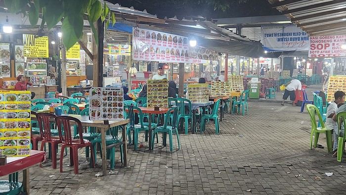
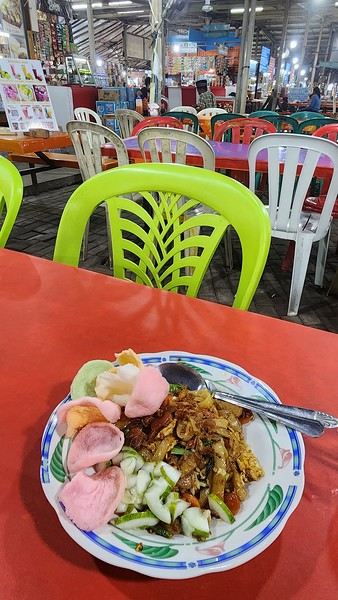
Day 1 - August 10, 2025 New life downloading for three weeks! And for that, Flo and I launched a public tender... A public tender? What’s that got to do with a travel journal???... Well, when you think about it, few destinations tick all the boxes for an August adventure: Meaning, finding a place that’s exotic in the middle of August, not too expensive, not too packed with tourists, warm but not *too* warm, with postcard-perfect landscapes, dreamy beaches, tasty cuisine with a hint of exoticism, friendly and welcoming locals, where you’re free to sleep under the stars among the mosquitos, take transport surrounded by chickens, and even eat from a pig trough if you feel like it—well, turns out it’s not that easy to find! I’d even say, given how thick the list of requirements is, there’s a big risk the tender could be declared unsuccessful for failing to meet just one criterion. Let’s just say the candidates better submit a rock-solid proposal!
After reviewing all the responses and presentations from the candidates, the obvious choice for us is... Indonesia! Except that trying to explore a country as vast as Indonesia and its 17,504 islands in less than five years is a bit like reading the summary of a Proust novel without taking the time to savor each of its 950 pages! Don’t worry, I won’t name them all here. Besides, do they even all have names? No! Only 7,870 have been named—their parents clearly ran out of ideas for the rest. Anyway, our society, which worships the "work more to earn more" mantra, unfortunately limits our adventure time. So we’ll only get to see a small part of Indonesia, and we’ll have to make a tough choice to head for the best of the best in this archipelago of over seventeen thousand islands. Each one has its own selling points: Sumatra, Sulawesi, Java, the Celebes, Bali, Borneo, Papua, Timor, the Moluccas... So many names that smell of adventure... Another tender, another list of requirements, another review of proposals... Drumroll... Splash splash... And the lucky winner is... Ta-da... Java, Bali’s big sister, where I’ve already been eight years ago... Java the programming language. The Java of Broadway. We’re gonna *do* the Java. Java the coffee. And yes, Java is also an island!
This island, four times smaller than France, is home to 136 million people, making it the most populated island in the world! Fun fact: Indonesia, with its 260 million inhabitants, is just shy of the podium for the world’s most populated countries, after the winning trio of India, China, and the United States. And it’s on this island of Java that you’ll find Jakarta, the (soon-to-be-former) capital and main airport of the country, where we’ll soon land after our nineteen-hour flight! Yep, nineteen hours! I mean, Indonesia in general—and Java in particular—is a *tad* farther than going on vacation to Grandma Yoyo’s! Not sure where it is? Easy. Grab a map. Plant your finger on the big island at the bottom right—aka Australia for those who struggle with geography—move it up two centimeters, and bam, welcome to Indonesia!
Nice transition, right? Because "Welcome to Indonesia" is exactly what the friendly flight attendant just said to me as we got off the plane! That’s it, our chakras are open, we’ve arrived at our (air)port. Time for rest, pool, cocktails, and a beach with our toes spread out... Wait, if you bought that, you clearly don’t know us yet! Since we still have energy to burn and need to adjust to the flight and time difference, we tackle the long administrative formalities to enter Indonesia, just to earn the right to hop in a 45-minute Grab taxi to the train station. The train station? What train station?... What do you usually do at a train station? Take a train, of course! Off we go for a three-hour train ride to Bandung, where we’ll officially start our adventure tomorrow after our first Indonesian night...
Unfortunately, we were a bit slow off the mark, which meant we missed the 6:25 PM train by two minutes. Oh well, we’ll have to wait until 11 PM. We take the opportunity to stretch our legs in Jakarta, soak up the atmosphere, and enjoy the delicious smells wafting from the *warungs*—those little typical street restaurants. A quick stop at the National Monument, a detour to a night market to devour our first *kwetiaw goreng* and *teh manis* for 60,000 rupiahs (that’s 3 € for two), and just like that, our penalty is lifted, and we’re allowed to hit the road again. Off to Bandung, where we arrive at 2 AM for... a *very* short night...
Yet Another Travel Journal in this (Too) Familiar Rajasthan, But with Family and Kids
Prologue
This journal recounts a trip to Rajasthan that’s already over a year old and that I’ve only now found the chance to write about. The summer of 2024 marked my return to India—my tenth trip—after six long years away since my last solo wanderings in Tamil Nadu in 2018 (the journal of which is published on this site). That absence was partly (but not only) due to the long COVID and post-COVID period, which saw a complete halt and then a major slowdown in global tourism. To top it off, Voyage Forum announced its closure in an end-of-the-world atmosphere. A sad time for our favorite social activity…
A few weeks after returning from Rajasthan, I tried to motivate myself to start writing a journal to publish on a forum claiming to be VF’s successor, which I’d eventually signed up for out of desperation. But I kept hesitating and putting the project off because, for one, I no longer have the time I used to. For another, the vibe wasn’t really taking off on that forum—it was overrun with ads and not very active, contrary to what its host’s name suggested. Despite its good intentions and commendable role as a stopgap, it also turned out to be very impractical to use, especially when you don’t have much time like me. I’ll admit I’d occasionally check back on VF to see if anything was happening. But all the discussions remained frozen in time, stuck in that fateful year, 2020. Then, rumors swirled online about shady reasons behind its closure, leaving little room for hope.
And then, one fine morning, I got a message at work from Marien informing me that VF had reopened. What a huge surprise! Even though the forum’s “end” had played out in a somewhat apocalyptic atmosphere, the memories of passionate and heated discussions, the frank debates, and the useful exchanges that made this site a traveler’s goldmine and a unique hub of conviviality all came rushing back to me like a breath of fresh air. I finally saw a sign and tried to motivate myself to find the time to publish the journal of this tenth trip to India and fifth to Rajasthan. But in the end, I got bogged down in professional and family obligations and never managed to find the time to get started. That’s now fixed, though, because I had two reasons for wanting to do it: I find that looking back on a trip to tell others about it is a highly beneficial introspective exercise. Also, I thought this journal could be useful to other travelers on a few points.
Because, “do we really need yet another journal about Rajasthan?” you might rightly ask! Especially in a time when so many journals about the “Land of Kings” have been published since VF’s return, not to mention the countless stories you can already find online about this region, one of India’s most touristy. And I’d add, why go back to Rajasthan for a fifth time, where I’ve already dragged my feet more than enough—through its forts, deserts, temples, cities, villages, bumpy roads, train stations, tasty street food stalls, cheap guesthouses, and more? Where some might see just another overhyped tourist destination full of the same old *Arabian Nights* clichés, worn to a thread, that I mentioned earlier, when there’s so much else to see in India? Well, first because it’s a magnificent country I never tire of, where I started an academic study and made so many connections. It’s also packed with places where you won’t find a single tourist (right, Marie-Jo?), even in the heart of well-trodden paths and classic itineraries. And most importantly, as I said earlier, things have changed in recent years. First, after six years without traveling far, the urge to go back to India was getting stronger. But this time, no more solo trips (often) or duo adventures (sometimes)—now it’s a team of four that has to come along! And even if you can argue with that, what better place than Rajasthan to introduce India to people who’ve never seen it? To kids you want to amaze? Plus, traveling with your new little family to your favorite country isn’t the same as going solo in often spartan conditions that only affect you. It’s a different challenge, but ultimately probably much harder. So, is it really reasonable to take two kids to India, including a two-year-old baby? That’s one of the main goals of this journal (but not the only one)—to try to answer that question.
As you can tell, it’s not so much the destination but the slightly unusual setup of this trip that, in my opinion, will make this journal interesting. Despite my experience and expertise (yes, I dare say it) in India, there were plenty of questions before we finalized the plan and said, “Alright, let’s go!” The questions were flying for us parents. Is it wise to travel to India with a two-year-old? What would we do (it happened) if the kids got very sick? Would they be able to handle a road trip on Rajasthan’s bumpy, dusty roads using public transport? Could they handle the shock of such a different world—the dirt, poverty, pollution, noise (…and the smell, as they say), the spicy food, monkeys, mosquitoes, snakes, tigers, leopards, and so on? In short, all the clichés that I usually joke about suddenly became potential realities. Another concern: as a mixed Franco-African family (not me, but my partner and her oldest), wouldn’t we risk not always being well received, given what you sometimes hear about that in India? How would Indians react to seeing a mixed-race family, the ultimate taboo in a country of purity and social segregation, which would undoubtedly raise many questions for them? Of course, not everything went as expected… Because, as you know, with India—and what makes it charming for some—there are always complications: sometimes where you don’t expect them… and sometimes where you do. I’ll go into detail about that in the journal to come (not right away) and in the final review (even later). These experiences could be useful to travelers who find themselves in similar situations and have the same questions we did before embarking on such a journey. And maybe it’ll spark the curiosity of those who aren’t concerned and will read yet another Rajasthan journal, but with its own unique twists.
Despite my unchanged constraints, which mean I have little time to write this, I don’t want to rush the story, so I’ll take my time. There will probably be lulls. I hope that won’t stop people from coming to react, debate, share their impressions, or ask for information.
This journal recounts a trip to Rajasthan that’s already over a year old and that I’ve only now found the chance to write about. The summer of 2024 marked my return to India—my tenth trip—after six long years away since my last solo wanderings in Tamil Nadu in 2018 (the journal of which is published on this site). That absence was partly (but not only) due to the long COVID and post-COVID period, which saw a complete halt and then a major slowdown in global tourism. To top it off, Voyage Forum announced its closure in an end-of-the-world atmosphere. A sad time for our favorite social activity…
A few weeks after returning from Rajasthan, I tried to motivate myself to start writing a journal to publish on a forum claiming to be VF’s successor, which I’d eventually signed up for out of desperation. But I kept hesitating and putting the project off because, for one, I no longer have the time I used to. For another, the vibe wasn’t really taking off on that forum—it was overrun with ads and not very active, contrary to what its host’s name suggested. Despite its good intentions and commendable role as a stopgap, it also turned out to be very impractical to use, especially when you don’t have much time like me. I’ll admit I’d occasionally check back on VF to see if anything was happening. But all the discussions remained frozen in time, stuck in that fateful year, 2020. Then, rumors swirled online about shady reasons behind its closure, leaving little room for hope.
And then, one fine morning, I got a message at work from Marien informing me that VF had reopened. What a huge surprise! Even though the forum’s “end” had played out in a somewhat apocalyptic atmosphere, the memories of passionate and heated discussions, the frank debates, and the useful exchanges that made this site a traveler’s goldmine and a unique hub of conviviality all came rushing back to me like a breath of fresh air. I finally saw a sign and tried to motivate myself to find the time to publish the journal of this tenth trip to India and fifth to Rajasthan. But in the end, I got bogged down in professional and family obligations and never managed to find the time to get started. That’s now fixed, though, because I had two reasons for wanting to do it: I find that looking back on a trip to tell others about it is a highly beneficial introspective exercise. Also, I thought this journal could be useful to other travelers on a few points.
Because, “do we really need yet another journal about Rajasthan?” you might rightly ask! Especially in a time when so many journals about the “Land of Kings” have been published since VF’s return, not to mention the countless stories you can already find online about this region, one of India’s most touristy. And I’d add, why go back to Rajasthan for a fifth time, where I’ve already dragged my feet more than enough—through its forts, deserts, temples, cities, villages, bumpy roads, train stations, tasty street food stalls, cheap guesthouses, and more? Where some might see just another overhyped tourist destination full of the same old *Arabian Nights* clichés, worn to a thread, that I mentioned earlier, when there’s so much else to see in India? Well, first because it’s a magnificent country I never tire of, where I started an academic study and made so many connections. It’s also packed with places where you won’t find a single tourist (right, Marie-Jo?), even in the heart of well-trodden paths and classic itineraries. And most importantly, as I said earlier, things have changed in recent years. First, after six years without traveling far, the urge to go back to India was getting stronger. But this time, no more solo trips (often) or duo adventures (sometimes)—now it’s a team of four that has to come along! And even if you can argue with that, what better place than Rajasthan to introduce India to people who’ve never seen it? To kids you want to amaze? Plus, traveling with your new little family to your favorite country isn’t the same as going solo in often spartan conditions that only affect you. It’s a different challenge, but ultimately probably much harder. So, is it really reasonable to take two kids to India, including a two-year-old baby? That’s one of the main goals of this journal (but not the only one)—to try to answer that question.
As you can tell, it’s not so much the destination but the slightly unusual setup of this trip that, in my opinion, will make this journal interesting. Despite my experience and expertise (yes, I dare say it) in India, there were plenty of questions before we finalized the plan and said, “Alright, let’s go!” The questions were flying for us parents. Is it wise to travel to India with a two-year-old? What would we do (it happened) if the kids got very sick? Would they be able to handle a road trip on Rajasthan’s bumpy, dusty roads using public transport? Could they handle the shock of such a different world—the dirt, poverty, pollution, noise (…and the smell, as they say), the spicy food, monkeys, mosquitoes, snakes, tigers, leopards, and so on? In short, all the clichés that I usually joke about suddenly became potential realities. Another concern: as a mixed Franco-African family (not me, but my partner and her oldest), wouldn’t we risk not always being well received, given what you sometimes hear about that in India? How would Indians react to seeing a mixed-race family, the ultimate taboo in a country of purity and social segregation, which would undoubtedly raise many questions for them? Of course, not everything went as expected… Because, as you know, with India—and what makes it charming for some—there are always complications: sometimes where you don’t expect them… and sometimes where you do. I’ll go into detail about that in the journal to come (not right away) and in the final review (even later). These experiences could be useful to travelers who find themselves in similar situations and have the same questions we did before embarking on such a journey. And maybe it’ll spark the curiosity of those who aren’t concerned and will read yet another Rajasthan journal, but with its own unique twists.
Despite my unchanged constraints, which mean I have little time to write this, I don’t want to rush the story, so I’ll take my time. There will probably be lulls. I hope that won’t stop people from coming to react, debate, share their impressions, or ask for information.
USA Road Trip 2023 - Part 1
In January 2023, we started our second road trip across the United States. We stayed from January to mid-March, which gave us plenty of time to visit several cities, attractions, and parks in multiple states.
This travel journal will be split into two parts due to the considerable number of places we visited.
This first journal covers the following states: Ohio, Indiana, Missouri, Oklahoma, Texas, New Mexico, Arizona, Nevada, and California, and takes you through the outbound leg of our road trip.
The second journal will showcase the attractions we visited on the return trip, which mainly follows the famous Highway 1 along the Pacific coast.
So, I invite you to keep reading this first journal, which serves as a long recap to help you discover the various attractions we explored throughout this road trip.
Videos are included throughout the recap. Please click on the image to start the video.
Here are the links to jump to a specific post:
OHIO:
WinterLand - Christmas Lights at Cleveland Public Square Lake View Cemetery - Cleveland - Part 1 Lake View Cemetery - Cleveland - Part 2 Stroll through Columbus Upper Falls to Lower Falls via Buckeye Trail - Hocking Hills State Park – Logan Cedar Falls & Whispering Falls Hiking Trail - Hocking Hills State Park – Logan Ash Cave Hiking Trail - Hocking Hills State Park – Logan Exploring Cincinnati
INDIANA:
Visiting Indianapolis
MISSOURI:
Exploring St. Louis
OKLAHOMA:
Catoosa Blue Whale Discovering Tulsa Exploring Oklahoma City
TEXAS:
Exploring Shamrock Discovering McLean Exploring Amarillo
NEW MEXICO:
Ancestral Sites Trail - Pecos National Historical Park Discovering Santa Fe The Santuario de Chimayó Stroll through Los Cerrillos Walk through the village of Madrid San Francisco de Asis Catholic Church & The Bottle House - Golden Albuquerque Murals 66 Diner - Albuquerque Stroll through Old Town (Albuquerque) Rinconada Canyon Trail - Petroglyph National Monument Mesa Point Trail - Boca Negra Canyon - Petroglyph National Monument Macaw Trail - Boca Negra Canyon - Petroglyph National Monument Cliff Base Trail - Boca Negra Canyon - Petroglyph National Monument Piedras Marcadas Canyon - Petroglyph National Monument Sandstone Bluffs & Ventana Natural Arch - El Malpais National Monument
ARIZONA:
Stewart's Petrified Wood Shop – Holbrook Stroll through Holbrook Discovering Joseph City Exploring Winslow Grand Falls (The "Chocolate Falls") – Leupp Island Trail - Walnut Canyon National Monument Rim Trail - Walnut Canyon National Monument Wukoki Pueblo Trail – Wupatki National Monument Wupatki Pueblo Trail – Wupatki National Monument Doney Mountain Trail – Wupatki National Monument Citadel & Nalakihu Pueblos Trail – Wupatki National Monument Lomaki & Box Canyon Pueblos Trail – Wupatki National Monument Discovering Flagstaff On the way to Sedona Slide Rock State Park – Sedona Midgley Bridge Trail – Wilson Canyon – Sedona Tlaquepaque Arts & Shopping Village Walking Tour - Sedona Chapel of the Holy Cross - Sedona Hiking at Cathedral Rock - Sedona Hiking the Bell Rock Trail - Sedona Hiking the Airport Loop Trail - Sedona Amitabha Stupa and Peace Park - Sedona Hiking the Boynton Canyon Vortex Trail - Sedona Hiking the Devil's Bridge Trail - Sedona Hiking the Birthing Cave Trail - Sedona Bell Rock Inn - Sedona On the roads of Sedona - Part 1 On the roads of Sedona - Part 2 Keyhole Sink Hiking Trail - Kaibab National Forest Discovering Williams Exploring Ash Fork Discovering Kingman Ramada by Wyndham Kingman Davis Camp Park - Bullhead City Discovering Yucca Lake Havasu Boardwalk Tour A duck catches a lobster – Lake Havasu Boardwalk
CALIFORNIA:
Exploring Needles Discovering Goffs Discovering Amboy Visiting the famous Bagdad Cafe - Newberry Springs Exploring Barstow Vehicles from Hell (Mad Max Cars) - Barstow Peggy Sue's 50's Diner - Yermo Liberty Sculpture Park - Yermo Lake Dolores Water Park - Newberry Springs ZZYZX Road - Mojave National Preserve Alien Fresh Jerky - Baker Kelso Dunes Trail - Mojave National Preserve Hole-in-the-Wall Rings Trail - Mojave National Preserve Visiting Mitchell Caverns - Mojave National Preserve Dante's View - Death Valley National Park Zabriskie Point - Death Valley National Park Golden Canyon - Death Valley National Park Artists Drive & Artists Palette - Death Valley National Park Devil's Golf Course - Death Valley National Park Natural Bridge Trail - Death Valley National Park Badwater Basin - Death Valley National Park Harmony Borax Works - Death Valley National Park Devil's Cornfield - Death Valley National Park Mesquite Flat Sand Dunes - Death Valley National Park Mosaic Canyon Trail - Death Valley National Park On the road - Death Valley National Park
NEVADA:
Cleveland Clinic Lou Ruvo Center for Brain Health - Las Vegas Exploring Downtown Las Vegas SlotZilla Zipline - Fremont Street Experience – Downtown Las Vegas Viva Vision Light Show 1 - Fremont Street Experience - Downtown Las Vegas Viva Vision Light Show 2 - Fremont Street Experience - Downtown Las Vegas Viva Vision Light Show 3 - Fremont Street Experience - Downtown Las Vegas Viva Vision Light Show 4 - Fremont Street Experience - Downtown Las Vegas Free Live Music – Fremont Street Experience - Downtown Las Vegas Chucky – Fremont Street Experience - Downtown Las Vegas Las Vegas Strip - Part 1 Las Vegas Strip - Part 2 Las Vegas Strip - Part 3 Las Vegas Strip - Part 4 Las Vegas Strip - Part 5 Tom Devlin's Monster Museum - Boulder City Hoover Dam Lake Mead - Lakeview Overlook - Boulder City Nelson Ghost Town - Searchlight
CALIFORNIA:
Scenic Route through Joshua Tree National Park via the North Entrance Hidden Valley Trail - Joshua Tree National Park Barker Dam Trail - Joshua Tree National Park Cap Rock Trail - Joshua Tree National Park Keys View Trail - Joshua Tree National Park Hall of Horrors Trail - Joshua Tree National Park Skull Rock Trail - Joshua Tree National Park Arch Rock Trail - Joshua Tree National Park Cholla Cactus Garden Trail - Joshua Tree National Park Lone Pine - Owens Valley Miss Alabama & Shark Fin - Alabama Hills - Owens Valley Lone Ranger Canyon - Alabama Hills - Owens Valley Mobius Arch Loop Trail (Heart Arch & Lathe Arch) - Alabama Hills - Owens Valley Eye of the Alabama Hills Arch - Alabama Hills - Owens Valley Boot & Cyclops Arches - Alabama Hills - Owens Valley One Mile Arch, Bowling Ball and Pins & Gunga Din Area - Alabama Hills - Owens Valley Whitney Portal Arch Trailhead - Alabama Hills - Owens Valley Fish Rocks & Trona Pinnacles - Mojave Desert Red Cliffs Trail - Red Rock Canyon State Park Hagen Canyon Nature Trail - Red Rock Canyon State Park Tour of Historic Downtown Tehachapi View of the Tehachapi Loop – Monolith César E. Chávez National Monument – Keene Discovering Bakersfield Kern County Museum – Bakersfield Bravo Farms, Tree House & Petting Zoo - Traver Walking Tour of Kingsburg Exploring Fresno Simonian Farms & Soul Consoling Japanese Internment Tower - Fresno Duncan Ceramic Products (iLoveToCreate) - Fresno Walking Tour of Modesto Wat Dhammararam Buddhist Temple - Stockton Walking Tour of Stockton Discovering Stockton University of the Pacific - Stockton Visiting Lodi Sutter's Fort State Historic Park - Sacramento California State Capitol - Sacramento Walking Tour - Sacramento Walking Tour - Winters Walking Tour - Napa The Chandelier Tree In Drive-Thru Tree Park - Leggett One Log House - Garberville Grandfather Tree - Piercy The Living Chimney Tree - Avenue of the Giants Stephens Grove Loop Trail - Avenue of the Giants Gould Grove Nature Loop Trail - Avenue of the Giants Fleishmann Grove Trail - Avenue of the Giants Mahan Plaque Trail - Avenue of the Giants Founders Grove Nature Loop Trail - Avenue of the Giants Eternal Tree House & Immortal Tree - Avenue of the Giants Drury-Chaney Loop Trail - Avenue of the Giants Walking Tour - Redcrest
COMING UP NEXT:
USA Road Trip 2023 - Part 2
This travel journal will be split into two parts due to the considerable number of places we visited.
This first journal covers the following states: Ohio, Indiana, Missouri, Oklahoma, Texas, New Mexico, Arizona, Nevada, and California, and takes you through the outbound leg of our road trip.
The second journal will showcase the attractions we visited on the return trip, which mainly follows the famous Highway 1 along the Pacific coast.
So, I invite you to keep reading this first journal, which serves as a long recap to help you discover the various attractions we explored throughout this road trip.
Videos are included throughout the recap. Please click on the image to start the video.
Here are the links to jump to a specific post:
OHIO:
WinterLand - Christmas Lights at Cleveland Public Square Lake View Cemetery - Cleveland - Part 1 Lake View Cemetery - Cleveland - Part 2 Stroll through Columbus Upper Falls to Lower Falls via Buckeye Trail - Hocking Hills State Park – Logan Cedar Falls & Whispering Falls Hiking Trail - Hocking Hills State Park – Logan Ash Cave Hiking Trail - Hocking Hills State Park – Logan Exploring Cincinnati
INDIANA:
Visiting Indianapolis
MISSOURI:
Exploring St. Louis
OKLAHOMA:
Catoosa Blue Whale Discovering Tulsa Exploring Oklahoma City
TEXAS:
Exploring Shamrock Discovering McLean Exploring Amarillo
NEW MEXICO:
Ancestral Sites Trail - Pecos National Historical Park Discovering Santa Fe The Santuario de Chimayó Stroll through Los Cerrillos Walk through the village of Madrid San Francisco de Asis Catholic Church & The Bottle House - Golden Albuquerque Murals 66 Diner - Albuquerque Stroll through Old Town (Albuquerque) Rinconada Canyon Trail - Petroglyph National Monument Mesa Point Trail - Boca Negra Canyon - Petroglyph National Monument Macaw Trail - Boca Negra Canyon - Petroglyph National Monument Cliff Base Trail - Boca Negra Canyon - Petroglyph National Monument Piedras Marcadas Canyon - Petroglyph National Monument Sandstone Bluffs & Ventana Natural Arch - El Malpais National Monument
ARIZONA:
Stewart's Petrified Wood Shop – Holbrook Stroll through Holbrook Discovering Joseph City Exploring Winslow Grand Falls (The "Chocolate Falls") – Leupp Island Trail - Walnut Canyon National Monument Rim Trail - Walnut Canyon National Monument Wukoki Pueblo Trail – Wupatki National Monument Wupatki Pueblo Trail – Wupatki National Monument Doney Mountain Trail – Wupatki National Monument Citadel & Nalakihu Pueblos Trail – Wupatki National Monument Lomaki & Box Canyon Pueblos Trail – Wupatki National Monument Discovering Flagstaff On the way to Sedona Slide Rock State Park – Sedona Midgley Bridge Trail – Wilson Canyon – Sedona Tlaquepaque Arts & Shopping Village Walking Tour - Sedona Chapel of the Holy Cross - Sedona Hiking at Cathedral Rock - Sedona Hiking the Bell Rock Trail - Sedona Hiking the Airport Loop Trail - Sedona Amitabha Stupa and Peace Park - Sedona Hiking the Boynton Canyon Vortex Trail - Sedona Hiking the Devil's Bridge Trail - Sedona Hiking the Birthing Cave Trail - Sedona Bell Rock Inn - Sedona On the roads of Sedona - Part 1 On the roads of Sedona - Part 2 Keyhole Sink Hiking Trail - Kaibab National Forest Discovering Williams Exploring Ash Fork Discovering Kingman Ramada by Wyndham Kingman Davis Camp Park - Bullhead City Discovering Yucca Lake Havasu Boardwalk Tour A duck catches a lobster – Lake Havasu Boardwalk
CALIFORNIA:
Exploring Needles Discovering Goffs Discovering Amboy Visiting the famous Bagdad Cafe - Newberry Springs Exploring Barstow Vehicles from Hell (Mad Max Cars) - Barstow Peggy Sue's 50's Diner - Yermo Liberty Sculpture Park - Yermo Lake Dolores Water Park - Newberry Springs ZZYZX Road - Mojave National Preserve Alien Fresh Jerky - Baker Kelso Dunes Trail - Mojave National Preserve Hole-in-the-Wall Rings Trail - Mojave National Preserve Visiting Mitchell Caverns - Mojave National Preserve Dante's View - Death Valley National Park Zabriskie Point - Death Valley National Park Golden Canyon - Death Valley National Park Artists Drive & Artists Palette - Death Valley National Park Devil's Golf Course - Death Valley National Park Natural Bridge Trail - Death Valley National Park Badwater Basin - Death Valley National Park Harmony Borax Works - Death Valley National Park Devil's Cornfield - Death Valley National Park Mesquite Flat Sand Dunes - Death Valley National Park Mosaic Canyon Trail - Death Valley National Park On the road - Death Valley National Park
NEVADA:
Cleveland Clinic Lou Ruvo Center for Brain Health - Las Vegas Exploring Downtown Las Vegas SlotZilla Zipline - Fremont Street Experience – Downtown Las Vegas Viva Vision Light Show 1 - Fremont Street Experience - Downtown Las Vegas Viva Vision Light Show 2 - Fremont Street Experience - Downtown Las Vegas Viva Vision Light Show 3 - Fremont Street Experience - Downtown Las Vegas Viva Vision Light Show 4 - Fremont Street Experience - Downtown Las Vegas Free Live Music – Fremont Street Experience - Downtown Las Vegas Chucky – Fremont Street Experience - Downtown Las Vegas Las Vegas Strip - Part 1 Las Vegas Strip - Part 2 Las Vegas Strip - Part 3 Las Vegas Strip - Part 4 Las Vegas Strip - Part 5 Tom Devlin's Monster Museum - Boulder City Hoover Dam Lake Mead - Lakeview Overlook - Boulder City Nelson Ghost Town - Searchlight
CALIFORNIA:
Scenic Route through Joshua Tree National Park via the North Entrance Hidden Valley Trail - Joshua Tree National Park Barker Dam Trail - Joshua Tree National Park Cap Rock Trail - Joshua Tree National Park Keys View Trail - Joshua Tree National Park Hall of Horrors Trail - Joshua Tree National Park Skull Rock Trail - Joshua Tree National Park Arch Rock Trail - Joshua Tree National Park Cholla Cactus Garden Trail - Joshua Tree National Park Lone Pine - Owens Valley Miss Alabama & Shark Fin - Alabama Hills - Owens Valley Lone Ranger Canyon - Alabama Hills - Owens Valley Mobius Arch Loop Trail (Heart Arch & Lathe Arch) - Alabama Hills - Owens Valley Eye of the Alabama Hills Arch - Alabama Hills - Owens Valley Boot & Cyclops Arches - Alabama Hills - Owens Valley One Mile Arch, Bowling Ball and Pins & Gunga Din Area - Alabama Hills - Owens Valley Whitney Portal Arch Trailhead - Alabama Hills - Owens Valley Fish Rocks & Trona Pinnacles - Mojave Desert Red Cliffs Trail - Red Rock Canyon State Park Hagen Canyon Nature Trail - Red Rock Canyon State Park Tour of Historic Downtown Tehachapi View of the Tehachapi Loop – Monolith César E. Chávez National Monument – Keene Discovering Bakersfield Kern County Museum – Bakersfield Bravo Farms, Tree House & Petting Zoo - Traver Walking Tour of Kingsburg Exploring Fresno Simonian Farms & Soul Consoling Japanese Internment Tower - Fresno Duncan Ceramic Products (iLoveToCreate) - Fresno Walking Tour of Modesto Wat Dhammararam Buddhist Temple - Stockton Walking Tour of Stockton Discovering Stockton University of the Pacific - Stockton Visiting Lodi Sutter's Fort State Historic Park - Sacramento California State Capitol - Sacramento Walking Tour - Sacramento Walking Tour - Winters Walking Tour - Napa The Chandelier Tree In Drive-Thru Tree Park - Leggett One Log House - Garberville Grandfather Tree - Piercy The Living Chimney Tree - Avenue of the Giants Stephens Grove Loop Trail - Avenue of the Giants Gould Grove Nature Loop Trail - Avenue of the Giants Fleishmann Grove Trail - Avenue of the Giants Mahan Plaque Trail - Avenue of the Giants Founders Grove Nature Loop Trail - Avenue of the Giants Eternal Tree House & Immortal Tree - Avenue of the Giants Drury-Chaney Loop Trail - Avenue of the Giants Walking Tour - Redcrest
COMING UP NEXT:
USA Road Trip 2023 - Part 2
Namibia Travel Journal: May 2025 - Trip Review
NAMIBIA TRIP 2025: April 24 to May 20: Feel free to comment or ask us any questions about this amazing journey.
>> Find all our photos and videos for each day on our website here: www.montagne-aventure.net
**DAY 1: Thursday, April 24, 2025: Outbound Flights from Lyon to Windhoek via Munich - Visit to Munich:**

Off we go on a new adventure. The alarm rings at 6:30 AM, the travel bags are packed, and we head to Lyon Airport. We booked our flight tickets with Lufthansa. The first leg to Munich, Germany, is operated by AirBaltic. Departure at 1:05 PM for a 1-hour and 20-minute flight. We arrive at 2:30 PM.
**We now have a 7-hour layover, so we take the opportunity to get some fresh air and explore Munich.** We quickly exit Terminal 2 of the airport and head towards the subway. We buy a group day ticket "Airport-city Day Zone M-5," valid for 2 to 5 people at a price of 30.50 € (instead of 16.30 € per person). We take the S8 line to **Marienplatz** in 35 minutes. **This is the heart of the city.** The weather is overcast, quite cool, but dry. Perfect for a little city trip between two flights while leaving our large luggage in transit at the airport. **Munich is the third-largest German city after Berlin and Hamburg, in the Bavaria region.** **The center has a lot of charm and brings together several religious buildings, easy to explore on foot.** We are impressed by the number of people enjoying these 100% pedestrian streets, which are very pleasant. After Marienplatz, the most famous square with the town hall, we head to the Cathedral of Our Lady, a Gothic church, then continue to **Karlsplatz** and move on to **the food market offering a wide selection of high-end food products in an atmosphere where a certain art of living prevails.** We also visit St. Peter's Church before grabbing a bite to eat. Two good hours were enough for this 10 km city walk. It's time to take the subway back: by 6:30 PM, we are back at the airport. Now, it's time for a bit of waiting and rest. Our second flight is scheduled for 9:35 PM for a 9-hour and 30-minute journey to our final destination in Namibia: **Windhoek.**
> Round-trip flight tickets with Lufthansa from Lyon: 2029 €, or 1,014.50 € per person.
> Lyon Airport parking: 120 €
> Today's expenses: 7 € for 2 pizzas in France / 14 € for the restaurant in Munich / 30.50 € for the daily subway ticket in Munich.
**DAY 2: Friday, April 25, 2024: Arrival in Windhoek, Visit to the Namibian Capital:**
After a 9-hour and 30-minute overnight flight with Discover Airlines, we finally land on Namibian soil just before 7:30 AM. The day is breaking, and the colors are already stunning. We are eager despite the usual fatigue from the flight. The airline was punctual, with friendly staff and good meals, though a bit light. We are the first flight of the day to land, with no more than 15 flights per day here, from 7 AM to 8 PM. We disembark on the tarmac at this airport located in the middle of nowhere, **I finally set foot on African soil for the first time.** We exit among the first from the aircraft to go through the long formalities at the front of the line, as the wait can quickly become endless. Allow at least 5 minutes per person for e-visas. We still wait 45 minutes despite only about twenty people ahead of us. Phew, it's done. We collect our luggage and then withdraw money from an ATM. We make 4 withdrawals of the maximum amount, 2000 NAD $ per withdrawal, for a total of 380 €, or 95.33 € per withdrawal.
Our driver arrives at the same time, perfect timing, we were quick.
We leave the airport at 8:45 AM. By 9:30 AM, we arrive at the **Gracious Whisp vehicle rental agency**, located at the entrance of Windhoek, small and human-sized with a fleet of recent vehicles. More formalities, then a short wait as our vehicle is not yet ready. Time to decompress, catch our breath, and enjoy the very pleasant morning temperature. Not a cloud in sight. Next, a briefing on the vehicle, always with a bit of apprehension due to our approximate English. Allow 45 minutes of explanations, including setting up the roof tent, camping equipment, technical information in case of a flat tire, driving tips in Namibia, and a tour of the 4x4. We have all the necessary equipment for camping: mattresses, sleeping bags, pillows, table, chairs, gas stove, BBQ grill... as well as 2 spare tires, a compressor, a dual tank, and accessories for removing wheels. Off we go, it's time to muster our courage and get behind the wheel. **Heading to SuperSpar Maerua**, fortunately located less than 10 minutes away. We park with the help of a parking attendant; it's very crowded, the space is narrow, but everything goes well despite the cursed right-hand drive. Today's new mission: stock up on groceries. The store is well-stocked with local and imported products, catering to all tastes. We spend 114 € on groceries, from pasta to meat, BBQ lighters to dishwashing products. Two people load our groceries into two carts and transfer them to our vehicle; we feel compelled to leave a tip, 50 NAD $, as we don't have change yet. Now, we head to the hotel, 15 minutes away. Traffic is difficult at a complicated intersection; this will likely be the only traffic jam in Namibia. **We arrive at Kate's Nest Guesthouse & Backpackers around 1:15 PM, quite tired.** We take some well-deserved rest at this recent establishment, quite calm with secure private parking. After a short nap, we enjoy the quiet by the hotel pool. Night falls between 6:30 PM and 7 PM. We eat quietly in our room tonight before starting this long 4x4 road trip in camping mode in the heart of Namibia.
> Today's grocery expenses: 114 € at Super Spar Marua (2395.21 NAD $).
> Round-trip flight tickets with Lufthansa from Lyon: 2029 €, or 1,014.50 € per person.
> Vehicle rental: 4x4 Toyota with roof tent for 24 days: Gracious Whisp Car Rentals: 2,638 € (N$50,640) or **1,319 €** per person - (https://gwcarrentals.com/)
> Distance driven today: 15 km.
> Accommodation: Kate's Nest Guesthouse & Backpackers - 4 Aristotles Street Academia, 9000 Windhoek - 36 € for two for one night.
> Windhoek International Airport website: (https://www.airports.com.na/)
**DAY 3: Saturday, April 26, 2025: Windhoek to Hardap: Mariental Region - Kalahari Desert:**
After a good, restful night, we wake up leisurely around 7 AM. We enjoy the comfort provided by this first and last hotel before 24 nights under the tent.
**We leave Kate's Nest Guesthouse at 8:30 AM to tackle the Namibian roads.** We quickly leave the capital; in just 30 minutes, we find ourselves almost alone in the world. The landscape is dotted with small domes. We leave the **paved B1** quickly to turn left onto the **C15**. **From there, we won't see more than 10 vehicles all day.** After passing through the few houses of **Lekkerwaterpoort**, we tackle our first gravel road. These road sections are limited to 100 km/h, but even at 70 km/h, I find it already challenging. However, I quickly get used to it and gradually pick up speed to reach my cruising speed of around 80 to 90 km/h. **We are on immense straight lines crossing wild expanses as far as the eye can see.** **We come across two baboons, a few ostriches, and numerous cattle and sheep farms.** We pass through the charming village of **Uhlenhorst** with its typical houses and children with broad smiles waving at us. Life here is already very different from Windhoek. **The thermometer rises quickly from 16°C at 8:30 AM to over 28°C in the early afternoon.**
**We arrive at the Hardap Dam reserve at 2 PM.** We stop at the toll booth at the park entrance to pay the entrance fee: 250 NAD $ for 2 people and 1 vehicle. We continue to the dam and then the camp entrance, located a bit further. We had booked in advance, but this place remains little frequented by foreigners.
We take advantage of the hottest hours to rest by the large pool overlooking the immense lake, a very enjoyable moment. Would this be a bit of a vacation?
Around 4:30 PM, we head to the campsite. We overlook this vast water reserve. We arrive first; we will be only 3 vehicles spending the night here. It's time to get to work and set up our equipment for the first time. It takes us a good 20 minutes to set everything up, with a slight apprehension about unfolding the tent. Once this task is done, which we will have to repeat for almost a month, we will become much more efficient over time. Time for rest and contemplation in total silence. The sun gradually sets, and the heat quickly becomes bearable again. Bliss! **This dam is located 20 km northwest of Mariental in an area dotted with conical hills topped with dolerite buttons (Hardap means "hillock" in Nama). It captures the Fish River, which flows south, creating a large lake in the middle of an arid environment. The contrast is striking.** We enjoy our first sunset facing this 360° otherworldly landscape.
Around 7 PM, we start our first BBQ, or "braai" as it's called here. The temperature is perfect. The sun sets, giving way to a star-filled sky of incredible beauty thanks to the absence of any light pollution. The Milky Way will lull us throughout the evening. After some good sausages and potatoes on the BBQ, we head to our roof tent around 9:30 PM with a complete change of scenery in just 24 hours. France already seems so far away...
This campsite has shared showers and toilets, quite clean and functional, as well as a central area with several BBQs and tables. The sites are arranged in a semicircle, each with an electrical outlet. The sites are close to each other but spacious, some slightly shaded. We are only three vehicles tonight, so it's perfectly comfortable and quiet. Not to mention the large pool near the restaurant. Our trip is off to a great start.
> Today's road itinerary: Windhoek > Head south on the B1 to Rehoboth > Turn left onto the C25 then C15 to Stampriet > C20 to Hardap > Full north on the B1 > Then turn left onto the M93 - 5 hours of driving.
> Distance driven today: 354 km.
> Accommodation: Hardap Recreation Resort - 23.3 € for two - Large pool - GR6W+3M2, Hardap Game Reserve, Mariental, Namibia - (http://www.nwr.com.na/resorts/hardap-resort/)
**DAY 4: Sunday, April 27, 2025: Hardap - Brukkaros Volcano - Keetmanshoop - Quivertree Forest Rest Camp**
Our first night under the tent was very pleasant; the little wind quickly calmed down, giving way to absolute silence. The mattress is decent, more comfortable than some nights in Nepal. The length and width give us enough space for maximum comfort, despite my height (1.91 m). We wake up a little before 7 AM as the sun rises, and the lights dazzle us from the start of the day. We pack up the equipment in 30 minutes, quite easily. Then we enjoy the sun, which warms up quickly while we keep our light fleece on.
At 8:30 AM, **we hit the road again, heading south** to our first stop in **Mariental**. We want to do some shopping at SuperSpar, but once we arrive in the parking lot, a young local is fighting with the supermarket security guards and then threatens to throw stones. We don't want to take any risks right at the start, so despite the baton blows he receives, he doesn't stop. We leave empty-handed but fill up with fuel at the Shell station 1 km further. The price per liter is 21.33 NAD $, we fill our 107-liter tank for 107 €. In Namibia, you get served, and they bring the card machine to the window to pay. It's then customary to leave a tip.
We then take the B1 heading due south on a recently renovated road. Around 11:30 AM, we leave it on our right to take **a wild gravel road, the M98**. Just before **Berseba**, we turn right onto a small track, the **D3904 towards Brukkaros Crater up to a camp at 1588 m altitude**. The track then becomes too bumpy. We stop on the counter-slopes where **a wide panorama unfolds over these immense plains as far as the eye can see**. It's 12:15 PM, time for us to eat a rice and tuna salad facing this landscape.
**We are alone in the world until a vehicle arrives and parks next to us.** A bit of apprehension, 4 men head towards us. It turns out to be 4 shepherds looking for a lost foal. The conversation is pleasant, lost in the middle of nowhere. We find ourselves alone again in this absolute silence. **The heat becomes stifling with a good 30°C**. We get back on the road around 1 PM. Back on the B1, **we continue due south to Keetmanshoop**, which we reach around 3 PM. We stop there to do some shopping for 262 NAD $ (12 eggs, a can of tuna, a can of corn, bread, a soda, and a 5-liter water container), or 12.48 €. Two quite insistent children ask us for money or candy at the store exit, yet we give them a small tip, but they continue to cling to the car. Locals parked next to us tell them to leave us alone. Anyway, we finish the trip to **Quivertree Forest**, 15 km away. We will spend the night in this **pleasant farm run by a German**. Upon arrival, as the day before, and as I suppose in the future, we dive straight into the cool pool to relax after all these kilometers. A bliss. Then we take our 4x4 and choose a spot near these famous trees. After the 33°C this afternoon, once 4 PM passed, the temperature drops again and becomes very pleasant. **We are in the middle of the Kokerboom, one of the most interesting and characteristic plants of hot and arid regions. It's not really a tree but a variant of the aloe plant whose botanical name is Aloe Dichotoma. This Kokerboom has a smooth and thick trunk reaching up to 1 m in thickness and 9 m in height. They bloom for the first time at the age of 20 to 30 years.** The flowers are yellow and reach about thirty centimeters during the season between June and July. **They grow mainly in an environment with a high concentration of black rocks absorbing a large amount of heat (38°C). The rocks also serve to anchor the tree with its tentacle-like roots. It also resists frost. Each is between 200 and 300 years old.**
Around 5 PM, we walk to the farm reception to watch the feeding of **two cheetahs**. Magnificent carnivores taking their time to savor their piece of meat. **Then we return near our campsite to enjoy the sunset among these trees. The colors are sublime, as every evening apparently. A magnificent spectacle with colors evolving from yellow to orange then to pink, before giving way once again to a sky filled with thousands of stars.** Our campsite at Quiver Tree Forest Camp is very comfortable; we have a water supply, a stone table, a small lamp, an electrical outlet, a small tree for shade, and a BBQ that we won't use tonight; we'll cook on gas. The sites are far apart, with some shared facilities scattered around, a very beautiful setting. No reservation possible, no need, just show up directly. **The campsite accommodation for 2 people costs 28 €, including the reserve entrance fee of 5 €**. We finish this second bivouac evening around 9:30 PM, time for some reading and sleep in peaceful silence without wind.
> Today's road itinerary: Mariental > B1 heading south to Brukkaros > At Tses turn right towards Berseba via the M98 > Turn right onto the D3904 > 8 km > Brukkaros Volcano (stop at the lower camp as the track is difficult for 1 hour) > Keetmanshoop > Turn left onto the M29 > Quivertree Forest - 4 hours of driving.
> Distance driven today: 371 km.
> Distance walked today: 6 km.
> Today's expenses: Groceries for 12.48 € (262 NAD $) / Fuel for 107 € (1 liter of diesel for 21.33 NAD $).
> Accommodation: Quivertree Forest Rest Camp, P.O. Box 262, Keetmanshoop, Namibia - BBQ, hot showers, toilets, and electricity - No reservation - Pool - 18 €/Person (N$ 340.00 with park entrance) - (http://www.quivertreeforest.com/)
**DAY 5: Monday, April 28, 2025: Quivertree Forest Rest Camp - Giant's Playground - Keetmanshoop - Fish River Canyon - Canyon Roadhouse:**
After an excellent start to the night, we are woken up by the wind shortly before 6 AM, but the sunrise is not far off. We get up at 6:30 AM to enjoy it. The atmosphere is a bit cooler this morning, but the reward is already here.
The adventure continues. At 7:45 AM, we head towards **Giant's Playground**, 4 km away. We take a 3-kilometer walk through this expanse of blocks and igneous rocks.
We continue south at 8:45 AM, passing through Keetmanshoop again where we do some shopping for 25 €, a big stock-up for a good part of the trip: meats, canned goods, pasta, fruits... At 9:30 AM, we take the B4 to Fish River Canyon.
At 11:30 AM, we arrive at the entrance to the NWR park (350 NAD $ entrance for 2 people and 1 vehicle). The track becomes bumpy immediately upon entering the park. After about ten kilometers, we come upon this landscape carved by nature. In the end, it's well worth the detour. We were at the Grand Canyon in the USA exactly (https://www.montagne-aventure.net/2024/04/29/j21-3-juin-2024-grand-canyon-et-lac-powell/) and can thus confirm that this Fish River Canyon is comparable. We make several stops along the southern flank. **Here, nothing is developed; nature is almost in the wild state.** **With 160 km in length, up to 27 km in width, and a depth of 150 m, it is indeed the second-largest canyon in the world.** The history of the canyon is apparent in its different earth layers and stratification: the antiquity of the place is tangible, and the absence of vegetation is surprising. **It consists of two nested canyons, formed at distinct periods. The first distinct layer of schist, sandstone, and eruptive material surrounding the canyon was formed a few two billion years ago, then transformed due to heat and pressure into more solid rock such as gneiss. The inner canyon, carved more recently by the Fish River, has a depth of 270 m.**
We have a picnic once again alone in the world facing this grand panorama at the **Sulphur Spring View Point**. This is where the hiking trail begins, plunging into this narrow canyon, but it is forbidden to venture there alone without a guide. It's 30°C, but a slight wind makes the atmosphere bearable. At 1 PM, we retrace our steps and continue to the **Main View Point** then to the **Hikers View Point**.
In the south of Namibia, the Fish River Canyon, 160 km long, is a true geological wonder: a canyon nested within another canyon, one of the largest in the world. The first sedimentary layers formed two billion years ago; 500 million years ago, a period of tectonic activity caused these layers to crack and tilt, opening a vast canyon in the Earth's crust. The second canyon, with a depth of 270 m, was carved over time by the passage of the Fish River in this new valley.
At 3 PM, we arrive at our very charming camp for the evening, the **Canyon Road House**. We fill up with fuel right away because tomorrow we have a long day of isolated driving: 55 liters for 1240 NAD $. Then we settle into the campsite we had previously reserved in France. We are assigned site 2, very well set up under a tree with its BBQ and stone table just steps from the pool. We quickly set up the tent and jump straight into the pool for the relaxation moment of the day. As usual, the water is quite cool, but it's a real pleasure. Then we stroll around this Canyon Road House, which recreates the atmosphere of the roadside inns of the 1950s with old car wrecks and vintage gas pumps in a bygone era. **Around 5:45 PM, we start a short walk leading us to the top of a hill overlooking the wide plateau where we are to watch the sunset.**
And finally, to end this beautiful day, it's time for the braai, with grilled sausages and white beans on the evening menu.
> Park entrance: 150 DN/person + 50 DN/vehicle (18 € for two). It is possible to enter at two access points: Hobas in the north and Ai-Ais in the south.
> Today's road itinerary: M29 > Keetmanshoop > B1 > B4 > C12 (track) > After Holoog turn right onto the D601 (C37 track) > Accommodation on our right (stop just to check in before 6 PM) > Continue 30 km (30 minutes of track) to the viewpoints after Hobas where you must pay the entrance fee. Sunset View Point to the left > Return before sunset as the park closes (best lights at sunrise). 3 hours.
> Distance driven today: 228 km.
> Distance walked today: 10 km.
> Today's expenses: 25 € for groceries / 17 € for the Fish River Canyon park entrance / 58 € for fuel.
> Accommodation: Canyon Roadhouse, Gondwana Collection Namibia – 34.4 € for two - Pool - Near Hobas - (http://www.gondwana-collection.com/fr/accommodation/canyon-road-campsite)
**DAY 6: Tuesday, April 29, 2025: Canyon Roadhouse - Orange River - South African Border - Vista Trail - Gondwana Sperrgebiet Park - Aus:**
The night was excellent in this very comfortable campsite. **We wake up to the sound of birds** before the alarm at 6:45 AM. Our little morning routine starts as the sun rises. **A big day of driving awaits us to the South African border. This will be the southernmost point of our journey.** We hit the road at 8 AM via the C37, pass through **Hobas**, then turn onto the D207 to **Aussenkehr.** **We cross a mountainous barrier with some high peaks and perfect cones. The rock varies from orange to pink to black.**
We then cross a lunar desert as far as the eye can see on a giant dome; the track winds through nowhere without meeting anyone for hours. The landscapes are surprising. **We spot several ostriches and a gemsbok.** In the middle of this endless expanse, we come to an improbable intersection and continue right onto the D278.
In the middle of these arid lands, we come across a green zone: a vast vineyard. At 10:30 AM, **we come across a "Road closed" sign, fortunately, a local resident waves us to continue; a bit stressed, we proceed.** We start to follow the beautiful Orange River. On the other side of the bank, just a few meters away, South Africa is there. It is the second-longest river in Southern Africa, after the Zambezi. It flows over 2,000 km to the Atlantic. After passing through narrow gorges, we regain altitude before starting the descent, gently heading back north.
**We now cross and follow the Fish River, which joins the Orange River further south** **along this gorge dating back millennia.** At exactly noon, we take a lunch break by the Fish River, still without meeting a soul in this landscape between greenery and aridity. The temperature here is cooler with a pleasant 23°C on the banks, the perfect spot. **We continue on the track to Rosh Pinah**, where we find a paved road again. **The section along the Orange River and the Fish River was officially closed, but we were able to pass without any issues, avoiding a detour of at least 3 hours.** Phew. We now drive at high speed (limited to 120 km/h) through these vast spaces. We come across many ostriches after the **dozens of monkeys along the Fish River**. Around 3 PM, 3 km after the very small town of **Aus**, we reach **our campsite for the evening at Klein Aus Vista**. A new **small peaceful haven very well set up**. As usual, after checking in at reception, we jump straight into the beautiful pool to get our well-deserved dose of coolness, another good thermal shock that our bodies appreciate. Once this moment of relaxation is over, we take our 4x4 to reach the campsite located a bit higher, set apart at the foot of a hill that overlooks us.
After setting up, **around 5 PM, we head to the Vista Trail to climb to the top of a mountain overlooking the vast plain that surrounds us at 360°**. It takes about 30 minutes to climb. The place is just magical, **the perfect viewpoint to admire the sunset**. **We fully savor the moment. We also spot one of the few wild horses in the world capable of living in the desert.** Their numbers have decreased in recent years due to predation and drought (around 100 to 150). At 7 PM, we return to the camp, time for the braai and preparing the meal in this peaceful little camp.
In the south of Namibia, the Fish River Canyon, 160 km long, is a true geological wonder: a canyon nested within another canyon, one of the largest in the world. The first sedimentary layers formed two billion years ago; 500 million years ago, a period of tectonic activity caused these layers to crack and tilt, opening a vast canyon in the Earth's crust. The second canyon, with a depth of 270 m, was carved over time by the passage of the Fish River in this new valley.
> Today's road itinerary: 5 hours of driving: D324 heading south (track) > turn right onto the C10 (track) > D316 heading south > turn right onto the C13 > In Aus turn left onto the B4 > Campsite via a track on the left.
> Fuel station: Solitaire or Aus.
> Distance driven today: 398 km.
> Distance walked today: 7 km.
> Accommodation: Klein-Aus Vista Desert Horse Campsite - Farm Klein-Aus No 8 on the B4 main road to Luederitz Aus 9000, Aus, Namibia - (http://www.klein-aus-vista.com/accommodation/desert-horse-campsite/) 17908 420 DN - Water + Shared shower (hot water). No electricity.
**DAY 7: Wednesday, April 30, 2025: Aus - Kolmanskop - Diaz Point - Luderitz - Kanaan Desert:**
We wake up around 6:45 AM, with partly cloudy weather for once; we feel the ocean's influence gradually. But the sun isn't far off. At 7 AM, we leave the campsite heading west towards Luderitz via the B4. **First stop of the day: Kolmanskop, the ghost town we reach at 8:30 AM**, entry costs 180 NAD $ per person. We discover this **timeless place** in 1.5 hours, moving from building to building amidst violent sand-laden gusts of wind. There's a lot of charm in these different living spaces. **The sand quickly reclaimed the place after this mining town was abandoned.** This was once the headquarters of Consolidated Diamond Mines. It's hard to believe that this former town, where the diamond industry once flourished, had a hospital, a bowling alley, and a theater. The decline in diamond sales after World War II and the discovery of richer deposits put an end to this golden age. By 1956, the town was already completely deserted, and the sand had reclaimed its rights. **These dilapidated buildings swallowed by shifting dunes have something surreal about them.**
At 10:15 AM, we hit the road again **heading to Luderitz, 22 km away**, and first to **Diaz Point** **facing the Atlantic Ocean**. It's a wind-swept peninsula with its characteristic red and white lighthouse. There's a campsite and a coffee shop on site, but the place doesn't inspire rest without shade or shelter from the wind. We return to the city via the D701 track that runs along the ocean, be careful at low tide. We come across **a few fishermen and a fox as well as flamingos.**
We walk through the few streets of the city, much smaller than I imagined, then climb to the **famous little Lutheran church that overlooks the city, the Felsenkirchr.** **The wind blows very strongly here, and the sand is omnipresent, surrounded by the Namib Desert and the southern Atlantic coast.** **A German colonial relic barely touched by the 21st century, Luderitz seems frozen in the past, giving it both a gloomy and a certain charm. In short, it's certainly one of the most incongruous places in Africa.**
At 1:15 PM, just before leaving Luderitz, we do some shopping for 20.50 € and fill up with fuel: 61.50 €, 1290 NAD $ for 61 liters (21.18 $ per liter).
**We return via the B4 to Aus** (paved), **then via rougher tracks**, the C13 then the D707, magnificent as it runs along a mountain range with multiple colors on our right and an endless flat desert on the other side.
To access our campsite for the evening, we must take a **narrow private track for 7 km** on our right to emerge, in this total vastness, at the **isolated Kanaan Desert Retreat on a small hill**. I don't have time today to jump into the pool near the reception; we arrive at 5 PM at 8 small, isolated, and unique sites with a small kitchen, a shower, and a private toilet under a small tarp shelter. **A crazy charm with a unique view...** **This will be my favorite accommodation of this trip. The photos speak for themselves.** We jump into the outdoor shower while savoring the landscape, then prepare our evening braai while enjoying the colors fading, facing this plateau with bushes turning a vivid orange. **A moment that will remain etched for life.** **Savanna atmosphere under a thin emerging moon. Every minute offers different colors. Facing our meal, we have a natural giant screen.**
We end this day contemplating the stars and admire this thin orange moon setting on the horizon (8:42 PM).
**Ghost town just before Luderitz: Kolmanskop** (open from 8 AM to 3 PM - N$ 180 p.p – 9 €). Once, Kolmanskoppe was organized around diamond mining. After finding new, more prolific spots, the town was abandoned and is now a ghost town. The sand and dunes have reclaimed their rights and buried everything humans had built. Houses, train station, bakery, everything has been covered by sand, which passes through the windows, even though they are 1 meter high.
> Today's road itinerary: 5h30: B4 to Luderitz (paved) > Round trip > Kolmanskop on the left > Return via the previous campsite > Then C13 (track) > Turn left D707 (track) > Then track to the right to the campsite.
> Distance driven today: 438 km.
> Distance walked today: 8 km.
> Today's expenses: Groceries at the Spar in Luderitz for 20.50 € / Fuel fill-up in Luderitz for 61.50 €.
> Official Kolmanskop website: (https://kolmanskuppe.com) (open from 8 AM to 1 PM - N$ 180 p.p – 9 €).
> Accommodation: Night at the south of the Namibrand Nature Reserve: Kanaan Desert Retreat – 26.5 € for two - (http://www.kanaannamibia.com/) - Farm 104 Karas 9000 - Sanitary facilities + BBQ + Water + Pool - No electricity - My favorite accommodation of this trip.
**DAY 8: Thursday, May 1, 2025: Kanaan Desert Retreat - Namib Desert - Crossing the Namibrand Nature Reserve – Sesriem Canyon - Elim Dune - Little Sossus Lodge**
After a cooler night than the previous ones with about 10°C, we wake up around 7 AM. We admire, as usual, the sunrise between the desert and the mountains. **The spot from last night was truly perfect, isolated from the world, in total serenity, with a wake-up call to the sound of birds.**
We hit the road a little after 8 AM, heading north via the D707 to Spes Bona, then the gravel road C27 via Betta to Sesriem. **The landscapes roll by and dazzle us.** **We are right in the heart of the Namibrand reserve**, coming across numerous **zebras**, **impalas**, **ruminants that reproduce in large numbers**, and **gemsboks**. At noon, we stop in the shade of a tree to eat. The spot is so romantic facing orange arid mountains and a vast green plateau. **A landscape full of contrasts, timeless and silent.**
**The Namib Desert is the oldest on the planet; its name means "vast arid plain," and it also gave its name to the entire country: Namibia.** The majority of these arid and semi-arid lands dotted with viewpoints are part of the Namib-Naukluft National Park, which covers 23,000 km².
At 1 PM, we enter the Sossusvlei park. We start with the **Sesriem Canyon**, which is 3 km long and 30 m deep. We enter it with a short 1-hour hike into its depths. **It was carved by the Tsauchab River in an agglomerate of sand and pebbles over 15 million years old.** We retrace our steps back to Sesriem, which means "six belts," referring to the number of leather belts (from ox wagons) needed to draw water from the canyon. This remote locality is mainly the gateway to Sossusvlei but offers a gas station and some accommodations. For our part, we sleep 40 km away tonight.
**We then move on to Elim Dune.** It takes about 45 minutes of walking to reach its summit, and the climb is very breath-taking as we progress in the sand where we almost slide back with each step. **A first grand 360° panorama unfolds. The ochre color of the sand contrasts completely with the yellow plain and the brown and black mountains in the distance.**
At 3:15 PM, we start the descent facing Sesriem. We were completely alone once again on this dune. **These Namib dunes are composed of colored quartzite sand, presenting hues ranging from cream to orange and from red to purple. Unlike the ancient dunes of the Kalahari, these move with the wind and adopt distinct, ever-changing shapes.** Star dunes resemble stars seen from above, while transverse dunes, like those on the coast south of Walvis Bay, stand perpendicular to the prevailing southwest wind. The most stable dunes, which thus have the most vegetation, are parabolic dunes, due to the variability of the winds. Longitudinal (seif) dunes measure up to 100 m in height, while barchan dunes, crescent-shaped and predominant at the extreme north of the Skeleton Coast and south of Luderitz, are the most mobile, created by unidirectional winds.
**We get back on the road for 45 minutes to our campsite for the evening, Little Sossus, which we reach at 5 PM**, via C27 then right onto C19. As often upon our arrival, I jump into the cool pool to relax after all this driving, then we proceed to set up the camp. As the day before, the campsite consists of 10 fairly distant sites, with private sanitary facilities and a small roof. We are delighted with this crazy charm. The hot water for our shower is wood-heated: a Namibian lights it every evening around 5 PM.
For a change, or not, the menu features a small BBQ with pork ribs and pasta, facing another sunset, this time with partial cloud cover giving equally splendid colors. Time for a well-deserved rest after long corrugated tracks covered in our 4x4 today.
> Today's road itinerary: 4h45 of driving: Find the D707 and head north (track) > At Spesbona turn left onto the C27 (track) > At Sesriem after entering the park, turn left following View Point Sesriem > Continue 4.5 km to the Sesriem Canyon Parking > Return then head towards Elim Dune > Exit the park then take the D826 > Turn right onto the C19 heading SE > Turn right facing the D854 to the campsite (campsite closes at 7 PM).
> Distance driven today: 272 km.
> Distance walked today: 8 km.
> Today's expenses: Entry to the Sossusvlei Namib-Naukluft Park: 17 € for two (with one car).
> Accommodation: Little Sossus Lodge – 35 € for two - At the junction of the C19 and D854 roads Maltahohe 9000, Maltahohe, Namibia - (http://www.littlesossus.net/) - Pool + Private bathroom + Hot water + Electricity + BBQ + Grocery store (bread to order the day before).
**DAY 9: Friday, May 2, 2025: Little Sossus Lodge - Namib-Naukluft National Park – Sesriem - Sossusvlei - Big Daddy – Deadvlei - Tsauchab River Camp**
Today we start the day early to tackle **the famous dunes of Sossusvlei at first light**. The alarm goes off at 6 AM to leave the camp at 6:45 AM. The wind is blowing quite strongly in gusts this morning, but it only woke us up a quarter of an hour before sunrise. The park opens at 7:15 AM. We start with a small encounter: a friendly **jackal lounging by the roadside.**
We first have to cover the 40 km of track to Sesriem, pay the entrance fee (350 NAD $), and drive 65 km on a paved road this time to reach the **vast salt pan (a lake whose sediments are made of salts) of Sossusvlei**. **It appears amidst the gigantic red dunes that rise on either side. The wind constantly changes the shape of the dunes, as well as their colors, which vary with the light. The setting is breathtaking, giving an impression of immensity and timeless grandeur.**
The paved road ends; the last 4 kilometers become technical and are reserved for 4x4s. Phew, I pass without any problems, though not without stress, switching to L4 mode. **We start the ascent to Big Daddy at 8:45 AM, 325 m of elevation gain in the sand nonetheless.** We climb at an excellent speed despite the strong wind, in exactly 1 hour. At 9:45 AM, we are at the summit of what will remain etched for a long time. The 360° view is simply unimaginable; you have to experience it to believe it. The wind blows violently up there, **it feels like being in the high mountains, on a snow ridge, with a strong transport of sand. The atmosphere is magical.** We start the descent running barefoot in the steep sand.
**We then move on to its neighbor, Deadvlei.** **Here, petrified trees stand in the "vlei" (basin) with their dried branches casting desolate shadows on the white ground. The juxtaposition of the deep blue sky and the towering dunes is captivating.**
We return to the 4x4 parking at 11 AM, the stress rises again for the sandy track passage. We retrace our steps and stop at **Dune 45**.
At noon, we take the opportunity to picnic at the foot of **the beautiful Dune 40**, where there is already no one left. We enjoy the quiet again, well, almost, as the wind remains omnipresent.
At 1 PM, we return to **Sesriem**, where we fill up with fuel (21.15 NAD $ per liter), totaling 1630 for 77 liters (78 €), and do some shopping for 245 NAD $ (two nice pieces of pork, 2 cans, 2 sandwiches for tomorrow, and 1 soda), which is 12.48 €. It's 27°C. We hit the road again, heading to a new destination at 2 PM. We take the C19 back to Little Sossus where we spent the night, then turn left onto the gravel road D854 for about 40 km to **Tsauchab River camp**. Finally, we won't be sleeping here; we are redirected 7 km downstream to **Naukluft View Camp**, which also belongs to Tsauchab River Camp.
We arrive at 4 PM, and thankfully, the fatigue was starting to set in. **Our campsite is located under a small forest, providing some protection from the wind that blew strongly all day. The calm does us a world of good. Once again, a lot of charm**, with very spaced-out sites without any visibility. We can't wait to take our shower. It will be possible from 5 PM with, as the day before, water heated by a wood fire. Time to prepare the campsite for the night. And on the menu, a braai with two superb pieces of pork bought in Sesriem and fries!!!!
**The Namib Desert**
An impressive coastal desert stretching from the Atlantic to a high plateau inland, the narrow Namib Desert runs along the southwest African coast for about 1,300 km. **Considered one of the oldest deserts in the world**, it is bordered to the north by the Kaokoland Desert, which extends into Angola, and to the south by South Africa's Karoo. The narrow Namib is mostly less than 160 km wide. Despite this, it is considered to consist of three sections: the coastal strip influenced by the Atlantic; the Outer Namib, occupying what remains of the western half; and the Inner Namib, comprising the eastern half of the desert. Generally called the Skeleton Coast, the coastal Namib receives almost no rain and depends on regular marine fogs for moisture. From sea level, the terrain rises to 900 m, where the desert meets the base of the Great Escarpment to the east. In the Inner Namib, average annual rainfall is only about 50 mm.
The dryness is such a characteristic of the Namib that it is thought to have been in this arid state for at least 55 million years. It is all the more surprising to learn that animals such as vipers, geckos, zebras, and elephants live in this desert. Some areas of the Namib are also rich in flora, including Welwitschia mirabilis, which grows near the ground with seemingly exhausted leaves, extracting moisture from marine fogs and can live over 1,000 years. In the southern Namib, some dunes are up to 32 km long and 240 m high.
**The frequent fog of the Skeleton Coast:** Driving north along the coast of Namibia, the cold Benguela Current in the Atlantic cools the moist air above the ocean, which, upon meeting the warm desert air, leads to the formation of thick fog banks that drift up to 100 km into the center of the Namib before evaporating under the sun.
> Today's road itinerary: 4 hours of driving: C19 towards Sesriem (track) > D826 (paved) > Foot of Big Daddy via a technical sandy track > Return via the same route > D854 to Tsauchab.
> Gas station: Sesriem.
> Distance driven today: 254 km.
> Distance walked today: 12 km.
> Today's expenses: Park entry at Sesriem for 2 people: 17 € / Fuel fill-up: 78 € / Groceries at Sesriem gas station: 12 € (245 NAD $).
> Accommodation: Tsauchab River Camp - Naukluft View Camp - D054 & D850 GPS: S24 26' 37" E16 10' 11" Sossusvlei 22007, Maltahohe, Namibia - BBQ + Private sanitary facilities + Water - www.tsauchab.com
**DAY 10: Saturday, May 3, 2025: Tsauchab River Camp - Naukluft National Park - Olive Trail Hike (10 km) - Ababis Guest Farm**
We pack up the camp at 8 AM and continue our road trip north via the D854, a bumpy track with many corrugated sections. It's cool this morning, 12°C.
**We enter the Naukluft massif, discovering landscapes with very different terrain than before.** We first need to check in at the campsite, 13 km from the entrance at the end of the track: 350 NAD $ for 2 people and 1 vehicle, then return 4 km back. **On the agenda is the lovely Olive Trail, a 10 km hiking loop that starts 4 km northwest of the park office**, along the D854 that we follow. At 9:45 AM, the hike begins with a fairly steep ascent (about 45 minutes) among the **wild olive trees** from which the trail gets its name. **At the summit, we enjoy a view that embraces the Naukluft Valley.** We then turn east and gradually descend into a deep valley, passing over sometimes slippery rocks. We have a snack around 11:30 AM in these small gorges. **Further on, to cross the wall of a canyon in front of us, some chains are fixed to the rock to help us pass.** We finish this superb loop clockwise at 1:15 PM, taking 3.5 hours including 30 minutes of breaks. We only crossed a small group of 3 people on this wild adventure far from everything. At 1:45 PM, we exit the park and take the **D854 track north to Bullsport**. From there, we turn left and take the C14, which **runs along the bed of the Tsondab River.**
**We arrive at our campsite for the evening, Ababis Guest Farm, at 3 PM.** Quite early for once, allowing us to rest a bit in this peaceful farm where many sheep wander around us. We also enjoy the pool under a magnificent sun, less hot than the previous days, it's 22°C. The camp has only 4 spaced-out sites around shared sanitary facilities. **We are in the middle of a vast plain facing the Naukluft massif mountains.** We will have another beautiful sunset on these mountains. For the first time on this trip, **we will be completely alone at this campsite.** **We haven't encountered many people today**, just 3 during the hike and fewer than 10 vehicles all day.
> Today's road itinerary: Head north on the D854 (track) > Turn left to enter the Naukfluft National Park > Continue on the track then turn right to the Olive Trail hike parking lot (1 hour for 45 km). Return to the D854 and continue north > At Bullsport turn left onto the C14 to Ababis (still a track) > The camp is located on the left facing the D1261 (1 hour for 60 km from Olive Trail). Total: 2 hours of driving for 100 km.
> Gas station: No gas station on the route, except in Solitaire.
> Distance driven today: 115 km.
> Distance walked today: 13 km.
> Accommodation: Ababis Gaestefarm - Night booked by email – payment on site: (https://www.ababis-gaestefarm.de/) - P.O.Box 1004, Maltahöhe - N$ 300.00 per person
**DAY 11: Sunday, May 4, 2025: Ababis Gaestefarm - Namib-Naukluft National Park – Solitaire - Gaub Pass - Kuiseb Canyon - Moon Landscape - Walvis Bay**
The night was, for the first time since the start of this road trip, quite difficult. A strong wind accompanied us all night, making the tent flap constantly. A racket that drove us crazy. We still managed to sleep a few hours. The morning sun brings back our smiles. We hit the road for this new stage a little before 7:45 AM.
We start the day with a first stop less than 15 km away **on the C14 in Solitaire** at 8:15 AM. **This town is lost in the middle of nowhere with its small gas station with a western atmosphere adorned with rusted and sand-covered car wrecks.** After a quick supply stop: 86 NAD $, or 4 € for 1 water container and a box of cookies, we continue north still on the C14, **crossing the Tropic of Capricorn** then devouring this **magnificent track up to Gaub Pass**. **A succession of narrow gorges, turns, climbs, and descents breaking the monotony of the previous long straight lines.** We are right in the heart of no man's land for 200 km. We then start the descent to the **Kuiseb Canyon. It houses the wide bed of the eponymous river, dry almost all year.** Even when it flows for 2 to 3 weeks during the rainy season, it doesn't go beyond Gobabeb and then seeps into the sand. **The drinking water that supplies Walvis Bay is pumped at Rooibank from this underground water table.** **We now cross the Kuiseb Desert where impressive dunes roll down.** We make a short stop at a **natural rock arch** reminding us of our (https://www.montagne-aventure.net/2024/04/29/j19-1-juin-2024-canyonlands-national-park-et-arches-national-park/). Then we gradually descend towards **Walvis Bay** where we will spend the night. At noon, we enter the **Dorob National Park**. The thermometer drops 10°C in 10 minutes as we get closer to the Atlantic Ocean.
At 12:45 PM, much earlier than initially planned, we arrive at the **Moon Landscape** (View Point 4, free) to have a snack, via a very recent surprising dual carriageway in the middle of nowhere, then via the C28. We are again in the hinterlands, the temperature has soared: 30°C without a bit of shade. Even if the colors and the panorama must be exceptional at sunrise or sunset, the detour for this 360° panorama is still worth it. Extreme aridity as far as the eye can see. The place lives up to its name; it really feels like being on the moon. We get back on the road at 1:30 PM via the D1991, C28, then again the A2, which is very new. The latter runs along the beautiful dunes up to the **Dune 7**, where we make another stop.
Then we head towards our final destination of the day, **Walvis Bay. Its port is sheltered by a sand spit, a natural breakwater that protects the city from the powerful assaults of the ocean. Its port was long a strategic place: claimed by the Cape Colony in 1795, it was officially annexed by the British in 1878 to counter Germany's ambitions in the region. A colony of fur seals, pelicans, flamingos, and whale terns have made it their home.**
We do a big grocery shopping at the Spar located in the center for 66 €; it's very easy to park there. Then we fill up with fuel at an Engen station right across for 1117 NAD $ for 54 liters (20.6 NAD $ per liter), which is 54 €. We then **enjoy the seaside in the Lagoon neighborhood**, where it's also easy to park. After kilometers in the desert, **this cool break is more than welcome. The outside temperature is 22°C. In the distance, we can clearly see the clouds lingering over Swakopmund.**
We take the 4x4 one last time to the **Lagoon Chalets where we will spend the night**. The spot is well set up and surprising in the heart of a residential neighborhood. The sites are quite large, separated by fences around very comfortable shared sanitary facilities. BBQ, electricity, and shaded area. We settle in quietly before going out on foot to watch the **sunset over the Pacific Ocean along Lagoon Promenade Road**. We can still see this impressive persistent mist in the distance. The neighborhood is very peaceful, certainly without much charm, but with a very well-developed seafront that inspires relaxation after kilometers without meeting anyone in inhospitable lands. We end the day with our traditional braai: grilled chicken thighs and sautéed potatoes in the coolness of a starry sky.
> Today's road itinerary: 5h30 of driving (or 3h30 of driving for 250 km without the Moon Landscape): Head north on the C14 > Cross the Tropic of Capricorn > Gaub Pass > Kuiseb Canyon on our left in a round trip > Continue to Green Valley and leave the C14 to the right on the D1984 > Turn right on the C28 > Then left D1991 to Moon Landscape D1991 View Point 4 > Return via the same road and stop at Dune 7 for sunset > Walvis Bay.
> Gas station: Solitaire or Walvis Bay.
> Distance driven today: 372 km.
> Distance walked today: 5 km.
> Today's expenses: Fuel fill-up for 54 € + Groceries for 66 € at Spar.
> Accommodation: Walvis Bay: Lagoon Chalets – 36.6 € for two - (http://www.lagoonchaletswb.com/) - 8th Road West, Meersig Meersig 9000, Walvis Bay, Namibia - BBQ – Electricity – Shared sanitary facilities.

**DAY 12: Monday, May 5, 2025: Walvis Bay - Swakopmund - Round Trip to Cape Cross (seals) - Wreck of the Zeila en route - Henties Bay - Spitzkoppe Tented Camp & Campsite**
After an excellent night, a bit cooler and more humid than usual, we wake up around 7 AM and leave the camp at 7:45 AM to **follow the Atlantic coast heading north**. We thus leave **Walvis Bay**, a very pleasant stopover town, and follow the ocean via the B2. **We enter the mist and Swakopmund** at 8:40 AM, parking **near the lighthouse**. The atmosphere is very quiet, the streets seem dead with large empty parking lots and very little traffic, but the few open shops are filled with expatriates enjoying their breakfasts, French bakeries, cafes, travel agencies... **We are in this Benguela Current, a fast cold ocean current that flows from South Africa, up the coasts of Namibia and Angola, towards the northwest to join a warm equatorial current. Hence the supply of very fish-rich waters and this tenacious mist depending on the seasons. In the northern part of the Namib Desert, fogs are frequent during the southern winter. It's almost the only source of moisture since the city of Swakopmund receives, on average, only 11 liters of water per m² in December and January.**
**Swakopmund is wedged between the dunes and the Atlantic rollers. It is the Namibian capital of adventure activities and has a ghostly colonial remnant. With its German architecture, its seaside promenade, it resembles a seaside town of the North Sea or the Baltic.** It is also a bustling African city. **Nearly two-thirds of Swakopmund's population live in Mondesa, a township created during apartheid, northeast of the city center, a legacy of the South African mandate.** The heart of the city is located in the area of the pier, at the foot of the lighthouse, better known as the Mole. During the South African occupation of Swakopmund, the port took a back seat to Walvis Bay.
Continuing on this C34, sometimes on salt, we come across the famous **wreck of the Zeila, stranded in 2008**, on our left. We can see it through the thick fog, being very close to the beach. It's 10:15 AM. Further on, Henties Bay is a bay that attracts many fishermen; it's teeming with vehicles equipped with fishing rods. Besides its fish-rich waters, it enjoys a relaxed atmosphere and a large beach suitable for walks.
We continue further north, heading to Cape Cross, this time a round trip because we will turn off later here in Henties Bay to reach Spitzkoppe via good gravel roads that are quiet alternatives to the very busy paved B2 further south. **Henties Bay is part of the Dorob National Park, a multi-purpose park protecting coastal ecosystems and hosting the many renowned recreational activities of the region. The part of the coast north of Swakopmund up to the Ugab is particularly popular with fishermen who come in droves to fish for saltwater fish.** The small concrete buildings spaced at regular intervals are actually toilets for fishermen and campers. The coastline is also dotted with world-renowned surf spots.
Even before arriving, we can already smell it before we come across thousands of seals (population in 2021: 1.5 million). **The Cape Cross Seal Reserve, the most renowned on the Namibian coast, is home to the most famous breeding colony of fur seals, which seems to take full advantage of the high concentrations of fish present in the icy waters of the Benguela Current. We are impressed by the sight of these 100,000 pinnipeds lounging on the beach and frolicking in the waves.** We have a picnic a little away from the smells facing the ocean in the sun.
At 12:45 PM, it's time to hit the road again. We retrace our steps back to Henties Bay. We stop there to do another big grocery run before not encountering any big cities for many days. We will only buy fresh items day by day until the end of the trip; we have 23 € worth. **In the space of 30 minutes, we go from 15 to 36°C. The thermal shock with an amplitude of more than 20°C.** At 1:45 PM, we hit the road again via the D1918, then we try a very small track on our left, the D1925. It becomes narrow and rough; I have a bit of apprehension. We arrive at a gate to open in the middle of nowhere, then young children run up to us asking for water or food... We then drive to **Spitzkoppe. The arrival right in front of the mountains is majestic, off the beaten path. This mountain appears in the distance like a mirage above the dusty plains of southern Damaraland.** We come across a second gate held by a guard. We enter the "Community Camp" campsite without realizing it through the west entrance. We are given a small paper, then we go to the reception passing **at the foot of these gigantic, magnificent rocks.** Once at the reception, we are informed that this is not the camp we had booked. Ours is located just a little further, and in the end, it's better because the latter was packed. We were able to cross the park very close to these rocks without paying. We exit through the main entrance; 5 Himba children cling to our doors and trunk asking for bread and food again. We continue despite them staying attached, worried about hurting them. Phew, more fear than harm. We cross the few houses and arrive at the right camp at 4:30 PM, the Spitzkoppe Tented & Campsite. The spot is much quieter and well set up. We have site C12, cozy to perfection with its sink, a private shower and toilet, as well as electricity, under the shade of a tree and facing the mountains. The sunset and sunrise will be perfect. We set up the tent and, without delay, head to the pool for a big dose of coolness. Then it's time to prepare the BBQ and **contemplate the fading lights on the Spitzkoppe massif.**
> Today's road itinerary: 5 hours of driving: Head north on the B2 (paved) along the ocean > Swakopmund > C34 (paved) still heading north > On the left, the wreck of the Zeila before Henties Bay > Cape Cross round trip > Henties Bay > D1916 heading east (track) > Turn left onto D3716 > Turn left to the campsite.
> Gas station: Swakopmund or Henties Bay.
> Distance driven today: 344 km.
> Distance walked today: 6 km.
> Today's expenses: Groceries in Henties Bay: 23 € + Cape Cross park entry: 17 €.
> Accommodation: Spitzkoppe Tented Camp & Campsite - Spitzkoppe River Valley 00000, Spitzkoppe river valley, Namibia - (http://spitzkoppemountaincamp.com/) - 26 € - Pool - BBQ - Shower and toilet.
**DAY 13: Tuesday, May 6, 2025: Spitzkoppe - Rock Pools - Uis**
It's 6:45 AM, **we wake up at the foot of one of the most emblematic landscapes of the country, Spitzkoppe, which towers over the valley at 1,728 m.** **The Spitzkoppe massif, "pointed hat" in Afrikaans, is actually a set of three rock formations: Big Spitzkoppe, the granite domes of the Pontok Mountains that surround it, and Little Spitzkoppe, to the southwest. It was first climbed in 1946 and has never stopped attracting experienced climbers; it remains one of the most challenging ascents in the country. The climate in the region is hot**, so try to visit during the cooler months, as it can quickly reach 36°C in the sun in the afternoon. **Spitzkoppe is particularly striking at dusk, as it was last night, and at dawn this morning when the low light sets the rocks ablaze with red and orange hues. The spectacle is unique.**
We re-enter the park managed by the local community (160 NAD $ per person), then start with the **arch sector**. We quietly enjoy all the viewpoints under perfect orange colors. We leave this magnificent spot, reminding us of (https://www.montagne-aventure.net/2024/04/29/j19-1-juin-2024-canyonlands-national-park-et-arches-national-park/), but with much less crowding here. Around 10 AM, we head closer to these mythical peaks, including the main one nicknamed the Matterhorn of Namibia. Then we finish with the **ascent of the rock above Rock Pool. The 360° view of the park is a must-see. Small natural pools carved into the rock bring a bit of water to this arid and rocky landscape.** The wind blows strongly up there, and during a photo shoot with a tripod, it falls forward right onto the lens glass, cracking it... Frustration and shouts, these will be the last quality photos of this trip, and a new bill to pay when we return to replace it... Disgusted.
We continue to **Bushmans Paradise**, have a lunch break in the shade of a rock before hitting the road again around 12:30 PM after thoroughly exploring the park, feeling weakened and sad about my passion: photography...
We fill up with fuel as soon as we arrive in Uis at the price of 21 NAD $ per liter, a total of 1021 NAD $ for 50 liters (52 € by card). **Uis is a former mining town. Tin mining ceased in the early 1990s, but the high white mountain where the ore was dumped is clearly visible. The region is rich in amethysts, Brandberg crystals, and other semi-precious stones; we come across many vendors on the roadside.**
We then head to our final destination of the day, the **Daureb Isib Restcamp**. We arrive quite early for once at 2:45 PM in the heat, but the camp is just perfectly set up, surely the most upscale we will have during this trip. We are in a fortunately shaded area under palm leaves, with a table, chairs with cushions, a sink, a hot shower, toilets, a beautiful pool, and of course our private BBQ. Perfect for regaining a bit of a smile after the fall of my DSLR camera. **We are facing the Brandberg massif, the "fire mountain" in Afrikaans, dominated by Königstein (2,573 m), the highest peak in Namibia.** **The Brandberg owes its name to the reddish-orange glow that forms on its slopes at dawn and dusk, when the sun's rays awaken its red granite faces studded with crystals. It also hides a real treasure inside, as it contains an exceptional concentration of prehistoric rock art**, mainly paintings and some petroglyphs, including the most famous of them, the **White Lady in the Tsisab Gorge**. There are over 43,000 in total, dating back 2,000 to 4,000 years, scattered in hundreds of crevices around the mountain.
Time for the usual swim, laundry, and evening cooking. On the braai menu, local sausages with cheese pasta and leftovers for a good salad the next day.
> Today's road itinerary: 1h45: Head north on the D3716 > Then D1930 (gravel and sand track) to Uis.
> Gas station: Uis.
> Distance driven today: 113 km.
> Distance walked today: 6 km.
> Today's expenses: Fuel fill-up in Uis for 52 € (1,021 NAD $).

> Accommodation: Daureb Isib Restcamp - Erf 672 C/O 3rd & 4th Avenue Uis 9000, Uis, Namibia - (http://www.daurebisib.com/) – 31 € - Pool. Comfort with private bathroom + electricity + Wi-Fi at the restaurant. Clear sky for a beautiful starry night.
**DAY 14: Wednesday, May 7, 2025: Brandberg (Namibia's Highest Mountain) - Damaraland:**
**The Brandberg massif is an isolated, dome-shaped mountain, an inselberg, that towers over the gravel plains scorched by the sun of the Namib Desert to the northwest. It measures 23 km long and 20 km wide. It is the highest point in Namibia at 2,573 meters.**
This massif formed about 130 million years ago when a gigantic viscous mass of magma from deep within the Earth's crust rose through the surrounding rock layers before solidifying. Later, the granite mass was exposed by the erosion of the surrounding rocks.
**The Brandberg is the highest mountain in Namibia, peaking at an altitude of 2,573 m. The indigenous San people call it the "burning mountain," as it appears to glow with a red light at sunset. With its considerable height and width, this massif influences the local climate, attracting more rain on its slopes than the desert below.** The rain seeps through the springs. Unique animal and plant species thrive in this high-altitude environment, and prehistoric paintings adorn the rock faces hidden in the ravines around the base of the mountain.
The first night was also hot since the start of this trip, the thermometer did not drop below 20°C. We wake up gently around 8 AM, a pleasant sleep-in, the sun is already out. After a quick morning cleanup of the 4x4, we have time today, we hit the road at 9:30 AM, getting lost in the Brandberg massif. We are now in the **Damaraland, which stretches from the majestic rock formations of the Brandberg in the south, where we are today, to the bushy expanses at the foot of the rugged mountains of Sesfontein in the north, where we will be tomorrow. It is the perfect destination for wildlife and flora observation.**
We take the track heading towards the **White Lady**, but we want an alternative to this guided visit only. So, just before arriving, we turn right towards a viewpoint named on Google Maps **Rastplatz**. We come across **small Himba villages, living in extreme poverty with no natural resources; the inhabitants ask for water with every passing vehicle...** A bit further, we encounter about ten **ostriches** in the middle of the track, magnificent, as we get closer to the mountains in the background, and a few meters further, **a herd of Oryx**. Then we approach the **bed of the Ugab River**. We then go back and have a snack in the middle of nowhere, under the shade of our 4x4, facing the mountainous massif. We get back on the road around noon, while the temperature is at its peak in this very hot region, 35°C on the gauge with very dry air. We go up the C35 slightly then turn left onto the small track D2319 until we reach the Ugab bed again. Back to Uis in the mid-afternoon.
We did not book the same campsite as the previous night; today we are at the Brandberg Rest Camp. Unfortunately, the camp is not at the same level as the previous one, which was perfect. But the price is also much lower. The sites are next to each other, separated by small fences behind the main building. But it will do just fine. We have our BBQ and electricity, the shared sanitary facilities are decent. We then lounge in the large pool. We will then buy some water for 10 € at the supermarket located right across.
> Gas station: Uis.
> Distance driven today: 118 km.
> Today's expenses: Groceries in Uis: 10 €.
> Accommodation: Brandberg Rest Camp Uis - No 3 Uis Street Namibia 9000, Damaraland, Namibia - (http://www.brandbergrestcamp.com/) - Large pool – Shower – Electricity
**DAY 15: Thursday, May 8, 2025: Damaraland: Petrified Forest - Ugab Valley - Palmwag**
The night was excellent and slightly cooler than the previous one. We wake up around 7 AM and hit the road just before 7:45 AM heading to a new destination as we continue this Namibian road trip. **We cross Damaraland today from south to north.** First via the C35 to **Khorixas**, then turning left onto the C39. **We come across some villagers walking kilometers under the scorching sun with only a small water container in their hand... What a tough life, light-years away from ours.** About 40 km west of this town, we arrive at the **Petrified Forest National Monument**. It is a vast expanse of veld (open vegetation area), dotted with petrified tree trunks that can reach 34 m in length and 6 m in circumference, estimated to be over 260 million years old. These trees belonged to the Gymnospermae family, conifers among which we find today's cycads and welwitschias. The absence of roots and branches suggests that the trunks were deposited here during a significant flood. The site has about fifty trees, some half-buried in sandstone, others perfectly petrified in silica with their bark and growth rings. A guide is mandatory at the entrance to visit the site.
We then continue on this C39 due west to the junction of the D2612. We make a round trip to the south to **Twyfelfontein, which means "uncertain spring" or "bubbling spring" in Damara**. The site is a UNESCO World Heritage site, located at the entrance of the grassy Aba Huab Valley and houses one of the largest collections of rock art on the continent. More than **2,500 petroglyphs** have been discovered on over 200 stones, as well as some rock paintings. They date back about 6,000 years and others 2,500 years. Many engravings depict species that have since disappeared from the region, such as elephants, rhinoceroses, giraffes, and lions. The presence of a seal attests to the existence of links with the coastline at the time, now over 100 km away. It is here, as well as at Brandberg, that the human history of Namibia began with these testimonies of ritual and economic practices among hunter-gatherer peoples.
We continue a bit further south on the D3214 then D3254 to visit the **Organ Pipes, "organ pipes"**. The entrance is also paid, much to our regret... 500 NAD $ for two. We take a well-marked trail leading to a small gorge containing dolerite (coarse-grained basalt) columns 4 m high and aligned on an astonishing 100 m long wall. We are in a volcanic chain stretching over a dozen kilometers, a pile of scoria that seems to have been exposed to fire, the Burnt Mountain "burnt mountain" stands in a bleak and desolate landscape where almost nothing grows.
We head back north and return to the C39 then the C43 to **Palmwag where we will spend the night**. **This concession, covering an area of 5,500 km², is a region of red hills and plains, remarkable for its rolling landscapes as well as its rich fauna and flora**. The region serves as a **buffer zone between Etosha and the Skeleton Coast**. We have a good chance of encountering black rhinos, desert elephants, and lions, as well as spotted hyenas, giraffes, gemsboks, and other antelopes.
We pass the sanitary control barrier at 4 PM, just before entering Palmwag. In our direction, from south to north, we are simply asked about our future destinations and to present my French driver's license. A few meters further, there is a small gas station, then on our left our final destination of the day: the Palmwag Lodge Campsites. We are happy to arrive after this long journey. The welcome is very pleasant, and the site is very comfortable with a real brick shelter housing our shower and toilet, as well as water and electricity. We always have a BBQ available, but today we unfortunately no longer have meat due to concerns about the sanitary control, but we were not sure if it was rather in the other direction that the transport of fresh meat and dairy products is prohibited. We now cross our fingers to be able to observe some different animals, as the place is renowned for elephants, giraffes, and rhinos. We first take some time to relax in the pool before going for a walk around the reserve, without encountering anything unfortunately this evening, but the wake-up will be up to par... Time for the sunset, which is always one of the highlights of the day.
> Today's road itinerary: 5h30 of driving: C35 heading north > Then turn left onto the C39 > Petrified Forest > Go down on the D3612 in a round trip to Twyfelfontain (rock paintings and Organ Pipes) > Go back up on the C39 then C43 to Palmwag > Round trip on the C40 to Mount Grootberg Pass.
For info on the C43, there is a sanitary control at the entrance and exit (transporting raw meat is prohibited).
Palmwag: black rhinos (guided or free visit? at sunrise or sunset).
> Gas station: Twyfelfontain or Palmwag (07:00 – 19:00) – Tire repair in Palmwag.
> Distance driven today: 349 km.
> Distance walked today: km.
> Accommodation: North of Palmwag Lodge Campsites - GPS Coordinates -19.88556°, 13.93694° - Pool – Water and electricity – 34 € - (https://gondwana-collection.com/accommodation/palmwag-campsite?LodgeName=PALMWAG%20CAMPSITE)
**DAY 16: Friday, May 9, 2025: Palmwag - Sesfontein - Entry into Kaokoland - Opuwo**
This morning, we take our time watching for wildlife. We can finally observe our first **kudus** as the sun begins to illuminate the plain in front of us (see video and time-lapse of the day). A few minutes later, we also spot **a couple of giraffes with their calf**, moving calmly and serenely.
**We leave Palmwag** at 9 AM, heading to the northernmost point of Damaraland via the C43 to Sesfontein.
A few kilometers on the track, and we come across **a herd of zebras**, 11 to be exact, in the middle of green hills. Even further, it's more than twenty that cross right in front of us, a treat for our eyes. Their gait is majestic; they are very sensitive to noise. Some are more curious than others and don't hesitate to stay close if we remain quiet. We then cross numerous rough riverbeds. We must always stay very attentive at the wheel because we can drive at over 80 km/h on straight lines and then suddenly have to brake to cross these small streams, usually already dry at this time of year. Many antelopes are still present by the side of the track; the heat is already rising, and they are often lying on the ground at this hour.
**We arrive in Sesfontein at 11:15 AM**, just as the children are leaving school. Transportation is done by donkey-drawn carts. The villagers spend their time in the shade of the trees and in front of the few small shops. The atmosphere of its streets is dusty with a laid-back pace; this town has the feel of an oasis located **by the Hoanib River**, the town of six springs from which it gets its name. Founded in 1896, it was a military outpost built after a cattle plague epidemic. This page of its history is reflected in Fort Sesfontein, erected in 1905 to fight cattle diseases, arms smuggling, and poaching.
We take a lunch break at the exit of the village around 11:30 AM in the shade of a tree, so peaceful, it's 32°C. We continue further north, away from the usual tourist routes, and **enter the Kunene region, also called Kaokoland**. The track becomes narrower and more winding. **These are now vast solitary spaces largely devoid of roads, simply crossed by sandy tracks opened by the South African army just a few decades ago.** The fauna and flora have managed to adapt to this harsh and dry environment, like the desert elephant, an endangered species whose slender legs are perfectly suited to the long journeys the animal must make to find water, a rare resource. This region is also the territory of the Himba people, emblematic of the country. Its name comes from the Kunene River, which marks a narrow belt of vegetation at the Angolan border.
**We arrive in Opuwo at 3 PM**, **this town is the capital of the Kunene region**. Its name means "the end" in the Herero language, a fitting term for this dusty collection of commercial buildings surrounded by traditional huts with round thatched roofs.
**Opuwo is a strong cultural moment of this trip in Himba territory, this semi-nomadic people traditionally settles in an onganda (small village), moving if necessary to find access to water. Himba women are known for their ochre-colored cream, otjize, a mixture of butterfat and ochre powder, applied to protect and moisturize the skin and hair. Fire and smoke play an important role in their culture.** Smoke, often scented with herbs, is used by women for purification. It can also convey prayers to the supreme being, Muluru. In traditional celebrations, there is always a sacred fire that remains lit between the main hut and the animal enclosure, to maintain ties with the ancestors.
Right upon arrival, we fill up with fuel at the Shell station at the price of 21.48 NAD $ per liter, or 67 liters for 1454 NAD $ (72 €) by card. We then quickly stock up on meat at the Spar **where Himba women with bare breasts mix with us, the only white people shopping in the aisles**. **Since the beginning of this trip, this is where life is most bustling**. There are many people on these dusty streets, after kilometers without seeing anyone, the shock is brutal. There are small markets, poverty but also wealth. The town is quite spread out. There are no white people left, **we finally discover the true, harsh African life.**
We arrive at the **Opuwo Country Lodge at 3:30 PM**, located slightly on the heights. We have site 9 at the end of the property for maximum isolation as we like. Once again, we have private sanitary facilities, a BBQ, and electricity. Once settled, we walk 10 minutes to the reception where the pool is located to cool off. An infinity pool that is just magnificent facing the vast landscape before us. But this contrast between this little comfort and the town below makes us uneasy. The employees walk back down. A guard is present at the entrance of the lodge to ensure security; the park where we are is fenced. We enjoy a good braai, then enjoy the few lights of the town gradually lighting up. The night will be quite noisy for once with very loud music rising from a party below until 2:30 AM... And yet it comes from far away... Maybe a bar? In any case, we rule out what we thought was just a party during our visit here on Friday.
> Today's road itinerary: 4 hours of track: Return via the C43 heading south to Opuwo.
> Gas station: Okangwati or Opuwo
> Distance driven today: 261 km.
> Today's expenses: Fuel fill-up in Opuwo for 72 € + Groceries in Opuwo for 21 €.
> Accommodation: Opuwo Country Hotel - Opuwo Hilltop Opuwo 9000, Opuwo, Namibia - -18.044682 / 13.833861 - (http://www.opuwolodge.com/) - N$600.00 - Pool / Water / Private sanitary facilities / Electricity / BBQ.
**DAY 17: Saturday, May 10, 2025: Opuwo to Epupa Falls:**
We take our time this morning by the **Kunene River**, then we hit the road at 8:45 AM. This is our return trip to Opuwo.
After 4 good hours of driving, **we return to the bustling life of Opuwo**. We refill with fuel at the Shell station (21.48 NAD $ per liter) 820 NAD $ (40 €) for 38 liters and do a quick grocery run at the Spar for 488 NAD $ (24 €). We don't take any meat because we have the **sanitary barrier** to cross tomorrow before entering Etosha Park. We pay for these two expenses in cash for the first time; until now, the credit card was always accepted, so we now have to use the cash we withdrew at the airport. Then we head back to the Opuwo Country Lodge, arriving at the campsite at 2 PM. We are the first to arrive, we rest for a moment before heading to the pool and then end the day around our traditional BBQ with sausages and sautéed potatoes. The full moon accompanies us, perfect for nighttime observations in Etosha starting tomorrow.
The campsite's location should be avoided because we again have infernal music that gets louder from 7 PM to 2:30 AM... And yet it comes from far away... Maybe a bar? In any case, we eliminate what we thought was just a party during our visit here on Friday.
> Today's road itinerary: 4 hours of track: Return via the C43 heading south to Opuwo.
> Gas station: Okangwati or Opuwo
> Distance driven today: 180 km.
> Accommodation: Opuwo Country Hotel - Opuwo Hilltop Opuwo 9000, Opuwo, Namibia - -18.044682 / 13.833861 - (http://www.opuwolodge.com/) - N$600.00 - Pool / Water / Electricity / BBQ
**DAY 18: Sunday, May 11, 2025: Epupa Falls:**
Time for a "vacation" day; we wake up leisurely at 8 AM and take our time this morning. Breakfast and even coffee. The night was good, lulled by the sound of the waterfalls.
In the late morning, we head out on the small path along the banks of the Kunene River, which offers magnificent landscapes. We have a beautiful view of Angola from the opposite bank. The falls extend over about 1.5 km and flow over a series of promontories, the highest of which reaches 37 m.
At noon, we return to our campsite to eat in the shade of the palm trees. On the menu: fried eggs and pasta. We take advantage of this afternoon to rest before the last part of this road trip, with reading, writing, and pool time on the agenda.
In the late afternoon, we return to one of the viewpoints overlooking Epupa Falls to once again enjoy the sunset colors from a different angle. We are over the moon; our thoughts wander in all directions. We discuss future trips, adventures, reminisce about our memories, and think about the world around us... We savor the luck of being here. On the way back, a Himba woman asks if we can give her a ride in our 4x4 to Opuwo tomorrow.
Tonight, we dine on our traditional braai with white beans by the Kunene River. We are lulled by the sound of this powerful river flowing under the song of insects. The coolness sets in, and we fall asleep under the stars.
> Distance driven today: 0 km.
> Distance walked today: 10 km.
> Accommodation: Omarunga Lodge Campsites - 68 € for two nights - Site by the river - (https://gondwana-collection.com/fr/accommodation/omarunga-epupa-falls-campsite?LodgeName=OMARUNGA%20EPUPA-FALLS%20CAMPSITE&hsLang=en)

**DAY 19: Monday, May 12, 2025: Epupa to Opuwo**
We enjoy the morning a bit more by the **Kunene River**, then we hit the road at 8:45 AM. This is our return trip to Opuwo.
After 4 good hours on the road, **we return to the bustling life of Opuwo**. We refill with fuel at the Shell station (21.48 NAD $ per liter) for 820 NAD $ (40 €) for 38 liters and do a quick grocery run at the Spar for 488 NAD $ (24 €). We don't take any meat because we have the **sanitary barrier** to cross tomorrow before entering Etosha Park. We pay in cash for these two expenses for the first time; until now, the credit card was always accepted, so we have to use the cash we withdrew at the airport. Then we head back to the Opuwo Country Lodge, arriving at the campsite at 2:30 PM. We are the first to arrive, rest for a moment before heading to the pool, and then end the day with our traditional BBQ: sausages and sautéed potatoes. The full moon accompanies us, perfect for nighttime observations in Etosha starting tomorrow.
The campsite's location should be avoided, as we again have loud music until 2:30 AM... And it comes from far away... Maybe a bar? In any case, we rule out what we thought was just a party during our visit here on Friday.
> Today's road itinerary: 4 hours of track: Return via the C43 heading south to Opuwo.
> Gas station: Okangwati or Opuwo
> Distance driven today: 180 km.
> Accommodation: Opuwo Country Hotel - Opuwo Hilltop Opuwo 9000, Opuwo, Namibia - -18.044682 / 13.833861 - (http://www.opuwolodge.com/) - N$600.00 - Pool / Water / Private sanitary facilities / Electricity / BBQ
**DAY 20: Tuesday, May 13, 2025: Opuwo – Etosha - Olifantsrus**
We wake up before dawn around 6:30 AM. We pack up the camp at 7:15 AM heading to a first waterhole to watch the sunrise and start our day of observations and discoveries. It's 11°C, and as soon as we leave the campsite, we come across numerous zebras, foxes, and springboks with the sun rising on the horizon. Magnificent images.
**At 8:30 AM, we are still alone**, we witness **one of the most beautiful scenes of this trip: 3 lionesses hunting springboks**. It's thanks to the latter, slowing down, that we manage to spot 4 lionesses' heads barely above the tall grass. They hide, stand up, move slowly... We wait without moving. This is their perfect terrain for camouflage. **We are on the lookout and try to be discreet during this hunting scene**. We leave the area to let them finish their remarkable work and continue the track towards the East. The terrain becomes completely flat. It's now been 3 hours since we left the campsite without noticing the time passing, and especially without meeting anyone. Around 10 AM, near a waterhole, we come across a solitary elephant mixed with zebras, buffaloes, and springboks.
Around 11 AM, we take a lunch break; here, it's us who are enclosed in enclosures. Whether in the campsites or the few small equipped areas, we are fenced in by a gate. The animals are free on their territory. The wind has picked up again, just like the sun. We eat alone in absolute calm in the heart of this incredible, unique park; there are no words to describe what nature offers us here, far from any human activity. We start to see some safari vehicles arriving, but the attendance remains much lower than I had imagined. At most, a total of fifteen throughout the day.
Etosha is also a wonderful reserve of vegetation; you can find multiple mopane groves. But also acacias and other trees appreciated by ruminants. The south and east of the park have the most waterholes, which is where most animals gather. In the West, the vegetation is denser, and the wildlife is harder to spot, but it is well present, especially the black-faced impala and Hartmann's mountain zebra, which are found almost nowhere else. The area being less frequented, the bush feeling is more pronounced.
30 minutes of track after eating, **we come across a solitary male lion. The build compared to the females this morning is noticeable from afar**, even though this one is quite far from us unfortunately, unlike this morning when they were right on top of us.
**Etosha is the preferred habitat of lions in Namibia, with about 330 individuals roaming the park's plains, nearly half of the country's wild lions.** The big cats rest under the trees near waterholes, especially the one at Okaukuejo where we arrive today, but it's also a good spot for elephants and rhinos.
We then enter the territory of buffaloes, which we come across by the dozens now. Wow, the encounters keep coming. Then around 2 PM, we follow this immense **Etosha Pan** for the first time, which we will follow for a good part of tomorrow's day.
We arrive at our campsite at 3:30 PM after more than 8 hours of self-safari filled with discoveries. We sleep tonight at the **Olifantsrus Camp**, which we had previously booked in France. We had to wait and click several times for a spot to open up, as the camp has very few sites, and that's a good thing. It is located in one of the wildest areas of Etosha and has a practical observation tower overlooking a waterhole, offering us great opportunities to spot wildlife after nightfall (see photos). **The sunset is once again memorable.** In the guestbook at the reception, where each visitor can note their observations, 3 lions were seen the day before just a few steps from here (1 male, 1 female, and their cub), on a part of the track we didn't cover today; it will be on tomorrow morning's program. We cross our fingers for these predators.
> Today's road itinerary: 6 hours of driving: Leave Opuwo via the C41 (paved road) > Turn right onto the C35 (paved road) to the Galton Gate > Enter Etosha Park.
> Gas station: Opuwo.
> Distance driven today: 369 km.
> Accommodation: Olifantsrus Camping site - 53.4 € for two – Shared sanitary facilities – Electricity – BBQ – No grocery store - (https://www.etoshanationalpark.org/fr/accommodation/olifantsrus-camp)

**DAY 21: Wednesday, May 14, 2025: Etosha National Park: From Olifantsrus to Okaukuejo:**
We wake up before dawn around 6:30 AM. We pack up the camp at 7:15 AM as the gates open, heading to a first waterhole to watch the sunrise and start our day of observations. It's 11°C, and just outside the campsite, we come across numerous zebras, foxes, and springboks with the sun rising on the horizon. Magnificent scenes.
**At 8:30 AM, we are still alone**, and we witness **one of the most beautiful moments of this trip: three lionesses hunting springboks**. Thanks to the springboks slowing down, we manage to spot four lionesses' heads barely above the tall grass. They hide, stand up, and move slowly... We wait without moving. This is their perfect terrain for camouflage. **We stay alert and try to be discreet during this hunting scene**. We leave the area to let them finish their remarkable work and continue the track towards the east. The terrain becomes completely flat. It's been 3 hours since we left the campsite without noticing the time, and especially without meeting anyone. Around 10 AM, near a waterhole, we come across a solitary elephant mixed with zebras, buffaloes, and springboks.
Around 11 AM, we take a lunch break; here, it's us who are enclosed in enclosures. Whether in the campsites or the few small equipped areas, we are fenced in by a gate. The animals are free on their territory. The wind has picked up again, just like the sun. We eat alone in absolute calm in the heart of this incredible, unique park; there are no words to describe what nature offers us here, far from any human activity. We start to see some safari vehicles arriving, but the attendance remains much lower than I had imagined. At most, a total of fifteen throughout the day.
Etosha is also a wonderful reserve of vegetation; you can find multiple mopane groves. But also acacias and other trees appreciated by ruminants. The south and east of the park have the most waterholes, which is where most animals gather. In the west, the vegetation is denser, and the wildlife is harder to spot, but it is well present, especially the black-faced impala and Hartmann's mountain zebra, which are found almost nowhere else. The area being less frequented, the bush feeling is more pronounced.
Thirty minutes of track after eating, **we come across a solitary male lion. The build compared to the females this morning is noticeable from afar**, even though this one is quite far from us unfortunately, unlike this morning when they were right on top of us.
**Etosha is the preferred habitat of lions in Namibia, with about 330 individuals roaming the park's plains, nearly half of the country's wild lions.** The big cats rest under the trees near waterholes, especially the one at Okaukuejo where we arrive today, but it's also a good spot for elephants and rhinos.
We then enter the territory of buffaloes, which we come across by the dozens now. Wow, the encounters keep coming. Then around 2 PM, we follow this immense **Etosha Pan** for the first time, which we will follow for a good part of tomorrow's day.
We arrive at our campsite at 3:30 PM after more than 8 hours of self-safari filled with discoveries. We sleep tonight at the **Okaukuejo Resort**. Upon arrival, this impression of a small town in the middle of hundreds of kilometers without infrastructure remains shocking. **The atmosphere is quite different from last night in our small wild campsite**. However, even though the attendance is higher, we are lucky to get a site in a corner (number 46). **The lit waterhole will also be a reward**. After checking in, we take advantage of the small grocery store to buy two meats for our next BBQs in the park, 3 pork chops and sausages, as well as a cold drink for 252 NAD $. This locality also offers a gas station, a restaurant, and a nice pool, but our goal during this park stay remains focused on the wildlife, so I won't give in this time. Time to set up, followed by a short rest, then our toilette before heading to the "waterhole" for the sunset around 6 PM. **A new grand spectacle unfolds before us, a hundred zebras come to hydrate right before our eyes at the water reserve facing the sunset in a cloud of dust. Then a couple of lions approach stealthily without managing to fill their stomachs. A third guest arrives, a second male lion also comes to drink. The waterhole now becomes the territory of the lions... We are speechless facing what nature offers us, we savor for over an hour scrutinizing the smallest details. What an intense day, images that will remain forever etched in our minds.** It's our turn to have our meal with three beautiful pork chops on the BBQ accompanied by curry vegetables.
At 9 PM, we decide to return to the waterhole, a wonderful idea because we find **an elephant and two black rhinos courting in the water. The male has a hard time seducing his sweetheart and eventually leaves, but a third rhino appears out of nowhere to join her. The scenes unfold under the spotlights** accompanied by a sky full of stars. We eventually go to bed. Looking forward to the rest of the story tomorrow.
> Today's road itinerary: Camp Olifantsrus > Camp Okaukuejo.
> Gas station: Okaukuejo camp.
> Distance driven today: 229 km. > Today's expenses: Groceries for 12 €.
> Accommodation: Okaukuejo Camping Site - 48.12 € for two - Pool - Gas station - Lit waterhole - Grocery store - (https://www.etoshanationalpark.org/fr/accommodation/okaukuejo)

**DAY 22: Thursday, May 15, 2025: Etosha National Park: From Okaukuejo to Halali:**
We wake up around 5:30 AM to a strange noise getting closer, a few thunderclaps, then heavy rain pours down on us! The first since the start of this trip, we had forgotten its sound and smell. We leave the campsite quickly at 7:13 AM as the gates open, the rain stops just in time!
We are right in the heart of the park today. We arrive at the Etosha Pan, an immense flat salt desert that, a few days a year, transforms into a shallow expanse teeming with flamingos and pelicans. At the end of the dry season, everything, from elephants to grasslands, is covered in the white, chalky dust of Etosha.
Around noon, at the Riedfontein waterhole, we spot two male lions in this picturesque savannah. As we've noticed, the females hunt while the males protect the territory. The males and cubs will benefit first.
The day was less emotional than the previous one. We encounter far fewer animals, often at a greater distance. Is it because of the stormy rain we had at dawn this morning, or is it the area? The tracks were also more exhausting, especially the Rhino Drive without meeting a soul. But the view over the immense salt pan as far as the eye can see is worth seeing. Maybe the waterhole at the campsite will surprise us tonight as it did yesterday?
We arrive at 4 PM at the Halali Resort for our last night in the park. We still have a lit waterhole, more intimate than yesterday's, and we can walk around the park thanks to a hiking trail. The sanitary facilities are shared and quite recent, with each site offering its own BBQ and electrical outlet. After setting up and a quick wash, we head on foot to the Halali waterhole for sunset. Tonight's menu features local sausages (beef and pork) with curry pasta.
> Today's road itinerary: Camp Okaukuejo > Camp Halali.
> Gas station: Halali Camp.
> Distance driven today: 242 km.
> Accommodation: Halali Camping Site - 48.12 € for two - Pool - Gas station - Lit waterhole - Grocery store - (https://www.nwr.com.na/resorts/halali-resort/)

**DAY 23: Friday, May 16, 2025: Etosha National Park: From Halali to Namutoni - Waterberg Park:**
We pack up the camp at 7:15 AM as the gates open. It's 17°C, and the sun is out as usual. **We follow the Etosha Pan, still quite wet at this time of year.** The small track offers different viewpoints under a sun gradually rising higher.
The further east we go, the more we encounter gnus, kudus, and impalas. **We are once again spoiled and delighted by everything we discover this morning.** A majestic **giraffe** appears before our eyes just before arriving at **Namutoni** around 9:45 AM, quickly followed by 4 other companions. From there, we change plans, do the **Fischer's Pan** loop, and then decide to exit through the northern gate, allowing us to cover the entire park. Our last encounters will be with these tallest animals, the giraffes, and what a spectacle to see them spread their legs to hydrate, followed by gnus.
Just before the exit, we take a lunch break at an equipped area at 11:30 AM.
**We leave Etosha National Park with a touch of nostalgia through the King Nehale Iya Mpingana gate** at 12:30 PM. We find the beautiful paved B1 road, which is a great relief. Cows and goats take over; driving at 120 km/h on these single-lane, two-way roads with these animals we brush past requires constant vigilance. We fill up with fuel at 1:30 PM in **Oshivelo** (21.33 $ per liter), 93 liters for 99 € by card. Since we hadn't planned to go so far north out of Etosha, we are surprised to go through a **sanitary check** at the exit of the town, but it turns out to be even quicker than the previous one, a simple glance in the fridge by very smiling women, much more pleasant than the staff at the Etosha entrances and exits.
We pass **near Lake Otjikoto** ("deep hole" in Herero), which is **one of the only two natural lakes in Namibia along with its neighbor Lake Guinas**. In 1851, explorers Charles Andersson and Francis Galton came across this karst lake occupying a limestone cauldron 100 m long, 150 m wide, and 55 m deep. Its steep walls, about 20 m high, are the result of the collapse of the rock roof of the sinkhole under water pressure. This lake is also known for the large quantity of weapons and ammunition found in its depths. Remnants of the region's violent past, they were dumped there in 1915 by the retreating German army, refusing to let South African troops get their hands on them. Unfortunately, it's paid entry, and given the late hour, we continue on our way. To our great surprise, there is a lot of traffic on this B1, including many trucks, the first time we've seen so many people in this country. The landscapes change; we even discover deciduous trees taking on their autumn colors.
We pass through **Tsumeb**, and the road continues to **Otjiwarongo**, which means "pleasant place" in the Herero language, and the town lives up to its name. Prosperous and peaceful, with wide avenues and a relaxed atmosphere, we stop there to do some shopping. We buy some local meat to treat ourselves during these last two remaining camping nights: skewers, pork, and sausages, as well as biscuits, a last water tank, and yogurt for Mimi; 388 NAD $ - 20 €. We get back on the road heading south via the B1 for 15 minutes, then turn left onto the C42, still paved, for 30 minutes and 41 km, then left again onto the D2512, a wavy sandy track for 15 minutes.
**We enter the Waterberg National Park this evening.** The arrival facing this mountainous massif in the middle of the plains under the end-of-day lights of a deep red makes us even more eager to discover it. **Composed of impressive sandstone cliffs, tangles of vines, a canopy teeming with birds, elusive wildlife, and improbable dinosaur footprints. The Waterberg occupies a large sandstone plateau 50 km long and 16 km wide, at an altitude of 150 m above the plain.** It is possible to encounter elands, black wildebeests, roan antelopes, buffaloes, and red hartebeests, and with luck, leopards, as well as 200 identified bird species.
We arrive at the NWR campsite at 6 PM, the first time we arrive so late, just before nightfall. It's from here that various hiking trails start for tomorrow's day, including the **Mountain View Trail** that climbs to the edge of the plateau. We quickly settle into this peaceful camp where calm reigns, no more than 5 vehicles tonight. The place is shaded, with fairly recent shared sanitary facilities, electricity, and a BBQ for each. We savor our second-to-last braai under the stars, hearing our plane that brought us to Frankfurt fly over, every day at the same time over the Waterberg then Etosha. Very rare, as there are very few flights that land or fly over Namibian skies.
> Today's road itinerary: 10 hours of driving: B1 then C42 then D2512.
> Gas station: Exit of Etosha Park, Tsumeb, Otavi, or Waterberg Park.
> Distance driven today: 616 km.
> Accommodation: NWR Waterberg Camping Site - Pool - Water - 45 € for two - (https://www.nwr.com.na/resorts/waterberg-resort/#1577510913112-8f243e49-35a647e7-1997)

**DAY 24: Saturday, May 17, 2025: Waterberg Park - Otjiwa:**
We wake up around 7 AM after a very cool night.
**At sunrise, the cliffs appear even redder, and the cries of baboons echo around us.** We come across about thirty of them. We start the hike around 8:15 AM. **The Mountain View Trail will take us to the Waterberg Plateau.** The temperature is pleasant for walking. **The trail starts in a thick forest where the song of birds resonates.** The path is little frequented, so progress is slow and irregular; we regularly have to duck, step over, and climb rocks. However, in 35 minutes, we reach the top of the plateau. We are once again alone in the world in this Namibian nature. **The 360° panorama extends over a wide plain of green shrubs below, then over these steep red cliffs** giving access to this suspended plateau of the Waterberg. To enter, unfortunately, a special permit is required, and you must be accompanied by a guide. We savor the moment under the already hot sun at 9 AM. After an hour reminiscing about our journey on our rocky promontory, we start the descent at 10 AM, completing a loop back to our starting point. **At 10:30 AM, we pass by the small cemetery of German fighters who died in 1904**, then we hit the road back to the B1. We take a lunch break at noon at one of the tables scattered regularly along the paved roads. We are watched by **baboons** perched in their tree. We then decide to make a **detour through the town of Otjiwarongo**, which we didn't have time to explore properly yesterday. **A quick visit to the train station is a must to see locomotive No. 41, built in 1912 by the German company Henschel. It was transported to Namibia to carry ore between the mines of Tsumeb and the port of Swakopmund before being decommissioned in 1960 when the tracks were modified.**
We return to do some shopping and bring back some souvenirs for 300 NAD $ (14 €). We then take the road south on the B1. I start to feel the end of this immense loop through Namibia. Morale is gradually dropping. But we still have plenty of beautiful things to discover. We arrive at 3 PM at the **Otjiwa Safari Lodge. This will be our last night camping after 22 nights sleeping in the wild to the sound of animals.** The nostalgia is palpable. We enter this high-end private park; we don't really feel at home upon arrival. The reception, the pool, the restaurant, everything is very upscale, unlike anything we've experienced during this road trip. However, the reserve has its charm; we come across our beautiful antelopes again. The 10 sites are very comfortable, spaced apart under some bushes. Each has, of course, its BBQ, electricity, lighting, and sink. Before enjoying our last evening, we need to do a thorough dusting of the 4x4 and a good cleaning and organizing of our belongings. Then it's time for our last perfect braai: chicken and pork skewers, as well as tomato-flavored white beans.
> Today's road itinerary: 1h30 of driving: Waterberg > Otjiwarongo > Okonjima wildlife reserve - D2512 then C22 then B1 then turn right onto a 3 km track.
> Gas station: Waterberg Park.
> Distance driven today: 135 km.
> Distance walked today: 6 km.
> Today's expenses: Souvenirs for 14 €.
> Accommodation: Otjiwa Safari Lodge - B1 main road, west side Otjiwarongo 12001, Otjiwarongo, Namibia - (http://www.otjiwa.com.na/) – 40 € for two – From 3 PM.
**DAY 25: Sunday, May 18, 2025: Otjiwa - Windhoek:**
For this last leg of our Namibian journey, we complete the loop back to our starting point, Windhoek. We leave our last campsite at Otjiwa, later than usual, at 10 AM. We head due south on the B1 in less than 3 hours to the country's capital, not without a touch of nostalgia after all these kilometers traveled through Namibia. The landscapes roll by with a lot of melancholy. We make a stop 60 km north, in Okahandja. We take the opportunity to fill up with fuel (21.10 $ per liter), 500 NAD $ for 23 liters; the card machine wasn't working, so we had to withdraw from an ATM at the next gas station. A local was quite insistent at my window, asking for food or money. Anyway, after 15 minutes, we get back on the road.
From here, we take the new A1, a 2x2 lane highway limited, like the previous roads, to 120 km/h. Then we gradually see some of the country's industries before entering the capital in the blink of an eye. We arrive at 1:45 PM at Chameleon Backpackers. It's a small hostel-style hotel with a central pool, a shared kitchen, secure indoor parking, and a restaurant. They also organize tours (3 Day Express, 3 Day Link, 4 Days Etosha, 7 Day Norbert Adventure), very different from everything we've encountered so far, a kind of atmosphere like in Thailand. There are dormitories, rooms with shared bathrooms, and our little cocoon, the Love Bird, a room located alone on the upper floor with its small balcony, a swing, its bathroom, and its large bed with a thatched roof. A lot of charm while overlooking the pool. We eat before setting off to explore the capital.
Windhoek is a modern and well-maintained city, contrasting completely with the rest of the country. It is heavily influenced by its German colonial heritage, still very present in some streets of the capital. The architecture is colorful and surprising. The skyline is shared between the spires of a neo-baroque cathedral, the unusual silhouette of three castles from the German colonial era, and glass and steel skyscrapers. Office workers head to Zoo Park at lunchtime.
We enjoy the smell of grills at some street corners lined with small single-story houses with zinc roofs.
We first head to Windhoek's emblematic monument, its unofficial symbol: Christuskirche, just a 10-minute walk away. This German Lutheran church rises above the traffic at the center of an intersection. Built in 1907 with local sandstone. The roof and other elements were imported from Europe. The result evokes a gingerbread house.
We then walk along the pedestrian shopping street of **Post Street Mall** to admire African crafts, but on this Sunday, most shops are closed; we'll come back tomorrow. We return via the Wernhil shopping center.
> Today's road itinerary: Return to Windhoek in 3 hours via the B1 then the A1. In the capital, turn left onto Florence Nightingale, then right onto Beethoven Street then C28 then B6, then Bismarck Street. Take Church Street and Trift Street towards Voight Street.
> Gas station: Okahandja or Windhoek.
> Distance driven today: 245 km.
> Accommodation: Chameleon Backpackers & Guesthouse – 49 € for two - 5-7 Voigt St, North Windhoek Central, 9000 Windhoek
**DAY 26: Monday, May 19, 2025: Windhoek, Visit to the Namibian Capital:**
Our last sleep in Namibia... The wake-up is a bit sad; we still enjoy this return to comfort in a real bed. After a hearty breakfast, we check out of our little cocoon at 10 AM. We leave our vehicle in the secure parking lot and return for a walk in the center of Windhoek. On this Monday, the center is immediately livelier while still remaining extremely calm for a capital. The pace of life is slow; employees move slowly without rushing, each task is performed with a slowness that is almost surprising. A few skyscrapers further on, we quickly leave the hyper-center. We retrace our steps to the shopping gallery where we linger for a while. We eat around noon with African music in the background, making us even more nostalgic. Then the trip will gradually come to an end, unfortunately, until the moment when we will have to, not without regret, return our rental vehicle around 3 PM... We stop by the hotel again and then head to the rental agency and then to the airport by shuttle, included in our contract.
At 4:20 PM, we are back at the airport. We see ourselves upon arrival as if it were yesterday... Tears are not far off; we wait, the formalities are much quicker than upon arrival. **We board by walking across the tarmac on foot, escorted by about fifteen Namibians, facing the sunset. It will be there until the end, beautifully drawn on the horizon, to say goodbye to Namibia...**
> Round-trip flight tickets with Lufthansa from Lyon: 2029 €, or **1,014.50 €** per person.
> Vehicle rental: 4x4 Toyota with roof tent for 24 days: Gracious Whisp Car Rentals: 2,638 € (N$50,640) or **1,319 €** per person - (https://gwcarrentals.com/)
**DAY 27: Tuesday, May 20, 2025:** Flight FRA 8:15 AM -> 9:35 AM LYS (Air Dolomite No. 1074)
Total expenses including flight tickets + vehicle rental + visa + Lyon parking + food + fuel:
Cost per person: 3467 € Cost for two: 6935 €
>> All our photos and videos for each day on our website here: (https://www.montagne-aventure.net/voyages-découvertes/namibie-2025/)
>> Find all our photos and videos for each day on our website here: www.montagne-aventure.net
**DAY 1: Thursday, April 24, 2025: Outbound Flights from Lyon to Windhoek via Munich - Visit to Munich:**
Off we go on a new adventure. The alarm rings at 6:30 AM, the travel bags are packed, and we head to Lyon Airport. We booked our flight tickets with Lufthansa. The first leg to Munich, Germany, is operated by AirBaltic. Departure at 1:05 PM for a 1-hour and 20-minute flight. We arrive at 2:30 PM.
**We now have a 7-hour layover, so we take the opportunity to get some fresh air and explore Munich.** We quickly exit Terminal 2 of the airport and head towards the subway. We buy a group day ticket "Airport-city Day Zone M-5," valid for 2 to 5 people at a price of 30.50 € (instead of 16.30 € per person). We take the S8 line to **Marienplatz** in 35 minutes. **This is the heart of the city.** The weather is overcast, quite cool, but dry. Perfect for a little city trip between two flights while leaving our large luggage in transit at the airport. **Munich is the third-largest German city after Berlin and Hamburg, in the Bavaria region.** **The center has a lot of charm and brings together several religious buildings, easy to explore on foot.** We are impressed by the number of people enjoying these 100% pedestrian streets, which are very pleasant. After Marienplatz, the most famous square with the town hall, we head to the Cathedral of Our Lady, a Gothic church, then continue to **Karlsplatz** and move on to **the food market offering a wide selection of high-end food products in an atmosphere where a certain art of living prevails.** We also visit St. Peter's Church before grabbing a bite to eat. Two good hours were enough for this 10 km city walk. It's time to take the subway back: by 6:30 PM, we are back at the airport. Now, it's time for a bit of waiting and rest. Our second flight is scheduled for 9:35 PM for a 9-hour and 30-minute journey to our final destination in Namibia: **Windhoek.**
> Round-trip flight tickets with Lufthansa from Lyon: 2029 €, or 1,014.50 € per person.
> Lyon Airport parking: 120 €
> Today's expenses: 7 € for 2 pizzas in France / 14 € for the restaurant in Munich / 30.50 € for the daily subway ticket in Munich.
**DAY 2: Friday, April 25, 2024: Arrival in Windhoek, Visit to the Namibian Capital:**
After a 9-hour and 30-minute overnight flight with Discover Airlines, we finally land on Namibian soil just before 7:30 AM. The day is breaking, and the colors are already stunning. We are eager despite the usual fatigue from the flight. The airline was punctual, with friendly staff and good meals, though a bit light. We are the first flight of the day to land, with no more than 15 flights per day here, from 7 AM to 8 PM. We disembark on the tarmac at this airport located in the middle of nowhere, **I finally set foot on African soil for the first time.** We exit among the first from the aircraft to go through the long formalities at the front of the line, as the wait can quickly become endless. Allow at least 5 minutes per person for e-visas. We still wait 45 minutes despite only about twenty people ahead of us. Phew, it's done. We collect our luggage and then withdraw money from an ATM. We make 4 withdrawals of the maximum amount, 2000 NAD $ per withdrawal, for a total of 380 €, or 95.33 € per withdrawal.
Our driver arrives at the same time, perfect timing, we were quick.
We leave the airport at 8:45 AM. By 9:30 AM, we arrive at the **Gracious Whisp vehicle rental agency**, located at the entrance of Windhoek, small and human-sized with a fleet of recent vehicles. More formalities, then a short wait as our vehicle is not yet ready. Time to decompress, catch our breath, and enjoy the very pleasant morning temperature. Not a cloud in sight. Next, a briefing on the vehicle, always with a bit of apprehension due to our approximate English. Allow 45 minutes of explanations, including setting up the roof tent, camping equipment, technical information in case of a flat tire, driving tips in Namibia, and a tour of the 4x4. We have all the necessary equipment for camping: mattresses, sleeping bags, pillows, table, chairs, gas stove, BBQ grill... as well as 2 spare tires, a compressor, a dual tank, and accessories for removing wheels. Off we go, it's time to muster our courage and get behind the wheel. **Heading to SuperSpar Maerua**, fortunately located less than 10 minutes away. We park with the help of a parking attendant; it's very crowded, the space is narrow, but everything goes well despite the cursed right-hand drive. Today's new mission: stock up on groceries. The store is well-stocked with local and imported products, catering to all tastes. We spend 114 € on groceries, from pasta to meat, BBQ lighters to dishwashing products. Two people load our groceries into two carts and transfer them to our vehicle; we feel compelled to leave a tip, 50 NAD $, as we don't have change yet. Now, we head to the hotel, 15 minutes away. Traffic is difficult at a complicated intersection; this will likely be the only traffic jam in Namibia. **We arrive at Kate's Nest Guesthouse & Backpackers around 1:15 PM, quite tired.** We take some well-deserved rest at this recent establishment, quite calm with secure private parking. After a short nap, we enjoy the quiet by the hotel pool. Night falls between 6:30 PM and 7 PM. We eat quietly in our room tonight before starting this long 4x4 road trip in camping mode in the heart of Namibia.
> Today's grocery expenses: 114 € at Super Spar Marua (2395.21 NAD $).
> Round-trip flight tickets with Lufthansa from Lyon: 2029 €, or 1,014.50 € per person.
> Vehicle rental: 4x4 Toyota with roof tent for 24 days: Gracious Whisp Car Rentals: 2,638 € (N$50,640) or **1,319 €** per person - (https://gwcarrentals.com/)
> Distance driven today: 15 km.
> Accommodation: Kate's Nest Guesthouse & Backpackers - 4 Aristotles Street Academia, 9000 Windhoek - 36 € for two for one night.
> Windhoek International Airport website: (https://www.airports.com.na/)
**DAY 3: Saturday, April 26, 2025: Windhoek to Hardap: Mariental Region - Kalahari Desert:**
After a good, restful night, we wake up leisurely around 7 AM. We enjoy the comfort provided by this first and last hotel before 24 nights under the tent.
**We leave Kate's Nest Guesthouse at 8:30 AM to tackle the Namibian roads.** We quickly leave the capital; in just 30 minutes, we find ourselves almost alone in the world. The landscape is dotted with small domes. We leave the **paved B1** quickly to turn left onto the **C15**. **From there, we won't see more than 10 vehicles all day.** After passing through the few houses of **Lekkerwaterpoort**, we tackle our first gravel road. These road sections are limited to 100 km/h, but even at 70 km/h, I find it already challenging. However, I quickly get used to it and gradually pick up speed to reach my cruising speed of around 80 to 90 km/h. **We are on immense straight lines crossing wild expanses as far as the eye can see.** **We come across two baboons, a few ostriches, and numerous cattle and sheep farms.** We pass through the charming village of **Uhlenhorst** with its typical houses and children with broad smiles waving at us. Life here is already very different from Windhoek. **The thermometer rises quickly from 16°C at 8:30 AM to over 28°C in the early afternoon.**
**We arrive at the Hardap Dam reserve at 2 PM.** We stop at the toll booth at the park entrance to pay the entrance fee: 250 NAD $ for 2 people and 1 vehicle. We continue to the dam and then the camp entrance, located a bit further. We had booked in advance, but this place remains little frequented by foreigners.
We take advantage of the hottest hours to rest by the large pool overlooking the immense lake, a very enjoyable moment. Would this be a bit of a vacation?
Around 4:30 PM, we head to the campsite. We overlook this vast water reserve. We arrive first; we will be only 3 vehicles spending the night here. It's time to get to work and set up our equipment for the first time. It takes us a good 20 minutes to set everything up, with a slight apprehension about unfolding the tent. Once this task is done, which we will have to repeat for almost a month, we will become much more efficient over time. Time for rest and contemplation in total silence. The sun gradually sets, and the heat quickly becomes bearable again. Bliss! **This dam is located 20 km northwest of Mariental in an area dotted with conical hills topped with dolerite buttons (Hardap means "hillock" in Nama). It captures the Fish River, which flows south, creating a large lake in the middle of an arid environment. The contrast is striking.** We enjoy our first sunset facing this 360° otherworldly landscape.
Around 7 PM, we start our first BBQ, or "braai" as it's called here. The temperature is perfect. The sun sets, giving way to a star-filled sky of incredible beauty thanks to the absence of any light pollution. The Milky Way will lull us throughout the evening. After some good sausages and potatoes on the BBQ, we head to our roof tent around 9:30 PM with a complete change of scenery in just 24 hours. France already seems so far away...
This campsite has shared showers and toilets, quite clean and functional, as well as a central area with several BBQs and tables. The sites are arranged in a semicircle, each with an electrical outlet. The sites are close to each other but spacious, some slightly shaded. We are only three vehicles tonight, so it's perfectly comfortable and quiet. Not to mention the large pool near the restaurant. Our trip is off to a great start.
> Today's road itinerary: Windhoek > Head south on the B1 to Rehoboth > Turn left onto the C25 then C15 to Stampriet > C20 to Hardap > Full north on the B1 > Then turn left onto the M93 - 5 hours of driving.
> Distance driven today: 354 km.
> Accommodation: Hardap Recreation Resort - 23.3 € for two - Large pool - GR6W+3M2, Hardap Game Reserve, Mariental, Namibia - (http://www.nwr.com.na/resorts/hardap-resort/)
**DAY 4: Sunday, April 27, 2025: Hardap - Brukkaros Volcano - Keetmanshoop - Quivertree Forest Rest Camp**
Our first night under the tent was very pleasant; the little wind quickly calmed down, giving way to absolute silence. The mattress is decent, more comfortable than some nights in Nepal. The length and width give us enough space for maximum comfort, despite my height (1.91 m). We wake up a little before 7 AM as the sun rises, and the lights dazzle us from the start of the day. We pack up the equipment in 30 minutes, quite easily. Then we enjoy the sun, which warms up quickly while we keep our light fleece on.
At 8:30 AM, **we hit the road again, heading south** to our first stop in **Mariental**. We want to do some shopping at SuperSpar, but once we arrive in the parking lot, a young local is fighting with the supermarket security guards and then threatens to throw stones. We don't want to take any risks right at the start, so despite the baton blows he receives, he doesn't stop. We leave empty-handed but fill up with fuel at the Shell station 1 km further. The price per liter is 21.33 NAD $, we fill our 107-liter tank for 107 €. In Namibia, you get served, and they bring the card machine to the window to pay. It's then customary to leave a tip.
We then take the B1 heading due south on a recently renovated road. Around 11:30 AM, we leave it on our right to take **a wild gravel road, the M98**. Just before **Berseba**, we turn right onto a small track, the **D3904 towards Brukkaros Crater up to a camp at 1588 m altitude**. The track then becomes too bumpy. We stop on the counter-slopes where **a wide panorama unfolds over these immense plains as far as the eye can see**. It's 12:15 PM, time for us to eat a rice and tuna salad facing this landscape.
**We are alone in the world until a vehicle arrives and parks next to us.** A bit of apprehension, 4 men head towards us. It turns out to be 4 shepherds looking for a lost foal. The conversation is pleasant, lost in the middle of nowhere. We find ourselves alone again in this absolute silence. **The heat becomes stifling with a good 30°C**. We get back on the road around 1 PM. Back on the B1, **we continue due south to Keetmanshoop**, which we reach around 3 PM. We stop there to do some shopping for 262 NAD $ (12 eggs, a can of tuna, a can of corn, bread, a soda, and a 5-liter water container), or 12.48 €. Two quite insistent children ask us for money or candy at the store exit, yet we give them a small tip, but they continue to cling to the car. Locals parked next to us tell them to leave us alone. Anyway, we finish the trip to **Quivertree Forest**, 15 km away. We will spend the night in this **pleasant farm run by a German**. Upon arrival, as the day before, and as I suppose in the future, we dive straight into the cool pool to relax after all these kilometers. A bliss. Then we take our 4x4 and choose a spot near these famous trees. After the 33°C this afternoon, once 4 PM passed, the temperature drops again and becomes very pleasant. **We are in the middle of the Kokerboom, one of the most interesting and characteristic plants of hot and arid regions. It's not really a tree but a variant of the aloe plant whose botanical name is Aloe Dichotoma. This Kokerboom has a smooth and thick trunk reaching up to 1 m in thickness and 9 m in height. They bloom for the first time at the age of 20 to 30 years.** The flowers are yellow and reach about thirty centimeters during the season between June and July. **They grow mainly in an environment with a high concentration of black rocks absorbing a large amount of heat (38°C). The rocks also serve to anchor the tree with its tentacle-like roots. It also resists frost. Each is between 200 and 300 years old.**
Around 5 PM, we walk to the farm reception to watch the feeding of **two cheetahs**. Magnificent carnivores taking their time to savor their piece of meat. **Then we return near our campsite to enjoy the sunset among these trees. The colors are sublime, as every evening apparently. A magnificent spectacle with colors evolving from yellow to orange then to pink, before giving way once again to a sky filled with thousands of stars.** Our campsite at Quiver Tree Forest Camp is very comfortable; we have a water supply, a stone table, a small lamp, an electrical outlet, a small tree for shade, and a BBQ that we won't use tonight; we'll cook on gas. The sites are far apart, with some shared facilities scattered around, a very beautiful setting. No reservation possible, no need, just show up directly. **The campsite accommodation for 2 people costs 28 €, including the reserve entrance fee of 5 €**. We finish this second bivouac evening around 9:30 PM, time for some reading and sleep in peaceful silence without wind.
> Today's road itinerary: Mariental > B1 heading south to Brukkaros > At Tses turn right towards Berseba via the M98 > Turn right onto the D3904 > 8 km > Brukkaros Volcano (stop at the lower camp as the track is difficult for 1 hour) > Keetmanshoop > Turn left onto the M29 > Quivertree Forest - 4 hours of driving.
> Distance driven today: 371 km.
> Distance walked today: 6 km.
> Today's expenses: Groceries for 12.48 € (262 NAD $) / Fuel for 107 € (1 liter of diesel for 21.33 NAD $).
> Accommodation: Quivertree Forest Rest Camp, P.O. Box 262, Keetmanshoop, Namibia - BBQ, hot showers, toilets, and electricity - No reservation - Pool - 18 €/Person (N$ 340.00 with park entrance) - (http://www.quivertreeforest.com/)
**DAY 5: Monday, April 28, 2025: Quivertree Forest Rest Camp - Giant's Playground - Keetmanshoop - Fish River Canyon - Canyon Roadhouse:**
After an excellent start to the night, we are woken up by the wind shortly before 6 AM, but the sunrise is not far off. We get up at 6:30 AM to enjoy it. The atmosphere is a bit cooler this morning, but the reward is already here.
The adventure continues. At 7:45 AM, we head towards **Giant's Playground**, 4 km away. We take a 3-kilometer walk through this expanse of blocks and igneous rocks.
We continue south at 8:45 AM, passing through Keetmanshoop again where we do some shopping for 25 €, a big stock-up for a good part of the trip: meats, canned goods, pasta, fruits... At 9:30 AM, we take the B4 to Fish River Canyon.
At 11:30 AM, we arrive at the entrance to the NWR park (350 NAD $ entrance for 2 people and 1 vehicle). The track becomes bumpy immediately upon entering the park. After about ten kilometers, we come upon this landscape carved by nature. In the end, it's well worth the detour. We were at the Grand Canyon in the USA exactly (https://www.montagne-aventure.net/2024/04/29/j21-3-juin-2024-grand-canyon-et-lac-powell/) and can thus confirm that this Fish River Canyon is comparable. We make several stops along the southern flank. **Here, nothing is developed; nature is almost in the wild state.** **With 160 km in length, up to 27 km in width, and a depth of 150 m, it is indeed the second-largest canyon in the world.** The history of the canyon is apparent in its different earth layers and stratification: the antiquity of the place is tangible, and the absence of vegetation is surprising. **It consists of two nested canyons, formed at distinct periods. The first distinct layer of schist, sandstone, and eruptive material surrounding the canyon was formed a few two billion years ago, then transformed due to heat and pressure into more solid rock such as gneiss. The inner canyon, carved more recently by the Fish River, has a depth of 270 m.**
We have a picnic once again alone in the world facing this grand panorama at the **Sulphur Spring View Point**. This is where the hiking trail begins, plunging into this narrow canyon, but it is forbidden to venture there alone without a guide. It's 30°C, but a slight wind makes the atmosphere bearable. At 1 PM, we retrace our steps and continue to the **Main View Point** then to the **Hikers View Point**.
In the south of Namibia, the Fish River Canyon, 160 km long, is a true geological wonder: a canyon nested within another canyon, one of the largest in the world. The first sedimentary layers formed two billion years ago; 500 million years ago, a period of tectonic activity caused these layers to crack and tilt, opening a vast canyon in the Earth's crust. The second canyon, with a depth of 270 m, was carved over time by the passage of the Fish River in this new valley.
At 3 PM, we arrive at our very charming camp for the evening, the **Canyon Road House**. We fill up with fuel right away because tomorrow we have a long day of isolated driving: 55 liters for 1240 NAD $. Then we settle into the campsite we had previously reserved in France. We are assigned site 2, very well set up under a tree with its BBQ and stone table just steps from the pool. We quickly set up the tent and jump straight into the pool for the relaxation moment of the day. As usual, the water is quite cool, but it's a real pleasure. Then we stroll around this Canyon Road House, which recreates the atmosphere of the roadside inns of the 1950s with old car wrecks and vintage gas pumps in a bygone era. **Around 5:45 PM, we start a short walk leading us to the top of a hill overlooking the wide plateau where we are to watch the sunset.**
And finally, to end this beautiful day, it's time for the braai, with grilled sausages and white beans on the evening menu.
> Park entrance: 150 DN/person + 50 DN/vehicle (18 € for two). It is possible to enter at two access points: Hobas in the north and Ai-Ais in the south.
> Today's road itinerary: M29 > Keetmanshoop > B1 > B4 > C12 (track) > After Holoog turn right onto the D601 (C37 track) > Accommodation on our right (stop just to check in before 6 PM) > Continue 30 km (30 minutes of track) to the viewpoints after Hobas where you must pay the entrance fee. Sunset View Point to the left > Return before sunset as the park closes (best lights at sunrise). 3 hours.
> Distance driven today: 228 km.
> Distance walked today: 10 km.
> Today's expenses: 25 € for groceries / 17 € for the Fish River Canyon park entrance / 58 € for fuel.
> Accommodation: Canyon Roadhouse, Gondwana Collection Namibia – 34.4 € for two - Pool - Near Hobas - (http://www.gondwana-collection.com/fr/accommodation/canyon-road-campsite)
**DAY 6: Tuesday, April 29, 2025: Canyon Roadhouse - Orange River - South African Border - Vista Trail - Gondwana Sperrgebiet Park - Aus:**
The night was excellent in this very comfortable campsite. **We wake up to the sound of birds** before the alarm at 6:45 AM. Our little morning routine starts as the sun rises. **A big day of driving awaits us to the South African border. This will be the southernmost point of our journey.** We hit the road at 8 AM via the C37, pass through **Hobas**, then turn onto the D207 to **Aussenkehr.** **We cross a mountainous barrier with some high peaks and perfect cones. The rock varies from orange to pink to black.**
We then cross a lunar desert as far as the eye can see on a giant dome; the track winds through nowhere without meeting anyone for hours. The landscapes are surprising. **We spot several ostriches and a gemsbok.** In the middle of this endless expanse, we come to an improbable intersection and continue right onto the D278.
In the middle of these arid lands, we come across a green zone: a vast vineyard. At 10:30 AM, **we come across a "Road closed" sign, fortunately, a local resident waves us to continue; a bit stressed, we proceed.** We start to follow the beautiful Orange River. On the other side of the bank, just a few meters away, South Africa is there. It is the second-longest river in Southern Africa, after the Zambezi. It flows over 2,000 km to the Atlantic. After passing through narrow gorges, we regain altitude before starting the descent, gently heading back north.
**We now cross and follow the Fish River, which joins the Orange River further south** **along this gorge dating back millennia.** At exactly noon, we take a lunch break by the Fish River, still without meeting a soul in this landscape between greenery and aridity. The temperature here is cooler with a pleasant 23°C on the banks, the perfect spot. **We continue on the track to Rosh Pinah**, where we find a paved road again. **The section along the Orange River and the Fish River was officially closed, but we were able to pass without any issues, avoiding a detour of at least 3 hours.** Phew. We now drive at high speed (limited to 120 km/h) through these vast spaces. We come across many ostriches after the **dozens of monkeys along the Fish River**. Around 3 PM, 3 km after the very small town of **Aus**, we reach **our campsite for the evening at Klein Aus Vista**. A new **small peaceful haven very well set up**. As usual, after checking in at reception, we jump straight into the beautiful pool to get our well-deserved dose of coolness, another good thermal shock that our bodies appreciate. Once this moment of relaxation is over, we take our 4x4 to reach the campsite located a bit higher, set apart at the foot of a hill that overlooks us.
After setting up, **around 5 PM, we head to the Vista Trail to climb to the top of a mountain overlooking the vast plain that surrounds us at 360°**. It takes about 30 minutes to climb. The place is just magical, **the perfect viewpoint to admire the sunset**. **We fully savor the moment. We also spot one of the few wild horses in the world capable of living in the desert.** Their numbers have decreased in recent years due to predation and drought (around 100 to 150). At 7 PM, we return to the camp, time for the braai and preparing the meal in this peaceful little camp.
In the south of Namibia, the Fish River Canyon, 160 km long, is a true geological wonder: a canyon nested within another canyon, one of the largest in the world. The first sedimentary layers formed two billion years ago; 500 million years ago, a period of tectonic activity caused these layers to crack and tilt, opening a vast canyon in the Earth's crust. The second canyon, with a depth of 270 m, was carved over time by the passage of the Fish River in this new valley.
> Today's road itinerary: 5 hours of driving: D324 heading south (track) > turn right onto the C10 (track) > D316 heading south > turn right onto the C13 > In Aus turn left onto the B4 > Campsite via a track on the left.
> Fuel station: Solitaire or Aus.
> Distance driven today: 398 km.
> Distance walked today: 7 km.
> Accommodation: Klein-Aus Vista Desert Horse Campsite - Farm Klein-Aus No 8 on the B4 main road to Luederitz Aus 9000, Aus, Namibia - (http://www.klein-aus-vista.com/accommodation/desert-horse-campsite/) 17908 420 DN - Water + Shared shower (hot water). No electricity.
**DAY 7: Wednesday, April 30, 2025: Aus - Kolmanskop - Diaz Point - Luderitz - Kanaan Desert:**
We wake up around 6:45 AM, with partly cloudy weather for once; we feel the ocean's influence gradually. But the sun isn't far off. At 7 AM, we leave the campsite heading west towards Luderitz via the B4. **First stop of the day: Kolmanskop, the ghost town we reach at 8:30 AM**, entry costs 180 NAD $ per person. We discover this **timeless place** in 1.5 hours, moving from building to building amidst violent sand-laden gusts of wind. There's a lot of charm in these different living spaces. **The sand quickly reclaimed the place after this mining town was abandoned.** This was once the headquarters of Consolidated Diamond Mines. It's hard to believe that this former town, where the diamond industry once flourished, had a hospital, a bowling alley, and a theater. The decline in diamond sales after World War II and the discovery of richer deposits put an end to this golden age. By 1956, the town was already completely deserted, and the sand had reclaimed its rights. **These dilapidated buildings swallowed by shifting dunes have something surreal about them.**
At 10:15 AM, we hit the road again **heading to Luderitz, 22 km away**, and first to **Diaz Point** **facing the Atlantic Ocean**. It's a wind-swept peninsula with its characteristic red and white lighthouse. There's a campsite and a coffee shop on site, but the place doesn't inspire rest without shade or shelter from the wind. We return to the city via the D701 track that runs along the ocean, be careful at low tide. We come across **a few fishermen and a fox as well as flamingos.**
We walk through the few streets of the city, much smaller than I imagined, then climb to the **famous little Lutheran church that overlooks the city, the Felsenkirchr.** **The wind blows very strongly here, and the sand is omnipresent, surrounded by the Namib Desert and the southern Atlantic coast.** **A German colonial relic barely touched by the 21st century, Luderitz seems frozen in the past, giving it both a gloomy and a certain charm. In short, it's certainly one of the most incongruous places in Africa.**
At 1:15 PM, just before leaving Luderitz, we do some shopping for 20.50 € and fill up with fuel: 61.50 €, 1290 NAD $ for 61 liters (21.18 $ per liter).
**We return via the B4 to Aus** (paved), **then via rougher tracks**, the C13 then the D707, magnificent as it runs along a mountain range with multiple colors on our right and an endless flat desert on the other side.
To access our campsite for the evening, we must take a **narrow private track for 7 km** on our right to emerge, in this total vastness, at the **isolated Kanaan Desert Retreat on a small hill**. I don't have time today to jump into the pool near the reception; we arrive at 5 PM at 8 small, isolated, and unique sites with a small kitchen, a shower, and a private toilet under a small tarp shelter. **A crazy charm with a unique view...** **This will be my favorite accommodation of this trip. The photos speak for themselves.** We jump into the outdoor shower while savoring the landscape, then prepare our evening braai while enjoying the colors fading, facing this plateau with bushes turning a vivid orange. **A moment that will remain etched for life.** **Savanna atmosphere under a thin emerging moon. Every minute offers different colors. Facing our meal, we have a natural giant screen.**
We end this day contemplating the stars and admire this thin orange moon setting on the horizon (8:42 PM).
**Ghost town just before Luderitz: Kolmanskop** (open from 8 AM to 3 PM - N$ 180 p.p – 9 €). Once, Kolmanskoppe was organized around diamond mining. After finding new, more prolific spots, the town was abandoned and is now a ghost town. The sand and dunes have reclaimed their rights and buried everything humans had built. Houses, train station, bakery, everything has been covered by sand, which passes through the windows, even though they are 1 meter high.
> Today's road itinerary: 5h30: B4 to Luderitz (paved) > Round trip > Kolmanskop on the left > Return via the previous campsite > Then C13 (track) > Turn left D707 (track) > Then track to the right to the campsite.
> Distance driven today: 438 km.
> Distance walked today: 8 km.
> Today's expenses: Groceries at the Spar in Luderitz for 20.50 € / Fuel fill-up in Luderitz for 61.50 €.
> Official Kolmanskop website: (https://kolmanskuppe.com) (open from 8 AM to 1 PM - N$ 180 p.p – 9 €).
> Accommodation: Night at the south of the Namibrand Nature Reserve: Kanaan Desert Retreat – 26.5 € for two - (http://www.kanaannamibia.com/) - Farm 104 Karas 9000 - Sanitary facilities + BBQ + Water + Pool - No electricity - My favorite accommodation of this trip.
**DAY 8: Thursday, May 1, 2025: Kanaan Desert Retreat - Namib Desert - Crossing the Namibrand Nature Reserve – Sesriem Canyon - Elim Dune - Little Sossus Lodge**
After a cooler night than the previous ones with about 10°C, we wake up around 7 AM. We admire, as usual, the sunrise between the desert and the mountains. **The spot from last night was truly perfect, isolated from the world, in total serenity, with a wake-up call to the sound of birds.**
We hit the road a little after 8 AM, heading north via the D707 to Spes Bona, then the gravel road C27 via Betta to Sesriem. **The landscapes roll by and dazzle us.** **We are right in the heart of the Namibrand reserve**, coming across numerous **zebras**, **impalas**, **ruminants that reproduce in large numbers**, and **gemsboks**. At noon, we stop in the shade of a tree to eat. The spot is so romantic facing orange arid mountains and a vast green plateau. **A landscape full of contrasts, timeless and silent.**
**The Namib Desert is the oldest on the planet; its name means "vast arid plain," and it also gave its name to the entire country: Namibia.** The majority of these arid and semi-arid lands dotted with viewpoints are part of the Namib-Naukluft National Park, which covers 23,000 km².
At 1 PM, we enter the Sossusvlei park. We start with the **Sesriem Canyon**, which is 3 km long and 30 m deep. We enter it with a short 1-hour hike into its depths. **It was carved by the Tsauchab River in an agglomerate of sand and pebbles over 15 million years old.** We retrace our steps back to Sesriem, which means "six belts," referring to the number of leather belts (from ox wagons) needed to draw water from the canyon. This remote locality is mainly the gateway to Sossusvlei but offers a gas station and some accommodations. For our part, we sleep 40 km away tonight.
**We then move on to Elim Dune.** It takes about 45 minutes of walking to reach its summit, and the climb is very breath-taking as we progress in the sand where we almost slide back with each step. **A first grand 360° panorama unfolds. The ochre color of the sand contrasts completely with the yellow plain and the brown and black mountains in the distance.**
At 3:15 PM, we start the descent facing Sesriem. We were completely alone once again on this dune. **These Namib dunes are composed of colored quartzite sand, presenting hues ranging from cream to orange and from red to purple. Unlike the ancient dunes of the Kalahari, these move with the wind and adopt distinct, ever-changing shapes.** Star dunes resemble stars seen from above, while transverse dunes, like those on the coast south of Walvis Bay, stand perpendicular to the prevailing southwest wind. The most stable dunes, which thus have the most vegetation, are parabolic dunes, due to the variability of the winds. Longitudinal (seif) dunes measure up to 100 m in height, while barchan dunes, crescent-shaped and predominant at the extreme north of the Skeleton Coast and south of Luderitz, are the most mobile, created by unidirectional winds.
**We get back on the road for 45 minutes to our campsite for the evening, Little Sossus, which we reach at 5 PM**, via C27 then right onto C19. As often upon our arrival, I jump into the cool pool to relax after all this driving, then we proceed to set up the camp. As the day before, the campsite consists of 10 fairly distant sites, with private sanitary facilities and a small roof. We are delighted with this crazy charm. The hot water for our shower is wood-heated: a Namibian lights it every evening around 5 PM.
For a change, or not, the menu features a small BBQ with pork ribs and pasta, facing another sunset, this time with partial cloud cover giving equally splendid colors. Time for a well-deserved rest after long corrugated tracks covered in our 4x4 today.
> Today's road itinerary: 4h45 of driving: Find the D707 and head north (track) > At Spesbona turn left onto the C27 (track) > At Sesriem after entering the park, turn left following View Point Sesriem > Continue 4.5 km to the Sesriem Canyon Parking > Return then head towards Elim Dune > Exit the park then take the D826 > Turn right onto the C19 heading SE > Turn right facing the D854 to the campsite (campsite closes at 7 PM).
> Distance driven today: 272 km.
> Distance walked today: 8 km.
> Today's expenses: Entry to the Sossusvlei Namib-Naukluft Park: 17 € for two (with one car).
> Accommodation: Little Sossus Lodge – 35 € for two - At the junction of the C19 and D854 roads Maltahohe 9000, Maltahohe, Namibia - (http://www.littlesossus.net/) - Pool + Private bathroom + Hot water + Electricity + BBQ + Grocery store (bread to order the day before).
**DAY 9: Friday, May 2, 2025: Little Sossus Lodge - Namib-Naukluft National Park – Sesriem - Sossusvlei - Big Daddy – Deadvlei - Tsauchab River Camp**
Today we start the day early to tackle **the famous dunes of Sossusvlei at first light**. The alarm goes off at 6 AM to leave the camp at 6:45 AM. The wind is blowing quite strongly in gusts this morning, but it only woke us up a quarter of an hour before sunrise. The park opens at 7:15 AM. We start with a small encounter: a friendly **jackal lounging by the roadside.**
We first have to cover the 40 km of track to Sesriem, pay the entrance fee (350 NAD $), and drive 65 km on a paved road this time to reach the **vast salt pan (a lake whose sediments are made of salts) of Sossusvlei**. **It appears amidst the gigantic red dunes that rise on either side. The wind constantly changes the shape of the dunes, as well as their colors, which vary with the light. The setting is breathtaking, giving an impression of immensity and timeless grandeur.**
The paved road ends; the last 4 kilometers become technical and are reserved for 4x4s. Phew, I pass without any problems, though not without stress, switching to L4 mode. **We start the ascent to Big Daddy at 8:45 AM, 325 m of elevation gain in the sand nonetheless.** We climb at an excellent speed despite the strong wind, in exactly 1 hour. At 9:45 AM, we are at the summit of what will remain etched for a long time. The 360° view is simply unimaginable; you have to experience it to believe it. The wind blows violently up there, **it feels like being in the high mountains, on a snow ridge, with a strong transport of sand. The atmosphere is magical.** We start the descent running barefoot in the steep sand.
**We then move on to its neighbor, Deadvlei.** **Here, petrified trees stand in the "vlei" (basin) with their dried branches casting desolate shadows on the white ground. The juxtaposition of the deep blue sky and the towering dunes is captivating.**
We return to the 4x4 parking at 11 AM, the stress rises again for the sandy track passage. We retrace our steps and stop at **Dune 45**.
At noon, we take the opportunity to picnic at the foot of **the beautiful Dune 40**, where there is already no one left. We enjoy the quiet again, well, almost, as the wind remains omnipresent.
At 1 PM, we return to **Sesriem**, where we fill up with fuel (21.15 NAD $ per liter), totaling 1630 for 77 liters (78 €), and do some shopping for 245 NAD $ (two nice pieces of pork, 2 cans, 2 sandwiches for tomorrow, and 1 soda), which is 12.48 €. It's 27°C. We hit the road again, heading to a new destination at 2 PM. We take the C19 back to Little Sossus where we spent the night, then turn left onto the gravel road D854 for about 40 km to **Tsauchab River camp**. Finally, we won't be sleeping here; we are redirected 7 km downstream to **Naukluft View Camp**, which also belongs to Tsauchab River Camp.
We arrive at 4 PM, and thankfully, the fatigue was starting to set in. **Our campsite is located under a small forest, providing some protection from the wind that blew strongly all day. The calm does us a world of good. Once again, a lot of charm**, with very spaced-out sites without any visibility. We can't wait to take our shower. It will be possible from 5 PM with, as the day before, water heated by a wood fire. Time to prepare the campsite for the night. And on the menu, a braai with two superb pieces of pork bought in Sesriem and fries!!!!
**The Namib Desert**
An impressive coastal desert stretching from the Atlantic to a high plateau inland, the narrow Namib Desert runs along the southwest African coast for about 1,300 km. **Considered one of the oldest deserts in the world**, it is bordered to the north by the Kaokoland Desert, which extends into Angola, and to the south by South Africa's Karoo. The narrow Namib is mostly less than 160 km wide. Despite this, it is considered to consist of three sections: the coastal strip influenced by the Atlantic; the Outer Namib, occupying what remains of the western half; and the Inner Namib, comprising the eastern half of the desert. Generally called the Skeleton Coast, the coastal Namib receives almost no rain and depends on regular marine fogs for moisture. From sea level, the terrain rises to 900 m, where the desert meets the base of the Great Escarpment to the east. In the Inner Namib, average annual rainfall is only about 50 mm.
The dryness is such a characteristic of the Namib that it is thought to have been in this arid state for at least 55 million years. It is all the more surprising to learn that animals such as vipers, geckos, zebras, and elephants live in this desert. Some areas of the Namib are also rich in flora, including Welwitschia mirabilis, which grows near the ground with seemingly exhausted leaves, extracting moisture from marine fogs and can live over 1,000 years. In the southern Namib, some dunes are up to 32 km long and 240 m high.
**The frequent fog of the Skeleton Coast:** Driving north along the coast of Namibia, the cold Benguela Current in the Atlantic cools the moist air above the ocean, which, upon meeting the warm desert air, leads to the formation of thick fog banks that drift up to 100 km into the center of the Namib before evaporating under the sun.
> Today's road itinerary: 4 hours of driving: C19 towards Sesriem (track) > D826 (paved) > Foot of Big Daddy via a technical sandy track > Return via the same route > D854 to Tsauchab.
> Gas station: Sesriem.
> Distance driven today: 254 km.
> Distance walked today: 12 km.
> Today's expenses: Park entry at Sesriem for 2 people: 17 € / Fuel fill-up: 78 € / Groceries at Sesriem gas station: 12 € (245 NAD $).
> Accommodation: Tsauchab River Camp - Naukluft View Camp - D054 & D850 GPS: S24 26' 37" E16 10' 11" Sossusvlei 22007, Maltahohe, Namibia - BBQ + Private sanitary facilities + Water - www.tsauchab.com
**DAY 10: Saturday, May 3, 2025: Tsauchab River Camp - Naukluft National Park - Olive Trail Hike (10 km) - Ababis Guest Farm**
We pack up the camp at 8 AM and continue our road trip north via the D854, a bumpy track with many corrugated sections. It's cool this morning, 12°C.
**We enter the Naukluft massif, discovering landscapes with very different terrain than before.** We first need to check in at the campsite, 13 km from the entrance at the end of the track: 350 NAD $ for 2 people and 1 vehicle, then return 4 km back. **On the agenda is the lovely Olive Trail, a 10 km hiking loop that starts 4 km northwest of the park office**, along the D854 that we follow. At 9:45 AM, the hike begins with a fairly steep ascent (about 45 minutes) among the **wild olive trees** from which the trail gets its name. **At the summit, we enjoy a view that embraces the Naukluft Valley.** We then turn east and gradually descend into a deep valley, passing over sometimes slippery rocks. We have a snack around 11:30 AM in these small gorges. **Further on, to cross the wall of a canyon in front of us, some chains are fixed to the rock to help us pass.** We finish this superb loop clockwise at 1:15 PM, taking 3.5 hours including 30 minutes of breaks. We only crossed a small group of 3 people on this wild adventure far from everything. At 1:45 PM, we exit the park and take the **D854 track north to Bullsport**. From there, we turn left and take the C14, which **runs along the bed of the Tsondab River.**
**We arrive at our campsite for the evening, Ababis Guest Farm, at 3 PM.** Quite early for once, allowing us to rest a bit in this peaceful farm where many sheep wander around us. We also enjoy the pool under a magnificent sun, less hot than the previous days, it's 22°C. The camp has only 4 spaced-out sites around shared sanitary facilities. **We are in the middle of a vast plain facing the Naukluft massif mountains.** We will have another beautiful sunset on these mountains. For the first time on this trip, **we will be completely alone at this campsite.** **We haven't encountered many people today**, just 3 during the hike and fewer than 10 vehicles all day.
> Today's road itinerary: Head north on the D854 (track) > Turn left to enter the Naukfluft National Park > Continue on the track then turn right to the Olive Trail hike parking lot (1 hour for 45 km). Return to the D854 and continue north > At Bullsport turn left onto the C14 to Ababis (still a track) > The camp is located on the left facing the D1261 (1 hour for 60 km from Olive Trail). Total: 2 hours of driving for 100 km.
> Gas station: No gas station on the route, except in Solitaire.
> Distance driven today: 115 km.
> Distance walked today: 13 km.
> Accommodation: Ababis Gaestefarm - Night booked by email – payment on site: (https://www.ababis-gaestefarm.de/) - P.O.Box 1004, Maltahöhe - N$ 300.00 per person
**DAY 11: Sunday, May 4, 2025: Ababis Gaestefarm - Namib-Naukluft National Park – Solitaire - Gaub Pass - Kuiseb Canyon - Moon Landscape - Walvis Bay**
The night was, for the first time since the start of this road trip, quite difficult. A strong wind accompanied us all night, making the tent flap constantly. A racket that drove us crazy. We still managed to sleep a few hours. The morning sun brings back our smiles. We hit the road for this new stage a little before 7:45 AM.
We start the day with a first stop less than 15 km away **on the C14 in Solitaire** at 8:15 AM. **This town is lost in the middle of nowhere with its small gas station with a western atmosphere adorned with rusted and sand-covered car wrecks.** After a quick supply stop: 86 NAD $, or 4 € for 1 water container and a box of cookies, we continue north still on the C14, **crossing the Tropic of Capricorn** then devouring this **magnificent track up to Gaub Pass**. **A succession of narrow gorges, turns, climbs, and descents breaking the monotony of the previous long straight lines.** We are right in the heart of no man's land for 200 km. We then start the descent to the **Kuiseb Canyon. It houses the wide bed of the eponymous river, dry almost all year.** Even when it flows for 2 to 3 weeks during the rainy season, it doesn't go beyond Gobabeb and then seeps into the sand. **The drinking water that supplies Walvis Bay is pumped at Rooibank from this underground water table.** **We now cross the Kuiseb Desert where impressive dunes roll down.** We make a short stop at a **natural rock arch** reminding us of our (https://www.montagne-aventure.net/2024/04/29/j19-1-juin-2024-canyonlands-national-park-et-arches-national-park/). Then we gradually descend towards **Walvis Bay** where we will spend the night. At noon, we enter the **Dorob National Park**. The thermometer drops 10°C in 10 minutes as we get closer to the Atlantic Ocean.
At 12:45 PM, much earlier than initially planned, we arrive at the **Moon Landscape** (View Point 4, free) to have a snack, via a very recent surprising dual carriageway in the middle of nowhere, then via the C28. We are again in the hinterlands, the temperature has soared: 30°C without a bit of shade. Even if the colors and the panorama must be exceptional at sunrise or sunset, the detour for this 360° panorama is still worth it. Extreme aridity as far as the eye can see. The place lives up to its name; it really feels like being on the moon. We get back on the road at 1:30 PM via the D1991, C28, then again the A2, which is very new. The latter runs along the beautiful dunes up to the **Dune 7**, where we make another stop.
Then we head towards our final destination of the day, **Walvis Bay. Its port is sheltered by a sand spit, a natural breakwater that protects the city from the powerful assaults of the ocean. Its port was long a strategic place: claimed by the Cape Colony in 1795, it was officially annexed by the British in 1878 to counter Germany's ambitions in the region. A colony of fur seals, pelicans, flamingos, and whale terns have made it their home.**
We do a big grocery shopping at the Spar located in the center for 66 €; it's very easy to park there. Then we fill up with fuel at an Engen station right across for 1117 NAD $ for 54 liters (20.6 NAD $ per liter), which is 54 €. We then **enjoy the seaside in the Lagoon neighborhood**, where it's also easy to park. After kilometers in the desert, **this cool break is more than welcome. The outside temperature is 22°C. In the distance, we can clearly see the clouds lingering over Swakopmund.**
We take the 4x4 one last time to the **Lagoon Chalets where we will spend the night**. The spot is well set up and surprising in the heart of a residential neighborhood. The sites are quite large, separated by fences around very comfortable shared sanitary facilities. BBQ, electricity, and shaded area. We settle in quietly before going out on foot to watch the **sunset over the Pacific Ocean along Lagoon Promenade Road**. We can still see this impressive persistent mist in the distance. The neighborhood is very peaceful, certainly without much charm, but with a very well-developed seafront that inspires relaxation after kilometers without meeting anyone in inhospitable lands. We end the day with our traditional braai: grilled chicken thighs and sautéed potatoes in the coolness of a starry sky.
> Today's road itinerary: 5h30 of driving (or 3h30 of driving for 250 km without the Moon Landscape): Head north on the C14 > Cross the Tropic of Capricorn > Gaub Pass > Kuiseb Canyon on our left in a round trip > Continue to Green Valley and leave the C14 to the right on the D1984 > Turn right on the C28 > Then left D1991 to Moon Landscape D1991 View Point 4 > Return via the same road and stop at Dune 7 for sunset > Walvis Bay.
> Gas station: Solitaire or Walvis Bay.
> Distance driven today: 372 km.
> Distance walked today: 5 km.
> Today's expenses: Fuel fill-up for 54 € + Groceries for 66 € at Spar.
> Accommodation: Walvis Bay: Lagoon Chalets – 36.6 € for two - (http://www.lagoonchaletswb.com/) - 8th Road West, Meersig Meersig 9000, Walvis Bay, Namibia - BBQ – Electricity – Shared sanitary facilities.
**DAY 12: Monday, May 5, 2025: Walvis Bay - Swakopmund - Round Trip to Cape Cross (seals) - Wreck of the Zeila en route - Henties Bay - Spitzkoppe Tented Camp & Campsite**
After an excellent night, a bit cooler and more humid than usual, we wake up around 7 AM and leave the camp at 7:45 AM to **follow the Atlantic coast heading north**. We thus leave **Walvis Bay**, a very pleasant stopover town, and follow the ocean via the B2. **We enter the mist and Swakopmund** at 8:40 AM, parking **near the lighthouse**. The atmosphere is very quiet, the streets seem dead with large empty parking lots and very little traffic, but the few open shops are filled with expatriates enjoying their breakfasts, French bakeries, cafes, travel agencies... **We are in this Benguela Current, a fast cold ocean current that flows from South Africa, up the coasts of Namibia and Angola, towards the northwest to join a warm equatorial current. Hence the supply of very fish-rich waters and this tenacious mist depending on the seasons. In the northern part of the Namib Desert, fogs are frequent during the southern winter. It's almost the only source of moisture since the city of Swakopmund receives, on average, only 11 liters of water per m² in December and January.**
**Swakopmund is wedged between the dunes and the Atlantic rollers. It is the Namibian capital of adventure activities and has a ghostly colonial remnant. With its German architecture, its seaside promenade, it resembles a seaside town of the North Sea or the Baltic.** It is also a bustling African city. **Nearly two-thirds of Swakopmund's population live in Mondesa, a township created during apartheid, northeast of the city center, a legacy of the South African mandate.** The heart of the city is located in the area of the pier, at the foot of the lighthouse, better known as the Mole. During the South African occupation of Swakopmund, the port took a back seat to Walvis Bay.
Continuing on this C34, sometimes on salt, we come across the famous **wreck of the Zeila, stranded in 2008**, on our left. We can see it through the thick fog, being very close to the beach. It's 10:15 AM. Further on, Henties Bay is a bay that attracts many fishermen; it's teeming with vehicles equipped with fishing rods. Besides its fish-rich waters, it enjoys a relaxed atmosphere and a large beach suitable for walks.
We continue further north, heading to Cape Cross, this time a round trip because we will turn off later here in Henties Bay to reach Spitzkoppe via good gravel roads that are quiet alternatives to the very busy paved B2 further south. **Henties Bay is part of the Dorob National Park, a multi-purpose park protecting coastal ecosystems and hosting the many renowned recreational activities of the region. The part of the coast north of Swakopmund up to the Ugab is particularly popular with fishermen who come in droves to fish for saltwater fish.** The small concrete buildings spaced at regular intervals are actually toilets for fishermen and campers. The coastline is also dotted with world-renowned surf spots.
Even before arriving, we can already smell it before we come across thousands of seals (population in 2021: 1.5 million). **The Cape Cross Seal Reserve, the most renowned on the Namibian coast, is home to the most famous breeding colony of fur seals, which seems to take full advantage of the high concentrations of fish present in the icy waters of the Benguela Current. We are impressed by the sight of these 100,000 pinnipeds lounging on the beach and frolicking in the waves.** We have a picnic a little away from the smells facing the ocean in the sun.
At 12:45 PM, it's time to hit the road again. We retrace our steps back to Henties Bay. We stop there to do another big grocery run before not encountering any big cities for many days. We will only buy fresh items day by day until the end of the trip; we have 23 € worth. **In the space of 30 minutes, we go from 15 to 36°C. The thermal shock with an amplitude of more than 20°C.** At 1:45 PM, we hit the road again via the D1918, then we try a very small track on our left, the D1925. It becomes narrow and rough; I have a bit of apprehension. We arrive at a gate to open in the middle of nowhere, then young children run up to us asking for water or food... We then drive to **Spitzkoppe. The arrival right in front of the mountains is majestic, off the beaten path. This mountain appears in the distance like a mirage above the dusty plains of southern Damaraland.** We come across a second gate held by a guard. We enter the "Community Camp" campsite without realizing it through the west entrance. We are given a small paper, then we go to the reception passing **at the foot of these gigantic, magnificent rocks.** Once at the reception, we are informed that this is not the camp we had booked. Ours is located just a little further, and in the end, it's better because the latter was packed. We were able to cross the park very close to these rocks without paying. We exit through the main entrance; 5 Himba children cling to our doors and trunk asking for bread and food again. We continue despite them staying attached, worried about hurting them. Phew, more fear than harm. We cross the few houses and arrive at the right camp at 4:30 PM, the Spitzkoppe Tented & Campsite. The spot is much quieter and well set up. We have site C12, cozy to perfection with its sink, a private shower and toilet, as well as electricity, under the shade of a tree and facing the mountains. The sunset and sunrise will be perfect. We set up the tent and, without delay, head to the pool for a big dose of coolness. Then it's time to prepare the BBQ and **contemplate the fading lights on the Spitzkoppe massif.**
> Today's road itinerary: 5 hours of driving: Head north on the B2 (paved) along the ocean > Swakopmund > C34 (paved) still heading north > On the left, the wreck of the Zeila before Henties Bay > Cape Cross round trip > Henties Bay > D1916 heading east (track) > Turn left onto D3716 > Turn left to the campsite.
> Gas station: Swakopmund or Henties Bay.
> Distance driven today: 344 km.
> Distance walked today: 6 km.
> Today's expenses: Groceries in Henties Bay: 23 € + Cape Cross park entry: 17 €.
> Accommodation: Spitzkoppe Tented Camp & Campsite - Spitzkoppe River Valley 00000, Spitzkoppe river valley, Namibia - (http://spitzkoppemountaincamp.com/) - 26 € - Pool - BBQ - Shower and toilet.
**DAY 13: Tuesday, May 6, 2025: Spitzkoppe - Rock Pools - Uis**
It's 6:45 AM, **we wake up at the foot of one of the most emblematic landscapes of the country, Spitzkoppe, which towers over the valley at 1,728 m.** **The Spitzkoppe massif, "pointed hat" in Afrikaans, is actually a set of three rock formations: Big Spitzkoppe, the granite domes of the Pontok Mountains that surround it, and Little Spitzkoppe, to the southwest. It was first climbed in 1946 and has never stopped attracting experienced climbers; it remains one of the most challenging ascents in the country. The climate in the region is hot**, so try to visit during the cooler months, as it can quickly reach 36°C in the sun in the afternoon. **Spitzkoppe is particularly striking at dusk, as it was last night, and at dawn this morning when the low light sets the rocks ablaze with red and orange hues. The spectacle is unique.**
We re-enter the park managed by the local community (160 NAD $ per person), then start with the **arch sector**. We quietly enjoy all the viewpoints under perfect orange colors. We leave this magnificent spot, reminding us of (https://www.montagne-aventure.net/2024/04/29/j19-1-juin-2024-canyonlands-national-park-et-arches-national-park/), but with much less crowding here. Around 10 AM, we head closer to these mythical peaks, including the main one nicknamed the Matterhorn of Namibia. Then we finish with the **ascent of the rock above Rock Pool. The 360° view of the park is a must-see. Small natural pools carved into the rock bring a bit of water to this arid and rocky landscape.** The wind blows strongly up there, and during a photo shoot with a tripod, it falls forward right onto the lens glass, cracking it... Frustration and shouts, these will be the last quality photos of this trip, and a new bill to pay when we return to replace it... Disgusted.
We continue to **Bushmans Paradise**, have a lunch break in the shade of a rock before hitting the road again around 12:30 PM after thoroughly exploring the park, feeling weakened and sad about my passion: photography...
We fill up with fuel as soon as we arrive in Uis at the price of 21 NAD $ per liter, a total of 1021 NAD $ for 50 liters (52 € by card). **Uis is a former mining town. Tin mining ceased in the early 1990s, but the high white mountain where the ore was dumped is clearly visible. The region is rich in amethysts, Brandberg crystals, and other semi-precious stones; we come across many vendors on the roadside.**
We then head to our final destination of the day, the **Daureb Isib Restcamp**. We arrive quite early for once at 2:45 PM in the heat, but the camp is just perfectly set up, surely the most upscale we will have during this trip. We are in a fortunately shaded area under palm leaves, with a table, chairs with cushions, a sink, a hot shower, toilets, a beautiful pool, and of course our private BBQ. Perfect for regaining a bit of a smile after the fall of my DSLR camera. **We are facing the Brandberg massif, the "fire mountain" in Afrikaans, dominated by Königstein (2,573 m), the highest peak in Namibia.** **The Brandberg owes its name to the reddish-orange glow that forms on its slopes at dawn and dusk, when the sun's rays awaken its red granite faces studded with crystals. It also hides a real treasure inside, as it contains an exceptional concentration of prehistoric rock art**, mainly paintings and some petroglyphs, including the most famous of them, the **White Lady in the Tsisab Gorge**. There are over 43,000 in total, dating back 2,000 to 4,000 years, scattered in hundreds of crevices around the mountain.
Time for the usual swim, laundry, and evening cooking. On the braai menu, local sausages with cheese pasta and leftovers for a good salad the next day.
> Today's road itinerary: 1h45: Head north on the D3716 > Then D1930 (gravel and sand track) to Uis.
> Gas station: Uis.
> Distance driven today: 113 km.
> Distance walked today: 6 km.
> Today's expenses: Fuel fill-up in Uis for 52 € (1,021 NAD $).
> Accommodation: Daureb Isib Restcamp - Erf 672 C/O 3rd & 4th Avenue Uis 9000, Uis, Namibia - (http://www.daurebisib.com/) – 31 € - Pool. Comfort with private bathroom + electricity + Wi-Fi at the restaurant. Clear sky for a beautiful starry night.
**DAY 14: Wednesday, May 7, 2025: Brandberg (Namibia's Highest Mountain) - Damaraland:**
**The Brandberg massif is an isolated, dome-shaped mountain, an inselberg, that towers over the gravel plains scorched by the sun of the Namib Desert to the northwest. It measures 23 km long and 20 km wide. It is the highest point in Namibia at 2,573 meters.**
This massif formed about 130 million years ago when a gigantic viscous mass of magma from deep within the Earth's crust rose through the surrounding rock layers before solidifying. Later, the granite mass was exposed by the erosion of the surrounding rocks.
**The Brandberg is the highest mountain in Namibia, peaking at an altitude of 2,573 m. The indigenous San people call it the "burning mountain," as it appears to glow with a red light at sunset. With its considerable height and width, this massif influences the local climate, attracting more rain on its slopes than the desert below.** The rain seeps through the springs. Unique animal and plant species thrive in this high-altitude environment, and prehistoric paintings adorn the rock faces hidden in the ravines around the base of the mountain.
The first night was also hot since the start of this trip, the thermometer did not drop below 20°C. We wake up gently around 8 AM, a pleasant sleep-in, the sun is already out. After a quick morning cleanup of the 4x4, we have time today, we hit the road at 9:30 AM, getting lost in the Brandberg massif. We are now in the **Damaraland, which stretches from the majestic rock formations of the Brandberg in the south, where we are today, to the bushy expanses at the foot of the rugged mountains of Sesfontein in the north, where we will be tomorrow. It is the perfect destination for wildlife and flora observation.**
We take the track heading towards the **White Lady**, but we want an alternative to this guided visit only. So, just before arriving, we turn right towards a viewpoint named on Google Maps **Rastplatz**. We come across **small Himba villages, living in extreme poverty with no natural resources; the inhabitants ask for water with every passing vehicle...** A bit further, we encounter about ten **ostriches** in the middle of the track, magnificent, as we get closer to the mountains in the background, and a few meters further, **a herd of Oryx**. Then we approach the **bed of the Ugab River**. We then go back and have a snack in the middle of nowhere, under the shade of our 4x4, facing the mountainous massif. We get back on the road around noon, while the temperature is at its peak in this very hot region, 35°C on the gauge with very dry air. We go up the C35 slightly then turn left onto the small track D2319 until we reach the Ugab bed again. Back to Uis in the mid-afternoon.
We did not book the same campsite as the previous night; today we are at the Brandberg Rest Camp. Unfortunately, the camp is not at the same level as the previous one, which was perfect. But the price is also much lower. The sites are next to each other, separated by small fences behind the main building. But it will do just fine. We have our BBQ and electricity, the shared sanitary facilities are decent. We then lounge in the large pool. We will then buy some water for 10 € at the supermarket located right across.
> Gas station: Uis.
> Distance driven today: 118 km.
> Today's expenses: Groceries in Uis: 10 €.
> Accommodation: Brandberg Rest Camp Uis - No 3 Uis Street Namibia 9000, Damaraland, Namibia - (http://www.brandbergrestcamp.com/) - Large pool – Shower – Electricity
**DAY 15: Thursday, May 8, 2025: Damaraland: Petrified Forest - Ugab Valley - Palmwag**
The night was excellent and slightly cooler than the previous one. We wake up around 7 AM and hit the road just before 7:45 AM heading to a new destination as we continue this Namibian road trip. **We cross Damaraland today from south to north.** First via the C35 to **Khorixas**, then turning left onto the C39. **We come across some villagers walking kilometers under the scorching sun with only a small water container in their hand... What a tough life, light-years away from ours.** About 40 km west of this town, we arrive at the **Petrified Forest National Monument**. It is a vast expanse of veld (open vegetation area), dotted with petrified tree trunks that can reach 34 m in length and 6 m in circumference, estimated to be over 260 million years old. These trees belonged to the Gymnospermae family, conifers among which we find today's cycads and welwitschias. The absence of roots and branches suggests that the trunks were deposited here during a significant flood. The site has about fifty trees, some half-buried in sandstone, others perfectly petrified in silica with their bark and growth rings. A guide is mandatory at the entrance to visit the site.
We then continue on this C39 due west to the junction of the D2612. We make a round trip to the south to **Twyfelfontein, which means "uncertain spring" or "bubbling spring" in Damara**. The site is a UNESCO World Heritage site, located at the entrance of the grassy Aba Huab Valley and houses one of the largest collections of rock art on the continent. More than **2,500 petroglyphs** have been discovered on over 200 stones, as well as some rock paintings. They date back about 6,000 years and others 2,500 years. Many engravings depict species that have since disappeared from the region, such as elephants, rhinoceroses, giraffes, and lions. The presence of a seal attests to the existence of links with the coastline at the time, now over 100 km away. It is here, as well as at Brandberg, that the human history of Namibia began with these testimonies of ritual and economic practices among hunter-gatherer peoples.
We continue a bit further south on the D3214 then D3254 to visit the **Organ Pipes, "organ pipes"**. The entrance is also paid, much to our regret... 500 NAD $ for two. We take a well-marked trail leading to a small gorge containing dolerite (coarse-grained basalt) columns 4 m high and aligned on an astonishing 100 m long wall. We are in a volcanic chain stretching over a dozen kilometers, a pile of scoria that seems to have been exposed to fire, the Burnt Mountain "burnt mountain" stands in a bleak and desolate landscape where almost nothing grows.
We head back north and return to the C39 then the C43 to **Palmwag where we will spend the night**. **This concession, covering an area of 5,500 km², is a region of red hills and plains, remarkable for its rolling landscapes as well as its rich fauna and flora**. The region serves as a **buffer zone between Etosha and the Skeleton Coast**. We have a good chance of encountering black rhinos, desert elephants, and lions, as well as spotted hyenas, giraffes, gemsboks, and other antelopes.
We pass the sanitary control barrier at 4 PM, just before entering Palmwag. In our direction, from south to north, we are simply asked about our future destinations and to present my French driver's license. A few meters further, there is a small gas station, then on our left our final destination of the day: the Palmwag Lodge Campsites. We are happy to arrive after this long journey. The welcome is very pleasant, and the site is very comfortable with a real brick shelter housing our shower and toilet, as well as water and electricity. We always have a BBQ available, but today we unfortunately no longer have meat due to concerns about the sanitary control, but we were not sure if it was rather in the other direction that the transport of fresh meat and dairy products is prohibited. We now cross our fingers to be able to observe some different animals, as the place is renowned for elephants, giraffes, and rhinos. We first take some time to relax in the pool before going for a walk around the reserve, without encountering anything unfortunately this evening, but the wake-up will be up to par... Time for the sunset, which is always one of the highlights of the day.
> Today's road itinerary: 5h30 of driving: C35 heading north > Then turn left onto the C39 > Petrified Forest > Go down on the D3612 in a round trip to Twyfelfontain (rock paintings and Organ Pipes) > Go back up on the C39 then C43 to Palmwag > Round trip on the C40 to Mount Grootberg Pass.
For info on the C43, there is a sanitary control at the entrance and exit (transporting raw meat is prohibited).
Palmwag: black rhinos (guided or free visit? at sunrise or sunset).
> Gas station: Twyfelfontain or Palmwag (07:00 – 19:00) – Tire repair in Palmwag.
> Distance driven today: 349 km.
> Distance walked today: km.
> Accommodation: North of Palmwag Lodge Campsites - GPS Coordinates -19.88556°, 13.93694° - Pool – Water and electricity – 34 € - (https://gondwana-collection.com/accommodation/palmwag-campsite?LodgeName=PALMWAG%20CAMPSITE)
**DAY 16: Friday, May 9, 2025: Palmwag - Sesfontein - Entry into Kaokoland - Opuwo**
This morning, we take our time watching for wildlife. We can finally observe our first **kudus** as the sun begins to illuminate the plain in front of us (see video and time-lapse of the day). A few minutes later, we also spot **a couple of giraffes with their calf**, moving calmly and serenely.
**We leave Palmwag** at 9 AM, heading to the northernmost point of Damaraland via the C43 to Sesfontein.
A few kilometers on the track, and we come across **a herd of zebras**, 11 to be exact, in the middle of green hills. Even further, it's more than twenty that cross right in front of us, a treat for our eyes. Their gait is majestic; they are very sensitive to noise. Some are more curious than others and don't hesitate to stay close if we remain quiet. We then cross numerous rough riverbeds. We must always stay very attentive at the wheel because we can drive at over 80 km/h on straight lines and then suddenly have to brake to cross these small streams, usually already dry at this time of year. Many antelopes are still present by the side of the track; the heat is already rising, and they are often lying on the ground at this hour.
**We arrive in Sesfontein at 11:15 AM**, just as the children are leaving school. Transportation is done by donkey-drawn carts. The villagers spend their time in the shade of the trees and in front of the few small shops. The atmosphere of its streets is dusty with a laid-back pace; this town has the feel of an oasis located **by the Hoanib River**, the town of six springs from which it gets its name. Founded in 1896, it was a military outpost built after a cattle plague epidemic. This page of its history is reflected in Fort Sesfontein, erected in 1905 to fight cattle diseases, arms smuggling, and poaching.
We take a lunch break at the exit of the village around 11:30 AM in the shade of a tree, so peaceful, it's 32°C. We continue further north, away from the usual tourist routes, and **enter the Kunene region, also called Kaokoland**. The track becomes narrower and more winding. **These are now vast solitary spaces largely devoid of roads, simply crossed by sandy tracks opened by the South African army just a few decades ago.** The fauna and flora have managed to adapt to this harsh and dry environment, like the desert elephant, an endangered species whose slender legs are perfectly suited to the long journeys the animal must make to find water, a rare resource. This region is also the territory of the Himba people, emblematic of the country. Its name comes from the Kunene River, which marks a narrow belt of vegetation at the Angolan border.
**We arrive in Opuwo at 3 PM**, **this town is the capital of the Kunene region**. Its name means "the end" in the Herero language, a fitting term for this dusty collection of commercial buildings surrounded by traditional huts with round thatched roofs.
**Opuwo is a strong cultural moment of this trip in Himba territory, this semi-nomadic people traditionally settles in an onganda (small village), moving if necessary to find access to water. Himba women are known for their ochre-colored cream, otjize, a mixture of butterfat and ochre powder, applied to protect and moisturize the skin and hair. Fire and smoke play an important role in their culture.** Smoke, often scented with herbs, is used by women for purification. It can also convey prayers to the supreme being, Muluru. In traditional celebrations, there is always a sacred fire that remains lit between the main hut and the animal enclosure, to maintain ties with the ancestors.
Right upon arrival, we fill up with fuel at the Shell station at the price of 21.48 NAD $ per liter, or 67 liters for 1454 NAD $ (72 €) by card. We then quickly stock up on meat at the Spar **where Himba women with bare breasts mix with us, the only white people shopping in the aisles**. **Since the beginning of this trip, this is where life is most bustling**. There are many people on these dusty streets, after kilometers without seeing anyone, the shock is brutal. There are small markets, poverty but also wealth. The town is quite spread out. There are no white people left, **we finally discover the true, harsh African life.**
We arrive at the **Opuwo Country Lodge at 3:30 PM**, located slightly on the heights. We have site 9 at the end of the property for maximum isolation as we like. Once again, we have private sanitary facilities, a BBQ, and electricity. Once settled, we walk 10 minutes to the reception where the pool is located to cool off. An infinity pool that is just magnificent facing the vast landscape before us. But this contrast between this little comfort and the town below makes us uneasy. The employees walk back down. A guard is present at the entrance of the lodge to ensure security; the park where we are is fenced. We enjoy a good braai, then enjoy the few lights of the town gradually lighting up. The night will be quite noisy for once with very loud music rising from a party below until 2:30 AM... And yet it comes from far away... Maybe a bar? In any case, we rule out what we thought was just a party during our visit here on Friday.
> Today's road itinerary: 4 hours of track: Return via the C43 heading south to Opuwo.
> Gas station: Okangwati or Opuwo
> Distance driven today: 261 km.
> Today's expenses: Fuel fill-up in Opuwo for 72 € + Groceries in Opuwo for 21 €.
> Accommodation: Opuwo Country Hotel - Opuwo Hilltop Opuwo 9000, Opuwo, Namibia - -18.044682 / 13.833861 - (http://www.opuwolodge.com/) - N$600.00 - Pool / Water / Private sanitary facilities / Electricity / BBQ.
**DAY 17: Saturday, May 10, 2025: Opuwo to Epupa Falls:**
We take our time this morning by the **Kunene River**, then we hit the road at 8:45 AM. This is our return trip to Opuwo.
After 4 good hours of driving, **we return to the bustling life of Opuwo**. We refill with fuel at the Shell station (21.48 NAD $ per liter) 820 NAD $ (40 €) for 38 liters and do a quick grocery run at the Spar for 488 NAD $ (24 €). We don't take any meat because we have the **sanitary barrier** to cross tomorrow before entering Etosha Park. We pay for these two expenses in cash for the first time; until now, the credit card was always accepted, so we now have to use the cash we withdrew at the airport. Then we head back to the Opuwo Country Lodge, arriving at the campsite at 2 PM. We are the first to arrive, we rest for a moment before heading to the pool and then end the day around our traditional BBQ with sausages and sautéed potatoes. The full moon accompanies us, perfect for nighttime observations in Etosha starting tomorrow.
The campsite's location should be avoided because we again have infernal music that gets louder from 7 PM to 2:30 AM... And yet it comes from far away... Maybe a bar? In any case, we eliminate what we thought was just a party during our visit here on Friday.
> Today's road itinerary: 4 hours of track: Return via the C43 heading south to Opuwo.
> Gas station: Okangwati or Opuwo
> Distance driven today: 180 km.
> Accommodation: Opuwo Country Hotel - Opuwo Hilltop Opuwo 9000, Opuwo, Namibia - -18.044682 / 13.833861 - (http://www.opuwolodge.com/) - N$600.00 - Pool / Water / Electricity / BBQ
**DAY 18: Sunday, May 11, 2025: Epupa Falls:**
Time for a "vacation" day; we wake up leisurely at 8 AM and take our time this morning. Breakfast and even coffee. The night was good, lulled by the sound of the waterfalls.
In the late morning, we head out on the small path along the banks of the Kunene River, which offers magnificent landscapes. We have a beautiful view of Angola from the opposite bank. The falls extend over about 1.5 km and flow over a series of promontories, the highest of which reaches 37 m.
At noon, we return to our campsite to eat in the shade of the palm trees. On the menu: fried eggs and pasta. We take advantage of this afternoon to rest before the last part of this road trip, with reading, writing, and pool time on the agenda.
In the late afternoon, we return to one of the viewpoints overlooking Epupa Falls to once again enjoy the sunset colors from a different angle. We are over the moon; our thoughts wander in all directions. We discuss future trips, adventures, reminisce about our memories, and think about the world around us... We savor the luck of being here. On the way back, a Himba woman asks if we can give her a ride in our 4x4 to Opuwo tomorrow.
Tonight, we dine on our traditional braai with white beans by the Kunene River. We are lulled by the sound of this powerful river flowing under the song of insects. The coolness sets in, and we fall asleep under the stars.
> Distance driven today: 0 km.
> Distance walked today: 10 km.
> Accommodation: Omarunga Lodge Campsites - 68 € for two nights - Site by the river - (https://gondwana-collection.com/fr/accommodation/omarunga-epupa-falls-campsite?LodgeName=OMARUNGA%20EPUPA-FALLS%20CAMPSITE&hsLang=en)
**DAY 19: Monday, May 12, 2025: Epupa to Opuwo**
We enjoy the morning a bit more by the **Kunene River**, then we hit the road at 8:45 AM. This is our return trip to Opuwo.
After 4 good hours on the road, **we return to the bustling life of Opuwo**. We refill with fuel at the Shell station (21.48 NAD $ per liter) for 820 NAD $ (40 €) for 38 liters and do a quick grocery run at the Spar for 488 NAD $ (24 €). We don't take any meat because we have the **sanitary barrier** to cross tomorrow before entering Etosha Park. We pay in cash for these two expenses for the first time; until now, the credit card was always accepted, so we have to use the cash we withdrew at the airport. Then we head back to the Opuwo Country Lodge, arriving at the campsite at 2:30 PM. We are the first to arrive, rest for a moment before heading to the pool, and then end the day with our traditional BBQ: sausages and sautéed potatoes. The full moon accompanies us, perfect for nighttime observations in Etosha starting tomorrow.
The campsite's location should be avoided, as we again have loud music until 2:30 AM... And it comes from far away... Maybe a bar? In any case, we rule out what we thought was just a party during our visit here on Friday.
> Today's road itinerary: 4 hours of track: Return via the C43 heading south to Opuwo.
> Gas station: Okangwati or Opuwo
> Distance driven today: 180 km.
> Accommodation: Opuwo Country Hotel - Opuwo Hilltop Opuwo 9000, Opuwo, Namibia - -18.044682 / 13.833861 - (http://www.opuwolodge.com/) - N$600.00 - Pool / Water / Private sanitary facilities / Electricity / BBQ
**DAY 20: Tuesday, May 13, 2025: Opuwo – Etosha - Olifantsrus**
We wake up before dawn around 6:30 AM. We pack up the camp at 7:15 AM heading to a first waterhole to watch the sunrise and start our day of observations and discoveries. It's 11°C, and as soon as we leave the campsite, we come across numerous zebras, foxes, and springboks with the sun rising on the horizon. Magnificent images.
**At 8:30 AM, we are still alone**, we witness **one of the most beautiful scenes of this trip: 3 lionesses hunting springboks**. It's thanks to the latter, slowing down, that we manage to spot 4 lionesses' heads barely above the tall grass. They hide, stand up, move slowly... We wait without moving. This is their perfect terrain for camouflage. **We are on the lookout and try to be discreet during this hunting scene**. We leave the area to let them finish their remarkable work and continue the track towards the East. The terrain becomes completely flat. It's now been 3 hours since we left the campsite without noticing the time passing, and especially without meeting anyone. Around 10 AM, near a waterhole, we come across a solitary elephant mixed with zebras, buffaloes, and springboks.
Around 11 AM, we take a lunch break; here, it's us who are enclosed in enclosures. Whether in the campsites or the few small equipped areas, we are fenced in by a gate. The animals are free on their territory. The wind has picked up again, just like the sun. We eat alone in absolute calm in the heart of this incredible, unique park; there are no words to describe what nature offers us here, far from any human activity. We start to see some safari vehicles arriving, but the attendance remains much lower than I had imagined. At most, a total of fifteen throughout the day.
Etosha is also a wonderful reserve of vegetation; you can find multiple mopane groves. But also acacias and other trees appreciated by ruminants. The south and east of the park have the most waterholes, which is where most animals gather. In the West, the vegetation is denser, and the wildlife is harder to spot, but it is well present, especially the black-faced impala and Hartmann's mountain zebra, which are found almost nowhere else. The area being less frequented, the bush feeling is more pronounced.
30 minutes of track after eating, **we come across a solitary male lion. The build compared to the females this morning is noticeable from afar**, even though this one is quite far from us unfortunately, unlike this morning when they were right on top of us.
**Etosha is the preferred habitat of lions in Namibia, with about 330 individuals roaming the park's plains, nearly half of the country's wild lions.** The big cats rest under the trees near waterholes, especially the one at Okaukuejo where we arrive today, but it's also a good spot for elephants and rhinos.
We then enter the territory of buffaloes, which we come across by the dozens now. Wow, the encounters keep coming. Then around 2 PM, we follow this immense **Etosha Pan** for the first time, which we will follow for a good part of tomorrow's day.
We arrive at our campsite at 3:30 PM after more than 8 hours of self-safari filled with discoveries. We sleep tonight at the **Olifantsrus Camp**, which we had previously booked in France. We had to wait and click several times for a spot to open up, as the camp has very few sites, and that's a good thing. It is located in one of the wildest areas of Etosha and has a practical observation tower overlooking a waterhole, offering us great opportunities to spot wildlife after nightfall (see photos). **The sunset is once again memorable.** In the guestbook at the reception, where each visitor can note their observations, 3 lions were seen the day before just a few steps from here (1 male, 1 female, and their cub), on a part of the track we didn't cover today; it will be on tomorrow morning's program. We cross our fingers for these predators.
> Today's road itinerary: 6 hours of driving: Leave Opuwo via the C41 (paved road) > Turn right onto the C35 (paved road) to the Galton Gate > Enter Etosha Park.
> Gas station: Opuwo.
> Distance driven today: 369 km.
> Accommodation: Olifantsrus Camping site - 53.4 € for two – Shared sanitary facilities – Electricity – BBQ – No grocery store - (https://www.etoshanationalpark.org/fr/accommodation/olifantsrus-camp)
**DAY 21: Wednesday, May 14, 2025: Etosha National Park: From Olifantsrus to Okaukuejo:**
We wake up before dawn around 6:30 AM. We pack up the camp at 7:15 AM as the gates open, heading to a first waterhole to watch the sunrise and start our day of observations. It's 11°C, and just outside the campsite, we come across numerous zebras, foxes, and springboks with the sun rising on the horizon. Magnificent scenes.
**At 8:30 AM, we are still alone**, and we witness **one of the most beautiful moments of this trip: three lionesses hunting springboks**. Thanks to the springboks slowing down, we manage to spot four lionesses' heads barely above the tall grass. They hide, stand up, and move slowly... We wait without moving. This is their perfect terrain for camouflage. **We stay alert and try to be discreet during this hunting scene**. We leave the area to let them finish their remarkable work and continue the track towards the east. The terrain becomes completely flat. It's been 3 hours since we left the campsite without noticing the time, and especially without meeting anyone. Around 10 AM, near a waterhole, we come across a solitary elephant mixed with zebras, buffaloes, and springboks.
Around 11 AM, we take a lunch break; here, it's us who are enclosed in enclosures. Whether in the campsites or the few small equipped areas, we are fenced in by a gate. The animals are free on their territory. The wind has picked up again, just like the sun. We eat alone in absolute calm in the heart of this incredible, unique park; there are no words to describe what nature offers us here, far from any human activity. We start to see some safari vehicles arriving, but the attendance remains much lower than I had imagined. At most, a total of fifteen throughout the day.
Etosha is also a wonderful reserve of vegetation; you can find multiple mopane groves. But also acacias and other trees appreciated by ruminants. The south and east of the park have the most waterholes, which is where most animals gather. In the west, the vegetation is denser, and the wildlife is harder to spot, but it is well present, especially the black-faced impala and Hartmann's mountain zebra, which are found almost nowhere else. The area being less frequented, the bush feeling is more pronounced.
Thirty minutes of track after eating, **we come across a solitary male lion. The build compared to the females this morning is noticeable from afar**, even though this one is quite far from us unfortunately, unlike this morning when they were right on top of us.
**Etosha is the preferred habitat of lions in Namibia, with about 330 individuals roaming the park's plains, nearly half of the country's wild lions.** The big cats rest under the trees near waterholes, especially the one at Okaukuejo where we arrive today, but it's also a good spot for elephants and rhinos.
We then enter the territory of buffaloes, which we come across by the dozens now. Wow, the encounters keep coming. Then around 2 PM, we follow this immense **Etosha Pan** for the first time, which we will follow for a good part of tomorrow's day.
We arrive at our campsite at 3:30 PM after more than 8 hours of self-safari filled with discoveries. We sleep tonight at the **Okaukuejo Resort**. Upon arrival, this impression of a small town in the middle of hundreds of kilometers without infrastructure remains shocking. **The atmosphere is quite different from last night in our small wild campsite**. However, even though the attendance is higher, we are lucky to get a site in a corner (number 46). **The lit waterhole will also be a reward**. After checking in, we take advantage of the small grocery store to buy two meats for our next BBQs in the park, 3 pork chops and sausages, as well as a cold drink for 252 NAD $. This locality also offers a gas station, a restaurant, and a nice pool, but our goal during this park stay remains focused on the wildlife, so I won't give in this time. Time to set up, followed by a short rest, then our toilette before heading to the "waterhole" for the sunset around 6 PM. **A new grand spectacle unfolds before us, a hundred zebras come to hydrate right before our eyes at the water reserve facing the sunset in a cloud of dust. Then a couple of lions approach stealthily without managing to fill their stomachs. A third guest arrives, a second male lion also comes to drink. The waterhole now becomes the territory of the lions... We are speechless facing what nature offers us, we savor for over an hour scrutinizing the smallest details. What an intense day, images that will remain forever etched in our minds.** It's our turn to have our meal with three beautiful pork chops on the BBQ accompanied by curry vegetables.
At 9 PM, we decide to return to the waterhole, a wonderful idea because we find **an elephant and two black rhinos courting in the water. The male has a hard time seducing his sweetheart and eventually leaves, but a third rhino appears out of nowhere to join her. The scenes unfold under the spotlights** accompanied by a sky full of stars. We eventually go to bed. Looking forward to the rest of the story tomorrow.
> Today's road itinerary: Camp Olifantsrus > Camp Okaukuejo.
> Gas station: Okaukuejo camp.
> Distance driven today: 229 km. > Today's expenses: Groceries for 12 €.
> Accommodation: Okaukuejo Camping Site - 48.12 € for two - Pool - Gas station - Lit waterhole - Grocery store - (https://www.etoshanationalpark.org/fr/accommodation/okaukuejo)
**DAY 22: Thursday, May 15, 2025: Etosha National Park: From Okaukuejo to Halali:**
We wake up around 5:30 AM to a strange noise getting closer, a few thunderclaps, then heavy rain pours down on us! The first since the start of this trip, we had forgotten its sound and smell. We leave the campsite quickly at 7:13 AM as the gates open, the rain stops just in time!
We are right in the heart of the park today. We arrive at the Etosha Pan, an immense flat salt desert that, a few days a year, transforms into a shallow expanse teeming with flamingos and pelicans. At the end of the dry season, everything, from elephants to grasslands, is covered in the white, chalky dust of Etosha.
Around noon, at the Riedfontein waterhole, we spot two male lions in this picturesque savannah. As we've noticed, the females hunt while the males protect the territory. The males and cubs will benefit first.
The day was less emotional than the previous one. We encounter far fewer animals, often at a greater distance. Is it because of the stormy rain we had at dawn this morning, or is it the area? The tracks were also more exhausting, especially the Rhino Drive without meeting a soul. But the view over the immense salt pan as far as the eye can see is worth seeing. Maybe the waterhole at the campsite will surprise us tonight as it did yesterday?
We arrive at 4 PM at the Halali Resort for our last night in the park. We still have a lit waterhole, more intimate than yesterday's, and we can walk around the park thanks to a hiking trail. The sanitary facilities are shared and quite recent, with each site offering its own BBQ and electrical outlet. After setting up and a quick wash, we head on foot to the Halali waterhole for sunset. Tonight's menu features local sausages (beef and pork) with curry pasta.
> Today's road itinerary: Camp Okaukuejo > Camp Halali.
> Gas station: Halali Camp.
> Distance driven today: 242 km.
> Accommodation: Halali Camping Site - 48.12 € for two - Pool - Gas station - Lit waterhole - Grocery store - (https://www.nwr.com.na/resorts/halali-resort/)
**DAY 23: Friday, May 16, 2025: Etosha National Park: From Halali to Namutoni - Waterberg Park:**
We pack up the camp at 7:15 AM as the gates open. It's 17°C, and the sun is out as usual. **We follow the Etosha Pan, still quite wet at this time of year.** The small track offers different viewpoints under a sun gradually rising higher.
The further east we go, the more we encounter gnus, kudus, and impalas. **We are once again spoiled and delighted by everything we discover this morning.** A majestic **giraffe** appears before our eyes just before arriving at **Namutoni** around 9:45 AM, quickly followed by 4 other companions. From there, we change plans, do the **Fischer's Pan** loop, and then decide to exit through the northern gate, allowing us to cover the entire park. Our last encounters will be with these tallest animals, the giraffes, and what a spectacle to see them spread their legs to hydrate, followed by gnus.
Just before the exit, we take a lunch break at an equipped area at 11:30 AM.
**We leave Etosha National Park with a touch of nostalgia through the King Nehale Iya Mpingana gate** at 12:30 PM. We find the beautiful paved B1 road, which is a great relief. Cows and goats take over; driving at 120 km/h on these single-lane, two-way roads with these animals we brush past requires constant vigilance. We fill up with fuel at 1:30 PM in **Oshivelo** (21.33 $ per liter), 93 liters for 99 € by card. Since we hadn't planned to go so far north out of Etosha, we are surprised to go through a **sanitary check** at the exit of the town, but it turns out to be even quicker than the previous one, a simple glance in the fridge by very smiling women, much more pleasant than the staff at the Etosha entrances and exits.
We pass **near Lake Otjikoto** ("deep hole" in Herero), which is **one of the only two natural lakes in Namibia along with its neighbor Lake Guinas**. In 1851, explorers Charles Andersson and Francis Galton came across this karst lake occupying a limestone cauldron 100 m long, 150 m wide, and 55 m deep. Its steep walls, about 20 m high, are the result of the collapse of the rock roof of the sinkhole under water pressure. This lake is also known for the large quantity of weapons and ammunition found in its depths. Remnants of the region's violent past, they were dumped there in 1915 by the retreating German army, refusing to let South African troops get their hands on them. Unfortunately, it's paid entry, and given the late hour, we continue on our way. To our great surprise, there is a lot of traffic on this B1, including many trucks, the first time we've seen so many people in this country. The landscapes change; we even discover deciduous trees taking on their autumn colors.
We pass through **Tsumeb**, and the road continues to **Otjiwarongo**, which means "pleasant place" in the Herero language, and the town lives up to its name. Prosperous and peaceful, with wide avenues and a relaxed atmosphere, we stop there to do some shopping. We buy some local meat to treat ourselves during these last two remaining camping nights: skewers, pork, and sausages, as well as biscuits, a last water tank, and yogurt for Mimi; 388 NAD $ - 20 €. We get back on the road heading south via the B1 for 15 minutes, then turn left onto the C42, still paved, for 30 minutes and 41 km, then left again onto the D2512, a wavy sandy track for 15 minutes.
**We enter the Waterberg National Park this evening.** The arrival facing this mountainous massif in the middle of the plains under the end-of-day lights of a deep red makes us even more eager to discover it. **Composed of impressive sandstone cliffs, tangles of vines, a canopy teeming with birds, elusive wildlife, and improbable dinosaur footprints. The Waterberg occupies a large sandstone plateau 50 km long and 16 km wide, at an altitude of 150 m above the plain.** It is possible to encounter elands, black wildebeests, roan antelopes, buffaloes, and red hartebeests, and with luck, leopards, as well as 200 identified bird species.
We arrive at the NWR campsite at 6 PM, the first time we arrive so late, just before nightfall. It's from here that various hiking trails start for tomorrow's day, including the **Mountain View Trail** that climbs to the edge of the plateau. We quickly settle into this peaceful camp where calm reigns, no more than 5 vehicles tonight. The place is shaded, with fairly recent shared sanitary facilities, electricity, and a BBQ for each. We savor our second-to-last braai under the stars, hearing our plane that brought us to Frankfurt fly over, every day at the same time over the Waterberg then Etosha. Very rare, as there are very few flights that land or fly over Namibian skies.
> Today's road itinerary: 10 hours of driving: B1 then C42 then D2512.
> Gas station: Exit of Etosha Park, Tsumeb, Otavi, or Waterberg Park.
> Distance driven today: 616 km.
> Accommodation: NWR Waterberg Camping Site - Pool - Water - 45 € for two - (https://www.nwr.com.na/resorts/waterberg-resort/#1577510913112-8f243e49-35a647e7-1997)
**DAY 24: Saturday, May 17, 2025: Waterberg Park - Otjiwa:**
We wake up around 7 AM after a very cool night.
**At sunrise, the cliffs appear even redder, and the cries of baboons echo around us.** We come across about thirty of them. We start the hike around 8:15 AM. **The Mountain View Trail will take us to the Waterberg Plateau.** The temperature is pleasant for walking. **The trail starts in a thick forest where the song of birds resonates.** The path is little frequented, so progress is slow and irregular; we regularly have to duck, step over, and climb rocks. However, in 35 minutes, we reach the top of the plateau. We are once again alone in the world in this Namibian nature. **The 360° panorama extends over a wide plain of green shrubs below, then over these steep red cliffs** giving access to this suspended plateau of the Waterberg. To enter, unfortunately, a special permit is required, and you must be accompanied by a guide. We savor the moment under the already hot sun at 9 AM. After an hour reminiscing about our journey on our rocky promontory, we start the descent at 10 AM, completing a loop back to our starting point. **At 10:30 AM, we pass by the small cemetery of German fighters who died in 1904**, then we hit the road back to the B1. We take a lunch break at noon at one of the tables scattered regularly along the paved roads. We are watched by **baboons** perched in their tree. We then decide to make a **detour through the town of Otjiwarongo**, which we didn't have time to explore properly yesterday. **A quick visit to the train station is a must to see locomotive No. 41, built in 1912 by the German company Henschel. It was transported to Namibia to carry ore between the mines of Tsumeb and the port of Swakopmund before being decommissioned in 1960 when the tracks were modified.**
We return to do some shopping and bring back some souvenirs for 300 NAD $ (14 €). We then take the road south on the B1. I start to feel the end of this immense loop through Namibia. Morale is gradually dropping. But we still have plenty of beautiful things to discover. We arrive at 3 PM at the **Otjiwa Safari Lodge. This will be our last night camping after 22 nights sleeping in the wild to the sound of animals.** The nostalgia is palpable. We enter this high-end private park; we don't really feel at home upon arrival. The reception, the pool, the restaurant, everything is very upscale, unlike anything we've experienced during this road trip. However, the reserve has its charm; we come across our beautiful antelopes again. The 10 sites are very comfortable, spaced apart under some bushes. Each has, of course, its BBQ, electricity, lighting, and sink. Before enjoying our last evening, we need to do a thorough dusting of the 4x4 and a good cleaning and organizing of our belongings. Then it's time for our last perfect braai: chicken and pork skewers, as well as tomato-flavored white beans.
> Today's road itinerary: 1h30 of driving: Waterberg > Otjiwarongo > Okonjima wildlife reserve - D2512 then C22 then B1 then turn right onto a 3 km track.
> Gas station: Waterberg Park.
> Distance driven today: 135 km.
> Distance walked today: 6 km.
> Today's expenses: Souvenirs for 14 €.
> Accommodation: Otjiwa Safari Lodge - B1 main road, west side Otjiwarongo 12001, Otjiwarongo, Namibia - (http://www.otjiwa.com.na/) – 40 € for two – From 3 PM.
**DAY 25: Sunday, May 18, 2025: Otjiwa - Windhoek:**
For this last leg of our Namibian journey, we complete the loop back to our starting point, Windhoek. We leave our last campsite at Otjiwa, later than usual, at 10 AM. We head due south on the B1 in less than 3 hours to the country's capital, not without a touch of nostalgia after all these kilometers traveled through Namibia. The landscapes roll by with a lot of melancholy. We make a stop 60 km north, in Okahandja. We take the opportunity to fill up with fuel (21.10 $ per liter), 500 NAD $ for 23 liters; the card machine wasn't working, so we had to withdraw from an ATM at the next gas station. A local was quite insistent at my window, asking for food or money. Anyway, after 15 minutes, we get back on the road.
From here, we take the new A1, a 2x2 lane highway limited, like the previous roads, to 120 km/h. Then we gradually see some of the country's industries before entering the capital in the blink of an eye. We arrive at 1:45 PM at Chameleon Backpackers. It's a small hostel-style hotel with a central pool, a shared kitchen, secure indoor parking, and a restaurant. They also organize tours (3 Day Express, 3 Day Link, 4 Days Etosha, 7 Day Norbert Adventure), very different from everything we've encountered so far, a kind of atmosphere like in Thailand. There are dormitories, rooms with shared bathrooms, and our little cocoon, the Love Bird, a room located alone on the upper floor with its small balcony, a swing, its bathroom, and its large bed with a thatched roof. A lot of charm while overlooking the pool. We eat before setting off to explore the capital.
Windhoek is a modern and well-maintained city, contrasting completely with the rest of the country. It is heavily influenced by its German colonial heritage, still very present in some streets of the capital. The architecture is colorful and surprising. The skyline is shared between the spires of a neo-baroque cathedral, the unusual silhouette of three castles from the German colonial era, and glass and steel skyscrapers. Office workers head to Zoo Park at lunchtime.
We enjoy the smell of grills at some street corners lined with small single-story houses with zinc roofs.
We first head to Windhoek's emblematic monument, its unofficial symbol: Christuskirche, just a 10-minute walk away. This German Lutheran church rises above the traffic at the center of an intersection. Built in 1907 with local sandstone. The roof and other elements were imported from Europe. The result evokes a gingerbread house.
We then walk along the pedestrian shopping street of **Post Street Mall** to admire African crafts, but on this Sunday, most shops are closed; we'll come back tomorrow. We return via the Wernhil shopping center.
> Today's road itinerary: Return to Windhoek in 3 hours via the B1 then the A1. In the capital, turn left onto Florence Nightingale, then right onto Beethoven Street then C28 then B6, then Bismarck Street. Take Church Street and Trift Street towards Voight Street.
> Gas station: Okahandja or Windhoek.
> Distance driven today: 245 km.
> Accommodation: Chameleon Backpackers & Guesthouse – 49 € for two - 5-7 Voigt St, North Windhoek Central, 9000 Windhoek
**DAY 26: Monday, May 19, 2025: Windhoek, Visit to the Namibian Capital:**
Our last sleep in Namibia... The wake-up is a bit sad; we still enjoy this return to comfort in a real bed. After a hearty breakfast, we check out of our little cocoon at 10 AM. We leave our vehicle in the secure parking lot and return for a walk in the center of Windhoek. On this Monday, the center is immediately livelier while still remaining extremely calm for a capital. The pace of life is slow; employees move slowly without rushing, each task is performed with a slowness that is almost surprising. A few skyscrapers further on, we quickly leave the hyper-center. We retrace our steps to the shopping gallery where we linger for a while. We eat around noon with African music in the background, making us even more nostalgic. Then the trip will gradually come to an end, unfortunately, until the moment when we will have to, not without regret, return our rental vehicle around 3 PM... We stop by the hotel again and then head to the rental agency and then to the airport by shuttle, included in our contract.
At 4:20 PM, we are back at the airport. We see ourselves upon arrival as if it were yesterday... Tears are not far off; we wait, the formalities are much quicker than upon arrival. **We board by walking across the tarmac on foot, escorted by about fifteen Namibians, facing the sunset. It will be there until the end, beautifully drawn on the horizon, to say goodbye to Namibia...**
> Round-trip flight tickets with Lufthansa from Lyon: 2029 €, or **1,014.50 €** per person.
> Vehicle rental: 4x4 Toyota with roof tent for 24 days: Gracious Whisp Car Rentals: 2,638 € (N$50,640) or **1,319 €** per person - (https://gwcarrentals.com/)
**DAY 27: Tuesday, May 20, 2025:** Flight FRA 8:15 AM -> 9:35 AM LYS (Air Dolomite No. 1074)
Total expenses including flight tickets + vehicle rental + visa + Lyon parking + food + fuel:
Cost per person: 3467 € Cost for two: 6935 €
>> All our photos and videos for each day on our website here: (https://www.montagne-aventure.net/voyages-découvertes/namibie-2025/)
Come discover the island of Aruba in the Caribbean
Aruba is a small island in the Dutch Caribbean located off the coast of Venezuela. It’s part of the ABC islands (Aruba, Bonaire, Curaçao).
After visiting the island of Curaçao a few years earlier, we decided to explore Aruba in November 2023.
We stayed for three weeks in an Airbnb-style accommodation and rented a vehicle for the entire period to visit the various tourist attractions on the island.
These are listed below.
You’ll find several supermarkets (Carrefour, Super Food, Jumbo, etc.) as well as a wide variety of restaurants.
*****
Note:
Please be aware that since July 2024, Aruba has implemented a $20 sustainable development tax for visitors arriving by air.
This tax is payable via the online ED Card platform during the ED card application process to enter Aruba.
I invite you to continue reading this travel journal and watch the videos that will help you discover this sunny destination.
*****
Videos are embedded throughout the summary. Click on the image to start the video.
To jump to a specific post, here are the relevant links:
Noord - California Lighthouse Noord - Bubali Bird Sanctuary Paradera - Casibari Rock Formations Santa Cruz - Ayo Rock Formations Bushiribana - New Natural Pool (Cave Pool) Noord - Bushiribana Gold Mill Ruins Santa Cruz - Natural Bridge Oranjestad - Hooiberg San Nicolas - Seroe Colorado Natural Bridge Spanish Lagoon Mangrove Trail Shoco Habitat - Spanish Lagoon Oranjestad - Balashi Gold Mill Ruins San Nicolas - Lourdes Grotto Arikok National Park - Daimari Beach, Boka Keto Beach (Moro), Conchi Natural Pool Arikok National Park - Boca Prins Beach Arikok National Park - Fontein Cave Arikok National Park – Quadirikiri Cave Arikok National Park – Hike to Sero Arikok Oranjestad & Noord - Walking tour San Nicolas and its murals San Nicolas and its mosaic street benches The famous seafood restaurant Zeerover Noord - Snorkeling around the Baboo shipwreck Noord - Arashi Beach Noord - Boca Catalina Beach Noord - Boca Catalina Beach - Snorkeling Noord - Snorkeling at Tres Tapi - Turtle and Ray Noord - Snorkeling at Malmok Beach - Flying gurnards Noord - Hadicurari Beach (Fishermen's Huts) Noord - Palm Beach Noord - Eagle Beach Noord – Manchebo Beach Oranjestad - Divi Beach Oranjestad - Druif Beach Oranjestad - Surfside Beach Pos Chiquito - Mangel Halto Beach Savaneta - Santo Largo Beach Savaneta - Battata Beach San Nicolas - Rodgers Beach San Nicolas - Baby Beach San Nicolas - Baby Beach - Snorkeling San Nicolas - Bachelor’s Beach (Boca Tabla) San Nicolas - Boca Grandi Beach San Nicolas - Colorado Point - Snorkeling at Bachelors Beach San Nicolas - Grapefield Beach Hike - Blackstone Beach via Natural Bridge Noord - Wariruri Beach
After visiting the island of Curaçao a few years earlier, we decided to explore Aruba in November 2023.
We stayed for three weeks in an Airbnb-style accommodation and rented a vehicle for the entire period to visit the various tourist attractions on the island.
These are listed below.
You’ll find several supermarkets (Carrefour, Super Food, Jumbo, etc.) as well as a wide variety of restaurants.
*****
Note:
Please be aware that since July 2024, Aruba has implemented a $20 sustainable development tax for visitors arriving by air.
This tax is payable via the online ED Card platform during the ED card application process to enter Aruba.
I invite you to continue reading this travel journal and watch the videos that will help you discover this sunny destination.
*****
Videos are embedded throughout the summary. Click on the image to start the video.
To jump to a specific post, here are the relevant links:
Noord - California Lighthouse Noord - Bubali Bird Sanctuary Paradera - Casibari Rock Formations Santa Cruz - Ayo Rock Formations Bushiribana - New Natural Pool (Cave Pool) Noord - Bushiribana Gold Mill Ruins Santa Cruz - Natural Bridge Oranjestad - Hooiberg San Nicolas - Seroe Colorado Natural Bridge Spanish Lagoon Mangrove Trail Shoco Habitat - Spanish Lagoon Oranjestad - Balashi Gold Mill Ruins San Nicolas - Lourdes Grotto Arikok National Park - Daimari Beach, Boka Keto Beach (Moro), Conchi Natural Pool Arikok National Park - Boca Prins Beach Arikok National Park - Fontein Cave Arikok National Park – Quadirikiri Cave Arikok National Park – Hike to Sero Arikok Oranjestad & Noord - Walking tour San Nicolas and its murals San Nicolas and its mosaic street benches The famous seafood restaurant Zeerover Noord - Snorkeling around the Baboo shipwreck Noord - Arashi Beach Noord - Boca Catalina Beach Noord - Boca Catalina Beach - Snorkeling Noord - Snorkeling at Tres Tapi - Turtle and Ray Noord - Snorkeling at Malmok Beach - Flying gurnards Noord - Hadicurari Beach (Fishermen's Huts) Noord - Palm Beach Noord - Eagle Beach Noord – Manchebo Beach Oranjestad - Divi Beach Oranjestad - Druif Beach Oranjestad - Surfside Beach Pos Chiquito - Mangel Halto Beach Savaneta - Santo Largo Beach Savaneta - Battata Beach San Nicolas - Rodgers Beach San Nicolas - Baby Beach San Nicolas - Baby Beach - Snorkeling San Nicolas - Bachelor’s Beach (Boca Tabla) San Nicolas - Boca Grandi Beach San Nicolas - Colorado Point - Snorkeling at Bachelors Beach San Nicolas - Grapefield Beach Hike - Blackstone Beach via Natural Bridge Noord - Wariruri Beach
USA 2022 Road Trip
During our first road trip across the United States, we covered 23,000 km and crossed 28 states in 53 days.
Originally, we had planned to drive Route 66 all the way to Oatman in Arizona and visit various national parks in the American West over a two-month period.
This itinerary was planned before our departure, and all the relevant information had been gathered to stick to the schedule.
Everything went so smoothly that we finished visiting the national parks well ahead of our planned return date.
It helped that having a bed, a portable toilet, and a cooler in our vehicle gave us some autonomy since we didn’t have to worry about accommodation.
So, we decided to extend our road trip to the cities of Nashville and Memphis in Tennessee.
We then headed to Louisiana to visit Baton Rouge and New Orleans.
We crossed Mississippi and Alabama before driving along Florida’s west coast all the way to Key West.
We returned via Florida’s east coast and then crossed the eastern U.S. states to get back to Quebec through the Jackman border crossing in Maine.
So, I invite you to keep reading this long recap, which will let you discover the different attractions we visited throughout this amazing journey.
Videos are included throughout the recap. Click on the image to start the video.
To jump to a specific post, here are the relevant links:
Route 66 - Illinois & Missouri Route 66 - St. Louis (Missouri) - Gateway Arch National Park Route 66 - Cuba (Missouri) - City Murals Route 66 - Springfield (Missouri) - Fantastic Caverns Route 66 - Kansas & Oklahoma Route 66 - Texas & Arizona Route 66 - Texas - The Stations of the Cross in Groom Route 66 - Texas - Panhandle - VW Slug Bug Ranch Texas - Palo Duro Canyon State Park - Juniper Trails Texas - Palo Duro Canyon State Park - The Lighthouse Trail Route 66 - Texas - Amarillo - Cadillac Ranch Route 66 - New Mexico - Santa Rosa Blue Hole New Mexico - Bandelier National Monument - Alcove House Trail via Main Loop Trail New Mexico - Bandelier National Monument - Tsankawi Ruins Trail New Mexico - White Rock Overlook Route 66 - New Mexico - Albuquerque - Old Town New Mexico - White Sands National Park New Mexico - White Sands National Park - Dune Life Nature Trail New Mexico - White Sands National Park - Playa Trail New Mexico - White Sands National Park - Interdune Boardwalk New Mexico - Gila Cliff Dwellings National Monument New Mexico - Grants - Ice Cave & Bandera Volcano New Mexico - Gallup - Pyramide Rock Trail & Church Rock Trail Arizona - Holbrook - Painted Desert Arizona - Petrified Forest National Park - Puerco Pueblo & Newspaper Rock Viewpoint Arizona - Petrified Forest National Park - Blue Mesa Arizona - Petrified Forest National Park - The Teepees, Agate Bridge & Jasper Forest Overlook Arizona - Petrified Forest National Park - Crystal Forest Trail Arizona - Petrified Forest National Park - Giant Logs Trail Arizona - Winslow - Two Guns Ghost Town Arizona - Cameron - Little Colorado River Gorge Overlooks Arizona - Grand Canyon National Park - Shoshone Point Trail Arizona - Grand Canyon National Park - Desert View Drive Arizona - Grand Canyon National Park - Rim Route (Orange) & Village Route (Blue) Arizona - Grand Canyon National Park - Hermit Route (Red Line) Route 66 - Arizona - Historic Town of Oatman Arizona - Bullhead City Community Park Nevada - Red Rock Canyon - Calico I & II & Sandstone Quarry Nevada - Red Rock Canyon - Willow Springs Nevada - Red Rock Canyon Lookouts Nevada - Valley of Fire State Park - White Domes Trail Nevada - Valley of Fire State Park - Seven Wonders Trail, Pink Canyon, Fire Wave Nevada - Valley of Fire State Park - Rainbow Vista Trail Nevada - Valley of Fire State Park - Mouse's Tank Trail Nevada - Valley of Fire State Park - Rock Formations Nevada - Valley of Fire State Park - Scenic Routes Nevada - Cathedral Gorge State Park - Slot Canyons Nevada - Cathedral Gorge State Park - Eagle Point & Miller Point Utah - Bryce Canyon National Park - Mossy Cave & Tropic Ditch Waterfall Trail Utah - Bryce Canyon National Park - Scenic Drive Utah - Zion National Park - Pa'rus Trail Utah - Zion National Park - Sand Bench Trail Utah - Zion National Park - Emerald Pools Trail Utah - Zion National Park - West Rim Trail (Trail connecting to Angels Landing) Utah - Zion National Park - Riverside Walk Utah - Zion National Park - Court of The Patriarchs & Big Bend Utah - Zion National Park - Mount Carmel Highway Scenic Drive Utah - Kanab - Jackson Flat Reservoir Utah - Toadstools Trail in Grand Staircase-Escalante National Monument Arizona - Page - Glen Canyon Dam Overlook Arizona - Page - Glen Canyon National Recreation Area Arizona - Page - Horseshoe Bend Overlook Arizona - Page - Upper Antelope Canyon Arizona - Page - Navajo Canyon Boat Tour at Lake Powell Arizona - Page - Antelope Canyon X Arizona - Canyon de Chelly National Monument - Chelly Canyon Arizona - Canyon de Chelly National Monument - Canyon del Muerto Arizona - Monument Valley Navajo Tribal Park Utah - Mexican Hat Utah - Mexican Hat - Goosenecks State Park Utah - Mexican Hat - Valley of the Gods Utah - The Moki Dugway Scenic Backway Utah - Blanding - Natural Bridges National Monument Utah - Lake Powell - Hite Crossing Bridge Utah - Lake Powell - Glen Canyon National Recreation Area - Hite Overlook Utah - Capitol Reef National Park - Chimney Rock Loop Trail Utah - Capitol Reef National Park - Hickman Bridge Trail Utah - Capitol Reef National Park - Grand Wash Trail Utah - Capitol Reef National Park - Sunset Point Trail Utah - Capitol Reef National Park - Goosenecks Trail Utah - Capitol Reef National Park - Viewpoints - Fruita Area Utah - Capitol Reef National Park - Viewpoints - Scenic Drive Utah - Capitol Reef National Park - Cassidy Arch Trail Utah - Capitol Reef National Park - On the way to Capitol Gorge Trailhead Utah - Capitol Reef National Park - Capitol Gorge Trailhead Utah - Monroe - Mystic Hot Springs Utah - Scenic Overlooks on UT-24, UT-119 & I-70 Utah - Arches National Park - Park Avenue Trail Utah - Arches National Park - Courthouse Towers Section's Viewpoints Utah - Arches National Park - Balanced Rock, Pothole Arch, Ham Rock & Garden of Eden Utah - Arches National Park - Double Arch Trail, Cove Arch, Cove of Caves & Panorama Point Utah - Arches National Park - Windows Loop & Turret Arch Trail Utah - Arches National Park - Delicate Arch Trail Utah - Arches National Park - Upper Delicate Arch Viewpoint Trail Utah - Arches National Park - Fiery Furnace Section - Viewpoints Utah - Arches National Park - Sand Dune Arch Trail Utah - Arches National Park - Skyline Arch Trail Utah - Arches National Park - Devils Garden Trail Utah - Dead Horse Point State Park - West Rim Trail Utah - Dead Horse Point State Park - East Rim Trail Utah - Moab - Utah State Route 279 (Potash Road) Utah - Moab - Shafer Trail - Potash Evaporation Ponds Utah - Moab - Potash Road Dinosaur Tracks and Petroglyphs Utah - Moab - Potash Road - Corona, Bowtie & Pinto Arches Trail Utah - Moab - Potash Road - Wall Street Climbing Area Utah - Moab - Kane Springs Road Utah - Moab - Kane Springs Road - Side By Side Adventure Utah - Moab - Kane Springs Road to Moab Utah - Canyonlands National Park - Island in the Sky - Mesa Arch Trail Utah - Canyonlands National Park - Island in the Sky - Aztec Butte Trail Utah - Canyonlands National Park - Island in the Sky - Whale Rock Trail Utah - Canyonlands National Park - Island in the Sky - Upheaval Dome Trail Utah - Canyonlands National Park - Island in the Sky - Grand View Point Overlook Trail Utah - Canyonlands National Park - Island in the Sky - White Rim Overlook Trail Utah - Canyonlands National Park - Island in the Sky - Overlooks Utah - Moab - Wilson Arch Utah - Monticello - Newspaper Rock State Historical Monument Utah - Canyonlands National Park - The Needles - Road Side Ruin Trail Utah - Canyonlands National Park - The Needles - Cave Spring Trail Utah - Canyonlands National Park - The Needles - Pothole Point Trail Utah - Canyonlands National Park - The Needles - Big Spring Canyon Overlook Trail Utah - Canyonlands National Park - The Needles - Overlooks Colorado - Mesa Verde National Park - Mesa Top Ruins Road Colorado - Mesa Verde National Park - Chapin Mesa Road Colorado - Mesa Verde National Park - Mesa Top Loop Colorado - Mesa Verde National Park - Wetherill Mesa Road Colorado - Great Sand Dunes National Park Colorado - Mosca - Zapata Falls Colorado - Colorado Springs - Garden of the Gods Colorado - Black Canyon of the Gunnison National Park Colorado - Gunnison - Curecanti National Recreation Area Colorado - Gunnison - Blue Mesa Dam & Reservoir Colorado - Lake Pueblo State Park (Pueblo Reservoir) Kentucky - Mayfield, 5 months after an EF4 tornado Tennessee - Nashville - Downtown Walking Tour Tennessee - Graceland Mansion - Home of Elvis Presley Tennessee - Graceland - Lisa Marie & Hound Dog II Jets Tennessee - Graceland - Elvis Presley Automobile Museum & Exhibits Tennessee - Exploring Memphis Louisiana - Exploring Baton Rouge Louisiana - Exploring Lafayette Louisiana - Exploring Houma Louisiana - New Orleans - French Quarter Tour Louisiana - New Orleans - Garden District Tour Louisiana - New Orleans - Creole Queen Mississippi River Cruise Florida - Clearwater Beach Florida - Sanibel Island - Bowman's Beach Florida - Siesta Key Beach Florida - Captiva Island - Turner Beach Florida - Key Largo - Sunset Florida - Key West - Smathers Beach Florida - Miami Beach - Art Deco District Florida - Miami Beach South Carolina - Myrtle Beach Virginia - Virginia Beach Maine - Scarborough - Pine Point Beach
Originally, we had planned to drive Route 66 all the way to Oatman in Arizona and visit various national parks in the American West over a two-month period.
This itinerary was planned before our departure, and all the relevant information had been gathered to stick to the schedule.
Everything went so smoothly that we finished visiting the national parks well ahead of our planned return date.
It helped that having a bed, a portable toilet, and a cooler in our vehicle gave us some autonomy since we didn’t have to worry about accommodation.
So, we decided to extend our road trip to the cities of Nashville and Memphis in Tennessee.
We then headed to Louisiana to visit Baton Rouge and New Orleans.
We crossed Mississippi and Alabama before driving along Florida’s west coast all the way to Key West.
We returned via Florida’s east coast and then crossed the eastern U.S. states to get back to Quebec through the Jackman border crossing in Maine.
So, I invite you to keep reading this long recap, which will let you discover the different attractions we visited throughout this amazing journey.
Videos are included throughout the recap. Click on the image to start the video.
To jump to a specific post, here are the relevant links:
Route 66 - Illinois & Missouri Route 66 - St. Louis (Missouri) - Gateway Arch National Park Route 66 - Cuba (Missouri) - City Murals Route 66 - Springfield (Missouri) - Fantastic Caverns Route 66 - Kansas & Oklahoma Route 66 - Texas & Arizona Route 66 - Texas - The Stations of the Cross in Groom Route 66 - Texas - Panhandle - VW Slug Bug Ranch Texas - Palo Duro Canyon State Park - Juniper Trails Texas - Palo Duro Canyon State Park - The Lighthouse Trail Route 66 - Texas - Amarillo - Cadillac Ranch Route 66 - New Mexico - Santa Rosa Blue Hole New Mexico - Bandelier National Monument - Alcove House Trail via Main Loop Trail New Mexico - Bandelier National Monument - Tsankawi Ruins Trail New Mexico - White Rock Overlook Route 66 - New Mexico - Albuquerque - Old Town New Mexico - White Sands National Park New Mexico - White Sands National Park - Dune Life Nature Trail New Mexico - White Sands National Park - Playa Trail New Mexico - White Sands National Park - Interdune Boardwalk New Mexico - Gila Cliff Dwellings National Monument New Mexico - Grants - Ice Cave & Bandera Volcano New Mexico - Gallup - Pyramide Rock Trail & Church Rock Trail Arizona - Holbrook - Painted Desert Arizona - Petrified Forest National Park - Puerco Pueblo & Newspaper Rock Viewpoint Arizona - Petrified Forest National Park - Blue Mesa Arizona - Petrified Forest National Park - The Teepees, Agate Bridge & Jasper Forest Overlook Arizona - Petrified Forest National Park - Crystal Forest Trail Arizona - Petrified Forest National Park - Giant Logs Trail Arizona - Winslow - Two Guns Ghost Town Arizona - Cameron - Little Colorado River Gorge Overlooks Arizona - Grand Canyon National Park - Shoshone Point Trail Arizona - Grand Canyon National Park - Desert View Drive Arizona - Grand Canyon National Park - Rim Route (Orange) & Village Route (Blue) Arizona - Grand Canyon National Park - Hermit Route (Red Line) Route 66 - Arizona - Historic Town of Oatman Arizona - Bullhead City Community Park Nevada - Red Rock Canyon - Calico I & II & Sandstone Quarry Nevada - Red Rock Canyon - Willow Springs Nevada - Red Rock Canyon Lookouts Nevada - Valley of Fire State Park - White Domes Trail Nevada - Valley of Fire State Park - Seven Wonders Trail, Pink Canyon, Fire Wave Nevada - Valley of Fire State Park - Rainbow Vista Trail Nevada - Valley of Fire State Park - Mouse's Tank Trail Nevada - Valley of Fire State Park - Rock Formations Nevada - Valley of Fire State Park - Scenic Routes Nevada - Cathedral Gorge State Park - Slot Canyons Nevada - Cathedral Gorge State Park - Eagle Point & Miller Point Utah - Bryce Canyon National Park - Mossy Cave & Tropic Ditch Waterfall Trail Utah - Bryce Canyon National Park - Scenic Drive Utah - Zion National Park - Pa'rus Trail Utah - Zion National Park - Sand Bench Trail Utah - Zion National Park - Emerald Pools Trail Utah - Zion National Park - West Rim Trail (Trail connecting to Angels Landing) Utah - Zion National Park - Riverside Walk Utah - Zion National Park - Court of The Patriarchs & Big Bend Utah - Zion National Park - Mount Carmel Highway Scenic Drive Utah - Kanab - Jackson Flat Reservoir Utah - Toadstools Trail in Grand Staircase-Escalante National Monument Arizona - Page - Glen Canyon Dam Overlook Arizona - Page - Glen Canyon National Recreation Area Arizona - Page - Horseshoe Bend Overlook Arizona - Page - Upper Antelope Canyon Arizona - Page - Navajo Canyon Boat Tour at Lake Powell Arizona - Page - Antelope Canyon X Arizona - Canyon de Chelly National Monument - Chelly Canyon Arizona - Canyon de Chelly National Monument - Canyon del Muerto Arizona - Monument Valley Navajo Tribal Park Utah - Mexican Hat Utah - Mexican Hat - Goosenecks State Park Utah - Mexican Hat - Valley of the Gods Utah - The Moki Dugway Scenic Backway Utah - Blanding - Natural Bridges National Monument Utah - Lake Powell - Hite Crossing Bridge Utah - Lake Powell - Glen Canyon National Recreation Area - Hite Overlook Utah - Capitol Reef National Park - Chimney Rock Loop Trail Utah - Capitol Reef National Park - Hickman Bridge Trail Utah - Capitol Reef National Park - Grand Wash Trail Utah - Capitol Reef National Park - Sunset Point Trail Utah - Capitol Reef National Park - Goosenecks Trail Utah - Capitol Reef National Park - Viewpoints - Fruita Area Utah - Capitol Reef National Park - Viewpoints - Scenic Drive Utah - Capitol Reef National Park - Cassidy Arch Trail Utah - Capitol Reef National Park - On the way to Capitol Gorge Trailhead Utah - Capitol Reef National Park - Capitol Gorge Trailhead Utah - Monroe - Mystic Hot Springs Utah - Scenic Overlooks on UT-24, UT-119 & I-70 Utah - Arches National Park - Park Avenue Trail Utah - Arches National Park - Courthouse Towers Section's Viewpoints Utah - Arches National Park - Balanced Rock, Pothole Arch, Ham Rock & Garden of Eden Utah - Arches National Park - Double Arch Trail, Cove Arch, Cove of Caves & Panorama Point Utah - Arches National Park - Windows Loop & Turret Arch Trail Utah - Arches National Park - Delicate Arch Trail Utah - Arches National Park - Upper Delicate Arch Viewpoint Trail Utah - Arches National Park - Fiery Furnace Section - Viewpoints Utah - Arches National Park - Sand Dune Arch Trail Utah - Arches National Park - Skyline Arch Trail Utah - Arches National Park - Devils Garden Trail Utah - Dead Horse Point State Park - West Rim Trail Utah - Dead Horse Point State Park - East Rim Trail Utah - Moab - Utah State Route 279 (Potash Road) Utah - Moab - Shafer Trail - Potash Evaporation Ponds Utah - Moab - Potash Road Dinosaur Tracks and Petroglyphs Utah - Moab - Potash Road - Corona, Bowtie & Pinto Arches Trail Utah - Moab - Potash Road - Wall Street Climbing Area Utah - Moab - Kane Springs Road Utah - Moab - Kane Springs Road - Side By Side Adventure Utah - Moab - Kane Springs Road to Moab Utah - Canyonlands National Park - Island in the Sky - Mesa Arch Trail Utah - Canyonlands National Park - Island in the Sky - Aztec Butte Trail Utah - Canyonlands National Park - Island in the Sky - Whale Rock Trail Utah - Canyonlands National Park - Island in the Sky - Upheaval Dome Trail Utah - Canyonlands National Park - Island in the Sky - Grand View Point Overlook Trail Utah - Canyonlands National Park - Island in the Sky - White Rim Overlook Trail Utah - Canyonlands National Park - Island in the Sky - Overlooks Utah - Moab - Wilson Arch Utah - Monticello - Newspaper Rock State Historical Monument Utah - Canyonlands National Park - The Needles - Road Side Ruin Trail Utah - Canyonlands National Park - The Needles - Cave Spring Trail Utah - Canyonlands National Park - The Needles - Pothole Point Trail Utah - Canyonlands National Park - The Needles - Big Spring Canyon Overlook Trail Utah - Canyonlands National Park - The Needles - Overlooks Colorado - Mesa Verde National Park - Mesa Top Ruins Road Colorado - Mesa Verde National Park - Chapin Mesa Road Colorado - Mesa Verde National Park - Mesa Top Loop Colorado - Mesa Verde National Park - Wetherill Mesa Road Colorado - Great Sand Dunes National Park Colorado - Mosca - Zapata Falls Colorado - Colorado Springs - Garden of the Gods Colorado - Black Canyon of the Gunnison National Park Colorado - Gunnison - Curecanti National Recreation Area Colorado - Gunnison - Blue Mesa Dam & Reservoir Colorado - Lake Pueblo State Park (Pueblo Reservoir) Kentucky - Mayfield, 5 months after an EF4 tornado Tennessee - Nashville - Downtown Walking Tour Tennessee - Graceland Mansion - Home of Elvis Presley Tennessee - Graceland - Lisa Marie & Hound Dog II Jets Tennessee - Graceland - Elvis Presley Automobile Museum & Exhibits Tennessee - Exploring Memphis Louisiana - Exploring Baton Rouge Louisiana - Exploring Lafayette Louisiana - Exploring Houma Louisiana - New Orleans - French Quarter Tour Louisiana - New Orleans - Garden District Tour Louisiana - New Orleans - Creole Queen Mississippi River Cruise Florida - Clearwater Beach Florida - Sanibel Island - Bowman's Beach Florida - Siesta Key Beach Florida - Captiva Island - Turner Beach Florida - Key Largo - Sunset Florida - Key West - Smathers Beach Florida - Miami Beach - Art Deco District Florida - Miami Beach South Carolina - Myrtle Beach Virginia - Virginia Beach Maine - Scarborough - Pine Point Beach
Texas, Louisiana, and a Touch of Florida
After five trips to the American West, we had planned to switch countries and continents to visit Turkey. However, by the time we made up our minds, flight ticket prices had nearly doubled, reaching 400 € for a round-trip ticket. A bit disappointed, I started looking at transatlantic flight prices and stumbled upon discounted tickets from Basel-Mulhouse to Dallas—at the same price as our tickets to Turkey!
No hesitation needed; we bought the five tickets for a total of 1,860 € excluding baggage!
From Fort Worth Airport, we had two options: - Head west on a loop through Texas, New Mexico, and southern Colorado - Head east to change the scenery and explore East Texas, Louisiana, with a possible detour into Florida.
The latter option won unanimously, so here we are, off to discover new states, mainly Louisiana and Texas.
One of the main post-COVID challenges is finding a reasonably priced car rental. After an initial booking around 1,300 €, we kept an eye on prices a few weeks before departure and managed to snag a better deal at around 900 € for a comfortable sedan.
Yes, this summer will also be a first: no 4x4, no camping, and plenty of restaurants!
As always, I’ve planned a packed itinerary, ready to adjust on the go. A few weeks before departure, we learned we’d be at full capacity—our eldest son, Maxime, got his first-year med school results. By finishing as a top admit, he avoided the mandatory July-August internship that would’ve kept him from joining us. Instead, he wrapped up his internship at the last minute the night before our big departure.
We’ll get to savor these special moments together.
The itinerary: Day 1 - 07/15: Fort Worth Day 2: Dallas Day 3: Jefferson - Caddo Lake Day 4: Black Bayou Lake - Natchez - Stanton Hall and Rosalie Mansion Day 5: St. Francisville - Rosedown Plantation - Cat Island Wildlife Refuge Day 6: Mobile - USS Alabama Battleship Memorial Park Day 7 - 8: Pensacola Beach Day 9: Bellingrath Gardens - New Orleans Day 10 - 11: New Orleans Day 12: Plantation Route Day 13: Jungle Gardens - Tabasco Factory - Vermilionville - Lake Martin Day 14: Baton Rouge - USS Kidd Day 15: Houma - Cajun Man's Swamp Tour Day 16: Galveston, Texas Day 17: Space Center Houston - Painted Churches Day 18: San Antonio Day 19: Texas Hill Country Day 20: Texas Hill Country and evening in San Antonio Day 21: Austin and Waco
Day 0 - 07/14: The departure timing isn’t exactly relaxing. On Thursday late afternoon, we hit the road to Alsace, aiming to drop off our two cockers with family before reaching the airport at 2 AM for a 3-hour power nap. Not exactly fresh, we arrive at the terminal looking for a British Airways counter. None in sight, so we try our luck at a United Airlines counter—who knows, maybe it’ll work out. And bingo! The agent checks us in. We didn’t quite understand why, but maybe there’s some agreement between airlines. For the first time, we’re traveling without checked baggage, so no extra fees. Not a huge feat, given the scorching temperatures awaiting us!
The connecting flight to London goes smoothly.
During the layover, liquid checks get stricter—now requiring small bottles to be in a pre-approved clear bag, with only one bag allowed per passenger. Normally, no big deal, but between deodorant, sunscreen, after-sun lotion, hand sanitizer, contact lens solution, etc., we spend 20 minutes optimizing the arrangement! When we finally succeed, one of the security staff bursts out laughing and congratulates us!
With our stomachs growling, we grab an American breakfast before browsing the airport shops.
We then discover our plane for the long-haul flight and are thrilled to see it’s an A380—a first for Laetitia, though the rest of the family experienced it during our winter getaway. Still just as impressive!
With a hint of uncertainty, we take off for the States—my third trip in barely 12 months. This time, no endless badlands, canyons, slot canyons, hoodoos, or brain rocks, but a journey through five states (Texas, Louisiana, a quick stop in Mississippi, Alabama, and the northwest tip of Florida), where we hope to soak up a unique vibe... with a packed schedule of diverse visits.
Arrival at Fort Worth Airport and customs go smoothly. Since we have no checked baggage, we’re first in line at the Dollar counter. In just 3 minutes, the formalities are done. We decline the Toll Pass, which I don’t think we’ll need based on my "calculations," and head to the Dollar parking lot, where an employee tells us we can pick any car we want!
There are about thirty cars waiting. Too many choices!
After last year’s mishap in Oakland, where our 4x4’s trunk was broken into, we’re looking for a sedan to hide our luggage this time. Unfortunately, there are none—only SUVs. We finally settle on a comfortable 7-seater Ford SUV with a massive trunk when set up for five.
On the road from Fort Worth to Dallas, we accidentally take a toll highway without realizing until it’s too late to exit. Let’s hope Dollar doesn’t charge us a week’s worth of their pricey Toll Pass for a $2 toll. We’ll see... In the meantime, Maxime sets up Google Maps to avoid toll roads.
Since it’s not too late, we stop by the nearest Walmart for groceries before checking into our hotel room for three nights in East Dallas suburb.
No hesitation needed; we bought the five tickets for a total of 1,860 € excluding baggage!
From Fort Worth Airport, we had two options: - Head west on a loop through Texas, New Mexico, and southern Colorado - Head east to change the scenery and explore East Texas, Louisiana, with a possible detour into Florida.
The latter option won unanimously, so here we are, off to discover new states, mainly Louisiana and Texas.
One of the main post-COVID challenges is finding a reasonably priced car rental. After an initial booking around 1,300 €, we kept an eye on prices a few weeks before departure and managed to snag a better deal at around 900 € for a comfortable sedan.
Yes, this summer will also be a first: no 4x4, no camping, and plenty of restaurants!
As always, I’ve planned a packed itinerary, ready to adjust on the go. A few weeks before departure, we learned we’d be at full capacity—our eldest son, Maxime, got his first-year med school results. By finishing as a top admit, he avoided the mandatory July-August internship that would’ve kept him from joining us. Instead, he wrapped up his internship at the last minute the night before our big departure.
We’ll get to savor these special moments together.
The itinerary: Day 1 - 07/15: Fort Worth Day 2: Dallas Day 3: Jefferson - Caddo Lake Day 4: Black Bayou Lake - Natchez - Stanton Hall and Rosalie Mansion Day 5: St. Francisville - Rosedown Plantation - Cat Island Wildlife Refuge Day 6: Mobile - USS Alabama Battleship Memorial Park Day 7 - 8: Pensacola Beach Day 9: Bellingrath Gardens - New Orleans Day 10 - 11: New Orleans Day 12: Plantation Route Day 13: Jungle Gardens - Tabasco Factory - Vermilionville - Lake Martin Day 14: Baton Rouge - USS Kidd Day 15: Houma - Cajun Man's Swamp Tour Day 16: Galveston, Texas Day 17: Space Center Houston - Painted Churches Day 18: San Antonio Day 19: Texas Hill Country Day 20: Texas Hill Country and evening in San Antonio Day 21: Austin and Waco
Day 0 - 07/14: The departure timing isn’t exactly relaxing. On Thursday late afternoon, we hit the road to Alsace, aiming to drop off our two cockers with family before reaching the airport at 2 AM for a 3-hour power nap. Not exactly fresh, we arrive at the terminal looking for a British Airways counter. None in sight, so we try our luck at a United Airlines counter—who knows, maybe it’ll work out. And bingo! The agent checks us in. We didn’t quite understand why, but maybe there’s some agreement between airlines. For the first time, we’re traveling without checked baggage, so no extra fees. Not a huge feat, given the scorching temperatures awaiting us!
The connecting flight to London goes smoothly.
During the layover, liquid checks get stricter—now requiring small bottles to be in a pre-approved clear bag, with only one bag allowed per passenger. Normally, no big deal, but between deodorant, sunscreen, after-sun lotion, hand sanitizer, contact lens solution, etc., we spend 20 minutes optimizing the arrangement! When we finally succeed, one of the security staff bursts out laughing and congratulates us!
With our stomachs growling, we grab an American breakfast before browsing the airport shops.
We then discover our plane for the long-haul flight and are thrilled to see it’s an A380—a first for Laetitia, though the rest of the family experienced it during our winter getaway. Still just as impressive!
With a hint of uncertainty, we take off for the States—my third trip in barely 12 months. This time, no endless badlands, canyons, slot canyons, hoodoos, or brain rocks, but a journey through five states (Texas, Louisiana, a quick stop in Mississippi, Alabama, and the northwest tip of Florida), where we hope to soak up a unique vibe... with a packed schedule of diverse visits.
Arrival at Fort Worth Airport and customs go smoothly. Since we have no checked baggage, we’re first in line at the Dollar counter. In just 3 minutes, the formalities are done. We decline the Toll Pass, which I don’t think we’ll need based on my "calculations," and head to the Dollar parking lot, where an employee tells us we can pick any car we want!
There are about thirty cars waiting. Too many choices!
After last year’s mishap in Oakland, where our 4x4’s trunk was broken into, we’re looking for a sedan to hide our luggage this time. Unfortunately, there are none—only SUVs. We finally settle on a comfortable 7-seater Ford SUV with a massive trunk when set up for five.
On the road from Fort Worth to Dallas, we accidentally take a toll highway without realizing until it’s too late to exit. Let’s hope Dollar doesn’t charge us a week’s worth of their pricey Toll Pass for a $2 toll. We’ll see... In the meantime, Maxime sets up Google Maps to avoid toll roads.
Since it’s not too late, we stop by the nearest Walmart for groceries before checking into our hotel room for three nights in East Dallas suburb.
Bike trip: from Carcans Maubuisson to Plaisir (Yvelines)
Monday, August 21, 2023 - Rochefort - Marans
No journal for the first two days. Day 1 - CARCANS-ROYAN Day 2 - ROYAN - ROCHEFORT Tonight I'm in MARANS in the "dry marsh" according to the campsite manager—it’s the first time I’ve heard of a "dry marsh"?!
Photos from the first two days
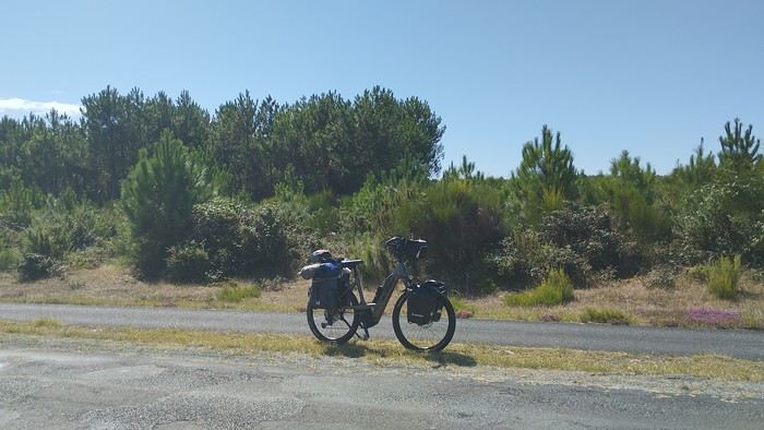 My gear
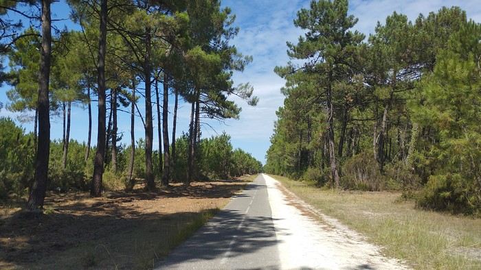
The Landes region—nothing extraordinary, but the calm and serenity are nice.

Le Verdon
The wild coast
This marsh isn’t dry, though.
Today is the third day of my trip, and I’m writing to you from a campsite in Marans. I’ve set out to bike from Carcans Maubuisson back to Plaisir. Why Carcans? Because we spent a week there as a family—a great week that lets everyone reconnect for a long stretch. Also, on Saturday, we all headed home—some by car, and me by bike. This journey is about 850 km via bike paths and small cycling roads. It’s not a sporting feat, just a nice long ride for fun. As the old Chinese sage says, "The destination doesn’t matter—it’s the journey that counts." But he also told me, "Traveling is great, but what’s the point if you don’t share it?" You see, this old sage has told me a lot of things—he often keeps me company when I’m biking. Of course, he doesn’t pedal, but we travel in harmony. Sure, he can be a bit annoying sometimes, but we still get along. All this to say I’ve created a group to share my story. I’d be happy to share this experience with you—it’s an adventure for me. On Saturday, I wasn’t sure I’d even leave because I’d been dealing with sciatica for days. Luckily, Juliette, a friend of the old Chinese sage, recommended a lifesaving remedy: Alternately stretching your legs with an elastic band under your foot. Obviously, a jam jar rubber band won’t cut it.
From Marans - The mosquitoes are attacking; time to head back to shelter.
The first two legs took me to Royan and then Rochefort. The Sèvre Niortaise flows nearby, and I followed a canal from La Rochelle. You could say the area is as dry as the marsh, judging by the state of the crops.
As I mentioned, it’s the third day, and if Jesus rose again on this day, for me it was more like the crucifixion. The scorching heat—only bearable when you’re moving—combined with rough trail conditions, and the old Chinese sage says, "Terrible roads, slow speed, and watch your limbs." I set out to do 60 km but ended up doing 80, and the last 20 were tough. I kept checking the GPS to see how much farther until the campsite. Today: Rochefort to Marans, sticking to the coast until La Rochelle, then no notable towns after that—just a constant canal. But since the sky isn’t too low, it hasn’t gotten lost. I’ve still got plenty of anecdotes to share, but it’s pitch black out, and the mosquitoes are still around. This morning, I counted ten in my tent, all full of my blood. Yesterday, at the end of the leg to Rochefort, I was really looking forward to crossing the Charente using the transporter bridge, but a sneaky GPS conspiracy led me far from it. I ended up crossing the Charente on a completely ordinary bridge, watching the transporter bridge in the distance with disappointment.
End of the first episode. Until tomorrow, if you’d like!
No journal for the first two days. Day 1 - CARCANS-ROYAN Day 2 - ROYAN - ROCHEFORT Tonight I'm in MARANS in the "dry marsh" according to the campsite manager—it’s the first time I’ve heard of a "dry marsh"?!
Photos from the first two days
My gearThe Landes region—nothing extraordinary, but the calm and serenity are nice.
Le Verdon
The wild coast
This marsh isn’t dry, though.
Today is the third day of my trip, and I’m writing to you from a campsite in Marans. I’ve set out to bike from Carcans Maubuisson back to Plaisir. Why Carcans? Because we spent a week there as a family—a great week that lets everyone reconnect for a long stretch. Also, on Saturday, we all headed home—some by car, and me by bike. This journey is about 850 km via bike paths and small cycling roads. It’s not a sporting feat, just a nice long ride for fun. As the old Chinese sage says, "The destination doesn’t matter—it’s the journey that counts." But he also told me, "Traveling is great, but what’s the point if you don’t share it?" You see, this old sage has told me a lot of things—he often keeps me company when I’m biking. Of course, he doesn’t pedal, but we travel in harmony. Sure, he can be a bit annoying sometimes, but we still get along. All this to say I’ve created a group to share my story. I’d be happy to share this experience with you—it’s an adventure for me. On Saturday, I wasn’t sure I’d even leave because I’d been dealing with sciatica for days. Luckily, Juliette, a friend of the old Chinese sage, recommended a lifesaving remedy: Alternately stretching your legs with an elastic band under your foot. Obviously, a jam jar rubber band won’t cut it.
From Marans - The mosquitoes are attacking; time to head back to shelter.
The first two legs took me to Royan and then Rochefort. The Sèvre Niortaise flows nearby, and I followed a canal from La Rochelle. You could say the area is as dry as the marsh, judging by the state of the crops.
As I mentioned, it’s the third day, and if Jesus rose again on this day, for me it was more like the crucifixion. The scorching heat—only bearable when you’re moving—combined with rough trail conditions, and the old Chinese sage says, "Terrible roads, slow speed, and watch your limbs." I set out to do 60 km but ended up doing 80, and the last 20 were tough. I kept checking the GPS to see how much farther until the campsite. Today: Rochefort to Marans, sticking to the coast until La Rochelle, then no notable towns after that—just a constant canal. But since the sky isn’t too low, it hasn’t gotten lost. I’ve still got plenty of anecdotes to share, but it’s pitch black out, and the mosquitoes are still around. This morning, I counted ten in my tent, all full of my blood. Yesterday, at the end of the leg to Rochefort, I was really looking forward to crossing the Charente using the transporter bridge, but a sneaky GPS conspiracy led me far from it. I ended up crossing the Charente on a completely ordinary bridge, watching the transporter bridge in the distance with disappointment.
End of the first episode. Until tomorrow, if you’d like!
Selfie à Auschwitz
Bonjour à tous,
Le hasard total de mes "promenades " sur le net m'ont amené à un article du Huffington post qui explique que le centre mémorial d'Auschwitz a été contraint de faire un " rappel à l'ordre " devant la recrudescence des visiteurs ( comme si on visitait en ce lieu ! ) faisant des selfies devant la porte, devant les bâtiments, devant des photos de prisonniers décharnés, sur les rails....
J'ai eu peine à le croire et en regardant sur G images en tapant selfie Auschwitz, j'ai pu constater le summum de la honte ! Déjà, cette mode des selfies m'agace un peu, mais alors là, cela dépasse mon entendement et le respect qui doit prévaloir en ce lieu.
C'était mon " coup de gueule de ce soir,
Respect à vous toutes et tous et bonne soirée.
Le hasard total de mes "promenades " sur le net m'ont amené à un article du Huffington post qui explique que le centre mémorial d'Auschwitz a été contraint de faire un " rappel à l'ordre " devant la recrudescence des visiteurs ( comme si on visitait en ce lieu ! ) faisant des selfies devant la porte, devant les bâtiments, devant des photos de prisonniers décharnés, sur les rails....
J'ai eu peine à le croire et en regardant sur G images en tapant selfie Auschwitz, j'ai pu constater le summum de la honte ! Déjà, cette mode des selfies m'agace un peu, mais alors là, cela dépasse mon entendement et le respect qui doit prévaloir en ce lieu.
C'était mon " coup de gueule de ce soir,
Respect à vous toutes et tous et bonne soirée.
La Bretagne avec le Jacques Cartier "Ponant" du 18 au 25 juillet 2020
Bonjour
J'avais envisagé d'attendre début Octobre et notre retour à Rennes pour faire le C/R
de notre croisière " La Bretagne : entre côtes sauvages et phares "
Mais tout compte fait , je change d'avis et démarre ce C/R dès maintenant :
Au retour de notre 20 ème croisière , fin Novembre 2019 , ( Transat de Marseille à
Miami sur le MSC Divina ) , nous avions décidé de faire une (petite ) pause pour les
croisières et donc de ne rien réserver avant plusieurs mois .
Sage décision en fait au vu des évènements sanitaires du Printemps puisque nous
avons échappé aux problèmes subis par nombre de touristes qui se sont retrouvés
avec des avoirs qu'il ne pourront utiliser ( au mieux ) que dans plusieurs mois .
A la fin de l'an dernier , je m'étais inscrit à la newsletter de Ponant , plus pour rêver
qu'autre chose .
Mais début Juin , alors que toutes les croisières sont annulées les unes après les autres ,
Ponant , profitant notamment de la capacité réduite de ses navires et du retour en
France métropolitaine de presque tous , met en place 2 itinéraires en Méditerranée et
3 en Manche et Atlantique .
La croisière au départ de Nice pour contourner la Corse nous plaisait bien mais rejoindre
Nice posait , à ce moment là , problème .
Nous décidons donc de nous rabattre sur la croisière au départ de St Malo car là , pas de
souci pour nous y rendre 🙂
Les raisons de notre choix : de mémoire , St Malo est fréquemment une ville d'escale pour
les bateaux de croisière mais quasiment jamais une ville d'embarquement ( et là aussi
de débarquement ) , donc autant en profiter .
De plus l'itinéraire nous plait avec la visite d'iles connues ( mais que nous reverrons avec
plaisir ) et de vraies découvertes dont les Scilly , au large de la Cornouaille britannique .
Mi Juin , nous décidons de réserver la croisière au départ de St Malo du 18 Juillet , sachant
que nous avons la possibilité d'annuler , sans pénalités , jusqu'à 72 heures avant le départ .
L'annulation , nous y avons pensé quand , fin Juin , nous avons appris que l'escale aux
Scilly était supprimée 😠 , remplacée par Ouessant , une escale à Groix se substituant
à celle de Hoëdic .
Toutes les autres croisières étaient aussi affectées par la suppression des escales à l'étranger
pour raisons sanitaires ( jours de quarantaine )
Nous trouverons donc peut-être une autre occasion pour nous rendre aux Scilly
Comme d'habitude , je m'égare avec ce préambule un peu long .
Je vais donc faire une pause avant de vous embarquer sur le Jacques Cartier .
A plus
Jean-Pierre
27 jours à travers le Nord-ouest américain
Plusieurs mois ont passé depuis notre retour du Nord-Ouest américain, et cette période un peu particulière est l’occasion rêvée de me consacrer enfin à la rédaction de ce carnet de voyage !
Quatrième roadtrip aux USA. C’est en Août 2019 que nous décollons pour Seattle. Cette fois, nous explorons la partie Nord-Ouest des USA, ce pays qui nous passionne depuis le premier roadtrip en 2014. 27 jours de voyage, au travers le Washington, l’Idaho, le Montana, le Wyoming et l’Oregon…ça promet encore de magnifiques découvertes 🙂 Cette année, certains grands parcs sont au programme comme Glacier NP ou encore Yellowstone (non, on ne s’en lassera jamais !), mais nous avons aussi mis sur notre parcours des State Park bien moins touristiques et des petits endroits isolés mais magnifiques comme on adore !
JOUR 1
Ma maman et mon frère sont arrivés chez moi la veille car ils vivent en province, et ce matin pas question d’avoir du retard. C’est le grand jour ! Celui qu’on prépare depuis un an !
Vers 5h du matin, nous recevons un mail de la compagnie aérienne qui nous indique 1h de retard au décollage, on se laisse donc 1h de sommeil supplémentaire.
Porte K49 - 11h10 l’avion décolle. Nous avons choisi à nouveau de voler avec Delta Airlines, et mis à part ce retard de 50min, nous n’avons, comme d’habitude rien à signaler. Les services sont au rendez-vous.
Cette année, nous avons un peu moins de chance que les voyages passés, en ce qui concerne la météo. Nous n’avons pas la chance de voir le Groenland, les côtes canadiennes.
Nous atterrissons à Seattle en début d’après-midi. Il fait gris, et froid ! On attend un moment près du hangar Alaska Airlines, et ben, étant donné la météo, on pourrait se croire en Alaska 😉
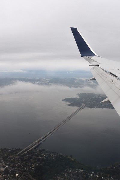
On arrive à la douane, ils nous séparent pour nous interroger un par un. Seul problème, maman parle très mal anglais, voire pas du tout ! Ce qu’on signale immédiatement, mais ils tiennent absolument à ce qu’elle réponse par elle-même aux questions. Ce qui après unpeu d’angoisse nous laisse un souvenir mémorable lorsque le douanier demande si elle a de la nourriture avec elle, sa réponse : « oui bonbonsss » 😄
Tout ça derrière nous, on se dirige vers le bâtiment qui regroupe tous les loueurs de voiture. Tout est très bien fléché dans l’aéroport de Seattle. Nous savons qu’il nous faut prendre un shuttle. Il y a la queue, et nous sommes sous la pluie ! Welcome !

Arrivé au guichet Hertz, pas d’attente. Nous sommes plutôt satisfaits de notre réservation car quelques jours avant le départ, je me reconnecte sur leur site pour vérifier que tout est en ordre. Je réalise alors que les tarifs pour notre catégorie de véhicule ont bien changé et qu’ils sont plus intéressants que lors de notre réservation il y a plusieurs mois. J’appelle Hertz qui constate également, modifie la réservation et s’engage immédiatement à rembourser les 400€ d’écart. Au guichet nous avons également une discussion concernant les assurances des passagers de la voiture. Et la personne est très à l’écoute, se renseigne plusieurs fois à notre demande, pour finalement nous éviter un surcoût, très peu courant chez les loueurs américains ça !!!
C’est donc de bonne humeur que nous descendons au parking, retrouver le véhicule qui nous est attribué. C’est un Chevrolet TAHOE. Maman fait quelques pas en arrière, stupéfaite. « Mais je ne pourrais jamais conduire cet engin !!! ». Avec mon frère Raphaël, nous, nous sommes ravis ! Après les contrôles d’usage, rayures, essuie-glace, niveaux, roue de secours… cette fois EN ROUTE !
On ne change pas les bonnes habitudes, premier arrêt, Walmart ! Il est à peine à 10min de l’aéroport. Nous arrivons sous une pluie battante, 30 secondes dehors pour rejoindre le magasin suffisent à nous tremper ! Nous sommes fatigués du voyage donc la liste de courses préparée à l’avance est bien utile. Seul petit problème, impossible de trouver une bombonne de gaz pour notre réchaud, et ce malgré l’aide d’un vendeur. Cette année, nous avons amené avec nous les barres de céréales pour les randos, on avait un mauvais souvenir des versions américaines et on a bien fait ! On arrive à la voiture, on se dit comme dans la pub, on va utiliser le pied pour ouvrir le coffre car nous sommes chargés et il pleut toujours. Mais rien ne fonctionne. La clé nous permet d’ouvrir chaque porte, chaque fenêtre, mais on ne trouve pas dans la précipitation comment ouvrir le coffre 😕 Quelques minutes plus tard, problème résolu, courses rangées… mais nous sommes trempés comme des soupes 😎
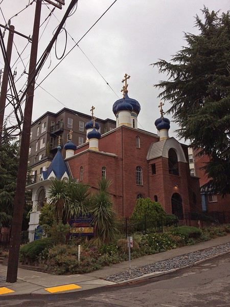
Maintenant, direction REI. C’est certainement notre seule occasion d’y faire un tour pendant ce voyage. Et puis, on a toujours besoin de gaz pour le réchaud. 25min plus tard, on arrive au parking sous-terrain, il est gratuit pendant 1h puis 2$ pour 3h. On a adoré ce magasin ! Et on a trouvé les quelques articles qui nous manquaient. Mais il est temps de partir. Nous avons décidé de ne pas dormir à Seattle, pour économiser un peu. Résultat, encore un peu de route.
Après 30min, nous arrivons au Best Value Inn de Lynnwood. Petit motel sans prétention, mais propre, personnel accueillant. Parfait pour une nuit d’après voyage. Une fois les bagages déchargés, on range les courses dans les glacières. Et on ne se fait pas prier pour se mettre au lit !
Quatrième roadtrip aux USA. C’est en Août 2019 que nous décollons pour Seattle. Cette fois, nous explorons la partie Nord-Ouest des USA, ce pays qui nous passionne depuis le premier roadtrip en 2014. 27 jours de voyage, au travers le Washington, l’Idaho, le Montana, le Wyoming et l’Oregon…ça promet encore de magnifiques découvertes 🙂 Cette année, certains grands parcs sont au programme comme Glacier NP ou encore Yellowstone (non, on ne s’en lassera jamais !), mais nous avons aussi mis sur notre parcours des State Park bien moins touristiques et des petits endroits isolés mais magnifiques comme on adore !
JOUR 1
Ma maman et mon frère sont arrivés chez moi la veille car ils vivent en province, et ce matin pas question d’avoir du retard. C’est le grand jour ! Celui qu’on prépare depuis un an !
Vers 5h du matin, nous recevons un mail de la compagnie aérienne qui nous indique 1h de retard au décollage, on se laisse donc 1h de sommeil supplémentaire.
Porte K49 - 11h10 l’avion décolle. Nous avons choisi à nouveau de voler avec Delta Airlines, et mis à part ce retard de 50min, nous n’avons, comme d’habitude rien à signaler. Les services sont au rendez-vous.
Cette année, nous avons un peu moins de chance que les voyages passés, en ce qui concerne la météo. Nous n’avons pas la chance de voir le Groenland, les côtes canadiennes.
Nous atterrissons à Seattle en début d’après-midi. Il fait gris, et froid ! On attend un moment près du hangar Alaska Airlines, et ben, étant donné la météo, on pourrait se croire en Alaska 😉
On arrive à la douane, ils nous séparent pour nous interroger un par un. Seul problème, maman parle très mal anglais, voire pas du tout ! Ce qu’on signale immédiatement, mais ils tiennent absolument à ce qu’elle réponse par elle-même aux questions. Ce qui après unpeu d’angoisse nous laisse un souvenir mémorable lorsque le douanier demande si elle a de la nourriture avec elle, sa réponse : « oui bonbonsss » 😄
Tout ça derrière nous, on se dirige vers le bâtiment qui regroupe tous les loueurs de voiture. Tout est très bien fléché dans l’aéroport de Seattle. Nous savons qu’il nous faut prendre un shuttle. Il y a la queue, et nous sommes sous la pluie ! Welcome !
Arrivé au guichet Hertz, pas d’attente. Nous sommes plutôt satisfaits de notre réservation car quelques jours avant le départ, je me reconnecte sur leur site pour vérifier que tout est en ordre. Je réalise alors que les tarifs pour notre catégorie de véhicule ont bien changé et qu’ils sont plus intéressants que lors de notre réservation il y a plusieurs mois. J’appelle Hertz qui constate également, modifie la réservation et s’engage immédiatement à rembourser les 400€ d’écart. Au guichet nous avons également une discussion concernant les assurances des passagers de la voiture. Et la personne est très à l’écoute, se renseigne plusieurs fois à notre demande, pour finalement nous éviter un surcoût, très peu courant chez les loueurs américains ça !!!
C’est donc de bonne humeur que nous descendons au parking, retrouver le véhicule qui nous est attribué. C’est un Chevrolet TAHOE. Maman fait quelques pas en arrière, stupéfaite. « Mais je ne pourrais jamais conduire cet engin !!! ». Avec mon frère Raphaël, nous, nous sommes ravis ! Après les contrôles d’usage, rayures, essuie-glace, niveaux, roue de secours… cette fois EN ROUTE !
On ne change pas les bonnes habitudes, premier arrêt, Walmart ! Il est à peine à 10min de l’aéroport. Nous arrivons sous une pluie battante, 30 secondes dehors pour rejoindre le magasin suffisent à nous tremper ! Nous sommes fatigués du voyage donc la liste de courses préparée à l’avance est bien utile. Seul petit problème, impossible de trouver une bombonne de gaz pour notre réchaud, et ce malgré l’aide d’un vendeur. Cette année, nous avons amené avec nous les barres de céréales pour les randos, on avait un mauvais souvenir des versions américaines et on a bien fait ! On arrive à la voiture, on se dit comme dans la pub, on va utiliser le pied pour ouvrir le coffre car nous sommes chargés et il pleut toujours. Mais rien ne fonctionne. La clé nous permet d’ouvrir chaque porte, chaque fenêtre, mais on ne trouve pas dans la précipitation comment ouvrir le coffre 😕 Quelques minutes plus tard, problème résolu, courses rangées… mais nous sommes trempés comme des soupes 😎
Maintenant, direction REI. C’est certainement notre seule occasion d’y faire un tour pendant ce voyage. Et puis, on a toujours besoin de gaz pour le réchaud. 25min plus tard, on arrive au parking sous-terrain, il est gratuit pendant 1h puis 2$ pour 3h. On a adoré ce magasin ! Et on a trouvé les quelques articles qui nous manquaient. Mais il est temps de partir. Nous avons décidé de ne pas dormir à Seattle, pour économiser un peu. Résultat, encore un peu de route.
Après 30min, nous arrivons au Best Value Inn de Lynnwood. Petit motel sans prétention, mais propre, personnel accueillant. Parfait pour une nuit d’après voyage. Une fois les bagages déchargés, on range les courses dans les glacières. Et on ne se fait pas prier pour se mettre au lit !