Results for "Rocher+Vierge+|+127"
16503 results found.
A wonderful week around Tromsø, Kvaløya, and the Lyngen Alps
Hi everyone,
There haven’t been many recent stories about Norway in winter, and since I had trouble finding info on winter hikes, I thought I’d share a little travel journal.
Back in September 2024, while planning our summer 2025 trip to Norway, I joined some Facebook groups dedicated to travel in Scandinavia and started reading travel blogs. Since winter trips were being planned at the time, I came across posts with stunning photos of northern Norway in winter. I’d always pictured monotonous landscapes of pine forests and frozen lakes, so I was pleasantly surprised to see fjords, mountain ranges, and charming colorful cabins—just like in the Lofoten Islands. Turns out, the vast pine forests are more typical of Finnish Lapland. Norway, north of the Arctic Circle, is actually much more diverse. That was all it took to suggest this destination to my three guys for our winter vacation. After some research, early March seemed ideal—good weather, long enough daylight, and great chances for northern lights. A direct flight from Paris to Tromsø sealed the deal. The only downside? The cost of cars, accommodations, and activities nearly made us back out! Everything except flights is really expensive.
Since our oldest son had an important school deadline in June, he decided to skip the trip, so we ended up going as a trio. We took a Transavia round-trip flight from Orly to Tromsø for an amazing trip from March 1st to 8th.
Want to come along?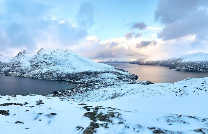
There haven’t been many recent stories about Norway in winter, and since I had trouble finding info on winter hikes, I thought I’d share a little travel journal.
Back in September 2024, while planning our summer 2025 trip to Norway, I joined some Facebook groups dedicated to travel in Scandinavia and started reading travel blogs. Since winter trips were being planned at the time, I came across posts with stunning photos of northern Norway in winter. I’d always pictured monotonous landscapes of pine forests and frozen lakes, so I was pleasantly surprised to see fjords, mountain ranges, and charming colorful cabins—just like in the Lofoten Islands. Turns out, the vast pine forests are more typical of Finnish Lapland. Norway, north of the Arctic Circle, is actually much more diverse. That was all it took to suggest this destination to my three guys for our winter vacation. After some research, early March seemed ideal—good weather, long enough daylight, and great chances for northern lights. A direct flight from Paris to Tromsø sealed the deal. The only downside? The cost of cars, accommodations, and activities nearly made us back out! Everything except flights is really expensive.
Since our oldest son had an important school deadline in June, he decided to skip the trip, so we ended up going as a trio. We took a Transavia round-trip flight from Orly to Tromsø for an amazing trip from March 1st to 8th.
Want to come along?
The Kingdom of Lions...
 Hello everyone!
This trip dates back to late 2021, but since Voyage Forum reopened for writing, I haven’t seen many travel journals about Tanzania, so I decided to repost this one, which I originally shared on another well-known travelers’ site—even though I prefer Voyage Forum’s user experience.
It’s also a chance for me to relive this exhilarating trip... So, if you’re up for it, let me take you on a classic adventure: Tarangire - Ngorongoro - Serengeti, plus a little bonus—the small Arusha Park.
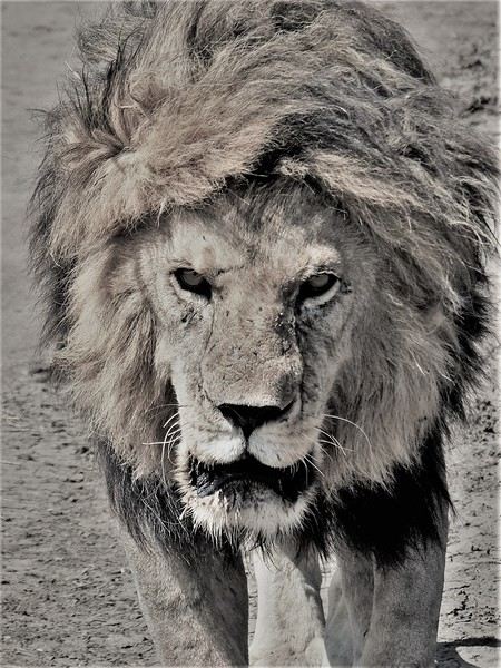
First off, yes, as the title of this journal suggests, we were lucky enough to spot *tons* of lions. The power they exude is incredible, even if most of the time they just look like big cats napping or strolling around. But lock eyes with one, and you’ll be glad you’re in the jeep.
Hello everyone!
This trip dates back to late 2021, but since Voyage Forum reopened for writing, I haven’t seen many travel journals about Tanzania, so I decided to repost this one, which I originally shared on another well-known travelers’ site—even though I prefer Voyage Forum’s user experience.
It’s also a chance for me to relive this exhilarating trip... So, if you’re up for it, let me take you on a classic adventure: Tarangire - Ngorongoro - Serengeti, plus a little bonus—the small Arusha Park.
First off, yes, as the title of this journal suggests, we were lucky enough to spot *tons* of lions. The power they exude is incredible, even if most of the time they just look like big cats napping or strolling around. But lock eyes with one, and you’ll be glad you’re in the jeep.
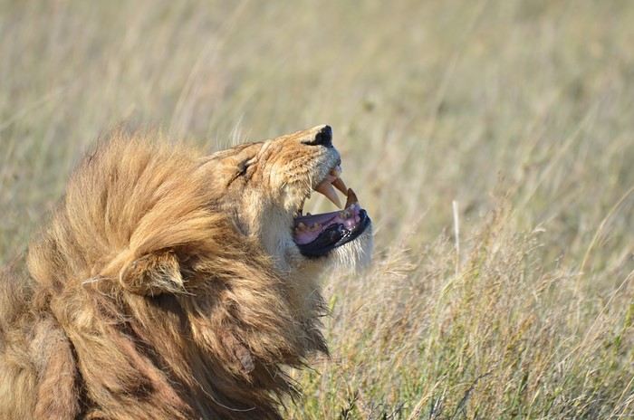
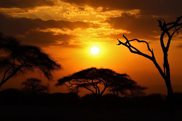
But let’s not forget the rest of the wildlife—and the landscapes, which are absolutely stunning, with those iconic tree silhouettes.
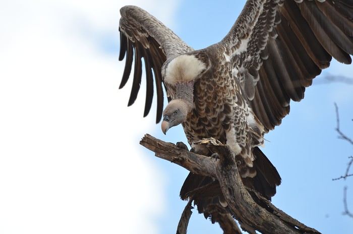
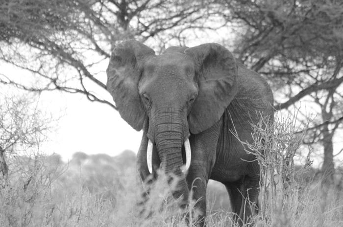
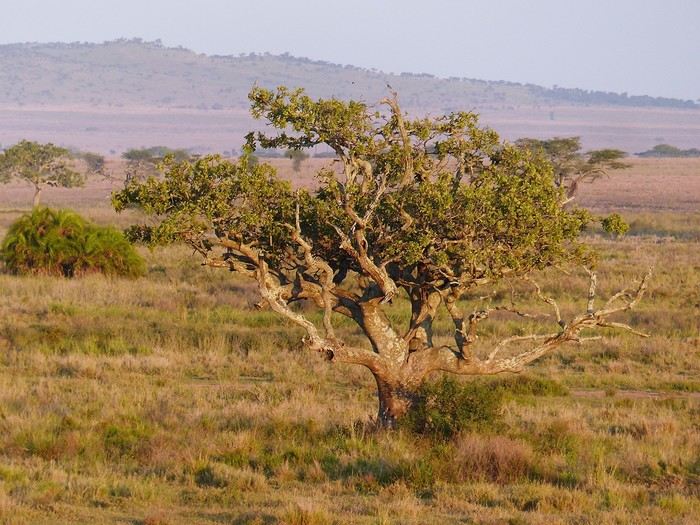
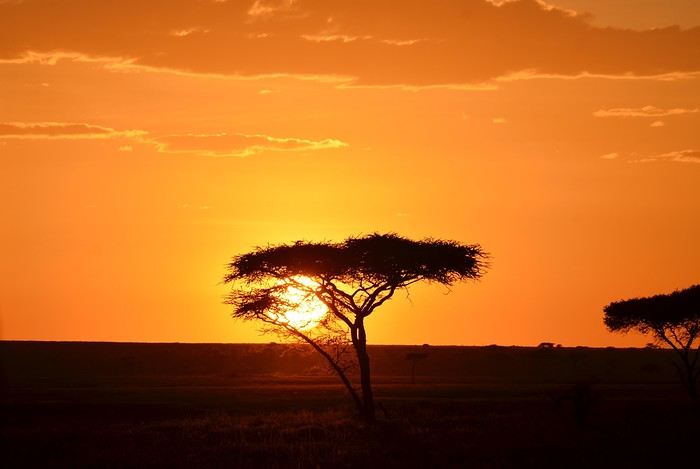
I remember before leaving, I was a little worried I wouldn’t feel that same sense of wonder I’d experienced two years earlier in Botswana (see my travel journal). That fear was unfounded—the magic worked its charm once again! Note: Since we had limited time, we focused our trip entirely on safari, so this journal is 100% animals and landscapes—and 0% Maasai. Next post: TARANGIRE
Luggage chit-chat goes here
It’s all in the title 😛
Unusual trip to Rajasthan November 2022
Friday, November 4
My flight Barcelona - Abu Dhabi - Delhi went smoothly, it’s on time, and here I am back in India after 3 long years.
As I step off the plane, we head toward customs. It’s 3 AM, I’m tired but happy. The huge customs hall is below ground level and buzzing with people who’ve just arrived. In the end, they’re well organized—Indians to the left, foreigners to the right, and all along the hall, the customs officers’ posts, who remain very zen despite the crowd. It took me less than 2 hours to get out of the airport, which was pretty quick.
For this return trip, I got in touch with a driver from the "Lovers of India" group who was supposed to take me from the airport to Udaipur, passing through non-touristy villages like I love. This French-speaking driver had convinced me to travel by car, which was supposed to make moving from village to village easier. Two or three days before departure, I receive a message from the driver saying he was sick with a cold and sending another driver, his very kind brother who knows Rajasthan well but doesn’t speak French. I’m a bit disappointed by this message and doubtful about the driver’s sincerity, but I don’t have time to find another driver, so I stick to my plans, though I’m not at ease.
At the exit, the driver hasn’t arrived, and I wait half an hour before seeing him show up with a big smile, "Namaste." We don’t waste time and head to the car, which is clean and new.
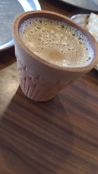
We get to know each other in the car and hit the road toward Alwar. Along the way, we stop for lunch and to taste my first masala chai, which wakes up my taste buds.
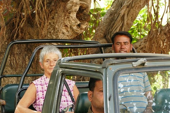
I doze off during the drive, and we arrive at the Atlantic Hotel in Alwar at 10:30 AM. My room is on the ground floor, and I settle in quickly. The Wi-Fi isn’t working, but the staff do everything they can to fix it. At noon, Gajender, the driver, suggests visiting the Qila Fort, which is on the heights of Alwar. The fort is closed for restoration, but safari tours are offered—jeep, guide, driver, and visit for 1600 Rs.
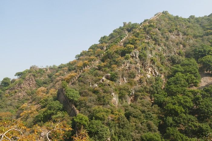
We follow the great wall, which is impressive—the second largest in India and the third in the world.
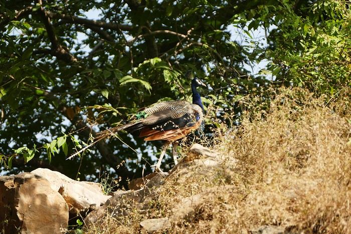
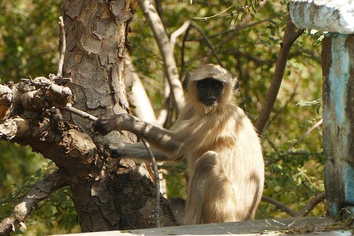
We spot peacocks and monkeys.
The guide shows me an old stepwell lost in nature. It’s always my thing to check out these baoris, which can be stunning, but this one isn’t anything special. We arrive at the palace overlooking the city.
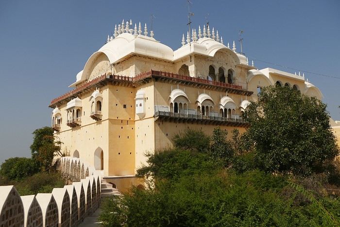
We walk around the palace, and I discover another stepwell that’s not worth lingering over.
The tour is over, and I had a great time despite the fatigue. We head back down to Alwar, near the City Palace, which has been turned into administrative offices. Gaju (the driver’s nickname) finds a parking spot near a dhaba where we have lunch (paneer masala, chapatis, chai)—it’s delicious. With my energy restored, we head to the palace. On the top floor is a museum that I visit.
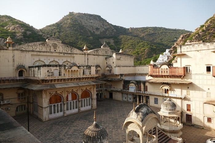
At the exit of the museum, we have to go back down and walk around the palace to get to the Moosi Maharani Chhatri. I’ve been here once before and really liked it, and the place is still the same—calm and relaxing.
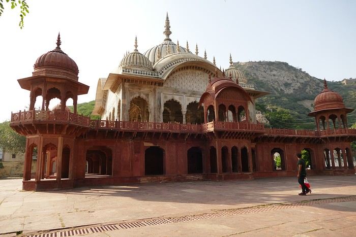
"This monument is the most artistic in Alwar and also the most royal, filled with fascinating history. Maharaja Vinay Singh of Alwar built this two-story cenotaph in 1815 in memory of his father, Maharaja Bakhtawar Singh. It’s also known as Moosi Maharani ki Chhatri, named after the king’s mistress, who performed sati upon his death. After the sati, she was accepted as the king’s wife. It’s an elegant monument, shaped like a flower and built with a mix of brown sandstone and white marble. The first floor is made of sandstone, while the upper floor and the chhatris (cenotaphs) are in white marble. Its sculpted pavilion has dome-shaped arches with intricate lace-like and exquisite floral patterns. There are complex motifs that shine brightly in the sunlight. The colorful circular ceiling is an important part of Moosi Maharani Ki Chhatri and is adorned with faded gold-leaf paintings of mythological figures and scenes. The footprints of Maharaja and Moosi Rani are engraved in marble inside the cenotaph, and locals pay their respects to them."
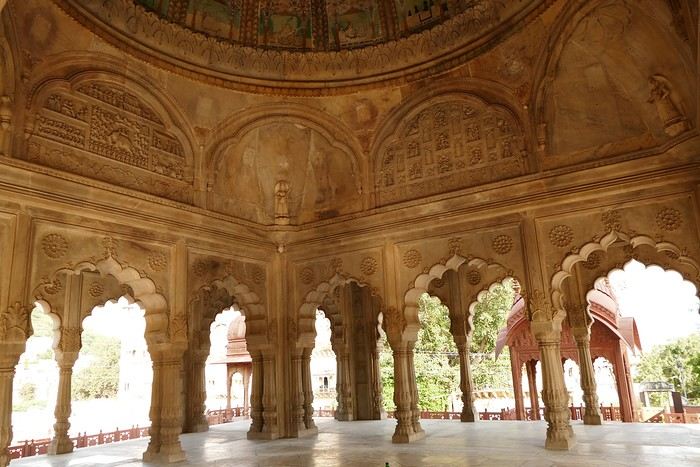
Near the chhatri, there’s a large water reservoir with a magnificent view. The place is peaceful and relaxing, and I stay here for a while, contemplating and daydreaming before heading back to the hotel for some well-deserved rest. The Wi-Fi is working now. I’m the only foreign guest, and since my room is near the entrance, I’ll be well taken care of throughout my stay.
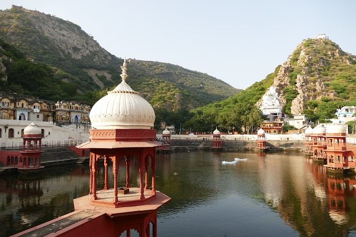
I doze off during the drive, and we arrive at the Atlantic Hotel in Alwar at 10:30 AM. My room is on the ground floor, and I settle in quickly. The Wi-Fi isn’t working, but the staff do everything they can to fix it. At noon, Gajender, the driver, suggests visiting the Qila Fort, which is on the heights of Alwar. The fort is closed for restoration, but safari tours are offered—jeep, guide, driver, and visit for 1600 Rs.
We follow the great wall, which is impressive—the second largest in India and the third in the world.
We spot peacocks and monkeys.
The guide shows me an old stepwell lost in nature. It’s always my thing to check out these baoris, which can be stunning, but this one isn’t anything special. We arrive at the palace overlooking the city.
We walk around the palace, and I discover another stepwell that’s not worth lingering over.
The tour is over, and I had a great time despite the fatigue. We head back down to Alwar, near the City Palace, which has been turned into administrative offices. Gaju (the driver’s nickname) finds a parking spot near a dhaba where we have lunch (paneer masala, chapatis, chai)—it’s delicious. With my energy restored, we head to the palace. On the top floor is a museum that I visit.
At the exit of the museum, we have to go back down and walk around the palace to get to the Moosi Maharani Chhatri. I’ve been here once before and really liked it, and the place is still the same—calm and relaxing.
"This monument is the most artistic in Alwar and also the most royal, filled with fascinating history. Maharaja Vinay Singh of Alwar built this two-story cenotaph in 1815 in memory of his father, Maharaja Bakhtawar Singh. It’s also known as Moosi Maharani ki Chhatri, named after the king’s mistress, who performed sati upon his death. After the sati, she was accepted as the king’s wife. It’s an elegant monument, shaped like a flower and built with a mix of brown sandstone and white marble. The first floor is made of sandstone, while the upper floor and the chhatris (cenotaphs) are in white marble. Its sculpted pavilion has dome-shaped arches with intricate lace-like and exquisite floral patterns. There are complex motifs that shine brightly in the sunlight. The colorful circular ceiling is an important part of Moosi Maharani Ki Chhatri and is adorned with faded gold-leaf paintings of mythological figures and scenes. The footprints of Maharaja and Moosi Rani are engraved in marble inside the cenotaph, and locals pay their respects to them."
Near the chhatri, there’s a large water reservoir with a magnificent view. The place is peaceful and relaxing, and I stay here for a while, contemplating and daydreaming before heading back to the hotel for some well-deserved rest. The Wi-Fi is working now. I’m the only foreign guest, and since my room is near the entrance, I’ll be well taken care of throughout my stay.
Visiting collective granaries in Morocco
Hello everyone,
I’m currently planning our next trip to Morocco. We really enjoy visiting one or two collective granaries on each of our trips. We’ve seen some already, like the one in Aït Kine, or the one in Tasguent, and of course those in Amtoudi, as well as the cliffside granary of Ifri. There are still many left to explore. I’d love to hear which ones you’d recommend—preferably ones that aren’t too hard to access. I’m counting on you! Thanks
Tanzania 2019 - Polé Polé
KARIBUUU
Over 5 years later, I’m finally getting around to writing the travel journal for our first trip to East Africa: Tanzania. *Polé Polé*, as they say! 😎
A trip I’d started planning just 6 years ago, in February 2019, for my post-internship exam vacation. After returning to South Africa in July 2019 with my family, this trip, planned for September 2019, would be all about discovery and a few firsts: first trip with friends, first trek, first time in East Africa. I really wanted to attempt the Kilimanjaro ascent, try to still see some of its "eternal" ice, and Alison wanted to do as much safari as possible. Unlike with the Zulus, Himbas, or San, visiting a Maasai village wasn’t on the agenda. Thanks to the Kessy Brothers agency, who were super responsive, Sandy from VF, and other members who helped prepare our trip, we settled on the following itinerary:
Day -1 (8/30): Departure from Pointe-à-Pitre Day 0 (8/31): Departure from Paris Day 1 (9/01): Arrival at Kilimanjaro Airport / Ameg Lodge (Moshi) DAY 2 (9/02): Machame gate / Machame camp DAY 3 (9/03): Shira / Shira camp DAY 4 (9/04): Baranco / Baranco camp DAY 5 (9/05): Barafu / Barafu camp DAY 6 (9/06): Barafu + Summit at midnight / Mweka camp DAY 7 (9/07): Mweka gate / Sal Salnero Hotel (Moshi) DAY 8 (9/08): Arusha National Park / Kanga camp DAY 9 (9/09): Tarangire National Park / Kanga camp DAY 10 (9/10): Tarangire National Park / Twiga Lodge DAY 11 (9/11): Lake Manyara / Twiga Lodge DAY 12 (9/12): Ngorongoro Crater / Simba campsite DAY 13 (9/13): Serengeti National Park / Seronera campsite DAY 14 (9/14): Serengeti National Park - Uoga Kuria Camp DAY 15 (9/15): Serengeti National Park / Waso campsite DAY 16 (9/16): Lake Natron / Maasai Giraffe Ecolodge DAY 17 (9/17): Kilimanjaro Airport Day 18 (9/18): Zanzibar Day 19 (9/19): Zanzibar Day 20 (9/20): Zanzibar Day 21 (9/21): Zanzibar
As I mentioned in my first travel journal about our South Africa trip, I’ve had a special connection to Tanzania for a long time. Growing up in the Indian Ocean without ever visiting Africa, those wildlife documentaries on TV when I skipped my pharmacy classes... I imagined and dreamed about this land and country so much.
The original plan was to go just the two of us with Alison, but somehow—though I don’t quite remember how—we ended up organizing the trip with our friends Mélissa and Doriane, who joined us in Arusha after our Kilimanjaro trek for the last two weeks and their very first safari. I think it was Melissa who had the idea to crash our trip, and she was right to do so! 😉 Flights: Pointe-à-Pitre-Grand Case and Grand Case-Paris with Air Caraïbes. Flights: Paris-JRO and ZNZ-Paris with Kenya Airways (layover in Nairobi). Flight: JRO-ZNZ with Air Tanzania.
Safe travels! !
Over 5 years later, I’m finally getting around to writing the travel journal for our first trip to East Africa: Tanzania. *Polé Polé*, as they say! 😎
A trip I’d started planning just 6 years ago, in February 2019, for my post-internship exam vacation. After returning to South Africa in July 2019 with my family, this trip, planned for September 2019, would be all about discovery and a few firsts: first trip with friends, first trek, first time in East Africa. I really wanted to attempt the Kilimanjaro ascent, try to still see some of its "eternal" ice, and Alison wanted to do as much safari as possible. Unlike with the Zulus, Himbas, or San, visiting a Maasai village wasn’t on the agenda. Thanks to the Kessy Brothers agency, who were super responsive, Sandy from VF, and other members who helped prepare our trip, we settled on the following itinerary:
Day -1 (8/30): Departure from Pointe-à-Pitre Day 0 (8/31): Departure from Paris Day 1 (9/01): Arrival at Kilimanjaro Airport / Ameg Lodge (Moshi) DAY 2 (9/02): Machame gate / Machame camp DAY 3 (9/03): Shira / Shira camp DAY 4 (9/04): Baranco / Baranco camp DAY 5 (9/05): Barafu / Barafu camp DAY 6 (9/06): Barafu + Summit at midnight / Mweka camp DAY 7 (9/07): Mweka gate / Sal Salnero Hotel (Moshi) DAY 8 (9/08): Arusha National Park / Kanga camp DAY 9 (9/09): Tarangire National Park / Kanga camp DAY 10 (9/10): Tarangire National Park / Twiga Lodge DAY 11 (9/11): Lake Manyara / Twiga Lodge DAY 12 (9/12): Ngorongoro Crater / Simba campsite DAY 13 (9/13): Serengeti National Park / Seronera campsite DAY 14 (9/14): Serengeti National Park - Uoga Kuria Camp DAY 15 (9/15): Serengeti National Park / Waso campsite DAY 16 (9/16): Lake Natron / Maasai Giraffe Ecolodge DAY 17 (9/17): Kilimanjaro Airport Day 18 (9/18): Zanzibar Day 19 (9/19): Zanzibar Day 20 (9/20): Zanzibar Day 21 (9/21): Zanzibar
As I mentioned in my first travel journal about our South Africa trip, I’ve had a special connection to Tanzania for a long time. Growing up in the Indian Ocean without ever visiting Africa, those wildlife documentaries on TV when I skipped my pharmacy classes... I imagined and dreamed about this land and country so much.
The original plan was to go just the two of us with Alison, but somehow—though I don’t quite remember how—we ended up organizing the trip with our friends Mélissa and Doriane, who joined us in Arusha after our Kilimanjaro trek for the last two weeks and their very first safari. I think it was Melissa who had the idea to crash our trip, and she was right to do so! 😉 Flights: Pointe-à-Pitre-Grand Case and Grand Case-Paris with Air Caraïbes. Flights: Paris-JRO and ZNZ-Paris with Kenya Airways (layover in Nairobi). Flight: JRO-ZNZ with Air Tanzania.
Safe travels! !
12 days in Israel, before...
This trip took place in May 2023, a period of calm that later proved precarious.
Day of May 17
Departure from Marseille on El Al (tickets booked by ourselves, while the stay itself was organized by Voyageurs du Monde). Before check-in, six or seven El Al staff members conduct a security check—quite understandable, but they do it in total chaos. They send people to the left, then block them, redirect them to the right, for no apparent reason. Most of the staff don’t speak French, which complicates things. They work at an incomprehensible slow pace, stopping the interview to do something else, then coming back and starting over...
The flight goes smoothly, except for the meal service, which, for a four-hour flight that El Al delayed to lunchtime, is more than basic: a quarter-liter of water and a corned beef sandwich that’s absolutely disgusting and inedible. To get a coffee, you have to queue at the back of the plane. You end up missing Ryanair🙂
Arrival at Ben Gurion goes better than expected—the passport control is fairly quick, as is baggage delivery.
Transfer to the Lily and Bloom hotel, Lilienblaum Street (easy to remember 🙂)
As advised by Voyageurs du Monde, we book a table for the evening at the nearest restaurant, North Abraxas. Good atmosphere and decent food. We get a sense of the price level in Israeli restaurants.
Around us, diners share dishes placed in the middle of the table. Much more convivial than our individual plates!!
Day of May 18
The next morning, we go down for breakfast at 7:30 AM—a late hour, but the setup is slow, with the two servers taking their time. We ask the bartender for a long coffee and a black tea... It must be a complicated order because it takes him over 10 minutes to make it. He serves us with the grace of a dancer. A good breakfast if you’re not in a hurry, followed by a little stroll in the neighborhood, since our meet-up with Patrick Arfi, our guide for the day, isn’t until 10 AM. P. Arfi is a former publishing house director in Paris who has lived in Israel for a long time and has a vast cultural knowledge. After an initial chat, we head toward Jaffa, focusing on the Bauhaus buildings preserved by a clever urban policy that allows high-rise construction while maintaining old architectural ensembles.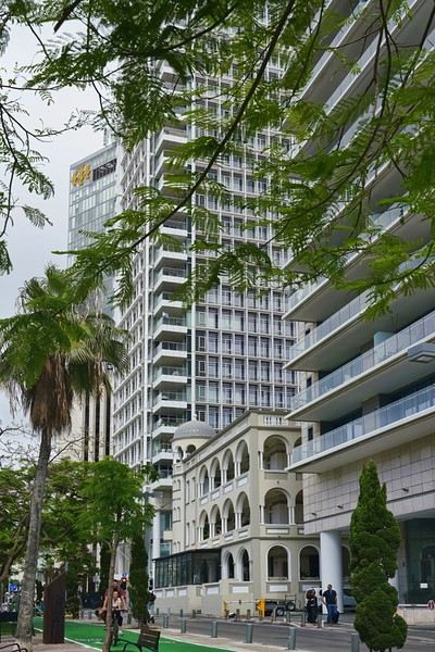
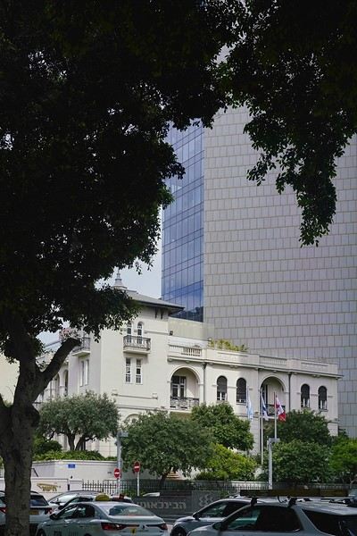
This policy keeps the streets looking more human-scale than the usual high-rise districts in modern cities.
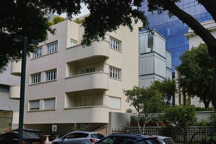 With the visit to Jaffa, Patrick introduces us to a fascinating slice of history, despite the temperature nearing 38°C. Jaffa, once an independent city, is now a neighborhood of Tel Aviv—a predominantly Muslim area. We notice a few buildings in poor condition. They belong to Palestinian families who left Tel Aviv. Otherwise, the city has been very well restored, apart from these few buildings.
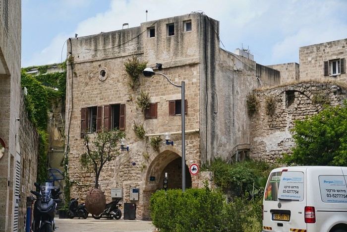
A government agency rents out the ground floors of these buildings, which helps fund part of the security work. They also try to track down the owners and buy back the abandoned properties, but some refuse to sell. The visit is very touristy—most of the people we meet are tourists like us.


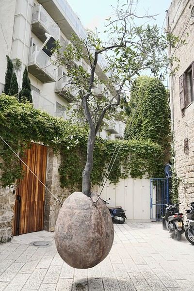
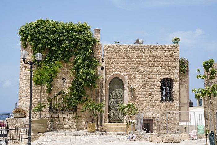
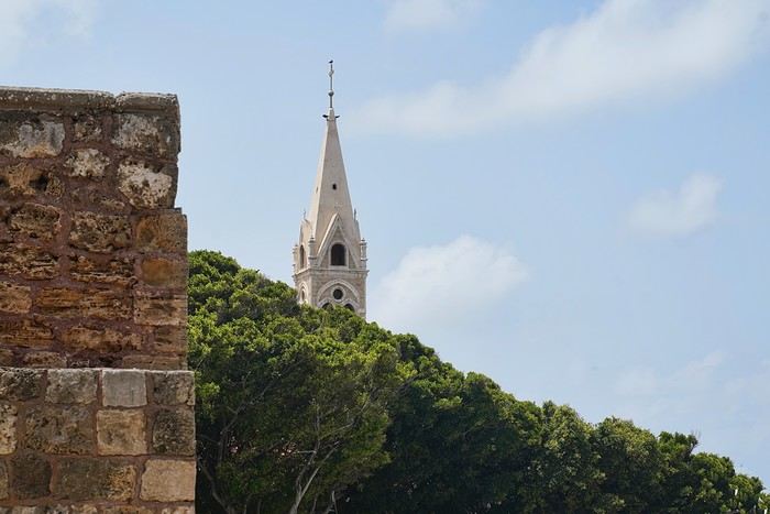
There’s very little local life, except in the lower part of the city. To be continued, as I’ve reached the allowed photo limit.
The next morning, we go down for breakfast at 7:30 AM—a late hour, but the setup is slow, with the two servers taking their time. We ask the bartender for a long coffee and a black tea... It must be a complicated order because it takes him over 10 minutes to make it. He serves us with the grace of a dancer. A good breakfast if you’re not in a hurry, followed by a little stroll in the neighborhood, since our meet-up with Patrick Arfi, our guide for the day, isn’t until 10 AM. P. Arfi is a former publishing house director in Paris who has lived in Israel for a long time and has a vast cultural knowledge. After an initial chat, we head toward Jaffa, focusing on the Bauhaus buildings preserved by a clever urban policy that allows high-rise construction while maintaining old architectural ensembles.
This policy keeps the streets looking more human-scale than the usual high-rise districts in modern cities.
With the visit to Jaffa, Patrick introduces us to a fascinating slice of history, despite the temperature nearing 38°C. Jaffa, once an independent city, is now a neighborhood of Tel Aviv—a predominantly Muslim area. We notice a few buildings in poor condition. They belong to Palestinian families who left Tel Aviv. Otherwise, the city has been very well restored, apart from these few buildings.
A government agency rents out the ground floors of these buildings, which helps fund part of the security work. They also try to track down the owners and buy back the abandoned properties, but some refuse to sell. The visit is very touristy—most of the people we meet are tourists like us.
There’s very little local life, except in the lower part of the city. To be continued, as I’ve reached the allowed photo limit.
The rule of the three unities
"In one place, in one day, a single deed accomplished,
May hold the theater filled until the end."
- Sunday morning, a chilly dawn - The kitchen - Smell of coffee and toast, a jar of honey on the table.
- Tits pecking at sunflower seeds in the transparent feeder stuck to the window.
- France Musique on the radio: Brahms, violin concerto by the lovely Hilary Hahn - Characters: - An old man in a plush dark blue dressing gown - An old woman in a worn-out duck-blue dressing gown. They dance cheek to cheek, the woman’s head resting on the old man’s broad chest. The old man breathes in the tangled hair of the lady. She smiles. Happy. Tomorrow, they’re off on a trip.
- Sunday morning, a chilly dawn - The kitchen - Smell of coffee and toast, a jar of honey on the table.
- Tits pecking at sunflower seeds in the transparent feeder stuck to the window.
- France Musique on the radio: Brahms, violin concerto by the lovely Hilary Hahn - Characters: - An old man in a plush dark blue dressing gown - An old woman in a worn-out duck-blue dressing gown. They dance cheek to cheek, the woman’s head resting on the old man’s broad chest. The old man breathes in the tangled hair of the lady. She smiles. Happy. Tomorrow, they’re off on a trip.
From San Francisco to Los Angeles via Highway 1
Hi everyone,
We traveled between Christmas and New Year’s to visit our son in San Francisco. We’d already seen the parks during a 2008 vacation but hadn’t had time to drive Highway 1 between San Francisco and Los Angeles, so we decided to do it this time. At this time of year, the days are short—it gets dark by 5 PM, which limits sightseeing time. Weather-wise, we had temperatures between 11°C and 20°C (52°F and 68°F) during the week, so it was pretty pleasant. There was a bit of rain one day and some gray skies or fog in the mornings. Financially, California is *very* expensive! Prices listed don’t include tax or tips. Taxes are automatically added to restaurant bills or supermarket receipts, but *you* add the tip. Americans always leave a tip, no matter if they’re happy with the service or not (except at self-service places). The absolute minimum is 15%, but 20% is more common. Here’s how it works: First, the server brings the bill with the tax already added, then takes your card and the bill. They come back after charging your card, leaving you a new bill and a pen. You write down the tip (tips) you want to leave, add it up, and sign. You leave the paper and pen on the table and go. In some restaurants, the server brings the card reader to your table, and there are preset tip percentages to choose from. On your bank statement, the total amount (including tax) shows up as “pending.” A few days later, the transaction is finalized with the tip included. The 9-hour time difference isn’t trivial, especially as we get older 😉. Keep it in mind when planning—don’t overdo it in the first few days.
Here’s our itinerary: 12/25/2024: Flight from Lyon (7 AM) to San Francisco (11:50 AM): 1-hour layover in Amsterdam—way too tight. The airport is huge, and flights to the U.S. are at the far end. You also have to go through customs. We had to run! Luckily, there’s a special line for tight connections, and our flight was delayed! Reunited with our son and walked to the Painted Ladies (Victorian houses) and then through Alamo Square. Return trip via Waymo—a driverless Uber. Surprising, but the ride was super smooth, and we felt safe.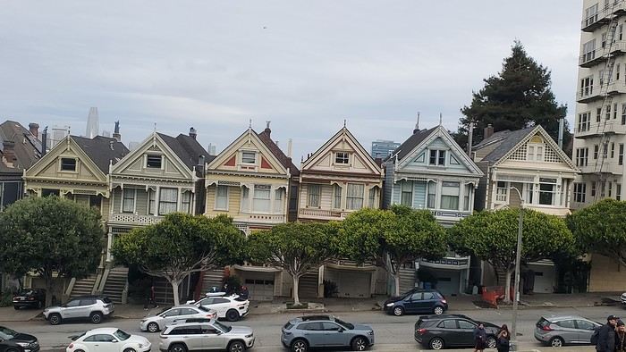
12/26/2024: San Francisco Walking tour of the city: Lombard Street, Pier 39 (sea lions), Coit Tower via the Filbert Steps (great view of the city), Chinatown, and Union Square (ice rink and Christmas tree).
12/27/2024: Monterey It took us about 2.5 hours to drive straight from SF to Monterey (to save time, we skipped the start of Highway 1). The goal for this stop was visiting the aquarium. It’s in an old sardine cannery, and there’s an interesting room showing the machinery and explaining the process. The aquarium features all the local fish and plant species, plus a stunning jellyfish exhibit. We spent about 2.5 hours there. Entry is pricey at $65, and it was packed when we went. For parking, you can use meters or day lots. The cheapest we found was $25 for the day, with in-and-out privileges. We saw some closer lots charging $80, so it’s worth shopping around before parking and walking a bit more. Afterward, we stopped by the Monarch Butterfly Sanctuary—a small, free park where these butterflies land, along with some wild deer. We ended the day at Lover’s Point, a park with an ocean view and surfers. That evening, we tried clam chowder in a sourdough bread bowl. Stayed overnight in Monterey.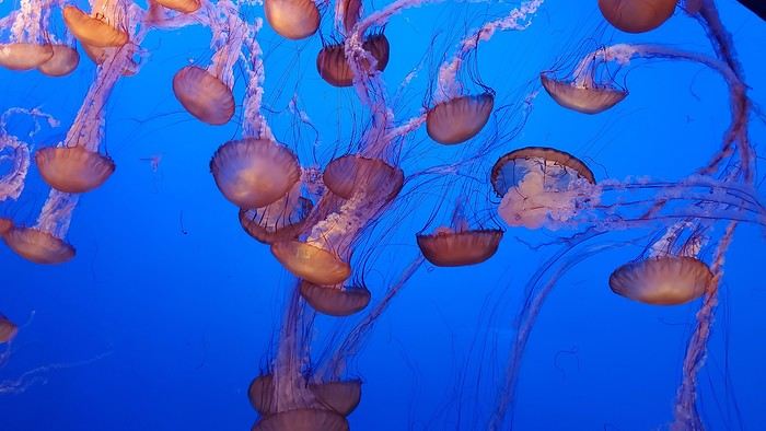
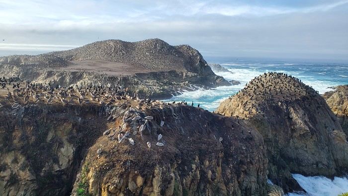
12/28/2024: Big Sur Parks The Big Sur area has many state parks. Entry is $10 per car for the day (valid for any number of parks visited that same day). Pro tip: If you park outside and walk in, you don’t pay. We chose to visit Point Lobos Reserve. We hiked the trails along the ocean. Two must-do (short and easy) trails: “Sea Lion Point,” where massive waves crash onto the rocks, and “Bird Island Lookout,” where you can see thousands of pelicans and cormorants on the rocks, plus a few elephant seals. It’s truly stunning. We spent about 3 hours there. After driving along Garrapata State Park and crossing the famous Bixby Bridge, we went to Pfeiffer Big Sur State Park to do the short Valley View Trail + Pfeiffer Falls hike. It was nice being among the redwoods, but the waterfall was underwhelming. Maybe it’s more impressive in the summer when the river is flowing better. We ended the day at McWay Falls, a waterfall that flows directly into the ocean—super photogenic, especially at sunset. Returned to Monterey for the night.
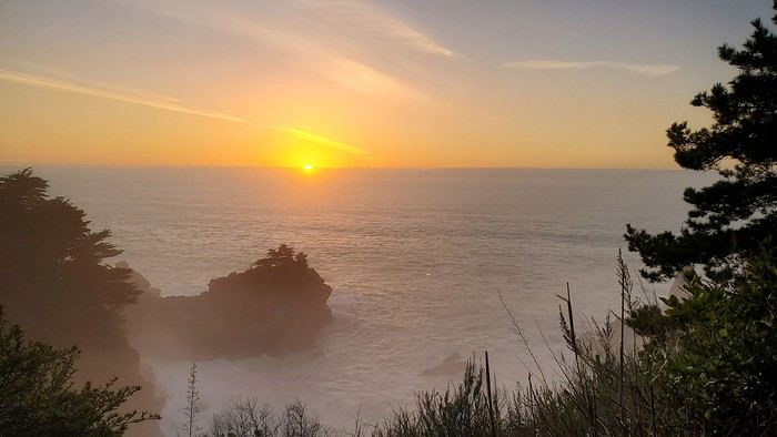
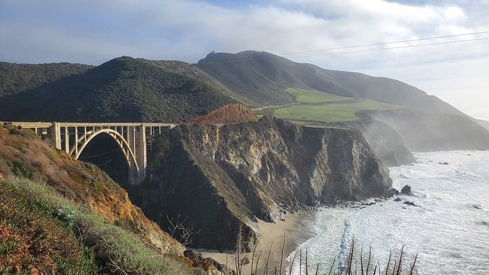
12/29/2024: Drive to Morro Bay Highway 1 is currently closed near Gorda, so we had to take the inland route from Monterey, adding extra miles. It was raining, so we skipped the planned stop at Carmel-by-the-Sea. Instead, we detoured to Mission San Antonio de Padua, the 3rd mission (out of 21) built by the Spanish in 1773 to evangelize the region. It’s less famous than others, so there were fewer people, and it felt more “authentic” (free to visit). With fog adding to the rain, we headed straight to Morro Bay, our stop for the day, instead of continuing up Highway 1 to San Simeon. Took a short evening walk to Morro Rock—saw a few otters in the harbor. Stayed overnight in Morro Bay.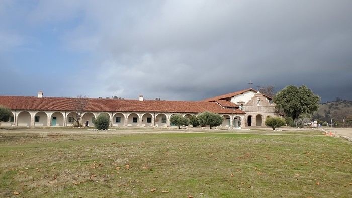
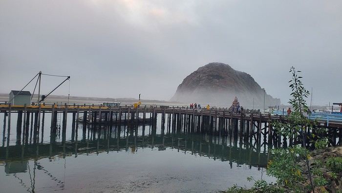
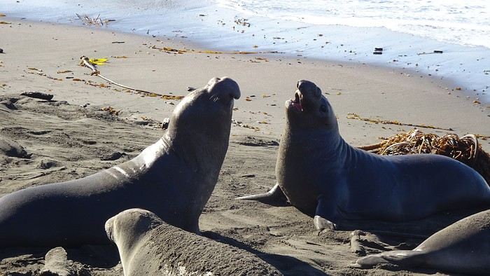
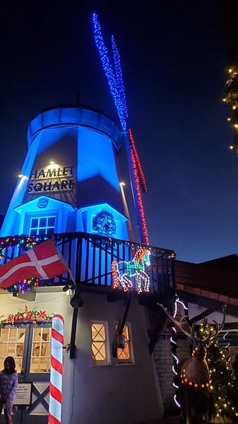
12/30/2024: Elephant Seals at Piedras Blancas The sun came back! We took a quick walk on the pier to see the otters in daylight, then drove back up Highway 1 to Piedras Blancas (near San Simeon), a famous spot for elephant seals. It’s birthing season, so there were lots of pups, plus males fighting for the females’ attention—what a show! We couldn’t get enough. We walked to the Piedras Blancas Lighthouse, with a few viewpoints of beaches where elephant seals were lounging (though far fewer than at the beach near the parking lot). We continued to Santa Barbara, our stop for the day. Stopped in San Luis Obispo for lunch and a quick city tour (Bubblegum Alley, the theater facade, and the mission). Since it was getting late, we skipped Los Alamos and went straight to Solvang, a charming Danish-style town (windmills, typical Danish houses) with lots of holiday lights (it’s their Julefest). Stayed overnight in Santa Barbara.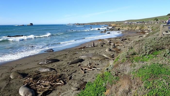
We traveled between Christmas and New Year’s to visit our son in San Francisco. We’d already seen the parks during a 2008 vacation but hadn’t had time to drive Highway 1 between San Francisco and Los Angeles, so we decided to do it this time. At this time of year, the days are short—it gets dark by 5 PM, which limits sightseeing time. Weather-wise, we had temperatures between 11°C and 20°C (52°F and 68°F) during the week, so it was pretty pleasant. There was a bit of rain one day and some gray skies or fog in the mornings. Financially, California is *very* expensive! Prices listed don’t include tax or tips. Taxes are automatically added to restaurant bills or supermarket receipts, but *you* add the tip. Americans always leave a tip, no matter if they’re happy with the service or not (except at self-service places). The absolute minimum is 15%, but 20% is more common. Here’s how it works: First, the server brings the bill with the tax already added, then takes your card and the bill. They come back after charging your card, leaving you a new bill and a pen. You write down the tip (tips) you want to leave, add it up, and sign. You leave the paper and pen on the table and go. In some restaurants, the server brings the card reader to your table, and there are preset tip percentages to choose from. On your bank statement, the total amount (including tax) shows up as “pending.” A few days later, the transaction is finalized with the tip included. The 9-hour time difference isn’t trivial, especially as we get older 😉. Keep it in mind when planning—don’t overdo it in the first few days.
Here’s our itinerary: 12/25/2024: Flight from Lyon (7 AM) to San Francisco (11:50 AM): 1-hour layover in Amsterdam—way too tight. The airport is huge, and flights to the U.S. are at the far end. You also have to go through customs. We had to run! Luckily, there’s a special line for tight connections, and our flight was delayed! Reunited with our son and walked to the Painted Ladies (Victorian houses) and then through Alamo Square. Return trip via Waymo—a driverless Uber. Surprising, but the ride was super smooth, and we felt safe.
12/26/2024: San Francisco Walking tour of the city: Lombard Street, Pier 39 (sea lions), Coit Tower via the Filbert Steps (great view of the city), Chinatown, and Union Square (ice rink and Christmas tree).
12/27/2024: Monterey It took us about 2.5 hours to drive straight from SF to Monterey (to save time, we skipped the start of Highway 1). The goal for this stop was visiting the aquarium. It’s in an old sardine cannery, and there’s an interesting room showing the machinery and explaining the process. The aquarium features all the local fish and plant species, plus a stunning jellyfish exhibit. We spent about 2.5 hours there. Entry is pricey at $65, and it was packed when we went. For parking, you can use meters or day lots. The cheapest we found was $25 for the day, with in-and-out privileges. We saw some closer lots charging $80, so it’s worth shopping around before parking and walking a bit more. Afterward, we stopped by the Monarch Butterfly Sanctuary—a small, free park where these butterflies land, along with some wild deer. We ended the day at Lover’s Point, a park with an ocean view and surfers. That evening, we tried clam chowder in a sourdough bread bowl. Stayed overnight in Monterey.
12/28/2024: Big Sur Parks The Big Sur area has many state parks. Entry is $10 per car for the day (valid for any number of parks visited that same day). Pro tip: If you park outside and walk in, you don’t pay. We chose to visit Point Lobos Reserve. We hiked the trails along the ocean. Two must-do (short and easy) trails: “Sea Lion Point,” where massive waves crash onto the rocks, and “Bird Island Lookout,” where you can see thousands of pelicans and cormorants on the rocks, plus a few elephant seals. It’s truly stunning. We spent about 3 hours there. After driving along Garrapata State Park and crossing the famous Bixby Bridge, we went to Pfeiffer Big Sur State Park to do the short Valley View Trail + Pfeiffer Falls hike. It was nice being among the redwoods, but the waterfall was underwhelming. Maybe it’s more impressive in the summer when the river is flowing better. We ended the day at McWay Falls, a waterfall that flows directly into the ocean—super photogenic, especially at sunset. Returned to Monterey for the night.
12/29/2024: Drive to Morro Bay Highway 1 is currently closed near Gorda, so we had to take the inland route from Monterey, adding extra miles. It was raining, so we skipped the planned stop at Carmel-by-the-Sea. Instead, we detoured to Mission San Antonio de Padua, the 3rd mission (out of 21) built by the Spanish in 1773 to evangelize the region. It’s less famous than others, so there were fewer people, and it felt more “authentic” (free to visit). With fog adding to the rain, we headed straight to Morro Bay, our stop for the day, instead of continuing up Highway 1 to San Simeon. Took a short evening walk to Morro Rock—saw a few otters in the harbor. Stayed overnight in Morro Bay.
12/30/2024: Elephant Seals at Piedras Blancas The sun came back! We took a quick walk on the pier to see the otters in daylight, then drove back up Highway 1 to Piedras Blancas (near San Simeon), a famous spot for elephant seals. It’s birthing season, so there were lots of pups, plus males fighting for the females’ attention—what a show! We couldn’t get enough. We walked to the Piedras Blancas Lighthouse, with a few viewpoints of beaches where elephant seals were lounging (though far fewer than at the beach near the parking lot). We continued to Santa Barbara, our stop for the day. Stopped in San Luis Obispo for lunch and a quick city tour (Bubblegum Alley, the theater facade, and the mission). Since it was getting late, we skipped Los Alamos and went straight to Solvang, a charming Danish-style town (windmills, typical Danish houses) with lots of holiday lights (it’s their Julefest). Stayed overnight in Santa Barbara.
All Over Thailand
You can post your personal photos in the following thread: https://voyageforum.com/forum/quelque-part-en-thailande-d10655574/
This travel journal is therefore intended solely for my photos, to present a consistent style. All the shots were taken with a simple Samsung Galaxy smartphone and with whatever was at hand.
All stays combined, I’ve spent the equivalent of three years at most in Thailand, and I’m not a big expert on the country. However, after many trips, lots of reading on VoyageForum and other sites, and conversations with many locals as well as expats, my view of the country is becoming clearer, though it’s constantly evolving. You never stop discovering and learning.
I guess I wanted to piece together a puzzle, mainly for those who want to get an idea of the country here and for those who miss it. I don’t know if this minimalist sharing will interest anyone, but it’ll do me good to put it together. After so many months without traveling and then these other long months with VF closed, there’s plenty of material available.
There’ll be a mix of places, periods, and subjects, but it might well be intentional.

I suspect many Thais have dogs because they make excellent guards for the home. Nothing better to deter burglars or to signal the presence of a snake. You’ll often see Thais tapping the top of their dog’s head, but don’t be fooled: it’s a sign of affection from them. Judging by the dogs’ reactions, they’re used to it.
Thailand is one of the countries on the planet where rabies is still present, so keep that in mind. It’s not just bites that can be dangerous, so don’t let just any dog lick you. Especially on a wound, of course. Even though dogs often fear humans—this dangerous and unpredictable predator—we still need to stay cautious. Be careful when walking into alleys because the dog will defend its master’s big property, be careful at night, and be careful when they’re in packs. It sometimes crosses our minds that Thailand isn’t really made for walking around, and dogs are one of the reasons. That said, it’s not uncommon to see them chasing bikes or scooters. Cars, though, are much rarer—they’re too big.
It seems Thais prefer to give their dogs freedom by not locking them behind gates. Though sometimes the gate is closed, the little side door is wide open. Oh, and sometimes there’s no gate in front of the property, or it’s been broken for years.
You’ll often see dogs sleeping on the side of the road, sometimes right on the road. When you arrive, they move aside nonchalantly—or not at all. It’s less funny when they suddenly appear from thick vegetation, which reminds visitors not to drive too fast. As a result, you’ll notice that dogs with injuries or missing legs aren’t that rare.
Since they believe in reincarnation and respect for all forms of life, they don’t chase dog packs away too much, and they don’t sterilize them enough. Seeing a small pack roaming freely in the countryside, you might think it’s best not to cross paths with them at the edge of a field. A darker side of this is that euthanasia isn’t often practiced. Twice, we saw dogs at temples on the brink of death, enduring terrible suffering. No one did anything about it. The image (and the smell) of one of them, dying and emitting the stench of death, still comes back to me sometimes.
Some of you may have seen the YouTube vlog of a French woman living in Phuket who was given a little pig by her Thai friends. The well-fed animal quickly became a happy, enormous beast with its own garden. Yet, it didn’t take long for it to fall seriously ill and become incurable. In her video, the French woman described how difficult it was to find a vet willing to perform euthanasia.
You’ll often see bowls by the side of the road. Thais leave food and water in them for stray cats and dogs. Overall, they have a big heart for animals.
If you ever pop into a shopping mall, you might see people pushing their small dogs in strollers. It’s not a gimmick—it’s just that these strollers are provided for customers to put their pets in, otherwise you can’t bring them inside. It looks a bit odd when you expect to see a baby.
This travel journal is therefore intended solely for my photos, to present a consistent style. All the shots were taken with a simple Samsung Galaxy smartphone and with whatever was at hand.
All stays combined, I’ve spent the equivalent of three years at most in Thailand, and I’m not a big expert on the country. However, after many trips, lots of reading on VoyageForum and other sites, and conversations with many locals as well as expats, my view of the country is becoming clearer, though it’s constantly evolving. You never stop discovering and learning.
I guess I wanted to piece together a puzzle, mainly for those who want to get an idea of the country here and for those who miss it. I don’t know if this minimalist sharing will interest anyone, but it’ll do me good to put it together. After so many months without traveling and then these other long months with VF closed, there’s plenty of material available.
There’ll be a mix of places, periods, and subjects, but it might well be intentional.
I suspect many Thais have dogs because they make excellent guards for the home. Nothing better to deter burglars or to signal the presence of a snake. You’ll often see Thais tapping the top of their dog’s head, but don’t be fooled: it’s a sign of affection from them. Judging by the dogs’ reactions, they’re used to it.
Thailand is one of the countries on the planet where rabies is still present, so keep that in mind. It’s not just bites that can be dangerous, so don’t let just any dog lick you. Especially on a wound, of course. Even though dogs often fear humans—this dangerous and unpredictable predator—we still need to stay cautious. Be careful when walking into alleys because the dog will defend its master’s big property, be careful at night, and be careful when they’re in packs. It sometimes crosses our minds that Thailand isn’t really made for walking around, and dogs are one of the reasons. That said, it’s not uncommon to see them chasing bikes or scooters. Cars, though, are much rarer—they’re too big.
It seems Thais prefer to give their dogs freedom by not locking them behind gates. Though sometimes the gate is closed, the little side door is wide open. Oh, and sometimes there’s no gate in front of the property, or it’s been broken for years.
You’ll often see dogs sleeping on the side of the road, sometimes right on the road. When you arrive, they move aside nonchalantly—or not at all. It’s less funny when they suddenly appear from thick vegetation, which reminds visitors not to drive too fast. As a result, you’ll notice that dogs with injuries or missing legs aren’t that rare.
Since they believe in reincarnation and respect for all forms of life, they don’t chase dog packs away too much, and they don’t sterilize them enough. Seeing a small pack roaming freely in the countryside, you might think it’s best not to cross paths with them at the edge of a field. A darker side of this is that euthanasia isn’t often practiced. Twice, we saw dogs at temples on the brink of death, enduring terrible suffering. No one did anything about it. The image (and the smell) of one of them, dying and emitting the stench of death, still comes back to me sometimes.
Some of you may have seen the YouTube vlog of a French woman living in Phuket who was given a little pig by her Thai friends. The well-fed animal quickly became a happy, enormous beast with its own garden. Yet, it didn’t take long for it to fall seriously ill and become incurable. In her video, the French woman described how difficult it was to find a vet willing to perform euthanasia.
You’ll often see bowls by the side of the road. Thais leave food and water in them for stray cats and dogs. Overall, they have a big heart for animals.
If you ever pop into a shopping mall, you might see people pushing their small dogs in strollers. It’s not a gimmick—it’s just that these strollers are provided for customers to put their pets in, otherwise you can’t bring them inside. It looks a bit odd when you expect to see a baby.
CLIFFS OF THE WORLD: January 2025 Photo Contest
It's tough to find a fresh topic since so many themes have already been covered, so this one is intentionally narrow to highlight the photo—inspired by a recent visit ;)
**Participation** Each VF member can submit up to 3 photos, until **Saturday, January 25 at 11:59 PM Paris time**. Each photo must be posted in a separate message, with its number (1, 2, or 3). Don’t forget to add a little explanation (comment, location, etc.).
**Voting:** Each VF member can vote for the 3 photos they think are the best, based on their own criteria and the theme.
Voting runs from **Sunday, January 26 to Friday, January 31 at 11:59 PM Paris time**.
Photos should be ranked in order of preference: - 1st photo: 3 points - 2nd photo: 2 points - 3rd photo: 1 point
The winner is the photographer whose photo earns the most points.
Results will be announced on **February 1**. In case of a tie, the number of first-place votes will decide. The winner gets the honor of organizing February’s contest.
For discussion about the contest, check the thread: https://voyageforum.com/forum/discussion-falaises-monde-concours-janvier-2025-d10659248/
(Big thanks to Raga and unamilanese—I just did a copy-paste 😎)
**Participation** Each VF member can submit up to 3 photos, until **Saturday, January 25 at 11:59 PM Paris time**. Each photo must be posted in a separate message, with its number (1, 2, or 3). Don’t forget to add a little explanation (comment, location, etc.).
**Voting:** Each VF member can vote for the 3 photos they think are the best, based on their own criteria and the theme.
Voting runs from **Sunday, January 26 to Friday, January 31 at 11:59 PM Paris time**.
Photos should be ranked in order of preference: - 1st photo: 3 points - 2nd photo: 2 points - 3rd photo: 1 point
The winner is the photographer whose photo earns the most points.
Results will be announced on **February 1**. In case of a tie, the number of first-place votes will decide. The winner gets the honor of organizing February’s contest.
For discussion about the contest, check the thread: https://voyageforum.com/forum/discussion-falaises-monde-concours-janvier-2025-d10659248/
(Big thanks to Raga and unamilanese—I just did a copy-paste 😎)
From Caño Cristales to Tayrona Park
After about 12 hours of flying from Toulouse (via Paris), we landed in Bogotá six years after our first trip to Colombia. This time, our journey will be very different, with only this stop in the Colombian capital in common.
Our travel itinerary
Bogotá / La Macarena (Caño Cristales) / Villa de Leyva / Barichara / San Gil / Girón / Mompox / Ciénaga and the Santa Marta lagoon / Minca / Los Naranjos (Tayrona Park) / Bogotá.
Step 1: Bogotá (and Nemecon)
Bogotá (1/3)
This morning, we had a meet-up with Flora from Aventure Colombia, who helped me organize one of our stops, a few transfers, and tomorrow’s day trip, the program of which I changed at the last minute after deciding to skip the visit to the Salt Cathedral of Zipaquirá. Flora is a kind and lovely person, always available, and she did everything to answer my questions and give me advice.
She’s a local contact I highly recommend. Flora can help you plan your trip, whether you want a fully organized tour or, like us, just need assistance with a specific stop or one or more transfers between cities.
We left Flora after setting a meet-up for our return to Bogotá in a month. As we walked out of her agency, we headed to the wonderful Gold Museum, located just a hundred meters away. I was excited to revisit this amazing museum.
Note: Free entry for those over 60, regardless of nationality. Just show your passport.
Like six years ago, I was amazed by its museography, the beauty of the pieces on display, and that breathtaking shamanic room.
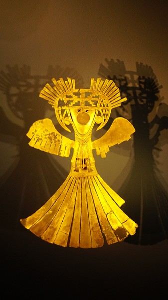
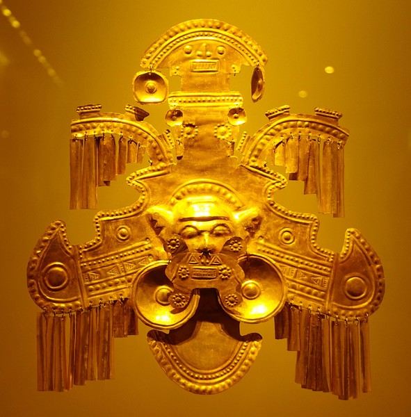
About two hours later, we decided to walk (careful, it’s a climb!) to the Monserrate cable car (3152m). Long wait to buy tickets and board the cable car! Once we arrived, a few raindrops, an impressive panoramic view of Bogotá’s vastness, a quick visit to the basilica (a pilgrimage site for Colombians), a walk through the tourist market, and at the top, plenty of small restaurants where we had our first Colombian meal. After our hearty lunch, we were lucky to see the sun return! No line for the descent. We then headed back to the hotel because Justine wanted to rest and recover from the trip. As for me, I continued my walk. I discovered a really nice craft market recommended by Flora, Pasaje Rivas, returned to Bolívar Square, and wandered through different streets, including the main pedestrian avenue (Calle 7), where there’s always something to see.
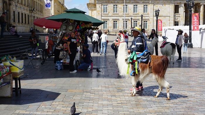
Tomorrow, a change of scenery as we head out for a hike in a small desert (Desierto de Chueca), located about 2 hours from Bogotá in the village of Nemecon. For this outing from Bogotá, with Flora’s help, we booked a car with a driver for the day. Flora also took care of booking the guide (since the site can only be visited with one). Nemecon (2/3) Today, we went to Nemecon to hike about 7.5 km in the ‘Desert of Checua.’ It’s nothing like sandy deserts! Instead, it’s geological formations sculpted by time, wind, and water. After two hours on the road—almost one of them spent navigating traffic jams with cars, trucks, buses, and a continuous flow of motorcycles on either side of our taxi—we reached Nemecon! The village center is really (too?) quiet. We met up with Deisy and headed toward the ‘desert,’ about twenty minutes away on a bumpy dirt road. Once there, a quick briefing, and off we went! Deisy didn’t stop talking (in Spanish) for over 3 hours!!! She told us so much about her region (flower farming, water management, traditions, songs, etc.), the origin of the site, and even mentioned Antonio Banderas, who filmed *The 33* in the village’s salt mine (the story of the survival of 33 Chilean miners after a collapse in their copper and gold mine). One hour of walking to reach the site, one hour to explore it, and one hour to return.
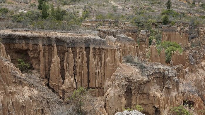
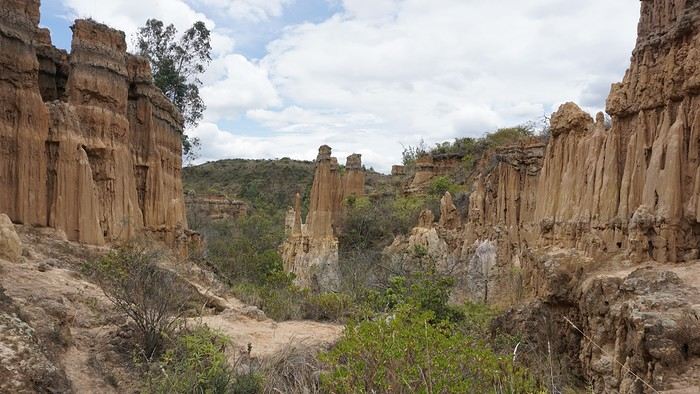
The advantage of this non-stop chatter was that it forced us to brush up on our Spanish at lightning speed. I even wondered if the effort to concentrate wasn’t more exhausting than the physical effort! Especially since on the way back, I got an oral quiz. Deisy wanted to make sure I remembered some of the information she’d given me during the visit: why is this rock white, that one red, and that one black? Back in the village, we had lunch at a restaurant recommended by Deisy before visiting the Nemecon salt mine. Before entering, a guide spent a good half-hour explaining the origin of the salt and the presence of many fossils in the area. Again, concentrating was tough because all the comments were exclusively in Spanish! An hour and a half wandering through the tunnels with a ‘lovely miner’s helmet’ on our heads!
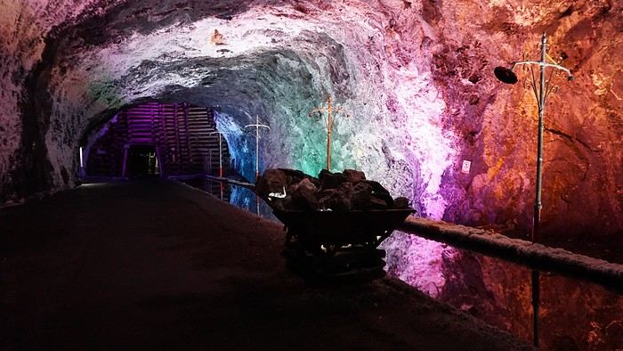
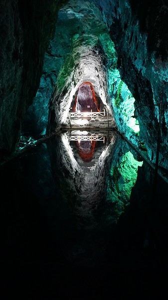
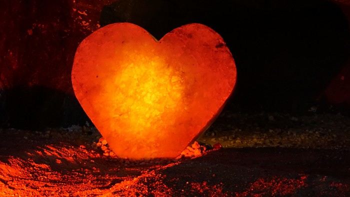
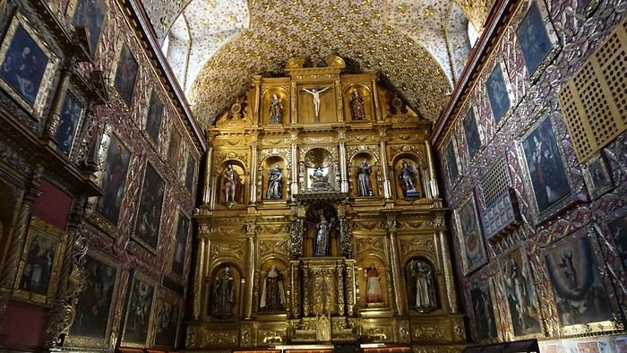
We met our driver at the mine entrance. The return to Bogotá was a bit faster, but traffic in the city center was still heavy! We arrived in front of our hotel between 8:00 and 8:30 PM. It’s been a pretty intense start to the trip! Tonight, our legs are tired. Hopefully, tomorrow will be a bit more relaxed! Bogotá (3/3) We started the day by visiting the Santa Clara Church Museum, located next to the presidential palace. Alejandra (from the local agency ‘Gaia Tours Colombia,’ which organized our stay in Caño Cristales (La Macarena)) had recommended this visit for its rich mural paintings.
A few hundred meters further, after crossing the Plaza Mayor again, we visited the cultural complex housing the Botero Museum, the Mint Museum, and the Bank of the Republic Art Museum. Note that entry is free for all three museums. Botero Museum: There are fewer works by Botero here than in the Medellín museum, but more paintings and sculptures by other artists, all from Botero’s private collection (donated to Colombia). Mint Museum: We limited ourselves to visiting one room (on Flora’s advice) where three gold and gemstone monstrances and a Christ with a crown of emerald thorns are displayed. Photos are not allowed. Art Museum: We visited two temporary exhibitions. Lunchtime came quickly. We had a good meal at a reasonably priced small restaurant in the La Candelaria micro-district, near the Chorro de Quevedo square. We decided to spend the afternoon wandering the streets and alleys of the historic center to discover local street art.
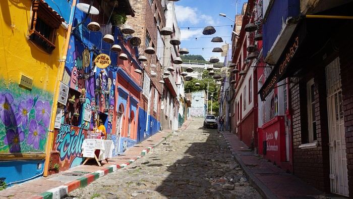
We also passed through very lively pedestrian streets. I also decided to revisit Pasaje Rivas to show Justine all the shops selling more or less artisanal products. Tomorrow morning, we fly to La Macarena at 10:30 AM. Not to dance (you’d be surprised if I told you we were going to take a South American dance class, right?!), but to visit the fabulous Caño Cristales, a river naturally colored by aquatic plants. The planned program includes hiking, horseback riding, canoeing, and swimming among these plants. This site was long inaccessible because the area was controlled by the FARC. Access and tourism development became possible after agreements and amnesty measures between the Colombian government and paramilitary groups. As in other regions, former FARC members have been able to transition into various tourism-related activities.
About two hours later, we decided to walk (careful, it’s a climb!) to the Monserrate cable car (3152m). Long wait to buy tickets and board the cable car! Once we arrived, a few raindrops, an impressive panoramic view of Bogotá’s vastness, a quick visit to the basilica (a pilgrimage site for Colombians), a walk through the tourist market, and at the top, plenty of small restaurants where we had our first Colombian meal. After our hearty lunch, we were lucky to see the sun return! No line for the descent. We then headed back to the hotel because Justine wanted to rest and recover from the trip. As for me, I continued my walk. I discovered a really nice craft market recommended by Flora, Pasaje Rivas, returned to Bolívar Square, and wandered through different streets, including the main pedestrian avenue (Calle 7), where there’s always something to see.
Tomorrow, a change of scenery as we head out for a hike in a small desert (Desierto de Chueca), located about 2 hours from Bogotá in the village of Nemecon. For this outing from Bogotá, with Flora’s help, we booked a car with a driver for the day. Flora also took care of booking the guide (since the site can only be visited with one). Nemecon (2/3) Today, we went to Nemecon to hike about 7.5 km in the ‘Desert of Checua.’ It’s nothing like sandy deserts! Instead, it’s geological formations sculpted by time, wind, and water. After two hours on the road—almost one of them spent navigating traffic jams with cars, trucks, buses, and a continuous flow of motorcycles on either side of our taxi—we reached Nemecon! The village center is really (too?) quiet. We met up with Deisy and headed toward the ‘desert,’ about twenty minutes away on a bumpy dirt road. Once there, a quick briefing, and off we went! Deisy didn’t stop talking (in Spanish) for over 3 hours!!! She told us so much about her region (flower farming, water management, traditions, songs, etc.), the origin of the site, and even mentioned Antonio Banderas, who filmed *The 33* in the village’s salt mine (the story of the survival of 33 Chilean miners after a collapse in their copper and gold mine). One hour of walking to reach the site, one hour to explore it, and one hour to return.
The advantage of this non-stop chatter was that it forced us to brush up on our Spanish at lightning speed. I even wondered if the effort to concentrate wasn’t more exhausting than the physical effort! Especially since on the way back, I got an oral quiz. Deisy wanted to make sure I remembered some of the information she’d given me during the visit: why is this rock white, that one red, and that one black? Back in the village, we had lunch at a restaurant recommended by Deisy before visiting the Nemecon salt mine. Before entering, a guide spent a good half-hour explaining the origin of the salt and the presence of many fossils in the area. Again, concentrating was tough because all the comments were exclusively in Spanish! An hour and a half wandering through the tunnels with a ‘lovely miner’s helmet’ on our heads!
We met our driver at the mine entrance. The return to Bogotá was a bit faster, but traffic in the city center was still heavy! We arrived in front of our hotel between 8:00 and 8:30 PM. It’s been a pretty intense start to the trip! Tonight, our legs are tired. Hopefully, tomorrow will be a bit more relaxed! Bogotá (3/3) We started the day by visiting the Santa Clara Church Museum, located next to the presidential palace. Alejandra (from the local agency ‘Gaia Tours Colombia,’ which organized our stay in Caño Cristales (La Macarena)) had recommended this visit for its rich mural paintings.
A few hundred meters further, after crossing the Plaza Mayor again, we visited the cultural complex housing the Botero Museum, the Mint Museum, and the Bank of the Republic Art Museum. Note that entry is free for all three museums. Botero Museum: There are fewer works by Botero here than in the Medellín museum, but more paintings and sculptures by other artists, all from Botero’s private collection (donated to Colombia). Mint Museum: We limited ourselves to visiting one room (on Flora’s advice) where three gold and gemstone monstrances and a Christ with a crown of emerald thorns are displayed. Photos are not allowed. Art Museum: We visited two temporary exhibitions. Lunchtime came quickly. We had a good meal at a reasonably priced small restaurant in the La Candelaria micro-district, near the Chorro de Quevedo square. We decided to spend the afternoon wandering the streets and alleys of the historic center to discover local street art.
We also passed through very lively pedestrian streets. I also decided to revisit Pasaje Rivas to show Justine all the shops selling more or less artisanal products. Tomorrow morning, we fly to La Macarena at 10:30 AM. Not to dance (you’d be surprised if I told you we were going to take a South American dance class, right?!), but to visit the fabulous Caño Cristales, a river naturally colored by aquatic plants. The planned program includes hiking, horseback riding, canoeing, and swimming among these plants. This site was long inaccessible because the area was controlled by the FARC. Access and tourism development became possible after agreements and amnesty measures between the Colombian government and paramilitary groups. As in other regions, former FARC members have been able to transition into various tourism-related activities.
Photo Safaris in Kenya
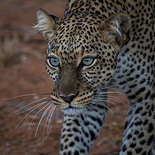
Back on the forum, I’m starting to write up two 3-week trips to Kenya in August 2021 and 2023.
In 2021, Quynh and I traveled with Régis (Rjulie95 on VF). Our son joined us in Baringo for the second half of the trip.
In 2023, we went with two friends who’d been dreaming of seeing wild animals ever since we got back from Kenya. We didn’t need much convincing to go with them!
The two itineraries are almost identical (well, when you love something...) but we did make a few tweaks.
- The first part of the trip was with a local driver/guide, Félix, who was recommended by Sylvie56. Sylvie and her husband Ben are Kenya enthusiasts—they’ve been there countless times, always with Félix... and for good reason! He’s fantastic!
- The second part was with Melting Pot Safari, an agency that adapted to our photography needs. Tony Crocetta, the co-founder (along with his Kenyan friend Simon Chebon), is a wildlife photographer himself.
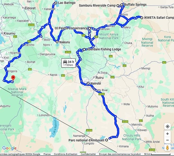
Here are the itineraries for both trips, including accommodations:
In 2021: Day 0: Paris / Nairobi - 67 Airport Hotel Day 1: Nairobi / Amboseli - Simba Cottage Day 2: Amboseli - Simba Cottage Day 3: Amboseli / Aberdares - Fishing Lodge Day 4: Aberdares - Fishing Lodge Day 5: Aberdares - Fishing Lodge Day 6: Aberdares / Samburu - Riverside Camp Day 7: Samburu - Riverside Camp Day 8: Samburu - Riverside Camp Day 9: Samburu / Nakuru - Merica Hotel Day 10: Nakuru / Baringo - Tumbili Cliff Lodge Day 11: Baringo - Tumbili Cliff Lodge Day 12: Baringo - Tumbili Cliff Lodge Day 13: Baringo / Maasai Mara – Meltingpot Bush Camp Day 14 to 18: Maasai Mara – Meltingpot Bush Camp Day 19: Maasai Mara / Nairobi – Roussel Guest House Day 20: Nairobi / Paris
In 2023: Day 0: Lyon / Paris / Nairobi - 67 Airport Hotel Day 1: Nairobi / Meru - Ikweta Camp Day 2: Meru - Ikweta Camp Day 3: Meru - Ikweta Camp Day 4: Meru / Samburu - Riverside Camp Day 5: Samburu – Riverside Camp Day 6: Samburu / Buffalo Springs – Samburu Simba Day 7: Buffalo Springs / Ol Pejeta – Sweetwater Camp Day 8: Ol Pejeta / Amboseli - Simba Cottage Day 9: Amboseli - Simba Cottage Day 10: Amboseli - Simba Cottage Day 11: Amboseli / Nakuru – Lake Nakuru Lodge Day 12: Nakuru / Baringo - Tumbili Cliff Lodge Day 13: Baringo - Tumbili Cliff Lodge Day 14: Baringo - Tumbili Cliff Lodge Day 15: Baringo / Maasai Mara – Meltingpot Bush Camp Day 16 to 20: Maasai Mara – Meltingpot Bush Camp Day 21: Maasai Mara / Nairobi / Paris
Here’s an itinerary—it’s not exactly what we did, but a combination of both.
Ready to join us on safari to see some wild animals?
The two itineraries are almost identical (well, when you love something...) but we did make a few tweaks.
- The first part of the trip was with a local driver/guide, Félix, who was recommended by Sylvie56. Sylvie and her husband Ben are Kenya enthusiasts—they’ve been there countless times, always with Félix... and for good reason! He’s fantastic!
- The second part was with Melting Pot Safari, an agency that adapted to our photography needs. Tony Crocetta, the co-founder (along with his Kenyan friend Simon Chebon), is a wildlife photographer himself.
Here are the itineraries for both trips, including accommodations:
In 2021: Day 0: Paris / Nairobi - 67 Airport Hotel Day 1: Nairobi / Amboseli - Simba Cottage Day 2: Amboseli - Simba Cottage Day 3: Amboseli / Aberdares - Fishing Lodge Day 4: Aberdares - Fishing Lodge Day 5: Aberdares - Fishing Lodge Day 6: Aberdares / Samburu - Riverside Camp Day 7: Samburu - Riverside Camp Day 8: Samburu - Riverside Camp Day 9: Samburu / Nakuru - Merica Hotel Day 10: Nakuru / Baringo - Tumbili Cliff Lodge Day 11: Baringo - Tumbili Cliff Lodge Day 12: Baringo - Tumbili Cliff Lodge Day 13: Baringo / Maasai Mara – Meltingpot Bush Camp Day 14 to 18: Maasai Mara – Meltingpot Bush Camp Day 19: Maasai Mara / Nairobi – Roussel Guest House Day 20: Nairobi / Paris
In 2023: Day 0: Lyon / Paris / Nairobi - 67 Airport Hotel Day 1: Nairobi / Meru - Ikweta Camp Day 2: Meru - Ikweta Camp Day 3: Meru - Ikweta Camp Day 4: Meru / Samburu - Riverside Camp Day 5: Samburu – Riverside Camp Day 6: Samburu / Buffalo Springs – Samburu Simba Day 7: Buffalo Springs / Ol Pejeta – Sweetwater Camp Day 8: Ol Pejeta / Amboseli - Simba Cottage Day 9: Amboseli - Simba Cottage Day 10: Amboseli - Simba Cottage Day 11: Amboseli / Nakuru – Lake Nakuru Lodge Day 12: Nakuru / Baringo - Tumbili Cliff Lodge Day 13: Baringo - Tumbili Cliff Lodge Day 14: Baringo - Tumbili Cliff Lodge Day 15: Baringo / Maasai Mara – Meltingpot Bush Camp Day 16 to 20: Maasai Mara – Meltingpot Bush Camp Day 21: Maasai Mara / Nairobi / Paris
Here’s an itinerary—it’s not exactly what we did, but a combination of both.
Ready to join us on safari to see some wild animals?
Kyushu between Fukuoka and Nagasaki in autumn 2024 (Japan)
Fellow travelers,
Don’t they say "never two without three"? It seems so. Here I am again on the forum to share—and let’s be honest, indulge a bit of selfish pleasure—by recounting the story of this third installment in the Land of the Rising Sun.
Where? It’s all in the title. On the island of Kyushu in southern Japan, more precisely in the northwest between Fukuoka and Nagasaki. I hope to take you along with me for 19 nights and 18 full days this autumn of 2024. On the itinerary: gastronomy, crafts, festivals, waterfalls, encounters, and leisurely strolls in all simplicity.
A last-minute flight booked just 7 days before departure, and the route evolved regularly based on whims and accommodation availability, eventually settling on this:
- 5 nights in Fukuoka: Fukuoka city, Ukiha, Itoshima, Dazaifu, Yanagawa - 4 nights in Hasami, Nagasaki Prefecture: Okawachiyama, Arita, Takeo, Kashima, Yobuko, Karatsu, Kabeshima - 6 nights in Nagasaki: Ureshino, Higashi-Sonogi, Nagasaki city, Unzen, Sotome - 4 nights in Fukuoka: Karatsu, Fukuoka city
Most of the trip was done by car for practical reasons—easier access to certain places and freedom of movement—but also for the sheer joy of it. Despite slow traffic at times, driving in rural Japan is a delight.
If the program interests you, see you soon for the start of the journey.
Don’t they say "never two without three"? It seems so. Here I am again on the forum to share—and let’s be honest, indulge a bit of selfish pleasure—by recounting the story of this third installment in the Land of the Rising Sun.
Where? It’s all in the title. On the island of Kyushu in southern Japan, more precisely in the northwest between Fukuoka and Nagasaki. I hope to take you along with me for 19 nights and 18 full days this autumn of 2024. On the itinerary: gastronomy, crafts, festivals, waterfalls, encounters, and leisurely strolls in all simplicity.
A last-minute flight booked just 7 days before departure, and the route evolved regularly based on whims and accommodation availability, eventually settling on this:
- 5 nights in Fukuoka: Fukuoka city, Ukiha, Itoshima, Dazaifu, Yanagawa - 4 nights in Hasami, Nagasaki Prefecture: Okawachiyama, Arita, Takeo, Kashima, Yobuko, Karatsu, Kabeshima - 6 nights in Nagasaki: Ureshino, Higashi-Sonogi, Nagasaki city, Unzen, Sotome - 4 nights in Fukuoka: Karatsu, Fukuoka city
Most of the trip was done by car for practical reasons—easier access to certain places and freedom of movement—but also for the sheer joy of it. Despite slow traffic at times, driving in rural Japan is a delight.
If the program interests you, see you soon for the start of the journey.
Three weeks in Norway (July 2022): fantastic memories despite the rain
Our trip to Norway was two years ago already, but I thought it might still be of interest—and it’ll let me relive it a bit by proxy.
Before booking our flight tickets, we debated the route: should we prioritize the north with the Lofoten and Senja islands, or the south with its countless fjords? I was tempted to stay in the south—the country is so vast, and the drive north is long... but my husband really didn’t want to miss the Lofoten. In the end, we figured that since Norway is known for being expensive, we might only visit once (funny how we said the same thing before our first trip to the American West, and look how that turned out 😎), so we didn’t want to skip anything. That meant a 2–3 day drive up north. With 22 days on the ground, it was doable. Especially since, as usual, we skip big cities and gave Oslo a pass.
Practical details: - Flight tickets: 1195 € for 4 with Air France (Paris–Oslo outbound, Tromsø–Bergen–Paris return) - Car rental: 2020 € for 21 days (including the outrageous drop-off fee between Oslo and Tromsø—about 1000 €) - Tolls and ferries: 250 € for the portion billed directly by the rental company. Some ferries required advance booking and payment at the time of reservation—I’ll note their prices as I go through the story. - Hotels: 4135 €, averaging 188 € per night. We blew past our usual budgets from trips to the U.S., but oh well... - Food: 1570 €, averaging 71 € per day for 4 in a country where everything’s expensive... How’d we manage? We rarely ate out, mostly grocery shopped, and even packed half a suitcase with non-perishables: pasta, rice, a few cans, and even some cured sausage! We also stayed 3 nights at Clarion Collection hotels, where an evening buffet was included in the room rate.
Before booking our flight tickets, we debated the route: should we prioritize the north with the Lofoten and Senja islands, or the south with its countless fjords? I was tempted to stay in the south—the country is so vast, and the drive north is long... but my husband really didn’t want to miss the Lofoten. In the end, we figured that since Norway is known for being expensive, we might only visit once (funny how we said the same thing before our first trip to the American West, and look how that turned out 😎), so we didn’t want to skip anything. That meant a 2–3 day drive up north. With 22 days on the ground, it was doable. Especially since, as usual, we skip big cities and gave Oslo a pass.
Practical details: - Flight tickets: 1195 € for 4 with Air France (Paris–Oslo outbound, Tromsø–Bergen–Paris return) - Car rental: 2020 € for 21 days (including the outrageous drop-off fee between Oslo and Tromsø—about 1000 €) - Tolls and ferries: 250 € for the portion billed directly by the rental company. Some ferries required advance booking and payment at the time of reservation—I’ll note their prices as I go through the story. - Hotels: 4135 €, averaging 188 € per night. We blew past our usual budgets from trips to the U.S., but oh well... - Food: 1570 €, averaging 71 € per day for 4 in a country where everything’s expensive... How’d we manage? We rarely ate out, mostly grocery shopped, and even packed half a suitcase with non-perishables: pasta, rice, a few cans, and even some cured sausage! We also stayed 3 nights at Clarion Collection hotels, where an evening buffet was included in the room rate.
3 weeks in Colombia in August 2024
Hi there,
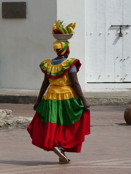
This summer, we spent 3 weeks in northern Colombia. A vibrant trip that complemented our southern Peru adventure from the previous year perfectly. Two neighboring countries, but completely different.
To start, we had to make a choice because the country is vast.
So we focused on 3 different regions for our 3 weeks: - Week 1: Bogotá and the colonial villages (Villa de Leyva, Barichara) - Week 2: Medellín and the Coffee Region - Week 3: the Caribbean coast
We entrusted the organization to a small local agency that handled accommodations, guides, and transportation. Transportation is key. The country is large, the road network isn’t very efficient, and we spent a lot of time traveling (cars, planes, and boats...), but it was the price to pay to explore it.
The overall budget isn’t exactly "backpacker" level. We spent 7,500 € (excluding Air France) for our 3-week stay (hotels, drivers, guides, flights, visits, meals). But we treated ourselves to nice accommodations—you’ll see as we share more posts.
For vacations, I try to follow Philippe Noiret’s motto: "Travel is short. Let’s try to do it first class."
This summer, we spent 3 weeks in northern Colombia. A vibrant trip that complemented our southern Peru adventure from the previous year perfectly. Two neighboring countries, but completely different.
To start, we had to make a choice because the country is vast.
So we focused on 3 different regions for our 3 weeks: - Week 1: Bogotá and the colonial villages (Villa de Leyva, Barichara) - Week 2: Medellín and the Coffee Region - Week 3: the Caribbean coast
We entrusted the organization to a small local agency that handled accommodations, guides, and transportation. Transportation is key. The country is large, the road network isn’t very efficient, and we spent a lot of time traveling (cars, planes, and boats...), but it was the price to pay to explore it.
The overall budget isn’t exactly "backpacker" level. We spent 7,500 € (excluding Air France) for our 3-week stay (hotels, drivers, guides, flights, visits, meals). But we treated ourselves to nice accommodations—you’ll see as we share more posts.
For vacations, I try to follow Philippe Noiret’s motto: "Travel is short. Let’s try to do it first class."
21-Day Trip to La Gomera and La Palma
Travel Journal: 21 Days in La Gomera and La Palma
From February 6 to February 26, 2024
Tuesday, February 6 We left around 9 AM with our car, along with Pierre-Paul and Patricia, heading to the Bluepark parking lot in Bartenheim. As expected, we were awaited and left promptly for EuroAirport Basel. Took off at 12:25 PM for a 4-hour-15-minute flight under excellent conditions. Beautiful arrival in Tenerife with Teide in sight under a clear blue sky. Fifteen minutes later, we waited for bus No. 40 to Los Cristianos with quite a few other tourists, but we managed to find four seats. From the bus station, it was a 20-minute walk to our hotel. We checked into a lovely apartment for the four of us, complete with all the comforts. Outside, it was quite warm—at least 25°C! After dropping off our luggage, we went for a stroll. The immediate surroundings of the hotel held no interest for us: a modern, concrete area filled with hotels, bars, tourist agencies, and unappealing restaurants all offering the same bland international cuisine. Pat went to cool off at the pool, unfortunately overrun by loud, drunk English tourists. I took a walk to the paseo maritimo that leads to the port, skirting the seafront. The promenade was pleasant, but it could have been any seaside resort in the world—same old scene: a succession of bars with blaring music where many elderly people sipped cold beers waiting for the sunset, the backdrop a wall of resort-style hotels resembling rabbit hutches! Upon reaching the port, I scouted the route we’d take the next day to the Fred Olsen ferry. Back at the apartment, in the early evening, we looked for a non-touristy restaurant for dinner. Monique stopped a woman to ask her opinion! In this area, she told us, there’s no restaurant that serves Canarian or Spanish cuisine! The only place with decent restaurants is at the port. Off we went to the port, where we sat down at Al Bordo restaurant and ordered a seafood paella for four. Excellent, and at a very reasonable price (36 € for two). We returned to the hotel along the seafront.
Wednesday, February 7
Woke up at 6 AM. Had breakfast in the apartment with what we’d bought the day before at a supermarket. It was still dark when we left on foot toward the port, walking along the calm seafront at this early hour. Forty minutes later, we arrived and waited 10 minutes before the ferry docked. At 9:30 AM, we left the port of Los Cristianos for a 50-minute crossing on a calm sea under a beautiful blue sky. There were quite a few people on this large ferry, but many had no luggage, meaning they were visiting La Gomera for the day and would take the ferry back in the evening. Upon disembarking, we went straight to our rental car agency to pick up the car we’d booked online a few months earlier. It was a nice Peugeot 2008, spacious enough for the four of us and our luggage. We immediately took the beautiful road from San Sebastián that climbs directly into the mountains toward our rental in Vallehermoso. The road was in perfect condition—it seemed brand new, like all the others we’d take on this island later. This side of the island is very arid with little vegetation, and the terrain is particularly rugged, as it is throughout the island. We stopped at our first miradors, which would be followed by many more throughout our Canarian trip. Our first visit was to the small village of Agulo, perched on a promontory above the sea and at the foot of a high cliff. The village features typical Canarian houses with windows flush with the façade and black volcanic stone masonry on white or reddish-brown walls. The first recommended restaurant was already booked for a group, so we settled for the shaded terrace of the excellent El Alameda bar-restaurant. From Agulo, you can access the Abrante viewpoint via a winding road, where the view of Agulo, 600 meters below, is exceptional. A glass ledge over the void lets you test your fear of heights!
We drove to Vallehermoso to do our grocery shopping at the supermarket—a habit that would continue until the end of the trip. Our little house, "Casa rural El Encatadora," is located in a beautiful flower-filled valley a few kilometers west of Vallehermoso. Each of us had a bedroom with an en-suite bathroom, plus a living room, kitchen, and a small terrace overlooking the quiet street at the valley’s end, which didn’t bother us at all.
Thursday, February 8 The good weather seemed to follow us since our arrival in the Canary Islands. This morning, we took the road—still as beautiful and new—toward Arure, high up to the west. The landscape was magnificent, with breathtaking glimpses of the sea far below. In Arure, we parked in front of Conchita’s bar, where a hike (Rother No. 30) starts toward two viewpoints: Alojera, which we reached after 45 minutes on a lovely path. Monique, tired from the first steep climb, stopped at the first viewpoint and hitchhiked back to Arure. Meanwhile, we continued toward the second viewpoint, Los Barranquillos, where the view of the surroundings was partially hidden by misty clouds rising from the sea. The entire mountain is sculpted by ancient, endless terraces climbing until the slope becomes too steep for construction—visible traces of the hard work of past inhabitants trying to survive in a harsh environment. We had a decent lunch at La Conchita bar, then drove to the small seaside town of Puerto la Caleta, sheltered by an immense cliff plunging into the sea. Black sand beach, rough sea—despite our encouragement, Pat didn’t dare to swim! As for the old village of Caleta, it’s perched on the mountainside, and visiting it requires climbing steep, stair-filled alleys to discover a few traditional houses. Back at the casa, dinner in, and card games...
 Vallehermoso
Friday, February 9 This morning, the sky was overcast, and the peaks around us were shrouded in clouds. We took the same road as yesterday to hike Las Creces. Quickly gaining altitude, we entered a thick fog—visibility was very limited. We stopped at the Las Creces parking lot; visibility improved, and the sun wasn’t far off. The hike is entirely within a beautiful laurel forest, with the sun playing hide-and-seek, but it wasn’t cold despite the altitude. After finishing the loop trail, we decided to picnic—not there, as it was too chilly—but on Vallehermoso’s beach, where we found a nice picnic area sheltered by large black rocks. A short digestive walk on the surrounding hill to admire the little beach from above. Back in Vallehermoso, we did some grocery shopping, then tried to return to the casa—only to find ourselves locked out because we’d left the key in the lock inside! After several attempts and with the help of Yéli, a relative of the owner we called for help, we were finally able to get back in!
Saturday, February 10
It rained last night, and the sky remained overcast. Monique decided to rest this morning. PP, Pat, and I set off on the hike that starts from the house toward the Marichal reservoir. The sun wasn’t far off, and by 11 AM, it was fully out. The pleasant hike passed by many flower-filled gardens and orchards—orange, lemon, and mandarin trees in fruit. The path climbed gently toward the reservoir, where the view of the Cano rock dominating the landscape was magnificent. The last part of the climb was a bit tough, overgrown with lush vegetation, and the trail was slippery from last night’s rain. We descended via a different, much more pleasant path and returned to the casa just in time for lunch, prepared by Monique. This valley is rich with its many farmers and market gardeners who’ve cultivated the entire valley, taking advantage of the water flowing down from the mountain, captured upstream and redistributed through countless pipes snaking along the paths. Numerous tanks also store water during dry periods. The houses are scattered across both sides of the valley, and these colorful little homes add a beautiful touch to the landscape. The many palm trees give this valley a distinctly tropical feel—you could almost imagine yourself in the Caribbean. Add to that some salsa music drifting from a hut where farmers were working, and the picture is complete. A well-chilled beer apéro capped off a lovely morning. The afternoon was dedicated to rest, relaxation, reading, and games.
Sunday, February 11 The blue sky returned, though a few clouds still capped the highest peaks. Today, we visited Garajonay National Park, which covers the highest central mountains. Up there, we were above the clouds, and the panoramas from the various viewpoints were stunning: first, Cherelepin, accessible from the Laguna Grande parking lot, then Alto de Garajonay, offering an exceptional view of Teide—over 3,000 meters high—emerging from the clouds on Tenerife, far in the distance. We continued to the Los Roques viewpoints, then stopped for lunch at the Degollada de Peraza restaurant, where the view of the barranco was impressive. We descended toward San Sebastián and checked into our new lodging, La Cabezada, located in the countryside about 3 km above San Sebastián. It’s a small apartment adjacent to the owner’s, with a lovely terrace overlooking the surrounding mountains and surrounded by a beautiful garden. Apéro, then dinner on our beautiful terrace.
Monday, February 12 This morning, we went down to visit San Sebastián de La Gomera: its old tower, main street with some beautiful traditional houses, and the Church of the Assumption. Back at the casa for lunch. In the afternoon, Pat, PP, and I set off on the short hike from San Sebastián beach to La Guancha beach. We drove down and parked on the beach. The path climbs along the hill overlooking San Sebastián, passes by the tall Christ statue dominating the landscape, and roughly follows the coast down to the isolated Guancha beach. A beautiful hike under a hot sun, and a swim was welcome, even if the beach and sea access weren’t very comfortable due to large pebbles and quickly deepening water. Apart from two nudist bathers, there was no one on this beach. We returned the same way.
Tuesday, February 13 Rest day. We went down to town to stroll and do some shopping. I took the opportunity to visit the parador, beautifully situated above the city in a lovely garden overlooking the port and town. Together, we went for a cuba libre at the "Cuba Libre" bar, then had lunch at Breñusca (mediocre paella!). Back at the casa, then we went back down to town to see a carnival parade, a "passacalles," which actually passed an hour earlier than scheduled. Oh well.
Wednesday, February 14 Each to their own program this morning. Pat went swimming at San Sebastián beach, Monique rested at the casa, and PP and I set off on the hike from Playa de Avalos to the Ermita de Guadalupe on Playa del Cangrejo. It wasn’t easy to find the right road or the parking spot, but we managed. The path seemed to have suffered landslides, according to a sign at the trailhead! We decided to check it out, ready to turn back if it seemed too dangerous. In the end, apart from one or two slightly tricky spots where we had to climb a pile of rocks, the trail remained passable, though a bit vertigo-inducing in places. The narrow path clings to very vertical cliffs nearly 300 meters above sea level! But what a magnificent view. At one point, the trail runs alongside a wall of basaltic pipes. We returned via the drivable track that parallels the trail a bit lower. Back at the house for lunch. In the late afternoon, we returned to town to attend the "Entierro de las Sardinas" (Burial of the Sardine), which closes the Canarian carnival festivities. While waiting, we strolled through the parador’s gardens and had mojitos in town. Around 9 PM, we heard the noise and cries of the mourners. The procession advanced, led by a large papier-mâché sardine on a float, surrounded by wailing mourners. The procession headed toward the sea, where the sardine was burned, and a mini fireworks display ended the procession. It was all very good-natured, and everyone had fun. We ended the evening with dinner at a good fish restaurant, El Pajar.
 Entierro de la Sardina in San Sebastián de La Gomera
Thursday, February 15
Woke up at 5:15 AM. The only suitable ferry was at 7 AM, which would get us to La Palma by late morning rather than evening. We packed our bags, had breakfast, then headed to the port, left our rental car, and boarded the ferry to Tenerife, from where we’d continue to La Palma. Calm sea, beautiful sun—by 10:30 AM, we disembarked in La Palma. We picked up our car and immediately headed to our new apartment in Breña Alta. It’s a large apartment with a superb terrace facing the sea, fully equipped and very comfortable. The hosts recommended Casa Goyo restaurant, near the airport and close to us. It’s a restaurant with many small rooms, some of which can be reserved for families. The fish-based cuisine (chipirones, pulpo) was excellent, hearty, and reasonably priced. Since it’s in the airport’s flight path, we occasionally heard planes landing. Quick and efficient service. Afterward, we visited Santa Cruz de La Palma, which reminded us of the historic quarters of La Orotava in Tenerife or the capital of Gran Canaria.
Friday, February 16
Beautiful weather, blue sky. We headed to the San Bartolo viewpoint toward the northeast coast, then to the lovely village of San Andrés, which we explored. From there, we walked along the shore to the natural pools of Charco Azul, where we swam in the cool but "swimmable" sea. Back in San Andrés for lunch at the "San Andrés" restaurant on the beautiful church square. Very good fish-based meal. We got back in the car and continued along the north coast to the port of Espindola and the natural pools of Fajana near the Cumplida lighthouse. A fairly strong wind whipped up beautiful waves crashing onto the rocky coast in bursts of foam. Back in Santa Cruz, we stopped at the Mercadona supermarket to buy fresh shrimp for dinner. San Andrés
Saturday, February 17
Uniform blue sky, even on the heights. We took the beautiful road that winds up to the summit of the Caldera de Taburiente. Several viewpoints offer 360° views of the entire island and beyond: you can make out La Gomera, El Hierro, and, of course, Tenerife with the perfect triangle of Teide. We parked at the Los Andes viewpoint parking lot and started our hike to Pico de la Cruz along a trail following the ridge, offering superb views into the caldera. We got back in the car and passed by the Roque de los Muchachos astronomical complex, composed of numerous observatories, some with very aesthetic mirror telescopes. We hiked from the Roque de los Muchachos parking lot to the various viewpoints, always as impressive. Picnic on site, then back to Santa Cruz. We stopped by our car dealer because the oil warning light came on—better safe than sorry. The representative reassured us but preferred to give us a Fiat Cross SUV instead. The Caldera de Taburiente
Sunday, February 18 The weather was a bit mixed, with cloudy patches. We set off to hike the Barranco de la Cuba de Galga. Unfortunately, the Los Tilos trail had been closed for several months due to a major landslide. The parking lot by the road was already quite full, and indeed, we crossed paths with many hikers along the way—it’s an easy hike with little elevation gain, which is rare here in La Palma! The beautiful path winds through a very narrow, deep gorge covered in lush tropical vegetation—you’d think you were in a Southeast Asian forest, especially with the humidity in the gorge bringing out earthy and floral scents. Halfway through, Monique turned back while the rest of us continued to the Cuba de Galga. A light drizzle accompanied us on the return. For lunch, we went to Chipi Chipi restaurant in the heights of Santa Cruz. The cool air forced us to leave the lovely terrace for the slightly noisy dining room. The meal was very good and hearty. Afternoon spent resting at our house.
 La Cuba de la Galga
Monday, February 19 A few clouds still clung to the nearby mountain peaks. We headed south to Los Canarios. We stopped in front of the small San Antonio Abad church, where a path leads to the viewpoint in 15 minutes. Then we visited the San Antonio Volcano Interpretation Center and climbed to the viewpoint via the trail along the crater’s edge, offering a plunging view into the crater. Then PP, Pat, and I headed toward the Teneguía volcano but turned back given the remaining distance and the intense heat bearing down on us! Plus, the landscape was rather arid and not very interesting. We got back in the car and drove down to the salt flats at the island’s southern tip. The ocean crashes here in large waves, exploding against the volcanic rocks and feeding a "blowhole" carved into the rock. We stopped for drinks at the salt flats restaurant, then headed home. The salt flats in Fuencaliente
Tuesday, February 20 Beautiful weather with a few clouds clinging to the mountains, as usual. A relaxed morning since my parking reservation at La Cumbrecita didn’t start until 1 PM. It takes about 30 minutes from Santa Cruz to reach the valley floor via a beautiful but narrow road toward the end, though there’s very little traffic. Meanwhile, the clouds had disappeared, and the view from the La Cumbrecita viewpoint was superb. We recognized Pico de la Cruz in the distance, where we’d been a few days earlier. We then took the path leading to the Las Chozas viewpoint through a magnificent Canarian pine forest. We picnicked on site, then took the path to the Los Roques viewpoint. We returned the same way since the direct route was closed for construction. Back in Santa Cruz, we visited the Sanctuary of Las Nieves, with its beautiful golden Baroque altar. Hike from La Cumbrecita
Wednesday, February 21 After packing our things and loading the car, we left Santa Cruz under a very blue sky for Los Llanos de Aridane, where we stopped to visit this lovely town. The Church of Nuestra Señora de los Remedios has a beautiful coffered ceiling and an original papier-mâché Christ statue from the 16th century. Around it, colorful old Canarian houses brighten the streets of the town center. We took the opportunity to stroll, do some shopping, and finally sat down at La Pergola restaurant for a mediocre lunch. We got back in the car to check into our new house in Arecida. On the way, we stopped at the Mirador del Time, which once again offered an impressive panorama, allowing us—for the first time—to see the damage caused by the Tajogaite volcano eruption in 2021. You can clearly see the still-smoking crater and the large black lava flow covering the landscape down to the sea. We really liked our new accommodation: a local house that’s been renovated on the heights of Arecida, not far from the Canarian pine forest. From several terraces, we have a 360° view of the sea and mountains. We even have a private pool! There are two beautiful, brand-new bedrooms, each with its own bathroom—the best. Plus, we’re on the GR 131 trail that runs along the Barranco de las Angustias toward the northeast.
 Los Llanos de Aridane
Thursday, February 22 Once again, beautiful weather greeted us when we woke up. We started the GR 131 with the goal of reaching the Torre del Time viewpoint—about 400 meters of elevation gain. The path, quite steep at first, winds through a superb Canarian pine forest. A few viewpoints let you appreciate the sheer drop of the Barranco de las Angustias—watch out for vertigo! At the Torre del Time viewpoint, there’s a nearly 1,000-meter vertical drop. We returned via another path, the PLP1, which meanders first through this beautiful forest, then along lovely flower-filled gardens adjacent to beautiful properties that cascade from the forest down to the road serving these neighborhoods. This afternoon, we tried to get closer to the area devastated by the 2021 lava flows. Several roads are still closed or reserved for residents, while others—brand new—have been rebuilt to open up this densely populated and cultivated region. In some places, the lava flow slightly diverted, sparing some properties that logically should have disappeared. Now, they’re encircled by a massive cooled lava field. In other spots, twisted and charred metal scraps or greenhouse remains protrude from the lava—all that’s left of the former banana plantations. A little higher up, you can see the slightly smoking crater of Tajogaite, responsible for this disaster. Back to Casa Barreros.
 View of Los Llanos and, in the background, the 2021 lava flow
Friday, February 23
Though the sky was still blue, the temperature had dropped due to a chilly wind. By midday, it still rose to 22°C. Today, we headed north, specifically to the town of Tijarafe, where a very narrow road descends to the small port, Porís de Candelaria. The 3.7-kilometer road drops 700 meters in elevation, with gradients up to 30%—it was going to be intense! Indeed, the descent was scary, with the void right next to the very narrow road where passing was impossible except at a few rare spots. Everything went well—there was little traffic at this early hour. From the parking lot at the bottom, a path leads to Porís de Candelaria. It’s surprising to see this small fishing hamlet nestled in the shelter of an immense cave opening onto the sea, which was quite rough today. The sun, at this time of year, would appear late in the cave, which remained in shadow for much of the day. We returned via the same road, strolled through the small town of Puntagorda, and had lunch at El Jardín de los Naranjos restaurant—excellent meal. Fishing hamlet of Candelaria
Saturday, February 24 The air was still cool, but the sun was beautiful. While Monique stayed home to rest, the three of us headed to the village of Las Tricias to hike the Buracas Caves trail. We left the car parked on the LP1 road and took the small paved road down to the sign marking the trail’s start. The signage for all the trails we took here, as in La Gomera, was very well done. The path descended steadily, then more steeply toward the caves where the island’s first inhabitants lived—some petroglyphs are still visible in certain caves. The path then climbed back up, passing magnificent dragon trees and more or less elaborate huts occupied by Germans who’ve lived here for many years. Back at Casa Barreros for some rest.
Sunday, February 25 The weather once again blessed us with a beautiful day. This morning, we visited the local produce market held on weekends in Puntagorda. You’ll find agricultural products, crafts, and food to keep you going. A little further on, there’s a glass viewpoint overlooking the barranco plunging toward the sea, with a view of the thrill-seekers trying the zip line right next to it. Lunch at Naranjos—definitely a good spot—with their shrimp and spice tagliatelle. Back home for an afternoon of relaxation.
Monday, February 26 We left Arecida under a cloudy sky. Driving up from Los Llanos de Aridane toward the east, an enormous cascade of clouds poured from the mountain peaks into the Los Llanos plain—very impressive. Arriving in Santa Cruz, we went for a stroll, did some last-minute shopping, then had a final good-quality paella at La Chalana on the paseo maritimo. We left the car in the parking lot and took the 5 PM Olsen ferry to Tenerife on a slightly choppy sea, but the ferry didn’t rock too much. Arriving at 7:15 PM, we dropped off our things near the port in our reserved apartment and went for dinner at Abordo—rubbery chipirones. A digestive stroll among the ever-increasing number of tourists in Los Cristianos—restaurants were packed to the brim, the season is in full swing here. Gone is the calm of La Gomera and La Palma, and the laid-back tourism of German hikers among whom a few French were hiding!
Tuesday, February 27 To make our homemade breakfast more enjoyable, we went to buy pastries at the local bakery, then took one last walk on the paseo along the beaches, mingling with the many mobility scooters driven by elderly or disabled people, joggers, and tourists. Last apéro near the bus station, then off to the airport. After a smooth 4-hour-30-minute flight, we arrived in Basel-Mulhouse at 10:20 PM.
THE END
Conclusion A fantastic trip to two islands with magnificent and diverse nature, where landscapes range from desert-like to tropical depending on exposure to winds and clouds. Thanks to the many beautiful viewpoints, you can truly appreciate these exceptionally dynamic reliefs. A hiker’s paradise, the trails are all very well marked, though the choice of easy or moderate paths for "casual walkers" is quite limited. Another notable advantage, in our opinion, is that these islands are very lightly developed—you’ll hardly see any of those ugly hotel blocks that spoil the landscapes of some other Canary Islands. It’s true that the beaches on these two islands don’t meet traditional international tourism criteria: they’re small, with black sand, and often difficult to access. Special mention for the quality of the road network (except for a few small local roads), which seems brand new, well-paved, and well-signposted. We also enjoyed exceptional weather for February, with fewer than three days of gray or rainy weather out of 21.
Almost all the accommodations we chose met or exceeded our expectations, often at reasonable prices: an average of 98 € per night for an apartment or house with two bedrooms for four people.
All photos can be viewed by clicking this link: https://photos.app.goo.gl/G44pPk4g9PW1rNzg8
Tuesday, February 6 We left around 9 AM with our car, along with Pierre-Paul and Patricia, heading to the Bluepark parking lot in Bartenheim. As expected, we were awaited and left promptly for EuroAirport Basel. Took off at 12:25 PM for a 4-hour-15-minute flight under excellent conditions. Beautiful arrival in Tenerife with Teide in sight under a clear blue sky. Fifteen minutes later, we waited for bus No. 40 to Los Cristianos with quite a few other tourists, but we managed to find four seats. From the bus station, it was a 20-minute walk to our hotel. We checked into a lovely apartment for the four of us, complete with all the comforts. Outside, it was quite warm—at least 25°C! After dropping off our luggage, we went for a stroll. The immediate surroundings of the hotel held no interest for us: a modern, concrete area filled with hotels, bars, tourist agencies, and unappealing restaurants all offering the same bland international cuisine. Pat went to cool off at the pool, unfortunately overrun by loud, drunk English tourists. I took a walk to the paseo maritimo that leads to the port, skirting the seafront. The promenade was pleasant, but it could have been any seaside resort in the world—same old scene: a succession of bars with blaring music where many elderly people sipped cold beers waiting for the sunset, the backdrop a wall of resort-style hotels resembling rabbit hutches! Upon reaching the port, I scouted the route we’d take the next day to the Fred Olsen ferry. Back at the apartment, in the early evening, we looked for a non-touristy restaurant for dinner. Monique stopped a woman to ask her opinion! In this area, she told us, there’s no restaurant that serves Canarian or Spanish cuisine! The only place with decent restaurants is at the port. Off we went to the port, where we sat down at Al Bordo restaurant and ordered a seafood paella for four. Excellent, and at a very reasonable price (36 € for two). We returned to the hotel along the seafront.
Wednesday, February 7
Woke up at 6 AM. Had breakfast in the apartment with what we’d bought the day before at a supermarket. It was still dark when we left on foot toward the port, walking along the calm seafront at this early hour. Forty minutes later, we arrived and waited 10 minutes before the ferry docked. At 9:30 AM, we left the port of Los Cristianos for a 50-minute crossing on a calm sea under a beautiful blue sky. There were quite a few people on this large ferry, but many had no luggage, meaning they were visiting La Gomera for the day and would take the ferry back in the evening. Upon disembarking, we went straight to our rental car agency to pick up the car we’d booked online a few months earlier. It was a nice Peugeot 2008, spacious enough for the four of us and our luggage. We immediately took the beautiful road from San Sebastián that climbs directly into the mountains toward our rental in Vallehermoso. The road was in perfect condition—it seemed brand new, like all the others we’d take on this island later. This side of the island is very arid with little vegetation, and the terrain is particularly rugged, as it is throughout the island. We stopped at our first miradors, which would be followed by many more throughout our Canarian trip. Our first visit was to the small village of Agulo, perched on a promontory above the sea and at the foot of a high cliff. The village features typical Canarian houses with windows flush with the façade and black volcanic stone masonry on white or reddish-brown walls. The first recommended restaurant was already booked for a group, so we settled for the shaded terrace of the excellent El Alameda bar-restaurant. From Agulo, you can access the Abrante viewpoint via a winding road, where the view of Agulo, 600 meters below, is exceptional. A glass ledge over the void lets you test your fear of heights!
We drove to Vallehermoso to do our grocery shopping at the supermarket—a habit that would continue until the end of the trip. Our little house, "Casa rural El Encatadora," is located in a beautiful flower-filled valley a few kilometers west of Vallehermoso. Each of us had a bedroom with an en-suite bathroom, plus a living room, kitchen, and a small terrace overlooking the quiet street at the valley’s end, which didn’t bother us at all.
Thursday, February 8 The good weather seemed to follow us since our arrival in the Canary Islands. This morning, we took the road—still as beautiful and new—toward Arure, high up to the west. The landscape was magnificent, with breathtaking glimpses of the sea far below. In Arure, we parked in front of Conchita’s bar, where a hike (Rother No. 30) starts toward two viewpoints: Alojera, which we reached after 45 minutes on a lovely path. Monique, tired from the first steep climb, stopped at the first viewpoint and hitchhiked back to Arure. Meanwhile, we continued toward the second viewpoint, Los Barranquillos, where the view of the surroundings was partially hidden by misty clouds rising from the sea. The entire mountain is sculpted by ancient, endless terraces climbing until the slope becomes too steep for construction—visible traces of the hard work of past inhabitants trying to survive in a harsh environment. We had a decent lunch at La Conchita bar, then drove to the small seaside town of Puerto la Caleta, sheltered by an immense cliff plunging into the sea. Black sand beach, rough sea—despite our encouragement, Pat didn’t dare to swim! As for the old village of Caleta, it’s perched on the mountainside, and visiting it requires climbing steep, stair-filled alleys to discover a few traditional houses. Back at the casa, dinner in, and card games...
VallehermosoFriday, February 9 This morning, the sky was overcast, and the peaks around us were shrouded in clouds. We took the same road as yesterday to hike Las Creces. Quickly gaining altitude, we entered a thick fog—visibility was very limited. We stopped at the Las Creces parking lot; visibility improved, and the sun wasn’t far off. The hike is entirely within a beautiful laurel forest, with the sun playing hide-and-seek, but it wasn’t cold despite the altitude. After finishing the loop trail, we decided to picnic—not there, as it was too chilly—but on Vallehermoso’s beach, where we found a nice picnic area sheltered by large black rocks. A short digestive walk on the surrounding hill to admire the little beach from above. Back in Vallehermoso, we did some grocery shopping, then tried to return to the casa—only to find ourselves locked out because we’d left the key in the lock inside! After several attempts and with the help of Yéli, a relative of the owner we called for help, we were finally able to get back in!
Saturday, February 10
It rained last night, and the sky remained overcast. Monique decided to rest this morning. PP, Pat, and I set off on the hike that starts from the house toward the Marichal reservoir. The sun wasn’t far off, and by 11 AM, it was fully out. The pleasant hike passed by many flower-filled gardens and orchards—orange, lemon, and mandarin trees in fruit. The path climbed gently toward the reservoir, where the view of the Cano rock dominating the landscape was magnificent. The last part of the climb was a bit tough, overgrown with lush vegetation, and the trail was slippery from last night’s rain. We descended via a different, much more pleasant path and returned to the casa just in time for lunch, prepared by Monique. This valley is rich with its many farmers and market gardeners who’ve cultivated the entire valley, taking advantage of the water flowing down from the mountain, captured upstream and redistributed through countless pipes snaking along the paths. Numerous tanks also store water during dry periods. The houses are scattered across both sides of the valley, and these colorful little homes add a beautiful touch to the landscape. The many palm trees give this valley a distinctly tropical feel—you could almost imagine yourself in the Caribbean. Add to that some salsa music drifting from a hut where farmers were working, and the picture is complete. A well-chilled beer apéro capped off a lovely morning. The afternoon was dedicated to rest, relaxation, reading, and games.
Sunday, February 11 The blue sky returned, though a few clouds still capped the highest peaks. Today, we visited Garajonay National Park, which covers the highest central mountains. Up there, we were above the clouds, and the panoramas from the various viewpoints were stunning: first, Cherelepin, accessible from the Laguna Grande parking lot, then Alto de Garajonay, offering an exceptional view of Teide—over 3,000 meters high—emerging from the clouds on Tenerife, far in the distance. We continued to the Los Roques viewpoints, then stopped for lunch at the Degollada de Peraza restaurant, where the view of the barranco was impressive. We descended toward San Sebastián and checked into our new lodging, La Cabezada, located in the countryside about 3 km above San Sebastián. It’s a small apartment adjacent to the owner’s, with a lovely terrace overlooking the surrounding mountains and surrounded by a beautiful garden. Apéro, then dinner on our beautiful terrace.
Monday, February 12 This morning, we went down to visit San Sebastián de La Gomera: its old tower, main street with some beautiful traditional houses, and the Church of the Assumption. Back at the casa for lunch. In the afternoon, Pat, PP, and I set off on the short hike from San Sebastián beach to La Guancha beach. We drove down and parked on the beach. The path climbs along the hill overlooking San Sebastián, passes by the tall Christ statue dominating the landscape, and roughly follows the coast down to the isolated Guancha beach. A beautiful hike under a hot sun, and a swim was welcome, even if the beach and sea access weren’t very comfortable due to large pebbles and quickly deepening water. Apart from two nudist bathers, there was no one on this beach. We returned the same way.
Tuesday, February 13 Rest day. We went down to town to stroll and do some shopping. I took the opportunity to visit the parador, beautifully situated above the city in a lovely garden overlooking the port and town. Together, we went for a cuba libre at the "Cuba Libre" bar, then had lunch at Breñusca (mediocre paella!). Back at the casa, then we went back down to town to see a carnival parade, a "passacalles," which actually passed an hour earlier than scheduled. Oh well.
Wednesday, February 14 Each to their own program this morning. Pat went swimming at San Sebastián beach, Monique rested at the casa, and PP and I set off on the hike from Playa de Avalos to the Ermita de Guadalupe on Playa del Cangrejo. It wasn’t easy to find the right road or the parking spot, but we managed. The path seemed to have suffered landslides, according to a sign at the trailhead! We decided to check it out, ready to turn back if it seemed too dangerous. In the end, apart from one or two slightly tricky spots where we had to climb a pile of rocks, the trail remained passable, though a bit vertigo-inducing in places. The narrow path clings to very vertical cliffs nearly 300 meters above sea level! But what a magnificent view. At one point, the trail runs alongside a wall of basaltic pipes. We returned via the drivable track that parallels the trail a bit lower. Back at the house for lunch. In the late afternoon, we returned to town to attend the "Entierro de las Sardinas" (Burial of the Sardine), which closes the Canarian carnival festivities. While waiting, we strolled through the parador’s gardens and had mojitos in town. Around 9 PM, we heard the noise and cries of the mourners. The procession advanced, led by a large papier-mâché sardine on a float, surrounded by wailing mourners. The procession headed toward the sea, where the sardine was burned, and a mini fireworks display ended the procession. It was all very good-natured, and everyone had fun. We ended the evening with dinner at a good fish restaurant, El Pajar.
Entierro de la Sardina in San Sebastián de La GomeraThursday, February 15
Woke up at 5:15 AM. The only suitable ferry was at 7 AM, which would get us to La Palma by late morning rather than evening. We packed our bags, had breakfast, then headed to the port, left our rental car, and boarded the ferry to Tenerife, from where we’d continue to La Palma. Calm sea, beautiful sun—by 10:30 AM, we disembarked in La Palma. We picked up our car and immediately headed to our new apartment in Breña Alta. It’s a large apartment with a superb terrace facing the sea, fully equipped and very comfortable. The hosts recommended Casa Goyo restaurant, near the airport and close to us. It’s a restaurant with many small rooms, some of which can be reserved for families. The fish-based cuisine (chipirones, pulpo) was excellent, hearty, and reasonably priced. Since it’s in the airport’s flight path, we occasionally heard planes landing. Quick and efficient service. Afterward, we visited Santa Cruz de La Palma, which reminded us of the historic quarters of La Orotava in Tenerife or the capital of Gran Canaria.
Friday, February 16
Beautiful weather, blue sky. We headed to the San Bartolo viewpoint toward the northeast coast, then to the lovely village of San Andrés, which we explored. From there, we walked along the shore to the natural pools of Charco Azul, where we swam in the cool but "swimmable" sea. Back in San Andrés for lunch at the "San Andrés" restaurant on the beautiful church square. Very good fish-based meal. We got back in the car and continued along the north coast to the port of Espindola and the natural pools of Fajana near the Cumplida lighthouse. A fairly strong wind whipped up beautiful waves crashing onto the rocky coast in bursts of foam. Back in Santa Cruz, we stopped at the Mercadona supermarket to buy fresh shrimp for dinner.
San AndrésSaturday, February 17
Uniform blue sky, even on the heights. We took the beautiful road that winds up to the summit of the Caldera de Taburiente. Several viewpoints offer 360° views of the entire island and beyond: you can make out La Gomera, El Hierro, and, of course, Tenerife with the perfect triangle of Teide. We parked at the Los Andes viewpoint parking lot and started our hike to Pico de la Cruz along a trail following the ridge, offering superb views into the caldera. We got back in the car and passed by the Roque de los Muchachos astronomical complex, composed of numerous observatories, some with very aesthetic mirror telescopes. We hiked from the Roque de los Muchachos parking lot to the various viewpoints, always as impressive. Picnic on site, then back to Santa Cruz. We stopped by our car dealer because the oil warning light came on—better safe than sorry. The representative reassured us but preferred to give us a Fiat Cross SUV instead.
The Caldera de TaburienteSunday, February 18 The weather was a bit mixed, with cloudy patches. We set off to hike the Barranco de la Cuba de Galga. Unfortunately, the Los Tilos trail had been closed for several months due to a major landslide. The parking lot by the road was already quite full, and indeed, we crossed paths with many hikers along the way—it’s an easy hike with little elevation gain, which is rare here in La Palma! The beautiful path winds through a very narrow, deep gorge covered in lush tropical vegetation—you’d think you were in a Southeast Asian forest, especially with the humidity in the gorge bringing out earthy and floral scents. Halfway through, Monique turned back while the rest of us continued to the Cuba de Galga. A light drizzle accompanied us on the return. For lunch, we went to Chipi Chipi restaurant in the heights of Santa Cruz. The cool air forced us to leave the lovely terrace for the slightly noisy dining room. The meal was very good and hearty. Afternoon spent resting at our house.
La Cuba de la GalgaMonday, February 19 A few clouds still clung to the nearby mountain peaks. We headed south to Los Canarios. We stopped in front of the small San Antonio Abad church, where a path leads to the viewpoint in 15 minutes. Then we visited the San Antonio Volcano Interpretation Center and climbed to the viewpoint via the trail along the crater’s edge, offering a plunging view into the crater. Then PP, Pat, and I headed toward the Teneguía volcano but turned back given the remaining distance and the intense heat bearing down on us! Plus, the landscape was rather arid and not very interesting. We got back in the car and drove down to the salt flats at the island’s southern tip. The ocean crashes here in large waves, exploding against the volcanic rocks and feeding a "blowhole" carved into the rock. We stopped for drinks at the salt flats restaurant, then headed home.
The salt flats in FuencalienteTuesday, February 20 Beautiful weather with a few clouds clinging to the mountains, as usual. A relaxed morning since my parking reservation at La Cumbrecita didn’t start until 1 PM. It takes about 30 minutes from Santa Cruz to reach the valley floor via a beautiful but narrow road toward the end, though there’s very little traffic. Meanwhile, the clouds had disappeared, and the view from the La Cumbrecita viewpoint was superb. We recognized Pico de la Cruz in the distance, where we’d been a few days earlier. We then took the path leading to the Las Chozas viewpoint through a magnificent Canarian pine forest. We picnicked on site, then took the path to the Los Roques viewpoint. We returned the same way since the direct route was closed for construction. Back in Santa Cruz, we visited the Sanctuary of Las Nieves, with its beautiful golden Baroque altar.
Hike from La CumbrecitaWednesday, February 21 After packing our things and loading the car, we left Santa Cruz under a very blue sky for Los Llanos de Aridane, where we stopped to visit this lovely town. The Church of Nuestra Señora de los Remedios has a beautiful coffered ceiling and an original papier-mâché Christ statue from the 16th century. Around it, colorful old Canarian houses brighten the streets of the town center. We took the opportunity to stroll, do some shopping, and finally sat down at La Pergola restaurant for a mediocre lunch. We got back in the car to check into our new house in Arecida. On the way, we stopped at the Mirador del Time, which once again offered an impressive panorama, allowing us—for the first time—to see the damage caused by the Tajogaite volcano eruption in 2021. You can clearly see the still-smoking crater and the large black lava flow covering the landscape down to the sea. We really liked our new accommodation: a local house that’s been renovated on the heights of Arecida, not far from the Canarian pine forest. From several terraces, we have a 360° view of the sea and mountains. We even have a private pool! There are two beautiful, brand-new bedrooms, each with its own bathroom—the best. Plus, we’re on the GR 131 trail that runs along the Barranco de las Angustias toward the northeast.
Los Llanos de AridaneThursday, February 22 Once again, beautiful weather greeted us when we woke up. We started the GR 131 with the goal of reaching the Torre del Time viewpoint—about 400 meters of elevation gain. The path, quite steep at first, winds through a superb Canarian pine forest. A few viewpoints let you appreciate the sheer drop of the Barranco de las Angustias—watch out for vertigo! At the Torre del Time viewpoint, there’s a nearly 1,000-meter vertical drop. We returned via another path, the PLP1, which meanders first through this beautiful forest, then along lovely flower-filled gardens adjacent to beautiful properties that cascade from the forest down to the road serving these neighborhoods. This afternoon, we tried to get closer to the area devastated by the 2021 lava flows. Several roads are still closed or reserved for residents, while others—brand new—have been rebuilt to open up this densely populated and cultivated region. In some places, the lava flow slightly diverted, sparing some properties that logically should have disappeared. Now, they’re encircled by a massive cooled lava field. In other spots, twisted and charred metal scraps or greenhouse remains protrude from the lava—all that’s left of the former banana plantations. A little higher up, you can see the slightly smoking crater of Tajogaite, responsible for this disaster. Back to Casa Barreros.
View of Los Llanos and, in the background, the 2021 lava flowFriday, February 23
Though the sky was still blue, the temperature had dropped due to a chilly wind. By midday, it still rose to 22°C. Today, we headed north, specifically to the town of Tijarafe, where a very narrow road descends to the small port, Porís de Candelaria. The 3.7-kilometer road drops 700 meters in elevation, with gradients up to 30%—it was going to be intense! Indeed, the descent was scary, with the void right next to the very narrow road where passing was impossible except at a few rare spots. Everything went well—there was little traffic at this early hour. From the parking lot at the bottom, a path leads to Porís de Candelaria. It’s surprising to see this small fishing hamlet nestled in the shelter of an immense cave opening onto the sea, which was quite rough today. The sun, at this time of year, would appear late in the cave, which remained in shadow for much of the day. We returned via the same road, strolled through the small town of Puntagorda, and had lunch at El Jardín de los Naranjos restaurant—excellent meal.
Fishing hamlet of CandelariaSaturday, February 24 The air was still cool, but the sun was beautiful. While Monique stayed home to rest, the three of us headed to the village of Las Tricias to hike the Buracas Caves trail. We left the car parked on the LP1 road and took the small paved road down to the sign marking the trail’s start. The signage for all the trails we took here, as in La Gomera, was very well done. The path descended steadily, then more steeply toward the caves where the island’s first inhabitants lived—some petroglyphs are still visible in certain caves. The path then climbed back up, passing magnificent dragon trees and more or less elaborate huts occupied by Germans who’ve lived here for many years. Back at Casa Barreros for some rest.
Sunday, February 25 The weather once again blessed us with a beautiful day. This morning, we visited the local produce market held on weekends in Puntagorda. You’ll find agricultural products, crafts, and food to keep you going. A little further on, there’s a glass viewpoint overlooking the barranco plunging toward the sea, with a view of the thrill-seekers trying the zip line right next to it. Lunch at Naranjos—definitely a good spot—with their shrimp and spice tagliatelle. Back home for an afternoon of relaxation.
Monday, February 26 We left Arecida under a cloudy sky. Driving up from Los Llanos de Aridane toward the east, an enormous cascade of clouds poured from the mountain peaks into the Los Llanos plain—very impressive. Arriving in Santa Cruz, we went for a stroll, did some last-minute shopping, then had a final good-quality paella at La Chalana on the paseo maritimo. We left the car in the parking lot and took the 5 PM Olsen ferry to Tenerife on a slightly choppy sea, but the ferry didn’t rock too much. Arriving at 7:15 PM, we dropped off our things near the port in our reserved apartment and went for dinner at Abordo—rubbery chipirones. A digestive stroll among the ever-increasing number of tourists in Los Cristianos—restaurants were packed to the brim, the season is in full swing here. Gone is the calm of La Gomera and La Palma, and the laid-back tourism of German hikers among whom a few French were hiding!
Tuesday, February 27 To make our homemade breakfast more enjoyable, we went to buy pastries at the local bakery, then took one last walk on the paseo along the beaches, mingling with the many mobility scooters driven by elderly or disabled people, joggers, and tourists. Last apéro near the bus station, then off to the airport. After a smooth 4-hour-30-minute flight, we arrived in Basel-Mulhouse at 10:20 PM.
THE END
Conclusion A fantastic trip to two islands with magnificent and diverse nature, where landscapes range from desert-like to tropical depending on exposure to winds and clouds. Thanks to the many beautiful viewpoints, you can truly appreciate these exceptionally dynamic reliefs. A hiker’s paradise, the trails are all very well marked, though the choice of easy or moderate paths for "casual walkers" is quite limited. Another notable advantage, in our opinion, is that these islands are very lightly developed—you’ll hardly see any of those ugly hotel blocks that spoil the landscapes of some other Canary Islands. It’s true that the beaches on these two islands don’t meet traditional international tourism criteria: they’re small, with black sand, and often difficult to access. Special mention for the quality of the road network (except for a few small local roads), which seems brand new, well-paved, and well-signposted. We also enjoyed exceptional weather for February, with fewer than three days of gray or rainy weather out of 21.
Almost all the accommodations we chose met or exceeded our expectations, often at reasonable prices: an average of 98 € per night for an apartment or house with two bedrooms for four people.
All photos can be viewed by clicking this link: https://photos.app.goo.gl/G44pPk4g9PW1rNzg8
Western USA Oct 2024 - Arches and Other Delights...
Aaah, I'm so glad Voyage Forum is back up and running. For reading... and for writing...
My last travel journal was from 2019, when I went hiking and backpacking with my son, who was 15 at the time. We visited some places that were still pretty unknown back then! I was supposed to go in April 2020, still solo, with arches as the main focus. I’d spent nearly two months getting physically prepared, and had managed to snag a bunch of permits for CBS, The Needles, and so on... Of course, it all got postponed—first to October 2020, then April 2021, then October 2021, and finally it happened in April 2022. Maybe I’ll write about that in another journal. The thing is, every time, I spend at least 6 to 8 weeks getting physically ready, even though I work out all year. Huge disappointment during that trip—so much had changed because of Covid, kind of like in the mountains back home. Overcrowding, not just in the national parks (we knew about that), but also in a lot of remote, lesser-known spots. Like the French, Americans realized they had a lot of beautiful places in their own country during those travel bans. And they kept exploring... Prices for pretty much everything had already gone up a lot. Gas, restaurants, cars, but especially lodging! Then, after dealing with so much wind in April, I got a little "fed up" with that time of year. It felt like I had strong winds and sandstorms for 3 out of the 3.5 weeks I was there...
So, the next trip was October 2023, to catch the partial eclipse in New Mexico, and of course, a bunch of arches ;). So many arches. Maybe I’ll write about that one too... Then came (among others) April 2024 for the total eclipse, in Texas, but starting from L.A., with my partner Valérie. Since I’d never visited some places I wanted to see further south of my usual loops, it was the perfect opportunity... And here we are at the end of September 2024. Another trip focused on arches—I never get tired of them. Every time I check one off my list, another gets added. Often it’s a photo I’ve seen online or in the NABS (Natural Arches and Bridges Society) magazine, which I’m a member of. I also scour the WAD (World Arches Database) and make a list of arches I want to visit. Fewer and fewer "viewpoints"—I’ve done all the most famous ones, and unless the sky is amazing, the photos all look the same. Since my goal is always photography *and* hiking, I’m always on the lookout. So this time, a packed itinerary—27 days, very busy. In past trips, if I didn’t plan enough and hiked fast, I’d end up with too many "gaps" in my days. This time, I’d rather have too much than too little (like in 2023, actually).
A few stats: - 6,589 km, including +/-1,400 km of off-road trails - 323 km of hiking, 8,829 m of elevation gain - 142 new arches for my collection, including some stunning ones, some less so, and some downright ugly—but all in the WAD. - Two outings with a Navajo guide - Almost no injuries - 8 bivouacs, including 2 backpacking trips - 4 days of backpacking - 22 freeze-dried meals and 15 Subways eaten - 6 thorns in my shoes (long live the tweezers in my backpack) - 3 kg lost (plus the 5 kg lost during prep)
Almost every day, I posted a little update on Facebook for family and friends. So I’ll be copy-pasting those texts here, written "my way" as usual. Some will like it, some won’t—that’s just how it is... 😏
For months, I planned this trip—looking for info, creating GPS tracks on Google Earth, exchanging tips with NABS members and other passionate friends. I snagged permits for The Needles again (4-5 days), for Fiery Furnace, timed entries for Arches National Park (2), and booked just one campsite, a "triple tour" in Monument Valley, and the first night in a motel. This is the first time I haven’t booked 80% of the motels—I was tired of having constraints because of the weather. This time, I want to be able to adjust my plans based on the weather and what I feel like doing more or less of. Camp when the weather’s nice, hotel/motel when it’s crappy.
Here we go...
Day 1
As usual, early morning flights: BRU-AMS, then AMS-SLC. Those who follow me know I’ve been renting a Rubicon from Rugged for years, which "forces" me to land in SLC. Up at 3:30 AM, but I’d been awake since 2:00 AM—the day’s going to be long. Shuttle to the airport. In Brussels, only two check-in counters open. I get there—no cabin baggage weigh-in, while the agent next to me is weighing everyone’s, even kids’ backpacks! A bit of luck, because as usual, if they weighed my backpack *and* my cabin bag, I’d already be over 20 kg. I check two hold bags, since I’ve got a lot of camping/backpacking gear, lots of freeze-dried meals, the backpacking bag, the Bear Canister needed for The Needles, etc. First flight is 30 minutes late, so the second one is already boarding. I’ve got the SSSS mark on my ticket (extra security check), so I head straight to the front when I arrive at the same time as Zone 3, even though I’m Zone 6. I pretend the check will take a while, and it "works"—they didn’t notice! No way I want to board last and risk them making me check my cabin bag. It’s packed with photo gear, laptop, drone, etc.—unthinkable to have to put it in the hold. Always a worry... SLC: baggage claim, customs, and out in 32 minutes. The MPC app makes something that was already quick even faster at this airport. And all the bags are there. That’s always a relief too. Since I drive at least 3 hours straight after landing, losing a hold bag would really mess up the trip and force me to spend the first night closer to SLC. On the way to Rugged. A young French couple from Reims is in the shuttle with me—they discovered Rugged thanks to my post in a Facebook group! Well, the team has changed again, and they lost half the stuff I’d left last October (plastic boxes, pillow, sugar, gas cartridges, folding chair, Crocs, etc.), but at least there are gas cartridges, so I don’t have to go to REI. REI would’ve been at least an hour out of my way. But as far as I know, there are no gas cartridges in Green River. I still get my tent stake hammer back, and a folding chair—different from mine but identical.
20,000 km Rubicon 4Xe, white. I check the tires—they’re in great shape, as requested. I’ll come back to the hybrid later. I didn’t want a hybrid, but that’s all they had this year. Why? Higher fuel consumption, smaller tank, higher cargo floor.
Stop at the Walmart near Provo, whose layout I know like the back of my hand (Walmarts are often similar). Start-of-trip shopping: water, Coke, Gatorade, UHT milk for cereal (not very common in the US), Special K "Almond and Vanilla", cold meds that work well (and don’t exist back home—you never know), two plastic bins, a pillow for the tent, Trail Mix, that’s about it. On the road to Nebo Loop for the fall colors. I’d driven this route last year, in the opposite direction on my way back to SLC, but it was a bit too late. This time, I’m a little early. At the start of the road, the maples are in the sun, so I go up to 2,200 m for the bright yellow aspens, then head back down. Mostly drone shots—no time to go for a walk. After a day like this, 4.5-5 hours of driving is already a lot... Arrived in Green River at 9:00 PM. Organize all the stuff from the bags properly, then sleep.
A few photos from these first few hours.
My last travel journal was from 2019, when I went hiking and backpacking with my son, who was 15 at the time. We visited some places that were still pretty unknown back then! I was supposed to go in April 2020, still solo, with arches as the main focus. I’d spent nearly two months getting physically prepared, and had managed to snag a bunch of permits for CBS, The Needles, and so on... Of course, it all got postponed—first to October 2020, then April 2021, then October 2021, and finally it happened in April 2022. Maybe I’ll write about that in another journal. The thing is, every time, I spend at least 6 to 8 weeks getting physically ready, even though I work out all year. Huge disappointment during that trip—so much had changed because of Covid, kind of like in the mountains back home. Overcrowding, not just in the national parks (we knew about that), but also in a lot of remote, lesser-known spots. Like the French, Americans realized they had a lot of beautiful places in their own country during those travel bans. And they kept exploring... Prices for pretty much everything had already gone up a lot. Gas, restaurants, cars, but especially lodging! Then, after dealing with so much wind in April, I got a little "fed up" with that time of year. It felt like I had strong winds and sandstorms for 3 out of the 3.5 weeks I was there...
So, the next trip was October 2023, to catch the partial eclipse in New Mexico, and of course, a bunch of arches ;). So many arches. Maybe I’ll write about that one too... Then came (among others) April 2024 for the total eclipse, in Texas, but starting from L.A., with my partner Valérie. Since I’d never visited some places I wanted to see further south of my usual loops, it was the perfect opportunity... And here we are at the end of September 2024. Another trip focused on arches—I never get tired of them. Every time I check one off my list, another gets added. Often it’s a photo I’ve seen online or in the NABS (Natural Arches and Bridges Society) magazine, which I’m a member of. I also scour the WAD (World Arches Database) and make a list of arches I want to visit. Fewer and fewer "viewpoints"—I’ve done all the most famous ones, and unless the sky is amazing, the photos all look the same. Since my goal is always photography *and* hiking, I’m always on the lookout. So this time, a packed itinerary—27 days, very busy. In past trips, if I didn’t plan enough and hiked fast, I’d end up with too many "gaps" in my days. This time, I’d rather have too much than too little (like in 2023, actually).
A few stats: - 6,589 km, including +/-1,400 km of off-road trails - 323 km of hiking, 8,829 m of elevation gain - 142 new arches for my collection, including some stunning ones, some less so, and some downright ugly—but all in the WAD. - Two outings with a Navajo guide - Almost no injuries - 8 bivouacs, including 2 backpacking trips - 4 days of backpacking - 22 freeze-dried meals and 15 Subways eaten - 6 thorns in my shoes (long live the tweezers in my backpack) - 3 kg lost (plus the 5 kg lost during prep)
Almost every day, I posted a little update on Facebook for family and friends. So I’ll be copy-pasting those texts here, written "my way" as usual. Some will like it, some won’t—that’s just how it is... 😏
For months, I planned this trip—looking for info, creating GPS tracks on Google Earth, exchanging tips with NABS members and other passionate friends. I snagged permits for The Needles again (4-5 days), for Fiery Furnace, timed entries for Arches National Park (2), and booked just one campsite, a "triple tour" in Monument Valley, and the first night in a motel. This is the first time I haven’t booked 80% of the motels—I was tired of having constraints because of the weather. This time, I want to be able to adjust my plans based on the weather and what I feel like doing more or less of. Camp when the weather’s nice, hotel/motel when it’s crappy.
Here we go...
Day 1
As usual, early morning flights: BRU-AMS, then AMS-SLC. Those who follow me know I’ve been renting a Rubicon from Rugged for years, which "forces" me to land in SLC. Up at 3:30 AM, but I’d been awake since 2:00 AM—the day’s going to be long. Shuttle to the airport. In Brussels, only two check-in counters open. I get there—no cabin baggage weigh-in, while the agent next to me is weighing everyone’s, even kids’ backpacks! A bit of luck, because as usual, if they weighed my backpack *and* my cabin bag, I’d already be over 20 kg. I check two hold bags, since I’ve got a lot of camping/backpacking gear, lots of freeze-dried meals, the backpacking bag, the Bear Canister needed for The Needles, etc. First flight is 30 minutes late, so the second one is already boarding. I’ve got the SSSS mark on my ticket (extra security check), so I head straight to the front when I arrive at the same time as Zone 3, even though I’m Zone 6. I pretend the check will take a while, and it "works"—they didn’t notice! No way I want to board last and risk them making me check my cabin bag. It’s packed with photo gear, laptop, drone, etc.—unthinkable to have to put it in the hold. Always a worry... SLC: baggage claim, customs, and out in 32 minutes. The MPC app makes something that was already quick even faster at this airport. And all the bags are there. That’s always a relief too. Since I drive at least 3 hours straight after landing, losing a hold bag would really mess up the trip and force me to spend the first night closer to SLC. On the way to Rugged. A young French couple from Reims is in the shuttle with me—they discovered Rugged thanks to my post in a Facebook group! Well, the team has changed again, and they lost half the stuff I’d left last October (plastic boxes, pillow, sugar, gas cartridges, folding chair, Crocs, etc.), but at least there are gas cartridges, so I don’t have to go to REI. REI would’ve been at least an hour out of my way. But as far as I know, there are no gas cartridges in Green River. I still get my tent stake hammer back, and a folding chair—different from mine but identical.
20,000 km Rubicon 4Xe, white. I check the tires—they’re in great shape, as requested. I’ll come back to the hybrid later. I didn’t want a hybrid, but that’s all they had this year. Why? Higher fuel consumption, smaller tank, higher cargo floor.
Stop at the Walmart near Provo, whose layout I know like the back of my hand (Walmarts are often similar). Start-of-trip shopping: water, Coke, Gatorade, UHT milk for cereal (not very common in the US), Special K "Almond and Vanilla", cold meds that work well (and don’t exist back home—you never know), two plastic bins, a pillow for the tent, Trail Mix, that’s about it. On the road to Nebo Loop for the fall colors. I’d driven this route last year, in the opposite direction on my way back to SLC, but it was a bit too late. This time, I’m a little early. At the start of the road, the maples are in the sun, so I go up to 2,200 m for the bright yellow aspens, then head back down. Mostly drone shots—no time to go for a walk. After a day like this, 4.5-5 hours of driving is already a lot... Arrived in Green River at 9:00 PM. Organize all the stuff from the bags properly, then sleep.
A few photos from these first few hours.
The "Must-Sees" of the American West
This adventure began during Covid... Yep, Covid turned a lot of things upside down, but most of all, it kept us cooped up for a few months and stopped us from traveling for a while—even longer for a die-hard fan of the American West like me.
While borders were closed, I started imagining what an ideal itinerary might look like—one that would string together all the Southwest must-sees in just two weeks, during the best time of year: September and October. When the U.S. announced in September 2021 that borders would reopen in the coming weeks, I regained hope and began scouting flight tickets for a departure in September 2022.
But here’s the thing: tackling solo hikes, each one tougher than the last, right in the heart of the Wilderness, could be a risky—even reckless—endeavor for a father of three. After a quick chat with some virtual friends who are just as passionate about the Southwest as I am, with good physical condition and nearly the same list of must-visit spots, Franck and his brother Sullivan were in! 🙂
In November, we snagged flight tickets from Nice to San Francisco for the modest sum of 400 €, and a few days later, I booked a Toyota Tacoma pickup for 840 € !
It’s not cheap for just 15 days, and a pickup isn’t exactly ideal for luggage, but the prices for full-size 4x4s have become totally outrageous! Due to border closures, rental companies had to offload a lot of these big 4x4s, which tourists love. Then, supply and demand did the rest !
Franck and I spent the winter and spring trying to cram the equivalent of three weeks of hikes into two. But even with physical limits, we had to stay reasonable! Three to four months before departure, we entered the lotteries for different must-see spots: The Subway, Coyote Buttes North (home to the famous Wave), and Coyote Buttes South (CBS).
The Wave is the holy grail for any Southwest enthusiast. Since 2015, we’ve tried our luck with the online and on-site lotteries about ten times, but the spots are unfortunately limited: just 20 per day. A glimmer of hope, though—since early 2022, that number has increased to 64 people allowed per day, with 48 spots awarded via the online lottery.
After all three of us tried our luck for The Wave, on June 1st at exactly 5 PM, I got an email that started with, "Congratulations! You were successful in the Coyote Buttes North (The Wave) September 2022 Permit Lottery at Coyote Buttes North (The Wave)...". At 5:01 PM, I called Franck, whose dream it’s been for over 20 years—ever since the first photos were published in a travel magazine! He didn’t believe me when I told him, and I had to forward the email for him to finally accept the unbelievable: we were going to The Wave and all the incredible spots scattered across the protected area of Coyote Buttes North.
I’ve already been to Coyote Buttes South twice, but there are areas I couldn’t explore in the middle of summer because they were too remote. So, I had no trouble letting my buddies convince me to go back for a third time. Plus, given how hard it is to access, we had no trouble securing a permit online as long as we logged in at exactly 8 PM on the dot!
For The Subway, all three of us struck out. No big deal—we won at CBN and CBS!
Among the sites to visit, there are two that I’m particularly attached to because I know my chances of wanting to see them again are slim. The first is Angel Arch, one of the most legendary arches in the Southwest, due to its remoteness from any trace of civilization. To get there, the recommended hike is Upper Salt Creek, and you’re looking at a 50 km round-trip in an area with no water (in September) and populated by bears.
The second site is the Hopi Salt Trail, in Navajo land, which, after a very tough hike, lets you marvel at the turquoise-blue waters of the Little Colorado before it meets the Colorado River. The Hopi Salt Trail is, like The Wave, the holy grail for any Southwest enthusiast, and the windows of opportunity to see the water in that magical color are very short each year. For this, you have to monitor the Little Colorado’s gauges downstream from Cameron: if the level stays at its lowest for 10 consecutive days—meaning no rain—you can hope for turquoise water. The ideal period rarely exceeds 30 days a year, and it’s usually in June that all the stars align.
But unfortunately, one month before departure, while the flow rate at Cameron looked promising, several storms in September dashed our hopes of doing the Hopi Salt Trail, even at the end of the road trip.
We still had two consolation prizes, though:
After a last-minute cancellation, while keeping an eye out for available spots for The Subway, it turned out that three spots opened up exactly on the day we’d planned to go—so we rushed to grab them!! Regarding the 4x4 rental, the prices for full-size models dropped by several hundred dollars, and we ended up finding a Chevrolet Tahoe for less than $1000. A steal and a serious boost in comfort, so we could store all our gear and food without worry!
Here’s the initial plan in a perfect world: D1 The White Domes - Camping D2 Sunrise at The White Domes - The Subway D3 Coyote Buttes North D4 Coyote Buttes South - White Pocket D5 Wahweap Hoodoos - Sidestep Canyon - Colourful Canyon - White Rocks - Sunset at Yellow Rock D6 Broken Bow Arch - Reflection Canyon D7 Coyote Gulch D8 The Volcano (or The Oasis - Zebra Slot Canyon if the weather’s good) - North Caineville Mesa D9 The Needles: Squaw Canyon - Lost Canyon combo - Druid Arch - Chesler Park D10 Upper Salt Creek Day 1 - Camping D11 Upper Salt Creek Day 2 D12 Hopi-Navajo Territory: Ha Ho No Geh Canyon, Coal Mine Canyon, Bends of the Little Colorado D13 Grand Canyon: South Kaibab Trail and Bright Angel Trail D14 Upper East Zion: East Temple Loop, Jughandle Arch, Center of the Universe, and Checkerboard Mesa Summit And several backup options in case of bad weather, including Spencer Trail, West Cove, and Buffington Pockets.
Enough talking—time for action!
While borders were closed, I started imagining what an ideal itinerary might look like—one that would string together all the Southwest must-sees in just two weeks, during the best time of year: September and October. When the U.S. announced in September 2021 that borders would reopen in the coming weeks, I regained hope and began scouting flight tickets for a departure in September 2022.
But here’s the thing: tackling solo hikes, each one tougher than the last, right in the heart of the Wilderness, could be a risky—even reckless—endeavor for a father of three. After a quick chat with some virtual friends who are just as passionate about the Southwest as I am, with good physical condition and nearly the same list of must-visit spots, Franck and his brother Sullivan were in! 🙂
In November, we snagged flight tickets from Nice to San Francisco for the modest sum of 400 €, and a few days later, I booked a Toyota Tacoma pickup for 840 € !
It’s not cheap for just 15 days, and a pickup isn’t exactly ideal for luggage, but the prices for full-size 4x4s have become totally outrageous! Due to border closures, rental companies had to offload a lot of these big 4x4s, which tourists love. Then, supply and demand did the rest !
Franck and I spent the winter and spring trying to cram the equivalent of three weeks of hikes into two. But even with physical limits, we had to stay reasonable! Three to four months before departure, we entered the lotteries for different must-see spots: The Subway, Coyote Buttes North (home to the famous Wave), and Coyote Buttes South (CBS).
The Wave is the holy grail for any Southwest enthusiast. Since 2015, we’ve tried our luck with the online and on-site lotteries about ten times, but the spots are unfortunately limited: just 20 per day. A glimmer of hope, though—since early 2022, that number has increased to 64 people allowed per day, with 48 spots awarded via the online lottery.
After all three of us tried our luck for The Wave, on June 1st at exactly 5 PM, I got an email that started with, "Congratulations! You were successful in the Coyote Buttes North (The Wave) September 2022 Permit Lottery at Coyote Buttes North (The Wave)...". At 5:01 PM, I called Franck, whose dream it’s been for over 20 years—ever since the first photos were published in a travel magazine! He didn’t believe me when I told him, and I had to forward the email for him to finally accept the unbelievable: we were going to The Wave and all the incredible spots scattered across the protected area of Coyote Buttes North.
I’ve already been to Coyote Buttes South twice, but there are areas I couldn’t explore in the middle of summer because they were too remote. So, I had no trouble letting my buddies convince me to go back for a third time. Plus, given how hard it is to access, we had no trouble securing a permit online as long as we logged in at exactly 8 PM on the dot!
For The Subway, all three of us struck out. No big deal—we won at CBN and CBS!
Among the sites to visit, there are two that I’m particularly attached to because I know my chances of wanting to see them again are slim. The first is Angel Arch, one of the most legendary arches in the Southwest, due to its remoteness from any trace of civilization. To get there, the recommended hike is Upper Salt Creek, and you’re looking at a 50 km round-trip in an area with no water (in September) and populated by bears.
The second site is the Hopi Salt Trail, in Navajo land, which, after a very tough hike, lets you marvel at the turquoise-blue waters of the Little Colorado before it meets the Colorado River. The Hopi Salt Trail is, like The Wave, the holy grail for any Southwest enthusiast, and the windows of opportunity to see the water in that magical color are very short each year. For this, you have to monitor the Little Colorado’s gauges downstream from Cameron: if the level stays at its lowest for 10 consecutive days—meaning no rain—you can hope for turquoise water. The ideal period rarely exceeds 30 days a year, and it’s usually in June that all the stars align.
But unfortunately, one month before departure, while the flow rate at Cameron looked promising, several storms in September dashed our hopes of doing the Hopi Salt Trail, even at the end of the road trip.
We still had two consolation prizes, though:
After a last-minute cancellation, while keeping an eye out for available spots for The Subway, it turned out that three spots opened up exactly on the day we’d planned to go—so we rushed to grab them!! Regarding the 4x4 rental, the prices for full-size models dropped by several hundred dollars, and we ended up finding a Chevrolet Tahoe for less than $1000. A steal and a serious boost in comfort, so we could store all our gear and food without worry!
Here’s the initial plan in a perfect world: D1 The White Domes - Camping D2 Sunrise at The White Domes - The Subway D3 Coyote Buttes North D4 Coyote Buttes South - White Pocket D5 Wahweap Hoodoos - Sidestep Canyon - Colourful Canyon - White Rocks - Sunset at Yellow Rock D6 Broken Bow Arch - Reflection Canyon D7 Coyote Gulch D8 The Volcano (or The Oasis - Zebra Slot Canyon if the weather’s good) - North Caineville Mesa D9 The Needles: Squaw Canyon - Lost Canyon combo - Druid Arch - Chesler Park D10 Upper Salt Creek Day 1 - Camping D11 Upper Salt Creek Day 2 D12 Hopi-Navajo Territory: Ha Ho No Geh Canyon, Coal Mine Canyon, Bends of the Little Colorado D13 Grand Canyon: South Kaibab Trail and Bright Angel Trail D14 Upper East Zion: East Temple Loop, Jughandle Arch, Center of the Universe, and Checkerboard Mesa Summit And several backup options in case of bad weather, including Spencer Trail, West Cove, and Buffington Pockets.
Enough talking—time for action!
Southwest! 8 weeks with the family, Denver-to-Denver loop, 1st part...
Hey there, VoyageForum!!!
I’ve combed through this site up, down, and sideways to plan our two-month road trip across the American Southwest during the summer of 2022, so it only feels right to give back and revive the USA travel journal section—helping others prep, travel, or relive their own memories! 😏
A quick intro to the stars of this trip is coming soon... in an upcoming post!
Table of Contents:
Road trip introduction Day 1 & 2: the days we double-checked all our papers... Day 3 & 3 bis: The day we discovered Denver... Day 4: The day of the race, the carriage, and the little one’s cough... Day 5: the day the road trip truly began... Day 6 & 6 bis: the day of Nature’s first wonders... Day 7: the day the sky fell on our heads... Day 8 & 8 bis: the day we saw ghosts... Day 9: the day we climbed the mountain... Day 10: the day the theme song from "The Last Picture Show" played on loop in my head... Day 11: the day we lived like Native Americans... Day 12: the day we left civilization behind... Day 13 & 13 bis: the day we explored another planet... Day 14 & 14 bis: the day Caro reunited with HER rocks... Day 15 & 15 bis: the day of the fantastic ride... Day 16: the day we cooled off in Lake Powell... Day 17: the day the Colorado River’s meanders were all ours... Day 18: the day we dipped our feet in the Colorado... Day 19: the day the guys discovered true vastness... Day 20 & 20 bis: the day we covered a few acres of Route 66 before sunset... Day 21: the day the credit card said stop... right before the STRIP... Day 22: the day we finally discovered Cirque du Soleil... Day 23: the day we returned to calm... well, almost... Day 24: the day we reached our home base for 6 nights: Saint George Day 25: the day we should’ve explored Yant Flat... Day 26: the day it was 13°C at Cedar Breaks... Day 27: the day we explored The Narrows in Zion NP... Day 28: the day we discovered Snow Canyon... Day 29: the day we hiked to the "SUBWAY"... Day 30: the day we encountered the abyss—from the north this time... Day 31: the day we arrived in a place where dreams begin... Kanab... Day 32: the day we discovered the first treasures along House Rock Valley... 2nd part: the second part of the journey... Day 33: the day we discovered a magical place... Edmaier's Secret... Day 34: the day Cottonwood Road didn’t open up to us... Day 35: the day of the classic Queen’s Garden + Navajo Loop—and another event that became a classic... Day 36: the second day in Bryce... pure bliss!!! Day 37: the day we swam at the foot of Calf Creek Falls... Day 38: the day we took the Burr Trail, even with storms lurking... Day 39: The day of the goblins... Day 40: the day we enjoyed the peaceful Capitol Reef NP... Day 41: the day of the Rim Overlook and another letdown... Day 42: the day we arrived in... Moab... Day 43: the first day in Arches National Park... Day 44: the day of the Fisher Towers... Day 45: the day of Bow Tie & Corona Arches... Day 46: The day of Shafer Trail + Potash Road... Day 47: The second day in Arches NP... Day 48: the day we discovered Colorado NM in a flash... Day 49: the day of Black Canyon... Day 50: the day we passed through Durango before falling for Silverton... Day 51: the day we went through Ouray and ended up in Gunnison... Day 52: the day of Kebler Pass and arriving at the hot springs... Day 53: the day of hot springs II, then the road back to Denver... Day 54: the last day... Day 55: back home and the RECAP...
I’ve combed through this site up, down, and sideways to plan our two-month road trip across the American Southwest during the summer of 2022, so it only feels right to give back and revive the USA travel journal section—helping others prep, travel, or relive their own memories! 😏
A quick intro to the stars of this trip is coming soon... in an upcoming post!
Table of Contents:
Road trip introduction Day 1 & 2: the days we double-checked all our papers... Day 3 & 3 bis: The day we discovered Denver... Day 4: The day of the race, the carriage, and the little one’s cough... Day 5: the day the road trip truly began... Day 6 & 6 bis: the day of Nature’s first wonders... Day 7: the day the sky fell on our heads... Day 8 & 8 bis: the day we saw ghosts... Day 9: the day we climbed the mountain... Day 10: the day the theme song from "The Last Picture Show" played on loop in my head... Day 11: the day we lived like Native Americans... Day 12: the day we left civilization behind... Day 13 & 13 bis: the day we explored another planet... Day 14 & 14 bis: the day Caro reunited with HER rocks... Day 15 & 15 bis: the day of the fantastic ride... Day 16: the day we cooled off in Lake Powell... Day 17: the day the Colorado River’s meanders were all ours... Day 18: the day we dipped our feet in the Colorado... Day 19: the day the guys discovered true vastness... Day 20 & 20 bis: the day we covered a few acres of Route 66 before sunset... Day 21: the day the credit card said stop... right before the STRIP... Day 22: the day we finally discovered Cirque du Soleil... Day 23: the day we returned to calm... well, almost... Day 24: the day we reached our home base for 6 nights: Saint George Day 25: the day we should’ve explored Yant Flat... Day 26: the day it was 13°C at Cedar Breaks... Day 27: the day we explored The Narrows in Zion NP... Day 28: the day we discovered Snow Canyon... Day 29: the day we hiked to the "SUBWAY"... Day 30: the day we encountered the abyss—from the north this time... Day 31: the day we arrived in a place where dreams begin... Kanab... Day 32: the day we discovered the first treasures along House Rock Valley... 2nd part: the second part of the journey... Day 33: the day we discovered a magical place... Edmaier's Secret... Day 34: the day Cottonwood Road didn’t open up to us... Day 35: the day of the classic Queen’s Garden + Navajo Loop—and another event that became a classic... Day 36: the second day in Bryce... pure bliss!!! Day 37: the day we swam at the foot of Calf Creek Falls... Day 38: the day we took the Burr Trail, even with storms lurking... Day 39: The day of the goblins... Day 40: the day we enjoyed the peaceful Capitol Reef NP... Day 41: the day of the Rim Overlook and another letdown... Day 42: the day we arrived in... Moab... Day 43: the first day in Arches National Park... Day 44: the day of the Fisher Towers... Day 45: the day of Bow Tie & Corona Arches... Day 46: The day of Shafer Trail + Potash Road... Day 47: The second day in Arches NP... Day 48: the day we discovered Colorado NM in a flash... Day 49: the day of Black Canyon... Day 50: the day we passed through Durango before falling for Silverton... Day 51: the day we went through Ouray and ended up in Gunnison... Day 52: the day of Kebler Pass and arriving at the hot springs... Day 53: the day of hot springs II, then the road back to Denver... Day 54: the last day... Day 55: back home and the RECAP...
Our trip recap: searching for primates in Uganda
Hi everyone,
As I mentioned a few days ago in the comments on ArXplorateur’s post (https://voyageforum.com/forum/deux-semaines-en-ouganda-en-solo-en-transports-d10553168/) —which was the first to reopen the forum’s Africa section—I wanted to share our feedback on our three weeks in Uganda. We recently traveled between late August and mid-September with the Mpolampola agency, which many of you know, run by Paul. I’m editing a one-hour film about this trip, which I’ll be uploading soon to our travel-focused YouTube channel: https://www.youtube.com/@lolodetoul54
It’s almost finished and ready to be uploaded.
We planned an ambitious itinerary (maybe *too* ambitious?).
Here’s the breakdown of our packed schedule:
D0 Saturday 24/08: Departure from Paris to Uganda via Kigali with Rwandair D1 Sunday 25/08: Arrival in Entebbe Sunday morning. Departure for Lake Mburo National Park. Night at Rwakobo Lodge D2 Monday 26/08: Lake Mburo National Park. Walking safari and boat tour of the lake. Night at Rwakobo Lodge D3 Tuesday 27/08: Departure for Lake Bunyonyi. Night at Birdnest Overseas D4 Wednesday 28/08: Boat and walking tour of the lake, then drive to Lake Mutanda Lodge D5 Thursday 29/08: Hike to see the golden monkeys, then departure for Nkuringo Bwindi Gorilla Lodge D6 Friday 30/08: Hike to see the gorillas. Night again at Nkuringo Bwindi Gorilla Lodge D7 Saturday 31/08: Drive to Queen Elizabeth National Park. Night at Twin Lakes Safari Lodge D8 Sunday 01/09: Vehicle safari and boat tour on the Kazinga Channel. Night at Twin Lakes Safari Lodge D9 Monday 02/09: Drive to Kibale Forest and walk around Crater Lake. Night at Isunga Lodge D10 Tuesday 03/09: Chimpanzee trek in Kibale Forest and walk in Bigodi Swamp. Night at Isunga Lodge D11 Wednesday 04/09: On the road to Murchison Falls National Park. Walking tour with rhinos at Ziwa Rhino Sanctuary. Night at Murchison River Lodge D12 Thursday 05/09: Vehicle safari in Murchison Falls National Park and boat ride to the falls. Night at Murchison River Lodge D13 Friday 06/09: Drive to Chobe Lodge by the Nile D14 Saturday 07/09: Long road trip to Kidepo Valley National Park. Night at Adere Lodge D15 & D16: Safari in Kidepo Valley National Park. Nights at Adere Lodge D17 Tuesday 10/09: Very long drive to Sipi Falls (Mount Elgon). Night at Lacam Lodge D18 Wednesday 11/09: Visit to the falls, then drive to Jinja (source of the Nile). Night at Haven Lodge D19 Thursday 12/09: Drive to Kampala. Night at Latitude 0. D20 Friday 13/09: Discovering shoebills in Mabamba Swamp. Evening flight back to France via Kigali, Rwanda.
That’s the teaser done! I’ll be back with more details soon. Looking forward to sharing! Loïc
As I mentioned a few days ago in the comments on ArXplorateur’s post (https://voyageforum.com/forum/deux-semaines-en-ouganda-en-solo-en-transports-d10553168/) —which was the first to reopen the forum’s Africa section—I wanted to share our feedback on our three weeks in Uganda. We recently traveled between late August and mid-September with the Mpolampola agency, which many of you know, run by Paul. I’m editing a one-hour film about this trip, which I’ll be uploading soon to our travel-focused YouTube channel: https://www.youtube.com/@lolodetoul54
It’s almost finished and ready to be uploaded.
We planned an ambitious itinerary (maybe *too* ambitious?).
Here’s the breakdown of our packed schedule:
D0 Saturday 24/08: Departure from Paris to Uganda via Kigali with Rwandair D1 Sunday 25/08: Arrival in Entebbe Sunday morning. Departure for Lake Mburo National Park. Night at Rwakobo Lodge D2 Monday 26/08: Lake Mburo National Park. Walking safari and boat tour of the lake. Night at Rwakobo Lodge D3 Tuesday 27/08: Departure for Lake Bunyonyi. Night at Birdnest Overseas D4 Wednesday 28/08: Boat and walking tour of the lake, then drive to Lake Mutanda Lodge D5 Thursday 29/08: Hike to see the golden monkeys, then departure for Nkuringo Bwindi Gorilla Lodge D6 Friday 30/08: Hike to see the gorillas. Night again at Nkuringo Bwindi Gorilla Lodge D7 Saturday 31/08: Drive to Queen Elizabeth National Park. Night at Twin Lakes Safari Lodge D8 Sunday 01/09: Vehicle safari and boat tour on the Kazinga Channel. Night at Twin Lakes Safari Lodge D9 Monday 02/09: Drive to Kibale Forest and walk around Crater Lake. Night at Isunga Lodge D10 Tuesday 03/09: Chimpanzee trek in Kibale Forest and walk in Bigodi Swamp. Night at Isunga Lodge D11 Wednesday 04/09: On the road to Murchison Falls National Park. Walking tour with rhinos at Ziwa Rhino Sanctuary. Night at Murchison River Lodge D12 Thursday 05/09: Vehicle safari in Murchison Falls National Park and boat ride to the falls. Night at Murchison River Lodge D13 Friday 06/09: Drive to Chobe Lodge by the Nile D14 Saturday 07/09: Long road trip to Kidepo Valley National Park. Night at Adere Lodge D15 & D16: Safari in Kidepo Valley National Park. Nights at Adere Lodge D17 Tuesday 10/09: Very long drive to Sipi Falls (Mount Elgon). Night at Lacam Lodge D18 Wednesday 11/09: Visit to the falls, then drive to Jinja (source of the Nile). Night at Haven Lodge D19 Thursday 12/09: Drive to Kampala. Night at Latitude 0. D20 Friday 13/09: Discovering shoebills in Mabamba Swamp. Evening flight back to France via Kigali, Rwanda.
That’s the teaser done! I’ll be back with more details soon. Looking forward to sharing! Loïc
The Island of Pelops
October 7, 2023, is a sunny day in Milan. Since morning, in this light, I’m WhatsApping with Afrooz in Tehran, and I decide to call her. A lively, joyful conversation—French with that Farsi accent becomes a wonderful language. Suddenly, everything feels possible. Isfahan, Shiraz, Damavand, Yazd, Yazd, Yazd—a delicious word savored endlessly—become within reach. Iran, so longed for, is finally here. Pure joy, absolute enthusiasm. Six months to plan and relish a trip before living it.
Then I open *Le Monde*.
Aaaaaaaaaaaaaaaaaaaaaaaaaaaaaaaaaaaaaaaaaaaaaaaaaaaaaaaaaaaaaaaaaaaaaaaa
Frozen. Empty. No. We decide to wait, not to give up right away, pretending to believe—just a little, just to keep from collapsing—that with this wretched human race, the worst isn’t necessarily certain. It is.
So... meh, Madeira? The Azores? Uzbekistan (a pale substitute)? New Zealand? Greece. Again, always. Nestling into the only European promise we’ve been given. Indulging in illusions, for the pleasure of it.
So, train from Milan to Ancona (9 AM–12 PM), a typically Marchigiano lunch (Italy is paradise for food lovers), a stroll through the city, then at 4 PM boarding the *Olympic Champion*. Arrival in Patras the next afternoon, car rental, and off to Lepanto—Nafpaktos today—to reminisce about glorious victories and pay tribute to Cervantes, who lost a hand there before writing.
That’s the plan, anyway. The train is unusually on time. The ferry, replaced in the meantime by the *Hellenic Spirit* (why not? Even if it’s less suited to the season), is 3 hours late, then 4, no 5, then finally 6—oh wait, 7. And on top of that, it’s pouring rain in Ancona, and the port waiting room closes at 6 PM. Great...
At 11 PM, the ferry’s lights emerge in the pitch-black night. We jostle through the downpour, board, and sleep well in a cozy cabin with the white noise of the engines. Then:
 23 hours of rest. Of forgetting.
Then I open *Le Monde*.
Aaaaaaaaaaaaaaaaaaaaaaaaaaaaaaaaaaaaaaaaaaaaaaaaaaaaaaaaaaaaaaaaaaaaaaaa
Frozen. Empty. No. We decide to wait, not to give up right away, pretending to believe—just a little, just to keep from collapsing—that with this wretched human race, the worst isn’t necessarily certain. It is.
So... meh, Madeira? The Azores? Uzbekistan (a pale substitute)? New Zealand? Greece. Again, always. Nestling into the only European promise we’ve been given. Indulging in illusions, for the pleasure of it.
So, train from Milan to Ancona (9 AM–12 PM), a typically Marchigiano lunch (Italy is paradise for food lovers), a stroll through the city, then at 4 PM boarding the *Olympic Champion*. Arrival in Patras the next afternoon, car rental, and off to Lepanto—Nafpaktos today—to reminisce about glorious victories and pay tribute to Cervantes, who lost a hand there before writing.
That’s the plan, anyway. The train is unusually on time. The ferry, replaced in the meantime by the *Hellenic Spirit* (why not? Even if it’s less suited to the season), is 3 hours late, then 4, no 5, then finally 6—oh wait, 7. And on top of that, it’s pouring rain in Ancona, and the port waiting room closes at 6 PM. Great...
At 11 PM, the ferry’s lights emerge in the pitch-black night. We jostle through the downpour, board, and sleep well in a cozy cabin with the white noise of the engines. Then:
23 hours of rest. Of forgetting.
Une semaine au départ de San Francisco English translation pending
Bonjour , nous somme une famille de 4 : parents et 2 enfants de 13 et 9 ans. Théoriquement nous irons à San Francisco fin avril. Nous avons avons de la famille sur place ( les enfants sont plus jeunes). Premier séjour aux États-Unis. Pour cause professionnelle la durée sur place est limitée.
les vols sont achetés aux horaires qui nous conviennent:
arrivée à SF dimanche 13h35 , départ le mardi 23h00. Après un road trip Nous souhaitons être de retour à SF le samedi soir: visites avec les 2 familles le dimanche, puis entre nous le lundi et mardi
j'envisage cet esquisse de programme:
dimanche soir :nuit à Midpines
Lundi visite de Yosemite park , nuit à Fresno
mardi visite de Sequoia park nuit à Three Rivers
mercredi route et visite de Trona Pinnacles nuit à Ridgecrest
jeudi visite Death Valley Furnace Creek nuit à Las Végas
pour le vendredi : le Grand Canyon donne vraiment envie d''être visité , nuit au Grand Canyon?
samedi retour vers Las Vegas puis vol vers SF en fin d’après-midi ( je ne prends pas le risque de réserver ce vol plusieurs semaines à l'avance) ou route toute la journée vers SF.
votre avis trop chargé , je supprime soit Death Valley , soit le Grand Canyon , les 2 ?
j'ai regardé pour arriver directement à Las Vegas plutôt que San Francisco le premier jour mais il faut ajouté presque 600€ ( j'ai eu les 4 aller-retour Paris SF à 1240€). Si le premier jour je vais à LV en avion en partant de SF quelle marge prendre entre le départ du 2eme vol et l'arrivée du premier? Pour les hébergements j'essaie de trouver sur hotel.com car j'ai un programme fidélité lors de mes déplacements pro. Merci pour vos conseils William
j'ai regardé pour arriver directement à Las Vegas plutôt que San Francisco le premier jour mais il faut ajouté presque 600€ ( j'ai eu les 4 aller-retour Paris SF à 1240€). Si le premier jour je vais à LV en avion en partant de SF quelle marge prendre entre le départ du 2eme vol et l'arrivée du premier? Pour les hébergements j'essaie de trouver sur hotel.com car j'ai un programme fidélité lors de mes déplacements pro. Merci pour vos conseils William
To the Top West End
In this time of general travel-journal scarcity, I’m stepping up to tell you about a far-too-short getaway to the Top West End, a local term for the very northern part of Western Australia, right on the border ( ;) ) with the Northern Territory.
As usual, I didn’t manage to keep it short, but this time I’ve got photos to go with it!
August 2020. Since the opportunities to explore the world are extremely limited right now, all we (R&X) can do is explore our own island! Well, just a part of it, because with the state borders still closed, we’re stuck in Western Australia (WA).
Luckily, we’re pretty fortunate because this state is huge: over 2.5 million km² (that’s more than four times the size of France or 1.5 times Quebec). What’s more, stretching over 20 degrees of latitude between the Antarctic Ocean and the Timor Sea, you’ll find climates ranging from Mediterranean to arid to tropical. That’s actually why we decided to head as far north as possible. Sick of the endless rainy winter in Perth, bring on the heat of the Kimberley... way up Nooorth!
Friday. At the airport, the main terminal was closed (not enough flights), so we ended up in the annex (where flights to the various mines usually depart from). There was no crowd at the gate, and in this huge, single departure lounge, empty seats were plentiful. Only three flights were listed on the screens for the rest of the morning: the first to Coondewanna (?), the second to Darwin, and ours to Kununurra (code KNX).
A cool breeze swept through the half-open corridors along the runways. At the top of the walkway leading to the Fokker 100 (the Airbuses and Boeings are now parked!), a flight attendant greeted us with a basket full of sanitary masks. We were actually the only masked passengers (the staff weren’t wearing them either). With zero Covid-19 cases in WA at the time, the only rule was to maintain social distancing—something pretty hard to do on a full plane!
It was also my first time wearing a mask—it felt weird, pretty uncomfortable, and after a while, painful behind the ears. I really feel for those who have to wear one all day, every day. The flight lasted three long hours, but luckily, I had a good book. From the window, I watched an endless expanse of salt lakes in all shapes and sizes—round, elongated, gray, white, sometimes blue and green—and an infinity of winding, capricious meanders, along with long straight lines that led nowhere. The last half-hour got more interesting as rocky, swollen formations and long, sloping plateaus appeared. Against the vast ochre landscape, green patches became more frequent.
Just before landing, rows of green fields briefly appeared, along with an surprisingly wide river—but we were already rolling down the tarmac. A few hangars, a myriad of small, stationary planes, and a tiny terminal topped with a sign: “Welcome to Kununurra.”
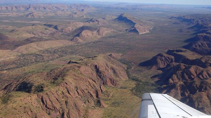
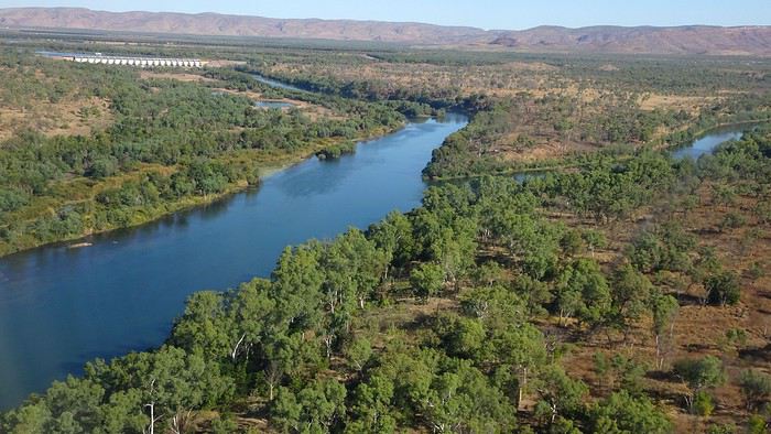
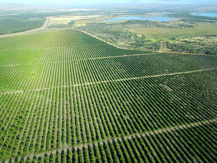
We wanted heat, and here it was—34°C the moment we stepped off the plane! We felt alive again and totally ridiculous in our jeans and sweaters. We quickly grabbed our suitcase and picked up the 4x4 we’d rented—more out of necessity, since only that type of vehicle can access the national parks we planned to visit.
Just four kilometers separated us from Kununurra, a town of 5,000 people founded in 1961 during the construction of the Lake Argyle Dam and the development of the Ord River Irrigation Area Scheme (more on that later). On the horizon, mountain ranges (a bit of an exaggeration, since we know Mt. Meharry, WA’s highest ‘mountain,’ doesn’t even reach 1,250 meters!) and closer to the road, a few irrigation canals cutting through stretches of bush, then a huge park overlooking a small lake lined with reeds.
A row of baobabs (yes, there are baobabs in Australia too!), a series of motels with immaculate lawns, a gas station, and there’s the main street leading to the town center—that is, the parking lots of the two supermarkets, the bottleshop, the pub, the Town Hall, the municipal pool, and the Tourist Office (already closed!), and at the next roundabout, another park, the Presbyterian church, and a few other shops. In short, two or three green blocks that you can explore in no time.
One road leads to the small industrial area and one of the town’s three or four campgrounds, while another heads toward the residential neighborhoods, which look just like the typical suburbs you find in any Australian city—except with tropical vegetation. We stocked up at Coles, an identical copy of the one near our place, and—surprise—the prices were practically the same.
We checked into one of the motels. The receptionist listed the town’s three or four restaurants, insisting that it’s always better to book a table. She recommended the Pump House, a bit outside town on the lake’s edge. “Best spot to watch the sunset, but hurry up.” she told us. It was only 5:00 PM!
When we got there half an hour later, the place was packed, and the sun had already disappeared behind a row of trees! Sure enough, we’d see a few days later that the sunset can be a stunning spectacle—if you wait a bit for the sky (especially if it’s cloudy) to blaze and reflect in the lake’s calm waters. A little disappointed, we headed back into town, where we easily found the other lively spot in town: the pub (nothing like an old English pub). Above the long L-shaped bar, several giant screens (thankfully muted) were broadcasting live footy, rugby league, etc. In one corner, players circled the pool table, while in another, customers were digging into plates of the day’s special. Instead of rooms, there were various patios where groups of friends and coworkers (easily recognizable by the fluoro vests they were still wearing) were gathered. We found a table under a mango tree—unfortunately, a little too close to the guitarist strumming his entire Country Music repertoire, complete with Keith Urban-style tremolos. Guaranteed culture shock!
Since it’s the custom here, we called the Country Club to book a table before the kitchen closed! The CC is the town’s—and even the region’s—fancy spot. Dark decor, modern furniture, dim lighting, and the air conditioning blasting. The twenty or so customers had taken refuge on the vast terrace, lit by torches. The view of the tall eucalyptus trees, illuminated by spotlights shifting from red to blue, was breathtaking.
The menu was minimal, but the grilled salmon was excellent, and the Pavlova (the meringue dessert Kiwis and Aussies have been arguing over since 1906) with melon and watermelon was absolutely divine.
It wasn’t even 9:00 PM, and we were already in bed. Had we already adopted the Top West End’s chicken schedule?!
To be continued... Journal dedicated to Attila
As usual, I didn’t manage to keep it short, but this time I’ve got photos to go with it!
August 2020. Since the opportunities to explore the world are extremely limited right now, all we (R&X) can do is explore our own island! Well, just a part of it, because with the state borders still closed, we’re stuck in Western Australia (WA).
Luckily, we’re pretty fortunate because this state is huge: over 2.5 million km² (that’s more than four times the size of France or 1.5 times Quebec). What’s more, stretching over 20 degrees of latitude between the Antarctic Ocean and the Timor Sea, you’ll find climates ranging from Mediterranean to arid to tropical. That’s actually why we decided to head as far north as possible. Sick of the endless rainy winter in Perth, bring on the heat of the Kimberley... way up Nooorth!
Friday. At the airport, the main terminal was closed (not enough flights), so we ended up in the annex (where flights to the various mines usually depart from). There was no crowd at the gate, and in this huge, single departure lounge, empty seats were plentiful. Only three flights were listed on the screens for the rest of the morning: the first to Coondewanna (?), the second to Darwin, and ours to Kununurra (code KNX).
A cool breeze swept through the half-open corridors along the runways. At the top of the walkway leading to the Fokker 100 (the Airbuses and Boeings are now parked!), a flight attendant greeted us with a basket full of sanitary masks. We were actually the only masked passengers (the staff weren’t wearing them either). With zero Covid-19 cases in WA at the time, the only rule was to maintain social distancing—something pretty hard to do on a full plane!
It was also my first time wearing a mask—it felt weird, pretty uncomfortable, and after a while, painful behind the ears. I really feel for those who have to wear one all day, every day. The flight lasted three long hours, but luckily, I had a good book. From the window, I watched an endless expanse of salt lakes in all shapes and sizes—round, elongated, gray, white, sometimes blue and green—and an infinity of winding, capricious meanders, along with long straight lines that led nowhere. The last half-hour got more interesting as rocky, swollen formations and long, sloping plateaus appeared. Against the vast ochre landscape, green patches became more frequent.
Just before landing, rows of green fields briefly appeared, along with an surprisingly wide river—but we were already rolling down the tarmac. A few hangars, a myriad of small, stationary planes, and a tiny terminal topped with a sign: “Welcome to Kununurra.”
We wanted heat, and here it was—34°C the moment we stepped off the plane! We felt alive again and totally ridiculous in our jeans and sweaters. We quickly grabbed our suitcase and picked up the 4x4 we’d rented—more out of necessity, since only that type of vehicle can access the national parks we planned to visit.
Just four kilometers separated us from Kununurra, a town of 5,000 people founded in 1961 during the construction of the Lake Argyle Dam and the development of the Ord River Irrigation Area Scheme (more on that later). On the horizon, mountain ranges (a bit of an exaggeration, since we know Mt. Meharry, WA’s highest ‘mountain,’ doesn’t even reach 1,250 meters!) and closer to the road, a few irrigation canals cutting through stretches of bush, then a huge park overlooking a small lake lined with reeds.
A row of baobabs (yes, there are baobabs in Australia too!), a series of motels with immaculate lawns, a gas station, and there’s the main street leading to the town center—that is, the parking lots of the two supermarkets, the bottleshop, the pub, the Town Hall, the municipal pool, and the Tourist Office (already closed!), and at the next roundabout, another park, the Presbyterian church, and a few other shops. In short, two or three green blocks that you can explore in no time.
One road leads to the small industrial area and one of the town’s three or four campgrounds, while another heads toward the residential neighborhoods, which look just like the typical suburbs you find in any Australian city—except with tropical vegetation. We stocked up at Coles, an identical copy of the one near our place, and—surprise—the prices were practically the same.
We checked into one of the motels. The receptionist listed the town’s three or four restaurants, insisting that it’s always better to book a table. She recommended the Pump House, a bit outside town on the lake’s edge. “Best spot to watch the sunset, but hurry up.” she told us. It was only 5:00 PM!
When we got there half an hour later, the place was packed, and the sun had already disappeared behind a row of trees! Sure enough, we’d see a few days later that the sunset can be a stunning spectacle—if you wait a bit for the sky (especially if it’s cloudy) to blaze and reflect in the lake’s calm waters. A little disappointed, we headed back into town, where we easily found the other lively spot in town: the pub (nothing like an old English pub). Above the long L-shaped bar, several giant screens (thankfully muted) were broadcasting live footy, rugby league, etc. In one corner, players circled the pool table, while in another, customers were digging into plates of the day’s special. Instead of rooms, there were various patios where groups of friends and coworkers (easily recognizable by the fluoro vests they were still wearing) were gathered. We found a table under a mango tree—unfortunately, a little too close to the guitarist strumming his entire Country Music repertoire, complete with Keith Urban-style tremolos. Guaranteed culture shock!
Since it’s the custom here, we called the Country Club to book a table before the kitchen closed! The CC is the town’s—and even the region’s—fancy spot. Dark decor, modern furniture, dim lighting, and the air conditioning blasting. The twenty or so customers had taken refuge on the vast terrace, lit by torches. The view of the tall eucalyptus trees, illuminated by spotlights shifting from red to blue, was breathtaking.
The menu was minimal, but the grilled salmon was excellent, and the Pavlova (the meringue dessert Kiwis and Aussies have been arguing over since 1906) with melon and watermelon was absolutely divine.
It wasn’t even 9:00 PM, and we were already in bed. Had we already adopted the Top West End’s chicken schedule?!
To be continued... Journal dedicated to Attila
Come discover the North Shore
INTRODUCTION
Travel journal updated in MAY 2025
Since our travel plans outside Canada were canceled due to Covid-19, we decided to take our vacation in Quebec this summer and cover over 5,270 kilometers to explore the various tourist attractions of the North Shore and Gaspésie.
This summary will cover our experiences on the North Shore, while Gaspésie will be the subject of a future summary.
The North Shore, known for its stunning nature, is the perfect spot for outdoor enthusiasts since you can enjoy activities like hiking, wildlife observation, sea kayaking, fishing, and hunting (to name just a few).
It’s also one of the best places in the world to see whales.
Our journey along the North Shore took place between the villages of Tadoussac and Kegaska, as Route 138 ends at the beautiful, long beach in Kegaska.
Travel journal updated in MAY 2025
Since our travel plans outside Canada were canceled due to Covid-19, we decided to take our vacation in Quebec this summer and cover over 5,270 kilometers to explore the various tourist attractions of the North Shore and Gaspésie.
This summary will cover our experiences on the North Shore, while Gaspésie will be the subject of a future summary.
The North Shore, known for its stunning nature, is the perfect spot for outdoor enthusiasts since you can enjoy activities like hiking, wildlife observation, sea kayaking, fishing, and hunting (to name just a few).
It’s also one of the best places in the world to see whales.
Our journey along the North Shore took place between the villages of Tadoussac and Kegaska, as Route 138 ends at the beautiful, long beach in Kegaska.
Three weeks in Quebec at the start of summer 2018, on a "semi-organized" trip
I’ve been putting off posting my Quebec travel experience for a long time. Two years later, I’ve finally decided to share it. The memories are still vivid. I hope this gives you the urge to visit this beautiful region, which I literally fell in love with.
We’re traveling as four adults: my brother Guy, my sister-in-law Martine, my friend Pascal, and myself (Christian).
We entrusted the flight, hotel, and car reservations to the travel agency Amplitudes in Toulouse. Planning the day-to-day activities was up to us. We scheduled a few must-see visits, but for the rest, we’d figure it out on the spot.
Our itinerary: Quebec City / Rimouski / Carleton-sur-Mer / Percé / Sainte-Anne-des-Monts / Matane / Tadoussac / Sainte-Rose-du-Nord / Chambord / Saint-Alexis-des-Monts / Montreal
06/25 Here we are at Roissy Charles de Gaulle for the usual pre-flight formalities. Everything goes smoothly and quickly. The hardest part is waiting for takeoff. After an uneventful flight on an Air Canada Boeing 777-300ER, we land at Montréal-Pierre Elliott Trudeau Airport (YUL) in the early afternoon.
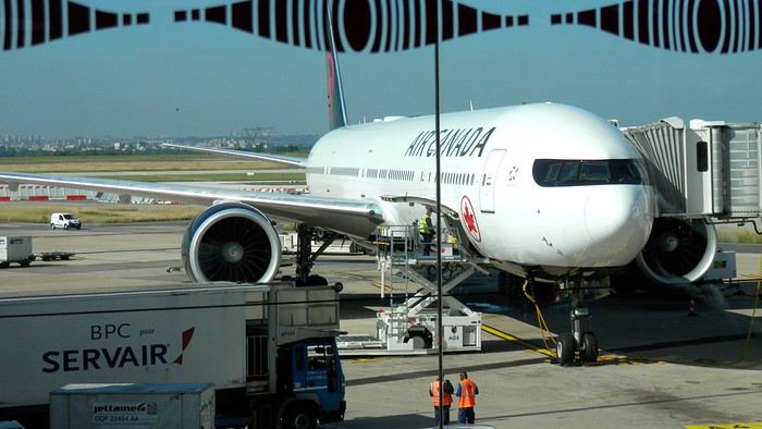
At customs, a surprise—no grumpy officer, but a smiling customs agent who jokingly asks me to name three tourist spots in Quebec, or else he won’t let me in. I pass the test easily and enter Quebec!
We head to the Alamo counter at Trudeau Airport to pick up our car: a Ford Escape with only 300 kilometers on the odometer.
We decided to head straight to Quebec City, saving Montreal for the end of the trip. Pascal takes the wheel and gets on the Trans-Canada Highway E20 for a 255 km drive, taking about 2 hours and 45 minutes. With the time difference, we’re already feeling hungry, so we stop for our first poutine at a highway restaurant.

When we arrive in Quebec City, we go straight to the Clarendon Hotel, located right in the heart of Old Quebec. We’ll be staying there for three nights. Tonight, no restaurant—just a short walk around the hotel before bed. We discover a square with pretty colored water fountains near the city hall.
 It’s only 9 PM, but our body clocks say it’s 3 AM.
We’re traveling as four adults: my brother Guy, my sister-in-law Martine, my friend Pascal, and myself (Christian).
We entrusted the flight, hotel, and car reservations to the travel agency Amplitudes in Toulouse. Planning the day-to-day activities was up to us. We scheduled a few must-see visits, but for the rest, we’d figure it out on the spot.
Our itinerary: Quebec City / Rimouski / Carleton-sur-Mer / Percé / Sainte-Anne-des-Monts / Matane / Tadoussac / Sainte-Rose-du-Nord / Chambord / Saint-Alexis-des-Monts / Montreal
06/25 Here we are at Roissy Charles de Gaulle for the usual pre-flight formalities. Everything goes smoothly and quickly. The hardest part is waiting for takeoff. After an uneventful flight on an Air Canada Boeing 777-300ER, we land at Montréal-Pierre Elliott Trudeau Airport (YUL) in the early afternoon.
At customs, a surprise—no grumpy officer, but a smiling customs agent who jokingly asks me to name three tourist spots in Quebec, or else he won’t let me in. I pass the test easily and enter Quebec!
We head to the Alamo counter at Trudeau Airport to pick up our car: a Ford Escape with only 300 kilometers on the odometer.
We decided to head straight to Quebec City, saving Montreal for the end of the trip. Pascal takes the wheel and gets on the Trans-Canada Highway E20 for a 255 km drive, taking about 2 hours and 45 minutes. With the time difference, we’re already feeling hungry, so we stop for our first poutine at a highway restaurant.
When we arrive in Quebec City, we go straight to the Clarendon Hotel, located right in the heart of Old Quebec. We’ll be staying there for three nights. Tonight, no restaurant—just a short walk around the hotel before bed. We discover a square with pretty colored water fountains near the city hall.
It’s only 9 PM, but our body clocks say it’s 3 AM.Été Covid, un ferry pour la Grèce (en famille) English translation pending
Bonjour à tous,
Voici mon carnet de voyage lors de cet été un peu spécial. Je limite volontairement sur vf à une ou deux photos par jour (certains trouveront que c'est encore trop...) C'est parti 🙂
Les billets étaient pris depuis novembre. Très incertain depuis ce printemps marqué par l'épidémie, ce voyage en Grèce est une bouffée d'air (chaud) après cette période de confinement et d'immobilisme. Nous reprenons donc la route en camion, vers la Grèce continentale. Routes montagneuses, sites antiques, eaux cristallines et ports de pêche, voici en quelques mots les contours d'un voyage riche en couleurs et en saveurs... Les cigales ? Elles ne s'arrêtent qu'à la nuit tombée...
18/07/2020 Jour : 478 km Total : 478 km Départ traditionnel et tardif de Vendée après une quinzaine de jours de vacances.
La cathédrale de Nantes est en feu, le périphérique est bloqué. Challans, Niort, Montluçon, nous prenons la poudre d'escampette en dehors des sentiers battus afin d'éviter le coût exorbitant des péages français. Petit parking très au calme à Rocles quelque part dans l'Allier entre La Prugnole et Blanchetière. Pour celles et ceux qui ne visualisent pas, nous sommes à une trentaine de kilomètres au sud-ouest de Moulins. Les enfants ramassent des bâtons qu'ils jettent dans le lac tandis que mes talents de bricoleur se confirment: le mitigeur nouvellement installé inonde le camion.
Voici mon carnet de voyage lors de cet été un peu spécial. Je limite volontairement sur vf à une ou deux photos par jour (certains trouveront que c'est encore trop...) C'est parti 🙂
Les billets étaient pris depuis novembre. Très incertain depuis ce printemps marqué par l'épidémie, ce voyage en Grèce est une bouffée d'air (chaud) après cette période de confinement et d'immobilisme. Nous reprenons donc la route en camion, vers la Grèce continentale. Routes montagneuses, sites antiques, eaux cristallines et ports de pêche, voici en quelques mots les contours d'un voyage riche en couleurs et en saveurs... Les cigales ? Elles ne s'arrêtent qu'à la nuit tombée...
18/07/2020 Jour : 478 km Total : 478 km Départ traditionnel et tardif de Vendée après une quinzaine de jours de vacances.
La cathédrale de Nantes est en feu, le périphérique est bloqué. Challans, Niort, Montluçon, nous prenons la poudre d'escampette en dehors des sentiers battus afin d'éviter le coût exorbitant des péages français. Petit parking très au calme à Rocles quelque part dans l'Allier entre La Prugnole et Blanchetière. Pour celles et ceux qui ne visualisent pas, nous sommes à une trentaine de kilomètres au sud-ouest de Moulins. Les enfants ramassent des bâtons qu'ils jettent dans le lac tandis que mes talents de bricoleur se confirment: le mitigeur nouvellement installé inonde le camion.
Traversée de la Chartreuse en solo English translation pending
Trek solo n°6
On admettra que cette année fut spéciale. Je devais faire la traversée de Majorque en avril et puis... SALUE JE M'APPELLE COVID 19 ET JE VIENS VOUS FAIRE CHIER. Du coup, peu de projets pour cet été, difficile d'estimer les possibilités de voyage à l'étranger, pas très envie non plus de faire circuler cette merde... Alors je me rabats sur mes chères Alpes, ma foi de très bonne qualité. Début juillet, je consulte mon pote David, un normand exilé au pays des montagnes, pour savoir quand il sera chez lui, à Chambéry. Je cale donc un périple fin juillet, de Grenoble à Chambéry, via le massif de la Chartreuse, et en profiterai pour lui rendre visite.
Trajet réservé : départ le 25 juillet en train vers Grenoble, retour le 2 août en bus depuis Chambéry.
Je m'attends pas à quelque chose d'exceptionnel, je sais pas pourquoi. Ça a l'air très joli, mais pas très haut, et pas très sauvage. Mais après ces derniers mois bizarres, ce confinement éprouvant et les longs mois sans nature, un peu de montagne ne peut me faire que du bien. Et au moins, même si la météo n'est pas avec moi, je vais pas crever de froid, pour une fois (les plus hauts sommets sont à 2000m environ).
Après un petit séjour en Normandie natale et quelques trips de Caen, me voici en halte en région parisienne pour faire mon sac, la veille du départ. Ce qui m'inquiète le plus, c'est l'accès à l'eau. Il n'y a pas beaucoup de neige l'hiver (voire pas du tout certaines années), donc très peu de rivières en altitude. Les sources sont pour abreuver les troupeaux et bergers, mais souvent, l'été, elles sont à sec... Je checke quand même les dernières mises à jour des randonneurs sur refuge.info, qui recense tous les abris et les sources, pour voir un peu l'état des lieux. Ça devrait le faire. Je prends quand même 3 gourdes de 75 ml au lieu de 2 habituellement, ce qui me fait au maximum 2,25L d'eau en réserve.
Je blinde mon sac de 50L : 13 kg sans eau. Mh. Je sais pas comment je me démerde pour me retrouver avec autant de poids. Je lis pas mal de carnets de randonneurs qui portent 8 kg. Pourtant, j'ai pas prévu beaucoup de bouffe, peu d'habits, le strict minimum pour l'autonomie... Je comprends pas comment ça peut monter aussi haut pour seulement une semaine, d'ailleurs je me pose la question tous les ans.
On admettra que cette année fut spéciale. Je devais faire la traversée de Majorque en avril et puis... SALUE JE M'APPELLE COVID 19 ET JE VIENS VOUS FAIRE CHIER. Du coup, peu de projets pour cet été, difficile d'estimer les possibilités de voyage à l'étranger, pas très envie non plus de faire circuler cette merde... Alors je me rabats sur mes chères Alpes, ma foi de très bonne qualité. Début juillet, je consulte mon pote David, un normand exilé au pays des montagnes, pour savoir quand il sera chez lui, à Chambéry. Je cale donc un périple fin juillet, de Grenoble à Chambéry, via le massif de la Chartreuse, et en profiterai pour lui rendre visite.
Trajet réservé : départ le 25 juillet en train vers Grenoble, retour le 2 août en bus depuis Chambéry.
Je m'attends pas à quelque chose d'exceptionnel, je sais pas pourquoi. Ça a l'air très joli, mais pas très haut, et pas très sauvage. Mais après ces derniers mois bizarres, ce confinement éprouvant et les longs mois sans nature, un peu de montagne ne peut me faire que du bien. Et au moins, même si la météo n'est pas avec moi, je vais pas crever de froid, pour une fois (les plus hauts sommets sont à 2000m environ).
Après un petit séjour en Normandie natale et quelques trips de Caen, me voici en halte en région parisienne pour faire mon sac, la veille du départ. Ce qui m'inquiète le plus, c'est l'accès à l'eau. Il n'y a pas beaucoup de neige l'hiver (voire pas du tout certaines années), donc très peu de rivières en altitude. Les sources sont pour abreuver les troupeaux et bergers, mais souvent, l'été, elles sont à sec... Je checke quand même les dernières mises à jour des randonneurs sur refuge.info, qui recense tous les abris et les sources, pour voir un peu l'état des lieux. Ça devrait le faire. Je prends quand même 3 gourdes de 75 ml au lieu de 2 habituellement, ce qui me fait au maximum 2,25L d'eau en réserve.
Je blinde mon sac de 50L : 13 kg sans eau. Mh. Je sais pas comment je me démerde pour me retrouver avec autant de poids. Je lis pas mal de carnets de randonneurs qui portent 8 kg. Pourtant, j'ai pas prévu beaucoup de bouffe, peu d'habits, le strict minimum pour l'autonomie... Je comprends pas comment ça peut monter aussi haut pour seulement une semaine, d'ailleurs je me pose la question tous les ans.
Petit tour dans le Péloponnèse English translation pending
Tous nos séjours en Grèce nous ont enchantées alors, après un séjour en Crète, à Rhodes, à Zakynthos et en Grèce centrale, pourquoi pas un tour du Péloponnèse?
Nous avons quelques hésitations quant à la chaleur possible (notamment pour les randonnées) mais finalement, hop! la réservation des billets d'avion est faite fin janvier: ce sera un départ de Bruxelles (avec Brussels airlines) le 05/07 à 7h30. Puis arrive le (la) Covid avec son lot d'incertitudes: partira? Partira pas? Partira? Partira pas? Faut-il tout annuler, reporter? Au mois de juin les règles d'ouverture des frontières changent en permanence mais il arrive un moment où il faut bien se décider car certains hébergements ne sont plus annulables. Les frontières de la Grèce doivent théoriquement ouvrir totalement le 1er juillet (sous réserve de...) on doit partir le 5 ...alors, c'est décidé, on part! ...enfin, si tout se passe comme prévu!
L'ouest du Péloponnèse ne m'inspire pas plus que ça. Par contre Cythère me tente bien, alors voilà à quoi ressemblera notre circuit (on prendra le bateau pour Cythère à Neapoli):
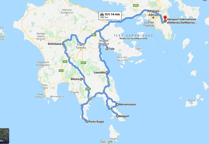 Muriel
Nous avons quelques hésitations quant à la chaleur possible (notamment pour les randonnées) mais finalement, hop! la réservation des billets d'avion est faite fin janvier: ce sera un départ de Bruxelles (avec Brussels airlines) le 05/07 à 7h30. Puis arrive le (la) Covid avec son lot d'incertitudes: partira? Partira pas? Partira? Partira pas? Faut-il tout annuler, reporter? Au mois de juin les règles d'ouverture des frontières changent en permanence mais il arrive un moment où il faut bien se décider car certains hébergements ne sont plus annulables. Les frontières de la Grèce doivent théoriquement ouvrir totalement le 1er juillet (sous réserve de...) on doit partir le 5 ...alors, c'est décidé, on part! ...enfin, si tout se passe comme prévu!
L'ouest du Péloponnèse ne m'inspire pas plus que ça. Par contre Cythère me tente bien, alors voilà à quoi ressemblera notre circuit (on prendra le bateau pour Cythère à Neapoli):
MurielÉvasion en Thaïlande English translation pending
J'ai déjà expliqué ici le contexte de mes publications et pourquoi je remonte à ce point dans le temps. Cette fois-ci, on est en 2014. Je pars du présupposé que les choses n'ont pas considérablement changées et que ces voyages peuvent encore, malgré le temps passsé, en inspirer d'autres...
dimanche 30 novembre 2014 Mulhouse - Amsterdam
Bien sûr, tu le sais, ça fait des mois que j’en parle, ce matin on part vers Bangkok, Thaïlande. Pour Dom et moi, la voyago-thérapie : le must pour réduire à rien les agressions du moment, essentiellement liées à des histoires de boulot; mais je vais pas m'égarer là-dedans, ce n'est pas l'endroit!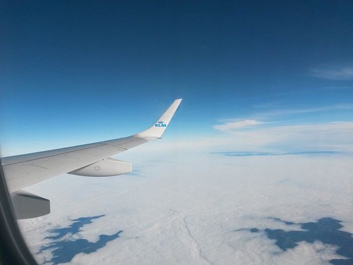
Escale à Amsterdam...
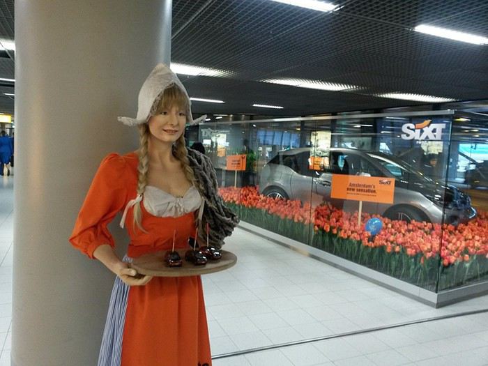
Lundi 1 décembre 2014 Bangkok
Même si c’est hautement probablement faux, on arrive à Bangkok alors qu’il m’a semblé n’avoir, à aucun moment, fermé l’œil. Les habituelles files d’attente à la douane présentent, il faut le souligner, des visages aimables… les bagages...Le taxi (rigolard comme ce n’est plus permis en occident :), l’hôtel...Nickel avec une magnifique terrasse au bord de la Navalaï River...Tous les flags sont au vert ! Tu nous connais, on traîne pas trop avant d’aller découvrir la ville ! On demande notre chemin à un type super accueillant qui hèle aussitôt un môme avec un « tuk tuk », une sorte de mobylette encarénée très appréciée des touristes because costless en diable ! Notre mentor négocie pour 40 baths (1 euro !), un tour des temples du nord. On se laisse driver sans discuter...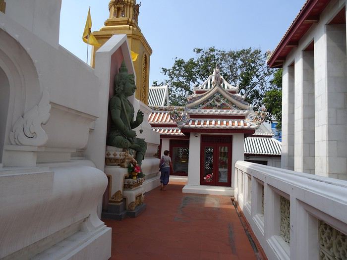
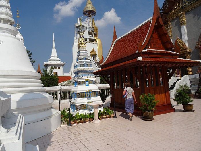
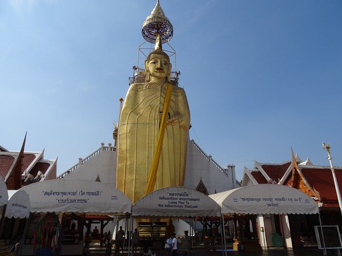
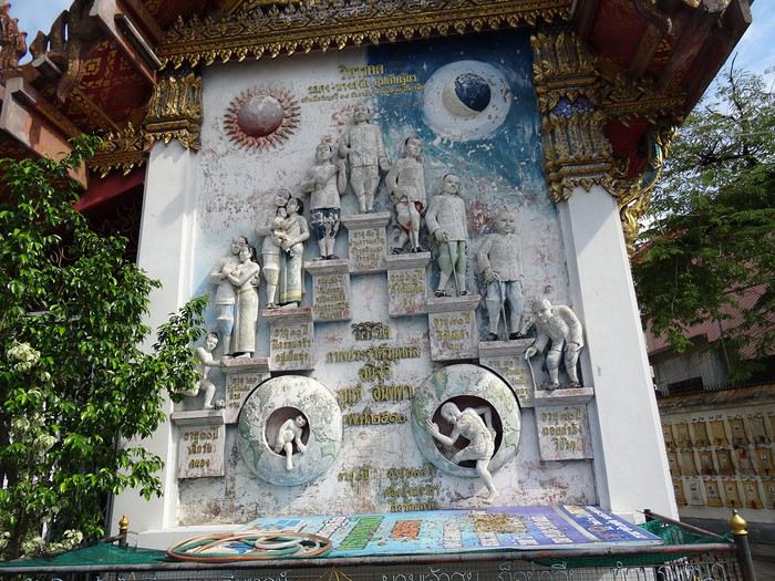
Après le troisième temple, le môme tourne bizarre. Il a arrêté d’être juste aimable. Nous presse. Puis, au milieu d’une visite, nous enjoint de le suivre, il veut nous montrer, dans une certaine urgence, quelque chose. Il nous emmène vers un homme d’âge respectable, une sorte de bonze aimable, affable, qui nous raconte, dans un français correct, sa jeunesse à Bordeaux, puis glisse insensiblement sur la théorie économique et ses inconstances, de la difficulté induite à placer le fruit de notre dur labeur dans quelque chose de pérenne. On le sentait venir. Devine où il est le plus sûr de placer son argent ? Dans la pierre précieuse, naturellement ! Et là, le monde est quand même bien fichu, figure toi que notre interlocuteur connait justement quelques joailliers d’art qui accepteraient de nous vendre à prix coûtant des saphirs de la région, et sans taxes encore! Bon. Le môme nous a embarqués dans un traquenard. On réussit cependant sans trop de difficulté à se débarrasser du fâcheux et reprenons l’expédition où nous l’avions laissée. Quand je demande au môme où se trouve la prochaine destination, je l’oblige à répéter plusieurs fois tant la chose me semble incongrue, mais c’est bien ça, sa réponse s’entend : « Thaï export !». On décide aussitôt d’abandonner la virée. On lâche 40 baths au gamin et sautons de sa mobylette au premier feu rouge. Ensuite, on a agité nos petites mains pour tenter d’attirer un taxi sous le cagnard, un Thaï d’un âge plus que respectable, nous a embarqué dans un véhicule qu’il a eu toute les peines du monde à maintenir sur la route, propulsés dans une sorte de jeu vidéo mortel, un grand thief auto à travers une circulation en délire… Mais ça va. Pour une poignée d’euros il nous a ramené à notre hôtel, sains et saufs ! Là, faut se remettre, pot au bord de la rivière... « Ça doit être possible de faire une ballade sur le fleuve, tu crois pas? » J’en parle à notre hôte à l’accueil, le truc est organisé dans la foulée ! Une efficacité qui laisse ébahi ! On a un bateau pour une virée d’une heure à travers la ville.
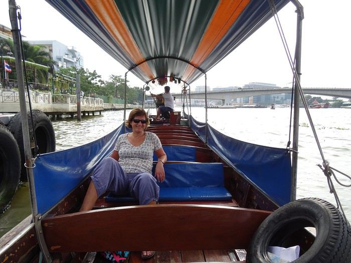
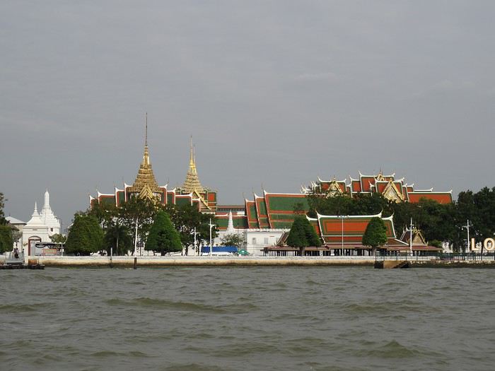
En traversant un petit village sur pilotis, je vois nager un drôle de truc, comme un chien. A force d’écarquiller les yeux, on distingue tout un groupe de Varans!
dimanche 30 novembre 2014 Mulhouse - Amsterdam
Bien sûr, tu le sais, ça fait des mois que j’en parle, ce matin on part vers Bangkok, Thaïlande. Pour Dom et moi, la voyago-thérapie : le must pour réduire à rien les agressions du moment, essentiellement liées à des histoires de boulot; mais je vais pas m'égarer là-dedans, ce n'est pas l'endroit!
Escale à Amsterdam...
Lundi 1 décembre 2014 Bangkok
Même si c’est hautement probablement faux, on arrive à Bangkok alors qu’il m’a semblé n’avoir, à aucun moment, fermé l’œil. Les habituelles files d’attente à la douane présentent, il faut le souligner, des visages aimables… les bagages...Le taxi (rigolard comme ce n’est plus permis en occident :), l’hôtel...Nickel avec une magnifique terrasse au bord de la Navalaï River...Tous les flags sont au vert ! Tu nous connais, on traîne pas trop avant d’aller découvrir la ville ! On demande notre chemin à un type super accueillant qui hèle aussitôt un môme avec un « tuk tuk », une sorte de mobylette encarénée très appréciée des touristes because costless en diable ! Notre mentor négocie pour 40 baths (1 euro !), un tour des temples du nord. On se laisse driver sans discuter...
Après le troisième temple, le môme tourne bizarre. Il a arrêté d’être juste aimable. Nous presse. Puis, au milieu d’une visite, nous enjoint de le suivre, il veut nous montrer, dans une certaine urgence, quelque chose. Il nous emmène vers un homme d’âge respectable, une sorte de bonze aimable, affable, qui nous raconte, dans un français correct, sa jeunesse à Bordeaux, puis glisse insensiblement sur la théorie économique et ses inconstances, de la difficulté induite à placer le fruit de notre dur labeur dans quelque chose de pérenne. On le sentait venir. Devine où il est le plus sûr de placer son argent ? Dans la pierre précieuse, naturellement ! Et là, le monde est quand même bien fichu, figure toi que notre interlocuteur connait justement quelques joailliers d’art qui accepteraient de nous vendre à prix coûtant des saphirs de la région, et sans taxes encore! Bon. Le môme nous a embarqués dans un traquenard. On réussit cependant sans trop de difficulté à se débarrasser du fâcheux et reprenons l’expédition où nous l’avions laissée. Quand je demande au môme où se trouve la prochaine destination, je l’oblige à répéter plusieurs fois tant la chose me semble incongrue, mais c’est bien ça, sa réponse s’entend : « Thaï export !». On décide aussitôt d’abandonner la virée. On lâche 40 baths au gamin et sautons de sa mobylette au premier feu rouge. Ensuite, on a agité nos petites mains pour tenter d’attirer un taxi sous le cagnard, un Thaï d’un âge plus que respectable, nous a embarqué dans un véhicule qu’il a eu toute les peines du monde à maintenir sur la route, propulsés dans une sorte de jeu vidéo mortel, un grand thief auto à travers une circulation en délire… Mais ça va. Pour une poignée d’euros il nous a ramené à notre hôtel, sains et saufs ! Là, faut se remettre, pot au bord de la rivière... « Ça doit être possible de faire une ballade sur le fleuve, tu crois pas? » J’en parle à notre hôte à l’accueil, le truc est organisé dans la foulée ! Une efficacité qui laisse ébahi ! On a un bateau pour une virée d’une heure à travers la ville.
En traversant un petit village sur pilotis, je vois nager un drôle de truc, comme un chien. A force d’écarquiller les yeux, on distingue tout un groupe de Varans!