Results for "Saint-Flour+|+127"
82342 results found.
Off on a winter adventure in the American West!
Day 1 – February 14
We all have two lives. And the second one kicks off the day you realize you only have one, with the determination to spend the time you have left on what truly adds sparkle to your life, Kevin! I like to elegantly introduce a trip with a philosophical quote. First, it gives you the illusion that I’m some kind of deep thinker, and second, it lets me fill up the first few lines of my blank page when I don’t know how to tell you I’m diving back into what really lights up my life: another adventure beyond the horizon! And nearly every other year, like a toxic relationship, my horizon tends to take shape in Uncle Sam’s backyard. And this, despite his cousin Donald calling the shots. Speaking of which, it was partly that impulsive guy who pushed us to be just as impulsive and snag our four flight tickets at a ridiculously low price—a direct result of foreign tourism taking a hit from BetaMax’s repeated antics... Four tickets? Who are the other lucky ones? In this case, our lucky ones are actually lucky ladies: My Flo, always up for exploring the world with me on foot, camelback, or scooter, is obviously in on the fun. The other two seats went to our daughters, Sasha and Luna, both thrilled to be part of this new American adventure...
But what’s the American West like in February?... A gamble. Let’s call it Russian roulette since we’re not landing during peak weather season. That’s why we encouraged our transportation and accommodation to get cozy and produce a little camper van, so we can stay ultra-flexible in the face of any weather tantrums. We’ll be roaming in Kara the van with the motto "Follow the sun!" Bad weather? We bolt. Snow? We speed up. Sunny? We act like it was the plan all along and soak it up.
"Okay, but why keep coming back to the same corner of the globe? After ten American adventures, you must be tired of seeing the same things, right?" But I’m not crazy, you know!... The American West is like making love to your gorgeous wife over and over, always enjoying it just as much. And contrary to what you might think, the American West isn’t just the Grand Canyon, Monument Valley, Las Vegas, and Bryce Canyon. Proof is, after ten trips to the U.S., my retinas are still untouched by three-quarters of the places I scribbled on a napkin for this adventure... Oh, and add to that my wife, who I’ve easily converted to my religion, and boom... relapse is even easier! Because yes, we’ve landed in Los Angeles after a sunny flight over Greenland, still under Danish flag for now. And we’re already heading east through the XXL traffic of L.A.’s eight-lane highways, eager to dive into our first discoveries. But first, night is taking over the sky, and second, we’ve been officially awake for 24 hours, so I suggest wrapping up this intro. I’ll tell you more tomorrow morning. Sound good?


We all have two lives. And the second one kicks off the day you realize you only have one, with the determination to spend the time you have left on what truly adds sparkle to your life, Kevin! I like to elegantly introduce a trip with a philosophical quote. First, it gives you the illusion that I’m some kind of deep thinker, and second, it lets me fill up the first few lines of my blank page when I don’t know how to tell you I’m diving back into what really lights up my life: another adventure beyond the horizon! And nearly every other year, like a toxic relationship, my horizon tends to take shape in Uncle Sam’s backyard. And this, despite his cousin Donald calling the shots. Speaking of which, it was partly that impulsive guy who pushed us to be just as impulsive and snag our four flight tickets at a ridiculously low price—a direct result of foreign tourism taking a hit from BetaMax’s repeated antics... Four tickets? Who are the other lucky ones? In this case, our lucky ones are actually lucky ladies: My Flo, always up for exploring the world with me on foot, camelback, or scooter, is obviously in on the fun. The other two seats went to our daughters, Sasha and Luna, both thrilled to be part of this new American adventure...
But what’s the American West like in February?... A gamble. Let’s call it Russian roulette since we’re not landing during peak weather season. That’s why we encouraged our transportation and accommodation to get cozy and produce a little camper van, so we can stay ultra-flexible in the face of any weather tantrums. We’ll be roaming in Kara the van with the motto "Follow the sun!" Bad weather? We bolt. Snow? We speed up. Sunny? We act like it was the plan all along and soak it up.
"Okay, but why keep coming back to the same corner of the globe? After ten American adventures, you must be tired of seeing the same things, right?" But I’m not crazy, you know!... The American West is like making love to your gorgeous wife over and over, always enjoying it just as much. And contrary to what you might think, the American West isn’t just the Grand Canyon, Monument Valley, Las Vegas, and Bryce Canyon. Proof is, after ten trips to the U.S., my retinas are still untouched by three-quarters of the places I scribbled on a napkin for this adventure... Oh, and add to that my wife, who I’ve easily converted to my religion, and boom... relapse is even easier! Because yes, we’ve landed in Los Angeles after a sunny flight over Greenland, still under Danish flag for now. And we’re already heading east through the XXL traffic of L.A.’s eight-lane highways, eager to dive into our first discoveries. But first, night is taking over the sky, and second, we’ve been officially awake for 24 hours, so I suggest wrapping up this intro. I’ll tell you more tomorrow morning. Sound good?
South Africa in safari mode: February/March 2026
Hi everyone,
With my girlfriend Christelle, we’ve chosen South Africa for our first trip to Southern Africa, focusing on safaris—after a long debate with a Cape Town/Kruger combo. But that would’ve meant cutting out St Lucia, which would’ve been harder to fit into another trip. And St Lucia—thanks to Michel and all those travel journals—we really wanted to go there.
So our 11-night itinerary ended up like this, mostly shaped by school holidays: - 3 nights in St Lucia - 1 night in Hluhluwe - 1 night at Mkhaya Game Reserve (Eswatini) - 1 night at Hlane Royal National Park (Eswatini) - 3 nights in Kruger (Berg en Dal / Satara / Tamboti) - 1 night at Shindzela Tented Camp in the Timbavati private reserve - 1 final night in Kruger at Lower Sabie
All of this in the off-season and rainy season, just a month after catastrophic floods that killed over 150 people and seriously damaged Kruger’s infrastructure.
I’ll jump straight to St Lucia and skip the loooong journey to get there (with a layover in Frankfurt, landing in Johannesburg, a domestic flight to Durban, and the rest by rental SUV—First Car Rental, perfect, no complaints).
To motivate readers—especially some familiar faces here—I’ll drop in a first photo.

With my girlfriend Christelle, we’ve chosen South Africa for our first trip to Southern Africa, focusing on safaris—after a long debate with a Cape Town/Kruger combo. But that would’ve meant cutting out St Lucia, which would’ve been harder to fit into another trip. And St Lucia—thanks to Michel and all those travel journals—we really wanted to go there.
So our 11-night itinerary ended up like this, mostly shaped by school holidays: - 3 nights in St Lucia - 1 night in Hluhluwe - 1 night at Mkhaya Game Reserve (Eswatini) - 1 night at Hlane Royal National Park (Eswatini) - 3 nights in Kruger (Berg en Dal / Satara / Tamboti) - 1 night at Shindzela Tented Camp in the Timbavati private reserve - 1 final night in Kruger at Lower Sabie
All of this in the off-season and rainy season, just a month after catastrophic floods that killed over 150 people and seriously damaged Kruger’s infrastructure.
I’ll jump straight to St Lucia and skip the loooong journey to get there (with a layover in Frankfurt, landing in Johannesburg, a domestic flight to Durban, and the rest by rental SUV—First Car Rental, perfect, no complaints).
To motivate readers—especially some familiar faces here—I’ll drop in a first photo.
Review of an expedition cruise to the Seychelles with Ponant from January 25 to February 2, 2026
Hi everyone,
It was totally by chance that I found this cruise while chatting with Alfred in November 2024. It wasn’t planned, but the price was attractive—one of those "great deals" from Ponant that I love and that don’t exist anymore. Since everyone’s wondering, here’s the answer without waiting for the end of the story: after my various loyalty discounts, I paid **3,250 € per person** for 8 nights/9 days on the expedition cruise *The Essentials of the Seychelles*.
Expedition cruises are by far our favorites. The outings are done by Zodiac with the ship’s naturalist guides, everything’s included, and there’s no need to add any excursions or prepare anything.
We’re liking long flights less and less, so to break up the trip, we decided to stop over in Doha for four days on the way there and one day on the way back.
I’m happy to share the good and not-so-good moments, the great surprises, and the disappointments of this trip with you.
It was totally by chance that I found this cruise while chatting with Alfred in November 2024. It wasn’t planned, but the price was attractive—one of those "great deals" from Ponant that I love and that don’t exist anymore. Since everyone’s wondering, here’s the answer without waiting for the end of the story: after my various loyalty discounts, I paid **3,250 € per person** for 8 nights/9 days on the expedition cruise *The Essentials of the Seychelles*.
Expedition cruises are by far our favorites. The outings are done by Zodiac with the ship’s naturalist guides, everything’s included, and there’s no need to add any excursions or prepare anything.
We’re liking long flights less and less, so to break up the trip, we decided to stop over in Doha for four days on the way there and one day on the way back.
I’m happy to share the good and not-so-good moments, the great surprises, and the disappointments of this trip with you.
Need help organizing a trip to Cape Verde during Carnival
Hi everyone,
After a year where I’ve worked way too much and with a house under renovation, it’s become essential to take a breather. My contract ends on 01/30, and I’ll try to find a new client for early March, so overall, let’s go somewhere in February!
I thought Réunion with the full trek around the Mafate cirque for reconnecting with Nature would be perfect, but since it’s cyclone season, it wasn’t such a great idea. Then came the idea that Southeast Asia could fulfill the peace-and-beach vibe, especially Cambodia with its cultural past, but the flight ticket price and a chat with a friend made me change my mind—and boom, Cape Verde popped up, with Santo Antão for hiking and São Vicente for culture and the beach.
So I bought a ticket a week ago, and oh, what a coincidence—it’s during Carnival!
Except now, I don’t know if it’s reality or just exhaustion talking, but I feel like I’m making a mess of things.
I’ve traveled a lot without even booking the first night, but this time, I pre-booked 2 nights in Mindelo (though one of them ended up canceling itself).
But the main issue is that I arrive on Monday, 02/09 at 6 PM and leave on Sunday, 02/22 at 11 AM, and there’s a little hiccup in the logical organization—actually, several hiccups—since I don’t really have any organization right now, and that’s where I need help
Because Carnival is in full swing from 02/15 to 02/17, right in the middle of my trip, so the logic of my visit to Santo Antão isn’t clicking for me. Plus, I just checked, and there’s zero accommodation available in Mindelo from 02/15 to 02/18 😕
So I don’t know: should I skip Carnival, should I forget about planning and just wing it once I’m there, should I stay on São Vicente after Carnival (because I read Montaganrd’s trip report, and he made São Vicente sound like a rock !), or should I keep in mind the option of heading to Santiago afterward and buying a return flight to Paris from Praia?
I need help 🏴☠️
In the midst of Kenya's wildlife, October 2025
Hello everyone,
After sharing some safari photos from southern Tanzania, I’d like to show you those from our latest safari in Kenya in October 2025.
First, I’d like to thank Sylvie56, whose previous travel journals about this country inspired our trip choices. Thanks also for the info you sent us via PM. THANK YOU!
The following account is from a simple wildlife enthusiast. You won’t find anything here but images of landscapes, mammals, and birds. The stated purpose of this trip was purely and solely wildlife-focused. (It was in no way a discovery of the country or its people).
This stay/safari began (and ended) in Nairobi, with flights between France and Kenya operated by Qatar Airways departing from Nice.
Over two weeks, we first visited the reserves of Tsavo West and Tsavo East, then after a long road trip, the two reserves of Buffalo Springs and Samburu.
= Please wait until the end of the journal to ask any specific questions (or send them via PM) to keep the story flowing without interruptions or off-topic comments.
Thanks for your understanding.
...
Previous Kenya safari trip in 2017, here:
http://www.image-nature.com/forum/viewtopic.php?f=162&t=61119
...
After sharing some safari photos from southern Tanzania, I’d like to show you those from our latest safari in Kenya in October 2025.
First, I’d like to thank Sylvie56, whose previous travel journals about this country inspired our trip choices. Thanks also for the info you sent us via PM. THANK YOU!
The following account is from a simple wildlife enthusiast. You won’t find anything here but images of landscapes, mammals, and birds. The stated purpose of this trip was purely and solely wildlife-focused. (It was in no way a discovery of the country or its people).
This stay/safari began (and ended) in Nairobi, with flights between France and Kenya operated by Qatar Airways departing from Nice.
Over two weeks, we first visited the reserves of Tsavo West and Tsavo East, then after a long road trip, the two reserves of Buffalo Springs and Samburu.
= Please wait until the end of the journal to ask any specific questions (or send them via PM) to keep the story flowing without interruptions or off-topic comments.
Thanks for your understanding.
...
Previous Kenya safari trip in 2017, here:
http://www.image-nature.com/forum/viewtopic.php?f=162&t=61119
...
Trip to Morocco in September-October 2025, in our camper van
Hi everyone,
We’re just back from a month-long trip to Morocco in our camper van.
After crossing France (we left from the Nantes area) and Spain, we arrived in Algeciras where we bought our boat tickets to Tangier. When we got to Tangier, as we were going through customs, you can imagine our surprise when the customs officer took our road map of Morocco and pointed out the label "Western Sahara" (just like in the forum’s destination section, by the way!).
He wanted it to say "Moroccan Sahara" instead!!! But there was nothing we could do—it was an old map... He wouldn’t listen, and after long discussions with the other (younger) customs officers, he finally gave it back and let us through... Unbelievable! Later, we heard that other travelers had their maps confiscated outright.
So, hide it well if you want to keep yours!!!
Anyway, we skirted around Tangier’s suburbs—pretty grim—and finally arrived in Asilah.
Following the coast and the long promenade along the beach, we reached the campsite. It was a bit crowded, not much shade, but it wasn’t far from the medina or the beach, and it wasn’t expensive. There’s some life here: Moroccan families seem to live on-site, in tents or basic bungalows. A woman was cooking tagine on a brazier—we were right in the atmosphere! The night was quiet, and we slept well. We set off on foot, walking along the seafront to the medina... We’d already been here in 2009. It was less touristy back then! Still, at this early hour, the little streets inside were very quiet. The walls had been freshly whitewashed, and there were even more murals than before. Around 11:30 AM, we strolled along the ramparts by the sea. There was a nice breeze! And a lot more people around. We enjoyed a milkshake on the terrace of a café overlooking the beach that stretches out at the foot of the medina. Some young guys were having fun diving off the rocks—and even off the top of the wall!
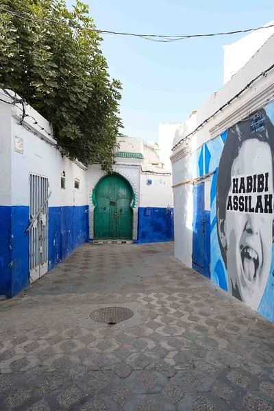
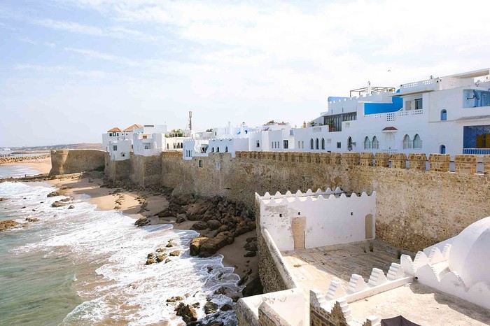
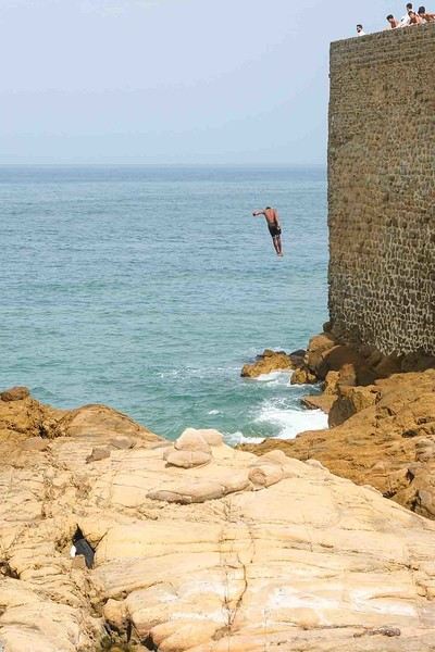
Anyway, we skirted around Tangier’s suburbs—pretty grim—and finally arrived in Asilah.
Following the coast and the long promenade along the beach, we reached the campsite. It was a bit crowded, not much shade, but it wasn’t far from the medina or the beach, and it wasn’t expensive. There’s some life here: Moroccan families seem to live on-site, in tents or basic bungalows. A woman was cooking tagine on a brazier—we were right in the atmosphere! The night was quiet, and we slept well. We set off on foot, walking along the seafront to the medina... We’d already been here in 2009. It was less touristy back then! Still, at this early hour, the little streets inside were very quiet. The walls had been freshly whitewashed, and there were even more murals than before. Around 11:30 AM, we strolled along the ramparts by the sea. There was a nice breeze! And a lot more people around. We enjoyed a milkshake on the terrace of a café overlooking the beach that stretches out at the foot of the medina. Some young guys were having fun diving off the rocks—and even off the top of the wall!
Langtang – Trekking in the Rain
We did the Langtang trek (hike) from September 10th to 17th, with the first and last days being the trip from Kathmandu and back—so 6 days of actual walking. It’s a fairly well-known trek but certainly not as famous or crowded as those in the Annapurna or Everest regions, which is why we chose it.
In theory, it’s mandatory to have a guide for this trek. In reality, it seems there are ways to bypass the regulations: we met at least two people hiking without a guide—a South Korean, a New Zealander, and possibly also a couple of English women and an American couple, though we’re not sure if they had a guide.
The agency we booked with had told us it was an affordable trek for relatively older people in good shape—which is our case (I’m 72 myself). I have to say upfront that we found it quite challenging, maybe because we didn’t have good weather—it was the end of the monsoon season. To be clear, no matter your fitness level, I’d say doing this trek in the middle of the monsoon season would be suicidal.
Day 1 – Journey from Kathmandu to Syapru Besi
On Monday, September 8th, there had been violent protests in Kathmandu against the government, which had, among other things, blocked access to social media and been accused of nepotism and corruption. There were 19 deaths. The situation was very tense on the day of our departure, Wednesday the 10th. The agency warned us that public transport was very unreliable. So, we decided to take a jeep, at an additional cost of $100 ($160 minus what was already budgeted for the bus).
We left a little before 7 a.m. and it took us a good hour just to reach the outskirts of Kathmandu. Along the way, we saw several houses and vehicles set on fire by protesters.
The road to Syapru Besi is only 120 km, but it’s frankly awful. It’s always narrow, winds through endless mountains, and the shoulders range from bad to confusing to nonexistent. Several sections are just dirt tracks. We didn’t regret opting for the jeep, as we could stop several times at our convenience—if only to let Y (my Thai partner) throw up everything she had. She’d taken her usual motion sickness medication, but the constant turns, accelerations, and braking eventually made her terribly carsick.
In Nuwakot, we stopped for breakfast at a nice little restaurant, Jimbu. It was around 8:30 a.m., and we’d barely covered 60 km. The restaurant has a lovely garden overlooking the Trishuli Ganga, the river flowing down from Syapru Besi. First photo: the river in the bottom right corner, mist and clouds over the mountain on the other side.
An hour later, my second photo: the hills along the Trishuli Ganga. You can see the different crops—lush green rice paddies in the lower right and corn, already yellowed and likely harvested, in the foreground on the left. And of course, the mist and clouds through which you can glimpse the mountain on the other side of the river.
In theory, it’s mandatory to have a guide for this trek. In reality, it seems there are ways to bypass the regulations: we met at least two people hiking without a guide—a South Korean, a New Zealander, and possibly also a couple of English women and an American couple, though we’re not sure if they had a guide.
The agency we booked with had told us it was an affordable trek for relatively older people in good shape—which is our case (I’m 72 myself). I have to say upfront that we found it quite challenging, maybe because we didn’t have good weather—it was the end of the monsoon season. To be clear, no matter your fitness level, I’d say doing this trek in the middle of the monsoon season would be suicidal.
Day 1 – Journey from Kathmandu to Syapru Besi
On Monday, September 8th, there had been violent protests in Kathmandu against the government, which had, among other things, blocked access to social media and been accused of nepotism and corruption. There were 19 deaths. The situation was very tense on the day of our departure, Wednesday the 10th. The agency warned us that public transport was very unreliable. So, we decided to take a jeep, at an additional cost of $100 ($160 minus what was already budgeted for the bus).
We left a little before 7 a.m. and it took us a good hour just to reach the outskirts of Kathmandu. Along the way, we saw several houses and vehicles set on fire by protesters.
The road to Syapru Besi is only 120 km, but it’s frankly awful. It’s always narrow, winds through endless mountains, and the shoulders range from bad to confusing to nonexistent. Several sections are just dirt tracks. We didn’t regret opting for the jeep, as we could stop several times at our convenience—if only to let Y (my Thai partner) throw up everything she had. She’d taken her usual motion sickness medication, but the constant turns, accelerations, and braking eventually made her terribly carsick.
In Nuwakot, we stopped for breakfast at a nice little restaurant, Jimbu. It was around 8:30 a.m., and we’d barely covered 60 km. The restaurant has a lovely garden overlooking the Trishuli Ganga, the river flowing down from Syapru Besi. First photo: the river in the bottom right corner, mist and clouds over the mountain on the other side.
An hour later, my second photo: the hills along the Trishuli Ganga. You can see the different crops—lush green rice paddies in the lower right and corn, already yellowed and likely harvested, in the foreground on the left. And of course, the mist and clouds through which you can glimpse the mountain on the other side of the river.
Hitchhiking in the 70s-80s
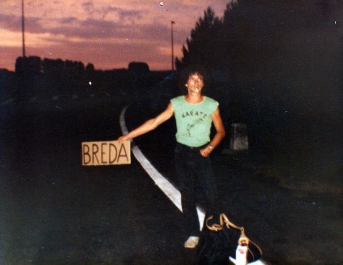
“Hey, your Marker... - My Marker? - The one you used to make hitchhiking signs.”
The marker in question is sitting proudly on the kitchen table. Marielle found it at the bottom of a moving box.
I’ve been meaning to tell the long story of my love affair with hitchhiking for years. Here we go.
To be honest, I’m not quite sure when it started. My earliest memory goes back to a fair with a bike race in my maternal grandparents’ village. I was with my cousin, my little sister, and three girl cousins. There were six of us, ages ranging from six or seven to thirteen or fourteen. Our parents stayed at the fair, and we’d had enough. So we decided to walk home. Only it was four kilometers away. So we hitchhiked. A guy driving an old car picked us all up and dropped us off at the farm. He probably found it amusing to see us thumbing a ride by the side of the road, but maybe it also worried him a bit. With everything you read in the papers...
Around fifteen or sixteen, I started hitchhiking regularly, alone or with a friend, to go to the nearby town. But it was especially when I started boarding school in Orléans that it became more regular. The first year, I’d leave Monday morning and come back Saturday noon by bus. It was an old, uncomfortable bus where we froze in winter. To make matters worse, I often got motion sickness if, as was too often the case, I ended up sitting in the back. In the spring, a high school friend suggested I hitchhike back. It meant a slight detour, but the advantage was taking only national roads.
So that’s how, from the end of tenth grade to twelfth grade, I’d thumb a ride every Saturday on the Pont de Bourgogne. Drivers were used to seeing young people hitchhiking, and it worked pretty well. Our biggest fear? Soldiers! At that time, military service was still mandatory, and on weekends, it wasn’t rare to see them competing with us. They’d keep their uniforms on to go home. That gave people confidence—with everything you read in the papers—and they’d rarely wait more than five minutes. We, with our long hair, were definitely less popular. From time to time, three big red-faced guys in a van coming back from a construction site would flip us off, yelling things like “go get a haircut, you bums!” Those were the good old days.
We still had a good laugh, though. Patrice, the friend I’d hitchhike back from school with on Saturdays, is a musician—I’d later discover he’s an excellent composer. A die-hard Beatles fan, he knows their repertoire by heart and spends his time singing at the top of his lungs while we thumb a ride. One Saturday late morning, we’d been waiting for a while at the exit of Châteauneuf-sur-Loire when a little lady came up to him and asked if he could please sing a little quieter: a baby was sleeping in the house. He put on the most sorry face: “Oh, sorry ma’am, we didn’t realize.” No sooner had the lady gone back inside than he started again. Luckily, a car stopped just then, sparing me the embarrassment of seeing the lady come back out.
Saturday was also the day when the cigarette pack was dangerously low. So before leaving, we’d go buy some “Parisiennes,” the “P4s” as we called them back then. They were slightly thinner cigarettes with a mix of tobacco scraps. Sometimes they tasted like light tobacco, sometimes like dark. Not great, but by the end of the week, our pocket money was gone. They were sold in small packs of four, hence the name P4. We’d only pay 20 centimes. On Saturdays, it was rare for the two of us to manage to scrape together 1.50 F to buy a whole pack of Gauloises...
The last twenty kilometers, I’d usually do alone, Patrice having reached his destination. From time to time, luck would smile on me: an acquaintance would just happen to pass by and stop. One January Saturday, at the exit of Gien, I ran into another guy from Argenton whom I knew a little. That day, the weather was nice, but the temperature was well below zero. It was around noon, and it was the off-peak hour. We were shivering, stamping our feet by the side of the road, when a Citroën “Tube” arrived: it was his father’s boss’s, a mason. They were both sitting in the front, but since they were obese, they had us climb onto the open back. Even though we huddled against the cab to shelter from the wind, the twenty kilometers felt very long, especially since we were only going sixty kilometers an hour. Our hands and cheeks were blue when we finally arrived.
The year I took my baccalaureate, a friend with a 2CV would take me Monday mornings with one or two others we’d pick up in nearby villages. We’d share the gas costs, but it was still cheaper than the bus. And in winter, the bus was my nightmare. You had to get up at five to catch it at six. Not enough sleep, and outside it was freezing or raining—or both. The 2CV was luxury. Plus, Philippe would pick me up at home. On the other hand, since I didn’t have class Saturday mornings—well, I did, but we only had PE the first two hours and nothing after—I’d skip class and slip out right after breakfast to thumb a ride at the Pont de Bourgogne.
Those three high school years were formative in this optional subject that was hitchhiking. Little by little, I learned the rules of the game. First, you shouldn’t walk along the road while thumbing. Cars go too fast and can’t stop easily. Accepting a ride that’s too short is also a no-go. The guy who offers to take you a little way but drops you off at some vague crossroads in the middle of nowhere? No thanks. You need to get dropped off in a town. If it’s a fairly big city, you often have to cross it from one end to the other, but it’s better. At the exit, you have to choose your spot well. Actually, you have to put yourself in the driver’s shoes: they need to see you early enough, not be going too fast, and be able to stop easily without risking an accident. So when leaving a city, it’s better not to go too far. It’s wiser to find a spot where cars go slowly and can stop easily. And preferably near a café. The café is for when you still have a few coins for a coffee and need to warm up. From time to time, you’d run into someone nice who’d make a detour to drop you off at a better spot to start again. Finally, if possible, avoid hitchhiking on Sundays. Cars are packed with whole families who, most of the time, aren’t going far. And then there’s the little worry of those people who rarely leave home: with everything you read in the papers...
During those high school years, it was only short trips, rarely exceeding a hundred kilometers. Later, I aimed bigger, and things were a bit different. In 1973-74, I crossed part of France for the first time on two or three occasions, coming back from the German border or returning to Bordeaux, where we lived briefly. Since there weren’t many highways back then, we took national roads. It was during these trips that I realized it was better to leave in the evening. As I said earlier, Sunday is to be avoided, but on weekdays, there’s another problem: if you leave in the morning, you only make short hops. First, it often takes longer to get going because drivers are people going to work nearby. Which brings us back to those who drop you off in a bad spot, far from everything. There, you have to know how to refuse. You thank the driver for stopping—oh, if only everyone could be like you—while explaining why you’d rather stay put. People don’t take offense, by the way. Those who pick up hitchhikers often hitchhiked themselves when they were in the military or before they had a car. In the late afternoon, you’d often run into salespeople or truckers, in other words, people who drive a lot. At that time, salespeople no longer had appointments and were more relaxed. They wanted to talk about something other than the merits of their products. On the radio, it was time for *Les Grosses Têtes*. You’d also quite often run into small business owners, professionals, or even hippies. The conversations were pleasant and often enriching. A little later in the evening, truckers would take over. They’d already driven a few hundred kilometers, and the depot or customs was still far away. So they’d gladly take a hitchhiker to stay awake at the wheel and chat. The radio with Max Ménier’s show *Les routiers sont sympas*, you’d eventually get tired of it. So a hitchhiker was a change. Others, who’d hit the road at midnight to be at their destination by morning, were nice and offered to let you lie down on the bunk while they drove. When you’d been hitchhiking since six in the evening, freezing in the wind between two vehicles, you weren’t unhappy to take a little nap.
Speaking of Max Ménier, he’d often make announcements for hitchhikers. One evening, I called him. It was getting late, and I still had quite a way to go. No luck: the show had ended for good the day before!
In short, it’s better not to rush, sleep in, and leave after lunch, or better yet, in the late afternoon. Obviously, I’m talking about when you have several hundred kilometers to cover. That’s when you have to play it pro.
First thing, especially at night, but it also applies in the middle of summer when the light is blinding: dress to be seen from far away. I’ll admit I have an advantage over most other hitchhikers: I’m small and don’t scare people. To balance that out, racist drivers often take me for an Arab and are less likely to pick me up, but overall, the balance tips in my favor. Back to the need to be seen: at night, I wear light-colored clothes. In headlights, you can see me from far away.
Second thing: travel light. Forget the big backpack with a frame. Drivers don’t always have room in the trunk or on the back seat, especially if it’s rained and the ground is wet. Plus, it forces them to get out of the car. If they’re nice enough to pick up a hitchhiker, you shouldn’t ask for too much either.
Third thing: bring a cardboard sign and a big marker—like the ones in the photo at the start of this post—to write the name of your destination. In the early 80s, I ran a tourist house in the Cher, but I lived in the Netherlands. In the off-season, it was only open on weekends. On Fridays, I’d leave Holland and return on Mondays. 1200 km round trip. On the way there, in Paris, I’d stand at Porte de la Chapelle. At that spot, the road is very wide, and drivers could stop easily. Obviously, on the sign, I didn’t write Eindhoven, which not everyone knows, and even less Amsterdam because of its seedy reputation. In that case, you’d expect to see a police car stop and two officers in kepis ask for your papers. So as a first destination, I’d write Compiègne. We were well out of Paris, and since it wasn’t too far, a trucker or salesperson was less reluctant to stop. Once past Compiègne, I’d take out my Lille sign. Once in Belgium, it wasn’t really necessary to use a sign anymore, since everyone was going in the same direction. Usually, the guy who picked me up at Porte de la Chapelle would say he wasn’t going far but could take me a little way. Before that, I’d still ask if there was a gas station on the highway where he could drop me off before exiting. While talking, the guy would realize he wasn’t dealing with a dangerous criminal. He’d pretend to check his watch, think for a moment, then say that actually, he was going to Belgium and could take me to the border or a little beyond. To leave Paris on the way back, I’d take the train to Melun, where it was easier to hitchhike than at Porte d’Italie.
Over all those years, I think I was pretty lucky. Or maybe philosophical enough not to imagine a car would stop after a few minutes. An hour’s wait was average. Sure, I sometimes waited three, four, or five hours. Most often at odd hours and in terrible weather. When it doesn’t work, it doesn’t work. But there’s always a moment when things pick up. Sure, when you’re soaked in freezing rain in the early morning after a sleepless night, you’re less philosophical than when I’m writing these lines comfortably at my computer, but it still holds true.
Earlier, I mentioned clothing and the importance of being well-rested before leaving. When you’ve eaten well and just gotten out of the shower, shaved, you’re in a better mood. And somehow, drivers sense it. Or at least, that’s the impression I’ve always had. It’s better to look in shape than disgusted at standing there, half-heartedly thumbing a ride. In short, when I’d start to get fed up with waiting, I’d go into the first café I saw for a coffee. Coming back out, I’d be refreshed, and most of the time, a car would stop within minutes. I’ve often said that when I stood by the side of the road thumbing a ride, I felt a bit like a gambler in front of a slot machine. It was a matter of giving luck a chance. And well, it worked out pretty well.
Then, there are countries where hitchhiking works really well and others where it’s harder. In the 70s-80s, it worked best in Germany and England. In the late afternoon, it wasn’t rare to be invited for tea. Well, that was in England. Tea meant being offered room and board. In Germany, they’d offer you coffee. Once there, they’d first show you the guest room and point out the bathroom before sitting you down in front of a big plate of cold cuts. In the evening, they’d go out in town, and the next morning, they’d usually drop you off at a good spot for hitchhiking. On the other hand, in Mediterranean and Scandinavian countries, you’d better be patient. In Spain or Italy, it’s better to take the train, which was dirt cheap back then. However, if you’re a couple traveling light, it’s already easier in most countries.
In 1982, I went on a trip around Turkey with my girlfriend. We only had two small bags, which was plenty. It was November-December, and we wore our warm, bulky clothes. Leaving Eindhoven at nine in the morning, we arrived in Graz, near the Yugoslav border, at eleven at night. 1300 km in a day! In just four or five vehicles. One to the German border, about fifty kilometers from Eindhoven, the second to Hagen in the Ruhr, the third to Salzburg, and the last to Graz at the Yugoslav border. Record broken. During the night crossing of Yugoslavia, we ran into a trucker close to retirement who lent us the truck’s bunk. So we arrived fresh and rested near Skopje the next morning. We continued to Thessaloniki in northern Greece before taking the train to Istanbul. In Turkey, we traveled a good part of the country by hitchhiking too. With truckers in old, overloaded, slow trucks that climbed hills at fifteen kilometers an hour, but also in cars where five or six people were already crammed in. And every time, we were invited for tea. Once, we were even picked up by a big shot in his Mercedes with a chauffeur. Until then, the average speed was around fifty kilometers an hour. There, we were going two hundred. On a national road, not a nice European highway.
I’ve also hitchhiked in Nepal, from Lumbini, Buddha’s birthplace, to a village on the way to Pokhara. It must have been midday. No bus until the next day. I gave it a try. A small truck overloaded with rice sacks, with two or three young people already perched on top, stopped. I rode on the roof of the cab. At fifty kilometers an hour when it was going well, with a breathtaking view. Coming back from India, I also crossed part of Iran by hitchhiking, from Tehran to the Turkish border. I did this trip with an Austrian I met at the hotel who, like me, had to watch his pennies. We gave it a shot. There was almost no traffic, but to our great surprise, the first car that passed in the area would always stop. They’d just ask for a modest contribution for gas, and it cost next to nothing.
Sometimes, you get scared too. After leaving Turkey in early December 82, we spent about two weeks in the southern Peloponnese harvesting olives. A few days before Christmas, we hitchhiked back to Holland. A girl picked us up in her little Fiat 500. We were driving on a mountain road, and that morning there was a bit of black ice. After crossing a pass, we saw the old Ford Taunus ahead of us at fifty meters start to skid. The driver let out a “heeee!” while grabbing my knees. I reflexively grabbed the wheel. Finally, the Taunus got back on track. And we didn’t swerve. But those few seconds felt very long.
In January 77, while I’d been living in Germany for a few months, I decided to spend a few days in Italy. By hitchhiking, of course. I left in the early afternoon, and by ten at night, I wasn’t far from Frankfurt. I saw a big Mercedes stop. The four or five young people crammed inside were listening to Schlager at full volume. Beer cans littered the floor. They didn’t have a precise destination, and as long as they were going south, that was fine with me. They’d finished their military service that very day and had clearly already celebrated their discharge. The driver was going 160, zigzagging dangerously from one side of the highway to the other. I should have realized he wasn’t entirely sober either. Luckily, there was almost no traffic. Finally, I managed to get dropped off at a gas station just before Frankfurt, relieved. I hope their trip didn’t end tragically.
Another time, coming back from Holland with my wife, we were picked up early in the morning near Senlis by two guys from Lille. They were going to work near Tours and could drop us off at Porte d’Italie. Apparently, they were coworkers but barely knew each other. The driver offered us a beer—at six in the morning, sure!—before opening another can for himself. He was clearly having trouble staying in the right lane. We politely declined, the passenger too. Everyone was tense. Luckily, it was rush hour on the ring road, and we were going slowly. When we got out of the car, the passenger said goodbye with the look of a guy being offered the condemned man’s rum and cigarette.
Finally, there are the annoying remarks from drivers who are either gay when you’re alone or turned on by the sight of your girlfriend when you’re a couple. In those cases, I’d get in the back so the guy wouldn’t feel too confident. And if the conversation got a little too suggestive, we’d deflect until we got dropped off.
And luckily, there are the times, not so rare after all, when you run into really nice people who invite you to eat and sleep at their place and drive you to a good spot the next morning. In Germany and England, that was common. And then there are the big strokes of luck, like during our trip to Turkey when we crossed most of Germany in one car, or that other time when some Germans drove me from the exit of Geneva all the way to the Costa Brava.
Going back to “with everything you read in the papers” and its variant “with everything you see on TV”—and now on the internet—it’s always left me perplexed. Personally, I’ve never heard of hitchhikers assaulting drivers, even if it may have happened. On the other hand, what was most common were hitchhikers being assaulted, especially girls. Anyway, even armed, it seems a bit stupid to assault the driver—wouldn’t that risk causing an accident?
Finally, since that time, I’ve occasionally wanted to hitchhike somewhere far away in France. Most often, too busy with work, it never happened, but the nostalgia hasn’t completely disappeared.
* * *
Other Hitchhikers
And then one day, I... settled down to become a driver myself. Ten years had passed, and you saw fewer and fewer hitchhikers. Or maybe I saw fewer because I had a regular job and wasn’t traveling the same way. And then I understood a few things.
Several times, I was tempted to pick up a hitchhiker, but they didn’t meet the required conditions. They were walking along the road instead of staying at the exit of the previous town. Hard to stop without risking an accident. Or the guy looked really scruffy. Or he was sulking, if not both. Then you think of that famous “with everything you read in the papers.” Not that I was scared, but unfortunately, the few hitchhikers I did pick up later were rarely interesting.
A few years ago, we picked up a young guy at the exit of a small town in Sologne. Not an easy spot for hitchhiking. Bad luck, he was a pretentious little jerk. He was barely 20 or 25 and talked like a bitter old man. He was a waiter in a restaurant. According to him, it was lucky he was there, otherwise the boss would have closed up shop long ago. You’d think he had thirty or forty years of professional experience behind him. As we approached Blois, he started ranting about Arabs, blaming them for all evils. And he laid it on thick. That morning, we were going to a teenager’s funeral who had just committed suicide, so he really got on our nerves, Mr. Know-It-All. Out of anger, I dropped him off next to a shopping center a few kilometers from downtown. Not nice, but it felt good.
Some time ago, we were driving around the Limousin on a Sunday to try out the used Twingo we’d just bought. We picked up a guy in his forties. A German who spoke French well. He started talking about the environment. He was a green Khmer. He got worked up all by himself with his pseudo-eco rant and, after a few kilometers, was almost yelling at us. As we were about to leave the main road for a small one, I dropped him off at a crossroads in the middle of nowhere. Normally, I would have made a little detour to take him to a better spot, but this time, I didn’t feel like doing the... eco-warrior a favor.
On the other hand, I’ve still done my good deed a few times. One June morning, coming back from Orléans, I saw a man in his sixties hitchhiking. The poor guy had had a rough time. He was from Montpellier and was coming back from Caen, where he’d been promised a job. Once there, they bluntly told him the position was already taken, and he had to go back. Except he didn’t have enough money left for the train. He’d spent the night hitchhiking without success. I could only take him as far as Lamotte-Beuvron, where I dropped him off near the fire station. Apparently, there was some vague shelter there or something, but it only opened a few hours later. In the meantime, he settled on the grass in a corner to sleep a little. While he was doing that, I quickly went to the train station to check the price of a ticket to Montpellier. It was within my means. Since he was sound asleep, I slipped the train ticket and 100 francs into his pocket. I couldn’t imagine him continuing to hitchhike all the way to Montpellier. And I bet he didn’t even have a piece of cardboard and a marker!
When we go to Brazil, we usually rent a small car. One day, we were coming back from Paracuru to Fortaleza when we saw a whole family hitchhiking. Two adults and two or three small children. Here near the equator, the sun sets very quickly, and it would soon be night. There was little traffic, and trucks wouldn’t stop because there was no room in the cab. As for the rich people driving big 4x4s, they wouldn’t stoop to picking up the lower classes. The only hope for this kind of family was usually a farmer or artisan who’d let them ride in the back of his pickup. Obviously, they were a bit surprised to see us. Everyone crammed in as best they could in the back of our little car. When we dropped them off, we got a whole string of “Deus lhes abençõe”—God bless you.
Still in Brazil, we were on the road from Barreirinhas to São Luís do Maranhão. About 150 km of deserted road with an isolated mud house here and there. A young woman flagged us down. She was very pregnant and had to get to the clinic twenty or thirty kilometers away to give birth. Someone was supposed to drive her, but the first signs of labor started earlier than expected, and the driver was unavailable. Even driving fast, we weren’t feeling great: it would be just our luck if she gave birth in the car!
Today, we’re in the age of smartphones and carpooling apps. Safety. With everything you see on TV... Three or four years ago, we signed up on a platform. Our first, and only, “client” was a little jerk who didn’t say a word the whole trip. No hello, no goodbye, and certainly no thank you. The next day, we found his Ray-Bans in the car. We didn’t run after him to give them back. Ha!
Travel Journal - 28 Days in China in August 2025
Hi everyone! I’m sharing a modest travel journal from my trip to China in August 2025.
There wasn’t much room for improvisation on this trip—everything was planned in advance. Since August is peak season, I decided to book train tickets early, and once that was set, I reserved all the accommodations too. I got everything on Trip.com.
I bought the flight tickets back in March from Hainan Airlines. They were super expensive, but with these travel dates, I couldn’t exactly dream of a bargain!
I picked up e-SIMs valid for a month from Free just before departure: 10 € for the e-SIM + 19.90 € for a one-month plan with 35 GB of data abroad.
No need for a VPN with these e-SIMs, but D. still got one—a multi-device plan for 5 € with a discount from Let’s VPN, valid for a month. It was for evenings at the hotel on Wi-Fi to avoid burning through the 35 GB with video.
I downloaded Alipay, WeChat, Amap (Baidu Maps), and Trip.com. We also have Google Translate and Maps.me—absolute must-haves.
We’re ready to go!
I’ve been waiting for this day for nearly 15 years!! I travel a lot, but this one—this is MY TRIP 🙂 It’s been postponed so many times: because I wanted to do it with the right person, because I have a Turkish stamp in my passport and heard they don’t issue visas with that, because of COVID... and then China introduced a 30-day visa exemption, and that was the green light! Ugh, they forced us to take our vacation in August this year—far from ideal—but no more delays. Saturday, August 2, 2025: it’s finally the big day!
Days 1 and 2: We got dropped off at Charles de Gaulle at 9:30 AM. I supposedly checked in online, but only for the first flight and without getting the boarding pass... Might as well scrap online check-in in that case. So, we spent over an hour in line at the counter to get them. We didn’t have any checked luggage—just our backpacks as carry-ons—so this was a step we’d never had to deal with before, but whatever, it’s done. No wait at passport control, 5 minutes through security, a quick walk around the terminal, 10 minutes in the boarding area, and it was already time to board. Departure around 12:45 PM, arrival in Chongqing at 4:50 AM. We had a few hours of layover before our next flight. Went through immigration, connecting flight control, and security. Pro tip: check your next flight’s boarding gate right after immigration. We never saw it displayed again anywhere in the terminal.
The Free e-SIMs work—phew!
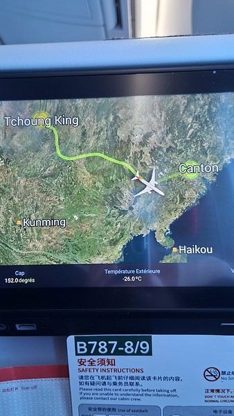
Took off at 9:30 AM, arrived in Guangzhou (Canton) at 11:20 AM in the rain. I love how Chongqing is translated as "Tchoung King" on the screens in the plane—very French!
During my first two trips to China, we paid for everything in cash, but this time, we’re going all-in on Alipay and WeChat. I still brought the leftover change from previous trips—it might come in handy. At the metro station, they showed us a QR code to buy tickets via WeChat. There were probably machines and even a ticket counter, but we didn’t see them, and buying via WeChat was pretty simple. 8 yuan to Changshu Lu, which is 22 stops. So far, so good. Then, we had to find the hotel, which wasn’t on Google Maps, Maps.me, or Amap... Easy 😎! We found it without too much hassle, though. Dropped off our stuff and went out to eat. 55 yuan for two claypots with fish/eel, rice, cabbage, and purple eggplant. When we left, it was pouring. We grabbed our umbrellas and set off to explore the neighborhood: Enning Road (we’ll come back later to check out a specific spot), Shangxiajiu (the pedestrian shopping street), Baohua Road... The area is pretty diverse—one street to the next, it’s like stepping into a different world.

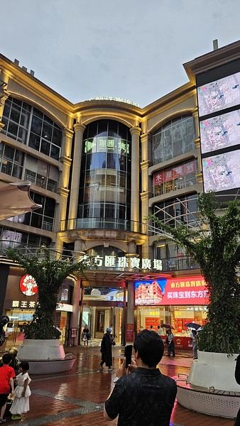
There weren’t many people around, probably because of the rain. We grabbed a quick street food dinner and went to bed—we were exhausted. We struggled to stay awake until 11 PM to adjust to the time change as quickly as possible. There’s a 6-hour time difference.
There wasn’t much room for improvisation on this trip—everything was planned in advance. Since August is peak season, I decided to book train tickets early, and once that was set, I reserved all the accommodations too. I got everything on Trip.com.
I bought the flight tickets back in March from Hainan Airlines. They were super expensive, but with these travel dates, I couldn’t exactly dream of a bargain!
I picked up e-SIMs valid for a month from Free just before departure: 10 € for the e-SIM + 19.90 € for a one-month plan with 35 GB of data abroad.
No need for a VPN with these e-SIMs, but D. still got one—a multi-device plan for 5 € with a discount from Let’s VPN, valid for a month. It was for evenings at the hotel on Wi-Fi to avoid burning through the 35 GB with video.
I downloaded Alipay, WeChat, Amap (Baidu Maps), and Trip.com. We also have Google Translate and Maps.me—absolute must-haves.
We’re ready to go!
I’ve been waiting for this day for nearly 15 years!! I travel a lot, but this one—this is MY TRIP 🙂 It’s been postponed so many times: because I wanted to do it with the right person, because I have a Turkish stamp in my passport and heard they don’t issue visas with that, because of COVID... and then China introduced a 30-day visa exemption, and that was the green light! Ugh, they forced us to take our vacation in August this year—far from ideal—but no more delays. Saturday, August 2, 2025: it’s finally the big day!
Days 1 and 2: We got dropped off at Charles de Gaulle at 9:30 AM. I supposedly checked in online, but only for the first flight and without getting the boarding pass... Might as well scrap online check-in in that case. So, we spent over an hour in line at the counter to get them. We didn’t have any checked luggage—just our backpacks as carry-ons—so this was a step we’d never had to deal with before, but whatever, it’s done. No wait at passport control, 5 minutes through security, a quick walk around the terminal, 10 minutes in the boarding area, and it was already time to board. Departure around 12:45 PM, arrival in Chongqing at 4:50 AM. We had a few hours of layover before our next flight. Went through immigration, connecting flight control, and security. Pro tip: check your next flight’s boarding gate right after immigration. We never saw it displayed again anywhere in the terminal.
The Free e-SIMs work—phew!
Took off at 9:30 AM, arrived in Guangzhou (Canton) at 11:20 AM in the rain. I love how Chongqing is translated as "Tchoung King" on the screens in the plane—very French!
During my first two trips to China, we paid for everything in cash, but this time, we’re going all-in on Alipay and WeChat. I still brought the leftover change from previous trips—it might come in handy. At the metro station, they showed us a QR code to buy tickets via WeChat. There were probably machines and even a ticket counter, but we didn’t see them, and buying via WeChat was pretty simple. 8 yuan to Changshu Lu, which is 22 stops. So far, so good. Then, we had to find the hotel, which wasn’t on Google Maps, Maps.me, or Amap... Easy 😎! We found it without too much hassle, though. Dropped off our stuff and went out to eat. 55 yuan for two claypots with fish/eel, rice, cabbage, and purple eggplant. When we left, it was pouring. We grabbed our umbrellas and set off to explore the neighborhood: Enning Road (we’ll come back later to check out a specific spot), Shangxiajiu (the pedestrian shopping street), Baohua Road... The area is pretty diverse—one street to the next, it’s like stepping into a different world.
There weren’t many people around, probably because of the rain. We grabbed a quick street food dinner and went to bed—we were exhausted. We struggled to stay awake until 11 PM to adjust to the time change as quickly as possible. There’s a 6-hour time difference.
Yet Another Travel Journal in this (Too) Familiar Rajasthan, But with Family and Kids
Prologue
This journal recounts a trip to Rajasthan that’s already over a year old and that I’ve only now found the chance to write about. The summer of 2024 marked my return to India—my tenth trip—after six long years away since my last solo wanderings in Tamil Nadu in 2018 (the journal of which is published on this site). That absence was partly (but not only) due to the long COVID and post-COVID period, which saw a complete halt and then a major slowdown in global tourism. To top it off, Voyage Forum announced its closure in an end-of-the-world atmosphere. A sad time for our favorite social activity…
A few weeks after returning from Rajasthan, I tried to motivate myself to start writing a journal to publish on a forum claiming to be VF’s successor, which I’d eventually signed up for out of desperation. But I kept hesitating and putting the project off because, for one, I no longer have the time I used to. For another, the vibe wasn’t really taking off on that forum—it was overrun with ads and not very active, contrary to what its host’s name suggested. Despite its good intentions and commendable role as a stopgap, it also turned out to be very impractical to use, especially when you don’t have much time like me. I’ll admit I’d occasionally check back on VF to see if anything was happening. But all the discussions remained frozen in time, stuck in that fateful year, 2020. Then, rumors swirled online about shady reasons behind its closure, leaving little room for hope.
And then, one fine morning, I got a message at work from Marien informing me that VF had reopened. What a huge surprise! Even though the forum’s “end” had played out in a somewhat apocalyptic atmosphere, the memories of passionate and heated discussions, the frank debates, and the useful exchanges that made this site a traveler’s goldmine and a unique hub of conviviality all came rushing back to me like a breath of fresh air. I finally saw a sign and tried to motivate myself to find the time to publish the journal of this tenth trip to India and fifth to Rajasthan. But in the end, I got bogged down in professional and family obligations and never managed to find the time to get started. That’s now fixed, though, because I had two reasons for wanting to do it: I find that looking back on a trip to tell others about it is a highly beneficial introspective exercise. Also, I thought this journal could be useful to other travelers on a few points.
Because, “do we really need yet another journal about Rajasthan?” you might rightly ask! Especially in a time when so many journals about the “Land of Kings” have been published since VF’s return, not to mention the countless stories you can already find online about this region, one of India’s most touristy. And I’d add, why go back to Rajasthan for a fifth time, where I’ve already dragged my feet more than enough—through its forts, deserts, temples, cities, villages, bumpy roads, train stations, tasty street food stalls, cheap guesthouses, and more? Where some might see just another overhyped tourist destination full of the same old *Arabian Nights* clichés, worn to a thread, that I mentioned earlier, when there’s so much else to see in India? Well, first because it’s a magnificent country I never tire of, where I started an academic study and made so many connections. It’s also packed with places where you won’t find a single tourist (right, Marie-Jo?), even in the heart of well-trodden paths and classic itineraries. And most importantly, as I said earlier, things have changed in recent years. First, after six years without traveling far, the urge to go back to India was getting stronger. But this time, no more solo trips (often) or duo adventures (sometimes)—now it’s a team of four that has to come along! And even if you can argue with that, what better place than Rajasthan to introduce India to people who’ve never seen it? To kids you want to amaze? Plus, traveling with your new little family to your favorite country isn’t the same as going solo in often spartan conditions that only affect you. It’s a different challenge, but ultimately probably much harder. So, is it really reasonable to take two kids to India, including a two-year-old baby? That’s one of the main goals of this journal (but not the only one)—to try to answer that question.
As you can tell, it’s not so much the destination but the slightly unusual setup of this trip that, in my opinion, will make this journal interesting. Despite my experience and expertise (yes, I dare say it) in India, there were plenty of questions before we finalized the plan and said, “Alright, let’s go!” The questions were flying for us parents. Is it wise to travel to India with a two-year-old? What would we do (it happened) if the kids got very sick? Would they be able to handle a road trip on Rajasthan’s bumpy, dusty roads using public transport? Could they handle the shock of such a different world—the dirt, poverty, pollution, noise (…and the smell, as they say), the spicy food, monkeys, mosquitoes, snakes, tigers, leopards, and so on? In short, all the clichés that I usually joke about suddenly became potential realities. Another concern: as a mixed Franco-African family (not me, but my partner and her oldest), wouldn’t we risk not always being well received, given what you sometimes hear about that in India? How would Indians react to seeing a mixed-race family, the ultimate taboo in a country of purity and social segregation, which would undoubtedly raise many questions for them? Of course, not everything went as expected… Because, as you know, with India—and what makes it charming for some—there are always complications: sometimes where you don’t expect them… and sometimes where you do. I’ll go into detail about that in the journal to come (not right away) and in the final review (even later). These experiences could be useful to travelers who find themselves in similar situations and have the same questions we did before embarking on such a journey. And maybe it’ll spark the curiosity of those who aren’t concerned and will read yet another Rajasthan journal, but with its own unique twists.
Despite my unchanged constraints, which mean I have little time to write this, I don’t want to rush the story, so I’ll take my time. There will probably be lulls. I hope that won’t stop people from coming to react, debate, share their impressions, or ask for information.
This journal recounts a trip to Rajasthan that’s already over a year old and that I’ve only now found the chance to write about. The summer of 2024 marked my return to India—my tenth trip—after six long years away since my last solo wanderings in Tamil Nadu in 2018 (the journal of which is published on this site). That absence was partly (but not only) due to the long COVID and post-COVID period, which saw a complete halt and then a major slowdown in global tourism. To top it off, Voyage Forum announced its closure in an end-of-the-world atmosphere. A sad time for our favorite social activity…
A few weeks after returning from Rajasthan, I tried to motivate myself to start writing a journal to publish on a forum claiming to be VF’s successor, which I’d eventually signed up for out of desperation. But I kept hesitating and putting the project off because, for one, I no longer have the time I used to. For another, the vibe wasn’t really taking off on that forum—it was overrun with ads and not very active, contrary to what its host’s name suggested. Despite its good intentions and commendable role as a stopgap, it also turned out to be very impractical to use, especially when you don’t have much time like me. I’ll admit I’d occasionally check back on VF to see if anything was happening. But all the discussions remained frozen in time, stuck in that fateful year, 2020. Then, rumors swirled online about shady reasons behind its closure, leaving little room for hope.
And then, one fine morning, I got a message at work from Marien informing me that VF had reopened. What a huge surprise! Even though the forum’s “end” had played out in a somewhat apocalyptic atmosphere, the memories of passionate and heated discussions, the frank debates, and the useful exchanges that made this site a traveler’s goldmine and a unique hub of conviviality all came rushing back to me like a breath of fresh air. I finally saw a sign and tried to motivate myself to find the time to publish the journal of this tenth trip to India and fifth to Rajasthan. But in the end, I got bogged down in professional and family obligations and never managed to find the time to get started. That’s now fixed, though, because I had two reasons for wanting to do it: I find that looking back on a trip to tell others about it is a highly beneficial introspective exercise. Also, I thought this journal could be useful to other travelers on a few points.
Because, “do we really need yet another journal about Rajasthan?” you might rightly ask! Especially in a time when so many journals about the “Land of Kings” have been published since VF’s return, not to mention the countless stories you can already find online about this region, one of India’s most touristy. And I’d add, why go back to Rajasthan for a fifth time, where I’ve already dragged my feet more than enough—through its forts, deserts, temples, cities, villages, bumpy roads, train stations, tasty street food stalls, cheap guesthouses, and more? Where some might see just another overhyped tourist destination full of the same old *Arabian Nights* clichés, worn to a thread, that I mentioned earlier, when there’s so much else to see in India? Well, first because it’s a magnificent country I never tire of, where I started an academic study and made so many connections. It’s also packed with places where you won’t find a single tourist (right, Marie-Jo?), even in the heart of well-trodden paths and classic itineraries. And most importantly, as I said earlier, things have changed in recent years. First, after six years without traveling far, the urge to go back to India was getting stronger. But this time, no more solo trips (often) or duo adventures (sometimes)—now it’s a team of four that has to come along! And even if you can argue with that, what better place than Rajasthan to introduce India to people who’ve never seen it? To kids you want to amaze? Plus, traveling with your new little family to your favorite country isn’t the same as going solo in often spartan conditions that only affect you. It’s a different challenge, but ultimately probably much harder. So, is it really reasonable to take two kids to India, including a two-year-old baby? That’s one of the main goals of this journal (but not the only one)—to try to answer that question.
As you can tell, it’s not so much the destination but the slightly unusual setup of this trip that, in my opinion, will make this journal interesting. Despite my experience and expertise (yes, I dare say it) in India, there were plenty of questions before we finalized the plan and said, “Alright, let’s go!” The questions were flying for us parents. Is it wise to travel to India with a two-year-old? What would we do (it happened) if the kids got very sick? Would they be able to handle a road trip on Rajasthan’s bumpy, dusty roads using public transport? Could they handle the shock of such a different world—the dirt, poverty, pollution, noise (…and the smell, as they say), the spicy food, monkeys, mosquitoes, snakes, tigers, leopards, and so on? In short, all the clichés that I usually joke about suddenly became potential realities. Another concern: as a mixed Franco-African family (not me, but my partner and her oldest), wouldn’t we risk not always being well received, given what you sometimes hear about that in India? How would Indians react to seeing a mixed-race family, the ultimate taboo in a country of purity and social segregation, which would undoubtedly raise many questions for them? Of course, not everything went as expected… Because, as you know, with India—and what makes it charming for some—there are always complications: sometimes where you don’t expect them… and sometimes where you do. I’ll go into detail about that in the journal to come (not right away) and in the final review (even later). These experiences could be useful to travelers who find themselves in similar situations and have the same questions we did before embarking on such a journey. And maybe it’ll spark the curiosity of those who aren’t concerned and will read yet another Rajasthan journal, but with its own unique twists.
Despite my unchanged constraints, which mean I have little time to write this, I don’t want to rush the story, so I’ll take my time. There will probably be lulls. I hope that won’t stop people from coming to react, debate, share their impressions, or ask for information.
Madagascar - June 2025
Five years of an unintended break... The closure of VF, COVID... What a joy to rediscover the pleasure of sharing!
I’ve stayed true to my habits: the following account is a collection of practical tips rather than a travel journal...
Madagascar is as big as France and Belgium combined. In three weeks, choices have to be made! It was the Great Tsingy that inspired our trip. We decided to focus on the southwest and the RN7. We skipped the Deep South and the North. Oh well...
OUR ITINERARY IN 3 WEEKS:
Fri 6 June – Direct AF flight to Tana – Flight arrives at 10:30 PM – Tana Sat – Antsirabe Sun – Miandrivazo Mon – Drive to the Masiakampy pier – Descent of the Tsiribihina River by pirogue - Bivouac Tue – Descent of the Tsiribihina River by pirogue - Bivouac Wed – Descent of the Tsiribihina River by pirogue – Bekopaka Thu – Pirogue on the Manambolo River and Small Tsingy of Bemaraha – Bekopaka Fri – Great Tsingy of Bemaraha – Bekopaka Sat – Avenue of the Baobabs – Morondava Sun – Belo sur Mer Mon – Free day – Belo sur Mer Tue – Manja Wed – Andavadoaka Thu – Free day – Andavadoaka Fri – Salary Lagoon – Mangily Sat – Ranohira Sun – Isalo National Park - Ranohira Mon – Anja Reserve - Ambalavao - Fianarantsoa Tue – FCE train canceled – Visit to a Tanala village - Manakara Wed – Pirogue on the Pangalanes Canal – Ranomafana Thu – Ranomafana NP – Ranomafana Fri – Ambositra – Antsirabe Sat 28 June – AF flight to Paris – Flight departs at 11:55 PM
TRIP ORGANIZATION: I prepared my trip using the usual guides (LP and Rough Guide), the internet, and the Freytag & Berndt map (1:1,000,000). I’m old-school—I still love visualizing my route on a paper map, even though in Madagascar, it’s misleading because some National Roads are only national in name!...
The agency: Since we couldn’t deal directly with a driver-guide (we lacked reliable info to take the plunge), we went through an agency to organize the logistics of our trip. We didn’t feel like using bush taxis (not enough time) or driving a 4x4 ourselves (neither the skills nor the boldness). The French agency connected us with a local agency, to whom I sent my detailed itinerary by email. A few exchanges via email and WhatsApp calls allowed us to finalize everything quickly after some adjustments. As you’ve gathered... we multiplied the commissions, which inflated the budget. That said, in the end, we were thrilled with our decision and our choice. Our trip was booked by the end of 2024, and reservations were made immediately. No bad surprises: the bookings in the planned hotels were honored, often with one of the best rooms. On our last day in Tana, before departure, we were lucky enough to meet the director I’d been communicating with, who helped build and validate our circuit. A very warm debriefing.
The driver-guide: The agency assigned us Faly, 33, a driver-guide for over 10 years. He stayed with us from start to finish: he picked us up at the airport on arrival and dropped us off 23 days later. A very experienced driver (which is important here), an open and cultured guide, reliable, punctual, and a great companion. And a provider of good advice throughout the trip. We made the most of the long stretches on dirt roads or highways to listen to him talk about daily life, rituals, wildlife, and flora... No time wasted! With a great playlist in the background, we combined business with pleasure! Faly’s accommodation and meals were included (quite often, hotels offer free lodging and meals to driver-guides who bring clients), as was the fuel. That didn’t stop us from inviting Faly to share a beer or our evening meal sometimes. He didn’t always accept, wanting to let us "enjoy our romantic evenings," as he put it. Present without being intrusive! Faly is fully capable of organizing a tailor-made trip directly. I recommend him without any hesitation—we were delighted with his service. I’ll gladly share his contact details via PM to anyone who asks.
Local guides: It’s the national guide’s prerogative to choose the local guides (mandatory in the parks). Thanks to his experience, Faly always booked us amazing, competent, and interesting local guides.
Hotels: I told the agency I wanted charming, comfortable accommodations, without falling into flashy luxury. We loved all the hotels (except the Hôtel Kanto in Manja). The rooms, mostly bungalows, were always spacious and clean. Unfortunately, I can’t give the prices—I didn’t get the details. Breakfast is always included, usually fresh and hearty. Very often, a small bottle of water is provided in the room.
Tana Hôtel Les 3 Métis Power cuts are common (!) in Tana. Bring a headlamp.
Antsirabe Ecolodge – Les chambres du voyageur Maybe our favorite! A few bungalows, beautifully arranged in a splendid tropical garden. The dog Kodak welcomes us warmly.
Miandrivazo Hôtel Princesse Tsiribihina Magnificent view of the valley.
Bekopaka Hôtel Orchidée du Bemaraha 2 (yes, 2) beautiful pools, a large open common room.
Morondava Hôtel Baobab Café Brand new or at least, according to Faly, just renovated. Very comfortable but without much charm (international style).
Belo sur Mer Ecolodge du Menabe The bungalows, all made of wood, bamboo, and thatch, are set on the beach. Very spacious and fully equipped! Large open-air restaurant by the sea. No hot water from the tap—it’s available in plastic bottles heated by the sun in front of each bungalow. Actually, we never used it... Another very, very beautiful spot.
Manja Hôtel Kanto The only hotel on this leg of the journey, so no choice. The owner knows it and, as a result, doesn’t bother. It’s a real dive! Tiny, dark room, a sordid bathroom with only a trickle of water—we skipped the shower! Clean sheets, though. Obviously, no Wi-Fi. The only place where I didn’t leave a tip. We were well warned about the discomfort of this stop, both by the agency and Faly. We weren’t surprised, and it even became a running joke during the trip. On the other hand, we found a nice little market in town.
Andavadoaka Manga Lodge What bliss! Especially after the horrible Hôtel Kanto. A paradise-like spot, overlooking three beautiful deserted white-sand beaches. Meals are served on the terrace facing the sea. Stunning sunset. We loved spending a day lounging here! We were the only guests and were pampered.
Mangily (Ifaty) Mangily is the "suburb" of Ifaty. Hôtel Vovo Telo A large beachfront bungalow complex. More touristy but pleasant—we spent a lovely evening there with our feet in the sand.
Ranohira Le Relais de la Reine A splendid resort built by a Frenchman, at the foot of the rocks, very well integrated into the environment. Beautiful marked trail starting from the garden.
Fianarantsoa Villa Sylvestre Contrary to what its name suggests, it’s a hotel right in the city center. Quite decent, though.
Manakara Parthenay Club Pretty bungalows in a large garden by the sea, but swimming isn’t safe—the water is too dangerous and rough.
Ranomafana Hôtel Thermal Very spacious rooms.
Meals: Not all our meals were included. It’s really not expensive. 1 meat or fish dish: around 35,000 Ar 1 full menu (starter, main, dessert): around 70,000 Ar 1 large THB beer (65 cl): between 8,000 and 12,000 Ar 1 piña colada: 15,000 Ar 1 flavored rum: 6,000 Ar (sometimes free) 1 glass of baobab juice (!): 5,000 Ar
We always ate very well. Rice is everywhere, served in large quantities. Zebu meat is quite good if not overcooked. Personally, I prefer fish, and I feasted: grouper, captain, crab, small lobsters...
We happily discovered baobab juice (especially in Belo, on the west coast). And of course, flavored rums!
We bought 2 packs of 6 bottles of mineral water at Carrefour (!) (about 5,000 Ar per large bottle) at the start of our trip. That was enough, especially since we often got water in the bungalows.
We had a few picnics included in our trip. Instead of picking up the hotel’s lunchbox, Faly prepared delicious, fresh, and varied picnics for us: tuna pasta salad, fried rice with eggs, grilled vegetables, and avocado...
An exceptional address not to miss: Mad Zébu – Belo sur Tsiribihina A highly reputed restaurant, a favorite of LP and Rough Guide, and rightly so! Gourmet cuisine, refined and elegant. Barely more expensive than elsewhere, and it’s worth it. We stopped there on our way up to Bekopaka and the Tsingy NP. Fully booked! So Faly reserved for our return, three days later. We’re still thanking him! What a treat!
THE BUDGET: Ariary exchange rate: 5,000 Ar = 1 €
Pre-trip expenses: Direct Air France flights: 930 € per person round trip Cost of the circuit with the agency: 2,880 € per person
The visa: Issued on arrival, very quickly. 35 € per person for a stay under 30 days. Super simple. Super fast.
On-site expenses: As soon as we arrived at the airport (it was nearly midnight), Faly advised us to exchange our euros for all our needs. There are few opportunities on our route to find an ATM or an open bank with a good rate. To be more comfortable, he took us to a small office under military protection just outside the airport. I exchanged 1,200 € (I had asked the agency for advice on the amount to bring) at a rate of 4,750 Ar and became a millionaire. Faly recounted all the stacks. That covered all our expenses (meals, drinks, tips) without ever feeling deprived. Personal purchases were made at the end of the trip. Convenient—it served as an adjustment variable. We spent our last million (200 €) on marquetry and vanilla. Tip: We asked for 200,000 Ar in 5,000 Ar bills for tips. That wasn’t too much—I even ran short of small bills in the last two days.
Tips: Madagascar is a poor country where every service deserves a small reward. While not mandatory, it’s customary. But no one ever demanded or expected it openly. On the contrary, I sometimes had to remind a porter to give them my small bill. We never carried our luggage—porters were always present when the car arrived or waiting at our door to watch for our departure. I gave each of them 5,000 Ar. In restaurants, I rounded up to the nearest ten and left the change. Local guides also expect a tip: I gave around 20,000 Ar per day for the two of us. Finally, the national guide also expects a gratuity. I had read online to budget 5 € per day per person. I added more since we were so happy with his services. The tip was given at the end of the trip, in euros, outside the budget.
Total budget all included (excluding personal purchases): 8,690 € Clearly, Madagascar is a country where life isn’t expensive, but travel costs add up quickly due to the need to rent a 4x4 with a driver.
HIGHLIGHTS:
· The dirt roads Yes, I’m listing them among the highlights! We loved those long hours spent driving at 20 km/h on rocky, muddy, white, red, or gray sand tracks... surrounded by tropical vegetation, palm trees, pandanus, mango trees... The experiences were sometimes thrilling: crossing a river on a ferry (just planks of wood fixed on two motorized pirogues side by side) or crossing a river without a ferry, with just a kid running ahead of the 4x4 to show the way; soft sand where the 4x4 easily gets stuck... The tracks are quite narrow, and crossing paths with a bush taxi, a zebu cart, or a herd of goats is always epic. So many beautiful images, so many beautiful photos! Much more beautiful than on asphalt. So yes, we loved those long stretches on dirt roads. For us, it was clearly part of the journey. Faly was particularly careful, and the 4x4 was comfortable. No injuries, no fatigue, even after 7 or 8 hours on rough tracks. The national roads (including the famous RN7) are badly damaged by cyclones, huge trucks, and lack of maintenance. Potholes have turned into ostrich nests, and we didn’t drive much faster than on the dirt roads.
· The landscapes, villages, encounters... We crossed a variety of stunning landscapes: mountains with slopes covered in terraced crops, rice fields from apple green to emerald green, sugarcane fields, then tropical forests, baobab forests (they deserve a special paragraph below), traveler’s tree forests. And then coastlines with white sand dunes against a backdrop of blue hues!... Magical! We also passed through many villages with houses whose architecture varied by region. The Betsileo houses display beautiful decorative brick reliefs. On the west coast, the houses are more precarious, made of bamboo with palm-thatched roofs. In the Highlands region, we found solid houses with pastel plaster. Each region has its own landscape, crops, habitat, and clothing. Zebu carts are often the only means of transport in remote villages. We saw them very frequently. Again, the cart’s decoration depends on the region. And then, we met many villagers coming out of the bush and walking to the next market, carrying their crops on their heads or shoulders. More beautiful photos!
· The descent of the Tsiribihina River We boarded around 9 AM in a long pirogue with Gana, the local guide, and two pirogue men. So, five of us. The pirogue is long but narrow, about 65 cm wide. We sat one behind the other at the front on seats padded with what would become our mattresses during the bivouacs. We only took the bare essentials for two nights. A little goodbye to Faly, whom we’d see again in three days! Don’t forget us! The river is silty—meaning orange, opaque but clean. We glided along silently. Gana showed us the trees, birds, crocodiles (we saw five—apparently, we were lucky). The pirogue men rowed to get us as close as possible to these crocs sunbathing on the roots of big trees. Yeah, right!... as soon as we got too close, *splash*, they disappeared into the water. We marveled at the mini rice fields lining the river. Every tiny plot, no matter how small, is cultivated. Above them, banana fields. And on the water, a whole life of fishermen and villagers living with and from the river. Gana warned us we’d eat on the pirogue because the journey was long. So, I expected chips... But no—fried rice and zebu steak, cooked right in the pirogue!! Incredible! In the middle of the afternoon, we reached a small beach where we disembarked. Gana led us about a hundred meters to a sublime waterfall. We were alone there. We had time to swim. We’d brought our swimsuits and a towel (bought at the Carrefour in Antsirabe on Faly’s wise advice!). This swim in this paradise-like spot remains one of our best memories. We found our pirogue again and set off until our first bivouac. We’d sailed for 7 hours today. The tents were set up on a wide beach, without a single tree. A moment of solitude... Uh, where can we go to the bathroom?... Especially since it was a full moon, so we felt like we were in the spotlight. Anyway... we did as everyone else—walked away, dug a hole, and the others turned their backs. A hearty meal on the beach before a comfortable and silent night. The next day, same program, with slightly different landscapes. The gorges widened, the trees were different. But still many colorful birds. Again, we ate on the pirogue: grilled chicken and vegetables. 9 hours of sailing. A similar bivouac. This time, we got it. On the third day, we finished the descent with 5 hours of sailing. So, 7 hours, 9 hours, 5 hours... doing nothing. It might sound boring... but it wasn’t. Like the dirt roads, these were contemplative moments. It glides, it’s calm, relaxing, and there’s a lot of life on this river, animal and human. Contemplation. Suspended time. On arrival, we disembarked at a sort of joyful, bustling river port. Of course, Faly was already there to pick us up.
· The Tsingy de Bemaraha NP (Small and Great) I have vertigo. During my research, several agencies advised me against visiting the Great Tsingy. "Stick to the Small ones," they said. Grrr, no, not what I wanted—we’ve dreamed of this for years! The agency we chose also warned me but didn’t discourage me. So we started with the Small Tsingy, quite close to Bekopaka, guided by Alisha. This forest of sharp limestone rocks is impressive. No vertigo issues here. The day was completed with a short pirogue ride on the Manambolo River and a visit to two caves with pretty formations. The next day, Faly and Alisha drove us to the Great Tsingy (a good hour on a terrible track). Arriving at the park entrance, Alisha equipped us with harnesses, carabiners, and gave us some safety instructions. Faly was also equipped. Wait? He’s coming with us? I quickly understood he was there for me—if I got stuck, he could go back with me, and Philippe could continue with Alisha. A wise precaution that delighted and reassured me. In the end, it was unnecessary since the famous bridge crossing was fully secured by the harness and carabiners. 18 meters on planks, one by one, it didn’t sway too much—I walked looking straight ahead, not a glance down. I even managed to smile in the middle of the crossing—I have a photo to prove it! I was overjoyed! The circuit in the Great Tsingy is a loop, so we didn’t have to cross the bridge again. We climbed to viewpoints offering breathtaking panoramic views. It’s extraordinary, unique, incredible. All this to say that if you have vertigo, don’t hesitate! It’s doable! It’s completely safe and really worth pushing your limits a bit! For those who’ve done treetop adventure courses, it’s similar. Also, no need to be a great athlete—just a bit of agility to climb a few ladders and high steps. Don’t censor yourself! I even had a small regret—the loop was a bit short (about 2 hours). I would’ve liked to continue or even redo it, with less apprehension. Tip: Do the Small Tsingy before the Great ones, or not at all. And if you can only do one, do the Great ones without hesitation.
· Canoeing in the Belo mangrove The Belo sur Mer ecolodge lends small individual canoes for free to go to the mangrove. We left at high tide, paddled for about twenty minutes to reach a fairly sparse forest where we could easily venture in. Very shallow water, crystal clear—we could see the roots of all these trees, schools of tiny fish... It was quite surprising. Until then, I only knew impenetrable, tangled mangroves. Here, nothing like that—we walked through an aquatic forest. We loved this adventure so much we left a bit late. The tide had gone out, and we had to carry our canoes for the last few meters... Of course, the staff came to help (probably laughing silently!). The lodge owners gave all the necessary explanations and lent a waterproof bag for the phone (because yes, it’s worth taking photos!). A very useful precaution—the canoes are small, low in the water, and paddling quickly soaks you. Again, this isn’t just for Tony Estanguet! It didn’t cause us any problems, not even sore muscles the next day. A great experience. It’ll take about 2 hours.
· Isalo NP Big surprise when we saw this huge rocky massif appear on the RN7! A massif of colored sandstone, carved with crevasses giving it a ruined look. Le Relais de la Reine is a little gem cleverly nestled in the heart of these rocks. A small marked trail starts from the garden. We picked up the description at reception and set off. Without a guide, alone following the markers, it took us 2 hours to complete this magnificent little trail, giving us a first glimpse of the massif before the hike the next day. And we enjoyed being completely alone for this walk. It’s free, easy, and well-signposted. Don’t miss it. In the evening, Faly took us to the so-called Isalo Window site—a hole in a wall through which we could see the sunset. We met all the tourists in the area here. We weren’t blown away by the show... The next day, we left early to reach the start of the hike. We met Zozoly at the guides’ office in the small town of Ranohira. During this hike, we climbed through the rocks to a viewpoint offering stunning 360° views of the massif. Then we reached a site called the "natural pool," breathtakingly beautiful, especially since we were alone again. A sort of oasis, a cascading waterfall, palm trees and tree ferns, fine sand, all nestled at the bottom of a small canyon. Paradise-like. We resisted swimming, but it was really tempting. A long walk on the plateaus then led us to a well-equipped picnic site where a local team prepared grills. Concrete tables were tiered in a spacious, shady clearing where a whole family of ring-tailed lemurs frolicked. They knew the tourists’ habits and tried to snatch food. Playful and not very shy, they amused us with their antics! We had to resist not luring them with a piece of banana!! Thousands of photos!! After the meal, we set off again with Zozoly for another landscape. This time, we were by a small river at the bottom of a canyon with high walls covered in vegetation. The trail was narrow and slippery, on a ledge of the wall. We progressed carefully. No danger, though. We first reached the Blue Pool, which only turns blue in photos (surprise!), then the Black Pool fed by a shower of waterfalls. Two magnificent spots that showed us a completely different aspect of the massif.
· Anja Reserve This ficus forest is home to many groups of lemurs. Used to humans, whom they don’t fear, they move around us, ignoring us completely. It’s almost annoying... The best place on our trip to see lemurs.
· The FCE train To the great regret of Manakara’s inhabitants, the FCE train hasn’t reached here for over a year and a half. As a result, there are far fewer tourists—the train was part of the experience. We drove there and didn’t regret coming to this port on the east coast.
· Visit to a Tanala village This visit wasn’t part of our program—it was added by the agency to compensate for the train not running. Which was the case. Not big fans of this kind of visit, where we feel like we’re at a zoo, voyeuristic, lacking authenticity, we followed the local guide with some skepticism and exchanged dubious looks. And yet... the guide’s explanations about village life and the warm, smiling welcome from the villagers charmed us and dispelled all our concerns. We learned a lot, met smiling families, and were able to enter these beautiful bamboo houses. A very pleasant surprise, rich in lessons.
· The Pangalanes Canal Arriving in Manakara, we crossed a bridge overlooking the Pangalanes Canal. A cry of surprise: the water is turquoise! We took a short pirogue ride with a team of three pirogue men and Joël, a local guide who explained the drama caused by the train’s halt. We stopped in a fishing village where Joël bought fish for the barbecue. We ended up on a beach where the team prepared the meal while we went to watch the fishermen return on the nearby beach. We admired the fishermen’s dexterity in untangling their nets, sorting their fish, cleaning their gear. On our return, we found a small table set up on the beach, in the shade of palm trees and casuarinas. Lobsters, captain fish, grilled vegetables, sautéed potatoes. A real feast (included in the trip cost).
· Ranomafana NP A 4-5 hour hike (some climbing) in a dense secondary forest to look for lemurs. As usual, we were accompanied by a local guide who, while waiting to find our furry friends, gave us lots of info on the vegetation, birds, and Tanala ethnic rituals. In the forest, we met 4 or 5 trackers, armed with radios to alert guides of their findings. In the end, we saw several lemurs of different types. Quite far, quite high... A nice complement to our lemur encounters in Isalo. Here, it rains 200 days a year. We started the hike in thick fog, but the forest’s density protected us from the humidity. Be careful—it can be a bit frustrating to see the lemurs so far away, so high. Nothing like the Anja Reserve or Isalo NP. Here, what’s fun is the hunt.
· The baobabs We were captivated by these kings of the forest, noble, imposing, majestic. We spotted them from very far away, towering over the rest of the vegetation. Alone, in small groups, or in forests, our trip allowed us to see hundreds of them! Mainly on the west coast. All different—bald, hairy, shaggy, short and stout, tall and thin, like Laurel and Hardy. Philippe took to naming them. Respectfully!
OUR FAVORITES: · The variety of landscapes. · The Tsingy NP.
OUR DISAPPOINTMENTS: · The Avenue of the Baobabs, very overrated and the only place where we saw crowds. We saw many other "forests" of baobabs that were much more impressive. · It’s hard to approach the population calmly as swarms of children run up as soon as we arrive, asking for sweets. Without any aggression, their smiles and laughter quickly made us forget this small inconvenience. We never gave out candy, clothes, or money. We left pens at a school and clothes with Faly.
IF WE WERE TO DO IT AGAIN: · Same period, same duration, same pace, same itinerary, but if we were to do it again today, I’d go through Faly directly! · Maybe we should’ve stayed in Ambalavao instead of Fianarantsoa. · Plan a longer loop in the Great Tsingy—it felt a bit too short.
MISCELLANEOUS: The welcome: ‘Samala Vazaha,’ there are many, many kids, sometimes overwhelming, never aggressive. We were impressed by the villagers’ smiles and good humor, towards us or even among themselves—laughter was everywhere. Safety: No problems. Out of (excessive?) caution, we spread all our money across several bags that we padlocked whenever we left the hotel. Bribes: We were stopped several times on the road by police or gendarmes. They checked our papers, sometimes our passports. Faly was perfectly in order. No discussion, no bribes, a cordial greeting from the officers. However, several times we found ourselves at small "tolls" on the tracks for villagers who had leveled the road or filled a hole, or for the young guy who ran through the river to show the way... Faly complied without discussion: every service deserves a small bill. Language: French is still widely spoken. Credit card: Unused. Cash: You need it! The climate at this time: Ideal—blue skies, sunshine, and mild temperatures (20-25°C) throughout our trip. Temperatures started to drop by our departure—winter was setting in. Clothing: T-shirt or polo and a vest sometimes in the evening, sandals on our feet, hiking shoes for all the hikes. Tip: We left a bag in the car (completely safe) with things we didn’t need daily and dirty laundry. The two bags to take out at each stop were much lighter. Before leaving, we left several polos and T-shirts with Faly, which, once washed, will make a few people happy. Tourist crowds at this time: Low—we were sometimes the only guests at the hotel. Faly explained that at the Isalo picnic site, in high season, you have to queue for a table, whereas we had our pick. Photos: Lots! Too many! That’s the problem with digital—we take so many! Health issues: Nothing serious, just the usual mild traveler’s diarrhea. Mosquitoes: They’re voracious. We took anti-malaria treatment. I’m still not sure if it was the right thing to do... I’m always very skeptical about such precautions. Internet: Free Wi-Fi at the lodges’ reception (except at Hôtel Kanto!), sometimes (rarely) in the bungalows. Phone: We didn’t try to get a local SIM card—the evening Wi-Fi was enough for us to make calls and send messages via WhatsApp. Make sure to turn off mobile data and switch to airplane mode (I activated it a bit late—received calls, spam ones at that, were charged...). Electricity: French plugs. Personal purchases: Beautiful wooden objects (sculptures and marquetry) or zebu horn items in Ambositra. 1 kg of vanilla (400,000 Ar – 80 € per kg) in Tana.
IN CONCLUSION: A trip of contemplation. A pause for admiration, as our local guide in Isalo NP said. Nothing else to do but walk, look, and enjoy. Here, there are no old stones, no museums—it’s a trip where nature reigns supreme. And what nature!
I’ve stayed true to my habits: the following account is a collection of practical tips rather than a travel journal...
Madagascar is as big as France and Belgium combined. In three weeks, choices have to be made! It was the Great Tsingy that inspired our trip. We decided to focus on the southwest and the RN7. We skipped the Deep South and the North. Oh well...
OUR ITINERARY IN 3 WEEKS:
Fri 6 June – Direct AF flight to Tana – Flight arrives at 10:30 PM – Tana Sat – Antsirabe Sun – Miandrivazo Mon – Drive to the Masiakampy pier – Descent of the Tsiribihina River by pirogue - Bivouac Tue – Descent of the Tsiribihina River by pirogue - Bivouac Wed – Descent of the Tsiribihina River by pirogue – Bekopaka Thu – Pirogue on the Manambolo River and Small Tsingy of Bemaraha – Bekopaka Fri – Great Tsingy of Bemaraha – Bekopaka Sat – Avenue of the Baobabs – Morondava Sun – Belo sur Mer Mon – Free day – Belo sur Mer Tue – Manja Wed – Andavadoaka Thu – Free day – Andavadoaka Fri – Salary Lagoon – Mangily Sat – Ranohira Sun – Isalo National Park - Ranohira Mon – Anja Reserve - Ambalavao - Fianarantsoa Tue – FCE train canceled – Visit to a Tanala village - Manakara Wed – Pirogue on the Pangalanes Canal – Ranomafana Thu – Ranomafana NP – Ranomafana Fri – Ambositra – Antsirabe Sat 28 June – AF flight to Paris – Flight departs at 11:55 PM
TRIP ORGANIZATION: I prepared my trip using the usual guides (LP and Rough Guide), the internet, and the Freytag & Berndt map (1:1,000,000). I’m old-school—I still love visualizing my route on a paper map, even though in Madagascar, it’s misleading because some National Roads are only national in name!...
The agency: Since we couldn’t deal directly with a driver-guide (we lacked reliable info to take the plunge), we went through an agency to organize the logistics of our trip. We didn’t feel like using bush taxis (not enough time) or driving a 4x4 ourselves (neither the skills nor the boldness). The French agency connected us with a local agency, to whom I sent my detailed itinerary by email. A few exchanges via email and WhatsApp calls allowed us to finalize everything quickly after some adjustments. As you’ve gathered... we multiplied the commissions, which inflated the budget. That said, in the end, we were thrilled with our decision and our choice. Our trip was booked by the end of 2024, and reservations were made immediately. No bad surprises: the bookings in the planned hotels were honored, often with one of the best rooms. On our last day in Tana, before departure, we were lucky enough to meet the director I’d been communicating with, who helped build and validate our circuit. A very warm debriefing.
The driver-guide: The agency assigned us Faly, 33, a driver-guide for over 10 years. He stayed with us from start to finish: he picked us up at the airport on arrival and dropped us off 23 days later. A very experienced driver (which is important here), an open and cultured guide, reliable, punctual, and a great companion. And a provider of good advice throughout the trip. We made the most of the long stretches on dirt roads or highways to listen to him talk about daily life, rituals, wildlife, and flora... No time wasted! With a great playlist in the background, we combined business with pleasure! Faly’s accommodation and meals were included (quite often, hotels offer free lodging and meals to driver-guides who bring clients), as was the fuel. That didn’t stop us from inviting Faly to share a beer or our evening meal sometimes. He didn’t always accept, wanting to let us "enjoy our romantic evenings," as he put it. Present without being intrusive! Faly is fully capable of organizing a tailor-made trip directly. I recommend him without any hesitation—we were delighted with his service. I’ll gladly share his contact details via PM to anyone who asks.
Local guides: It’s the national guide’s prerogative to choose the local guides (mandatory in the parks). Thanks to his experience, Faly always booked us amazing, competent, and interesting local guides.
Hotels: I told the agency I wanted charming, comfortable accommodations, without falling into flashy luxury. We loved all the hotels (except the Hôtel Kanto in Manja). The rooms, mostly bungalows, were always spacious and clean. Unfortunately, I can’t give the prices—I didn’t get the details. Breakfast is always included, usually fresh and hearty. Very often, a small bottle of water is provided in the room.
Tana Hôtel Les 3 Métis Power cuts are common (!) in Tana. Bring a headlamp.
Antsirabe Ecolodge – Les chambres du voyageur Maybe our favorite! A few bungalows, beautifully arranged in a splendid tropical garden. The dog Kodak welcomes us warmly.
Miandrivazo Hôtel Princesse Tsiribihina Magnificent view of the valley.
Bekopaka Hôtel Orchidée du Bemaraha 2 (yes, 2) beautiful pools, a large open common room.
Morondava Hôtel Baobab Café Brand new or at least, according to Faly, just renovated. Very comfortable but without much charm (international style).
Belo sur Mer Ecolodge du Menabe The bungalows, all made of wood, bamboo, and thatch, are set on the beach. Very spacious and fully equipped! Large open-air restaurant by the sea. No hot water from the tap—it’s available in plastic bottles heated by the sun in front of each bungalow. Actually, we never used it... Another very, very beautiful spot.
Manja Hôtel Kanto The only hotel on this leg of the journey, so no choice. The owner knows it and, as a result, doesn’t bother. It’s a real dive! Tiny, dark room, a sordid bathroom with only a trickle of water—we skipped the shower! Clean sheets, though. Obviously, no Wi-Fi. The only place where I didn’t leave a tip. We were well warned about the discomfort of this stop, both by the agency and Faly. We weren’t surprised, and it even became a running joke during the trip. On the other hand, we found a nice little market in town.
Andavadoaka Manga Lodge What bliss! Especially after the horrible Hôtel Kanto. A paradise-like spot, overlooking three beautiful deserted white-sand beaches. Meals are served on the terrace facing the sea. Stunning sunset. We loved spending a day lounging here! We were the only guests and were pampered.
Mangily (Ifaty) Mangily is the "suburb" of Ifaty. Hôtel Vovo Telo A large beachfront bungalow complex. More touristy but pleasant—we spent a lovely evening there with our feet in the sand.
Ranohira Le Relais de la Reine A splendid resort built by a Frenchman, at the foot of the rocks, very well integrated into the environment. Beautiful marked trail starting from the garden.
Fianarantsoa Villa Sylvestre Contrary to what its name suggests, it’s a hotel right in the city center. Quite decent, though.
Manakara Parthenay Club Pretty bungalows in a large garden by the sea, but swimming isn’t safe—the water is too dangerous and rough.
Ranomafana Hôtel Thermal Very spacious rooms.
Meals: Not all our meals were included. It’s really not expensive. 1 meat or fish dish: around 35,000 Ar 1 full menu (starter, main, dessert): around 70,000 Ar 1 large THB beer (65 cl): between 8,000 and 12,000 Ar 1 piña colada: 15,000 Ar 1 flavored rum: 6,000 Ar (sometimes free) 1 glass of baobab juice (!): 5,000 Ar
We always ate very well. Rice is everywhere, served in large quantities. Zebu meat is quite good if not overcooked. Personally, I prefer fish, and I feasted: grouper, captain, crab, small lobsters...
We happily discovered baobab juice (especially in Belo, on the west coast). And of course, flavored rums!
We bought 2 packs of 6 bottles of mineral water at Carrefour (!) (about 5,000 Ar per large bottle) at the start of our trip. That was enough, especially since we often got water in the bungalows.
We had a few picnics included in our trip. Instead of picking up the hotel’s lunchbox, Faly prepared delicious, fresh, and varied picnics for us: tuna pasta salad, fried rice with eggs, grilled vegetables, and avocado...
An exceptional address not to miss: Mad Zébu – Belo sur Tsiribihina A highly reputed restaurant, a favorite of LP and Rough Guide, and rightly so! Gourmet cuisine, refined and elegant. Barely more expensive than elsewhere, and it’s worth it. We stopped there on our way up to Bekopaka and the Tsingy NP. Fully booked! So Faly reserved for our return, three days later. We’re still thanking him! What a treat!
THE BUDGET: Ariary exchange rate: 5,000 Ar = 1 €
Pre-trip expenses: Direct Air France flights: 930 € per person round trip Cost of the circuit with the agency: 2,880 € per person
The visa: Issued on arrival, very quickly. 35 € per person for a stay under 30 days. Super simple. Super fast.
On-site expenses: As soon as we arrived at the airport (it was nearly midnight), Faly advised us to exchange our euros for all our needs. There are few opportunities on our route to find an ATM or an open bank with a good rate. To be more comfortable, he took us to a small office under military protection just outside the airport. I exchanged 1,200 € (I had asked the agency for advice on the amount to bring) at a rate of 4,750 Ar and became a millionaire. Faly recounted all the stacks. That covered all our expenses (meals, drinks, tips) without ever feeling deprived. Personal purchases were made at the end of the trip. Convenient—it served as an adjustment variable. We spent our last million (200 €) on marquetry and vanilla. Tip: We asked for 200,000 Ar in 5,000 Ar bills for tips. That wasn’t too much—I even ran short of small bills in the last two days.
Tips: Madagascar is a poor country where every service deserves a small reward. While not mandatory, it’s customary. But no one ever demanded or expected it openly. On the contrary, I sometimes had to remind a porter to give them my small bill. We never carried our luggage—porters were always present when the car arrived or waiting at our door to watch for our departure. I gave each of them 5,000 Ar. In restaurants, I rounded up to the nearest ten and left the change. Local guides also expect a tip: I gave around 20,000 Ar per day for the two of us. Finally, the national guide also expects a gratuity. I had read online to budget 5 € per day per person. I added more since we were so happy with his services. The tip was given at the end of the trip, in euros, outside the budget.
Total budget all included (excluding personal purchases): 8,690 € Clearly, Madagascar is a country where life isn’t expensive, but travel costs add up quickly due to the need to rent a 4x4 with a driver.
HIGHLIGHTS:
· The dirt roads Yes, I’m listing them among the highlights! We loved those long hours spent driving at 20 km/h on rocky, muddy, white, red, or gray sand tracks... surrounded by tropical vegetation, palm trees, pandanus, mango trees... The experiences were sometimes thrilling: crossing a river on a ferry (just planks of wood fixed on two motorized pirogues side by side) or crossing a river without a ferry, with just a kid running ahead of the 4x4 to show the way; soft sand where the 4x4 easily gets stuck... The tracks are quite narrow, and crossing paths with a bush taxi, a zebu cart, or a herd of goats is always epic. So many beautiful images, so many beautiful photos! Much more beautiful than on asphalt. So yes, we loved those long stretches on dirt roads. For us, it was clearly part of the journey. Faly was particularly careful, and the 4x4 was comfortable. No injuries, no fatigue, even after 7 or 8 hours on rough tracks. The national roads (including the famous RN7) are badly damaged by cyclones, huge trucks, and lack of maintenance. Potholes have turned into ostrich nests, and we didn’t drive much faster than on the dirt roads.
· The landscapes, villages, encounters... We crossed a variety of stunning landscapes: mountains with slopes covered in terraced crops, rice fields from apple green to emerald green, sugarcane fields, then tropical forests, baobab forests (they deserve a special paragraph below), traveler’s tree forests. And then coastlines with white sand dunes against a backdrop of blue hues!... Magical! We also passed through many villages with houses whose architecture varied by region. The Betsileo houses display beautiful decorative brick reliefs. On the west coast, the houses are more precarious, made of bamboo with palm-thatched roofs. In the Highlands region, we found solid houses with pastel plaster. Each region has its own landscape, crops, habitat, and clothing. Zebu carts are often the only means of transport in remote villages. We saw them very frequently. Again, the cart’s decoration depends on the region. And then, we met many villagers coming out of the bush and walking to the next market, carrying their crops on their heads or shoulders. More beautiful photos!
· The descent of the Tsiribihina River We boarded around 9 AM in a long pirogue with Gana, the local guide, and two pirogue men. So, five of us. The pirogue is long but narrow, about 65 cm wide. We sat one behind the other at the front on seats padded with what would become our mattresses during the bivouacs. We only took the bare essentials for two nights. A little goodbye to Faly, whom we’d see again in three days! Don’t forget us! The river is silty—meaning orange, opaque but clean. We glided along silently. Gana showed us the trees, birds, crocodiles (we saw five—apparently, we were lucky). The pirogue men rowed to get us as close as possible to these crocs sunbathing on the roots of big trees. Yeah, right!... as soon as we got too close, *splash*, they disappeared into the water. We marveled at the mini rice fields lining the river. Every tiny plot, no matter how small, is cultivated. Above them, banana fields. And on the water, a whole life of fishermen and villagers living with and from the river. Gana warned us we’d eat on the pirogue because the journey was long. So, I expected chips... But no—fried rice and zebu steak, cooked right in the pirogue!! Incredible! In the middle of the afternoon, we reached a small beach where we disembarked. Gana led us about a hundred meters to a sublime waterfall. We were alone there. We had time to swim. We’d brought our swimsuits and a towel (bought at the Carrefour in Antsirabe on Faly’s wise advice!). This swim in this paradise-like spot remains one of our best memories. We found our pirogue again and set off until our first bivouac. We’d sailed for 7 hours today. The tents were set up on a wide beach, without a single tree. A moment of solitude... Uh, where can we go to the bathroom?... Especially since it was a full moon, so we felt like we were in the spotlight. Anyway... we did as everyone else—walked away, dug a hole, and the others turned their backs. A hearty meal on the beach before a comfortable and silent night. The next day, same program, with slightly different landscapes. The gorges widened, the trees were different. But still many colorful birds. Again, we ate on the pirogue: grilled chicken and vegetables. 9 hours of sailing. A similar bivouac. This time, we got it. On the third day, we finished the descent with 5 hours of sailing. So, 7 hours, 9 hours, 5 hours... doing nothing. It might sound boring... but it wasn’t. Like the dirt roads, these were contemplative moments. It glides, it’s calm, relaxing, and there’s a lot of life on this river, animal and human. Contemplation. Suspended time. On arrival, we disembarked at a sort of joyful, bustling river port. Of course, Faly was already there to pick us up.
· The Tsingy de Bemaraha NP (Small and Great) I have vertigo. During my research, several agencies advised me against visiting the Great Tsingy. "Stick to the Small ones," they said. Grrr, no, not what I wanted—we’ve dreamed of this for years! The agency we chose also warned me but didn’t discourage me. So we started with the Small Tsingy, quite close to Bekopaka, guided by Alisha. This forest of sharp limestone rocks is impressive. No vertigo issues here. The day was completed with a short pirogue ride on the Manambolo River and a visit to two caves with pretty formations. The next day, Faly and Alisha drove us to the Great Tsingy (a good hour on a terrible track). Arriving at the park entrance, Alisha equipped us with harnesses, carabiners, and gave us some safety instructions. Faly was also equipped. Wait? He’s coming with us? I quickly understood he was there for me—if I got stuck, he could go back with me, and Philippe could continue with Alisha. A wise precaution that delighted and reassured me. In the end, it was unnecessary since the famous bridge crossing was fully secured by the harness and carabiners. 18 meters on planks, one by one, it didn’t sway too much—I walked looking straight ahead, not a glance down. I even managed to smile in the middle of the crossing—I have a photo to prove it! I was overjoyed! The circuit in the Great Tsingy is a loop, so we didn’t have to cross the bridge again. We climbed to viewpoints offering breathtaking panoramic views. It’s extraordinary, unique, incredible. All this to say that if you have vertigo, don’t hesitate! It’s doable! It’s completely safe and really worth pushing your limits a bit! For those who’ve done treetop adventure courses, it’s similar. Also, no need to be a great athlete—just a bit of agility to climb a few ladders and high steps. Don’t censor yourself! I even had a small regret—the loop was a bit short (about 2 hours). I would’ve liked to continue or even redo it, with less apprehension. Tip: Do the Small Tsingy before the Great ones, or not at all. And if you can only do one, do the Great ones without hesitation.
· Canoeing in the Belo mangrove The Belo sur Mer ecolodge lends small individual canoes for free to go to the mangrove. We left at high tide, paddled for about twenty minutes to reach a fairly sparse forest where we could easily venture in. Very shallow water, crystal clear—we could see the roots of all these trees, schools of tiny fish... It was quite surprising. Until then, I only knew impenetrable, tangled mangroves. Here, nothing like that—we walked through an aquatic forest. We loved this adventure so much we left a bit late. The tide had gone out, and we had to carry our canoes for the last few meters... Of course, the staff came to help (probably laughing silently!). The lodge owners gave all the necessary explanations and lent a waterproof bag for the phone (because yes, it’s worth taking photos!). A very useful precaution—the canoes are small, low in the water, and paddling quickly soaks you. Again, this isn’t just for Tony Estanguet! It didn’t cause us any problems, not even sore muscles the next day. A great experience. It’ll take about 2 hours.
· Isalo NP Big surprise when we saw this huge rocky massif appear on the RN7! A massif of colored sandstone, carved with crevasses giving it a ruined look. Le Relais de la Reine is a little gem cleverly nestled in the heart of these rocks. A small marked trail starts from the garden. We picked up the description at reception and set off. Without a guide, alone following the markers, it took us 2 hours to complete this magnificent little trail, giving us a first glimpse of the massif before the hike the next day. And we enjoyed being completely alone for this walk. It’s free, easy, and well-signposted. Don’t miss it. In the evening, Faly took us to the so-called Isalo Window site—a hole in a wall through which we could see the sunset. We met all the tourists in the area here. We weren’t blown away by the show... The next day, we left early to reach the start of the hike. We met Zozoly at the guides’ office in the small town of Ranohira. During this hike, we climbed through the rocks to a viewpoint offering stunning 360° views of the massif. Then we reached a site called the "natural pool," breathtakingly beautiful, especially since we were alone again. A sort of oasis, a cascading waterfall, palm trees and tree ferns, fine sand, all nestled at the bottom of a small canyon. Paradise-like. We resisted swimming, but it was really tempting. A long walk on the plateaus then led us to a well-equipped picnic site where a local team prepared grills. Concrete tables were tiered in a spacious, shady clearing where a whole family of ring-tailed lemurs frolicked. They knew the tourists’ habits and tried to snatch food. Playful and not very shy, they amused us with their antics! We had to resist not luring them with a piece of banana!! Thousands of photos!! After the meal, we set off again with Zozoly for another landscape. This time, we were by a small river at the bottom of a canyon with high walls covered in vegetation. The trail was narrow and slippery, on a ledge of the wall. We progressed carefully. No danger, though. We first reached the Blue Pool, which only turns blue in photos (surprise!), then the Black Pool fed by a shower of waterfalls. Two magnificent spots that showed us a completely different aspect of the massif.
· Anja Reserve This ficus forest is home to many groups of lemurs. Used to humans, whom they don’t fear, they move around us, ignoring us completely. It’s almost annoying... The best place on our trip to see lemurs.
· The FCE train To the great regret of Manakara’s inhabitants, the FCE train hasn’t reached here for over a year and a half. As a result, there are far fewer tourists—the train was part of the experience. We drove there and didn’t regret coming to this port on the east coast.
· Visit to a Tanala village This visit wasn’t part of our program—it was added by the agency to compensate for the train not running. Which was the case. Not big fans of this kind of visit, where we feel like we’re at a zoo, voyeuristic, lacking authenticity, we followed the local guide with some skepticism and exchanged dubious looks. And yet... the guide’s explanations about village life and the warm, smiling welcome from the villagers charmed us and dispelled all our concerns. We learned a lot, met smiling families, and were able to enter these beautiful bamboo houses. A very pleasant surprise, rich in lessons.
· The Pangalanes Canal Arriving in Manakara, we crossed a bridge overlooking the Pangalanes Canal. A cry of surprise: the water is turquoise! We took a short pirogue ride with a team of three pirogue men and Joël, a local guide who explained the drama caused by the train’s halt. We stopped in a fishing village where Joël bought fish for the barbecue. We ended up on a beach where the team prepared the meal while we went to watch the fishermen return on the nearby beach. We admired the fishermen’s dexterity in untangling their nets, sorting their fish, cleaning their gear. On our return, we found a small table set up on the beach, in the shade of palm trees and casuarinas. Lobsters, captain fish, grilled vegetables, sautéed potatoes. A real feast (included in the trip cost).
· Ranomafana NP A 4-5 hour hike (some climbing) in a dense secondary forest to look for lemurs. As usual, we were accompanied by a local guide who, while waiting to find our furry friends, gave us lots of info on the vegetation, birds, and Tanala ethnic rituals. In the forest, we met 4 or 5 trackers, armed with radios to alert guides of their findings. In the end, we saw several lemurs of different types. Quite far, quite high... A nice complement to our lemur encounters in Isalo. Here, it rains 200 days a year. We started the hike in thick fog, but the forest’s density protected us from the humidity. Be careful—it can be a bit frustrating to see the lemurs so far away, so high. Nothing like the Anja Reserve or Isalo NP. Here, what’s fun is the hunt.
· The baobabs We were captivated by these kings of the forest, noble, imposing, majestic. We spotted them from very far away, towering over the rest of the vegetation. Alone, in small groups, or in forests, our trip allowed us to see hundreds of them! Mainly on the west coast. All different—bald, hairy, shaggy, short and stout, tall and thin, like Laurel and Hardy. Philippe took to naming them. Respectfully!
OUR FAVORITES: · The variety of landscapes. · The Tsingy NP.
OUR DISAPPOINTMENTS: · The Avenue of the Baobabs, very overrated and the only place where we saw crowds. We saw many other "forests" of baobabs that were much more impressive. · It’s hard to approach the population calmly as swarms of children run up as soon as we arrive, asking for sweets. Without any aggression, their smiles and laughter quickly made us forget this small inconvenience. We never gave out candy, clothes, or money. We left pens at a school and clothes with Faly.
IF WE WERE TO DO IT AGAIN: · Same period, same duration, same pace, same itinerary, but if we were to do it again today, I’d go through Faly directly! · Maybe we should’ve stayed in Ambalavao instead of Fianarantsoa. · Plan a longer loop in the Great Tsingy—it felt a bit too short.
MISCELLANEOUS: The welcome: ‘Samala Vazaha,’ there are many, many kids, sometimes overwhelming, never aggressive. We were impressed by the villagers’ smiles and good humor, towards us or even among themselves—laughter was everywhere. Safety: No problems. Out of (excessive?) caution, we spread all our money across several bags that we padlocked whenever we left the hotel. Bribes: We were stopped several times on the road by police or gendarmes. They checked our papers, sometimes our passports. Faly was perfectly in order. No discussion, no bribes, a cordial greeting from the officers. However, several times we found ourselves at small "tolls" on the tracks for villagers who had leveled the road or filled a hole, or for the young guy who ran through the river to show the way... Faly complied without discussion: every service deserves a small bill. Language: French is still widely spoken. Credit card: Unused. Cash: You need it! The climate at this time: Ideal—blue skies, sunshine, and mild temperatures (20-25°C) throughout our trip. Temperatures started to drop by our departure—winter was setting in. Clothing: T-shirt or polo and a vest sometimes in the evening, sandals on our feet, hiking shoes for all the hikes. Tip: We left a bag in the car (completely safe) with things we didn’t need daily and dirty laundry. The two bags to take out at each stop were much lighter. Before leaving, we left several polos and T-shirts with Faly, which, once washed, will make a few people happy. Tourist crowds at this time: Low—we were sometimes the only guests at the hotel. Faly explained that at the Isalo picnic site, in high season, you have to queue for a table, whereas we had our pick. Photos: Lots! Too many! That’s the problem with digital—we take so many! Health issues: Nothing serious, just the usual mild traveler’s diarrhea. Mosquitoes: They’re voracious. We took anti-malaria treatment. I’m still not sure if it was the right thing to do... I’m always very skeptical about such precautions. Internet: Free Wi-Fi at the lodges’ reception (except at Hôtel Kanto!), sometimes (rarely) in the bungalows. Phone: We didn’t try to get a local SIM card—the evening Wi-Fi was enough for us to make calls and send messages via WhatsApp. Make sure to turn off mobile data and switch to airplane mode (I activated it a bit late—received calls, spam ones at that, were charged...). Electricity: French plugs. Personal purchases: Beautiful wooden objects (sculptures and marquetry) or zebu horn items in Ambositra. 1 kg of vanilla (400,000 Ar – 80 € per kg) in Tana.
IN CONCLUSION: A trip of contemplation. A pause for admiration, as our local guide in Isalo NP said. Nothing else to do but walk, look, and enjoy. Here, there are no old stones, no museums—it’s a trip where nature reigns supreme. And what nature!
What budget should I plan for 3 weeks on the US West Coast?
Hi everyone,
I’m a total USA addict. I’ve already done several road trips, including the East Coast and West Coast. I’m here today because I’m planning to go back for another road trip on the West Coast. Possibly with one of my sisters and a couple of friends. It’s still just a plan for now, but I’m working on an itinerary in the meantime. Ideally, I’d leave in 2026, but I don’t have the exact dates yet—maybe April-May or September-October. My last trip to the West Coast was in September 2014. We went for 2 weeks, but this time it’d be 3 weeks. What made me want to go back was simply a colleague who just left today. As I’m writing this, he’s on the plane. I’m so happy for him, but now all I can think about is going back.
Since I recently went to NY, I noticed that prices have really gone up. I assume the same is true for the West Coast? For 2 people over 3 weeks, what budget should I expect? We’re the type to watch our spending and find great tips. I think we’ll arrive in San Francisco like the first time and leave from either Los Angeles or Las Vegas.
Thanks to everyone for your advice and help.
I’m a total USA addict. I’ve already done several road trips, including the East Coast and West Coast. I’m here today because I’m planning to go back for another road trip on the West Coast. Possibly with one of my sisters and a couple of friends. It’s still just a plan for now, but I’m working on an itinerary in the meantime. Ideally, I’d leave in 2026, but I don’t have the exact dates yet—maybe April-May or September-October. My last trip to the West Coast was in September 2014. We went for 2 weeks, but this time it’d be 3 weeks. What made me want to go back was simply a colleague who just left today. As I’m writing this, he’s on the plane. I’m so happy for him, but now all I can think about is going back.
Since I recently went to NY, I noticed that prices have really gone up. I assume the same is true for the West Coast? For 2 people over 3 weeks, what budget should I expect? We’re the type to watch our spending and find great tips. I think we’ll arrive in San Francisco like the first time and leave from either Los Angeles or Las Vegas.
Thanks to everyone for your advice and help.
15 days in Texas in October 2022
Ah! This trip to Texas, postponed so many times because of Covid. I wanted to discover this state, but not in the summer due to the temperatures.
I’ll try to dig into my memories since I didn’t take any notes.
Day 1: Departure
Early morning flight from Lyon to Frankfurt (I often fly with Lufthansa). We only have a 50-minute layover, but I trust German organization—it’s not just talk, since it took us only 30 minutes to get to the boarding gate. Arriving in Houston, we’re excited because it’s been 3 years since we last visited the USA, and we’ve missed it.
Everything goes smoothly with the formalities and the car rental, so 1.5 hours after landing, I park near Sam Houston Park to start our discovery. The park is pretty, clean, and has the unique feature of housing some well-preserved Victorian houses. The sun is shining, and it’s always fun to see old wooden houses surrounded by gleaming skyscrapers. A quick drive to the Rothko Chapel, which is dedicated to all faiths. There are also modern artworks in an annex building and outside. Then we head to Pasadena to reach our hotel and go to bed since we’ve been awake for a while!
Hotel: A classic Days Inn. It’s standard, but the beds are comfortable, and it’s a quiet place. The + of the day: We're back in the USA The -: Nothing
Day 2: NASA and then Galveston
Of course, we wake up super early. A quick trip to the nearby Walmart for the usual small purchases. Surprise—I can’t buy a bottle of California white wine because in Texas, there are set hours for buying alcohol. Talk about a bummer for my apéro! Next, we head to Kemah, a small, hyper-touristy port where everything is kitschy but clean and nice. It’s a bit overdone, but since NASA doesn’t open until 10 AM and it’s still early, we might as well enjoy the good weather in a pleasant spot.
We arrive at the NASA Houston center without any issues. It’s smaller than the one in Florida and organized a bit differently. There are trains that take passengers to the different sites, but you need to get tickets (included in the price), and once you’ve finished visiting one site, you have to return to the center to get a ticket for another. Not very practical.
We choose to visit the training center and the rockets, skipping the control room, which, based on the photos, looks like the one at Cape Canaveral. The training center is a cool place because it’s still in use. Engineers are working on machines and computers. We don’t see any astronauts training, but we see the space chair, the shuttle’s robotic arm, and lots of gadgets—this hangar is like Gyro Gearloose’s or Doc’s domain!
Next, we head to the rocket hangar, featuring the Saturn V, the same one as at Cape Canaveral. Finally, we wrap up our tour by returning to the center, where a Boeing 747 with a shuttle attached to its back dominates the outside. We can visit the shuttle, and we don’t miss the chance.
A few exhibits inside complete the experience and satisfy our thirst for knowledge. I love the space exploration era, and gotta say, the Americans do it right. Then we drive to Galveston, about 100 km away. Why Galveston? It’s by the sea, so swimming in late October isn’t unpleasant, and there’s a neighborhood called East End Historic District filled with stunning Victorian houses, each more beautiful than the last. Plus, it’s Halloween season, so the decorations are over the top! They really go all out!
Madame takes a swim, but I find the water too cold for my taste. Apéro (they didn’t trick me twice—I had time to go back to another Walmart!) Dinner + bedtime
Hotel: A classic Quality Inn. No issues. The +: NASA, even if it’s smaller than Cape Canaveral The -: I would’ve preferred the water in the Gulf of Mexico to be a bit warmer
Day 1: Departure
Early morning flight from Lyon to Frankfurt (I often fly with Lufthansa). We only have a 50-minute layover, but I trust German organization—it’s not just talk, since it took us only 30 minutes to get to the boarding gate. Arriving in Houston, we’re excited because it’s been 3 years since we last visited the USA, and we’ve missed it.
Everything goes smoothly with the formalities and the car rental, so 1.5 hours after landing, I park near Sam Houston Park to start our discovery. The park is pretty, clean, and has the unique feature of housing some well-preserved Victorian houses. The sun is shining, and it’s always fun to see old wooden houses surrounded by gleaming skyscrapers. A quick drive to the Rothko Chapel, which is dedicated to all faiths. There are also modern artworks in an annex building and outside. Then we head to Pasadena to reach our hotel and go to bed since we’ve been awake for a while!
Hotel: A classic Days Inn. It’s standard, but the beds are comfortable, and it’s a quiet place. The + of the day: We're back in the USA The -: Nothing
Day 2: NASA and then Galveston
Of course, we wake up super early. A quick trip to the nearby Walmart for the usual small purchases. Surprise—I can’t buy a bottle of California white wine because in Texas, there are set hours for buying alcohol. Talk about a bummer for my apéro! Next, we head to Kemah, a small, hyper-touristy port where everything is kitschy but clean and nice. It’s a bit overdone, but since NASA doesn’t open until 10 AM and it’s still early, we might as well enjoy the good weather in a pleasant spot.
We arrive at the NASA Houston center without any issues. It’s smaller than the one in Florida and organized a bit differently. There are trains that take passengers to the different sites, but you need to get tickets (included in the price), and once you’ve finished visiting one site, you have to return to the center to get a ticket for another. Not very practical.
We choose to visit the training center and the rockets, skipping the control room, which, based on the photos, looks like the one at Cape Canaveral. The training center is a cool place because it’s still in use. Engineers are working on machines and computers. We don’t see any astronauts training, but we see the space chair, the shuttle’s robotic arm, and lots of gadgets—this hangar is like Gyro Gearloose’s or Doc’s domain!
Next, we head to the rocket hangar, featuring the Saturn V, the same one as at Cape Canaveral. Finally, we wrap up our tour by returning to the center, where a Boeing 747 with a shuttle attached to its back dominates the outside. We can visit the shuttle, and we don’t miss the chance.
A few exhibits inside complete the experience and satisfy our thirst for knowledge. I love the space exploration era, and gotta say, the Americans do it right. Then we drive to Galveston, about 100 km away. Why Galveston? It’s by the sea, so swimming in late October isn’t unpleasant, and there’s a neighborhood called East End Historic District filled with stunning Victorian houses, each more beautiful than the last. Plus, it’s Halloween season, so the decorations are over the top! They really go all out!
Madame takes a swim, but I find the water too cold for my taste. Apéro (they didn’t trick me twice—I had time to go back to another Walmart!) Dinner + bedtime
Hotel: A classic Quality Inn. No issues. The +: NASA, even if it’s smaller than Cape Canaveral The -: I would’ve preferred the water in the Gulf of Mexico to be a bit warmer
In MIKUMI and SELOUS, Southern Tanzania (June 2024)
Hi everyone,
I’m a newbie to this forum, passionate about wildlife, the landscapes of East Africa, and Tanzania in particular. This June 2024 trip/safari is our 7th visit to Tanzania and our 5th in the south, which has drawn us more than the north ever since we discovered it in 2015.
In 2024, the entrance fees for the reserves and services have gone up again since our last visit. I chose to return first to Mikumi Reserve, which was the very first one we visited in the south. Then, we’ll head to Selous (J. Nyerere N. P.) as usual. Initially, we wanted to spend 2/3 days on Mafia Island at the end of the trip, but it made the total cost too high, so we gave up... We usually go to Ruaha and Selous, but I wanted to mix it up a bit—also to save some money...
As for the timing, June is a new experience for us. I thought it might be interesting to come just after the lodges reopen... hoping for some great wildlife encounters??
The trip starts in Marseille with our first flight on Ethiopian Airlines to Addis Ababa, then continues to Dar es Salaam, where we’ll finally set foot on Tanzanian soil again.
In Addis... "our" A-350.
.....
After arriving in Dar, we spent one night at a hotel near the airport. The next morning, we headed to the domestic flights terminal, which hasn’t changed in years.
By mid-morning, we boarded a Cessna 208B Caravan with Safari Air Link, heading to the Kikoboga bush airstrip in Mikumi, which we reached 45 minutes later. Fun fact: the pilot was the same one as on our return flight two years ago.
Welcome on board:
Of course, a driver/guide team from our chosen lodge was waiting for us upon arrival:
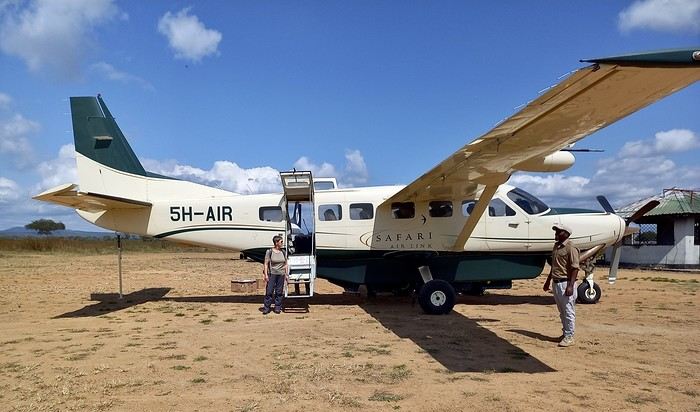
I was surprised to see so many aircraft parked there... even twin-engine Embraer Brasilias?? As a fan of vintage planes, I loved it...
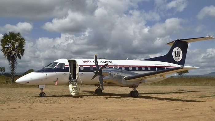
On the other hand, the light was incredibly harsh.....!! Our guides only speak English. We knew that in advance. In the south, it’s very rare to find someone who speaks French. This’ll force us to dig into our high school English memories... from 60 years ago... at least.
It’s noon, and we head toward the lodge. Near the airstrip, next to the Mikumi rangers’ base, there are quite a few herbivores. They find a bit more peace here—the big cats don’t venture this way...
Our first encounter was a group of Masai giraffes.
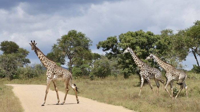
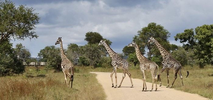
Rarer (for us), a savanna monitor lizard basking in the sun right in the middle of the track...??
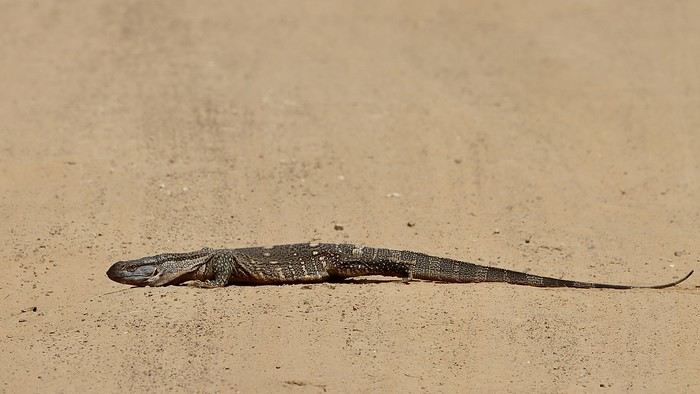
A large gathering of impalas (mostly males) along with a few blue wildebeest:
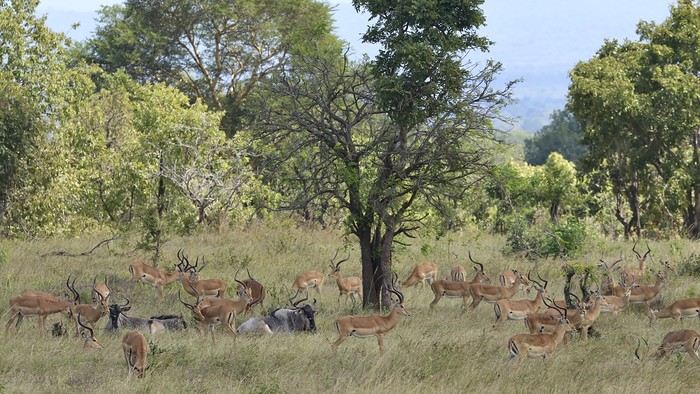

Also unusual: a African crowned hornbill taking a dust bath in the middle of the track...!!
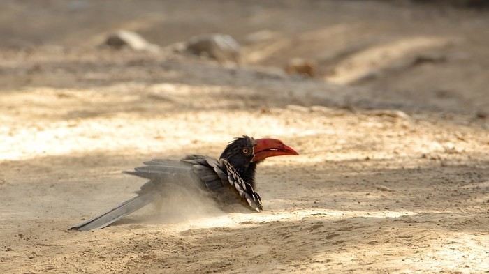
When it comes to identifying mammals or birds, I don’t know everything... so I might make mistakes. Please forgive me. I’m counting on my friend Blesl’s active participation... 😉
...
I’m a newbie to this forum, passionate about wildlife, the landscapes of East Africa, and Tanzania in particular. This June 2024 trip/safari is our 7th visit to Tanzania and our 5th in the south, which has drawn us more than the north ever since we discovered it in 2015.
In 2024, the entrance fees for the reserves and services have gone up again since our last visit. I chose to return first to Mikumi Reserve, which was the very first one we visited in the south. Then, we’ll head to Selous (J. Nyerere N. P.) as usual. Initially, we wanted to spend 2/3 days on Mafia Island at the end of the trip, but it made the total cost too high, so we gave up... We usually go to Ruaha and Selous, but I wanted to mix it up a bit—also to save some money...
As for the timing, June is a new experience for us. I thought it might be interesting to come just after the lodges reopen... hoping for some great wildlife encounters??
The trip starts in Marseille with our first flight on Ethiopian Airlines to Addis Ababa, then continues to Dar es Salaam, where we’ll finally set foot on Tanzanian soil again.
In Addis... "our" A-350.
.....
After arriving in Dar, we spent one night at a hotel near the airport. The next morning, we headed to the domestic flights terminal, which hasn’t changed in years.
By mid-morning, we boarded a Cessna 208B Caravan with Safari Air Link, heading to the Kikoboga bush airstrip in Mikumi, which we reached 45 minutes later. Fun fact: the pilot was the same one as on our return flight two years ago.
Welcome on board:
Of course, a driver/guide team from our chosen lodge was waiting for us upon arrival:
I was surprised to see so many aircraft parked there... even twin-engine Embraer Brasilias?? As a fan of vintage planes, I loved it...
On the other hand, the light was incredibly harsh.....!! Our guides only speak English. We knew that in advance. In the south, it’s very rare to find someone who speaks French. This’ll force us to dig into our high school English memories... from 60 years ago... at least.
It’s noon, and we head toward the lodge. Near the airstrip, next to the Mikumi rangers’ base, there are quite a few herbivores. They find a bit more peace here—the big cats don’t venture this way...
Our first encounter was a group of Masai giraffes.
Rarer (for us), a savanna monitor lizard basking in the sun right in the middle of the track...??
A large gathering of impalas (mostly males) along with a few blue wildebeest:
Also unusual: a African crowned hornbill taking a dust bath in the middle of the track...!!
When it comes to identifying mammals or birds, I don’t know everything... so I might make mistakes. Please forgive me. I’m counting on my friend Blesl’s active participation... 😉
...
Warm January in Kerala (and a bit of Karnataka)
Hi everyone,
We're back in India for the 7th time (for the other trips, check here:
https://www.unendroitoualler.fr/asie/) ... But this time, no more exploring or trekking! With age, we're just spending a quiet month in southern India, a country we particularly love...
Our journey starts in Kovalam, then Monroe Island, Varkala, Kochi, Kannur, Udupi, and finally, as in recent years, Gokarna.
No problem getting around—there’s the train all along the coast...
Night in Trivandrum
Prepaid taxi to the « Safire Residency », where we stayed last year. This hotel is still just as nice and welcoming (980 INR). Then, dinner at the restaurant « Ariya Niwas » where we enjoyed those delicious dosas again! (We missed them!)
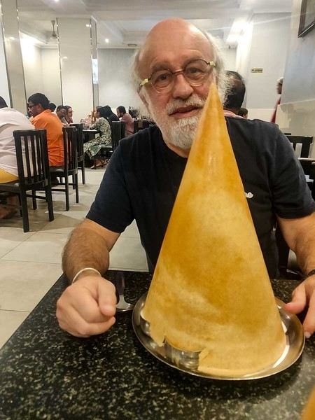
Night in Trivandrum
Prepaid taxi to the « Safire Residency », where we stayed last year. This hotel is still just as nice and welcoming (980 INR). Then, dinner at the restaurant « Ariya Niwas » where we enjoyed those delicious dosas again! (We missed them!)
The Great Ocean Road in Australia
Tuesday, December 5, 2023
Melbourne – Lorne
We pick up the car 500 meters away, in a Chinatown parking lot that the hotel has a deal with, then it’s off with a *vroom vroom* while listening to a podcast about the victim of a compulsive mythomaniac—who also happens to be her husband—leading a completely compartmentalized double life. Later, he discovers, after contacting his alter-ego from this parallel universe, that he was actually living a *third* life... and maybe even more? We arrive in Torquay, where we stretch our legs along the Koorie Cultural Walk with a view of Bells Beach...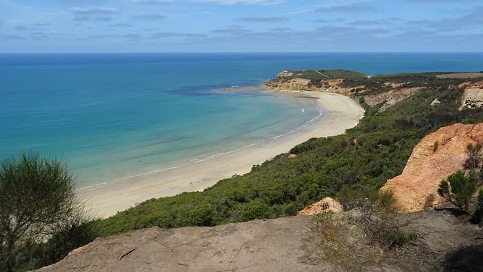
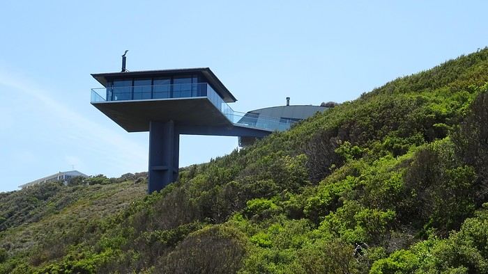
It’s here, just outside Lorne, that the Great Ocean Road officially begins...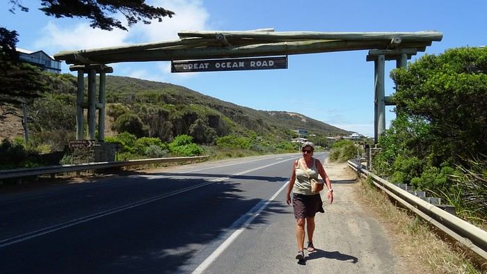
We arrive at our apartment, which is pretty nice—Dom and I are really particular about the quality of our terraces. I’ve never really talked about the practical quirks of daily life in Australia. For example, I could tell you that *every single* power outlet we used on this trip had a switch to turn it on or off. No exceptions, ever! Why? They must find it useful, but for us, it’s a total mystery... And of course, their power outlets require an adapter. Just one of many little peculiarities. Another odd observation: *every* toilet, even the most remote ones hidden deep in the bush, always had a roll of toilet paper available. No shortages here!
And then we’re greeted by a big family of cute sparrows...
Another odd observation: *every* toilet, even the most remote ones hidden deep in the bush, always had a roll of toilet paper available. No shortages here!
And then we’re greeted by a big family of cute sparrows...
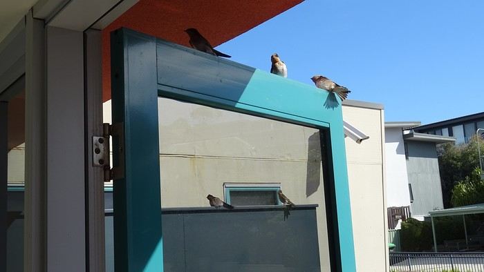
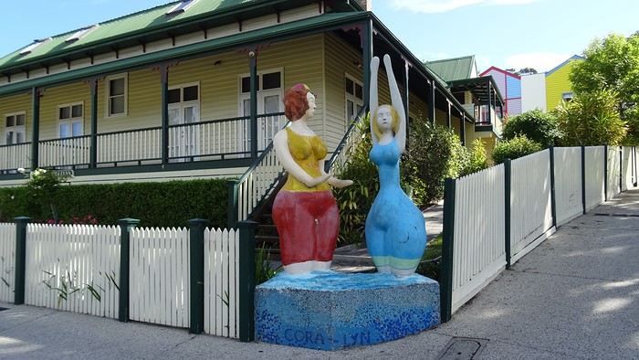
We spent a long time enjoying their pool before heading out for a walk—all the way to Erskine Falls, about ten kilometers away...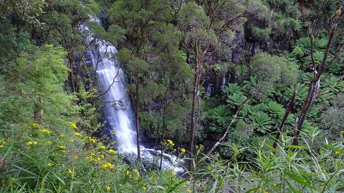
We pick up the car 500 meters away, in a Chinatown parking lot that the hotel has a deal with, then it’s off with a *vroom vroom* while listening to a podcast about the victim of a compulsive mythomaniac—who also happens to be her husband—leading a completely compartmentalized double life. Later, he discovers, after contacting his alter-ego from this parallel universe, that he was actually living a *third* life... and maybe even more? We arrive in Torquay, where we stretch our legs along the Koorie Cultural Walk with a view of Bells Beach...
It’s here, just outside Lorne, that the Great Ocean Road officially begins...
We arrive at our apartment, which is pretty nice—Dom and I are really particular about the quality of our terraces. I’ve never really talked about the practical quirks of daily life in Australia. For example, I could tell you that *every single* power outlet we used on this trip had a switch to turn it on or off. No exceptions, ever! Why? They must find it useful, but for us, it’s a total mystery... And of course, their power outlets require an adapter. Just one of many little peculiarities.
Another odd observation: *every* toilet, even the most remote ones hidden deep in the bush, always had a roll of toilet paper available. No shortages here!
And then we’re greeted by a big family of cute sparrows...We spent a long time enjoying their pool before heading out for a walk—all the way to Erskine Falls, about ten kilometers away...
Kyushu between Fukuoka and Nagasaki in autumn 2024 (Japan)
Fellow travelers,
Don’t they say "never two without three"? It seems so. Here I am again on the forum to share—and let’s be honest, indulge a bit of selfish pleasure—by recounting the story of this third installment in the Land of the Rising Sun.
Where? It’s all in the title. On the island of Kyushu in southern Japan, more precisely in the northwest between Fukuoka and Nagasaki. I hope to take you along with me for 19 nights and 18 full days this autumn of 2024. On the itinerary: gastronomy, crafts, festivals, waterfalls, encounters, and leisurely strolls in all simplicity.
A last-minute flight booked just 7 days before departure, and the route evolved regularly based on whims and accommodation availability, eventually settling on this:
- 5 nights in Fukuoka: Fukuoka city, Ukiha, Itoshima, Dazaifu, Yanagawa - 4 nights in Hasami, Nagasaki Prefecture: Okawachiyama, Arita, Takeo, Kashima, Yobuko, Karatsu, Kabeshima - 6 nights in Nagasaki: Ureshino, Higashi-Sonogi, Nagasaki city, Unzen, Sotome - 4 nights in Fukuoka: Karatsu, Fukuoka city
Most of the trip was done by car for practical reasons—easier access to certain places and freedom of movement—but also for the sheer joy of it. Despite slow traffic at times, driving in rural Japan is a delight.
If the program interests you, see you soon for the start of the journey.
Don’t they say "never two without three"? It seems so. Here I am again on the forum to share—and let’s be honest, indulge a bit of selfish pleasure—by recounting the story of this third installment in the Land of the Rising Sun.
Where? It’s all in the title. On the island of Kyushu in southern Japan, more precisely in the northwest between Fukuoka and Nagasaki. I hope to take you along with me for 19 nights and 18 full days this autumn of 2024. On the itinerary: gastronomy, crafts, festivals, waterfalls, encounters, and leisurely strolls in all simplicity.
A last-minute flight booked just 7 days before departure, and the route evolved regularly based on whims and accommodation availability, eventually settling on this:
- 5 nights in Fukuoka: Fukuoka city, Ukiha, Itoshima, Dazaifu, Yanagawa - 4 nights in Hasami, Nagasaki Prefecture: Okawachiyama, Arita, Takeo, Kashima, Yobuko, Karatsu, Kabeshima - 6 nights in Nagasaki: Ureshino, Higashi-Sonogi, Nagasaki city, Unzen, Sotome - 4 nights in Fukuoka: Karatsu, Fukuoka city
Most of the trip was done by car for practical reasons—easier access to certain places and freedom of movement—but also for the sheer joy of it. Despite slow traffic at times, driving in rural Japan is a delight.
If the program interests you, see you soon for the start of the journey.
The "Must-Sees" of the American West
This adventure began during Covid... Yep, Covid turned a lot of things upside down, but most of all, it kept us cooped up for a few months and stopped us from traveling for a while—even longer for a die-hard fan of the American West like me.
While borders were closed, I started imagining what an ideal itinerary might look like—one that would string together all the Southwest must-sees in just two weeks, during the best time of year: September and October. When the U.S. announced in September 2021 that borders would reopen in the coming weeks, I regained hope and began scouting flight tickets for a departure in September 2022.
But here’s the thing: tackling solo hikes, each one tougher than the last, right in the heart of the Wilderness, could be a risky—even reckless—endeavor for a father of three. After a quick chat with some virtual friends who are just as passionate about the Southwest as I am, with good physical condition and nearly the same list of must-visit spots, Franck and his brother Sullivan were in! 🙂
In November, we snagged flight tickets from Nice to San Francisco for the modest sum of 400 €, and a few days later, I booked a Toyota Tacoma pickup for 840 € !
It’s not cheap for just 15 days, and a pickup isn’t exactly ideal for luggage, but the prices for full-size 4x4s have become totally outrageous! Due to border closures, rental companies had to offload a lot of these big 4x4s, which tourists love. Then, supply and demand did the rest !
Franck and I spent the winter and spring trying to cram the equivalent of three weeks of hikes into two. But even with physical limits, we had to stay reasonable! Three to four months before departure, we entered the lotteries for different must-see spots: The Subway, Coyote Buttes North (home to the famous Wave), and Coyote Buttes South (CBS).
The Wave is the holy grail for any Southwest enthusiast. Since 2015, we’ve tried our luck with the online and on-site lotteries about ten times, but the spots are unfortunately limited: just 20 per day. A glimmer of hope, though—since early 2022, that number has increased to 64 people allowed per day, with 48 spots awarded via the online lottery.
After all three of us tried our luck for The Wave, on June 1st at exactly 5 PM, I got an email that started with, "Congratulations! You were successful in the Coyote Buttes North (The Wave) September 2022 Permit Lottery at Coyote Buttes North (The Wave)...". At 5:01 PM, I called Franck, whose dream it’s been for over 20 years—ever since the first photos were published in a travel magazine! He didn’t believe me when I told him, and I had to forward the email for him to finally accept the unbelievable: we were going to The Wave and all the incredible spots scattered across the protected area of Coyote Buttes North.
I’ve already been to Coyote Buttes South twice, but there are areas I couldn’t explore in the middle of summer because they were too remote. So, I had no trouble letting my buddies convince me to go back for a third time. Plus, given how hard it is to access, we had no trouble securing a permit online as long as we logged in at exactly 8 PM on the dot!
For The Subway, all three of us struck out. No big deal—we won at CBN and CBS!
Among the sites to visit, there are two that I’m particularly attached to because I know my chances of wanting to see them again are slim. The first is Angel Arch, one of the most legendary arches in the Southwest, due to its remoteness from any trace of civilization. To get there, the recommended hike is Upper Salt Creek, and you’re looking at a 50 km round-trip in an area with no water (in September) and populated by bears.
The second site is the Hopi Salt Trail, in Navajo land, which, after a very tough hike, lets you marvel at the turquoise-blue waters of the Little Colorado before it meets the Colorado River. The Hopi Salt Trail is, like The Wave, the holy grail for any Southwest enthusiast, and the windows of opportunity to see the water in that magical color are very short each year. For this, you have to monitor the Little Colorado’s gauges downstream from Cameron: if the level stays at its lowest for 10 consecutive days—meaning no rain—you can hope for turquoise water. The ideal period rarely exceeds 30 days a year, and it’s usually in June that all the stars align.
But unfortunately, one month before departure, while the flow rate at Cameron looked promising, several storms in September dashed our hopes of doing the Hopi Salt Trail, even at the end of the road trip.
We still had two consolation prizes, though:
After a last-minute cancellation, while keeping an eye out for available spots for The Subway, it turned out that three spots opened up exactly on the day we’d planned to go—so we rushed to grab them!! Regarding the 4x4 rental, the prices for full-size models dropped by several hundred dollars, and we ended up finding a Chevrolet Tahoe for less than $1000. A steal and a serious boost in comfort, so we could store all our gear and food without worry!
Here’s the initial plan in a perfect world: D1 The White Domes - Camping D2 Sunrise at The White Domes - The Subway D3 Coyote Buttes North D4 Coyote Buttes South - White Pocket D5 Wahweap Hoodoos - Sidestep Canyon - Colourful Canyon - White Rocks - Sunset at Yellow Rock D6 Broken Bow Arch - Reflection Canyon D7 Coyote Gulch D8 The Volcano (or The Oasis - Zebra Slot Canyon if the weather’s good) - North Caineville Mesa D9 The Needles: Squaw Canyon - Lost Canyon combo - Druid Arch - Chesler Park D10 Upper Salt Creek Day 1 - Camping D11 Upper Salt Creek Day 2 D12 Hopi-Navajo Territory: Ha Ho No Geh Canyon, Coal Mine Canyon, Bends of the Little Colorado D13 Grand Canyon: South Kaibab Trail and Bright Angel Trail D14 Upper East Zion: East Temple Loop, Jughandle Arch, Center of the Universe, and Checkerboard Mesa Summit And several backup options in case of bad weather, including Spencer Trail, West Cove, and Buffington Pockets.
Enough talking—time for action!
While borders were closed, I started imagining what an ideal itinerary might look like—one that would string together all the Southwest must-sees in just two weeks, during the best time of year: September and October. When the U.S. announced in September 2021 that borders would reopen in the coming weeks, I regained hope and began scouting flight tickets for a departure in September 2022.
But here’s the thing: tackling solo hikes, each one tougher than the last, right in the heart of the Wilderness, could be a risky—even reckless—endeavor for a father of three. After a quick chat with some virtual friends who are just as passionate about the Southwest as I am, with good physical condition and nearly the same list of must-visit spots, Franck and his brother Sullivan were in! 🙂
In November, we snagged flight tickets from Nice to San Francisco for the modest sum of 400 €, and a few days later, I booked a Toyota Tacoma pickup for 840 € !
It’s not cheap for just 15 days, and a pickup isn’t exactly ideal for luggage, but the prices for full-size 4x4s have become totally outrageous! Due to border closures, rental companies had to offload a lot of these big 4x4s, which tourists love. Then, supply and demand did the rest !
Franck and I spent the winter and spring trying to cram the equivalent of three weeks of hikes into two. But even with physical limits, we had to stay reasonable! Three to four months before departure, we entered the lotteries for different must-see spots: The Subway, Coyote Buttes North (home to the famous Wave), and Coyote Buttes South (CBS).
The Wave is the holy grail for any Southwest enthusiast. Since 2015, we’ve tried our luck with the online and on-site lotteries about ten times, but the spots are unfortunately limited: just 20 per day. A glimmer of hope, though—since early 2022, that number has increased to 64 people allowed per day, with 48 spots awarded via the online lottery.
After all three of us tried our luck for The Wave, on June 1st at exactly 5 PM, I got an email that started with, "Congratulations! You were successful in the Coyote Buttes North (The Wave) September 2022 Permit Lottery at Coyote Buttes North (The Wave)...". At 5:01 PM, I called Franck, whose dream it’s been for over 20 years—ever since the first photos were published in a travel magazine! He didn’t believe me when I told him, and I had to forward the email for him to finally accept the unbelievable: we were going to The Wave and all the incredible spots scattered across the protected area of Coyote Buttes North.
I’ve already been to Coyote Buttes South twice, but there are areas I couldn’t explore in the middle of summer because they were too remote. So, I had no trouble letting my buddies convince me to go back for a third time. Plus, given how hard it is to access, we had no trouble securing a permit online as long as we logged in at exactly 8 PM on the dot!
For The Subway, all three of us struck out. No big deal—we won at CBN and CBS!
Among the sites to visit, there are two that I’m particularly attached to because I know my chances of wanting to see them again are slim. The first is Angel Arch, one of the most legendary arches in the Southwest, due to its remoteness from any trace of civilization. To get there, the recommended hike is Upper Salt Creek, and you’re looking at a 50 km round-trip in an area with no water (in September) and populated by bears.
The second site is the Hopi Salt Trail, in Navajo land, which, after a very tough hike, lets you marvel at the turquoise-blue waters of the Little Colorado before it meets the Colorado River. The Hopi Salt Trail is, like The Wave, the holy grail for any Southwest enthusiast, and the windows of opportunity to see the water in that magical color are very short each year. For this, you have to monitor the Little Colorado’s gauges downstream from Cameron: if the level stays at its lowest for 10 consecutive days—meaning no rain—you can hope for turquoise water. The ideal period rarely exceeds 30 days a year, and it’s usually in June that all the stars align.
But unfortunately, one month before departure, while the flow rate at Cameron looked promising, several storms in September dashed our hopes of doing the Hopi Salt Trail, even at the end of the road trip.
We still had two consolation prizes, though:
After a last-minute cancellation, while keeping an eye out for available spots for The Subway, it turned out that three spots opened up exactly on the day we’d planned to go—so we rushed to grab them!! Regarding the 4x4 rental, the prices for full-size models dropped by several hundred dollars, and we ended up finding a Chevrolet Tahoe for less than $1000. A steal and a serious boost in comfort, so we could store all our gear and food without worry!
Here’s the initial plan in a perfect world: D1 The White Domes - Camping D2 Sunrise at The White Domes - The Subway D3 Coyote Buttes North D4 Coyote Buttes South - White Pocket D5 Wahweap Hoodoos - Sidestep Canyon - Colourful Canyon - White Rocks - Sunset at Yellow Rock D6 Broken Bow Arch - Reflection Canyon D7 Coyote Gulch D8 The Volcano (or The Oasis - Zebra Slot Canyon if the weather’s good) - North Caineville Mesa D9 The Needles: Squaw Canyon - Lost Canyon combo - Druid Arch - Chesler Park D10 Upper Salt Creek Day 1 - Camping D11 Upper Salt Creek Day 2 D12 Hopi-Navajo Territory: Ha Ho No Geh Canyon, Coal Mine Canyon, Bends of the Little Colorado D13 Grand Canyon: South Kaibab Trail and Bright Angel Trail D14 Upper East Zion: East Temple Loop, Jughandle Arch, Center of the Universe, and Checkerboard Mesa Summit And several backup options in case of bad weather, including Spencer Trail, West Cove, and Buffington Pockets.
Enough talking—time for action!
Editing our posts and blocking members in discussions we've started
Hello!
I’m a former VF lover (and, incidentally, an explorer of my Atlas 😊) and I’m genuinely thrilled the forum is reopening, but I have two little questions.
Over the past four years, I’ve put together a few travel journals that I’d love to share, but there are two things that bother me: - How can I edit my post after a few hours? (Because sometimes I need to correct mistakes even two days later.)
- At the end of VF’s previous run, there were a few members who were really unpleasant and enjoyed derailing certain discussions. As a result, I know several people who stopped coming to VF because of that. So, for MY travel journals, I’d really like to keep the vibe positive and kind. Is there any way to set something up so the person who starts a discussion can block them?
Thanks, and long live VF!
Over the past four years, I’ve put together a few travel journals that I’d love to share, but there are two things that bother me: - How can I edit my post after a few hours? (Because sometimes I need to correct mistakes even two days later.)
- At the end of VF’s previous run, there were a few members who were really unpleasant and enjoyed derailing certain discussions. As a result, I know several people who stopped coming to VF because of that. So, for MY travel journals, I’d really like to keep the vibe positive and kind. Is there any way to set something up so the person who starts a discussion can block them?
Thanks, and long live VF!
Thank You, VoyageForum
I don’t want to write an obituary for VF here; I hope it’s just a rough patch and that we can keep exchanging. But I do want to list all the great things this Forum has given me:
-Some amazing travel stories from Yangguizi, one of which led me to North Korea. Just look at the power of storytelling! And Looping, Mariecurry, Michant... Pondi will see me in the Altai one day. -Meeting a really friendly travel companion, which gave me the confidence to explore the Russian Far North. Where else could I have found a travel buddy for such a unique trip? -Meeting people on the Forum who encouraged me to write and gave me confidence. I even found my Quebecois translator and Breton translator for a few lines here on VF. A big thank you to them. -A wealth of information from reading travel journals, plus the chance to ask specific questions to prepare for a trip. Reading these journals also inspired me to visit new destinations.
And then, Voyage Forum is like a big family made up of so many different personalities. Anonymity breaks down all barriers and inhibitions. Sure, some people can be a pain and might’ve needed some help, there are the lost souls; others are all kindness and warmth; some stand out for their beautiful French; that’s not something to dismiss in these times of language impoverishment; some intellectuals share ideas that often go over my head; there are the ruthless commentators on others’ writing and thoughts. Ego battles flare up—it’s all part of the game. I can’t imagine the work it takes to manage all this. Rarely, a historical discussion takes hold with knowledgeable contributors. How cool is that! It’s fascinating and educational. Unfortunately, political correctness often shuts it down quickly. The trolls are watching!
Thank you, VF. And thank you all who owe it to yourselves. What are the most original contributions?
-Some amazing travel stories from Yangguizi, one of which led me to North Korea. Just look at the power of storytelling! And Looping, Mariecurry, Michant... Pondi will see me in the Altai one day. -Meeting a really friendly travel companion, which gave me the confidence to explore the Russian Far North. Where else could I have found a travel buddy for such a unique trip? -Meeting people on the Forum who encouraged me to write and gave me confidence. I even found my Quebecois translator and Breton translator for a few lines here on VF. A big thank you to them. -A wealth of information from reading travel journals, plus the chance to ask specific questions to prepare for a trip. Reading these journals also inspired me to visit new destinations.
And then, Voyage Forum is like a big family made up of so many different personalities. Anonymity breaks down all barriers and inhibitions. Sure, some people can be a pain and might’ve needed some help, there are the lost souls; others are all kindness and warmth; some stand out for their beautiful French; that’s not something to dismiss in these times of language impoverishment; some intellectuals share ideas that often go over my head; there are the ruthless commentators on others’ writing and thoughts. Ego battles flare up—it’s all part of the game. I can’t imagine the work it takes to manage all this. Rarely, a historical discussion takes hold with knowledgeable contributors. How cool is that! It’s fascinating and educational. Unfortunately, political correctness often shuts it down quickly. The trolls are watching!
Thank you, VF. And thank you all who owe it to yourselves. What are the most original contributions?
«Je ne veux plus gueuler: "Comment va le monde?" Et qu'on me réponde: «Il va comme il va» English translation pending
Dans la tiédeur d’un soir d’été, deux amies devisaient paisiblement.
Elles parlaient d’amour.
L’une de l’amour de sa compagne qui la rendait plus forte, l’autre de l’amour de son mari qui la rendait plus douce.
Elles parlaient voyages Les voyages d’autrefois où les anecdotes s’enrubannent année après année de détails sortis de leur imagination fertile et qui rendaient leurs récits plus épiques et ceux récents encore à l’état de fraîche émotion.
La bouteille de vin blanc s’embuait sur la table blanche en fer, l’herbe roussie chatouillait leurs pieds nus, elles se sentaient comblées, heureuses et libres et, sans doute pour cette raison, il leur était facile de parler du monde d’aujourd’hui, facile d’évoquer les conflits, les émeutes, les violences, les épidémies.
Epargnées, tranquilles, trempant avec gourmandise leurs lèvres dans le gewurztraminer frais, elles s’interrogeaient :
« T’as vu avec le covid on ne parle plus des guerres, c’est covid partout, encore que ça commence à ralentir, y’a le foot » « Ah oui, t’as raison, tu crois que ça pète encore en Syrie, en Lybie, au Yémen, en Somalie, au Sahel ? » « Chais pas, mais au Liban, quelle horreur cette explosion et tous ces gens morts ou sans maison » « T’as entendu les humanitaires au Niger ? » « Oui, pas les premiers pas les derniers à mourir bêtement » « Et au Brésil et en Colombie, ça c’est calmé ? » « Aucune idée » « Et à Hong-Kong et au Brésil et au Vénézuela, je me demande si ça manifeste toujours » « Chais pas, mais aux Etats-Unis entre blancs et noirs c’est pas cool, t’as vu les émeutes et ça va continuer, tu peux croire » « moi, c’qui me rend dingue c’est tous les gens dans le monde qui ont faim, qui n’ont pas de boulot ou qui l’ont perdu » « oui, c’est triste » « En tout cas, on entend plus parler des migrants, ni ceux de Lampedusa, ni ceux des jungles là-haut » « T’imagines un peu le monde entier à l’arrêt. Comment veux-tu que la terre reste en paix » « Et ceux qui se battent, qui sont en guerre, se tapent le covid en plus » « Et t’as vu en Bielorussie, pareil, ça chauffe aussi » « T’as déjà vu des révolutions pacifiques toi ? » « Ouais, c’est plus embêtant c’est pas loin d’chez nous » « Et le mec empoisonné par les russes, paraît qu’il est en Allemagne » « Chez nous ça va être chaud à la rentrée, j’te l’dis, tu verras, avec les chômeurs, le covid, les gosses à l’école, le télétravail oui et non, on va pas rire »
« Moi, j’te dis qu’il n’y a pas que les incendies de forêts qui bousillent la terre, y’a les incendies de fureur dans le coeur des hommes »
« Oh , t’as pas parlé des masques, des mesures barrières, etoussaettoussa » « Et toi de ton dada favori, l’eau, l’or du monde » « Eh ne me branche pas sur ce sujet, je suis intarissable »
« Allez, t’es pas marrante, tiens, on finit la bouteille, l’est super bon ce vin »
Ainsi, dans la tiédeur d’un soir d’été, deux amies devisaient. A l’abri sous le tilleul, comme à l’abri derrière un écran, comme sur vf, la vie défile, bouleverse, secoue, agace, exaspère ou indiffère et « passent les jours, passent les semaines.../... »
« Comment va le monde? Il est rouge sang Et à mon avis, il l'est pour longtemps Comment va la vie? Il y a des endroits Elle vaut dix dollars combien je te dois
Comment va la guerre? Elle va comme elle va Elle est planétaire, on se reverra Comment va la banque? La banque surnage Pour les grands requins y a pas de naufrage Comment va la mort? Record absolu Toujours très discrète, je n'en sais pas plus » .../… B. Lavilliers
(Vos voyages vous ont fait réfléchir sur l'art de bien voyager, de bien vivre, l'état du monde ou le sens de la vie? Partagez vos pensées et réflexions dans cette rubrique.
Euhhhh, chuis dans la bonne rubrique.)
Elles parlaient voyages Les voyages d’autrefois où les anecdotes s’enrubannent année après année de détails sortis de leur imagination fertile et qui rendaient leurs récits plus épiques et ceux récents encore à l’état de fraîche émotion.
La bouteille de vin blanc s’embuait sur la table blanche en fer, l’herbe roussie chatouillait leurs pieds nus, elles se sentaient comblées, heureuses et libres et, sans doute pour cette raison, il leur était facile de parler du monde d’aujourd’hui, facile d’évoquer les conflits, les émeutes, les violences, les épidémies.
Epargnées, tranquilles, trempant avec gourmandise leurs lèvres dans le gewurztraminer frais, elles s’interrogeaient :
« T’as vu avec le covid on ne parle plus des guerres, c’est covid partout, encore que ça commence à ralentir, y’a le foot » « Ah oui, t’as raison, tu crois que ça pète encore en Syrie, en Lybie, au Yémen, en Somalie, au Sahel ? » « Chais pas, mais au Liban, quelle horreur cette explosion et tous ces gens morts ou sans maison » « T’as entendu les humanitaires au Niger ? » « Oui, pas les premiers pas les derniers à mourir bêtement » « Et au Brésil et en Colombie, ça c’est calmé ? » « Aucune idée » « Et à Hong-Kong et au Brésil et au Vénézuela, je me demande si ça manifeste toujours » « Chais pas, mais aux Etats-Unis entre blancs et noirs c’est pas cool, t’as vu les émeutes et ça va continuer, tu peux croire » « moi, c’qui me rend dingue c’est tous les gens dans le monde qui ont faim, qui n’ont pas de boulot ou qui l’ont perdu » « oui, c’est triste » « En tout cas, on entend plus parler des migrants, ni ceux de Lampedusa, ni ceux des jungles là-haut » « T’imagines un peu le monde entier à l’arrêt. Comment veux-tu que la terre reste en paix » « Et ceux qui se battent, qui sont en guerre, se tapent le covid en plus » « Et t’as vu en Bielorussie, pareil, ça chauffe aussi » « T’as déjà vu des révolutions pacifiques toi ? » « Ouais, c’est plus embêtant c’est pas loin d’chez nous » « Et le mec empoisonné par les russes, paraît qu’il est en Allemagne » « Chez nous ça va être chaud à la rentrée, j’te l’dis, tu verras, avec les chômeurs, le covid, les gosses à l’école, le télétravail oui et non, on va pas rire »
« Moi, j’te dis qu’il n’y a pas que les incendies de forêts qui bousillent la terre, y’a les incendies de fureur dans le coeur des hommes »
« Oh , t’as pas parlé des masques, des mesures barrières, etoussaettoussa » « Et toi de ton dada favori, l’eau, l’or du monde » « Eh ne me branche pas sur ce sujet, je suis intarissable »
« Allez, t’es pas marrante, tiens, on finit la bouteille, l’est super bon ce vin »
Ainsi, dans la tiédeur d’un soir d’été, deux amies devisaient. A l’abri sous le tilleul, comme à l’abri derrière un écran, comme sur vf, la vie défile, bouleverse, secoue, agace, exaspère ou indiffère et « passent les jours, passent les semaines.../... »
« Comment va le monde? Il est rouge sang Et à mon avis, il l'est pour longtemps Comment va la vie? Il y a des endroits Elle vaut dix dollars combien je te dois
Comment va la guerre? Elle va comme elle va Elle est planétaire, on se reverra Comment va la banque? La banque surnage Pour les grands requins y a pas de naufrage Comment va la mort? Record absolu Toujours très discrète, je n'en sais pas plus » .../… B. Lavilliers
(Vos voyages vous ont fait réfléchir sur l'art de bien voyager, de bien vivre, l'état du monde ou le sens de la vie? Partagez vos pensées et réflexions dans cette rubrique.
Euhhhh, chuis dans la bonne rubrique.)
Petit tour dans le Péloponnèse English translation pending
Tous nos séjours en Grèce nous ont enchantées alors, après un séjour en Crète, à Rhodes, à Zakynthos et en Grèce centrale, pourquoi pas un tour du Péloponnèse?
Nous avons quelques hésitations quant à la chaleur possible (notamment pour les randonnées) mais finalement, hop! la réservation des billets d'avion est faite fin janvier: ce sera un départ de Bruxelles (avec Brussels airlines) le 05/07 à 7h30. Puis arrive le (la) Covid avec son lot d'incertitudes: partira? Partira pas? Partira? Partira pas? Faut-il tout annuler, reporter? Au mois de juin les règles d'ouverture des frontières changent en permanence mais il arrive un moment où il faut bien se décider car certains hébergements ne sont plus annulables. Les frontières de la Grèce doivent théoriquement ouvrir totalement le 1er juillet (sous réserve de...) on doit partir le 5 ...alors, c'est décidé, on part! ...enfin, si tout se passe comme prévu!
L'ouest du Péloponnèse ne m'inspire pas plus que ça. Par contre Cythère me tente bien, alors voilà à quoi ressemblera notre circuit (on prendra le bateau pour Cythère à Neapoli):
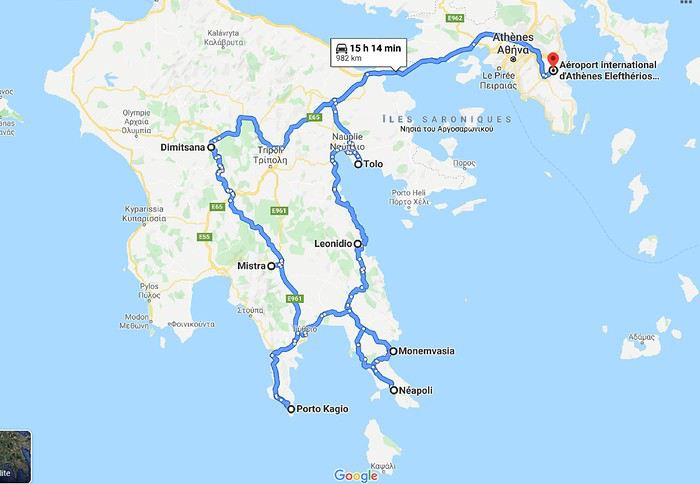 Muriel
Nous avons quelques hésitations quant à la chaleur possible (notamment pour les randonnées) mais finalement, hop! la réservation des billets d'avion est faite fin janvier: ce sera un départ de Bruxelles (avec Brussels airlines) le 05/07 à 7h30. Puis arrive le (la) Covid avec son lot d'incertitudes: partira? Partira pas? Partira? Partira pas? Faut-il tout annuler, reporter? Au mois de juin les règles d'ouverture des frontières changent en permanence mais il arrive un moment où il faut bien se décider car certains hébergements ne sont plus annulables. Les frontières de la Grèce doivent théoriquement ouvrir totalement le 1er juillet (sous réserve de...) on doit partir le 5 ...alors, c'est décidé, on part! ...enfin, si tout se passe comme prévu!
L'ouest du Péloponnèse ne m'inspire pas plus que ça. Par contre Cythère me tente bien, alors voilà à quoi ressemblera notre circuit (on prendra le bateau pour Cythère à Neapoli):
MurielAvez-vous changé votre rapport aux voyages à cause du Covid? English translation pending
Bonsoir à tous,
Etant en train de réfléchir à d'éventuels futurs voyages, je me heurte bien sûr à la situation de la crise sanitaire.
Cela a-t-il affecté votre façon de voyager et prévoir vos voyages ?
Là par ex, je regarde les destinations où le masque n'est pas obligatoire à l'extérieur, où il n'y a pas (trop) de risque de quarantaine, etc.
Mais aussi les conditions d'annulations/report selon les pays.
Je vois qu'Airbnb ne remboursera pas les voyageurs en cas de confinement ou quarantaine. C'est donc la course aux logement flexibles, il y en a peu... pour l'avion cela dépend de la compagnie.
Mon prochain voyage prévu et payé, c'est avec Wizz Air pour la Pologne. Pas de remboursement (sauf si vol annulé bien sûr) mais les prix étant faibles, je prends le risque ! L'hébergement est annulable également.
Ces paramètres influent sur le choix des futurs destinations.
Et vous, comment procédez-vous ?
Etant en train de réfléchir à d'éventuels futurs voyages, je me heurte bien sûr à la situation de la crise sanitaire.
Cela a-t-il affecté votre façon de voyager et prévoir vos voyages ?
Là par ex, je regarde les destinations où le masque n'est pas obligatoire à l'extérieur, où il n'y a pas (trop) de risque de quarantaine, etc.
Mais aussi les conditions d'annulations/report selon les pays.
Je vois qu'Airbnb ne remboursera pas les voyageurs en cas de confinement ou quarantaine. C'est donc la course aux logement flexibles, il y en a peu... pour l'avion cela dépend de la compagnie.
Mon prochain voyage prévu et payé, c'est avec Wizz Air pour la Pologne. Pas de remboursement (sauf si vol annulé bien sûr) mais les prix étant faibles, je prends le risque ! L'hébergement est annulable également.
Ces paramètres influent sur le choix des futurs destinations.
Et vous, comment procédez-vous ?
Qantas va proposer des "rotations touristiques au dessus de l'Antarctique" English translation pending
Bonjour
Plus de voyageurs en international alors Qantas décollera en novembre pour des rotations touristique au dessus de l’Antarctique pour 12h 13 h de vols premier prix 730 euros en éco pour un siège au dessus de l'aile 🙁 4875 euros pour les meilleures places en affaire . vol en B787 dreamliner . avis aux amateurs lol
source air journal
Mich74
Chorizo ou pas dans la paëlla? English translation pending
Tout fout le camp...
Chorizo ou pas ? Un illustre chef espagnol ravive le «paellagate»
(Mais moi j'en ai toujours mis... 😛 )
Retour aux Marquises: les îles méridionales Hiva Oa, Tahuata et Fatu Iva English translation pending
INTRO
En ces temps épidémiques troublés, la Polynésie Française - et en particulier l' archipel des Marquises - ont des atouts exceptionnels en matière de tourisme. A ce jour, l' épidémie de Coronavirus a juste effleuré le Territoire -presque uniquement Tahiti et Moorea - dont les îles éloignées ont été strictement confinées dès le départ, les offres sanitaires et hospitalières sur place étant très limitées. Pour l' instant, la situation est sous contrôle.
Le tourisme retrouve lentement ses marques depuis la mi-juillet. Il s'agit actuellement plus de tourisme local que de tourisme international, bien que la destination Polynésie / Marquises soit attirante : beauté et unicité des paysages, authenticité d'un archipel, certes situé à 4 heures d'avion ATR de Tahiti, mais que l' on peut facilement découvrir en solo et donc en dehors de la très onéreuse croisière sur l' Aranui, sécurité physique mais aussi sanitaire. Les Européens - dont une majorité de Français - arrivent... Ils avaient déjà leurs billets depuis des mois et l' entrée sur le territoire est facilitée.
Nous devions faire ce second voyage aux Marquises en mai dernier, mais il fut annulé jusqu'à la reprise progressive des vols en interne.
Nous avons simplement acheté un billet Air Tahiti en ligne, sans utiliser le Pass Marquises qui ne permet pas de visiter les deux îles les plus méridionales, à savoir Tahuata et Fatu Iva, dépourvues d'aéroport. On ne peut y aller qu' en bateau, en excursion à la journée ( ou plus bien sur ) pour Tahuata et en navette municipale au départ de Hiva Oa pour aller à Fatu Iva.
Les horaires changeant fréquemment, la première chose à faire est de se renseigner sur les jours de passage vers Fatu Iva. En ce moment, il y en a trois : le lundi ( départ à 2 heures du matin ), le mardi ( départ à 6 heures ) et le samedi ( départ à 6 heures également ). Mais tout cela aura peut-être changé dans 3 mois. Il faut donc une stratégie d'approche !
On peut rajouter la visite de ces deux îles à celles qui sont incluses dans le Pass, à savoir Nuku Hiva, Ua Pou, Ua Huka et Hiva Oa. Prévoir alors une extension de 8 jours environ, à partir de Hiva Oa.
Pourquoi vouloir absolument visiter ces deux îles peu accessibles ? Justement parce qu'il faut les mériter ! Elles demeurent très différentes.
L' une, Tahuata, a un lagon, des plages de sable blanc, des falaises abruptes, des baies échancrées ourlées d'une végétation luxuriante, des couleurs uniques dans les bleus et turquoise et culmine à plus de 1000 mètres.
L' autre, Fatu Iva , est une beauté sauvage et altière avec ses à-pics qui dévalent vers l' océan bleu outremer ( ou 'moana' en tahitien ), connue surtout pour sa fameuse baie des Vierges, considérée par beaucoup - en particulier les navigateurs - comme la plus belle île de Polynésie.
Dans mon premier carnet sur les Marquises, j' avais déjà mentionné notre séjour à Hiva Oa, un peu trop court. Cette fois, entre notre arrivée et notre retour, nous passerons 4 nuits à Hiva Oa et 4 nuits à Fatu Iva. Une journée et demie sera consacrée aussi à Hiva Oa.
Avant de partir à la découverte de ces îles polynésiennes lointaines et peu visitées, quelques chiffres édifiants qui montrent que les Marquises ont échappé de peu à l' oubli, à la perte de leur identité singulière et à la disparition de leur culture. L' archipel comptait 20000 habitants en 1842, seulement 2000 en 1920, environ 8000 actuellement en 2020. Au début des années 1920, c'est grâce à la politique nataliste du Dr Rollin, administrateur des Marquises de l' époque, que la situation commença lentement à s' améliorer. Ensuite et paradoxalement, ce fut un évêque, Mgr Lecleac'h, qui s'érigea en animateur engagé du réveil identitaire, via la sauvegarde du patrimoine, la reconnaissance de la langue marquisienne ( et non tahitienne ), les danses ( jugées trop lascives par les missionnaires ), les chants, le tatouage, enfin l' artisanat inspiré des motifs et des symboles de la culture ancienne. L' icône du renouveau marquisien est sans conteste le tiki, demi-dieu et créateur de l' homme. En lui réside la divinité et les ancêtres légendaires.

TAHUATA ou Île Lumière
DANS LA LEGENDE DES MARQUISES C' est la plus petite île habitée des Marquises dont le nom signifie l' aube en marquisien. J' aurai, plus tard, l' occasion de revenir sur la légende de la création des Marquises : dans cette légende, Tahuata représente le dernier acte de la construction avant l' aube. La symbolique de son nom est liée à l' arrivée de la lumière du jour, signifiant la fin de la construction de la 'Grande Maison', alias l' archipel des Marquises.
UN PEU DE GEOLOGIE Tahuata et Fatu Iva sont soeurs géologiquement parlant. Ce sont des îles plus jeunes que celles du nord de l' archipel ( de 5, 5 millions d'années au Nord-Ouest à seulement 1,2 million d'années au Sud-Est ) L' activité volcanique passée s' est matérialisée sous la forme de volcans dits boucliers, différents des volcans hawaiïens ou tahitiens, qui , suite à des secousses sismiques violentes et répétées, se sont peu à peu effondrés, disparaissant sous les flots de la moitié voire davantage des boucliers initiaux. Résultat : les calderas sont imbriquées l'une dans l' autre , la caldeira initiale étant dotée d'un volcan interne plus petit et plus récent. C 'est le cas à Fatu Iva par exemple.
UN PEU DE GEOGRAPHIE
Située à seulement 4 kms de Hiva Oa , on ne peut rejoindre Tahuata que par mer après 40 à 60 mn de navigation selon le temps ( il existe un catamaran communal, le Tahuata Nui mais qui est souvent en panne pour une durée indéterminée... ). On choisira entre l' excursion à la journée ou le passage simple en speedboat privé, assez cher. Ou si l' on doit résider à Tahuata, on s'arrangera au préalable avec la pension de famille choisie pour discuter des modalités et du prix de la course aller-retour entre Tahuata et Hiva Oa. Le canal dit du Bordelais qui est emprunté par les bateaux peut être extrêmement agité par des courants violents et rallonger un peu la course. (Petite digression sur ce fameux canal du Bordelais... Qui est donc ce Bordelais ? Un certain Joseph Capri ( ou Kabri ou Kabris ), originaire de Bordeaux même, initialement matelot de son état sur un bâtiment baleinier qui fait naufrage sur la côte de Nuku Hiva. Kabri , capturé par les guerriers du roi anthropophage de NH, s'apprête à mourir et à finir rôti à la broche, mais est sauvé in extremis par la fille du roi qui demande sa grâce. Celle-ci est accordée, il épouse la belle dans la foulée, le roi tatoue son gendre lui-même, lui offre des parures en tapa et mousse et le nomme grand juge du pays. Il tue, torture, garrotte, découpe en morceaux. Il pacifie à sa manière ! La vie est douce et belle, il a six enfants de sa princesse marquisienne ... Et puis un jour où il sommeille dans la nature, il est kidnappé par le navigateur russe Krunsenstern qui, à coups de knout, le ramène au navire puis à St Petersbourg pour y être interrogé et jugé. Kabri parvient à s' échapper vers Paris, demande à rencontrer Louis XVIII qu'il traite comme son cousin. Ce dernier - contre toute attente - le reçoit et lui donne un peu d'argent, mais la chance a définitivement tourné pour Kabri qui se retrouve à Valenciennes, gagnant son pain comme bête de foire. Il mourra à 42 ans, épuisé et sans avoir pu repartir vers son île marquisienne et vers sa famille nombreuse. Les autorités lui éviteront post mortem l' infamie d'une exhumation et d'un empaillage, son tatouage corporel et facial ayant conquis un amateur !!! JB Kabri le Tatoué, dessin publié dans le livre de Von Langsdorff
Retour à Tahuata... L' île n'est entourée que partiellement de récifs coralliens ( comme Mangareva aux îles Gambier ) , et est agrémentée de magnifiques plages de sable blanc, en particulier celle de Hanamoenoa. Avec ses versants escarpés se terminant en falaises, des vallées étroites et profondes ouvrant sur des baies échancrées à la végétation dense telles celles jumelles de Iva Iva Nui et de Iva Iva Iti, Tahuata surprend et attire. ' C'est une des rares fois où j' eus le désir de posséder de la terre ', écrivit en son temps le navigateur Alain Gerbault, conquis par une île qu'il qualifiait d'enchanteresse. Son relief est très accidenté et les communications terrestres - sur des pistes improbables - entre les vallées sont difficiles. L' île culmine au Mont Tumu-Mea-Ufa à 1050 m. Sa superficie est de 60 km2, avec une population de 650 à 700 habitants environ. L' île comporte 4 villages : Vaitahu, petit port historique, avec son église aux murs de galets et un magnifique vitrail, son musée d'art et d'histoire, et sa proximité avec des sites archéologiques; Hapatoni, autre village avec sa voie pavée ou ' allée de la reine ', construite sur ordre de la reine Vaekehu II au 19ème siècle, bordée d'arbres centenaires de tamanu plantés par les anciens , et ses ' me'ae ' ( ou ' marae ' en tahitien). Egalement Motopu et Hanatetena, deux plus petits villages. Il y a d'autres chemins pavés dans l' île, à Hapatoni en particulier, et des pétroglyphes à Hanatahua. On peut donc passer plus d'une journée à Tahuata, y séjourner dans l' une de ses pensions. Les chemins et pistes de l' île se prêtent parfaitement à la randonnée pédestre.
UN PEU D HISTOIRE
Plusieurs édifices du village de Vaitahu commémorent un passé souvent tragique. On peut y voir les trois stèles érigées en souvenir de l' arrivée des Espagnols en 1595, puis de celle de militaires français en 1838 et enfin de la prise de possession de l' archipel par l' amiral Abel Dupetit-Thouars en 1842. Alvaro de Mendaña y Neira jeta l' ancre à Vaitahu en 1595, un premier contact avec ceux que l' on appelait à l' époque dans les mers du Sud et ailleurs ' les naturels ' qui tourna rapidement au massacre par les soldats espagnols de 200 villageois, guerriers et civils mélangés. On peut comprendre, dans ce contexte, que l' arrivée d'Occidentaux au 18ème siècle et au début du 19ème siècle ait suscité beaucoup de méfiance, d'animosité et d'hostilité de la part des habitants de Tahuata, et des autres îles également. Les premières tentatives d' évangélisation protestante d'abord en 1797 puis catholique en 1839 se soldèrent par un échec retentissant ( le gouvernement français avait l' habitude d'envoyer les missionnaires en éclaireurs afin de tâter le terrain.. ). Le religieux ayant failli à sa mission, il restait donc le politique et le militaire : l' expédition Dupetit-Thouars arrive en vue de Tahuata mi - avril 1842. Les Français sont dans un premier temps plutôt bien reçus par le chef / roi Iotete qui a récemment subi la pression de la marine américaine et qui se dit que la France le protégera. On attribue donc un terrain en hauteur aux Français pour la construction d'un fortin et d'une garnison. Dupetit-Thouars veut aller vite et propose à Iotete de se mettre sous la protection du roi de France, Louis-Philippe. Iotete accepte et, le 1er mai, est organisée une cérémonie pour la prise de possession officielle des îles Sud de l' archipel des Marquises - et par extension de tout l' archipel - par la France en présence des missionnaires et du neveu de Iotete, Maheono, également chef de Hanatetena. Et puis rapidement, un malaise grandissant s'installe, l' ambiance se dégrade, Iotete devient peu accommodant et versatile, ne supportant pas de se voir privé de son autorité de chef incontesté. Il fugue dans la montagne, organise la résistance aux Français que l' on vient pourtant de fêter, et finit par assiéger le fortin à moitié achevé avec ses guerriers. Résultat : des morts et des blessés des deux côtés et un chaos inattendu. Après palabres et promesses, l' amiral, fidèle à sa stratégie initiale, convainc Iotete - contacté et ramené à la raison par son neveu - de revenir à la table des négociations, et les termes d' une paix durable sont établis définitivement. Iotete a tenté de lutter mais a perdu et la guerre et son pouvoir, son ' mana '. Il mourra l' année suivante, une fin triste et sans avenir pour un chef qui ne sera pas élevé au rang de dieu le jour de ses funérailles.
 Prise de possession officielle de Tahuata
De g. à d. : Maheono, Iotete ( en habit militaire d'apparat à galons d'or époque Louis XV ), le père Baudichon, Abel Dupetit-Thouars
Prise de possession officielle de Tahuata
De g. à d. : Maheono, Iotete ( en habit militaire d'apparat à galons d'or époque Louis XV ), le père Baudichon, Abel Dupetit-Thouars
 Iotete le 1er Mais 1842 ( portrait par Max Radiguet )
 Iotete le 1er mai 1842 ( portrait par Max Radiguet )
 Maheono, neveu de Iotete et son saisissant tatouage facial
 Guerriers marquisiens 19ème siècle
L' amiral repart bientôt sur son navire La Reine Blanche vers Tahiti où il va obtenir le 9 septembre 1842 de la reine Pomaré IV son acceptation formelle de placer son île sous protectorat français. C' est ainsi que Les Marquises alias La Terre des Hommes ( ou Te Fenua Enata en marquisien ) devient la première colonie française dans le Pacifique Sud un peu avant Tahiti.
FAUNE ET FLORE Depuis sa disparition de Hiva Oa, suite à l' introduction malheureuse d'un rapace nocturne, le grand-duc de Virginie ( ou Bubo Virginiasus en latin ), la seule population survivante de ' pahi ' ou martin-chasseur des Marquises, vit à Tahuata, en grand danger d'extinction, car en déclin lent mais constant. il ne resterait que 300 individus au mieux. La destruction du grand-duc est autorisée à cause de son impact fatal sur la faune aviaire locale. Des excursions à pied et à cheval, en excursion à la demi-journée ou à la journée entière, à la découverte du ' pahi ' sont possibles. Contacter le comité de tourisme de Tahuata.
ACTIVITES TRADITIONNELLES
Il y a à Tahuata plusieurs centres d'artisanat et ce dernier est le plus réputé des Marquises, en particulier pour la sculpture sur os. Dans l' île, on est souvent sculpteur de père en fils; les hommes travaillent le bois de rose, l' os de cheval, de chèvre et de mouton et le rostre d'espadon. Dans la vallée d'Hapatoni, ce sont surtout d' expertes sculptrices qui sont à l' oeuvre, souvent depuis des années. Au travail de l' os ou du rostre d'espadon, elles ajoutent la confection de bijoux originaux. La culture du coprah est bien présente à Tahuata et permet aux agriculteurs de gagner un revenu fixe. Les cultures vivrières et les récoltes d'agrumes tels les pamplemousses, très réputés permettent l' autosuffisance alimentaire des habitants de l' île et un peu d'exportation vers le marché et les supermarchés de Papeete ( via la diaspora marquisienne installée à Tahiti ). Pêche et chasse participent également, pleinement, de ce désir d'autosuffisance. La nature est généreuse et tout pousse à profusion et l' on vit simplement mais plutôt bien à Tahuata comme ailleurs aux Marquises, d'autant que désormais, les cargos mixtes apportent régulièrement de Tahiti ce qui manque aux îliens.
Fatu Iva L' île de tous les superlatifs / L'île érotique

Guerrier marquisien tatoué originaire de Fatu Iva 19ème siècle On notera sur sa poitrine les motifs reconstitués d'une tête de tiki, que l' on retrouve aussi sur la crosse du casse-tête ( ou ' u'u ' en marquisien ), arme réservée au guerrier. Cette tête est supposée augmenter le ' mana ' ( alias la puissance ), les yeux en amande évoquent cette puissance surnaturelle tandis que la bouche étirée où apparaissent parfois langue et dents, est censée défier l' adversaire.
SELON LA LEGENDE Dans la légende de la construction de l' archipel des Marquises, selon laquelle chaque île est partie intégrante de la Maison des Dieux, Fatu Iva représente la toiture faite de 9 ( Iva ) tresses ( Fatu ) de feuilles de palmier. Elle s'est aussi appelée Santa Magdalena, nom donné par Alvaro de Mendaña en l' honneur de la sainte du même nom.
UN PEU DE GEOGRAPHIE Fatu Iva est une île située à 75 kms de Hiva Oa, d'une superficie de 84 km2. Longue de 10 kilomètres et large de 4, elle a la forme d'un croissant ou d'un haricot. Elle culmine au Mont Touaouoho à 960 mètres et héberge une population d'environ 600 habitants. C' est l' île la plus australe de l' archipel, la plus isolée aussi car il est impossible d'y construire un aéroport en raison du relief accidenté ou même un aérodrome comme à Ua Pou par exemple. C' est aussi la plus pluvieuse, étant la plus proche du tropique du Capricorne. Les pluies étant abondantes, l' île est recouverte d'une végétation luxuriante en particulier en son centre où prospère une forêt primaire tropicale dense. C' est aussi l'île la plus sauvage et la plus spectaculaire de l' archipel. Géologiquement parlant, elle est constituée de deux caldeiras volcaniques enchâssées l' une dans l' autre. La première date de 2 millions d'années environ, la seconde, deux fois plus petite est née d'une énorme éruption, comme en témoignent les massives chandelles basaltiques qui montent au ciel tout autour de la baie de Hanavave, dite baie des Vierges. Initialement appelée baie des Verges par les Marquisiens, elle a été rebaptisée par de pudibonds missionnaires, effarouchés par l' imagerie locale et ses sous-entendus. Fatu Iva n' a que deux villages situées chacun sur le bord extérieur des deux caldeiras : Hanavave aux colonnes basaltiques et Omoa, chef-lieu de l' île , village surplombé par un piton rocheux qui surprend par son profil rappelant la tête d'un moai de l' île de Pâques.
UN PEU D'HISTOIRE Comme les autres îles de l' archipel, Fatu Iva fut initialement peuplée par des Polynésiens venus de l' ouest. Les rivalités entre tribus étaient au départ incessantes et donnèrent lieu à des batailles sanglantes. C' est en juillet 1595 que l'île - tout comme celle de Tahuata - fut abordée pour la première fois par un occidental, le navigateur espagnol Alvaro de Mendaña de Neira , le premier du genre à avoir établi des contacts avec des populations polynésiennes. Mais il n' y débarqua pas. Il crût tout d'abord avoir découvert les Iles Salomon, le but ultime de son voyage, mais se rendit rapidement compte qu' il avait découvert une nouvelle terre dans un archipel d' îles auxquelles il donna le nom de ' Marquesas de Mendoza ' pour remercier le Vice-Roi du Pérou - alias Garcia Hurtado de Mendoza y Maurique, IV marquis de Cañete - qui l' avait aidé à monter et financer son expédition, et pour honorer en même temps son épouse et ses filles. En 1935, l' anthropologue norvégien Thor Heyerdahl - et futur aventurier du Kon Tiki - aborda Fatu Iva avec l' idée bien ancrée d' en faire son éden. Il y vécut un an avec sa femme, d'abord à Omoa, puis à Ouia, une vallée inconfortablement située sur la côte au vent et désormais retournée à l' état naturel, ayant été abandonnée par ses quelques habitants. Heyerdahl avait à l' époque avancé l' hypothèse erronée que les Maori descendaient des Indiens d'Amérique du Sud alors qu'ils sont originellement arrivés en pirogue de l' Asie du Sud-Est, et plus particulièrement de Taïwan. ( Je vous renvoie à mon carnet sur Taïwan où j' aborde ce sujet )
De 1960 à 1966, une majorité d'hommes de Fatu Iva partirent travailler au CEP de Mururoa, participant ainsi de l' émigration économique ayant commencé à l' époque, et s'étant poursuivie jusqu'à nos jours, les perspectives en termes d' emploi étant plus que limitées si l' on ne veut pas rester ou devenir agriculteur ou coprahculteur comme ses parents ou grands-parents.
FAUNE ET FLORE L' île est une terre d'abondance pour les agrumes, les fruits en général et les fleurs... Tout pousse ou presque. Elle possède une espèce endémique très menacée aujourd'hui : le Monarque ( ou oma'o ke'eke'e en marquisien ', dont il ne restait il y a peu que 6 couples au monde ! Le rat noir et le chat haret ont littéralement décimé cette espèce, dévorant oeufs, oisillons et même femelles en couvaison. Un programme de sauvegarde de l' espèce a été mis en place, avec des résultats encourageants, le nombre de couples ayant augmenté ces dernières années.
ECONOMIE L' île est ravitaillée uniquement par bateau. Une unique route partiellement bétonnée des deux côtés, et partiellement à l' état de piste, et longue de 17 kilomètres relie les deux villages. On peut également aller d'un village à l' autre par la mer en un quart d'heure de navigation. Le secteur primaire prévaut à Fatu Iva, en particulier la culture du coprah, et puis la pêche au thon, à l' espadon et au thazard. On y a cultivé le noni à outrance à une certaine époque mais celle-ci est un peu révolue, les bienfaits miraculeux du noni n' ayant pas vraiment été prouvés scientifiquement. Comme à Rurutu, on a abandonné la culture du café qui était pourtant prometteuse il y a une quarantaine d'années. En revanche, on trouve davantage de vergers et des vanillières. La chasse aux cochons et aux chèvres permet l' auto-suffisance en viande quand le ravitaillement venu de Tahiti vient à manquer ou arrive irrégulièrement. L' artisanat s'est développé grâce au tourisme et aux expositions semestrielles organisées à Papeete. La spécialité - principalement féminine - de Fatu Iva est le tapa dont les dessins s'inspirent des anciens tatouages marquisiens. La sculpture sur bois ou os ou noix de coco est plutôt réservée aux hommes, nourrie des anciennes figures et des symboles centenaires : tikis sculptés en bois de rose ou en bois noir, casse-tête, plats de présentation.
Suivez-moi en page 2.....
TAHUATA ou Île Lumière
DANS LA LEGENDE DES MARQUISES C' est la plus petite île habitée des Marquises dont le nom signifie l' aube en marquisien. J' aurai, plus tard, l' occasion de revenir sur la légende de la création des Marquises : dans cette légende, Tahuata représente le dernier acte de la construction avant l' aube. La symbolique de son nom est liée à l' arrivée de la lumière du jour, signifiant la fin de la construction de la 'Grande Maison', alias l' archipel des Marquises.
UN PEU DE GEOLOGIE Tahuata et Fatu Iva sont soeurs géologiquement parlant. Ce sont des îles plus jeunes que celles du nord de l' archipel ( de 5, 5 millions d'années au Nord-Ouest à seulement 1,2 million d'années au Sud-Est ) L' activité volcanique passée s' est matérialisée sous la forme de volcans dits boucliers, différents des volcans hawaiïens ou tahitiens, qui , suite à des secousses sismiques violentes et répétées, se sont peu à peu effondrés, disparaissant sous les flots de la moitié voire davantage des boucliers initiaux. Résultat : les calderas sont imbriquées l'une dans l' autre , la caldeira initiale étant dotée d'un volcan interne plus petit et plus récent. C 'est le cas à Fatu Iva par exemple.
UN PEU DE GEOGRAPHIE
Située à seulement 4 kms de Hiva Oa , on ne peut rejoindre Tahuata que par mer après 40 à 60 mn de navigation selon le temps ( il existe un catamaran communal, le Tahuata Nui mais qui est souvent en panne pour une durée indéterminée... ). On choisira entre l' excursion à la journée ou le passage simple en speedboat privé, assez cher. Ou si l' on doit résider à Tahuata, on s'arrangera au préalable avec la pension de famille choisie pour discuter des modalités et du prix de la course aller-retour entre Tahuata et Hiva Oa. Le canal dit du Bordelais qui est emprunté par les bateaux peut être extrêmement agité par des courants violents et rallonger un peu la course. (Petite digression sur ce fameux canal du Bordelais... Qui est donc ce Bordelais ? Un certain Joseph Capri ( ou Kabri ou Kabris ), originaire de Bordeaux même, initialement matelot de son état sur un bâtiment baleinier qui fait naufrage sur la côte de Nuku Hiva. Kabri , capturé par les guerriers du roi anthropophage de NH, s'apprête à mourir et à finir rôti à la broche, mais est sauvé in extremis par la fille du roi qui demande sa grâce. Celle-ci est accordée, il épouse la belle dans la foulée, le roi tatoue son gendre lui-même, lui offre des parures en tapa et mousse et le nomme grand juge du pays. Il tue, torture, garrotte, découpe en morceaux. Il pacifie à sa manière ! La vie est douce et belle, il a six enfants de sa princesse marquisienne ... Et puis un jour où il sommeille dans la nature, il est kidnappé par le navigateur russe Krunsenstern qui, à coups de knout, le ramène au navire puis à St Petersbourg pour y être interrogé et jugé. Kabri parvient à s' échapper vers Paris, demande à rencontrer Louis XVIII qu'il traite comme son cousin. Ce dernier - contre toute attente - le reçoit et lui donne un peu d'argent, mais la chance a définitivement tourné pour Kabri qui se retrouve à Valenciennes, gagnant son pain comme bête de foire. Il mourra à 42 ans, épuisé et sans avoir pu repartir vers son île marquisienne et vers sa famille nombreuse. Les autorités lui éviteront post mortem l' infamie d'une exhumation et d'un empaillage, son tatouage corporel et facial ayant conquis un amateur !!!
JB Kabri le Tatoué, dessin publié dans le livre de Von LangsdorffRetour à Tahuata... L' île n'est entourée que partiellement de récifs coralliens ( comme Mangareva aux îles Gambier ) , et est agrémentée de magnifiques plages de sable blanc, en particulier celle de Hanamoenoa. Avec ses versants escarpés se terminant en falaises, des vallées étroites et profondes ouvrant sur des baies échancrées à la végétation dense telles celles jumelles de Iva Iva Nui et de Iva Iva Iti, Tahuata surprend et attire. ' C'est une des rares fois où j' eus le désir de posséder de la terre ', écrivit en son temps le navigateur Alain Gerbault, conquis par une île qu'il qualifiait d'enchanteresse. Son relief est très accidenté et les communications terrestres - sur des pistes improbables - entre les vallées sont difficiles. L' île culmine au Mont Tumu-Mea-Ufa à 1050 m. Sa superficie est de 60 km2, avec une population de 650 à 700 habitants environ. L' île comporte 4 villages : Vaitahu, petit port historique, avec son église aux murs de galets et un magnifique vitrail, son musée d'art et d'histoire, et sa proximité avec des sites archéologiques; Hapatoni, autre village avec sa voie pavée ou ' allée de la reine ', construite sur ordre de la reine Vaekehu II au 19ème siècle, bordée d'arbres centenaires de tamanu plantés par les anciens , et ses ' me'ae ' ( ou ' marae ' en tahitien). Egalement Motopu et Hanatetena, deux plus petits villages. Il y a d'autres chemins pavés dans l' île, à Hapatoni en particulier, et des pétroglyphes à Hanatahua. On peut donc passer plus d'une journée à Tahuata, y séjourner dans l' une de ses pensions. Les chemins et pistes de l' île se prêtent parfaitement à la randonnée pédestre.
UN PEU D HISTOIRE
Plusieurs édifices du village de Vaitahu commémorent un passé souvent tragique. On peut y voir les trois stèles érigées en souvenir de l' arrivée des Espagnols en 1595, puis de celle de militaires français en 1838 et enfin de la prise de possession de l' archipel par l' amiral Abel Dupetit-Thouars en 1842. Alvaro de Mendaña y Neira jeta l' ancre à Vaitahu en 1595, un premier contact avec ceux que l' on appelait à l' époque dans les mers du Sud et ailleurs ' les naturels ' qui tourna rapidement au massacre par les soldats espagnols de 200 villageois, guerriers et civils mélangés. On peut comprendre, dans ce contexte, que l' arrivée d'Occidentaux au 18ème siècle et au début du 19ème siècle ait suscité beaucoup de méfiance, d'animosité et d'hostilité de la part des habitants de Tahuata, et des autres îles également. Les premières tentatives d' évangélisation protestante d'abord en 1797 puis catholique en 1839 se soldèrent par un échec retentissant ( le gouvernement français avait l' habitude d'envoyer les missionnaires en éclaireurs afin de tâter le terrain.. ). Le religieux ayant failli à sa mission, il restait donc le politique et le militaire : l' expédition Dupetit-Thouars arrive en vue de Tahuata mi - avril 1842. Les Français sont dans un premier temps plutôt bien reçus par le chef / roi Iotete qui a récemment subi la pression de la marine américaine et qui se dit que la France le protégera. On attribue donc un terrain en hauteur aux Français pour la construction d'un fortin et d'une garnison. Dupetit-Thouars veut aller vite et propose à Iotete de se mettre sous la protection du roi de France, Louis-Philippe. Iotete accepte et, le 1er mai, est organisée une cérémonie pour la prise de possession officielle des îles Sud de l' archipel des Marquises - et par extension de tout l' archipel - par la France en présence des missionnaires et du neveu de Iotete, Maheono, également chef de Hanatetena. Et puis rapidement, un malaise grandissant s'installe, l' ambiance se dégrade, Iotete devient peu accommodant et versatile, ne supportant pas de se voir privé de son autorité de chef incontesté. Il fugue dans la montagne, organise la résistance aux Français que l' on vient pourtant de fêter, et finit par assiéger le fortin à moitié achevé avec ses guerriers. Résultat : des morts et des blessés des deux côtés et un chaos inattendu. Après palabres et promesses, l' amiral, fidèle à sa stratégie initiale, convainc Iotete - contacté et ramené à la raison par son neveu - de revenir à la table des négociations, et les termes d' une paix durable sont établis définitivement. Iotete a tenté de lutter mais a perdu et la guerre et son pouvoir, son ' mana '. Il mourra l' année suivante, une fin triste et sans avenir pour un chef qui ne sera pas élevé au rang de dieu le jour de ses funérailles.
Prise de possession officielle de Tahuata
De g. à d. : Maheono, Iotete ( en habit militaire d'apparat à galons d'or époque Louis XV ), le père Baudichon, Abel Dupetit-Thouars
Iotete le 1er Mais 1842 ( portrait par Max Radiguet )
Iotete le 1er mai 1842 ( portrait par Max Radiguet )
Maheono, neveu de Iotete et son saisissant tatouage facial
Guerriers marquisiens 19ème siècleL' amiral repart bientôt sur son navire La Reine Blanche vers Tahiti où il va obtenir le 9 septembre 1842 de la reine Pomaré IV son acceptation formelle de placer son île sous protectorat français. C' est ainsi que Les Marquises alias La Terre des Hommes ( ou Te Fenua Enata en marquisien ) devient la première colonie française dans le Pacifique Sud un peu avant Tahiti.
FAUNE ET FLORE Depuis sa disparition de Hiva Oa, suite à l' introduction malheureuse d'un rapace nocturne, le grand-duc de Virginie ( ou Bubo Virginiasus en latin ), la seule population survivante de ' pahi ' ou martin-chasseur des Marquises, vit à Tahuata, en grand danger d'extinction, car en déclin lent mais constant. il ne resterait que 300 individus au mieux. La destruction du grand-duc est autorisée à cause de son impact fatal sur la faune aviaire locale. Des excursions à pied et à cheval, en excursion à la demi-journée ou à la journée entière, à la découverte du ' pahi ' sont possibles. Contacter le comité de tourisme de Tahuata.
ACTIVITES TRADITIONNELLES
Il y a à Tahuata plusieurs centres d'artisanat et ce dernier est le plus réputé des Marquises, en particulier pour la sculpture sur os. Dans l' île, on est souvent sculpteur de père en fils; les hommes travaillent le bois de rose, l' os de cheval, de chèvre et de mouton et le rostre d'espadon. Dans la vallée d'Hapatoni, ce sont surtout d' expertes sculptrices qui sont à l' oeuvre, souvent depuis des années. Au travail de l' os ou du rostre d'espadon, elles ajoutent la confection de bijoux originaux. La culture du coprah est bien présente à Tahuata et permet aux agriculteurs de gagner un revenu fixe. Les cultures vivrières et les récoltes d'agrumes tels les pamplemousses, très réputés permettent l' autosuffisance alimentaire des habitants de l' île et un peu d'exportation vers le marché et les supermarchés de Papeete ( via la diaspora marquisienne installée à Tahiti ). Pêche et chasse participent également, pleinement, de ce désir d'autosuffisance. La nature est généreuse et tout pousse à profusion et l' on vit simplement mais plutôt bien à Tahuata comme ailleurs aux Marquises, d'autant que désormais, les cargos mixtes apportent régulièrement de Tahiti ce qui manque aux îliens.
Fatu Iva L' île de tous les superlatifs / L'île érotique
Guerrier marquisien tatoué originaire de Fatu Iva 19ème siècle On notera sur sa poitrine les motifs reconstitués d'une tête de tiki, que l' on retrouve aussi sur la crosse du casse-tête ( ou ' u'u ' en marquisien ), arme réservée au guerrier. Cette tête est supposée augmenter le ' mana ' ( alias la puissance ), les yeux en amande évoquent cette puissance surnaturelle tandis que la bouche étirée où apparaissent parfois langue et dents, est censée défier l' adversaire.
SELON LA LEGENDE Dans la légende de la construction de l' archipel des Marquises, selon laquelle chaque île est partie intégrante de la Maison des Dieux, Fatu Iva représente la toiture faite de 9 ( Iva ) tresses ( Fatu ) de feuilles de palmier. Elle s'est aussi appelée Santa Magdalena, nom donné par Alvaro de Mendaña en l' honneur de la sainte du même nom.
UN PEU DE GEOGRAPHIE Fatu Iva est une île située à 75 kms de Hiva Oa, d'une superficie de 84 km2. Longue de 10 kilomètres et large de 4, elle a la forme d'un croissant ou d'un haricot. Elle culmine au Mont Touaouoho à 960 mètres et héberge une population d'environ 600 habitants. C' est l' île la plus australe de l' archipel, la plus isolée aussi car il est impossible d'y construire un aéroport en raison du relief accidenté ou même un aérodrome comme à Ua Pou par exemple. C' est aussi la plus pluvieuse, étant la plus proche du tropique du Capricorne. Les pluies étant abondantes, l' île est recouverte d'une végétation luxuriante en particulier en son centre où prospère une forêt primaire tropicale dense. C' est aussi l'île la plus sauvage et la plus spectaculaire de l' archipel. Géologiquement parlant, elle est constituée de deux caldeiras volcaniques enchâssées l' une dans l' autre. La première date de 2 millions d'années environ, la seconde, deux fois plus petite est née d'une énorme éruption, comme en témoignent les massives chandelles basaltiques qui montent au ciel tout autour de la baie de Hanavave, dite baie des Vierges. Initialement appelée baie des Verges par les Marquisiens, elle a été rebaptisée par de pudibonds missionnaires, effarouchés par l' imagerie locale et ses sous-entendus. Fatu Iva n' a que deux villages situées chacun sur le bord extérieur des deux caldeiras : Hanavave aux colonnes basaltiques et Omoa, chef-lieu de l' île , village surplombé par un piton rocheux qui surprend par son profil rappelant la tête d'un moai de l' île de Pâques.
UN PEU D'HISTOIRE Comme les autres îles de l' archipel, Fatu Iva fut initialement peuplée par des Polynésiens venus de l' ouest. Les rivalités entre tribus étaient au départ incessantes et donnèrent lieu à des batailles sanglantes. C' est en juillet 1595 que l'île - tout comme celle de Tahuata - fut abordée pour la première fois par un occidental, le navigateur espagnol Alvaro de Mendaña de Neira , le premier du genre à avoir établi des contacts avec des populations polynésiennes. Mais il n' y débarqua pas. Il crût tout d'abord avoir découvert les Iles Salomon, le but ultime de son voyage, mais se rendit rapidement compte qu' il avait découvert une nouvelle terre dans un archipel d' îles auxquelles il donna le nom de ' Marquesas de Mendoza ' pour remercier le Vice-Roi du Pérou - alias Garcia Hurtado de Mendoza y Maurique, IV marquis de Cañete - qui l' avait aidé à monter et financer son expédition, et pour honorer en même temps son épouse et ses filles. En 1935, l' anthropologue norvégien Thor Heyerdahl - et futur aventurier du Kon Tiki - aborda Fatu Iva avec l' idée bien ancrée d' en faire son éden. Il y vécut un an avec sa femme, d'abord à Omoa, puis à Ouia, une vallée inconfortablement située sur la côte au vent et désormais retournée à l' état naturel, ayant été abandonnée par ses quelques habitants. Heyerdahl avait à l' époque avancé l' hypothèse erronée que les Maori descendaient des Indiens d'Amérique du Sud alors qu'ils sont originellement arrivés en pirogue de l' Asie du Sud-Est, et plus particulièrement de Taïwan. ( Je vous renvoie à mon carnet sur Taïwan où j' aborde ce sujet )
De 1960 à 1966, une majorité d'hommes de Fatu Iva partirent travailler au CEP de Mururoa, participant ainsi de l' émigration économique ayant commencé à l' époque, et s'étant poursuivie jusqu'à nos jours, les perspectives en termes d' emploi étant plus que limitées si l' on ne veut pas rester ou devenir agriculteur ou coprahculteur comme ses parents ou grands-parents.
FAUNE ET FLORE L' île est une terre d'abondance pour les agrumes, les fruits en général et les fleurs... Tout pousse ou presque. Elle possède une espèce endémique très menacée aujourd'hui : le Monarque ( ou oma'o ke'eke'e en marquisien ', dont il ne restait il y a peu que 6 couples au monde ! Le rat noir et le chat haret ont littéralement décimé cette espèce, dévorant oeufs, oisillons et même femelles en couvaison. Un programme de sauvegarde de l' espèce a été mis en place, avec des résultats encourageants, le nombre de couples ayant augmenté ces dernières années.
ECONOMIE L' île est ravitaillée uniquement par bateau. Une unique route partiellement bétonnée des deux côtés, et partiellement à l' état de piste, et longue de 17 kilomètres relie les deux villages. On peut également aller d'un village à l' autre par la mer en un quart d'heure de navigation. Le secteur primaire prévaut à Fatu Iva, en particulier la culture du coprah, et puis la pêche au thon, à l' espadon et au thazard. On y a cultivé le noni à outrance à une certaine époque mais celle-ci est un peu révolue, les bienfaits miraculeux du noni n' ayant pas vraiment été prouvés scientifiquement. Comme à Rurutu, on a abandonné la culture du café qui était pourtant prometteuse il y a une quarantaine d'années. En revanche, on trouve davantage de vergers et des vanillières. La chasse aux cochons et aux chèvres permet l' auto-suffisance en viande quand le ravitaillement venu de Tahiti vient à manquer ou arrive irrégulièrement. L' artisanat s'est développé grâce au tourisme et aux expositions semestrielles organisées à Papeete. La spécialité - principalement féminine - de Fatu Iva est le tapa dont les dessins s'inspirent des anciens tatouages marquisiens. La sculpture sur bois ou os ou noix de coco est plutôt réservée aux hommes, nourrie des anciennes figures et des symboles centenaires : tikis sculptés en bois de rose ou en bois noir, casse-tête, plats de présentation.
Suivez-moi en page 2.....
Flower power (Golfe du Morbihan) English translation pending
D'abord nous avons pensé que nous serions épargnés. La fabrique du monde aurait poursuivi sa besogne paisiblement, élaborant, jours intenses après nuits remplies, le devenir de l'humanité.
La montée en puissance s'est faite progressivement, un seul lit réservé au début, plus d'un tiers du service ensuite. Sans plus de personnel. Sans plus de matériel.
Envoyée spéciale dans une ville dépeuplée de ses habitants, immense privilège ou épée de Damoclès ? Immense privilège !
J'ai aimé aller et revenir dans un Paris fantomatique. Les trains étaient toujours à l'heure. Les affiches du métro parlaient d'un monde qui n'existait plus, présentaient des spectacles qui ne se tiendraient pas… et des pubs inutiles avant même d'avoir été essentielles. Coronavirus avait remplacé pickpocket dans les annonces sonores.

 Moments irréels qui désapprennent toutes les certitudes, lieux familiers devenus méconnaissables qui lavent le regard et parfois l'émerveillent lorsque la rue offre des cadeaux inattendus : une minuscule boite rouge en forme de cœur qui détonne sur le trottoir gris. La foule qui ne se pressait pas ne l'avait pas piétinée.

Près de 3 mois ont passé embarqués dans un bateau qui tanguait sans savoir si et quand il arriverait au port… Près de 3 mois immergés dans l'inquiétude, l'incertitude, à chercher vainement le capitaine... mais trop de mains se pressaient sur la barre du gouvernail.
Cette folie qui a mis le monde à l'arrêt et la tête de certain.e.s à l'envers a imprimé dans ma mémoire une écœurante odeur d'alcool. La gueule de bois sans l'ivresse préalable.
... / ...
Alors, il faudra...
... Il faudra l'eau froide de l'Atlantique, des marches légères, l'odeur des genêts, le goût du large et des vues à perte de vue là où le ciel tombe dans la mer. Il faudra des chemins poudreux, parfois si étroits que les branches basses griffent les mollets et que les papillons s'emmêlent dans les cheveux. Un bout de GR, des sous bois aux racines saillantes avec l’océan à portée de main.
Un temps qui hésite entre soleil et pluie, des ciels de peintre en aplats de bleu soulignés de blanc et de gris fumé… des orages soudains.
Il faudra la force du granit, des villages ramassés autour de leurs églises bordées d'hortensias, les pavés inégaux des ruelles du centre ville, un passeur qui file vers une île… ce sera l'île d’Arz.
Et puis il faudra des fleurs ! Des fleurs sauvages ou cultivées, des empotées, des exubérantes, des rustiques. Des fleurs de toutes les couleurs, des tape à l'œil ou des petites fleurs de rien.
Des parterres odorants, bouquet de senteurs délicates ou d'odeurs fétides, des fleurs fanées, des justes écloses ou des déflorées. Des fleurs urbaines nichées dans les interstices du macadam, des belles des champs échevelées. Des mauvaises herbes. Des fleurs du mal. Un camaïeu de nuances pastels ou flamboyantes, un feu d'artifice d'arc en ciel.
Des fleurs soyeuses en couleurs comme des mots en couleurs… pour oublier, le temps d'une échappée belle, les fleurs de bitume, petits cercles blancs à deux ou trois pétales, pointillés rageurs, qui ont poussé en une nuit sur les trottoirs de Paris et les quais du métro.
Alors ce sera 8 jours dans le golfe du Morbihan aux alentours de Vannes et des marais de Séné.

Pari sur l'avenir, le train fut réservé alors que la limite des 100km était toujours en vigueur… elle sera supprimée 2 jours avant. (100km, c'est trop court pour ceux qui ... comme nous d'un aussi grand...)
Ici comme ailleurs la vie arrêtée a repris son cours avec des absurdités, des incohérences, du cynisme parfois... "Mesdames, messieurs, veuillez respecter la distance d'un mètre cinquante pour monter et descendre du train, mais une fois à bord vous aurez un voisin de siège puisque la promesse des 50% de places vendues a aussi été supprimée 2 jours avant !"
Envoyée spéciale dans une ville dépeuplée de ses habitants, immense privilège ou épée de Damoclès ? Immense privilège !
J'ai aimé aller et revenir dans un Paris fantomatique. Les trains étaient toujours à l'heure. Les affiches du métro parlaient d'un monde qui n'existait plus, présentaient des spectacles qui ne se tiendraient pas… et des pubs inutiles avant même d'avoir été essentielles. Coronavirus avait remplacé pickpocket dans les annonces sonores.
Moments irréels qui désapprennent toutes les certitudes, lieux familiers devenus méconnaissables qui lavent le regard et parfois l'émerveillent lorsque la rue offre des cadeaux inattendus : une minuscule boite rouge en forme de cœur qui détonne sur le trottoir gris. La foule qui ne se pressait pas ne l'avait pas piétinée.
Près de 3 mois ont passé embarqués dans un bateau qui tanguait sans savoir si et quand il arriverait au port… Près de 3 mois immergés dans l'inquiétude, l'incertitude, à chercher vainement le capitaine... mais trop de mains se pressaient sur la barre du gouvernail.
Cette folie qui a mis le monde à l'arrêt et la tête de certain.e.s à l'envers a imprimé dans ma mémoire une écœurante odeur d'alcool. La gueule de bois sans l'ivresse préalable.
... / ...
Alors, il faudra...
... Il faudra l'eau froide de l'Atlantique, des marches légères, l'odeur des genêts, le goût du large et des vues à perte de vue là où le ciel tombe dans la mer. Il faudra des chemins poudreux, parfois si étroits que les branches basses griffent les mollets et que les papillons s'emmêlent dans les cheveux. Un bout de GR, des sous bois aux racines saillantes avec l’océan à portée de main.
Un temps qui hésite entre soleil et pluie, des ciels de peintre en aplats de bleu soulignés de blanc et de gris fumé… des orages soudains.
Il faudra la force du granit, des villages ramassés autour de leurs églises bordées d'hortensias, les pavés inégaux des ruelles du centre ville, un passeur qui file vers une île… ce sera l'île d’Arz.
Et puis il faudra des fleurs ! Des fleurs sauvages ou cultivées, des empotées, des exubérantes, des rustiques. Des fleurs de toutes les couleurs, des tape à l'œil ou des petites fleurs de rien.
Des parterres odorants, bouquet de senteurs délicates ou d'odeurs fétides, des fleurs fanées, des justes écloses ou des déflorées. Des fleurs urbaines nichées dans les interstices du macadam, des belles des champs échevelées. Des mauvaises herbes. Des fleurs du mal. Un camaïeu de nuances pastels ou flamboyantes, un feu d'artifice d'arc en ciel.
Des fleurs soyeuses en couleurs comme des mots en couleurs… pour oublier, le temps d'une échappée belle, les fleurs de bitume, petits cercles blancs à deux ou trois pétales, pointillés rageurs, qui ont poussé en une nuit sur les trottoirs de Paris et les quais du métro.
Alors ce sera 8 jours dans le golfe du Morbihan aux alentours de Vannes et des marais de Séné.
Pari sur l'avenir, le train fut réservé alors que la limite des 100km était toujours en vigueur… elle sera supprimée 2 jours avant. (100km, c'est trop court pour ceux qui ... comme nous d'un aussi grand...)
Ici comme ailleurs la vie arrêtée a repris son cours avec des absurdités, des incohérences, du cynisme parfois... "Mesdames, messieurs, veuillez respecter la distance d'un mètre cinquante pour monter et descendre du train, mais une fois à bord vous aurez un voisin de siège puisque la promesse des 50% de places vendues a aussi été supprimée 2 jours avant !"
Avoir spontané de la part d'Air Transat English translation pending
Bonjour,
nous avions un séjour prévu au Québec, départ le 14 Août, Air Transat vient de nous donner un avoir valable 24 mois :
"Étant donné la situation actuelle de pandémie (Covid-19), ce courriel a pour but de vous aviser du changement suivant à votre réservation avec Air Transat : Annulation complète avec crédit-voyage valide pour un voyage futur effectué dans les 24 mois suivant la date de retour initiale."
Alors, je ne sais pas si c'est vraiment spontané ou si le gouvernement canadien est passé par là...
Question : L'avoir est bien gentil mais serait-il possible de réclamer un remboursement ?
Bons futurs Voyages
nous avions un séjour prévu au Québec, départ le 14 Août, Air Transat vient de nous donner un avoir valable 24 mois :
"Étant donné la situation actuelle de pandémie (Covid-19), ce courriel a pour but de vous aviser du changement suivant à votre réservation avec Air Transat : Annulation complète avec crédit-voyage valide pour un voyage futur effectué dans les 24 mois suivant la date de retour initiale."
Alors, je ne sais pas si c'est vraiment spontané ou si le gouvernement canadien est passé par là...
Question : L'avoir est bien gentil mais serait-il possible de réclamer un remboursement ?
Bons futurs Voyages
L'Ayurvéda: la médecine de la conscience English translation pending
Bonjour à tous,
dans ces moments où la distanciation sociale est de mise, cela peut être l'occasion de revoir notre façon de vivre, de repenser notre rapport au corps. Mais aussi de découvrir tout un tas de nouvelles choses. J'ai donc décidé de vous partager le résumé d'un livre sur la médecine traditionnelle indienne, qui m'a semblé fort intéressant. Je vous présente donc ici les bases de l'Ayurvéda, cette médecine indienne ancestrale qui tend cependant à se voir distancée par la médecine allopathique en Inde, car plus rapide pour soulager les douleurs mais aussi moins efficace sur le long terme.
Découvrons ensemble.
"Lorsque l'alimentation est mauvaise, les médicaments ne sont pas utiles. Lorsque l'alimentation est bonne, les médicaments sont inutiles". -- Proverbe reposant sur la science de la nutrition ayurvédique.
Nous nous tournons ici sur les bases de l’Ayurvéda, cet article porte sur sa découverte et ne saurait en rien être complet face aux connaissances profondes nécessaires à la maîtrise de cette dernière.
Table des matières
Tradition
Découverte de l’Ayurvéda Préservation de la santé
Éléments de la Nature
Les 3 gunas Les 5 éléments Les 3 dochas
--
Tradition
Découverte de l’Ayurvéda
L’Ayurvéda est une médecine naturelle vieille de plus de 5000 ans. Elle fut transmise de maîtres à apprentis à travers les siècles, induite à l’origine par les profondes connaissances des Rishis (sages de l’Inde antique). Elle est considérée comme la plus vieille médecine existante, et continue d’être enseignée sur les cinq continents. L’Inde étant son berceau, l’enseignement que l’on peut tirer de son étude est le plus pur et complet en Inde. Le plus ancien écrit d’enseignement des principes de l’Ayurvéda, Charaka Samhita, fut créé par le sage Charaka au 2e siècle qui s’est inspiré du sage ancien Agnisava. Etymologiquement, Ayu signifie « vie » et Veda se définit par « connaissance » et « science ». Aujourd’hui, l’Ayurvéda se compose de huit principales branches : la médecine générale, la chirurgie, l’otho-rhino-laryngologie, l’ophtalmologie, l’obstétrique, la gynécologie, la pédiatrie et la gériatrie. La chirurgie en étant l’ultime recours; elle fut fondée par le sage Suchruta il y a environ 2000 ans. Il a découvert des techniques que la médecine moderne ne découvrit que bien plus tard (la dissection, les broches osseuses internes, les marmas – points corporels en relation avec les organes vitaux.) Parallèlement, l’acupuncture, science tirée de la médecine chinoise, repose sur les marmas pour trouver les canaux énergétiques passant dans le corps et pour ainsi rétablir un équilibre énergétique favorable à une bonne santé corporelle. L’Ayurvéda considère l’être humain dans sa totalité (corps, esprit, cœur), reposant sur le principe que l’esprit est rattaché au corps de manière indissociable. La maladie est alors le reflet d’un déséquilibre plus profond et plus général que le simple déséquilibre de la santé. Le mental est donc la racine de toute maladie. Les sages indiens appellent ce déséquilibre pragyaparadqui signifie littéralement « l’erreur du mental ». Le mental insuffle le déséquilibre qui se traduira en maladie organique. Le lien mental-corps est profond et puissant. Dans toute maladie, un apprentissage est à prendre en compte. Il est alors avisé de se demander « pourquoi suis-je malade maintenant ? », « qu’est-ce-que cela peut m’apprendre de plus profond ? ».
Traiter une maladie est redonner l’équilibre corps-esprit. Les traitements ayurvédiques ne se contentent pas de faire disparaître les symptômes et douleurs issus de la maladie (comme le fait la médecine moderne allopathique), ils renforcent aussi les défenses immunitaires naturelles de l’organisme et l'aident donc à traiter la maladie de lui-même. Être en bonne santé c’est avoir une santé parfaite due à l’équilibre corps-esprit. Le but de l’Ayurvéda est d’éliminer pragyaparad. L’Ayurvéda est basé sur la philosophie de la création, matérielle comme immatérielle. Cette philosophie est appelée Samkhya (« connaître la vérité »). La création résulte de deux énergies, l’une mâle (Purucha), l’autre femelle (Prakriti). Purucha représente l’absolu, l’existence pure car sans forme, les couleurs et les attributs. Tandis que, Prakriti a une forme, c’est la force créatrice en action, la Nature, la Source de la vie humaine. La médecine traditionnelle chinoise présente les mêmes énergies mais les a appelés Yin et Yang. L’Ayurvéda, sous la forme de médecine générale, se compose de différents soins. Selon les besoins de la personne malade, le praticien ayurvédique dispose de plusieurs champs d’action : massages ayurvédiques, nutrition spécifique, médicaments à base de plantes ayurvédiques, nettoyage interne du corps par ingestion de potions de plantes, méditation de l’esprit pour en libérer le négatif, yoga etc.
2. Préservation de la santé
Orienté vers la prévention de la maladie, l’Ayurvéda fournit des traitements efficaces qui ont pour but d’extirper la maladie de sa source sans les effets secondaires de la médecine allopathique. Cette médecine traditionnelle et naturelle indienne est scientifique car l’expérience a prouvé son efficacité et globale car elle prend en considération aussi bien le corps que l’esprit. Attention toutefois, le terme « scientifique » ici n’a pas la même connotation que ce que l’on pourrait en comprendre lorsque l’on évoque qu’une médecine est scientifique nous pensons bien souvent que la chimie entre en jeu – notamment pour les médicaments allopathiques. Ici, l’Ayurvéda est scientifique uniquement par la preuve de son efficacité à travers les âges et les méthodes.
La science de la nutrition ayurvédique fournit la nourriture convenant le mieux à l’équilibre corps-esprit, selon la constitution, l’âge et les nécessités de la santé. Elle tient compte de l’influence des saisons et des horaires de la journée. Ainsi, quand et comment nous mangeons induit notre état de santé et d’équilibre.
II. Éléments de la Nature Du point de vue de l’Ayurvéda, la vie est un phénomène qui combine la matière, le sens, l’esprit et la conscience.
Les 3 gunas
Les gunas sont les caractères de base de la Nature, ils en sont les attributs premiers. 1er guna : Sattva, qui signifie lumière, perception, intelligence, pureté et harmonie. 2e guna : Rajas, représentant l’énergie, l’activité, le mouvement et la turbulence. 3e guna : Tamas, qui définit l’inertie, l’obscurité, la paresse, l’ignorance et la résistance.
La création entière du monde est le jeu de combinaison des 3 gunas, son évolution (développement progressif) est accomplie par ces derniers. À la base se trouve l’activité. Rajas (rajo-guna) crée l’impulsion, la force nécessaire à transformer une étape en une nouvelle est Sattva (sato-guna), et le Tamas (tamo-guna) freine ou retarde le processus (qui permet de maintenir l’état déjà acquis dans le but d’en faire une base pour l’étape suivante). Les 3 gunas doivent obligatoirement être ensemble. D’après le grand sage Maharishi Mahesh, les 3 gunas sont présents dans chaque objet et dans chaque être vivant. L’un d’eux prédomine, les deux autres sont secondaires. Un individu dominé par Sattva exprime la pureté, la vérité, l’honnêteté, l’humilité, le bien pour tout et tous. S’il est dominé par Rajas il exprimera la puissance, le prestige, l’autorité, le commandement. Tandis qu’une domination par Tamas donnera un individu peureux, servile, ignorant et obscur.
2. Les 5 éléments Les 5 éléments de la Nature sont ainsi connus : Ether Air Feu Eau et Terre. Sattva donne l’Ether (la pureté). Rajas donne le Feu (l’énergie). Tamas donne la Terre (la lourdeur, l’inertie).
3. Les 3 doshas (humeurs)
Les doshas, en Ayurvéda, sont l’expression des 5 éléments, les constituants directs de la matière animée et inanimée. Ils constituent Prakriti dans l’organisme : la combinaison des 5 éléments crée les 3 doshas en différentes proportions dans les tissus de l’organisme. 1er dosha : Vata (Ether + Air) 2e dosha : Pitta (Feu + Eau) 3e dosha : Kapha (Terre + Eau)
۞Vata Vata est sec, froid, léger, rugueux, clair, subtil et mobile. Il est de nature instable et changeante. C’est le dosha le plus puissant parmi les trois, il est la force vitale par excellence. Lorsqu’il est en déséquilibre c’est le plus apte à créer des maladies et il entraîne souvent les autres doshas à se déséquilibrer. Dans son état normal, Vata maintient l’énergie, la volonté, le mouvement, la respiration, il équilibre les tissus, préserve l’acuité des organes et des sens et libère des impulsions. Lorsqu’il s’aggrave, il crée une sécheresse corporelle, une coloration sombre des urines, un individu frileux, des tremblements, des gaz intestinaux, la constipation, un affaiblissement, l’insomnie, l’affaiblissement des sens, une fatigue chronique, de la nervosité, des paroles incohérentes. Le siège de Vata se trouve dans le côlon, les hanches, les cuisses, les oreilles, les os et le sens du toucher.
۞ Pitta Pitta est chaud, léger, fluide, subtil, aigu, doux et clair. Il contrôle la chaleur, la température, les réactions biochimiques. Dans son état normal, il permet une bonne digestion, une température corporelle idéale, il gère la faim et la soif de manière adaptée, gère le sens de la vision, la brillance naturelle de la peau, l’intelligence, la détermination, le courage et la souplesse du corps. Lorsqu’il s’aggrave, Pitta crée une coloration jaunâtre des urines, des selles, des yeux et de la peau, une faim et une soif anormales, des démangeaisons, une sensation de chaleur et une difficulté à s’endormir. Le siège de Pitta se trouve dans l’intestin grêle, l’estomac, la sueur, le sébum, le sang, le plasma et le sens de la vision.
۞ Kapha Kapha est froid, humide, lourd, lent, paresseux, stable, doux, onctueux, dense et sombre. Il maintient la substance, le poids, la cohérence du corps. Dans son état normal, il est responsable de la fermeté et de la stabilité du corps, de l’entretien des fluides organiques et de la lubrification des articulations et il représente l’amour, la paix et le pardon. Lorsqu’il s’aggrave, Kapha crée une diminution de la capacité digestive, une hypersécrétion et une accumulation du mucus, la fatigue, une sensation de lourdeur, la pâleur, il donne un individu frileux, une respiration difficile, des toussotements, une prise de poids importante et un sommeil excessif. Le siège de Kapha se trouve dans les poumons, la gorge, la tête, le pancréas, les côtes, l’estomac, le plasma, la graisse, le nez et la langue.
-- La découverte et l’introduction de l’Ayurvéda s’arrête ici pour cet article. Si cela a éveillé en vous un désir d’apprentissage plus profond et complet de cette médecine naturelle traditionnelle indienne, je vous invite à consulter le livre dont je me suis inspirée pour cet article : L’ayurvéda : médecine traditionnelle de l’Inde – Samir Azar – 2003. Ci-dessous se trouvent quelques liens qui peuvent vous être utiles dans la compréhension et l’expression de pragyaparad.
Vous souhaitant à tous et à toutes, une santé optimale et une conscience avertie. Caroline. L
Découvrons ensemble.
"Lorsque l'alimentation est mauvaise, les médicaments ne sont pas utiles. Lorsque l'alimentation est bonne, les médicaments sont inutiles". -- Proverbe reposant sur la science de la nutrition ayurvédique.
Nous nous tournons ici sur les bases de l’Ayurvéda, cet article porte sur sa découverte et ne saurait en rien être complet face aux connaissances profondes nécessaires à la maîtrise de cette dernière.
Table des matières
Tradition
Découverte de l’Ayurvéda Préservation de la santé
Éléments de la Nature
Les 3 gunas Les 5 éléments Les 3 dochas
--
Tradition
Découverte de l’Ayurvéda
L’Ayurvéda est une médecine naturelle vieille de plus de 5000 ans. Elle fut transmise de maîtres à apprentis à travers les siècles, induite à l’origine par les profondes connaissances des Rishis (sages de l’Inde antique). Elle est considérée comme la plus vieille médecine existante, et continue d’être enseignée sur les cinq continents. L’Inde étant son berceau, l’enseignement que l’on peut tirer de son étude est le plus pur et complet en Inde. Le plus ancien écrit d’enseignement des principes de l’Ayurvéda, Charaka Samhita, fut créé par le sage Charaka au 2e siècle qui s’est inspiré du sage ancien Agnisava. Etymologiquement, Ayu signifie « vie » et Veda se définit par « connaissance » et « science ». Aujourd’hui, l’Ayurvéda se compose de huit principales branches : la médecine générale, la chirurgie, l’otho-rhino-laryngologie, l’ophtalmologie, l’obstétrique, la gynécologie, la pédiatrie et la gériatrie. La chirurgie en étant l’ultime recours; elle fut fondée par le sage Suchruta il y a environ 2000 ans. Il a découvert des techniques que la médecine moderne ne découvrit que bien plus tard (la dissection, les broches osseuses internes, les marmas – points corporels en relation avec les organes vitaux.) Parallèlement, l’acupuncture, science tirée de la médecine chinoise, repose sur les marmas pour trouver les canaux énergétiques passant dans le corps et pour ainsi rétablir un équilibre énergétique favorable à une bonne santé corporelle. L’Ayurvéda considère l’être humain dans sa totalité (corps, esprit, cœur), reposant sur le principe que l’esprit est rattaché au corps de manière indissociable. La maladie est alors le reflet d’un déséquilibre plus profond et plus général que le simple déséquilibre de la santé. Le mental est donc la racine de toute maladie. Les sages indiens appellent ce déséquilibre pragyaparadqui signifie littéralement « l’erreur du mental ». Le mental insuffle le déséquilibre qui se traduira en maladie organique. Le lien mental-corps est profond et puissant. Dans toute maladie, un apprentissage est à prendre en compte. Il est alors avisé de se demander « pourquoi suis-je malade maintenant ? », « qu’est-ce-que cela peut m’apprendre de plus profond ? ».
Traiter une maladie est redonner l’équilibre corps-esprit. Les traitements ayurvédiques ne se contentent pas de faire disparaître les symptômes et douleurs issus de la maladie (comme le fait la médecine moderne allopathique), ils renforcent aussi les défenses immunitaires naturelles de l’organisme et l'aident donc à traiter la maladie de lui-même. Être en bonne santé c’est avoir une santé parfaite due à l’équilibre corps-esprit. Le but de l’Ayurvéda est d’éliminer pragyaparad. L’Ayurvéda est basé sur la philosophie de la création, matérielle comme immatérielle. Cette philosophie est appelée Samkhya (« connaître la vérité »). La création résulte de deux énergies, l’une mâle (Purucha), l’autre femelle (Prakriti). Purucha représente l’absolu, l’existence pure car sans forme, les couleurs et les attributs. Tandis que, Prakriti a une forme, c’est la force créatrice en action, la Nature, la Source de la vie humaine. La médecine traditionnelle chinoise présente les mêmes énergies mais les a appelés Yin et Yang. L’Ayurvéda, sous la forme de médecine générale, se compose de différents soins. Selon les besoins de la personne malade, le praticien ayurvédique dispose de plusieurs champs d’action : massages ayurvédiques, nutrition spécifique, médicaments à base de plantes ayurvédiques, nettoyage interne du corps par ingestion de potions de plantes, méditation de l’esprit pour en libérer le négatif, yoga etc.
2. Préservation de la santé
Orienté vers la prévention de la maladie, l’Ayurvéda fournit des traitements efficaces qui ont pour but d’extirper la maladie de sa source sans les effets secondaires de la médecine allopathique. Cette médecine traditionnelle et naturelle indienne est scientifique car l’expérience a prouvé son efficacité et globale car elle prend en considération aussi bien le corps que l’esprit. Attention toutefois, le terme « scientifique » ici n’a pas la même connotation que ce que l’on pourrait en comprendre lorsque l’on évoque qu’une médecine est scientifique nous pensons bien souvent que la chimie entre en jeu – notamment pour les médicaments allopathiques. Ici, l’Ayurvéda est scientifique uniquement par la preuve de son efficacité à travers les âges et les méthodes.
La science de la nutrition ayurvédique fournit la nourriture convenant le mieux à l’équilibre corps-esprit, selon la constitution, l’âge et les nécessités de la santé. Elle tient compte de l’influence des saisons et des horaires de la journée. Ainsi, quand et comment nous mangeons induit notre état de santé et d’équilibre.
II. Éléments de la Nature Du point de vue de l’Ayurvéda, la vie est un phénomène qui combine la matière, le sens, l’esprit et la conscience.
Les 3 gunas
Les gunas sont les caractères de base de la Nature, ils en sont les attributs premiers. 1er guna : Sattva, qui signifie lumière, perception, intelligence, pureté et harmonie. 2e guna : Rajas, représentant l’énergie, l’activité, le mouvement et la turbulence. 3e guna : Tamas, qui définit l’inertie, l’obscurité, la paresse, l’ignorance et la résistance.
La création entière du monde est le jeu de combinaison des 3 gunas, son évolution (développement progressif) est accomplie par ces derniers. À la base se trouve l’activité. Rajas (rajo-guna) crée l’impulsion, la force nécessaire à transformer une étape en une nouvelle est Sattva (sato-guna), et le Tamas (tamo-guna) freine ou retarde le processus (qui permet de maintenir l’état déjà acquis dans le but d’en faire une base pour l’étape suivante). Les 3 gunas doivent obligatoirement être ensemble. D’après le grand sage Maharishi Mahesh, les 3 gunas sont présents dans chaque objet et dans chaque être vivant. L’un d’eux prédomine, les deux autres sont secondaires. Un individu dominé par Sattva exprime la pureté, la vérité, l’honnêteté, l’humilité, le bien pour tout et tous. S’il est dominé par Rajas il exprimera la puissance, le prestige, l’autorité, le commandement. Tandis qu’une domination par Tamas donnera un individu peureux, servile, ignorant et obscur.
2. Les 5 éléments Les 5 éléments de la Nature sont ainsi connus : Ether Air Feu Eau et Terre. Sattva donne l’Ether (la pureté). Rajas donne le Feu (l’énergie). Tamas donne la Terre (la lourdeur, l’inertie).
3. Les 3 doshas (humeurs)
Les doshas, en Ayurvéda, sont l’expression des 5 éléments, les constituants directs de la matière animée et inanimée. Ils constituent Prakriti dans l’organisme : la combinaison des 5 éléments crée les 3 doshas en différentes proportions dans les tissus de l’organisme. 1er dosha : Vata (Ether + Air) 2e dosha : Pitta (Feu + Eau) 3e dosha : Kapha (Terre + Eau)
۞Vata Vata est sec, froid, léger, rugueux, clair, subtil et mobile. Il est de nature instable et changeante. C’est le dosha le plus puissant parmi les trois, il est la force vitale par excellence. Lorsqu’il est en déséquilibre c’est le plus apte à créer des maladies et il entraîne souvent les autres doshas à se déséquilibrer. Dans son état normal, Vata maintient l’énergie, la volonté, le mouvement, la respiration, il équilibre les tissus, préserve l’acuité des organes et des sens et libère des impulsions. Lorsqu’il s’aggrave, il crée une sécheresse corporelle, une coloration sombre des urines, un individu frileux, des tremblements, des gaz intestinaux, la constipation, un affaiblissement, l’insomnie, l’affaiblissement des sens, une fatigue chronique, de la nervosité, des paroles incohérentes. Le siège de Vata se trouve dans le côlon, les hanches, les cuisses, les oreilles, les os et le sens du toucher.
۞ Pitta Pitta est chaud, léger, fluide, subtil, aigu, doux et clair. Il contrôle la chaleur, la température, les réactions biochimiques. Dans son état normal, il permet une bonne digestion, une température corporelle idéale, il gère la faim et la soif de manière adaptée, gère le sens de la vision, la brillance naturelle de la peau, l’intelligence, la détermination, le courage et la souplesse du corps. Lorsqu’il s’aggrave, Pitta crée une coloration jaunâtre des urines, des selles, des yeux et de la peau, une faim et une soif anormales, des démangeaisons, une sensation de chaleur et une difficulté à s’endormir. Le siège de Pitta se trouve dans l’intestin grêle, l’estomac, la sueur, le sébum, le sang, le plasma et le sens de la vision.
۞ Kapha Kapha est froid, humide, lourd, lent, paresseux, stable, doux, onctueux, dense et sombre. Il maintient la substance, le poids, la cohérence du corps. Dans son état normal, il est responsable de la fermeté et de la stabilité du corps, de l’entretien des fluides organiques et de la lubrification des articulations et il représente l’amour, la paix et le pardon. Lorsqu’il s’aggrave, Kapha crée une diminution de la capacité digestive, une hypersécrétion et une accumulation du mucus, la fatigue, une sensation de lourdeur, la pâleur, il donne un individu frileux, une respiration difficile, des toussotements, une prise de poids importante et un sommeil excessif. Le siège de Kapha se trouve dans les poumons, la gorge, la tête, le pancréas, les côtes, l’estomac, le plasma, la graisse, le nez et la langue.
-- La découverte et l’introduction de l’Ayurvéda s’arrête ici pour cet article. Si cela a éveillé en vous un désir d’apprentissage plus profond et complet de cette médecine naturelle traditionnelle indienne, je vous invite à consulter le livre dont je me suis inspirée pour cet article : L’ayurvéda : médecine traditionnelle de l’Inde – Samir Azar – 2003. Ci-dessous se trouvent quelques liens qui peuvent vous être utiles dans la compréhension et l’expression de pragyaparad.
Vous souhaitant à tous et à toutes, une santé optimale et une conscience avertie. Caroline. L
Annuler une croisière pour les fjords au départ de Kiel en août 2020 étant Français English translation pending
Bonjour
Ayant depuis longtemps réservé une croisiere pour les fjords en aout 2020. Je me demande dans quelle conditions je peux l annuler sans avoir à payer le solde puisque étant français nous ne pourrons sortir du territoire pour prendre le bateau msc à kiel. Merci de vos conseils cordialement