Results for "Pico+|+99+>+77"
806 results found.
Hikes in Santo Antão
Hello,
In mid-November, we’ll be in Mindelo and Santo Antão.
We’ve booked transportation with Kapverden Tours.
One trip is from Porto Novo to Ponta do Sol, including the hike from Corda to Coculi.
What’s the trail like?
Then we’ll be staying in Ponta do Sol,
Here’s what we’re planning: A hike to Fontainhas—what’s the best direction, considering we’re not great with climbs? No problem with flat terrain or descents. Take an aluguer to Ribeira Grande and continue along the coastal road.
With the agency: An excursion to Cruzinha with a short walk. Return to Porto Novo via the path from Cova to… I’m not sure where yet, to pick up the car for Porto Novo, since we’ll be taking the ferry that evening. We’ll have a guide for this hike.
We’d love to spend a day in Tarrafal, but getting back requires a boat or taxi, and it’s really expensive!
We’re a couple, 78 and 76 years old. What do you think of this itinerary?
Here’s what we’re planning: A hike to Fontainhas—what’s the best direction, considering we’re not great with climbs? No problem with flat terrain or descents. Take an aluguer to Ribeira Grande and continue along the coastal road.
With the agency: An excursion to Cruzinha with a short walk. Return to Porto Novo via the path from Cova to… I’m not sure where yet, to pick up the car for Porto Novo, since we’ll be taking the ferry that evening. We’ll have a guide for this hike.
We’d love to spend a day in Tarrafal, but getting back requires a boat or taxi, and it’s really expensive!
We’re a couple, 78 and 76 years old. What do you think of this itinerary?
Cape Verde island duo: which to choose based on my criteria?
Hi there,
I’ve been looking for a destination for a 2-week trip early next spring, and Cape Verde has been growing on me. (The flight isn’t too long, the temperatures are more than pleasant, and it’s an unknown country for me.)
The thing is, Cape Verde is pretty complicated when it comes to inter-island transfers, and I don’t want to spend my time in airports or on ferries—especially since those transfers aren’t exactly known for their reliability...
So, I’d like to limit internal flights to just 2, meaning the island I arrive on plus one other.
I’ve ruled out the all-inclusive islands: Sal and Boa Vista.
I’m torn between combining Santo Antão + São Vicente or Fogo + Santiago.
The goal of the trip is to see beautiful landscapes, go on day hikes (nothing multi-day), swim a little—though I prefer quiet spots—and enjoy 1 or 2 days in a city, but not much more than that!
In your opinion, which option would be the best, and why?
Thanks! :)
I’ve been looking for a destination for a 2-week trip early next spring, and Cape Verde has been growing on me. (The flight isn’t too long, the temperatures are more than pleasant, and it’s an unknown country for me.)
The thing is, Cape Verde is pretty complicated when it comes to inter-island transfers, and I don’t want to spend my time in airports or on ferries—especially since those transfers aren’t exactly known for their reliability...
So, I’d like to limit internal flights to just 2, meaning the island I arrive on plus one other.
I’ve ruled out the all-inclusive islands: Sal and Boa Vista.
I’m torn between combining Santo Antão + São Vicente or Fogo + Santiago.
The goal of the trip is to see beautiful landscapes, go on day hikes (nothing multi-day), swim a little—though I prefer quiet spots—and enjoy 1 or 2 days in a city, but not much more than that!
In your opinion, which option would be the best, and why?
Thanks! :)
Delighted review of my MSC Virtuosa cruise from April 5 to 19, 2026
Hi everyone,
As promised, here’s my review of the cruise I took from the 5th to the 19th on the MSC Virtuosa.
As you know, I had initially booked a cruise with Mein Schiff departing from Dubai (from Dubai to Cape Town). It was a 22-day cruise. Due to the issues in the Persian Gulf, my cruise was canceled by Mein Schiff.
So, we started looking for a Plan B because we really wanted to go. Especially my wife, who had just had a minor procedure and needed some rest. Since she had already taken time off, she was determined to travel. However, we were looking for an affordable Plan B since we weren’t sure when Mein Schiff or the airline would reimburse us.
While browsing online, I found a 15-day cruise departing from Pointe-à-Pitre (including flights, transfers, the cruise, and drinks) for a price of 1,200 € in a Fantastica balcony cabin. We thought, *Why not?*
I should mention that I’m not usually a big fan of MSC. My last experience with them was post-Covid (I took two cruises, one in 2021 and another in 2022), and it was honestly a disaster. We didn’t want to repeat that, but after talking to Catherine, who told me she was very happy with a short Christmas cruise, we decided to give it a try.
I have to say, I was left speechless. Honestly, the cruise was absolutely perfect. There’s nothing to complain about (or just a few minor details). In terms of service and food, I felt like I was on a premium cruise line. I’d even say MSC has nothing to envy from some of those companies. While premium lines like Holland, Celebrity, and Royal are cutting back on services, I think MSC has made huge improvements. Seriously, I wasn’t expecting this at all. You’ll see what I mean as we chat more.
I won’t do a full review like I usually do because there weren’t many stops: 1. We boarded in Pointe-à-Pitre 2. We stopped in Saint-Martin 3. Then it was a direct crossing to the Azores...
This cruise was really about relaxing, even if it’s not the kind of trip we usually take.
First off, I’m not a big fan of "flight and cruise" packages. I asked if we could leave two days early, but they said it wasn’t possible. We had to take the flight, then the bus, and board the ship directly.
It’s not really my thing, but given the price we paid and since we really wanted to relax, we thought, *Why not?*
Here’s the itinerary:
Boarding in Pointe-à-Pitre Saint-Martin Five days at sea The Azores Four days at sea Hamburg One day at sea Le Havre
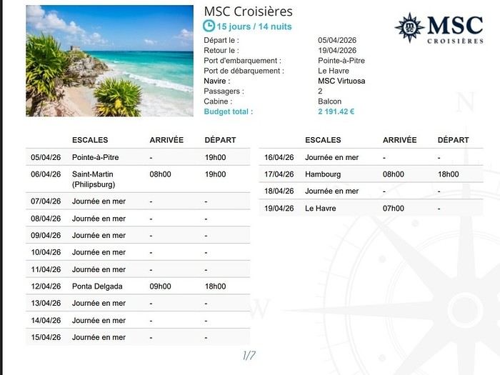
But as I mentioned, it wasn’t about the itinerary. It was really about taking a break and unwinding. Honestly, I came back thrilled.
Departure and boarding details to come
As promised, here’s my review of the cruise I took from the 5th to the 19th on the MSC Virtuosa.
As you know, I had initially booked a cruise with Mein Schiff departing from Dubai (from Dubai to Cape Town). It was a 22-day cruise. Due to the issues in the Persian Gulf, my cruise was canceled by Mein Schiff.
So, we started looking for a Plan B because we really wanted to go. Especially my wife, who had just had a minor procedure and needed some rest. Since she had already taken time off, she was determined to travel. However, we were looking for an affordable Plan B since we weren’t sure when Mein Schiff or the airline would reimburse us.
While browsing online, I found a 15-day cruise departing from Pointe-à-Pitre (including flights, transfers, the cruise, and drinks) for a price of 1,200 € in a Fantastica balcony cabin. We thought, *Why not?*
I should mention that I’m not usually a big fan of MSC. My last experience with them was post-Covid (I took two cruises, one in 2021 and another in 2022), and it was honestly a disaster. We didn’t want to repeat that, but after talking to Catherine, who told me she was very happy with a short Christmas cruise, we decided to give it a try.
I have to say, I was left speechless. Honestly, the cruise was absolutely perfect. There’s nothing to complain about (or just a few minor details). In terms of service and food, I felt like I was on a premium cruise line. I’d even say MSC has nothing to envy from some of those companies. While premium lines like Holland, Celebrity, and Royal are cutting back on services, I think MSC has made huge improvements. Seriously, I wasn’t expecting this at all. You’ll see what I mean as we chat more.
I won’t do a full review like I usually do because there weren’t many stops: 1. We boarded in Pointe-à-Pitre 2. We stopped in Saint-Martin 3. Then it was a direct crossing to the Azores...
This cruise was really about relaxing, even if it’s not the kind of trip we usually take.
First off, I’m not a big fan of "flight and cruise" packages. I asked if we could leave two days early, but they said it wasn’t possible. We had to take the flight, then the bus, and board the ship directly.
It’s not really my thing, but given the price we paid and since we really wanted to relax, we thought, *Why not?*
Here’s the itinerary:
Boarding in Pointe-à-Pitre Saint-Martin Five days at sea The Azores Four days at sea Hamburg One day at sea Le Havre
But as I mentioned, it wasn’t about the itinerary. It was really about taking a break and unwinding. Honestly, I came back thrilled.
Departure and boarding details to come
Storm in the Canary Islands
15 days across Gran Canaria, El Hierro, and a dash of Tenerife under the storm Thérèse!
The planned itinerary will be slightly disrupted...
(The version without discussions is here)
The planned itinerary will be slightly disrupted...
(The version without discussions is here)
Gran Canaria... a trip that wasn't exactly thrilling
Okay, it wasn’t a total disaster either. Actually, I hesitated before starting this travel journal: is it even worth writing about a holiday that won’t leave an unforgettable memory?
In the end, I went for it (there aren’t many recent travel journals about this destination).
So, read on... or don’t .
Every time we’ve been to the Canary Islands, it’s been by default (basically: where can we go in winter or early spring when we only have a week—so not too far, not too much jet lag, but with decent weather?).
This time, we had two weeks, but the winter plan kept changing: first Thailand (dropped for personal reasons), then Martinique (dropped because of work leave dates that weren’t up to me), and finally, the Canary Islands.
We’ve already been to Tenerife (which we really liked) and Lanzarote (which we liked a little less). This year, two options: Gran Canaria or one of the smaller islands west of Tenerife (La Palma, or even La Gomera or El Hierro). We chose Gran Canaria... not sure it was the right call! Whose fault is it? Storm Thérèse’s! Yes, Storm Thérèse followed us on arrival, and its effects lasted quite a while. We had to adapt, cancel visits, change activities...
But even without Thérèse...
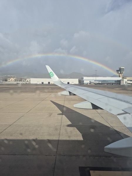
Saturday 21/03 Departure from Orly at 6:10 AM with Transavia. The plane took off on time and landed a little early, tossed around by strong winds before touching down. It had just rained, but it was (almost) no longer raining.
We quickly picked up our luggage and then the car at the Cicar counter. We got a Seat Arona instead of the Corsa we’d booked. Well, while the driving position didn’t feel great at first (I got used to it), the engine’s smoothness and power were much appreciated on the island’s winding and sometimes steep roads.
It was only 10 AM, and we couldn’t theoretically check into our accommodation until 3 PM (the owner promised to message me if it was ready earlier). So, we headed to the (big) *Jardín Botánico Viera y Clavijo*, where we planned to spend a few hours. We found a huge parking lot... empty. The passenger in the car in front of us (yes, we weren’t the only ones at the closed gate—there was a car in front and one behind) went to ask for info: it was closed due to the storm 😕. So, we calmly headed toward Puerto de las Nieves, on the northwest coast of the island.
The plan: go to a restaurant, visit the village, and do some shopping while waiting for early afternoon. As soon as we got out of the car, it started raining... we took shelter under the awning of a shop, waiting for it to pass. But the rain turned into a downpour, and within minutes, awning or not, Gore-Tex or not, we were soaked!
Since we were already wet, we might as well go to the restaurant—they weren’t far! But here’s the thing: contrary to what Google Maps said, they all opened at 1 PM, not noon! Back to the car, wading through 5 cm of water because all the village streets were flooded . The rain let up, we did some shopping, went to eat, and I got a message from the owner saying the accommodation was ready 🙂.
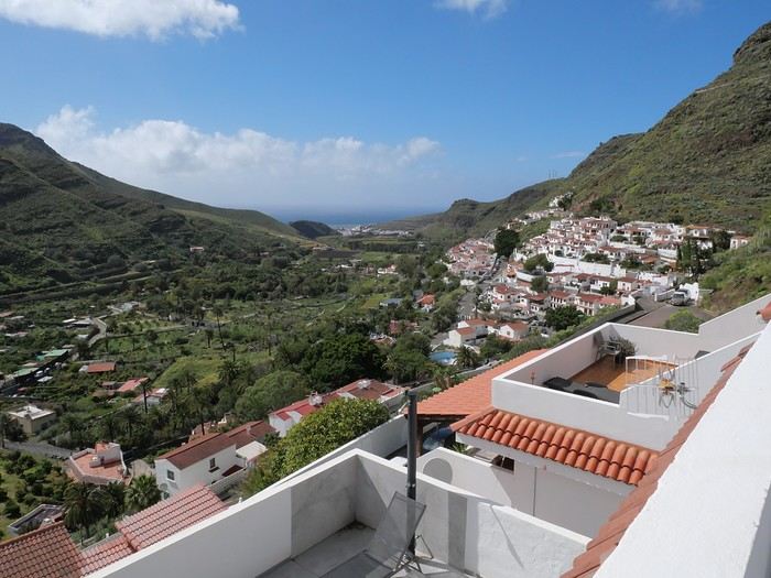
So, off we went to La Suerte, a few kilometers north of Agaete. The downside of the place, especially with luggage, is that you have to climb several flights of stairs via an outdoor staircase (after parking more or less far away on a steep street) to get there 😛). Of course, on the way from the car to the apartment, it started pouring again—the bags got soaked! Enough rain for today! We settled in quietly, and by late afternoon, we could (finally!) go admire the view from the terrace.
Every time we’ve been to the Canary Islands, it’s been by default (basically: where can we go in winter or early spring when we only have a week—so not too far, not too much jet lag, but with decent weather?).
This time, we had two weeks, but the winter plan kept changing: first Thailand (dropped for personal reasons), then Martinique (dropped because of work leave dates that weren’t up to me), and finally, the Canary Islands.
We’ve already been to Tenerife (which we really liked) and Lanzarote (which we liked a little less). This year, two options: Gran Canaria or one of the smaller islands west of Tenerife (La Palma, or even La Gomera or El Hierro). We chose Gran Canaria... not sure it was the right call! Whose fault is it? Storm Thérèse’s! Yes, Storm Thérèse followed us on arrival, and its effects lasted quite a while. We had to adapt, cancel visits, change activities...
But even without Thérèse...
Saturday 21/03 Departure from Orly at 6:10 AM with Transavia. The plane took off on time and landed a little early, tossed around by strong winds before touching down. It had just rained, but it was (almost) no longer raining.
We quickly picked up our luggage and then the car at the Cicar counter. We got a Seat Arona instead of the Corsa we’d booked. Well, while the driving position didn’t feel great at first (I got used to it), the engine’s smoothness and power were much appreciated on the island’s winding and sometimes steep roads.
It was only 10 AM, and we couldn’t theoretically check into our accommodation until 3 PM (the owner promised to message me if it was ready earlier). So, we headed to the (big) *Jardín Botánico Viera y Clavijo*, where we planned to spend a few hours. We found a huge parking lot... empty. The passenger in the car in front of us (yes, we weren’t the only ones at the closed gate—there was a car in front and one behind) went to ask for info: it was closed due to the storm 😕. So, we calmly headed toward Puerto de las Nieves, on the northwest coast of the island.
The plan: go to a restaurant, visit the village, and do some shopping while waiting for early afternoon. As soon as we got out of the car, it started raining... we took shelter under the awning of a shop, waiting for it to pass. But the rain turned into a downpour, and within minutes, awning or not, Gore-Tex or not, we were soaked!
Since we were already wet, we might as well go to the restaurant—they weren’t far! But here’s the thing: contrary to what Google Maps said, they all opened at 1 PM, not noon! Back to the car, wading through 5 cm of water because all the village streets were flooded . The rain let up, we did some shopping, went to eat, and I got a message from the owner saying the accommodation was ready 🙂.
So, off we went to La Suerte, a few kilometers north of Agaete. The downside of the place, especially with luggage, is that you have to climb several flights of stairs via an outdoor staircase (after parking more or less far away on a steep street) to get there 😛). Of course, on the way from the car to the apartment, it started pouring again—the bags got soaked! Enough rain for today! We settled in quietly, and by late afternoon, we could (finally!) go admire the view from the terrace.
Accommodation, hiking, and solo travel questions for Santo Antão
Hi there, for those who’ve been recently—is it possible to find other solo travelers in March on the island to share transport or room costs? It doesn’t seem easy to travel on a budget.
If you have any recommendations for simple lodgings or places with dorms, I’d love to hear them.
For those who’ve done multi-day treks while moving around: do you need to bring your own sleeping bag? I’d love to hear about itineraries you’ve done without a guide, just with a map and GPS.
Thanks, and have a great day!
CAPE VERDE 2025: 3 weeks, 4 islands.
And we still haven’t seen everything!
Before setting off for new horizons at the end of this year, it’s time for me to share my trip to Cape Verde this summer 2025.
I particularly love these spontaneous trips, and our stay in Cape Verde is one of those because it was only at the beginning of April that we decided on this getaway, which had been catching our eye for a while, given our love for the mountains.
As always—well, when it’s open—I turned to VF, and I want to immediately thank Marie, aka ptitortue, who helped me a lot in planning this trip through her travel journals and our exchanges!
Because Cape Verde is both small and vast! We decided not to rush from one airport to another, to enjoy the places and the people, but also to relax, since the work backlog from being stuck in May (see my previous travel journal 😅) had to be caught up on in June.
So, 4 islands will be our winners from 06/28 to 07/19:
Santiago first for logistical reasons, as round-trip flights from the capital Praia were the cheapest (650 €/person from Lyon via Lisbon with TAP, still!)
São Vicente, because it’s the gateway to the next one but ultimately more than that...
Santo Antão, pretty much the main goal of the trip since Marie (and the photos) had really sold it to me.
And finally, Sal Island, for some rest—a non-negotiable condition for my other half—and we’ll see that I should’ve listened to Marie...
That said, what a chatterbox I am—buckle up, flight attendants at the doors, off we go on new beautiful escapes! (Thanks to Sophie for the easy loan)
Last note for my eager fan club 😏: yes, there will be alcohol—how could there not be in the land of grogue!
It starts here:
https://voyageforum.com/v.f?post=10790234;a=10790234

I particularly love these spontaneous trips, and our stay in Cape Verde is one of those because it was only at the beginning of April that we decided on this getaway, which had been catching our eye for a while, given our love for the mountains.
As always—well, when it’s open—I turned to VF, and I want to immediately thank Marie, aka ptitortue, who helped me a lot in planning this trip through her travel journals and our exchanges!
Because Cape Verde is both small and vast! We decided not to rush from one airport to another, to enjoy the places and the people, but also to relax, since the work backlog from being stuck in May (see my previous travel journal 😅) had to be caught up on in June.
So, 4 islands will be our winners from 06/28 to 07/19:
Santiago first for logistical reasons, as round-trip flights from the capital Praia were the cheapest (650 €/person from Lyon via Lisbon with TAP, still!)
São Vicente, because it’s the gateway to the next one but ultimately more than that...
Santo Antão, pretty much the main goal of the trip since Marie (and the photos) had really sold it to me.
And finally, Sal Island, for some rest—a non-negotiable condition for my other half—and we’ll see that I should’ve listened to Marie...
That said, what a chatterbox I am—buckle up, flight attendants at the doors, off we go on new beautiful escapes! (Thanks to Sophie for the easy loan)
Last note for my eager fan club 😏: yes, there will be alcohol—how could there not be in the land of grogue!
It starts here:
https://voyageforum.com/v.f?post=10790234;a=10790234
Join me in discovering Gran Canaria
Introduction
We stayed on the island of Gran Canaria during the first three months of 2024. It’s the third Canary Island we’ve visited, after Tenerife and Lanzarote.
We rented an apartment in Temisas. By staying in the same place for such a long period, the total price dropped by 50%.
We also rented a vehicle to make getting around the island easier.
Why the Canary Islands, and Gran Canaria in particular? For its pleasant climate, the nature and diversity of its landscapes, the charming villages, and especially the beauty of its many beaches.
In this travel journal, you’ll find a list of the many activities we did during our stay to explore the different attractions of this island.
These attractions are categorized to make it easier to find what interests you.
Videos are included throughout the summary. Click on the image to start the video.
To jump to a specific post, here are the relevant links:
HIKES:
Roque Nublo Maspalomas Dunes - Part 1 Maspalomas Dunes - Part 2 Los Azulejos de Veneguera Barranco de Las Vacas Ventana del Bentayga (Arco del Aserrador) Caves of the King Ventana de Morro (Ventana de la Ganifa) The Dog of Bentayga Cave of the Four Doors Ventana del Nublo Artenera - Caves of Acusa Seca Temisas - El Gigante Cave Fortress of Ansite Puerto de Las Nieves - Roque de Las Nieves Temisas - Cuevas de la Audiencia Roque Bentayga Guayadeque Ravine (Guayadeque Hermitage) Guayadeque Ravine (Cueva de Bartalo) El Zumacal - Barranco Tauco Casablanca Dam (Los Dolores Dam) Ayagaures - La Angostura Dam & Gambuesa Dam Santa Brígida - Alonso Ravine & Centennial Dragon Tree Pino Santo Hike in the Azuaje Ravine Gáldar - Red Lands of Samarrita Tejeda - Charco de La Paloma Bandama Boiler (Camino Borde de Caldera Bandama) Teror - Alamo Ravine Trail – SL-4 Telde - Calasio Caves Special Natural Reserve of Los Tilos de Moya Los Azulejos - Charco de Las Aneas Fataga Ravine Arinaga Military Battery Trail Maspalomas - Las Fuentes and del Canizo Ravines Mogán - Tauro Mountain Trail Tamabada - Llanos de La Mimbre & Sobre la Cueva Viewpoints Trail Hike to the Coronadero Arch via Barranco Hondo Barranco de Silva - Hike to the Jerez Caves Gáldar - Samson Cave - La Atalaya Peak Agaete - Roque Guayedra and Guayedra Ravine Artenara - Caballero Caves Arucas - Bufadero Salt Flats Barranco de Pino Gordo - Natural Pools Telde - Los Cernícalos Ravine Las Cruces - Toba Caves & Picón Puerto de Las Nieves - Moro Cave Agüimes - Morros de Ávila Caves Juncalillo del Sur - Laguna & Salinas de Abajo Caves of Camino de San Felipe Cruz de Tejeda, Cruz Chico and Degollada Viewpoint Hike on the Patalavaca Circuit Motor Grande - Puerto Rico Arch El Montañón - Los Hornos Dam Seafront Walk - Amadores Beach – Puerto Rico Beach Las Niñas Dam El Hornillo - Omega & Omicron Caves Arteara Necropolis Mogán - El Mulato Dam Las Garzas - El Regante Dam La Plata Route - Cho Flores Dam & El Charco Hondo Vega de Acusa - La Candelaria Dam Candelaria Hermitage – Acusa Seca Viewpoint Valsequillo de Gran Canaria – Roque La Vela Ayagaures Dam – GC-602 Lomo del Palo - Monte Pavón Trail Lugar La Laguna - Levada Fataga Dam & Ravine
BEACHES:
Mogán Beach Taurito Beach Tauro Beach Amadores Beach Puerto Rico Beach Anfi del Mar Beach Patalavaca Beach Meloneras Beach Maspalomas Beach English Beach (Playa del Inglés) Las Burras Beach San Agustin Beach Las Alcaravaneras Beach Las Canteras Beach (La Cicer) Las Canteras Beach (La Puntilla) Las Canteras Beach (Santa Catalina) Aquamarina Beach El Agujero - Bocabarranco Beach Hoya Del Pozo Beach Hoya Del Pozo Beach - Lizard with amputated tail El Cabron Beach Ojos de Garza Beach El Burrero Beach
NATURAL POOLS:
Charco Azul - El Risco Agaete Salt Flats Charco de Los Espejos - Sardina del Norte Natural Pools of Punta de Gáldar Snorkeling in the natural pool of Punta de Gáldar Natural Pool La Furnia o El Clavo - Gáldar Natural Pool of Los Dos Roques Emiliano Natural Pool - El Agujero Natural Pool of El Agujero Natural Pools of Roque Prieto Natural Pool El Altillo Los Charcones de Bañaderos – Arucas Natural Pools of El Charco de Las Palomas – Arucas Natural Pools of La Laja - Las Palmas de Gran Canaria Cueva de la Reina Mora - La Garita Natural Pools of Castillo del Romeral
TOWNS:
Center
Santa Brigida Vega de San Mateo Tejeda Artenara Vallesco Teror
Southwest
Santa Lucia de Tirajana Fataga San Bartolomé de Tirajana Puerto de Mogán La Aldea de San Nicolas
North
Arucas Firgas Moya Santa Maria de Guia Gáldar Agaete Puerto de Las Nieves
East
Vegueta - Las Palmas de Gran Canaria Triana - Las Palmas de Gran Canaria Ciudad Jardin - Las Palmas de Gran Canaria Canteras - Las Palmas de Gran Canaria Telde Valsequillo de Gran Canaria Ingenio Agüimes Temisas
VIEWPOINTS:
GC-60 Route (or nearby) GC-210 Route (or nearby) GC-210 Route between the tunnel and La Aldea de San Nicolás GC-215 & GC-65 Routes (or nearby) GC-200 Route (or nearby) GC-130 Route (or nearby) & GC-605 GC-70 Route (or nearby) & GC-21 Sheep herd on GC-70 Route GC-150, GC-240, GC-305, GC-350 & GC-301 Routes GC-606, GC-295, GC-231 and GC-41 Routes (or nearby) Viewpoints – GC-1 Route (or nearby) Viewpoints - Las Palmas de Gran Canaria Viewpoints - GC-2, GC-21, GC-15, GC-216 and GC-132 Routes (or nearby) Viewpoints - GC-503 & GC-217 Routes Viewpoints - GC-604, GC-505, GC-132, GC-42 and GC-802 Routes
MISCELLANEOUS:
San Rafael Aqueduct - Telde Abandoned San Rafael Estate - La Higuera Cenobio de Valerón La Cesta - Tejeda Puerto de la Aldea Scenic Route GC-671 to El Espinillo Scenic Route GC-607 to El Chorrillo The Galdar Cube (Santiago Quarry) Scenic Route GC-504 to Ayagaures Abandoned seaside resort in the Azuaje Ravine El Bufadero de La Garita – Telde GC-505 Route Abandoned Finca Las Haciendas (Los Mocanes) – Las Vegas de Valsequillo Ruins of San Juan Battery - Las Palmas de Gran Canaria Viera y Clavijo Canarian Botanical Garden - Las Palmas de Gran Canaria Tenefé Salt Flats Los Pérez, Lugarejos & Las Hoyas Dams Monte Pavón, Gran Canaria’s little Ireland Valleseco Lagoon Recreational Area Climbing - Fataga Ravine Surfing – El Agujero El Cairete Restaurant - Carrizal de Tejeda Paragliding flight observation - Los Giles La Cuevita Ayagaures Restaurant Statues and Murals - Cruce de Arinaga Aviation Monument (Las Majoreras) & Murals – Carrizal Artistic recycling by Antonio Peñita - Ojos de Garza Rainbows
We stayed on the island of Gran Canaria during the first three months of 2024. It’s the third Canary Island we’ve visited, after Tenerife and Lanzarote.
We rented an apartment in Temisas. By staying in the same place for such a long period, the total price dropped by 50%.
We also rented a vehicle to make getting around the island easier.
Why the Canary Islands, and Gran Canaria in particular? For its pleasant climate, the nature and diversity of its landscapes, the charming villages, and especially the beauty of its many beaches.
In this travel journal, you’ll find a list of the many activities we did during our stay to explore the different attractions of this island.
These attractions are categorized to make it easier to find what interests you.
Videos are included throughout the summary. Click on the image to start the video.
To jump to a specific post, here are the relevant links:
HIKES:
Roque Nublo Maspalomas Dunes - Part 1 Maspalomas Dunes - Part 2 Los Azulejos de Veneguera Barranco de Las Vacas Ventana del Bentayga (Arco del Aserrador) Caves of the King Ventana de Morro (Ventana de la Ganifa) The Dog of Bentayga Cave of the Four Doors Ventana del Nublo Artenera - Caves of Acusa Seca Temisas - El Gigante Cave Fortress of Ansite Puerto de Las Nieves - Roque de Las Nieves Temisas - Cuevas de la Audiencia Roque Bentayga Guayadeque Ravine (Guayadeque Hermitage) Guayadeque Ravine (Cueva de Bartalo) El Zumacal - Barranco Tauco Casablanca Dam (Los Dolores Dam) Ayagaures - La Angostura Dam & Gambuesa Dam Santa Brígida - Alonso Ravine & Centennial Dragon Tree Pino Santo Hike in the Azuaje Ravine Gáldar - Red Lands of Samarrita Tejeda - Charco de La Paloma Bandama Boiler (Camino Borde de Caldera Bandama) Teror - Alamo Ravine Trail – SL-4 Telde - Calasio Caves Special Natural Reserve of Los Tilos de Moya Los Azulejos - Charco de Las Aneas Fataga Ravine Arinaga Military Battery Trail Maspalomas - Las Fuentes and del Canizo Ravines Mogán - Tauro Mountain Trail Tamabada - Llanos de La Mimbre & Sobre la Cueva Viewpoints Trail Hike to the Coronadero Arch via Barranco Hondo Barranco de Silva - Hike to the Jerez Caves Gáldar - Samson Cave - La Atalaya Peak Agaete - Roque Guayedra and Guayedra Ravine Artenara - Caballero Caves Arucas - Bufadero Salt Flats Barranco de Pino Gordo - Natural Pools Telde - Los Cernícalos Ravine Las Cruces - Toba Caves & Picón Puerto de Las Nieves - Moro Cave Agüimes - Morros de Ávila Caves Juncalillo del Sur - Laguna & Salinas de Abajo Caves of Camino de San Felipe Cruz de Tejeda, Cruz Chico and Degollada Viewpoint Hike on the Patalavaca Circuit Motor Grande - Puerto Rico Arch El Montañón - Los Hornos Dam Seafront Walk - Amadores Beach – Puerto Rico Beach Las Niñas Dam El Hornillo - Omega & Omicron Caves Arteara Necropolis Mogán - El Mulato Dam Las Garzas - El Regante Dam La Plata Route - Cho Flores Dam & El Charco Hondo Vega de Acusa - La Candelaria Dam Candelaria Hermitage – Acusa Seca Viewpoint Valsequillo de Gran Canaria – Roque La Vela Ayagaures Dam – GC-602 Lomo del Palo - Monte Pavón Trail Lugar La Laguna - Levada Fataga Dam & Ravine
BEACHES:
Mogán Beach Taurito Beach Tauro Beach Amadores Beach Puerto Rico Beach Anfi del Mar Beach Patalavaca Beach Meloneras Beach Maspalomas Beach English Beach (Playa del Inglés) Las Burras Beach San Agustin Beach Las Alcaravaneras Beach Las Canteras Beach (La Cicer) Las Canteras Beach (La Puntilla) Las Canteras Beach (Santa Catalina) Aquamarina Beach El Agujero - Bocabarranco Beach Hoya Del Pozo Beach Hoya Del Pozo Beach - Lizard with amputated tail El Cabron Beach Ojos de Garza Beach El Burrero Beach
NATURAL POOLS:
Charco Azul - El Risco Agaete Salt Flats Charco de Los Espejos - Sardina del Norte Natural Pools of Punta de Gáldar Snorkeling in the natural pool of Punta de Gáldar Natural Pool La Furnia o El Clavo - Gáldar Natural Pool of Los Dos Roques Emiliano Natural Pool - El Agujero Natural Pool of El Agujero Natural Pools of Roque Prieto Natural Pool El Altillo Los Charcones de Bañaderos – Arucas Natural Pools of El Charco de Las Palomas – Arucas Natural Pools of La Laja - Las Palmas de Gran Canaria Cueva de la Reina Mora - La Garita Natural Pools of Castillo del Romeral
TOWNS:
Center
Santa Brigida Vega de San Mateo Tejeda Artenara Vallesco Teror
Southwest
Santa Lucia de Tirajana Fataga San Bartolomé de Tirajana Puerto de Mogán La Aldea de San Nicolas
North
Arucas Firgas Moya Santa Maria de Guia Gáldar Agaete Puerto de Las Nieves
East
Vegueta - Las Palmas de Gran Canaria Triana - Las Palmas de Gran Canaria Ciudad Jardin - Las Palmas de Gran Canaria Canteras - Las Palmas de Gran Canaria Telde Valsequillo de Gran Canaria Ingenio Agüimes Temisas
VIEWPOINTS:
GC-60 Route (or nearby) GC-210 Route (or nearby) GC-210 Route between the tunnel and La Aldea de San Nicolás GC-215 & GC-65 Routes (or nearby) GC-200 Route (or nearby) GC-130 Route (or nearby) & GC-605 GC-70 Route (or nearby) & GC-21 Sheep herd on GC-70 Route GC-150, GC-240, GC-305, GC-350 & GC-301 Routes GC-606, GC-295, GC-231 and GC-41 Routes (or nearby) Viewpoints – GC-1 Route (or nearby) Viewpoints - Las Palmas de Gran Canaria Viewpoints - GC-2, GC-21, GC-15, GC-216 and GC-132 Routes (or nearby) Viewpoints - GC-503 & GC-217 Routes Viewpoints - GC-604, GC-505, GC-132, GC-42 and GC-802 Routes
MISCELLANEOUS:
San Rafael Aqueduct - Telde Abandoned San Rafael Estate - La Higuera Cenobio de Valerón La Cesta - Tejeda Puerto de la Aldea Scenic Route GC-671 to El Espinillo Scenic Route GC-607 to El Chorrillo The Galdar Cube (Santiago Quarry) Scenic Route GC-504 to Ayagaures Abandoned seaside resort in the Azuaje Ravine El Bufadero de La Garita – Telde GC-505 Route Abandoned Finca Las Haciendas (Los Mocanes) – Las Vegas de Valsequillo Ruins of San Juan Battery - Las Palmas de Gran Canaria Viera y Clavijo Canarian Botanical Garden - Las Palmas de Gran Canaria Tenefé Salt Flats Los Pérez, Lugarejos & Las Hoyas Dams Monte Pavón, Gran Canaria’s little Ireland Valleseco Lagoon Recreational Area Climbing - Fataga Ravine Surfing – El Agujero El Cairete Restaurant - Carrizal de Tejeda Paragliding flight observation - Los Giles La Cuevita Ayagaures Restaurant Statues and Murals - Cruce de Arinaga Aviation Monument (Las Majoreras) & Murals – Carrizal Artistic recycling by Antonio Peñita - Ojos de Garza Rainbows
Madeira Between Lockdowns - July-August 2021
Hi there,
I'm starting a new travel journal with my itinerary and memories in mind, and maybe a few photos if I can find some.
The context:
April 2020, I was supposed to go to Uzbekistan, and October 2020 to Texas: both canceled due to COVID. Summer vacations in 2020 weren’t gonna be fun. Optimistic, I’d rescheduled both trips for roughly the same dates in 2021: the first was canceled again because of COVID, the second due to U.S. entry conditions (still COVID-related!). Summer vacations in 2021 *had* to be more fun, or I was gonna lose it!!! Plus, our parents are dealing with health issues, which is weighing us down—we really need to get away!
So I looked into where we could go, somewhere we could live almost normally. I saw that Madeira had implemented strict COVID measures but that life on the island was pretty chill afterward. For me, Madeira = sun + hiking + landscapes. BINGO.
Day 1: The flight and arrival on the island
Flight with TAP via Lisbon, departing around noon. We wore our masks properly on the plane. (My last flight was to Portugal, and I told myself I’d break the jinx and leave COVID behind us.) Layover in Lisbon, then an afternoon flight to Madeira. The landing went smoothly, no wind. Cristiano Ronaldo Airport in Funchal is known for being one of the trickiest in the world due to crosswinds. The checks were standard, except COVID added an extra step. Before the trip, I had to fill out a questionnaire (Madeira Safe). Once there, a group of young people—probably students—greeted us, each with a tablet. The health questionnaire and vaccine check were super quick. Then we saw a doctor, and just like that, we were wished a great stay. Honestly, it was so well organized that it only took 10 minutes. We wouldn’t put our masks back on until we returned!
A taxi took us to our hotel in the hills above Funchal—a pretty upscale place, which isn’t our usual style, but we needed it this time! Dinner on the hotel terrace with the city at our feet. Amazing!
HOTEL: Quinta da Bela Vista
The +: We’re traveling!!! The -: Nothing.
The context:
April 2020, I was supposed to go to Uzbekistan, and October 2020 to Texas: both canceled due to COVID. Summer vacations in 2020 weren’t gonna be fun. Optimistic, I’d rescheduled both trips for roughly the same dates in 2021: the first was canceled again because of COVID, the second due to U.S. entry conditions (still COVID-related!). Summer vacations in 2021 *had* to be more fun, or I was gonna lose it!!! Plus, our parents are dealing with health issues, which is weighing us down—we really need to get away!
So I looked into where we could go, somewhere we could live almost normally. I saw that Madeira had implemented strict COVID measures but that life on the island was pretty chill afterward. For me, Madeira = sun + hiking + landscapes. BINGO.
Day 1: The flight and arrival on the island
Flight with TAP via Lisbon, departing around noon. We wore our masks properly on the plane. (My last flight was to Portugal, and I told myself I’d break the jinx and leave COVID behind us.) Layover in Lisbon, then an afternoon flight to Madeira. The landing went smoothly, no wind. Cristiano Ronaldo Airport in Funchal is known for being one of the trickiest in the world due to crosswinds. The checks were standard, except COVID added an extra step. Before the trip, I had to fill out a questionnaire (Madeira Safe). Once there, a group of young people—probably students—greeted us, each with a tablet. The health questionnaire and vaccine check were super quick. Then we saw a doctor, and just like that, we were wished a great stay. Honestly, it was so well organized that it only took 10 minutes. We wouldn’t put our masks back on until we returned!
A taxi took us to our hotel in the hills above Funchal—a pretty upscale place, which isn’t our usual style, but we needed it this time! Dinner on the hotel terrace with the city at our feet. Amazing!
HOTEL: Quinta da Bela Vista
The +: We’re traveling!!! The -: Nothing.
18 days in Cape Verde in January 2025
Hello,
We’ve just returned (2 senior couples) from 18 days in Cape Verde (21/01 to 7/02) that we really enjoyed. The temperature was great—20° to 27°—admittedly a bit windy at times, but the friendliness of the Cape Verdeans made up for it.
Paris Orly, direct flight with Transavia (cheap if you book in advance). We landed in São Vicente, with a 12 € city transfer. We had a fantastic 2-bedroom apartment in downtown Mindelo—Av. Fernando Ferreira Fortes, "Casa So Morabeza"—for 58 € per night. The owner lives in France and communicates instantly via WhatsApp.
We spent 2 days exploring the (beautiful) city of Mindelo and its port activity, plus a private taxi tour of the island (6000 CVE for the day).
Then we took the Armas ferry (recommended company—1500 CVE) to Santo Antão.
From there, a collectivo (450 CVE per person) took us to Ribeira Grande, a central base for hikes.
We stayed in a brand-new, modern, and well-equipped 2-bedroom apartment—*Apartamentos Modernos*—for 6770 CVE per night, staying 6 nights. I highly recommend it for its location in town and proximity to *aluguers* and *collectivos* for hiking.
The hikes were stunning:
- The coastal trail from Fontainhas to Cruzinha (taxi for 1500 CVE)
- The route from Corda to Coculi (taxi for 2000 CVE + 100 CVE per person for the return)
- The trail from Cova to Cidade de Pombas (taxi for 2000 CVE + 100 CVE per person for the return)
- The hike from Miradouro to Ribeira Grande (taxi for 2000 CVE)
- The coastal road from Ribeira Grande to Ponta do Sol (visit and lunch at *Mini Familiar* in the city center—excellent and affordable) for the round trip.
Ribeira Grande has plenty of restaurants, but avoid *5 de Julho*—it’s loud and slow.
We loved: *Bellcanto*, *Cantinho da Amizade*, and *Boca-Fina Churrasqueria*.
Meals with drinks cost around 800–1000 CVE.
Back to São Vicente by ferry (1500 CVE), then an airport transfer (12 €) and a flight (99 €) to Santiago’s Praia. The airport-to-city transfer was 15 €.
We stayed at *Kelly’s* in Plato, Praia, which was disappointing—not ideal for two couples—but well-located.
One day was spent visiting the massive *Suspicia* market, then a collectivo to Cidade Velha (2 x 200 CVE round trip per person). We hiked up to the fort, explored *Rua Banana*, and had lunch at *Praça do Mar* by the beach.
We rented a car for 6 days (29000 CVE) from *Slimpycar* in Praia.
On Saturday, we visited the huge *Assomada* market—don’t miss it!—then hiked to *Boa Entrada* and *Poilon*, the largest and most impressive tree we’ve ever seen.
We stayed for 2 nights (138 €) in a beautiful valley in *Picos*—a spacious, lovely house with 2 bedrooms, 2 bathrooms, and a large living area, surrounded by nature and animals.
Lina, the charming neighbor, prepared dinner (8.50 €) and breakfast (4.50 €) for us.
Next, we headed to *Tarrafal*, stopping to visit the concentration camp (500 CVE)—a must-see—before arriving.
We spent 3 nights (184 €) in a fantastic house called *"Maison Familiale"*—huge, with 3 bedrooms, 2 bathrooms, 2 kitchens, 5 toilets, and a large terrace with sea views. It was absolutely stunning and very close to the beach and numerous restaurants.
We did a beautiful 3.8 km hike to the *Farol da Ponta Preta* lighthouse.
Tarrafal’s beach is lively and pleasant, with bars, restaurants, and even acrobats!
We also explored *Ribeira da Prata* to see the *Piscina Natural de Cuba* (not easy to find).
We loved discovering isolated villages like *Ponta Furna*, *Ponta Labrão*, and *Fazenda*.
For food, I recommend *Mira Mar* at *Mama’s*.
On the way back to Praia, we took the east coast route via *Calheta de São Miguel*, *Pedra Badejo*, and *Praia Baixo*—nothing extraordinary, just a rugged, wild coastline with beaches that seemed a bit tricky to access.
Our last evening in Praia was nice. The seaside esplanade was lively, and many Cape Verdeans were swimming at *Prainha* beach, which seemed very accessible and safe.
If you’d like more info—addresses, etc.—feel free to message me privately. I’ll respond.
Jacquesler.
3 weeks camping in the Azores, August 2024
Hi everyone,
So glad this forum is back up! Here’s a recap of our three little weeks in the Azores in August 2024, camping on Terceira, Flores/Corvo, and São Miguel, with a special focus on the camping side—something I struggled to find info on before we left.
As others have mentioned, a trip to the Azores isn’t something you can improvise last-minute, especially in August. The rental car fleet is limited, so prices go up as availability drops, and vacation rentals/hotels are scarce. Plus, inter-island flights and ferries aren’t exactly frequent. I picked our destination in mid-April, and there were already few rental car options left (some local companies had nothing), and no accommodations on Flores for our dates—or only very expensive ones requiring multiple location changes. Since we love camping, we decided to bring our gear without really knowing what to expect.
Flight with TAP (426 €): Outbound: Lyon → Lisbon → Terceira Return: São Miguel → Lisbon (9-hour stopover for a quick visit) → Lyon
Inter-island flights with SATA: Terceira → Flores (via Horta): 87 € Flores → São Miguel: 90 €
I rented all three cars from the same local company, Ilha Grande—they weren’t picky about the car’s condition. For a Clio (or similar): Terceira (4 days): 461 € Flores (5 days): 623 € São Miguel (8 days): 730 €
Weather: The first two weeks were gorgeous—blue skies, no rain, and even hotter than we expected, around 30°C (temperatures barely dropped at night). The last week of August brought more fine rain (mostly at night) and temps between 20 and 25°C (a light jacket was nice in the mornings and evenings).
TERCEIRA: A great introduction! When I looked at what each island had to offer, Terceira wasn’t at the top of my list, but flying into Terceira cut costs and fit our schedule well, so we spent 4 days there. It turned out to be a lovely start.
For camping, we stayed at Salga Campismo in Porto Judeu, 20 minutes from the airport. We discovered that the island’s campsites were packed with locals—extended families or groups of friends having big, festive gatherings with barbecues and long tables. They spend their summers camping instead of at home, and some even commute to work from there. They had huge tents for sleeping, plus tarps for cooking and relaxing—way more gear than the tourists. Since the week of August 15th is peak vacation time (like in France), we struggled to find a spot, and the nights were pretty noisy. This was the only campsite of the trip with numbered pitches. It’s right by the ocean, next to natural pools. Facilities were decent, with hot showers and picnic tables. Lots of shaded spots. Cost: 4 € per small tent + 2 € per person. Electrical outlets were free (20 € deposit). During our explorations, we passed by Cinco Ribeiras campsite (west coast), which seemed similar.
Camping gas: Always ask the campsite reception if any travelers left a gas canister before buying a new one! Before the trip, I emailed each island’s tourism office, and they gave me addresses for Campingaz bottles. On Terceira, No. 13 Rua João Vaz Corte Real in Angra do Heroísmo (an agricultural store in the industrial zone). CV300 cartridge: 10 €. Note: The tourism office gave me the name of the neighboring store, which didn’t carry that brand.
Fridge: No fridges at any campsite on any island. We had a foldable cooler and found bags of crushed ice in supermarkets’ fish sections.
Things to see: Key takeaway: Do the must-see spots early in your stay in case the weather doesn’t cooperate. We were lucky and saw all the viewpoints without clouds—apparently not always the case!
Our main visits/hikes on Terceira: Miradouro Serra do Cume (a must—*the* iconic Terceira photo)
Furnas do Enxofre (free): Few fumaroles, but a pretty 1 km walk through moss and endemic plants. Hike PRC01 TER – Misterios Negros (some acrobatic sections, but a very scenic path). Monte Brasil + Angra do Heroísmo: Lovely town. Hike PR02 TER – Baía da Agualva: Nice, but not much shade (along the coast). Quatro Ribeiras: Church and swimming in natural pools. Biscoitos natural pools: Too touristy (but still free).
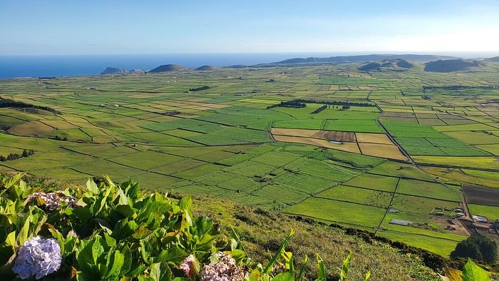
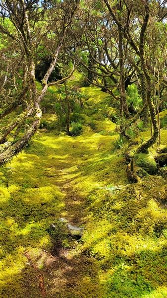
FLORES: Our favorite! This was the island I *had* to visit, and we weren’t disappointed—no mass tourism, just stunning nature.
For camping, we chose Santa Cruz campsite. Unlike Terceira, it was only tourists here. Very little shade, but ocean views. Modern facilities with hot showers, clotheslines, and a charging station. A big area with picnic tables, each with a barbecue and sink, all sheltered. Right across from gorgeous natural pools. FREE (you can leave a tip for the caretaker).
For Campingaz, the campsite manager stores canisters and gear left by campers. Otherwise, you can find them at Movipesca.
During a hike, we passed by Fajã Grande campsite (campsites here double as picnic spots for everyone). It’s terraced, with no shade, but very clean facilities and a small bar/restaurant nearby. Natural pools across the street. When we stopped by midday, there were only a few tents. Fajã Grande felt even quieter than Santa Cruz, with just one supermarket.
We also picnicked at Ponta Delgada campsite in the north. Impeccable facilities, lots of picnic tables with barbecues. Empty when we were there. A bit out of the way.
Rental car or not on Flores? Given the high cost, I really debated whether we needed a car. In Santa Cruz, the port, airport, and supermarkets are walkable, and the most famous hikes are one-way, not loops. So I contacted a taxi (the tourism office emails a list of drivers—they don’t wait for customers; you have to call). Prices were around 20 € for Santa Cruz to Fajã Grande, for example. That means you could take several taxi trips before the rental car (over 100 €/day) pays off. But it does mean planning your route and schedule in advance, leaving little room for spontaneity. The taxi I contacted was already booked solid in July, so I decided to keep the car and adjust our hikes to make loops. (FYI, we’re in our 50s, two couples splitting costs—maybe a different calculation if we were 25!) No regrets—it gave us way more freedom.
Our main visits/hikes:
Hike (amazing): Poço da Ribeira do Ferreiro (the iconic waterfalls) → Fajã Grande → Poço do Bacalhau (swim in the waterfall) → Aldeia da Cuada → Poço da Ribeira do Ferreiro. Hike PR04: Loop from Miradouro da Fajã de Lopo Vaz, then down to the beach via the trail. Return along the pebble beach before climbing back up. Worth it, but the descent and ascent are steep.
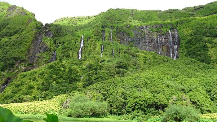 By car: Miradouro do Portal (great view of the coast to Fajã Grande) – Rocha dos Bordões (basalt columns) – Miradouro das Lagoas Rasa e Funda (a must) – Miradouro da Fajã do Conde.
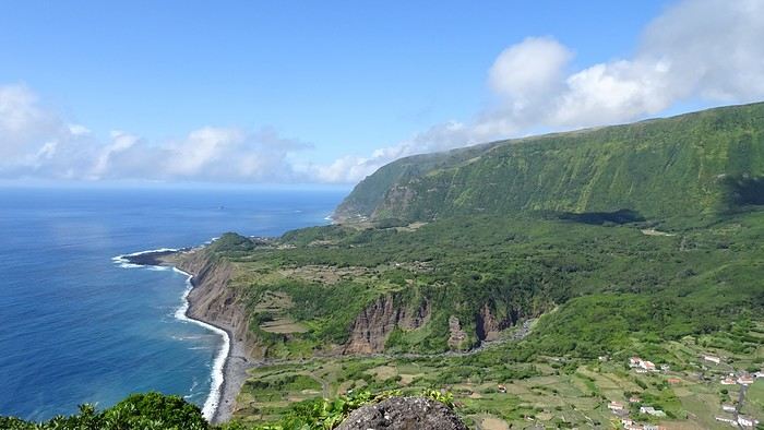 Hike: Miradouro das Lagoas Funda e Comprida, Lagoa Negra, Seca e Branda, Lagoa Branca. A bit muddy and not as memorable as other hikes. The best part (a must) is the view from the starting miradouro.
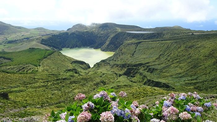
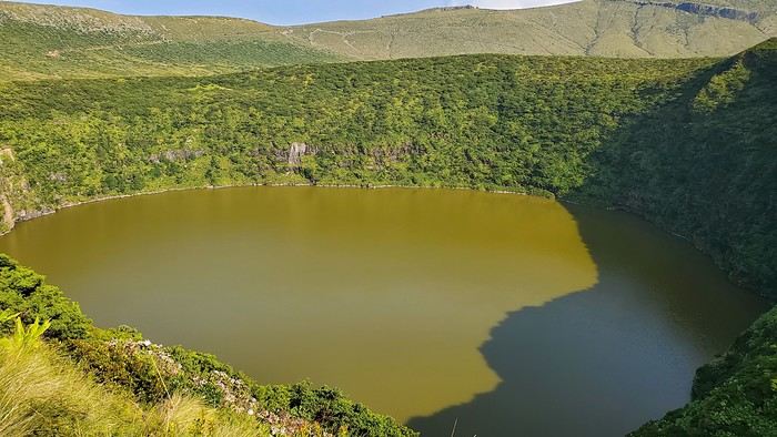
By car: The north of the island.
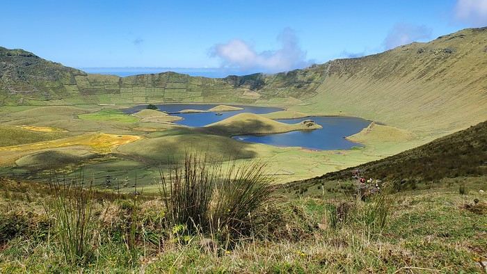
CORVO: Stunning!!
No spots left on the ferry (12 seats), so we took a tourist zodiac (booked a few weeks ahead by email, but there were still spots the day of—several boats make the trip). On the way out, we cruised along Flores’ coast to see waterfalls and caves. On the return, they looked for dolphins (we saw some! 🙂 ). Boat price: 35 € per person. At Corvo, minibuses shuttle between the port and the top of the caldera (10 € round-trip per person). Lots of people just stop at the viewpoint when the shuttle arrives, so we weren’t too crowded on the caldera hike. But it’s too tight on time to walk back down to the port. If you really want to, I think you’d need to stay overnight. All boats spend the same amount of time on the island.
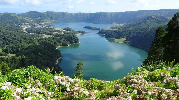
SÃO MIGUEL: Back to civilization—but not just that! São Miguel is way more touristy than the other islands (though still nothing compared to other destinations), but it’s worth it for all the natural sites.
For camping, to avoid long drives, we started at Sete Cidades campsite on the west side. A big, free, terraced campsite with some shade. We were there the last week of August, when crowds start thinning, so there was space—a mix of tourists and locals. A few picnic tables with barbecues. For facilities, one side for men, one for women, each with one toilet (cleaned regularly) and three outdoor cold showers (swimsuits recommended). You can charge your phone in the caretaker’s hut.
After exploring the west, we moved to Furnas for the rest of the trip. We arrived on a Friday night, and the campsite was packed with locals spending the weekend. It emptied out Sunday afternoon. A large, shady campsite with several bathroom blocks (hot showers). There’s a restaurant, but only two picnic tables. Cost: 3.5 € per small tent + 3.5 € per person.
Campingaz: We bought canisters at Decathlon in Ponta Delgada (next to Decathlon, there’s a big shopping center for groceries). Didn’t ask at Sete Cidades, but at Furnas, there was a closet full of gas bottles of all sizes left by campers.
Main visits/hikes: Sete Cidades and the surrounding lakes (lots of viewpoints and short hikes): Beautiful.
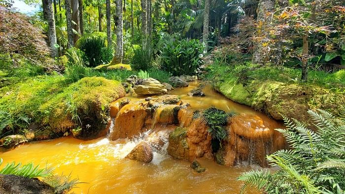
Swimming in the hot springs at Ponta da Ferraria (west side of the island).

Furnas: The lake, fumaroles, and parks (like Terra Nostra).
Lagoa do Fogo (gorgeous).
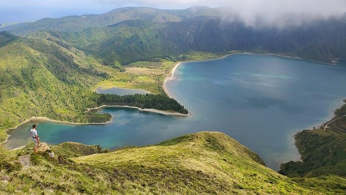
Gorreana tea factory (nice hike through the tea fields + guided tour), Ribeira Grande, Ermida de Nossa Senhora da Paz. The east coast and Ribeira dos Caldeirões park. Ponta Delgada.
Final thoughts: The Azores are a fantastic discovery for nature lovers—lakes, waterfalls, and tranquility. Almost all sites are accessible without hiking (though it’s a shame not to). The “miradouros” (viewpoints) have parking, often with toilets and picnic tables (always very clean), which helps protect nature. Camping is totally doable and really enjoyable! Our only disappointment: Not finding good fruits and veggies (except for São Miguel’s delicious but expensive pineapples).
If you have any questions, I’d be happy to help! Christine
So glad this forum is back up! Here’s a recap of our three little weeks in the Azores in August 2024, camping on Terceira, Flores/Corvo, and São Miguel, with a special focus on the camping side—something I struggled to find info on before we left.
As others have mentioned, a trip to the Azores isn’t something you can improvise last-minute, especially in August. The rental car fleet is limited, so prices go up as availability drops, and vacation rentals/hotels are scarce. Plus, inter-island flights and ferries aren’t exactly frequent. I picked our destination in mid-April, and there were already few rental car options left (some local companies had nothing), and no accommodations on Flores for our dates—or only very expensive ones requiring multiple location changes. Since we love camping, we decided to bring our gear without really knowing what to expect.
Flight with TAP (426 €): Outbound: Lyon → Lisbon → Terceira Return: São Miguel → Lisbon (9-hour stopover for a quick visit) → Lyon
Inter-island flights with SATA: Terceira → Flores (via Horta): 87 € Flores → São Miguel: 90 €
I rented all three cars from the same local company, Ilha Grande—they weren’t picky about the car’s condition. For a Clio (or similar): Terceira (4 days): 461 € Flores (5 days): 623 € São Miguel (8 days): 730 €
Weather: The first two weeks were gorgeous—blue skies, no rain, and even hotter than we expected, around 30°C (temperatures barely dropped at night). The last week of August brought more fine rain (mostly at night) and temps between 20 and 25°C (a light jacket was nice in the mornings and evenings).
TERCEIRA: A great introduction! When I looked at what each island had to offer, Terceira wasn’t at the top of my list, but flying into Terceira cut costs and fit our schedule well, so we spent 4 days there. It turned out to be a lovely start.
For camping, we stayed at Salga Campismo in Porto Judeu, 20 minutes from the airport. We discovered that the island’s campsites were packed with locals—extended families or groups of friends having big, festive gatherings with barbecues and long tables. They spend their summers camping instead of at home, and some even commute to work from there. They had huge tents for sleeping, plus tarps for cooking and relaxing—way more gear than the tourists. Since the week of August 15th is peak vacation time (like in France), we struggled to find a spot, and the nights were pretty noisy. This was the only campsite of the trip with numbered pitches. It’s right by the ocean, next to natural pools. Facilities were decent, with hot showers and picnic tables. Lots of shaded spots. Cost: 4 € per small tent + 2 € per person. Electrical outlets were free (20 € deposit). During our explorations, we passed by Cinco Ribeiras campsite (west coast), which seemed similar.
Camping gas: Always ask the campsite reception if any travelers left a gas canister before buying a new one! Before the trip, I emailed each island’s tourism office, and they gave me addresses for Campingaz bottles. On Terceira, No. 13 Rua João Vaz Corte Real in Angra do Heroísmo (an agricultural store in the industrial zone). CV300 cartridge: 10 €. Note: The tourism office gave me the name of the neighboring store, which didn’t carry that brand.
Fridge: No fridges at any campsite on any island. We had a foldable cooler and found bags of crushed ice in supermarkets’ fish sections.
Things to see: Key takeaway: Do the must-see spots early in your stay in case the weather doesn’t cooperate. We were lucky and saw all the viewpoints without clouds—apparently not always the case!
Our main visits/hikes on Terceira: Miradouro Serra do Cume (a must—*the* iconic Terceira photo)
Furnas do Enxofre (free): Few fumaroles, but a pretty 1 km walk through moss and endemic plants. Hike PRC01 TER – Misterios Negros (some acrobatic sections, but a very scenic path). Monte Brasil + Angra do Heroísmo: Lovely town. Hike PR02 TER – Baía da Agualva: Nice, but not much shade (along the coast). Quatro Ribeiras: Church and swimming in natural pools. Biscoitos natural pools: Too touristy (but still free).
FLORES: Our favorite! This was the island I *had* to visit, and we weren’t disappointed—no mass tourism, just stunning nature.
For camping, we chose Santa Cruz campsite. Unlike Terceira, it was only tourists here. Very little shade, but ocean views. Modern facilities with hot showers, clotheslines, and a charging station. A big area with picnic tables, each with a barbecue and sink, all sheltered. Right across from gorgeous natural pools. FREE (you can leave a tip for the caretaker).
For Campingaz, the campsite manager stores canisters and gear left by campers. Otherwise, you can find them at Movipesca.
During a hike, we passed by Fajã Grande campsite (campsites here double as picnic spots for everyone). It’s terraced, with no shade, but very clean facilities and a small bar/restaurant nearby. Natural pools across the street. When we stopped by midday, there were only a few tents. Fajã Grande felt even quieter than Santa Cruz, with just one supermarket.
We also picnicked at Ponta Delgada campsite in the north. Impeccable facilities, lots of picnic tables with barbecues. Empty when we were there. A bit out of the way.
Rental car or not on Flores? Given the high cost, I really debated whether we needed a car. In Santa Cruz, the port, airport, and supermarkets are walkable, and the most famous hikes are one-way, not loops. So I contacted a taxi (the tourism office emails a list of drivers—they don’t wait for customers; you have to call). Prices were around 20 € for Santa Cruz to Fajã Grande, for example. That means you could take several taxi trips before the rental car (over 100 €/day) pays off. But it does mean planning your route and schedule in advance, leaving little room for spontaneity. The taxi I contacted was already booked solid in July, so I decided to keep the car and adjust our hikes to make loops. (FYI, we’re in our 50s, two couples splitting costs—maybe a different calculation if we were 25!) No regrets—it gave us way more freedom.
Our main visits/hikes:
Hike (amazing): Poço da Ribeira do Ferreiro (the iconic waterfalls) → Fajã Grande → Poço do Bacalhau (swim in the waterfall) → Aldeia da Cuada → Poço da Ribeira do Ferreiro. Hike PR04: Loop from Miradouro da Fajã de Lopo Vaz, then down to the beach via the trail. Return along the pebble beach before climbing back up. Worth it, but the descent and ascent are steep.
By car: Miradouro do Portal (great view of the coast to Fajã Grande) – Rocha dos Bordões (basalt columns) – Miradouro das Lagoas Rasa e Funda (a must) – Miradouro da Fajã do Conde.
Hike: Miradouro das Lagoas Funda e Comprida, Lagoa Negra, Seca e Branda, Lagoa Branca. A bit muddy and not as memorable as other hikes. The best part (a must) is the view from the starting miradouro.By car: The north of the island.
CORVO: Stunning!!
No spots left on the ferry (12 seats), so we took a tourist zodiac (booked a few weeks ahead by email, but there were still spots the day of—several boats make the trip). On the way out, we cruised along Flores’ coast to see waterfalls and caves. On the return, they looked for dolphins (we saw some! 🙂 ). Boat price: 35 € per person. At Corvo, minibuses shuttle between the port and the top of the caldera (10 € round-trip per person). Lots of people just stop at the viewpoint when the shuttle arrives, so we weren’t too crowded on the caldera hike. But it’s too tight on time to walk back down to the port. If you really want to, I think you’d need to stay overnight. All boats spend the same amount of time on the island.
SÃO MIGUEL: Back to civilization—but not just that! São Miguel is way more touristy than the other islands (though still nothing compared to other destinations), but it’s worth it for all the natural sites.
For camping, to avoid long drives, we started at Sete Cidades campsite on the west side. A big, free, terraced campsite with some shade. We were there the last week of August, when crowds start thinning, so there was space—a mix of tourists and locals. A few picnic tables with barbecues. For facilities, one side for men, one for women, each with one toilet (cleaned regularly) and three outdoor cold showers (swimsuits recommended). You can charge your phone in the caretaker’s hut.
After exploring the west, we moved to Furnas for the rest of the trip. We arrived on a Friday night, and the campsite was packed with locals spending the weekend. It emptied out Sunday afternoon. A large, shady campsite with several bathroom blocks (hot showers). There’s a restaurant, but only two picnic tables. Cost: 3.5 € per small tent + 3.5 € per person.
Campingaz: We bought canisters at Decathlon in Ponta Delgada (next to Decathlon, there’s a big shopping center for groceries). Didn’t ask at Sete Cidades, but at Furnas, there was a closet full of gas bottles of all sizes left by campers.
Main visits/hikes: Sete Cidades and the surrounding lakes (lots of viewpoints and short hikes): Beautiful.
Swimming in the hot springs at Ponta da Ferraria (west side of the island).
Furnas: The lake, fumaroles, and parks (like Terra Nostra).
Lagoa do Fogo (gorgeous).
Gorreana tea factory (nice hike through the tea fields + guided tour), Ribeira Grande, Ermida de Nossa Senhora da Paz. The east coast and Ribeira dos Caldeirões park. Ponta Delgada.
Final thoughts: The Azores are a fantastic discovery for nature lovers—lakes, waterfalls, and tranquility. Almost all sites are accessible without hiking (though it’s a shame not to). The “miradouros” (viewpoints) have parking, often with toilets and picnic tables (always very clean), which helps protect nature. Camping is totally doable and really enjoyable! Our only disappointment: Not finding good fruits and veggies (except for São Miguel’s delicious but expensive pineapples).
If you have any questions, I’d be happy to help! Christine
21-Day Trip to La Gomera and La Palma
Travel Journal: 21 Days in La Gomera and La Palma
From February 6 to February 26, 2024
Tuesday, February 6 We left around 9 AM with our car, along with Pierre-Paul and Patricia, heading to the Bluepark parking lot in Bartenheim. As expected, we were awaited and left promptly for EuroAirport Basel. Took off at 12:25 PM for a 4-hour-15-minute flight under excellent conditions. Beautiful arrival in Tenerife with Teide in sight under a clear blue sky. Fifteen minutes later, we waited for bus No. 40 to Los Cristianos with quite a few other tourists, but we managed to find four seats. From the bus station, it was a 20-minute walk to our hotel. We checked into a lovely apartment for the four of us, complete with all the comforts. Outside, it was quite warm—at least 25°C! After dropping off our luggage, we went for a stroll. The immediate surroundings of the hotel held no interest for us: a modern, concrete area filled with hotels, bars, tourist agencies, and unappealing restaurants all offering the same bland international cuisine. Pat went to cool off at the pool, unfortunately overrun by loud, drunk English tourists. I took a walk to the paseo maritimo that leads to the port, skirting the seafront. The promenade was pleasant, but it could have been any seaside resort in the world—same old scene: a succession of bars with blaring music where many elderly people sipped cold beers waiting for the sunset, the backdrop a wall of resort-style hotels resembling rabbit hutches! Upon reaching the port, I scouted the route we’d take the next day to the Fred Olsen ferry. Back at the apartment, in the early evening, we looked for a non-touristy restaurant for dinner. Monique stopped a woman to ask her opinion! In this area, she told us, there’s no restaurant that serves Canarian or Spanish cuisine! The only place with decent restaurants is at the port. Off we went to the port, where we sat down at Al Bordo restaurant and ordered a seafood paella for four. Excellent, and at a very reasonable price (36 € for two). We returned to the hotel along the seafront.
Wednesday, February 7
Woke up at 6 AM. Had breakfast in the apartment with what we’d bought the day before at a supermarket. It was still dark when we left on foot toward the port, walking along the calm seafront at this early hour. Forty minutes later, we arrived and waited 10 minutes before the ferry docked. At 9:30 AM, we left the port of Los Cristianos for a 50-minute crossing on a calm sea under a beautiful blue sky. There were quite a few people on this large ferry, but many had no luggage, meaning they were visiting La Gomera for the day and would take the ferry back in the evening. Upon disembarking, we went straight to our rental car agency to pick up the car we’d booked online a few months earlier. It was a nice Peugeot 2008, spacious enough for the four of us and our luggage. We immediately took the beautiful road from San Sebastián that climbs directly into the mountains toward our rental in Vallehermoso. The road was in perfect condition—it seemed brand new, like all the others we’d take on this island later. This side of the island is very arid with little vegetation, and the terrain is particularly rugged, as it is throughout the island. We stopped at our first miradors, which would be followed by many more throughout our Canarian trip. Our first visit was to the small village of Agulo, perched on a promontory above the sea and at the foot of a high cliff. The village features typical Canarian houses with windows flush with the façade and black volcanic stone masonry on white or reddish-brown walls. The first recommended restaurant was already booked for a group, so we settled for the shaded terrace of the excellent El Alameda bar-restaurant. From Agulo, you can access the Abrante viewpoint via a winding road, where the view of Agulo, 600 meters below, is exceptional. A glass ledge over the void lets you test your fear of heights!
We drove to Vallehermoso to do our grocery shopping at the supermarket—a habit that would continue until the end of the trip. Our little house, "Casa rural El Encatadora," is located in a beautiful flower-filled valley a few kilometers west of Vallehermoso. Each of us had a bedroom with an en-suite bathroom, plus a living room, kitchen, and a small terrace overlooking the quiet street at the valley’s end, which didn’t bother us at all.
Thursday, February 8 The good weather seemed to follow us since our arrival in the Canary Islands. This morning, we took the road—still as beautiful and new—toward Arure, high up to the west. The landscape was magnificent, with breathtaking glimpses of the sea far below. In Arure, we parked in front of Conchita’s bar, where a hike (Rother No. 30) starts toward two viewpoints: Alojera, which we reached after 45 minutes on a lovely path. Monique, tired from the first steep climb, stopped at the first viewpoint and hitchhiked back to Arure. Meanwhile, we continued toward the second viewpoint, Los Barranquillos, where the view of the surroundings was partially hidden by misty clouds rising from the sea. The entire mountain is sculpted by ancient, endless terraces climbing until the slope becomes too steep for construction—visible traces of the hard work of past inhabitants trying to survive in a harsh environment. We had a decent lunch at La Conchita bar, then drove to the small seaside town of Puerto la Caleta, sheltered by an immense cliff plunging into the sea. Black sand beach, rough sea—despite our encouragement, Pat didn’t dare to swim! As for the old village of Caleta, it’s perched on the mountainside, and visiting it requires climbing steep, stair-filled alleys to discover a few traditional houses. Back at the casa, dinner in, and card games...
 Vallehermoso
Friday, February 9 This morning, the sky was overcast, and the peaks around us were shrouded in clouds. We took the same road as yesterday to hike Las Creces. Quickly gaining altitude, we entered a thick fog—visibility was very limited. We stopped at the Las Creces parking lot; visibility improved, and the sun wasn’t far off. The hike is entirely within a beautiful laurel forest, with the sun playing hide-and-seek, but it wasn’t cold despite the altitude. After finishing the loop trail, we decided to picnic—not there, as it was too chilly—but on Vallehermoso’s beach, where we found a nice picnic area sheltered by large black rocks. A short digestive walk on the surrounding hill to admire the little beach from above. Back in Vallehermoso, we did some grocery shopping, then tried to return to the casa—only to find ourselves locked out because we’d left the key in the lock inside! After several attempts and with the help of Yéli, a relative of the owner we called for help, we were finally able to get back in!
Saturday, February 10
It rained last night, and the sky remained overcast. Monique decided to rest this morning. PP, Pat, and I set off on the hike that starts from the house toward the Marichal reservoir. The sun wasn’t far off, and by 11 AM, it was fully out. The pleasant hike passed by many flower-filled gardens and orchards—orange, lemon, and mandarin trees in fruit. The path climbed gently toward the reservoir, where the view of the Cano rock dominating the landscape was magnificent. The last part of the climb was a bit tough, overgrown with lush vegetation, and the trail was slippery from last night’s rain. We descended via a different, much more pleasant path and returned to the casa just in time for lunch, prepared by Monique. This valley is rich with its many farmers and market gardeners who’ve cultivated the entire valley, taking advantage of the water flowing down from the mountain, captured upstream and redistributed through countless pipes snaking along the paths. Numerous tanks also store water during dry periods. The houses are scattered across both sides of the valley, and these colorful little homes add a beautiful touch to the landscape. The many palm trees give this valley a distinctly tropical feel—you could almost imagine yourself in the Caribbean. Add to that some salsa music drifting from a hut where farmers were working, and the picture is complete. A well-chilled beer apéro capped off a lovely morning. The afternoon was dedicated to rest, relaxation, reading, and games.
Sunday, February 11 The blue sky returned, though a few clouds still capped the highest peaks. Today, we visited Garajonay National Park, which covers the highest central mountains. Up there, we were above the clouds, and the panoramas from the various viewpoints were stunning: first, Cherelepin, accessible from the Laguna Grande parking lot, then Alto de Garajonay, offering an exceptional view of Teide—over 3,000 meters high—emerging from the clouds on Tenerife, far in the distance. We continued to the Los Roques viewpoints, then stopped for lunch at the Degollada de Peraza restaurant, where the view of the barranco was impressive. We descended toward San Sebastián and checked into our new lodging, La Cabezada, located in the countryside about 3 km above San Sebastián. It’s a small apartment adjacent to the owner’s, with a lovely terrace overlooking the surrounding mountains and surrounded by a beautiful garden. Apéro, then dinner on our beautiful terrace.
Monday, February 12 This morning, we went down to visit San Sebastián de La Gomera: its old tower, main street with some beautiful traditional houses, and the Church of the Assumption. Back at the casa for lunch. In the afternoon, Pat, PP, and I set off on the short hike from San Sebastián beach to La Guancha beach. We drove down and parked on the beach. The path climbs along the hill overlooking San Sebastián, passes by the tall Christ statue dominating the landscape, and roughly follows the coast down to the isolated Guancha beach. A beautiful hike under a hot sun, and a swim was welcome, even if the beach and sea access weren’t very comfortable due to large pebbles and quickly deepening water. Apart from two nudist bathers, there was no one on this beach. We returned the same way.
Tuesday, February 13 Rest day. We went down to town to stroll and do some shopping. I took the opportunity to visit the parador, beautifully situated above the city in a lovely garden overlooking the port and town. Together, we went for a cuba libre at the "Cuba Libre" bar, then had lunch at Breñusca (mediocre paella!). Back at the casa, then we went back down to town to see a carnival parade, a "passacalles," which actually passed an hour earlier than scheduled. Oh well.
Wednesday, February 14 Each to their own program this morning. Pat went swimming at San Sebastián beach, Monique rested at the casa, and PP and I set off on the hike from Playa de Avalos to the Ermita de Guadalupe on Playa del Cangrejo. It wasn’t easy to find the right road or the parking spot, but we managed. The path seemed to have suffered landslides, according to a sign at the trailhead! We decided to check it out, ready to turn back if it seemed too dangerous. In the end, apart from one or two slightly tricky spots where we had to climb a pile of rocks, the trail remained passable, though a bit vertigo-inducing in places. The narrow path clings to very vertical cliffs nearly 300 meters above sea level! But what a magnificent view. At one point, the trail runs alongside a wall of basaltic pipes. We returned via the drivable track that parallels the trail a bit lower. Back at the house for lunch. In the late afternoon, we returned to town to attend the "Entierro de las Sardinas" (Burial of the Sardine), which closes the Canarian carnival festivities. While waiting, we strolled through the parador’s gardens and had mojitos in town. Around 9 PM, we heard the noise and cries of the mourners. The procession advanced, led by a large papier-mâché sardine on a float, surrounded by wailing mourners. The procession headed toward the sea, where the sardine was burned, and a mini fireworks display ended the procession. It was all very good-natured, and everyone had fun. We ended the evening with dinner at a good fish restaurant, El Pajar.
 Entierro de la Sardina in San Sebastián de La Gomera
Thursday, February 15
Woke up at 5:15 AM. The only suitable ferry was at 7 AM, which would get us to La Palma by late morning rather than evening. We packed our bags, had breakfast, then headed to the port, left our rental car, and boarded the ferry to Tenerife, from where we’d continue to La Palma. Calm sea, beautiful sun—by 10:30 AM, we disembarked in La Palma. We picked up our car and immediately headed to our new apartment in Breña Alta. It’s a large apartment with a superb terrace facing the sea, fully equipped and very comfortable. The hosts recommended Casa Goyo restaurant, near the airport and close to us. It’s a restaurant with many small rooms, some of which can be reserved for families. The fish-based cuisine (chipirones, pulpo) was excellent, hearty, and reasonably priced. Since it’s in the airport’s flight path, we occasionally heard planes landing. Quick and efficient service. Afterward, we visited Santa Cruz de La Palma, which reminded us of the historic quarters of La Orotava in Tenerife or the capital of Gran Canaria.
Friday, February 16
Beautiful weather, blue sky. We headed to the San Bartolo viewpoint toward the northeast coast, then to the lovely village of San Andrés, which we explored. From there, we walked along the shore to the natural pools of Charco Azul, where we swam in the cool but "swimmable" sea. Back in San Andrés for lunch at the "San Andrés" restaurant on the beautiful church square. Very good fish-based meal. We got back in the car and continued along the north coast to the port of Espindola and the natural pools of Fajana near the Cumplida lighthouse. A fairly strong wind whipped up beautiful waves crashing onto the rocky coast in bursts of foam. Back in Santa Cruz, we stopped at the Mercadona supermarket to buy fresh shrimp for dinner. San Andrés
Saturday, February 17
Uniform blue sky, even on the heights. We took the beautiful road that winds up to the summit of the Caldera de Taburiente. Several viewpoints offer 360° views of the entire island and beyond: you can make out La Gomera, El Hierro, and, of course, Tenerife with the perfect triangle of Teide. We parked at the Los Andes viewpoint parking lot and started our hike to Pico de la Cruz along a trail following the ridge, offering superb views into the caldera. We got back in the car and passed by the Roque de los Muchachos astronomical complex, composed of numerous observatories, some with very aesthetic mirror telescopes. We hiked from the Roque de los Muchachos parking lot to the various viewpoints, always as impressive. Picnic on site, then back to Santa Cruz. We stopped by our car dealer because the oil warning light came on—better safe than sorry. The representative reassured us but preferred to give us a Fiat Cross SUV instead. The Caldera de Taburiente
Sunday, February 18 The weather was a bit mixed, with cloudy patches. We set off to hike the Barranco de la Cuba de Galga. Unfortunately, the Los Tilos trail had been closed for several months due to a major landslide. The parking lot by the road was already quite full, and indeed, we crossed paths with many hikers along the way—it’s an easy hike with little elevation gain, which is rare here in La Palma! The beautiful path winds through a very narrow, deep gorge covered in lush tropical vegetation—you’d think you were in a Southeast Asian forest, especially with the humidity in the gorge bringing out earthy and floral scents. Halfway through, Monique turned back while the rest of us continued to the Cuba de Galga. A light drizzle accompanied us on the return. For lunch, we went to Chipi Chipi restaurant in the heights of Santa Cruz. The cool air forced us to leave the lovely terrace for the slightly noisy dining room. The meal was very good and hearty. Afternoon spent resting at our house.
 La Cuba de la Galga
Monday, February 19 A few clouds still clung to the nearby mountain peaks. We headed south to Los Canarios. We stopped in front of the small San Antonio Abad church, where a path leads to the viewpoint in 15 minutes. Then we visited the San Antonio Volcano Interpretation Center and climbed to the viewpoint via the trail along the crater’s edge, offering a plunging view into the crater. Then PP, Pat, and I headed toward the Teneguía volcano but turned back given the remaining distance and the intense heat bearing down on us! Plus, the landscape was rather arid and not very interesting. We got back in the car and drove down to the salt flats at the island’s southern tip. The ocean crashes here in large waves, exploding against the volcanic rocks and feeding a "blowhole" carved into the rock. We stopped for drinks at the salt flats restaurant, then headed home. The salt flats in Fuencaliente
Tuesday, February 20 Beautiful weather with a few clouds clinging to the mountains, as usual. A relaxed morning since my parking reservation at La Cumbrecita didn’t start until 1 PM. It takes about 30 minutes from Santa Cruz to reach the valley floor via a beautiful but narrow road toward the end, though there’s very little traffic. Meanwhile, the clouds had disappeared, and the view from the La Cumbrecita viewpoint was superb. We recognized Pico de la Cruz in the distance, where we’d been a few days earlier. We then took the path leading to the Las Chozas viewpoint through a magnificent Canarian pine forest. We picnicked on site, then took the path to the Los Roques viewpoint. We returned the same way since the direct route was closed for construction. Back in Santa Cruz, we visited the Sanctuary of Las Nieves, with its beautiful golden Baroque altar. Hike from La Cumbrecita
Wednesday, February 21 After packing our things and loading the car, we left Santa Cruz under a very blue sky for Los Llanos de Aridane, where we stopped to visit this lovely town. The Church of Nuestra Señora de los Remedios has a beautiful coffered ceiling and an original papier-mâché Christ statue from the 16th century. Around it, colorful old Canarian houses brighten the streets of the town center. We took the opportunity to stroll, do some shopping, and finally sat down at La Pergola restaurant for a mediocre lunch. We got back in the car to check into our new house in Arecida. On the way, we stopped at the Mirador del Time, which once again offered an impressive panorama, allowing us—for the first time—to see the damage caused by the Tajogaite volcano eruption in 2021. You can clearly see the still-smoking crater and the large black lava flow covering the landscape down to the sea. We really liked our new accommodation: a local house that’s been renovated on the heights of Arecida, not far from the Canarian pine forest. From several terraces, we have a 360° view of the sea and mountains. We even have a private pool! There are two beautiful, brand-new bedrooms, each with its own bathroom—the best. Plus, we’re on the GR 131 trail that runs along the Barranco de las Angustias toward the northeast.
 Los Llanos de Aridane
Thursday, February 22 Once again, beautiful weather greeted us when we woke up. We started the GR 131 with the goal of reaching the Torre del Time viewpoint—about 400 meters of elevation gain. The path, quite steep at first, winds through a superb Canarian pine forest. A few viewpoints let you appreciate the sheer drop of the Barranco de las Angustias—watch out for vertigo! At the Torre del Time viewpoint, there’s a nearly 1,000-meter vertical drop. We returned via another path, the PLP1, which meanders first through this beautiful forest, then along lovely flower-filled gardens adjacent to beautiful properties that cascade from the forest down to the road serving these neighborhoods. This afternoon, we tried to get closer to the area devastated by the 2021 lava flows. Several roads are still closed or reserved for residents, while others—brand new—have been rebuilt to open up this densely populated and cultivated region. In some places, the lava flow slightly diverted, sparing some properties that logically should have disappeared. Now, they’re encircled by a massive cooled lava field. In other spots, twisted and charred metal scraps or greenhouse remains protrude from the lava—all that’s left of the former banana plantations. A little higher up, you can see the slightly smoking crater of Tajogaite, responsible for this disaster. Back to Casa Barreros.
 View of Los Llanos and, in the background, the 2021 lava flow
Friday, February 23
Though the sky was still blue, the temperature had dropped due to a chilly wind. By midday, it still rose to 22°C. Today, we headed north, specifically to the town of Tijarafe, where a very narrow road descends to the small port, Porís de Candelaria. The 3.7-kilometer road drops 700 meters in elevation, with gradients up to 30%—it was going to be intense! Indeed, the descent was scary, with the void right next to the very narrow road where passing was impossible except at a few rare spots. Everything went well—there was little traffic at this early hour. From the parking lot at the bottom, a path leads to Porís de Candelaria. It’s surprising to see this small fishing hamlet nestled in the shelter of an immense cave opening onto the sea, which was quite rough today. The sun, at this time of year, would appear late in the cave, which remained in shadow for much of the day. We returned via the same road, strolled through the small town of Puntagorda, and had lunch at El Jardín de los Naranjos restaurant—excellent meal. Fishing hamlet of Candelaria
Saturday, February 24 The air was still cool, but the sun was beautiful. While Monique stayed home to rest, the three of us headed to the village of Las Tricias to hike the Buracas Caves trail. We left the car parked on the LP1 road and took the small paved road down to the sign marking the trail’s start. The signage for all the trails we took here, as in La Gomera, was very well done. The path descended steadily, then more steeply toward the caves where the island’s first inhabitants lived—some petroglyphs are still visible in certain caves. The path then climbed back up, passing magnificent dragon trees and more or less elaborate huts occupied by Germans who’ve lived here for many years. Back at Casa Barreros for some rest.
Sunday, February 25 The weather once again blessed us with a beautiful day. This morning, we visited the local produce market held on weekends in Puntagorda. You’ll find agricultural products, crafts, and food to keep you going. A little further on, there’s a glass viewpoint overlooking the barranco plunging toward the sea, with a view of the thrill-seekers trying the zip line right next to it. Lunch at Naranjos—definitely a good spot—with their shrimp and spice tagliatelle. Back home for an afternoon of relaxation.
Monday, February 26 We left Arecida under a cloudy sky. Driving up from Los Llanos de Aridane toward the east, an enormous cascade of clouds poured from the mountain peaks into the Los Llanos plain—very impressive. Arriving in Santa Cruz, we went for a stroll, did some last-minute shopping, then had a final good-quality paella at La Chalana on the paseo maritimo. We left the car in the parking lot and took the 5 PM Olsen ferry to Tenerife on a slightly choppy sea, but the ferry didn’t rock too much. Arriving at 7:15 PM, we dropped off our things near the port in our reserved apartment and went for dinner at Abordo—rubbery chipirones. A digestive stroll among the ever-increasing number of tourists in Los Cristianos—restaurants were packed to the brim, the season is in full swing here. Gone is the calm of La Gomera and La Palma, and the laid-back tourism of German hikers among whom a few French were hiding!
Tuesday, February 27 To make our homemade breakfast more enjoyable, we went to buy pastries at the local bakery, then took one last walk on the paseo along the beaches, mingling with the many mobility scooters driven by elderly or disabled people, joggers, and tourists. Last apéro near the bus station, then off to the airport. After a smooth 4-hour-30-minute flight, we arrived in Basel-Mulhouse at 10:20 PM.
THE END
Conclusion A fantastic trip to two islands with magnificent and diverse nature, where landscapes range from desert-like to tropical depending on exposure to winds and clouds. Thanks to the many beautiful viewpoints, you can truly appreciate these exceptionally dynamic reliefs. A hiker’s paradise, the trails are all very well marked, though the choice of easy or moderate paths for "casual walkers" is quite limited. Another notable advantage, in our opinion, is that these islands are very lightly developed—you’ll hardly see any of those ugly hotel blocks that spoil the landscapes of some other Canary Islands. It’s true that the beaches on these two islands don’t meet traditional international tourism criteria: they’re small, with black sand, and often difficult to access. Special mention for the quality of the road network (except for a few small local roads), which seems brand new, well-paved, and well-signposted. We also enjoyed exceptional weather for February, with fewer than three days of gray or rainy weather out of 21.
Almost all the accommodations we chose met or exceeded our expectations, often at reasonable prices: an average of 98 € per night for an apartment or house with two bedrooms for four people.
All photos can be viewed by clicking this link: https://photos.app.goo.gl/G44pPk4g9PW1rNzg8
Tuesday, February 6 We left around 9 AM with our car, along with Pierre-Paul and Patricia, heading to the Bluepark parking lot in Bartenheim. As expected, we were awaited and left promptly for EuroAirport Basel. Took off at 12:25 PM for a 4-hour-15-minute flight under excellent conditions. Beautiful arrival in Tenerife with Teide in sight under a clear blue sky. Fifteen minutes later, we waited for bus No. 40 to Los Cristianos with quite a few other tourists, but we managed to find four seats. From the bus station, it was a 20-minute walk to our hotel. We checked into a lovely apartment for the four of us, complete with all the comforts. Outside, it was quite warm—at least 25°C! After dropping off our luggage, we went for a stroll. The immediate surroundings of the hotel held no interest for us: a modern, concrete area filled with hotels, bars, tourist agencies, and unappealing restaurants all offering the same bland international cuisine. Pat went to cool off at the pool, unfortunately overrun by loud, drunk English tourists. I took a walk to the paseo maritimo that leads to the port, skirting the seafront. The promenade was pleasant, but it could have been any seaside resort in the world—same old scene: a succession of bars with blaring music where many elderly people sipped cold beers waiting for the sunset, the backdrop a wall of resort-style hotels resembling rabbit hutches! Upon reaching the port, I scouted the route we’d take the next day to the Fred Olsen ferry. Back at the apartment, in the early evening, we looked for a non-touristy restaurant for dinner. Monique stopped a woman to ask her opinion! In this area, she told us, there’s no restaurant that serves Canarian or Spanish cuisine! The only place with decent restaurants is at the port. Off we went to the port, where we sat down at Al Bordo restaurant and ordered a seafood paella for four. Excellent, and at a very reasonable price (36 € for two). We returned to the hotel along the seafront.
Wednesday, February 7
Woke up at 6 AM. Had breakfast in the apartment with what we’d bought the day before at a supermarket. It was still dark when we left on foot toward the port, walking along the calm seafront at this early hour. Forty minutes later, we arrived and waited 10 minutes before the ferry docked. At 9:30 AM, we left the port of Los Cristianos for a 50-minute crossing on a calm sea under a beautiful blue sky. There were quite a few people on this large ferry, but many had no luggage, meaning they were visiting La Gomera for the day and would take the ferry back in the evening. Upon disembarking, we went straight to our rental car agency to pick up the car we’d booked online a few months earlier. It was a nice Peugeot 2008, spacious enough for the four of us and our luggage. We immediately took the beautiful road from San Sebastián that climbs directly into the mountains toward our rental in Vallehermoso. The road was in perfect condition—it seemed brand new, like all the others we’d take on this island later. This side of the island is very arid with little vegetation, and the terrain is particularly rugged, as it is throughout the island. We stopped at our first miradors, which would be followed by many more throughout our Canarian trip. Our first visit was to the small village of Agulo, perched on a promontory above the sea and at the foot of a high cliff. The village features typical Canarian houses with windows flush with the façade and black volcanic stone masonry on white or reddish-brown walls. The first recommended restaurant was already booked for a group, so we settled for the shaded terrace of the excellent El Alameda bar-restaurant. From Agulo, you can access the Abrante viewpoint via a winding road, where the view of Agulo, 600 meters below, is exceptional. A glass ledge over the void lets you test your fear of heights!
We drove to Vallehermoso to do our grocery shopping at the supermarket—a habit that would continue until the end of the trip. Our little house, "Casa rural El Encatadora," is located in a beautiful flower-filled valley a few kilometers west of Vallehermoso. Each of us had a bedroom with an en-suite bathroom, plus a living room, kitchen, and a small terrace overlooking the quiet street at the valley’s end, which didn’t bother us at all.
Thursday, February 8 The good weather seemed to follow us since our arrival in the Canary Islands. This morning, we took the road—still as beautiful and new—toward Arure, high up to the west. The landscape was magnificent, with breathtaking glimpses of the sea far below. In Arure, we parked in front of Conchita’s bar, where a hike (Rother No. 30) starts toward two viewpoints: Alojera, which we reached after 45 minutes on a lovely path. Monique, tired from the first steep climb, stopped at the first viewpoint and hitchhiked back to Arure. Meanwhile, we continued toward the second viewpoint, Los Barranquillos, where the view of the surroundings was partially hidden by misty clouds rising from the sea. The entire mountain is sculpted by ancient, endless terraces climbing until the slope becomes too steep for construction—visible traces of the hard work of past inhabitants trying to survive in a harsh environment. We had a decent lunch at La Conchita bar, then drove to the small seaside town of Puerto la Caleta, sheltered by an immense cliff plunging into the sea. Black sand beach, rough sea—despite our encouragement, Pat didn’t dare to swim! As for the old village of Caleta, it’s perched on the mountainside, and visiting it requires climbing steep, stair-filled alleys to discover a few traditional houses. Back at the casa, dinner in, and card games...
VallehermosoFriday, February 9 This morning, the sky was overcast, and the peaks around us were shrouded in clouds. We took the same road as yesterday to hike Las Creces. Quickly gaining altitude, we entered a thick fog—visibility was very limited. We stopped at the Las Creces parking lot; visibility improved, and the sun wasn’t far off. The hike is entirely within a beautiful laurel forest, with the sun playing hide-and-seek, but it wasn’t cold despite the altitude. After finishing the loop trail, we decided to picnic—not there, as it was too chilly—but on Vallehermoso’s beach, where we found a nice picnic area sheltered by large black rocks. A short digestive walk on the surrounding hill to admire the little beach from above. Back in Vallehermoso, we did some grocery shopping, then tried to return to the casa—only to find ourselves locked out because we’d left the key in the lock inside! After several attempts and with the help of Yéli, a relative of the owner we called for help, we were finally able to get back in!
Saturday, February 10
It rained last night, and the sky remained overcast. Monique decided to rest this morning. PP, Pat, and I set off on the hike that starts from the house toward the Marichal reservoir. The sun wasn’t far off, and by 11 AM, it was fully out. The pleasant hike passed by many flower-filled gardens and orchards—orange, lemon, and mandarin trees in fruit. The path climbed gently toward the reservoir, where the view of the Cano rock dominating the landscape was magnificent. The last part of the climb was a bit tough, overgrown with lush vegetation, and the trail was slippery from last night’s rain. We descended via a different, much more pleasant path and returned to the casa just in time for lunch, prepared by Monique. This valley is rich with its many farmers and market gardeners who’ve cultivated the entire valley, taking advantage of the water flowing down from the mountain, captured upstream and redistributed through countless pipes snaking along the paths. Numerous tanks also store water during dry periods. The houses are scattered across both sides of the valley, and these colorful little homes add a beautiful touch to the landscape. The many palm trees give this valley a distinctly tropical feel—you could almost imagine yourself in the Caribbean. Add to that some salsa music drifting from a hut where farmers were working, and the picture is complete. A well-chilled beer apéro capped off a lovely morning. The afternoon was dedicated to rest, relaxation, reading, and games.
Sunday, February 11 The blue sky returned, though a few clouds still capped the highest peaks. Today, we visited Garajonay National Park, which covers the highest central mountains. Up there, we were above the clouds, and the panoramas from the various viewpoints were stunning: first, Cherelepin, accessible from the Laguna Grande parking lot, then Alto de Garajonay, offering an exceptional view of Teide—over 3,000 meters high—emerging from the clouds on Tenerife, far in the distance. We continued to the Los Roques viewpoints, then stopped for lunch at the Degollada de Peraza restaurant, where the view of the barranco was impressive. We descended toward San Sebastián and checked into our new lodging, La Cabezada, located in the countryside about 3 km above San Sebastián. It’s a small apartment adjacent to the owner’s, with a lovely terrace overlooking the surrounding mountains and surrounded by a beautiful garden. Apéro, then dinner on our beautiful terrace.
Monday, February 12 This morning, we went down to visit San Sebastián de La Gomera: its old tower, main street with some beautiful traditional houses, and the Church of the Assumption. Back at the casa for lunch. In the afternoon, Pat, PP, and I set off on the short hike from San Sebastián beach to La Guancha beach. We drove down and parked on the beach. The path climbs along the hill overlooking San Sebastián, passes by the tall Christ statue dominating the landscape, and roughly follows the coast down to the isolated Guancha beach. A beautiful hike under a hot sun, and a swim was welcome, even if the beach and sea access weren’t very comfortable due to large pebbles and quickly deepening water. Apart from two nudist bathers, there was no one on this beach. We returned the same way.
Tuesday, February 13 Rest day. We went down to town to stroll and do some shopping. I took the opportunity to visit the parador, beautifully situated above the city in a lovely garden overlooking the port and town. Together, we went for a cuba libre at the "Cuba Libre" bar, then had lunch at Breñusca (mediocre paella!). Back at the casa, then we went back down to town to see a carnival parade, a "passacalles," which actually passed an hour earlier than scheduled. Oh well.
Wednesday, February 14 Each to their own program this morning. Pat went swimming at San Sebastián beach, Monique rested at the casa, and PP and I set off on the hike from Playa de Avalos to the Ermita de Guadalupe on Playa del Cangrejo. It wasn’t easy to find the right road or the parking spot, but we managed. The path seemed to have suffered landslides, according to a sign at the trailhead! We decided to check it out, ready to turn back if it seemed too dangerous. In the end, apart from one or two slightly tricky spots where we had to climb a pile of rocks, the trail remained passable, though a bit vertigo-inducing in places. The narrow path clings to very vertical cliffs nearly 300 meters above sea level! But what a magnificent view. At one point, the trail runs alongside a wall of basaltic pipes. We returned via the drivable track that parallels the trail a bit lower. Back at the house for lunch. In the late afternoon, we returned to town to attend the "Entierro de las Sardinas" (Burial of the Sardine), which closes the Canarian carnival festivities. While waiting, we strolled through the parador’s gardens and had mojitos in town. Around 9 PM, we heard the noise and cries of the mourners. The procession advanced, led by a large papier-mâché sardine on a float, surrounded by wailing mourners. The procession headed toward the sea, where the sardine was burned, and a mini fireworks display ended the procession. It was all very good-natured, and everyone had fun. We ended the evening with dinner at a good fish restaurant, El Pajar.
Entierro de la Sardina in San Sebastián de La GomeraThursday, February 15
Woke up at 5:15 AM. The only suitable ferry was at 7 AM, which would get us to La Palma by late morning rather than evening. We packed our bags, had breakfast, then headed to the port, left our rental car, and boarded the ferry to Tenerife, from where we’d continue to La Palma. Calm sea, beautiful sun—by 10:30 AM, we disembarked in La Palma. We picked up our car and immediately headed to our new apartment in Breña Alta. It’s a large apartment with a superb terrace facing the sea, fully equipped and very comfortable. The hosts recommended Casa Goyo restaurant, near the airport and close to us. It’s a restaurant with many small rooms, some of which can be reserved for families. The fish-based cuisine (chipirones, pulpo) was excellent, hearty, and reasonably priced. Since it’s in the airport’s flight path, we occasionally heard planes landing. Quick and efficient service. Afterward, we visited Santa Cruz de La Palma, which reminded us of the historic quarters of La Orotava in Tenerife or the capital of Gran Canaria.
Friday, February 16
Beautiful weather, blue sky. We headed to the San Bartolo viewpoint toward the northeast coast, then to the lovely village of San Andrés, which we explored. From there, we walked along the shore to the natural pools of Charco Azul, where we swam in the cool but "swimmable" sea. Back in San Andrés for lunch at the "San Andrés" restaurant on the beautiful church square. Very good fish-based meal. We got back in the car and continued along the north coast to the port of Espindola and the natural pools of Fajana near the Cumplida lighthouse. A fairly strong wind whipped up beautiful waves crashing onto the rocky coast in bursts of foam. Back in Santa Cruz, we stopped at the Mercadona supermarket to buy fresh shrimp for dinner.
San AndrésSaturday, February 17
Uniform blue sky, even on the heights. We took the beautiful road that winds up to the summit of the Caldera de Taburiente. Several viewpoints offer 360° views of the entire island and beyond: you can make out La Gomera, El Hierro, and, of course, Tenerife with the perfect triangle of Teide. We parked at the Los Andes viewpoint parking lot and started our hike to Pico de la Cruz along a trail following the ridge, offering superb views into the caldera. We got back in the car and passed by the Roque de los Muchachos astronomical complex, composed of numerous observatories, some with very aesthetic mirror telescopes. We hiked from the Roque de los Muchachos parking lot to the various viewpoints, always as impressive. Picnic on site, then back to Santa Cruz. We stopped by our car dealer because the oil warning light came on—better safe than sorry. The representative reassured us but preferred to give us a Fiat Cross SUV instead.
The Caldera de TaburienteSunday, February 18 The weather was a bit mixed, with cloudy patches. We set off to hike the Barranco de la Cuba de Galga. Unfortunately, the Los Tilos trail had been closed for several months due to a major landslide. The parking lot by the road was already quite full, and indeed, we crossed paths with many hikers along the way—it’s an easy hike with little elevation gain, which is rare here in La Palma! The beautiful path winds through a very narrow, deep gorge covered in lush tropical vegetation—you’d think you were in a Southeast Asian forest, especially with the humidity in the gorge bringing out earthy and floral scents. Halfway through, Monique turned back while the rest of us continued to the Cuba de Galga. A light drizzle accompanied us on the return. For lunch, we went to Chipi Chipi restaurant in the heights of Santa Cruz. The cool air forced us to leave the lovely terrace for the slightly noisy dining room. The meal was very good and hearty. Afternoon spent resting at our house.
La Cuba de la GalgaMonday, February 19 A few clouds still clung to the nearby mountain peaks. We headed south to Los Canarios. We stopped in front of the small San Antonio Abad church, where a path leads to the viewpoint in 15 minutes. Then we visited the San Antonio Volcano Interpretation Center and climbed to the viewpoint via the trail along the crater’s edge, offering a plunging view into the crater. Then PP, Pat, and I headed toward the Teneguía volcano but turned back given the remaining distance and the intense heat bearing down on us! Plus, the landscape was rather arid and not very interesting. We got back in the car and drove down to the salt flats at the island’s southern tip. The ocean crashes here in large waves, exploding against the volcanic rocks and feeding a "blowhole" carved into the rock. We stopped for drinks at the salt flats restaurant, then headed home.
The salt flats in FuencalienteTuesday, February 20 Beautiful weather with a few clouds clinging to the mountains, as usual. A relaxed morning since my parking reservation at La Cumbrecita didn’t start until 1 PM. It takes about 30 minutes from Santa Cruz to reach the valley floor via a beautiful but narrow road toward the end, though there’s very little traffic. Meanwhile, the clouds had disappeared, and the view from the La Cumbrecita viewpoint was superb. We recognized Pico de la Cruz in the distance, where we’d been a few days earlier. We then took the path leading to the Las Chozas viewpoint through a magnificent Canarian pine forest. We picnicked on site, then took the path to the Los Roques viewpoint. We returned the same way since the direct route was closed for construction. Back in Santa Cruz, we visited the Sanctuary of Las Nieves, with its beautiful golden Baroque altar.
Hike from La CumbrecitaWednesday, February 21 After packing our things and loading the car, we left Santa Cruz under a very blue sky for Los Llanos de Aridane, where we stopped to visit this lovely town. The Church of Nuestra Señora de los Remedios has a beautiful coffered ceiling and an original papier-mâché Christ statue from the 16th century. Around it, colorful old Canarian houses brighten the streets of the town center. We took the opportunity to stroll, do some shopping, and finally sat down at La Pergola restaurant for a mediocre lunch. We got back in the car to check into our new house in Arecida. On the way, we stopped at the Mirador del Time, which once again offered an impressive panorama, allowing us—for the first time—to see the damage caused by the Tajogaite volcano eruption in 2021. You can clearly see the still-smoking crater and the large black lava flow covering the landscape down to the sea. We really liked our new accommodation: a local house that’s been renovated on the heights of Arecida, not far from the Canarian pine forest. From several terraces, we have a 360° view of the sea and mountains. We even have a private pool! There are two beautiful, brand-new bedrooms, each with its own bathroom—the best. Plus, we’re on the GR 131 trail that runs along the Barranco de las Angustias toward the northeast.
Los Llanos de AridaneThursday, February 22 Once again, beautiful weather greeted us when we woke up. We started the GR 131 with the goal of reaching the Torre del Time viewpoint—about 400 meters of elevation gain. The path, quite steep at first, winds through a superb Canarian pine forest. A few viewpoints let you appreciate the sheer drop of the Barranco de las Angustias—watch out for vertigo! At the Torre del Time viewpoint, there’s a nearly 1,000-meter vertical drop. We returned via another path, the PLP1, which meanders first through this beautiful forest, then along lovely flower-filled gardens adjacent to beautiful properties that cascade from the forest down to the road serving these neighborhoods. This afternoon, we tried to get closer to the area devastated by the 2021 lava flows. Several roads are still closed or reserved for residents, while others—brand new—have been rebuilt to open up this densely populated and cultivated region. In some places, the lava flow slightly diverted, sparing some properties that logically should have disappeared. Now, they’re encircled by a massive cooled lava field. In other spots, twisted and charred metal scraps or greenhouse remains protrude from the lava—all that’s left of the former banana plantations. A little higher up, you can see the slightly smoking crater of Tajogaite, responsible for this disaster. Back to Casa Barreros.
View of Los Llanos and, in the background, the 2021 lava flowFriday, February 23
Though the sky was still blue, the temperature had dropped due to a chilly wind. By midday, it still rose to 22°C. Today, we headed north, specifically to the town of Tijarafe, where a very narrow road descends to the small port, Porís de Candelaria. The 3.7-kilometer road drops 700 meters in elevation, with gradients up to 30%—it was going to be intense! Indeed, the descent was scary, with the void right next to the very narrow road where passing was impossible except at a few rare spots. Everything went well—there was little traffic at this early hour. From the parking lot at the bottom, a path leads to Porís de Candelaria. It’s surprising to see this small fishing hamlet nestled in the shelter of an immense cave opening onto the sea, which was quite rough today. The sun, at this time of year, would appear late in the cave, which remained in shadow for much of the day. We returned via the same road, strolled through the small town of Puntagorda, and had lunch at El Jardín de los Naranjos restaurant—excellent meal.
Fishing hamlet of CandelariaSaturday, February 24 The air was still cool, but the sun was beautiful. While Monique stayed home to rest, the three of us headed to the village of Las Tricias to hike the Buracas Caves trail. We left the car parked on the LP1 road and took the small paved road down to the sign marking the trail’s start. The signage for all the trails we took here, as in La Gomera, was very well done. The path descended steadily, then more steeply toward the caves where the island’s first inhabitants lived—some petroglyphs are still visible in certain caves. The path then climbed back up, passing magnificent dragon trees and more or less elaborate huts occupied by Germans who’ve lived here for many years. Back at Casa Barreros for some rest.
Sunday, February 25 The weather once again blessed us with a beautiful day. This morning, we visited the local produce market held on weekends in Puntagorda. You’ll find agricultural products, crafts, and food to keep you going. A little further on, there’s a glass viewpoint overlooking the barranco plunging toward the sea, with a view of the thrill-seekers trying the zip line right next to it. Lunch at Naranjos—definitely a good spot—with their shrimp and spice tagliatelle. Back home for an afternoon of relaxation.
Monday, February 26 We left Arecida under a cloudy sky. Driving up from Los Llanos de Aridane toward the east, an enormous cascade of clouds poured from the mountain peaks into the Los Llanos plain—very impressive. Arriving in Santa Cruz, we went for a stroll, did some last-minute shopping, then had a final good-quality paella at La Chalana on the paseo maritimo. We left the car in the parking lot and took the 5 PM Olsen ferry to Tenerife on a slightly choppy sea, but the ferry didn’t rock too much. Arriving at 7:15 PM, we dropped off our things near the port in our reserved apartment and went for dinner at Abordo—rubbery chipirones. A digestive stroll among the ever-increasing number of tourists in Los Cristianos—restaurants were packed to the brim, the season is in full swing here. Gone is the calm of La Gomera and La Palma, and the laid-back tourism of German hikers among whom a few French were hiding!
Tuesday, February 27 To make our homemade breakfast more enjoyable, we went to buy pastries at the local bakery, then took one last walk on the paseo along the beaches, mingling with the many mobility scooters driven by elderly or disabled people, joggers, and tourists. Last apéro near the bus station, then off to the airport. After a smooth 4-hour-30-minute flight, we arrived in Basel-Mulhouse at 10:20 PM.
THE END
Conclusion A fantastic trip to two islands with magnificent and diverse nature, where landscapes range from desert-like to tropical depending on exposure to winds and clouds. Thanks to the many beautiful viewpoints, you can truly appreciate these exceptionally dynamic reliefs. A hiker’s paradise, the trails are all very well marked, though the choice of easy or moderate paths for "casual walkers" is quite limited. Another notable advantage, in our opinion, is that these islands are very lightly developed—you’ll hardly see any of those ugly hotel blocks that spoil the landscapes of some other Canary Islands. It’s true that the beaches on these two islands don’t meet traditional international tourism criteria: they’re small, with black sand, and often difficult to access. Special mention for the quality of the road network (except for a few small local roads), which seems brand new, well-paved, and well-signposted. We also enjoyed exceptional weather for February, with fewer than three days of gray or rainy weather out of 21.
Almost all the accommodations we chose met or exceeded our expectations, often at reasonable prices: an average of 98 € per night for an apartment or house with two bedrooms for four people.
All photos can be viewed by clicking this link: https://photos.app.goo.gl/G44pPk4g9PW1rNzg8
Dream Islands: Greece, French Polynesia, Mauritius...
Hello,
Who among us hasn’t dreamed of having a ticket to Tahiti, Bora Bora, or the Marquesas in their pocket—preferably a one-way ticket to “paradise”?
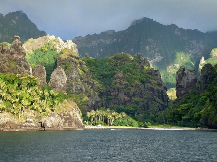 Idyllic landscape of a dream island, but difficult to access: the Bay of Virgins in Fatu Hiva, Marquesas Islands
Among the values conveyed by literature, tourism, and advertising is the quest for “elsewhere,” for a change of scenery, in the truest sense of the word—that is, the need to leave one’s country. This need for otherness, for difference, is projected onto dreamlike, idealized, even mythicized places. In our imaginary world, the island is often that place.
Yet we forget that islands have also been ideal prisons. The examples are numerous: Elba and Saint Helena, Alcatraz and Poulo Condor, If and Yeu, the Devil’s Islands and Leros. The latter, located in Greece in the Dodecanese, hosted a sinister forced labor camp during the colonels’ dictatorship as well as a psychiatric hospital. Despite the beauty of its bay, tourism has remained marginal there due to its bad reputation, unlike the neighboring island of Patmos.
I’d like to share a selection of about a dozen islands from across the world’s seas and oceans. For dreaming...
°°°°°°°°°°°°°°°
SANTORINI
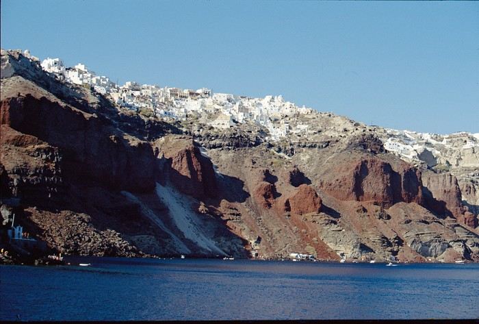
July 27, 1967
At dawn, the ferry from Agios Nikolaos (Crete) enters the immense caldera of Santorini. From the ship’s deck, Rainer, my travel companion, and I are left in awe by the sight of these towering, multicolored cliffs looming over us. We disembark and begin the steep climb on foot via the winding mule path up to the village of Fira, the capital perched above the cliff. Though it’s still very early, we head to the youth hostel. There wasn’t a soul in the alleys that morning—or rather, there were only cats! I have a fond memory of that encounter with Santorini: a sensory shock, a breathtaking volcanic site, a harmony of blue, ochre-red, and white. A welcoming island, as it was traditional to welcome the xénou, an island that hadn’t yet fully recovered from the terrible 1956 earthquake, a Cycladic architectural marvel where local life was still preserved.
It’s easy to see why, in antiquity, the island was named Kallisté (καλλίστη), “the most beautiful,” as it’s nearly impossible to resist gazing at this landscape shaped by tectonic forces. Indeed, a massive volcanic cataclysm—the Minoan eruption—shaped this scenery in the 17th century BCE, creating a caldera that was quickly filled by the sea. The enormous tsunamis that followed reached Crete, leading to the disappearance of the Minoan civilization.
A cliffside path along the caldera leads us to the peaceful village of Oia, at the northern tip of the island. Blue-domed churches and flower-filled villages with whitewashed houses line the way. This walk is a continuous marvel, offering splendid views of the caldera and the neighboring islands formed by the breakup of the ancient volcano (Thirissa, Nea Kameni). Oia is a large, picturesque village, like Fira perched on the cliff’s edge, which was severely damaged by the 1956 earthquake, and its scars are still visible. Its cave-like houses with vaulted roofs haven’t yet been turned into luxury hotels or shops. Absolute tranquility reigns here.
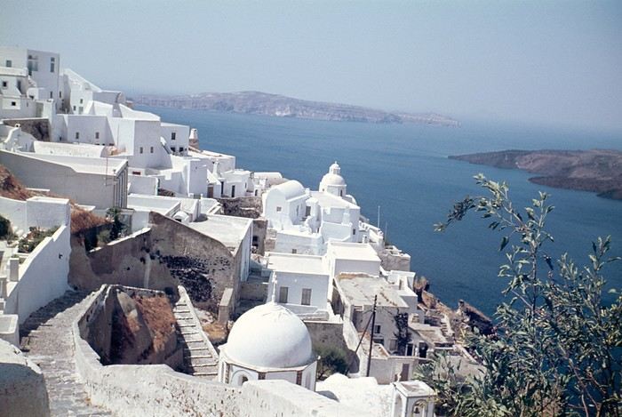 Oia in 1967—a peaceful village overlooking the caldera. But where are the pools and trendy bars?
A lush countryside covered in olive trees and vineyards welcomes us for a pleasant hike, interrupted by the kindness of a friendly islander who gives us a lift in his truck for a few kilometers. He’s off to harvest his tomatoes, which he grows at the foot of Pyrgos Hill. The delicious little cherry tomato of Santorini earned an EU Protected Designation of Origin (PDO) in 2013. We climb up to the village of Pyrgos, perched on a hill and dominated by the elegant bell tower of its church. Finally, we reach the black sand beach of Kamari on the island’s eastern coast to enjoy a swim.
{...} To be continued
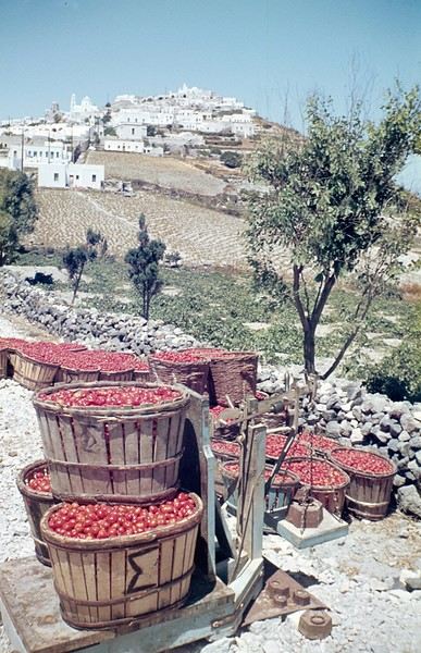

°°°°°°°°°°°°°°°°°
RAIVAVAE (French Polynesia)
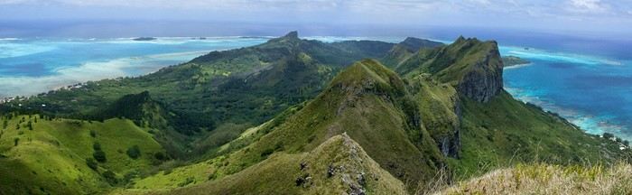
November 15, 2007
Éléonore from Pension Tama welcomes us with traditional flower leis, as if she’d been waiting for old friends she hadn’t seen in ages. The small airport terminal is lively, the atmosphere warm—people hugging, rejoicing in reunions, all under kilos of flowers. Then, just as quickly, the place empties until the next flight... in a few days.
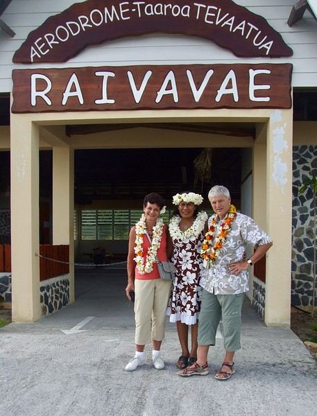
In the Austral Islands, a ninety-minute flight from Tahiti, Raivavae is a world away from the frenetic pace of Papeete or the tourist crowds of the Leeward Islands. The true paradise of the South Seas can still be savored here—it’s a bit like Bora Bora half a century ago. Our first feeling upon arriving on this island is wonder, with smiles that could melt even the gloomiest among us, landscapes so stunning they take your breath away, and above all, a sense of disorientation and fulfillment. Picture a mountainous island, about ten kilometers by three and a half, encircled by a coral reef and wild motu, cradling a lagoon with shades of blue that would make Bora Bora green with envy.
The roughly one thousand inhabitants of Raivavae are spread across four villages around the island. Children are everywhere, as is typical in Polynesia, and they greet you with open, genuine smiles. Here, ancestral values have survived progress. The predominantly Protestant population is very devout, as evidenced by the several temples built across the island. Religious fervor sets the rhythm of daily life. Sundays are reserved for worship and Sunday school (catechism). Work is forbidden on that day, and tourist activities are suspended. These rules are strict and respected.
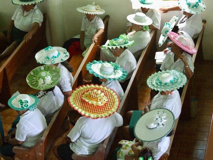 Hat contest for the worship celebration
Yet a sense of resignation is ever-present. The people of Raivavae know they are—and will remain—isolated. Despite the construction of an airstrip in 2004 and a few weekly flights to Tahiti and its nearest neighbor, Tubuai (200 km away), the island remains on the fringes of the world. One painful aspect is the separation of children from their parents when they leave for middle school in Tubuai starting in fifth grade. Television brings daily images of a world the islanders will likely never know, but one they often aspire to.
We are privileged. We have the pristine white-sand beaches of the motu and some of the most beautiful bays in Polynesia all to ourselves. The jewel in the crown, the island’s emblematic spot, is the “motu-pool,” about twenty minutes by boat. A natural, exquisite basin with crystal-clear water, gradients of blue, and white sand. And best of all, there’s almost no one there. In fact, lounging on the beach is frowned upon, especially for young women. Religion looks very unfavorably on sunbathing and lazing around. And yet, everything here leans toward that philosophy of life.
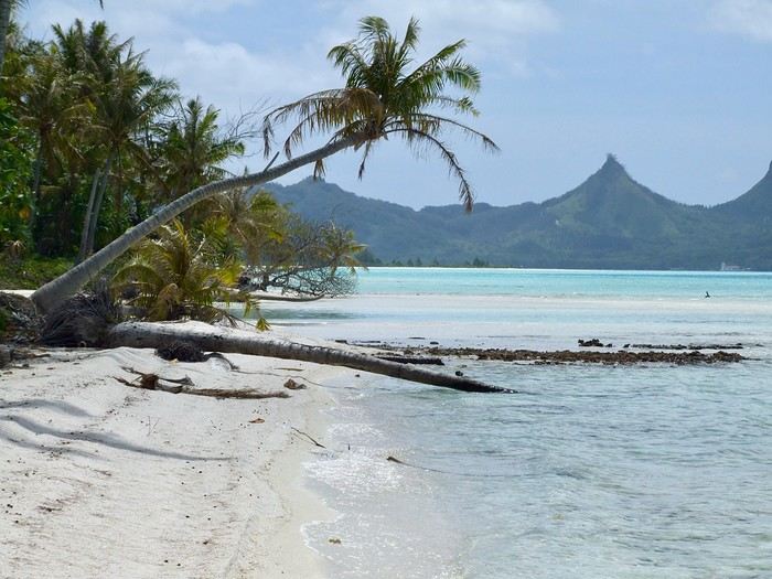
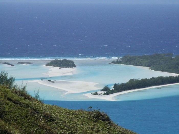 The "motu-pool"
{...} To be continued
Who among us hasn’t dreamed of having a ticket to Tahiti, Bora Bora, or the Marquesas in their pocket—preferably a one-way ticket to “paradise”?
Idyllic landscape of a dream island, but difficult to access: the Bay of Virgins in Fatu Hiva, Marquesas IslandsAmong the values conveyed by literature, tourism, and advertising is the quest for “elsewhere,” for a change of scenery, in the truest sense of the word—that is, the need to leave one’s country. This need for otherness, for difference, is projected onto dreamlike, idealized, even mythicized places. In our imaginary world, the island is often that place.
Yet we forget that islands have also been ideal prisons. The examples are numerous: Elba and Saint Helena, Alcatraz and Poulo Condor, If and Yeu, the Devil’s Islands and Leros. The latter, located in Greece in the Dodecanese, hosted a sinister forced labor camp during the colonels’ dictatorship as well as a psychiatric hospital. Despite the beauty of its bay, tourism has remained marginal there due to its bad reputation, unlike the neighboring island of Patmos.
I’d like to share a selection of about a dozen islands from across the world’s seas and oceans. For dreaming...
°°°°°°°°°°°°°°°
SANTORINI
July 27, 1967
At dawn, the ferry from Agios Nikolaos (Crete) enters the immense caldera of Santorini. From the ship’s deck, Rainer, my travel companion, and I are left in awe by the sight of these towering, multicolored cliffs looming over us. We disembark and begin the steep climb on foot via the winding mule path up to the village of Fira, the capital perched above the cliff. Though it’s still very early, we head to the youth hostel. There wasn’t a soul in the alleys that morning—or rather, there were only cats! I have a fond memory of that encounter with Santorini: a sensory shock, a breathtaking volcanic site, a harmony of blue, ochre-red, and white. A welcoming island, as it was traditional to welcome the xénou, an island that hadn’t yet fully recovered from the terrible 1956 earthquake, a Cycladic architectural marvel where local life was still preserved.
It’s easy to see why, in antiquity, the island was named Kallisté (καλλίστη), “the most beautiful,” as it’s nearly impossible to resist gazing at this landscape shaped by tectonic forces. Indeed, a massive volcanic cataclysm—the Minoan eruption—shaped this scenery in the 17th century BCE, creating a caldera that was quickly filled by the sea. The enormous tsunamis that followed reached Crete, leading to the disappearance of the Minoan civilization.
A cliffside path along the caldera leads us to the peaceful village of Oia, at the northern tip of the island. Blue-domed churches and flower-filled villages with whitewashed houses line the way. This walk is a continuous marvel, offering splendid views of the caldera and the neighboring islands formed by the breakup of the ancient volcano (Thirissa, Nea Kameni). Oia is a large, picturesque village, like Fira perched on the cliff’s edge, which was severely damaged by the 1956 earthquake, and its scars are still visible. Its cave-like houses with vaulted roofs haven’t yet been turned into luxury hotels or shops. Absolute tranquility reigns here.
Oia in 1967—a peaceful village overlooking the caldera. But where are the pools and trendy bars?A lush countryside covered in olive trees and vineyards welcomes us for a pleasant hike, interrupted by the kindness of a friendly islander who gives us a lift in his truck for a few kilometers. He’s off to harvest his tomatoes, which he grows at the foot of Pyrgos Hill. The delicious little cherry tomato of Santorini earned an EU Protected Designation of Origin (PDO) in 2013. We climb up to the village of Pyrgos, perched on a hill and dominated by the elegant bell tower of its church. Finally, we reach the black sand beach of Kamari on the island’s eastern coast to enjoy a swim.
{...} To be continued
°°°°°°°°°°°°°°°°°
RAIVAVAE (French Polynesia)
November 15, 2007
Éléonore from Pension Tama welcomes us with traditional flower leis, as if she’d been waiting for old friends she hadn’t seen in ages. The small airport terminal is lively, the atmosphere warm—people hugging, rejoicing in reunions, all under kilos of flowers. Then, just as quickly, the place empties until the next flight... in a few days.
In the Austral Islands, a ninety-minute flight from Tahiti, Raivavae is a world away from the frenetic pace of Papeete or the tourist crowds of the Leeward Islands. The true paradise of the South Seas can still be savored here—it’s a bit like Bora Bora half a century ago. Our first feeling upon arriving on this island is wonder, with smiles that could melt even the gloomiest among us, landscapes so stunning they take your breath away, and above all, a sense of disorientation and fulfillment. Picture a mountainous island, about ten kilometers by three and a half, encircled by a coral reef and wild motu, cradling a lagoon with shades of blue that would make Bora Bora green with envy.
The roughly one thousand inhabitants of Raivavae are spread across four villages around the island. Children are everywhere, as is typical in Polynesia, and they greet you with open, genuine smiles. Here, ancestral values have survived progress. The predominantly Protestant population is very devout, as evidenced by the several temples built across the island. Religious fervor sets the rhythm of daily life. Sundays are reserved for worship and Sunday school (catechism). Work is forbidden on that day, and tourist activities are suspended. These rules are strict and respected.
Hat contest for the worship celebrationYet a sense of resignation is ever-present. The people of Raivavae know they are—and will remain—isolated. Despite the construction of an airstrip in 2004 and a few weekly flights to Tahiti and its nearest neighbor, Tubuai (200 km away), the island remains on the fringes of the world. One painful aspect is the separation of children from their parents when they leave for middle school in Tubuai starting in fifth grade. Television brings daily images of a world the islanders will likely never know, but one they often aspire to.
We are privileged. We have the pristine white-sand beaches of the motu and some of the most beautiful bays in Polynesia all to ourselves. The jewel in the crown, the island’s emblematic spot, is the “motu-pool,” about twenty minutes by boat. A natural, exquisite basin with crystal-clear water, gradients of blue, and white sand. And best of all, there’s almost no one there. In fact, lounging on the beach is frowned upon, especially for young women. Religion looks very unfavorably on sunbathing and lazing around. And yet, everything here leans toward that philosophy of life.
The "motu-pool"{...} To be continued
Les Cyclades en juillet: Anafi, Amorgos, Astypaléa English translation pending
GENESE
Comme tous, le COVID a chamboulé nos plans. Normalement nous devions aller à Madagascar pendant un mois, projet reporté à l’année prochaine. Seulement, n’ayant jamais arrêté de travailler, malgré le confinement et le Covid j’avais réellement besoin de faire une « pause ».
Souhaitant limiter les risques de restrictions de déplacements nous ne quitterons pas l’Europe en nous centrant sur des endroits que nous avons toujours voulu visiter, mais habituellement trop fréquentés pour nous. Il y avait la Suisse avec ses montagnes et ses trains de légende, l’Islande et les îles Grecques.
Au final c’est l’attrait du soleil qui l’a emporté … enfin surtout auprès de madame ! Nous avions « entrevu » Santorin et Myconos lors d’une croisière en méditerranée en 2007 avec les enfants. Nous avions adoré … sauf la fréquentation !
Le premier élément à choisir est le point d’entrée, accessible en avion. Il y a Santorin et Myconos dans les Cyclades. Comme je rêvais de revoir la caldera de Santorin, le choix fut rapide. Ensuite je voulais des îles peu fréquentées ne nécessitant pas de trop long trajet en ferry. Sur 2 semaines 3 îles m’a paru être le bon choix. Avec le recul je confirme que c’est un bon dosage. Je me suis beaucoup servi du site Hellenica et Cycladen.be, qui sont très bien, pour faire mes choix.
La première sera Anafi, dans la catégorie « peu fréquentée » elle est très bien placée, en plus elle est petite, montagneuse et avec de belles plages. Une des raisons de sa faible fréquentation est le peu de liaison maritimes, ce sera donc à partir de cette contrainte que s’articulera le voyage.
Le second choix sera Astypalea car il y a un aéroport pour repartir, en plus c’est aussi une île peu fréquentée par les étrangers. Elle fait partie des Dodécanèse mais géographique se trouve proche des Cyclades.
Amorgos se glissera très naturellement entre les deux.
Une fois le planning établi j’ai réservé les vols chez Volotea qui a le bon goût de partir de Strasbourg … mauvais choix car les vols seront annulés 2 semaines plus tard.🏴☠️ Je me suis retourné vers Easy Jet qui part de Bâle Mulhouse, finalement tout aussi proche de chez nous que Strasbourg. Il faut dire qu’en Alsace nous avons la chance d’avoir pas mal d’aéroports dans un rayon de 3 heures autour de chez nous (en plus des deux précités il y a surtout Zurich et Frankfurt). Nous ferons donc BSL – Athènes – Santorin puis Astypalea – Athènes – BSL.
J’ai réservé par internet en direct les pensions : Villa Kalamiotissa pour Anafi Emprostiada Traditional Guest House et Pano Gitonia pour Amorgos Studio Killindra pour Astypalea Je réserve aussi une voiture à Amorgos puisque l’île est assez grande … et au final, suite à un échange avec mon logeur, également à Anafi.
Le roadbook sera assez rapide à établir … tant mieux car je n’ai que très peu de temps disponible, relancer mon entreprise suite au Covid-19 a accaparé tout mon temps.
En voiture ... pour ceux qui veulent 🙂
Comme tous, le COVID a chamboulé nos plans. Normalement nous devions aller à Madagascar pendant un mois, projet reporté à l’année prochaine. Seulement, n’ayant jamais arrêté de travailler, malgré le confinement et le Covid j’avais réellement besoin de faire une « pause ».
Souhaitant limiter les risques de restrictions de déplacements nous ne quitterons pas l’Europe en nous centrant sur des endroits que nous avons toujours voulu visiter, mais habituellement trop fréquentés pour nous. Il y avait la Suisse avec ses montagnes et ses trains de légende, l’Islande et les îles Grecques.
Au final c’est l’attrait du soleil qui l’a emporté … enfin surtout auprès de madame ! Nous avions « entrevu » Santorin et Myconos lors d’une croisière en méditerranée en 2007 avec les enfants. Nous avions adoré … sauf la fréquentation !
Le premier élément à choisir est le point d’entrée, accessible en avion. Il y a Santorin et Myconos dans les Cyclades. Comme je rêvais de revoir la caldera de Santorin, le choix fut rapide. Ensuite je voulais des îles peu fréquentées ne nécessitant pas de trop long trajet en ferry. Sur 2 semaines 3 îles m’a paru être le bon choix. Avec le recul je confirme que c’est un bon dosage. Je me suis beaucoup servi du site Hellenica et Cycladen.be, qui sont très bien, pour faire mes choix.
La première sera Anafi, dans la catégorie « peu fréquentée » elle est très bien placée, en plus elle est petite, montagneuse et avec de belles plages. Une des raisons de sa faible fréquentation est le peu de liaison maritimes, ce sera donc à partir de cette contrainte que s’articulera le voyage.
Le second choix sera Astypalea car il y a un aéroport pour repartir, en plus c’est aussi une île peu fréquentée par les étrangers. Elle fait partie des Dodécanèse mais géographique se trouve proche des Cyclades.
Amorgos se glissera très naturellement entre les deux.
Une fois le planning établi j’ai réservé les vols chez Volotea qui a le bon goût de partir de Strasbourg … mauvais choix car les vols seront annulés 2 semaines plus tard.🏴☠️ Je me suis retourné vers Easy Jet qui part de Bâle Mulhouse, finalement tout aussi proche de chez nous que Strasbourg. Il faut dire qu’en Alsace nous avons la chance d’avoir pas mal d’aéroports dans un rayon de 3 heures autour de chez nous (en plus des deux précités il y a surtout Zurich et Frankfurt). Nous ferons donc BSL – Athènes – Santorin puis Astypalea – Athènes – BSL.
J’ai réservé par internet en direct les pensions : Villa Kalamiotissa pour Anafi Emprostiada Traditional Guest House et Pano Gitonia pour Amorgos Studio Killindra pour Astypalea Je réserve aussi une voiture à Amorgos puisque l’île est assez grande … et au final, suite à un échange avec mon logeur, également à Anafi.
Le roadbook sera assez rapide à établir … tant mieux car je n’ai que très peu de temps disponible, relancer mon entreprise suite au Covid-19 a accaparé tout mon temps.
En voiture ... pour ceux qui veulent 🙂
Deux semaines au Cap Vert avec enfant de deux ans et demi English translation pending
Bonjour,
Je suis en train de réfléchir à mes prochaines vacances fin octobre début novembre, et j'avais pensé au Cap Vert, qui me trotte dans la tête depuis un certain nombre d'années... cette période est propice ?
Nous sommes 3, avec une petite fille qui aura presque 3 ans, assez curieuse, et qui a déjà pris l'avion pour l'Ouest canadien et les canaries (lanzarote et fuerteventura). Pas de difficulté avec une petite ? Que ce soit au niveau sanitaire, transport (siège auto dans les taxis car si j'ai bien compris il ne faut pas louer une voiture), hébergement... Concernant la durée, on serait sur 2 semaines, mais s'il faut prolonger un peu, on le fera mais pas jusqu'à 3 semaines.
Nous aimerions articuler notre voyage avec de la rando, de la découverte de la culture locale et un peu de repos (pas de rando donc, ou on prendrait plus de temps en fin de séjour avec plage s'il y en a) : santo antao et fogo me semblent incontournables pour un voyage au Cap Vert. Aussi, j'aimerais éviter de prendre trop l'avion, idéalement arriver sur une île, prendre un avion pour aller au sud ou au nord, et repartir de la vers la France. D'ailleurs, pour aller à Fogo depuis Praia par exemple, il faut prendre le bateau ou l'avion?
Merci
Je suis en train de réfléchir à mes prochaines vacances fin octobre début novembre, et j'avais pensé au Cap Vert, qui me trotte dans la tête depuis un certain nombre d'années... cette période est propice ?
Nous sommes 3, avec une petite fille qui aura presque 3 ans, assez curieuse, et qui a déjà pris l'avion pour l'Ouest canadien et les canaries (lanzarote et fuerteventura). Pas de difficulté avec une petite ? Que ce soit au niveau sanitaire, transport (siège auto dans les taxis car si j'ai bien compris il ne faut pas louer une voiture), hébergement... Concernant la durée, on serait sur 2 semaines, mais s'il faut prolonger un peu, on le fera mais pas jusqu'à 3 semaines.
Nous aimerions articuler notre voyage avec de la rando, de la découverte de la culture locale et un peu de repos (pas de rando donc, ou on prendrait plus de temps en fin de séjour avec plage s'il y en a) : santo antao et fogo me semblent incontournables pour un voyage au Cap Vert. Aussi, j'aimerais éviter de prendre trop l'avion, idéalement arriver sur une île, prendre un avion pour aller au sud ou au nord, et repartir de la vers la France. D'ailleurs, pour aller à Fogo depuis Praia par exemple, il faut prendre le bateau ou l'avion?
Merci
Voyage aux Açores avec bébé en août English translation pending
Hello,
J'envisage de partir cet été avec bébé qui aura presque 1 an à ce moment-la. Est-ce une destination bien indiqué pour un bébé ? Vu que c'est notre 1er voyage avec lui, nous qui d'habitude parcourons tout le pays, je pense qu'on va se restreindre bien plus et y aller "pepere". J'ai cru comprendre qu'i y avait de quoi faire sur l'ile principale Sao Miguel, est-ce suffisant pour avoir un bon aperçu sur 2 semaines, ou est-ce qu'il y a vraiment des incontournables a voir sur d'autres iles (qui valent la peine du déplacement/ changement de lieu de villegiature/ de location voiture tout ça )?
Nous aimons les randonnées (mais attention maintenant à l'altitude avec bébé), les plages, les balades diverses, les jolis paysages...
Preneuse de tous conseils :)
J'envisage de partir cet été avec bébé qui aura presque 1 an à ce moment-la. Est-ce une destination bien indiqué pour un bébé ? Vu que c'est notre 1er voyage avec lui, nous qui d'habitude parcourons tout le pays, je pense qu'on va se restreindre bien plus et y aller "pepere". J'ai cru comprendre qu'i y avait de quoi faire sur l'ile principale Sao Miguel, est-ce suffisant pour avoir un bon aperçu sur 2 semaines, ou est-ce qu'il y a vraiment des incontournables a voir sur d'autres iles (qui valent la peine du déplacement/ changement de lieu de villegiature/ de location voiture tout ça )?
Nous aimons les randonnées (mais attention maintenant à l'altitude avec bébé), les plages, les balades diverses, les jolis paysages...
Preneuse de tous conseils :)
Je vous invite à découvrir l'île de Lanzarote English translation pending
INTRODUCTION
Des vidéos sont insérées tout au long du résumé. Veuillez cliquer sur l'image pour démarrer la vidéo.
En février dernier, nous avons séjourné 2 semaines sur l'île de Lanzarote afin d'en découvrir les différents attraits touristiques.
Comme la plupart de nos précédents voyages, plusieurs semaines ont été consacrées à la création de notre itinéraire afin de pouvoir être en mesure d'atteindre parfaitement nos objectifs.
Lors de notre séjour, nous avons utilisé l'application Maps.me, une application mobile qui fournit des cartes hors ligne. Cette application s'avère très précieuse lors de nos déplacements en voiture, en randonnée et même lors de nos circuits à pied dans les grandes villes.
J'avais préalablement téléchargé les coordonnées GPS de toutes les attractions prévues à notre itinéraire dans l'application Maps.me, ce qui a facilité grandement nos déplacements.
La réservation de l'hébergement ainsi que la location d'une voiture ont été effectuées sur le web avant notre départ.
Nous sommes partis de l'aéroport de Québec et avons eu une escale à Montréal ainsi qu'à Bruxelles en Belgique avant d'atteindre Lanzarote.
Lanzarote fait partie des Îles Canaries qui elles-mêmes sont situées dans l'océan Atlantique, à l'ouest du Maroc. Celles-ci font d'ailleurs partie de l'Espagne.
Nous avions déjà visité l'île de Tenerife et nous avions adoré notre séjour à cet endroit.
Nous avons donc décidé de poursuivre la découverte des Îles Canaries en nous rendant à Lanzarote car cette île offre un paysage volcanique spectaculaire, des plages à faire rêver ainsi que de magnifiques villages aux maisons typiques de l'île qui sont majoritairement blanches.
Les sentiers de randonnée sont nombreux et nous permettent de découvrir une grande diversité de paysages.
Les attraits touristiques sont également fort nombreux et facilement accessibles car les routes de Lanzarote se parcourent aisément en voiture car celles-ci sont dans un état impeccable.
D'ailleurs, c'est un pur plaisir que de se déplacer sur ces routes car les paysages qui défilent sous nos yeux sont sensationnels et présentent une perspective différente selon la lumière du jour.
Des vidéos sont insérées tout au long du résumé. Veuillez cliquer sur l'image pour démarrer la vidéo.
En février dernier, nous avons séjourné 2 semaines sur l'île de Lanzarote afin d'en découvrir les différents attraits touristiques.
Comme la plupart de nos précédents voyages, plusieurs semaines ont été consacrées à la création de notre itinéraire afin de pouvoir être en mesure d'atteindre parfaitement nos objectifs.
Lors de notre séjour, nous avons utilisé l'application Maps.me, une application mobile qui fournit des cartes hors ligne. Cette application s'avère très précieuse lors de nos déplacements en voiture, en randonnée et même lors de nos circuits à pied dans les grandes villes.
J'avais préalablement téléchargé les coordonnées GPS de toutes les attractions prévues à notre itinéraire dans l'application Maps.me, ce qui a facilité grandement nos déplacements.
La réservation de l'hébergement ainsi que la location d'une voiture ont été effectuées sur le web avant notre départ.
Nous sommes partis de l'aéroport de Québec et avons eu une escale à Montréal ainsi qu'à Bruxelles en Belgique avant d'atteindre Lanzarote.
Lanzarote fait partie des Îles Canaries qui elles-mêmes sont situées dans l'océan Atlantique, à l'ouest du Maroc. Celles-ci font d'ailleurs partie de l'Espagne.
Nous avions déjà visité l'île de Tenerife et nous avions adoré notre séjour à cet endroit.
Nous avons donc décidé de poursuivre la découverte des Îles Canaries en nous rendant à Lanzarote car cette île offre un paysage volcanique spectaculaire, des plages à faire rêver ainsi que de magnifiques villages aux maisons typiques de l'île qui sont majoritairement blanches.
Les sentiers de randonnée sont nombreux et nous permettent de découvrir une grande diversité de paysages.
Les attraits touristiques sont également fort nombreux et facilement accessibles car les routes de Lanzarote se parcourent aisément en voiture car celles-ci sont dans un état impeccable.
D'ailleurs, c'est un pur plaisir que de se déplacer sur ces routes car les paysages qui défilent sous nos yeux sont sensationnels et présentent une perspective différente selon la lumière du jour.
Discussion du concours photo du mois de février 2020: Les volcans English translation pending
Ici le fil de discussion autour du thème de ce mois-ci: les volcans
Retour au concours pour y déposer vos photos, ici
Retour au concours pour y déposer vos photos, ici
Retour de mon voyage en solo au Cap Vert English translation pending
D abord merci à tous pour vos recommandations et un super merci à Marie ( ptitortue). Je rentre tout juste de 12 jours de ce merveilleux archipel . J ai choisi d arriver à San Vicente pour repartir de Sal et en rando à Santo Antao.
À San Vicente j ai passé 2 nuits . Mon premier jour j ai visite Mindelo et le lendemain j ai pris une excursion privée pour la visite de l île. J ai beaucoup aimé la vue sur l île de Monte Verde et les grandes plages et les quelques dunes de sable. J ai déjeuné à Calhau chez Hamburg et ce fut très bon. Le paysage est bien changeant sur cette île on passe de l aridité a un peu de vert là où les moulins à vent fonctionnent pour rendre les agricultures vertes. J ai bu des verres au terra lodge , à la pergola et dîner chez loutcha. Pendant ma visite de Mindelo j ai eu droit à la compagnie de Oscar qui me parlait de son pays et qui voulait partager avec moi les anecdotes . Le lendemain j ai pris le ferry de 7h j avoue que ça bougeait pas mal mais bon j ai tenu. L arrivée sur Santo Antao est magnifique avec une très belle lumière. Je suis attendue par mon chauffeur ! On est passé dans une épicerie et la dame m à préparé un piqué nique pour 500 Esc. Je découvre le paysage aride , les dunes de sable noir des superbes montagnes avec les pics et je pense que bientôt je vais être là dedans... Le chauffeur me dépose au sentier qui monte à l alto mira, j avoue que j appréhende un peu car c est ma première rando Le sentier est un long chemin pavé première surprise car j avoue que j ai préparé ce voyage sans regarder de photos et je mcetee et is imaginé ces chemins pavés . En chemin un petit parc de cochon , différentes cultures mais , igname, patates douces et je me sens super bien même si la montée est un peu raide je me rends compte sur j ai vraiment beaucoup de chance d être ici. Au bout d’ une demi heure je suis au col et je n ai rencontré personne ... ça fait bizarre chez moi quand je randonne on rencontre toujours quelqu un. Du col de Forquinha superbe vue sur la vallée . Les sommets comme des aiguilles des dykes! Je descend cette vallée sans oublier de me retourner à chaque instant pour admirer ces dykes, le ciel est bleu et il fait doux . Je passe devant des manguiers et je commence à apercevoir quelques maisons et là c est des Bom Dia comme j aime cette île. Je traverse des ravines et ne voit toujours personne comme touriste ! Je me pose pour découvrir mon pique nique: fromage de chèvre , tomates, coriandre , oignons vert, du pain , des gâteaux maisons et une confiture... un vrai festin et des œufs durs... Je prends mon temps vu qu il est encore tôt je descend dans une gorge
Je rejoins le village de Cha de Morte en étant en pleine forme. Cette première rando était superbe et hâte d en faire d autre.
À San Vicente j ai passé 2 nuits . Mon premier jour j ai visite Mindelo et le lendemain j ai pris une excursion privée pour la visite de l île. J ai beaucoup aimé la vue sur l île de Monte Verde et les grandes plages et les quelques dunes de sable. J ai déjeuné à Calhau chez Hamburg et ce fut très bon. Le paysage est bien changeant sur cette île on passe de l aridité a un peu de vert là où les moulins à vent fonctionnent pour rendre les agricultures vertes. J ai bu des verres au terra lodge , à la pergola et dîner chez loutcha. Pendant ma visite de Mindelo j ai eu droit à la compagnie de Oscar qui me parlait de son pays et qui voulait partager avec moi les anecdotes . Le lendemain j ai pris le ferry de 7h j avoue que ça bougeait pas mal mais bon j ai tenu. L arrivée sur Santo Antao est magnifique avec une très belle lumière. Je suis attendue par mon chauffeur ! On est passé dans une épicerie et la dame m à préparé un piqué nique pour 500 Esc. Je découvre le paysage aride , les dunes de sable noir des superbes montagnes avec les pics et je pense que bientôt je vais être là dedans... Le chauffeur me dépose au sentier qui monte à l alto mira, j avoue que j appréhende un peu car c est ma première rando Le sentier est un long chemin pavé première surprise car j avoue que j ai préparé ce voyage sans regarder de photos et je mcetee et is imaginé ces chemins pavés . En chemin un petit parc de cochon , différentes cultures mais , igname, patates douces et je me sens super bien même si la montée est un peu raide je me rends compte sur j ai vraiment beaucoup de chance d être ici. Au bout d’ une demi heure je suis au col et je n ai rencontré personne ... ça fait bizarre chez moi quand je randonne on rencontre toujours quelqu un. Du col de Forquinha superbe vue sur la vallée . Les sommets comme des aiguilles des dykes! Je descend cette vallée sans oublier de me retourner à chaque instant pour admirer ces dykes, le ciel est bleu et il fait doux . Je passe devant des manguiers et je commence à apercevoir quelques maisons et là c est des Bom Dia comme j aime cette île. Je traverse des ravines et ne voit toujours personne comme touriste ! Je me pose pour découvrir mon pique nique: fromage de chèvre , tomates, coriandre , oignons vert, du pain , des gâteaux maisons et une confiture... un vrai festin et des œufs durs... Je prends mon temps vu qu il est encore tôt je descend dans une gorge
Je rejoins le village de Cha de Morte en étant en pleine forme. Cette première rando était superbe et hâte d en faire d autre.
Le GR48 dans la Sierra Morena en Andalousie English translation pending
Bonjour,
Simplement pour vous recommander ce GR dans l’Andalousie plus sauvage. Ce sentier part de Barrancos (dernier village portugais avant d’entrer en Espagne). Après vous traverserez toutes les provinces ( comme les départements en France) de l’Andalousie, côté nord, en suivant toute la Sierra Morena. Un territoire où on peut trouver encore le lynx ibérique, le félin le plus menacé au monde. Personnellement j’ai fait la partie qui va de Barrancos jusqu’à Córdoba et c’était incroyable. C’est un GR sauvage où on croise presque personne (seulement on trouve du monde dans la partie qui partage avec el camino de la Plata, le chemin de pèlerinage de St Jacques qui va du sud au nord c’est-à-dire de Sevilla à Compostela en Galice. Cependant, c’est un chemin où c’est très facile de trouver du logement (si vous êtes intéressé, je peux vous filer des adresses. En plus, comme on est dans l’Andalousie, les prix sont très bas. 20-30€ par nuit.
De tous les GR que j’ai fait en Espagne, que je connais bien, c’est celui qui m’a plus impressionné. Aussi le GR de Serra de Tramuntana à Majorque.
La distance de celui de Sierra Morena est de 550km entre Barrancos et Santa Elena à Jaen, mais c’est possible de faire des petits morceaux si on est fatigué comme c’est mon cas. L’avantage, que tu peux sortir du chemin et aller visiter des grandes villes comme Sevilla ou comme dans mon cas, Córdoba.
Carles
Compte rendu croisière Iles du soleil (4 au 15 octobre 2019) English translation pending
Bonsoir à tous,
Nous voila de retour après un passage dans les Canaries, c'était Super.
je vais vous raconter notre petit périple.
Pour Rappel;
1° 04/10/19 Marseille (embarq) 17h00
2° 05/10/19 Plaisirs en Mer
3° 06/10/19 Plaisirs en Mer
4° 07/10/19 Arrecife Canaries 13H00 19h00
5° 08/10/19 Santa Cruz de Ténerife 08H00 17H00
6° 09/10/19 FUNCHAL (Madére) 08H00 17H00
7° 10/10/19 Plaisirs en Mer
8° 11/10/19 MALAGA 08H00 13H00
9° 12/10/19 Plaisirs en Mer
10° 13/10/19 CIVITAVECCHIA (ROME) 09H00 20H00
11° 14/10/19 SAVONE 08H00 17H00
12° 15/10/19 Marseille (Débarq) sniff sniff 08H00
Nous voilà parti pour 12 jours.On va coucher sur Marseille. Vendredi 04 Octobre, on se lève 7h30 petit déjeuner et hop nous prenons la route. Nous arrivons au port, on se gare au parking puis allons déposer les bagages et enregistrements au terminal À A 13h15, Appel du N°1. bateau. Pour nous ce sera à 13h45, on a le N° 3 . On a déjà voyagé avec le Pacifica, on va à la cabine récupérer la Costa Card et après on va rentrer la CB comme ça on peut boire un verre en déjeunant. C’est la course à la place libre tout le monde fait la queue. On réussi à trouver 2 place à une table de 6. On déjeune rapide et on va voir si nos valises sont arrivées. Elles sont là bien. Donc on va au spa prendre un forfait pour la croisière 133 €. A 16h30 exercice de sécurité + le baratin habituel sur le bateau.La française qui explique les conditions à bord et les excursions à du retard donc on décide de s’éclipser pour aller au spa se faire relaxer. On part chacun notre tour discrètement, 😉 Bon je sais c’est pas bien mais comme c’est toujours le même baratin et en plus on le fait au théâtre
Nous voilà parti pour 12 jours.On va coucher sur Marseille. Vendredi 04 Octobre, on se lève 7h30 petit déjeuner et hop nous prenons la route. Nous arrivons au port, on se gare au parking puis allons déposer les bagages et enregistrements au terminal À A 13h15, Appel du N°1. bateau. Pour nous ce sera à 13h45, on a le N° 3 . On a déjà voyagé avec le Pacifica, on va à la cabine récupérer la Costa Card et après on va rentrer la CB comme ça on peut boire un verre en déjeunant. C’est la course à la place libre tout le monde fait la queue. On réussi à trouver 2 place à une table de 6. On déjeune rapide et on va voir si nos valises sont arrivées. Elles sont là bien. Donc on va au spa prendre un forfait pour la croisière 133 €. A 16h30 exercice de sécurité + le baratin habituel sur le bateau.La française qui explique les conditions à bord et les excursions à du retard donc on décide de s’éclipser pour aller au spa se faire relaxer. On part chacun notre tour discrètement, 😉 Bon je sais c’est pas bien mais comme c’est toujours le même baratin et en plus on le fait au théâtre
Discovering the joys of camping in Namibia
This three-week trip to Namibia was a big first for us:
- Visiting a country in winter, for someone who starts feeling comfortable at 25°C (77°F).
- Camping, when we usually feel at home in a starred hotel.
- Sleeping on the roof of a car—what an idea... when a comfy bed is waiting just a bit further.
- Grocery shopping, cooking, doing the dishes... all the things we usually avoid to fully enjoy our vacation.
- Washing up when and how we can, when we can’t imagine going a day without a shower.
- Driving a big 4x4 on the left, with a manual transmission, when we usually opt for an automatic for more comfort.
Yep! You guessed it—we stepped way out of our comfort zone during this trip.
I had quite a few doubts while planning this adventure, but the more I read travel journals about Namibia, the more I wanted to go.
Personally, without this forum, I never would’ve dared to hit the Namibian roads in a 4x4. I was really anxious during the planning, so I want to thank everyone who contributed with their journals and forum discussions for helping me leave more peacefully.
At first, I wasn’t even considering sleeping in a tent. But after my husband’s persuasion—and my own curiosity to experience what I’d read in those travel journals—I gave in. So off we went in a double-cab Hilux with a rooftop tent.
And of course, let’s talk about me—the big cold-weather wimp. One of the biggest pre-trip challenges was choosing a sleeping bag. After a while, sleeping bags had no more secrets for me: temperature ratings (comfort, limit, extreme), shapes (mummy, rectangular), fillings (synthetic, down), compression rate, and weight... all these factors were a real puzzle. In the end, to make sure I wouldn’t be put off camping in winter (Australian winter, mind you), I went for a sleeping bag with a comfort rating of -10°C. And just to be *extra* sure I wouldn’t get cold, I bought a liner (never knew what that was before) in Thermolite, which boosts the sleeping bag’s temperature by 11°C. There are liners that add up to 15°C, but let’s not exaggerate—we’re not heading to the North Pole! My husband, on the other hand, got a sleeping bag with a -5°C comfort rating and a silk liner.
Was it enough? You’ll find out soon. In the meantime, another big thank you to everyone who helped me make this choice with their advice and experience.
Over a year in advance, we planned a three-week itinerary for our first trip to Namibia—classic route, nothing too out there. We chose to do the circuit clockwise because we wanted to finish on a high note in Etosha and its wildlife. They say it’s like Noah’s Ark out there! And why not, the cherry on top... some big cats.
We used Tourmaline’s services to book our accommodations and the 4x4.
Here’s our planned itinerary with campsites and lodgings—yes, there are a few solid roofs in there; we didn’t want to push it too far.
Day 1: Windhoek – Windhoek Gardens Guesthouse Day 2: Kalahari Anib Campsite Day 3: Namibrand Family Hideout Day 4: Sesriem Camp Day 5: Sesriem Camp Day 6: Rostock Ritz Camp Day 7: Swakopmund - Sea Breeze Guesthouse Day 8: Swakopmund - Sea Breeze Guesthouse Day 9: Spitzkoppe Camp Tented Day 10: Brandberg White Lady Campsite Day 11: Grootberg Lodge Day 12: Opuwo Country Campsite Day 13: Epupa Camp Day 14: Hobatere Lodge Day 15: Etosha Olifantsrus Camp Day 16: Etosha Okaukuejo Camp Day 17: Etosha Halali Camp Day 18: Etosha Namutoni Camp Day 19: Cheetah Eco Lodge Day 20: Windhoek – Londiningi B&B
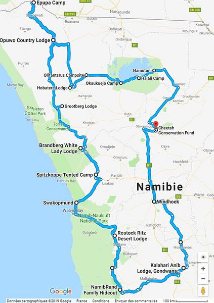
Alright! Are you ready to follow this adventure with us in our Hilux?
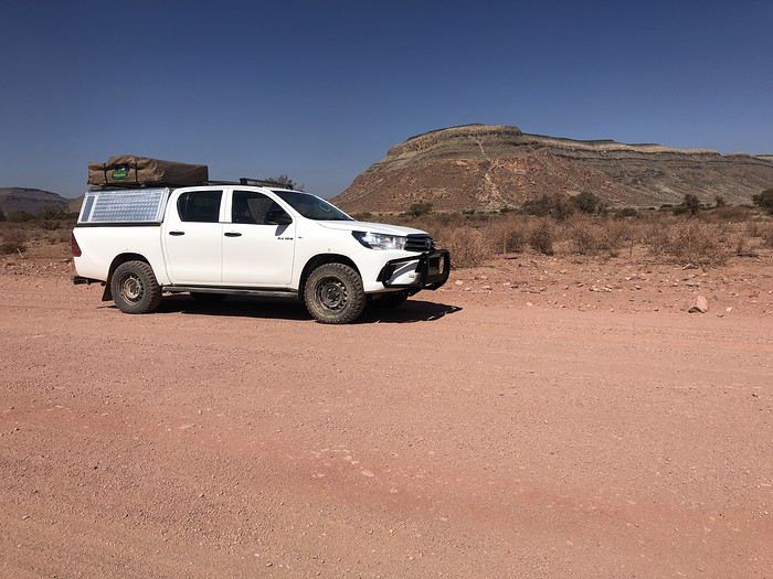
Yep! You guessed it—we stepped way out of our comfort zone during this trip.
I had quite a few doubts while planning this adventure, but the more I read travel journals about Namibia, the more I wanted to go.
Personally, without this forum, I never would’ve dared to hit the Namibian roads in a 4x4. I was really anxious during the planning, so I want to thank everyone who contributed with their journals and forum discussions for helping me leave more peacefully.
At first, I wasn’t even considering sleeping in a tent. But after my husband’s persuasion—and my own curiosity to experience what I’d read in those travel journals—I gave in. So off we went in a double-cab Hilux with a rooftop tent.
And of course, let’s talk about me—the big cold-weather wimp. One of the biggest pre-trip challenges was choosing a sleeping bag. After a while, sleeping bags had no more secrets for me: temperature ratings (comfort, limit, extreme), shapes (mummy, rectangular), fillings (synthetic, down), compression rate, and weight... all these factors were a real puzzle. In the end, to make sure I wouldn’t be put off camping in winter (Australian winter, mind you), I went for a sleeping bag with a comfort rating of -10°C. And just to be *extra* sure I wouldn’t get cold, I bought a liner (never knew what that was before) in Thermolite, which boosts the sleeping bag’s temperature by 11°C. There are liners that add up to 15°C, but let’s not exaggerate—we’re not heading to the North Pole! My husband, on the other hand, got a sleeping bag with a -5°C comfort rating and a silk liner.
Was it enough? You’ll find out soon. In the meantime, another big thank you to everyone who helped me make this choice with their advice and experience.
Over a year in advance, we planned a three-week itinerary for our first trip to Namibia—classic route, nothing too out there. We chose to do the circuit clockwise because we wanted to finish on a high note in Etosha and its wildlife. They say it’s like Noah’s Ark out there! And why not, the cherry on top... some big cats.
We used Tourmaline’s services to book our accommodations and the 4x4.
Here’s our planned itinerary with campsites and lodgings—yes, there are a few solid roofs in there; we didn’t want to push it too far.
Day 1: Windhoek – Windhoek Gardens Guesthouse Day 2: Kalahari Anib Campsite Day 3: Namibrand Family Hideout Day 4: Sesriem Camp Day 5: Sesriem Camp Day 6: Rostock Ritz Camp Day 7: Swakopmund - Sea Breeze Guesthouse Day 8: Swakopmund - Sea Breeze Guesthouse Day 9: Spitzkoppe Camp Tented Day 10: Brandberg White Lady Campsite Day 11: Grootberg Lodge Day 12: Opuwo Country Campsite Day 13: Epupa Camp Day 14: Hobatere Lodge Day 15: Etosha Olifantsrus Camp Day 16: Etosha Okaukuejo Camp Day 17: Etosha Halali Camp Day 18: Etosha Namutoni Camp Day 19: Cheetah Eco Lodge Day 20: Windhoek – Londiningi B&B
Alright! Are you ready to follow this adventure with us in our Hilux?
La Bonette (à vélo) English translation pending
Bonjour à toutes et à tous
aprés mon petit WE cyclocamping Montpellier/La Bouilladisse par la Camargue et la digue à la mer, j'envisage vers le 15/8 de faire Nice / La Bouilladisse par la Bonette (Nice-StEtienne de Tinée/St Etienne de Tinée-Tallard/Tallard-La Bouilladisse)
ma question est la suivante : quelqu'un à t'il monté la Bonette avec les sacoches ? et en gros combien faut il de temps? un collégue a mis 2 heures en vélo route 3 heures est ce réaliste? je ne suis pas une fusée mais déjà plus de 1600 kms vélo depuis le début de l'année et + de 450 kms de course à pied sans compter les randos notamment en montagne en ce moment
Merci par avance pour la ou les réponses
Serge
aprés mon petit WE cyclocamping Montpellier/La Bouilladisse par la Camargue et la digue à la mer, j'envisage vers le 15/8 de faire Nice / La Bouilladisse par la Bonette (Nice-StEtienne de Tinée/St Etienne de Tinée-Tallard/Tallard-La Bouilladisse)
ma question est la suivante : quelqu'un à t'il monté la Bonette avec les sacoches ? et en gros combien faut il de temps? un collégue a mis 2 heures en vélo route 3 heures est ce réaliste? je ne suis pas une fusée mais déjà plus de 1600 kms vélo depuis le début de l'année et + de 450 kms de course à pied sans compter les randos notamment en montagne en ce moment
Merci par avance pour la ou les réponses
Serge
Fuerteventura pour une semaine de découverte English translation pending
FUERTEVENTURA !!!
Cette île, au départ, ne méritait peut-être pas de s'y attarder plus que cela mais nous, nous avons beaucoup aimé !
Tout d'abord, quelques modestes lignes pour présenter ce magnifique archipel des Canaries composé de 7 îles espagnoles, qui se trouve dans l'Océan Atlantique, au large des côtes du Maroc (environ une centaine de kms pour Fuerteventura).
Fuerteventura, où nous allons séjourner pour la semaine, est la seconde plus grande île, après Ténérife mais l'une des moins peuplée. Toutes les îles sont d'origine volcanique mais chacune a sa propre particularité. Fuerteventura est la plus ancienne d'entre elles (20 millions d'années environ) et sera certainement la première à disparaître. Quant à ses plages, ce sont sans aucun doute les plus belles et les plus grandes de tout l'archipel.
Au début, les îles Canaries furent vraisemblablement peuplées par différentes populations venues d'Afrique du Nord, ensuite par des navigateurs Phéniciens, Egyptiens puis par les Carthaginois et les Romains. Platon y situera les vestiges de l'Atlantide, Juba II, roi de Namibie, fera une description de l'île au 1er siècle avant J.C. et Pline l'Ancien, s'inspirera de cette description et citera 2 des îles : Canaria pour le nombre important de chiens qui vivent à Grande Canarie et l'île Pourpre pour Fuerteventura en raison de sa couleur brune mais celle-ci portera également plusieurs autres noms dont Planaria, Herbania etc...
L'archipel tombe ensuite dans l'oubli et ce ne sera qu'à partir du XIIIe siècle que des aventuriers génois, portugais ou autres marins d'Europe du sud accostant sur l'île de Ténérife y découvriront les Guanches (les enfants du grand volcan) appelés également Majoreros, qui vivaient l�� depuis longtemps apparemment.
Même s'il y a beaucoup de vent à Fuerteventura, ce n'est pas la traduction de son nom. Fuerteventura s'appelait Fortaventure en français (dans le sens de forte bataille) mots qu'aurait prononcé un aventurier français, Jean de Béthencourt, en arrivant sur ses côtes à des fins de conquête en 1405. Et c'est lui qui lui donnera ainsi son nom actuel que l'Espagne conservera lorsqu'elle en prendra possession en 1424.
-1-
Après un vol matinal très agréable, nous atterrissons à PUERTO DEL ROSARIO, ville principale de FUERTEVENTURA !
Puis nous prenons la navette pour CALETA DES FUSTE que nous avons choisi pour sa situation géographique plutôt centrale. Cette première demi-journée est surtout dédiée à faire connaissance avec l'endroit où nous avons décidé de nous poser pour quelques jours car nous n'avons réservé notre voiture que pour le lendemain. Nous commençons donc par une balade autour de l'hôtel (notre chambre n'étant pas tout à fait prête) puis par le village construit uniquement pour le tourisme, où nous voulons nous restaurer un peu et, en fin d'après-midi, nous poursuivons par le bord de la très grande plage de sable blanc qui jouxte l'hôtel. Il fait très beau mais il y a beaucoup de vent. Il faut s'y habituer, c'est plutôt monnaie courante par ici surtout en cette période !

La plage depuis l'hôtel

Une partie de la plage côté port
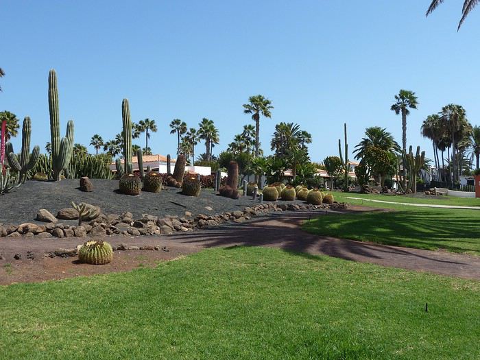

La promenade le long de la plage
-2-
Ce matin, nous avons rendez-vous avec notre loueur de voiture.
Belle journée en perspective donc, sauf que le loueur de voiture n'est pas du tout à l'heure pour le rendez-vous (plus d'une heure de retard), que la voiture qu'il nous amène n'est pas celle demandée (twingo au lieu de clio !), qu'elle affiche beaucoup de kilomètres (11300 kms au compteur !!!), qu'elle est franchement sale à l'extérieur comme à l'intérieur et qu'elle a de nombreux coups et autres rayures un peu partout. Nous perdons ainsi toute notre matinée à essayer de résoudre ce problème, sans résultat efficace (évidemment dans ce cas-là, il ne parle ni français, ni même anglais!), sauf qu'il nous propose de nous la changer pour le lendemain…
Bref !
Nous décidons quand même de partir pour le centre de l'île.
Nous prenons la direction de BETANCURIA. De chaque côté de la route c'est très beau. Dommage pour les photos, il y a un voile de brume qui perturbe quelque peu les abords de l'horizon… Mais le soleil est là, accompagné de son grand copain le vent qui ne souffle apparemment pas assez fort pour dégager cette intruse dans le tableau…

Le Cuchillos (625m) depuis la FV20

Sur la FV30
Sur la route, avant BETANCURIA, deux étapes intéressantes pour découvrir un magnifique panorama :
D'abord, un arrêt obligatoire au « mirador de Morro Velosa »! Il faut prendre un chemin sur la gauche sur environ 1 km (cet accès n'est ouvert que pendant les heures d'ouverture du mirador, c'est-à-dire du mardi au samedi entre 10 et 18h). En haut, c'est trop beau ! Mais difficile de rester dehors à cause du vent plutôt violent et… Gla-gla ! Heureusement, c'est très bien aménagé et il y a plein d'explications intéressantes concernant la géologie des lieux à l'intérieur. J'ai lu quelque part que ce mirador avait été conçu par César Manrique, architecte, peintre, sculpteur espagnol du XXe et grand défenseur de la nature de son île Lanzarote. Le panorama est vraiment superbe : on se croirait presque dans un pastel géant tout autour de nous ! Même la brume tenace rajoute une sorte de magie… lunaire au tableau ! C'est un paysage plutôt valonné et désertique et ce n'est pas pour nous déplaire, bien au contraire !
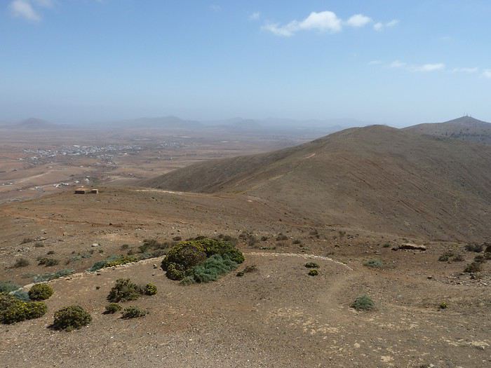


Nauplius sericeus (aster endémique de Fuerteventura)
Autre arrêt inévitable un peu plus loin sur la route : le « mirador Corrales de Guize » où nous trouvons deux immenses statues de Guanches (environ 4,50m de hauteur), les premiers hommes connus des îles. Ces deux statues sont l'oeuvre du sculpteur Emiliano Hernandez et se trouvent, apparemment, sur la ligne « frontière » des deux anciens royaumes. On aurait donc, à droite, le roi de Guize et, à gauche, le roi d'Ayoze.

Les Guanches : signifie « les hommes du grand volcan », nom donné aux premiers hommes des îles canariennes découverts par les premiers conquérants sur Ténérife. C'était un peuple de bergers et de guerriers qui vivait comme les hommes du néolithique et habitaient dans des grottes. Ils étaient connus pour être plutôt grands (au moins 1,80m) et blonds aux yeux bleux ! Au début du XVe siècle, il y avait 2 royaumes guanches (pas forcément les mêmes que sur Ténérife) qui se partageaient l'île : les Ayoze et les Guize, deux frères ennemis. Le roi de Guize régnait sur la partie nord de l'île, Maxorata et celui d'Ayoze sur la partie sud, Jandia. Au début du XVIe , après les massacres et les nombreuses déportations comme esclaves vers l'Europe, les Guanches furent finalement anéantis.
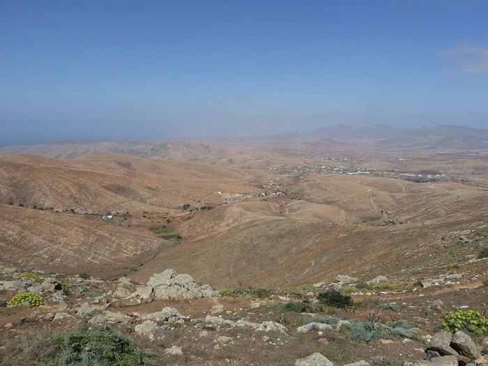 depuis le "mirador Corrales de Guize"
BETANCURIA :
C'est Jean de Bethencourt qui trouva cet endroit idéal, s'y installa en 1405 et lui donna son nom. Ce fut la capitale de l'île jusqu'en 1834. Elle fut mise à sac par les pirates européens ou marocains à plusieurs reprises.
On trouve une place de parking, à l'ombre, le long de la route et c'est à pied que nous montons visiter la partie historique de ce très joli petit village.

Belle église du XVIIe. Elle fut construite au XVe siècle, sur l'ordre de Jean de Béthencourt mais détruite au XVIe lors d'une incursion de pirates puis rebâtie au XVIIe. Seul le clocher est d'origine. Nous n'entrons pas à l'intérieur (fermé) mais remarquons la drôle de gargouille en bois sculpté et l'escalier plutôt raide du campanile (quasi à la verticale!)…


Jolie petite place ombragée avec une belle fontaine. Depuis cet endroit on a une vue originale sur l'église avec, à l'arrière, le sommet du Morro de la Cruz (676m).
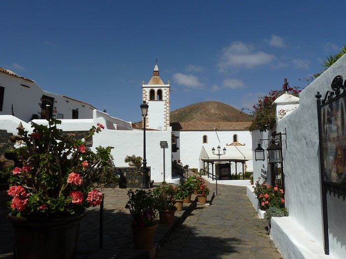
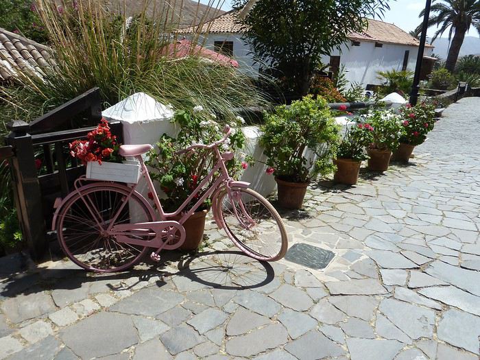
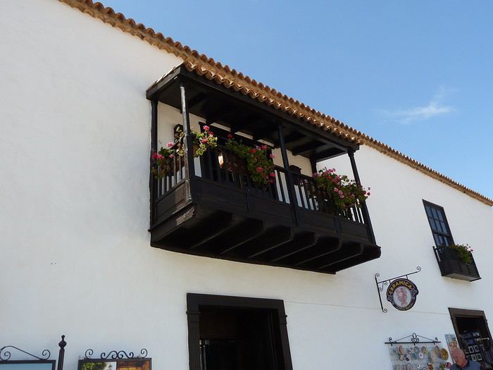
 Une oasis de verdure à Betancuria
C'est très agréable mais on en a vite fait le tour car c'est plutôt petit.
Cette île, au départ, ne méritait peut-être pas de s'y attarder plus que cela mais nous, nous avons beaucoup aimé !
Tout d'abord, quelques modestes lignes pour présenter ce magnifique archipel des Canaries composé de 7 îles espagnoles, qui se trouve dans l'Océan Atlantique, au large des côtes du Maroc (environ une centaine de kms pour Fuerteventura).
Fuerteventura, où nous allons séjourner pour la semaine, est la seconde plus grande île, après Ténérife mais l'une des moins peuplée. Toutes les îles sont d'origine volcanique mais chacune a sa propre particularité. Fuerteventura est la plus ancienne d'entre elles (20 millions d'années environ) et sera certainement la première à disparaître. Quant à ses plages, ce sont sans aucun doute les plus belles et les plus grandes de tout l'archipel.
Au début, les îles Canaries furent vraisemblablement peuplées par différentes populations venues d'Afrique du Nord, ensuite par des navigateurs Phéniciens, Egyptiens puis par les Carthaginois et les Romains. Platon y situera les vestiges de l'Atlantide, Juba II, roi de Namibie, fera une description de l'île au 1er siècle avant J.C. et Pline l'Ancien, s'inspirera de cette description et citera 2 des îles : Canaria pour le nombre important de chiens qui vivent à Grande Canarie et l'île Pourpre pour Fuerteventura en raison de sa couleur brune mais celle-ci portera également plusieurs autres noms dont Planaria, Herbania etc...
L'archipel tombe ensuite dans l'oubli et ce ne sera qu'à partir du XIIIe siècle que des aventuriers génois, portugais ou autres marins d'Europe du sud accostant sur l'île de Ténérife y découvriront les Guanches (les enfants du grand volcan) appelés également Majoreros, qui vivaient l�� depuis longtemps apparemment.
Même s'il y a beaucoup de vent à Fuerteventura, ce n'est pas la traduction de son nom. Fuerteventura s'appelait Fortaventure en français (dans le sens de forte bataille) mots qu'aurait prononcé un aventurier français, Jean de Béthencourt, en arrivant sur ses côtes à des fins de conquête en 1405. Et c'est lui qui lui donnera ainsi son nom actuel que l'Espagne conservera lorsqu'elle en prendra possession en 1424.
-1-
Après un vol matinal très agréable, nous atterrissons à PUERTO DEL ROSARIO, ville principale de FUERTEVENTURA !
Puis nous prenons la navette pour CALETA DES FUSTE que nous avons choisi pour sa situation géographique plutôt centrale. Cette première demi-journée est surtout dédiée à faire connaissance avec l'endroit où nous avons décidé de nous poser pour quelques jours car nous n'avons réservé notre voiture que pour le lendemain. Nous commençons donc par une balade autour de l'hôtel (notre chambre n'étant pas tout à fait prête) puis par le village construit uniquement pour le tourisme, où nous voulons nous restaurer un peu et, en fin d'après-midi, nous poursuivons par le bord de la très grande plage de sable blanc qui jouxte l'hôtel. Il fait très beau mais il y a beaucoup de vent. Il faut s'y habituer, c'est plutôt monnaie courante par ici surtout en cette période !
La plage depuis l'hôtel
Une partie de la plage côté port
La promenade le long de la plage
-2-
Ce matin, nous avons rendez-vous avec notre loueur de voiture.
Belle journée en perspective donc, sauf que le loueur de voiture n'est pas du tout à l'heure pour le rendez-vous (plus d'une heure de retard), que la voiture qu'il nous amène n'est pas celle demandée (twingo au lieu de clio !), qu'elle affiche beaucoup de kilomètres (11300 kms au compteur !!!), qu'elle est franchement sale à l'extérieur comme à l'intérieur et qu'elle a de nombreux coups et autres rayures un peu partout. Nous perdons ainsi toute notre matinée à essayer de résoudre ce problème, sans résultat efficace (évidemment dans ce cas-là, il ne parle ni français, ni même anglais!), sauf qu'il nous propose de nous la changer pour le lendemain…
Bref !
Nous décidons quand même de partir pour le centre de l'île.
Nous prenons la direction de BETANCURIA. De chaque côté de la route c'est très beau. Dommage pour les photos, il y a un voile de brume qui perturbe quelque peu les abords de l'horizon… Mais le soleil est là, accompagné de son grand copain le vent qui ne souffle apparemment pas assez fort pour dégager cette intruse dans le tableau…
Le Cuchillos (625m) depuis la FV20
Sur la FV30
Sur la route, avant BETANCURIA, deux étapes intéressantes pour découvrir un magnifique panorama :
D'abord, un arrêt obligatoire au « mirador de Morro Velosa »! Il faut prendre un chemin sur la gauche sur environ 1 km (cet accès n'est ouvert que pendant les heures d'ouverture du mirador, c'est-à-dire du mardi au samedi entre 10 et 18h). En haut, c'est trop beau ! Mais difficile de rester dehors à cause du vent plutôt violent et… Gla-gla ! Heureusement, c'est très bien aménagé et il y a plein d'explications intéressantes concernant la géologie des lieux à l'intérieur. J'ai lu quelque part que ce mirador avait été conçu par César Manrique, architecte, peintre, sculpteur espagnol du XXe et grand défenseur de la nature de son île Lanzarote. Le panorama est vraiment superbe : on se croirait presque dans un pastel géant tout autour de nous ! Même la brume tenace rajoute une sorte de magie… lunaire au tableau ! C'est un paysage plutôt valonné et désertique et ce n'est pas pour nous déplaire, bien au contraire !
Nauplius sericeus (aster endémique de Fuerteventura)
Autre arrêt inévitable un peu plus loin sur la route : le « mirador Corrales de Guize » où nous trouvons deux immenses statues de Guanches (environ 4,50m de hauteur), les premiers hommes connus des îles. Ces deux statues sont l'oeuvre du sculpteur Emiliano Hernandez et se trouvent, apparemment, sur la ligne « frontière » des deux anciens royaumes. On aurait donc, à droite, le roi de Guize et, à gauche, le roi d'Ayoze.
Les Guanches : signifie « les hommes du grand volcan », nom donné aux premiers hommes des îles canariennes découverts par les premiers conquérants sur Ténérife. C'était un peuple de bergers et de guerriers qui vivait comme les hommes du néolithique et habitaient dans des grottes. Ils étaient connus pour être plutôt grands (au moins 1,80m) et blonds aux yeux bleux ! Au début du XVe siècle, il y avait 2 royaumes guanches (pas forcément les mêmes que sur Ténérife) qui se partageaient l'île : les Ayoze et les Guize, deux frères ennemis. Le roi de Guize régnait sur la partie nord de l'île, Maxorata et celui d'Ayoze sur la partie sud, Jandia. Au début du XVIe , après les massacres et les nombreuses déportations comme esclaves vers l'Europe, les Guanches furent finalement anéantis.
depuis le "mirador Corrales de Guize"BETANCURIA :
C'est Jean de Bethencourt qui trouva cet endroit idéal, s'y installa en 1405 et lui donna son nom. Ce fut la capitale de l'île jusqu'en 1834. Elle fut mise à sac par les pirates européens ou marocains à plusieurs reprises.
On trouve une place de parking, à l'ombre, le long de la route et c'est à pied que nous montons visiter la partie historique de ce très joli petit village.
Belle église du XVIIe. Elle fut construite au XVe siècle, sur l'ordre de Jean de Béthencourt mais détruite au XVIe lors d'une incursion de pirates puis rebâtie au XVIIe. Seul le clocher est d'origine. Nous n'entrons pas à l'intérieur (fermé) mais remarquons la drôle de gargouille en bois sculpté et l'escalier plutôt raide du campanile (quasi à la verticale!)…
Jolie petite place ombragée avec une belle fontaine. Depuis cet endroit on a une vue originale sur l'église avec, à l'arrière, le sommet du Morro de la Cruz (676m).
Une oasis de verdure à BetancuriaC'est très agréable mais on en a vite fait le tour car c'est plutôt petit.
Découvertes pédestres au Cap Vert English translation pending
Voici déjà quelques semaines que nous sommes rentrés du Cap Vert et, enfin, notre carnet de voyages se précise...
Durant 3 semaines nous sommes partis à la découverte de quelques îles en alternant randonnées pédestres et parcours en voiture. Pour réserver les hébergements au cours des randonnées nous avions fait appel, avant le départ, à l'agence Nobai qui a été très réactive et efficace. Nous n'avons utilisé les services d'un guide que pour l'ascension du volcan Fogo. Pour les autres randonnées nous avons voyagé seuls sans aucune difficulté d'orientation.
15/02/2019 : Marseille-Lisbonne-Praia Pour tuer le temps entre 2 avions à Lisbonne nous faisons un petit tour au travers du parc des Nations créé, sur la rive du Tage, à l'occasion de l'exposition universelle en 1998. De l'aéroport, en 10 minutes de métro nous rejoignons la station Oriente, porte d'entrée du parc des Nations. Nous déambulons une partie de l'après-midi au cœur de ces constructions, parfois élégantes, parfois manquant de finesse mais toujours surprenantes. Nous reprenons le chemin de l'aéroport en fin de journée. A minuit (heure locale) nous descendons de l'avion accueillis par une douce chaleur tempérée par un vent assez fort. L'attente au contrôle des passeports sera relativement courte car nous avons eu la chance d'avoir des places à l'avant de l'avion. Le contrôle est rapide, l'enregistrement préalable sur internet pour payer la taxe de sécurité semble efficace et une fois les bagages récupérés nous retrouvons notre chauffeur qui nous conduit à l’hôtel. Le distributeur de billets de l'aéroport refuse obstinément notre carte Visa mais un guichet de change à coté nous dépanne.
Île de Santiago: côté mer, la houle permanente de l'Atlantique découpe la côte en une succession de criques et de plages. Évidemment, l'activité principale des petits ports est la pêche encore très artisanale. Côté montagne, l'origine volcanique du relief a découpé des crêtes acérées où se perchent de façon étonnante une multitude de hameaux. Des canyons escarpés dévalent jusqu'à la mer. Parfois au fond des vallées s'installent cocotiers et bananiers. Partout, la terre est aride : on se demande ce que vaches, chèvres et ânes trouvent à se mettre sous la dent. La canne à sucre profite du moindre petit lopin de terre suspendu et nous, nous profitons du « grogue », apéritif local au rhum et au citron !!!
16/02 : Praia – Tarrafal Le petit déjeuner est pris sur la terrasse de l’hôtel plutôt ventée. Nous sollicitons une voiture de location auprès de l’hôtel qui nous propose une Clio pour 55 € par jour. L'affaire est conclue et nous faisons un tour vers le DAB situé à 200 mètres. Ici, seule la carte Visa semble acceptée. La sortie de Praia est simple malgré une signalisation assez espacée mais en suivant attentivement la carte nous trouvons facilement notre chemin bien que le GPS du téléphone refuse absolument de fonctionner. La ville est étagée sur les collines avec de multiples constructions inachevées en tous sens. Après les derniers immeubles la route serpente dans un paysage d'une aridité totale. Le ciel reste voilé de lourds nuages chargés de poussière. Quelques rares chèvres, vaches et cochons efflanqués broutent au milieu des cailloux et les arbres décharnés semblent bousculés en permanence par le vent.
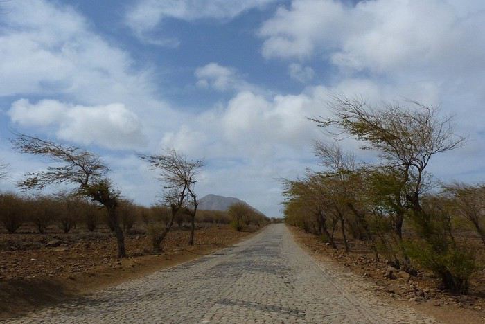 Nous croisons régulièrement des piétons qui circulent au bord de la route et les villages nombreux parsèment le paysage. Notre premier arrêt sera pour le petit port de Pedra Badejo.
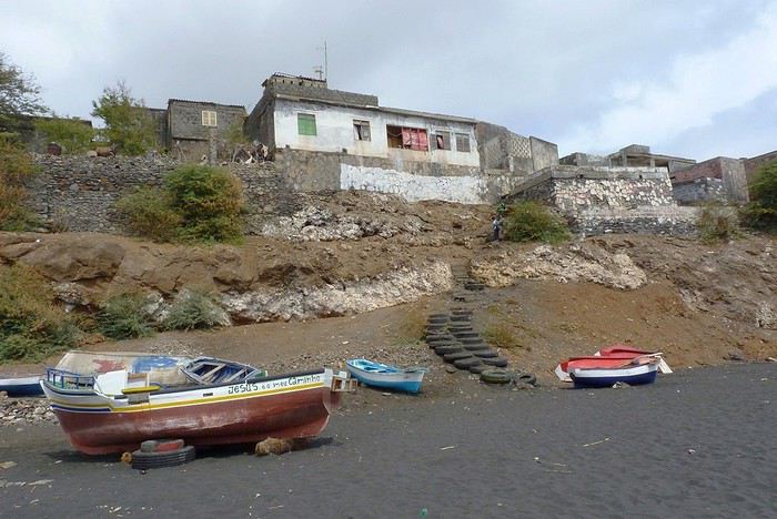 C'est la fin du marché au poissons à la suite du retour de pèche. Nous croisons de nombreux habitants qui ramènent parfois un seul poisson, parfois une bassine pleine portée par les femmes sur la tête.
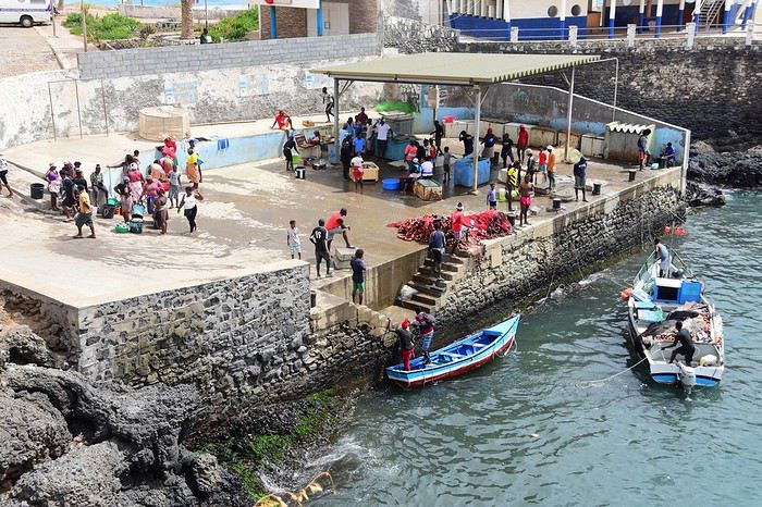
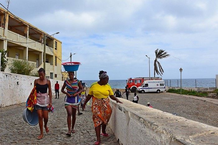
La mer est agitée et se fracasse en longs rouleaux sur le sable noir. Les bateaux de pêche colorés sont alignés au bord de l'eau. La route parcourt ensuite le bord de mer en franchissant de nombreux ravins au fond desquels poussent des vergers de bananiers et de cocotiers, oasis verdoyantes au cœur de ce paysage de pierre et de poussière. Un peu plus loin, la petite bourgade de Calheta de sao Miguel déploie ses façades peintes de fresques colorées tout autour du port et une petit place récemment aménagée avec des jeux d'enfants nous accueille pour un frugal pique nique de quelques biscuits accompagnant une banane et une mandarine.
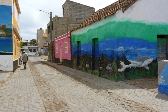
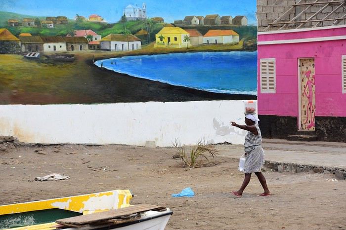
La route devient ensuite pavée jusque Tarrafal. Nous tournons un long moment à la recherche d'une chambre disponible : c'est samedi et nous découvrons que la plupart des hébergements sont complets en week-end. Finalement guidés par un cycliste aimablement pressenti par une dame serviable nous rejoignons une pension où il reste une petite chambre sans eau chaude dans la douche. En fin d'après-midi nous parcourons le plage au sable blanc au milieu des sombres roches volcaniques.
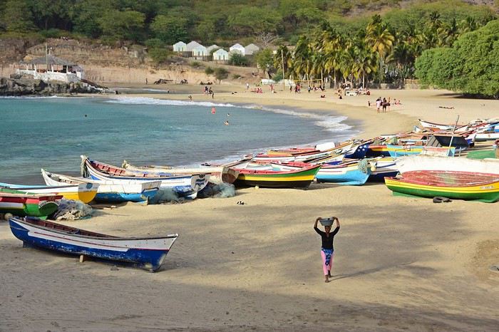 De hautes vagues déferlantes font le bonheur des baigneurs et, ici aussi, de nombreuses barques de pêcheurs décorent la plage de leurs couleurs variées.
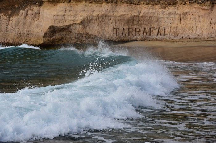
15/02/2019 : Marseille-Lisbonne-Praia Pour tuer le temps entre 2 avions à Lisbonne nous faisons un petit tour au travers du parc des Nations créé, sur la rive du Tage, à l'occasion de l'exposition universelle en 1998. De l'aéroport, en 10 minutes de métro nous rejoignons la station Oriente, porte d'entrée du parc des Nations. Nous déambulons une partie de l'après-midi au cœur de ces constructions, parfois élégantes, parfois manquant de finesse mais toujours surprenantes. Nous reprenons le chemin de l'aéroport en fin de journée. A minuit (heure locale) nous descendons de l'avion accueillis par une douce chaleur tempérée par un vent assez fort. L'attente au contrôle des passeports sera relativement courte car nous avons eu la chance d'avoir des places à l'avant de l'avion. Le contrôle est rapide, l'enregistrement préalable sur internet pour payer la taxe de sécurité semble efficace et une fois les bagages récupérés nous retrouvons notre chauffeur qui nous conduit à l’hôtel. Le distributeur de billets de l'aéroport refuse obstinément notre carte Visa mais un guichet de change à coté nous dépanne.
Île de Santiago: côté mer, la houle permanente de l'Atlantique découpe la côte en une succession de criques et de plages. Évidemment, l'activité principale des petits ports est la pêche encore très artisanale. Côté montagne, l'origine volcanique du relief a découpé des crêtes acérées où se perchent de façon étonnante une multitude de hameaux. Des canyons escarpés dévalent jusqu'à la mer. Parfois au fond des vallées s'installent cocotiers et bananiers. Partout, la terre est aride : on se demande ce que vaches, chèvres et ânes trouvent à se mettre sous la dent. La canne à sucre profite du moindre petit lopin de terre suspendu et nous, nous profitons du « grogue », apéritif local au rhum et au citron !!!
16/02 : Praia – Tarrafal Le petit déjeuner est pris sur la terrasse de l’hôtel plutôt ventée. Nous sollicitons une voiture de location auprès de l’hôtel qui nous propose une Clio pour 55 € par jour. L'affaire est conclue et nous faisons un tour vers le DAB situé à 200 mètres. Ici, seule la carte Visa semble acceptée. La sortie de Praia est simple malgré une signalisation assez espacée mais en suivant attentivement la carte nous trouvons facilement notre chemin bien que le GPS du téléphone refuse absolument de fonctionner. La ville est étagée sur les collines avec de multiples constructions inachevées en tous sens. Après les derniers immeubles la route serpente dans un paysage d'une aridité totale. Le ciel reste voilé de lourds nuages chargés de poussière. Quelques rares chèvres, vaches et cochons efflanqués broutent au milieu des cailloux et les arbres décharnés semblent bousculés en permanence par le vent.
Nous croisons régulièrement des piétons qui circulent au bord de la route et les villages nombreux parsèment le paysage. Notre premier arrêt sera pour le petit port de Pedra Badejo.
C'est la fin du marché au poissons à la suite du retour de pèche. Nous croisons de nombreux habitants qui ramènent parfois un seul poisson, parfois une bassine pleine portée par les femmes sur la tête.
La mer est agitée et se fracasse en longs rouleaux sur le sable noir. Les bateaux de pêche colorés sont alignés au bord de l'eau. La route parcourt ensuite le bord de mer en franchissant de nombreux ravins au fond desquels poussent des vergers de bananiers et de cocotiers, oasis verdoyantes au cœur de ce paysage de pierre et de poussière. Un peu plus loin, la petite bourgade de Calheta de sao Miguel déploie ses façades peintes de fresques colorées tout autour du port et une petit place récemment aménagée avec des jeux d'enfants nous accueille pour un frugal pique nique de quelques biscuits accompagnant une banane et une mandarine.
La route devient ensuite pavée jusque Tarrafal. Nous tournons un long moment à la recherche d'une chambre disponible : c'est samedi et nous découvrons que la plupart des hébergements sont complets en week-end. Finalement guidés par un cycliste aimablement pressenti par une dame serviable nous rejoignons une pension où il reste une petite chambre sans eau chaude dans la douche. En fin d'après-midi nous parcourons le plage au sable blanc au milieu des sombres roches volcaniques.
De hautes vagues déferlantes font le bonheur des baigneurs et, ici aussi, de nombreuses barques de pêcheurs décorent la plage de leurs couleurs variées.Les îles de l'Atlantique sur le Midnatsol (Hurtigruten) English translation pending
Bonjour
Depuis plusieurs années , nous cherchions une croisière faisant escale aux Açores .
Nous en avions trouvé une : celle du Divina pour son 1er retour en Europe , il y a
2 ou 3 ans mais n'avions pu donner suite .
Début Octobre dernier , notre Agence habituelle nous a invité à une réunion d'information sur les croisières proposées par Hurtigruten , compagnie essentiellement connue pour la desserte des ports norvégiens entre Bergen et Kirkenes ( l'Express Côtier ) En complément de ce service , Hurtigruten a élargi sa gamme en proposant des croisières d'exploration en période d'été vers l'Arctique et aussi l'Antarctique durant l'été austral .
Aucune de ces destinations ne nous " branchait " vraiment mais nous avons découvert dans la brochure remise lors de cette réunion que les bateaux remontant de l'Antarctique vers la Norvège faisaient une croisière de 2 semaines au départ de Lisbonne avec non pas une mais 3 escales aux Açores . 😏
Notre choix s'était porté sur un tout nouveau navire : le Roald Amundsen qui devait démarrer son activité à l'automne 2018 . Malheureusement , la mise au point de ce bateau est bien laborieuse puisqu'il est toujours en chantier ! Aie , notre projet tombait donc à l'eau Et bien non , car un second navire effectuait cette même croisière : le MS Midnatsol . Quelques différences notables : c'est un bateau déjà âgé ( plus de 15 ans ) , il n'y a pas de cabines balcon , la croisière a lieu un mois plus tôt puisqu'elle débute le 31 Mars . Mais puisque nous voulons voir les Açores , nous posons une option . Une petite pose avant de vous faire découvrir le bateau . Jean-Pierre
Début Octobre dernier , notre Agence habituelle nous a invité à une réunion d'information sur les croisières proposées par Hurtigruten , compagnie essentiellement connue pour la desserte des ports norvégiens entre Bergen et Kirkenes ( l'Express Côtier ) En complément de ce service , Hurtigruten a élargi sa gamme en proposant des croisières d'exploration en période d'été vers l'Arctique et aussi l'Antarctique durant l'été austral .
Aucune de ces destinations ne nous " branchait " vraiment mais nous avons découvert dans la brochure remise lors de cette réunion que les bateaux remontant de l'Antarctique vers la Norvège faisaient une croisière de 2 semaines au départ de Lisbonne avec non pas une mais 3 escales aux Açores . 😏
Notre choix s'était porté sur un tout nouveau navire : le Roald Amundsen qui devait démarrer son activité à l'automne 2018 . Malheureusement , la mise au point de ce bateau est bien laborieuse puisqu'il est toujours en chantier ! Aie , notre projet tombait donc à l'eau Et bien non , car un second navire effectuait cette même croisière : le MS Midnatsol . Quelques différences notables : c'est un bateau déjà âgé ( plus de 15 ans ) , il n'y a pas de cabines balcon , la croisière a lieu un mois plus tôt puisqu'elle débute le 31 Mars . Mais puisque nous voulons voir les Açores , nous posons une option . Une petite pose avant de vous faire découvrir le bateau . Jean-Pierre
Hôtel à Los Angeles? English translation pending
Bonjour à tous, je reviens vers vous pour une petite question ... le voyage approche, départ le 8 avril pour Los Angeles et une boucle de 17 jours...
J’ai réservé un hôtel à Los Angeles à 15 minutes de l’aéroport mais je me demandais s’il valait mieux essayer d’aller un peu plus loin le premier jour sachant qu’on va le lendemain sur la vallée de la mort... arrivée à Los Angeles en milieu d’apres midi...
merci de vos conseils ...
Question pratiques pour randonnée à Santo Antao en février English translation pending
Bonjour,
Je serai mi-février à Santo Antao pour randonner et je me pose quelques questions ‘pratiques’ :
Les prises électriques sont elles les mêmes qu’en France ou bien faut-il un adaptateur (je logerai parfois chez des particuliers) ?
Au niveau des tenues de rando pour février, c’est plutôt short et débardeur ou bien sweat et pantalon ?
La rando étant itinérante, est-il facile de se procurer des bouteilles d’eau dans les petites localités de Santo Antao ?
Faut il prévoir un répulsif particulier pour les insectes ? (5/5 convient-il ?)
Faut il se couvrir bras et jambes le soir en raison des insectes en février ?
Avez-vous des adresses de bons restaurants sur Mindelo pour gouter quelques spécialités ?
La traversée entre Mindelo et Porto Novo est-elle très ‘remuante’ ?
Tous vos trucs, astuces et bons conseils pour Mindelo et Santo Antao sont les bienvenus !
J’ai hâte d’y être !
Discussion autour du thème du mois de janvier 2019: "Que la montagne est belle" English translation pending
Comme dirait Solene, pour le « n’importe quoi, tout ce que vous voulez »,
C’est ici que ça se passe 😛
Concours Photo du mois de janvier 2019: "Que la montagne est belle" English translation pending
Bonjour à tous .
Tout d’abord, pas d’inquiétude, je ne fais pas d’insomnie post réveillon, il est bientôt 10h de la terrasse de la Homestay à Udaipur d’ou je vous écris, le soleil commence à réchauffer la terre et les oiseaux s’en donne à cœur joie .... Bon j’avoue, de la brume il n’y en a pas que dans la plaine, mon crâne l’est encore un peu ....
Permettez-moi de vous souhaiter à tous mes meilleurs vœux pour cette nouvelle année, qu’elle soit remplie de bonnes choses pour tous, et surtout de beaux voyages !
Vous l’avez compris, puisque ma victoire m’octroie l’honneur de démarrer cette nouvelle année par un nouveau concours, j’ai décidé, et j’avoue que la vidéo postée par notre ami obeo de la chanson de Jean Ferrat m’a inspiré, de faire preuve d’un peu de chauvinisme...
Le thème du concours sera donc « Que la montagne est belle » . En hiver ou en été, de chez nous ou d’ailleurs, je veux voir des sommets !! Et pour corser un peu le tout, et comme c’est moi qui décide 😉, il faudra qu’on retrouve, à l’instar du thème de Solene, une présence humaine dans votre photo Essayons d'éviter tout de même la file de votre dernière remontée mécanique à Chamonix, mais il faut que l’humain soit présent sur votre cliché.
Le concours démarre donc right now, et la date limite pour poster vos photos est fixée au vendredi 18 à 23.59 Vote du samedi 19 0h01 jusqu’au samedi 26 janvier 23h59 et j’essaierais d’etre au rendez-vous le 27 ( 28 au plus tard, promis)
Comme d’hab, 3 photos maxi, numérotées et légendés, si possible dans 3 messages .
Pour les discussions, hors sujet et vidéos, c’est là : https://voyageforum.com/discussion/discussion-autour-theme-mois-janvier-2019-que-montagne-est-belle-d9264140/
Et pour le diaporama, si quelq’un peut m’aider ....😕
Voilà, je crois j’ai tout bon, enfin, j’ai essayé... Alors, à vous de nous faire grimper au sommet ! Namaste !
Ça, c’etait mon réveillon et croyez-moi, ça a envoyé du bois ! 😊
Permettez-moi de vous souhaiter à tous mes meilleurs vœux pour cette nouvelle année, qu’elle soit remplie de bonnes choses pour tous, et surtout de beaux voyages !
Vous l’avez compris, puisque ma victoire m’octroie l’honneur de démarrer cette nouvelle année par un nouveau concours, j’ai décidé, et j’avoue que la vidéo postée par notre ami obeo de la chanson de Jean Ferrat m’a inspiré, de faire preuve d’un peu de chauvinisme...
Le thème du concours sera donc « Que la montagne est belle » . En hiver ou en été, de chez nous ou d’ailleurs, je veux voir des sommets !! Et pour corser un peu le tout, et comme c’est moi qui décide 😉, il faudra qu’on retrouve, à l’instar du thème de Solene, une présence humaine dans votre photo Essayons d'éviter tout de même la file de votre dernière remontée mécanique à Chamonix, mais il faut que l’humain soit présent sur votre cliché.
Le concours démarre donc right now, et la date limite pour poster vos photos est fixée au vendredi 18 à 23.59 Vote du samedi 19 0h01 jusqu’au samedi 26 janvier 23h59 et j’essaierais d’etre au rendez-vous le 27 ( 28 au plus tard, promis)
Comme d’hab, 3 photos maxi, numérotées et légendés, si possible dans 3 messages .
Pour les discussions, hors sujet et vidéos, c’est là : https://voyageforum.com/discussion/discussion-autour-theme-mois-janvier-2019-que-montagne-est-belle-d9264140/
Et pour le diaporama, si quelq’un peut m’aider ....😕
Voilà, je crois j’ai tout bon, enfin, j’ai essayé... Alors, à vous de nous faire grimper au sommet ! Namaste !
Ça, c’etait mon réveillon et croyez-moi, ça a envoyé du bois ! 😊